This is a modern-English version of A Book of Discovery: The History of the World's Exploration, From the Earliest Times to the Finding of the South Pole, originally written by Synge, M. B. (Margaret Bertha).
It has been thoroughly updated, including changes to sentence structure, words, spelling,
and grammar—to ensure clarity for contemporary readers, while preserving the original spirit and nuance. If
you click on a paragraph, you will see the original text that we modified, and you can toggle between the two versions.
Scroll to the bottom of this page and you will find a free ePUB download link for this book.

|
| PTOLEMY'S MAP OF THE WORLD, ORIGINALLY DRAWN ABOUT A.D. 150. |
| From the first printed edition of 1472 (the first book to have printed maps) and the famous Rome edition of 1508. It is only necessary to compare this map with the mythical geography represented in a mediæval map such as the Hereford map of the world, made eleven centuries later to recognise the extraordinary accuracy and scientific value of Ptolemy's geography. |
A BOOK OF DISCOVERY
THE HISTORY OF THE WORLD'S EXPLORATION, FROM THE EARLIEST TIMES TO THE FINDING OF THE SOUTH POLE
By M. B. SYNGE, F.R.Hist.S.
"A SHORT HISTORY OF SOCIAL LIFE IN ENGLAND" ETC.

|
|
THE GOLDEN HIND (From the Chart of "Drake's Voyages") |
35 PATERNOSTER ROW, E.C., & EDINBURGH
INTRODUCTION
Such was the spirit in which the exploration of the world was accomplished. It was the inspiration that carried men of old far beyond the sunrise into those magic and silent seas whereon no boat had ever sailed. It is the incentive of those to-day with the wander-thirst in their souls, who travel and suffer in the travelling, though there are fewer prizes left to win. But
Such was the spirit in which the exploration of the world was accomplished. It was the inspiration that pushed the men of the past far beyond the sunrise into those magical and silent seas where no boat had ever sailed. It is the motivation for those today who have a thirst for adventure in their souls, who travel and endure hardships during their journeys, even though there are fewer rewards left to achieve. But
|
"The reward is in the doing, And the rapture of pursuing Is the prize." |
"To travel hopefully," says Stevenson, "is a better thing than to arrive." This would explain the fact that this Book of Discovery has become a record of splendid endurance, of hardships bravely borne, of silent toil, of courage and resolution unequalled in the annals of mankind, of self-sacrifice unrivalled and faithful lives laid ungrudgingly down. Of the many who went forth, the few only attained. It is of these few that this book tells.
"To travel with hope," says Stevenson, "is better than to arrive." This explains why this Book of Discovery has become a record of amazing endurance, of hardships faced with courage, of silent effort, of bravery and determination unmatched in history, of selflessness and devoted lives willingly given up. Out of many who set out, only a few succeeded. This book focuses on those few.
"All these," says the poet in Ecclesiastes—"all these were honoured in their generation, and were the glory of their times ... their name liveth for evermore."
"All these," says the poet in Ecclesiastes—"all these were honored in their time, and were the pride of their era ... their name lives on forever."
But while we read of those master-spirits who succeeded, let us never forget those who failed to achieve.
But as we read about those great individuals who succeeded, let's not forget those who didn't achieve their goals.
Enthusiasm too was the secret of their success. Among the best of crews there was always some one who would have turned back, but the world would never have been explored had it not been for those finer spirits who resolutely went on—even to the death.
Enthusiasm was also the secret of their success. Even among the best crews, there was always someone who would have turned back, but the world would never have been explored if it weren't for those exceptional individuals who boldly pressed on—even to the end.
This is what carried Alexander the Great to the "earth's utmost verge," that drew Columbus across the trackless Atlantic, that nerved Vasco da Gama to double the Stormy Cape, that induced Magellan to face the dreaded straits now called by his name, that made it possible for men to face without flinching the ice-bound regions of the far North.
This is what drove Alexander the Great to the "earth's utmost verge," what led Columbus to sail across the vast Atlantic, what motivated Vasco da Gama to navigate around the Stormy Cape, what encouraged Magellan to brave the treacherous straits now named after him, and what allowed people to confront the icy corners of the far North without fear.
"There is no land uninhabitable, nor sea unnavigable," asserted the men of the sixteenth century, when England set herself to take possession of her heritage in the North. Such an heroic temper could overcome all things. But the cost was great, the sufferings intense.
"There is no land that can't be settled, nor sea that can't be navigated," claimed the men of the sixteenth century, as England aimed to claim her heritage in the North. Such a brave spirit could conquer anything. But the price was high, and the suffering was severe.
"Having eaten our shoes and saddles boiled with a few wild herbs, we set out to reach the kingdom of gold," says Orellana in 1540.
"After eating our shoes and saddles boiled with some wild herbs, we set out to reach the land of gold," says Orellana in 1540.
"We ate biscuit, but in truth it was biscuit no longer, but a powder full of worms,—so great was the want of food, that we were forced to eat the hides with which the mainyard was covered; but we had also to make use of sawdust for food, and rats became a great delicacy," related Magellan, as he led his little ship across the unknown Pacific.
"We ate biscuits, but honestly, they weren't really biscuits anymore; they had turned into a powder full of worms. Our food supply was so low that we had to eat the hides from the mainyard, and we even resorted to sawdust for food. Rats became a real delicacy," Magellan said as he navigated his small ship across the uncharted Pacific.
Again, there is Franklin returning from the Arctic coast, and stilling the pangs of hunger with "pieces of singed hide mixed with lichen," varied with "the horns and bones of a dead deer fried with some old shoes."
Again, there’s Franklin coming back from the Arctic coast, fighting off hunger with "bits of burnt hide mixed with lichen," alongside "the horns and bones of a dead deer cooked with some old shoes."
The dangers of the way were manifold.
The dangers of the journey were numerous.
For the early explorers had no land map or ocean chart to guide them, there were no lighthouses to warn the strange mariner of dangerous coast and angry surf, no books of travel to relate the weird doings of fierce and inhospitable savages, no tinned foods to prevent the terrible scourge of sailors, scurvy. In their little wooden sailing ships the men of old faced every conceivable danger, and surmounted obstacles unknown to modern civilisation.
For the early explorers didn’t have land maps or ocean charts to guide them. There were no lighthouses to alert sailors of dangerous coasts and rough seas, no travel books to describe the strange behaviors of fierce and hostile natives, and no canned food to protect against the terrible disease of scurvy. In their small wooden sailing ships, those men faced every kind of danger and overcame obstacles that are unknown to modern civilization.
|
"Now strike your Sails ye jolly Mariners, For we be come into a quiet Rode." |
For the most part we are struck with the light-heartedness of the olden sailor, the shout of gladness with which men went forth on these hazardous undertakings, knowing not how they would arrive, or what might befall them by the way, went forth in the smallest of wooden ships, with the most incompetent of crews, to face the dangers of unknown seas and unsuspected lands, to chance the angry storm and the hidden rock, to discover inhospitable shores and savage foes. Founded on bitter experience is the old saying—
For the most part, we are impressed by the carefree attitude of the old sailors, the joy with which they set out on these risky ventures, not knowing how they would get there or what might happen along the way. They left in tiny wooden ships, with the least skilled crews, to confront the dangers of uncharted waters and unknown lands, to brave the fierce storms and hidden rocks, to discover unwelcoming shores and hostile enemies. Based on harsh experiences is the old saying—
For the early navigators knew little of the art of navigation.
For the early explorers knew very little about navigation.
Pytheas, who discovered the British Isles, was "a great mathematician." Diego Cam, who sailed to the mouth of the Congo, was "a knight of the King's household." Sir Hugh Willoughby, "a most valiant gentleman." Richard Chancellor, "a man of great estimation for many good parts of wit in him." Anthony Jenkinson, a "resolute and intelligent gentleman." Sir Walter Raleigh, an Elizabethan courtier, and so forth.
Pytheas, who discovered the British Isles, was "a great mathematician." Diego Cam, who sailed to the mouth of the Congo, was "a knight of the King's household." Sir Hugh Willoughby, "a very brave gentleman." Richard Chancellor, "a man highly regarded for his cleverness." Anthony Jenkinson, "a determined and smart gentleman." Sir Walter Raleigh, an Elizabethan courtier, and so on.
It has been obviously impossible to include all the famous names that belong to the history of exploration. Most of these explorers have been chosen for some definite new discovery, some addition to the world's geographical knowledge, or some great feat of endurance which may serve to brace us to fresh effort as a nation famous for our seamen. English navigators have been afforded the lion's share in the book, partly because they took the lion's share in exploring, partly because translations of foreign travel are difficult to transcribe. Most of these stories have been taken from original sources, and most of the explorers have been allowed to tell part of their own story in their own words.
It has clearly been impossible to include all the well-known figures in the history of exploration. Most of these explorers were selected for a specific new discovery, a contribution to the world’s geographical knowledge, or a remarkable act of endurance that can inspire us to strive harder as a nation known for its sailors. English navigators have been given the majority of attention in this book, partly because they played a major role in exploration, and partly because translations of foreign travel narratives can be hard to work with. Most of these accounts have been sourced from original materials, and many of the explorers have been allowed to share parts of their stories in their own words.
Perhaps the most graphic of all explorations is that written by a native of West Australia, who accompanied an exploring party searching for an English lad named Smith, who had been starved to death.
Perhaps the most vivid of all accounts is that written by a native of Western Australia, who joined an exploration team looking for an English boy named Smith, who had died from starvation.
"Away, away, away, away; we reach the water of Djunjup; we shoot game. Away, away, away through a forest away, through a forest away; we see no water. Through a forest away, along our tracks away; hills ascending, then pleasantly away, away, through a forest away. We see a water—along the river away—a short distance we go, then away, away, away through a forest away. Then along another river away, across the river away. Still we go onwards, along the sea away, through the bush away, then along the sea away. We sleep near the sea. I see Mr. Smith's footsteps ascending a sandhill; onwards I go regarding his footsteps. I see Mr. Smith dead. Two sleeps had he been dead; greatly did I weep, and much I grieved. In his blanket folding him, we scraped away the earth. The sun had inclined to the westward as we laid him in the ground."
"Away, away, away, away; we reach the water of Djunjup; we hunt for food. Away, away, away through a forest, away, through a forest, away; we see no water. Through a forest, away, along our tracks, away; hills rising, then pleasantly away, away, through a forest, away. We see water—along the river, away—a short distance we go, then away, away, away through a forest, away. Then along another river, away, across the river, away. Still we move onward, along the sea, away, through the bush, away, then along the sea, away. We sleep near the sea. I see Mr. Smith's footprints going up a sand dune; onward I go, following his footsteps. I see Mr. Smith dead. He had been dead for two nights; I cried a lot, and I was deeply saddened. In his blanket, we wrapped him, and we dug away the earth. The sun had started to set as we laid him in the ground."
The book is illustrated with reproductions from old maps—old primitive maps, with a real Adam and Eve standing in the Garden of Eden, with Pillars of Hercules guarding the Straits of Gibraltar, with Paradise in the east, a realistic Jerusalem in the centre, the island of Thule in the north, and St. Brandon's Isles of the Blest in the west.
The book features images of old maps—simple, ancient maps, showcasing a genuine Adam and Eve in the Garden of Eden, the Pillars of Hercules protecting the Straits of Gibraltar, Paradise to the east, a detailed Jerusalem at the center, the island of Thule to the north, and St. Brandon's Isles of the Blessed to the west.
Beautifully coloured were the maps of the Middle Ages, "joyous charts all glorious with gold and vermilion, compasses and crests and flying banners, with mountains of red and gold." The seas are full of ships—"brave beflagged vessels with swelling sails." The land is ablaze with kings and potentates on golden thrones under canopies of angels. While over all presides the Madonna in her golden chair.
Beautifully colored were the maps of the Middle Ages, "joyful charts all glorious with gold and bright red, compasses and crests and flying banners, with mountains of red and gold." The seas are full of ships—"brave flag-bearing vessels with billowing sails." The land is alive with kings and rulers on golden thrones under canopies of angels. While above all, the Madonna sits in her golden chair.
The Hereford Mappa Mundi, drawn in the thirteenth century on a fine sheet of vellum, circular in form, is among the most interesting of the mediæval maps. It must once have been gorgeous, with its gold letters and scarlet towns, its green seas and its blue rivers. The Red Sea is still red, but the Mediterranean is chocolate brown, and all the green has disappeared. The mounted figure in the lower right-hand corner is probably the author, Richard de Haldingham. The map is surmounted by a representation of the Last Judgment, below which is Paradise as a circular island, with the four rivers and the figures of Adam and Eve. In the centre is Jerusalem. The world is divided into three—Asia, "Affrica," and Europe. Around this earth-island flows the ocean. America is, of course, absent; the East is placed at Paradise and the West at the Pillars of Hercules. North and South are left to the imagination.
The Hereford Mappa Mundi, created in the thirteenth century on a fine sheet of vellum, shaped like a circle, is one of the most fascinating medieval maps. It must have been stunning, with its gold letters and red towns, its green seas, and its blue rivers. The Red Sea is still red, but the Mediterranean is a chocolate brown, and all the green has vanished. The mounted figure in the lower right corner is likely the creator, Richard de Haldingham. The map features a depiction of the Last Judgment at the top, with Paradise shown as a circular island below, complete with the four rivers and the figures of Adam and Eve. In the center is Jerusalem. The world is divided into three parts—Asia, "Affrica," and Europe. Surrounding this earth-island is the ocean. America is obviously absent; the East is positioned at Paradise and the West at the Pillars of Hercules. North and South are left to the imagination.
And what of the famous map of Juan de la Cosa, once pilot to Columbus, drawn in the fifteenth century, with St. Christopher carrying the infant Christ across the water, supposed to be a portrait of Christopher Columbus carrying the gospel to America? It is the first map in which a dim outline appears of the New World.
And what about the famous map by Juan de la Cosa, who was once a navigator for Columbus, created in the fifteenth century? It features St. Christopher carrying the infant Christ across the water, which is thought to represent Christopher Columbus bringing the gospel to America. This is the first map where a vague outline of the New World can be seen.
The early maps of "Apphrica" are filled with camels and unicorns, lions and tigers, veiled figures and the turrets and spires of strange buildings—
The early maps of "Apphrica" are filled with camels and unicorns, lions and tigers, veiled figures and the turrets and spires of strange buildings—
|
"Geographers in Afric maps With savage pictures fill their gaps." |
"Surely," says a modern writer,—"surely the old cartographer was less concerned to fill his gaps than to express the poetry of geography."
"Surely," says a modern writer,—"surely the old mapmaker was less focused on filling in his blanks than on capturing the beauty of geography."
And to-day, there are still gaps in the most modern maps of Africa, where one-eleventh of the whole area remains unexplored. Further, in Asia the problem of the Brahmaputra Falls is yet unsolved; there are shores untrodden and rivers unsurveyed.
And today, there are still gaps in the most modern maps of Africa, where one-eleventh of the entire area remains unexplored. Additionally, in Asia, the issue of the Brahmaputra Falls is still unresolved; there are uncharted shores and unsurveyed rivers.
"God hath given us some things, and not all things, that our successors also might have somewhat to do," wrote Barents in the sixteenth century. There may not be much left, but with the words of Kipling's Explorer we may fitly conclude—
"God has given us some things, but not everything, so that those who come after us might have something to do," wrote Barents in the sixteenth century. There may not be much left, but with the words of Kipling's Explorer we may fittingly conclude—
|
"Something hidden. Go and find it. Go and look behind the Ranges— Something lost behind the Ranges. Lost and waiting for you. Go!" |
Thanks are due to Mr. S. G. Stubbs for valuable assistance in the selection and preparation of the illustrations, which, with few exceptions, have been executed under his directions.
Thanks to Mr. S. G. Stubbs for his valuable help in selecting and preparing the illustrations, which, with a few exceptions, have been created under his guidance.
CONTENTS
COLOURED ILLUSTRATIONS
| Ptolemy's Map of the World about A.D. 150 | |
| Taken from the first printed edition of 1472 and the Rome edition of 1508. | |
| The Polos leaving Venice for their Travels to the Far East | |
| From a Miniature at the head of a late 14th century MS. of the Travels of Marco Polo, in the Bodleian Library, Oxford. | |
| The Hereford Mappa Mundi of 1280 | |
| The original, made by RICHARD DE HALDINGHAM, Prebendary of Hereford, hangs in the Chapter House Library, Hereford Cathedral. | |
| Map of the World drawn in 1500, the first to show America | |
| By JUAN DE LA COSA. | |
| The Dauphin Map of the World | |
| Made by PIERRE DESCELLIERS 1546, by order of Francis I. for the Dauphin (Henri II.) of France. | |
| Barents's Ship among the Arctic Ice | |
| From a coloured woodcut in Barents's Three Voyages (De Veer), published in 1598. | |
| Ross's Winter Quarters in Felix Harbour | |
| The First Communication With Eskimos at Boothia Felix, 1830 | |
| From Drawings by ROSS in the Narrative of his Expedition to the North Magnetic Pole, A Second Voyage in Search of a North-West Passage, 1829-33. | |
| Shackleton's Ship, the Nimrod, among the Ice in McMurdo Sound | |
| From The Heart of the Antarctic (published by Heinemann), by kind permission of Sir ERNEST SHACKLETON. | |
BLACK & WHITE ILLUSTRATIONS
Acknowledgment is due to the courtesy of Mr. John Murray and the Illustrated London News for the photograph taken at the South Pole; to Admiral Peary for that taken at the North Pole; and to Sir Ernest Shackleton and Mr. Heinemann for the colour-plate of the Nimrod. Permissions have also been granted by Mr. John Murray (for illustrations from Livingstone's books and Admiral McClintock's Voyage of the Fox); by Messrs. Macmillan (for the colour-plate of the Polos leaving Venice, from the Bodleian); and by Messrs. Sampson, Low, Marston, & Co. (for illustrations from Sir H. M. Stanley's books).
A big thank you goes to Mr. John Murray and the Illustrated London News for the photograph taken at the South Pole; to Admiral Peary for the one taken at the North Pole; and to Sir Ernest Shackleton and Mr. Heinemann for the color plate of the Nimrod. Permissions have also been granted by Mr. John Murray (for illustrations from Livingstone's books and Admiral McClintock's Voyage of the Fox); by Messrs. Macmillan (for the color plate of the Polos leaving Venice, from the Bodleian); and by Messrs. Sampson, Low, Marston, & Co. (for illustrations from Sir H. M. Stanley's books).
LIST OF ILLUSTRATIONS IN THE TEXT
| The Garden of Eden with its Four Rivers | |
| From the Hereford Map of the World. | |
| Babylonian Map of the World on Clay | |
| In the British Museum. | |
| The oldest known Ships: between 6000 and 5000 B.C. | |
| From a pre-Egyptian Vase-painting. | |
| Egyptian Ship of the Expedition to Punt, about 1600 B.C. | |
| From a Rock-carving at Der el Bahari. | |
| The Ark on Ararat, and the Cities of Nineveh and Babylon | |
| From LEONARDO DATI'S Map of 1422. | |
| A Phoenician Ship, about 700 B.C. | |
| From a Bas-relief at Nineveh. | |
| Map of the Voyage of the Argonauts | |
| The Pillars of Hercules, as shown in a Mediæval Map | |
| HIGDEN'S Map of the World. 1360 A.D. | |
| The Pillars of Hercules, as shown in the Anglo-Saxon Map of the World, 10th century | |
| A Greek Galley, about 500 B.C. | |
| From a Vase-painting. | |
| Jerusalem, the Centre of the World | |
| From the Hereford Map of the World, 13th century. | |
| A Merchant-Ship of Athens, about 500 B.C. | |
| From a Vase-painting. | |
| The Coast of Africa, after Ptolemy (Mercator's Edition), showing Hanno's Voyage | |
| A Sketch Map of Alexander's Chief Exploratory Marches from Athens to Hyderabad and Gaza | |
| Alexandria in Pizzigani's Map, 14th century | |
| North Britain and the Island of Thule | |
| From MERCATOR'S edition of Ptolemy's Map. | |
| A Portion of an old Roman Map of the World, showing the roads through the Empire | |
| From the Peutinger Table. | |
| The World-Island according to Strabo, 18 A.D. | |
| Hull of a Roman Merchant-Ship | |
| From a Roman model at Greenwich. | |
| A Roman Galley, about 110 A.D. | |
| From Trajan's Column at Rome. | |
| The First Stages of a Mediæval Pilgrimage, London to Dover | |
| From MATTHEW OF PARIS'S Itinerary, 13th century. | |
| Jerusalem and the East | |
| From MATTHEW OF PARIS'S Itinerary, 13th century. | |
| Ireland and St. Brandon's Isle | |
| From the Catalan Map, 1375. | |
| The Mysterious Isle of St. Brandon | |
| From MARTIN BEHAIM'S Map, 1492. | |
| The World-Map of Cosmas, 6th century | |
| The oldest Christian Map. | |
| The Mountain of Cosmas | |
| A Viking Ship | |
| From Professor MONTELIUS'S book on Scandinavian archæology. | |
| A Khalif on his Throne | |
| From the Ancona Map, 1497. | |
| A Chinese Emperor giving Audience, 9th century | |
| From an old Chinese MS. at Paris. | |
| The Scene of Sindbad's Voyages | |
| From EDRISI'S Map, 1154. | |
| Sindbad's Giant Roc | |
| From an Oriental Miniature Painting. | |
| Jerusalem and the Pilgrims' Ways to it, 12th century | |
| From a Map of the 12th century at Brussels. | |
| Two Emperors of Tartary | |
| From the Catalan Map, 1375. | |
| A Tartar Camp | |
| From the Borgian Map, 1453. | |
| Initial Letter from the MS. of Rubruquis at Cambridge | |
| How the Brothers Polo set out from Constantinople with their nephew Marco for China | |
| From a Miniature Painting in 14th century Livre des Merveilles. | |
| Marco Polo lands at Ormuz | |
| From a Miniature in the Livre des Merveilles. | |
| Kublai Khan | |
| From an old Chinese Encyclopædia at Paris. | |
| Marco Polo | |
| From a Woodcut in the first printed edition of MARCO POLO'S Travels, 1477. | |
| A Japanese Fight against the Chinese at the time when Marco Polo first saw the Japanese | |
| From an ancient Japanese Painting. | |
| Sir John Mandeville on his Travels | |
| From a MS. in the British Museum. | |
| An Emperor of Tartary | |
| From the Map ascribed to SEBASTIAN CABOT, 1544. | |
| A Caravan in Cathay | |
| From the Catalan Map, 1375. | |
| The Turin Map of the World, 8th century | |
| A T-map, 10th century | |
| A T-map, 13th century | |
| The Kaiser holding the World | |
| From a 12th-century MS. | |
| The "Anglo-Saxon" Map of the World, drawn about 990 A.D. | |
| From the Cotton MSS. in the British Museum. | |
| Africa—from Ceuta to Madeira | |
| From FRA MAURO'S Map, 1457. | |
| The Voyage to Cape Blanco from Cape Bojador | |
| From FRA MAURO'S Map, 1457. | |
| A Portion of Africa illustrating Cadamosto's Voyage beyond Cape Blanco | |
| From FRA MAURO'S Map, 1457. | |
| Sketch of Africa | |
| From FRA MAURO'S Map of the World, 1457. | |
| Negro Boys | |
| From CABOT'S Map, 1544. | |
| The West Coast of Africa | |
| From MARTIN BEHAIM'S Map, 1492. | |
| The Parting of Columbus with Ferdinand and Isabella, 3rd August 1492 | |
| From DE BRY'S account of the Voyages to India, 1601. | |
| Columbus's Ship, the Santa Maria | |
| From a Woodcut of 1493, supposed to be after a Drawing by COLUMBUS. | |
| Columbus landing on Hispaniola | |
| From a Woodcut of 1494. | |
| The first Representation of the People of the New World | |
| From a Woodcut published at Augsburg between 1497 and 1504. | |
| The Town of Isabella and the Colony founded by Columbus | |
| From a Woodcut of 1494. | |
| Vasco da Gama | |
| From a contemporary Portrait. | |
| Africa as it was known after da Gama's Expeditions | |
| From JUAN DE LA COSA'S Map of 1500. | |
| Calicut and the Southern Indian Coast | |
| From JUAN DE LA COSA'S Map, 1500. | |
| The Malabar Coast | |
| From FRA MAURO'S Map. | |
| A Ship of Albuquerque's Fleet | |
| From a very fine Woodcut in the British Museum. | |
| A Ship of Java and the China Seas in the 16th century | |
| From LINSCHOTEN'S Navigatio ac Itinerarium, 1598. | |
| One of the first Maps of the Pacific | |
| From DIEGO RIBERO'S Map, 1529. | |
| Magellan's Fleet | |
| From MERCATOR'S Mappe Monde, 1569. | |
| A Ship of the 16th century | |
| From AMORETTI'S translation of Magellan's Voyage round the World. | |
| "Hondius his Map of the Magellan Streight" | |
| From a Map by JODOCUS HONDIUS, about 1590. | |
| The first Ship that sailed round the World | |
| Magellan's Victoria, from HULSIUS'S Collection of Voyages, 1602. | |
| Hernando Cortes, Conqueror of Mexico | |
| After the original Portrait at Mexico. | |
| The Battles of the Spaniards in Mexico | |
| From an ancient Aztec Drawing. | |
| Pizarro | |
| From the Portrait at Cuzco. | |
| Peru and South America | |
| From the Map of the World, 1544, usually ascribed to SEBASTIAN CABOT. | |
| Peruvian Warriors of the Inca Period | |
| From an ancient Peruvian Painting. | |
| Part of North America, showing Sebastian Cabot's Voyage to Newfoundland | |
| From the Map of 1544, usually ascribed to CABOT. | |
| Jacques Cartier | |
| From an old Pen-drawing at the Bibliothèque Nationale, Paris. | |
| Canada and the River St. Lawrence, showing Quebec | |
| From LESCARBOT'S Histoire de la Nouvelle France, 1609. | |
| New France, showing Newfoundland, Labrador, and the St. Lawrence | |
| From JOCOMO DI GASTALDI'S Map, about 1550. | |
| Ivan Vasiliwich, King of Muscovie | |
| From an old Woodcut. | |
| Anthony Jenkinson's Map of Russia, Muscovy, and Tartary | |
| Published in 1562. | |
| Greenlanders as seen by Martin Frobisher | |
| From Captain BESTE'S Account of Frobisher's Voyages, 1578. | |
| Sir Francis Drake | |
| From HOLLAND'S Heroologia, 1620. | |
| The Silver Map of the World | |
| From Medallion in British Museum. | |
| The Silver Map of the World | |
| From Medallion in British Museum. | |
| The Golden Hind at New Albion | |
| From the Chart of Drake's Voyages. | |
| The Golden Hind at Java | |
| From the Chart of Drake's Voyages. | |
| An Eskimo | |
| From a Water-colour Drawing by JOHN WHITE, about 1585. | |
| A Ship of the late 16th century | |
| From Ortelius, 1598. | |
| Nova Zembla and the Arctic Regions | |
| From a Map in DE BRY'S Grands Voyages, 1598. | |
| Barents in the Arctic—"Hut wherein we wintered" | |
| From DE VEER'S Account of the Voyages of Barents, 1598. | |
| Hudson's Map of his Voyages in the Arctic | |
| From his Book published in 1612. | |
| A Ship of Hudson's Fleet | |
| From his Voyages, 1612. | |
| Baffin's Map of his Voyages to the North | |
| From original MS., drawn by BAFFIN, in the British Museum. | |
| Sir Walter Raleigh | |
| Raleigh's Map of Guinea, El Dorado, and the Orinoco Coast | |
| From the original Map, drawn by RALEIGH, in British Museum. | |
| The first Settlement at Quebec | |
| From CHAMPLAIN'S Voyages, 1613. | |
| The Defeat of the Iroquois by Champlain | |
| From a Drawing in CHAMPLAIN'S Voyages, 1613. | |
| An early Map of "Terra Australis" called "Java la Grande" | |
| From the "Dauphin" Map of 1546. | |
| The Wreck of Captain Pelsart's Ship, the Batavia, on the Coast of New Holland | |
| From the Dutch account of PELSART'S Voyages, 1647. | |
| Van Diemen's Land and two of Tasman's Ships | |
| From the Map drawn by TASMAN in his "Journal." | |
| Dampier's Ship, the Cygnet | |
| From a Drawing in the Dutch edition of his Voyage Round the World, 1698. | |
| Dampier's Strait and the Island of New Britain | |
| From a Map in DAMPIER'S Voyages, 1697. | |
| Chart of Behring's Voyage from Kamtchatka to North America | |
| From a Chart drawn in 1741 by Lieut. WAXELL. | |
| The Island of Otaheite, or St. George | |
| From a Painting by WILLIAM HODGES. | |
| A Maori Fort on the Coast between Poverty Bay and Cape Turnagain | |
| From an Engraving in the Atlas to COOK'S first Voyage. | |
| Captain Cook's Vessel beached at the Entrance of Endeavour River | |
| From an Engraving in the Atlas to COOK'S first Voyage. | |
| Captain James Cook | |
| From the Painting by DANCE in the Gallery of Greenwich Hospital. | |
| Port Jackson and Sydney Cove | |
| From the Atlas to the Voyage de l'Astrolabe. | |
| A Nile Boat, or Canja | |
| From BRUCE'S Travels to Discover the Source of the Nile. | |
| An Arab Sheikh | |
| From BRUCE'S Travels. | |
| The Camp of Ali, the Mohammedan Chief, at Benown | |
| From a Sketch by MUNGO PARK. | |
| Kamalia, a Native Village near the Southern Course of the Niger | |
| From a Sketch by MUNGO PARK. | |
| A Native Woman washing Gold in Senegal | |
| From a Sketch by MUNGO PARK, made on his last expedition. | |
| Vancouver's Ship, the Discovery, on the Rocks in Queen Charlotte's Sound | |
| From a Drawing in VANCOUVER'S Voyage, 1798. | |
| Parry's Ships, the Hecla and Griper, in Winter Harbour | |
| From a Drawing in PARRY'S Voyage for the North-West Passage, 1821. | |
| The North Shore of Lancaster Sound | |
| From a Drawing in PARRY'S Voyage for the North-West Passage, 1821. | |
| A Winter View of Fort Enterprise | |
| From a Drawing, by WILLIAM BACK, in Franklin's Journey to the Polar Sea, 1823. | |
| Franklin's Expedition to the Polar Sea on the Ice | |
| From a Drawing, by WILLIAM BACK, in Franklin's Journey to the Polar Sea, 1823. | |
| An Eskimo watching a Seal Hole | |
| From a Drawing in PARRY'S Second Voyage for a North-West Passage, 1824. | |
| Fort Franklin, on the Great Bear Lake, in the Winter | |
| From a Drawing in FRANKLIN'S Second Expedition to the Polar Sea, 1828. | |
| Franklin's Expedition crossing Back's Inlet | |
| From a Drawing, by Lieut. BACK, in Franklin's Second Expedition to the Polar Sea, 1828. | |
| The Boats of Parry's Expedition hauled up on the Ice for the Night | |
| From a Drawing in PARRY'S Attempt to Reach the North Pole, 1828. | |
| Major Denham and his Party received by the Sheikh of Bornu | |
| From a Drawing by Major DENHAM. | |
| The first European Picture of Timbuktu | |
| From a Drawing in CAILLÉ'S Tomboctou, 1829. | |
| Richard and John Lander paddling down the Niger | |
| From a Drawing in the account of LANDER'S Travels, 1835. | |
| The Rosses on their Journey to the North Magnetic Pole | |
| From a Drawing in ROSS'S Second Voyage for a North-West Passage, 1835. | |
| "Somerset House," Ross's Winter Quarters on Fury Beach | |
| From a Drawing in ROSS'S Second Voyage for a North-West Passage, 1835. | |
| Matthew Flinders | |
| Cape Catastrophe | |
| From FLINDERS' Voyages. | |
| The Huts of the Crew of the Porpoise on the Sandbank, Wreck Reef | |
| From FLINDERS' Voyages. | |
| Captain Sturt at the Junction of the Rivers Darling and Murray | |
| From the Narrative of Sturt's Expedition. | |
| The Burke and Wills Expedition leaving Melbourne, 1860 | |
| From a Drawing by WILLIAM STRUTT, an acquaintance of Burke. | |
| Burke and Wills at Cooper's Creek | |
| From a Woodcut in a contemporary Australian account of the expedition. | |
| Part of the Great Southern Ice Barrier | |
| From ROSS'S Voyage in the Antarctic Regions. | |
| Eskimos at Cape York watching the approach of the Fox | |
| From McCLINTOCK'S Voyage in Search of Franklin. | |
| The Three Graves on Beechey Island | |
| From McCLINTOCK'S Voyage in Search of Franklin. | |
| Exploring Parties starting from the Fox | |
| From McCLINTOCK'S Voyage in Search of Franklin. | |
| Livingstone, with his Wife and Family, at the Discovery of Lake Ngami | |
| From LIVINGSTONE'S Missionary Travels. | |
| The "Smoke" of the Zambesi (Victoria) Falls | |
| After a Drawing in LIVINGSTONE'S Missionary Travels. | |
| Burton in a Dug-out on Lake Tanganyika | |
| After a Drawing by BURTON. | |
| Burton and his Companions on the march to Victoria Nyanza | |
| From a Humorous Sketch by BURTON. | |
| The Ma-Robert on the Zambesi | |
| After a Drawing in LIVINGSTONE'S Expedition to the Zambesi. | |
| M'tesa, King of Uganda | |
| From SPEKE'S Journey to Discover the Source of the Nile. | |
| The Ripon Falls on the Victoria Nyanza | |
| From SPEKE'S Journey to Discover the Source of the Nile. | |
| Captains Speke and Grant | |
| Baker and his Wife crossing the Nubian Desert | |
| From BAKER'S Travels. | |
| Baker's Boat in a Storm on Lake Albert Nyanza | |
| From BAKER'S Albert Nyanza. | |
| The Discovery of Lake Bangweolo, 1868 | |
| From LIVINGSTONE'S Last Journals, by permission of Mr. John Murray. | |
| Livingstone at Work on his Journal | |
| From a Sketch by H. M. STANLEY. | |
| Livingstone entering the Hut at Ilala on the Night that he Died | |
| From LIVINGSTONE'S Last Journals, by permission of Mr. John Murray. | |
| The last Entries in Livingstone's Diary | |
| Susi, Livingstone's Servant | |
| From a Sketch by H. M. STANLEY. | |
| Stanley and his Men marching through Unyoro | |
| From a Sketch, by STANLEY, in Through the Dark Continent. | |
| "Towards the Unknown": Stanley's Canoes starting from Vinya Njara | |
| From Through the Dark Continent. | |
| The Seventh Cataract—Stanley Falls | |
| From Through the Dark Continent. | |
| The Fight below the Confluence of the Aruwimi and Livingstone Rivers | |
| From a Sketch, by STANLEY, in Through the Dark Continent. | |
| Nordenskiöld's Ship, the Vega, saluting Cape Chelyuskin | |
| From a Drawing in HOVGAARD'S Nordenskiöld's Voyage. | |
| Menka, Chief of the Chukches | |
| The Vega frozen in for the Winter | |
| From a Drawing in HOVGAARD'S Nordenskiöld's Voyage. | |
| The Potala at Lhasa | |
| From KIRCHER'S China Illustrata. | |
| Dr. Nansen | |
| After a Photograph. | |
| The Ship that went Farthest North: the Fram | |
| From a Photograph. | |
A BOOK OF DISCOVERY
CHAPTER I
A LITTLE OLD WORLD
No story is complete unless it begins at the very beginning. But where is the beginning? Where is the dawn of geography—the knowledge of our earth? What was it like before the first explorers made their way into distant lands? Every day that passes we are gaining fresh knowledge of the dim and silent past.
No story is complete unless it starts at the very beginning. But where is the beginning? Where is the dawn of geography—the understanding of our planet? What was it like before the first explorers ventured into faraway lands? With each passing day, we gain new insights into the obscure and quiet past.
Every day men are patiently digging in the old heaps that were once the sites of busy cities, and, as a result of their unwearying toil, they are revealing to us the life-stories of those who dwelt therein; they are disclosing secrets writ on weather-worn stones and tablets, bricks and cylinders, never before even guessed at.
Every day, people are carefully digging through the old piles that used to be bustling cities, and thanks to their tireless efforts, they are uncovering the life stories of those who lived there. They are revealing secrets written on weathered stones and tablets, bricks and cylinders, that were never even imagined before.
Thus we read the wondrous story of ancient days, and breathlessly wonder what marvellous discovery will thrill us next.
Thus, we read the amazing story of ancient times, and eagerly wonder what incredible discovery will excite us next.
For the earliest account of the old world—a world made up apparently of a little land and a little water—we turn to an old papyrus, the oldest in existence, which tells us in familiar words, unsurpassed for their exquisite poetry and wondrous simplicity, of that great dateless time so full of mystery and awe.
For the earliest description of the ancient world—a world seemingly made up of a small amount of land and water—we look to an ancient papyrus, the oldest known to exist, which shares in straightforward yet beautifully poetic language the incredible and mysterious time that is beyond dates and full of wonder.
"In the beginning God created the heaven and the earth. And the earth was waste and void; and darkness was upon the face of the deep: and the spirit of God moved upon the face of the waters.... And God said, Let there be a firmament in the midst of the waters, and let it divide the waters from the waters. And God ... divided the waters which were under the firmament from the waters which were above the firmament.... And God said, Let the waters under the heaven be gathered into one place, and let the dry land appear.... And God called the dry land Earth; and the gathering together of the waters called he Seas."
"In the beginning, God created the heavens and the earth. The earth was empty and dark, and darkness was over the deep waters. The Spirit of God was moving over the waters... Then God said, 'Let there be a space between the waters to separate the waters from each other.' And God separated the waters below the space from the waters above it... God said, 'Let the waters under the heavens be gathered into one place, and let the dry land appear.' God called the dry land 'Earth,' and the gathered waters He called 'Seas.'"
Thus beautifully did the children of men express their earliest idea of the world's distribution of land and water.
Thus, the people of the earth beautifully expressed their earliest understanding of how land and water are distributed in the world.

|
|
THE GARDEN OF EDEN WITH ITS FOUR RIVERS. From the Hereford Map of the World. |
And where, on our modern maps, was this little earth, and what was it like? Did trees and flowers cover the land? Did rivers flow into the sea? Listen again to the old tradition that still rings down the ages—
And where, on our current maps, was this small piece of land, and what was it like? Were trees and flowers all over the place? Did rivers flow into the ocean? Listen once more to the old tradition that still echoes through time—
"And the Lord God planted a garden eastward in Eden ... and a river went out of Eden to water the garden; and from thence it was parted, and became four heads. The name of the first is Pison ... and the name of the second river is Gihon; the name of the third river is Hiddekel (Tigris). And the fourth river is Euphrates."
"And the Lord God planted a garden in the east, in Eden ... and a river flowed out of Eden to water the garden; then it split into four branches. The first river is called Pison ... the second river is Gihon; the third river is Hiddekel (Tigris). The fourth river is Euphrates."
Now look at a modern map of Asia. Between Arabia and Persia there is a long valley watered by the Tigris and Euphrates, rivers which rise in Armenia and flow into the Persian Gulf. This region was the traditional "cradle of the human race." Around and beyond was a great world, a world with great surging seas, with lands of trees and flowers, a world with continents and lakes and bays and capes, with islands and mountains and rivers.
Now take a look at a modern map of Asia. Between Arabia and Persia, there's a long valley watered by the Tigris and Euphrates, rivers that start in Armenia and flow into the Persian Gulf. This area was considered the traditional "cradle of the human race." Surrounding it was a vast world, a world with powerful oceans, lands filled with trees and flowers, continents and lakes and bays and capes, along with islands, mountains, and rivers.
There were vast deserts of sand rolling away to right and to left; there were mountains up which no man had climbed; there were stormy seas over which no ship had ever sailed. But these men of old had never explored far. They believed that their world was just a very little world with no other occupants than themselves. They believed it to be flat, with mountains at either end on which rested a solid metal dome known as the "firmament."
There were vast deserts of sand stretching out to the right and left; there were mountains that no one had ever climbed; there were stormy seas that no ship had ever sailed across. But these ancient men never ventured far. They thought their world was just a tiny one, with no other inhabitants besides themselves. They believed it was flat, with mountains at either end supporting a solid metal dome called the "firmament."
In this shining circle were windows, in and out of which the sun would creep by day and the moon and stars by night. And the whole of this world was, they thought, balanced on the waters. There was water above, the "waters that be above the firmament," and water below, and water all round.
In this glowing circle were windows, through which the sun would shine during the day and the moon and stars at night. They believed that the entire world was balanced on the waters. There was water above, the "waters that be above the firmament," and water below, and water all around.

|
|
BABYLONIAN MAP OF THE WORLD ON CLAY. Showing the ocean surrounding the world and the position of Babylon on the Euphrates. In the British Museum. |
Long ages pass away. Let us look again at the green valley of the Euphrates and Tigris. It has been called the "nursery of nations"—names have been given to various regions round about, and cities have arisen on the banks of the rivers. Babylonia, Mesopotamia, Chaldea, Assyria—all these long names belonged to this region, and around each centres some of the most interesting history and legend in the world.
Long ages go by. Let's take another look at the lush valley of the Euphrates and Tigris. It's been called the "nursery of nations"—different names have been assigned to the various areas nearby, and cities have sprung up along the riverbanks. Babylonia, Mesopotamia, Chaldea, Assyria—all these lengthy names refer to this region, and each is the centerpiece of some of the most fascinating history and legends in the world.
Rafts on the river and caravans on the land carried merchandise far and wide—men made their way to the "Sea of the Rising Sun," as they called the Persian Gulf, and to the "Sea of the Setting Sun," as they called the Mediterranean. They settled on the shores of the Caspian Sea, on the shores of the Black Sea, on the shores of the Red Sea. They carried on magnificent trade—cedar, pine, and cypress were brought from Lebanon to Chaldea, limestone and marble from Syria, copper and lead from the shores of the Black Sea.
Rafts on the river and caravans on land transported goods far and wide—people traveled to the "Sea of the Rising Sun," which they referred to as the Persian Gulf, and to the "Sea of the Setting Sun," known as the Mediterranean. They settled along the shores of the Caspian Sea, the Black Sea, and the Red Sea. They engaged in impressive trade—cedar, pine, and cypress were brought from Lebanon to Chaldea, limestone and marble from Syria, and copper and lead from the shores of the Black Sea.
And these dwellers about Babylonia built up a wonderful civilisation. They had temples and brick-built houses, libraries of tablets revealing knowledge of astronomy and astrology; they had a literature of their own. Suddenly from out the city of Ur (Kerbela), near the ancient mouth of the Euphrates, appears a traveller. There had doubtless been many before, but records are scanty and hard to piece together, and a detailed account of a traveller with a name is very interesting.
And the people living around Babylonia created an amazing civilization. They built temples and houses made of brick, libraries filled with tablets containing knowledge about astronomy and astrology; they even had their own literature. Suddenly, a traveler emerges from the city of Ur (Kerbela), near the ancient mouth of the Euphrates. There must have been many before him, but records are few and difficult to piece together, and a detailed account of a traveler with a name is quite fascinating.
"Abram went ... forth to go into the land of Canaan.... And Abram journeyed, going on still toward the South. And there was a famine in the land. And Abram went down into Egypt to sojourn there." He would have travelled by the chief caravan routes of Syria into Egypt. Here about the fertile mouth of the Nile he would have found an ancient civilisation as wonderful as that to which he was accustomed in Babylonia. It was a grain-growing country, and when there was famine in other lands, there was always "corn in Egypt"—thanks to the mighty life-giving Nile.
"Abram set out to go into the land of Canaan. He traveled on, heading south. There was a famine in the land, so Abram went down to Egypt to stay there." He would have traveled along the main caravan routes of Syria into Egypt. Here, near the fertile Nile Delta, he would have encountered an ancient civilization as remarkable as the one he was used to in Babylonia. It was a grain-producing region, and when famine struck other lands, there was always "corn in Egypt"—thanks to the powerful, life-giving Nile.
But we must not linger over the old civilisation, over the wonderful Empire governed by the Pharaohs or kings, first from Memphis (Cairo) and then from the hundred-gated Thebes; must not linger over these old pyramid builders, the temple, sphinxes, and statues of ancient Egypt. Before even Abram came into their country we find the Egyptians famous for their shipping and navigation. Old pictures and tombs recently discovered tell us this.
But we shouldn’t dwell on the old civilization, the amazing Empire ruled by the Pharaohs or kings, first from Memphis (Cairo) and then from the hundred-gated Thebes; we shouldn’t linger on these ancient pyramid builders, the temples, sphinxes, and statues of ancient Egypt. Even before Abram arrived in their land, the Egyptians were already well-known for their shipping and navigation. Recent discoveries of ancient pictures and tombs confirm this.

|
|
THE OLDEST KNOWN SHIPS: BETWEEN 6000 AND 5000 B.C. From a pre-Egyptian vase-painting. |
On the coast of the Red Sea they built their long, narrow ships, which were rowed by some twenty paddlers on either side, and steered by three men standing in the stern. With one mast and a large sail they flew before the wind. They had to go far afield for their wood; we find an Egyptian being sent "to cut down four forests in the South in order to build three large vessels ... out of acacia wood."
On the Red Sea coast, they constructed their long, narrow boats, which were powered by about twenty paddlers on each side and steered by three men standing at the back. With one mast and a big sail, they moved swiftly with the wind. They had to travel quite a distance to get their wood; there's an account of an Egyptian being sent "to cut down four forests in the South to build three large vessels ... out of acacia wood."
Petrie tells us of an Egyptian sailor who was sent to Punt or Somaliland "to fetch for Pharaoh sweet-smelling spices." He was shipwrecked on the way, and this is the account of his adventures—
Petrie shares the story of an Egyptian sailor who was sent to Punt, or Somaliland, "to bring back sweet-smelling spices for Pharaoh." He got shipwrecked on the journey, and this is the tale of his adventures—
"'I was going,' he relates, 'to the mines of Pharaoh and I went down on the sea on a ship with a hundred and fifty sailors of the best of Egypt, whose hearts were stronger than lions. They had said that the wind would be contrary, or that there would be none. But as we approached the land the wind rose and threw up high waves. As for me, I seized a piece of wood; but those who were in the vessel perished, without one remaining. A wave threw me on an island; after that I had been three days alone without a companion beside my own heart, I laid me in a thicket, and the shadow covered me. I found figs and grapes, all manner of good herbs, berries and grain, melons of all kinds, fishes and birds. I lighted a fire and I made a burnt-offering unto the gods. Suddenly I heard a noise as of thunder, which I thought to be that of a wave of the sea. The trees shook and the earth was moved. I uncovered my eyes and I saw that a serpent drew near; his body was as if overlaid with gold, and his colour as that of true lazuli.'
"'I was going,' he recalls, 'to Pharaoh's mines, and I sailed on a ship with one hundred and fifty of the best sailors in Egypt, whose hearts were braver than lions. They said the wind would be against us, or that there would be no wind at all. But as we neared the shore, the wind picked up and huge waves began to crash. I grabbed a piece of wood; but everyone else on the ship was lost, not a single soul survived. A wave washed me up on an island; after being alone for three days with only my thoughts, I lay down in some bushes, and the shade covered me. I found figs and grapes, all kinds of good herbs, berries and grains, melons of every sort, fish and birds. I lit a fire and made a burnt offering to the gods. Suddenly, I heard a noise like thunder, which I thought was the sound of another wave. The trees shook and the ground trembled. I opened my eyes and saw a serpent approaching; its body was like it was covered in gold, and its color was like genuine lapis lazuli.'
"'What has brought thee here, little one, to this isle, which is in the sea and of which the shores are in the midst of the waves?' asked the serpent.
"'What brings you here, little one, to this island in the sea, with shores surrounded by waves?' asked the serpent."
"The sailor told his story kneeling on his knees, with his face bowed to the ground.
"The sailor told his story while kneeling, with his face down to the ground."
"'Fear not, little one, and make not thy face sad,' continued the serpent, 'for it is God who has brought thee to this isle of the blest, where nothing is lacking and which is filled with all good things. Thou shalt be four months in this isle. Then a ship shall come from thy land with sailors, and thou shalt go to thy country. As for me, I am a prince of the land of Punt. I am here with my brethren and children around me; we are seventy-five serpents, children and kindred.'
"'Don't be afraid, little one, and don't look so glum,' the serpent continued, 'for it is God who has brought you to this blessed island, where nothing is missing and everything is good. You will be here for four months. Then a ship will come from your homeland with sailors, and you will return to your country. As for me, I am a prince from the land of Punt. I am here with my brothers and children around me; there are seventy-five of us serpents, all family and kin.'"
"Then the grateful sailor promised to bring all the treasures of Egypt back to Punt, and 'I shall tell of thy presence unto Pharaoh; I shall make him to know of thy greatness,' said the Egyptian stranger.
"Then the thankful sailor promised to bring all the treasures of Egypt back to Punt, and 'I will tell Pharaoh about your presence; I will make him aware of your greatness,' said the Egyptian stranger."
"But the strange prince of Punt only smiled.
"But the strange prince of Punt just smiled."
"'Thou shalt never more see this isle,' he said; 'it shall be changed into waves.'"
"'You'll never see this island again,' he said; 'it will be turned into waves.'"
Everything came to pass as the serpent said. The ship came, gifts were lavished on the sailor from Egypt, perfumes of cassia, of sweet woods, of cypress, incense, ivory tusks, baboons, and apes, and thus laden he sailed home to his own people.
Everything happened just as the serpent said. The ship arrived, and the sailor from Egypt was showered with gifts: cassia perfumes, sweet woods, cypress, incense, ivory tusks, baboons, and apes. Loaded with these treasures, he sailed back to his own people.

|
|
EGYPTIAN SHIP OF THE EXPEDITION TO PUNT, ABOUT 1600 B.C. From a rock-carving at Der el Bahari. |
Long centuries after this we get another glimpse at the land of Punt. This time it is in the reign of Queen Hatshepsu, who sent a great trading expedition into this famous country. Five ships started from Thebes, sailing down the river Nile and probably reaching the Red Sea by means of a canal. Navigation in the Red Sea was difficult; the coast was steep and inhospitable; no rivers ran into it. Only a few fishing villages lay along the coasts used by Egyptian merchants as markets for mother-of-pearl, emeralds, gold, and sweet-smelling perfumes. Thence the ships continued their way, the whole voyage taking about two months. Arrived at Punt, the Egyptian commander pitched his tents upon the shore, to the great astonishment of the inhabitants.
Long centuries later, we get another look at the land of Punt. This time, it's during the reign of Queen Hatshepsut, who sent a major trading expedition to this famous country. Five ships set sail from Thebes, traveling down the Nile and likely reaching the Red Sea via a canal. Navigating the Red Sea was tough; the coastline was steep and harsh, with no rivers flowing into it. Only a few fishing villages dotted the shores, which Egyptian merchants used as markets for mother-of-pearl, emeralds, gold, and fragrant perfumes. From there, the ships continued their journey, which took about two months in total. Once they arrived at Punt, the Egyptian commander set up his tents on the shore, much to the surprise of the local inhabitants.
"Why have ye come hither unto this land, which the people of Egypt know not?" asked the Chief of Punt. "Have ye come through the sky? Did ye sail upon the waters or upon the sea?"
"Why have you come to this land, which the people of Egypt don’t know?" asked the Chief of Punt. "Did you come from the sky? Did you travel over the waters or the sea?"
Presents from the Queen of Egypt were at once laid before the Chief of Punt, and soon the seashore was alive with people. The ships were drawn up, gang-planks were very heavily laden with "marvels of the country of Punt." There were heaps of myrrh, resin, of fresh myrrh trees, ebony and pure ivory, cinnamon wood, incense, baboons, monkeys, dogs, natives, and children. "Never was the like brought to any king of Egypt since the world stands." And the ships voyaged safely back to Thebes with all their booty and with pleasant recollections of the people of Somaliland.
Presents from the Queen of Egypt were immediately presented to the Chief of Punt, and soon the coastline was bustling with people. The ships were anchored, and the gangplanks were heavily loaded with "wonders from the land of Punt." There were piles of myrrh, resin, fresh myrrh trees, ebony and pure ivory, cinnamon wood, incense, baboons, monkeys, dogs, locals, and children. "Never before had anything like this been brought to any king of Egypt since the beginning of time." And the ships sailed safely back to Thebes with all their treasures and fond memories of the people of Somaliland.

|
|
THE ARK ON ARARAT AND THE CITIES OF NINEVEH AND BABYLON. From Leonardo Dati's map of 1422. |
In spite of these little expeditions the Egyptian world seemed still very small. The Egyptians thought of the earth with its land and sea as a long, oblong sort of box, the centre of which was Egypt. The sky stretched over it like an iron ceiling, the part toward the earth being sprinkled with lamps hung from strong cables lighted by night and extinguished by day. Four forked trunks of trees upheld the sky roof. But lest some storm should overthrow these tree trunks there were four lofty peaks connected by chains of mountains. The southern peak was known as the "Horn of the Earth," the eastern, the "Mountain of Birth," the western, the "Region of Life," the northern was invisible. And why? Because they thought the Great Sea, the "Very Green," the Mediterranean, lay between it and Egypt. Beyond these mountain peaks, supporting the world, rolled a great river, an ocean stream, and the sun was as a ball of fire placed on a boat and carried round the ramparts of the world by the all-encircling water.
Despite these little journeys, the Egyptian world still felt very small. The Egyptians viewed the earth, with its land and sea, as a long, rectangular box, with Egypt at its center. The sky stretched above like an iron ceiling, and the part facing the earth was dotted with lamps hanging from strong cables, lit at night and turned off during the day. Four forked tree trunks supported the sky. To prevent any storm from knocking down these trunks, there were four tall peaks connected by mountain chains. The southern peak was called the "Horn of the Earth," the eastern one, the "Mountain of Birth," the western, the "Region of Life," and the northern peak was hidden. And why? Because they believed that the Great Sea, the "Very Green," the Mediterranean, lay between it and Egypt. Beyond these mountain peaks that supported the world, a great river flowed, an ocean stream, and the sun appeared like a ball of fire placed on a boat, carried around the world's ramparts by the surrounding water.
So we realise that the people living in Babylonia about the river Euphrates, and those living in Egypt about the river Nile, had very strange ideas about the little old world around them.
So we realize that the people living in Babylonia near the Euphrates River and those living in Egypt by the Nile River had very strange beliefs about the small, old world around them.
CHAPTER II
EARLY MARINERS
The law of the universe is progress and expansion, and this little old world was soon discovered to be larger than men thought.
The law of the universe is progress and growth, and this little old planet was soon found to be bigger than people realized.
Now in Syria—the highway between Babylonia and Egypt—dwelt a tribe of dusky people known as Phoenicians. Some have thought that they were related to our old friends in Somaliland, and that long years ago they had migrated north to the seacoast of that part of Syria known as Canaan.
Now in Syria—the highway between Babylonia and Egypt—lived a tribe of dark-skinned people known as Phoenicians. Some have speculated that they were connected to our old friends in Somaliland and that many years ago they had moved north to the coastal area of Syria known as Canaan.
Living on the seashore, washed by the tideless Mediterranean, they soon became skilful sailors. They built ships and ventured forth on the deep; they made their way to the islands of Cyprus and Crete and thence to the islands of Greece, bringing back goods from other countries to barter with their less daring neighbours. They reached Greece itself and cruised along the northern coast of the Great Sea to Italy, along the coast of Spain to the Rock of Gibraltar, and out into the open Atlantic.
Living by the coast, washed by the calm Mediterranean, they quickly became skilled sailors. They constructed ships and sailed out into the deep waters; they traveled to the islands of Cyprus and Crete and then to the islands of Greece, bringing back goods from other countries to trade with their less adventurous neighbors. They arrived in Greece itself and sailed along the northern coast of the Great Sea to Italy, along the coast of Spain to the Rock of Gibraltar, and out into the open Atlantic.
How their little sailing boats lived through the storms of that great ocean none may know, for Phoenician records are lost, but we have every reason to believe that they reached the northern coast of France and brought back tin from the islands known to them as the Tin Islands. In their home markets were found all manner of strange things from foreign unknown lands, discovered by these master mariners—the admiration of the ancient world.
How their small sailing boats survived the storms of that vast ocean is unknown, as Phoenician records have been lost. However, we have every reason to believe they made it to the northern coast of France and returned with tin from what they called the Tin Islands. In their local markets, all sorts of unusual items from foreign, uncharted territories could be found, brought back by these skilled sailors—who were admired by the ancient world.

|
|
A PHOENICIAN SHIP, ABOUT 700 B.C. From a bas-relief at Nineveh. |
"The ships of Tarshish," said the old poet, "did sing of thee in thy market, and thou wast replenished and made very glorious in the midst of the seas; thy rowers have brought thee into great waters; the east wind hath broken thee in the midst of the seas."
"The ships of Tarshish," said the old poet, "sang your praises in your market, and you were filled and became very glorious in the heart of the seas; your rowers brought you into deep waters; the east wind has shattered you in the middle of the seas."
All the world knew of the Phoenician seaports, Tyre and Sidon. They were as famous as Memphis and Thebes on the Nile, as magnificent as Nineveh on the Tigris and Babylon on the Euphrates. Men spoke of the "renowned city of Tyre," whose merchants were as princes, whose "traffickers" were among the honourable of the earth. "O thou that art situate at the entry of the sea," cries the poet again, when the greatness of Tyre was passing away, "which art a merchant of the people from many isles.... Thy borders are in the midst of the seas; thy builders have perfected thy beauty. They have made all thy ship-boards of fir trees ... they have taken cedars of Lebanon to make masts for thee. Of the oaks of Basan have they made thy oars.... Fine linen with broidered work from Egypt was that which thou spreadest forth to be thy sail.... The inhabitants of Sidon ... were thy mariners; thy wise men were thy pilots."
Everyone knew about the Phoenician seaports, Tyre and Sidon. They were as famous as Memphis and Thebes on the Nile, as magnificent as Nineveh on the Tigris and Babylon on the Euphrates. People talked about the "renowned city of Tyre," whose merchants acted like princes, whose "traders" were among the most respected in the world. "O you who are situated at the edge of the sea," the poet cries again, as Tyre's greatness faded, "who are a merchant for people from many islands.... Your borders are in the middle of the seas; your builders have perfected your beauty. They've made all your ship parts from fir trees ... they've taken cedars from Lebanon to make masts for you. They've made your oars from the oaks of Bashan.... Fine linen with embroidered designs from Egypt was what you spread to be your sail.... The people of Sidon ... were your sailors; your wise men were your navigators."
As time goes on, early groups round the Euphrates and the Nile continue, but new nations form and grow, new cities arise, new names appear. Centuries of men live and die, ignorant of the great world that lies about them—"Lords of the eastern world that knew no west."
As time goes by, early communities around the Euphrates and the Nile persist, but new nations emerge and develop, new cities are built, and new names show up. Centuries of people live and die, unaware of the vast world beyond them—"Lords of the eastern world that knew no west."
England was yet unknown, America undreamt of, Australia still a desolate island in an unknown sea. The burning eastern sun shone down on to vast stretches of desert-land uninhabited by man, great rivers flowed through dreary swamps unrealised, tempestuous waves beat against their shores, and melancholy winds swept over the face of endless ocean solitudes.
England was still unknown, America was a dream yet to be envisioned, and Australia remained a barren island in an uncharted sea. The scorching eastern sun shone down on vast stretches of desert land that were uninhabited, great rivers flowed through dreary swamps that had yet to be discovered, fierce waves crashed against the shores, and sorrowful winds swept across the endless ocean solitude.
And still, according to their untutored minds, the world is flat, the world is very small and it is surrounded by ever-flowing waters, beyond which all is dark and mysterious.
And still, in their uneducated minds, the world is flat, the world is very small, and it is surrounded by endless water, beyond which everything is dark and mysterious.
Around the shores of the Mediterranean Sea, revealed by the boundless energy and daring skill of the Phoenicians, there were colonies along the coasts of Africa and Europe, though they were not yet called by their names. They have discovered and explored, but they have kept their information to themselves, and they have specially refused to divulge their voyages to the Greeks.
Around the shores of the Mediterranean Sea, showcased by the boundless energy and daring skill of the Phoenicians, there were colonies along the coasts of Africa and Europe, even though they weren't called by those names yet. They had discovered and explored, but they kept their information to themselves, and they specifically refused to share details of their voyages with the Greeks.
A story is told at a later date than this of a Phoenician shipmaster who was bound for the Tin Islands, when he suddenly discovered that he was being followed by a strange ship evidently bent on finding out where these unknown islands lay. The Phoenician purposely ran his ship on to a shoal in order to keep the secret of the discovery. When he returned home his conduct was upheld by the State!
A story is told later about a Phoenician ship captain who was headed to the Tin Islands when he realized that a strange ship was following him, clearly trying to learn the location of these unknown islands. To keep the discovery a secret, the Phoenician deliberately ran his ship aground on a shoal. When he returned home, the State supported his actions!
But though the Phoenicians have left us no record of their travels and voyages, they had been the carriers of knowledge, and it was from them that the Greeks learnt of "the extreme regions of the world" and of the dim "far west." Indeed, it is highly probable that from the Phoenicians they got material for their famous legend of the Argonauts and their adventures in the Black Sea. Though the story is but legendary, and it has been added to with the growing knowledge of the world, yet it gives an idea of the perils that beset the sailors of those remote ages and of their limitations.
But even though the Phoenicians didn't leave any records of their travels and voyages, they were the carriers of knowledge, and it was from them that the Greeks learned about "the farthest regions of the world" and the obscure "far west." In fact, it's quite likely that they got material from the Phoenicians for their famous legend of the Argonauts and their adventures in the Black Sea. Although the story is just a legend and has been expanded with the increasing knowledge of the world, it gives an idea of the dangers that faced sailors in those distant times and their limitations.
And again we must remind ourselves that both the Phoenicians and early Greeks had, like the Egyptians and Babylonians, childish ideas as to the form of the earth. To them it was a circular plane, encircled by the ocean, which they believed to be a broad, deep-running river flowing round and round the world. Into this ocean stream ran all the rivers and seas known to them. Over the earth was raised a solid firmament of bronze in which the stars were set, and this was supported on tall pillars "which kept the heaven and the earth asunder."
And once again, we need to remind ourselves that both the Phoenicians and early Greeks, like the Egyptians and Babylonians, had simplistic views about the shape of the earth. To them, it was a flat circle surrounded by an ocean, which they thought of as a wide, deep river flowing endlessly around the world. All the rivers and seas they knew fed into this ocean. Above the earth was a solid dome made of bronze where the stars were placed, and it was held up by tall pillars that kept the heavens and the earth apart.
The whole delightful story of the Argonauts can be read in Kingsley's "Heroes." It is the story of brave men who sailed in the ship Argo, named after the great shipbuilder Argos, to bring back the Golden Fleece from Colchis in the Black Sea.
The entire fascinating tale of the Argonauts can be found in Kingsley's "Heroes." It's the story of courageous men who sailed on the ship Argo, named after the talented shipbuilder Argos, to retrieve the Golden Fleece from Colchis in the Black Sea.
Nowhere in all the history of exploration have we a more poetical account of the launching of a ship for distant lands: "Then they have stored her well with food and water, and pulled the ladder up on board, and settled themselves each man to his oar and kept time to Orpheus' harp; and away across the bay they rowed southward, while the people lined the cliffs; and the women wept while the men shouted at the starting of that gallant crew." They chose a captain, and the choice fell on Jason, "because he was the wisest of them all"; and they rowed on "over the long swell of the sea, past Olympus, past the wooded bays of Athos and the sacred isle; and they came past Lemnos to the Hellespont, and so on into the Propontis, which we call Marmora now." So they came to the Bosphorus, the "land then as now of bitter blasts, the land of cold and misery," and a great battle of the winds took place.
Nowhere in the entire history of exploration do we find a more poetic account of a ship setting sail for faraway lands: "They stocked it well with food and water, pulled the ladder up onto the ship, and each man took his place at an oar, keeping rhythm to Orpheus' harp; and away they rowed across the bay, heading south, while the crowd lined the cliffs, the women weeping and the men cheering at the departure of that brave crew." They selected a captain, and the decision fell on Jason, "because he was the wisest of them all"; and they continued rowing "over the long swells of the sea, past Olympus, past the wooded bays of Athos and the sacred island; and they arrived at Lemnos and moved on to the Hellespont, and then into the Propontis, which we now call Marmora." Thus, they reached the Bosphorus, the "land, then as now, of bitter winds, the land of cold and suffering," where a fierce battle of the winds occurred.

|
|
A MAP OF THE VOYAGE OF THE ARGONAUTS. Drawn according to the principal classical traditions. The voyage through the ocean which, according to the ancient idea, surrounded the world will be especially noted. |
Then the Argonauts came out into the open sea—the Black Sea. No Greek had ever crossed it, and even the heroes, for all their courage, feared "that dreadful sea and its rocks and shoals and fogs and bitter freezing storms," and they trembled as they saw it "stretching out before them without a shore, as far as the eye could see."
Then the Argonauts emerged into the open sea—the Black Sea. No Greek had ever crossed it, and even the heroes, despite their bravery, were afraid of "that terrible sea and its rocks and shallow areas and fogs and harsh freezing storms," and they shivered as they looked at it "extending out before them without a shore, as far as the eye could see."
Wearily they sailed on past the coast of Asia; they passed Sinope and the cities of the Amazons, the warlike women of the east, until at last they saw the "white snow peaks hanging glittering sharp and bright above the clouds. And they knew that they were come to Caucasus at the end of all the earth—Caucasus, the highest of all mountains, the father of the rivers of the East. And they rowed three days to the eastward, while the Caucasus rose higher hour by hour, till they saw the dark stream of Phasis rushing headlong to the sea and, shining above the treetops, the golden roofs of the Child of the Sun."
Wearily, they sailed past the coast of Asia; they went by Sinope and the cities of the Amazons, the fierce warrior women of the east, until finally they saw the "white snow peaks shining sharp and bright above the clouds." And they knew they had arrived at the Caucasus, the end of the earth—Caucasus, the highest of all mountains, the source of the rivers of the East. They rowed for three days to the east while the Caucasus rose higher with each passing hour, until they saw the dark stream of Phasis rushing headlong to the sea and, glimmering above the treetops, the golden roofs of the Child of the Sun.
How they reached home no man knows. Some say they sailed up the Danube River and so came to the Adriatic, dragging their ship over the snowclad Alps. Others say they sailed south to the Red Sea and dragged their ship over the burning desert of North Africa. More than once they gave themselves up for lost, "heartbroken with toil and hunger," until the brave helmsman cried to them, "Raise up the mast and set the sail and face what comes like men."
How they got home, no one knows. Some say they traveled up the Danube River and then made it to the Adriatic, hauling their ship over the snowy Alps. Others say they went south to the Red Sea and dragged their ship across the scorching desert of North Africa. More than once, they thought they were finished, "heartbroken with exhaustion and hunger," until the brave captain shouted to them, "Raise the mast, set the sail, and face whatever comes like men."
After days and weeks on the "wide wild western sea" they sailed by the coast of Spain and came to Sicily, the "three-cornered island," and after numerous adventures they reached home once more. And they limped ashore weary and worn, with long, ragged beards and sunburnt cheeks and garments torn and weather-stained. No strength had they left to haul the ship up the beach. They just crawled out and sat down and wept, till they could weep no more. For the houses and trees were all altered, and all the faces which they saw were strange; and their joy was swallowed up in sorrow while they thought of their youth and all their labour, and the gallant comrades they had lost. And the people crowded round and asked them, "Who are you that sit weeping here?"
After days and weeks on the "wide wild western sea," they sailed by the coast of Spain and reached Sicily, the "three-cornered island," and after many adventures, they finally got home. They limped ashore, tired and worn out, with long, ragged beards, sunburned faces, and clothes that were torn and weather-beaten. They had no strength left to pull the ship up the beach. They just crawled out, sat down, and cried until they could cry no more. Everything around them—the houses and trees—looked different, and all the faces they saw were unfamiliar; their joy was overtaken by sorrow as they thought about their youth, all their hard work, and the brave friends they had lost. A crowd gathered around them and asked, "Who are you that sit weeping here?"
"We are the sons of your princes, who sailed away many a year ago. We went to fetch the Golden Fleece and we have brought it back." Then there was shouting and laughing and weeping, and all the kings came to the shore, and they led the heroes away to their homes and bewailed the valiant dead. Old and charming as is the story of the Argonauts, it is made up of travellers' tales, probably told to the Greeks by the Phoenicians of their adventures on unknown seas.
"We are the sons of your princes, who set sail many years ago. We went to retrieve the Golden Fleece and we have brought it back." Then there was shouting and laughing and crying, and all the kings came to the shore and took the heroes back to their homes, mourning the brave who had died. Old and charming as the story of the Argonauts is, it’s made up of travelers' tales, likely shared with the Greeks by the Phoenicians about their adventures on uncharted seas.
The wanderings of Ulysses by the old Greek poet Homer shows us that, though they seldom ventured beyond the Mediterranean Sea, yet the Greeks were dimly conscious of an outer world beyond the recognised limits. They still dreamt that the earth was flat, and that the ocean stream flowed for ever round and round it. There were no maps or charts to guide the intrepid mariners who embarked on unknown waters.
The adventures of Ulysses by the ancient Greek poet Homer reveal that, while they rarely traveled beyond the Mediterranean Sea, the Greeks had a vague awareness of a world outside their known boundaries. They still believed the earth was flat and that the ocean flowed endlessly around it. There were no maps or charts to help the brave sailors who set out into uncharted waters.
The siege of Troy, famous in legend, was over, and the heroes were anxious to make their way home. Ulysses was one of the heroes, and he sailed forth from Asia Minor into the Ægean Sea. But contrary winds drove him as far south as Cape Malea.
The legendary siege of Troy had ended, and the heroes were eager to return home. Ulysses was one of them, and he set sail from Asia Minor into the Aegean Sea. However, strong winds forced him way down to Cape Malea.
"Now the gatherer of the clouds," he says, in telling his story, "aroused the North Wind against our ships with a terrible tempest, and covered land and sea alike with clouds, and down sped night from heaven. Thus the ships were driven headlong, and their sails were torn to shreds by the might of the wind. So we lowered the sails into the hold in fear of death, and rowed the ships landward apace."
"Now the cloud gatherer," he says while sharing his story, "stirred up the North Wind against our ships with a fierce storm, and covered both land and sea with clouds, while night quickly fell from the sky. The ships were thrown off course, and the sails were ripped apart by the force of the wind. So we stowed the sails away in fear of dying, and rowed the ships toward land as fast as we could."
Throughout all ages Cape Malea has been renowned for sudden and violent storms, dreaded by early mariners as well as those of later times.
Throughout history, Cape Malea has been famous for its sudden and violent storms, feared by early sailors as well as those from later periods.
"Thence for nine whole days was I borne by ruinous winds over the teeming deep; but on the tenth day we set foot on the land of the lotus-eaters who eat a flowery food."
"Then for nine entire days, I was carried by destructive winds across the crowded sea; but on the tenth day, we landed on the land of the lotus-eaters who consume a flowery food."
Now ten days' sail to the south would have brought Ulysses to the coast of North Africa, and here we imagine the lotus-eaters dwelt. But their stay was short. For as soon as the mariners tasted the "honey-sweet fruit of the lotus" they forgot their homes, forgot their own land, and only wanted to stay with the "mild-eyed melancholy lotus-eaters."
Now, sailing ten days to the south would have brought Ulysses to the coast of North Africa, where we imagine the lotus-eaters lived. But their stay was brief. As soon as the sailors tasted the "honey-sweet fruit of the lotus," they forgot their homes, forgot their own land, and only wanted to remain with the "mild-eyed, melancholy lotus-eaters."
|
"They sat them down upon the yellow sand, Between the sun and moon upon the shore; And sweet it was to dream of Fatherland, Of child, and wife, and slave; but evermore Most weary seem'd the sea, weary the oar, Weary the wandering fields of barren foam. Then someone said: 'We will return no more'; And all at once they sang, 'Our island home Is far beyond the wave; we will no longer roam.'" |
"Therefore," said Ulysses, "I led them back to the ships, weeping and sore against their will, and dragged them beneath the benches. Soon they embarked and, sitting orderly, they smote the grey sea water with their oars. Thence we sailed onward, stricken at heart. And we came to the land of the Cyclops."
"Therefore," said Ulysses, "I brought them back to the ships, crying and struggling against their will, and pulled them under the benches. Soon they got on board and, sitting neatly, they paddled the gray sea water with their oars. After that, we sailed on, feeling deep sorrow. And we arrived at the land of the Cyclops."
No one knows exactly where the land of the Cyclops is. Some think it may be Sicily and the slopes of Mount Etna facing the sea.
No one really knows where the land of the Cyclops is. Some believe it might be in Sicily on the slopes of Mount Etna that face the sea.
The famous rock of Scylla and whirlpool of Charybdis, known to the ancients as two sea-monsters, near the Straits of Messina, next claimed his attention. Let us see how Ulysses passed them.
The well-known rock of Scylla and the whirlpool of Charybdis, recognized by the ancients as two sea monsters, located near the Straits of Messina, then captured his attention. Let’s see how Ulysses navigated past them.
"We began to sail up the narrow strait," he says, lamenting. "For on the one side lay Scylla and on the other mighty Charybdis sucking down the salt sea water. Like a cauldron on a great fire she would seethe up through all her troubled deeps, and overhead the spray fell on the top of either cliff—the rock around roared horribly, and pale fear gat hold on my men. Toward her, then, we looked, fearing destruction; but Scylla meanwhile caught from out my hollow ships six of my company. They cried aloud in their agony, and there she devoured them shrieking at her gates, they stretching forth their hands to me in their death struggles. And the most pitiful thing was this, that mine eyes have seen of all my travail in searching out the paths of the sea."
"We started to sail up the narrow strait," he says, mournfully. "On one side was Scylla, and on the other was the powerful Charybdis, sucking in the salt sea water. Like a cauldron on a raging fire, she would bubble up from her troubled depths, and above, the spray fell on the tops of each cliff—the rocks around roared frighteningly, and my men were filled with pale fear. We looked toward her, terrified of destruction; but meanwhile, Scylla grabbed six of my crew from my empty ships. They cried out in their agony, and she devoured them, shrieking at her gates, their hands reaching out to me in their dying struggles. And the saddest thing was this, that my eyes have witnessed of all my suffering in navigating the sea's paths."
Some have thought that the terrifying stories of Scylla, Charybdis, and the Cyclops were stories invented by the Phoenicians to frighten travellers of other nations away from the sea that they wished to keep for themselves for purposes of trade.
Some people believe that the scary tales of Scylla, Charybdis, and the Cyclops were made up by the Phoenicians to scare travelers from other nations away from the sea that they wanted to keep for themselves for trade.
It would take too long to tell of the great storm that destroyed the ships and drowned the men, leaving Ulysses to make a raft on which he drifted about for nine days, blown back to Scylla and Charybdis and from thence to the island of Ogygia, "in the centre of the sea." Finally he reached his home in Ithaca so changed, so aged and weather-worn, that only his dog Argus recognised him.
It would take too long to describe the massive storm that wrecked the ships and drowned the crew, leaving Ulysses to build a raft on which he drifted for nine days, blown back to Scylla and Charybdis and then to the island of Ogygia, "in the middle of the sea." Eventually, he got back to his home in Ithaca, so transformed, so aged and weathered, that only his dog Argus recognized him.
This, very briefly, is Homer's world-picture of a bygone age, when those who were seized with a thirst for travel sailed about the Mediterranean in their primitive ships, landing on unnamed coasts, cruising about unknown islands, meeting strange people, encountering strange adventures.
This is a quick look at Homer's view of an old world, where those eager to explore traveled the Mediterranean in their simple boats, reaching unfamiliar shores, exploring unknown islands, meeting unusual people, and facing unexpected adventures.
It all reads like an old fairy tale to us to-day, for we have our maps and charts and know the whereabouts of every country and island about the tideless Mediterranean.
It all sounds like an old fairy tale to us today, because we have our maps and charts and know the location of every country and island around the calm Mediterranean.

|
|
"THE UNROLLING OF THE CLOUDS"—I. The world as known at the time of Homer. |
CHAPTER III
IS THE WORLD FLAT?
Still, although the men of ancient time were learning fast about the land and sea, they were woefully ignorant. Hesiod, a Greek poet, who lived seven hundred and fifty years before the Christian era, declared that the world was flat, and the ocean stream or the "perfect river," as he called it, flowed round and round, encompassing all things.
Still, even though the men of ancient times were quickly learning about the land and sea, they were sadly uninformed. Hesiod, a Greek poet who lived around seven hundred and fifty years before Christ, stated that the world was flat and that the ocean stream, or the "perfect river," as he referred to it, flowed in a continuous loop, surrounding everything.
Still, there was something beyond the water—something dim, mysterious, unknowable. It might be the "Islands of the Blest"; it might be the "sacred isle." One thing he asserted firmly: "Atlas upholds the broad Heaven ... standing on earth's verge with head and unwearied hands," while the clear-voiced Hesperides guarded their beautiful golden apples "beyond the waters of Ocean."
Still, there was something beyond the water—something faint, mysterious, and unknowable. It could be the "Islands of the Blest"; it might be the "sacred isle." One thing he confidently stated: "Atlas supports the vast Heaven ... standing on the edge of the earth with his head and tireless hands," while the clear-voiced Hesperides watched over their beautiful golden apples "beyond the waters of Ocean."
|
"Hesperus and his daughters three That sung about the golden tree." |
But who thinks now of the weary Titan doomed for ever to support the ancient world on his head and hands, when the atlas of to-day is brought forth for a lesson in geography?
But who nowadays thinks of the tired Titan, forever cursed to hold up the ancient world on his head and hands, when today’s atlas is presented for a geography lesson?
About this time comes a story—it may be fact or it may be fiction—that the Phoenicians had sailed right round Africa. The voyage was arranged by Neco, an enterprising Egyptian king, who built his ships in the Red Sea in the year 613 B.C. The story is told by Herodotus, the Greek traveller, many years afterwards.
Around this time, a story emerges—it could be true or it could be made up—that the Phoenicians sailed all the way around Africa. The journey was organized by Neco, an ambitious Egyptian king, who constructed his ships in the Red Sea in 613 B.C. This account is recounted by Herodotus, the Greek traveler, many years later.

|
|
THE PILLARS OF HERCULES, AS SHOWN IN A MEDIÆVAL MAP. Higden's Map of the World, 1360 A.D. |
"Libya," he says, "is known to be washed on all sides by the sea, except where it is attached to Asia. This discovery was first made by Neco, the Egyptian king, who sent a number of ships manned by Phoenicians with orders to make for the Pillars of Hercules (now known as the Straits of Gibraltar), and return to Egypt through them and by the Mediterranean Sea. The Phoenicians took their departure from Egypt by way of the Erythræan Sea, and so sailed into the Southern Ocean. When autumn came (it is supposed they left the Red Sea in August) they went ashore, wherever that might happen to be, and, having sown a tract of land with corn, waited until the grain was fit to cut. Having reaped it, they set sail, and thus it came to pass that two whole years went by, and it was not till the third year that they doubled the Pillars of Hercules and made good their voyage home. On their return they declared (I, for my part, says Herodotus, do not believe them, but perhaps others may) that in sailing round Libya they had the sun upon their right hand. In this way was the extent of Libya first discovered."
"Libya," he says, "is known to be surrounded by the sea on all sides, except where it connects to Asia. This discovery was first made by Neco, the Egyptian king, who sent several ships crewed by Phoenicians with instructions to head for the Pillars of Hercules (now known as the Straits of Gibraltar) and return to Egypt through there and the Mediterranean Sea. The Phoenicians set out from Egypt via the Red Sea and sailed into the Southern Ocean. When autumn arrived (it’s thought they left the Red Sea in August), they landed wherever they could, sowed a plot of land with grain, and waited until the harvest was ready. After they harvested it, they set sail, and so it happened that two full years passed before they rounded the Pillars of Hercules and made their way back home. Upon their return, they claimed (I, for my part, says Herodotus, do not believe them, but maybe others will) that while sailing around Libya, the sun was on their right side. This is how the extent of Libya was first discovered."
To modern students, who have learnt more of Phoenician enterprise, the story does not seem so incredible as it did to Herodotus; and a modern poet, Edwin Arnold, has dreamed into verse a delightful account of what this voyage may have been like.
To today's students, who know more about Phoenician trade, the story doesn’t seem as unbelievable as it did to Herodotus; and a contemporary poet, Edwin Arnold, has imagined in verse a charming depiction of what this voyage might have been like.
Ithobal of Tyre, Chief Captain of the seas, standing before Neco, Pharaoh and King, Ruler of Nile and its lands, relates the story of his two years' voyage, of the strange things he saw, of the hardships he endured, of the triumphant end. He tells how, with the help of mechanics from Tarshish, Tyre, and Sidon, he built three goodly ships, "Ocean's children," in a "windless creek" on the Red Sea, how he loaded them with cloth and beads, "the wares wild people love," food-flour for the ship, cakes, honey, oil, pulse, meal, dried fish and rice, and salted goods. Then the start was made down the Red Sea, until at last "the great ocean opened" east and south to the unknown world and into the great nameless sea, by the coast of that "Large Land whence none hath come" they sailed.
Ithobal of Tyre, Chief Captain of the seas, standing before Neco, Pharaoh and King, Ruler of the Nile and its lands, shares the tale of his two-year journey, the strange sights he encountered, the challenges he faced, and the victorious conclusion. He describes how, with the assistance of craftsmen from Tarshish, Tyre, and Sidon, he built three fine ships, "Ocean's children," in a "windless creek" on the Red Sea, how he loaded them with cloth and beads, "the goods wild people love," food supplies for the ship, cakes, honey, oil, legumes, flour, dried fish, rice, and preserved goods. Then they set off down the Red Sea, until finally "the great ocean opened" east and south to the unknown world and into the vast nameless sea, sailing along the coast of that "Large Land whence none has come."
Ithobal had undertaken no light task; contrary winds, mutiny on board, want of fresh water, all the hardships that confront the mariner who pilots his crews in search of the unknown. Strange tribes met them on the coast and asked them whither they went.
Ithobal had taken on no easy task; he faced strong winds, mutiny among the crew, a scarcity of fresh water, and all the challenges that a sailor encounters while leading his team in search of the unknown. Strange tribes approached them on the coast and asked where they were headed.
|
"We go as far as the sun goes As far as the sea rolls, as far as the stars Shine still in sky. To find for mighty Pharaoh what his world Holds hidden." |
South and ever south they sailed, "day after day and night succeeding night, close clinging to the shore." New stars appeared, lower and lower sank the sun, moons rose and waned, and still the coast stretched southwards till they reached a "Cape of Storms" and found the coast was turning north. And now occurred that strange phenomenon mentioned by Herodotus, that while sailing westwards the sun was on their right hand. "No man had seen that thing in Syria or in Egypt."
South and further south they sailed, "day after day and night after night, staying close to the shore." New stars appeared, the sun sank lower and lower, moons rose and faded, and still the coast extended south until they reached a "Cape of Storms" and discovered that the coast was turning north. And now they experienced that strange phenomenon mentioned by Herodotus, where while sailing west, the sun was on their right side. "No man had seen that thing in Syria or in Egypt."
A year and a half had now passed away since they left home, but onward to the north they now made their way, past the mouth of the golden waters (Orange River), past the Congo, past the Niger, past the island of Gorillas described by Hanno, who explored the west coast under Neco either before or after this time, until at last the little Phoenician ships sailed peacefully into the Mediterranean Sea.
A year and a half had now gone by since they left home, but they continued north, passing the mouth of the golden waters (Orange River), past the Congo, past the Niger, past the island of Gorillas mentioned by Hanno, who explored the west coast under Neco either before or after this time, until finally, the little Phoenician ships sailed smoothly into the Mediterranean Sea.
|
"Here is the Ocean-Gate. Here is the Strait Twice before seen, where goes the Middle Sea Unto the Setting Sun and the Unknown— No more unknown, Ithobal's ships have sailed Around all Africa. Our task is done. These are the Pillars, this the Midland Sea. The road to Tyre is yonder. Every wave Is homely. Yonder, sure, Old Nilus pours Into this Sea, the Waters of the World, Whose secret is his own and thine and mine." |
It will ever remain one of the many disputed points in early geography whether or not Africa was circumnavigated at this early date. If the Phoenicians did accomplish such a feat they kept their experiences a secret as usual, and the early maps gave a very wrong idea of South Africa. On the other hand, we know they had good seaworthy ships in advance of their neighbours.
It will always be one of the many debated issues in early geography whether Africa was circumnavigated at this early time. If the Phoenicians did manage to achieve this, they kept their experiences secret as they often did, and the early maps gave a very inaccurate portrayal of South Africa. On the other hand, we know they had advanced seaworthy ships compared to their neighbors.

|
| THE PILLARS OF HERCULES, AS SHOWN IN THE ANGLO-SAXON MAP OF THE WORLD, TENTH CENTURY. |
"I remember," says Xenophon, "I once went aboard a Phoenician ship, where I observed the best example of good order that I ever met with; and especially it was surprising to observe the vast numbers of implements which were necessary for the management of such a small vessel. What numbers of oars, stretchers, ship-hooks, and spikes were there for bringing the ship in and out of the harbour! What numbers of shrouds, cables, ropes, and other tackling for the ship! What a vast quantity of provisions were there for the sustenance and support of the sailors!" Captain and sailors knew where everything was stowed away on board, and "while the captain stood upon the deck, he was considering with himself what things might be wanting in his voyage, what things wanted repair, and what length of time his provisions would last; for, as he observed to me, it is no proper time, when the storm comes upon us, to have the necessary implements to seek, or to be out of repair, or to want them on board; for the gods are never favourable to those who are negligent or lazy; and it is their goodness that they do not destroy us when we are diligent."
"I remember," says Xenophon, "I once went on a Phoenician ship, where I saw the best example of organization I've ever encountered; and it was especially surprising to see the sheer number of tools needed for managing such a small vessel. There were so many oars, stretchers, ship-hooks, and spikes for getting the ship in and out of the harbor! So many shrouds, cables, ropes, and other gear for the ship! A huge amount of provisions was there for the sustenance and support of the sailors!" The captain and crew knew exactly where everything was stored on board, and "while the captain stood on the deck, he was thinking about what items might be needed for his voyage, what needed repairs, and how long his provisions would last; because, as he pointed out to me, it’s not the right time to search for necessary tools, deal with repairs, or be short on supplies when a storm hits us. The gods don't favor those who are careless or lazy; and it's their kindness that they don’t destroy us when we put in the effort."

|
|
A GREEK GALLEY ABOUT 500 B.C. From a vase-painting. |
There is an old story which says that one day the Greeks captured a Phoenician ship and copied it. However this may be, the Greeks soon became great colonisers themselves, and we have to thank a Greek philosopher living in Miletus, on the coast of Asia Minor, for making the first map of the ancient world. Of course, the Babylonians and Egyptians had made maps thousands of years before this, but this Greek—Anaximander introduced the idea of map-making to the astonished world about the year 580 B.C. What was the map like? It was "a bronze tablet, whereupon the whole circuit of the Earth was engraved with all its seas and rivers."
There’s an old story that says one day the Greeks captured a Phoenician ship and copied it. Whatever the case may be, the Greeks quickly became great colonizers themselves, and we have to thank a Greek philosopher living in Miletus, on the coast of Asia Minor, for creating the first map of the ancient world. Sure, the Babylonians and Egyptians made maps thousands of years before this, but this Greek—Anaximander—introduced the idea of map-making to the amazed world around the year 580 B.C. What was the map like? It was "a bronze tablet, where the entire circuit of the Earth was engraved with all its seas and rivers."

|
|
JERUSALEM, THE CENTRE OF THE WORLD. From the Hereford Map of the World, thirteenth century. |
This is all we know. But this map-making Greek was famous for another idea in advance of his time. He used to study the heavens and the earth, and after much study he made up his mind that the earth was round and not flat. He taught that the world hung free in the midst of the universe, or rather in the midst of the waters. The centre of the earth was at Delphi. In the world of legend there was a reason for this. Two eagles had been let loose, one from the eastern extremity of the world, the other from the west, and they met at Delphi—hence it was assumed that Delphi was at the centre of the world. And Delphi at this time was such a wonderful city. On the slopes of Mount Parnassus it stood high on a rock—on the heights stood the temple of Apollo with its immense riches, its golden statue of the great god, and its ever-smoking fire of wood.
This is all we know. But this map-making Greek was known for another forward-thinking idea. He studied the skies and the earth, and after much observation, he concluded that the earth was round and not flat. He suggested that the world floated freely in the middle of the universe, or more accurately, in the midst of the waters. The center of the earth was at Delphi. According to legend, there was a reason for this. Two eagles had been released, one from the east and the other from the west, and they met at Delphi—so it was believed that Delphi was the center of the world. At that time, Delphi was a remarkable city. It stood high on the slopes of Mount Parnassus on a rock—at the top was the temple of Apollo, filled with immense wealth, its golden statue of the great god, and its ever-burning fire of wood.
In the same way, in those days of imperfect geography, as we hear of Delphi being the centre of the Greek world, so we hear of Jerusalem being considered the central point of the world.
In the same way, back in those days of unclear geography, just as we hear that Delphi was the center of the Greek world, we also hear that Jerusalem was thought to be the central point of the world.
Following close on these ideas came another. It, too, came from Miletus, now famous for its school of thought and its searchers after truth.
Following closely on these ideas came another. It, too, originated from Miletus, now well-known for its school of thought and its quest for truth.
A Tour of the World is the grand-sounding title of the work of Hecatæus, who wrote it about 500 years B.C. It contains an account of the coast and islands of the Mediterranean Sea and an outline of all the lands the Greeks thought they knew. In the fragments that have come down to us, the famous old geographer divides both his work and the world into two parts. One part he calls Europe, the other Asia, in which he includes Africa bounded by the river Nile. He held that these two parts were equal. They were divided from one another by the Mediterranean Sea, the Black Sea, and the Caspian Sea, while round the whole flat world still flowed the everlasting ocean stream.
A Tour of the World is the grand title of the work by Hecatæus, who wrote it around 500 years B.C.. It offers a description of the coasts and islands of the Mediterranean Sea and outlines all the lands the Greeks thought they knew. In the fragments that have survived, the famous old geographer splits both his work and the world into two parts. He names one part Europe and the other Asia, which includes Africa as defined by the river Nile. He believed these two parts were equal. They were separated by the Mediterranean Sea, the Black Sea, and the Caspian Sea, while the eternal ocean stream flowed around the entire flat world.
CHAPTER IV
HERODOTUS—THE TRAVELLER
The greatest traveller of olden times now comes upon the scene—Herodotus, the Greek, the "Father of History."
The greatest traveler of ancient times now appears on the scene—Herodotus, the Greek, the "Father of History."
He is a traveller as well as a writer. He has journeyed as one eager for knowledge, with a "hungry heart" and a keen, observant eye. He tells us what he has seen with his eyes, what he has heard with his ears. He insists that the world is flat, he acknowledges that it is divided into two parts—Europe and Asia; but he can afford to laugh at those who draw maps of the world "without any sense to guide them," in which they make the whole world round as if drawn with a pair of compasses, with the ocean stream running round it, making Europe and Asia of equal size.
He's a
His first journey is to Egypt.
His first trip is to Egypt.
"I speak at length about Egypt," he says, "because it contains more marvellous things than any other country—things too strange for words. Not only is the climate different from that of the rest of the world and the rivers unlike any other rivers, but the people also, in most of their manners and customs, reverse the common practice of mankind. The women are employed in trade and business, while the men stay at home to spin and weave. Other nations in weaving throw the woof up the warp, but an Egyptian throws it down. In other countries, sons are constrained to make provision for their parents; in Egypt it is not only the sons, but the daughters. In other countries the priests have long hair; in Egypt their heads are shaven. Other nations fasten their ropes and hooks to the outside of their sails, but the Egyptians to the inside. The Greeks write and read from left to right, but the Egyptians from right to left."
"I talk a lot about Egypt," he says, "because it has more amazing things than any other country—things that are too strange to describe. The climate is different from the rest of the world, and the rivers are unlike any others. The people, in most of their habits and customs, do the opposite of what is common in other places. Women are involved in trade and business, while men stay at home to spin and weave. In other countries, weavers throw the woof above the warp, but in Egypt, they throw it below. In other places, sons are expected to take care of their parents, but in Egypt, both sons and daughters do. In other countries, priests have long hair; in Egypt, they shave their heads. Other nations attach their ropes and hooks to the outside of their sails, but Egyptians do it on the inside. Greeks write and read from left to right, but Egyptians do so from right to left."
After sailing for some seven hundred miles up the river Nile from the coast, past Heliopolis, the once famous city of Ancient Egypt, past Memphis, the old capital, past Thebes, with its hundred gates, to Elephantine, the "ivory island," opposite to what is now Assuan, he is more than ever puzzled about its course and the reason of its periodical floods.
After sailing about seven hundred miles up the Nile from the coast, past Heliopolis, the once-famous city of Ancient Egypt, past Memphis, the old capital, past Thebes, with its hundred gates, to Elephantine, the "ivory island," across from what is now Aswan, he is more confused than ever about its path and the cause of its periodic floods.
"Concerning the nature of the river, I was not able to gain any information from the priests. I was particularly anxious to learn from them why the Nile, at the commencement of the summer solstice, begins to rise and continues to increase for a hundred days—and why, as soon as that number is past, it forthwith retires and contracts its stream, continuing low during the whole of the winter until the summer solstice comes round again. On none of these points could I obtain any explanation from the inhabitants, though I made every inquiry."
"About the nature of the river, I couldn't get any information from the priests. I was especially eager to find out from them why the Nile starts to rise at the beginning of the summer solstice and keeps increasing for a hundred days—and why, right after that, it immediately recedes and shrinks its flow, staying low all through the winter until the summer solstice comes around again. I couldn't get any explanation from the locals on any of these points, even though I asked numerous questions."
The sources of the Nile entirely baffled Herodotus as they baffled many another later explorer long years after he had passed away. "Of the sources of the Nile no one can give any account, since the country through which it passes is desert and without inhabitants," he explains, his thirst for knowledge unsatisfied. Some priest volunteers this explanation. On the frontiers of Egypt are two high mountain-peaks called Crophi and Mophi; in an unfathomable abyss between the two rose the Nile. But Herodotus does not believe in Crophi and Mophi; he inclines to the idea that the Nile rises away in the west and flows eastward right across Libya.
The sources of the Nile completely puzzled Herodotus, just as they puzzled many later explorers long after he had died. "No one can explain the sources of the Nile since the land it flows through is a desert and has no inhabitants," he says, his thirst for knowledge unquenched. A priest offers this explanation: on the borders of Egypt are two tall mountain peaks called Crophi and Mophi; in a deep chasm between them, the Nile rises. But Herodotus doesn't buy into the idea of Crophi and Mophi; he leans towards thinking that the Nile begins in the west and flows eastward straight through Libya.
He travelled a little about Libya himself, little realising the size of the great continent of Africa through which he passed. Many a strange tale of these unknown parts did he relate to his people at home. He had seen the tallest and handsomest race of men in the world, who lived to the age of one hundred and twenty years—gold was so abundant that it was used even for the prisoners' chains—he had seen folks who lived on meat and milk only, never having seen bread or wine.
He traveled around Libya a bit, not fully realizing the vastness of the great continent of Africa that he passed through. He shared many strange stories of these unknown places with his people back home. He had encountered the tallest and most handsome men in the world, who lived to be one hundred and twenty years old—gold was so plentiful that it was even used for the chains of prisoners—he had met people who lived only on meat and milk, never having experienced bread or wine.

|
|
A MERCHANT-SHIP OF ATHENS; ABOUT 500 B.C. From a vase-painting. |
Some thirty days' journey from the land of the lotus-eaters he had found tribes who hunted with four-horse chariots and whose oxen walked backwards as they grazed, because their horns curve outwards in front of their heads, and if they moved forwards these horns would stick in the ground.
Some thirty days' journey from the land of the lotus-eaters, he discovered tribes that hunted with four-horse chariots and whose oxen walked backwards as they grazed, because their horns curve outwards in front of their heads, and if they moved forwards, those horns would stick into the ground.
Right across the desolate sandy desert of the north, Herodotus seems to have made his way. The "region of the wild beasts" must have been truly perilous, "for this is the tract," he says, "in which huge serpents are found, and the lions, the elephants, the bears, and the horned asses."
Right across the empty sandy desert in the north, Herodotus appears to have traveled. The "region of the wild beasts" must have been really dangerous, "because this is the area," he says, "where huge snakes are found, as well as lions, elephants, bears, and horned donkeys."
He also tells us of antelopes, gazelles, asses, foxes, wild sheep, jackals, and panthers. There is no end to the quaint sights he records. Here is a tribe whose wives drive the chariots to battle, here another who paint themselves red and eat honey and monkeys, another who grow their hair long on the right side of their heads and shave it close on the left. Back through Egypt to Syria went our observant traveller, visiting the famous seaport of Tyre on the way. "I visited the temple of Hercules at that place and found two pillars, one of pure gold, the other of emerald, shining with great brilliancy at night." That temple was already two thousand three hundred years old.
He also shares stories about antelopes, gazelles, donkeys, foxes, wild sheep, jackals, and panthers. There’s no shortage of interesting sights he describes. There’s a tribe whose wives drive the chariots into battle, another that paints themselves red and eats honey and monkeys, and yet another that grows their hair long on one side of their heads and shaves it close on the other. Our observant traveler made his way back through Egypt to Syria, stopping by the famous seaport of Tyre along the way. "I visited the temple of Hercules there and saw two pillars, one made of pure gold and the other of emerald, shining brightly at night." That temple was already two thousand three hundred years old.
Herodotus makes some astounding statements about various parts of the world. He asserts that a good walker could walk across Asia Minor, from north to south, in five days, a distance we know now to be three hundred miles! He tells us that the Danube rises in the Pyrenees Mountains and flows right through Europe till it empties its waters into the Black Sea, giving us a long and detailed account of a country he calls Scythia (Russia) with many rivers flowing into this same Black Sea.
Herodotus makes some incredible claims about different parts of the world. He states that a good walker could make it across Asia Minor, from north to south, in five days, a distance we now know to be three hundred miles! He tells us that the Danube River starts in the Pyrenees Mountains and flows all through Europe until it empties into the Black Sea, providing a lengthy and detailed description of a region he calls Scythia (Russia), with many rivers flowing into this same Black Sea.
But here we must leave the old traveller and picture him reading aloud to his delighted hearers his account of his discoveries and explorations, discussing with the learned Greeks of the day the size and wonders of the world as they imagined it.
But now we must leave the old traveler and imagine him reading aloud to his captivated audience his account of his discoveries and explorations, discussing with the knowledgeable Greeks of the time the size and wonders of the world as they envisioned it.

|
|
THE COAST OF AFRICA, AFTER PTOLEMY (MERCATOR'S EDITION). This map shows the extent of Hanno's voyage from the Pillars of Hercules, past the Equator, to what is now called Sierra Leone. |
News travelled slowly in these bygone days, and we know the Phoenicians were very fond of keeping their discoveries secret, but it seems strange to think that Herodotus never seems to have heard the story of Hanno the Carthaginian, who coasted along the west of North Africa, being the first explorer to reach the place we know as "Sierra Leone."
News traveled slowly in those days, and the Phoenicians were known for keeping their discoveries under wraps. It's odd to consider that Herodotus never seemed to have heard the story of Hanno the Carthaginian, who sailed along the west coast of North Africa and was the first explorer to reach what we now call "Sierra Leone."
Hanno's "Periplus," or the "Coasting Survey of Hanno," is one of the few Phoenician documents that has lived through the long ages. In it the commander of the expedition himself tells his own story. With an idea of colonising, he left Carthage—the most famous of the Phoenician colonies—with sixty ships containing an enormous number of men and women.
Hanno's "Periplus," or the "Coasting Survey of Hanno," is one of the few Phoenician documents that has survived through the ages. In it, the leader of the expedition shares his own tale. With plans for colonization, he set out from Carthage—the most renowned of the Phoenician colonies—with sixty ships carrying a large number of men and women.
"When we had set sail," says Hanno shortly, "and passed the pillars (of Hercules) after two days' voyage, we founded the first city. Below this city lay a great plain. Sailing thence westward we came to a promontory of Libya thickly covered with trees. Here we built a temple to the Sea-god and proceeded thence half a day's journey eastward, till we reached a lake lying not far from the sea and filled with abundance of great reeds. Here were feeding elephants and a great number of other wild animals. After we had gone a day's sail beyond the lakes we founded cities near to the sea."
"When we set sail," Hanno says briefly, "and after a two-day journey passed the pillars (of Hercules), we established the first city. Beneath this city was a vast plain. From there, sailing westward, we reached a wooded promontory in Libya. Here, we built a temple for the Sea-god and then traveled half a day's journey east until we arrived at a lake not far from the sea, filled with plenty of large reeds. Elephants and many other wild animals were grazing here. After sailing a day beyond the lakes, we founded cities close to the sea."
Making friends with the tribes along the coast, they reached the Senegal River. Here they fell in with "savage men clothed with the skins of beasts," who pelted them with stones so that they could not land. Past Cape Verde they reached the mouth of the Gambia, "great and broad and full of crocodiles and river-horses," and thence coasted twelve days to the south and again five days to the south, which brought them to Sierra Leone—the Lion Mountain as it was called long years after by the Portuguese.
Making friends with the tribes along the coast, they arrived at the Senegal River. Here, they encountered "wild men dressed in animal skins," who threw stones at them, preventing them from landing. After passing Cape Verde, they reached the mouth of the Gambia, "large and wide and full of crocodiles and hippos," and then coasted twelve days south and another five days south, which brought them to Sierra Leone—known as the Lion Mountain many years later by the Portuguese.
Here Hanno and his party landed, but as night approached they saw flames issuing from the island and heard the sound of flutes and cymbals and drums and the noise of confused shouts.
Here Hanno and his group arrived, but as night fell, they noticed flames coming from the island and heard the sounds of flutes, cymbals, and drums, along with a mix of loud shouts.
"Great fear then came upon us; we sailed therefore quickly thence much terrified, and passing on for four days found at night a country full of fire. In the middle was a lofty fire, greater than all the rest, so that it seemed to touch the stars. When day came on we found that this was a great mountain which they called the chariot of the gods." They had a last adventure before they turned homewards at what they called the Isle of Gorillas. Here they found a "savage people" (Gorillas) whom they pursued, but were unable to catch. At last they managed to catch three. "But when these, biting and tearing those that led them, would not follow us, we slew them and, flaying off their skins, carried them to Carthage."
"Great fear came over us; we quickly sailed away, feeling really scared, and after four days we spotted a land full of fire at night. In the center was a huge fire, bigger than all the others, so it looked like it could touch the stars. When morning came, we realized this was a gigantic mountain, which they called the chariot of the gods." They had one last adventure before heading home at a place they called the Isle of Gorillas. Here they encountered a "savage people" (Gorillas) whom they chased, but they couldn't catch them. Eventually, they managed to capture three. "But when these, biting and clawing at their captors, refused to follow us, we killed them, skinned them, and took their hides to Carthage."
Then abruptly this quaint account of the only Phoenician voyage on record stops. "Further," says the commander, "we did not sail, for our food failed us."
Then suddenly, this charming story of the only recorded Phoenician voyage ends. "We did not sail any further," says the captain, "because we ran out of food."
Further knowledge of the world was now supplied by the Greeks, who were rapidly asserting themselves and settling round the coast of the Mediterranean as the Phoenicians had done before them. As in more ancient days Babylonians and Egyptians had dominated the little world, so now the power was shifting to the Greeks and Persians. The rise of Persia does not rightly belong to this story, which is not one of conquest and annexation, but of discovery, so we must content ourselves by stating the fact that Persia had become a very important country with no less than fifty-six subject States paying tribute to her, including the land of Egypt. Efforts to include Greece had failed.
Further knowledge of the world was now provided by the Greeks, who were quickly establishing themselves and settling around the Mediterranean coast just like the Phoenicians had done before them. Just as the Babylonians and Egyptians had once dominated the ancient world, power was now shifting to the Greeks and Persians. The rise of Persia doesn't really fit into this story, which isn't about conquest and annexation, but about discovery, so we will simply note that Persia had become a very significant country with fifty-six subject states paying tribute to it, including Egypt. Attempts to include Greece had not been successful.
In the year 401 B.C. one Artaxerxes sat on the throne of Persia, the mighty Empire which extended eastwards beyond the knowledge of Greeks or Phoenicians, even to the unknown regions of the Indus. He had reigned for many years, when Cyrus, his brother, a dashing young prince, attempted to seize the throne. Collecting a huge army, including the famous Ten Thousand Greeks, he led them by way of Phrygia, Cilicia, and along the banks of the Euphrates to within fifty miles of the gates of Babylon. The journey took nearly five months, a distance of one thousand seven hundred miles through recognised tracks. Here a battle was fought and Cyrus was slain.
In 401 B.C., Artaxerxes was on the throne of Persia, the powerful Empire that stretched eastward beyond what the Greeks or Phoenicians knew, reaching even to the uncharted areas of the Indus. He had ruled for many years when his brother Cyrus, a bold young prince, tried to take the throne for himself. Gathering a massive army that included the renowned Ten Thousand Greeks, he marched through Phrygia, Cilicia, and along the Euphrates River, getting within fifty miles of the gates of Babylon. The journey lasted nearly five months and covered a distance of one thousand seven hundred miles along established routes. A battle took place here, and Cyrus was killed.
It was midwinter when the Ten Thousand Greeks who had followed their leader so loyally through the plains of Asia Minor found themselves friendless and in great danger in the very heart of the enemy's country.
It was midwinter when the Ten Thousand Greeks who had followed their leader so faithfully across the plains of Asia Minor found themselves alone and in serious danger in the heart of enemy territory.
How Xenophon—a mere Greek volunteer, who had accompanied the army from the shores of Asia Minor—rose up and offered to lead his countrymen back to Greece is a matter of history. It would take too long to tell in detail how they marched northward through the Assyrian plains, past the neighbourhood of Nineveh, till they reached the mountain regions which were known to be inhabited by fierce fighters, unconquered even by the powerful Persians.
How Xenophon—a simple Greek volunteer who had joined the army from the shores of Asia Minor—stepped up and offered to lead his fellow countrymen back to Greece is a well-known part of history. It would take too long to describe in detail how they marched north through the Assyrian plains, past the area near Nineveh, until they arrived at the mountain regions known to be home to fierce fighters, who had never been conquered even by the mighty Persians.
Up to this time their line of retreat had followed the "royal road" of merchants and caravans. Their only chance of safety lay in striking north into the mountains inhabited by this warlike tribe who had held out amid their wild and rugged country against the Persians themselves. They now opposed the Greeks with all their might, and it took seven days of continuous fighting to reach the valley which lay between them and the high tableland of Armenia. They crossed the Tigris near its source, and a little farther on they also crossed the Euphrates not far from its source, so they were informed by the Armenians. They now found themselves some five or six thousand feet above sea-level and in the midst of a bitter Armenian winter. Snow fell heavily, covering all tracks, and day after day a cold north-east wind, "whose bitter blast was torture," increased their sufferings as they ploughed their way on and on through such depths of snow as they had never seen before.
Up until now, their escape route had followed the "royal road" used by merchants and caravans. Their only chance for safety was to head north into the mountains inhabited by this fierce tribe that had resisted the Persians in their wild and rugged homeland. They were now fighting against the Greeks with all their strength, and it took seven days of relentless battling to reach the valley between them and the high plateau of Armenia. They crossed the Tigris near its source, and shortly after, they also crossed the Euphrates not far from its source, according to information from the Armenians. They now found themselves about five or six thousand feet above sea level and in the midst of a harsh Armenian winter. Heavy snow fell, obscuring all paths, and day after day, a cold northeast wind, "whose bitter blast was torture," intensified their suffering as they trudged through snow depths they had never encountered before.
Many died of cold and hunger, many fell grievously sick, and others suffered from snow-blindness and frostbite.
Many died from the cold and hunger, many became seriously ill, and others suffered from snow blindness and frostbite.
"Thalassa! Thalassa! The sea! The sea!"
"Thalassa! Thalassa! The ocean! The ocean!"
True enough, on the distant horizon, glittering in the sunlight, was a narrow silver streak of sea—the Black Sea—the goal of all their hopes. The long struggle of five months was over; they could sail home now along the shores of the Black Sea. They had reached the coast near the spot Colchis, where the Argonauts landed to win the Golden Fleece long centuries before.
True enough, on the far horizon, shining in the sunlight, was a narrow silver line of sea—the Black Sea—the destination of all their hopes. The long struggle of five months was over; they could now sail home along the shores of the Black Sea. They had reached the coast near Colchis, where the Argonauts had landed to capture the Golden Fleece many centuries ago.
In a work known as the Anabasis, Xenophon wrote the adventures of the Ten Thousand Greeks, and no geographical explorer ever recorded his travels through unknown countries more faithfully than did the Greek leader of twenty-three hundred years ago.
In a work called the Anabasis, Xenophon documented the journey of the Ten Thousand Greeks, and no geographic explorer has ever captured his travels through uncharted lands more accurately than the Greek leader did twenty-three hundred years ago.
CHAPTER V
ALEXANDER THE GREAT EXPLORES INDIA
Still greater light was shed on the size of the world by Alexander the Great on his famous expedition to India, by which he almost doubled the area of the world known to the people of his time. It was just sixty years after Xenophon had made his way right across Asia to the shores of the Black Sea when Alexander resolved to break, if possible, the power of the Persians.
Still more understanding of the size of the world came from Alexander the Great during his famous expedition to India, which nearly doubled the area known to people of his time. It was only sixty years after Xenophon had traveled all the way across Asia to the shores of the Black Sea when Alexander decided to challenge, if possible, the power of the Persians.
The great Persian Empire extended from the shores of the Mediterranean right away to the east, far beyond the knowledge of the Greeks. Indeed, their knowledge of the interior of Asia was very imperfect, and Alexander's expedition was rather that of an explorer than of a conqueror. How he overthrew the Persians and subdued an area as large as Europe in the space of twelve years reads like a romance rather than fact, and it is not for us to tell the story in detail. Rather let us take up the story, after Alexander has fought and conquered the Persians twice, besieged Tyre, taken the Phoenician fleet, occupied Egypt, marched across the desert and crossed the Euphrates, passed over the plain and followed the Tigris to near Nineveh, where he crossed that river too, fought another famous battle over the Persians, which decided the fate of King and Monarchy and opened to him the capitals of Babylon and Susa, wherein the immense treasures of the Persian Empire were stored. King of all Asia, he sat on the throne of the Persian kings under a golden canopy in the palace of Persepolis.
The great Persian Empire stretched from the shores of the Mediterranean all the way east, far beyond what the Greeks knew. Their understanding of inner Asia was pretty limited, and Alexander's campaign was more like that of an explorer than a conqueror. The way he defeated the Persians and conquered an area as vast as Europe in just twelve years feels more like a story than reality, and we won't recount the details here. Instead, let's pick up the tale after Alexander has fought and defeated the Persians twice, besieged Tyre, captured the Phoenician fleet, taken over Egypt, marched through the desert, crossed the Euphrates River, navigated the plains, and followed the Tigris River close to Nineveh, where he crossed that river too. He fought another notable battle against the Persians, which decided the fate of kings and empires, opening up the capitals of Babylon and Susa, where the massive treasures of the Persian Empire were kept. As the King of all Asia, he sat on the throne of the Persian kings beneath a golden canopy in the palace of Persepolis.
So far the whole expedition was over country known, if imperfectly, to the Greeks. Now we have to follow the conquering hero more closely as he leads us into an unknown land away to the east, known as "the farthest region of the inhabited world towards the east, beyond which lies the endless sandy desert void of inhabitants." And all the while the great land of India lay beyond, and beyond again was China, and away far over the ocean sea lay America—and they knew it not.
So far, the entire journey has taken us through areas that the Greeks knew, although not completely. Now we need to pay closer attention to the conquering hero as he guides us into an unfamiliar land to the east, referred to as "the farthest region of the inhabited world towards the east, beyond which lies the endless sandy desert with no inhabitants." Meanwhile, the vast land of India was beyond that, and further out was China, and far over the ocean lay America—and they were unaware of it.
Alexander was a young man yet, only twenty-six. It was four years since he had left Europe, and in that short time he had done wonders. He had conquered the whole western half of the Persian Empire. Now he resolutely turned his face to the unknown east and started forth on an expedition of exploration.
Alexander was still a young man, just twenty-six. It had been four years since he left Europe, and in that brief time, he had accomplished amazing things. He had conquered the entire western part of the Persian Empire. Now, he firmly set his sights on the unknown east and began an expedition of exploration.
Following the main highway from Media, which to-day leads from Teheran, capital of modern Persia, into the land of the Turkomans and the borders of Russia, he found himself between the great salt desert and the mountains, which to-day mark the frontier of Persia. Suddenly, to his great surprise, the Caspian Sea came into sight. It seemed about the same size as the Black Sea, and he concluded it was connected with the Sea of Azof, though the men of his day were certain enough that it was the most northern of four great gulfs connected with the outer ocean which flowed round the world.
Following the main highway from Media, which today leads from Tehran, the capital of modern Persia, into the land of the Turkomans and the borders of Russia, he found himself between the vast salt desert and the mountains that today mark the frontier of Persia. Suddenly, to his great surprise, the Caspian Sea appeared in view. It looked about the same size as the Black Sea, and he figured it was connected to the Sea of Azov, although the people of his time were quite sure that it was the northernmost of four major gulfs linked to the outer ocean that flowed around the world.
Onwards towards the east he marched with his great army. To conciliate the tribes through which he passed, he adopted Persian dress. This annoyed his Greek countrymen, but, "as they admired his other virtues, they thought he might be suffered to please himself a little and enjoy his vanity."
Onwards to the east he marched with his large army. To win over the tribes he encountered, he wore Persian clothes. This irritated his Greek countrymen, but, "since they admired his other qualities, they thought he could indulge himself a bit and enjoy his vanity."
Arrived at the modern boundary between Persia, Afghanistan, and Russia, he and his men pushed on across Afghanistan, by the caravan route that had long existed from the shores of the Caspian, by modern Herat, Kandahar,1 which still bears the conqueror's name, and Kabul to India. Their way lay through deep snow, deeper than they had ever seen before; and by the time they had reached the mountains of Kabul it was midwinter.
Arriving at the current border of Persia, Afghanistan, and Russia, he and his team continued through Afghanistan along the caravan route that had long existed from the shores of the Caspian Sea, passing through modern Herat, Kandahar,1 which still carries the conqueror's name, and Kabul on their way to India. Their path took them through deep snow, deeper than they had ever encountered before; by the time they reached the mountains of Kabul, it was midwinter.
1 Kandahar = Alexandria in a modern form.
1 Kandahar = Alexandria in a contemporary form.
Between Alexander and India still lay the lofty range of the Hindu Koosh or Indian Caucasus. But before going south toward India, he turned northwards to explore the unknown country which lay about the river Oxus. They found the Oxus, a mighty stream, swollen with melting snows. There were no boats and no wood to build them, so Alexander pioneered his men across in "life-preservers" made out of their leather tent coverings and stuffed with straw. This river impressed the Greeks even more than the Euphrates and Tigris, as it impressed many an explorer and poet since these early days. Let us recall Matthew Arnold's famous description of the Oxus, now seen for the first time by the Greeks.
Between Alexander and India was the towering range of the Hindu Koosh or Indian Caucasus. But before heading south toward India, he diverted north to explore the unknown territory around the river Oxus. They discovered the Oxus, a powerful river, swollen from the melting snow. There were no boats and no wood to make them, so Alexander had his men cross using "life-preservers" made from their leather tent covers stuffed with straw. This river amazed the Greeks even more than the Euphrates and Tigris, as it has captivated many explorers and poets since then. Let’s remember Matthew Arnold's famous description of the Oxus, seen for the first time by the Greeks.
|
"But the majestic river floated on, Out of the mist and hum of that low land, Into the frosty starlight, and there moved · · · · · Brimming, and bright, and large; then sands begin To hem his watery march and dam his streams, And split his currents; that for many a league The shorn and parcell'd Oxus strains along Through beds of sand and matted rushy isles— Oxus, forgetting the bright speed he had, In his high mountain-cradle in Pamere, A foil'd circuitous wanderer—till at last The long'd for dash of waves is heard, and wide His luminous home of waters opens, bright And tranquil, from whose floor the new-bathed stars Emerge, and shine upon the Aral Sea." |
Here in this valley the Greeks met more determined opposition than they had yet encountered since entering Asia, and over two years were occupied in reducing this single district (now Bokhara and Turkestan) to submission, though it was only some three hundred and fifty miles square, and in one single year Alexander had conquered a kingdom over one thousand miles in width.
Here in this valley, the Greeks faced stronger resistance than they had met since entering Asia, and they spent over two years trying to bring this single region (now Bokhara and Turkestan) under control. Despite being only about three hundred and fifty square miles, in just one year, Alexander had conquered a kingdom that was over a thousand miles wide.
It was not till the spring of 327 B.C. that he was ready to cross the Hindu Koosh and begin the great expedition into India. The night before the start Alexander discovered that his troops were now so heavily laden with spoils that they were quite unfit for the long march. So in the early morning, when they were all ready to start, he suddenly set fire to his own baggage, and, giving orders that all his men were to do the same, the army started for the passes of the lofty mountain range. And—
It wasn't until the spring of 327 B.C. that he was ready to cross the Hindu Kush and begin the major expedition into India. The night before the journey began, Alexander realized that his troops were so weighed down with loot that they were unprepared for the long march. So, early in the morning, just as they were getting ready to leave, he suddenly set fire to his own supplies and ordered all his men to do the same. The army then set off for the mountain passes. And—
|
"... as a troop of pedlars from Kabul Cross underneath the Indian Caucasus, That vast sky neighbouring mountain of milk snow; Crossing so high, that, as they mount, they pass Long flocks of travelling birds dead on the snow, Choked by the air, and scarce can they themselves Slake their parch'd throats with sugar'd mulberries— In single file they move, and stop their breath, For fear they should dislodge the o'erhanging snows." |
The banks of the river of Kabul were reached at last. Sending part of the army by the now famous Kyber Pass toward the Indus, Alexander himself undertook to subdue the mountain tribes and get control of the Chitral passes. The shepherds of this region opposed him vigorously, but swiftly and pitilessly the King of Asia sacked their peaceful homes, and city after city fell to him as he advanced towards the boundaries of Kashmir.
The banks of the Kabul River were finally reached. Sending part of the army through the now-famous Khyber Pass toward the Indus, Alexander took it upon himself to conquer the mountain tribes and gain control of the Chitral passes. The shepherds in this area fiercely resisted him, but quickly and mercilessly, the King of Asia plundered their peaceful homes, and city after city fell to him as he marched toward the borders of Kashmir.
At last the valley of the Indus was reached. A bridge of boats was hastily thrown over, and Alexander and his army passed to the other side.
At last, they reached the valley of the Indus. A quick bridge of boats was set up, and Alexander and his army crossed to the other side.
Porus, the ruler of the country between the Indus and the river Hydaspes (Jehlam), sent presents of welcome to the invader, including three thousand animals for sacrifice, ten thousand sheep, thirty elephants, two hundred talents of silver, and seven hundred horsemen. The new king was also greeted with presents of ivory and precious stones. Even from far Kashmir came greetings to Alexander, whose fame was spreading rapidly. He now entered the Punjab, the "Land of the Five Rivers." But on the other side of the river Hydaspes a different reception awaited him.
Porus, the ruler of the land between the Indus and the Hydaspes River (Jehlam), sent welcome gifts to the invader, which included three thousand animals for sacrifice, ten thousand sheep, thirty elephants, two hundred talents of silver, and seven hundred horsemen. The new king was also welcomed with offerings of ivory and precious stones. Even from distant Kashmir came greetings to Alexander, whose fame was spreading quickly. He then entered the Punjab, the "Land of the Five Rivers." However, on the other side of the Hydaspes River, a different reception was waiting for him.
There the king (Porus) had assembled a sturdy, well-disciplined troop to dispute the passage of the river, which still separated the new King of Asia from his territory. But under cover of a mighty thunderstorm Alexander contrived to cross, though the river was rushing down yellow and fierce after the rains. Secretly the Greeks put together their thirty-oared galleys hidden in a wood, and utterly surprised Porus by landing on the other side. In their strange wanderings the Greeks had fought under varying conditions, but they had never faced elephants before. Nevertheless, they brilliantly repulsed an onslaught of these animals, who slowly retreated, "facing the foe, like ships backing water, and merely uttering a shrill, piping sound." Despite the elephants the old story was repeated, civilised arms triumphed over barbarians, and the army of Porus was annihilated, his chariots shattered, and thirty-three thousand men slain.
There the king (Porus) had gathered a strong, well-trained army to block the river crossing, which still separated the new King of Asia from his land. But during a powerful thunderstorm, Alexander managed to cross, even though the river was rushing down, muddy and fierce after the rains. Stealthily, the Greeks assembled their thirty-oared boats hidden in a forest and completely caught Porus off guard by landing on the other side. In their unusual journeys, the Greeks had fought under various conditions, but they had never encountered elephants before. Still, they successfully pushed back an attack from these animals, who slowly withdrew, "facing the foe, like ships backing water, and just letting out a shrill, piping sound." Despite the elephants, the old tale repeated itself: civilized forces triumphed over savages, and Porus's army was wiped out, his chariots destroyed, and thirty-three thousand men killed.
The kingdom beyond the Hydaspes was now Alexander's. Ordering a great fleet of rafts and boats to be built for his proposed voyage to the mouth of the Indus, he pushed on to complete the conquest of the Five Stream Land, or the Punjab—the last province of the great Persian Empire. This was India—all that was known at this time. The India of the Ganges valley was beyond the knowledge of the Western world—the Ganges itself unknown to the Persians. And Alexander saw no reason to change his mind.
The kingdom beyond the Hydaspes was now Alexander's. He ordered a huge fleet of rafts and boats to be built for his planned voyage to the mouth of the Indus and pushed forward to finish conquering the Five Stream Land, or the Punjab—the last province of the great Persian Empire. This was India—all that was known at that time. The India of the Ganges valley was unknown to the Western world—the Ganges itself unknown to the Persians. And Alexander saw no reason to change his mind.
"The great sea surrounds the whole earth," he stoutly maintained.
"The vast ocean surrounds the entire planet," he firmly asserted.
But when he reached the eastern limit of the Punjab and heard that beyond lay a fertile land "where the inhabitants were skilled in agriculture, where there were elephants in yet greater abundance and men were superior in stature and courage," the world stretched out before him in an unexpected direction, and he longed to explore farther, to conquer new and utterly unknown worlds!
But when he got to the eastern edge of the Punjab and heard that beyond lay a fertile land "where the people were expert at farming, where there were even more elephants, and the men were taller and braver," the world opened up in a surprising way, and he craved to explore further, to conquer new and completely unknown territories!
But at last his men struck. They were weary, some were wounded, some were ill; seventy days of incessant rain had taken the heart out of them.
But finally, his men attacked. They were exhausted, some were injured, some were sick; seventy days of nonstop rain had sapped their spirits.
"I am not ignorant, soldiers," said Alexander to the hesitating troops, "that during the last few days the natives of this country have been spreading all sorts of rumours to work upon your fears. The Persians in this way sought to terrify you with the gates of Cilicia, with the plains of Mesopotamia, with the Tigris and Euphrates, and yet this river you crossed by a ford and that by means of a bridge. By my troth, we had long ago fled from Asia could fables have been able to scare us. We are not standing on the threshold of our enterprise, but at the very close. We have already reached the sunrise and the ocean, and unless your sloth and cowardice prevent, we shall thence return in triumph to our native land, having conquered the earth to its remotest bounds. I beseech you that ye desert not your king just at the very moment when he is approaching the limits of the inhabited world."
"I’m not clueless, soldiers," Alexander said to the hesitant troops, "that over the past few days, the locals have been spreading all kinds of rumors to play on your fears. The Persians tried to frighten you with the gates of Cilicia, with the plains of Mesopotamia, and with the Tigris and Euphrates, yet you crossed that river by a ford and this one by a bridge. Honestly, we would have left Asia a long time ago if stories could scare us. We aren't just starting this mission; we're actually at the finish line. We've already reached the sunrise and the ocean, and unless your laziness and cowardice hold us back, we'll return in victory to our homeland, having conquered the earth to its farthest limits. I urge you not to abandon your king just when he is approaching the edges of the known world."
But the soldiers, "with their heads bent earthwards," stood in silence. It was not that they would not follow him beyond the sunset; they could not. Their tears began to flow, sobs reached the ears of Alexander, his anger turned to pity, and he wept with his men.
But the soldiers, "with their heads bowed down," stood in silence. It wasn't that they would not follow him beyond the sunset; they could not. Their tears started to fall, sobs reached Alexander’s ears, his anger turned to pity, and he cried with his men.
"Oh, sir," at last cried one of his men, "we have done and suffered up to the full measure of the capacity of mortal nature. We have traversed seas and lands, and know them better than do the inhabitants themselves. We are standing now almost on the earth's utmost verge, and yet you are preparing to go in quest of an India unknown even to the Indians themselves. You would fain root out, from their hidden recesses and dens, a race of men that herd with snakes and wild beasts, so that you may traverse as a conqueror more regions than the sun surveys. But while your courage will be ever growing, our vigour is fast waning to its end. See how bloodless be our bodies, pierced with how many wounds and gashed with how many scars! Our weapons are blunt, our armour worn out! We have been driven to assume the Persian dress! Which of us has a horse? We have conquered all the world, but are ourselves destitute of all things."
"Oh, sir," one of his men finally exclaimed, "we have done and endured everything that human nature can handle. We have traveled across seas and lands and know them better than the people who live here. We are now standing on the brink of the earth, and yet you’re planning to search for an India that even the Indians don’t know about. You want to root out a race of people that live among snakes and wild animals, so you can conquer more territory than the sun can reach. But while your bravery keeps increasing, our strength is quickly fading. Look at our pale bodies, covered in wounds and scars! Our weapons are dull, our armor is worn out! We’ve even had to wear Persian clothes! Who among us has a horse? We have conquered the entire world, yet we lack everything."
The conqueror was at last conquered. The order to turn back was reluctantly given by the disappointed king and leader. It was received with shouts of joy from the mixed multitudes of his followers, and the expedition faced for home. Back they marched through the new lands where no less than two thousand cities had owned his sway, till they came to the banks of the river where the ships were building. Two thousand boats were ready, including eighty thirty-oared galleys.
The conqueror was finally defeated. The order to turn back was reluctantly issued by the disappointed king and leader. It was met with cheers of joy from the diverse crowds of his followers, and the expedition headed home. They marched back through the new territories where no fewer than two thousand cities had been under his control, until they reached the riverbanks where the ships were being built. Two thousand boats were ready, including eighty thirty-oared galleys.
It was now September 326 B.C.
It was now September 326 BCE
Nearchus from Crete was made Admiral of the new fleet, which at dawn one October morning pushed out upon the river Hydaspes and set sail downstream towards the unknown sea, Alexander standing proudly on the prow of the royal galley. The trumpets rang out, the oars moved, and the strange argosy, "such as had never been seen before in these parts," made its way down the unknown river to the unknown sea. Natives swarmed to the banks of the river to wonder at the strange sight, marvelling specially to see horses as passengers on board! The greater part of the army followed the ships on land, marching along the shores. At last the waters of the Hydaspes mingled with those of the Indus, and onwards down this great river floated the Persian fleet. Alexander had no pilots, no local knowledge of the country, but with his "unquenchable ambition to see the ocean and reach the boundaries of the world," he sailed on, "ignorant of everything on the way they had to pass." In vain they asked the natives assembled on the banks how far distant was the sea; they had never heard of the sea! At last they found a tide mixing its salt waters with the fresh. Soon a flood-tide burst upon them, forcing back the current of the river, and scattering the fleet. The sailors of the tideless Mediterranean knew nothing of the rise and fall of tides. They were in a state of panic and consternation. Some tried to push off their ships with long poles, others tried to row against the incoming tide; prows were dashed against poops, oars were broken, sterns were bumped, until at last the sea had flowed over all the level land near the river mouth.
Nearchus from Crete was appointed Admiral of the new fleet, which at dawn on an October morning set out on the river Hydaspes and sailed downstream toward the unknown sea, with Alexander proudly standing at the front of the royal galley. The trumpets sounded, the oars moved, and the unusual ship, "like nothing that had ever been seen in these parts," made its way down the unexplored river to the unknown sea. Locals gathered on the banks of the river to marvel at the strange sight, especially intrigued to see horses as passengers on board! Most of the army followed the ships by land, marching along the shores. Finally, the waters of the Hydaspes mixed with those of the Indus, and down this great river floated the Persian fleet. Alexander had no pilots and no local knowledge of the area, but with his "unquenchable ambition to see the ocean and reach the edges of the world," he sailed on, "unaware of everything they had to pass along the way." They asked the locals gathered on the banks how far the sea was, but they had never heard of it! Eventually, they encountered a tide mixing its salt waters with the fresh. Soon a flood tide crashed upon them, pushing back the current of the river and scattering the fleet. The sailors from the tideless Mediterranean were clueless about the rise and fall of tides. They were in a panic and disarray. Some tried to push off their ships with long poles, others attempted to row against the incoming tide; prows collided with sterns, oars broke, and sterns bumped into each other, until finally the sea flooded all the flat land near the river mouth.
Suddenly a new danger appeared! The tide turned and the sea began to recede. Further misfortunes now befell the ships. Many were left high and dry; most of them were damaged in some way or another. Alexander sent horsemen to the seashore with instructions to watch for the return of the tide and to ride back in haste so that the fleet might be prepared.
Suddenly, a new danger emerged! The tide shifted, and the sea started to pull back. The ships faced even more problems. Many were left stranded; most of them were damaged in one way or another. Alexander sent riders to the beach with orders to keep an eye out for the return of the tide and to hurry back so that the fleet could be ready.
Thus they got safely out to sea on the next high tide.
Thus they safely made it out to sea on the next high tide.
Alexander's explorations were now at an end. Leaving Nearchus to explore the seacoast at the mouth of the Indus, he left the spot near where the town of Hyderabad now stands, and turned his face toward the home he was never to reach. We must not linger over his terrible coast journey through the scorching desert of Beluchistan the billows of sand, the glare of the barren sea, the awful thirst, the long hungry marches of forty miles a day under the burning Eastern sun.
Alexander's explorations were now over. He left Nearchus to scout the coastline at the mouth of the Indus, departed from the area near what is now Hyderabad, and began his journey back home, a place he would never see again. We shouldn’t dwell on his grueling journey across the sweltering desert of Beluchistan—the waves of sand, the blinding glare of the desolate sea, the intense thirst, and the exhausting marches of forty miles a day under the scorching Eastern sun.

|
|
A SKETCH-MAP OF ALEXANDER'S CHIEF EXPLORATORY MARCHES
FROM ATHENS TO HYDERABAD AND GAZA. The dotted line shows the course of Nearchus' voyage down the river Indus, along the northern shores of the Indian Ocean, and up the Persian Gulf to Babylonia. |
Our story is one of discovery, and we must turn to Nearchus, Admiral of the fleet, left behind at the mouth of the Indus to explore the coast to the Persian Gulf, where he was to meet Alexander if possible. Shortly after the fleet had emerged from the mouth of the Indus a violent south-west monsoon began to blow and Nearchus was obliged to seek shelter in a harbour, which he called the port of Alexander, but which to-day is known as Karachi, the most western seaport of India. The waters of the Indian Ocean were quite unknown to the Greeks, and they could only coast along in sight of land, anchoring at different points for the men to land and get water and food. Past the wild barren shores of Beluchistan they made their way; the natives subsisted on fish entirely even as they do to-day—even their huts being made of fish bones and their bread of pounded fish.
Our story is one of discovery, and we must focus on Nearchus, the Admiral of the fleet, who stayed behind at the mouth of the Indus to explore the coast toward the Persian Gulf, where he was supposed to meet Alexander if possible. Shortly after the fleet left the mouth of the Indus, a fierce south-west monsoon started blowing, forcing Nearchus to take shelter in a harbor that he named the port of Alexander, which is now known as Karachi, the westernmost seaport of India. The waters of the Indian Ocean were completely unknown to the Greeks, and they could only sail along the coast, stopping at various points for the crew to go ashore to gather water and food. They navigated past the wild, barren shores of Beluchistan; the locals survived entirely on fish just like they do today— even their huts were made from fish bones and their bread was made from ground fish.
They had but one adventure in their five months' cruise to the Persian Gulf, but we have a graphic account of how the terrified Greeks met a shoal of whales and how they frightened the whales away. Here is the story. One day towards daybreak they suddenly saw water spouting up from the sea, as if being violently carried upwards by whirlwinds. The sailors, feeling very frightened, asked their native guides what it meant. The natives replied that it was caused by whales blowing the water up into the air. At this explanation the Greek sailors were panic-stricken and dropped the oars from their hands. Nearchus saw that something must be done at once. So he bade the men draw up their ships in line as if for battle and row forward side by side towards the whales, shouting and splashing with their oars. At a given signal they duly advanced, and when they came near the sea-monsters they shouted with all their might and blew their trumpets and made all possible noise with their oars. On hearing which, says the old story, "the whales took fright and plunged into the depths, but not long after came to the surface again close to the sterns of the vessels and once more spouted great jets of water. Then the sailors shouted aloud at their happy and unlooked-for escape," and Nearchus was cheered as the saviour of the fleet. It is not uncommon to-day for steamers bound from Aden to Bombay to encounter what is called a "school of whales" similar to those which alarmed the fleet of Nearchus in the year 323 B.C.
They had only one adventure during their five-month cruise to the Persian Gulf, but we have a vivid account of how the terrified Greeks encountered a group of whales and how they scared the whales away. Here’s the story. One day, just before dawn, they suddenly saw water shooting up from the sea, as if it were being violently hurled upwards by whirlwinds. The sailors, feeling very scared, asked their local guides what it meant. The locals replied that it was caused by whales blowing water into the air. At this explanation, the Greek sailors were panic-stricken and dropped their oars. Nearchus realized that something had to be done immediately. So, he instructed the men to line up their ships like they were preparing for battle and row forward side by side toward the whales, shouting and splashing with their oars. At a given signal, they moved forward, and when they got close to the sea monsters, they shouted as loud as they could, blew their trumpets, and made as much noise as possible with their oars. Hearing this, according to the old story, "the whales got scared and dove into the depths, but not long after, they resurfaced close to the back of the vessels and once again spouted huge jets of water. Then the sailors cheered at their fortunate and unexpected escape," and Nearchus was hailed as the savior of the fleet. Today, it’s not unusual for steamships traveling from Aden to Bombay to encounter what is known as a "school of whales," similar to those that alarmed Nearchus’s fleet in 323 B.C.
The expedition was completely successful and Nearchus pioneered his fleet to the mouth of the Euphrates.
The expedition was fully successful, and Nearchus led his fleet to the mouth of the Euphrates.

|
|
ALEXANDRIA IN PIZZIGANI'S MAP, FOURTEENTH CENTURY. The river with the buildings on its bank is the Nile. |
Alexandria—one of the many towns founded by Alexander—had become the world centre of the learned from Europe, Asia, and Africa. Its position was unrivalled. Situated at the mouth of the Nile, it commanded the Mediterranean Sea, while by means of the Red Sea it held easy communication with India and Arabia. When Egypt had come under the sway of Alexander, he had made one of his generals ruler over that country, and men of intellect collected there to study and to write. A library was started, and a Greek, Eratosthenes, held the post of librarian at Alexandria for forty years, namely, from 240-196 B.C. During this period he made a collection of all the travels and books of earth description—the first the world had ever known—and stored them in the Great Library of which he must have felt so justly proud. But Eratosthenes did more than this. He was the originator of Scientific Geography. He realised that no maps could be properly laid down till something was known of the size and shape of the earth.
Alexandria—one of the many cities founded by Alexander—had become the global hub for scholars from Europe, Asia, and Africa. Its location was unparalleled. Positioned at the mouth of the Nile, it commanded the Mediterranean Sea and maintained easy access to India and Arabia through the Red Sea. After Alexander took control of Egypt, he appointed one of his generals to govern the country, attracting intellectuals who came there to study and write. A library was established, and a Greek named Eratosthenes served as the librarian at Alexandria for forty years, from 240-196 B.C. During this time, he collected all the travels and books related to geography—the first of their kind in the world—and stored them in the Great Library of which he must have felt justifiably proud. But Eratosthenes achieved more than this. He was the pioneer of Scientific Geography. He understood that proper maps could not be created until the size and shape of the earth were known.
By this time all men of science had ceased to believe that the world was flat; they thought of it as a perfect round, but fixed at the centre in space. Many had guessed at the size of the earth. Some said it was forty thousand miles round, but Eratosthenes was not content with guessing. He studied the length of the shadow thrown by the sun at Alexandria and compared it with that thrown by the sun at Syene, near the first cataract of the Nile, some five hundred miles distant, and, as he thought, in the same longitude. The differences in the length of these two shadows he calculated would represent one-fiftieth of the circumference of the earth which would accordingly be twenty-five thousand miles. There was no one to tell him whether he had calculated right or wrong, but we know to-day that he was wonderfully right. But he must know more. He must find out how much of this earth was habitable. To the north and south of the known countries men declared it was too hot or too cold to live. So he decided that from north to south, that is, from the land of Thule to the land of Punt (Somaliland), the habitable earth stretched for some three thousand eight hundred miles, while from east to west—that is, from the Pillars of Hercules (Straits of Gibraltar) to India—would be some eight thousand miles. All the rest was ocean. Ignoring the division of the world into three continents, he divided it into two, north and south, divided by the Mediterranean and by a long range of mountains intersecting the whole of Asia.
By this time, all scientists had stopped believing that the world was flat; they viewed it as a perfect sphere, fixed at the center of space. Many had estimated the size of the earth. Some said it was forty thousand miles around, but Eratosthenes wasn't satisfied with guessing. He studied the length of the shadow cast by the sun in Alexandria and compared it with the shadow at Syene, near the first cataract of the Nile, about five hundred miles away, and, as he believed, at the same longitude. He calculated that the difference in the lengths of these two shadows represented one-fiftieth of the earth's circumference, which would make it twenty-five thousand miles. There was no one to tell him whether his calculation was right or wrong, but we know today that he was remarkably accurate. However, he wanted to know more. He needed to find out how much of the earth was livable. To the north and south of the known lands, people said it was too hot or too cold to inhabit. So he decided that from north to south, from the land of Thule to the land of Punt (Somaliland), the habitable earth stretched about three thousand eight hundred miles, while from east to west—from the Pillars of Hercules (Straits of Gibraltar) to India—it was approximately eight thousand miles. Everything else was ocean. Instead of dividing the world into three continents, he split it into two—north and south—divided by the Mediterranean and a long mountain range cutting through all of Asia.
Then the famous librarian drew a map of the world for his library at Alexandria, but it has perished with all the rest of the valuable treasure collected in this once celebrated city. We know that he must have made a great many mistakes in drawing a map of his little island world which measured eight thousand miles by three thousand eight hundred miles. It must have been quaintly arranged. The Caspian Sea was connected with a Northern Ocean, the Danube sent a tributary to the Adriatic, there was no Bay of Biscay, the British Isles lay in the wrong direction, Africa was not half its right size, the Ganges flowed into the Eastern Ocean, Ceylon was a huge island stretching east and west, while across the whole of Asia a mountain chain stretched in one long unbroken line. And yet, with all his errors, he was nearer the truth than men three centuries later.
Then the famous librarian drew a map of the world for his library at Alexandria, but it has been lost along with all the other valuable treasures collected in this once-celebrated city. We know he must have made a lot of mistakes while drawing a map of his little island world, which measured eight thousand miles by three thousand eight hundred miles. It must have been charmingly arranged. The Caspian Sea was linked to a Northern Ocean, the Danube had a tributary flowing into the Adriatic, there was no Bay of Biscay, the British Isles were in the wrong direction, Africa was not nearly its actual size, the Ganges flowed into the Eastern Ocean, Ceylon was a massive island stretching east and west, and a mountain range ran in one long unbroken line across all of Asia. Still, despite all his mistakes, he was closer to the truth than people three centuries later.
CHAPTER VI
PYTHEAS FINDS THE BRITISH ISLES
For some centuries past men had been pushing eastward, and to west, vast lands lay unexplored, undreamt of, amongst them a little far-off island "set in a silver sea." Pytheas was the first explorer to bring the world news of the British Isles.
For centuries, people had been moving east and west, with vast lands remaining unexplored and unknown, including a small distant island "set in a silver sea." Pytheas was the first explorer to inform the world about the British Isles.
About the time that Alexander was making his way eastward through Persia, Pytheas was leaving the Greek colony of Marseilles for the west and north. The Phoenicians, with their headquarters at Carthage, had complete command of the mineral trade of Spain—the Mexico of the ancient world. They knew where to find the gold and silver from the rivers—indeed, they said that the coast, from the Tagus to the Pyrenees, was "stuffed with mines of gold and silver and tin." The Greeks were now determined to see for themselves—the men of Carthage should no longer have it all their own way. Where were these tin islands, kept so secret by the master-mariners of the ancient world?
About the time Alexander was heading east through Persia, Pytheas was setting out from the Greek colony of Marseilles toward the west and north. The Phoenicians, based in Carthage, had total control over the mineral trade in Spain—the Mexico of the ancient world. They knew where to find gold and silver in the rivers—in fact, they claimed that the coast from the Tagus to the Pyrenees was "filled with mines of gold, silver, and tin." The Greeks were now determined to see it for themselves—the Carthaginians shouldn't have everything to themselves. Where were these tin islands that the master sailors of the ancient world kept so secret?
A committee of merchants met at Marseilles and engaged the services of Pytheas, a great mathematician, and one who made a study of the effect of the moon on the tides. All sorts of vague rumours had reached the ears of Pytheas about the northern regions he was about to visit. He would discover the homes of the tin and amber merchants, he would find the people who lived "at the back of the north wind," he would reach a land of perpetual sunshine, where swans sang like nightingales and life was one unending banquet.
A group of merchants gathered in Marseille and hired Pytheas, a brilliant mathematician who studied how the moon affects the tides. Pytheas had heard all kinds of vague rumors about the northern areas he was about to explore. He would uncover the locations of the tin and amber traders, he would meet the people who lived "beyond the north wind," and he would arrive in a land of eternal sunshine, where swans sang like nightingales and life was an endless feast.
So Pytheas, the mathematician of Marseilles started off on his northern trip. Unfortunately, his diary and book called The Circuit of the Earth have perished, and our story of geographical discovery is the poorer. But these facts have survived.
So Pytheas, the mathematician from Marseilles, set off on his northern journey. Unfortunately, his diary and book titled The Circuit of the Earth have been lost, and our account of geographical discovery is worse off because of it. But these facts have survived.
The ships first touched at Cadiz, the "Tyre of the West," a famous port in those days, where Phoenician merchants lived, "careless and secure" and rich. This was the limit of Greek geographical knowledge; here were the Pillars of Hercules, beyond which all was dim and mysterious and interesting. Five days' sail, that is to say, some three hundred miles along the coast of Spain, brought Pytheas to Cape St. Vincent.
The ships first landed at Cadiz, the "Tyre of the West," a well-known port back then, where Phoenician traders lived, "carefree and secure" and wealthy. This was the edge of Greek geographical knowledge; here were the Pillars of Hercules, beyond which everything was unclear, mysterious, and intriguing. A five-day sail, around three hundred miles along the coast of Spain, took Pytheas to Cape St. Vincent.
He thought he was navigating the swift ocean river flowing round the world. He was, therefore, surprised to find as he rounded the Cape that the current had ceased, or, in his own words, the "ebb came to an end." Three days more and they were at the mouth of the Tagus. Near this part of the coast lay the Tin Islands, according to Greek ideas, though even to-day their exact locality is uncertain. Pytheas must have heard the old tradition that the Cassiterides were ten in number and lay near each other in the ocean, that they were inhabited by people who wore black cloaks and long tunics reaching to the feet, that they walked with long staves and subsisted by their cattle. They led a wandering life; they bartered hides, tin, and lead with the merchants in exchange for pottery, salt, and implements of bronze.
He believed he was navigating the fast-moving ocean current that flows around the world. So, he was surprised to discover as he rounded the Cape that the current had stopped, or in his own words, the "ebb came to an end." Three more days and they reached the mouth of the Tagus. Close to this part of the coast were the Tin Islands, according to Greek beliefs, although even today their exact location is unclear. Pytheas must have heard the old legend that the Cassiterides were ten in number and located close together in the ocean, inhabited by people who wore black cloaks and long tunics down to their feet, who walked with long staffs and lived off their livestock. They lived a nomadic life, trading hides, tin, and lead with merchants in exchange for pottery, salt, and bronze tools.
That these islands had already been visited by Himilco the Carthaginian seems fairly certain. He had started from Cadiz for the north when Hanno started for the south. From the Tin Islands his fleet had ventured forth into the open sea. Thick fogs had hidden the sun and the ships were driven south before a north wind till they reached, though they did not know it, the Sargasso Sea, famous for its vast plains of seaweed, through which it was difficult to push the ships.
That these islands had already been visited by Himilco the Carthaginian seems pretty certain. He set out from Cadiz heading north just as Hanno was heading south. From the Tin Islands, his fleet ventured out into the open sea. Thick fog had hidden the sun, and the ships were pushed south by a north wind until they reached, although they didn't realize it, the Sargasso Sea, known for its vast fields of seaweed that made it hard to navigate the ships through.
"Sea animals," he tells us, "crept upon the tangled weed." It has been thought that with a little good fortune Himilco might have discovered America two thousand years before the birth of Columbus. But Himilco returned home by the Azores or Fortunate Islands, as they were called.
"Sea animals," he tells us, "crawled over the tangled seaweed." It's believed that, with a bit of luck, Himilco could have discovered America two thousand years before Columbus was born. However, Himilco returned home via the Azores, known as the Fortunate Islands.
Leaving the Tin Islands, Pytheas voyaged on to Cape Finisterre, landing on the island of Ushant, where he found a temple served by women priests who kept up a perpetual fire in honour of their god. Thence Pytheas sailed prosperously on up the English Channel till he struck the coast of Kent. Britain, he announced, was several days' journey from Ushant, and about one hundred and seventy miles to the north. He sailed round part of the coast, making notes of distances, but these are curiously exaggerated. This was not unnatural, for the only method of determining distance was roughly based on the number of miles that a ship could go in an hour along the shore. Measuring in this primitive fashion, Pytheas assures us that Britain is a continent of enormous size, and that he has discovered a "new world." It is, he says, three cornered in shape, something like the head of a battleaxe. The south side, lying opposite the coast of France, is eight hundred and thirty-five miles in length, the eastern coast is sixteen hundred and sixty-five miles, the western two thousand two hundred and twenty-two—indeed, the whole country was thought to be over four thousand miles in circumference. These calculations must have been very upsetting to the old geographers of that age, because up to this time they had decided that the whole world was only three thousand four hundred miles long and six thousand eight hundred broad.
Leaving the Tin Islands, Pytheas traveled on to Cape Finisterre, landing on the island of Ushant, where he found a temple managed by women priests who kept a perpetual fire in honor of their god. From there, Pytheas sailed smoothly up the English Channel until he reached the coast of Kent. He declared that Britain was several days' journey from Ushant and about one hundred seventy miles to the north. He navigated part of the coastline, taking notes on distances, but these were strangely exaggerated. This wasn't surprising, as the only way they measured distance was based on the number of miles a ship could cover in an hour along the shore. Using this rudimentary method, Pytheas claimed that Britain is a massive continent and that he has discovered a "new world." He described it as having a triangular shape, similar to the head of a battleaxe. The southern side, facing the coast of France, is eight hundred thirty-five miles long, the eastern coast is sixteen hundred sixty-five miles, and the western coast is two thousand two hundred twenty-two miles—making the total circumference of the country over four thousand miles. These calculations must have been very unsettling to the old geographers of that time, as they had previously believed that the entire world was only three thousand four hundred miles long and six thousand eight hundred miles wide.
He tells us that he made journeys into the interior of Britain, that the inhabitants drink mead, and that there is an abundance of wheat in the fields.
He tells us that he traveled into the heart of Britain, that the locals drink mead, and that there’s plenty of wheat in the fields.
"The natives," he says, "collect the sheaves in great barns and thrash out the corn there, because they have so little sunshine that an open thrashing-place would be of little use in that land of clouds and rain." He seems to have voyaged north as far as the Shetland Islands, but he never saw Ireland.
"The locals," he says, "gather the crops in large barns and thresh the grain there, because they get so little sun that an open threshing area wouldn’t be very effective in that cloudy, rainy land." He appears to have traveled north as far as the Shetland Islands, but he never saw Ireland.
Having returned from the north of the Thames, Pytheas crossed the North Sea to the mouth of the Rhine, a passage which took about two and a half days. He gives a pitiable account of the people living on the Dutch coast and their perpetual struggle with the sea. The natives had not learnt the art of making dykes and embankments. A high tide with a wind setting toward the shore would sweep over the low-lying country and swamp their homes. A mounted horseman could barely gallop from the rush and force of these strong North Sea tides.
Having come back from the north of the Thames, Pytheas crossed the North Sea to the mouth of the Rhine, a journey that took about two and a half days. He provides a sad description of the people living along the Dutch coast and their constant battle with the sea. The locals had not learned how to build dikes and embankments. A high tide with a wind blowing toward the shore would flood the low-lying land and drown their homes. A horseman could barely ride fast due to the rush and force of these powerful North Sea tides.
But the Greek geographers would not believe this; they only knew the tideless Mediterranean, and they thought Pytheas was lying when he told of the fierce northern sea. Pytheas sailed past the mouth of the Elbe, noting the amber cast upon the shore by the high spring tides. But all these interesting discoveries paled before the famous land of Thule, six days' voyage north of Britain, in the neighbourhood of the frozen ocean. Grand excitement reigned among geographers when they heard of Thule, and a very sea of romance rose up around the name. Had Pytheas indeed found the end of the world? Was it an island? Was it mainland? In the childhood of the world, when so little was known and so much imagined, men's minds caught at the name of Thule—Ultima Thule—far-away Thule, and weaved round it many and beautiful legends. But to-day we ask: Was it Iceland? Was it Lapland? Was it one of the Shetland Isles?
But the Greek geographers wouldn’t buy it; they only knew the calm Mediterranean and thought Pytheas was lying when he described the wild northern sea. Pytheas sailed past the mouth of the Elbe, noting the amber washed up on the shore by the high spring tides. But all these fascinating discoveries faded in comparison to the legendary land of Thule, a six-day journey north of Britain, near the frozen ocean. Excitement surged among geographers when they heard about Thule, and a whole sea of romance formed around the name. Had Pytheas really found the edge of the world? Was it an island? Was it part of the mainland? In a time when so little was known and so much was imagined, people fixated on the name Thule—Ultima Thule—distant Thule, and created many beautiful legends around it. But today we wonder: Was it Iceland? Was it Lapland? Was it one of the Shetland Isles?

|
|
NORTH BRITAIN AND THE ISLAND OF THULE. From Mercator's edition of Ptolemy's map. |
"Pytheas said that the farthest parts of the world are those which lie about Thule, the northernmost of the Britannic Isles, but he never said whether Thule was an island or whether the world was habitable by man as far as that point. I should think myself"—the speaker is Strabo, a famous Greek traveller who wrote seventeen books of geography—"I should think myself that the northern limit of habitude lies much farther to the south, for the writers of our age say nothing of any place beyond Ireland, which is situate in front of the northern parts of Britain." Pytheas said that Thule was six days' sail north of Britain. "But who in his senses would believe this?" cries Strabo again. "For Pytheas, who described Thule, has been shown to be the falsest of men. A traveller, starting from the middle of Britain and going five hundred miles to the north, would come to a country somewhere about Ireland, where living would be barely possible."
"Pytheas said that the farthest parts of the world are those around Thule, the northernmost of the British Isles, but he never clarified whether Thule was an island or if the world was livable for people that far north. I would think"—the speaker is Strabo, a famous Greek traveler who wrote seventeen books on geography—"I would think that the northern limit of habitation is much farther south, since the writers of our time mention nothing about any place beyond Ireland, which is located in front of the northern parts of Britain." Pytheas claimed that Thule was a six-day sailing distance north of Britain. "But who in their right mind would believe this?" Strabo exclaims again. "For Pytheas, who described Thule, has been proven to be the most deceitful of men. A traveler starting from the middle of Britain and traveling five hundred miles north would arrive at a land somewhere near Ireland, where living conditions would be barely acceptable."
The first account of the Arctic regions likewise reads like pure romance to the ignorant and untravelled. "After one day's journey to the north of Thule," says Pytheas, "men come to a sluggish sea, where there is no separation of sea, land, and air, but a mixture of these elements like the substance of jelly-fish, through which one can neither walk nor sail." Here the nights were very short, sometimes only two hours, after which the sun rose again. This, in fact, was the "Sleeping Palace of the Sun."
The first description of the Arctic regions also sounds like a fantasy to those who are unaware and haven't traveled. "After a day's journey north of Thule," says Pytheas, "people arrive at a still sea, where there’s no clear divide between the sea, land, and sky, just a blend of these elements like the substance of jellyfish, making it impossible to walk or sail." Here, the nights were extremely short, sometimes lasting only two hours, after which the sun would rise again. This was, in fact, the "Sleeping Palace of the Sun."
With all this wealth of discovery, Pytheas returned home by the Bay of Biscay to the mouth of the Gironde; thence he sailed up the Garonne, and from the modern town of Bordeaux he reached Marseilles by an overland journey.
With all this wealth of discovery, Pytheas returned home by the Bay of Biscay to the mouth of the Gironde; then he sailed up the Garonne, and from the present-day town of Bordeaux, he traveled to Marseilles by land.
CHAPTER VII
JULIUS CÆSAR AS EXPLORER
Our next explorer is Julius Cæsar. As Alexander the Great had combined the conqueror with the explorer, so now history repeats itself, and we find the Roman Cæsar not only conquering, but exploring. It was Cæsar who first dispelled the mist that lay over the country about the French Seine, the German Rhine, the English Thames—Cæsar who gives us the first graphic account of crossing the English Channel from France to England. Pytheas had hinted at the fog-bound lands of the north—Cæsar brought them into the light of day.
Our next explorer is Julius Caesar. Just like Alexander the Great merged the roles of conqueror and explorer, history is repeating itself, and we see the Roman Caesar not only conquering but exploring as well. It was Caesar who first cleared up the fog surrounding the areas around the French Seine, the German Rhine, and the English Thames—Caesar who provides us with the first vivid account of crossing the English Channel from France to England. Pytheas had suggested the misty lands of the north—Caesar brought them into the light.
Since the days of Alexander the centre of Empire had shifted from Greece to Rome, and Rome was now conquering and annexing land, as Persia had done in the olden days. Hence it was that Julius Cæsar was in the year 58 B.C. appointed Governor of a new province recently brought under Roman sway, stretching from the Alps to the Garonne and northward to the Lake of Geneva, which at this time marked the frontier of the Roman Empire. Cæsar made no secret of his intentions to subdue the tribes to the north of his province and bring all Gaul under the dominion of Rome. His appointment carried with it the command of four legions, including some twenty thousand soldiers. His chance soon came, and we find Cæsar, with all the ability of a great commander, pushing forward with his army into the very heart of France one hundred and fifty miles beyond the Roman frontier.
Since the days of Alexander, the center of the Empire had shifted from Greece to Rome, and now Rome was conquering and annexing land, just like Persia had done in the past. That's why Julius Caesar was appointed Governor of a new province in 58 B.C., which had recently come under Roman control, extending from the Alps to the Garonne and north to Lake Geneva, which at this time marked the border of the Roman Empire. Caesar was open about his plans to conquer the tribes to the north of his province and bring all of Gaul under Roman rule. His appointment included the command of four legions, totaling about twenty thousand soldiers. His opportunity soon arrived, and we see Caesar, demonstrating the skill of a great commander, advancing with his army deep into France, one hundred and fifty miles beyond the Roman border.
On the banks of the river Saône he defeated a large body of Celtic people who were migrating from Switzerland to make their homes in the warmer and roomier plains at the foot of the Pyrenees.
On the banks of the Saône River, he defeated a large group of Celts who were moving from Switzerland to settle in the warmer, more spacious plains at the base of the Pyrenees.
While the defeated Celts returned to their chilly homes among the mountains, victorious Cæsar resolved to push on at the head of his army toward the Rhine, where some German tribes under a "ferocious headstrong savage" threatened to overrun the country. After marching through utterly unknown country for three days, he heard that fresh swarms of invaders had crossed the Rhine, intending to occupy the more fertile tracts on the French side. They were making for the town we now call Besançon—then, as now, strongly fortified, and nearly surrounded by the river Doubs. By forced marches night and day, Cæsar hastened to the town and took it before the arrival of the invaders.
While the defeated Celts went back to their cold homes in the mountains, the victorious Cæsar decided to lead his army toward the Rhine, where some German tribes led by a "brutal, headstrong savage" were threatening to invade the area. After marching through completely unfamiliar territory for three days, he learned that new waves of invaders had crossed the Rhine, planning to take over the more fertile lands on the French side. They were heading for the town we now call Besançon—strongly fortified then, just as it is now, and almost surrounded by the river Doubs. By pushing his troops to march day and night, Cæsar reached the town and captured it before the invaders arrived.
Accounts of the German tribes even now approaching were brought in by native traders and Gaulish chiefs, until the Roman soldiers were seized with alarm. Yes, said the traders, these Germans were "men of huge stature, incredible valour, and practised skill in wars; many a time they had themselves come across them, and had not been able to look them in the face or meet the glare of their piercing eyes."
Accounts of the German tribes that were getting closer were brought in by local traders and Gallic leaders, causing alarm among the Roman soldiers. The traders said that these Germans were "tall, incredibly brave, and experienced in battle; many times they had encountered them and couldn’t even look them in the eye or face the intensity of their piercing gaze."
The Romans felt they were in an unknown land, about to fight against an unknown foe. Violent panic seized them, "completely paralysing every one's judgment and nerve." Some could not restrain their tears; others shut themselves up in their tents and bemoaned their fate. "All over the camp men were making their wills," until Cæsar spoke, and the panic ceased. Seven days' march brought them to the plain of Alsace, some fifty miles from the Rhine. A battle was fought with the German tribes, and "the enemy all turned tail and did not cease their flight until they reached the Rhine." Some swam across, some found boats, many were killed by the Romans in hot pursuit.
The Romans felt like they were in a foreign land, about to face an unknown enemy. A wave of panic hit them, "completely paralyzing everyone's judgment and nerve." Some couldn't hold back their tears; others isolated themselves in their tents and lamented their fate. "All over the camp, men were writing their wills," until Cæsar spoke up, and the panic subsided. After seven days of marching, they arrived at the plain of Alsace, about fifty miles from the Rhine. A battle broke out with the German tribes, and "the enemy all turned tail and didn't stop their flight until they reached the Rhine." Some swam across, some found boats, and many were killed by the Romans in relentless pursuit.
For the first time Romans beheld the German Rhine—that great river that was to form a barrier for so long between them and the tribes beyond. But Cæsar's exploration was not to end here. The following year found him advancing against the Belgæ—tribes living between the Rhine and the Seine. In one brilliant campaign he subdued the whole of north-eastern Gaul from the Seine to the Rhine. Leaving Roman soldiers in the newly conquered country, he returned to his province, and was some eight hundred miles away when he heard that a general rebellion was breaking out in that part we now know as Brittany. He at once ordered ships to be built on the Loire, "which flows into the ocean," oarsmen to be trained, seamen and pilots assembled.
For the first time, the Romans saw the German Rhine—that massive river that would act as a barrier for so long between them and the tribes beyond. But Caesar’s exploration wasn’t going to stop there. The next year, he moved against the Belgae—tribes living between the Rhine and the Seine. In one impressive campaign, he conquered all of northeastern Gaul from the Seine to the Rhine. After leaving Roman soldiers in the newly conquered territory, he returned to his province, and was about eight hundred miles away when he heard that a widespread rebellion was starting in the area we now know as Brittany. He immediately ordered ships to be built on the Loire, "which flows into the ocean," along with training oarsmen and gathering seamen and pilots.
The spring of 56 B.C. found Cæsar at the seat of war. His ships were ready on the Loire. But the navy of the Veneti was strong. They were a sea-going folk, who knew their own low rocky coast, intersected by shallow inlets of the sea; they knew their tides and their winds. Their flat-bottomed boats were suitable to shallows and ebbing tides. Bows and stern stood high out of the water to resist heavy seas and severe gales; the hulls were built of oak. Leather was used for sails to withstand the violent ocean storms. The long Roman galleys were no match for these, and things would have gone badly had not Cæsar devised a plan for cutting the enemy's rigging with hooks "sharpened at the end and fixed to long poles." With these, the Romans cut the rigging of the enemy's ships forming the fleet of Brittany; the sails fell and the ships were rendered useless. One after another they were easily captured, and at sunset the victory lay with the Romans.
The spring of 56 B.C. found Caesar at the front lines. His ships were ready on the Loire. But the Veneti navy was strong. They were a seafaring people, familiar with their own rocky coastline, which was filled with shallow sea inlets; they understood their tides and winds. Their flat-bottomed boats were perfect for shallow waters and receding tides. The bows and sterns stood high above the water to withstand heavy waves and strong storms; the hulls were made of oak. They used leather for sails to endure the fierce ocean gales. The long Roman galleys couldn't compete with these, and things would have turned out badly if Caesar hadn't come up with a plan to cut the enemy's rigging with hooks "sharpened at the end and fixed to long poles." With these, the Romans severed the rigging of the enemy's ships in the Brittany fleet; the sails fell, rendering the ships useless. One by one, they were easily captured, and by sunset, the victory belonged to the Romans.
The whole of Gaul, from the Rhine to the Pyrenees, seemed now subdued. Cæsar had conquered as he explored, and the skill of his well-disciplined army triumphed everywhere over the untrained courage of the barbarian tribes.
The entirety of Gaul, stretching from the Rhine to the Pyrenees, now appeared to be under control. Caesar had achieved victories as he journeyed, and the expertise of his well-trained army consistently overcame the raw bravery of the barbarian tribes.
Still, the German tribes were giving trouble about the country of the Rhine, and in the words of the famous Commentaries, "Cæsar was determined to cross the Rhine, but he hardly thought it safe to cross in boats. Therefore, although the construction of a bridge presented great difficulties on account of the breadth, swiftness, and depth of the stream, he nevertheless thought it best to make the attempt or else not cross at all." Indeed, he wanted to impress the wild German people on the other side with a sense of the vast power of the Roman Empire. The barbarian tribes beyond must, indeed, have been impressed with the skill of the Roman soldier. For in ten days the bridge was completed: timber had been hewn from the forest, brought to the banks of the Rhine, worked into shape, piles driven into the bed of the river, beams laid across. And Cæsar led his army in triumph to the other side. They stood for the first time in the land of the Germans, near the modern town of Coblenz, and after eighteen days on the farther side, they returned to Gaul, destroying the bridge behind them.
Still, the German tribes were causing trouble around the Rhine. In the words of the famous Commentaries, "Cæsar was determined to cross the Rhine, but he didn't think it was safe to cross in boats. So, even though building a bridge would be very difficult because of the width, speed, and depth of the river, he decided it was better to try than not cross at all." He wanted to show the wild German people on the other side just how powerful the Roman Empire was. The barbarian tribes must have been truly impressed by the skill of the Roman soldiers. In just ten days, the bridge was built: timber was cut from the forest, brought to the banks of the Rhine, shaped, piles driven into the riverbed, and beams laid across. Cæsar then led his army triumphantly to the other side. They stood for the first time in German territory, near the modern town of Coblenz, and after eighteen days there, they returned to Gaul, destroying the bridge behind them.
Cæsar had now a fresh adventure in view. He was going to make his way to Britain. The summer of 55 B.C. was passing, and "in these parts, the whole of Gaul having a northerly trend, winter sets in early," wrote Cæsar afterwards. There would be no time to conquer, but he could visit the island, find out for himself what the people were like, learn about harbours and landing-places, "for of all this the Greeks knew practically nothing. No one, indeed, readily undertakes the voyage to Britain except traders, and even they know nothing of it except the coast."
Cæsar now had a new adventure in mind. He was planning to head to Britain. The summer of 55 B.C. was coming to an end, and "in these parts, the entire region of Gaul stretching to the north, winter arrives quickly," Cæsar later wrote. There wouldn't be enough time to conquer, but he could visit the island, see for himself what the people were like, learn about harbors and landing spots, "because the Greeks knew almost nothing about all of this. No one, in fact, really makes the trip to Britain except traders, and even they only know about the coastline."
Cæsar summoned all the traders he could collect and inquired the size of the island, what tribes dwelt there, their names, their customs, and the shortest sea passage. Then he sent for the ships which had vanquished the fleet of Brittany the previous year; he also assembled some eighty merchant ships on the northern coast of Gaul, probably not very far from Calais.
Cæsar called together all the traders he could find and asked about the size of the island, which tribes lived there, their names, their customs, and the shortest sea route. Then he requested the ships that had defeated the Brittany fleet the year before; he also gathered around eighty merchant ships on the northern coast of Gaul, likely not far from Calais.
It was near the end of August, when soon after midnight the wind served and he set sail. A vision of the great Roman—determined, resolute—rises before us as, standing on the deck of the galley, he looks out on to the dark waters of the unknown sea bound for the coast of England. After a slow passage the little fleet arrived under the steep white cliffs of the southern coast about nine o'clock next morning. Armed forces of barbarians stood on the heights above Dover, and, finding it impossible to land, Cæsar gave orders to sail some seven miles farther along the coast, where they ran the ships aground not far from Deal.
It was close to the end of August when just after midnight the wind changed and he set sail. A vision of the great Roman—determined, resolute—comes to mind as, standing on the deck of the ship, he gazes out at the dark waters of the unknown sea heading for the coast of England. After a slow journey, the small fleet arrived at the steep white cliffs of the southern coast around nine o'clock the next morning. Armed groups of barbarians stood on the heights above Dover, and finding it impossible to land, Caesar ordered them to sail about seven miles further along the coast, where they ran the ships aground not far from Deal.
But the visit of the Romans to Britain on this occasion lasted but three days, for a violent storm scattered the ships with the horses on board.
But the Romans' visit to Britain this time lasted just three days because a violent storm scattered the ships carrying the horses.
"The same night," says Cæsar, "it happened to be full moon, which generally causes very high tides in the ocean, a fact of which our men were not aware."
"The same night," says Cæsar, "it was a full moon, which usually causes very high tides in the ocean, something our men didn't know."
Indeed, we may well believe that a night of full moon and an unusually high tide would be a mystery to those children of the Mediterranean. Their ships had been beached and were lying high and dry when the rapidly rising tide overwhelmed them. Cables were broken, anchors lost, panic ensued.
Indeed, we might think that a night with a full moon and an unusually high tide would be a mystery to those kids from the Mediterranean. Their ships had been grounded and were stuck high and dry when the quickly rising tide overwhelmed them. Cables broke, anchors were lost, and panic set in.
But Cæsar's glory lay in overcoming obstacles, and it is well known how he got his troops and ships safely back across the Channel, and how preparations were hurried on in Gaul for a second invasion of Britain. This is not the place for the story of his campaign. He was the first to raise the curtain on the mysterious islands discovered by Pytheas.
But Caesar's glory was in overcoming challenges, and it's well known how he got his troops and ships safely back across the Channel, and how preparations were rushed in Gaul for a second invasion of Britain. This isn't the right place for the story of his campaign. He was the first to uncover the mysterious islands found by Pytheas.
|
"Far to the west, in the ocean wide, Beyond the realm of Gaul, a land there lies, Sea-girt it lies, where giants dwelt of old." |
Cæsar's remarks on this new-found land are interesting for us to-day. He tells us of "a river called the Thames, about eight miles from the sea." "The interior of Britain," he says, "is inhabited by a people who, according to tradition, are aboriginal. The population is immense; homesteads closely resembling those of the Gauls are met with at every turn, and cattle are very numerous. Gold coins are in use, or iron bars of fixed weight. Hares, fowls, and geese they think it wrong to taste; but they keep them for pastime or amusement. The climate is more equable than in Gaul, the cold being less severe. The island is triangular in shape, one side being opposite Gaul. One corner of this side, by Kent—the landing-place for almost all ships from Gaul—has an easterly, and the lower one a westerly, aspect. The extent of this side is about five hundred miles. The second trends off towards Spain. Off the coast here is Ireland, which is considered only half as large as Britain. Halfway across is an island called 'Man,' and several smaller islands also are believed to be situated opposite this coast, in which there is continuous night for thirty days. The length of this side is eight hundred miles. Thus the whole island is two thousand miles in circumference. The people of the interior do not, for the most part, cultivate grain, but live on milk and flesh-meat, and clothe themselves with skins. All Britons, without exception, stain themselves with woad, which produces a bluish tint. They wear their hair long."
Cæsar's observations about this newly discovered land are intriguing for us today. He mentions "a river called the Thames, about eight miles from the sea." He describes "the interior of Britain" as being inhabited by a people who are, according to tradition, the original inhabitants. The population is vast; homesteads that closely resemble those of the Gauls can be found everywhere, and cattle are quite abundant. They use gold coins or iron bars of a fixed weight for trade. Hares, chickens, and geese are considered unfit to eat, but they are kept for entertainment or recreation. The climate is milder than in Gaul, with less severe cold. The island is roughly triangular in shape, with one side facing Gaul. One corner of this side, near Kent—the main landing spot for ships from Gaul—faces east, while the lower corner faces west. This side is about five hundred miles long. The second side extends towards Spain. Off the coast is Ireland, which is thought to be only half the size of Britain. About halfway across is an island called 'Man,' and several smaller islands are believed to be located off this coast, where there is continuous night for thirty days. The length of this side is eight hundred miles. Thus, the entire island has a circumference of two thousand miles. The people in the interior mostly do not grow grain; instead, they survive on milk and meat, dressing in animal skins. All Britons, without exception, stain themselves with woad, which gives them a bluish hue. They wear their hair long.
Cæsar crossed the Thames. "The river can only be forded at one spot," he tells us, "and there with difficulty." Farther he did not go. And so this is all that was known of Britain for many a long year to come.
César crossed the Thames. "The river can only be crossed at one point," he tells us, "and it's not easy." He didn't go any further. And so, this is all that was known about Britain for many years to come.
CHAPTER VIII
STRABO'S GEOGRAPHY
Strabo wrote his famous geography near the beginning of the Christian era, but he knew nothing of the north of England, Scotland, or Wales. He insisted on placing Ireland to the north, and scoffed at Pytheas' account of Thule.
Strabo wrote his famous geography around the start of the Christian era, but he had no knowledge of northern England, Scotland, or Wales. He insisted on positioning Ireland to the north and mocked Pytheas' description of Thule.
And yet he boasted a wider range than any other writer on geography, "for that those who had penetrated farther towards the West had not gone so far to the East, and those on the contrary who had seen more of the East had seen less of the West."
And yet he claimed to have a broader perspective than any other geography writer, "because those who had traveled further to the West hadn't gone as far to the East, and those who had explored more of the East had seen less of the West."
Like Herodotus, Strabo had travelled himself from Armenia and western Italy, from the Black Sea to Egypt and up the Nile to Philæ. But his seventeen volumes—vastly important to his contemporaries—read like a romance to us to-day, and a glance at the map laid down according to his descriptions is like a vague and distorted caricature of the real thing. And yet, according to the men of his times, he "surpasses all the geographical writings of antiquity, both in grandeur of plan and in abundance and variety of its materials."
Like Herodotus, Strabo traveled from Armenia and western Italy, from the Black Sea to Egypt and up the Nile to Philæ. But his seventeen volumes—very significant to his contemporaries—read like a story to us today, and looking at the map created from his descriptions feels like a vague and distorted version of the actual thing. Yet, according to the people of his time, he "surpasses all the geographical writings of antiquity, both in the greatness of his plans and in the richness and diversity of his materials."
Strabo has summed up for us the knowledge of the ancient world as it was in the days of the Emperor Cæsar Augustus of the great Roman Empire, as it was when in far-off Syria the Christ was born and the greater part of the known earth was under the sway of Rome.
Strabo has summarized the knowledge of the ancient world as it was during the reign of Emperor Caesar Augustus of the vast Roman Empire, at a time when Christ was born in distant Syria and most of the known world was ruled by Rome.
A wall-map had already been designed by order of Augustus to hang in a public place in Rome—the heart of the Empire—so that the young Romans might realise the size of their inheritance, while a list of the chief places on the roads, which, radiating from Rome, formed a network over the Empire, was inscribed on the Golden Milestone in the Forum.
A wall map had already been created by order of Augustus to hang in a public place in Rome—the heart of the Empire—so that young Romans could understand the scale of their inheritance. A list of the main places along the roads, which spread out from Rome and formed a network across the Empire, was inscribed on the Golden Milestone in the Forum.

|
|
A PORTION OF AN OLD ROMAN MAP OF THE WORLD, SHOWING
THE ROADS THROUGH THE EMPIRE, RIVERS, MOUNTAINS, AND THE SURROUNDING SEAS. This is a portion—a few inches—taken from the famous Peutinger Table, a long strip map on parchment, of the fourth century, derived from Augustan maps according to the measurements of Cæsar Augustus Agrippa. It will be noticed how the roads, beginning with the Twelve Ways, which start from Rome in the centre, go in straight lines over all obstacles to the towns of the Empire. Distances are marked in stadia (about 1/9 mile). |
We may well imagine with what keen interest the schoolmen of Alexandria would watch the extension of the Roman Empire. Here Strabo had studied, here or at Rome he probably wrote his great work toward the close of a long life. He has read his Homer and inclines to take every word he says as true. Herodotus he will have none of.
We can easily imagine how closely the scholars of Alexandria observed the expansion of the Roman Empire. This is where Strabo studied, and it's likely that he wrote his monumental work either here or in Rome toward the end of his long life. He has read Homer's works and tends to believe every word he says. As for Herodotus, he dismisses him completely.
"Herodotus and other writers trifle very much," he asserts, "when they introduce into their histories the marvellous like an interlude of some melody."
"Herodotus and other writers mess around a lot," he claims, "when they add the fantastic to their histories like a break for a song."
In like manner he disbelieves poor Pytheas and his accounts of the land of Ultima Thule and his marvellous walks through Britain, while he clings to the writings of Eratosthenes.
In the same way, he doubts poor Pytheas and his stories about the land of Ultima Thule and his amazing journeys through Britain, while he holds on to the writings of Eratosthenes.
But in common with them all Strabo believes the world to be one vast island, surrounded on all sides by ocean into which the rivers flow, and the Caspian Sea and Persian Gulf are but inlets. So is also the Mediterranean or "Our Sea," as he prefers to call it. This earth-island reaches north to south, from Ireland, "barely habitable on account of the cold," to the cinnamon country (Somaliland), "the most southerly point of the habitable earth." From west to east it stretches from the Pillars of Hercules right "through the middle of Our Sea" to the shores of Asia Minor, then across Asia by an imaginary chain of mountains to an imaginary spot where the Ganges, lately discovered, emptied its waters into the world-surrounding ocean stream.
But like everyone else, Strabo believes the world is one huge island, surrounded on all sides by the ocean into which rivers flow, with the Caspian Sea and Persian Gulf being just inlets. He also refers to the Mediterranean as "Our Sea." This earth-island stretches from north to south, from Ireland, which is "barely habitable due to the cold," to the cinnamon country (Somaliland), "the southernmost point where people can live." From west to east, it spans from the Pillars of Hercules right "through the middle of Our Sea" to the shores of Asia Minor, then across Asia along an imaginary mountain range to a fictitious spot where the Ganges, recently discovered, pours its waters into the ocean that surrounds the world.

|
|
THE WORLD-ISLAND ACCORDING TO STRABO, 18 A.D. The blank space within the circle is one vast sea surrounding the world. |
The breadth of the habitable earth is three thousand miles, the length about seven thousand—a little world, indeed, with the greater world lying all around it, still undreamt of by the old student of geography and the traveller after truth.
The habitable earth spans three thousand miles in width and about seven thousand miles in length—it's a small world, really, surrounded by a larger world that remains unimagined by the old geography student and the truth-seeking traveler.
He begins his book with a detailed account of southern Spain. He tells of her two hundred towns. "Those best known are situated on the rivers, estuaries, and seas; but the two which have acquired the greatest name and importance are Cordova and Cadiz. After these Seville is the most noted.... A vast number of people dwell along the Guadalquivir, and you may sail up it almost a hundred and twenty miles from the sea to Cordova and the places a little higher up. The banks and little inlets of this river are cultivated with the greatest diligence. The eye is also delighted with groves and gardens, which in this district are met with in the highest perfection. For fifty miles the river is navigable for ships of considerable size, but for the cities higher up smaller vessels are employed, and thence to Cordova river-boats. These are now constructed of planks joined together, but they were formerly made out of a single trunk. A chain of mountains, rich in metal, runs parallel to the Guadalquivir, approaching the river, sometimes more, sometimes less, toward the north."
He starts his book with a thorough description of southern Spain. He talks about her two hundred towns. "The most well-known ones are located by the rivers, estuaries, and seas; but the two that have gained the most fame and significance are Cordova and Cadiz. After these, Seville is the most recognized.... A huge number of people live along the Guadalquivir, and you can sail up it for almost a hundred and twenty miles from the sea to Cordova and the nearby areas. The banks and small inlets of this river are farmed with great care. The scenery is also pleasing with groves and gardens, which in this region are found in excellent condition. For fifty miles, the river is navigable for fairly large ships, but for the cities further up, smaller boats are used, and from there to Cordova, riverboats. These are now built from planks joined together, but they used to be made from a single trunk. A mountain range, rich in minerals, runs parallel to the Guadalquivir, getting closer to the river at times, sometimes more, sometimes less, towards the north."
He grows enthusiastic over the richness of this part of southern Spain, famous from ancient days under the name of Tartessus for its wealth. "Large quantities of corn and wine are exported, besides much oil, which is of the first quality, also wax, honey, and pitch ... the country furnishes the timber for their shipbuilding. They have likewise mineral salt and not a few salt streams. A considerable quantity of salted fish is exported, not only from hence, but also from the remainder of the coast beyond the Pillars. Formerly they exported large quantities of garments, but they now send the unmanufactured wool remarkable for its beauty. The stuffs manufactured are of incomparable texture. There is a superabundance of cattle and a great variety of game, while on the other hand there are certain little hares which burrow in the ground (rabbits). These creatures destroy both seeds and trees by gnawing their roots. They are met with throughout almost the whole of Spain. It is said that formerly the inhabitants of Majorca and Minorca sent a deputation to the Romans requesting that a new land might be given them, as they were quite driven out of their country by these animals, being no longer able to stand against their vast multitudes." The seacoast on the Atlantic side abounds in fish, says Strabo. "The congers are quite monstrous, far surpassing in size those of Our Sea. Shoals of rich fat tunny fish are driven hither from the seacoast beyond. They feed on the fruit of stunted oak, which grows at the bottom of the sea and produces very large acorns. So great is the quantity of fruit, that at the season when they are ripe the whole coast on either side of the Pillars is covered with acorns thrown up by the tides. The tunny fish become gradually thinner, owing to the failure of their food as they approach the Pillars from the outer sea."
He becomes excited about the wealth of this part of southern Spain, known since ancient times as Tartessus for its riches. "They export large amounts of corn and wine, as well as high-quality olive oil, along with wax, honey, and pitch... the region also provides timber for shipbuilding. They have mineral salt and several saltwater springs. A considerable amount of salted fish is exported, not just from here, but also from the rest of the coastline beyond the Pillars. In the past, they exported a lot of clothing, but now they send raw wool known for its beauty. The textiles produced here have an unmatched quality. There's an abundance of cattle and a wide variety of game, but there are also small rabbits that burrow underground. These animals destroy both seeds and trees by gnawing on their roots. They can be found throughout almost all of Spain. It’s said that in the past, the people of Majorca and Minorca sent a delegation to the Romans asking for a new land, as they were completely overrun by these creatures and could no longer cope with their massive numbers." The Atlantic coastline is rich in fish, according to Strabo. "The conger eels are enormous, much larger than those found in Our Sea. Large schools of fat tuna are driven here from the coastline beyond. They feed on the fruit of stunted oak trees that grow at the sea bottom and produce very large acorns. There’s so much fruit that when it ripens, the entire coast on either side of the Pillars is covered with acorns washed up by the tides. The tuna fish gradually become thinner because their food supply dwindles as they approach the Pillars from the open sea."
He describes, too, the metals of this wondrous land—gold, silver, copper, and iron. It is astonishing to think that in the days of Strabo the silver mines employed forty thousand workmen, and produced something like £900 a day in our modern money!
He also talks about the metals of this amazing land—gold, silver, copper, and iron. It's incredible to think that in Strabo's time, the silver mines employed forty thousand workers and produced around £900 a day in today's money!
But we cannot follow Strabo over the world in all his detail. He tells us of a people living north of the Tagus, who slept on the ground, fed on acorn-bread, and wore black cloaks by day and night. He does not think Britain is worth conquering—Ireland lies to the north, not west, of Britain; it is a barren land full of cannibals and wrapped in eternal snows—the Pyrenees run parallel to the Rhine—the Danube rises near the Alps—even Italy herself runs east and west instead of north and south. His remarks on India are interesting.
But we can’t follow Strabo around the world in all his detail. He tells us about a group of people living north of the Tagus who slept on the ground, ate acorn bread, and wore black cloaks day and night. He doesn't think Britain is worth conquering—Ireland is to the north, not west, of Britain; it’s a barren land full of cannibals and covered in eternal snows—the Pyrenees run parallel to the Rhine—the Danube starts near the Alps—even Italy itself stretches east and west instead of north and south. His comments on India are interesting.
"The reader," he says, "must receive the accounts of this country with indulgence. Few persons of our nation have seen it; the greater part of what they relate is from report. Very few of the merchants who now sail from Egypt by the Nile and the Arabian Gulf to India have proceeded as far as the Ganges."
"The reader," he says, "should approach the stories about this country with an open mind. Very few people from our nation have actually seen it; most of what they share is based on hearsay. Only a small number of the merchants who currently travel from Egypt via the Nile and the Arabian Gulf to India have made it as far as the Ganges."
He is determined not to be led astray by the fables of the great size of India. Some had told him it was a third of the whole habitable world, some that it took four months to walk through the plain only. "Ceylon is said to be an island lying out at sea seven days' sail from the most southerly parts of India. Its length is about eight hundred miles. It produces elephants."
He is determined not to be misled by the stories about India's vast size. Some had told him it was a third of the entire habitable world, while others said it would take four months just to walk across the plains. "Ceylon is said to be an island located out at sea, a seven-day sail from the southernmost parts of India. It's about eight hundred miles long. It produces elephants."
Strabo died about the year 21 A.D., and half a century passed before Pliny wrote An Account of Countries, Nations, Seas, Towns, Havens, Mountains, Rivers, Distances, and Peoples who now Exist or Formerly Existed. Strange to say, he never refers in the most distant way to his famous predecessor Strabo. He has but little to add to the earth-knowledge of Strabo. But he gives us a fuller account of Great Britain, based on the fresh discoveries of Roman generals.
Strabo died around the year 21 A.D., and it was half a century later when Pliny wrote An Account of Countries, Nations, Seas, Towns, Havens, Mountains, Rivers, Distances, and Peoples who now Exist or Formerly Existed. Interestingly, he never mentions his well-known predecessor Strabo at all. He has very little to contribute to Strabo's knowledge of the earth. However, he provides a more detailed account of Great Britain, based on the new discoveries made by Roman generals.
CHAPTER IX
THE ROMAN EMPIRE AND PLINY
In the year 43 A.D. the Emperor Claudius resolved to send an expedition to the British coast, lying amid the mists and fog of the Northern Ocean.
In 43 A.D., Emperor Claudius decided to send an expedition to the British coast, shrouded in the mists and fog of the Northern Ocean.
A gigantic army landed near the spot where Cæsar had landed just a hundred years before. The discovery and conquest of Britain now began in real earnest. The Isle of Wight was overrun by Romans; the south coast was explored. Roman soldiers lost their lives in the bogs and swamps of Gloucestershire. The eastern counties, after fierce opposition, submitted at the last. The spirit of Caractacus and Boadicea spread from tribe to tribe and the Romans were constantly assailed. But gradually they swept the island. They reached the banks of the river Tyne; they crossed the Tweed and explored as far as the Firths of Clyde and Forth. From the coast of Galloway the Romans beheld for the first time the dim outline of the Irish coast. In the year 83 A.D. Agricola, a new Roman commander, made his way beyond the Firth of Forth.
A huge army arrived at the same place where Cæsar had landed a hundred years earlier. The real discovery and conquest of Britain began. The Isle of Wight was taken over by the Romans; they explored the south coast. Roman soldiers lost their lives in the marshes and swamps of Gloucestershire. After fierce resistance, the eastern counties eventually surrendered. The spirit of Caractacus and Boadicea spread from tribe to tribe, and the Romans were constantly attacked. But slowly, they advanced across the island. They reached the banks of the River Tyne, crossed the Tweed, and explored as far as the Firths of Clyde and Forth. From the coast of Galloway, the Romans saw the distant outline of the Irish coast for the first time. In the year 83 A.D., Agricola, a new Roman commander, went beyond the Firth of Forth.
"Now is the time to penetrate into the heart of Caledonia and to discover the utmost limits of Britain," cried the Romans, as they began their advance to the Highlands of Scotland. While a Roman fleet surveyed the coasts and harbours, Agricola led his men up the valley of the Tay to the edge of the Highlands, but he could not follow the savage Caledonians into their rugged and inaccessible mountains. To the north of Scotland they never penetrated, and no part of Ireland ever came under Roman sway, in that air "the Roman eagle never fluttered." The Roman account of Britain at this time is interesting. "Britain," says Tacitus, "the largest of all the islands which have come within the knowledge of the Romans, stretches on the east towards Germany, on the west towards Spain, and on the south it is even within sight of France.... The Roman fleet, at this period first sailing round this remotest coast, gave certain proof that Britain was an island, and at the same time discovered and subdued the Orkney Islands, till then unknown. Thule was also distinctly seen, which winter and eternal snow had hitherto concealed.... The sky in this country is deformed by clouds and frequent rains; but the cold is never extremely rigorous. The earth yields gold and silver and other metals—the ocean produces pearls."
"Now is the time to delve into the heart of Caledonia and discover the farthest reaches of Britain," shouted the Romans as they began their march into the Highlands of Scotland. While a Roman fleet patrolled the coasts and harbors, Agricola led his troops up the valley of the Tay to the edge of the Highlands, but he couldn't follow the fierce Caledonians into their rugged and inaccessible mountains. They never ventured into the north of Scotland, and no part of Ireland was ever under Roman control; in that land, "the Roman eagle never fluttered." The Roman perspective on Britain during this time is fascinating. "Britain," Tacitus observes, "the largest of all the islands known to the Romans, stretches east toward Germany, west toward Spain, and south, it's even visible from France.... At this time, the Roman fleet, making its first journey around this remote coast, provided clear proof that Britain was indeed an island, and simultaneously discovered and conquered the Orkney Islands, which had been unknown. Thule was also clearly seen, which had previously been hidden by winter and perpetual snow.... The sky in this country is marred by clouds and frequent rain; however, the cold is never extremely harsh. The land produces gold and silver and other metals—the ocean yields pearls."
The account of Ireland is only from hearsay. "This island," continues Tacitus, "is less than Britain, but larger than those of Our Sea. Situated between Britain and Spain and lying commodiously to the Bay of Biscay, it would have formed a very beneficial connection between the most powerful parts of the Empire. Its soil, climate, and the manners and dispositions of its inhabitants are little different from those of Britain. Its ports and harbours are better known from the concourse of merchants for the purposes of commerce."
The information about Ireland is mostly based on what I've heard. "This island," Tacitus goes on, "is smaller than Britain but larger than the islands in Our Sea. Located between Britain and Spain and conveniently near the Bay of Biscay, it could have created a valuable link between the strongest regions of the Empire. Its land, weather, and the behaviors and attitudes of its people are quite similar to those of Britain. Its ports and harbors are better recognized due to the number of merchants visiting for trade."
Not only the British Isles, but a good deal of the wild North Sea and the low-lying coast on the opposite side were explored by Roman ships and Roman soldiers. Cæsar had crossed the Rhine; he had heard of a great forest which took a man four months to cross, and in 16 A.D. a Roman general, Drusus, penetrated into the interior of Germany. Drusus crossed the Rhine near the coast, made his way across the river Weser, and reached the banks of the Elbe. But the fame of Drusus rests mainly on his navigation of the German Ocean or North Sea in a Roman fleet. Near the mouth of the Rhine a thousand ships were quickly built by expert Romans. "Some were short, with narrow stern and prow and broad in the middle, the easier to endure the shock of the waves; some had flat bottoms that without damage they might run aground; many were fitted for carrying horses and provisions, convenient for sails and swift with oars."
Not only the British Isles, but also a significant portion of the wild North Sea and the flat coast on the opposite side were explored by Roman ships and soldiers. Caesar had crossed the Rhine; he had heard about a massive forest that took a man four months to cross. In 16 A.D., a Roman general, Drusus, ventured into the heart of Germany. Drusus crossed the Rhine near the coast, made his way across the Weser River, and reached the banks of the Elbe. However, Drusus is mainly known for navigating the German Ocean or North Sea with a Roman fleet. Near the mouth of the Rhine, a thousand ships were quickly constructed by skilled Romans. "Some were short, with narrow sterns and bows and wide in the middle, making them better able to withstand the waves; some had flat bottoms so they could run aground without damage; many were designed to carry horses and supplies, suitable for sails and fast with oars."
The Roman troops were in high spirits as they launched their splendid fleet on the Northern Ocean and sailed prosperously to the mouth of the Elbe, startling the Frisians into submission. But no friendliness greeted them on the farther side of the river. The Germans were ready to defend their land, and further advance was impossible. Returning along the northern coast, the Romans got a taste of the storms of this northern ocean, of which they were in such complete ignorance.
The Roman soldiers were in great spirits as they set sail with their impressive fleet on the North Sea and successfully made their way to the mouth of the Elbe, startling the Frisians into submission. However, they found no welcome waiting for them on the other side of the river. The Germans were prepared to defend their territory, and any further movement was out of the question. As they returned along the northern coast, the Romans experienced the fierce storms of this northern ocean, which they had been completely unaware of.
"The sea, at first calm," says Tacitus, "resounded with the oars of a thousand ships; but presently a shower of hail poured down from a black mass of clouds, at the same time storms raging on all sides in every variety, the billows rolling now here, now there, obstructed the view and made it impossible to manage the ships. The whole expanse of air and sea was swept by a south-west wind, which, deriving strength from the mountainous regions of Germany, its deep rivers and boundless tract of clouded atmosphere, and rendered still harsher by the rigour of the neighbouring north, tore away the ships, scattered and drove them into the open ocean or upon islands dangerous from precipitous rocks or hidden sandbanks. Having got a little clear of these, but with great difficulty, the tide turning and flowing in the same direction as that in which the wind blew, they were unable to ride at anchor or bale out the water that broke in upon them; horses, beasts of burthen, baggage, even arms were thrown overboard to lighten the holds of the ships, which took in water at their sides, and from the waves, too, running over them. Around were either shores inhabited by enemies, or a sea so vast and unfathomable as to be supposed the limit of the world and unbounded by lands. Part of the fleet was swallowed up; many were driven upon remote islands, where the men perished through famine. The galley of Drusus or, as he was hereafter called, Germanicus, alone reached the mouth of the Weser. Both day and night, amid the rocks and prominences of the shore, he reproached himself as the author of such overwhelming destruction, and was hardly restrained by his friends from destroying himself in the same sea. At last, with the returning tide and a favouring gale, the shattered ships returned, almost all destitute or with garments spread for sails."
"The sea, initially calm," Tacitus says, " echoed with the oars of a thousand ships; but soon, a hailstorm poured down from a dark mass of clouds, as storms raged on all sides in every form, with waves rolling this way and that, blocking visibility and making it impossible to control the ships. The entire expanse of air and sea was swept by a southwest wind, which drew strength from the mountainous regions of Germany, its deep rivers, and the vast, cloudy atmosphere, and was made even harsher by the chill from the neighboring north. This wind tore the ships apart, scattering and driving them into the open ocean or toward islands that were dangerous due to steep rocks or hidden sandbanks. Having gotten a bit clear of these, but with great difficulty, the tide turned and flowed in the same direction as the wind, preventing them from anchoring or bailing out the water that crashed in on them; horses, pack animals, luggage, and even weapons were thrown overboard to lighten the ships, which were taking on water from their sides and from waves that spilled over them. All around were either shores inhabited by enemies or a sea so vast and unfathomable that it seemed to be the edge of the world, unbounded by land. Part of the fleet was lost; many were pushed onto remote islands, where the men died of starvation. The galley of Drusus, later known as Germanicus, alone reached the mouth of the Weser. Day and night, amid the rocks and cliffs of the shore, he blamed himself for such overwhelming destruction, and his friends had to nearly restrain him from taking his own life in the same sea. Finally, with the returning tide and a favorable wind, the damaged ships returned, almost all either empty or with clothes used as sails."

|
|
HULL OF A ROMAN MERCHANT-SHIP. From a Roman model in marble at Greenwich. |
The wreck of the Roman fleet in the North Sea made a deep impression on the Roman capital, and many a garbled story of the "extreme parts of the world" was circulated throughout the Empire.
The wreck of the Roman fleet in the North Sea had a significant impact on the Roman capital, and many distorted tales of the "farthest reaches of the world" spread throughout the Empire.
Here was new land outside the boundaries of the Empire—country great with possibilities. Pliny, writer of the Natural History, now arises and endeavours to clear the minds of his countrymen by some account of these northern regions. Strabo had been dead some fifty years, and the Empire had grown since his days. But Pliny has news of land beyond the Elbe. He can tell us of Scandinavia, "an island of unknown extent," of Norway, another island, "the inhabitants of which sailed as far as Thule," of the Seamen or Swedes who lived in the "northern half of the world."
Here was new land outside the Empire's limits—an area full of potential. Pliny, the author of Natural History, now steps forward to help his fellow citizens understand these northern territories. Strabo had been gone for about fifty years, and the Empire had expanded since then. But Pliny brings news of land beyond the Elbe. He can tell us about Scandinavia, "an island of unknown size," about Norway, another island, "whose inhabitants sailed as far as Thule," and about the Seamen or Swedes who lived in the "northern half of the world."
"It is madness to harass the mind with attempts to measure the world," he asserts, but he proceeds to tell us the size of the world as accepted by him. "Our part of the earth, floating as it were in the ocean, which surrounds it, stretching out to the greatest extent from India to the Pillars at Cadiz, is eight thousand five hundred and sixty-eight miles ... the breadth from south to north is commonly supposed to be half its length."
"It’s crazy to stress the mind by trying to measure the world," he insists, but then he goes on to tell us the size of the world as he sees it. "Our section of the earth, floating in the ocean that surrounds it, stretches out the longest distance from India to the Pillars at Cadiz, which is eight thousand five hundred and sixty-eight miles ... the width from south to north is generally believed to be half its length."
But how little was known of the north of Europe at this time is shown by a startling statement that "certain Indians sailing from India for the purposes of commerce had been driven by tempests into Germany."
But how little was known about northern Europe at this time is shown by the shocking claim that "certain Indians sailing from India for commercial purposes had been blown by storms into Germany."
"Thus it appears," concludes Pliny, "that the seas flow completely round the globe and divide it into two parts."
"Therefore, it seems," Pliny concludes, "that the seas completely surround the globe and split it into two halves."
How Balbus discovered and claimed for the Empire some of the African desert is related by Pliny. He tells us, too, how another Roman general left the west coast of Africa, marched for ten days, reached Mt. Atlas, and "in a desert of dark-coloured sand met a river which he supposed to be the Niger."
How Balbus discovered and claimed parts of the African desert for the Empire is described by Pliny. He also explains how another Roman general left the west coast of Africa, marched for ten days, reached Mt. Atlas, and "in a desert of dark-colored sand met a river which he thought was the Niger."
The home of the Ethiopians in Africa likewise interested Pliny.
The home of the Ethiopians in Africa also caught Pliny's interest.
"There can be no doubt that the Ethiopians are scorched by their vicinity to the sun's heat, and that they are born like persons who have been burned, with beard and hair frizzled, while in the opposite and frozen parts of the earth there are nations with white skins and long light hair."
"There’s no doubt that the Ethiopians are scorched by the sun’s heat, and they are born looking like they've been burned, with frizzy beards and hair, while in the colder, frozen parts of the earth, there are nations with pale skin and long light hair."
Pliny's geography was the basis of much mediæval writing, and his knowledge of the course of the Niger remained unchallenged, till Mungo Park re-discovered it many centuries after.
Pliny's geography was the foundation for much medieval writing, and his understanding of the Niger's course went unchallenged until Mungo Park rediscovered it many centuries later.

|
|
A ROMAN GALLEY, ABOUT 110 A.D. From Trajan's Column at Rome. |
CHAPTER X
PTOLEMY'S MAPS
And so we reach the days of Ptolemy—the last geographer of the Pagan World. This famous Greek was born in Egypt, and the great Roman Empire was already showing signs of decay, while Ptolemy was searching the great Alexandrian library for materials for his book. Alexandria was now the first commercial city of the world, second only to Rome. She supplied the great population in the heart of the Empire with Egyptian corn. Ships sailed from Alexandria to every part of the known world. It was, therefore, a suitable place for Ptolemy to listen to the yarns of the merchants, to read the works of Homer, Herodotus, Eratosthenes, Strabo, Pliny, and others, to study and observe, and finally to write.
And so we come to the days of Ptolemy—the last geographer of the Pagan World. This well-known Greek was born in Egypt, and the vast Roman Empire was already showing signs of decline, while Ptolemy searched the great library of Alexandria for materials for his book. Alexandria was now the top commercial city in the world, second only to Rome. It supplied the massive population in the heart of the Empire with Egyptian grain. Ships sailed from Alexandria to every corner of the known world. It was, therefore, the perfect place for Ptolemy to listen to the stories of merchants, read the works of Homer, Herodotus, Eratosthenes, Strabo, Pliny, and others, study and observe, and ultimately write.
He begins his great geography with the north-west extremities of the world—the British Isles, Iverna, and Albion as he calls Ireland and England. But he places Ireland much too far north, and the shape of Scotland has little resemblance to the original.2 He realised that there were lands to the south of Africa, to the east of Africa, and to the north of Europe, all stretching far away beyond his ken. He agrees with Pliny about the four islands in the neighbourhood of Scandinavia, and draws the Volga correctly, He realises, too, that the Caspian is an inland sea, and unconnected with the surrounding ocean.
He starts his comprehensive geography with the north-west corners of the world—the British Isles, which he refers to as Iverna for Ireland and Albion for England. However, he positions Ireland too far north, and the shape of Scotland doesn't really match the reality. He understands that there are lands to the south of Africa, to the east of Africa, and to the north of Europe, all extending far beyond his knowledge. He agrees with Pliny about the four islands near Scandinavia and accurately draws the Volga River. He also realizes that the Caspian Sea is an inland sea and isn't connected to the surrounding ocean.
2 If Ptolemy's longitudes are adjusted, he becomes extraordinarily correct.
2 If you adjust Ptolemy's longitudes, he becomes incredibly accurate.

|
| "THE UNROLLING OF THE CLOUDS"—II. THE WORLD AS KNOWN TO PTOLEMY AND THE ROMANS. |
Perhaps the most remarkable part of Ptolemy's geography is that which tells us of the lands beyond the Ganges. He knows something of the "Golden Chersonese" or Malay Peninsula, something of China, where "far away towards the north, and bordering on the eastern ocean, there is a land containing a great city from which silk is exported, both raw and spun and woven into textures."
Perhaps the most striking part of Ptolemy's geography is the section that discusses the lands beyond the Ganges. He has some knowledge of the "Golden Chersonese" or Malay Peninsula, and a bit about China, where "far to the north, and next to the eastern ocean, there is a place with a large city that exports silk, both raw and processed into fabrics."
The wonder is that Ptolemy did not know more of China, for that land had one of the oldest civilisations in the world, as wondrous as those of Assyria and Egypt. But China had had little or no direct intercourse with the West till after the death of Ptolemy. Merchants had passed between China and India for long centuries, and "the Indians had made journeys in the golden deserts in troops of one or two thousand, and it is said that they do not return from these journeys till the third or fourth year." This was the Desert of Gobi, called golden because it opened the way to wealth.
The surprising thing is that Ptolemy didn’t know more about China, since that country had one of the oldest civilizations in the world, just as impressive as those of Assyria and Egypt. However, China had very little direct contact with the West until after Ptolemy's death. Merchants had traveled between China and India for many centuries, and "the Indians made journeys in the golden deserts in groups of one or two thousand, and it is said that they don’t return from these journeys until the third or fourth year." This was the Gobi Desert, known as golden because it led to riches.
But perhaps the most interesting part of this great geography, which was to inform the world for centuries yet to come, was the construction of a series of twenty-six maps and a general map of the known world.
But maybe the most fascinating part of this incredible geography, which was meant to educate the world for centuries to come, was the creation of a set of twenty-six maps and a general map of the known world.
This was one of the most important maps ever constructed, and forms our frontispiece from mediæval copies of the original. The twelve heads blowing sundry winds on to the world's surface are characteristic of the age. The twenty-six maps are in sections. They are the first maps to be drawn with lines of latitude and longitude. The measurements are very vague. The lines are never ruled; they are drawn uncertainly in red; they are neither straight nor regular, though the spaces between the lines indicate degrees of fifty miles. The maps are crowded with towns, each carefully walled in by little red squares and drawn by hand. The water is all coloured a sombre, greeny blue, and the land is washed in a rich yellow brown. A copy can be seen at the British Museum.
This was one of the most important maps ever created and serves as our cover image from medieval copies of the original. The twelve heads blowing different winds onto the world's surface are typical of the period. The twenty-six maps are divided into sections. They are the first maps to use lines of latitude and longitude. The measurements are quite vague. The lines aren’t straight; they are drawn imprecisely in red and are neither straight nor uniform, although the gaps between the lines represent degrees of fifty miles. The maps are filled with towns, each carefully enclosed by little red squares and hand-drawn. The water is all a dark, greenish-blue, and the land is shaded in a rich yellow-brown. A copy can be seen at the British Museum.
It is only by looking back that we can realise the progress made in earth-knowledge. Ptolemy wrote just a thousand years after Homer, when the little world round the Mediterranean had become a great Empire stretching from the British Isles to China.
It’s only by looking back that we can see the progress made in our understanding of the Earth. Ptolemy wrote about a thousand years after Homer, when the small world around the Mediterranean had transformed into a vast Empire stretching from the British Isles to China.
Already the barbaric hordes which haunted the frontiers of the Roman Empire were breaking across the ill-defended boundaries, desolating streams were bursting over the civilised world, until at last the storm broke, the unity of the Empire was ended, commerce broken up, and the darkness of ignorance spread over the earth.
Already, the savage groups that plagued the borders of the Roman Empire were breaking through the poorly defended boundaries, destroying lands and overflowing into the civilized world, until finally, the chaos erupted, the unity of the Empire came to an end, trade was disrupted, and the darkness of ignorance spread across the earth.
During this time little in the way of progress was made, and for the next few centuries our only interest lies in filling up some of the shadowy places of the earth, without extending its known bounds.
During this time, not much progress was made, and for the next few centuries, our only focus was on filling in some of the unknown areas of the earth without expanding its known limits.
CHAPTER XI
PILGRIM TRAVELLERS
Meanwhile a new inspiration had been given to the world, which affected travelling to no small extent.
Meanwhile, a new inspiration had emerged that significantly impacted travel.
In far-off Roman province of Syria, the Christ had lived, the Christ had died. And His words were ringing through the land: "Go ye and make disciples of all the nations, preach the gospel to every creature." Here at once was a new incentive to travel, a definite reason for men to venture forth into the unknown, to brave dangers, to endure hardship. They must carry their Master's words "unto the ends of the world." The Roman Empire had brought men under one rule; they must now be brought to serve one God. So men passed out of Syria; they landed on the islands in the Mediterranean, they made their way to Asia Minor and across to Greece, until in the year 60 A.D. we get the graphic account of Paul the traveller, one of the first and most famous of the missionaries of the first century.
In the distant Roman province of Syria, Christ lived and died. His words echoed throughout the land: "Go and make disciples of all nations, preach the gospel to every creature." This created a new motivation for travel, a clear reason for people to explore the unknown, face dangers, and endure hardships. They needed to spread their Master's message "to the ends of the earth." The Roman Empire had unified people under one rule; now they needed to be united to serve one God. So people left Syria; they arrived on the islands in the Mediterranean, journeyed to Asia Minor, and crossed over to Greece, until in the year 60 A.D. we get a vivid account of Paul the traveler, one of the first and most renowned missionaries of the first century.
Jerusalem now became, indeed, the world centre. A very stream of pilgrim travellers tramped to the Holy City from far-away lands to see for themselves the land where the Christ had lived and died.
Jerusalem now truly became the center of the world. A steady flow of pilgrims traveled to the Holy City from distant lands to see for themselves the place where Christ had lived and died.

|
|
THE FIRST STAGES OF A MEDIÆVAL PILGRIMAGE: LONDON TO DOVER. From Matthew of Paris's Itinerary, thirteenth century. |
The pilgrim age begins with the journey of a woman—the beautiful and learned daughter of the King of Britain, Helena, mother of the Emperor Constantine. She was a student of divinity and a devoted Christian. In the year 326 she undertook the difficult journey to Jerusalem, where she is reported to have discovered the "true cross," which had been buried, with Pilate's inscription in "Hebrew and Greek and Latin." When the news of her discovery was noised abroad a very rush of pilgrims took place from every part of the world. Indeed, one pilgrim—his name is unknown—thought it worth while to write a guide-book for the benefit of his fellow-travellers. His Itinerary from Bordeaux to Jerusalem is very interesting, being the first Christian guide-book and one of the earliest travel-documents ever written for the use of travellers. This ancient "Bradshaw" has been translated into English and throws light on fourth-century travelling. Enthusiastic indeed must these early pilgrims have been to undertake the long and toilsome journey.
The pilgrimage begins with the journey of a woman—the beautiful and educated daughter of the King of Britain, Helena, mother of Emperor Constantine. She was a student of theology and a devoted Christian. In 326, she embarked on the challenging journey to Jerusalem, where she is said to have found the "true cross," which had been buried with Pilate's inscription in "Hebrew, Greek, and Latin." When news of her discovery spread, a flood of pilgrims came from all over the world. In fact, one pilgrim—whose name is unknown—found it worthwhile to write a guidebook for the benefit of his fellow travelers. His Itinerary from Bordeaux to Jerusalem is very interesting, as it is the first Christian guidebook and one of the earliest travel documents ever written for travelers. This ancient "Bradshaw" has been translated into English and provides insights into fourth-century travel. These early pilgrims must have been incredibly enthusiastic to undertake such a long and challenging journey.
The guide-book takes them, save for crossing the Bosphorus, entirely by land. It leads them from the "city of Bordeaux, where is the river Garonne in which the ocean ebbs and flows for one hundred leagues more or less," to Arles, with thirty changes and eleven halts in three hundred and seventy-two miles. There were milestones along the Roman roads to guide them, and houses at regular intervals where horses were kept for posting. From Arles the pilgrim goes north to Avignon, crosses the Alps, and halts at the Italian frontier. Skirting the north of Italy by Turin, Milan, and Padua, he reaches the Danube at Belgrade, passes through Servia and Bulgaria and so reaches Constantinople—the great new city of Constantine. "Grand total from Bordeaux to Constantinople, two thousand two hundred and twenty-one miles, with two hundred and thirty changes and one hundred and twelve halts."
The guidebook takes them exclusively by land, except for crossing the Bosphorus. It leads them from the "city of Bordeaux, where the Garonne River flows into the ocean for about a hundred leagues," to Arles, covering three hundred and seventy-two miles with thirty changes and eleven stops in . There were milestones along the Roman roads to help them navigate, and there were inns at regular intervals where they could get horses for travel. From Arles, the traveler heads north to Avignon, crosses the Alps, and stops at the Italian border. Going around northern Italy through Turin, Milan, and Padua, he arrives at the Danube in Belgrade, passes through Serbia and Bulgaria, and finally reaches Constantinople—the great new city of Constantine. "Total distance from Bordeaux to Constantinople is two thousand two hundred and twenty-one miles, with two hundred and thirty changes and one hundred and twelve stops."
"From Constantinople," continues the guide-book, "you cross the strait and walk on through Asia Minor, passing the spot where lies King Hannibal, once King of the Africans." Thus onward through the long dreary miles to Tarsus, where "was born the Apostle Paul," till Syria is reached at last.
"From Constantinople," the guidebook continues, "you cross the strait and walk through Asia Minor, passing the place where King Hannibal, who was once King of the Africans, is buried." And so you move on through the long, dreary miles to Tarsus, where "the Apostle Paul was born," until you finally reach Syria.
Then the "Bradshaw" becomes a "Baedeker." Long and detailed accounts are given of the country through which the pilgrim has to pass. From Cæsarea he is led to Jezreel by the spot "where David slew Goliath," by "Job's country house" to Sichem, "where Joseph is laid," and thence to Jerusalem. Full accounts follow of the Holy City and Mount Sion, "the little hill of Golgotha where the Lord was crucified," the Mount of Olives, Jericho, Jordan, Bethlehem, and Hebron. "Here is a monument of square form built of stone of wondrous beauty," in which lie Abraham, Isaac, Jacob, Sara, Rebecca, and Leah.
Then the "Bradshaw" turns into a "Baedeker." Long and detailed descriptions are provided of the areas the traveler goes through. From Caesarea, they are guided to Jezreel by the place "where David defeated Goliath," past "Job's country house" to Shechem, "where Joseph is buried," and then to Jerusalem. Comprehensive accounts follow about the Holy City and Mount Zion, "the little hill of Golgotha where the Lord was crucified," the Mount of Olives, Jericho, the Jordan River, Bethlehem, and Hebron. "Here is a beautiful square monument made of stunning stone," where Abraham, Isaac, Jacob, Sarah, Rebecca, and Leah rest.
"From Constantinople to Jerusalem is one thousand one hundred and fifty-nine miles, with sixty-nine changes and fifty-eight halts."
"From Constantinople to Jerusalem is 1,159 miles, with 69 changes and 58 stops."
"Even the Briton, separated from our world, leaves the setting sun and seeks a place known to him only by fame and the narrative of the Scriptures."
"Even the Brit who is apart from our world leaves the setting sun and looks for a place he knows only by its reputation and the stories in the Scriptures."
One of the earliest was Paula of Rome—a weak, fragile woman accustomed to a life of luxury and ease, but, fired with the enthusiasm of her religion, she resolved to brave the dangers and hardships of a journey to the East. Her travels were written by St. Jerome.
One of the earliest was Paula of Rome—a delicate, frail woman used to a life of comfort and luxury, but filled with the passion of her faith, she decided to face the dangers and challenges of a journey to the East. Her travels were documented by St. Jerome.
"When the winter was spent and the sea was open," he writes, "she longed and prayed to sail.... She went down to the harbour, accompanied by her brother, her relatives, her connections and, more than these, by her children, who strove to surpass the affection of the kindest of mothers. Soon the sails were swelling in the breeze, and the ship, guided by the oars, gained the open sea. Little Lexotinus piteously stretched forth his hands from the shore. Rufina, a grown-up girl, by her tears silently besought her mother to stay until she was married. Yet she herself, without a tear, turned her eyes heavenward, overcoming her love for her children by her love for God.... Meanwhile the ship was ploughing the sea—the winds were sluggish and all speed slow." But the ship passed between Scylla and Charybdis and reached Antioch in safety. From this spot she followed the guide-book directions until she arrived at Jerusalem. How Paula and one of her young daughters walked over the rough ground, endured the hardships of desert-life, and finally lived twenty years at Bethlehem, would take too long to tell. And she was but one of many.
"When winter was over and the sea was open," he writes, "she longed and prayed to set sail.... She went down to the harbor, accompanied by her brother, her relatives, her connections, and, more than anyone, by her children, who tried to show more love than the kindest of mothers. Soon the sails filled with the breeze, and the ship, guided by the oars, made its way into the open sea. Little Lexotinus sadly reached out his hands from the shore. Rufina, a young woman, silently pleaded with her mother to stay until she was married, tears in her eyes. Yet she herself, without shedding a tear, looked up toward heaven, choosing her love for God over her love for her children.... Meanwhile, the ship was plowing through the sea—the winds were weak and the speed slow." But the ship navigated between Scylla and Charybdis and reached Antioch safely. From there, she followed the guidebook directions until she arrived at Jerusalem. How Paula and one of her young daughters walked over rough terrain, endured the harshness of desert life, and ultimately lived twenty years in Bethlehem would take too long to explain. And she was just one among many.

|
|
JERUSALEM AND THE EAST. From Matthew of Paris's Itinerary, thirteenth century. |
Sylvia of Aquitaine, travelling at the same time, wrote a strangely interesting account of her travels. The early part of her manuscript is lost, and we find her first in Arabia. All was new and strange.
Sylvia of Aquitaine, traveling at the same time, wrote a intriguingly fascinating account of her travels. The beginning of her manuscript is lost, and we first find her in Arabia. Everything was new and unusual.
"Meanwhile as we walked we arrived at a certain place, where the mountains between which we were passing opened themselves out and formed a great valley, very flat and extremely beautiful; and beyond the valley appeared Sinai, the holy mount of God.... This is the same great and flat valley in which the children of Israel waited during the days when holy Moses went up into the Mount of God.... It was late on the Sabbath when we came to the mountain, and, arriving at a certain monastery, the kindly monks who lived there entertained us, showing us all kindliness." Sylvia had to ascend the mountain on foot "because the ascent could not be made in a chair," but the view over "Egypt and Palestine and the Red Sea and the Mediterranean which leads to Alexandria, also the boundless territory of the Saracens, we saw below us, hard though it is to believe, all of which things these holy men pointed out to us."
"While we walked, we came to a spot where the mountains around us opened up into a large, flat, and incredibly beautiful valley. Beyond the valley stood Sinai, the holy mountain of God.... This is the same vast, flat valley where the children of Israel waited during the days when holy Moses went up to meet God.... It was late on the Sabbath when we arrived at the mountain, and we reached a certain monastery where the friendly monks welcomed us, showing us great kindness." Sylvia had to climb the mountain on foot "because we couldn't make the ascent in a chair," but the view of "Egypt, Palestine, the Red Sea, and the Mediterranean leading to Alexandria, as well as the vast lands of the Saracens, was visible below us, which was hard to believe, and all of these things were pointed out to us by the holy men."
But we must not follow her to Jerusalem, or to Mesopotamia, where she saw "the great river Euphrates, rushing down in a torrent like the Rhine, but greater." She reached Constantinople by the guide-book route, having spent four years in travel, and walked two thousand miles to the very "limit of the Roman Empire." Her boundless energy is not exhausted yet. "Ladies, my beloved ones," she writes, "whilst I prepare this account for your pious zeal, it is already my purpose to go to Asia."
But we shouldn’t follow her to Jerusalem or to Mesopotamia, where she saw "the great river Euphrates, rushing down like a torrent, bigger than the Rhine." She reached Constantinople following the tourist route, having spent four years traveling and walking two thousand miles to the very "limit of the Roman Empire." Her endless energy isn’t gone yet. "Ladies, my dear ones," she writes, "as I prepare this account for your faithful zeal, I already plan to go to Asia."
But we must turn away for a moment from the stream of pilgrim travellers wending their weary way from Britain, France, Spain, and the east to Jerusalem, to follow the travels of St. Patrick through the wilds of Ireland.
But we need to pause for a moment from the stream of tired pilgrims making their way from Britain, France, Spain, and the east to Jerusalem, to follow St. Patrick’s journey through the wilds of Ireland.
CHAPTER XII
IRISH EXPLORERS
Patrick had been a pilgrim to Rome from the banks of the Clyde, where he lived, and, having seen the Pope, he had returned to Ireland by sea, landing on the Wicklow coast in the year 432. Hungry and tired after the long voyage, he tried to get some fish from the fishermen, but they replied by throwing stones at him, and he put out to sea again and headed north. Past Bray Head, past the Bay of Malahide he sailed, but he could get neither fish nor food till he reached a spot between the Liffey and the Boyne, where he built his first Christian church.
Patrick had traveled to Rome from the banks of the Clyde, where he lived, and after meeting the Pope, he returned to Ireland by sea, landing on the Wicklow coast in 432. Hungry and tired from the long journey, he tried to get some fish from the fishermen, but they responded by throwing stones at him, so he sailed back out to sea and headed north. He went past Bray Head and the Bay of Malahide, but he couldn’t find any fish or food until he reached a place between the Liffey and the Boyne, where he built his first Christian church.
Now in the fifth century, when light first breaks over Ireland, it breaks over a land torn by perpetual tribal strife, a land in the chaos of wild heathendom. It was reserved for St. Patrick to save her from increasing gloom.
Now in the fifth century, when light first shines over Ireland, it shines over a land torn by constant tribal conflict, a land in the chaos of wild paganism. It was up to St. Patrick to rescue her from the growing darkness.
Patrick and his companions now sailed on past Louth, by the low-lying shore with long stretches of sandy flats, on under the shadow of great peaks frowning over the sea. He landed near Downpatrick, founded another church, and spent the winter in these parts, for the autumn was far advanced. Spring found him sailing back to the Boyne and attacking the fierce heathen king at Tara, the capital of Ireland. From Tara five great roads led to different parts of the island. St. Patrick now made his way through Meath to the very heart of the country, building churches as he went. Thence he crossed the Shannon, entered the great plain of Roscommon, passed by Mayo, and at length reached the western sea. He had now been eight years in Ireland, eight laborious years, climbing hills, wading through waters, camping out by night, building, organising, preaching. He loved the land on the western sea, little known as yet.
Patrick and his friends sailed past Louth, along the low-lying shore with long stretches of sandy flats, under the shadow of towering peaks looming over the sea. He landed near Downpatrick, established another church, and spent the winter in the area since autumn was nearly over. By spring, he was sailing back to the Boyne to confront the fierce pagan king at Tara, the capital of Ireland. From Tara, five major roads led to different regions of the island. St. Patrick then traveled through Meath to the very heart of the country, building churches along the way. He crossed the Shannon, entered the vast plain of Roscommon, passed by Mayo, and eventually reached the western sea. After eight years in Ireland, marked by hard work—climbing hills, wading through waters, camping out at night, building, organizing, and preaching—he had developed a love for the land by the western sea, which was still relatively unknown.
|
"I would choose To remain here on a little land, After faring around churches and waters. Since I am weary, I wish not to go further." |
St. Patrick climbed the great peak, afterwards called Croaghpatrick, and on the summit, exposed to wind and rain, he spent the forty days of Lent. From here he could look down on to one of the most beautiful bays in Ireland, down on to the hundred little islands in the glancing waters below, while away to the north and south stretched the rugged coast-line. And he tells us how the great white birds came and sang to him there. It would take too long to tell how he returned to Tara and started again with a train of thirteen chariots by the great north-western road to the spot afterwards known as Downpatrick Head; he passed along the broken coast to the extreme north where the great ocean surf breaks on the rugged shore, returning again to the Irish capital. He travelled over a great part of Ireland, founded three hundred and fifty churches, converted heathen tribes to Christianity and civilisation, and finally died at Armagh in 493. His work was carried on by St. Columba, a native of Ireland, who, "deciding to go abroad for Christ," sailed away with twelve disciples to a low rocky island off the west coast of Scotland, where he founded the famous monastery of Iona, about 563. Thence he journeyed away to the Highlands, making his way through rugged and mountainous country that had stayed the warlike Romans long years before. He even sailed across the stormy northern sea to the Orkney Islands.
St. Patrick climbed the high peak that later became known as Croagh Patrick, and on the summit, exposed to wind and rain, he spent the forty days of Lent. From there, he could look down on one of the most beautiful bays in Ireland, gazing at the hundred little islands in the shimmering waters below, while the rugged coastline stretched out to the north and south. He shared how the great white birds came and sang to him there. It would take too long to explain how he returned to Tara and set off again with a caravan of thirteen chariots along the major northwestern road to the place later known as Downpatrick Head; he traveled along the jagged coast to the far north where the ocean surf crashes against the rugged shore, and then returned to the Irish capital. He journeyed across a large part of Ireland, established three hundred and fifty churches, converted pagan tribes to Christianity and civilization, and ultimately died in Armagh in 493. His work was continued by St. Columba, an Irish native, who, "deciding to go abroad for Christ," sailed away with twelve disciples to a small rocky island off the west coast of Scotland, where he founded the famous monastery of Iona around 563. From there, he traveled to the Highlands, making his way through the rugged, mountainous terrain that had kept the warlike Romans at bay for many years. He even sailed across the stormy northern sea to the Orkney Islands.
Let us picture the Scotland of the sixth century in order to realise those long lonely tramps of St. Columba and his disciples across the rough mountains, through the dense forests, across bleak moors and wet bogs, till after dreary wanderings they reached the coast, and in frail ships boldly faced the wild seas that raged round the northern islands.
Let’s imagine Scotland in the sixth century to understand the long, solitary journeys of St. Columba and his followers as they traveled across rugged mountains, through thick forests, over desolate moors, and across soggy wetlands. After many weary treks, they arrived at the coast and courageously set out in fragile boats to confront the fierce seas surrounding the northern islands.
"We can see Columba and his disciples journeying on foot, as poor and as barely provided as were Christ and His disciples, with neither silver nor gold nor brass in their purses, and over a wilder country and among a wilder people."
"We can see Columba and his followers traveling on foot, as poor and as poorly equipped as Christ and His disciples, with neither silver nor gold nor copper in their pockets, and across a rougher landscape and among a rougher group of people."

|
|
IRELAND AND ST. BRANDON'S ISLE. From the Catalan map, 1375. |
These pilgrims tramped to and fro clad in simple tunics over a monkish dress of undyed wool, bound round the waist by a strong cord, all their worldly goods on their backs and a staff in their hands. The hermit instinct was growing, and men were sailing away to lonely islands where God might be better served apart from the haunts of men. Perhaps it was this instinct that inspired St. Brandon to sail away across the trackless ocean in search of the Island of Saints reported in the western seas. His voyage suggests the old expedition of Ulysses. A good deal of it is mythical, some is added at a later date, but it is interesting as being an attempt to cross the wide Atlantic Ocean across which no man had yet sailed. For seven years St. Brandon sailed on the unknown sea, discovering unknown islands, until he reached the Island of Saints—the goal of his desires. And the fact remains that for ten centuries after this an island, known as Brandon's Isle, was marked on maps somewhere to the west of Ireland, though to the end it remained as mysterious as the island of Thule.
These pilgrims walked back and forth dressed in plain tunics over a monk-like robe made of undyed wool, cinched at the waist with a sturdy rope, carrying all their belongings on their backs and holding a staff in their hands. The urge to seek solitude was growing, and people began sailing away to remote islands where they believed God could be better worshiped away from the distractions of society. Perhaps this yearning inspired St. Brendan to sail across the vast ocean in search of the Island of Saints said to be in the western seas. His journey is reminiscent of Ulysses' ancient expedition. Much of it is mythical, with some parts added later, but it's fascinating as an attempt to cross the wide Atlantic Ocean, an expanse no one had sailed before. For seven years, St. Brendan sailed on the uncharted sea, discovering unknown islands until he finally reached the Island of Saints—the destination of his dreams. And the truth is that for ten centuries after this, an island called Brandon's Isle was marked on maps somewhere west of Ireland, though it remained as enigmatic as the island of Thule.
Here is the old story. Brandon, abbot of a large Irish monastery containing one thousand monks, sailed off in an "osier boat covered with tanned hides and carefully greased," provisioned for seven years. After forty days at sea they reached an island with steep sides, where they took in fresh supplies. Thence the winds carried the ship to another island, where they found sheep—"every sheep was as great as an ox."
Here is the old story. Brandon, the abbot of a large Irish monastery with a thousand monks, set out in a "willow boat covered with tanned hides and well-greased," stocked with provisions for seven years. After forty days at sea, they arrived at an island with steep cliffs, where they gathered fresh supplies. From there, the winds took the ship to another island, where they encountered sheep—"each sheep was as big as an ox."
"This is the island of sheep, and here it is ever summer," they were informed by an old islander.
"This is the island of sheep, and here it’s always summer," an old islander told them.
This may have been Madeira. They found other islands in the neighbourhood, one of which was full of singing-birds, and the passing years found them still tossing to and fro on the unknown sea, until at last the end came. "And St. Brandon sailed forty days south in full great tempest," and another forty days brought the ship right into a bank of fog. But when the fog lifted "they saw the fairest country eastward that any man might see, it was so clear and bright that it was a heavenly sight to behold; and all the trees were charged with ripe fruit." And they walked about the island for forty days and could not find the end. And there was no night there, and the climate was neither hot nor cold.
This might have been Madeira. They found other islands nearby, one of which was filled with singing birds, and as the years went by, they kept drifting back and forth on the unknown sea until finally, it came to an end. "And St. Brandon sailed forty days south in a great storm," and another forty days brought the ship right into a fog bank. But when the fog cleared, "they saw the most beautiful land to the east that anyone could see; it was so clear and bright that it was a heavenly sight; and all the trees were heavy with ripe fruit." They explored the island for forty days and couldn't find the edge. There was no night there, and the climate was neither hot nor cold.
"Be ye joyful now," said a voice, "for this is the land ye have sought, and our Lord wills that you laden your ship with the fruit of this land and hie you hence, for ye may no longer abide here, but thou shalt sail again into thine own country."
"Be joyful now," said a voice, "for this is the land you have searched for, and our Lord wants you to load your ship with the fruit of this land and hurry away, for you can no longer stay here, but you shall sail back to your own country."

|
|
THE MYSTERIOUS ISLE OF ST. BRANDON IN MARTIN BEHAIM'S MAP, 1492. As geographical knowledge increased, map-makers were compelled to put Brandon's Isle farther and farther away from Ireland, until here we find it off the coast of Africa and near the Equator. |
So the monks took all the fruit they could carry, and, weeping that they might stay no longer in this happy land, they sailed back to Ireland. Hazy, indeed, was the geography of the Atlantic in the sixth century. Nor can we leave St. Brandon's story without quoting a modern poet, who believed that the voyage was to the Arctic regions and not in the Atlantic.
So the monks took all the fruit they could carry, and, crying because they could no longer stay in this happy land, they sailed back to Ireland. The geography of the Atlantic in the sixth century was definitely unclear. We also can't discuss St. Brandon's story without mentioning a modern poet who thought the voyage was to the Arctic regions and not in the Atlantic.
|
"Saint Brandon sails the Northern Main, The brotherhood of saints are glad. He greets them once, he sails again: So late! Such storms! The saint is mad. He heard across the howling seas Chime convent bells on wintry nights; He saw, on spray-swept Hebrides, Twinkle the monastery lights: But north, still north, Saint Brandon steered, And now no bells, no convents more, The hurtling Polar lights are reached, The sea without a human shore." |
Some three hundred years were to pass away before further discoveries in these quarters revealed new lands, three hundred years before the great energy of the Vikings brought to light Iceland, Greenland, and even the coast of America.
Some three hundred years would go by before further discoveries in these areas uncovered new lands—three hundred years before the incredible energy of the Vikings revealed Iceland, Greenland, and even the coast of America.
CHAPTER XIII
AFTER MOHAMMED
So once more we turn back to the East. Jerusalem is still the centre of the earth. But a change has passed over the world, which influenced not a little the progress of geography. Mohammed in the seventh century lived and died in Arabia. "There is but one God, and Mohammed is His prophet," proclaimed his followers, the Arabs or Saracens as they were called. And just as men had travelled abroad to preach Christianity to those who knew it not, so now the Mohammedans set forth to teach the faith of their Lord and Master. But whereas Christianity was taught by peaceful means, Mohammedanism was carried by the sword. The Roman provinces of Syria and Egypt had been conquered by the Arabs, and the famous cities of Jerusalem and Alexandria were filled with teachers of the new faith. The Mohammedans had conquered Spain and were pressing by Persia towards India.
So once again, we look back to the East. Jerusalem remains the center of the world. But a transformation has swept across the globe, significantly affecting the development of geography. Mohammed lived and died in Arabia during the seventh century. "There is only one God, and Mohammed is His prophet," declared his followers, known as the Arabs or Saracens. Just as people traveled abroad to spread Christianity to those who hadn’t heard of it, the Muslims now set out to teach the faith of their Lord and Master. However, while Christianity was propagated through peaceful means, Islam spread by the sword. The Arabs had conquered the Roman provinces of Syria and Egypt, and the renowned cities of Jerusalem and Alexandria were filled with teachers of the new faith. The Muslims had taken control of Spain and were advancing through Persia toward India.
What deep root their preaching took in these parts is still evident. Still the weary fight between the two religions continues.
What a deep impact their preaching had in these areas is still clear. The ongoing struggle between the two religions continues to wear on.
The first traveller of note through this distracted Europe was a Frenchman named Arculf, a Christian bishop. When he had visited the Holy Land and Egypt his ship was caught in a violent storm and driven on to the west coast of Scotland. After many adventures Arculf found himself at the famous convent of Iona, made welcome by an Irish monk Adamnan, who was deeply interested in Arculf's account of his wanderings, and wrote them down at his dictation, first on waxed tablets, copied later on to parchment. How tenderly the two monks dwell on all the glories of Jerusalem. "But in that beautiful place where once the Temple had been, the Saracens now frequent a four-sided house of prayer, which they have built, rudely constructing it by raising boards and great beams on some remains of ruins, which house can hold three thousand men at once." And Arculf draws on the waxed tablet the picture of some church or tomb to make his narrative clearer to his friend Adamnan.
The first notable traveler through this troubled Europe was a Frenchman named Arculf, a Christian bishop. After visiting the Holy Land and Egypt, his ship was caught in a fierce storm and ended up on the west coast of Scotland. Following many adventures, Arculf arrived at the well-known convent of Iona, where he was welcomed by an Irish monk named Adamnan, who was very interested in Arculf's stories of his journeys and wrote them down as he dictated, first on wax tablets and later copied onto parchment. How lovingly the two monks describe all the wonders of Jerusalem. "But in that beautiful place where the Temple once stood, the Saracens now gather in a four-sided house of prayer that they have built, roughly constructed from boards and large beams on top of some remnants of ruins, which can hold three thousand people at once." And Arculf draws on the wax tablet an image of a church or tomb to clarify his story for his friend Adamnan.
Perhaps the most interesting part of all the travels is the account of the lofty column that Arculf describes in the midst of Jerusalem.
Perhaps the most fascinating part of all the travels is the account of the towering column that Arculf describes in the center of Jerusalem.
Arculf's journey aroused great interest among the newly converted Christians of the north, and Willibald, a high-born Englishman, started off in 721 to explore farther. But the road through Europe was now full of danger. The followers of Mohammed were strong, and it required true courage to face the perils of the long journey. Willibald was undaunted, and with his father and two brothers he sailed from Southampton, crossed to France, sailed up the Seine to Rouen, and reached Italy. Here the old father died. Willibald and his brothers travelled on through "the vast lands of Italy, through the depths of the valleys, over the steep brows of the mountains, over the levels of the plains, climbing on foot the difficult passes of the Alps, over the icebound and snow-capped summits," till they arrived at Rome. Thence they made their way to Syria, where they were at once thrown into prison by Mohammedan conquerors. They were brought before the ruler of the Mohammedan world, or Khalif, whose seat was at Damascus. He asked whence they came.
Arculf's journey sparked great interest among the newly converted Christians in the north, and Willibald, an aristocratic Englishman, set out in 721 to explore further. However, the route through Europe was now full of dangers. The followers of Mohammed were strong, and it took true courage to face the risks of the long journey. Willibald was fearless, and along with his father and two brothers, he sailed from Southampton, crossed to France, navigated up the Seine to Rouen, and reached Italy. Here, their father passed away. Willibald and his brothers continued traveling through "the vast lands of Italy, through the depths of the valleys, over the steep edges of the mountains, across the plains, and on foot up the challenging passes of the Alps, over the icy and snow-covered peaks," until they arrived in Rome. From there, they made their way to Syria, where they were immediately imprisoned by Mohammedan conquerors. They were brought before the ruler of the Mohammedan world, or Khalif, whose seat was in Damascus. He asked where they came from.
"These men come from the western shore, where the sun sets: and we know not of any land beyond them, but water only," was the answer.
"These guys come from the western shore, where the sun sets: and we don’t know of any land beyond them, just water," was the answer.
Such was Britain to the Mohammedans. They never got a footing in that country: their Empire lay to the east, and their capital was even now shifting to Bagdad.
Such was Britain to the Muslims. They never established a presence in that country; their Empire was to the east, and their capital was even now moving to Baghdad.

|
|
THE WORLD-MAP OF COSMAS, SIXTH CENTURY. This is the oldest Christian map. It shows the flat world surrounded by the ocean, with the four winds and the four sacred rivers running out of the terrestrial Paradise; beyond all is the "terra ultra oceanum," "the world beyond the ocean, where men dwelt before the flood." |
But before turning to their geographical discoveries we must see how Cosmas, the Egyptian merchant-monk, set the clock back by his quaint theories of the world in the sixth century. Cosmas hailed from "Alexander's great city." His calling carried him into seas and countries remote from home. He knew the Mediterranean Sea, the Persian Gulf, and the Red Sea. He had narrowly escaped shipwreck in the Indian Ocean, which in those days was regarded with terror on account of its violent currents and dense fogs. As the ship carrying the merchant approached this dread region, a storm gathered overhead, and flocks of albatross, like birds of ill-omen, hovered about the masts.
But before we dive into their geographical discoveries, we need to look at how Cosmas, the Egyptian merchant-monk, set things back with his unusual theories about the world in the sixth century. Cosmas came from "Alexander's great city." His work took him to distant seas and lands far from home. He was familiar with the Mediterranean Sea, the Persian Gulf, and the Red Sea. He narrowly avoided shipwreck in the Indian Ocean, which was feared at the time due to its violent currents and thick fogs. As the ship carrying the merchant entered this terrifying area, a storm brewed overhead, and flocks of albatross, like omens of bad luck, circled around the masts.
"We were all in alarm," relates Cosmas, "for all the men of experience on board, whether passengers or sailors, began to say that we were near the ocean and called out to the pilot: 'Steer the ship to port and make for the gulf, or we shall be swept along by the currents and carried into the ocean and lost.' For the ocean rushing into the gulf was swelling with billows of portentous size, while the currents from the gulf were driving the ship into the ocean, and the outlook was altogether so dismal that we were kept in a state of great alarm."
"We were all really worried," says Cosmas, "because all the experienced people on board, whether they were passengers or sailors, started saying we were close to the ocean and shouted to the pilot: 'Steer the ship to the harbor and head for the gulf, or we’ll be caught in the currents and swept out to sea and lost.' The ocean rushing into the gulf was swelling with huge waves, while the currents from the gulf were pushing the ship towards the ocean, and the situation looked so grim that we were all very anxious."
That he eventually reached India is clear, for he relates strange things concerning Ceylon. "There is a large oceanic island lying in the Indian Sea," he tells us. "It has a length of nine hundred miles and it is of the like extent in breadth. There are two kings in the island, and they are at feud the one with the other. The island, being as it is in a central position, is much frequented by ships from all parts of India, and from Persia and Ethiopia, and from the remotest countries, it receives silk, aloes, cloves, and other products ... farther away is the clove country, then Tzinista (China), which produces silk. Beyond this there is no other country, for the ocean surrounds it on the east."
That he eventually made it to India is clear, as he shares some unusual things about Ceylon. "There’s a large island in the Indian Ocean," he tells us. "It's nine hundred miles long and about the same width. There are two kings on the island, and they are in conflict with each other. The island is centrally located, so it's often visited by ships from all parts of India, as well as from Persia and Ethiopia, bringing in silk, aloes, cloves, and other goods... further away is the clove region, then there's Tzinista (China), which produces silk. Beyond that, there isn’t any other land, as the ocean surrounds it on the east."
Cosmas was the first to realise that China was bounded on the east by the ocean. He tells us a good story about the "Lord of India," who always went to war with two thousand elephants. "Once upon a time this king would lay siege to an island city of the Indians, which was on every side protected by water. A long while he sat down before it, until, what with his elephants, his horses, and his soldiers, all the water had been drunk up. He then crossed over to the city dryshod and took it."
Cosmas was the first to understand that China was bordered on the east by the ocean. He shares an interesting story about the "Lord of India," who always went to war with two thousand elephants. "Once, this king laid siege to an island city of the Indians, which was surrounded by water. He spent a long time encamped outside it, until his elephants, horses, and soldiers had dried up all the water. He then crossed over to the city without getting wet and captured it."

|
| THE MOUNTAIN OF COSMAS, CAUSING NIGHT AND DAY AND THE SEASONS. |
But, strange as are the travels and information of Cosmas, still stranger is his Christian Topography. His commercial travelling done he retired, became a devout Christian monk, and devoted his leisure time in trying to reconcile all the progress of geographical knowledge with old Biblical ideas.
But, as unusual as Cosmas' travels and knowledge are, his Christian Topography is even stranger. After his business travels, he settled down, became a devoted Christian monk, and spent his free time attempting to align all the advancements in geographical knowledge with traditional Biblical concepts.
He assures us that the world is flat and not round, and that it is surrounded by an immense wall supporting the firmament. Indeed, if we compare the maps of Cosmas in the sixth century with those of the Babylonians thousands of years before, there is mighty little difference. With amazing courage he refutes all the old theories and draws the most astounding maps, which, nevertheless, are the oldest Christian maps which survive.
He insists that the world is flat and not round, held up by a massive wall that supports the sky. In fact, if we look at the maps created by Cosmas in the sixth century and compare them to those made by the Babylonians thousands of years earlier, there isn't much of a difference. With incredible bravery, he challenges all the old theories and creates the most astonishing maps, which, however, are still the oldest surviving Christian maps.
CHAPTER XIV
THE VIKINGS SAIL THE NORTHERN SEAS
A more interesting force than the pilgrim travellers now claims our attention, and we turn to the frozen north, to the wild region at the back of the north wind, for new activity and discovery. Out of this land of fable and myth, legend and poetry, the fierce inhabitants of Scandinavia begin to take shape. Tacitus speaks of them as "mighty in fame," Ptolemy as "savage and clothed in the skins of wild beasts."
A more intriguing force than the traveling pilgrims now demands our focus, so we shift to the icy north, to the wild area beyond the north wind, seeking new adventures and discoveries. From this land of fables and myths, legends and poetry, the fierce people of Scandinavia start to take form. Tacitus describes them as "great in reputation," while Ptolemy refers to them as "savage and dressed in the hides of wild animals."
From time to time we have glimpses of these folk sailing about in the Baltic Sea. They were known to the Finns of the north as "sea-rovers." "The sea is their school of war and the storm their friend; they are sea-wolves that live on the pillage of the world," sang an old Roman long years ago. The daring spirit of their race had already attracted the attention of Britons across the seas. The careless glee with which they seized either sword or oar and waged war with the stormy seas for a scanty livelihood, raiding all the neighbouring coasts, had earned them the name of Vikings or creek men. Their black-sailed ships stood high out of the water, prow and stern ending in the head and tail of some strange animal, while their long beards, their loose shirts, and battleaxe made them conspicuous. "From the fury of the Northmen save us, Lord," prayed those who had come in contact with these Vikings.
From time to time, we see these people sailing in the Baltic Sea. The Finns in the north called them "sea-rovers." "The sea is their school of war, and the storm is their friend; they are sea-wolves living off the world's plunder," sang an old Roman many years ago. The adventurous spirit of their people had already caught the attention of the Britons across the sea. The carefree joy with which they grabbed either a sword or an oar and battled the stormy seas for a meager living, raiding all the nearby coasts, earned them the nickname Vikings or creek men. Their black-sailed ships towered above the water, with the prow and stern shaped like the head and tail of some strange creature, while their long beards, loose shirts, and battleaxes made them stand out. "From the fury of the Northmen, save us, Lord," prayed those who encountered these Vikings.
In the ninth century they spring into fame as explorers by the discovery of Iceland. It was in this wise. The chief of a band of pirates, one Naddod, during a voyage to the Faroe Islands was driven by a storm upon the eastern coast of an unknown land. Not a soul was to be seen. He climbed a high mountain covered with snow and took a look round, but though he could see far and wide, not a human being could he detect. So he named it Snow-land and sailed home to relate his adventures.
In the ninth century, they became famous as explorers by discovering Iceland. Here's how it happened. The leader of a group of pirates, named Naddod, was caught in a storm during a trip to the Faroe Islands and ended up on the eastern coast of an unknown land. There was no one around. He climbed a tall, snow-covered mountain to get a better view, but despite being able to see for miles, he couldn't spot a single person. So, he called it Snow-land and returned home to share his tale.
A few years later another Viking, Gardar, bound for the west coast of Scotland, was likewise blown by a storm on to the coast of Snow-land. He sailed right round and found it to be an island. Considering that it was unsafe to navigate the icy northern seas in winter, he built himself a hut on the island, lived there till the spring, and returned home. His account of the island fired the enthusiasm of an old Viking called Floki, who sailed away, meaning to take possession of the newly discovered country. At the Faroe Islands he let fly three ravens. The first returned, the second came back to the ship, the third guided the navigator to the island which he sought. He met a quantity of drift ice about the northern part of the island and called it Ice-land, the name it has borne ever since. But amid the Arctic ice he spent a desolate winter; the island seemed full of lofty mountains covered with eternal snow. His companions, however, were delighted with the climate and the soil.
A few years later, another Viking named Gardar, who was heading for the west coast of Scotland, was caught in a storm and ended up on the coast of Snow-land. He sailed around and discovered it was an island. Since it was dangerous to navigate the icy northern seas in winter, he built a hut on the island, stayed there until spring, and then returned home. His story about the island inspired an old Viking named Floki, who set sail intending to claim the newly discovered land. At the Faroe Islands, he released three ravens. The first one returned, the second flew back to the ship, and the third led the navigator to the island he was looking for. He encountered a lot of drift ice in the northern part of the island and named it Ice-land, a name it has kept ever since. However, among the Arctic ice, he endured a lonely winter; the island appeared to be filled with tall mountains covered in perpetual snow. His companions, on the other hand, were pleased with the climate and the soil.
"Milk drops from every plant and butter from every twig," they said; "this was a land where men might live free from the tyranny of kings." Free, indeed, for the island was totally uninhabited.
"Milk drips from every plant and butter from every branch," they said; "this was a place where people could live free from the oppression of kings." Free, indeed, because the island was completely uninhabited.

|
|
A VIKING SHIP. A reconstruction (from Prof. Montelius's book on Scandinavian archæology) of an actual Viking ship found, almost complete, at Gokstad, Norway. |
Iceland soon became a refuge for pirates and other lawless characters. Among these was a young Viking called Erik the Red. He was too lawless even for Iceland, and, being banished for three years, he sailed away in 985 in search of new lands. At the end of his three years he returned and reported that he had discovered land with rich meadows, fine woods, and good fishing, which he had named Green-land. So glowing was his description that soon a party of men and women, with household goods and cattle, started forth in twenty-five ships to colonise the new land. Still the passion for discovery continued, and Erik's son Lief fitted out a vessel to carry thirty-five men in quest of land already sighted to the west.
Iceland quickly became a safe haven for pirates and other outlaws. Among them was a young Viking named Erik the Red. He was too unruly even for Iceland, and, after being banished for three years, he set sail in 985 looking for new lands. When his three years were up, he returned and reported that he had found land with lush meadows, beautiful forests, and ample fishing, which he named Greenland. His glowing descriptions were so enticing that soon a group of men and women, along with their belongings and livestock, set out in twenty-five ships to settle the new land. The thirst for exploration didn’t stop there, and Erik’s son Lief outfitted a ship to carry thirty-five men in search of a land he had already spotted to the west.
It was in the year 1000 that they reached the coast of North America. It was a barren and rocky shore to which Lief gave the name of Rock-land. Sailing farther, they found a low coast wooded to its edge, to which they gave the simple name of Woody-land. Two days later an island appeared, and on the mainland they discovered a river up which they sailed. On low bushes by the banks of the river they found sweet berries or wild grapes from which a sort of wine was made, so Lief called the land Vin-land. It is now supposed that Vinland and Woodyland are really Newfoundland and Labrador on the shores of North America. After this, shipload followed shipload from Iceland to colonise Vinland. But without success.
It was in the year 1000 that they reached the coast of North America. It was a barren and rocky shore that Lief named Rock-land. As they sailed further, they found a low, wooded coast along the edge, which they simply called Woody-land. Two days later, an island appeared, and on the mainland, they discovered a river, which they sailed up. On low bushes by the banks of the river, they found sweet berries or wild grapes that were used to make a kind of wine, so Lief named the land Vin-land. It is now believed that Vinland and Woody-land are actually Newfoundland and Labrador on the shores of North America. After this, shipload after shipload arrived from Iceland to colonize Vinland, but they did not succeed.
So the Viking discoveries in these cold and inhospitable regions were but transitory. The clouds lifted but for a moment to settle down again over America, till it was rediscovered some five hundred years later.
So the Viking discoveries in these cold and unwelcoming areas were only temporary. The clouds cleared for a moment but then settled back over America until it was rediscovered about five hundred years later.
Before leaving these northern explorers let us remind ourselves of the old saga so graphic in its description of their ocean lives—
Before we wrap up this section on northern explorers, let's remember the old saga that vividly describes their lives at sea—
|
"Down the fiord sweep wind and rain; Our sails and tackle sway and strain; Wet to the skin We're sound within. Our sea-steed through the foam goes prancing, While shields and spears and helms are glancing From fiord to sea, Our ships ride free, And down the wind with swelling sail We scud before the gathering gale." |
Now, while these fierce old Vikings were navigating unknown seas, Alfred the Great was reigning over England. Among his many and varied interests he was deeply thrilled in the geography of the world. He was always ready to listen to those who had been on voyages of discovery, and in his account of the geography of Europe he tells us of a famous old sea captain called Othere, who had navigated the unknown seas to the north of Europe.
Now, while these fierce old Vikings were sailing through uncharted waters, Alfred the Great was ruling over England. Among his many interests, he was particularly fascinated by geography. He was always eager to hear from those who had been on expeditions, and in his discussion of Europe's geography, he mentions a well-known old sea captain named Othere, who had explored the unknown seas to the north of Europe.
"Othere told his lord, King Alfred, that he dwelt northmost of all Northmen, on the land by the western sea. He said that the land is very long thence to the north; but it is all waste save that in a few places here and there Finns reside. He said that he wished to find out how far the land lay right north, or whether any man dwelt to the north of the waste. Then he went right north near the land, and he left all the way the waste land on the right and the wide sea on the left for three days. There was he as far north as the whale-hunters ever go. He then went yet right north, as far as he could sail in the next three days. After sailing for another nine days he came to a great river; they turned up into the river, but they durst not sail beyond it on account of hostility, for the land was all inhabited on the other side. He had not before met with any inhabited land since he came from his own home, for the land was uninhabited all the way on his right save by fishermen, hunters, and fowlers, and they were all Finns, and there was always a wide sea on his left."
"Othere told his lord, King Alfred, that he lived the furthest north of all Northmen, in the land by the western sea. He mentioned that the land extends very far to the north; however, it is mostly uninhabited except for a few places where the Finns live. He expressed his desire to find out how far the land stretched to the north, or if anyone lived beyond the barren areas. He then traveled straight north along the coastline, keeping the desolate land on his right and the vast sea on his left for three days. He reached the furthest northern point that whale hunters ever venture. After that, he continued north as far as he could sail for the next three days. Following another nine days of sailing, he arrived at a large river; they navigated up the river, but they dared not go further due to hostilities, as the land was fully populated on the other side. He had not encountered any inhabited land since leaving his home, as the land to his right was devoid of settlements except for fishermen, hunters, and fowlers, all of whom were Finns, with a wide sea always on his left."
And as a trophy of distant lands and a proof of his having reached farthest north, Othere presented the King with a "snow-white walrus tooth."
And as a trophy from faraway places and proof that he had traveled to the farthest north, Othere gave the King a "snow-white walrus tooth."
But King Alfred wanted his subjects to know more of the world around them, and even in the midst of his busy life he managed to write a book in Anglo-Saxon, which sums up for us the world's knowledge some nine hundred years after Ptolemy—nine hundred barren years as far as much geographical progress was concerned. Alfred does not even allude to Iceland, Greenland, or Vinland. The news of these discoveries had evidently not reached him. He repeats the old legend of Thule to the north-west of Ireland, "which is known to few, on account of its very great distance."
But King Alfred wanted his subjects to learn more about the world around them, and despite his busy life, he wrote a book in Anglo-Saxon that summarizes the world's knowledge roughly nine hundred years after Ptolemy—nine hundred unproductive years in terms of geographical progress. Alfred doesn’t even mention Iceland, Greenland, or Vinland. The news of these discoveries clearly hadn't reached him. He repeats the old legend of Thule to the northwest of Ireland, "which is known to few because of its great distance."
So ends the brief but thrilling discoveries of the Northmen, who knew not fear, and we turn again to landsmen and the east.
So ends the short but exciting discoveries of the Norse, who knew no fear, and we turn once more to the people of the land and the east.
CHAPTER XV
ARAB WAYFARERS
And now we leave the fierce energy of the Northmen westwards and turn to another energy, which was leading men toward the east, to the lands beyond the Euphrates, to India, across central Asia, even into far Cathay.
And now we leave the intense energy of the Norsemen heading west and shift our focus to another force, which was driving people eastward, to the lands beyond the Euphrates, to India, across central Asia, and even into distant China.
These early travellers to the east were for the most part Arabs. Mohammed had bidden his followers to spread his teaching far and wide; this teaching had always appealed more to the eastern than to the western mind. So farther and farther to the east travelled the Arabs, converting the uncivilised tribes that Christianity had not reached.
These early travelers to the East were mostly Arabs. Mohammed had urged his followers to share his teachings broadly; these teachings had always resonated more with the Eastern mindset than with the Western one. So the Arabs ventured further and further east, converting the uncivilized tribes that Christianity had not yet reached.

|
|
A KHALIF ON HIS THRONE. From the Ancona map, 1497. |
What a contrast are these Arabs to the explorers of the vigorous north. They always travelled by land and not by that sea which was life to the Viking folk. To the Arabs the encircling ocean was a very "Sea of Darkness"; indeed, the unknown ocean beyond China was called the "Sea of Pitchy Darkness." Their creed taught that the ocean was boundless, so that ships dared not venture out of sight of land, for there was no inhabited country beyond, and mariners would assuredly be lost in mists and fogs. So, while the Vikings tossed fearlessly about the wild northern seas, the Arab wayfarers rode eastward by well-known caravan tracks, trading and teaching the ways of Mohammed. Arabic enterprise had pushed on far beyond Ptolemy's world. The Arab centre lay in the city of Bagdad, the headquarters of the ruler or Khalif of the Mohammedan world. They had already opened up a considerable trade with the rapidly rising Mongol Empire, which no European had yet reached.
What a contrast these Arabs are to the explorers of the vigorous north. They always traveled by land and not by the sea, which was life to the Viking people. To the Arabs, the encircling ocean was like a "Sea of Darkness"; indeed, the unknown ocean beyond China was called the "Sea of Pitchy Darkness." Their beliefs taught that the ocean was limitless, so ships didn’t dare go out of sight of land, as there was no inhabited country beyond, and sailors would surely get lost in mists and fogs. So, while the Vikings bravely navigated the wild northern seas, the Arab travelers journeyed eastward along familiar caravan routes, trading and spreading the teachings of Mohammed. Arabic enterprise had ventured far beyond Ptolemy's world. The Arab center was in the city of Bagdad, the headquarters of the ruler or Khalif of the Mohammedan world. They had already established significant trade with the rapidly growing Mongol Empire, which no European had yet reached.
But as this country was to play a large part in the travels of the near future, it will be interesting to hear the account given by two Mohammedan friends who journeyed thither in the year 831, just four hundred years before Marco Polo's famous account. The early part of their story is missing, and we raise the curtain when they have arrived in the land of China itself, then a very small empire compared with what it is now.
But since this country was set to play a significant role in the journeys coming up, it will be interesting to hear the account from two Muslim friends who traveled there in the year 831, just four hundred years before Marco Polo's famous narrative. The beginning of their story is lost, and we pick up when they have arrived in China itself, which was a very small empire compared to what it is today.
"The Emperor of China reckons himself next after the King of the Arabs, who they all allow to be the first and beyond all dispute the most powerful of kings, because he is the head of a great religion. In this great kingdom of China they tell us there are over two hundred cities; each city has four gates, at each of which are five trumpets, which the Chinese sound at certain hours of the day and of the night. There are also within each city ten drums, which they beat at the same time as a public token of their obedience to the Emperor, as also to signify the hour of the day and of the night, to which end they also have dials and clocks with weights.
"The Emperor of China considers himself second only to the King of the Arabs, who is universally acknowledged as the most powerful king, since he leads a major religion. In this vast kingdom of China, it's said there are over two hundred cities; each city has four gates, and at each gate, there are five trumpets that the Chinese blow at specific times during the day and night. Each city also has ten drums that they beat to publicly show their obedience to the Emperor and to indicate the time of day and night; in addition, they have sundials and clocks with weights."
"China is a pleasant and fruitful country; the air is much better than the Indian provinces: much rain falls in both these countries. In India are many desert tracts, but China is inhabited and peopled throughout its whole extent. The Chinese are handsomer than the Indians, and come nearer the Arabs, not only in countenance, but in dress, in their way of riding, in their manners, and in their ceremonies. They wear long garments and girdles in form of belts. The Chinese are dressed in silk both winter and summer, and this kind of dress is common to the prince and the peasant. Their food is rice, which they often eat with a broth which they pour upon the rice. They have several sorts of fruits, apples, lemons, quinces, figs, grapes, cucumbers, walnuts, almonds, plums, apricots, and cocoanuts."
"China is a beautiful and productive country; the air is much cleaner than in India. Both countries receive a lot of rain, but India has many desert areas, while China is populated throughout its entire landscape. The Chinese people are more attractive than the Indians and resemble the Arabs not just in appearance, but also in their clothing, riding style, manners, and rituals. They wear long robes and belts. The Chinese dress in silk year-round, and this style is worn by both the wealthy and the poor. Their staple food is rice, which they often eat with a broth poured over it. They have a variety of fruits including apples, lemons, quinces, figs, grapes, cucumbers, walnuts, almonds, plums, apricots, and coconuts."

|
|
A CHINESE EMPEROR GIVING AUDIENCE, NINTH CENTURY. From an old Chinese MS. at Paris, showing an Emperor of the dynasty that was ruling when the two Mohammedans visited China in 831. |
Here, too, we get the first mention of tea, which was not introduced into Europe for another seven hundred years, but which formed a Chinese drink in the ninth century. This Chinese drink "is a herb or shrub, more bushy than the pomegranate tree an of a more pleasant scent, but somewhat bitter to the taste. The Chinese boil water and pour it in scalding hot upon this leaf, and this infusion keeps them from all distempers."
Here, we also see the first mention of tea, which wasn't brought to Europe for another seven hundred years, but was a Chinese drink in the ninth century. This Chinese drink "is a herb or shrub, bushier than the pomegranate tree and has a more pleasant scent, but is somewhat bitter in taste. The Chinese boil water and pour it scalding hot over this leaf, and this infusion keeps them free from all ailments."
Here, too, we get the first mention of china ware. "They have an excellent kind of earth, wherewith they make a ware of equal fineness with glass and equally transparent."
Here, we also see the first mention of china ware. "They have a great type of clay that they use to create a product that is as fine as glass and just as clear."
There is no time here to tell of all the curious manners and customs related by these two Mohammedans. One thing struck them as indeed it must strike us to-day. "The Chinese, poor and rich, great and small, learn to read and write. There are schools in every town for teaching the poor children, and the masters are maintained at public charge.... The Chinese have a stone ten cubits high erected in the public squares of their cities, and on this stone are engraved the names of all the medicines, with the exact price of each; and when the poor stand in need of physic they go to the treasury where they receive the price each medicine is rated at."
There isn't enough time here to discuss all the strange customs shared by these two Muslims. One thing stood out to them, and it likely stands out to us today. "The Chinese, whether poor or rich, big or small, learn to read and write. Every town has schools for teaching underprivileged children, and the teachers are funded by the government.... The Chinese have a stone ten cubits high placed in the public squares of their cities, and on this stone, the names and prices of all medicines are engraved; when the poor need medicine, they go to the treasury to collect the amount assigned for each medicine."
It was out of such travels as these that the famous romance of "Sindbad the Sailor" took shape—a true story of Arab adventures of the ninth and tenth centuries in a romantic setting. As in the case of Ulysses, the adventures of many voyages are ascribed to one man and related in a collection of tales which bears the title of The Arabian Nights.
It was from these kinds of journeys that the famous story of "Sindbad the Sailor" emerged—a true account of Arab adventures from the ninth and tenth centuries set against a romantic backdrop. Similar to Ulysses, the adventures of multiple voyages are attributed to a single person and told in a collection of stories titled The Arabian Nights.
Of course, Sindbad was a native of Bagdad, the Arab centre of everything at this time, and of course he journeyed eastwards as did most Mohammedans.
Of course, Sindbad was from Baghdad, the Arab hub of everything at that time, and naturally, he traveled east, like most Muslims.
"It occurred to my mind," says Sindbad, "to travel to the countries of other people; then I arose and collected what I had of effects and apparel and sold them, after which I sold my buildings and all that my hand possessed and amassed three thousand pieces of silver. So I embarked in a ship, and with a company of merchants we traversed the sea for many days and nights. We had passed by island after island and from sea to sea and land to land, and in every place we sold and bought and exchanged merchandise. We continued our voyage until we arrived at an island like one of the gardens of Paradise."
"It occurred to me," says Sindbad, "to travel to other people's countries; so I got up and gathered all my belongings and clothes and sold them. Then I sold my buildings and everything I owned and managed to save three thousand pieces of silver. I boarded a ship, and along with a group of merchants, we sailed the sea for many days and nights. We passed by island after island and traveled from sea to sea and land to land, buying, selling, and trading goods in every place we went. We kept on our journey until we reached an island that looked like one of the gardens of Paradise."
Here they anchored and lit fires, when suddenly the master of the ship cried aloud in great distress: "Oh, ye passengers, come up quickly into the ship, leave your merchandise and flee for your lives, for this apparent island, upon which ye are, is not really an island, but it is a great fish that hath become stationary in the midst of the sea, and the sand hath accumulated upon it and trees have grown upon it, and when ye lighted a fire it felt the heat, and now it will descend with you into the sea and ye will all be drowned." As he spoke the island moved and "descended to the bottom of the sea with all that were upon it, and the roaring sea, agitated with waves, closed over it."
Here they anchored and started fires when suddenly the captain of the ship shouted in great distress: "Oh, passengers, come up quickly into the ship, leave your cargo behind and flee for your lives, because this seemingly island you’re on isn't really an island at all—it's a huge fish that has stopped moving in the middle of the sea. Sand has built up on it, and trees have grown, and when you lit a fire, it felt the heat. Now it’s going to sink with you into the sea, and you will all drown." As he spoke, the island moved and "sank to the bottom of the sea with everyone on it, and the crashing waves closed over it."
Let Sindbad continue his own story: "I sank in the sea with the rest. But God delivered me and saved me from drowning and supplied me with a great wooden bowl, and I laid hold upon it and gat into it and beat the water with my feet as with oars, while the waves sported with me. I remained so a day and a night, until the bowl came to a stoppage under a high island whereupon were trees overhanging the sea. So I laid hold upon the branch of a lofty tree and clung to it until I landed on the island. Then I threw myself upon the island like one dead."
Let Sindbad continue his own story: "I sank into the sea with the others. But God saved me from drowning and provided me with a large wooden bowl. I grabbed onto it, climbed in, and paddled through the water with my feet while the waves tossed me around. I stayed like that for a day and a night until the bowl finally stopped under a tall island with trees that hung over the sea. I grabbed a branch from a tall tree and held on until I reached the shore. Then I threw myself down on the island as if I were dead."
After wandering about he found servants of the King of Borneo, and all sailed together to an island beyond the Malay Peninsula. And the King of Borneo sent for Sindbad and heaped him with honours. He gave him costly dress and made him superintendent of the seaport and adviser of affairs of state. And Sindbad saw many wonders in this far-distant sea. At last "one day I stood upon the shore of the sea, with a staff in my hand, as was my custom, and lo! a great vessel approached wherein were many merchants." They unloaded their wares, telling Sindbad that the owner of their goods, a man from Bagdad, had been drowned and they were selling his things.
After wandering around, he found the servants of the King of Borneo, and they all sailed together to an island beyond the Malay Peninsula. The King of Borneo summoned Sindbad and showered him with honors. He gave him expensive clothes and appointed him as the superintendent of the seaport and advisor on state affairs. Sindbad saw many amazing things in this far-off sea. Finally, "one day I stood on the shore of the sea, holding a staff in my hand, as was my custom, and behold! a large ship approached with many merchants aboard." They unloaded their goods, informing Sindbad that the owner of their items, a man from Baghdad, had drowned, and they were selling his possessions.
"What was the name of the owner of the goods?" asked Sindbad.
"What was the name of the person who owned the goods?" asked Sindbad.
"His name was Sindbad of the Sea."
"His name was Sindbad the Sailor."
Then Sindbad cried: "Oh, master, know that I am the owner of the goods and I am Sindbad of the Sea."
Then Sindbad shouted, "Oh, master, just so you know, I am the owner of the goods and I am Sindbad of the Sea."
Then there was great rejoicing and Sindbad took leave of this King of Borneo and set sail for Bagdad—the Abode of Peace.
Then there was a lot of celebration, and Sindbad said goodbye to the King of Borneo and set sail for Baghdad—the Home of Peace.

|
|
|
The romance of "Sindbad the Sailor" is really a true story
of Arab adventures at sea during the ninth and tenth centuries, put
into a romantic setting and ascribed to one man. In the above map,
which is a portion of the map of the world made by the famous Arab
geographer, Edrisi, in 1154 A.D., many of the places to which Sindbad's
story relates have been identified. Their modern names are as
follows:— |
|
| Kotroba is (probably) Socotra. | Rami, the "Island of Apes," is Sumatra. |
| Koulam Meli is Coulan, near Cape Comorin. | Maid Dzaba, the "island with the volcano," is Banca. |
| HIND is INDIA. | Senf is Tsiampa, S. Cochin—China. |
| Serendib is Ceylon. | Mudza (or Mehrage) is Borneo. |
| Murphili (or Monsul), the "Valley of Diamonds," is Masulipatam. | Kamrun is Java. |
| Roibahat, the "Clove Islands," are the Maldive Islands. | Maid, the Camphor Island, is Formosa. |
Edrisi's names are those which are used in the Arabian Nights. |
|
But the spirit of unrest was upon him and soon he was off again. Indeed, he made seven voyages in all, but there is only room here to note a few of the most important points in each. This time he sailed to the coast of Zanzibar, East Africa, and, anchoring on the beautiful island of Madagascar, amid sweet-smelling flowers, pure rivers, and warbling birds, Sindbad fell asleep. He awoke to find the ship had sailed away, leaving him without food or drink, and not a human being was to be seen on the island.
But he was restless and soon set off again. In total, he made seven voyages, but here we can only touch on a few of the key highlights from each. This time, he sailed to the coast of Zanzibar in East Africa and, after anchoring on the gorgeous island of Madagascar, surrounded by fragrant flowers, clear rivers, and singing birds, Sindbad fell asleep. When he woke up, he found that the ship had left, leaving him without food or drink and with no one else in sight on the island.
"Then I climbed up into a lofty tree and began to look from it to the right and left, but saw nothing save sky and water and trees and birds and islands and sands."
"Then I climbed up into a tall tree and started to look around from it to the right and left, but saw nothing but sky, water, trees, birds, islands, and sand."
At last he found an enormous bird. Unwinding his turban, he twisted it into a rope and, tying one end round his wrist, tied the other to one of the bird's great feet. Up flew the giant bird high into the sky and Sindbad with it, descending somewhere in India in the Valley of Diamonds. This bird was afterwards identified as an enormous eagle.
At last, he spotted a massive bird. Unwrapping his turban, he twisted it into a rope and secured one end around his wrist, tying the other end to one of the bird's huge feet. The giant bird soared high into the sky, taking Sindbad with it, and they landed somewhere in India, in the Valley of Diamonds. This bird was later recognized as a giant eagle.
"And I arose and walked in that valley," says Sindbad, "and I beheld its ground to be composed of diamonds, with which they perforate minerals and jewels, porcelain, and the onyx, and it is a stone so hard that neither iron nor rock have any effect upon it. All that valley was likewise occupied by serpents and venomous snakes."
"And I got up and walked in that valley," says Sindbad, "and I saw that the ground was made of diamonds, which they use to cut through minerals and jewels, porcelain, and onyx, and it's a stone so hard that neither iron nor rock can affect it. That whole valley was also filled with snakes and poisonous serpents."
Here Sindbad found the camphor trees, "under each of which trees a hundred men might shade themselves." From these trees flowed liquid camphor. "In this island, too, is a kind of wild beast, called rhinoceros—it is a huge beast with a single horn, thick, in the middle of its head, and it lifteth the great elephant upon its horn."
Here Sindbad found the camphor trees, "under each of which trees a hundred men could find shade." From these trees flowed liquid camphor. "On this island, there is also a wild animal called a rhinoceros—it’s a massive creature with a single horn in the middle of its head, and it can lift a great elephant on its horn."
Thus, after collecting heaps of diamonds, Sindbad returned to Bagdad—a rich man.
Thus, after gathering piles of diamonds, Sindbad returned to Baghdad—a wealthy man.

|
|
SINDBAD'S GIANT ROC. From an Oriental miniature painting. |
Again his soul yearns for travel. This time he starts for China, but his ship is driven out of its course and cast on the Island of Apes, probably Sumatra. These apes, "the most hideous of beasts, covered with hair like black felt," surrounded the ship. They climbed up the cables and severed them with their teeth to Sindbad's great alarm. He escaped to the neighbouring islands known as the Clove Islands, and again reached Bagdad safely. Again and yet again he starts forth on fresh adventures. Now he is sailing on the seas beyond Ceylon, now his ship is being pursued by a giant roc whose young have been killed and eaten by Sindbad. Sindbad as usual escapes upon a plank, and sails to an island, where he meets the "Old Man of the Sea," probably a huge ape from Borneo. On he passed to the "Island of Apes," where, every night, the people who reside in it go forth from the doors of the city that open upon the sea in their fear of the apes lest they should come down upon them in the night from the mountains. After this we find Sindbad trading in pepper on the Coromandel coast of modern India and discovering a wealth of pearls by the seashore of Ceylon. But at last he grew tired of seafaring, which was never congenial to Arabs.
Again, his soul longs for adventure. This time he sets sail for China, but his ship is thrown off course and ends up on the Island of Apes, likely Sumatra. These apes, "the ugliest of beasts, covered in hair like black felt," surrounded the ship. They climbed the cables and chewed them through, much to Sindbad's alarm. He managed to escape to the nearby Clove Islands and safely returned to Bagdad. Once more, he embarks on new adventures. Now he is sailing the waters beyond Ceylon, and now his ship is chased by a giant roc whose young were killed and eaten by Sindbad. As usual, Sindbad escapes on a plank and reaches an island where he encounters the "Old Man of the Sea," likely a large ape from Borneo. He moved on to the "Island of Apes," where every night the inhabitants venture out from the city doors that face the sea, fearing the apes will descend upon them from the mountains. After this, we find Sindbad trading in pepper along the Coromandel coast of modern India and discovering a treasure trove of pearls along the shores of Ceylon. But eventually, he grew weary of life at sea, which was never suited to Arabs.
|
"Hateful was the dark blue sky, Vaulted o'er the dark blue sea; Sore task to heart, worn out by many wars; And eyes grown dim with gazing on the pilot stars." |
So he leaves private adventuring alone and is appointed by the Khalif of Bagdad to convey a letter and present to the Indian prince of Ceylon—an expedition that lasts him twenty-seven years. The presents were magnificent. They included a horse worth ten thousand pieces of gold, with its saddle adorned with gold set with jewels, a book, a splendid dress, and some beautiful white Egyptian cloth, Greek carpets, and a crystal cup. Having duly delivered these gifts, he took his leave, meaning to return to his own country. But the usual adventures befell him. This time his ship was surrounded by a number of boats on board of which were men like little devils with swords and daggers. These attacked the ship, captured Sindbad, and sold him to a rich man as a slave. He set him to shoot elephants from a tree with bows and arrows. At last, after many other adventures and having made seven long voyages, poor Sindbad reached his home.
So he stopped private adventures and was appointed by the Khalif of Bagdad to deliver a letter and gifts to the Indian prince of Ceylon—an expedition that lasted twenty-seven years. The gifts were impressive. They included a horse worth ten thousand gold pieces, with a saddle decorated with jewels, a book, a fancy outfit, some beautiful white Egyptian cloth, Greek rugs, and a crystal cup. After delivering these gifts, he said goodbye, planning to return to his own country. But, as usual, adventures found him. This time, his ship was surrounded by several boats filled with men who looked like little devils, armed with swords and daggers. They attacked the ship, captured Sindbad, and sold him to a wealthy man as a slave. He was forced to shoot elephants from a tree with bows and arrows. Eventually, after many more adventures and having completed seven long voyages, poor Sindbad finally made it home.
CHAPTER XVI
TRAVELLERS TO THE EAST
But if the Sindbad saga is based on the stories of Mohammedan travellers and sum up Arab adventure by sea in the tenth century, we must turn to another Arab—Massoudy by name—for land travel of the same period. Massoudy left his home at Bagdad very young and seems to have penetrated into every Mohammedan country from Spain to farther India. In his famous Meadows of Gold, with its one hundred and thirty-two chapters, dedicated to "the most illustrious Kings," he describes the various lands through which he has travelled, giving us at the same time a good deal of incorrect information about lands he has never seen.
But if the Sindbad stories are based on the tales of Muslim travelers and capture Arab maritime adventures in the tenth century, we need to look at another Arab—Massoudy—for land travel from that same time. Massoudy left his home in Baghdad very young and seems to have traveled through every Muslim country from Spain to further India. In his famous Meadows of Gold, which has one hundred thirty-two chapters dedicated to "the most illustrious Kings," he describes the various lands he's visited, while also providing a lot of inaccurate information about places he has never actually seen.
|
"I have gone so far towards the setting sun That I have lost all remembrance of the east, And my course has taken me so far towards the rising sun That I have forgotten the very name of west." |
One cannot but look with admiration on the energetic Arab traveller, when one remembers the labour of travel even in the tenth century. There were the long, hot rides through central Asia, under a burning sun, the ascent of unknown mountains, the crossing of unbridged rivers. From his lengthy work we will only extract a few details. Though he had "gone so far toward the setting sun," his knowledge of the West was very limited, and while Vikings tossed on the Atlantic westwards, Massoudy tells us that it is "impossible to navigate beyond the Pillars of Hercules, for no vessel sails on that sea; it is without cultivation or inhabitant, and its end, like its depth, is unknown." Such was the "Green Sea of Darkness" as it was called by the Arabs. Massoudy is more at home when he journeys towards the rising sun to the East, but his descriptions of China, the "Flowery Land," the "Celestial Country," were to be excelled by others.
One can't help but admire the energetic Arab traveler when considering the challenges of travel even in the tenth century. There were long, hot rides through Central Asia under a blazing sun, climbing unknown mountains, and crossing rivers without bridges. From his extensive work, we’ll just highlight a few details. Although he had "traveled so far toward the setting sun," his understanding of the West was very limited, and while Vikings drifted on the Atlantic to the west, Massoudy tells us that it is "impossible to navigate beyond the Pillars of Hercules, for no ship sails on that sea; it is barren and uninhabited, and its end, like its depth, is unknown." Such was the "Green Sea of Darkness" as the Arabs called it. Massoudy feels more at ease when he travels toward the rising sun in the East, but others would surpass his descriptions of China, the "Flowery Land," the "Celestial Country."
We must pass over Edrisi, who in 1153 wrote on "The going abroad of a curious Man to explore all the Wonders of the World," which wonders he explored very imperfectly, though he has left us a map of the world, which may be seen to-day at the Bodleian Library at Oxford.
We should skip over Edrisi, who in 1153 wrote about "The Journey of a Curious Man to Discover All the Wonders of the World." He explored these wonders in a rather incomplete way, but he did leave us a map of the world, which you can see today at the Bodleian Library in Oxford.
But we cannot pass over Benjamin of Tudela in so few words. "Our Benjamin" he is called by Pinkerton, who in the eighteenth century made a wonderful collection of voyages and travels of all ages. "Our Benjamin" was a Jew hailing from Tudela in Spain, and he started forth on his travels with a view to ascertaining the condition and numbers of Jews living in the midst of the great Mohammedan Empire. Benjamin made his way in the year 1160 to the "exceeding great city" of Constantinople, which "hath none to compare with it except Bagdad—the mighty city of the Arabs." With the great temple of St. Sophia and its pillars of gold and silver, he was immensely struck. In wrapt admiration he gazed at the Emperor's palace with its walls of beaten gold, its hanging crown suspended over the Imperial throne, blazing with precious stones, so splendid that the hall needed no other light. No less striking were the crimson embroidered garments worn by the Greeks, who rode to and from the city like princes on horseback. Benjamin turns sadly to the Jewish quarter. No Jew might ride on horseback here. All were treated as objects of contempt; they were herded together, often beaten in the streets.
But we can’t overlook Benjamin of Tudela in just a few words. Pinkerton, who in the eighteenth century compiled an amazing collection of voyages and travels from all ages, refers to him as "Our Benjamin." "Our Benjamin" was a Jew from Tudela in Spain, and he set out on his travels to find out the situation and population of Jews living within the vast Mohammedan Empire. In 1160, Benjamin arrived in the "great city" of Constantinople, which he claimed had no rival except for Bagdad—the powerful city of the Arabs. He was deeply impressed by the grand temple of St. Sophia with its golden and silver pillars. In awe, he admired the Emperor's palace, with its walls of hammered gold and the crown hanging over the Imperial throne, sparkling with precious stones, so magnificent that the hall required no other light. Equally striking were the crimson embroidered garments worn by the Greeks, who rode around the city like princes on horseback. Benjamin sadly turned to the Jewish quarter. No Jew was allowed to ride horseback there. All were treated with disdain; they were herded together and often beaten in the streets.

|
|
JERUSALEM AND THE PILGRIMS' WAYS TO IT IN THE TWELFTH CENTURY. From a map of the twelfth century at Brussels. |
From the wealth and luxury of Constantinople Benjamin makes his way to Syria. At Jerusalem he finds some two hundred Jews commanding the dyeing trade. And here we must remind ourselves that the second crusade was over and the third had not yet taken place, that Jerusalem, the City of Peace, had been in the hands of the Mohammedans or Saracens till 1099, when it fell into the hands of the Crusaders. From Jerusalem, by way of Damascus, Benjamin entered Persia, and he gives us an interesting account of Bagdad and its Khalifs. The Khalif was the head of the Mohammedans in the same way that the Pope was the head of the Christians. "He was," says "Our Benjamin," "a very dignified personage, friendly towards the Jews, a kind-hearted man, but never to be seen." Pilgrims from distant lands, passing through Bagdad on their way to Mecca, prayed to be allowed to see "the brightness of his face," but they were only allowed to kiss one end of his garment. Now, although Benjamin describes the journey from Bagdad to China, it is very doubtful if he ever got to China himself, so we will leave him delighting in the glories of Bagdad, with its palm trees, its gardens and orchards, rejoicing in the statistics of Jews, and turn to the adventures of one, Carpini, who really did reach Tartary.
From the wealth and luxury of Constantinople, Benjamin travels to Syria. In Jerusalem, he finds about two hundred Jews dominating the dyeing industry. It’s important to note that the second crusade was over and the third had not yet occurred; Jerusalem, the City of Peace, was under the control of the Mohammedans or Saracens until 1099, when it was captured by the Crusaders. From Jerusalem, via Damascus, Benjamin entered Persia, where he provides an interesting account of Baghdad and its Khalifs. The Khalif was the leader of the Mohammedans, much like how the Pope led the Christians. "He was," says "Our Benjamin," "a very dignified person, friendly towards the Jews, a kind-hearted man, but never seen." Pilgrims from far-off places, passing through Baghdad on their way to Mecca, prayed to see "the brightness of his face," but they were only allowed to kiss the edge of his garment. Although Benjamin describes the journey from Baghdad to China, it’s doubtful he ever made it to China himself, so we’ll leave him enjoying the beauty of Baghdad, with its palm trees, gardens, and orchards, taking pleasure in the statistics of Jews, and turn to the adventures of Carpini, who actually did reach Tartary.
This Carpini, or Friar John, was a Franciscan who was chosen by the Pope to go to the Great Khan of the Mongol Empire, which was threatening to overrun Christendom. On 16th April 1245, Friar John left the cloister for the unknown tract of country by which he had to pass into China. By way of Bohemia he passed into Russia, and, having annexed Brother Benedict in Poland and Brother Stephen in Bohemia, together with a guide, Carpini made his way eastwards. It was mid-winter; the travellers had to ride on Tartar horses, "for they alone could find grass under the snow, or live, as animals must in Tartary, without hay or straw." Sometimes Friar John fell so ill that he had to be placed in a cart and carried through the deep snow.
This Carpini, or Friar John, was a Franciscan chosen by the Pope to visit the Great Khan of the Mongol Empire, which was threatening to invade Christendom. On April 16, 1245, Friar John left the monastery for the unknown region he needed to cross to get to China. He traveled through Bohemia and into Russia, and after joining forces with Brother Benedict in Poland and Brother Stephen in Bohemia, along with a guide, Carpini made his way east. It was mid-winter; the travelers had to ride Tartar horses, "because they were the only ones that could find grass under the snow, or survive, as animals must in Tartary, without hay or straw." At times, Friar John became so ill that he had to be placed in a cart and carried through the deep snow.

|
|
TWO EMPERORS OF TARTARY. From the Catalan map, 1375. |
It was Easter 1246, just a year after their start, that Friar John and his companions began the last section of their journey beyond the Volga, and "most tearfully we set out," not knowing whether it was "for life or for death." So thin had they all become that not one of them could ride. Still they toiled on, till one July day they entered Mongolia and found the headquarters of the Great Khan about half a day's journey from Karakorum. They arrived in time to witness the enthronement of the new Khan in August. Here were crowds of ambassadors from Russia and Persia as well as from outlying parts of the growing Mongol Empire. These were laden with gifts—indeed, there were no less than five hundred crates full of silks, satins, brocades, fur, gold embroidery. Friar John and his companions had no gifts to offer save the letter from the Pope.
It was Easter 1246, just a year after they had started, that Friar John and his companions began the final leg of their journey beyond the Volga, and "most tearfully we set out," not knowing whether it was "for life or for death." They had become so thin that none of them could ride. Still, they pressed on until one July day when they entered Mongolia and found the Great Khan's headquarters about half a day's journey from Karakorum. They arrived just in time to witness the new Khan's enthronement in August. There were crowds of ambassadors from Russia and Persia, as well as from distant parts of the expanding Mongol Empire. They were loaded with gifts—indeed, there were no less than five hundred crates full of silks, satins, brocades, fur, and gold embroidery. Friar John and his companions had no gifts to offer except the letter from the Pope.
Impressive, indeed, in the eyes of the once cloistered friar must have been this first sight of Eastern splendour. High on a neighbouring hill stood the Khan's tent, resting on pillars plated with gold, top and sides covered with silk brocades, while the great ceremony took place. But the men of the West were not welcomed by the new Emperor of the East. It was supposed that he intended shortly to unfurl his Standard against the whole of the Western world, and in November Friar John and his companions found themselves formally dismissed with a missive from the Great Khan to the Pope, signed and sealed by the Khan himself.
Impressive, indeed, this first glimpse of Eastern splendor must have been for the once-secluded friar. High on a nearby hill stood the Khan's tent, supported by pillars covered in gold, with the top and sides adorned with silk brocades, while the grand ceremony unfolded. However, the men from the West were not welcomed by the new Emperor of the East. It was believed that he planned to soon raise his Standard against the entire Western world, and in November, Friar John and his companions found themselves officially dismissed with a message from the Great Khan to the Pope, signed and sealed by the Khan himself.

|
|
A TARTAR CAMP. From the Borgian map, 1453. |
The return journey was even more trying; winter was coming on, and for nearly seven months the Pope's faithful envoys struggled on across the endless open plains of Asia towards Russia, resting their eyes on vast expanses of snow. At last they reached home, and Friar John wrote his Book of the Tartars, in which he informs us that Mongolia is in the east part of the world and that Cathay is "a country in the east of Asia." To the south-west of Mongolia he heard of a vast desert, where lived certain wild men unable to speak and with no joints in their legs. These occupy themselves in making felt out of camel's hair for garments to protect them from the weather.
The return trip was even tougher; winter was approaching, and for nearly seven months, the Pope's dedicated envoys struggled across the endless open plains of Asia toward Russia, their eyes resting on vast stretches of snow. Finally, they made it back home, and Friar John wrote his Book of the Tartars, where he tells us that Mongolia is in the eastern part of the world and that Cathay is "a country in the east of Asia." To the southwest of Mongolia, he learned of a vast desert inhabited by certain wild men who couldn't speak and had no joints in their legs. They focused on making felt from camel's hair for clothing to protect themselves from the elements.
Again Carpini tells us about that mythical character figuring in the travel books of this time—Prester John. "The Mongol army," he says, "marched against the Christians dwelling in the greater India, and the king of that country, known by the name of Prester John, came forth with his army to meet them. This Prester John caused a number of hollow copper figures to be made, resembling men, which were stuffed with combustibles and set upon horses, each having a man behind on the horse, with a pair of bellows to stir up the fire. At the first onset of the battle these mounted figures were sent forward to the charge; the men who rode behind them set fire to the combustibles and then strongly blew with the bellows; immediately the Mongol horses and men were burnt with wild-fire and the air was darkened with smoke."
Again, Carpini tells us about that legendary figure mentioned in travel books of the time—Prester John. "The Mongol army," he says, "advanced against the Christians living in greater India, and the king of that region, known as Prester John, came out with his army to confront them. This Prester John had a number of hollow copper figures made, resembling men, which were filled with flammable materials and placed on horses, each having a man riding behind with a pair of bellows to fan the flames. At the start of the battle, these mounted figures were sent forward to charge; the men riding behind ignited the flammable materials and then vigorously blew with the bellows; immediately, the Mongol horses and soldiers were engulfed in fire, and the air filled with smoke."
We shall hear of Prester John again. For within a few years of the return of Friar John, another Franciscan friar, William de Rubruquis, was sent forth, this time by the French king, Louis, to carry letters to the Great Khan begging him to embrace Christianity and acknowledge the supremacy of the Pope. William and his chosen companions had a painful and difficult journey of some months before they reached the camps on the Volga of one of the great Mongol lords. Indeed, "if it had not been for the grace of God and the biscuit which we brought with us, we had surely perished," remarks the pious friar in the history of his adventures. Never once did they enjoy the shelter of a house or tent, but passed the nights in the open air in a cart. At last they were ordered to appear at the Court of the great ruler with all their books and vestments.
We’ll hear about Prester John again. A few years after Friar John returned, another Franciscan friar, William de Rubruquis, was sent out, this time by the French king, Louis, to deliver letters to the Great Khan, asking him to adopt Christianity and recognize the Pope's authority. William and his companions faced a long and grueling journey that lasted several months before they reached the camps along the Volga River of one of the major Mongol lords. In fact, "if it hadn’t been for the grace of God and the biscuits we brought with us, we would have surely perished," notes the devout friar in his account of his adventures. They never once enjoyed the comfort of a house or tent but spent their nights sleeping outdoors in a cart. Eventually, they were summoned to appear at the Court of the great ruler with all their books and priestly garments.
"We were commanded to array ourselves in our sacred vestments to appear before the prince. Putting on, therefore, our most precious ornaments, I took a cushion in my arms, together with the Bible I had from the King of France and the beautiful Psalter which the Queen bestowed upon me: my companion at the same time carried the missal and a crucifix; and the clerk, clothed in his surplice, bore a censer in his hand. In this order we presented ourselves ... singing the Salve Regina." It is a strange picture this—the European friars, in all the vestments of their religion, standing before the Eastern prince of this far-off country. They would fain have carried home news of his conversion, but they were told in angry tones that the prince was "not a Christian, but a Mongol."
"We were instructed to dress in our sacred garments to present ourselves before the prince. So, I put on our finest ornaments, took a cushion in my arms, along with the Bible I received from the King of France and the beautiful Psalter that the Queen gave me. At the same time, my companion carried the missal and a crucifix, while the clerk, dressed in his surplice, held a censer in his hand. In this formation, we showed ourselves ... singing the Salve Regina." It's a bizarre scene—the European friars, in all their religious vestments, standing before the Eastern prince of this distant land. They were eager to bring back news of his conversion, but they were met with angry replies that the prince was "not a Christian, but a Mongol."

|
|
INITIAL LETTER FROM THE MS. OF RUBRUQUIS AT CAMBRIDGE. Probably representing the friars starting on their journey. |
They were dismissed with orders to visit the Great Khan at Karakorum. Resuming their journey early in August, the messengers did not arrive at the Court of the Great Khan till the day after Christmas. They were miserably housed in a tiny hut with scarcely room for their beds and baggage. The cold was intense. The bare feet of the friars caused great astonishment to the crowds of onlookers, who stared at the strange figures as though they had been monsters. However, they could not keep their feet bare long, for very soon Rubruquis found that his toes were frozen.
They were sent off with instructions to visit the Great Khan in Karakorum. Starting their journey in early August, the messengers didn’t reach the Great Khan’s court until the day after Christmas. They were cramped in a tiny hut with barely enough space for their beds and luggage. The cold was brutal. The sight of the friars’ bare feet amazed the crowds of onlookers, who stared at the odd figures as if they were monsters. However, they couldn’t stay barefoot for long, as Rubruquis quickly discovered that his toes were frozen.
Chanting in Latin the hymn of the Nativity, the visitors were at last admitted to the Imperial tent, hung about with cloth of gold, where they found the Khan. He was seated on a couch—a "little man of moderate height, aged about forty-five, and dressed in a skin spotted and glossy like a seal." The Mongol Emperor asked numerous questions about the kingdom of France and the possibility of conquering it, to the righteous indignation of the friars. They stayed in the country till the end of May, when they were dismissed, having failed in their mission, but having gained a good deal of information about the great Mongol Empire and its somewhat mysterious ruler.
Chanting the Nativity hymn in Latin, the visitors were finally allowed into the Imperial tent, decorated with golden cloth, where they found the Khan. He was sitting on a couch—a short man of average height, around forty-five years old, dressed in a skin that was spotted and shiny like a seal. The Mongol Emperor asked many questions about the kingdom of France and the chances of conquering it, causing a good deal of righteous indignation among the friars. They remained in the country until the end of May, when they were dismissed, having failed in their mission but having gathered a lot of information about the vast Mongol Empire and its somewhat mysterious ruler.
But while the kingdoms in Europe trembled before the growing expansion of the Mongol Empire and the dangers of Tartar hordes, the merchants of Venice rejoiced in the new markets which were opening for them in the East.
But while the kingdoms in Europe shook with fear before the expanding Mongol Empire and the threats of Tartar groups, the merchants of Venice celebrated the new markets that were opening up for them in the East.
CHAPTER XVII
MARCO POLO
Now Venice at this time was full of enterprising merchants—merchants such as we hear of in Shakspere's Merchant of Venice. Among these were two Venetians, the brothers Polo. Rumours had reached them of the wealth of the mysterious land of Cathay, of the Great Khan, of Europeans making their way, as we have seen, through barren wildernesses, across burning deserts in the face of hardships indescribable, to open up a highway to the Far East.
Now, at this time, Venice was bustling with ambitious merchants—merchants like those we read about in Shakespeare's Merchant of Venice. Among them were two Venetians, the Polo brothers. They had heard rumors about the riches of the mysterious land of Cathay, the Great Khan, and Europeans journeying, as we have seen, through barren wildernesses and across scorching deserts, facing incredible hardships, to create a route to the Far East.
So off started Maffio and Niccolo Polo on a trading enterprise, and, having crossed the Mediterranean, came "with a fair wind and the blessing of God" to Constantinople, where they disposed of a large quantity of their merchandise. Having made some money, they directed their way to Bokhara, where they fell in with a Tartar nobleman, who persuaded them to accompany him to the Court of the Great Khan himself. Ready for adventure, they agreed, and he led them in a north-easterly direction; now they were delayed by heavy snows, now by the swelling of unbridged rivers, so that it was a year before they reached Pekin, which they considered was the extremity of the East. They were courteously received by the Great Khan, who questioned them closely about their own land, to which they replied in the Tartar language which they had learnt on the way.
So Maffio and Niccolo Polo set off on a trading venture and, after crossing the Mediterranean, arrived “with a fair wind and the blessing of God” in Constantinople, where they sold a large amount of their goods. After making some money, they headed toward Bokhara, where they met a Tartar nobleman who convinced them to join him at the Court of the Great Khan. Eager for adventure, they agreed, and he took them north-east; they were delayed at times by heavy snow and at others by rising rivers without bridges, so it took them a year to reach Beijing, which they thought was the farthest point east. They were warmly welcomed by the Great Khan, who questioned them closely about their homeland, and they answered in the Tartar language they had picked up along the way.
Now since the days of Friar John there was a new Khan named Kublai, who wished to send messengers to the Pope to beg him to send a hundred wise men to teach the Chinese Christianity. He chose the Polo brothers as his envoys to the Pope, and accordingly they started off to fulfil his behests. After an absence of fifteen years they again reached Venice. The very year they had left home Niccolo's wife had died, and his boy, afterwards to become the famous traveller, Marco Polo, had been born. The boy was now fifteen.
Now, since the time of Friar John, a new Khan named Kublai wanted to send messengers to the Pope to ask him to send a hundred wise men to teach the Chinese about Christianity. He chose the Polo brothers as his envoys to the Pope, and they set off to carry out his orders. After being away for fifteen years, they finally returned to Venice. The very year they left home, Niccolo's wife had passed away, and his son, who would later become the famous traveler Marco Polo, was born. The boy was now fifteen.

|
|
HOW THE BROTHERS POLO SET OUT FROM CONSTANTINOPLE WITH
THEIR NEPHEW MARCO FOR CHINA. From a miniature painting in the fourteenth century Livre des Merveilles. |
The stories told by his father and uncle of the Far East and the Court of the greatest Emperor on earth filled the boy with enthusiasm, and when in 1271 the brothers Polo set out for their second journey to China, not only were they accompanied by the young Marco, but also by two preaching friars to teach the Christian faith to Kublai Khan.
The stories shared by his father and uncle about the Far East and the court of the greatest emperor on earth excited the boy. So, when the Polo brothers set out on their second journey to China in 1271, they were not only joined by the young Marco but also by two friars to spread the Christian faith to Kublai Khan.

|
|
MARCO POLO LANDS AT ORMUZ. From a miniature in the Livre des Merveilles. |
Their journey lay through Armenia, through the old city of Nineveh to Bagdad, where the last Khalif had been butchered by the Tartars. Entering Persia as traders, the Polo family passed on to Ormuz, hoping to take ship from here to China. But, for some unknown reason, this was impossible, and the travellers made their way north-eastwards to the country about the sources of the river Oxus. Here young Marco fell sick of a low fever, and for a whole year they could not proceed. Resuming their journey at last "in high spirits," they crossed the great highlands of the Pamirs, known as the "roof of the world," and, descending on Khotan, found themselves face to face with the great Gobi Desert. For thirty days they journeyed over the sandy wastes of the silent wilderness, till they came to a city in the province of Tangut, where they were met by messengers from the Khan, who had heard of their approach. But it was not till May 1275 that they actually reached the Court of Kublai Khan after their tremendous journey of "one thousand days." The preaching friars had long since turned homewards, alarmed at the dangers of the way, so only the three stout-hearted Polos were left to deliver the Pope's message to the ruler of the Mongol Empire.
Their journey took them through Armenia, past the ancient city of Nineveh, to Baghdad, where the last Khalif had been killed by the Tartars. Entering Persia as traders, the Polo family continued to Ormuz, hoping to take a ship from there to China. But for some unknown reason, that was not possible, and the travelers headed northeast to the region around the sources of the river Oxus. Here, young Marco fell ill with a low fever, and they couldn’t move forward for an entire year. Finally, resuming their journey "in high spirits," they crossed the great highlands of the Pamirs, known as the "roof of the world," and, descending into Khotan, found themselves facing the vast Gobi Desert. For thirty days, they traveled across the sandy desolation of the silent wilderness until they reached a city in the province of Tangut, where messengers from the Khan met them, having heard of their arrival. However, it was not until May 1275 that they finally reached the Court of Kublai Khan after their incredible journey of "one thousand days." The preaching friars had long since turned back, frightened by the dangers of the journey, so only the three brave Polos remained to deliver the Pope's message to the ruler of the Mongol Empire.

|
|
THE POLOS LEAVING VENICE FOR THEIR TRAVELS TO THE FAR EAST. From a miniature which stands at the head of a late 14th century MS. of the Travels of Marco Polo (or the Book of the Grand Khan) in the Bodleian Library, Oxford. The drawing shows the Piazzetta at Venice, with the Polos embarking, and in the foreground indications of the strange lands they visited. |
"The lord of all the earth," as he was called by his people, received them very warmly. He inquired at once who was the young man with them.
"The lord of all the earth," as his people called him, welcomed them very warmly. He immediately asked who the young man was that was with them.
"My lord," replied Niccolo, "he is my son and your servant."
"My lord," Niccolo replied, "he's my son and your servant."
"Then," said the Khan, "he is welcome. I am much pleased with him."
"Then," said the Khan, "he's welcome. I'm really pleased with him."
So the three Venetians abode at the Court of Kublai Khan. His summer palace was at Shang-tu, called Xanadu by the poet Coleridge—
So the three Venetians stayed at the court of Kublai Khan. His summer palace was in Shang-tu, known as Xanadu by the poet Coleridge—
|
"In Xanadu did Kublai Khan A stately pleasure dome decree, Where Alph, the sacred river, ran Through caverns measureless to man Down to a sacred sea. So twice five miles of fertile ground, With walls and towers were girdled round: And there were gardens bright with sinuous rills, Where blossom'd many an incense-bearing tree; And here were forests ancient as the hills, Enfolding sunny spots of greenery." |
So the three Venetians abode at the Court of the Chinese Emperor for no less than seventeen years. Young Marco displayed so great intelligence that he was sent on a mission for the Khan some six months' journey distant; and so well did he describe the things he had seen and the lands through which he had passed, that the Khan heaped on him honours and riches. Let us hear what Marco says of his lord and master.
So the three Venetians stayed at the Court of the Chinese Emperor for no less than seventeen years. Young Marco showed such intelligence that he was sent on a mission for the Khan about six months' journey away; and he described so well the things he had seen and the lands he had traveled through that the Khan rewarded him with honors and riches. Let's see what Marco says about his lord and master.

|
|
KUBLAI KHAN. From an old Chinese Encyclopædia at Paris. |
"The Great Khan, lord of lords, named Kublai, is of middle stature, neither too full nor too short: he has a beautiful fresh complexion, his colour is fair, his eyes dark."
"The Great Khan, lord of lords, Kublai, is of average height, neither too tall nor too short: he has a nice fresh complexion, his skin is light, and his eyes are dark."
The capital of the Empire, Pekin, two days' journey from the sea, and the residence of the Court during the months of December, January, and February, called out the unbounded enthusiasm of the Polos. The city, two days' journey from the ocean, in the extreme north-east of Cathay, had been newly rebuilt in a regular square, six miles on each side, surrounded by walls of earth and having twelve gates.
The capital of the Empire, Beijing, located two days' travel from the ocean, and the home of the Court during December, January, and February, inspired immense excitement in the Polos. The city, two days' journey from the sea, in the far northeast of China, had recently been rebuilt in a perfect square, six miles on each side, enclosed by earthen walls and featuring twelve gates.
"The streets are so broad and so straight," says Marco, "that from one gate another is visible. It contains many beautiful houses and palaces, and a very large one in the midst, containing a steeple with a large bell which at night sounds three times, after which no man must leave the city. At each gate a thousand men keep guard, not from dread of any enemy, but in reverence of the monarch who dwells within it, and to prevent injury by robbers."
"The streets are so wide and so straight," Marco says, "that you can see one gate from another. They have many beautiful houses and palaces, and a very large one in the center, which has a steeple with a big bell that rings three times at night. After that, no one is allowed to leave the city. At each gate, a thousand men stand guard, not out of fear of any enemy, but out of respect for the monarch who lives inside, and to stop any thieves."
This square form of Pekin, the great breadth of the straight streets, the closing of the gates by sound of a bell—the largest in the world—is noted by all travellers to this far-eastern city of Cathay.
This square layout of Beijing, the wide straight streets, the gates closing at the sound of a bell—the largest in the world—is observed by all travelers to this far eastern city of China.
But greater even than Pekin was the city of Kin-sai (Hang-tcheou-fou), the City of Heaven, in the south of China. It had but lately fallen into the hands of Kublai Khan.
But even bigger than Pekin was the city of Kin-sai (Hang-tcheou-fou), the City of Heaven, in southern China. It had just recently come under the control of Kublai Khan.
"And now I will tell you all its nobleness," says Marco, "for without doubt it is the largest city in the world. The city is one hundred miles in circumference and has twelve thousand stone bridges, and beneath the greater part of these a large ship might pass. And you need not wonder there are so many bridges, because the city is wholly on the water and surrounded by it like Venice. The merchants are so numerous and so rich that their wealth can neither be told nor believed. They and their ladies do nothing with their own hands, but live as delicately as if they were kings. These females also are of most angelic beauty, and live in the most elegant manner. The people are idolaters, subject to the Great Khan, and use paper money. They eat the flesh of dogs and other beasts, such as no Christian would touch for the world. In this city, too, are four thousand baths, in which the citizens, both men and women, take great delight and frequently resort thither, because they keep their persons very cleanly. They are the largest and most beautiful baths in the world, insomuch that one hundred of either sex may bathe in them at once. Twenty-five miles from thence is the ocean, and there is a city (Ning-po) which has a very fine port, with large ships and much merchandise of immense value from India and other quarters."
"And now I will tell you all about its greatness," says Marco, "because without a doubt, it's the largest city in the world. The city is a hundred miles around and has twelve thousand stone bridges, and beneath most of these, a large ship could pass through. You shouldn't be surprised that there are so many bridges since the city is entirely on water and surrounded by it, much like Venice. The merchants are so numerous and wealthy that their riches can't be measured or believed. They and their ladies don’t do anything with their own hands but live as lavishly as if they were royalty. These women are also incredibly beautiful and live in an elegant style. The people are idol worshippers, governed by the Great Khan, and use paper money. They eat the flesh of dogs and other animals that no Christian would touch for the world. In this city, there are also four thousand baths, where citizens, both men and women, take great pleasure and frequently go because they keep themselves very clean. They are the largest and most beautiful baths in the world, so much so that a hundred people of either gender can bathe in them at once. Twenty-five miles from there is the ocean, and there's a city (Ning-po) with a very fine port, large ships, and a lot of valuable merchandise from India and other places."

|
|
"THE UNROLLING OF THE CLOUDS"—III. The world as known at the end of the thirteenth century after the travels of Marco Polo and his contemporaries. |
But though Marco revels in the description of wonderful cities, he is continually leading us back to the Great Khan himself. His festivals were splendid. The tables were arranged so that the Emperor sat higher than all the others, always with his face to the south. His sons and daughters were placed so that their heads were on a level with his feet. Some forty thousand people feast on these occasions, but the Khan himself is served only by his great barons, their mouths wrapped in rich towels embroidered in gold and silver, that their breath might not blow upon the plates. His presents were on a colossal scale; it was no rare occurrence for him to receive five thousand camels, one hundred thousand beautiful horses, and five thousand elephants covered with cloth of gold and silver.
But even though Marco enjoys describing amazing cities, he consistently brings us back to the Great Khan himself. His celebrations were magnificent. The tables were set up so that the Emperor sat above everyone else, always facing south. His sons and daughters were arranged so that their heads were level with his feet. About forty thousand people would feast on these occasions, but the Khan himself was served only by his high-ranking barons, their mouths covered with luxurious towels embroidered in gold and silver, so their breath wouldn’t get on the plates. His gifts were enormous; it wasn’t uncommon for him to receive five thousand camels, one hundred thousand beautiful horses, and five thousand elephants draped in cloth of gold and silver.
"And now I will relate a wonderful thing," says Marco. "A large lion is led into his presence, which, as soon as it sees him, drops down and makes a sign of deep humility, owning him its lord and moving about without any chain."
"And now I’m going to share something amazing," says Marco. "A big lion is brought into his presence, and as soon as it sees him, it drops down and shows great humility, acknowledging him as its master and moving around without any chain."
His kingdom was ruled by twelve barons all living at Pekin. His provinces numbered thirty-four, hence their method of communication was very complete.
His kingdom was governed by twelve barons, all based in Beijing. He had thirty-four provinces, so their communication system was very efficient.
"Messengers are sent to divers provinces," says Marco, "and on all the roads they find at every twenty-five miles a post, where the messengers are received. At each is a large edifice containing a bed covered with silk and everything useful and convenient for a traveller ... here, too, they find full four hundred horses, whom the prince has ordered to be always in waiting to convey them along the principal roads.... Thus they go through the provinces, finding everywhere inns and horses for their reception. Moreover, in the intervals between these stations, at every three miles are erected villages of about forty houses inhabited by foot-runners also employed on these dispatches. They wear large girdles set round with bells, which are heard at a great distance. Receiving a letter or packet, one runs full speed to the next village, when his approach being announced by bells, another is ready to start and proceed to the next, and so on. By these pedestrian messengers the Khan receives news in one day and night from places ten days' journey distant; in two days from those twenty off, and in ten from those a hundred days' journey distant. Thus he sends his messengers through all his kingdoms and provinces to know if any of his subjects have had their crops injured through bad weather; and, if any such injury has happened, he does not exact from them any tribute for that season—nay, he gives them corn out of his own stores to subsist on."
"Messengers are sent to various provinces," Marco says, "and on all the roads, they find a post every twenty-five miles where the messengers are received. Each post has a large building containing a bed covered with silk and everything useful and convenient for a traveler... here, they also find four hundred horses that the prince has ordered to always be available to carry them along the main roads.... So they travel through the provinces, finding inns and horses everywhere for their use. Furthermore, in the spaces between these stations, villages of about forty houses are set up every three miles, inhabited by foot-runners who are also part of these dispatches. They wear large belts decorated with bells, which can be heard from a distance. When receiving a letter or package, one runs at full speed to the next village, and when his approach is announced by the bells, another is ready to start and continue to the next, and so on. Because of these foot messengers, the Khan receives news in one day and night from places ten days' journey away; in two days from those twenty days off, and in ten days from those a hundred days' journey distant. Thus, he sends his messengers throughout all his kingdoms and provinces to check if any of his subjects have suffered crop damage due to bad weather; if such damage has occurred, he does not collect any tribute from them for that season—rather, he gives them grain from his own stores to live on."
This first European account of China is all so delightful that it is difficult to know where to stop. The mention of coal is interesting. "Throughout the whole province of Cathay," says Marco, "are a kind of black stones cut from the mountains in veins, which burn like logs. They maintain the fire better than wood. If you put them on in the evening they will preserve it the whole night, and it will be found burning in the morning. Throughout the whole of Cathay this fuel is used. They have also wood, but the stones are much less expensive."
This first European account of China is so delightful that it's hard to know when to stop. The mention of coal is particularly interesting. "In the entire province of Cathay," Marco says, "there are these black stones cut from the mountains in veins that burn like logs. They keep the fire going better than wood. If you start them in the evening, they will keep burning all night, and you'll find them still going in the morning. In all of Cathay, this fuel is used. They have wood as well, but the stones are much cheaper."
Neither can we pass over Marco's account of the wonderful stone bridge with its twenty-four arches of pure marble across the broad river, "the most magnificent object in the whole world," across which ten horsemen could ride abreast, or the Yellow River (Hoang-ho), "so large and broad that it cannot be crossed by a bridge, and flows on even to the ocean," or the wealth of mulberry trees throughout the land, on which lived the silkworms that have made China so famous for her silk.
Neither can we ignore Marco's description of the amazing stone bridge with its twenty-four arches of pure marble spanning the wide river, "the most magnificent sight in the whole world," wide enough for ten horsemen to ride side by side, or the Yellow River (Hoang-ho), "so vast and wide that no bridge can cross it, flowing all the way to the ocean," or the abundance of mulberry trees throughout the land, where the silkworms live that have made China so famous for its silk.
Then there are the people famous for their manufacture of fine porcelain ware. "Great quantities of porcelain earth were here collected into heaps and in this way exposed to the action of the atmosphere for some forty years, during which time it was never disturbed. By this process it became refined and fitted for manufacture." Such is Marco's only allusion to china ware. With regard to tea he is entirely silent.
Then there are the people known for making fine porcelain. "Large amounts of porcelain clay were piled up here and left exposed to the elements for about forty years, during which it was never disturbed. Through this process, it became refined and ready for production." This is Marco's only mention of china ware. He doesn’t say anything about tea.

|
|
MARCO POLO. From a woodcut in the first printed edition of Marco Polo's Travels, Nuremburg, 1477. |
But he is the first European to tell us about the islands of Japan, fifteen hundred miles from the coast of China, now first discovered to the geographers of the West.
But he is the first European to tell us about the islands of Japan, fifteen hundred miles from the coast of China, now first revealed to the geographers of the West.
"Zipangu," says Marco, "is an island situated at a distance from the mainland. The people are fair and civilised in their manners—they possess precious metals in extraordinary abundance. The people are white, of gentle manners, idolaters in religion under a king of their own. These folk were attacked by the fleet of Kublai Khan in 1264 for their gold, for the King's house, windows, and floors were covered with it, but the King allowed no exportation of it."
"Zipangu," Marco says, "is an island located far from the mainland. The people are fair and polite—they have a remarkable abundance of precious metals. They are white, have gentle manners, and practice idolatry under their own king. These people were attacked by Kublai Khan's fleet in 1264 for their gold, as the King’s house, windows, and floors were all covered in it, but the King did not permit any of it to be exported."
Thus Marco Polo records in dim outline the existence of land beyond that ever dreamed of by Europeans—indeed, denied by Ptolemy and other geographers of the West. In the course of his service under Kublai Khan he opened up the eight provinces of Tibet, the whole of south-east Asia from Canton to Bengal, and the archipelago of farther India. He tells us, too, of Tibet, that wide country "vanquished and wasted by the Khan for the space of twenty days' journey"—a great wilderness wanting people, but overrun by wild beasts. Here were great Tibetan dogs as large as asses. Still on duty for Kublai Khan, Marco reached Bengal, "which borders upon India." But he was glad enough to return to his adopted Chinese home, "the richest and most famous country of all the East."
Thus, Marco Polo notes the existence of lands beyond what Europeans ever imagined—indeed, lands that were dismissed by Ptolemy and other Western geographers. During his time serving under Kublai Khan, he explored the eight provinces of Tibet, all of Southeast Asia from Canton to Bengal, and the islands of further India. He also describes Tibet as a vast country "conquered and ravaged by the Khan over the span of twenty days' journey"—a huge wilderness lacking people but filled with wild animals. There were large Tibetan dogs as big as donkeys. While still serving Kublai Khan, Marco reached Bengal, "which borders on India." However, he was very pleased to return to his adopted Chinese home, "the richest and most famous country in all the East."
At last the Polo family wearied of Court honours, and they were anxious to return to their own people at Venice. However, the Khan was very unwilling to let them go. One day their chance came. The Persian ruler was anxious to marry a princess of the house of Kublai Khan, and it was decided to send the lady by sea under the protection of the trusted Polos, rather than to allow her to undergo the hardships of an overland journey from China to Persia.
At last, the Polo family grew tired of the court's honors and wanted to return to their people in Venice. However, the Khan was very reluctant to let them go. One day, they got their chance. The Persian ruler wanted to marry a princess from the Kublai Khan family, and it was decided to send her by sea under the protection of the trusted Polos, instead of making her endure the difficulties of a land journey from China to Persia.
So in the year 1292 they bade farewell to the great Kublai Khan, and with the little princess of seventeen and her suite they set sail with an escort of fourteen ships for India. Passing many islands "with gold and much trade," after three months at sea they reached Java, at this time supposed to be the greatest island in the world, above three thousand miles round. At Sumatra they were detained five months by stress of weather, till at last they reached the Bay of Bengal. Sailing on a thousand miles westwards, they reached Ceylon—"the finest island in the world," remarks Marco. It was not till two years after their start and the loss of six hundred sailors that they arrived at their destination, only to find that the ruler of Persia was dead. However, they gave the little bride to his son and passed on by Constantinople to Venice, where they arrived in 1295.
So in 1292, they said goodbye to the great Kublai Khan, and with the young princess, just seventeen, and her entourage, they set sail with an escort of fourteen ships for India. After passing many islands "with gold and plenty of trade," they finally reached Java three months later, which was known then as the largest island in the world, measuring over three thousand miles around. In Sumatra, they were held up for five months due to bad weather, but eventually, they made it to the Bay of Bengal. Sailing a thousand miles west, they arrived at Ceylon—"the finest island in the world," as Marco puts it. It took them two years from their departure and the loss of six hundred sailors to reach their destination, only to discover that the ruler of Persia had died. Nevertheless, they presented the young bride to his son and continued on past Constantinople to Venice, where they arrived in 1295.

|
|
A JAPANESE FIGHT AGAINST THE CHINESE AT THE TIME WHEN
MARCO POLO FIRST SAW JAPANESE. From an ancient Japanese painting. |
And now follows a strange sequel to the story. After their long absence, and in their travel-stained garments, their friends and relations could not recognise them, and in vain did they declare that they were indeed the Polos—father, son, and uncle—who had left Venice twenty-four long years ago. It was no use; no one believed their story. So this is what they did. They arranged for a great banquet to be held, to which they invited all their relations and friends. This they attended in robes of crimson satin. Then suddenly Marco rose from the table and, going out of the room, returned with the three coarse, travel-stained garments. They ripped open seams, tore out the lining, and a quantity of precious stones, rubies, sapphires, diamonds, and emeralds poured forth. The company were filled with wonder, and when the story spread all the people of Venice came forth to do honour to their famous fellow-countrymen.
And now comes a strange turn in the story. After being away for so long, their friends and family couldn’t recognize them in their worn-out clothes, and no matter how much they insisted they were the Polos—father, son, and uncle—who had left Venice twenty-four long years ago, no one believed their story. So they decided to throw a huge banquet and invited all their relatives and friends. They showed up in crimson satin robes. Then suddenly, Marco got up from the table, went out of the room, and returned with the three rough, travel-worn outfits. They ripped open the seams, tore out the lining, and a bunch of precious stones—rubies, sapphires, diamonds, and emeralds—came pouring out. The guests were amazed, and when the news spread, people from all over Venice came to honor their famous fellow countrymen.
Marco was surnamed Marco of the Millions, and never tired of telling the wonderful stories of Kublai Khan, the great Emperor who combined the "rude magnificence of the desert with the pomp and elegance of the most civilised empire in the Old World."
Marco was known as Marco of the Millions and never got tired of sharing the incredible stories of Kublai Khan, the great Emperor who merged the "raw grandeur of the desert with the splendor and sophistication of the most civilized empire in the Old World."
CHAPTER XVIII
THE END OF MEDIÆVAL EXPLORATION
The two names of Ibn Batuta and Sir John Mandeville now conclude our mediæval period of travel to the Eastward. Both the Arab and the Englishman date their travels between the years 1325 and 1355; but while Ibn Batuta, the traveller from Tangiers, adds very valuable information to our geographical knowledge, we have to lay the travel volumes of Sir John Mandeville aside and acknowledge sadly that his book is made up of borrowed experiences, that he has wantonly added fiction to fact, and distorted even the travel stories told by other travellers. And yet, strange to say, while the work of Ibn Batuta remains entirely disregarded, the delightful work of the Englishman is still read vigorously to-day and translated into nearly every European language. In it we read strange stories of Prester John, "the great Emperor of India, who is served by seven kings, seventy-two dukes, and three hundred and sixty earls"; he speaks of the "isle of Cathay": he repeats the legend of the island near Java on which Adam and Eve wept for one hundred years after they had been driven from Paradise; he speaks of giants thirty feet high, and of Pigmies who came dancing to see him.
The two names, Ibn Batuta and Sir John Mandeville, now mark the end of our medieval era of travel to the East. Both the Arab and the Englishman traveled between 1325 and 1355; however, while Ibn Batuta, the traveler from Tangiers, provides us with valuable insights into geography, we have to set aside Sir John Mandeville's travel books and sadly acknowledge that his work is based on borrowed experiences. He has carelessly mixed fiction with fact and distorted even the travel stories of other explorers. Yet, oddly enough, while Ibn Batuta's work is largely ignored, the charming tales of the Englishman are still actively read today and translated into almost every European language. In it, we discover bizarre stories about Prester John, "the great Emperor of India, who is served by seven kings, seventy-two dukes, and three hundred and sixty earls." He talks about the "isle of Cathay," recounts the legend of the island near Java where Adam and Eve wept for a hundred years after being expelled from Paradise, and describes giants thirty feet tall and Pigmies who came dancing to see him.

|
|
SIR JOHN MANDEVILLE ON HIS TRAVELS. From a MS. in the British Museum. |
We turn to the Arab traveller for a solid document, which rings more true, and we cannot doubt his accounts of shipwreck and hardships encountered by the way. Ibn Batuta left Tangiers in the year 1324 at the early age of twenty-one on a pilgrimage to Mecca. He made his way across the north of Africa to Alexandria. Here history relates he met a learned and pious man named Imam.
We look to the Arab traveler for a reliable document, which feels more authentic, and we can't doubt his stories of shipwrecks and the challenges he faced along the way. Ibn Batuta left Tangiers in 1324 at the young age of twenty-one on a pilgrimage to Mecca. He traveled across northern Africa to Alexandria. Here, history tells us he met a knowledgeable and devout man named Imam.
"I perceive," said Imam, "that you are fond of visiting distant countries?"
"I see," said Imam, "that you enjoy traveling to faraway places?"
"That is so," answered Ibn Batuta.
"That's right," said Ibn Batuta.
"Then you must visit my brother in India, my brother in Persia, and my brother in China, and when you see them present my compliments to them."
"Then you should visit my brother in India, my brother in Persia, and my brother in China, and when you see them, send them my regards."
Ibn Batuta left Alexandria with a resolve to visit these three persons, and indeed, wonderful to say, he found them all three and presented to them their brother's compliments.
Ibn Batuta left Alexandria determined to visit these three people, and amazingly, he found all three of them and shared their brother's regards with them.
He reached Mecca and remained there for three years, after which he voyaged down the Red Sea to Aden, a port of much trade. Coasting along the east coast of Africa, he reached Mombasa, from which port, so soon to fall into the hands of the Portuguese, he sailed to Ormuz, a "city on the seashore," at the entrance to the Persian Gulf. Here he tells us of the head of a fish "that might be compared to a hill: its eyes were like two doors, so that people could go in at one eye and out at the other." Crossing central Arabia and the Black Sea, he found himself for the first time in a Christian city, and was much dismayed at all the bells ringing. He was anxious to go north through Russia to the Land of Darkness, of which he had heard such wonderful tales. It was a land where there were neither trees, nor stones, nor houses, where dogs with nails in their feet drew little sledges across the ice. Instead he went to Constantinople, arriving at sunset when the bells were ringing so loud "that the very horizon shook with the noise." Ibn was presented to the Emperor as a remarkable traveller, and a letter of safe conduct was given to him.
He arrived in Mecca and stayed there for three years, after which he traveled down the Red Sea to Aden, a busy trading port. As he sailed along the east coast of Africa, he reached Mombasa, from which port, soon to be taken by the Portuguese, he went to Ormuz, a "city by the sea," at the entrance to the Persian Gulf. Here he described a fish's head "that could be compared to a hill: its eyes were like two doors, so people could enter one eye and exit the other." After crossing central Arabia and the Black Sea, he found himself in a Christian city for the first time and was really unsettled by all the bells ringing. He wanted to head north through Russia to the Land of Darkness, which he had heard such amazing stories about. It was a place with no trees, no stones, and no houses, where dogs with nails in their feet pulled little sledges across the ice. Instead, he went to Constantinople, arriving at sunset when the bells were ringing so loudly "that the very horizon shook with the noise." Ibn was introduced to the Emperor as a remarkable traveler, and he was given a letter of safe passage.
He then made his way through Bokhara and Herat, Kandahar and Kabul, over the Hindu Koosh and across the Indus to Delhi, "the greatest city in the world." But at this time it was a howling wilderness, as the inhabitants had fled from the cruelty of the Turkish Emperor. Into his presence our traveller was now called and graciously received.
He then traveled through Bokhara and Herat, Kandahar and Kabul, over the Hindu Kush and across the Indus to Delhi, "the greatest city in the world." But at that time, it was a desolate wasteland, as the residents had escaped from the brutality of the Turkish Emperor. Our traveler was now summoned into his presence and welcomed warmly.
"The lord of the world appoints you to the office of judge in Delhi," said the Emperor; "he gives you a dress of honour with a saddled horse and a large yearly salary."
"The ruler of the world is appointing you as a judge in Delhi," said the Emperor; "he's giving you a prestigious outfit, a saddled horse, and a substantial annual salary."
Ibn held this office for eight years, till one day the Emperor called him and said: "I wish to send you as ambassador to the Emperor of China, for I know you are fond of travelling in foreign countries."
Ibn held this position for eight years until one day the Emperor called him and said: "I want to send you as an ambassador to the Emperor of China because I know you enjoy traveling to foreign countries."
The Emperor of China had sent presents of great value to the Emperor of India, who was now anxious to return the compliment. Quaint, indeed, were the gifts from India to China. There were one hundred high-bred horses, one hundred dancing girls, one hundred pieces of cotton stuff, also silk and wool, some black, some white, blue-green or blue. There were swords of state and golden candlesticks, silver basins, brocade dresses, and gloves embroidered with pearls. But so many adventures did Ibn Batuta have on his way to China that it is certain that none of these things ever reached that country, for eighty miles from Delhi the cavalcade was attacked and Ibn was robbed of all he had. For days he wandered alone in a forest, living on leaves, till he was rescued more dead than alive, and carried back to Delhi. The second start was also unfortunate. By a circuitous route he made his way to Calicut on the Malabar coast, where he made a stay of three months till the monsoons should permit him to take ship for China. The harbour of Calicut was full of great Chinese ships called junks. These junks struck him as unlike anything he had seen before. "The sails are made of cane reed woven together like a mat, which, when they put into port, they leave standing in the wind. In some of these vessels there will be a thousand men, sailors and soldiers. Built in the ports of China only, they are rowed with large oars, which may be compared to great masts. On board are wooden houses in which the higher officials reside with their wives."
The Emperor of China sent valuable gifts to the Emperor of India, who was eager to return the favor. The gifts from India to China were quite unique. There were one hundred purebred horses, one hundred dancing girls, one hundred pieces of cotton fabric, as well as silk and wool in various colors: some black, some white, blue-green, and blue. There were also ceremonial swords, golden candlesticks, silver bowls, brocade dresses, and gloves embroidered with pearls. However, Ibn Batuta faced so many adventures on his journey to China that it’s certain none of these items ever made it there. Eighty miles from Delhi, his caravan was attacked, and he was robbed of everything he had. For days, he wandered alone in a forest, surviving on leaves, until he was found barely alive and brought back to Delhi. His second attempt was also unfortunate. He took a long route to Calicut on the Malabar coast, where he stayed for three months until the monsoons allowed him to board a ship for China. The harbor in Calicut was filled with large Chinese ships called junks. These junks seemed completely different from anything he had seen before. "The sails are made of woven cane reeds, like a mat, which they leave standing in the wind when they dock. Some of these ships carry a thousand men, sailors and soldiers. Built only in Chinese ports, they are rowed with large oars that could be compared to huge masts. On board, there are wooden houses where the higher officials live with their wives."

|
|
AN EMPEROR OF TARTARY. From the map ascribed to Sebastian Cabot, 1544. |
The time of the voyage came; thirteen huge junks were taken, and the imperial presents were embarked. All was ready for a start on the morrow. Ibn stayed on shore praying in the mosque till starting-time. That night a violent hurricane arose and most of the ships in the harbour were destroyed. Treasure, crew, and officers all perished, and Ibn was left alone and almost penniless. He feared to return to Delhi, so he took ship, which landed him on one of a group of a thousand islands, which Ibn calls "one of the wonders of the world." The chief island was governed by a woman. Here he was made a judge, and soon became a great personage. But after a time he grew restless and set sail for Sumatra. Here at the court of the king, who was a zealous disciple of Mohammed, Ibn met with a kind reception, and after a fortnight, provided with provisions, the "restless Mohammedan" again voyaged northwards into the "Calm Sea," or the Pacific as we call it now. It was so still, "disturbed by neither wind nor waves," that the ship had to be towed by a smaller ship till they reached China.
The time for the voyage arrived; thirteen large ships were secured, and the imperial gifts were loaded. Everything was set to depart the next day. Ibn stayed onshore praying in the mosque until it was time to leave. That night, a fierce hurricane struck, and most of the ships in the harbor were destroyed. Treasure, crew, and officers all perished, and Ibn was left alone and nearly broke. He was too afraid to go back to Delhi, so he boarded a ship that took him to one of a thousand islands, which Ibn referred to as "one of the wonders of the world." The main island was ruled by a woman. There, he was appointed as a judge and quickly became an important figure. But after a while, he felt restless and set sail for Sumatra. At the court of the king, a devoted follower of Mohammed, Ibn received a warm welcome, and after two weeks, he was supplied with provisions. The "restless Muslim" set out once more, heading north into the "Calm Sea," or what we now call the Pacific. It was so calm, "untroubled by either wind or waves," that the ship had to be towed by a smaller vessel until they reached China.
"This is a vast country," writes Ibn, "and it abounds in all sorts of good things—fruit, corn, gold, and silver. It is traversed by a great river—the Waters of Life—which runs through the heart of China for a distance of six months' journey. It is bordered with villages, cultivated plains, orchards, and markets, just like the Nile in Egypt."
"This is a huge country," writes Ibn, "and it has all kinds of great things—fruits, grains, gold, and silver. It's crossed by a massive river—the Waters of Life—which flows through the heart of China for about six months of travel. It's lined with villages, farmland, orchards, and markets, just like the Nile in Egypt."
Ibn gives an amusing account of the Chinese poultry. "The cocks and hens are bigger than our geese. I one day bought a hen," he says, "which I wanted to boil, but one pot would not hold it and I was obliged to take two. As for the cocks in China, they are as big as ostriches."
Ibn gives a funny description of the chickens in China. "The roosters and hens are larger than our geese. One day, I bought a hen," he says, "that I wanted to boil, but one pot wasn't big enough, so I had to use two. And the roosters in China? They're as big as ostriches."
"'Pooh,' cried an owner of Chinese fowls, 'there are cocks in China much bigger than that,' and I found he had said no more than the truth."
"'Pooh,' exclaimed a chicken owner, 'there are roosters in China that are much larger than that,' and I realized he was telling the truth."
"Silk is very plentiful, for the worms which produce it require little attention. They have silk in such abundance that it is used for clothing even by poor monks and beggars. The people of China do not use gold and silver coin in their commercial dealings. Their buying and selling is carried on by means of pieces of paper about the size of the palm of the hand, carrying the seal of the Emperor." The Arab traveller has much to say about the superb painting of China. They study and paint every stranger that visits their country, and the portrait thus taken is exposed on the city wall. Thus, should a stranger do anything to make flight necessary, his portrait would be sent out into every province and he would soon be discovered.
"Silk is abundant because the worms that produce it need very little care. They produce so much silk that even poor monks and beggars use it for clothing. The people of China don't use gold and silver coins in their business transactions. They trade using pieces of paper roughly the size of a person's palm, which carry the Emperor's seal." The Arab traveler has a lot to say about the incredible artwork in China. They study and paint every foreign visitor to their country, and the portrait created is displayed on the city wall. So, if a stranger does something to necessitate a pursuit, their portrait would be sent out to every province, and they would be quickly found.
"China is the safest as well as the pleasantest of all the regions on the earth for a traveller. You may travel the whole nine months' journey to which the Empire extends without the slightest cause to fear, even if you have treasure in your charge. But it afforded me no pleasure. On the contrary, my spirit was sorely troubled within me to see how Paganism had the upper hand."
"China is both the safest and the most enjoyable place on Earth for a traveler. You can journey across the entire nine-month expanse of the Empire without any reason to worry, even if you’re carrying valuable items. But I found no joy in it. On the contrary, I was deeply troubled to witness how Paganism dominated."

|
|
A CARAVAN IN CATHAY. From the Catalan map, 1375. |
Troubles now broke out among the Khan's family, which led to civil wars and the death of the Great Khan. He was buried with great pomp. A deep chamber was dug in the earth, into which a beautiful couch was placed, on which was laid the dead Khan with his arms and all his rich apparel, the earth over him being heaped to the height of a large hill.
Troubles erupted within the Khan's family, resulting in civil wars and the death of the Great Khan. He was buried with great ceremony. A deep pit was dug in the ground, where a beautiful couch was placed, onto which the deceased Khan was laid with his arms and all his luxurious clothing, the earth piled over him to form a large hill.
Batuta now hurried from the country, took a junk to Sumatra, thence to Calicut and by Ormuz home to Tangier, where he arrived in 1348. He had done what he set forth to do. He had visited the three brothers of Imam in Persia, India, and China. In addition he had travelled for twenty-four years and accomplished in all about seventy-five thousand miles.
Batuta quickly left the countryside, took a boat to Sumatra, then to Calicut and via Ormuz returned home to Tangier, where he arrived in 1348. He had achieved what he intended. He had visited the three brothers of Imam in Persia, India, and China. Additionally, he had traveled for twenty-four years and covered about seventy-five thousand miles in total.
With him the history of mediæval exploration would seem to end, for within eighty years of his death the modern epoch opens with the energies and enthusiasm of Prince Henry of Portugal.
With him, the history of medieval exploration seems to come to a close, as within eighty years of his death, the modern era begins with the energy and enthusiasm of Prince Henry of Portugal.
For the last few centuries we have found all travel undertaken more or less as a religious crusade.
For the past few centuries, we have seen that all travel has been done more or less as a religious quest.
So far during the last centuries, travel had been for the most part by land. Few discoveries had been made by sea. Voyages were too difficult and dangerous. The Phoenicians had ventured far with intrepid courage. The Vikings had tossed fearlessly over their stormy northern seas to the yet unknown land of America, but this was long ago. Throughout the Middle Ages hardly a sail was to be seen on the vast Atlantic and Pacific Oceans, no ships ventured on what was held to be the Sea of Darkness, no man was emboldened to risk life and money on the unknown waters beyond his own safe home.
So far, over the last few centuries, most travel had been done over land. There had been few discoveries made by sea. Voyages were too challenging and dangerous. The Phoenicians had traveled far with brave determination. The Vikings had fearlessly crossed their stormy northern seas to the unknown land of America, but that was a long time ago. During the Middle Ages, hardly any sails were seen on the vast Atlantic and Pacific Oceans; no ships dared to enter what was known as the Sea of Darkness, and no one was bold enough to risk their life and money on the unknown waters beyond their own secure homes.
CHAPTER XIX
MEDIÆVAL MAPS
We cannot pass from the subject of mediæval exploration without a word on the really delightful, if ignorant, maps of the period, for they illustrate better than any description the state of geography at this time. The Ptolemy map, summing up all the Greek and Roman learning, with its longitudes and latitudes, with its shaped continents and its many towns and rivers, "indicates the high-water mark of a tide that was soon to ebb."
We can't move on from discussing medieval exploration without mentioning the truly charming, albeit naive, maps of that time, as they better illustrate the geographical understanding of the era than any description could. The Ptolemy map, which embodies all the Greek and Roman knowledge, complete with its longitudes and latitudes, shaped continents, and numerous towns and rivers, "represents the peak of a tide that was about to recede."
With the decline of the Roman Empire and the coming of Christianity we get a new spirit inspiring our mediæval maps, in which Jerusalem, hitherto totally obscure, dominates the whole situation.
With the fall of the Roman Empire and the rise of Christianity, a new spirit begins to shape our medieval maps, where Jerusalem, previously unknown, now takes center stage.
The Christian Topography of Cosmas in the sixth century sets a new model. Figures blowing trumpets representing the winds still blow on to the world, as they did in the days of Ptolemy, but the earth is once more flat and it is again surrounded by the ocean stream. Round this ocean stream, according to Cosmas, is an outer earth, the seat of Paradise, "the earth beyond the ocean where men dwelt before the Flood."
The Christian Topography by Cosmas in the sixth century introduces a fresh perspective. Figures blowing trumpets that symbolize the winds continue to play their roles in the world, just like in Ptolemy's time, but the earth is flat again and surrounded by an ocean. According to Cosmas, beyond this ocean is an outer earth, the location of Paradise, "the land beyond the ocean where people lived before the Flood."
Although these maps of Cosmas were but the expression of one man's ideas, they served as a model for others.
Although these maps by Cosmas were just one man's ideas, they became a blueprint for others.
There is, at Turin, a delightful map of the eighth century with the four winds and the ocean stream as usual. The world is divided into three—Asia, Africa, and Europe. Adam and Eve stand at the top; to the right of Adam lies Armenia and the Caucasus; to the left of Eve are Mount Lebanon, the river Jordan, Sidon, and Mesopotamia. At their feet lie Mount Carmel, Jerusalem, and Babylon.
There is a beautiful map from the eighth century in Turin, featuring the four winds and the ocean current as usual. The world is divided into three regions—Asia, Africa, , and Europe. Adam and Eve are depicted at the top; Armenia and the Caucasus are to the right of Adam, while Mount Lebanon, the Jordan River, Sidon, and Mesopotamia are to the left of Eve. At their feet are Mount Carmel, Jerusalem, and Babylon.

|
| THE TURIN MAP OF THE WORLD, EIGHTH CENTURY. |
In Europe we find a few names such as Constantinople, Italy, France. Britannia and Scotland are islands in the encircling sea. Africa is suitably represented by the Nile.
In Europe, we see a few names like Constantinople, Italy, and France. Britannia and Scotland are islands surrounded by the sea. Africa is well represented by the Nile.

|
| A T-MAP, TENTH CENTURY. |

|
| A T-MAP, THIRTEENTH CENTURY. |
An example of tenth-century map-making, known as the Cottoniana or Anglo-Saxon map, is in the British Museum. Here is a mixture of Biblical and classical knowledge. Jerusalem and Bethlehem are in their place and the Pillars of Hercules stand at the entrance of the Mediterranean Sea. The British Isles are still distorted, and quantities of little unnamed islands lie about the north of Scotland. In the extreme east lies an enormous Ceylon; in the north-east corner of Asia is drawn a magnificent lion with mane and curling tail, with the words around him: "Here lions abound." Africa as usual is made up of the Nile, Alexandria at its mouth, and its source in a lake.
An example of tenth-century map-making, known as the Cottoniana or Anglo-Saxon map, is in the British Museum. It’s a blend of Biblical and classical knowledge. Jerusalem and Bethlehem are in their proper places, and the Pillars of Hercules are positioned at the entrance of the Mediterranean Sea. The British Isles are still distorted, with many small unnamed islands scattered around the north of Scotland. In the far east, there’s a huge Ceylon; in the northeast corner of Asia, there’s a magnificent lion with a mane and curling tail, with the words around it: "Here lions abound." Africa, as usual, is depicted with the Nile, Alexandria at its mouth, and its source in a lake.
There is another form of these early maps. They are quite small and round. They are known as T-maps, being divided into three parts—Europe, Asia, and Africa. Jerusalem is always in the centre, and the ocean stream flows round.
There’s another type of these early maps. They are pretty small and round. They’re called T-maps, divided into three sections—Europe, Asia, and Africa. Jerusalem is always in the center, and the ocean flows around it.
After the manner of these, only on a very large scale, is the famous Mappa Mundi, by Richard of Haldingham, on the walls of the Hereford Cathedral of the thirteenth century. Jerusalem is in the centre, and the Crucifixion is there depicted. At the top is the Last Judgment, with the good and bad folk divided on either side. Adam and Eve are there, so are the Pillars of Hercules, Scylla and Charybdis, the Red Sea coloured red, the Nile and the Mountains of the Moon, strange beasts and stranger men.
In a similar way, but on a much larger scale, is the famous Mappa Mundi, created by Richard of Haldingham, located on the walls of Hereford Cathedral from the thirteenth century. Jerusalem is in the center, and the Crucifixion is depicted there. At the top is the Last Judgment, with the good and bad people divided on either side. Adam and Eve are present, as well as the Pillars of Hercules, Scylla and Charybdis, the Red Sea shown in red, the Nile, and the Mountains of the Moon, along with strange beasts and even stranger people.

|
|
THE HEREFORD MAPPA MUNDI OF 1280. Drawn by Richard de Haldingham and Lafford, who was Prebendary of Lincoln (hence his name Lafford) before 1283, and Prebendary of Hereford in 1305. The original map hangs in the Chapter House Library of Hereford Cathedral. In it the original green of the seas reproduced here as green has become a dark brown by age. |
With the Hereford map came in that pictorial geography that makes the maps of the later Middle Ages so delightful.
With the Hereford map came that visual geography that makes the maps of the later Middle Ages so enjoyable.

|
|
THE KAISER HOLDING THE WORLD. From a twelfth-century MS. |
"This is indeed the true way to make a map," says a modern writer. "If these old maps erred in the course of their rivers and the lines of their mountains and space, they are not so misleading as your modern atlas with its too accurate measurements. For even your most primitive map, with Paradise in the east—a gigantic Jerusalem in the centre—gives a less distorted impression than that which we obtain from the most scientific chart on Mercator's projection."
"This is really the proper way to create a map," says a contemporary author. "If these old maps made mistakes in how they depicted their rivers and the lines of their mountains and territory, they are not as misleading as your current atlas with its overly precise measurements. Because even your most basic map, with Paradise in the east—a huge Jerusalem in the center—provides a less distorted view than we get from the most scientific chart using Mercator's projection."

|
|
THE "ANGLO-SAXON" MAP OF THE WORLD, DRAWN ABOUT 990 A.D. This map, which is found in one of the Cotton MSS. in the British Museum, is a geographical achievement remarkable in the age which produced it. It may perhaps be the work of an Irish scholar-monk. It shows real knowledge and scientific insight in one of the gloomiest of the "dark ages" of Europe. |
CHAPTER XX
PRINCE HENRY OF PORTUGAL
But now a new era was about to begin—a new age was dawning—and we open a wonderful chapter in the history of discovery, perhaps the most wonderful in all the world. In Portugal a man had arisen who was to awaken the slumbering world of travel and direct it to the high seas.
But now a new era was about to begin—a new age was dawning—and we were opening an incredible chapter in the history of discovery, possibly the most remarkable in the world. In Portugal, a man had emerged who would awaken the dormant world of travel and steer it toward the open sea.
And the name of this man was Henry, a son of King John of Portugal. His mother was an Englishwoman, daughter of "John of Gaunt, time-honoured Lancaster." The Prince was, therefore, a nephew of Henry IV. and great-grandson of Edward III. of England. But if English blood flowed in his veins he, too, was the son of the "greatest King that ever sat on the throne of Portugal," and at the age of twenty he had already learned something of the sea that lay between his father's kingdom and the northern coast of Africa. Thus, when in the year 1415 King John planned a great expedition across the narrow seas to Ceuta, an important Moorish city in North Africa, it fell to Prince Henry himself to equip seven triremes, six biremes, twenty-six ships of burden, and a number of small craft. These he had ready at Lisbon when news reached him that the Queen, his mother, was stricken ill. The King and three sons were soon at her bedside. It was evident that she was dying.
And the name of this man was Henry, the son of King John of Portugal. His mother was an Englishwoman, the daughter of "John of Gaunt, time-honored Lancaster." The Prince was, therefore, a nephew of Henry IV and great-grandson of Edward III of England. But even with English blood running through his veins, he was also the son of the "greatest King that ever sat on the throne of Portugal," and by the age of twenty, he had already learned a bit about the sea that lay between his father's kingdom and the northern coast of Africa. So, when in the year 1415 King John planned a major expedition across the narrow seas to Ceuta, an important Moorish city in North Africa, it was up to Prince Henry himself to equip seven triremes, six biremes, twenty-six cargo ships, and several small crafts. He had them ready in Lisbon when he got the news that the Queen, his mother, was seriously ill. The King and his three sons quickly rushed to her bedside. It was clear that she was dying.
"What wind blows so strongly against the side of the house?" she asked suddenly.
"What wind blows so fiercely against the side of the house?" she asked suddenly.
"The wind blows from the north," replied her sons.
"The wind is blowing from the north," her sons replied.
"It is the wind most favourable for your departure," replied Philippa. And with these words the English Queen died.
"It’s the best wind for your departure," replied Philippa. And with these words, the English Queen died.
This is not the place to tell how the expedition started at once as the dead Queen had wished, how Ceuta was triumphantly taken, and how Prince Henry distinguished himself till all Europe rang with his fame. Henry V. of England begged him to come over and take command of his forces. The Emperor of Germany sent the same request. But he had other schemes for his life. He would not fight the foes of England or of Germany, rather would he fight the great ocean whose waves dashed high against the coast of Portugal. He had learned something of inland Africa, of the distant coast of Guinea, and he was fired with the idea of exploring along this west coast of Africa and possibly reaching India by sea.
This isn’t the right time to share how the expedition kicked off right away as the late Queen had wanted, how Ceuta was successfully captured, and how Prince Henry made a name for himself until everyone in Europe knew about him. Henry V of England asked him to come and lead his troops. The Emperor of Germany made a similar request. But he had different plans for his life. He wasn’t interested in fighting England’s or Germany’s enemies; instead, he wanted to battle the mighty ocean whose waves crashed against the shores of Portugal. He had learned a bit about inland Africa, the far-off coast of Guinea, and he was eager to explore along the west coast of Africa and maybe even find a sea route to India.
Let us recall what was known of the Atlantic only six centuries ago. "It was," says an old writer, "a vast and boundless ocean, on which ships dared not venture out of sight of land. For even if the sailors knew the direction of the winds they would not know whither those winds would carry them, and, as there is no inhabited country beyond, they would run great risk of being lost in mist and vapour. The limit of the West is the Atlantic Ocean."
Let’s remember what people knew about the Atlantic just six hundred years ago. "It was," says an old writer, "a huge and endless ocean, where ships wouldn’t dare to go out of sight of land. Even if the sailors knew the way of the winds, they wouldn’t know where those winds would lead them, and since there was no inhabited land beyond, they risked getting lost in fog and mist. The edge of the West is the Atlantic Ocean."
The ocean was a new and formidable foe, hitherto unconquered and unexplored. At last one had arisen to attempt its conquest. As men had lifted the veil from the unknown land of China, so now the mists were to be cleared from the Sea of Darkness.
The ocean was a new and powerful enemy, previously unconquered and unexplored. Finally, someone had stepped up to try to conquer it. Just as people had uncovered the secrets of the mysterious land of China, now the fog would be lifted from the Sea of Darkness.
On the inhospitable shores of southern Portugal, amid the "sadness of a waste of shifting sand, in a neighbourhood so barren that only a few stunted trees struggled for existence, on one of the coldest, dreariest spots of sunny Portugal," Prince Henry built his naval arsenal. In this secluded spot, far from the gaieties of Court life, with the vast Atlantic rolling measureless and mysterious before him, Prince Henry took up the study of astronomy and mathematics. Here he gathered round him men of science; he built ships and trained Portuguese sailors in the art of navigation, so far as it was known in those days.
On the harsh shores of southern Portugal, in a place filled with "the sadness of a waste of shifting sand, in a neighborhood so barren that only a few stunted trees managed to survive, on one of the coldest, gloomiest spots of sunny Portugal," Prince Henry built his naval base. In this remote location, far from the pleasures of Court life, with the vast Atlantic stretching endlessly and mysteriously before him, Prince Henry began studying astronomy and mathematics. He surrounded himself with men of science; he built ships and trained Portuguese sailors in the art of navigation, as it was understood at that time.
Then he urged them seawards. In 1418 two gentlemen of his household, Zarco and Vaz, volunteered to sail to Cape Bojador towards the south. They started off and as usual hugged the coast for some way, but a violent storm arose and soon they were driven out to sea. They had lost sight of land and given themselves up for lost when, at break of day, they saw an island not far off. Delighted at their escape, they named it Porto Santo and, overjoyed at their discovery, hastened back to Portugal to relate their adventures to Prince Henry. They described the fertile soil and delicious climate of the newly found island, the simplicity of its inhabitants, and they requested leave to return and make a Portuguese settlement there. To reward them, Prince Henry gave them three ships and everything to ensure success in their new enterprise. But unfortunately he added a rabbit and her family. These were turned out and multiplied with such astonishing rapidity that in two years' time they were numerous enough to destroy all the vegetation of the island.
Then he pushed them toward the sea. In 1418, two men from his household, Zarco and Vaz, volunteered to sail to Cape Bojador to the south. They set off and, as usual, stayed close to the coast for a while, but then a violent storm hit, and they were soon swept out to sea. They lost sight of land and felt hopeless when, at dawn, they spotted an island not far away. Thrilled by their escape, they named it Porto Santo and quickly returned to Portugal to share their adventures with Prince Henry. They described the fertile soil and pleasant climate of the newly discovered island, the simplicity of its people, and asked for permission to return and establish a Portuguese settlement there. To reward them, Prince Henry provided them with three ships and everything they needed to succeed in their new venture. But unfortunately, he also included a rabbit and her family. They were let loose and multiplied so quickly that within two years, there were so many of them that they destroyed all the vegetation on the island.
So Porto Santo was colonised by the Portuguese, and one Perestrello was made Governor of the island; and it is interesting to note that his daughter became the wife of Christopher Columbus. But the original founders, Zarco and Vaz, had observed from time to time a dark spot on the horizon which aroused their curiosity. Sailing towards it, they found an island of considerable size, uninhabited and very attractive, but so covered with woods that they named it Madeira, the Island of Woods.
So Porto Santo was colonized by the Portuguese, and a guy named Perestrello was made Governor of the island; it’s interesting to note that his daughter later married Christopher Columbus. However, the original founders, Zarco and Vaz, occasionally noticed a dark spot on the horizon that piqued their interest. When they sailed toward it, they discovered a large, uninhabited island that was really appealing, but it was so covered in woods that they named it Madeira, the Island of Woods.

|
|
AFRICA—FROM CEUTA TO MADEIRA, THE CANARIES, AND CAPE BOJADOR. From Fra Mauro's map, 1457. |
The story of this first discovery is very romantic. In the reign of Edward III. a young man named Robert Machin sailed away from Bristol with a very wealthy lady. A north-east wind carried them out of their course, and after thirteen days' driving before a storm they were cast on to an island. It was uninhabited and well wooded and watered. But the sufferings and privations proved too much for the poor English lady, who died after three days, and Machin died a few days later of grief and exposure. The crew of the ship sailed away to the coast of Africa, there to be imprisoned by the Moors. Upon their escape in 1416 they made known their discovery.
The story of this first discovery is quite romantic. During the reign of Edward III, a young man named Robert Machin set sail from Bristol with an affluent lady. A northeast wind blew them off course, and after being caught in a storm for thirteen days, they ended up on an uninhabited island that was lush with trees and had plenty of water. Unfortunately, the hardships took a toll on the poor English lady, who passed away three days later, and Machin followed a few days after that, succumbing to grief and exposure. The ship's crew eventually sailed to the coast of Africa, where they were captured by the Moors. They revealed their discovery upon escaping in 1416.
So Zarco and Vaz divided the island of Madeira, calling half of it Funchal (the Portuguese for fennel, which grew here in great quantities) and the other half Machico after the poor English discoverer Machin. The first two Portuguese children born in the island of Madeira were called Adam and Eve.
So Zarco and Vaz split the island of Madeira, naming one half Funchal (which means fennel in Portuguese, and it grew in abundance here) and the other half Machico after the unfortunate English explorer Machin. The first two Portuguese kids born on the island of Madeira were named Adam and Eve.
Year after year Prince Henry launched his little ships on the yet unknown, uncharted seas, urging his captains to venture farther and ever farther. He longed for them to reach Cape Bojador, and bitter was his disappointment when one of his squires, dismayed by travellers' tales, turned back from the Canary Islands.
Year after year, Prince Henry sent out his small ships into the unknown, uncharted seas, encouraging his captains to explore farther and farther. He desperately wanted them to reach Cape Bojador, and he was deeply disappointed when one of his squires, frightened by stories from travelers, turned back from the Canary Islands.
"Go out again," urged the enthusiastic Prince, "and give no heed to their opinions, for, by the grace of God, you cannot fail to derive from your voyage both honour and profit."
"Go out again," urged the eager Prince, "and don’t pay attention to their opinions, because, with God's grace, you're bound to gain both honor and profit from your journey."

|
|
THE VOYAGE TO CAPE BLANCO FROM CAPE BOJADOR. From Fra Mauro's map, 1457. |
And the squire went forth from the commanding presence of the Prince resolved to double the Cape, which he successfully accomplished in 1434. Seven years passed away, till in 1441 two men—Gonsalves, master of the wardrobe (a strange qualification for difficult navigation), and Nuno Tristam, a young knight—started forth on the Prince's service, with orders to pass Cape Bojador where a dangerous surf, breaking on the shore, had terrified other navigators. There was a story, too, that any man who passed Cape Bojador would be changed from white into black, that there were sea-monsters, sheets of burning flame, and boiling waters beyond. The young knight Tristam discovered the white headland beyond Cape Bojador, named it Cape Blanco, and took home some Moors of high rank to the Prince. A large sum was offered for their ransom, so Gonsalves conveyed them back to Cape Blanco and coasted along to the south, discovering the island of Arguin of the Cape Verde group and reaching the neighbourhood of Sierra Leone, reached by Hanno many centuries before this.
And the squire left the commanding presence of the Prince determined to round the Cape, which he successfully did in 1434. Seven years went by until in 1441, two men—Gonsalves, the master of the wardrobe (an odd qualification for tough navigation), and Nuno Tristam, a young knight—set out on the Prince's mission, with orders to navigate past Cape Bojador, where a dangerous surf crashing on the shore had scared other sailors away. There was also a legend that anyone who passed Cape Bojador would be transformed from white to black, and that there were sea monsters, sheets of fire, and boiling waters beyond. The young knight Tristam discovered the white headland past Cape Bojador, named it Cape Blanco, and brought back some high-ranking Moors to the Prince. A large sum was offered for their ransom, so Gonsalves took them back to Cape Blanco and sailed south, discovering the island of Arguin in the Cape Verde group and reaching the area of Sierra Leone, which had been reached by Hanno many centuries earlier.
Here he received some gold dust, and with this and some thirty negroes he returned to Lisbon, where the strange black negroes "caused the most lively astonishment among the people." The small quantity of gold dust created a sensation among the Portuguese explorers, and the spirit of adventure grew. No longer had the Prince to urge his navigators forth to new lands and new seas; they were ready and willing to go, for the reward was now obvious. The news was soon noised abroad, and Italians, then reckoned among the most skilful seamen of the time, flocked to Portugal, anxious to take service under the Prince.
Here he received some gold dust, and with this and about thirty Black people, he returned to Lisbon, where the unusual Black individuals "caused the most lively astonishment among the people." The small amount of gold dust created a buzz among the Portuguese explorers, and the spirit of adventure increased. No longer did the Prince have to encourage his navigators to seek out new lands and new seas; they were eager and ready to go, as the reward was now clear. The news quickly spread, and Italians, then considered some of the best sailors of the time, flocked to Portugal, eager to serve under the Prince.
"Love of gain was the magic wand that drew them on and on, into unknown leagues of waters, into wild adventures and desperate affrays."
"Love of profit was the magic wand that pulled them deeper and deeper into uncharted waters, into crazy adventures and desperate fights."
The "Navigator" himself looked beyond these things. He would find a way to India; he would teach the heathen to be Christians. He was always ready to welcome those with superior knowledge of navigation; so in 1454 he sent an Italian, known to history as Cadamosto, to sail the African seas. The young Venetian was but twenty-one, and he tells his story simply.
The "Navigator" himself looked past these things. He was determined to find a route to India and to convert the heathens to Christianity. He was always open to learning from those with advanced navigation skills; so in 1454, he sent an Italian, known in history as Cadamosto, to explore the African seas. The young Venetian was only twenty-one, and he shares his story straightforwardly.
"Now I—Luigi Ca da Mosto—had sailed nearly all the Mediterranean coasts, but, being caught by a storm off Cape St. Vincent, had to take refuge in the Prince's town, and was there told of the glorious and boundless conquests of the Prince, the which did exceedingly stir my soul—eager it was for gain above all things else. My age, my vigour, my skill are equal to any toil; above all, my passionate desire to see the world and explore the unknown set me all on fire with eagerness."
"Now I—Luigi Ca da Mosto—had sailed nearly all the Mediterranean coasts, but, caught in a storm off Cape St. Vincent, I had to take refuge in the Prince's town. There, I heard about the glorious and endless conquests of the Prince, which stirred my soul immensely—my desire for profit was stronger than anything else. My age, my strength, and my skills are up for any challenge; most of all, my passionate desire to see the world and explore the unknown ignited a fire within me, filling me with eagerness."
In 1455 Cadamosto sailed from Portugal for Madeira, now "thickly peopled with Portuguese." From Madeira to the Canaries, from the Canaries to Cape Blanco, "natives black as moles were dressed in white flowing robes with turbans wound round their heads." Here was a great market of Arab traders from the interior, here were camels laden with brass, silver, and gold, as well as slaves innumerable.
In 1455, Cadamosto set sail from Portugal to Madeira, which was now "thickly populated with Portuguese." From Madeira to the Canary Islands, and then from the Canaries to Cape Blanco, "natives as black as moles wore white flowing robes with turbans wrapped around their heads." This was a major market for Arab traders from the interior, with camels carrying brass, silver, and gold, as well as countless slaves.
But Cadamosto pushed on for some four hundred miles by the low, sandy shore to the Senegal River. The Portuguese had already sailed by this part of the coast, and the negroes had thought their ships to be great birds from afar cleaving the air with their white wings. When the crews furled their sails and drew into shore the natives changed their minds and thought they were fishes, and all stood on the shore gazing stupidly at this new wonder.
But Cadamosto continued for about four hundred miles along the low, sandy shore to the Senegal River. The Portuguese had already passed this part of the coast, and the locals thought their ships looked like huge birds from a distance, gliding through the air with their white sails. When the crews lowered their sails and came to shore, the natives changed their minds and thought they were fish, all standing on the shore, staring wide-eyed at this new marvel.
Cadamosto landed and pushed some two hundred and fifty miles up the Senegal River, where he set up a market, exchanging cotton and cloth for gold, while "the negroes came stupidly crowding round me, wondering at our white colour, which they tried to wash off, our dress, our garments of black silk and robes of blue cloth."
Cadamosto landed and traveled about two hundred and fifty miles up the Senegal River, where he established a market, trading cotton and cloth for gold, while "the locals came curiously crowding around me, amazed by our white skin, which they attempted to wash off, our clothing, our garments of black silk and robes of blue fabric."
Joined by two other ships from Portugal, the Italian explorer now sailed on to Cape Verde, so called from its green grass.
Joined by two other ships from Portugal, the Italian explorer now sailed on to Cape Verde, named for its green grass.
"The land here," he tells us, "is all low and full of fine, large trees, which are continually green. The trees never wither like those in Europe; they grow so near the shore that they seem to drink, as it were, the water of the sea. The coast is most beautiful. Many countries have I been in, to East and West, but never did I see a prettier sight."
"The land here," he says, "is all flat and filled with big, healthy trees that stay green all year round. The trees never lose their leaves like those in Europe; they grow so close to the shore that it seems like they’re drinking in the sea water. The coast is absolutely stunning. I’ve traveled to many countries in the East and West, but I’ve never seen a more beautiful sight."
But the negroes here—big, comely men—were lawless and impossible to approach, shooting at the Portuguese explorers with poisoned arrows. They discovered that the capital of the country was called Gambra, where lived a king, but the negroes of the Gambra were unfriendly; there was little gold to be had; his crews fell sick and ill, and Cadamosto turned home again. But he had reached a point beyond all other explorers of the time, a point where "only once did we see the North Star, which was so low that it seemed almost to touch the sea." We know that he must have been to within eleven degrees of the Equator, and it is disappointing to find the promising young Italian disappearing from the pages of history.
But the Black people here—tall, attractive men—were unruly and hard to approach, shooting poisoned arrows at the Portuguese explorers. They discovered that the capital of the country was called Gambra, where a king lived, but the people of Gambra were unfriendly; there was little gold to be found; his crews became sick, and Cadamosto turned back home. However, he had reached a point further than any other explorers of the time, a point where "only once did we see the North Star, which was so low that it seemed almost to touch the sea." We know he must have been within eleven degrees of the Equator, and it’s disappointing to see the promising young Italian fade from the pages of history.

|
| A PORTION OF AFRICA FROM FRA MAURO'S MAP ILLUSTRATING CADAMOSTO'S VOYAGE BEYOND CAPE BLANCO. |
And now we come to the last voyage planned by Prince Henry, that of Diego Gomez, his own faithful servant. It followed close on Cadamosto's return.
And now we reach the final journey arranged by Prince Henry, that of Diego Gomez, his loyal servant. It came shortly after Cadamosto's return.
No long time after, the Prince equipped a ship called the Wren and set over it Diego Gomez, with two other ships, of which he was commander-in-chief. Their orders were to go as far as they could. Gomez wrote his own travels, and his adventures are best told in his own words. We take up his story from the far side of Cape Blanco.
No long after, the Prince outfitted a ship called the Wren and put Diego Gomez in charge of it, along with two other ships, which he commanded overall. Their mission was to go as far as they could. Gomez documented his own travels, and his adventures are best shared in his own words. We pick up his story from the other side of Cape Blanco.
"After passing a great river beyond Rio Grande we met such strong currents in the sea that no anchor could hold. The other captains and their men were much alarmed, thinking we were at the end of the ocean, and begged me to put back. In the mid-current the sea was very clear, and the natives came off from the shore and brought us their merchandise. As the current grew even stronger we put back and came to a land, where were groves of palms near the shore, with their branches broken. There we found a plain covered with hay and more than five thousand animals like stags, but larger, who showed no fear of us. Five elephants with two young ones came out of a small river that was fringed by trees. We went back to the ships, and next day made our way from Cape Verde and saw the broad mouth of a great river, which we entered and guessed to be the Gambia. We went up the river as far as Cantor (some five hundred miles). Farther than this the ships could not go, because of the thick growth of trees and underwood. When the news spread through the country that the Christians were in Cantor, they came from Timbuktu in the north, from Mount Gelu in the south. Here I was told there is gold in plenty, and caravans of camels cross over there with goods from Carthage, Tunis, Fez, Cairo, and all the land of the Saracens. I asked the natives of Cantor about the road to the gold country. They told me the King lived in Kukia and was lord of all the mines on the right side of the river of Cantor, and that he had before the door of this palace a mass of gold just as it was taken from the earth, so large that twenty men could hardly move it, and that the King always fastened his horse to it. While I was thus trafficking with these negroes, my men became worn out with the heat, and so we returned towards the ocean."
"After crossing a large river beyond the Rio Grande, we encountered such strong ocean currents that no anchor could keep us in place. The other captains and their crews were quite worried, thinking we had reached the ocean’s end, and urged me to turn back. In the middle of the current, the water was very clear, and the locals came from the shore to trade with us. As the current became even stronger, we decided to turn back and arrived at a land where there were palm groves near the shore with broken branches. There, we found a plain covered in grass and more than five thousand animals, similar to stags but larger, who showed no fear of us. Five elephants, along with two young ones, emerged from a small river lined with trees. We returned to the ships, and the next day we set off from Cape Verde and saw the wide mouth of a large river, which we entered and believed to be the Gambia. We traveled up the river as far as Cantor (about five hundred miles). Beyond this point, the ships could go no further due to the dense trees and underbrush. When word spread through the region that Christians were in Cantor, people came from Timbuktu in the north and from Mount Gelu in the south. I was informed that there was an abundance of gold here, and caravans of camels came through with goods from Carthage, Tunis, Fez, Cairo, and all the Saracen territories. I asked the locals of Cantor about the route to the gold country. They told me that the King resided in Kukia and was the ruler of all the mines on the right bank of the Cantor River, and that in front of his palace sat a massive lump of gold, just as it had been mined, so heavy that twenty men could hardly move it, and that the King always tied his horse to it. While I was negotiating with these locals, my crew became exhausted from the heat, so we headed back toward the ocean."

|
|
SKETCH OF AFRICA FROM FRA MAURO'S GREAT MAP OF THE WORLD, 1457. In the African portions of Fra Mauro's map which have already been given they are shown exactly as Fra Mauro drew them, with the north at the bottom and the south at the top, as is nearly always the case in mediæval maps. In this outline of Africa, which is generally supposed to show the results of Prince Henry's labours, the map has been put the right way up. It was prepared between 1457 and 1459. |
But Diego Gomez had succeeded in making friends with the hostile natives of this part. He left behind him a better idea of Christian men than some of the other explorers had done. His own account of the conversion of the Mohammedan King who lived near the mouth of the river Gambia, which was visited on the return voyage, is most interesting.
But Diego Gomez managed to befriend the unfriendly locals in this area. He left them with a more positive impression of Christians than some other explorers did. His own story about converting the Muslim King who lived near the mouth of the Gambia River, which they visited on their way back, is really fascinating.
"Now the houses here are made of seaweed, covered with straw, and while I stayed here (at the river mouth) three days, I learned all the mischief that had been done to the Christians by a certain King. So I took pains to make peace with him and sent him many presents by his own men in his own canoes. Now the King was in great fear of the Christians, lest they should take vengeance upon him. When the King heard that I always treated the natives kindly he came to the river-side with a great force, and, sitting down on the bank, sent for me. And so I went and paid him all respect. There was a Bishop there of his own faith, who asked me about the God of the Christians, and I answered him as God had given me to know. At last the King was so pleased with what I said that he sprang to his feet and ordered the Mohammedan Bishop to leave his country within three days."
"Now the houses here are made of seaweed and covered with straw, and during my three-day stay at the river mouth, I learned all about the trouble caused by a certain King against the Christians. So, I made an effort to establish peace with him and sent him many gifts through his own men in their canoes. The King was very afraid of the Christians, worried they might take revenge on him. When the King heard that I always treated the locals kindly, he came to the riverbank with a large group, and sitting down on the bank, he sent for me. I approached him with all due respect. There was a Bishop of his own faith present who asked me about the God of the Christians, and I answered him as God had revealed to me. Eventually, the King was so pleased with what I said that he jumped to his feet and ordered the Mohammedan Bishop to leave his country within three days."
So when the Portuguese returned home, Prince Henry sent a priest and a young man of his own household to the black King at the mouth of the Gambia. This was in 1458.
So when the Portuguese came back, Prince Henry sent a priest and a young man from his household to the Black King at the mouth of the Gambia. This was in 1458.
"In the year of our Lord 1460, Prince Henry fell ill in his town on Cape St. Vincent," says his faithful explorer and servant, Diego Gomez, "and of that sickness he died."
"In the year 1460, Prince Henry became ill in his town on Cape St. Vincent," says his loyal explorer and servant, Diego Gomez, "and from that illness, he died."
Such was the end of the man who has been called the "originator of modern discovery." What had he done? He had inspired and financed the Portuguese navigators to sail for some two thousand miles down the West African coast. "From his wave-washed home he inspired the courage of his men and planned their voyages, and by the purity of his actions and the devotion of his life really lived up to his inspiring motto, 'Talent de bien faire.'" And more than this. For each successive discovery had been carefully noted at the famous Sagres settlement, and these had been worked up by an Italian monk named Fra Mauro into an enormous wall-map over six feet across, crammed with detail—the work of three years' incessant labour.
Such was the end of the man often called the "originator of modern discovery." What had he accomplished? He had inspired and funded the Portuguese navigators to sail around two thousand miles down the West African coast. "From his wave-washed home, he motivated his men and planned their journeys, and through the integrity of his actions and the dedication of his life, he truly lived up to his inspiring motto, 'Talent de bien faire.'" And more than that. Each new discovery had been meticulously recorded at the famous Sagres settlement, and these had been compiled by an Italian monk named Fra Mauro into a massive wall map more than six feet wide, packed with detail—the result of three years of relentless work.
CHAPTER XXI
BARTHOLOMEW DIAZ REACHES THE STORMY CAPE
But though Prince Henry was dead, the enthusiasm he had aroused among Portuguese navigators was not dead, and Portuguese ships still stole forth by twos and threes to search for treasure down the West African coast. In 1462 they reached Sierra Leone, the farthest point attained by Hanno of olden days. Each new headland was now taken in the name of Portugal: wooden crosses already marked each successive discovery, and many a tree near the coast bore the motto of Prince Henry carved roughly on its bark. Portugal had officially claimed this "Kingdom of the Seas" as it was called, and henceforth stone crosses some six feet high, inscribed with the arms of Portugal, the name of the navigator, and the date of discovery, marked each newly found spot.
But even though Prince Henry was dead, the excitement he had stirred up among Portuguese navigators was very much alive, and Portuguese ships still ventured out in small groups to look for treasure along the West African coast. In 1462, they reached Sierra Leone, the farthest point reached by Hanno back in the day. Each new headland was claimed in the name of Portugal: wooden crosses already marked each new discovery, and many trees near the coast had Prince Henry's motto roughly carved into their bark. Portugal had officially claimed this "Kingdom of the Seas," as it was called, and from then on, stone crosses about six feet tall, engraved with the arms of Portugal, the name of the navigator, and the date of discovery, marked each newly found location.
It was not until 1471 that the navigators unconsciously crossed the Equator, "into a new heaven and a new earth." They saw stars unknown in the Northern Hemisphere, and the Northern Pole star sank nearly out of sight. Another thirteen years and Diego Cam, a knight of the King's household, found the mouth of the Congo and erected a great Portuguese pillar on the famous spot. It was in the year 1484 that Diego Cam was ordered to go "as far to the south as he could." He crossed the Equator, which for past years had been the limit of knowledge, and, continuing southwards he reached the mouth of the mighty river Congo, now known as the second of all the African rivers for size. The explorer ascended the river, falling in with peacefully inclined natives. But they could not make themselves understood, so Cam took back four of them to Portugal, where they learned enough Portuguese to talk a little. They were much struck with Portugal and the kind treatment they received from the King, who sent them back to their country laden with presents for their black King at home. So with Diego Cam they all sailed back to the Congo River. They were received by the King in royal state. Seated on a throne of ivory raised on a lofty wooden platform, he could be seen from all sides, his "black and glittering skin" shining out above a piece of damask given to him to wear by the Portuguese explorer. From his shoulder hung a dressed horse's tail, a symbol of royalty; on his head was a cap of palm leaves.
It wasn't until 1471 that the navigators unknowingly crossed the Equator, "into a new heaven and a new earth." They encountered stars that were unfamiliar in the Northern Hemisphere, and the North Star sank almost completely out of sight. Thirteen years later, Diego Cam, a knight in the King's household, discovered the mouth of the Congo River and erected a large Portuguese pillar at that famous location. In 1484, Diego Cam was ordered to go "as far south as he could." He crossed the Equator, which had been the boundary of knowledge for many years, and continued southward to reach the mouth of the mighty Congo River, now recognized as the second-largest river in Africa. The explorer traveled up the river, encountering friendly natives. However, they couldn't communicate effectively, so Cam brought four of them back to Portugal, where they picked up enough Portuguese to converse a little. They were amazed by Portugal and the generous treatment they received from the King, who sent them back home with gifts for their King. So, Diego Cam and the others sailed back to the Congo River, where they were received by the King in grand style. He sat on an ivory throne elevated on a high wooden platform, visible from all sides, his "black and glittering skin" shining above a piece of damask given to him by the Portuguese explorer. Draped over his shoulder was a dressed horse's tail, a symbol of royalty, and on his head was a palm leaf cap.
It was here in this Congo district that the first negro was baptized in the presence of some twenty-five thousand heathen comrades. The ceremony was performed by Portuguese priests, and the negro King ordered all idols to be destroyed throughout his dominions. Here, too, a little Christian church was built, and the King and Queen became such earnest Christians that they sent their children to Portugal to be taught.
It was here in this Congo area that the first Black person was baptized in front of about twenty-five thousand non-believing peers. The ceremony was carried out by Portuguese priests, and the Black King ordered all idols to be destroyed across his kingdom. Here as well, a small Christian church was built, and the King and Queen became such devoted Christians that they sent their children to Portugal for education.

|
| NEGRO BOYS, FROM CABOT'S MAP, 1544. |
But even the discoveries of Diego Cam pale before the great achievement of Bartholomew Diaz, who was now to accomplish the great task which Prince Henry the Navigator had yearned to see fulfilled—the rounding of the Cape of Storms.
But even the discoveries of Diego Cam seem small compared to the great achievement of Bartholomew Diaz, who was about to complete the significant task that Prince Henry the Navigator had longed to see accomplished—the rounding of the Cape of Storms.
The expedition set sail for the south in August 1486. Passing the spot where Diego Cam had erected his farthest pillar, Diaz reached a headland, now known as Diaz Point, where he, too, placed a Portuguese pillar that remained unbroken till about a hundred years ago. Still to the south he sailed, struggling with wind and weather, to Cape Voltas, close to the mouth of the Orange River. Then for another fortnight the little ships were driven before the wind, south and ever south, with half-reefed sails and no land in sight. Long days and longer nights passed to find them still drifting in an unknown sea, knowing not what an hour might bring forth. At last the great wind ceased to blow and it became icy cold. They had sailed to the south of South Africa. Steering north, Diaz now fell in with land—land with cattle near the shore and cowherds tending them, but the black cowherds were so alarmed at the sight of the Portuguese that they fled away inland.
The expedition set out for the south in August 1486. Passing the place where Diego Cam had put up his farthest pillar, Diaz arrived at a headland, now called Diaz Point, where he also set up a Portuguese pillar that remained intact until about a hundred years ago. Continuing south, he battled against the wind and weather, making his way to Cape Voltas, near the mouth of the Orange River. For another two weeks, the small ships were pushed along by the wind, heading south with partially reefed sails and no land in sight. Long days and even longer nights passed, and they continued drifting in an unfamiliar sea, unaware of what each hour might bring. Finally, the strong wind died down, and it became icy cold. They had sailed past the southern tip of South Africa. Turning north, Diaz eventually spotted land—land with cattle near the shore and herders watching over them, but the black herders were so frightened by the sight of the Portuguese that they ran away inland.
We know now, what neither Diaz nor his crew even suspected, that he had actually rounded, without seeing, the Cape of Good Hope. The coast now turned eastward till a small island was reached in a bay we now call Algoa Bay. Here Bartholomew Diaz set up another pillar with its cross and inscription, naming the rock Santa Cruz. This was the first land beyond the Cape ever trodden by European feet. Unfortunately the natives—Kafirs—threw stones at them, and it was impossible to make friends and to land. The crews, too, began to complain. They were worn out with continual work, weary for fresh food, terrified at the heavy seas that broke on these southern shores. With one voice they protested against proceeding any farther. But the explorer could not bear to turn back; he must sail onwards now, just three days more, and then if they found nothing he would turn back. They sailed on and came to the mouth of a large river—the Great Fish River. Again the keen explorer would sail on and add to his already momentous discoveries. But the crews again began their complaints and, deeply disappointed, Diaz had to turn. "When he reached the little island of Santa Cruz and bade farewell to the cross which he had there erected, it was with grief as intense as if he were leaving his child in the wilderness with no hope of ever seeing him again." To him it seemed as though he had endured all his hardships in vain. He knew not what he had really accomplished as yet. But his eyes were soon to be opened. Sailing westward, Diaz at last came in sight of "that remarkable Cape which had been hidden from the eyes of man for so many centuries."
We now know what neither Diaz nor his crew suspected: he had actually rounded the Cape of Good Hope without seeing it. The coast then turned east until they reached a small island in a bay we now call Algoa Bay. Here, Bartholomew Diaz set up another pillar with a cross and inscription, naming the rock Santa Cruz. This was the first land beyond the Cape ever stepped foot on by Europeans. Unfortunately, the locals—Kafirs—threw stones at them, making it impossible to befriend them or land safely. The crew also started to complain. They were exhausted from constant work, craving fresh food, and terrified of the rough seas crashing on these southern shores. In unison, they protested against going any farther. But the explorer couldn’t bear to turn back; he had to sail on for just three more days, and then if they found nothing, he would return. They sailed on and reached the mouth of a large river—the Great Fish River. Once again, the eager explorer wanted to continue and add to his already significant discoveries. Yet the crew's complaints resurfaced, and deeply disappointed, Diaz had to turn back. "When he reached the little island of Santa Cruz and said goodbye to the cross he had erected there, it was with grief as deep as if he were leaving his child in the wilderness with no hope of ever seeing him again." To him, it felt like he had suffered all his hardships for nothing. He didn't realize what he had truly accomplished yet. But his eyes were soon to be opened. Sailing westward, Diaz finally caught sight of "that remarkable Cape which had been hidden from human eyes for so many centuries."

|
|
THE WEST COAST OF AFRICA. From Martin Behaim's map, 1492. |
Remembering their perils past, he called it "the Stormy Cape" and hastened home to the King of Portugal with his great news. The King was overjoyed, but he refused to name it the Cape of Storms. Would not such a name deter the seamen of the future? Was not this the long-sought passage to India? Rather it should be called the Cape of Good Hope, the name which it has held throughout the centuries. In the course of one voyage, Diaz had accomplished the great task which for the past seventy years Prince Henry had set before his people. He had lifted for the first time in the history of the world the veil that had hung over the mysterious extremity of the great African continent. The Phoenicians may have discovered it some seventeen hundred years before Diaz, but the record of tradition alone exists.
Remembering their past dangers, he called it "the Stormy Cape" and hurried back to the King of Portugal with his exciting news. The King was thrilled but refused to name it the Cape of Storms. Wouldn't such a name discourage future sailors? Wasn’t this the long-sought route to India? It should be called the Cape of Good Hope, the name it has kept throughout the centuries. In just one voyage, Diaz achieved the great task that Prince Henry had set for his people over the past seventy years. He was the first to lift the veil that had obscured the mysterious end of the great African continent. The Phoenicians might have discovered it about seventeen hundred years before Diaz, but only a record of tradition remains.
Now with the new art of printing, which was transforming the whole aspect of life, the brilliant achievement of Bartholomew Diaz was made known far and wide.
Now, with the new printing technology that was changing everything about life, the impressive accomplishment of Bartholomew Diaz became widely known.
It was shortly to be followed by a yet more brilliant feat by a yet more brilliant navigator, "the most illustrious that the world has seen." The very name of Christopher Columbus calls up the vision of a resolute man beating right out into the westward unknown seas and finding as his great reward a whole new continent—a New World of whose existence mankind had hardly dreamt.
It was soon followed by an even more impressive achievement by an even more remarkable navigator, "the most distinguished the world has ever seen." The name Christopher Columbus brings to mind the image of a determined man venturing into the unknown western seas and discovering, as his great reward, an entirely new continent—a New World that humanity had hardly even imagined.
CHAPTER XXII
CHRISTOPHER COLUMBUS
Every event in the eventful life of Christopher Columbus is of supreme interest. We linger over all that leads up to the momentous start westwards: we recall his birth and early life at Genoa towards the middle of the fifteenth century, his apprenticeship to his father as a weaver of cloth, his devotion to the sea, his love of the little sailing ships that passed in and out of the busy Genoese harbour from all parts of the known world. At the age of fourteen the little Christoforo went to sea—a red-haired, sunburnt boy with bright blue eyes. He learnt the art of navigation, he saw foreign countries, he learnt to chart the seas, to draw maps, and possibly worked with some of the noted Italian draughtsmen. At the age of twenty-eight, in 1474, he left Genoa for Portugal, famous throughout the world for her recent discoveries, though as yet the Stormy Cape lay veiled in mystery. Columbus wanted to learn all he could about these discoveries; he made voyages to Guinea, Madeira, and Porto Santo. He also went to England and "sailed a hundred leagues to the island of Thule in 1477."
Every event in the remarkable life of Christopher Columbus is incredibly fascinating. We take time to consider everything that led up to the significant journey westward: we remember his birth and early years in Genoa around the middle of the fifteenth century, his apprenticeship with his father as a cloth weaver, his passion for the sea, and his fascination with the small sailing ships coming in and out of the bustling Genoese harbor from all over the known world. At just fourteen, the young Christoforo went to sea—a red-haired, sunburned boy with bright blue eyes. He learned navigation, explored foreign lands, mastered the art of charting the seas, drew maps, and likely collaborated with some of the well-known Italian mapmakers. At twenty-eight, in 1474, he left Genoa for Portugal, renowned worldwide for its recent discoveries, even though the Stormy Cape remained shrouded in mystery. Columbus was eager to learn everything he could about these discoveries; he journeyed to Guinea, Madeira, and Porto Santo. He also visited England and "sailed a hundred leagues to the island of Thule in 1477."
He was now a recognised seaman of distinction, with courteous manners and fine appearance. He set himself to study maps and charts at Lisbon, giving special attention to instruments for making observations at sea. For many long years he had been revolving a scheme for reaching India by sailing westward instead of the route by Africa. The more he studied these things the more convinced he became that he was right.
He was now a well-known seaman of distinction, with polite manners and a good appearance. He dedicated himself to studying maps and charts in Lisbon, paying particular attention to tools for taking observations at sea. For many years, he had been thinking about a plan to reach India by sailing west instead of the route around Africa. The more he studied these subjects, the more convinced he became that he was right.
|
"What if wise men had, as far back as Ptolemy, Judged that the earth like an orange was round. None of them ever said, 'Come along, follow me, Sail to the West and the East will be found.'" |
It was not till the year 1480 that Columbus proposed to the King of Portugal his idea of sailing westwards. He explained his reasons: how there were grounds for thinking there was an unknown land to the west, how artistically sculptured pieces of wood had been driven across the ocean by the west wind, suggesting islands not yet discovered, how once the corpses of two men with broad faces, unlike Europeans, had been washed ashore, how on the west coast of Ireland seeds of tropical plants had been discovered.
It wasn't until 1480 that Columbus presented his idea of sailing west to the King of Portugal. He laid out his reasons: there were indications of an unknown land to the west, artistically carved pieces of wood had been carried across the ocean by the west wind, hinting at undiscovered islands, once the bodies of two men with broad faces, different from Europeans, had washed ashore, and how seeds of tropical plants had been found on the west coast of Ireland.
The King listened and was inclined to believe Columbus. But his councillors persuaded him to get from the Genoese navigator his plans, and while they kept Columbus waiting for the King's answer they sent off some ships privately to investigate the whole matter. The ships started westward, encountered a great storm, and returned to Lisbon, scoffing at the scheme of the stranger. When this news reached his ears, Columbus was very angry. He would have nothing more to do with Portugal, but left that country at once for Spain to appeal to the King and Queen of that land.
The King listened and was inclined to believe Columbus. But his advisers convinced him to get the navigator's plans, and while they kept Columbus waiting for the King's response, they secretly sent some ships to investigate the whole situation. The ships headed west, ran into a huge storm, and returned to Lisbon, mocking the stranger’s idea. When Columbus heard this, he was furious. He decided he wanted nothing more to do with Portugal and immediately left for Spain to appeal to the King and Queen there.
Ferdinand and Isabella were busy with affairs of state and could not give audience to the man who was to discover a New World. It was not till 1491 that he was summoned before the King and Queen. Once more his wild scheme was laughed at, and he was dismissed the Court. Not only was he again indignant, but his friends were indignant too. They believed in him, and would not rest till they had persuaded the Queen to take up his cause. He demanded a good deal. He must be made Admiral and Viceroy of all the new seas and lands he might discover, as well as receiving a large portion of his gains. The Queen was prevailed on to provide means for the expedition, and she became so enthusiastic over it that she declared she would sell her own jewels to provide the necessary supplies. Columbus was created Admiral of the Ocean in all the islands and continents he might discover; two little ships were made ready, and it seemed as though the dream of his life might be fulfilled. The explorer was now forty-six; his red hair had become grey with waiting and watching for the possibility of realising his great scheme.
Ferdinand and Isabella were occupied with state matters and couldn’t meet with the man who was set to discover a New World. It wasn’t until 1491 that he was called before the King and Queen. Once again, his ambitious plan was mocked, and he was dismissed from the Court. Not only was he upset, but his friends were upset too. They believed in him and wouldn’t stop until they convinced the Queen to support his cause. He demanded quite a bit. He wanted to be made Admiral and Viceroy of all the new seas and lands he might discover, along with a significant share of the profits. The Queen was convinced to fund the expedition, and she became so excited about it that she promised to sell her own jewels to get the supplies needed. Columbus was named Admiral of the Ocean for all the islands and continents he might discover; two small ships were prepared, and it looked like his lifelong dream might come true. The explorer was now forty-six; his red hair had turned grey from waiting and hoping to realize his grand plan.

|
|
THE PARTING OF COLUMBUS WITH FERDINAND AND ISABELLA, 3RD AUGUST 1492. From De Bry's account of the Voyages to India, 1601. |
At last the preparations were complete. The Santa Maria was to lead the way with the Admiral on board; she was but one hundred tons' burden, with a high poop and a forecastle. It had been difficult enough to find a crew; men were shy about venturing with this stranger from Genoa on unknown seas, and it was a motley party that finally took service under Columbus. The second ship, the Pinta, was but half the size of the flagship; she had a crew of eighteen and was the fastest sailer of the little squadron, while the third, the Nina of forty tons, also carried eighteen men.
At last, the preparations were complete. The Santa Maria was set to lead the way with the Admiral on board; she weighed only one hundred tons and had a high poop and a forecastle. It had been quite challenging to find a crew; men were hesitant to sail with this stranger from Genoa into uncharted waters, and the group that eventually signed on with Columbus was a mixed bunch. The second ship, the Pinta, was only half the size of the flagship; she had a crew of eighteen and was the fastest of the small fleet, while the third, the Nina, at forty tons, also had eighteen men on board.

|
|
COLUMBUS'S SHIP, THE SANTA MARIA. From a woodcut of 1493 supposed to be after a drawing by Columbus himself. |
On 3rd August 1492 the little fleet sailed forth from Spain on a quest more perilous perhaps than any yet on record. No longer could they sail along with a coast always in sight; day after day and night after night they must sail on an unknown sea in search of an unknown land. No one ever expected to see them again. It has well been said that, "looking back at all that has grown out of it in the four centuries that have elapsed, we now know that the sailing of those three little boats over the bar was, since the Fall of Rome, the most momentous event in the world's history." The ships steered for the Canary Islands, and it was not till 9th September that the last land faded from the eyes of that daring little company.
On August 3, 1492, the small fleet set sail from Spain on a journey that was perhaps more dangerous than any that's been recorded. No longer could they travel along a visible coastline; day and night, they had to navigate an unknown sea in search of an unknown land. No one expected to see them again. It's often said that, "looking back at all that has come from it over the four centuries since, we now know that the voyage of those three small ships over the bar was, since the Fall of Rome, the most significant event in world history." The ships headed for the Canary Islands, and it wasn't until September 9th that the last land disappeared from view for that brave little group.
Something of a panic among the sailors ensued when they realised their helpless position; some even burst into tears, begging to be taken home. The days passed on. By the 16th they had come within the influence of the trade winds.
Something like a panic broke out among the sailors when they realized their helpless situation; some even started crying, begging to be taken home. The days went by. By the 16th, they had come under the influence of the trade winds.
"The weather was like April," says Columbus in his journal. Still westward they sailed, eagerly looking for signs of land. Now they see two pelicans, "an indication that land was near," now a large dark cloud to the north, another "sign that land is near."
"The weather was like April," Columbus writes in his journal. They continued sailing west, eagerly searching for signs of land. Now they spot two pelicans, "a sign that land was close," then a large dark cloud to the north, another "indication that land is near."
As the days pass on, their hopes die away and "the temper of the crews was getting uglier and uglier as the three little vessels forged westward through the blue weed-strewn waters." On 9th October hope revives; all night they hear birds passing through the still air.
As the days go by, their hopes fade, and "the mood of the crews was getting worse and worse as the three small ships moved westward through the blue, weed-filled waters." On October 9th, hope returns; all night they hear birds flying through the calm air.

|
|
THE BEST PORTRAIT OF COLUMBUS. From the original painting (by an unknown artist) in the Naval Museum at Madrid. |
On the evening of the 11th a light was seen glimmering in the distance; from the high stern deck of the Santa Maria it could be plainly seen, and when the sun rose on that memorable morning the low shores of land a few miles distant could be plainly seen. "Seabirds are wheeling overhead heedless of the intruders, but on the shore human beings are assembling to watch the strange birds which now spread their wings and sail towards the island.
On the evening of the 11th, a light was spotted flickering in the distance; from the elevated stern deck of the Santa Maria, it was clearly visible. When the sun rose on that unforgettable morning, the low shores of land a few miles away came into view. "Seabirds are flying overhead, unconcerned about the newcomers, but on the shore, people are gathering to watch the unusual birds as they spread their wings and glide towards the island."
"The Pinta leads and her crew are raising the 'Te Deum.' The crews of the Santa Maria and the Nina join in the solemn chant and many rough men brush away tears. Columbus, the two Pinzons, and some of the men step into the cutter and row to the shore." Columbus, fully armed under his scarlet cloak, sprang ashore, the unclothed natives fleeing away at sight of the first white man who had ever stepped on their shores. Then, unfurling the royal standard of Spain and setting up a large cross, the great navigator fell on his knees and gave thanks to God for this triumphant ending to his perilous voyage. He named the island San Salvador and formally took possession of it for Spain. It was one of the Bahama group, and is now known as Watling Island (British).
The Pinta leads and her crew are singing the 'Te Deum.' The crews of the Santa Maria and the Nina join in the solemn chant, and many tough men wipe away tears. Columbus, the two Pinzons, and some of the crew step into the small boat and row to the shore. Columbus, fully armed under his red cloak, jumped ashore, while the naked natives ran away at the sight of the first white man to set foot on their land. Then, unfurling the royal flag of Spain and erecting a large cross, the great navigator fell to his knees and thanked God for this triumphant conclusion to his dangerous voyage. He named the island San Salvador and officially claimed it for Spain. It was part of the Bahama group, and is now known as Watling Island (British).
"Thus was the mighty enterprise achieved, mighty in its conception, still more important in its results."
"Thus, the great project was accomplished, impressive in its idea, even more significant in its outcomes."
But Columbus thought he had discovered the Indies, a new route to the east and the Cathay of Marco Polo. He had done more than this; he had discovered another continent. He had sailed over three thousand miles without seeing land, a feat unparalleled in the former history of discovery.
But Columbus believed he had found the Indies, a new pathway to the east and the Cathay that Marco Polo described. He achieved more than that; he had uncovered another continent. He had traveled over three thousand miles without spotting land, an accomplishment unmatched in the history of exploration.

|
|
COLUMBUS LANDING ON HISPANIOLA. From a woodcut of 1494. |
From island to island he now made his way, guided by natives. He hoped to find gold; he hoped to find Cathay, for he had a letter from Ferdinand and Isabella to deliver to the Great Khan. The charm and beauty of these enchanted islands were a source of joy to the explorer: "The singing of the little birds is such that it appears a man would wish never to leave here, and the flocks of parrots obscure the sun." The island of Cuba "seemed like heaven itself," but Columbus could not forget that he was searching for gold, for Oriental spices, for the land of Marco Polo, as he hastened from point to point, from island to island. Already the Pinta under Martin Pinzon had gone off independently in search of a vague land of gold, to the vexation of the Admiral. A worse disaster was now to befall him. On Christmas Day, off the island of Hayti, the Santa Maria struck upon a reef and went over. Columbus and his crew escaped on board the little Nina. But she was too small to carry home the double crew, and Columbus made a little fortress on the island where the native King was friendly, and left there a little colony of Spaniards.
From island to island, he made his way, guided by locals. He hoped to find gold; he hoped to find Cathay, as he had a letter from Ferdinand and Isabella to deliver to the Great Khan. The charm and beauty of these enchanted islands brought joy to the explorer: "The singing of the little birds is such that it feels like a man would wish to never leave here, and the flocks of parrots block out the sun." The island of Cuba "seemed like heaven itself," but Columbus couldn't forget that he was searching for gold, for exotic spices, for the land of Marco Polo, as he hurried from point to point, from island to island. Already, the Pinta under Martin Pinzon had gone off on its own in search of a vague land of gold, to the annoyance of the Admiral. A worse disaster was about to happen. On Christmas Day, off the island of Haiti, the Santa Maria ran aground on a reef and sank. Columbus and his crew escaped on the small Nina. But she was too small to carry the extra crew home, so Columbus built a small fortress on the island where the native King was friendly and left a small
He now prepared for the homeward voyage, and one January day in 1493 he left the newly discovered islands and set his face for home in company with the Pinta, which by this time had returned to him. For some weeks they got on fairly well. Then the wind rose. A violent storm came on; the sea was terrible, the waves breaking right over the little homeward-bound ships, which tossed about helplessly for long days and nights. Suddenly the Pinta disappeared. The wind and sea increased. The little forty-ton Nina was in extreme peril, and the crew gave themselves up for lost; their provisions were nearly finished. Columbus was agonised lest he should perish and the news of his great discovery should never reach Spain. Taking a piece of parchment, he noted down as best he could amid the tossing of the ship a brief account of his work, and, wrapping it in a waxed cloth, he put it into an empty cask and threw it overboard. Then, while the mountainous seas threatened momentary destruction, he waited and prayed.
He was now getting ready for the journey home, and on a January day in 1493, he left the newly discovered islands and headed for home along with the Pinta, which had come back to him by this point. For several weeks, they managed fairly well. Then the wind picked up. A violent storm hit; the sea became furious, with waves crashing down on the little ships headed home, causing them to toss about helplessly for days and nights. Suddenly, the Pinta vanished. The wind and sea grew stronger. The small forty-ton Nina was in extreme danger, and the crew resigned themselves to the idea of being lost; their supplies were almost gone. Columbus was tormented at the thought of dying and that the news of his great discovery would never reach Spain. He took a piece of parchment and, trying his best to write despite the ship's violent movements, recorded a brief account of his journey. He wrapped it in a waxed cloth, placed it in an empty cask, and threw it overboard. Then, as the towering waves threatened imminent destruction, he waited and prayed.
Slowly the storm abated, and on 18th February they reached the Azores. A few days for refreshment and on he sailed again, feverishly anxious to reach Spain and proclaim his great news. But on 3rd March the wind again rose to a hurricane and death stared the crew in the face. Still, "under bare poles and in a heavy cross-sea," they scudded on, until they reached the mouth of the Tagus. The news of his arrival soon spread, and excited crowds hurried to see the little ship that had crossed the fierce Atlantic. Bartholomew Diaz came aboard the Nina, and for a short time the two greatest explorers of their century were together. An enthusiastic welcome awaited him in Spain. Was he not the "Admiral of the Ocean Sea, Viceroy of the Western Indies," the only man who had crossed the unknown for the sake of a cherished dream?
Slowly, the storm died down, and on February 18th, they reached the Azores. After a few days to rest, he set sail again, eager to get to Spain and share his incredible news. But on March 3rd, the wind picked up again to hurricane levels, and the crew faced possible death. Still, "under bare poles and in a heavy cross-sea," they continued to move forward until they reached the mouth of the Tagus. News of his arrival quickly spread, and excited crowds rushed to see the little ship that had crossed the treacherous Atlantic. Bartholomew Diaz came aboard the Nina, and for a brief moment, the two greatest explorers of their time were together. An enthusiastic welcome awaited him in Spain. Was he not the "Admiral of the Ocean Sea, Viceroy of the Western Indies," the only person who had ventured into the unknown for the sake of a cherished dream?
"Seven months had passed since Columbus had sailed from Spain in the dim light of that summer morning. Now he was back. Through tempestuous seas and raging winter gales he had guided his ship well, and Spain knew how to do him honour. His journey from the coast to the Court was like a royal progress. The roads were lined with excited people; the air was rent with shouts of joy."
"Seven months had gone by since Columbus set sail from Spain on that hazy summer morning. Now he was home. Through stormy seas and fierce winter winds, he had skillfully navigated his ship, and Spain was ready to honor him. His journey from the coast to the Court felt like a royal procession. The roads were filled with eager crowds, and the air was filled with cheers of joy."

|
|
THE FIRST REPRESENTATION OF THE PEOPLE OF THE NEW WORLD. From a woodcut published at Augsburg between 1497 and 1504. The only copy known is in the British Museum. The inscription states that the Americans "eat each other," "become a hundred and fifty years of age, and have no government." |
On Palm Sunday, 1493, he passed through the streets of Seville. A procession preceded him in which walked the six natives, or Indians as they were called, brought home by Columbus; parrots and other birds with strange and radiant colouring were also borne before the triumphant explorer, who himself rode on horseback among the mounted chivalry of Spain. From windows and roofs a dense throng watched Christopher Columbus as he rode through the streets of Seville. From here he passed on to Barcelona, to be received by the King and Queen.
On Palm Sunday in 1493, he made his way through the streets of Seville. Ahead of him was a procession featuring the six natives, or “Indians” as they were called, brought back by Columbus; colorful parrots and other exotic birds were also carried in front of the triumphant explorer, who rode on horseback among the mounted knights of Spain. A large crowd gathered on windows and rooftops to watch Christopher Columbus as he rode through Seville. From there, he continued on to Barcelona to be welcomed by the King and Queen.
|
"The city decked herself To meet me, roar'd my name: the king, the queen, Bad me be seated, speak, and tell them all The story of my voyage, and while I spoke The crowd's roar fell as at the 'Peace be still.' And when I ceased to speak, the king, the queen, Sank from their thrones, and melted into tears, And knelt, and lifted hand and heart and voice In praise to God who led me thro' the waste. And then the great 'Laudamus' rose to heaven." |
It is curious to think what a strange mistake caused all their rejoicing. Not only Spain, but the whole civilised world firmly believed that Columbus had discovered some islands off the coast of Asia, not far from the land of the Great Khan, in the Indian seas. Hence the islands were called the West Indies, which name they have kept to this day.
It’s interesting to consider what a bizarre mistake led to all their celebration. Not just Spain, but the entire civilized world was convinced that Columbus had found some islands near the coast of Asia, not far from the land of the Great Khan, in the Indian Ocean. That’s why the islands were named the West Indies, a name that still exists today.
CHAPTER XXIII
A GREAT NEW WORLD
The departure of Columbus six months later on his second voyage was a great contrast to the uncertain start of a year ago. The new fleet was ready by September 1493. The three largest ships were some four hundred tons' burden, with fourteen smaller craft and crews of fifteen thousand men. There was no dearth of volunteers this time. High-born Spaniards, thirsting for the wealth of the Indies, offered their services, while Columbus took his brother James and a Benedictine monk chosen by the Pope. They took orange and lemon seeds for planting in the new islands, horses, pigs, bulls, cows, sheep, and goats, besides fruit and vegetables.
The departure of Columbus six months later on his second voyage was a huge contrast to the uncertain start a year ago. The new fleet was ready by September 1493. The three largest ships weighed about four hundred tons, supported by fourteen smaller vessels and crews of fifteen thousand men. This time, there was no shortage of volunteers. Noble Spaniards, eager for the riches of the Indies, offered their services, while Columbus brought along his brother James and a Benedictine monk chosen by the Pope. They packed orange and lemon seeds for planting in the new islands, as well as horses, pigs, bulls, cows, sheep, and goats, in addition to various fruits and vegetables.
So, full of hope and joyful expectation, they set sail; and so well had Columbus calculated his distance and direction with but imperfect instruments at his disposal, that he arrived at the islands again on 3rd November. It was another new island, which he named Domenica, as the day was Sunday. Making for the island of Hayti, where he had left his little Spanish colony, he passed many islands, naming Guadeloupe, San Martin, Santa Cruz, and others. Porto Rico was also found, but they arrived at Hayti to find no trace of Spaniards. Disaster had overtaken the colony, and the deserted men had been killed by the natives who had apparently been so friendly. Another spot was selected by Columbus, and a town was soon built to which he gave the name of Isabella.
So, full of hope and excitement, they set sail; and Columbus calculated his distance and direction so well, despite using imperfect instruments, that he reached the islands again on November 3rd. It was another new island, which he named Dominica, since it was Sunday. Heading towards the island of Haiti, where he had left his small Spanish colony, he passed many islands, naming Guadeloupe, Saint Martin, Santa Cruz, and others. Puerto Rico was also discovered, but when they got to Haiti, there was no sign of the Spaniards. The colony had faced disaster, and the abandoned men had been killed by the natives who had seemed so friendly. Columbus chose another spot, and a town was quickly built, which he named Isabella.

|
|
THE TOWN OF ISABELLA AND THE COLONY FOUNDED BY COLUMBUS. From a woodcut of 1494. |
This is not the place to tell of the miserable disputes and squabbles that befell the little Spanish colony. We are here concerned with the fuller exploration of the West Indies by Columbus. Taking three ships provisioned for six months, with a crew of fifty-two, he set out for the coast of Cathay. Instead of this, he found the island of Jamaica, with its low, hazy, blue coast of extreme beauty. Still convinced that he was near the territory of the Great Khan, he explored the coast of Cuba, not realising that it was an island. He sailed about among the islands, till he became very ill, fever seized him, and at last his men carried him ashore at Isabella, thinking that he must die. He recovered to find a discontented colony, members of which had already sent back stories to Spain of the misdeeds of their founder. Columbus made up his mind to return to Spain to carry a true report of the difficulties of colonisation in the Indies.
This isn’t the right time to talk about the conflicts and arguments that happened in the small Spanish colony. Our focus is on Columbus's more in-depth exploration of the West Indies. He set off for the coast of Cathay with three ships, stocked with supplies for six months and a crew of fifty-two. Instead, he discovered Jamaica, with its stunning low, misty, blue coastline. Still believing he was close to the Great Khan's territory, he explored the coast of Cuba, not realizing it was an island. He sailed among the islands until he fell seriously ill; a fever took hold of him, and eventually, his crew brought him ashore at Isabella, thinking he would die. He recovered to find a unhappy colony, where some members had already sent back reports to Spain about their founder's wrongdoings. Columbus decided to return to Spain to give an accurate account of the challenges of colonization in the Indies.
"It was June 1496 before he found himself again in the harbour of Cadiz. People had crowded down to greet the great discoverer, but instead of a joyous crew, flushed with new success and rich with the spoils of the golden Indies, a feeble train of wretched men crawled on shore—thin, miserable, and ill. Columbus himself was dressed as a monk, in a long gown girded with a cord. His beard was long and unshaven. The whole man was utterly broken down with all he had been through."
"It was June 1496 when he found himself back in the harbor of Cadiz. People had gathered to welcome the great explorer, but instead of a joyful crew, filled with success and treasures from the golden Indies, a weak line of miserable men dragged onto the shore—thin, wretched, and ill. Columbus himself was dressed like a monk, in a long robe tied with a cord. His beard was long and unshaven. The whole man was completely worn out from everything he had endured."
But after a stay of two years in Spain, Columbus again started off on his third voyage. With six ships he now took a more southerly direction, hoping to find land to the south of the West Indies. And this he did, but he never lived to know that it was the great continent of South America. Through scorching heat, which melted the tar of their rigging, they sailed onwards till they were rewarded by the sight of land at last. Columbus had promised to dedicate the first land he saw to the Holy Trinity. What, then, was his surprise when land appeared from which arose three distinct peaks, which he at once named La Trinidad. The luxuriance of the island pleased the Spaniards, and as they made their way slowly along the shore their eyes rested for the first time, and unconsciously, on the mainland of South America. It appeared to the explorer as a large island which he called Isla Santa. Here oysters abounded and "very large fish, and parrots as large as hens." Between the island and the mainland lay a narrow channel through which flowed a mighty current. While the ships were anchoring here a great flood of fresh water came down with a great roar, nearly destroying the little Spanish ships and greatly alarming both Columbus and his men. It was one of the mouths of the river Orinoco, to which they gave the name of the Dragon's Mouth. The danger over, they sailed on, charmed with the beautiful shores, the sight of the distant mountains, and the sweetness of the air.
But after spending two years in Spain, Columbus set out again on his third voyage. With six ships, he went in a more southern direction, hoping to find land to the south of the West Indies. And he did, but he never learned that it was the great continent of South America. Through scorching heat that melted the tar of their rigging, they sailed on until they finally saw land. Columbus had promised to dedicate the first land he saw to the Holy Trinity. So, he was surprised when land appeared with three distinct peaks, which he immediately named La Trinidad. The lushness of the island delighted the Spaniards, and as they slowly made their way along the shore, they unknowingly gazed at the mainland of South America for the first time. To the explorer, it looked like a large island that he named Isla Santa. Oysters were plentiful, along with "very large fish and parrots as big as hens." Between the island and the mainland was a narrow channel with a powerful current flowing through it. While the ships were anchoring here, a massive rush of fresh water came down with a loud roar, nearly capsizing the small Spanish ships and greatly alarming both Columbus and his crew. It was one of the mouths of the Orinoco River, which they named the Dragon's Mouth. Once the danger passed, they sailed on, enchanted by the beautiful shores, the sight of distant mountains, and the sweet air.

|
|
"THE UNROLLING OF THE CLOUDS"—IV. The world as known at the end of the fifteenth century after the discoveries of Columbus and his age. |
Columbus decided that this must be the centre of the earth's surface, and with its mighty rivers surely it was none other than the earthly Paradise with the rivers of the Garden of Eden, that "some of the Fathers had declared to be situated in the extreme east of the Old World, and in a region so high that the flood had not overwhelmed it." The world then, said Columbus, could not be a perfect round, but pear-shaped. With these conclusions he hastened across to Hayti where his brother was ruling over the little colony in his absence. But treachery and mutiny had been at work. Matters had gone ill with the colony, and Columbus did not improve the situation by his presence. He was a brilliant navigator, but no statesman. Complaints reached Spain, and a Spaniard was sent out to replace Columbus. This high-handed official at once put the poor navigator in chains and placed him on board a ship bound for Spain. Queen Isabella was overwhelmed with grief when the snowy-haired explorer once again stood before her, his face lined with suffering. He was restored to royal favour and provided with ships to sail forth on his fourth and last voyage. But his hardships and perils had told upon him, and he was not really fit to undertake the long voyage to the Indies. However, he arrived safely off the coast of Honduras and searched for the straits that he felt sure existed, but which were not to be found till some eighteen years later by Magellan. The natives brought him cocoanuts, which the Spaniards now tasted for the first time; they also brought merchandise from a far land denoting some high civilisation. Columbus believed that he had reached the golden east, whence the gold had been obtained for Solomon's temple.
Columbus believed this must be the center of the earth's surface, and with its great rivers, it surely was the earthly Paradise with the rivers of the Garden of Eden, which "some of the Fathers had declared to be located in the far east of the Old World, in a region so elevated that the flood had not overwhelmed it." Therefore, Columbus concluded that the world couldn't be a perfect sphere, but rather pear-shaped. With these thoughts in mind, he hurried over to Haiti, where his brother was in charge of the small colony during his absence. But treachery and unrest had taken hold. The colony was doing poorly, and Columbus's return didn't help matters. He was a skilled navigator but not a great leader. Complaints made their way back to Spain, and an official was sent to replace Columbus. This authoritative figure immediately put the unfortunate navigator in chains and put him on a ship heading for Spain. Queen Isabella was heartbroken when the elderly explorer stood before her again, his face marked by suffering. He was reinstated and given ships for his fourth and final voyage. However, the hardships and dangers he faced had taken a toll on him, and he wasn't really fit to embark on the long journey to the Indies. Still, he safely reached the coast of Honduras and searched for the straits he was certain existed, but which wouldn't be found until about eighteen years later by Magellan. The natives offered him coconuts, which the Spaniards tasted for the first time; they also presented goods from a distant land, suggesting a high level of civilization. Columbus believed he had arrived at the golden east, the source of the gold used in Solomon's temple.
Had Columbus only sailed west he might have discovered Mexico with all its wealth, and "a succession of splendid discoveries would have shed fresh glory on his declining age, instead of his sinking amidst gloom, neglect, and disappointment." At the isthmus of Darien, Columbus gave up the search. He was weary of the bad weather. Incessant downpours of rain, storms of thunder and lightning with terrific seas—these discouraged him. Disaster followed disaster. The food was nearly finished; the biscuit "was so full of maggots that the people could only eat it in the dark, when they were not visible." Columbus himself seemed to be at the point of death. "Never," he wrote, "was the sea seen so high, so terrific, so covered with foam; the waters from heaven never ceased—it was like a repetition of the deluge."
Had Columbus just sailed west, he might have found Mexico with all its riches, and a series of amazing discoveries would have brought him new glory in his later years instead of leaving him to fade away in gloom, neglect, and disappointment. At the isthmus of Darien, Columbus called off the search. He was tired of the bad weather. Nonstop rain, thunderstorms, and huge waves—these discouraged him. One disaster followed another. The food was nearly gone; the biscuits "were so full of maggots that people could only eat them in the dark, when they weren’t visible." Columbus himself seemed to be close to death. "Never," he wrote, "was the sea so high, so terrifying, so covered with foam; the rains from heaven never stopped—it was like a repeat of the flood."
He reached Spain in 1504 to be carried ashore on a litter, and to learn that the Queen of Spain was dead. He was friendless, penniless, and sick unto death.
He arrived in Spain in 1504, being carried ashore on a litter, only to find out that the Queen of Spain had died. He was alone, broke, and gravely ill.
"After twenty years of toil and peril," he says pitifully, "I do not own a roof in Spain."
"After twenty years of hard work and danger," he says sadly, "I don't own a roof over my head in Spain."
|
"I, lying here, bedridden and alone, Cast off, put by, scouted by count and king, The first discoverer starves." |
And so the brilliant navigator, Christopher Columbus, passed away, all unconscious of the great New World he had reached. Four centuries have passed away, but—
And so the brilliant navigator, Christopher Columbus, passed away, completely unaware of the amazing New World he had encountered. Four centuries have gone by, but—
|
"When shall the world forget The glory and the debt, Indomitable soul, Immortal Genoese? Not while the shrewd salt gale Whines amid shroud and sail, Above the rhythmic roll And thunder of the seas." |
It has been well said, "injustice was not buried with Columbus," and soon after his death an attempt was made, and made successfully, to name the New World after another—a Florentine pilot, Amerigo Vespucci.
It has been well said, "injustice wasn’t buried with Columbus," and shortly after his death, there was a successful effort to name the New World after someone else—a Florentine navigator, Amerigo Vespucci.

|
|
MAP OF THE WORLD, DRAWN IN 1500, THE FIRST TO SHOW AMERICA. By Juan de la Cosa, who is supposed to have been the pilot of Columbus. At the top, between the two green masses representing America, La Cosa has drawn Columbus as St. Christopher carrying the infant Christ, according to the legend. |
It was but natural that when the first discoveries by Columbus of land to westward had been made known, that others should follow in the track of the great navigator. Among these was a handsome young Spaniard—one Hojeda—who had accompanied Columbus on his second voyage. Soon after, he fitted out an expedition, 1499, reaching the mainland of the yet unknown continent near the Trinidad of Columbus. With him was Amerigo Vespucci. Here they found a native village with houses built on tree trunks and connected by bridges. It was so like a bit of old Venice that the explorers named it Little Venice or Venezuela, which name it bears to-day.
It was only natural that after Columbus's first discoveries of land to the west became known, others would follow in the footsteps of the great navigator. One of them was a handsome young Spaniard—Hojeda—who had sailed with Columbus on his second voyage. Shortly after, he set out on an expedition in 1499, reaching the mainland of the still-unknown continent near Columbus's Trinidad. Along with him was Amerigo Vespucci. There, they came across a native village with houses built on tree trunks and connected by bridges. It resembled a piece of old Venice so much that the explorers named it Little Venice or Venezuela, a name it still holds today.
Nothing was publicly known of this voyage till a year after the death of Columbus, when men had coasted farther to the south of Venezuela and discovered that this land was neither Asia nor Africa, that it was not the land of Marco Polo, but a new continent indeed.
Nothing was publicly known about this journey until a year after Columbus died, when people had explored further south of Venezuela and found out that this land was neither Asia nor Africa, that it wasn't the land of Marco Polo, but a brand new continent for sure.
"It is proper to call it a New World," says Amerigo Vespucci. "Men of old said over and over again that there was no land south of the Equator. But this last voyage of mine has proved them wrong, since in southern regions I have found a country more thickly inhabited by people and animals than our Europe or Asia or Africa."
"It’s fitting to call it a New World," says Amerigo Vespucci. "People in the past repeatedly claimed that there was no land south of the Equator. But my latest voyage has shown they were mistaken, as I found a land in the southern regions that's more densely populated with people and animals than our Europe, Asia, or Africa."

|
| From the sculpture by Grazzini in the Uffizi Gallery, Florence. |
These words among others, and an account of his voyages published in Paris, 1507, created a deep impression. A letter from Columbus announcing his discoveries had been published in 1493, but he said nothing, because he knew nothing, of a New World. Men therefore said that Amerigo Vespucci had discovered a new continent, "wherefore the new continent ought to be called America from its discoverer Amerigo, a man of rare ability, inasmuch as Europe and Asia derived their names from women."
These words, along with an account of his voyages published in Paris in 1507, made a significant impact. A letter from Columbus announcing his discoveries had been published in 1493, but he didn’t mention anything about a New World because he didn’t know about it. As a result, people believed that Amerigo Vespucci had discovered a new continent, and thus the new continent should be named America after its discoverer Amerigo, a man of exceptional skill, since Europe and Asia were named after women.
CHAPTER XXIV
VASCO DA GAMA REACHES INDIA
Thus the name of America was gradually adopted for the New World, though the honour and glory of its first discovery must always belong to Christopher Columbus.
Thus, the name America was gradually accepted for the New World, although the honor and glory of its initial discovery will always belong to Christopher Columbus.
But while all this wonderful development westwards was thrilling the minds of men, other great discoveries were being made to the East, whither the eyes of the Portuguese were still straining. Portugal had lost Columbus; she could lay no claim to the shores of America discovered by Spaniards, but the sea-route to India by the East was yet to be found by one of her explorers, Vasco da Gama. His achievement stands out brilliantly at this time; for, within a few years of the discovery of the New World, he had been able to tell the world that India and the East could be reached by the Cape of Good Hope!
But while all this amazing progress to the west excited people, other significant discoveries were happening to the east, where the Portuguese were still focused. Portugal had missed out on Columbus; they couldn't claim the shores of America discovered by the Spaniards, but the sea route to India from the east was yet to be found by one of their explorers, Vasco da Gama. His accomplishment stands out brightly during this time; within a few years of the discovery of the New World, he was able to tell the world that India and the East could be reached by way of the Cape of Good Hope!
The dream of Prince Henry the Navigator was fulfilled!
The dream of Prince Henry the Navigator came true!
How Vasco da Gama was chosen for the great command has been graphically described by a Portuguese historian, whose words are received with caution by modern authorities. The King of Portugal—Dom Manuel—having set his kingdom in order, "being inspired by the Lord, took the resolution to inform himself about the affairs of India." He knew that the province of India was very far away, inhabited by dark people who had great riches and merchandise, and there was much risk in crossing the wide seas and land to reach it. But he felt it a sacred duty to try and reach it. He ordered ships to be built according to a design of Bartholomew Diaz, the Hero of the Cape, "low amidships, with high castles towering fore and aft; they rode the water like ducks." The ships ready, the King prayed the Lord "to show him the man whom it would please Him to send upon this voyage." Days passed. One day the King was sitting in his hall with his officers when he raised his eyes and saw a gentleman of his household crossing the hall. It suddenly occurred to the King that this was the man for his command, and, calling Vasco da Gama, he offered him the command at once. He was courageous, resolute, and firm of purpose. On his knees he accepted the great honour. A silken banner blazing with the Cross of the Order of Christ was bestowed upon him; he chose the S. Gabriel for his flagship, appointed his brother to the S. Raphael, and prepared for his departure. Books and charts were supplied, Ptolemy's geography was on board, as well as the Book of Marco Polo. All being ready, Vasco da Gama and his captains spent the night in the little chapel by the sea at Belem, built for the mariners of Henry the Navigator.
How Vasco da Gama was chosen for the great mission has been vividly described by a Portuguese historian, though modern experts treat his account with some skepticism. The King of Portugal—Dom Manuel—after getting his kingdom organized, "inspired by the Lord, decided to learn more about India's affairs." He understood that India was very far away, inhabited by people with dark skin who possessed great wealth and goods, and that crossing the vast seas and land to get there was extremely risky. However, he felt it was a sacred duty to attempt to reach it. He ordered ships to be built based on Bartholomew Diaz's design, the Hero of the Cape, "low in the middle, with high castles at the front and back; they floated on the water like ducks." Once the ships were ready, the King prayed to the Lord "to show him the man He wished to send on this voyage." Days went by. One day, while the King was in his hall with his officers, he looked up and saw a gentleman from his household walking across the hall. Suddenly, it struck him that this was the right person for his command, and he called Vasco da Gama over and immediately gave him the command. Da Gama was brave, determined, and resolute. Kneeling, he accepted the great honor. A silk banner emblazoned with the Cross of the Order of Christ was presented to him; he chose the S. Gabriel as his flagship, appointed his brother to the S. Raphael, and got ready for his departure. They provided books and charts, including Ptolemy's geography and the Book of Marco Polo. With everything in place, Vasco da Gama and his captains spent the night in the small chapel by the sea at Belem, built for the sailors of Henry the Navigator.
Next morning—it was July—they walked in solemn procession to the shore, lighted candles in their hands, priests chanting a solemn litany as they walked. The beach was crowded with people. Under the blazing summer sun they knelt once more before taking leave of the weeping multitudes. Listen to the Portuguese poet, Camoens, who makes Vasco da Gama the hero of his "Lusiad"—
Next morning—it was July—they walked in a somber line to the shore, holding lighted candles in their hands, while priests chanted a serious litany as they walked. The beach was packed with people. Under the scorching summer sun, they knelt once more before saying goodbye to the grieving crowd. Listen to the Portuguese poet, Camoens, who makes Vasco da Gama the hero of his "Lusiad"—
|
"The neighbouring mountains murmur'd back the sound, As if to pity moved for human woe; Uncounted as the grains of golden sand, The tears of thousands fell on Belem's strand." |
So the Portuguese embarked, weighed anchor, and unfurled the sails that bore the red cross of the Order of Christ. The four little ships started on what was to be the longest and most momentous voyage on record, while crowds stood on the shore straining their eyes till the fleet, under full sail, vanished from their sight.
So the Portuguese set off, lifted anchor, and spread the sails featuring the red cross of the Order of Christ. The four small ships began what would become the longest and most significant voyage in history, while crowds on the shore watched eagerly until the fleet, fully under sail, disappeared from view.

|
|
VASCO DA GAMA. From a contemporary portrait. |
After passing Cape Verde, in order to escape the currents of the Gulf of Guinea, Vasco da Gama steered south-west into an unknown part of the South Atlantic. He did not know that at one time he was within six hundred miles of the coast of South America. Day after day, week after week passed in dreary monotony as they sailed the wide ocean that surrounds St. Helena, "a lonely, dreary waste of seas and boundless sky." Everything ends at last, and, having spent ninety-six days out of sight of land and sailed some four thousand five hundred miles, they drifted on to the south-west coast of Africa. It was a record voyage, for even Columbus had only been two thousand six hundred miles without seeing land. November found them in a broad bay, "and," says the old log of the voyage, "we named it St. Helena," which name it still retains. After a skirmish with some tawny-coloured Hottentots the explorers sailed on, putting "their trust in the Lord to double the Cape."
After passing Cape Verde, to avoid the currents of the Gulf of Guinea, Vasco da Gama headed southwest into an uncharted area of the South Atlantic. He didn't realize he was once just six hundred miles from the South American coast. Day after day and week after week dragged on in dreary monotony as they crossed the vast ocean around St. Helena, described as "a lonely, dreary waste of seas and boundless sky." Everything eventually comes to an end, and after ninety-six days without seeing land and traveling around four thousand five hundred miles, they drifted to the southwestern coast of Africa. It was a record-breaking journey, as even Columbus had only traveled two thousand six hundred miles without spotting land. By November, they found themselves in a wide bay, "and," according to the old log of the voyage, "we named it St. Helena," a name it still holds today. Following a brief encounter with some tawny-colored Hottentots, the explorers continued on, placing "their trust in the Lord to double the Cape."
But the sea was all broken with storm, high rolled the waves, and so short were the days that darkness prevailed. The crews grew sick with fear and hardship, and all clamoured to put back to Portugal.
But the sea was all choppy with storms, the waves rolled high, and the days were so short that darkness took over. The crews became sick with fear and struggle, and everyone shouted to turn back to Portugal.
With angry words Vasco da Gama bade them be silent, though "he well saw how much reason they had at every moment to despair of their lives"; the ships were now letting in much water, and cold rains soaked them all to the skin.
With angry words, Vasco da Gama told them to be quiet, even though "he clearly understood how justified they were in feeling hopeless about their lives"; the ships were taking on a lot of water, and cold rain drench them all to the skin.
"All cried out to God for mercy upon their souls, for now they no longer took heed of their lives." At last the storm ceased, the seas grew calm, and they knew that, without seeing it, they had doubled the dreaded Cape, "on which great joy fell upon them and they gave great praise to the Lord."
"Everyone cried out to God for mercy on their souls, as they no longer cared about their lives." Finally, the storm stopped, the seas calmed down, and they realized that, although they couldn’t see it, they had successfully rounded the dreaded Cape, "which brought them great joy and they praised the Lord."
But their troubles were not yet over. The sea was still very rough, "for the winter of that country was setting in," and even the pilot suggested turning back to take refuge for a time. When Vasco da Gama heard of turning backward he cried that they should not speak such words, because as he was going out of the bar of Lisbon he had promised God in his heart not to turn back a single span's breadth of the way, and he would throw into the sea whosoever spoke such things. None could withstand such an iron will, and they struggled on to Mossel Bay, already discovered by Diaz. Here they landed "and bought a fat ox for three bracelets. This ox we dined off on Sunday; we found him very fat, and his meat nearly as toothsome as the beef of Portugal"—a pleasant meal, indeed, after three months of salted food. Here, too, they found "penguins as large as ducks, which had no feathers on their wings and which bray like asses."
But their troubles weren’t over yet. The sea was still very rough, “for the winter of that country was setting in,” and even the pilot suggested turning back to seek shelter for a while. When Vasco da Gama heard the idea of turning back, he shouted that they shouldn’t say such things, because as he was leaving the bar of Lisbon, he had made a promise to God in his heart not to turn back even a little, and he would throw anyone who spoke such words into the sea. No one could resist such a strong will, and they pressed on to Mossel Bay, already discovered by Diaz. Here they landed and “bought a fat ox for three bracelets. This ox we dined on Sunday; we found him very fat, and his meat nearly as tasty as the beef of Portugal”—a delightful meal, indeed, after three months of salted food. Here, too, they found “penguins as large as ducks, which had no feathers on their wings and which bray like donkeys.”
But there was no time to linger here. They sailed onwards till they had passed and left behind the last pillar erected by Diaz, near the mouth of the Great Fish River. All was new now. No European had sailed these seas, no European had passed this part of the African coast. On Christmas Day they found land to which, in commemoration of Christ's Nativity, they gave the name of Natal. Passing Delagoa Bay and Sofala without sighting them, Vasco da Gama at last reached the mouth of a broad river, now known as Quilimane River, but called by the weary mariners the River of Mercy or Good Tokens. Here they spent a month cleaning and repairing, and here for the first time in the history of discovery the fell disease of scurvy broke out. The hands and feet of the men swelled, their gums grew over their teeth, which fell out so that they could not eat. This proved to be one of the scourges of early navigation—the result of too much salted food on the high seas, and no cure was found till the days of Captain Cook. Arrived at Mozambique—a low-lying coral island—they found no less than four ocean-going ships belonging to Arab traders laden with gold, silver, cloves, pepper, ginger, rubies, and pearls from the East.
But there was no time to stay here. They sailed on until they passed and left behind the last pillar put up by Diaz, near the entrance of the Great Fish River. Everything was new now. No European had navigated these waters, no European had explored this part of the African coast. On Christmas Day, they found land, which they named Natal to celebrate Christ's birth. Passing Delagoa Bay and Sofala without seeing them, Vasco da Gama finally reached the mouth of a broad river, now known as Quilimane River, but referred to by the tired sailors as the River of Mercy or Good Tokens. They spent a month here cleaning and repairing, and it was here for the first time in the history of exploration that the terrible disease of scurvy broke out. The men’s hands and feet swelled, their gums grew over their teeth, which fell out, making it impossible for them to eat. This became one of the major issues in early navigation—the result of too much salted food on the high seas, with no cure found until the time of Captain Cook. When they arrived at Mozambique—a low coral island—they found four ocean-going ships belonging to Arab traders filled with gold, silver, cloves, pepper, ginger, rubies, and pearls from the East.

|
|
AFRICA AS IT WAS KNOWN AFTER DA GAMA'S EXPEDITIONS. From Juan de la Cosa's map of 1500. |
There were rumours, too, of a land belonging to Prester John where precious stones and spices were so plentiful that they could be collected in baskets. His land could only be reached by camels. "This information rendered us so happy that we cried with joy, and prayed God to grant us health that we might behold what we so desired," relates the faithful journal. But difficulties and delays prevented their reaching the ever-mythical land of Prester John. Their next landing-place was Mombasa. Here they were nearly killed by some treacherous Mohammedans, who hated these "dogs of Christians" as they called them. And the Portuguese were glad to sail on to Melindi, where the tall, whitewashed houses standing round the bay, with their coco-palms, maize fields, and hop gardens, reminded them of one of their own cities on the Tagus. Here all was friendly. The King of Melindi sent three sheep and free leave for the strangers to enter the port. Vasco, in return, sent the King a cassock, two strings of coral, three washhand basins, a hat, and some bells. Whereupon the King, splendidly dressed in a damask robe with green satin and an embroidered turban, allowed himself to be rowed out to the flagship. He was protected from the sun by a crimson satin umbrella.
There were also rumors of a land owned by Prester John where precious stones and spices were so abundant that they could be collected in baskets. The only way to get there was by camel. "This news made us so happy that we cried with joy and prayed to God for health so we could see what we longed for," says the devoted journal. However, challenges and delays stopped them from reaching the legendary land of Prester John. Their next stop was Mombasa. Here, they were nearly killed by some deceitful Muslims, who referred to them as "dogs of Christians." The Portuguese were relieved to set sail for Melindi, where the tall, whitewashed houses around the bay, along with the coconut palms, cornfields, and hop gardens, reminded them of a city back home on the Tagus. Everything here was friendly. The King of Melindi sent three sheep and allowed the strangers to enter the port for free. In return, Vasco sent the King a cassock, two strings of coral, three basins, a hat, and some bells. The King, dressed elegantly in a damask robe with green satin and an embroidered turban, let himself be rowed out to the flagship, shielded from the sun by a crimson satin umbrella.
Nine days were pleasantly passed in the port at Melindi, and then, with a Christian pilot provided by the King, the most thrilling part of the voyage began with a start across the Arabian Gulf to the west coast of India. For twenty-three days the ships sailed to the north-east, with no land visible. Suddenly the dim outline of land was sighted and the whole crew rushed on deck to catch the first glimpse of the unknown coast of India. They had just discerned the outline of lofty mountains, when a thunderstorm burst over the land and a downpour of heavy rain blotted out the view.
Nine days flew by enjoyably in the port at Melindi, and then, with a Christian pilot arranged by the King, the most exciting part of the journey began as we set off across the Arabian Gulf to the west coast of India. For twenty-three days, the ships sailed northeast with no land in sight. Suddenly, the faint outline of land appeared, and the entire crew rushed on deck to catch the first glimpse of the mysterious Indian coast. Just as they spotted the peaks of tall mountains, a thunderstorm hit the area, and a heavy downpour of rain obscured the view.

|
|
CALICUT AND THE SOUTHERN INDIAN COAST. From Juan de la Cosa's map of 1500. |
At last on 21st May—nearly eleven months after the start from Portugal—the little Portuguese ships anchored off Calicut.
At last on May 21st—almost eleven months after leaving Portugal—the small Portuguese ships anchored near Calicut.
"What has brought you hither?" cried the natives, probably surprised at their foreign dress; "and what seek ye so far from home?"
"What brought you here?" exclaimed the locals, likely surprised by their strange clothing; "and what are you looking for so far from home?"
"We are in search of Christians and spice," was the ready answer.
"We're looking for Christians and spices," was the quick reply.
"A lucky venture. Plenty of emeralds. You owe great thanks to God for having brought you to a country holding such riches," was the Mohammedan answer.
"A lucky venture. Lots of emeralds. You should be really grateful to God for bringing you to a country with such wealth," was the response from the Muslim.
"The city of Calicut," runs the diary, "is inhabited by Christians. They are of a tawny complexion. Some of them have big beards and long hair, whilst others clip their hair short as a sign that they are Christians. They also wear moustaches."
"The city of Calicut," the diary states, "is home to Christians. They have a tan complexion. Some have big beards and long hair, while others keep their hair short to show that they are Christians. They also have moustaches."
Within the town, merchants lived in wooden houses thatched with palm leaves. It must have been a quaint sight to see Vasco da Gama, accompanied by thirteen of his Portuguese, waving the flag of their country, carried shoulder high through the densely crowded streets of Calicut on his way to the chief temple and on to the palace of the King. Roofs and windows were thronged with eager spectators anxious to see these Europeans from so far a country. Many a scuffle took place outside the palace gates; knives were brandished, and men were injured before the successful explorer reached the King of Calicut. The royal audience took place just before sunset on 28th May 1498. The King lay on a couch covered with green velvet under a gilt canopy, while Vasco da Gama related an account of Portugal and his King, the "lord of many countries and the possessor of great wealth exceeding that of any King of these parts, adding that for sixty years the Portuguese had been trying to find the sea-route to India. The King gave leave for the foreigners to barter their goods, but the Indians scoffed at their offer of hats, scarlet hoods, coral, sugar, and oil.
Within the town, merchants lived in wooden houses with palm-leaf roofs. It must have been a charming sight to see Vasco da Gama, along with thirteen of his Portuguese crew, waving their country's flag, carried shoulder-high through the crowded streets of Calicut on his way to the main temple and then to the King’s palace. Roofs and windows were packed with eager spectators excited to see these Europeans from such a distant land. Many scuffles broke out outside the palace gates; knives were drawn, and men were hurt before the successful explorer finally met the King of Calicut. The royal audience took place just before sunset on May 28, 1498. The King lay on a green velvet couch beneath a gilt canopy, while Vasco da Gama shared the story of Portugal and his King, the "lord of many countries and the possessor of more wealth than any King in these parts," adding that for sixty years the Portuguese had been trying to discover the sea route to India. The King allowed the foreigners to trade their goods, but the Indians mocked their offers of hats, scarlet hoods, coral, sugar, and oil.
"That which I ask of you is gold, silver, corals, and scarlet cloth," said the King, "for my country is rich in cinnamon, cloves, ginger, pepper, and precious stones."
"All I ask of you is gold, silver, corals, and red cloth," said the King, "because my country is rich in cinnamon, cloves, ginger, pepper, and precious stones."
Vasco da Gama left India with a scant supply of Christians and spices, but with his great news he now hurried back to Portugal. What if he had lost his brother Paul and over one hundred of his men after his two years' absence, he had discovered the ocean-route to India—a discovery more far-reaching than he had any idea of at this time.
Vasco da Gama left India with very few Christians and spices, but with his exciting news, he quickly headed back to Portugal. Even though he had lost his brother Paul and over a hundred of his men after two years away, he had found the ocean route to India—a discovery more significant than he realized at that moment.
"And the King," relates the old historian, "overjoyed at his coming, sent a Nobleman and several Gentlemen to bring him to Court; where, being arrived through Crowds of Spectators, he was received with extraordinary honour. For this Glorious Price of Service, the Privilege of being called Don was annexed to his Family: To his Arms was added Part of the King's. He had a Pension of three thousand Ducats yearly, and he was afterwards presented to greater Honours for his Services in the Indies, where he will soon appear again."
"And the King," says the old historian, "was thrilled about his arrival and sent a Nobleman and several Gentlemen to escort him to Court. Once he arrived through crowds of onlookers, he was welcomed with exceptional honor. As a reward for his outstanding service, his family was given the privilege of being called Don, and part of the King's arms was added to his own. He received an annual pension of three thousand Ducats and was later awarded even greater honors for his services in the Indies, where he will soon reappear."
CHAPTER XXV
DISCOVERY OF THE SPICE ISLANDS
It was but natural that the Portuguese, flushed with victory, should at once dispatch another expedition to India.
It made perfect sense for the Portuguese, full of excitement from their victory, to quickly send another expedition to India.
Was there some vexation in the heart of the "Admiral of India" when the command of the new fleet was given to Pedro Cabral? History is silent. Anyhow, in the March of 1500 we find this "Gentleman of Great Merit" starting off with thirteen powerfully armed ships and some fifteen hundred men, among them the veteran explorer Bartholomew Diaz, a party of eight Franciscan friars to convert the Mohammedans, eight chaplains, skilled gunners, and merchants to buy and sell in the King's name at Calicut. The King himself accompanied Cabral to the waterside. He had already adopted the magnificent title, "King, by the Grace of God, of Portugal, and of the Algarves, both on this side the sea and beyond it in Africa, Lord of Guinea and of the Conquest, Navigation, and Commerce of Ethiopia, Arabia, Persia, and India."
Was there some irritation in the heart of the "Admiral of India" when the command of the new fleet was handed over to Pedro Cabral? History doesn’t say. Anyway, in March 1500, we see this "Gentleman of Great Merit" setting off with thirteen heavily armed ships and around fifteen hundred men, including the seasoned explorer Bartholomew Diaz, a group of eight Franciscan friars to convert Muslims, eight chaplains, skilled gunners, and merchants to trade in the King's name at Calicut. The King himself went with Cabral to the waterside. He had already taken on the grand title, "King, by the Grace of God, of Portugal, and of the Algarves, both on this side the sea and beyond it in Africa, Lord of Guinea and of the Conquest, Navigation, and Commerce of Ethiopia, Arabia, Persia, and India."
Then Cabral, flying a banner with the royal arms of Portugal, started on a voyage which was to secure for Portugal "an empire destined to be richer and greater than all her dominions in Asia." Sailing far to the west, he fell in with the South American continent and was carried to a new land. The men went on shore and brought word that "it was a fruitful country, full of trees and well inhabited. The people were swarthy and used bows and arrows." That night a storm arose and they ran along the coast to seek a port. Here Mass was said and parrots exchanged for paper and cloth. Then Cabral erected a cross (which was still shown when Lindley visited Brazil three hundred years later) and named the country the "Land of the Holy Cross." This name was, however, discarded later when the new-found land was identified with Brazil already sighted by Pinzon in one of the ships of Christopher Columbus.
Then Cabral, flying a flag with the royal arms of Portugal, set off on a journey that would secure for Portugal "an empire destined to be richer and greater than all her territories in Asia." Sailing far to the west, he encountered the South American continent and discovered a new land. The men went ashore and reported that "it was a fertile country, full of trees and well populated. The people were dark-skinned and used bows and arrows." That night a storm came up, and they moved along the coast to find a harbor. Here, Mass was celebrated, and they traded parrots for paper and cloth. Then Cabral erected a cross (which was still visible when Lindley visited Brazil three hundred years later) and named the country the "Land of the Holy Cross." However, this name was later dropped when the newly discovered land was linked to Brazil, which had already been seen by Pinzon on one of Christopher Columbus's ships.
Meanwhile, unconscious of the importance of this discovery, Cabral sailed on towards the Cape of Good Hope. There is no time to tell of the great comet that appeared, heralding a terrific storm that suddenly burst upon the little fleet. In the darkness and tempest four ships went down with all hands—amongst them old Bartholomew Diaz, the discoverer of the Cape of Good Hope, who thus perished in the waters he had been the first to navigate.
Meanwhile, unaware of the significance of this discovery, Cabral continued his journey toward the Cape of Good Hope. There isn’t enough time to recount the massive comet that appeared, signaling a fierce storm that suddenly struck the small fleet. In the chaos and darkness, four ships sank with everyone on board—among them was old Bartholomew Diaz, the explorer of the Cape of Good Hope, who met his end in the waters he was the first to sail.
September found Cabral at last at anchor off Calicut. He found the King yet more resplendent than Vasco da Gama the year before. The old historians revel in their descriptions of him. "On his Head was a Cap of Cloth of Gold, at his Ears hung Jewels, composed of Diamonds, Sapphires, and Pearls, two of which were larger than Walnuts. His Arms, from the Elbow to the Wrist and from the knees downwards, were loaded with bracelets set with infinite Precious Stones of great Value. His Fingers and Toes were covered with Rings. In that on his great Toe was a large Rubie of a surprising Lustre. Among the rest there was a Diamond bigger than a large Bean. But all this was nothing, in comparison to the Richness of his Girdle, made with precious stones set in Gold, which cast a Lustre that dazzled every Body's Eyes."
September found Cabral finally anchored off Calicut. He saw the King even more splendid than Vasco da Gama had the previous year. The old historians take great pleasure in their descriptions of him. "On his head was a cap made of cloth of gold, and at his ears were jewels made of diamonds, sapphires, and pearls, two of which were larger than walnuts. His arms, from elbow to wrist and from the knees downwards, were adorned with bracelets set with countless precious stones of great value. His fingers and toes were covered in rings. The one on his big toe held a large ruby of astonishing brilliance. Among the rest, there was a diamond bigger than a large bean. But all this was nothing compared to the richness of his girdle, made with precious stones set in gold, which emitted a brightness that dazzled everyone's eyes."
He allowed Cabral to establish a dépôt at Calicut for European goods, so a house was selected by the waterside and a flag bearing the arms of Portugal erected on the top. For a time all went well, but the Mohammedans proved to be difficult customers, and disputes soon arose. A riot took place; the infuriated native traders stormed the dépôt and killed the Portuguese within. Cabral in revenge bombarded the city, and, leaving the wooden houses in flames, he sailed away to Cochin and Cananor on the coast of Malabar. Soon after this he returned home with only six out of the thirteen ships, and from this time he disappears from the pages of history.
He allowed Cabral to set up a depot in Calicut for European goods, so a building by the water was chosen, and a flag displaying Portugal's coat of arms was raised on top. For a while, everything went smoothly, but the Muslim traders turned out to be challenging customers, and conflicts quickly arose. A riot broke out; the furious local traders attacked the depot and killed the Portuguese inside. In retaliation, Cabral bombarded the city, and as the wooden houses burned, he sailed away to Cochin and Cananor on the Malabar coast. Shortly after this, he returned home with just six out of the thirteen ships, and from that point, he disappears from history.
Just before his return, the King of Portugal, thinking trade was well established between India and his own country, dispatched a "valiant gentleman" in command of four ships to carry merchandise to the newly discovered country. But his voyage and adventures are only important inasmuch as he discovered the island of Ascension when outward bound and the island of St. Helena on the way home. So favourable was the account of this island that all Portugal admirals were ordered for the future to touch there for refreshments.
Just before he came back, the King of Portugal, believing trade was well established between India and his country, sent a "brave gentleman" in charge of four ships to bring goods to the newly discovered land. However, his journey and adventures are significant only because he found the island of Ascension while heading out and the island of St. Helena on the way back. The report about this island was so positive that all Portuguese admirals were instructed from then on to stop there for supplies.
The news of Cabral's adventures at Calicut inspired a yet larger expedition to the East, and Vasco da Gama, now Admiral of the Eastern seas, was given command of some fifteen ships which sailed from the Tagus in February 1502. The expedition, though avowedly Christian, was characterised by injustice and cruelty. Near the coast of Malabar the Portuguese fleet met with a large ship full of Mohammedan pilgrims from Mecca. The wealth on board was known to be enormous, and Don Vasco commanded the owners to yield up their riches to the King of Portugal. This they somewhat naturally refused to do. Whereupon the Portuguese fired, standing calmly to watch the blazing ships with their human freight of men, women, and children. True, one historian declares that all the children were removed to the Portuguese ship to be converted into good little Catholics. Another is more nearly concerned with the money. "We took a Mecca ship on board of which were three hundred and eighty men and many women and children, and we took from it fully twelve thousand ducats, with goods worth at least another ten thousand. And we burned the ship and all the people on board with gunpowder on the first day of October."
The news of Cabral's adventures in Calicut sparked an even bigger expedition to the East, and Vasco da Gama, now Admiral of the Eastern seas, was given command of about fifteen ships that set sail from the Tagus in February 1502. The expedition, while openly Christian, was marked by injustice and cruelty. Off the coast of Malabar, the Portuguese fleet encountered a large ship filled with Muslim pilgrims returning from Mecca. The wealth on board was known to be immense, and Don Vasco ordered the owners to surrender their riches to the King of Portugal. Naturally, they refused. So, the Portuguese opened fire, calmly watching the ships burn with their human cargo of men, women, and children. One historian claims that all the children were moved to the Portuguese ship to be converted into good little Catholics. Another historian focuses more on the money: "We captured a Mecca ship that had three hundred and eighty men, along with many women and children, and we took from it about twelve thousand ducats plus goods valued at another ten thousand. Then, on the first day of October, we burned the ship and everyone on board with gunpowder."

|
|
THE MALABAR COAST. From Fra Mauro's map. |
Their instructions to banish every Mohammedan in Calicut was faithfully obeyed. Don Vasco seized and hanged a number of helpless merchants quietly trading in the harbour. Cutting off their heads, hands, and feet, he had them flung into a boat, which was allowed to drift ashore, with a cruel suggestion that the severed limbs would make an Indian curry. Once more Calicut was bombarded and Don Vasco sailed on to other ports on the Malabar coast, where he loaded his ships with spices taken from poor folk who dared not refuse. He then sailed home again, reaching Portugal "safe and sound, Deo gratias," but leaving behind him hatred and terror and a very quaint idea of these Christians who felt it their duty to exterminate all followers of Mohammed.
Their orders to expel every Muslim in Calicut were strictly followed. Don Vasco captured and hanged several helpless merchants who were quietly trading in the harbor. He chopped off their heads, hands, and feet and had them thrown into a boat, which was allowed to drift ashore, with a cruel implication that the severed limbs would make an Indian curry. Once again, Calicut was bombarded, and Don Vasco sailed on to other ports along the Malabar coast, where he filled his ships with spices taken from poor people who dared not refuse. He then returned home, arriving in Portugal "safe and sound, Deo gratias,” but leaving behind hatred and fear and a very strange impression of these Christians who believed it was their duty to wipe out all followers of Mohammed.
Conquest usually succeeds discovery, and the Portuguese, having discovered the entire coast of West, South, and a good deal of East Africa and western coast of India, now proceeded to conquer it for their own. It was a far cry from Portugal to India in these days, and the isolated dépôts on the coast of Malabar were obviously in danger, when the foreign ships laden with spoil left their shores. True, Vasco da Gama had left six little ships this time under Sodrez to cruise about the Indian seas, but Sodrez wanted treasure, so he cruised northwards and found the southern coasts of Arabia as well as the island of Socotra. He had been warned of the tempestuous seas that raged about these parts at certain seasons, but, heeding not the warning, he perished with all his knowledge and treasure.
Conquest typically follows discovery, and the Portuguese, having explored the entire coast of West, South, and a significant part of East Africa and the western coast of India, now set out to conquer it for themselves. The distance from Portugal to India was substantial during this time, and the isolated settlements along the coast of Malabar were clearly at risk when foreign ships filled with plunder sailed away from their shores. Although Vasco da Gama had left six small ships this time under Sodrez to patrol the Indian seas, Sodrez was in search of treasure, so he headed north and discovered the southern coasts of Arabia as well as the island of Socotra. He had been warned about the stormy seas that could be fierce in these areas during certain times of the year, but ignoring the caution, he met his end along with all his knowledge and treasure.
Expedition after expedition now left Portugal for the east coast of Africa and India. There were the two cousins Albuquerque, who built a strong fort of wood and mud at Cochin, leaving a garrison of one hundred and fifty trained soldiers under the command of one Pacheco, who saved the fort and kept things going under great difficulties. On the return of Albuquerque, the hero of Cochin, the King decided to appoint a Viceroy of India. He would fain have appointed Tristan d'Acunha,—the discoverer of the island that still bears his name,—but he was suddenly struck with blindness, and in his stead Dom Francisco Almeida, "a nobleman of courage and experience," sailed off with the title of Viceroy. Not only was he to conquer, but to command, not only to sustain the sea-power of Portugal, but to form a government.
Expedition after expedition now set off from Portugal to the east coast of Africa and India. Among them were the two cousins Albuquerque, who built a sturdy fort out of wood and mud at Cochin, leaving behind a garrison of one hundred and fifty skilled soldiers under the command of Pacheco, who managed to protect the fort and keep operations running despite significant challenges. Upon Albuquerque's return, the hero of Cochin, the King decided to appoint a Viceroy of India. He would have liked to appoint Tristan d'Acunha—the discoverer of the island that still carries his name—but he suddenly went blind, and instead, Dom Francisco Almeida, "a nobleman of courage and experience," set sail with the title of Viceroy. Not only was he tasked with conquering, but he also had to lead, sustain the maritime power of Portugal, and establish a government.
There is a story told of the ignorance of the men sent to man the ships under Almeida. So raw were they that they hardly knew their right hand from their left, still less the difference between starboard and larboard, till their captain hit on the happy notion of tying a bundle of garlic over one side of the ship and a handful of onions over the other, so the pilot gave orders to the helmsman thus: "Onion your helm!" or "Garlic your helm!"
There’s a story about how clueless the men sent to crew the ships under Almeida were. They were so inexperienced that they could barely tell their right from their left, let alone distinguish between starboard and port. To solve this, their captain cleverly decided to tie a bundle of garlic to one side of the ship and a handful of onions to the other. This way, the pilot would instruct the helmsman by saying, “Onion your helm!” or “Garlic your helm!”

|
|
A SHIP OF ALBUQUERQUE'S FLEET. From a very fine woodcut, published about 1516, of Albuquerque's siege and capture of Aden. In the British Museum. |
On the way out, Almeida built a strong fortress near Zanzibar, organised a regular Portuguese Indian pilot service, and established his seat of government at Cochin. Then he sent his son, a daring youth of eighteen, to bombard the city of Quilon, whose people were constantly intriguing against the Portuguese. Having carried out his orders, young Lorenzo, ordered to explore the Maldive Islands, was driven by a storm to an "island opposite Cape Comorin, called Ceylon, and separated from thence by a narrow sea," where he was warmly received by the native King, whose dress sparkled with diamonds. Lorenzo erected here a marble pillar with the arms of Portugal carved thereon and took possession of the island. He also sent back to Portugal the first elephant ever sent thither.
On the way out, Almeida built a strong fortress near Zanzibar, organized a regular Portuguese Indian pilot service, and set up his government in Cochin. He then sent his son, a brave eighteen-year-old, to bombard the city of Quilon, where the locals were always plotting against the Portuguese. After completing his mission, young Lorenzo, ordered to explore the Maldives, was caught in a storm and ended up on “an island opposite Cape Comorin, called Ceylon, and separated from there by a narrow sea,” where the local king, dressed in sparkling diamonds, welcomed him warmly. Lorenzo erected a marble pillar here with the arms of Portugal carved on it and claimed the island. He also sent back to Portugal the first elephant ever dispatched there.
Ceylon was now the farthest point which flew the flag of Portugal toward the east. Doubtless young Lorenzo would have carried it farther, but he was killed at the early age of twenty-one, his legs being shattered by a cannon-ball during a sea-fight. He sat by the mainmast and continued to direct the fighting till a second shot ended his short but brilliant career. The Viceroy, "whose whole being was centred in his devotion to his only son, received the tidings with outward stoicism." "Regrets," he merely remarked, "regrets are for women."
Ceylon was now the farthest point that flew the Portuguese flag to the east. Surely, young Lorenzo would have taken it even further, but he was killed at just twenty-one, with his legs shattered by a cannonball during a sea battle. He sat by the mainmast and kept directing the fight until a second shot ended his short but brilliant career. The Viceroy, whose whole life revolved around his devotion to his only son, received the news with outward stoicism. "Regrets," he simply said, "are for women."
Nevertheless he revenged the death of his son by winning a victory over the opposing fleet and bidding his captains rejoice over "the good vengeance our Lord has been pleased, of His mercy, to grant us."
Nevertheless, he avenged his son's death by defeating the enemy fleet and telling his captains to celebrate "the good revenge our Lord has graciously granted us out of His mercy."
But the days of Almeida were numbered. He had subdued the Indian coast, he had extended Portuguese possessions in various directions, his term of office was over, and he was succeeded by the famous Albuquerque, who had already distinguished himself in the service of Portugal by his efforts to obtain Ormuz for the Portuguese. Now Viceroy of India, he found full scope for his boundless energy and vast ambition. He first attacked Calicut and reduced it to ashes. Then he turned his attention to Goa, which he conquered, and which became the commercial capital of the Portuguese in India for the next hundred years. Not only this, but it was soon the wealthiest city on the face of the earth and the seat of the government. Albuquerque's next exploit was yet more brilliant and yet more important.
But Almeida's days were numbered. He had conquered the Indian coast, expanded Portuguese territories in various directions, his term in office was up, and he was succeeded by the famous Albuquerque, who had already made a name for himself in Portugal by trying to secure Ormuz for the Portuguese. Now the Viceroy of India, he found plenty of opportunities to channel his tremendous energy and great ambition. He first attacked Calicut and completely destroyed it. Then he focused on Goa, which he captured, and it became the commercial capital of the Portuguese in India for the next hundred years. Not only that, but it soon became the richest city in the world and the seat of the government. Albuquerque's next achievement was even more impressive and significant.

|
|
A SHIP OF JAVA AND THE CHINA SEAS IN THE SIXTEENTH CENTURY. From Linschoten's Navigatio ac Itinerarium, 1598. |
In 1509 he had sent a Portuguese explorer Sequira with a small squadron to make discoveries in the East. He was to cross the Bay of Bengal and explore the coast of Malacca. Sequira reached the coast and found it a centre for trade from east and west, "most rich and populous." But he had reason to suspect the demonstrations of friendship by the king of these parts, and refused to attend a festival prepared in his honour. This was fortunate, for some of his companions who landed for trade were killed. He sailed about the island of Sumatra, "the first land in which we knew of men's flesh being eaten by certain people in the mountains who gild their teeth. In their opinion the flesh of the blacks is sweeter than that of whites." Many were the strange tales brought back to Cochin by Sequira from the new lands—rivers of oil—hens with flesh as black as ink—people with tails like sheep.
In 1509, he sent a Portuguese explorer named Sequira with a small group to make discoveries in the East. He was to cross the Bay of Bengal and explore the coast of Malacca. Sequira reached the coast and found it to be a hub for trade from both the east and west, "very rich and populous." However, he had reasons to doubt the friendliness shown by the local king and declined to attend a festival arranged in his honor. This turned out to be wise, as some of his companions who went ashore for trade were killed. He sailed around the island of Sumatra, "the first land where we heard of people eating human flesh, specifically from certain mountain tribes that gild their teeth. They believe that the flesh of black people is sweeter than that of white people." Sequira brought back many strange stories to Cochin from the new lands—rivers of oil—hens with flesh as black as ink—people with tails like sheep.
Anyhow, Albuquerque resolved that Malacca should belong to the Portuguese, and with nineteen ships and fourteen hundred fighting men he arrived off the coast of Sumatra, spreading terror and dismay among the multitudes that covered the shore. The work of destruction was short, though the King of Pahang and King Mahomet came out in person on huge elephants to help in the defence of their city. At last every inhabitant of the city was driven out or slain, and the Portuguese plundered the city to their hearts' content. The old historian waxes eloquent on the wealth of the city, and the laden ships started back, leaving a fort and a church under the care of Portuguese conquerors. The amount of booty mattered little, as a violent storm off the coast of Sumatra disposed of several ships and a good deal of treasure.
Anyway, Albuquerque decided that Malacca should be taken over by the Portuguese, and with nineteen ships and fourteen hundred troops, he arrived off the coast of Sumatra, instilling fear and panic in the crowds on the shore. The destruction was quick, although the King of Pahang and King Mahomet came out personally on massive elephants to defend their city. In the end, every resident of the city was either driven out or killed, and the Portuguese raided the city to their heart's content. The old historian goes on about the city's wealth, and the loaded ships set sail, leaving behind a fort and a church guarded by Portuguese conquerors. The amount of loot was of little consequence, as a fierce storm off the coast of Sumatra sank several ships and a significant amount of treasure.
The fall of Malacca was one of vast importance to the Portuguese. Was it not the key to the Eastern gate of the Indian Ocean—the gate through which the whole commerce of the Spice Islands, the Philippines, Japan, and far Cathay passed on its road to the Mediterranean? Was it not one of the largest trade markets in Asia, where rode the strange ships of many a distant shore? The fame of Albuquerque spread throughout the Eastern world. But he was not content with Malacca. The Spice Islands lay beyond—the Spice Islands with all their cloves and nutmegs and their countless riches must yet be won for Portugal.
The fall of Malacca was incredibly important to the Portuguese. Was it not the key to the Eastern entrance of the Indian Ocean—the entrance through which all the trade from the Spice Islands, the Philippines, Japan, and distant China flowed on its way to the Mediterranean? Was it not one of the largest markets in Asia, where strange ships from many far-off places docked? Albuquerque’s reputation spread throughout the Eastern world. But he wasn’t satisfied with Malacca. The Spice Islands lay ahead—the Spice Islands with all their cloves, nutmegs, and countless riches still had to be secured for Portugal.
Up to this year, 1511, they had not been reached by the Portuguese. But now Francisco Serrano was sent off from Malacca to explore farther. Skirting the north of Java, he found island after island rich in cloves and nutmeg. So struck was he with his new discoveries that he wrote to his friend Magellan: "I have discovered yet another new world larger and richer than that found by Vasco da Gama."
Up until this year, 1511, the Portuguese had not reached them. But now, Francisco Serrano was dispatched from Malacca to explore further. Skirting the north of Java, he discovered island after island filled with cloves and nutmeg. He was so impressed by his new discoveries that he wrote to his friend Magellan: "I have discovered yet another new world larger and richer than that found by Vasco da Gama."
It is curious to remember how vastly important was this little group of islands—now part of the Malay Archipelago and belonging to the Dutch—to the explorers of the sixteenth century. Strange tales as usual reached Portugal about these newly found lands. Here lived men with "spurs on their ankles like cocks," hogs with horns, hens that laid their eggs nine feet under ground, rivers with living fish, yet so hot that they took the skin off any man that bathed in their waters, poisonous crabs, oysters with shells so large that they served as fonts for baptizing children.
It’s interesting to think about how incredibly significant this small group of islands—now part of the Malay Archipelago and under Dutch control—was to the explorers of the sixteenth century. As usual, strange stories reached Portugal about these newly discovered lands. Here lived men with “spurs on their ankles like roosters,” hogs with horns, hens that laid their eggs nine feet underground, rivers with fish that were alive but so hot they would strip the skin off anyone who bathed in them, poisonous crabs, and oysters with shells so big they were used as fonts for baptizing children.
Truly these mysterious Spice Islands held more attractions for the Portuguese explorers than did the New World of Columbus and Vespucci. Their possession meant riches and wealth and—this was not the end. Was there not land beyond? Indeed, before the Spice Islands were conquered by Portugal, trade had already been opened up with China and, before the century was half over, three Portuguese seamen had visited Japan.
Truly, these mysterious Spice Islands offered more allure to Portuguese explorers than the New World of Columbus and Vespucci. Owning them meant wealth and riches—and that was just the beginning. Wasn’t there land beyond? Indeed, even before Portugal conquered the Spice Islands, trade had already begun with China, and before the century was halfway done, three Portuguese sailors had visited Japan.
CHAPTER XXVI
BALBOA SEES THE PACIFIC OCEAN
It is said that Ferdinand Magellan, the hero of all geographical discovery, with his circumnavigation of the whole round world, had cruised about the Spice Islands, but what he really knew of them from personal experience no one knows. He had served under Almeida, and with Albuquerque had helped in the conquest of Malacca. After seven years of a "vivid life of adventure by sea and land, a life of siege and shipwreck, of war and wandering," inaction became impossible. He busied himself with charts and the art of navigation. He dreamt of reaching the Spice Islands by sailing west, and after a time he laid his schemes before the King of Portugal. Whether he was laughed at as a dreamer or a fool we know not. His plans were received with cold refusal. History repeats itself. Like Christopher Columbus twenty years before, Magellan now said good-bye to Portugal and made his way to Spain.
It’s said that Ferdinand Magellan, the hero of all geographical discovery, with his journey around the entire world, had explored the Spice Islands, but no one really knows what he personally experienced there. He had served under Almeida and helped Albuquerque in the conquest of Malacca. After seven years of a "vivid life of adventure by sea and land, a life of siege and shipwreck, of war and wandering,” he couldn’t stay inactive any longer. He immersed himself in maps and navigation. He dreamed of reaching the Spice Islands by sailing west, and eventually, he presented his plans to the King of Portugal. We don’t know if he was mocked as a dreamer or a fool. His proposals were met with a cold rejection. History repeats itself. Like Christopher Columbus twenty years earlier, Magellan now said goodbye to Portugal and headed to Spain.
Since the first discovery of the New World by Spain, that country had been busy sending out explorer after explorer to discover and annex new portions of America. Bold navigators, Pinzon, Mendoza, Bastidas, Juan de la Cosa, and Solis—these and others had almost completed the discovery of the east coast, indeed, Solis might have been the first to see the great Pacific Ocean had he not been killed and eaten at the mouth of the river La Plata. This great discovery was left to Vasco Nunez de Balboa, who first saw beyond the strange New World from the Peak of Darien. Now his discovery threw a lurid light on to the limitation of land that made up the new country and illuminated the scheme of Magellan.
Since Spain first discovered the New World, the country has been busy sending out explorer after explorer to discover and claim new parts of America. Bold navigators like Pinzon, Mendoza, Bastidas, Juan de la Cosa, and Solis had nearly finished exploring the east coast. In fact, Solis could have been the first to see the great Pacific Ocean if he hadn’t been killed and eaten at the mouth of the La Plata River. This major discovery was left to Vasco Nunez de Balboa, who was the first to look beyond the strange New World from the Peak of Darien. His discovery shed light on the limited land that made up the new country and clarified Magellan's plans.
Balboa was "a gentleman of good family, great parts, liberal education, of a fine person, and in the flower of his age." He had emigrated to the new Spanish colony of Hayti, where he had got into debt. No debtor was allowed to leave the island, but Balboa, the gentleman of good family, yearned for further exploration; he "yearned beyond the sky-line where the strange roads go down." And one day the yearning grew so great that he concealed himself in a bread cask on board a ship leaving the shores of Hayti. For some days he remained hidden. When the ship was well out to sea he made his appearance. Angry, indeed, was the captain—so angry that he threatened to land the stowaway on a desert island. He was, however, touched by the entreaties of the crew, and Balboa was allowed to sail on in the ship. It was a fortunate decision, for when, soon after, the ship ran heavily upon a rock, it was the Spanish stowaway Balboa who saved the party from destruction. He led the shipwrecked crew to a river of which he knew, named Darien by the Indians. He did not know that they stood on the narrow neck of land—the isthmus of Panama—which connects North and South America. The account of the Spanish intrusion is typical: "After having performed their devotions, the Spaniards fell resolutely on the Indians, whom they soon routed, and then went to the town, which they found full of provisions to their wish. Next day they marched up the country among the neighbouring mountains, where they found houses replenished with a great deal of cotton, both spun and unspun, plates of gold in all to the value of ten thousand pieces of fine gold."
Balboa was "a gentleman from a respectable family, very talented, well-educated, good-looking, and in the prime of his life." He had moved to the new Spanish colony of Haiti, where he got into debt. Debtors weren't allowed to leave the island, but Balboa, the gentleman from a respectable family, longed for more adventures; he "yearned beyond the skyline where the strange roads go down." One day, his yearning became so intense that he hid himself in a bread barrel on a ship leaving the shores of Haiti. He stayed hidden for several days. When the ship was far out at sea, he revealed himself. The captain was furious—so furious he threatened to abandon the stowaway on a deserted island. However, he was moved by the pleas of the crew, and Balboa was allowed to continue traveling on the ship. It turned out to be a lucky decision, because soon after, the ship ran hard aground on a rock, and it was Balboa, the Spanish stowaway, who saved the crew from disaster. He guided the shipwrecked crew to a river he knew, which the Indians had named Darien. He did not realize they were standing on the narrow isthmus of Panama, the land connection between North and South America. The story of the Spanish encounter is typical: "After having performed their devotions, the Spaniards launched an attack on the Indians, who they quickly defeated, and then went to the town, which was filled with provisions to their liking. The next day, they marched up into the hills, where they found houses stocked with a large amount of cotton, both spun and unspun, and plates of gold worth a total of ten thousand pieces of fine gold."
A trade in gold was set up by Balboa, who became governor of the new colony formed by the Spaniards; but the greed of these foreigners quite disgusted the native prince of these parts.
A trade in gold was established by Balboa, who became the governor of the new colony created by the Spaniards; however, the greed of these outsiders completely disgusted the local prince.
"What is this, Christians? Is it for such a little thing that you quarrel? If you have such a love of gold, I will show you a country where you may fulfil your desires. You will have to fight your way with great kings whose country is distant from our country six suns."
"What’s wrong with you, Christians? Are you seriously fighting over something so trivial? If you have such a passion for gold, let me show you a place where you can satisfy your desires. But be ready to battle powerful kings in a land that’s six suns away from ours."
So saying, he pointed away to the south, where he said lay a great sea. Balboa resolved to find this great sea. It might be the ocean sought by Columbus in vain, beyond which was the land of great riches where people drank out of golden cups. So he collected some two hundred men and started forth on an expedition full of doubt and danger. He had to lead his troops, worn with fatigue and disease, through deep marshes rendered impassable with heavy rains, over mountains covered with trackless forest, and through defiles from which the Indians showered down poisoned arrows.
So saying, he pointed to the south, where he claimed a great sea was located. Balboa was determined to find this great sea. It might be the ocean that Columbus had sought in vain, beyond which lay a land filled with great riches where people drank from golden cups. So he gathered about two hundred men and set off on an expedition full of uncertainty and danger. He had to lead his troops, exhausted from fatigue and disease, through deep swamps made impossible to cross by heavy rains, over mountains cloaked in dense forests, and through narrow passages where the Indians rained down poisoned arrows.
At last, led by native guides, Balboa and his men struggled up the side of a high mountain. When near the top he bade his men stop. He alone must be the first to see the great sight that no European had yet beheld. With "transports of delight" he gained the top and, "silent upon a peak in Darien," he looked down on the boundless ocean, bathed in tropical sunshine. Falling on his knees, he thanked God for his discovery of the Southern Sea. Then he called up his men. "You see here, gentlemen and children mine, the end of our labours."
At last, guided by local experts, Balboa and his crew climbed up the steep mountain. When they were almost at the top, he told his men to stop. He alone had to be the first to witness the great sight that no European had ever seen. Filled with overwhelming joy, he reached the peak and, "silent upon a peak in Darien," looked down at the endless ocean, glowing in the tropical sunlight. Falling to his knees, he thanked God for his discovery of the Southern Sea. Then he called his men over. "You see here, gentlemen and my children, the end of our hard work."
The notes of the "Te Deum" then rang out on the still summer air, and, having made a cross of stones, the little party hurried to the shore. Finding two canoes, they sprang in, crying aloud joyously that they were the first Europeans to sail on the new sea, whilst Balboa himself plunged in, sword in hand, and claimed possession of the Southern Ocean for the King of Spain. The natives told him that the land to the south was without end, and that it was possessed by powerful nations who had abundance of gold. And Balboa thought this referred to the Indies, knowing nothing as yet of the riches of Peru.
The notes of the "Te Deum" echoed in the calm summer air, and after making a cross out of stones, the small group rushed to the shore. They found two canoes and jumped in, shouting happily that they were the first Europeans to sail on the new sea, while Balboa himself jumped in with his sword, claiming the Southern Ocean for the King of Spain. The natives told him that the land to the south was endless and that it was inhabited by powerful nations with lots of gold. Balboa thought this referred to the Indies, unaware of the riches of Peru.

|
|
ONE OF THE FIRST MAPS OF THE PACIFIC. From Diego Ribero's map, 1529. |
It is melancholy to learn that the man who made this really great discovery was publicly hanged four years later in Darien. But his news had reached Magellan. There was then a great Southern Ocean beyond the New World. He was more certain than ever now that by this sea he could reach the Spice Islands. Moreover, he persuaded the young King of Spain that his country had a right to these valuable islands, and promised that he would conduct a fleet round the south of the great new continent westward to these islands. His proposal was accepted by Charles V., and the youthful Spanish monarch provided Spanish ships for the great enterprise. The voyage was not popular, the pay was low, the way unknown, and in the streets of Seville the public crier called for volunteers. Hence it was a motley crew of some two hundred and eighty men, composed of Spaniards, Portuguese, Genoese, French, Germans, Greeks, Malays, and one Englishman only. There were five ships. "They are very old and patched," says a letter addressed to the King of Portugal, "and I would be sorry to sail even for the Canaries in them, for their ribs are soft as butter."
It’s sad to learn that the man who made this incredible discovery was publicly hanged four years later in Darien. But his news had reached Magellan. There was a vast Southern Ocean beyond the New World. He was now more convinced than ever that he could reach the Spice Islands via this sea. Additionally, he convinced the young King of Spain that his country had a claim to these valuable islands and promised that he would lead a fleet around the southern end of the great new continent westward to these islands. Charles V. accepted his proposal, and the young Spanish king provided ships for the significant venture. The voyage wasn’t popular, the pay was low, the route was unknown, and in the streets of Seville, the public crier called for volunteers. As a result, it was a diverse crew of about two hundred and eighty men, including Spaniards, Portuguese, Genoese, French, Germans, Greeks, Malays, and just one Englishman. There were five ships. "They are very old and patched," says a letter addressed to the King of Portugal, "and I would be sorry to sail even to the Canaries in them, for their ribs are as soft as butter."
Magellan hoisted his flag on board the Trinidad of one hundred and ten tons' burden. The largest ship, S. Antonio, was captained by a Spaniard—Cartagena; the Conception, ninety tons, by Gaspar Quesada; the Victoria of eighty-five tons, who alone bore home the news of the circumnavigation of the world, was at first commanded by the traitor Mendoza; and the little Santiago, seventy-five tons, under the brother of Magellan's old friend Serrano.
Magellan raised his flag on the Trinidad, which weighed one hundred and ten tons. The largest ship, S. Antonio, was captained by a Spaniard named Cartagena; the Conception, which was ninety tons, was led by Gaspar Quesada; the Victoria, weighing eighty-five tons and the only ship to return with the news of the circumnavigation of the world, was initially commanded by the traitor Mendoza; and the small Santiago, at seventy-five tons, was under the command of the brother of Magellan's old friend Serrano.
What if the commander himself left a young wife and a son of six months old? The fever of discovery was upon him, and, flying the Spanish flag for the first time in his life, Magellan, on board the Trinidad, led his little fleet away from the shores of Spain. He never saw wife or child again. Before three years had passed all three were dead.
What if the commander himself had a young wife and a six-month-old son? He was consumed by the excitement of discovery, and with the Spanish flag flying for the first time in his life, Magellan, on board the Trinidad, sailed his small fleet away from the shores of Spain. He never saw his wife or child again. Within three years, all three had died.
Carrying a torch or faggot of burning wood on the poop, so that the ships should never lose sight of it, the Trinidad sailed onwards.
Carrying a torch or bundle of burning wood on the poop, so that the ships would never lose sight of it, the Trinidad sailed onward.
"Follow the flagship and ask no questions."
"Follow the lead ship and don’t ask any questions."
Such were his instructions to his not too loyal captains.
Such were his instructions to his somewhat untrustworthy captains.
CHAPTER XXVII
MAGELLAN SAILS ROUND THE WORLD
They had left Seville on 20th September 1519. A week later they were at the Canaries. Then past Cape Verde, and land faded from their sight as they made for the south-west. For some time they had a good run in fine weather. Then "the upper air burst into life" and a month of heavy gales followed. The Italian count, who accompanied the fleet, writes long accounts of the sufferings of the crew during these terrific Atlantic storms.
They left Seville on September 20, 1519. A week later, they arrived at the Canary Islands. Then they passed Cape Verde, and land disappeared from view as they headed southwest. For a while, they had a good journey in nice weather. Then "the upper air burst into life," and a month of heavy storms followed. The Italian count, who was with the fleet, wrote detailed accounts of the crew's struggles during these intense Atlantic storms.
"During these storms," he says, "the body of St. Anselm appeared to us several times; one night that it was very dark on account of the bad weather the saint appeared in the form of a fire lighted at the summit of the mainmast and remained there near two hours and a half, which comforted us greatly, for we were in tears only expecting the hour of perishing; and, when that holy light was going away from us, it gave out so great a brilliancy in the eyes of each, that we were like people blinded and calling out for mercy. For without any doubt nobody hoped to escape from that storm."
"During these storms," he says, "the body of St. Anselm appeared to us several times; one night, when it was really dark because of the bad weather, the saint showed up as a flame lit at the top of the mainmast and stayed there for about two and a half hours, which really comforted us, as we were in tears, only expecting the moment of our demise; and when that holy light started to fade away from us, it shone so brightly in everyone’s eyes that we felt like we were blinded and crying out for mercy. No one really believed they would survive that storm."
Two months of incessant rain and diminished rations added to their miseries. The spirit of mutiny now began to show itself. Already the Spanish captains had murmured against the Portuguese commander.
Two months of nonstop rain and reduced supplies added to their suffering. The spirit of rebellion was starting to become apparent. Already, the Spanish captains were complaining about the Portuguese commander.
"Be they false men or true, I will fear them not; I will do my appointed work," said the commander firmly.
"Whether they are fake or real, I won't be afraid of them; I'll do my assigned job," said the commander firmly.
It was not till November that they made the coast of Brazil in South America, already sighted by Cabral and explored by Pinzon. But the disloyal captains were not satisfied, and one day the captain of the S. Antonio boarded the flagship and openly insulted Magellan. He must have been a little astonished when the Portuguese commander seized him by the collar, exclaiming: "You are my prisoner!" giving him into custody and appointing another in his place.
It wasn't until November that they reached the coast of Brazil in South America, which had already been seen by Cabral and explored by Pinzon. But the disloyal captains were not content, and one day the captain of the S. Antonio came aboard the flagship and openly insulted Magellan. He must have been a bit shocked when the Portuguese commander grabbed him by the collar, shouting, "You are my prisoner!" and had him taken into custody, appointing someone else in his position.
Food was now procurable, and a quantity of sweet pine-apples must have had a soothing effect on the discontented crews. The natives traded on easy terms. For a knife they produced four or five fowls; for a comb, fish for ten men; for a little bell, a basket full of sweet potatoes. A long drought had preceded Magellan's visit to these parts, but rain now began with the advent of the strangers, and the natives made sure that they had brought it with them. Such an impression once made there was little difficulty in converting them to the Christian faith. The natives joined in prayer with the Spaniards, "remaining on their knees with their hands joined in great reverence so that it was a pleasure to see them," writes one of the party.
Food was now available, and a bunch of sweet pineapples must have had a calming effect on the unhappy crews. The locals traded on friendly terms. For a knife, they offered four or five chickens; for a comb, fish enough for ten men; and for a small bell, a basket full of sweet potatoes. A long drought had come before Magellan's arrival in these areas, but rain started falling with the arrival of the newcomers, and the natives believed they had brought it with them. Once that impression was made, it was easy to convert them to Christianity. The locals joined the Spaniards in prayer, "staying on their knees with their hands together in great respect, so that it was a pleasure to see them," wrote one of the group.
The day after Christmas again found them sailing south by the coast, and early in the New Year they anchored at the mouth of the Rio de la Plata, where Solis had lost his life at the hands of the cannibals some five years before. He had succeeded Vespucci in the service of Spain, and was exploring the coast when a body of Indians, "with a terrible cry and most horrible aspect," suddenly rushed out upon them, killed, roasted, and devoured them.
The day after Christmas found them sailing south along the coast again, and early in the New Year, they anchored at the mouth of the Rio de la Plata, where Solis had lost his life to the cannibals about five years earlier. He had taken over for Vespucci in the service of Spain and was exploring the coast when a group of Indians, “with a terrifying scream and a horrifying look,” suddenly attacked them, killed, roasted, and ate them.
Through February and March, Magellan led his ships along the shores of bleak Patagonia seeking for an outlet for the Spice Islands. Winter was coming on and no straits had yet been found. Storm after storm now burst over the little ships, often accompanied by thunder and lightning; poops and forecastles were carried away, and all expected destruction, when "the holy body of St. Anselm appeared and immediately the storm ceased."
Through February and March, Magellan directed his ships along the desolate shores of Patagonia, searching for a passage to the Spice Islands. Winter was approaching, and no straits had been discovered yet. Storm after storm battered the small vessels, often accompanied by thunder and lightning; the sterns and bows were damaged, and everyone expected disaster, when "the holy body of St. Anselm appeared and instantly the storm stopped."

|
|
AN ATLANTIC FLEET OF MAGELLAN'S TIME. From Mercator's Mappe Monde, 1569, where the drawing is spoken of as "Magellan's ships." |
It was quite impossible to proceed farther to the unknown south, so, finding a safe and roomy harbour, Magellan decided to winter there. Port St. Julian he named it, and he knew full well that there they must remain some four or five months. He put the crew on diminished rations for fear the food should run short before they achieved their goal. This was the last straw. Mutiny had long been smouldering. The hardships of the voyage, the terrific Atlantic storms, the prospect of a long Antarctic winter of inaction on that wild Patagonian coast—these alone caused officers and men to grumble and to demand an immediate return to Spain.
It was impossible to go any further into the unknown south, so, after finding a safe and spacious harbor, Magellan decided to spend the winter there. He named it Port St. Julian, fully aware that they would have to stay for about four or five months. He put the crew on reduced rations because he was worried that their food would run out before they reached their destination. This was the last straw. Mutiny had been building for a while. The hardships of the journey, the violent Atlantic storms, and the prospect of a long Antarctic winter of idleness on that wild Patagonian coast—these factors alone made the officers and crew complain and demand an immediate return to Spain.
But the "stout heart of Magellan" was undaunted.
But the "strong heart of Magellan" was fearless.
On Easter Day the mutiny began. Two of the Spanish captains boarded the S. Antonio, seized the Portuguese captain thereof, and put him in chains. Then stores were broken open, bread and wine generously handed round, and a plot hatched to capture the flagship, kill Magellan, seize his faithful Serrano, and sail home to Spain.
On Easter Day, the mutiny started. Two of the Spanish captains boarded the S. Antonio, took the Portuguese captain captive, and put him in chains. Then they broke into the stores, generously shared bread and wine, and came up with a plan to capture the flagship, kill Magellan, take his loyal Serrano, and sail back to Spain.
The news reached Magellan's ears. He at once sent a messenger with five men bearing hidden arms to summon the traitor captain on board the flagship. Of course he stoutly refused. As he did so, the messenger sprang upon him and stabbed him dead. As the rebellious captain fell dead on the deck of his ship, the dazed crew at once surrendered. Thus Magellan by his prompt measures quelled a mutiny that might have lost him the whole expedition. No man ever tried to mutiny again while he lived and commanded.
The news reached Magellan. He immediately sent a messenger with five men carrying concealed weapons to summon the traitor captain to the flagship. Naturally, he strongly refused. As he did this, the messenger jumped on him and stabbed him to death. As the rebellious captain collapsed on the deck of his ship, the stunned crew quickly surrendered. Thus, Magellan's swift actions stopped a mutiny that could have cost him the entire expedition. No one ever attempted to mutiny again while he was alive and in command.

|
|
FERDINAND MAGELLAN, THE FIRST CIRCUMNAVIGATOR OF THE WORLD. After the engraving by Selma in Navarrete's Coleccion de los Viages. |
The fleet had been two whole months in the Port S. Julian without seeing a single native.
The fleet had been at Port S. Julian for two full months without encountering a single native.
"However, one day, without any one expecting it, we saw a giant, who was on the shore of the sea, dancing and leaping and singing. He was so tall that the tallest of us only came up to his waist; he was well built; he had a large face, painted red all round, and his eyes also were painted yellow around them, and he had two hearts painted on his cheeks; he had but little hair on his head and it was painted white."
"One day, out of nowhere, we spotted a giant on the beach, dancing, jumping, and singing. He was so tall that the tallest among us only reached his waist; he had a strong build; his face was big, painted bright red all around, and his eyes were outlined in yellow. He also had two hearts painted on his cheeks, and he had very little hair on his head, which was painted white."
The great Patagonian giant pointed to the sky to know whether these Spaniards had descended from above. He was soon joined by others evidently greatly surprised to see such large ships and such little men. Indeed, the heads of the Spaniards hardly reached the giants' waists, and they must have been greatly astonished when two of them ate a large basketful of biscuits and rats without skinning them and drank half a bucket of water at each sitting.
The giant from Patagonia pointed to the sky to see if these Spaniards had come down from above. Soon, he was joined by others who were clearly shocked to see such big ships and such small men. In fact, the Spaniards barely reached the giants' waists, and they must have been really astonished when two of them devoured a whole basket of biscuits and rats without even bothering to skin them and drank half a bucket of water at a time.
With the return of spring weather in October 1520, Magellan led the little fleet upon its way. He was rewarded a few days later by finding the straits for which he and others had been so long searching.
With the arrival of spring weather in October 1520, Magellan guided the small fleet on its journey. A few days later, he was rewarded by discovering the straits that he and others had been searching for all along.
"It was the straight," says the historian simply, "now cauled the straight of Magellans."
"It was the strait," the historian says plainly, "now called the Strait of Magellan."
A struggle was before them. For more than five weeks the Spanish mariners fought their way through the winding channels of the unknown straits. On one side rose high mountains covered with snow. The weather was bad, the way unknown. Do we wonder to read that "one of the ships stole away privily and returned into Spain," and the remaining men begged piteously to be taken home? Magellan spoke "in measured and quiet tones": "If I have to eat the leather of the ships' yards, yet will I go on and do my work." His words came truer than he knew. On the southern side of the strait constant fires were seen, which led Magellan to give the land the name it bears to-day—Tierra del Fuego. It was not visited again for a hundred years.
A struggle lay ahead of them. For over five weeks, the Spanish sailors battled their way through the winding channels of the unfamiliar straits. On one side, towering mountains were covered in snow. The weather was harsh, the route unclear. It's no surprise that "one of the ships quietly slipped away and returned to Spain," while the remaining crew pleaded desperately to go home. Magellan spoke "in calm and measured tones": "Even if I have to eat the leather from the ship's yards, I will continue and do my job." His words proved to be more accurate than he realized. On the southern side of the strait, constant fires were spotted, which led Magellan to name the land what it is called today—Tierra del Fuego. It wouldn't be explored again for a hundred years.

|
|
A SHIP OF THE SIXTEENTH CENTURY. From Amoretti's translation of Magellan's Voyage round the World. |
At last the ships fought their way to the open sea—Balboa's Southern Ocean—and "when the Captain Magellan was past the strait and saw the way open to the other main sea he was so glad thereof that for joy the tears fell from his eyes."
At last, the ships made their way to the open sea—Balboa's Southern Ocean—and "when Captain Magellan got past the strait and saw the path to the other main sea open, he was so happy that tears of joy streamed down his face."
The expanse of calm waters seemed so pleasant after the heavy tiring storms that he called the still waters before him the Pacific Ocean. Before following him across the unknown waters, let us recall the quaint lines of Camoens—
The stretch of calm water felt so soothing after the exhausting storms that he referred to the still water in front of him as the Pacific Ocean. Before we follow him across these uncharted waters, let's remember the charming lines of Camoens—
|
"Along these regions, from the burning zone To deepest south, he dares the course unknown. A land of giants shall his eyes behold, Of camel strength, surpassing human mould; And, onward still, thy fame his proud heart's guide, Beneath the southern stars' cold gleam he braves And stems the whirls of land-surrounded waves, For ever sacred to the hero's fame, These foaming straits shall bear his deathless name. Through these dread jaws of rock he presses on Another ocean's breast, immense, unknown, Beneath the south's cold wings, unmeasur'd, wide, Received his vessels, through the dreary tide, In darkling shades, where never man before Heard the waves howl, he dares the nameless shore." |
Three little ships had now emerged, battered and worn, manned by crews gaunt and thin and shivering. Magellan took a northerly course to avoid the intense cold, before turning to cross the strange obscure ocean, which no European had yet realised. Just before Christmas the course was altered and the ships were turned to the north-west, in which direction they expected soon to find the Spice Islands. No one had any idea of the vastness of the Pacific Ocean.
Three little ships had now appeared, battered and worn, with crews that were gaunt and thin, shivering from the cold. Magellan took a northern route to avoid the intense chill, before deciding to cross the strange, unknown ocean that no European had yet discovered. Just before Christmas, they changed course and headed northwest, expecting to soon find the Spice Islands. No one had any clue about the immense size of the Pacific Ocean.

|
|
"HONDIUS HIS MAP OF THE MAGELLAN STREIGHT." From a map by Jodocus Hondius, about 1590. It gives a particularly clear picture of the ideas held by the age following Magellan's discovery of the land which, it was supposed, enveloped the southern point of South America. |
"Well was it named the Pacific," remarks the historian, "for during three months and twenty days we met with no storm."
"Indeed, it was aptly named the Pacific," says the historian, "for over the course of three months and twenty days, we encountered no storms."
Two months passed away, and still they sailed peacefully on, day after day, week after week, across a waste of desolate waters.
Two months went by, and they continued to sail calmly on, day after day, week after week, across a stretch of empty waters.
|
"Alone, alone, all, all alone, Alone on a wide, wide sea." |
At last one January day they sighted a small wooded island, but it was uninhabited; they named it S. Paul's Island and passed on their way. They had expected to find the shores of Asia close by those of America. The size of the world was astounding. Another island was passed. Again no people, no consolation, only many sharks. There was bitter disappointment on board. They had little food left. "We ate biscuit, but in truth it was biscuit no longer, but a powder full of worms. So great was the want of food that we were forced to eat the hides with which the main yard was covered to prevent the chafing against the rigging. These hides we exposed to the sun first to soften them by putting them overboard for four or five days, after which we put them on the embers and ate them thus. We had also to make use of sawdust for food, and rats became a great delicacy." No wonder scurvy broke out in its worst form—nineteen died and thirteen lay too ill to work.
At last, on a January day, they spotted a small wooded island, but it was uninhabited; they named it S. Paul's Island and moved on. They had expected to find the shores of Asia close to those of America. The size of the world was astonishing. They passed another island. Again, there were no people, no comfort, only many sharks. There was deep disappointment on board. They had very little food left. "We ate biscuits, but honestly, they were no longer biscuits, just powder filled with worms. The food shortage was so severe that we had to eat the hides that covered the main yard to prevent chafing against the rigging. We first exposed these hides to the sun to soften them by putting them overboard for four or five days, and then we cooked them over the embers and ate them. We also had to use sawdust as food, and rats became a real delicacy." It's no surprise that scurvy broke out in its worst form—nineteen died and thirteen were too ill to work.
For ninety-eight days they sailed across the unknown sea, "a sea so vast that the human mind can scarcely grasp it," till at last they came on a little group of islands peopled with savages of the lowest type—such expert thieves that Magellan called the new islands the Ladrones or isle of robbers. Still, there was fresh food here, and the crews were greatly refreshed before they sailed away. The food came just too late to save the one Englishman of the party—Master Andrew of Bristol—who died just as they moved away. Then they found the group afterwards known as the Philippines (after Philip II. of Spain). Here were merchants from China, who assured Magellan that the famous Spice Islands were not far off. Now Magellan had practically accomplished that he set out to do, but he was not destined to reap the fruits of his victory.
For ninety-eight days, they sailed across the unknown sea, "a sea so vast that the human mind can scarcely grasp it," until finally, they reached a small group of islands inhabited by the most primitive savages—such skilled thieves that Magellan named the new islands the Ladrones, or islands of robbers. Still, there was fresh food available, and the crews felt greatly revitalized before they set sail again. The food arrived just too late to save the one Englishman in the group—Master Andrew of Bristol—who died right as they departed. Then they discovered the group that would later be known as the Philippines (named after Philip II of Spain). There were merchants from China who informed Magellan that the famous Spice Islands weren't far away. At this point, Magellan had practically achieved what he set out to do, but he was not meant to enjoy the rewards of his success.
With a good supply of fresh food the sailors grew better, and Magellan preferred cruising about the islands, making friends of the natives and converting them to Christianity, to pushing on for the Spice Islands. Here was gold, too, and he busied himself making the native rulers pay tribute to Spain. Easter was drawing near, and the Easter services were performed on one of the islands. A cross and a crown of thorns was set upon the top of the highest mountain that all might see it and worship. Thus April passed away and Magellan was still busy with Christians and gold. But his enthusiasm carried him too far. A quarrel arose with one of the native kings. Magellan landed with armed men, only to be met by thousands of defiant natives. A desperate fight ensued. Again and again the explorer was wounded, till "at last the Indians threw themselves upon him with iron-pointed bamboo spears and every weapon they had and ran him through—our mirror, our light, our comforter, our true guide—until they killed him."
With a good supply of fresh food, the sailors felt better, and Magellan preferred to explore the islands, making friends with the locals and converting them to Christianity rather than heading straight to the Spice Islands. There was gold here too, and he focused on getting the native rulers to pay tribute to Spain. Easter was approaching, and the Easter services were held on one of the islands. A cross and a crown of thorns were placed on the highest mountain so everyone could see it and worship. So, April passed, and Magellan continued to be occupied with Christianity and gold. But his enthusiasm pushed him too far. A conflict arose with one of the native kings. Magellan landed with armed men, only to be confronted by thousands of defiant natives. A fierce battle broke out. Again and again, the explorer was injured until "finally the Indians threw themselves upon him with iron-pointed bamboo spears and every weapon they had and ran him through—our mirror, our light, our comforter, our true guide—until they killed him."

|
|
THE FIRST SHIP THAT SAILED ROUND THE WORLD. Magellan's Victoria, from Hulsius's Collection of Voyages, 1602. |
With grief and despair in their hearts, the remaining members of the crew, now only one hundred and fifteen, crowded on to the Trinidad and Victoria for the homeward voyage. It was September 1522 when they reached the Spice Islands—the goal of all their hopes. Here they took on board some precious cloves and birds of Paradise, spent some pleasant months, and, laden with spices, resumed their journey. But the Trinidad was too overladen with cloves and too rotten to undertake so long a voyage till she had undergone repair, so the little Victoria alone sailed for Spain with sixty men aboard to carry home their great and wonderful news. Who shall describe the terrors of that homeward voyage, the suffering, starvation, and misery of the weary crew? Man after man drooped and died, till by the time they reached the Cape Verde Islands there were but eighteen left.
With grief and despair in their hearts, the remaining crew members, now only one hundred and fifteen, crowded onto the Trinidad and Victoria for the journey home. It was September 1522 when they arrived at the Spice Islands—the destination of all their hopes. Here they loaded up on valuable cloves and birds of paradise, spent some enjoyable months, and, weighed down with spices, continued their journey. But the Trinidad was too overloaded with cloves and too damaged to make such a long voyage without repairs, so the little Victoria sailed for Spain with sixty men aboard to bring back their incredible news. Who can describe the horrors of that journey home, the suffering, starvation, and misery of the exhausted crew? One by one, crew members fell ill and died, until when they reached the Cape Verde Islands, only eighteen were left.
When the welcome shores of Spain at length appeared, eighteen gaunt, famine-stricken survivors, with their captain, staggered ashore to tell their proud story of the first circumnavigation of the world by their lost commander, Ferdinand Magellan.
When the welcoming shores of Spain finally came into view, eighteen emaciated, starving survivors, along with their captain, stumbled ashore to share their remarkable tale of the first journey around the world by their lost leader, Ferdinand Magellan.
We miss the triumphal return of the conqueror, the audience with the King of Spain, the heaped honours, the crowded streets, the titles, and the riches. The proudest crest ever granted by a sovereign—the world, with the words: "Thou hast encompassed me"—fell to the lot of Del Cano, the captain who brought home the little Victoria. For Magellan's son was dead, and his wife Beatrix, "grievously sorrowing," had passed away on hearing the news of her husband's tragic end.
We miss the victorious return of the conqueror, the meeting with the King of Spain, the honors heaped upon him, the bustling streets, the titles, and the wealth. The most prestigious crest ever awarded by a monarch—the world, with the words: "You have surrounded me"—was given to Del Cano, the captain who brought back the little Victoria. Magellan's son had died, and his wife Beatrix, "deeply saddened," had passed away upon hearing the news of her husband's tragic fate.
CHAPTER XXVIII
CORTES EXPLORES AND CONQUERS MEXICO
One would have thought that the revelation of this immense sheet of water on the far side of America would have drawn other explorers to follow, but news was slowly assimilated in those days, and it was not till fifty-three years later that the Pacific was crossed a second time by Sir Francis Drake.
One might think that discovering this massive body of water on the other side of America would have attracted more explorers, but news spread slowly back then, and it wasn't until fifty-three years later that Sir Francis Drake crossed the Pacific for the second time.
In the maps of the day, Newfoundland and Florida were both placed in Asia, while Mexico was identified with the Quinsay of Marco Polo. For even while Magellan was fighting the gales of the Atlantic en route for his long-sought strait, another strange and wonderful country was being unveiled and its unsurpassed wealth laid at the feet of Spain. The starting-place for further Spanish exploration had been, from the days of Columbus, the West Indies. From this centre, the coast of Florida had been discovered in 1513; from here, the same year, Balboa had discovered the Pacific Ocean; from here in 1517 a little fleet was fitted out under Francisco Hernando de Cordova, "a man very prudent and courageous and strongly disposed to kill and kidnap Indians." As pilot he had been with Columbus on his fourth voyage some fourteen years before. He suggested that his master had heard rumours of land to the West, and sure enough, after sailing past the peninsula of Yucatan, they found signs of the Eastern civilisation so long sought in vain.
In the maps of the time, Newfoundland and Florida were both shown as part of Asia, while Mexico was linked to the Quinsay described by Marco Polo. Even while Magellan battled the storms of the Atlantic on his long-awaited journey to find the strait, another strange and amazing country was being revealed, along with its incredible wealth being offered to Spain. Since Columbus's time, the starting point for further Spanish exploration had been the West Indies. From this base, Florida's coast was discovered in 1513; that same year, Balboa discovered the Pacific Ocean; and in 1517, a small fleet was sent out under Francisco Hernando de Cordova, "a very prudent and brave man who was strongly inclined to kill and kidnap Indians." As a pilot, he had sailed with Columbus on his fourth voyage about fourteen years earlier. He suggested that Columbus had heard rumors of land to the west, and sure enough, after passing the Yucatan Peninsula, they found signs of the Eastern civilization that had been sought in vain for so long.
"Strange-looking towers or pyramids, ascended by stone steps, greeted their eyes, and the people who came out in canoes to watch the ships were clad in quilted cotton doublets and wore cloaks and brilliant plumes."
"Odd-looking towers or pyramids, reached by stone steps, greeted their sight, and the people who came out in canoes to watch the ships were dressed in quilted cotton jackets and wore cloaks with bright feathers."
They had heard of the Spaniards. Indeed, only one hundred miles of sea divided Yucatan from Cuba, and they were anything but pleased to see these strangers off their coast.
They had heard about the Spaniards. In fact, only a hundred miles of ocean separated Yucatan from Cuba, and they were far from happy to see these newcomers off their coast.
"Couez cotoche" (Come to my house), they cried, for which reason Cordova called the place Cape Catoche, as it is marked in our maps to-day. Along the coast sailed the Spaniards to a place called by the Indians Quimpeche, now known as Campechy Bay. They were astonished to find how civilised were these natives, and how unlike any others they had met in these parts. But the inhabitants resented the landing of Cordova and his men, and with arrows and stones and darts they killed or wounded a great number of Spaniards, including the commander himself, who sent an account of his voyage to the Governor of Cuba and died a few days later.
"Couez cotoche" (Come to my house), they shouted, which is why Cordova named the place Cape Catoche, as it's shown on our maps today. The Spaniards sailed along the coast to a location called Quimpeche by the Indians, now known as Campechy Bay. They were surprised to see how advanced these natives were and how different they were from any others they had encountered in these areas. However, the locals were not welcoming to Cordova and his men, and they fought back with arrows, stones, and darts, injuring or killing many Spaniards, including the commander himself, who sent a report of his voyage to the Governor of Cuba and died just a few days later.
His information was interesting and inspiring, and soon young Juan Grijalva was on his way to the same land, accompanied by "two hundred and fifty stout soldiers" and the old pilot, Alvarado, who had led both Columbus and Cordova. Grijalva explored for the first time the coast of this great new country.
His information was intriguing and motivating, and soon young Juan Grijalva was heading for the same land, joined by "two hundred and fifty strong soldiers" and the veteran pilot, Alvarado, who had guided both Columbus and Cordova. Grijalva was exploring the coast of this great new country for the first time.
"Mexico, Mexico," repeated the Indians with whom they conversed. Gold, too, was produced, gold ornaments, gold workmanship, until the young and handsome Grijalva was fitted out completely with a complete suit of gold armour. He returned enthusiastic over the new land where lived a powerful ruler over many cities. Surely this was none other than the Great Khan of Marco Polo fame, with the riches and magnificence of an Eastern potentate—a land worthy of further exploration.
"Mexico, Mexico," the Indians echoed as they talked. Gold was everywhere—gold ornaments, gold craftsmanship—until the young and handsome Grijalva was fully equipped with an entire suit of gold armor. He came back excited about the new land where a powerful ruler held sway over many cities. This could only be the Great Khan, known from Marco Polo’s stories, with the wealth and grandeur of an Eastern king—a place that deserved more exploration.
The conqueror of Mexico now comes upon the scene—young, bold, devout, unscrupulous, "a respectable gentleman of good birth"—Hernando Cortes. Great was the enthusiasm in Cuba to join the new expedition to the long-lost lands of the Great Khan; men sold their lands to buy horses and arms, pork was salted, armour was made, and at last Cortes, a plume of feathers and a gold medal in his cap, erected on board his ship a velvet flag with the royal arms embroidered in gold and the words: "Brothers, follow the cross in faith, for under its guidance we shall conquer."
The conqueror of Mexico now enters the picture—young, daring, religious, and ruthless, "a respectable gentleman of good background"—Hernando Cortes. There was tremendous excitement in Cuba to participate in the new expedition to the long-forgotten lands of the Great Khan; people sold their properties to purchase horses and weapons, pork was preserved, armor was crafted, and finally, Cortes, with a feather plume and a gold medal on his cap, raised a velvet flag on his ship featuring the royal arms embroidered in gold and the message: "Brothers, follow the cross in faith, for under its guidance we shall conquer."

|
|
HERNANDO CORTES, CONQUEROR OF MEXICO. After the original portrait at Mexico. |
His address to his men called forth their devotion: "I hold out to you a glorious prize, but it is to be won by incessant toil. Great things are achieved only by great exertions, and glory was never the reward of sloth. If I have laboured hard and staked my all on this undertaking, it is for the love of that renown, which is the noblest recompense of man. But if any among you covet riches more, be but true to me, as I will make you masters of such as our countrymen have never dreamed of. You are few in number, but strong in resolution; doubt not but that the Almighty, who has never deserted the Spaniard in his contest with the infidel, will shield you, for your cause is a just cause, and you are to fight under the banner of the Cross."
His speech to his men inspired their loyalty: "I present to you a glorious prize, but it comes through constant effort. Great achievements require great effort, and glory was never the reward for laziness. If I have worked hard and risked everything on this mission, it’s for the love of that fame, which is the highest reward for a person. But if any of you desire wealth more, just be loyal to me, and I will make you masters of treasures that our fellow countrymen have never even imagined. You may be few in number, but you’re strong in determination; do not doubt that the Almighty, who has always supported the Spaniard in his battle with the infidel, will protect you, for your cause is a just cause, and you are to fight under the banner of the Cross."
In this spirit of enthusiasm the fleet sailed from the shores of Cuba on 18th February 1519, and was soon on its way to the land of Mexico. The pilot Alvarado was with this expedition also. Rounding Cape Catoche and coasting along the southern shores of Campechy Bay, with a pleasant breeze blowing off the shore, Cortes landed with all his force—some five hundred soldiers—on the very spot where now stands the city of Vera Cruz. "Little did the conqueror imagine that the desolate beach on which he first planted his foot was one day to be covered by a flourishing city, the great mart of European and Oriental trade—the commercial capital of New Spain."
In this spirit of excitement, the fleet set sail from the shores of Cuba on February 18, 1519, and quickly made its way to the land of Mexico. The pilot Alvarado was also part of this expedition. As they rounded Cape Catoche and sailed along the southern coast of Campechy Bay, with a nice breeze blowing in from the shore, Cortes landed with all his forces—about five hundred soldiers—on the very spot where the city of Vera Cruz now stands. "Little did the conqueror know that the empty beach where he first stepped foot would one day be a thriving city, the major hub of European and Asian trade—the commercial capital of New Spain."
On a wide, level plain Cortes encamped, his soldiers driving in stakes and covering them with boughs to protect themselves from the scorching rays of the fierce, tropical sun. Natives came down to the shore, bringing their beautiful featherwork cloaks and golden ornaments. Cortes had brought presents for the great King—the Khan as he thought—and these he sent with a message that he had come from the King of Spain and greatly desired an audience with the Great Khan. The Indians were greatly surprised to hear that there was another King in the world as powerful as their Montezuma, who was more god than king, who ate from dishes of gold, on whose face none dared look, in whose presence none dared speak without leave.
On a wide, flat plain, Cortes set up camp, his soldiers driving in stakes and covering them with branches to shield themselves from the intense heat of the blazing tropical sun. Natives came to the shore, bringing their beautiful feather cloaks and gold ornaments. Cortes had brought gifts for the great King—the Khan, as he presumed—and he sent these along with a message stating that he had come from the King of Spain and greatly wished to meet the Great Khan. The Indians were quite surprised to learn that there was another King in the world as powerful as their Montezuma, who seemed more like a god than a king, who dined from gold dishes, whose face no one dared to look upon, and in whose presence no one dared to speak without permission.
To impress the messengers of the King, Cortes ordered his soldiers to go through some of their military exercises on the wet sands. The bold and rapid movement of the troops, the glancing of the weapons, and the shrill cry of the trumpet filled the spectators with astonishment; but when they heard the thunder of the cannon and witnessed the volumes of smoke and flame issuing from these terrible engines, the rushing of the balls as they hissed through the trees of the neighbouring forest shivering their branches, they were filled with consternation.
To impress the King’s messengers, Cortes instructed his soldiers to perform some military drills on the wet sand. The bold and swift movements of the troops, the shine of their weapons, and the sharp sound of the trumpet amazed the onlookers; but when they heard the booming of the cannon and saw the clouds of smoke and fire coming from those fearsome machines, along with the whizzing of the cannonballs that struck the trees in the nearby forest, shaking their branches, they were filled with dread.
To the intense surprise of the Spaniards, these messengers sketched the whole scene on canvas with their pencils, not forgetting the Spanish ships or "water-houses" as they called them, with their dark hulls and snow-white sails reflected in the water as they swung lazily at anchor.
To the shock of the Spaniards, these messengers captured the entire scene on canvas with their pencils, making sure to include the Spanish ships or "water-houses" as they called them, with their dark hulls and bright white sails reflected in the water as they gently swayed at anchor.
Then they returned to the King and related the strange doings of the white strangers who had landed on their shores; they showed him their picture-writing, and Montezuma, king of the great Mexican empire which stretched from sea to sea, was "sore troubled." He refused to see the Spaniards—the distance of his capital was too great, since the journey was beset with difficulties. But the presents he sent were so gorgeous, so wonderful, that Cortes resolved to see for himself the city which produced such wealth, whatever its ruler might decree. Here was a plate of gold as large as a coach wheel representing the sun, one in silver even larger, representing the moon; there were numbers of golden toys representing dogs, lions, tigers, apes, ducks, and wonderful plumes of green feathers.
Then they went back to the King and told him about the strange things the white strangers were doing after landing on their shores; they showed him their picture writing, and Montezuma, king of the vast Mexican empire that stretched from ocean to ocean, was "very troubled." He refused to meet the Spaniards—his capital was too far away, and the journey was full of challenges. But the gifts he sent were so stunning and extravagant that Cortes decided to see for himself the city that produced such riches, no matter what its ruler decided. Among the gifts was a gold plate as large as a carriage wheel shaped like the sun, a silver plate even larger shaped like the moon, and numerous golden toys shaped like dogs, lions, tigers, apes, ducks, and astonishing plumes of green feathers.
The man who had sailed across two thousand leagues of ocean held lightly the idea of a short land journey, however difficult, and Cortes began his preparations for the march to Mexico. He built the little settlement at Vera Cruz, "The Rich Town of the True Cross," on the seashore as a basis for operations. Although the wealth allured them, there were many who viewed with dismay the idea of the long and dangerous march into the heart of a hostile land. After all they were but a handful of men pitted against a powerful nation. Murmurs arose which reached the ears of Cortes. He was equal to the occasion and resolutely burnt all the ships in the harbour save one. Then panic ensued. Mutiny threatened.
The man who had crossed two thousand leagues of ocean took the idea of a short land journey, no matter how tough, pretty lightly, and Cortes started getting ready for the march to Mexico. He established a small settlement at Vera Cruz, "The Rich Town of the True Cross," right on the coast to serve as a base for operations. Even though the wealth drew them in, many were alarmed by the thought of the long and dangerous march into the heart of a hostile land. After all, they were just a small group of men up against a powerful nation. Whispers began to spread that reached Cortes's ears. He rose to the challenge and decisively burned all the ships in the harbor except for one. Then panic broke out. Mutiny was on the horizon.
"I have chosen my part!" cried Cortes. "I will remain here while there is one to bear me company. If there be any so craven as to shrink from sharing the dangers of our glorious enterprise, let them go home. There is still one vessel left. Let them take that and return to Cuba. They can tell there how they have deserted their commander and their comrades, and patiently wait till we return loaded with the spoils of Mexico."
"I've made my choice!" shouted Cortes. "I'll stay here as long as there's someone to join me. If anyone is too cowardly to face the risks of our amazing mission, they can go home. There's still one ship left. They can take that and head back to Cuba. They can explain how they abandoned their leader and their friends, and wait for us to come back rich with the treasures of Mexico."
He touched the right chord. Visions of future wealth and glory rose again before them, confidence in their leader revived, and, shouting bravely, "To Mexico! to Mexico!" the party started off on their perilous march. It was 16th August 1519 when the little army, "buoyant with high hopes and lofty plans of conquest," set forth. The first part of the way lay through beautiful country rich in cochineal and vanilla, with groves of many-coloured birds and "insects whose enamelled wings glistened like diamonds in the blazing sun of the tropics."
He struck the right note. Images of future wealth and glory came back to them, boosting their confidence in their leader, and, shouting enthusiastically, "To Mexico! to Mexico!" the group set off on their dangerous journey. It was August 16, 1519, when the small army, "filled with high hopes and ambitious plans for conquest," began their march. The first part of the journey went through beautiful land abundant in cochineal and vanilla, with groves filled with colorful birds and "insects whose shiny wings sparkled like diamonds in the bright tropical sun."
Then came the long and tedious ascent of the Cordilleras leading to the tableland of Mexico. Higher and higher grew the mountains. Heavy falls of sleet and hail, icy winds, and driving rain drenched the little Spanish party as they made their way bravely upwards, till at last they reached the level of seven thousand feet to find the great tableland rolling out along the crest of the Cordilleras.
Then came the long and exhausting climb of the Cordilleras leading to the highland of Mexico. The mountains kept getting taller. Heavy sleet and hail, icy winds, and pouring rain soaked the small Spanish group as they made their way upward with determination, until finally, they reached an elevation of seven thousand feet to see the vast plateau stretching out along the ridge of the Cordilleras.
Hitherto they had met with no opposition among the natives they had met. Indeed, as the little army advanced, it was often found that the inhabitants of the country fled awestruck from before them. Now the reason was this. The Mexicans believed in a god called the Bird-Serpent, around whom many a legend had grown up. Temples had been built in his honour and horrible human sacrifices offered to appease him, for was he not the Ruler of the Winds, the Lord of the Lightning, the Gatherer of the Clouds? But the bright god had sailed away one day, saying he would return with fair-skinned men to possess the land in the fulness of time. Surely, then, the time had come and their god had come again. Here were the fair-skinned men in shining armour marching back to their own again, and Cortes at their head—was he not the god himself? The cross, too, was a Mexican symbol, so Cortes was allowed to put it up in the heathen temples without opposition.
Up to this point, they had faced no resistance from the natives they encountered. In fact, as the small army moved forward, it became common for the local people to flee in awe. The reason for this was simple. The Mexicans worshiped a god known as the Bird-Serpent, around whom many legends had developed. Temples had been built in his honor, and horrific human sacrifices were made to appease him, for he was the Ruler of the Winds, the Lord of the Lightning, the Gatherer of the Clouds. But one day, the bright god had departed, promising he would return with light-skinned men to reclaim the land when the time was right. Surely, that time had come, and their god had returned. Here were the light-skinned men in shining armor, marching back, and Cortes leading them—was he not the god himself? The cross was also a symbol for the Mexicans, so Cortes was permitted to raise it in the pagan temples without any opposition.
The inhabitants of Tlascala—fierce republicans who refused to own the sway of Montezuma—alone offered resistance, and how Cortes fought and defeated them with his handful of men is truly a marvel.
The people of Tlascala—strong republicans who wouldn’t submit to Montezuma’s rule—were the only ones to put up a fight, and the way Cortes battled and overcame them with just a small group of men is truly amazing.
It was three months before they reached the goal of all their hopes—even the golden city of Mexico. The hardships and horrors of the march had been unsurpassed, but as the beautiful valley of Mexico unfolded itself before them in the early light of a July morning, the Spaniards shouted with joy: "It is the promised land! Mexico! Mexico!"
It took them three months to finally reach the destination of all their dreams—the golden city of Mexico. The challenges and terrors of the journey had been unmatched, but as the stunning valley of Mexico appeared before them in the early light of a July morning, the Spaniards cheered with excitement: "It’s the promised land! Mexico! Mexico!"
"Many of us were disposed to doubt the reality of the scene before us and to suspect we were in a dream," says one of the party. "I thought we had been transported by magic to the terrestrial paradise."
"Many of us were inclined to doubt that what we were seeing was real and suspected we were dreaming," says one of the group. "I thought we had been magically transported to paradise on Earth."
Water, cultivated plains, shining cities with shadowy hills beyond lay like some gorgeous fairyland before and below them. At every step some new beauty appeared in sight, and the wonderful City of the Waters with its towers and shining palaces arose out of the surrounding mists.
Water, farmed fields, sparkling cities with dark hills in the background lay like a stunning fairytale before and beneath them. With every step, a new beauty came into view, and the amazing City of the Waters with its towers and shining palaces emerged from the surrounding fog.
The city was approached by three solid causeways some five miles long. It was crowded with spectators "eager to behold such men and animals as had never been seen in that part of the world."
The city was accessed by three sturdy causeways about five miles long. It was packed with onlookers "excited to see such men and animals as had never been seen in that part of the world."
At any moment the little army of four hundred and fifty Spaniards might have been destroyed, surrounded as they were by overwhelming numbers of hostile Indian foes. It was a great day in the history of European discovery, when the Spaniard first set foot in the capital of the Western world. Everywhere was evidence of a crowded and thriving population and a high civilisation. At the walls of the city they were met by Montezuma himself. Amid a crowd of Indian nobles, preceded by officers of state bearing golden wands, was the royal palanquin blazing with burnished gold. It was borne on the shoulders of the nobles, who, barefooted, walked slowly with eyes cast to the ground. Descending from his litter, Montezuma then advanced under a canopy of gaudy featherwork powdered with jewels and fringed with silver. His cloak and sandals were studded with pearls and precious stones among which emeralds were conspicuous. Cortes dismounted, greeted the King, and spoke of his mission to the heathen and of his master, the mighty ruler of Spain. Everywhere Cortes and his men were received with friendship and reverence, for was he not the long-lost Child of the Sun? The Spanish explorer begged Montezuma to give up his idols and to stop his terrible human sacrifices. The King somewhat naturally refused. Cortes grew angry. He was also very anxious. He felt the weakness of his position, the little handful of men in this great populous city, which he had sworn to win for Spain. The King must go. "Why do we waste time on this barbarian? Let us seize him and, if he resists, plunge our swords into his body!" cried the exasperated commander.
At any moment, the small army of four hundred and fifty Spaniards could have been wiped out, surrounded as they were by overwhelming numbers of hostile Indian enemies. It was a significant day in the history of European exploration when the Spaniards first set foot in the capital of the Western world. Everywhere, there were signs of a crowded and thriving population and a high degree of civilization. At the city's walls, they were greeted by Montezuma himself. Surrounded by Indian nobles and followed by officers of state holding golden wands, he arrived in a royal palanquin shining with burnished gold. The nobles, barefooted, carried it on their shoulders, walking slowly with their eyes cast to the ground. When Montezuma descended from his litter, he advanced under a canopy of vibrant featherwork adorned with jewels and trimmed with silver. His cloak and sandals were embellished with pearls and precious stones, especially emeralds that stood out prominently. Cortes dismounted, greeted the King, and spoke about his mission to the heathens and his master, the powerful ruler of Spain. Wherever Cortes and his men went, they were met with warmth and respect, for wasn’t he the long-lost Child of the Sun? The Spanish explorer urged Montezuma to abandon his idols and put an end to his horrific human sacrifices. The King understandably refused. Cortes became angry. He was also very anxious, aware of the vulnerability of his small group in this vast populous city that he had vowed to conquer for Spain. The King must go. "Why do we waste time with this barbarian? Let’s capture him, and if he resists, plunge our swords into him!" shouted the frustrated commander.
This is no place for the pathetic story of Montezuma's downfall. Prescott's Conquest of Mexico is within the reach of all. It tells of the Spanish treachery, of the refusal of the Mexican ruler to accept the new faith, of his final appeal to his subjects, of chains, degradation, and death. It tells of the three great heaps of gold, pearls, and precious stones taken by Cortes, of the final siege and conquest.
This is not the right setting for the tragic tale of Montezuma's downfall. Prescott's Conquest of Mexico is accessible to everyone. It recounts the Spanish betrayal, the Mexican ruler's rejection of the new faith, and his last appeal to his people, along with chains, humiliation, and death. It describes the three massive piles of gold, pearls, and precious stones seized by Cortes, as well as the final siege and conquest.

|
|
THE BATTLES OF THE SPANIARDS IN MEXICO. From an ancient Aztec drawing, showing a leader of the Spaniards with his native allies defeating the Mexicans. |
The news of this immense Mexican Empire, discovered and conquered for Spain, brought honours from the King, Charles V., to the triumphant conqueror.
The news of this vast Mexican Empire, found and conquered for Spain, earned honors from King Charles V for the victorious conqueror.
Nor did Cortes stop even after this achievement. As Governor and Captain-General of Mexico, he sent off ships to explore the neighbouring coasts. Hearing that Honduras possessed rich mines and that a strait into the Pacific Ocean might be found, Cortes led an expedition by land. Arrived at Tabasco, he was provided with an Indian map of cotton cloth, whereon were painted all the towns, rivers, mountains, as far as Nicaragua. With this map and the mariner's compass, he led his army through gloomy woods so thick that no sun ever penetrated, and after a march of one thousand miles reached the seacoast of Honduras, took over the country for Spain to be governed with Mexico by himself.
Nor did Cortes stop even after this achievement. As Governor and Captain-General of Mexico, he sent ships to explore the nearby coasts. Hearing that Honduras had rich mines and that a strait to the Pacific Ocean might be found, Cortes led an expedition overland. Once he arrived in Tabasco, he was given an Indian map made of cotton cloth, which showed all the towns, rivers, and mountains all the way to Nicaragua. With this map and a mariner's compass, he guided his army through dark forests so dense that no sunlight could get through, and after marching one thousand miles, they reached the coast of Honduras, claiming the land for Spain to be governed alongside Mexico by himself.
This enormous tract of country was known to the world as "New Spain."
This vast area of land was known to the world as "New Spain."
CHAPTER XXIX
EXPLORERS IN SOUTH AMERICA
The success of Cortes and his brilliant conquest of Mexico gave a new impulse to discovery in the New World. The spirit of exploration dominated every adventurous young Spaniard, and among those living in the West Indies there were many ready to give up all for the golden countries in the West, rumours of which were always reaching their ears.
The success of Cortes and his impressive conquest of Mexico sparked a new wave of discovery in the New World. The excitement for exploration filled the hearts of every adventurous young Spaniard, and among those living in the West Indies, many were willing to sacrifice everything for the golden lands in the West, of which they always heard whispers.
No sooner had these rich lands been realised than the news of Magellan's great voyage revealed the breadth of the ocean between America and Asia, and destroyed for ever the idea that the Spice Islands were near. Spanish enterprise, therefore, lay in the same direction as heretofore, and we must relate the story of how Pizarro discovered Peru for the King of Spain. He had accompanied Balboa to Darien, and had with him gazed out on to the unknown waters of the Pacific Ocean below. With Balboa after crossing the isthmus of Darien he had reached Panama on the South Sea, where he heard of a great nation far to the south. Like Mexico, it was spoken of as highly civilised and rich in mines of gold and silver. Many an explorer would have started off straightway for this new country, but there was a vast tract of dark forest and tangled underwood between Panama and Peru, which had damped the ardour of even the most ardent of Spanish explorers.
No sooner had these rich lands been discovered than Magellan's great voyage revealed the vastness of the ocean between America and Asia, permanently dispelling the notion that the Spice Islands were close by. Spanish exploration, therefore, continued in the same direction as before, and we must share the story of how Pizarro found Peru for the King of Spain. He had accompanied Balboa to Darien and had looked out over the unknown waters of the Pacific Ocean. With Balboa, after crossing the isthmus of Darien, he reached Panama on the South Sea, where he heard about a great nation far to the south. Like Mexico, it was described as highly civilized and rich in gold and silver mines. Many an explorer would have set off immediately for this new land, but there was a vast expanse of dark forest and thick underbrush between Panama and Peru, which had dampened the enthusiasm of even the most eager Spanish explorers.
But Pizarro was a man of courage and dauntless resolution, and he was ready to do and dare the impossible. He made a bad start. A single ship with some hundred men aboard left Panama under the command of Pizarro in 1526. He was ignorant of southern navigation, the Indians along the shore were hostile, his men died one by one, the rich land of Peru was more distant than they had thought, and, having at length reached the island of Gallo near the Equator, they awaited reinforcements from Panama. Great, then, was the disappointment of Pizarro when only one ship arrived and no soldiers. News of hardships and privations had spread through Panama, and none would volunteer to explore Peru. By this time the handful of wretched men who had remained with Pizarro, living on crabs picked up on the shore, begged to be taken home—they could endure no longer. Then came one of those tremendous moments that lifts the born leader of men above his fellows. Drawing his sword, Pizarro traced a line on the sand from east to west. "Friends," he cried, turning to the south, "on that side are toil, hunger, nakedness, the drenching storm, desertion, and death, and on this side ease and pleasure. There lies Peru with its riches, here Panama and its poverty. For my part, I go south."
But Pizarro was a man of courage and unwavering determination, ready to take on the impossible. He got off to a rough start. A single ship with about a hundred men set sail from Panama under Pizarro’s command in 1526. He was unfamiliar with southern navigation, the local Indians were hostile, his men were dying one by one, Peru was farther away than they had anticipated, and after finally reaching the island of Gallo near the Equator, they awaited reinforcements from Panama. Pizarro was greatly disappointed when only one ship arrived and no soldiers. Word of the hardships and suffering had spread through Panama, and no one was willing to volunteer to explore Peru. By this time, the few miserable men who remained with Pizarro, living on crabs they found on the shore, pleaded to be taken home—they could not endure any longer. Then came one of those powerful moments that elevate a true leader above others. Drawing his sword, Pizarro marked a line in the sand from east to west. "Friends," he shouted, pointing to the south, "on that side are toil, hunger, nakedness, the drenching storm, desertion, and death, and on this side are ease and pleasure. There lies Peru with its riches, here is Panama and its poverty. As for me, I’m heading south."
So saying, he stepped across the line. Twelve stout-hearted men followed him. The rest turned wearily homewards. The reduced but resolute little party then sailed south, and a voyage of two days brought them within sight of the long-sought land of Peru. Communication with the natives assured them that here was wealth and fortune to be made, and they hurried back to Panama, whence Pizarro sailed for Spain, for permission to conquer the empire of Peru. It is interesting to find Cortes contributing some of his immense wealth from Mexico towards this new quest.
So saying, he stepped across the line. Twelve brave men followed him. The rest turned tiredly back home. The smaller but determined group then sailed south, and after two days at sea, they finally spotted the long-sought land of Peru. Talking with the natives confirmed that there was wealth and fortune to be made here, so they quickly returned to Panama, where Pizarro set sail for Spain to get permission to conquer the empire of Peru. It’s interesting to see Cortes contributing some of his huge wealth from Mexico to support this new adventure.
In February 1531 three small ships with one hundred and eighty soldiers and thirty-six horses sailed south under Pizarro. It was not till the autumn of 1532 that he was ready to start on the great march to the interior. A city called Cuzco was the capital—the Holy City with its great Temple of the Sun, the most magnificent building in the New World, had never yet been seen by Europeans. But the residence of the King was at Caxamalea, and this was the goal of the Spaniards for the present.
In February 1531, three small ships carrying one hundred eighty soldiers and thirty-six horses set sail south under Pizarro. It wasn't until the autumn of 1532 that he was ready to embark on the significant march into the interior. There was a city called Cuzco, which served as the capital—the Holy City with its impressive Temple of the Sun, the most magnificent building in the New World, had never been seen by Europeans. However, the King resided in Caxamalea, and this was the Spaniards' immediate goal.
Already the news was spreading through the land that "white and bearded strangers were coming up from the sea, clad in shining panoply, riding upon unearthly monsters, and wielding deadly thunderbolts."
Already the news was spreading through the land that "white-bearded strangers were coming up from the sea, dressed in shining armor, riding on otherworldly creatures, and wielding deadly thunder."

|
|
PIZARRO. From the portrait at Cuzco. |
Pizarro's march to the heart of Peru with a mere handful of men was not unlike that of Cortes' expedition to Mexico. Both coveted the rich empire of unknown monarchs and dared all—to possess. Between Pizarro and his goal lay the stupendous mountain range of the Andes or South American Cordilleras, rock piled upon rock, their crests of everlasting snow glittering high in the heavens. Across these and over narrow mountain passes the troops had now to pass. So steep were the sides that the horsemen had to dismount and scramble up, leading their horses as best they might. Frightful chasms yawned below them, terrific peaks rose above, and at any moment they might be utterly destroyed by bodies of Peruvians in overwhelming numbers. It was bitterly cold as they mounted higher and higher up the dreary heights, till at last they reached the crest. Then began the descent—precipitous and dangerous—until after seven days of this the valley of Caxamalea unrolled before their delighted eyes, and the little ancient city with its white houses lay glittering in the sun. But dismay filled the stoutest heart when, spread out below for the space of several miles, tents as thick as snowflakes covered the ground. It was the Peruvian army. And it was too late to turn back. "So, with as bold a countenance as we could, we prepared for our entrance into Caxamalea."
Pizarro's journey into the heart of Peru with just a small group of men was similar to Cortes' expedition to Mexico. Both sought the wealthy empire of unknown rulers and risked everything to claim it. Between Pizarro and his objective lay the massive Andes mountain range, with rocks piled high and peaks covered in eternal snow shining in the sky. They had to navigate these mountains and narrow passes. The slopes were so steep that the horsemen had to get off and climb while leading their horses as best they could. Terrifying chasms opened beneath them, towering peaks loomed above, and at any moment, they could be completely overwhelmed by a massive Peruvian force. It was freezing as they climbed higher and higher up the bleak heights until they finally reached the summit. Then began the steep and precarious descent. After seven days of this, the valley of Caxamalea spread out before them, revealing the small ancient city with its white houses sparkling in the sunlight. But even the bravest felt disheartened when they saw the ground below covered in tents as thick as snowflakes. It was the Peruvian army. And it was too late to retreat. "So, with as bold a demeanor as we could muster, we got ready for our entrance into Caxamalea."
The Peruvians must already have seen the cavalcade of Spaniards, as with banners streaming and armour glistening in the rays of the evening sun Pizarro led them towards the city. As they drew near, the King, Atahualpa, covered with plumes of feathers and ornaments of gold and silver blazing in the sun, was carried forth on a throne followed by thirty thousand men to meet the strangers. It seemed to the Spanish leader that only one course was open. He must seize the person of this great ruler at once. He waved his white scarf. Immediately the cavalry charged and a terrible fight took place around the person of the ruler of Peru until he was captured and taken prisoner. Atahualpa tried to regain his liberty by the offer of gold, for he had discovered—amid all their outward show of religious zeal—a greed for wealth among these strange white men from over the stormy seas. He suggested that he should fill with gold the room in which he was confined as high as he could reach. Standing on tiptoe, he marked the wall with his hand. Pizarro accepted the offer, and the Spaniards greedily watched the arrival of their treasure from the roofs of palace and temple. They gained a sum of something like three million sterling and then put the King to death. Pizarro was the conqueror of Peru, and he had no difficulty in controlling the awestruck Peruvians, who regarded the relentless Spaniards as supernatural—the Children of the Sun indeed.
The Peruvians must have already seen the procession of Spaniards, as Pizarro led them toward the city with banners flying and armor shining in the evening sunlight. As they got closer, King Atahualpa, adorned with feather plumes and gold and silver ornaments glinting in the sun, was carried on a throne, followed by thirty thousand men to greet the newcomers. The Spanish leader felt he had only one option: he needed to capture this powerful ruler immediately. He waved his white scarf, and the cavalry charged, leading to a fierce battle around the ruler of Peru until he was captured and taken prisoner. Atahualpa attempted to regain his freedom by offering gold, having noticed—beneath the surface of their apparent religious fervor—a strong greed for wealth among these strange white men from across the turbulent sea. He suggested that he would fill the room where he was held with gold as high as he could reach. Standing on his toes, he marked the wall with his hand. Pizarro accepted the offer, and the Spaniards eagerly watched as their treasure arrived from the rooftops of the palace and temple. They amassed about three million pounds and then executed the King. Pizarro became the conqueror of Peru and easily controlled the awestruck Peruvians, who viewed the relentless Spaniards as supernatural—the Children of the Sun indeed.

|
|
PERU AND SOUTH AMERICA. From the Map of the World of 1544, usually ascribed to Sebastian Cabot. At the top is shown the river Amazon, discovered by Orellana in 1541. |
A year later these Children of the Sun entered the old town of Cuzco—the capital of this rich empire—where they found a city of treasure surpassing all expectation. Meanwhile Almagro, one of the most prominent among the Spanish explorers, had been granted a couple of hundred miles along the coast of Chili, which country he now penetrated; but the cold was so intense that men and horses were frozen to death, while the Chilians, clad in skins, were difficult to subdue. Almagro decided that Cuzco belonged to him, and miserable disputes followed between him and Pizarro, ending in the tragic end of the veteran explorer, Almagro.
A year later, these Children of the Sun entered the old town of Cuzco—the capital of this wealthy empire—where they discovered a city full of treasures beyond their wildest dreams. Meanwhile, Almagro, one of the leading Spanish explorers, had been awarded a few hundred miles along the coast of Chile, which he was now exploring. However, the cold was so severe that both men and horses froze to death, while the Chileans, dressed in animal skins, were hard to conquer. Almagro claimed that Cuzco was his, and unfortunate conflicts arose between him and Pizarro, culminating in the tragic downfall of the veteran explorer, Almagro.
As the shiploads of gold reached the shores of Spain, more and more adventurers flocked over to the New World. They swarmed into "Golden Castile," about the city of Panama, and journeyed into the interior of the yet new and unknown world. There are terrible stories of their greed and cruelty to the native Indians. One story says that the Indians caught some of these Spaniards, tied their hands and feet together, threw them on the ground, and poured liquid gold into their mouths, crying, "Eat, eat gold, Christian!"
As shiploads of gold arrived on the shores of Spain, more and more adventurers rushed to the New World. They flooded into "Golden Castile," around the city of Panama, and traveled into the vast, unfamiliar landscape. There are shocking tales of their greed and brutality towards the native Indians. One story tells that the Indians captured some of these Spaniards, bound their hands and feet, threw them on the ground, and poured liquid gold into their mouths, shouting, "Eat, eat gold, Christian!"
Amongst other adventurers into South America at this time was Orellana, who crossed the continent from ocean to ocean. He had accompanied one of Pizarro's brothers into the land of the cinnamon forests, and with him had crossed the Andes in search of another golden kingdom beyond Quito. The expedition under Pizarro, consisting of some three hundred and fifty Spaniards, half of whom were horsemen, and four thousand Indians, set forward in the year 1540 to penetrate to the remote regions in the Hinterland, on the far side of the Andes. Their sufferings were intense. Violent thunderstorms and earthquakes terrified man and beast; the earth opened and swallowed up five hundred houses; rain fell in such torrents as to flood the land and cut off all communication between the explorers and cultivated regions; while crossing the lofty ridge of the Andes the cold was so intense that numbers of the party were literally frozen to death. At length they reached the land of the cinnamon trees, and, still pushing on, came to a river which must be crossed to reach the land of gold. They had finished their provisions, and had nothing to subsist on now save the wild fruit of the country. After following the course of the river for some way, Pizarro decided to build a little vessel to search for food along the river. All set to work, Pizarro and Orellana, one of his chief captains, working as hard as the men. They set up a forge for making nails, and burnt charcoal with endless trouble owing to the heavy rains which prevented the tinder from taking fire. They made nails from the shoes of the horses which had been killed to feed the sick. For tar they used the resin from the trees, for oakum they used blankets and old shirts. Then they launched the little home-made boat, thinking their troubles would be at an end. For some four hundred miles they followed the course of the river, but the supply of roots and berries grew scarcer and men perished daily from starvation. So Pizarro ordered Orellana to go quickly down the river with fifty men to some inhabited land of which they had heard, to fill the boat with provisions, and return.
Among other adventurers in South America at this time was Orellana, who crossed the continent from ocean to ocean. He had joined one of Pizarro's brothers in the land of the cinnamon forests and crossed the Andes with him in search of another golden kingdom beyond Quito. The expedition led by Pizarro, made up of about three hundred and fifty Spaniards, half of whom were horsemen, and four thousand Indians, set out in 1540 to explore the remote regions in the hinterlands on the far side of the Andes. Their suffering was severe. Violent thunderstorms and earthquakes terrified both people and animals; the earth opened up and swallowed five hundred houses; rain fell in such torrential downpours that it flooded the land and cut off all communication between the explorers and cultivated areas; while crossing the high ridge of the Andes, the cold was so extreme that many members of the party literally froze to death. Eventually, they reached the land of the cinnamon trees and, continuing on, arrived at a river that needed to be crossed to reach the land of gold. They had run out of food and had nothing to eat except the wild fruit available in the area. After following the river for a while, Pizarro decided to build a small boat to search for food along the river. Everyone got to work, with Pizarro and Orellana, one of his main captains, working just as hard as the men. They set up a forge to make nails and struggled to burn charcoal due to the heavy rains that kept putting out the tinder. They fashioned nails from the horseshoes of the horses that had been killed to feed the sick. For tar, they used resin from the trees, and for oakum, they repurposed blankets and old shirts. Then they launched the little homemade boat, thinking their troubles would finally be over. For about four hundred miles, they followed the river, but the supply of roots and berries dwindled, and men were dying daily from starvation. So, Pizarro ordered Orellana to head down the river quickly with fifty men to some inhabited land they had heard about, to fill the boat with provisions and return.
Off started Orellana down the river, but no villages or cultivated lands appeared; nothing was to be seen save flooded plains and gloomy, impenetrable forests. The river turned out to be a tributary of a much larger river. It was, indeed, the great river Amazon. Orellana now decided to go on down this great river and to desert Pizarro. True, his men were utterly weary, the current was too strong for them to row against, and they had no food to bring to their unhappy companions. There was likewise the possibility of reaching the kingdom of gold for which they were searching. There were some among his party who objected strongly to the course proposed by Orellana, to whom he responded by landing them on the edge of the dense forest and there leaving them to perish of hunger.
Off Orellana went down the river, but no villages or farmland appeared; all that could be seen were flooded plains and dark, thick forests. The river turned out to be a tributary of a much larger one. It was, in fact, the great Amazon River. Orellana decided to continue down this mighty river and abandon Pizarro. True, his men were completely exhausted, the current was too strong for them to row against, and they had no food to take to their unfortunate companions. There was also the chance of reaching the kingdom of gold they were searching for. Some in his group strongly opposed Orellana's plan, and he responded by landing them at the edge of the dense forest and leaving them to starve.
It was the last day of 1540 that, having eaten their shoes and saddles boiled with a few wild herbs, they set out to reach the kingdom of gold. It was truly one of the greatest adventures of the age, and historic, for here we get the word El Dorado, used for the first time in the history of discovery—the legendary land of gold which was never found, but which attracted all the Elizabethan sailors to this romantic country. It would take too long to tell how they had to fight Indian tribes in their progress down the fast-flowing river, how they had to build a new boat, making bellows of their leather buskins and manufacturing two thousand nails in twenty days, how they found women on the banks of the river fighting as valiantly as men, and named the new country the Amazon land, and how at long last, after incredible hardship, they reached the sea in August 1541. They had navigated some two thousand miles. They now made their rigging and ropes of grass and sails of blankets, and so sailed out into the open sea, reaching one of the West India islands a few days later.
It was the last day of 1540 when they set out to reach the kingdom of gold after eating their shoes and saddles boiled with some wild herbs. This was truly one of the greatest adventures of the time and historic, as it was here the term El Dorado was used for the first time in the history of exploration—the legendary land of gold that was never found, yet attracted all the Elizabethan sailors to this captivating region. It would take too long to explain how they had to fight Indian tribes while navigating the fast-flowing river, how they built a new boat using their leather boots for bellows and crafting two thousand nails in twenty days, how they encountered women on the riverbanks fighting as valiantly as men, and how they named the new land the Amazon after incredible hardships before finally reaching the sea in August 1541. They had traveled about two thousand miles. They made their rigging and ropes from grass and sails from blankets, and then sailed out into the open sea, reaching one of the West India islands a few days later.
And the deserted Pizarro? Tired of waiting for Orellana, he made his way sorrowfully home, arriving after two years' absence in Peru, with eighty men left out of four thousand three hundred and fifty, all the rest having perished in the disastrous expedition. And so we must leave the Spanish conquerors for the present, still exploring, still conquering, in these parts, ever adding glory and riches to Spain. Indeed, Spain and Portugal, as we have seen, entirely monopolise the horizon of geographical discovery till the middle of the sixteenth century, when other nations enter the arena.
And what about the deserted Pizarro? Frustrated with waiting for Orellana, he made his way home, feeling sad about it. After two years away in Peru, he returned with just eighty men out of four thousand three hundred and fifty, with the rest having died during the disastrous expedition. And so we must leave the Spanish conquerors for now, still exploring, still conquering in these areas, continually bringing glory and wealth to Spain. In fact, Spain and Portugal, as we've seen, completely dominated the landscape of geographical discovery until the mid-sixteenth century, when other nations started to join in.

|
|
PERUVIAN WARRIORS OF THE INCA PERIOD. From an ancient Peruvian painting. |
CHAPTER XXX
CABOT SAILS TO NEWFOUNDLAND
It was no longer possible for the Old World to keep secret the wealth of the New World. English eyes were already straining across the seas, English hands were ready to grasp the treasure that had been Spain's for the last fifty years. While Spain was sending Christopher Columbus to and fro across the Atlantic to the West Indies, while Portugal was rejoicing in the success of Vasco da Gama, John Cabot, in the service of England, was making his way from Bristol to the New World. News of the first voyage of Columbus had been received by the Cabots—John and his son Sebastian—with infinite admiration. They believed with the rest of the world that the coast of China had been reached by sailing westward. Bristol was at this time the chief seaport in England, and the centre of trade for the Iceland fisheries. The merchants of the city had already ventured far on to the Atlantic, and various little expeditions had been fitted out by the merchants for possible discovery westward, but one after another failed, including the "most scientific mariner in all England," who started forth to find the island of Brazil to the west of Ireland, but, after nine miserable weeks at sea, was driven back to Ireland again by foul weather.
It was no longer possible for the Old World to keep the wealth of the New World a secret. English eyes were already looking across the seas, and English hands were ready to grab the treasure that had belonged to Spain for the last fifty years. While Spain was sending Christopher Columbus back and forth across the Atlantic to the West Indies, and while Portugal was celebrating Vasco da Gama's success, John Cabot, serving England, was making his way from Bristol to the New World. The Cabots—John and his son Sebastian—had received news of Columbus's first voyage with great admiration. Like everyone else, they believed that sailing westward had led to the coast of China. At that time, Bristol was the main seaport in England and the hub of trade for the Iceland fisheries. The merchants in the city had already ventured far into the Atlantic, and various small expeditions had been organized by the merchants for possible discoveries to the west, but one after another failed, including the "most scientific mariner in all England," who set out to find the island of Brazil west of Ireland but was forced back to Ireland after nine miserable weeks at sea due to bad weather.
Further, the King was to have one-fifth of the profits, and at all risks any conflict with Spain must be avoided. Nothing daunted, Cabot started off to fulfil his lord's commands in a tiny ship with eighteen men. We have the barest outlines of his proceedings. Practically all is contained in this one paragraph. "In the year 1497 John Cabot, a Venetian, and his son Sebastian discovered on the 24th of June, about five in the morning, that land to which no person had before ventured to sail, which they named Prima Vista or first seen, because, as I believe, it was the first part seen by them from the sea. The inhabitants use the skins and furs of wild beasts for garments, which they hold in as high estimation as we do our finest clothes. The soil yields no useful production, but it abounds in white bears and deer much larger than ours. Its coasts produce vast quantities of large fish—great seals, salmons, soles above a yard in length, and prodigious quantities of cod."
Furthermore, the King was to receive one-fifth of the profits, and at all costs, any conflict with Spain had to be avoided. Undeterred, Cabot set out to carry out his lord's orders in a small ship with eighteen men. We have only the most basic details of his journey. Almost everything is captured in this one paragraph. "In the year 1497, John Cabot, a Venetian, and his son Sebastian discovered on June 24th, around five in the morning, land , which no one had previously dared to explore. They named it Prima Vista or 'first seen' because, as I believe, it was the first land they spotted from the sea. The locals wear garments made from the skins and furs of wild animals, which they value just as much as we value our finest clothes. The land does not produce anything useful, but it is full of white bears and deer that are much larger than ours. Its coasts are home to large quantities of big fish—huge seals, salmon, soles over three feet long, and enormous amounts of cod."

|
|
PART OF NORTH AMERICA, SHOWING SEBASTIAN CABOT'S
VOYAGE TO NEWFOUNDLAND. From the Map of 1544, usually ascribed to Cabot. The names in brackets are inserted in order to make this extract and its reference to Cabot's discoveries clear. |
So much for the contemporary account of this historic voyage. A letter from England to Italy describes the effect of the voyage on England. "The Venetian, our countryman, who went with a ship from Bristol in quest of new islands, is returned and says that seven hundred leagues hence he discovered land, the territory of the Great Khan. He coasted for three hundred leagues and landed; he saw no human beings, but he has brought hither to the King certain snares which had been set to catch game and a needle for making nets. He also found some felled trees. Wherefore he supposed there were inhabitants, and returned to his ships in alarm. He was there three months on the voyage, and on his return he saw two islands to starboard, but would not land, time being precious, as he was short of provisions. He says the tides are slack and do not flow as they do here. The King of England is much pleased with this intelligence. The King has promised that in the spring our countryman shall have ten ships to his order, and at his request has conceded to him all the prisoners to man his fleet. The King has also given him money wherewith to amuse himself till then, and he is now at Bristol with his wife and sons. His name is Cabot, and he is styled the great Admiral. Vast honour is paid to him; he dresses in silk, and the English run after him like mad people."
So much for the modern take on this historic voyage. A letter from England to Italy talks about how the voyage impacted England. "The Venetian, our fellow countryman, who set sail from Bristol in search of new islands, has returned and says he found land seven hundred leagues away, the territory of the Great Khan. He sailed along the coast for three hundred leagues and landed; he didn't see any people, but he brought back to the King some snares used for catching game and a needle for making nets. He also discovered some cut-down trees. Because of this, he figured there were inhabitants and returned to his ships in a panic. He spent three months on the voyage, and on his way back, he saw two islands on his right but didn’t stop to land, being short on time and supplies. He noted that the tides are weak and don’t flow like they do here. The King of England is very pleased with this news. The King has promised that in the spring, our countryman will have ten ships at his disposal and has agreed to give him all the prisoners to crew his fleet. The King has also given him money to keep him entertained until then, and he is currently in Bristol with his wife and sons. His name is Cabot, and he is called the great Admiral. He is given a lot of respect; he wears silk, and the English chase after him like crazy."
Yet another letter of the time tells how "Master John Cabot has won a part of Asia without a stroke of the sword." This Master John, too, "has the description of the world in a chart and also in a solid globe which he has made, and he shows where he landed. And they say that it is a good and temperate country, and they think that Brazil wood and silks grow there, and they affirm that that sea is covered with fishes."
Yet another letter from that time says that "Master John Cabot has claimed a part of Asia without fighting." This Master John also "has a map of the world and a solid globe that he created, showing where he landed. They say it’s a good and mild place, and they believe that Brazil wood and silks grow there, and they claim that the sea is filled with fish."
But "Master John" had set his heart on something greater. Constantly hugging the shore of America, he expected to find the island of Cipango (Japan) in the equinoctial region, where he should find all the spices of the world and any amount of precious stones.
But "Master John" had his heart set on something bigger. Always hugging the coast of America, he expected to discover the island of Cipango (Japan) in the equatorial region, where he would find all the spices in the world and countless precious stones.
But after all this great promise Master John disappears from the pages of history and his son Sebastian continues to sail across the Atlantic, not always in the service of England, though in 1502 we find him bringing to the King of England three men taken in the Newfoundland, clothed in beasts' skins and eating raw flesh, and speaking a language which no man could understand. They must have been kindly dealt with by the King, for two years later the poor savages are "clothed like Englishmen."
But after all this great promise, Master John disappears from history, and his son Sebastian keeps sailing across the Atlantic, not always serving England. In 1502, we find him bringing to the King of England three men captured in Newfoundland, dressed in animal skins and eating raw meat, speaking a language no one could understand. They must have been treated well by the King, because two years later, the poor natives are "dressed like Englishmen."
Though England claimed the discovery of this Newfoundland, the Portuguese declared that one of their countrymen, Cortereal—a gentleman of the royal household—had already discovered the "land of the cod-fish" in 1463. But then had not the Vikings already discovered this country five hundred years before?
Though England claimed to have discovered this Newfoundland, the Portuguese argued that one of their own, Cortereal—a member of the royal household—had already found the "land of the cod-fish" in 1463. But hadn't the Vikings discovered this land five hundred years earlier?
CHAPTER XXXI
JACQUES CARTIER EXPLORES CANADA
All the nations of Europe were now straining westward for new lands to conquer. French sailors had fished in the seas washing the western coast of North America; Verazzano, a Florentine, in the service of France, had explored the coast of the United States, and a good deal was known when Jacques Cartier, a Frenchman, steps upon the scene and wins for his country a large tract of land about the river St. Lawrence. His object was to find a way across America to Cathay. With two little ships of sixty tons and sixty-one "chosen men," Cartier left St. Malo on 20th April 1534. With prosperous weather he tells us he made the coast of Newfoundland in three weeks, which would mean sailing over one hundred miles a day. He was a little too early in the season, for the easterly winds which had helped him on his way had blocked the east coast of the island with Arctic ice. Having named the point at which he first touched land Cape Bona Vista, he cruised about till, the ice having melted, he could sail down the straits of Belle Isle between the mainland of Labrador and Newfoundland, already discovered by Breton fishermen. Then he explored the now familiar Gulf of St. Lawrence—the first European to report on it. All through June the little French ships sailed about the Gulf, darting across from island to island and cape to cape. Prince Edward Island appealed to him strongly. "It is very pleasant to behold," he tells us. "We found sweet-smelling trees as cedars, yews, pines, ash, willow. Where the ground was bare of trees it seemed very fertile and was full of wild corn, red and white gooseberries, strawberries, and blackberries, as if it had been cultivated on purpose." It now grew hotter, and Cartier must have been glad of a little heat. He sighted Nova Scotia and sailed by the coast of New Brunswick, without naming or surveying them. He describes accurately the bay still called Chaleur Bay: "We named this the Warm Bay, for the country is warmer even than Spain and exceedingly pleasant." They sailed up as far as they could, filled with hope that this might be the long-sought passage to the Pacific Ocean. Hope Cape they named the southern point, but they were disappointed by finding only a deep bay, and to-day, by a strange coincidence, the point opposite the northern shore is known as Cape Despair—the Cap d'Espoir of the early French mariners. Sailing on to the north amid strong currents and a heavy sea, Cartier at last put into a shelter (Gaspé Bay). Here, "on the 24th of July, we made a great cross thirty feet high, on which we hung up a shield with three fleurs-de-lis, and inscribed the cross with this motto: 'Vive le roi de France.' When this was finished, in presence of all the natives, we all knelt down before the cross, holding up our hands to heaven and praising God."
All the nations of Europe were now pushing westward to acquire new lands. French sailors had fished in the waters along the western coast of North America; Verazzano, a Florentine in the service of France, had explored the coast of what is now the U.S., and quite a bit was known when Jacques Cartier, a Frenchman, arrived on the scene and secured for his country a large area around the St. Lawrence River. His goal was to find a route across America to Cathay. With two small ships of sixty tons and sixty-one “chosen men,” Cartier left St. Malo on April 20, 1534. He reported favorable weather, saying he reached the coast of Newfoundland in three weeks, which would mean sailing over one hundred miles a day. He was a bit too early in the season because the easterly winds that had aided his journey had closed off the east coast of the island with Arctic ice. After naming the spot where he first landed Cape Bona Vista, he cruised around until the ice melted enough for him to sail down the strait of Belle Isle between the mainland of Labrador and Newfoundland, already known to Breton fishermen. He then explored the now-familiar Gulf of St. Lawrence—the first European to report on it. Throughout June, the small French ships navigated the Gulf, moving from island to island and cape to cape. Prince Edward Island particularly captured his interest. "It is very pleasant to behold," he tells us. "We found sweet-smelling trees like cedars, yews, pines, ash, and willow. Where the ground was bare, it looked very fertile and was full of wild corn, red and white gooseberries, strawberries, and blackberries, as if it had been cultivated on purpose." As the weather grew warmer, Cartier must have been pleased for the heat. He sighted Nova Scotia and sailed by the coast of New Brunswick without naming or surveying them. He accurately described the bay still called Chaleur Bay: "We named this the Warm Bay, for the country is warmer than Spain and extremely pleasant." They sailed as far as they could, filled with hope that this might be the long-awaited passage to the Pacific Ocean. They named the southern point Hope Cape, but they were disappointed to find only a deep bay, and today, by a strange coincidence, the point opposite the northern shore is known as Cape Despair—the Cap d'Espoir of the early French mariners. Continuing north amid strong currents and heavy seas, Cartier eventually found shelter in Gaspé Bay. Here, "on July 24, we made a great cross thirty feet high, on which we hung a shield with three fleurs-de-lis and inscribed the cross with this motto: 'Vive le roi de France.' When this was finished, in front of all the natives, we knelt down before the cross, raised our hands to heaven, and praised God."

|
|
JACQUES CARTIER. From an old pen drawing at the Bibliothèque Nationale, Paris. |
Storms and strong tides now decided Cartier to return to France. He knew nothing of the Cabot Strait between Newfoundland and the land afterwards called Nova Scotia, so he guided his little ships right through the Straits of Belle Isle, and after being "much tossed by a heavy tempest from the east, which we weathered by the blessing of God," he arrived safely home on 5th September, after his six months' adventure. He was soon commissioned to continue the navigation of these new lands, and in May 1535 he safely led three ships slightly larger than the last across the stormy Atlantic. Contrary winds, heavy gales, and thick fogs turned the voyage of three weeks into five—the ships losing one another not to meet again till the coast of Labrador was reached. Coasting along the southern coast, Cartier now entered a "very fine and large bay, full of islands, and with channels of entrance and exit in all winds." Cartier named it "Baye Saint Laurens," because he entered it on 10th August—the feast of St. Lawrence.
Storms and strong tides prompted Cartier to head back to France. He was unaware of the Cabot Strait between Newfoundland and what would later be called Nova Scotia, so he steered his small ships straight through the Straits of Belle Isle. After being "tossed around by a heavy storm from the east, which we survived thanks to God's blessing," he arrived safely home on September 5th, after a six-month adventure. He was soon tasked with continuing to explore these new lands, and in May 1535, he successfully led three ships that were slightly larger than the last ones across the turbulent Atlantic. Contrary winds, severe gales, and thick fog turned a three-week voyage into five—the ships getting separated and not reuniting until they reached the coast of Labrador. As he cruised along the southern coastline, Cartier entered a "very fine and large bay, full of islands, and with channels for entering and exiting from all directions." He named it "Baye Saint Laurens" because he entered it on August 10th—the feast of St. Lawrence.
Do any of the English men and women who steam up the Gulf of St. Lawrence in the great ocean steamers to-day, on their way to Canada, ever give a thought to the little pioneer French ships that four hundred years ago thought they were sailing toward Cathay?
Do any of the English men and women who cruise through the Gulf of St. Lawrence in the big ocean liners today, on their way to Canada, ever think about the small pioneer French ships that set sail four hundred years ago believing they were heading toward Cathay?
"Savages," as Cartier calls the Indians, told him that he was near the mouth of the great river Hochelaga (now the St. Lawrence), which became narrower "as we approach towards Canada, where the water is fresh."
"Savages," as Cartier refers to the Indigenous people, told him that he was close to the mouth of the great river Hochelaga (now the St. Lawrence), which became narrower "as we get closer to Canada, where the water is fresh."
"On the first day of September," says Cartier, "we set sail from the said harbour for Canada." Canada was just a native word for a town or village. It seems strange to read of the "lord of Canada" coming down the river with twelve canoes and many people to greet the first white men he had ever seen; strange, too, to find Cartier arriving at "the place called Hochelaga—twenty-five leagues above Canada," where the river becomes very narrow, with a rapid current and very dangerous on account of rocks. For another week the French explorers sailed on up the unknown river. The country was pleasant, well-wooded, with "vines as full of grapes as they would hang." On 2nd October, Cartier arrived at the native town of Hochelaga. He was welcomed by hundreds of natives,—men, women, and children,—who gave the travellers as "friendly a welcome as if we had been of their own nation come home after a long and perilous absence." The women carried their children to him to touch them, for they evidently thought that some supernatural being had come up from the sea. All night they danced to the light of fires lit upon the shore.
"On the first day of September," Cartier says, "we set sail from the harbor for Canada." Canada was simply a native term for a town or village. It's odd to read about the "lord of Canada" coming down the river with twelve canoes and many people to greet the first white men he had ever encountered; it’s also strange to find Cartier arriving at "the place called Hochelaga—twenty-five leagues above Canada," where the river becomes very narrow, with a swift current and is quite dangerous due to rocks. For another week, the French explorers continued up the uncharted river. The countryside was beautiful and well-wooded, with "vines as full of grapes as they would hang." On October 2nd, Cartier reached the native town of Hochelaga. He was greeted by hundreds of natives—men, women, and children—who gave the travelers a "friendly welcome as if we had been from their own nation returning home after a long and risky absence." The women brought their children to him to touch, clearly believing that some supernatural being had emerged from the sea. They danced all night around fires lit on the shore.

|
|
CANADA AND THE RIVER ST. LAWRENCE, SHOWING QUEBEC (KEBEC). From Lescarbot's Histoire de la Nouvelle France, 1609. |
The next morning Cartier, "having dressed himself splendidly," went ashore with some of his men. All were well armed, though the natives seemed peacefully disposed. They marched along a well-beaten track to the Indian city, which stood in the midst of cultivated fields of Indian corn and maize. Again the inhabitants met them with signs of joy and gladness, and the King was carried shoulder high, seated on a large deer-skin with a red wreath round his head made of the skins of hedgehogs instead of a crown.
The next morning, Cartier, "dressed to impress," went ashore with some of his crew. They were all well-armed, even though the locals appeared friendly. They walked along a well-trodden path to the Indian city, which was surrounded by fields of corn and maize. Once again, the residents greeted them with signs of happiness and excitement, and the King was carried on shoulders, seated on a large deer-skin with a red wreath made from hedgehog skins around his head instead of a crown.
A curious scene then took place. The King placed his crown on the head of the French explorer, before whom he humbled himself as before a god. Thus evidently did the people regard him, for they brought to him their blind, their lame, and their diseased folk that he might cure them. Touched with pity at the groundless confidence of these poor people, Cartier signed them with the sign of the cross. "He then opened a service book and read the passion of Christ in an audible voice, during which all the natives kept a profound silence, looking up to heaven and imitating all our gestures. He then caused our trumpets and other musical instruments to be sounded, which made the natives very merry."
A surprising scene unfolded. The King placed his crown on the head of the French explorer, bowing to him as if he were a god. Clearly, the people saw him this way, as they brought their blind, lame, and sick for him to heal. Moved by the unfounded trust of these unfortunate souls, Cartier made the sign of the cross over them. "He then opened a prayer book and read the passion of Christ aloud, during which all the natives remained completely silent, gazing up at the sky and mimicking our gestures. He then had our trumpets and other musical instruments played, which brought joy to the natives."
Cartier and his men then went to the top of the neighbouring mountain. The extensive view from the top created a deep impression on the French explorer; he grew enthusiastic over the beauty of the level valley below and called the place Mont Royal—a name communicated to the busy city of Montreal that lies below.
Cartier and his crew then climbed to the top of the nearby mountain. The wide view from the summit made a strong impression on the French explorer; he became excited about the beauty of the flat valley below and named the place Mont Royal—a name that was later given to the bustling city of Montreal situated beneath it.
Winter was now coming on, and Cartier decided against attempting the homeward voyage so late in the year; but to winter in the country he chose a spot between Montreal and Quebec, little thinking what the long winter months would bring forth. The little handful of Frenchmen had no idea of the severity of the Canadian climate; they little dreamt of the interminable months of ice and snow when no navigation was possible. Before Christmas had come round the men were down with scurvy; by the middle of February, "out of one hundred and ten persons composing the companies of our three ships, there were not ten in perfect health. Eight were dead already. The sickness increased to such a pitch that there were not above three sound men in the whole company; we were obliged to bury such as died under the snow, as the ground was frozen quite hard, and we were all reduced to extreme weakness, and we lost all hope of ever returning to France." From November to March four feet of snow lay upon the decks of their little ships. And yet, shut up as they were in the heart of a strange and unknown land, with their ships icebound and nought but savages around, there is no sound of murmur or complaint. "It must be allowed that the winter that year was uncommonly long" is all we hear.
Winter was approaching, and Cartier decided it was too late in the year to attempt the journey home. Instead, he chose to spend the winter in a place between Montreal and Quebec, not realizing what the long winter months would bring. The small group of Frenchmen had no idea how harsh the Canadian climate could be; they couldn’t imagine the endless months of ice and snow when navigation was impossible. By Christmas, the men were stricken with scurvy; by mid-February, “out of one hundred and ten people in our three ships, there were not ten in perfect health. Eight were already dead. The sickness increased to such an extent that there were only about three healthy individuals left in the whole company; we had to bury those who died under the snow since the ground was frozen solid, and we had all become extremely weak, losing all hope of ever returning to France.” From November to March, four feet of snow covered the decks of their small ships. And yet, confined in the heart of an unfamiliar and unknown land, with their ships stuck in ice and surrounded by only Indigenous people, there was no sound of grumbling or complaint. “It must be noted that the winter that year was unusually long,” is all we hear.

|
|
NEW FRANCE, SHOWING NEWFOUNDLAND, LABRADOR, AND THE ST. LAWRENCE. From Jocomo di Gastaldi's Map, about 1550. The "Isola de Demoni" is Labrador, and "Terra Nuova" and the islands south of it make up Newfoundland. The snaky-like line represents a sandbank, which was then thought, and agreed, to be the limit of fishing. Montreal (Port Real) will be noticed on the coast. |
May found them free once more and making for home with the great news that, though they had not found the way to Cathay, they had discovered and taken a great new country for France.
May found them free once again and heading home with the great news that, although they hadn’t found the route to Cathay, they had discovered and claimed a vast new territory for France.
A new map of the world in 1536 marks Canada and Labrador, and gives the river St. Lawrence just beyond Montreal. A map of 1550 goes further, and calls the sea that washes the shores of Newfoundland and Labrador the "Sea of France," while to the south it is avowedly the "Sea of Spain."
A new map of the world in 1536 marks Canada and Labrador, and shows the St. Lawrence River just beyond Montreal. A map from 1550 goes further, naming the sea that washes the shores of Newfoundland and Labrador the "Sea of France," while to the south it is clearly labeled the "Sea of Spain."

|
|
THE "DAUPHIN" MAP OF THE WORLD. MADE BY PIERRE
DESCELIERS, 1546, TO THE ORDER OF FRANCIS I., FOR THE DAUPHIN (HENRI II. OF FRANCE). This map gives a remarkably clear and interesting view of geographical knowledge in the first half of the sixteenth century. (It is to be noted that all objects on one side of the Equinoctial are reversed.) |
CHAPTER XXXII
SEARCH FOR A NORTH-EAST PASSAGE
England was now awaking from her sleep—too late to possess the Spice Islands—too late for India and the Cape of Good Hope—too late, it would seem, for the New World. The Portuguese held the eastern route, the Spaniards the western route to the Spice Islands. But what if there were a northern route? All ways apparently led to Cathay. Why should England not find a way to that glorious land by taking a northern course?
England was now waking up from her slumber—too late to claim the Spice Islands—too late for India and the Cape of Good Hope—too late, it seemed, for the New World. The Portuguese controlled the eastern route, the Spaniards the western route to the Spice Islands. But what if there was a northern route? All routes seemed to lead to Cathay. Why shouldn’t England find a way to that magnificent land by taking a northern path?
"If the seas toward the north be navigable we may go to these Spice Islands by a shorter way than Spain and Portugal," said Master Thorne of Bristol—a friend of the Cabots.
"If the seas to the north are navigable, we can reach these Spice Islands more directly than through Spain and Portugal," said Master Thorne from Bristol, a friend of the Cabots.
"But the northern seas are blocked with ice and the northern lands are too cold for man to dwell in," objected some.
"But the northern seas are frozen over and the northern lands are too cold for people to live in," argued some.
"There is no land uninhabitable, nor sea unnavigable," was the heroic reply.
"There is no land that can't be inhabited, nor sea that can't be navigated," was the heroic reply.
"It was in this belief, and in this heroic temper, that England set herself to take possession of her heritage, the north. But it was not till the reign of Edward VI. that a Company of Merchant Adventurers was formed for the discovery of Regions, Dominions, Islands, and places unknown," with old Sebastian Cabot as its first governor, and not till the year 1553 that three little ships under Sir Hugh Willoughby and Richard Chancellor were fitted out for a northern cruise. They carried letters of introduction from the boy-king of England to "all Kings, Princes, Rulers, Judges, and Governors of the Earth in all places under the universal heaven," including those "inhabiting the north-east parts of the world toward the mighty Empire of Cathay."
"It was with this belief and this heroic spirit that England set out to claim her heritage in the north. However, it wasn't until the reign of Edward VI that a Company of Merchant Adventurers was established to explore unknown regions, territories, islands, and places, with the old Sebastian Cabot as its first governor. It wasn't until 1553 that three small ships were prepared for a northern voyage under Sir Hugh Willoughby and Richard Chancellor . They carried letters of introduction from the boy-king of England to 'all Kings, Princes, Rulers, Judges, and Governors of the Earth in every corner of the world,' including those 'dwelling in the northeastern parts of the world towards the mighty Empire of Cathay.'"
Sir Hugh Willoughby, "a most valiant gentleman," hoisted the English flag on the Bona Esperanza, a good little ship of one hundred and twenty tons. The next in command was Richard Chancellor, "a man of great estimation for many good parts of wit in him," who sailed the Edward Bonadventure, which though not so fast as the flag-ship, was slightly larger. So certain were the promoters that the ships would reach the hot climates beyond Cathay that they had them sheathed with lead to protect them from worms which had proved so destructive in the tropics before.
Sir Hugh Willoughby, "a very brave gentleman," raised the English flag on the Bona Esperanza, a solid little ship of one hundred and twenty tons. Next in command was Richard Chancellor, "a man of great reputation for his many clever qualities," who captained the Edward Bonadventure, which, although not as fast as the flagship, was a bit larger. The promoters were so confident that the ships would reach the warm climates beyond Cathay that they had them covered with lead to protect against the worms that had previously caused so much damage in the tropics.
The account of the start of these first English Arctic explorers is too quaint to be passed in silence. "It was thought best that by the 20th of May the Captains and Mariners should take shipping and depart if it pleased God. They, having saluted their acquaintance, one his wife, another his children, another his kinsfolk, and another his friends dearer than his kinsfolk, were ready at the day appointed. The greater ships are towed down with boats and oars, and the mariners, being all apparelled in sky-coloured cloth, made way with diligence. And being come near to Greenwich (where the Court then lay), the Courtiers came running out and the common people flocked together, standing very thick upon the shore: the Privy Council, they looked out of the windows of the Court, and the rest ran up to the tops of the towers, and the mariners shouted in such sort that the sky rang again with the noise thereof. But, alas! the good King Edward—he only by reason of his sickness was absent from this show."
The story of the beginning of these first English Arctic explorers is too charming to go without mention. "It was decided that by May 20th, the Captains and Mariners should board their ships and set out if it was God’s will. They said their goodbyes to their loved ones—some to their wives, some to their children, some to their relatives, and others to friends dearer than family—ready on the appointed day. The larger ships were towed down by boats and oars, and the sailors, all dressed in sky-blue cloth, worked diligently. As they approached Greenwich (where the Court was located at that time), the Courtiers rushed out and the common people gathered, crowding together on the shore. The Privy Council looked out from the windows of the Court, while others ran to the tops of the towers, and the sailors shouted so loudly that the sky echoed with their noise. But, unfortunately, the good King Edward—he was the only one absent from this spectacle due to his illness."
The ships dropped down to Woolwich with the tide and coasted along the east coast of England till "at the last with a good wind they hoisted up sail and committed themselves to the sea, giving their last adieu to their native country—many of them could not refrain from tears." Richard Chancellor himself had left behind two little sons, and his poor mind was tormented with sorrow and care.
The ships sailed down to Woolwich with the tide and followed the east coast of England until finally, with a good wind, they raised their sails and set out to sea, bidding a final farewell to their homeland—many of them couldn't hold back their tears. Richard Chancellor himself had left behind two young sons, and his troubled mind was filled with sorrow and worry.
By the middle of July the North Sea had been crossed, and the three small ships were off the shores of Norway, coasting among the islands and fiords that line that indented kingdom. Coasting still northward, Willoughby led his ships to the Lofoten Islands, "plentifully inhabited by very gentle people" under the King of Denmark. They sailed on—
By mid-July, the North Sea had been crossed, and the three small ships were off the coast of Norway, cruising among the islands and fjords that shape that rugged kingdom. Continuing northward, Willoughby guided his ships to the Lofoten Islands, "heavily populated by very kind people" under the King of Denmark. They sailed on—
|
"To the west of them was the ocean, To the right the desolate shore." |
till they had passed the North Cape, already discovered by Othere, the old sea-captain who dwelt in Helgoland.
till they had passed the North Cape, already discovered by Othere, the old sea captain who lived in Helgoland.
A terrible storm now arose, and "the sea was so outrageous that the ships could not keep their intended course, but some were driven one way and some another way to their great peril and hazard." Then Sir Hugh Willoughby shouted across the roaring seas to Richard Chancellor, begging him not to go far from him. But the little ships got separated and never met again. Willoughby was blown across the sea to Nova Zembla.
A terrible storm broke out, and "the sea was so rough that the ships couldn't maintain their intended course, with some being blown one way and others another way to their great danger and risk." Then Sir Hugh Willoughby shouted over the crashing waves to Richard Chancellor, pleading with him not to drift too far away. But the small ships got separated and never reunited. Willoughby was carried across the sea to Nova Zembla.
|
"The sea was rough and stormy, The tempest howled and wailed, And the sea-fog like a ghost Haunted that dreary coast. But onward still I sailed." |
The weather grew more and more Arctic, and he made his way over to a haven in Lapland where he decided to winter. He sent men to explore the country, but no signs of mankind could be found; there were bears and foxes and all manner of strange beasts, but never a human being. It must have been desperately dreary as the winter advanced, with ice and snow and freezing winds from the north. What this little handful of Englishmen did, how they endured the bitter winter on the desolate shores of Lapland, no man knows. Willoughby was alive in January 1554—then all is silent.
The weather became increasingly Arctic, and he headed to a refuge in Lapland where he decided to spend the winter. He sent men to explore the area, but there were no signs of people; only bears, foxes, and all sorts of strange animals, but never a human. It must have been incredibly bleak as winter progressed, with ice, snow, and freezing winds from the north. What this small group of Englishmen did, and how they survived the harsh winter on the lonely shores of Lapland, no one knows. Willoughby was alive in January 1554—then everything fell silent.
And what of Richard Chancellor on board the Bonadventure? "Pensive, heavy, and sorrowful," but resolute to carry out his orders, "Master Chancellor held on his course towards that unknown part of the world, and sailed so far that he came at last to the place where he found no night at all, but a continual light and brightness of the Sun, shining clearly upon the huge and mighty Sea." After a time he found and entered a large bay where he anchored, making friends with the fisher folk on the shores of the White Sea to the north of Russia. So frightened were the natives at the greatness of the English ships that at first they ran away, half-dead with fear. Soon, however, they regained confidence and, throwing themselves down, they began to kiss the explorer's feet, "but he (according to his great and singular courtesy) looked pleasantly upon them." By signs and gestures he comforted them until they brought food to the "new-come guests," and went to tell their king of the arrival of "a strange nation of singular gentleness and courtesy."
And what about Richard Chancellor on board the Bonadventure? "Thoughtful, heavy-hearted, and sad," but determined to follow his orders, "Master Chancellor kept his course toward that unknown part of the world, sailing so far that he eventually reached a place where there was no night at all, just a constant light and brightness from the Sun shining brightly on the vast and mighty Sea." After a while, he found and entered a large bay where he dropped anchor, making friends with the fishermen along the shores of the White Sea to the north of Russia. The locals were so terrified of the size of the English ships that they initially ran away, half-dead with fear. However, they soon regained their courage and, throwing themselves down, started to kiss the explorer's feet, "but he (out of his great and exceptional courtesy) smiled upon them." Through signs and gestures, he reassured them until they brought food to the "newly arrived guests," and went to inform their king of the arrival of "a strange nation known for its great kindness and courtesy."
Then the King of Russia or Muscovie—Ivan Vasiliwich—sent for Master Chancellor to go to Moscow. The journey had to be made in sledges over the ice and snow. A long and weary journey it must have been, for his guide lost the way, and they had travelled nearly one thousand five hundred miles before Master Chancellor came at last to Moscow, the chief city of the kingdom, "as great as the city of London with all its suburbs," remarks Chancellor. Arrived at the King's palace, Master Chancellor was received by one hundred Russian courtiers dressed in cloth of gold to the very ankles. The King sat aloft on a high throne, with a crown of gold on his head, holding in his hand a glittering sceptre studded with precious stones. The Englishman and his companions saluted the King, who received them graciously and read the letter from Edward VI. with interest. They did not know that the boy-king was dead, and that his sister Mary was on the throne of England. The King was much interested in the long beards grown by the Englishmen. That of one of the company was five foot two inches in length, "thick, broad, and yellow coloured." "This is God's gift," said the Russians.
Then the King of Russia, or Muscovy—Ivan Vasiliwich—summoned Master Chancellor to come to Moscow. The journey was made in sleds over the ice and snow. It must have been a long and exhausting trip, because their guide lost the way, and they traveled nearly one thousand five hundred miles before Master Chancellor finally arrived in Moscow, the capital of the kingdom, "as great as the city of London with all its suburbs," notes Chancellor. Once at the King's palace, Master Chancellor was welcomed by one hundred Russian courtiers dressed in golden cloth to their ankles. The King sat high on a throne, wearing a golden crown and holding a dazzling scepter adorned with precious stones. The Englishman and his companions bowed to the King, who greeted them warmly and read the letter from Edward VI with interest. They weren’t aware that the boy-king had died and that his sister Mary was now on the throne of England. The King was quite fascinated by the long beards of the Englishmen. One of the men's beard was five feet two inches long, "thick, broad, and yellow." "This is God's gift," the Russians remarked.
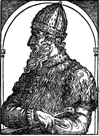
|
|
IVAN VASILIWICH, KING OF MUSCOVIE. From a sixteenth century woodcut. |
To Edward VI. of England the King sent a letter by the hands of Richard Chancellor, giving leave readily for England to trade with Russia.
To Edward VI of England, the King sent a letter through Richard Chancellor, granting permission for England to trade with Russia.
To this end Anthony Jenkinson, "a resolute and intelligent gentleman," was selected, and "with four tall, well-appointed ships he sailed on 12th May 1557 toward the land of Russia." He reached Cape North on 2nd July, and a few days later he passed the spot where Sir Hugh Willoughby and all his company had perished. Anchoring in the Bay of St. Nicholas, he took a sledge for Moscow, where he delivered his letters safely to the King. So icebound was the country that it was April 1558 before he was able to leave Moscow for the south, to accomplish, if possible, the orders of the Merchant Adventurers to find an overland route to Cathay. With letters of introduction from the Russian King to the princes and kings through whose dominions he was to pass, Master Jenkinson made his way to the Volga, whence he continued his voyage with a Russian captain who was travelling south in great style to take up a command at Astrakan with five hundred boats laden with soldiers, stores, food, and merchandise.
To this end, Anthony Jenkinson, "a determined and clever gentleman," was chosen, and "with four tall, well-equipped ships, he set sail on May 12, 1557, toward Russia." He arrived at Cape North on July 2, and a few days later, he passed the spot where Sir Hugh Willoughby and his entire crew had died. After anchoring in the Bay of St. Nicholas, he took a sled to Moscow, where he successfully delivered his letters to the King. The country was so frozen that it wasn’t until April 1558 that he was able to leave Moscow for the south to try, if possible, to fulfill the Merchant Adventurers' orders to find an overland route to Cathay. With letters of introduction from the Russian King to the princes and kings whose lands he would pass through, Master Jenkinson made his way to the Volga, where he continued his journey with a Russian captain who was traveling south in great style to take command at Astrakan with five hundred boats loaded with soldiers, supplies, food, and goods.
After three months' travelling, and having passed over some one thousand two hundred miles, the Englishman reached the south. The city of Astrakan offered no attractions and no hope of trade, so Jenkinson boldly took upon himself to navigate the mouth of the Volga and to reach the Caspian Sea. He was the first Englishman to cross Russia from the White Sea to the Caspian. Never before on the Caspian had the red cross of St. George been seen flying from the masthead of a ship sailed by Englishmen. After three weeks' buffeting by contrary winds, they found themselves on the eastern shores, and, getting together a caravan of one thousand camels, they went forward. No sooner had they landed than they found themselves in a land of thieves and robbers. Jenkinson hastened to the Sultan of these parts, a noted robber himself, to be kindly received by the Tartar Prince, who set before him the flesh of a wild horse and some mare's milk. Then the little English party travelled on for three weeks through desolate land with no rivers, no houses, no inhabitants, till they reached the banks of the Oxus. "Here we refreshed ourselves," says the explorer, "having been three days without water and drink, and tarried there all the next day making merry with our slain horses and camels." For a hundred miles they followed the course of this great river until they reached another desert, where they were again attacked by bands of thieves and robbers.
After three months of traveling and covering around 1,200 miles, the Englishman arrived in the south. The city of Astrakan had no appeal and no prospects for trade, so Jenkinson took it upon himself to navigate the mouth of the Volga and reach the Caspian Sea. He was the first Englishman to cross Russia from the White Sea to the Caspian. The red cross of St. George had never been seen flying from the masthead of a ship sailed by Englishmen on the Caspian before. After three weeks of battling strong winds, they found themselves on the eastern shores and gathered a caravan of 1,000 camels to continue their journey. As soon as they landed, they encountered a land filled with thieves and robbers. Jenkinson hurried to the Sultan of these areas, who was known to be a robber himself, and he was welcomed by the Tartar Prince, who offered him the meat of a wild horse and some mare's milk. The small English group went on for three weeks through desolate land with no rivers, no houses, and no people until they reached the banks of the Oxus. "Here we refreshed ourselves," says the explorer, "having been three days without water and drink, and stayed there all the next day celebrating with our slaughtered horses and camels." They followed the course of this great river for a hundred miles until they encountered another desert, where they were once again attacked by gangs of thieves and robbers.
It was Christmas Eve when they at last reached Bokhara, only to find that the merchants were so poor that there was no hope of any trade worth following, though the city was full of caravans from India and the Far East. And here they heard that the way to Cathay was barred by reason of grievous wars which were going on. Winter was coming on; so Jenkinson remained for a couple of months before starting on his long journey home. With a caravan of six hundred camels he made his way back to the Caspian, and on 2nd September he had reached Moscow safely with presents of "a white cow's tail of Cathay and a drum of Tartary" for the King, which seemed to give that monarch the greatest pleasure. He evidently stayed for a time in Russia, for it is not till the year 1560 that we find him writing to the Merchant Adventurers that "at the next shipping I embark myself for England."
It was Christmas Eve when they finally arrived in Bokhara, only to discover that the merchants were so poor that there was no chance of any worthwhile trade, even though the city was packed with caravans from India and the Far East. They learned that the route to Cathay was blocked due to serious wars taking place. With winter approaching, Jenkinson stayed for a couple of months before beginning his long journey home. He made his way back to the Caspian with a caravan of six hundred camels, and by September 2nd, he had safely reached Moscow, bringing gifts of "a white cow's tail from Cathay and a drum from Tartary" for the King, which seemed to delight him greatly. He apparently stayed in Russia for a while, as it wasn't until 1560 that we find him writing to the Merchant Adventurers that "at the next shipping I embark myself for England."

|
| ANTHONY JENKINSON'S MAP OF RUSSIA, MUSCOVY, AND TARTARY, PUBLISHED IN 1562. |
While Jenkinson was endeavouring to reach the Far East by land, a Portuguese named Pinto had succeeded in reaching it by sea. The discovery of Japan is claimed by three people. Antonio de Mota had been thrown by a storm on to the island of Nison, called by the Chinese Jepwen—Japan—in the year 1542. Pinto claims to have discovered it the same year. It seems that the Japanese were expecting the return of a god, and as the white men hove in sight they exclaimed: "These are certainly the Chinchi cogies spoken of in our records, who, flying over the waters, shall come to be lords of the lands where God has placed the greatest riches of the world. It will be fortunate for us if they come as friends."
While Jenkinson was trying to get to the Far East overland, a Portuguese man named Pinto had successfully reached it by sea. Three people claim to have discovered Japan. Antonio de Mota was blown off course by a storm and landed on the island of Nison, referred to by the Chinese as Jepwen—Japan—in 1542. Pinto claims to have discovered it in the same year. It seems that the Japanese were anticipating the return of a god, and as the white men came into view, they exclaimed: "These are definitely the Chinchi cogies mentioned in our records, who, flying over the waters, will come to rule the lands where God has placed the greatest riches of the world. It will be a blessing for us if they arrive as friends."
Now men of the time refused to believe in the travels of Mendex Pinto. "He should be called Mendax Pinto," said one, "whose book is one continued chain of monstrous fiction which deserves no credit," while a hundred and fifty years later Congreve wrote—
Now men of the time refused to believe in the travels of Mendex Pinto. "He should be called Mendax Pinto," said one, "whose book is one continuous chain of outrageous fiction that deserves no trust," while a hundred and fifty years later Congreve wrote—
|
"Ferdinando Mendez Pinto was but a type of thee, Thou liar of the first magnitude." |
CHAPTER XXXIII
MARTIN FROBISHER SEARCHES FOR A NORTH-WEST PASSAGE
So far the expeditions of Willoughby, Chancellor, and Jenkinson had all failed to reach the Far East. The Spanish had a way thither by Magellan's Strait, the Portuguese by the Cape of Good Hope. England in the middle of the sixteenth century had no way. What about a North-West Passage leading round Labrador from the Atlantic to the Pacific? England was waking up to possibilities of future exploration. She was also ready and anxious to annoy Spain for having monopolised the riches and wealth of the New World. And so it was that Queen Elizabeth turned with interest to the suggestions of one of her subjects—Martin Frobisher—"a mariner of great experience and ability," when he enthusiastically consulted her on the navigation of the North-West Passage. For the last fifteen years he had been trying to collect ships and men for the enterprise. "It is the only thing in the world left undone whereby a notable mind might be made famous and fortunate," he affirmed.
So far, the expeditions of Willoughby, Chancellor, and Jenkinson had all failed to reach the Far East. The Spanish accessed it via Magellan's Strait, and the Portuguese through the Cape of Good Hope. In the mid-sixteenth century, England had no route. What about a North-West Passage that could connect the Atlantic to the Pacific around Labrador? England was beginning to see the potential for future exploration. She was also eager to challenge Spain for monopolizing the wealth of the New World. That's when Queen Elizabeth became interested in the proposals from one of her subjects—Martin Frobisher—"a sailor with significant experience and skill," who excitedly consulted her about navigating the North-West Passage. For the past fifteen years, he had been trying to gather ships and crew for the mission. "It's the only remaining venture in the world that could make a remarkable mind famous and fortunate," he claimed.
But it was not till the year 1576 that he got a chance of fitting out two small ships—two very small ships—the Gabriel of twenty tons, the Michael of twenty-five tons, to explore the icy regions of the north. A wave of the Queen's hand gladdened his heart as he sailed past the palace of Greenwich, where the Court resided, and he was soon sailing northward harassed and battered by many storms. His little ten-ton pinnace was lost, and the same storm that overtook the little fleet to the north of Scotland so terrified the captain of the Michael that he deserted and turned home with the news that Frobisher had perished with all hands.
But it wasn't until 1576 that he finally got the chance to outfit two small ships—two very small ships—the Gabriel, which was twenty tons, and the Michael, which was twenty-five tons, to explore the icy regions of the north. A wave from the Queen as he sailed past the palace at Greenwich, where the Court was based, filled him with joy, and he soon set sail northward, facing numerous storms. His little ten-ton pinnace was lost, and the same storm that hit the small fleet north of Scotland frightened the captain of the Michael so much that he abandoned ship and returned home with the news that Frobisher and all his crew had perished.
Meanwhile Frobisher, resolute in his undertaking, was nearing the coast of Greenland—alone in the little Gabriel with a mere handful of men all inexperienced in the art of navigating the Polar seas.
Meanwhile, Frobisher, determined to complete his mission, was approaching the coast of Greenland—alone in the small Gabriel with just a few men, all of whom were inexperienced in navigating the polar seas.
|
"And now there came both mist and snow, And it grew wondrous cold" |
as Frobisher sailed his storm-beaten ship across the wintry seas. But "I will sacrifice my life to God rather than return home without discovering a north-west passage to Cathay," he told his eighteen men with sublime courage. Passing Cape Farewell, he sailed north-west with the Greenland current, which brought him to the icebound shores near Hudson's Bay. He did not see the straits afterwards discovered by Hudson, but, finding an inlet farther north, he sailed some hundred miles, in the firm belief that this was the passage for which he was searching, that America lay on his left and Asia on his right. Magellan had discovered straits in the extreme south; Frobisher made sure that he had found corresponding straits to the extreme north, and Frobisher's Straits they were accordingly named, and as such they appeared on the maps of the day till they had to be renamed Lumley's Inlet. The snow and ice made further navigation impossible for this year, and full of their great news they returned home accompanied by an Eskimo. These natives had been taken for porpoises by our English explorers, but later they were reported to be "strange infidels whose like was never seen, read, or heard of before."
as Frobisher sailed his battered ship across the icy seas. But "I will give my life to God rather than go home without finding a northwest passage to Cathay," he told his eighteen men with incredible bravery. After passing Cape Farewell, he sailed northwest with the Greenland current, which brought him to the frozen shores near Hudson's Bay. He didn’t see the straits later uncovered by Hudson, but after discovering an inlet farther north, he sailed about a hundred miles, believing he had found the passage he was looking for, with America on his left and Asia on his right. Magellan had found straits in the far south; Frobisher was convinced he had discovered corresponding straits in the far north, which were named Frobisher's Straits and appeared on maps of the time until they were renamed Lumley's Inlet. The snow and ice made further navigation impossible that year, and full of their exciting news, they returned home with an Eskimo. These natives had initially been mistaken for porpoises by our English explorers, but later they were described as "strange infidels the likes of which had never been seen, read, or heard of before."

|
|
GREENLANDERS AS SEEN BY MARTIN FROBISHER. From Captain Beste's account of Frobisher's voyages, 1578. |
Martin Frobisher was received with enthusiasm and "highly commended of all men for his great and notable attempt, but specially famous for the great hope he brought of the passage to Cathay." Besides the Eskimo the explorers carried home a black stone, which, when thrown on the fire by one of the sailor's wives, glittered like gold. The gold refiners of London were hastily called in, and they reported that it contained a quantity of gold.
Martin Frobisher was welcomed with excitement and "highly praised by everyone for his impressive and significant effort, but especially famous for the great hope he brought of finding a route to Cathay." In addition to the Eskimo, the explorers brought back a black stone that, when thrown into the fire by one of the sailor's wives, shimmered like gold. The gold refiners of London were quickly summoned, and they reported that it contained some gold.
A new incentive was now given to Polar exploration. The Queen herself contributed a tall ship of some two hundred tons to the new expedition that was eagerly fitted out, and the High Admiral of all seas and waters, countries, lands, and isles, as Frobisher was now called, sailed away again for the icy north, more to search for gold than to discover the North-West Passage. He added nothing more to the knowledge of the world, and though he sailed through the strait afterwards known as Hudson's Strait, he never realised his discovery. His work was hampered by the quest for gold, for which England was eagerly clamouring, and he disappears from our history of discovery.
A new incentive was now given to Polar exploration. The Queen herself contributed a tall ship of about two hundred tons to the new expedition that was quickly prepared, and the High Admiral of all seas and waters, countries, lands, and islands, as Frobisher was now called, set sail again for the icy north, more to search for gold than to find the North-West Passage. He didn’t add anything more to the knowledge of the world, and although he passed through the strait that would later be known as Hudson's Strait, he never recognized his discovery. His efforts were hindered by the pursuit of gold, which England was eagerly demanding, and he fades from our history of discovery.
The triumphant return of Francis Drake in 1580 laden with treasure from the Spice Islands put into the shade all schemes for a north-west passage for the moment.
The successful return of Francis Drake in 1580, loaded with treasure from the Spice Islands, overshadowed all plans for a north-west passage for the time being.
Nevertheless, this voyage of Martin Frobisher is important in the history of exploration. It was the first attempt of an Englishman to make search amid the ice of the Arctic regions—a search in which so many were yet to lay down their lives.
Nevertheless, this journey of Martin Frobisher is significant in the history of exploration. It was the first attempt by an Englishman to explore the icy Arctic regions—a quest in which many would eventually lose their lives.
CHAPTER XXXIV
DRAKE'S FAMOUS VOYAGE ROUND THE WORLD
|
"Call him on the deep sea, call him up the sound, Call him when ye sail to meet the foe; Where the old trade's plyin' and the old flag flyin', They shall find him ware an' wakin', as they found him long ago!" HENRY NEWBOLT. |
Drake's famous voyage, as it is known to history (1577-1580), was indeed famous, for although Magellan's ship had sailed round the world fifty years before, Drake was the first Englishman to do so, and, further, he discovered for us land to the south of Magellan's Strait round which washed the waters of Atlantic and Pacific Oceans, showing that the mysterious land marked on contemporary maps as Terra Australis and joined to South America was a separate land altogether. He also explored the coast of America as far north as Vancouver Island, and disclosed to England the secret of the Spice Islands. The very name of Drake calls up a vision of thrilling adventure on the high seas. He had been at sea since he was a boy of fifteen, when he had been apprenticed to the master of a small ship trading between England and the Netherlands, and many a time he had sailed on the grey North Sea. "But the narrow seas were a prison for so large a spirit born for greater undertakings," and in 1567 we find Drake sailing forth on board the Judith in an expedition over to the Spanish settlements in America under his kinsman, John Hawkins. Having crossed the Atlantic and filled his ships with Spanish treasure from "the Spanish Main," and having narrowly escaped death from the hands of the Spaniards, Drake had hurried home to tell of the riches of this new country still closed to all other nations. Two years later Drake was off again, this time in command himself of two ships with crews of seventy-three young men, their modest aim being nothing less than to seize one of the Spanish ports and empty into their holds the "Treasure House of the World." What if this act of reckless daring was unsuccessful? The undertaking was crowned with a higher success than that of riches, for Drake was the first Englishman to see the waters of the Pacific Ocean. His expedition was not unlike that of Balboa some sixty years before, as with eighteen chosen companions he climbed the forest-clad spurs of the ridge dividing the two great oceans. Arrived at the top, he climbed up a giant tree, and the Golden Sea of which he had so often heard—the Pacific Ocean of Magellan, the waters washing the golden shores of Mexico and Peru—all lay below him. Descending from the heights, he sank upon his knees and "humbly besought Almighty God of His goodness to give him life and leave to sail once in an English ship in that sea."
Drake's famous voyage, known to history (1577-1580), was indeed noteworthy. Although Magellan's ship had sailed around the world fifty years earlier, Drake was the first Englishman to accomplish this feat. Furthermore, he discovered land south of Magellan's Strait, surrounded by the waters of the Atlantic and Pacific Oceans, proving that the mysterious land marked on maps as Terra Australis and connected to South America was a separate land. He also explored the American coast as far north as Vancouver Island and revealed to England the secret of the Spice Islands. The name Drake evokes a sense of thrilling adventure on the high seas. He had been at sea since he was fifteen, when he was apprenticed to the master of a small ship trading between England and the Netherlands, and he had often sailed the gray North Sea. "But the narrow seas were a prison for so large a spirit born for greater undertakings." In 1567, Drake set sail on the Judith for an expedition to the Spanish settlements in America under his relative, John Hawkins. After crossing the Atlantic and filling his ships with Spanish treasure from "the Spanish Main," and narrowly escaping death at the hands of the Spaniards, Drake hurried home to share news of the riches in this new land still closed to other nations. Two years later, Drake was off again, this time in command of two ships with crews of seventy-three young men, their modest goal being nothing less than to capture a Spanish port and fill their holds with the "Treasure House of the World." What if this act of reckless daring was unsuccessful? The undertaking was ultimately more successful than just riches, as Drake became the first Englishman to see the waters of the Pacific Ocean. His expedition was reminiscent of Balboa's about sixty years earlier, as he climbed the forested ridges dividing the two great oceans with eighteen chosen companions. Upon reaching the top, he climbed a giant tree, and there lay the Golden Sea he had often heard about—the Pacific Ocean of Magellan, the waters lapping the golden shores of Mexico and Peru—all spread out below him. After descending from the heights, he knelt and "humbly besought Almighty God of His goodness to give him life and leave to sail once in an English ship in that sea."

|
|
SIR FRANCIS DRAKE. From Holland's Heroologia, 1620. |
In 1573 Drake came home with his wonderful news, and it was not long before he was eagerly talking over with the Queen a project for a raid into this very Golden Sea guarded by the Spaniards. Elizabeth promised help on condition that the object of the expedition should remain a secret. Ships were bought for "a voyage to Egypt"; there was the Pelican of one hundred tons, the Marygold of thirty tons, and a provision ship of fifty tons. A fine new ship of eighty tons, named the Elizabeth, mysteriously added itself to the little fleet, and the crews numbered in all some one hundred and fifty men. No expense was spared in the equipment of the ships. Musicians were engaged for the voyage, the arms and ammunition were of the latest pattern. The flagship was lavishly furnished: there were silver bowls and mugs and dishes richly gilt and engraved with the family arms, while the commander's cabin was full of sweet-smelling perfumes presented by the Queen herself. Thus, complete at last, Drake led his gay little squadron out of Plymouth harbour on 15th November 1577, bound for Alexandria—so the crews thought.
In 1573, Drake returned home with exciting news, and it wasn’t long before he was eagerly discussing a plan for a raid into the Golden Sea, which was guarded by the Spaniards, with the Queen. Elizabeth agreed to provide support on the condition that the mission remained a secret. Ships were purchased for "a voyage to Egypt"; there was the Pelican which weighed one hundred tons, the Marygold at thirty tons, and a supply ship of fifty tons. A brand new eighty-ton ship named the Elizabeth mysteriously joined the small fleet, bringing the total crew to around one hundred and fifty men. No expense was spared in preparing the ships. Musicians were hired for the journey, and the arms and ammunition were state-of-the-art. The flagship was outfitted lavishly: there were silver bowls, mugs, and beautifully engraved dishes adorned with family crests, and the captain's cabin was filled with sweet-smelling perfumes given by the Queen herself. Finally ready, Drake led his cheerful little squadron out of Plymouth harbor on November 15, 1577, heading towards Alexandria—so the crews believed.
Little did Drake know what was before him, as, dressed in his seaman's shirt, his scarlet cap with its gold band on his head, he waved farewell to England. Who could foresee the terrible beginning, with treachery and mutiny at work, or the glorious ending when the young Englishman sailed triumphantly home after his three years' voyage—the world encompassed?
Little did Drake know what was ahead of him, as he stood in his sailor shirt, his red cap with the gold band on his head, waving goodbye to England. Who could have predicted the awful start, filled with treachery and mutiny, or the triumphant conclusion when the young Englishman sailed home after three years—having circled the globe?
Having reached the Cape de Verde Islands in safety, the object of the expedition could no longer remain a secret, and Drake led his squadron boldly across the Atlantic Ocean.
Having safely arrived at the Cape Verde Islands, the purpose of the expedition was no longer a secret, and Drake confidently led his squadron across the Atlantic Ocean.
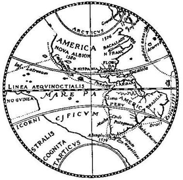
|
|
THE SILVER MAP OF THE WORLD. From the medallion in the British Museum, probably struck in 1581, showing the line of Drake's voyage from England in 1577 westwards through the Magellan Strait to California and New Albion. |
On 5th April the coast of Brazil appeared, but fogs and heavy weather scattered the ships and they had to run into the mouth of the La Plata for shelter. Then for six weary weeks the ships struggled southward, battered by gales and squalls during which nothing but the daring seamanship of the English navigators saved the little vessels from destruction. It was not till 20th June that they reached Port St. Julian of Magellan fame, on the desolate shores of Patagonia. As they entered the harbour, a grim sight met their eyes. On that windswept shore was the skeleton of the man hung by Magellan years before.
On April 5th, the coast of Brazil came into view, but fog and rough weather scattered the ships, forcing them to seek shelter in the mouth of the La Plata. For six exhausting weeks, the ships struggled southward, battered by storms and squalls, during which only the fearless skills of the English navigators kept the small vessels from disaster. It wasn’t until June 20th that they arrived at Port St. Julian, known from Magellan's time, on the barren shores of Patagonia. As they entered the harbor, a grim sight greeted them. On that windswept shore stood the skeleton of the man hanged by Magellan years earlier.
History was to repeat itself, and the same fate was now to befall an unhappy Englishman guilty of the same conduct.
History was set to repeat itself, and the same fate was about to meet an unfortunate Englishman guilty of the same behavior.
Drake had long had reason to suspect the second in command, Doughty, though he was his dear friend. He had been guilty of worse than disobedience, and the very success of the voyage was threatened. So Drake called a council together and Doughty was tried according to English law. After two days' trial he was found guilty and condemned to die. One of the most touching scenes in the history of exploration now took place. One sees the little English crews far away on that desolate shore, the ships lying at anchor in the harbour, the block prepared, the altar raised beside it, the two old friends, Drake and Doughty, kneeling side by side, then the flash of the sword and Drake holding up the head of his friend with the words, "Lo, this is the end of traitors."
Drake had long had reasons to suspect his second in command, Doughty, even though they were close friends. Doughty had committed worse offenses than just disobedience, which threatened the success of the voyage. So, Drake called a council and Doughty was tried under English law. After two days of trial, he was found guilty and sentenced to death. One of the most moving scenes in the history of exploration then unfolded. You could see the small English crews far away on that barren shore, the ships anchored in the harbor, the block set up for execution, the altar beside it, and the two old friends, Drake and Doughty, kneeling side by side. Then there was the flash of the sword, and Drake holding up his friend's head with the words, "Lo, this is the end of traitors."

|
|
THE SILVER MAP OF THE WORLD. The reverse half, showing the route of Drake's voyage home from California in 1579-1580, through the Spice Islands and the Indian Ocean. The end of the homeward track, round the Azores, will be seen on the previous Silver Map illustration. |
It was now midwinter, and for six weeks they remained in harbour till August came, and with three ships they emerged to continue their way to the Straits of Magellan. At last it was found and boldly they entered. From the towering mountains that guarded the entry, tempests of wind and snow swept down upon the "daring intruders." As they made their way through the rough and winding waters, they imagined with all the other geographers of their time that the unknown land to the south was one great continent leading beyond the boundaries of the world. Fires lit by the natives on this southern coast added terror to the wild scene. But at the end of sixteen days they found themselves once more in the open sea. They were at last on the Pacific Ocean. But it was anything but pacific. A terrible tempest arose, followed by other storms no less violent, and the ships were driven helplessly southward and westward far beyond Cape Horn. When they once more reached the coast they found in the place of the great southern continent an indented wind-swept shore washed by waves terrific in their height and strength. In the ceaseless gale the Marygold foundered with all hands and was never heard of again. A week later the captain of the Elizabeth turned home, leaving the Pelican, now called the Golden Hind, to struggle on alone. After nearly two months of storm, Drake anchored among the islands southward of anything yet known to the geographers, where Atlantic and Pacific rolled together in one boisterous flood. Walking alone to the farthest end of the island, Drake is said to have laid himself down and with his arms embraced the southernmost point of the known world.
It was now midwinter, and they stayed in the harbor for six weeks until August arrived. Then, with three ships, they set out to continue their journey to the Straits of Magellan. Finally, they discovered the strait and boldly entered. From the towering mountains that guarded the entrance, storms of wind and snow lashed out at the "daring intruders." As they navigated through the rough and winding waters, they, like all the geographers of their time, imagined that the unknown land to the south was one huge continent stretching beyond the world's boundaries. Fires lit by the locals on this southern coast added to the wild atmosphere. But after sixteen days, they found themselves back in the open sea. They were finally on the Pacific Ocean, but it was anything but calm. A fierce storm arose, followed by other equally violent storms, and the ships were helplessly pushed southward and westward far beyond Cape Horn. When they reached the coast again, instead of a great southern continent, they found a jagged, wind-swept shore battered by enormous and powerful waves. In the relentless gale, the Marygold sank with all hands and was never seen again. A week later, the captain of the Elizabeth headed home, leaving the Pelican, now known as the Golden Hind, to fight on alone. After nearly two months of storms, Drake anchored among the islands south of anything known to geographers, where the Atlantic and Pacific crashed together in a furious flood. Walking alone to the farthest point of the island, Drake reportedly lay down and wrapped his arms around the southernmost point of the known world.

|
|
SIR FRANCIS DRAKE, THE FIRST ENGLISHMAN TO SAIL ROUND THE WORLD. After the engraving attributed to Hondius. |
He showed that the Tierra del Fuego, instead of being part of a great continent—the Terra Australis—was a group of islands with open sea to east, south, and west. This discovery was first shown on a Dutch silver medallion struck in Holland about 1581, known as The Silver Map of the world, and may be seen to-day in the British Museum.
He showed that Tierra del Fuego, rather than being part of a massive continent called Terra Australis, was actually a group of islands surrounded by open sea to the east, south, and west. This discovery was first depicted on a Dutch silver medallion minted in Holland around 1581, known as The Silver Map of the World, and it can be seen today in the British Museum.
Remarking that the ocean he was now entering would have been better called "Mare Furiosum" than "Mare Pacificum," Drake now directed his course along the western coast of South America. He found the coast of Chili, but not as the general maps had described it, "wherefore it appeareth that this part of Chili hath not been truly hitherto discovered," remarked one on board the Golden Hind. Bristling with guns, the little English ship sailed along the unknown coast, till they reached Valparaiso. Here they found a great Spanish ship laden with treasure from Peru. Quickly boarding her, the English sailors bound the Spaniards, stowed them under the hatches, and hastily transferred the cargo on to the Golden Hind. They sailed on northwards to Lima and Panama, chasing the ships of Spain, plundering as they went, till they were deeply laden with stolen Spanish treasure and knew that they had made it impossible to return home by that coast. So Drake resolved to go on northward and discover, if possible, a way home by the north. He had probably heard of Frobisher's Strait, and hoped to find a western entrance.
Noting that the ocean he was entering would be better called "Mare Furiosum" rather than "Mare Pacificum," Drake steered his course along the western coast of South America. He encountered the coast of Chile, but it wasn’t as the general maps had described. “This part of Chile hasn’t really been discovered yet,” one of the crew on the Golden Hind remarked. Armed to the teeth, the small English ship sailed along the uncharted coast until they reached Valparaiso. There, they found a large Spanish ship loaded with treasure from Peru. Quickly boarding her, the English sailors tied up the Spaniards, locked them under the hatch, and hurriedly transferred the cargo onto the Golden Hind. They continued sailing north to Lima and Panama, chasing Spanish ships and plundering as they went, until they were heavily loaded with stolen treasure and realized returning home by that coast was impossible. So Drake decided to keep heading north, hoping to find a way back home through the north. He likely had heard of Frobisher's Strait and hoped to discover a western entrance.
As they approached the Arctic regions the weather grew bitterly cold, and "vile, thick, stinking fogs" determined them to sail southward. They had reached a point near what we now know as Vancouver Island when contrary winds drove them back and they put in at a harbour, now known as San Francisco, to repair the ship for the great voyage across the Pacific and home by the Cape of Good Hope. Drake had sailed past seven hundred miles of new coast-line in twelve days, and he now turned to explore the new country, to which he gave the name of New Albion. The Indians soon began to gather in large quantities on the shore, and the King himself, tall and comely, advanced in a friendly manner. Indeed, he took off his crown and set it on the head of Drake and, hanging chains about his neck, the Indians made him understand that the land was now his and that they were his vassals.
As they got closer to the Arctic regions, the weather became bitterly cold, and "vile, thick, stinking fogs" forced them to head south. They reached a spot near what we now call Vancouver Island when strong winds pushed them back, and they stopped at a harbor, now known as San Francisco, to fix the ship for the long journey across the Pacific and home via the Cape of Good Hope. Drake had traveled over seven hundred miles of new coastline in twelve days, and he now decided to explore the new land, which he named New Albion. The Indians quickly gathered in large numbers on the shore, and the King himself, tall and handsome, approached in a friendly way. He even took off his crown and placed it on Drake’s head, and, putting chains around his neck, the Indians made it clear that the land was now his and that they were his subjects.

|
|
THE GOLDEN HIND AT NEW ALBION. From the Chart of Drake's Voyages. 1589. |
Little did King Drake dream, as he named his country New Albion, that Californian gold was so near. His subjects were loving and peaceable, evidently regarding the English as gods and reverencing them as such. The chronicler is eloquent in his detailed description of all the royal doings.
Little did King Drake imagine, as he named his country New Albion, that Californian gold was so close. His people were loving and peaceful, clearly viewing the English as gods and honoring them as such. The chronicler is eloquent in his detailed account of all the royal activities.
"Before we left," he says, "our General caused to be set up a monument of our being there, as also of Her Majesty's right and title to that kingdom, namely, a plate of brass, fast nailed to a great and firm post, whereon is engraved Her Grace's name and the day and year of our arrival here, and of the free giving up of the province, both by the people and king, into Her Majesty's hands, together with Her Highness' picture and arms in a piece of sixpence current money. The Spanish never so much as set foot in this country—the utmost of their discoveries reaching only to many degrees southward of this place.
"Before we left," he says, "our General had a monument put up to mark our presence here and to affirm Her Majesty's claim to this kingdom. It’s a brass plaque tightly nailed to a strong post, engraved with Her Grace's name and the date of our arrival, along with the official handover of the province by both the people and the king to Her Majesty. It also features Her Highness' picture and coat of arms on a piece of sixpence current money. The Spanish never even set foot in this country—the farthest they got was many degrees south of this place."
"And now, as the time of our departure was perceived by the people, so did the sorrows and miseries seem to increase upon them—not only did they lose on a sudden all mirth, joy, glad countenance, pleasant speeches, agility of body, but with signs and sorrowings, with heavy hearts and grieved minds, they poured out woeful complaints and moans, with bitter tears and wringing of their hands, tormenting themselves. And, as men refusing all comfort, they only accounted themselves as those whom the gods were about to forsake."
"And now, as the people realized our departure was coming, their sadness and suffering seemed to grow. They suddenly lost all joy, happiness, cheerful expressions, and energy. With visible signs of grief, heavy hearts, and troubled minds, they let out sorrowful complaints and cries, shedding bitter tears and wringing their hands, tormenting themselves. Like people who rejected all comfort, they believed they were about to be abandoned by the gods."
Indeed, the poor Indians looked on these Englishmen as gods, and, when the day came for them to leave, they ran to the top of the hills to keep the little ship in sight as long as possible, after which they burnt fires and made sacrifices at their departure.
Indeed, the poor Indians viewed these Englishmen as gods, and when the day came for them to leave, they ran to the top of the hills to keep the small ship in sight for as long as possible. After that, they lit fires and made sacrifices to mark their departure.
Drake left New Albion on 23rd July 1579, to follow the lead of Magellan and to pass home by the southern seas and the Atlantic Ocean. After sixty-eight days of quick and straight sailing, with no sight of land, they fell in with the Philippine Islands, and on 3rd November with the famous Spice Islands. Here they were well received by the King—a magnificent person attired in cloth of gold, with bare legs and shoes of Cordova skins, rings of gold in his hair, and a chain "of perfect gold" about his neck. The Englishmen were glad enough to get fresh food after their long crossing, and fared sumptuously on rice, hens, "imperfect and liquid sugar," sugar-canes, and a fruit they call figo, with plenty of cloves. On a little island near Celebes the Golden Hind was thoroughly repaired for her long voyage home. But the little treasure-laden ship was nearly wrecked before she got away from the dangerous shoals and currents of these islands.
Drake left New Albion on July 23, 1579, to follow in Magellan's footsteps and make his way home through the southern seas and the Atlantic Ocean. After sixty-eight days of fast and direct sailing, with no land in sight, they reached the Philippine Islands, and on November 3, they arrived at the famous Spice Islands. There, they were warmly welcomed by the King—a majestic figure dressed in cloth of gold, with bare legs and shoes made from Cordovan leather, gold rings in his hair, and a chain "of pure gold" around his neck. The Englishmen were relieved to have fresh food after their long journey and enjoyed a feast of rice, chickens, "soft and liquid sugar," sugarcane, and a fruit they call figo, along with plenty of cloves. On a small island near Celebes, the Golden Hind was thoroughly repaired for her long journey home. However, the treasure-laden ship nearly got wrecked before she managed to escape the dangerous shoals and currents surrounding these islands.
"Upon the 9th of January we ran suddenly upon a rock, where we stuck fast from eight of the clock at night till four of the clock in the afternoon the next day, being, indeed, out of all hope to escape the danger; but our General, as he had always hitherto showed himself courageous, so now he and we did our best endeavours to save ourselves, which it pleased God so to bless, that in the end we cleared ourselves most happily of the danger."
"On January 9th, we suddenly hit a rock and got stuck from 8 PM until 4 PM the next day, honestly losing all hope of escaping the danger. However, our General, who had always been brave, along with all of us, put in our best efforts to save ourselves. Fortunately, God favored our efforts, and in the end, we successfully escaped the danger."

|
|
THE GOLDEN HIND AT JAVA. From the Chart of Drake's Voyages. |
Then they ran across the Indian Ocean, rounded the Cape of Good Hope in calm weather, abusing the Portuguese for calling it the most dangerous Cape in the world for intolerable storms, for "This Cape," said the English, "is a most stately thing and the finest Cape we saw in the whole circumference of the earth."
Then they crossed the Indian Ocean, rounded the Cape of Good Hope in peaceful weather, criticizing the Portuguese for calling it the most dangerous cape in the world due to terrible storms, because "This cape," the English said, "is a truly impressive sight and the best cape we've seen on the entire planet."
And so they came home. After nearly three years' absence Drake triumphantly sailed his little Golden Hind into Plymouth harbour, where he had long ago been given up as lost. Shouts of applause rang through the land at the news that an Englishman had circumnavigated the world. The Queen sent for Drake to tell his wonderful story, to which she listened spellbound. A great banquet was held on board the little ship, at which Elizabeth was present and knighted Drake, while she ordered that the Golden Hind should be preserved "as a worthy rival of Magellan's Victoria" and as "a monument to all posterity of that famous and worthy exploit of Sir Francis Drake." It was afterwards taken to pieces, and the best parts of wood were made into a chair at Oxford, commemorated by Cowley's lines—
And so they returned home. After nearly three years away, Drake proudly sailed his little Golden Hind into Plymouth harbor, where he had long been presumed lost. Cheers erupted across the country at the news that an Englishman had circumnavigated the globe. The Queen summoned Drake to share his incredible story, which she listened to in awe. A grand feast was held on the little ship, where Elizabeth was present and knighted Drake, while she ordered that the Golden Hind be preserved "as a worthy rival of Magellan's Victoria" and as "a monument for all time to that famous and worthy achievement of Sir Francis Drake." It was later taken apart, and the best pieces of wood were made into a chair at Oxford, honored by Cowley's lines—
|
"To this great ship, which round the world has run And matched in race the chariot of the sun; · · · · · Drake and his ship could ne'er have wished from fate A happier station or more blest estate; For lo, a seat of endless rest is given To her in Oxford and to him in Heaven." |
Sir Francis Drake died at sea in 1596.
Sir Francis Drake died at sea in 1596.
|
"The waves became his winding sheet, the waters were his tomb, But for his fame the ocean sea was not sufficient room." |

|
|
"THE UNROLLING OF THE CLOUDS"—V. The world as known after its circumnavigation by Sir Francis Drake in the years 1577-1580. |
CHAPTER XXXV
DAVIS STRAIT
But even while Drake was sailing round the world, and Frobisher's search for a north-west passage had been diverted into a quest for gold, men's minds were still bent on the achievement of reaching Cathay by some northern route. A discourse by Sir Humphrey Gilbert to prove the existence of a passage by the north-west to Cathay and the East Indies, in ten chapters, was much discussed, and the Elizabethan seamen were still bent on its discovery.
But even while Drake was sailing around the world, and Frobisher's search for a northwest passage had turned into a quest for gold, people were still focused on finding a northern route to Cathay. A talk by Sir Humphrey Gilbert to prove there was a passage to Cathay and the East Indies in the northwest, presented in ten chapters, was widely discussed, and the Elizabethan sailors remained determined to discover it.
"When I gave myself to the study of geography," said Sir Humphrey, "and came to the fourth part of the world, commonly called America, which by all descriptions I found to be an island environed round by sea, having on the south side of it the Strait of Magellan, on the west side the Sea of the South, which sea runneth toward the north, separating it from the east parts of Asia, and on the north side the sea that severeth it from Greenland, through which Northern Seas the Passage lieth which I take now in hand to discover."
"When I dedicated myself to studying geography," said Sir Humphrey, "and reached the fourth part of the world, commonly known as America, I found it described as an island surrounded by water. To the south, there's the Strait of Magellan; to the west, the Southern Sea, which flows north and separates it from the eastern parts of Asia; and to the north, the sea that divides it from Greenland. It is through these Northern Seas that I now intend to explore a passage."
The arguments of Sir Humphrey seemed conclusive, and in 1585 they chose John Davis, "a man well grounded in the principles of the art of navigation," to search for the North-West Passage to China. They gave him two little ships, the Sunshine of fifty tons, with a crew of seventeen seamen, four musicians, and a boy, and the Moonshine of thirty-five tons. It was a daring venture, but the expedition was ill-equipped to battle with the icebound seas of the frozen north. The ships left Dartmouth on 7th June, and by July they were well out on the Atlantic with porpoises and whales playing round them. Then came a time of fog and mist, "with a mighty great roaring of the sea." On 20th July they sailed out of the fog and beheld the snow-covered mountains of Greenland, beyond a wide stream of pack-ice—so gloomy, so "waste, and void of any creatures," so bleak and inhospitable that the Englishmen named it the Land of Desolation and passed on to the north. Rounding the point, afterwards named by Davis Cape Farewell, and sailing by the western coast of Greenland, they hoped to find the passage to Cathay. Landing amid the fiords and the "green and pleasant isles" about the coast, they anchored a while to refresh, and named their bay Gilbert Sound, after Sir Humphrey and Davis' own little boy, Gilbert, left at home.
The arguments from Sir Humphrey seemed convincing, and in 1585 they chose John Davis, "a man well-versed in the principles of navigation," to look for the North-West Passage to China. They provided him with two small ships, the Sunshine of fifty tons, with a crew of seventeen sailors, four musicians, and a boy, and the Moonshine of thirty-five tons. It was a bold effort, but the expedition was poorly equipped to tackle the icebound seas of the frozen north. The ships departed from Dartmouth on June 7th, and by July they were deep into the Atlantic with porpoises and whales swimming around them. Then they hit a period of fog and mist, "with a mighty great roaring of the sea." On July 20th, they sailed out of the fog and saw the snow-capped mountains of Greenland, beyond a wide stream of pack ice—so dreary, so "waste, and void of any creatures," so bleak and inhospitable that the Englishmen named it the Land of Desolation and continued north. After rounding the point, later named by Davis Cape Farewell, and sailing along the western coast of Greenland, they hoped to find the passage to Cathay. They landed among the fjords and the "green and pleasant isles" along the coast, anchored for a while to rest, and named their bay Gilbert Sound, after Sir Humphrey and Davis' little boy, Gilbert, who was left at home.
"The people of the country," says Davis, "having espied our ships, came down unto us in their canoes, holding up their right hand toward the sun. We doing the like, the people came aboard our ships, men of good stature, unbearded, small-eyed, and of tractable conditions. We bought the clothes from their backs, which were all made of seals' skins and birds' skins, their buskins, their hose, their gloves, all being commonly sewed and well dressed."
"The people of the country," says Davis, "seeing our ships, came down to us in their canoes, raising their right hands toward the sun. We did the same, and the people came aboard our ships, well-built men, clean-shaven, with narrow eyes, and easygoing temperaments. We bought the clothes off their backs, which were all made from seal and bird skins, including their boots, stockings, and gloves, all neatly sewn and well made."

|
|
AN ESKIMO. From a water-colour drawing by John White, about 1585, who may have seen Eskimo either in Frobisher's or Davis's voyages. |
These simple Greenlanders who worshipped the sun gave Davis to understand that there was a great and open sea to the north-west, and full of hope he sailed on. But he soon abandoned the search, for the season was advancing, and, crossing the open sea, he entered the broad channel named after him Davis Strait, crossed the Arctic Circle, and anchored under a promontory, "the cliffs whereof were orient as gold," naming it Mount Raleigh. Here they found four white bears of "a monstrous bigness," which they took to be goats or wolves, till on nearer acquaintance they were discovered to be great Polar bears. There were no signs of human life, no wood, no grass, no earth, nothing but rock, so they coasted southwards, and to their joy they found an open strait to the west free from ice. Eagerly they sailed the little Moonshine and Sunshine up the opening, which they called Cumberland Sound, till thick fogs and adverse winds drove them back. Winter was now advancing, the six months' provisions were ended, and, satisfied with having found an open passage westward, Davis sailed home in triumph to fit out another expedition as soon as spring came round. His news was received with delight. "The North-West Passage is a matter nothing doubtful," he affirmed, "but at any time almost to be passed, the sea navigable, void of ice, the air tolerable, and the waters very deep."
These simple Greenlanders who worshipped the sun informed Davis that there was a vast and open sea to the northwest, and filled with hope, he continued sailing. But he quickly gave up the search, as the season was getting late. After crossing the open sea, he entered the wide channel now named Davis Strait, went over the Arctic Circle, and anchored beneath a promontory, "whose cliffs were as golden as the sunrise," which he named Mount Raleigh. They spotted four huge white bears, which they initially believed to be goats or wolves, until they got a closer look and realized they were actually great Polar bears. There were no signs of human life, no wood, no grass, no soil, just rock. So, they sailed southward, and to their delight, they found an open strait to the west that was free of ice. They eagerly navigated their small boats, Moonshine and Sunshine, up the passage they called Cumberland Sound, until thick fog and strong winds forced them to turn back. Winter was approaching, their six months of supplies were running out, and feeling satisfied with having discovered an open route to the west, Davis sailed home triumphantly to prepare for another expedition as soon as spring arrived. His news was met with joy. "The North-West Passage is definitely not in doubt," he insisted, "but can almost be crossed at any time, the sea is navigable, clear of ice, the air is bearable, and the waters are very deep."
With this certainty of success the merchants readily fitted out another expedition, and Davis sailed early in May 1586 with four ships. The little Moonshine and Sunshine were included in the new fleet, but Davis himself commanded the Mermaid of one hundred and twenty tons. The middle of June found him on the west coast of Greenland, battling his way with great blocks of ice to his old quarters at Gilbert Sound. What a warm welcome they received from their old Eskimo friends; "they rowed to the boat and took hold on the oars and hung about with such comfortable joy as would require a long discourse to be uttered." Followed by a wondering crowd of natives eager to help him up and down the rocks, Davis made his way inland to find an inviting country, "with earth and grass such as our moory and waste grounds of England are"; he found, too, mosses and wild flowers in the sheltered places. But his business lay in the icy waters, and he boldly pushed forward. But ice and snow and fog made further progress impossible; shrouds, ropes, and sails were turned into a frozen mass, and the crew was filled with despair. "Our men began to grow sick and feeble and hopeless of good success, and they advised me that in conscience I ought to regard the safety of mine own life with the preservation of theirs, and that I should not through my over-boldness leave their widows and fatherless children to give me bitter curses."
With this assurance of success, the merchants quickly outfitted another expedition, and Davis set sail in early May 1586 with four ships. The small Moonshine and Sunshine were part of the new fleet, but Davis himself commanded the Mermaid, which weighed one hundred and twenty tons. By the middle of June, he was on the west coast of Greenland, fighting his way through massive blocks of ice to his old spot at Gilbert Sound. They received a warm welcome from their old Eskimo friends; "they rowed to the boat and took hold of the oars and hung around with such comfortable joy that it would take a long conversation to describe." Accompanied by a curious crowd of natives eager to help him up and down the rocks, Davis made his way inland to discover a promising landscape, "with earth and grass similar to our moorish and barren lands of England"; he also found mosses and wildflowers in the sheltered areas. But his focus was on the icy waters, and he confidently pressed on. However, ice, snow, and fog made further progress impossible; the rigging, ropes, and sails became a frozen mass, and the crew was filled with despair. "Our men began to grow sick and weak and lost hope for any success, and they advised me that out of conscience I should prioritize my own safety along with theirs, and that I should not let my recklessness leave their widows and orphaned children to curse me."
So Davis rearranged his crews and provisions, and with the Moonshine and a selection of his best men he determined to voyage on "as God should direct him," while the Mermaid should carry the sick and feeble and fainthearted home. Davis then crossed over the strait called by his name and explored the coast about Cumberland Sound. Again he tried here to discover the long-sought passage, but the brief summer season was almost past and he had to content himself with exploring the shores of Labrador, unconsciously following the track made by John Cabot eighty-nine years before.
So Davis reorganized his crews and supplies, and with the Moonshine and a group of his best men, he decided to sail on "as God would guide him," while the Mermaid took the sick, weak, and cowardly back home. Davis then crossed over the strait named after him and explored the coast around Cumberland Sound. Once again, he attempted to find the long-searched-for passage, but the short summer season was nearly over, and he had to settle for exploring the shores of Labrador, unknowingly following the route taken by John Cabot eighty-nine years earlier.
But on his return home the merchants of London were disappointed. Davis had indeed explored an immense extent of coast-line, and he had brought back a cargo of cod-fish and five hundred seal skins, but Cathay seemed as far off as ever. One merchant prince, Sanderson by name, was still very keen, and he helped Davis to fit out yet another expedition. With three ships, the Sunshine, the Elizabeth, and the Helen, the undaunted Arctic explorer now found himself for the third summer in succession at his old halting-place, Gilbert's Sound, on the west coast of Greenland.
But when he got back home, the merchants of London were let down. Davis had indeed explored a vast coastline, and he returned with a load of cod and five hundred seal skins, but Cathay still felt as distant as ever. One merchant prince, named Sanderson, was still very enthusiastic, and he helped Davis prepare yet another expedition. With three ships, the Sunshine, the Elizabeth, and the Helen, the fearless Arctic explorer found himself back at his familiar stop, Gilbert's Sound, on the west coast of Greenland for the third summer in a row.
Leaving his somewhat discontented crews to go fishing off the coast of Labrador, he took the little twenty-ton pinnace, with a small party of brave spirits like his own, and made his way northwards in a free and open sea. The weather was hot, land was visible on both sides, and the English mariners were under the impression that they were sailing up a gulf. But the passage grew wider and wider, till Davis found himself with the sea all open to west and north. He had crossed the Arctic Circle and reached the most northerly point ever yet reached by an explorer. Seeing on his right a lofty cliff, he named it "Sanderson his Hope," for it seemed to give hope of the long-sought passage to Cathay.
Leaving his somewhat unhappy crews to fish off the coast of Labrador, he took the small twenty-ton boat, along with a few brave companions like himself, and headed north through open waters. The weather was warm, land was in sight on both sides, and the English sailors believed they were traveling up a gulf. But the channel widened more and more, until Davis realized he was surrounded by open sea to the west and north. He had crossed the Arctic Circle and reached the furthest north point ever attained by an explorer. Spotting a tall cliff on his right, he named it "Sanderson's Hope," as it seemed to promise the long-sought passage to Cathay.
It was a memorable day in the annals of discovery, 30th June 1587, when Davis reached this famous point on the coast of Greenland. "A bright blue sea extended to the horizon on the north and west, obstructed by no ice, but here and there a few majestic icebergs with peaks snowy shooting up into the sky." To the eastward were the granite mountains of Greenland, and beyond them the white line of the mightiest glacier in the world. Rising immediately above the tiny vessel was the beetling wall of Hope Sanderson, with its summit eight hundred and fifty feet above sea-level. At its base the sea was a sheet of foam and spray. It must have been a scene like fairyland, for, as Davis remarked, there was "no ice towards the north, but a great sea, free, large, very salt and blue, and of an unsearchable depth."
It was a significant day in the history of exploration, June 30, 1587, when Davis arrived at this well-known spot on the coast of Greenland. "A bright blue sea stretched to the horizon to the north and west, unobstructed by any ice, except for a few impressive icebergs with snowy peaks towering into the sky." To the east were the granite mountains of Greenland, and beyond them lay the white line of the largest glacier in the world. Rising straight above the small vessel was the steep wall of Hope Sanderson, with its peak standing eight hundred and fifty feet above sea level. At the base, the sea was a swirling mass of foam and spray. It must have been a scene straight out of a fairy tale, because, as Davis noted, there was "no ice to the north, just a vast sea, open, large, very salty and blue, and of an unfathomable depth."
But again disappointment awaited him. That night a wind from the north barred further advance as a mighty bank of ice some eight feet thick came drifting down toward the Atlantic. Again and again he attempted to get on, but it was impossible, and reluctantly enough he turned the little ship southwards.
But once again, disappointment was in store for him. That night, a northern wind blocked any further progress as a massive bank of ice, about eight feet thick, drifted toward the Atlantic. He tried repeatedly to move forward, but it was impossible, and with great reluctance, he turned the little ship southward.
"This Davis hath been three times employed; why hath he not found the passage?" said the folk at home when he returned and reported his doings. How little they realised the difficulties of the way. The commander of the twenty-ton Ellen had done more than any man had done before him in the way of Arctic exploration. He had discovered seven hundred and thirty-two miles of coast from Cape Farewell to Sanderson's Hope; he had examined the whole coast of Labrador; he had "converted the Arctic regions from a confused myth into a defined area." "He lighted Baffin into his bay. He lighted Hudson into his strait. He lighted Hans Egede to the scene of his Greenland labour." And more than this, says his enthusiastic biographer: "His true-hearted devotion to the cause of Arctic discovery, his patient scientific research, his loyalty to his employers, his dauntless gallantry and enthusiasm form an example which will be a beacon-light to maritime explorers for all time to come."
"This Davis has been employed three times; why hasn’t he found the passage?" said the people at home when he returned and reported on his activities. How little they understood the challenges he faced. The commander of the twenty-ton Ellen accomplished more than anyone had before him in Arctic exploration. He discovered seven hundred and thirty-two miles of coastline from Cape Farewell to Sanderson's Hope; he surveyed the entire coast of Labrador; he turned the Arctic regions from a confusing myth into a clearly defined area. "He guided Baffin into his bay. He guided Hudson into his strait. He showed Hans Egede the site of his work in Greenland." And more than this, says his passionate biographer: "His genuine commitment to Arctic discovery, his diligent scientific research, his loyalty to his employers, his fearless courage and enthusiasm set an example that will serve as a guiding light for maritime explorers forever."
|
"And Davis three times forth for the north-west made, Still striving by that course t'enrich the English trade; And as he well deserved, to his eternal fame, There, by a mighty sea, immortalised his name." |
CHAPTER XXXVI
BARENTS SAILS TO SPITZBERGEN
With the third failure of John Davis to find the North-West Passage the English search for Cathay came to an end for the present. But the merchants of Amsterdam took up the search, and in 1594 they fitted out an expedition under William Barents, a burgher of Amsterdam and a practical seaman of much experience. The three voyages of Barents form some of the most romantic reading in the history of geographical discovery, and the preface to the old book compiled for the Dutch after the death of Barents sums up in pathetic language the tragic story of the "three Voyages, so strange and wonderful that the like hath never been heard of before." They were "done and performed three years," says the old preface, "one after the other, by the ships of Holland, on the North sides of Norway, Muscovy, and Tartary, towards the kingdoms of Cathay and China, showing discoveries of the Country lying under 80 degrees: which is thought to be Greenland; where never any man had been before, with the cruel Bears and other Monsters of the sea and the unsupportable and extreme cold that is found to be in these places. And how that in the last Voyage the Ship was enclosed by the Ice, that it was left there, whereby the men were forced to build a house in the cold and desert country of Nova Zembla, wherein they continued ten months together and never saw nor heard of any man, in most great cold and extreme misery; and how after that, to save their lives, they were constrained to sail about one thousand miles in little open boats, along and over the main Seas in most great danger and with extreme labour, unspeakable troubles, and great hunger."
With the third failure of John Davis to find the North-West Passage, the English search for Cathay came to a halt for now. However, the merchants of Amsterdam took up the search, and in 1594, they organized an expedition led by William Barents, a resident of Amsterdam and a skilled seaman with a lot of experience. The three voyages of Barents make for some of the most fascinating reading in the history of geographical discovery, and the preface to the old book compiled for the Dutch after Barents' death captures the tragic story in emotional language, stating that the "three Voyages, so strange and wonderful that the like has never been heard of before." They were "conducted over three years," says the old preface, "one after the other, by the ships of Holland, on the northern coasts of Norway, Muscovy, and Tartary, towards the kingdoms of Cathay and China, revealing discoveries in the regions lying under 80 degrees: which is believed to be Greenland; where no human had ever been before, with fierce Bears and other sea monsters and the unbearable and extreme cold found in these areas. And how in the last voyage the ship became trapped in ice, leaving it behind, which forced the men to build a shelter in the cold, desolate land of Nova Zembla, where they stayed for ten months without seeing or hearing another person, enduring great cold and extreme hardship; and how afterwards, to save their lives, they were compelled to sail about a thousand miles in small open boats, across the open seas amidst great danger and with intense effort, facing unspeakable challenges and severe hunger."

|
|
A SHIP OF THE LATE SIXTEENTH CENTURY. From Ortelius, 1598. |
Surely no more graphic summary of disaster has ever appeared than these words penned three hundred and fourteen years ago, which cry to us down the long, intervening ages of privation and suffering endured in the cause of science.
Surely no more vivid account of disaster has ever been written than these words from three hundred and fourteen years ago, which echo to us through the long years of hardship and suffering endured for the sake of science.
In the year 1594, then, four ships were sent forth from Amsterdam with orders to the wise and skilful pilot, William Barents, that he was to sail into the North Seas and "discover the kingdoms of Cathay and China." In the month of July the Dutch pilot found himself off the south coast of Nova Zembla, whence he sailed as the wind pleased to take him, ever making for the north and hugging the coast as close as possible. On 9th July they found a creek very far north to which they gave the name of Bear Creek, because here they suddenly discovered their first Polar bear. It tried to get into their boat, so they shot it with a musket, "but the bear showed most wonderful strength, for, notwithstanding that she was shot into the body, yet she leapt up and swam in the water; the men that were in the boat, rowing after her, cast a rope about her neck and drew her at the stern of the boat, for, not having seen the like bear before, they thought to have carried her alive in the ship and to have showed her for a strange wonder in Holland; but she used such force that they were glad they were rid of her, and contented themselves with her skin only." This they brought back to Amsterdam in great triumph—their first white Polar bear. But they went farther north than this, until they came to a plain field of ice and encountered very misty weather. Still they kept sailing on, as best they might, round about the ice till they found the land of Nova Zembla was covered with snow. From "Ice Point" they made their way to islands which they named Orange Islands after the Dutch Prince. Here they found two hundred walrus or sea-horses lying on the shore and basking in the sun.
In 1594, four ships were sent out from Amsterdam with orders for the skilled navigator, William Barents, to sail into the North Seas and "discover the kingdoms of Cathay and China." In July, the Dutch pilot found himself off the south coast of Nova Zembla, sailing wherever the wind took him, always heading north and staying as close to the coast as possible. On July 9th, they discovered a creek far to the north, which they named Bear Creek after encountering their first polar bear. The bear tried to get into their boat, so they shot it with a musket, "but the bear showed incredible strength; even after being shot in the body, she leaped up and swam in the water. The men in the boat rowed after her, threw a rope around her neck, and pulled her along behind the boat. Not having seen a bear like that before, they hoped to bring her back alive to show as a wonder in Holland; however, she was so strong that they were glad to be rid of her and settled for just her skin." They brought the skin back to Amsterdam in great triumph—their first white polar bear. But they continued sailing north until they reached a flat field of ice and encountered very misty weather. Still, they kept going around the ice until they found that the land of Nova Zembla was covered in snow. From "Ice Point," they made their way to islands they named Orange Islands in honor of the Dutch Prince. There, they found two hundred walrus or sea-horses lying on the shore and soaking up the sun.
"The sea-horse is a wonderful strong monster of the sea," they brought back word, "much bigger than an ox, having a skin like a seal, with very short hair, mouthed like a lion; it hath four feet, but no ears." The little party of Dutchmen advanced boldly with hatchets and pikes to kill a few of these monsters to take home, but it was harder work than they thought. The wind suddenly rose, too, and rent the ice into great pieces, so they had to content themselves by getting a few of their ivory teeth, which they reported to be half an ell long. With these and other treasures Barents was now forced to return from these high latitudes, and he sailed safely into the Texel after three and a half months' absence.
"The sea-horse is a truly amazing sea creature," they reported, "much larger than an ox, with skin like a seal, very short hair, and a mouth like a lion; it has four feet but no ears." The small group of Dutchmen moved forward bravely with hatchets and pikes to hunt a few of these creatures to bring home, but it turned out to be harder than they expected. The wind suddenly picked up and broke the ice into huge chunks, so they had to settle for collecting a few of their ivory teeth, which they said were about half a yard long. With these and other treasures, Barents was forced to head back from these northern waters, and he safely sailed into the Texel after three and a half months away.

|
|
NOVA ZEMBLA AND THE ARCTIC REGIONS. From a map in De Bry's Grands Voyages, 1598. |
His reports of Nova Zembla encouraged the merchants of Amsterdam to persevere in their search for the kingdoms of Cathay and China by the north-east, and a second expedition was fitted out under Barents the following year; but it started too late to accomplish much, and we must turn to the third expedition for the discovery which has for ever made famous the name of William Barents. It was yet early in the May of 1596 when he sailed from Amsterdam with two ships for the third and last time, bound once more for the frozen northern seas. By 1st June he had reached a region where there was no night, and a few days later a strange sight startled the whole crew, "for on each side of the sun there was another sun and two rainbows more, the one compassing round about the suns and the other right through the great circle," and they found they were "under 71 degrees of the height of the Pole."
His reports about Nova Zembla inspired the merchants of Amsterdam to keep searching for the kingdoms of Cathay and China through the northeast, leading to a second expedition organized under Barents the following year. However, it left too late to achieve much, so we focus on the third expedition that forever made the name of William Barents famous. It was early May 1596 when he set sail from Amsterdam with two ships for the third and final time, heading once again into the frozen northern seas. By June 1st, he reached an area where there was no night, and a few days later, the whole crew was startled by a strange sight: “for on each side of the sun there was another sun and two rainbows more, the one compassing round about the suns and the other right through the great circle," and they discovered they were "under 71 degrees of the height of the Pole."
Sighting the North Cape of Lapland, they held on a north-westerly course till on 9th June they came upon a little island which they named Bear Island. Here they nearly met their end, for, having ascended a steep snow mountain on the island to look around them, they found it too slippery to descend. "We thought we should all have broken our necks, it was so slippery, but we sat up on the snow and slid down, which was very dangerous for us, and break both our arms and legs for that at the foot of the hill there were many rocks." Barents himself seems to have sat in the boat and watched them with intense anxiety. They were once more amid ice and Polar bears. In hazy weather they made their way north till on the 19th they saw land, and the "land was very great." They thought it was Greenland, but it was really Spitzbergen, of which he was thus the discoverer.
Sighting the North Cape of Lapland, they kept a north-westerly course until June 9, when they came across a small island they named Bear Island. They nearly met their end there; after climbing a steep snow-covered mountain on the island to take a look around, they found it too slippery to get down. "We thought we were going to break our necks because it was so slippery, but we sat on the snow and slid down, which was really dangerous for us, and could have broken both our arms and legs since there were many rocks at the bottom of the hill." Barents himself seemed to stay in the boat and watched them with great anxiety. They were once again surrounded by ice and polar bears. In hazy weather, they navigated north until on the 19th they saw land, and the "land was very impressive." They thought it was Greenland, but it was actually Spitzbergen, which he thus discovered.
Many things astonished the navigators here. Although they were in such high latitudes, they saw grass and leafy trees and such animals as bucks and harts, while several degrees to the south "there groweth neither leaves nor grass nor any beasts that eat grass or leaves, but only such beasts as eat flesh, as bears and foxes."
Many things amazed the navigators here. Even though they were in such high latitudes, they saw grass and leafy trees, along with animals like deer and stags. In contrast, several degrees to the south, "there grows neither leaves nor grass nor any beasts that eat grass or leaves, but only such beasts as eat flesh, like bears and foxes."

|
|
BARENTS IN THE ARCTIC: "HUT WHEREIN WE WINTERED." From De Veer's account of the voyages of Barents, 1598. |
By 1st July he had explored the western shore and was sailing south to Bear Island. He never landed on the coast of Spitzbergen: so we have no further account of this Arctic discovery. Sailing across the wide northern sea now known as Barents Sea, he made land again in the north of Nova Zembla, and, hugging the western shore, came to Ice Point. Here they were sorely harassed by Polar bears and floating ice and bitter gales of wind. Still they coasted on till they had rounded the northern end of Nova Zembla and unexpectedly sailed into a good harbour where they could anchor. The wind now blew with redoubled vigour, the "ice came mightily driving in" until the little ship was nearly surrounded, "and withal the wind began more and more to rise and the ice still drave harder and harder, so that our boat was broken in pieces between the ship and the ice, and it seemed as if the ship would be crushed in pieces too."
By July 1st, he had explored the western shore and was sailing south towards Bear Island. He never set foot on the coast of Spitzbergen, so we don’t have any more details about this Arctic discovery. Sailing across the expansive northern sea now known as the Barents Sea, he reached land again in the north of Nova Zembla. Keeping close to the western shore, he arrived at Ice Point. Here, they were severely troubled by polar bears, drifting ice, and harsh winds. Still, they continued to follow the coast until they rounded the northern tip of Nova Zembla and unexpectedly found a good harbor where they could drop anchor. The wind now blew with increased force, the ice came rushing in, nearly surrounding the small ship, and the wind grew stronger while the ice pushed harder and harder, causing their boat to be shattered between the ship and the ice, making it seem as if the ship would be crushed as well.
As the August days passed on, they tried to get out of their prison, but it was impossible, and there was nothing for it but to winter "in great cold, poverty, misery, and grief" in this bleak and barren spot. The successful pilot was to explore no more, but the rest of the tragic tale must be shortly told. With the ice heaping high, "as the salt hills that are in Spain," and the ship in danger of going to pieces, they collected trees and roots driven on to the desolate shores from Tartary, "wherewith as if God had purposely sent them unto us we were much comforted." Through the September days they drew wood across the ice and snow to build a house for the winter. Only sixteen men could work and they were none too strong and well.
As the August days went by, they tried to escape their prison, but it was impossible, and they had no choice but to endure the "great cold, poverty, misery, and grief" of this harsh and empty place for the winter. The successful pilot wouldn't explore anymore, but the rest of the tragic story needs to be shared. With the ice piling up high, "like the salt hills in Spain," and the ship at risk of breaking apart, they gathered trees and roots washed ashore from Tartary, "which seemed sent to us by God, offering us some comfort." During September, they dragged wood across the ice and snow to build a winter shelter. Only sixteen men were able to work, and they weren't exactly strong or healthy.

|
|
BARENTS'S SHIP AMONG THE ARCTIC ICE. From a coloured woodcut in the account of Barents's three voyages by Gerard de Veer, published in 1598. |
Throughout October and November they were snowed up in their winter hut, with "foul stormie weather" outside, the wind blowing ceaselessly out of the north and snow lying deep around. They trapped a few foxes from day to day to eat, making warm caps out of their fur; they heated stones and took them into their cabin beds, but their sheets froze as they washed them and at last their clock froze too.
Throughout October and November, they were stuck in their winter cabin, with "bad stormy weather" outside. The wind was blowing constantly from the north, and snow was piled high all around. They trapped a few foxes from day to day to eat, making warm hats out of their fur. They heated stones and took them to bed with them, but their sheets froze when they washed them, and eventually, even their clock froze.
"They looked pitifully upon one another, being in great fear that if the extremity of the cold grew to be more and more we should all die there with the cold." Christmas came and went and they comforted one another by remembering that the sun was as low as it could go, and that it must begin to come to them again; but "as the day lengthens, so the cold strengthens," and the snow now lay deeper until it covered the roof of their house.
"They looked at each other with pity, filled with fear that if the cold got any worse, we would all freeze to death. Christmas came and went, and they tried to comfort each other by reminding themselves that the sun couldn't dip any lower and would soon return; but 'as the days get longer, the cold gets harsher,' and the snow piled up deeper until it completely covered the roof of their house."
The New Year found them still imprisoned, "with great cold, danger, and disease." January, February, March, April passed and still the little ship was stuck fast in the ice. But as the sun began to gain power, hope revived, and they began to repair their boats, to make new sails, and repair tackle. They were too weak and ill to do much work, but by the middle of June the boats were fairly ready and they could cut a way through the ice to the open sea. This was their only hope of escape, to leave the ship behind and embark in two little open boats for the open sea.
The New Year found them still trapped, "with great cold, danger, and disease." January, February, March, and April went by, and the little ship remained stuck in the ice. But as the sun began to get stronger, hope came back, and they started to fix their boats, make new sails, and repair equipment. They were too weak and sick to do much work, but by mid-June, the boats were mostly ready, and they could cut a path through the ice to reach the open sea. This was their only hope of escape: to leave the ship behind and set out in two small open boats for the open sea.
"Then William Barents wrote a letter, which he put into a musket's charge and hanged it up in the chimney, showing how we came out of Holland to sail to the kingdom of China, and how we had been forced in our extremity to make that house and had dwelt ten months therein, and how we were forced to put to sea in two small open boats, for that the ship lay fast in the ice."
"Then William Barents wrote a letter, which he put inside a musket's charge and hung up in the chimney, explaining how we left Holland to sail to the kingdom of China, how we had been forced, in our desperation, to build that house and had lived there for ten months, and how we had to set out to sea in two small open boats because the ship was stuck in the ice."
Barents himself was now too ill to walk, so they carried him to one of the little boats, and on 14th June 1597 the little party put off from their winter quarters and sailed round to Ice Point. But the pilot was dying. "Are we about Ice Point?" he asked feebly. "If we be, then I pray you lift me up, for I must view it once again."
Barents was too sick to walk, so they carried him to one of the small boats, and on June 14, 1597, the group set off from their winter camp and sailed around to Ice Point. But the pilot was dying. "Are we near Ice Point?" he asked weakly. "If we are, please lift me up, because I need to see it one last time."
Then suddenly the wind began to rise, driving the ice so fast upon them "that it made our hair stand upright upon our heads, it was so fearful to behold, so that we thought verily that it was a foreshadowing of our last end."
Then suddenly the wind began to pick up, pushing the ice towards them so quickly that it made our hair stand on end; it was terrifying to see, and we truly thought it was a sign of our imminent doom.
They drew the boats up on to the ice and lifted the sick commander out and laid him on the icy ground, where a few days later he died—"our chief guide and only pilot on whom we reposed ourselves next under God." The rest of the story is soon told.
They pulled the boats onto the ice and lifted the sick commander out, laying him on the frozen ground, where he died a few days later—"our chief guide and only pilot whom we relied on next to God." The rest of the story is quick to tell.
On 1st November 1597 some twelve gaunt and haggard men, still wearing caps of white fox and coats of bearskin, having guided their little open boats all the way from Nova Zembla, arrived at Amsterdam and told the story of their exploration to the astonished merchants, who had long since given them up as dead.
On November 1, 1597, about twelve thin and worn-out men, still wearing white fox hats and bearskin coats, arrived in Amsterdam after navigating their small open boats all the way from Nova Zembla. They recounted their exploration story to the shocked merchants, who had long since believed they were dead.
It was not till 1871 that Barents' old winter quarters on Nova Zembla were discovered. "There stood the cooking-pans over the fireplace, the old clocks against the wall, the arms, the tools, the drinking vessels, the instruments and the books that had beguiled the weary hours of that long night, two hundred and seventy-eight years ago." Among the relics were a pair of small shoes and a flute which had belonged to a little cabin-boy who had died during the winter.
It wasn't until 1871 that Barents' old winter quarters on Nova Zembla were found. "There were the cooking pots over the fireplace, the old clocks on the wall, the weapons, the tools, the drinking vessels, the instruments, and the books that had passed the long hours of that long night, two hundred and seventy-eight years ago." Among the artifacts were a pair of small shoes and a flute that had belonged to a little cabin boy who had died during the winter.
CHAPTER XXXVII
HUDSON FINDS HIS BAY
Henry Hudson was another victim to perish in the hopeless search for a passage to China by the north. John Davis had been dead two years, but not till after he had piloted the first expedition undertaken by the newly formed East India Company for commerce with India and the East. It was now more important than ever to find a short way to these countries other than round by the Cape of Good Hope. So Henry Hudson was employed by the Muscovy Company "to discover a shorter route to Cathay by sailing over the North Pole." He knew the hardships of the way; he must have realised the fate of Willoughby, the failure of Frobisher, the sufferings of Barents and his men, the difficulties of Davis—indeed, it is more than probable that he had listened to Davis speaking on the subject of Arctic exploration to the merchants of London at his uncle's house at Mortlake.
Henry Hudson was another victim who died in the futile search for a passage to China via the north. John Davis had been dead for two years, but only after he led the first expedition organized by the newly established East India Company for trade with India and the East. It was more crucial than ever to find a shorter route to these countries instead of going around the Cape of Good Hope. So, Henry Hudson was hired by the Muscovy Company "to discover a shorter route to Cathay by sailing over the North Pole." He understood the challenges of the journey; he must have known about Willoughby's fate, Frobisher's failure, Barents and his crew's struggles, and Davis's difficulties—indeed, it's likely that he had heard Davis talk about Arctic exploration to the merchants of London at his uncle's house in Mortlake.
Never did man start on a bolder or more perilous enterprise than did this man, when he started for the North Pole in a little boat of eighty tons, with his little son Jack, two mates, and a crew of eight men.
Never has anyone embarked on a bolder or more dangerous mission than this man did when he set out for the North Pole in a small eighty-ton boat, accompanied by his young son Jack, two mates, and a crew of eight men.
"Led by Hudson with the fire of a great faith in his eyes, the men solemnly marched to St. Ethelburga Church, off Bishopsgate Street, London, to partake of Holy Communion and ask God's aid. Back to the muddy water front, opposite the Tower, a hearty God-speed from the gentlemen of the Muscovy Company, pompous in self-importance and lace ruffles—and the little crew steps into a clumsy river-boat with brick-red sails."
"Led by Hudson, with great faith shining in his eyes, the men solemnly marched to St. Ethelburga Church, off Bishopsgate Street, London, to take part in Holy Communion and seek God's help. Back to the muddy water in front, opposite the Tower, they received hearty well-wishes from the gentlemen of the Muscovy Company, who were full of their own importance and wearing lace ruffles—and the small crew stepped into a clumsy riverboat with brick-red sails."
After a six weeks' tumble over a waste of waters, Hudson arrived off the coast of Greenland, the decks of the little Hopewell coated with ice, her rigging and sails hard as boards, and a north-east gale of wind and snow against her. A barrier of ice forbade further advance; but, sailing along the edge of this barrier—the first navigator to do so—he made for the coast of Spitzbergen, already roughly charted by Barents. Tacking up the west coast to the north, Hudson now explored further the fiords, islands, and harbours, naming some of them—notably Whale Bay and Hakluyt Headland, which may be seen on our maps of to-day. By 13th July he had reached his Farthest North, farther than any explorer had been before him, farther than any to be reached again for over one hundred and fifty years. It was a land of walrus, seal, and Polar bear; but, as usual, ice shut off all further attempts to penetrate the mysteries of the Pole, thick fog hung around the little ship, and with a fair wind Hudson turned southward. "It pleased God to give us a gale and away we steered," says the old ship log. Hudson would fain have steered Greenland way and had another try for the north. But his men wanted to go home, and home they went, through "slabbie" weather.
After a six-week journey through a rough sea, Hudson arrived off the coast of Greenland, with the decks of the small Hopewell covered in ice, her rigging and sails as stiff as boards, and a northeast wind filled with snow against her. A wall of ice blocked any further progress; however, sailing along the edge of this ice barrier—the first navigator to do so—he headed toward the coast of Spitzbergen, which had already been roughly mapped by Barents. Tacking up the west coast to the north, Hudson further explored the fjords, islands, and harbors, naming some of them—notably Whale Bay and Hakluyt Headland, which you can see on our maps today. By July 13th, he reached his Farthest North, farther than any explorer had gone before him, a record that wouldn't be surpassed for over one hundred and fifty years. The area was populated with walruses, seals, and polar bears; but, as usual, ice blocked any further attempts to uncover the mysteries of the Pole, thick fog surrounded the small ship, and with a favorable wind, Hudson headed south. "It pleased God to give us a gale and away we steered," says the old ship log. Hudson would have preferred to steer back toward Greenland and try for the north again. But his crew wanted to go home, so home they went, through "slabbie" weather.
But the voice of the North was still calling Hudson, and he persuaded the Muscovy Company to let him go off again. This he did in the following year. Only three of his former crew volunteered for service, and one of these was his son. But this expedition was devoid of result. The icy seas about Nova Zembla gave no hope of a passage in this direction, and, "being void of hope, the wind stormy and against us, much ice driving, we weighed and set sail westward."
But the North was still calling Hudson, and he convinced the Muscovy Company to let him go again. He did this the following year. Only three of his former crew members volunteered, and one of them was his son. However, this expedition had no results. The icy waters around Nova Zembla showed no promise of a route in that direction, and “with no hope, the wind stormy and against us, and a lot of ice pushing us back, we decided to set sail west.”

|
|
HUDSON'S MAP OF HIS VOYAGES IN THE ARCTIC. From his book published in 1612. |
Hudson's voyages for the Muscovy Company had already come under the notice of the Dutch, who were vying with the English for the discovery of this short route to the East. Hudson was now invited to undertake an expedition for the Dutch East India Company, and he sailed from Amsterdam in the early spring of 1609 in a Dutch ship called the Half-Moon, with a mixed crew of Dutch and English, including once more his own son. Summer found the enthusiastic explorer off the coast of Newfoundland, where some cod-fishing refreshed the crews before they sailed on south, partly seeking an opening to the west, partly looking for the colony of Virginia, under Hudson's friend, Captain John Smith. In hot, misty weather they cruised along the coast. They passed what is now Massachusetts, "an Indian country of great hills—a very sweet land." On 7th August, Hudson was near the modern town of New York, so long known as New Amsterdam, but mist hid the low-lying hills and the Half-Moon drifted on to James River; then, driven back by a heat hurricane, he made for the inlet on the old charts, which might lead yet east.
Hudson's voyages for the Muscovy Company had already caught the attention of the Dutch, who were competing with the English to find a shorter route to the East. Hudson was invited to lead an expedition for the Dutch East India Company, and he set sail from Amsterdam in the early spring of 1609 on a Dutch ship called the Half-Moon, with a diverse crew of Dutch and English sailors, including his own son. By summer, the eager explorer was off the coast of Newfoundland, where some cod fishing provided a break for the crew before they headed south, partly searching for a passage west and partly looking for the Virginia colony led by Hudson's friend, Captain John Smith. In hot, foggy weather, they cruised along the coast, passing what is now Massachusetts, described as "an Indian country of great hills—a very sweet land." On August 7th, Hudson was near what is now New York, formerly known as New Amsterdam, but fog obscured the low hills, and the Half-Moon drifted on to the James River; then, pushed back by a heatwave, he aimed for an inlet on the old maps, which might lead east.
It was 2nd September when he came to the great mouth of the river that now bears his name. He had been beating about all day in gales and fogs, when "the sun arose and we saw the land all like broken islands. From the land which we had first sight of, we came to a large lake of water, like drowned land, which made it to rise like islands. The mouth hath many shores and the sea breaketh on them. This is a very good land to fall in with, and a pleasant land to see. At three of the clock in the afternoon we came to three great rivers. We found a very good harbour and went in with our ship. Then we took our nets to fish and caught ten great mullets of a foot and a half long each, and a ray as great as four men could haul into the ship. The people of the country came aboard of us, seeming very glad of our coming, and brought green tobacco—they go in deer skins, well-dressed, they desire clothes and are very civil—they have great store of maize, whereof they make good bread. The country is full of great and tall oaks." To this he adds that the women had red copper tobacco pipes, many of them being dressed in mantles of feathers or furs, but the natives proved treacherous. Sailing up the river, Hudson found it a mile broad, with high land on both sides. By the night of 19th September the little Half-Moon had reached the spot where the river widens near the modern town of Albany. He had sailed for the first time the distance covered to-day by magnificent steamers which ply daily between Albany and New York city. Hudson now went ashore with an old chief of the country. "Two men were dispatched in quest of game," so records Hudson's manuscript, "who brought in a pair of pigeons. They likewise killed a fat dog and skinned it with great haste with shells. The land is the finest for cultivation that ever I in my life set foot upon."
It was September 2nd when he arrived at the great mouth of the river that now has his name. He had been struggling through gales and fog all day, when "the sun rose and we saw the land, looking like broken islands. From the first land we spotted, we reached a large lake that looked like flooded ground, making it rise like islands. The mouth has many shores, and the sea crashes against them. This is a great land to reach and a beautiful land to see. At three o'clock in the afternoon, we came to three large rivers. We found an excellent harbor and took our ship in. Then we set up our nets to fish and caught ten huge mullets, each a foot and a half long, and a ray that four men could hardly pull into the ship. The local people came aboard, seeming very happy to see us, and brought green tobacco—they wear well-made deer skin, want clothes, and are very polite—they have plenty of maize, from which they make good bread. The land is filled with large, tall oaks." He also noted that the women had red copper tobacco pipes, and many were dressed in feather or fur mantles, but the locals turned out to be treacherous. As he sailed up the river, Hudson found it a mile wide, with high land on both sides. By the night of September 19th, the little Half-Moon had reached the area where the river widens near the modern town of Albany. He had sailed for the first time the distance that is now covered by the magnificent steamers that travel daily between Albany and New York City. Hudson then went ashore with an old chief from the area. "Two men were sent out to hunt," Hudson's manuscript records, "and they brought back a pair of pigeons. They also killed a fat dog and skinned it quickly with shells. The land is the best for farming that I have ever set foot on in my life."
Hudson had not found a way to China, but he had found the great and important river that now bears his name. Yet he was to do greater things than these, and to lose his life in the doing. The following year, 1610, found him once more bound for the north, continuing the endless search for a north-west passage—this time for the English, and not for the Dutch. On board the little Discovery of fifty-five tons, with his young son, Jack, still his faithful companion, with a treacherous old man as mate, who had accompanied him before, with a good-for-nothing young spendthrift taken at the last moment "because he wrote a good hand," and a mixed crew, Hudson crossed the wide Atlantic for the last time. He sailed by way of Iceland, where "fresh fish and dainty fowl, partridges, curlew, plover, teale, and goose" much refreshed the already discontented crews, and the hot baths of Iceland delighted them. The men wanted to return to the pleasant land discovered in the last expedition, but the mysteries of the frozen North still called the old explorer, and he steered for Greenland. He was soon battling with ice upon the southern end of "Desolation," whence he crossed to the snowy shores of Labrador, sailing into the great straits that bear his name to-day. For three months they sailed aimlessly about that "labyrinth without end" as it was called by Abacuk Prickett who wrote the account of this fourth and last voyage of Henry Hudson. But they could find no opening to the west, no way of escape.
Hudson hadn’t found a way to China, but he had discovered the great and important river that now carries his name. Yet he was meant to accomplish even greater things and lose his life in the process. The following year, 1610, found him heading north again, continuing the endless search for a northwest passage—this time for the English instead of the Dutch. On board the small Discovery of fifty-five tons, with his young son Jack still by his side, a treacherous old man as mate who had sailed with him before, a worthless young spendthrift brought on at the last moment "because he wrote a good hand," and a mixed crew, Hudson crossed the wide Atlantic for the last time. He sailed via Iceland, where "fresh fish and dainty fowl, partridges, curlew, plover, teal, and goose" greatly pleased the already disgruntled crew, and the hot baths of Iceland delighted them. The men wanted to return to the pleasant land discovered on the last expedition, but the mysteries of the frozen North still called to the old explorer, and he directed his course towards Greenland. He soon found himself battling ice at the southern edge of "Desolation," from where he crossed to the snowy shores of Labrador, sailing into the vast straits that bear his name today. For three months, they sailed aimlessly around that "labyrinth without end," as it was referred to by Abacuk Prickett, who documented this fourth and final voyage of Henry Hudson. But they could find no opening to the west, no way to escape.

|
|
A SHIP OF HUDSON'S FLEET. From his Voyages, 1612. |
Winter was coming on, "the nights were long and cold, and the earth was covered with snow." They were several hundred miles south of the straits, and no way had been found to the Pacific; they had followed the south shore "to the westernmost bay of all," James Bay, but lo! there was no South Sea. Hudson recognised the fact that he was land-bound and winter-bound in a desolate region, with a discontented crew, and that the discontent was amounting to mutiny. On 1st November they hauled up the ship and selected a wintering place. Ten days later they were frozen in, and snow was falling continuously every day. "We were victualled for six months, and of that which was good," runs the record. For the first three months they shot "partridges as white as milk," but these left with the advent of spring, and hunger seized on the handful of Englishmen wintering in this unknown land. "Then we went into the woods, hills, and valleys—and the moss and the frog were not spared." Not till the month of May did the ice begin to melt and the men could fish. The first day this was possible they caught "five hundred fish as big as good herrings and some trout," which revived their hopes and their health. Hudson made a last despairing effort to find a westward passage. But now the men rose in mutiny. "We would rather be hanged at home than starved abroad!" they cried miserably.
Winter was coming, "the nights were long and cold, and the earth was covered with snow." They were several hundred miles south of the straits, and no route to the Pacific had been found; they had followed the south shore "to the westernmost bay of all," James Bay, but there was no South Sea. Hudson realized that he was trapped by land and winter in a bleak area, with a discontented crew, and that the discontent was growing into mutiny. On November 1st, they anchored the ship and chose a place to spend the winter. Ten days later, they were frozen in, and snow fell continuously every day. "We had provisions for six months, and of that which was good," the records state. For the first three months, they shot "partridges as white as milk," but those disappeared with the arrival of spring, and hunger took hold of the few Englishmen surviving in this unfamiliar land. "Then we went into the woods, hills, and valleys—and the moss and the frog were not spared." Only in May did the ice start to thaw and the men could fish. On the first day they could do so, they caught "five hundred fish as big as good herrings and some trout," which lifted their spirits and health. Hudson made one last desperate attempt to find a westward passage. But now the men revolted. "We would rather be hanged at home than starved abroad!" they cried in despair.
So Hudson "fitted all things for his return, and first delivered all the bread out of the bread room (which came to a pound apiece for every man's share), and he wept when he gave it unto them." It was barely sufficient for fourteen days, and even with the fourscore small fish they had caught it was "a poor relief for so many hungry bellies."
So Hudson “prepared everything for his return, and first distributed all the bread from the bread room (which came to a pound each for every man’s share), and he cried when he handed it out to them.” It was hardly enough for fourteen days, and even with the eighty small fish they had caught, it was “a poor relief for so many hungry stomachs.”
With a fair wind in the month of June, the little Discovery was headed for home. A few days later she was stopped by ice. Mutiny now burst forth. The "master" and his men had lost confidence in each other. There were ruffians on board, rendered almost wild by hunger and privation. There is nothing more tragic in the history of exploration than the desertion of Henry Hudson and his boy in their newly discovered bay. Every detail of the conspiracy is given by Prickett. We know how the rumour spread, how the crew resolved to turn the "master" and the sick men adrift and to share the remaining provisions among themselves. And how in the early morning Hudson was seized and his arms bound behind him.
With a good breeze in June, the little Discovery was on her way home. A few days later, she got stopped by ice. Mutiny broke out. The "master" and his crew had lost trust in one another. There were troublemakers on board, driven almost mad by hunger and hardship. There's nothing more tragic in the history of exploration than the abandonment of Henry Hudson and his son in their newly found bay. Every detail of the conspiracy is documented by Prickett. We know how the rumor spread, how the crew decided to leave the "master" and the sick men adrift while keeping the remaining supplies for themselves. And how, in the early morning, Hudson was captured and had his arms tied behind him.
"What does this mean?" he cried.
"What does this mean?" he shouted.
"You will know soon enough when you are in the shallop," they replied.
"You'll find out soon enough when you're in the small boat," they replied.
The boat was lowered and into it Hudson was put with his son, while the "poor, sick, and lame men were called upon to get them out of their cabins into the shallop." Then the mutineers lowered some powder and shot, some pikes, an iron pot, and some meal into her, and the little boat was soon adrift with her living freight of suffering, starving men—adrift in that icebound sea, far from home and friends and all human help. At the last moment the carpenter sprang into the drifting boat, resolved to die with the captain sooner than desert him. Then the Discovery flew away with all sail up as from an enemy.
The boat was lowered, and Hudson was placed in it with his son, while the "poor, sick, and lame men were called to get out of their cabins and into the small boat." The mutineers then lowered some gunpowder and shot, some pikes, an iron pot, and some food into it, and the little boat was soon adrift with its living cargo of suffering, starving men—adrift in that icebound sea, far from home, friends, and any human help. At the last moment, the carpenter jumped into the drifting boat, determined to die with the captain rather than abandon him. Then the Discovery sped away with all sails up as if escaping from an enemy.
And "the master" perished—how and when we know not.
And "the master" died—how and when we don't know.
Fortunately the mutineers took home Hudson's journals and charts. Ships were sent out to search for the lost explorer, but the silence has never been broken since that summer's day three hundred years ago, when he was deserted in the waters of his own bay.
Fortunately, the mutineers took Hudson's journals and maps with them. Ships were sent to look for the lost explorer, but the silence has never been lifted since that summer day three hundred years ago when he was abandoned in the waters of his own bay.
CHAPTER XXXVIII
BAFFIN FINDS HIS BAY
Two years only after the tragedy of Henry Hudson, another Arctic explorer appears upon the scene. William Baffin was already an experienced seaman in the prime of life; he had made four voyages to the icy north, when he was called on by the new Company of Merchants of London—"discoverers of the North-West Passage"—formed in 1612, to prepare for another voyage of discovery. Distressed beyond measure at the desertion of Henry Hudson, the Muscovy Company had dispatched Sir Thomas Button with our old friend Abacuk Prickett to show him the way. Button had reached the western side of Hudson's Bay, and after wintering there returned fully convinced that a north-west passage existed in this direction. Baffin returned from an expedition to Greenland the same year. The fiords and islets of west Greenland, the ice-floes and glaciers of Spitzbergen, the tidal phenomena of Hudson's Strait, and the geographical secrets of the far-northern bay were all familiar to him. "He was, therefore, chosen as mate and associate" to Bylot, one of the men who had deserted Hudson, but who had sailed three times with him previously and knew well the western seas. So in "the good ship called the Discovery," of fifty-five tons, with a crew of fourteen men and two boys, William Baffin sailed for the northern seas. May found the expedition on the coast of Greenland, with a gale of wind and great islands of ice. However, Baffin crossed Davis Strait, and after a struggle with ice at the entrance to Hudson's Strait he sailed along the northern side till he reached a group of islands which he named Savage Islands. For here were Eskimos again—very shy and fearful of the white strangers. "Among their tents," relates Baffin, "all covered with seal skins, were running up and down about forty dogs, most of them muzzled, about the bigness of our mongrel mastiffs, being a brindled black colour, looking almost like wolves. These dogs they used instead of horses, or rather as the Lapps do their deer, to draw their sledges from place to place over the ice, their sledges being shod or lined with bones of great fishes to keep them from wearing out, and the dogs have furniture and collars very fitting."
Two years after the tragedy involving Henry Hudson, another Arctic explorer emerged. William Baffin was already a skilled sailor in his prime; he had made four trips to the chilly north when the newly formed Company of Merchants of London—"discoverers of the North-West Passage"—called on him in 1612 to get ready for another exploratory voyage. Heartbroken by Henry Hudson's departure, the Muscovy Company had sent Sir Thomas Button along with our old friend Abacuk Prickett to guide him. Button reached the western side of Hudson's Bay and, after spending the winter there, returned fully convinced that there was a north-west passage in that direction. Baffin returned from an expedition to Greenland the same year. He was familiar with the fjords and islands of west Greenland, the ice floes and glaciers of Spitzbergen, the tidal phenomena of Hudson's Strait, and the geographical mysteries of the far-northern bay. "He was, therefore, chosen as mate and associate" to Bylot, one of the crew members who had abandoned Hudson, but who had sailed with him three times before and knew the western seas well. So, in "the good ship called the Discovery," weighing fifty-five tons and crewed by fourteen men and two boys, William Baffin set sail for the northern seas. By May, the expedition was on the coast of Greenland, facing strong winds and massive ice islands. Nevertheless, Baffin crossed Davis Strait, and after battling ice at the entrance to Hudson's Strait, he sailed along the northern side until he reached a cluster of islands he named Savage Islands. There were Eskimos again—very shy and fearful of the white strangers. "Among their tents," Baffin writes, "all covered with seal skins, were around forty dogs, most of them muzzled, about the size of our mixed-breed mastiffs, brindled black in color, looking almost like wolves. They used these dogs instead of horses, or like the Lapps use their deer, to pull their sledges over the ice, and their sledges were fitted with bones from large fish to keep them from wearing out, and the dogs had equipment and collars that fit well."
The explorers went on bravely till they were stopped by masses of ice. They thought they must be at the mouth of a large bay, and, seeing no prospect of a passage to the west, they turned back. When, two hundred years later, Parry sailed in Baffin's track he named this place Baffin Land "out of respect to the memory of that able and enterprising navigator."
The explorers continued on fearlessly until they were blocked by large chunks of ice. They believed they had reached the entrance to a big bay, and seeing no chance of getting through to the west, they decided to turn back. When Parry followed Baffin’s route two hundred years later, he named this area Baffin Land "in honor of the memory of that skilled and adventurous navigator."
The Discovery arrived in Plymouth Sound by September, without the loss of one man—a great achievement in these days of salt junk and scurvy.
The Discovery reached Plymouth Sound by September, without losing a single crew member—a significant accomplishment in an era plagued by spoiled food and scurvy.
"And now it may be," adds Baffin, "that some expect I should give my opinion concerning the Passage. To these my answer must be that doubtless there is a Passage. But within this Strait, which is called Hudson Strait, I am doubtful, supposing to the contrary."
"And now it might be," adds Baffin, "that some expect me to share my opinion about the Passage. To those people, my answer has to be that there definitely is a Passage. But within this Strait, known as Hudson Strait, I'm not so sure, thinking otherwise."
Baffin further suggested that if there was a Passage it must now be sought by Davis Strait.
Baffin also suggested that if there was a Passage, it should now be searched for through Davis Strait.
Accordingly another expedition was fitted out and Baffin had his instructions: "For your course, you must make all possible haste to Cape Desolation; and from hence you, William Baffin, as pilot, keep along the coast of Greenland and up Davis Strait, until you come toward the height of 80 degrees, if the land will give you leave. Then shape your course west and southerly, so far as you shall think it convenient, till you come to the latitude of 60 degrees, then direct your course to fall in with the land of Yedzo, leaving your further sailing southward to your own discretion: although our desires be if your voyage prove so prosperous that you may have the year before you that you go far south as that you may touch the north part of Japan from whence we would have you bring home one of the men of the country and so, God blessing you, with all expedition to make your return home again."
Another expedition was organized, and Baffin received his instructions: "You must hurry to Cape Desolation; from there, you, William Baffin, as pilot, should follow the coast of Greenland and up Davis Strait, until you reach about 80 degrees latitude, if the land allows. Then, head west and south as you see fit, until you get to 60 degrees latitude. After that, aim to reach the land of Yedzo, and you can decide how far south to go from there. However, we hope that if your voyage goes well, you have time to sail far south enough to touch the northern part of Japan, from where we would like you to bring back one of the locals. With God’s blessing, return home as quickly as you can."
The Discovery had proved a good little ship for exploration, so she was again selected by Baffin for this new attempt in the far north. Upon 26th March 1616 she sailed from Gravesend, arriving off the coast of Greenland in the neighbourhood of Gilbert Sound about the middle of May. Working against terrible winds, they plied to the northward, the old ship making but slow progress, till at last they sighted "Sanderson his Hope," the farthest point of Master Davis. Once more English voices broke the silence of thirty years. The people who appeared on the shore were wretchedly poor. They lived on seals' flesh, which they ate raw, and clothed themselves in the skins. Still northwards they sailed, cruising along the western coast. Though the ice was beginning to disappear the weather kept bitterly cold, and on Midsummer Day the sails and ropes were frozen too hard to be handled. Stormy weather now forced them into a sound which they named Whale Sound from the number of whales they discovered here. It was declared by Baffin to be the "greatest and largest bay in these parts."
The Discovery had proven to be a reliable little ship for exploration, so Baffin chose her again for this new mission in the far north. On March 26, 1616, she set sail from Gravesend, reaching the coast of Greenland near Gilbert Sound around mid-May. Battling against fierce winds, they headed north, and the old ship made slow progress until they finally spotted "Sanderson his Hope," the farthest point of Master Davis. Once again, English voices broke the silence of thirty years. The people who appeared on the shore were extremely poor. They survived on raw seal meat and wore skins for clothing. They continued sailing north, along the western coast. Although the ice was starting to melt, the weather remained bitterly cold, and on Midsummer Day, the sails and ropes were frozen too hard to handle. Stormy weather then forced them into a bay that they named Whale Sound due to the large number of whales they found there. Baffin declared it to be the "greatest and largest bay in these parts."
"Here," says Baffin pitifully, "our hope of Passage began to grow less every day."
"Here," Baffin says sadly, "our hope of finding a passage started to fade more each day."
It was the old story of ice, advancing season, and hasty conclusions.
It was the same old story of ice, the changing seasons, and quick judgments.

|
|
BAFFIN'S MAP OF HIS VOYAGES TO THE NORTH. From the original MS., drawn by Baffin, in the British Museum. |
"There is no hope of Passage to the north of Davis' Straits," the explorer further asserts; but he asserts wrongly, for Lancaster Sound was to prove an open channel to the West.
"There is no hope of passage to the north of Davis' Straits," the explorer insists; but he's wrong, because Lancaster Sound would turn out to be an open channel to the West.
So he returned home. He had not found the Passage, but he had discovered the great northern sea that now bears his name. The size of it was for long plunged in obscurity, and the wildest ideas centred round the extent of this northern sea. A map of 1706 gives it an indefinite amount of space, adding vaguely: "Some will have Baffin's Bay to run as far as this faint Shadow," while a map of 1818 marks the bay, but adds that "it is not now believed."
So he went back home. He hadn't found the Passage, but he had discovered the vast northern sea that now carries his name. For a long time, its size remained a mystery, and wild theories circulated about the reach of this northern sea. A map from 1706 shows an endless expanse, suggesting vaguely: "Some say Baffin's Bay extends as far as this faint shadow," while a map from 1818 marks the bay but notes that "it is no longer believed."
But while these Arctic explorers were busy battling with the northern seas to find a passage which should lead them to the wealth of the East, others were exploring the New World and endeavouring by land and river to attain the same end.
But while these Arctic explorers were busy fighting the northern seas to find a route that would lead them to the riches of the East, others were exploring the New World and trying to achieve the same goal by land and river.
CHAPTER XXXIX
SIR WALTER RALEIGH SEARCHES FOR EL DORADO
It is pleasant to turn from the icy regions of North America to the sunny South, and to follow the fortunes of that fine Elizabethan gentleman, Sir Walter Raleigh, to "the large, rich, and beautiful Empire of Guiana and the Great and Golden City of Manoa (which the Spaniards call El Dorado)." Ever since the conquest of Peru, sixty years before, there had floated about rumours of a great kingdom abounding in gold. The King of this Golden Land was sprinkled daily with gold dust, till he shone as the sun, while Manoa was full of golden houses and golden temples with golden furniture. The kingdom was wealthier than Peru; it was richer than Mexico. Expedition after expedition had left Spain in search of this El Dorado, but the region was still plunged in romantic mists. Raleigh had just failed to establish an English colony in Virginia. To gain a rich kingdom for his Queen, to extend her power and enrich her treasury was now his greatest object in life. What about El Dorado?
It’s nice to shift from the cold parts of North America to the sunny South and follow the adventures of the impressive Elizabethan gentleman, Sir Walter Raleigh, to “the large, rich, and beautiful Empire of Guiana and the Great and Golden City of Manoa (which the Spaniards call El Dorado).” Ever since the conquest of Peru sixty years earlier, rumors of a vast kingdom filled with gold had been circulating. The king of this Golden Land was dusted with gold every day, making him shine like the sun, while Manoa was filled with golden houses, golden temples, and golden furniture. The kingdom was wealthier than Peru and richer than Mexico. Expedition after expedition had left Spain looking for this El Dorado, but the area remained shrouded in romantic mystery. Raleigh had just failed to establish an English colony in Virginia. Now, his top priority in life was to secure a rich kingdom for his Queen, to expand her influence and fill her treasury. What about El Dorado?
"Oh, unwearied feet, travelling ye know not whither! Soon, soon, it seems to you, you must come forth on some conspicuous hilltop, and but a little way further, against the setting sun, descry the spires of El Dorado."
"Oh, tireless feet, you travel without knowing where! Soon, it feels to you, you'll emerge on some prominent hilltop, and just a bit further, against the setting sun, you'll catch sight of the spires of El Dorado."
February 1595 found him ready and leaving England with five ships and, after a good passage of forty-six days, landing on the island of Trinidad, and thence making his way to the mouth of the Orinoco. Here Raleigh soon found that it was impossible to enter the Orinoco with his English ships, but, nothing daunted, he took a hundred men and provisions for a month in three little open boats, and started forward to navigate this most difficult labyrinth of channels, out of which they were guided by an old Indian pilot named Ferdinando. They had much to observe. The natives, living along the river-banks, dwelt in houses all the summer, but in the winter months they constructed small huts to which they ascended by means of ladders.
February 1595 found him ready to leave England with five ships. After a smooth journey of forty-six days, he landed on the island of Trinidad and then made his way to the mouth of the Orinoco. Here, Raleigh soon realized that it was impossible to enter the Orinoco with his English ships. Undeterred, he took a hundred men and enough supplies for a month in three small open boats and set out to navigate this challenging maze of channels, guided by an old Indian pilot named Ferdinando. They had much to observe. The natives living along the riverbanks stayed in houses all summer, but during the winter months, they built small huts accessible by ladders.
These folk were cannibals, but cannibals of a refined sort, who "beat the bones of their lords into powder" and mixed the powder with their drinks. The stream was very strong and rapid, and the men rowed against it in great discomfort, "the weather being extreme hot, the river bordered with very high trees that kept away the air, and the current against us every day stronger than the other," until they became, as Raleigh tells us, "wearied and scorched and doubtful."
These people were cannibals, but of a more sophisticated kind, who "ground the bones of their lords into powder" and mixed it with their drinks. The river was very strong and fast, and the men struggled to row against it in great discomfort, "the weather being extremely hot, the river lined with very tall trees that blocked the air, and the current against us growing stronger every day," until they became, as Raleigh describes, "exhausted and burned and uncertain."
The heat increased as they advanced, and the crews grew weaker as the river "ran more violently against them." But Raleigh refused to return yet, lest "the world would laugh us to scorn."
The heat intensified as they moved forward, and the crews became weaker as the river "rushed more violently against them." But Raleigh refused to turn back yet, for fear that "the world would laugh us to scorn."
Fortunately delicious fruits hung over the banks of the Orinoco, and, having no bread and for water only the thick and troubled water of the river, they refreshed themselves gladly. So they rowed on up the great river, through province after province of the Indians, but no El Dorado appeared. Suddenly the scene changed as if by magic, the high banks giving way to low-lying plains; green grass grew close to the water's edge, and deer came down to feed.
Fortunately, delicious fruits hung over the banks of the Orinoco, and with no bread and only the thick, murky water of the river to drink, they happily refreshed themselves. They continued paddling up the great river, passing through one Indian province after another, but El Dorado didn't show up. Suddenly, the scene changed as if by magic; the high banks turned into low-lying plains, green grass grew right by the water's edge, and deer came down to graze.
"I never saw a more beautiful country," says Raleigh, "nor more lively prospects, hills raised here and there over the valleys, the river winding into different branches, plains without bush or stubble, all fair green grass, deer crossing our path, the birds towards evening singing on every tree with a thousand several tunes, herons of white, crimson, and carnation perching on the riverside, the air fresh with a gentle wind, and every stone we stooped to pick up promised either gold or silver." His account of the great cataract at the junction of the tributary Caroni is very graphic. They had already heard the roar, so they ran to the tops of some neighbouring hills, discovering the wonderful "breach of waters" which ran down Caroli, and from that "mountain see the river how it ran in three parts, about twenty miles off, and there appeared some ten or twelve overfalls in sight, every one as high over the other as a church tower, which fell with that fury that the rebound of waters made it seem as if it had been all covered over with a great shower of rain; and in some places we took it at the first for a smoke that had risen over some great town."
"I've never seen a more beautiful country," says Raleigh, "or more vibrant scenery, with hills scattered over the valleys, the river twisting into different branches, plains clear of bushes or stubble, just lush green grass, deer crossing our path, and birds singing in the evening on every tree with a thousand different tunes. Herons in white, crimson, and pink perched by the riverside, the air fresh with a gentle breeze, and every stone we picked up seemed to promise either gold or silver." His description of the massive waterfall where the tributary Caroni joins is very vivid. They had already heard the roar, so they climbed to the tops of some nearby hills, discovering the amazing "breach of waters" flowing down the Caroni. From that "mountain," they could see how the river split into three parts about twenty miles away, with ten or twelve waterfalls visible, each one towering over the others like a church steeple, crashing down with such force that the splash made it look like it was all covered in a heavy rain shower; in some places, we initially mistook it for smoke rising from a large town.

|
| SIR WALTER RALEIGH. |
The country was the province of Guiana, but it was not El Dorado, the object of their quest. And though it was very beautiful, it was inhabited by cannibals; moreover, winter was advancing, and they were already some four hundred miles from their ships in little open boats and in the heart of a strange country.
The country was the province of Guiana, but it wasn’t El Dorado, the goal of their search. And even though it was very beautiful, it was inhabited by cannibals; besides, winter was coming, and they were already about four hundred miles from their ships in small open boats and deep in unfamiliar territory.
Suddenly, too, the river began to rise, to "rage and overflow very fearfully," rain came down in torrents accompanied by great gusts of wind, and the crews with no change of clothes got wet through, sometimes ten times a day. "Whosoever had seen the fury of that river after it began to rise would perchance have turned his back somewhat sooner than we did if all the mountains had been gold or precious stones," remarked Raleigh, who indeed was no coward. So they turned the boats for home, and at a tremendous rate they spun down the stream, sometimes doing as much as one hundred miles a day, till after sundry adventures they safely reached their ships at anchor off Trinidad. Raleigh had not reached the golden city of Manoa, but he gave a very glowing account of this country to his Queen.
Suddenly, the river started to rise, to "rage and overflow very fearfully," rain poured down in torrents along with strong gusts of wind, and the crews, with no change of clothes, got completely soaked, sometimes up to ten times a day. "Anyone who saw the fury of that river after it began to rise would probably have turned back much sooner than we did, even if all the mountains had been made of gold or precious stones," noted Raleigh, who was definitely no coward. So they turned the boats toward home, and at an incredible speed, they raced down the stream, sometimes covering as much as one hundred miles a day, until after several adventures, they safely reached their ships anchored off Trinidad. Raleigh hadn’t made it to the golden city of Manoa, but he gave a glowing account of this land to his Queen.
"Guiana," he tells her, "is a country that hath yet her maidenhood. The face of the earth hath not been torn, the graves have not been opened for gold. It hath never been entered by any army of strength, and never conquered by any Christian prince. Men shall find here more rich and beautiful cities, more temples adorned with gold, than either Cortes found in Mexico or Pizarro in Peru, and the shining glory of this conquest will eclipse all those of the Spanish nation."
"Guiana," he tells her, "is a country that is still untouched. The land hasn't been disturbed, and no graves have been dug up for gold. No strong army has ever entered it, and it has never been conquered by any Christian ruler. People will discover more wealthy and beautiful cities here, more temples decorated with gold, than either Cortes found in Mexico or Pizarro in Peru, and the brilliance of this conquest will overshadow all those of the Spanish."
But Raleigh had brought back no gold, and his schemes for a conquest of Guiana were received coldly by the Queen. She could not share his enthusiasm for the land—
But Raleigh had brought back no gold, and the Queen received his plans for conquering Guiana with indifference. She couldn't match his excitement for the land—
|
"Where Orinoco, in his pride, Rolls to the main no tribute tide, But 'gainst broad Ocean wages far A rival sea of roaring war; While in ten thousand eddies driven The billows fling their foam to heaven; And the pale pilot seeks in vain Where rolls the river, where the main." |

|
|
RALEIGH'S MAP OF GUINEA, EL DORADO, AND THE ORINOCO COAST. From the original map, drawn by Raleigh, in the British Museum. This map, like so many of the older charts, is drawn upside down, the South being at the top and the East on the left, while the Panama Isthmus is at the bottom on the right. The river above the "Lake of Manoa" is the Amazon. |
But, besides the Orinoco in South America, there was the St. Lawrence in North America, still very imperfectly known. Since Jacques Cartier had penetrated the hitherto undisturbed regions lying about the "river of Canada," little had been explored farther west, till Samuel Champlain, one of the most remarkable men of his day, comes upon the scene, and was still discovering land to the west when Raleigh was making his second expedition to Guiana in the year 1617.
But, besides the Orinoco in South America, there was the St. Lawrence in North America, which was still not very well understood. After Jacques Cartier had explored the previously untouched areas around the "river of Canada," not much had been investigated further west until Samuel Champlain, one of the most notable figures of his time, arrived on the scene and was still discovering land to the west while Raleigh was on his second expedition to Guiana in 1617.
CHAPTER XL
CHAMPLAIN DISCOVERS LAKE ONTARIO
To discover a passage westward was still the main object of those who made their way up the Gulf of the St. Lawrence. This, too, was the object of Samuel Champlain, known as "the Father of New France," when he arrived with orders from France to establish an industrial colony "which should hold for that country the gateway of the Golden East." He had already ascended the river Saguenay, a tributary of the St. Lawrence, till stopped by rapids and rocks, and the natives had told him of a great salt sea to the north, which was Hudson's Bay, discovered some seven years later, in 1610. He now made his way to a spot called by the natives Quebec, a word meaning the strait or narrows, this being the narrowest place in the whole magnificent waterway. He had long been searching for a suitable site for a settlement, but "I could find none more convenient," he says, "or better situated than the point of Quebec, so called by the savages, which was covered with nut trees." Accordingly here, close to the present Champlain market, arose the nucleus of the city of Quebec—the great warehouse of New France.
The main goal of those traveling up the Gulf of St. Lawrence was still to find a passage westward. This aim also motivated Samuel Champlain, known as "the Father of New France," when he arrived with orders from France to establish an industrial colony "that would hold the gateway to the Golden East for that country." He had already traveled up the Saguenay River, a tributary of the St. Lawrence, until he was stopped by rapids and rocks, and the locals had told him about a great salt sea to the north, which turned out to be Hudson's Bay, discovered about seven years later, in 1610. He then made his way to a place the natives called Quebec, a word meaning the strait or narrows, which is the narrowest point in the entire magnificent waterway. He had been looking for a suitable site for a settlement, but he stated, "I could find none more convenient or better situated than the point of Quebec, as called by the natives, which was covered with nut trees." As a result, here, close to what is now Champlain market, the nucleus of the city of Quebec emerged—the great warehouse of New France.

|
|
THE FIRST SETTLEMENT AT QUEBEC. From Champlain's Voyages, 1613. The bigger house in front is Champlain's own residence. |
Having passed the winter of 1608 at Quebec, the passion of exploration still on him, in a little two-masted boat piloted by Indians, he went up the St. Lawrence, towards Cartier's Mont Royal. From out the thick forest land that lined its banks, Indians discovered the steel-clad strangers and gazed at them from the river-banks in speechless wonder. The river soon became alive with Indian canoes, but the Frenchmen made their way to the mouth of the Richelieu River, where they encamped for a couple of days' hunting and fishing. Then Champlain sailed on, his little two-masted boat outstripping the native canoes, till the unwelcome sound of rapids fell on the silent air, and through the dark foliage of the islet of St. John he could see "the gleam of snowy foam and the flash of hurrying waters." The Indians had assured him that his boat could pass unobstructed through the whole journey. "It afflicted me and troubled me exceedingly," he tells us, "to be obliged to return without having seen so great a lake, full of fair islands and bordered with the fine countries which they had described to me." He could not bear to give up the exploration into the heart of a land unvisited by white men. So, sending back his party, accompanied only by two Frenchmen as brave as himself, he stepped into an Indian canoe to be carried round the rapids and so continue his perilous journey—perilous, indeed, for bands of hostile natives lurked in the primeval forests that clothed the river-banks in dense masses.
Having spent the winter of 1608 in Quebec, driven by his passion for exploration, Champlain set out in a small two-masted boat guided by Native Americans, heading up the St. Lawrence toward Cartier's Mont Royal. From the dense forests lining the banks, the Native Americans spotted the steel-clad newcomers and watched them from the riverbanks in awestruck silence. Soon, the river buzzed with Indian canoes, but the Frenchmen made their way to the mouth of the Richelieu River, where they camped for a couple of days to hunt and fish. Afterward, Champlain continued on, his small boat outpacing the native canoes, until he heard the unwelcome sound of rapids piercing the stillness. Through the dark foliage of St. John's islet, he caught sight of "the gleam of snowy foam and the flash of hurrying waters." The Native Americans had assured him that his boat could navigate the entire route without trouble. "It pained me and troubled me greatly," he recounts, "to be forced to turn back without having seen such a vast lake, filled with beautiful islands and bordered by the fine lands they had described to me." He couldn't stand the thought of giving up on exploring a land that had never been visited by white men. So, after sending his party back and taking only two brave Frenchmen with him, he climbed into an Indian canoe to navigate around the rapids and continue his risky journey—risky indeed, as bands of hostile natives hid in the ancient forests that densely covered the riverbanks.
As they advanced the river widened out; the Indian canoes carried them safely over the broad stream shimmering in the summer sun till they came to a great silent lake over one hundred miles long, hitherto unexplored. The beauty of the new country is described with enthusiasm by the delighted explorer, but they were now in the Mohawk country and progress was fraught with danger. They travelled only by night and lay hidden by day in the depth of the forest, till they had reached the far end of the lake, named Lake Champlain after its discoverer. They were near the rocky promontory where Fort Ticonderoga was afterwards built, when they met a party of Iroquois; war-cries pealed across the waters of the lake, and by daybreak battle could no longer be averted. Champlain and his two companions, in doublet and hose, buckled on their breastplates, cuisses of steel and plumed helmets, and with sword and arquebus advanced. Their firearms won the day, but all hope of further advance was at an end, and Champlain returned to Quebec with his great story of new lands to the south. It was not till the spring of 1611 that he was again free to start on another exploring expedition into the heart of Canada.
As they moved forward, the river expanded; the Indian canoes safely ferried them across the wide stream shimmering in the summer sun until they reached a massive silent lake over a hundred miles long that had never been explored before. The explorer enthusiastically described the beauty of this new land, but they were now in the Mohawk territory, and their journey was full of danger. They traveled only at night and hid during the day deep in the forest, until they reached the far end of the lake, which was named Lake Champlain after its discoverer. They were near the rocky overlook where Fort Ticonderoga would later be built when they encountered a group of Iroquois; war cries echoed across the lake, and by dawn, battle was unavoidable. Champlain and his two companions, dressed in doublets and hose, strapped on their breastplates, steel thigh guards, and feathered helmets, and armed with swords and arquebuses, moved forward. Their firearms secured the victory, but all hope for further progress was lost, and Champlain returned to Quebec with his remarkable story of new lands to the south. It wasn't until the spring of 1611 that he was free again to embark on another exploration into the heart of Canada.

|
|
THE DEFEAT OF THE IROQUOIS BY CHAMPLAIN AND HIS PARTY ON LAKE CHAMPLAIN. From a drawing in Champlain's Voyages, 1613. |
His journey to the rapids of the St. Louis has been well described: "Like specks on the broad bosom of the waters, two pigmy vessels held their course up the lonely St. Lawrence. They passed abandoned Tadoussac, the channel of Orleans, the tenantless rock of Quebec, the wide Lake of St. Peter with its crowded archipelago, and the forest plain of Montreal. All was solitude. Hochelaga had vanished, and of the savage population that Cartier had found sixty-eight years before, no trace remained."
His journey to the rapids of the St. Louis has been well described: "Like tiny dots on the vast surface of the waters, two small boats made their way up the deserted St. Lawrence. They passed the abandoned Tadoussac, the channel of Orleans, the uninhabited rock of Quebec, the expansive Lake of St. Peter with its numerous islands, and the forested plains of Montreal. Everything was empty. Hochelaga had disappeared, and there was no sign left of the native people that Cartier had encountered sixty-eight years earlier."
In a skiff with a few Indians, Champlain tried to pass the rapids of St. Louis; but oars, paddles, and poles alike proved vain against the foaming surges, and he was forced to return, but not till the Indians had drawn for him rude plans of the river above, with its chain of rapids and its lakes and its cataracts. They were quite impassable, said the natives, though, indeed, to these white strangers everything seemed possible.
In a small boat with a few Native Americans, Champlain tried to navigate the rapids of St. Louis; but oars, paddles, and poles were useless against the crashing waves, and he had to turn back, but not before the natives sketched rough maps of the river upstream, highlighting its series of rapids, lakes, and waterfalls. They told him it was completely impassable, though, to these white strangers, everything seemed possible.
"These white men must have fallen from the clouds," they said. "How else could they have reached us through the woods and rapids which even we find it hard to pass?" Champlain wanted to get to the upper waters of the Ottawa River, to the land of the cannibal Nipissings, who dwelt on the lake that bears their name; but they were enemies, and the natives refused to advance into their country.
"These white guys must have dropped from the sky," they said. "How else could they have made it through the woods and rapids that we struggle to cross?" Champlain wanted to reach the upper waters of the Ottawa River, to the territory of the cannibal Nipissings, who lived by the lake named after them; but they were enemies, and the locals wouldn't go into their land.
Two years later he accomplished his desire, and found himself at last in the land of the Nipissings. He crossed their lake and steered his canoes down the French river. Days passed and no signs of human life appeared amid the rocky desolation, till suddenly three hundred savages, tattooed, painted, and armed, rushed out on them. Fortunately they were friendly, and it was from them that Champlain learned the good news that the great freshwater lake of the Hurons was close at hand.
Two years later, he achieved his goal and finally found himself in the land of the Nipissings. He crossed their lake and paddled his canoes down the French river. Days went by with no signs of human life in the rocky desolation, until suddenly, three hundred natives, tattooed, painted, and armed, rushed out at them. Fortunately, they were friendly, and it was from them that Champlain learned the good news that the great freshwater lake of the Hurons was nearby.
What if the Friar Le Caron, one of Champlain's party, had preceded him by a few days, Champlain was the first white man to give an account of it, if not the first to sail on its beautiful waters. For over one hundred miles he made his way along its eastern shores, until he reached a broad opening with fields of maize and bright patches of sunflower, from the seeds of which the Indians made their hair-oil. After staying a few days at a little Huron village where he was feasted by friendly natives, Champlain pushed on by Indian trails, passing village after village till he reached the narrow end of Lake Simcoe. A "shrill clamour of rejoicing and the screaming flight of terrified children" hailed his approach. The little fleet of canoes pursued their course along the lake and then down the chain of lakes leading to the river Trent. The inhabited country of the Hurons had now given place to a desolate region with no sign of human life, till from the mouth of the Trent, "like a flock of venturous wild fowl," they found themselves floating on the waters of Lake Ontario, across which they made their way safely.
What if Friar Le Caron, one of Champlain's group, had arrived a few days earlier? Champlain was the first white man to report on it, if not the first to travel its beautiful waters. He journeyed along its eastern shores for over a hundred miles until he reached a wide opening with fields of corn and bright patches of sunflowers, from which the Indigenous people made their hair oil. After spending a few days in a small Huron village where friendly locals hosted him, Champlain continued along Indian trails, passing village after village until he arrived at the narrow end of Lake Simcoe. A "shrill clamour of rejoicing and the screaming flight of terrified children" greeted his arrival. The small fleet of canoes continued along the lake and then down the chain of lakes leading to the Trent River. The Huron's inhabited area had now turned into a desolate region with no signs of human life, until they reached the mouth of the Trent, "like a flock of adventurous wildfowl,” and found themselves floating on the waters of Lake Ontario, which they crossed safely.
It was a great day in the life of Champlain when he found himself in the very heart of a hostile land, having discovered the chain of inland lakes of which he had heard so much. But they were now in the land of the Iroquois—deadly foes of the Hurons. There was nothing for it but to fight, and a great battle now took place between the rival tribes, every warrior yelling at the top of his voice. Champlain himself was wounded in the fray, and all further exploration had to be abandoned. He was packed up in a basket and carried away on the back of a Huron warrior. "Bundled in a heap," wrote the explorer, "doubled and strapped together after such a fashion that one could move no more than an infant in swaddling clothes, I never was in such torment in my life, for the pain of the wound was nothing to that of being bound and pinioned on the back of one of our savages. As soon as I could bear my weight, I got out of this prison." How Champlain wintered with the Hurons, who would not allow him to return to Quebec, how he got lost while hunting in one of the great forests in his eagerness to shoot a strange-looking bird, how the lakes and streams froze, and how his courage and endurance were sorely tried over the toilsome marches to Lake Simcoe, but how finally he reached Montreal by way of Nipissing and the Ottawa River, must be read elsewhere. Champlain's work as an explorer was done. Truly has he been called the Father of New France. He had founded Quebec and Montreal; he had explored Canada as no man has ever done before or since. Faithful to the passion of his life, he died in 1635 at Quebec—the city he had founded and loved.
It was a significant day in Champlain's life when he found himself in the heart of a hostile territory, having discovered the chain of inland lakes he had heard so much about. But they were now in Iroquois land—deadly enemies of the Hurons. There was no choice but to fight, and a major battle erupted between the rival tribes, with every warrior shouting at the top of their lungs. Champlain himself was wounded in the skirmish, and all further exploration had to be abandoned. He was bundled up in a basket and carried away on the back of a Huron warrior. "Tied up in a heap," wrote the explorer, "twisted and strapped together in such a way that one could move no more than an infant in swaddling clothes, I have never experienced such agony in my life, for the pain from the wound was nothing compared to being bound and strapped on the back of one of our savages. As soon as I could bear my weight, I escaped from this prison." How Champlain spent the winter with the Hurons, who wouldn’t let him return to Quebec, how he got lost while hunting in one of the vast forests in his eagerness to shoot a peculiar-looking bird, how the lakes and streams froze, and how his courage and endurance were severely tested during the tough marches to Lake Simcoe, but how he finally reached Montreal via Nipissing and the Ottawa River, must be read elsewhere. Champlain's work as an explorer was complete. He has rightly been called the Father of New France. He founded Quebec and Montreal; he explored Canada like no one had done before or since. True to his passion, he died in 1635 in Quebec—the city he had established and cherished.
CHAPTER XLI
EARLY DISCOVERERS OF AUSTRALIA
While the French and English were feverishly seeking a way to the East, either by the North Pole or by way of America, the Dutch were busy discovering a new land in the Southern Seas.
While the French and English were eagerly looking for a route to the East, either through the North Pole or via America, the Dutch were occupied with discovering a new land in the Southern Seas.
And as we have seen America emerging from the mist of ages in the sixteenth century, so now in the seventeenth we have the great Island Continent of Australia mysteriously appearing bit by bit out of the yet little-known Sea of the South. There is little doubt that both Portuguese and Spanish had touched on the western coast early in the sixteenth century, but gave no information about it beyond sketching certain rough and undefined patches of land and calling it Terra Australis in their early maps; no one seems to have thought this mysterious land of much importance. The maritime nations of that period carefully concealed their knowledge from one another. The proud Spaniard hated his Portuguese neighbour as a formidable rival in the race for wealth and fame, and the Dutchman, who now comes on the scene, was regarded by both as a natural enemy by land or sea.
And just as we saw America emerging from the shadows of history in the sixteenth century, now in the seventeenth, we witness the great island continent of Australia gradually coming into view from the still largely unknown Sea of the South. There’s no doubt that both the Portuguese and Spanish had reached the western coast early in the sixteenth century, but they didn’t share much information about it—just some rough, undefined sketches of land that they labeled as Terra Australis on their maps; no one seemed to think this mysterious land was particularly significant. The maritime nations of that time carefully hid their knowledge from one another. The proud Spaniard resented his Portuguese neighbor as a serious competitor in the quest for wealth and glory, and the Dutchman, who now enters the scene, was seen by both as a natural enemy on land or sea.
Magellan in 1520 discovered that the Terra Australis was not joined to South America, as the old maps had laid down; and we find Frobisher remarking in 1578 that "Terra Australis seemeth to be a great, firm land, lying under and about the South Pole, not thoroughly discovered. It is known at the south side of the Strait of Magellan and is called Terra del Fuego. It is thought this south land about the pole Antarctic is far bigger than the north land about the pole Arctic; but whether it be so or not, we have no certain knowledge, for we have no particular description thereof, as we have of the land about the North Pole."
Magellan discovered in 1520 that Terra Australis was not connected to South America, as old maps suggested; and in 1578, Frobisher noted that "Terra Australis appears to be a large, solid land, lying under and around the South Pole, which hasn’t been fully explored. It is known to be on the southern side of the Strait of Magellan and is called Terra del Fuego. It is believed that this land in the Antarctic is much larger than the land in the Arctic; however, we don’t have definite knowledge about it since we don’t have a detailed description like we do for the land around the North Pole."

|
|
AN EARLY MAP OF "TERRA AUSTRALIS," CALLED "JAVA LA
GRANDE" IN ITS SUPPOSED EASTERN PART. From the "Dauphin" map of 1546. There was then supposed to be a great mainland of Java, separated from the island of "Java Minor" by a narrow strait. See the copy of the whole of this map in colour, where it will be seen that the "Terra Australis" was supposed to stretch from east to west. |
And even one hundred years later the mystery was not cleared up. "This land about the straits is not perfectly discovered whether it be continent or islands. Some take it for continent, esteeming that Terra Australis or the Southern Continent may for the largeness thereof take a first place in the division of the whole world."
And even a hundred years later, the mystery still wasn't solved. "This land around the straits is not fully known, whether it is a continent or islands. Some believe it to be a continent, considering that Terra Australis or the Southern Continent may, because of its size, take the top spot in the division of the whole world."
The Spaniards were still masters of the sea, when one Lieutenant Torres first sailed through the strait dividing Australia from New Guinea, already discovered in 1527. As second in command, he had sailed from America under a Spaniard, De Quiros, in 1605, and in the Pacific they had come across several island groups. Among others they sighted the island group now known as the New Hebrides. Quiros supposed that this was the continent for which he was searching, and gave it the name of "Terra Australis del Espirito Santo." And then a curious thing happened. "At one hour past midnight," relates Torres in his account of the voyage, "the Capitana (Quiros' ship) departed without any notice given us and without making any signal."
The Spaniards were still masters of the sea when Lieutenant Torres first sailed through the strait separating Australia from New Guinea, which had already been discovered in 1527. As second in command, he had sailed from America with a Spaniard, De Quiros, in 1605, and in the Pacific, they encountered several island groups. Among others, they spotted the island group now known as the New Hebrides. Quiros thought this was the continent he was searching for and named it "Terra Australis del Espirito Santo." Then something curious happened. "At one hour past midnight," Torres recounts in his account of the voyage, "the Capitana (Quiros' ship) left without any notice given to us and without making any signal."
After waiting for many days, Torres at last set sail, and, having discovered that the supposed land was only an island, he made his way along the dangerous coast of New Guinea to Manila, thus passing through the straits that were afterwards named after him, and unconsciously passing almost within sight of the very continent for which he was searching.
After waiting for many days, Torres finally set sail, and after realizing that the supposed land was just an island, he navigated along the treacherous coast of New Guinea to Manila, passing through the straits that were later named after him, and unknowingly traveling almost within sight of the very continent he was searching for.
This was the end of Spanish enterprise for the present. The rivals for sea-power in the seventeenth century were England and Holland. Both had recently started East India Companies, both were keen to take a large part in East Indian trade and to command the sea. For a time the Dutch had it all their own way; they devoted themselves to founding settlements in the East Indies, ever hoping to discover new islands in the South Seas as possible trade centres. Scientific discovery held little interest for them.
This was the end of Spanish ventures for now. The main competitors for sea power in the seventeenth century were England and Holland. Both had recently established East India Companies and were eager to secure a significant share of the East Indian trade and control the seas. For a while, the Dutch had the upper hand; they focused on establishing settlements in the East Indies, always hoping to find new islands in the South Seas as potential trade hubs. Scientific discovery didn't interest them much.
As early as 1606 a Dutch ship—the little Sun—had been dispatched from the Moluccas to discover more about the land called by the Spaniards New Guinea, because of its resemblance to the West African coast of Guinea. But the crews were greeted with a shower of arrows as they attempted a landing, and with nine of their party killed, they returned disheartened.
As early as 1606, a Dutch ship—the little Sun—had been sent from the Moluccas to learn more about the land the Spaniards called New Guinea, due to its similarity to the West African coast of Guinea. However, the crews faced a barrage of arrows when they tried to land, and after nine members of their party were killed, they returned feeling defeated.
A more ambitious expedition was fitted out in 1617 by private adventurers, and two ships—the Unity and the Horn—sailed from the Texel under the command of a rich Amsterdam merchant named Isaac Le Maire and a clever navigator, Cornelius Schouten of Horn. Having been provided with an English gunner and carpenter, the ships were steered boldly across the Atlantic. Hitherto the object of the expedition had been kept a secret, but on crossing the line the crews were informed that they were bound for the Terra Australis del Espirito Santo of Quiros. The men had never heard of the country before, and we are told they wrote the name in their caps in order to remember it. By midwinter they had reached the eastern entrance of the Straits of Magellan, through which many a ship had passed since the days of Magellan, some hundred years before this. Unfortunately, while undergoing some necessary repairs here, the little Horn caught fire and was burnt out, the crews all having to crowd on to the Unity. Instead of going through the strait they sailed south and discovered Staaten Land, which they thought might be a part of the southern continent for which they were seeking. We now know it to be an island, whose heights are covered with perpetual snow. It was named by Schouten after the Staaten or States-General of Holland. Passing through the strait which divided the newly discovered land from the Terra del Fuego (called later the Straits of Le Maire after its discoverer), the Dutchmen found a great sea full of whales and monsters innumerable. Sea-mews larger than swans, with wings stretching six feet across, fled screaming round the ship. The wind was against them, but after endless tacking they reached the southern extremity of land, which Schouten named after his native town and the little burnt ship—Horn—and as Cape Horn it is known to-day.
A more ambitious expedition was organized in 1617 by private adventurers, and two ships—the Unity and the Horn—set sail from the Texel under the command of a wealthy Amsterdam merchant named Isaac Le Maire and a skilled navigator, Cornelius Schouten from Horn. They had an English gunner and carpenter on board as well, and the ships boldly navigated across the Atlantic. Until then, the purpose of the expedition had been kept a secret, but after crossing the equator, the crews were informed they were headed for the Terra Australis del Espirito Santo of Quiros. The men had never heard of this land before, and it's said they wrote the name on their caps to remember it. By midwinter, they reached the eastern entrance of the Straits of Magellan, which many ships had passed through since Magellan's time, about a hundred years earlier. Unfortunately, while they were making some necessary repairs, the small Horn caught fire and was completely destroyed, forcing the crews to all crowd onto the Unity. Instead of going through the strait, they sailed south and discovered Staaten Land, which they thought might be part of the southern continent they were searching for. We now know it as an island, with peaks covered in perpetual snow. Schouten named it after the Staaten or States-General of Holland. As they sailed through the strait that separated the newly discovered land from Terra del Fuego (later named the Straits of Le Maire after its discoverer), the Dutchmen encountered a vast sea full of whales and countless sea creatures. Seagulls larger than swans, with wingspan reaching six feet, flew around the ship, screaming. The wind was against them, but after endless tacking, they finally reached the southern tip of land, which Schouten named after his hometown and the little burned ship—Horn—and it is known today as Cape Horn.
But the explorers never reached the Terra Australis. Their little ship could do no more, and they sailed to Java to repair.
But the explorers never made it to Terra Australis. Their small ship couldn’t go any further, so they sailed to Java to get it repaired.
Many a name on the Australian map to-day testifies to Dutch enterprise about this time. In 1616, Captain Dirck Hartog of Amsterdam discovered the island that bears his name off the coast of Western Australia. A few years later the captain of a Dutch ship called the Lewin or Lioness touched the south-west extremity of the continent, calling that point Cape Lewin. Again a few years and we find Captain Nuyts giving his name to a part of the southern coast, though the discovery seems to have been accidental. In 1628, Carpentaria received its name from Carpenter, a governor of the East India Company. Now, one day a ship from Carpenter's Land returned laden with gold and spice; and though certain men had their suspicions that these riches had been fished out of some large ship wrecked upon the inhospitable coast, yet a little fleet of eleven ships was at once dispatched to reconnoitre further. Captain Pelsart commanded the Batavia, which in a great storm was separated from the other ships and driven alone on to the shoals marked as the Abrolhos (a Portuguese word meaning "Open your eyes," implying a sharp lookout for dangerous reefs) on the west coast of Australia. It was night when the ship struck, and Captain Pelsart was sick in bed. He ran hastily on to the deck. The moon shone bright. The sails were up. The sea appeared to be covered with white foam. Captain Pelsart charged the master with the loss of the ship, and asked him "in what part of the world he thought they were."
Many names on the Australian map today reflect Dutch exploration from that time. In 1616, Captain Dirck Hartog from Amsterdam discovered the island named after him off the coast of Western Australia. A few years later, the captain of a Dutch ship called the Lewin or Lioness reached the southwestern tip of the continent, naming that point Cape Lewin. A bit later, we see Captain Nuyts giving his name to a section of the southern coast, though the discovery seems to have been by chance. In 1628, Carpentaria got its name from Carpenter, a governor of the East India Company. One day, a ship from Carpenter's Land returned loaded with gold and spices; and although some people suspected these riches were salvaged from a large shipwrecked on the perilous coast, a small fleet of eleven ships was sent out to explore further. Captain Pelsart commanded the Batavia, which in a severe storm got separated from the other ships and ended up alone on the shoals known as the Abrolhos (a Portuguese term meaning "Open your eyes," suggesting a need for vigilance against dangerous reefs) on the west coast of Australia. It was nighttime when the ship ran aground, and Captain Pelsart was ill in bed. He rushed to the deck. The moon was shining brightly. The sails were up. The sea seemed to be covered in white foam. Captain Pelsart blamed the master for the loss of the ship and asked him, "Where in the world do you think we are?"
"God only knows that," replied the master, adding that the ship was fast on a bank hitherto undiscovered. Suddenly a dreadful storm of wind and rain arose, and, being surrounded with rocks and shoals, the ship was constantly striking. "The women, children, and sick people were out of their wits with fear," so they decided to land these on an island for "their cries and noise served only to disturb them." The landing was extremely difficult owing to the rocky coast, where the waves were dashing high. When the weather had moderated a bit, Captain Pelsart took the ship and went in search of water, thereby exploring a good deal of coast, which, he remarked, "resembled the country near Dover." But his exploration amounted to little, and the account of his adventures is mostly taken up with an account of the disasters that befell the miserable party left on the rock-bound islands of Abrolhos—conspiracies, mutinies, and plots. His was only one of many adventures on this unknown and inhospitable coast, which about this time, 1644, began to take the name of New Holland.
"Only God knows," replied the captain, adding that the ship was stuck on a previously unknown sandbank. Suddenly, a terrible storm of wind and rain hit, and with rocks and shallow waters surrounding them, the ship was constantly bumping into them. "The women, children, and sick people were beside themselves with fear," so they decided to land them on an island because "their cries and noise only served to disturb everyone else." The landing was extremely challenging due to the rocky shore, where the waves were crashing violently. Once the weather calmed down a bit, Captain Pelsart took the ship and set off in search of fresh water, exploring a good portion of the coast, which he noted "looked like the area near Dover." However, his exploration yielded little, and his account mainly focuses on the disasters experienced by the unfortunate group left on the rocky islands of Abrolhos—conspiracies, mutinies, and plots. His was just one of many adventures along this unknown and harsh coast, which around this time, in 1644, began to be referred to as New Holland.

|
|
THE WRECK OF CAPTAIN PELSART'S SHIP THE BATAVIA ON
THE COAST OF NEW HOLLAND, 1644. From the Dutch account of Pelsart's Voyages, 1647. |
CHAPTER XLII
TASMAN FINDS TASMANIA
At this time Anthony Van Diemen was governor at Batavia, and one of his most trusted commanders was Abel Tasman. In 1642, Tasman was given command of two ships "for making discoveries of the Unknown South Land," and, hoisting his flag on board the Sea-Hen, he sailed south from Batavia without sighting the coast of Australia. Despite foggy weather, "hard gales, and a rolling sea," he made his way steadily south. It was three months before land was sighted, and high mountains were seen to the southeast. The ship stood in to shore. "As the land has not been known before to any European, we called it Anthony Van Diemen's Land in honour of our Governor-General, who sent us out to make discoveries. I anchored in a bay and heard the sound of people upon the shore, but I saw nobody. I perceived in the sand the marks of wild beasts' feet, resembling those of a tiger."
At this time, Anthony Van Diemen was the governor in Batavia, and one of his most trusted commanders was Abel Tasman. In 1642, Tasman was put in charge of two ships "to explore the Unknown South Land," and, raising his flag on the Sea-Hen, he sailed south from Batavia without spotting the coast of Australia. Despite foggy weather, "strong winds, and a rough sea," he made steady progress southward. It took three months before land was sighted, and high mountains were seen to the southeast. The ship sailed closer to shore. "Since the land had not been known to any European before, we named it Anthony Van Diemen's Land to honor our Governor-General, who sent us out to explore. I anchored in a bay and heard sounds of people on the shore, but I saw no one. I noticed footprints in the sand that looked like those of wild beasts, resembling a tiger."
Setting up a post with the Dutch East India Company's mark, and leaving the Dutch flag flying, Tasman left Van Diemen's Land, which was not to be visited again for over one hundred years, when it was called after its first discoverer. He had no idea that he was on an island. Tasman now sailed east, and after about a week at sea he discovered a high mountainous country, which he named "Staaten Land." "We found here abundance of inhabitants: they had very hoarse voices and were very large-made people; they were of colour between brown and yellow, their hair long and thick, combed up and fixed on the top of their heads with a quill in the very same manner that Japanese fastened their hair behind their heads."
Setting up a post with the Dutch East India Company's emblem and leaving the Dutch flag flying, Tasman departed from Van Diemen's Land, which wouldn't be revisited for over a hundred years, when it was named after its first discoverer. He had no idea he was on an island. Tasman then sailed east, and after about a week at sea, he discovered a rugged mountainous region, which he named "Staaten Land." "We encountered a large number of inhabitants here: they had very hoarse voices and were quite large people; their skin color was between brown and yellow, their hair long and thick, styled up and secured on top of their heads with a quill in the same way that Japanese people tied their hair back."
Tasman anchored on the north coast of the south island of New Zealand, but canoes of warlike Maoris surrounded the ships, a conflict took place in which several Dutch seamen were killed, the weather grew stormy, and Tasman sailed away from the bay he named Murderer's Bay—rediscovered by Captain Cook about a hundred years later.
Tasman anchored off the north coast of New Zealand's South Island, but war canoes from the fierce Maoris surrounded his ships. A conflict broke out, resulting in the deaths of several Dutch sailors. As the weather turned stormy, Tasman left the bay he called Murderer's Bay, which was rediscovered by Captain Cook about a hundred years later.
"This is the second country discovered by us," says 'Tasman. "We named it Staaten Land in honour of the States-General. It is possible that it may join the other Staaten Land (of Schouten and Le Maire to the south of Terra del Fuego), but it is uncertain; it is a very fine country, and we hope it is part of the unknown south continent." Is it necessary to add that this Staaten Land was really New Zealand, and the bay where the ships anchored is now known as Tasman Bay? When the news of Tasman's discoveries was noised abroad, all the geographers, explorers, and discoverers at once jumped to the conclusion that this was the same land on whose coast Pelsart had been wrecked. "It is most evident," they said, "that New Guinea, Carpentaria, New Holland, Van Diemen's Land make all one continent, from which New Zealand seems to be separated by a strait, and perhaps is part of another continent answering to Africa as this plainly does to America, making indeed a very large country."
"This is the second country we’ve discovered," says Tasman. "We named it Staten Land in honor of the States-General. It might connect with the other Staten Land (of Schouten and Le Maire to the south of Tierra del Fuego), but it's uncertain; it's a really beautiful country, and we hope it’s part of the unknown southern continent." Is it necessary to mention that this Staten Land was actually New Zealand, and the bay where the ships anchored is now known as Tasman Bay? When news of Tasman's discoveries spread, all the geographers, explorers, and discoverers immediately concluded that this was the same land where Pelsart had wrecked. "It’s quite clear," they said, "that New Guinea, Carpentaria, New Holland, and Van Diemen's Land form one continent, from which New Zealand seems to be separated by a strait, and perhaps it’s part of another continent similar to Africa, as this clearly relates to America, resulting in a very large country."
After a ten months' cruise Tasman returned to Batavia. He had found Van Diemen's Land and New Zealand, without sighting Australia.
After a ten-month cruise, Tasman returned to Batavia. He had discovered Van Diemen's Land and New Zealand, but he didn't see Australia.
"Of all the lands, countries, islands, capes, inlets, bays, rivers, shoals, reefs, sands, cliffs, and rocks which you pass in this discovery you are to make accurate maps—be particularly careful about longitude and latitude. But be circumspect and prudent in landing with small craft, because at several times New Guinea has been found to be inhabited by cruel, wild savages. When you converse with any of these savages behave well and friendly to them, and try by all means to engage their affection to you. You are to show the samples of the goods which you carry along with you, and inquire what materials and goods they possess. To prevent any other European nation from reaping the fruits of our labour in these discoveries, you are everywhere to take possession in the name of the Dutch East India Company, to put up some sign, erect a stone or post, and carve on them the arms of the Netherlands. The yachts are manned with one hundred and eleven persons, and for eight months plentifully victualled. Manage everything well and orderly, take notice you see the ordinary portion of two meat and two pork days, and a quarter of vinegar and a half-quarter of sweet oil per week."
"Of all the lands, countries, islands, capes, inlets, bays, rivers, shoals, reefs, sands, cliffs, and rocks you encounter in this exploration, you need to create accurate maps—pay special attention to longitude and latitude. However, be cautious and careful when landing with small boats, as New Guinea has often been found to be inhabited by aggressive, wild natives. When you interact with any of these natives, act kindly and friendly towards them, and do everything you can to win their affection. Show them the samples of the goods you have brought along and ask what materials and goods they possess. To prevent any other European nation from benefiting from our efforts in these explorations, you must claim the territory everywhere in the name of the Dutch East India Company, set up a sign, erect a stone or post, and inscribe the arms of the Netherlands on them. The yachts are crewed by one hundred and eleven people and have enough provisions for eight months. Manage everything well and orderly, keeping track of the regular portion of two meat days and two pork days, along with a quarter of vinegar and a half-quarter of sweet oil per week."

|
|
VAN DIEMAN'S LAND AND TWO OF TASMAN'S SHIPS. From the map drawn by Tasman in his "Journal." |
He was to coast along New Guinea to the farthest-known spot, and to follow the coast despite adverse winds, in order that the Dutch might be sure "whether this land is not divided from the great known South Continent or not."
He was to sail along New Guinea to the farthest-known point and to follow the coast despite unfavorable winds, so that the Dutch could determine "whether this land is not separated from the well-known South Continent."
What he accomplished on this voyage is best seen in "The complete map of the Southern Continent surveyed by Captain Abel Tasman," which was inlaid on the floor of the large hall in the Stadthouse at Amsterdam. The Great South Land was henceforth known as New Holland.
What he achieved on this journey is best illustrated in "The complete map of the Southern Continent surveyed by Captain Abel Tasman," which was embedded in the floor of the large hall in the Stadthouse at Amsterdam. The Great South Land was thereafter recognized as New Holland.
CHAPTER XLIII
DAMPIER DISCOVERS HIS STRAIT
It was not long before the great stretch of coast-line carefully charted by Tasman became known to the English, and while the Dutch were yet busy exploring farther, Dampier—the first Englishman to visit the country—had already set foot on its shores.
It didn't take long for the vast coastline that Tasman had meticulously mapped to become known to the English, and while the Dutch were still busy exploring further, Dampier—the first Englishman to visit the country—had already stepped onto its shores.
"We lie entirely at the mercy of the Dutch East India Company's geography for the outline of this part of the coast of New Holland: for it does not appear that the ships of any other nation have ever approached it," says an old history of the period.
"We are completely subject to the geography of the Dutch East India Company for the layout of this part of the coast of New Holland: it seems that no ships from any other country have ever come close to it," says an old history of the time.
Some such information as this became known in South America, in which country the English had long been harassing the Spaniards. It reached the ears of one William Dampier, a Somersetshire man, who had lived a life of romance and adventure with the buccaneers, pillaging and plundering foreign ships in these remote regions of the earth. He had run across the Southern Pacific carrying his life in his hand. He had marched across the isthmus of Panama—one hundred and ten miles in twenty-three days—through deep and swiftly flowing rivers, dense growths of tropical vegetation full of snakes, his only food being the flesh of monkeys. Such was the man who now took part in a privateering cruise under Captain Swan, bound for the East Indies.
Some information like this made its way to South America, where the English had been troubling the Spaniards for a long time. It caught the attention of William Dampier, a man from Somerset, who had lived a life full of adventure alongside the buccaneers, stealing and raiding ships in these far-off parts of the world. He had navigated the Southern Pacific, always facing danger. He had trekked across the isthmus of Panama—110 miles in 23 days—through deep, fast-flowing rivers and dense tropical jungles filled with snakes, surviving solely on monkey meat. This was the man who was now joining a privateering expedition under Captain Swan, headed for the East Indies.
On 1st March 1686, Swan and Dampier sailed away from the coast of Mexico on the voyage that led to Dampier's circumnavigation of the globe. For fifty days they sailed without sighting land, and when at last they found themselves off the island of Guam, they had only three days' food left, and the crews were busy plotting to kill Captain Swan and eat him, the other commanders sharing the same fate in turn.
On March 1, 1686, Swan and Dampier set sail from the coast of Mexico on the journey that would lead to Dampier's circumnavigation of the globe. They sailed for fifty days without seeing land, and when they finally reached the island of Guam, they had only three days’ worth of food left. The crews were busy scheming to kill Captain Swan and eat him, with the other commanders facing the same fate in turn.

|
|
DAMPIER'S SHIP THE CYGNET. From a drawing in the Dutch edition of his Voyage Round the World, 1698. |
"Ah, Dampier," said Captain Swan, when he and all the men had refreshed themselves with food, "you would have made but a poor meal," for Dampier was as lean as the Captain was "fat and fleshy." Soon, however, fresh trouble arose among the men. Captain Swan lost his life, and Dampier on board the little Cygnet sailed hurriedly for the Spice Islands.
"Ah, Dampier," said Captain Swan, after he and the rest of the crew had filled up on food, "you would have made a pretty bad meal," since Dampier was as skinny as the Captain was "big and plump." Soon, though, new problems came up among the crew. Captain Swan lost his life, and Dampier on the little Cygnet quickly set sail for the Spice Islands.
He was now on the Australian parallels, "in the shadow of a world lying dark upon the face of the ocean." It was January 1688 when Dampier sighted the coast of New Holland and anchored in a bay, which they named Cygnet Bay after their ship, somewhere off the northern coast of eastern Australia. Here, while the ship was undergoing repairs, Dampier makes his observations.
He was now at the Australian parallels, "in the shadow of a world lying dark upon the face of the ocean." It was January 1688 when Dampier spotted the coast of New Holland and dropped anchor in a bay they named Cygnet Bay after their ship, somewhere off the northern coast of eastern Australia. While the ship was being repaired, Dampier made his observations here.
"New Holland," he tells us, "is a very large tract of land. It is not yet determined whether it is an island or a main continent, but I am certain that it joins neither to Africa, Asia, or America."
"New Holland," he tells us, "is a massive piece of land. It's still unclear whether it's an island or a mainland, but I'm sure it's not connected to Africa, Asia, or America."
"The inhabitants of this country," he tells us, "are the miserablest people in the world. They have no houses, but lie in the open air without any covering, the earth being their bed and the heaven their canopy. Their food is a small sort of fish, which they catch at low tide, while the old people that are not able to stir abroad by reason of their age and the tender infants wait their return, and what Providence has bestowed on them they presently broil on the coals and eat it in common. They are tall and thin, and of a very unpleasing aspect; their hair is black, short, and curled, like that of the negroes of Guinea."
"The people of this country," he tells us, "are the most miserable in the world. They have no houses and sleep outside with no shelter, using the ground as their bed and the sky as their roof. Their food consists of a small type of fish that they catch at low tide, while the elderly who can't go out because of their age and the little infants wait for their return. Whatever they manage to catch, they cook on the coals and share it together. They are tall and thin, and not very appealing to look at; their hair is black, short, and curly, resembling that of the people from Guinea."
This Englishman's first description of the Australian natives cannot fail to be interesting. "After we had been here a little while, we clothed some of the men, designing to have some service from them for it; for we found some wells of water here, and intended to carry two or three barrels of it aboard. But it being somewhat troublesome to carry to the canoes, we thought to have made these men to have carry'd it for us, and therefore we gave them some clothes; to one an old pair of breeches, to another a ragged shirt, to a third a jacket that was scarce worth owning. We put them on, thinking that this finery would have brought them to work heartily for us; and our water being filled in small, long barrels, about six gallons in each, we brought these our new servants to the wells and put a barrel on each of their shoulders. But they stood like statues, without motion, but grinn'd like so many monkeys staring one upon another. So we were forced to carry the water ourselves."
This Englishman's first description of the Australian natives is definitely fascinating. "After we had been here for a while, we dressed some of the men, hoping to get some work out of them in return; we had found a few wells of water and planned to carry two or three barrels of it back to the boat. But since it was a bit of a hassle to carry it to the canoes, we thought we could have these men carry it for us, so we gave them some clothes; an old pair of pants to one, a torn shirt to another, and a jacket that was hardly worth keeping to a third. We dressed them up, thinking this would motivate them to work hard for us; and since our water was to be filled in small, long barrels, about six gallons each, we took our new helpers to the wells and put a barrel on each of their shoulders. But they just stood there like statues, motionless, grinning at each other like monkeys. So, we ended up having to carry the water ourselves."
They had soon had enough of the new country, weighed anchor, and steered away to the north. Dampier returned to England even a poorer man than he had left it twelve years before. After countless adventures and hairbreadth escapes, after having sailed entirely round the world, he brought back with him nothing but one unhappy black man, "Prince Jeoly," whom he had bought for sixty dollars. He had hoped to recoup himself by showing the poor native with his rings and bracelets and painted skin, but he was in such need of money on landing that he gladly sold the poor black man on his arrival in the Thames.
They quickly grew tired of the new country, dropped anchor, and headed north. Dampier returned to England even poorer than when he left it twelve years earlier. After countless adventures and close calls, after sailing all the way around the world, he came back with nothing but one unfortunate black man, "Prince Jeoly," whom he had bought for sixty dollars. He had hoped to make some money by showcasing the poor native with his rings and bracelets and painted skin, but he was in such need of cash upon landing that he willingly sold the poor man when he arrived in the Thames.
But Dampier had made himself a name as a successful traveller, and in 1699 he was appointed by the King, William III., to command the Roebuck, two hundred and ninety tons, with a crew of fifty men and provisions for twenty months. Leaving England in the middle of January 1699, he sighted the west coast of New Holland toward the end of July, and anchored in a bay they called Sharks Bay, not far from the rocks where the Batavia was wrecked with Captain Pelsart in 1629. He gives us a graphic picture of this place, with its sweet-scented trees, its shrubs gay as the rainbow with blossoms and berries, its many-coloured vegetation, its fragrant air and delicious soil. The men caught sharks and devoured them with relish, which speaks of scarce provisions. Inside one of the sharks (eleven feet long) they found a hippopotamus. "The flesh of it was divided among my men," says the Captain, "and they took care that no waste should be made of it, but thought it, as things stood, good entertainment."
But Dampier had made a name for himself as a successful traveler, and in 1699 he was appointed by King William III to command the Roebuck, a two hundred and ninety-ton ship, with a crew of fifty men and supplies for twenty months. Leaving England in mid-January 1699, he spotted the west coast of New Holland toward the end of July and anchored in a bay they called Sharks Bay, not far from the rocks where the Batavia was wrecked with Captain Pelsart in 1629. He gives a vivid description of this place, with its sweet-scented trees, its brightly colored shrubs filled with blossoms and berries, its multicolored vegetation, its fragrant air, and its rich soil. The men caught sharks and enjoyed eating them, which indicates they were low on supplies. Inside one of the sharks (eleven feet long), they found a hippopotamus. "The flesh of it was divided among my men," says the Captain, "and they made sure not to waste any of it, thinking it was, under the circumstances, a good treat."
As it had been with Pelsart, so now with Dampier, fresh water was the difficulty, and they sailed north-east in search of it. They fell in with a group of small rocky islands still known as Dampier's Archipelago, one island of which they named Rosemary Island, because "there grow here two or three sorts of shrubs, one just like rosemary." Once again he comes across natives—"very much the same blinking creatures, also abundance of the same kind of flesh-flies teasing them, with the same black skins and hair frizzled." Indeed, he writes as though the whole country of New Holland was a savage and worthless land inhabited by dreadful monsters.
Just like Pelsart before him, Dampier faced the challenge of finding fresh water, so they sailed northeast in search of it. They encountered a cluster of small rocky islands still known as Dampier's Archipelago, one of which they named Rosemary Island because "there grow here two or three kinds of shrubs, one very much like rosemary." Once again, he came across natives—"very much the same blinking creatures, also plagued by the same kind of flesh-flies bothering them, with the same black skin and frizzy hair." In fact, he wrote as if the entire region of New Holland was a wild and worthless land inhabited by terrifying creatures.
"If it were not," he writes, "for that sort of pleasure which results from the discovery even of the barrenest spot upon the globe, this coast of New Holland would not have charmed me much." His first sight of the kangaroo—now the emblem of Australia—is interesting. He describes it as "a sort of raccoon, different from that of the West Indies, chiefly as to the legs, for these have very short fore-legs, but go jumping upon them as the others do, and like them are very good meat." This must have been the small kangaroo, for the large kind was not found till later by Captain Cook in New South Wales.
"If it weren't," he writes, "for the kind of pleasure that comes from discovering even the most desolate places on Earth, this coast of New Holland wouldn't have captivated me much." His first encounter with the kangaroo—now a symbol of Australia—is fascinating. He describes it as "a type of raccoon, different from the ones in the West Indies, mainly in its legs, as they have very short front legs, but they jump on them like the others do, and like them, they make for very good meat." This must have been the small kangaroo, since the larger ones weren't found until later by Captain Cook in New South Wales.
But Dampier and his mates could not find fresh water, and soon wearied of the coast of New Holland; an outbreak of scurvy, too, decided them to sail away in search of fresh foods. Dampier had spent five weeks cruising off the coast; he had sailed along some nine hundred miles of the Australian shore without making any startling discoveries. A few months later the Roebuck stood off the coast of New Guinea, "a high and mountainous country, green and beautiful with tropical vegetation, and dark with forests and groves of tall and stately trees." Innumerable dusky-faced natives peeped at the ship from behind the rocks, but they were not friendly, and this they showed by climbing the cocoanut trees and throwing down cocoanuts at the English, with passionate signs to them to depart. But with plenty of fresh water, this was unlikely, and the crews rowed ashore, killed and salted a good load of wild hogs, while the savages still peeped at them from afar.
But Dampier and his crew couldn’t find any fresh water and soon got tired of the coast of New Holland; an outbreak of scurvy also pushed them to leave in search of fresh food. Dampier had spent five weeks cruising along the coast; he had traveled about nine hundred miles of the Australian shoreline without making any remarkable discoveries. A few months later, the Roebuck was off the coast of New Guinea, “a high and mountainous country, lush and beautiful with tropical vegetation, and dark with forests and groves of tall, stately trees.” Countless dark-skinned natives peeked at the ship from behind the rocks, but they weren't friendly, showing this by climbing the coconut trees and throwing down coconuts at the English, signaling passionately for them to leave. However, with plenty of fresh water available, that was unlikely, and the crew rowed ashore, killed and salted a good haul of wild hogs, while the natives continued to watch them from a distance.
Thus then they sailed on, thinking they were still coasting New Guinea. So doing, they arrived at the straits which still bear the name of the explorer, and discovered a little island which he called New Britain. He had now been over fifteen months at sea and the Roebuck was only provisioned for twenty months, so Dampier, who never had the true spirit of the explorer in him, left his discoveries and turned homewards. The ship was rotten, and it took three months to repair her at Batavia before proceeding farther. With pumps going night and day, they made their way to the Cape of Good Hope; but off the island of Ascension the Roebuck went down, carrying with her many of Dampier's books and papers. But though many of the papers were lost, the "Learned and Faithful Dampier" as he is called, the "Prince of Voyagers," has left us accounts of his adventures unequalled in those strenuous ocean-going days for their picturesque and graphic details.
So they continued sailing, thinking they were still along the coast of New Guinea. In doing so, they reached the straits that still carry the name of the explorer and found a small island he named New Britain. He had already been at sea for over fifteen months, and the Roebuck was only stocked for twenty months, so Dampier, who didn't really have the true spirit of an explorer, abandoned his discoveries and headed home. The ship was in bad shape, and it took three months to fix her in Batavia before going any further. With the pumps running day and night, they made their way to the Cape of Good Hope; however, off the island of Ascension, the Roebuck sank, taking down many of Dampier's books and papers. Even though a lot of the documents were lost, "Learned and Faithful Dampier," as he's called, the "Prince of Voyagers," has left us accounts of his adventures that are unmatched in those challenging ocean-going times for their vivid and detailed storytelling.

|
|
DAMPIER'S STRAITS AND THE ISLAND OF NEW BRITAIN. From a map in Dampier's Voyages, 1697. |
CHAPTER XLIV
BEHRING FINDS HIS STRAIT
In the great work of Arctic exploration during the eighteenth and nineteenth centuries, it is to England and Russia that we owe our knowledge at the present day. It is well known how Peter the Great of Russia journeyed to Amsterdam to learn shipbuilding under the Dutch, and to England to learn the same art under the English, and how the Russian fleet grew in his reign. Among the Danish shipbuilders at Petersburg was one Vitus Behring, already a bold and able commander on the high seas.
In the major efforts of Arctic exploration during the eighteenth and nineteenth centuries, we owe our current understanding primarily to England and Russia. It's well known that Peter the Great of Russia traveled to Amsterdam to learn shipbuilding from the Dutch and to England to master the same skill from the English, which led to the growth of the Russian fleet during his reign. Among the Danish shipbuilders in Petersburg was a man named Vitus Behring, who was already a daring and skilled commander on the high seas.
The life of the great Russian Czar was drawing to its close—he was already within a few weeks of the end—when he planned an expedition under this same Vitus Behring, for which he wrote the instructions with his own hands.
The life of the great Russian Czar was coming to an end—he was just a few weeks away from it—when he planned an expedition with the same Vitus Behring, for which he wrote the instructions himself.
"(1) At Kamtchatka two decked boats are to be built. (2) With these you are to sail northward along the coast and, as the end of the coast is not known, this land is undoubtedly America. (3) For this reason you are to inquire where the American coast begins, and go to some European colony and, when European ships are seen, you are to ask what the coast is called, note it down, make a landing, and after having charted the coast return."
"(1) Two decked boats are to be built in Kamtchatka. (2) With these, you should sail north along the coast, and since the end of the coast isn’t known, this land must be America. (3) For this reason, you should find out where the American coast starts, go to a European colony, and when you see European ships, ask what the coast is called, write it down, make a landing, and after mapping the coast, return."
Peter the Great died on 28th January 1725. A week later Behring started for Kamtchatka. Right across snow-covered Russia to the boundary of Siberia he led his expedition. March found him at Tobolsk. With rafts and boats they then made their way by the Siberian rivers till they reached Yakutsk, where they spent their first winter. Not till the middle Of June 1726 did Behring reach the capital of East Siberia. The rest of the journey was through utterly unknown land. It was some six hundred and eighty-five miles eastwards to Okhotsk through a rough and mountainous country, cut up by deep and bridgeless streams; the path lay over dangerous swamps and through dense forest.
Peter the Great died on January 28, 1725. A week later, Behring set off for Kamtchatka. He led his expedition across snow-covered Russia to the border of Siberia. By March, he was in Tobolsk. From there, they traveled via the Siberian rivers on rafts and boats until they arrived in Yakutsk, where they spent their first winter. It wasn't until mid-June 1726 that Behring reached the capital of East Siberia. The rest of the journey was through completely uncharted territory. It was about six hundred and eighty-five miles east to Okhotsk through a rough and mountainous region, interrupted by deep, bridgeless streams; the route passed through dangerous swamps and dense forests.
The party now divided. Behring, with two hundred horses, travelled triumphantly, if painfully, to Okhotsk in forty-five days. The town consisted of eleven huts containing Russian families who lived by fishing. Snow lay deep on the frozen ground, and the horses died one by one for lack of food, but the undaunted explorer had soon got huts ready for the winter, which was to be spent in felling trees and pushing forward the building of his ship, the Fortuna, for the coming voyage of discovery. Behring himself had made a successful journey to the coast, but some of the party encountered terrible hardships, and it was midsummer 1727 before they arrived, while others were overtaken by winter in the very heart of Siberia and had to make their way for the last three hundred miles on foot through snow in places six feet deep. Their food was finished, famine became a companion to cold, and they were obliged to gnaw their shoes and straps and leathern bags. Indeed, they must have perished had they not stumbled on Behring's route, where they found his dead horses. But at last all was ready and the little ship Fortuna was sailing bravely across the Sea of Okhotsk some six hundred and fifty miles to the coast of Kamtchatka. This she did in sixteen days. The country of Kamtchatka had now to be crossed, and with boats and sledges this took the whole winter. It was a laborious undertaking following the course of the Kamtchatka River; the expedition had to camp in the snow, and few natives were forthcoming for the transport of heavy goods.
The group split up. Behring, with two hundred horses, made a tough but successful trip to Okhotsk in forty-five days. The town consisted of eleven huts where Russian families lived by fishing. Deep snow covered the frozen ground, and the horses died one by one from starvation, but the determined explorer quickly prepared huts for the winter, which would be spent cutting down trees and advancing the construction of his ship, the Fortuna, for the upcoming voyage of discovery. Behring himself had completed a successful journey to the coast, but some team members faced extreme hardships, and it was mid-summer 1727 before they arrived, while others were caught by winter in the heart of Siberia and had to trek the last three hundred miles on foot through snow that was sometimes six feet deep. They ran out of food, famine paired with the cold, and they had to chew on their shoes, straps, and leather bags. They likely would have died if they hadn't found Behring's route, where they discovered his dead horses. But finally everything was ready and the little ship Fortuna was sailing bravely across the Sea of Okhotsk for about six hundred and fifty miles to the coast of Kamtchatka. This journey took sixteen days. Then, they needed to cross the land of Kamtchatka, which took the entire winter with boats and sledges. It was a grueling任务 following the Kamtchatka River; the expedition had to camp in the snow, and few locals were available to help transport heavy goods.
It was not till March 1728 that Behring reached his goal, Ostrog, a village near the sea, inhabited by a handful of Cossacks. From this point, on the bleak shores of the Arctic sea, the exploring party were ordered to start. It had taken over three years to reach this starting-point, and even now a seemingly hopeless task lay before them.
It wasn't until March 1728 that Behring reached his destination, Ostrog, a village by the sea, home to a small group of Cossacks. From this spot, on the barren shores of the Arctic Ocean, the exploring team was instructed to begin their journey. It had taken more than three years to get to this starting point, and even now, an apparently impossible task lay ahead of them.
After hard months of shipbuilding, the stout little Gabriel was launched, her timber had been hauled to Ostrog by dogs, while the rigging, cable, and anchors had been dragged nearly two thousand miles through one of the most desolate regions of the earth. As to the food on which the explorers lived: "Fish oil was their butter and dried fish their beef and pork. Salt they were obliged to get from the sea." Thus supplied with a year's provisions, Behring started on his voyage of discovery along an unknown coast and over an unknown sea. On 13th July 1728 the sails of the Gabriel were triumphantly hoisted, and Behring, with a crew of forty-four, started on the great voyage. His course lay close along the coast northwards. The sea was alive with whales, seals, sea-lions, and dolphins as the little party made their way north, past the mouth of the Anadir River. The little Gabriel was now in the strait between Asia and America, though Behring knew it not. They had been at sea some three weeks, when eight men came rowing towards them in a leathern boat. They were the Chukches—a warlike race living on the north-east coast of Siberia, unsubdued and fierce. They pointed out a small island in the north, which Behring named the Isle of St. Lawrence in honour of the day. Then he turned back. He felt he had accomplished his task and obeyed his orders. Moreover, with adverse winds they might never return to Kamtchatka, and to winter among the Chukches was to court disaster. After a cruise of three months they reached their starting-point again. Had he only known that the coast of America was but thirty-nine miles off, the results of his voyage would have been greater. As it was, he ascertained that "there really does exist a north-east passage, and that from the Lena River it is possible, provided one is not prevented by Polar ice, to sail to Kamtchatka and thence to Japan, China, and the East Indies."
After months of hard work building her, the sturdy little Gabriel was launched. Her timber had been transported to Ostrog by dogs, while the rigging, cable, and anchors had been pulled nearly two thousand miles through one of the most barren regions on earth. As for the food the explorers lived on: "Fish oil was their butter and dried fish their beef and pork. They had to get salt from the sea." With a year's worth of supplies, Behring set off on his voyage of discovery along an unknown coast and over an unknown sea. On July 13, 1728, the sails of the Gabriel were proudly raised, and Behring, along with a crew of forty-four, began the great journey. His route took him close along the coast heading north. The sea was teeming with whales, seals, sea lions, and dolphins as the small group traveled north, past the mouth of the Anadir River. The little Gabriel was now in the strait between Asia and America, though Behring didn't realize it. They had been at sea for about three weeks when eight men rowed toward them in a leather boat. They were the Chukches—a fierce, warlike group living on the northeast coast of Siberia, unrestrained and savage. They pointed out a small island to the north, which Behring named the Isle of St. Lawrence in honor of the day. Then he turned back. He felt he had completed his task and followed his orders. Moreover, with the unfavorable winds, they might never return to Kamtchatka, and spending the winter among the Chukches could lead to disaster. After a three-month journey, they reached their starting point again. If only he had known that the coast of America was just thirty-nine miles away, the results of his voyage would have been greater. As it was, he confirmed that "there really is a northeast passage, and that from the Lena River it is possible, as long as one isn't blocked by Polar ice, to sail to Kamtchatka and then to Japan, China, and the East Indies."
The final discovery was left for Captain Cook. As he approached the straits which he called after Behring, the sun broke suddenly through the clouds, and the continents of Asia and America were visible at a glance.
The final discovery was left for Captain Cook. As he neared the straits he named after Behring, the sun burst suddenly through the clouds, revealing the continents of Asia and America in an instant.
There was dissatisfaction in Russia with the result of Behring's voyage, and though five years of untold hardship in the "extremest corner of the world" had told on the Russian explorer, he was willing and anxious to start off again. He proposed to make Kamtchatka again his headquarters, to explore the western coast of America, and to chart the long Arctic coast of Siberia—a colossal task indeed.
There was disappointment in Russia with the outcome of Behring's voyage, and even though five years of immense hardship in the "most remote corner of the world" had taken a toll on the Russian explorer, he was eager and ready to set off again. He suggested making Kamtchatka his base once more, to explore the western coast of America, and to map out the lengthy Arctic coast of Siberia—an enormous undertaking indeed.
So the Great Northern Expedition was formed, with Behring in command, accompanied by two well-known explorers to help, Spangberg and Chirikoff, and with five hundred and seventy men under him. It would take too long to follow the various expeditions that now left Russia in five different directions to explore the unknown coasts of the Old World. "The world has never witnessed a more heroic geographical enterprise than these Arctic expeditions." Amid obstacles indescribable the north line of Siberia, hitherto charted as a straight line, was explored and surveyed. Never was greater courage and endurance displayed. If the ships got frozen in, they were hauled on shore, the men spent the long winter in miserable huts and started off again with the spring, until the northern coast assumed shape and form.
So, the Great Northern Expedition was organized, with Behring in charge, along with two well-known explorers for support, Spangberg and Chirikoff, and five hundred and seventy men underneath him. It would take too long to detail the various expeditions that left Russia in five different directions to explore the unknown coasts of the Old World. "The world has never witnessed a more heroic geographical enterprise than these Arctic expeditions." Despite indescribable obstacles, the northern line of Siberia, which had been previously mapped as a straight line, was explored and surveyed. Greater courage and endurance had never been shown. If the ships got stuck in ice, they were pulled ashore, the men endured the long winter in miserable huts, and then set off again with the arrival of spring until the northern coast took shape and form.
One branch of the Great Northern Expedition under Behring was composed of professors to make a scientific investigation of Kamtchatka! These thirty learned Russians were luxuriously equipped. They carried a library with several hundred books, including Robinson Crusoe and Gulliver's Travels, seventy reams of writing-paper, and artists' materials. They had nine wagonloads of instruments, carrying telescopes fifteen feet long. A surgeon, two landscape painters, one instrument maker, five surveyors accompanied them, and "the convoy grew like an avalanche as it worked its way into Siberia." Behring seems to have moved this "cumbersome machine" safely to Yakutsk, though it took the best part of two years. Having left Russia in 1733, it was 1741 when Behring himself was ready to start from the harbour of Okhotsk for the coast of America with two ships and provisions for some months. He was now nearly sixty, his health was undermined with vexation and worry, and the climate of Okhotsk had nearly killed him.
One branch of the Great Northern Expedition led by Behring was made up of professors tasked with conducting a scientific study of Kamtchatka! These thirty knowledgeable Russians were lavishly equipped. They brought along a library with several hundred books, including Robinson Crusoe and Gulliver's Travels, seventy reams of writing paper, and artists' supplies. They had nine wagonloads of instruments, which included telescopes that were fifteen feet long. A surgeon, two landscape painters, one instrument maker, and five surveyors joined them, and "the convoy grew like an avalanche as it made its way into Siberia." Behring managed to move this "cumbersome machine" safely to Yakutsk, though it took almost two years. After leaving Russia in 1733, it was 1741 when Behring was finally ready to depart from the harbor of Okhotsk for the coast of America with two ships and several months' worth of supplies. He was now nearly sixty, his health had deteriorated from stress and anxiety, and the harsh climate of Okhotsk had nearly taken a toll on him.
On 18th July—just six weeks after the start—Behring discovered the continent of North America. The coast was jagged, the land covered with snow, mountains extended inland, and above all rose a peak towering into the clouds—a peak higher than anything they knew in Siberia or Kamtchatka, which Behring named Mount St. Elias, after the patron saint of the day. He made his way with difficulty through the string of islands that skirt the great peninsula of Alaska. Through the months of August and September they cruised about the coast in damp and foggy weather, which now gave way to violent storms, and Behring's ship was driven along at the mercy of the wind. He himself was ill, and the greater part of his crew were disabled by scurvy. At last one day, in a high-running sea, the ship struck upon a rock and they found themselves stranded on an unknown island off the coast of Kamtchatka. Only two men were fit to land; they found a dead whale on which they fed their sick. Later on sea-otters, blue and white foxes, and sea-cows provided food, but the island was desolate and solitary—not a human being was to be seen.
On July 18th—just six weeks after the journey began—Behring discovered North America. The coastline was rugged, the land was covered in snow, and mountains stretched inland. Most notably, a towering peak rose into the clouds—taller than anything they had seen in Siberia or Kamchatka, which Behring named Mount St. Elias, after that day’s patron saint. He struggled to navigate through the chain of islands that surrounded the large peninsula of Alaska. Throughout August and September, they sailed along the coast in damp, foggy weather, which eventually turned into fierce storms, leaving Behring's ship at the mercy of the wind. He was ill, and most of his crew were laid low by scurvy. Finally, one day, in rough seas, the ship hit a rock, and they found themselves stranded on an uncharted island off the coast of Kamchatka. Only two men were able to go ashore; they discovered a dead whale, which they used to feed the sick crew. Later, sea otters, blue and white foxes, and manatees offered sustenance, but the island was barren and isolated—there wasn't a single person in sight.

|
|
THE CHART OF BEHRING'S VOYAGE FROM KAMTCHATKA TO NORTH AMERICA. From a chart drawn in 1741 by Lieut. Waxell, a member of Behring's expedition. It is also interesting for the drawing of the sea-cow, one of the very few authentic drawings of this curious animal, which has long been extinct, and is only known by these drawings. |
Man after man died, and by December, Behring's own condition had become hopeless. Hunger and grief had added to his misery, and in his sand-hut he died. He was almost buried alive, for the sand rolled down from the pit in which he lay and covered his feet. He would not have it removed, for it kept him warm. Thirty more of the little expedition died during that bitter winter on the island; the survivors, some forty-five persons, built a ship from the timbers of the wreck, and in August 1742 they returned to Kamtchatka to tell the story of Behring's discoveries and of Behring's death.
One by one, men passed away, and by December, Behring’s own situation had become dire. Hunger and sorrow compounded his suffering, and he died in his sand hut. He was nearly buried alive, as sand collapsed from the pit where he lay, covering his feet. He refused to have it removed because it kept him warm. Thirty more members of the small expedition died during that harsh winter on the island; the survivors, about forty-five people, built a ship from the wreckage, and in August 1742, they returned to Kamchatka to share the story of Behring’s discoveries and his death.
CHAPTER XLV
COOK DISCOVERS NEW ZEALAND
But while the names of Torres, Carpenter, Tasman, and Dampier are still to be found on our modern maps of Australia, it is the name of Captain Cook that we must always connect most closely with the discovery of the great island continent—the Great South Land which only became known to Europe one hundred and fifty years ago.
But while the names of Torres, Carpenter, Tasman, and Dampier still appear on our modern maps of Australia, it’s Captain Cook’s name that we always associate most closely with the discovery of the great island continent—the Great South Land, which only became known to Europe one hundred and fifty years ago.
Dampier had returned to England in 1701 from his voyage to New Holland, but nearly seventy years passed before the English were prepared to send another expedition to investigate further the mysterious land in the south.
Dampier returned to England in 1701 after his trip to New Holland, but it took nearly seventy years before the English were ready to send another expedition to explore the mysterious land in the south.
James Cook had shown himself worthy of the great command that was given to him in 1768, although exploration was not the main object of the expedition. Spending his boyhood in the neighbourhood of Whitby, he was familiar with the North Sea fishermen, with the colliers, even with the smugglers that frequented this eastern coast. In 1755 he entered the Royal Navy, volunteering for service and entering H.M.S. Eagle as master's mate. Four years later we find him taking his share on board H.M.S. Pembroke in the attack on Quebec by Wolfe, and later transferred to H.M.S. Northumberland, selected to survey the river and Gulf of St. Lawrence. So satisfactory was his work that a few years later he was instructed to survey and chart the coasts of Newfoundland and Labrador. While engaged on this work, he observed an eclipse of the sun, which led to the appointment that necessitated a voyage to the Pacific Ocean. It had been calculated that a Transit of Venus would occur in June 1769. A petition to the King set forth: "That, the British nation being justly celebrated in the learned world for their knowledge of astronomy, in which they are inferior to no nation upon earth, ancient or modern, it would cast dishonour upon them should they neglect to have correct observations made of this important phenomenon." The King agreed, and the Royal Society selected James Cook as a fit man for the appointment. A stout, strongly built collier of three hundred and seventy tons was chosen at Whitby, manned with seventy men, and victualled for twelve months. With instructions to observe the Transit of Venus at the island of Georgeland (Otaheite), to make further discoveries in the South Pacific Ocean and to explore New Zealand if possible, Cook hoisted his flag on H.M.S. Endeavour and started in May 1768.
James Cook proved himself deserving of the major command given to him in 1768, although exploration wasn't the main goal of the expedition. Growing up near Whitby, he was familiar with North Sea fishermen, colliers, and even the smugglers that operated along the eastern coast. In 1755, he joined the Royal Navy, volunteering for service and becoming the master's mate on H.M.S. Eagle. Four years later, he participated on board H.M.S. Pembroke in Wolfe's attack on Quebec, and later transferred to H.M.S. Northumberland, where he was chosen to survey the river and Gulf of St. Lawrence. His work was so impressive that a few years later, he was commissioned to survey and chart the coasts of Newfoundland and Labrador. While working on this, he observed a solar eclipse, which led to an assignment that required a voyage to the Pacific Ocean. It was calculated that a Transit of Venus would take place in June 1769. A petition to the King stated: "That, the British nation, being justly celebrated in the learned world for their knowledge of astronomy, in which they are unrivaled by any nation on earth, ancient or modern, would bring dishonor upon themselves if they neglected to make accurate observations of this important phenomenon." The King agreed, and the Royal Society selected James Cook as the right person for the job. A sturdy collier of three hundred and seventy tons was chosen in Whitby, staffed with seventy men, and stocked for twelve months. With orders to observe the Transit of Venus at the island of Georgeland (Otaheite), to make further discoveries in the South Pacific Ocean, and to explore New Zealand if possible, Cook raised his flag on H.M.S. Endeavour and set off in May 1768.
It was an interesting party on board, joined at the last moment by Mr. Joseph Banks, a very rich member of the Royal Society and a student of Natural History. He had requested leave to sail in "the ship that carries the English astronomers to the new-discovered country in the South Sea." "No people ever went to sea better fitted out for the purpose of Natural History, nor more elegantly," says a contemporary writer. "They have a fine library, they have all sorts of machines for catching and preserving insects, they have two painters and draughtsmen—in short, this expedition will cost Mr. Banks £10,000."
It was an interesting party on board, unexpectedly joined at the last moment by Mr. Joseph Banks, a wealthy member of the Royal Society and a student of Natural History. He had requested permission to sail on "the ship that carries the English astronomers to the newly discovered land in the South Sea." "No one has ever gone to sea better equipped for the purpose of Natural History, nor more elegantly," says a contemporary writer. "They have a great library, all kinds of tools for catching and preserving insects, two painters and draftsmen—in short, this expedition will cost Mr. Banks £10,000."
Their astronomical instruments were of the best, including a portable observatory constructed for sixteen guineas. But most important of all was the careful assortment of provisions, to allay, if possible, that scourge of all navigators, the scurvy. A quantity of malt was shipped to be made into wort, mustard, vinegar, wheat, orange and lemon juice and portable soup was put on board, and Cook received special orders to keep his men with plenty of fresh food whenever this was possible. He carried out these orders strenuously, and at Madeira we find him punishing one of his own seamen with twelve lashes for refusing to eat fresh beef. Hence they left Rio de Janeiro "in as good a condition for prosecuting the voyage as on the day they left England."
Their astronomical instruments were top-notch, including a portable observatory built for sixteen guineas. But the most important thing was the careful selection of supplies to combat the scourge that all navigators faced: scurvy. They loaded a lot of malt to make wort, along with mustard, vinegar, wheat, orange and lemon juice, and portable soup. Cook was given strict orders to keep his crew well-fed with fresh food whenever possible. He followed these orders rigorously, and at Madeira, he punished one of his own sailors with twelve lashes for refusing to eat fresh beef. Because of this, they left Rio de Janeiro "in as good a condition for prosecuting the voyage as on the day they left England."

|
|
THE ISLAND OF OTAHEITE, OR ST. GEORGE. From a painting by William Hodges, who accompanied Captain Cook. |
Christmas Day was passed near the mouth of the river Plate, and, early in the New Year of 1769, the Endeavour sailed through the Strait of Le Maire. The wealthy Mr. Banks landed on Staaten Island and hastily added a hundred new plants to his collection. Then they sailed on to St. George's Island. It had been visited by Captain Wallis in the Dolphin the previous year; indeed, some of Cook's sailors had served on board the Dolphin and knew the native chiefs of the island. All was friendly, tents were soon pitched, a fort built with mounted guns at either side, the precious instruments landed, and on 3rd June, with a cloudless sky and in intolerable heat, they observed the whole passage of the planet Venus over the sun's disk.
Christmas Day was spent near the mouth of the River Plate, and, early in the New Year of 1769, the Endeavour sailed through the Strait of Le Maire. The wealthy Mr. Banks landed on Staaten Island and quickly added a hundred new plants to his collection. Then they continued on to St. George's Island. It had been visited by Captain Wallis in the Dolphin the previous year; in fact, some of Cook's sailors had served on board the Dolphin and knew the island's native chiefs. Everything was friendly, tents were set up quickly, a fort was built with mounted guns on either side, the valuable instruments were unloaded, and on June 3rd, with a clear sky and unbearable heat, they observed the entire transit of Venus across the sun's disk.
After a stay of three months they left the island, taking Tupia, a native, with them. Among other accomplishments this Tupia roasted dogs to perfection, and Cook declares that dogs' flesh is "next only to English lamb."
After three months, they left the island, taking Tupia, a native, with them. Among other skills, Tupia roasted dogs to perfection, and Cook says that dog meat is "second only to English lamb."
They visited other islands in the group—now known as the Society Islands and belonging to France—and took possession of all in the name of His Britannic Majesty, George III.
They visited other islands in the group—now known as the Society Islands and part of France—and claimed all of them in the name of His Britannic Majesty, George III.
All through the month of September they sailed south, till on 7th October land was sighted. It proved to be the North Island of New Zealand, never before approached by Europeans from the east. It was one hundred and twenty-seven years since Tasman had discovered the west coast and called it Staaten Land, but no European had ever set foot on its soil. Indeed, it was still held to be part of the Terra Australis Incognita.
All through September, they sailed south until they spotted land on October 7th. It turned out to be the North Island of New Zealand, which had never been approached by Europeans from the east. It had been one hundred and twenty-seven years since Tasman discovered the west coast and named it Staaten Land, but no European had ever set foot on its soil. In fact, it was still believed to be part of the Terra Australis Incognita.
The first to sight land was a boy named Nicholas Young, hence the point was called "Young Nick's Head," which may be seen on our maps to-day, covering Poverty Bay. The natives here were unfriendly, and Cook was obliged to use firearms to prevent an attack. The Maoris had never seen a great ship before, and at first thought it was a very large bird, being struck by the size and beauty of its wings (sails). When a small boat was let down from the ship's side they thought it must be a young unfledged bird, but when the white men in their bright-coloured clothes rowed off in the boat they concluded these were gods.
The first person to see land was a boy named Nicholas Young, so the point was named "Young Nick's Head," which you can find on our maps today, located over Poverty Bay. The locals here were hostile, and Cook had to use firearms to fend off an attack. The Maoris had never seen a large ship before and initially thought it was a giant bird, amazed by the size and beauty of its sails. When a small boat was lowered from the ship, they assumed it was a young, unfeathered bird, but when the white men in their colorful clothes rowed away in the boat, they believed these must be gods.
Cook found the low sandy coast backed by well-wooded hills rising to mountains on which patches of snow were visible, while smoke could be seen through the trees, speaking of native dwellings. The natives were too treacherous to make it safe landing for the white men, so they sailed out of Poverty Bay and proceeded south. Angry Maoris shook their spears at the Englishmen as they coasted south along the east coast of the North Island. But the face of the country was unpromising, and Cook altered his course for the north at a point he named Cape Turnagain. Unfortunately he missed the only safe port on the east coast between Auckland and Wellington, but he found good anchorage in what is now known as Cook's Bay. Here they got plenty of good fish, wild fowl, and oysters, "as good as ever came out of Colchester." Taking possession of the land they passed in the name of King George, Cook continued his northerly course, passing many a river which seemed to resemble the Thames at home. A heavy December gale blew them off the northernmost point of land, which they named North Cape, and Christmas was celebrated off Tasman's islands, with goose-pie.
Cook discovered a low sandy shore backed by lush wooded hills that rose to mountains with visible patches of snow, while smoke wafted through the trees, indicating native settlements. The natives were too dangerous for the white men to safely land, so they left Poverty Bay and headed south. Angry Maoris shook their spears at the Englishmen as they traveled down the east coast of the North Island. However, the landscape looked uninviting, leading Cook to change his route northward at a place he named Cape Turnagain. Unfortunately, he overlooked the only safe harbor on the east coast between Auckland and Wellington but did find a good anchorage in what is now called Cook's Bay. There, they caught plenty of good fish, wildfowl, and oysters, "as good as ever came out of Colchester." After claiming the land they passed in the name of King George, Cook continued northward, passing several rivers that reminded him of the Thames back home. A strong December storm pushed them off the northernmost point of land, which they called North Cape, and they celebrated Christmas off Tasman's islands with goose pie.

|
|
AN IPAH, OR MAORI FORT, ON THE COAST BETWEEN POVERTY
BAY AND CAPE TURNAGAIN. From an engraving in the Atlas to Cook's first Voyage. |
The New Year of 1770 found Cook off Cape Maria van Diemen, sailing south along the western coast of the North Island, till the Endeavour was anchored in Ship Cove, Queen Charlotte's Sound, only about seventy miles from the spot where Tasman first sighted land.
The New Year of 1770 found Cook off Cape Maria van Diemen, sailing south along the western coast of the North Island, until the Endeavour was anchored in Ship Cove, Queen Charlotte's Sound, just about seventy miles from where Tasman first spotted land.
Here the English explorer landed. The country was thickly wooded, but he climbed a hill, and away to the eastward he saw that the seas washing both east and west coasts of the northern island were united. He had solved one problem. Tasman's Staaten Land was not part of a great southern continent. He now resolved to push through his newly discovered straits between the two islands, and, having done this, he sailed north till he reached Cape Turnagain. And so he proved beyond a doubt that this was an island. The men thought they had done enough. But Cook, with the true instinct of an explorer, turned a deaf ear to the murmurings of his crew for roast beef and Old England, and directed his course again south. From the natives he had learned of the existence of two islands, and he must needs sail round the southern as he had sailed round the northern isle. Storms and gales harassed the navigators through the month of February as they made their way slowly southwards. Indeed, they had a very narrow escape from death towards the end of the month, when in a two days' gale, with heavy squalls of rain, their foresail was split to pieces and they lost sight of land for seven days, nearly running on to submerged rocks which Cook named The Traps.
Here the English explorer landed. The area was densely forested, but he climbed a hill and looked east, seeing that the seas surrounding both the east and west coasts of the northern island were connected. He had solved one mystery. Tasman's Staaten Land was not part of a vast southern continent. He decided to navigate through the newly discovered straits between the two islands, and once he did that, he sailed north until he reached Cape Turnagain. This proved beyond a doubt that it was indeed an island. The crew felt they had done enough. But Cook, with the true spirit of an explorer, ignored his crew's complaints about wanting roast beef and a return to England, and he set his course south again. From the locals, he had learned about the existence of two islands, and he needed to sail around the southern island just as he had around the northern one. Storms and gales troubled the navigators throughout February as they slowly made their way south. In fact, they had a close call with disaster toward the end of the month, when a two-day gale, with heavy rain squalls, ripped their foresail to shreds, and they lost sight of land for seven days, nearly crashing into submerged rocks that Cook named The Traps.
It was nearly dark on 14th March when they entered a bay which they suitably christened Dusky Bay, from which they sailed to Cascade Point, named from the four streams that fell over its face.
It was almost dark on March 14th when they entered a bay that they appropriately named Dusky Bay, from which they sailed to Cascade Point, named after the four streams that flowed over its face.
"No country upon earth," remarks Cook, "can appear with a more rugged and barren aspect than this does from the sea, for, as far inland as the eye can reach, nothing is to be seen but the summit of these rocky mountains." At last on 24th March they rounded the north point of the South Island. Before them lay the familiar waters of Massacre Bay, Tasman Bay, and Queen Charlotte Sound.
"No country on earth," Cook observes, "looks more rugged and barren from the sea than this one does, because as far inland as the eye can see, all you can spot is the peaks of these rocky mountains." Finally, on March 24th, they rounded the northern point of the South Island. Ahead of them were the well-known waters of Massacre Bay, Tasman Bay, and Queen Charlotte Sound.
"As we have now circumnavigated the whole of this country, it is time for me to think of quitting it," Cook remarks simply enough.
"As we have now traveled all the way around this country, it's time for me to consider leaving it," Cook says plainly.
Running into Admiralty Bay, the Endeavour was repaired for her coming voyage home. Her sails, "ill-provided from the first," says Banks, "were now worn and damaged by the rough work they had gone through, particularly on the coast of New Zealand, and they gave no little trouble to get into order again."
Running into Admiralty Bay, the Endeavour was fixed up for her upcoming journey home. Her sails, "poorly equipped from the start," says Banks, "were now worn and damaged from the rough conditions they had experienced, especially along the coast of New Zealand, and it was quite challenging to get them sorted out again."
While Banks searched for insects and plants, Cook sat writing up his Journal of the circumnavigation. He loyally gives Tasman the honour of the first discovery, but clearly shows his error in supposing it to be part of the great southern land.
While Banks looked for insects and plants, Cook sat writing his Journal of the circumnavigation. He faithfully gives Tasman credit for the first discovery but clearly points out his mistake in thinking it was part of the vast southern land.
The natives he describes as "a strong, raw-boned, well-made, active people rather above the common size, of a dark brown colour, with black hair, thin black beards, and white teeth. Both men and women paint their faces and bodies with red ochre mixed with fish oil. They wear ornaments of stone, bone, and shells at their ears and about their necks, and the men generally wear long white feathers stuck upright in their hair. They came off in canoes which will carry a hundred people; when within a stone's throw of the ship, the chief of the party would brandish a battleaxe, calling out: 'Come ashore with us and we will kill you.' They would certainly have eaten them too, for they were cannibals."
The natives he describes as "a strong, well-built, active group of people, taller than average, with dark brown skin, black hair, thin black beards, and white teeth. Both men and women paint their faces and bodies with red ochre mixed with fish oil. They wear stone, bone, and shell ornaments in their ears and around their necks, and the men usually have long white feathers sticking up in their hair. They arrived in canoes that can hold a hundred people; when they were within a stone's throw of the ship, the chief would wave a battleaxe and shout, 'Come ashore with us and we will kill you.' They would have definitely eaten them too, because they were cannibals."
The ship was now ready and, naming the last point of land Cape Farewell, they sailed away to the west, "till we fall in with the east coast of New Holland." They had spent six and a half months sailing about in New Zealand waters, and had coasted some two thousand four hundred miles.
The ship was now ready, and naming the last point of land Cape Farewell, they set sail to the west, "until we reach the east coast of New Holland." They had spent six and a half months sailing around New Zealand's waters and had covered about two thousand four hundred miles along the coast.
Nineteen days' sail brought them to the eagerly sought coast, and on 28th April, Cook anchored for the first time in the bay known afterwards to history as Botany Bay, so named from the quantity of plants found in the neighbourhood by Mr. Banks. Cutting an inscription on one of the trees, with the date and name of the ship, Cook sailed north early in May, surveying the coast as he passed and giving names to the various bays and capes. Thus Port Jackson, at the entrance of Sydney harbour, undiscovered by Cook, was so named after one of the Secretaries of the Admiralty—Smoky Cape from smoke arising from native dwellings—Point Danger by reason of a narrow escape on some shoals—while Moreton Bay, on which Brisbane, the capital of Queensland, now stands, was named after the President of the Royal Society. As they advanced, the coast became steep, rocky, and unpromising.
Nineteen days of sailing brought them to the long-awaited coast, and on April 28th, Cook anchored for the first time in the bay that would later be known as Botany Bay, named for the abundance of plants discovered in the area by Mr. Banks. After carving an inscription on one of the trees with the date and the ship's name, Cook headed north in early May, exploring the coast as he went and naming various bays and capes. Port Jackson, at the entrance of Sydney Harbour, which Cook did not discover, was named after one of the Secretaries of the Admiralty—Smoky Cape due to smoke rising from indigenous dwellings—Point Danger because of a narrow escape from some shoals—and Moreton Bay, now home to Brisbane, the capital of Queensland, was named after the President of the Royal Society. As they traveled further along, the coast became steep, rocky, and uninviting.
"Hitherto," reports Cook, "we had safely navigated this dangerous coast, where the sea in all parts conceals shores that project suddenly from the shore and rocks that rise abruptly like a pyramid from the bottom more than one thousand three hundred miles. But here we became acquainted with misfortune, and we therefore called the point which we had just seen farthest to the northward, Cape Tribulation."
"Hitherto," Cook reports, "we had successfully navigated this risky coast, where the sea everywhere hides shores that suddenly jut out and rocks that rise steeply like a pyramid from the ocean floor for over one thousand three hundred miles. But here we encountered misfortune, and so we named the point we just saw farthest north, Cape Tribulation."
It was the 10th of May. The gentlemen had left the deck "in great tranquillity" and gone to bed, when suddenly the ship struck and remained immovable except for the heaving of the surge that beat her against the crags of the rock upon which she lay. Every one rushed to the deck "with countenances which sufficiently expressed the horrors of our situation." Immediately they took in all sails, lowered the boats, and found they were on a reef of coral rocks. Two days of sickening anxiety followed, the ship sprang a leak, and they were threatened with total destruction. To their intense relief, however, the ship floated off into deep water with a high tide. Repairs were now more than ever necessary, and the poor battered collier was taken into the "Endeavour" river. Tupia and others were also showing signs of scurvy; so a hospital tent was erected on shore, and with a supply of fresh fish, pigeons, wild plantains, and turtles they began to improve. Here stands to-day the seaport of Cooktown, where a monument of Captain Cook looks out over the waters that he discovered.
It was May 10th. The guys had left the deck "calmly" and gone to bed when suddenly the ship hit something and wouldn’t move, except for the waves crashing against the rocks underneath her. Everyone rushed to the deck "with faces that clearly showed how horrified we were." They immediately took in all the sails, lowered the boats, and realized they were on a coral reef. Two days of unbearable anxiety followed, the ship developed a leak, and they faced the threat of total disaster. To their huge relief, though, the ship floated into deeper water with a high tide. Repairs became even more critical, and the poor damaged collier was taken into the "Endeavour" river. Tupia and others also began showing signs of scurvy, so a hospital tent was set up on shore, and with fresh fish, pigeons, wild plantains, and turtles, they started to recover. Today, stands as the seaport of Cooktown, where a monument of Captain Cook overlooks the waters he discovered.

|
|
CAPTAIN COOK'S VESSEL BEACHED AT THE ENTRANCE OF
ENDEAVOUR RIVER, WHERE THE SEAPORT OF COOKTOWN NOW STANDS. From an engraving in the Atlas to Cook's first Voyage. |
The prospect of further exploration was not encouraging. "In whatever direction we looked, the sea was covered with shoals as far as the eye could see." As they sailed out of their little river, they could see the surf breaking on the "Great Barrier Reef." Navigation now became very difficult, and, more than once, even Cook himself almost gave up hope. Great, then, was their joy when they found themselves at the northern promontory of the land which "I have named York Cape in honour of His late Royal Highness the Duke of York. We were in great hopes that we had at last found out a passage into the Indian Seas." And he adds an important paragraph: "As I was now about to quit the eastern coast of New Holland, which I am confident no European had ever seen before, I once more hoisted the English colours, and I now took possession of the whole eastern coast in right of His Majesty King George III., by the name of New South Wales, with all the bays, harbours, rivers, and islands situated upon it."
The outlook for more exploration wasn't promising. "No matter which way we looked, the sea was filled with shallow areas as far as we could see." As they sailed out of their small river, they noticed the waves crashing on the "Great Barrier Reef." Navigating became very challenging, and more than once, even Cook himself nearly lost hope. So, their joy was immense when they reached the northern point of the land, which "I have named York Cape in honor of His late Royal Highness the Duke of York. We were very hopeful that we finally found a route into the Indian Seas." He also adds an important note: "As I was about to leave the eastern coast of New Holland, which I am sure no European had ever seen before, I once again raised the English flags, and I now claimed the entire eastern coast on behalf of His Majesty King George III, naming it New South Wales, including all the bays, harbors, rivers, and islands in the area."
This part of the new land was called by the name of New South Wales.
This part of the new land was named New South Wales.
So the Endeavour sailed through the straits that Torres had accidentally passed one hundred and sixty-four years before, and, just sighting New Guinea, Cook made his way to Java, for his crew were sickly and "pretty far gone with longing for home." The ship, too, was in bad condition; she had to be pumped night and day to keep her free from water, and her sails would hardly stand the least puff of wind. They reached Batavia in safety and were kindly received by the Dutch there.
So the Endeavour sailed through the straits that Torres had accidentally missed one hundred sixty-four years earlier, and, just catching a glimpse of New Guinea, Cook headed to Java because his crew was sick and "pretty far gone with longing for home." The ship was also in rough shape; it had to be pumped day and night to keep water out, and her sails could barely handle the slightest gust of wind. They arrived in Batavia safely and were warmly welcomed by the Dutch there.
Since leaving Plymouth two years before, Cook had only lost seven men altogether—three by drowning, two frozen, one from consumption, one from poisoning—none from scurvy—a record without equal in the history of Navigation. But the climate of Batavia now wrought havoc among the men. One after another died, Tupia among others, and so many were weakened with fever that only twenty officers and men were left on duty at one time.
Since leaving Plymouth two years earlier, Cook had only lost a total of seven men—three by drowning, two from freezing, one from tuberculosis, and one from poisoning—none from scurvy—a record unmatched in the history of navigation. But the climate of Batavia was now taking a toll on the crew. One by one, they died, including Tupia, and so many were weakened by fever that only twenty officers and men were on duty at any given time.
Glad, indeed, they were to leave at Christmas time, and gladder still to anchor in the Downs and to reach London after their three years' absence. The news of his arrival and great discoveries seems to have been taken very quietly by those at home. "Lieutenant Cook of the Navy," says the Annual Register for 1771, "who sailed round the globe, was introduced to His Majesty at St. James's, and presented to His Majesty his Journal of his voyage, with some curious maps and charts of different places that he had drawn during the voyage; he was presented with a captain's commission."
They were really happy to leave at Christmas time, and even happier to drop anchor in the Downs and finally reach London after being away for three years. The news of his arrival and major discoveries seemed to be received quite quietly by everyone back home. "Lieutenant Cook of the Navy," says the Annual Register for 1771, "who circumnavigated the globe, was introduced to His Majesty at St. James's and presented His Majesty with his Journal of the voyage, along with some fascinating maps and charts of various places he had created during the trip; he was given a captain's commission."
CHAPTER XLVI
COOK'S THIRD VOYAGE AND DEATH
Although the importance of his discoveries was not realised at this time, Cook was given command of two new ships, the Resolution and Adventure, provisioned for a year for "a voyage to remote parts," a few months later. And the old Endeavour went back to her collier work in the North Sea.
Although the significance of his discoveries wasn't recognized at the time, Cook was put in charge of two new ships, the Resolution and Adventure, stocked for a year for "a voyage to distant places," just a few months later. Meanwhile, the old Endeavour returned to her coal transport duties in the North Sea.
Perhaps a letter written by Cook to a friend at Whitby on his return from the second voyage is sufficient to serve our purpose here; for, though the voyage was important enough, yet little new was discovered. And after spending many months in high latitudes, Cook decided that there was no great southern continent to the south of New Holland and New Zealand.
Perhaps a letter written by Cook to a friend in Whitby upon his return from the second voyage is enough for our purposes here; although the voyage was significant, not much new was uncovered. After spending several months in the northern latitudes, Cook concluded that there was no large southern continent located south of New Holland and New Zealand.
"DEAR SIR,"—he writes from London in September 1775—"I now sit down to fulfil the promise I made you to give you some account of my last voyage. I left the Cape of Good Hope on 22nd November 1772 and proceeded to the south, till I met with a vast field of ice and much foggy weather and large islets or floating mountains of ice without number. After some trouble and not a little danger, I got to the south of the field of ice; and after beating about for some time for land, in a sea strewed with ice, I crossed the Antarctic circle and the same evening (17th January 1773) found it unsafe, or rather impossible, to stand farther to the south for ice.
"DEAR SIR,"—he writes from London in September 1775—"I’m now writing to fulfill the promise I made you about sharing some details of my last voyage. I left the Cape of Good Hope on November 22, 1772, and headed south until I encountered a massive ice field, along with foggy weather and countless large icebergs or floating mountains of ice. After facing quite a bit of trouble and danger, I finally made it south of the ice field; and after circling around for a while looking for land in a sea covered with ice, I crossed the Antarctic circle and that same evening (January 17, 1773) found it unsafe, or rather impossible, to continue further south due to the ice."
"Seeing no signs of meeting with land in these high latitudes, I stood away to the northward, and, without seeing any signs of land, I thought proper to steer for New Zealand, where I anchored in Dusky Bay on 26th March and then sailed for Queen Charlotte's Sound. Again I put to sea and stood to the south, where I met with nothing but ice and excessive cold, bad weather. Here I spent near four months beating about in high latitudes. Once I got as high as seventy-one degrees, and farther it was not possible to go for ice which lay as firm as land. Here we saw ice mountains, whose summits were lost in clouds. I was now fully satisfied that there was no Southern Continent. I nevertheless resolved to spend some time longer in these seas, and with this resolution I stood away to the north."
"Seeing no signs of land in these high latitudes, I sailed north and, without seeing any land, decided to head towards New Zealand, where I anchored in Dusky Bay on March 26th and then set sail for Queen Charlotte's Sound. I went back to sea and headed south, where I encountered nothing but ice and extreme cold, along with terrible weather. I spent nearly four months drifting around in high latitudes. At one point, I reached as high as seventy-one degrees, and it wasn’t possible to go any further due to the ice, which was as solid as land. Here, we saw ice mountains whose peaks vanished into the clouds. I was now completely convinced that there was no Southern Continent. Still, I decided to spend a bit more time in these seas, and with that decision, I headed north."
In this second voyage Cook proved that there was no great land to the south of Terra Australis or South America, except the land of ice lying about the South Pole.
In this second voyage, Cook showed that there wasn't any significant land south of Terra Australis or South America, other than the icy land around the South Pole.
But he did a greater piece of work than this. He fought, and fought successfully, the great curse of scurvy, which had hitherto carried off scores of sailors and prevented ships on voyages of discovery, or indeed ships of war, from staying long on the high seas without constantly landing for supplies of fresh food. It was no uncommon occurrence for a sea captain to return after even a few months' cruise with half his men suffering from scurvy. Captain Palliser on H.M.S. Eagle in 1756 landed in Plymouth Sound with one hundred and thirty sick men out of four hundred, twenty-two having died in a month. Cook had resolved to fight this dreaded scourge, and we have already seen that during his three years' cruise of the Endeavour he had only to report five cases of scurvy, so close a watch did he keep on his crews. In his second voyage he was even more particular, with the result that in the course of three years he did not lose a single man from scurvy. He enforced cold bathing, and encouraged it by example. The allowance of salt beef and pork was cut down, and the habit of mixing salt beef fat with the flour was strictly forbidden. Salt butter and cheese were stopped, and raisins were substituted for salt suet; wild celery was collected in Terra del Fuego and breakfast made from this with ground wheat and portable soup. The cleanliness of the men was insisted on. Cook never allowed any one to appear dirty before him. He inspected the men once a week at least, and saw with his own eyes that they changed their clothing; equal care was taken to keep the ship clean and dry between decks, and she was constantly "cured with fires" or "smoked with gunpowder mixed with vinegar."
But he accomplished something even more significant. He successfully fought the major issue of scurvy, which had previously taken the lives of many sailors and kept discovery voyages, or even naval missions, from remaining on the open sea for extended periods without frequently stopping for fresh food. It was common for a ship captain to return after just a few months at sea with half his crew suffering from scurvy. Captain Palliser on H.M.S. Eagle in 1756 landed in Plymouth Sound with one hundred thirty sick men out of four hundred, with twenty-two having died in a month. Cook was determined to tackle this dreaded disease, and as we've seen, during his three-year journey on the Endeavour, he only had to report five cases of scurvy because he kept such a close eye on his crew. On his second voyage, he was even more meticulous, resulting in over three years without losing a single man to scurvy. He enforced cold bathing and led by example. The rations of salt beef and pork were reduced, and mixing salt beef fat with flour was strictly banned. Salt butter and cheese were eliminated, and raisins replaced salt suet; wild celery was gathered in Terra del Fuego and used to make breakfast with ground wheat and portable soup. He insisted on the cleanliness of his men, never allowing anyone to appear dirty in his presence. He inspected the crew at least once a week to ensure they changed their clothes; equal attention was given to keeping the ship clean and dry between decks, and it was regularly "cured with fires" or "smoked with gunpowder mixed with vinegar."
For a paper on this subject read before the Royal Society in 1776, James Cook was awarded a gold medal (now in the British Museum).
For a paper on this topic presented to the Royal Society in 1776, James Cook received a gold medal (now in the British Museum).
But although the explorer was now forty-eight, he was as eager for active adventure as a youth of twenty. He had settled the question of a southern continent. Now when the question of the North-West Passage came up again, he offered his services to Lord Sandwich, first Lord of the Admiralty, and was at once accepted. It was more than two hundred years since Frobisher had attempted to solve the mystery, which even Cook—the first navigator of his day—with improved ships and better-fed men, did not succeed in solving. He now received his secret instructions, and, choosing the old Resolution again, he set sail in company with Captain Clerke on board the Discovery in the year 1776 for that voyage from which there was to be no return. He was to touch at New Albion (discovered by Drake) and explore any rivers or inlets that might lead to Hudson's or Baffin's Bay.
But even though the explorer was now forty-eight, he was just as eager for active adventure as a twenty-year-old. He had settled the question of a southern continent. Now, when the North-West Passage came up again, he offered his services to Lord Sandwich, the first Lord of the Admiralty, and was immediately accepted. It had been over two hundred years since Frobisher had tried to solve the mystery, which even Cook—the top navigator of his time—did not manage to solve, despite having better ships and better-fed crew members. He received his secret instructions and, choosing the old Resolution again, set sail alongside Captain Clerke on the Discovery in 1776 for a voyage from which there would be no return. He was to stop at New Albion (discovered by Drake) and explore any rivers or inlets that might lead to Hudson’s or Baffin’s Bay.
After once more visiting Tasmania and New Zealand, he made a prolonged stay among the Pacific Islands, turning north in December 1777. Soon after they had crossed the line, and a few days before Christmas, a low island was seen on which Cook at once landed, hoping to get a fresh supply of turtle. In this he was not disappointed. Some three hundred, "all of the green kind and perhaps as good as any in the world," were obtained; the island was named Christmas Island, and the Resolution and Discovery sailed upon their way. A few days later they came upon a group of islands hitherto unknown. These they named after the Earl of Sandwich, the group forming the kingdom of Hawaii—the chief island. Natives came off in canoes bringing pigs and potatoes, and ready to exchange fish for nails. Some were tempted on board, "the wildness of their looks expressing their astonishment." Anchorage being found, Cook landed, and as he set foot on shore a large crowd of natives pressed forward and, throwing themselves on their faces, remained thus till Cook signed to them to rise.
After visiting Tasmania and New Zealand again, he made an extended stay among the Pacific Islands, heading north in December 1777. Soon after they crossed the equator, just a few days before Christmas, they spotted a low island where Cook immediately landed, hoping to find fresh turtle. He was not disappointed. They collected about three hundred turtles, "all of the green kind and perhaps the best in the world;" the island was named Christmas Island, and the Resolution and Discovery continued on their journey. A few days later, they discovered a group of previously unknown islands. They named these after the Earl of Sandwich, which formed the kingdom of Hawaii—the main island. Natives approached in canoes, bringing pigs and potatoes, eager to trade fish for nails. Some were lured on board, "the wildness of their looks showing their surprise." Once they found a good place to anchor, Cook went ashore, and as he stepped onto the land, a large group of natives rushed forward, throwing themselves on the ground and staying there until Cook signaled for them to get up.

|
|
CAPIAIN JAMES COOK. From the painting by Dance in the gallery of Greenwich Hospital. |
With a goodly supply of fresh provisions, Cook sailed away from the Sandwich Islands, and after some five weeks' sail to the north the "longed-for coast of New Albion was seen." The natives of the country were clad in fur, which they offered for sale. They exacted payment for everything, even for the wood and water that the strangers took from their shores. The weather was cold and stormy, and the progress of the little English ships was slow. By 22nd March they had passed Cape Flattery; a week later they named Hope Bay, "in which we hoped to find a good harbour, and the event proved we were not mistaken." All this part of the coast was called by Cook King George's Sound, but the native name of Nootka has since prevailed. We have an amusing account of these natives. At first they were supposed to be dark coloured, "till after much cleaning they were found to have skins like our people in England." Expert thieves they were. No piece of iron was safe from them. "Before we left the place," says Cook, "hardly a bit of brass was left in the ship. Whole suits of clothes were stripped of every button, copper kettles, tin canisters, candlesticks, all went to wreck, so that these people got a greater variety of things from us than any other people we had visited."
With a good supply of fresh supplies, Cook set sail from the Sandwich Islands, and after about five weeks of traveling north, the "longed-for coast of New Albion was seen." The locals were dressed in fur, which they offered for sale. They insisted on payment for everything, even for the wood and water that the strangers took from their shores. The weather was cold and stormy, making the progress of the small English ships slow. By March 22, they had passed Cape Flattery; a week later, they named Hope Bay, "where we hoped to find a good harbor, and the outcome proved we were not mistaken." Cook referred to all this part of the coast as King George's Sound, but the native name of Nootka has since taken over. There’s an amusing account of these natives. Initially, they were thought to be dark-skinned, "until after much cleaning they were found to have skins like our people in England." They were expert thieves. No piece of iron was safe from them. "Before we left the place," Cook noted, "hardly a bit of brass was left in the ship. Whole suits of clothes were stripped of every button, copper kettles, tin canisters, candlesticks, all went to ruin, so these people ended up with a greater variety of things from us than any other people we had encountered."
It was not till 26th April that Cook at last managed to start forward again, but a two days' hard gale drove him from the coast and onwards to a wide inlet to which he gave the name of Prince William's Sound. Here the natives were just like the Eskimos in Hudson's Bay. The ships now sailed westward, doubling the promontory of Alaska, and on 9th August they reached the westernmost point of North America, which they named Cape Prince of Wales. They were now in the sea discovered by Behring, 1741, to which they gave his name. Hampered by fog and ice, the ships made their way slowly on to a point named Cape North. Cook decided that the eastern point of Asia was but thirteen leagues from the western point of America. They named the Sound on the American side Norton Sound after the Speaker of the House of Commons. Having passed the Arctic Circle and penetrated into the Northern Seas, which were never free from ice, they met Russian traders who professed to have known Behring. Then having discovered four thousand miles of new coast, and refreshed themselves with walrus or sea-horse, the expedition turned joyfully back to the Sandwich Islands.
It wasn't until April 26th that Cook finally managed to move forward again, but a two-day intense gale pushed him away from the coast and into a wide inlet that he named Prince William's Sound. The locals were similar to the Eskimos in Hudson's Bay. The ships then sailed westward, rounding the promontory of Alaska, and on August 9th, they reached the westernmost point of North America, which they called Cape Prince of Wales. They were now in the sea discovered by Behring in 1741, which they named after him. Stuck in fog and ice, the ships slowly made their way to a point called Cape North. Cook figured that the eastern point of Asia was only thirteen leagues from the western point of America. They named the Sound on the American side Norton Sound after the Speaker of the House of Commons. After crossing the Arctic Circle and entering the Northern Seas, which were always covered in ice, they encountered Russian traders who claimed to have known Behring. After discovering four thousand miles of new coastline and replenishing their supplies with walrus or sea-horse, the expedition happily turned back toward the Sandwich Islands.
On the last day of November, Cook discovered the island of Owhyhee (Hawaii), which he carefully surveyed, till he came to anchor in Karakakooa Bay.
On the last day of November, Cook found the island of Owhyhee (Hawaii), which he thoroughly explored until he reached Karakakooa Bay and dropped anchor.
The tragic death of Captain Cook at the hands of these natives is well known to every child. The reason for his murder is not entirely understood to-day, but the natives, who had hitherto proved friendly, suddenly attacked the English explorer and slew him, and "he fell into the water and spoke no more."
The tragic death of Captain Cook at the hands of these natives is well known to every child. The reason for his murder isn't fully understood today, but the natives, who had previously been friendly, suddenly attacked the English explorer and killed him, and "he fell into the water and spoke no more."

|
|
CAPTAIN COOK, THE DISCOVERER OF THE SANDWICH ISLANDS,
WITH HIS SHIPS IN KEALAKEKUA BAY, HAWAII, WHERE HE WAS MURDERED. From an engraving in the Atlas to Cook's Voyages, 1779. |
Such was the melancholy end of England's first great navigator—James Cook—the foremost sailor of his time, the man who had circumnavigated New Zealand, who had explored the coast of New South Wales, named various unknown islands in the Pacific Ocean, and discovered the Sandwich Islands. He died on 14th February 1779. It was not till 11th January 1780 that the news of his death reached London, to be recorded in the quaint language of the day by the London Gazette.
Such was the sad ending of England's first great navigator—James Cook—the top sailor of his time, the guy who had sailed all around New Zealand, explored the coast of New South Wales, named various unknown islands in the Pacific Ocean, and discovered the Sandwich Islands. He died on February 14, 1779. It wasn't until January 11, 1780, that the news of his death reached London, which was recorded in the old-fashioned language of the day by the London Gazette.
"It is with the utmost concern," runs the announcement, "that we inform the Public, that the celebrated Circumnavigator, Captain Cook, was killed by the inhabitants of a new-discover'd island in the South Seas. The Captain and crew were first treated as deities, but, upon their revisiting that Island, hostilities ensued and the above melancholy scene was the Consequence. This account is come from Kamtchatka by Letters from Captain Clerke and others. But the crews of the Ships were in a very good state of health, and all in the most desirable condition. His successful attempts to preserve the Healths of his Crews are well known, and his Discoveries will be an everlasting Honour to his Country."
"It is with great concern," the announcement states, "that we inform the public that the famous circumnavigator, Captain Cook, was killed by the inhabitants of a newly discovered island in the South Seas. The captain and crew were initially treated as gods, but when they returned to the island, hostilities broke out, resulting in the tragic event mentioned above. This account has come from Kamtchatka through letters from Captain Clerke and others. However, the crews of the ships were in very good health and all were in the best possible condition. His successful efforts to maintain the health of his crews are well known, and his discoveries will be an everlasting honor to his country."
Cook's First Voyages were published in 1773, and were widely read, but his account of the new country did not at once attract Europeans to its shores. We hear of "barren sandy shores and wild rocky coast inhabited by naked black people, malicious and cruel," on the one hand, "and low shores all white with sand fringed with foaming surf," with hostile natives on the other.
Cook's First Voyages were published in 1773 and gained a lot of attention, but his description of the new land didn't immediately draw Europeans to its shores. On one side, we hear about "barren sandy shores and wild rocky coasts inhabited by naked black people, malicious and cruel," and on the other side, "low shores all white with sand lined by foaming surf," with unfriendly natives.

|
|
"THE UNROLLING OF THE CLOUDS"—VI. The world as known after the voyages of Captain Cook (1768-1779). |
It was not till eighteen years after Cook's death that Banks—his old friend—appealed to the British Government of the day to make some use of these discoveries. At last the loss of the American colonies in 1776 induced men to turn their eyes toward the new land in the South Pacific. Banks remembered well his visit to Botany Bay with Captain Cook in 1770, and he now urged the dispatch of convicts, hitherto transported to America, to this newly found bay in New South Wales.
It wasn't until eighteen years after Cook's death that Banks—his old friend—asked the British Government to make some use of these discoveries. Finally, the loss of the American colonies in 1776 prompted people to look towards the new land in the South Pacific. Banks clearly remembered his visit to Botany Bay with Captain Cook in 1770, and he now pushed for sending convicts, who had previously been transported to America, to this newly discovered bay in New South Wales.
So in 1787 a fleet of eleven ships with one thousand people on board left the shores of England under the command of Captain Phillip. After a tedious voyage of thirty-six weeks, they reached Botany Bay in January 1788.
So in 1787, a fleet of eleven ships with one thousand people on board set sail from England under the command of Captain Phillip. After a long journey that lasted thirty-six weeks, they arrived at Botany Bay in January 1788.
Captain Phillip had been appointed Governor of all New South Wales, that is from Cape York to Van Diemen's Land, still supposed to be part of the mainland. But Phillip at once recognised that Botany Bay was not a suitable place for a settlement. No white man had described these shores since the days of Captain Cook. The green meadows of which Banks spoke were barren swamps and bleak sands, while the bay itself was exposed to the full sweep of violent winds, with a heavy sea breaking with tremendous surf against the shore.
Captain Phillip had been appointed Governor of all New South Wales, which stretched from Cape York to Van Diemen's Land, still considered part of the mainland. However, Phillip immediately realized that Botany Bay wasn't a suitable location for a settlement. No white man had documented these shores since Captain Cook's time. The green meadows that Banks mentioned turned out to be barren swamps and desolate sands, and the bay itself was subjected to strong, harsh winds, with heavy waves crashing violently against the shore.
"Warra, warra!" (begone, begone), shouted the natives, brandishing spears at the water's edge as they had done eighteen years before. In an open boat—for it was midsummer in these parts—Phillip surveyed the coast; an opening marked Port Jackson on Cook's chart attracted his notice and, sailing between two rocky headlands, the explorer found himself crossing smooth, clear water with a beautiful harbour in front and soft green foliage reaching down to the water's edge. Struck with the loveliness of the scene, and finding both wood and water here, he chose the spot for his new colony, giving it the name of Sydney, alter Lord Sydney, who as Home Secretary had appointed him to his command.
"Warra, warra!" (go away, go away), shouted the natives, waving spears at the water's edge as they had done eighteen years earlier. In an open boat—since it was midsummer in this area—Phillip surveyed the coast; an opening marked Port Jackson on Cook's chart caught his attention, and as he sailed between two rocky headlands, the explorer found himself crossing smooth, clear water with a beautiful harbor in front and soft green foliage reaching down to the water's edge. Amazed by the beauty of the scene and finding both wood and water available, he chose this spot for his new colony, naming it Sydney after Lord Sydney, who had appointed him to his command as Home Secretary.

|
|
PORT JACKSON AND SYDNEY COVE A FEW YEARS AFTER COOK AND PHILLIP. From the Atlas to the Voyage de l'Astrolabe. |
"We got into Port Jackson," he wrote to Lord Sydney, "early in the afternoon, and had the satisfaction of finding the finest harbour in the world, in which a thousand sail of the line may ride in perfect security."
"We entered Port Jackson," he wrote to Lord Sydney, "early in the afternoon, and were pleased to discover the best harbor in the world, where a thousand ships can anchor in complete safety."
"To us," wrote one of his captains, "it was a great and important day, and I hope will mark the foundation of an empire."
"To us," wrote one of his captains, "it was a significant and important day, and I hope it will mark the beginning of an empire."
But, interesting as it is, we cannot follow the fortunes of this first little English colony in the South Pacific Ocean.
But, as interesting as it is, we can't track the journey of this first small English colony in the South Pacific Ocean.
La Perouse had left France in 1785 in command of two ships with orders to search for the North-West Passage from the Pacific side—a feat attempted by Captain Cook only nine years before—to explore the China seas, the Solomon Islands, and the Terra Australis. He had reached the coast of Alaska in June 1786, but after six weeks of bad weather he had crossed to Asia in the early part of the following year.
La Perouse left France in 1785 in charge of two ships, tasked with looking for the North-West Passage from the Pacific side—a goal that Captain Cook had tried to achieve just nine years earlier. He reached the Alaskan coast in June 1786, but after six weeks of bad weather, he moved on to Asia early the next year.
Thence he had made his way by the Philippine Islands to the coasts of Japan, Korea, and "Chinese Tartary." Touching at Quelpart, he reached a bay near our modern Vladivostock, and on 2nd August 1787 he discovered the strait that bears his name to-day, between Saghalien and the North Island of Japan. Fortunately, from Kamtchatka, where he had landed, he had sent home his journals, notes, plans, and maps by Lesseps—uncle of the famous Ferdinand de Lesseps of Suez Canal fame.
Then he made his way through the Philippine Islands to the coasts of Japan, Korea, and "Chinese Tartary." Stopping at Quelpart, he reached a bay near what is now Vladivostok, and on August 2, 1787, he discovered the strait that is named after him today, located between Saghalien and the North Island of Japan. Luckily, from Kamtchatka, where he had landed, he sent his journals, notes, plans, and maps back home with Lesseps—who was the uncle of the famous Ferdinand de Lesseps of Suez Canal fame.
On 26th January 1788 he landed at Botany Bay. From here he wrote his last letter to the French Government. After leaving this port he was never seen again. Many years later, in 1826, the wreck of his two ships was found on the reefs of an island near the New Hebrides.
On January 26, 1788, he arrived at Botany Bay. From there, he wrote his final letter to the French Government. After departing from this port, he was never seen again. Many years later, in 1826, the remains of his two ships were discovered on the reefs of an island near the New Hebrides.
CHAPTER XLVII
BRUCE'S TRAVELS IN ABYSSINIA
Perhaps one of the strangest facts in the whole history of exploration is that Africa was almost an unknown land a hundred years ago, and stranger still, that there remains to-day nearly one-eleventh of the whole area still unexplored. And yet it is one of the three old continents that appear on every old chart of the world in ancient days, with its many-mouthed Nile rising in weird spots and flowing in sundry impossible directions. Sometimes it joins the mysterious Niger, and together they flow through country labelled "Unknown" or "Desert" or "Negroland," or an enterprising cartographer fills up vacant spaces with wild animals stalking through the land.
Perhaps one of the strangest things in the entire history of exploration is that Africa was almost completely unknown just a hundred years ago, and even more oddly, nearly one-eleventh of its total area is still unexplored today. Yet, it is one of the three ancient continents that shows up on every old map of the world from ancient times, with its many-mouthed Nile springing from strange locations and flowing in various impossible directions. Sometimes it connects with the mysterious Niger, and together they traverse regions marked as "Unknown," "Desert," or "Negroland," or an adventurous mapmaker fills the empty spaces with wild animals roaming the land.
The coast tells a different tale. The west shores are studded with trading forts belonging to English, Danes, Dutch, and Portuguese, where slaves from the interior awaited shipment to the various countries that required negro labour. The slave trade was the great, in fact the only, attraction to Africa at the beginning of the eighteenth century. In pursuit of this, men would penetrate quite a long way into the interior, but through the long centuries few explorers had travelled to the Dark Continent.
The coast tells a different story. The western shores are dotted with trading forts owned by the English, Danes, Dutch, and Portuguese, where enslaved people from the interior waited to be shipped to various countries that needed Black labor. The slave trade was the major, really the only, draw to Africa at the start of the eighteenth century. In search of this, people would venture quite deep into the interior, but over the many centuries, few explorers had journeyed into the Dark Continent.
Towards the end of the century we suddenly get one man—a young Scottish giant, named James Bruce, thirsting for exploration for its own sake. He cared not for slaves or gold or ivory. He just wanted to discover the source of the Nile, over which a great mystery had hung since the days of Herodotus. The Mountains of the Moon figure largely on the Old World maps, but Bruce decided to rediscover these for himself. Herodotus had said the Nile turned west and became the Niger, others said it turned east and somehow joined the Tigris and Euphrates. Indeed, such was the uncertainty regarding its source that to discover the source of the Nile seemed equivalent to performing the impossible.
Towards the end of the century, we suddenly meet one man—a young Scottish giant named James Bruce—who was eager for exploration just for the thrill of it. He didn’t care about slaves, gold, or ivory. He simply wanted to find the source of the Nile, a great mystery that had puzzled people since the time of Herodotus. The Mountains of the Moon were prominently featured on Old World maps, but Bruce chose to rediscover them for himself. Herodotus claimed that the Nile turned west and became the Niger, while others said it turned east and somehow connected to the Tigris and Euphrates. In fact, the uncertainty around its source was so great that finding the source of the Nile seemed like an impossible task.
James Bruce, athletic, daring, standing six feet four, seemed at the age of twenty-four made for a life of travel and adventure. His business took him to Spain and Portugal. He studied Arabic and the ancient language of Abyssinia. He came under the notice of Pitt, and was made consul of Algiers. The idea of the undiscovered sources of the Nile took strong hold of Bruce's imagination.
James Bruce, tall and fearless at six feet four, seemed destined for a life of travel and adventure at the age of twenty-four. His work led him to Spain and Portugal. He learned Arabic and the ancient language of Abyssinia. He caught the attention of Pitt and was appointed consul of Algiers. The concept of the undiscovered sources of the Nile captivated Bruce's imagination.
"It was at this moment," he says, "that I resolved that this great discovery should either be achieved by me or remain—as it has done for three thousand years—a defiance to all travellers."
"It was at this moment," he says, "that I decided this huge discovery would either be made by me or stay—just like it has for three thousand years—a challenge to all travelers."
A violent dispute with the old bey of Algiers ended Bruce's consulate, and in 1765, the spirit of adventure strong upon him, he sailed along the North African coast, landed at Tunis, and made his way to Tripoli. On the frontier he found a tribe of Arabs set apart to destroy the lions which beset the neighbourhood. These people not only killed but ate the lions, and they prevailed on Bruce to share their repast. But one meal was enough for the young explorer.
A violent argument with the old bey of Algiers ended Bruce's consulate, and in 1765, driven by a strong sense of adventure, he sailed along the North African coast, landed in Tunis, and headed to Tripoli. At the border, he encountered a tribe of Arabs dedicated to hunting the lions that roamed the area. These people not only killed but also ate the lions, and they convinced Bruce to join them for a meal. However, one meal was enough for the young explorer.
In burning heat across the desert sands he passed on. Once a great caravan arrived, journeying from Fez to Mecca, consisting of three thousand men with camels laden with merchandise. But this religious pilgrimage was plundered in the desert soon after. Arrived at Bengazi, Bruce found a terrible famine raging, so he embarked on a little Greek ship bound for Crete. It was crowded with Arabs; the captain was ignorant; a violent storm arose and, close to Bengazi, the ship struck upon a rock. Lowering a boat, Bruce and a number of Arabs sprang in and tried to row ashore. But wave after wave broke over them, and at last they had to swim for their lives. The surf was breaking on the shore, and Bruce was washed up breathless and exhausted. Arabs flocking down to plunder the wreck, found Bruce, and with blows and kicks stripped him of all his clothes and left him naked on the barren shore. At last an old Arab came along, threw a dirty rag over him, and led him to a tent, whence he reached Bengazi once more, and soon after crossed to Crete.
In the intense heat of the desert, he moved on. A large caravan had come by, traveling from Fez to Mecca, made up of three thousand men with camels loaded with goods. Unfortunately, this religious journey was raided in the desert not long after. When he arrived in Bengazi, Bruce found a terrible famine happening, so he got on a small Greek ship heading for Crete. It was packed with Arabs; the captain was clueless; a fierce storm hit, and close to Bengazi, the ship ran aground on a rock. Bruce and several Arabs got into a lifeboat and tried to paddle to shore. But waves kept crashing over them, and eventually, they had to swim for their lives. The surf was pounding the beach, and Bruce was washed ashore, breathless and worn out. A group of Arabs rushed down to loot the wreck, found Bruce, and beat and kicked him until they stripped him of all his clothes, leaving him naked on the desolate shore. Finally, an old Arab came by, draped a dirty rag over him, and took him to a tent, from which he made it back to Bengazi, and soon after, he crossed over to Crete.

|
|
A NILE BOAT, OR CANJA. From Bruce's Travels to Discover the Source of the Nile. |
It was not till July 1768 that the explorer at last reached Cairo en route for Abyssinia, and five months later embarked on board a Nile boat, or canja. His cabin had close latticed windows made not only to admit fresh air, but to be a defence against a set of robbers on the Nile, who were wont to swim under water in the dark or on goatskins to pilfer any passing boats. Then, unfurling her vast sails, the canja bore Bruce on the first stage of his great journey. The explorer spent some time in trying to find the lost site of old Memphis, but this was difficult. "A man's heart fails him in looking to the south," he says; "he is lost in the immense expanse of desert, which he sees full of pyramids before him. Struck with terror from the unusual scene of vastness opened all at once upon leaving the palm trees, he becomes dispirited from the effect of the sultry climate."
It wasn't until July 1768 that the explorer finally reached Cairo on his way to Abyssinia. Five months later, he boarded a Nile boat, or canja. His cabin had tightly latticed windows that not only let in fresh air but also served as protection against a group of robbers on the Nile, who would swim underwater in the dark or ride on goatskins to steal from passing boats. Then, as the canja unfurled its large sails, it carried Bruce on the first leg of his significant journey. The explorer spent some time searching for the lost site of ancient Memphis, but this proved to be challenging. "A man's heart fails him when looking south," he says; "he gets lost in the vast desert stretched out before him, filled with pyramids. Overwhelmed by the unusual sight of such wide openness upon leaving the palm trees, he feels disheartened by the oppressive climate."
For some days the canja, with a fair wind, stemmed the strong current of the Nile. "With great velocity" she raced past various villages through the narrow green valley of cultivation, till the scene changed and large plantations of sugar-canes and dates began. "The wind had now become so strong that the canja could scarcely carry her sails; the current was rapid and the velocity with which she dashed against the water was terrible." Still she flew on day after day, till early in January they reached the spot "where spreading Nile parts hundred-gated Thebes." Solitude and silence reigned over the magnificent old sepulchres; the hundred gates were gone, robbers swarmed, and the traveller hastened away. So on to Luxor and Karnac to a great encampment of Arabs, who held sway over the desert which Bruce had now to cross. The old sheikh, whose protection was necessary, known as the Tiger from his ferocious disposition, was very ill in his tent. Bruce gave him some lime water, which eased his pain, and, rising from the ground, the old Arab stood upright and cried: "Cursed be those of my people that ever shall lift up their hand against you in the desert."
For several days, the canja, with a good wind, made its way against the strong current of the Nile. "At great speed," it raced past various villages through the narrow, green farming valley until the scenery changed to vast plantations of sugarcane and dates. "The wind had become so strong that the canja could barely hold up its sails; the current was swift, and the force with which it crashed against the water was intense." Still, it sped on day after day, until early in January they arrived at the place "where the sprawling Nile divides the hundred-gated Thebes." Silence and solitude filled the magnificent ancient tombs; the hundred gates were gone, robbers roamed freely, and the traveler hurried away. So on to Luxor and Karnac, where there was a large camp of Arabs who controlled the desert that Bruce now needed to cross. The old sheikh, known as the Tiger for his fierce nature, was very ill in his tent. Bruce gave him some lime water, which relieved his pain, and, standing up from the ground, the old Arab declared: "Cursed be those of my people who ever raise a hand against you in the desert."
He strongly advised Bruce to return to Kenne and cross the desert from there instead of going on by the Nile. Reluctantly Bruce turned back, and on 16th February 1769 he joined a caravan setting out to cross the desert to the shores of the Red Sea.
He strongly urged Bruce to go back to Kenne and cross the desert from there instead of continuing along the Nile. Reluctantly, Bruce turned around, and on February 16, 1769, he joined a caravan that was heading out to cross the desert to the shores of the Red Sea.
"Our road," he says, "was all the way in an open plain bounded by hillocks of sand and fine gravel—perfectly hard, but without trees, shrubs, or herbs. There are not even the traces of any living creature, neither serpent, lizard, antelope, nor ostrich—the usual inhabitants of the most dreary deserts. There is no sort of water—even the birds seem to avoid the place as pestilential—the sun was burning hot." In a few days the scene changed, and Bruce is noting that in four days he passes more granite, porphyry, marble, and jasper than would build Rome, Athens, Corinth, Memphis, Alexandria, and half a dozen more. At last after a week's travel they reached Cossier, the little mud-walled village on the shores of the Red Sea. Here Bruce embarked in a small boat, the planks of which were sewn together instead of nailed, with a "sort of straw mattress as a sail," for the emerald mines described by Pliny, but he was driven back by a tremendous storm. Determined to survey the Red Sea, he sailed to the north, and after landing at Tor at the foot of Mount Sinai, he sailed down the bleak coast of Arabia to Jidda, the port of Mecca.
"Our route," he says, "was entirely through an open plain bordered by sandy hills and fine gravel—perfectly hard, but devoid of trees, shrubs, or grass. There aren't even any signs of living creatures, like snakes, lizards, antelopes, or ostriches—the usual residents of the dreariest deserts. There's no water anywhere—even the birds seem to stay away because it feels so unhealthy—the sun was scorching hot." A few days later, the landscape shifted, and Bruce noted that in just four days, he saw more granite, porphyry, marble, and jasper than could build Rome, Athens, Corinth, Memphis, Alexandria, and several others combined. Finally, after a week of travel, they reached Cossier, the small mud-walled village by the Red Sea. Here, Bruce got into a small boat, with its planks sewn together instead of nailed, and a "kind of straw mattress as a sail," to go to the emerald mines mentioned by Pliny, but he was pushed back by a huge storm. Determined to explore the Red Sea, he sailed north, landing at Tor at the foot of Mount Sinai, and then sailed down the barren coast of Arabia to Jidda, the port of Mecca.

|
|
AN ARAB SHEIKH. From Bruce's Travels. |
By this time he was shaking with ague and fever, scorched by the burning sun, and weather-beaten by wind and storm—moreover, he was still dressed as a Turkish soldier. He was glad enough to find kindly English at Jidda, and after two months' rest he sailed on to the Straits of Babelmandeb. Being now on English ground, he drank the King's health and sailed across to Masuah, the main port of Abyssinia. Although he had letters of introduction from Jidda he had some difficulty with the chief of Masuah, but at last, dressed in long white Moorish robes, he broke away, and in November 1769 started forth for Gondar, the capital of Abyssinia.
By this point, he was trembling with chills and fever, scorched by the blazing sun, and battered by wind and storm—plus, he was still wearing a Turkish soldier's uniform. He was relieved to find friendly English people in Jidda, and after two months of rest, he sailed on to the Straits of Babelmandeb. Now on English territory, he raised a toast to the King’s health and sailed across to Masuah, the main port of Abyssinia. Even though he had letters of introduction from Jidda, he faced some challenges with the chief of Masuah, but eventually, dressed in flowing white Moorish robes, he broke free and set off for Gondar, the capital of Abyssinia, in November 1769.
It was nearly one hundred and fifty years since any European of note had visited the country, and it was hard to get any information.
It had been almost one hundred and fifty years since a significant European had visited the country, and it was difficult to find any information.
His way led across mountainous country—rugged and steep. "Far above the top of all towers that stupendous mass, the mountain of Taranta, probably one of the highest in the world, the point of which is buried in the clouds and very rarely seen but in the clearest weather; at other times abandoned to perpetual mist and darkness, the seat of lightning, thunder, and of storm." Violent storms added to the terrors of the way, trees were torn up by the roots, and swollen streams rushed along in torrents.
His path crossed mountainous terrain—rough and steep. "Rising far above all the towers is the massive mountain of Taranta, likely one of the highest in the world, with its peak shrouded in clouds and rarely visible except in clear weather; at other times, it's lost in constant mist and darkness, a place for lightning, thunder, and storms." Intense storms heightened the dangers of the journey, uprooting trees and sending swollen streams rushing by in torrents.
Bruce had started with his quadrant carried by four men, but the task of getting his cumbersome instruments up the steep sides of Taranta was intense. However, they reached the top at last to find a huge plain, "perhaps one of the highest in the world," and herds of beautiful cattle feeding. "The cows were completely white, with large dewlaps hanging down to their knees, white horns, and long silky hair." After ninety-five days' journey, on 14th February Bruce reached Gondar, the capital, on the flat summit of a high hill.
Bruce had started with his quadrant carried by four men, but getting his heavy instruments up the steep sides of Taranta was challenging. However, they finally reached the top to discover a vast plain, "perhaps one of the highest in the world," with herds of stunning cattle grazing. "The cows were all white, with large dewlaps hanging down to their knees, white horns, and long silky hair." After a ninety-five-day journey, on February 14th, Bruce arrived in Gondar, the capital, situated on the flat peak of a high hill.
Here lived the King of Abyssinia, a supposed descendant of King Solomon; but at the present time the country was in a lawless and unsettled condition. Moreover, smallpox was raging at the palace, and the royal children were smitten with it. Bruce's knowledge of medicine now stood him again in good stead. He opened all the doors and windows of the palace, washed his little patients with vinegar and warm water, sent away those not already infected, and all recovered. Bruce had sprung into court favour. The ferocious chieftain, Ras Michael, who had killed one king, poisoned another, and was now ruling in the name of a third, sent for him. The old chief was dressed in a coarse, dirty garment wrapped round him like a blanket, his long white hair hung down over his shoulders, while behind him stood soldiers, their lances ornamented with shreds of scarlet cloth, one for every man slain in battle.
Here lived the King of Abyssinia, supposedly a descendant of King Solomon; but right now the country was chaotic and unstable. Additionally, smallpox was spreading through the palace, and the royal children were afflicted by it. Bruce's knowledge of medicine was once again useful. He opened all the doors and windows of the palace, bathed his young patients with vinegar and warm water, sent away anyone who wasn't already infected, and everyone recovered. Bruce quickly gained favor at court. The fierce chieftain, Ras Michael, who had killed one king, poisoned another, and was currently ruling in the name of a third, summoned him. The old chief wore a coarse, filthy garment draped around him like a blanket, his long white hair cascading over his shoulders, while soldiers stood behind him, their lances decorated with pieces of scarlet cloth, one for each man killed in battle.
Bruce was appointed "Master of the King's horse," a high office and richly paid.
Bruce was appointed "Master of the King's Horse," a prestigious position with a generous salary.
But "I told him this was no kindness," said the explorer. "My only wish was to see the country and find the sources of the Nile."
But "I told him this wasn't a kindness," said the explorer. "All I wanted was to see the country and find the sources of the Nile."
But time passed on and they would not let him go, until, at last, he persuaded the authorities to make him ruler over the province where the Blue Nile was supposed to rise. Amid great opposition he at last left the palace of Gondar on 28th October 1770, and was soon on his way to the south "to see a river and a bog, no part of which he could take away"—an expedition wholly incomprehensible to the royal folk at Gondar. Two days' march brought him to the shores of the great Lake Tsana, into which, despite the fact that he was tremendously hot and that crocodiles abounded there, the hardy young explorer plunged for a swim. And thus refreshed he proceeded on his way. He had now to encounter a new chieftain named Fasil, who at first refused to give him leave to pass on his way. It was not until Bruce had shown himself an able horseman and exhibited feats of strength and prowess that leave was at last granted. Fasil tested him in this wise. Twelve horses were brought to Bruce, saddled and bridled, to know which he would like to ride. Selecting an apparently quiet beast, the young traveller mounted.
But time went by and they wouldn’t let him leave until, finally, he convinced the authorities to make him the ruler of the province where the Blue Nile was said to rise. Despite facing strong opposition, he finally left the palace of Gondar on October 28, 1770, and soon headed south "to see a river and a swamp, none of which he could take with him"—an expedition completely baffling to the royal people in Gondar. After two days of travel, he reached the shores of the great Lake Tsana, where, despite the intense heat and the presence of crocodiles, the brave young explorer jumped in for a swim. Refreshed, he continued on his journey. Now he had to deal with a new chieftain named Fasil, who initially refused to let him pass. It wasn't until Bruce demonstrated his skills as a horseman and showed his strength and abilities that permission was finally granted. Fasil tested him this way: twelve saddled and bridled horses were brought to Bruce to see which one he wanted to ride. Choosing a seemingly calm horse, the young traveler mounted.
"For the first two minutes," he says, "I do not know whether I was most in the earth or in the air; he kicked behind, reared before, leaped like a deer all four legs off the ground—he then attempted to gallop, taking the bridle in his teeth; he continued to gallop and ran away as hard as he could, flinging out behind every ten yards, till he had no longer breath or strength and I began to think he would scarce carry me to the camp."
"For the first two minutes," he says, "I couldn't tell if I was mostly on the ground or in the air; he kicked behind, reared up in front, and leaped like a deer with all four legs off the ground—then he tried to gallop, grabbing the bridle with his teeth; he kept galloping and took off as fast as he could, kicking out behind every ten yards, until he could barely breathe or had no strength left, and I started to think he might not make it to the camp with me."
On his return Bruce mounted his own horse, and, taking his double-barrelled gun, he rode about, twisting and turning his horse in every direction, to the admiration of these wild Abyssinian folk. Not only did Fasil now let him go, but he dressed him in a fine, loose muslin garment which reached to his feet, gave him guides and a handsome grey horse.
On his way back, Bruce got on his horse and, grabbing his double-barrel shotgun, he rode around, maneuvering his horse in all sorts of directions, impressing the wild Abyssinian people. Not only did Fasil now allow him to leave, but he also dressed him in a nice, loose muslin outfit that went down to his feet, provided him with guides, and gave him a beautiful gray horse.
"Take this horse," he said, "as a present from me. Do not mount it yourself; drive it before you, saddled and bridled as it is; no man will touch you when he sees that horse." Bruce obeyed his orders, and the horse was driven in front of him. The horse was magic; the people gave it handfuls of barley and paid more respect to it than to Bruce himself, though in many cases the people seemed scared by the appearance of the horse and fled away.
"Take this horse," he said, "as a gift from me. Don't ride it yourself; lead it in front of you, saddled and bridled as it is; no one will bother you when they see that horse." Bruce followed his instructions, and the horse was led in front of him. The horse was magical; people offered it handfuls of barley and showed it more respect than they did Bruce, although many seemed frightened by the horse's presence and ran away.
On 2nd November the Nile came into sight. It was only two hundred and sixty feet broad; but it was deeply revered by the people who lived on its banks. They refused to allow Bruce to ride across, but insisted on his taking off his shoes and walking through the shallow stream. It now became difficult to get food as they crossed the scorching hot plains. But Bruce was nearing his goal, and at last he stood at the top of the great Abyssinian tableland. "Immediately below us appeared the Nile itself, strangely diminished in size, now only a brook that had scarcely water to turn a mill." Throwing off his shoes, trampling down the flowers that grew on the mountain-side, falling twice in his excitement, Bruce ran down in breathless haste till he reached the "hillock of green sod" which has made his name so famous.
On November 2nd, the Nile came into view. It was only two hundred sixty feet wide, but it was greatly respected by the people living along its banks. They wouldn’t let Bruce ride across; they insisted he take off his shoes and walk through the shallow water. It became challenging to find food as they crossed the blistering hot plains. But Bruce was getting closer to his goal, and finally, he stood on top of the vast Abyssinian plateau. "Right below us was the Nile itself, oddly reduced in size, now just a stream barely holding enough water to turn a mill." Kicking off his shoes and stepping on the flowers that grew on the mountainside, tripping twice in his excitement, Bruce hurried down breathlessly until he reached the "hillock of green sod" that made his name so famous.
"It is easier to guess than to describe the situation of my mind at that moment, standing in that spot which had baffled the genius, industry, and inquiry of both ancients and moderns for the course of near three thousand years. Kings had attempted this discovery at the heads of their armies—fame, riches, and honour had been held out for a series of ages without having produced one man capable of wiping off this stain upon the enterprise and abilities of mankind or adding this desideratum for the encouragement of geography. Though a mere private Briton, I triumphed here over kings and their armies. I was but a few minutes arrived at the source of the Nile, through numberless dangers and sufferings, the least of which would have overwhelmed me but for the continual goodness and protection of Providence. I was, however, but then half through my journey, and all those dangers which I had already passed awaited me again on my return. I found a despondency gaining ground fast upon me and blasting the crown of laurels I had too rashly woven for myself."
"It’s easier to guess than to describe what was going on in my mind at that moment, standing in a place that had stumped the brilliance, effort, and inquiry of both ancient and modern thinkers for nearly three thousand years. Kings had tried to uncover this mystery at the helm of their armies—fame, fortune, and honor had been promised for ages without producing a single person able to erase this blemish on the achievements and capabilities of humanity or add this sought-after goal to encourage geographical exploration. Though I was just an ordinary Briton, I succeeded here where kings and their armies had failed. I had just arrived at the source of the Nile after countless dangers and hardships, the least of which would have overwhelmed me were it not for the constant kindness and protection of Providence. However, I was only halfway through my journey, and all the dangers I had already faced awaited me again on my return. I felt despair quickly creeping in and ruining the crown of laurels I had foolishly woven for myself."
Bruce then filled a large cocoa-nut shell, which he had brought from Arabia, full of the Nile water, and drank to the health of His Majesty King George III.
Bruce then filled a large coconut shell, which he had brought from Arabia, with Nile water and drank to the health of His Majesty King George III.
CHAPTER XLVIII
MUNGO PARK AND THE NIGER
Bruce died in the spring of 1794. Just a year later another Scotsman, Mungo Park, from Selkirk, started off to explore the great river Niger—whose course was as mysterious as that of the Nile. Most of the early geographers knew something of a great river running through Negroland. Indeed, Herodotus tells of five young men, the Nasamones, who set out to explore the very heart of Africa. Arrived at the edge of the great sandy desert, they collected provisions and supplied themselves with water and plunged courageously into the unknown. For weary days they made their way across to the south, till they were rewarded by finding themselves in a fertile land well watered by lakes and marshes, with fruit trees and a little race of men and women whom they called pigmies.
Bruce died in the spring of 1794. Just a year later, another Scotsman, Mungo Park, from Selkirk, set out to explore the great river Niger—whose path was as mysterious as that of the Nile. Most early geographers were aware of a significant river flowing through Negroland. In fact, Herodotus mentions five young men, the Nasamones, who ventured to explore the very heart of Africa. When they reached the edge of the vast sandy desert, they gathered supplies and filled their water containers, then bravely stepped into the unknown. For many exhausting days, they traveled south until they were rewarded by discovering a fertile land, rich with lakes and marshes, fruit trees, and a small community of people they referred to as pigmies.
And a large river was flowing from west to east—probably the Niger. But the days of Herodotus are long since past. It was centuries later when the Arabs, fiery with the faith of Mohammed, swept over the unexplored lands. "With a fiery enthusiasm that nothing could withstand, and inspired by a hope of heaven which nothing could shake, they swept from district to district, from tribe to tribe," everywhere proclaiming to roving multitudes the faith of their master. In this spirit they had faced the terrors of the Sahara Desert, and in the tenth century reached the land of the negroes, found the Niger, and established schools and mosques westward of Timbuktu.
And a large river flowed from west to east—probably the Niger. But the time of Herodotus is long gone. Centuries later, the Arabs, filled with the faith of Mohammed, swept through uncharted lands. "With an intense enthusiasm that nothing could resist, and driven by a hope of heaven that nothing could shake, they moved from district to district, from tribe to tribe," everywhere sharing the teachings of their master with wandering crowds. With this spirit, they confronted the dangers of the Sahara Desert, and in the tenth century arrived in the land of the black people, discovered the Niger, and set up schools and mosques west of Timbuktu.
Portugal had then begun to play her part, and the fifteenth century is full of the wonderful voyages inspired by Prince Henry of Portugal, which culminated in the triumph of Vasco da Gama's great voyage to India by the Cape of Good Hope.
Portugal had started to play its role, and the fifteenth century is filled with the amazing voyages inspired by Prince Henry of Portugal, which culminated in the success of Vasco da Gama's significant voyage to India by the Cape of Good Hope.
Then the slave trade drew the Elizabethan Englishmen to the shores of West Africa, and the coast was studded with forts and stations in connection with it. Yet in the eighteenth century the Niger and Timbuktu were still a mystery.
Then the slave trade attracted Englishmen from the Elizabethan era to the shores of West Africa, and the coastline was filled with forts and stations related to it. However, in the eighteenth century, the Niger River and Timbuktu remained a mystery.
In 1778 the African Association was founded, with our old friend Sir Joseph Banks as an active member inquiring for a suitable man to follow up the work of the explorer Houghton, who had just perished in the desert on his way to Timbuktu.
In 1778, the African Association was established, with our old friend Sir Joseph Banks as an active member looking for a suitable person to continue the work of the explorer Houghton, who had just died in the desert on his way to Timbuktu.
The opportunity produced the man. Mungo Park, a young Scotsman, bitten with the fever of unrest, had just returned from a voyage to the East on board an East India Company's ship. He heard of this new venture, and applied for it. The African Association instantly accepted his services, and on 22nd May 1795, Mungo Park left England on board the Endeavour, and after a pleasant voyage of thirty days landed at the mouth of the river Gambia. The river is navigable for four hundred miles from its mouth, and Park sailed up to a native town, where the Endeavour was anchored, while he set out on horseback for a little village, Pisania, where a few British subjects traded in slaves, ivory, and gold. Here he stayed a while, to learn the language of the country. Fever delayed him till the end of November, when the rains were over, the native crops had been reaped, and food was cheap and plentiful. On 3rd December he made a start, his sole attendants being a negro servant, Johnson, and a slave boy. Mungo Park was mounted on a strong, spirited little horse, his attendants on donkeys. He had provisions for two days, beads, amber, and tobacco for buying fresh food, an umbrella, a compass, a thermometer and pocket sextant, some pistols and firearms, and "thus attended, thus provided, thus armed, Mungo Park started for the heart of Africa."
The opportunity made the man. Mungo Park, a young Scotsman fueled by restlessness, had just returned from a journey to the East on an East India Company's ship. He heard about this new venture and applied for it. The African Association quickly accepted his services, and on May 22, 1795, Mungo Park left England on the Endeavour. After a pleasant thirty-day voyage, he arrived at the mouth of the Gambia River. The river is navigable for four hundred miles from its mouth, and Park sailed up to a native town where the Endeavour anchored while he set out on horseback to a small village called Pisania, where a few British subjects traded in slaves, ivory, and gold. He stayed there for a while to learn the local language. A fever held him back until the end of November when the rains had ended, the local crops were harvested, and food was cheap and plentiful. On December 3, he set out, accompanied only by a Black servant, Johnson, and a slave boy. Mungo Park rode a strong, spirited little horse, while his companions used donkeys. He carried provisions for two days, beads, amber, and tobacco for buying fresh food, along with an umbrella, a compass, a thermometer, a pocket sextant, some pistols and firearms, and "thus attended, thus provided, thus armed, Mungo Park set out for the heart of Africa."
Three days' travelling brought him to Medina, where he found the old king sitting on a bullock's hide, warming himself before a large fire. He begged the English explorer to turn back and not to travel into the interior, for the people there had never seen a white man and would most certainly destroy him. Mungo Park was not so easily deterred, and taking farewell of the good old king, he took a guide and proceeded on his way.
Three days of traveling brought him to Medina, where he found the old king sitting on a bull's hide, warming himself by a large fire. He urged the English explorer to turn back and not to venture into the interior, as the people there had never seen a white man and would definitely harm him. Mungo Park was not easily discouraged, and after saying goodbye to the kind old king, he took a guide and continued on his journey.
A day's journey brought him to a village where a curious custom prevailed. Hanging on a tree, he found a sort of masquerading dress made out of bark. He discovered that it belonged to a strange bugbear known to all the natives of the neighbourhood as Mumbo Jumbo. The natives or Kafirs of this part had many wives, with the result that family quarrels often took place. If a husband was offended by his wife he disappeared into the woods, disguised himself in the dress of Mumbo Jumbo, and, armed with the rod of authority, announced his advent by loud and dismal screams near the town. All hurried to the accepted meeting-place, for none dare disobey. The meeting opened with song and dance till midnight, when Mumbo Jumbo announced the offending wife. The unlucky victim was then seized, stripped, tied to a post, and beaten with Mumbo's rod amid the shouts of the assembled company.
A day's journey brought him to a village with a strange custom. Hanging from a tree, he found a masquerade costume made out of bark. He learned that it belonged to a mysterious figure known to the locals as Mumbo Jumbo. The locals, or Kafirs, of this area usually had multiple wives, leading to frequent family disputes. When a husband was upset with his wife, he would disappear into the woods, disguise himself in the Mumbo Jumbo costume, and, brandishing a rod of authority, announce his arrival with loud, mournful screams near the town. Everyone rushed to the designated meeting spot because no one dared to ignore it. The gathering started with singing and dancing until midnight, when Mumbo Jumbo revealed the name of the offending wife. The unfortunate woman was then captured, stripped, tied to a post, and beaten with Mumbo's rod while the crowd shouted in excitement.
A few days before Christmas, Park entered Fatticonda—the place where Major Houghton had been robbed and badly used. He therefore took some amber, tobacco, and an umbrella as gifts to the king, taking care to put on his best blue coat, lest it should be stolen. The king was delighted with his gifts; he furled and unfurled his umbrella to the great admiration of his attendants. "The king then praised my blue coat," says Park, "of which the yellow buttons seemed particularly to catch his fancy, and entreated me to give it to him, assuring me that he would wear it on all public occasions. As it was against my interests to offend him by a refusal, I very quietly took off my coat—the only good one in my possession—and laid it at his feet." Then without his coat and umbrella, but in peace, Park travelled onward to the dangerous district which was so invested with robbers that the little party had to travel by night. The howling of wild beasts alone broke the awful silence as they crept forth by moonlight on their way. But the news that a white man was travelling through their land spread, and he was surrounded by a party of horsemen, who robbed him of nearly all his possessions. His attendant Johnson urged him to return, for certain death awaited him. But Park was not the man to turn back, and he was soon rewarded by finding the king's nephew, who conducted him in safety to the banks of the Senegal River.
A few days before Christmas, Park entered Fatticonda—the place where Major Houghton had been robbed and mistreated. He brought some amber, tobacco, and an umbrella as gifts for the king, making sure to wear his best blue coat so it wouldn't get stolen. The king was thrilled with his gifts; he opened and closed the umbrella to the great admiration of his attendants. "The king then complimented my blue coat," says Park, "noticing that the yellow buttons particularly caught his eye, and asked me to give it to him, assuring me that he would wear it on all public occasions. Since it was in my best interest not to offend him by refusing, I quietly took off my coat—the only good one I had—and laid it at his feet." Then, without his coat and umbrella, but in good spirits, Park continued on to the dangerous area known for its bandits, where the small group had to travel at night. The only sounds breaking the eerie silence were the howls of wild beasts as they moved cautiously by moonlight. News quickly spread that a white man was traveling through their territory, and he was soon surrounded by a group of horsemen who robbed him of almost all his belongings. His companion Johnson urged him to turn back, warning that certain death awaited him. But Park was not the type to back down, and he was soon rewarded by meeting the king's nephew, who safely guided him to the banks of the Senegal River.
Then he travelled on to the next king, who rejoiced in the name of Daisy Korrabarri. Here Mungo learnt to his dismay that war was going on in the province that lay between him and the Niger, and the king could offer no protection. Still nothing deterred the resolute explorer, who took another route and continued his journey. Again he had to travel by night, for robbers haunted his path, which now lay among Mohammedans. He passed the very spot where Houghton had been left to die of starvation in the desert. As he advanced through these inhospitable regions, new difficulties met him. His attendants firmly refused to move farther. Mungo Park was now alone in the great desert Negroland, between the Senegal and the Niger, as with magnificent resolution he continued his way. Suddenly a clear halloo rang out on the night air. It was his black boy, who had followed him to share his fate. Onward they went together, hoping to get safely through the land where Mohammedans ruled over low-caste negroes. Suddenly a party of Moors surrounded him, bidding him come to Ali, the chief, who wished to see a white man and a Christian. Park now found himself the centre of an admiring crowd. Men, women, and children crowded round him, pulling at his clothes and examining his waistcoat buttons till he could hardly move. Arrived at Ali's tent, Mungo found an old man with a long white beard. "The surrounding attendants, and especially the ladies, were most inquisitive; they asked a thousand questions, inspected every part of my clothes, searched my pockets, and obliged me to unbutton my waistcoat and display the whiteness of my skin—they even counted my toes and fingers, as if they doubted whether I was in truth a human being." He was lodged in a hut made of corn stalks, and a wild hog was tied to a stake as a suitable companion for the hated Christian. He was brutally ill-treated, closely watched, and insulted by "the rudest savages on earth." The desert winds scorched him, the sand choked him, the heavens above were like brass, the earth beneath as the floor of an oven. Fear came on him, and he dreaded death with his work yet unfinished. At last he escaped from this awful captivity amid the wilds of Africa. Early one morning at sunrise, he stepped over the sleeping negroes, seized his bundle, jumped on to his horse, and rode away as hard as he could. Looking back, he saw three Moors in hot pursuit, whooping and brandishing their double-barrelled guns. But he was beyond reach, and he breathed again. Now starvation stared him in the face. To the pangs of hunger were added the agony of thirst. The sun beat down pitilessly, and at last Mungo fell on the sand. "Here," he thought—"here after a short but ineffectual struggle I must end all my hopes of being useful in my day and generation; here must the short span of my life come to an end."
Then he traveled on to the next king, who went by the name of Daisy Korrabarri. Here, Mungo learned with dismay that there was a war happening in the province between him and the Niger, and the king could offer no protection. Still, nothing stopped the determined explorer, who chose another route and continued his journey. Once again, he had to travel by night, as robbers haunted his path, which now lay among Muslims. He passed the very spot where Houghton had been left to die of starvation in the desert. As he moved through these harsh regions, new challenges arose. His attendants firmly refused to go any further. Mungo Park was now alone in the vast desert of Negroland, between the Senegal and the Niger, as he resolutely continued on his way. Suddenly, a clear shout rang out in the night air. It was his black boy, who had followed him to share his fate. They went onward together, hoping to get safely through the land ruled by Muslims over low-caste blacks. Suddenly, a group of Moors surrounded him, demanding that he come to see Ali, the chief, who wanted to meet a white man and a Christian. Park now found himself the center of an admiring crowd. Men, women, and children crowded around him, pulling at his clothes and examining his waistcoat buttons until he could hardly move. Upon reaching Ali's tent, Mungo found an old man with a long white beard. "The surrounding attendants, especially the ladies, were incredibly curious; they asked a thousand questions, inspected every part of my clothes, searched my pockets, and insisted I unbutton my waistcoat to show the whiteness of my skin—they even counted my toes and fingers, as if they doubted whether I was truly human." He was placed in a hut made of corn stalks, and a wild hog was tied to a stake as a fitting companion for the despised Christian. He was brutally mistreated, closely watched, and insulted by "the rudest savages on earth." The desert winds scorched him, the sand choked him, the skies above felt like brass, and the ground beneath was like an oven's floor. Fear emerged, and he dreaded death with his work still unfinished. Finally, he escaped from this dreadful captivity amid the wilds of Africa. Early one morning at sunrise, he stepped over the sleeping blacks, grabbed his bundle, jumped on his horse, and rode away as fast as he could. Looking back, he saw three Moors in hot pursuit, shouting and waving their double-barreled guns. But he was out of reach, and he breathed easy again. Now starvation confronted him. The pains of hunger were compounded by the agony of thirst. The sun beat down mercilessly, and eventually, Mungo collapsed onto the sand. "Here," he thought—"here after a brief but futile struggle, I must end all my hopes of being useful in my time; here must the short span of my life come to an end."

|
|
THE CAMP OF ALI, THE MOHAMMEDAN CHIEF, AT BENOWN. From a sketch by Mungo Park. |
But happily a great storm came and Mungo spread out his clothes to collect the drops of rain, and quenched his thirst by wringing them out and sucking them. After this refreshment he led his tired horse, directing his way by the compass, lit up at intervals by vivid flashes of lightning. It was not till the third week of his flight that his reward came. "I was told I should see the Niger early next day," he wrote on 20th July 1796. "We were riding through some marshy ground, when some one called out 'See the water!' and, looking forwards, I saw with infinite pleasure the great object of my mission—the long-sought-for majestic Niger glittering to the morning sun, as broad as the Thames at Westminster, and flowing slowly to the eastward. I hastened to the brink and, having drunk of the water, lifted up my fervent thanks in prayer to the Great Ruler of all things, for having thus far crowned my endeavours with success. The circumstance of the Niger's flowing towards the east did not excite my surprise, for although I had left Europe in great hesitation on this subject, I had received from the negroes clear assurances that its general course was towards the rising sun."
But fortunately, a big storm came, and Mungo spread out his clothes to catch the drops of rain, quenching his thirst by wringing them out and drinking from them. After this refreshment, he led his tired horse, using the compass while vivid flashes of lightning lit the way. It wasn't until the third week of his journey that his reward arrived. "I was told I would see the Niger the next day," he wrote on July 20, 1796. "We were riding through some marshy land when someone shouted, 'Look at the water!' and, looking ahead, I felt immense joy seeing the great objective of my mission—the long-sought-after majestic Niger shimmering in the morning sun, as wide as the Thames at Westminster, and flowing slowly to the eastward. I rushed to the edge and, after drinking from the water, raised my heartfelt thanks in prayer to the Great Ruler of all things for having blessed my efforts with success thus far. The fact that the Niger flowed east didn’t surprise me, as although I had left Europe unsure about this, I had received clear confirmations from the locals that its general course was towards the rising sun."
He was now near Sego—the capital of Bambarra—on the Niger, a city of some thirty thousand inhabitants. "The view of this extensive city, the numerous canoes upon the river, the crowded population, and the cultivated state of the surrounding country, formed altogether a prospect of civilisation and magnificence which I little expected to find in the bosom of Africa." The natives looked at the poor, thin, white stranger with astonishment and fear, and refused to allow him to cross the river. All day he sat without food under the shade of a tree, and was proposing to climb the tree and rest among its branches to find shelter from a coming storm, when a poor negro woman took pity on his deplorable condition. She took him to her hut, lit a lamp, spread a mat upon the floor, broiled him a fish, and allowed him to sleep. While he rested she spun cotton with other women and sang: "The winds roared and the rains fell. The poor white man, faint and weary, came and sat under our tree. He has no mother to bring him milk, no wife to grind his corn"; and all joined in the chorus: "Let us pity the white man, no mother has he."
He was now near Sego—the capital of Bambarra—on the Niger, a city with about thirty thousand people. "The view of this vast city, the many canoes on the river, the dense population, and the well-kept land around it all created a sight of civilization and grandeur that I didn’t expect to find in the heart of Africa." The locals stared at the poor, skinny, white stranger with a mix of surprise and fear, refusing to let him cross the river. All day, he sat without food under the shade of a tree, planning to climb it and find refuge among its branches from an approaching storm when a kind black woman took pity on his unfortunate state. She brought him to her home, lit a lamp, laid down a mat on the floor, cooked him a fish, and let him sleep. While he rested, she spun cotton with other women and sang: "The winds roared and the rains fell. The poor white man, weak and tired, came and sat under our tree. He has no mother to feed him, no wife to grind his corn"; and everyone joined in the chorus: "Let us feel sorry for the white man; he has no mother."

|
|
KAMALIA, A NATIVE VILLAGE NEAR THE SOUTHERN COURSE OF THE NIGER. From a sketch by Mungo Park. |
Mungo Park left in the morning after presenting his landlady with two of his last four brass buttons. But though he made another gallant effort to reach Timbuktu and the Niger, which, he was told, "ran to the world's end," lions and mosquitoes made life impossible. His horse was too weak to carry him any farther, and on 29th July 1796 he sadly turned back. "Worn down by sickness, exhausted by hunger and fatigue, half-naked, and without any article of value by which I might get provisions, clothes, or lodging, I felt I should sacrifice my life to no purpose, for my discoveries would perish with me." Joining a caravan of slaves, he reached the coast after some nineteen hundred miles, and after an absence of two years and nine months he found a suit of English clothes, "disrobed his chin of venerable encumbrance," and sailed for home. He published an account of the journey in 1799, after which he married and settled in Scotland as a doctor. But his heart was in Africa, and a few years later he started off again to reach Timbuktu. He arrived at the Gambia early in April 1805. "If all goes well," he wrote gaily, "this day six weeks I expect to drink all your healths in the water of the Niger." He started this time with forty-four Europeans, each with donkeys to carry baggage and food, but it was a deplorable little party that reached the great river on 19th August. Thirty men had died on the march, the donkeys had been stolen, the baggage lost. And the joy experienced by the explorer in reaching the waters of the Niger, "rolling its immense stream along the plain," was marred by the reduction of his little party to seven. Leave to pass down the river to Timbuktu was obtained by the gift of two double-barrelled guns to the King, and in their old canoes patched together under the magnificent name of "His Majesty's schooner the Joliba" (great water), Mungo Park wrote his last letter home.
Mungo Park left in the morning after giving his landlady two of his last four brass buttons. But despite making another brave attempt to reach Timbuktu and the Niger, which he was told "ran to the world's end," lions and mosquitoes made life unbearable. His horse was too weak to carry him any further, and on July 29, 1796, he sadly turned back. "Worn down by sickness, exhausted from hunger and fatigue, half-naked, and without anything of value to get food, clothes, or shelter, I felt I would be sacrificing my life for nothing, as my discoveries would die with me." Teaming up with a caravan of slaves, he made it to the coast after about nineteen hundred miles, and after an absence of two years and nine months, he found a suit of English clothes, "shaved off his venerable beard," and sailed home. He published an account of the journey in 1799, after which he got married and settled in Scotland as a doctor. But his heart remained in Africa, and a few years later he set off again to reach Timbuktu. He arrived in Gambia in early April 1805. "If all goes well," he wrote cheerfully, "in six weeks I expect to toast all your healths in the water of the Niger." This time he started with forty-four Europeans, each with donkeys for carrying supplies and food, but it was a miserable little group that reached the great river on August 19. Thirty men had died on the journey, the donkeys had been stolen, and they lost their baggage. The joy the explorer felt upon reaching the Niger, "rolling its immense stream along the plain," was overshadowed by the loss of his party, now reduced to seven. He secured permission to travel down the river to Timbuktu by gifting two double-barrelled guns to the King, and in their old canoes patched together under the grand name "His Majesty's schooner the Joliba" (great water), Mungo Park wrote his last letter home.

|
|
A NATIVE WOMAN WASHING GOLD IN SENEGAL. From a sketch by Mungo Park made on his last expedition. |
"I am far from desponding. I have changed a large canoe into a tolerably good schooner, on board of which I shall set sail to the east with a fixed resolution to discover the termination of the Niger or perish in the attempt; and though all the Europeans who are with me should die, and though I myself were half-dead, I would still persevere; and if I could not succeed in the object of my journey, I would at least die on the Niger."
"I’m not feeling hopeless at all. I’ve transformed a big canoe into a pretty decent schooner, on which I'm planning to set sail east with a strong determination to find the end of the Niger or die trying; and even if all the Europeans traveling with me were to die, and even if I were half-dead myself, I would still keep going; and if I couldn’t achieve the purpose of my journey, I would at least die on the Niger."
It was in this spirit that the commander of the Joliba and a crew of nine set forth to glide down a great river toward the heart of savage Africa, into the darkness of the unexplored.
It was in this spirit that the captain of the Joliba and a crew of nine set out to travel down a great river toward the center of wild Africa, into the unknown darkness.
The rest is silence.
The rest is silence.
CHAPTER XLIX
VANCOUVER DISCOVERS HIS ISLAND
While Mungo Park was attempting to find the course of the Niger, the English were busy opening up the great fur-trading country in North America. Although Captain Cook had taken possession of Nootka Sound, thinking it was part of the coast of New Albion, men from other nations had been there to establish with the natives a trade in furs. The Spaniards were specially vigorous in opening up communications on this bleak bit of western coast. Great Britain became alarmed, and decided to send Captain Vancouver with an English ship to enforce her rights to this valuable port.
While Mungo Park was trying to discover the course of the Niger River, the English were busy exploring the vast fur-trading territory in North America. Even though Captain Cook had claimed Nootka Sound, believing it was part of the coast of New Albion, people from other countries had already been there establishing trade in furs with the natives. The Spaniards were particularly active in developing communication along this harsh stretch of western coastline. Great Britain grew concerned and decided to send Captain Vancouver with an English ship to assert its rights to this important port.
Vancouver had already sailed with Cook on his second southern voyage; he had accompanied him on the Discovery during his last voyage. He therefore knew something of the coast of North-West America. "On the 15th of December 1790, I had the honour of receiving my commission as commander of His Majesty's sloop the Discovery, then lying at Deptford, where I joined her," says Vancouver. "Lieutenant Broughton having been selected as a proper officer to command the Chatham, he was accordingly appointed. At day dawn on Friday the 1st of April we took a long farewell of our native shores. Having no particular route to the Pacific Ocean pointed out in my instructions, I did not hesitate to prefer the passage by way of the Cape of Good Hope."
Vancouver had already sailed with Cook on his second southern voyage; he had joined him on the Discovery during his last voyage. So, he had some knowledge of the North-West American coast. "On December 15, 1790, I had the honor of receiving my commission as commander of His Majesty's sloop the Discovery, which was then docked at Deptford, where I joined her," says Vancouver. "Lieutenant Broughton was chosen as the right officer to command the Chatham, and he was appointed accordingly. At dawn on Friday, April 1, we said a long farewell to our home shores. Since there was no specific route to the Pacific Ocean outlined in my instructions, I decided to take the passage through the Cape of Good Hope."
In boisterous weather Vancouver rounded the Cape, made some discoveries on the southern coast of New Holland, surveyed part of the New Zealand coast, discovered Chatham Island, and on 17th April 1792 he fell in with the coast of New Albion. It was blowing and raining hard when the coast, soon after to be part of the United States of America, was sighted by the captains and crews of the Discovery and Chatham. Amid gales of wind and torrents of rain they coasted along the rocky and precipitous shores on which the surf broke with a dull roar. It was dangerous enough work coasting along this unsurveyed coast, full of sunken rocks on which the sea broke with great violence. Soon they were at Cape Blanco (discovered by Martin D'Aguilar), and a few days later at Cape Foulweather of Cook fame, close to the so-called straits discovered by the Greek pilot John da Fuca in 1592. Suddenly, relates Vancouver, "a sail was discovered to the westward. This was a very great novelty, not having seen any vessel during the last eight months. She soon hoisted American colours, and proved to be the ship Columbia, commanded by Captain Grey, belonging to Boston. He had penetrated about fifty miles into the disputed strait. He spoke of the mouth of a river that was inaccessible owing to breakers." (This was afterwards explored by Vancouver and named the Columbia River on which Washington now stands.)
In rough weather, Vancouver rounded the Cape. made some discoveries along the southern coast of New Holland, surveyed part of the New Zealand coast, discovered Chatham Island, and on April 17, 1792, he reached the coast of New Albion. It was blowing and raining hard when the coast, soon to become part of the United States, was sighted by the captains and crews of the Discovery and Chatham. Amidst strong winds and heavy rain, they navigated along the rocky and steep shores where the surf crashed with a dull roar. It was risky work moving along this uncharted coast, filled with submerged rocks that the sea violently broke against. Soon, they arrived at Cape Blanco (discovered by Martin D'Aguilar), and a few days later at Cape Foulweather, known from Cook's explorations, near the strait discovered by the Greek pilot John da Fuca in 1592. Suddenly, Vancouver recounts, "a sail was spotted to the west. This was quite a novelty, as no vessel had been seen for the past eight months. It soon raised American colors and turned out to be the ship Columbia, commanded by Captain Grey, who was from Boston. He had advanced about fifty miles into the contested strait. He mentioned the mouth of a river that was inaccessible due to breakers." (This was later explored by Vancouver and named the Columbia River, where Washington now stands.)
Having examined two hundred and fifteen miles of coast, Vancouver and his two ships now entered the inlet—Da Fuca Straits—now the boundary between the United States and British Columbia. All day they made their way up the strait, till night came, and Vancouver relates with pride that "we had now advanced farther up this inlet than Mr. Grey or any other person from the civilised world."
Having explored two hundred and fifteen miles of coastline, Vancouver and his two ships now entered the inlet—now known as the Strait of Juan de Fuca—the current border between the United States and British Columbia. They navigated the strait all day until nightfall, and Vancouver proudly noted that "we had now advanced farther up this inlet than Mr. Grey or anyone else from the civilized world."
"We are on the point of examining an entirely new region," he adds, "and in the most delightfully pleasant weather." Snowy ranges of hills, stately forest trees, vast spaces, and the tracks of deer reminded the explorers of "Old England." The crews were given holiday, and great joy prevailed. Natives soon brought them fish and venison for sale, and were keen to sell their children in exchange for knives, trinkets, and copper. As they advanced through the inlet, the fresh beauty of the country appealed to the English captain: "To describe the beauties of this region will be a very grateful task to the pen of a skilful panegyrist—the serenity of the climate, the pleasing landscapes, and the abundant fertility that unassisted nature puts forth, require only to be enriched by the industry of man with villages, mansions, and cottages to render it the most lovely country that can be imagined."
"We're on the verge of exploring a completely new area," he adds, "and the weather couldn't be nicer." Snowy hills, impressive trees, vast open spaces, and deer tracks reminded the explorers of "Old England." The crews were given a break, and there was a sense of great joy. Locals quickly brought them fish and venison for sale and were eager to trade their children for knives, trinkets, and copper. As they made their way through the inlet, the fresh beauty of the land captivated the English captain: "Describing the beauty of this region will be a truly enjoyable task for a skilled writer—the calm climate, the appealing landscapes, and the rich fertility that nature provides simply need to be combined with human effort in the form of villages, mansions, and cottages to make it the most beautiful place imaginable."
A fortnight was spent among the islands of this inlet, which "I have distinguished by the name of Admiralty Inlet," and on 4th June 1792 they drank the health of the King, George III., in a double allowance of grog, and on his fifty-fourth birthday took formal possession of the country, naming the wider part of the strait the Gulf of Georgia and the mainland New Georgia. The two ships then made their way through the narrow and intricate channels separating the island of Vancouver from the mainland of British Columbia, till at last, early in August, they emerged into an open channel discovered by an Englishman four years before and named Queen Charlotte's Sound. Numerous rocky islets made navigation very difficult, and one day in foggy weather the Discovery suddenly grounded on a bed of sunken rocks. The Chatham was near at hand, and at the signal of distress lowered her boats for assistance. For some hours, says Vancouver, "immediate and inevitable destruction presented itself." She grounded at four in the p.m. Till two next morning all hands were working at throwing ballast overboard to lighten her, till, "to our inexpressible joy," the return of the tide floated her once more. Having now satisfied himself that this was an island lying close to the mainland, Vancouver made for Nootka Sound, where he arrived at the end of August.
A fortnight was spent among the islands of this inlet, which "I have distinguished by the name of Admiralty Inlet," and on June 4, 1792, they raised a toast to King George III with extra grog, and on his fifty-fourth birthday, they officially claimed the land, naming the wider part of the strait the Gulf of Georgia and the mainland New Georgia. The two ships then navigated through the narrow and complex channels separating Vancouver Island from the mainland of British Columbia, until finally, in early August, they surfaced in an open channel discovered by an Englishman four years earlier and named Queen Charlotte's Sound. Numerous rocky islets made navigation quite tricky, and one day, in foggy weather, the Discovery unexpectedly ran aground on a patch of submerged rocks. The Chatham was nearby, and at the signal of distress, launched her boats to help. For several hours, Vancouver reported, "immediate and inevitable destruction presented itself." She ran aground at 4 p.m. All hands worked until 2 the next morning, throwing ballast overboard to lighten her, until, "to our inexpressible joy," the returning tide floated her once again. Having now confirmed that this was an island close to the mainland, Vancouver set course for Nootka Sound, where he arrived at the end of August.

|
|
VANCOUVER'S SHIP, THE DISCOVERY, ON THE ROCKS IN
QUEEN CHARLOTTE'S SOUND. From a drawing in Vancouver's Voyage, 1798. |
At the entrance of the Sound he was visited by a Spanish officer with a pilot to lead them to a safe anchorage in Friendly Cove, where the Spanish ship, under one Quadra, was riding at anchor. Civilities were interchanged "with much harmony and festivity. As many officers as could be spared from the vessel, and myself dined with Señor Quadra, and were gratified with a repast we had lately been little accustomed to. A dinner of five courses, consisting of a superfluity of the best provisions, was served with great elegance; a royal salute was fired on drinking health to the sovereigns of England and Spain, and a salute of seventeen guns to the success of the service in which the Discovery and Chatham were engaged." But when the true nature of Vancouver's mission was disclosed, there was some little difficulty, for the Spaniards had fortified Nootka, built houses, laid out gardens, and evidently intended to stay. Vancouver sent Captain Broughton home to report the conduct of the Spaniards, and spent his time surveying the coast to the south. Finally all was arranged satisfactorily, and Vancouver sailed off to the Sandwich Islands. When he returned home in the autumn of 1794 he had completed the gigantic task of surveying nine thousand miles of unknown coast chiefly in open boats, with only the loss of two men in both crews—a feat that almost rivalled that of Captain Cook.
At the entrance of the Sound, a Spanish officer arrived with a pilot to guide them to a safe anchorage in Friendly Cove, where a Spanish ship, under one Quadra, was anchored. There were polite exchanges filled with good cheer and celebration. As many officers as could be spared from the vessel, along with myself, dined with Señor Quadra and enjoyed a meal we hadn’t had much of lately. A dinner of five courses, featuring an abundance of top-quality food, was served with great elegance; a royal salute was fired in honor of the kings of England and Spain, along with a salute of seventeen guns to celebrate the success of the mission involving the Discovery and Chatham." However, when the real purpose of Vancouver's mission was revealed, there was some tension, as the Spaniards had fortified Nootka, built houses, created gardens, and clearly planned to stay. Vancouver sent Captain Broughton back to report on the Spaniards' actions and spent his time surveying the southern coast. Eventually, everything was resolved satisfactorily, and Vancouver set sail for the Sandwich Islands. When he returned home in the fall of 1794, he had completed the incredible task of surveying nine thousand miles of uncharted coast primarily in open boats, with only the loss of two men from both crews—a feat that rivaled that of Captain Cook.
It has been said that Vancouver "may proudly take his place with Drake, Cook, Baffin, Parry, and other British navigators to whom England looks with pride and geographers with gratitude."
It has been said that Vancouver "can proudly stand alongside Drake, Cook, Baffin, Parry, and other British navigators that England admires and geographers appreciate."
CHAPTER L
MACKENZIE AND HIS RIVER
Even while Vancouver was making discoveries on the western coast of North America, Alexander Mackenzie, an enthusiastic young Scotsman, was making discoveries on behalf of the North-Western Company, which was rivalling the old Hudson Bay Company in its work of expansion. His journey right across America from sea to sea is worthy of note, and it has well been said that "by opening intercourse between Atlantic and Pacific Oceans and forming regular establishments through the interior and at both extremes, as well as along the coasts and islands, the entire command of the fur trade of North America might be obtained. To this may be added the fishing in both seas and the markets of the four quarters of the globe."
Even as Vancouver was making discoveries on the western coast of North America, Alexander Mackenzie, an eager young Scotsman, was making his own discoveries on behalf of the North-Western Company, which was competing with the old Hudson Bay Company in its expansion efforts. His journey across America from coast to coast is noteworthy, and it's been aptly said that "by creating a connection between the Atlantic and Pacific Oceans and establishing regular outposts throughout the interior as well as at both ends, along with the coasts and islands, complete control of the fur trade in North America could be achieved. Additionally, this includes fishing in both oceans and access to markets around the world."
Mackenzie had already explored the great river flowing through North America to the Arctic seas in 1789. He had brought back news of its great size, its width, its volume of water, only to be mistrusted, till many years later it was found that every word was true, and tributes were paid not only to his general accuracy, but to his general intelligence as an explorer.
Mackenzie had already traveled the vast river that runs through North America to the Arctic seas in 1789. He returned with reports of its massive size, width, and water volume, only to be doubted. It wasn't until many years later that his accounts were confirmed as completely true, earning him recognition not just for his accuracy, but also for his intelligence as an explorer.
In 1792 he started off again, and this time he discovered the immense country that lay hidden behind the Rocky Mountains, known to-day as British Columbia. He ascended the Peace River, which flows from the Rocky Mountains, and in the spring of 1793, having made his way with much difficulty across this rugged chain, he embarked on a river running to the south-west. Through wild mountainous country on either side he paddled on; the cold was still intense and the strong mountain currents nearly dashed the canoes to pieces. His Indian guides were obstinate, ignorant, and timid. Mackenzie relates some of his difficulties in graphic language: "Throughout the whole of this day the men had been in a state of extreme ill-humour, and as they did not choose to vent it openly upon me, they disputed and quarrelled among themselves. About sunset the canoe struck upon the stump of a tree, which broke a large hole in her bottom, a circumstance that gave them an opportunity to let loose their discontents without reserve. I left them as soon as we had landed and ascended an elevated bank. It now remained for us to fix on a proper place for building another canoe, as the old one was become a complete wreck. At a very early hour of the morning every man was employed in making preparations for building another canoe, and different parties went in search of wood and gum." While the boat was building, Mackenzie gave his crew a good lecture on their conduct. "I assured them it was my fixed unalterable determination to proceed in spite of every difficulty and danger."
In 1792, he set off again, and this time he discovered the vast territory that was hidden behind the Rocky Mountains, now known as British Columbia. He traveled up the Peace River, which flows from the Rocky Mountains, and in the spring of 1793, after struggling to cross this rugged range, he launched a canoe on a river heading southwest. He paddled through wild mountainous terrain on both sides; the cold was still severe, and the strong mountain currents almost smashed the canoes. His Indian guides were stubborn, uninformed, and timid. Mackenzie describes some of his challenges vividly: "Throughout the whole of this day, the men had been in a state of extreme bad mood, and since they didn't want to take it out on me, they argued and fought among themselves. Around sunset, the canoe hit a tree stump, which caused a large hole in the bottom, giving them a chance to express their frustrations openly. I left them as soon as we landed and climbed up an elevated bank. Now we had to choose a suitable spot to build another canoe since the old one was completely wrecked. Early the next morning, everyone was busy getting ready to build a new canoe, and various groups went out looking for wood and gum." While the boat was being built, Mackenzie gave his crew a stern talk about their behavior. "I made it clear that it was my firm, unwavering decision to continue despite any difficulties and dangers."
The result was highly satisfactory. "The conversation dropped and the work went on."
The result was really satisfying. "The conversation faded and the work continued."
In five days the canoe was ready and they were soon paddling happily onwards towards the sea, where the Indians told him he would find white men building houses. They reached the coast some three weeks later. The Salmon River, as it is called, flows through British Columbia and reaches the sea just north of Vancouver Island, which had been discovered by Vancouver the year before.
In five days, the canoe was ready, and they were soon paddling happily towards the sea, where the Indigenous people told him he would find white men building houses. They reached the coast about three weeks later. The Salmon River, as it’s called, flows through British Columbia and meets the sea just north of Vancouver Island, which had been discovered by Vancouver the year before.
Alexander Mackenzie had been successful. Let us hear the end of his tale: "I now mixed up some vermilion in melted grease, and inscribed in large characters, on the south-east face of the rock on which we had slept last night, this brief memorial—'Alexander Mackenzie, from Canada, by land, the twenty-second of July, one thousand seven hundred and ninety three.'"
Alexander Mackenzie had achieved success. Let's hear the conclusion of his story: "I now combined some vermilion in melted grease and wrote in big letters on the southeast side of the rock where we had slept last night, this brief memorial—'Alexander Mackenzie, from Canada, by land, July 22, 1793.'"
CHAPTER LI
PARRY DISCOVERS LANCASTER SOUND
The efforts of Arctic explorers of past years, Frobisher, Davis, Baffin, Behring, and Cook, had all been more or less frustrated by the impenetrable barrier of ice, which seemed to stretch across the Polar regions like a wall, putting an end to all further advance.
The efforts of Arctic explorers in the past, like Frobisher, Davis, Baffin, Behring, and Cook, had all been somewhat thwarted by the impenetrable ice barrier that appeared to stretch across the Polar regions like a wall, halting any further progress.
Now, early in the nineteenth century, this impenetrable bar of ice had apparently moved and broken up into detached masses and icebergs. The news of a distinct change in the Polar ice was brought home by various traders in the Greenland waters, and soon gave rise to a revival of these voyages for the discovery of the North Pole and a passage round the northern coast of America to the Pacific Ocean. For this coast was totally unknown at this time. Information was collected from casual travellers, whale-fishers, and others, with the result that England equipped two ships for a voyage of discovery to the disputed regions. These were the Isabella (385 tons) and the Alexander (252 tons), Commander Ross being appointed to one and Lieutenant Parry to the other.
Now, early in the 1800s, this solid ice barrier had seemingly shifted and broken into separate chunks and icebergs. Reports of a noticeable change in the Polar ice reached home from various traders in Greenland waters, leading to a renewed interest in voyages aimed at discovering the North Pole and finding a route around the northern coast of America to the Pacific Ocean. This coast was completely unknown at the time. Information was gathered from random travelers, whale fishers, and others, resulting in England equipping two ships for a discovery voyage to the contested areas. These were the Isabella (385 tons) and the Alexander (252 tons), with Commander Ross assigned to one and Lieutenant Parry to the other.
Parry had served on the coast of North America, and had written a little treatise on the stars in the Northern Hemisphere. He was thinking of offering his services for African discovery when he caught sight of a paragraph in a paper about an expedition for the discovery of the North-West Passage. He wrote at once that "he was ready for hot or for cold—Africa or the Polar regions." And he was at once appointed to the latter. The object of the voyage was clearly set forth. The young explorers were to discover a passage from Davis Strait along the northern coast of America and through the Behring Strait into the Pacific Ocean. Besides this, charts and pictures were to be brought back, and a special artist was to accompany the expedition. Ross himself was an artist, and he has delightfully illustrated his own journals of the expedition. The ships were well supplied with books, and we find the journals of Mackenzie, Hearne, Vancouver, Cook, and other old travelling friends taken for reference—thirty Bibles and sixty Testaments were distributed among the crews. For making friends with the natives, we find a supply of twenty-four brass kettles, one hundred and fifty butchers' knives, three hundred and fifty yards of coloured flannel, one hundred pounds of snuff, one hundred and fifty pounds of soap, forty umbrellas, and much gin and brandy. The expedition left on 18th April 1818, and "I believe," says Ross, "there was not a man who did not indulge after the fashion of a sailor in feeling that its issue was placed in His hands whose power is most visible in the Great Deep."
Parry had served on the coast of North America and had written a short piece on the stars in the Northern Hemisphere. He was considering offering his skills for African exploration when he saw a mention in a paper about an expedition to find the North-West Passage. He immediately wrote that "he was ready for hot or for cold—Africa or the Polar regions." And he was promptly appointed to the latter. The goals of the voyage were clearly outlined. The young explorers were tasked with finding a passage from Davis Strait along the northern coast of America and through the Bering Strait into the Pacific Ocean. Additionally, they were to bring back charts and illustrations, and a special artist was included in the expedition. Ross himself was an artist and beautifully illustrated his own journals from the trip. The ships were well-stocked with books, including the journals of Mackenzie, Hearne, Vancouver, Cook, and other old travel companions—thirty Bibles and sixty Testaments were distributed among the crews. To establish relationships with the locals, they brought along a supply of twenty-four brass kettles, one hundred and fifty butchers' knives, three hundred and fifty yards of colored flannel, one hundred pounds of snuff, one hundred and fifty pounds of soap, forty umbrellas, and a lot of gin and brandy. The expedition set off on April 18, 1818, and "I believe," says Ross, "there was not a man who did not indulge, in true sailor fashion, in the feeling that its outcome was in the hands of Him whose power is most evident in the Great Deep."
Before June had set in, the two ships were ploughing their way up the west coast of Greenland in heavy snowstorms. They sailed through Davis Strait, past the island of Disco into Baffin's undefined bay. Icebergs stood high out of the water on all sides, and navigation was very dangerous. Towards the end of July a bay to which Ross gave the name of Melville Bay, after the first Lord of the Admiralty, was passed. "Very high mountains of land and ice were seen to the north side of Melville's Bay, forming an impassable barrier, the precipices next the sea being from one thousand to two thousand feet high."
Before June arrived, the two ships were making their way up the west coast of Greenland through heavy snowstorms. They sailed through Davis Strait, past Disco Island into Baffin's undefined bay. Icebergs towered out of the water all around, making navigation extremely hazardous. By the end of July, they passed a bay that Ross named Melville Bay, in honor of the first Lord of the Admiralty. "Very tall mountains of land and ice were visible on the north side of Melville's Bay, creating an impassable barrier, with the cliffs next to the sea ranging from one thousand to two thousand feet high."
"Come on!" cried Sacheuse to the astonished natives.
"Come on!" shouted Sacheuse to the shocked locals.
"No—no—go away!" they cried. "Go away; we can kill you!"
"No—no—leave us alone!" they shouted. "Get lost; we can take you down!"
"What great creatures are these?" they asked, pointing to the ships. "Do they come from the sun or the moon? Do they give us light by night or by day?"
"What amazing creatures are these?" they asked, pointing at the ships. "Do they come from the sun or the moon? Do they light up our nights or our days?"
Pointing southwards, Sacheuse told them that the strangers had come from a distant country.
Pointing to the south, Sacheuse told them that the outsiders had come from far away.
"That cannot be; there is nothing but ice there," was the answer.
"That can't be true; there's only ice there," was the reply.
Soon the Englishmen made friends with these people, whom they called Arctic Highlanders, giving the name of the Arctic Highlands to all the land in the north-east corner of Baffin's Bay. Passing Cape York, they followed the almost perpendicular coast, even as Baffin had done. They passed Wolstenholme Sound and Whale Sound; they saw Smith's Sound, and named the capes on either side Isabella and Alexander after their two ships. And then Ross gave up all further discovery for the time being in this direction. "Even if it be imagined that some narrow strait may exist through these mountains, it is evident that it must for ever be unnavigable," he says decidedly. "Being thus satisfied that there could be no further inducement to continue longer in this place, I shaped my course for the next opening which appeared in view to the westward." This was the Sound which was afterwards called "Jones Sound."
Soon, the Englishmen became friends with the people they called Arctic Highlanders, naming all the land in the northeast corner of Baffin's Bay the Arctic Highlands. After passing Cape York, they followed the steep coastline, just like Baffin had done. They went past Wolstenholme Sound and Whale Sound; they saw Smith's Sound and named the capes on either side Isabella and Alexander after their two ships. Then Ross decided to stop further exploration in this direction for the time being. "Even if someone imagines that a narrow strait might exist through these mountains, it’s clear that it would always be impossible to navigate," he said firmly. "Since I was convinced there was no reason to stay here any longer, I set my course for the next opening that was visible to the west." This was the Sound that was later named "Jones Sound."
"We ran nine miles among very heavy ice, until noon, when, a very thick fog coming on, we were obliged to take shelter under a large iceberg." Sailing south, but some way from land, a wide opening appeared which answered exactly to the Lancaster Sound of Baffin. Lieutenant Parry and many of his officers felt sure that this was a strait communicating with the open sea to westward, and were both astonished and dismayed when Ross, declaring that he was "perfectly satisfied that there was no passage in this direction," turned back. He brought his expedition back to England after a seven months' trip. But, though he was certain enough on the subject, his officers did not agree with him entirely, and the subject of the North-West Passage was still discussed in geographical circles.
"We ran nine miles through really heavy ice until noon, when a thick fog rolled in, and we had to take shelter under a large iceberg." Sailing south, but quite far from land, a wide opening appeared that matched the Lancaster Sound of Baffin perfectly. Lieutenant Parry and many of his officers were convinced this was a strait leading to the open sea to the west and were both shocked and disappointed when Ross, insisting he was "completely sure there was no passage in this direction," decided to turn back. He returned his expedition to England after a seven-month trip. However, even though he felt confident about it, his officers didn’t fully agree with him, and the topic of the North-West Passage continued to be debated in geographical circles.
When young Lieutenant Parry, who had commanded the Alexander in Ross' expedition, was consulted, he pressed for further exploration of the far north. And two expeditions were soon fitted out, one under Parry and one under Franklin, who had already served with Flinders in Australian exploration. Parry started off first with instructions to explore Lancaster's Sound; failing to find a passage, to explore Alderman Jones Sound, failing this again, Sir Thomas Smith's Sound. If he succeeded in getting through to the Behring Strait, he was to go to Kamtchatka and on to the Sandwich Islands. "You are to understand," ran the instructions, "that the finding of a passage from the Atlantic to the Pacific is the main object of this expedition."
When young Lieutenant Parry, who had led the Alexander in Ross' expedition, was asked for his opinion, he advocated for more exploration of the far north. Soon, two expeditions were organized, one led by Parry and the other by Franklin, who had previously worked with Flinders on Australian exploration. Parry set out first with orders to explore Lancaster's Sound; if that didn’t work, he was to check out Alderman Jones Sound, and if that didn't pan out either, Sir Thomas Smith's Sound. If he managed to make it to the Bering Strait, he was to head to Kamchatka and then on to the Sandwich Islands. "You should understand," the instructions stated, "that the main goal of this expedition is to find a passage from the Atlantic to the Pacific."
On board the Hecla, a ship of three hundred and seventy-five tons, with a hundred-and-eighty-ton brig, the Griper, accompanying, Parry sailed away early in May 1819. The first week in July found him crossing the Arctic Circle amid immense icebergs against which a heavy southerly swell was violently agitated, "dashing the loose ice with tremendous force, sometimes raising a white spray over them to the height of more than a hundred feet, accompanied with a loud noise exactly resembling the roar of distant thunder."
On board the Hecla, a ship weighing three hundred seventy-five tons, accompanied by the one hundred eighty-ton brig, the Griper, Parry set sail in early May 1819. By the first week in July, he was crossing the Arctic Circle surrounded by massive icebergs, which were being rocked by a strong southerly swell. The waves crashed against the loose ice with incredible force, occasionally sending white spray soaring over a hundred feet high, accompanied by a loud noise that sounded just like distant thunder.
The entrance to Lancaster Sound was reached on 31st July, and, says Parry: "It is more easy to imagine than to describe the almost breathless anxiety which was now visible in every countenance, while, as the breeze increased to a fresh gale, we ran quickly up the Sound." Officers and men crowded to the masthead as the ships ran on and on till they reached Barrow's Strait, so named by them after the Secretary of the Admiralty.
The entrance to Lancaster Sound was reached on 31st July, and, says Parry: "It's easier to imagine than to describe the almost breathless anxiety visible on everyone's face as the breeze picked up to a fresh gale and we quickly sailed up the Sound." Officers and crew gathered at the masthead as the ships continued on until they reached Barrow's Strait, named by them after the Secretary of the Admiralty.
"We now began to flatter ourselves that we had fairly entered the Polar Sea, and some of the most sanguine among us had even calculated the bearing and distance of Icy Cape as a matter of no very difficult accomplishment."
"We now started to convince ourselves that we had officially entered the Polar Sea, and some of the most optimistic among us even figured out the direction and distance to Icy Cape as if it were not a difficult task at all."
Sailing westward, they found a large island, which they named Melville Island after the first Lord of the Admiralty, and a bay which still bears the name of Hecla and Griper Bay. "Here," says Parry, "the ensigns and pendants were hoisted, and it created in us no ordinary feelings of pleasure to see the British flag waving, for the first time, in those regions which had hitherto been considered beyond the limits of the habitable world."
Sailing west, they discovered a large island, which they named Melville Island after the first Lord of the Admiralty, and a bay that still carries the name Hecla and Griper Bay. "Here," Parry says, "the flags and pennants were raised, and it gave us an extraordinary sense of pleasure to see the British flag flying, for the first time, in those regions that had previously been thought to be outside the boundaries of the habitable world."

|
|
PARRY'S SHIPS, THE HECLA AND GRIPER, IN WINTER
HARBOUR, DECEMBER 1819. From a drawing in Parry's Voyage for the North-West Passage, 1821. |
Winter was now quickly advancing, and it was with some difficulty that the ships were forced through the newly formed ice at the head of the Bay of the Hecla and Griper. Over two miles of ice, seven inches thick, had to be sawn through to make a canal for the ships. As soon as they were moored in "Winter Harbour" the men gave three loud and hearty cheers as a preparation for eight or nine months of long and dreary winter. By the end of September all was ready; plenty of grouse and deer remained as food through October, after which there were foxes and wolves. To amuse his men, Parry and his officers got up a play; Miss in her Teens was performed on 5th November, the last day of sun for ninety-six days to come. He also started a paper, The North Georgian Gazette and Winter Chronicle, which was printed in England on their return. The New Year, 1819, found the winter growing gloomier. Scurvy had made its appearance, and Parry was using every device in his power to arrest it. Amongst other things he grew mustard and cress in boxes of earth near the stove pipe of his cabin to make fresh vegetable food for the afflicted men. Though the sun was beginning to appear again, February was the coldest part of the year, and no one could be long out in the open without being frostbitten. It was not till the middle of April that a slight thaw began, and the thermometer rose to freezing point. On 1st August the ships were able to sail out of Winter Harbour and to struggle westward again. But they could not get beyond Melville Island for the ice, and after the ships had been knocked about by it, Parry decided to return to Lancaster Sound once more. Hugging the western shores of Baffin's Bay, the two ships were turned homewards, arriving in the Thames early in November 1820. "And," says Parry, "I had the happiness of seeing every officer and man on board both ships—ninety-three persons—return to their native country in as robust health as when they left it, after an absence of nearly eighteen months."
Winter was quickly approaching, and it was quite a challenge to push the ships through the newly formed ice at the head of the Bay of Hecla and Griper. Over two miles of ice, seven inches thick, had to be cut through to create a passage for the ships. Once they were anchored in "Winter Harbour," the crew gave three loud and enthusiastic cheers in anticipation of eight or nine long, dreary months of winter ahead. By the end of September, everything was set; there was an ample supply of grouse and deer to last through October, followed by foxes and wolves for food. To entertain his men, Parry and his officers arranged a play; Miss in her Teens was performed on November 5th, the last sunny day for the next ninety-six days. He also started a paper, The North Georgian Gazette and Winter Chronicle, which was printed in England upon their return. The New Year of 1819 found the winter becoming gloomier. Scurvy had begun to show up, and Parry was doing everything he could to combat it. Among other solutions, he grew mustard and cress in boxes of soil near the stove pipe of his cabin to provide fresh vegetables for the sick men. Though the sun was starting to come back, February was the coldest month, and no one could stay outside for long without getting frostbite. It wasn't until mid-April that a slight thaw began, and the thermometer reached freezing point. On August 1st, the ships managed to sail out of Winter Harbour and struggled westward again. However, they couldn't get past Melville Island due to the ice, and after the ships had taken a beating from it, Parry decided to head back to Lancaster Sound once again. Sticking close to the western shores of Baffin's Bay, the two ships turned homeward, arriving in the Thames in early November 1820. "And," says Parry, "I had the happiness of seeing every officer and man on board both ships—ninety-three people—return to their homeland in as good health as when they left, after being away for nearly eighteen months."

|
|
THE SEARCH FOR A NORTH-WEST PASSAGE: THE CREWS OF
PARRY'S SHIPS, THE HECLA AND GRIPER, CUTTING THROUGH THE ICE FOR
A WINTER HARBOUR, 1819. Drawn by William Westall, A.R.A., after a sketch by Lieut. Beechey, a member of the expedition. |
Parry had done more than this. He not only showed the possibility of wintering in these icy regions in good health and good spirits, but he had certainly discovered straits communicating with the Polar sea.
Parry had accomplished even more than that. He not only demonstrated that it was possible to survive the winter in these frigid areas in good health and high spirits, but he also undoubtedly found channels connecting to the Polar Sea.

|
|
THE NORTH SHORE OF LANCASTER SOUND. From a drawing in Parry's Voyage for the North-West Passage, 1821. |
CHAPTER LII
THE FROZEN NORTH
Meanwhile Franklin and Parry started on another expedition in the same month and year. While Parry's orders were to proceed from east to west, Franklin was to go from west to east, with a chance—if remote—that they might meet. He was to go by Hudson's Bay to the mouth of the Copper Mine River and then make his way by sea eastward along the coast. Franklin had made himself a name by work done in the Spitzbergen waters; he was to succeed in the end where others had failed in finding the North-West Passage. The party selected for this work consisted of Captain Franklin, Dr. Richardson, a naval surgeon, two midshipmen, Back and Hood, one of whom was afterwards knighted, and an English sailor named John Hepburn.
Meanwhile, Franklin and Parry set out on another expedition in the same month and year. While Parry's orders were to travel from east to west, Franklin was to head from west to east, with a slight chance that they might meet up. He was to go through Hudson's Bay to the mouth of the Copper Mine River and then make his way by sea eastward along the coast. Franklin had made a name for himself through his work in the Spitzbergen waters; he was destined to succeed where others had failed in finding the North-West Passage. The team chosen for this mission included Captain Franklin, Dr. Richardson, a naval surgeon, two midshipmen, Back and Hood (one of whom was later knighted), and an English sailor named John Hepburn.
Just a fortnight after Parry's start these five English explorers sailed on board a ship belonging to the Hudson Bay Company, but it was the end of August before they arrived at the headquarters of the Company. They were cordially received by the Governor, and provided with a large boat well stored with food and arms. Amid a salute of many guns and much cheering the little party, with some Canadian rowers, started off for Cumberland House, one of the forts belonging to the Hudson Bay Company. Six weeks' hard travelling by rivers and lakes, now dragging the boats round rapids, now sleeping in "buffalo-robes" on the hard ground, brought the party to the first stage of their journey. Snow was now beginning to fall, and ice was thick on the rivers, when Franklin resolved to push on to Lake Athabasca that he might have more time to prepare for the coming voyage in the summer. Leaving Richardson and Hood at the fort, he started off with Back and the faithful Hepburn on 18th January 1820, in the very heart of the Arctic winter. Friends at the fort had provided him with Indian snowshoes turned up at the toes like the prow of a boat—with dog sledges, furs, leather trousers, drivers, and food for a fortnight. The snow was very deep, and the dogs found great difficulty in dragging their heavy burdens through the snow. But the record was good. A distance of eight hundred and fifty-seven miles was accomplished in sixty-eight days, with the thermometer at fifty degrees below zero. The hardships endured are very briefly recorded: "Provisions becoming scarce; dogs without food, except a little burnt leather; night miserably cold; tea froze in the tin pots before we could drink it."
Just two weeks after Parry's journey began, five English explorers boarded a ship belonging to the Hudson Bay Company. It wasn't until the end of August that they reached the Company's headquarters. They received a warm welcome from the Governor, who equipped them with a large boat loaded with food and weapons. Amid a salute of cannon fire and cheers, the small group, along with some Canadian rowers, set off for Cumberland House, one of the forts owned by the Hudson Bay Company. After six weeks of tough travel through rivers and lakes—dragging their boats around rapids and sleeping on the hard ground wrapped in buffalo robes—they reached the first stage of their journey. By this time, snow was beginning to fall, and the rivers were thick with ice when Franklin decided to continue on to Lake Athabasca so he could have more time to prepare for the upcoming summer voyage. Leaving Richardson and Hood at the fort, he set off with Back and the loyal Hepburn on January 18, 1820, right in the heart of the Arctic winter. Friends at the fort had supplied him with Indian snowshoes that curled up at the toes like a boat's prow, along with dog sledges, furs, leather pants, drivers, and food for two weeks. The snow was very deep, and the dogs struggled to pull their heavy loads through it. But the journey was successful. They covered a distance of eight hundred fifty-seven miles in sixty-eight days, with temperatures dropping to fifty degrees below zero. The hardships they faced are summarized briefly: "Provisions running low; dogs with only a little burnt leather to eat; nights freezing cold; tea froze in the tin pots before we could drink it."
Lake Athabasca was reached on the 26th of March and preparations for the voyage were pushed forward. Four months later they were joined by Richardson and Hood. "This morning Mr. Back and I had the sincere gratification of welcoming our long-separated friends, Dr. Richardson and Mr. Hood, who arrived in perfect health with two canoes." This is the simple entry in Franklin's journal.
Lake Athabasca was reached on March 26th, and preparations for the journey were ramped up. Four months later, they were joined by Richardson and Hood. "This morning, Mr. Back and I were genuinely happy to welcome our long-lost friends, Dr. Richardson and Mr. Hood, who arrived in great health with two canoes." This is the straightforward entry in Franklin's journal.
Everything was now ready. Spring in these northern climates was enchanting. "The trees quickly put on their leaves after the long, hard winter months, and the whole vegetable world comes forth with a luxuriance no less astonishing than agreeable." At the same time clouds of mosquitoes and stinging sand-flies made the nights horrible. On 18th July the little party in high glee set forward in canoes rowed by Canadian boatmen, hoping to reach the Copper Mine River before winter set in. But the difficulties of the way were great, provisions were scarce, the boatmen grew discontented, ice appeared early, and Franklin had to satisfy himself with wintering at a point five hundred and fifty miles from Lake Athabasca, which he called Fort Enterprise. Here there was prospect of plenty, for large herds of reindeer were grazing along the shores of the lake, and from their flesh "pemmican" was made; but the winter was long and cheerless, and Franklin soon realised that there was not enough food to last through it. So he dispatched the midshipman Back to Lake Athabasca for help. Back's journey was truly splendid, and we cannot omit his simple summary: "On the 17th of March," he says, "at an early hour we arrived at Fort Enterprise, having travelled about eighteen miles a day. I had the pleasure of meeting my friends all in good health, after an absence of nearly five months, during which time I had travelled one thousand one hundred and four miles on snow-shoes and had no other covering at night than a blanket and deer skin, with the thermometer frequently at forty degrees below zero, and sometimes two or three days without tasting food." By his courage and endurance he saved the whole party at Fort Enterprise. By June the spring was sufficiently advanced to set out for the Copper Mine River, and on July they reached the mouth after a tedious journey of three hundred and thirty-four miles.
Everything was ready now. Spring in these northern regions was magical. "The trees quickly sprouted their leaves after the long, harsh winter months, and the entire plant world emerged with a lushness that was both astonishing and delightful." At the same time, swarms of mosquitoes and biting sandflies turned the nights unbearable. On July 18th, the cheerful little group set off in canoes rowed by Canadian boatmen, hoping to reach the Copper Mine River before winter arrived. However, the challenges along the way were significant, supplies were running low, the boatmen became discontented, ice formed early, and Franklin had to settle for spending the winter at a location five hundred and fifty miles from Lake Athabasca, which he named Fort Enterprise. There was a good chance of plenty, as large herds of reindeer grazed along the lake's shores, and their meat was used to make "pemmican"; but the winter was long and bleak, and Franklin soon realized there wouldn’t be enough food to last through it. He sent midshipman Back to Lake Athabasca for help. Back's journey was truly remarkable, and we cannot overlook his straightforward summary: "On March 17th," he says, "at an early hour we arrived at Fort Enterprise, having traveled about eighteen miles a day. I was pleased to find my friends all in good health after being away for nearly five months, during which I traveled one thousand one hundred and four miles on snowshoes and had no other covering at night than a blanket and deer skin, with the thermometer often at forty degrees below zero, and sometimes going two or three days without food." Through his bravery and endurance, he saved the entire party at Fort Enterprise. By June, spring was well underway, allowing them to set out for the Copper Mine River, and in July, they reached the mouth after a long journey of three hundred and thirty-four miles.

|
|
A WINTER VIEW OF FORT ENTERPRISE. From a drawing, by Wm. Back, in Franklin's Journey to the Polar Sea, 1823. |
The real work of exploration was now to begin, and the party embarked in two canoes to sail along the southern coast of the Polar sea, with the possibility always of meeting the Parry expedition. But the poor Canadian boatmen were terrified at the sight of the sea on which they had never yet sailed, and they were with difficulty persuaded to embark. Indeed, of the two crews, only the five Englishmen had ever been on the sea, and it has been well said that this voyage along the shores of the rock-bound coast of the Arctic sea must always take rank as one of the most daring and hazardous exploits that have ever been accomplished in the interest of geographical research. The two canoes hugged the icy coast as they made their way eastward, and Franklin named the bays, headlands, and islands for a distance of five hundred and fifty-five miles, where a point he called Cape Turnagain marks his farthest limit east. Here is George IV. Coronation Gulf studded with islands, Hood's River, Back's River, Bathurst's Inlet, named after the Secretary of State, and Parry Bay after "my friend, Captain Parry, now employed in the interesting research for a North-West Passage."
The real work of exploration was about to begin, and the group set off in two canoes to sail along the southern coast of the Polar Sea, always keeping the possibility of encountering the Parry expedition in mind. However, the poor Canadian boatmen were scared at the sight of the sea they had never sailed on before, and it took a lot of convincing to get them to board. In fact, out of the two crews, only the five Englishmen had ever been on the sea, and it's been well said that this journey along the rocky shores of the Arctic Sea is one of the most daring and risky undertakings ever done for the sake of geographical research. The two canoes stayed close to the icy coast as they headed eastward, and Franklin named the bays, headlands, and islands over a distance of five hundred and fifty-five miles, where a point he called Cape Turnagain marks his farthest limit to the east. Here is George IV. Coronation Gulf filled with islands, Hood's River, Back's River, Bathurst's Inlet, named after the Secretary of State, and Parry Bay after "my friend, Captain Parry, who is currently engaged in the fascinating search for a North-West Passage."

|
|
FRANKLIN'S EXPEDITION TO THE POLAR SEA ON THE ICE. From a drawing, by Wm. Back, in Franklin's Journey to the Polar Sea, 1823. |
The short season for exploration was now over; rough weather and want of food turned them home, only half satisfied with their work. The worst part of their journey was yet to come. Perhaps never, even in the tragic history of Arctic exploration, had greater hardships been endured than Franklin and his handful of men were to endure on their homeward way. On 22nd August the party left Point Turnagain, hoping by means of their newly discovered Hood River to reach Fort Enterprise. The ground was already covered with snow, and their food was reduced to one meal a day when they left the shores of the Arctic sea for their long inland tramp. Needless to say, the journey had to be performed on foot, and the way was stony and barren. For the first few days nothing was to be found save lichen to eat, and the temperature was far below freezing-point. An uncooked cow after six days of lichen "infused spirit into our starving party," relates Franklin. But things grew no better, and as they proceeded sadly on their way, starvation stared them in the face. One day we hear of the pangs of hunger being stilled by "pieces of singed hide mixed with lichen"; another time the horns and bones of a dead deer were fried with some old shoes and the "putrid carcase of a deer that had died the previous spring was demolished by the starving men."
The short exploration season was now over; bad weather and lack of food sent them home, only half-satisfied with their efforts. The hardest part of their journey was still ahead. Perhaps never, even in the tragic history of Arctic exploration, had anyone endured greater hardships than Franklin and his small group of men would face on their way back. On August 22, the team left Point Turnagain, hoping to reach Fort Enterprise via their newly discovered Hood River. The ground was already covered in snow, and their food supply had dwindled to one meal a day when they departed the Arctic sea for their long trek inland. Naturally, they had to make the journey on foot, and the terrain was rocky and barren. For the first few days, all they could find to eat was lichen, and the temperature was well below freezing. After six days of eating nothing but lichen, an uncooked cow "boosted the spirits of our starving party," according to Franklin. But conditions didn't improve, and as they sadly continued on, starvation loomed ahead. One day, they managed to quiet their hunger with "pieces of singed hide mixed with lichen"; another time, they cooked the horns and bones of a dead deer with some old shoes, and they "devoured the putrid carcass of a deer that had died the previous spring."
At last things grew so bad that Franklin and the most vigorous of his party pushed on to Fort Enterprise to get and send back food if possible to Richardson and Hood, who were now almost too weak and ill to get along at all. Bitter disappointment awaited them.
At last, things got so bad that Franklin and the most energetic members of his group pressed on to Fort Enterprise to get food and send it back, if possible, to Richardson and Hood, who were now almost too weak and sick to manage on their own. They were met with bitter disappointment.
"At length," says Franklin, "we reached Fort Enterprise, and to our infinite disappointment and grief found it a perfectly desolate habitation. There were no provisions—no Indians. It would be impossible for me to describe our sensations after entering this miserable abode and discovering how we had been neglected; the whole party shed tears, not so much for our own fate as for that of our friends in the rear, whose lives depended entirely on our sending immediate relief from this place." A few old bones and skins of reindeer were collected for supper and the worn-out explorers sat round a fire made by pulling up the flooring of the rooms. It is hardly a matter of surprise to find the following entry in Franklin's journal: "When I arose the following morning my body and limbs were so swollen that I was unable to walk more than a few yards."
"Eventually," says Franklin, "we arrived at Fort Enterprise, and to our utter disappointment and sorrow, we found it a completely desolate place. There were no supplies—no Indians. I can't possibly convey the feelings we experienced after entering this wretched dwelling and realizing how neglected we had been; the whole group cried, not just for ourselves, but for our friends behind us, whose survival relied entirely on us sending urgent help from this location." A few old bones and reindeer skins were gathered for dinner and the exhausted explorers gathered around a fire made by tearing up the floorboards. It’s hardly surprising to see the following entry in Franklin's journal: "When I got up the next morning, my body and limbs were so swollen that I could barely walk more than a few yards."
Before November arrived another tragedy happened. Hood was murdered by one of the party almost mad with hunger and misery. One after another now dropped down and died, and death seemed to be claiming Franklin, Richardson, Back, and Hepburn when three Indians made their appearance with some dried deer and a few tongues. It was not a moment too soon. The Indians soon got game and fish for the starving men, until they were sufficiently restored to leave Fort Enterprise and make their way to Moose Deer Island, where, with the Hudson Bay officers, they spent the winter recovering their health and strength and spirits.
Before November arrived, another tragedy struck. Hood was killed by one of the party, driven nearly mad with hunger and despair. One by one, they dropped dead, and it seemed that death was claiming Franklin, Richardson, Back, and Hepburn when three Indians appeared with some dried deer meat and a few tongues. It was just in time. The Indians quickly brought game and fish for the starving men until they were well enough to leave Fort Enterprise and head to Moose Deer Island, where they spent the winter with the Hudson Bay officers, regaining their health, strength, and spirits.
When they returned to England in the summer of 1822 they had accomplished five thousand five hundred and fifty miles. They had also endured hardships unsurpassed in the history of exploration. When Parry returned to England the following summer and heard of Franklin's sufferings he cried like a child. He must have realised better than any one else what those sufferings really were, though he himself had fared better.
When they got back to England in the summer of 1822, they had covered five thousand five hundred and fifty miles. They had also faced hardships that were unmatched in the history of exploration. When Parry returned to England the next summer and learned about Franklin's struggles, he cried like a child. He must have understood better than anyone else what those sufferings truly were, even though he had been better off himself.
While Franklin had been making his way to the Copper Mine River, Parry on board the Fury, accompanied by the Hecla, started for Hudson's Strait, by which he was to penetrate to the Pacific, if possible. Owing to bad weather, the expedition did not arrive amid the icebergs till the middle of June. Towering two hundred feet high, the explorers counted fifty-four at one time before they arrived at Resolution Island at the mouth of Hudson Strait. There were already plenty of well-known landmarks in the region of Hudson's Bay, and Parry soon made his way to Southampton Island and Frozen Strait (over which an angry discussion had taken place some hundred years before). He was rewarded by discovering "a magnificent bay," to which he gave the name of the "Duke of York's Bay." The discovery, however, was one of little importance as there was no passage. The winter was fast advancing, the navigable season was nearly over, and the explorers seemed to be only at the beginning of their work. The voyage had been dangerous, harassing, unproductive.
While Franklin was heading to the Copper Mine River, Parry on the Fury, with the Hecla, set out for Hudson's Strait, hoping to reach the Pacific. Due to bad weather, they didn’t arrive among the icebergs until mid-June. The towering icebergs, which were two hundred feet high, numbered fifty-four at one time before they reached Resolution Island at the entrance of Hudson Strait. The region around Hudson's Bay was already filled with familiar landmarks, and Parry quickly made his way to Southampton Island and Frozen Strait (the site of a heated debate over a century earlier). He was rewarded with the discovery of "a magnificent bay," which he named "Duke of York's Bay." However, this discovery was of little significance as there was no passage. Winter was quickly approaching, the navigable season was almost over, and the explorers seemed to be just beginning their task. The voyage had been dangerous, stressful, and unproductive.
They had advanced towards the Behring Strait; they had discovered two hundred leagues of North American coast, and they now prepared to spend the winter in these icebound regions. As usual Parry arranged both for the health and amusement of his men during the long Arctic months—even producing a "joint of English roast beef" for Christmas dinner, preserved "by rubbing the outside with salt and hanging it on deck covered with canvas." There were also Eskimos in the neighbourhood, who proved a never-ceasing source of interest.
They had moved closer to the Bering Strait; they had uncovered two hundred leagues of North American coast, and now they were getting ready to spend the winter in these frozen regions. As usual, Parry made arrangements for both the health and the entertainment of his crew during the long Arctic months—even managing to prepare a "joint of English roast beef" for Christmas dinner, preserved "by rubbing the outside with salt and hanging it on deck covered with canvas." There were also Eskimos nearby, who provided endless fascination.

|
|
AN ESKIMO WATCHING A SEAL HOLE. From a drawing in Parry's Second Voyage for a North-West Passage, 1824. |
One day in April—snow had been falling all night, news spread that the Eskimos "had killed something on the ice." "If the women," says Parry, "were cheerful before, they were now absolutely frantic. A general shout of joy re-echoed through the village; they ran into each others' huts to communicate the welcome intelligence, and actually hugged one another in an ecstasy of delight. When the first burst of joy had at last subsided the women crept one by one into the apartment where the sea-horses had been conveyed. Here they obtained blubber enough to set all their lamps alight, besides a few scraps of meat for their children and themselves. Fresh cargoes were continually arriving, the principal part being brought in by the dogs and the rest by the men, who tied a thong round their waist and dragged in a portion. Every lamp was now swimming with oil, the huts exhibited a blaze of light, and never was there a scene of more joyous festivity than while the cutting up of the walruses continued." For three solid hours the Eskimos appeared to be eating walrus flesh. "Indeed, the quantity they continued to get rid of is almost beyond belief."
One day in April—snow had been falling all night, and news spread that the Eskimos "had killed something on the ice." "If the women," says Parry, "were cheerful before, they were now absolutely frantic. A general shout of joy echoed through the village; they ran into each other's huts to share the great news and actually hugged one another in a burst of happiness. When the initial excitement finally calmed down, the women crept one by one into the room where the sea-horses had been brought. Here they got enough blubber to light all their lamps, along with some scraps of meat for their children and themselves. Fresh shipments kept coming in, with most brought in by the dogs and the rest carried by the men, who tied a rope around their waists and dragged in portions. Every lamp was now filled with oil, the huts were filled with light, and there had never been a scene of more joyful celebration than while the cutting up of the walruses went on." For three straight hours, the Eskimos appeared to be eating walrus meat. "Indeed, the amount they continued to consume is almost hard to believe."
It was not till early in July that the ship could be moved out of their winter's dock to renew their efforts towards a passage. They were not a little helped by Eskimo charts, but old ice blocked the way, and it was the middle of August before Parry discovered the Strait he called after his two ships, "the Strait of the Fury and Hecla," between Melville Peninsula and Cockburn Island. Confident that the narrow channel led to the Polar seas, Parry pushed on till "our progress was once more opposed by a barrier of the same impenetrable and hopeless ice as before." He organised land expeditions, and reports, "The opening of the Strait into the Polar sea was now so decided that I considered the principal object of my journey accomplished."
It wasn't until early July that the ship could be moved out of its winter dock to continue their efforts toward a passage. They were helped quite a bit by Eskimo maps, but old ice blocked their path, and it was mid-August before Parry found the Strait he named after his two ships, "the Strait of the Fury and Hecla," between Melville Peninsula and Cockburn Island. Confident that the narrow channel led to the Polar seas, Parry pressed on until "our progress was once again stopped by a barrier of the same impenetrable and hopeless ice as before." He organized land expeditions and reported, "The opening of the Strait into the Polar sea was now so clear that I considered the main goal of my journey achieved."
September had come, and once more the ships were established in their winter quarters. A second month in among the ice must have been a severe trial to this little band of English explorers, but cheerfully enough they built a wall of snow twelve feet high round the Fury to keep out snowdrifts. The season was long and severe, and it was August before they could get free of ice. The prospect of a third winter in the ice could not be safely faced, and Parry resolved to get home. October found them at the Shetlands, all the bells of Lerwick being set ringing and the town illuminated with joy at the arrival of men who had been away from all civilisation for twenty-seven months. On 14th November 1823 the expedition arrived home in England.
September had arrived, and once again the ships were tucked away for the winter. Spending another month surrounded by ice must have been a tough challenge for this small group of English explorers, but they cheerfully built a twelve-foot-high snow wall around the Fury to keep out the snowdrifts. The season was long and harsh, and it wasn't until August that they finally broke free from the ice. The thought of facing a third winter trapped in ice was too daunting, so Parry decided it was time to head home. By October, they reached the Shetlands, where all the bells in Lerwick rang out, and the town was lit up with joy at the arrival of men who had been away from civilization for twenty-seven months. On November 14, 1823, the expedition returned home to England.
Still the restless explorer was longing to be off again; he was still fascinated by the mysteries of the Arctic regions, but on his third voyage we need not follow him, for the results were of no great importance. The Fury was wrecked amid the ice in Prince Regent's Inlet, and the whole party had to return on board the Hecla in 1825.
Still, the restless explorer was eager to set off again; he remained captivated by the mysteries of the Arctic regions, but we need not follow him on his third voyage, as the results were not significant. The Fury was wrecked in the ice at Prince Regent's Inlet, and the entire group had to return on the Hecla in 1825.
CHAPTER LIII
FRANKLIN'S LAND JOURNEY TO THE NORTH
The northern shores of North America were not yet explored, and Franklin proposed another expedition to the mouth of the Mackenzie River, where the party was to divide, half of them going to the east and half to the west. Nothing daunted by his recent sufferings, Franklin accepted the supreme command, and amid the foremost volunteers for service were his old friends, Back and Richardson. The officers of the expedition left England in February 1825, and, travelling by way of New York and Canada, they reached Fort Cumberland the following June; a month later they were at Fort Chipewyan on the shores of Lake Athabasca, and soon they had made their way to the banks of the Great Bear Lake River, which flows out of that lake into the Mackenzie River, down which they were to descend to the sea. They decided to winter on the shores of the Bear Lake; but Franklin could never bear inaction, so he resolved to push on to the mouth of the Great River with a small party in order to prospect for the coming expedition.
The northern coasts of North America were still unexplored, and Franklin suggested another trip to the mouth of the Mackenzie River, where the group would split, with half heading east and half going west. Undeterred by his recent hardships, Franklin took on the overall leadership, and among the eager volunteers were his longtime friends, Back and Richardson. The officers of the expedition left England in February 1825 and, traveling through New York and Canada, arrived at Fort Cumberland the following June. A month later, they reached Fort Chipewyan on the shores of Lake Athabasca, and soon they made their way to the banks of the Great Bear Lake River, which flows from that lake into the Mackenzie River; they planned to travel down it to the sea. They decided to spend the winter along the shores of Bear Lake, but Franklin could never tolerate inactivity, so he decided to continue on to the mouth of the Great River with a small group to scout for the upcoming expedition.
So correct had been Mackenzie's survey of this Great River, as it was called, that Franklin, "in justice to his memory," named it the Mackenzie River after its "eminent discoverer," which name it has borne ever since. In a little English boat, with a fair wind and a swift current, Franklin accomplished three hundred and twelve miles in about sixty hours. The saltness of the water, the sight of a boundless horizon, and the appearance of porpoises and whales were encouraging signs. They had reached the Polar sea at last—the "sea in all its majesty, entirely free from ice and without any visible obstruction to its navigation."
So accurate had been Mackenzie's survey of this Great River, as it was called, that Franklin, "in fairness to his memory," named it the Mackenzie River after its "notable discoverer," a name it has kept ever since. In a small English boat, with a good wind and a fast current, Franklin covered three hundred and twelve miles in about sixty hours. The salinity of the water, the view of an endless horizon, and the sighting of porpoises and whales were promising indicators. They had finally reached the Polar sea—the "sea in all its grandeur, completely free from ice and without any visible obstacles to its navigation."
On reaching the coast a silken Union Jack worked by Franklin's dying wife was unfurled. She had died a few days after he left England, but she had insisted on her husband's departure in the service of his country, only begging him not to unfurl her flag till he arrived at the Polar shores. As it fluttered in the breeze of these desolate shores, the little band of Englishmen cheered and drank to the health of the King.
On reaching the coast, a silky Union Jack made by Franklin's dying wife was unfurled. She had passed away a few days after he left England, but she insisted he go serve his country, only asking him not to raise her flag until he got to the Polar shores. As it waved in the wind on these desolate shores, the small group of Englishmen cheered and toasted the King’s health.
"You can imagine," says Franklin, "with what heartfelt emotion I first saw it unfurled; but in a short time I derived great pleasure in looking at it."
"You can imagine," says Franklin, "how much I felt seeing it spread out for the first time; but soon, I found a lot of joy in just looking at it."
It was too late to attempt navigation for this year, although the weather in August was "inconveniently warm," so on 5th September, Franklin returned to winter quarters on the Great Bear Lake. During his absence a comfortable little settlement had grown up to accommodate some fifty persons, including Canadian and Indian hunters with their wives and children. In honour of the commander it had been called Fort Franklin, and here the party of explorers settled down for the long months of winter.
It was too late to try navigating for the year, even though the weather in August was "uncomfortably warm," so on September 5th, Franklin went back to the winter quarters by Great Bear Lake. While he was away, a cozy little settlement had developed to accommodate about fifty people, including Canadian and Indian hunters with their families. To honor the commander, it was named Fort Franklin, and this is where the group of explorers settled in for the long winter months.

|
|
FORT FRANKLIN, ON THE GREAT BEAR LAKE, IN THE WINTER. From a drawing in Franklin's Second Expedition to the Polar Sea, 1828. |
"As the days shortened," says Franklin, "it was necessary to find employment during the long evenings for those resident at the house, and a school was established from seven to nine for their instruction in reading, writing, and arithmetic, attended by most of the British party. Sunday was a day of rest, and the whole party attended Divine Service morning and evening. If on other evenings the men felt the time tedious, the hall was at their service to play any game they might choose, at which they were joined by the officers. Thus the men became more attached to us, and the hearts and feelings of the whole party were united in one common desire to make the time pass as agreeably as possible to each other, until the return of spring should enable us to resume the great object of the expedition."
"As the days got shorter," says Franklin, "we needed to find something for those living in the house to do during the long evenings, so a school was set up from seven to nine to teach them reading, writing, and math, which most of the British group attended. Sunday was a day of rest, and the entire group went to Divine Service in the morning and evening. On other nights, if the men found the time dragging, the hall was available for them to play any games they wanted, which the officers also joined in on. This way, the men grew closer to us, and the hearts and feelings of the whole group came together with a shared goal of making the time as enjoyable as possible for each other until spring returned and we could get back to the main objective of the expedition."
April brought warmer weather, though the ground was still covered with snow, and much boat-building went on. In May swans had appeared on the lake, then came geese, then ducks, then gulls and singing birds. By June the boats were afloat, and on the 24th the whole party embarked for the Mackenzie River and were soon making their way to the mouth. Here the party divided. Franklin on board the Lion, with a crew of six, accompanied by Back on board the Reliance, started westwards, while Richardson's party was to go eastwards and survey the coast between the mouth of the Mackenzie River and the Copper Mine. On 7th July, Franklin reached the sea, and, with flags flying, the Lion and the Reliance sailed forth on the unknown seas, only to ground a mile from shore. Suddenly some three hundred canoes full of Eskimos crowded towards them. These people had never seen a white man before, but when it was explained to them that the English had come to find a channel for large ships to come and trade with them, they "raised the most deafening shout of applause." They still crowded round the little English boats, till at last, like others of their race, they began to steal things from the boats. When detected they grew furious and brandished knives, they tore the buttons off the men's coats, and for a time matters looked serious till the English showed their firearms, when the canoes paddled away and the Eskimos hid themselves.
April brought warmer weather, although the ground was still covered in snow, and a lot of boat-building was underway. By May, swans appeared on the lake, followed by geese, ducks, gulls, and singing birds. By June, the boats were on the water, and on the 24th, the entire group set off for the Mackenzie River and soon made their way to the mouth. Here, the group split up. Franklin, aboard the Lion with a crew of six, along with Back on the Reliance, headed west, while Richardson's group planned to go east to survey the coast between the mouth of the Mackenzie River and the Copper Mine. On July 7th, Franklin reached the sea, and with flags flying, the Lion and the Reliance ventured out into unknown waters, only to run aground a mile from shore. Suddenly, about three hundred canoes filled with Eskimos crowded around them. These people had never seen a white man before, but when it was explained that the English had come to find a channel for large ships to trade with them, they erupted in a deafening cheer. They continued to swarm around the small English boats until, eventually, like others of their kind, they began to steal items from the boats. When caught, they became furious and waved knives, tearing buttons off the men's coats, and for a moment, things looked serious until the English displayed their firearms, at which point the canoes paddled away and the Eskimos hid.
With a fair wind the boats now sailed along the coast westward, till stopped by ice, which drove them from the shore. Dense fogs, stormy winds, and heavy rain made this Polar navigation very dangerous; but the explorers pushed on till, on 27th July, they reached the mouth of a broad river which, "being the most westerly river in the British dominions on this coast and near the line of demarcation between Great Britain and Russia, I named it the Clarence," says Franklin, "in honour of His Royal Highness the Lord High Admiral." A box containing a royal medal was deposited here, and the Union Jack was hoisted amid hearty cheers.
With a good wind, the boats sailed westward along the coast until they were stopped by ice, which pushed them away from the shore. Thick fogs, strong winds, and heavy rain made this Arctic navigation very risky; however, the explorers pressed on until, on July 27th, they reached the mouth of a wide river that, "being the most westerly river in the British territories on this coast and near the border between Great Britain and Russia, I named it the Clarence," says Franklin, "in honor of His Royal Highness the Lord High Admiral." A box containing a royal medal was placed here, and the Union Jack was raised amid enthusiastic cheers.

|
|
FRANKLIN'S EXPEDITION CROSSING BACK'S INLET. From a drawing, by Lieut. Back, in Franklin's Second Expedition to the Polar Sea, 1828. |
Still fogs and storms continued; the farther west they advanced, the denser grew the fog, till by the middle of August, winter seemed to have set in. The men had suffered much from the hard work of pulling and dragging the heavy boats; they also endured torments from countless swarms of mosquitoes. They were now some three hundred and seventy-four miles from the mouth of the Mackenzie River and only half-way to Icy Cape; but Franklin, with all his courage and with all his enthusiasm, dared not risk the lives of his men farther. "Return Reef" marks his farthest point west, and it was not till long after that he learnt that Captain Beechey, who had been sent in the Blossom by way of Behring Strait, had doubled Icy Cape and was waiting for Franklin one hundred and sixty miles away.
Still, fog and storms persisted; the farther west they traveled, the thicker the fog became, until by mid-August, it felt like winter had arrived. The men had endured a lot from the strenuous work of hauling and dragging the heavy boats; they also suffered greatly from swarms of mosquitoes. They were now about three hundred and seventy-four miles from the mouth of the Mackenzie River and only halfway to Icy Cape; but Franklin, despite his bravery and enthusiasm, wouldn’t risk his men’s lives any further. "Return Reef" marks his furthest point west, and it wasn’t until much later that he learned that Captain Beechey, who had set out on the Blossom via Behring Strait, had rounded Icy Cape and was waiting for Franklin just a hundred and sixty miles away.
On 21st September, Fort Franklin was reached after three months' absence. Dr. Richardson had already returned after a successful coast voyage of some eight hundred miles.
On September 21st, Fort Franklin was reached after three months away. Dr. Richardson had already come back after a successful coastal voyage of about eight hundred miles.
When he had left Franklin he had, on board the Dolphin, accompanied by the Union, sailed along the unknown coast eastward. Like Franklin's party, his expedition had also suffered from fogs, gales, and mosquitoes, but they had made their way on, naming inlets, capes, and islands as they passed. Thus we find Russell Inlet, Point Bathurst, Franklin's Bay, Cape Parry, the Union and Dolphin Straits, named after the two little ships, where the Dolphin was nearly wrecked between two masses of ice. They had reached Fort Franklin in safety just before Franklin's party, and, being too late to think of getting home this year, they were all doomed to another winter at the Fort. They reached England on 26th September 1827, after an absence of two years and a half.
When he left Franklin, he was aboard the Dolphin, along with the Union, sailing east along the unknown coast. Like Franklin's crew, his expedition also faced fog, storms, and mosquitoes, but they kept going, naming inlets, capes, and islands as they went. This is how we have Russell Inlet, Point Bathurst, Franklin's Bay, Cape Parry, and the Union and Dolphin Straits, named after the two small ships, where the Dolphin almost ran aground between two ice masses. They arrived at Fort Franklin safely just before Franklin's group, and since it was too late to think about heading home that year, they were all stuck with another winter at the Fort. They reached England on September 26, 1827, after being away for two and a half years.
Franklin had failed to find the North-West Passage, but he and Richardson had discovered a thousand miles of North American coast, for which he was knighted and received the Paris Geographical Society's medal for "the most important acquisition to geographical knowledge" made during the year. It was a curious coincidence that the two Arctic explorers, Franklin and Parry, both arrived in England the same month from their various expeditions, and appeared at the Admiralty within ten minutes of one another.
Franklin didn’t find the North-West Passage, but he and Richardson discovered a thousand miles of the North American coast, which earned him a knighthood and the Paris Geographical Society’s medal for "the most significant contribution to geographical knowledge" made that year. It was an interesting coincidence that the two Arctic explorers, Franklin and Parry, both returned to England in the same month from their different expeditions and showed up at the Admiralty within ten minutes of each other.
CHAPTER LIV
PARRY'S POLAR VOYAGE
Parry had left England the preceding April in an attempt to reach the North Pole by means of sledges over the ice. To this end he had sailed to Spitzbergen in his old ship the Hecla, many of his old shipmates sailing with him. They arrived off the coast of Spitzbergen about the middle of May 1827. Two boats had been specially built in England, covered with waterproof canvas and lined with felt. The Enterprise and Endeavour had bamboo masts and paddles, and were constructed to go on sledges, drawn by reindeer, over the ice.
Parry had left England the previous April in an attempt to reach the North Pole using sledges over the ice. To achieve this, he had sailed to Spitzbergen in his old ship the Hecla, accompanied by many of his former shipmates. They arrived off the coast of Spitzbergen around mid-May 1827. Two boats had been specially built in England, covered with waterproof canvas and lined with felt. The Enterprise and Endeavour had bamboo masts and paddles, and were designed to be transported on sledges pulled by reindeer over the ice.
"Nothing," says Parry, "can be more beautiful than the training of the Lapland reindeer. With a simple collar of skin round his neck, a single trace of the same material attached to the sledge and passing between his legs, and one rein fastened like a halter round his neck, this intelligent and docile animal is perfectly under the command of an experienced driver, and performs astonishing journeys over the softest snow. Shaking the rein over his back is the only whip that is required."
"Nothing," says Parry, "is more beautiful than training Lapland reindeer. With a simple leather collar around its neck, a single strap made of the same material attached to the sled and passing between its legs, and one rein secured like a halter around its neck, this smart and gentle animal is completely under the control of an experienced driver and makes amazing journeys over the softest snow. Shaking the rein over its back is the only whip that's needed."
Leaving the Hecla in safe harbour on the Spitzbergen coast, Parry and James Ross, a nephew of John Ross, the explorer, with food for two months, started off in their two boat-sledges for the north. They made a good start; the weather was calm and clear, the sea smooth as a mirror—walruses lay in herds on the ice, and, steering due north, they made good progress.
Leaving the Hecla in a safe harbor on the Spitzbergen coast, Parry and James Ross, who was the nephew of the explorer John Ross, set off with enough food for two months in their two boat-sledges heading north. They had a strong start; the weather was calm and clear, the sea smooth like a mirror—walruses rested in groups on the ice, and by steering directly north, they made good progress.
Next day, however, they were stopped by ice. Instead of finding a smooth, level plain over which the reindeer could draw their sledges with ease, they found broken, rugged, uneven ice, which nothing but the keen enthusiasm of the explorer could have faced. The reindeer were useless, and they had to be relinquished; it is always supposed that they were eaten, but history is silent on this point. The little party had to drag their own boats over the rough ice. They travelled by night to save snow-blindness, also that they could enjoy greater warmth during the hours of sleep by day.
Next day, though, they were blocked by ice. Instead of finding a smooth, flat area where the reindeer could easily pull their sledges, they encountered broken, jagged, uneven ice that only the strong enthusiasm of the explorer could tackle. The reindeer were no longer useful, and they had to be let go; it's generally assumed that they were eaten, but history doesn't clarify this. The small group had to drag their own boats over the rough ice. They traveled at night to avoid snow blindness and also to enjoy more warmth during their sleep hours in the day.

|
|
THE BOATS OF PARRY'S EXPEDITION HAULED UP ON THE ICE
FOR THE NIGHT. From a drawing in Parry's Attempt to Reach the North Pole, 1828. |
Parry describes the laborious journey: "Being 'rigged' for travelling," he says, "we breakfasted upon warm cocoa and biscuit, and after stowing the things in the boats we set off on our day's journey, and usually travelled about five and a half hours, then stopped an hour to dine, and again travelled five or six hours. After this we halted for the night as we called it, though it was usually early in the morning, selecting the largest surface of ice we happened to be near for hauling the boats on. The boats were placed close alongside each other, and the sails supported by bamboo masts placed over them as awnings. Every man then put on dry socks and fur boots and went to supper. Most of the officers and men then smoked their pipes, which served to dry the awnings. We then concluded our day with prayers and, having put on our fur dresses, lay down to sleep," alone in the great ice desert. Progress was slow and very tedious. One day it took them four hours to cover half a mile. On 1st July they were still labouring forward; a foot of soft snow on the ground made travelling very exhausting. Some of the hummocks of ice were as much as twenty-five feet above sea-level; nothing was to be seen but ice and sky, both often hidden by dense fog. Still the explorers pushed on, Parry and Ross leading the way and the men dragging the boat-sledges after. July 12th was a brilliant day, with clear sky overhead—"an absolute luxury." For another fortnight they persevered, and on 23rd July they reached their farthest point north. It was a warm, pleasant day, with the thermometer at thirty-six in the shade; they were a hundred and seventy-two miles from Spitzbergen, where the Hecla lay at anchor.
Parry describes the difficult journey: "Being ready to travel," he says, "we had breakfast with warm cocoa and biscuits, and after packing everything into the boats, we set off for the day. We usually traveled for about five and a half hours, then took an hour to have lunch, and continued for another five or six hours. After that, we stopped for the night, though it was often early in the morning, choosing the largest ice surface we could find to haul the boats onto. The boats were placed close together, and the sails were supported by bamboo masts set over them as awnings. Each person then put on dry socks and fur boots and went to dinner. Most of the officers and men smoked their pipes, which helped dry the awnings. We ended our day with prayers and, after putting on our fur clothes, lay down to sleep," alone in the vast ice desert. Progress was slow and very tedious. One day, it took them four hours to cover half a mile. On July 1st, they were still making their way forward; a foot of soft snow on the ground made traveling very tiring. Some of the ice hummocks were as high as twenty-five feet above sea level; nothing could be seen but ice and sky, both often obscured by thick fog. Still, the explorers pressed on, with Parry and Ross leading and the men pulling the boat sledges behind. July 12th was a beautiful day, with a clear sky above—"an absolute luxury." They persisted for another two weeks, and on July 23rd they reached their farthest point north. It was a warm, pleasant day, with the thermometer reading thirty-six in the shade; they were a hundred and seventy-two miles from Spitzbergen, where the Hecla was anchored.
"Our ensigns and pendants were displayed during the day, and severely as we regretted not having been able to hoist the British flag in the highest latitude to which we had aspired, we shall perhaps be excused in having felt some little pride in being the bearers of it to a parallel considerably beyond that mentioned in any other well-authenticated record." On 27th July they reluctantly turned to the south, and on 21st August they arrived on board the Hecla after an absence of sixty-one days, every one of the party being in good health. Soon after they sailed for England, and by a strange coincidence arrived in London at the same time as Franklin.
"Our flags and banners were displayed during the day. Although we regretted not being able to raise the British flag at the highest latitude we aimed for, we might be forgiven for feeling a bit proud to have brought it to a latitude significantly further than recorded in any reliable accounts." On July 27th, they reluctantly headed south, and on August 21st, they returned aboard the Hecla after sixty-one days away, with everyone in good health. Shortly after, they set sail for England, and by a strange coincidence, they arrived in London at the same time as Franklin.
Many an attempt was yet to be made to reach the North Pole, till at last it was discovered by Peary, an American, in 1909.
Many attempts were still being made to reach the North Pole until it was finally discovered by Peary, an American, in 1909.
CHAPTER LV
THE SEARCH FOR TIMBUKTU
It is a relief to turn from the icy north to the tropical climate of Central Africa, where Mungo Park had disappeared in 1805. The mystery of Timbuktu and the Niger remained unsolved, though more than one expedition had left the coast of Africa for the "mystic city" lying "deep in that lion-haunted inland." Notwithstanding disaster, death, and defeat, a new expedition set forth from Tripoli to cross the great Sahara Desert. It was under Major Denham, Lieutenant Clapperton, and Dr. Oudney. They left Tripoli in March 1822. "We were the first English travellers," says Denham, "who had determined to travel in our real character as Britons and Christians, and to wear our English dress: the buttons on our waistcoats and our watches caused the greatest astonishment." It was the end of November before they were ready to leave the frontier on their great desert journey. The long enforced stay in this unhealthy border town had undermined their health; fever had reduced Denham, Dr. Oudney was suffering from cough and pains in his chest, Clapperton was shivering with ague—a state of health "ill-calculated for undertaking a long and tedious journey." A long escort of men and camels accompanied them into the merciless desert, with its burning heat and drifting sands—"the Sea of Sahara" as the old cartographer calls it. December found them still slowly advancing over the billowy sand, deeply impressed and horrified at the number of slave skeletons that lay about the wind-swept desert. The new year brought little relief. "No wood, no water," occurs constantly in Denham's journal. "Desert as yesterday; high sandhills." Still they persevered, until, on 4th February 1823, they were rewarded by seeing a sheet of water, "the great Lake Tchad, glowing with the golden rays of the sun in its strength." Was this, after all, the source of the Niger? Its low shores were surrounded with reedy marshes and clumps of white water-lilies, there were flocks of wild ducks and geese, birds with beautiful plumage were feeding on the margin of the lake, pelicans, cranes, immense white spoonbills, yellow-legged plover—all were dwelling undisturbed in this peaceful spot. And this most remarkable lake lay eight hundred feet above the Atlantic, between the watersheds of Nile, Niger, and Congo.
It’s such a relief to leave the cold north and step into the warm climate of Central Africa, where Mungo Park went missing in 1805. The enigma of Timbuktu and the Niger remains unresolved, even though multiple expeditions have set out from the coast of Africa to find the "mystic city" located "deep in that lion-filled inland." Despite facing disasters, death, and defeats, a new expedition departed from Tripoli to cross the vast Sahara Desert. It was led by Major Denham, Lieutenant Clapperton, and Dr. Oudney. They left Tripoli in March 1822. "We were the first English travelers," Denham notes, "who decided to travel as Britons and Christians, wearing our English attire: the buttons on our waistcoats and our watches created a huge stir." By the end of November, they finally got ready to embark on their significant desert journey. Their long stay in the unhealthy border town had taken a toll on their health; fever had weakened Denham, Dr. Oudney struggled with a cough and chest pains, and Clapperton was shivering with chills—a state of health "not suited for a long and tough journey." An extensive escort of men and camels accompanied them into the harsh desert, filled with scorching heat and shifting sands—referred to by old maps as "the Sea of Sahara." In December, they were still making slow progress over the rolling sands, deeply shocked and horrified by the numerous slave skeletons scattered across the windswept desert. The New Year didn’t bring much relief. "No wood, no water," was a repeated phrase in Denham's journal. "Desert as yesterday; high sandhills." Yet, they pressed on, and on February 4, 1823, they were rewarded by the sight of a body of water, "the great Lake Tchad, glowing with the golden rays of the sun at its peak." Could this be the source of the Niger after all? Its low shores were surrounded by marshy reeds and clusters of white water lilies; flocks of wild ducks and geese filled the area, and birds with stunning plumage fed along the lake's edge: pelicans, cranes, immense white spoonbills, and yellow-legged plovers—all thriving peacefully in this tranquil spot. Remarkably, this lake is situated eight hundred feet above the Atlantic, nestled between the watersheds of the Nile, Niger, and Congo.
But Lake Tchad was not their goal; they must push on over new country where no European had been before. A fortnight later they reached Kukawa, the capital of Bornu, once a great Mohammedan empire. "We were about to become acquainted with a people who had never seen or scarcely heard of a European," says Denham, "and to tread on ground, the knowledge and true situation of which had hitherto been wholly unknown. We advanced towards the town of Kuka in a most interesting state of uncertainty, whether we should find its chief at the head of thousands, or be received by him under a tree, surrounded by a few naked slaves."
But Lake Chad wasn’t their destination; they needed to move on to new land where no European had ventured before. Two weeks later, they arrived in Kukawa, the capital of Bornu, which was once a great Muslim empire. "We were about to meet a people who had never seen or hardly heard about a European," Denham says, "and to walk on land that was completely unknown until now. We approached the town of Kuka in a very intriguing state of uncertainty, wondering whether we'd find its leader with thousands of followers or if he would greet us under a tree, surrounded by a few naked servants."
Their doubts were soon set at rest by the sight of several thousand cavalry, drawn up in line. They were received by an Arab general, "a negro of noble aspect, dressed in a figured silk robe and mounted on a beautiful horse." They had passed from the region of hidden huts to one of great walled cities, from the naked pagan to the cultivated follower of Mohammed, from superstition to mosques and schools, from ignorance to knowledge. The Sheikh, who received the travellers in a small room with armed negroes on either side, asked the reason of their long and painful journey across the desert. "To see the country," answered the Englishmen, "and to give an account of its inhabitants, produce, and appearance, as our sultan was desirous of knowing every part of the globe."
Their doubts were soon eased by the sight of several thousand cavalry lined up. They were greeted by an Arab general, "a noble-looking black man, dressed in a patterned silk robe and riding a beautiful horse." They had moved from an area of hidden huts to one of grand walled cities, from the wild pagan to the educated follower of Mohammed, from superstition to mosques and schools, from ignorance to knowledge. The Sheikh, who welcomed the travelers in a small room with armed black men on either side, asked about the reason for their long and arduous journey across the desert. "To see the country," the Englishmen replied, "and to report on its people, resources, and appearance, as our sultan wanted to know every part of the globe."

|
|
MAJOR DENHAM AND HIS PARTY RECEIVED BY THE SHEIKH OF BORNU. From a drawing by Major Denham. |
The Sheikh's hospitality was overwhelming; he had huts built for them, "which," says Denham, "were so crowded with visitors that we had not a moment's peace, and the heat was insufferable." He sent presents of bullocks, camel-loads of wheat and rice, leather skins of butter, jars, and honey. The market of Kuka was famous. It was attended by some fifteen thousand persons from all parts, and the produce sold there was astonishing. Here Clapperton and Dr. Oudney stayed all through the summer months, for both were ill, and Oudney was growing rapidly worse. Denham meanwhile went off on exploring expeditions in the neighbourhood.
The Sheikh's hospitality was incredible; he had huts built for them, "which," Denham states, "were so crowded with visitors that we couldn't get a moment's peace, and the heat was unbearable." He sent gifts of cattle, loads of wheat and rice on camels, leather bags of butter, jars, and honey. The market in Kuka was well-known. It drew around fifteen thousand people from everywhere, and the products sold there were impressive. Clapperton and Dr. Oudney stayed there all summer since both were unwell, and Oudney's condition was getting worse. Meanwhile, Denham went off on exploring trips in the area.
On 14th December, Clapperton and Oudney left the friendly Sheikh and made their way to Kano. But the rough travelling proved too much for Oudney; each day found him weaker, but he valiantly journeyed on. On 12th January he ordered the camels to be loaded as usual, and he was dressed by Clapperton, but he was too ill to be lifted on to his camel, and a few hours later he died.
On December 14th, Clapperton and Oudney said farewell to the friendly Sheikh and headed towards Kano. However, the tough travel was too much for Oudney; each day he grew weaker, but he pushed on with determination. On January 12th, he had the camels packed as usual, and Clapperton helped him get dressed, but he was too sick to be put on his camel, and a few hours later, he passed away.
Clapperton was now alone "amid a strange people" in a land "hitherto never trodden by European foot," and very ill himself. But he reached Kano, the famous trading centre of the Haussas, containing some forty thousand inhabitants. Here again the market impressed him deeply, so full was it of cosmopolitan articles from far-distant lands. After a month's stay at Kano, now the capital of the northern province of Nigeria of that name, he set out for Sokoto, though very ill and weak at the time. He was assured of kind treatment by the Sultan. He arrived on 16th March, and "to impress them with my official importance I arrayed myself in my lieutenant's coat trimmed with gold lace, white trousers, and silk stockings, and, to complete my finery, I wore Turkish slippers and a turban." Crowds collected on his arrival, and he was conducted to the Sultan, who questioned him closely about Europe. "I laid before him a present in the name of His Majesty the King of England, consisting of two new blunderbusses, an embroidered jacket, some scarlet breeches, cloves and cinnamon, gunpowder, razors, looking-glasses, snuff-boxes, and compasses."
Clapperton was now alone "among a strange people" in a land "previously never stepped on by a European," and he was feeling very unwell. But he made it to Kano, the famous trading hub of the Haussas, which had around forty thousand residents. The market there left a strong impression on him, filled with diverse goods from far-off places. After staying in Kano for a month, now the capital of the northern province of Nigeria by the same name, he set off for Sokoto, although he was very sick and weak at the time. He had been promised kind treatment by the Sultan. He arrived on March 16, and "to show them my official importance, I dressed in my lieutenant's coat trimmed with gold lace, white trousers, and silk stockings, and to complete my outfit, I wore Turkish slippers and a turban." Crowds gathered when he arrived, and he was taken to the Sultan, who asked him numerous questions about Europe. "I presented him with a gift from His Majesty the King of England, which included two new blunderbusses, an embroidered jacket, some red breeches, cloves and cinnamon, gunpowder, razors, mirrors, snuff-boxes, and compasses."
"Everything is wonderful!" exclaimed the Sultan; "but you are the greatest curiosity of all! What can I give that is acceptable to the King of England?"
"Everything is fantastic!" exclaimed the Sultan; "but you are the most intriguing of all! What can I offer that would please the King of England?"
"Co-operate with His Majesty in putting a stop to the slave trade," was Clapperton's answer.
"Work together with His Majesty to end the slave trade," was Clapperton's answer.
"What, have you no slaves in England?" The Englishman replied, "No!" to which the Sultan answered: "God is great; you are a beautiful people." But when Clapperton asked for leave in order to solve the mystery of the Niger, the Sultan refused, and he was obliged to return to Kuka, where he arrived on 8th July. A week later he was joined by Denham. "It was nearly eight months since we had separated," says Denham, "and I went immediately to the hut where he was lodged; but so satisfied was I that the sunburnt, sickly person that lay extended on the floor, rolled in a dark-blue shirt, was not my companion, that I was about to leave the place, when he convinced me of my error by calling me by my name. Our meeting was a melancholy one, for he had buried his companion. Notwithstanding the state of weakness in which I found Captain Clapperton, he yet spoke of returning to Sudan after the rains." But this was not to be, and a month later we find the two explorers turning homewards to Tripoli, where they arrived at the end of January.
"What, do you have no slaves in England?" The Englishman replied, "No!" to which the Sultan responded, "God is great; you are a beautiful people." However, when Clapperton asked for permission to uncover the mystery of the Niger, the Sultan refused, and he had to return to Kuka, arriving on July 8th. A week later, he was joined by Denham. "It had been nearly eight months since we had separated," Denham recalls, "and I went straight to the hut where he was staying; but I was so sure that the sunburned, sickly person lying on the floor, wrapped in a dark-blue shirt, wasn’t my friend that I was about to leave, until he convinced me of my mistake by calling me by name. Our reunion was a sad one, as he had buried his companion. Despite the state of weakness I found Captain Clapperton in, he still spoke of returning to Sudan after the rains." But this was not meant to be, and a month later, we find the two explorers heading back to Tripoli, where they arrived at the end of January.
But, with all his long travelling in Africa, Clapperton had not seen the Niger, and, although the effects of his fever had not worn away, he spent but two months in England before he was off again. This time he sailed to the Gulf of Guinea, and from a place on the coast near the modern Lagos he started by a new and untried route to reach the interior of the great Dark Continent. It was September 1825 when he left the coast with his companions. Before the month was over, the other Europeans had died from the pestilential climate of Nigeria, and Clapperton, alone with his faithful servant, Richard Lander, pushed on. At last he saw the great Niger near the spot where Mungo Park and his companions had perished. At Bussa they made out the tragic story of his end. They had descended the river from Timbuktu to Bussa, when the boat struck upon some rocks. Natives from the banks shot at them with arrows; the white men then, seeing all was lost, jumped into the river and were drowned. The Niger claimed its explorer in the end, and the words of Mungo Park must have occurred to Clapperton as he stood and watched: "Though I myself were half-dead, I would still persevere; and if I could not succeed in the object of my journey, I would at least die on the Niger."
But despite all his extensive travels in Africa, Clapperton had not seen the Niger, and although the effects of his fever hadn’t completely gone away, he only spent two months in England before setting off again. This time, he sailed to the Gulf of Guinea, and from a location on the coast near modern Lagos, he began a new and untested route to reach the interior of the vast Dark Continent. It was September 1825 when he and his companions left the coast. Before the month was over, the other Europeans had succumbed to the deadly climate of Nigeria, and Clapperton, alone with his loyal servant, Richard Lander, pressed on. Finally, he saw the great Niger near the spot where Mungo Park and his companions had met their end. At Bussa, they pieced together the tragic story of his demise. They had traveled down the river from Timbuktu to Bussa when their boat hit some rocks. Natives from the banks shot at them with arrows; realizing all was lost, the white men jumped into the river and drowned. In the end, the Niger claimed its explorer, and the words of Mungo Park must have resonated with Clapperton as he stood and watched: "Though I myself were half-dead, I would still persevere; and if I could not succeed in the object of my journey, I would at least die on the Niger."
From Bussa, Clapperton made his way to Kano and Sokoto; but on 13th April 1827, broken down by fever, he died in the arms of his faithful servant. With his master's papers and journal, Lander made his way home, thus establishing for the first time a direct connection between Benin and Tripoli, the west coast and the north.
From Bussa, Clapperton traveled to Kano and Sokoto; however, on April 13, 1827, weakened by fever, he passed away in the arms of his loyal servant. With his master's documents and journal, Lander journeyed home, creating a direct link for the first time between Benin and Tripoli, connecting the west coast and the north.
Still the mouth of the Niger had not been found. This discovery was reserved for this very Richard Lander and his brother John.
Still, the mouth of the Niger had not been found. This discovery was meant for none other than Richard Lander and his brother John.
Just a year after the death of Clapperton a young Frenchman, Réné Caillé, tempted by the offer of ten thousand francs offered by the French Geographical Society for the first traveller who should reach that mysterious city, entered Timbuktu 20th April 1829, after a year's journey from Sierra Leone. And from his pen we get the first direct account of the once important city. "At length," he says, "we arrived safely at Timbuktu, just as the sun was touching the horizon. I now saw this capital of the Sudan, to reach which had so long been the object of my wishes. To God alone did I confide my joy. I looked around and found that the sight before me did not answer my expectations. I had formed a totally different idea of the grandeur and wealth of it. The city presented nothing but a mass of ill-looking houses, built of earth. Nothing was to be seen in all directions but immense plains of quicksand of a yellowish white colour. The sky was a pale red as far as the horizon, all nature wore a dreary aspect, and the most profound silence prevailed: not even the warbling of a bird was to be heard. The heat was oppressive; not a breath of air freshened the atmosphere. This mysterious city, which has been the object of curiosity for many ages, and of whose civilisation, population, and trade with the Sudan such exaggerated notions have prevailed, is situated in an immense plain of white sand, having no vegetation but stunted trees and shrubs, and has no other resources save its trade in salt."
Just a year after Clapperton's death, a young Frenchman, Réné Caillé, motivated by the promise of ten thousand francs from the French Geographical Society for the first traveler to reach that mysterious city, entered Timbuktu on April 20, 1829, after a year's journey from Sierra Leone. From his writings, we get the first direct account of the once significant city. "At last," he says, "we arrived safely in Timbuktu, just as the sun was setting. I finally saw this capital of the Sudan, which had long been the object of my wishes. I entrusted my joy to God alone. I looked around and realized that the sight before me did not meet my expectations. I had a completely different idea of its grandeur and wealth. The city appeared as nothing but a mass of unattractive houses made of mud. All around were vast plains of quicksand, yellowish-white in color. The sky had a pale red hue stretching to the horizon, and all of nature seemed bleak, shrouded in profound silence; not even the song of a bird could be heard. The heat was stifling; not a breath of air could cool the atmosphere. This mysterious city, which has been a source of curiosity for many ages, and about which such exaggerated ideas have prevailed concerning its civilization, population, and trade with the Sudan, is located in a vast plain of white sand, with no vegetation except for stunted trees and shrubs, and has no other resources besides its trade in salt."

|
|
THE FIRST EUROPEAN PICTURE OF TIMBUKTU. From a drawing in Caillé's Tomboctou, 1829. |
It is curious to note what a burst of interest was aroused in England at this time with regard to Timbuktu. Thackeray wrote in 1829—
It’s interesting to see how much attention Timbuktu got in England during this time. Thackeray wrote in 1829—
|
"In Africa (a quarter of the world) Men's skins are black, their hair is crisp and curl'd; And somewhere there, unknown to public view, A mighty city lies, called Timbuktu." |
while the same year Tennyson's poem on Timbuktu won for him the prize at Cambridge University for the best poem of the year.
while that same year Tennyson's poem about Timbuktu earned him the prize at Cambridge University for the best poem of the year.
CHAPTER LVI
RICHARD AND JOHN LANDER DISCOVER THE MOUTH OF THE NIGER
Lander, the "faithful attendant of the late Captain Clapperton," as he is called in his instructions, was burning to be off again to explore further the mysterious Niger. No pecuniary reward was to be his; he was a poor man, and just for the love of exploring the unknown he started off. He had inspired his brother with a desire to solve the great mystery; so on 22nd February 1830 the two brothers arrived at Cape Coast Castle and made their way to Bussa, which place they entered on 18th June. Sitting on a rock overlooking the spot where Mungo Park had perished, the brothers resolved to "set at rest for ever the great question of the course and termination of the great Niger."
Lander, known as the "loyal assistant to the late Captain Clapperton" in his instructions, was eager to head out again to explore the mysterious Niger. He wasn't expecting any financial reward; he was a poor man, and he embarked on this journey simply out of a passion for discovering the unknown. He had sparked his brother's interest in uncovering the great mystery as well, so on February 22, 1830, the two brothers arrived at Cape Coast Castle and made their way to Bussa, which they reached on June 18. Sitting on a rock overlooking the spot where Mungo Park had died, the brothers decided to "finally put to rest the great question of the course and end of the great Niger."
It was 20th September before preparations were completed for the eventful voyage from Bussa to the mouth of the Niger. For provisions they took three large bags of corn and one of beans, a couple of fowls, and two sheep to last a month, while the king added rice, honey, onions, and one hundred pounds of vegetable butter. Then in two native canoes the Landers embarked on the great river, the "Dark Water" as it was more often called, while the crowds who came down to the riverside to bid them farewell knelt with uplifted hands, imploring for the explorers the protection of Allah and their prophet. It was indeed a perilous undertaking; sunken reefs were an ever-present danger, while the swift current ran them dangerously near many jagged rocks. For nearly a month they paddled onward with their native guides in anxiety and suspense, never knowing what an hour might bring forth. On 7th October a curious scene took place when the King of the Dark Water came forth in all his pomp and glory to see the white strangers who were paddling down the great river. Waiting under the shade of a tree, for the morning was very hot, the Landers observed a large canoe paddled by twenty young black men singing as they rowed. In the centre of the boat a mat awning was erected: in the bows sat four little boys "clad with neatness and propriety," while in the stern sat musicians with drums and trumpets. Presently the king stepped forth. He was coal black, dressed in an Arab cloak, Haussa trousers, and a cap of red cloth, while two pretty little boys about ten years of age, acting as pages, followed him, each bearing a cow's tail in his hand to brush away flies and other insects. Six wives, jet black girls in neat country caps edged with red silk, accompanied him. To make some impression on this pompous king, Lander hoisted the "Union flag." "When unfurled and waving in the wind, it looked extremely pretty, and it made our hearts glow with pride and enthusiasm as we looked at the solitary little banner. I put on an old naval uniform coat, and my brother dressed himself in as grotesque and gaudy a manner as our resources would afford; our eight attendants also put on new white Mohammedan robes." Other canoes joined the royal procession and the little flotilla moved down the river. "Never did the British flag lead so extraordinary a squadron," remarks Lander. As the King of the Dark Water stepped on shore the Englishmen fired a salute, which frightened him not a little till the honour was explained. Having now exchanged their two canoes for one of a larger size, they continued their journey down the river.
It was September 20th when preparations were finally finished for the memorable trip from Bussa to the mouth of the Niger. For supplies, they packed three large bags of corn, one bag of beans, a couple of chickens, and two sheep to last a month, while the king contributed rice, honey, onions, and one hundred pounds of vegetable butter. Then, in two local canoes, the Landers set off on the great river, often referred to as the "Dark Water," while the crowds gathered on the riverside to bid them farewell, kneeling with their hands raised, praying for the explorers' safety under Allah and their prophet. It was indeed a dangerous mission; submerged reefs posed a constant threat, while the fast current brought them uncomfortably close to many sharp rocks. For nearly a month, they paddled onward with their local guides amid anxiety and uncertainty, never knowing what each hour might bring. On October 7th, an interesting scene unfolded when the King of the Dark Water emerged in all his grandeur to see the white strangers gliding down the great river. Waiting in the shade of a tree because the morning was scorching, the Landers noticed a large canoe rowed by twenty young black men singing as they paddled. In the middle of the boat, there was a mat awning: in the front sat four little boys "dressed neatly and properly," while in the back sat musicians with drums and trumpets. Soon, the king made his entrance. He was coal black, wearing an Arab cloak, Haussa trousers, and a red cloth cap, while two charming little boys about ten years old, acting as pages, followed him, each holding a cow’s tail to swat away flies and other insects. Six wives, jet black girls in tidy local caps trimmed with red silk, accompanied him. To impress this grand king, Lander raised the "Union flag." "When it unfurled and waved in the wind, it looked really beautiful, and it filled us with pride and excitement as we gazed at the little flag. I put on an old naval uniform coat, and my brother dressed himself in as weird and flashy a way as we could manage; our eight attendants also donned new white Mohammedan robes." Other canoes joined the royal procession, and the little flotilla moved down the river. "Never did the British flag lead such an extraordinary squadron," Lander noted. When the King of the Dark Water stepped ashore, the Englishmen fired a salute, which startled him until the honor was explained. Having now traded their two canoes for a larger one, they continued their journey down the river.

|
|
RICHARD AND JOHN LANDER PADDLING DOWN THE NIGER. From a drawing in the account of Lander's Travels, 1835. |
On 25th October they found the waters of the Niger were joined by another large river known to-day as the Benue, the Mother of Waters, flowing in from the east. After this the banks of the river seemed to grow hilly, and villages were few and far between. "Our canoe passed smoothly along the Niger, and everything was silent and solitary; no sound could be distinguished save our own voices and the plashing of the paddles with their echoes; the song of birds was not heard, nor could any animal whatever be seen; the banks seemed to be entirely deserted, and the magnificent Niger to be slumbering in its own grandeur."
On October 25th, they discovered that the Niger River was joined by another large river now called the Benue, known as the Mother of Waters, flowing in from the east. After this, the riverbanks began to rise into hills, and villages became rare. "Our canoe glided smoothly along the Niger, and everything was quiet and lonely; the only sounds were our voices and the splashing of the paddles, echoing around us. We didn’t hear any birds singing, nor did we see any animals; the banks seemed completely deserted, and the magnificent Niger appeared to be resting in its own grandeur."
"One can imagine the feelings," says a modern writer, "in such circumstances of the brothers, drifting they knew not whither, in intolerable silence and loneliness on the bosom of a river which had caused the death of so many men who had endeavoured to wrest from it its secret." Two days later a large village appeared, and suddenly a cry rang through the air: "Holloa, you Englishmen! You come here!" It came from a "little squinting fellow" dressed in an English soldier's jacket, a messenger from the Chief of Bonney on the coast, buying slaves for his master. He had picked up a smattering of English from the Liverpool trading ships which came to Bonney for palm-oil from the river. There was no longer any doubt that the mouth of the Niger was not far off, and that the many-mouthed delta was well known to Europeans under the name of the "Oil Rivers" flowing into the Bight of Benin.
"One can imagine the feelings," says a modern writer, "in such circumstances of the brothers, drifting they knew not where, in unbearable silence and loneliness on the banks of a river that had caused the deaths of so many men who had tried to uncover its secret." Two days later, a large village appeared, and suddenly a shout echoed through the air: "Hey, you Englishmen! Come here!" It came from a "small, squinting guy" wearing an English soldier's jacket, a messenger from the Chief of Bonney on the coast, buying slaves for his master. He had picked up a bit of English from the Liverpool trading ships that came to Bonney for palm oil from the river. It was clear now that the mouth of the Niger was close, and that the sprawling delta was well known to Europeans as the "Oil Rivers" flowing into the Bight of Benin.
Lander pushed on till he had paddled down the Brass River, as one of the many branches was called, when he heard "the welcome sound of the surf on the beach."
Lander kept going until he had paddled down the Brass River, as one of the many branches was called, when he heard "the welcome sound of the surf on the beach."
The mystery of the Niger, after a lapse of two thousand five hundred years since its existence had been recorded by Herodotus, was solved at last.
The mystery of the Niger, after a span of two thousand five hundred years since it was first noted by Herodotus, was finally solved.
CHAPTER LVII
ROSS DISCOVERS THE NORTH MAGNETIC POLE
The first attempt to discover the North-West Passage by means of steam instead of sail was made by Captain Ross, who, since his expedition in 1819, had been burning to set off again for the Arctic regions. The reward of £20,000 held out to the discoverer of a north-west passage had been repealed, but an old friend, Felix Booth, decided to finance Ross, the Government having refused. "After examining various steamships advertised for sale," says Ross, "I purchased the Victory, which had been once employed as a packet." With food and fuel for one thousand days, and accompanied by his nephew, James Ross, who had been with Parry on his recent Polar voyage, he left England the end of May 1829, not to return for many a long year. Disasters soon began. The Victory began to leak, her engines were defective, and there was nothing for it but to heave up her paddles and trust to sail. Sailing to the northward, they found the sea smooth and the weather so warm that they could dine without a fire and with the skylights off. Entering Lancaster Sound, they sailed up Prince Regent's Inlet. They soon discovered the spot where the Fury had been wrecked four years before and abandoned by Captain Parry with whom was James Ross, who now found the stores which had been safely hidden on that occasion. As they made their way up the inlet, strong currents and vast masses of ice hard and solid as granite more than once threatened them with destruction.
The first attempt to find the North-West Passage using steam instead of sails was made by Captain Ross, who, since his expedition in 1819, had been eager to head back to the Arctic. The £20,000 reward for discovering a north-west passage had been canceled, but an old friend, Felix Booth, chose to fund Ross after the government declined. "After looking at various steamships for sale," Ross says, "I bought the Victory, which had previously been used as a packet." With enough food and fuel for a thousand days, and accompanied by his nephew, James Ross, who had been with Parry on his recent polar voyage, he left England at the end of May 1829, not to return for many years. Disasters quickly followed. The Victory started leaking, her engines were faulty, and they had no choice but to raise her paddles and rely on sails. As they sailed northward, they encountered smooth seas and warm weather, allowing them to dine without a fire and with the skylights open. After entering Lancaster Sound, they sailed up Prince Regent's Inlet. They soon found the spot where the Fury had been wrecked four years earlier, abandoned by Captain Parry, who had been with James Ross, who now discovered the supplies that had been safely hidden at that time. As they navigated the inlet, strong currents and huge masses of ice, hard and solid as granite, threatened their safety more than once.
"Imagine," says Captain Ross, "these mountains hurled through a narrow strait by a rapid tide, meeting with the noise of thunder, breaking from each other's precipices huge fragments, till, losing their former equilibrium, they fall over headlong, lifting the sea around in breakers and whirling it in eddies."
"Picture this," Captain Ross says, "these mountains being thrown through a narrow strait by a strong tide, crashing together with the sound of thunder, breaking off huge chunks from each other's cliffs, until, losing their balance, they tumble down, raising the sea around them into waves and swirling it into whirlpools."
Escaping these perils, Ross entered a fine harbour. Here he landed, hoisted the colours, and took possession of the new land he had found, and, drinking the King's health, called the land Boothia, after his patron. For the next two months, August and September, he carefully explored the coast of this newly discovered Boothia for some three hundred miles, naming points and capes and islands after friends at home and on board. Heavy squalls of snow and ever-thickening ice pointed out the necessity of winter quarters, and 1st October found the Victory imprisoned by thick immovable ice. "The prison door was shut upon us for the first time," says Ross sadly. "Nothing was to be seen but one dazzling, monotonous extent of snow. It was indeed a dull prospect. Amid all its brilliancy, this land of ice and snow has ever been, and ever will be, a dull, dreary, heart-sinking, monotonous waste, under the influence of which the very mind is paralysed. Nothing moves and nothing changes, but all is for ever the same—cheerless, cold, and still."
Escaping these dangers, Ross entered a beautiful harbor. Here he landed, raised the flag, and claimed the new land he had discovered, toasting to the King’s health, naming the land Boothia after his patron. For the next two months, August and September, he carefully explored the coast of this newly discovered Boothia for about three hundred miles, naming points, capes, and islands after friends back home and on the ship. Intense snow storms and increasingly thick ice highlighted the need for winter quarters, and by October 1st, the Victory was trapped by solid ice. “The prison door was shut upon us for the first time,” Ross says sadly. “All we could see was a dazzling, endless expanse of snow. It was truly a dreary outlook. Amid all its brightness, this land of ice and snow has always been, and will always be, a dull, bleak, soul-crushing wasteland, where even the mind feels paralyzed. Nothing moves and nothing changes, everything remains forever the same—drab, cold, and silent.”
The explorers little thought that this was to be their home for the next three years. They spent a fairly cheerful Christmas with mince pies and "iced cherry brandy" taken from the stores of the Fury, and early in 1830 the monotony was broken by the appearance of Eskimos. These were tremendously dressed up in furs, a shapeless mass, and Ross describes one as resembling "the figure of a globe standing on two pins." They soon became friendly, taking the Englishmen to see their snow huts, drawing them charts of Boothia Gulf beyond Felix Harbour, while in exchange the explorers taught English to the little Eskimo children and ministered to their ailments, the ship's carpenter even making a wooden leg for one of the natives.
The explorers hardly imagined that this would be their home for the next three years. They had a pretty cheerful Christmas with mince pies and "iced cherry brandy" from the supplies of the Fury, and early in 1830, their routine was interrupted by the arrival of Eskimos. They were decked out in furs, looking like a shapeless mass, and Ross described one as resembling "the figure of a globe standing on two pins." They quickly became friendly, inviting the Englishmen to see their snow huts and drawing them maps of Boothia Gulf beyond Felix Harbour. In return, the explorers taught English to the little Eskimo children and helped with their health issues, with the ship's carpenter even crafting a wooden leg for one of the natives.

|
| ROSS'S WINTER QUARTERS IN FELIX HARBOUR. |

|
|
THE FIRST COMMUNICATION WITH ESKIMOS AT BOOTHIA FELIX,
JANUARY 1830. SIR JOHN ROSS'S EXPEDITION TO THE NORTH MAGNETIC POLE,
1829-1833. From drawings by Ross in his Narrative of a Second Voyage in Search of a North-West Passage. |
So the long winter passed away. A few land journeys with sledges only ended in disappointment, but at last the vessel was free of ice and joyfully they hoisted her sails. But worse disappointment was in store. She had sailed for three miles when they met a ridge of ice, and a solid sea forbade any further advance. In vain did they try to saw through the ice. November found the poor Victory hopelessly icebound and her crew doomed to another winter in the same region.
So, the long winter finally ended. A few trips over land with sleds only resulted in disappointment, but eventually, the ship was free of ice, and they happily raised her sails. But a worse disappointment was ahead. She had only sailed three miles when they encountered an ice ridge, and a solid sea blocked any further progress. They tried in vain to saw through the ice. By November, the poor Victory was hopelessly trapped in ice, and her crew faced another winter in the same area.
It was not till May that a journey across the land of Boothia to the west coast was possible. Ross and his nephew had been calculating the position of the North Magnetic Pole all the long winter, and with signs of spring they set forth.
It wasn't until May that a trip across Boothia to the west coast became possible. Ross and his nephew had been working out the location of the North Magnetic Pole all winter, and with the arrival of spring, they set off.
"Our journey had a very new appearance. The mother of two Eskimos led the way with a staff in her hand, my sledge following with the dogs and one of the children, guided by one of the wives with a child on her back. After a native sledge came that of Commander Ross, followed by more Eskimos. Many halts were made, as our burdens were heavy, the snow deep, and the ice rough."
"Our journey looked completely different. The mother of two Eskimos led the way with a staff in her hand, my sled followed with the dogs and one of the children, guided by one of the wives with a child on her back. After a native sled came Commander Ross's sled, followed by more Eskimos. We made many stops since our loads were heavy, the snow was deep, and the ice was rough."
After a fortnight's travelling past the chain of great lakes—the woman still guiding them—the Rosses, uncle and nephew, separated. James Ross now made for the spot where the Magnetic Pole was supposed to be. His own account shows with what enthusiasm he found it. "We were now within fourteen miles of the calculated position of the Magnetic Pole and now commenced a rapid march, and, persevering with all our might, we reached the calculated place at eight in the morning of the 1st of June. I must leave it to others to imagine the elation of mind with which we found ourselves now at length arrived at this great object of our ambition. It almost seemed as if we had accomplished everything that we had come so far to see and to do; as if our voyage and all its labours were at an end, and that nothing remained for us but to return home and be happy for the rest of our days. Amid mutual congratulation we fixed the British flag on the spot and took possession of the North Magnetic Pole and its adjoining territory in the name of Great Britain and King William IV. We had plenty of materials for building, and we therefore erected a cairn of some magnitude under which we buried a canister containing a record of the interesting fact." Another fortnight found the successful explorers staggering back to the Victory with their great news, after an absence of twenty-eight days.
After two weeks of traveling past the chain of great lakes—with the woman still leading them—the Rosses, uncle and nephew, parted ways. James Ross now headed to the location where the Magnetic Pole was believed to be. His own account shows how excited he was to find it. "We were now within fourteen miles of the estimated position of the Magnetic Pole and we started to march quickly. With all our strength, we reached the designated spot at eight in the morning on June 1st. I have to let others imagine the joy we felt when we finally arrived at this significant goal of ours. It almost felt like we had achieved everything we came so far to see and do; like our journey and all its hardships were complete, and all that was left for us was to go home and be happy for the rest of our lives. Amidst mutual congratulations, we planted the British flag at the site and claimed the North Magnetic Pole and its surrounding territory in the name of Great Britain and King William IV. We had plenty of building materials, so we built a sizable cairn under which we buried a canister containing a record of this fascinating discovery." Another two weeks later, the successful explorers staggered back to the Victory with their incredible news, after being away for twenty-eight days.
Science has shown that the Magnetic Pole revolves, and that Ross's cairn will not again mark its exact position for many a long year to come.
Science has shown that the Magnetic Pole moves, and that Ross's cairn won't again mark its exact position for many years to come.
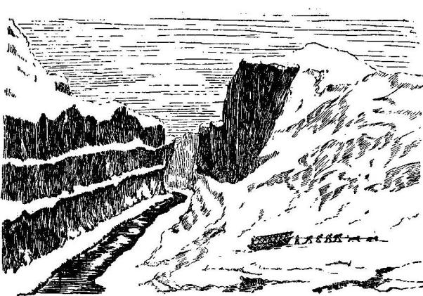
|
|
THE ROSSES ON THEIR JOURNEY TO THE NORTH MAGNETIC POLE. From a drawing in Ross's Second Voyage for a North-West Passage, 1835. |
By the end of August the ice had broken and the Victory was once more in full sail, but gales of wind drove her into harbour, which she never left again. Despite their colossal efforts, it soon became apparent that yet another winter would have to be passed in the frozen seas. The entries in Ross's journal become shorter and more despondent day by day. "The sight of ice to us is a plague, a vexation, a torment, an evil, a matter of despair. Could we have skated, it would not have been an amusement; we had exercise enough and, worst of all, the ice which surrounds us obstructed us, imprisoned us, annoyed us in every possible manner, had become odious to our sight." By October there was no open water to be seen; "the hopeful did not hope more, and the despondent continued to despair."
By the end of August, the ice had melted, and the Victory was once again fully sailing, but strong winds forced her back into harbor, where she never left again. Despite their massive efforts, it quickly became clear that they would have to endure yet another winter in the frozen seas. The entries in Ross's journal grew shorter and more hopeless with each passing day. "The sight of ice is a curse, a nuisance, a torment, a problem, and a source of despair. If we could have skated, it wouldn’t have been fun; we had plenty of exercise already, and, worst of all, the ice surrounding us confined us, trapped us, and bothered us in every way possible—it became unbearable to look at." By October, there was no open water in sight; "the optimistic no longer had hope, and the discouraged continued to despair."
This was their third winter in the ice—food was growing scarce, the meat was so hard frozen that it had to be cut with a saw or thawed in warm cocoa. Snow-blindness afflicted many of the men badly. At last came the summer of 1833, but the Victory was still fast in her winter quarters, and all attempts to release her had failed. They now decided to abandon her and to drag their boats over the ice to the wreck of the Fury, replenishing their stores and trusting to some whaler to take them home. We get a pathetic picture. "The colours were hoisted," says Ross, "and nailed to the mast, we drank a parting glass to our poor old ship, and, having seen every man out, I took my own adieu of the Victory in the evening. She had deserved a better fate. It was like parting with an old friend."
This was their third winter stuck in the ice—food was running low, and the meat was so frozen solid that it had to be cut with a saw or thawed in warm cocoa. Many of the men suffered badly from snow-blindness. Finally, summer arrived in 1833, but the Victory was still trapped in her winter quarters, and all attempts to free her had failed. They decided to abandon her and haul their boats over the ice to the wreck of the Fury, restocking their supplies and hoping a whaler would take them home. It paints a sad picture. "The colors were raised," Ross recalls, "and nailed to the mast, we shared a final drink to our poor old ship, and after ensuring every man was out, I said my own goodbye to the Victory in the evening. She deserved a better fate. It felt like saying goodbye to an old friend."
On 23rd April the weary explorers began dragging their boats and the last month's provisions over the ice in the face of wind and snow. The journey was painful and distressing. They found Barrow's Strait full of impenetrable ice, and resolved to pass the winter on Fury beach, which seemed almost like home to the half-starved men. Erecting a house which they called "Somerset House," they prepared for a fourth winter. For severity it was unequalled, the crew developed scurvy, and all were suffering sorely when, in the following August, the unfortunate party was rescued by the whaler, "Isabella of Hull, once commanded by Captain Ross." It was the ship in which Ross had made his first Arctic exploration. At first the mate refused to believe the story of these "bear-like" men. The explorers and Ross had been lost these two years. But, almost frantic with delight, the explorers climbed on board the Isabella to be received with the heartiest of cheers when their identity was disclosed. "That we were a repulsive-looking people, none could doubt," says poor Ross, "unshaven since I know not when, dirty, dressed in rags of wild beasts, and starved to the very bones, our gaunt and grim looks, when contrasted with those of the well-dressed and well-fed men around us, made us all feel what we really were, as well as what we seemed to others." Then followed a wild scene of "washing, dressing, shaving, eating, all intermingled," while in the midst of all there were questions to be asked and the news from England to be heard. Long accustomed to a cold bed on the hard snow or the bare rock, few of them could sleep that night in the comfort of the new accommodation.
On April 23rd, the exhausted explorers started dragging their boats and the last month's supplies over the ice, battling the wind and snow. The journey was painful and distressing. They found Barrow's Strait completely blocked with ice and decided to spend the winter at Fury Beach, which felt almost like home to the starving men. They built a house they named "Somerset House" and braced themselves for a fourth winter. It was incredibly harsh; the crew developed scurvy, and everyone was suffering badly when, the following August, the unfortunate group was rescued by the whaler, "Isabella of Hull, once commanded by Captain Ross." This was the same ship in which Ross had first explored the Arctic. At first, the mate couldn’t believe the story of these "bear-like" men. The explorers and Ross had been lost for two years. But nearly frantic with joy, the explorers climbed aboard the Isabella and were greeted with enthusiastic cheers when their identities were revealed. "That we were a repulsive-looking bunch, none could doubt," lamented poor Ross, "unshaven since I don’t know when, dirty, dressed in rags made from wild animals, and starved to the bone. Our gaunt and grim faces, especially when compared to the well-dressed and well-fed men around us, made us acutely aware of what we had become and how others viewed us." Then came a chaotic scene of "washing, dressing, shaving, eating, all mixed together," while amidst all this, there were questions to ask and news from England to hear. Having grown used to sleeping on cold snow or bare rock, few of them could actually sleep that night in the comfort of their new accommodations.
They were soon safely back in England, large crowds collecting to get a glimpse of Captain Ross. His own words best end the account of his travels. "On my arrival in London," he says, "on the 20th of October 1883, it became my first duty to repair to the royal palace at Windsor, with an account of my voyage, and to lay at the feet of His Majesty the British flag which had been hoisted on the Magnetic Pole."
They were soon safely back in England, large crowds gathering to catch a glimpse of Captain Ross. His own words best conclude the story of his travels. "Upon my arrival in London," he says, "on the 20th of October 1883, it became my first duty to go to the royal palace at Windsor, with a report of my voyage, and to present to His Majesty the British flag that had been raised at the Magnetic Pole."

|
|
"SOMERSET HOUSE," ROSS'S WINTER QUARTERS ON FURY BEACH. From a drawing in Ross's Second Voyage for a North-West Passage, 1835. |
CHAPTER LVIII
FLINDERS NAMES AUSTRALIA
We must now return to Australia, as yet so imperfectly explored, and take up the story of the young colony at Sydney.
We must now go back to Australia, which is still not fully explored, and continue the story of the young colony in Sydney.
For seven years it thrived under the careful management of Governor Phillips, who was then replaced by one Hunter. With the new governor from England arrived two young men destined to distinguish themselves in the exploration of New South Wales. They were midshipman Matthew Flinders and surgeon George Bass. The reading of Robinson Crusoe had created in young Flinders a passion for sea-adventure, and no sooner had the Reliance anchored in Sydney harbour than the two young friends resolved on an exploring expedition to the south. For there were rumours afloat that Van Diemen's Land did not join the main continent of New South Wales. Little enough help was forthcoming for the expedition, and the friends had to content themselves with a little boat eight feet long—the Tom Thumb—and only a boy to help them. But with all the eager enthusiasm of youth they sailed from Port Jackson on 25th March 1796. It is impossible to follow all their adventures as they attempted the survey of the coast. A storm on the 29th nearly swallowed up the little Tom Thumb and her plucky sailors.
For seven years, it thrived under the careful management of Governor Phillips, who was then replaced by one Hunter. With the new governor from England came two young men who would make their mark in the exploration of New South Wales. They were midshipman Matthew Flinders and surgeon George Bass. Reading Robinson Crusoe had ignited a passion for sea adventure in young Flinders, and as soon as the Reliance anchored in Sydney Harbour, the two friends decided on an exploring expedition to the south. There were rumors that Van Diemen's Land did not connect to the main continent of New South Wales. Little help was available for the expedition, so the friends had to make do with a small boat just eight feet long—the Tom Thumb—and only a boy to assist them. However, with the eager enthusiasm of youth, they set sail from Port Jackson on March 25, 1796. It's impossible to recount all their adventures as they tried to survey the coast. A storm on the 29th nearly capsized the little Tom Thumb and its brave sailors.

|
| MATTHEW FLINDERS |
"At ten o'clock," says Flinders, "the wind, which had been unsettled and driving electric clouds in all directions, burst out in a gale. In a few minutes the waves began to break, and the extreme danger to which this exposed our little bark was increased by the darkness of the night and the uncertainty of finding any place of shelter. Mr. Bass kept the sheet of the sail in his hand, drawing in a few inches occasionally, when he saw a particularly heavy sea following. I was steering with an oar. A single wrong movement or a moment's inattention would have sent us to the bottom. After running near an hour in this critical manner, some huge breakers were distinguished ahead; it was necessary to determine what was to be done at once, for our bark could not live ten minutes longer. On coming to what appeared to be the extremity of the breakers, the boat's head was brought to the wind, the mast and sail taken down, and the oars taken out. Pulling then towards the reef during the intervals of the heaviest seas, in three minutes we were in smooth water—a nearer approach showed us the beach of a well-sheltered cove in which we anchored for the rest of the night. We thought Providential Cove a well-adapted name for the place."
"At ten o'clock," says Flinders, "the wind, which had been restless and pushing electric clouds everywhere, suddenly turned into a gale. In just a few minutes, the waves began to break, and the extreme danger this posed to our small boat increased with the darkness of the night and the uncertainty of finding any shelter. Mr. Bass held the sail sheet, pulling in a few inches here and there when he spotted a particularly large wave coming. I was steering with an oar. One wrong move or a moment of distraction could have sent us to the bottom. After navigating like this for almost an hour, we spotted some huge waves ahead; we had to quickly figure out what to do because our boat couldn't survive for more than ten minutes. Approaching what seemed to be the edge of the breakers, we turned the boat into the wind, took down the mast and sail, and pulled out the oars. Then, we paddled toward the reef during the lull between the worst waves, and in three minutes, we found ourselves in calm water—a closer look revealed a beach in a well-sheltered cove where we anchored for the rest of the night. We thought 'Providential Cove' was a fitting name for the place."
Important local discoveries were made by the young explorers, and their skill and courage earned for them a better equipment for further exploration. A whale-boat provisioned for six weeks, and a crew of six, were placed at the disposal of Bass in order that he might discover whether Van Diemen's Land was joined to the mainland or whether there was a strait between. Cook had declared that there was no strait. Flinders now tells the story of his friend's triumphant success in finding the straits that now bear his name. He tells how Bass found the coast turning westward exposed to the billows of a great ocean, of the low sandy shore, of the spacious harbour which "from its relative position to the hitherto known parts of the coasts was called Port Western." His provisions were now at an end and, though he was keen to make a survey of his new discovery, he was obliged to return. This voyage of six hundred miles in an open boat on dangerous and unknown shores is one of the most remarkable on record. It added another three hundred miles of known coast-line, and showed that the shores of New Holland were divided from Van Diemen's Land. So highly did the colonists appreciate this voyage of discovery that the whale-boat in which Bass sailed was long preserved as a curiosity.
Important local discoveries were made by the young explorers, and their skill and bravery earned them better equipment for further exploration. A whale boat stocked for six weeks, along with a crew of six, was made available to Bass so he could find out whether Van Diemen's Land was connected to the mainland or if there was a strait in between. Cook had declared that there was no strait. Flinders now recounts his friend's triumphant success in locating the straits that now carry his name. He describes how Bass encountered the coast turning westward, exposed to the waves of a vast ocean, the low sandy shore, and the spacious harbor which "from its relative position to the previously known parts of the coasts was called Port Western." His provisions had now run out, and though he was eager to survey his new discovery, he had no choice but to return. This journey of six hundred miles in an open boat along dangerous and unknown shores is one of the most remarkable on record. It added another three hundred miles of known coastline and revealed that the shores of New Holland were separated from Van Diemen's Land. The colonists valued this exploration so much that the whale boat in which Bass sailed was kept as a curiosity for a long time.
A small boat of twenty-five tons, provisioned for twelve weeks, was now put at the disposal of the two friends, Flinders and Bass, to complete the survey of Van Diemen's Land, and in October 1798 they sailed for the south. With gales and strong winds blowing across the channel now known as Bass Strait, they made their way along the coast—the northern shores of Van Diemen's Land—till they found a wide inlet. Here they found a quantity of black swans, which they ate with joy, and also kangaroos, mussels, and oysters. This inlet they called Port Dalrymple, after the late hydrographer to the Admiralty in England. On 9th December, still coasting onward, they passed Three-Hummock Island and then a whole cluster of islands, to which, "in honour of His Excellency the Governor of New South Wales, I gave the title of Hunter's Isles." And now a long swell was noticed from the south-west. "It broke heavily upon a small reef and upon all the western shores, but, although it was likely to prove troublesome and perhaps dangerous, Mr. Bass and myself hailed it with joy and mutual congratulation, as announcing the completion of our long-wished-for discovery of a passage into the southern Indian Ocean."
A small boat weighing twenty-five tons, stocked for twelve weeks, was now available for the two friends, Flinders and Bass, to finish surveying Van Diemen's Land. In October 1798, they set sail to the south. Battling gales and strong winds across what is now called Bass Strait, they journeyed along the coast—the northern shores of Van Diemen's Land—until they discovered a wide inlet. There, they found a lot of black swans, which they happily ate, along with kangaroos, mussels, and oysters. They named this inlet Port Dalrymple, in honor of the late hydrographer to the Admiralty in England. On December 9th, while continuing along the coast, they passed Three-Hummock Island and then a whole group of islands, to which, "in honor of His Excellency the Governor of New South Wales, I gave the title of Hunter's Isles." At this point, they noticed a long swell coming from the south-west. "It crashed heavily on a small reef and along all the western shores, but despite it likely being troublesome and potentially dangerous, Mr. Bass and I hailed it with joy and mutual congratulations, as it marked the successful completion of our long-desired discovery of a passage into the southern Indian Ocean."
Calling the point where the island coast turned Cape Grime, they sailed along the western shores, their little boat exposed to the swell of the southern ocean. Sailing joyfully from point to point and naming them at will, the two explorers reached the extreme west, which they called South-West Cape. This had been already sighted by one of Cook's party in 1773. South Cape and Tasman's Head had been likewise charted as points at the extreme south of New South Wales. So the explorers sailed right round the island on which Tasman had landed one hundred and fifty-six years before, and after an absence of five months they reached Sydney with their important news. Bass now disappears from the annals of exploration, but his friend Flinders went off to England and found in our old friend Banks a powerful friend. He was given a stout north-country ship, H.M.S. Investigator of three hundred and thirty-four tons, with orders to return to New Holland and make a complete survey of the coast, and was off again in July 1801 with young John Franklin, his nephew, aboard.
Calling the point where the island coast turned Cape Grime, they sailed along the western shores, their small boat exposed to the swell of the southern ocean. Sailing happily from point to point and naming them as they liked, the two explorers reached the far west, which they called South-West Cape. This had already been spotted by one of Cook's crew in 1773. South Cape and Tasman's Head had also been marked as points at the far south of New South Wales. So the explorers sailed all the way around the island where Tasman had landed one hundred fifty-six years earlier, and after being away for five months, they returned to Sydney with their important news. Bass now fades from the record of exploration, but his friend Flinders went back to England and found in our old acquaintance Banks a strong ally. He was given a sturdy northern ship, H.M.S. Investigator, weighing three hundred thirty-four tons, with orders to return to New Holland and conduct a complete survey of the coast, and set off again in July 1801 with young John Franklin, his nephew, on board.
The Investigator arrived at Cape Leuwin in December and anchored in King George's Sound, discovered by Vancouver some ten years before. By the New Year he was ready to begin his great voyage round the Terra Australis, as the new country was still called. Indeed, it was Flinders who suggested the name of Australia for the tract of land hitherto called New Holland. His voyage can easily be traced on our maps to-day. Voyaging westward through the Recherches group of islands, Flinders passed the low, sandy shore to a cape he named Cape Pasley, after his late Admiral; high, bleak cliffs now rose to the height or some five hundred feet for a distance of four hundred and fifty miles—the great Australian Bight. Young Franklin's name was given to one island, Investigator to another, Cape Catastrophe commemorated a melancholy accident and the drowning of several of the crew. Kangaroo Island speaks for itself. Here they killed thirty-one dark-brown kangaroos. "The whole ship's company was employed this afternoon skinning and cleaning the kangaroos, and a delightful regale they afforded after four months' privation from almost any fresh provisions. Half a hundredweight of heads, forequarters, and tails were stewed down into soup for dinner, and as much steaks given to both officers and men as they could consume by day and night."
The Investigator arrived at Cape Leuwin in December and anchored in King George's Sound, which had been discovered by Vancouver about ten years earlier. By the New Year, he was set to start his significant journey around Terra Australis, as the new land was still known. In fact, it was Flinders who proposed the name Australia for the area previously known as New Holland. His route can easily be traced on our maps today. Traveling westward through the Recherches group of islands, Flinders passed the low, sandy shore to a cape he called Cape Pasley, in honor of his late Admiral; steep, bleak cliffs now rose to about five hundred feet for a distance of four hundred and fifty miles—the great Australian Bight. An island was named after young Franklin, another was called Investigator, and Cape Catastrophe marked a tragic accident where several crew members drowned. Kangaroo Island speaks for itself. Here, they hunted thirty-one dark-brown kangaroos. "The whole ship's crew was busy this afternoon skinning and cleaning the kangaroos, providing a delightful meal after four months of nearly no fresh provisions. Half a hundredweight of heads, forequarters, and tails were stewed into soup for dinner, and as much steak was given to both officers and men as they could eat day and night."

|
|
CAPE CATASTROPHE. From Flinders' Voyages. |
In April 1802 a strange encounter took place, when suddenly there appeared a "heavy-looking ship without any top-gallant masts up," showing a French ensign. Flinders cleared his decks for action in case of attack, but the strangers turned out to be the French ship Le Géographe, which, in company with Le Naturaliste, had left France, 1800, for exploration of the Australian coasts.
In April 1802, a strange encounter happened when a "heavy-looking ship without any top-gallant masts" suddenly appeared, flying a French flag. Flinders prepared his ship for action in case of an attack, but the newcomers turned out to be the French ship Le Géographe, which, along with Le Naturaliste, had left France in 1800 to explore the Australian coasts.
Now it was well known that Napoleon had cast longing eyes upon the Terra Australis—indeed, it is said that he took with him to Egypt a copy of Cook's Voyages. Flinders, too, knew of this French expedition, but he was not specially pleased to find French explorers engaged on the same work as himself. The commanders met as friends, and Baudin, the French explorer, told how he had landed also near Cape Leuwin in May 1801, how he had given the names of his two ships to Cape Naturaliste and Géographe Bay, and was now making his way round the coast. Flinders little guessed at this time that the French were going to claim the south of New South Wales as French territory under the name of Terra Napoleon, though it was common knowledge that this discovery was made by Englishmen.
Now it was well known that Napoleon had set his sights on Terra Australis—it's said he took a copy of Cook's Voyages with him to Egypt. Flinders was aware of this French expedition too, but he wasn’t particularly happy to find French explorers working on the same project as him. The commanders met as friends, and Baudin, the French explorer, shared that he had also landed near Cape Leuwin in May 1801, named his two ships after Cape Naturaliste and Géographe Bay, and was now making his way around the coast. Flinders had no idea at this point that the French were planning to claim the southern part of New South Wales as French territory, calling it Terra Napoleon, even though it was well known that this discovery was made by Englishmen.
"Ah, captain," said one of the French crew to Flinders, "if we had not been kept so long picking up shells and catching butterflies at Van Diemen's Land you would not have discovered this coast before us."
"Ah, captain," said one of the French crew to Flinders, "if we hadn’t spent so much time collecting shells and catching butterflies in Van Diemen's Land, you wouldn't have discovered this coast ahead of us."
When Baudin put in at Port Jackson a couple of months later, he inquired of the Governor the extent of British claims in the Pacific.
When Baudin arrived at Port Jackson a couple of months later, he asked the Governor about the extent of British claims in the Pacific.
"The whole of Tasmania and Australia are British territory," was the firm answer.
"The entire area of Tasmania and Australia is British territory," was the firm answer.
After this encounter Flinders discovered and named Port Phillip, at the head of which stands the famous city of Melbourne to-day, and then made his way on to Port Jackson. He had managed his crews so well that the inhabitants of Port Jackson declared they were reminded of England by the fresh colour of the men amongst the Investigator ship's company. The Frenchmen had not fared so well. One hundred and fifty out of one hundred and seventy were down with scurvy and had to be taken to the hospital at Sydney.
After this encounter, Flinders discovered and named Port Phillip, where the well-known city of Melbourne stands today, and then continued on to Port Jackson. He had managed his crews so effectively that the people of Port Jackson said the healthy appearance of the men from the Investigator reminded them of England. The French crew didn't do as well; out of one hundred and seventy, one hundred and fifty were suffering from scurvy and had to be taken to the hospital in Sydney.
Before the end of July, Flinders was off again, sailing northwards along the eastern coast of New South Wales. October found him passing the Great Barrier reefs, and on the 21st he had reached the northernmost point, Cape York. Three days of anxious steering took the Investigator through Torres Strait, and Flinders was soon sailing into the great Gulf of Carpentaria. Still hugging the coast, he discovered a group of islands to the south of the gulf, which he named the Wellesley Islands, after General Wellesley, afterwards Duke of Wellington. Here he found a wealth of vegetation; cabbage palm was abundant, nutmegs plentiful, and a sort of sandal-wood was growing freely. He spent one hundred and five days exploring the gulf; then he continued his voyage round the west coast and back to Port Jackson by the south. He returned after a year's absence with a sickly crew and a rotten ship. Indeed, the Investigator was incapable of further service, and Flinders decided to go back to England for another ship. As passenger on board the Porpoise, early in August 1802, he sailed from Sydney for the Torres Strait accompanied by two returning transports. All went well for the first four days, and they had reached a spot on the coast of Queensland, when a cry of "Breakers ahead!" fell on the evening air. In another moment the ship was carried amongst the breakers and struck upon a coral reef. So sudden was the disaster that there was no time to warn the other ships closely following. As the Porpoise rolled over on her beam ends, huge seas swept over her and the white foam leapt high. Then the mast snapped, water rushed in, and soon the Porpoise was a hopeless wreck. A few minutes later, one of the transports struck the coral reef: she fell on her side, her deck facing the sweeping rollers, and was completely wrecked. The other transport escaped, sailed right away from the scene of disaster, and was never seen again by the crew of the Porpoise. The dawn of day showed the shipwrecked crew a sandbank, to which some ninety-four men made their way and soon set sailcloth tents on the barren shore. They had saved enough food for three months. Flinders as usual was the moving spirit. A fortnight later in one of the ship's boats, with twelve rowers and food for three weeks, he left Wreck Reef amid ringing cheers to get help from Sydney for the eighty men left on the sandbank.
Before the end of July, Flinders set off again, sailing north along the eastern coast of New South Wales. By October, he was passing the Great Barrier reefs, and on the 21st, he reached the northernmost point, Cape York. Three days of tense steering took the Investigator through Torres Strait, and Flinders soon found himself sailing into the vast Gulf of Carpentaria. Still close to the coast, he discovered a group of islands south of the gulf, which he named the Wellesley Islands, after General Wellesley, later the Duke of Wellington. Here, he found a rich variety of vegetation; cabbage palms were abundant, nutmegs were plentiful, and a type of sandalwood was growing freely. He spent one hundred and five days exploring the gulf; then he continued his journey around the west coast and back to Port Jackson via the south. He returned after a year away with a sickly crew and a damaged ship. In fact, the Investigator was unfit for further service, and Flinders decided to go back to England for another ship. As a passenger on board the Porpoise, early in August 1802, he set sail from Sydney for Torres Strait, accompanied by two returning transports. Everything went smoothly for the first four days, and they had reached a location on the coast of Queensland when a cry of "Breakers ahead!" echoed through the evening air. In an instant, the ship was caught among the breakers and hit a coral reef. The disaster struck so suddenly that there was no time to warn the other ships that were closely following. As the Porpoise rolled onto its side, huge waves swept over her, and the white foam flew high. Then the mast broke, water poured in, and soon the Porpoise was a complete wreck. A few minutes later, one of the transports hit the coral reef: it fell on its side, its deck facing the crashing waves, and was utterly destroyed. The other transport got away, sailing far from the disaster, and was never seen again by the crew of the Porpoise. At dawn, the shipwrecked crew spotted a sandbank, which about ninety-four men made their way to and quickly set up sailcloth tents on the barren shore. They had saved enough food for three months. Flinders, as usual, was the driving force. Two weeks later, in one of the ship's boats, with twelve rowers and food for three weeks, he left Wreck Reef amid loud cheers to get help from Sydney for the eighty men left on the sandbank.
"The reader," says the hero of this adventure, "has perhaps never gone two hundred and fifty leagues at sea in an open boat or along a strange coast inhabited by savages; but, if he recollect the eighty officers and men upon Wreck Reef, and how important was our arrival to their safety and to the saving of the charts, journals, and papers of the Investigator's voyage, he may have some idea of the pleasure we felt, particularly myself, at entering our destined port."
"The reader," says the hero of this adventure, "may never have traveled two hundred and fifty leagues at sea in an open boat or along a strange coast inhabited by savages; but if you remember the eighty officers and men on Wreck Reef, and how crucial our arrival was for their safety and for saving the charts, journals, and documents from the Investigator's voyage, you might understand the joy we felt, especially me, upon reaching our intended port."
Half-starved, unshaven, deplorable indeed were the men when they staggered into Sydney, and "an involuntary tear started from the eye of friendship and compassion" when the Governor learnt how nearly Flinders and his friends had lost their lives.
Half-starved, unshaven, and truly pitiful were the men when they staggered into Sydney, and "an involuntary tear started from the eye of friendship and compassion" when the Governor learned how close Flinders and his friends had come to losing their lives.

|
|
THE HUTS OF THE CREW OF THE PORPOISE ON THE SANDBANK,
WRECK REEF. From Flinders' Voyages. |
A few days later Flinders left Sydney for the last time, in a little home-built ship of twenty-nine tons, the Cumberland. It was the first ship ever built in the colony, and the colonists were glad it should be of use to the man who had done so much for their country. With all his papers and his beloved journals, Flinders put to sea accompanied by a ship to rescue the men left on Wreck Reef. Three months later, owing to the leaky condition of the ship, he landed at Mauritius. Here he was taken prisoner and all his papers and journals were seized by the French. During his imprisonment a French Voyage of Discovery was issued, Napoleon himself paying a sum of money to hasten publication. All the places discovered by Flinders, or "Monsieur Flinedore" as the French called him, were called by French names. Fortunately before reaching Mauritius, Flinders had sent duplicate copies of his charts home, and the whole fraud was exposed. Flinders did not reach home till 1810. A last tragedy awaited him. For he died in 1814, on the very day that his great book, The Voyage to Terra Australis, was published. Flinders was a true explorer, and as he lay dying he cried, "I know that in future days of exploration my spirit will rise from the dead and follow the exploring ship!"
A few days later, Flinders left Sydney for the last time, in a small, home-built ship of twenty-nine tons, the Cumberland. It was the first ship ever made in the colony, and the colonists were happy it would be used by the man who had done so much for their country. With all his papers and his beloved journals, Flinders set sail, accompanied by a ship sent to rescue the men left on Wreck Reef. Three months later, due to the ship's leaky condition, he landed at Mauritius. There, he was taken prisoner and all his papers and journals were seized by the French. During his imprisonment, a French Voyage of Discovery was published, with Napoleon himself paying a sum to speed up the release. All the places discovered by Flinders, or "Monsieur Flinedore" as the French called him, were renamed with French names. Fortunately, before reaching Mauritius, Flinders had sent duplicate copies of his charts back home, and the whole fraud was uncovered. Flinders didn’t get home until 1810. A final tragedy awaited him; he died in 1814, on the very day that his great book, The Voyage to Terra Australis, was published. Flinders was a true explorer, and as he lay dying, he exclaimed, "I know that in future days of exploration my spirit will rise from the dead and follow the exploring ship!"
CHAPTER LIX
STURT'S DISCOVERIES IN AUSTRALIA
Since the days of Flinders, much discovery had been done in the great new island-continent of Australia. The Blue Mountains had been crossed, and the river Macquarie discovered and named after the governor of that name. But Sturt's famous discovery of the river Darling and his descent of the Murray River rank among the most noteworthy of a bewildering number of lesser expeditions.
Since the days of Flinders, a lot of discoveries have been made in the vast new island-continent of Australia. The Blue Mountains have been crossed, and the Macquarie River was discovered and named after the governor of that name. But Sturt's famous discovery of the Darling River and his journey down the Murray River stand out among the many smaller expeditions.
Captain Sturt landed with his regiment, the 39th, at Sydney in the year 1827, "to guard the convicts." His first impressions of Sydney are interesting. "Cornfield and orchard," he says, "have supplanted wild grass and brush; on the ruins of the forest stands a flourishing town; and the stillness of that once desert shore is now broken by the bugle and by the busy hum of commerce. It is not unusual to see from thirty to forty vessels from every quarter of the globe riding at anchor at one time."
Captain Sturt arrived with his regiment, the 39th, in Sydney in 1827, "to guard the convicts." His first impressions of Sydney are fascinating. "Cornfields and orchards," he notes, "have replaced wild grass and brush; on the remnants of the forest stands a thriving town; and the quiet of that once deserted shore is now interrupted by the bugle and the lively buzz of commerce. It's common to see thirty to forty ships from all around the world anchored at once."
Sir Ralph Darling, Governor of New South Wales, soon formed a high opinion of Sturt's ability, and when an expedition was proposed into the interior for further exploration, he appointed him leader.
Sir Ralph Darling, Governor of New South Wales, quickly recognized Sturt's talent, and when a mission was suggested to explore the interior further, he chose him as the leader.
There was a universal opinion in the colony that in the middle of the unknown continent lay a large inland sea. Oxley had made his way to a shallow ocean of reeds where the river Macquarie disappeared; natives spoke of "large waters" containing "great fish." To open up the country and to ascertain the truth of these rumours were the objects of this new expedition which left Sydney in November 1828. It consisted of Hamilton Hume, the first Australian-born explorer, two soldiers, eight convicts, fifteen horses, ten bullocks, and a small boat on a wheeled carriage. Across the roadless Blue Mountains they started, followed the traces of Oxley, who had died just a week before they started, and about Christmas time they passed his last camp and began to break new ground. Through thickets of reeds and marshy swamps they pushed on; the river Macquarie had entirely disappeared, but on 2nd February they suddenly found a large river some eighty yards broad enclosing an unbroken sheet of deep water. "Our surprise and delight," says Sturt, "are better imagined than described. Our difficulties seemed at an end. The banks were too steep to allow of watering the cattle, but the men eagerly descended to quench a thirst increased by the powerful sun. Never shall I forget their cry of amazement, nor the terror and disappointment with which they called out that the water was too salt to drink!" Leaving his party, Sturt pushed on, but no fresh water was to be found, so he named the river the Darling, after the Governor, and returned, but not till he had discovered brine springs in the bed of the river, which accounted for its saltness. Sturt had found no inland sea, but in the Darling he had discovered a main channel of the western watershed.
There was a general belief in the colony that in the center of the unknown continent lay a large inland sea. Oxley had traveled to a shallow expanse filled with reeds where the Macquarie River disappeared; locals talked about "large waters" that held "great fish." The goals of this new expedition, which set out from Sydney in November 1828, were to explore the country and find out if the rumors were true. It included Hamilton Hume, the first Australian-born explorer, two soldiers, eight convicts, fifteen horses, ten bullocks, and a small boat on a wheeled carriage. They began their journey across the roadless Blue Mountains, following the trail of Oxley, who had passed away just a week before they left. Around Christmas, they reached his last campsite and started to explore new territory. They pushed through dense reeds and swampy areas; the Macquarie River had completely vanished, but on February 2nd, they unexpectedly came across a large river about eighty yards wide with a vast expanse of deep water. "Our surprise and delight," says Sturt, "are better imagined than described. Our difficulties seemed to be over. The banks were too steep to water the cattle, but the men eagerly went down to quench their thirst heightened by the scorching sun. I will never forget their cries of amazement, nor the shock and disappointment when they shouted that the water was too salty to drink!" Leaving his group behind, Sturt continued on, but found no fresh water, so he named the river the Darling, after the Governor, and returned, though not before discovering brine springs in the riverbed that explained its saltiness. Sturt had not found an inland sea, but he had uncovered a main channel of the western watershed in the Darling.
He now proposed to follow the line of the Murrumbidgee, "a river of considerable size and impetuous current," and to trace it if possible into the interior. Several of his old party again joined him, and once more he rode out of Sydney on this new quest.
He now suggested following the path of the Murrumbidgee, "a river of considerable size and swift current," and to follow it if possible into the interior. Several members of his old team joined him again, and once more he rode out of Sydney on this new adventure.
The journey to the banks of the Murrumbidgee lay through wild and romantic country, but as they journeyed farther, broad reed belts appeared by the river, which was soon lost in a vast expanse of reeds. For a moment or two Sturt was as one stunned; he could neither sleep nor rest till he had regained the river again. When at last he did so he found the water was deep, the current rapid, and the banks high. But he turned on all hands to build the whale-boat which he had designed at Sydney for the purpose. Early in January he writes home: "I was checked in my advance by high reeds spreading as far as the eye can reach. The Murrumbidgee is a magnificent stream. I do not yet know its fate, but I have taken to the boats. Where I shall wander to God only knows. I have little doubt, however, that I shall ultimately make the coast."
The journey to the banks of the Murrumbidgee took them through stunning and picturesque countryside, but as they traveled further, wide stretches of reeds appeared along the river, which was quickly lost in a vast sea of reeds. For a moment, Sturt felt dazed; he couldn't sleep or relax until he reached the river again. When he finally did, he found the water deep, the current swift, and the banks steep. But he directed everyone to construct the whale boat he had planned in Sydney for this purpose. Early in January, he wrote back home: "I was held up in my journey by tall reeds extending as far as I could see. The Murrumbidgee is an impressive river. I still don’t know its destiny, but I’ve taken to the boats. Where I will wander, only God knows. However, I'm quite sure I will eventually reach the coast."
By 6th January the boat was ready and Sturt started on his memorable voyage. After passing the junction of the Lachlan, the channel gradually narrowed; great trees had been swept down by the floods and navigation rendered very dangerous. Still narrower grew the stream, stronger the current. "On a sudden, the river took a general southern direction. We were carried at a fearful rate down its gloomy banks, and at such a moment of excitement had little time to pay attention to the country through which we were passing. At last we found we were approaching a junction, and within less than a minute we were hurried into a broad and noble river. It is impossible to describe the effect upon us of so instantaneous a change. We gazed in silent wonder on the large channel we had entered."
By January 6th, the boat was ready, and Sturt set off on his unforgettable journey. After passing the junction of the Lachlan, the river gradually narrowed; massive trees had been swept away by the floods, making navigation very dangerous. The stream got narrower and the current stronger. "Suddenly, the river shifted to a general southern direction. We were swept along at a terrifying speed down its dark banks, and in that moment of excitement, we had little time to notice the landscape around us. Eventually, we realized we were approaching a junction, and in less than a minute, we were swept into a wide and impressive river. It's impossible to describe the impact of such an immediate change. We stared in silent awe at the vast channel we had entered."
The Murrumbidgee had joined the great Murray River as Sturt now called it, after Sir George Murray of the Colonial Department.
The Murrumbidgee had joined the great Murray River, as Sturt now referred to it, named after Sir George Murray of the Colonial Department.
To add to the unknown dangers of the way, numbers of natives now appeared in force on the banks of the river, threatening the white men with "dreadful yells and with the beating of spears and shields."
To increase the unknown dangers of the journey, large groups of locals now showed up along the riverbanks, intimidating the white men with "terrifying shouts and the clashing of spears and shields."
Firearms alone saved the little crew, and the rage of the natives was turned to admiration as they watched the white men paddling on their great river while some seventy black men swam off to the boat like "a parcel of seals."
Firearms alone saved the small crew, and the anger of the natives turned to admiration as they watched the white men paddle on their big river while about seventy Black men swam to the boat like "a bunch of seals."
The explorers now found a new and beautiful stream flowing into the Murray from the north, up which the boat was now turned, natives anxiously following along the grassy banks, till suddenly a net stretched across the stream checked their course. Sturt instinctively felt he was on the river Darling again. "I directed that the Union Jack should be hoisted, and we all stood up in the boat and gave three distinct cheers. The eye of every native was fixed upon that beautiful flag as it waved over us in the heart of a desert."
The explorers now discovered a new and beautiful stream flowing into the Murray from the north, and they turned the boat to head upstream, with natives anxiously following along the grassy banks, until suddenly a net stretched across the stream blocked their way. Sturt instinctively felt like he was on the River Darling again. "I instructed that the Union Jack be raised, and we all stood up in the boat and gave three loud cheers. Every native's gaze was fixed on that beautiful flag as it waved over us in the middle of a desert."
While they were still watching, Sturt turned the head of the boat and pursued his way down the great Murray River. Stormy weather at the end of January set in; though they were yet one hundred and fifteen miles from the coast, the river increased in breadth, cliffs towered above them, and the water dashed like sea-waves at their base.
While they were still watching, Sturt turned the boat's head and made his way down the mighty Murray River. Stormy weather hit at the end of January; even though they were still one hundred and fifteen miles from the coast, the river widened, cliffs loomed over them, and the water crashed like sea waves at their base.
On the 5th of February they were cheered by the appearance of sea-gulls and a heavy swell up the river, which they knew must be nearing the sea. On the twenty-third day of their voyage they entered a great lake. Crossing to the southern shore, they found to their bitter grief that shoals and sandbanks made it impossible for them to reach the sea. They found that the Murray flowed into Encounter Bay, but thither they could not pass. The thunder of the surf upon the shore brought no hope to the tired explorers. They had no alternative but to turn back and retrace their way. Terrible was the task that lay before them. On half-rations and with hostile natives to encounter they must fight their way against wind and stream. And they did it. They reached the camp on the Murrumbidgee just seventy-seven days after leaving it; but to their dismay it was deserted. The river, too, had risen in flood and "poured its turbid waters with great violence."
On February 5th, they were excited to see seagulls and a strong current moving up the river, signaling they were close to the sea. On the twenty-third day of their journey, they entered a large lake. When they crossed to the southern shore, they were deeply saddened to discover that shoals and sandbanks made it impossible for them to reach the sea. They learned that the Murray River flowed into Encounter Bay, but they couldn't get there. The sound of the waves crashing on the shore offered no hope to the exhausted explorers. They had no choice but to turn back and retrace their steps. The challenge ahead was daunting. With only half-rations and facing hostile natives, they had to struggle against the wind and the current. And they did it. They returned to the camp on the Murrumbidgee just seventy-seven days after leaving; but to their shock, it was empty. The river had also risen and "poured its turbid waters with great violence."

|
|
CAPTAIN STURT AT THE JUNCTION OF THE RIVERS DARLING
AND MURRAY. From the Narrative of Sturt's Expedition. |
"For seventeen days," says Sturt, "we pulled against stream with determined perseverance, but in our short daily journeys we made but trifling way against it." The effects of severe toil were painfully evident. The men lost the muscular jerk with the oars. Their arms were nerveless, their faces haggard, their persons emaciated, their spirits wholly spent. From sheer weariness they fell asleep at the oar. No murmur, however, escaped them.
"For seventeen days," says Sturt, "we rowed upstream with determined perseverance, but in our short daily journeys, we made very little progress against it." The effects of hard work were painfully clear. The men had lost their strong strokes with the oars. Their arms were weak, their faces gaunt, their bodies thin, and their spirits completely drained. From sheer exhaustion, they fell asleep at the oar. However, not a single complaint escaped them.
"I must tell the captain to-morrow," said one, thinking that Sturt was asleep, "that I can pull no more." But when the morrow came he said no word, but pulled on with his remaining strength. One man went mad. The last ounce of flour was consumed when relief arrived, and the weary explorers at last reached Sydney with their great news.
"I need to tell the captain tomorrow," said one, assuming that Sturt was asleep, "that I can’t keep going." But when tomorrow came, he said nothing and continued pulling with his last bit of strength. One man lost his mind. They finished the last bit of flour just as help arrived, and the exhausted explorers finally reached Sydney with their big news.
The result of this discovery was soon seen. In 1836 a shipload of English emigrants arrived off Kangaroo Island, and soon a flourishing colony was established at the mouth of the Murray River, the site of the new capital being called Adelaide, after the wife of William IV.
The outcome of this discovery became evident quickly. In 1836, a ship full of English emigrants reached Kangaroo Island, and shortly after, a thriving colony was set up at the mouth of the Murray River. The new capital was named Adelaide, after the wife of William IV.
After this Sturt tried to cross Australia from south to north; but though he opened up a good deal of new country, he failed to reach the coast. He was rewarded by the President of the Royal Geographical Society, who described him as "one of the most distinguished explorers and geographers of our age."
After this, Sturt tried to cross Australia from south to north; but even though he discovered a large amount of new territory, he couldn't make it to the coast. He was recognized by the President of the Royal Geographical Society, who called him "one of the most distinguished explorers and geographers of our time."
The feat of crossing Australia from south to north, from shore to shore, was reserved for an Irishman called Burke in the year 1861. The story of his expedition, though it was successful, is one of the saddest in the history of discovery. The party left Melbourne in the highest spirits. No expense had been spared to give them a good outfit; camels had been imported from India, with native drivers, and food was provided for a year. The men of Melbourne turned out in their hundreds to see the start of Burke with his four companions, his camels, and his horses. Starting in August 1860, the expedition arrived at Cooper's Creek in November with half their journey done. But it was not till December that the party divided, and Burke with his companions, Wills, King, and Gray, six camels, and two horses, with food for three months, started off for the coast, leaving the rest at Cooper's Creek to await their return in about three months. After hard going they reached a channel with tidal waters flowing into the Gulf of Carpentaria on 28th March, but they could not get a view of the open ocean because of boggy ground.
The achievement of crossing Australia from south to north, from one coast to the other, was accomplished by an Irishman named Burke in 1861. The story of his expedition, while successful, is one of the saddest in exploration history. The group left Melbourne feeling optimistic. No expense was spared to ensure they had a proper setup; camels were brought in from India with local drivers, and food was stocked for a year. Hundreds of people from Melbourne gathered to witness Burke set off with his four companions, camels, and horses. Starting in August 1860, the expedition reached Cooper's Creek by November, completing half of their journey. But it wasn’t until December that the group split up, with Burke and his companions, Wills, King, and Gray, taking six camels and two horses along with supplies for three months to head for the coast, while the rest stayed at Cooper's Creek to wait for their return in about three months. After some tough traveling, they arrived at a channel with tidal waters flowing into the Gulf of Carpentaria on 28th March, but they couldn't see the open ocean due to the boggy ground.

|
|
THE BURKE AND WILLS EXPEDITION LEAVING MELBOURNE, 1860. From a drawing by Wm. Strutt, an acquaintance of Burke. |
They accomplished their task, but the return journey was disastrous. Short rations soon began to tell, for they had taken longer than they had calculated, and no food was to be found by the way. Gray was the first to fail and to die. Heavy rains made the ground impossibly heavy, and the camels sank to the ground exhausted. Finally they had to be killed and eaten. Then the horses went. At long last the three weary men and two utterly worn-out camels dragged themselves to Cooper's Creek, hoping to find their companions and the food they had left there four months ago. It was 21st April. Not a soul was to be seen!
They completed their mission, but the journey back was a disaster. The short food supplies quickly became an issue because they took longer than they had planned, and there was no food to be found along the way. Gray was the first to collapse and die. Intense rain made the ground incredibly heavy, and the camels became exhausted and sank down. Eventually, they had to be killed and eaten. Then the horses followed suit. Finally, the three exhausted men and two completely worn-out camels dragged themselves to Cooper's Creek, hoping to find their companions and the food they had left there four months earlier. It was April 21st. Not a single person was in sight!
"King," cried Wills, in utter despair, "they are gone!"
"King," shouted Wills, in total despair, "they are gone!"
As the awful truth flashed on them Burke—their leader—threw himself on to the ground, realising their terrible situation. They looked round. On a tree they saw the word "Dig." In a bottle they found a letter: "We leave the camp to-day, 21st April 1861. We have left you some food. We take camels and horses."
As the harsh reality hit them, Burke—their leader—fell to the ground, understanding their dire predicament. They glanced around. On a tree, they spotted the word "Dig." Inside a bottle, they discovered a note: "We're leaving the camp today, April 21, 1861. We've left you some food. We're taking camels and horses."

|
|
BURKE AND WILLS AT COOPER'S CREEK. From a woodcut in a contemporary Australian account of the expedition. |
Only a few hours ago the party had left Cooper's Creek! And the explorers were too weak and tired to follow! They ate a welcome supper of oatmeal porridge and then, after resting a couple of days; they struggled on their way, three exhausted men and two tired camels. Their food was soon finished, and they had to subsist on a black seed like the natives called "nardoo." But they grew weaker and weaker, and the way was long. The camels died first. Then Wills grew too ill to walk, and there was nothing for it but to leave him and push on for help. The natives were kind to him, but he was too far gone, and he died before help could arrive. Burke and King sadly pushed on without him, but a few days later Burke died, and in the heart of Australia the one white man, King, was left alone. It was not till the following September that he was found "sitting in a hut that the blacks had made for him. He presented a melancholy appearance, wasted to a shadow and hardly to be distinguished as a civilised being except by the remnants of clothes on him."
Only a few hours ago, the group had left Cooper's Creek! And the explorers were too weak and tired to keep going! They enjoyed a much-needed supper of oatmeal porridge and then, after resting for a couple of days, they struggled on their way, three exhausted men and two tired camels. Their food was gone quickly, and they had to survive on a black seed the natives called "nardoo." But they kept getting weaker, and the journey felt endless. The camels died first. Then Wills became too sick to walk, and there was nothing to do but leave him and continue in search of help. The natives were kind to him, but he was too far gone, and he died before help could arrive. Burke and King sadly pressed on without him, but just a few days later, Burke died, and in the heart of Australia, King was left all alone. It wasn't until the following September that he was found "sitting in a hut that the blacks had made for him. He looked very sad, wasted to a shadow and hardly distinguishable as a civilized person except for the remnants of clothes on him."
So out of that gay party of explorers who left Melbourne in the summer of 1860 only one man returned to tell the story of success and the sadder story of suffering and disaster.
So out of that lively group of explorers who left Melbourne in the summer of 1860, only one man came back to share the tale of success and the more tragic tale of suffering and disaster.
CHAPTER LX
ROSS MAKES DISCOVERIES IN THE ANTARCTIC SEAS
Now, while explorers were busy opening up Australian inland, Ross was leaving the Australian waters for his voyage to the south. Four years after the return of the Ross polar expedition, Sir John Franklin had been made Governor of Van Diemen's Land, where he was visited by the ships sent out from England on the first Antarctic expedition under the command of Sir James Ross, who had returned to find himself famous for his discovery of the North Magnetic Pole.
Now, while explorers were busy exploring the Australian interior, Ross was departing from Australian waters for his journey south. Four years after the return of the Ross polar expedition, Sir John Franklin became the Governor of Van Diemen's Land, where he was visited by the ships sent from England on the first Antarctic expedition led by Sir James Ross, who had returned to find he was famous for discovering the North Magnetic Pole.
An expedition had been fitted out, consisting of the Erebus and the Terror—ships which later on made history, for did they not carry Sir John Franklin to his doom in the Arctic regions some years later? The ships sailed in the autumn of 1839 by way of the Cape of Good Hope, and excited great interest at Hobart Town, where the commanders, Ross and Crozier, were warmly received by the Governor. In a bay, afterwards called Ross Cove, the ships were repaired after the long voyage, while an observatory was built by the convicts under the personal supervision of Sir John Franklin. Interesting news awaited the explorers, too, at Hobart Town. Exploration had taken place in the southern regions by a French expedition under D'Urville and an American, Lieutenant Wilkes—both of which had made considerable discoveries. Ross was somewhat surprised at this, for, as he said, "England had ever led the way of discovery in the southern as well as in the northern regions," but he decided to take a more easterly course, and, if possible, to reach the South Magnetic Pole.
An expedition had been organized, consisting of the Erebus and the Terror—ships that would later make history for carrying Sir John Franklin to his fate in the Arctic some years later. The ships set sail in the autumn of 1839 via the Cape of Good Hope and generated great interest in Hobart Town, where the commanders, Ross and Crozier, received a warm welcome from the Governor. In a bay that was later named Ross Cove, the ships were repaired after the long journey, while convicts built an observatory under the direct supervision of Sir John Franklin. Exciting news also awaited the explorers in Hobart Town. Exploration had taken place in the southern regions by a French expedition led by D'Urville and an American, Lieutenant Wilkes—both of whom made significant discoveries. Ross was somewhat surprised by this because, as he noted, "England had always led the way of discovery in the southern as well as in the northern regions," but he decided to take a more easterly route and, if possible, reach the South Magnetic Pole.
On 5th November 1840 the ships were off again, shaping their course for Auckland Island, nine hundred miles from Hobart Town. The island had been discovered in 1806 by Captain Bristow. He had left some pigs, whose rapid increase filled the explorers with surprise. Christmas Day found them still sailing south, with strong gales, snow, and rain. The first iceberg was seen a few days later, and land on 11th January.
On November 5, 1840, the ships were on the move again, heading towards Auckland Island, which is nine hundred miles from Hobart Town. The island was discovered in 1806 by Captain Bristow, who had left some pigs there, and their rapid population growth surprised the explorers. They were still sailing south on Christmas Day, facing strong winds, snow, and rain. A few days later, they spotted the first iceberg, and land was sighted on January 11.
"It was a beautifully clear evening," says Ross, "and we had a most enchanting view of the two magnificent ranges of mountains whose lofty peaks, perfectly covered with eternal snow, rose to elevations of ten thousand feet above the level of the ocean." These icy shores were inhospitable enough, and the heavy surf breaking along its edge forbade any landing. Indeed, a strong tide carried the ships rapidly and dangerously along the coast among huge masses of ice. "The ceremony of taking possession of these newly discovered lands in the name of our Most Gracious Sovereign Queen Victoria was proceeded with, and on planting the flag of our country amid the hearty cheers of our party, we drank to the health, long life, and happiness of Her Majesty and His Royal Highness Prince Albert."
"It was a beautifully clear evening," says Ross, "and we had an amazing view of the two stunning mountain ranges, with their towering peaks completely covered in eternal snow, rising to ten thousand feet above sea level." These icy shores were pretty unwelcoming, and the rough surf crashing along the edge made any landing impossible. In fact, a strong tide swept the ships dangerously along the coast amid giant ice masses. "The ceremony to take possession of these newly discovered lands in the name of our Most Gracious Sovereign Queen Victoria went ahead, and as we planted our country’s flag amidst the enthusiastic cheers of our group, we toasted to the health, long life, and happiness of Her Majesty and His Royal Highness Prince Albert."
The end of the month found them farther south than any explorer had sailed before. Everything was new, and they were suddenly startled to find two volcanoes, one of which was active; steam and smoke rising to a height of two thousand feet above the crater and descending as mist and snow. Mount Erebus and Mount Terror, Ross called them, in memory of his two ships. They sailed on, but soon were stopped by a huge barrier of solid ice like a great white wall, one thousand feet thick and one hundred and eighty feet above sea-level. They knew now they could get no farther this season—they had reached a point one hundred and sixty miles from the Pole. Could they but have wintered here "in sight of the brilliant burning mountain and at so short a distance from the Magnetic Pole," they might easily have reached it the following spring,—so they thought,—but reluctantly Ross had to turn. "Few can understand the deep feelings of regret with which I felt myself compelled to abandon the perhaps too ambitious hope I had so long cherished of being permitted to plant the flag of my country on both Magnetic Poles of our globe."
The end of the month found them farther south than any explorer had sailed before. Everything was new, and they were suddenly surprised to see two volcanoes, one of which was active; steam and smoke rising to two thousand feet above the crater and coming down like mist and snow. Ross named them Mount Erebus and Mount Terror in memory of his two ships. They sailed on, but soon were stopped by a massive barrier of solid ice like a huge white wall, one thousand feet thick and one hundred eighty feet above sea level. They realized they couldn’t go any farther this season—they had reached a point one hundred sixty miles from the Pole. If only they could have wintered here "in sight of the brilliant burning mountain and at such a short distance from the Magnetic Pole," they might have easily reached it the following spring,—so they thought,—but Ross had to turn back with reluctance. "Few can understand the deep feelings of regret with which I felt compelled to abandon the perhaps too ambitious hope I had long cherished of being permitted to plant the flag of my country on both Magnetic Poles of our globe."
The whole of the great southern land they had discovered received the name of Queen Victoria, which name it keeps to-day. They had been south of the Antarctic Circle for sixty-three days, when they recrossed it on 4th March. A few days later they narrowly escaped shipwreck. An easterly wind drove them among some hundreds of icebergs. "For eight hours," says Ross, "we had been gradually drifting towards what to human eyes appeared inevitable destruction; the high waves and deep rolling of our ships rendered towing with boats impossible, and our situation was the more painful from our inability to make any effort to avoid the dreadful calamity that seemed to await us. The roar of the surf, which extended each way as far as we could see, and the dashing of the ice fell upon the ear with painful distinctness as we contemplated the awful destruction that threatened in one short hour to close the world and all its hopes and joys and sorrows upon us for ever. In this deep distress we called upon the Lord ... and our cry came before Him. A gentler air of wind filled our sails; hope again revived, and before dark we found ourselves far removed from every danger."
The entire southern land they discovered was named after Queen Victoria, a name it still holds today. They had spent sixty-three days south of the Antarctic Circle when they crossed back over it on March 4th. A few days later, they narrowly avoided being shipwrecked. An easterly wind pushed them among hundreds of icebergs. "For eight hours," Ross notes, "we had been slowly drifting toward what seemed like certain destruction; the high waves and rolling of our ship made it impossible to tow with boats, and our situation was even more distressing because we couldn’t do anything to avoid the terrible disaster that appeared to be waiting for us. The roar of the surf extended as far as we could see, and the crashing of the ice was painfully clear as we faced the horrible destruction that was threatening to end our world, along with all its hopes, joys, and sorrows, in just one short hour. In this deep distress, we called upon the Lord ... and our plea reached Him. A gentle breeze filled our sails; hope emerged again, and before nightfall, we found ourselves far removed from all danger."

|
|
PART OF THE GREAT SOUTHERN ICE BARRIER, 450 MILES LONG,
180 FEET ABOVE SEA-LEVEL, AND 1000 FEET THICK. From Ross's Voyage in Antarctic Regions. |
April found them back again in Van Diemen's land, and though Ross sailed again the following autumn into southern latitudes, he only reached a point some few miles farther than before—being again stopped by a great wall barrier of thick ice. After this he took his ship home by way of Cape Horn, and "the shores of Old England came into view on the 2nd of September 1843." After an absence of four years Ross was welcomed home, and honours were showered on him, including the award of the Gold Medal of the Royal Geographical Society of Paris.
April found them back in Van Diemen's Land, and although Ross sailed again the following autumn into southern latitudes, he only got a few miles farther than before—blocked again by a massive wall of thick ice. After this, he took his ship home via Cape Horn, and "the shores of Old England came into view on the 2nd of September 1843." After being away for four years, Ross was welcomed home, and he received many honors, including the Gold Medal from the Royal Geographical Society of Paris.
|
"Till then they had deemed that the Austral earth, With a long, unbroken shore, Ran on to the Pole Antarctic, For such was the old sea lore." |
CHAPTER LXI
FRANKLIN DISCOVERS THE NORTH-WEST PASSAGE
The whole coast-line of North America had now been charted, but the famous North-West Passage, for which so many lives had been laid down, had yet to be found. Sir John Barrow, "the father of modern Arctic discovery," Secretary to the Admiralty, now decided to dispatch another expedition to forge this last link and to connect, if possible, the chain of all former discoveries.
The entire coastline of North America had now been mapped, but the elusive Northwest Passage, for which so many lives had been sacrificed, had yet to be discovered. Sir John Barrow, "the father of modern Arctic discovery," and Secretary to the Admiralty, decided to send out another expedition to complete this final link and connect, if possible, the chain of all previous discoveries.
Many were the volunteers who came forward to serve in the new Arctic expedition. But Sir John Franklin claimed the command as his special right.
Many volunteers came forward to serve in the new Arctic expedition. However, Sir John Franklin insisted on taking command as his special right.
"No service," he declared, "is nearer to my heart."
"No service," he said, "is closer to my heart."
He was reminded that rumour put his age at sixty, and that after a long life of hard work he had earned some rest.
He was reminded that people said he was sixty and that after a lifetime of hard work, he had earned a break.
"No, no!" cried the explorer; "I am only fifty-nine!"
"No, no!" shouted the explorer; "I'm only fifty-nine!"
This decided the point, and Franklin was appointed to the Erebus and Terror, recently returned from the Antarctic expedition of Sir James Ross. The ships were provisioned for three years, and with a crew of one hundred and twenty-nine men and several officers, Sir John Franklin left England for the last time on 19th May 1845. He was never seen again!
This settled the matter, and Franklin was assigned to the Erebus and Terror, which had just returned from Sir James Ross's Antarctic expedition. The ships were stocked for three years, and with a crew of one hundred twenty-nine men and several officers, Sir John Franklin left England for the last time on May 19, 1845. He was never seen again!
All were in the highest spirits, determined to solve the mystery of the North-West Passage once and for all! So certain were they of success that one of the officers wrote to a friend: "Write to Panama and the Sandwich Islands every six months."
All were in great spirits, set on figuring out the mystery of the North-West Passage once and for all! They were so confident in their success that one of the officers wrote to a friend: "Write to Panama and the Sandwich Islands every six months."
On 4th July the ships anchored near the island of Disco on the west coast of Greenland. After which all is silence. The rest of the story, "one of the saddest ever told in connection with Arctic exploration," is dovetailed together from the various scraps of information that have been collected by those who sailed in search of the lost expedition year by year.
On July 4th, the ships dropped anchor near Disco Island on the west coast of Greenland. After that, everything went silent. The rest of the story, "one of the saddest ever told in connection with Arctic exploration," is pieced together from the various bits of information collected by those who set out in search of the lost expedition year after year.
In 1848, Sir James Ross had sailed off in search of his missing friend, and had reached a spot within three hundred miles of the Erebus and Terror four months after they had been abandoned, but he returned with no news of Franklin.
In 1848, Sir James Ross set sail looking for his missing friend and reached a location just three hundred miles from the Erebus and Terror four months after they were abandoned, but he came back with no news of Franklin.
Then Sir John Richardson started off, but found no trace! Others followed. The Government offered £20,000, to which Lady Franklin added £3000, to any one who should bring news of Franklin. By the autumn of 1850 there were fifteen ships engaged in the search. A few traces were found. It was discovered that Sir John Franklin had spent his first winter (1845-46) at Beechey Island. Captain McClure sailed along the north coast of America and made his way from the Pacific to the Atlantic Ocean—thus showing the existence of a north-west passage, for which he and his men were highly rewarded, for at this time no one knew that Franklin had already found a passage though he had not lived to tell the story of triumph and success. But it was not till after years of silence that the story of the missing expedition was cleared up. Lady Franklin purchased and fitted out a little steam yacht, the Fox, of one hundred and seventy-seven tons. The command was given to Captain McClintock, known to be an able and enthusiastic Arctic navigator. He was to rescue any "possible survivor of the Erebus and Terror, and to try and recover any records of the lost expedition."
Then Sir John Richardson set off, but found no trace! Others followed. The government offered £20,000, which Lady Franklin added £3,000 to, for anyone who could bring news of Franklin. By the autumn of 1850, there were fifteen ships involved in the search. A few signs were found. It was discovered that Sir John Franklin had spent his first winter (1845-46) at Beechey Island. Captain McClure sailed along the north coast of America and made his way from the Pacific to the Atlantic Ocean—proving the existence of a north-west passage, for which he and his crew were highly rewarded, as at that time no one knew that Franklin had already found a passage even though he had not lived to share the story of triumph and success. But it wasn't until years of silence passed that the story of the missing expedition was revealed. Lady Franklin bought and outfitted a small steam yacht, the Fox, weighing one hundred and seventy-seven tons. The command was given to Captain McClintock, known as a skilled and enthusiastic Arctic navigator. He was tasked with rescuing any "possible survivor of the Erebus and Terror, and trying to recover any records of the lost expedition."

|
|
ESKIMOS AT CAPE YORK WATCHING THE APPROACH OF THE FOX. From McClintock's Voyage in Search of Franklin. |
The 12th August found the little Fox in Melville Bay made fast to an iceberg, and a few days later she was frozen firmly into an ice-pack. For two hundred and forty-two days she was beset, drifting all through the long, bitter winter with the ice, till on 25th April 1858, after having been carried over a thousand miles, she was released. McClintock, undaunted by danger, turned northwards, and by May he had reached Melville Bay. Thence up Lancaster Sound, he reached Beechey Island in August and found there three lonely graves of three sailors from the Erebus and Terror. Here the English commander erected a tablet sent out by Lady Franklin.
On August 12, the little Fox in Melville Bay was secured to an iceberg, and a few days later, she was frozen solidly into an ice pack. For two hundred forty-two days, she was trapped, drifting through the long, harsh winter with the ice, until April 25, 1858, when she was freed after being carried over a thousand miles. McClintock, undeterred by danger, headed north and reached Melville Bay by May. From there, he traveled up Lancaster Sound and arrived at Beechey Island in August, where he found three lonely graves of sailors from the Erebus and Terror. Here, the English commander installed a tablet sent by Lady Franklin.

|
|
THE THREE GRAVES ON BEECHEY ISLAND. From McClintock's Voyage in Search of Franklin. |
On the morning of 16th August, McClintock sailed from Beechey Island, but the short summer was passing quickly and they had no fresh news of the Franklin expedition. Half-way through Bellot Strait the Fox was again icebound, and another long winter had to be faced. By the middle of February 1859 there was light enough to start some sledging along the west coast of Boothia Felix. Days passed and McClintock struggled on to the south, but no Eskimos appeared and no traces of the lost explorers were to be found. Suddenly they discovered four men walking after them.
On the morning of August 16th, McClintock sailed from Beechey Island, but summer was ending quickly and they had no updates on the Franklin expedition. Halfway through Bellot Strait, the Fox became stuck in the ice again, and they had to prepare for another long winter. By the middle of February 1859, there was enough light to begin sledging along the west coast of Boothia Felix. Days went by as McClintock pushed south, but no Eskimos showed up and there were no signs of the lost explorers. Suddenly, they spotted four men walking behind them.
A naval button on one of the Eskimos attracted their attention.
A naval button on one of the Eskimos caught their eye.
"It came," said the Eskimo, "from some white people who were starved upon an island where there are salmon, but none of them had seen the white men."
"It came," said the Eskimo, "from some white people who were starving on an island with salmon, but none of them had seen the white men."
Here was news at last—McClintock travelled on some ten miles to Cape Victoria, where the Eskimos built him a "commodious snow-hut in half an hour." Next morning the entire village of Eskimos arrived—some forty-five people—bringing relics of the white men. There were silver spoons, part of a gold chain, buttons, knives made of the iron and wood of the wrecked ships. But none of these people had seen the white men—one man said he had seen their bones upon the island where they died, but some were buried. They said a ship "having three masts had been crushed by the ice out in the sea to the west of King William's Island." One old man made a rough sketch of the coast-line with his spear upon the snow; he said it was eight journeys to where the ship sank.
Here was news at last—McClintock traveled about ten miles to Cape Victoria, where the Eskimos built him a "spacious snow hut in half an hour." The next morning, the whole village of Eskimos showed up—about forty-five people—bringing artifacts from the white men. They had silver spoons, part of a gold chain, buttons, and knives made from the iron and wood of the wrecked ships. But none of these people had actually seen the white men—one man said he had seen their bones on the island where they died, but some were buried. They mentioned that a ship "with three masts had been crushed by the ice out in the sea to the west of King William's Island." One old man drew a rough sketch of the coastline with his spear in the snow; he said it was an eight-day journey to where the ship sank.
McClintock hastened back to the ship with his news—he had by his sleigh-journey added one hundred and twenty miles to the old charts and "completed the discovery of the coast-line of Continental America."
McClintock hurried back to the ship with his news—he had added one hundred and twenty miles to the old maps during his sled journey and "completed the discovery of the coastline of Continental America."

|
|
EXPLORING PARTIES STARTING FROM THE FOX. From McClintock's Voyage of the "Fox" in Search of Franklin. |
On 2nd April more sledge-parties started out to reach King William's Island—the cold was still intense, the glare of the sun painful to their eyes. The faces and lips of the men were blistered and cracked; their fingers were constantly frostbitten. After nearly three weeks' travelling they found snow-huts and Eskimos at Cape Victoria. Here they found more traces of Franklin's party—preserved meat tins, brass knives, a mahogany board. In answer to their inquiries, they heard that two ships had been seen by the natives of King William's Island; one had been seen to sink in deep water, the other was forced on shore and broken up. "It was in the fall of the year (August or September)," they said, when the ships were destroyed, that all the white people went away to the large river, taking a boat with them, and that in the following winter their bones were found there.
On April 2nd, more sledding teams set out to reach King William's Island. The cold was still biting, and the glare of the sun hurt their eyes. The men’s faces and lips were blistered and cracked; their fingers were often frostbitten. After nearly three weeks of travel, they came across snow huts and Inuit people at Cape Victoria. Here, they found more evidence of Franklin's party—canned meat, brass knives, and a mahogany board. In response to their questions, they learned that two ships had been seen by the natives of King William's Island; one was seen sinking in deep water, while the other was driven ashore and wrecked. "It was in the fall of the year (August or September)," they said, when the ships were lost, and all the white people left for the big river, taking a boat with them, and that in the following winter, their bones were discovered there.
McClintock now made his way to the opposite coast of King William's Island. Here he found Eskimos with pieces of silver-plate bearing the crest and initials of Sir John Franklin and some of his officers. They said it was five days' journey to the wreck, of which little now remained. There had been many books, said the Eskimos, but they had been destroyed by the weather. One woman volunteered a statement. "Many of the white men," she said, "dropped by the way as they went to the Great River. Some were buried and some were not. Their bodies were discovered during the winter following." Moving onwards, McClintock reached the Great Fish River on the morning of 12th May. A furious gale was raging and the air was heavy with snow, but they encamped there to search for relics. With pickaxes and shovels they searched in vain. No Eskimos were to be found, and at last in despair the little party of explorers faced homewards. McClintock was slowly walking near the beach, when he suddenly came upon a human skeleton, lying face downwards, half buried in the snow. It wore a blue jacket with slashed sleeves and braided edging and a greatcoat of pilot-cloth.
McClintock now headed to the opposite coast of King William's Island. There, he encountered Eskimos who had pieces of silver-plate with the crest and initials of Sir John Franklin and some of his officers. They said it was a five-day journey to the wreck, of which little remained. The Eskimos mentioned there had been many books, but they were destroyed by the weather. One woman offered a statement: "Many of the white men," she said, "dropped along the way as they traveled to the Great River. Some were buried and some were not. Their bodies were discovered during the winter that followed." Continuing on, McClintock reached the Great Fish River on the morning of May 12th. A fierce gale was blowing and the air was thick with snow, but they set up camp there to search for relics. With pickaxes and shovels, they searched in vain. No Eskimos were to be found, and eventually, in despair, the small group of explorers turned to head home. McClintock was walking slowly near the beach when he suddenly stumbled upon a human skeleton, lying face down, half-buried in the snow. It was dressed in a blue jacket with slashed sleeves and braided trim, along with a pilot-cloth greatcoat.
The old woman was right. "They fell down and died as they walked along." And now the reward of the explorers was at hand. On the north-west coast of King William's Island was found a cairn and a blue ship's paper, weatherworn and ragged, relating in simple language, written by one of the ship's officers, the fate of the Franklin expedition. The first entry was cheerful enough. In 1846 all was well. His Majesty's ships, Erebus and Terror, wintered in the ice—at Beechey Island, after having ascended Wellington Channel and returned to the west side of Cornwallis Island. Sir John Franklin was commanding the expedition. The results of their first year's labour was encouraging. In 1846 they had been within twelve miles of King William's Island, when winter stopped them. But a later entry, written in April 1848, states that the ships were deserted on 22nd April, having been beset in ice since September 1846—that Sir John Franklin had died on 11th June 1847, and that Captain Crozier was in command.
The old woman was right. "They fell down and died as they were walking." Now the explorers’ reward was at hand. On the northwest coast of King William's Island, they discovered a cairn and a weathered, torn blue ship's paper that simply told the story, written by one of the ship's officers, about what happened to the Franklin expedition. The first entry was fairly upbeat. In 1846, everything was fine. His Majesty's ships, Erebus and Terror, spent the winter in the ice at Beechey Island, after navigating Wellington Channel and returning to the west side of Cornwallis Island. Sir John Franklin was leading the expedition. The results of their first year’s work were promising. In 1846, they had come within twelve miles of King William's Island when winter halted them. But a later entry, written in April 1848, noted that the ships were abandoned on April 22, having been stuck in the ice since September 1846—that Sir John Franklin had died on June 11, 1847, and that Captain Crozier was now in charge.
Then came the last words, "And start to-morrow twenty-sixth for Back's Fish River." That was all.
Then came the final words, "And start tomorrow the twenty-sixth for Back's Fish River." That was it.
After a diligent search in the neighbourhood for journals or relics, McClintock led his party along the coast, till on 30th May they found another relic in the shape of a large boat, with a quantity of tattered clothing lying in her. She had been evidently equipped for the ascent of the Great Fish River. She had been built at Woolwich Dockyard; near her lay two human skeletons, a pair of worker slippers, some watches, guns, a Vicar of Wakefield, a small Bible, New Testament, and Prayer Book, seven or eight pairs of boots, some silk handkerchiefs, towels, soap, sponge, combs, twine, nails, shot, and cartridges, needle and thread cases, some tea and chocolate, and a little tobacco.
After a thorough search in the neighborhood for journals or artifacts, McClintock guided his group along the coast, and on May 30, they discovered another item—a large boat with a bunch of ragged clothes inside. It was clearly outfitted for the journey up the Great Fish River. It had been constructed at Woolwich Dockyard; nearby, they found two human skeletons, a pair of work slippers, some watches, guns, a copy of Vicar of Wakefield, a small Bible, a New Testament, and a Prayer Book, seven or eight pairs of boots, some silk handkerchiefs, towels, soap, a sponge, combs, twine, nails, shot, cartridges, needle and thread cases, some tea and chocolate, and a bit of tobacco.
Everything was carefully collected and brought back to the ship, which was reached on 19th June. Two months later the little Fox was free from ice and McClintock reached London towards the end of September, to make known his great discovery.
Everything was carefully gathered and returned to the ship, which they reached on June 19th. Two months later, the little Fox was freed from the ice, and McClintock arrived in London towards the end of September to share his significant discovery.
The rest of the story is well known. Most of us know the interesting collection of Franklin relics in the United Service Institution in London, and the monument in Waterloo Place to "the great navigator and his brave companions who sacrificed their lives in completing the discovery of the North-West Passage."
The rest of the story is well known. Most of us are familiar with the fascinating collection of Franklin artifacts at the United Service Institution in London, and the monument in Waterloo Place honoring "the great navigator and his brave companions who gave their lives to complete the discovery of the North-West Passage."
It was acknowledged "that to Sir John Franklin is due the priority of discovery of the North-West Passage—that last link to forge which he sacrificed his life."
It was recognized that "Sir John Franklin deserves the credit for the discovery of the North-West Passage—that final connection for which he gave his life."
And on the marble monument in Westminster Abbey, Tennyson, a nephew of Sir John Franklin, wrote his well-known lines—
And on the marble monument in Westminster Abbey, Tennyson, a nephew of Sir John Franklin, wrote his famous lines—
|
"Not here, the white north hath thy bones, and thou, Heroic Sailor Soul, Art passing on thy happier voyage now Towards no earthly pole." |
CHAPTER LXII
DAVID LIVINGSTONE
"I shall open up a path to the interior or perish."
"I will create a way to the inside or die trying."
Such were the words of one of the greatest explorers of Africa in the nineteenth century. Determination was the keynote of his character even as a young boy. At the age of ten he was at work in a cotton factory in Scotland: with his first week's wages he bought a Latin grammar. Fourteen hours of daily work left little time for reading, but he educated himself, till at nineteen he was resolved to be a medical missionary.
Such were the words of one of the greatest explorers of Africa in the 19th century. Determination was the key trait of his character even as a young boy. At the age of ten, he was working in a cotton factory in Scotland: with his first week's pay, he bought a Latin grammar. Fourteen hours of daily work left him little time for reading, but he taught himself, until at nineteen he was determined to become a medical missionary.
"In the glow of love which Christianity inspires, I resolved to devote my life to the alleviation of human misery." He was accepted for service by the London Missionary Society, and in the year 1840 he sailed for South Africa. After a voyage of three months he arrived at Cape Town and made his way in a slow ox-waggon seven hundred miles to Kuruman, a small mission station in the heart of Bechuanaland where Dr. Moffat had laboured for twenty years. He did well, and two years later he was sent north to form another mission station at Mabotsa (Transvaal). Having married Moffat's daughter Mary, he worked in these parts till June 1849, when, with his wife and three children, he started with oxen and waggon for a journey northwards. Across the great Kalahari Desert moved the exploring family, till they came to the river called Zouga, which, said the natives, led to a large lake named Lake Ngami. In native canoes, Livingstone and his little family ascended this beautifully wooded river, "resembling the river Clyde above Glasgow," till on 1st August 1849, Lake Ngami appeared, "and for the first time," says Livingstone, "this fine sheet of water was beheld by Europeans." The lake was two thousand eight hundred feet above the sea, but the climate was terribly unhealthy. The children grew feverish, and mosquitoes made life a misery to them, while the tsetse fly made further exploration for the moment impossible. So the family journeyed back to headquarters for a time. But Livingstone was unsatisfied, and once more in 1851 we find him starting again with wife and children to seek the great river Zambesi, known to exist in central Africa, though the Portuguese maps represented it as rising far to the east of Livingstone's discovery.
"In the warmth of love that Christianity brings, I decided to dedicate my life to easing human suffering." He was accepted for service by the London Missionary Society, and in 1840 he set sail for South Africa. After a three-month voyage, he arrived in Cape Town and made his way in a slow ox-wagon seven hundred miles to Kuruman, a small mission station in the heart of Bechuanaland where Dr. Moffat had worked for twenty years. He did well, and two years later he was sent north to establish another mission station at Mabotsa (Transvaal). After marrying Moffat's daughter Mary, he worked in these areas until June 1849, when he, his wife, and their three children began a journey north with oxen and a wagon. The explorative family crossed the vast Kalahari Desert until they reached the river called Zouga, which, according to the locals, led to a large lake named Lake Ngami. In native canoes, Livingstone and his small family navigated this beautifully wooded river, "resembling the river Clyde above Glasgow," until on August 1, 1849, Lake Ngami came into view, "and for the first time," Livingstone states, "this fine sheet of water was seen by Europeans." The lake stood two thousand eight hundred feet above sea level, but the climate was extremely unhealthy. The children became feverish, and mosquitoes made life unbearable for them, while the tsetse fly rendered further exploration impossible for the time being. So the family returned to headquarters for a while. Yet Livingstone was restless, and once again in 1851, he embarked with his wife and children in search of the great river Zambesi, known to exist in central Africa, although Portuguese maps indicated it rose far to the east of Livingstone's discovery.

|
|
LIVINGSTONE, WITH HIS WIFE AND FAMILY, AT THE DISCOVERY OF LAKE NGAMI. From Livingstone's Missionary Travels. |
"It was the end of June 1851," he tells us, "that we were rewarded by the discovery of the Zambesi in the centre of the continent. This was an important point, for that river was not previously known to exist there at all. As we were the very first white men the inhabitants had ever seen, we were visited by prodigious numbers of Makololo in garments of blue, green, and red baize." Livingstone wanted to know more of this unknown river, but he now decided that exploring with a wife and family was not only perilous, but difficult, so he returned to the coast, put them on a homeward-bound ship for England, and returned to central Africa to continue his work of exploration alone.
"It was the end of June 1851," he tells us, "when we discovered the Zambesi in the middle of the continent. This was a significant point because that river wasn’t known to exist there at all. Since we were the first white men the locals had ever seen, we were visited by huge numbers of Makololo wearing garments of blue, green, and red baize." Livingstone wanted to learn more about this unknown river, but he decided that exploring with a wife and family was not only dangerous but also complicated, so he went back to the coast, put them on a ship heading home to England, and returned to central Africa to continue his exploration alone.
It was 11th November 1853 when Livingstone left the town of Linyanti in the very heart of central Africa for his great journey to the west coast to trace the course of the Zambesi.
It was November 11, 1853, when Livingstone left the town of Linyanti in the heart of central Africa for his significant journey to the west coast to follow the path of the Zambezi.
|
"The Zambesi. Nobody knows Whence it comes and whither it goes." |
So ran an old canoe-song of the natives.
So goes an old canoe song of the natives.
With twenty-seven faithful black Makololos, with "only a few biscuits, a little tea and sugar, twenty pounds of coffee and three books," with a horse rug and sheepskin for bedding and a small gipsy tent and a tin canister, fifteen inches square, filled with a spare shirt, trousers, and shoes for civilised life, and a few scientific instruments, the English explorer started for a six months' journey. Soon his black guides had embarked in their canoes and were making their way up the Zambesi. "No rain has fallen here," he writes on 30th November, "so it is excessively hot. The atmosphere is oppressive both in cloud and sunshine." Livingstone suffered badly from fever during the entire journey. But the blacks took fatherly care of him. "As soon as we land," he says, "the men cut a little grass for my bed, while the poles of my little tent are planted. The bed is made and boxes ranged on each side of it, and then the tent pitched over all. Two Makololos occupy my right and left both in eating and sleeping as long as the journey lasts, but my head boatman makes his bed at the door of the tent as soon as I retire."
With twenty-seven loyal black Makololos, along with “just a few biscuits, some tea and sugar, twenty pounds of coffee, and three books,” a horse rug and sheepskin for bedding, a small gypsy tent, and a tin canister fifteen inches square filled with an extra shirt, trousers, and shoes for civilized life, plus a few scientific instruments, the English explorer set off on a six-month journey. Soon, his black guides had boarded their canoes and were heading up the Zambesi. "No rain has fallen here," he writes on November 30th, "so it is incredibly hot. The atmosphere is stifling both in cloud and sunshine." Livingstone struggled with fever throughout the entire journey. However, the Makololos took great care of him. "As soon as we land," he says, "the men cut some grass for my bed while the poles of my little tent are set up. The bed is made, and boxes are arranged on each side of it, and then the tent is pitched over everything. Two Makololos stay by my right and left during meals and while sleeping for the duration of the journey, but my head boatman makes his bed at the entrance of the tent as soon as I go to sleep."
As they advanced up the Barotse valley, rains had fallen and the woods had put on their gayest hue. Flowers of great beauty grew everywhere. "The ground begins to swarm with insect life, and in the cool, pleasant mornings the place rings with the singing of birds."
As they moved up the Barotse valley, it had rained and the woods were bursting with color. Beautiful flowers bloomed everywhere. "The ground is teeming with insects, and in the cool, pleasant mornings, the area fills with the songs of birds."
On 6th January 1854 they left the river and rode oxen through the dense parts of the country through which they had now to pass. Through heavy rains and with very little food, they toiled on westward through miles and miles of swamp intersected by streams flowing southward to the Zambesi basin. One day Livingstone's ox, Sindbad, threw him, and he had to struggle wearily forward on foot. His strength was failing. His meagre fare varied by boiled zebra and dried elephant, frequent wettings and constant fever, were reducing him to a mere skeleton. At last on 26th March he arrived at the edge of the high land over which he had so long been travelling. "It is so steep," he tells us, "that I was obliged to dismount, and I was so weak that I had to be led by my companions to prevent my toppling over in walking down. Below us lay the valley of the Kwango in glorious sunlight." Another fortnight and they were in Portuguese territory. The sight of white men once more and a collection of traders' huts was a welcome sight to the weary traveller. The commandant at once took pity on Livingstone, but after a refreshing stay of ten days the English explorer started off westward to the coast. For another month he pursued his way. It was 31st May 1854. As the party neared the town of Loanda, the black Makololos began to grow nervous. "We have stood by each other hitherto and will do so to the last," Livingstone assured them, as they all staggered into the city by the seashore. Here they found one Englishman sent out for the suppression of the slave trade, who at once gave up his bed to the stricken and emaciated explorer. "Never shall I forget," he says, "the luxury I enjoyed in feeling myself again on a good English bed after six months' sleeping on the ground."
On January 6, 1854, they left the river and drove oxen through the thick parts of the countryside they now had to cross. Battling heavy rains and with barely any food, they trudged westward through miles of swamps crossed by streams flowing south to the Zambesi basin. One day, Livingstone's ox, Sindbad, threw him off, and he had to continue on foot, struggling with exhaustion. His strength was fading. His limited diet, which consisted of boiled zebra and dried elephant, coupled with frequent wettings and ongoing fever, was turning him into a mere skeleton. Finally, on March 26, he reached the edge of the high land he had been traveling over for so long. "It is so steep," he tells us, "that I had to get off and was so weak I needed to be led by my companions to keep from falling while walking down. Below us lay the valley of the Kwango in beautiful sunlight." After another two weeks, they entered Portuguese territory. The sight of white men again and a collection of traders' huts was a relief for the weary traveler. The commandant immediately took pity on Livingstone, but after a refreshing ten-day stay, the English explorer set off west toward the coast. For another month, he continued on his journey. It was May 31, 1854. As the group got closer to the town of Loanda, the black Makololos started to feel uneasy. "We have stood by each other so far and will stick together to the end," Livingstone reassured them as they all staggered into the seaside city. There, they encountered an Englishman sent out to help stop the slave trade, who immediately offered his bed to the weak and emaciated explorer. "I will never forget," he said, "the luxury I felt lying on a good English bed after six months of sleeping on the ground."
Nor were the Makololos forgotten. They were entertained on board an English man-of-war lying off the coast. Livingstone was offered a passage home, but he tells us: "I declined the tempting offers of my friends, and resolved to take back my Makololo companions to their Chief, with a view of making a path from here to the east coast by means of the great river Zambesi."
Nor were the Makololos forgotten. They were entertained on board an English warship lying off the coast. Livingstone was offered a ride home, but he tells us: "I declined the tempting offers of my friends and decided to take my Makololo companions back to their Chief, with the intention of creating a route from here to the east coast using the great river Zambesi."
With this object in view, he turned his back on home and comfort, and on 20th September 1854 he left Loanda and "the white man's sea," as the black guides called the Atlantic Ocean that washes the shores of West Africa. Their way lay through the Angola country, rich in wild coffee and cotton plantations. The weather was as usual still and oppressive, but slowly Livingstone made his way eastward. He suffered badly from fever as he had done on the outward journey. It had taken him six months to reach Loanda from central Africa; it took a year to complete the return journey, and it was September 1855 before Linyanti was again reached. Waggons and goods left there eighteen months before were safe, together with many welcome letters from home. The return of the travellers after so long an absence was a cause of great rejoicing. All the wonderful things the Makololos had seen and heard were rehearsed many times before appreciative audiences. Livingstone was more than ever a hero in their eyes, and his kindness to his men was not forgotten. He had no difficulty in getting recruits for the journey down the Zambesi to the sea, for which he was now making preparations.
With this goal in mind, he turned away from home and comfort, and on September 20, 1854, he left Loanda and "the white man's sea," as the local guides referred to the Atlantic Ocean that borders West Africa. Their path took them through Angola, a region rich in wild coffee and cotton plantations. The weather was typically still and oppressive, but Livingstone slowly made his way east. He struggled with fever just as he had on the way there. It took him six months to travel from central Africa to Loanda; the return journey took a year, and he reached Linyanti again in September 1855. The wagons and supplies that had been left there eighteen months earlier were safe, along with many welcome letters from home. The travelers' return after such a long time was a cause for great celebration. All the incredible things the Makololos had seen and heard were recounted many times to appreciative audiences. Livingstone was an even bigger hero in their eyes, and they didn’t forget his kindness to his men. He had no trouble recruiting for the journey down the Zambesi to the sea, for which he was now preparing.
On 3rd November he was ready to resume his long march across Africa. He was much better equipped on this occasion; he rode a horse instead of an ox, and his guide, Sekwebu, knew the river well. The first night out they were unfortunately caught in a terrific thunderstorm accompanied by sheet-lightning, which lit up the whole country and flooded it with torrents of tropical rain.
On November 3rd, he was ready to continue his long trek across Africa. He was much better prepared this time; he rode a horse instead of an ox, and his guide, Sekwebu, was very familiar with the river. Unfortunately, on the first night out, they were caught in a terrible thunderstorm with sheet lightning that illuminated the entire area and drenched it with heavy tropical rain.
A few days' travelling brought the party to the famous Zambesi Falls, called by the natives "where smoke sounds," but renamed by Livingstone after the Queen of England, Victoria. The first account of these now famous Falls is very vivid. "Five columns of vapour, appropriately named smoke, bending in the direction of the wind, appeared to mingle with the clouds. The whole scene was extremely beautiful. It had never been seen before by European eyes. When about half a mile from the Falls, I left the canoe and embarked in a lighter one with men well acquainted with the rapids, who brought me to an island in the middle of the river and on the edge of the lip over which the water rolls. Creeping with care to the verge, I peered down into a large rent which had been made from bank to bank of the broad Zambesi. In looking down into the fissure one sees nothing but a dense white cloud; from this cloud rushed up a great jet of vapour exactly like steam, and it mounted two or three hundred feet high."
A few days of travel brought the group to the famous Zambezi Falls, known by the locals as "where smoke sounds," but renamed by Livingstone after Queen Victoria of England. The first account of these now-famous Falls is very vivid. "Five columns of vapor, fittingly called smoke, bending with the wind, seemed to mix with the clouds. The entire scene was incredibly beautiful. It had never been seen before by European eyes. When I was about half a mile from the Falls, I left the canoe and got into a smaller one with men who were familiar with the rapids, and they took me to an island in the middle of the river, right at the edge where the water cascades. Cautiously approaching the edge, I looked down into a large chasm that extended from bank to bank of the wide Zambezi. Looking into the crevice, all you see is a dense white cloud; from this cloud bursts a large jet of vapor, just like steam, shooting up two or three hundred feet high."

|
|
THE "SMOKE" OF THE ZAMBESI (VICTORIA) FALLS. After a drawing in Livingstone's Missionary Travels. |
Livingstone now continued his perilous journey with his hundred men along the Zambesi, the country once densely populated, now desolate and still. The Bakota tribes, "the colour of coffee and milk," were friendly, and "great numbers came from all the surrounding villages and expressed great joy at the appearance of a white man and harbinger of peace." They brought in large supplies of food, and expressed great delight when Livingstone doctored their children, who were suffering from whooping-cough. As they neared the coast, they became aware of hostile forces. This was explained when they were met by a Portuguese half-caste "with jacket and hat on," who informed them that for the last two years they had been fighting the natives. Plunging thus unconsciously into the midst of a Kafir war rendered travelling unpleasant and dangerous. In addition, the party of explorers found their animals woefully bitten by the tsetse fly, rhinoceroses and elephants were too plentiful to be interesting, and the great white ant made itself tiresome.
Livingstone continued his challenging journey with his hundred men along the Zambezi River, in a land that was once crowded with people but now lay empty and silent. The Bakota tribes, "the color of coffee and milk," welcomed them, and "many came from all the nearby villages and expressed great joy at the sight of a white man and a bringer of peace." They brought plenty of food and were very grateful when Livingstone treated their children suffering from whooping cough. As they got closer to the coast, they realized they were up against hostile forces. This became clear when they encountered a Portuguese mixed-race man "wearing a jacket and hat," who told them that they had been fighting the locals for the past two years. Unknowingly stepping into the middle of a Kafir war made their travel uncomfortable and dangerous. Additionally, the group found their animals badly bitten by tsetse flies, there were so many rhinoceroses and elephants that they became boring, and the enormous white ants became a nuisance.
It was 3rd March before Livingstone reached Tete, two hundred and sixty miles from the coast. The last stages of the journey had been very beautiful. Many of the hills were of pure white marble, and pink marble formed the bed of more than one of the streams. Through this country the Zambesi rolled down toward the coast at the rate of four miles an hour, while flocks of water-fowl swarmed upon its banks or flew over its waters. Tete was the farthest outpost of the Portuguese. Livingstone was most kindly received by the governor, but fever again laid him low, and he had to remain here for three weeks before he was strong enough to start for the last stage of his journey to the coast. He left his Makololos here, promising to return some day to take them home again. They believed in him implicitly, and remained there three years, when he returned according to his word. Leaving Tete, he now embarked on the waters of the Zambesi, high with a fourth annual rise, which bore him to Sena in five days. So swift is the current at times that twenty-four hours is enough to take a boat from Tete to Sena, whereas the return journey may take twenty days.
It was March 3rd when Livingstone finally made it to Tete, two hundred and sixty miles from the coast. The last part of the trip was incredibly beautiful. Many of the hills were made of pure white marble, and pink marble formed the bed of several streams. In this area, the Zambesi River flowed towards the coast at about four miles an hour, while flocks of waterfowl gathered along its banks or flew over the water. Tete was the furthest outpost of the Portuguese. Livingstone received a warm welcome from the governor, but he was struck down by fever again, forcing him to stay there for three weeks until he was strong enough to continue the last leg of his journey to the coast. He left his Makololos behind, promising to come back and take them home one day. They believed in him completely and stayed there for three years until he returned as promised. After leaving Tete, he set out on the Zambesi River, which was high from its fourth annual rise, and it took him five days to reach Sena. The current can be so strong that it takes just twenty-four hours to move a boat from Tete to Sena, while the trip back can take up to twenty days.
"I thought the state of Tete quite lamentable," says Livingstone, but that of Sena was ten times worse. "It is impossible to describe the miserable state of decay into which the Portuguese possessions here have sunk."
"I thought the condition of Tete was really sad," says Livingstone, "but Sena was ten times worse. It's impossible to describe the awful decay that the Portuguese territories here have fallen into."
Though suffering badly from fever, Livingstone pushed on; he passed the important tributary of the Zambesi, the Shire, which he afterwards explored, and finally reached Quilimane on the shores of the Indian Ocean. It was now 20th May 1856, just four years after he had left Cape Town on his great journey from west to east, since when he had travelled eleven thousand miles. After waiting six weeks on the "great mud bank, surrounded by extensive swamps and rice grounds," which form the site of Quilimane, Livingstone embarked on board a gunboat, the Frolic, for England. He had one Makololo with him—the faithful Sekwebu. The poor black man begged to be allowed to follow his master on the seas.
Though suffering greatly from fever, Livingstone pressed on; he passed the important tributary of the Zambesi, the Shire, which he later explored, and finally reached Quilimane on the shores of the Indian Ocean. It was now May 20, 1856, just four years after he had left Cape Town on his great journey from west to east, during which he had traveled eleven thousand miles. After waiting six weeks on the "great mud bank, surrounded by extensive swamps and rice fields," which is where Quilimane is located, Livingstone boarded a gunboat, the Frolic, for England. He had one Makololo with him—the loyal Sekwebu. The poor man begged to be allowed to follow his master at sea.
"But," said Livingstone, "you will die if you go to such a cold country as mine."
"But," said Livingstone, "you'll die if you go to a cold place like mine."
"Let me die at your feet," pleaded the black man.
"Let me die at your feet," begged the black man.
He had not been to Loanda, so he had never seen the sea before. Waves were breaking over the bar at Quilimane and dashing over the boat that carried Sekwebu out to the brig. He was terribly alarmed, but he lived to reach Mauritius, where he became insane, hurled himself into the sea, and was drowned!
He had never been to Loanda, so he had never seen the ocean before. Waves were crashing over the bar at Quilimane and splashing onto the boat that was taking Sekwebu out to the brig. He was really scared, but he survived to reach Mauritius, where he went insane, jumped into the ocean, and drowned!
On 12th December 1856, Livingstone landed in England after an absence of sixteen years. He had left home as an obscure missionary; he returned to find himself famous. The Royal Geographical Society awarded him its gold medal; France and Scotland hastened to do him honour. Banquets and receptions were given for him, and finally this "plain, single-minded man, somewhat attenuated by years of toil, and with his face tinged by the sun of Africa," was received by the Queen at Windsor. The enthusiasm aroused by this longest expedition in the history of African travel was unrivalled, and the name of Livingstone was on every lip. But meanwhile others were at work in central Africa, and we must turn from the discoveries of Livingstone for the moment.
On December 12, 1856, Livingstone arrived back in England after being away for sixteen years. He had left home as a little-known missionary; now he returned to find himself famous. The Royal Geographical Society honored him with its gold medal; France and Scotland quickly paid tribute to him. Banquets and receptions were held in his honor, and eventually this "straightforward, humble man, somewhat worn by years of hard work, and with his face sun-kissed from Africa," was welcomed by the Queen at Windsor. The excitement generated by this longest expedition in the history of African exploration was unprecedented, and Livingstone's name was on everyone's lips. But in the meantime, others were working in central Africa, and we need to shift our focus from Livingstone's discoveries for now.
CHAPTER LXIII
BURTON AND SPEKE IN CENTRAL AFRICA
Livingstone had just left Loanda and was making his way across Africa from west to east, when an English expedition set forth to find the Great Lakes still lying solitary and undiscovered, although they were known to exist. If we turn to the oldest maps of Africa, we find, rudely drawn and incorrectly placed, large inland waters, that may nevertheless be recognised as these lakes just about to be revealed to a wondering world. Ptolemy knew of them, the Arabs spoke of them, Portuguese traders had passed them, and a German missionary had caught sight of the Mountains of the Moon and brought back strange stories of a great inland lake.
Livingstone had just left Loanda and was heading across Africa from west to east when an English expedition set out to discover the Great Lakes, which were still remote and unexplored, even though they were known to exist. If we look at the oldest maps of Africa, we see rough and inaccurately placed representations of large inland bodies of water that can still be recognized as these lakes, now on the verge of being revealed to a curious world. Ptolemy was aware of them, the Arabs talked about them, Portuguese traders had passed by them, and a German missionary had caught sight of the Mountains of the Moon and returned with fascinating tales of a large inland lake.
The work of rediscovering the lakes was entrusted to a remarkable man named Richard Burton, a man whose love of adventure was well known. He had already shown his metal by entering Mecca disguised as a Persian, and disguised as an Arab he had entered Harar, a den of slave traders, the "Timbuktu of Eastern Africa." On his return he was attacked by the Somalis; one of his companions was killed, another, Speke, escaped with terrible spear-wounds, and he himself was badly wounded.
The task of rediscovering the lakes was given to an extraordinary man named Richard Burton, known for his adventurous spirit. He had already proven his courage by entering Mecca disguised as a Persian, and as an Arab, he had infiltrated Harar, a hub of slave traders, dubbed the "Timbuktu of Eastern Africa." On his way back, he was ambushed by the Somalis; one of his companions was killed, another, Speke, narrowly escaped with severe spear wounds, and Burton himself sustained serious injuries.
Such were the men who in 1856 were dispatched by the Royal Geographical Society for the exploration of the mysterious lakes in the heart of central Africa. Speke gives us an idea of the ignorance prevailing on this subject only fifty-six years ago: "On the walls of the Society's rooms there hung a large diagram constructed by two missionaries carrying on their duties at Zanzibar. In this section map, swallowing up about half of the whole area of the ground included in it, there figured a lake of such portentous size and such unseemly shape, representing a gigantic slug, that everybody who looked at it incredulously laughed and shook his head—a single sheet of sweet water, upwards of eight hundred miles long by three hundred broad, equal in size to the great salt Caspian."
Such were the men who in 1856 were sent by the Royal Geographical Society to explore the mysterious lakes in the heart of central Africa. Speke gives us a glimpse of the ignorance that existed on this topic just fifty-six years ago: "On the walls of the Society's rooms, there was a large diagram made by two missionaries working at Zanzibar. In this map, which took up about half of the entire area it covered, there was a lake of such enormous size and such strange shape, resembling a gigantic slug, that everyone who saw it laughed incredulously and shook their heads—a single sheet of freshwater, over eight hundred miles long and three hundred miles wide, equal in size to the great salt Caspian."
It was April 1857 before Burton and Speke had collected an escort and guides at Zanzibar, the great slave market of East Africa, and were ready to start for the interior. "We could obtain no useful information from the European merchants of Zanzibar, who are mostly ignorant of everything beyond the island," Burke wrote home on 22nd April.
It was April 1857 before Burton and Speke gathered an escort and guides in Zanzibar, the major slave market of East Africa, and were set to journey inland. "We could get no helpful information from the European merchants in Zanzibar, who are mainly clueless about anything outside of the island," Burke wrote home on April 22nd.
At last on 27th June, with thirty-six men and thirty donkeys, the party set out for the great malarious coast-belt which had to be crossed before Kaze, some five hundred miles distant, could be reached. After three months' arduous travelling—both Burton and Speke were badly stricken with fever—they reached Kaze. Speke now spread open the map of the missionaries and inquired of the natives where the enormous lake was to be found. To their intense surprise they found the missionaries had run three lakes into one, and the three lakes were Lake Nyassa, Tanganyika, and Victoria Nyanza. They stayed over a month at Kaze, till Burton seemed at the point of death, and Speke had him carried out of the unhealthy town. It was January before they made a start and continued their journey westward to Ugyi.
At last, on June 27th, with thirty-six men and thirty donkeys, the group set out for the dangerous coast area they needed to cross before reaching Kaze, which was about five hundred miles away. After three months of tough traveling—both Burton and Speke were seriously affected by fever—they finally arrived at Kaze. Speke then opened the missionaries' map and asked the locals where the huge lake was located. To their great surprise, they discovered that the missionaries had combined three lakes into one, which were Lake Nyassa, Tanganyika, and Victoria Nyanza. They stayed in Kaze for over a month until Burton seemed close to death, prompting Speke to have him removed from the unhealthy town. It was January before they set off again and continued their journey west to Ugyi.
"It is a wonderful thing," says Drummond, "to start from the civilisation of Europe, pass up these mighty rivers, and work your way alone and on foot, mile after mile, month after month, among strange birds and beasts and plants and insects, meeting tribes which have no name, speaking tongues which no man can interpret, till you have reached its sacred heart and stood where white man has never trod before."
"It’s an amazing experience," Drummond says, "to leave behind European civilization, travel up these massive rivers, and journey by yourself on foot, mile after mile, month after month, surrounded by unique birds, animals, plants, and bugs, encountering tribes with no names and languages that no one can understand, until you finally reach its sacred core and stand where no white person has ever set foot before."

|
|
BURTON IN A DUG-OUT ON LAKE TANGANYIKA. After a drawing by Burton. |
As the two men tramped on, the streams began to drain to the west and the land grew more fertile, till one hundred and fifty miles from Kaze they began to ascend the slope of mountains overhanging the northern half of Lake Tanganyika. "This mountain mass," says Speke, "I consider to be the True Mountains of the Moon." From the top of the mountains the lovely Tanganyika Lake could be seen in all its glory by Burton. But to Speke it was a mere mist. The glare of the sun and oft-repeated fever had begun to tell on him, and a kind of inflammation had produced almost total blindness. But they had reached the lake and they felt sure they had found the source of the Nile. It was a great day when Speke crossed the lake in a long canoe hollowed out of the trunk of a tree and manned by twenty native savages under the command of a captain in a "goatskin uniform." On the far side they encamped on the opposite shore, Speke being the first white man to cross the lake.
As the two men trudged along, the streams started to flow westward and the land became more fertile, until, one hundred and fifty miles from Kaze, they began to climb the slopes of the mountains looming over the northern half of Lake Tanganyika. "I believe this mountain range," Speke said, "is the True Mountains of the Moon." From the peak of the mountains, Burton could see the beautiful Lake Tanganyika in all its splendor. But for Speke, it was just a blur. The harsh sun and recurring fever had taken a toll on him, leading to a kind of inflammation that resulted in almost complete blindness. Still, they had arrived at the lake, and they were convinced they had found the source of the Nile. It was an exciting day when Speke crossed the lake in a long canoe carved from a tree trunk, rowed by twenty local men under the command of a captain in a "goatskin uniform." On the far side, they set up camp on the opposite shore, with Speke being the first white man to make it across the lake.
Having retired to his hut for the night, Speke proceeded to light a candle and arrange his baggage, when to his horror he found the whole interior swarming with black beetles. Tired of trying to brush them away, he put out his light and, though they crawled up his sleeves and down his back, he fell asleep. Suddenly he woke to find one crawling into his ear, and in spite of his frantic efforts it crept in farther and farther till it reached the drum, which caused the tired explorer intense agony. Inflammation ensued, his face became drawn, he could with difficulty swallow a little broth, and he was quite deaf. He returned across the lake to find his companion, Burton, still very ill and unfit for further exploration.
Having settled into his hut for the night, Speke lit a candle and started to organize his gear, when he was horrified to discover the entire place filled with black beetles. Exhausted from trying to brush them away, he extinguished the light and, even though they crawled up his sleeves and down his back, he fell asleep. Suddenly, he woke up to find one crawling into his ear, and despite his desperate attempts to remove it, it burrowed in deeper until it reached his eardrum, causing the tired explorer excruciating pain. Inflammation set in, his face became gaunt, he struggled to swallow some broth, and he was completely deaf. He crossed the lake again to find his companion, Burton, still very sick and unable to continue the exploration.
So Speke, although still suffering from his ear, started off again, leaving Burton behind, to find the great northern lake spoken of as the sea of Ukerewe, where the Arabs traded largely in ivory. There was a great empire beyond the lake, they told him, called Uganda.
So Speke, even though he was still struggling with his ear, set off again, leaving Burton behind, to search for the large northern lake referred to as the sea of Ukerewe, where the Arabs traded extensively in ivory. They told him that there was a vast empire beyond the lake called Uganda.
But it was July 1858 when the caravan was ready to start from Kaze. Speke himself carried Burton's large elephant gun. "I commenced the journey," he says, "at 6 p.m., as soon as the two donkeys I took with me to ride were caught and saddled. It was a dreary beginning. The escort who accompanied me were sullen in their manner and walked with heavy gait and downcast countenance. The nature of the track increased the general gloom.
But it was July 1858 when the caravan was all set to leave Kaze. Speke himself carried Burton's big elephant gun. "I started the journey," he says, "at 6 p.m., as soon as the two donkeys I brought along to ride were caught and saddled. It was a gloomy start. The escort who came with me were moody and walked with a heavy stride and downcast faces. The condition of the trail added to the overall gloom.
"For several weeks the caravan moved forward, till on 3rd August it began to wind up a long but gradually inclined hill, until it reached its summit, when the vast expanse of the pale blue waters of the Nyanza burst suddenly upon my eyes! It was early morning. The distant sea-line of the north horizon was defined in the calm atmosphere, but I could get no idea of the breadth of the lake, as an archipelago of islands, each consisting of a single hill rising to a height of two or three hundred feet above the water, intersected the line of vision to the left. A sheet of water extended far away to the eastward. The view was one which even in a well-known country would have arrested the traveller by its peaceful beauty. But the pleasure of the mere view vanished in the presence of those more intense emotions called up by the geographical importance of the scene before me. I no longer felt any doubt that the lake at my feet gave birth to that interesting river (Nile), the source of which has been the subject of so much speculation and the object of so many explorers. This is a far more extensive lake than Tanganyika; it is so broad that you could not see across it, and so long that nobody knew its length. This magnificent sheet of water I have ventured to name Victoria after our gracious sovereign."
For several weeks, the caravan moved forward until, on August 3rd, it began to wind up a long, gently sloping hill. When it reached the top, the vast expanse of pale blue waters of Lake Nyanza suddenly came into view! It was early morning. The distant shoreline along the northern horizon was clear in the calm air, but I couldn’t grasp the lake's width because a group of islands, each consisting of a single hill rising two or three hundred feet above the water, blocked my view to the left. A stretch of water extended far away to the east. The scene was one that would have captivated any traveler with its serene beauty. But the enjoyment of the view faded in light of the stronger emotions stirred by the geographical significance of the landscape before me. I no longer doubted that the lake at my feet was the source of the Nile, a river that has sparked so much speculation and exploration. This lake is far larger than Tanganyika; it's so wide that you can't see across it and so long that its full length remains unknown. I dared to name this magnificent body of water Victoria in honor of our gracious sovereign.

|
|
BURTON AND HIS COMPANIONS ON THE MARCH TO THE VICTORIA NYANZA. From a humorous sketch by Burton. |
Speke returned to Kaze after his six weeks' eventful journey, having tramped no less than four hundred and fifty-two miles. He received a warm welcome from Burton, who had been very uneasy about his safety, for rumours of civil war had reached him. "I laughed over the matter," says Speke, "but expressed my regret that he did not accompany me, as I felt quite certain in my mind I had discovered the source of the Nile."
Speke returned to Kaze after his six weeks of an eventful journey, having walked four hundred and fifty-two miles. He got a warm welcome from Burton, who had been very worried about his safety since rumors of civil war had reached him. "I laughed about it," says Speke, "but I told him I wished he had come with me, as I felt pretty sure I had found the source of the Nile."
Together the two explorers now made their way to the coast and crossed to Aden, where Burton, still weak and ill, decided to remain for a little, while Speke took passage in a passing ship for home.
Together, the two explorers made their way to the coast and crossed to Aden, where Burton, still weak and sick, decided to stay for a while, while Speke took a ride on a passing ship back home.
When he showed his map of Tanganyika and Victoria Nyanza to the President of the Royal Geographical Society in London, Sir Roderick Murchison was delighted.
When he presented his map of Tanganyika and Lake Victoria to the President of the Royal Geographical Society in London, Sir Roderick Murchison was thrilled.
"Speke, we must send you there again," he said enthusiastically.
"Speke, we need to send you there again," he said excitedly.
And the expedition was regarded as "one of the most notable discoveries in the annals of African discovery."
And the expedition was seen as "one of the most remarkable discoveries in the history of African exploration."
CHAPTER LXIV
LIVINGSTONE TRACES LAKE SHIRWA AND NYASSA
Burton and Speke had not yet returned from central Africa, when Livingstone left England on another expedition into the interior, with orders "to extend the knowledge already attained of the geography of eastern and central Africa and to encourage trade." Leaving England on 10th March 1858, he reached the east coast the following May as British Consul of Quilimane, the region which lies about the mouth of the Zambesi. Livingstone had brought out with him a small steam-launch called by the natives the Ma-Robert after Mrs. Livingstone, the mother of Robert, their eldest child. In this little steam-launch he made his way up the Shire River, which flows into the Zambesi quite near its mouth. "The delight of threading out the meanderings of upwards of two hundred miles of a hitherto unexplored river must be felt to be appreciated," says Livingstone in his diary. At the end of this two hundred miles further progress became impossible because of rapids which no boat could pass. "These magnificent cataracts we called the Murchison Cataracts, after one whose name has already a world-wide fame," says Livingstone. Leaving their boat here, they started on foot for the Great Lake described by the natives. It took them a month of hard travelling to reach their goal. Their way lay over the native tracks which run as a network over this part of the world. "They are veritable footpaths, never over a foot in breadth, beaten as hard as adamant by centuries of native traffic. Like the roads of the old Romans, they run straight on over everything, ridge and mountain and valley."
Burton and Speke hadn’t returned from central Africa yet when Livingstone left England for another expedition into the interior, with orders "to expand the knowledge already gained about the geography of eastern and central Africa and to promote trade." Leaving England on March 10, 1858, he arrived at the east coast the following May as the British Consul of Quilimane, located near the mouth of the Zambezi River. Livingstone had brought with him a small steam launch dubbed by the locals as the Ma-Robert, named after Mrs. Livingstone, the mother of their eldest child, Robert. In this little steam launch, he navigated up the Shire River, which flows into the Zambezi not far from its mouth. "The joy of exploring over two hundred miles of an unexplored river must be experienced to be understood," Livingstone writes in his diary. After this two hundred-mile journey, they could go no further due to rapids that no boat could navigate. "We named these magnificent waterfalls the Murchison Cataracts, after someone whose name is already known worldwide," Livingstone states. Leaving their boat behind, they set out on foot towards the Great Lake described by the locals. It took them a month of hard travel to reach their destination. Their path followed the native trails that crisscross this region. "These paths are true footpaths, never more than a foot wide, beaten as hard as rock by centuries of local use. Like the roads of the ancient Romans, they go straight across everything—ridge, mountain, and valley."

|
|
THE MA-ROBERT ON THE ZAMBESI. After a drawing in Livingstone's Expedition to the Zambesi. |
On 18th April, Lake Shirwa came into sight, "a considerable body of bitter water, containing leeches, fish, crocodiles, and hippopotami. The country around is very beautiful," adds Livingstone, "and clothed with rich vegetation, and the waves breaking and foaming over a rock, added to the beauty of the picture. Exceedingly lofty mountains stand near the eastern shore."
On April 18th, Lake Shirwa appeared, "a large body of salty water, filled with leeches, fish, crocodiles, and hippos. The surrounding area is stunning," Livingstone remarked, "covered in lush vegetation, and the waves crashing and foaming over a rock enhanced the beauty of the scene. Very tall mountains rise near the eastern shore."
No white man had gazed at the lake before. Though one of the smaller African lakes, Shirwa is probably larger than all the lakes of Great Britain put together. Returning to Tete, the explorer now prepared for his journey to the farther Lake Nyassa. This was to be no new discovery. The Portuguese knew the locality of Lake Shirwa, and at the beginning of the seventeenth century Nyassa was familiar to them under another name. Landing at the same spot on the Shire banks as before, Livingstone, with thirty-six Makololo porters and two native guides, ascended the beautiful Shire Highlands, some twelve hundred feet above sea-level, and crossed the range on which Zomba, the residence of the British Commissioner for Nyassaland, now stands. When within a day's march of their goal they were told that no lake had ever been heard of in the neighbourhood, but, said the natives, the river Shire stretched on, and it would take two months to reach the end, which came out of perpendicular rocks which towered almost to the skies.
No white man had looked at the lake before. Although it's one of the smaller lakes in Africa, Shirwa is probably larger than all the lakes in Great Britain combined. Heading back to Tete, the explorer got ready for his journey to the more distant Lake Nyassa. This wasn’t a new discovery. The Portuguese were aware of the location of Lake Shirwa, and in the early seventeenth century, they recognized Nyassa by another name. Landing at the same spot on the banks of the Shire as before, Livingstone, accompanied by thirty-six Makololo porters and two native guides, climbed the stunning Shire Highlands, which rise about twelve hundred feet above sea level, and crossed the mountain range where Zomba, the home of the British Commissioner for Nyassaland, currently stands. When they were about a day's march from their destination, they were told that no lake had ever been known in the area, but the locals said the Shire River continued on, and it would take two months to reach the end, which emerged from cliffs that soared almost to the sky.
"Let us go back to the ship," said the followers; "it is no use trying to find the lake."
"Let’s head back to the ship," said the followers; "there’s no point in trying to find the lake."
But Livingstone persevered, and he was soon rewarded by finding a sheet of water, which was indeed the beginning of Lake Nyassa. It was 16th September 1859.
But Livingstone didn’t give up, and he was soon rewarded by discovering a body of water, which was actually the start of Lake Nyassa. It was September 16, 1859.
"How far is it to the end of the lake?" he asked.
"How far is it to the end of the lake?" he asked.
"The other end of the lake? Who ever heard of such a thing? Why, if one started when a mere boy to walk to the other end of the lake, he would be an old grey-headed man before he got there," declared one of the natives. Livingstone knew that he had opened up a great waterway to the interior of Africa, but the slave trade in these parts was terrible, gangs being employed in carrying the ivory from countries to the north down to the east coast. The English explorer saw that if he could establish a steamer upon this Lake Nyassa and buy ivory from the natives with European goods he would at once strike a deadly blow at the slave trade. His letters home stirred several missionaries to come out and establish a settlement on the banks of the Shire River. Bishop Mackenzie and a little band of helpers arrived on the river Shire two years later, and in 1862 Mrs. Livingstone joined them, bringing out with her a little new steamer to launch on the Lake Nyassa. But the unhealthy season was at its height, and "the surrounding low land, rank with vegetation and reeking from the late rainy season, exhaled the malarious poison in enormous quantities." Mrs. Livingstone fell ill, and in a week she was dead. She was buried under a large baobab tree at Shapunga, where her grave is visited by many a traveller passing through this once solitary region first penetrated by her husband.
"The other end of the lake? Who ever heard of such a thing? If someone started walking to the other end of the lake as a boy, they’d be an old man with grey hair by the time they got there," said one of the locals. Livingstone recognized that he had discovered a major waterway into the heart of Africa, but the slave trade in the area was horrendous, with gangs involved in transporting ivory from the northern countries to the east coast. The English explorer realized that if he could set up a steamer on Lake Nyassa and trade ivory with the locals for European goods, he would significantly undermine the slave trade. His letters back home inspired several missionaries to come and establish a settlement along the banks of the Shire River. Bishop Mackenzie and a small team arrived at the Shire River two years later, and in 1862, Mrs. Livingstone joined them, bringing a new steamer to launch on Lake Nyassa. However, the unhealthy season was at its peak, and "the surrounding low land, thick with vegetation and stinking from the recent rainy season, released malarial poison in massive amounts." Mrs. Livingstone fell ill, and within a week, she passed away. She was buried under a large baobab tree at Shapunga, where many travelers now visit her grave while passing through this once lonely area first explored by her husband.
The blow was a crushing one for Livingstone, and for a time he was quite bewildered. But when his old energy returned he superintended the launching of the little steamer, the Lady Nyassa. But disappointment and failure awaited him, and at last, just two years after the death of his wife, he took the Lady Nyassa to Zanzibar by the Rovuma River and set forth to reach Bombay, where he hoped to sell her, for his funds were low.
The setback hit Livingstone hard, leaving him confused for a while. However, once he regained his old determination, he oversaw the launch of the little steamer, the Lady Nyassa. Unfortunately, disappointment and failure were in store for him, and finally, just two years after his wife’s death, he took the Lady Nyassa to Zanzibar via the Rovuma River and set off to reach Bombay, where he hoped to sell her, as his funds were running low.
On the last day of April 1864 he started on his perilous journey. Though warned that the monsoon would shortly break, he would not be deterred. And after sailing two thousand five hundred miles in the little boat built only for river and lake, "a forest of masts one day loomed through the haze in Bombay harbour," and he was safe. After a brief stay here, Livingstone left his little launch and made his way to England on a mail-packet.
On the last day of April 1864, he began his risky journey. Even though he was warned that the monsoon would hit soon, he refused to back down. After traveling two thousand five hundred miles in a small boat designed only for rivers and lakes, "a forest of masts one day appeared through the haze in Bombay harbor," and he was safe. After a short stay there, Livingstone left his small boat and took a mail packet back to England.
But no one realised at this time the importance of his new discoveries. No one foresaw the value of "Nyassaland" now under British protectorate. Livingstone had brought to light a lake fifteen hundred and seventy feet above the sea, three hundred and fifty miles long and forty broad, up and down which British steamers make their way to-day, while the long range of mountains lining the eastern bank, known as the Livingstone range, testify to the fact that he had done much, even if he might have done more.
But nobody realized at that time how important his new discoveries were. No one anticipated the value of "Nyassaland," which is now under British protectorate. Livingstone had uncovered a lake that is one thousand five hundred seventy feet above sea level, three hundred fifty miles long, and forty miles wide, along which British steamers travel today, while the long range of mountains on the eastern shore, called the Livingstone range, shows that he accomplished a lot, even if he could have done more.
CHAPTER LXV
EXPEDITION TO VICTORIA NYANZA
While Livingstone was discovering Lake Nyassa, Speke was busy preparing for a new expedition to find out more about the great sheet of water he had named Victoria Nyanza and to solve the vexed question: Was this the source of the Nile?
While Livingstone was exploring Lake Nyassa, Speke was busy getting ready for a new expedition to learn more about the huge body of water he had called Victoria Nyanza and to answer the complicated question: Was this the source of the Nile?
In April 1860, accompanied by Captain Grant, an old friend and brother sportsman, he left England, and by way of the Cape reached Zanzibar some five months later. The two explorers started for their great inland journey early in October, with some hundred followers, bound for the great lake. But it was January 1861 before they had covered the five hundred miles between the coast and Kaze, the old halting-station of Burton and Speke. Through the agricultural plains known as Uzarana, the country of Rana, where many negro porters deserted, because they believed the white men were cannibals and intended to eat them when safe away from the haunts of men; through Usagara, the country of Gara, where Captain Grant was seized with fever; through Ugogo's great wilderness, where buffalo and rhinoceros abounded, where the country was flooded with tropical rains, on to the land of the Moon, three thousand feet above sea-level, till the slowly moving caravan reached Kaze. Here terrible accounts of famine and war reached them, and, instead of following Speke's route of 1858, they turned north-west and entered the Uzinza country, governed by two chieftains of Abyssinian descent. Here Speke was taken desperately ill. His cough gave him no rest day or night; his legs were "reduced to the appearance of pipe-sticks." But, emaciated as he was, he made his way onwards, till the explorers were rewarded by finding a "beautiful sheet of water lying snugly within the folds of the hills," which they named the Little Windermere, because they thought it was so like "our own English lake of that name. To do royal honours to the king of this charming land, I ordered my men," says Speke, "to put down their loads and fire a volley."
In April 1860, accompanied by Captain Grant, an old friend and fellow adventurer, he left England and reached Zanzibar via the Cape about five months later. The two explorers began their significant inland journey in early October, with around a hundred followers, heading for the great lake. However, it wasn’t until January 1861 that they finished the five hundred miles between the coast and Kaze, the old stopping point of Burton and Speke. They traveled through the agricultural plains known as Uzarana, the land of Rana, where many African porters deserted because they believed the white men were cannibals who intended to eat them when they were out of sight of other people. Then they crossed Usagara, the land of Gara, where Captain Grant fell ill with fever; and through the vast wilderness of Ugogo, filled with buffalo and rhinoceros and flooded with tropical rains, until they reached the Land of the Moon, three thousand feet above sea level, where the slowly moving caravan finally arrived at Kaze. Here they received alarming news of famine and war, and instead of following Speke's route from 1858, they turned northwest into the Uzinza country, ruled by two chieftains of Abyssinian descent. It was here that Speke became gravely ill. His cough kept him awake day and night; his legs became "as thin as pipe sticks." Yet, despite his frail condition, he pressed on until they were rewarded with the discovery of a "beautiful sheet of water tucked away in the hills," which they named Little Windermere because it reminded them of "our own English lake of that name." To pay tribute to the king of this lovely land, I instructed my men," Speke said, "to put down their loads and fire a volley."

|
|
M'TESA, KING OF UGANDA. From Speke's Journey to Discover the Source of the Nile. |
The king, whom they next visited, was a fine-looking man, who, with his brother, sat cross-legged on the ground, with huge pipes of black clay by their sides, while behind them, "squatting quiet as mice," were the king's sons, six or seven lads, with little dream-charms under their chins! The king shook hands in true English fashion and was full of inquiries. Speke described the world, the proportions of land and water, and the large ships on the sea, and begged to be allowed to pass through his kingdom to Uganda. The explorers learnt much about the surrounding country, and spent Christmas Day with a good feast of roast beef. The start for Uganda was delayed by the serious illness of Grant, until at last Speke reluctantly decided to leave him with the friendly king, while he made his way alone to Uganda and the Lake Victoria Nyanza. It was the end of January 1861 when the English explorer entered the unknown kingdom of Uganda. Messengers from the king, M'tesa, came to him. "Now," they said, "you have really entered the kingdom of Uganda, for the future you must buy no more food. At every place that you stop for the day, the officer in charge will bring you plantains."
The king they visited next was a handsome man who, along with his brother, sat cross-legged on the ground with large black clay pipes beside them. Behind them, "squatting as quietly as mice," were the king's sons—six or seven boys—with little dream-charms tucked under their chins! The king greeted them with a friendly handshake, typical of English customs, and was eager to ask questions. Speke described the world, the size of land and water, and the large ships sailing the sea, and requested permission to travel through the kingdom to Uganda. The explorers gained a lot of knowledge about the area and celebrated Christmas Day with a nice roast beef feast. Their departure for Uganda was postponed due to Grant's serious illness, and eventually, Speke, with some reluctance, chose to leave him with the accommodating king while he ventured alone to Uganda and Lake Victoria Nyanza. It was the end of January 1861 when the English explorer entered the unexplored kingdom of Uganda. Messengers from the king, M'tesa, arrived to greet him. "Now," they said, "you have truly entered the kingdom of Uganda. From now on, you won’t need to buy any more food. At every stop during the day, the officer in charge will bring you plantains."
The king's palace was ten days' march; the way lay along the western coast of the Lake Victoria Nyanza, the roads were "as broad as our coach roads cut through the long grass straight over the hills and down through the woods. The temperature was perfect. The whole land was a picture of quiescent beauty, with a boundless sea in the background."
The king's palace was a ten-day journey on foot; the path followed the western coast of Lake Victoria Nyanza. The roads were "as wide as our highway, cutting through the tall grass straight over the hills and down through the forests. The weather was perfect. The entire land was a picture of serene beauty, with an endless sea in the background."
On 13th February, Speke found a large volume of water going to the north. "I took off my clothes," he says, "and jumped into the stream, which I found was twelve yards broad and deeper than my height. I was delighted beyond measure, for I had, to all appearance, found one of the branches of the Nile's exit from the Nyanza."
On February 13th, Speke discovered a wide flow of water heading north. "I took off my clothes," he says, "and jumped into the stream, which I found to be twelve yards wide and deeper than I am tall. I was incredibly thrilled, as it seemed I had found one of the branches of the Nile flowing out from the Nyanza."
But he had not reached the Nile yet. It was not till the end of July that he reached his goal.
But he hadn't reached the Nile yet. It wasn't until the end of July that he arrived at his destination.
"Here at last," he says, "I stood on the brink of the Nile, most beautiful was the scene, nothing could surpass it—a magnificent stream from six hundred to seven hundred yards wide, dotted with islets and rocks, the former occupied by fishermen's huts, the latter by crocodiles basking in the sun. I told my men they ought to bathe in the holy river, the cradle of Moses."
"Finally," he says, "I stood at the edge of the Nile. It was the most beautiful scene; nothing could compare to it—a stunning river six hundred to seven hundred yards wide, filled with islands and rocks. The islands had fishermen's huts, and the rocks were sunbathing spots for crocodiles. I told my team they should take a dip in the holy river, the birthplace of Moses."
Marching onwards, they found the waterfall, which Speke named the Ripon Falls, "by far the most interesting sight I had seen in Africa." The arm of the water from which the Nile issued he named "Napoleon Channel," out of respect to the French Geographical Society for the honour they had done him just before leaving England in presenting their gold medal for the discovery of Victoria Nyanza.
Marching on, they discovered the waterfall, which Speke called the Ripon Falls, "by far the most fascinating sight I had seen in Africa." The stretch of water from which the Nile flowed was named "Napoleon Channel," in honor of the French Geographical Society for the recognition they gave him just before his departure from England when they awarded him their gold medal for the discovery of Victoria Nyanza.

|
|
THE RIPON FALLS ON THE VICTORIA NYANZA. From Speke's Journey to Discover the Source of the Nile. |
The English explorers had now spent six months in Uganda. The civilisation in this country of M'tesa's has passed into history. Every one was clothed, and even little boys held their skin-cloaks tightly round them lest their bare legs might by accident be seen! Everything was clean and orderly under the all-powerful ruler M'tesa. Grant, who arrived in the end of May, carried in a litter, found Speke had not yet obtained leave from the king to "open the country to the north, that an uninterrupted line of commerce might exist between England and Uganda by means of the Nile." But at last on 3rd July he writes with joy: "The moment of triumph has come at last and suddenly the road is granted."
The English explorers had now spent six months in Uganda. The civilization in this country of M'tesa's has become a thing of the past. Everyone was dressed, and even young boys held their skin-cloaks tightly around them to avoid accidentally revealing their bare legs! Everything was clean and organized under the powerful ruler M'tesa. Grant, who arrived at the end of May, carried in a litter, found that Speke had not yet received permission from the king to "open the country to the north, so that an uninterrupted trade route could exist between England and Uganda via the Nile." But finally, on July 3rd, he writes with joy: "The moment of triumph has come at last and suddenly the road is granted."
The explorers bid farewell to M'tesa. "We rose with an English bow, placing the hand on the heart, whilst saying adieu; and whatever we did M'tesa in an instant mimicked with the instinct of a monkey."
The explorers said goodbye to M'tesa. "We stood with a British bow, placing our hand on our heart while saying farewell; and whatever we did, M'tesa instantly copied with the instinct of a monkey."
In five boats of five planks each tied together and caulked with rags, Speke started with a small escort and crew to reach the palace of the neighbouring king, Kamrasi, "father of all the kings," in the province of Unyoro. After some fierce opposition they entered the palace of the king, a poor creature. Rumours had reached him that these two white men were cannibals and sorcerers. His palace was indeed a contrast to that of M'tesa. It was merely a dirty hut approached by a lane ankle-deep in mud and cow-manure. The king's sisters were not allowed to marry; their only occupation was to drink milk from morning to night, with the result that they grew so fat it took eight men to lift one of them, when walking became impossible. Superstition was rife, and the explorers were not sorry to leave Unyoro en route for Cairo. Speke and Grant now believed that, except for a few cataracts, the waterway to England was unbroken. The Karuma Falls broke the monotony of the way, and here the party halted a while before plunging into the Kidi wilderness across which they intended to march to save a great bend of the river. Their path lay through swampy jungles and high grass, while great grassy plains, where buffaloes were seen and the roar of lions was heard, stretched away on every side.
In five boats made of five planks each, tied together and sealed with rags, Speke set off with a small group of escorts and crew to reach the palace of the neighboring king, Kamrasi, "father of all kings," in the province of Unyoro. After facing some fierce resistance, they entered the king's palace, which was quite disappointing. Rumors had reached him that these two white men were cannibals and sorcerers. His palace was a stark contrast to M'tesa's; it was just a dirty hut, accessible by a path that was ankle-deep in mud and cow dung. The king's sisters were forbidden to marry, and their only job was to drink milk from morning till night, which made them so fat that it took eight men to lift one of them when walking became impossible. Superstition was rampant, and the explorers were glad to leave Unyoro en route for Cairo. Speke and Grant now believed that, except for a few waterfalls, the waterway to England was uninterrupted. The Karuma Falls broke the dullness of the journey, and the group paused for a while before plunging into the Kidi wilderness, where they planned to march to avoid a major bend in the river. Their route led them through swampy jungles and tall grass, while vast grassy plains, filled with buffaloes and the sounds of roaring lions, extended in every direction.

|
| CAPTAINS SPEKE AND GRANT. |
Suddenly they reached a huge rock covered with huts, in front of which groups of black men were perched like monkeys, evidently awaiting the arrival of the white men. They were painted in the most brilliant colours, though without clothes, for the civilisation of Uganda had been left far behind. Pushing on, they reached the Madi country, where again civilisation awaited them in the shape of Turks. It was on 3rd December that they saw to their great surprise three large red flags carried in front of a military procession which marched out of camp with drums and fifes playing.
Suddenly, they arrived at a huge rock featuring huts, where groups of Black men were perched like monkeys, clearly waiting for the arrival of the white men. They were painted in vibrant colors, but without clothes, as the civilization of Uganda was far behind them. As they moved forward, they reached the Madi country, where civilization greeted them again in the form of Turks. On December 3rd, they were surprised to see three large red flags being carried in front of a military parade that marched out of camp, drums and fifes playing.
"A very black man named Mohammed, in full Egyptian regimentals, with a curved sword, ordered his regiment to halt, and threw himself into my arms endeavouring to kiss me," says Speke. "Having reached his huts, he gave us two beds to sit upon, and ordered his wives to advance on their knees and give us coffee."
"A very dark-skinned man named Mohammed, dressed in full Egyptian military attire and holding a curved sword, commanded his troops to stop and threw himself into my arms, trying to kiss me," says Speke. "Once we arrived at his huts, he provided us with two beds to sit on and instructed his wives to approach on their knees and serve us coffee."
"I have directions to take you to Gondokoro as soon as you come," said Mohammed.
"I have directions to get you to Gondokoro as soon as you arrive," said Mohammed.
Yet they were detained till 11th January, when in sheer desperation they started off, and in two days reached the Nile. Having no boats, they continued their march overland till 15th February, when the masts of Nile boats came in sight, and soon after the two explorers walked into Gondokoro. Then a strange thing happened. "We saw hurrying on towards us the form of an Englishman, and the next moment my old friend Baker, famed for his sports in Ceylon, seized me by the hand. What joy this was I can hardly tell. We could not talk fast enough, so overwhelmed were we both to meet again. Of course we were his guests, and soon learned everything that could be told. I now first heard of the death of H.R.H. the Prince Consort. Baker said he had come up with three vessels fully equipped with armed men, camels, horses, donkeys, and everything necessary for a long journey, expressly to look after us. Three Dutch ladies also, with a view to assist us (God bless them!), had come here in a steamer, but were driven back to Khartum by sickness. Nobody had dreamt for a moment it was possible we could come through."
Yet they were held until January 11th, when out of sheer desperation, they set off and reached the Nile in two days. Without any boats, they kept going overland until February 15th, when they finally spotted the masts of Nile boats. Soon after, the two explorers walked into Gondokoro. Then something unexpected happened. "We saw an Englishman rushing toward us, and the next moment my old friend Baker, known for his adventures in Ceylon, grasped my hand. I can't even describe the joy this brought me. We were so excited to see each other again that we could hardly talk fast enough. Naturally, we were his guests, and we quickly learned everything we could. It was then that I first heard about the death of H.R.H. the Prince Consort. Baker explained that he had arrived with three fully equipped vessels carrying armed men, camels, horses, donkeys, and everything needed for a long journey, all specifically to look after us. Three Dutch ladies, wanting to help us (God bless them!), had come on a steamer but had to return to Khartum due to illness. No one had imagined for a moment that we could make it through."
Leaving Baker to continue his way to central Africa, Speke and Grant made their way home to England, where they arrived in safety after an absence of three years and fifty-one days, with their great news of the discovery of Uganda and their further exploration of Victoria Nyanza. When Speke reached Alexandria he had telegraphed home: "The Nile is settled." But he was wrong. The Nile was not settled, and many an expedition was yet to make its way to the great lakes before the problem was to be solved.
Leaving Baker to continue his journey to central Africa, Speke and Grant made their way back home to England, where they arrived safely after being away for three years and fifty-one days, bringing with them the exciting news of their discovery of Uganda and their further exploration of Victoria Nyanza. When Speke reached Alexandria, he had sent a telegram home saying, "The Nile is settled." But he was mistaken. The Nile was far from settled, and many more expeditions would still have to venture to the great lakes before the issue was solved.
CHAPTER LXVI
BAKER FINDS ALBERT NYANZA
Baker had not been long at Gondokoro when the two English explorers arrived from the south.
Baker hadn't been at Gondokoro for long when the two English explorers showed up from the south.
"In March 1861," he tells us, "I commenced an expedition to discover the sources of the Nile, with the hope of meeting the East African expedition of Captains Speke and Grant that had been sent by the English Government from the south via Zanzibar for that object. From my youth I had been innured to hardship and endurance in tropical climates, and when I gazed upon the map of Africa I had a wild hope that I might by perseverance reach the heart of Africa."
"In March 1861," he tells us, "I started an expedition to find the sources of the Nile, hoping to connect with the East African expedition of Captains Speke and Grant that the English Government had sent from the south via Zanzibar for that purpose. Since my youth, I had been used to hardship and endurance in tropical climates, and when I looked at the map of Africa, I had a wild hope that through determination I could reach the heart of Africa."
These are the opening lines of the published travels of Samuel Baker, famous as an elephant-hunter in Ceylon and engineer of the first railway laid down in Turkey. Like Livingstone, in his early explorations, Baker took his wife with him. "It was in vain that I implored her to remain, and that I painted the difficulties and perils still blacker than I supposed they really would be; she was resolved to share all dangers and to follow me through each rough footstep of the wild life before me."
These are the opening lines of the published travels of Samuel Baker, known for his elephant hunting in Sri Lanka and for engineering the first railway built in Turkey. Like Livingstone in his early explorations, Baker brought his wife along. "I begged her to stay behind and described the difficulties and dangers even worse than I thought they would actually be; she was determined to face all the risks and to accompany me through every tough moment of the wild journey ahead."
On 15th April 1861, Baker and his wife left Cairo to make their way southward to join the quest for the source of the Nile. They reached Korosko in twenty-six days, and crossed the Nubian desert on camels, a "very wilderness of scorching sand, the simoon in full force and the thermometer in the shade standing at 114° Fahr." By Abu Hamed and Berber they reached Atbara. It now occurred to Baker that without some knowledge of Arabic he could do little in the way of exploration, so for a whole year he stayed in northern Abyssinia, the country explored by Bruce nearly ninety years before.
On April 15, 1861, Baker and his wife left Cairo to head south in search of the Nile's source. They reached Korosko in twenty-six days, crossing the Nubian desert on camels, a "complete wilderness of scorching sand, the simoon in full force and the thermometer in the shade reading 114° Fahrenheit." By Abu Hamed and Berber, they arrived at Atbara. It dawned on Baker that without some knowledge of Arabic, he wouldn't be able to do much exploring, so he spent an entire year in northern Abyssinia, the region Bruce had explored nearly ninety years earlier.

|
|
BAKER AND HIS WIFE CROSSING THE NUBIAN DESERT. From Baker's Travels. |
It was therefore 18th December 1862 before he and Mrs. Baker left Khartum for their journey up the Nile through the slave-driven Sudan. It was a fifty days' voyage to Gondokoro. In the hope of finding Speke and Grant, he took an extra load of corn as well as twenty-two donkeys, four camels, and four horses. Gondokoro was reached just a fortnight before the two explorers returned from the south.
It was therefore December 18, 1862, when he and Mrs. Baker left Khartoum for their journey up the Nile through the slave-driven Sudan. The trip to Gondokoro took fifty days. Hoping to find Speke and Grant, he packed extra corn along with twenty-two donkeys, four camels, and four horses. Gondokoro was reached just two weeks before the two explorers returned from the south.
Baker's account of the historical meeting between the white men in the heart of Africa is very interesting: "Heard guns firing in the distance—report that two white men had come from the sea. Could they be Speke and Grant? Off I ran and soon met them; hurrah for Old England. They had come from the Victoria Nyanza from which the Nile springs. The mystery of ages solved! With a heart beating with joy I took off my cap and gave a welcome hurrah as I ran towards them! For the moment they did not recognise me; ten years' growth of beard and moustache had worked a change, and my sudden appearance in the centre of Africa appeared to them incredible. As a good ship arrives in harbour battered and torn by a long and stormy voyage, so both these gallant travellers arrived in Gondokoro. Speke appeared to me the more worn of the two. He was excessively lean; he had walked the whole way from Zanzibar, never having ridden once during that wearying march. Grant was in rags, his bare knees projecting through the remnants of trousers."
Baker's account of the historical meeting between the white men in the heart of Africa is very interesting: "I heard gunshots in the distance—word was that two white men had come from the sea. Could they be Speke and Grant? Off I ran and soon met them; cheers for Old England. They had come from Lake Victoria, where the Nile begins. The mystery of ages solved! With my heart full of joy, I took off my cap and shouted a welcome as I ran toward them! For a moment, they didn’t recognize me; ten years of beard and mustache had changed my appearance, and my sudden presence in the middle of Africa seemed unbelievable to them. Like a good ship arriving at port battered and torn after a long and stormy voyage, both of these brave travelers arrived in Gondokoro. Speke looked more worn than the other. He was extremely thin; he had walked the entire way from Zanzibar, never having ridden even once during that exhausting march. Grant was in rags, with his bare knees sticking out through the remnants of his trousers."
"We took neither guide nor interpreter," he continues. "We commenced our desperate journey in darkness about an hour after sunset. I led the way, Mrs. Baker riding by my side and the British flag following close behind us as a guide for the caravan of heavily laden camels and donkeys. And thus we started on our march in central Africa on the 26th of March 1863."
"We didn't take any guides or interpreters," he goes on. "We started our challenging journey in the dark about an hour after sunset. I was in the lead, with Mrs. Baker riding next to me and the British flag trailing close behind us to guide the caravan of heavily loaded camels and donkeys. And so we began our trek in central Africa on March 26, 1863."
It would take too long to tell of their manifold misfortunes and difficulties before they reached the lake they were in search of on 16th March 1864. How they passed through the uncivilised country so lately traversed by Speke and Grant, how in the Obbo country all their porters deserted just a few days before they reached the Karuma Falls, how Baker from this point tried to follow the Nile to the yet unknown lake, how fever seized both the explorer and his wife and they had to live on the common food of the natives and a little water, how suddenly Mrs. Baker fell down with a sunstroke and was carried for seven days quite unconscious through swamp and jungle, the rain descending in torrents all the time, till Baker, "weak as a reed," worn out with anxiety, lay on the ground as one dead.
It would take too long to talk about their many misfortunes and challenges before they finally reached the lake they were looking for on March 16, 1864. They traveled through the wild areas recently crossed by Speke and Grant, and in the Obbo region, all their porters abandoned them just days before they arrived at the Karuma Falls. From that point, Baker attempted to follow the Nile to the still-unknown lake. Fever struck both him and his wife, forcing them to survive on the simple food of the locals and a bit of water. Then, suddenly, Mrs. Baker collapsed from sunstroke and was carried for seven days, completely unconscious, through swamps and jungles, with rain pouring down relentlessly. By the end, Baker, "weak as a reed" and drained from worry, lay on the ground as if he were dead.
It seemed as if both must die, when better times dawned and they recovered to find that they were close to the lake.
It looked like they were both going to die, but then better times came and they woke up to find they were near the lake.
Baker's diary is eloquent: "The day broke beautifully clear, and, having crossed a deep valley between the hills, we toiled up the opposite slope. I hurried to the summit. The glory of our prize burst suddenly upon me! There, like a sea of quicksilver, lay far beneath us the grand expanse of water, a boundless sea-horizon on the south and south-west, glittering in the noonday sun, while at sixty miles' distance, blue mountains rose from the lake to a height of about seven thousand feet above its level. It is impossible to describe the triumph of that moment; here was the reward for all our labour! England had won the sources of the Nile! I looked from the steep granite cliff upon those welcome waters, upon that vast reservoir which nourished Egypt, upon that great source so long hidden from mankind, and I determined to honour it with a great name. As an imperishable memorial of one loved and mourned by our gracious Queen, I called this great lake 'the Albert Nyanza.' The Victoria and the Albert Lakes are the two sources of the Nile."
Baker's diary is powerful: "The day began beautifully clear, and after crossing a deep valley between the hills, we worked our way up the opposite slope. I rushed to the top. The glory of our discovery hit me all at once! There, like a sea of quicksilver, lay the vast expanse of water far below us, a limitless sea horizon to the south and southwest, shining in the midday sun, while blue mountains rose from the lake about sixty miles away to a height of around seven thousand feet above its level. It's impossible to capture the joy of that moment; here was the reward for all our hard work! England had claimed the sources of the Nile! I gazed from the steep granite cliff at those welcoming waters, at that vast reservoir that nourished Egypt, at that great source long hidden from humanity, and I decided to honor it with a grand name. As a lasting tribute to someone loved and mourned by our gracious Queen, I named this great lake 'the Albert Nyanza.' The Victoria and the Albert Lakes are the two sources of the Nile."
Weak and spent with fever, the Bakers descended tottering to the water's edge. "The waves were rolling upon a white pebbly beach. I rushed into the lake and, thirsty with heat and fatigue, I drank deeply from the sources of the Nile. My wife, who had followed me so devotedly, stood by my side pale and exhausted—a wreck upon the shores of the great Albert Lake that we had long striven to reach. No European foot had ever trod upon its sand, nor had the eyes of a white man ever scanned its vast expanse of water."
Weak and worn out from the fever, the Bakers slowly made their way to the edge of the water. "The waves rolled onto a white pebbly beach. I rushed into the lake and, thirsty from the heat and exhaustion, I drank deeply from the sources of the Nile. My wife, who had followed me so faithfully, stood beside me, pale and exhausted—a wreck on the shores of the great Albert Lake that we had worked so hard to reach. No European foot had ever touched its sand, nor had a white man ever looked out over its vast expanse of water."

|
|
BAKER'S BOAT IN A STORM ON LAKE ALBERT NYANZA. From Baker's Albert Nyanza. |
After some long delay, the Bakers procured canoes, "merely single trees neatly hollowed out," and paddled along the shores of the newly found lake. The water was calm, the views most lovely. Hippopotami sported in the water; crocodiles were numerous. Day after day they paddled north, sometimes using a large Scotch plaid as sail. It was dangerous work. Once a great storm nearly swamped them. The little canoe shipped heavy seas; terrific bursts of thunder and vivid lightning broke over the lake, hiding everything from view. Then down came the rain in torrents, swept along by a terrific wind. They reached the shore in safety, but the discomforts of the voyage were great, and poor Mrs. Baker suffered severely. On the thirteenth day they found themselves at the end of the lake voyage, and carefully examined the exit of the Nile from the lake. They now followed the river in their canoe for some eighteen miles, when they suddenly heard a roar of water, and, rounding a corner, "a magnificent sight suddenly burst upon us. On either side of the river were beautifully wooded cliffs rising abruptly to a height of three hundred feet and rushing through a gap that cleft the rock. The river pent up in a narrow gorge roared furiously through the rock-bound pass, till it plunged in one leap of about one hundred and twenty feet into a dark abyss below. This was the greatest waterfall of the Nile, and in honour of the distinguished President of the Royal Geographical Society I named it the Murchison Falls." Further navigation was impossible, and with oxen and porters they proceeded by land. Mrs. Baker was still carried in a litter, while Baker walked by her side. Both were soon attacked again with fever, and when night came they threw themselves down in a wretched hut. A violent thunderstorm broke over them, and they lay there utterly helpless, and worn out till sunrise. Worse was to come. The natives now deserted them, and they were alone and helpless, with a wilderness of rank grass hemming them in on every side. Their meals consisted of a mess of black porridge of bitter mouldy flour "that no English pig would notice" and a dish of spinach. For nearly two months they existed here, until they became perfect skeletons.
After a long wait, the Bakers finally got canoes, which were just single trees that had been hollowed out, and paddled along the shores of the newly discovered lake. The water was calm, and the views were beautiful. Hippopotamuses played in the water, and there were plenty of crocodiles. Day after day, they paddled north, sometimes using a large plaid blanket as a sail. It was risky work. Once, a huge storm almost capsized them. The small canoe took on heavy waves; loud thunder and bright lightning filled the sky, obscuring everything. Then the rain poured down in buckets, pushed along by a strong wind. They made it to the shore safely, but the hardships of the voyage were intense, and poor Mrs. Baker endured a lot. On the thirteenth day, they reached the end of the lake journey and carefully checked the Nile’s exit from the lake. They continued following the river in their canoe for about eighteen miles when they suddenly heard the sound of rushing water. As they turned a corner, a breathtaking view unfolded before them. On both sides of the river, beautifully wooded cliffs rose sharply to a height of three hundred feet, and the river roared through a gap in the rocks. The water, confined in a narrow gorge, rushed furiously through the rocky passage, plunging about one hundred and twenty feet into a dark abyss below. This was the greatest waterfall of the Nile, and in honor of the distinguished President of the Royal Geographical Society, I named it Murchison Falls. Further navigation was not possible, so they moved on land with oxen and porters. Mrs. Baker was still carried in a litter while Baker walked alongside her. Both soon suffered from fever again, and when night came, they collapsed in a miserable hut. A violent thunderstorm hit them, and they lay there utterly helpless and exhausted until sunrise. Things got worse. The locals abandoned them, leaving them alone and vulnerable, surrounded by a wilderness of thick grass. Their meals consisted of a bowl of bitter, moldy flour porridge “that no English pig would even notice” and a serving of spinach. They survived in this place for nearly two months until they became nothing but skin and bones.
"We had given up all hope of Gondokoro," says Baker, "and I had told my headman to deliver my map and papers to the English Consul at Khartum."
"We had given up all hope for Gondokoro," says Baker, "and I had told my headman to hand over my map and documents to the English Consul in Khartum."
But they were not to die here. The king, Kamrasi, having heard of their wretched condition, sent for them, treated them kindly, and enabled them to reach Gondokoro, which they did on 23rd March 1865, after an absence of two years. They had long since been given up as lost, and it was an immense joy to reach Cairo at last and to find that, in the words of Baker, "the Royal Geographical Society had awarded me the Victoria Gold Medal at a time when they were unaware whether I was alive or dead and when the success of my expedition was unknown."
But they were not meant to die there. The king, Kamrasi, having learned of their dire situation, summoned them, treated them well, and helped them reach Gondokoro, which they did on March 23, 1865, after being away for two years. They had long been assumed lost, and it was a great joy to finally arrive in Cairo and discover that, in Baker's words, "the Royal Geographical Society had awarded me the Victoria Gold Medal at a time when they didn't know if I was alive or dead and when the success of my expedition was still a mystery."
CHAPTER LXVII
LIVINGSTONE'S LAST JOURNEY
In the year 1865 "the greatest of all African travellers" started on his last journey to central Africa.
In 1865, "the greatest of all African travelers" began his final journey to central Africa.
"I hope," he said, "to ascend the Rovuma, and shall strive, by passing along the northern end of Lake Nyassa and round the southern end of Lake Tanganyika, to ascertain the watershed of that part of Africa."
"I hope," he said, "to travel up the Rovuma and will try, by going along the northern edge of Lake Nyassa and around the southern tip of Lake Tanganyika, to determine the watershed of that area of Africa."
Arrived at Zanzibar in January 1866, he reached the mouth of the Rovuma River some two months later, and, passing through dense thickets of trees, he started on his march along the northern bank. The expedition consisted of thirteen sepoys from Bombay, nine negroes from one of the missions, two men from the Zambesi, Susi, Amoda, and others originally slaves freed by Livingstone. As beasts of burden, they had six camels, three Indian buffaloes, two mules, four donkeys, while a poodle took charge of the whole line of march, running to see the first man in the line and then back to the last, and barking to hasten him up.
Arrived in Zanzibar in January 1866, he reached the mouth of the Rovuma River about two months later. Navigating through dense thickets of trees, he began his march along the northern bank. The expedition included thirteen sepoys from Bombay, nine locals from one of the missions, and two men from the Zambesi, Susi, Amoda, and others who were originally slaves freed by Livingstone. For carrying supplies, they had six camels, three Indian buffaloes, two mules, and four donkeys, while a poodle led the whole line of march, running to check on the first person in line and then back to the last, barking to urge them along.
"Now that I am on the point of starting on another trip into Africa," wrote Livingstone from Rovuma Bay, "I feel quite exhilarated. The mere animal pleasure of travelling in a wild, unexplored country is very great. Brisk exercise imparts elasticity to the muscles, fresh and healthy blood circulates through the brain, the mind works well, the eye is clear, the step firm, and a day's exertion makes the evening's repose thoroughly enjoyable."
"Now that I'm about to embark on another journey into Africa," wrote Livingstone from Rovuma Bay, "I feel really excited. Just the thrill of traveling through a wild, unexplored country is immense. Getting outside and moving around keeps my muscles flexible, fresh and healthy blood flows through my brain, my mind is sharp, my vision is clear, my stride is steady, and a day's exercise makes the evening's relaxation truly enjoyable."
But misfortunes soon began. As they marched along the banks of the Rovuma the buffaloes and camels were badly bitten by the tsetse fly, and one after another died. The cruelty of the followers to the animals was terrible. Indeed, they were thoroughly unsatisfactory.
But misfortunes soon started. As they walked along the banks of the Rovuma, the buffaloes and camels were badly bitten by the tsetse fly, and one after another died. The cruelty of the followers toward the animals was horrible. In fact, they were completely disappointing.
One day a party of them lagged behind, killed the last young buffalo, and ate it. They told Livingstone that it had died and tigers had come and devoured it.
One day, a group of them fell behind, killed the last young buffalo, and ate it. They told Livingstone that it had died and that tigers had come and eaten it.
"Did you see the stripes of the tiger?" asked Livingstone.
"Did you see the tiger's stripes?" asked Livingstone.
Yes; all declared that they had seen them distinctly—an obvious lie, as there are no striped tigers in Africa.
Yes; everyone claimed they had seen them clearly—an obvious lie, since there are no striped tigers in Africa.
On 11th August, Livingstone once more reached Lake Nyassa. "It was as if I had come back to an old home I never expected again to see, and pleasant it was to bathe in the delicious waters again. I feel quite exhilarated."
On August 11th, Livingstone arrived at Lake Nyassa again. "It felt like I had returned to an old home I never thought I would see again, and it was wonderful to swim in the refreshing waters once more. I feel completely energized."
Having sent word to the Arab chief of Kota-Kota on the opposite coast, and having received no reply to his request to be ferried across the lake, he started off and marched by land round the southern end, crossing the Shire River at its entrance. He continued his journey round the south-western gulf of Lake Nyassa, till rumours of Zulu raids frightened his men. They refused to go any farther, but just threw down their loads and walked away. He was now left with Susi and Chuma and a few boys with whom he crossed the end of a long range of mountains over four thousand feet in height, and, pursuing a zigzag track, reached the Loangwa River on 16th December 1866, while his unfaithful followers returned to the coast to spread the story that Livingstone had been killed by the Zulus!
Having messaged the Arab chief of Kota-Kota on the other side of the lake and not hearing back about a ride across, he set off and walked around the southern end, crossing the Shire River at its mouth. He continued his trek around the southwestern edge of Lake Nyassa until rumors of Zulu attacks scared his men. They refused to go any further, just dropped their loads, and walked away. Now, he was left with Susi, Chuma, and a few boys. Together, they crossed the end of a long mountain range over four thousand feet high, taking a zigzag path and reaching the Loangwa River on December 16, 1866, while his disloyal followers went back to the coast to spread the news that Livingstone had been killed by the Zulus!
Meanwhile the explorer was plodding on towards Lake Tanganyika. The beauty of the way strikes the lonely explorer. The rainy season had come on in all its force, and the land was wonderful in its early green. "Many gay flowers peep out. Here and there the scarlet lily, red, yellow, and pure white orchids, and pale lobelias. As we ascended higher on the plateau, grasses which have pink and reddish brown seed-vessels were grateful to the eye."
Meanwhile, the explorer was making his way toward Lake Tanganyika. The beauty of the journey impressed the solitary explorer. The rainy season had fully arrived, and the land was stunning in its fresh greenery. "Many bright flowers peek through. Here and there, you can find scarlet lilies, red, yellow, and pure white orchids, and pale lobelias. As we climbed higher on the plateau, grasses with pink and reddish-brown seed heads were pleasing to the eye."
Two disasters clouded this month of travel. His poor poodle was drowned in a marsh and his medicine-chest was stolen. The land was famine-bound too; the people were living on mushrooms and leaves. "We get some elephants' meat, but it is very bitter, and the appetite in this country is always very keen and makes hunger worse to bear, the want of salt probably making the gnawing sensation worse."
Two disasters overshadowed this month of travel. His poor poodle drowned in a marsh, and his medicine chest was stolen. The land was struggling with famine; people were surviving on mushrooms and leaves. "We occasionally get some elephant meat, but it's really bitter, and the appetite here is always strong, making hunger feel even worse, likely because the lack of salt intensifies the gnawing sensation."
On 28th January, Livingstone crossed the Tshambezi, "which may almost be regarded as the upper waters of the Congo," says Johnstone, though the explorer of 1867 knew it not.
On January 28th, Livingstone crossed the Tshambezi, "which can almost be seen as the upper waters of the Congo," says Johnstone, though the explorer from 1867 was unaware of this.
"Northwards," says Livingstone, "through almost trackless forest and across oozing bogs"; and then he adds the significant words, "I am frightened at my own emaciation." March finds him worse. "I have been ill of fever; every step I take jars in my chest, and I am very weak; I can scarcely keep up the march." At last, on 1st April, "blue water loomed through the trees." It was Lake Tanganyika lying some two thousand feet below them. Its "surpassing loveliness" struck Livingstone. "It lies in a deep basin," he says, "whose sides are nearly perpendicular, but covered well with trees, at present all green; down some of these rocks come beautiful cascades, while buffaloes, elephants, and antelopes wander and graze on the more level spots, and lions roar by night. In the morning and evening huge crocodiles may be observed quietly making their way to their feeding-grounds, and hippopotami snort by night."
"Northwards," Livingstone says, "through almost pathless forest and across muddy swamps"; and then he adds the telling words, "I’m scared of my own weakness." By March, he finds himself in worse condition. "I’ve been sick with fever; every step I take hurts my chest, and I’m very weak; I can barely keep up with the march." Finally, on April 1st, "blue water appeared through the trees." It was Lake Tanganyika, situated about two thousand feet below them. Its "incredible beauty" impressed Livingstone. "It lies in a deep basin," he notes, "with nearly vertical sides, but well-covered with trees, all lush and green right now; down some of these cliffs flow beautiful waterfalls, while buffaloes, elephants, and antelopes roam and graze on the flatter areas, and lions roar at night. In the morning and evening, you can see huge crocodiles quietly making their way to their feeding grounds, and hippopotamuses snort at night."
Going westwards, Livingstone met a party of Arabs amongst whom he remained for over three months, till he could make his way on to Lake Meoro, reported to be only three days' journey. It took him sixteen days to reach it. "Lake Meoro seems of goodly size," he says, "and is flanked by ranges of mountains on the east and west. Its banks are of coarse sand and slope gradually down to the water. We slept in a fisherman's cottage on the north shore."
Going west, Livingstone encountered a group of Arabs with whom he stayed for more than three months until he could head to Lake Meoro, which was said to be just a three-day journey away. It actually took him sixteen days to get there. "Lake Meoro looks pretty impressive," he notes, "and is surrounded by mountain ranges to the east and west. Its shores are made of coarse sand and gently slope down to the water. We slept in a fisherman's cottage on the north shore."
After a stay of six weeks in the neighbourhood, Livingstone returned to the Arabs, until the spring of 1868, when he decided to explore the Lake Bangweolo. In spite of opposition and the desertion of more men, he started with five attendants and reached this—one of the largest of the central African lakes—in July. Modestly enough he asserts the fact. "On the 18th I saw the shores of the lake for the first time. The name Bangweolo is applied to the great mass of water, though I fear that our English folks will bogle at it or call it Bungyhollow. The water is of a deep sea-green colour. It was bitterly cold from the amount of moisture in the air."
After spending six weeks in the area, Livingstone went back to the Arabs until spring 1868, when he decided to explore Lake Bangweolo. Despite facing opposition and losing more men, he set out with five helpers and reached this—one of the largest lakes in central Africa—by July. He humbly notes, "On the 18th I saw the shores of the lake for the first time. The name Bangweolo refers to the vast body of water, although I worry that our English folks will struggle with it or call it Bungyhollow. The water is a deep sea-green color. It was extremely cold due to the moisture in the air."
This moisture converted the surrounding country into one huge bog or sponge, twenty-nine of which Livingstone had to cross in thirty miles, each taking about half an hour to cross.
This moisture turned the surrounding area into one massive bog or sponge, and Livingstone had to cross twenty-nine of these in thirty miles, with each crossing taking about half an hour.

|
|
THE DISCOVERY OF LAKE BANGWEOLO, 1868: LIVINGSTONE ON
THE LAKE WITH HIS MEN. From Livingstone's Last Journals, by permission of Mr. John Murray. |
The explorer was still greatly occupied on the problem of the Nile. "The discovery of the sources of the Nile," he says, "is somewhat akin in importance to the discovery of the North-West Passage." It seemed to him not impossible that the great river he found flowing through these two great lakes to the west of Tanganyika might prove to be the Upper Nile.
The explorer was still very focused on the issue of the Nile. "Finding the sources of the Nile," he said, "is pretty much as important as discovering the North-West Passage." He thought it wasn’t out of the question that the large river he discovered flowing through the two big lakes west of Tanganyika might actually be the Upper Nile.
It was December before he started for Tanganyika. The new year of 1868 opened badly. Half-way, he became very ill. He was constantly wet through; he persistently crossed brooks and rivers, wading through cold water up to his waist. "Very ill all over," he enters in his diary; "cannot walk. Pneumonia of right lung, and I cough all day and all night. I am carried several hours a day on a frame. The sun is vertical, blistering any part of the skin exposed, and I try to shelter my face and head as well as I can with a bunch of leaves."
It was December when he set out for Tanganyika. The new year of 1868 started off poorly. Halfway there, he got very sick. He was always soaked, constantly crossing streams and rivers, wading through cold water up to his waist. "Feeling very ill all over," he wrote in his diary; "I can't walk. Pneumonia in my right lung, and I'm coughing all day and all night. I'm carried several hours a day on a frame. The sun is directly overhead, burning any exposed skin, and I'm trying to shield my face and head as best I can with a bunch of leaves."
On 14th February 1869 he arrived on the western shores of the lake, and after the usual delay he was put into it canoe for Ujiji. Though better, he was still very ill, and we get the pathetic entry, "Hope to hold out to Ujiji."
On February 14, 1869, he arrived at the western shores of the lake, and after the usual delay, he was put into a canoe for Ujiji. Although he was feeling better, he was still very sick, and we see the touching entry, "Hope to hold out to Ujiji."
At last he reached the Arab settlement on the eastern shores, where he found the goods sent to him overland from Zanzibar, and though much had been stolen, yet warm clothes, tea, and coffee soon revived him. After a stay of three months he grew better, and turned westwards for the land of the Manyuema and the great rivers reported to be flowing there.
At last, he arrived at the Arab settlement on the eastern shores, where he found the goods that had been sent to him overland from Zanzibar. Although a lot had been stolen, warm clothes, tea, and coffee quickly helped him recover. After staying there for three months, he felt better and headed west towards the land of the Manyuema and the great rivers said to be flowing there.
He was guided by Arabs whose trade-route extended to the great Lualaba River in the very heart of Africa some thousand miles west of Zanzibar. It was an unknown land, unvisited by Europeans when Livingstone arrived with his Arab escort at Bambarra in September 1869.
He was led by Arabs whose trade route went all the way to the great Lualaba River in the heart of Africa, about a thousand miles west of Zanzibar. It was a land that Europeans had never explored when Livingstone arrived with his Arab guides in Bambarra in September 1869.
"Being now well rested," he enters in his diary, "I resolved to go west to Lualaba and buy a canoe for its exploration. The Manyuema country is all surpassingly beautiful. Palms crown the highest heights of the mountains, and the forests about five miles broad are indescribable. Climbers of cable size in great numbers are hung among the gigantic trees, many unknown wild fruits abound, some the size of a child's head, and strange birds and monkeys are everywhere."
"Now that I’m well rested," he writes in his diary, "I’ve decided to head west to Lualaba and buy a canoe for exploring it. The Manyuema country is incredibly beautiful. Palm trees top the highest peaks of the mountains, and the forests, about five miles wide, are beyond words. Thick vines as large as cables hang among the giant trees, there are countless unknown wild fruits, some as big as a child's head, and strange birds and monkeys are everywhere."
With the Arab caravan he travelled almost incessantly zigzagging through the wonderful Manyuema country until, after a year's wandering, he finally reached the banks of the Lualaba (Congo) on 31st March 1871.
With the Arab caravan, he traveled almost non-stop, zigzagging through the amazing Manyuema region until, after a year of wandering, he finally reached the banks of the Lualaba (Congo) on March 31, 1871.
It was a red-letter day in his life. "I went down," he says, "to take a good look at the Lualaba here. It is a mighty river at least three thousand yards broad and always deep. The banks are steep; the current is about two miles an hour away to the north." Livingstone was gazing at the second-largest river in the world—the Congo. But he thought it was the Nile, and confidently relates how it overflows all its banks annually as the Nile does.
It was a significant day in his life. "I went down," he says, "to take a good look at the Lualaba here. It’s a huge river at least three thousand yards wide and always deep. The banks are steep; the current runs about two miles an hour to the north." Livingstone was looking at the second-largest river in the world—the Congo. But he believed it was the Nile and confidently describes how it overflows its banks every year just like the Nile does.
At Nyangwe, a Manyuema village, Livingstone stayed for four months. The natives were dreadful cannibals. He saw one day a man with ten human jaw-bones hung by a string over his shoulder, the owners of which he had killed and eaten. Another day a terrible massacre took place, arising from a squabble over a fowl, in which some four hundred perished. The Arabs too disgusted him with their slave-raiding, and he decided that he could no longer travel under their protection. So on 20th July 1871 he started back for Ujiji, and after a journey of seven hundred miles, accomplished in three months, he arrived, reduced to a skeleton, only to find that the rascal who had charge of his stores had stolen the whole and made away.
At Nyangwe, a Manyuema village, Livingstone stayed for four months. The locals were terrifying cannibals. One day, he saw a man wearing ten human jawbones strung over his shoulder, the victims of whom he had killed and eaten. Another day, a horrific massacre occurred over a dispute about a chicken, resulting in about four hundred deaths. He was also appalled by the Arabs and their slave raids, deciding he could no longer travel under their protection. So on July 20, 1871, he set off back to Ujiji, and after a journey of seven hundred miles that took three months, he arrived, looking like a skeleton, only to discover that the scoundrel in charge of his supplies had stolen everything and disappeared.
But when health and spirit were failing, help was at hand. The meeting of Stanley and Livingstone on the shores of the Lake Tanganyika is one of the most thrilling episodes in the annals of discovery. Let them tell their own story: "When my spirits were at their lowest ebb," says Livingstone, "one morning Susi came running at the top of his speed and gasped out, 'An Englishman! I see him!' and off he darted to meet him. The American flag at the head of a caravan told of the nationality of the stranger. Bales of goods, baths of tin, huge kettles, and cooking-pots made me think, 'This must be a luxurious traveller and not one at his wits' end, like me.'"
But when my health and spirits were failing, help arrived. The meeting of Stanley and Livingstone on the shores of Lake Tanganyika is one of the most exciting moments in the history of exploration. Let them share their own story: "When I was at my lowest point," says Livingstone, "one morning Susi came running as fast as he could and gasped, 'An Englishman! I see him!' and off he ran to meet him. The American flag at the front of a caravan signaled the nationality of the stranger. Bales of goods, tin baths, large kettles, and cooking pots made me think, 'This must be a wealthy traveler, not someone in desperate straits like me.'"

|
|
LIVINGSTONE AT WORK ON HIS JOURNAL. From a sketch by H. M. Stanley. |
And now Stanley takes up the story. He has entered Ujiji and heard from the faithful Susi that the explorer yet lives. Pushing back the crowds of natives, Stanley advanced down "a living avenue of people" till he came to where "the white man with the long grey beard was standing."
And now Stanley continues the story. He has arrived in Ujiji and learned from the loyal Susi that the explorer is still alive. Pushing through the crowds of locals, Stanley moved down "a living avenue of people" until he reached the spot where "the white man with the long grey beard was standing."
"'Yes,' said he, with a kind smile, lifting his cap slightly.
"'Yes,' he said, smiling kindly and tilting his cap slightly."
"Then we both grasp hands and I say aloud, 'I thank God, Doctor, I have been permitted to see you.'
"Then we both hold hands and I say out loud, 'I thank God, Doctor, I've been allowed to see you.'"
"'You have brought me new life—new life,' murmured the tired explorer," and for the next few days it was enough for the two Englishmen to sit on the mud verandah of Livingstone's house, talking. Livingstone soon grew better, and November found the two explorers surveying the river flowing from the north of Tanganyika and deciding that it was not the Nile.
"'You've given me new life—new life,' whispered the exhausted explorer," and for the next few days, the two Englishmen were content to sit on the muddy porch of Livingstone's house, chatting. Livingstone quickly recovered, and by November, the two explorers were examining the river that flowed north of Tanganyika and concluding that it wasn't the Nile.
Stanley now did his best to persuade Livingstone to return home with him to recruit his shattered health before finishing his work of exploration. But the explorer, tired and out of health though he was, utterly refused. He must complete the exploration of the sources of the Nile before he sought that peace and comfort at home for which he must have yearned.
Stanley did his best to convince Livingstone to come back home with him to recover his health before finishing his exploration work. But the explorer, although tired and unwell, completely refused. He needed to finish exploring the sources of the Nile before he sought the peace and comfort at home that he must have really wanted.
So the two men parted—Stanley to carry Livingstone's news of the discovery of the Congo back to Europe, Livingstone to end his days on the lonely shores of Lake Bangweolo, leaving the long-sought mystery of the Nile sources yet unsolved.
So the two men went their separate ways—Stanley heading back to Europe with the news of Livingstone's discovery of the Congo, and Livingstone staying behind to spend his final days on the remote shores of Lake Bangweolo, leaving the long-sought mystery of the sources of the Nile still unsolved.
On 25th August 1872 he started on his last journey. He had a well-equipped expedition sent up by Stanley from the coast, including sixty men, donkeys, and cows. He embarked on his fresh journey with all his old eagerness and enthusiasm, but a few days' travel showed him how utterly unfit he was for any more hardships. He suffered from intense and growing weakness, which increased day by day. He managed somehow to ride his donkey, but in November his donkey died and he struggled along on foot. Descending into marshy regions north of Lake Bangweolo, the journey became really terrible. The rainy season was at its height, the land was an endless swamp, and starvation threatened the expedition. To add to the misery of the party, there were swarms of mosquitoes, poisonous spiders, and stinging ants by the way. Still, amid all the misery and suffering, the explorer made his way on through the dreary autumn months. Christmas came and went; the new year of 1873 dawned. He could not stop. April found him only just alive, carried by his faithful servants. Then comes the last entry in his diary, 27th April: "Knocked up quite. We are on the banks of R. Molilamo."
On August 25, 1872, he started his final journey. Stanley sent a well-equipped expedition from the coast, which included sixty men, donkeys, and cows. He began this new journey with the same eagerness and enthusiasm as before, but after a few days of travel, it became clear how unfit he was for any more hardships. He suffered from intense and worsening weakness that increased daily. He managed to ride his donkey for a while, but in November, his donkey died, and he had to continue on foot. As he descended into the marshy areas north of Lake Bangweolo, the journey became truly dreadful. The rainy season was in full swing, the land turned into an endless swamp, and starvation loomed over the expedition. To make matters worse, the party was plagued by swarms of mosquitoes, poisonous spiders, and stinging ants along the way. Still, despite all the misery and suffering, the explorer pushed on through the bleak autumn months. Christmas came and went; the new year of 1873 arrived. He couldn't stop. By April, he was barely alive, being carried by his loyal servants. Then came the last entry in his diary, April 27: "Completely worn out. We are on the banks of R. Molilamo."

|
|
LIVINGSTONE ENTERING THE HUT AT ILALA ON THE NIGHT THAT HE DIED. From Livingstone's Last Journals, by permission of Mr. John Murray. |

|
| THE LAST ENTRIES IN LIVINGSTONE'S DIARY. |
They laid him at last in a native hut, and here one night he died alone. They found him in the early morning, just kneeling by the side of the rough bed, his body stretched forward, his head buried in his hands upon the pillow. The negroes buried his heart on the spot where he died in the village of Ilala on the shores of Lake Bangweolo under the shadow of a great tree in the still forest. Then they wrapped his body in a cylinder of bark wound round in a piece of old sailcloth, lashed it to a pole, and a little band of negroes, including Susi and Chuma, set out to carry their dead master to the coast. For hundreds of miles they tramped with their precious burden, till they reached the sea and could give it safely to his fellow-countrymen, who conveyed it to England to be laid with other great men in Westminster Abbey.
They finally laid him in a native hut, and one night he died alone there. In the early morning, they found him kneeling by the side of the rough bed, his body stretched forward, his head buried in his hands on the pillow. The locals buried his heart at the place where he died in the village of Ilala, on the shores of Lake Bangweolo, beneath the shadow of a huge tree in the quiet forest. Then they wrapped his body in a cylinder of bark covered with a piece of old sailcloth, lashed it to a pole, and a small group of locals, including Susi and Chuma, set off to carry their deceased master to the coast. For hundreds of miles, they trudged with their precious burden until they reached the sea and could safely hand it over to his fellow countrymen, who transported it to England to be laid to rest with other great men in Westminster Abbey.
|
"He needs no epitaph to guard a name Which men shall praise while worthy work is done. He lived and died for good, be that his fame. Let marble crumble: this is living-stone." |

|
|
SUSI, LIVINGSTONE'S SERVANT. From a sketch by H. M. Stanley. |
CHAPTER LXVIII
THROUGH THE DARK CONTINENT
The death of Livingstone, the faithfulness of his native servants in carrying his body and journals across hundreds of miles of wild country to the coast, his discovery of the great river in the heart of Africa, and the great service in Westminster Abbey roused public interest in the Dark Continent and the unfinished work of the great explorer. "Never had such an outburst of missionary zeal been known, never did the cause of geographical exploration receive such an impetus."
The death of Livingstone, the loyalty of his native servants who transported his body and journals across hundreds of miles of uncharted territory to the coast, his discovery of the major river in the heart of Africa, and the grand service in Westminster Abbey sparked public interest in the Dark Continent and the unfinished work of the great explorer. "Never before had there been such a surge in missionary enthusiasm, and never had the cause of geographical exploration received such a boost."
The dramatic meeting between Livingstone and Stanley on the shores of Lake Tanganyika in 1871 had impressed the public in England and America, and an expedition was now planned by the proprietors of two great newspapers, the London Daily Telegraph and the New York Herald. Stanley was chosen to command it. And perhaps there is hardly a better-known book of modern travels than Through the Dark Continent, in which he has related all his adventures and discoveries with regard to the Congo. Leaving England in August 1874 with three Englishmen and a large boat in eight sections, the Lady Alice, for the navigation of lake and river, the little exploring party reached Zanzibar a few weeks later and started on their great inland journey. The way to Victoria Nyanza lay through what is now known as German East Africa. They reached Ugogo safely and turned to the north-west, entering an immense and silent bush-field, where no food was obtainable. On the eighth day five people died of starvation and the rest of the expedition was only saved by the purchase of some grain from a distant village. But four more died and twenty-eight miles under a hot sun prostrated one of the white men, who died a few days later. Thus they entered Ituru, "a land of naked people, whose hills drained into a marsh, whence issue the southernmost waters of the Nile."
The dramatic meeting between Livingstone and Stanley on the shores of Lake Tanganyika in 1871 captured the attention of the public in England and America, leading to an expedition planned by the owners of two major newspapers, the London Daily Telegraph and the New York Herald. Stanley was selected to lead it. And perhaps there’s hardly a better-known travel book today than Through the Dark Continent, where he shares all his adventures and discoveries regarding the Congo. Departing England in August 1874 with three Englishmen and a large boat in eight parts, the Lady Alice, for navigating the lake and river, the small exploring team arrived in Zanzibar a few weeks later and began their major inland journey. The route to Victoria Nyanza passed through what is now known as German East Africa. They safely reached Ugogo and then turned northwest, entering a vast and quiet bush-field, where no food was available. On the eighth day, five people died from starvation, and the rest of the expedition was only saved by buying some grain from a distant village. However, four more died, and after struggling twenty-eight miles under a scorching sun, one of the white men collapsed and died a few days later. Thus they entered Ituru, "a land of naked people, whose hills drained into a marsh, whence issue the southernmost waters of the Nile."
Here they were surrounded by angry savages on whom they had to fire, and from whose country they were glad to escape.
Here they were surrounded by furious savages they had to shoot at, and from whose land they were eager to get away.
On 27th February 1875, after tramping for one hundred and three days, they arrived at their destination. One of the white men who was striding forward suddenly waved his hat, and with a beaming face shouted out, "I have seen the lake, sir; it is grand."
On February 27, 1875, after walking for one hundred and three days, they finally reached their destination. One of the white men who was walking ahead suddenly waved his hat and, with a bright smile, shouted, "I've seen the lake, sir; it's amazing."
Here, indeed, was the Victoria Nyanza, "which a dazzling sun transformed into silver," discovered by Speke sixteen years before, and supposed to be the source of the Nile. The men struck up a song of triumph—
Here, indeed, was Lake Victoria, "which a dazzling sun turned into silver," discovered by Speke sixteen years earlier, and believed to be the source of the Nile. The men broke into a song of triumph—
|
"Sing, O friends, sing; the journey is ended. Sing aloud, O friends; sing to the great Nyanza. Sing all, sing loud, O friends, sing to the great sea; Give your last look to the lands behind, and then turn to the sea. Lift up your heads, O men, and gaze around. Try if you can to see its end. See, it stretches moons away, This great, sweet, fresh-water sea." |
"I thought," says Stanley, "there could be no better way of settling, once and for ever, the vexed question, than by circumnavigating the lake."
"I thought," says Stanley, "there's no better way to settle this ongoing issue, once and for all, than by going around the lake."
So the Lady Alice was launched, and from the shores of Speke Gulf, as he named the southern end, the explorer set forth, leaving the two remaining Englishmen in charge of the camp.
So the Lady Alice was launched, and from the shores of Speke Gulf, as he named the southern end, the explorer set off, leaving the two remaining Englishmen in charge of the camp.
"The sky is gloomy," writes Stanley, "the rocks are bare and rugged, the land silent and lonely. The rowing of the people is that of men who think they are bound to certain death; their hearts are full of misgivings as slowly we move through the dull dead waters." The waters were not dead for long. A gale rose up and the lake became wild beyond description. "The waves hissed as we tore along, the crew collapsed and crouched into the bottom of the boat, expecting the end of the wild venture, but the Lady Alice bounded forward like a wild courser and we floated into a bay, still as a pond."
"The sky is gloomy," writes Stanley, "the rocks are bare and rugged, the land is silent and lonely. The rowing from the people sounds like men who believe they are headed for certain death; their hearts are filled with doubt as we slowly move through the dull, lifeless waters." The waters weren’t dead for long. A storm picked up, and the lake became wildly tumultuous. "The waves hissed as we rushed forward, the crew collapsed and huddled in the bottom of the boat, bracing for the end of our wild journey, but the Lady Alice surged ahead like a wild horse, and we drifted into a bay, calm as a pond."
So they coasted along the shores of the lake. Their guide told them it would take years to sail round their sea, that on the shores dwelt people with long tails, who preferred to feed on human beings rather than cattle or goats. But, undaunted, the explorer sailed on, across the Napoleon Channel, through which flowed the superfluous waters of the lake rushing northward as the Victoria Nile. "On the western side of the Channel is Uganda, dominated by an Emperor who is supreme over about three millions of people. He soon heard of my presence on the lake and dispatched a flotilla to meet me. His mother had dreamed the night before that she had seen a boat sailing, sailing like a fish-eagle over the Nyanza. In the stern of the boat was a white man gazing wistfully towards Uganda."
So they traveled along the lake's shores. Their guide told them it would take years to sail around the sea, and that the people living there had long tails and preferred to eat humans instead of cattle or goats. But undeterred, the explorer continued sailing across the Napoleon Channel, where the excess waters of the lake rushed northward as the Victoria Nile. "On the western side of the Channel is Uganda, ruled by an Emperor who has authority over about three million people. He soon learned of my presence on the lake and sent a flotilla to meet me. His mother had dreamed the night before that she saw a boat sailing, gliding like a fish-eagle over the Nyanza. In the back of the boat was a white man gazing longingly toward Uganda."
On reaching the port a crowd of soldiers, "arrayed in crimson and black and snowy white," were drawn up to receive him. "As we neared the beach, volleys of musketry burst out from the long lines. Numerous kettles and brass drums sounded a noisy welcome, flags and banners waved, and the people gave a great shout."
Upon arriving at the port, a crowd of soldiers, "dressed in red, black, and bright white," lined up to greet him. "As we got closer to the beach, bursts of gunfire erupted from the long lines. Many kettles and brass drums created a loud welcome, flags and banners were waving, and the crowd let out a tremendous cheer."

|
|
STANLEY AND HIS MEN MARCHING THROUGH UNYORO. From a sketch, by Stanley, in Through the Dark Continent. |
Such was Stanley's welcome to M'tesa's wonderful kingdom of Uganda, described by Speke sixteen years before. The twelve days spent at the court of this monarch impressed Stanley deeply. Specially was the king interested in Christianity, and the English explorer told the story of the Creation and the birth of the Messiah to this intelligent pagan and his courtiers. "Ten days after we left the genial court, I came upon the scene of a tragedy. We were coasting the eastern side of a large island, having been thirty-six hours without food, looking for a port where we could put in and purchase provisions. Natives followed our movements, poising their spears, stringing their bows, picking out the best rocks for their slings. We were thirteen souls, they between three and four hundred. Seeing the boat advance, they smiled, entered the water, and held out inviting hands. The crew shot the boat towards the natives; their hands closed on her firmly, they ran with her to the shore and dragged her high and dry about twenty yards from the lake. Then ensued a scene of rampant wildness and hideous ferocity of action beyond description. The boat was surrounded by a forest of spears and two hundred demons contended for the first blow. I sprang up to kill and be killed, a revolver in each hand, but as I rose to my feet the utter hopelessness of our situation was revealed to me."
Such was Stanley's welcome to M'tesa's amazing kingdom of Uganda, described by Speke sixteen years earlier. The twelve days spent at the court of this monarch left a strong impression on Stanley. The king was particularly interested in Christianity, and the English explorer shared the story of Creation and the birth of the Messiah with this intelligent pagan and his courtiers. "Ten days after we left the friendly court, I found myself in the middle of a tragedy. We were along the eastern side of a large island, having gone thirty-six hours without food, searching for a port where we could stop and buy provisions. Natives tracked our movements, readying their spears, stringing their bows, and selecting the best stones for their slings. We had thirteen people, while they numbered between three and four hundred. As the boat approached, they smiled, waded into the water, and held out welcoming hands. The crew propelled the boat towards the natives; their hands grasped it firmly, and they ran with it to the shore, dragging it high and dry about twenty yards from the lake. Then came a scene of wild chaos and terrifying brutality that was beyond description. The boat was surrounded by a thicket of spears, and two hundred savages fought for the first strike. I jumped up, ready to fight or die, a revolver in each hand, but as I stood up, the sheer hopelessness of our situation became clear to me."
To make a long story short, the natives seized the oars, and, thinking the boat was now in their power, they retired to make their plans. Meanwhile Stanley commanded his crew to tear the bottom boards up for paddles, and, pushing the boat hastily into the water, they paddled away, their commander firing the while with his elephant rifle and explosive bullets. They were saved.
To sum it up, the locals grabbed the oars, believing they now had control of the boat, and pulled back to strategize. In the meantime, Stanley ordered his crew to rip up the bottom boards for paddles, and, quickly pushing the boat into the water, they paddled away, with their leader shooting with his elephant rifle and explosive bullets. They were saved.
On 6th May the circumnavigation was finished and the Lady Alice was being dragged ashore in Speke Gulf with shouts of welcome and the waving of many flags. But sad news awaited him. He could see but one of his white companions.
On May 6th, the journey around the world was completed, and the Lady Alice was being pulled ashore in Speke Gulf amid cheers and the waving of many flags. But there was some sad news waiting for him. He could see only one of his white companions.
"Where is Barker?" he asked Frank Pocock.
"Where's Barker?" he asked Frank Pocock.
"He died twelve days ago," was the melancholy answer.
"He died twelve days ago," was the sad reply.
Stanley now took his whole expedition to Uganda, and after spending some months with the King he passed on to Lake Tanganyika, crossing to Ujiji, where he arrived in May 1876. Here five years before he had found Livingstone.
Stanley now took his entire expedition to Uganda, and after spending several months with the King, he moved on to Lake Tanganyika, crossing over to Ujiji, where he arrived in May 1876. It was here, five years earlier, that he had found Livingstone.
"We launched our boat on the lake and, circumnavigating it, discovered that there was only a periodical outlet to it. Thus, by the circumnavigation of the two lakes, two of the geographical problems I had undertaken to solve were settled. The Victoria Nyanza had no connection with the Tanganyika. There now remained the grandest task of all. Is the Lualaba, which Livingstone had traced along a course of nearly thirteen hundred miles, the Nile, the Niger, or the Congo? I crossed Lake Tanganyika with my expedition, lifted once more my gallant boat on our shoulders, and after a march of nearly two hundred and twenty miles arrived at the superb river. Where I first sighted it, the Lualaba was fourteen hundred yards wide, pale grey in colour, winding slowly from south and by east. We hailed its appearance with shouts of joy, and rested on the spot to enjoy the view. I likened it to the Mississippi as it appears before the impetuous, full-volumed Missouri pours its rusty brown water into it. A secret rapture filled my soul as I gazed upon the majestic stream. The great mystery that for all these centuries Nature had kept hidden away from the world of science was waiting to be solved. For two hundred and twenty miles I had followed the sources of the Livingstone River to the confluence, and now before me lay the superb river itself. My task was to follow it to the ocean."
"We launched our boat on the lake and, after going around it, found out that there was only an occasional outlet. By exploring both lakes, I managed to solve two of the geographical problems I had set out to tackle. The Victoria Nyanza was not connected to the Tanganyika. Now, the biggest challenge remained. Is the Lualaba, which Livingstone had traced for nearly thirteen hundred miles, the Nile, the Niger, or the Congo? I crossed Lake Tanganyika with my team, lifted my brave boat onto our shoulders again, and after nearly two hundred and twenty miles of travel, I arrived at the magnificent river. Where I first saw it, the Lualaba was fourteen hundred yards wide, a pale grey color, winding slowly from the southeast. We greeted its appearance with cheers, taking a moment to enjoy the view. I compared it to the Mississippi just before the powerful, full-flowing Missouri dumps its rusty brown water into it. A deep joy filled my soul as I looked at the grand river. The great mystery that Nature had kept hidden from the scientific world for centuries was ready to be unveiled. I had followed the sources of the Livingstone River for two hundred and twenty miles to the confluence, and now the splendid river lay before me. My task was to trace it to the ocean."
Pressing on along the river, they reached the Arab city of Nyangwe, having accomplished three hundred and thirty-eight miles in forty-three days. And now the famous Arab Tippu-Tib comes on the scene, a chief with whom Stanley was to be closely connected hereafter. He was a tall, black-bearded man with an intelligent face and gleaming white teeth. He wore clothes of spotless white, his fez was smart and new, his dagger resplendent with silver filigree. He had escorted Cameron across the river to the south, and he now confirmed Stanley in his idea that the greatest problem of African geography, "the discovery of the course of the Congo," was still untouched.
Pressing on along the river, they reached the Arab city of Nyangwe, having traveled three hundred and thirty-eight miles in forty-three days. And now the famous Arab Tippu-Tib enters the scene, a leader with whom Stanley would be closely involved in the future. He was a tall man with a black beard, an intelligent look, and bright white teeth. He wore spotless white clothing, his fez was smart and new, and his dagger sparkled with silver filigree. He had helped Cameron cross the river to the south, and he now agreed with Stanley that the biggest challenge in African geography, "the discovery of the course of the Congo," was still unexplored.
"This was momentous and all-important news to the expedition. We had arrived at the critical point in our travels," remarks Stanley. "What kind of a country is it to the north along the river?" he asked.
"This was huge and super important news for the expedition. We had reached the turning point in our travels," Stanley said. "What kind of country is it to the north along the river?" he asked.
"Monstrous bad," was the reply. "There are large boa-constrictors in the forest suspended by their tails, waiting to gobble up travellers. You cannot travel without being covered by ants, and they sting like wasps. There are leopards in countless numbers. Gorillas haunt the woods. The people are man-eaters. A party of three hundred guns started for the forest and only sixty returned."
"Absolutely terrible," was the response. "There are huge boa constrictors in the forest hanging by their tails, ready to eat travelers. You can't travel without getting covered in ants that sting like wasps. There are tons of leopards everywhere. Gorillas lurk in the woods. The locals are cannibals. A group of three hundred armed men set out for the forest, and only sixty made it back."
Stanley and his last remaining white companion, Frank Pocock, discussed the somewhat alarming situation together. Should they go on and face the dwarfs who shot with poisoned arrows, the cannibals who regarded the stranger as so much meat, the cataracts and rocks—should they follow the "great river which flowed northward for ever and knew no end"?
Stanley and his last white companion, Frank Pocock, discussed the pretty alarming situation together. Should they continue on and confront the dwarfs who shot poisoned arrows, the cannibals who saw the outsider as just food, the waterfalls and rocks—should they follow the "great river that flowed northward endlessly and knew no end"?
"This great river which Livingstone first saw, and which broke his heart to turn away from, is a noble field," argued Stanley. "After buying or building canoes and floating down the river day by day, either to the Nile or to some vast lake in the far north or to the Congo and the Atlantic Ocean."
"This amazing river that Livingstone first laid eyes on, and which broke his heart to leave, is a magnificent opportunity," argued Stanley. "After purchasing or constructing canoes and drifting down the river day by day, either to the Nile or to some enormous lake up north or to the Congo and the Atlantic Ocean."
"Let us follow the river," replied the white man.
"Let’s follow the river," replied the white man.
So, accompanied by Tippu-Tib, with a hundred and forty guns and seventy spearmen, they started along the banks of the river which Stanley now named the Livingstone River.
So, together with Tippu-Tib, armed with a hundred and forty guns and seventy spearmen, they set out along the banks of the river that Stanley named the Livingstone River.
"On the 5th of November 1876," says Stanley, "a force of about seven hundred people, consisting of Tippu-Tib's slaves and my expedition departed from the town of Nyangwe and entered the dismal forest-land north. A straight line from this point to the Atlantic Ocean would measure one thousand and seventy miles; another to the Indian Ocean would measure only nine hundred and twenty miles; we had not reached the centre of the continent by seventy-five miles.
"On November 5, 1876," Stanley says, "a group of about seven hundred people, made up of Tippu-Tib's slaves and my expedition, left the town of Nyangwe and headed into the bleak forest land to the north. A straight line from here to the Atlantic Ocean would be one thousand and seventy miles; another to the Indian Ocean would be only nine hundred and twenty miles; we were still seventy-five miles away from the center of the continent."
"Outside the woods blazed a blinding sunshine; underneath that immense roof-foliage was a solemn twilight. The trees shed continual showers of tropic dew. As we struggled on through the mud, the perspiration exuded from every pore; our clothes were soon wet and heavy. Every man had to crawl and scramble as he best could. Sometimes prostrate forest-giants barred the road with a mountain of twigs and branches. For ten days we endured it; then the Arabs declared they could go no farther. I promised them five hundred pounds if they would escort us twenty marches only. On our way to the river we came to a village whose sole street was adorned with one hundred and eighty-six human skulls. Seventeen days from Nyangwe we saw again the great river and, viewing the stately breadth of the mighty stream, I resolved to launch my boat for the last time. Placing thirty-six of the people in the boat, we floated down the river close to the bank along which the land-party marched. Day after day passed on and we found the natives increasing in wild rancour and unreasoning hate of strangers. At every curve and bend they 'telephoned' along the river warning signals; their huge wooden drums sounded the muster for fierce resistance; reed arrows tipped with poison were shot at us from the jungle as we glided by. On the 18th of December our miseries culminated in a grand effort of the savages to annihilate us. The cannibals had manned the topmost branches of the trees above the village of Vinya Njara to shoot at us."
"Outside, the sun blazed brightly; beneath the vast canopy of leaves was a serious twilight. The trees constantly dropped showers of tropical dew. As we pushed on through the mud, sweat poured from every pore; our clothes quickly became wet and heavy. Each person had to crawl and scramble as best they could. Sometimes, massive fallen trees blocked the path with a pile of twigs and branches. We endured this for ten days; then the Arabs said they couldn’t go any further. I offered them five hundred pounds if they would guide us for just twenty more marches. On our way to the river, we came to a village whose only street was decorated with one hundred and eighty-six human skulls. Seventeen days from Nyangwe, we finally saw the great river again, and looking at the impressive width of the massive stream, I decided to launch my boat one last time. I placed thirty-six people in the boat, and we floated down the river close to the bank where the land party marched. Day after day passed, and we noticed that the locals' wild anger and irrational hatred for outsiders were growing. At every curve and bend, they 'telephoned' warnings along the river; their large wooden drums signaled the call for fierce resistance; poisoned reed arrows were shot at us from the jungle as we drifted by. On December 18th, our suffering peaked with a major attempt by the savages to destroy us. The cannibals had taken position in the highest branches of the trees above the village of Vinya Njara to shoot at us."
A camp was hastily constructed by Stanley in defence, and for several days there was desperate fighting, at the end of which peace was made. But Tippu-Tib and his escort refused to go a step farther to what they felt was certain destruction. Stanley alone was determined to proceed. He bought thirty-three native canoes and, leading with the Lady Alice, he set his face towards the unknown country. His men were all sobbing. They leant forward, bowed with grief and heavy hearts at the prospect before them. Dense woods covered both banks and islands. Savages with gaily feathered heads and painted faces dashed out of the woods armed with shields and spears, shouting, "Meat! meat! Ha! ha! We shall have plenty of meat!"
A camp was quickly set up by Stanley for protection, and for several days there was intense fighting, which eventually led to a peace agreement. However, Tippu-Tib and his group refused to move any further toward what they believed would be certain death. Stanley was the only one determined to continue. He bought thirty-three local canoes and, leading with the Lady Alice, he aimed for the unknown territory ahead. His men were all in tears. They bowed forward, overcome with sadness and heavy hearts at the journey ahead. Thick forests covered both banks and islands. Natives with brightly colored feathers in their hair and painted faces rushed out of the woods, armed with shields and spears, shouting, "Food! food! Ha! ha! We’re going to have lots of food!"
"Armies of parrots screamed overhead as they flew across the river; legions of monkeys and howling baboons alarmed the solitudes; crocodiles haunted the sandy points; hippopotami grunted at our approach; elephants stood by the margin of the river; there was unceasing vibration from millions of insects throughout the livelong day. The sun shone large and warm; the river was calm and broad and brown."
"Groups of parrots screeched above as they flew over the river; bands of monkeys and howling baboons disturbed the solitude; crocodiles lurked along the sandy banks; hippos grunted as we got closer; elephants stood by the riverbank; there was constant buzzing from millions of insects all day long. The sun was bright and warm; the river was wide, calm, and brown."

|
|
"TOWARDS THE UNKNOWN": STANLEY'S CANOES STARTING FROM VINYA NJARA. From Through the Dark Continent. |
By January 1877 the expedition reached the first cataract of what is now known as the Stanley Falls. From this point for some sixty miles the great volume of the Livingstone River rushed through narrow and lofty banks in a series of rapids. For twenty-two days he toiled along the banks, through jungle and forest, over cliffs and rocks exposed all the while to murderous attacks by cannibal savages, till the seventh cataract was passed and the boats were safely below the falls. "We hastened away down river in a hurry, to escape the noise of the cataracts which for many days and nights had almost stunned us with their deafening sound. We were once more afloat on a magnificent stream, nearly a mile wide, curving north-west. 'Ha! Is it the Niger or Congo?' I said."
By January 1877, the expedition arrived at the first cataract of what is now called the Stanley Falls. From this point for about sixty miles, the powerful Livingstone River rushed through narrow, steep banks in a series of rapids. For twenty-two days, he worked his way along the banks, through jungle and forest, over cliffs and rocks, constantly exposed to deadly attacks by cannibal tribes, until they finally passed the seventh cataract and safely got the boats below the falls. "We hurried downriver to escape the noise of the cataracts, which had nearly deafened us with their overwhelming sound for many days and nights. We were back on a beautiful river, nearly a mile wide, curving northwest. 'Ha! Is it the Niger or the Congo?' I asked."

|
|
THE SEVENTH CATARACT, STANLEY FALLS. From Through the Dark Continent. |
But day after day as they dropped down stream new enemies appeared, until at last, at the junction of the Aruwimi, a tributary as large as the main stream, a determined attack was made on them by some two thousand warriors in large canoes. A monster canoe led the way, with two rows of forty paddlers each, their bodies swaying to a barbarous chorus. In the bow were ten prime young warriors, their heads gay with the feathers of the parrot, crimson and grey: at the stern eight men with long paddles decorated with ivory balls guided the boat, while ten chiefs danced up and down from stem to stern. The crashing of large drums, a hundred blasts from ivory horns, and a song from two thousand voices did not tend to assure the little fleet under Stanley. The Englishman coolly anchored his boats in mid-stream and received the enemy with such well-directed volleys that the savages were utterly paralysed, and with great energy they retreated, pursued hotly by Stanley's party.
But day after day as they floated downstream, new enemies kept appearing, until finally, at the junction of the Aruwimi, a tributary as big as the main river, they were aggressively attacked by about two thousand warriors in large canoes. A massive canoe led the way, with two rows of forty paddlers each, their bodies swaying to a fierce rhythm. In the front were ten strong young warriors, their heads adorned with colorful parrot feathers, red and gray: at the back, eight men with long paddles decorated with ivory balls steered the boat, while ten chiefs danced back and forth from front to back. The booming of large drums, a hundred blasts from ivory horns, and a song from two thousand voices didn’t offer much reassurance to Stanley’s small fleet. The Englishman calmly anchored his boats in the middle of the river and met the enemy with such accurate volleys that the warriors were completely stunned, and with great urgency, they retreated, chased vigorously by Stanley's group.

|
|
THE FIGHT BELOW THE CONFLUENCE OF THE ARUWIMI AND THE LIVINGSTONE RIVERS. From a sketch, by Stanley, in Through the Dark Continent. |
"Leaving them wondering and lamenting, I sought the mid-channel again and wandered on with the current. In the voiceless depths of the watery wilderness we encountered neither treachery nor guile, and we floated down, down, hundreds of miles. The river curved westward, then south-westward. Ah, straight for the mouth of the Congo. It widened daily. The channels became numerous."
"Leaving them in confusion and sadness, I headed back to the middle of the river and moved along with the current. In the silent depths of the water wilderness, we faced no betrayal or deception, and we drifted down, down, for hundreds of miles. The river curved westward, then south-westward. Ah, right toward the mouth of the Congo. It grew wider every day. The channels multiplied."
Through the country of the Bangala they now fought their way. These people were armed with guns brought up from the coast by native traders. It was indeed an anxious moment when, with war-drums beating, sixty-three "beautiful but cruel canoes" came skimming towards Stanley with some three hundred guns to his forty-four. For nearly five hours the two fleets fought until the victory rested with the American. "This," remarks Stanley, "was our thirty-first fight on the terrible river, and certainly the most determined conflict we had endured."
Through the Bangala region, they fought their way forward. These people were armed with guns that native traders had brought from the coast. It was definitely a tense moment when, with war drums pounding, sixty-three "beautiful but cruel canoes" raced towards Stanley, armed with about three hundred guns compared to his forty-four. For nearly five hours, the two fleets battled until victory belonged to the American side. "This," Stanley notes, "was our thirty-first fight on the dreadful river, and certainly the most intense conflict we had faced."
They rowed on till the 11th of March; the river had grown narrower and steep, wooded hills rose on either side above them. Suddenly the river expanded, and the voyagers entered a wide basin or pool over thirty square yards. "Sandy islands rose in front of us like a seabeach, and on the right towered a long row of cliffs white and glistening, like the cliffs of Dover."
They rowed on until March 11th; the river had become narrower, and steep, wooded hills rose on both sides. Suddenly, the river widened, and the travelers entered a large basin or pool about thirty square yards across. "Sandy islands appeared in front of us like a beach, and to the right stood a long line of cliffs, white and gleaming, like the cliffs of Dover."
"Why not call it Stanley Pool and those cliffs Dover Cliffs?" suggested Frank Pocock. And these names may be seen on our maps to-day. Passing out of the Pool, the roar of a great cataract burst upon their ears. It was the first of a long series of falls and rapids which continued for a distance of one hundred and fifty-five miles. To this great stretch of cataracts and rapids Stanley gave the name of the "Livingstone Falls." At the fifth cataract Stanley lost his favourite little native page-boy, Kalulu. The canoe in which he was rowing shot suddenly over the rapids, and in the furious whirl of rushing waters poor little Kalulu was drowned. He had been born a prince and given to Stanley on his first expedition into Africa. Stanley had taken him to Europe and America, and the boy had repaid his kindness by faithful and tender devotion till that fatal day, when he went to his death over the wild Livingstone Falls. Stanley named the rapid after him, Kalulu Falls.
"Why not call it Stanley Pool and those cliffs Dover Cliffs?" suggested Frank Pocock. And these names can be found on our maps today. As they left the Pool, the roar of a massive waterfall filled their ears. It was the first in a long series of falls and rapids that extended for one hundred fifty-five miles. To this vast stretch of waterfalls and rapids, Stanley gave the name "Livingstone Falls." At the fifth waterfall, Stanley lost his beloved little native page-boy, Kalulu. The canoe he was in suddenly overturned in the rapids, and in the violent rush of the water, poor little Kalulu drowned. He had been born a prince and given to Stanley on his first expedition in Africa. Stanley had taken him to Europe and America, and the boy had shown his gratitude through loyal and affectionate devotion until that tragic day when he lost his life over the wild Livingstone Falls. Stanley named the rapid after him, Kalulu Falls.
But a yet more heart-rending loss was in store for him. Progress was now very slow, for none of the cataracts or rapids could be navigated; canoes as well as stores had to be dragged over land from point to point. Frank Pocock had fallen lame and could not walk with the rest. Although accidents with the canoes were of daily occurrence, although he might have taken warning by the death of Kalulu, he insisted that his crew should try to shoot the great Massassa Falls instead of going round by land. Too late he realised his danger. The canoe was caught by the rushing tide, flung over the Falls, tossed from wave to wave, and finally dragged into the swirling whirlpool below. The "little master" as he was called was never seen again! Stanley's last white companion was gone! Gloom settled down on the now painfully reduced party.
But an even more heartbreaking loss was yet to come for him. Progress was now very slow, as none of the cataracts or rapids could be navigated; canoes and supplies had to be dragged over land from point to point. Frank Pocock had become lame and couldn’t walk with the others. Even though accidents with the canoes happened daily, and he might have taken a warning from Kalulu's death, he insisted that his crew should attempt to navigate the great Massassa Falls instead of going around by land. It was too late when he realized his danger. The canoe was caught by the rushing tide, swept over the Falls, tossed from wave to wave, and finally pulled into the swirling whirlpool below. The "little master," as he was called, was never seen again! Stanley's last white companion was gone! Gloom descended on the now painfully reduced party.
"We are all unnerved with the terrible accident of yesterday," says Stanley. "As I looked at the dejected woe-stricken servants, a choking sensation of unutterable grief filled me. This four months had we lived together, and true had been his service. The servant had long ago merged into the companion; the companion had become the friend."
"We're all shaken up by the awful accident yesterday," says Stanley. "As I looked at the sad, heartbroken servants, I felt a tightness in my chest from overwhelming grief. We had been living together for four months, and he had been truly devoted. The servant had long since become a companion; that companion had turned into a friend."
Still Stanley persevered in his desperate task, and in spite of danger from cataracts and danger from famine, on 31st July he reached the Isangila cataract. Thus far in 1816 two explorers had made their way from the ocean, and Stanley knew now for certain that he was on the mighty Congo. He saw no reason to follow it farther, or to toil through the last four cataracts. "I therefore announced to the gallant but wearied followers that we should abandon the river and strike overland for Boma, the nearest European settlement, some sixty miles across country."
Still, Stanley pushed on with his desperate mission, and despite the risks from waterfalls and the threat of hunger, on July 31st he reached the Isangila cataract. Up to that point in 1816, two explorers had traveled from the ocean, and Stanley now knew for sure that he was on the great Congo River. He didn’t see any reason to continue downstream or to struggle through the last four waterfalls. "I therefore announced to the brave but exhausted followers that we should abandon the river and head overland for Boma, the closest European settlement, about sixty miles across the country."
At sunset on 31st July they carried the Lady Alice to the summit of some rocks above the Isangila Falls and abandoned her to her fate.
At sunset on July 31st, they took the Lady Alice to the top of some rocks above the Isangila Falls and left her to her fate.
"Farewell, brave boat!" cried Stanley; "seven thousand miles up and down broad Africa thou hast accompanied me. For over five thousand miles thou hast been my home. Lift her up tenderly, boys—so tenderly—and let her rest."
"Goodbye, brave boat!" cried Stanley; "you've traveled seven thousand miles back and forth across Africa with me. For more than five thousand miles, you've been my home. Lift her up gently, guys—so gently—and let her rest."
Then, wayworn and feeble, half starved, diseased, and suffering, the little caravan of one hundred and fifteen men, women, and children started on their overland march to the coast.
Then, worn out and weak, half-starved, sick, and in pain, the small group of one hundred and fifteen men, women, and children began their journey overland to the coast.
"Staggering, we arrived at Boma on 9th August 1877; a gathering of European merchants met me and, smiling a warm welcome, told me kindly that I had done right well. Three days later I gazed upon the Atlantic Ocean and saw the powerful river flowing into the bosom of that boundless, endless sea. But grateful as I felt to Him who had enabled me to pierce the Dark Continent from east to west, my heart was charged with grief and my eyes with tears at the thought of the many comrades and friends I had lost."
"Stunned, we arrived at Boma on August 9, 1877; a group of European merchants welcomed me with warm smiles and kindly told me that I had done really well. Three days later, I looked out at the Atlantic Ocean and saw the mighty river flowing into that vast, endless sea. But as grateful as I was to Him who had allowed me to cross the Dark Continent from east to west, my heart was heavy with sorrow and my eyes filled with tears at the thought of the many comrades and friends I had lost."
The price paid had indeed been great; he had lost his three English companions and one hundred and seventy natives besides. But for years and years to come, in many a home at Zanzibar, whither Stanley now took his party by sea, the story of this great journey was told, and all the men were heroes and the refrain of the natives was chanted again and again—
The cost had been really high; he had lost his three English companions and one hundred and seventy natives as well. But for many years to come, in numerous homes in Zanzibar, where Stanley now took his group by sea, the tale of this epic journey was shared, and all the men were seen as heroes, with the natives' chant repeated over and over—
|
"Then sing, O friends, sing: the journey is ended; Sing aloud, O friends, sing to this great sea.." |
Stanley had solved the problem of the Congo River at last.
Stanley had finally figured out the problem with the Congo River.
CHAPTER LXIX
NORDENSKIÖLD ACCOMPLISHES THE NORTH-EAST PASSAGE
The North-West Passage, for the accomplishment of which so many brave lives had been laid down, had been discovered. It now remained for some explorer to sail round the North-East Passage, which was known to exist, but which, up to this time, no man had done.
The North-West Passage, for which so many courageous lives had been sacrificed, had been discovered. It was now up to an explorer to navigate around the North-East Passage, which was known to exist, but which, until now, no one had accomplished.
Nordenskiöld the Swede was to have this honour. Born in 1832 in Finland, he had taken part in an Arctic expedition in 1861, which attempted to reach the North Pole by means of dog-sledges from the north coast of Spitzbergen. Three years later he was appointed to lead an expedition to Spitzbergen, which succeeded in reaching the highest northern latitude which any ship had yet attained. In 1870 his famous journey to Greenland took place, and two years later he left Sweden on another Polar expedition; but misfortunes beset the expedition, and finally the ships were wrecked. The following year he commanded a reconnoitring expedition. He passed Nova Zembla and reached the mouth of the Yenisei. This was the first time that a ship had accomplished the voyage from the Atlantic Ocean. Thus Nordenskiöld had gained considerable knowledge of the Northern Seas, and he was now in a position to lay a plan of his schemes before King Oscar, who had always interested himself in Arctic discovery. His suggestions to the King are of singular interest.
Nordenskiöld the Swede was awarded this honor. Born in 1832 in Finland, he participated in an Arctic expedition in 1861, which aimed to reach the North Pole using dog sleds from the north coast of Spitzbergen. Three years later, he was appointed to lead an expedition to Spitzbergen, which succeeded in reaching the highest northern latitude that any ship had achieved at that time. In 1870, he made his famous journey to Greenland, and two years later, he departed from Sweden on another polar expedition; however, the expedition faced numerous misfortunes, and eventually, the ships were wrecked. The following year, he led a reconnaissance expedition. He passed Nova Zembla and reached the mouth of the Yenisei. This was the first time a ship had made the journey from the Atlantic Ocean. Therefore, Nordenskiöld had gained significant knowledge of the Northern Seas, and he was now in a position to present his plans to King Oscar, who had always been interested in Arctic exploration. His suggestions to the King are particularly intriguing.
"It is my intention," he says, "to leave Sweden in July 1878 in a steamer specially built for navigation among ice, which will be provisioned for two years at most. The course will be shaped for Nova Zembla, where a favourable opportunity will be awaited for the passage of the Kara Sea. The voyage will be continued to the mouth of the Yenisei, which I hope to reach in the first half of August. As soon as circumstances permit, the expedition will continue its voyage along the coast to Cape Chelyuskin, where the expedition will reach the only part of the proposed route which has not been traversed by some small vessel, and is rightly considered as that which it will be most difficult for a vessel to double during the whole North-East Passage; but our vessel, equipped with all modern appliances, ought not to find insuperable difficulties in doubling this point, and if that can be accomplished, we will probably have pretty open water towards Behring's Straits, which ought to be reached before the end of September. From Behring Strait the course will be shaped for some Asiatic port and then onwards round Asia to Suez."
"It’s my plan," he says, "to leave Sweden in July 1878 on a steamer specially designed for navigating through ice, which will be stocked with supplies for at least two years. We’ll head toward Nova Zembla, where we’ll wait for a good chance to pass through the Kara Sea. The journey will continue to the mouth of the Yenisei, which I expect to reach in early August. As soon as conditions allow, the expedition will proceed along the coast to Cape Chelyuskin, where we’ll reach the only part of the planned route that hasn’t been crossed by any small vessel and is rightly seen as the most challenging point for a ship to navigate during the entire North-East Passage. However, our ship, equipped with all the latest technology, shouldn’t face insurmountable challenges at this point. If we manage that, we’ll likely find pretty clear water heading toward Bering Strait, which we expect to reach before the end of September. From Bering Strait, we’ll head for an Asian port and then continue around Asia to Suez."
King Oscar and others offered to pay the expenses of the expedition, and preparations were urged forward. The Vega of 300 tons, formerly used in walrus-hunting in northern waters, was purchased, and further strengthened to withstand ice. On 22nd June all was ready, and with the Swedish flag with a crowned O in the middle, the little Vega, which was to accomplish such great things, was "peacefully rocking on the swell of the Baltic as if impatient to begin her struggle against waves and ice." She carried food for thirty people for two years, which included over three thousand pounds of bacon, nine thousand pounds of coffee, nine thousand pounds of biscuits. There were pemmican from England, potatoes from the Mediterranean, cranberry juice from Finland. Fresh bread was made during the whole expedition. A few days later the Vega reached Copenhagen and steamed north in the finest weather.
King Oscar and others offered to cover the costs of the expedition, and preparations were pushed forward. The Vega, a 300-ton ship previously used for walrus hunting in northern waters, was bought and reinforced to handle ice. By June 22nd, everything was ready, and with the Swedish flag featuring a crowned O in the center, the little Vega, set to achieve great things, was "gently swaying on the waves of the Baltic as if eager to start its battle against the waves and ice." She carried food for thirty people for two years, which included over three thousand pounds of bacon, nine thousand pounds of coffee, and nine thousand pounds of biscuits. There was pemmican from England, potatoes from the Mediterranean, and cranberry juice from Finland. Fresh bread was baked throughout the entire expedition. A few days later, the Vega arrived in Copenhagen and headed north in beautiful weather.
"Where are you bound for?" signalled a passing ship.
"Where are you headed?" signaled a passing ship.
"To Behring Sea," was the return signal, and the Swedish crew waved their caps, shouting their joyful news.
"To Behring Sea," was the return signal, and the Swedish crew waved their caps, shouting their happy news.
At Gothenburg they took on eight sledges, tents, and cooking utensils, also two Scotch sheep dogs and a little coal-black kitten, which lived in the captain's berth till it grew accustomed to the sea, when it slept in the forecastle by day and ran about stealing the food of the sleeping sailors by night.
At Gothenburg, they loaded eight sledges, tents, and cooking gear, along with two Scottish sheepdogs and a tiny black kitten. The kitten stayed in the captain's cabin until it got used to the sea; then it slept in the forecastle during the day and ran around at night stealing food from the sleeping sailors.
On 16th July they crossed the Polar Circle. "All on board feel they are entering upon a momentous period of their life," says the explorer. "Were we to be the fortunate ones to reach this goal, which navigators for centuries had striven to reach?"
On July 16th, they crossed the Arctic Circle. "Everyone on board feels like they are stepping into a significant time in their lives," says the explorer. "Could we be the lucky ones to reach this destination that navigators have been trying to reach for centuries?"
The south-west coast of Nova Zembla was reached on 28th July, but the weather being calm and the sea completely free of ice, Nordenskiöld sailed onwards through the Kara Strait or Iron Gates, which during the winter was usually one sheet of ice, until they anchored outside the village of Khabarova. The "village" consisted of a few huts and tents of Russian and Samoyedes pasturing their reindeer on the Vaygets Island. On the bleak northern shores stood a little wooden church, which the explorers visited with much interest. It seemed strange to find here brass bas-reliefs representing the Christ, St. Nicholas, Elijah, St. George and the Dragon, and the Resurrection; in front of each hung a little oil lamp. The people were dressed entirely in reindeer skin from head to foot, and they had a great collection of walrus tusks and skins such as Othere had brought centuries before to King Alfred.
The southwest coast of Nova Zembla was reached on July 28, but with calm weather and the sea completely free of ice, Nordenskiöld continued sailing through the Kara Strait, or Iron Gates, which during winter was usually solid ice, until they anchored outside the village of Khabarova. The "village" consisted of a few huts and tents made by Russians and Samoyeds tending to their reindeer on Vaygets Island. On the desolate northern shore stood a small wooden church, which the explorers visited with great interest. It felt odd to find brass bas-reliefs here depicting Christ, St. Nicholas, Elijah, St. George and the Dragon, and the Resurrection; each had a little oil lamp hanging in front of it. The locals were completely dressed in reindeer skin from head to toe, and they had a large collection of walrus tusks and skins that Othere had brought to King Alfred many centuries earlier.
Nordenskiöld's account of a short drive in a reindeer sledge is amusing. "Four reindeer were put side by side to each sledge," he says. "Ivan, my driver, requested me to hold tight; he held the reins of all four reindeer in one hand, and away we went over the plain! His request to keep myself tight to the sledge was not unnecessary; at one moment the sledge jumped over a big tussock, the next it went down into a pit. It was anything but a comfortable drive, for the pace at which we went was very great."
Nordenskiöld's story about a quick ride in a reindeer sled is entertaining. "Four reindeer were lined up next to each sled," he says. "Ivan, my driver, asked me to hold on tight; he managed the reins for all four reindeer with one hand, and off we went across the plain! His advice to hold on to the sled was definitely needed; at one point, the sled leaped over a big mound, and the next, it plunged into a pit. It was anything but a comfortable ride, as we were moving at a really fast pace."
On 1st August the Vega was off again, and soon she had entered the Kara Sea, known in the days of the Dutch explorers as the "ice-cellar." Then past White Island and the estuary of the great Obi River, past the mouth of the Yenisei to Dickson Island, lately discovered, she sailed. Here in this "best-known haven on the whole north coast of Asia they anchored and spent time in bear and reindeer hunting." "In consequence of the successful sport we lived very extravagantly during these days; our table groaned with joints of venison and bear-hams."
On August 1st, the Vega set sail again, and soon entered the Kara Sea, which Dutch explorers once called the "ice-cellar." She continued past White Island and the mouth of the vast Obi River, moving on to Dickson Island, which had recently been discovered. Here, in this "most well-known harbor along the entire north coast of Asia," they anchored and spent time hunting bears and reindeer. "Thanks to the successful hunting, we indulged ourselves during these days; our meals were filled with venison and bear ham."
They now sailed north close bound in fog, till on 20th August "we reached the great goal, which for centuries had been the object of unsuccessful struggles. For the first time a vessel lay at anchor off the northernmost cape of the Old World. With colours flying on every mast and saluting the venerable north point of the Old World with the Swedish salute of five guns, we came to an anchor!"
They now sailed north, tightly surrounded by fog, until on August 20th "we reached the great goal, which for centuries had been the target of unsuccessful efforts. For the first time, a ship dropped anchor off the northernmost cape of the Old World. With flags flying on every mast and honoring the ancient north point of the Old World with a Swedish salute of five cannon shots, we anchored!"

|
|
NORDENSKIÖLD'S SHIP, THE VEGA, SALUTING CAPE
CHELYUSKIN, THE MOST NORTHERLY POINT OF THE OLD WORLD. From a drawing in Hovgaard's Nordenskiöld's Voyage. |
The fog lifting for a moment, they saw a white Polar bear standing "regarding the unexpected guests with surprise."
The fog lifted for a moment, and they saw a white polar bear standing, "staring at the unexpected guests in surprise."
When afterwards a member of the expedition was asked which moment was the proudest of the whole voyage, he answered, without hesitation: "Undoubtedly the moment when we anchored off Cape Chelyuskin."
When a member of the expedition was later asked what moment was the proudest of the entire voyage, he replied without hesitation: "Without a doubt, it was when we anchored off Cape Chelyuskin."
It had been named thus by the "Great Northern Expedition" in 1742 after Lieutenant Chelyuskin, one of the Russian explorers under Laptieff, who had reached this northern point by a land journey which had entailed terrible hardships and suffering.
It was named that by the "Great Northern Expedition" in 1742 after Lieutenant Chelyuskin, one of the Russian explorers under Laptieff, who had reached this northern point by land, facing severe hardships and suffering along the way.
"Next morning," relates Nordenskiöld, "we erected a cairn on the shore, and in the middle of it laid a tin box with the following document written in Swedish: 'The Swedish Arctic Expedition arrived here yesterday, the 19th of August, and proceeds in a few hours eastward. The sea has been tolerably free from ice. Sufficient supply of coals. All well on board.
"Next morning," Nordenskiöld says, "we built a cairn on the shore, and in the center of it, we placed a tin box with the following document written in Swedish: 'The Swedish Arctic Expedition arrived here yesterday, August 19th, and will be heading east in a few hours. The sea has been fairly clear of ice. We have enough coal. Everyone on board is doing well.
And below in English and Russian were the words, 'Please forward this document as soon as possible to His Majesty the King of Sweden.'"
And below in English and Russian were the words, 'Please send this document to His Majesty the King of Sweden as soon as possible.'"
Nordenskiöld now attempted to steam eastwards towards the New Siberian Islands, but the fog was thick, and they fell in with large ice-floes which soon gave place to ice-fields. Violent snowstorms soon set in and "aloft everything was covered with a crust of ice, and the position in the crow's nest was anything but pleasant." They reached Khatanga Bay, however, and on 27th August the Vega was at the mouth of the Lena.
Nordenskiöld now tried to steam eastward toward the New Siberian Islands, but the fog was dense, and they encountered large ice floes that quickly turned into ice fields. Intense snowstorms soon began, and "above, everything was coated with a layer of ice, making the position in the crow's nest quite uncomfortable." They did manage to reach Khatanga Bay, and on August 27th, the Vega was at the mouth of the Lena.
"We were now in hopes that we should be in Japan in a couple of months; we had accomplished two-thirds of our way through the Polar sea, and the remaining third had been often navigated at different distances."
"We were now hopeful that we would reach Japan in a couple of months; we had completed two-thirds of our journey through the Polar Sea, and the last third had been traveled at various distances before."
So the Vega sailed on eastwards with an ice-free sea to the New Siberian Islands, where lie embedded "enormous masses of the bones and tusks of the mammoth mixed with the horns and skulls of some kind of ox and with the horns of rhinoceros."
So the Vega continued sailing east with an ice-free sea to the New Siberian Islands, where there are huge collections of mammoth bones and tusks mixed with the horns and skulls of a type of ox and the horns of a rhinoceros.
All was still clear of snow, and the New Siberian Islands lying long and low in the Polar seas were safely passed. It was not till 1st September that the first snows fell; the decks of the Vega were white with snow when the Bear Islands were reached. Fog now hindered the expedition once more, and ice was sighted.
All was still free of snow, and the New Siberian Islands stretched long and low in the Arctic waters were successfully navigated. It wasn't until September 1st that the first snowfall occurred; the decks of the Vega were covered in snow by the time they reached the Bear Islands. Fog once again obstructed the expedition, and ice was spotted.

|
| MENKA, CHIEF OF THE CHUKCHES. |
"Ice right ahead!" suddenly shouted the watch on the forecastle, and only by a hair's-breadth was the Vega saved. On 3rd September a thick snowstorm came on, the Bear Islands were covered with newly fallen snow, and though the ice was growing more closely packed than any yet encountered they could still make their way along a narrow ice-free channel near the coast. Snowstorms, fog, and drifting ice compelled careful navigation, but a pleasant change occurred early in September by a visit from the natives. We have already heard of the Chukches from Behring—the Chukches whom no man had yet vanquished, for when Siberia was conquered by a Kossack chief in 1579, the Chukches in this outlying north-eastern corner of the Old World, savage, courageous, resolute, kept the conquerors at bay. For the last six weeks the explorers had not seen a human being on that wild and desolate stretch of coast, so they were glad enough to see the little Chukches with their coal-black hair and eyes, their large mouths and flat noses. "Although it was only five o'clock in the morning, we all jumped out of our berths and hurried on deck to see these people of whom so little was known. The boats were of skin, fully laden with laughing and chattering natives, men, women, and children, who indicated by cries and gesticulations that they wished to come on board. The engine was stopped, the boats lay to, and a large number of skin-clad, bare-headed beings climbed up over the gunwale and a lively talk began. Great gladness prevailed when tobacco and Dutch clay pipes were distributed among them. None of them could speak a word of Russian; they had come in closer contact with American whalers than with Russian traders." The Chukches were all very short and dressed in reindeer skins with tight-fitting trousers of seal-skin, shoes of reindeer-skin with seal-skin boots and walrus-skin soles. In very cold weather they wore hoods of wolf fur with the head of the wolf at the back.
"Ice straight ahead!" suddenly yelled the lookout on the forecastle, and the Vega was saved by just a hair's breadth. On September 3rd, a heavy snowstorm hit, blanketing the Bear Islands with fresh snow. Even though the ice was becoming denser than anything they had encountered so far, they could still navigate a narrow, ice-free channel along the coast. Snowstorms, fog, and drifting ice required careful navigation, but early in September, things took a pleasant turn with a visit from the natives. We've already heard about the Chukches from Bering—the Chukches whom no one had ever conquered. When Siberia was taken by a Kossack chief in 1579, the Chukches in this remote northeastern corner of the Old World, fierce, brave, and determined, kept the conquerors at bay. The explorers hadn’t seen another human being in the wild and barren stretch of coast for six weeks, so they were excited to see the little Chukches with their coal-black hair and eyes, wide mouths, and flat noses. "Even though it was only five in the morning, we all jumped out of our bunks and rushed on deck to see these people about whom so little was known. The boats were made of skin, packed with laughing and chattering natives—men, women, and children—who signaled with shouts and gestures that they wanted to come aboard. The engine was turned off, the boats drifted alongside, and a large number of skin-clad, bare-headed people climbed over the side, sparking a lively conversation. Everyone was overjoyed when tobacco and Dutch clay pipes were handed out to them. None of them could speak any Russian; they had interacted more with American whalers than with Russian traders." The Chukches were all quite short and wore reindeer skins, tight seal-skin trousers, reindeer-skin shoes with seal-skin boots, and walrus-skin soles. In extremely cold weather, they wore wolf fur hoods, complete with the wolf's head on the back.
But Nordenskiöld could not wait long. Amid snow and ice and fog he pushed on, hoping against hope to get through to the Pacific before the sea was completely frozen over. But the ice was beginning to close. Large blocks were constantly hurled against the ship with great violence, and she had many a narrow escape of destruction.
But Nordenskiöld couldn’t wait long. Surrounded by snow, ice, and fog, he pressed on, desperately hoping to reach the Pacific before the sea completely froze over. But the ice was starting to close in. Huge blocks were constantly crashing against the ship with great force, and she had many close calls with destruction.
At last, it was 28th September, the little Vega was finally and hopelessly frozen into the ice, and they made her fast to a large ice-block. Sadly we find the entry: "Only one hundred and twenty miles distant from our goal, which we had been approaching during the last two months, and after having accomplished two thousand four hundred miles. It took some time before we could accustom ourselves to the thought that we were so near and yet so far from our destination."
At last, it was September 28th, and the little Vega was finally and hopelessly stuck in the ice, secured to a large ice block. Sadly, we read the entry: "Only one hundred and twenty miles away from our goal, which we had been getting closer to over the last two months, after covering two thousand four hundred miles. It took us a while to get used to the thought that we were so close yet so far from our destination."
Fortunately they were near the shore and the little settlement of Pitlekai, where in eight tents dwelt a party of Chukches. These little people helped them to pass the long monotonous winter, and many an expedition inland was made in Chukche sledges drawn by eight or ten wolf-like dogs. Snowstorms soon burst upon the little party of Swedish explorers who had made the Vega their winter home. "During November we have scarcely had any daylight," writes Nordenskiöld; "the storm was generally howling in our rigging, which was now enshrouded in a thick coat of snow, the deck was full of large snowdrifts, and snow penetrated into every corner of the ship where it was possible for the wind to find an opening. If we put our heads outside the door we were blinded by the drifting snow."
Fortunately, they were close to the shore and the small settlement of Pitlekai, where a group of Chukches lived in eight tents. These people helped them get through the long, monotonous winter, and they made many trips inland using Chukche sledges pulled by eight or ten wolf-like dogs. Soon, snowstorms hit the small group of Swedish explorers who had made the Vega their winter home. "During November, we barely had any daylight," writes Nordenskiöld; "the storm was usually howling in our rigging, which was now covered in a thick layer of snow, the deck was piled high with large snowdrifts, and snow got into every corner of the ship where the wind could find a crack. If we stuck our heads outside the door, we were blinded by the blowing snow."
Christmas came and was celebrated by a Christmas tree made of willows tied to a flagstaff, and the traditional rice porridge.
Christmas arrived and was celebrated with a Christmas tree made of willows tied to a flagpole, along with the traditional rice porridge.
By April large flocks of geese, eider-ducks, gulls, and little song-birds began to arrive, the latter perching on the rigging of the Vega, but May and June found her still icebound in her winter quarters.
By April, big groups of geese, eider ducks, gulls, and small songbirds started to show up, with the songbirds settling on the rigging of the Vega, but May and June still found her stuck in the ice in her winter quarters.

|
|
THE VEGA FROZEN IN FOR THE WINTER. From a drawing in Hovgaard's Nordenskiöld's Voyage. |
It was not till 18th July 1879 that "the hour of deliverance came at last, and we cast loose from our faithful ice-block, which for two hundred and ninety-four days had protected us so well against the pressure of the ice and stood westwards in the open channel, now about a mile wide. On the shore stood our old friends, probably on the point of crying, which they had often told us they would do when the ship left them."
It wasn't until July 18, 1879, that "the hour of deliverance finally arrived, and we cut loose from our loyal ice-block, which had kept us safe for two hundred ninety-four days against the pressure of the ice and was now heading west in the open channel, which was about a mile wide. On the shore stood our old friends, likely on the verge of tears, which they had often said they would do when the ship departed."
For long the Chukches stood on the shore—men, women, and children—watching till the "fire-dog," as they called the Vega, was out of sight, carrying their white friends for ever away from their bleak, inhospitable shores.
For a long time, the Chukches stood on the shore—men, women, and children—watching until the "fire-dog," as they called the Vega, disappeared from view, taking their white friends forever away from their harsh, unwelcoming shores.
"Passing through closely packed ice, the Vega now rounded the East Cape, of which we now and then caught a glimpse through the fog. As soon as we came out of the ice south of the East Cape, we noticed the heavy swell of the Pacific Ocean. The completion of the North-East Passage was celebrated the same day with a grand dinner, and the Vega greeted the Old and New Worlds by a display of flags and the firing of a Swedish salute. Now for the first time after the lapse of three hundred and thirty-six years was the North-East Passage at last achieved."
"Navigating through tightly packed ice, the Vega finally rounded the East Cape, which we occasionally glimpsed through the fog. As soon as we emerged from the ice south of the East Cape, we felt the strong swell of the Pacific Ocean. We celebrated the completion of the North-East Passage that same day with a grand dinner, and the Vega welcomed both the Old and New Worlds with a display of flags and a Swedish salute. For the first time in three hundred and thirty-six years, the North-East Passage was finally accomplished."
Sailing through the Behring Strait, they anchored near Behring Island on 14th August. As they came to anchor, a boat shot alongside and a voice cried out in Swedish, "Is it Nordenskiöld?" A Finland carpenter soon stood in their midst, and they eagerly questioned him about the news from the civilised world!
Sailing through the Bering Strait, they anchored near Bering Island on August 14th. As they dropped anchor, a boat came alongside and a voice shouted in Swedish, "Is it Nordenskiöld?" A Finnish carpenter soon joined them, and they eagerly asked him about the latest news from the civilized world!
There is no time to tell how the Vega sailed on to Japan, where Nordenskiöld was presented to the Mikado, and an Imperial medal was struck commemorating the voyage of the Vega, how she sailed right round Asia, through the Suez Canal, and reached Sweden in safety. It was on 24th April 1880 that the little weather-beaten Vega, accompanied by flag-decked steamers literally laden with friends, sailed into the Stockholm harbour while the hiss of fireworks and the roar of cannon mingled with the shouts of thousands. The Royal Palace was ablaze with light when King Oscar received and honoured the successful explorer Nordenskiöld.
There isn't enough time to explain how the Vega continued on to Japan, where Nordenskiöld met the Mikado, and an Imperial medal was created to celebrate the voyage of the Vega, how she traveled all around Asia, through the Suez Canal, and safely made it back to Sweden. On April 24, 1880, the small, weather-beaten Vega, accompanied by steamers decked out with flags and filled with friends, sailed into Stockholm harbor while the sound of fireworks and cannon fire blended with the cheers of thousands. The Royal Palace was lit up when King Oscar welcomed and honored the successful explorer Nordenskiöld.
CHAPTER LXX
THE EXPLORATION OF TIBET
Perhaps no land in the world has in modern times exercised a greater influence over the imagination of men than the mysterious country of Tibet. From the days of Herodotus to those of Younghusband, travellers of all times and nations have tried to explore this unknown country, so jealously guarded from Europeans. Surrounded by a "great wilderness of stony and inhospitable altitudes" lay the capital, Lhasa, the seat of the gods, the home of the Grand Lama, founded in 639 A.D., mysterious, secluded, sacred. Kublai Khan, of Marco Polo fame, had annexed Tibet to his vast Empire, and in 1720 the mysterious land was finally conquered by the Chinese. The history of the exploration of Tibet and the adjoining country, and of the various attempts to penetrate to Lhasa, is one of the most thrilling in the annals of discovery.
Perhaps no place in the world has, in modern times, captured people's imagination quite like the mysterious country of Tibet. From the days of Herodotus to those of Younghusband, travelers from all times and nations have sought to explore this unknown land, which has been so carefully protected from Europeans. Surrounding the capital, Lhasa—the seat of the gods and home of the Grand Lama, founded in 639 A.D.—is a "great wilderness of rocky and inhospitable heights," making it mysterious, secluded, and sacred. Kublai Khan, known from Marco Polo's accounts, had incorporated Tibet into his vast Empire, and in 1720, this enigmatic land was finally conquered by the Chinese. The story of exploring Tibet and the surrounding area, along with the various attempts to reach Lhasa, is one of the most exciting in the history of discovery.
We remember that Benjamin of Tudela in the twelfth century, Carpini and William de Rubruquis in the thirteenth, all assert that they passed through Tibet, but we have no certain records till several Italian Capuchin friars succeeded in reaching Lhasa. There they lived and taught for some thirty-eight years, when they were withdrawn. And the little "Tibetan Mission," as it was called, came to an end.
We remember that Benjamin of Tudela in the twelfth century, Carpini, and William de Rubruquis in the thirteenth all claimed to have traveled through Tibet, but we lack definitive records until a few Italian Capuchin friars managed to reach Lhasa. They lived and taught there for about thirty-eight years before being withdrawn. Thus, the small "Tibetan Mission," as it was called, came to an end.
It was yet early in the eighteenth century. England was taking up her great position in India, and Warren Hastings was anxious to open up friendly relations with Tibet beyond the great Himalaya ranges. To this end he sent an Englishman, George Bogle, with these instructions: "I desire you will proceed to Lhasa. The design of your mission is to open a mutual and equal communication of trade between the inhabitants of Tibet and Bengal. You will take with you samples, for a trial of such articles of commerce as may be sent from this country. And you will diligently inform yourself of the manufactures, productions, and goods which are to be procured in Tibet. The following will also be proper subjects for your inquiry, the nature of the roads between the borders of Bengal and Lhasa and the neighbouring countries. I wish you to remain a sufficient time to obtain a complete knowledge of the country. The period of your stay must be left to your discretion."
It was still early in the eighteenth century. England was establishing her significant presence in India, and Warren Hastings was eager to build friendly relations with Tibet beyond the vast Himalayan ranges. To achieve this, he sent an Englishman, George Bogle, with these instructions: "I want you to go to Lhasa. The purpose of your mission is to create mutual and equal trade relations between the people of Tibet and Bengal. You will take samples to test various goods that can be sent from this country. Additionally, you should thoroughly learn about the manufactures, products, and goods available in Tibet. You should also inquire about the conditions of the roads between the borders of Bengal and Lhasa as well as those of neighboring regions. I expect you to stay long enough to gain a comprehensive understanding of the area. The length of your stay should be up to your judgment."
Bogle was young; he knew nothing of the country, but in May 1774 his little expedition set off from Calcutta to do the bidding of Warren Hastings. By way of Bhutan, planting potatoes at intervals according to his orders, Bogle proceeded across the eastern Himalayas toward the Tibetan frontier, reaching Phari, the first town in Tibet, at the end of October. Thence they reached Gyangtse, a great trade centre now open to foreigners, crossed the Brahmaputra, which they found was "about the size of the Thames at Putney," and reached the residence of the Tashi Lama, the second great potentate of Tibet. This great dignitary and the young Englishman made great friends.
Bogle was young and knew nothing about the country, but in May 1774, his small expedition set off from Calcutta to carry out Warren Hastings' orders. Traveling through Bhutan and planting potatoes at intervals as instructed, Bogle made his way across the eastern Himalayas toward the Tibetan border, arriving in Phari, the first town in Tibet, by the end of October. From there, they reached Gyangtse, a major trade center now open to foreigners, crossed the Brahmaputra, which they found was "about the size of the Thames at Putney," and arrived at the residence of the Tashi Lama, the second highest leader in Tibet. This prominent figure and the young Englishman became good friends.
"On a carved and gilt throne amid cushions sat the Lama, cross-legged. He was dressed in a mitre-shaped cap of yellow broadcloth with long bars lined with red satin, a yellow cloth jacket without sleeves, and a satin mantle of the same colour thrown over his shoulders. On one side of him stood his physician with a bundle of perfumed sandal-wood rods burning in his hand; on the other stood his cup-bearer."
"On a carved and gold throne surrounded by cushions sat the Lama, cross-legged. He wore a mitre-shaped cap made of yellow broadcloth with long bars lined with red satin, a sleeveless yellow jacket, and a satin mantle of the same color draped over his shoulders. On one side of him was his physician holding a bundle of perfumed sandalwood rods burning in his hand; on the other side stood his cup-bearer."
Such was this remarkable man as first seen by the English, "venerated as God's vice-regent through all the eastern countries of Asia." He had heard much of the power of the "Firinghis," as he called the English. "As my business is to pray to God," he said to Bogle, "I was afraid to admit any Firinghis into the country. But I have since learned that they are a fair and just people."
Such was this remarkable man as first seen by the English, "respected as God's representative throughout all the eastern countries of Asia." He had heard a lot about the power of the "Firinghis," as he referred to the English. "Since my job is to pray to God," he told Bogle, "I was hesitant to allow any Firinghis into the country. But I have since learned that they are fair and just people."

|
|
THE POTALA AT LHASA: A SEVENTEENTH-CENTURY VIEW. From Kircher's China Illustrata. The only good representation of the Potala until photographs were obtainable in the twentieth century. |
Bogle would have proceeded to Lhasa, the home of the Grand Lama, but this permission was refused, and he had to return to India with the information he had collected.
Bogle would have gone to Lhasa, the home of the Grand Lama, but this request was denied, and he had to go back to India with the information he had gathered.
The next Englishman to enter Tibet was Thomas Manning, the first to reach the sacred city of Lhasa. He was a private adventurer, who had lived in China and learnt the language. Attended by a Chinese servant, and wearing a flowing beard of singular length, he left Calcutta, crossed into Bhutan, and arrived at the Tibetan border in October 1811. Then he crossed the Brahmaputra in a large ferry-boat, and arrived within seven miles of Lhasa. On 9th December the first European entered the sacred city since the expulsion of the Capuchin friars. The view of the famous Potala, the lofty towering palace, filled him with admiration, but the city of which Europe, knowing nothing, had exalted into a magnificent place, was very disappointing.
The next Englishman to enter Tibet was Thomas Manning, the first to reach the sacred city of Lhasa. He was a private adventurer who had lived in China and learned the language. Accompanied by a Chinese servant and sporting an unusually long beard, he left Calcutta, crossed into Bhutan, and reached the Tibetan border in October 1811. He then crossed the Brahmaputra River on a large ferry and arrived within seven miles of Lhasa. On December 9th, the first European entered the sacred city since the expulsion of the Capuchin friars. The sight of the famous Potala, the towering palace, filled him with admiration, but the city that Europe had mistakenly elevated into a magnificent place was quite disappointing.
"We passed under a large gateway," says Manning, "whose gilded ornaments were so ill-fixed that some leaned one way and some another. The road as it winds round the palace is royally broad; it swarmed with monks, and beggars were basking in the sun. There is nothing striking in its appearance; the habitations are begrimed with smut and dirt. The avenues are full of dogs—in short, everything seems mean and gloomy. Having provided himself with a proper hat, Manning went to the Potala to salute the Grand Lama, taking with him a pair of brass candlesticks with two wax candles, some 'genuine Smith's lavender water, and a good store of Nankin tea, which is a rare delicacy at Lhasa. Ushered into the presence of the Grand Lama, a child of seven, he touched his head three times on the floor, after the custom of the country, and, taking off his hat, knelt to be blessed by the little monarch.' He had the simple and unaffected manners of a well-educated princely child. His face was affectingly beautiful—his beautiful mouth was perpetually unbending into a graceful smile, which illuminated his whole countenance."
"We walked under a large gateway," says Manning, "whose golden decorations were so poorly attached that some were leaning one way and some another. The road that winds around the palace is impressively wide; it was bustling with monks, and beggars were soaking up the sun. There's nothing remarkable about its appearance; the buildings are covered in grime and dirt. The streets are filled with dogs—in short, everything feels shabby and dreary. After getting a proper hat, Manning headed to the Potala to greet the Grand Lama, bringing along a pair of brass candlesticks with two wax candles, some 'genuine Smith's lavender water,' and a good supply of Nankin tea, which is a rare treat in Lhasa. When he was brought into the presence of the Grand Lama, a seven-year-old child, he touched his head to the floor three times, as is customary in the country, and, removing his hat, knelt to receive a blessing from the young monarch. He had the simple and genuine demeanor of a well-mannered royal child. His face was strikingly beautiful—his lovely mouth always curved into a gentle smile that lit up his entire face."
Here Manning spent four months, at the end of which time he was recalled from Pekin, and reluctantly he was obliged to return the way he came.
Here Manning spent four months, and at the end of that time, he was called back from Beijing, and he reluctantly had to return the way he came.
The next man to reach the forbidden city was a Jesuit missionary, the Abbé Huc, who reached Lhasa in 1846 from China. He had adopted the dress of the Tibetan Lama—the yellow cap and gown—and he piloted his little caravan across the wide steppes on horseback, while his fellow-missionary, Gabet, rode a camel and their one Tartar retainer rode a black mule. It took them a year and a half to reach the sacred city of Lhasa, for many and great were the difficulties of the way. Their first difficulty lay in crossing the Yellow River, which was in flood.
The next person to enter the forbidden city was a Jesuit missionary, Abbé Huc, who arrived in Lhasa in 1846 from China. He dressed like the Tibetan Lama, wearing the yellow cap and gown, and led his small caravan across the vast steppes on horseback, while his fellow missionary, Gabet, rode a camel, and their one Tartar servant rode a black mule. It took them a year and a half to reach the holy city of Lhasa, facing many significant challenges along the way. Their first challenge was crossing the Yellow River, which was flooded.
"It is quite impossible to cross the Yellow River," they were told. "Eight days ago the river overflowed its banks and the plains are completely flooded."
"It’s totally impossible to cross the Yellow River," they were told. "Eight days ago, the river overflowed its banks, and the fields are totally flooded."
"The Tartars only told us the truth," remarked Huc sadly. "The Yellow River had become a vast sea, the limits of which were scarcely visible: houses and villages looked as though they were floating upon the waves. What were we to do? To turn back was out of the question. We had vowed that, God willing, we would go to Lhasa whatever obstacles impeded."
"The Tartars were the only ones who told us the truth," Huc said sadly. "The Yellow River had turned into a vast sea, with its edges barely visible: houses and villages seemed to be floating on the waves. What were we supposed to do? Turning back was not an option. We had promised that, if God allowed, we would reach Lhasa no matter what obstacles got in our way."
And so they did. The camels were soon up to their knees in a thick slimy compost of mud and water, over which the poor animals slid on their painful way. Their courage was rewarded, native ferry-boats came to their rescue, and they reached the other side in safety. They were now on the main caravan route to the Tibetan frontier and the Koko-Nor. Immense caravans were met, with strings of camels extending for miles in length. Three times between the Yellow River and the Koko-Nor Lake did they pass the Great Wall built in 214 A.D. After over four months of travel Huc arrived at the monastery of Kunkum on the borderland of Tibet. This was the home of four thousand Lamas all clothed in red dresses and yellow mitres, and thither resorted the worshippers of Buddha from all parts of Tartary and Tibet.
And so they did. The camels quickly found themselves up to their knees in a thick, slimy mix of mud and water, struggling along painfully. Their bravery paid off when local ferry boats came to help them, and they made it to the other side safely. They were now on the main caravan route to the Tibetan border and Koko-Nor. They encountered huge caravans, with lines of camels stretching for miles. Three times between the Yellow River and Koko-Nor Lake, they passed the Great Wall built in 214 A.D. After more than four months of travel, Huc arrived at the Kunkum monastery on the Tibetan border. This was home to four thousand Lamas, all dressed in red robes and yellow miters. Worshippers of Buddha from all over Tartary and Tibet gathered there.
"The site is one of enchanting beauty," says Huc. "Imagine in a mountain-side a deep, broad ravine adorned with fine trees and alive with the cawing of rooks and yellow-beaked crows and the amusing chatter of magpies. On the two sides of the ravine and on the slopes of the mountain rise the white dwellings of the Lamas. Amid the dazzling whiteness of these modest habitations rise numerous Buddhist temples with gilt roofs, sparkling with a thousand brilliant colours. Here the travellers stayed for three months, after which they made their way on to the Koko-Nor Lake.
"The site is incredibly beautiful," says Huc. "Imagine a deep, wide ravine on the mountainside, filled with beautiful trees and alive with the sounds of rooks, yellow-beaked crows, and the entertaining chatter of magpies. On either side of the ravine and along the mountain slopes are the white homes of the Lamas. Among the bright whiteness of these humble residences rise numerous Buddhist temples with gilded roofs, sparkling with a thousand vibrant colors. Here the travelers stayed for three months, after which they continued on to Koko-Nor Lake."
"As we advanced," says Huc, "the country became more fertile, until we reached the vast and magnificent pasturage of Koko-Nor. Here vegetation is so vigorous that the grass rose up to the stomachs of our camels. Soon we discovered far before us what seemed a broad silver riband. Our leader informed us that this was the Blue Sea. We urged on our animals, and the sun had not set when we planted our tent within a hundred paces of the waters of the great Blue Lake. This immense reservoir of water seems to merit the title of sea rather than merely that of lake. To say nothing of its vast extent, its waters are bitter and salt, like those of the ocean."
"As we moved forward," Huc says, "the land became more fertile until we reached the vast and stunning pastures of Koko-Nor. Here, the vegetation is so lush that the grass came up to the bellies of our camels. Soon, we spotted what looked like a wide silver ribbon in the distance. Our leader told us that this was the Blue Sea. We urged our animals on, and by the time the sun had set, we had set up our tent just a hundred paces from the shores of the great Blue Lake. This massive body of water seems more deserving of the title 'sea' than just a 'lake'. Aside from its immense size, its waters are bitter and salty, like those of the ocean."
After a month spent on the shores of the Blue Lake, an opportunity offered for the advance. Towards the end of October they found that an embassy from Lhasa to Pekin was returning in great force. This would afford Huc and his companion safe travelling from the hordes of brigands that infested the route through Tibet. The caravan was immense. There were fifteen hundred oxen, twelve hundred horses, and as many camels, and about two thousand men. The ambassador was carried in a litter. Such was the multitude which now started for the thousand miles across Tibet to Lhasa.
After a month by the shores of Blue Lake, an opportunity arose for progress. Toward the end of October, they learned that a large embassy from Lhasa was returning to Beijing. This would provide Huc and his companion safe passage from the bands of robbers that plagued the route through Tibet. The caravan was massive, consisting of fifteen hundred oxen, twelve hundred horses, and just as many camels, along with about two thousand men. The ambassador was transported in a litter. Thus, this vast group set out for the thousand-mile journey across Tibet to Lhasa.
After crossing the great Burkhan Buddha range, the caravan came to the Shuga Pass, about seventeen thousand feet high, and here their troubles began.
After crossing the massive Burkhan Buddha range, the caravan reached the Shuga Pass, which stands at about seventeen thousand feet high, and this is where their troubles started.
"When the huge caravan first set itself in motion," says Huc, "the sky was clear, and a brilliant moon lit up the great carpet of snow with which the whole country was covered. We were able to attain the summit by sunrise. Then the sky became thickly overcast with clouds and the wind began to blow with a violence which became more and more intense."
"When the massive caravan first started moving," says Huc, "the sky was clear, and a bright moon illuminated the vast blanket of snow covering the entire area. We managed to reach the summit by sunrise. Then the sky became heavily clouded and the wind started to blow harder and harder."
Snow fell heavily and several animals perished. They marched in the teeth of an icy wind which almost choked them, whirlwinds of snow blinded them, and when they reached the foot of the mountain at last, M. Gabet found that his nose and ears were frostbitten. As they proceeded, the cold became more intense. "The demons of snow, wind, and cold were set loose on the caravan with a fury which seemed to increase from day to day."
Snow fell heavily and several animals died. They trudged against an icy wind that nearly suffocated them, snowstorms blinded them, and when they finally reached the bottom of the mountain, M. Gabet realized that his nose and ears were frostbitten. As they continued on, the cold grew even more extreme. "The demons of snow, wind, and cold were unleashed on the caravan with a rage that seemed to grow stronger every day."
"One cannot imagine a more terrible country," says poor Huc.
"One can't imagine a more awful country," says poor Huc.
Not only were the animals dying from cold and exposure, but men were beginning to drop out and die. Forty of the party died before the plateau of Tangla had been crossed, a proceeding which lasted twelve days. The track, some sixteen thousand feet above the sea, was bordered by the skeletons of mules and camels, and monstrous eagles followed the caravan. The scenery was magnificent, line upon line of snow-white pinnacles stretched southward and westward under a bright sun. The descent was "long, brusque, and rapid, like the descent of a gigantic ladder." At the lower altitude snow and ice disappeared. It was the end of January 1846, when at last our two travellers found themselves approaching the longed-for city of Lhasa.
Not only were the animals dying from the cold and exposure, but the men were starting to collapse and die as well. Forty people in the group died before they crossed the Tangla Plateau, which took twelve days. The path, about sixteen thousand feet above sea level, was lined with the skeletons of mules and camels, and huge eagles followed the caravan. The scenery was breathtaking, with line after line of snow-white peaks stretching south and west under a bright sun. The descent was "long, abrupt, and quick, like coming down a giant ladder." At the lower altitude, snow and ice vanished. It was the end of January 1846 when our two travelers finally found themselves nearing the long-awaited city of Lhasa.
"The sun was nearly setting," says Huc, "when we found ourselves in a vast plain and saw on our right Lhasa, the famous metropolis of the Buddhist world. After eighteen months' struggle with sufferings and obstacles of infinite number and variety, we were at length arrived at the termination of our journey, though not at the close of our miseries."
"The sun was almost setting," says Huc, "when we found ourselves in a vast plain and saw Lhasa, the famous capital of the Buddhist world, to our right. After eighteen months of battling countless sufferings and obstacles, we finally reached the end of our journey, though not the end of our hardships."
Huc's account of the city agrees well with that of Manning: "The palace of the Dalai Lama," he says, "merits the celebrity which it enjoys throughout the world. Upon a rugged mountain, the mountain of Buddha, the adorers of the Lama have raised the magnificent palace wherein their Living Divinity resides in the flesh. This place is made up of various temples; that which occupies the centre is four storeys high; it terminates in a dome entirely covered with plates of gold. It is here the Dalai Lama has set up his abode. From the summit of his lofty sanctuary he can contemplate his innumerable adorers prostrate at the foot of the divine mountain. But in the town all was different—all are engaged in the grand business of buying and selling, all is noise, pushing, excitement, confusion."
Huc's description of the city matches Manning's well: "The palace of the Dalai Lama," he states, "deserves the fame it has around the world. On a rugged mountain, known as the mountain of Buddha, the followers of the Lama have built the impressive palace where their Living Divinity lives in the flesh. This space consists of various temples; the one in the center is four stories high and topped with a dome completely covered in gold plates. This is where the Dalai Lama has made his home. From the peak of his high sanctuary, he can see his countless followers prostrating at the base of the sacred mountain. But in the town, everything was different—everyone was focused on the busy trade of buying and selling, with noise, pushing, excitement, and chaos all around."
Here Huc and his companion resided for two and a half months, opening an oratory in their house and even making a few Christian converts. But soon they were ordered to leave, and reluctantly they travelled back to China, though by a somewhat different route.
Here Huc and his companion lived for two and a half months, setting up a small chapel in their home and even making a few Christian converts. But soon they were instructed to leave, and reluctantly they traveled back to China, though by a slightly different route.
After this the Tibetans guarded their capital more zealously than before. Przhevalsky, "that grand explorer of Russian nationality," spent years in exploring Tibet, but when within a hundred and sixty miles of Lhasa he was stopped, and never reached the forbidden city.
After this, the Tibetans protected their capital more fiercely than ever. Przhevalsky, "that great explorer of Russian descent," spent years exploring Tibet, but when he was just a hundred and sixty miles from Lhasa, he was stopped and never made it to the forbidden city.
Others followed. Prince Henri of Orleans got to within one hundred miles of Lhasa, Littledale and his wife to within fifty miles. Sven Hedin, the "Prince of Swedish explorers," who had made so many famous journeys around and about Tibet, was making a dash for the capital disguised as a Mongolian pilgrim when he, too, was stopped.
Others followed. Prince Henri of Orleans got within one hundred miles of Lhasa, Littledale and his wife got within fifty miles. Sven Hedin, the "Prince of Swedish explorers," who had made so many famous trips around Tibet, was rushing to the capital disguised as a Mongolian pilgrim when he, too, was stopped.
"A long black line of Tibetan horsemen rode towards us at full gallop," he relates. "It was not raining just at that moment, so there was nothing to prevent us from witnessing what was in truth a very magnificent spectacle. It was as though a living avalanche were sweeping down upon us. A moment more and we should be annihilated! We held our weapons ready. On came the Tibetans in one long line stretching across the plain. We counted close upon seventy in all. In the middle rode the chief on a big handsome mule, his staff of officers all dressed in their finest holiday attire. The wings consisted of soldiers armed to the teeth with gun, sword, and lance. The great man, Kamba Bombo, pulled up in front of our tent." After removing a red Spanish cloak and hood he "stood forth arrayed in a suit of yellow silk with wide arms and a little blue Chinese skull-cap. His feet were encased in Mongolian boots of green velvet. He was magnificent."
"A long line of Tibetan horsemen charged towards us at full speed," he recalls. "It wasn't raining at that moment, so we could clearly see what was truly an amazing sight. It felt like a living avalanche was coming right at us. Any second now, we would be wiped out! We got our weapons ready. The Tibetans came on in one long line stretching across the plain. We counted nearly seventy of them altogether. In the center rode their leader on a big, beautiful mule, with his officers all dressed in their finest holiday outfits. On the flanks were soldiers heavily armed with guns, swords, and lances. The important figure, Kamba Bombo, stopped in front of our tent." After taking off a red Spanish cloak and hood, he "stepped out wearing a yellow silk suit with wide sleeves and a small blue Chinese skull-cap. His feet were in Mongolian boots made of green velvet. He looked magnificent."
"You will not go another step towards Lhasa," he said. "If you do you will lose your heads. It doesn't the least matter who you are or where you come from. You must go back to your headquarters."
"You won't take another step toward Lhasa," he said. "If you do, you'll lose your heads. It doesn't matter at all who you are or where you come from. You need to go back to your headquarters."
So an escort was provided and sorrowfully Sven Hedin turned his back on the jealously guarded town he had striven so hard to reach.
So an escort was provided, and sadly, Sven Hedin turned his back on the closely guarded town he had worked so hard to reach.
The expedition, or rather mission, under Colonel Younghusband in 1904 brings to an end our history of the exploration of Tibet. He made his way to Lhasa from India; he stood in the sacred city, and "except for the Potala" he found it a "sorry affair." He succeeded in getting a trade Treaty signed, and he rode hastily back to India and travelled thence to England. The importance of the mission was accentuated by the fact that the flag, a Union Jack bearing the motto, "Heaven's Light our Guide," carried by the expedition and placed on the table when the Treaty was signed in Lhasa, hangs to-day in the Central Hall at Windsor over the statue of Queen Victoria.
The expedition, or rather mission, led by Colonel Younghusband in 1904 marks the end of our history of exploring Tibet. He traveled to Lhasa from India, stood in the sacred city, and thought it was a "sorry affair" except for the Potala. He managed to get a trade treaty signed, then quickly rode back to India and continued on to England. The significance of the mission was highlighted by the fact that the flag, a Union Jack with the motto, "Heaven's Light our Guide," carried by the expedition and placed on the table during the treaty signing in Lhasa, now hangs in the Central Hall at Windsor above the statue of Queen Victoria.
The veil so long drawn over the capital of Tibet had been at last torn aside, and the naked city had been revealed in all its "weird barbarity." Plans of the "scattered and ill-regulated" city are now familiar, the Potala has been photographed, the Grand Lama has been drawn, and if, with the departure of Younghusband, the gates of Lhasa were once more closed, voices from beyond the snowy Himalayas must be heard again ere long.
The long-held veil over the capital of Tibet has finally been lifted, revealing the stark city in all its "strange wildness." Maps of the "dispersed and chaotic" city are now well-known, the Potala has been photographed, the Grand Lama has been illustrated, and even if the gates of Lhasa closed again with Younghusband's departure, the voices from beyond the snowy Himalayas will be heard again soon.

|
|
THE WORLD'S MOST MYSTERIOUS CITY UNVEILED: LHASA AND THE POTALA. From a photograph by a member of Younghusband's expedition to Tibet and Lhasa, 1909(?). |
CHAPTER LXXI
NANSEN REACHES FARTHEST NORTH
No names are better known in the history of Arctic exploration than those of Nansen and the Fram, and although others have done work just as fine, the name of Nansen cannot be omitted from our Book of Discovery.
No names are more well-known in the history of Arctic exploration than Nansen and the Fram, and while others have accomplished equally impressive work, we can't leave Nansen out of our Book of Discovery.
Sven Hedin had not long returned from his great travels through eastern Turkestan and Tibet when Nansen was preparing for his great journey northwards.
Sven Hedin had just returned from his extensive travels in eastern Turkestan and Tibet when Nansen was getting ready for his significant journey north.
He had already crossed Greenland from east to west, a brilliant achievement only excelled by Peary, who a few years later, crossed it at a higher latitude and proved it to be an island.
He had already crossed Greenland from east to west, an impressive achievement only surpassed by Peary, who a few years later crossed it at a higher latitude and proved it to be an island.
Now the movement of ice drift in the Arctic seas was occupying the attention of explorers at this time. A ship, the Jeannette, had been wrecked in 1881 off the coast of Siberia, and three years later the débris from the wreck had been washed up on the south-west coast of Greenland. So it occurred to Nansen that a current must flow across the North Pole from Behring Sea on one side to the Atlantic Ocean on the other. His idea was therefore to build a ship as strong as possible to enable it to withstand the pressure of the ice, to allow it to become frozen in, and then to drift as the articles from the Jeannette had drifted. He reckoned that it would take three years for the drift of ice to carry him to the North Pole.
Now, the movement of ice drifting in the Arctic seas was capturing the attention of explorers at that time. A ship, the Jeannette, had been wrecked in 1881 off the coast of Siberia, and three years later, debris from the wreck had washed up on the southwest coast of Greenland. This led Nansen to consider that a current must flow across the North Pole from Bering Sea on one side to the Atlantic Ocean on the other. His plan was to build a ship as strong as possible to withstand the pressure of the ice, allowing it to become frozen in and then drift like the debris from the Jeannette had done. He estimated it would take three years for the drift of ice to carry him to the North Pole.
Foolhardy and impossible as the scheme seemed to some, King Oscar came forward with £1000 toward expenses. The Fram was then designed. The whole success of the expedition lay in her strength to withstand the pressure of the ice. At last she was ready, even fitted with electric light. A library, scientifically prepared food, and instruments of the most modern type were on board. The members of the expedition numbered thirteen, and on Midsummer Day, 1893, "in calm summer weather, while the setting sun shed his beams over the land, the Fram stood out towards the blue sea to get its first roll in the long, heaving swell." Along the coast of Norway, past Bergen, past Trondhjem, past Tromsö, they steamed, until in a north-westerly gale and driving snow they lost sight of land. It was 25th July when they sighted Nova Zembla plunged in a world of fog. They landed at Khabarova and visited the little old church seen fifteen years before by Nordenskiöld, anxiously inquiring about the state of the ice in the Kara Sea. Here, amid the greatest noise and confusion, some thirty-four dogs were brought on board for the sledges. On 5th August the explorer successfully passed through the Yugor Strait into the Kara Sea, which was fairly free from ice, and five weeks later sailed past Cape Chelyuskin, the northernmost point of the Old World.
Foolhardy and impossible as the plan seemed to some, King Oscar contributed £1000 toward expenses. The Fram was then designed. The entire success of the expedition depended on her strength to withstand the pressure of the ice. At last, she was ready, even equipped with electric light. A library, scientifically prepared food, and the most modern instruments were on board. The expedition had thirteen members, and on Midsummer Day, 1893, "in calm summer weather, while the setting sun cast his light over the land, the Fram set out towards the blue sea to experience its first roll in the long, heaving swell." They steamed along the coast of Norway, past Bergen, past Trondhjem, past Tromsö, until they lost sight of land in a north-westerly gale and driving snow. It was July 25th when they spotted Nova Zembla enveloped in fog. They landed at Khabarova and visited the small old church that Nordenskiöld had seen fifteen years earlier, anxiously asking about the state of the ice in the Kara Sea. Amid great noise and confusion, about thirty-four dogs were brought on board for the sledges. On August 5th, the explorer successfully passed through the Yugor Strait into the Kara Sea, which was relatively free of ice, and five weeks later sailed past Cape Chelyuskin, the northernmost point of the Old World.
"The land was low and desolate," says Nansen. "The sun had long since gone down behind the sea; only one star was to be seen. It stood straight above Cape Chelyuskin, shining clearly and sadly in the pale sky. Exactly at four o'clock our flags were hoisted and our last three cartridges sent out a thundering salute over the sea."
"The land was flat and barren," says Nansen. "The sun had already set behind the ocean; only one star was visible. It hung directly over Cape Chelyuskin, shining brightly and sadly in the faint sky. Exactly at four o'clock, we raised our flags and fired our last three cartridges in a thunderous salute over the sea."
The Fram was then turned north to the west of the New Siberian Islands. "It was a strange thing to be sailing away north," says Nansen, "to unknown lands, over an open rolling sea where no ship had been before. On to the north, steadily north with a good wind, as fast as steam and sail can take us through unknown regions."
The Fram was then headed north, west of the New Siberian Islands. "It felt odd to be sailing north," Nansen says, "to uncharted territories, across an open, rolling sea where no ship had ever gone before. Steadily north, with a good wind, as fast as steam and sail can get us through these unknown areas."
They had almost reached 78 degrees north when they saw ice shining through the fog, and a few days later the Fram was frozen in. "Autumn was well advanced, the long night of winter was approaching, there was nothing to be done except prepare ourselves for it, and we converted our ship as well as we could into comfortable winter quarters."
They were nearly at 78 degrees north when they spotted ice glimmering through the fog, and a few days later, the Fram was trapped in ice. "Autumn was well along, the long winter night was coming, and there was nothing to do but get ready for it, so we turned our ship into as comfortable winter quarters as we could."
By October the ice was pressing round the Fram with a noise like thunder. "It is piling itself up into long walls and heaps high enough to reach a good way up the Fram's rigging: in fact, it is trying its very utmost to grind the Fram into powder."
By October, the ice was closing in around the Fram with a sound like thunder. "It's stacking up into tall walls and heaps high enough to reach well above the Fram's rigging: in fact, it's doing everything it can to grind the Fram into dust."
Christmas came and went. The New Year of 1894 dawned with the thermometer 36 degrees below zero. By February the Fram had drifted to the 80th degree of latitude. "High festival in honour of the 80th degree," writes Nansen. "Hurrah! Well sailed! The wind is whistling among the hummocks, the snow flies rustling through the air, ice and sky are melted into one, but we are going north at full speed, and are in the wildest of gay spirits. If we go on at this rate we shall be at the Pole in fifty months."
Christmas came and went. The New Year of 1894 started with the temperature at 36 degrees below zero. By February, the Fram had drifted to the 80th degree of latitude. "High celebration in honor of the 80th degree," writes Nansen. "Hurrah! Well done! The wind is whistling among the ice ridges, the snow is swirling through the air, ice and sky blend into one, but we are heading north at full speed and are in the jolliest spirits. If we keep this up, we'll reach the Pole in fifty months."
On 17th May the 81st degree of latitude was reached. Five months passed away. By 31st October they had drifted to the 82nd. "A grand banquet to-day," says Nansen, "to celebrate the 82nd degree of latitude. We are progressing merrily towards our goal; we are already half-way between the New Siberian Islands and Franz Josef Land, and there is not a soul on board who doubts that we shall accomplish what we came out to do; so long live merriment."
On May 17th, they reached the 81st degree of latitude. Five months went by. By October 31st, they had drifted to the 82nd. "A big feast today," says Nansen, "to celebrate the 82nd degree of latitude. We’re making good progress towards our goal; we’re already halfway between the New Siberian Islands and Franz Josef Land, and no one on board doubts that we’ll achieve what we set out to do; so here’s to good times."
Now Nansen planned the great sledge journey, which has been called "the most daring ever undertaken." The winter was passed in peaceful preparation for a start in the spring. When the New Year of 1895 dawned the Fram had been firmly frozen in for fifteen months. A few days later, the ship was nearly crushed by a fresh ice pressure and all prepared to abandon her if necessary, but after an anxious day of ice roaring and crackling—"an ice pressure with a vengeance, as if Doomsday had come," remarked Nansen—it quieted down. They had now beaten all records, for they had reached 83 degrees latitude.
Now Nansen was planning the great sledge journey, which has been called "the most daring ever undertaken." The winter was spent in calm preparation for a departure in the spring. When the New Year of 1895 arrived, the Fram had been firmly frozen in for fifteen months. A few days later, the ship was almost crushed by a new ice pressure, and everyone was ready to abandon her if needed, but after a tense day filled with roaring and crackling ice—"an ice pressure with a vengeance, as if Doomsday had come," Nansen commented—it settled down. They had now broken all records, having reached 83 degrees latitude.
And now preparations for the great sledge journey were complete. They had built kayaks or light boats to sail in open water, and these were placed on the sledges and drawn by dogs. Nansen decided only to take one companion, Johansen, and to leave the others with the Fram.
And now preparations for the big sled journey were complete. They had built kayaks or lightweight boats to use in open water, and these were placed on the sledges and pulled by dogs. Nansen decided to take only one companion, Johansen, and leave the others with the Fram.
"At last the great day has arrived. The chief aim of the expedition is to push through the unknown Polar sea from the region around the New Siberian Islands, north of Franz Josef Land and onward to the Atlantic Ocean near Spitzbergen or Greenland." Farewells were said, and then the two men bravely started off over the unknown desert sea with their sledges and twenty-eight dogs. For the first week they travelled well and soon reached 85 degrees latitude. "The only disagreeable thing to face now is the cold," says Nansen. "Our clothes are transformed more and more into complete suits of ice armour. The sleeve of my coat actually rubbed deep sores in my wrists, one of which got frostbitten; the wound grew deeper and deeper and nearly reached the bone. At night we packed ourselves into our sleeping-bags and lay with our teeth chattering for an hour before we became aware of a little warmth in our bodies."
"Finally, the big day has come. The main goal of the expedition is to navigate through the uncharted Polar Sea from the area around the New Siberian Islands, north of Franz Josef Land, and continue toward the Atlantic Ocean near Spitzbergen or Greenland." Goodbyes were exchanged, and then the two men courageously set off across the unknown icy sea with their sleds and twenty-eight dogs. For the first week, they traveled well and quickly reached 85 degrees latitude. "The only unpleasant thing we have to deal with now is the cold," says Nansen. "Our clothes are gradually turning into complete suits of ice armor. The sleeve of my coat actually caused deep sores on my wrists, one of which got frostbite; the wound became deeper and nearly reached the bone. At night, we rolled ourselves into our sleeping bags and lay there with our teeth chattering for an hour before we started to feel some warmth in our bodies."

|
|
DR. NANSEN. After a photograph. |
Steadily, with faces to the north, they pressed on over the blocks of rough ice, stretching as far as the horizon, till on 8th April further progress became impossible. Nansen strode on ahead and mounted one of the highest hummocks to look around. He saw "a veritable chaos of ice-blocks, ridge after ridge, and nothing but rubble to travel over." He therefore determined to turn and make for Franz Josef Land some four hundred and fifty miles distant. They had already reached 86 degrees of latitude, farther north than any expedition had reached before.
Steadily, facing north, they continued on over the blocks of rough ice that stretched as far as the eye could see, until on April 8th, they could go no further. Nansen stepped ahead and climbed one of the highest snow mounds to survey the area. He saw "a complete mess of ice blocks, ridge after ridge, and nothing but debris to cross." So he decided to turn back and head for Franz Josef Land, which was about four hundred and fifty miles away. They had already reached 86 degrees of latitude, further north than any expedition had ever gone before.
As they travelled south, they rejoiced in the warmth of the sun, but their food was growing scarce, and they had to kill a dog every other day to feed the others, till by May they had only thirteen dogs left. June found them having experienced tremendous snowstorms with only seven dogs left. Although they were in the latitude of Franz Josef Land, no welcome shores appeared. It was now three months since they had left the Fram; the food for the dogs was quite finished and the poor creatures were beginning to eat their harness of sailcloth. Mercifully before the month ended they managed to shoot a seal which provided them with food for a month. "It is a pleasing change," says Nansen, "to be able to eat as much and as often as we like. Blubber is excellent, both raw and fried. For dinner I fried a highly successful steak, for supper I made blood-pancakes fried in blubber with sugar, unsurpassed in flavour. And here we lie up in the far north, two grim, black, soot-stained barbarians, stirring a mess of soup in a kettle, surrounded on all sides by ice—ice covered with impassable snow."
As they traveled south, they enjoyed the warmth of the sun, but their food was running low, and they had to kill a dog every other day to feed the others, until by May they were down to just thirteen dogs. By June, they had gone through severe snowstorms and were left with only seven dogs. Even though they were in the latitude of Franz Josef Land, no friendly shores were in sight. It had been three months since they left the Fram; the food for the dogs was completely gone, and the poor animals were starting to eat their sailcloth harnesses. Thankfully, before the month was over, they managed to shoot a seal, which gave them enough food for a month. "It's a nice change," says Nansen, "to eat as much and as often as we want. Blubber is great, both raw and fried. For dinner, I fried a really nice steak, and for supper, I made blood pancakes fried in blubber with sugar, and they were unbeatable. And here we are in the far north, two grim, black, soot-stained barbarians, stirring a pot of soup in a kettle, surrounded on all sides by ice—ice covered with impenetrable snow."
A bear and two cubs were shot and the explorers stayed on at "Longing Camp" as they named this dreary spot, unable to go on, but amply fed.
A bear and two cubs were shot, and the explorers remained at "Longing Camp," as they called this gloomy place, unable to continue, but well-fed.
On 24th July we get the first cheerful entry for many a long day: "Land! land! after nearly two years we again see something rising above that never-ending white line on the horizon yonder—a new life is beginning for us!"
On July 24th, we receive the first cheerful entry in a long time: "Land! Land! After nearly two years, we finally see something rising above that endless white line on the horizon—a new life is starting for us!"
Only two dogs were now left to drag the sledges, so the two explorers were obliged to help with the dragging. For thirteen days they proceeded in the direction of land, dragging and pushing their burdens over the ridges of ice with thawing snow. At last on 7th August they stood at the edge of the ice. Behind lay their troubles; before was the waterway home. Then they launched their little kayaks, which danced over the open waters, the little waves splashing against their sides. When the mist cleared they found themselves on the west coast of Franz Josef Land, discovered by an Austro-Hungarian expedition in 1874.
Only two dogs were left to pull the sleds, so the two explorers had to help with the hauling. For thirteen days, they headed towards land, dragging and pushing their loads over the ice ridges with melting snow. Finally, on August 7th, they reached the edge of the ice. Behind them lay their troubles; ahead was the waterway home. Then they launched their small kayaks, which glided over the open waters, the small waves splashing against their sides. When the mist cleared, they found themselves on the west coast of Franz Josef Land, discovered by an Austro-Hungarian expedition in 1874.
They were full of hope, when a cruel disappointment damped their joy. They had landed and were camping on the shore, when a great storm arose and the wind blew the drift ice down till it lay packed along the coast. The little ships were frozen in, and there was no hope of reaching home that winter. Here they were doomed to stay. Fortunately there were bears and walrus, so they could not starve, and with magnificent pluck they set to work to prepare for the winter. For many a long day they toiled at the necessary task of skinning and cutting up walrus till they were saturated with blubber, oil, and blood, but soon they had two great heaps of blubber and meat on shore well covered over with walrus hides.
They were filled with hope when a harsh disappointment dampened their spirits. They had just landed and were camping on the shore when a massive storm hit, and the wind pushed the drift ice down, packing it tightly along the coast. The small ships were trapped in ice, and there was no chance of getting home that winter. They were stuck there. Luckily, there were bears and walruses, so they wouldn't starve, and with tremendous determination, they got to work preparing for the winter. For many long days, they worked hard on the essential task of skinning and cutting up walrus until they were covered in blubber, oil, and blood, but soon they had two large piles of blubber and meat on the shore, well covered with walrus hides.
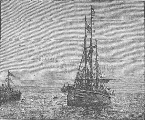
|
|
THE SHIP THAT WENT FARTHEST NORTH: THE FRAM. From a photograph. |
September was occupied in building a hut amid the frost and snow with walrus hides and tusks, warmed inside with train-oil lamps. Here under bear skins they slept and passed the long months of winter. In October the sun disappeared, the days grew darker. Life grew very monotonous, for it was the third Polar winter the explorers had been called on to spend. They celebrated Christmas Day, Nansen by washing himself in a "quarter of a cup of warm water," Johansen by turning his shirt. The weather outside was stormy and almost took their breath away with its icy coldness. They longed for a book, but they wiled away the hours by trying to calculate how far the Fram could have drifted and when she was likely to reach home. They were distressed at the dirt of their clothes, and longed to be able to throw away the heavy oily rags that seemed glued to their bodies. They had no soap, and water had no effect on the horrible grease. It was May before the weather allowed them to leave the hut at last. Hopefully they dragged their kayaks over the snow, the sledge runners fastened on to their feet, and so made their way southwards down Franz Josef Land.
September was spent building a hut in the frost and snow using walrus hides and tusks, keeping warm inside with train-oil lamps. Under bear skins, they slept and got through the long winter months. In October, the sun vanished, and the days became darker. Life became very monotonous, as it was the explorers' third Polar winter. They celebrated Christmas Day, with Nansen washing himself in a "quarter of a cup of warm water" and Johansen turning his shirt. The weather outside was stormy and nearly took their breath away with its icy cold. They longed for a book but passed the time trying to figure out how far the Fram could have drifted and when it might get home. They were distressed by the dirt on their clothes and wished they could get rid of the heavy oily rags that felt stuck to their bodies. They had no soap, and water didn't do anything to the horrible grease. It wasn't until May that the weather finally allowed them to leave the hut. With hope, they dragged their kayaks over the snow, with the sledge runners attached to their feet, and made their way southward down Franz Josef Land.
Once Nansen was very nearly drowned. The explorers had reached the south of the Islands, and, having moored their little boats together, they ascended a hummock close by, when to their horror they saw the kayaks were adrift. Nansen rushed down, threw off some clothes, and sprang into the water after them. He was none too soon, for already the boats were drifting rapidly away. The water was icy cold, but it was a case of life or death. Without the boats they were lost men. "All we possessed was on board," says Nansen, "so I exerted myself to the utmost. I redoubled my exertions though I felt my limbs gradually stiffening; at last I was able to stretch out my hand to the edge of the kayak. I tried to pull myself up, but the whole of my body was stiff with cold. After a time I managed to swing one leg up on to the edge and to tumble up. Nor was it easy to paddle in the double vessel; the gusts of wind seemed to go right through me as I stood there in my wet woollen shirt. I shivered, my teeth chattered, and I was numb all over. At last I managed to reach the edge of the ice. I shook and trembled all over, while Johansen pulled off the wet things and packed me into the sleeping-bag. The critical situation was saved."
Once, Nansen nearly drowned. The explorers had made it to the south of the Islands and, after tying their small boats together, climbed up a small hill nearby. To their shock, they noticed that the kayaks had drifted away. Nansen quickly ran down, took off some clothes, and jumped into the water after them. He was right on time, as the boats were already drifting quickly away. The water was freezing, but it was a matter of life or death. Without the boats, they were doomed. "Everything we had was on board," said Nansen, "so I pushed myself as hard as I could. I redoubled my efforts even though my limbs felt like they were stiffening; finally, I could reach the edge of the kayak. I tried to pull myself up, but my whole body was numb from the cold. After a while, I managed to swing one leg over the edge and tumble inside. It wasn't easy to paddle in the double vessel; the gusts of wind felt like they were cutting right through me while I stood there in my wet wool shirt. I was shivering, my teeth were chattering, and I felt numb all over. Eventually, I reached the edge of the ice. I shook and trembled all over while Johansen helped me out of my wet clothes and packed me into the sleeping bag. The critical situation was averted."
And now came one of those rare historic days in the history of exploration. It was 17th June 1896. Nansen was surveying the lonely line of coast, when suddenly the barking of a dog fell on his ear, and soon in front he saw the fresh tracks of some animal. "It was with a strange mixture of feelings," he says, "that I made my way among the numerous hummocks towards land. Suddenly I thought I heard a human voice—the first for three years. How my heart beat and the blood rushed to my brain as I halloed with all the strength of my lungs. Soon I heard another shout and saw a dark form moving among the hummocks. It was a man. We approached one another quickly. I waved my hat; he did the same. As I drew nearer I thought I recognised Mr. Jackson, whom I remembered once to have seen. I raised my hat; we extended a hand to one another with a hearty 'How do you do?' Above us a roof of mist, beneath our feet the rugged packed drift ice."
And now came one of those rare historic days in the history of exploration. It was June 17, 1896. Nansen was surveying the lonely coastline when suddenly he heard a dog barking, and soon he saw fresh tracks of some animal ahead. "I had a strange mix of feelings," he says, "as I made my way among the numerous hummocks toward land. Suddenly, I thought I heard a human voice—the first I had heard in three years. My heart raced and the blood rushed to my head as I shouted with all my strength. Soon, I heard another shout and saw a dark figure moving among the hummocks. It was a man. We quickly approached each other. I waved my hat; he did the same. As I got closer, I thought I recognized Mr. Jackson, whom I remembered having seen once before. I lifted my hat; we extended our hands to one another with a hearty 'How do you do?' Above us was a roof of mist, and beneath our feet was the rugged, packed drift ice."
"Ar'n't you Nansen?" he said.
"Aren't you Nansen?" he said.
"Yes, I am," was the answer.
"Yeah, I am," was the answer.
And, seizing the grimy hand of the Arctic explorer, he shook it warmly, congratulating him on his successful trip. Jackson and his companions had wintered at Cape Flora, the southern point of Franz Josef Land, and they were expecting a ship, the Windward, to take them home. On 26th July the Windward steamed slowly in, and by 13th August she reached Norway, and the news of Nansen's safe arrival was made known to the whole world. A week later the little Fram, "strong and broad and weather-beaten," also returned in safety. And on 9th September 1896, Nansen and his brave companions on board the Fram sailed up Christiania Fjiord in triumph.
And, grabbing the dirty hand of the Arctic explorer, he shook it warmly, congratulating him on his successful journey. Jackson and his team had spent the winter at Cape Flora, the southern tip of Franz Josef Land, and they were waiting for a ship, the Windward, to take them home. On July 26th, the Windward slowly arrived, and by August 13th, she reached Norway, announcing Nansen's safe arrival to the entire world. A week later, the little Fram, "strong and broad and weather-beaten," also returned safely. And on September 9th, 1896, Nansen and his brave companions aboard the Fram sailed triumphantly up Christiania Fjord.
He had reached a point farthest North, and been nearer to the North Pole than had any explorer before.
He had reached the farthest point North and had been closer to the North Pole than any explorer before him.
CHAPTER LXXII
PEARY REACHES THE NORTH POLE
The 6th April 1909 is a marked day in the annals of exploration, for on that day Peary succeeded in reaching the North Pole, which for centuries had defied the efforts of man; on that day he attained the goal for which the greatest nations of the world had struggled for over four hundred years. Indeed, he had spent twenty-three years of his own life labouring toward this end.
The 6th of April, 1909, is a significant date in the history of exploration because on that day, Peary successfully reached the North Pole, a challenge that had resisted human efforts for centuries. On that day, he achieved the goal that the greatest nations of the world had pursued for over four hundred years. In fact, he dedicated twenty-three years of his own life working toward this achievement.
He was mainly inspired by reading Nordenskiöld's Exploration of Greenland, when a lieutenant in the United States Navy. In 1886 he got leave to join an expedition to Greenland, and returned with the Arctic fever in his veins and a scheme for crossing that continent as far north as possible. This after many hardships he accomplished, being the first explorer to discover that Greenland was an island. Peary was now stamped as a successful Arctic explorer. The idea of reaching the North Pole began to take shape, and in order to raise funds the enthusiastic explorer delivered no less than one hundred and sixty-eight lectures in ninety-six days. With the proceeds he chartered the Falcon and left the shores of Philadelphia in June 1893 for Greenland. His wife, who accompanied him before, accompanied him again, and with sledges and dogs on board they made their way up the western coast of Greenland. Arrived at Melville Bay, Peary built a little hut; here a little daughter was born who was soon "bundled in soft warm Arctic furs and wrapped in the Stars and Stripes." No European child had ever been born so far north as this; the Eskimos travelled from long distances to satisfy themselves she was not made of snow, and for the first six months of her life the baby lived in continuous lamplight.
He was mainly inspired by reading Nordenskiöld's Exploration of Greenland while he was a lieutenant in the United States Navy. In 1886, he took a leave to join an expedition to Greenland and came back with a passion for the Arctic and a plan to cross the continent as far north as possible. After many hardships, he achieved this, becoming the first explorer to discover that Greenland was an island. Peary was now recognized as a successful Arctic explorer. The idea of reaching the North Pole began to take shape, and to raise funds, the enthusiastic explorer gave no less than one hundred sixty-eight lectures in ninety-six days. With the proceeds, he chartered the Falcon and left Philadelphia's shores in June 1893 for Greenland. His wife, who had joined him before, accompanied him again. With sledges and dogs on board, they made their way up the western coast of Greenland. Upon arriving at Melville Bay, Peary built a small hut; here, a baby daughter was born who was soon "bundled in soft warm Arctic furs and wrapped in the Stars and Stripes." No European child had ever been born this far north; the Eskimos traveled from far away to confirm she was not made of snow, and for the first six months of her life, the baby lived in continuous lamplight.
But we cannot follow Peary through his many Polar expeditions; his toes had been frozen off in one, his leg broken in another, but he was enthusiastic enough when all preparations were complete for the last and greatest expedition of all.
But we can't track Peary through his numerous polar expeditions; he lost his toes in one, broke his leg in another, but he was still excited when all the preparations were finished for the last and greatest expedition of all.
The Roosevelt, named after the President of the United States, had carried him safely to the north of Greenland in his last expedition, so she was again chosen, and in July 1908, Peary hoisted the Stars and Stripes and steamed from New York.
The Roosevelt, named after the President of the United States, had successfully taken him to the northern part of Greenland on his last expedition, so she was chosen again. In July 1908, Peary raised the Stars and Stripes and set sail from New York.
"As the ship backed out into the river, a cheer went up from the thousands who had gathered on the piers to see us off. It was an interesting coincidence that the day on which we started for the coldest spot on earth was about the hottest which New York had known for years. As we steamed up the river, the din grew louder and louder; we passed President Roosevelt's naval yacht, the Mayflower, and her small gun roared out a parting salute—surely no ship ever started for the ends of the earth with more heart-stirring farewells."
"As the ship backed into the river, a cheer erupted from the thousands gathered on the piers to see us off. It was an interesting coincidence that the day we set out for the coldest place on earth was one of the hottest New York had seen in years. As we steamed up the river, the noise grew louder and louder; we passed President Roosevelt's naval yacht, the Mayflower, and its small gun fired a parting salute—no ship has ever left for the ends of the earth with more emotional farewells."
President Roosevelt had himself inspected the ship and shaken hands with each member of the expedition.
President Roosevelt personally inspected the ship and shook hands with every member of the expedition.
"I believe in you, Peary," he had said, "and I believe in your success, if it is within the possibility of man." So the little Roosevelt steamed away; on 26th July the Arctic Circle was crossed by Peary for the twentieth time, and on 1st August, Cape York, the most northerly home of human beings in the world, was reached. This was the dividing line between the civilised world on one hand and the Arctic world on the other. Picking up several Eskimo families and about two hundred and fifty dogs, they steamed on northwards.
"I believe in you, Peary," he had said, "and I believe in your success, if it's possible for anyone." So the little Roosevelt set off; on July 26, Peary crossed the Arctic Circle for the twentieth time, and on August 1, they reached Cape York, the northernmost place where humans live. This was the boundary between the civilized world on one side and the Arctic world on the other. They picked up several Eskimo families and about two hundred and fifty dogs, then continued northward.
"Imagine," says Peary—"imagine about three hundred and fifty miles of almost solid ice, ice of all shapes and sizes, mountainous ice, flat ice, ragged and tortured ice; then imagine a little black ship, solid, sturdy, compact, strong, and resistant, and on this little ship are sixty-nine human beings, who have gone out into the crazy, ice-tortured channel between Baffin Bay and the Polar sea—gone out to prove the reality of a dream in the pursuit of which men have frozen and starved and died."
"Picture this," Peary says—"picture around three hundred and fifty miles of nearly continuous ice, ice in every shape and size, towering icebergs, flat ice, jagged and twisted ice; now visualize a small black ship, solid, sturdy, compact, strong, and resilient, and on this little ship are sixty-nine people, who have ventured into the wild, ice-ridden waters between Baffin Bay and the Arctic Ocean—ventured out to prove the reality of a dream for which people have frozen, starved, and lost their lives."
The usual course was taken, across Smith's Sound and past the desolate wind-swept rocks of Cape Sabine, where, in 1884, Greely's ill-fated party slowly starved to death, only seven surviving out of twenty-four.
The usual route was followed, across Smith's Sound and past the lonely, wind-blasted rocks of Cape Sabine, where, in 1884, Greely's unfortunate team slowly starved, with only seven out of twenty-four surviving.
Fog and ice now beset the ship, and on 5th September they were compelled to seek winter quarters, for which they chose Cape Sheridan, where Peary had wintered before in 1905. Here they unloaded the Roosevelt, and two hundred and forty-six Eskimo dogs were at once let loose to run about in the snow. A little village soon grew up, and the Eskimos, both men and women, went hunting as of yore. Peary had decided to start as before from Cape Columbia, some ninety miles away, the most northerly point of Grant Land, for his dash to the Pole.
Fog and ice were now surrounding the ship, and on September 5th, they had to find a place to spend the winter. They chose Cape Sheridan, where Peary had spent the winter in 1905. Here, they unloaded the Roosevelt, and two hundred and forty-six Eskimo dogs were immediately set free to run around in the snow. A small village quickly formed, and the Eskimos, both men and women, went hunting as they always had. Peary had decided to start again from Cape Columbia, about ninety miles away, the northernmost point of Grant Land, for his journey to the Pole.
On 12th October the sun disappeared and they entered cheerfully into the "Great Dark."
On October 12th, the sun vanished, and they happily stepped into the "Great Dark."
"Imagine us in our winter home," says Peary, "four hundred and fifty miles from the North Pole, the ship held tight in her icy berth one hundred and fifty yards from the shore, ship and the surrounding world covered with snow, the wind creaking in the rigging, whistling and shrieking around the corners of the deck houses, the temperature ranging from zero to sixty below, the icepack in the channel outside us groaning and complaining with the movement of the tides."
"Picture us in our winter home," Peary says, "four hundred and fifty miles from the North Pole, the ship secured in her icy spot one hundred and fifty yards from the shore, the ship and everything around it blanketed in snow, the wind creaking in the rigging, howling and shrieking around the edges of the deck houses, the temperature ranging from zero to sixty below, the icepack in the channel outside us groaning and shifting with the tides."
Christmas passed with its usual festivities. There were races for the Eskimos, one for the children, one for the men, and one for the Eskimo mothers, who carried babies in their fur hoods. These last, looking like "animated walruses," took their race at a walking pace.
Christmas came and went with the usual celebrations. There were races for the Inuit: one for the kids, one for the men, and one for the Inuit mothers, who carried their babies in fur hoods. The mothers, resembling "animated walruses," took their race at a leisurely pace.
At last, on 15th February 1909, the first sledge-party left the ship for Cape Columbia, and a week later Peary himself left the Roosevelt with the last loads. The party assembled at Cape Columbia for the great journey north, which consisted of seven men of Peary's party, fifty-nine Eskimos, one hundred and forty dogs, and twenty-eight sledges. Each sledge was complete in itself; each had its cooking utensils, its four men, its dogs and provisions for fifty or sixty days. The weather was "clear, calm, and cold."
At last, on February 15, 1909, the first sledge team left the ship for Cape Columbia, and a week later, Peary himself departed the Roosevelt with the final loads. The group gathered at Cape Columbia for the significant journey north, which included seven men from Peary's team, fifty-nine Eskimos, one hundred and forty dogs, and twenty-eight sledges. Each sledge was self-sufficient; each had its cooking gear, four men, its dogs, and supplies for fifty or sixty days. The weather was "clear, calm, and cold."
On 1st March the cavalcade started off from Cape Columbia in a freezing east wind, and soon men and dogs became invisible amid drifting snow. Day by day they went forward, undaunted by the difficulties and hardships of the way, now sending back small parties to the dépôt at Cape Columbia, now dispatching to the home camp some reluctant explorer with a frostbitten heel or foot, now delayed by open water, but on, on, till they had broken all records, passed all tracks even of the Polar bear, passed the 87th parallel into the region of perpetual daylight for half the year. It was here, apparently within reach of his goal, that Peary had to turn back three years before for want of food.
On March 1st, the expedition set out from Cape Columbia in a biting east wind, quickly making men and dogs disappear into the swirling snow. Day by day, they pressed on, undeterred by the challenges and hardships they faced, sometimes sending back small groups to the supply station at Cape Columbia, other times sending a reluctant explorer with frostbite back to the home camp, occasionally slowed down by open water. Still, they continued forward, breaking all records, surpassing every trail, even that of the polar bear, and crossing the 87th parallel into an area of constant daylight for half the year. It was here, seemingly just within reach of his goal, that Peary had to turn back three years earlier due to a lack of food.
Thus they marched for a month; party after party had been sent back, till the last supporting party had gone and Peary was left with his black servant, Henson, and four Eskimos. He had five sledges, forty picked dogs, and supplies for forty days when he started off alone to dash the last hundred and thirty-three miles to the Pole itself. Every event in the next week is of thrilling interest. After a few hours of sleep the little party started off shortly after midnight on 2nd April 1909. Peary was leading.
Thus they marched for a month; group after group had been sent back, until the last supporting group had left and Peary was left with his Black servant, Henson, and four Eskimos. He had five sledges, forty specially chosen dogs, and supplies for forty days when he set off alone to cover the last one hundred thirty-three miles to the Pole itself. Every event in the next week is incredibly exciting. After a few hours of sleep, the small group set off shortly after midnight on April 2, 1909. Peary was leading.
"I felt the keenest exhilaration as I climbed over the ridge and breasted the keen air sweeping over the mighty ice, pure and straight from the Pole itself."
"I felt an intense rush of excitement as I climbed over the ridge and breathed in the crisp air blowing over the massive ice, fresh and clear from the Pole itself."
They might yet be stopped by open water from reaching the goal. On they went, twenty-five miles in ten hours, then a little sleep, and so on again, then a few hours' rest and another twenty miles till they had reached latitude 89 degrees.
They could still be blocked by open water from reaching their destination. On they marched, covering twenty-five miles in ten hours, then a short sleep, and back at it again, followed by a few hours' rest and another twenty miles until they hit latitude 89 degrees.
Still breathlessly they hurried forward, till on the 5th they were but thirty-five miles from the Pole.
Still breathless, they hurried onward until on the 5th they were only thirty-five miles from the Pole.
"The sky overhead was a colourless pall, gradually deepening to almost black at the horizon, and the ice was a ghastly and chalky white."
"The sky above was a dull gray, slowly turning almost black at the horizon, and the ice looked pale and eerie white."
On 6th April the Pole was reached.
On April 6th, they reached the Pole.
"The Pole at last!" writes Peary in his diary. "The prize of three centuries! My dream and goal for twenty years. Mine at last! I cannot bring myself to realise it. It all seems so simple and commonplace."
"The Pole at last!" Peary writes in his diary. "The prize of three centuries! My dream and goal for twenty years. It's finally mine! I can hardly believe it. It all feels so simple and ordinary."
Flags were at once hoisted on ice lances, and the successful explorer watched them proudly waving in the bright Arctic sunlight at the Pole. Through all his perilous expeditions to the Arctic regions, Peary had worn a silken flag, worked by his wife, wrapped round his body. He now flew it on this historic spot, "which knows no North, nor West, nor East."
Flags were quickly raised on ice lances, and the successful explorer proudly watched them waving in the bright Arctic sunlight at the Pole. Throughout all of his dangerous expeditions in the Arctic, Peary had worn a silk flag, made by his wife, wrapped around his body. He now displayed it at this historic location, "which knows no North, nor West, nor East."

|
|
PEARY'S FLAG FLYING AT THE NORTH POLE, APRIL 1909. By the courteous permission of Admiral Peary, from his book The North Pole, published by Messrs. Hodder & Stoughton. |
Not a vestige of land was to be seen; nothing but ice lay all around. They could not stay long, for provisions would run short, and the ice might melt before their return journey was accomplished.
Not a trace of land was visible; only ice surrounded them. They couldn't stay for long, as their supplies would run out, and the ice might melt before they could make their way back.
The whole party then started for the Roosevelt, and on 18th July she was taken from her winter quarters and turned towards home. Then came the day when wireless telegraphy flashed the news through the whole of the civilised world: "Stars and Stripes nailed to the North Pole."
The whole group then set off for the Roosevelt, and on July 18th, she was brought out from her winter quarters and headed home. Then came the day when wireless telegraphy spread the news across the entire civilized world: "Stars and Stripes nailed to the North Pole."
The record of four hundred years of splendid self-sacrifice and heroism unrivalled in the history of exploration had been crowned at last.
The history of four hundred years of incredible selflessness and unmatched bravery in exploration has finally been recognized.
CHAPTER LXXIII
THE QUEST FOR THE SOUTH POLE
An American had placed the Stars and Stripes on the North Pole in 1909. It was a Norwegian who succeeded in reaching the South Pole in 1911. But the spade-work which contributed so largely to the final success had been done so enthusiastically by two Englishmen that the expeditions of Scott and Shackleton must find a place here before we conclude this Book of Discovery with Amundsen's final and brilliant dash.
An American put the Stars and Stripes on the North Pole in 1909. A Norwegian was the first to reach the South Pole in 1911. However, the groundwork that greatly contributed to this achievement was done with such enthusiasm by two Englishmen that the expeditions of Scott and Shackleton deserve mention here before we wrap up this Book of Discovery with Amundsen's final and impressive journey.
The crossing of the Antarctic Circle by the famous Challenger expedition in 1874 revived interest in the far South. The practical outcome of much discussion was the design of the Discovery, a ship built expressly for scientific exploration, and the appointment of Captain Scott to command an Antarctic expedition.
The crossing of the Antarctic Circle by the famous Challenger expedition in 1874 sparked renewed interest in the far South. The practical result of extensive discussions was the design of the Discovery, a ship specifically built for scientific exploration, and the selection of Captain Scott to lead an Antarctic expedition.
In August 1901, Scott left the shores of England, and by way of New Zealand crossed the Antarctic Circle on 3rd January 1902. Three weeks later he reached the Great Ice Barrier which had stopped Ross in 1840. For a week Scott steamed along the Barrier. Mounts Erebus and Terror were plainly visible, and though he could nowhere discover Parry Mountains, yet he found distant land rising high above the sea, which he named King Edward VII.'s Land. Scott had brought with him a captive balloon in which he now rose to a height of eight hundred feet, from which he saw an unbroken glacier stream of vast extent stretching to the south. It was now time to seek for winter quarters, and Scott, returning to McMurdo Bay named by Ross, found that it was not a bay at all, but a strait leading southward. Here they landed their stores, set up their hut, and spent the winter, till on 2nd November 1902 all was ready for a sledge-journey to the south. For fifty-nine days Scott led his little land-party of three, with four sledges and nineteen dogs, south. But the heavy snow was too much for the dogs, and one by one died, until not one was left and the men had to drag and push the sledges themselves. Failing provisions at last compelled them to stop. Great mountain summits were seen beyond the farthest point reached.
In August 1901, Scott left the shores of England and crossed the Antarctic Circle via New Zealand on January 3, 1902. Three weeks later, he arrived at the Great Ice Barrier that had halted Ross in 1840. For a week, Scott navigated along the Barrier. Mounts Erebus and Terror were clearly visible, and although he couldn't find the Parry Mountains, he spotted a distant land rising high above the sea, which he named King Edward VII.'s Land. Scott had brought along a captive balloon, which he used to ascend to a height of eight hundred feet, from where he observed an unbroken glacier stream of vast extent stretching southward. It was now time to find a place for winter quarters, so Scott returned to McMurdo Bay, named by Ross, only to find it wasn’t a bay at all but a strait leading south. Here, they unloaded their supplies, set up their hut, and spent the winter until November 2, 1902, when everything was ready for a sled journey south. For fifty-nine days, Scott led his small land party of three, with four sledges and nineteen dogs, southward. However, the heavy snow proved too much for the dogs, who gradually succumbed one by one, until none were left, forcing the men to drag and push the sledges themselves. Eventually, dwindling provisions made it necessary for them to stop. Great mountain peaks loomed beyond the furthest point they reached.
"We have decided at last we have found something which is fitting to bear the name of him whom we most delight to honour," says Scott, "and Mount Markham it shall be called in memory of the father of the expedition."
"We have finally decided that we've found something worthy of bearing the name of the person we most love to honor," says Scott, "and it will be called Mount Markham in memory of the father of the expedition."
It was 30th December when a tremendous blizzard stayed their last advance. "Chill and hungry," they lay all day in their sleeping-bags, miserable at the thought of turning back, too weak and ill to go on. With only provisions for a fortnight, they at last reluctantly turned home, staggering as far as their dépôt in thirteen days. Shackleton was smitten with scurvy; he was growing worse every day, and it was a relief when on 2nd February they all reached the ship alive, "as near spent as three persons can well be." But they had done well: they had made the first long land journey ever made in the Antarctic; they had reached a point which was farthest south; they had tested new methods of travel; they had covered nine hundred and sixty miles in ninety-three days. Shackleton was now invalided home, but it was not till 1904 that the Discovery escaped from the frozen harbour to make her way home.
It was December 30th when a massive blizzard halted their final push. "Chilly and hungry," they spent the whole day in their sleeping bags, feeling miserable at the thought of going back, too weak and sick to continue. With only enough supplies for two weeks, they finally turned back home, staggering to their depot over thirteen days. Shackleton was suffering from scurvy; he was getting worse every day, and it was a relief when they all reached the ship alive on February 2nd, "as close to exhausted as three people can be." But they had accomplished a lot: they had completed the first long land journey ever in Antarctica; they had reached a point that was the southernmost; they had tested new travel methods; they covered nine hundred and sixty miles in ninety-three days. Shackleton was sent home due to his condition, but it wasn't until 1904 that the Discovery finally broke free from the frozen harbor to head home.
Shackleton had returned to England in 1903, but the mysterious South Pole amid its wastes of ice and snow still called him back, and in command of the Nimrod he started forth in August 1907 on the next British Antarctic expedition, carrying a Union Jack, presented by the Queen, to plant on the spot farthest south. He actually placed it within ninety-seven miles of the Pole itself!
Shackleton returned to England in 1903, but the mysterious South Pole, with its vast ice and snow, still called him back. In command of the Nimrod, he set out in August 1907 on the next British Antarctic expedition, carrying a Union Jack given to him by the Queen to plant at the southernmost point. He managed to place it just ninety-seven miles from the Pole itself!
With a petrol motor-car on board, Eskimo dogs, and Manchurian ponies, he left New Zealand on 1st January 1908, watched and cheered by some thirty thousand of his fellow-countrymen. Three weeks later they were in sight of the Great Ice Barrier, and a few days later the huge mountains of Erebus and Terror came into sight. Shackleton had hoped to reach King Edward VII.'s Land for winter quarters, but a formidable ice-pack prevented this, and they selected a place some twenty miles north of the Discovery's old winter quarters. Getting the wild little Manchurian ponies ashore was no light job; the poor little creatures were stiff after a month's constant buffeting, for the Nimrod's passage had been stormy. One after another they were now led out of their stalls into a horse-box and slung over the ice. Once on terra firma they seemed more at home, for they immediately began pawing the snow as they were wont to do in their far-away Manchurian home.
With a petrol-powered car, Eskimo dogs, and Manchurian ponies on board, he left New Zealand on January 1, 1908, watched and cheered by about thirty thousand of his fellow countrymen. Three weeks later, they spotted the Great Ice Barrier, and a few days after that, the massive mountains of Erebus and Terror came into view. Shackleton had hoped to reach King Edward VII.'s Land for winter quarters, but a massive ice pack blocked their way, so they chose a spot about twenty miles north of the Discovery's old winter quarters. Getting the wild little Manchurian ponies ashore was no easy task; the poor things were stiff after a month of constant bouncing around since the Nimrod's passage had been rough. One by one, they were led out of their stalls into a horse box and lifted over the ice. Once on terra firma, they seemed more comfortable and immediately started pawing at the snow, just like they used to do back in their distant Manchurian home.

|
|
SHACKLETON'S SHIP, THE NIMROD, AMONG THE ICE IN
McMURDO SOUND, THE WINTER LAND QUARTERS OF THE BRITISH ANTARCTIC EXPEDITION. By Sir Ernest Shackleton's permission from his book "The Heart of the Antarctic," published by Mr. Heinemann. |
The spacious hut, brought out by Shackleton, was soon erected. Never was such a luxurious house set up on the bleak shores of the Polar seas. There was a dark room for developing, acetylene gas for lighting, a good stove for warming, and comfortable cubicles decorated with pictures. The dark room was excellent, and never was a book of travels more beautifully illustrated than Shackleton's Heart of the Antarctic.
The roomy hut that Shackleton brought was quickly set up. Never before had such a luxurious shelter been built on the desolate shores of the Polar seas. It featured a dark room for developing photos, acetylene gas for lighting, a decent stove for heating, and cozy cubicles decorated with pictures. The dark room was impressive, and no travel book was ever illustrated more beautifully than Shackleton's Heart of the Antarctic.
True, during some of the winter storms and blizzards the hut shook and trembled so that every moment its occupants thought it would be carried bodily away, but it stood its ground all right. The long winter was spent as usual in preparing for the spring expedition to the south, but it was 29th October 1908 before the weather made it possible to make a start. The party consisted of Shackleton, Adams, Marshall, and Wild, each leading a pony which dragged a sledge with food for ninety-one days.
True, during some of the winter storms and blizzards, the hut shook and trembled so much that its occupants thought it would be swept away at any moment, but it held strong. The long winter was spent, as usual, preparing for the spring expedition to the south, but it wasn't until October 29, 1908, that the weather finally allowed them to set off. The team included Shackleton, Adams, Marshall, and Wild, each leading a pony that pulled a sled with enough food for ninety-one days.
"A glorious day for our start," wrote Shackleton in his diary, "brilliant sunshine and a cloudless sky. As we left the hut where we had spent so many months in comfort we had a feeling of real regret that never again would we all be together there. A clasp of the hands means more than many words, and as we turned to acknowledge the men's cheer, and saw them standing on the ice by the familiar cliffs, I felt we must try to do well for the sake of every one concerned in the expedition."
"A glorious day for our start," wrote Shackleton in his diary, "with bright sunshine and a clear sky. As we left the hut where we had spent so many comfortable months, we felt a real sense of regret knowing we would never all be together there again. A handshake means more than many words, and as we turned to acknowledge the men's cheer and saw them standing on the ice by the familiar cliffs, I felt we had to do well for the sake of everyone involved in the expedition."
New land in the shape of ice-clad mountains greeted the explorers on 22nd November. "It is a wonderful place we are in, all new to the world," says Shackleton; "there is an impression of limitless solitude about it that makes us feel so small as we trudge along, a few dark specks on the snowy plain."
New land in the form of ice-covered mountains welcomed the explorers on November 22nd. "This place is incredible, completely new to the world," says Shackleton; "there's a sense of endless solitude here that makes us feel so small as we walk along, just a few dark dots on the snowy landscape."
They now had to quit the Barrier in order to travel south. Fortunately they found a gap, called the Southern Gateway, which afforded a direct line to the Pole. But their ponies had suffered badly during the march; they had already been obliged to shoot three of them, and on 7th December the last pony fell down a crevasse and was killed. They had now reached a great plateau some seven thousand feet above the sea; it rose steadily toward the south, and Christmas Day found them "lying in a little tent, isolated high on the roof of the world, far from the ways trodden by man." With forty-eight degrees of frost, drifting snow, and a biting wind, they spent the next few days hauling their sledges up a steep incline. They had now only a month's food left. Pressing on with reduced rations, in the face of freezing winds, they reached a height of ten thousand and fifty feet.
They now had to leave the Barrier to head south. Luckily, they found a gap called the Southern Gateway, which provided a direct route to the Pole. However, their ponies had endured a lot during the journey; they’d already had to shoot three of them, and on December 7th, the last pony fell into a crevasse and was killed. They had now reached a large plateau about seven thousand feet above sea level; it continued to rise steadily to the south, and on Christmas Day, they found themselves "lying in a little tent, isolated high on the roof of the world, far from the ways trodden by man." With temperatures at forty-eight degrees below zero, drifting snow, and a biting wind, they spent the next few days pulling their sledges up a steep slope. They now had only a month's worth of food left. Continuing with reduced rations amid freezing winds, they reached an elevation of ten thousand and fifty feet.
It was the 6th of January, and they were in latitude 88 degrees, when a "blinding, shrieking blizzard" made all further advance impossible. For sixty hours the four hungry explorers lay in their sleeping-bags, nearly perished with cold. "The most trying day we have yet spent," writes Shackleton, "our fingers and faces being continually frostbitten. To-morrow we will rush south with the flag. It is our last outward march."
It was January 6th, and they were at latitude 88 degrees when a "blinding, shrieking blizzard" made any further progress impossible. For sixty hours, the four hungry explorers stayed in their sleeping bags, nearly freezing to death. "It was the most challenging day we've had so far," Shackleton writes, "our fingers and faces constantly frostbitten. Tomorrow, we will push south with the flag. It’s our final march."
The gale breaking, they marched on till 9th January, when they stopped within ninety-seven miles of the Pole, where they hoisted the Union Jack, and took possession of the great plateau in the King's name.
The storm subsided, and they continued their march until January 9th, when they halted just ninety-seven miles from the Pole, where they raised the Union Jack and claimed the vast plateau in the King's name.
"We could see nothing but the dead-white snow plain. There was no break in the plateau as it extended towards the Pole. I am confident that the Pole lies on the great plateau we have discovered miles and miles from any outstanding land."
"We could see nothing but the dead-white snow plain. There was no break in the plateau as it stretched toward the Pole. I'm sure that the Pole is on the vast plateau we’ve found, miles and miles away from any significant land."
And so the four men turned homewards. "Whatever our regret may be, we have done our best," said the leader somewhat sadly. Blinding blizzards followed them as they made their way slowly back. On 28th January they reached the Great Ice Barrier. Their food was well-nigh spent; their daily rations consisted of six biscuits and some horse-meat in the shape of the Manchurian ponies they had shot and left the November before. But it disagreed with most of them, and it was four very weak and ailing men who staggered back to the Nimrod toward the end of February 1909.
And so the four men headed home. "No matter what regrets we have, we did our best," the leader said a bit sadly. Blinding blizzards followed them as they slowly made their way back. On January 28th, they reached the Great Ice Barrier. Their food was almost gone; their daily rations consisted of six biscuits and some horse meat from the Manchurian ponies they had shot and left behind the previous November. But it didn't sit well with most of them, and it was four very weak and sick men who staggered back to the Nimrod toward the end of February 1909.
Shackleton reached England in the autumn of 1909 to find that another Antarctic expedition was to leave our shores in the following summer under the command of Scott, in the Terra Nova. It was one of the best-equipped expeditions that ever started; motor-sledges had been specially constructed to go over the deep snow, which was fatal to the motor-car carried by Shackleton. There were fifteen ponies and thirty dogs. Leaving England in July 1910, Scott was established in winter quarters in McMurdo Sound by 26th January 1911. It was November before he could start on the southern expedition.
Shackleton got back to England in the fall of 1909 and found out that another Antarctic expedition was set to leave the following summer, led by Scott on the Terra Nova. It was one of the best-equipped expeditions ever launched; they had specially designed motor sledges to navigate the deep snow, which had doomed the motor car that Shackleton had taken. They brought along fifteen ponies and thirty dogs. After departing England in July 1910, Scott was settled in winter quarters at McMurdo Sound by January 26, 1911. He couldn't start the southern expedition until November.
"We left Hut Point on the evening of 2nd November. For sixty miles we followed the track of the motors (sent on five days before). The ponies are going very steadily. We found the motor party awaiting us in latitude 80½ degrees south. The motors had proved entirely satisfactory, and the machines dragged heavy loads over the worst part of the Barrier surface, crossing several crevasses. The sole cause of abandonment was the overheating of the air-cooled engines. We are building snow cairns at intervals of four miles to guide homeward parties and leaving a week's provisions at every degree of latitude. As we proceeded the weather grew worse, and snowstorms were frequent. The sky was continually overcast, and the land was rarely visible. The ponies, however, continued to pull splendidly."
"We left Hut Point on the evening of November 2nd. For sixty miles, we followed the trail made by the motors (which had been sent on five days earlier). The ponies are doing great. We found the motor team waiting for us at latitude 80½ degrees south. The motors performed extremely well, managing to tow heavy loads over the toughest parts of the Barrier surface, crossing several crevasses. The only reason for abandoning the journey was the overheating of the air-cooled engines. We are building snow cairns every four miles to help guide returning parties and leaving a week's worth of provisions at every degree of latitude. As we moved forward, the weather worsened, and snowstorms became common. The sky was mostly cloudy, and the land was seldom visible. Nonetheless, the ponies continued to pull incredibly well."
As they proceeded south they encountered terrific storms of wind and snow, out of which they had constantly to dig the ponies. Christmas passed and the New Year of 1912 dawned. On 3rd January when one hundred and fifty miles from the Pole, "I am going forward," says Scott, "with a party of five men with a month's provisions, and the prospect of success seems good, provided that the weather holds and no unforeseen obstacles arise."
As they headed south, they faced brutal storms of wind and snow, from which they constantly had to free the ponies. Christmas came and went, and the New Year of 1912 began. On January 3rd, when they were one hundred and fifty miles from the Pole, Scott said, "I am moving forward with a team of five men and a month's worth of supplies, and the chances of success look good as long as the weather stays manageable and no unexpected challenges come up."
Scott and his companions successfully attained the object of their journey. They reached the South Pole on 17th January only to find that they had been forestalled by others! And it is remarkable to note that so correct were their observations, the two parties located the Pole within half a mile of one another.
Scott's return journey ended disastrously. Blinding blizzards prevented rapid progress; food and fuel ran short; still the weakened men struggled bravely forward till, within a few miles of a dépôt of supplies, death overtook them.
Scott's return journey ended in disaster. Blinding blizzards slowed their progress; food and fuel ran low; still, the exhausted men pressed bravely on until, just a few miles from a supply depot, death caught up with them.
Scott's last message can never be forgotten. "I do not regret this journey which has shown that Englishmen can endure hardship, help one another, and meet death with as great fortitude as ever in the past.... Had we lived, I should have had a tale to tell of the hardihood, endurance, and courage of my companions which would have stirred the heart of every Englishman. These rough notes and our dead bodies must tell the tale; but surely, surely, a great, rich country like ours will see that those who are dependent upon us are properly provided for."
Scott's final message will never be forgotten. "I don't regret this journey, which has proven that English people can endure hardship, support one another, and face death with the same bravery as ever before. Had we survived, I would have had a story to share about the resilience, endurance, and courage of my companions that would have touched the hearts of every English person. These rough notes and our dead bodies must tell the story; but surely, surely, a great, wealthy country like ours will ensure that those who rely on us are properly taken care of."
It was on 14th December 1911 that Captain Amundsen had reached the Pole. A Norwegian, fired by the example of his fellow-countryman, Nansen, Amundsen had long been interested in both Arctic and Antarctic exploration. In a ship of only forty-eight tons, he had, with six others, made a survey of the North Magnetic Pole, sailed through the Behring Strait, and accomplished the North-West Passage, for which he was awarded the Royal Medal of the Royal Geographical Society. On his return he planned an expedition to the North Pole. He had made known his scheme, and, duly equipped for North Polar expedition in Nansen's little Fram, Amundsen started. Suddenly the world rang with the news that Peary had discovered the North Pole, and that Amundsen had turned his prow southwards and was determined to make a dash for the South Pole. Landing in Whales Bay some four hundred miles to the east of Scott's winter quarters, his first visitors were the Englishmen on board the Terra Nova, who were taking their ship to New Zealand for the winter.
It was on December 14, 1911, that Captain Amundsen reached the Pole. A Norwegian inspired by his fellow countryman Nansen, Amundsen had been interested in both Arctic and Antarctic exploration for a long time. In a ship of only forty-eight tons, he, along with six others, had surveyed the North Magnetic Pole, sailed through the Bering Strait, and completed the Northwest Passage, for which he received the Royal Medal from the Royal Geographical Society. Upon his return, he planned an expedition to the North Pole. He announced his plan and, properly equipped for the North Polar expedition in Nansen's little Fram, Amundsen set off. Suddenly, the world was ablaze with news that Peary had discovered the North Pole, and Amundsen had turned his ship southward with the intention of making a run for the South Pole. Landing in Whales Bay, about four hundred miles east of Scott's winter quarters, his first visitors were the Englishmen on board the Terra Nova, who were taking their ship to New Zealand for the winter.
Making a hut on the shore, Amundsen had actually started on his journey to the Pole before Scott heard of his arrival.
Making a hut on the shore, Amundsen had actually begun his journey to the Pole before Scott learned of his arrival.
"I am fully alive to the complication in the situation arising out of Amundsen's presence in the Antarctic," wrote the English explorer, "but as any attempt at a race might have been fatal to our chance of getting to the Pole at all, I decided to do exactly as I should have done had not Amundsen been here. If he gets to the Pole he will be bound to do it rapidly with dogs, and one foresees that success will justify him."
"I’m completely aware of the complexities in the situation because of Amundsen being in Antarctica," wrote the English explorer, "but since any attempt to compete could risk our chance of reaching the Pole entirely, I chose to proceed exactly as I would have if Amundsen weren't here. If he makes it to the Pole, he’ll likely do it quickly using dogs, and it’s clear that success will validate his approach."
Although the Norwegian explorer left his winter quarters on 8th September for his dash to the Pole, he started too early; three of his party had their feet frostbitten, and the dogs suffered severely, so he turned back, and it was not till 20th October, just a week before Scott's start, that he began in real earnest his historic journey. He was well off for food, for whales were plentiful on the shores of the Bay, and seals, penguins, and gulls abounded. The expedition was well equipped, with eight explorers, four sledges, and thirteen dogs attached to each.
Although the Norwegian explorer left his winter camp on September 8th for his rush to the Pole, he started too early; three members of his team got frostbite on their feet, and the dogs suffered a lot, so he turned back. It wasn't until October 20th, just a week before Scott's departure, that he genuinely began his historic journey. He had plenty of food since whales were abundant along the Bay's shores, and there were many seals, penguins, and gulls. The expedition was well-equipped, with eight explorers, four sledges, and thirteen dogs attached to each one.
"Amundsen is a splendid leader, supreme in organisation, and the essential in Antarctic travel is to think out the difficulties before they arise." So said those who worked with him on his most successful journey.
"Amundsen is an excellent leader, exceptional at organizing, and the key to Antarctic travel is to anticipate challenges before they happen." This was the view of those who collaborated with him on his most successful expedition.
Through dense fog and blinding blizzards the Norwegians now made their way south, their Norwegian skis and sledges proving a substantial help. The crevasses in the ice were very bad; one dog dropped in and had to be abandoned; another day the dogs got across, but the sledge fell in, and it was necessary to climb down the crevasse, unpack the sledge, and pull up piece by piece till it was possible to raise the empty sledge. So intense was the cold that the very brandy froze in the bottle and was served out in lumps.
Through thick fog and blinding snowstorms, the Norwegians made their way south, with their Norwegian skis and sleds proving to be a big help. The crevasses in the ice were really bad; one dog fell in and had to be left behind; another day the dogs got across, but the sled fell in, and they had to climb down into the crevasse, unpack the sled, and pull it up piece by piece until it was possible to raise the empty sled. The cold was so extreme that even the brandy froze in the bottle and was served in chunks.
"It did not taste much like brandy then," said the men, "but it burnt our throats as we sucked it."
"It didn't really taste like brandy back then," said the men, "but it burned our throats as we drank it."
The dogs travelled well. Each man was responsible for his own team; he fed them and made them fond of him. Thus all through November the Norwegians travelled south, till they reached the vast plateau described by Shackleton. One tremendous peak, fifteen thousand feet high, they named "Frithjof Nansen."
The dogs traveled well. Each man was in charge of his own team; he fed them and earned their trust. So, throughout November, the Norwegians journeyed south until they reached the huge plateau described by Shackleton. They named one massive peak, fifteen thousand feet tall, "Frithjof Nansen."
On 14th December they reached their goal; the weather was beautiful, the ground perfect for sledging.
On December 14th, they reached their goal; the weather was nice, and the ground was perfect for sledding.
"At 3 p.m. we made halt," says Amundsen. "According to our reckoning, we had reached our destination. All of us gathered round the colours—a beautiful silken flag; all hands took hold of it, and, planting it on the spot, we gave the vast plateau on which the Pole is situate the name of 'The King Haakon VII.' It was a vast plain, alike in all directions, mile after mile."
"At 3 p.m. we stopped," says Amundsen. "Based on our calculations, we had arrived at our destination. We all gathered around the flag—a stunning silk banner; everyone held onto it, and as we planted it at that spot, we named the expansive plateau where the Pole is located 'The King Haakon VII.' It was a huge flat area, stretching out the same way in every direction, mile after mile."
Here in brilliant sunshine the little party camped, taking observations till 17th December, when, fastening to the ground a little tent with the Norwegian flag and the Fram pennant, they gave it the name "Polheim" and started for home.
Here in bright sunshine, the small group set up camp, taking measurements until December 17th, when they secured a small tent with the Norwegian flag and the Fram pennant, naming it "Polheim" before heading home.

|
|
CAPTAIN ROALD AMUNDSEN TAKING SIGHTS AT THE SOUTH POLE. From a photograph, by permission of Mr. John Murray and the Illustrated London News. |
So the North and South Poles yielded up their well-hoarded secrets after centuries of waiting, within two and a half years of one another.
So the North and South Poles revealed their long-held secrets after centuries of waiting, just two and a half years apart.
They had claimed more lives than any exploration had done before, or is ever likely to do again.
They had taken more lives than any exploration had before, or probably ever will again.
And so ends the last of these great earth-stories—stories which have made the world what it is to-day—and we may well say with one of the most successful explorers of our times, "The future may give us thrilling stories of the conquest of the air, but the spirit of man has mastered the earth."
And so ends the last of these great earth-stories—stories that have shaped the world into what it is today—and we can confidently echo the words of one of the most successful explorers of our time, "The future may bring us exciting stories of conquering the skies, but the spirit of humanity has conquered the earth."
DATES OF CHIEF EVENTS
| PAGE | DATE | |
| 4 | The oldest known Ships | B.C. 6000-5000 |
| 7 | Expedition to Punt | B.C. 1600 |
| 11 | Phoenician Expeditions | B.C. 700 |
| 19 | Neco's Fleet built | B.C. 613 |
| 23 | Anaximander, the Greek, invents Maps | B.C. 580 |
| 25 | Hecatæus writes the First Geography | B.C. 500 |
| 27 | Herodotus describes Egypt | B.C. 446 |
| 30 | Hanno sails down West Coast of Africa | B.C. 450 |
| 32 | Xenophon crosses Asia Minor | B.C. 401 |
| 38 | Alexander the Great finds India | B.C. 327 |
| 41 | Nearchus navigates the Indian Ocean | B.C. 326 |
| 45 | The Geography of Eratosthenes | B.C. 240-196 |
| 48 | Pytheas discovers the British Isles and Thule | B.C. 333 |
| 55 | Julius Cæsar explores France, Britain, Germany | B.C. 60-54 |
| 61 | Strabo's Geography | A.D. 18 |
| 68 | Agricola discovers the Highlands | A.D. 83 |
| 71 | Pliny's Geography | A.D. 170 |
| 74 | Ptolemy's Geography and Maps | A.D. 159 |
| 78 | The First Guide for Travellers | Fourth century |
| 83 | St. Patrick explores Ireland | 432-93 |
| 85 | St. Columba reaches the Orkney Isles | 563 |
| 85 | St. Brandon crosses the Atlantic | Sixth century |
| 90 | Willibald travels from Britain to Jerusalem | 721 |
| 92 | The Christian Topography of Cosmas | Sixth century |
| 94 | Naddod the Viking discovers Iceland | 861 |
| 95 | Erik the Red discovers Greenland | 985 |
| 95 | Lief discovers Newfoundland and North American Coast | 1000 |
| 97 | Othere navigates the Baltic Sea | 890 |
| 99 | Mohammedan Travellers to China | 831 |
| 103 | Edrisi's Geography | 1154 |
| 108 | Benjamin of Tudela visits India and China | 1160 |
| 110 | Carpini visits the Great Khan | 1246 |
| 112 | William de Rubruquis also visits the Great Khan | 1255 |
| 115 | Maffio and Niccolo Polo reach China | 1260-71 |
| 117 | Marco Polo's Travels | 1271-95 |
| 126 | Ibn Batuta's Travels through Asia | 1324-48 |
| 126 | Sir John Mandeville's Travels published | 1372 |
| 134 | Hereford Mappa Mundi appeared | 1280 |
| 137 | Anglo-Saxon Map of the World | 990 |
| 138 | Prince Henry of Portugal encourages Exploration | 1418 |
| 140 | Zarco and Vaz reach Porto Santo | 1419 |
| 140 | Zarco discovers Madeira | 1420 |
| 142 | Nuno Tristam discovers Cape Blanco | 1441 |
| 143 | Gonsalves discovers Cape Verde Islands | 1442 |
| 144 | Cadamosto reaches the Senegal River and Cape Verde | 1455 |
| 145 | Diego Gomez reaches the Gambia River | 1458 |
| 148 | Death of Prince Henry | 1460 |
| 149 | Fra Mauro's Map | 1457 |
| 150 | Diego Cam discovers the Congo | 1484 |
| 152 | Bartholomew Diaz rounds the Cape of Good Hope | 1486 |
| 153 | Martin Behaim makes his Globe | 1492 |
| 160 | Christopher Columbus discovers West Indies | 1492 |
| 166 | Columbus finds Jamaica and other Islands | 1493 |
| 167 | Columbus finds Trinidad | 1498 |
| 169 | Death of Columbus | 1504 |
| 170 | Amerigo Vespucci finds Trinidad and Venezuela | 1499 |
| 175 | First Map of the New World by Juan de la Cosa | 1500 |
| 177 | Vasco da Gama reaches India by the Cape | 1497 |
| 181 | Pedro Cabral discovers Brazil | 1500 |
| 188 | Francisco Serrano reaches the Spice Islands | 1511 |
| 192 | Balboa sees the Pacific Ocean | 1513 |
| 203 | The First Circumnavigation of the World | 1519-22 |
| 206 | Cordova discovers Yucatan | 1517 |
| 206 | Juan Grijalva discovers Mexico | 1518 |
| 209 | Cortes conquers Mexico | 1519 |
| 217 | Pizarro conquers Peru | 1531 |
| 221 | Orellana discovers the Amazon | 1541 |
| 225 | Cabot sails to Newfoundland | 1497 |
| 228 | Jacques Cartier discovers the Gulf of St. Lawrence | 1534 |
| 236 | Sir Hugh Willoughby finds Nova Zembla | 1553 |
| 238 | Richard Chancellor reaches Moscow via Archangel | 1554 |
| 240 | Anthony Jenkinson crosses Russia to Bokhara | 1558 |
| 244 | Pinto claims the discovery of Japan | 1542 |
| 245 | Martin Frobisher discovers his Bay | 1576 |
| 249 | Drake sails round the World | 1577-80 |
| 260 | Davis finds his Strait | 1586 |
| 269 | Barents discovers Spitzbergen | 1596 |
| 275 | Hudson sails into his Bay | 1610 |
| 281 | Baffin discovers his Bay | 1616 |
| 285 | Sir Walter Raleigh explores Guiana | 1595 |
| 290 | Champlain discovers Lake Ontario | 1615 |
| 298 | Torres sails through his Strait | 1605 |
| 299 | Le Maire rounds Cape Horn | 1617 |
| 302 | Tasman finds Tasmania | 1642 |
| 306 | Dampier discovers his Strait | 1698 |
| 312 | Behring finds his Strait | 1741 |
| 322 | Cook discovers New Zealand | 1769 |
| 326 | Cook anchors in Botany Bay, Australia | 1770 |
| 333 | Cook discovers the Sandwich Islands | 1777 |
| 338 | La Perouse makes discoveries in China Seas | 1785-8 |
| 347 | Bruce discovers the source of the Blue Nile | 1770 |
| 353 | Mungo Park reaches the Niger | 1796 |
| 359 | Vancouver explores his Island | 1792 |
| 362 | Mackenzie discovers his River and British Columbia | 1789-93 |
| 366 | Ross discovers Melville Bay | 1818 |
| 368 | Parry discovers Lancaster Sound | 1819 |
| 372 | Franklin reaches the Polar Sea by Land | 1819-22 |
| 378 | Parry's discoveries on North American Coast | 1822 |
| 382 | Franklin names the Mackenzie River | 1825 |
| 386 | Beechey doubles Icy Cape | 1826 |
| 388 | Parry attempts the North Pole by Spitzbergen | 1827 |
| 392 | Denham and Clapperton discover Lake Tchad | 1822 |
| 396 | Clapperton reaches the Niger | 1826 |
| 397 | Réné Caillé enters Timbuktu | 1829 |
| 402 | Richard and John Lander find the Mouth of the Niger | 1830 |
| 404 | Ross discovers Boothia Felix | 1829 |
| 405 | James Ross finds the North Magnetic Pole | 1830 |
| 411 | Bass discovers his Strait | 1797 |
| 413 | Flinders and Bass sail round Tasmania | 1798 |
| 416 | Flinders surveys South Coast of Australia | 1801-4 |
| 421 | Sturt traces the Darling and Murray Rivers | 1828-31 |
| 424 | Burke and Wills cross Australia | 1861 |
| 429 | Ross discovers Victoria Land in the Antarctic | 1840 |
| 432 | Franklin discovers the North-West Passage | 1847 |
| 440 | Livingstone crosses Africa from West to East | 1849-56 |
| 452 | Burton and Speke discover Lake Tanganyika | 1857 |
| 454 | Speke sees Victoria Nyanza | 1858 |
| 457 | Livingstone finds Lakes Shirwa and Nyassa | 1858-64 |
| 461 | Speke and Grant enter Uganda | 1861 |
| 468 | Baker meets Speke and Grant at Gondokoro | 1861 |
| 470 | Baker discovers Albert Nyanza | 1864 |
| 477 | Livingstone finds Lakes Meoro and Bangweolo | 1868 |
| 482 | Stanley finds Livingstone | 1871 |
| 484 | Livingstone dies at Ilala | 1873 |
| 499 | Stanley finds the Mouth of the Congo | 1877 |
| 509 | Nordenskiöld solves the North-East Passage | 1879 |
| 519 | Younghusband enters Lhasa | 1904 |
| 524 | Nansen reaches Farthest North | 1895 |
| 534 | Peary reaches the North Pole | 1909 |
| 544 | Amundsen reaches the South Pole | 1911 |
INDEX
Download ePUB
If you like this ebook, consider a donation!