This is a modern-English version of Nooks and Corners of Pembrokeshire, originally written by Timmins, H. Thornhill (Henry Thornhill).
It has been thoroughly updated, including changes to sentence structure, words, spelling,
and grammar—to ensure clarity for contemporary readers, while preserving the original spirit and nuance. If
you click on a paragraph, you will see the original text that we modified, and you can toggle between the two versions.
Scroll to the bottom of this page and you will find a free ePUB download link for this book.

NOOKS AND CORNERS OF PEMBROKESHIRE.


LONDON
ELLIOT STOCK, 62, PATERNOSTER ROC, E.C.
1895
PREFACE.

he kindly reception accorded to my 'Nooks and Corners of Herefordshire,' both by the public and the press, has encouraged me (where, indeed, encouragement was little needed) to set forth anew upon my sketching rambles, and explore the Nooks and Corners of Pembrokeshire.
The warm welcome my 'Nooks and Corners of Herefordshire' received from both the public and the press has motivated me (where motivation was hardly necessary) to embark once again on my sketching adventures and discover the Nooks and Corners of Pembrokeshire.
In chronicling the results of these peregrinations, I feel that I owe some apology to those whose knowledge of the Shire of Pembroke is far more thorough and intimate than my own, and upon whose preserves I may fairly be accused of poaching. I venture to plead, in extenuation, an inveterate love for exploring these unfrequented byways of my native land, and for searching out and sketching those picturesque old buildings that lend such a unique interest to its sequestered nooks and corners.
In sharing the outcomes of my travels, I feel I should apologize to those who know the Shire of Pembroke much better and more intimately than I do, and whom I may have unfairly intruded upon. I’d like to explain that I have a deep love for exploring these little-known paths of my homeland, and for discovering and sketching the charming old buildings that add such unique character to its hidden corners.
Pembrokeshire is rich in these relics of a bygone time, but for one reason or another they do not appear to have received the attention they certainly deserve. Few counties can boast anything finer of their kind than the mediæval castles of Pembroke, Manorbere and Carew; while St. Davids Cathedral and the ruined Palace of its bishops, nestling in their secluded western vale, form a scene that alone is worth a visit to behold. No less remarkable in their way are the wonderful old crosses, circles and cromlechs, which remind the traveller of a vanished race as he tramps the broad fern-clad uplands of the Precelly Hills. It is a notable fact that 'he who runs may read,' in the diversified character of its place-names, an important and interesting chapter of Pembrokeshire history. The south-western portion of the county, with the Saxon 'tons' of its Teutonic settlers, is as English as Oxfordshire, and hence has acquired the title of 'Little England beyond Wales.' On the other hand, the northern and eastern districts are as Welsh as the heart of Wales; and there, as the wayfarer soon discovers for himself, the mother-tongue of the Principality is the only one 'understanded of the people.'
Pembrokeshire is full of these remnants from the past, but for some reason, they haven’t really gotten the attention they truly deserve. Few counties can showcase anything more impressive than the medieval castles of Pembroke, Manorbere, and Carew; while St. Davids Cathedral and the ruins of its bishops' palace, tucked away in their quiet western valley, create a scene that is worth a visit just to see. Equally impressive are the amazing old crosses, circles, and cromlechs, which remind travelers of a lost civilization as they hike the wide, fern-covered hills of the Precelly Mountains. A notable point is that 'those who explore can discover,' through the varied place names, an important and fascinating chapter of Pembrokeshire's history. The southwestern part of the county, with the Saxon ‘tons’ from its German settlers, is as English as Oxfordshire, earning it the nickname 'Little England beyond Wales.' In contrast, the northern and eastern areas are as Welsh as the heart of Wales; and there, as travelers quickly realize, the native language of the Principality is the only one 'understood by the people.'
Although Pembrokeshire cannot pretend to lay claim to such striking scenery as the North Wallian counties display, yet its wind-swept uplands and deep, secluded dingles have a character all their own; while the loftier regions of the Precelly Hills, and the broken and varied nature of the seaboard, afford many a picturesque prospect as the traveller fares on his way.
Although Pembrokeshire may not have the dramatic scenery of the North Wallian counties, its windswept hills and hidden valleys have a unique charm; meanwhile, the higher areas of the Preseli Hills and the rugged, varied coastline provide many beautiful views for travelers along the way.
In compiling the following notes I have availed myself of Fenton's well-known work on Pembrokeshire, and of the writings of George Owen of Hênllys; I have consulted the records of that prolific chronicler, Gerald de Barri; Bevan's 'History of the Diocese of St. Davids; and Jones and Freeman's exhaustive work on St. Davids Cathedral; besides various minor sources of local information which need not be specified here.
In putting together these notes, I relied on Fenton's well-known work about Pembrokeshire, as well as the writings of George Owen of Hênllys. I also looked at the records of the prolific chronicler Gerald de Barri, Bevan's 'History of the Diocese of St. Davids,' and Jones and Freeman's comprehensive work on St. Davids Cathedral, along with various other local sources that don't need to be listed here.
In conclusion, I take this opportunity to tender my sincere thanks to those friends and acquaintances whose ready help and advice so greatly facilitated my task, while at the same time enhancing the pleasure of these sketching rambles amidst the Nooks and Corners of Pembrokeshire.
In conclusion, I want to express my heartfelt thanks to the friends and acquaintances who readily offered their help and advice, making my task much easier and adding to the enjoyment of my sketching adventures around the hidden gems of Pembrokeshire.
H. THORNHILL TIMMINS.
Harrow, 1895.
H. Thornhill Timmins
Harrow, 1895.
CONTENTS.
INDEX TO ILLUSTRATIONS.

CHAPTER I.
A GENERAL SURVEY. THE KING'S TOWN OF TENBY.

away beyond the many-folding hills of Brecon and Glamorgan, whose hollow 'cwms' are seamed with smoke from many a pit and furnace: far away beyond the broad uplands and fertile straths where Towey and Teivy seek the sea; the ancient shire of Pembroke thrusts forth, against the western main, its bold and rugged coast-line. From Strumble Head to Caldey, the grim primæval rocks that guard these storm-beaten shores bear the full brunt of the Atlantic gales upon their craggy bastions; which, under the ceaseless influence of time and tempest, have assumed endless varieties of wild, fantastic outline and rich harmonious colouring.
far beyond the many-folding hills of Brecon and Glamorgan, whose deep valleys are marked by smoke from numerous pits and furnaces: far away beyond the wide uplands and fertile valleys where the Towey and Teivy rivers flow toward the sea; the ancient county of Pembroke juts out against the western ocean with its bold and rugged coastline. From Strumble Head to Caldey, the harsh, ancient rocks that protect these storm-battered shores take the full force of the Atlantic winds against their rocky cliffs; which, under the constant impact of time and storms, have taken on countless shapes of wild, unique profiles and rich, vibrant colors.
A weather-beaten land is this, where every tree and hedgerow tells, in horizontal leeward sweep, of the prevalent 'sou'-wester.' Few hills worthy the name break these wide-expanded landscapes, above whose 'meane hills and dales' one graceful mountain range rises in solitary pre-eminence. Stretching athwart the northern portion of the county, the shapely peaks of the Precelly Mountains dominate every local prospect, attaining in Moel Cwm Cerwyn a height of 1,760 fe[Pg 2]et, and throwing out westwards the picturesque heights of Carn Englyn; whence the range finally plunges seawards in the bold buttress of Dinas Head, and the wild and rugged hills of Pencaer.
This is a weathered land, where every tree and hedgerow leans in the direction of the prevailing 'southwester.' There are few hills that truly stand out in these expansive landscapes, except for one elegant mountain range that rises prominently. Spanning the northern part of the county, the striking peaks of the Preseli Mountains dominate the view, reaching 1,760 feet at Moel Cwm Cerwyn, and extending westward into the scenic heights of Carn Englyn; from there, the range dramatically descends towards the sea at the impressive Dinas Head, alongside the wild and rugged hills of Pencaer.
The inferior heights of Treffgarn and Plumstone 'mountain,' whose singular crags recall the tors of Cornwall, form a quaint feature in the prospect during the otherwise tedious drive to St. Davids. Perched upon the westernmost spur of these hills, the lonely peel-tower of Roch Castle looks out across the wind-swept plains of old Dewisland to the fantastic peaks of Carn Llidi and Pen-beri, whose ancient rocks rise abruptly from the ocean.
The low hills of Treffgarn and Plumstone 'mountain,' with their unique cliffs that remind you of the rocky outcrops in Cornwall, add a charming element to the otherwise dull drive to St. Davids. Sitting on the farthest edge of these hills, the isolated tower of Roch Castle overlooks the breezy fields of old Dewisland, stretching out to the impressive peaks of Carn Llidi and Pen-beri, with their ancient rocks sharply rising from the sea.
Down from the broad, fern-clad shoulders of Precelly flow the few Pembrokeshire streams that approach the dignity of rivers. Hence the twin floods of Eastern and Western Cleddau, rising far asunder at opposite ends of the range, meander southwards in widely-deviating courses through the heart of the county, to unite beneath the walls of Picton Castle, and merge at last into the tidal waters of Milford Haven.
Down from the wide, fern-covered slopes of Precelly flow the few streams in Pembrokeshire that can be called rivers. From there, the twin rivers of Eastern and Western Cleddau, which rise far apart at opposite ends of the range, wind southward in widely diverging paths through the heart of the county, coming together beneath the walls of Picton Castle and finally merging into the tidal waters of Milford Haven.
Westwards flows the little river Gwaen, circling through a picturesque vale beneath the shadow of Carn Englyn, and emerging from its secluded inland course upon the narrow, land-locked harbour of Fishguard. Towards the north a group of streamlets unite to form the Nevern River, which flows, amidst some of the most charming scenery in the county, through the village of that ilk. After passing beneath the luxuriant groves of Llwyngwair, the Nevern stream enters a sandy bay and bears the modest commerce of Newport to the waterside hamlet of Parrog.
Westward flows the little river Gwaen, winding through a beautiful valley under the shadow of Carn Englyn, and emerging from its hidden inland path into the narrow, sheltered harbor of Fishguard. To the north, a collection of streams comes together to form the Nevern River, which moves through some of the most picturesque scenery in the county, passing through the village of the same name. After flowing under the lush woods of Llwyngwair, the Nevern stream reaches a sandy bay and carries the modest trade of Newport to the waterside village of Parrog.
The Newgale Brook sweeps around Roch Castle, and enters St. Bride's Bay through a broad rampart of shingle and sand. This latter stream has from very early times formed the boundary between the ancient provinces of Dewisland and Rhôs; and to this day the Newgale Brook draws a line of demarcation between an English and a Welsh speaking people. Upon its left bank lies Rhôs, a portion of the district known as 'Little England beyond Wales,' with its Saxon speech and Norman fortress of Roch; while all to westward stretches venerable Dewisland, Welsh now as ever in tongue and in title.
The Newgale Brook curves around Roch Castle and flows into St. Bride's Bay through a wide barrier of pebbles and sand. This stream has long served as the divide between the ancient regions of Dewisland and Rhôs; even today, the Newgale Brook marks the boundary between English and Welsh speakers. On its left bank is Rhôs, part of the area referred to as 'Little England beyond Wales,' with its Saxon language and Norman castle of Roch; while to the west lies the historic Dewisland, still Welsh in language and name.
The Solva River, emerging from a deep and narrow 'cwm,' forms one of the most picturesque harbours upon the coast—a tempting nook for the artist. Lastly, the little Allan Water, rising amidst those curious hills which overlook St. Davids, meanders past open, gorse-clad commons and marshlands abloom with the golden flag. Thenceforth the Allan winds around the ruins of the Bishop's palace, and finally loses itself in a tiny haven frequented by a few trading craft and small coastwise colliers.
The Solva River, coming out of a deep and narrow valley, creates one of the most beautiful harbors on the coast—a delightful spot for artists. Lastly, the small Allan Water, rising among the interesting hills that look over St. Davids, flows through open, gorse-covered fields and marshes filled with blooming yellow flags. After that, the Allan winds around the ruins of the Bishop's palace and eventually disappears into a small harbor visited by a few trading boats and small coastwise coal ships.
Deep into the bluff outline of this sea-girt land, old Ocean encroaches by two important inlets of widely different character. As the wayfarer bound to St. Davids approaches his destination, the tedium of the long coach-drive is at last relieved by the welcome outlook across a broad expanse of sea. This is St. Bride's Bay, whose waters sweep inland past the ancient city for a distance of ten miles or so, having the large islands of Ramsey and Skomer lying upon either horn of the bay.
Deep into the bluff outline of this coastal land, the ocean pushes in through two significant inlets that are quite different from each other. As the traveler heading to St. Davids nears his destination, the monotony of the long coach ride is finally broken by the refreshing view of a wide stretch of sea. This is St. Bride's Bay, where the waters flow inland for about ten miles past the old city, with the large islands of Ramsey and Skomer situated at either end of the bay.
Tradition tells that, 'once upon a time,' a fair country studded with villages and farmsteads flourished where now the ocean rolls; and traces of submerged forests about Newgale, and elsewhere within the compass of the bay, suggest a possible grain of truth in the local fable.
Tradition has it that, 'once upon a time,' a beautiful land filled with villages and farms thrived where the ocean now exists; and remnants of submerged forests near Newgale and other areas in the bay hint at a possible kernel of truth in the local legend.
A few miles farther down the coast the famous estuary of Milford Haven opens seaward between the sheltering heights of St. Anne's Head, and the long, crooked peninsula of Angle. Wonderful are the ramifications of this magnificent waterway, within whose spacious roadstead the whole British navy might with ease find anchorage; while its land-locked tidal reaches bear a modest local traffic to many a remote inland district, calling up memories of savours nautical beside the grass-grown quays of Pembroke and 'Ha'rfordwest.'
A few miles further down the coast, the famous estuary of Milford Haven opens up to the sea between the protective heights of St. Anne's Head and the long, winding peninsula of Angle. The branches of this stunning waterway are amazing; its spacious harbor could easily accommodate the entire British navy. Meanwhile, its sheltered tidal reaches support a modest amount of local traffic to many distant inland areas, evoking memories of nautical flavors beside the grassy quays of Pembroke and Haverfordwest.
Well might Imogen marvel why Nature should have singled out 'this same blessed Milford' for such a priceless endowment, exclaiming:
Well might Imogen wonder why Nature chose 'this same blessed Milford' for such a priceless gift, exclaiming:
'Tell me how Wales was made so happy as
To inherit such a Haven.'
'Tell me how Wales became so lucky to __A_TAG_PLACEHOLDER_0__.'
inherit such a paradise.
The quaint author of 'Polyolbion' no less enthusiastically remarks:
The charming author of 'Polyolbion' enthusiastically notes:
'So highly Milford is in every mouth renown'd,
[Pg 4]Noe Haven hath aught good, that in her is not found;'
Milford is very popular and frequently discussed,
[Pg 4]that there's nothing good in New Haven that you can't also find there;
while lastly, not to be outdone, George Owen, the old Pembrokeshire chronicler, declares his beloved 'Myllford Havon' to be the 'most famouse Porte of Christendome.'
while lastly, not to be outdone, George Owen, the old Pembrokeshire chronicler, calls his beloved 'Myllford Havon' the 'most famous Port of Christendom.'
Ever since those legendary days when St. Patrick sailed for the Emerald Isle upon the traditional millstone, this incomparable haven has continued to be a favourite point of departure for the opposite shores of Ireland; and several historical personages appear at intervals in the annals of local events. Hence, for example, Henry II. sailed away upon his conquest of old Erin; while in the Fourth Henry's reign a large body of French troops disembarked upon these shores, to co-operate in the wars of 'the irregular and wild Glendower.' Yet another famous individual, ycleped Henry ap Edmund ap Owain ap Meredydd ap Tydwr, better known as Henry Tudor, Earl of Richmond, landed at Milford Haven in the year of grace 1485, to set forth upon the historical campaign which won for him a crown on Bosworth field. Here, again, the ubiquitous Oliver Cromwell embarked with an army of some 15,000 men, to carry his victorious arms against the rebellious Irish; and hence, in these piping times of peace, the mail-boats sail at frequent intervals to the seaports of the Emerald Isle.
Ever since those legendary days when St. Patrick set sail for the Emerald Isle on the traditional millstone, this exceptional haven has remained a popular departure point for the shores of Ireland. Several historical figures occasionally appear in the local events. For instance, Henry II sailed away to conquer old Erin, and during the reign of Henry IV, a large group of French troops landed here to support the struggles against 'the irregular and wild Glendower.' Another notable figure, known as Henry ap Edmund ap Owain ap Meredydd ap Tydwr, more commonly known as Henry Tudor, Earl of Richmond, arrived at Milford Haven in 1485 to begin the historic campaign that earned him the crown at Bosworth Field. Additionally, the ever-present Oliver Cromwell set sail with an army of about 15,000 men to take his victorious campaign against the rebellious Irish. Nowadays, in these peaceful times, the mail boats frequently sail to the ports of the Emerald Isle.
Penetrating thus deeply into the country, one crooked arm of the great estuary 'creketh in' beneath the stately ruins of Carew Castle, in such wise as to partially 'peninsulate' a remote but interesting portion of South Pembrokeshire, which is still further isolated by the low range of the Ridgeway, between Pembroke and Tenby. This little district contains within its limited compass a wonderful variety of ruined castles, ancient priories, quaint old parish churches and curious, fortified dwelling-houses of the English settlers.
Penetrating deeply into the country, one winding arm of the great estuary curves in beneath the impressive ruins of Carew Castle, partially creating a "peninsula" of a remote but intriguing part of South Pembrokeshire, which is further isolated by the low Ridgeway hills between Pembroke and Tenby. This small area holds a remarkable variety of ruined castles, ancient priories, charming old parish churches, and interesting fortified homes built by the English settlers.
Nestling in the more sheltered hollows, or clinging limpet-like to the storm-swept uplands, these characteristic structures arouse the wayfarer's interest as he paces the short, crisp turf rendered sweet by the driven sea-spray. Occasionally he will set his course by some prominent church steeple, which at the same time affords a landmark to the passing mariner as[Pg 5] he sails around the wild and iron-bound headlands of the southern coast.
Nestled in the more sheltered valleys, or sticking to the stormy highlands like a limpet, these unique structures catch the traveler’s attention as they walk along the short, crisp grass, refreshed by the sea spray. Now and then, they’ll navigate by a prominent church steeple, which also serves as a landmark for passing sailors as[Pg 5] they sail around the rugged and rocky coastal headlands of the south.
Throughout the length and breadth of Pembrokeshire, the constant recurrence of camps, cromlechs, hut-circles and other prehistoric remains, points to the existence of an extremely ancient people, whose origin is involved in the mists of unrecorded antiquity. These primæval monuments, seemingly old as the bleak hills they crown, suggest many an insoluble conundrum to the curious visitor, who, gazing in wonder upon their weather-beaten yet indestructible masses, disposes of the archaic enigma as best he may by exclaiming: 'There were giants in those days!'
Throughout Pembrokeshire, the constant presence of camps, cromlechs, hut circles, and other prehistoric remains indicates the existence of a very ancient people, whose origins are lost in the mists of unrecorded history. These ancient monuments, as old as the rugged hills they sit atop, present many unsolvable puzzles to curious visitors. While gazing in awe at their weathered yet enduring forms, they often comment, "There were giants in those days!"
Coming down to the comparative terra-firma of historic times, we find, at the period of the Roman invasion, a Celtic race called the Demetæ dwelling in the district of which our county forms a portion. The masters of the world appear to have pushed their way to the western seaboard, where, according to tradition, they established their colony of Menapia beneath the shelter of the headland known to Ptolemy as Octopitarum; connecting it, according to their custom, by the roadway of Via Julia with their base at Muridunum, or Carmarthen; while the probably still older road, called Via Flandrica, or Fordd Fleming, afforded a route across the mountains to the north.
Coming down to the more solid ground of historical times, we find that during the Roman invasion, a Celtic tribe called the Demetæ was living in the area that is now part of our county. The rulers of the world seem to have made their way to the western coast, where, according to legend, they set up their colony of Menapia under the protection of the headland known to Ptolemy as Octopitarum. They connected this settlement, as was their custom, by the road Via Julia to their base at Muridunum, or Carmarthen, while the likely even older road called Via Flandrica, or Fordd Fleming, provided a route across the mountains to the north.
Taking another lengthy stride across the intervening centuries, we may trace the footsteps of the Norman invaders. Under the leadership of Arnulph de Montgomery, they overran these newly-conquered lands, and established themselves in those great strongholds of Pembroke, Manorbere, Carew, Haverfordwest and Roch, whose dismantled walls still dominate the surrounding country.
Taking another long step through the centuries, we can follow the path of the Norman invaders. Led by Arnulph de Montgomery, they took over these newly-conquered lands and settled in the major strongholds of Pembroke, Manorbere, Carew, Haverfordwest, and Roch, whose crumbling walls still stand out in the surrounding landscape.
The wild Welsh proving inconveniently restive, that astute monarch Henry I. imported a colony of sturdy Flemings to assist in keeping order upon these distant march-lands; an event which exerted a marked influence upon the course of local history. These thrifty settlers received further aid from the Second Henry, and settled down to cultivate the land wrested from the Celtic peasantry.
The wild Welsh were proving to be quite restless, so the clever king Henry I brought in a group of strong Flemings to help maintain order in these remote borderlands; this event had a significant impact on local history. These resourceful settlers received additional support from King Henry II and established themselves to farm the land taken from the Celtic peasants.
The natives, however, still continued to behave in a very unneighbourly fashion, 'making,' as we are told, 'verie sharpe warres upon the[Pg 6] Flemings, sometimes with gaine, sometimes with losse;' so that they were obliged to build for themselves those strong, fortified dwelling-houses whose massive remains are so frequently met with throughout the southern parts of the county.
The locals, however, kept acting in a really unfriendly way, 'waging,' as we’re told, 'very sharp wars against the[Pg 6] Flemings, sometimes winning, sometimes losing;' so they had to build those strong, fortified houses whose sturdy remains are often found throughout the southern parts of the county.
In course of time the language of the immigrants superseded the ancient tongue of Celtic Dyfed, and thus that portion of the district comprised within the hundreds of Castlemartin and Rhôs acquired the title of 'Little England beyond Wales,' whose Saxon place-names, such as Johnston, Williamston, Hodgeston and the like, contrast so strikingly with the universal Llan-this, that and the other, still common throughout the upper country.
Over time, the language of the immigrants replaced the ancient Celtic dialect of Dyfed, and as a result, the area within the hundreds of Castlemartin and Rhôs came to be known as 'Little England beyond Wales.' The Saxon place names like Johnston, Williamston, and Hodgeston stand out sharply against the widespread Llan-this, that, and the other still found throughout the upper country.
We have already had occasion to refer to Henry of Richmond's famous visit to Milford, and to recall the expeditions of Cromwell and other prominent personages from that noble haven to Ireland. The French 'invasion' of Wales in 1797 will be referred to in dealing with the scenes of that notorious exploit: and in the course of our narrative we shall touch upon various other historical incidents connected with the nooks and corners of this fascinating county.
We’ve already mentioned Henry of Richmond's famous visit to Milford and recalled the trips by Cromwell and other notable figures from that noble port to Ireland. The French 'invasion' of Wales in 1797 will be discussed when we cover the events of that infamous incident, and throughout our narrative, we’ll touch on various other historical moments related to the nooks and crannies of this captivating county.
Owing to the prevalence of westerly breezes from the open Atlantic, tempered by the beneficent influence of the Gulf Stream, Pembrokeshire is blessed with a mild and remarkably equable climate. Hence the air is at the same time both dry and bracing, particularly in the southern portion of the county, where, in sheltered situations, the myrtle, fuchsia and syringa flourish al fresco all the year round.
Because of the constant westerly winds from the open Atlantic, warmed by the nice influence of the Gulf Stream, Pembrokeshire enjoys a mild and surprisingly stable climate. As a result, the air is both dry and refreshing, especially in the southern part of the county, where, in sheltered areas, myrtle, fuchsia, and syringa thrive outdoors all year round.
Nothing can exceed the luxuriance of the vegetation in the spacious demesne of Stackpole Court, where, sheltered from the strong winter gales that sweep across these gorse-clad uplands, the oak, ash, beech, ilex, sycamore and other forest trees, 'crowd into a shade' beside the lily-strewn meres whose placid waters mirror their spreading branches. This favoured region boasts, we believe, an average temperature of about 50° Fahr., and it has been shown by careful analysis that, taking one season with another, there is little to choose between the average climates of Madeira and of Tenby.
Nothing can match the richness of the vegetation in the expansive grounds of Stackpole Court, where, protected from the harsh winter winds that sweep across these gorse-covered hills, the oak, ash, beech, holm oak, sycamore, and other trees come together to create shade next to the lily-covered lakes whose calm waters reflect their sprawling branches. This favored area enjoys an average temperature of around 50°F, and careful analysis has shown that, considering the different seasons, there’s hardly any difference between the average climates of Madeira and Tenby.
These favourable conditions do not, of course, obtain to the[Pg 7] same degree in the north; where rough winds occasionally sweep down from the Precelly Mountains, driving keenly across the open country and retarding the vegetation. Nevertheless there are sheltered nooks around Newport and Fishguard where the eucalyptus, mulberry and fig-tree attain a goodly stature.
These favorable conditions don't, of course, apply to the[Pg 7] same extent in the north, where strong winds sometimes blow down from the Precelly Mountains, cutting sharply across the open fields and slowing down plant growth. However, there are sheltered spots around Newport and Fishguard where eucalyptus, mulberry, and fig trees thrive well.
Sun-warmed spots such as these form, however, mere oases of verdure amidst the rolling, wind-swept uplands of the interior; where the hardier trees alone rear their stunted forms above the rough stone walls which serve in place of hedgerows, or cluster around a group of solid, one-storied cottages, whose low walls, deep roofs and vast, bulging chimneys are overspread with one universal coating of dazzling whitewash; 'to keep out the weather,' as the country-folk will tell you—very clean, no doubt, but the reverse of picturesque in appearance.
Sun-warmed areas like these create small green oases among the rolling, windy hills of the interior; where only the tougher trees stand tall above the rough stone walls that act as hedgerows, or gather around a cluster of sturdy, one-story cottages. These cottages have low walls, steep roofs, and large, protruding chimneys, all covered with a bright layer of whitewash; "to protect against the weather," as the locals will tell you—very neat, no doubt, but definitely not charming to look at.
The native style of building is well exhibited in the ancient parish churches, more especially in those towards the southern seaboard of the county, which are distinguished by a rugged simplicity entirely in keeping with the stern and sombre character of the surrounding landscape. Of architecture there is but little; such beauty as the edifice can boast having to be sought in the picturesque grouping of its rambling gables beneath the tall, square, fortress-like tower; and the quaint, unlooked-for character of the cavernous interior.
The local style of construction is clearly shown in the old parish churches, especially those along the southern coast of the county, which stand out with a rough simplicity that perfectly matches the serious and dark nature of the surrounding landscape. There’s not much to the architecture; the beauty of the building lies in the charming arrangement of its uneven gables under the tall, square, fortress-like tower, and the unique, surprising feel of the spacious interior.
The nave is frequently covered with a rude stone barrel vault, from which low vaulted transepts open out like cells on either hand, whence vast 'squints,' forming narrow passages, branch diagonally into the chancel. Low arches, sometimes pointed, sometimes of a curious flat shape and almost invariably devoid of mouldings, open into the aisles, which are lighted by lancet windows of simple but good design; while sometimes a roomy porch or handsome sedilia adds a touch of distinction to an otherwise homely interior.
The nave is often topped with a rough stone barrel vault, with low vaulted transepts branching out like small rooms on either side, leading to wide 'squints' that create narrow pathways into the chancel. Low arches, which are sometimes pointed and sometimes have a unique flat shape, are usually without any decorative mouldings, connecting to the aisles that are lit by lancet windows featuring simple yet appealing designs. Occasionally, a spacious porch or elegant seating area adds a bit of charm to an otherwise simple interior.
We may instance, as typical examples of these sacred edifices, the churches of Gumfreston, St. Florence, Castlemartin and, par excellence, of Manorbere. A handsomer development may be studied in the parish churches of Tenby, Carew and Hodgeston, and the fine old priory church of Monkton. The graceful thirteenth-century pillars and arches [Pg 8]of St. Mary's, Haverfordwest, are unusually ornate for this locality, and are only excelled by the varied and beautiful architecture of St. Davids Cathedral itself. There can be little doubt that the hard, intractable nature of the local limestone is in some degree responsible for the primitive characteristics of many of these churches; for, despite their archaic appearance, they are rarely older than early thirteenth-century times.
We can point to the churches of Gumfreston, St. Florence, Castlemartin, and especially Manorbere as typical examples of these sacred buildings. You can see a more attractive style in the parish churches of Tenby, Carew, and Hodgeston, along with the beautiful old priory church of Monkton. The elegant 13th-century pillars and arches of St. Mary's in Haverfordwest are unusually elaborate for this area and are only surpassed by the diverse and stunning architecture of St. Davids Cathedral itself. It's clear that the tough, unyielding nature of the local limestone contributes to the primitive features of many of these churches; despite their ancient look, most are rarely older than the early 13th century.
Beautiful in their decay are the time-honoured ruins of the episcopal palaces of Lamphey and St. Davids; whose mellow-toned walls with their singularly graceful arcades mark the constructive genius of Bishop Gower, the Wykeham of the West.
Beautiful in their decay are the historic ruins of the episcopal palaces of Lamphey and St. Davids; their warm-toned walls with elegantly designed arcades showcase the architectural brilliance of Bishop Gower, the Wykeham of the West.
The numerous mediæval castles, whose ruined walls and ivy-mantled towers so frequently meet the eye, form a striking feature in many a picturesque scene; from the rugged bastions which cluster beneath the mighty keep of Pembroke, and the many-windowed front of lordly Carew, to the lonely peel-tower of Roch and the remote and isolated block-houses which keep ward around the coast.
The many medieval castles, with their crumbling walls and ivy-covered towers, often catch the eye and are a striking part of many beautiful landscapes. From the rugged fortifications that gather beneath the impressive keep of Pembroke, to the multi-windowed facade of grand Carew, to the solitary peel tower of Roch and the distant, isolated blockhouses that guard the coastline.
Having thus obtained a general coup d'œil of our field of action, we will proceed to explore at our leisure the nooks and corners of this pleasant countryside; so, with this purpose in view, we now make our way to that highly-favoured watering-place, the 'King's town of Tenby.'
Having gotten a general overview of our area of interest, we will now take our time to explore the nooks and corners of this beautiful countryside. With this aim in mind, we are now heading to the popular resort town known as 'King's town of Tenby.'

One clear, calm evening in May of this drouthy year of grace 1893, we emerge dusty and sun-baked from the tropical recesses of the 'tunnel express,' alight at Tenby Station, and wend our way through the streets of that clean little town to seaside quarters overlooking a picturesque bay, where some fishing-craft lie quietly at anchor off the harbour mouth. Towards sundown a miniature fleet of trawlers sweeps gracefully landwards around the Castle Hill, looking for all the world like a flight of brilliant butterflies; their russet sails glowing in the warm light of the sun's declining rays with every hue from gold to ruddy purple, recalling memories of gorgeous scenes on far-away Venetian lagoons. Hailing from many a haven between Milford and strong-savoured Brixham, these handy little vessels ply their calling around our south-western shores; pushing their ventures, when opportunity serves, to the North Sea fishing-grounds, and even to the remoter shores of Scotland. The visitor curious in such matters soon learns to distinguish between the well-found Brixham trawler and the handy sloop from Milford, certain cabalistic letters painted upon the parti-coloured sails denoting the port where, according to custom, each boat is respectively registered.
One clear, calm evening in May of this dry year of 1893, we stepped out, dusty and sunbaked, from the tropical depths of the 'tunnel express,' arrived at Tenby Station, and made our way through the streets of that tidy little town to seaside accommodations overlooking a picturesque bay, where some fishing boats lay quietly at anchor off the harbor entrance. As the sun began to set, a small fleet of trawlers gracefully swept towards land around Castle Hill, looking just like a swarm of colorful butterflies; their rust-colored sails glowing in the warm light of the sun's fading rays, displaying every shade from gold to deep purple, and bringing back memories of gorgeous scenes from distant Venetian lagoons. Coming from various ports between Milford and strong-flavored Brixham, these nimble little vessels operate along our southwestern shores, pushing their luck when the chance arises to the North Sea fishing grounds, and even to the more distant shores of Scotland. Visitors curious about such things quickly learn to tell apart the well-equipped Brixham trawler from the nimble sloop from Milford, with certain mysterious letters painted on the colorful sails indicating the port where, by tradition, each boat is registered.

Tenby town is in many respects happy in what a local historian quaintly terms its 'approximation.' Turning its back upon the quarter whence blow the strongest gales, and sheltered by the high ground of the Ridgeway, that part of the town most frequented by visitors faces south by east across the land-locked waters of Carmarthen Bay.
Tenby town is in many ways content in what a local historian charmingly calls its 'approximation.' Turning away from the direction where the windiest storms come from, and protected by the high ground of the Ridgeway, the area of the town most visited by tourists faces south by east over the calm waters of Carmarthen Bay.
Hence a pleasant view is obtained of the opposite coast of Gower and the more distant highlands of North Devon; while Caldey Island lies like a breakwater against the waves of the open Channel. As shrewd old Leland observes: 'Tinbigh Town standith on a main Rokke, but not very by; and the Severn Se so gulfith in about hit that, at the ful Se, almost the third part of the Toun is inclosid with water.'
Hence, you get a nice view of the opposite coast of Gower and the more distant highlands of North Devon, while Caldey Island acts like a breakwater against the waves of the open Channel. As wise old Leland notes: 'Tinbigh Town stands on a big rock, but not too close; and the Severn Sea flows in around it so that, at high tide, nearly a third of the town is surrounded by water.'
Tenby can boast a fair sprinkling of good hotels and lodging-houses. The town is made further attractive as a place of residence by a well-appointed club, a circulating library, excellent public baths and a small museum of local interest. Last, but by no means least amongst its attractions, Nature has provided a broad expanse of firm, dry sands, much appreciated by children and bathers at holiday times.
Tenby has a nice selection of good hotels and guesthouses. The town is also appealing as a place to live due to a well-equipped club, a lending library, great public baths, and a small local museum. And let's not forget one of its biggest draws: Nature has gifted it with a wide stretch of solid, dry sands that are loved by children and beachgoers during holiday seasons.
With a fair train-service upon the railway, good carriages and boats for
hire, and steamboats calling at intervals, Tenby affor[Pg 9]
[Pg 10]ds a convenient
centre whence to explore the remoter recesses of South Pembrokeshire,
for few and far between are the resting-places for the wayfarer in that
rather inaccessible region.
With a reliable train service on the railway, nice carriages and boats available for rent, and steamboats arriving regularly, Tenby offers a great base to explore the more hidden parts of South Pembrokeshire, as there are only a few stopping points for travelers in that somewhat hard-to-reach area.
Dynbych-y-Pysgod—the Little Town of Fish—appears to have been a place of some importance from very early times. By the middle of the twelfth century we find the town in the hands of the Flemish soldiery; and subsequently disasters came thick and threefold upon the devoted inhabitants. During the reign of Henry II., Maelgwyn ap Rhys, a person who is euphemistically described as 'of civil behaviour and honesty in all his actions,' ascertaining that many of the townsfolk were absent at the foreign wars, made a sudden onslaught, set fire to the ill-fated town, and burnt it to the ground. Less than a century later the place was again taken and destroyed by Llewelyn ap Grufydd: and after a further respite of about 200 years, the notorious Owain Glyndwr appeared before the walls, laid siege to, and made himself master of the little Western seaport.
Dynbych-y-Pysgod—the Little Town of Fish—has been significant since ancient times. By the middle of the 12th century, the town was under the control of Flemish soldiers, and soon after, misfortune struck the devoted residents. During Henry II's reign, Maelgwyn ap Rhys, described in a polite manner as 'of civil behavior and honesty in all his actions,' realized that many townspeople were away fighting in foreign wars. He launched a surprise attack, set fire to the unfortunate town, and reduced it to ashes. Less than a hundred years later, Llewelyn ap Grufydd seized and destroyed it again. After another break of about 200 years, the infamous Owain Glyndwr appeared at the city’s gates, laid siege to it, and took control of the small western seaport.
Notwithstanding these misfortunes, 'the King's town of Tenby' henceforth grew and prospered unmolested. In 1402 Tenby was made a corporate town; and by the middle of the fifteenth century it had already become a centre of considerable trade and enterprise, encompassed by strong stone walls and towers built by Earl William de Valentia, Lord of Pembroke. The town walls are said to have been rebuilt by one Thomas White, the scion of a famous burgher family, who was Mayor of this ancient borough in 1457.
Despite these unfortunate events, 'the King's town of Tenby' continued to grow and thrive without interference. In 1402, Tenby was established as a corporate town; by the mid-fifteenth century, it had already become a hub of significant trade and commerce, surrounded by strong stone walls and towers built by Earl William de Valentia, Lord of Pembroke. The town walls are said to have been rebuilt by a man named Thomas White, a member of a well-known merchant family, who served as Mayor of this historic borough in 1457.
When Leland passed this way in the reign of bluff King Hal, he found the 'Toun strongeli waullid and well gatid, everi Gate having hys Port collis ex solide ferro.' 'But,' says Fenton, writing in the early part of the present century, 'it was left for Queen Elizabeth, who was a great benefactress of the town in general, and whose initials are still extant over parts of the town walls, to contribute that strength and perfection to them which the present remains are a striking proof of.' Earl William (who appears to have been a generous patron of the town) granted the first charter of liberties, which was afterwards renewed and confirmed by successive reigning sovereigns. Several of these interesti[Pg 11]ng documents are still in the possession of the Corporation, including an illuminated charter of Richard III.'s reign, and another granted by Edward VI., which is enriched with a quaint, archaic portrait of that youthful monarch.
When Leland traveled through this area during the reign of King Henry VIII, he found the town strongly walled and well-gated, with each gate having its portcullis made of solid iron. But, as Fenton writes in the early part of this century, it was Queen Elizabeth who was a great benefactor to the town overall, and her initials can still be seen on parts of the town walls, contributing to their strength and perfection, as the current remains clearly show. Earl William, who seemed to have been a generous supporter of the town, granted the first charter of liberties, which was later renewed and confirmed by successive sovereigns. Several of these interesting documents are still held by the Corporation, including an illuminated charter from the reign of Richard III and another granted by Edward VI, which features a charming, old-fashioned portrait of that young king.

Tenby also boasts a handsome pair of silver maces, presented to the town by Charles II. They are about 2 feet in length, and are emblazoned with the royal arms, the arms of Tenby, and other appropriate devices, with the inscription 'Rice Borrow Maior, 1660.' The upper portion of the head is formed as a moveable lid, so that the mace could be used upon festive occasions as a loving-cup.
Tenby also has a beautiful set of silver maces, given to the town by Charles II. They are about 2 feet long and feature the royal arms, the arms of Tenby, and other relevant designs, along with the inscription 'Rice Borrow Maior, 1660.' The top part of the head is designed as a movable lid, allowing the mace to be used as a loving cup during festive occasions.
Since those turbulent days of its earlier career, Tenby has played the modest rôle of a town without a history, and has happily combined the avocations of a fishery town with the seductions of a modern watering-place.
Since those chaotic days of its early years, Tenby has taken on the modest role of a town without a history, and has successfully blended the activities of a fishing town with the attractions of a modern resort.

Turning out into the steadfast sunshine, we now thread our way amid the intricacies of the older byways to the 'faire Paroche chirche,' whose steeple, soaring high aloft, appears a landmark to mariners far out at sea. Dedicated to St. Mary, this church is one of the largest and handsomest in the county, and is unrivalled in the beauty and interest of its monuments.
Stepping out into the bright sunshine, we now navigate through the winding paths of the older streets to the 'fair Paroche church,' whose steeple rises high above and serves as a landmark for sailors far out at sea. Dedicated to St. Mary, this church is one of the largest and most beautiful in the area, and it stands out for the beauty and significance of its monuments.
Foremost amongst these are the twin marble monuments in St. Anne's Chapel, which figure in the foreground of our sketch. Here lie buried several distinguished members of that famous family, the[Pg 12] Whites of Tenby, which has given many worthy citizens to the town.
Foremost among these are the two marble monuments in St. Anne's Chapel, which are prominent in our sketch. Here rest several notable members of that famous family, the[Pg 12] Whites of Tenby, who have contributed many deserving citizens to the town.
Beneath the right-hand tomb rests Thomas White, merchant and sometime Alderman of Tenby; whose recumbent effigy, habited in the distinctive costume of his calling, adorns the monument. He it was who enabled Henry, Earl of Richmond, to escape after the battle of Tewkesbury, by concealing him in his house at Tenby until such time as he could ship him safely off in one of his own vessels to France. In gratitude for this yeoman service the Earl, upon his accession to the throne, presented his trusty friend with the lease of all the Crown lands around the town.
Beneath the right-hand tomb lies Thomas White, a merchant and former Alderman of Tenby; his reclining statue, dressed in the distinct outfit of his profession, decorates the monument. He was the one who helped Henry, Earl of Richmond, escape after the battle of Tewkesbury by hiding him in his house in Tenby until he could safely ship him off to France in one of his own boats. In thanks for this loyal service, the Earl, upon becoming king, gave his trusted friend the lease for all the Crown lands around the town.
The adjacent monument, which closely resembles its neighbour, records another member of the White family. Both these tombs are enriched with figures, in panels of bold relief, with a running inscription in mediæval character carved upon the margin.
The nearby monument, which looks a lot like its neighbor, commemorates another member of the White family. Both of these graves are adorned with figures, featured in panels with strong relief, and have a continuous inscription in medieval style carved along the edge.
Our attention is next attracted by the gaily-tinted effigy of Willi[Pg 13]am Risam, who, clad in aldermanic robes, kneels beneath a canopy built into the chapel wall. The figure is coloured in such a life-like manner that, as the story goes, a Parliamentarian soldier fired at the supposed enemy; in witness whereof a bullet-hole may be discerned above the head of the effigy.
Our attention is then drawn to the brightly colored figure of William Risam, who, dressed in ceremonial robes, kneels under a canopy built into the chapel wall. The figure is painted so realistically that, according to the story, a Parliamentarian soldier shot at what he thought was an enemy; as evidence, a bullet hole can be seen above the head of the statue.
Near at hand lies the last of that ancient family the Vaughans, of Dunraven in South Wales; a man who, having run through his patrimony at breakneck pace, allowed the ancestral mansion to fall into ruin, and betook himself to a lonely turret upon the seaward cliffs. Here he is said to have spent his time in showing false lights along the coast, in order to lure passing vessels ashore and enrich himself by the plunder of their cargoes. One stormy night, during one of these sinister exploits, the body of his only son was washed ashore at his feet; when, overcome by this ominous catastrophe, he quitted the neighbourhood, withdrew from all intercourse with his fellow-creatures, and ended his days in seclusion at Tenby.
Nearby is the last of the ancient Vaughan family from Dunraven in South Wales; a man who, after quickly squandering his inheritance, let the family mansion fall into disrepair and retreated to a lonely tower on the sea cliffs. It is said that he spent his time displaying false lights along the coast to lure passing ships ashore and profit from looting their cargoes. One stormy night, during one of these dark schemes, the body of his only son washed up at his feet; overwhelmed by this tragic event, he left the area, cut off all contact with others, and spent the rest of his life in isolation in Tenby.
Standing upon the chapel floor hard by, we espy a fine old fifteenth-century church bell bearing in black-letter characters the words sancta anna, with the initials R. T. This is the ancient sanctus-bell of this same chapel of St. Anne, which has descended to its present lowly position from the exterior of the tower, having been hung there, as is supposed, long years ago by Thomas ap Rhys, of Scotsborough, a descendant of the famous Rhys ap Thomas who played so important a part in the establishment of Henry VII. upon the throne. The memory of this worthy knight is kept evergreen by the gaudy and rather pretentious-looking monument seen on the farther wall. There he kneels, with folded hands, arrayed in ruffles and trunk-hose; his 'better half,' who is represented as of gigantic proportions, reposing uncomfortably upon her side; while in panels beneath appear the sons and daughters, arranged in symmetrical gradation. A glance at the sketch will show the pretty contrast afforded by the diversified forms of the arches; while the lofty flight of steps ascending to the chancel, and the dark timbers of the roof supported by well-carved angels upon massive brackets, enhance the effect of the handsome interior.
Standing on the chapel floor nearby, we see a beautiful old fifteenth-century church bell with the words Saint Anne written in black-letter characters, along with the initials R. T.. This is the historic sanctus-bell from the same chapel of St. Anne, which has come to its current lowly position from the outside of the tower, where it was hung, it's believed, many years ago by Thomas ap Rhys of Scotsborough, a descendant of the famous Rhys ap Thomas who played a significant role in helping Henry VII take the throne. The memory of this noble knight is kept alive by the flashy and somewhat showy monument on the far wall. There he kneels with his hands folded, dressed in ruffles and trunk-hose; his 'better half,' portrayed as quite large, lays uncomfortably on her side; while panels below show their sons and daughters arranged in a neat order. A look at the sketch will reveal the nice contrast created by the different shapes of the arches; meanwhile, the grand staircase leading up to the chancel and the dark wood of the roof supported by intricately carved angels on hefty brackets enhance the beauty of the stunning interior.

Quitting the church by its massive south porch, we pause beneath the spreading elms that adorn the churchyard to admire a singular group of arches, set in a crumbling fragment of ruined wall, whose gray, time-worn stones are abloom with bright tufts of pink valerian. These appear to be the sole remains of a house of Carmelite nuns, established a.d. 1399 by one John de Swynemore; and so graceful are these richly-moulded arches that we can but regret that more of the structure has not been spared to us. It is probable that these ruins are of coëval date with the adjacent western doorway of the church, which has a peculiar ogee arch surmounted with the following inscription in Gothic characters: benedictus deus in donis suis.
Leaving the church through its large south porch, we stop under the sprawling elms in the churchyard to admire a unique group of arches, set in a crumbling piece of ruined wall, whose gray, weathered stones are adorned with bright tufts of pink valerian. These seem to be the only remains of a Carmelite convent, founded in 1399 by one John de Swynemore; and the curves of these elegantly designed arches make us wish that more of the structure had survived. It’s likely that these ruins date back to the same time as the nearby western doorway of the church, which features a distinctive ogee arch topped with the following inscription in Gothic letters: benedictus deus in donis suis.
Rambling haphazard around the little town, such names as Frog Street, Crackwell Street and the like, tickle our fancy as a quaint relief to modern street nomenclature, which, usually devoid of originality, too often supplants local names racy of the soil.
Rambling aimlessly around the small town, names like Frog Street, Crackwell Street, and the like entertain us as a charming break from modern street naming, which is often lacking in originality and too frequently replaces local names that are rich with character.

A sudden turn down a narrow lane, hanging, as it were, upon the steep hillside, reveals glimpses of old-world Tenby which beguile our wandering steps from the hard highway.
A quick turn down a narrow lane, perched on the steep hillside, shows us glimpses of the charming old Tenby that draw us away from the main road.
At a secluded corner of these by-lanes a gray and weather-beaten old house stands, forsaken and neglected, amid the meaner dwellings that encompass it. The well-proportioned windows and pointed doorway which adorn the massive front lend a certain air of faded dignit[Pg 15]y, as though the old place had once 'seen better days'; while above the high-pitched roof peers one of those curious, rounded erections called hereabouts 'Flemish' chimneys.
In a quiet part of these side streets, a gray and worn old house stands, abandoned and ignored, surrounded by simpler homes. The nicely shaped windows and pointed doorway that decorate the sturdy front give it a sense of faded elegance, as if the old place had once "seen better days." Above the steep roof rises one of those odd, rounded structures known locally as "Flemish" chimneys.
In conjunction with the ancient gables at the rear of the adjacent saddler's shop, this interesting old structure forms one of the most picturesque relics yet remaining of the Tenby of 'auld lang syne.'
In combination with the old gables at the back of the nearby saddler's shop, this fascinating old building is one of the most charming relics still left of the Tenby of yesteryear.
Following hence the groups of stalwart fisher-folk as, with large air of leisure, they stroll adown the hill, we soon find ourselves upon the 'Peere made for Shyppes' which encloses the little harbour. Here stood in olden times the seamen's chapel of St. Julian, which was subsequently converted into a bath-house: thus 'cleanliness comes next to godliness'; and a pretty modern chapel now stands beside the quay.
Following the groups of strong fishermen and women as they casually walk down the hill, we soon find ourselves at the 'Pier made for Ships' that surrounds the small harbor. Here, in ancient times, stood the seamen's chapel of St. Julian, which was later turned into a bathhouse: thus 'cleanliness comes next to godliness'; and a lovely modern chapel now stands beside the quay.
Close at hand, in a sheltered cove, the lifeboat lies in wait beside a rudimentary iron 'peere,' which threatens to stretch its spindle shanks athwart the comely crescent of the bay, beneath the fortress-crowned islet of St. Catherine.
Close by, in a protected cove, the lifeboat waits next to a basic iron pier, which seems to extend its thin legs across the beautiful curve of the bay, beneath the fortress-topped island of St. Catherine.
The adjacent Castle Hill is crowned by a lofty watch-tower, some ruined outworks of the ancient city walls, and a handsome mar[Pg 16]ble statue of the late Prince Consort, of heroic size: lower down stands a small but well-arranged museum, which contains a representative collection of local natural history, besides valuable cases of shells, coins, etc.
The nearby Castle Hill is topped by a tall watchtower, some ruins of the old city walls, and a striking marble statue of the late Prince Consort, which is of heroic size. Further down, there’s a small but nicely organized museum that features a representative collection of local natural history, along with valuable exhibits of shells, coins, and more.

Archæologists will notice with interest the small alabaster group of [Pg 17]St. George and the Dragon, rescued from a cottage in course of demolition at Tenby; and a fine specimen of a quern, used for grinding corn, found near Popton. The exterior is fashioned into the form of a human face, and as it is known that only the earlier examples were ornamented, this quern is considered to be of very high antiquity.
Archæologists will find it fascinating to see the small alabaster sculpture of [Pg 17] St. George and the Dragon, saved from a cottage being demolished in Tenby; and a great example of a quern used for grinding grain, discovered near Popton. The outside is shaped like a human face, and since it’s known that only the earlier versions had decorations, this quern is regarded as very ancient.
The seaward face of the hill is laid out in winding walks, with sheltered seats at intervals, where visitors and townsfolk congregate upon the sunny slopes to indulge in a spell of dolce far niente, or to enjoy the wide panorama of land and sea that lies outspread around.
The seaside slope of the hill features winding paths, with shaded benches at intervals, where visitors and locals gather on the sunny hillsides to enjoy a moment of dolce far niente, or to take in the expansive views of the land and sea that stretch around them.

The return to the town may be varied by strolling along the broad, firm sands beneath curiously contorted rocky cliffs, aglow just now with masses of the white and red valerian. Clambering up a long flight of steps, we soon find ourselves abreast of the massive walls which in olden times protected the town upon its landward side, and terminated upon the precipitous edge of the cliff in the quaint, ivy-clad tower that rises right here before us.
The walk back to town can change by taking a stroll along the wide, solid sands under the uniquely shaped rocky cliffs, now bright with clusters of white and red valerian. After climbing a long flight of steps, we quickly find ourselves next to the huge walls that once protected the town from land attacks, which end at the steep cliff's edge in the charming, ivy-covered tower that stands right in front of us.
These ancient walls are still (in spite of hard treatment in bygone times from vandalistic hands) in a fair state of preservation; and f[Pg 18]orm, with their boldly-projecting towers and broken battlements, the most striking and picturesque feature of the town. They are perhaps seen to the best advantage from near the north-west corner, whence a general coup d'œil is gained of their respective sides.
These old walls are still in pretty good shape, despite having been mistreated by vandals in the past. Their bold towers and crumbling battlements are the most eye-catching and scenic part of the town. You can see them best from the northwest corner, where you can get a good overall view of both sides.
Sauntering under the shady trees on the site of the ancient moat, we pass beside the south-west front, to which, as by far the most complete, we now devote our attention. Here we notice how the sturdy round tower which guards the converging angle spreads boldly out at its base; anon we observe another tower of similar form, through which the easy-going authorities of some past time have actually permitted a huge opening to be hewn to admit the passage of a ropewalk!
Strolling under the shady trees where the old moat used to be, we walk by the southwest front, which we're focusing on since it's the most intact. Here, we see how the strong round tower that protects the corner spreads out boldly at its base; then we notice another tower of the same shape, through which the laid-back authorities from some time ago actually allowed a huge opening to be cut to let a ropewalk pass through!

A stone's-throw farther on rises the broad bulk of the great St. George's Bastion, marking the entrance to one of the principal town gates, and pierced with five archways, in two of which the grooves for the portcullis may still be discerned. Overhead a gangway r[Pg 19]an around the inner face of the wall, which is provided with lancet-holes for the use of archers, and is crowned with the usual corbelled battlements. Altogether this fine old structure presents a most picturesque appearance; its ancient archways being frequently enlivened by groups of market folk passing to and fro, while the rough gray stones of its venerable walls are wreathed with masses of flowering plants. A number of shabby dwellings which encumbered the approach have recently been swept away; one dilapidated old building with curious circular chimneys (said to have been used as a lazar-house) alone being spared.
A short distance ahead stands the large structure of the great St. George's Bastion, which marks the entrance to one of the main town gates and features five archways, two of which still show the grooves for the portcullis. Above, a walkway runs along the inside of the wall, equipped with slits for archers, and topped with the typical corbelled battlements. Overall, this stunning old structure looks very picturesque; its ancient archways are often filled with groups of market vendors moving back and forth, while the rough gray stones of its aged walls are covered in vibrant flowering plants. Several rundown buildings that cluttered the entrance have recently been cleared away, leaving only one dilapidated old building with quirky circular chimneys (said to have been a leper hospital) intact.
Beyond St. George's Bastion rises another ivy-mantled tower, near which we espy a stone panel let into the wall, bearing the superscription 'Ao 1588, E. R.' Being interpreted, this inscription records that Tenby walls were repaired in the thirtieth year of good Queen Bess's reign.
Beyond St. George's Bastion stands another tower covered in ivy, near which we spot a stone panel set into the wall, featuring the inscription 'Ao 1588, E. R.' To put it simply, this inscription notes that the walls of Tenby were repaired in the thirtieth year of good Queen Bess's reign.
Farther on the wall is pierced with a wide open archway, and terminates abruptly upon the precipitous edge of the cliff in a square, battlemented turret bearing a strong family likeness to the church towers of this locality. The walls seem to have been pierced with a double row of lancet-holes for the use of archers, the upper tier being commanded by a gangway carried upon pointed arches, while the lower row is accessible from the ground.
Further along, the wall has a wide open archway that ends suddenly at the steep edge of the cliff, featuring a square turret with battlements that looks a lot like the church towers around here. The walls have a double row of slit openings for archers; the upper row is accessed by a walkway supported by pointed arches, while the lower row can be reached from the ground.
The day waxing warm and sunny, we now make for the harbour again, and charter one of the numerous well-found pleasure-boats which lie in wait for visitors. An hour's pleasant sail over a sea blue as the Mediterranean, and we land upon the shores of Caldey Island, like the Old Man of the Sea, pick-a-back fashion astride the boatman's back.
The day is getting warm and sunny, so we head back to the harbor and hire one of the many well-equipped pleasure boats waiting for visitors. After an hour of enjoyable sailing on a sea as blue as the Mediterranean, we arrive at the shores of Caldey Island, with me riding on the boatman's back like the Old Man of the Sea.
'This island,' says George Owen, 'is verie fertile and yeldeth plentie of corne; all their plowes goe with horses, for oxen the inhabitantes dare not keepe, fearing the purveyors of the pirattes as they themselves told me, whoe often make their provisions there by theire owne comission, and comonlie to the good contentment of the inhabitantes, when conscionable theefes arrive there.'
'This island,' says George Owen, 'is very fertile and produces a lot of grain; all their plows are pulled by horses, since the locals don't dare to keep oxen, fearing the agents of the pirates as they themselves told me, who often take their supplies there by their own authority, and usually to the great satisfaction of the locals, when genuine thieves show up there.'
A grassy track, winding up the sloping bank amidst gorse and bracken, now leads across a stream and beside a few quarrymen'[Pg 20]s cottages to a dejected-looking chapel. In a neglected corner of the interior we discover the object of our visit—to wit, a recumbent oblong stone inscribed with certain archaic characters, which have been rendered as follows: 'In the Name both of the Cross itself and of Him who was fixed thereon, pray for the soul of Catuoconus.' Certain lines of the character known as Ogham may also be discerned upon the sides or edges of this hoary monolith.
A grassy path winds up the sloping bank among the gorse and bracken, leading across a stream and next to a few quarrymen's cottages to a rundown chapel. In a neglected corner of the interior, we find what we came for—a flat, rectangular stone inscribed with some old characters, which reads: 'In the Name of the Cross and of Him who was nailed to it, pray for the soul of Catuoconus.' Some lines of the script known as Ogham can also be seen along the sides or edges of this ancient stone.

Striking across the open fields, with the tall white lighthouse for our guide, we turn aside to visit an old farmstead that contains the scanty ruins of Caldey Priory. This venerable foundation owes its origin to Robert, son of Martin de Turribus, and was annexed as a cell to the abbey of St. Dogmaels, near Cardigan.
Striking across the open fields, with the tall white lighthouse as our guide, we divert to explore an old farmstead that has the remnants of Caldey Priory. This ancient site was founded by Robert, son of Martin de Turribus, and was connected as a cell to the abbey of St. Dogmaels, near Cardigan.
A wise old saw which observes 'There is nothing new but what has been forgotten,' may find a verification amidst such neglected nooks as these; whose long-forgotten relics of a bygone age greet the wayfarer with all the charm of novelty.
A wise old saying goes, 'There’s nothing new that hasn’t been forgotten,' and you can see this truth in overlooked places like these; where the long-lost remnants of a past era welcome travelers with all the allure of something fresh.
Above the adjacent farmyard premises rises the quaint little weather-beaten tower of the old priory chapel; its slender spire leaning perilously awry, its stonework fast crumbling to decay. From the summit of the tower hangs the crazy bell, with rusty chain and silent clapper. One daintily-fashioned window is roughly blocked with brickwork, another gives entrance to a pigeon-cot.
Above the neighboring farmyard stands the charming, weathered tower of the old priory chapel; its slender spire leaning precariously, its stonework quickly falling apart. From the top of the tower hangs the rickety bell, with a rusty chain and silent clapper. One elegantly designed window is roughly bricked up, while another serves as an entrance to a pigeon loft.
Within the adjoining house we are shown a fine old vaulted kitchen, with deep-browed windows, and rude stone settle along the wall. Thence w[Pg 21]e penetrate to a cool, dark chamber exhibiting traces of a gracefully proportioned window enclosed by a pointed arch, long since blocked up.
Within the neighboring house, we see a beautiful old vaulted kitchen, featuring deep-set windows and a rough stone bench along the wall. From there, we move into a cool, dark room that shows signs of a nicely shaped window framed by a pointed arch, which has long been bricked up.
Retracing our steps beneath hedges of flowering fuchsia, we return by breezy, fern-clad commons and well-tilled fields to the landing-place; where an amphibious-looking individual is laying out lobster-pots among the weed-strewn rocks.
Retracing our path under hedges of blooming fuchsia, we head back through breezy, fern-covered commons and well-tilled fields to the landing spot; where a person who looks like they belong in water is setting up lobster traps among the weed-covered rocks.
Caldey has ever been famed for the excellence of its oyster fisheries; not to speak of the crabs and lobsters caught around its rocky shores, which are commended by an Elizabethan writer who appears to have been an authority on such matters. 'The Lapster,' says this enthusiast, 'sett whole on the table, yieldeth Exercise, Sustenance and Contemplation; exercise in cracking his legs and Clawes, sustenance by eating the Meate thereof, and contemplation by beholding the curious Work of his complete Armour, both in hue and workmanship.'
Caldey has always been famous for its amazing oyster fisheries, not to mention the crabs and lobsters caught along its rocky shores, which are praised by an Elizabethan writer who seems to have been an expert on the topic. 'The lobster,' this enthusiast says, 'sits whole on the table, offering exercise, sustenance, and contemplation; exercise in cracking its legs and claws, sustenance by eating the meat, and contemplation by admiring the intricate design of its complete armor, both in color and craftsmanship.'
'And the Crabbe,' continues the same writer, 'doth sensiblye feele the Course of the Moone; fillinge and emptyeing yt selfe with the encrease and decrease thereof, and therefore ys saied to be best at the full Moone.'
'And the Crab, continues the same writer, does noticeably feel the course of the Moon; filling and emptying itself with its increase and decrease, and therefore is said to be best at the full Moon.'
Once more afloat, we are speedily wafted past the cave-pierced cliffs of St. Margaret's Isle, and across the placid waters of Caldey Sound. Running beneath the fortress-crowned St. Catherine's Rock, we round the Castle Hill and disembark in Tenby's sheltered haven.
Once we’re back on the water, we quickly glide past the cave-filled cliffs of St. Margaret's Isle and across the calm waters of Caldey Sound. We sail under the fortress-topped St. Catherine's Rock, circle around Castle Hill, and arrive at the safe harbor of Tenby.
Though our rambles about its old streets have by no means exhausted the curious nooks of Tenby, yet we have all broad Pembrokeshire lying as it were at our doors, and waiting only for an 'open sesame' to disclose its most interesting features. By far the larger number of these lie within a measurable distance of Tenby, whence access is easily obtained to them by road, rail, or boat. Moreover, by taking counsel with the local time-table, the visitor may fare forth upon his way at a conscionable hour of the morning and be back again at Tenby ere nightfall supervenes.
Though our walks through its old streets haven't fully explored the intriguing corners of Tenby, we still have all of Pembrokeshire right at our doorstep, just waiting for an 'open sesame' to reveal its most fascinating sights. Most of these are within an easy distance from Tenby, and you can reach them easily by road, train, or boat. Additionally, by checking the local schedule, visitors can set off at a reasonable hour in the morning and return to Tenby before night falls.
The curious old chest figured at the foot of this chapter formed the ancient treasury of Tenby. It is enriched with sixteenth-centu[Pg 22]ry German ironwork of very quaint design—witness the ladies pulling the elephants' 'noses,'—and has seven bolts and two padlocks. The keys of these latter were held by the two town bailiffs, while the Mayor was responsible for those of the main lock and of the tiller inside. After having been sold as old iron some five-and-thirty years ago, this interesting relic was rescued by a Tenby resident, through whose courtesy we are enabled to show the accompanying sketch.
The intriguing old chest mentioned at the start of this chapter was the ancient treasury of Tenby. It features unique sixteenth-century German ironwork—just look at the ladies pulling the elephants' 'noses'—and is secured with seven bolts and two padlocks. The keys to these were kept by the two town bailiffs, while the Mayor was responsible for the key to the main lock and the tiller inside. About thirty-five years ago, it was almost sold as scrap metal, but a Tenby resident saved this fascinating relic, enabling us to share the accompanying sketch.

CHAPTER II.
ROUND ABOUT THE RIDGEWAY.
'The year's at the spring
And day's at the dawn;
Morning's at seven;
The hillside's dew-pearled;
The lark's on the wing;
The snail's on the thorn:
God's in the heaven—
All's right with the world!'
R. B.
It's spring now
And the day has only just started;
Morning at seven;
The hillside's covered in dew;
The lark is in the sky;
The snail's on the thorn.
God's in heaven—
Everything's good with the world!
R. B.

fine May morning, after a night of soft, seasonable rain, we are up betimes and away into the green borderland that encompasses Tenby town upon its western side. Low, hazy clouds drift athwart the landscape, with glints of sunlight touching it into life here and there; a gentle breeze rustling the trees and bowing the growing crops before it.
On a beautiful May morning, after a night of light, seasonal rain, we’re up early and heading into the lush surroundings that hug Tenby town on its western side. Low, hazy clouds drift across the landscape, with patches of sunlight bringing it to life here and there; a gentle breeze rustles the trees and bends the crops as it passes.
A cottager, smoking a morning pipe on the bench before his door, gives us the sele of the day as we pass, and would fain spin a yarn about the 'craps' and the drought; but, turning a deaf ear to his lucubrations, we go our ways rejoicing, and ere long find ourselves skirting a lush green tract of marshland, whose dark levels are gay with yellow flags, marsh marigolds and feathery 'ragged Robin.'
A cottage owner, smoking a morning pipe on the bench in front of his door, greets us as we walk by and tries to tell us a story about the crop issues and the dry weather; but ignoring his chatter, we continue on our way happily, and soon find ourselves walking alongside a lush green area of marshland, where the dark landscape is brightened by yellow flags, marsh marigolds, and feathery ragged Robin.
Diverging to the right and plunging into a grove of aged ash-tree[Pg 24]s, we soon emerge upon an open glade where stand the crumbling walls of an ancient house called Scotsborough. This was the ancestral home of the family of Ap Rhys, who repose in Tenby Church beneath the monument we have already visited; and a ramble amidst the intricate passages and loopholed chambers of the ruined mansion, with their huge chimneys and cavernous ovens, shews that it was erected at a time when a man's house still continued to do duty, at a pinch, as his castle. Having explored this picturesque old pile, we hark back once more to the road. Trudging along a hollow, shady lane past a pretty mill, we now strike into a secluded pathway which drops steeply down beside a prattling rill, beneath overarching trees whose interlacing branches fret the greensward with a mantle of shadowy verdure.
Diverging to the right and plunging into a grove of old ash trees[Pg 24], we soon come out on an open glade where the crumbling walls of an ancient house called Scotsborough stand. This was the ancestral home of the Ap Rhys family, who are buried in Tenby Church beneath the monument we have already visited. A walk through the intricate passages and loopholed chambers of the ruined mansion, with its huge chimneys and cavernous ovens, shows that it was built at a time when a man's house could still serve as his castle in times of need. After exploring this picturesque old structure, we head back to the road. Walking down a hollow, shady lane past a charming mill, we then take a secluded path that steeply descends beside a babbling stream, underneath trees whose interlacing branches cast a shadowy blanket of greenery over the ground.
Overhead the fleecy clouds are swept by the breeze into graceful forms suggestive of sea-birds' wings; while the sunny air is musical with the song of birds and the distant bleating of sheep, and sweet with the scent of chestnut and elder bloom. A newly-fledged Burnet butterfly tries his smart speckled wings; whilst a passing 'Blue' out-rivals the hue of the dainty speedwell in the hedgerow; which peeps from amidst a tangle of pushing young bracken, hooded 'lords and ladies,' bluebells and wild geranium.
Overhead, the fluffy clouds are pushed by the breeze into graceful shapes that resemble the wings of sea birds, while the sunny air is filled with the songs of birds and the distant bleating of sheep, and sweet with the scent of chestnut and elder blossoms. A newly emerged Burnet butterfly tests its bright, speckled wings, while a passing Blue butterfly outshines the hue of the delicate speedwell in the hedgerow, which peeks out from a tangle of young bracken, hooded lords and ladies, bluebells, and wild geraniums.

Here in this secluded nook, 'the world forgetting, by the world forgot,' nestles the venerable church of Gumfreston; its ivy-mantled tower scarce rivalling the lofty trees which screen it from the outer world. Approached by footpaths only, a rustic wicket gives access to the churchyard; crossing which we enter the lowly edifice by an arched doorway that opens into a roomy old porch of primitive construction, completely overgrown with ivy. This was in all probability the original church, and is entirely built of stone; the roof, after the manner of the older churches of the district, being fashioned into a simple kind of vault. Upon either side is a rude stone bench; and a stoup, or font, of archaic design is built into the wall.
Here in this quiet corner, 'the world forgetting, by the world forgot,' lies the old church of Gumfreston; its ivy-covered tower barely competing with the tall trees that hide it from the outside world. Only accessible by footpaths, a rustic gate leads into the churchyard; crossing it, we enter the humble building through an arched doorway that opens into a spacious old porch made from basic materials, completely covered in ivy. This was likely the original church, built entirely of stone; the roof, like those of the older churches in the area, is designed in a simple vault. On either side are rough stone benches, and a font of old-fashioned design is built into the wall.
Passing through the inner door, some slight traces of damaged fresco which appear upon the whitewashed wall may, by a vigorous exercise of the imagination, be conjectured to represent the martyrdom[Pg 25] of St. Lawrence, the patron saint of Gumfreston Church. Something roughly resembling a tennis-racket may pass for the martyr's gridiron; while a gigantic foot, and certain objects vaguely suggesting a pair of scissors and a comb, are faintly discernible amidst a number of other half-obliterated details.
Passing through the inner door, you might notice some slight traces of damaged fresco on the whitewashed wall that, with a bit of imagination, could be thought to depict the martyrdom[Pg 25] of St. Lawrence, the patron saint of Gumfreston Church. Something that looks a bit like a tennis racket might represent the martyr's gridiron; meanwhile, a giant foot and a few objects that vaguely resemble a pair of scissors and a comb can be faintly seen among several other half-erased details.
A curious recess which bulges outwards from the same wall contains an old stone font; and the small adjacent transept is connected with the chancel by one of those singular 'squint' passages peculiar to this locality.
A curious alcove that juts out from the same wall holds an old stone font; and the small nearby transept connects to the chancel through one of those unique 'squint' passages that are typical of this area.
An unusual effect is produced by the low, simple arch—scarce more than 5 feet wide—between the chancel and the nave, which has a shallow, pointed recess on either side of it, doubtless designed to hold figures.
An unusual effect is created by the low, simple arch—barely more than 5 feet wide—between the chancel and the nave, which has a shallow, pointed recess on either side, likely intended to hold figures.

In one of these latter we observe the primitive-looking pewter flagon and paten which serve the purpose of church plate. Alongsid[Pg 26]e them stands a queer little cracked handbell of bronze-green, rust-eaten metal; this is the Sanctus-bell which, in pre-Reformation days, was rung in the church upon the elevation of the Host, and was carried at the head of funeral processions. Anent its present damaged condition the story goes that, during some solemn rite of exorcism with bell, book and candle, a certain fallen potentate suddenly appeared in a flash of brimstone flame, and broke the bell in impotent revenge.
In one of these later examples, we see the primitive-looking pewter flagon and paten used as church plate. Next to them is a quirky little cracked handbell made of bronze-green, rust-eaten metal; this is the Sanctus-bell, which was rung in churches during the elevation of the Host before the Reformation and was also carried at the front of funeral processions. Regarding its current damaged state, the story goes that during a solemn rite of exorcism involving a bell, a book, and a candle, a certain fallen ruler suddenly appeared in a flash of brimstone flame and shattered the bell in a fit of impotent revenge.
Passing through the chancel, we now enter a quaint little side-chapel with pretty two-light window and low, groined ceiling whose stony ribs look strong enough to carry a tower. The latter, however, is on the other side of the church, and is probably of later date; it is built in several stages, the one below the bell-chamber having pigeon-holes around inside the walls; while overhead hangs an ancient bell inscribed sancta maria ora pro nobis.
Passing through the chancel, we now enter a charming little side-chapel with a lovely two-light window and a low, groined ceiling whose strong stone ribs seem capable of supporting a tower. However, that tower is on the other side of the church and is likely from a later time; it is built in several stages, with pigeonholes inside the walls below the bell chamber, while an ancient bell hangs overhead inscribed Holy Mary, pray for us.
Hard by the church upon its southern side a flight of worn, stone steps leads down to three clear springs, which well up side by side in a mossy dell, and ripple away beneath lush grasses and flowering marsh plants. These wells, although in such close proximity, have been found to differ in their medicinal properties; and were resorted to as a cure for 'all the ills that flesh is heir to' by the simple folk of a bygone generation.
Next to the church on the south side, a set of worn stone steps leads down to three clear springs that bubble up next to each other in a mossy valley, flowing away under thick grass and blooming marsh plants. Even though these wells are so close together, they have different healing properties; people from a simpler time used them as remedies for "all the ailments that humans face."
Near at hand is the site of an old cockpit. In days of yore this exhilarating sport was very popular with Pembrokeshire men, who usually chose Easter Monday and [Pg 27]such-like 'times of jollitie' to indulge in their favourite pastime.
Near by is the site of an old cockpit. In the past, this exciting sport was very popular with Pembrokeshire men, who typically picked Easter Monday and [Pg 27]other festive occasions to enjoy their favorite pastime.
At the corner of the churchyard stands an old deserted cottage which, after many vicissitudes, has fallen upon degenerate days. Originally the rectory, and then the poor-house of the parish, it is now a neglected ruin half hidden amidst a tangle of shrubs and climbing plants.
At the corner of the churchyard stands an old, abandoned cottage that, after many ups and downs, has seen better days. Once the rectory and later a poor house for the parish, it is now a dilapidated ruin, half-hidden among a mess of shrubs and climbing plants.
Most visitors to Gumfreston will notice the fine old farmhouse that rises cheek-by-jowl with the carriage-road from Tenby. If we are to believe the tradition of the countryside, this is the most ancient abode in the county. Be that as it may, the place bears traces of no mean antiquity; and is an excellent specimen of a Pembrokeshire homestead of the olden times.
Most visitors to Gumfreston will notice the charming old farmhouse right next to the road from Tenby. According to local tradition, this is the oldest home in the county. Regardless, the place shows signs of significant age and is a great example of a Pembrokeshire homestead from the past.
Out from the main structure projects a mighty porch, running up the full height of the house, and pierced with round holes by way of windows above the main doorway. Penetrating into the interior, we enter a low-browed kitchen with open raftered ceiling and roomy settle beside the cavernous fireplace; its solid old timbers worn to a fine polish by generations of rustic shoulders. A bright wood-fire burns on the open hearth, and over it a big black kettle swings in the hollow of the chimney.
Out from the main structure extends a large porch that goes up the entire height of the house, with round holes serving as windows above the main door. As we enter the interior, we find a kitchen with a low ceiling, featuring exposed rafters and a spacious bench next to the deep fireplace; its sturdy old beams polished smooth by years of use. A warm wood fire crackles on the open hearth, and above it, a big black kettle hangs in the curve of the chimney.
The chimney stacks cropping boldly out, haphazard as it were, lean independently this way or that in the quaintest way imaginable; and the broad gable ends are pierced with many pigeon-holes. The place is built as though intended to last for all time, and is enveloped in the customary coating of weather-stained whitewash.
The chimney stacks stick out boldly, looking a bit random as they lean this way and that in the most charming way possible. The wide gable ends are full of little openings. The building seems designed to last forever and is covered in the usual layer of weathered white paint.
We now push merrily on beneath a cloudless sky; meeting an exhilarating sea-breeze as the road mounts upwards. Luxuriant hedgerows (a rare sight hereabouts) presently give place to open downland, affording widespreading views across rich, rolling woodlands cropped close by the strong salt breezes. Upon the broad slopes of the Ridgeway groups of white farm-buildings sparkle amidst ruddy ploughfields; while far beyond them are Caldey Island and the pale blue line of the sea.
We now happily continue under a clear sky, feeling an exciting sea breeze as the road rises. Luxurious hedgerows (a rare sight around here) soon give way to open downland, offering expansive views across lush, rolling woodlands shaped by the strong salt breezes. On the wide slopes of the Ridgeway, clusters of white farm buildings shine amid earthy plowed fields, while in the distance, you can see Caldey Island and the light blue line of the sea.
Once more a pleasant field-path beguiles our errant footsteps. Leading across an open common, it presently drops into a na[Pg 28]rrow by-lane, which winds among hazel copses and undergrowth beside the marshy course of the Ritec, where cattle are browsing leisurely, half hidden amidst lusty water-plants.
Once again, a lovely path invites us to wander. It takes us across an open common, then quickly leads into a narrow side road that winds through hazel bushes and underbrush next to the marshy flow of the Ritec, where cattle graze peacefully, partially hidden among the lush water plants.
Anon our lane degenerates into a hollow watercourse fringed with the greenest of mosses and wineglass ferns; insomuch that, like Agag, we are compelled to walk delicately across the rough stepping-stones that here do duty as a footpath; while the hedgerows fairly meet overhead in a tangle of wild roses, hawthorn and fragrant honeysuckle.
Soon our lane turns into a sunken waterway lined with the greenest moss and delicate ferns; so much so that, like Agag, we have to tread carefully across the rough stones that serve as a path; while the hedgerows almost touch above us, tangled with wild roses, hawthorn, and sweet-smelling honeysuckle.
Emerging all too soon upon the dusty highway, we approach the pretty village of St. Florence. Being by this time not a little 'sharp set,' we enter a modest wayside inn, and proceed to whet our appetites upon the rations that the gute verständige Hausfrau soon sets before us. Let us unfold our simple bill of fare: New-laid eggs galore; a mighty loaf of likely-looking bread, sweet from the clean wood oven; and a draught of the 'cup that'—in moderation—'cheers, but not inebriates.'
Emerging all too soon onto the dusty highway, we approach the charming village of St. Florence. By this time, feeling quite hungry, we enter a cozy roadside inn and begin to satisfy our appetites with the food that the gute verständige Hausfrau quickly places in front of us. Let’s take a look at our simple menu: fresh eggs aplenty; a sizable loaf of delicious bread, sweet from the clean wood oven; and a drink of the 'cup that'—in moderation—'cheers, but doesn't intoxicate.'
In one corner of the low-ceiled room, the glass panels of an old-fashioned cupboard reveal a heterogeneous collection of rustic crockery-ware. The narrow mantel-board is adorned with a curious centrepiece, representing Wesley preaching to a sham china clock. This chef d'œuvre is supported on either hand by china figures, rather the worse for wear, riding to market upon a pillion; of which the rickety mirror behind renders a dull and distorted replica.
In one corner of the low-ceilinged room, the glass panels of an old cupboard show a mixed collection of rustic dishes. The narrow mantel is decorated with an odd centerpiece, depicting Wesley preaching to a fake china clock. This chef d'œuvre is flanked on either side by china figures, looking worse for wear, riding to market on a pillion; the rickety mirror behind it creates a dull and distorted reflection.
From the opposite wall the bucolic face of a former proprietor stares stonily out upon us, as he grasps his doll-like daughter's arm after the manner of a pump-handle; this interesting group being flanked by the inevitable memorial cards to lost ones long since 'buried.'
From the opposite wall, the rustic face of a former owner looks out at us with a blank stare, gripping his doll-like daughter's arm like a pump handle; this intriguing scene is flanked by the usual memorial cards for those long since 'buried.'
Meanwhile, as we ply the peaceful calumet, mine hostess tells of quaint old customs that, until only the other day, survived in this quiet countryside. 'I mind the time,' says she, 'when I was a girl, when there used to be a Vanity Fair in the village every Michaelmas tide. It lasted three whole days, and the men and maids would turn out in their best then, and all the housen must be smartened up and put in order; and Squire, he give every working man in the place a bran-new sui[Pg 29]t of clothes to his back. Ah, there was fine doings then, and I've a-hard tell that they'd used to run a keg of spirits, or what not, from the big cellars down Tenby way. But that was afore my time.'
Meanwhile, as we navigate the peaceful waters, my hostess shares some charming old traditions that, until recently, lingered in this quiet countryside. "I remember when I was a girl, there used to be a Vanity Fair in the village every Michaelmas. It lasted three whole days, and the men and women would dress up in their best outfits, and all the houses had to be spruced up and cleaned. The Squire would give every working man in the place a brand-new suit of clothes. Ah, those were great times, and I've heard that they used to bring a keg of spirits or something similar from the big cellars out Tenby way. But that was before my time."
A stroll around the village reveals some picturesque corners here and there; a few of the older cottages retaining the vast rounded chimneys, bulging ovens and pointed doorways of an earlier age. The church, too, contains attractive features. A peep into the little edifice reveals a curious vaulted interior, with its queer 'squint' passage set askew, and flat limestone arches of peculiar form on either side of the chancel.
A walk around the village shows some charming spots here and there; a few of the older cottages still have their large rounded chimneys, bulging ovens, and pointed doorways from a previous era. The church also has some appealing features. Taking a look inside the small building reveals an interesting vaulted interior, with its odd ‘squint’ passage set at an angle, and flat limestone arches of unusual shape on either side of the chancel.
The honours of the place are done by a garrulous old dame, whose russet-apple complexion, set amidst well-starched frills above a homespun 'whittle,' shows how well she has weathered her fourscore hard-working winters.
The duties of the place are handled by a talkative old lady, whose reddish complexion, framed by neatly pressed frills above a homemade apron, shows how well she has survived her eighty tough winters.
Upon the gable wall outside, we notice a memorial slab commemorating a venerable couple who attained the mellow ages of 102 and 104, respectively; and a singular epitaph on Archdeacon Rudd: while the broken shaft of an ancient cross rises amidst the well-tended monuments of this flowery God's acre.
Upon the gable wall outside, we see a memorial slab honoring a remarkable couple who lived to be 102 and 104, respectively; along with a unique epitaph for Archdeacon Rudd: while the broken shaft of an old cross stands among the well-kept monuments of this beautiful resting place.
On our return to Tenby we pass a ruined water-mill, standing in a wooded dingle beside a reed-grown stream. Lanes and field-paths lead us down the valley of the Ritec, beside a group of tumbled houses whose massive, ivy-wreathed walls, with their narrow loopholed windows, may possibly guard those big cellars of which we have lately 'a-hard tell.'
On our way back to Tenby, we pass a ruined water mill, located in a wooded hollow next to a stream overgrown with reeds. Lanes and footpaths guide us down the valley of the Ritec, alongside a cluster of toppled houses whose thick, ivy-covered walls, with their narrow, slitted windows, might be protecting those large cellars we've recently heard about.
Thence through a hollow dingle, where golden Fritillary butterflies float to and fro in the dappled sunlight; and where the fast-disappearing badger may still at times be met with. Anon we diverge to Carswall, to examine a group of remarkable stone buildings with vaulted chambers, huge fireplaces and bulging chimneys—puzzling objects to the archæologist. From Carswall we strike across upland pastures, where a farm lad is 'tickling' the ruddy soil with a primitive kind of harrow, composed of a bundle of brushwood drawn behind a horse.
Then through a small valley, where golden Fritillary butterflies flutter in the dappled sunlight; and where the rapidly vanishing badger might still occasionally be seen. Soon we turn off to Carswall to check out a group of impressive stone buildings with vaulted rooms, large fireplaces, and protruding chimneys—puzzling items for the archaeologist. From Carswall, we cross over hilly pastures, where a farm boy is 'tickling' the reddish soil with a simple type of harrow made from a bundle of brushwood pulled by a horse.
Erelong we turn aside to explore the recesses of Hoyle's Mouth; a vast cavern worn deep in the solid limestone of the Ridgeway, and frin[Pg 30]ged with fantastic stalactites resembling gigantic icicles. Relics of remote antiquity, discovered here, prove that the cavern has been a place of refuge in times beyond tradition; and a local fable affirms that it is connected with that 'mervellows caverne,' yclept the Wogan, far away beneath the Castle of Pembroke!
Soon we take a detour to explore the depths of Hoyle's Mouth, a huge cave carved deep into the solid limestone of the Ridgeway, adorned with amazing stalactites that look like gigantic icicles. Artifacts from ancient times found here show that the cave has served as a refuge long before history was recorded; and a local legend claims it connects to that 'wonderful cavern,' known as the Wogan, far below the Castle of Pembroke!
Half a mile hence, in a nook of the hill, stands the old farmhouse of Trefloyne; erstwhile the abode of a loyal family who, during Civil War times, paid the penalty of their constancy by being hunted forth by the Parliamentary soldiers; while their home was delivered over to destruction.
Half a mile away, in a corner of the hill, is the old farmhouse of Trefloyne; once the home of a devoted family who, during the Civil War, faced the consequences of their loyalty by being chased away by the Parliamentary soldiers, while their house was left to be destroyed.
Another half-hour's walk takes us back to Tenby by way of Windpipe Lane; where a marble tablet by the roadside marks the site of St. John's Well, for many generations the sole water supply of the inhabitants. 'One thinge,' says Leland, 'is to be merveled at; there is no Welle yn the Towne, yt is said; whereby they be forced to fesh theyre Water from Saint Johns without ye Towne.' Nowadays, however, they have changed all that; and have provided a water supply more suited to modern requirements.
Another half-hour walk brings us back to Tenby via Windpipe Lane, where a marble tablet by the roadside marks the site of St. John's Well, which for many generations was the only water supply for the locals. 'One thing,' says Leland, 'is to be marveled at; there is no well in the town, it is said; which forces them to get their water from Saint John's outside the town.' Nowadays, however, they've changed all that and provided a water supply that meets modern needs.
In the early days of the century, considerable ruins of the ancient Hospital of St. John still existed near this spot; of which, however, every trace has since been quite obliterated.
In the early days of the century, significant ruins of the ancient Hospital of St. John still existed near this location; however, every trace of it has since been completely erased.
Another pleasant excursion from Tenby takes the visitor past the little secluded creek of Waterwinch; giving him, en route, a charming glimpse of the town, rising above the wooded shores of the north bay. Thence a steep, narrow lane leads to the village of Saundersfoot, a favourite seaside resort with a diminutive harbour, an hotel and groups of lodging-houses.
Another lovely trip from Tenby takes the visitor by the small secluded creek of Waterwinch, providing, en route, a delightful view of the town, sitting above the wooded shores of the north bay. From there, a steep, narrow lane leads to the village of Saundersfoot, a popular seaside destination with a tiny harbor, a hotel, and clusters of guesthouses.
The whole of this district has been, at some remote geological period, one vast forest, of which traces still exist upon the adjacent coast; where submerged trees, and balks of timber encrusted with shells, are occasionally found. Tall chimney-shafts, rising amidst the woods, attest the presence of anthracite coal beneath our feet; this is raised from several mines in the neighbourhood, and sent down by tramway to Saundersfoot for exportation.
The entire area used to be one massive forest a long time ago, and you can still see signs of it along the nearby coast, where submerged trees and logs covered in shells can sometimes be found. Tall chimney stacks rising in the woods show that there's anthracite coal underground; it's mined from several local mines and transported by tramway to Saundersfoot for export.
Pursuing a delightfully shady road that winds inland past the grounds of Hean Castle, we soon find ourselves amidst some of the loveliest sylvan scenery in all the countryside. Presently we get a peep at the church of St. Issels, almost lost to view amidst green aisles of embowering foliage.
Pursuing a pleasantly shady road that curves inland past the grounds of Hean Castle, we soon find ourselves surrounded by some of the most beautiful woodland scenery in the entire countryside. Soon, we catch a glimpse of the church of St. Issels, nearly hidden among the lush green aisles of overhanging foliage.
As at Gumfreston, by footpaths only can the little edifice be approached; while the stepping-stones across the rivulet are supplemented by a rustic foot-bridge, for use in times when the stream is in flood. This church has lately been restored by some appreciative hand; it has the characteristic tall gray tower such as we have grown accustomed to in this locality, and contains a handsome font of respectable antiquity.
As at Gumfreston, the little building can only be reached by footpaths; the stepping-stones across the stream are joined by a rustic footbridge for times when the water is high. This church has recently been restored by someone who appreciates it; it features the tall gray tower that we’ve come to expect in this area and has a beautiful font that’s quite old.
Hence the wayfarer may return to Tenby by way of Bonville's Court, a fortified manor-house of the Edwardian period, of which but a single dilapidated tower and stair-turret remain: or by fetching a compass round, and wandering through quiet lanes draped with hartstongue fern, ivy and convolvulus, he may explore the country away towards Jeffreyston or Redberth; returning over high ground beside the finely-timbered estate of Ivy Tower; and so home by the previously mentioned route through Gumfreston village.
Hence, the traveler can return to Tenby via Bonville's Court, a fortified manor house from the Edwardian era, of which only a single crumbling tower and stair turret remain; or by taking a longer path and wandering through peaceful lanes covered in hartstongue fern, ivy, and bindweed, he can explore the countryside towards Jeffreyston or Redberth, returning over high ground next to the beautifully wooded estate of Ivy Tower; and then home along the previously mentioned route through Gumfreston village.
Nestling in a sunny nook where the Ridgeway meets the sea, the little village of Penally, peeping coyly out from amidst embowering trees, forms a pretty feature in many a local prospect.
Nestled in a sunny spot where the Ridgeway meets the sea, the small village of Penally, shyly peeking out from behind surrounding trees, creates a charming view in many local scenes.
The road, winding inland, leads us by a long causeway across a broad tract of marshland, now golden with iris and kingcups, through which the Ritec stream meanders to the sea. It is said that, in ancient times, the tidal waters extended up this hollow vale as far as the village of St. Florence; and there is an old map at Tenby in which a vessel in full sail floats upon the very spot where we now stand.
The road, winding inland, takes us along a long causeway across a wide stretch of marshland, now glowing with irises and kingcups, through which the Ritec stream flows to the sea. It’s said that, in ancient times, the tidal waters reached up this hollow valley all the way to the village of St. Florence; and there’s an old map at Tenby showing a ship in full sail right where we are standing now.

Thence up we climb again across the foot-hills of the Ridgeway, until ere long the first cottages of Penally 'heave in sight,' bowered in roses, clematis and honeysuckle, and set amidst gardens aglow with[Pg 32] gladiolus, peonies, tulips, geraniums, fuchsias and Japan lilies. Was it not Washington Irving who remarked that we English had, in our country gardens, 'caught the coy and furtive graces of Nature, and spread them, like witchery, around these rural abodes'?
Up we go again, climbing over the hills of the Ridgeway, until soon the first cottages of Penally come into view, surrounded by roses, clematis, and honeysuckle, set among gardens glowing with[Pg 32] gladiolus, peonies, tulips, geraniums, fuchsias, and Japanese lilies. Wasn’t it Washington Irving who said that we Brits had, in our country gardens, 'captured the shy and subtle beauties of Nature, and spread them like magic around these rural homes'?
Before us lies a stretch of open greensward, shaded by groups of oak and hawthorn, whence rises the gray tower of the parish church; a building which has been restored to a semblance of newness that belies its venerable traditions.
Before us is a stretch of open green grass, shaded by clusters of oak and hawthorn trees, from which the gray tower of the parish church rises; a building that has been restored to look nearly new, masking its ancient traditions.
The interior has a pair of the now familiar 'squint' passages, a few old tombs and a good stone font: and, mirabile dictu, is provided with the electric light. For this valuable innovation the village is indebted to Clement Williams, Esq., Mayor of Tenby, whose pretty country residence stands just above the church. Beneath the overshadowing trees in the churchyard stands a finely carved early Celtic cross, similar to those found in Ireland; of which we shall see an even handsomer specimen when visiting Carew.
The inside has a couple of the now-familiar 'squint' passages, a few old tombs, and a nice stone font; and, mirabile dictu, it has electric lighting. The village owes this valuable upgrade to Clement Williams, Esq., the Mayor of Tenby, whose lovely country home is just up the hill from the church. In the churchyard, under the towering trees, there's a beautifully carved early Celtic cross, similar to those in Ireland; we'll see an even more impressive one when we visit Carew.
In former days Penally was held in high veneration, from a tradition that the miracle-working bones of St. Teilo, Bishop of Llandaff, rested here during their progress through the district.
In the past, Penally was highly respected because of the belief that the miracle-working bones of St. Teilo, Bishop of Llandaff, were kept here while they passed through the area.
A curious incident occurred here many years ago. During a fox-hunt in the vicinity, Reynard, being hard pressed by the hounds, sought refuge upon the roofs of some old farm buildings near the church. Here he led his pursuers a lively chase, but was eventually brought to earth and captured after an unusually exciting run.
A curious incident happened here many years ago. During a fox hunt in the area, Reynard, being chased by the hounds, sought refuge on the roofs of some old farm buildings near the church. Here he led his pursuers on a wild chase, but was eventually caught after an unusually exciting run.
We now push on for the wild scenery of the rocky coast overlooking Caldey Sound; pursuing a rough, sandy track amidst stretches of golden gorse.
We are now heading toward the stunning views of the rocky coast overlooking Caldey Sound, following a bumpy, sandy path through areas filled with golden gorse.
The springy turf underfoot is literally tapestried with wild thyme, herb-Robert and thrift; over which butterflies, brown and azure-blue, float to and fro in the warm, still air; while from the radiant sky the lark's bright song falls pleasantly upon our ears. Hereabouts one must needs keep one's 'weather eye' open, to elude a tumble among the countless rabbit-holes that form pitfalls on every hand, whence the startled denizens scamper briskly to cover from beneath our very noses.
The soft grass beneath our feet is covered with wild thyme, herb-Robert, and thrift, while butterflies, brown and bright blue, drift back and forth in the warm, calm air. The lark's cheerful song from the clear sky pleasantly reaches our ears. In this area, you have to stay alert to avoid tripping over the numerous rabbit holes that pop up everywhere, causing the startled rabbits to quickly dart for safety right under our noses.
Presently we approach the secluded haven of Lydstep, and obtain a glimpse of the noble headland called Proud Giltar, whose red-brown cliffs rise sheer from the blue waves, with Caldey Island lying in the middle distance.
Right now, we're nearing the hidden spot of Lydstep, and we catch a glimpse of the impressive headland known as Proud Giltar, with its reddish-brown cliffs rising straight up from the blue waves, and Caldey Island situated in the distance.
Traversing the pebbly beach, we pass near to Lydstep Point, a picturesque headland curiously scarped by disused limestone quarries. We now strike inland beneath a grove of trees growing in a sheltered corner, and ascend a narrow lane to a lonely cottage at the head of the glen. Hence we plunge down a deep, rocky ravine, whose seaward face is honeycombed with the caverns for which the place is famous.
Walking along the pebbly beach, we come close to Lydstep Point, a beautiful headland that has been oddly shaped by old limestone quarries. We then head inland under a cluster of trees in a sheltered area and climb a narrow path to a secluded cottage at the top of the glen. From there, we dive down a steep, rocky ravine, whose seaward side is filled with the caves that this place is known for.
Before us, league upon league, an ocean of purest blue spreads to the remote horizon; its sunny plain shimmering beneath white summer cloudlets, and empurpled by a thousand transient shadows. Huge rocks crop out on every hand from amidst the tangle of luxuriant undergrowth that conceals the entrance to the Smugglers' Cave, a name w[Pg 34]e leave to tell its own wild tale of bygone times. Onward we scramble, down to the 'beached margent' of the shallow bay; whence a scene of rare beauty is beheld.
Before us, an ocean of the brightest blue stretches endlessly to the distant horizon; its sunny surface shimmering beneath fluffy white summer clouds, and shaded by countless fleeting shadows. Massive rocks rise on all sides from the thick tangle of lush undergrowth that hides the entrance to the Smugglers' Cave, a name we leave to recount its own wild story of the past. We push onward, down to the shoreline of the shallow bay, where we take in a scene of extraordinary beauty.
From the unsullied strand vast buttresses and pinnacles of lichen-clad limestone rise sheer and inaccessible; their solid ribs pierced with shadowy caverns wide as a cathedral vault and dark as Erebus, which tempt the wanderer to explore their deep, unknown recesses. Crystal-clear pools, fringed with dainty seaweeds and gemmed with starfish and sea-anemones, nestle in every hollow of the rocky shore; while shells of various tints encrust the untrodden sands.
From the unspoiled beach, huge cliffs and towering peaks covered in lichen rise steep and unreachable; their strong frames are marked by shadowy caves as wide as a cathedral ceiling and dark as the underworld, inviting explorers to venture into their deep, uncharted spaces. Crystal-clear pools, bordered by delicate seaweeds and adorned with starfish and sea anemones, rest in every crevice of the rocky shore; while shells of different colors coat the untouched sands.
Countless sea-birds wheel to and fro in the shadow of the cliffs, which echo their discordant cries as they clamour above the heads of the unwelcome intruders. Dusky cormorants scud with necks outstretched athwart the sparkling waves, while kittiwakes and guillemots crowd shoulder to shoulder upon the inaccessible ledges.
Countless sea birds circle back and forth in the shadows of the cliffs, which bounce back their harsh cries as they make noise above the heads of the unwelcome visitors. Dark cormorants glide with their necks stretched out across the sparkling waves, while kittiwakes and guillemots pack tightly together on the unreachable ledges.
An hour is pleasantly spent groping amidst the hollows of a resounding cavern, or peering into the jewelled depths of some rocky sea-pool; or, anon, watching the plash of the translucent waves. At length, hungry as hawks, we beat a retreat to a sheltered nook amongst the rocks, to discuss con gusto our al-fresco lunch.
An hour is nicely spent exploring the depths of an echoing cave or looking into the sparkling waters of a rocky tide pool; or, suddenly, watching the splash of the clear waves. Finally, hungry as hawks, we head back to a sheltered spot among the rocks to enjoy our outdoor lunch.
Fascinated by these entrancing prospects, we linger in this wonderland until the advancing tide hints at a speedy departure, when, scrambling once again to the upper world, we strike away for the solitary hamlet of Lydstep.
Fascinated by these captivating sights, we stay in this magical place until the rising tide signals it's time to leave. Then, hurriedly returning to the surface, we set off for the quiet village of Lydstep.
Hard by the road stand two scattered groups of dilapidated buildings, sometimes called by the imposing titles of the Palace, and the Place of Arms. In the good old times—so runs the legend—Aircol Llawhir, King of Dyfed, held his royal Court at this place.
Near the road, there are two clusters of rundown buildings, sometimes referred to as the Palace and the Place of Arms. According to legend, in the good old days, Aircol Llawhir, King of Dyfed, held his royal court here.
Be that as it may, the existing structures are probably not older than the fourteenth century, and may be ascribed to those yeomen proprietors, a 'peg' above the common farmer folk, who erected these stout walls to safeguard their goods and chattels.
Be that as it may, the existing structures are probably not older than the fourteenth century and can be attributed to those yeoman landowners, a notch above the average farmers, who built these sturdy walls to protect their belongings.
The return journey lies along a pleasant, open road between the Ridgeway and the cliffs; affording lovely glimpses of the rugged coast-l[Pg 35]ine and the land-locked sea. At Penally a return train puts in a timely appearance, and conveys us in a few minutes back to quarters, while the declining sun sets the world aflame in the glow of its lingering rays.
The return trip follows a nice, open road between the Ridgeway and the cliffs, offering beautiful views of the rugged coastline and the calm sea. At Penally, a return train arrives just in time and takes us back to our place in a few minutes, while the setting sun paints everything with its warm, fading light.
There is a spring-like feeling in the crisp morning air as we drive leisurely along the Ridgeway road, bound westward ho! to 'fresh woods and pastures new.'
There’s a spring-like vibe in the cool morning air as we drive casually down Ridgeway Road, heading westward to “fresh woods and pastures new.”
Fairy cobwebs, gemmed with glistening dewdrops, sparkle in every hedgerow as we mount slowly up the steep, ruddy flank of the Ridgeway. Bowling merrily along the smooth, well-kept road that traverses its breezy summit, we are in all probability following the course of some primitive trackway, used from the earliest times when enemies lurked in the lowlands.
Fairy cobwebs, dotted with shiny dewdrops, sparkle in every hedgerow as we slowly make our way up the steep, reddish slope of the Ridgeway. Gliding happily along the smooth, well-maintained road that runs along its breezy peak, we're likely following an ancient path that has been used since the earliest days when enemies hid in the lowlands.
Ever wider grows the outlook as we jaunt along; the glory of the scene culminating as we clamber up the last of these steep 'pinches,' and call a halt, near a farm called the Rising Sun, to scan the summer landscape spread around.
Ever wider expands the view as we stroll along; the beauty of the scene peaks as we climb up the last of these steep slopes and stop near a farm called the Rising Sun to take in the summer landscape all around.
Close at hand broad meadows, green with the promise of spring, spread away down a winding valley tufted with shadowy woodlands, whence gray old steeples peep above the clustering cottage roofs. Far away amidst the folding hills, the walls and towers of lordly Carew rise near a silvery sheet of water—an arm of Milford Haven—backed by leagues of unexplored country, o'ertopped by the faint blue line of the Precelly Mountains—a glorious scene indeed!
Close by, wide meadows, lush with the promise of spring, stretch down a winding valley dotted with shady woodlands, where gray old steeples peek above the clustered cottage roofs. Far off, among the rolling hills, the walls and towers of grand Carew rise next to a silvery body of water—an arm of Milford Haven—backed by miles of unexplored land, topped by the faint blue outline of the Precelly Mountains—a truly stunning scene!
'Ah! world unknown! how charming is thy view,
Thy Pleasures many, and each pleasure new!'
"Ah! Unknown world! How beautiful is what I see,"
Your pleasures are endless, and each one feels new!
Turning across the lane, we lean upon a neighbouring gate, and leisurely scan the fair prospect over land and sea. Yonder the snow-white cottages gleam amidst the ruddy ploughlands. Seawards, the gorse-clad downs plunge in warm red sandstone cliffs to the all-encircling ocean, that stretches in unbroken span from St. Govan's Head, past Caldey Isle, to the gray-blue line of distant Devon, with Lundy lying under its lee.
Turning onto the lane, we lean against a nearby gate and casually take in the beautiful view over land and sea. Over there, the snow-white cottages shine among the red fields. Toward the sea, the heather-covered hills drop into warm red sandstone cliffs, leading to the ocean that stretches endlessly from St. Govan's Head, past Caldey Island, to the gray-blue outline of distant Devon, with Lundy resting nearby.
Forward again, betwixt pleasant greenswards tangled with fragrant gorse, brambles and unfurling bracken, within whose cool retreats the yellow-hammer lurks in his new spring bravery; while smart little goldfinches hunt in pairs amidst the thistle-heads under the hedgerow.
Forward again, between pleasant green areas tangled with fragrant gorse, brambles, and unfurling ferns, where the yellow-hammer hides in his new spring attire; while stylish little goldfinches search in pairs among the thistle heads under the hedgerow.
Gradually we slant away downwards, passing an ancient tumulus whence, in the old war times, a beacon fire gave warning against threatened invasion; and catching glimpses ahead of ruined towers and curtain-walls, where time-honoured old Pembroke nods over its memories of 'the days that are no more.' Soon we are clattering through the diminutive village of Lamphey. Here we dismiss our driver, and, turning across park-like meadows where cattle are grazing under the broad-limbed oaks, we soon descry the ivy-mantled ruins of Lamphey Palace.
Gradually, we slope downwards, passing an ancient burial mound where, in the old war days, a beacon fire warned of potential invasion; and catching glimpses ahead of crumbling towers and curtain walls, where the historic Pembroke reflects on its memories of 'the days that are no more.' Soon, we are clattering through the small village of Lamphey. Here, we let our driver go, and as we walk across park-like meadows with grazing cattle under the wide-limbed oaks, we soon spot the ivy-covered ruins of Lamphey Palace.
The graceful character of the architecture, and calm, reposeful situation in this peaceful dell, combine to enhance the peculiar charm that hangs around these venerable ruins. Thanks to the timely care of their present owner, the remaining portions have been preserved from further desecration, and are freely shown to visitors who pass this way.
The elegant design of the architecture and the tranquil, restful setting in this serene valley come together to amplify the unique allure that surrounds these historic ruins. Thanks to the attentive care of the current owner, the remaining parts have been protected from further damage and are openly displayed to visitors who come through here.

At Lamphey the Bishops of St. Davids possessed an episcopal manor, and built themselves a palace there; so that, from the middle of the thirteenth century, they paid frequent visits to the place. Withdrawing hither from affairs of State, they assumed the rôle of the paternal country squire; tilling the fat acres spread around their walls, and stocking their snug granaries, such as may still be traced at the farmstead called Lamphey Park.
At Lamphey, the Bishops of St. Davids had an episcopal manor and built a palace there, so starting in the mid-thirteenth century, they often visited the area. Taking a break from state affairs, they played the role of the friendly country landowner, farming the rich land surrounding their estate and filling their cozy granaries, which can still be seen at the farm called Lamphey Park.
John Leland, travelling this way in his tour through South Wales, tells how he 'came by meane Hills and Dales to Llanfeith, where the Bishop of St. Davids hath a place of Stoone, after Castel Fascion.'
John Leland, traveling this way on his tour through South Wales, describes how he 'came through the hills and valleys to Llanfeith, where the Bishop of St. Davids has a stone place, after the style of a castle.'
Strolling through a ripe old garden, set round with sheltering walls, we proceed to trace such features of the fine old fabric as the hand of Time has spared to us. Passing the refectory, a picturesque building[Pg 37] draped in ivy and Virginia-creeper, we are confronted by the tall mass of the banqueting-hall, with its pointed windows and pretty projecting chimney.
Strolling through a well-established old garden surrounded by protective walls, we start to explore the details of the beautiful old structure that time has left intact. As we pass the refectory, a charming building[Pg 37] covered in ivy and Virginia creeper, we are faced with the imposing presence of the banqueting hall, featuring pointed windows and an attractive overhanging chimney.
Hence a winding stair in the thickness of the wall leads to the ruined parapet. Near the east end of the hall stands the chapel, roofless now, and wreathed in luxuriant ivy; one graceful traceried window alone bearing witness to Bishop Vaughan's artistic genius.
Hence, a winding staircase in the thickness of the wall leads to the ruined parapet. Near the east end of the hall stands the chapel, now roofless and covered in lush ivy; one elegant, ornate window is the only testament to Bishop Vaughan's artistic talent.
Farther away across a verdant meadow, and standing, so to speak, en échelon to the main fabric, rise the ruins of the domestic apartments; approached by a dilapidated flight of outside steps, and crowned with an elegant open arcade such as is usually associated with the work of that famous builder, Bishop Gower. In a corner of the adjacent field we observe the vivarium, or fish-pond of the priory.
Farther away across a green meadow, and positioned, so to speak, en échelon to the main structure, are the ruins of the living quarters; accessed by a rundown outdoor staircase and topped with a stylish open arcade typically linked to the work of the renowned builder, Bishop Gower. In a corner of the nearby field, we see the vivarium, or fish pond of the priory.
We now return to the neighbouring gardens, in order to sketch the picturesque little tower which stands isolated amidst trim walks and old-fashioned flower-beds.
We now go back to the neighboring gardens to illustrate the charming little tower that stands alone among well-kept paths and traditional flower beds.
It is difficult to assign a raison d'être for the existence of this quaint old structure. By some folks it has been called the gate-tower to the inner ward; but others, again, have styled it the priests' dwelling-place; and our investigations seem to point to some such use as the latter.
It’s hard to determine the raison d'être for this charming old structure. Some people refer to it as the gate tower to the inner ward, while others call it the priests' residence. Our research suggests it was used for something like that.
A stone stairway, hollowed in the thickness of the wall, leads to an upper chamber, which contains a niche (suggestive of a piscina), a fireplace, and several small windows. The peaked roof, which is modern, is surrounded by open, pointed arches corbelled out from the wall below, and finished with plain battlements. Thus, with its picturesque medley of weather-stained brick, stone and timber, touched here and there with green moss and golden lichens, this curious tower proves an attractive bit for the sketch-book.
A stone staircase carved into the wall leads to an upper room, which has a niche (similar to a piscina), a fireplace, and a few small windows. The modern peaked roof is surrounded by open, pointed arches that are supported by the wall below and topped with simple battlements. With its charming mix of weathered brick, stone, and wood, accented with patches of green moss and golden lichens, this interesting tower makes for a great subject for sketching.
At Lamphey Palace Robert Devereux, the ill-fated Earl of Essex, spent several years of his youth; and is reputed to have quitted the place 'the most finished gentleman of his time.'
At Lamphey Palace, Robert Devereux, the unfortunate Earl of Essex, spent several years of his youth and is said to have left the place 'the most refined gentleman of his time.'
Superstitious folk, when approaching these ruins after nightfall, while 'the moping owl doth to the moon complain,' may (or may not) have[Pg 38] their nerves agreeably thrilled by the apparition of a mysterious white lady, presumably a Devereux, who is said to haunt these historic shades at that witching hour!
Superstitious people, when they approach these ruins after dark, while "the moping owl does complain to the moon," may (or may not) feel a pleasant thrill in their nerves from the sight of a mysterious white lady, probably a Devereux, who is rumored to haunt these historic grounds at that magical hour!
Lamphey Church, which lies a short half-mile away, has been too much modernized to detain us long. The tall, plain tower has been preserved, however, in its original simplicity; and the large square font, of early type, has a little ornamentation of good character.
Lamphey Church, located just half a mile away, has been overly modernized, so we won't stay for long. However, the tall, plain tower has been kept in its original simplicity, and the large square font, which is early in style, features some tasteful ornamentation.
Crossing the railway bridge past the shop of the village, with its alluring display of miscellaneous olla podrida in the window, we[Pg 39] pursue our shadows along a dusty country road; cutting off a circuitous corner by taking to a pleasant field-path. A bright little country maid pioneers us hence into Hodgeston, a sleepy hamlet consisting of some half-dozen whitewashed cottages clustering around the sorry remnants of a village green, now shrunk to half its old proportions owing to recent encroachments.
Crossing the railway bridge past the village shop, with its attractive display of assorted olla podrida in the window, we[Pg 39] follow our shadows along a dusty country road, cutting off a winding route by taking a pleasant field path. A cheerful young country girl leads us into Hodgeston, a quiet little village made up of about six whitewashed cottages gathered around what’s left of the village green, which has shrunk to half its former size due to recent development.
Obtaining the key at one of these cottages, we now make straight for the parish church, which rises beyond a grove of trees, less than a bowshot away.
Getting the key at one of these cottages, we now head straight for the parish church, which stands beyond a grove of trees, just a short distance away.
Seen from the outside, this little edifice looks unostentatious enough, with its slender western tower, chancel, and nave devoid of the usual excrescences; but upon entering we soon find matter to arouse our keenest interest.
Seen from the outside, this little building looks pretty plain, with its slim western tower, chancel, and nave free of the usual decorations; but once we go inside, we quickly find things that capture our greatest interest.

The nave is simple, though well proportioned; setting off to fullest advantage the rich and elaborate features that adorn the Decorated chancel. Good traceried windows rise upon either hand, surmounted by an open timber roof, with the pretty ball-flower ornament running around the top of the wall.
The nave is straightforward, yet well-proportioned; it highlights the rich and intricate features that decorate the chancel. Beautifully designed windows rise on either side, topped by an open timber roof, with charming ball-flower decorations around the top of the wall.
Upon the south side of the chancel stands a handsome triple sedilia; its shapely, richly-moulded arches aflame with elaborate crockets, which cluster upwards to the large, florid finials. A plain stone bench flanks the lower part of the wall, whence projects a flight of steps that gave access to the vanished rood-loft.
On the south side of the chancel, there's a beautiful triple sedilia; its well-shaped, ornate arches are adorned with detailed crockets that rise up to the large, decorated finials. A simple stone bench runs along the bottom of the wall, from which a set of steps extends, providing access to the now-gone rood-loft.
We also notice a dainty piscina sunk in the thickness of the wall, having a beautiful ornamental canopy, closely resembling that of the sedilia, and a fine old Norman font. One cannot but feel surprise that such rich design and delicate workmanship should be thus hidden away in this remote locality; and can only hazard the conjecture that the influence of Bishop Gower (whose handiwork is seen to such advantage in his great palace at St. Davids) must have made itself felt even in outlying parishes such as this. There is reason to suppose, too, that a religious house existed at Hodgeston in olden times, which would probably exert a refining influence upon the local craftsmen, for the monks of old were often goodly builders.
We also see a charming piscina set into the thick wall, featuring a beautiful decorative canopy that's very similar to the one on the sedilia, along with a lovely old Norman font. It's surprising that such intricate design and delicate craftsmanship are hidden away in this remote area; one can only guess that Bishop Gower’s influence (evident in his impressive palace at St. Davids) reached even into distant parishes like this one. There's also reason to believe that a religious community existed at Hodgeston in the past, which likely had a positive impact on the local craftsmen, as monks were often skilled builders.
These charming features, then, provide attractive matter for the sketch-book, which keeps us pegging away until well on towards sundown: so that, as we wend our way back to Lamphey Station, we lounge over a stile formed from some broken ship's timbers to enjoy the exquisite after-glow, which lingers still above the falling dusk as the train carries us homeward to Tenby.
These charming features, then, offer appealing subjects for sketching, keeping us busy until well into the evening: so, as we make our way back to Lamphey Station, we relax on a stile made from some broken ship's wood to savor the beautiful afterglow that still hangs in the sky as the train takes us back to Tenby.
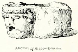
CHAPTER III.
MANORBERE CASTLE: AND GIRALDUS CAMBRENSIS.

the courtesy of a hospitable friend, we now shift our moorings from Tenby's tourist-haunted streets, to the quiet precincts of Manorbere Castle. Within those time-honoured walls the charm of modern hospitality is enhanced by contrast with its mediæval background.
the kindness of a welcoming friend, we now move our base from Tenby's crowded tourist streets to the peaceful grounds of Manorbere Castle. Inside those ancient walls, the appeal of modern hospitality stands out even more against its medieval backdrop.

Quitting the train at the little wayside station, a quarter of an hour's pleasant drive through deep lanes fringed with hartstongue fern, and gay with 'floureis white and blewe, yellow and rede,' gives us our first glimpse of the stately old pile. Crowning a low, isolated hill, the castle stands out 'four square to all the winds of heaven' against a silvery expanse of the distant ocean; for, as old Leland says: 'This place is not in the Hyeway, but standith neere the shore of the Severn Se.'
Getting off the train at the small wayside station, a nice fifteen-minute drive through narrow lanes lined with hartstongue fern and bright with "flowers white and blue, yellow and red," gives us our first view of the impressive old castle. Perched on a low, isolated hill, the castle stands "four square to all the winds of heaven" against the shimmering backdrop of the distant ocean; as the old historian Leland said, "This place is not on the highway, but stands near the shore of the Severn Sea."
A country lad opens a gate giving access to a rough meadow, flanked by the remains of barbican walls and ruined bastions; traversing which we presently draw rein before the broad, landward front of the castle. Crossing the grim but inoffensive drawbridge, our friend explains the ingenious device by which, in the 'good old times,' an intruder must perforce 'turn turtle' upon a sort of human beetle-trap. Overhead are seen the openings whence the garrison might pour down 'something lingering and humorous, with molten lead in it,' by way of warm welcome to the foe.
A country boy opens a gate that leads to a rough meadow, bordered by the remnants of barbican walls and crumbling bastions; as we cross it, we soon pull up before the large, land-facing side of the castle. We cross the grim but harmless drawbridge, and our friend explains the clever mechanism that in the 'good old days' forced any intruder to 'turn turtle' on a sort of human beetle-trap. Above us, we can see the openings where the garrison could pour down 'something lingering and humorous, with molten lead in it,' as a warm welcome to the enemy.
Passing beneath the ivy-mantled gate-tower, we emerge upon the[Pg 42] spacious greensward of the inner court, which is enclosed on every hand by hoary walls and turrets, whose weather-beaten ruins tell of heavy treatment at the hand of Father Time.
Passing under the ivy-covered gate tower, we step out onto the[Pg 42] spacious green area of the inner courtyard, which is surrounded on all sides by ancient walls and towers, whose worn-down ruins speak of harsh treatment by time.

For it is a notable fact in the history of Manorbere Castle, and one in which we are indebted for its relative state of preservation, that, unlike its great neighbours of Pembroke and Carew, it has never withstood a siege. Moreover, having ceased to be inhabited at a very early period, this castle has preserved unaltered the salient features of its construction. The architecture is very simple and massive, being indeed almost entirely devoid of ornament. Some of the apartments retain the plain, pointed stone vault, devoid of ribs, so frequently met with in South Wallian castles; while several of those circular chimneys, peculiar to the locality, rise above the crumbling battlements.
For it's an interesting fact in the history of Manorbere Castle, and one that has helped it stay relatively well-preserved, that, unlike its larger neighbors Pembroke and Carew, it has never been under siege. Additionally, since it stopped being lived in quite early on, this castle has maintained the key aspects of its original design. The architecture is very simple and sturdy, almost completely lacking in decoration. Some rooms still have the plain, pointed stone vaults, without ribs, that are often found in South Walian castles; meanwhile, several of those round chimneys, unique to the area, rise above the crumbling battlements.
Continuing our stroll around the inner court we observe, hard by the great gateway, the warders' room, with its narrow window commanding the entrance. Behind it rises the huge, circular 'Bull' Tower; a massive structure honeycombed with quaint little chambers approached by a winding stone stair, and connected with the gate-tower by a narrow passage in the thickness of the walls. Along the eastern side of the court extends a long range of apartments, which constit[Pg 43]ute the modern residence. These were resuscitated by Mr. J. R. Cobb, a former occupant, who restored the castle in so admirable and conscientious a manner, that the modern additions in no wise detract from their venerable surroundings. Farther away in the same direction lie the ruined kitchens, with their huge projecting chimneys, and ovens of such capacity that, as tradition avers, the lord of the domain was wont to regale his guests upon oxen roasted whole!
Continuing our walk around the inner courtyard, we notice the guards' room near the large gateway, featuring a narrow window overseeing the entrance. Behind it stands the massive, circular 'Bull' Tower, a huge structure filled with charming little rooms accessed by a winding stone staircase, connected to the gate-tower by a narrow passage within the thick walls. Along the eastern side of the courtyard stretches a long row of rooms, which make up the modern living quarters. These were revitalized by Mr. J. R. Cobb, a previous resident, who restored the castle so well and thoughtfully that the new additions do not take away from its historic charm. Further along in the same direction are the ruined kitchens, with their large protruding chimneys and ovens so big that, according to tradition, the lord of the estate used to entertain his guests by roasting entire oxen!

Traversing the sunny castle-garth, we pass a circular receptacle formed in the ground for melting the lead aforesaid. Close at hand is a deep draw-well, half full of water. Some twenty feet down this wel[Pg 44]l is a blocked-up archway which was opened years ago by old 'Billy,' the local factotum, who discovered dark, subterranean passages running hence beneath the adjacent ruins. Here he stumbled against casks and kegs left behind by the smuggler folk, who in former days carried on their illicit traffic around the neighbouring coast. At the same time, as a 'blind' for the Excise officers, they carried on a traffic in grain, which was stored for the purpose in large barns outside the castle.
Walking through the sunny castle yard, we come across a circular pit in the ground for melting lead. Nearby, there's a deep well that's half full of water. About twenty feet down this well is a blocked-up archway that was opened years ago by old 'Billy,' the local handyman, who discovered dark underground passages running down from here beneath the nearby ruins. He found barrels and kegs left by smugglers who used to do their illegal trade along the nearby coast. At the same time, to throw off the Excise officers, they also traded in grain, which was stored in large barns outside the castle.
At the farther end of the courtyard rise the picturesque walls and arches of a lofty group of buildings, containing the banqueting-hall and chapel. This appears to have been the handsomest part of the castle; and the great hall, with its broad flight of stone steps and stately range of pointed windows overlooking the sea, must indeed have been a noble apartment. Beneath it, in grim contrast, lurks a series of dark, windowless dungeons.
At the far end of the courtyard stand the beautiful walls and arches of a tall group of buildings, which include the banquet hall and chapel. This seems to have been the most attractive part of the castle; the grand hall, with its wide stone steps and impressive row of pointed windows facing the sea, must have truly been a magnificent space. Below it, in a stark contrast, lie a series of dark, windowless dungeons.
Entering the chapel by a flight of ruinous steps fringed with sprays of spleenwort fern, we explore its dimly-lighted recesses, and discern traces of half obliterated colour decoration. Clambering by a narrow stone stairway to the grass-grown roof, we awaken the resentful clamour of a colony of jackdaws; anon we peer into the tiny chamber for the priest, and dive into the gloomy crypt, with its low-vaulted roof and fireplace improvised from a desecrated tomb.
Entering the chapel through a crumbling set of steps lined with patches of spleenwort fern, we explore its dimly lit corners and notice remnants of faded colorful decorations. Climbing up a narrow stone staircase to the grassy roof, we disturb the angry chatter of a group of jackdaws; then we peek into the small room for the priest and venture into the dark crypt, with its low ceiling and a fireplace made from a disturbed tomb.

Then out once more into the castle garth, to follow the loopholed wall. This terminates in the many-sided Pembroke Tower, which, bowered in climbing plants, boasts a certain diminutive chamber wherein, as the local tradition runs, Giraldus Cambrensis, the famous Welsh historian, was born. Thence ensues another stretch of lofty wall, backed by a series of curious flying buttresses: and our peregrination is completed beneath the hoary, lichen-clad stonework of the great tower beside the entrance gateway. This is the oldest part of the castle, and (with apologies to the local tradition) probably the only portion of it that dates as far back as the days of the worthy Giraldus.
Then back out into the castle courtyard to follow the wall with openings. This leads to the multi-sided Pembroke Tower, which, covered in climbing plants, has a small chamber where, according to local tradition, the famous Welsh historian Giraldus Cambrensis was born. From there, we continue along another high wall, supported by a series of interesting flying buttresses. Our journey ends under the ancient, lichen-covered stone of the great tower next to the entrance gate. This is the oldest part of the castle and, despite what the local tradition says, is probably the only section that dates back to the time of the notable Giraldus.
The water-gate, set deep in the seaward wall, is flanked by a huge mass of stonework which still bears traces of the smugglers' ineffectual efforts to dislodge it. Following a rough track that winds down the rocky slope[Pg 45], we stroll onward beside a pretty rill of water meandering, amidst bullrushes and marsh marigolds, to the moss-grown wheel of the castle mill. Here we linger upon the rustic foot-bridge to enjoy a charming retrospect. The gray walls of the grim old castle, crowning the low, steep hill we have just descended, are reflected in the placid stream at our feet. A group of low-roofed cottages, and the mill with its plashing wheel, nestle in the valley beneath; while the towers and gables of the quaint old parish church peep from a rival hill that fronts the sea.
The water gate, set deep in the seafront wall, is flanked by a massive stone structure that still shows signs of the smugglers' failed attempts to remove it. Following a rough path that winds down the rocky slope[Pg 45], we walk alongside a lovely stream of water flowing through the bullrushes and marsh marigolds, leading to the moss-covered wheel of the castle mill. Here, we pause on the rustic footbridge to take in the charming view. The gray walls of the old, imposing castle, perched on the low, steep hill we've just come down, are mirrored in the calm stream below. A cluster of low-roofed cottages and the mill with its splashing wheel are tucked in the valley beneath, while the towers and gables of the quaint old parish church peek from a competing hill facing the sea.
The western flank of the castle looks down upon a weed-grown marsh, occupying the site of a lake that formerly protected it upon that side. Beside the marsh stands a picturesque old stone pigeon-house, smothered in ivy and golden lichens; beyond which extends a secluded vale shaded by oak, ash and holly, that formed part of the ancient park or chase of Manorbere. The whole scene has a quiet beauty of its own very pleasant to contemplate.
The western side of the castle overlooks a marsh overgrown with weeds, which used to be a lake that provided protection on that side. Next to the marsh is a charming old stone pigeonhouse, covered in ivy and golden lichens; beyond it lies a secluded valley shaded by oak, ash, and holly trees, which were part of the old park or hunting grounds of Manorbere. The whole scene has a tranquil beauty that's really nice to take in.
Meanwhile, after tackling this fascinating bit, we roam across the wind-blown sandhills, where a derelict boat, lying high and dry above high-water mark, offers a convenient resting-place for the noontide siesta. Stretching our limbs upon the warm, dry sand, and gazing dreamily across the deep-blue line of the bay, we call to mind a certain glowing description of the Manorbere of seven long centuries ago. Gerald de Barri, the author of this panegyric (better known as Giraldus Cambrensis), can scarce find words to express his admiration for the home of his boyhood.
Meanwhile, after getting through this interesting topic, we wander across the wind-blown sand dunes, where an abandoned boat, sitting high and dry above the high-water mark, provides a nice spot to take a midday nap. Stretching out on the warm, dry sand and gazing lazily at the deep blue line of the bay, we remember a certain glowing description of Manorbere from seven centuries ago. Gerald de Barri, the writer of this praise (better known as Giraldus Cambrensis), can hardly find words to express his admiration for his childhood home.
'The castle called Maenor Pyrr,' says Gerald, 'is excellently defended by towers and outworks, and is situated on the summit of a hill extending on the western side towards the seaport; having on the northern and southern sides a fine fish-pond under the walls, as conspicuous for its grand appearance as for the depth of its water; and a beautiful orchard on the same side enclosed on one part by a vineyard, and on the other by a wood remarkable for the projection of its rocks and the height of its hazel-trees. To the right of the promontory, between the castle and the church, near the site of a very large lake and mill, a rivulet of never-failing water fl[Pg 46]ows through a valley rendered sandy by the violence of the winds.'
'The castle called Maenor Pyrr,' Gerald says, 'is well defended by towers and fortifications, and it sits on top of a hill that extends toward the seaport on the western side. On the northern and southern sides, there’s a lovely pond right under the walls, notable for both its impressive appearance and deep water. There’s also a beautiful orchard on that same side, bordered on one side by a vineyard and on the other by a wooded area known for its rocky projections and tall hazel trees. To the right of the promontory, between the castle and the church, near the location of a large lake and mill, a stream of constant water flows through a valley made sandy by the force of the winds.'
The same enthusiastic writer also portrays for us the main features of the circumjacent country: 'Towards the west the Severn Sea, bending its course to Ireland, enters a hollow bay at some distance from the castle; and the southern rocks, if more extended towards the north, would render it an admirable harbour for shipping. From this point you may see almost all the ships from greater Britain, which the east wind drives towards Ireland. The land is well supplied with corn, sea-fish and wines, purchased abroad; and—what is of more importance—from its neighbourhood to Ireland it enjoys a mild climate.
The same enthusiastic writer also describes the main features of the surrounding area: 'To the west, the Severn Sea, flowing towards Ireland, enters a bay not far from the castle; and if the southern rocks extended further north, it would make an excellent harbor for ships. From this spot, you can see almost all the ships coming from Great Britain, pushed towards Ireland by the east wind. The land has plenty of grain, seafood, and wines imported from abroad; and—importantly—its proximity to Ireland gives it a mild climate.
'Dimetia therefore, with its seven cantrefs, is the most beautiful, as well as the most powerful district in Wales; Pembroch the finest part of the province of Dimetia; and the place I have just described the most beautiful part of Pembroch. It is evident, therefore, that Maenor Pyrr is the Paradise of all Wales!'
'Dimetia, with its seven cantrefs, is the most beautiful and the most powerful area in Wales; Pembroch is the best part of the Dimetia region; and the location I just described is the most stunning part of Pembroch. It's clear that Maenor Pyrr is the Paradise of all Wales!'
Born at Manorbere Castle in the year 1146, Gerald de Barri was the youngest son of William de Barri, Lord of Manorbere; grandson of Gerald de Windsor, Governor of Pembroke Castle; and nephew of David Fitz-Gerald, Bishop of St. Davids, from whom he received his early education; while upon the maternal side Gerald was descended from Rhys ap Tydwr, one of the princes of Wales. The career of one thus born, so to speak, in the purple, was from the outset pretty well assured. Thus we find the worthy Gerald promoted from the living of Tenby to a fat canonry at Hereford Cathedral; and presently the snug archdeaconry of St. Davids falls to his lot.
Born at Manorbere Castle in 1146, Gerald de Barri was the youngest son of William de Barri, Lord of Manorbere; grandson of Gerald de Windsor, Governor of Pembroke Castle; and nephew of David Fitz-Gerald, Bishop of St. Davids, who provided his early education. On his mother’s side, Gerald was descended from Rhys ap Tydwr, one of the princes of Wales. With such a background, his future was pretty much guaranteed from the start. Thus, we see Gerald moving from the parish of Tenby to a comfortable canonry at Hereford Cathedral; and soon, he landed the cozy archdeaconry of St. Davids.
About this time, Gerald joined with Archbishop Baldwin to preach the Crusade throughout South Wales; when he kept a diary of his proceedings which has proved of no little entertainment to after-comers.
Around this time, Gerald teamed up with Archbishop Baldwin to promote the Crusade across South Wales; during this period, he kept a diary of his activities that has provided considerable entertainment to those who came after.
During his long and eventful career Gerald de Barri paid three several visits to Rome, in order to push his interests at headquarters. He accompanied Henry II. to France, and was entrusted by that monarch with the education of his promising son John, of Magna Charta fame. Upon the death of his uncle the Bishop, Gerald made[Pg 47] strenuous efforts to obtain the coveted appointment of his native see, refusing all other preferments; but, failing of success, he retired in dudgeon from active life, and spent the rest of his days in writing those literary 'remains' that have afforded so much interest to antiquaries.
During his long and eventful career, Gerald de Barri made three trips to Rome to advance his interests at headquarters. He traveled to France with Henry II and was given the responsibility of educating Henry’s promising son John, who is known for Magna Carta. After the death of his uncle, the Bishop, Gerald made[Pg 47] intense efforts to secure the desired position in his home diocese, turning down all other offers. However, when he was unsuccessful, he withdrew from public life in frustration and spent the rest of his days writing those literary "remains" that have intrigued historians so much.
Gerald de Barri appears to have been a man of studious temperament. He became, as Lambarde quaintly puts it, 'wel learned and, as tyme served, eloquent.' He was, moreover, a great writer, and being much given to disputation, called together the literary élite of Oxford and read his own works to them. He next proceeded to feast his learned critics into a satisfactory state of good humour with things in general, and his own literary effusions in particular; an event which he himself describes as 'a magnificent affair, a return of the Golden Age, an unparalleled event, in England at all events.'
Gerald de Barri seems to have been a man who loved learning. He became, as Lambarde charmingly puts it, 'well-learned and, as time went on, eloquent.' He was also a great writer and, being quite fond of debate, gathered the literary elite of Oxford to share his works with them. After that, he treated his learned critics to a feast, getting them into a good mood about life in general and his writing in particular; an event he himself describes as 'a magnificent affair, a return of the Golden Age, an unparalleled event, in England at least.'
In person Gerald is portrayed as remarkably tall, his face being strongly marked by large, shaggy eyebrows; and it has been well said that, in spite of certain undeniable defects of character, he was probab[Pg 48]ly inspired with a genuine love for the land of his birth, and a desire to upraise therein an independent Kymric Church owning allegiance to the Bishop of St. Davids as its spiritual head.
In person, Gerald is described as very tall, with a strong face highlighted by large, messy eyebrows. It has been accurately stated that, despite some undeniable character flaws, he was probably driven by a genuine love for his homeland and a desire to establish an independent Welsh Church that would recognize the Bishop of St. Davids as its spiritual leader.

Gerald de Barri was gathered to his fathers, at a ripe old age, in the year 1220. He is reputed to have been buried in St. Davids Cathedral; where at least one tomb is pointed out as the last resting-place of this great ecclesiastic.
Gerald de Barri passed away peacefully at a ripe old age in 1220. He is said to be buried in St. Davids Cathedral, where at least one tomb is identified as the final resting place of this great ecclesiastic.
Little is recorded of the subsequent history of Manorbere Castle. The place appears to have been abandoned at an early period; its hanging woods and vineyards were abandoned to decay, whilst its dismantled walls and subterranean vaults harboured bands of lawless freebooters, who haunted these coasts a century ago. Wild work went forward at Manorbere in those half-forgotten days. It is related how a certain famous smuggler, notorious for his desperate enterprises, eluded the vigilance of the revenue men by running his vessel ashore near the headland ycleped the Priest's Nose; and conveying his illicit cargo, under cover of night, to the cellars with which the neighbourhood abounded.
Little is documented about the later history of Manorbere Castle. It seems that the place was deserted early on; its hanging woods and vineyards fell into disrepair, while its crumbling walls and underground vaults became hideouts for bands of lawless pirates who roamed these coasts a century ago. Chaos reigned at Manorbere during those half-forgotten days. It is said that a certain infamous smuggler, known for his daring exploits, evaded the watchful eyes of the customs officials by bringing his ship ashore near the headland called the Priest's Nose; he would secretly transfer his illegal cargo, under the cover of night, to the cellars that dotted the area.
Rousing ourselves at length from these cogitations on the sandhills, we put the best foot foremost and hie away past a spring of pure water known as the Druid's Well, to the sunny slopes of that selfsame Priest's Nose. Scrambling warily amidst brakes of prickly furze, we presently espy a mighty cromlech standing in a nook of the hill, beside the narrow path. A soft westerly breeze draws in 'gently, very gently from the sea,' as we perch beside this relic of the immemorial past; wafting the scent of wild thyme and gorse over warm, crisp turf that shimmers beneath the lusty summer sunshine. Hence unfolds yet another charming view of the gray old castle, set amidst a breadth of feathery woodland that clusters under the lee of the sheltering hill. A turn of the head reveals the varied line of coast stretching away, league upon league, past the groves of Stackpole to the bluff, perpendicular landfall of St. Govan's Head.
Rousing ourselves at last from these thoughts on the sandhills, we set off with enthusiasm and make our way past a spring of fresh water known as the Druid's Well, up to the sunny slopes of that very same Priest's Nose. Carefully climbing through patches of prickly gorse, we soon spot a massive cromlech nestled in a bend of the hill, right by the narrow path. A soft westerly breeze is blowing in 'gently, very gently from the sea,' as we sit beside this ancient relic; carrying the scent of wild thyme and gorse over warm, crisp grass that shimmers under the bright summer sun. From here, another beautiful view unfolds of the old gray castle, surrounded by a stretch of feathery woodland that gathers under the protective hill. Turning our heads reveals the varied coastline stretching away, mile after mile, past the groves of Stackpole to the steep, vertical cliffs of St. Govan's Head.
Returning to quarters by another route we fetch a wide compass round; pursuing the path that hugs the shore, which, hereab[Pg 49]outs, is indented by several fissures of very peculiar character. A short distance beyond the cromlech we encounter the first of these; a chasm so narrow that a boy might leap across it, yet of imposing depth, with sides as smooth and perpendicular as any house wall, and floored with the seething ocean.
Returning to our quarters by a different route, we take a wide detour; following the path that runs along the shore, which here is marked by several unique indentations. A short distance beyond the cromlech, we come across the first of these; a chasm so narrow that a boy could jump over it, yet so deep that its walls are smooth and vertical, like the side of a house, with the restless ocean beneath.

A quarter of a mile farther on we strike a little way inland, to investigate a still more remarkable lusus naturæ of a similar kind. Here the insidious onslaught of the waves has tunnelled beneath the intervening cliff, and penetrated far into the land; excavating a dark, narrow, and profound fissure in the perpendicular strata of the Old Red sandstone; so that, gazing seaward through the cleft, we can see the foaming surf sparkling in the sunlight upon the rocks beyond. Thence we extend our ramble to Castle Head, a rocky point jutting boldly out to sea, and scarped with the broad, fern-clad furrows of a prehistoric earthwork. This appears to have been the stronghold of some invader from over seas; for the protecting banks curve inland, and, sweeping down to the rocks on either hand, enclose the outer extremity of the headland. Secured thus against attack upon their landward flank, the occupants were protected in rear by the broad expanse of the 'inviolate ocean,' whose restless billows, surging far below, mingle t[Pg 50]heir music in wild harmony with the harsh cries of countless sea-fowl.
A quarter of a mile further on, we venture a little way inland to check out another amazing lusus naturæ of the same kind. Here, the relentless waves have carved out a tunnel beneath the cliff, reaching deep into the land; creating a dark, narrow, and deep fissure in the vertical layers of the Old Red sandstone. Looking out to sea through this gap, we can see the frothy surf sparkling in the sunlight on the rocks beyond. From there, we continue our walk to Castle Head, a rocky point that juts out boldly into the sea, featuring the wide, fern-covered grooves of an ancient earthwork. It seems to have been the stronghold of some invader from overseas; the protective banks curve inland and sweep down to the rocks on either side, enclosing the outer edge of the headland. With their landward side secure against attack, the occupants were also protected from behind by the vast expanse of the 'inviolate ocean,' whose restless waves, crashing far below, create a wild harmony with the harsh cries of countless seabirds.

Breasting the rough ascent, we now march across the upland meadows of Parson's Piece; making in a 'bee-line' for Manorbere Church, whose slim gray tower peers over an intervening bank. Perched high aloft upon a bleak hillside, across whose treeless heights 'breathes the shrill spirit of the western wind,' this venerable fabric rises in lonely isolation, and confronts in peaceful rivalry the towers and battlements of the grim old fortalice that crowns the opposite hill.
Breasting the tough climb, we now walk across the grasslands of Parson's Piece, heading straight for Manorbere Church, whose slender gray tower can be seen over a nearby rise. Sitting high on a barren hillside, where the harsh western wind blows, this old structure stands in lonely solitude, peacefully competing with the towers and walls of the old fortress on the opposite hill.
For quaint picturesqueness, and the singular grouping of its various parts, this curious old church stands unrivalled, even in this land of remarkable churches, combining as it does almost every feature characteristic of such buildings throughout the locality. Originally in all probability a cruciform structure, the church has apparently been added to at various times in a capricious fashion; so that the exterior now presents the quaintest imaginable variety of walls, windows and gables; all jumbled together in seemingly haphazard fashion, and falling into fantastic groups, as may be seen from the adjoining sketch.
For its charming uniqueness and the unusual arrangement of its different parts, this intriguing old church is unmatched, even in this land of impressive churches. It incorporates almost every feature typical of such buildings in the area. Originally likely built in the shape of a cross, the church has clearly been expanded at different times in an unpredictable way, resulting in an exterior that showcases the most whimsical variety of walls, windows, and gables—all mixed together in what looks like a random manner and forming fantastic clusters, as you can see from the nearby sketch.
It will be noticed that one of the gables is surmounted by the original bell-cot, which probably existed prior to the erection of the tower; the latter rises above a medley of roofs upon the northern side of the chancel, and contains a bell inscribed with the legend: exaltemus nomen domini, 1639.
It’s worth noting that one of the gables features the original bell-cot, which likely existed before the tower was built; the tower stands above a mix of roofs on the northern side of the chancel and holds a bell inscribed with the phrase: exalt the name of the Lord, 1639.
Passing around to the south porch, we enter a low nave arched over with a slightly-pointed, stone-vaulted ceiling. Strange, low, rudely-fashioned arches, entirely disdaining the support of pillars, rise sheer from the level of the floor upon either hand, giving access to the narrow aisles behind. These arches are, unfortunately, so enveloped in the general coating of whitewash, that it is impossible now to discover whether they were originally built as arches, proper, or are merely openings cut through the walls when the aisles were added to the nave. A little window of early type opens above one of these arches; the sole survivor of some old windows that existed previous to the building of the aisles.
As we move around to the south porch, we enter a low nave with a slightly pointed, stone-vaulted ceiling. Odd, low, crudely made arches rise directly from the floor on either side, completely ignoring the need for pillars, and lead to the narrow aisles behind. Unfortunately, these arches are so covered in whitewash that it’s impossible to tell if they were originally constructed as proper arches or if they’re just openings cut through the walls when the aisles were added to the nave. A small, early-style window is set above one of these arches; it’s the only remnant of the old windows that were there before the aisles were built.
Short, tunnel-like transepts open out on either hand, the one[Pg 51] towards the north having a low ceiling, crossed by the curious arched ribs seen in our sketch above. The gangway that formerly gave access to the rood-loft now leads, in a queer, tortuous course, from the north aisle across the adjacent transept to the tower, which is entered by a door high aloft in the wall.
Short, tunnel-like transepts open up on either side, with the one[Pg 51] on the north side having a low ceiling, featuring the unusual arched ribs depicted in our sketch above. The walkway that used to lead to the rood-loft now takes a strange, winding path from the north aisle across the nearby transept to the tower, which you enter through a door high up in the wall.
To the right a 'squint' passage opens skew-wise into the chancel, where, beneath a plain arched recess, lies the recumbent stone effigy of a Crusader clad in chain mail, having his legs crossed at the knees and sword and shield, charged with the arms of De Barri, beside him. This monument commemorates one of the ancient lords of Manorbere, who 'came over with the Conqueror,' and shared with Fitz-Hamon and his knights in the partition of these lands.
To the right, a 'squint' passage opens at an angle into the chancel, where, beneath a simple arched recess, lies the lying stone figure of a Crusader dressed in chain mail, with his legs crossed at the knees and a sword and shield, bearing the arms of De Barri, beside him. This monument honors one of the old lords of Manorbere, who 'came over with the Conqueror' and shared the division of these lands with Fitz-Hamon and his knights.
The handsome traceried screen that stretches athwart the narrow chancel arch was erected about five-and-twenty years ago, when a vigorous effort was made to arrest the deplorable condition of ruin and decay, to which time and neglect had reduced this interesting church.
The beautiful decorated screen that spans the narrow chancel arch was put up around twenty-five years ago, during a strong push to stop the unfortunate state of ruin and decay that time and neglect had caused this fascinating church.
A few ivy-mantled fragments of an ancient structure that formerly served as the parish school, are supposed to be the remains of a chantry founded by the De Barri who lies buried in the church.
A few ivy-covered remnants of an old building that used to be the parish school are believed to be the remains of a chantry established by the De Barri, who is buried in the church.
We now stroll leisurely homeward through the gloaming, while the slender young moon peers over the shoulder of a neighbouring hill. As we approach the castle, its shadowy front looms darkly silhouetted upon a daffodil and emerald sky; while the zenith is still suffused with translucent rosy light, and the pale stars peep one by one as the daylight slowly wanes. Now the little flittermice awake once more to life, and flicker to and fro with wavering flight; while a colony of chattering jackdaws discusses the day's events upon the ruined battlements. Yonder, like a thief of the night, a great white owl steals silently by, soft as a drift of thistledown, yet keen as fate to 'spot' the errant mouse, roaming in search of a meal too far from home.
We now walk home slowly through the twilight, as the slender young moon peeks over the edge of a nearby hill. As we near the castle, its shadowy facade stands out darkly against a sky of daffodil and emerald; meanwhile, the sky is still filled with soft rosy light, and the pale stars appear one by one as the daylight fades. Now the little bats wake up again, flitting back and forth with unsteady flights; while a group of chattering jackdaws talks about the day's events on the ruined battlements. Over there, like a thief of the night, a large white owl glides silently by, soft as a puff of thistledown, yet sharp as fate in searching for the wandering mouse, looking for a meal too far from home.
Thus we recross the drawbridge to the hospitable abode, whose latticed windows emit a heartsome ray of light that seems a lode-star to the wayfarers. Pretty tired after our long day's ramble, we clamber up the corkscrew stair to a certain turret chamber, wher[Pg 52]e, in next to no time, we lose ourselves in the drowsy arms of Morpheus.
Thus we cross back over the drawbridge to the welcoming home, whose lattice windows shine with a warm light that acts like a guiding star for travelers. Pretty tired after our long day’s journey, we climb up the spiral staircase to a particular turret room, where, in no time at all, we find ourselves in the sleepy embrace of Morpheus.
The busy man, hard pressed by the Sturm und Drang of city life, may find at Manorbere recreation in the truest sense; and should he be blessed with a congenial hobby, he may entertain himself in this secluded spot to his heart's content.
The busy man, overwhelmed by the chaos of city life, may find real relaxation at Manorbere; and if he has a compatible hobby, he can enjoy himself in this quiet spot as much as he wants.
To the lover of Nature the place offers many attractions. In the course of rambles around the varied coast-line, or amidst the hills and dales of the inland country, the wanderer with a turn that way may study the mellow lichen-clad rocks of the Old Red sandstone; and will not fail to notice their well-defined junction at Skrinkle Haven with the limestone formation, which reappears across the Sound in the cave-worn crags of Caldey. Or, again, he may note how the salmon-red ploughlands of the Ridgeway attest the presence of the older rocks, as they rise from the superincumbent stratum of the mountain limestone.
To those who love Nature, this place has a lot to offer. While exploring the diverse coastline or the hills and valleys of the countryside, a wanderer can observe the beautiful lichen-covered rocks of the Old Red sandstone. They will also see the clear boundary where these rocks meet the limestone formation at Skrinkle Haven, which can be spotted across the Sound in the cave-eroded cliffs of Caldey. Alternatively, they might notice how the salmon-red farming lands of the Ridgeway show the presence of older rocks as they rise above the layer of mountain limestone above them.
These conditions afford, within a limited compass, a great diversity of soil and situation; providing a congenial habitat to many varieties of ferns and wild-flowers. The botanist will look for prizes amongst the rich pastures of the Vale of St. Florence, the woodland paths around St. Issells, and the lush marshlands of Penally; while the sandy burrows of Tenby, Lydstep and Castle Martin, and even the crumbling ruins of some castle or ancient priory, will yield their tale of treasure for the vasculum.
These conditions offer, within a limited area, a great variety of soil and location; providing a suitable habitat for many types of ferns and wildflowers. The botanist will search for treasures among the rich pastures of the Vale of St. Florence, the forest paths around St. Issells, and the lush marshlands of Penally; while the sandy burrows of Tenby, Lydstep, and Castle Martin, and even the crumbling remains of some castle or ancient priory, will share their story of discoveries for the collection bag.
Indeed, wander whither he may, the lover of Nature will find a wealth of beauty on every hand. Let him clamber amidst the tumbled boulders, where the samphire thrives on the salt sea spray; and explore the rock-pools left by the receding tide, whose weed-fringed depths are tenanted by plump sea-urchins, nestling sociably among zoophytes, sponges, and delicate 'lady's-fingers.' Or he may choose to wander along the sands of Saundersfoot and Tenby, where haply he may light upon rare shells of many a dainty hue; while queer little crabs scuttle hither and thither amidst the stranded starfish, and other derelict flotsam and jetsam left behind by the receding tide.
Indeed, wherever he goes, the nature lover will find beauty all around him. He can climb among the scattered boulders, where the samphire thrives in the salty sea spray, and explore the rock pools left by the retreating tide, whose weed-covered depths are home to plump sea urchins, cozying up with zoophytes, sponges, and delicate "lady's fingers." Or he might choose to stroll along the sands of Saundersfoot and Tenby, where he might come across rare shells in a variety of pretty colors, as quirky little crabs scurry back and forth among stranded starfish and other bits of flotsam and jetsam left behind by the ebbing tide.
And as the changing seasons cast their ever-varying charm upon land and sea, the artist in search of 'fresh woods and pastures new'[Pg 53] will find, in this unfrequented country, endless subjects ready to his hand worthy the brush of a Brett, or an Alfred Parsons. Perchance he will set up his easel where the ruddy sandstone cliffs, soaring in weather-stained crags above broad sweeps of untrodden sand, are crowned with a diadem of golden gorse; while a breadth of sunlit sea stretching away to the horizon will serve as an excellent background. Or haply he may plant his white umbrella in some secluded nook, where a picturesque old cottage, with mighty, bulging chimney and moss-grown roofs, nestles beneath a group of wind-swept ash trees; the softly folding landscape lines showing faintly beyond.
And as the changing seasons bring their unique beauty to the land and sea, the artist looking for 'fresh woods and pastures new'[Pg 53] will discover, in this little-visited area, countless subjects perfect for the brush of a Brett or an Alfred Parsons. Perhaps he'll set up his easel where the red sandstone cliffs rise above wide stretches of untouched sand, crowned with a crown of golden gorse; while a stretch of sunlit sea extending to the horizon provides a great backdrop. Or maybe he'll place his white umbrella in a quiet spot, where a charming old cottage, with a large, bulging chimney and moss-covered roofs, sits beneath a group of wind-swept ash trees, with the gently rolling landscape visible in the distance.
Many a beauty-spot such as this gladdens the wayfarer as he roams through the byways of this pleasant land; and the landscape-painter may easily 'go farther and fare worse,' than by spending a season in Pembrokeshire.
Many beautiful spots like this bring joy to travelers as they explore the backroads of this lovely land; and the landscape painter could easily "go farther and fare worse" than to spend a season in Pembrokeshire.

CHAPTER IV.
PEMBROKE TOWN AND CASTLE. STACKPOLE AND THE SOUTHERN COAST.

course of time the Wanderlust returns in full force upon us; so bidding farewell to our hospitable entertainers, we transfer ourselves bag and baggage to the county-town; in order to explore from that convenient starting-point the remoter recess of South Pembrokeshire.
As time goes on, the Wanderlust hits us hard again; so after saying goodbye to our generous hosts, we pack our bags and head to the county town to explore the more distant areas of South Pembrokeshire from that convenient base.
The district locally known as the Stackpole Country forms part of the hundred of Castle Martin, and is the southernmost land of the county. Lying apart from any town or railway, it is somewhat difficult of access; but though boasting few striking features to attract the ordinary tourist, it yet offers no small attractions to the wanderer who can appreciate 'the pleasures of the quiet eye.'
The area commonly referred to as Stackpole Country is part of the hundred of Castle Martin and is the southernmost part of the county. Since it is away from any town or railway, it's a bit hard to get to; however, while it doesn’t have many standout features to draw in the typical tourist, it does provide plenty of appeal for those who appreciate 'the pleasures of the quiet eye.'
Threading our way at first amidst rather intricate lanes, we pass once more through Hodgeston village, whence our route is all plain sailing. Near Lamphey Church we fall into the main road, which runs in a bee-line beside softly-swelling hills, until the long street of Pembroke is entered at its eastern end.
Threading our way at first through some pretty complicated streets, we pass through Hodgeston village again, after which our path becomes straightforward. Near Lamphey Church, we join the main road, which runs straight alongside gently rolling hills, until we reach the long street of Pembroke at its eastern end.
The 'lie' of this town has been not inaptly likened to the shape of a herring-bone; the castle precincts occupying the head (whereof the great donjon answers to the eye), while the long main street, with its branching lanes and gardens, suggests the vertebral bone of the fish with i[Pg 55]ts radial spines. Apropos of the situation of the town, we refer to our trusty Leland and read that 'Pembroch standith upon an arme of Milforde, the which, about a mile beyond the Towne, creketh in so that it almost peninsulateth the Towne, that standith on a veri main Rokki ground. The Towne is well waullid and hath iii gates by Est, West and North; of which the Est gate is fairest and strongest, having afore it a compasid Tour not rofid in; the entering whereof is a Port colys, ex solide ferro.'
The layout of this town has been fittingly compared to a herringbone; the castle area sits at the top (with the big keep resembling the eye), while the long main street, along with its branching lanes and gardens, looks like the backbone of the fish with its radial spines. Speaking of the town's location, we turn to our reliable source, Leland, who says, "Pembroke stands on an arm of Milford, which, about a mile beyond the town, curves in so much that it almost forms a peninsula. The town itself sits on very solid rocky ground. It’s well-walled and has three gates to the East, West, and North; of these, the East gate is the fairest and strongest, with a round tower in front, and the entrance features a portcullis made of solid iron."

Neither gate nor 'compasid Tour' now spans the prosaic-looking street; and the houses in this eastern suburb have small pretensions to beauty. We catch a hasty glimpse, however, of the 'two paroche chirches' discovered by our author; and entertain ourselves en route by trying to pronounce the curious, unfamiliar surnames such as Hopla, Treweeks, Malefant and Tyzard, emblazoned above the shop-fronts: while [Pg 56]an occasional Godolphin, Pomeroy or Harcourt, attests the strain of sang-azure that lingers yet among the bourgeoisie of the ancient borough.
Neither the gate nor the 'compasid Tour' spans the plain-looking street now, and the houses in this eastern suburb don’t have much claim to beauty. However, we get a quick glimpse of the 'two parish churches' discovered by our author, and we keep ourselves entertained en route by attempting to pronounce the strange, unfamiliar surnames like Hopla, Treweeks, Malefant, and Tyzard displayed above the shop fronts. Occasionally, names like Godolphin, Pomeroy, or Harcourt appear, showing that a hint of noble lineage still exists among the bourgeoisie of the ancient borough.

Midway adown the High Street rises a mighty elm, whose spreading branches quite overshadow the adjacent dwellings. Presently we catch a glimpse of Pembroke Castle, beyond a pretty vista of old-fashioned structures whose quaint, irregular outlines stand sharply cut against the clear sky.
Midway down the High Street stands a massive elm tree, its wide branches casting shade over the nearby homes. Right now, we catch sight of Pembroke Castle, framed by a lovely view of traditional buildings with their charming, uneven shapes sharply outlined against the clear sky.
The records of this great historic fortress would alone suffice to fill a bulky volume; the best account of the earls, earldom and castle of Pembroke being, perhaps, that by G. T. Clark, Esq.; and there is a detailed description of the building by the present proprietor, J. R. Cobb, Esq. We will not attempt, therefore, to give more than a slight outline of its past history.
The history of this impressive fortress could easily fill a thick book; perhaps the best account of the earls, the earldom, and the castle of Pembroke is by G. T. Clark, Esq.; there’s also a detailed description of the building by the current owner, J. R. Cobb, Esq. So, we won’t try to provide more than a brief overview of its past.
Pembroke Castle was originally built by Arnulph de Montgomery, in the reign of William Rufus; and it was greatly enlarged and strengthened by Earl Strongbow, the invader of Ireland, who held it in the time of Henry I.
Pembroke Castle was initially constructed by Arnulph de Montgomery during the reign of William Rufus. It was significantly expanded and fortified by Earl Strongbow, the invader of Ireland, who controlled it during the time of Henry I.
A romantic story is related of his predecessor, the King's castellan, Gerald de Windsor, who espoused the beautiful but notorious Nesta. A certain Welsh chieftain, named Owen ap Cadwgan, beheld the famous beauty presiding one day with her ladies at a tournament (like the moon amidst her satellites); when, sighing like Alcestis for the Queen of night, the enamoured warrior determined to possess himself of his seductive charmer. Obtaining access to the castle at dead of night, Owen wrested his victim from the arms of her outraged lord, and carried her off to his stronghold among the mountains. Though a large reward was offered by the King to anyone who should capture or slay the outlawed man, it was eight long years before justice was vindicated, when Gerald, meeting his adversary, put an end to his career by an avenging arrow.
A romantic story is told about his predecessor, the King's castellan, Gerald de Windsor, who married the beautiful but infamous Nesta. A certain Welsh chieftain, named Owen ap Cadwgan, saw the famous beauty one day with her ladies at a tournament (like the moon surrounded by her stars); and, sighing like Alcestis for the Queen of Night, the lovesick warrior decided he had to have his enchanting damsel. Gaining access to the castle in the dead of night, Owen took his prize from the arms of her furious husband and carried her off to his stronghold in the mountains. Even though the King offered a large reward for anyone who captured or killed the outlaw, it took eight long years for justice to be served, when Gerald, encountering his foe, ended his life with a vengeful arrow.
But to return to history. William, Earl Mareschal of Pembroke, was honoured with a visit from that sorry monarch, King John. During the Edwardian period, the castle was enlarged and strengthen[Pg 57]ed by the addition of the outer ward. In 1457 Henry Tudor, Earl of Richmond (afterwards King Henry VII.), was born at Pembroke Castle.
But to get back to history. William, Earl Marshal of Pembroke, was visited by that unfortunate king, King John. During the Edwardian period, the castle was expanded and fortified[Pg 57] with the addition of the outer ward. In 1457, Henry Tudor, Earl of Richmond (later King Henry VII), was born at Pembroke Castle.
During the Civil Wars the garrison made a gallant defence against a large force under Oliver Cromwell. One tragic episode that closed the eventful days of the siege may be mentioned here. Upon the fall of the castle the three leaders, Poyer, Mayor of the town, Powell, Governor of the castle, and Laugharne, the whilom Parliamentary Colonel, were expressly exempted from the pardon extended to the garrison. These three men were condemned to death: but Parliament in its clemency resolving to punish only one of them, they were directed by Cromwell's orders to draw lots as to who should suffer the penalty. Two papers were inscribed 'Life given by God'; the third was a blank. A child drew the lots, when the blank fell to the ill-fated Poyer; who was afterwards shot in the Piazza, Covent Garden, 'dying very penitently,' as we are told. After the fortress was delivered into Cromwell's hands, it was so effectually dismantled that, to this day, the results of his destructive work are only too manifest.
During the Civil Wars, the garrison put up a brave fight against a large force led by Oliver Cromwell. One tragic event that marked the end of the siege should be mentioned here. After the castle fell, the three leaders—Poyer, Mayor of the town; Powell, Governor of the castle; and Laugharne, the former Parliamentary Colonel—were specifically excluded from the pardon given to the garrison. These three men were sentenced to death, but in a merciful decision, Parliament chose to punish only one of them. Following Cromwell's orders, they were instructed to draw lots to determine who would face the penalty. Two slips of paper said 'Life given by God', while the third was blank. A child drew the lots, and the blank slip went to the unfortunate Poyer, who was later executed in the Piazza, Covent Garden, 'dying very penitently,' as we are told. After the fortress was handed over to Cromwell, it was so thoroughly dismantled that, to this day, the effects of his destructive work are all too visible.
The ruins of Pembroke Castle still present, after the lapse of centuries of neglect and decay, a truly magnificent appearance. The massive towers and ivy-curtained walls crown a bold and rocky eminence, that rises abruptly from the tidal waters of Milford Haven; sweeping around the landward face of the promontory, and enclosing a broad and spacious castle garth.
The remains of Pembroke Castle still show a stunning sight, even after centuries of neglect and decay. The huge towers and ivy-covered walls sit atop a steep, rocky hill that rises abruptly from the tidal waters of Milford Haven, wrapping around the landward side of the promontory and creating a wide and spacious castle yard.
In the centre rises the great donjon tower, which stands as an enduring memorial of William de la Grace, the great Earl Mareschal, who in all probability designed the main fabric of the castle as we see it to-day. An imposing coup d'œil of the ruins may be obtained by turning down Dark Lane, crossing the old bridge that spans the stream hard beneath the castle, and entering a timber-yard close by. Prominent in the view is a lofty tower, mantled in glossy-green ivy and pierced with graceful pointed windows, that soars from the river brink, enclosing, deep below its foundations, that 'mervelous vault called the Hog[Pg 58]an,' whence the garrison in olden times drew their supplies of water.
In the center stands the great donjon tower, which is a lasting tribute to William de la Grace, the renowned Earl Mareschal, who likely designed the main structure of the castle as we see it today. You can get an impressive view of the ruins by heading down Dark Lane, crossing the old bridge that spans the stream just below the castle, and entering a nearby timber yard. Prominent in the view is a tall tower, covered in shiny green ivy and featuring elegant pointed windows, rising from the riverbank, concealing deep below its foundations the 'marvelous vault called the Hog[Pg 58]an,' where the garrison collected their water supplies in ancient times.
Beside the tower extends a long stretch of ivy-clad wall, rooted in the living rock and broken at intervals by shapely turrets; over which peep the upper works of the central keep. The spars and cordage of some stranded coasting vessels, and a group of men calking their weather-beaten timbers, lend an added charm to an exceedingly picturesque scene.
Beside the tower is a long stretch of ivy-covered wall, anchored in the solid rock and interrupted here and there by beautiful turrets; above which the upper part of the central keep peeks out. The masts and ropes of some wrecked coastal vessels, along with a group of men repairing their worn-out timbers, add to the charm of this very picturesque scene.
We are indebted to Leland for the ensuing description of the castle as it appeared in the days of bluff King Hal: 'The Castel stondeth hard by the waul on a hard Rokke, and is veri large and stronge, being doble wardid. In the atter ward I saw the chaumbre wher King Henri the vii was borne; in knowledge whereof a chymmeney is now made, with the armes and Badges of King Henri vii. In the botom of the great stronge Towr, in the inner warde, is a mervelous vault called the Hogan.' Another chronicler of very different stamp, the late Professor Freeman, thus records his impressions of this interesting pile: 'Pembroke Castle remarkably combines elevation and massiveness, so that its effect is one of vast general bulk. It is another conspicuous instance of the majesty often accruing to dismantled buildings, which they could never have possessed when in a perfect state.'
We owe a debt of gratitude to Leland for the following description of the castle as it appeared during the time of the bold King Henry: 'The castle stands next to the wall on a solid rock and is very large and strong, being double-walled. In the outer ward, I saw the chamber where King Henry VII was born; in recognition of this, a chimney has been made, displaying the arms and badges of King Henry VII. At the bottom of the great strong tower, in the inner ward, is a marvelous vault called the Hogan.' Another chronicler with a very different perspective, the late Professor Freeman, shares his impressions of this fascinating structure: 'Pembroke Castle strikingly combines height and bulk, giving it an immense overall appearance. It is another clear example of the grandeur often seen in ruined buildings, which they could never have had while in perfect condition.'
Traversing the outer barbican that protected the deep-set entrance, we pause to marvel at the elaborate defences of double portcullis and thick, nail-studded doors, commanded by loopholed guard-chambers, set within the gloomy arches of the gate-tower. The latter presents a stately front, flanked by attached round towers, overlooking the inner court; and contains a number of fine apartments for the accommodation of distinguished guests.
Traversing the outer wall that protected the deep entrance, we pause to admire the intricate defenses of the double portcullis and thick, nail-studded doors, overseen by loopholed guard chambers, set within the dark arches of the gate tower. The tower has an impressive facade, flanked by attached round towers that overlook the inner courtyard and contains several elegant rooms for hosting distinguished guests.
We next turn our attention to the adjacent barbican tower, whose massive walls are seamed from top to base by huge, gaping rents, through which the daylight peers; yet so great is their tenacity they still remain intact, and support the original stone roof. Each story is pierced with loopholes, ingeniously constructed to prevent missiles entering from below. The spacious courtyard enclosed by the outer walls is carpeted with velvety turf, whereon 'the quality' are wont to[Pg 59] foregather from far and near to wield the tennis-racket, and contest for 'deuce' and 'love' upon the selfsame spot where, in the brave days of old, the Harcourts and De Valances, and all the flower of Norman chivalry, flung down the gauntlet or broke a lance upon the field of honour, while fair spectators waved encouragement from every arch and balcony.
We now focus on the nearby barbican tower, which has huge cracks running from top to bottom, letting in daylight; yet despite this, its strength keeps it intact, supporting the original stone roof. Each level has loopholes cleverly designed to stop projectiles from coming in from below. The large courtyard surrounded by the outer walls is covered in soft grass, where the elite gather from near and far to play tennis and compete for 'deuce' and 'love' in the same spot where, in the glorious days of the past, the Harcourts, De Valances, and all the finest Norman knights threw down their challenges or broke lances on the field of honor, while cheering spectators waved their encouragement from every arch and balcony.
Beside the great central keep a labyrinth of crumbling walls, towers and arches, mainly of Edwardian date, cluster together in 'most admired confusion.' Here are pointed out the remains of the chapel of St. Nicholas, given by Montgomery to the Norman abbey of Sayes. A chamber is usually pointed out, in the building called the Exchequer, as that in which Henry VII. first saw the light; but Mr. Cobb suggests a room in the tower overlooking Westgate Hill. Unfortunately, the arms and badges noticed by Leland no longer exist to mark the scene of that interesting event.
Beside the impressive central keep, a maze of crumbling walls, towers, and arches, mostly from the Edwardian era, come together in a widely admired disarray. The remains of the chapel of St. Nicholas are pointed out here, which Montgomery donated to the Norman abbey of Sayes. There's a chamber usually identified in the building known as the Exchequer as the place where Henry VII was born; however, Mr. Cobb proposes a room in the tower overlooking Westgate Hill. Unfortunately, the coats of arms and badges mentioned by Leland no longer exist to mark the site of that significant event.
Clambering down a flight of broken steps in an obscure corner of the North Hall, we enter the vast cavern known as the Wogan; a very curious and characteristic feature of Pembroke Castle. As we ramble over the damp and slippery floor, by such light as can struggle in through the huge sally-port and a narrow, pointed window, we find ourselves in a spacious, natural vault sunk deep in the living rock; its rugged walls and roof festooned with hartstongue fern, and stained by oozing moisture—a weird, fantastic spot, such as the shade of the primæval cave-dweller might frequent, should he elect to revisit the glimpses of the moon.
Climbing down a set of broken steps in a hidden corner of the North Hall, we enter the vast cave known as the Wogan; a very unique and distinctive feature of Pembroke Castle. As we wander over the damp and slippery floor, with only the light that manages to get in through the large sally-port and a narrow, pointed window, we find ourselves in a spacious, natural vault carved deep into the living rock; its rough walls and ceiling are covered in hartstongue fern and stained by seeping moisture—a strange, fantastical spot that the ghost of a prehistoric cave dweller might choose to visit if he decided to come back to see the moonlight.
Sheer from the 'main Rokke' upon which the castle is founded, rises the vast, circular keep or donjon tower, which formed the central stronghold of the fortress. This is undoubtedly one of the most ancient parts of the castle, having been erected by William Strongbow the elder, 'Rector Regis et Regni,' as he proudly styled himself; who was Earl Mareschal of Pembroke during the reigns of Richard Cœur-de-Lion and John.
Sheer from the main rock on which the castle is built rises the large, circular keep or donjon tower, which served as the main stronghold of the fortress. This is definitely one of the oldest parts of the castle, having been constructed by William Strongbow the elder, 'Rector Regis et Regni,' as he liked to call himself; who was the Earl Marshal of Pembroke during the reigns of Richard the Lionheart and John.
This imposing structure impresses every beholder by the vast proportions and stern simplicity of its mighty bulk. The massive wall[Pg 60]s rise to a height of more than 75 feet, and are of amazing thickness and solidity; a spiral staircase, set deep within the wall, gave access to the several floors and to the rampart around the summit, which commands a wide sweep of the circumjacent landscape, with a glimpse of the winding Haven. The floors have long since fallen away, though the holes for the beams that supported them may still be seen, and two huge fireplaces with yawning archways of enormous size. Lancet-windows and loops for the archers open out here and there; one of the former, high up the wall (which appears in our sketch), retaining some touches of ornamentation.
This impressive building catches the eye of everyone with its massive size and straightforward design. The thick walls rise over 75 feet tall and are incredibly sturdy; a spiral staircase, set deep inside the wall, provided access to several floors and the walkway around the top, offering a broad view of the surrounding landscape and a glimpse of the winding Haven. The floors have long since collapsed, but you can still see the holes for the beams that held them up, along with two huge fireplaces with large archways. There are lancet windows and openings for archers scattered throughout; one of the windows, high up on the wall (as shown in our sketch), still has some decorative details.
'The Toppe of this round Towr,' as Leland quaintly puts it, 'is gatherid with a Rose of Stone;' and, despite seven centuries of rough weather and hard usage, the huge fabric appears intrinsically little the worse for wear, and capable still of making a stand ''gainst the tooth of time and razure of oblivion,' for many a long year to come.
'The top of this round tower,' as Leland charmingly puts it, 'is adorned with a rose of stone;' and, despite seven centuries of harsh weather and tough conditions, the massive structure seems remarkably little worse for wear and still capable of resisting the passage of time and the erosion of memory for many more years to come.
A stroll around the outer walls, and a peep at the Monkton Tower, completes our perambulation of Pembroke Castle. With its neighbours of Manorbere, Tenby and Carew, Pembroke formed a quadrilateral, planted to guard this exposed district against attack from without: moreover, as Professor Freeman has pointed out, this time-honoured fortress has a special interest for the antiquarian student, as affording an unusually complete example of a mediæval castle protecting a civic settlement.
A walk around the outer walls and a look at the Monkton Tower wraps up our tour of Pembroke Castle. Along with its neighboring castles in Manorbere, Tenby, and Carew, Pembroke formed a square to protect this vulnerable area from external attacks. Additionally, as Professor Freeman noted, this historic fortress is particularly interesting for history enthusiasts, as it provides a remarkably complete example of a medieval castle safeguarding a town.
In the course of a ramble around the town, we turn into old St. Mary's Church, a handsome edifice containing some curiously sculptured tombs and a brand-new reredos. A low, massive tower rises at one end of the church; and hard by it stands the quaint cupola of the old market-house, which, adorned with a clock, and little figures of boys by way of pinnacles, makes a pretty show in the view along the High Street. Many of the older houses have an unpretentious charm about them, with their antiquated bow-windows and wide oak staircases with twisted balusters. Not a few of the better sort have old-fashioned gardens to the rear, abloom in summer days with homely flowers, and redolent of honeysuckle, lavender and jasmine.
As we stroll around town, we stop by the old St. Mary's Church, a beautiful building featuring some oddly sculpted tombs and a brand-new reredos. A low, sturdy tower rises at one end of the church, and right next to it stands the charming cupola of the old market house, which, decorated with a clock and small figures of boys as pinnacles, looks great along High Street. Many of the older houses have a simple charm, with their vintage bow windows and wide oak staircases with twisted balusters. Quite a few of the nicer ones have old-fashioned gardens in the back, blooming with cozy flowers on summer days and filled with the scents of honeysuckle, lavender, and jasmine.

Of the three town gates described by Leland, a scanty remnant of the West Gate is all that now survives. Proceeding down the main street, with the castle walls upon our right hand, we pass a group of cottages jumbled all together upon a rising bank beside the highway, whence they are approached by flights of crazy steps. A glance at our sketch of these picturesque old structures (which have already been partially 'restored' since this view was taken) will show the broken arch of the demolished West Gate, and the castle walls frowning across the roadway, which has been widened out since the gate was removed.
Of the three town gates described by Leland, only a small piece of the West Gate remains today. As we walk down the main street, with the castle walls on our right, we pass a cluster of cottages crowded together on a slight hill next to the road, which can be reached by uneven steps. A look at our drawing of these charming old buildings (which have already been partially 'restored' since this image was taken) will reveal the broken arch of the demolished West Gate and the castle walls looming across the road, which has been widened since the gate was taken down.
At the bottom of the hill we skirt the salt waters of a creek, or 'pill,' to use the local term, that 'gulfith in' beneath the shaggy bank upon which the castle stands. Traversing the bridge, we mount upwards again, and turn aside into a hollow way where a cluster of thatched cottages, half hidden beneath embowering woodbine, stands high above the roadway; whence time-worn steps clamber to their lowly porches.
At the bottom of the hill, we walk along the salty waters of a creek, or 'pill,' as the locals call it, that flows beneath the overgrown bank where the castle is located. Crossing the bridge, we head upward again and veer into a sunken path where a group of thatched cottages, partly concealed by climbing vines, sits elevated above the road; from there, worn steps lead up to their humble porches.
But, vis-à-vis across the lane, rises a building whose unfamiliar aspect at once arrests our attention. This is Monkton Old Hall, whos[Pg 62]e massive front of dark-hued stone is pierced with narrow windows, set beneath a low browed archway. Upon passing to the rear we stumble upon a real old-world nook, where a crazy old 'Flemish' chimney rears above a curious medley of weather-stained roofs and gables.
But, across the lane stands a building with an unfamiliar look that instantly catches our eye. This is Monkton Old Hall, whose[Pg 62]massive front of dark stone features narrow windows beneath a low archway. When we go around to the back, we find a charming old nook where a quirky old 'Flemish' chimney rises above an interesting mix of weathered roofs and gables.
With the courteous assent of the proprietor, we now take a glance round the interior. Passing through a low, pointed doorway, we thread our way amidst tortuous passages, and enter a lofty apartment.
With the owner's polite permission, we now take a look around the interior. Going through a low, pointed doorway, we navigate through winding passages and enter a spacious room.
A large stone arch in the wall at one end encloses two quaint little slits of windows (or peepholes, rather), with a similar opening lower down, overlooking the approach from the outer entrance. A tortuous stairway gives access to the upper regions, which contain various small chambers, one of them having a fine old stone chimney-piece.
A large stone arch in the wall at one end surrounds two charming little window slits (or peepholes, really), along with a similar opening lower down that looks out over the path from the outer entrance. A winding staircase leads up to the higher areas, which have several small rooms, one of which features a beautiful old stone fireplace.

But the most notable feature of the place is a large, oblong chamber cut out of the rock, with vaulted roof of Norman date supported by massive ribs, which occupies the lower part of the house. It has a separate entrance from the road, and a big fireplace opening to the circular chimney-shaft above mentioned.
But the most notable feature of the place is a large, elongated room carved out of the rock, featuring a vaulted ceiling from the Norman period supported by massive ribs, which is located in the lower part of the house. It has a separate entrance from the road and a big fireplace that opens to the circular chimney shaft mentioned above.
Monkton Priory, of which this old hall appears to have been the hospitium, or Prior's dwelling, was founded in 1098: and was subordinate to St. Martin's Abbey at Séez, in Normandy.
Monkton Priory, which seems to have housed the hospitium, or the Prior's residence, was established in 1098 and was under St. Martin's Abbey in Séez, Normandy.
Resuming our ramble, we turn through a wicket at the top of the[Pg 63] road, and follow a narrow path that leads to the great south porch of Monkton Priory Church. The venerable edifice has a picturesque appearance; with the ruined walls and traceried windows of an ancient chapel beside the chancel, and the Norman porch breaking the line of the nave roof. Upon passing around to the north side, we are struck by the archaic simplicity of the long, Norman nave, strengthened with vast rugged buttresses and lighted by narrow, round-arched windows, set few and far between. The chapel above mentioned projects upon this side; and the ground is broken by traces of buildings that formed part of the precincts of the ancient priory.
Resuming our walk, we go through a gate at the top of the[Pg 63] road and follow a narrow path leading to the grand south porch of Monkton Priory Church. The old building has a charming look, with the crumbling walls and decorative windows of an ancient chapel next to the chancel, and the Norman porch standing out from the nave roof. When we walk around to the north side, we are impressed by the old-fashioned simplicity of the long, Norman nave, supported by large, rough buttresses and lit by narrow, round-arched windows spaced out sparsely. The chapel mentioned before extends out on this side, and the ground is uneven with remnants of buildings that were part of the ancient priory grounds.
The lonely dwelling to the westward was until lately used as the rectory house; an unpretending edifice, whose weather-stained coating of rough-cast partially conceals rows of old corbels, and other half-obliterated features. Looking hence across Monkton Pill we have a fine view of the castle, with its picturesque array of broken towers and bastions, and a quaint old stone pigeon-cot down in the valley which formed an appendage to that lordly ménage. While enjoying this goodly scene, a summer shower sweeps up from the sea, and robs us for a time of the enchanting prospect: but ere long the old fortress reappears beneath a brilliant arc of rainbow, glowing in borrowed splendours under the warm rays of the declining sun.
The lonely house to the west was recently used as the rectory. It’s an unremarkable building with weathered rough-cast that partially hides rows of old corbels and other faded details. From here, across Monkton Pill, we have a great view of the castle, with its picturesque broken towers and walls, and a charming old stone pigeon coop in the valley that belongs to that grand estate. As we enjoy this beautiful scene, a summer shower rolls in from the sea, temporarily stealing our lovely view; but soon, the old fortress reappears under a brilliant arc of rainbow, shining with borrowed beauty in the warm rays of the setting sun.
'Night's candles are burnt out, and jocund Day
Stands tiptoe on the misty mountain-tops,'
"The night's lights are all gone, and happy Day"
"Is standing on its toes on the misty mountain tops,"
as we fare cheerily forth, on the morrow's morn, to explore the remoter recesses of that secluded district ycleped the Stackpole Country.
as we happily set out tomorrow morning to explore the more distant parts of that hidden area known as the Stackpole Country.
Our footsteps echo loudly as we trudge through Pembroke's deserted street, where as yet a few half-awakened housemaids, and labouring men going to their day's work, are the only signs of life.
Our footsteps echo loudly as we march through Pembroke's empty street, where a few groggy housemaids and hard-working men heading to their jobs are the only signs of life.
Nearing the railway-station we turn aside into a narrow, tortuous lane; cross the stream that fed the old town moat and, passing a water-mill beside a disused limestone quarry, we strike up the steady ascent of Windmill Hill; catching en route a glimpse of the time-worn steeple of St. Daniel's Church, now used merely as a cemetery chapel.
Nearing the train station, we take a turn into a narrow, winding lane; cross the stream that used to feed the old town’s moat, and, passing a water mill next to an abandoned limestone quarry, we make our way up the steady slope of Windmill Hill; catching a glimpse along the way of the aging steeple of St. Daniel's Church, which is now just used as a cemetery chapel.
Upon winning the crest of the ridge the country opens out ahead, showing a cluster of tall church towers clear against the skyline; and then we drop sharply down one of those short, steep 'pinches' that make such heavy work for the horses hereabouts.
Upon reaching the top of the ridge, the landscape unfolds before us, revealing a group of tall church towers standing out against the skyline; then we quickly descend one of those steep, short slopes that make things so tough for the horses around here.
Groups of country-folk jaunt by to market in carts of primitive build, propelled by strong, well-cared-for looking donkeys; and thus, a poco a poco as they say in Italy, we work our passage through quiet, unfrequented byways startling a shy rabbit here and there, or flushing a buxom partridge and her brood from beneath our very feet.
Groups of country folks make their way to the market in simple carts, pulled by strong, well-groomed donkeys. And so, a poco a poco as they say in Italy, we slowly navigate through quiet, little-used paths, startling a shy rabbit now and then, or flushing a plump partridge and her chicks from right under our feet.
Now and again we pause to catch the throstle's mellow song, or to watch the easy movements of a pair of sparrow-hawks, as they wheel in slow, graceful gyrations through the air.
Now and then we stop to listen to the thrush's sweet song, or to observe the smooth movements of a pair of sparrowhawks as they circle in slow, graceful spirals through the sky.
By-and-by we come to Cheriton; a tiny hamlet with a comely church, whose tall, ivy-clad tower rises from a wooded dell. In the churchyard stands an ancient cross smothered in creepers, and the stepping-block for those who rode to church in bygone days.
By-and-by we come to Cheriton; a small village with a charming church, whose tall, ivy-covered tower rises from a forested valley. In the churchyard stands an old cross covered in vines, along with the stepping stone for those who rode to church in the past.

In the north wall of the chancel, beneath a handsome, canopied recess of somewhat unusual cha[Pg 65]racter, lies the effigy of its reputed founder, Sir Elidur de Stackpole.
In the north wall of the chancel, beneath an attractive, canopied recess that’s a bit unusual, lies the statue of its supposed founder, Sir Elidur de Stackpole.
The figure has a grave and dignified appearance; it is clad in a suit of chain-and-plate mail, and has sword, shield and large spurs. The worthy knight is represented with crossed legs, as having fought in the wars of the Crusades; at the time, no doubt, when Baldwyn and Gerald of Manorbere were inciting the people to that famous enterprise.
The figure looks serious and dignified; it's wearing a suit of chainmail and plate armor, holding a sword, a shield, and big spurs. The honorable knight is depicted with crossed legs, representing someone who fought in the Crusades, likely when Baldwyn and Gerald of Manorbere were rallying people for that well-known mission.
The base of this monument is divided into six panels, in each of which is a figure beneath a cusped and crocketed arch. These quaint little effigies show a curious variety of costume and expression, and are worth close examination. Upon the opposite, or southern, side of the chancel is the figure of a lady, apparently of Edwardian date. The head is covered with a square hood, and is supported by two kneeling angels. This effigy is very well executed, and in an unusually good state of preservation.
The base of this monument is divided into six panels, each featuring a figure beneath a curved and ornate arch. These interesting little representations display a unique mix of attire and expressions, making them worth a closer look. On the southern side of the chancel, there's a figure of a lady, seemingly from the Edwardian era. Her head is covered with a square hood and is supported by two kneeling angels. This effigy is very well crafted and in remarkably good condition.
In the adjacent chantry we notice the early seventeenth-century monument of 'Roger Lorte, late Lorde of the Mannor of Stackpoole.' This singular erection is enriched with the painted figures of Sir Roger, his lady, and their twelve children, and bears a pious inscription in the peculiar style of the period. Under the window of this chantry lies a disused altar stone bearing the following inscription, which we respectfully submit for antiquaries to exercise their wits upon: camu oris fili fannuc.
In the nearby chapel, we see the early seventeenth-century monument of 'Roger Lorte, former Lord of the Manor of Stackpoole.' This unique structure features painted figures of Sir Roger, his wife, and their twelve children, along with a religious inscription in the distinctive style of the time. Under the window of this chapel is an unused altar stone with the following inscription, which we humbly present for historians to ponder: camu oris fili fannuc.
Hard beneath the church we plunge into a woodland path, and follow the meanderings of a prattling brook which hurries along, beneath the cool shade of overarching trees, to the lake-like river that skirts the broad demesne of Stackpole Court.
Hard beneath the church, we dive into a forest path and follow the winding trail of a bubbling brook that rushes along under the cool shade of the tall trees, heading towards the lake-like river that borders the expansive estate of Stackpole Court.
The variety and luxuriance of the forest trees that flourish in this sheltered locality, are all the more striking in a country where well-developed timber is, as a rule, conspicuous by its absence; for the rigorous gales that sweep across the more exposed uplands, give to the struggling vegetation that leeward slant which is a characteristic of many a Pembrokeshire landscape.
The variety and abundance of the forest trees thriving in this protected area are even more impressive in a country where mature timber is usually hard to find. The strong winds that blow across the more exposed hills cause the struggling vegetation to lean in a way that’s typical of many Pembrokeshire landscapes.
Pleasant it is, turning from the glare of the dusty roadway, to saunter beneath these leafy aisles of smooth-stemmed beech and knotty [Pg 66]oak, mountain-ash, ilex and Scotch fir; and to push our way through intertwining thickets of bramble, wild-rose and ivy, enmeshed by the clinging woodbine and traveller's joy; while all the time the mercury, in less-favoured spots, is climbing steadily towards the eighties.
It’s nice to step away from the bright, dusty road and stroll under these leafy arches of smooth-stemmed beech and gnarled oak, mountain ash, holly, and Scotch pine; and to make our way through tangled thickets of brambles, wild roses, and ivy, wrapped up by the clingy honeysuckle and traveler’s joy; all the while, the temperature in less fortunate areas is steadily rising towards the eighties.
Crossing a rustic bridge that spans the lake, we pause to watch the slim, brown trout darting in every direction beneath the water-lilies that adorn its placid surface; when, suddenly, a brace of dusky waterfowl, alarmed by our intrusion, dart off with an impetuous splash and trail away in rapid flight to the shelter of the ozier-beds.
Crossing a simple bridge over the lake, we stop to watch the slender brown trout darting around beneath the water lilies that decorate its calm surface; then, suddenly, a pair of dark waterfowl, startled by our presence, take off with a big splash and quickly fly away to the safety of the willow thickets.

Ere long the broad, gray front of Stackpole Court comes into view beyond a stretch of velvety greensward; the massive porch being flanked by two small Spanish field-guns of antiquated pattern, bearing the titles 'La Destruidora' and 'La Tremenda.' The existing mansion was built by an ancestor of the present Lord Cawdor, upon the site of the baronial residence of that same Sir Elidur de Stackpole, whose tomb we have so lately seen at Cheriton.
Soon, the wide, gray facade of Stackpole Court comes into view beyond a stretch of lush green grass; the large porch is flanked by two small, old-fashioned Spanish field guns, labeled 'La Destruidora' and 'La Tremenda.' The current mansion was built by an ancestor of the present Lord Cawdor, on the site of the baronial home of Sir Elidur de Stackpole, whose tomb we just saw at Cheriton.
The older house had experienced a chequered career. After weathering many troubles in mediæval times, it was garrisoned by the King's troops during the Civil Wars: when its stout old walls offered such effective resistance[Pg 67] to the Parliamentary cannon, that they did but little execution.
The old house had a complicated history. After going through many difficulties in medieval times, it was held by the King's soldiers during the Civil Wars. Its sturdy old walls provided such strong resistance[Pg 67] to the Parliamentary cannons that they hardly caused any damage.
Stackpole is now the residence of the noble 'Thane of Cawdor,' whose ancestor acquired the estate by marriage with Miss Lort, the sole heiress to all these broad acres.
Stackpole is now home to the noble 'Thane of Cawdor,' whose ancestor gained the estate by marrying Miss Lort, the only heiress to all these vast lands.
The mansion contains some interesting works of art and relics of antiquity, including a portrait by Romney of the famous Lady Hamilton; a fine painting of Admiral Sir George Campbell, G.C.B., who captured the French invaders at Fishguard in 1797: and a curious old map of the county, adorned with shields and armorial devices.
The mansion has some fascinating artworks and ancient relics, including a portrait by Romney of the renowned Lady Hamilton; a beautiful painting of Admiral Sir George Campbell, G.C.B., who defeated the French invaders at Fishguard in 1797; and an intriguing old map of the county, decorated with shields and coat of arms.

That famous drinking-cup the 'Hirlas horn' was formerly to be seen at Stackpole, but has since been removed to Golden Grove, in Carmarthenshire. This curious treasure is mounted in silver, and is supported upon an oval plinth by two silver quadrupeds, as shown in our sketch. The latter are probably the only remaining portions of the original horn, presented by Henry of Richmond to his faithful entertainer, Dafydd ap Ievan, while resting at the castle of Llwyn Dafydd, in Cardiganshire, on his way to Bosworth Field.
That famous drinking cup, the 'Hirlas horn,' used to be displayed at Stackpole but has since been moved to Golden Grove in Carmarthenshire. This unique treasure is mounted in silver and stands on an oval base supported by two silver animals, as shown in our sketch. These animals are likely the only remaining parts of the original horn, which was given by Henry of Richmond to his loyal host, Dafydd ap Ievan, while he was resting at the castle of Llwyn Dafydd in Cardiganshire on his way to Bosworth Field.
Upon faring forth again, we are struck with admiration of the splendid groups of evergreen trees that adorn the vicinity of the mansion, and the trim, well-tended grounds that contrast so pleasantly with the wild luxuriance of the surrounding woodlands.
Upon venturing out again, we are amazed by the beautiful clusters of evergreen trees that surround the mansion, and the neat, well-maintained grounds that contrast so nicely with the wild abundance of the nearby woodlands.
At the neighbouring farm we pick up a track diverging to the left, that leads us over a bridge spanning the lake-like estuary, affording a pretty peep of the mansion upon its bank. Thence our path winds across the breezy slopes of Stackpole Park, until we drop suddenly upon a tiny quay and cluster of cottages, stowed away beside the sea in the oddest corner imaginable, under the sheltering lee of the cliffs. Ensconced in this out-of-the-way nook, we snatch a well-earned siesta; and upon resuming our stroll we follow the coast-line, passing near a cavern that goes by the name of Lort's Cave, and catching a glimpse of the secluded cove of Barrafundle, backed by a stretch of blue sea and the bold crags of Stackpole Head.
At the neighboring farm, we take a path that veers to the left, leading us over a bridge spanning the lake-like estuary, giving us a nice view of the mansion on its bank. From there, our route winds across the breezy slopes of Stackpole Park until we suddenly come upon a small quay and a cluster of cottages tucked away beside the sea in the strangest corner imaginable, sheltered by the cliffs. Hidden in this secluded spot, we take a well-deserved nap; and when we continue our walk, we follow the coastline, passing near a cave called Lort's Cave and catching a glimpse of the secluded cove of Barrafundle, backed by a stretch of blue sea and the rugged cliffs of Stackpole Head.
Retracing our steps to the farm we pass near a spot where, according to a fading tradition, a certain ghostly party of headless travellers were wont to arrive, about nightfall, in a spectral coach from Tenby; each pale shade, as 'tis said, bearing his head stowed snugly away under his arm!
Retracing our steps to the farm, we pass by a place where, according to an old tradition, a ghostly group of headless travelers used to show up around nightfall in a spectral coach from Tenby; each pale figure, or so it's said, carrying his head tucked safely under his arm!
Another half-hour sees us into Bosheston, the remotest village of this Ultima Thule. The place has a nautical air all its own; with a row of trim coastguards' cottages, whose strip of sandy garden ground is embellished with the figure-head of some 'tall Ammiral' of bygone days. Atop of the hamlet stands the church, a primitive-looking old edifice, with a rude stone cross and broken stoup standing amidst the tombstones. The route is now all plain sailing, for we have merely to 'follow our noses' along the sandy trackway; while the salt wind deals us many a lusty buffet as we trudge seawards across the open, shelterless uplands.
Another half-hour brings us to Bosheston, the most remote village of this Ultima Thule. The place has a unique nautical vibe, with a row of neat coastguard cottages, each with a small sandy garden featuring the figurehead of some 'tall Admiral' from days gone by. At the top of the village stands the church, a simple old structure, with a rough stone cross and a broken holy water font set among the gravestones. The path ahead is easy, as we just have to 'follow our noses' along the sandy track while the salty wind gives us plenty of strong gusts as we walk toward the sea across the open, exposed hills.
Upon reaching the cliff-head, we discover a flight of rough steps, whereof, as the fable goes, no man can tell the number. Descending the winding way we find ourselves, a few minutes later, before St. Govan's Chapel.
Upon reaching the cliff’s edge, we find a set of uneven steps, which, as the legend says, nobody can count. After going down the twisting path, we find ourselves, a few minutes later, in front of St. Govan's Chapel.

This diminutive structure stands in a narrow chine between wild, tumbled crags. It is rudely constructed of weather-stained blocks of limestone, arched over with a primitive kind of vault, and is lighted by two or three narrow windows. A low doorway in the eastern wall gives access to a cell-like recess, just big enough for a man to turn round in. Here, according to a curious old legend, St. Govan sought shelter from his pagan enemies; whereupon the massy rock closed over him and hid him from his pursuers, opening again to release the pious anchorite so soon as the chase was overpassed.
This small structure sits in a narrow gap between rugged, rocky cliffs. It's built from weathered limestone blocks, topped with a basic arch, and has two or three narrow windows for light. A low doorway in the eastern wall leads into a cell-like space, just large enough for a person to turn around in. According to an interesting old legend, St. Govan found refuge here from his pagan enemies; the solid rock then covered him and concealed him from those chasing him, reopening to let the devout hermit out as soon as the threat passed.
Anent this queer nook, the popular superstition runs that all who can keep to the selfsame wish, while they turn around therein, will obtain their desire before the year is out—a belief that, to judge from the well-worn appearance of the rock face, must be widely entertained.
Regarding this unusual spot, the common belief is that anyone who can stick to the same wish while they turn around in it will get what they want before the year ends—a belief that, judging by the worn appearance of the rock face, must be widely held.
Upon the western gable rises a small bell-cot, long since bereft of its solitary bell. For it happened, 'once upon a time,' that a wicked pirate who chanced to be sailing by became enamoured of its silvery tones, and, landing with his rascally crew, plundered the sanctuary of its treasure. His success, however, was short-lived, for a mighty storm arose and overwhelmed the vessel, so that every soul aboard perished in the raging waves. Meanwhile the bereaved hermit was compensated for his loss with a miraculous stone, which, when struck, gave forth the identical tone of the cherished bell; and credulous folk to this day affirm that the neighbouring rocks ring, upon being struck, with surprising alacrity.
On the western gable, there's a small bell-cot, long missing its solitary bell. You see, 'once upon a time,' a wicked pirate, sailing by, became enchanted by its silvery sound. He landed with his crew and raided the sanctuary for its treasures. However, his success was short-lived because a massive storm hit, overwhelming the ship and causing everyone on board to drown in the raging waves. Meanwhile, the grieving hermit was compensated for his loss with a miraculous stone that, when struck, produced the exact sound of the beloved bell; and to this day, gullible locals claim that the nearby rocks ring out with surprising speed when struck.
From the chapel we next scramble down to the 'holy well,' a neglected spot of no interest save such as tradition can lend. Yet in olden times folk were wont to gather here from far and wide, in anticipation of an instant cure for 'those thousand natural shocks that flesh is heir to.'
From the chapel, we then make our way down to the 'holy well,' a forgotten place that's not really interesting except for what tradition says about it. But in the past, people used to come here from all over, hoping for an immediate cure for 'those thousand natural shocks that flesh is heir to.'
Quaint legends and superstitions such as these linger, to this day, amongst the older peasantry of this remote portion of South Pembrokeshire. Indeed, the whole locality offers a happy hunting-ground to anyone curious in the matter of old-time folk-lore.
Quaint legends and superstitions like these still exist today among the older farmers in this remote part of South Pembrokeshire. In fact, the entire area is a great place for anyone interested in old folklore.
For behold, is not this Gwlâd yr Hûd, the Christian Kymro's Land of Phantasy; which, long ere the time that history had dawned, was enveloped in Llengêl, the Veil of Mystery? Each castle-crowned headland of this rock-bound coast, and every grass-grown rath and barrow that furrows the surface of these immemorial hills, has formed the theme of some half-forgotten legend or lingering tradition, long cherished among this imaginative people.
For look, isn't this Gwlâd yr Hûd, the Christian Kymro's Land of Fantasy; which, long before history began, was covered by Llengêl, the Veil of Mystery? Every castle-topped cliff on this rocky coast, and every grassy mound and burial site that dots these ancient hills, has inspired some half-forgotten legend or lingering tradition, long treasured by this imaginative people.
A lonesome, sea-girt land where storms and sea-mists, sweeping from the wide Atlantic, wreath the steadfast hills in unsubstantial vapours, through which each beetling precipice that frowns across the ocean looms like some weird vision of a dream. Amidst such scenes as these, the fantastic creations of the Keltic imagination must readily have found 'a local habitation and a name.'
A lonely, ocean-surrounded land where storms and sea fogs, blowing in from the vast Atlantic, wrap the sturdy hills in thin mists, making each towering cliff that stares out over the ocean look like a strange vision from a dream. In the midst of such landscapes, the imaginative creations of the Celtic imagination must have easily found 'a local habitation and a name.'
Well, revenons à nos moutons, after this excursion into legend-land. Seated on a mossy stone, we contemplate the age-worn cliffs whose ruddy bastions, carved into a thousand castellated forms, range their impregnable fronts against old Ocean's impetuous artillery. A steady south-westerly breeze sends the green, translucent rollers vollying with thunderous roar against the weed-fringed rocks upon the shore; while flocks of gulls wheel overhead, drifting on motionless, angular pinions, or sweeping across the breakers with harsh, discordant cries.
Well, let's get back to the point, after this detour into legend-land. Sitting on a mossy stone, we look out at the weathered cliffs whose reddish walls, shaped into countless castle-like forms, stand firm against the furious waves of the sea. A steady south-westerly breeze carries the green, clear waves crashing with a thunderous roar against the seaweed-covered rocks along the shore; meanwhile, flocks of seagulls circle overhead, gliding on still, sharp wings, or sweeping over the waves with loud, jarring calls.
We now seek out a view-point for a sketch of the lonely hermitage, a matter of no small difficulty owing to the tumbled nature of the ground; but eventually we select a sheltered spot where the noontide sun, peering downward from the cloudless vault of he[Pg 71]aven, draws out the rich, sweet odours of sea-pink, wild-thyme and gorse.
We are now looking for a vantage point to sketch the lonely hermitage, which is quite challenging because of the uneven terrain. Eventually, we find a sheltered spot where the midday sun, shining down from the clear sky of heaven, highlights the rich, sweet scents of sea-pink, wild thyme, and gorse.
Mounting again to the brow of the cliffs, we ramble around the lonely coast, which hereabouts is indented with a series of 'crankling nookes' that penetrate, like long fingers, deep into the land.
Mounting again to the edge of the cliffs, we wander around the secluded coast, which in this area is marked by a series of 'crankling nooks' that reach, like long fingers, deep into the land.
Here is the wild and perilous abyss yclept the Huntsman's Leap, from the story of some fabulous rider who, putting his horse to full gallop, plunged across the unexpected chasm, only to perish from sheer fright upon regaining his home! The nodding cliffs approach so closely upon either hand, as to have been not inaptly likened to a pair of leviathan vessels locked fast in collision.
Here is the wild and dangerous abyss known as the Huntsman's Leap, from the tale of a legendary rider who, urging his horse into a full gallop, jumped across the sudden chasm, only to die from sheer terror upon returning home! The leaning cliffs come so close on either side that they have been aptly compared to two giant ships locked in a collision.
A bowshot westward lies Bosheston Meer, a similar cavern sunk fathoms deep in the solid rock. Near it is a funnel-shaped aperture that acts in stormy weather as a blowhole; whence it is said the waves are driven high above the land, plunging back again with a roar that can be heard far inland.
A bowshot west lies Bosheston Meer, a cavern set deep in the solid rock. Close to it is a funnel-shaped opening that works as a blowhole during storms; it’s said that the waves are forced high above the shore, crashing back down with a roar that can be heard deep inland.
Strange tales were told in bygone times of the freaks of this tempest-torn abyss. George Owen, an Elizabethan chronicler, observes: 'If Sheepe or other like Cattell be grazing neere the Pitt, offtimes they are forcibly and violently Drawne and carryed into the pitt; and if a Cloke, or other garment, bee cast on the grownd neere the Pitt, at certaine seasones, you shall stande afarre off, and see it sodainely snatch'd, drawne and swallowed up into the Pitt, and never seene againe.'
Strange stories were told in the past about the oddities of this stormy chasm. George Owen, an Elizabethan historian, notes: 'If sheep or other livestock are grazing near the pit, they are often pulled in violently and dragged into the pit; and if a cloak or any other piece of clothing is thrown on the ground near the pit at certain times, you can stand back and see it suddenly snatched away, pulled in, and swallowed up by the pit, never to be seen again.'
Quitting this wild and fascinating spot, we pass near the grass-grown mounds of a prehistoric camp; and then, striking a little inland, make for a sort of green oasis that marks the 'Sunken Wood.'
Leaving this wild and interesting area, we walk past the grassy mounds of an ancient campsite; then, heading a bit inland, we make our way to a green oasis that indicates the 'Sunken Wood.'
A vast, shelving pit, sunk some 50 feet below the level of the ground, and twice as many across, is filled with a grove of vigorous ash-trees. Their dense foliage entirely covers the top of the chasm; where it is cut off, smooth as a well-trimmed hedge, by the sea-spray borne upon the gales from the adjacent ocean.
A large, sloping pit, about 50 feet below ground level and twice that wide, is filled with a grove of strong ash trees. Their thick leaves completely cover the top of the chasm, where it is neatly trimmed, just like a well-maintained hedge, by the sea spray carried by the winds from the nearby ocean.
Many conjectures have been formed as to the origin of this remarkable freak of Nature; the most plausible being that, the subsoil having been excavated by the waves through some subterranean fissure, the ground has fallen in from above and formed this cavity.
Many theories have been proposed about the origin of this remarkable natural phenomenon; the most likely being that the subsoil was eroded by the waves through some underground crack, causing the ground above to collapse and create this cavity.
We now hark back to the cliffs once more, and coast around the broad inlet of Bullslaughter Bay, whose rocky walls are pierced with many a dark, weed-fringed cavern where
We now return to the cliffs once more and navigate around the wide inlet of Bullslaughter Bay, whose rocky walls are dotted with many dark, weed-covered caves where
'Old Triton blows his wreathed horn.'
"Old Triton blows his curved horn."
Pacing the springy turf of the open down, we feast our eyes upon the sparkling waters of the Channel, whose sunlit waves roll in upon the rocky headlands, 'where the broad ocean leans against the land.' The flat, featureless character of the landward view enhances by contrast the attractions of the iron-bound coast; upon whose wild, fantastic crags and beetling precipices, the traveller gazes in undivided admiration.
Pacing the bouncy grass of the open upland, we take in the beautiful waters of the Channel, with its sunlit waves crashing against the rocky coast, 'where the wide ocean meets the land.' The flat, bland appearance of the inland view makes the rugged coast even more appealing; on its wild, strange cliffs and steep drop-offs, the traveler looks on with complete admiration.
Anon we diverge seawards again, and, traversing the grassy mounds of a prehistoric camp, we look down into the depths of a profound abyss known as the Cauldron. The weather-stained precipices of this magnificent chasm rise sheer from the ocean, inaccessible save to the gulls and cormorants that haunt their rocky ledges. Huge archways and vaulted passages, yawning in the limestone rock, afford glimpses of the foam-flecked waves beleaguering, in unceasing onslaught, these sea-girt bulwarks of the steadfast land.
Soon, we head back towards the sea, and as we walk across the grassy mounds of an ancient campsite, we gaze down into the depths of a deep abyss called the Cauldron. The weather-worn cliffs of this stunning chasm rise directly from the ocean, reachable only by the seagulls and cormorants that nest on their rocky ledges. Huge archways and vaulted passages, gaping in the limestone rock, give brief views of the foamy waves relentlessly crashing against these sea-surrounded fortifications of the stubborn land.
Onward we plod, until erelong the incessant clang and clamour of the myriad sea-fowl that, time out of mind, have made their home amidst these wild and inaccessible sea-cliffs, tell of our approach to the far-famed Stack Rocks.
Onward we go, until soon the constant noise and chatter of the countless seabirds that have long made their home among these wild and unreachable sea cliffs indicate that we've arrived at the famous Stack Rocks.
Standing upon a rocky vantage-point, we have the two lofty, isolated rocks, or 'stacks,' full in view; rising from the surging ocean that rolls in foaming eddies around their feet. Countless sea-birds wheel with harsh, discordant cries around their weathered sides; where every available ledge and cranny of the rocks is peopled with a multitude of feathered bipeds, huddled together close as herrings in a barrel. Here, cheek-by-jowl in sociable good-fellowship, cluster clumsy guillemots (or'eligugs,' as they call them locally), razorbills, and ridiculous-looking puffins in clerical black and white; while kittiwakes, sea-pies and dark-green cormorants dart about athwart the waves, or, perched upon some projecting ledg[Pg 73]e, pursue their morning toilette with the utmost insouciance.
Standing on a rocky viewpoint, we have a clear view of the two tall, isolated rocks, or 'stacks,' rising from the churning ocean that swirls in foamy eddies around them. Countless seabirds circle with harsh, jarring cries around their weathered surfaces; every available ledge and crevice of the rocks is filled with a multitude of feathered creatures, huddled together as closely as herring in a barrel. Here, side by side in friendly camaraderie, clumsy guillemots (or 'eligugs,' as they’re called locally), razorbills, and comical puffins in their black and white attire cluster together; meanwhile, kittiwakes, sea-pies, and dark green cormorants dart over the waves or, perched on a jutting ledge, go about their morning grooming with the utmost indifference.
The eggs of these birds are of rather peculiar form. Very large at one end and pointed at the other, their sides are curiously flattened; this nice provision of Nature rendering them less liable to roll off the narrow ledges of the rocks which are their resting-place.
The eggs of these birds have a pretty unusual shape. They are very large at one end and pointed at the other, with oddly flattened sides; this clever design by Nature makes them less likely to roll off the narrow ledges of the rocks where they rest.
Inexorable time forbids our rambling farther around the trend of the sea-cliffs; so we reluctantly quit their breezy summits to hie away inland past the lonely chapel of Flimston; keeping straight ahead through sandy lanes glorified with hedges of golden gorse, and 'the swete bramble floure' of good old Chaucer. Presently we come in sight of the tall steeple of Warren Church on the rise of the hill before us.
Inexorable time forbids our rambling farther around the trend of the sea-cliffs; so we reluctantly quit their breezy summits to hie away inland past the lonely chapel of Flimston; keeping straight ahead through sandy lanes glorified with hedges of golden gorse, and 'the swete bramble floure' of good old Chaucer. Presently we come in sight of the tall steeple of Warren Church on the rise of the hill before us.
A long mile westward from our present road lies Bullibur, where traces of an ancient chapel have been brought to light at a spot to this day known as the 'Church Ways.' Anent the erection of this little edifice, the story runs that, as fast as ever the builders could raise their stones from day to day, the Prince of Darkness came along and demolished their handiwork during the night.
A long mile west of our current road is Bullibur, where remnants of an ancient chapel have been uncovered at a place still called the 'Church Ways.' According to the story about the construction of this small building, every time the builders managed to raise their stones during the day, the Prince of Darkness would come at night and destroy their work.
Be that as it may, we now press on to Warren; whose fine old church has a massive tower and spire, of such lofty height as to form a notable landmark to pilots far away at sea. The tunnel-vaulted nave and porch, with a well-preserved cross in the churchyard, complete the tale of Warren's notabilia.
Be that as it may, we now move on to Warren; whose beautiful old church has a huge tower and spire, so tall that it stands out as a significant landmark for sailors far out at sea. The vaulted nave and porch, along with a well-preserved cross in the churchyard, round out the story of Warren's notabilia.
With a final glance around the wide-extended landscape, encircled by a blue stretch of the distant Channel, we shape our course over some rising ground at a place called Cold Comfort—a tantalizing misnomer this torrid afternoon. Our road then winds down the hill to a fresh, clear stream, running through water-meadows where cattle stand knee-deep in the cooling shallows; and so, crossing Stem Bridge, we enter the confines of the ancient Honour of Pembroke.
With one last look at the expansive landscape, surrounded by a blue stretch of the distant Channel, we make our way over some rising ground in a place called Cold Comfort—a frustratingly ironic name on this scorching afternoon. Our road then winds down the hill to a fresh, clear stream, flowing through water meadows where cattle stand knee-deep in the refreshing shallow waters; and then, crossing Stem Bridge, we enter the boundaries of the ancient Honour of Pembroke.
Breasting the upward slope, we pass through numerous gates athwart the little-frequented highway, which hereabouts calls for no particular notice, being chiefly remarkable for the amazing and dazzling whiteness of its coating of limestone dust, which, under the glare of the[Pg 74] afternoon sun, recalls the parched routes of distant Italy. This brings into play our dark, smoked glasses and the weather-beaten sketching umbrella, to the huge delectation of the small fry skylarking around the wayside cottage gates.
Breasting the upward slope, we pass through numerous gates along the rarely traveled highway, which isn’t particularly noteworthy, except for the brilliant and dazzling whiteness of its layer of limestone dust that, under the blazing afternoon sun, reminds us of the dry roads of distant Italy. This prompts us to put on our dark sunglasses and grab the old sketching umbrella, much to the delight of the kids playing around the cottage gates.

By-and-by the many-windowed front of Orielton appears amidst the rolling woodlands that cluster around a pretty lakelet lying in the hollow of the vale. There is an old saying that Orielton possesses as many windows as the year has days, and as many doors as days in the month; but finding the fable tally ill with the apparent size of the mansion, we propound the conundrum to an old road-mender who explains that a large part of the building was 'throwed down' years ago, when he was 'a bit of a boy.'
Eventually, the many-windowed front of Orielton comes into view among the rolling woodlands that surround a lovely small lake nestled in the valley. There's an old saying that Orielton has as many windows as there are days in a year and as many doors as there are days in a month. However, since that claim doesn't seem to match the actual size of the house, we ask an old road worker about it, and he explains that a large part of the building was "thrown down" years ago, when he was "just a kid."
At Hundleton two roads diverge near the village green, and, as 'all roads lead to Rome,' either will do for Pembroke; so we steer as straight a course as we can, the lane winding down beneath overarching trees to [Pg 75]a secluded nook where a stream meanders, under deep, ruddy sandstone banks, to lose itself in a salt-water 'pill' that joins the Pennar River.
At Hundleton, two roads split near the village green, and since 'all roads lead to Rome,' either one will take us to Pembroke; so we take the most direct route we can, with the lane winding down under towering trees to [Pg 75]a quiet spot where a stream flows, winding through deep, reddish sandstone banks, eventually merging into a salt-water 'pill' that connects with the Pennar River.
Traversing the long, tedious street of Monkton, our lengthening shadows point the way as we push on once more into Pembroke town; conjuring up, after the long day's tramp, rare visions of the good cheer awaiting us at the modest quarters where we come to anchor for the night.
Traversing the long, boring street of Monkton, our growing shadows lead the way as we move on again into Pembroke town; bringing to mind, after the long day's walk, delightful images of the cozy atmosphere waiting for us at the simple place where we’ll stay for the night.

CHAPTER V.
TO ANGLE, RHÔSCROWTHER, AND THE CASTLE MARTIN COUNTRY.

we extend our rambles, by a westerly course, through the remote and little-visited peninsula that encompasses the 'lardg and spatious Harborough' of Milford Haven, upon its southern flank.
we extend our walks westward through the remote and rarely visited peninsula that includes the 'large and spacious Harborough' of Milford Haven, on its southern side.
There is an Eastern saying that 'men grow blind in gazing at the sun, and never see the beauty of the stars.' Throughout the locality in question we shall not be dazzled by grand or striking scenery; yet we may happen unawares upon many a nook of pleasant verdure amidst its rolling sandstone hills; and quiet corners, full of an indescribable charm, in the world-forgetting villages (undiscovered by the guide-books) that nestle in its remote, sequestered vales.
There’s an Eastern saying that "men become blind staring at the sun, and never notice the beauty of the stars." In this area, we won’t be overwhelmed by dramatic or spectacular scenery; however, we might unexpectedly find many cozy spots of greenery among its rolling sandstone hills, and peaceful corners full of an indescribable charm in the world-forgetting villages (which aren’t mentioned in guidebooks) that sit in its secluded valleys.
Getting away 'bright and early' from Pembroke streets, while the smoke of newly-kindled fires still hangs softly around the old house-tops of the town, the keen, crisp air of the half-awakened day sends us spinning along at a pace that makes short work of the tedious highway.
Getting away 'bright and early' from Pembroke streets, while the smoke from newly-lit fires still lingers gently around the old rooftops of the town, the sharp, fresh air of the early day pushes us forward at a speed that makes quick work of the boring highway.
At a bend of the road we digress into a hollow seductive lane that meanders, in nonchalant fashion, around the head of a tidal inlet; thence our by-way beguiles us, by moss-grown stepping-stones, across a tinkling rill that wantons in rippling eddies amidst big red sandstone boulders, where ivy and hartstongue fern have made their home. Onwar[Pg 77]ds we pursue this secluded lane, under the cool shade of an overhanging coppice; here the deep, ruddy soil is shot with purple hues, from the blue sky mirrored in each shallow puddle left by last night's rain.
At a bend in the road, we take a detour into a charming lane that winds casually around the edge of a tidal inlet. Our side path then leads us over moss-covered stepping stones across a bubbling stream that plays in rippling eddies among large red sandstone boulders, where ivy and hartstongue fern have settled. Continuing along this quiet lane, we walk under the cool shade of an overhanging thicket; here, the rich red soil is streaked with purple hues, reflecting the blue sky in every shallow puddle left by last night’s rain.
In every shadowy nook wreaths of fairy gossamer glisten, like frosted silver, amidst the emerald green of the hedgerow. The merry pipe of linnet and piefinch sounds cheerily forth as we pass along; while that quaint little fellow, the nuthatch, utters his unmistakeable note (resembling the ring of skates on the ice), as he flits from tree to tree. Working his way head-downwards, in his own peculiar fashion, he searches trunk and branches for his favourite fare; striking with his long, sturdy beak, and steadying himself by the purchase of his outspread tail.
In every shadowy corner, wreaths of fairy tinsel shine like frosted silver against the vibrant green of the hedgerow. The cheerful song of the linnet and the goldfinch sounds brightly as we walk by, while that quirky little guy, the nuthatch, makes his distinctive call (like the sound of skates on ice) as he darts from tree to tree. Moving head-down in his own unique way, he searches the trunk and branches for his favorite food, pecking with his long, strong beak and balancing himself with his spread tail.
Now and again we catch a glimpse of a smart goldfinch, and presently discover his pretty nest, with eggs lying warm and cosy; while sober little wrens flit briskly in and out under the bushes. Even the nightingale, though a rara avis in these parts, has, this phenomenal season, been heard in the woods near Cresselly. The following tradition explains how these little songsters came to shun the county of Pembroke. It appears that St. David, 'being seriously occupyed in the night tyme in his diverse orizons, was soe troubled with the swete tuninges of the Nightingall as that he praied unto th' Almightie that, from that tyme forward, there might never a Nightingall sing within his Dioces; and this was the cause of confininge of the bird out of this countrey. Thus much,' remarks the chronicler, 'to recreat the reader's spirettes.'
Now and then we catch a glimpse of a bright goldfinch, and soon discover its beautiful nest, with eggs resting warm and snug; while quiet little wrens flit quickly in and out from under the bushes. Even the nightingale, although a rare bird in these parts, has been heard this unusual season in the woods near Cresselly. The following story explains why these little songbirds have avoided the county of Pembroke. It seems that St. David, 'being seriously occupied at night with his various prayers, was so bothered by the sweet tunes of the nightingale that he prayed to the Almighty that from that time forward, no nightingale would sing within his diocese; and this was the reason for the bird's absence from this county. Thus much,' notes the chronicler, 'to entertain the reader's spirits.'
Presently as we rise the hill a broad, land-locked bay opens out to the briny Haven at Pennar Mouth. In the words of that quaint chronicler, George Owen: 'This is the creke that cometh upp to Pembroke towne. It is the largest and greatest creke of al Milforde, and passeth upp into the land a three Myle and more; and at the upper End it parteth itself in two Branches, and compasseth about the Towne and castle of Pembroke; serving the said Towne for a moate, or strong Ditch, on every side thereof. A Bark of 40 or 50 Tonnes may enter this Creke att low water, and ride at Ankher att Crowpoole, but no[Pg 78]e further without helpe of ye Tyde. The Crow is a shallow, or shelf, a pretty way within the entrance of Pennar; on itt groweth the best Oysters of Milforde. It is a big and sweete Oyster,' saith he, 'and poore folk gather them without dredging.'
Currently, as we climb the hill, a wide, inland bay opens up to the salty Haven at Pennar Mouth. In the words of that quaint historian, George Owen: 'This is the creek that leads up to Pembroke town. It is the largest and greatest creek of all Milford, extending up into the land for three miles and more; and at the upper end, it splits into two branches, encircling the town and castle of Pembroke; serving the town as a moat, or strong ditch, on every side. A ship of 40 or 50 tons can enter this creek at low water and anchor at Crowpool, but cannot go any further without the help of the tide. The Crow is a shallow area, a short distance inside the entrance of Pennar; the best oysters of Milford grow there. It is a big and sweet oyster,' he says, 'and poor people collect them without dredging.'
Far away upon the glassy waters of the Haven, a handful of vessels lie at anchor off Hobb's Point, where the old coach-road runs down to the ferry. All this is soon lost to view as we descend to a tree-shaded dingle, aglow with foxgloves, campion and yellow fleur-de-lys. Anon our path winds upwards across an open hillside, amidst acres of glowing gorse; passing a few lonely thatched cottages, with donkeys browsing leisurely about their open doors.
Far away on the smooth waters of the Haven, a few boats are anchored off Hobb's Point, where the old coach road leads down to the ferry. All this quickly disappears from sight as we go down into a tree-shaded dell, lit up with foxgloves, campion, and yellow fleur-de-lys. Soon our path rises across an open hillside, surrounded by fields of bright gorse, passing a few lonely thatched cottages with donkeys grazing leisurely near their open doors.
At a place called Wallaston Cross five lanes converge, necessitating a consultation with the trusty Ordnance map. The choice falls upon an upland road, running along the brow of a hill, that raises us just high enough to peep across the Haven to Milford town, and the towers of distant Pembroke; over which we catch a glimpse of the Precelly hills, lying far away upon the northern horizon.
At a spot called Wallaston Cross, five roads meet, so we need to check the reliable Ordnance map. We decide to take an upland road that runs along the top of a hill, which brings us just high enough to see across the Haven to Milford town and the towers of distant Pembroke; beyond which we catch a glimpse of the Preseli hills, far off on the northern horizon.
Down in a sequestered dell, overlooking the estuary, nestles the little church of Pwllcroghan; its low tower and dumpy spire scarce out-topping a grove of tempest-torn trees.
Down in a secluded valley, overlooking the estuary, sits the little church of Pwllcroghan; its low tower and squat spire barely rising above a clump of wind-swept trees.
Long ago this lowly edifice was restored by Ralph de Beneger, a former Rector, whose counterfeit presentment reposes in his church beneath a canopy bearing the inscription: 'Hic jacet Radulphus Beneger, hujus ecclesiæ Rector.' In 1648 a skirmish took place in Pwllcroghan churchyard, between the Royalist and Parliamentary troops; when it is recorded that 'the malignants, as was their custom, displayed on their hats the legend, "We long to see our King."'
Long ago, this humble building was restored by Ralph de Beneger, a former Rector, whose likeness rests in his church under a canopy with the inscription: 'Here lies Radulphus Beneger, Rector of this church.' In 1648, a conflict occurred in Pwllcroghan churchyard between the Royalist and Parliamentary troops; it’s noted that 'the malignants, as was their custom, displayed on their hats the slogan, "We long to see our King."'
Trudging steadily onwards, we pass near Hênllan House, formerly a possession of the Whites of Tenby; a place which still keeps its old Welsh name amidst all its Saxon neighbours. That rascally vagrant the cuckoo now pipes up from a neighbouring coppice, and 'tells his name to all the hills' in monotonous iteration; while lovely Silver-washed Fritillaries and sky-blue butterflies flit to and fro beside the hedgerow.
Trudging steadily onward, we pass close to Hênllan House, once owned by the Whites of Tenby; a place that still holds onto its old Welsh name among all its Saxon neighbors. That pesky vagrant, the cuckoo, now chirps from a nearby thicket, and 'tells his name to all the hills' in a monotonous repeat; while beautiful Silver-washed Fritillaries and sky-blue butterflies flutter back and forth by the hedgerow.
At a crook of [Pg 79]the lane we turn through a gate, and follow the 'fore-draught' down to Eastington farmhouse, where the good-natured farmer and his better-half provide bed and board for the coming night; a vast convenience in this unfrequented district, which offers no accommodation of a higher type than the ordinary hedge alehouse.
At a bend in [Pg 79] the lane, we go through a gate and follow the path down to Eastington farmhouse, where the friendly farmer and his wife offer us a place to stay for the night; a huge help in this remote area, which has no accommodations better than the typical local pub.
After despatching a modest repast, in which the staff of life forms the backbone of our fare, we resume our devious ramble. An unmistakeable footpath leads past the ruins of a deserted water-mill to the shore of Angle Bay, whose calm blue waters, spreading broadly into the land, mirror a cloudless sky of unrivalled purity. Skirting an ancient moss-grown wall which, for some inscrutable reason, encloses a tract of apparently valueless marshland, we roam across the shingly beach towards a group of isolated buildings. Pale yellow sea-poppies, taking heart of grace to brave the lusty breezes, beautify the waste places with their delicate flowers; and groups of cattle, standing knee-deep in the shallows, add a touch of life to the pleasant, tranquil scene.
After finishing a simple meal, where bread is the main part of our food, we continue our winding walk. A clear path goes past the ruins of an abandoned water mill to the shore of Angle Bay, where the calm blue waters stretch wide into the land and reflect a perfectly clear sky. We walk along an old, moss-covered wall that for some unknown reason surrounds a piece of seemingly worthless marshland, making our way across the rocky beach towards a cluster of isolated buildings. Delicate pale yellow sea poppies, gathering courage to face the strong winds, add beauty to the barren areas with their gentle flowers; and groups of cattle, standing knee-deep in the shallow water, bring a bit of life to the peaceful, serene scene.
Our route now lies around the rocky shore, an opportune field-path skirting the low cliffs, and affording lovely ever-changing views over the sunny landscape and the land-locked Haven. The warm south wind, sweet from clover fields, is fraught with the roar of the ocean, driving full into Freshwater Bay a mile away beyond the sandy burrows; but here under the lee of the hill, scarce a breath of air stirs the ripening barley. Suddenly a brace of partridges blusters away from the sun-baked ploughfield, where the ruddy eye of the 'pimpernel' peeps from every furrow.
Our path now goes along the rocky shore, a convenient trail that skirts the low cliffs and offers beautiful, ever-changing views of the sunny landscape and the sheltered Haven. The warm south wind, fragrant with clover, carries the sound of the ocean roaring as it crashes into Freshwater Bay a mile away beyond the sandy dunes; but here, on the sheltered side of the hill, hardly a breeze stirs the ripening barley. Suddenly, a pair of partridges bursts out from the sun-baked plowed field, where the bright eye of the 'pimpernel' peeks out from every furrow.
Ensconced beneath a gnarled old hawthorn hedge wreathed in fragrant woodbine, we indulge in a quiet pipe; watching the rabbits as they scuttle to and fro under the sandy bank, and the dainty blue dragonflies hovering over the meadowsweet and ragged Robin, that deck the oozy course of the streamlet at our feet. The deep tones of a steamer's syren float across the water, followed by the report of a heavy gun from a fortress guarding the Haven; for the summer manœuvres are now in full swing, and we can see the white-peaked tents of the Connaught Rangers behind Angle Point.
Settled under a gnarled old hawthorn hedge covered in sweet-smelling honeysuckle, we relax with a quiet pipe, watching the rabbits darting back and forth under the sandy bank and the delicate blue dragonflies hovering over the meadowsweet and ragged Robin that line the muddy bank of the stream at our feet. The deep sound of a steamer's horn drifts across the water, followed by the blast of a heavy gun from a fortress guarding the harbor; the summer maneuvers are now in full swing, and we can see the white-peaked tents of the Connaught Rangers behind Angle Point.
The grac[Pg 80]efully curving shore is fringed with a broad stretch of seaweed, of every hue from golden brown to bottle green, whence the pungent odour of ozone is borne upon the sun-warmed air.
The gracefully curving shore is lined with a wide stretch of seaweed, in colors ranging from golden brown to bottle green, from which the strong scent of ozone wafts through the sun-warmed air.
Glancing back across the bay, we catch a glimpse of the old farmhouse that is to be our local habitation for to-night; near which the tower of Rhôscrowther Church rises amidst its solitary grove of trees.
Glancing back across the bay, we catch a glimpse of the old farmhouse that will be our home for tonight; nearby, the tower of Rhôscrowther Church rises among its solitary grove of trees.
A long mile further we enter the village of Angle (or Nangle, as it is sometimes called), a place that in ancient deeds is styled 'in Angulo,' doubtless from its situation in a corner of the land.
A long mile further, we arrive at the village of Angle (or Nangle, as it's sometimes called), a place that in old documents is referred to as 'in Angulo,' likely due to its location in a corner of the land.
The long village street with its one-storied cottages, many of them coloured yellow, pink or blue, and all embowered in luxuriant climbing plants, has a pleasant, cheery look; and as we advance a ruined tower comes into view, rising above some marshy meadows beside the stream. This is all that remains of the castle of Angle, once the abode of the Sherbornes, an ancient family in the land, who were formerly lords of Angle. At no great distance from the church are some remains of a handsome structure of uncertain antiquity. Nothing is known about the history of these ruins; but they have supplied a peg whereon to hang a local legend, somewhat to the following effect: 'Once upon a time,' three sisters and co-heiresses, finding they could not pull together under the same roof, agreed to build each of them a dwelling for herself. The first is said to have erected the castle; the second, the curious old house above mentioned; and the third, a mansion just without the village, where a house named Hall now stands.
The long village street lined with one-story cottages, many painted yellow, pink, or blue, and covered in lush climbing plants, has a nice, cheerful vibe. As we walk along, a ruined tower comes into sight, rising above some marshy meadows next to the stream. This is all that’s left of Angle Castle, once home to the Sherbornes, an old family in the area who were the former lords of Angle. Not far from the church are some remains of a beautiful building of uncertain age. Nothing is known about the history of these ruins, but they have inspired a local legend, which goes something like this: 'Once upon a time,' three sisters who were co-heiresses realized they couldn’t live together under one roof, so they decided to each build their own homes. The first is said to have built the castle; the second, the intriguing old house mentioned earlier; and the third, a mansion just outside the village, where a house called Hall now stands.
Turning through a wicket-gate, we pass by an old stone cross and enter the church, over which, alas! has swept the moloch of modern restoration, obliterating much of its original character. In one corner, however, we espy a queer little organ of primitive type, with unenclosed pipes and keyboard, not unlike the spinet of earlier days. This has been recently evicted in favour of a brand-new instrument designed by the present vicar, who is skilled in the art and mystery of organ-building.
Turning through a small gate, we walk past an old stone cross and enter the church, which, unfortunately, has been affected by modern restoration, removing much of its original character. In one corner, though, we spot a quirky little organ of a basic design, with exposed pipes and a keyboard, resembling the spinet of earlier times. This has recently been replaced by a brand-new instrument created by the current vicar, who is knowledgeable in the craft of organ-building.
Angle Church was one of the numerous benefices held by that famous Welsh chronicler, Giraldus Cambrensis.
Angle Church was one of the many benefices held by that well-known Welsh chronicler, Giraldus Cambrensis.

In a corner of the churchyard, overlooking the tidal inlet, rises a pictu[Pg 81]resque little chapel frequented in olden times by the seafaring folk, when embarking upon or returning from their ventures on the vasty deep. Externally all is obscured beneath a mantle of glossy green ivy, save where a traceried window or low-arched doorway peeps from under the shadowy foliage. Ascending a few steps to the interior, we find ourselves in a small, oblong chamber covered with a pointed stone vault; at the east end stands a plain, stone altar, surmounted by an elegant little traceried window, whose modern painted glass portrays Scriptural scenes appropriate to the purpose of the chapel.
In a corner of the churchyard, overlooking the tidal inlet, stands a charming little chapel that was often visited by sailors in the past when they were setting out on or returning from their adventures on the vast ocean. On the outside, it's mostly covered in shiny green ivy, except for where a decorative window or a low arched doorway peeks out from the dark greenery. As we head up a few steps into the interior, we enter a small, rectangular room topped with a pointed stone vault; at the east end, there’s a simple stone altar, topped by a lovely little decorative window, whose modern stained glass depicts Biblical scenes fitting for the chapel's purpose.
A small piscina, and the recumbent figure of some unknown ecclesiastic under an arched recess, adorn this nutshell of a church. Beneath it is a crypt of similar dimensions, entered through a doorway at the eastern end, and lighted by small quatrefoil openings pierced through the thickness of the walls.
A small pool, and the reclining figure of some unknown clergyman under an arched niche, decorate this tiny church. Below it is a crypt of similar size, accessed through a doorway at the eastern end, and lit by small quatrefoil windows cut through the thickness of the walls.

We now turn our attention to the castle ruins, which are reached [Pg 82]by passing the school-house and crossing a small grass-plot, adorned with a simple monument to some local benefactor. Little else remains besides a tall, ivy-clad peel-tower, whose massive limestone walls abut upon the shallow stream that meanders to the bay. These solid walls are honeycombed with archways and passages; while a good, stone-newel stairway corkscrews up to the outermost battlements, above which rises a circular chimney-shaft. Each of the four stories had its own fireplace, window recesses and other conveniences; and the lower chamber is stoutly vaulted with stone. Altogether, the place appears to have been built in such a self-contained fa[Pg 83]shion as to be capable of resisting attack, or even sustaining a siege.
We now focus on the castle ruins, which you can reach [Pg 82] by walking past the schoolhouse and crossing a small grassy area, featuring a simple monument to a local benefactor. Little else remains except for a tall, ivy-covered peel tower, with its massive limestone walls sitting next to the shallow stream that winds its way to the bay. These sturdy walls are filled with archways and passages, while a solid stone spiral staircase winds up to the outer battlements, topped by a circular chimney. Each of the four stories had its own fireplace, window recesses, and other amenities; the lower chamber is strongly vaulted with stone. Overall, the structure seems to have been designed in such a way as to withstand an attack or even endure a siege.
Close at hand stands a low, rambling, yellow-washed house, having every sign of age about it. Many years ago this was the Castle Inn. The interior shows dark, open-raftered ceilings, where mighty hams and flitches of bacon ripen the year round; broad-beamed oaken chairs flank a solid table standing upon the rough, flagged floor; while dogs, cats, hens and chickens roam sociably everywhere. A carved stone head, peeping out from amidst the honeysuckle that clambers over the porch, is said to represent Giraldus Cambrensis himself, a statement that must be accepted with the proverbial 'grain of salt.'
Nearby stands a low, sprawling, yellow-washed house that clearly shows its age. Many years ago, this was the Castle Inn. The interior features dark, open-beam ceilings, where large hams and strips of bacon dry throughout the year; wide, oak chairs line a sturdy table set on the rough, stone floor; and dogs, cats, hens, and chickens roam freely in every corner. A carved stone face, peeking out from the honeysuckle climbing over the porch, is said to represent Giraldus Cambrensis himself, a claim that should definitely be taken with a proverbial 'grain of salt.'
The rough outbuildings at the rear also bear traces of antiquity; and in an adjacent meadow stands one of those curious old pigeon-houses, which formed a customary adjunct to the mediæval castle or manor-house. The thick stone walls of this pigeon-house are built in a circular form, surmounted by a high conical roof much the worse (except from a picturesque point of view) for several centuries of neglect and hard weather; the interior is pierced with many tiers of pigeon-holes, each with a ledge for the bird to rest upon, while an 'eye' in the crown of the roof served its feathered inmates as a doorway. The original arched entrance has been broken away to form a larger opening, and the whole structure appears to be coëval with the neighbouring castle. This pigeon-house appears in our sketch of Angle Castle.
The old outbuildings at the back also show signs of age, and in a nearby meadow stands one of those strange old pigeon-houses that were typically found next to medieval castles or manor houses. The thick stone walls of this pigeon-house are built in a circular shape, topped with a tall conical roof that has suffered from centuries of neglect and harsh weather (except for how picturesque it looks). Inside, there are several tiers of pigeon holes, each with a ledge for the birds to rest on, and an opening in the top of the roof served as a doorway for its feathered residents. The original arched entrance has been replaced with a larger opening, and the entire structure seems to date back to the same time as the neighboring castle. This pigeon-house is featured in our sketch of Angle Castle.
Invigorated by a crisp sea-breeze that drives the fleecy clouds before it, we put our best foot foremost, and stretch away along a rough cart-lane between banks of prickly furze and stunted hawthorn hedges. These give place, after passing a solitary farmstead, to the open, wind-swept down, aglow with amber-tinted gorse, and carpeted with dry, crisp turf and tussocks of flowering thrift.
Invigorated by a fresh sea breeze that pushes the fluffy clouds along, we step confidently and walk down a bumpy cart track between prickly gorse and low hawthorn hedges. After passing a lone farmhouse, these give way to the open, windy downs, filled with amber-colored gorse and covered with dry, crunchy grass and patches of blooming thrift.
Half a mile across this bracing moorland lands us at the old ruined Blockhouse, built, as George Owen informs us, in the days of Henry VIII. 'for to ympeach the entrance into the Haven.' Hence we look out across the open seaway, that forms a worthy approach to the noble estuary of Milford Haven.
Half a mile across this refreshing moorland brings us to the old ruined Blockhouse, which, as George Owen tells us, was built during the reign of Henry VIII "to block the entrance into the Haven." From here, we can see the vast seaway that provides a fitting approach to the magnificent estuary of Milford Haven.
From this sea-girt eyrie we command a spacious outlook over land and sea. Standin[Pg 84]g beside the gray, lichen-clad ruins of the old watch-tower, our gaze wanders across a sparkling expanse of open sea that rolls, in waves of clearest aquamarine and sapphire blue, towards the land-locked shelter of the Haven; and breaks into crests of snowy foam where St. Anne's Head stands out and takes the brunt of old Ocean's fury. The ruddy, sandstone rocks rise in picturesque confusion from the surging breakers, which eddy around a tiny islet accessible only at low tide; whose forefront, planted in the ocean, is barbed with a grim array of jagged ledges and pierced with dark, yawning crevices.
From this sea-surrounded perch, we have a wide view over both land and sea. Standing next to the gray, lichen-covered ruins of the old watchtower, our eyes drift across a sparkling stretch of open ocean that flows in waves of clear aquamarine and sapphire blue towards the sheltered Haven; it breaks into white foam where St. Anne's Head stands out and takes the brunt of the ocean's wrath. The reddish sandstone rocks rise in a picturesque jumble from the crashing waves, which swirl around a small islet only reachable at low tide; its edge, jutting into the ocean, is lined with a fierce array of sharp ledges and filled with dark, gaping crevices.
Beyond West Angle Bay the mainland rounds away eastwards, with a fort-crowned islet protecting the inner reaches of the famous estuary.
Beyond West Angle Bay, the mainland curves away to the east, with a fort-topped island guarding the inner parts of the famous estuary.
It is to be hoped that the unrivalled advantages of Milford Haven will ere long be turned to better account. With its noble fairway, untrammelled by shoal or bar, and deep, land-locked reaches where the whole British Navy might safely ride at anchor, Milford Haven has no compeer along our western seaboard. Given a better system of railway communication, and proper facilities in the way of docks and wharves, Milford should, in days to come, stand facile princeps as a seaport for the magnificent vessels engaged in the great and ever-increasing traffic of the Atlantic 'ferry.'
It is hoped that the unmatched benefits of Milford Haven will soon be used more effectively. With its wide fairway, free of shallow areas or obstacles, and deep, sheltered areas where the entire British Navy could safely anchor, Milford Haven has no equal along our western coast. With improved railway connections and proper facilities for docks and wharves, Milford should, in the future, stand facile princeps as a seaport for the impressive ships involved in the growing Atlantic trade.
But, meanwhile, time is stealing a march upon us, and the lengthening shadows warn us to depart; so, casting a last glance across the sunlit sea, flecked with white 'mares'-tails' and dotted with brown-sailed trawlers, we retrace our track over the breezy headland. At every step we inhale the healthful smell of wave-washed seaweed, and tread underfoot the flowers that gem the rough, uneven ground—thrift, trefoil, blue sheep's bit and a minute, starlike flower whose name we do not know.
But, in the meantime, time is getting away from us, and the stretching shadows remind us it's time to leave; so, taking one last look at the sunlit sea, sprinkled with white 'mares'-tails' and spotted with brown-sailed trawlers, we make our way back over the breezy headland. With each step, we breathe in the fresh scent of wave-washed seaweed and step on the flowers that decorate the rough, uneven ground—thrift, trefoil, blue sheep's bit, and a tiny, star-like flower whose name we don't know.
Pushing on through the quiet street of Angle, we diverge up a steep, shady lane in search of Bangeston House; which proves to be nothing more than the gaunt, dismantled walls of a vast group of buildings, apparently of early eighteenth-century date, mantled in ivy and overshadowed by sombre trees. The ruins cover a large extent of ground, and appear to have been regarded by the neighbours as a convenient[Pg 85] quarry for building materials. Bangeston was, as its name implies, the ancestral home of the Benegers, a family of much consequence in olden times who possessed broad acres hereabouts, but whose very name has long since become extinct.
Pushing through the quiet street of Angle, we turn up a steep, shady lane in search of Bangeston House, which turns out to be just the crumbling, dismantled walls of a large group of buildings, likely from the early eighteenth century, covered in ivy and overshadowed by dark trees. The ruins take up a significant area and seem to have been seen by the neighbors as a handy quarry for building materials. Bangeston was, as its name suggests, the ancestral home of the Benegers, an important family from back in the day who owned vast lands in the area, but whose name has long since faded away.
Curious tales of the former occupants of Bangeston still linger amongst the cottagers. A certain Lord Lyon, the Garter King-at-Arms of his time, is said to have dwelt here many years ago; and an ancient graybeard whom we meet volunteers the information that, 'It was a gret plaäce in they times, and I've a-heared tell as there was quare doings when Lord Lyon lived in th' ould marnsion. It was him as drove with a coach and horses, one dirty night, and went right over the clift (they do say), down by Freshwater way, and was never seed again.'
Curious stories about the former residents of Bangeston still circulate among the locals. A certain Lord Lyon, the Garter King-at-Arms of his time, is said to have lived here many years ago; and an old man we encounter volunteers the information that, 'It was a great place back in those days, and I've heard there were strange happenings when Lord Lyon lived in the old mansion. It was him who drove with a coach and horses one stormy night and went right over the cliff (they say), down by Freshwater way, and was never seen again.'
Much edified by the yarns of Old Mortality, we now retrace our steps to Eastington Farm; musing meanwhile over these fast-fading fables, and meeting a few belated peasant-folk trudging home through the gray of the gloaming.
Much enlightened by the stories of Old Mortality, we now head back to Eastington Farm, reflecting on these quickly disappearing tales, and passing a few late peasants making their way home through the dimming twilight.

Eastington, or more properly Jestynton, is traditionally reputed to have been, in days long before the Conquest, the abode of Jestyn, grandson of Howel Ddâ, Prince of South Wales. A descendant of his, whose unpronounceable name we refrain from recording, was married to [Pg 86]Sir Stephen Perrot, the first Norman of that name to settle in this county; who by this alliance acquired vast possessions and influence throughout all the countryside.
Eastington, or more accurately Jestynton, is traditionally believed to have been, long before the Conquest, the home of Jestyn, grandson of Howel Ddâ, Prince of South Wales. A descendant of his, whose unpronounceable name we won’t mention, married [Pg 86]Sir Stephen Perrot, the first Norman of that name to settle in this county; through this marriage, he gained significant land and influence throughout the area.
This quaint old homestead of Eastington, under whose hospitable roof we spend the night, is honeycombed with curious nooks and corners, that lure us on to endless scrambles amidst dark, crooked passages, and crumbling stairways. The long south front, with its homely porch and small-paned windows, is flanked at its western end by a massive mediæval structure whose rough, lichen-clad walls are pierced with narrow, deep-set windows, and topped by ruinous battlements; all looking so hoary and ancient, one is disposed to fancy this may be a remnant of the royal residence of that old Welsh Prince whose name it bears.
This charming old house in Eastington, where we’re spending the night, is filled with interesting nooks and crannies that entice us to explore endless scrambles through dark, winding passages and worn-out staircases. The long south side, with its cozy porch and small-paned windows, is capped at the western end by a huge medieval building whose rough, lichen-covered walls have narrow, deep-set windows and are topped with crumbling battlements; all looking so old and ancient that you might think it’s a remnant of the royal residence of the Welsh Prince after whom it’s named.
By a rude, steep flight of grass-grown steps we mount to a clumsy door, that swings noisily on its crazy hinges as we push our way into the interior. We now find ourselves in a large and lofty chamber, whose solid, concrete floor is prettily marked out with lines traced in simple geometrical patterns. Rudely-arched windows admit light at either end, one of them having cusped openings; while a ruined fireplace yawns in the centre of the opposite wall.
By a rough, steep set of grassy steps, we climb up to a heavy door that creaks loudly on its old hinges as we push our way inside. We find ourselves in a big, tall room with a solid concrete floor marked with simple geometric patterns. The windows at either end are roughly arched, one of them featuring decorative openings, while a crumbling fireplace gapes in the middle of the opposite wall.
A small vaulted cell opens from one end of this room; and a narrow stair, winding through the thickness of the wall, ascends to the battlemented roof, which has a gangway all around and is pierced with loopholes for defence. The dark, vaulted basement of this ancient fabric forms a capital cool dairy, where mine hostess shows us with pardonable pride her clean, earthenware pans brimful of the freshest of fresh milk and cream.
A small vaulted room leads from one end of this space; a narrow staircase winds up through the thick wall to the rooftop, which has a walkway all around and is fitted with loopholes for defense. The dark, vaulted basement of this old building serves as a cool dairy, where the hostess proudly shows us her clean, earthenware pans filled to the brim with the freshest milk and cream.
Anon ensues a quiet chat over the evening pipe; the mellowing flitches forming a canopy overhead as we lounge in the cavernous chimney-corner. At last we retire to our lowly chamber, to be serenaded far into the night by the boom of heavy guns, waging mimic warfare by land and sea; while the glare of electric search-lights turns night into noontide, in a highly distracting fashion.
Soon, we settle into a quiet conversation over the evening pipe; the warm, cured beams above us create a cozy canopy as we relax in the spacious corner by the chimney. Finally, we head to our humble room, serenaded late into the night by the booming sounds of heavy artillery, simulating battles on land and at sea; while the bright electric searchlights turn night into day in a very distracting way.
Next morning the heavens are already as brass above our heads [Pg 87]when, turning our backs on Jestynton, we strike into the meadow-path that leads down to Rhôscrowther village. Ensconced in a secluded dell remote from the busy haunts of men, this quiet hamlet has a look of rest and fair contentment; yet the place must have been of no little importance in bygone times, for there is reason to believe that the Bishop of St. Davids had one of his seven palaces in this parish.
Next morning, the skies are already as hard as brass above us [Pg 87] when, turning our backs on Jestynton, we head down the meadow path that leads to Rhôscrowther village. Nestled in a quiet dell away from the busy areas where people gather, this peaceful village looks restful and fairly content; still, it must have been quite significant in earlier times, as there’s reason to think that the Bishop of St. Davids had one of his seven palaces in this parish.
Down in a hollow beside the stream stands the ancient parish church, dedicated to St. Decumanus, patron of springs and wells, who in olden times was held in high esteem for the cures effected at the bubbling rill hard by.
Down in a hollow by the stream stands the old parish church, dedicated to St. Decumanus, the patron saint of springs and wells, who in the past was greatly respected for the healing done at the nearby bubbling brook.
This venerable church remains pretty much in its original condition, and presents a picturesque array of roofs and gables, clustering beneath its tall gray tower. The gable of the nave is crowned by a pretty bell-cot, which probably did duty prior to the erection of the tower. The latter is a stout old structure with 'battered' or sloping walls, having both an inner and an outer roof of stone, and looking as though built with a view to defence.
This historic church is largely unchanged from its original state and showcases a charming collection of roofs and gables that gather beneath its tall gray tower. The gable of the main part of the church is topped with an attractive bell-cot, which likely served its purpose before the tower was built. The tower itself is a sturdy old building with sloping walls, featuring both an inner and outer stone roof, giving it the appearance of being designed for defense.
The north porch is unusually spacious. Its broad gable end is adorned with the arms of the Daws of Bangeston, and the badge of the Whites of Hentland, a notable family in bygone days, whose chapel is in the north transept. Alongside the arched doorway of the porch is a square-headed opening, supposed to have been used as an alms window, through which, in those easy-going times, the priest handed out the dole of bread, money or what not to his protégés.
The north porch is surprisingly large. Its wide gable end is decorated with the coat of arms of the Daws of Bangeston and the emblem of the Whites of Hentland, a prominent family from the past, whose chapel is in the north transept. Next to the arched doorway of the porch is a square-headed opening, thought to have been used as an alms window, through which, in those more relaxed times, the priest distributed bread, money, or other goods to his protégés.
Our attention is next attracted by a diminutive figure surmounting the arch of the inner entrance. Upon closer inspection this archaic image appears to be seated, with the right hand raised in the attitude of benediction. It was rescued, we understand, many years ago from the iconoclastic restorers who were then working their will on Angle Church; and was placed in its present position by the Rector of this parish.
Our attention is drawn next to a small figure sitting on top of the arch of the inner entrance. When we look closer, this old image seems to be seated, with its right hand raised in a blessing gesture. We understand that it was saved many years ago from the destructive restorers who were then doing their work on Angle Church, and it was put in its current spot by the Rector of this parish.
Upon entering into the sacred edifice, its picturesque proportions excite our admiration. Notwithstanding its modest dimensions the short transepts, curious angle passages and chancel with its pretty aisle, give a quaint, varied look to the low interior.
Upon entering the sacred building, its charming proportions ignite our admiration. Despite its small size, the short transepts, interesting angled passages, and the chancel with its lovely aisle give a unique and varied appearance to the low interior.

The north wall of the chancel is adorned with a handsome, crocketed canopy, which terminates in a triplet of queer, sculptured faces symbolical of the Holy Trinity. This monument partly hides an ancient niche or aumbry, where the wafer was probably kept in pre-Reformation times. The adjacent south aisle has two canopied recesses; under one of which reposes the handsome, though somewhat damaged, effigy of a lady, with a wimple over her chin such as is worn to this day in the northern part of the county. The wall above is pierced with a small piscina arch; and the chamber is lighted by windows of very good Pembrokeshire type.
The north wall of the chancel is decorated with a beautiful, crocketed canopy, which ends in a trio of unusual, sculpted faces representing the Holy Trinity. This monument partially obscures an ancient niche or aumbry, where the wafer was likely stored in pre-Reformation times. The nearby south aisle features two canopied recesses; under one of them lies the elegant, though somewhat damaged, effigy of a lady, wearing a wimple under her chin similar to what is still worn in the northern part of the county. Above the wall, there's a small piscina arch; and the chamber is illuminated by windows of a very good Pembrokeshire style.
This aisle is known as the Jestynton Chapel, from the mansion of that ilk to which it still appertains; and there is a tradition that Jestyn, Prince of South Wales, built the church; placing it conveniently near to his own residence, though remote from the rest of the parish.
This aisle is called the Jestynton Chapel, named after the mansion of that same name to which it still belongs; there's a legend that Jestyn, Prince of South Wales, built the church, positioning it conveniently close to his own home, even though it's far from the rest of the parish.
Many other interesting features will reward a diligent search; and the visitor who is curious in such matters will notice that the chancel arch has evidently been cut through from the earlier nave. The south doorway, abandoned in favour of the more sheltered north porch, affords a convenient niche for the font: while odd corners here and there conceal old tombstones, inscribed with quaint epitaphs or half-obliterated armorial scutcheons.
Many other fascinating features await a thorough exploration, and visitors interested in these details will see that the chancel arch has clearly been altered from the earlier nave. The south doorway, which was left behind for the more sheltered north porch, provides a handy spot for the font. Meanwhile, peculiar corners here and there hide old tombstones, engraved with charming epitaphs or faded coat of arms.
In passing through the churchyard, we examine a dilapidated cross, remarkable for a circular hole in the base supposed to have been used as a receptacle for contributions to the priest from his flock. Near the adjacent stile stands[Pg 89] an ancient, upright stone inscribed with curious, illegible characters.
In passing through the churchyard, we look at a run-down cross, notable for a round hole at the base that was likely used to collect donations for the priest from his congregation. Close to the nearby stile stands[Pg 89] an old, upright stone covered with strange, unreadable inscriptions.
At the little foot-bridge spanning the stream, we halt to enjoy a pleasant retrospect of the time-honoured church, set amidst embowering trees, with a handful of lowly cottages scattered prettily around.
At the small footbridge over the stream, we stop to appreciate a lovely view of the old church, surrounded by trees, with a few modest cottages charmingly spread around.
Thence we push on by a footpath across the upland meadows; climbing stone stiles, set in the turfy walls which do duty here as hedgerows. Gradually we ascend to the wind-swept plateau at Newton; and if the ascent is easily won, it is none the less worth winning; for it affords an ample outlook over land and sea, with the village of Castle Martin upon the rise of the opposite hill.
Then we continue along a walking path through the grassy meadows; climbing over stone stiles that serve as fences here. Gradually, we make our way up to the windy plateau at Newton; and while the climb may be easy, it’s definitely worth it because it offers a wide view of the land and sea, with the village of Castle Martin on the slope of the opposite hill.
Our track now becomes somewhat obscure, so we call in to inquire the way at the neighbouring blacksmith's shop; when a soot-begrimed son of Vulcan, casting aside his hammer, good-naturedly pioneers us along an intricate by-way, and points out the bearings for crossing the marshy valley. A wild enough place is this in winter-time, as our guide can testify; where the very hayricks have to be lashed secure to weather the fierce sou'-westers, which, under their steady impact, bend the trees into strange, distorted forms.
Our path is getting a bit unclear, so we stop by the nearby blacksmith's shop to ask for directions. A dusty blacksmith, putting down his hammer, kindly leads us along a winding back road and shows us how to get across the marshy valley. This place can get pretty wild in the winter, as our guide can confirm; even the hay piles have to be tied down to withstand the strong southwest winds, which bend the trees into weird, twisted shapes.
Descending the rough braeside, we now make for a conspicuous old ash-tree, and thenceforward thread our way amidst the dykes and marshy levels of Castle Martin Corse.
Descending the rocky hillside, we now head for a noticeable old ash tree, and from there we weave our way through the walls and marshy areas of Castle Martin Corse.
The tall steeple of Warren church, showing clear against the sky ahead, makes a serviceable landmark, until we strike the grassy track that leads across the marsh. Arrayed in sombre hues of russet red, rich browns and olive greens, the level strath is dotted with groups of horses and the black cattle for which the locality is famed, grazing knee-deep amidst waving sedges and lush green water-plants.
The tall steeple of Warren church stands clearly against the sky ahead, serving as a useful landmark until we hit the grassy path that crosses the marsh. Dressed in dark shades of rust red, rich browns, and olive greens, the flat valley is scattered with groups of horses and the black cattle that the area is known for, grazing knee-deep among the swaying reeds and vibrant green water plants.
As we advance, the lapwings (those lovers of lonely, unfrequented places), wheel and circle overhead, uttering their peculiarly plaintive pipe as they scan the unwelcome intruders. And now a hollow lane receives us, and keeps us company until, after passing a two-three humble tenements, we turn aside into the well-tended graveyard; and so to the parish church of St. Michael, which stands in a little elbow of the hill overlooking the scattered dwellings of the hamlet.
As we move forward, the lapwings (those birds that love quiet, rarely visited places) fly overhead in circles, making their uniquely sorrowful calls as they watch the unwanted visitors. Now we enter a narrow lane that accompanies us until, after passing a couple of simple homes, we veer off into the well-kept graveyard; then we arrive at the parish church of St. Michael, which sits at a bend in the hill overlooking the scattered houses of the village.

Castle Martin church has made so doughty a stand against the ravages of time that now, in its green old age, it presents an extremely picturesque appearance as we approach its weather-beaten portal. Before passing within, let us pause awhile to scan the features of this characteristic old Pembrokeshire church.
Castle Martin church has stood up so well against the wear of time that now, in its old age, it looks very picturesque as we approach its weathered entrance. Before going inside, let’s take a moment to look at the features of this classic old Pembrokeshire church.
Prominent in our view rises the gray limestone tower, whose rugged, time-worn walls rise solidly to the corbelled battlements. These have louvred windows to the bell-chamber, and a quaint metal weather-vane atop; to right and left range the lichen-clad roofs and walls of the main structure; while a lofty and massive porch stands bol[Pg 91]dly out, enclosing a rambling stairway that leads to the tower. The foreground is occupied by crumbling headstones, wreathed in ivy and decked with flowering creepers; and a shapely churchyard cross rises beside our pathway.
Prominent in our view is the gray limestone tower, with its rugged, weathered walls solidly reaching up to the corbelled battlements. These feature louvered windows leading to the bell chamber, topped with a charming metal weather vane. On either side are the lichen-covered roofs and walls of the main building, while a tall, sturdy porch juts out, enclosing a winding staircase that leads to the tower. In the foreground, crumbling headstones are entwined with ivy and adorned with flowering vines, and a graceful churchyard cross stands beside our path.
Nor does the interior of the church prove a whit less interesting. Here a group of graceful arches, with attached limestone shafts, gives access from the nave to the north aisle; whence a skew arch, having detached pillars with capitals, opens into the chancel. The latter is flanked by similar arches enclosing pretty, traceried windows.
Nor is the inside of the church any less interesting. Here, a series of elegant arches with attached limestone columns leads from the main area to the north aisle; from there, a diagonal arch with separate pillars topped by capitals opens into the chancel. The chancel is flanked by similar arches that frame beautiful, intricately designed windows.
The great south porch has a narrow doorway at some height in the side wall, giving access to a much-worn, straggling flight of steps. Scrambling up these we find ourselves in the tower, which, after the manner of the country, is massively constructed; having grim vaulted chambers with many openings, like pigeon-holes, pierced in the solid walls. Here are also the bells, erected by John Rudhale, a.d. 1809. The font, though plain, is well proportioned and of early date.
The large south porch has a narrow doorway set high in the side wall, leading to a worn, winding set of steps. Climbing up these, we enter the tower, which is built strong, typical of the area; it features dark vaulted rooms with many openings, like pigeonholes, cut into the thick walls. The bells here were installed by John Rudhale, A.D.. 1809. The font, although simple, is well-shaped and dates back to an earlier time.
This curious old church is the head of the important parish and hundred of Castle Martin. The district is noted for its breed of black, long-horned cattle; and in bygone days could boast its own troop of gallant yeomanry, who shared with the Fishguard Fencibles the distinction of repelling the notorious French 'invasion' of Pembrokeshire, a century ago.
This interesting old church is the center of the important parish and hundred of Castle Martin. The area is known for its breed of black, long-horned cattle; and in the past, it could proudly say it had its own group of brave local soldiers, who, along with the Fishguard Fencibles, distinguished themselves by repelling the infamous French "invasion" of Pembrokeshire, a century ago.

Leaving the quiet village to the care of an aged crone and a group of children playing with a lame magpie, we get under way again, and make for the crossways on the ridge. At this point the Ordnance map raises expectations of something of a 'castle,' which proves, however, to be nothing more than a prehistoric earthwork with mounds of circular form. Then onward again, passing Moor Farm, where once stood a goodly mansion, of which scarce a stone has been spared. Now we keep a straight course towards Warren, with the skylarks making music overhead; while the voice of that 'interesting scamp,' the cuckoo, echoes from the woods down Brownslade way.
Leaving the quiet village in the care of an old woman and a group of kids playing with a lame magpie, we set off again and head for the crossroads on the ridge. At this point, the Ordnance map sparks hopes for something like a 'castle,' which turns out to be nothing more than a prehistoric earthwork with circular mounds. Then we move on, passing Moor Farm, where a grand mansion once stood, of which hardly a stone remains. Now we head straight toward Warren, with skylarks singing above; while the voice of that 'interesting troublemaker,' the cuckoo, echoes from the woods down Brownslade way.
Shortly before reaching Warren village the country lane widens out, with a corner of sedgy greensward under the hedgerow.[Pg 92] Here stands a curious old wayside well, domed over with a sort of rude canopy, whose mossy stones, fringed with hartstongue fern, are reflected in the clear water; indeed, from the frequent recurrence of springs and draw-wells, it would seem that St. Decumanus, their patron, was held in high esteem in these parts.
Shortly before reaching Warren village, the country lane opens up, revealing a patch of grassy ground under the hedgerow.[Pg 92] Here, there's an interesting old well by the roadside, covered with a rough canopy, where the mossy stones, edged with hartstongue fern, reflect in the clear water. In fact, the frequent presence of springs and draw-wells suggests that St. Decumanus, their patron, is highly regarded around here.
At Warren we call a halt to refresh the 'inner man;' then lounge awhile in a shady nook, for a chat and a quiet pipe. Towards the cool of evening we bear away for distant Pembroke, by the road that leads past Orielton, where we are on familiar ground which has been touched upon in describing a previous route.
At Warren, we take a break to recharge the 'inner man;' then we relax for a bit in a shady spot, enjoying a chat and a quiet smoke. As evening starts to cool down, we head out for distant Pembroke, taking the road that goes past Orielton, which is familiar territory we’ve mentioned before while discussing a previous route.

CHAPTER VI.
CAREW, WITH ITS CROSS, CASTLE AND CHURCH. UPTON CASTLE AND CHAPEL. PEMBROKE DOCK AND HAVERFORDWEST.

forth by the morning train, we alight at Lamphey Station; whence we make our way to the grand old ruins of Carew Castle, as our pièce de résistance for to-day. Once free of Lamphey village, we soon find ourselves striding across the Ridgeway by Lamphey Park; whence we get a pretty retrospect, under some weather-beaten trees, of the pleasant vale we have quitted, with a more distant peep of the towers of Pembroke Castle. Here, too, we find a few traces of olden times in a group of gray, weather-stained farm-buildings; remnants, maybe, of Bishop Vaughan's famous grange.
After taking the morning train, we arrive at Lamphey Station; from there, we head to the impressive ruins of Carew Castle, which is our main highlight for today. Once we leave Lamphey village, we quickly find ourselves walking along the Ridgeway by Lamphey Park; here, we enjoy a nice view, under some weathered trees, of the lovely valley we have just left, along with a distant glimpse of the towers of Pembroke Castle. We also spot a few remnants of the past in a cluster of gray, weather-worn farm buildings; perhaps they are leftovers from Bishop Vaughan's famous grange.
At Rambler's Folly, on the crest of the ridge, we get the first glimpse of our destination, down in the valley below; with a background of open country rolling upward to the distant hills; while, by taking the trouble to cross over the road, we command the broad plain of the sea.
At Rambler's Folly, at the top of the ridge, we catch our first look at our destination down in the valley below, with a backdrop of open land rising up to the distant hills; and by making the effort to cross the road, we can see the vast expanse of the sea.
A shepherd with collie-dog at heel, driving his flock to pasture, now puts us in the way of a short-cut across the meadows. This woodland path is enlivened by a bevy of butterflies that, like ourselves, are taking the morning air. Here floats a stately 'peacock,' while yonder sprightly Atalanta, perched upon a spray of woodbine, displays her becoming toilette of scarlet and glossy black, edged with daintiest lace.
A shepherd with his collie dog at his side, leading his flock to grazing, now shows us a shortcut across the meadows. This woodland path is brightened by a group of butterflies that, like us, are enjoying the morning air. Here floats a majestic peacock, while over there a lively Atalanta, perched on a branch of honeysuckle, shows off her attractive outfit of red and shiny black, trimmed with the most delicate lace.
Approaching our destination, we skirt around a marshy watercourse abloom with yellow flags, orchids and gay pink campion. Ere long a flight of stepping-stones lands us in the village, right abreast of Carew church, a noble old structure with handsome traceried windows, and a tower such as one rarely sees in this locality. A picturesque old building with pointed windows, that was formerly the village school, adds a pretty feature to the churchyard.
Approaching our destination, we navigate around a marshy stream filled with yellow flags, orchids, and bright pink campion. Soon, a series of stepping-stones brings us to the village, right next to Carew church, a beautiful old building with attractive stained-glass windows and a tower you don't often see in this area. A charming old building with pointed windows, which used to be the village school, adds a lovely touch to the churchyard.
But we must push on to the castle, reserving these minor matters for future investigation. Half a mile of hard highroad ensues, when, just before the castle gate is reached, our attention is absorbed by an object standing upon the steep bank, hard by the road.
But we need to keep going to the castle, saving these minor issues for later. After half a mile of rough road, just before we reach the castle gate, we notice something on the steep bank next to the road that grabs our attention.

This is Carew Cross, a hoary monument before whose patriarchal antiquity the ruined castle is little better than a mere parvenu. The huge monolith of lichen-clad stone terminates in a circular head enclosing a Celtic cross; while each of the four sides is richly overlaid with deeply-incised patterns, carved in that curious, interlacing fashion peculiar to these early monuments. The date of its erection is placed as far back as the ninth century: upon its eastern face is seen a rudely-fashioned cross, each limb of which is formed by three deeply-cut lines; while the reverse side is inscribed with certain archaic characters, which some ingenious antiquary has interpreted thus:
This is Carew Cross, an ancient monument that makes the ruined castle seem like a mere newcomer. The massive stone pillar, covered in lichen, ends in a circular top that holds a Celtic cross; each of its four sides is beautifully decorated with intricate, deep patterns, carved in that unique interlacing style specific to these early monuments. It’s believed to have been erected as early as the ninth century: on its eastern side, there's a roughly made cross, each arm formed by three deep lines; while the other side features some old characters that a clever historian has interpreted this way:
The cross of the son of Ilteut the son of Ecett.
The cross of Ilteut's son, Ecett's son.
Having completed the sketch of Carew Cross, which figures on the opposite page, we now pass on to view the wonders of the castle.
Having finished the sketch of Carew Cross, which is shown on the opposite page, we will now move on to explore the wonders of the castle.
Carew Castle is located in a district which from very early times formed a royal appanage of the princes of South Wales. It was presented as a marriage dower with the fair Nesta, daughter of Rhys ap Tydwr, to Gerald de Windsor, the King's castellan, in the reign of Henry I. This great demesne was subsequently mortgaged by Sir Edward de Carew to the gallant Sir Rhys ap Thomas, by whom the castle appears to have been largely remodelled. Here it was that this doughty Welshman entertained his liege the Earl of Richmond, on his way from Milford to victorious Bosworth field; placing the royal arms, in memory of the event, upon a chimney-piece in the chamber where 'the hope of England' slept.
Carew Castle is situated in an area that has been a royal property of the princes of South Wales since ancient times. It was given as a wedding gift with the beautiful Nesta, daughter of Rhys ap Tydwr, to Gerald de Windsor, the King's castellan, during the reign of Henry I. This large estate was later mortgaged by Sir Edward de Carew to the brave Sir Rhys ap Thomas, who seems to have greatly remodeled the castle. It was here that this valiant Welshman hosted his lord, the Earl of Richmond, on his way from Milford to the victorious Bosworth Field, placing the royal arms as a reminder of the event on a fireplace in the room where "the hope of England" slept.
In olden times Carew Castle was surrounded by an extensive chase, or deer park. Here in 1507 Sir Rhys ap Thomas held 'a solemn just and turnament for the honour of St. George, patrone of that noble Order of the Garter,' when Henry VII. honoured the revels with his presence. A full account of this 'princelie fête' has been preserved, setting forth how 'manie valerouse gentlemen' then made trial of their abilities' in feates of armes, the men of prime Ranke being lodged within the Castle, others of good Qualitie in tents and Pavilions, pitched in the Parke.'
In ancient times, Carew Castle was surrounded by a large hunting ground, or deer park. In 1507, Sir Rhys ap Thomas hosted "a grand joust and tournament for the honor of St. George, the patron of that noble Order of the Garter," when Henry VII attended the festivities. A detailed account of this "royal event" has been kept, describing how "many brave gentlemen" showcased their skills in combat, with the top-ranking men housed in the Castle and others of high status in tents and pavilions set up in the park.
This 'Festivall and time of jollytie' commenced on the day dedicated to 'the trustie Patrone and protector of Marshalistes,' and continued for five whole days; the tournament taking place on the fourth day, when Sir William Herbert was the challenger, the lord of Carew playing the judge's part.
This 'Festival and time of fun' started on the day dedicated to 'the trusty Patron and protector of Marshals,' and lasted for five whole days; the tournament took place on the fourth day, with Sir William Herbert as the challenger and the lord of Carew serving as the judge.
To the credit of all concerned it is recorded that, throughout all these 'justes and turnaments, seasoned with a diversitie of musicke for the honoure of Ladyes,' in spite of 'knockes valerouslie received and manfullie bestowed, among a thousand people there was not one Quarrell, crosse worde or unkinde Looke, that happened betweene them.'
To the credit of everyone involved, it is noted that during all these 'jousts and tournaments, filled with a variety of music for the honor of ladies,' despite 'valiant blows received and manfully dealt, among a thousand people there was not a single quarrel, harsh word, or unkind look that occurred between them.'
Wonderful stories were told of the feats of arms performed by the[Pg 96] doughty Sir Rhys ap Thomas; insomuch that for years after his day the name of Sir Rhys ap Thomas was 'used about Terwin as a bugg-beare or fire Abbaas, such as Talbott's was in Henrie the Sixt's time, to affright the children from doing shrewd Trickes.' It is related how Sir Rhys, mounted on his veteran charger Grey Fetlocks, contrived to run the impostor Perkin Warbeck to earth at the monastery of Beaulieu, in Hampshire; and was rewarded for this gallant service by receiving the Order of the Garter from his sovereign. At the Battle of the Spurs this stout-hearted warrior led the light horse and archers against the enemy, and took the Duke of Longueville prisoner with his own hands.
Amazing stories were told about the brave deeds of the[Pg 96] fearless Sir Rhys ap Thomas; so much so that for years after his time, the name of Sir Rhys ap Thomas was used around Terwin as a bogeyman or a scary tale, similar to how Talbott's name was used in the time of Henry VI, to scare children into behaving. It’s said that Sir Rhys, riding his loyal horse Grey Fetlocks, managed to track down the imposter Perkin Warbeck at the Beaulieu monastery in Hampshire; in recognition of this heroic act, he was awarded the Order of the Garter by his king. At the Battle of the Spurs, this brave warrior led the light cavalry and archers into battle against the enemy and captured the Duke of Longueville himself.
Shortly after this event, having attained the age of threescore years, this brave old knight at last hung up his well-worn weapons in his Castle of Carew. Sir Rhys spent his declining days in extending and beautifying the stately fabric; calling in to his aid, we may be sure, the advice of his friend and neighbour the talented Bishop Vaughan, then dwelling at Lamphey Palace. Finally, after considerably over-passing the allotted span, Sir Rhys ap Thomas was gathered to his fathers in the year of grace 1527.
Shortly after this event, having reached the age of sixty, this brave old knight finally put away his well-used weapons in his Castle of Carew. Sir Rhys spent his later years improving and beautifying the grand estate, definitely getting advice from his friend and neighbor, the talented Bishop Vaughan, who was living at Lamphey Palace. Finally, after living well beyond the average lifespan, Sir Rhys ap Thomas passed away in the year 1527.
Meanwhile, traversing a broad green meadow, we approach the ivy-wreathed walls and turrets of the castle. This magnificent edifice is built around a large central courtyard. It has a huge bastion at each corner and displays, even in its dismantled condition, a most interesting combination of military and domestic architecture.
Meanwhile, walking through a wide green meadow, we reach the ivy-covered walls and towers of the castle. This impressive building is organized around a large central courtyard. It features a massive bastion at each corner and shows, even in its ruined state, a fascinating mix of military and residential architecture.
Before us rises the gate-house, probably the oldest portion of the present building. An adjacent tower contains the chapel, dating from Edwardian times and retaining its groined ceiling; and in one of the upper chambers we notice a fireplace bearing what appear to be the arms of Spain. The fragment of a graceful oriel is seen high aloft in the wall as we pass under the barbican tower, a massive structure with vaulted archways, portcullis and machicolated battlements.
Before us stands the gatehouse, likely the oldest part of the current building. An adjacent tower houses the chapel, which dates back to Edwardian times and still features its groined ceiling; and in one of the upper rooms, we spot a fireplace with what looks like the arms of Spain. A piece of an elegant oriel window is visible high in the wall as we walk under the barbican tower, a massive structure with vaulted archways, a portcullis, and battlements with openings for shooting.
We now emerge upon the inner courtyard of the castle, whose broad expanse of velvety turf is overshadowed on every side by gray old limeston[Pg 97]e walls, pierced with pointed doorways and many-mullioned windows.
We now step into the inner courtyard of the castle, where the wide stretch of soft grass is surrounded on all sides by old gray limestone walls, featuring pointed doorways and many-mullioned windows.
The most prominent feature here is the ivy-clad portal of the banqueting-hall. This picturesque structure rises through two stories, and is adorned with some crumbling scutcheons, charged with the insignia of Henry of Richmond and of Sir Rhys ap Thomas; combined with the hoary, time-worn architecture of the banqueting-hall, the whole forms a charming subject for the artist's pencil.
The most notable feature here is the ivy-covered entrance of the banquet hall. This beautiful building rises two stories high and is decorated with some worn shields that display the emblems of Henry of Richmond and Sir Rhys ap Thomas. Together with the ancient, weathered architecture of the banquet hall, it creates a delightful scene for any artist.

The banqueting-hall itself must have been a magnificent apartment. It still shows traces of rich Gothic ornamentation in the deep recesses of its arched windows, doorways and huge fireplaces; while the springing of the open-timbered roof can be readily discerned. In another direction is seen the incomparable range of lofty, mullioned windows of the[Pg 98] broad north front. This grandiose façade was begun, but never completed, by Sir John Perrot: it contains a sumptuous state-room, over 100 feet in length, and numerous smaller apartments.
The banqueting hall must have been a magnificent space. It still shows signs of rich Gothic decoration in the deep recesses of its arched windows, doorways, and large fireplaces; while the framing of the open-timbered roof can be easily seen. In another direction, you can see the impressive range of tall, mullioned windows of the[Pg 98] large north front. This grand façade was started, but never finished, by Sir John Perrot: it includes a lavish state room that’s over 100 feet long, along with several smaller rooms.

An hour vanishes in next to no time as we ramble amidst these echoing chambers, and clamber up and down the broken stairways. Here we pry into some deep, dark dungeon; yonder, peer through a narrow lancet; and anon mount to the crumbling battlements, to the no small dismay of a host of jackdaws that haunt these ruined walls. Meanwhile imagination re-peoples these deserted halls and desolate chambers with those throngs of faire ladyes, and gallant knights and squires, those troops of servitors and men-at-arms, and all the countless on-hangers that went to swell the princely ménage of its mediæval masters.
An hour flies by in no time as we wander through these echoing rooms, climbing up and down the broken staircases. Here we explore a deep, dark dungeon; over there, we peek through a narrow window; and soon we climb to the crumbling battlements, much to the annoyance of a bunch of jackdaws that linger around these ruined walls. In the meantime, our imagination fills these empty halls and lonely rooms with crowds of beautiful ladies, brave knights and squires, groups of servants and soldiers, and all the countless attendants that once made up the princely ménage of its medieval owners.
Presently we pass out again, to wander around the brave old fortress and mark the gaping breaches wrought by Cromwell's cannon, what time the beleaguered garrison fought for King Charles I., holding[Pg 99] out long and valiantly until, Tenby having succumbed, Carew at length fell a prize to the Parliamentary arms. The accompanying sketch shows that most of the south front has been demolished, thus giving us a glimpse of the internal courtyard and a portion of the lofty northern façade.
Right now, we step outside again to explore the brave old fortress and check out the massive damage done by Cromwell's cannons while the trapped soldiers defended King Charles I. They held out for a long time and fought hard until Tenby fell, and eventually, Carew was captured by the Parliamentary forces. The accompanying sketch reveals that most of the south front has been destroyed, allowing us to see into the internal courtyard and part of the tall northern façade.
Upon quitting the castle we stroll across the neighbouring bridge, whence we obtain a noble view of the great north front with its lofty oriels and vast, mullioned windows reflected in the shallow waters of the tideway. Our appearance upon the scene disturbs a meditative heron, who, pulling himself together, spreads his broad wings and stretches away in leisurely flight to more secluded quarters.
After leaving the castle, we walk across the nearby bridge, where we get a stunning view of the impressive northern facade with its tall oriel windows and large, divided panes, all reflected in the calm waters of the river. Our presence interrupts a contemplative heron, which, collecting itself, spreads its wide wings and takes off in a relaxed flight to a more private spot.
Pausing as we pass for another glance at the ancient Cross, we now retrace our steps to the village to complete our investigations there.
Pausing as we walk by to take another look at the ancient Cross, we now head back to the village to finish our investigations there.
Arrived at the church, we prowl around that sacred edifice; noting its lofty Perpendicular tower, fine traceried windows and stair-turret surmounted by a low spirelet; then we pass within, and proceed to look about us.
Arriving at the church, we wander around that holy building, admiring its tall Perpendicular tower, beautiful stained glass windows, and stair turret topped with a small spire. Then we go inside and start to explore.
The interior of Carew Church is unusually lofty and spacious, comprising nave with aisles, chancel and transepts. Lofty, well-proportioned limestone arches open into the latter, their piers embellished with the four-leaved flower that marks the artistic influence of Bishop Gower.
The inside of Carew Church is surprisingly tall and roomy, featuring a nave with aisles, a chancel, and transepts. Tall, well-designed limestone arches lead into the transepts, with their supports decorated with the four-leaved flower that reflects Bishop Gower's artistic influence.

The chancel contains a pretty sedilia and piscina, arched in the wall; while an adjacent niche is tenanted by a curious little figure carved in stone, and supposed to commemorate a certain boy-bishop, elected, according to a quaint old custom, from amongst his fellow-choristers.
The chancel has a nice sedilia and piscina, both arched in the wall; nearby, there's a small niche that holds an interesting little stone figure, believed to commemorate a boy-bishop who was chosen, following an old custom, from among his fellow choristers.
Be that as it may, we now turn to the opposite wall where, beneath plain, pointed recesses repose the figures of an ecclesiastic habited as a monk, and a knight in armour, sword in hand and shield upon arm, legs crossed at the knees, and head and feet supported by carven animals. The latter is a finely-executed piece of sculpture, and withal remarkable from the disproportionate size of the head, which is twisted in a strange manner over the right shoulder—perhaps a personal trait committed to marble.
That said, let’s now look at the opposite wall where, under simple, pointed niches, there are figures of a monk and a knight. The monk is dressed in traditional robes, while the knight is in armor, with a sword in hand and a shield on his arm, his legs crossed at the knees, and his head and feet resting on carved animals. The knight is a beautifully crafted piece of sculpture, particularly notable for the oddly large head, which is turned in a peculiar way over his right shoulder—maybe reflecting a unique characteristic captured in marble.
Whom these figures represent is not precisely known, but we may reasonably hazard the conjecture that this mail-clad effigy represents some forgotten scion of the noble family of Carew, erstwhile lords of this place.
Whom these figures represent isn't exactly clear, but we can reasonably guess that this armored statue represents some long-forgotten descendant of the noble Carew family, former lords of this place.
The ancient tiles upon the chancel floor are also worthy of notice, displaying the emblems of the bishopric with the arms of Sir Rhys ap Thomas, the Tudor rose, and various other devices.
The old tiles on the chancel floor are also notable, featuring the symbols of the bishopric along with the arms of Sir Rhys ap Thomas, the Tudor rose, and several other designs.

Having completed our survey of this interesting church, we next make our way to a curious-looking structure known as the Old Rectory. Though now a mere farmhouse the place bears traces of considerable ant[Pg 101]iquity, and appears, like many of the older dwellings in this locality, to have been built with an eye to defence. The massive walls are corbelled out beneath the eaves of the roof, which is pitched at a steep angle, giving the old structure a picturesque appearance. The house has apparently been formerly enclosed within a walled precinct; and a fast-fading tradition tells vaguely of 'the soldiers' having been quartered here in the turbulent days of old.
Having finished exploring this fascinating church, we now head to a unique building known as the Old Rectory. Although it's now just a farmhouse, the place shows signs of significant age and seems, like many older homes in this area, to have been designed for defense. The thick walls jut out beneath the roof eaves, which are steeply pitched, giving the old structure a charming look. It seems that the house was once surrounded by a walled area, and a quickly fading tradition vaguely recalls that 'the soldiers' were housed here during the tumultuous days of the past.
But it is high time to be up and away, so pulling ourselves together we face the slanting sunlight, and put the best foot foremost en route for Upton Castle.
But it’s time to get moving, so we gather ourselves and step into the slanting sunlight, putting our best foot forward on our way to Upton Castle.
After passing the grounds of Milton House, we follow the Pembroke road for about a mile and a half, until, just short of the fingerpost, we strike into a hollow lane that leads direct to Upton. The latter part of the way goes through a shady avenue, affording glimpses of the winding Haven and the broad, gray front of Carew Castle.
After leaving the Milton House property, we take the Pembroke road for about a mile and a half, until we reach a fork in the road just before the signpost. There, we take a narrow lane that goes straight to Upton. The latter part of the journey is through a tree-lined path, offering views of the winding Haven and the large, gray facade of Carew Castle.

Upton Castle is undoubtedly of very ancient origin, but it has been restored and rendered habitable of late years, and is now occupied as a dwelling-house. The original gateway, with its double arch, is flanked[Pg 102] by tall round towers pierced with loopholes for archery, and is crowned by corbelled battlements. A small old building beside the neighbouring creek was probably used as a guard-house or watch-tower.
Upton Castle definitely has very old roots, but it has been recently renovated and turned into a livable home. The original gateway, with its double arch, is flanked[Pg 102] by tall round towers with arrow slits, and it's topped with corbelled battlements. A small, older building next to the nearby creek was likely used as a guardhouse or watchtower.

Within the castle grounds stands Upton Chapel, a lowly structure of no architectural pretensions, yet containing several objects well worthy of notice.
Within the castle grounds is Upton Chapel, a simple building without any architectural flair, but it has several items that are definitely worth seeing.
Opposite the entrance is the fine mural monument seen on the left of our sketch. The figure beneath the canopy is supposed to represent one of the Malefants, an extinct family that for several centuries made a considerable figure in this and the adjacent counties. The knight is clad in a complete suit of mail, having a chain around the neck, with the hands folded in the attitude of prayer. The upper portion of the monument bears traces of colour and decoration, while the canted ends are adorned with carven figures beneath dainty canopies.
Opposite the entrance is the beautiful mural monument shown on the left side of our sketch. The figure under the canopy is thought to represent one of the Malefants, an extinct family that had a significant presence in this and nearby counties for several centuries. The knight is dressed in a full suit of armor, wearing a chain around his neck, with his hands folded in a prayerful pose. The upper part of the monument shows signs of color and decoration, while the angled ends are decorated with carved figures under delicate canopies.

A curious if not unique feature is the candelabrum, in the form of a clenched fist, that projects from the adjacent wall. This singular object is fashioned from a piece of yellow limestone, and is pierced with a hole to contain the candle formerly used at funerals and other ceremonies. It appears probable that the worthy knight whose effigy lies near may have left a small pension for the maintenance of this candelabrum.
A curious, if not unique, feature is the candelabrum, shaped like a clenched fist, that sticks out from the nearby wall. This unusual object is made from a piece of yellow limestone, and has a hole for the candle that was once used at funerals and other ceremonies. It seems likely that the honorable knight whose statue is nearby may have left a small pension for the upkeep of this candelabrum.
The handsome Jacobean pulpit was originally in St. Mary's Church at Haverfordwest, whence it was acquired by purchase during the restoration of that edifice.
The attractive Jacobean pulpit was originally in St. Mary's Church at Haverfordwest, from where it was bought during the restoration of that building.
Upon passing through the small, plain chancel arch, we espy a huge, dilapidated effigy in a corner by the south wall. Though bereft of half its lower limbs, the figure still measures fully six feet in length. This image is clad in a complete suit of chain-mail, and is considered to be the most ancient of its kind in the county. To its history we have no clue, but tradition avers that this rude specimen of the sculptor's art represents a certain 'tall Ammiral' of bygone times, Lord of Upton Castle, who, returning from distant voyagings, was wrecked and cast lifeless ashore almost within sight of home.
Upon passing through the small, simple chancel arch, we see a huge, worn-out statue in a corner by the south wall. Even though it’s missing half of its lower limbs, the figure is still about six feet long. This image is dressed in a full suit of chain mail and is believed to be the oldest of its kind in the county. We have no information about its history, but tradition says this rough example of sculptor's work represents a certain 'tall Ammiral' from the past, Lord of Upton Castle, who was wrecked on his return from distant voyages and washed ashore lifeless almost in sight of home.
A stone let into the chancel pavement shows the tonsured head of an[Pg 103] ecclesiastic, with a floreated cross and damaged inscription. Within the Communion-rails we observe a female figure, draped from head to foot in flowing robes and lying under an ogee canopy. Though devoid of any distinctive badge this figure is well executed, and in a very fair state of preservation.
A stone set into the chancel floor displays the shaved head of an[Pg 103] ecclesiastic, along with a floral cross and a damaged inscription. Inside the Communion rails, we see a female figure, fully draped in flowing robes and resting under an ogee canopy. While it lacks any distinctive markings, this figure is well-crafted and remains in fairly good condition.
Upon the south side of the chapel, and close to the entrance-door, rises the small stone cross figured at the end of this chapter. It is raised upon a sort of basement constructed of masonry over[Pg 104]grown with vegetation, and is approached by rough stone steps.
Upon the south side of the chapel, near the entrance door, stands the small stone cross shown at the end of this chapter. It is set on a masonry base that is overgrown with vegetation and can be reached by rough stone steps.
We now retrace our steps to the highroad, and at the fingerpost bear to the left. Just beyond the old toll-gate we pass near a house called Holyland, so named from the fact that its stones were drawn from the ruins of an ancient hospital, dedicated to St. Mary Magdalene, which formerly existed at Pembroke.
We now go back to the main road, and at the signpost, we turn left. Just past the old tollgate, we pass by a house called Holyland, named because its stones were taken from the ruins of an ancient hospital dedicated to St. Mary Magdalene, which used to be located in Pembroke.
As we traverse the King's Bridge, at the head of the tidal water, the clamour of the 'many-wintered crows,' winging their homeward flight to a neighbouring spinny, falls pleasantly on our ears. Thus we reenter the quiet street of Pembroke, while the arrowy swifts, wheeling around St. Mary's time-worn steeple, fill the air with their shrill, piercing cries.
As we cross the King's Bridge, at the start of the tidal water, the noise of the 'many-wintered crows' flying back home to a nearby copse sounds nice to us. This is how we go back into the peaceful street of Pembroke, while the fast-flying swifts, circling around St. Mary's old steeple, fill the air with their loud, sharp cries.
Finally we round off the day's adventures by climbing the castle walls, whence the eye traces all the familiar landmarks standing clear-cut against a glowing sky, with a broad span of the fast-empurpling landscape, locked in a silvery reach of the winding Haven.
Finally, we wrap up the day's adventures by climbing the castle walls, where we can see all the familiar landmarks clearly outlined against a glowing sky, with a wide stretch of the quickly darkening landscape, locked in a silver reach of the winding Haven.
Beside the deep, untroubled waters of Milford Haven, there has grown up within the present century one of the finest and most complete shipbuilding establishments around our coasts. Here were constructed those hearts of oak that bore our flag so bravely in days of yore; and hence are nowadays turned out the leviathan 'battleships' that will bear the brunt of Britain's future wars upon the vasty deep.
Beside the calm, clear waters of Milford Haven, one of the best and most complete shipbuilding facilities in our country has developed in this century. Here, they built those sturdy ships that proudly carried our flag in the past; and today, this is where the massive battleships are made that will face the challenges of Britain’s future wars on the open sea.
Lord Nelson was, we believe, one of the first to point out the peculiar advantages offered by Milford as a constructing yard for the British navy.
Lord Nelson was, we think, one of the first to highlight the unique benefits that Milford provided as a shipbuilding yard for the British navy.
In the first years of the present century, the Government rented an existing yard at Milford for a term of fourteen years; after which, being unable to come to terms with Lady Mansfield's representatives, the authorities caused the establishment to be removed to the opposite side of the Haven. Thus arose the modern town of Pembroke Dock; and from these modest beginnings the place has continued to increase, both in size and importance, down to the present day.
In the early years of this century, the Government leased an existing yard at Milford for fourteen years; after that, unable to reach an agreement with Lady Mansfield's representatives, the authorities moved the establishment to the other side of the Haven. This is how the modern town of Pembroke Dock emerged; since those humble beginnings, the area has continued to grow in size and significance up to the present day.
In spite of its remoteness from the manufacturing districts, whence m[Pg 105]ost of the tools, materials, etc., have to be brought, the work is turned out in a style that would do credit to any establishment, by as steady, thrifty a set of men as is to be found in any Government yard. The workmen dwell in rows of neat cottages, forming a small town at the rear of the slipways. Though unpicturesque enough, these modest dwellings appear clean and sanitary, although unfortunately still lacking that prime necessity, a constant supply of pure water.
Despite its distance from the manufacturing areas where most of the tools, materials, etc., are sourced, the work produced here is of a quality that would impress any establishment, thanks to a dedicated and hardworking group of men found in any government facility. The workers live in neat rows of cottages, creating a small community behind the slipways. While not particularly picturesque, these simple homes are clean and sanitary, although they unfortunately still lack the essential need for a constant supply of clean water.
The adjacent hill is crowned by a heavily-armed redoubt, while many a vantage-point of the winding waterway is so strongly fortified that, should an enemy endeavour to force a passage, he would probably experience a mauvais quart d'heure in the warm welcome prepared for him.
The nearby hill is topped by a heavily armed fortress, and many spots along the winding waterway are so well fortified that if an enemy tries to get through, he would likely have a real tough time with the warm reception waiting for him.
From Pembroke a short run by train, and a ten minutes' walk through dull, workaday streets lands us at the dockyard gates. Before passing through, a constable politely relieves the visitors of such parlous impedimenta as fusees, lucifer matches and the like inflammables. Thence we are handed on to a stalwart sergeant, who without more ado pioneers us around the constructing sheds. Work is now in full swing, and the ring of riveters' hammers and clang of resonant metal combine, with a thousand other ear-splitting sounds, to swell an uproar fit to awaken the Seven Sleepers.
From Pembroke, it's a quick train ride and a ten-minute walk through boring, everyday streets that gets us to the dockyard gates. Before we enter, a police officer politely takes away any dangerous items like matches and other flammable materials. From there, we're passed along to a strong sergeant who immediately takes us on a tour of the construction sheds. Work is in full swing, and the sound of workers' hammers and clanging metal mixes with countless other loud noises, creating a racket that could wake the dead.
By dint of stentorian shouting, our cicerone explains the various details of construction; now descanting on the special merits of a swift 'torpedo-catcher,' anon describing the internal economy of a half-completed gunboat. Meanwhile weird, Rembrandtesque effects of light and shade are seen on every side, as the men ply their heavy labour in the gloom of the iron-ribbed hull.
By shouting loudly, our guide explains the different construction details; sometimes going on about the benefits of a fast 'torpedo catcher,' and at other times describing the inner workings of a partially completed gunboat. Meanwhile, strange, dramatic effects of light and shadow can be seen all around as the workers engage in their heavy labor in the darkness of the iron-framed hull.
Thence we pass onward to a gigantic shed, lofty as a cathedral, with its forefoot planted in the sea. Here the rudimentary ribs of a huge ironclad swell upward from the keel-plate, resembling the skeleton of some antediluvian monster of the deep.
Thence we move on to a massive shed, towering like a cathedral, with its front end resting in the sea. Here, the basic framework of a huge ironclad rises from the keel plate, looking like the skeleton of some ancient sea monster.
Farther on we come to long ranges of spacious workshops, crammed with machinery of the latest types propelled by engines both ancient and modern. By means of these, thick metal plates and beams are [Pg 106]shaped and fashioned as easily as wood in a carpenter's shop. Here lies a massive bronze casting weighing many tons, destined to form the ram of H.M.S. Renown; yonder a metal plane shaves off golden spirals, much like the 'corkscrew' curls of other days, from a plate of solid brass. In another direction a strapping mechanic is bringing a steel plate to the requisite curve, by means of herculean blows from a heavy sledge.
Further along, we reach extensive workshops filled with the latest machinery powered by both old and new engines. With this equipment, thick metal plates and beams are [Pg 106]shaped and crafted as easily as wood in a carpenter's shop. Here lies a huge bronze casting weighing tons, intended to become the ram of H.M.S. Renown; over there, a metal planer cuts golden spirals, reminiscent of the 'corkscrew' curls from the past, from a solid brass sheet. In another area, a strong mechanic is bending a steel plate to the required curve with powerful strikes from a heavy sledge.
Pass we now to the iron foundry, where a gang of workmen are about to draw the glowing metal from the furnace. The scintillating mass is hitched on to a movable crane, and borne away to be manipulated between a pair of massive metal rollers. After several successive squeezes, it emerges in the form of a huge armour plate.
Now let's move to the iron foundry, where a group of workers is getting ready to pull the glowing metal from the furnace. The shimmering mass is attached to a movable crane and taken away to be processed between a pair of large metal rollers. After several rounds of pressing, it comes out as a massive armor plate.
Now, too, the Nasmyth hammer is much en évidence, its mighty strokes shaking the solid ground as we approach; yet so docile is the monster that the engineer cracks a nut beneath it, to the no small astonishment of the visitors.
Now, too, the Nasmyth hammer is very much en évidence, its powerful blows shaking the solid ground as we get closer; yet the beast is so gentle that the engineer cracks a nut under it, much to the amazement of the visitors.
Nor must we omit a peep at the wood-working shops, where the circular saw sings at its work the live-long day, shearing the roughest logs into comely planks with wonderful precision, while skilful hands fashion and frame the various parts required.
Nor should we skip a look at the woodworking shops, where the circular saw hums all day long, shaping rough logs into smooth planks with amazing precision, while skilled hands create and assemble the different parts needed.
All these multifarious handicrafts, carried on in extensive and inflammable structures, necessitate an efficient fire-extinguishing apparatus. This is maintained in a separate building, and is kept in apple-pie order, ever ready to fight the flames in case of an outbreak of the devouring element.
All these various crafts, conducted in large and flammable buildings, require an effective fire-extinguishing system. This is maintained in a separate structure and is kept in perfect condition, always prepared to combat the flames in case of a fire outbreak.
Resuming our peregrinations 'in search of the picturesque,' we now bid farewell to the county-town of Pembroke. At Hobb's Point a grimy little steamboat, that years ago plied on the Thames, ferries the traveller across to the railway pontoo[Pg 107]n at New Milford, whence we entrain en route for Haverfordwest.
Resuming our travels 'in search of the scenic,' we now say goodbye to the county town of Pembroke. At Hobb's Point, a dirty little steamboat that used to operate on the Thames takes passengers across to the railway platform at New Milford, from where we board a train headed for Haverfordwest.[Pg 107]
Rail and river keep company for a time through a pleasant, undulating country, with copsewood feathering down to the water's edge. Presently we pass close to Rosemarket, a primitive-looking village where, in the days of the Stuarts, dwelt a certain fair maid named Lucy Walters.
Rail and river travel together for a while through a lovely, rolling landscape, with patches of woods reaching down to the water's edge. Soon, we go by Rosemarket, a quaint-looking village where, during the Stuart era, there lived a beautiful young woman named Lucy Walters.

Here at the age of seventeen 'that browne, beautifull, bold but insipid creature,' as Evelyn calls her, was discovered by the gay Prince Charlie, who was so fascinated by the young lady's charms that he bore her away with him in his cavalcade.
Here at the age of seventeen, "that brown, beautiful, bold but bland creature," as Evelyn calls her, was discovered by the charming Prince Charlie, who was so captivated by the young lady's allure that he took her away with him in his procession.
Lucy's grandfather it is said constructed a fine genealogical tree, in which that gay lady figures as 'married to King Charles ye Seconde of England.'
Lucy's grandfather is said to have created a detailed family tree, in which that lively lady is listed as 'married to King Charles the Second of England.'
The house where Lucy Walters' father lived has long since disappeared, the only relics of that period being probably the old stone pigeon-house east of the village, and the parish cockpit!
The house where Lucy Walters' dad lived is long gone, with the only reminders of that time likely being the old stone pigeon house east of the village and the parish cockpit!
Our sketch of the famous beauty is copied from a contemporary portrait, brought from Dale Castle, whither the Walters family removed from their earlier home. It is now in the possession of a gentleman residing [Pg 108]near Pembroke, who has kindly allowed us to make the accompanying copy.
Our sketch of the famous beauty is taken from a modern portrait brought from Dale Castle, where the Walters family moved from their previous home. It is now owned by a gentleman living [Pg 108] near Pembroke, who has generously allowed us to make this copy.
The next station is Johnston, where we will break our journey and take a peep at the church, whose steeple we descry as the train approaches the station. The little structure stands, with a few cottages grouped around it, at a corner of the lanes; and its gray, time-worn stones make a pretty picture amidst their setting of fresh green foliage.
The next stop is Johnston, where we’ll pause our trip to take a look at the church, which we can see as the train gets closer to the station. The small building, surrounded by a few cottages, sits at a bend in the lanes, and its gray, weathered stones create a lovely scene against the backdrop of fresh green leaves.
At the western end of the church rises a small but ancient tower, with roof fast falling to decay. The lower part is solid, but towards the top it is pierced with a quartette of graceful, traceried windows, of which three have been blocked up; while the only bell the church could boast lies broken in two on the stone floor.
At the west end of the church stands a small but old tower, its roof noticeably deteriorating. The lower part is sturdy, but near the top, it features four elegant, patterned windows, three of which have been bricked up; meanwhile, the only bell the church had lies shattered on the stone floor.
Small as it is, the church has shallow projecting bays, or chapels, after the manner of double transepts. Between them rises the chancel arch, devoid of features save a quaint, square-headed opening on either side, enclosing two small pointed arches.
Small as it is, the church has shallow projecting bays, or chapels, similar to double transepts. Between them stands the chancel arch, which lacks any elaborate details except for a charming, square-headed opening on each side, framing two small pointed arches.

The interior, with its two-decker pulpit, simple box-pews and ancient font, has a quiet, old-world look; and the chancel, raised one step only above the body of the church, contains a double sedilia, a small piscina and a few other early features.
The interior, featuring a two-level pulpit, basic box pews, and an old font, has a calm, vintage feel; and the chancel, elevated just one step above the main area of the church, includes a double sedilia, a small piscina, and a few other early elements.
Rumour hath it that the 'restorer,' save the mark! already lays his plans for the undoing of this interesting structure. However, as the attention of the Society for the Protection of Ancient Buildings has been given to the subject, we may hope that their praiseworthy efforts to maintain the ancient features of this church, in their unrestored simplicity, will eventually be crowned with success.
Rumor has it that the 'restorer,' mind you! is already planning to dismantle this interesting structure. However, since the Society for the Protection of Ancient Buildings is focused on the issue, we can hope that their commendable efforts to preserve the old features of this church, in their unaltered simplicity, will ultimately succeed.

A long league's trudge still separates us from Haverfordwest; so we breast the easy slope of Drudgeman's Hill, and presently descend to Merlin's Bridge, spanning an affluent of the Cleddau. A scattered group of cottages that overlooks the stream bears some slight traces of the chapel that formerly stood here. A kind of Vanity Fair was formerly held in the vicinity, when the country folk foregathered at Cradock's Well, a wonder-working spring frequented by a hermit who had his cell at Haroldstone.
A long trek still separates us from Haverfordwest; so we make our way up the gentle slope of Drudgeman's Hill, and soon we go down to Merlin's Bridge, which crosses a branch of the Cleddau. A scattered group of cottages that overlooks the stream shows some faint signs of the chapel that used to be here. There used to be a sort of fair nearby, where country folks gathered at Cradock's Well, a miraculous spring often visited by a hermit who lived at Haroldstone.
The Perrots of Haroldstone were great people in their time. Here dwelt the gallant Sir John Perrot, Lord Deputy of the Sister Isle in good Queen Bess's reign; also Sir Herbert of that ilk, the contemporary and friend of Addison, who is said to have been the original of that pink of courtesy, the incomparable Sir Roger de Coverley.
The Perrots of Haroldstone were prominent figures in their time. Here lived the brave Sir John Perrot, Lord Deputy of the Sister Isle during the reign of good Queen Bess; also Sir Herbert of that ilk, a contemporary and friend of Addison, who is said to have inspired the model of courtesy, the incomparable Sir Roger de Coverley.
We now make a short détour to visit the ruins of Haverfordwest Priory, which stand in a meadow close beside the Cleddau. Though of considerable extent, there is not much to detain us here save a mass of crumbling arches and ivy-mantled walls, apparently of Early English date. This priory was established about the year 1200 by Robert de Haverford, first Lord of Haverfordwest, for the Order of Black Canons. It stands in one of those pleasant, riverside nooks that the monks of old so frequently selected.
We now take a brief detour to visit the ruins of Haverfordwest Priory, which are located in a meadow right next to the Cleddau. Although it covers a large area, there isn't much to see here besides some crumbling arches and walls covered in ivy, likely from the Early English period. This priory was founded around the year 1200 by Robert de Haverford, the first Lord of Haverfordwest, for the Order of Black Canons. It sits in one of those nice riverside spots that the monks of old often chose.
The massive tower of St. Thomas's Church, crowning the brow of an adjacent hill, forms a conspicuous feature in our general view of the town. Though much modernized, this church contains one relic of the past that must on no account be overlooked.
The tall tower of St. Thomas's Church, sitting on top of a nearby hill, stands out in our overall view of the town. While it has been significantly updated, this church still has one important piece of history that shouldn't be missed.
Upon the pavement of the north aisle is preserved an ancient slab of limestone, whose battered surface is carved in low relief with a beautiful, foliated cross, terminating in trefoils; beside the cross is an object resembling a palm branch, and a closer inspection reveals, incised upon the edge of the stone, the legend: f ricard le paumer git ici deu de saalme eit merci amen.
Upon the pavement of the north aisle lies an ancient limestone slab, whose worn surface is carved in low relief with a beautiful, leaf-shaped cross, ending in trefoils. Next to the cross is something that looks like a palm branch, and a closer look reveals the inscription along the edge of the stone: f ricard le paumer lives here two of saum are thank you amen.

According to the verdict of the antiquaries, this curious monument records a certain brother Richard the Palmer, who, in days so remote as the time of Giraldus Cambrensis, journeyed as a pilgrim to Rome; or it may be joined as a recruit in the Crusade of Bishop Baldwin.
According to the judgment of the historians, this interesting monument honors a brother named Richard the Palmer, who, back in the days of Giraldus Cambrensis, traveled as a pilgrim to Rome; or he might have joined as a recruit in Bishop Baldwin's Crusade.
Up in the tower we discover a brace of fine old bells, the larger one bearing the motto sanctus gabriel ora pro nobis; the smaller, or sanctus bell, geve thankes to god, t. w. 1585.
Up in the tower, we find a pair of beautiful old bells. The larger one has the motto Saint Gabriel, pray for us.; the smaller one, known as the sanctus bell, says Give thanks to God, T.W. 1585.
This church was formerly a possession of the Perrots of Haroldstone, until in Queen Elizabeth's reign the Crown became, as it has ever since remained, the patron of the living.
This church used to belong to the Perrots of Haroldstone, until during Queen Elizabeth's reign, the Crown became, and has remained since, the patron of the living.
Let us glance back into the past as we stroll through the clean, bustling streets of the little Western metropolis.
Let’s take a look back at the past while we walk through the clean, lively streets of this small Western city.
From the earliest times Haverfordwest held a position second only in importance to that of Pembroke, as a bulwark of The Little England beyond Wales.
From the earliest times, Haverfordwest was second only to Pembroke in significance, serving as a stronghold of The Little England beyond Wales.
Its castle, built by Gilbert de Clare, first Earl of Pembroke, stood as a protection to the English settlement against the incursions of the hardy mountaineers, who had been driven back by the advancing immigrants upon the wild hill fastnesses of the interior.
Its castle, built by Gilbert de Clare, the first Earl of Pembroke, served as a defense for the English settlement against the attacks of the tough mountain people, who had been pushed back by the arriving immigrants into the remote hill strongholds of the interior.
The lofty walls of Gilbert's ruined castle, dominating the town that clusters around its feet, and the mediæval churches that rise amidst its steep, paved streets, recall the vanished prestige of Haverfordwest; while a characteristic vein of local dialect, which lingers yet despite of Board Schools, attests the foreign ancestry of some of the worthy townsfolk.
The tall walls of Gilbert's ruined castle, towering over the town that gathers around it, and the medieval churches that stand among its steep, paved streets, remind us of the lost prestige of Haverfordwest; while a distinct thread of local dialect, which still exists despite the presence of Board Schools, reflects the foreign heritage of some of the town's respectable residents.
Curiously enough, Haverfordwest forms a county all to itself; and is further distinguished by the fact that, alone amongst the towns of Great Britain, the place boasts a Lord-Lieutenant all its own, a privilege obtained from the Crown by a very early charter, when Pembrokeshire was a County Palatine.
Curiously enough, Haverfordwest is its own county, and it’s also unique because it has a Lord-Lieutenant of its own, a privilege granted by the Crown through an early charter when Pembrokeshire was a County Palatine.
The town formerly returned its own member to Parliament, but of late the representation has been merged in the districts of Pembroke, Tenby and Haverfordwest.
The town used to elect its own member to Parliament, but recently the representation has been combined with the districts of Pembroke, Tenby, and Haverfordwest.

But it is time to look about us, so we now make our way to St. Mary's church, in the centre of the town.
But it's time to look around, so we're heading to St. Mary's church in the center of town.
Contrasted with the primitive structures we have seen in the country parishes, this is a noble church indeed, having been in large part constructed during the best period of Gothic architecture. The lofty nave is covered with a flat wooden ceiling, relieved by enriched bosses at the intersections of the beams, and upborne by handsome brackets against the walls. It is connected with the adjacent aisle by a series of richly-moulded arches, supported upon tall clustered pillars.
Compared to the simple buildings we've seen in the country parishes, this is a truly impressive church, mainly built during the peak of Gothic architecture. The high nave features a flat wooden ceiling, accented by decorative bosses where the beams meet, and is supported by beautiful brackets along the walls. It connects to the nearby aisle through a series of elaborately designed arches, held up by tall clustered pillars.
On the north side of the chancel stands a group of thirteenth-century pillars and arches of still more elaborate character, whose capitals are encrusted with a variety of grotesque figures intertwined amongst deeply-cut foliage.
On the north side of the chancel, there's a group of thirteenth-century pillars and arches that are even more elaborate, with capitals covered in a mix of strange figures twisted among detailed foliage.
Handsome traceried windows admit a flood of light into the chancel, whose walls display monuments and epitaphs of no little beauty and interest.
Beautifully designed windows let in a lot of light into the chancel, where the walls show impressive monuments and epitaphs that are both beautiful and intriguing.
In a remote untended corner of the church lies the mutilated effigy of an ecclesiastic, whose sober livery, and wallet embellished with scallop-shells, mark him as a pilgrim who has crossed the seas to the shrine of St. James of Compostella, in Spain.
In a neglected, out-of-the-way part of the church sits the damaged statue of a clergyman, whose plain robe and bag decorated with scallop shells identify him as a pilgrim who has traveled across the seas to the shrine of St. James of Compostella in Spain.
Passing out by the north porch, we observe a pair of tall, carved bench-ends, on one of which St. George is seen in combat with a triple-headed dragon. A sketch of this bench-end will be found at the head of Chapter XII.
Passing out by the north porch, we see a pair of tall, carved bench-ends, one of which shows St. George fighting a three-headed dragon. A sketch of this bench-end can be found at the start of Chapter XII.
After glancing at St. Martin's, the mother church of Haverfordwest, with its slender, crooked spire, we turn townwards again as dusk creeps on, and come to anchor at the Mariners Hotel. The old-fashioned hospitality of this comfortable inn is a welcome relief after a long day's tramp, so we cannot do better than make it our headquarters while exploring the surrounding country.
After looking at St. Martin's, the main church of Haverfordwest, with its slim, crooked spire, we head back toward town as dusk settles in and arrive at the Mariners Hotel. The old-fashioned hospitality of this cozy inn is a welcome break after a long day of walking, so we might as well make it our base while we explore the area.

CHAPTER VII.
TO ST. BRIDES, MARLOES AND THE DALE COUNTRY.

irregular island-girt peninsula lying between Milford Haven and St. Bride's Bay presents but few attractions for the ordinary tourist, to whom, indeed, this portion of Pembrokeshire is practically a terra incognita. Nevertheless, the locality has its own characteristic features, which the appreciative traveller will probably enjoy none the less for having to discover them for himself, unaided by the guide-books.
The irregular peninsula surrounded by islands, located between Milford Haven and St. Bride's Bay, offers few attractions for the typical tourist, who essentially views this part of Pembrokeshire as a terra incognita. However, the area has its own unique features that the observant traveler will likely appreciate, even if they have to find them on their own, without the help of guidebooks.
Availing ourselves of one of the numerous vehicles that ply during summer-time between Haverfordwest and the sea-coast, we escape a tedious tramp of some seven miles or more.
Taking advantage of one of the many vehicles that run in the summer between Haverfordwest and the coast, we avoid a long walk of seven miles or more.
About half-way out our attention is called to a plain, rough stone close by the wayside. This is known as Hang-stone Davey, from the fact that a noted sheep-stealer of that ilk, halting to rest upon the stone with his ill-gotten booty slung around his neck, fell asleep and was strangled by the weight of his burden.
About halfway out, we notice a plain, rough stone by the side of the road. This is called Hang-stone Davey because a notorious sheep thief, taking a break on the stone with his stolen goods hanging around his neck, fell asleep and was strangled by the weight of his burden.
Presently the blue sea opens out ahead, and the lane makes a sudden turn over against a lonely country church. As we approach it, the little edifice presents such a curious medley of gables and turrets, as to tempt us to closer inspection.
Currently, the blue sea stretches out before us, and the path takes a sharp turn next to a quiet countryside church. As we get closer, the small building showcases such a unique mix of gables and turrets that it invites us to take a closer look.

Walton-West church has been carefully and wisely restored of recent years, and not before it was needed, for it is on record that in the 'good old times' two boys were kept at work on rainy Sundays, sweeping the water that flowed in at the porch into a pit formed[Pg 115] in a disused pew. Eventually matters were brought to a climax by the snow falling through a rent in the roof, and lodging upon the bald head of an ancient worshipper! As usual, the tower, which appears never to have been completed, is the oldest remaining portion of the fabric; indeed, it has been considered as pre-Norman, a stone having, as we are informed, been found in the wall bearing the date a.d. 993. A small effigy, apparently of the Elizabethan period, built into the interior of the tower, is usually supposed to represent the patron saint of the church. Upon the north side of the chancel stands a well-proportioned chapel that formerly appertained to the family of Lort-Philipps.
Walton-West church has been carefully and thoughtfully restored in recent years, and it was definitely needed. Records show that back in the "good old days," two boys were kept busy on rainy Sundays sweeping the water that flowed into the porch and into a pit formed[Pg 115] in a disused pew. Things came to a head when snow fell through a hole in the roof and landed on the bald head of an elderly worshipper! As usual, the tower, which seems to have never been finished, is the oldest part of the building; in fact, it is thought to be pre-Norman, with a stone found in the wall dating back to A.D.. 993. A small statue, likely from the Elizabethan period, built into the interior of the tower, is generally believed to represent the church's patron saint. On the north side of the chancel stands a well-proportioned chapel that used to belong to the Lort-Philipps family.

In an out-of-the-way spot, about a mile to the southward, lies the secluded hamlet of Walwyn's Castle. The distance is nearly doubled by[Pg 116] the crooked lanes, but a pleasant field-path saves a longer détour. From the brow of the hill we have three churches full in view, in diminishing perspective—Walwyn's Castle, down in the valley: Robeston, farther away; and Steynton, conspicuous upon a distant hill.
In a remote area, about a mile to the south, is the quiet village of Walwyn's Castle. The winding roads make the journey nearly twice as long, but a nice field path avoids a longer detour. From the top of the hill, we can see three churches clearly, lined up in decreasing order of distance—Walwyn's Castle down in the valley, Robeston farther away, and Steynton, prominently on a distant hill.

The church of Walwyn's Castle stands upon a gentle eminence that slopes to a hollow, wooded dingle overhanging a streamlet, whose waters meander away to a creek of the ubiquitous Haven.
The church of Walwyn's Castle sits on a gentle rise that slopes down to a wooded hollow overlooking a small stream, whose waters flow away to a creek of the ever-present Haven.
The salient feature of the edifice is its tall, slender tower, and narrow stair-turret rising to the embattled roof. Upon the southern side the land falls away steeply, and the brow of the bank is scored with the grassy mounds of the ancient camp or castle, whence the place derives its curious name.
The standout feature of the building is its tall, narrow tower and the slim stair turret that reaches up to the crenelated roof. On the southern side, the land drops off sharply, and the edge of the bank is lined with grassy mounds from the ancient camp or castle, which is how the place got its strange name.
In an old black-letter chronicle of the sixteenth century it is recorded, 'In the Province of Wales which is callyd Roose, the sepulchre of Walwyne was found. He reigned in that parte of Britain which is callyd Walwythia. The Tombe was found in the days of William the Conqueror, King of England, upon the sea side, and contayned in length fourteen foote.'
In an old black-letter chronicle from the sixteenth century, it’s recorded, 'In the Province of Wales known as Roose, the tomb of Walwyne was discovered. He ruled over that part of Britain called Walwythia. The tomb was found during the reign of William the Conqueror, King of England, by the seaside, and measured fourteen feet in length.'
A local variation of this time-honoured fable avers that Walwyn was buried on the site of the above-mentioned camp, and a sort of arched aperture, now fallen in and well-nigh obliterated, was formerly pointed out as the burial-place of this very 'lofty' hero.
A local version of this classic story claims that Walwyn was buried at the location of the camp mentioned above, and a sort of arched opening, now collapsed and almost completely gone, used to be identified as the burial place of this very 'noble' hero.

Returning now to Walton, we descend a short but extremely steep bit of road to the village of Little Haven. A few fishermen's cottages, a homely inn and a handful of lodging-houses clambering up the rearwar[Pg 118]d hill, form the sum total of this most diminutive of watering-places.
Returning now to Walton, we go down a short but really steep road to the village of Little Haven. A few fishermen's cottages, a cozy inn, and a handful of guesthouses climbing up the back hill make up the entirety of this tiny seaside town.
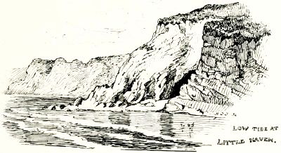
Seawards the hamlet is begirt by ruddy sandstone cliffs of moderate height, the rocky strata being twisted into the most curious contortions, and pierced with caverns and crannies frequented by bathers and picnic parties. The firm dry sands, exposed at low tide, afford a pleasant seaside stroll to the more spacious shores of Broad Haven.
Seaward, the village is surrounded by reddish sandstone cliffs of moderate height, with the rocky layers twisted into intriguing shapes and filled with caves and crevices often visited by swimmers and picnic groups. The firm, dry sands revealed at low tide provide a nice seaside walk to the broader shores of Broad Haven.
After calling a halt for a sketch of Little Haven, we up sticks and away, pursuing a south-westerly course by a road that climbs high above the rock-bound coast. Far below us lies a picturesque cove, with a rude flight of steps, hewn from the rock, leading to a landing-place used by the fisher-folk.
After stopping for a sketch of Little Haven, we packed up and left, following a road that climbs high above the rugged coastline to the southwest. Far below us is a beautiful cove, with a rough set of stairs carved from the rock leading to a landing spot used by the fishermen.

After passing Talbenny Church, we approach St. Brides, and obtain the pretty coup d'œil represented in the accompanying sketch: the church and old-fashioned rectory-house nestling under the lee of some wind-tossed trees, while Lord Kensington's fine residence of St. Brides Hill shows clearly out against the dark woodlands that crest the western down. To the right is seen a glimpse of the tiny haven, famous in bygone times for its productive herring fishery. The little structure close beside the water occupies the site of an old fishermen's chapel, which, falling into ruins, was put to the degenerate uses of a salt-house. From that time forth, as the old story runs, the herrings deserted their accustomed haunts, and the fishing trade dwindled away:
After passing Talbenny Church, we arrive at St. Brides and take in the lovely view shown in the accompanying sketch: the church and the quaint rectory house nestled beside some wind-blown trees, while Lord Kensington's impressive home at St. Brides Hill stands out against the dark woodlands on the western hillside. To the right, you can catch a glimpse of the small harbor, once famous for its thriving herring fishery. The little building near the water sits where an old fishermen's chapel used to be, which fell into disrepair and was turned into a salt house. From that time on, as the old story goes, the herrings left their usual spots, and the fishing industry declined.
'When St. Bride's Chapel a salt-house was made,
St. Bride's lost the herring trade.'
When St. Bride's Chapel became a salt house,
St. Bride’s has lost the herring trade.
The parish church is interesting, and has a bright, well-cared-for look that is pleasant to see. Upon the floor of a small north transept lie four sadly defaced effigies. The largest of these is reputed to represent St. Bride, the patron saint of the church, a contemporary of St. David and St. Patrick. According to tradition, St. Bride sailed over with certain devout women from Ireland, and established a nunnery here. A short distance south-east from the church rise the ivy-mantled ruins of some extensive buildings of unknown origin, overshadowed by dark trees and surrounded by lofty stone walls[Pg 119] pierced with loopholes, while an arched gateway opens towards the west.
The parish church is quite interesting and has a bright, well-maintained appearance that is nice to look at. On the floor of a small north transept lie four sadly worn effigies. The largest of these is believed to represent St. Bride, the church's patron saint, who lived around the same time as St. David and St. Patrick. According to tradition, St. Bride sailed over with some devoted women from Ireland and established a nunnery here. Not far southeast from the church are the ivy-covered ruins of some large buildings of unknown origin, shaded by dark trees and surrounded by tall stone walls[Pg 119] with loopholes, and an arched gateway opens to the west.

Upon leaving St. Brides, we strike directly inland by the Dale road. This brings us in about a quarter of an hour to Orlandon, where the skeleton of a large old mansion rises grimly above a group of wayside cottages. In its palmy days Orlandon was the home of the Laugharnes, a family of some celebrity in their time, but now extinct in this locality.
Upon leaving St. Brides, we head straight inland via the Dale road. This takes us to Orlandon in about fifteen minutes, where the remains of a large old mansion loom darkly over a cluster of roadside cottages. In its heyday, Orlandon was the home of the Laugharnes, a family that was quite notable in their time, but is now gone from this area.
According to a romantic story, the first member of this family who appeared in this district was shipwrecked and washed up more dead than alive on the seashore not far away. Here he was found by the daughter and heiress of Sir John de St. Brides, who caused him to be carried to her father's house, where he was hospitably entertained.
According to a romantic tale, the first member of this family to arrive in this area was shipwrecked and ended up more dead than alive on the nearby shore. He was discovered by the daughter and heiress of Sir John de St. Brides, who had him taken to her father's house, where he was warmly welcomed.
Laugharne, of course, was soon over head and ears in love with his fair deliverer, and the lady being in nowise backward in response to his suit, they married and founded a family whose descendants resided for generations at Orlandon.
Laugharne was soon completely in love with his beautiful rescuer, and since she was also interested in him, they got married and started a family whose descendants lived at Orlandon for generations.

Another mile brings us to Mullock Bridge, where a long causeway traverses a marshy backwater of the Haven. Anent this same bridge a quaint story is related concerning Sir Rhys ap Thomas o[Pg 120]f Carew. Having registered a vow before the King that Henry of Richmond should not ascend the throne save over his body, the crafty knight fulfilled his word by crouching beneath the arch of Mullock bridge while Henry rode across it.
Another mile takes us to Mullock Bridge, where a long causeway crosses a marshy backwater of the Haven. There's a charming story about this bridge involving Sir Rhys ap Thomas of Carew. He made a vow to the King that Henry of Richmond wouldn't take the throne unless it was over his dead body. The clever knight kept his promise by hiding underneath the arch of Mullock Bridge while Henry rode over it.
A glance at the map suggests a short détour to obtain a peep at Marloes. The sandy lane, meandering beside a streamlet, lands us right abreast of the church at the entrance to the village. The little edifice makes a pleasant picture, with a handful of low thatched cottages grouped around. Inside we find the small pointed chancel arch with projecting wings, characteristic of the churches in this locality.
A look at the map suggests a quick detour to catch a glimpse of Marloes. The sandy path that winds alongside a stream leads us directly to the church at the village entrance. The small building creates a charming scene, surrounded by a few low thatched cottages. Inside, we see the small pointed chancel arch with projecting wings, typical of the churches in this area.

There are some curious features here, notably an old bronze sanctus bell, and a modern baptistery sunk in a corner of the floor, to meet the predilections of the Welsh churchman, who does not apparently consider the ceremony of baptism complete unless he can 'goo throw the watter.'
There are some interesting features here, especially an old bronze sanctus bell and a modern baptistery set into a corner of the floor, catering to the preferences of the Welsh churchgoer, who apparently doesn’t think the baptism ceremony is complete unless he can “go throw the water.”
Dwelling apart from the busier haunts of men, the good folk of this remote parish have kept pretty much to themselves, and have acquired the reputation of being a simple-minded, superstitious race—'Marloes gulls,' as the saying is. In order to save the long Saturday's tramp to Haverford market, a Marloes man hit upon the ingenious device of walking half the distance on Friday, then returning home he would complete the rest of the walk the next day!
Dwelling away from the busier spots where people gather, the kind folks of this remote parish have mostly kept to themselves and earned a reputation for being simple-minded and superstitious—'Marloes gulls,' as the saying goes. To avoid the long walk to Haverford market on Saturday, a Marloes man came up with the clever idea of walking half the distance on Friday, then going back home and finishing the rest of the walk the next day!
In the 'good old times,' if tales be true, these Marloes people were notorious wreckers. On dark tempestuous nights they would hitch a lanthorn to a horse's tail, and drive the animal around the seaward cliffs; then woe betide the hapless mariner who should set his [Pg 121]course by this Fata Morgana! There is a story of the parson who, when the news of a wreck got abroad in church one Sunday morning, broke off his discourse and exclaimed, 'Wait a moment, my brethren, and give your pastor a fair start!'
In the 'good old days,' if stories are to be believed, the people of Marloes were infamous wreckers. On dark, stormy nights, they would tie a lantern to a horse's tail and lead the animal around the cliffs by the sea; then, misfortune would fall on any poor sailor who tried to navigate by this illusion! There's a tale about the vicar who, when news of a shipwreck spread in church one Sunday morning, paused his sermon and shouted, 'Hold on a second, my friends, and give your pastor a fair chance!'

Another mile of crooked, crankling lanes takes us to the brow of the sea cliffs, whence we obtain a bird's-eye panorama of the broad sweep of Marloes sands. Ruddy sandstone rocks pitched at a steep angle encompass the bay, and peep grimly out from beneath the smooth, firm sands. Gateholm rises close in shore, an island at low tide only; the broad mass of Skokholm stretches out to sea, while the horizon line is broken by the lonely islet of Grassholm, a favourite haunt of sea birds, and scene of a notorious 'massacre of the innocents' by a party of yachtsmen, some few years ago.
Another mile of winding, twisting roads takes us to the edge of the sea cliffs, where we get a bird's-eye view of the wide stretch of Marloes Sands. Reddish sandstone rocks tilted at a steep angle surround the bay, peeking ominously out from under the smooth, solid sands. Gateholm appears close to the shore, an island only during low tide; the large mass of Skokholm extends out to sea, while the horizon is interrupted by the lonely islet of Grassholm, a favorite spot for seabirds, and the site of a notorious 'massacre of the innocents' by a group of yachtsmen a few years ago.
The frequent recurrence of these holms and other place-names of Scandinavian origin, points unmistakeably to the presence of those old sea rovers around the Pembrokeshire coast, in the days of 'auld langsyne.'
The frequent appearance of these holms and other place names of Scandinavian origin clearly indicates that those old sea travelers were present along the Pembrokeshire coast in the days of 'auld langsyne.'
Making our way to the farm called Little Marloes, we push on through heathy byways, approaching the coast again at West Dale Bay. Now we catch a glimpse of Dale Castle, with the village of that ilk [Pg 122]nestling under the lee of a dark wood, and harvest-fields crowning the sunny hillside, while a silvery stretch of the Haven lies in the background.
Making our way to the farm named Little Marloes, we continue through the heath-covered paths, reaching the coast again at West Dale Bay. Now we catch a glimpse of Dale Castle, with the village of the same name [Pg 122] tucked under the shelter of a dark forest, and golden fields topping the sunny hillside, while a silvery expanse of the Haven stretches out in the background.
Dale Castle appears to have been a place of some importance from very early times, though of its history we have but meagre records. In the year 1293 Robertus de Vale granted a charter for a weekly market at his manor-house of Vale, and here Sir Rhys ap Thomas entertained his future King after his landing at Mill Bay upon the adjacent coast.
Dale Castle seems to have been significant from early times, although we have very few records about its history. In 1293, Robert de Vale granted a charter for a weekly market at his manor house in Vale, and here Sir Rhys ap Thomas hosted his future King after he landed at Mill Bay on the nearby coast.
This village of Dale is still a comely-looking spot, where the pleasant country residences of the gentlefolk rub shoulders with a sprinkling of homely cottages; yet withal the village has a certain air about it as of a place that has known better days. For Dale, it seems, was once a nourishing seaport, the abode of substantial sea captains and well-to-do merchant traders; while, if tales be true, the village folk drove a flourishing business in the contraband goods run in by the 'free trade' fraternity. In those days good Welsh ale was brewed at Dale by a family bearing the singular name of Runawae, who exported it in large quantities to Liverpool: hence Dale Street in that city is said to derive its title from this place.
This village of Dale is still a charming spot, where the nice homes of the wealthy are next to a few cozy cottages; however, the village has a certain vibe of having seen better times. It seems that Dale was once a thriving seaport, home to prominent sea captains and wealthy merchants; and if the stories are true, the villagers engaged in a lucrative business dealing in smuggled goods brought in by the 'free trade' group. Back then, good Welsh ale was brewed in Dale by a family with the unusual name of Runawae, who exported it in large amounts to Liverpool: that's why Dale Street in that city is said to get its name from here.

We approach the village by a footpath, and pass betwixt the castle and the church. The fuchsias, hydrangeas, myrtle and laurustinas that brighten this little God's acre tell of a genial climate; yet some of the headstones bear grim records of shipwrecked mariners, who lost their lives upon the iron-bound coast that shelters this favoured spot. Dale Church has a tall, unrestored tower, and possesses a slender silver chalice inscribed with the words 'Poculum Ecclesiæ de Dale, 1577.' A sketch of this cup will be found at the head of the present chapter.
We approach the village via a footpath, walking between the castle and the church. The fuchsias, hydrangeas, myrtle, and laurustinus that brighten this little graveyard indicate a pleasant climate; yet some of the headstones bear grim reminders of shipwrecked sailors who lost their lives along the rugged coast that protects this favored spot. Dale Church has a tall, unrenovated tower and features a slender silver chalice engraved with the words 'Poculum Ecclesiæ de Dale, 1577.' A sketch of this cup can be found at the beginning of this chapter.
The lane now runs below the luxuriant groves of Dale Hill, and then skirts the shores of the sheltered inlet called Dale Road. 'Dale Rode,' says George Owen, 'is a goodlye Baye and a fayre rode of great receipte; one of the best Rodes and Bayes of al Milforde and best defended from al windes, the East and South East excepted. In al this Rode there is good landing at al times.' Close beside the water stands a humble alehouse called the Brig, which bears evident traces of its smuggler patrons, being literally honeycombed with cellars and secret cupboards for the storage of their booty. Even now the walls still reek with moisture, from the salt stored away in inaccessible corners during those piping times when that commodity was worth a couple of guineas the hundredweight.
The path now runs below the lush groves of Dale Hill and then follows the shores of the sheltered cove known as Dale Road. 'Dale Rode,' says George Owen, 'is a beautiful bay and a fine harbor with great refuge; one of the best harbors and bays of all Milford and well protected from all winds, except the East and Southeast. In this harbor, there's good landing at all times.' Close to the water stands a simple pub called the Brig, which shows clear signs of its smuggler patrons, being literally filled with cellars and secret compartments for hiding their goods. Even now, the walls still smell damp from the salt stored in hard-to-reach corners during those booming times when that commodity was worth a couple of guineas per hundredweight.
We now direct our steps towards St. Anne's Head, in order to visit Mill Bay, the traditional landing-place of Henry of Richmond. 'Here in Pembrokeshire,' says old George Owen, 'happened his landinge and first footeinge when he came to enoie the Crowne and to confounde the[Pg 124] parricide and bluddie tyrante Ri:iii. Here founde he the heartes and hands first of all this lande readye to ayde and assist him.' The saying goes that as he rushed up the steep bank at the head of his troop Henry, being scant of breath, exclaimed, 'This is Brunt!' a name that has clung to the neighbouring farm ever since.
We now head towards St. Anne's Head to visit Mill Bay, the traditional landing spot of Henry of Richmond. "Here in Pembrokeshire," says old George Owen, "he landed and took his first step when he came to claim the Crown and to confront the parricidal and bloody tyrant Richard III. Here he found the hearts and hands of all this land ready to help and support him." Legend has it that as he rushed up the steep bank at the front of his troops, Henry, short of breath, shouted, "This is Brunt!"—a name that has stuck with the neighboring farm ever since.

After a flying visit to the lighthouses, we retrace our steps to Dale village, and, following a track around the head of the tideway, push on without a halt to Hoaton. Here we find the huge old anchor shown in our sketch, and the question naturally arises, How did the anchor get there? A vague tradition still lingers in the locality to the effect that, centuries ago, a big foreign man-o'-war was driven out of her course and wrecked upon the shores of St. Bride's Bay. Hence it has been conjectured that this anchor may be a veritable relic of that 'wonderful great and strong' Spanish Armada, whose unwieldy galleons were cast ashore and dashed to pieces upon our western coasts, three hundred years ago.
After a quick visit to the lighthouses, we backtrack to Dale village and, following a path around the edge of the tide, continue on without stopping to Hoaton. Here we find the huge old anchor shown in our sketch, and it naturally raises the question: How did the anchor end up here? A vague story still exists in the area suggesting that, centuries ago, a large foreign warship was blown off course and wrecked along the shores of St. Bride's Bay. Therefore, it's been speculated that this anchor might be a genuine remnant of that 'wonderfully great and strong' Spanish Armada, whose massive galleons were tossed ashore and shattered on our western coasts three hundred years ago.
Be that as it may, some years back the anchor, which had previously lain by the wayside, was dragged into the position where it now stands; the neighbours lending ready aid in response to offers of ale ad lib. Fifty men with a team of horses were hard put-to to move it, for though much of the metal has rusted and flaked away, the shank is 20 fee[Pg 125]t long and nearly 30 inches thick, while the head of the anchor measures some 14 feet around, and the ring is large enough for a man to pass through. Truly that old Spanish galleon must have been a veritable Leviathan to require such an anchor as this!
Be that as it may, a few years ago, the anchor, which had been lying on the ground, was moved to its current spot; the neighbors eagerly helped in exchange for free drinks. Fifty men with a team of horses struggled to move it, because even though a lot of the metal has rusted and chipped away, the shank is 20 feet long and nearly 30 inches thick, while the head of the anchor is about 14 feet in circumference, and the ring is big enough for a person to walk through. Truly, that old Spanish galleon must have been a massive beast to need an anchor like this!
From Hoaton we make our way across country to Haverfordwest, and traversing a district broken up into 'meane hills and dales,' we approach the town by way of the Portfield, and proceed to 'outspan' at a certain snug hostelry not a hundred miles from St. Mary's broad steeple.
From Hoaton, we head across the countryside to Haverfordwest, traveling through an area filled with small hills and valleys. We approach the town via Portfield and stop at a cozy inn not far from the tall steeple of St. Mary's.

CHAPTER VIII.
WESTWARD HO! TO ST. DAVIDS. THE CITY AND ENVIRONS.

high wild hills and rough uneven ways, draw out our miles and make them wearisome.' Thus, league after league, the sorry team drags the battered old ramshackle coach up interminable ascents, or plunges in headlong career down rough, breakneck steeps, en route for that Ultima Thule of our wanderings, the ancient city of St. Davids. Sixteen miles and seventeen hills (so the story goes) lie between Haverfordwest and our destination. The route bears in a north-westerly direction, through monotonous country relieved by occasional glimpses of the strange, rugged rocks of Trefgarn, or a peep of more distant Precelly.
High wild hills and rough, uneven paths make our journey long and tiring. So, mile after mile, the sorry team drags the battered old coach up endless climbs or speeds down steep, treacherous slopes, en route to that ultimate destination of our travels, the ancient city of St. Davids. Sixteen miles and seventeen hills (or so the story goes) separate Haverfordwest from our goal. The route heads northwest through monotonous terrain, occasionally broken by glimpses of the strange, rugged rocks of Trefgarn or a view of the more distant Precelly.
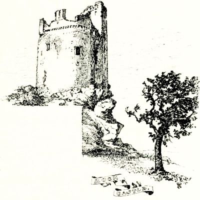
About half-way out rises the lofty isolated tower of Roch Castle, a border stronghold dominating the march-lands that for centuries formed the frontier of this 'Little England beyond Wales.' Built by Adam de Rupe in the thirteenth century, the tall, picturesque old tower forms a conspicuous object for miles around, while at its feet a group of whitewashed cottages cluster around the lowly parish church of St. Mary de Rupe.
About halfway out stands the tall, standalone tower of Roch Castle, a border fortress that overlooks the lands that for centuries marked the edge of this 'Little England beyond Wales.' Built by Adam de Rupe in the 13th century, the striking old tower is a notable landmark for miles around, while beneath it, a group of whitewashed cottages gathers around the humble parish church of St. Mary de Rupe.
Crossing the bridge that spans the Newgale Brook, we enter the ancient Welsh province of Dewisland. Presently our venerable quadrupeds are crawling at a snail's pace down a slanting hillside not quite so steep as a house-roof, with the village of Lower Solva squeezed into a crevice beneath our very feet.
Crossing the bridge over the Newgale Brook, we enter the old Welsh area of Dewisland. Right now, our old four-legged companions are moving slowly down a hillside that's not quite as steep as a house roof, with the village of Lower Solva tucked away below us.
The situation of this pretty hamlet recalls the Devonshire combe that enfolds with such inimitable grace the village of Clovelly. Groups of bowery cottages cluster around the head of a land-locked haven, which, small as it is, bears no inconsiderable traffic in coal, lime and general produce from the Bristol Channel ports, for distribution throughout the western parts of Pembrokeshire.
The setting of this charming village reminds me of the Devonshire valley that elegantly surrounds the village of Clovelly. Clusters of quaint cottages gather around the mouth of a sheltered bay, which, though small, handles a significant flow of coal, lime, and various goods from the Bristol Channel ports, distributing them across western Pembrokeshire.
The rocky, weed-strewn shores shelving up to low, grassy hills overarched by the soft blue sky; a stranded coasting vessel, with weather-stained canvas and rust-eaten anchor, beside a handful of rough fishermen's cottages, present all that an artist could desire to compose a charming picture.
The rocky, weed-covered shores sloping up to low, grassy hills under a soft blue sky; a stranded boat with worn-out sails and a rusty anchor, next to a few simple fishermen's cottages, offer everything an artist could want to create a beautiful scene.

From the crest of the hill near Upper Solva a wide view of the sea opens out, with a brace of rocky islets off the coast; while far ahead the high lands of Ramsey Isle, Carn Llidi and Pen Beri, raise their graceful undulations above remote Octopitarum, and the wind-swept sandhills that mark the site of legendary Menapia.
From the top of the hill near Upper Solva, you can see a broad view of the sea, with a couple of rocky islands off the coast. In the distance, the highlands of Ramsey Isle, Carn Llidi, and Pen Beri rise gracefully above the distant Octopitarum and the windy sand dunes that mark the location of the legendary Menapia.
Coasting along through a rolling treeless country parallel with the course of the Via Julia (the Roman road from Carmarthen), which accompanies us henceforth to the end of our journey, we mount the[Pg 128] gentle ascent that leads to the time-honoured 'city,' of which, however, little is seen until we are 'right there,' as our Transatlantic cousins say.
Coasting through a smooth, treeless landscape parallel to the Via Julia (the Roman road from Carmarthen), which will accompany us for the rest of our journey, we climb the[Pg 128] gentle slope leading to the historic 'city,' which we don't really see until we are 'right there,' as our friends from across the Atlantic would say.
Dismounting at the Grove Hotel, we fare forth for our first view of time-honoured Ty Dewi, the city of St. Davids. Strolling leisurely along the quiet grass-grown 'street' of the village-city, we pause now and again to make way for a herd of cattle, or to watch a flock of geese, stubbing, with sinewy necks outstretched, in a damp and weed-grown corner. Presently the roadway widens out, and here stands an ancient stone cross, which, rising from a flight of time-worn steps, marks the central point of this most diminutive of cities.
Dismounting at the Grove Hotel, we set out for our first look at historic Ty Dewi, the city of St. Davids. Strolling leisurely along the quiet, grass-covered 'street' of the village-city, we pause now and then to let a herd of cattle pass or to watch a flock of geese, their long necks stretched out as they peck in a damp, weed-filled corner. Soon, the road widens, and here stands an ancient stone cross, rising from a set of weathered steps, marking the center of this smallest of cities.
Casting about for some clue to the whereabouts of St. Davids Cathedral, we soon espy a low, dark object that proves upon closer inspection to be the topmost story of the central tower. With this as guide, we traverse an old paved lane ycleped the Popples, Anglicè Pebbles, and passing beneath the tower gate—sole survivor of the four gate towers of the ancient city—enter the cathedral precincts. This point affords perhaps the most characteristic coup d'œil of the venerable edifice, set amidst that stern and sombre landscape with which its time-worn architecture so completely harmonizes.
Looking for a hint about where St. Davids Cathedral is, we soon spot a low, dark shape that turns out, upon closer inspection, to be the top of the central tower. Using this as our guide, we walk along an old paved path called the Popples, Anglicè Pebbles, and after passing under the tower gate—the only remaining one of the four gate towers of the ancient city—we enter the cathedral grounds. This spot offers perhaps the most stunning view of the ancient building, set against that stark and serious landscape, perfectly matching its timeworn architecture.

Viewed from our present vantage-point St. Davids Cathedral appears ensconced within the hollow of the vale, its topmost pinnacles scarce rising clear of the distant horizon. Grouped around the central mass of the cathedral stand the crumbling ruins of mediæval structures of scarcely inferior interest. Away to our left, beyond a grove of wind-swept trees, rise the arcaded walls of Gower's incomparable palace, while the slender tower of St. Mary's College peeps over the long cathedral roof.
From our current perspective, St. Davids Cathedral looks nestled in the valley, its highest peaks barely standing out against the distant skyline. Surrounding the main cathedral are the crumbling remains of medieval buildings that are almost as fascinating. To our left, beyond a grove of wind-blown trees, the arcaded walls of Gower's amazing palace rise up, while the slim tower of St. Mary's College pokes over the long cathedral roof.

The stone wall that encompasses the cathedral close upon its eastern side terminates in the massive octagonal tower, with Gothic doorway and windows, seen in the adjoining sketch. This is flanked again by the old gateway through which we have just entered.
The stone wall that surrounds the cathedral close on its eastern side ends at the huge octagonal tower, featuring a Gothic doorway and windows, as shown in the neighboring sketch. This is further flanked by the old gateway through which we just entered.
We now descend the broad flight of steps that, from their number, have been dubbed the 'Thirty-nine Articles.' Passing through the great south porch our eyes are greeted by a beautiful Decorated doorway, the work of Bishop Gower, which is adorned with exquisitely-carved figures and foliage encrusting arch and pillar. Here enclosed amidst intersecting branches we discern quaintly sculptured representations of the Root of Jesse, the Crucifixion, St. David with his harp, and various other saintly personages; yonder the artist tells the history of Adam and the birth of Eve; while overhead presides the Holy Trinity, flanked by angels with swinging censers—a veritable gem of mediæval sculpture.
We now go down the wide set of steps that, due to their number, are called the 'Thirty-nine Articles.' As we pass through the large south porch, we’re welcomed by a beautiful Decorated doorway, crafted by Bishop Gower. It's decorated with intricately carved figures and foliage that adorn the arch and pillars. Here, surrounded by intertwining branches, we can see uniquely sculpted images of the Root of Jesse, the Crucifixion, St. David with his harp, and various other saints; over there, the artist illustrates the story of Adam and the birth of Eve; while above, the Holy Trinity is depicted, flanked by angels holding swinging censers—a true gem of medieval sculpture.
Proceeding onward we now enter the nave, whose rich yet massive architecture forms a unique and enduring memorial of the first Norman bishop, Peter de Leia. The general effect is of breadth rather than height, the solid cylindrical pillars supporting semicircular arches of unusual width, wrought with the varied and elaborate ornamentation of the Transitional Norman period.
Proceeding onward, we now enter the nave, whose rich yet sturdy architecture creates a unique and lasting tribute to the first Norman bishop, Peter de Leia. The overall impression is one of width rather than height, with solid cylindrical pillars supporting unusually wide semicircular arches, adorned with the intricate and detailed decoration of the Transitional Norman period.
Above this rises a series of lofty arches enclosing both clerestory and triforium—a rather unusual arrangement—while a singular appearance is produced by the upward slope of the floor, and the outward lean of walls and nave pillars, the latter being the result of an earthquake that occurred in the thirteenth century.
Above this rises a series of tall arches that encase both the clerestory and the triforium—a rather unusual setup—while a unique look is created by the upward slope of the floor and the outward tilt of the walls and nave pillars, the latter caused by an earthquake that took place in the thirteenth century.
The roof which spans the broad nave is one of the most notable features of the cathedral. It was built of gray Irish oak about the end of the fifteenth century, and is a veritable masterpiece of construction and design. The sculptured foliage of the capitals is worthy of close examination, and one of the nave pillars bears a faded fresco, generally supposed to represent King Henry IV. Beneath an adjacent arch reposes the effigy of Bishop Morgan—a goodly figure habited in priestly robes that are admirably rendered by the sculptor's chisel. The base of this monument is enriched with an unusually fine Resurrection, carved in marble.
The roof that spans the wide nave is one of the most remarkable features of the cathedral. It was made from gray Irish oak around the end of the fifteenth century and is a true masterpiece of construction and design. The carved foliage on the capitals deserves a close look, and one of the nave pillars has a faded fresco that is generally thought to depict King Henry IV. Beneath a nearby arch lies the statue of Bishop Morgan—a handsome figure dressed in priestly robes that the sculptor has captured beautifully. The base of this monument is adorned with an exceptionally fine Resurrection, carved in marble.
Fronting the full width of the nave, the beautiful Decorated rood screen of Bishop Gower now claims our attention. This exquisite structure is perhaps unrivalled in the picturesque variety of its several parts, and the charming effects of light and shade that enhance the mellow tones of its ancient stonework. Panelled buttresses divide the screen into five bays, the middle compartment forming a wide archwa[Pg 131]y adorned with flowers and vine-leaves. To the left is the older portion, subdivided by Gothic arches borne by detached pillars, with grotesque heads and figures clad in thirteenth-century armour. A narrow stair winds up to the ancient rood-loft above.
Fronting the full width of the nave, the beautiful Decorated rood screen of Bishop Gower now captures our attention. This exquisite structure is possibly unmatched in its picturesque variety and the charming effects of light and shade that enhance the warm tones of its ancient stonework. Paneled buttresses divide the screen into five sections, with the middle one featuring a wide archway decorated with flowers and vine leaves. To the left is the older part, divided by Gothic arches supported by detached pillars, adorned with grotesque heads and figures dressed in thirteenth-century armor. A narrow staircase winds up to the ancient rood loft above.
Turning to the southern side of the rood-screen, we are confronted by the rich and sumptuous fabric erected by Bishop Gower, a view of which forms the Frontispiece of the present volume. Yonder the noble founder sleeps his last sleep beneath a richly-groined canopy, whose traceried arches sparkle with cusps and crockets—a dignified, reposeful figure, worthy the Wykeham of the West, as Gower has been fitly styled. In memory of his greatest work Gower's tomb once bore the legend, 'Henricus Gower, Episcopalis Palatio Constructor.'
Turning to the southern side of the rood-screen, we see the rich and lavish fabric built by Bishop Gower, which is featured as the front cover of this volume. There lies the noble founder, resting peacefully under an elaborately designed canopy, with archways decorated with intricate details—a dignified, serene figure, deserving of the title "Wykeham of the West," as Gower has been aptly named. To commemorate his greatest achievement, Gower's tomb once had the inscription, 'Henricus Gower, Episcopalis Palatio Constructor.'
After gazing our fill upon this beautiful structure, unquestionably the chef d'œuvre of the whole cathedral, we pass through the central archway beneath a vaulted roof, whose stony ribs, disdaining the customary support, spring clear of the circumjacent masonry. Here venerable tombs cluster beneath fretted ceilings that retain much of their ancient coloured fresco work, depicting figures, foliage, and fantastic forms which in nowise transgress the Scriptural commandment, for they bear little or no resemblance to any created thing.
After taking in the beauty of this stunning structure, undoubtedly the chef d'œuvre of the entire cathedral, we walk through the central archway under a vaulted ceiling, where the stone ribs, rejecting traditional support, rise free from the surrounding masonry. Here, respected tombs are gathered beneath intricate ceilings that still display much of their old colorful fresco work, showing figures, foliage, and imaginative forms that do not violate the Scriptural commandment, as they bear little or no resemblance to anything created.
We next enter the choir, which occupies the space beneath the central tower. Upon either hand extends a range of canopied stalls, with seats devoted to the use of the dean and chapter of the cathedral.
We then go into the choir, which is located beneath the central tower. On either side, there is a row of canopied stalls with seats reserved for the dean and chapter of the cathedral.
These old miserere seats were so ingeniously balanced that if an unwary brother chanced to nod over his breviary, he was quickly brought to his seven senses by the overturning of his treacherous perch.
These old misericorde seats were so cleverly designed that if an unsuspecting brother happened to doze off over his prayer book, he was quickly jolted back to reality when his tricky seat flipped over.

The under-sides of these curious benches have been adorned by the craftsmen of that bygone time with the quaint conceits of their mediæval fancy. Here, for instance, a vigorously carved panel portrays in unmistakeable fashion the woebegone plight of two seafaring pilgrims, whom a pair of jolly monks are ferrying across the troubled waters of Ramsey Sound.
The undersides of these interesting benches have been decorated by the craftsmen of a past era with the whimsical touches of their medieval imagination. For example, a skillfully carved panel clearly depicts the sad situation of two sea-faring pilgrims, whom a couple of cheerful monks are helping across the choppy waters of Ramsey Sound.

Yonder some subtle humorist has been at work, and given us his version of the priest under the guise of a fox administering the wafer to a goose of a layman: and it may be noticed that (after the olden custom) the priest reserves the wine flagon to himself. This forms the subject of our sketch at end of Chapter VIII. Two wolfish-looking dogs snarling over a bone may by some be thought to prove the antiquity of the familiar couplet,
Yonder, some clever humorist has been at work, presenting us with his take on a priest disguised as a fox giving a communion wafer to a clueless layman represented as a goose. It’s worth noting that, following the old custom, the priest keeps the wine jug for himself. This is the topic of our sketch at the end of Chapter VIII. Two snarling dogs that look like wolves fighting over a bone may lead some to believe in the age of the well-known couplet,
'Taffy was a Welshman, Taffy was a thief,
Taffy came to my house and stole a piece of beef.'
Taffy was a Welsh guy, and Taffy was a thief.
Taffy came over to my house and stole a piece of beef.

Then we have a couple of sturdy boat-builders, one of whom, having laid aside his adze, drains the contents of a capacious cup, while a mighty beaker stands ready to his hand.
Then we have a couple of strong boat builders, one of whom, having set down his tool, drinks from a large cup, while a big beaker is within reach.
With such-like quaint original devices have those men of old encrusted the surface of these ancient stalls. So, having done justice to their curious details, we pass on through a second screen separating the chancel from the presbytery, an arrangement peculiar, we believe, to St. Davids Cathedral. This portion of the fabric was rebuilt with pointed arches after the fall of the ce[Pg 133]ntral tower in 1220, and contains some extremely interesting features.
With charming original designs, those people from the past embellished the surface of these old stalls. Now, having appreciated their unique details, we move through a second screen that separates the chancel from the presbytery, which we believe is a distinctive feature of St. Davids Cathedral. This section of the structure was rebuilt with pointed arches after the central tower collapsed in 1220 and includes some very interesting characteristics.
The place of honour in the centre of the presbytery is occupied by the tomb of Edmund Tudor, father of Henry VII., a massive table monument of Purbeck marble, enriched with shields and heraldic devices, and bearing the proud inscription: 'Under this Marble Shrine here enclos'd resteth the Bones of that noble Lord, Edmund Earl of Richmond, Father and Brother to Kings, the which departed out of this World in the Year of our Lord God a thousand four hundred fifty and six, the first Day of the Month of November, on whose Soul almighty Jesus have Mercy, Amen.'
The central spot in the presbytery features the tomb of Edmund Tudor, father of Henry VII. It’s a large table monument made of Purbeck marble, decorated with shields and heraldic symbols, and it carries the impressive inscription: 'Under this Marble Shrine here enclosed rests the bones of that noble Lord, Edmund Earl of Richmond, father and brother to kings, who passed away in the year of our Lord a thousand four hundred fifty-six, on the first day of November. May almighty Jesus have mercy on his soul, Amen.'

Upon the north side of the presbytery rises the stone structure that formed the base of St. David's Shrine. It is the work of Bishop Richard de Carew, and dates from the latter half of the thirteenth century. The three arches seen in our sketch were once adorned with figures representing St. David. St. Patrick and St. Denis, while the quatrefoil openings beneath were provided with small lockers to receive the offerings of devotees. In the presbytery we also notice a small circular piscina of very ancient date pierced with concentric rows of holes—a rare and curious feature.
On the north side of the presbytery stands the stone structure that served as the base of St. David's Shrine. This was created by Bishop Richard de Carew and dates back to the latter half of the 13th century. The three arches shown in our sketch were once decorated with figures of St. David, St. Patrick, and St. Denis, while the quatrefoil openings below had small lockers for receiving offerings from worshippers. In the presbytery, we can also see a small circular piscina of very old origin, featuring concentric rows of holes—a unique and interesting detail.
After examining the handsome effigy of Bishop Anselm Le Gros, nephew of Earl William of Pembroke, with its laconic couplet—
After looking at the impressive statue of Bishop Anselm Le Gros, who was the nephew of Earl William of Pembroke, along with its brief couplet—
'Petra Precor dic sic
[Pg 134]Anselmus Episcopus jacet hic'
'Petra Precor say this way
[Pg 134]Bishop Anselm lies here
two fine recumbent figures of very ancient date arrest our attention, none other than those famous South Welsh princes, the Lord Rhys ap Gruffydd and his son, Rhys Grygg.
two impressive reclining figures from a very ancient time catch our attention, none other than the famous South Welsh princes, Lord Rhys ap Gruffydd and his son, Rhys Grygg.
Higden, in his quaint 'Polychronicon,' breaks forth into unbounded panegyrics over the great Lord Rhys: 'O blysse of battayle!' he exclaims, 'Chylde of Chyvalry! defence of Countrie! worshyppe of Armes! the noble dyadame of fayrnesse of Wales is now fallen, that is, Rees is dead. The Enemy is heere, for Rees is not heere; now Wales helpeth not itself; Rees is dead and taken away, but hys noble Name is not dead, for it is alwayes new in the wide Worlde. His Prowesse passeth hys manners; hys Wytte passeth hys Prowesse: hys fayre Speech passeth hys Wytte; hys good Thews passeth hys fayre Speech!'
Higden, in his charming 'Polychronicon,' bursts into extensive praise for the great Lord Rhys: 'Oh, the glory of battle!' he exclaims, 'Child of Chivalry! Defender of the Country! Honor of Arms! The noble crown of beauty in Wales has now fallen, meaning Rees is dead. The Enemy is here, for Rees is no longer here; now Wales cannot help itself; Rees is gone, but his noble name lives on, as it is always fresh in the wide world. His bravery exceeds his character; his intelligence surpasses his bravery; his eloquence outshines his intelligence; his good qualities surpass his eloquence!'
Not to prolong the subject ad nauseam, we will merely indicate as more particularly worthy of notice the tomb of Silvester Medicus; a recumbent effigy reputed to be that of Giraldus Cambrensis, of Manorbere; the massive shrine of St. Caradoc; and two early Celtic crosses in the south transept, bearing the device
Not to drag this topic on ad nauseam, we’ll just point out a few things worth mentioning: the tomb of Silvester Medicus; a reclining figure believed to be Giraldus Cambrensis from Manorbere; the impressive shrine of St. Caradoc; and two early Celtic crosses in the south transept, featuring the design.
with the legend pontificis abraham filii.
with the legend pontificis abraham filii.
We next glance into St. Thomas's Chapel, one of the oldest portions of the fabric, whose massive groined roof is adorned with sculptured bosses of unusual size. Here is a piscina enclosed within a group of pointed arches, whose lovely Early English enrichments form one of the daintiest features of the cathedral.
We now take a look at St. Thomas's Chapel, one of the oldest parts of the structure, featuring a massive groined roof decorated with unusually large sculpted bosses. There's a piscina surrounded by a set of pointed arches, and its beautiful Early English embellishments are one of the most charming features of the cathedral.
We now enter the beautiful chapel erected by Edward Vaughan, the last of the great building prelates of St. Davids. It boasts a handsome fan-vaulted ceiling, and a peculiar hagioscope fashioned like a cross within a circle.
We now enter the beautiful chapel built by Edward Vaughan, the last of the great building bishops of St. Davids. It features a stunning fan-vaulted ceiling and a unique hagioscope designed like a cross inside a circle.

Some curious details attract our notice as we wander amongst the unrestored chapels. In one of these, a trio of sculptured quadrupeds suggests the idea of the Trinity, while another contains the effigy of a knight in chain-mail, shorn of half its length by a clumsy buttress—a legacy from the days of churchwarden misrule.
Some interesting details catch our attention as we walk through the unrenovated chapels. In one of them, a group of sculpted animals hints at the concept of the Trinity, while another features the statue of a knight in chain-mail, cut in half by a clumsy buttress—a leftover from the times of churchwarden mismanagement.
Outside the Lady Chapel stood St. Mary's Well, which according to[Pg 135] tradition arose at the prayer of St. David to supply the neighbouring monastery. Giraldus tells us that this accommodating spring would sometimes flow with wine, at other times with milk, and that it was the scene of many edifying miracles.
Outside the Lady Chapel was St. Mary's Well, which, according to [Pg 135] tradition, was created in response to St. David's prayer to provide for the nearby monastery. Giraldus tells us that this helpful spring would sometimes flow with wine, other times with milk, and that it was the site of many inspiring miracles.
Sauntering around the mellow-tinted walls of the old cathedral, we notice the huge flying buttresses built against its northern side to strengthen the fabric. These rugged bastions, clothed in their luxuriant mantle of ivy, with the crumbling arches of the ruined cloisters hard by, group in a picturesque fashion beneath the central tower, whose broad front, bronzed by the rays of the declining sun, forms a rallying-point for a host of homing jackdaws.
Strolling around the softly colored walls of the old cathedral, we notice the large flying buttresses built against its northern side to support the structure. These sturdy supports, draped in lush ivy, along with the crumbling arches of the nearby ruined cloisters, come together in a charming arrangement beneath the central tower, whose wide front, illuminated by the setting sun, serves as a gathering spot for a flock of returning jackdaws.
A bowshot westward of the cathedral stand the beautiful ruins of the Bishop's Palace, rising from amidst the rich meadows beside the Allan River. Our route thither lies over the stony way called the Popples, the ancient approach to St. David's Shrine, and traverses the low-arched bridge that superseded the Llechllafar, or Speaking Stone, which in olden times spanned the stream at this point.
A short distance west of the cathedral are the stunning ruins of the Bishop's Palace, set among the lush meadows by the Allan River. To get there, we take the rocky path known as the Popples, the old route to St. David's Shrine, and cross the low-arched bridge that replaced the Llechllafar, or Speaking Stone, which once crossed the stream at this spot.
Many a curious legend clung around this venerable stone, which Giraldus tells us was even in his time worn hollow by the feet of wayfarers. Tradition avers that Llechllafar was wont to cry out in remonstrance if a corpse was carried across it; and Merlin is said to have foretold that an English king, returning from the conquest of Ireland, was to meet his death upon this spot. So when Henry II. chanced this way, a disappointed suppliant endeavoured to foist this sinister prediction upon him; but the King, having made a suitable oration to the stone, passe[Pg 136]d over it unharmed to make his orisons before the Shrine of St. David.
Many intriguing legends surrounded this ancient stone, which Giraldus tells us was already worn hollow by the feet of travelers in his time. Tradition claims that Llechllafar would cry out in protest if a corpse was carried over it, and Merlin supposedly predicted that an English king, returning from conquering Ireland, would meet his death at this spot. So when Henry II passed by, a disappointed supplicant tried to impose this ominous prediction on him; however, the King, after giving a fitting speech to the stone, went over it safely to pray before the Shrine of St. David.

Turning from the scene of these miraculous events, we pass a group of lowly cottages and enter the ruined gateway of the palace. Across a stretch of greensward, close-cropped by flocks of sheep, rise the ruined walls of Bishop Gower's lordly dwelling; the open-arched parapets casting a dappled shade athwart the grass-grown courtyard.
Turning away from the scene of these amazing events, we move past a group of simple cottages and enter the crumbling gateway of the palace. Across a patch of well-trimmed grass, grazed by flocks of sheep, stand the broken walls of Bishop Gower's grand residence; the open-arched parapets casting a patterned shade over the grassy courtyard.
Built in the Decorated style that prevailed throughout the fourteenth century, this interesting structure extends around a quadrangle, of which two sides remain in fair preservation, the others being either much in ruins, or entirely razed to the ground. Everything here speaks of peace and bygone hospitality. A wide ogee archway adorned with sculptured niches gives access to the banqueting-hall, an apartment of noble proport[Pg 137]ions adorned with an exquisite rose window still in good preservation. Near at hand rises the chapel, with its picturesque bell-turret and pointed windows; while over all runs a pretty open arcade, borne upon huge corbels embellished with grotesque heads and strange fantastic monsters. A pleasant variety has been obtained by arranging the stonework above the arches in a kind of diaper pattern, as may be seen in the accompanying sketch taken from the meadows, whence the rose window forms a very charming feature. With the lapse of time these venerable ruins have mellowed into all sorts of harmonious hues, where golden lichens, valerian and climbing plants innumerable, have run riot over the rough purple sandstone.
Built in the Decorated style that was popular throughout the fourteenth century, this intriguing building surrounds a courtyard, with two sides still in decent condition, while the others are either mostly in ruins or completely demolished. Everything here conveys a sense of tranquility and past hospitality. A wide ogee archway decorated with sculptured niches leads into the banqueting hall, a room of impressive proportions featuring a beautiful rose window that remains well-preserved. Nearby stands the chapel, with its charming bell turret and pointed windows; above all, there's a lovely open arcade supported by large corbels adorned with grotesque faces and strange, fantastical creatures. A nice variety has been created by arranging the stonework above the arches in a diamond pattern, as shown in the accompanying sketch taken from the meadows, where the rose window stands out as a delightful feature. Over time, these ancient ruins have developed a range of harmonious colors, with golden lichens, valerian, and countless climbing plants sprawling across the rough purple sandstone.

From the ford across the little stream beneath the palace walls, a charming view is obtained of the ancient bridge and its rough, ivy-clad abutments, backed by the massive front of the cathedral and the picturesque tower and arches of St. Mary's College.
From the shallow crossing over the small stream beneath the palace walls, you can get a lovely view of the old bridge and its rugged, ivy-covered supports, set against the strong facade of the cathedral and the quaint tower and arches of St. Mary's College.
Built by Bishop Adam Houghton towards the close of the fourteenth century, the college chapel, with its vast Perpendicular window[Pg 138]s, must in former times have presented an imposing appearance. Here the founder lay at rest under a sumptuous canopy, of which, however, not a vestige now remains. Beneath the chapel is a low groined crypt, but the various collegiate offices which lay to the north have long since been swept away; while the crumbling arcades of the cloisters serve nowadays to shelter the benches of the masons employed in repairing the cathedral.
Built by Bishop Adam Houghton towards the end of the fourteenth century, the college chapel, with its large Perpendicular windows[Pg 138], must have looked quite impressive in its day. The founder is buried here under a lavish canopy, although none of it remains now. Below the chapel is a low vaulted crypt, but the various college offices to the north have long since disappeared; meanwhile, the crumbling arcades of the cloisters now provide shelter for the benches of the masons working on the cathedral repairs.
St. Non's Chapel, the reputed birthplace of St. David, stands in an open meadow overlooking the sea, about a mile outside the city. It is a mere tumbled mass of rude cyclopean masonry, and has no features worthy of note save a simple cross enclosed within a circle, engraved upon an upright slab of stone. An ancient well dedicated to St. Non, the mother of St. David, occupies a corner of the same field.
St. Non's Chapel, believed to be the birthplace of St. David, sits in an open meadow with a view of the sea, about a mile from the city. It's just a chaotic pile of rough stonework, and the only notable feature is a simple cross inside a circle, carved into a standing stone slab. There’s also an old well dedicated to St. Non, St. David's mother, in one corner of the same field.
Some quaint traditions hang around the old chapel called Capel Stinian, whose scanty ruins overlook Ramsey Sound. St. Justinian, the patron saint, was treacherously slain by his own followers on Ramsey Island, whereupon the holy man arose, walked across the straits, and was buried where his chapel now stands. The assassins, having been smitten with leprosy, were banished to Gwahan Garreg, the Lepers' Rock. The story runs that the Puritans stole away the chapel bells, which were famed for their musical sound; but a great storm arising, the vessel in which they endeavoured to escape with their booty was overwhelmed, and the bells cast into the sea. So on stormy nights when the deep, strong tide is troubling the waters, the dwellers near Ramsey Sound still hear the chimes of those long-lost bells, above all the strife of the elements.
Some charming traditions linger around the old chapel called Capel Stinian, whose sparse ruins overlook Ramsey Sound. St. Justinian, the patron saint, was treacherously killed by his own followers on Ramsey Island. Afterward, the holy man rose, walked across the straits, and was buried where his chapel now stands. The assassins, stricken with leprosy, were exiled to Gwahan Garreg, the Lepers' Rock. The story goes that the Puritans stole the chapel bells, known for their beautiful sound; however, during a fierce storm, the ship they used to escape with the bells was sunk, and the bells were lost to the sea. So on stormy nights, when the strong tide stirs the waters, the people near Ramsey Sound still hear the tolling of those long-lost bells, cutting through the chaos of the elements.
Across the straits rises the broad bulk of Ramsey Island: smooth and tame enough on this side, but presenting to the western ocean a grim array of tall inaccessible cliffs and gloomy caverns, the haunt of seals and sea-fowl innumerable. Farther out to sea lies the group of rocky islets known as the Bishop and his Clerks, 'who,' as George Owen has it, 'are not withoute some small Quiristers who shewe not themselves but at Spring Tydes and calme seas. The Bishop and these his Clerkes preache deadlie doctrine to their winter audienc[Pg 139]e, such poore seafaring men as are forcyd thether by Tempest; onelie in one thinge are they to be commended; they keep residence better than the canons of that see are wont to doo.'
Across the straits rises the large form of Ramsey Island: smooth and gentle on this side, but facing the western ocean a harsh line of tall, inaccessible cliffs and dark caves, the home of countless seals and seabirds. Further out to sea lies the group of rocky islets known as the Bishop and his Clerks, 'who,' as George Owen puts it, 'are not without some small Quiristers who only show themselves during spring tides and calm seas. The Bishop and his Clerks preach deadly lessons to their winter audience, poor sailors who are forced there by storms; in one thing they deserve praise; they maintain their residence better than the canons of that see usually do.'
Setting our course for the sea-girt promontory of St. Davids Head, we direct our steps towards the curious-looking hill called Carn Llidi. The bold peak of this monticle rises straight before us as we trudge across the sandy burrows, which, in the course of ages, have invaded the site of Roman Menapia, the elder sister of St. Davids.
Setting our course for the coastal headland of St. Davids Head, we head towards the oddly shaped hill known as Carn Llidi. The striking peak of this hill rises directly in front of us as we walk across the sandy mounds, which, over time, have taken over the site of Roman Menapia, the older sister of St. Davids.
Thenceforward ensues an exhilarating stretch across the open boulder-strewn headland. Overhead the sun shines bright and warm, light fleecy clouds drift landward under a bracing sea-breeze, casting their purple shadows athwart the azure plain of ocean, which breaks in white foam upon the 'grisly, fiendy Rockys blake' that fringe the broad sweep of Whitesand Bay.
From that point on, there’s an exciting stretch across the open, boulder-strewn headland. The sun shines bright and warm overhead, with light, fluffy clouds drifting toward the land under a refreshing sea breeze, casting their purple shadows across the blue ocean, which crashes in white foam against the 'grisly, fiendy Rockys blake' that line the wide expanse of Whitesand Bay.
We now push on to the outermost crags of the headland. Stretching seawards like a long, crooked finger, this remote peninsula forms the most westerly landfall of Pembrokeshire, and the southernmost horn of that great Welsh gulf known as Cardigan Bay. Making our way over rough, rocky ground, we pass a huge half-fallen cromlech; and, as the headland narrows, a crumbling rampart flanked by a half-obliterated fosse appears to bar all further progress. This ancient structure, called Clawdd y Millwyr, or the Warriors' Dyke, is constructed of smallish granite stones, compacted with soil and turf; it runs in a slightly-curved line, which is convex upon the landward face, from sea to sea across the narrow peninsula.
We now move on to the farthest cliffs of the headland. Stretching out to sea like a long, crooked finger, this remote peninsula is the westernmost point of Pembrokeshire and the southernmost edge of the large Welsh gulf known as Cardigan Bay. As we navigate the rough, rocky terrain, we pass a huge, partially collapsed cromlech. As the headland gets narrower, a crumbling wall with a partly destroyed ditch looks like it blocks any further passage. This ancient structure, called Clawdd y Millwyr, or the Warriors' Dyke, is made from medium-sized granite stones packed with soil and grass; it runs in a slightly curved line, bulging outward on the land side, from sea to sea across the narrow peninsula.
Just within the shelter of the bank, upon a stretch of comparatively level greensward, lies one of those cityau, or groups of hut-circles, occasionally to be met with throughout Wales. Six at least of these primitive dwellings are here discernible, all within a few feet of one another, and each of considerable size; many of the stones have sharp, square edges, and some appear to have been rudely shaped to the requisite curve of the circle.
Just inside the shelter of the bank, on a stretch of relatively flat grass, there’s one of those cityau, or groups of hut circles, sometimes found throughout Wales. At least six of these basic homes can be seen here, all within a few feet of each other and each quite large; many of the stones have sharp, square edges, and some seem to have been roughly shaped to fit the required curve of the circle.
Tradition itself is dumb regarding the origin of these mysterious structures; bu[Pg 140]t there can be little doubt they were erected at a very remote period.
Tradition offers no insights into the origin of these mysterious structures; bu[Pg 140]t there's little doubt they were built a very long time ago.
Once again under way, we shape our course for the rocky peak of Carn Llidi. Although barely 600 feet in height, this isolated monticle is in its upper parts abrupt and precipitous. At first our path leads away up the ferny slope to a sort of saddle-backed ridge, over whose bare jagged ledges we clamber onwards until a short, sharp pull up a kind of stony couloir lands us upon the topmost crag.
Once again on our way, we set our sights on the rocky peak of Carn Llidi. Even though it's only about 600 feet tall, this solitary hill is steep and sheer at the top. Our path initially takes us up the fern-covered slope to a saddle-shaped ridge, where we scramble over the bare, jagged edges until a quick, steep climb up a rocky couloir brings us to the highest point.
Here we seem to have mounted (like Jack on his Beanstalk) into a new and undiscovered world, for this isolated perch affords a bird's-eye view over land and sea that rolls away to the distant horizon. Far beyond the broad expanse of Cardigan Bay the highlands of Snowdonia loom faint but clear; a wrinkled, treeless country, chequered by countless fields and dotted with white farmhouses, trends away league upon league to the foot-hills of Precelly, and the smoke-begirt heights of Glamorgan. Roch Castle, upon its lonely hillock, looks out across a silver stretch of St. Bride's Bay to the islands of Ramsey and Skomer[Pg 141]. The village-city is hidden by an intervening rise, but its situation is marked by the conspicuous windmill; and westwards St. Davids Head thrusts out like a crooked finger into the open sunlit ocean.
Here, we seem to have climbed (like Jack on his Beanstalk) into a new and undiscovered world, because this isolated spot provides a bird's-eye view over the land and sea that stretches out to the distant horizon. Far beyond the wide expanse of Cardigan Bay, the highlands of Snowdonia appear faint but clear; a wrinkled, treeless landscape, patterned by countless fields and dotted with white farmhouses, extends league after league to the foothills of Precelly, and the smoke-covered heights of Glamorgan. Roch Castle, on its lonely hill, overlooks a silver stretch of St. Bride's Bay towards the islands of Ramsey and Skomer[Pg 141]. The village-city is obscured by a rise in the land, but its location is marked by the prominent windmill; and to the west, St. Davids Head juts out like a crooked finger into the bright, open ocean.

Descending the hill, we work our way along winding sandy lanes, and return to St. Davids by the coast road coming from Fishguard. At an out-of-the-way place called Gwryd-Bach we stumble across a curious old farmstead, and being invited to enter, we proceed to make ourselves at home in a large low chamber, half living-room, half kitchen. At one end of this picturesque apartment is a low-browed, vaulted recess, pierced with a deep-set window, while upon the rough flagged floor beneath stands a mighty oak table of extremely primitive build. The ample dresser beside the wall displays such an array of curious old painted plates, and mugs of antiquated pattern, as might make a connoisseur's fingers itch. One retired corner is partitioned off as a kind of homely parlour; on another side a rough open stairway gives access to the garret, while old guns, lanthorns, baskets and such-like articles of a rustic ménage, garnish every available corner of walls and open-rafted ceiling.
Descending the hill, we make our way along winding sandy paths and return to St. Davids via the coast road from Fishguard. At a remote spot called Gwryd-Bach, we stumble upon an interesting old farmstead, and after being invited in, we settle into a large low room that serves as both living room and kitchen. At one end of this charming space is a low, arched nook with a deep-set window, while on the rough flagstone floor stands a massive oak table with a very rustic design. The spacious dresser against the wall displays an impressive collection of old painted plates and vintage mugs that would delight any collector. One corner is set off as a cozy parlor; on another side, a rough open staircase leads up to the attic, while old guns, lanterns, baskets, and other rustic items adorn every available space on the walls and the open-beamed ceiling.
We return to St. Davids by way of Dowrog Common, the 'Pilgrims' land' of earlier days, with its huge upright maenhir, called St. David's Stone. Before turning in for the night we overhaul Ordnance maps and guide-book, in view of an early start upon the morrow in search of 'fresh woods and pastures new.'
We head back to St. Davids through Dowrog Common, the "Pilgrims' land" from long ago, featuring its large upright maenhir, known as St. David's Stone. Before settling in for the night, we review the Ordnance maps and guidebook, planning for an early start tomorrow in search of "fresh woods and pastures new."

CHAPTER IX.
TO FISHGUARD, NEWPORT, GOODWIC AND PENCAER.

five tedious leagues of monotonous cross-country road lie before us to-day, as we leave St. Davids city northward bound for Fishguard. A sturdy pedestrian may strike out a more interesting route by following the coast road—the ancient Fordd Fleming—and diverging at convenient points to explore the grand cliff scenery below Pen-beri, and the microscopic havens of Trevine and Abercastell. At Longhouse, close to the latter place, stands a remarkably fine cromlech, inferior only to its more famous rival at Pentre Evan, near Newport.
Five long miles of dull, featureless countryside stretch out in front of us today as we head north from St. Davids city toward Fishguard. A determined walker might choose a more interesting path by following the coastal road—the old Fordd Fleming—and veering off at good spots to see the stunning cliffs below Pen-beri and the tiny harbors of Trevine and Abercastell. Near Longhouse, not far from the latter, there's a notably impressive cromlech, second only to its more famous counterpart at Pentre Evan, near Newport.

About half-way along the main road we cross a country lane that follows the course of the old Fleming's Way; and half a mile farther on our attention is called to an object not unlike a milestone, upon which is rudely traced a cross within a circle: the irregular disc being about a foot in diameter. This is known as Mesur-y-Dorth—the Measure of the Loaf—from a tradition that St. David caused these figures to be made in order to regulate the size of the loaf of bread in times of scarcity.
About halfway down the main road, we cross a country lane that follows the path of the old Fleming's Way; and half a mile further on, we notice an object that looks somewhat like a milestone, marked with a rough cross inside a circle: the uneven disc is about a foot in diameter. This is called Mesur-y-Dorth—the Measure of the Loaf—based on a tradition that St. David had these figures made to standardize the size of bread loaves during times of scarcity.
Presently we approach the village of Jordanston; and here it behoves the belated traveller to 'keep his weather eye open,' for if tales be true, the ghost of a headless horseman that haunts this locality may be expected to put in an appearance.
Presently, we are nearing the village of Jordanston; and here, it's wise for the late traveler to 'stay alert,' because if the stories are true, the ghost of a headless horseman that haunts this area might make an appearance.
A couple of miles or so to the northward rises the parish church of Mathry, conspicuous upon its high hill-top. This church of the Holy Martyrs once had a lofty steeple, that served as a useful guide to mariners until blown down one stormy night, many a year ago. Mathry was a place of some local importance in olden times, receiving a patent for a market and fair from Edward III., while the greater tithes of this extensive parish sufficed to endow the 'golden prebend' of St. Davids Cathedral.
A couple of miles to the north stands the parish church of Mathry, clearly visible on its high hill. This church of the Holy Martyrs used to have a tall steeple that helped guide sailors until it was blown down one stormy night many years ago. Mathry was quite significant locally in the past, receiving a charter for a market and fair from Edward III, while the larger tithes from this extensive parish were enough to fund the 'golden prebend' of St. Davids Cathedral.
As we near our destination, the rugged hills of Pencaer rise picturesquely beyond the sands of Goodwic, while Dinas head rears its bold front above Cardigan Bay, with the delicate outline of the Carnarvonshire mountains serrating the distant horizon.
As we get closer to our destination, the rugged hills of Pencaer stand out beautifully beyond the sands of Goodwic, while Dinas Head looms confidently over Cardigan Bay, with the gentle outline of the Carnarvonshire mountains cutting across the distant horizon.
The town of Fishguard hangs, as it were, upon the slope of a precipitous hill overlooking the vale of the Gwaen, which here, as George Owen puts it, 'falleth into the sea, making a faire Haven and goode Harborow for shipps and Barks.' Its waterside suburb of Abergwaen, approached by one of the steepest bits of coach road in the Principality, is mainly frequented by fisher-folk and seafaring men engaged in the coasting trade.
The town of Fishguard sits on the side of a steep hill overlooking the valley of the Gwaen, which, as George Owen puts it, 'falls into the sea, creating a beautiful haven and good harbor for ships and boats.' Its waterfront neighborhood of Abergwaen, reached by one of the steepest coach roads in the Principality, is primarily frequented by fishermen and sailors involved in the coasting trade.
Encompassed by sheltering uplands, the narrow vale of the Gwaen has a singularly mild and equable climate, which fosters a wealth of luxuriant vegetation. In the course of a stroll through the beautiful grounds of Glyn-y-Mel, we notice the eucalyptus and bamboo evidently making themselves quite at home in this sunny nook, while heliotrope and dracæna, camellia and laurestinus flourish out-of-doors the winter through.
Sheltered by surrounding hills, the narrow valley of the Gwaen has a uniquely mild and even climate, which supports a rich variety of lush vegetation. While taking a walk through the lovely grounds of Glyn-y-Mel, we can see the eucalyptus and bamboo clearly feeling at home in this sunny spot, while heliotrope and dracaena, camellia and laurestinus thrive outdoors all winter long.
Usually the most easy-going of Sleepy Hollows, Fishguard town awoke one fine morning towards the close of the last century to find itself become suddenly famous. On February 21, 1797, three French frigates were sighted off the Pembrokeshire coast bearing up towards Fishguard Bay, where they presently came to anchor near Carreg Gwastad Point.
Usually the most laid-back of Sleepy Hollows, Fishguard town woke up one beautiful morning towards the end of the last century to find itself suddenly famous. On February 21, 1797, three French frigates were spotted off the Pembrokeshire coast heading toward Fishguard Bay, where they quickly anchored near Carreg Gwastad Point.
During the ensuing night the enemy came ashore to the number of about 1,500 men, regular troops and gaol-birds, under the leadersh[Pg 144]ip of one Tate, a renegade Irish-American. Tate, with the chief of his satellites, established himself at the neighbouring farmhouse of Trehowel, while the main body of the 'invaders' encamped atop of an isolated hill overlooking the village of Llanwnda. Thence the Frenchmen dispersed about the countryside, scaring the inhabitants out of their wits, and rummaging the farmhouses in search of potheen and plunder.
During the following night, around 1,500 enemy troops, a mix of regular soldiers and criminals, came ashore led by a guy named Tate, a traitorous Irish-American. Tate and his main followers set up camp at the nearby farmhouse of Trehowel, while the bulk of the 'invaders' pitched their tents on a lonely hill that overlooked the village of Llanwnda. From there, the French troops spread out across the countryside, terrifying the locals and rummaging through farmhouses looking for potheen and loot.

In one of these exploits a drunken fellow entered a cottage at Brestgarn, where a 'grandfather' clock happened to be standing in a corner. Dismayed by the sounds issuing from the mysterious object, the simpleton fired his gun at a venture, concluding the devil must be lurking within. This clock is still to be seen at Brestgarn, with the bullet-hole through the panel as may be noticed in our sketch.
In one of these adventures, a drunk guy stumbled into a cottage in Brestgarn, where an old grandfather clock was sitting in the corner. Startled by the noises coming from the strange object, the clueless guy shot his gun randomly, thinking the devil must be hiding inside. This clock can still be seen in Brestgarn, with the bullet hole in the panel, which can be seen in our sketch.
Meanwhile the authorities bestirred themselves. Under the command of Lord Cawdor, the Fishguard Fencibles and Castle Martin Yeomanry marched out to Goodwic Sands, where the enemy, finding the game was up, laid down their arms and surrendered à discrétion. Thus these doughty regiments achieved the unique distinction of facing a foreign foe on the soil of Britain itself. It is said that the goodwives of Pembrokeshire, arrayed in their red woollen 'whittles,' countermarched and deployed around a neighbouring hill, thus leading the invaders to suppose that a regiment of gallant redcoats was preparing to oppose their advance.
Meanwhile, the authorities sprang into action. Under the command of Lord Cawdor, the Fishguard Fencibles and Castle Martin Yeomanry marched out to Goodwic Sands, where the enemy, realizing their situation was hopeless, laid down their arms and surrendered unconditionally. Thus, these brave regiments gained the unique honor of confronting a foreign enemy on British soil itself. It’s said that the local women of Pembrokeshire, dressed in their red woolen capes, marched back and forth around a nearby hill, making the invaders believe that a regiment of fearless redcoats was getting ready to block their advance.
The French prisoners were subsequently lodged in durance vile at a place near Pembroke, whence some of them effected their escape in Lord Cawdor's yacht, with the connivance of two Pembroke lasses—the old story of cherchez la femme once more. One of the French vessels having been afterwards captured was re-christened the Fisguard, a name that has only recently disappeared from the files of the Navy List. Incredible as it may seem in these days, the n[Pg 145]ews of this famous event took a whole week to travel to the Metropolis, and it is said that the anniversary of the French landing is still held in remembrance amongst the old folk in the locality.
The French prisoners were later held in a rundown place near Pembroke, where some of them managed to escape using Lord Cawdor's yacht, with the help of two local Pembroke girls—the same old story of cherchez la femme once again. One of the French ships that was captured later was renamed the Fisguard, a name that has only recently dropped off the Navy List. As unbelievable as it might seem today, it took a full week for news of this famous event to reach the capital, and it's said that the anniversary of the French landing is still remembered by the older folks in the area.
It is a pleasant stroll from Fishguard to the scene of these historic events. Our way lies past the church, where, in a corner of the graveyard, we notice a curiously-incised stone cross. The lane now winds downhill, and we soon find ourselves pacing the smooth firm expanse of Goodwic Sands, with the hamlet of that ilk clinging to a wooded hillside before us.
It’s a nice walk from Fishguard to the site of these historic events. We pass the church, where we spot an intricately carved stone cross in a corner of the graveyard. The path now slopes downhill, and we quickly find ourselves walking on the smooth, solid stretch of Goodwic Sands, with the small village of the same name nestled against a wooded hillside in front of us.
Goodwic is picturesquely situated, overlooking a tiny haven and pier in an elbow of the rock close under the hill. Its genial climate and safe bathing shore make the place deservedly popular, and cause the handful of lodging-houses to fill up rapidly during 'the season.'
Goodwic is beautifully located, looking over a small harbor and pier in a bend of the rock right under the hill. Its friendly climate and safe swimming area make it understandably popular, causing the few lodging houses to fill up quickly during 'the season.'
Pushing on again, we now enter the district of Pencaer, and, guided by the trusty Ordnance sheet, thread our way through narrow crooked lanes, rounding the base of Carn Wnda, where the Frenchmen pitched their camp, and passing on to the little out-of-the-way village of Llanwnda.
Pushing on again, we now enter the area of Pencaer, and, using the reliable Ordnance map, we navigate through narrow winding streets, circling the base of Carn Wnda, where the French set up their camp, and continuing on to the small, tucked-away village of Llanwnda.

The church stands in an isolated position overlooking a piece of rough ground that does duty as village 'green,' a place scattered over with gray tumbled stones that seem to group themselves into the lines[Pg 146] of rude hut-circles. Two or three low thatched cottages, that might pass for Irish cabins, appear to have been 'dumped' down haphazard, and look old enough to have seen Giraldus Cambrensis when he held the benefice here.
The church is located in a secluded spot that overlooks a patch of rough land serving as the village green. This area is dotted with gray, weathered stones that seem to form the outlines of ancient hut circles. A few low, thatched cottages that could easily be mistaken for Irish cabins seem to have been randomly placed there and look old enough to have witnessed Giraldus Cambrensis when he was the benefactor here.[Pg 146]
Built in a strong, simple manner well-suited to its exposed situation, Llanwnda Church has some characteristic features. Above the western gable rises a low double bell-cot, while a similar but smaller erection for the sanctus bell divides nave from chancel roof. As we enter the low-browed porch, we espy a cross of archaic type carved upon a stone slab in the outer wall; and two similar crosses are to be seen upon the exterior of the chancel gable.
Built in a sturdy, straightforward way that suits its open position, Llanwnda Church has some distinctive features. Above the western gable, there’s a small double bell-cot, and a similar but smaller structure for the sanctus bell separates the nave from the chancel roof. As we enter the low porch, we notice an ancient-style cross carved into a stone slab on the outer wall; two similar crosses can also be seen on the outside of the chancel gable.
The nave retains its dark, oaken timbered roof, having a rudely carved head upon the eastern side of one of its ancient beams. The openings to the rood-loft are now blocked up, but at the time of the French incursion these apertures afforded a hiding-place to a servant-maid and child, who peeped out in trepidation whilst a gang of ruffians played havoc in the sacred edifice, setting fire to everything inflammable they could lay hands upon.
The nave still has its dark, wooden roof made of oak, featuring a roughly carved head on the eastern side of one of its old beams. The entrances to the rood-loft are now sealed off, but during the French invasion, these openings provided a hiding spot for a servant and her child, who nervously peeked out while a group of thugs wreaked havoc in the holy building, setting fire to anything flammable they could find.

After some little persuasion Mary Reece, the sprightly nonagenarian caretaker, is prevailed upon to produce the communion chalice for our inspection. This little vessel has a history of its own, having been stolen by a Frenchman, who endeavoured to dispose of it at Carmarthen, trying to pass off the word Llanwnda engraved upon the cup as La Vendée, a name of France. The chalice, which is much cracked and dented from the rough handling it has undergone, bears upon the exterior the inscription: poculum eclesie de llanwnda.
After some gentle persuasion, Mary Reece, the lively elderly caretaker, agrees to show us the communion chalice. This small vessel has its own story, having been stolen by a Frenchman who attempted to sell it in Carmarthen, trying to pass off the engraving "Llanwnda" on the cup as "La Vendée," a name from France. The chalice, which is quite cracked and dented from rough handling, features the inscription: chalice of Llanwnda church.
Pushing on across country, we win our way after half an hour's rough scrambling to Carreg Gwastad Point, a low, rocky, furze-clad headland sloping down to a secluded creek, where the would-be French invaders effected a landing.
Pushing on across the countryside, we make our way after half an hour of tough scrambling to Carreg Gwastad Point, a low, rocky headland covered in furze that slopes down to a quiet creek, where the intended French invaders made their landing.
A more out-of-the-way spot, or one more suited to embark on such an enterprise, they could not well have chosen. The wild and little-frequented coast-line of Pencaer stretches away on either hand with scarce a vestige of a landing-place; while the scattered peasant-folk, dwelling in isolated cottages and lone farmhouses, could offer but an ineffectual resistance to the enemy.
A more remote location, or one better suited to start such a venture, would be hard to find. The wild and rarely visited coast of Pencaer stretches out in both directions with hardly a sign of a landing spot; meanwhile, the scattered villagers living in isolated cottages and lonely farmhouses could only put up a weak resistance against the enemy.
We now extend our route to Trehowel, a large, rambling old farmstead shaded by trees, where the French commander took up his unwelcome billet. Thence we strike up the slope of Garn-vawr to the huge British camp that crowns the summit, a wide prospect over land and sea rewarding our exertions. Following the crest of the ridge, we enjoy a breezy tramp across country, sundry fallen cromlechs and such-like relics lending an old-world interest to the locality.
We now expand our path to Trehowel, a spacious, sprawling old farm surrounded by trees, where the French commander was stationed. From there, we head up the slope of Garn-vawr to the massive British camp that tops the hill, with a broad view of land and sea as a reward for our efforts. Following the ridge, we take a refreshing walk across the countryside, with various fallen cromlechs and similar remnants adding an intriguing sense of history to the area.
Anent the country of Pencaer there is a venerable tradition which runs somewhat to the following effect: 'Once upon a time' there was a town in Pencaer called Trêf Cwlhwc, or Cwlhwc's Town. This Cwlhwc appears to have been a sort of Celtic Hercules, who roamed about his native country in search of adventures. When grown to man's estate, Cwlhwc began to entertain ideas of marrying and settling down; whereupon he was informed by an oracle that no maid save the fair Olwen might become his wife. Nothing daunted, the giant set forth in quest of his future bride, and after searching for a year and a day found the beautiful Olwen seated alone in her bower.
Regarding the country of Pencaer, there's an old tradition that goes something like this: 'Once upon a time,' there was a town in Pencaer called Trêf Cwlhwc, or Cwlhwc's Town. This Cwlhwc seems to have been a kind of Celtic Hercules, who wandered his homeland in search of adventures. Once he reached adulthood, Cwlhwc started thinking about marriage and settling down; however, he was told by an oracle that only the lovely Olwen could be his wife. Undeterred, the giant set off to find his future bride, and after searching for a year and a day, he discovered the beautiful Olwen sitting alone in her bower.
'She was arrayed,' says the old Welsh Mabinogion, 'in a vesture of flame-coloured silk, a wreath of ruddy gold was about the damsel's neck, set with pearl and coral. More yellow was her head than the blossoms of the broom; her skin was whiter than the foam of the wave; her fingers fairer than the opening buds of the water-lily, amid the small ripplings of the fountain of the waters. No brighter eyes than hers were seen; whiter was her bosom than the breast of the swan, [Pg 148]more red her cheeks than the rose of the mountain. Whoever saw her was filled with love, and in her every footstep four white trefoils sprang wherever she trod, and therefore she was named Olwen.'
'She was dressed,' says the old Welsh Mabinogion, 'in a gown of flame-colored silk, and a wreath of shiny gold rested around the young woman's neck, adorned with pearls and coral. Her hair was more yellow than broom blossoms; her skin was whiter than the foam of the waves; her fingers more beautiful than the fresh buds of the water lily, among the gentle ripples of the fountain. No eyes shone brighter than hers; her chest was whiter than a swan's breast, [Pg 148]and her cheeks were redder than the mountain rose. Anyone who saw her fell in love, and with every step she took, four white clovers sprouted beneath her feet, and that's why she was named Olwen.'
The Royal Oak inn at Fishguard (see head of present chapter) formed the British headquarters in the affair of '97. Trundling out of the town by the Newport coach, we skirt the slopes of Carn Enoch, across whose western flank extend the lines of prehistoric maenhirs known as Parc y Marw, the Field of the Dead. Away to our left rises the big bluff headland that shelters the village of Dinas, whose pretty cottages peep out from amidst bowery orchards upon a little secluded cove. A new church has supplanted the old one, of which the western wall alone remains, all else having been swept away by inroads of the sea.
The Royal Oak inn in Fishguard (see the start of this chapter) served as the British headquarters during the events of '97. As we rolled out of town on the Newport coach, we passed the slopes of Carn Enoch, where the prehistoric maenhirs known as Parc y Marw, or the Field of the Dead, stretch along the western side. To our left, the prominent headland rises, providing shelter to the village of Dinas, where charming cottages peek out from lush orchards overlooking a quiet cove. A new church has replaced the old one, with only the western wall still standing, as the rest has been taken by the sea.
Our route now leads around the rocky shores of Newport Bay, the rough country lane affording some refreshing glimpses of narrow inlets, with woodlands feathering down to the water's edge. As we advance, the dark brow of Carn Englyn swings into view, with the houses of Newport clustering about its lower slopes. Arrived at that pleasant country town we beat up quarters for the night, intending to make it our head centre while exploring that portion of the shire stretching from the foot-hills of Precelly to the shores of Cardigan Bay.
Our path now takes us around the rocky shores of Newport Bay, with the bumpy country road offering some refreshing views of narrow inlets, where woodlands slope down to the water's edge. As we move forward, the dark peak of Carn Englyn comes into view, with the houses of Newport nestled at its lower slopes. Once we reach that charming country town, we find a place to stay for the night, planning to make it our base while we explore the area stretching from the foot of Precelly to the shores of Cardigan Bay.

CHAPTER X.
NEWPORT, NEVERN, AND TEIVYSIDE.
now enter upon that portion of Pembrokeshire distinguished from earliest times by the name of Kemaes, a district that was constituted a Lordship Marcher by the Norman invaders of Wales.
now enter upon that part of Pembrokeshire known since ancient times as Kemaes, an area that was established as a Lordship Marcher by the Norman invaders of Wales.
The first conqueror established himself in a strong castle at Newport, which formed the Caput Baroniæ, or chief place of the district. Here the Lord Marcher of Kemaes held his court in almost regal state, exercising practically unlimited control over the lives and property of his newly-conquered vassals. After the manner of the times, the Lord of Kemaes was empowered to deal summarily with felons, for whom a gaol was provided within the castle precincts, where a gibbet stood on a mound called by the natives Cnwc y Crogwydd, or Gallows Tump.
The first conqueror set himself up in a strong castle at Newport, which became the Caput Baroniæ, or main hub of the area. Here, the Lord Marcher of Kemaes held his court in almost royal style, exercising nearly unlimited control over the lives and property of his newly-conquered subjects. In line with the customs of the time, the Lord of Kemaes had the authority to deal directly with criminals, for whom a jail was built within the castle grounds, where a gallows stood on a mound known by the locals as Cnwc y Crogwydd, or Gallows Tump.
Amongst the privileges peculiar to this lordship was the patronage of the British Bards, and the disposal of a much-prized silver harp, which was treasured in the ancient abbey of St. Dogmaels, near Cardigan.
Among the unique privileges of this lordship was the patronage of the British Bards and the right to manage a highly valued silver harp that was kept in the ancient abbey of St. Dogmaels, near Cardigan.
Standing upon a gentle declivity overlooking the town and bay, Newport Castle owes its origin to William, son of Martin de Turribus, the conqueror of Kemaes. The date of its erection appears to have been about the close of the eleventh century, but the castle was probably altered or enlarged by subsequent rulers.
Standing on a gentle slope overlooking the town and bay, Newport Castle was founded by William, son of Martin de Turribus, the conqueror of Kemaes. It was built around the end of the eleventh century, but the castle was likely modified or expanded by later rulers.
In Queen Elizabeth's time that curious antiquary George Owen [Pg 150]paid a visit to Newport Castle, in which he noticed 'faire and lardg Roomes'; moreover, he tells us the place 'was moatid with a clear Springe of swete running Water, out of whiche, after it had pleasured the Eye in that capacitie, by a sluice it was let foorth to drive the myll, called the Castle myll, adjoininge the sayd moate.'
In Queen Elizabeth's time, the curious historian George Owen [Pg 150] visited Newport Castle, where he noticed "nice and large rooms." He also mentioned that the place "was surrounded by a clear spring of sweet running water, which, after pleasing the eye in that capacity, was let out through a sluice to power the mill, known as the Castle mill, next to the said moat."
Of this lordly structure the entrance archway, flanked by two noble crenellated towers, are the best preserved features; but extensive ruins of walls and circular bastions, encompassed by the half-obliterated moat, may still be traced upon its western side.
Of this grand building, the entrance archway, flanked by two impressive crenellated towers, is the best-preserved feature; however, significant ruins of walls and circular bastions, surrounded by the partly faded moat, can still be seen on its western side.
Nestling beneath the castle, on the outskirts of the town, stands the handsome parish church of St. Byrnach. The original edifice is said to have been erected by the builder of Newport Castle, but the present Decorated structure has superseded a building of later date that was the very epitome of ugliness. Within the church stands a very early font, probably the original one of Norman times. Of the finely wrought and gilded rood-screen it is said once to have possessed, not a vestige has been preserved.
Nestled beneath the castle, on the edges of town, is the beautiful parish church of St. Byrnach. It's said that the original building was put up by the same person who constructed Newport Castle, but the current Decorated structure replaced a later building that was completely unattractive. Inside the church is a very old font, likely the original from Norman times. Unfortunately, nothing remains of the finely crafted and gilded rood-screen that it once had.
St. Byrnach, the patron saint of Newport Church, was an Irishman by birth, and a contemporary of St. David. He appears to have been held in high esteem throughout all this district, where many of the parish churches are dedicated to his name. This holy man is supposed to have led the life of a hermit, dividing his time between Buarth Byrnach, or Byrnach's Fold, on the singular mountain called Carnedd Meibion Owen, and the rocky recesses of Carn Englyn, the Angel's Peak, above Newport town, a hill that derives its name from a tradition that St. Byrnach was nourished by angels during his lonely sojourn there.
St. Byrnach, the patron saint of Newport Church, was originally from Ireland and lived at the same time as St. David. He seems to have been highly respected throughout this area, where many of the parish churches are named after him. This holy man is thought to have lived a hermit's life, spending his time between Buarth Byrnach, or Byrnach's Fold, on the unique mountain known as Carnedd Meibion Owen, and the rocky areas of Carn Englyn, the Angel's Peak, above Newport town. This hill gets its name from a legend that St. Byrnach was fed by angels during his solitary time there.
But revenons à nos moutons. Newport was anciently a borough town, having obtained its charter of incorporation as early as a.d. 1215. The town also received the grant of a market from Sir Nicholas FitzMartin, Lord of Kemaes, in the year 1278. This ancient document is still extant. Henceforth Newport continued to grow and prosper, and in the sixteenth century carried on extensive woollen manufactures. Upon the outbreak of the 'sweating sickness,' the place suffered severely; its market was discontinued, and[Pg 151] many of the inhabitants fled to the more salubrious air of Fishguard.
But let's get back to the point. Newport was historically a borough town, having received its charter of incorporation as early as A.D.. 1215. The town was also granted the right to hold a market by Sir Nicholas FitzMartin, Lord of Kemaes, in 1278. This ancient document still exists. From that point on, Newport continued to grow and prosper, and by the sixteenth century, it was heavily involved in wool production. When the 'sweating sickness' broke out, the town was hit hard; its market was shut down, and[Pg 151] many residents fled to the healthier air of Fishguard.
Though its privileges have been much curtailed in modern times, the town has still nominally a municipal body, though the latter has neither revenues to dispose of, nor functions to perform. Of recent years, however, Newport has shown signs of re-awakening prosperity: and when the long-talked-of railway line becomes a fait accompli, this pleasant little market town will doubtless enter upon a new lease of life and activity.
Though its privileges have been greatly reduced in recent times, the town still has a municipal body in name only, as it lacks both revenue to manage and functions to carry out. However, in recent years, Newport has shown signs of renewed prosperity: and when the much-discussed railway line is finally completed, this charming little market town will likely enter a new phase of life and activity.
At Parrog, where the Nevern stream embouches upon Newport Bay, we find a watering-place in its infancy. Parrog is an attractive spot in a quiet sort of way, and draws a fair sprinkling of holiday-makers from up the country during the long days of summer. A few comfortable if unpretentious lodging-houses offer decent accommodation, and cater in a manner that leaves little to be desired where criticism is disarmed by lusty appetites, bred of long hours spent in the brine-laden air. The neighbourhood, too, is pleasantly diversified, and contains many secluded nooks affording charming rural rambles.
At Parrog, where the Nevern stream meets Newport Bay, we find a seaside resort just starting out. Parrog is a charming spot in a quiet way and attracts a decent number of vacationers from the countryside during the long summer days. A few cozy, no-frills guesthouses provide good accommodation and serve up meals that satisfy even the heartiest appetites, built up from long hours spent in the salty air. The area is also nicely varied, with many hidden corners perfect for lovely country walks.
But to return to Newport. At the farther end of the town, after passing the Llwyngwair Arms, we turn down a lane in the direction of the river, and in a couple of hundred paces descry a cromlech standing amidst an adjacent meadow. Though smaller than many others in the county, this cromlech is in a good state of preservation, and, as may be seen in the sketch at the end of the chapter, possesses an uncommonly massive capstone.
But back to Newport. At the far end of the town, after passing the Llwyngwair Arms, we take a turn down a lane toward the river, and after a couple hundred steps, we spot a cromlech standing in a nearby meadow. Though it’s smaller than many others in the county, this cromlech is well-preserved, and as you can see in the sketch at the end of the chapter, it has an unusually large capstone.
Retracing our steps to the highroad, we then jog pleasantly along beneath the welcome shade of an avenue of trees. Just beyond Pont Clydach, we enter the grounds of Llwyngwair by a meadow path that winds amidst delightful groves, where oak, beech, and ash shelter a wealth of tangled undergrowth.
Retracing our steps to the main road, we jog happily along under the welcome shade of a tree-lined path. Just past Pont Clydach, we enter the Llwyngwair grounds through a meadow path that winds through lovely groves, where oak, beech, and ash trees provide shelter for a rich variety of tangled undergrowth.
Crossing a couple of fat grazing meadows, decked with hemlock and fragrant meadowsweet, we find ourselves on the brink of the Nevern Brook, a genuine Welsh streamlet that rushes briskly onward in deep brown pools and broken, shingly reaches—
Crossing a couple of wide grassy fields, filled with hemlock and fragrant meadowsweet, we find ourselves at the edge of the Nevern Brook, a real Welsh stream that flows swiftly onward in deep brown pools and rough, stony stretches—
'With here and there a lusty trout.
[Pg 152]And here and there a grayling.'
'With an occasional lively trout.'
[Pg 152]And occasionally a grayling.
This Nevern stream rises far away on the slopes of Fryn-y-Fawr, whence, after pursuing a picturesque course below Pencelly forest, it finds its way by many a 'crankling nook' to Nevern, where it is spanned by a graceful old stone bridge, whose buttresses are shrouded in luxuriant ivy.
This Nevern stream starts far away on the slopes of Fryn-y-Fawr, then flows beautifully below Pencelly forest, winding through many twisting bends to Nevern, where a charming old stone bridge arches over it, its supports covered in lush ivy.
Over this same bridge we presently take our way, passing the lowly village school-house, whence the sing-song iteration of young voices salutes our ears through wide-open windows. In another minute we find ourselves at the churchyard wicket, where we pause awhile to look about us and take our bearings.
Over this same bridge we're currently crossing, we pass the small village school, where the cheerful repetition of children's voices reaches our ears through the wide-open windows. In a moment, we arrive at the churchyard gate, where we stop for a bit to look around and get our bearings.
The village of Nevern is situated in the richly-wooded glen of the Dûad, or Nevern Brook, and is surrounded by some of the most charming scenery in the county. The luxuriant groves of Llwyngwair afford shelter from the strong sea winds, while the purple shoulders of Precelly sweep upward in graceful folds to the lofty southern horizon. The picturesque peak of Carn Englyn forms a prominent feature in the landscape; and, separated from it by the deep, narrow vale of the Clydach, rises Carnedd Meibion Owen, a rocky monticle that reminds one strongly of the Dartmoor Tors.
The village of Nevern is located in the lush valley of the Dûad, or Nevern Brook, and is surrounded by some of the prettiest scenery in the county. The vibrant groves of Llwyngwair provide shelter from the harsh sea winds, while the purple slopes of Precelly rise elegantly towards the high southern horizon. The scenic peak of Carn Englyn stands out prominently in the landscape; and, separated from it by the steep, narrow valley of the Clydach, rises Carnedd Meibion Owen, a rocky hill that strongly resembles the Dartmoor Tors.
Time was, 'tis said, when this village of Nevern took precedence of its rival neighbour Newport. In those early days Nevern was a borough town, having its own portreeve with courts of government, and eighteen 'burgages' to manage its affairs. Above the townlet rose the protecting walls of Llanhyvor Castle, a fortalice long regarded, so to speak, as a precious gem in the diadem of every South Wallian prince. A steep grassy knoll alone marks the site where this important castle stood.
There was a time, it’s said, when the village of Nevern was more prominent than its rival neighbor, Newport. Back in those early days, Nevern was a borough town, complete with its own portreeve, governing courts, and eighteen ‘burgages’ to handle its matters. Above the town, the protective walls of Llanhyvor Castle rose, a fort long considered a precious gem in the crown of every South Wallian prince. A steep grassy hill is all that remains to signal where this significant castle once stood.
But it is time to look at Nevern Church. Dedicated to St. Byrnach, this ancient structure presents, with its gray walls peeping amidst masses of dark foliage, a picturesque and venerable appearance. The western tower, though of no great height, is of vast breadth and substance, extending to the full width of the church, and having a projecting stair-turret upon its northern side. In this tower hangs a peal of six very musical bells.
But it’s time to check out Nevern Church. Dedicated to St. Byrnach, this old building has a charming and ancient look, with its gray walls visible among the thick dark greenery. The western tower, although not very tall, is quite wide and sturdy, extending to the full width of the church and featuring a stair turret that juts out on its north side. In this tower hangs a set of six beautifully resonant bells.

Approaching the south porch, we pass beneath a dense avenue of ancient yews, which even at noontide cast a gloomy shade around. Though lacking aisles, the church has shallow transepts, that on the north being called the Glasdwr Chapel, while the south transept is appropriated to the use of Trewern, an old mansion in the vicinity. This Trewern Chapel has a solidly groined stone ceiling and elegantly proportioned windows, with a projecting turret for the stairwa[Pg 154]y, leading to an upper chamber, as depicted in the adjoining sketch.
Approaching the south porch, we walk under a dense row of ancient yews that cast a gloomy shade even at noon. Although it doesn’t have aisles, the church has shallow transepts, with the one on the north called the Glasdwr Chapel, while the south transept is designated for Trewern, an old mansion nearby. This Trewern Chapel features a solidly groined stone ceiling and well-proportioned windows, along with a projecting turret for the staircase leading to an upper room, as shown in the sketch next to it.
Upon either side the chancel is a sort of shallow bay, lighted by a narrow pointed window, a characteristic feature of Pembrokeshire churches. The sacred edifice is provided with a pair of silver chalices dated respectively 1696 and 1733, the gifts of former parishioners.
Upon either side of the chancel is a kind of shallow bay, lit by a narrow pointed window, a typical feature of Pembrokeshire churches. The sacred building has a pair of silver chalices from 1696 and 1733, which were given by former parishioners.
Near the south-east angle of the Trewern Chapel rises the ancient Celtic cross that figures conspicuously in our sketch. This curious monument goes by the name of St. Byrnach's Stone. It stands upwards of 10 feet in height, and is overlaid with the interlacing ornament peculiar to these structures. So boldly and deeply are the patterns incised, as to be little the worse for ten centuries of wind and weather, the hoary lichens that cling to the rugged surface of the monolith serving but to enhance its venerable aspect.
Near the southeast corner of Trewern Chapel stands the ancient Celtic cross that stands out in our drawing. This intriguing monument is known as St. Byrnach's Stone. It reaches over 10 feet tall and features the intricate designs typical of these structures. The patterns are carved so boldly and deeply that they have hardly suffered from ten centuries of wind and weather; the gray lichens that cling to the rough surface of the stone only add to its aged appearance.
Anent this ancient stone, there is a quaint tradition which tells how, in olden times, the cuckoo was wont to first sound his note in this locality on the day of the patron saint, April 7.
Regarding this ancient stone, there's a charming tradition that says, in the past, the cuckoo would typically sing its first note in this area on the day of the patron saint, April 7.
'I might well here omit,' says George Owen, 'an old report as yet fresh of this odious bird, that in the old world the parish priest of this church would not begin Mass until the bird—called the citizen's ambassador—had first appeared, and began her note on a stone called St. Byrnach's Stone, being curiously wrought with sundry sort of knots, standing upright in the churchyard of this parish; and one year staying very long, and the priest and the people expecting her accustomed coming (for I account this bird of the feminine gender), came at last, lighting on the said stone—her accustomed preaching-place—and being scarce able once to sound the note, presently fell dead.'
'I might as well skip,' says George Owen, 'an old report that still feels fresh about this annoying bird. In the old world, the parish priest of this church wouldn’t start Mass until the bird—known as the citizen’s ambassador—first showed up and began her call on a stone called St. Byrnach's Stone, which is intricately carved with various knots and stands upright in the churchyard of this parish. One year, she took a long time to return, and both the priest and the people were waiting for her usual arrival (since I consider this bird to be female). Finally, she came, landing on the mentioned stone—her usual preaching spot—and barely managing to make a sound, she suddenly fell dead.'
It is somewhat reassuring to be told by the same authority that 'this vulgar tale, although it concerns in some sort church matters, you may either believe or not without peril of damnation.'
It’s somewhat comforting to hear from the same authority that 'this crude story, even though it relates to church matters, you can choose to believe or not without the risk of damnation.'
Quitting the pleasant precincts of the church, we pursue a crooked lane that skirts the green mounds of the 'castell,' and, turning thence past a solitary thatched cottage, make our way along a hollow tree-shaded pathway. Keeping a sharp look-out upon every side, we presently espy the object of our search, the form of a cross, half obliterat[Pg 155]ed by ivy sprays and tufts of rushy grass, being seen rudely graven upon the high sandstone bank by the lane side; while a sort of hollow kneeling-place can be distinguished in the rock at the bottom of the cross.
Leaving the pleasant grounds of the church, we follow a winding path that goes along the green hills of the 'castell.' Turning past a lonely thatched cottage, we continue along a shaded path lined with trees. Staying alert, we soon spot what we're looking for: the outline of a cross, mostly covered by ivy and patches of tall grass, crudely carved into the high sandstone bank beside the path; at the base of the cross, there's a sort of hollow space where someone could kneel.

For we are now upon the line of an ancient pilgrims' way, whose course is marked by well-worn tracks in the soft red sandy rock; and this solitary cross calls up visions of the mediæval wayfarer pausing upon his journey to St. David's Shrine, to invoke before Croes Byrnach the benediction of that influential saint. We are at some pains (owing to the exuberant undergrowth) to obtain a sketch of this interesting object, for, so far as we are aware, no other cross like this is to be found throughout the length and breadth of Wales.
For we are now on the path of an ancient pilgrim route, marked by well-worn tracks in the soft red sandy rock; and this solitary cross brings to mind images of medieval travelers pausing on their journey to St. David's Shrine, seeking the blessing of that revered saint before Croes Byrnach. We are making an effort (due to the thick undergrowth) to get a picture of this intriguing object, because, as far as we know, there is no other cross like this found anywhere in Wales.
In an out-of-the-way locality about two miles north of Nevern stands a farmhouse called Trellyfan, anglicè Toadstown. The origin of this singular name is explained by the following story, narrated by no less an authority than the famous Giraldus Cambrensis.
In a secluded area about two miles north of Nevern stands a farmhouse called Trellyfan, in English Toadstown. The origin of this unusual name is explained by the following story, told by none other than the renowned Giraldus Cambrensis.
One day in the course of his travels Giraldus fell in with an exceedingly tall young man, who, owing to the length of his limbs, was known as Sitsyllt of the Long Legs. The career of this ill-starred individual was cut short in a strange and tragic manner, the unhappy Sitsyllt being worried to death by toads, in spite of the fact that his friends had very considerately hung him up in a sack, to save him from the molestations of these malignant reptiles!
One day during his travels, Giraldus met a really tall young man who was called Sitsyllt of the Long Legs because of his long limbs. The story of this unfortunate guy ended in a strange and tragic way, as the poor Sitsyllt was worried to death by toads, even though his friends had thoughtfully put him in a sack to protect him from these troublesome creatures!

As a memento of this incident, the marble effigy of a toad was bui[Pg 156]lt into a chimney-piece at Trellyfan, where it was treasured for many generations. The toad was afterwards cut away and removed from its place in the farmhouse, but eventually came into the possession of its present owner, a resident at Haverfordwest, by whose courtesy we are enabled to give a sketch of this venerable relic. The toad in question is carved in a dark-green veined marble, about as large as the palm of a woman's hand, and is reputed to be the work of an Italian artist.
As a keepsake of this event, a marble statue of a toad was built into a fireplace at Trellyfan, where it was cherished for many generations. The toad was later cut out and taken from its spot in the farmhouse, but eventually ended up in the hands of its current owner, who lives in Haverfordwest, and thanks to their kindness, we can provide a sketch of this ancient artifact. The toad is carved from dark green veined marble, roughly the size of a woman's palm, and is believed to be the creation of an Italian artist.
Retracing our steps to Nevern, we call a halt at the Trewern Arms, a modest hostelry so near the stream that its waters play a pleasant accompaniment during the course of our homely meal. Then, with energies recruited, we plunge into a shadowy woodland path that leads to Pont-y-Baldwyn, a bridge that spans the rippling stream at a point where, according to tradition, Archbishop Baldwyn preached the crusade in company with Giraldus Cambrensis. From Pont-y-Baldwyn we follow a farm road that leads us to Hênllys, a place memorable in Pembrokeshire annals as the birthplace of that industrious chronicler and local antiquary, George Owen of Hênllys. Of his curious and fascinating work entitled 'The Description of Penbrokshire,' we have largely availed ourselves throughout these present pages. George Owen appears to have come of a stout old country stock. His father is said to have died a centenarian, after begetting a family of some twenty children. Both George Owen and his father before him held the ancient and honourable office of Lord of Kemaes.
Retracing our steps to Nevern, we stop at the Trewern Arms, a cozy inn so close to the stream that its waters provide a pleasant soundtrack during our simple meal. Then, recharged, we dive into a shaded woodland path that leads to Pont-y-Baldwyn, a bridge that crosses the flowing stream at a spot where, according to tradition, Archbishop Baldwyn preached the crusade alongside Giraldus Cambrensis. From Pont-y-Baldwyn, we take a farm road that brings us to Hênllys, a notable place in Pembrokeshire history as the birthplace of the hardworking chronicler and local historian, George Owen of Hênllys. We have drawn extensively from his interesting and compelling work titled 'The Description of Pembrokeshire' throughout these pages. George Owen seems to come from a strong old country lineage. His father is said to have lived to be a hundred, after fathering around twenty children. Both George Owen and his father before him held the ancient and respected title of Lord of Kemaes.
Taking leave of this historical spot, we now drop into a hollow bowery lane that hugs the course of the Dûad Stream, and passes through the rough intricate country known as Pencelly Forest, where in olden times the lord of the manor claimed right of pannage for hog[Pg 157]s, with the wild honey and sparhawks found in the forest. Our route now leads near Court, where Martin de Turribus, the conqueror of Kemaes, had a lordly dwelling, which, according to George Owen, 'seemeth to have been a house both of account and strengthe.'
Leaving this historic spot, we now head into a narrow lane that follows the Dûad Stream and goes through the rugged and complex area known as Pencelly Forest, where, in ancient times, the lord of the manor had the right to pasture pigs, along with the wild honey and sparrowhawks found in the forest. Our path now brings us close to Court, where Martin de Turribus, the conqueror of Kemaes, had a grand residence, which, according to George Owen, 'seems to have been a house of both significance and strength.'
A short half-hour later we find ourselves pacing the single 'street' of Eglwys-Erw, a picturesque village said to derive its name from the church having been built upon a plot of land measuring an acre. Fenton, on the other hand, attributes the origin of the name to a certain St. Erw, whose chapel, containing the tomb of the patron saint, used to stand in a corner of the churchyard. In olden times the peasant folk were averse to being buried in this chapel, owing to the prevalent superstition that their bodies were liable to be mysteriously ejected at dead of night, because, forsooth, St. Erw would brook no bedfellow!
A short half-hour later, we find ourselves walking along the only "street" of Eglwys-Erw, a charming village said to get its name from the church that was built on a one-acre plot of land. Fenton, however, attributes the name to a certain St. Erw, whose chapel, which used to hold the tomb of the patron saint, was located in a corner of the churchyard. In earlier times, the local villagers were reluctant to be buried in this chapel due to a common superstition that their bodies could mysteriously be removed at night, because, apparently, St. Erw wouldn’t tolerate a roommate!
Passing on between the neat, whitewashed cottages, we come to Sergeants' Inn, whose bow-windowed front stands near the upper end of the village. The somewhat unusual title of this hostelry is derived from the fact that, in earlier days, it was customary for the gentlemen of the Bar when 'on circuit' to foregather here; and the building next the inn is still called the Sessions House. At Sergeants' Inn is to be seen a small chest-lid, incised with the rather enigmatical legend: i.h.s, prestat ezze promethevs quam epimetheum, 1603.
Passing between the neat, whitewashed cottages, we arrive at Sergeants' Inn, which has a bow-windowed front located near the upper end of the village. The somewhat unusual name of this inn comes from the fact that, in earlier times, it was common for lawyers on circuit to gather here; the building next to the inn is still referred to as the Sessions House. At Sergeants' Inn, there's a small chest lid, engraved with the rather cryptic inscription: i.h.s, provide these promises before Epimetheus, 1603.
Eglwys-Erw Church is soon disposed of; for it has been completely modernized, and bereft of any noteworthy features it may formerly have contained.
Eglwys-Erw Church is soon taken care of; it's been totally modernized and stripped of any interesting features it used to have.
We now approach the confines of the parish of Eglwys-wen, or Whitechurch; a parish where adders are commonly reputed to be, like snakes in Iceland, absolutely unknown.
We now reach the boundaries of the parish of Eglwys-wen, or Whitechurch; a parish where people generally believe adders are found, just like snakes in Iceland, which are completely unknown.
There is a curious tradition anent the yokels of Whitechurch parish. Says our trusty friend George Owen, 'In ancient times in this parish the Meanest and simplest Sort of people, yea the plain ploughmen, were Skillful at chess play; they never being dwelling out of their Parish, but unlitterate, and brought up at the plough and Harrow altogether.' One would be curious to learn how it came to pass that these simple folk, dwelling in this r[Pg 158]emote Welsh parish, acquired such an unlooked-for reputation.
There’s an interesting tradition about the locals in Whitechurch parish. Our reliable friend George Owen says, "In ancient times in this parish, the least educated and simplest people, even the regular farmers, were skilled at playing chess; they never lived outside their parish, but were uneducated and raised entirely among plows and harrows." It’s intriguing to wonder how these simple folks, living in this remote Welsh parish, gained such an unexpected reputation.
But the day is waxing old, and it is still a far cry to our night's bivouac at Newport. So, putting the best foot foremost, we speed along the highroad for a couple of miles or so, until, near a huge old earthwork ycleped Castell Mawr, we diverge to the left, cross a pretty streamlet, and get a direction from a passer-by to the famous cromlech at Pentre-Evan.
But the day is getting late, and we’re still quite a distance from our campsite at Newport for the night. So, putting our best foot forward, we hurry along the main road for a couple of miles until, near a massive old earthwork called Castell Mawr, we turn left, cross a lovely little stream, and get directions from someone passing by to the famous cromlech at Pentre-Evan.

Standing in an open field, on the northern slope of the strange-looking hill called Carnedd Meibion Owen, this wonderful structure is undoubtedly the finest cromlech to be found in the Principality.
Standing in an open field, on the northern slope of the oddly shaped hill called Carnedd Meibion Owen, this impressive structure is definitely the best cromlech in the Principality.
The gigantic capstone that forms the roof measures some 16 feet in length, by half as much across; its longer axis lying, roughly speaking, north and south. Beneath it stand four upright stones, tall enough to permit of a horseman passing beneath the cromlech. A closer inspection shows that two only of these standing stones support the weight of the capstone; and their upper ends, being shaped like a narrow wedge, appear pointed when seen from the position whence our sketch was taken.
The massive capstone that makes up the roof measures about 16 feet long and half that wide, with its longer side running roughly north and south. Underneath it are four upright stones, tall enough for a horseman to pass beneath the structure. A closer look reveals that only two of these standing stones actually support the weight of the capstone; their upper ends are shaped like narrow wedges, giving them a pointed appearance from the viewpoint where our sketch was made.
This noble relic of the prehistoric past has, under the Ancient Monuments Protection Act, been enclosed within a tall iron fence, which, if not exactly a pleasing feature in itself, will doubtless preserve the cromlech from further abuse and injury.
This important relic from prehistoric times is now surrounded by a tall iron fence due to the Ancient Monuments Protection Act. While it might not be the most attractive addition, it will certainly help protect the cromlech from further damage and misuse.
Soft white mists are stealing athwart the vale of Nevern, and clinging around the skirts of the lower foot-hills, as we wend our way back to quarters at Newport town. Glancing in the direction whence we have come, the cloud-wreaths gathered around the shoulders of Precelly glow crimson under the rays of the declining sun, as he sinks into the pallid sea away beyond Dinas Head; and by the time we arrive at our rendezvous, Darkness has spread her wings o'er the dusky landscape.
Soft white mist is drifting through the valley of Nevern and wrapping around the lower hills as we make our way back to our place in Newport town. Looking back at where we've come from, the clouds gathered around the shoulders of Precelly glow red under the light of the setting sun as it sinks into the pale sea beyond Dinas Head; and by the time we reach our meeting point, darkness has spread her wings over the darkening landscape.
The next morning sees us early under way, and well on the road to Kilgerran, ere the sun has climbed high enough to make matters unpleasantly warm for the wayfarer. Beyond Nevern we pass near the lonely deserted chapel of Bayvil, and, after a long spell of steady collar-work, get some fine vistas of varied landscape near the old grass-grown barrows called Crugau Kemaes.
The next morning, we set off early and are well on our way to Kilgerran before the sun rises high enough to make it uncomfortably warm for travelers. After passing Nevern, we go by the lonely, abandoned chapel of Bayvil, and after a long stretch of steady walking, we enjoy some beautiful views of the varied landscape near the old, grass-covered burial mounds known as Crugau Kemaes.
At the crossways farther on we are a matter of 500 feet above the sea, with Monington village on our left, and the church and ruined castle of Llantood away to the right. Then, as we near Kilgerran, we notice an old boundary-stone under the hedgerow, bearing a few half-obliterated lines anathematizing him who should venture to remove this landmark, the original purpose of which has probably long since been forgotten.
At the crossroads ahead, we're about 500 feet above sea level, with Monington village to our left and the church and ruined castle of Llantood to our right. As we approach Kilgerran, we spot an old boundary stone tucked under the hedgerow, with some faded lines cursing anyone who tries to move this landmark, the original purpose of which has likely been forgotten long ago.
Passing under a railway arch, we soon descry Kilgerran Church, standing on the brink of a narrow ravine that opens towards the Teivy. St. Llawddog, from whom this church inherits its euphonious patronymic, appears to have been a saint of some local celebrity, for his name crops up at more than one place in the immediate neighbourhood.
Passing under a railway arch, we soon spot Kilgerran Church, perched on the edge of a narrow ravine that leads to the Teivy. St. Llawddog, after whom this church is named, seems to have been a saint of some local fame, as his name appears in several places nearby.
With the exception of its gray old tower, Kilgerran Church has been entirely rebuilt, and calls for no particular notice. In the graveyard stands a venerable monolith, much older than the church i[Pg 160]tself. The weathered surface of the stone is scored with those Ogham characters, so fascinating to the antiquarian mind; these hieroglyphics have been deciphered as follows: trengussi fili hic jacit. Unfortunately, a large portion of the maenhir is sunk below the level of the ground, thus rendering a thorough examination of its surface impracticable.
Aside from its gray old tower, Kilgerran Church has been completely rebuilt and doesn’t draw much attention. In the graveyard, there's an ancient monolith that's much older than the church itself. The weathered surface of the stone is marked with those Ogham characters, which are so intriguing to antiquarians; these hieroglyphics have been translated as follows: trengussi son is buried here. Unfortunately, a significant part of the maenhir is buried below ground level, making it impossible to thoroughly examine its surface.
To eyes fresh from the beauties of Nevern, the long, rambling street of Kilgerran offers anything but an inviting appearance, being flanked by meagre unkempt dwellings, with but one or two cottages of more antique mould in the older portion of the village.
To eyes new from the beauty of Nevern, the long, winding street of Kilgerran looks anything but inviting, lined with shabby, unkempt houses, with only one or two older cottages in the historic part of the village.
Despite the humble, not to say squalid, aspect of the place, there was a time when Kilgerran held a position of no small consequence. A borough town, governed by portreeve, aldermen and burgesses, its 'court-leet' and 'view of frankpledge' held their annual meetings at Kilgerran; while many another time-honoured privilege bore witness to a state of things that has long since passed away.
Despite the shabby, almost run-down, appearance of the place, there was a time when Kilgerran was quite important. It was a borough town, run by a portreeve, aldermen, and burgesses, and its 'court-leet' and 'view of frankpledge' held their yearly meetings in Kilgerran. Additionally, many other traditional privileges served as reminders of a way of life that has long since disappeared.
In those piping times, it was customary for each newly-elected burgess to prove his fitness for office by draining at one draught a horn of strong Welsh ale; the Corporation horn used on such occasions holding fully a pint and a half of liquor!
In those lively times, it was common for every newly-elected burgess to demonstrate his suitability for the position by downing at one go a horn of strong Welsh ale; the Corporation horn used for these occasions held a full pint and a half of beer!
We now make our way to the castle ruins, which occupy the brow of a lofty cliff overhanging the deep gorge of the Teivy. The existing remains of Kilgerran Castle consist of two massive round towers, separating the outer from the inner bailey, with considerable fragments of the gate-house.
We now head to the castle ruins, which sit atop a high cliff overlooking the deep gorge of the Teivy. The remnants of Kilgerran Castle include two large round towers that divide the outer from the inner bailey, along with significant pieces of the gatehouse.
The entire fabric is plain, and very massively constructed, showing little or no trace of ornamentation; the few doorways and windows that remain being arched in a primitive fashion, without the use of the customary keystone. A rough stone wall encircles the precipitous scarp next the river, a portion of which fell down suddenly many years ago, having been undermined by the excavations of the quarry-men.
The whole structure is simple and built very solidly, showing hardly any decoration; the few doorways and windows that are left are arched in a basic way, lacking the usual keystone. A rough stone wall surrounds the steep cliff by the river, part of which collapsed suddenly many years ago after being eroded by the quarry workers’ digging.
Kilgerran Castle appears to have been founded at a very remote period, though the existing structure is probably not older than the[Pg 161] beginning of the thirteenth century. In Powell's 'History of Cambria,' we read how, Henry I. having granted to Strongbow the lands of Cadwgan ap Blethyn, the great Earl' builded a faire castel at a place callyd Dyngeraint, where Roger Montgomerie had begonne a castel before tyme.' Its subsequent history is unimportant, and Kilgerran Castle has at last succumbed to the shocks of time and the more devastating hand of man, who appears to have regarded its ancient walls in the light of a convenient quarry.
Kilgerran Castle seems to have been established a very long time ago, although the existing structure is likely no older than the[Pg 161] early thirteenth century. In Powell's 'History of Cambria,' it is mentioned that Henry I granted the lands of Cadwgan ap Blethyn to Strongbow, and the great Earl built a beautiful castle at a place called Dyngeraint, where Roger Montgomerie had previously started a castle. Its later history is not significant, and Kilgerran Castle has ultimately fallen victim to the passage of time and the more destructive actions of people, who seem to have viewed its ancient walls as a convenient source of building materials.
Looking out across the deep vale of Teivy, we can see the mansion of Coedmore amidst its ensheltering woodlands. It is said that, in olden times, a fishing-net was stretched athwart the river just below the mansion, a line being attached to the net and connected to a bell, which rang in the house to give notice to the inmates when a catch of salmon had been effected.
Looking out over the deep valley of Teivy, we can see the Coedmore mansion surrounded by its protective woodlands. It’s said that, in ancient times, a fishing net was stretched across the river just below the mansion, with a line attached to the net that connected to a bell in the house to alert the residents when a salmon had been caught.
The clear, unsullied waters of the Teivy, have ever been a favourite haunt of the king of fishes. Giraldus Cambrensis asserts that 'The noble river Teivy abounds, more than any river of Wales, with the finest Salmons; and it has a productive fishery near Kilgerran.'
The clear, untouched waters of the Teivy have always been a favorite spot for the king of fish. Giraldus Cambrensis claims that 'The noble river Teivy has more of the finest salmon than any river in Wales; and it has a thriving fishery near Kilgerran.'

That curious craft the ancient British coracle is a familiar object to all dwellers on Teivyside, where from days immemorial it has been employed by the fisher folk in the pursuit of their time-honoured calling.
That unique boat, the ancient British coracle, is a well-known sight to everyone living in Teivyside, where it has been used by fishermen for ages in their traditional work.
The coracle, or corwg as it is called in Wales, is somewhat of an oval shape, but is raised high and flattened at the bows. The framework consists of split rods forming a sort of basket-work, over which tarred canvas is stretched, though in olden times cowhide was used [Pg 162]for this purpose; hence the ancient coracle weighed considerably more than the modern one, and this explains the old Welsh adage, Llwyth gwr ci Gorwg (A man's load is his coracle). The seat is a stout ash-plank, and through it a loop or sling is twisted by which the owner carries his coracle upon his back, the wooden rails with which the seat is provided acting as a basket to carry the fish. The method of carrying the little craft is shown in the sketch at head of the present chapter.
The coracle, or corwg as it’s called in Wales, has an oval shape but is raised high and flattened at the front. The framework is made of split rods that create a kind of basket-work, covered with tarred canvas, although in the past, cowhide was used for this purpose [Pg 162]; that's why the old coracle was much heavier than the modern version, which explains the old Welsh saying, Llwyth gwr ci Gorwg (A man's load is his coracle). The seat is a solid ash plank, and through it, a loop or sling is twisted so the owner can carry the coracle on his back, while the wooden rails surrounding the seat act as a basket to hold the fish. The way to carry this small boat is illustrated in the sketch at the beginning of this chapter.
Notwithstanding its great breadth of beam, it is by no means easy for a novice to propel the coracle by means of its single paddle; indeed, his efforts are likely to be brought to an untimely end by a plunge in the cold, clear depths of the Teivy.
Not to mention its wide beam, it’s definitely not easy for a beginner to move the coracle with just one paddle; in fact, their attempts might quickly end in a splash in the cold, clear waters of the Teivy.

After this digression, we will now take a stroll by Teivyside; descending from the village by a steep pathway beside some humble cottages and heaps of quarry refuse. As a result of certain ancient privileges, the townsfolk have gradually converted this portion of the left bank of the Teivy into a succession of slate quarries, whose ragged talus of débris encumbers the water's edge; a sorry substitute for the luxuriant groves that greet the eye wherever Nature has been allowed fair play.
After this digression, let's take a walk by Teivyside; going down from the village along a steep path next to some simple cottages and piles of quarry waste. Because of some old rights, the local residents have slowly transformed this part of the left bank of the Teivy into a series of slate quarries, with their rough piles of débris cluttering the water's edge; a poor replacement for the lush groves that stand out wherever Nature has been given a chance.
Pursuing this rough track for about a furlong, we turn to the right-about, and obtain a fine view of the castle lording it above a pretty[Pg 163] reach of the river; and thence pursue a path that hugs the brink of the stream. After passing the last and deepest of the slate-mines, which has been carried far below the river-bed, we enjoy a still more charming glimpse of the grand old ruins enfolded amongst richly wooded hills, all mirrored in an unruffled sheet of water at a point where the ferry-boat lies moored, beside the grassy bank.
Pursuing this rough path for about a furlong, we turn around to the right and get a great view of the castle towering above a beautiful[Pg 163] stretch of the river; then we follow a trail that runs alongside the stream. After passing the last and deepest of the slate mines, which goes far below the riverbed, we enjoy an even more picturesque view of the grand old ruins nestled among lush wooded hills, all reflected in a calm body of water where the ferry boat is moored, next to the grassy bank.

Thenceforward our footpath meanders amidst the magnificent groves of oak, beech and ash, that adorn the estate of Castle Malgwyn; their graceful forms reflected in the still, dark reaches of the placid Teivy, which hereabouts affords some of the finest river scenery to be found in all wild Wales.
From then on, our path winds through the beautiful groves of oak, beech, and ash that grace the estate of Castle Malgwyn; their elegant shapes mirrored in the calm, deep parts of the serene Teivy, which around here offers some of the best river views you can find in all of wild Wales.

Onwards to Llechrhyd Bridge, whose ivy-mantled arches, backed by the lodge and woodlands of the park, form a 'likely' subject for the artist's pencil.
Onwards to Llechrhyd Bridge, whose ivy-covered arches, framed by the lodge and park woodlands, create a perfect subject for the artist's pencil.

The village, with its snug waterside inn beloved of anglers, has a very seductive air about it; but we must not linger here, for these transpontine lands lie without the bounds of Pembrokeshire, and are therefore taboo to us. So, striking away in the direction of the south, we traverse the spacious demesne of Castle Malgwyn, getting a peep of the mansion set amidst dark, umbrageous woodlands; our approach causing the startled bunnies to skirmish away helter-skelter into the bracken coverts as we pass.
The village, with its cozy waterside inn that's a favorite among anglers, has a really charming vibe; but we can't stay here long because these lands across the river aren't part of Pembrokeshire, so they’re off-limits to us. So, heading south, we cross through the vast grounds of Castle Malgwyn, catching a glimpse of the mansion nestled among the deep, shady woods; our presence sends the startled rabbits darting away in all directions into the brambles as we go by.
The return route to Kilgerran lies through a pleasant vale, with young oak-coppices upon the one hand, and a marshy reed-grown watercourse upon the other.
The way back to Kilgerran goes through a nice valley, with young oak groves on one side and a watery area filled with reeds on the other.
Setting forth by a different route upon the morrow's morn, a row[Pg 165] downstream from Kilgerran introduces us to some charmingly diversified reaches of the swift-flowing Teivy. After passing below the wooded slopes of Coedmore, our little craft threads the rocky channel as it twists, now this way, now that, through the broken undulating country, affording ever some fresh variation of the lovely changing landscape, to which the castle ruins form an imposing centre.
Setting out by a different route tomorrow morning, a row[Pg 165] downstream from Kilgerran introduces us to some beautifully diverse stretches of the fast-flowing Teivy. After we pass below the wooded slopes of Coedmore, our little boat navigates the rocky channel as it twists and turns through the uneven countryside, offering continuous fresh views of the stunning changing landscape, with the castle ruins standing as an impressive focal point.
Presently we emerge upon broad tidal flats, where groups of cattle are browsing amidst the lush sedgy herbage. Shooting under Cardigan Bridge, we open out that final reach of the river where, in the words of George Owen, 'Teivy saluteth St. Dogmells, as it passeth to the sea.'
Presently, we come upon wide tidal flats, where herds of cattle graze among the green sedgy grass. As we pass under Cardigan Bridge, we reveal the last stretch of the river where, in George Owen's words, 'Teivy greets St. Dogmells as it flows to the sea.'
About a mile distant from the county-town of Cardigan, but on the Pembrokeshire side of the river, stands the before-mentioned village of St. Dogmaels. The little place is perched upon a rather steep declivity, its comely dwellings clambering up the slope, so that, from the top of the village, one's eye follows the course of the Teivy to the foam-fringed shores of Cardigan Bay, and the headland called Pen-Kemaes.
About a mile away from the county town of Cardigan, but on the Pembrokeshire side of the river, sits the previously mentioned village of St. Dogmaels. This small town is located on a fairly steep slope, with its attractive homes climbing up the hill, so that from the top of the village, you can see the Teivy River winding its way to the foam-covered shores of Cardigan Bay and the headland called Pen-Kemaes.
Here the cottage gardens are gay with heliotrope, fuchsias and hydrangea, which brave the winter out in the more sheltered corners; while the full-rigged flagstaffs that rise amidst the garden plots bespeak the nautical proclivities of the residents.
Here, the cottage gardens are vibrant with heliotrope, fuchsias, and hydrangeas, which stand up to the winter in the more sheltered spots; while the tall flagpoles that rise among the garden beds show the residents' love for the sea.
This village derives its name from the ancient Welsh monastery of St. Dogmaels, which stood about a mile away at a place still bearing the name of Yr Hên Mynachlog (the Old Monastery). Of this venerable structure, founded by Robert de Turribus, but scanty traces now remain, in the shape of a few ivy-mantled walls pierced with Gothic arches, whose crumbling stones retain the ball-flower ornamentation of the Decorated period. The neighbouring parish church has, alas! been swept and garnished by iconoclastic hands, which have ruthlessly bereft the fabric of every feature of interest.
This village gets its name from the ancient Welsh monastery of St. Dogmaels, which was located about a mile away at a place still called Yr Hên Mynachlog (the Old Monastery). Very little remains of this historic structure, founded by Robert de Turribus, just a few ivy-covered walls with Gothic arches. The crumbling stones still show the ball-flower decoration from the Decorated period. Unfortunately, the nearby parish church has been completely altered by destructive hands, which have stripped it of all its interesting features.
Our investigations completed, we betake ourselves to the Cardigan terminus, and travel thence over the branch line of the Great Western Railway as far as Crymmych-Arms Station. Beyond Kilgerran the line traverses some pretty furze-clad dingles, and, as we approach our destination, mounts in short, sharp curves tow[Pg 166]ards the high ground that forms the watershed of northern Pembrokeshire.
Our investigations done, we head to the Cardigan terminus and travel from there along the branch line of the Great Western Railway to Crymmych-Arms Station. Beyond Kilgerran, the line goes through some lovely furze-filled valleys, and as we get closer to our destination, it climbs in short, sharp curves towards the high ground that makes up the watershed of northern Pembrokeshire.
From the summit level, some 700 feet above the sea, we command a noble prospect of the Precelly range, and the more remote hills about Newport Bay and Fishguard; the effect being heightened by the sunset glow, while a brilliant rainbow spans the purple clouds that brood over the loftier crests of the distant mountains.
From the top, about 700 feet above sea level, we have a stunning view of the Precelly range and the farther hills around Newport Bay and Fishguard. The scenery is made even more beautiful by the sunset glow, with a brilliant rainbow arching across the purple clouds hovering over the higher peaks of the distant mountains.
At Crymmych we avail ourselves of such accommodation as the wayside inn affords, intending to start away bright and early upon the morrow's explorations.
At Crymmych, we take advantage of the accommodations offered by the roadside inn, planning to set off bright and early for tomorrow's adventures.

CHAPTER XI.
A RAMBLE OVER PRECELLY HILLS, TO THE SOURCES OF THE CLEDDAU.

broad grassy slopes of Fryn-y-Fawr, (or Vrenny Vawr, as they pronounce it), a big isolated hill to the east of Crymmych-Arms, afford a pleasant morning's stroll, with a widespreading outlook at the end of it. The mountain road by which we approach the monticle follows the course of the ancient trackway called Fordd-Fleming, which we presently exchange for the open, heathery hillside; going as we please for the tall green tumulus that marks the summit.
broad grassy slopes of Fryn-y-Fawr, (or Vrenny Vawr, as they say), a large isolated hill to the east of Crymmych-Arms, offer a nice morning walk, with a wide view at the end of it. The mountain road we take to reach the hill follows the path of the old trackway called Fordd-Fleming, which we soon leave for the open, heather-covered hillside; heading wherever we like toward the tall green mound that marks the top.
Save towards the west, where the higher Precelly range intercepts the view, the prospect is wide and unrestricted, comprising nearly the whole of Pembrokeshire, with its setting of silvery sea, and a vast stretch of South Wales, including the peninsula of Gower; while the northern horizon is bounded by the remote Northwallian hills, amongst which, if the day be clear, the peak of Snowdon may possibly be distinguished.
Except to the west, where the taller Precelly range blocks the view, the scenery is broad and open, featuring almost all of Pembrokeshire, with its shimmering sea, and a large expanse of South Wales, including the Gower Peninsula; while the northern horizon is defined by the distant Northwallian hills, among which, if the day is clear, the peak of Snowdon might be visible.
Descending by the opposite end of the hill, we pass a small homestead, whose name indicates that the source of the Nevern River is near at hand.
Descending from the other side of the hill, we pass a small homestead, whose name suggests that the source of the Nevern River is close by.
Somewhere within the flanks of Fryn-y-Fawr, there lies hid (according to the tradition of the countryside) a leaden casket packed full with untold gold. The genius loci that guards this mysterious treasure takes the form of a violent tempest, which bursts, in thunder and lightning, around the head of the man w[Pg 168]ho is foolhardy enough to seek to possess himself of the forbidden prize.
Somewhere in the hills of Fryn-y-Fawr, there’s a hidden lead chest filled with unimaginable gold, according to local lore. The spirit of the place that protects this mysterious treasure manifests as a fierce storm, complete with thunder and lightning, surrounding the person w[Pg 168]ho dares to try to claim the forbidden prize.
Returning to Crymmych-Arms, we settle up accounts with mine hostess—a simple process in these parts, often arranged without the formality of a 'bill,'—and set forth anew upon our wanderings. The old trackway again forms our route, leading us past the site of a rude monument called Croes Mihangel, and thence across the heather-clad shoulders of Foel Trigarn, the easternmost spur of Precelly, which, as its name implies, is crowned with three cairns, surrounded by the stony ramparts of an ancient British stronghold.
Returning to Crymmych-Arms, we settle our accounts with the hostess—a straightforward process here, often handled without the usual 'bill'—and set off again on our adventures. The old pathway is once more our route, taking us past a rough monument known as Croes Mihangel, and then across the heather-covered slopes of Foel Trigarn, the easternmost peak of Precelly, which, as its name suggests, is topped with three cairns, surrounded by the rocky walls of an ancient British fort.

The mountain vale opening out upon our left holds the springs of the eastern Cleddau, a stream that, after forming for some miles the county-boundary, passes below picturesque Llawhaden, and flows onwards amidst the rich woodlands of Slebech and Picton Castle, to merge in the broad, tidal waters of Milford Haven.
The valley on our left is where the eastern Cleddau river starts. This stream, after serving as the county line for a while, flows past the charming Llawhaden and continues through the lush woodlands of Slebech and Picton Castle, eventually joining the wide, tidal waters of Milford Haven.
For the next few miles we enjoy a breezy tramp athwart the wild, uncultivated shoulders of Precelly—'Parcilly the Proud,' to [Pg 169]use old Drayton's phrase. In his own quaint fashion, George Owen thus describes these famous hills: 'The chiefest and principall mountaine of this shire is Percellye, which is a long ridge or rancke of mountaines runninge East and West; beginninge above Penkellyvore, where the first mounte of highe land thereof is called Moel Eryr, and so passinge Eastward to Comkerwyn (being the highest parte of yt), runneth East to Moel Trygarn and to Llanvirnach.'
For the next few miles, we enjoy a breezy hike across the wild, untamed slopes of Precelly—'Parcilly the Proud,' as old Drayton would say. In his unique style, George Owen describes these famous hills: 'The main mountain of this county is Percellye, which is a long ridge of mountains running East and West; starting above Penkellyvore, where the first peak of high ground is called Moel Eryr, and continuing East to Comkerwyn (the highest part of it), it runs East to Moel Trygarn and to Llanvirnach.'
So far George Owen. Meanwhile we trudge onward across the springy turf, avoiding here a stretch of dusky bogland feathered with white tufts of cotton-grass, yonder a huge pile of weather-stained boulders, riven and tossed asunder by the tempests of ten thousand winters. One of these rugged cairns is known as King Arthur's Grave; another bears a Welsh name signifying the 'rocks of the horsemen': indeed, every feature of the landscape has its story or legend for the imaginative Cymro.
So far, George Owen. Meanwhile, we keep moving across the springy ground, avoiding patches of dark bog filled with white tufts of cotton grass, and a huge pile of weather-worn boulders, cracked and scattered by the storms of ten thousand winters. One of these rough stone piles is known as King Arthur's Grave; another has a Welsh name that means the 'rocks of the horsemen.' In fact, every part of the landscape has its own story or legend for the imaginative Welshman.
Rounding the head of a lonely glen, a rough but sufficiently easy ascent lands us beside the cairn that marks the summit of Foel Cwm Cerwyn, the loftiest peak of Precelly, and the highest ground in all broad Pembrokeshire. 'This mountaine,' says George Owen, 'is so highe and farre mountid into the ayre that, when the countrey about is faire and cleere, the toppe thereof wilbe hidden in a cloude, which of the inhabitantes is taken a sure signe of raigne to follow shortelie, whereof grewe this proverbe:
Rounding the top of a quiet valley, a rough but fairly easy climb brings us to the cairn that marks the peak of Foel Cwm Cerwyn, the highest point in the Preseli Mountains, and the highest ground in all of wide Pembrokeshire. 'This mountain,' says George Owen, 'is so high and so far raised into the air that, when the surrounding countryside is fair and clear, the top will be hidden in a cloud, which for the locals is considered a sure sign of rain coming soon, hence this proverb:
'"When Percellye weareth a hatte,
All Penbrokeshire shall weete of that."'
"When Percellye puts on a hat,
"Everyone in Pembrokeshire will know about it."
Standing well apart, and removed from the mass of loftier South Welsh hills, the view from Precelly top is both extensive and interesting. Near hand, one's gaze wanders across a vast expanse of rather monotonous, treeless landscape, until the attention is arrested by the lake-like reaches of Milford Haven, spreading like crooked fingers far into the heart of the land.
Standing apart from the taller hills of South Wales, the view from the top of Precelly is both vast and fascinating. Close by, your eyes wander over a wide, somewhat dull, treeless landscape, until they are drawn to the lake-like areas of Milford Haven, stretching like twisted fingers deep into the land.
South and west the sea encompasses all, with Gower lying far away upon the Bristol Channel, and perhaps a faint outline of the cliffs[Pg 170] of Devon verging the remote horizon. The isolated hills overlooking St. Davids are easily identified, flanked by a broad stretch of St. Bride's Bay, and its group of guardian islets. Strumble Head thrusts its tempest-torn crags seawards into Cardigan Bay, whose coast-line trends away league upon league with infinite gradation to where, softened by the humid, brine-laden atmosphere,
South and west, the sea surrounds everything, with Gower far off on the Bristol Channel, and maybe a faint outline of the cliffs[Pg 170] of Devon just touching the distant horizon. The isolated hills near St. Davids are easy to spot, bordered by a wide stretch of St. Bride's Bay and its group of protective little islands. Strumble Head juts its rugged cliffs toward Cardigan Bay, whose coastline stretches on and on, gradually changing, where the humid, salt-laden air softens the view.
'The gray, cloud-cradled mountains spread afar.'
The gray mountains, enveloped by clouds, extend into the distance.
Newport Bay, lying under the lee of Dinas Head, looks as though one might cast a stone into its calm waters; and upon turning our gaze inland, the eye loses itself amidst the many-folding hills, as they rise in soft undulations to the dusky highlands of Glamorganshire.
Newport Bay, sheltered by Dinas Head, seems like you could throw a stone into its calm waters; and when we look inland, our eyes wander over the many rolling hills, rising gently towards the dark highlands of Glamorganshire.
We now push on along the crest of the moorland, striking once more into the course of the so-called Flemings' Way. After the manner of most early roads, this ancient trackway runs athwart the open highlands, avoiding the hollow places; and although much of it has been obliterated by the ploughshare, and the gradual advance of cultivation, its course may still be traced in the less-frequented localities, as it wends its way up country from the site of old Menapia towards the county-town of Carmarthen.
We now continue along the top of the moorland, once again heading into the route known as Flemings' Way. Like many early roads, this old pathway crosses the open highlands, steering clear of valleys; and although much of it has been erased by farming and the expanding cultivation, its path can still be followed in the less-traveled areas as it makes its way from the site of the old Menapia toward the county town of Carmarthen.
An ancient warrant of Sir Nicholas Martin, referring to the use of this old mountain road by the Flemish colony, observes: 'And well they might make this unusual waie for their passage, for that, passinge alonge the toppe of the highest hill, they might the better descrie the pryvie ambushes of the Countrye people, which might in streightes and woodds annoy them.'
An old warrant from Sir Nicholas Martin, regarding the use of this ancient mountain road by the Flemish colony, states: 'And they had good reason to take this unusual way for their journey, because, by traveling along the top of the highest hill, they could better spot the hidden ambushes of the local people, which could threaten them in narrow paths and woods.'
At a place appropriately called the Pass of the Winds, we fall in with the main road as it crosses the hills from Haverfordwest to Cardigan. This we descend for a matter of half a mile, passing across a heathery upland ycleped the Hill of the Unstrung-Bows, until we come to Tafarn Bwlch, a humble wayside alehouse some thousand feet or so above sea-level.
At a spot fittingly named the Pass of the Winds, we join the main road as it goes over the hills from Haverfordwest to Cardigan. We travel down this road for about half a mile, crossing a heathy upland called the Hill of the Unstrung-Bows, until we reach Tafarn Bwlch, a modest roadside pub about a thousand feet above sea level.
Looking out across a broad brown reach of moorland, the eye detects a sort of rude stone causeway, curving amidst rush-g[Pg 171]rass and scattered peat-hags. This is known as Bedd-yr-Avangc, or the Beaver's Grave; à propos of which it is worthy of note that Giraldus Cambrensis mentions the beaver as abounding in his day on Teivyside, while more than one venerable legend locates this amphibious quadruped in the llyns and streams throughout wild Wales.
Looking out over a wide stretch of brown moorland, the eye spots a rough stone path curving through rush-grass and scattered peat hags. This is called Bedd-yr-Avangc, or the Beaver's Grave; it's worth noting that Giraldus Cambrensis mentioned that beavers were plentiful in his time in Teivyside, while several ancient legends place this aquatic animal in the lakes and streams throughout wild Wales.
Arrived at Tafarn Bwlch, we call for such cheer as the lowly inn can supply; but the bill of fare proves somewhat scanty, for, in the words of the great lexicographer, 'of provisions its negative catalogue is very copious.' The goodwife, however, rises to the occasion, and regales us with a repast such as appetites sharpened by lusty mountain air make short enough work of. Then we burn incense to the drowsy god in a nook of the chimney-place, where a peat-fire glows untended upon the ample hearth.
Arriving at Tafarn Bwlch, we ask for whatever food the humble inn can offer; but the menu turns out to be quite limited, because, in the words of the great dictionary maker, 'the list of what they don't have is very extensive.' The innkeeper, however, rises to the occasion and serves us a meal that our appetites, sharpened by the fresh mountain air, quickly devour. Then we pay tribute to the sleepy god in a corner of the fireplace, where a peat fire burns unattended on the large hearth.
Starting forth again like giants refreshed, we breast the stony ascent that leads to the pass amidst a sharp squall of wind and rain, which drags in a darkening veil athwart the lonesome landscape, blotting now this, now that familiar landmark from the view.
Starting out again like rejuvenated giants, we tackle the rocky climb that leads to the pass through a sharp burst of wind and rain, which pulls a darkening curtain across the lonely landscape, obscuring this familiar landmark and then that from sight.
From the head of the pass we descend into the vale of the infant Syvynvy, rounding the broad green slopes of the Eagles' Hill, the westernmost buttress of the Precelly range. At the crossways we bear to the left, with the disused windmill of the slate quarries showing conspicuously upon a neighbouring hill.
From the top of the pass, we go down into the valley of the young Syvynvy, circling the wide green slopes of Eagles' Hill, the westernmost edge of the Precelly range. At the crossroads, we turn left, with the abandoned windmill of the slate quarries clearly visible on a nearby hill.
Pushing on towards Maenclochog, we pass near the defunct Rosebush Station, on the line of the Maenclochog railway, which at present is undergoing in leisurely fashion a process of reconstruction. Indeed, in the matter of slowness, the builders of this line may fairly claim to have 'broken the record,' for 'tis whispered that seventeen years' work has added little more than four miles to the length of the railway!
Pushing on towards Maenclochog, we pass close to the old Rosebush Station, on the Maenclochog railway line, which is currently being slowly rebuilt. In fact, when it comes to slowness, the builders of this line could rightly say they’ve ‘broken the record,’ as it’s rumored that seventeen years of work has barely added more than four miles to the length of the railway!
Be that as it may, we now make our entry into the village of Maenclochog, a bleak-looking place enough, where the storm-rent trees beside the roadway attest the violence of the winter gales that sweep across these bare, lofty uplands.
Be that as it may, we now enter the village of Maenclochog, a rather bleak-looking place, where the storm-damaged trees lining the road show the power of the winter gales that sweep across these bare, high hills.
Towards the farther end of the village, at a widening of the ways, stands the parish church, a structure of no great antiquity, dedic[Pg 172]ated to St. Mary. The clergyman, who has ministered here for upwards of thirty years, now courteously introduces us to the well-tended interior, the most noteworthy feature of which is a plain old font, with a singular cup-shaped recess upon its eastern face, the purpose of which we are quite at a loss to conjecture.
Towards the far end of the village, where the roads widen, stands the parish church, a building not very old, dedicated to St. Mary. The clergyman, who has served here for over thirty years, kindly shows us the well-kept interior, the most interesting feature of which is a simple old font with a unique cup-shaped recess on its eastern side, the purpose of which we have no idea about.
St. Mary's Church has no tower, but at the western end rises a low turret containing a musical peal of bells. It is a remarkable fact, indeed, that throughout this mountain district church towers are conspicuous by their absence; whereas, in the English country farther south, the tall slender bell-tower usually forms one of the most noticeable features of the parish church.
St. Mary's Church doesn't have a tower, but at the western end, there's a small turret with a set of musical bells. It's quite remarkable that in this mountain area, church towers are noticeably missing; in contrast, farther south in the English countryside, the tall, slender bell tower is usually one of the most prominent features of the local church.
A marble cross used, we are informed, to adorn the chancel gable; but this has long since been removed to the limbo of things forgotten.
A marble cross that used to decorate the chancel gable, we’re told, has long since been removed to the limbo of forgotten things.
In olden times, it was customary at Maenclochog to draw the water for baptism from St. Mary's Well, a natural spring that rises just without the village. Near to this well are some tumbled stones, that once supported a large horizontal slab. Tradition tells that this stone, when struck, gave forth a loud ringing sound, which did not cease until the water from the holy well had been brought into the church. Hence the name of Maenclochog, which, being interpreted, signifies the village of the 'ringing rock.' It is much to be regretted that this curious object was destroyed many years ago, because, forsooth, the sound thereof was supposed to frighten passing horses!
In the past, it was common in Maenclochog to collect water for baptism from St. Mary's Well, a natural spring located just outside the village. Close to this well are some fallen stones that once held up a large flat slab. According to tradition, this stone, when struck, produced a loud ringing sound that didn't stop until the water from the holy well was brought into the church. This is how Maenclochog got its name, which means the village of the 'ringing rock.' It's unfortunate that this interesting object was destroyed many years ago because the sound was believed to scare away passing horses!
At the foot of the village stands a large, rambling inn, backed by the singularly artificial-looking rocks known as 'the Castle,' whence the house takes its title. In a country where lodgings of any sort are so few and far between, the wayfarer may do worse than pitch his camp for a night in these unassuming quarters.
At the edge of the village stands a big, sprawling inn, backed by the oddly artificial-looking rocks known as 'the Castle,' from which the house gets its name. In a country where places to stay are so rare, a traveler could do worse than set up camp for a night in these modest accommodations.
The way to Llandilo leads us through a hollow dingle, where a brawling trout-stream rushes along beneath cool, shadowy beech woods: while every here and there a glimpse of the purple hills adds variety to the scene.
The road to Llandilo takes us through a sunken valley, where a rushing trout stream flows below cool, shady beech trees; occasionally, glimpses of the purple hills bring some variety to the scenery.
Passing by Temple-Druid, the site of a now destroyed cromlech, we arrive at Llandilo, where we search in vain for the church: for this[Pg 173] sparsely-peopled parish has been merged into that of Maenclochog, in consequence of which the sacred edifice has been allowed to fall into disrepair, and is now represented by a few crumbling walls smothered in rank, untended ivy.
Passing by Temple-Druid, the site of a now-destroyed stone circle, we arrive at Llandilo, where we search in vain for the church: for this[Pg 173] sparsely populated parish has been merged into that of Maenclochog, which has led to the sacred building falling into disrepair, now represented by a few crumbling walls covered in overgrown, neglected ivy.
Crossing the stone stile that gives access to the churchyard, we espy upon its southern side a slab of greenstone bearing, in rudely-chased letters, the inscription: coimagni fili caveti. A similar stone near the east end of the ruined chancel has also its superscription, which reads: andagelli iacit; with a fainter line, possibly fili cnoi, below; and over all a cross with tridented terminations.
Crossing the stone stile that leads to the churchyard, we see on its southern side a greenstone slab with a rough inscription: coimagni fili caveti. A similar stone near the east end of the ruined chancel also has its inscription, which reads: andagelli iacit; with a fainter line below, possibly fili cnoi; and above it, a cross with forked ends.
But the pride of the place is 'St. Teilo's skull,' which is treasured at the adjacent farmhouse. This curious relic was formerly held in high esteem as a cure for all manner of sickness, water being drawn from the saint's well, and drunk out of the skull. The virtue of the draught was supposed to consist in its being administered by the eldest son of the house of Melchior, then, as now, the hereditary custodian of St. Teilo's skull. Onwards to Llangolman, the country is crumpled up into a succession of hills and narrow, rocky dingles, whereby the numerous streamlets that enliven this locality find an outlet from the foot-hills of Precelly. In one of these dingles is St. Teilo's Well, a wayside spring frequented by that saint in days of yore.
But the highlight of the place is 'St. Teilo's skull,' which is treasured at the nearby farmhouse. This unusual relic was once highly regarded as a cure for all kinds of illnesses, as water was drawn from the saint's well and drunk from the skull. The effectiveness of the drink was believed to come from it being given by the eldest son of the Melchior family, who, even today, is the hereditary keeper of St. Teilo's skull. Moving towards Llangolman, the land is folded into a series of hills and narrow, rocky valleys, allowing the many small streams that bring life to this area to flow out from the foothills of Precelly. In one of these valleys is St. Teilo's Well, a roadside spring that the saint visited in ancient times.
Llangolman Church, perched on its isolated monticle, presents a sorry spectacle of desecration and decay; its windows battered and broken, its roof open to the vault of heaven, while the rusty bell hangs cracked and useless in the dilapidated turret.
Llangolman Church, sitting on its lonely hill, looks like a sad sight of damage and neglect; its windows are smashed and shattered, its roof exposed to the sky, while the rusty bell hangs cracked and useless in the crumbling tower.
As we approach Monachlogddu, the landscape assumes a thoroughly Welsh appearance. A clear trout-stream, that comes rippling and dancing down the glen from the dark brown ridge of the moorlands, is here put to turn the wheel of a little flannel-mill. In response to our request, the goodman describes in broken English the simple processes of manufacture, and explains the movements of his archaic machinery. Then, after a glance at the lowly parish church, dedicated to St. Dogmael, we bid adieu to the village of the Black Monastery, and take to the road again.
As we near Monachlogddu, the landscape looks distinctly Welsh. A clear trout stream flows gently down the valley from the dark brown ridge of the moors, and it powers a small flannel mill. When we ask about it, the mill owner explains in broken English the basic manufacturing processes and describes how his old machinery works. Then, after a quick look at the humble parish church dedicated to St. Dogmael, we say goodbye to the village of the Black Monastery and hit the road again.
The neighbouring village of Llanvirnach is said to derive its name from the following circumstance. When the good St. Byrnach was making his pilgrimage through this portion of the country, he could at first obtain no better quarters than a cowshed; thus, as the story goes, arose the name of Llanbeudy, the Church of the Cowhouse. The next day the saint fared even worse, for, coming to Cilmaenllwyd, he was obliged, for lack of better accommodation, to repose beneath the gray cromlech that gives the place its name. The third night, however, St. Byrnach came to a place where he was accorded a kindly welcome, and provided with a comfortable night's lodging. Overcome with gratitude for this hospitable reception, St. Byrnach declared the place should ever after bear his own name; and hence it is called to this day Llanvirnach, or the Church of St. Byrnach.
The nearby village of Llanvirnach is said to get its name from this story. When the good St. Byrnach was on his pilgrimage through this area, he initially had to settle for a cowshed as his lodging. According to the tale, that’s how Llanbeudy, or the Church of the Cowhouse, got its name. The next day was even worse for the saint; when he arrived at Cilmaenllwyd, he had to rest under the gray cromlech that gives the place its name because there was nowhere else to stay. However, on the third night, St. Byrnach found a place where he was warmly welcomed and given a comfortable bed for the night. Grateful for the hospitality, St. Byrnach declared that the place would bear his name from then on, and that’s why it’s still called Llanvirnach, or the Church of St. Byrnach, to this day.
But to return to Maenclochog. Retracing our steps through the village, we bear away to the left, and presently come to a roadside spring called St. Byrnach's Well, a resort of that ubiquitous saint.
But to return to Maenclochog. Retracing our steps through the village, we turn left, and soon arrive at a roadside spring called St. Byrnach's Well, a popular spot for that ever-present saint.
Our route now leads past Poll-tax Inn, and follows the course of the Via Julia, that ancient highway by which the Roman legions traversed this wild, uncivilized territory, from Maridunum, the present town of Carmarthen, to their remotest settlement at Menapia, on the shores of Whitesand Bay.
Our path now goes by Poll-tax Inn and follows the Via Julia, the old highway used by Roman legions to travel through this wild, untamed area, from Maridunum, which is now Carmarthen, to their farthest settlement at Menapia, along the shores of Whitesand Bay.
Diverging from the mountain road that marks the route of the Roman highway, we turn aside into a cross-country lane, pass several cairns and cromlechs, and presently come to Little Newcastle, a mean, unkempt village, presenting few attractions for the wayfarer.
Diverging from the mountain road that follows the path of the Roman highway, we take a detour into a rural lane, pass by several cairns and stone circles, and soon arrive at Little Newcastle, a shabby, neglected village that offers little appeal for travelers.
At Little Newcastle was born a certain Bartholomew Roberts, who, about a century ago, made some noise in the world as a successful filibuster. In company with his fellow-countryman Howel Davies, (as big a rascal as himself), this notorious freebooter sailed the high seas arrayed in priceless silks and jewels galore—as pretty a pair of desperadoes as ever hoisted the skull-and-crossbones flag, or graced the yardarm of a man-o'-war.
At Little Newcastle, a man named Bartholomew Roberts was born, who, around a century ago, made quite an impact as a successful pirate. Along with his fellow countryman Howel Davies, who was just as much of a scoundrel, this infamous freebooter sailed the seas decked out in valuable silks and plenty of jewels—truly a striking pair of outlaws who ever raised the skull-and-crossbones flag or adorned the mast of a warship.
From Little Newcastle we make the best of our way to St. Dogwells, a mite of a place tucked into an elbow of the stream[Pg 175], and overlooked upon the north by a rock-strewn eminence called Castell Conyn. Through the woods of Sealyham we pass on to Letterston; noting a curious piscina in the church, and an effigy which long passed muster as that of St. Leotard, its founder.
From Little Newcastle, we head straight for St. Dogwells, a tiny spot nestled along a bend of the stream[Pg 175], and overshadowed to the north by a rocky hill known as Castell Conyn. We walk through the Sealyham woods to Letterston, where we notice an interesting piscina in the church, along with a statue that was long thought to be St. Leotard, its founder.
Beyond the old chapel at Ford, where the Roman highway crossed the river, the road winds through the heart of the gorge amidst a wealth of bracken and purple heather; the huge form of Trefgarn Rock towering high aloft on our right. With the brawling Cleddau, half hidden by copsewoods, tumbling along through the hollow of the glen, the whole forms as romantic a bit of scenery as any to be found in the county.
Beyond the old chapel at Ford, where the Roman road crosses the river, the path curves through the center of the gorge, surrounded by lush bracken and purple heather; the massive Trefgarn Rock rises steeply on our right. With the noisy Cleddau, partially concealed by woods, rushing through the valley, this spot offers as picturesque a scene as you can find in the county.
At the adjacent village of Trefgarn, that great Welsh patriot and freelance, the famous Owen Glyndwr, is said to have first seen the light; an event that took place about the middle of the fourteenth century. Certain strange phenomena that were observed at the time of his birth, were turned to full account by this enterprising adventurer; hence Shakespeare, in his play of Henry IV.,' puts into the mouth of Glyndwr the proud words:
At the nearby village of Trefgarn, the great Welsh patriot and freelancer, the famous Owen Glyndwr, is said to have been born; an event that happened around the middle of the fourteenth century. Some unusual phenomena that were noticed at the time of his birth were fully utilized by this bold adventurer; thus, Shakespeare, in his play "Henry IV," has Glyndwr proudly proclaim:
'At my birth
The front of heav'n was full of fiery shapes:
The goats ran from the mountains, and the herds
Were strangely clamorous in the frighted fields:
These signs have marked me extraordinary,
And all the courses of my life do show
I am not in the roll of common men.'
'When I was born'
The goats fled from the mountains, and the herds
Were unusually loud in the terrified fields:
These signs have made me feel unique,
And everything that has happened in my life shows
I’m not just an ordinary person.
Alighting at Rudbaxton village, we step aside in order to visit the parish church. Upon the south side of the chancel, a pair of flat limestone arches open into what is known as the Howard Chapel, the eastern wall of which supports a large, seventeenth-century monument, commemorating various members of that honourable family.
Alighting at Rudbaxton village, we step aside to visit the parish church. On the south side of the chancel, a pair of flat limestone arches leads into what is called the Howard Chapel, the eastern wall of which holds a large seventeenth-century monument honoring various members of that distinguished family.

The male and female figures beneath the arched recesses are represented as nearly the full size of life, habited in the costume of the period, and painted in a somewhat crude and barbaric manner. As may be seen in our sketch, every figure save one bears a human s[Pg 176]kull in its hand, thus recording in a suggestive way the decease of that individual. One effigy alone is minus this grim feature, as it represents the lady in whose lifetime the monument was erected.
The male and female figures under the arched recesses are nearly life-size, dressed in the fashion of the time, and painted in a rather rough and primitive style. As shown in our sketch, every figure except one holds a human skull in its hand, hinting at the death of that individual. Only one effigy lacks this grim detail, as it depicts the lady for whom the monument was created.
The panel beneath the central group bears the inscription, 'To the memory of James Howard of this Parish, Esq. who lyeth before this monument, and departed this life the 29th day of November Ano 1668, Aged 35 years. Also the memory of Joanna, the Wife of James Howard, who erected this monument for her Deare friends and children, with the intent to Joyne partner to this Monument, and left this life....'
The panel below the central group has the inscription, 'In memory of James Howard of this Parish, Esq. who lies before this monument, and passed away on the 29th of November, 1668, at the age of 35. Also in memory of Joanna, the wife of James Howard, who erected this monument for her dear friends and children, with the intention to join a partner to this monument, and left this life....'
The figure to the left represents George Howard, who died in 1665; those upon the right being Thomas and Mary, son and daughter of the central figures, who died, respectively, in 1682 and 1685. A sundial upon the outer sout[Pg 177]h wall of the Howard Chapel bears the initials J. H. and the date 1665.
The figure to the left shows George Howard, who passed away in 1665; those on the right are Thomas and Mary, the son and daughter of the central figures, who died in 1682 and 1685, respectively. A sundial on the outer south wall of the Howard Chapel displays the initials J. H. and the date 1665.
Descending a hollow lane, we cross a stream and pass near the scanty ruins of Flether Hill, the ancient abode of the Haywards, whose tombstones we have seen in the church. Then, leaving the pleasant grounds of Withybush away upon our left, we presently strike the main road again at a place called Crowsnest, and thus approach the town of Haverfordwest by its long, transpontine suburb of Prendergast.
Descending a narrow lane, we cross a stream and pass close to the few remains of Flether Hill, the old home of the Haywards, whose tombstones we’ve seen in the church. Then, leaving the lovely grounds of Withybush on our left, we soon hit the main road again at a spot called Crowsnest, and this brings us toward the town of Haverfordwest by its long, across-the-bridge suburb of Prendergast.

CHAPTER XII.
ON AND OFF THE NARBERTH ROAD. LANGWM AND DAUGLEDDAU.

is market day in Haverfordwest. The big travel-stained waggons of the wholesale traders, drawn by sturdy large-limbed horses, trundle slowly through the crowded streets of the old town; while the distinctive tones of the 'broad Harfat talk' greet the ear upon every side.
is market day in Haverfordwest. The big, travel-worn wagons of the wholesale traders, pulled by strong, sturdy horses, roll slowly through the bustling streets of the old town, while the familiar sounds of the 'broad Harfat talk' can be heard all around.
Wending our way down the steep High Street, we bear away to the right at the bottom of the hill, and traverse one of the oldest quarters of the town. Presently we descry a low-browed entrance opening upon the footpath, the massive nail-studded door, with its quaint lion-head knocker, being enframed by liberally-moulded jambs. Passing beneath this ancient portal, we are admitted to an interior beautified by the rare old oaken stairway shown in our sketch; this stairway gives access to nicely panelled chambers, whose fireplaces retain their original blue Dutch tiles, painted with scenes from Biblical history.
Making our way down the steep High Street, we turn to the right at the bottom of the hill and walk through one of the oldest parts of the town. Soon, we spot a low entrance leading to the footpath, the heavy, nail-studded door adorned with a charming lion-head knocker, framed by elaborately molded doorposts. Passing through this ancient doorway, we enter an interior enhanced by the rare old oak staircase shown in our sketch; this staircase leads to beautifully paneled rooms, whose fireplaces still have their original blue Dutch tiles, painted with scenes from Biblical stories.

To the rear of the dwelling-house stands a flour-mill of antiquated type; yet driving, withal, a brisk trade in its green old age. A well-trained old horse, the mainstay of the establishment, jogs round in the mill and supplies the motive power.
To the back of the house, there's an old-fashioned flour mill that still manages to do good business in its old age. A well-trained old horse, the backbone of the operation, trots around in the mill and provides the power.
Stepping out to the rear, we find ourselves upon the riverside quay, along which we now take our way. Groups of bulky stone warehouses flank the grass-grown wharf, which presently opening out, reveals the Bristol Trader, a little semi-nautical inn, with its trim bit of[Pg 179] garden-ground abloom with hollyhocks and nasturtiums; an old-time spot frequented by waterside gossips, and fraught with vague echoes from that wide outer world where men 'go down to the sea in ships.'
Stepping out to the back, we find ourselves at the riverside dock, where we now walk along. Groups of large stone warehouses line the grassy wharf, which soon opens up to show the Bristol Trader, a quaint little inn by the water, with its neat patch of[Pg 179] garden filled with hollyhocks and nasturtiums; a nostalgic place popular with locals gossiping by the water, and filled with faint echoes from that vast outer world where people 'go down to the sea in ships.'
Hence we push on past the ruined priory to the diminutive village of Haroldstone, where some traces still exist of the ancient mansion that, for three successive centuries, was the ancestral home of the Perrots, one of the most notable old families of Pembrokeshire.
Hence we continue on past the ruined priory to the small village of Haroldstone, where some remnants still remain of the ancient mansion that, for three straight centuries, was the ancestral home of the Perrots, one of the most prominent old families of Pembrokeshire.

Vis-à-vis across the river Cleddau rises the parish church of Uzmaston; a picturesque assemblage of roofs and gables, clustering around a quaint old saddle-backed tower. Uzmaston Church has, within the last few years, been rescued from decay, and conscientiously restored by Mr. Lingen Barker, architect, of Hereford.
Across the river Cleddau stands the parish church of Uzmaston; a charming collection of roofs and gables, gathered around a unique old saddle-backed tower. In recent years, Uzmaston Church has been saved from deterioration and carefully restored by Mr. Lingen Barker, an architect from Hereford.
Skirting a bend of the river, we trudge through the woods to Freystrop, and enter upon a district pitted here and there with old mine-shafts. Over the water lies Boulston, where hard by the brink of the stream (perhaps a bowshot east from the desecrated church) rises a jumble of ivy-clad ruins, backed by a tangled thicket of old forest trees. Here lived the Wogans, a well-known family in days of yore, who adopted a wyvern as their crest from the following tradition.
Skirting a bend of the river, we make our way through the woods to Freystrop and enter an area scattered with old mine shafts. Across the water is Boulston, where just by the edge of the stream (maybe a short bowshot east from the ruined church) stands a mix of ivy-covered ruins, surrounded by a dense thicket of old trees. This is where the Wogans lived, a well-known family from long ago, who chose a wyvern as their crest based on the following tradition.
Amidst the broad-woodlands that formerly extended around th[Pg 180]e ancestral mansion, wild beasts of various kinds were supposed to roam at large. In the remotest depths of the forest lurked the dreaded basilisk, a formidable monster whose glance caused instant death to the ill-starred wight upon whom its gaze might rest, but which perished itself if first perceived by a man.
Amidst the vast woodlands that used to surround the ancestral mansion, wild animals of all sorts were believed to roam freely. In the deepest parts of the forest hid the feared basilisk, a terrifying creature whose stare brought instant death to anyone unlucky enough to meet its gaze, but which would die if it was seen first by a man.
At last a certain bold fellow determined to rid the countryside of this objectionable beast. Causing himself to be shut up in a cask and rolled into the forest, he peeped through the bung-hole, and presently spied the basilisk without himself being seen. Thereupon the dreaded monster, giving vent to an unearthly yell that could be heard for miles around, fell down and perished upon the spot, so that the country-folk were no longer troubled by the molestations of the basilisk. A dragon legend, very similar to the above, is connected with the village of Mordiford in Herefordshire.
At last, a brave guy decided to get rid of this annoying creature in the countryside. He had himself locked in a barrel and rolled into the forest, where he peeked through the hole and soon spotted the basilisk without being seen. The terrifying monster then let out a chilling scream that echoed for miles, and it fell down and died right there, so the locals were no longer bothered by the basilisk's attacks. A dragon legend, quite similar to this one, is linked to the village of Mordiford in Herefordshire.
By-and-by, as we descend from the uplands, a broad reach of the tideway opens out right before us, where the twin streams of Cleddau merge into the widening Haven. Thus we enter the village of Langwm at its upper end, escorted by a rabble of noisy, unkempt urchins who cumber the narrow roadway.
By and by, as we come down from the hills, a wide stretch of the river opens up right in front of us, where the two streams of Cleddau merge into the widening Haven. This is how we enter the village of Langwm at its upper end, accompanied by a noisy group of messy kids who block the narrow road.
Here, in the very heart of southern Pembrokeshire, stranded like a human jetsam upon one of the inmost recesses of Milford Haven, we find an isolated community, whose speech and physiognomy alike proclaim their Teutonic origin. Imagination conjures up those far-away times, when the sturdy immigrants from over seas—ancestors of these hardy fisher-folk—pushed their advance up the winding waterway, despite the desperate onslaughts of the Britons, who, fighting for hearth and home, 'rolled on like the billows of a retiring tide with noise, fury, and devastation, but on each retreat yielded ground to the invaders.'
Here, in the heart of southern Pembrokeshire, stranded like human debris in one of the deepest parts of Milford Haven, we find an isolated community whose speech and appearance clearly reveal their German roots. Imagination takes us back to those distant times when the strong immigrants from overseas—ancestors of these tough fishermen—made their way up the winding waterways despite the fierce attacks from the Britons, who, fighting for their homes, 'rolled in like the waves of a receding tide with noise, fury, and destruction, but with each retreat gave ground to the invaders.'
In their own thoroughgoing fashion, the newcomers set to work to construct a chain of castles to guard their hard-won territory; and thus, protected from the restless foe, grew up those peaceful villages and smiling homesteads, surrounded by orchards, fields, and pasture lands, that have earned for this portion of the county its title of the Little England beyond Wales.
In their own committed way, the newcomers began building a series of castles to protect their hard-earned land; and so, safe from their restless enemies, peaceful villages and cheerful homes emerged, surrounded by orchards, fields, and pastures, earning this part of the county the nickname Little England beyond Wales.
But revenons à nos moutons, for it is time to look about us.
But let's get back to our topic, for it is time to look around us.
A curious place is Langwm, and a singular race are the people that dwell therein. Small 'butt-and-ben' cottages, some thatched, some slated, others roofed with hideous corrugated iron, compose the major portion of the village; which straggles down a narrow combe, whose lower reaches open upon an oozy elbow of the river.
A curious place is Langwm, and a unique group of people live there. Small 'butt-and-ben' cottages—some with thatched roofs, some with slate, and others covered in ugly corrugated iron—make up most of the village, which stretches down a narrow valley that opens out onto a muddy bend in the river.

The women, as a rule, are conspicuous by their absence; for they are for the most part abroad, hawking fish and oysters up and down the country. Clad in stout pea-jackets and warm blue homespun skirts, worn short for travelling the rough country roads, these hard-working women seem to belong to some alien race, as they elbow their way through the crowded streets of Tenby or Haverfordwest.
The women are usually noticeable by their absence; they're often away, selling fish and oysters throughout the country. Dressed in strong pea coats and warm blue skirts, cut short for traveling on rough country roads, these hardworking women seem to belong to another world as they push through the busy streets of Tenby or Haverfordwest.
The Langwm people have, indeed, always kept very much to themselves, discouraging alliances with outsiders; nor until recent years would they even permit their girls to go out as domestic servants. In the old unregenerate days, courtship and marriage were attended with certain curious, primitive customs—customs which, to say the least, were 'more honoured in the breach than the observance.' One way and another, this singular people forms an interesting little community, which appears to have preserved intact to the present day much of the manners and customs of the early Flemish colonists.
The Langwm people have always kept to themselves, avoiding connections with outsiders; until recently, they wouldn’t even allow their girls to work as domestic helpers. Back in the old days, courtship and marriage involved some strange, primitive customs—customs that were, to put it mildly, 'more honored in the breach than in the observance.' In various ways, this unique group forms a fascinating little community that seems to have maintained much of the manners and customs of the early Flemish settlers up to today.
Langwm Church is dedicated to St. Hierom. The little edifice stands, as its name implies, in a hollow combe near Milford Hav[Pg 182]en. To reach it we cross a bit of rough unenclosed greensward, littered over with oyster-shells, upon which, according to the local story, the village itself is built.
Langwm Church is dedicated to St. Hierom. The small building, as its name suggests, is located in a hollow valley near Milford Haven. To get there, we walk across a patch of rough, unbound grass covered in oyster shells, which, according to local legend, is the foundation of the village itself.
The interior of this church is enriched with some interesting Decorated features; notably a canopied niche and piscina of unusual type, upon the eastern wall of the north chapel, or transept.
The inside of this church is enhanced with some interesting decorative features; especially a canopied niche and a uniquely shaped piscina on the eastern wall of the north chapel, or transept.
Under an ogee canopy, in the gable wall of the same chapel, lies the effigy of a De la Roche (or Dolly Rotch in the vernacular), to whose family this chapel formerly belonged. The figure is that of a Crusader, clad in full armour and sword in hand; the face is both handsome and expressive, and the head reposes upon a plumed helmet. The thong of the boot, twisted around the leg, bears some resemblance to a serpent; and hence this monument is pointed out as that of the founder of Roch Castle, who, as an old story avers, met his death through the bite of a 'loathlie worme.'
Under an ogee canopy in the gable wall of the same chapel lies the effigy of a De la Roche (or Dolly Rotch in everyday language), which was once the family that owned this chapel. The figure represents a Crusader, dressed in full armor and holding a sword; the face is both attractive and expressive, and the head rests on a plumed helmet. The strap of the boot, wrapped around the leg, resembles a serpent; thus, this monument is often pointed out as that of the founder of Roch Castle, who, according to an old tale, met his end from the bite of a 'loathsome worm.'
Near Langwm the twin Cleddaus merge into the broad bosom of the tideway; becoming, as old George Owen says, 'both a salt sea of a myle broade and xvi myles longue before they forsake their native Countrie, ... and then by Curse of nature yeald themselves to the sea, the endinge of all Rivers.'
Near Langwm, the two Cleddaus come together into the wide embrace of the tidal waters; becoming, as old George Owen puts it, 'both a salt sea a mile wide and sixteen miles long before they leave their home country,... and then, by the curse of nature, surrender themselves to the sea, the end of all rivers.'
We now cross the ferry, and, after passing through Marteltewi, bear away in a southerly direction en route for Lawrenny. The latter is a pleasant-looking village, with comely cottages concentrated around the parish church of St. Caradoc, whose tall, ivy-mantled tower rises close at hand, overshadowed by a grove of stately elms where the rooks are making merry.
We now take the ferry, and after going through Marteltewi, we head south toward Lawrenny. Lawrenny is a charming village, with attractive cottages grouped around the parish church of St. Caradoc, whose tall, ivy-covered tower is nearby, overshadowed by a grove of impressive elm trees where the rooks are having fun.
To the rear of the church the ground slopes up to a boss of open land, fringed with a thick growth of copsewood, and almost cut off from the circumjacent country by two converging 'pills,' or tidal creeks.
To the back of the church, the ground rises to a patch of open land, surrounded by a dense thicket of trees, and almost separated from the nearby area by two converging tidal creeks.

Pursuing a field-path that skirts the stream at the base of the[Pg 184] monticle, we stroll through the park-like demesne of Lawrenny Castle, a handsome modern edifice, whose soaring turrets and battlements make a brave show amidst the silvan scenery.
Pursuing a path that runs alongside the stream at the base of the[Pg 184]hill, we walk through the park-like grounds of Lawrenny Castle, a beautiful modern building, whose tall towers and battlements create a striking appearance against the lush scenery.

Making our way to a handful of cottages beside a neglected quay, we now select a likely-looking craft, and pull across the Western Cleddau to the ruins of Benton Castle; whose ivy-clad battlements scarcely overtop the redundant oak woods, that come feathering down to the very brink of the stream.
Making our way to a few cottages by a rundown quay, we now choose a promising-looking boat and row across the Western Cleddau to the ruins of Benton Castle, whose ivy-covered walls barely rise above the dense oak woods that stretch down to the edge of the stream.
Little remains of the fabric save the principal tower, the base of which is circular in form, the upper works being corbelled out and fashioned into an octagon. With the arched gateway, flanked by a portion of a second drum-tower, these crumbling ruins form a picturesque group, whose features are almost lost amidst the luxuriant foliage that runs riot over all.
Little remains of the structure except for the main tower, which has a circular base and an upper section that is designed in an octagon shape. Together with the arched entrance, which is next to part of a second drum tower, these crumbling ruins create a scenic group, with their details nearly hidden by the dense foliage that covers everything.
Benton Castle appears never to have been more than a mere outpost, planted to guard the passage of the Western Cleddau, and forming a link in the chain of strongholds to guard this remote English settlement. History has little to tell about its past, but the castle is reputed to have been originally built by Bishop Beck. It was at one time surrounded by an extensive deer park, a portion of the ancient estate of Williamstown, which, as George Owen tells us, was sequestrated to the Crown upon the attainder of Sir John Perrot.
Benton Castle seems to have always been just an outpost, set up to protect the passage of the Western Cleddau and acting as a link in the network of fortifications to defend this isolated English settlement. There's not much history about its past, but the castle is said to have been originally constructed by Bishop Beck. At one time, it was surrounded by a large deer park, part of the historic estate of Williamstown, which, as George Owen notes, was taken over by the Crown when Sir John Perrot was convicted.
After groping about for some time, in vain endeavour to obtain a satisfactory view, we at last secure a sketch of Benton Castle; and then, recrossing the water, make the best of our way back again to Lawrenny.
After searching around for a while, trying unsuccessfully to get a good view, we finally manage to get a sketch of Benton Castle; then, we cross the water again and head back to Lawrenny as quickly as we can.
Inns, good, bad or indifferent, appear to be an 'unknown quantity' in this highly-respectable village; but an enterprising grocer rises to the occasion, and plays the rôle of Boniface as one to the manner born.
Inns, whether good, bad, or just okay, seem to be a mystery in this very respectable village; however, an entrepreneurial grocer steps up to the challenge and takes on the role of Boniface as if it were second nature to him.
Upon resuming our peregrinations, we set our course for Landshipping Ferry; while the gathering clouds, brooding over the darkening landscape, warn us to make ready against the 'useful trouble of the rain.' With a sudden swirl the gale descends upon us, sweeping through the straining tree-tops, and lashing up the waters of the creek into the semblance of a miniature Maelström.
Upon continuing our journey, we headed towards Landshipping Ferry; meanwhile, the gathering clouds looming over the darkening landscape alerted us to prepare for the unavoidable rain. With a sudden gust, the wind hit us, rushing through the bending treetops and churning the waters of the creek into what looked like a miniature Maelström.
Scudding for shelter to a rustic alehouse, we soon make ourselves at home in the deep, oaken settle beside the chimney-corner; discussing the day's adventures over a mug of home-brewed ale, while the fumes of the 'noxious weed' float upwards to the ripening flitches, that hang from the smoke-begrimed rafters overhead.
Scurrying for shelter to a quaint pub, we quickly get comfortable in the deep, wooden bench by the fireplace; chatting about the day's adventures over a mug of locally brewed beer, while the smoke from the 'noxious weed' rises up to the curing meats that hang from the soot-covered beams above.
Half an hour later finds us once more underway, with the sunshine blinking out again through the tail of the retreating storm, and the raindrops glistening like diamonds on every bush and hedgerow:
Half an hour later, we are back on the move, with the sunshine peeking through the back of the retreating storm, and the raindrops sparkling like diamonds on every bush and hedge.
'Sweet is sunshine through the rain,
All the moist leaves laugh amain;
Birds sing in the wood and lane
To see the storm go by, O!
'Overhead the lift grows blue,
Hill and valley smile anew;
Rainbows fill each drop of dew,
And a rainbow spans the sky, O!'
"It’s beautiful when the sun breaks through the rain,
All the wet leaves laugh with happiness;
Birds are singing in the woods and on the trail.
To watch the storm go by, oh!
The sky is turning blue above,
Hills and valleys glow with a smile;
Rainbows shine in every drop of dew,
And a rainbow spans the sky, oh!'
Running us ashore near some cottages, at a picturesque nook of the Haven, the ferryman now puts us in the way for Picton; which is reached after a brisk twenty minutes' tramp through the leafy glades of a deep, sequestered dingle.
Running us ashore near some cottages, at a beautiful spot by the Haven, the ferryman now sets us on the path to Picton; which we reach after a lively twenty-minute walk through the tree-filled paths of a secluded dell.

It would be difficult to image anything more attractive than the situation of Picton Castle. Crowning the brow of a gentle declivity, the stately pile is sheltered from the north and east by groves of forest trees, and mighty banks of rhododendrons; while upon its southern side a beautiful expanse of the home-park rolls away, 'in emerald slopes of sunny sward,' to a broad, land-locked reach of Milford Haven.
It would be hard to imagine anything more appealing than Picton Castle's location. Perched on a gentle slope, the impressive building is protected from the north and east by clusters of trees and dense rhododendron bushes. On its southern side, a lovely stretch of the home park spreads out, with "emerald slopes of sunny grass," leading down to a wide, sheltered area of Milford Haven.
In conjunction with the neighbouring estate of Slebech, Picton Park comprises a vast extent of open, park-like land, the haunt of game and wild-fowl; while the river front affords miles of woodland strolls, with a charming variety of ever-changing prospects. What with boating and fishing galore, not to mention an occasional meet of fox and otter hounds, he must indeed be a fastidious sportsman who cannot find recreation in this favoured locality.
In conjunction with the neighboring estate of Slebech, Picton Park features a large area of open, park-like land, home to game and wildfowl. The riverfront offers miles of woodland trails, with a delightful mix of constantly changing views. With plenty of boating and fishing available, along with the occasional gathering of fox and otter hounds, one must be a very picky sportsman to not find enjoyment in this preferred area.
Picton Castle can boast a record unmatched in the annals of any other Southwallian fortalice; for the place has never once been deserted, but has always been occupied by those who can claim direct descent from the original founder.
Picton Castle has a record unmatched by any other fortress in Southwall; it has never been abandoned and has always been inhabited by descendants of its original founder.
It was in the days of William Rufus (when Arnulph the Norman handed over the whole of the surrounding district to his trusty follower) that Sir William de Picton erected the first castle, and gave his own name to his newly-acquired possession. To his descendant, the good Sir John Philipps, the town of Haverfordwest is indebted for its fine old sandstone bridge, which he caused to be built at his own expense, and presented as a free gift to the borough. John Wesley and Sir Isaac Newton were numbered amongst his friends; and a monument, erected to his memory by the grateful townsfolk, is to be seen in St. Mary's Church, Haverfordwest.
It was during the time of William Rufus (when Arnulph the Norman handed over the entire surrounding area to his loyal follower) that Sir William de Picton built the first castle and named his newly-acquired property after himself. The town of Haverfordwest owes its impressive old sandstone bridge to his descendant, the honorable Sir John Philipps, who had it constructed at his own expense and gifted it to the borough. John Wesley and Sir Isaac Newton were among his friends; a monument to his memory, put up by the grateful townspeople, can be seen in St. Mary's Church, Haverfordwest.
General Picton, of Peninsular War renown, was a famous scion of the same good stock. It is said that, owing to his influence abroad, large quantities of the best wine of Oporto found their way into many a Pembrokeshire cellar, where such a vintage had hitherto been a luxury unknown.
General Picton, renowned for his role in the Peninsular War, was a well-known member of the same distinguished family. It's said that because of his influence overseas, large amounts of the finest wine from Oporto ended up in many cellars in Pembrokeshire, where such a vintage had previously been an unknown luxury.
During the Civil Wars, Picton Castle was garrisoned and held for King Charles by Sir Richard Philipps, second baronet; but was eventually surrendered (as the story goes) under the following circumstances.
During the Civil Wars, Picton Castle was occupied and defended for King Charles by Sir Richard Philipps, the second baronet; but it was eventually surrendered (as the story goes) under the following circumstances.
One day during the course of the siege, a servant-maid was standing at an open casement in the eastern bastion with Sir Erasmus, the infant heir, upon her arm; when a Parliamentary trooper rode up with a flag of truce, and presented a letter at the window. No sooner had the maid reached forward to take the missive, than, raising himself in the saddle, the soldier snatched the child from the nurse's arms, drew his sword, and threatened to slay the hope of Picton upon the spot, unless the castle were instantly surrendered.
One day during the siege, a maid was standing at an open window in the eastern bastion with Sir Erasmus, the infant heir, in her arms. A Parliamentary soldier rode up with a white flag and handed her a letter at the window. As soon as the maid stretched out to take the message, the soldier pulled the child from her arms, drew his sword, and threatened to kill the heir of Picton right there unless the castle was surrendered immediately.
Though much altered and extended in comparatively modern times, Picton Castle still presents an imposing and dignified appearance; especially when viewed from the south-east side, whence our sketch is taken.
Though greatly changed and expanded in more recent times, Picton Castle still looks impressive and dignified, especially when seen from the southeast side, from which our sketch is taken.
The entrance front (which is by far the oldest portion of the structure) retains the deeply-recessed portal, the rounded arches, quaint, archaic corbel-heads and narrow windows, that mark the enduring handiwork of the original Norman builders. Above the massive entrance porch rise the deep-set windows of the chapel; the handsome painted glass with which they are adorned, forming an appropriate memorial to a member of the family of Sir Charles and Lady Philipps, whose tragic death, in 1893, aroused the deep sympathy of the entire county.
The front entrance (which is by far the oldest part of the building) features a deep-set doorway, rounded arches, charming old corbel-heads, and narrow windows, showcasing the timeless craftsmanship of the original Norman builders. Above the large entrance porch are the deeply recessed windows of the chapel; the beautiful stained glass that decorates them serves as a fitting tribute to a member of Sir Charles and Lady Philipps's family, whose tragic death in 1893 touched the hearts of the entire county.
Rounded bastions project at intervals from the main structure, which is of an oblong form, with a lofty wing flanking its western end. The moat, having no purpose to serve in these piping times of peace, has long since been filled up; and its place is now occupied by pleasant walks and parterres, varied by luxuriant shrubberies.
Rounded bastions extend at intervals from the main building, which is rectangular in shape, with a tall wing on the west side. The moat, no longer needed in these peaceful times, has been filled in a long time ago; now, it’s replaced by lovely walkways and flowerbeds, surrounded by lush shrubs.
The interior of the castle contains numerous suites of apartments, disposed around a handsome and spacious hall, from whose lofty walls historic family portraits of various styles and periods look down upon the beholder.
The inside of the castle has many apartment suites arranged around a beautiful and spacious hall, where historic family portraits of different styles and eras gaze down at the viewers from the tall walls.
At one end of the hall is a gallery communicating with the private chapel above mentioned; and several quaint, old-fashioned chambers, whose solid circular walls are of enormous thickness. The panelled floors and ceilings of these apartments are worthy of notice, as are their white marble chimney-pieces, delicately wrought in the Italian manner. From the recesses of the deep-set windows, we command a lovely prospect over the rich rolling woodlands of the park, encircled by a silvery reach of the Cleddau towards Landshipping Ferry.
At one end of the hall is a gallery that connects to the previously mentioned private chapel, along with several charming, old-fashioned rooms with thick, solid circular walls. The panelled floors and ceilings of these spaces are impressive, as are the white marble fireplaces, beautifully crafted in the Italian style. From the deep-set window alcoves, we have a stunning view of the lush, rolling woodlands of the park, surrounded by a silver stretch of the Cleddau heading towards Landshipping Ferry.
Passing along the green alleys of the home-wood, we presently emerge upon a stretch of breezy downland, and forge ahead through whispering bracken and heather; while the sound of a woodcutter's axe and the distant bleating of sheep float lazily hitherward upon the calm, clear air.
Passing through the green paths of the woods near home, we soon arrive at a breezy stretch of open land and continue on through the rustling bracken and heather; while the sound of a woodcutter's axe and the distant bleating of sheep drift lazily toward us in the calm, clear air.
Thence we plunge into a shadowy belt of greenwood that fringes the waterside; nor until we are nearing Slebech do these woodland glades roll back, and giv[Pg 188]e place to the more open scenery of Baron de Rutzen's beautiful demesne.
Then we dive into a dark stretch of green woods that borders the water; it isn't until we get close to Slebech that these forest paths open up and give way to the more open scenery of Baron de Rutzen's beautiful estate.

The mansion and ruined church of Slebech occupy the site of a Commandery of the Knights of St. John of Jerusalem, who early in the twelfth century established a small community here, to collect funds for the purposes of that ancient fraternity. The creation of this Commandery appears to have been an event of considerable importance; and we find such names as Maurice de Prendergast, the invader of Ireland, and Fitzgerald, the notorious Bishop of St. Davids, enrolled amongst its earliest benefactors.
The mansion and ruined church of Slebech are located on the site of a Commandery of the Knights of St. John of Jerusalem, who established a small community here in the early twelfth century to raise funds for that ancient organization. The founding of this Commandery seems to have been a significant event, and we see names like Maurice de Prendergast, the invader of Ireland, and Fitzgerald, the infamous Bishop of St. Davids, among its earliest supporters.
Dedicated to St. John the Baptist, the old ruined church of the Knights-Templars stands in a low, sheltered situation, half surrounded by the waters of the Cleddau; just one of those secluded spots that seem to have been congenial to the mediæval temperament. The main walls and arches of the fabric still remain fairly intact, and, like the western tower, are smothered in masses of rank, untended ivy.
Dedicated to St. John the Baptist, the old ruined church of the Knights Templar stands in a low, sheltered spot, almost surrounded by the waters of the Cleddau; just one of those secluded places that seem to fit the medieval mindset. The main walls and arches of the structure are still fairly intact, and, like the western tower, are covered in thick, untamed ivy.
A doorway in the northern face of the tower gives access, beneath a low-pitched, Gothic archway, to the interior of the church. This archway is surmounted by a decayed stone escutcheon, charged with certain armorial bearings which Fenton deciphered as 'arms quarterly, first and fourth a fesse dauncette, second and third a lion rampant.' A similar shield, at the apex of an upper window, displays the simple cross of the Order of St. John of Jerusalem.
A doorway on the north side of the tower leads into the church through a low, Gothic archway. Above this archway is a worn stone shield displaying some coat of arms that Fenton interpreted as 'arms quarterly, first and fourth a fesse dauncette, second and third a lion rampant.' A similar shield, at the top of a higher window, features the simple cross of the Order of St. John of Jerusalem.
The dismantled interior, carpeted with rank herbage and vaulted with the dome of heaven, looks picturesque in its decay. From the spot whence our sketch was taken, the old font is seen near at hand, overtopped by an arch giving access to a pretty side-chapel with traceried window, and a small piscina formed in the flank of the pillar. Through the open archway upon the right we gain a glimpse of the roofless, desecrated chancel. When Fenton was here, about the beginning of the present century, the latter was still covered with its wooden ceiling, fashioned into square compartments and ornamented at the crossings of the beams with floreated enrichments, conspicuous amidst which appeared the arms of the Barlow family.
The dismantled interior, now covered in wild plants and open to the sky, looks beautiful in its decay. From where our sketch was taken, you can see the old font nearby, topped by an arch that leads to a charming side chapel with a decorated window and a small piscina built into the side of the pillar. Through the open archway on the right, we catch a glimpse of the roofless, desecrated chancel. When Fenton visited here at the beginning of this century, the chancel still had its wooden ceiling, designed with square sections and decorated at the intersections of the beams with floral patterns, prominently featuring the arms of the Barlow family.
At that time the Barlow monument occupied a prominent position against the south wall of the chancel, which may be easily identified by the ragged stonework whence the structure has been torn away. This act of vandalism is much to be deplored, for the monument appears to have been an unusually handsome one, the effigies of Barlow and his lady reposing beneath a sumptuous canopy, surmounted by a blank escutcheon.
At that time, the Barlow monument was prominently placed against the south wall of the chancel, which can be easily recognized by the rough stonework where the structure has been removed. This vandalism is greatly regrettable, as the monument seems to have been quite beautiful, with the figures of Barlow and his wife lying beneath an elaborate canopy, topped by a blank shield.
By some lucky chance these figures have escaped destruction, and are now safely stowed away in the vaults of Slebech new church. They are excellently carved in alabaster, that of the knight being of great size; his head with its long curling locks rests upon a helmet, while the collar and order of the Golden Fleece is suspended around his shoulders. Hence it is supposed that this figure represents a certain Roger Barlow, who in the reign of Henry VIII. travelled into Spain, and was employed by the Spanish monarch in his South American ventures.
By some lucky chance, these figures have avoided destruction and are now safely stored away in the vaults of the new church at Slebech. They are beautifully carved in alabaster, with the knight’s figure being quite large; his head, adorned with long, curling hair, rests on a helmet, while the collar and order of the Golden Fleece hang around his shoulders. Therefore, it's believed that this figure represents a certain Roger Barlow, who during the reign of Henry VIII traveled to Spain and was employed by the Spanish king in his South American endeavors.
The lady, whose effigy is apparently of somewhat earlier date than that of the male figure, is arrayed in a handsome robe, over which is drawn a gracefully flowing mantle; while her long, smooth hair, bound with a chaplet around the brows, falls upon either side about her sloping shoulders.
The lady, whose statue seems to be from an earlier time than the male figure, is dressed in a beautiful robe, over which is draped a gracefully flowing cloak; her long, smooth hair, held back with a crown of flowers, falls on either side around her sloping shoulders.
Foundations of ancient buildings are said to have been traced in the grounds, between the church and the neighbouring mansion; but nothing worthy of note has as yet seen the light of day.
Foundations of ancient buildings are said to have been found in the ground between the church and the nearby mansion, but nothing significant has come to light yet.
Slebech House appears to have been erected at a period when architecture had fallen to about its lowest ebb; its yellow plastered walls being pierced with rows of featureless windows, and surmounted by meagre, meaningless battlements. Nevertheless, the spacious chambers command such charming vistas of woodland and shimmering waters, as to go far towards making amends for architectural shortcomings. The mansion has superseded a structure of no mean antiquity, but of its history, which was presumably quiet and uneventful, few records have survived to our times.
Slebech House seems to have been built at a time when architecture was at one of its lowest points; its yellow plastered walls have rows of plain windows and are topped with sparse, unremarkable battlements. However, the large rooms offer beautiful views of the surrounding woods and sparkling waters, which help make up for the architectural flaws. The house replaced an older building with a significant history, but very few records of its presumably calm and uneventful past have survived to this day.
Wiston, we are told, derives its name from a certain Wiz, or Wyzo, a Flemish immigrant of considerable influence, who built a castle here to protect the infant settlement; of this castle a portion of the keep or donjon-tower, and a ruined gateway, still remain in tolerable repair. After having been more than once beleaguered and destroyed, the place was dismantled and deserted at an early period; so that Wiston Castle plays but a minor part in the records of border warfare.
Wiston, we are told, gets its name from a guy named Wiz or Wyzo, a Flemish immigrant who had a lot of influence. He built a castle here to protect the early settlement; today, a part of the keep or donjon tower and a ruined gateway are still in reasonable condition. After being besieged and destroyed more than once, the place was taken apart and abandoned early on, so Wiston Castle is only a minor player in the history of border warfare.
Of the Wogan family, who for many generations made Wiston their home, the most famous scion was Sir John of that ilk, who was Lord Chief Justice of England in the reign of Edward I. This Sir John, it may be noted en passant, took to himself the style and title of 'Lord of Pyketown.'
Of the Wogan family, who had made Wiston their home for many generations, the most famous member was Sir John of that name, who served as Lord Chief Justice of England during the reign of Edward I. It’s worth mentioning that this Sir John adopted the style and title of 'Lord of Pyketown.'
So much, then, for Wiston. We now set forth from Slebech, and jaunt along beside the Eastern Cleddau, with the broad umbrageous woods of Minwear combing down to the water's edge, upon the farther bank of the stream. Ere long the Vale of Cleddau begins to widen out, forming a comely, verdant strath, through which the highroad winds like a narrow ribbon as it takes its way towards Narberth. For the present, however, we give this road the go-by, and turn near Canaston bridge into a ruddy lane, which climbs by a gentle ascent to the crest of the ridgeway.
So much for Wiston. We now leave Slebech and stroll along beside the Eastern Cleddau, with the wide, shady woods of Minwear reaching down to the water's edge on the far bank of the stream. Soon, the Vale of Cleddau starts to widen, creating a lovely, green valley where the highway winds like a narrow ribbon on its way to Narberth. For now, though, we skip this road and turn near Canaston Bridge into a dirt lane that gently rises to the top of the ridge.
Down in the vale below, at a place bearing the name of St. Kennox, lived good Rees Pritchard, the famous Welsh divine, sometime Chancellor of St. Davids Cathedral, and author of a celebrated book entitled 'Canwyll y Cymro,' or the Welshman's Candle. Such was the fame of Pritchard's oratory, that the vast congregations who flocked to hear him preach overflowed the limits of the cathedral walls, and clustered thick as hiving bees in the great south porch, and around the precincts of the sacred building.
Down in the valley below, in a place called St. Kennox, lived good Rees Pritchard, the renowned Welsh preacher, former Chancellor of St. Davids Cathedral, and author of a famous book titled 'Canwyll y Cymro,' or the Welshman's Candle. Pritchard's preaching was so well-known that the large crowds who came to listen to him overflowed the cathedral walls, gathering densely like bees in the big south porch and around the grounds of the sacred building.
In about another mile, our lane suddenly debouches upon the broad, triangular grass-plot, that forms the village-green of time-honoured Llawhaden. Grouped around the green rise a number of old substantial homesteads—true 'homes of ancient peace'—whose low-browed lattice-windows look out upon a vasty duck-pond, overshadowed by clumps of gnarled and weather-beaten firs.
In about another mile, our road suddenly opens up to the large, triangular grassy area that makes up the village green of historic Llawhaden. Surrounding the green are several sturdy, old homes—genuine 'homes of ancient peace'—whose low lattice windows overlook a sprawling duck pond, shaded by clusters of twisted and weathered fir trees.

Turning to the right at the foot of the green, we fare along the village street until it terminates abruptly in a sort of cul-de-sac, where the majestic ruins of Llawhaden Castle seem to forbid our further progress.
Turning right at the bottom of the green, we walk down the village street until it ends suddenly in a sort of cul-de-sac, where the impressive ruins of Llawhaden Castle appear to block our way.
The great Gatehouse, with its lofty drum towers flanking the boldly-arched portcullis, indicates the noble scale upon which the fortress was conceived. The eastern tower is still in a fair state of preservation, retaining the strong stone floors of its successive stages, though its fellow has been shorn of more than half its bulk. These towers are pierced with small but well-proportioned lancet-windows, apparently of Edwardian date, and the corbelled battlements are carried forward above the gateway, to form a couloir for pouring down molten lead upon the foe.
The impressive Gatehouse, with its tall drum towers on either side of the boldly arched portcullis, shows the grand scale on which the fortress was built. The eastern tower is still in decent condition, keeping the strong stone floors from its various stages, while its counterpart has lost more than half its mass. These towers have small but well-proportioned lancet windows, likely from the Edwardian era, and the corbelled battlements extend above the gateway, creating a couloir for pouring molten lead down on enemies.
On passing beneath the lofty entrance archway, we are confronted by a well-proportioned Gothic doorway, with one small pointed window, little more than a loophole, in the wall beside it; these are the sole relics of the northern front, of which all else has fallen to decay. Near at hand rises a slender square tower, whose trefoil-headed windows and finely-worked mouldings point to a later period than that of the main structure. From its position and certain accessories, there is reason to suppose this tower contained the chapel of the castle, erected by Bishop Vaughan, who enlarged and beautified St. Davids Cathedral.
As we walk under the tall entrance archway, we see a well-shaped Gothic doorway, featuring a small pointed window, barely more than a slit, in the wall next to it; these are the only remnants of the northern front, while the rest has crumbled away. Close by stands a slender square tower, with its trefoil-headed windows and delicately crafted moldings indicating it was built later than the main structure. Given its location and some additional features, it’s likely this tower housed the castle’s chapel, built by Bishop Vaughan, who expanded and enhanced St. David's Cathedral.
A group of flourishing ash-trees, which have sprung up wheresoever they listed, cast their chequered shade athwart the neglected courtyard; whilst pigs and poultry, from the adjacent farmstead, roam untended amidst the masses of fallen masonry, that cumber the ground in every direction.
A group of thriving ash trees, which have grown wherever they want, casts their dappled shade across the neglected courtyard; meanwhile, pigs and chickens from the nearby farm wander around freely among the piles of rubble scattered all over the ground.
Although perched on the brink of a steep declivity, the castle was protected by a moat which still remains intact, though sadly choked with tangled undergrowth and débris. This moat was supplied wi[Pg 192]th water from a stream, which forms the large pond at the foot of the village.
Although it sat on the edge of a steep slope, the castle was guarded by a moat that is still intact, although sadly filled with tangled weeds and debris. This moat was fed with water from a stream that creates the large pond at the bottom of the village.
Thomas Beck, Bishop of St. Davids, is said to have erected Llawhaden Castle, towards the close of the thirteenth century; but it is more than probable his building merely superseded a structure of earlier date.
Thomas Beck, Bishop of St. Davids, is believed to have built Llawhaden Castle toward the end of the thirteenth century; however, it's likely that his construction just replaced an earlier structure.
This worthy prelate also founded, 'in his Villa de Llewhadyn, a little Hospitium, which he dedicated to the poor and needy;' devoting to its maintenance the revenues derived from his own lands. Thus Bishop Beck became the first Welsh patron of pilgrims, and supporter of the aged and infirm.
This esteemed bishop also established, 'in his Villa de Llewhadyn, a small Hospitium, which he dedicated to the poor and needy;' committing to its upkeep the income from his own lands. In this way, Bishop Beck became the first Welsh patron of pilgrims and a supporter of the elderly and sick.
Of this very interesting foundation, all that has survived is a small building with vaulted roof, doorway, windows and a piscina, situated in a field on the outskirts of the village. This little edifice was in all probability the chapel of Beck's hospitium. A certain Friar William was entrusted with the charge of the establishment, both he and his brethren wearing a habit distinctive of their calling.
Of this very interesting foundation, all that has survived is a small building with a vaulted roof, a doorway, windows, and a piscina, located in a field on the edge of the village. This little structure was likely the chapel of Beck's hospitium. A certain Friar William was responsible for running the place, and both he and his fellow friars wore a habit that identified their order.
By the time of Owen Glyndwr, the castle appears already to have fallen into disrepair; as we read that the King gave orders for Llawhaden to be put into a state of defence, victualled, and furnished with a garrison.
By the time Owen Glyndwr came around, the castle seemed to have already fallen into disrepair; as we read that the King ordered Llawhaden to be fortified, stocked with supplies, and provided with a garrison.
Under the disastrous régime of Bishop Barlow, that rapacious prelate caused the lead to be stripped from off the castle roofs, even as he had done at the beautiful old palace of St. Davids. Thenceforth the stately fabric, exposed to the disintegrating forces of Nature, gradually succumbed to its misfortunes, and sank into the condition of an uninhabitable ruin.
Under the disastrous régime of Bishop Barlow, that greedy bishop had the lead removed from the castle roofs, just like he did at the beautiful old palace of St. Davids. From then on, the impressive structure, exposed to the destructive forces of Nature, slowly fell apart and turned into an uninhabitable ruin.
At their castle of Llawhaden, the Bishops of St. Davids lived in true baronial style; the fortress constituting the Caput Baroniæ, by virtue of which they were entitled to representation in the Parliament of the realm.
At their castle of Llawhaden, the Bishops of St. Davids lived in genuine noble style; the fortress serving as the Caput Baroniæ, which entitled them to representation in the Parliament of the realm.
Before taking leave of Llawhaden Castle, we secure the accompanying sketch of the great Gatehouse, whose hoary lichen-clad masonry, wreathed in clinging ivy, rises with bold and striking effect against the dark foliage of a neighbouring coppice.
Before leaving Llawhaden Castle, we capture the accompanying sketch of the impressive Gatehouse, whose weathered, lichen-covered stonework, draped in climbing ivy, stands out dramatically against the dark greenery of a nearby thicket.
Descending by a steep, hollow lane to the banks of Cleddau, we linger long about the old bridge and castle-mill to enjoy the placid beauty of the landscape, whose rich, subdued tints are enhanced by the radiance of a mellow autumn afternoon.
Descending a steep, hollow lane to the banks of Cleddau, we linger for a while by the old bridge and castle-mill to enjoy the tranquil beauty of the landscape, whose rich, soft colors are highlighted by the glow of a warm autumn afternoon.
Looking upstream, the church forms the central feature of a pleasant, restful prospect; its picturesque tower reflected in the clear waters of the Cleddau, which rushes onward to tumble with refreshing roar over a weir close at hand. Amidst the hanging woodlands which clothe the castle hill, we catch a glimpse of that ancient fortalice; while the lowing of kine comes pleasantly to the ear from the deep water-meadows down the vale.
Looking upstream, the church stands out as the main feature of a nice, peaceful view; its charming tower is reflected in the clear waters of the Cleddau, which rushes along to crash with a refreshing roar over a nearby weir. Among the lush woodlands covering the castle hill, we catch a glimpse of that ancient fortress; meanwhile, the sound of cattle lowing comes pleasantly from the deep water-meadows in the valley.
We now bend our steps towards the parish church, noticing a simple wooden cross beside the wicket-gate, whereon is hung a lantern to guide the footsteps of the benighted flock, during the long, dark evenings of winter.
We now head towards the parish church, noticing a simple wooden cross next to the small gate, with a lantern hanging to guide the way for the lost flock during the long, dark winter evenings.
Llawhaden Church stands somewhat remote from the village, in a sequestered nook where the castle hill and the Cleddau leave scarce sufficient room for the little church to stand; insomuch that its chancel gable well-nigh overhangs the stream. Dedicated to St. Hugo, the sacred edifice contains the mutilated effigy of an ecclesiastic, commonly supposed to represent the patron saint, but more probably intended for Adam Houghton, Bishop of St. Davids, and co-founder with John o' Gaunt of St. Mary's College in that 'city.'
Llawhaden Church is located a bit away from the village, in a secluded spot where the castle hill and the Cleddau river leave just enough space for the small church to sit; so much so that its chancel gable nearly hangs over the stream. Dedicated to St. Hugo, this sacred building houses the damaged statue of a religious figure, commonly believed to represent the patron saint, but more likely meant to depict Adam Houghton, Bishop of St. Davids, and co-founder with John of Gaunt of St. Mary's College in that 'city.'
Houghton distinguished himself by enacting a statute to regulate the scale of wages, and the price of beer, on behalf of his faithful 'subjects;' while tradition avers that, having been excommunicated by the Pope for some misdemeanour or other, this intrepid prelate retaliated by excommunicating the Holy Father himself!
Houghton set himself apart by passing a law to control wage levels and beer prices for his loyal 'subjects;' while tradition claims that, after being excommunicated by the Pope for some wrongdoing, this fearless bishop struck back by excommunicating the Holy Father himself!
Inside the church we notice several curiously-sculptured corbels; besides a two-three quaint epitaphs reciting, in rather questionable English, the virtues and graces of certain local worthies.
Inside the church, we notice several oddly shaped corbels; along with a couple of quaint epitaphs written in somewhat awkward English, praising the virtues and qualities of some local notable figures.
The semi-detached tower presents a picturesque appearance, having, attached to its southern face, a square-shaped turret which, curiously[Pg 194] enough, looks older than the tower itself. The internal construction of this tower is somewhat peculiar, and its belfry contains a triplet of sweet-toned bells.
The semi-detached tower has a charming look, featuring a square turret on its southern side that, interestingly[Pg 194] enough, seems older than the tower itself. The interior of this tower is a bit unusual, and its belfry holds a set of three beautifully ringing bells.
It is, perhaps, worthy of note that Llawhaden is supposed to derive its name from St. Aeddan, a Pembrokeshire man by birth, and a disciple of St. David himself.
It’s worth mentioning that Llawhaden is believed to get its name from St. Aeddan, who was originally from Pembrokeshire and a follower of St. David himself.
Having inspected an ancient cross, built into the eastern gable of the church, we now retrace our footsteps to the bridge, where, after searching for some time in vain owing to intervening foliage, we at last pitch upon a suitable spot for a sketch of that time-worn structure.
Having looked at an old cross built into the eastern gable of the church, we now walk back to the bridge, where, after searching for a while without luck because of the thick foliage, we finally find a good spot to sketch that weathered structure.
This done, we reluctantly turn our backs upon pretty Llawhaden, and fare away in the direction of Narberth, playing hide-and-seek with our shadows as they lengthen under the westering sun. Groups of lads and little lasses, homeward bound from school, linger in twos and threes by the rough laneside, where the bramble brakes are thickest; purple lips and stained pocket-handkerchiefs showing the blackberry season is now in full swing.
This done, we reluctantly turn our backs on pretty Llawhaden and head towards Narberth, playing hide-and-seek with our shadows as they stretch under the setting sun. Groups of boys and girls, heading home from school, linger in pairs and small groups by the rough roadside, where the brambles are thickest; purple lips and stained handkerchiefs showing that blackberry season is now in full swing.
Anon we clamber over a tall step-stile, near a widespreading ash-tree whose singular form at once arrests the eye. After growing for some feet in a horizontal direction, the massive Bole turns abruptly at a sharp right angle, and shooting skywards, straight as an arrow, branches out into a head of symmetrical foliage, like the trees in a Dutchman's garden.
Soon, we climb over a tall stile near a large ash tree whose unique shape immediately catches the eye. After extending horizontally for several feet, the thick trunk suddenly bends at a sharp right angle and shoots straight up into the sky, branching out into a crown of symmetrical leaves, like the trees in a Dutch garden.
Pushing on by a footpath that winds down towards a stream in the hollow of the vale, we presently stumble hot-foot upon a covey of partridges, who are up in a twinkling, and blustering away to the shelter of a neighbouring stubble-field; while the voice of an unseen threshing-machine, 'a-bummin' away like a buzzard clock,' palpitates through the drowsy air of the still, September afternoon.
Pushing along a path that leads down to a stream in the valley, we quickly stumble upon a group of partridges, who take off in an instant and rush away to the safety of a nearby stubble field; meanwhile, the sound of an unseen threshing machine, 'buzzing like a big clock,' resonates through the warm air of the calm September afternoon.
Leaving St. Kennox away to our right, we now make for the village of Robeston Wathen; the choice lying between breasting the hill by a steep green field-path, or approaching in more leisurely fashion by way of the lane. The voting goes all in favour of the shorter route, wh[Pg 195]ich brings us out at a point near Robeston Church, whose tall, isolated tower is conspicuous for a long distance around. At the cross-roads near the village stands a group of wayside cottages, whose deep thatched roofs, and low porches embowered in honeysuckle and climbing plants, make a very charming picture.
Leaving St. Kennox behind us to the right, we now head toward the village of Robeston Wathen. We can either tackle the hill using a steep path through a green field or take a more relaxed approach along the lane. Everyone votes for the shorter route, which leads us to a spot near Robeston Church, where its tall, isolated tower stands out from afar. At the crossroads close to the village, there's a cluster of roadside cottages with deep thatched roofs and low porches surrounded by honeysuckle and climbing plants, creating a lovely scene.
Past the disestablished toll-gate, the road slants away down the bank to a bridge over a narrow streamlet. Thence ensues the long, steady ascent of Cock's Hill, which lands us eventually at a considerable altitude on the outskirts of Narberth; a place that, with the exception of its ruined castle, has little to commend it to wayfarers who, like ourselves, are 'in search of the picturesque.'
Past the old tollgate, the road slopes down the bank to a bridge over a narrow stream. From there begins the long, steady climb up Cock's Hill, which eventually takes us to a good height on the outskirts of Narberth—a place that, aside from its ruined castle, doesn’t have much to attract travelers like us who are "looking for the scenic."
A town of some importance in bygone times, when its markets were resorted to by half the countryside, Narberth appears of late to have fallen upon degenerate days; the mail-coaches having deserted its grass-grown streets for ever, while the railway trains that have usurped their place give the unfortunate town the go-by, in favour of other and more enterprising communities.
A town that was once quite important, when its markets attracted people from all over the countryside, Narberth seems to have fallen on hard times lately. The mail coaches have permanently left its overgrown streets, and the railway trains that took their place bypass the unfortunate town in favor of other, more ambitious communities.
Wending our way adown the long, featureless High Street, we pass on our left the broad front of the De Rutzen Arms, a large wayside posting-house, around whose weed-grown courtyard hang memories of the old coaching days. Then, leaving the parish church away to the right, and navigating some intricate lanes, we approach the outskirts of the town, and make the best of our way to the castle ruins.
Walking down the long, unremarkable High Street, we pass on our left the wide facade of the De Rutzen Arms, a large roadside inn, surrounded by a weed-filled courtyard that holds memories of the old coaching days. After leaving the parish church to the right and maneuvering through some winding lanes, we reach the edges of the town and head toward the castle ruins.
Crowning the southward slope of the hill upon which the town is located, Narberth Castle occupies a position of considerable importance. The ruins of the fortress, though small, and devoid of striking features, are not without a certain picturesque appearance when seen from the Tenby road. It must, however, be confessed that 'distance lends enchantment to the view;' for the existing remains are of a very fragmentary nature, consisting of a few broken bastions, with some odds and ends of more or less dilapidated masonry.
Crowning the southern slope of the hill where the town is located, Narberth Castle holds a significant position. The ruins of the fortress, though small and lacking prominent features, do have a certain picturesque look when viewed from the Tenby road. However, it must be admitted that 'distance lends enchantment to the view;' because the remaining structures are quite incomplete, consisting of a few broken bastions and some random pieces of more or less crumbling masonry.
At the time of the Norman Conquest, Narberth fell to the share of Sir Stephen Perrot, a follower of the redoubtable Arnulph de Mon[Pg 196]tgomery. Although there is record of a castle here as long ago as the eleventh century, the present structure is certainly not of earlier date than the days of Sir Andrew Perrot, or, say, about the middle of the thirteenth century; indeed, the character of the existing work seems to point to its erection at an even later period.
At the time of the Norman Conquest, Narberth came under the control of Sir Stephen Perrot, a follower of the formidable Arnulph de Montgomery. Although there are records of a castle here dating back to the eleventh century, the current structure is definitely not older than the time of Sir Andrew Perrot, around the middle of the thirteenth century; in fact, the style of the existing building suggests it was constructed even later.
In the reign of Edward III., Narberth Castle came into the possession of Roger Mortimer, the great Earl Marcher, and sometime favourite of Queen Isabella; passing subsequently under the direct control of the Crown. Eventually bluff King Hal presented the estate in his own freehanded way to our old acquaintance, Sir Rhys ap Thomas; and so when John Leland, the famous antiquary, travelled into South Wales upon his 'Laborious Journey, and Searche for England's Antiquities,' he duly described Narberth Castle as a 'praty pile of old Sir Rees.'
In the time of Edward III, Narberth Castle was owned by Roger Mortimer, the prominent Earl Marcher and former favorite of Queen Isabella. It eventually came under direct control of the Crown. Later, King Henry VIII generously gave the estate to our old friend, Sir Rhys ap Thomas. So, when John Leland, the renowned antiquarian, traveled to South Wales on his "Laborious Journey, and Search for England's Antiquities," he described Narberth Castle as a "pretty pile of old Sir Rees."
To the south of the town lies a broken, hilly district called Narberth Forest; whence were procured, in bygone days, large quantities of oak and other timber, for building the famous 'wooden walls' of the British navy. In olden times, this locality formed a favourite hunting-ground of the Knights of St. John of Jerusalem, whose custom it was to ride out from their headquarters at Slebech, and chase the wild deer that frequented its woodland glades.
To the south of the town is a rugged, hilly area known as Narberth Forest, where, in the past, significant amounts of oak and other timber were sourced for constructing the renowned 'wooden walls' of the British navy. In earlier times, this area was a popular hunting ground for the Knights of St. John of Jerusalem, who would ride out from their base at Slebech to hunt the wild deer that roamed its forest clearings.
The village of Templeton, (which doubtless derives its name from that martial fraternity), is now a mere rambling, skeleton of a place, with a few dwelling-houses of the better sort amongst the cottages that flank the highway. Once upon a time, it is said, Templeton could boast its village-cross and ancient wayside chapel; but of these not a solitary vestige has survived to give colour to the story.
The village of Templeton, (which likely takes its name from that warrior community), is now just a scattered, abandoned place, with a few nicer houses among the cottages lining the main road. It’s said that once upon a time, Templeton had a village cross and an old roadside chapel; however, not a single trace of them remains to support the tale.
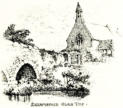
We now approach the eastern confines of the County, and thus enter upon the beginning of the end of our Pembrokeshire peregrinations. From Templeton we set our faces towards the hamlet of Eglwysfair-glan-Tâf, better known, probably, to the Saesneg traveller as Whitland railway junction.
We are now reaching the eastern edges of the county, marking the start of the conclusion of our travels through Pembrokeshire. From Templeton, we head toward the village of Eglwysfair-glan-Tâf, probably better known to the Saesneg traveler as the Whitland railway junction.
Laying our course adown the vale of the pretty Afon Marlas, we traverse the long village street of Lampeter Velfrey; and so, keeping rai[Pg 197]l and river upon our left flank, we presently strike the course of the infant Tâf near the old disused toll-gate at Pen-y-bont. At the little bridge that connects our County with its big neighbour of Carmarthen, we call a halt to lounge beside the low parapet, and transfer to the sketch-book an impression of St. Mary's Church, with the time-worn stonework of the old arches and cutwaters spanning the trout stream in the foreground.
Laying our path down the valley of the lovely Afon Marlas, we go through the long village street of Lampeter Velfrey; and so, keeping the railway and river on our left side, we soon hit the course of the young Tâf near the old, unused tollgate at Pen-y-bont. At the small bridge that connects our County with the larger Carmarthen, we stop to relax beside the low railing and capture an impression of St. Mary's Church in our sketchbook, featuring the weathered stonework of the old arches and cutwaters spanning the trout stream in front.
Here, then, we bid farewell to quaint old Pembrokeshire, and conclude our sketching rambles amidst its secluded byways.
Here, we say goodbye to charming old Pembrokeshire and wrap up our wandering adventures through its hidden paths.
Not many localities, we take it, can boast, within so comparatively limited a compass, such varied attractions for the lover of old-world[Pg 198] associations and time-worn architecture; attractions, withal, that to some minds are enhanced by a sense of remoteness and isolation from the ceaseless Sturm und Drang of modern city life.
Not many places, we believe, can proudly offer within such a small area so many different attractions for those who appreciate historical connections and aged architecture; attractions that, for some, are even more appealing because of a feeling of being away from the never-ending hustle and bustle of modern city life.
Although far from exhausting the scope of such a many-sided subject, we venture to hope that these pages may enable our readers to participate in the unalloyed pleasure and interest we have ourselves derived, from these pen-and-pencil peregrinations amidst the Nooks and Corners of Pembrokeshire.
Although this is just scratching the surface of such a complex topic, we hope that these pages will allow our readers to share in the genuine pleasure and interest we've enjoyed from our explorations of the hidden gems and corners of Pembrokeshire.

INDEX.
A.
Abercastell, 142
Abergwaen, 143
Afon Dûad, 152, 156
Afon Gwaen, 2, 143
Afon Marlas, 196
Afon Nevern, 152-154, 166
Afon Syvynvy, 171
Allan River, 3
Anchor at Hoaton, 194
Angle, 80, 81, 84
Angle Bay, 79
Angle Castle, 82
Anne's Head, St., 84, 123
B.
Bangeston House, 84
Barker, E. H. Lingen-, Esq., 179
Barlows of Slebech, 188, 189
Barri, Gerald de, 46
Bartholomew Roberts, 174
Bayvil, 159
Beavers in Wales, 171
Bedd-yr-Avangc, 170
Benton Castle, 184
Bishop-and-Clerks Islets, 138
Bishop's Palace, St. Davids, 135-137
Blockhouse at Angle, 83
Bonville's Court, 31
Bosheston, 68
Bosheston Meer, 71
Boulston, 179
Brestgarn, 144
Brides, St., 118
Brunt, 124
Bullibur, 73
Bullslaughter Bay, 72
Byrnach, St., 150, 174
C.
Caldey Island, 19-21
Campbell, Admiral Sir G., 67
Capel Stinian, 138
Carew Castle, 95-98
Carew Church, 94, 99, 100
Carew Cross, 94
Carmelite Nunnery, Tenby, 14
Carnedd Meibion Owen, 150, 152, 158
Carn Englyn, 1, 148, 150, 152
Carn Llidi, 2, 140
Carreg Gwastad Point, 147
Carswall, 29
Castell Conyn, 175
Castle Hill, Tenby, 15
Castle Malgwyn, 163, 164
Castle Martin, 89-91
Cathedral, St. Davids, 130-134
Cawdor, Lord, 66, 144
Cheriton, 64, 65
Church Plate, Gumfreston, 25
Cilmaenllwyd, 174
Clark, G. T., Esq., 56
Clawdd-y-Millwyr, 139
Cleddau River, 2, 168, 175, 182, 190
Cobb, J. R., Esq., 42, 56, 59
Coedmore, 161
Coracle, 161
Court, 157
Croes Mihangel, 168
Cromlechs, 48, 142, 151, 158
Crosses, 32, 94, 154, 155
Crowpoole, 77
Crugau Kemaes, 159
Crymmych Arms, 166, 168
Cwm Cerwyn, Foel, 169
D.
Dale, 122, 123
Dale Roads, 123
Daniels, St., 63
Davids, St., 128, 129
De Barri, Gerald, 46
De Barri Monument, Manorbere, 51
De la Roche Monument, 182
De Rutzen, Baron, 187
Dewisland, 2, 126
Dinas, 148
Dinas Head, 2, 143
Dogmaels, St., 165
Dogwell, St., 174
Dowrog Common, 141
Drudgeman's Hill, 109
Dûad Stream, 152, 156
E.
East Blockhouse, 83
Eastern Cleddau, 2, 168, 190
Eastington, 79, 85, 86
Eglwys Erw, 157
Eglwysfair Glan Tâf, 196
Eglwys Wen, 157
F.
Fishguard, 143, 145, 148
Fissures in Rock, Manorbere, 49
Flemings in Pembrokeshire, 181
Flether Hill, 177
Flimston, 73
Florence, St., 28, 29
Foel Cwm Cerwyn, 1, 169
Foel Trigarn, 168
Ford, 175
Fordd Fleming, 5, 142, 167, 170
French in Pembrokeshire, 143
Freshwater Bay, 79
Freystrop, 179
Fryn-y-Fawr, 167
G.
Garn Vawr, 147
Gateholm, 121
Giraldus Cambrensis, 46, 47
Glyndwr, Owen, 175
Glyn-y Mel, 143
Goodwic, 145
Govan's Chapel, St., 68
Gower, Bishop, 131
Grassholm, 121
Gulf Stream, 6
Gumfreston, 24, 25
Gwaen River, 2, 143
Gwahan Garreg, 138
Gwryd-bach, 141
H.
Haroldstone, 109, 179
Haverfordwest, 109-111, 178
Hayward Family, 177
Hean Castle, 31
Hênllan House, 78
Hênllys, 156
Hirlas Horn, 67
Hoaton, 124
Hobb's Point, 78, 106
Hodgeston, 39
Holyland, 104
Houghton, Bishop, 193
Howards of Rudbaxton, 175, 176
Howel Davies, 174
Hoyle's Mouth, 29
Hundleton, 74
Huntsman's Leap, 71
I.
Issells, St., 31
Ivy Tower, 31
J.
Jestynton, 85
Johnston, 108
Jordanston, 142
K.
Kemaes, 149
Kennox, St., 190
Kensington, Lord, 118
Kilgerran, 159, 160
King's Bridge, 104
L.
Lampeter Velfrey, 196
Lamphey, 36-38
Lamphey Park, 93
Landshipping, 184
Langwm, 180, 181
Laugharne Family, 119
Lawrenny, 183, 184
Letterston, 175
Little England beyond Wales, 6, 180
Little Haven, 117
Little Newcastle, 174
Llanbeudy, 174
Llandilo, 172, 173
Llangolman, 173
Llanhyvor Castle, 152
Llantood, 159
Llanvirnach, 173, 174
Llanwnda, 145, 146
Llawhaden, 190-193
Llechllafar, 135
Llechrhyd Bridge, 163
Llwyngwair, 2, 151
Longhouse, 142
Lord Kensington, 118
Lower Solva, 126
Lucy Walters, 107
Lydstep, 33
M.
Maenclochog, 171, 172
Malgwyn Castle, 163, 164
Manorbere, 48, 49
Manorbere Castle, 41-45
Manorbere Church, 50, 51
Marloes, 120, 121
Marteltewi, 182
Mathry, 142
Melchior Family, 173
Menapia, 5, 127, 139
Merlin's Bridge, 109
Mesur-y-Dorth, 142
Milford Haven, 3, 84, 104
Mill Bay, 123
Monachlogddu, 173
Monkton, 61-63
Moor Farm, 91
Mullock Bridge, 119
N.
Narberth, 195
Narberth Forest, 196
Nevern, 152-154
Nevern River, 2, 151, 166
Newgale Brook, 2, 126
New Milford, 106
Newport, 149-151
Newton, 89
Nightingales in Pembrokeshire, 77
Non's Chapel, 138
Normans in Pembrokeshire, 5, 149
O.
Octopitarum, 127
Ogham Stones, 20, 159
Old Hall, Monkton, 61
Old Rectory, Carew, 100
Orielton, 74
Orlandon, 119
Owen Glyndwr, 175
Owen of Hênllys, 156
P.
Parc-y-Marw, 148
Parrog, 2, 151
Pembroke, 54, 55, 60, 61
Pembroke Castle, 56-60
Pembroke Dock, 104-106
Penally, 31
Pen-beri, 2, 142
Pencaer, 147
Pennar River, 77
Pentre-Evan Cromlech, 158
Pen-y-Bont, 197
Philipps of Picton, 186, 187
Picton, 185-187
Picton Family, 186
Pilgrims' Cross at Nevern, 155
Plumstone Mountain, 2
Poll-tax Inn, 174
Pont-y-Baldwyn, 156
Precelly Hills, 1, 168, 169
Prendergast, 177
Pwllcroghan, 78
R.
Rambler's Folly, 93
Ramsey Island, 3, 138
Rees Pritchard, 190
Rhôs, 2
Rhôscrowther, 87
Rhys Monument, 13
Ridgeway, 35
Risam Monument, 12
Ritec Stream, 31
Robeston Wathen, 194
Roch Castle, 2, 126
Roman Roads, 5, 127, 174
Romans in Pembrokeshire, 5
Rosebush, 171
Rosemarket, 107
Rudbaxton, 175, 176
Rutzen, Baron de, 187
S.
Saundersfoot, 30
Scotsborough, 24
Sealyham, 175
Sergeant's Inn, 157
Skokholm, 121
Skomer, 3
Slebech, 188, 189
Solva, 126, 127
Solva River, 2
Stackpole, 6, 54, 65, 68
Stackpole Court, 66, 67
Stack Rocks, 72
St. Anne's Head, 84
St. Brides, 118
St. Bride's Bay, 3
St. Byrnach, 150, 174
St. Daniels, 63
St. Davids, 128, 129
St. Davids Cathedral, 130-134
St. David's Head, 139
St. Dogmaels, 165
St. Dogwells, 174
St. Florence, 28, 29
St. George's Bastion, Tenby, 18
St. Govan's Chapel, 68, 69
St. Issells, 31
St. Kennox, 190
St. Mary's College, 137
St. Non's Chapel, 138
St. Teilo, 33, 173
Sunken Wood, 71
Syvynvy River, 171
T.
Tafarn-Bwlch, 170, 171
Talbenny, 118
Teilo, St., 33, 173
Teivy River, 162
Temple-Druid, 172
Templeton, 196
Tenby, 8-11, 21
Tenby Church, 11, 12
Toad of Trellyfan, 156
Trefgarn, 2, 175
Trefloyne, 30
Trehowel, 147
Trellyfan, 155
Trevine, 142
U.
Upper Solva, 127
Upton Castle, 101
Upton Chapel, 102, 103
Uzmaston, 179
V.
Vaughan, Bishop, 134, 191
Vaughans of Dunraven, 13
Via Julia, 5, 127, 174
View from Foel Cwm-Cerwyn, 169, 170
Vrenny-Vawr, 167
W.
Wallaston Cross, 78
Walls of Tenby, 17-19
Walters, Lucy, 107
Walton-West, 114
Walwyn's Castle, 115
Warren, 73, 89, 92
Waterwinch, 30
Wells, 26, 30, 48, 69, 91, 138, 172, 173
West Angle Bay, 84
Western Cleddau, 2, 175
West Gate, Pembroke, 61
White's Monument, 11, 12
Whitland, 196
Williams, Clement, Esq., 32
Williamstown, 184
Wiston, 189, 190
Withybush, 177
Wogan Cavern, Pembroke, 59
Wogan Family, 179, 190
A.
Abercastell, __A_TAG_PLACEHOLDER_0__
Abergwaen, __A_TAG_PLACEHOLDER_0__
Afon Dûad, __A_TAG_PLACEHOLDER_0__, __A_TAG_PLACEHOLDER_1__
Afon Gwaen, __A_TAG_PLACEHOLDER_0__, __A_TAG_PLACEHOLDER_1__
Afon Marlas, __A_TAG_PLACEHOLDER_0__
Afon Nevern, __A_TAG_PLACEHOLDER_0__, __A_TAG_PLACEHOLDER_1__
Afon Syvynvy, __A_TAG_PLACEHOLDER_0__
Allan River, __A_TAG_PLACEHOLDER_0__
Anchor at Hoaton, __A_TAG_PLACEHOLDER_0__
Angle, __A_TAG_PLACEHOLDER_0__, __A_TAG_PLACEHOLDER_1__, __A_TAG_PLACEHOLDER_2__
Angle Bay, __A_TAG_PLACEHOLDER_0__
Angle Castle, __A_TAG_PLACEHOLDER_0__
Anne's Head, St., __A_TAG_PLACEHOLDER_0__, __A_TAG_PLACEHOLDER_1__
B.
Bangeston House, __A_TAG_PLACEHOLDER_0__
Barker, E. H. Lingen-, Esq., __A_TAG_PLACEHOLDER_0__
Barlows of Slebech, __A_TAG_PLACEHOLDER_0__, __A_TAG_PLACEHOLDER_1__
Barri, Gerald de, __A_TAG_PLACEHOLDER_0__
Bartholomew Roberts, __A_TAG_PLACEHOLDER_0__
Bayvil, __A_TAG_PLACEHOLDER_0__
Beavers in Wales, __A_TAG_PLACEHOLDER_0__
Bedd-yr-Avangc, __A_TAG_PLACEHOLDER_0__
Benton Castle, __A_TAG_PLACEHOLDER_0__
Bishop and Clerks Islets, __A_TAG_PLACEHOLDER_0__
Bishop's Palace, St. Davids, __A_TAG_PLACEHOLDER_0__
Blockhouse at Angle, __A_TAG_PLACEHOLDER_0__
Bonville's Court, __A_TAG_PLACEHOLDER_0__
Bosheston, __A_TAG_PLACEHOLDER_0__
Bosheston Lake, __A_TAG_PLACEHOLDER_0__
Boulston, __A_TAG_PLACEHOLDER_0__
Brestgarn, __A_TAG_PLACEHOLDER_0__
Brides, St., __A_TAG_PLACEHOLDER_0__
Brunt, __A_TAG_PLACEHOLDER_0__
Bullibur, __A_TAG_PLACEHOLDER_0__
Bullslaughter Bay, __A_TAG_PLACEHOLDER_0__
Byrnach, St., __A_TAG_PLACEHOLDER_0__, __A_TAG_PLACEHOLDER_1__
C.
Caldey Island, __A_TAG_PLACEHOLDER_0__-__A_TAG_PLACEHOLDER_1__
Campbell, Admiral Sir G., __A_TAG_PLACEHOLDER_0__
Capel Stinian, __A_TAG_PLACEHOLDER_0__
Carew Castle, __A_TAG_PLACEHOLDER_0__-__A_TAG_PLACEHOLDER_1__
Carew Church, __A_TAG_PLACEHOLDER_0__, __A_TAG_PLACEHOLDER_1__, __A_TAG_PLACEHOLDER_2__
Carew Cross, __A_TAG_PLACEHOLDER_0__
Carmelite Convent, Tenby, __A_TAG_PLACEHOLDER_0__
Carnedd Meibion Owen, __A_TAG_PLACEHOLDER_0__, __A_TAG_PLACEHOLDER_1__, __A_TAG_PLACEHOLDER_2__
Carn Englyn, __A_TAG_PLACEHOLDER_0__, __A_TAG_PLACEHOLDER_1__, __A_TAG_PLACEHOLDER_2__, __A_TAG_PLACEHOLDER_3__
Carn Llidi, __A_TAG_PLACEHOLDER_0__, __A_TAG_PLACEHOLDER_1__
Carreg Gwastad Point, __A_TAG_PLACEHOLDER_0__
Carswall, __A_TAG_PLACEHOLDER_0__
Castell Conyn, __A_TAG_PLACEHOLDER_0__
Castle Hill, Tenby, __A_TAG_PLACEHOLDER_0__
Castle Malgwyn, __A_TAG_PLACEHOLDER_0__, __A_TAG_PLACEHOLDER_1__
Castle Martin, __A_TAG_PLACEHOLDER_0__
St. Davids Cathedral, __A_TAG_PLACEHOLDER_0__
Cawdor, Lord, __A_TAG_PLACEHOLDER_0__, __A_TAG_PLACEHOLDER_1__
Cheriton, __A_TAG_PLACEHOLDER_0__, __A_TAG_PLACEHOLDER_1__
Church Plate, Gumfreston, __A_TAG_PLACEHOLDER_0__
Cilmaenllwyd, __A_TAG_PLACEHOLDER_0__
Clark, G. T., Esq., __A_TAG_PLACEHOLDER_0__
Clawdd-y-Millwyr, __A_TAG_PLACEHOLDER_0__
Cleddau River, __A_TAG_PLACEHOLDER_0__, __A_TAG_PLACEHOLDER_1__, __A_TAG_PLACEHOLDER_2__, __A_TAG_PLACEHOLDER_3__, __A_TAG_PLACEHOLDER_4__
Cobb, J. R., Esq., __A_TAG_PLACEHOLDER_0__, __A_TAG_PLACEHOLDER_1__, __A_TAG_PLACEHOLDER_2__
Coedmore, __A_TAG_PLACEHOLDER_0__
Coracle, __A_TAG_PLACEHOLDER_0__
Court, __A_TAG_PLACEHOLDER_0__
Croes Michael, __A_TAG_PLACEHOLDER_0__
Cromlechs, __A_TAG_PLACEHOLDER_0__, __A_TAG_PLACEHOLDER_1__, __A_TAG_PLACEHOLDER_2__, __A_TAG_PLACEHOLDER_3__
Crosses, __A_TAG_PLACEHOLDER_0__, __A_TAG_PLACEHOLDER_1__, __A_TAG_PLACEHOLDER_2__, __A_TAG_PLACEHOLDER_3__
Crowpoole, __A_TAG_PLACEHOLDER_0__
Crugau Kemaes, __A_TAG_PLACEHOLDER_0__
Crymmych Arms, __A_TAG_PLACEHOLDER_0__, __A_TAG_PLACEHOLDER_1__
Cwm Cerwyn, Foel, __A_TAG_PLACEHOLDER_0__
D.
Dale, __A_TAG_PLACEHOLDER_0__, __A_TAG_PLACEHOLDER_1__
Dale Roads, __A_TAG_PLACEHOLDER_0__
Daniels Street, __A_TAG_PLACEHOLDER_0__
Davids, St., __A_TAG_PLACEHOLDER_0__, __A_TAG_PLACEHOLDER_1__
De Barri, Gerald, __A_TAG_PLACEHOLDER_0__
De Barri Monument, Manorbere, __A_TAG_PLACEHOLDER_0__
De la Roche Monument, __A_TAG_PLACEHOLDER_0__
De Rutzen, Baron, __A_TAG_PLACEHOLDER_0__
Dewisland, __A_TAG_PLACEHOLDER_0__, __A_TAG_PLACEHOLDER_1__
Dinas, __A_TAG_PLACEHOLDER_0__
Dinas Head, __A_TAG_PLACEHOLDER_0__, __A_TAG_PLACEHOLDER_1__
Dogmaels, Street, __A_TAG_PLACEHOLDER_0__
Dogwell Street, __A_TAG_PLACEHOLDER_0__
Dowrog Common, __A_TAG_PLACEHOLDER_0__
Drudgeman's Hill, __A_TAG_PLACEHOLDER_0__
Dud Stream, __A_TAG_PLACEHOLDER_0__, __A_TAG_PLACEHOLDER_1__
E.
East Blockhouse, __A_TAG_PLACEHOLDER_0__
Eastern Cleddau, __A_TAG_PLACEHOLDER_0__, __A_TAG_PLACEHOLDER_1__, __A_TAG_PLACEHOLDER_2__
Eastington, __A_TAG_PLACEHOLDER_0__, __A_TAG_PLACEHOLDER_1__, __A_TAG_PLACEHOLDER_2__
Eglwys Erw, __A_TAG_PLACEHOLDER_0__
Eglwysfair Glan Tâf, __A_TAG_PLACEHOLDER_0__
Eglwys Wen, __A_TAG_PLACEHOLDER_0__
F.
Fishguard, __A_TAG_PLACEHOLDER_0__, __A_TAG_PLACEHOLDER_1__, __A_TAG_PLACEHOLDER_2__
Fissures in Rock, Manorbere, __A_TAG_PLACEHOLDER_0__
Flemings in Pembrokeshire, __A_TAG_PLACEHOLDER_0__
Fletcher Hill, __A_TAG_PLACEHOLDER_0__
Flimston, __A_TAG_PLACEHOLDER_0__
Florence, St., __A_TAG_PLACEHOLDER_0__, __A_TAG_PLACEHOLDER_1__
Foel Cwm Cerwyn, __A_TAG_PLACEHOLDER_0__, __A_TAG_PLACEHOLDER_1__
Foel Trigarn, __A_TAG_PLACEHOLDER_0__
Ford, __A_TAG_PLACEHOLDER_0__
Fordd Fleming, __A_TAG_PLACEHOLDER_0__, __A_TAG_PLACEHOLDER_1__, __A_TAG_PLACEHOLDER_2__, __A_TAG_PLACEHOLDER_3__
French in Pembrokeshire, __A_TAG_PLACEHOLDER_0__
Freshwater Bay, __A_TAG_PLACEHOLDER_0__
Freystrop, __A_TAG_PLACEHOLDER_0__
Fryn-y-Fawr, __A_TAG_PLACEHOLDER_0__
G.
Garn Vawr, __A_TAG_PLACEHOLDER_0__
Gateholm, __A_TAG_PLACEHOLDER_0__
Giraldus Cambrensis, __A_TAG_PLACEHOLDER_0__, __A_TAG_PLACEHOLDER_1__
Glyndwr, Owen, __A_TAG_PLACEHOLDER_0__
Glyn-y Mel, __A_TAG_PLACEHOLDER_0__
Goodwick, __A_TAG_PLACEHOLDER_0__
Govan's Chapel, St., __A_TAG_PLACEHOLDER_0__
Gower, Bishop, __A_TAG_PLACEHOLDER_0__
Grassholm, __A_TAG_PLACEHOLDER_0__
Gulf Stream, __A_TAG_PLACEHOLDER_0__
Gumfreston, __A_TAG_PLACEHOLDER_0__, __A_TAG_PLACEHOLDER_1__
Gwaen River, __A_TAG_PLACEHOLDER_0__, __A_TAG_PLACEHOLDER_1__
Gwahan Garreg, __A_TAG_PLACEHOLDER_0__
Gwryd-bach, __A_TAG_PLACEHOLDER_0__
H.
Haroldstone, __A_TAG_PLACEHOLDER_0__, __A_TAG_PLACEHOLDER_1__
Haverfordwest, __A_TAG_PLACEHOLDER_0__, __A_TAG_PLACEHOLDER_1__
Hayward Family, __A_TAG_PLACEHOLDER_0__
Hean Castle, __A_TAG_PLACEHOLDER_0__
Hênllan House, __A_TAG_PLACEHOLDER_0__
Hênllys, __A_TAG_PLACEHOLDER_0__
Hirlas Horn, __A_TAG_PLACEHOLDER_0__
Hoaton, __A_TAG_PLACEHOLDER_0__
Hobb's Point, __A_TAG_PLACEHOLDER_0__, __A_TAG_PLACEHOLDER_1__
Hodgeston, __A_TAG_PLACEHOLDER_0__
Holy Land, __A_TAG_PLACEHOLDER_0__
Houghton, Bishop, __A_TAG_PLACEHOLDER_0__
Howards of Rudbaxton, __A_TAG_PLACEHOLDER_0__, __A_TAG_PLACEHOLDER_1__
Howel Davies, __A_TAG_PLACEHOLDER_0__
Hoyle's Mouth, __A_TAG_PLACEHOLDER_0__
Hundleton, __A_TAG_PLACEHOLDER_0__
Huntsman's Leap, __A_TAG_PLACEHOLDER_0__
I.
Issells, St., __A_TAG_PLACEHOLDER_0__
Ivy Tower, __A_TAG_PLACEHOLDER_0__
J.
Jestynton, __A_TAG_PLACEHOLDER_0__
Johnston, __A_TAG_PLACEHOLDER_0__
Jordanston, __A_TAG_PLACEHOLDER_0__
K.
Kemaes, __A_TAG_PLACEHOLDER_0__
Kennox Street, __A_TAG_PLACEHOLDER_0__
Kensington, Lord, __A_TAG_PLACEHOLDER_0__
Kilgerran, __A_TAG_PLACEHOLDER_0__, __A_TAG_PLACEHOLDER_1__
King's Bridge, __A_TAG_PLACEHOLDER_0__
L.
Lampeter Velfrey, __A_TAG_PLACEHOLDER_0__
Lamphey, __A_TAG_PLACEHOLDER_0__
Lamphey Park, __A_TAG_PLACEHOLDER_0__
Landshipping, __A_TAG_PLACEHOLDER_0__
Langwm, __A_TAG_PLACEHOLDER_0__, __A_TAG_PLACEHOLDER_1__
Laugharne Family, __A_TAG_PLACEHOLDER_0__
Lawrenny, __A_TAG_PLACEHOLDER_0__, __A_TAG_PLACEHOLDER_1__
Letterston, __A_TAG_PLACEHOLDER_0__
Little England beyond Wales, __A_TAG_PLACEHOLDER_0__, __A_TAG_PLACEHOLDER_1__
Little Haven, __A_TAG_PLACEHOLDER_0__
Little Newcastle, __A_TAG_PLACEHOLDER_0__
Llanbeudy, __A_TAG_PLACEHOLDER_0__
Llandilo, __A_TAG_PLACEHOLDER_0__, __A_TAG_PLACEHOLDER_1__
Llangolman, __A_TAG_PLACEHOLDER_0__
Llanhyvor Castle, __A_TAG_PLACEHOLDER_0__
Llantood, __A_TAG_PLACEHOLDER_0__
Llanvirnach, __A_TAG_PLACEHOLDER_0__, __A_TAG_PLACEHOLDER_1__
Llanwnda, __A_TAG_PLACEHOLDER_0__, __A_TAG_PLACEHOLDER_1__
Llawhaden, __A_TAG_PLACEHOLDER_0__
Llechllafar, __A_TAG_PLACEHOLDER_0__
Llechrhyd Bridge, __A_TAG_PLACEHOLDER_0__
Llwyngwair, __A_TAG_PLACEHOLDER_0__, __A_TAG_PLACEHOLDER_1__
Longhouse, __A_TAG_PLACEHOLDER_0__
Lord Kensington, __A_TAG_PLACEHOLDER_0__
Lower Solva, __A_TAG_PLACEHOLDER_0__
Lucy Walters, __A_TAG_PLACEHOLDER_0__
Lydstep, __A_TAG_PLACEHOLDER_0__
M.
Maenclochog, __A_TAG_PLACEHOLDER_0__, __A_TAG_PLACEHOLDER_1__
Malgwyn Castle, __A_TAG_PLACEHOLDER_0__, __A_TAG_PLACEHOLDER_1__
Manorbere, __A_TAG_PLACEHOLDER_0__, __A_TAG_PLACEHOLDER_1__
Manorbere Castle, __A_TAG_PLACEHOLDER_0__
Manorbere Church, __A_TAG_PLACEHOLDER_0__, __A_TAG_PLACEHOLDER_1__
Marloes, __A_TAG_PLACEHOLDER_0__, __A_TAG_PLACEHOLDER_1__
Marteltewi, __A_TAG_PLACEHOLDER_0__
Mathry, __A_TAG_PLACEHOLDER_0__
Melchior Family, __A_TAG_PLACEHOLDER_0__
Menapia, __A_TAG_PLACEHOLDER_0__, __A_TAG_PLACEHOLDER_1__, __A_TAG_PLACEHOLDER_2__
Merlin's Bridge, __A_TAG_PLACEHOLDER_0__
Mesur-y-Dorth, __A_TAG_PLACEHOLDER_0__
Milford Haven, __A_TAG_PLACEHOLDER_0__, __A_TAG_PLACEHOLDER_1__, __A_TAG_PLACEHOLDER_2__
Mill Bay, __A_TAG_PLACEHOLDER_0__
Monachlogddu, __A_TAG_PLACEHOLDER_0__
Monkton, __A_TAG_PLACEHOLDER_0__
Moor Farm, __A_TAG_PLACEHOLDER_0__
Mullock Bridge, __A_TAG_PLACEHOLDER_0__
N.
Narberth, __A_TAG_PLACEHOLDER_0__
Narberth Forest, __A_TAG_PLACEHOLDER_0__
Nevern, __A_TAG_PLACEHOLDER_0__
Nevern River, __A_TAG_PLACEHOLDER_0__, __A_TAG_PLACEHOLDER_1__, __A_TAG_PLACEHOLDER_2__
Newgale Brook, __A_TAG_PLACEHOLDER_0__, __A_TAG_PLACEHOLDER_1__
New Milford, __A_TAG_PLACEHOLDER_0__
Newport, __A_TAG_PLACEHOLDER_0__
Newton, __A_TAG_PLACEHOLDER_0__
Nightingales in Pembrokeshire, __A_TAG_PLACEHOLDER_0__
Non's Chapel, __A_TAG_PLACEHOLDER_0__
Normans in Pembrokeshire, __A_TAG_PLACEHOLDER_0__, __A_TAG_PLACEHOLDER_1__
O.
Octopus, __A_TAG_PLACEHOLDER_0__
Ogham Stones, __A_TAG_PLACEHOLDER_0__, __A_TAG_PLACEHOLDER_1__
Old Hall, Monkton, __A_TAG_PLACEHOLDER_0__
Old Rectory, Carew, __A_TAG_PLACEHOLDER_0__
Orielton, __A_TAG_PLACEHOLDER_0__
Orlandon, __A_TAG_PLACEHOLDER_0__
Owen Glyndwr, __A_TAG_PLACEHOLDER_0__
Owen of Hênllys, __A_TAG_PLACEHOLDER_0__
P.
Parc-y-Marw, __A_TAG_PLACEHOLDER_0__
Parrog, __A_TAG_PLACEHOLDER_0__, __A_TAG_PLACEHOLDER_1__
Pembroke, __A_TAG_PLACEHOLDER_0__, __A_TAG_PLACEHOLDER_1__, __A_TAG_PLACEHOLDER_2__, __A_TAG_PLACEHOLDER_3__
Pembroke Castle, __A_TAG_PLACEHOLDER_0__
Pembroke Dock, __A_TAG_PLACEHOLDER_0__
Penally, __A_TAG_PLACEHOLDER_0__
Pen-beri, __A_TAG_PLACEHOLDER_0__, __A_TAG_PLACEHOLDER_1__
Pencaer, __A_TAG_PLACEHOLDER_0__
Pennar River, __A_TAG_PLACEHOLDER_0__
Pentre-Evan Cromlech, __A_TAG_PLACEHOLDER_0__
Pen-y-Bont, __A_TAG_PLACEHOLDER_0__
Philipps of Picton, __A_TAG_PLACEHOLDER_0__, __A_TAG_PLACEHOLDER_1__
Picton, __A_TAG_PLACEHOLDER_0__
Picton Family, __A_TAG_PLACEHOLDER_0__
Pilgrims' Cross at Nevern, __A_TAG_PLACEHOLDER_0__
Plumstone Mountain, __A_TAG_PLACEHOLDER_0__
Poll-tax Inn, __A_TAG_PLACEHOLDER_0__
Pont-y-Baldwyn, __A_TAG_PLACEHOLDER_0__
Precelly Hills, __A_TAG_PLACEHOLDER_0__, __A_TAG_PLACEHOLDER_1__, __A_TAG_PLACEHOLDER_2__
Prendergast, __A_TAG_PLACEHOLDER_0__
Pwllcroghan, __A_TAG_PLACEHOLDER_0__
R.
Rambler's Folly, __A_TAG_PLACEHOLDER_0__
Ramsey Island, __A_TAG_PLACEHOLDER_0__, __A_TAG_PLACEHOLDER_1__
Rees Pritchard, __A_TAG_PLACEHOLDER_0__
Rhôs, __A_TAG_PLACEHOLDER_0__
Rhôscrowther, __A_TAG_PLACEHOLDER_0__
Rhys Monument, __A_TAG_PLACEHOLDER_0__
Ridgeway, __A_TAG_PLACEHOLDER_0__
Risam Monument, __A_TAG_PLACEHOLDER_0__
Ritec Stream, __A_TAG_PLACEHOLDER_0__
Robeston Wathen, __A_TAG_PLACEHOLDER_0__
Roch Castle, __A_TAG_PLACEHOLDER_0__, __A_TAG_PLACEHOLDER_1__
Roman Roads, __A_TAG_PLACEHOLDER_0__, __A_TAG_PLACEHOLDER_1__, __A_TAG_PLACEHOLDER_2__
Romans in Pembrokeshire, __A_TAG_PLACEHOLDER_0__
Rosebush, __A_TAG_PLACEHOLDER_0__
Rosemarket, __A_TAG_PLACEHOLDER_0__
Rudbaxton, __A_TAG_PLACEHOLDER_0__, __A_TAG_PLACEHOLDER_1__
Rutzen, Baron de, __A_TAG_PLACEHOLDER_0__
S.
Saundersfoot, __A_TAG_PLACEHOLDER_0__
Scottsboro, __A_TAG_PLACEHOLDER_0__
Sealyham, __A_TAG_PLACEHOLDER_0__
Sergeant's Inn, __A_TAG_PLACEHOLDER_0__
Skokholm, __A_TAG_PLACEHOLDER_0__
Skomer, __A_TAG_PLACEHOLDER_0__
Slebech, __A_TAG_PLACEHOLDER_0__, __A_TAG_PLACEHOLDER_1__
Solva, __A_TAG_PLACEHOLDER_0__, __A_TAG_PLACEHOLDER_1__
Solva River, __A_TAG_PLACEHOLDER_0__
Stackpole, __A_TAG_PLACEHOLDER_0__, __A_TAG_PLACEHOLDER_1__, __A_TAG_PLACEHOLDER_2__, __A_TAG_PLACEHOLDER_3__
Stackpole Court, __A_TAG_PLACEHOLDER_0__, __A_TAG_PLACEHOLDER_1__
Stack Rocks, __A_TAG_PLACEHOLDER_0__
St. Anne's Head, __A_TAG_PLACEHOLDER_0__
St. Brides, __A_TAG_PLACEHOLDER_0__
St. Bride's Bay, __A_TAG_PLACEHOLDER_0__
St. Byrnach, __A_TAG_PLACEHOLDER_0__, __A_TAG_PLACEHOLDER_1__
St. Daniels, __A_TAG_PLACEHOLDER_0__
St. Davids, __A_TAG_PLACEHOLDER_0__, __A_TAG_PLACEHOLDER_1__
St. Davids Cathedral, __A_TAG_PLACEHOLDER_0__-__A_TAG_PLACEHOLDER_1__
St. David's Head, __A_TAG_PLACEHOLDER_0__
St. Dogmaels, __A_TAG_PLACEHOLDER_0__
St. Dogwells, __A_TAG_PLACEHOLDER_0__
St. Florence, __A_TAG_PLACEHOLDER_0__, __A_TAG_PLACEHOLDER_1__
St. George's Bastion, Tenby, __A_TAG_PLACEHOLDER_0__
St. Govan's Chapel, __A_TAG_PLACEHOLDER_0__, __A_TAG_PLACEHOLDER_1__
St. Isels, __A_TAG_PLACEHOLDER_0__
St. Kennox, __A_TAG_PLACEHOLDER_0__
St. Mary's College, __A_TAG_PLACEHOLDER_0__
St. Non's Chapel, __A_TAG_PLACEHOLDER_0__
St. Teilo, __A_TAG_PLACEHOLDER_0__, __A_TAG_PLACEHOLDER_1__
Sunken Wood, __A_TAG_PLACEHOLDER_0__
Syvynvy River, __A_TAG_PLACEHOLDER_0__
T.
Tafarn-Bwlch, __A_TAG_PLACEHOLDER_0__, __A_TAG_PLACEHOLDER_1__
Talbenny, __A_TAG_PLACEHOLDER_0__
Teilo, St., __A_TAG_PLACEHOLDER_0__, __A_TAG_PLACEHOLDER_1__
Teivy River, __A_TAG_PLACEHOLDER_0__
Temple Druid, __A_TAG_PLACEHOLDER_0__
Templeton, __A_TAG_PLACEHOLDER_0__
Tenby, __A_TAG_PLACEHOLDER_0__, __A_TAG_PLACEHOLDER_1__
Tenby Church, __A_TAG_PLACEHOLDER_0__, __A_TAG_PLACEHOLDER_1__
Toad of Trellyfan, __A_TAG_PLACEHOLDER_0__
Trefgarn, __A_TAG_PLACEHOLDER_0__, __A_TAG_PLACEHOLDER_1__
Trefloyne, __A_TAG_PLACEHOLDER_0__
Trehowel, __A_TAG_PLACEHOLDER_0__
Trellyfan, __A_TAG_PLACEHOLDER_0__
Trevine, __A_TAG_PLACEHOLDER_0__
U.
Upper Solva, __A_TAG_PLACEHOLDER_0__
Upton Castle, __A_TAG_PLACEHOLDER_0__
Upton Chapel, __A_TAG_PLACEHOLDER_0__, __A_TAG_PLACEHOLDER_1__
Uzmaston, __A_TAG_PLACEHOLDER_0__
V.
Vaughan, Bishop, __A_TAG_PLACEHOLDER_0__, __A_TAG_PLACEHOLDER_1__
Vaughans of Dunraven, __A_TAG_PLACEHOLDER_0__
Via Julia, __A_TAG_PLACEHOLDER_0__, __A_TAG_PLACEHOLDER_1__, __A_TAG_PLACEHOLDER_2__
View from Foel Cwm-Cerwyn, __A_TAG_PLACEHOLDER_0__, __A_TAG_PLACEHOLDER_1__
Vrenny-Vawr, __A_TAG_PLACEHOLDER_0__
W.
Wallaston Cross, __A_TAG_PLACEHOLDER_0__
Walls of Tenby, __A_TAG_PLACEHOLDER_0__
Walters, Lucy, __A_TAG_PLACEHOLDER_0__
Walton-West, __A_TAG_PLACEHOLDER_0__
Walwyn's Castle, __A_TAG_PLACEHOLDER_0__
Warren, __A_TAG_PLACEHOLDER_0__, __A_TAG_PLACEHOLDER_1__, __A_TAG_PLACEHOLDER_2__
Water winch, __A_TAG_PLACEHOLDER_0__
Wells, __A_TAG_PLACEHOLDER_0__, __A_TAG_PLACEHOLDER_1__, __A_TAG_PLACEHOLDER_2__, __A_TAG_PLACEHOLDER_3__, __A_TAG_PLACEHOLDER_4__, __A_TAG_PLACEHOLDER_5__, __A_TAG_PLACEHOLDER_6__, __A_TAG_PLACEHOLDER_7__
West Angle Bay, __A_TAG_PLACEHOLDER_0__
Western Cleddau, __A_TAG_PLACEHOLDER_0__, __A_TAG_PLACEHOLDER_1__
West Gate, Pembroke, __A_TAG_PLACEHOLDER_0__
White's Monument, __A_TAG_PLACEHOLDER_0__, __A_TAG_PLACEHOLDER_1__
Whitland, __A_TAG_PLACEHOLDER_0__
Williams, Clement, Esq., __A_TAG_PLACEHOLDER_0__
Williamstown, __A_TAG_PLACEHOLDER_0__
Wiston, __A_TAG_PLACEHOLDER_0__, __A_TAG_PLACEHOLDER_1__
Withybush, __A_TAG_PLACEHOLDER_0__
Wogan Cavern, Pembroke, __A_TAG_PLACEHOLDER_0__
Wogan Family, __A_TAG_PLACEHOLDER_0__, __A_TAG_PLACEHOLDER_1__

LIST OF SUBSCRIBERS' NAMES.
| Allen, Very Rev. Dean, St. Davids | 1 |
| Arnett, J. E., Tenby | 3 |
| Baker, Rev. S. O., Somerset | 1 |
| Ballinger, J., Cardiff | 1 |
| Bellamy, C. H., Heaton Chapel | 1 |
| Beloe, E. M., King's Lynn | 1 |
| Berensberg, Count Victor de, Haverfordwest | 1 |
| Bethell, W., Malton | 1 |
| and one large. | |
| Blanc, H. S., Edinburgh | 1 |
| Bowen, J. B., Llwyngwair, Crymmych | 1 |
| Bowen, Rev. D., Pembroke | 1 |
| Bridgman, Rev. Canon, Wigan | 1 |
| Brigstocke, Ll., Haverfordwest | 12 |
| Bromley, Rev. W., Manorbere Vicarage | 1 |
| Bumpus, J. and E., Limited, Holborn | 1 |
| Bute, Lord, Cardiff Castle | 1 |
| Carroway, J., Blackheath | 1 |
| Chance, R. L., Edgbaston | 2 |
| Cherwood-Aiken, J. C., Stoke Bishop | 1 |
| Codner, D. J. D., Pembrokeshire | 1 |
| Daltry, Rev. T. W., Newcastle | 1 |
| Davies, D. J., Knightsbridge | 1 |
| Davies, G., Pembroke | 1 |
| Davies, Rev. G., St. Brides, Pembroke | 1 |
| Davies, Rev. W., Morlais. Fishguard | 1 |
| Davies-Burlton, T., Leominster | 1 |
| Davis, Mrs. Warren, Milford Haven | 1 |
| Dixon, W. H., 1, Arthur Road, Edgbaston | 1 |
| Dodd, Mead, and Co., New York | 3 |
| and one large. | |
| Downing, Wm., Birmingham | 1 |
| Duncan, John, F.J.I., J.P., Cardiff | 1 |
| Elkington, G., Edgbaston | 1 |
| Evans, T. W., Fellowes Road, London | 1 |
| Feeney, John, Birmingham | 1 |
| Field, H. H., Beds | 1 |
| Gilpin, Captain N., Hove | 1 |
| Gray, Henry, Leicester Square | 12 |
| Greenish, R., Manorbere | 1 |
| Gwyther, F., Haverfordwest | 1 |
| Hanbury, Rev. T., Market Harborough | 1 |
| Hand, T. W., Oldham | 1 |
| Harries, Cecilia J., London | 1 |
| Hartwright, H., Harporley | 1 |
| Haslam, W. F., Edgbaston | 1 |
| Haslewood, Rev. F. G., Canterbury | 1 |
| Haynes, G. B., Brynhir, near Swansea | 1 |
| Haynes, H, Harrow, Middlesex | 1 |
| Henman, William, F.R.I.B.A., Birmingham | 2 |
| Hill, T. Rowley, Worcester | 1 |
| Hilbers, the Ven. Archdeacon, G. C., Haverfordwest | 1 |
| Hooke, Rev. D. Burford, High Barnet | 1 |
| Horncastle, H., Woking | 1 |
| Howell, George Owen, Plumstead | 1 |
| Idris, T. B. W., Camden Town | 1 |
| Jakeman and Carver, Hereford | 1 |
| John, E., Middlesborough | 1 |
| Jolly, F., Bath | 1 |
| Jones, M. T., Wrexham | 1 |
| Layton, C. Miller, Folkestone | 1 |
| Lester, E., Rochester | 1 |
| Lewis, Rev. David, St. Davids | 1 |
| Lillington, Mrs. E., Penzance | 1 |
| Lingard-Monk, R. B. M., Wilmslow | 1 |
| Llewellyn, R. W., Briton Ferry | 1 |
| Lloyd, E. O. V., Corwen | 2 |
| Lloyd, H. Meuric, South Wales | 1 |
| Lloyd-Philips, F. L., Pembrokeshire | 1 |
| Maillard, Mrs., Pembroke | 1 |
| Marrs, Kingsmill, Saxonville, U.S.A. | 1 |
| Marychurch, Wm., Cardiff | 1 |
| Mathias, H., Haverfordwest | 1 |
| Mayler, J. E., Wexford | 1 |
| Meynell, Edgar J., Durham | 1 |
| Middlemass, Major J. C., Monkton | 1 |
| Morgan, Rev. C., Pembroke | 1 |
| Morgan, Lieut.-Col. W. L., Swansea | 1 |
| Morrison, Dr., Portclew, Pembroke | 1 |
| Nevin, J., Mirfield | 1 |
| Nield, W., Bristol | 1 |
| Oldham Central Free Library | 1 |
| Owen, Honourable Mrs., Treffgarn | 1 |
| Owen, Rev. Elias, M.A., F.S.A., Oswestry | 1 |
| Parker, F. Rowley, Harrow Weald | 1 |
| Parkinson, Captain F. R., President, Garrison Library, Pembroke Dock | 1 |
| Pashley, R., Rotherham | 1 |
| Pears, Andrew, Isleworth | 1 |
| Penney, J. W., Pembroke | 1 |
| Perrott, E., West Brighton | 1 |
| Phelps, Rev. C. M., Haverfordwest | |
| Phillips. Rev. J., Haverfordwest | 1 |
| Philipps, Sir Charles E. G., Bart., Lord Lieutenant, Haverfordwest | 1 |
| Pierce, Ellis, Dolyddelen | 1 |
| Pollen, G. A. J., Seaton Carew | 1 |
| Powell, Mrs., Hereford | 1 |
| Price, Rees, Glasgow | 1 |
| Prickett, T. A., Tottenham Court Road, W. | 1 |
| Protheroe, E. S., Dolwilym | 1 |
| Randall, J., Sheffield | 1 |
| Reece, Mrs., Carpenter Road, Edgbaston | 1 |
| Rees, Griffith, Birkenhead | 1 |
| Rees, Howell, J.P., South Wales | 1 |
| Rees, J. Rogers, Penarth | 1 |
| Richards, D., Cardiff | 1 |
| Richards, D. M., Aberdare | 1 |
| Roberts, O. M., Portmadoc | 1 |
| Roberton, J. D., Glasgow | 1 |
| Rock, T. Dennis, South Wales | 1 |
| Roughsedge, Miss, Birkenhead | 1 |
| Rowntree, Wm., Scarborough | 1 |
| Samson, Louis, Haverfordwest | 1 |
| Sandys, Lt.-Col. T. Myles, M.P., Ulverston | 1 |
| and one large. | |
| Seward, E., Cardiff | 1 |
| Skrine, H. D., Bath | 1 |
| Small, Evan W., Newport | 1 |
| Society of Antiquaries | 1 |
| Sparrow, A., Shrewsbury | 1 |
| Spurrell, W., and Son, Carmarthen | 4 |
| St. Davids, The Right Rev. the Lord Bishop of | 1 |
| Stewart, J., Llandyssil | 1 |
| Stone, Rev. D., Wallingford | 1 |
| Studholme, Paul, Parsonstown | 1 |
| Sturge, R. L., Bristol | 1 |
| Swansea, The Right Rev. the Lord Bishop of | 1 |
| Swinburne, Mrs. W. A., Dulais Hay | 1 |
| Thomas, J., J.P., Haverfordwest | 1 |
| Thomas, T. Lynn, Cardiff | 1 |
| Thomas, Rev. F. O., Narberth | 1 |
| Thomas, Rev. W. Meyler, Milford Haven | 1 |
| Thomason, Yeoville, F.R.I.B.A., Kensington | 1 |
| Timmins, F. H., Westfield Road, Edgbaston | 1 |
| Timmins, Miss, Edgbaston | 1 |
| Tredegar, Lord, Tredegar Park | 1 |
| Trevaldwyn, Rev. B. W. J., Looe | 1 |
| Treweeks, R. H. | 3 |
| and one large. | |
| Troutbeck, Miss, Congleton | 1 |
| Turbervill, Colonel J. P., Bridgend | 1 |
| Turner, W. H., Maidstone | 1 |
| Walker, W., Finsbury Park | 1 |
| Walters, Rev. T., Maenclochog | 1 |
| Warburton, S., Balham | 1 |
| Wharton, Rev. G., Abingdon | 1 |
| Williams, G., Finsbury Pavement | 1 |
| Williams, J., Brook Street, W. | 1 |
| Williams, Wm, Aberystwyth | 2 |
| Williamson, G. C., Guildford | 1 |
| Wills, W. Leonard, Worcestershire | 1 |
| Wright, A. J., Milford Haven | 1 |
LARGE PAPER.
| Bethell, W., Malton | 1 |
| and one small. | |
| Brigstocke, Ll., Haverfordwest | 1 |
| Brimmer, Mrs. Martin, Boston, U.S.A. | 1 |
| Dodd, Mead, and Co., New York | 1 |
| Gray, H., London | 3 |
| Ford, J. W., Enfield Old Park | 1 |
| Jones, J., 19, Cheapside, E.C. | 1 |
| Kensington, Lady, Pembrokeshire | 1 |
| Lambton, Lt.-Col. F. W., Pembroke | 1 |
| Owen, Henry, 44, Oxford Terrace, W. | 1 |
| Sandys, Lt.-Col. T. Myles, M.P., Ulverston | 1 |
| and one small. | |
| Saunders, E. A., Pembroke Dock | 1 |
| Smith, R. V. Vassar, Cheltenham | 1 |
| Treweeks, R. H. | 1 |
| and three small. |

Download ePUB
If you like this ebook, consider a donation!