This is a modern-English version of Encyclopaedia Britannica, 11th Edition, "Kite-Flying" to "Kyshtym": Volume 15, Slice 8, originally written by Various.
It has been thoroughly updated, including changes to sentence structure, words, spelling,
and grammar—to ensure clarity for contemporary readers, while preserving the original spirit and nuance. If
you click on a paragraph, you will see the original text that we modified, and you can toggle between the two versions.
Scroll to the bottom of this page and you will find a free ePUB download link for this book.
| Transcriber’s note: |
A few typographical errors have been corrected. They
appear in the text like this, and the
explanation will appear when the mouse pointer is moved over the marked
passage. Sections in Greek will yield a transliteration
when the pointer is moved over them, and words using diacritic characters in the
Latin Extended Additional block, which may not display in some fonts or browsers, will
display an unaccented version. Links to other EB articles: Links to articles residing in other EB volumes will be made available when the respective volumes are introduced online. |
THE ENCYCLOPÆDIA BRITANNICA
A DICTIONARY OF ARTS, SCIENCES, LITERATURE AND GENERAL INFORMATION
ELEVENTH EDITION
VOLUME XV SLICE VIII
Kite-Flying to Kyshtym
Articles in This Slice
Articles in This Section

KITE-FLYING, the art of sending up into the air, by means of the wind, light frames of varying shapes covered with paper or cloth (called kites, after the bird—in German Drache, dragon), which are attached to long cords or wires held in the hand or wound on a drum. When made in the common diamond form, or triangular with a semicircular head, kites usually have a pendulous tail appended for balancing purposes. The tradition is that kites were invented by Archytas of Tarentum four centuries before the Christian era, but they have been in use among Asiatic peoples and savage tribes like the Maoris of New Zealand from time immemorial. Kite-flying has always been a national pastime of the Koreans, Chinese, Japanese, Tonkinese, Annamese, Malays and East Indians. It is less popular among the peoples of Europe. The origin of the sport, although obscure, is usually ascribed to religion. With the Maoris it still retains a distinctly religious character, and the ascent of the kite is accompanied by a chant called the kite-song. The Koreans attribute its origin to a general, who, hundreds of years ago, inspirited his troops by sending up a kite with a lantern attached, which was mistaken by his army for a new star and a token of divine succour. Another Korean general is said to have been the first to put the kite to mechanical uses by employing one to span a stream with a cord, which was then fastened to a cable and formed the nucleus of a bridge. In Korea, Japan and China, and indeed throughout Eastern Asia, even the tradespeople may be seen indulging in kite-flying while waiting for customers. Chinese and Japanese kites are of many shapes, such as birds, dragons, beasts and fishes. They vary in size, but are often as much as 7 ft. in height or breadth, and are constructed of bamboo strips covered with rice paper or very thin silk. In China the ninth day of the ninth month is “Kites’ Day,” when men and boys of all classes betake themselves to neighbouring eminences and fly their kites. Kite-fighting is a feature of the pastime in Eastern Asia. The cord near the kite is usually stiffened with a mixture of glue and crushed glass or porcelain. The kite-flyer manœuvres to get his kite to windward of that of his adversary, then allows his cord to drift against his enemy’s, and by a sudden jerk to cut it through and bring its kite to grief. The Malays possess a large variety of kites, mostly without tails. The Sultan of Johor sent to the Columbian Exposition at Chicago in 1893 a collection of fifteen different kinds. Asiatic musical kites bear one or more perforated reeds or bamboos which emit a plaintive sound that can be heard for great distances. The ignorant, believing that these kites frighten away evil spirits, often keep them flying all night over their houses.
Kite flying, is the art of launching lightweight frames of various shapes, covered with paper or cloth (called kites, named after the bird—in German Drache, dragon), into the air using the wind. These kites are attached to long cords or wires held in hand or wound around a drum. When made in the common diamond shape or triangular with a semicircular head, kites typically have a tail for balance. The tradition claims that kites were invented by Archytas of Tarentum four centuries before Christ, but they have been used by Asian cultures and tribal groups like the Maoris of New Zealand for ages. Kite-flying has always been a favorite pastime for Koreans, Chinese, Japanese, Tonkinese, Annamese, Malays, and East Indians. It’s less common among Europeans. The roots of the sport, though unclear, are often linked to religious practices. Among the Maoris, kite-flying retains a strong religious significance, with the rise of the kite accompanied by a chant known as the kite-song. Koreans believe its origins stem from a general who inspired his troops centuries ago by sending up a kite with a lantern, which his men thought was a new star and a sign of divine support. Another Korean general is said to have been the first to use kites mechanically by spanning a stream with a cord, which was then tied to a cable, forming the basis of a bridge. In Korea, Japan, China, and throughout Eastern Asia, even shopkeepers can be seen flying kites while waiting for customers. Chinese and Japanese kites come in various shapes, including birds, dragons, animals, and fish. They can be quite large, often reaching 7 ft. in height or width and are made from bamboo strips covered with rice paper or very thin silk. In China, the ninth day of the ninth month is celebrated as “Kites’ Day,” when men and boys of all classes head to nearby hills to fly their kites. Kite-fighting is a popular aspect of the hobby in Eastern Asia. The line near the kite is often coated with a mixture of glue and crushed glass or porcelain. The kite-flyer tries to maneuver his kite to windward of his opponent's, then allows his line to drift into his enemy’s, and with a quick jerk, cuts it, causing the opponent's kite to crash. The Malays have a vast array of kites, mostly without tails. The Sultan of Johor sent a collection of fifteen different types to the Columbian Exposition in Chicago in 1893. Musical kites from Asia have one or more perforated reeds or bamboos that produce a mournful sound heard from great distances. The uninformed often believe these kites ward off evil spirits and tend to keep them flying all night above their homes.
There are various metaphorical uses of the term “kite-flying,” such as in commercial slang, when “flying a kite” means raising money on credit (cf. “raising the wind”), or in political slang for seeing “how the wind blows.” And “flying-kites,” in nautical language, are the topmost sails.
There are different metaphorical uses of the term “kite-flying,” like in business slang, where “flying a kite” means borrowing money (see “raising the wind”), or in political slang for checking “how the wind blows.” In nautical terms, “flying kites” refers to the highest sails.
Kite-flying for scientific purposes began in the middle of the 18th century. In 1752 Benjamin Franklin made his memorable kite experiment, by which he attracted electricity from the air and demonstrated the electrical nature of lightning. A more systematic use of kites for scientific purposes may, however, be said to date from the experiments made in the last quarter of the 19th century.
Kite-flying for scientific reasons started in the mid-18th century. In 1752, Benjamin Franklin conducted his famous kite experiment, where he collected electricity from the air and showed that lightning is electrical in nature. However, a more organized use of kites for scientific purposes can be traced back to the experiments conducted in the last quarter of the 19th century.
Meteorological Use.—Many European and American meteorological services employ kites regularly, and obtain information not only of the temperature, but also of the humidity and velocity of the air above. The kites used are mostly modifications of the so-called box-kites, invented by L. Hargrave. Roughly these kites may be said to resemble an ordinary box with the two ends removed, and also the middle part of each of the four sides. The original Hargrave kite, the form generally used, has a rectangular section; in Russia a semicircular section with the curved part facing the wind is most in favour; in England the diamond-shaped section is preferred for meteorological purposes owing to its simplicity of construction. Stability depends on a multitude of small details of construction, and long practice and experience are required to make a really good kite. The sizes most in use have from 30 to 80 sq. ft. of sail area. There is no difficulty about raising a kite to a vertical height of one or even two miles on suitable days, but heights exceeding three miles are seldom reached. On the 29th of November 1905 at Lindenberg, the Prussian Aeronautical Observatory, the upper one of a train of six kites attained an altitude of just four miles. The total lifting surface of these six kites was nearly 300 sq. ft., and the length of wire a little over nine miles. The kites are invariably flown on a steel wire line, for the hindrance to obtaining great heights is not due so much to the weight of the line as to the wind pressure upon it, and thus it becomes of great importance to use a material that possesses the greatest possible strength, combined with the smallest possible size. Steel piano wire meets this requirement, for a wire of 1⁄32 in. diameter will weigh about 16 ℔ to the mile, and stand a strain of some 250-280 ℔ before it breaks. Some stations prefer to use one long piece of wire of the same gauge throughout without a join, others prefer to start with a thin wire and join on thicker and thicker wire as more kites are added. The process of kite-flying is as follows. The first kite is started either with the self-recording instruments secured in it, or hanging from the wire a short distance below it. Wire is then paid out, whether quickly or slowly depends on the strength of the wind, but the usual rate is from two to three miles per hour. The quantity that one kite will take depends on the kite and on the wind, but roughly speaking it may be said that each 10 sq. ft. of lifting surface on the kite should carry 1000 ft. of 1⁄32 in. wire without difficulty. When as much wire as can be carried comfortably has run out another kite is attached to the line, and the paying out is continued; after a time a third is added, and so on. Each kite increases the strain upon the wire, and moreover adds to the height and makes it more uncertain what kind of wind the upper kites will encounter; it also adds to the time that is necessary to haul in the kites. In each way the risk of their breaking away is increased, for the wind is very uncertain and is liable to alter in strength. Since to attain an exceptional height the wire must be strained nearly to its breaking point, and under such conditions a small increase in the strength of the wind will break the wire, it follows that great heights can only be attained by those who are willing to risk the trouble and expense of frequently having their wire and train of kites break away. The weather is the essential factor in kite-flying. In the S.E. of England in winter it is possible on about two days out of three, and in summer on about one day out of three. The usual cause of failure is want of wind, but there are a few days when the wind is too strong. (For meteorological results, &c., see Meteorology.)
Meteorological Use.—Many meteorological services in Europe and America regularly use kites to gather data on temperature, humidity, and air speed at higher altitudes. The kites commonly employed are mostly versions of the box-kite designed by L. Hargrave. These kites generally resemble a regular box with the two ends and the center part of each of the four sides removed. The original Hargrave kite, which is the most widely used, has a rectangular shape; in Russia, a semicircular kite with the curved side facing the wind is preferred; while in England, a diamond-shaped kite is favored for its straightforward design. Stability relies on numerous small construction details, and becoming proficient at making a good kite requires experience and practice. The sizes most commonly in use have a sail area ranging from 30 to 80 sq. ft. It's not too difficult to launch a kite to a height of one to two miles on favorable days, but altitudes over three miles are rarely achieved. On November 29, 1905, at the Prussian Aeronautical Observatory in Lindenberg, the highest kite of a series of six reached an altitude of exactly four miles. The total lift surface of these six kites was nearly 300 sq. ft., and the length of the wire was just over nine miles. Kites are always flown on a steel wire line since the limitation in reaching great heights is less about the weight of the line and more about the wind pressure on it. Therefore, it's crucial to use a material that offers maximum strength while minimizing size. Steel piano wire fits this need well, as a wire with a diameter of 1⁄32 in. weighs about 16 lbs per mile and can handle a strain of approximately 250-280 lbs before breaking. Some stations prefer using one long continuous piece of wire of the same thickness, while others start with a thinner wire and add thicker wire as more kites come into play. The kite-flying process works like this: the first kite is launched with either the self-recording instruments secured inside or suspended from the wire a short distance below it. More wire is let out; how fast depends on the wind strength, but typically it’s about two to three miles per hour. The amount one kite can lift depends on its design and the wind but generally, each 10 sq. ft. of lifting area can handle about 1000 ft. of 1⁄32 in. wire without issue. Once the maximum comfortable length of wire is let out, another kite is attached, and the process continues with additional kites being added over time. Each additional kite increases the wire's strain and complicates the altitude by making it less predictable what the upper kites will encounter in terms of wind. It also lengthens the time needed to reel in the kites. Each factor heightens the risk of breakage, as the wind can be very unpredictable and variable in strength. Since reaching remarkable heights requires the wire to be pulled close to its breaking point, a slight increase in wind strength can snap it. Thus, achieving great heights is only possible for those willing to accept the challenges and costs associated with frequently losing their wire and kite train. Weather plays a crucial role in kite-flying. In the southeast of England during the winter, it's feasible about two out of three days, and in summer, about one in three. The main cause of failure is a lack of wind, though there are a few days when the wind is too strong. (For meteorological results, &c., see Meteorology.)
Military Use.—A kite forms so extremely simple a method of lifting anything to a height in the air that it has naturally been suggested as being suitable for various military purposes, such as signalling to a long distance, carrying up flags, or lamps, or semaphores. Kites have been used both in the army and in the navy for floating torpedoes on hostile positions. As much as two miles of line have been paid out. For purposes of photography a small kite carrying a camera to a considerable height may be caused to float over a fort or other place of which a bird’s-eye view is required, the shutter being operated by electric wire, or slow match, or clockwork. Many successful photographs have been thus obtained in England and America.
Military Use.—A kite provides such a straightforward way to lift objects into the air that it’s naturally been proposed for various military uses, like long-distance signaling, raising flags, lamps, or semaphores. Kites have been utilized by both the army and navy to deploy torpedoes over enemy territories. Lines as long as two miles have been used for this purpose. For photography, a small kite equipped with a camera can be flown high above a fort or other site where an aerial view is needed, with the shutter triggered by electric wire, a slow match, or clockwork. Many successful photographs have been taken this way in England and America.
The problem of lifting a man by means of kites instead of by a captive balloon is a still more important one. The chief military advantages to be gained are: (1) less transport is required; (2) they can be used in a strong wind; (3) they are not so liable to damage, either from the enemy’s fire or from trees, &c., and are easier to mend; (4) they can be brought into use more quickly; (5) they are very much cheaper, both in construction and in maintenance, not requiring any costly gas.
The issue of lifting a person using kites instead of a captive balloon is even more significant. The main military benefits are: (1) it requires less transportation; (2) they can be used in strong winds; (3) they are less likely to get damaged by enemy fire or trees, etc., and they are easier to repair; (4) they can be deployed more quickly; (5) they are much cheaper to build and maintain, as they don’t need any expensive gas.
Captain B. F. S. Baden-Powell, of the Scots Guards, in June 1894 constructed, at Pirbright Camp, a huge kite 36 ft. high, with which he successfully lifted a man on different occasions. He afterwards improved the contrivance, using five or six smaller kites attached together in preference to one large one. With this arrangement he frequently ascended as high as 100 ft. The kites were hexagonal, being 12 ft. high and 12 ft. across. The apparatus, which could be packed in a few minutes into a simple roll, weighed in all about 1 cwt. This appliance was proved to be capable of raising a man even during a dead calm, the retaining line being fixed to a wagon and towed along. Lieut. H. D. Wise made some trials in America in 1897 with some large kites of the Hargrave pattern (Hargrave having previously himself ascended in Australia), and succeeded in lifting a man 40 ft. above the ground. In the Russian army a military kite apparatus has also been tried, and was in evidence at the manœuvres in 1898. Experiments have also been carried out by most of the European powers.
Captain B. F. S. Baden-Powell of the Scots Guards built a huge kite 36 feet high at Pirbright Camp in June 1894, with which he successfully lifted a man several times. He later improved the design by using five or six smaller kites joined together instead of one large one. With this setup, he often ascended as high as 100 feet. The kites were hexagonal, measuring 12 feet tall and 12 feet wide. The equipment could be packed into a simple roll in just a few minutes and weighed about 100 pounds in total. This device proved capable of lifting a man even in calm conditions, with the retaining line connected to a wagon and towed along. In 1897, Lieutenant H. D. Wise conducted tests in America with large kites of the Hargrave design (Hargrave had previously ascended in Australia) and managed to lift a man 40 feet off the ground. A military kite system was also tested by the Russian army and was visible during the maneuvers in 1898. Various experiments have also been conducted by most of the European powers.
KIT-FOX (Canis [Vulpes] velox), a small fox, from north-western America, measuring less than a yard in length, with a tail of nearly a third this length. There is a good deal of variation in the colour of the fur, the prevailing tint being grey. A specimen in the Zoological Gardens of London had the back and tail dark grey, the tail tipped with black, and a rufous wash on the cheeks, shoulders, flanks and outer surface of the limbs, with the under surface white. The specific name was given on account of the extraordinary swiftness of the animal. (See Carnivora.)
KIT-FOX (Canis [Vulpes] velox), a small fox from northwestern America, measures less than a yard in length, with a tail that is nearly a third of that length. The color of the fur varies quite a bit, with grey being the most common shade. One specimen at the London Zoo had a dark grey back and tail, with the tail tipped in black and a reddish tint on the cheeks, shoulders, flanks, and outer surfaces of the limbs, while the underside was white. The specific name reflects the animal's remarkable speed. (See Carnivora.)
KITTO, JOHN (1804-1854), English biblical scholar, was the son of a mason at Plymouth, where he was born on the 4th of December 1804. An accident brought on deafness, and in November 1819 he was sent to the workhouse, where he was employed in making list shoes. In 1823 a fund was raised on his behalf, and he was sent to board with the clerk of the guardians, having his time at his own disposal, and the privilege of making use of a public library. After preparing a small volume of miscellanies, which was published by subscription, he studied dentistry with Anthony Norris Groves in Exeter. In 1825 he obtained congenial employment in the printing office of the Church Missionary Society at Islington, and in 1827 was transferred to the same society’s establishment at Malta. There he remained for eighteen months, but shortly after his return to England he accompanied Groves and other friends on a private missionary enterprise to Bagdad, where he obtained personal knowledge of Oriental life and habits which he afterwards applied with tact and skill in the illustration of biblical scenes and incidents. Plague broke out, the missionary establishment was broken up, and in 1832 Kitto returned to England. On arriving in London he was engaged in the preparation of various serial publications of the Society for the Diffusion of Useful Knowledge, the most important of which were the Pictorial History of Palestine and the Pictorial Bible. The Cyclopaedia of Biblical Literature, 841 edited under his superintendence, appeared in two volumes in 1843-1845 and passed through three editions. His Daily Bible Illustrations (8 vols. 1849-1853) received an appreciation which is not yet extinct. In 1850 he received an annuity of £100 from the civil list. In August 1854 he went to Germany for the waters of Cannstatt on the Neckar, where on the 25th of November he died.
KITTO, JOHN (1804-1854), was an English biblical scholar born on December 4, 1804, to a mason in Plymouth. An accident left him deaf, and in November 1819, he was sent to the workhouse, where he worked making list shoes. In 1823, a fund was raised for him, allowing him to board with the clerk of the guardians, giving him free time and access to a public library. After preparing a small volume of miscellaneous writings published by subscription, he studied dentistry with Anthony Norris Groves in Exeter. In 1825, he found work that suited him at the printing office of the Church Missionary Society in Islington, and in 1827, he was moved to the society’s facility in Malta. He stayed there for eighteen months, but after returning to England, he joined Groves and other friends on a private missionary mission to Bagdad, where he gained firsthand experience of Eastern life and customs that he later skillfully used to illustrate biblical scenes and events. When a plague broke out, the missionary group was dissolved, and in 1832, Kitto returned to England. Upon arriving in London, he worked on various serial publications for the Society for the Diffusion of Useful Knowledge, including the significant works Pictorial History of Palestine and Pictorial Bible. The Cyclopaedia of Biblical Literature, 841 which he edited, was released in two volumes between 1843 and 1845 and went through three editions. His Daily Bible Illustrations (8 vols. 1849-1853) received lasting recognition. In 1850, he was granted an annual payment of £100 from the civil list. In August 1854, he traveled to Germany for the waters of Cannstatt on the Neckar, where he passed away on November 25.
See Kitto’s own work, The Lost Senses (1845); J. E. Ryland’s Memoirs of Kitto (1856); and John Eadie’s Life of Kitto (1857).
See Kitto’s own work, The Lost Senses (1845); J. E. Ryland’s Memoirs of Kitto (1856); and John Eadie’s Life of Kitto (1857).
KITTUR, a village of British India, in the Belgaum district of Bombay; pop. (1901), 4922. It contains a ruined fort, formerly the residence of a Mahratta chief. In connexion with a disputed succession to this chiefship in 1824, St John Thackeray, an uncle of the novelist, was killed when approaching the fort under a flag of truce; and a nephew of Sir Thomas Munro, governor of Madras, fell subsequently when the fort was stormed.
Kittur, a village in British India, located in the Belgaum district of Bombay; population (1901), 4,922. It has a ruined fort that used to be the home of a Mahratta chief. In connection with a disputed succession to this chiefship in 1824, St John Thackeray, an uncle of the novelist, was killed while approaching the fort under a flag of truce; and a nephew of Sir Thomas Munro, the governor of Madras, was killed later when the fort was stormed.
KITZINGEN, a town of Germany, in the kingdom of Bavaria on the Main, 95 m. S.E. of Frankfort-on-Main by rail, at the junction of the main-lines to Passau, Würzburg and Schweinfurt. Pop. (1900), 8489. A bridge, 300 yards long, connects it with its suburb Etwashausen on the left bank of the river. A railway bridge also spans the Main at this point. Kitzingen is still surrounded by its old walls and towers, and has an Evangelical and two Roman Catholic churches, two municipal museums, a town-hall, a grammar school, a richly endowed hospital and two old convents. Its chief industries are brewing, cask-making and the manufacture of cement and colours. Considerable trade in wine, fruit, grain and timber is carried on by boats on the Main. Kitzingen possessed a Benedictine abbey in the 8th century, and later belonged to the bishopric of Würzburg.
KITZINGEN, is a town in Germany, in the kingdom of Bavaria, located on the Main River, 95 miles southeast of Frankfurt by train, at the junction of the main lines to Passau, Würzburg, and Schweinfurt. Population (1900): 8,489. A 300-yard bridge connects it to its suburb Etwashausen on the left bank of the river. There’s also a railway bridge over the Main at this point. Kitzingen is still surrounded by its old walls and towers and has one Evangelical church and two Roman Catholic churches, two municipal museums, a town hall, a grammar school, a well-funded hospital, and two old convents. Its main industries include brewing, barrel-making, and the production of cement and colors. There is significant trade in wine, fruit, grain, and timber conducted by boats on the Main. Kitzingen had a Benedictine abbey in the 8th century and later became part of the bishopric of Würzburg.
See F. Bernbeck, Kitzinger Chronik 745-1565 (Kitzingen, 1899).
See F. Bernbeck, Kitzinger Chronik 745-1565 (Kitzingen, 1899).
KIU-KIANG FU, a prefecture and prefectural city in the province of Kiang-si, China. The city, which is situated on the south bank of the Yangtsze-kiang, 15 m. above the point where the Kan Kiang flows into that river from the Po-yang lake, stands in 29° 42´ N. and 116° 8´ E. The north face of the city is separated from the river by only the width of a roadway, and two large lakes lie on its west and south fronts. The walls are from 5 to 6 m. in circumference, and are more than usually strong and broad. As is generally the case with old cities in China, Kiu-Kiang has repeatedly changed its name. Under the Tsin dynasty (A.D. 265-420), it was known as Sin-Yang, under the Liang dynasty (502-557) as Kiang Chow, under the Suy dynasty (589-618) as Kiu-Kiang, under the Sung dynasty (960-1127) as Ting-Kiang, and under the Ming dynasty (1368-1644) it assumed the name it at present bears. Kiu-Kiang has played its part in the history of the empire, and has been repeatedly besieged and sometimes taken, the last time being in February 1853, when the T’ai-p’ing rebels gained possession of the city. After their manner they looted and utterly destroyed it, leaving only the remains of a single street to represent the once flourishing town. The position of Kiu-Kiang on the Yangtsze-kiang and its proximity to the channels of internal communication through the Po-yang lake, more especially to those leading to the green-tea-producing districts of the provinces of Kiang-si and Ngan-hui, induced Lord Elgin to choose it as one of the treaty ports to be opened under the terms of his treaty (1861). Unfortunately, however, it stands above instead of below the outlet of the Po-yang lake, and this has proved to be a decided drawback to its success as a commercial port. The immediate effect of opening the town to foreign trade was to raise the population in one year from 10,000 to 40,000. The population in 1908, exclusive of foreigners, was officially estimated at 36,000. The foreign settlement extends westward from the city, along the bank of the Yangtsze-kiang, and is bounded on its extreme west by the P’un river, which there runs into the Yangtsze. The bund, which is 500 yards long, was erected by the foreign community. The climate is good, and though hot in the summer months is invariably cold and bracing in the winter. According to the customs returns the value of the trade of the port amounted in 1902 to £2,854,704, and in 1904 to £3,489,816, of which £1,726,506 were imports and £1,763,310 exports. In 1904 322,266 ℔. of opium were imported.
KIU-KIANG FU, is a prefecture and prefectural city in the province of Kiang-si, China. The city is located on the south bank of the Yangtsze-kiang, 15 meters above where the Kan Kiang flows into the river from Po-yang lake, at coordinates 29° 42´ N. and 116° 8´ E. The north side of the city is just separated from the river by the width of a road, and two large lakes are located on its west and south sides. The city walls are 5 to 6 meters high and are unusually strong and wide for an old city in China. Kiu-Kiang has undergone several name changes throughout its history. During the Tsin dynasty (A.D. 265-420), it was called Sin-Yang; during the Liang dynasty (502-557), it was known as Kiang Chow; during the Suy dynasty (589-618), it returned to Kiu-Kiang; during the Sung dynasty (960-1127), it was referred to as Ting-Kiang; and it acquired its current name in the Ming dynasty (1368-1644). Kiu-Kiang has been significant in the history of the empire, experiencing multiple sieges, with the last being in February 1853 when the T’ai-p’ing rebels captured the city. True to their style, they looted and completely destroyed it, leaving just a single street as a remnant of the once-thriving town. Kiu-Kiang's location on the Yangtsze-kiang and its closeness to the internal trade routes through Po-yang lake, especially those connecting to the green tea-producing areas in Kiang-si and Ngan-hui provinces, led Lord Elgin to select it as one of the treaty ports to open under the terms of his treaty (1861). However, it is situated above, rather than below, the outlet of Po-yang lake, which has notably hindered its success as a advertisement port. The immediate result of opening the town to foreign trade was a dramatic increase in population from 10,000 to 40,000 within a year. By 1908, the population, excluding foreigners, was officially estimated at 36,000. The foreign settlement extends westward from the city along the bank of the Yangtsze-kiang, with the P’un river marking the western edge where it flows into the Yangtsze. The bund, which is 500 yards long, was built by the foreign community. The climate is pleasant, characterized by hot summers and cold, crisp winters. According to customs data, the value of the port's trade was £2,854,704 in 1902 and rose to £3,489,816 in 1904, with £1,726,506 in imports and £1,763,310 in exports. In 1904, 322,266 pounds of opium were imported.
KIUSTENDIL, the chief town of a department in Bulgaria, situated in a mountainous country, on a small affluent of the Struma, 43 m. S.W. of Sofia by rail. Pop. (1906), 12,353. The streets are narrow and uneven, and the majority of the houses are of clay or wood. The town is chiefly notable for its hot mineral springs, in connexion with which there are nine bathing establishments. Small quantities of gold and silver are obtained from mines near Kiustendil, and vines, tobacco and fruit are largely cultivated. Some remains survive of the Roman period, when the town was known as Pautalia, Ulpia Pautalia, and Pautalia Aurelii. In the 10th century it became the seat of a bishopric, being then and during the later middle ages known by the Slavonic name of Velbuzhd. After the overthrow of the Servian kingdom it came into the possession of Constantine, brother of the despot Yovan Dragash, who ruled over northern Macedonia. Constantine was expelled and killed by the Turks in 1394. In the 15th century Kiustendil was known as Velbushka Banya, and more commonly as Konstantinova Banya (Constantine’s Bath), from which has developed the Turkish name Kiustendil.
KIUSTENDIL, is the main town of a department in Bulgaria, located in a mountainous region on a small tributary of the Struma, 43 miles southwest of Sofia by rail. The population in 1906 was 12,353. The streets are narrow and uneven, and most of the houses are made of clay or wood. The town is especially known for its hot mineral springs, which are associated with nine bathing establishments. Small amounts of gold and silver are extracted from mines near Kiustendil, and there is extensive cultivation of vines, tobacco, and fruit. Some remnants from the Roman era still exist, when the town was called Pautalia, Ulpia Pautalia, and Pautalia Aurelii. In the 10th century, it became the seat of a bishopric and was known by the Slavic name Velbuzhd during the later Middle Ages. After the fall of the Serbian kingdom, it was taken over by Constantine, the brother of the despot Yovan Dragash, who ruled over northern Macedonia. Constantine was expelled and killed by the Turks in 1394. In the 15th century, Kiustendil was known as Velbushka Banya, but more commonly as Konstantinova Banya (Constantine's Bath), which eventually led to the Turkish name Kiustendil.
KIVU, a considerable lake lying in the Central African (or Albertine) rift-valley, about 60 m. N. of Tanganyika, into which it discharges its waters by the Rusizi River. On the north it is separated from the basin of the Nile by a line of volcanic peaks. The length of the lake is about 55 m., and its greatest breadth over 30, giving an area, including islands, of about 1100 sq. m. It is about 4830 ft. above sea-level and is roughly triangular in outline, the longest side lying to the west. The coast-line is much broken, especially on the south-east, where the indentations present a fjord-like character. The lake is deep, and the shores are everywhere high, rising in places in bold precipitous cliffs of volcanic rock. A large island, Kwijwi or Kwichwi, oblong in shape and traversed by a hilly ridge, runs in the direction of the major axis of the lake, south-west of the centre, and there are many smaller islands. The lake has many fish, but no crocodiles or hippopotami. South of Kivu the rift-valley is blocked by huge ridges, through which the Rusizi now breaks its way in a succession of steep gorges, emerging from the lake in a foaming torrent, and descending 2000 ft. to the lacustrine plain at the head of Tanganyika. The lake fauna is a typically fresh-water one, presenting no affinities with the marine or “halolimnic” fauna of Tanganyika and other Central African lakes, but is similar to that shown by fossils to have once existed in the more northern parts of the rift-valley. The former outlet or extension in this direction seems to have been blocked in recent geological times by the elevation of the volcanic peaks which dammed back the water, causing it finally to overflow to the south. This volcanic region is of great interest and has various names, that most used being Mfumbiro (q.v.), though this name is sometimes restricted to a single peak. Kivu and Mfumbiro were first heard of by J. H. Speke in 1861, but not visited by a European until 1894, when Count von Götzen passed through the country on his journey across the continent. The lake and its vicinity were subsequently explored by Dr R. Kandt, Captain Bethe, E. S. Grogan, J. E. S. Moore, and Major St Hill Gibbons. The ownership of Kivu and its neighbourhood was claimed by the Congo Free State and by Germany, the dispute being settled in 1910, after Belgium had taken over the Congo State. The frontier agreed upon was the west bank of the Rusizi, and the west shore of the lake. The island of Kwijwi also fell to Belgium.
Kivu, is a large lake located in the Central African (or Albertine) rift valley, about 60 miles north of Tanganyika, which it drains into via the Rusizi River. To the north, it is separated from the Nile basin by a chain of volcanic peaks. The lake is approximately 55 miles long and over 30 miles wide, encompassing about 1,100 square miles, including its islands. It sits around 4,830 feet above sea level and has a roughly triangular shape, with the longest side facing west. The shoreline is quite irregular, especially on the southeast, where the inlets resemble fjords. The lake is deep, with steep shores that rise dramatically in places to form high cliffs of volcanic rock. A large island, Kwijwi or Kwichwi, which is elongated and features a hilly ridge, extends in the direction of the lake's main axis, southwest of the center, along with many smaller islands. The lake hosts a variety of fish but is free of crocodiles and hippopotamuses. South of Kivu, the rift valley is blocked by massive ridges through which the Rusizi River carves a path in a series of steep gorges, bursting from the lake as a powerful torrent and dropping 2,000 feet to the lake plain at the northern end of Tanganyika. The lake's wildlife is typically freshwater, showing no links to the marine or “halolimnic” life found in Tanganyika and other Central African lakes, but is similar to what fossils indicate existed in the northern sections of the rift valley. It seems that a former outlet extending in this direction was blocked in recent geological history due to the uplift of volcanic peaks that obstructed the water, causing it to eventually overflow towards the south. This volcanic area is quite fascinating and has various names, the most common being Mfumbiro (q.v.), though this name sometimes refers specifically to just one peak. Kivu and Mfumbiro were first mentioned by J. H. Speke in 1861 but weren't visited by a European until 1894, when Count von Götzen traveled through the region on his journey across the continent. The lake and its surroundings were later explored by Dr. R. Kandt, Captain Bethe, E. S. Grogan, J. E. S. Moore, and Major St Hill Gibbons. The ownership of Kivu and its region was claimed by both the Congo Free State and Germany, with the dispute resolved in 1910, after Belgium took control of the Congo State. The agreed-upon border was the west bank of the Rusizi and the west shore of the lake. The island of Kwijwi was also ceded to Belgium.
See R. Kandt, Caput Nili (Berlin, 1904), and Karte des Kivusees, 1: 285,000, with text by A. v. Bockelmann (Berlin, 1902); E. S. Grogan and A. H. Sharpe, From the Cape to Cairo (London, 1900); J. E. S. Moore, To the Mountains of the Moon (London, 1901); A. St H. Gibbons, Africa from South to North, ii. (London, 1904).
See R. Kandt, Caput Nili (Berlin, 1904), and Karte des Kivusees, 1: 285,000, with text by A. v. Bockelmann (Berlin, 1902); E. S. Grogan and A. H. Sharpe, From the Cape to Cairo (London, 1900); J. E. S. Moore, To the Mountains of the Moon (London, 1901); A. St H. Gibbons, Africa from South to North, ii. (London, 1904).
KIWI, or Kiwi-Kiwi, the Maori name—first apparently introduced to zoological literature by Lesson in 1828 (Man. 842 d’Ornithologie, ii. 210, or Voy. de la “Coquille,” zoologie, p. 418), and now very generally adopted in English—of one of the most characteristic forms of New Zealand birds, the Apteryx of scientific writers. This remarkable bird was unknown till George Shaw described and figured it in 1813 (Nat. Miscellany, pls. 1057, 1058) from a specimen brought to him from the southern coast of that country by Captain Barcley of the ship “Providence.” At Shaw’s death, in the same year, it passed into the possession of Lord Stanley, afterwards 13th earl of Derby, and president of the Zoological Society, and it is now with the rest of his collection in the Liverpool Museum. Considering the state of systematic ornithology at the time, Shaw’s assignment of a position to this new and strange bird, of which he had but the skin, does him great credit, for he said it seemed “to approach more nearly to the Struthious and Gallinaceous tribes than to any other.” And his credit is still greater when we find the venerable John Latham, who is said to have examined the specimen with Shaw, placing it some years later among the penguins (Gen. Hist. Birds, x. 394), being apparently led to that conclusion through its functionless wings and the backward situation of its legs. In this false allocation, James Francis Stephens also in 1826 acquiesced (Gen. Zoology, xiii. 70). Meanwhile in 1820 K. J. Temminck, who had never seen a specimen, had assorted it with the dodo in an order to which he applied the name of Inertes (Man. d’Ornithologie, i. cxiv.). In 1831 R. P. Lesson, who had previously (loc. cit.) made some blunders about it, placed it (Traité d’Ornithologie, p. 12), though only, as he says, “par analogie et a priori,” in his first division of birds, “Oiseaux Anomaux,” which is equivalent to what we now call Ratitae, making of it a separate family “Nullipennes.” At that time no second example was known, and some doubt was felt, especially on the Continent, as to the very existence of such a bird 1—though Lesson had himself when in the Bay of Islands in April 1824 (Voy. “Coquille,” ut supra) heard of it; and a few years later J. S. C. Dumont d’Urville had seen its skin, which the naturalists of his expedition procured, worn as a tippet by a Maori chief at Tolaga Bay (Houa-houa),2 and in 1830 gave what proves to be on the whole very accurate information concerning it (Voy. “Astrolabe,” ii. 107). To put all suspicion at rest, Lord Derby sent his unique specimen for exhibition at a meeting of the Zoological Society, on the 12th of February 1833 (Proc. Zool. Society, 1833, p. 24), and a few months later (tom. cit., p. 80) William Yarrell communicated to that body a complete description of it, which was afterwards published in full with an excellent portrait (Trans. Zool. Society, vol. i. p. 71, pl. 10). Herein the systematic place of the species, as akin to the Struthious birds, was placed beyond cavil, and the author called upon all interested in zoology to aid in further research as to this singular form. In consequence of this appeal a legless skin was within two years sent to the society (Proceedings, 1835, p. 61) obtained by W. Yate of Waimate, who said it was the second he had seen, and that he had kept the bird alive for nearly a fortnight, while in less than another couple of years additional information (op. cit., 1837, p. 24) came from T. K. Short to the effect that he had seen two living, and that all Yarrell had said was substantially correct, except underrating its progressive powers. Not long afterwards Lord Derby received and in March 1838 transmitted to the same society the trunk and viscera of an Apteryx, which, being entrusted to Sir R. Owen, furnished that eminent anatomist, in conjunction with other specimens of the same kind received from Drs Lyon and George Bennett, with the materials of the masterly monograph laid before the society in instalments, and ultimately printed in its Transactions (ii. 257; iii. 277). From this time the whole structure of the kiwi has certainly been far better known than that of nearly any other bird, and by degrees other examples found their way to England, some of which were distributed to the various museums of the Continent and of America.3
KIWI, or Kiwi Fruit, the Maori name—first apparently introduced to zoological literature by Lesson in 1828 (Man. 842 d’Ornithologie, ii. 210, or Voy. de la “Coquille,” zoologie, p. 418)—refers to one of the most distinctive types of New Zealand birds, known scientifically as Apteryx. This remarkable bird was not known until George Shaw described and illustrated it in 1813 (Nat. Miscellany, pls. 1057, 1058) from a specimen that Captain Barcley of the ship “Providence” brought to him from the southern coast of New Zealand. After Shaw died that same year, the specimen came into the possession of Lord Stanley, later the 13th earl of Derby and president of the Zoological Society, and it is now housed with the rest of his collection in the Liverpool Museum. Given the state of ornithology at that time, Shaw's classification of this new and unusual bird, based only on the skin, is commendable. He suggested it was “more closely related to the Struthious and Gallinaceous tribes than to any others.” His insight is even more impressive when we notice that the respected John Latham, who reportedly examined the specimen with Shaw, placed it among the penguins a few years later (Gen. Hist. Birds, x. 394), apparently due to its non-functional wings and the rear position of its legs. James Francis Stephens also agreed with this incorrect classification in 1826 (Gen. Zoology, xiii. 70). Meanwhile, in 1820, K. J. Temminck, who had never seen a specimen, categorized it with the dodo under an order he named Inertes (Man. d’Ornithologie, i. cxiv.). In 1831, R. P. Lesson, who had previously made errors regarding it (loc. cit.), placed it (Traité d’Ornithologie, p. 12) “by analogy and a priori” into his first group of birds, “Oiseaux Anomaux,” which corresponds to what we now refer to as Ratitae, creating a separate family called “Nullipennes.” At that time, no second example was known, and there was some skepticism, especially in Europe, about the very existence of such a bird Modernize it into contemporary English.—although Lesson had heard about it while in the Bay of Islands in April 1824 (Voy. “Coquille,” ut supra); and a few years later, J. S. C. Dumont d’Urville had seen its skin, which was worn as a tippet by a Maori chief at Tolaga Bay (Houa-houa),2 and in 1830 provided what turned out to be very accurate information about it (Voy. “Astrolabe,” ii. 107). To eliminate any doubts, Lord Derby sent his unique specimen for display at a Zoological Society meeting on February 12, 1833 (Proc. Zool. Society, 1833, p. 24), and a few months later (tom. cit., p. 80), William Yarrell shared a complete description of it with that body, which was later fully published alongside an excellent portrait (Trans. Zool. Society, vol. i. p. 71, pl. 10). This established the species’ classification as related to the Struthious birds beyond dispute, and the author called on those interested in zoology to contribute to further research on this unique form. As a result of this appeal, a legless skin was sent to the society within two years (Proceedings, 1835, p. 61) obtained by W. Yate of Waimate, who reported it as the second one he had seen, adding that he had kept the bird alive for nearly two weeks, while within another couple of years, further information (op. cit., 1837, p. 24) came from T. K. Short indicating he had seen two living specimens, and that all of Yarrell’s claims were generally accurate, except for undervaluing its ability to move. Shortly after, Lord Derby received and in March 1838 sent to the same society the trunk and innards of an Apteryx, which, entrusted to Sir R. Owen, provided that distinguished anatomist, along with other specimens received from Drs Lyon and George Bennett, with the materials for a comprehensive monograph presented to the society in parts, and eventually printed in its Transactions (ii. 257; iii. 277). From this point on, the anatomy of the kiwi has certainly been much better understood than that of nearly any other bird, and over time, other examples made their way to England, some of which were distributed to various museums in Europe and America.3
 |
| Kiwi. |
In 1847 much interest was excited by the reported discovery of another species of the genus (Proceedings, 1847, p. 51); and though the story was not confirmed, a second species was really soon after made known by John Gould (tom. cit., p. 93; Transactions, vol. iii, p. 379, pl. 57) under the name of Apteryx oweni—a just tribute to the great master who had so minutely explained the anatomy of the group. Three years later A. D. Bartlett drew attention to the manifest difference existing among certain examples, all of which had hitherto been regarded as specimens of A. australis, and the examination of a large series led him to conclude that under that name two distinct species were confounded. To the second of these, the third of the genus (according to his views), he gave the name of A. mantelli (Proceedings, 1850, p. 274), and it soon turned out that to this new form the majority of the specimens already obtained belonged. In 1851 the first kiwi known to have reached England alive was presented to the Zoological Society by Eyre, then lieutenant-governor of New Zealand. This was found to belong to the newly described A. mantelli, and some careful observations on its habits in captivity were published by John Wolley and another (Zoologist, pp. 3409, 3605).4 Subsequently the society has received several other live examples of this form, besides one of the real A. australis (Proceedings, 1872, p. 861), some of A. oweni, and one of a supposed fourth species, A. haasti, characterized in 1871 by Potts (Ibis, 1872, p. 35; Trans. N. Zeal. Institute, iv. 204; v. 195).5
In 1847, there was a lot of excitement over the reported discovery of another species of the genus (Proceedings, 1847, p. 51); and although the claim was not confirmed, a second species was actually identified soon after by John Gould (tom. cit., p. 93; Transactions, vol. iii, p. 379, pl. 57) and named Apteryx oweni—a fitting tribute to the great master who had thoroughly detailed the anatomy of the group. Three years later, A. D. Bartlett pointed out the noticeable differences among certain examples, all of which had been considered as A. australis, and his examination of a large series led him to conclude that two distinct species had been mixed under that name. He named the second of these, the third of the genus (according to his perspective), A. mantelli (Proceedings, 1850, p. 274), and it quickly became clear that most of the specimens previously obtained belonged to this new form. In 1851, the first kiwi known to reach England alive was presented to the Zoological Society by Eyre, who was then the lieutenant-governor of New Zealand. This bird was found to belong to the newly described A. mantelli, and some careful observations on its behavior in captivity were published by John Wolley and another contributor (Zoologist, pp. 3409, 3605).4 Subsequently, the society received several other live specimens of this form, along with one of the true A. australis (Proceedings, 1872, p. 861), some of A. oweni, and one of a supposed fourth species, A. haasti, described in 1871 by Potts (Ibis, 1872, p. 35; Trans. N. Zeal. Institute, iv. 204; v. 195).5
The kiwis form a group of the subclass Ratitae to which the rank of an order may fitly be assigned, as they differ in many important particulars from any of the other existing forms of Ratite birds. The most obvious feature the Apteryges afford is the presence of a back toe, while the extremely aborted condition of the wings, the position of the nostrils—almost at the tip of the maxilla—and the absence of an after-shaft in the feathers, are characters nearly as manifest, and others not less determinative, though more recondite, will be found on examination. The kiwis are peculiar to New Zealand, and it 843 is believed that A. mantelli is the representative in the North Island of the southern A. australis, both being of a dark reddish-brown, longitudinally striped with light yellowish-brown, while A. oweni, of a light greyish-brown transversely barred with black, is said to occur in both islands. About the size of a large domestic fowl, they are birds of nocturnal habit, sleeping, or at least inactive, by day, feeding mostly on earth-worms, but occasionally swallowing berries, though in captivity they will eat flesh suitably minced. Sir Walter Buller writes (B. of New Zealand, p. 362):—
The kiwis belong to a group within the subclass Ratitae that can be considered an order because they significantly differ from other existing Ratite birds. The most noticeable characteristic of the Apteryges is their back toe, while their very small wings, the placement of their nostrils—almost at the tip of the upper beak—and the lack of an after-shaft in their feathers are also quite evident. Additional defining traits, although less obvious, can be discovered upon closer examination. Kiwis are native to New Zealand, and it is believed that A. mantelli represents the North Island variant of the southern A. australis, both of which are a dark reddish-brown striped with light yellowish-brown. Meanwhile, A. oweni has a light greyish-brown color with black transverse bars and is said to exist in both islands. They're about the size of a large domestic chicken, are nocturnal, and sleep or stay inactive during the day, mainly feeding on earthworms but sometimes eating berries, although in captivity they will eat finely chopped meat. Sir Walter Buller writes (B. of New Zealand, p. 362):—
“The kiwi is in some measure compensated for the absence of wings by its swiftness of foot. When running it makes wide strides and carries the body in an oblique position, with the neck stretched to its full extent and inclined forwards. In the twilight it moves about cautiously and as noiselessly as a rat, to which, indeed, at this time it bears some outward resemblance. In a quiescent posture, the body generally assumes a perfectly rotund appearance; and it sometimes, but only rarely, supports itself by resting the point of its bill on the ground. It often yawns when disturbed in the daytime, gaping its mandibles in a very grotesque manner. When provoked it erects the body, and, raising the foot to the breast, strikes downwards with considerable force and rapidity, thus using its sharp and powerful claws as weapons of defence.... While hunting for its food the bird makes a continual sniffing sound through the nostrils, which are placed at the extremity of the upper mandible. Whether it is guided as much by touch as by smell I cannot safely say; but it appears to me that both senses are used in the action. That the sense of touch is highly developed seems quite certain, because the bird, although it may not be audibly sniffing, will always first touch an object with the point of its bill, whether in the act of feeding or of surveying the ground; and when shut up in a cage or confined in a room it may be heard, all through the night, tapping softly at the walls.... It is interesting to watch the bird, in a state of freedom, foraging for worms, which constitute its principal food: it moves about with a slow action of the body; and the long, flexible bill is driven into the soft ground, generally home to the very root, and is either immediately withdrawn with a worm held at the extreme tip of the mandibles, or it is gently moved to and fro, by an action of the head and neck, the body of the bird being perfectly steady. It is amusing to observe the extreme care and deliberation with which the bird draws the worm from its hiding-place, coaxing it out as it were by degrees, instead of pulling roughly or breaking it. On getting the worm fairly out of the ground, it throws up its head with a jerk, and swallows it whole.”
“The kiwi somewhat makes up for not having wings with its speed on the ground. When it runs, it takes long strides and holds its body at an angle, extending its neck fully and leaning forward. In the dusk, it moves carefully and silently like a rat, which it somewhat resembles at that time. When still, its body looks perfectly round; occasionally, but rarely, it supports itself by resting the tip of its beak on the ground. It often yawns when disturbed during the day, opening its beak in a very funny way. When threatened, it stands tall, raises a foot to its chest, and strikes down with significant force and speed, using its sharp claws to defend itself. While searching for food, the bird makes a constant sniffing sound through its nostrils, which are located at the end of its upper beak. I can’t say for sure whether it relies more on touch or smell, but it seems like it uses both senses. It’s quite clear that its sense of touch is well developed because even if it’s not audibly sniffing, it will always first touch an object with the tip of its beak, whether it’s feeding or checking the ground; and when kept in a cage or a room, you can hear it softly tapping against the walls all night. It’s fascinating to watch the bird in the wild searching for worms, which are its main food: it moves slowly, and its long, flexible beak goes deep into the soft earth, often all the way to the root. It either quickly pulls out a worm held at the very tip of its beak or gently twists its head and neck while keeping its body perfectly still. It’s amusing to see how careful and deliberate the bird is when drawing the worm out, coaxing it gradually instead of yanking or breaking it. Once it pulls the worm out of the ground, it quickly raises its head and swallows it whole.”
The foregoing extract refers to A. mantelli, but there is little doubt of the remarks being equally applicable to A. australis, and probably also to A. oweni, though the different proportion of the bill in the last points to some diversity in the mode of feeding.
The previous excerpt mentions A. mantelli, but it's quite clear that the comments also apply to A. australis and likely to A. oweni as well, although the differing size of the bill in the latter suggests some variation in feeding methods.
1 Cuvier in the second edition of his Règne Animal only referred to it in a footnote (i. 498).
1 Cuvier in the second edition of his Règne Animal only mentioned it in a footnote (i. 498).
2 Cruise in 1822 (Journ. Residence in New Zealand, p. 313) had spoken of an “emeu” found in that island, which must of course have been an Apteryx.
2 Cruise in 1822 (Journ. Residence in New Zealand, p. 313) mentioned an “emeu” found on that island, which must have been an Apteryx.
3 In 1842, according to Broderip (Penny Cyclopaedia, xxiii. 146), two had been presented to the Zoological Society by the New Zealand Company, and two more obtained by Lord Derby, one of which he had given to Gould. In 1844 the British Museum possessed three, and the sale catalogue of the Rivoli Collection, which passed in 1846 to the Academy of Natural Sciences at Philadelphia, includes a single specimen—probably the first taken to America.
3 In 1842, according to Broderip (Penny Cyclopaedia, xxiii. 146), two were presented to the Zoological Society by the New Zealand Company, and two more were acquired by Lord Derby, one of which he gave to Gould. By 1844, the British Museum had three, and the sale catalog of the Rivoli Collection, which was transferred in 1846 to the Academy of Natural Sciences in Philadelphia, includes a single specimen—likely the first one sent to America.
4 This bird in 1859 laid an egg, and afterwards continued to lay one or two more every year. In 1865 a male of the same species was introduced, but though a strong disposition to breed was shown on the part of both, and the eggs, after the custom of the Ratitae, were incubated by him, no progeny was hatched (Proceedings, 1868, p. 329).
4 This bird laid an egg in 1859 and continued to lay one or two more each year. In 1865, a male of the same species was introduced, and although both showed a strong desire to breed, and he incubated the eggs, following the behavior typical of the Ratitae, no offspring were hatched (Proceedings, 1868, p. 329).
5 A fine series of figures of all these supposed species is given by Rowley (Orn. Miscellany, vol. i. pls. 1-6). Some others, as A. maxima, A. mollis, and A. fusca have also been indicated, but proof of their validity has yet to be adduced.
5 A good collection of images of all these supposed species is provided by Rowley (Orn. Miscellany, vol. i. pls. 1-6). A few others, like A. maxima, A. mollis, and A. fusca, have also been mentioned, but evidence of their validity has not yet been presented.
KIZILBASHES (Turkish, “Red-Heads”), the nickname given by the Orthodox Turks to the Shiitic Turkish immigrants from Persia, who are found chiefly in the plains from Kara-Hissar along Tokat and Amasia to Angora. During the wars with Persia the Turkish sultans settled them in these districts. They are strictly speaking persianized Turks, and speak pure Persian. There are many Kizilbashes in Afghanistan. Their immigration dates only from the time of Nadir Shah (1737). They are an industrious honest folk, chiefly engaged in trade and as physicians, scribes, and so on. They form the bulk of the amir’s cavalry. Their name seems to have been first used in Persia of the Shiites in allusion to their red caps.
Kizilbashes (Turkish, “Red-Heads”) is the nickname given by Orthodox Turks to the Shiite Turkish immigrants from Persia, mainly found in the plains from Kara-Hissar through Tokat and Amasia to Angora. During the wars with Persia, the Turkish sultans settled them in these areas. They are, strictly speaking, Persianized Turks and speak fluent Persian. There are many Kizilbashes in Afghanistan. Their immigration started only during the time of Nadir Shah (1737). They are hard-working and honest people, primarily involved in trade and as doctors, scribes, and similar professions. They make up the majority of the amir’s cavalry. The name seems to have originated in Persia for Shiites, referring to their red caps.
See Ernest Chantre, Recherches anthropologiques dans l’Asie occidentale (Lyons, 1895).
See Ernest Chantre, Anthropological Researches in Western Asia (Lyon, 1895).
KIZIL IRMAK, i.e. “Red River” (anc. Halys), the largest river in Asia Minor, rising in the Kizil Dagh at an altitude of 6500 ft., and running south-west past Zara to Sivas. Below Sivas it flows south to the latitude of Kaisarieh, and then curves gradually round to the north. Finally, after a course of about 600 m., it discharges its waters into the Black Sea between Sinope and Samsun, where it forms a large delta. The only important tributaries are the Delije Irmak on the right and the Geuk Irmak on the left bank.
Kızılırmak, i.e. “Red River” (anc. Halys), the largest river in Asia Minor, starts in the Kizil Dagh at an elevation of 6500 ft. It flows southwest past Zara to Sivas. Below Sivas, it heads south to the latitude of Kaisarieh, then gradually bends north. Ultimately, after traveling about 600 m., it empties into the Black Sea between Sinope and Samsun, where it creates a large delta. The main tributaries are the Delije Irmak on the right and the Geuk Irmak on the left bank.
KIZLYAR (Kizliar, or Kizlar), a town of Russia, in Caucasia, in the province of Terek, 120 m. N.E. of Vladikavkaz, in the low-lying delta of the river Terek, about 35 m. from the Caspian. The population decreased from 8309 in 1861 to 7353 in 1897. The town lies to the left of the main stream between two of the larger secondary branches, and is subject to flooding. The town proper, which spreads out round the citadel, has Tatar, Georgian and Armenian quarters. The public buildings include the Greek cathedral, dating from 1786; a Greek nunnery, founded by the Georgian chief Daniel in 1736; the Armenian church of SS Peter and Paul, remarkable for its size and wealth. The population is mainly supported by the gardens and vineyards irrigated by canals from the river. A government vineyard and school of viticulture are situated 3½ m. from the town. About 1,200,000 gallons of Kizlyar wine are sold annually at the fair of Nizhniy-Novgorod. Silk and cotton are woven. Kizlyar is mentioned as early as 1616, but the most notable accession of inhabitants (Armenians, Georgians and Persians) took place in 1715. Its importance as a fortress dates from 1736, but the fortress is no longer kept in repair.
KIZLYAR (Kizliar, or Girls) is a town in Russia, located in the Caucasus, in the Terek province, about 120 miles northeast of Vladikavkaz, in the low-lying delta of the Terek River, around 35 miles from the Caspian Sea. The population dropped from 8,309 in 1861 to 7,353 in 1897. The town sits to the left of the main river between two larger branches and is prone to flooding. The main area of the town spreads out around the citadel and includes Tatar, Georgian, and Armenian neighborhoods. Notable public buildings include the Greek cathedral from 1786, a Greek nunnery established by the Georgian chief Daniel in 1736, and the Armenian church of SS Peter and Paul, recognized for its size and wealth. The local economy relies mainly on gardens and vineyards irrigated by canals from the river. A government-managed vineyard and a viticulture school are located 3.5 miles from the town. Annually, about 1,200,000 gallons of Kizlyar wine are sold at the Nizhniy-Novgorod fair. Silk and cotton are also woven here. Kizlyar was mentioned as early as 1616, but the largest influx of residents (Armenians, Georgians, and Persians) occurred in 1715. Its significance as a fortress began in 1736, though the fortress is no longer maintained.
KIZYL-KUM, a desert of Western Asia, stretching S.E. of the Aral Lake between the river Syr-darya on the N.E. and the river Amu-darya on the S.W. It measures some 370 by 220 m., and is in part covered with drift-sand or dunes, many of which are advancing slowly but steadily towards the S.W. In character they resemble those of the neighbouring Kara-kum desert (see Kara-kum). On the whole the Kizyl-kum slopes S.W. towards the Aral Lake, where its altitude is only about 160 ft. as compared with 2000 in the S.E. In the vicinity of that lake the surface is covered with Aralo-Caspian deposits; but in the S.E., as it ascends towards the foothills of the Tian-shan system, it is braided with deep accumulations of fertile loess.
Kizylkum, is a desert in Western Asia, located southeast of the Aral Lake, between the Syr-darya river to the northeast and the Amu-darya river to the southwest. It covers an area of about 370 by 220 kilometers and has patches of drifting sand and dunes, many of which are slowly but steadily moving southwest. These dunes are similar to those found in the nearby Kara-kum desert (see Kara-kum). Overall, the Kizyl-kum slopes southwest toward the Aral Lake, with an elevation of only about 160 feet compared to 2000 feet in the southeast. Near the lake, the surface features Aralo-Caspian deposits, while in the southeast, as it rises toward the foothills of the Tian-shan system, it is interwoven with deep layers of fertile loess.
KJERULF, HALFDAN (1815-1868), Norwegian musical composer, the son of a high government official, was born at Christiania on the 15th of September 1815. His early education was at Christiania University, for a legal career, and not till he was nearly 26—on the death of his father—was he able to devote himself entirely to music. As a fact, he actually started on his career as a music teacher and composer of songs before ever having seriously studied music at all, and not for ten years did he attract any particular notice. Then, however, his Government paid for a year’s instruction for him at Leipzig. For many years after his return to Norway Kjerulf tried in vain to establish serial classical concerts, while he himself was working with Björnson and other writers at the composition of lyrical songs. His fame rests almost entirely on his beautiful and manly national part-songs and solos; but his pianoforte music is equally charming and simple. Kjerulf died at Grefsen, on the 11th of August 1868.
KJERULF, HALFDAN (1815-1868), was a Norwegian composer. He was born in Christiania on September 15, 1815, to a high-ranking government official. He initially studied law at Christiania University, but after his father's death when he was nearly 26, he could fully commit to music. Interestingly, he began his career as a music teacher and songwriter without any formal music training, and it took him ten years to gain significant recognition. Eventually, the government sponsored a year of study for him in Leipzig. After returning to Norway, Kjerulf struggled for years to set up regular classical concerts while collaborating with Björnson and other writers to create lyrical songs. His reputation mainly comes from his beautiful and strong national part-songs and solos, but his piano music is equally lovely and straightforward. Kjerulf passed away in Grefsen on August 11, 1868.
KJERULF, THEODOR (1825-1888), Norwegian geologist, was born at Christiania on the 30th of March 1825. He was educated in the university at Christiania, and subsequently studied at Heidelberg, working in Bunsen’s laboratory. In 1858 he became professor of geology in the university of his native city, and he was afterwards placed in charge of the geological survey of the country, then established mainly through his influence. His contributions to the geology of Norway were numerous and important, especially in reference to the southern portion of the country, and to the structure and relations of the Archaean and Palaeozoic rocks, and the glacial phenomena. His principal results were embodied in his work Udsigt over det sydlige Norges Geologi (1879). He was author also of some poetical works. He died at Christiania on the 25th of October 1888.
KJERULF, THEODOR (1825-1888), Norwegian geologist, was born in Christiania on March 30, 1825. He was educated at the university in Christiania and then studied at Heidelberg, working in Bunsen’s lab. In 1858, he became a geology professor at the university in his hometown, and later he took charge of the country’s geological survey, which was largely established due to his influence. His contributions to the geology of Norway were numerous and significant, especially regarding the southern part of the country, the structure and relationships of the Archaean and Palaeozoic rocks, and glacial phenomena. His main findings were presented in his work Udsigt over det sydlige Norges Geologi (1879). He also authored some poetry. He died in Christiania on October 25, 1888.
KLADNO, a mining town of Bohemia, Austria, 18 m. W.N.W. of Prague by rail. Pop. (1900), 18,600, mostly Czech. It is situated in a region very rich in iron-mines and coal-fields and possesses some of the largest iron and steel works in Bohemia. Near it is the mining town of Buschtĕhrad (pop. 3510), situated in the centre of very extensive coal-fields. Buschtĕhrad was originally the name of the castle only. This was from the 15th century to 1630 the property of the lords of Kolovrat, and came by devious inheritance through the grand-dukes of Tuscany, to the emperor Francis Joseph. The name Buschtĕhrad was first given to the railway, and then to the town, which had been called Buckow since its foundation in 1700. There is another castle of Buschtĕhrad near Hořic. Kladno, which for centuries had been a village of no importance, was sold in 1705 by the grand-duchess Anna Maria of Tuscany to the cloister in 844 Břewnow, to which it still belongs. The mining industry began in 1842.
KLADNO, a mining town in Bohemia, Austria, 18 miles W.N.W. of Prague by rail. Population (1900), 18,600, mostly Czech. It is located in a region rich in iron mines and coal fields and has some of the largest iron and steel works in Bohemia. Nearby is the mining town of Buschtĕhrad (population 3,510), situated in the center of extensive coal fields. Buschtĕhrad was originally just the name of the castle. From the 15th century until 1630, it was owned by the lords of Kolovrat and eventually passed through various inheritances, including the grand-dukes of Tuscany, to Emperor Francis Joseph. The name Buschtĕhrad was first assigned to the railway and then to the town, which had been called Buckow since its establishment in 1700. There is another castle named Buschtĕhrad near Hořic. Kladno, which had been an unimportant village for centuries, was sold in 1705 by Grand-Duchess Anna Maria of Tuscany to the monastery in 844 Břewnow, where it still belongs. The mining industry started in 1842.
KLAFSKY, KATHARINA (1855-1896), Hungarian operatic singer, was born at Szt János, Wieselburg, of humble parents. Being employed at Vienna as a nurserymaid, her fine soprano voice led to her being engaged as a chorus singer, and she was given good lessons in music. By 1882 she became well-known in Wagnerian rôles at the Leipzig theatre, and she increased her reputation at other German musical centres. In 1892 she appeared in London, and had a great success in Wagner’s operas, notably as Brünnhilde and as Isolde, her dramatic as well as vocal gifts being of an exceptional order. She sang in America in 1895, but died of brain disease in 1896.
KLAFSKY, KATHARINA (1855-1896), a Hungarian opera singer, was born in Szt János, Wieselburg, to modest parents. Working as a nanny in Vienna, her beautiful soprano voice led to her being hired as a chorus singer, and she received excellent music lessons. By 1882, she was well-known for her roles in Wagner's operas at the Leipzig theater, and she further established her reputation at various other German music venues. In 1892, she performed in London and achieved great success in Wagner's operas, especially as Brünnhilde and Isolde, showcasing her exceptional dramatic and vocal talent. She sang in America in 1895 but tragically passed away from brain disease in 1896.
A Life, by L. Ordemann, was published in 1903 (Leipzig).
A Life by L. Ordemann was published in 1903 (Leipzig).
KLAGENFURT (Slovene, Celovec), the capital of the Austrian duchy of Carinthia, 212 m. S.W. of Vienna by rail. Pop. (1900), 24,314. It is picturesquely situated on the river Glan, which is in communication with the Wörther-see by the 3 m. long Lend canal. Among the more noteworthy buildings are the parish church of St Ægidius (1709), with a tower 298 ft. in height; the cathedral of SS Peter and Paul (1582-1593, burnt 1723, restored 1725); the churches of the Benedictines (1613), of the Capuchins (1646), and of the order of St Elizabeth (1710). To these must be added the palace of the prince-bishop of Gurk, the burg or castle, existing in its present form since 1777; and the Landhaus or house of assembly, dating from the end of the 14th century, and containing a museum of natural history, and collection of minerals, antiquities, seals, paintings and sculptures. The most interesting public monument is the great Lindwurm or Dragon, standing in the principal square (1590). The industrial establishments comprise white lead factories, machine and iron foundries, and commerce is active, especially in the mineral products of the region.
KLAGENFURT (Slovene, Celovec), the capital of the Austrian duchy of Carinthia, is located 212 m. S.W. of Vienna by rail. Population (1900) was 24,314. It's beautifully situated on the Glan River, which connects to Lake Wörther through the 3 m. long Lend canal. Notable buildings include the parish church of St. Ægidius (1709), which has a tower that stands 298 ft. tall; the cathedral of SS Peter and Paul (1582-1593, burnt in 1723, restored in 1725); and the churches of the Benedictines (1613), Capuchins (1646), and the order of St. Elizabeth (1710). Also worth mentioning are the palace of the prince-bishop of Gurk, the burg or castle, which has existed in its current form since 1777, and the Landhaus or house of assembly, dating from the late 14th century, which houses a natural history museum and a collection of minerals, antiques, seals, paintings, and sculptures. The most interesting public monument is the great Lindwurm or Dragon, located in the main square (1590). The local industries include white lead factories and machine and iron foundries, with active trade especially in the region's mineral products.
Upon the Zollfeld to the north of the city once stood the ancient Roman town of Virunum. During the Middle Ages Klagenfurt became the property of the crown, but by a patent of Maximilian I. of the 24th of April 1518, it was conceded to the Carinthian estates, and has since then taken the place of St Veit as capital of Carinthia. In 1535, 1636, 1723 and 1796 Klagenfurt suffered from destructive fires, and in 1690 from the effects of an earthquake. On the 29th of March 1797 the French took the city, and upon the following day it was occupied by Napoleon as his headquarters.
On the Zollfeld north of the city used to stand the ancient Roman town of Virunum. During the Middle Ages, Klagenfurt became royal property, but by a decree from Maximilian I. on April 24, 1518, it was granted to the Carinthian estates, and since then, it has replaced St Veit as the capital of Carinthia. Klagenfurt experienced destructive fires in 1535, 1636, 1723, and 1796, and in 1690 it was affected by an earthquake. On March 29, 1797, the French took the city, and the following day it was occupied by Napoleon as his headquarters.
KLAJ (latinized Clajus), JOHANN (1616-1656), German poet, was born at Meissen in Saxony. After studying theology at Wittenberg he went to Nuremberg as a “candidate for holy orders,” and there, in conjunction with Georg Philipp Harsdörffer, founded in 1644 the literary society known as the Pegnitz order. In 1647 he received an appointment as master in the Sebaldus school in Nuremberg, and in 1650 became preacher at Kitzingen, where he died in 1656. Klaj’s poems consist of dramas, written in stilted language and redundant with adventures, among which are Höllen- und Himmelfahrt Christi (Nuremberg, 1644), and Herodes, der Kindermörder (Nuremberg, 1645), and a poem, written jointly with Harsdörffer, Pegnesische Schäfergedicht (1644), which gives in allegorical form the story of his settlement in Nuremberg.
KLAJ (latinized Clajus), JOHANN (1616-1656), was a German poet born in Meissen, Saxony. After studying theology at Wittenberg, he moved to Nuremberg as a “candidate for holy orders,” where, alongside Georg Philipp Harsdörffer, he founded the literary society known as the Pegnitz order in 1644. In 1647, he was appointed as a master at the Sebaldus school in Nuremberg, and in 1650, he became a preacher in Kitzingen, where he died in 1656. Klaj’s poems include dramas written in elaborate language filled with adventures, such as Höllen- und Himmelfahrt Christi (Nuremberg, 1644) and Herodes, der Kindermörder (Nuremberg, 1645), as well as a jointly written poem with Harsdörffer titled Pegnesische Schäfergedicht (1644), which presents his settlement in Nuremberg in an allegorical form.
See Tittmann, Die Nürnberger Dichterschule (Göttingen, 1847).
See Tittmann, *Die Nürnberger Dichterschule* (Göttingen, 1847).
KLAMATH, a small tribe of North American Indians of Lutuamian stock. They ranged around the Klamath river and lakes, and are now on the Klamath reservation, southern Oregon.
KLAMATH a small tribe of North American Indians from the Lutuamian group. They lived around the Klamath River and lakes, and they are currently located on the Klamath reservation in southern Oregon.
See A. S. Gatschet, “Klamath Indians of Oregon,” Contributions to North American Ethnology, vol. ii. (Washington, 1890).
See A. S. Gatschet, “Klamath Indians of Oregon,” Contributions to North American Ethnology, vol. ii. (Washington, 1890).
KLAPKA, GEORG (1820-1892), Hungarian soldier, was born at Temesvár on the 7th of April 1820, and entered the Austrian army in 1838. He was still a subaltern when the Hungarian revolution of 1848 broke out, and he offered his services to the patriot party. He served in important staff appointments during the earlier part of the war which followed; then, early in 1849, he was ordered to replace General Mészáros, who had been defeated at Kaschau, and as general commanding an army corps he had a conspicuous share in the victories of Kapólna, Isaszeg, Waitzen, Nagy Sarlo and Komárom. Then, as the fortune of war turned against the Hungarians, Klapka, after serving for a short time as minister of war, took command at Komárom, from which fortress he conducted a number of successful expeditions until the capitulation of Világos in August put an end to the war in the open field. He then brilliantly defended Komárom for two months, and finally surrendered on honourable terms. Klapka left the country at once, and lived thenceforward for many years in exile, at first in England and afterwards chiefly in Switzerland. He continued by every means in his power to work for the independence of Hungary, especially at moments of European war, such as 1854, 1859 and 1866, at which an appeal to arms seemed to him to promise success. After the war of 1866 (in which as a Prussian major-general he organized a Hungarian corps in Silesia) Klapka was permitted by the Austrian government to return to his native country, and in 1867 was elected a member of the Hungarian Chamber of Deputies, in which he belonged to the Deák party. In 1877 he made an attempt to reorganize the Turkish army in view of the war with Russia. General Klapka died at Budapest on the 17th of May 1892. A memorial was erected to his memory at Komárom in 1896.
KLAPKA, GEORGE (1820-1892), Hungarian soldier, was born in Temesvár on April 7, 1820, and joined the Austrian army in 1838. He was still a junior officer when the Hungarian revolution of 1848 started, and he offered his services to the patriot side. He held significant staff positions early in the war that followed; then, in early 1849, he was ordered to replace General Mészáros, who had been defeated at Kaschau. As the general in charge of an army corps, he played a key role in the victories at Kapólna, Isaszeg, Waitzen, Nagy Sarlo, and Komárom. As the tide of war turned against the Hungarians, Klapka briefly served as minister of war, then took command at Komárom, from which fortress he led several successful missions until the capitulation at Világos in August ended the war in the open field. He then defended Komárom brilliantly for two months and eventually surrendered on honorable terms. Klapka left the country immediately and spent many years in exile, first in England and later mainly in Switzerland. He continued to do everything he could to support the independence of Hungary, especially during European conflicts like those in 1854, 1859, and 1866 when he believed an armed struggle might succeed. After the 1866 war (in which he organized a Hungarian corps in Silesia as a Prussian major-general), Klapka was allowed by the Austrian government to return to Hungary, and in 1867 he was elected a member of the Hungarian Chamber of Deputies, where he was part of the Deák party. In 1877, he attempted to reorganize the Turkish army in preparation for the war with Russia. General Klapka died in Budapest on May 17, 1892. A memorial was erected in his honor at Komárom in 1896.
He wrote Memoiren (Leipzig, 1850); Der Nationalkrieg in Ungarn, &c. (Leipzig, 1851); a history of the Crimean War, Der Krieg im Orient ... bis Ende Juli 1855 (Geneva, 1855); and Aus meinen Erinnerungen (translated from the Hungarian, Zürich, 1887).
He wrote Memoiren (Leipzig, 1850); Der Nationalkrieg in Ungarn, &c. (Leipzig, 1851); a history of the Crimean War, Der Krieg im Orient ... bis Ende Juli 1855 (Geneva, 1855); and Aus meinen Erinnerungen (translated from the Hungarian, Zürich, 1887).
KLAPROTH, HEINRICH JULIUS (1783-1835), German Orientalist and traveller, was born in Berlin on the 11th of October 1783, the son of the chemist Martin Heinrich Klaproth (q.v.). He devoted his energies in quite early life to the study of Asiatic languages, and published in 1802 his Asiatisches Magazin (Weimar, 1802-1803). He was in consequence called to St Petersburg and given an appointment in the academy there. In 1805 he was a member of Count Golovkin’s embassy to China. On his return he was despatched by the academy to the Caucasus on an ethnographical and linguistic exploration (1807-1808), and was afterwards employed for several years in connexion with the academy’s Oriental publications. In 1812 he moved to Berlin; but in 1815 he settled in Paris, and in 1816 Humboldt procured him from the king of Prussia the title and salary of professor of Asiatic languages and literature, with permission to remain in Paris as long as was requisite for the publication of his works. He died in that city on the 28th of August 1835.
KLAPROTH, HEINRICH JULIUS (1783-1835), German Orientalist and traveler, was born in Berlin on October 11, 1783, the son of the chemist Martin Heinrich Klaproth (q.v.). He dedicated much of his early life to studying Asian languages and published his Asiatisches Magazin in 1802 (Weimar, 1802-1803). As a result, he was invited to St. Petersburg and received a position at the academy there. In 1805, he was part of Count Golovkin’s embassy to China. Upon his return, he was sent by the academy to the Caucasus for an ethnographical and linguistic study (1807-1808) and later worked for several years with the academy's Oriental publications. In 1812, he moved to Berlin; however, in 1815, he settled in Paris, and in 1816, Humboldt secured him from the King of Prussia the title and salary of professor of Asiatic languages and literature, allowing him to stay in Paris as long as needed to publish his works. He passed away in that city on August 28, 1835.
The principal feature of Klaproth’s erudition was the vastness of the field which it embraced. His great work Asia polyglotta (Paris, 1823 and 1831, with Sprachatlas) not only served as a résumé of all that was known on the subject, but formed a new departure for the classification of the Eastern languages, more especially those of the Russian Empire. To a great extent, however, his work is now superseded. The Itinerary of a Chinese Traveller (1821), a series of documents in the military archives of St Petersburg purporting to be the travels of George Ludwig von ——, and a similar series obtained from him in the London foreign office, are all regarded as spurious.
The main feature of Klaproth’s expertise was the extensive range of topics he covered. His major work, Asia polyglotta (Paris, 1823 and 1831, with Sprachatlas), not only provided a summary of everything known on the subject but also set a new standard for classifying Eastern languages, particularly those within the Russian Empire. However, much of his work is now considered outdated. The Itinerary of a Chinese Traveller (1821), a collection of documents in the military archives of St. Petersburg claiming to be the travels of George Ludwig von —, along with a similar collection he provided to the London foreign office, are all viewed as fake.
Klaproth’s other works include: Reise in den Kaukasus und Georgien in den Jahren 1807 und 1808 (Halle, 1812-1814; French translation, Paris, 1823); Geographisch-historische Beschreibung des östlichen Kaukasus (Weimar, 1814); Tableaux historiques de l’Asie (Paris, 1826); Mémoires relatifs à l’Asie (Paris, 1824-1828); Tableau historique, geographique, ethnographique et politique de Caucase (Paris, 1827); and Vocabulaire et grammaire de la langue géorgienne (Paris, 1827).
Klaproth’s other works include: Journey to the Caucasus and Georgia in the Years 1807 and 1808 (Halle, 1812-1814; French translation, Paris, 1823); Geographical and Historical Description of the Eastern Caucasus (Weimar, 1814); Historical Pictures of Asia (Paris, 1826); Memoirs Related to Asia (Paris, 1824-1828); Historical, Geographical, Ethnographical and Political Overview of the Caucasus (Paris, 1827); and Vocabulary and Grammar of the Georgian Language (Paris, 1827).
KLAPROTH, MARTIN HEINRICH (1743-1817), German chemist, was born at Wernigerode on the 1st of December 1743. During a large portion of his life he followed the profession of an apothecary. After acting as assistant in pharmacies at Quedlinburg, Hanover, Berlin and Danzig successively he came to Berlin on the death of Valentin Rose the elder in 1771 as manager of his business, and in 1780 he started an establishment on his own account in the same city, where from 1782 he was pharmaceutical assessor of the Ober-Collegium Medicum. In 1787 he was appointed lecturer in chemistry to the Royal Artillery, and when the university was founded in 1810 he was selected to be the professor of chemistry. He died in Berlin on the 1st of January 1817. Klaproth was the leading chemist of his time in Germany. 845 An exact and conscientious worker, he did much to improve and systematize the processes of analytical chemistry and mineralogy, and his appreciation of the value of quantitative methods led him to become one of the earliest adherents of the Lavoisierian doctrines outside France. He was the first to discover uranium, zirconium and titanium, and to characterize them as distinct elements, though he did not obtain any of them in the pure metallic state; and he elucidated the composition of numerous substances till then imperfectly known, including compounds of the then newly recognized elements: tellurium, strontium, cerium and chromium.
KLAPROTH, MARTIN HEINRICH (1743-1817), a German chemist, was born in Wernigerode on December 1, 1743. For a significant part of his life, he worked as an apothecary. After serving as an assistant in pharmacies in Quedlinburg, Hanover, Berlin, and Danzig, he moved to Berlin following the death of Valentin Rose the elder in 1771 to manage his business. In 1780, he started his own establishment in the same city, and from 1782, he served as the pharmaceutical assessor for the Ober-Collegium Medicum. In 1787, he was appointed as a lecturer in chemistry for the Royal Artillery, and when the university was founded in 1810, he was chosen to be the professor of chemistry. He passed away in Berlin on January 1, 1817. Klaproth was the top chemist of his time in Germany. 845 A meticulous and dedicated worker, he significantly advanced and systematized the processes of analytical chemistry and mineralogy. His recognition of the importance of quantitative methods led him to become one of the first supporters of Lavoisier's theories outside of France. He was the first to discover uranium, zirconium, and titanium, characterizing them as distinct elements, although he did not isolate them in their pure metallic form. He also clarified the compositions of many substances that were previously poorly understood, including compounds of the newly recognized elements: tellurium, strontium, cerium, and chromium.
His papers, over 200 in number, were collected by himself in Beiträge zur chemischen Kenntniss der Mineralkörper (5 vols., 1795-1810) and Chemische Abhandlungen gemischten Inhalts (1815). He also published a Chemisches Wörterbuch (1807-1810), and edited a revised edition of F. A. C. Gren’s Handbuch der Chemie (1806).
His papers, totaling over 200, were compiled by him in Beiträge zur chemischen Kenntniss der Mineralkörper (5 vols., 1795-1810) and Chemische Abhandlungen gemischten Inhalts (1815). He also published a Chemisches Wörterbuch (1807-1810) and edited a revised edition of F. A. C. Gren’s Handbuch der Chemie (1806).
KLÉBER, JEAN BAPTISTE (1753-1800), French general, was born on the 9th of March 1753, at Strassburg, where his father was a builder. He was trained, partly at Paris, for the profession of architect, but his opportune assistance to two German nobles in a tavern brawl obtained for him a nomination to the military school of Munich. Thence he obtained a commission in the Austrian army, but resigned it in 1783 on finding his humble birth in the way of his promotion. On returning to France he was appointed inspector of public buildings at Belfort, where he studied fortification and military science. In 1792 he enlisted in the Haut-Rhin volunteers, and was from his military knowledge at once elected adjutant and soon afterwards lieutenant-colonel. At the defence of Mainz he so distinguished himself that though disgraced along with the rest of the garrison and imprisoned, he was promptly reinstated, and in August 1793 promoted general of brigade. He won considerable distinction in the Vendéan war, and two months later was made a general of division. In these operations began his intimacy with Marceau, with whom he defeated the Royalists at Le Mans and Savenay. For openly expressing his opinion that lenient measures ought to be pursued towards the Vendéans he was recalled; but in April 1794 he was once more reinstated and sent to the Army of the Sambre-and-Meuse. He displayed his skill and bravery in the numerous actions around Charleroi, and especially in the crowning victory of Fleurus, after which in the winter of 1794-95 he besieged Mainz. In 1795 and again in 1796 he held the chief command of an army temporarily, but declined a permanent appointment as commander-in-chief. On the 13th of October 1795 he fought a brilliant rearguard action at the bridge of Neuwied, and in the offensive campaign of 1796 he was Jourdan’s most active and successful lieutenant. Having, after the retreat to the Rhine (see French Revolutionary Wars), declined the chief command, he withdrew into private life early in 1798. He accepted a division in the expedition to Egypt under Bonaparte, but was wounded in the head at Alexandria in the first engagement, which prevented his taking any further part in the campaign of the Pyramids, and caused him to be appointed governor of Alexandria. In the Syrian campaign of 1799, however, he commanded the vanguard, took El-Arish, Gaza and Jaffa, and won the great victory of Mount Tabor on the 15th of April 1799. When Napoleon returned to France towards the end of 1799 he left Kléber in command of the French forces. In this capacity, seeing no hope of bringing his army back to France or of consolidating his conquests, he made the convention of El-Arish. But when Lord Keith, the British admiral, refused to ratify the terms, he attacked the Turks at Heliopolis, though with but 10,000 men against 60,000, and utterly defeated them on the 20th of March 1800. He then retook Cairo, which had revolted from the French. Shortly after these victories he was assassinated at Cairo by a fanatic on the 14th of June 1800, the same day on which his friend and comrade Desaix fell at Marengo. Kléber was undoubtedly one of the greatest generals of the French revolutionary epoch. Though he distrusted his powers and declined the responsibility of supreme command, there is nothing in his career to show that he would have been unequal to it. As a second in command he was not excelled by any general of his time. His conduct of affairs in Egypt at a time when the treasury was empty and the troops were discontented for want of pay, shows that his powers as an administrator were little—if at all—inferior to those he possessed as a general.
KLÉBER, JEAN BAPTISTE (1753-1800), a French general, was born on March 9, 1753, in Strassburg, where his father was a builder. He was trained partly in Paris to be an architect, but his timely help to two German nobles during a bar fight got him accepted into the military school in Munich. From there, he received a commission in the Austrian army but resigned in 1783 because his humble origins hindered his promotion. Returning to France, he was appointed inspector of public buildings in Belfort, where he studied fortification and military science. In 1792, he volunteered in the Haut-Rhin unit and, due to his military knowledge, was quickly elected adjutant, later becoming lieutenant-colonel. He made a name for himself during the defense of Mainz, and even though he was disgraced along with the rest of the garrison and imprisoned, he was quickly reinstated and promoted to general of brigade in August 1793. He gained significant recognition in the Vendéan war, and just two months later was promoted to general of division. It was during these operations that he became close friends with Marceau, together defeating the Royalists at Le Mans and Savenay. He was recalled for openly suggesting that lenient measures should be taken towards the Vendéans, but in April 1794, he was reinstated and sent to the Army of the Sambre-and-Meuse. He showed his skill and bravery in various battles around Charleroi, particularly in the decisive victory at Fleurus, after which he laid siege to Mainz in the winter of 1794-95. In 1795 and again in 1796, he temporarily held senior command of an army but declined a permanent role as commander-in-chief. On October 13, 1795, he carried out an impressive rearguard action at the Neuwied bridge, and in the 1796 offensive campaign, he was Jourdan’s most active and successful lieutenant. After the retreat to the Rhine (see French Revolutionary Wars), he declined the chief command and retired early in 1798. He accepted command of a division in Bonaparte's expedition to Egypt but was wounded in the head during the first engagement at Alexandria, which kept him from further participation in the Pyramids campaign and led to his appointment as governor of Alexandria. However, during the Syrian campaign of 1799, he commanded the vanguard, capturing El-Arish, Gaza, and Jaffa, and achieved the significant victory at Mount Tabor on April 15, 1799. When Napoleon returned to France at the end of 1799, he left Kléber in charge of the French forces. In this role, seeing no chance of bringing his army back to France or securing his gains, he signed the convention of El-Arish. But when British Admiral Lord Keith refused to ratify the terms, he attacked the Turks at Heliopolis with only 10,000 men against 60,000 and completely defeated them on March 20, 1800. He then reclaimed Cairo, which had revolted against the French. Shortly after these victories, he was assassinated in Cairo by a fanatic on June 14, 1800, the same day his friend and comrade Desaix died at Marengo. Kléber was undoubtedly one of the greatest generals of the French Revolutionary period. Although he doubted his abilities and shied away from the responsibility of supreme command, there’s nothing in his career to indicate that he wouldn’t have risen to the occasion. As a second in command, he was unmatched by any general of his time. His handling of situations in Egypt during a period when the treasury was empty and the troops were unhappy due to lack of pay shows that his administrative skills were on par with his generalship.
Ernouf, the grandson of Jourdan’s chief of staff, published in 1867 a valuable biography of Kléber. See also Reynaud, Life of Merlin de Thionville; Ney, Memoirs; Dumas, Souvenirs; Las Casas, Memorial de Ste Hélène; J. Charavaray, Les Généraux morts pour la patrie; General Pajol, Kléber; lives of Marceau and Desaix; M. F. Rousseau, Kléber et Menou en Egypte (Paris, 1900).
Ernouf, the grandson of Jourdan’s chief of staff, published a valuable biography of Kléber in 1867. See also Reynaud, Life of Merlin de Thionville; Ney, Memoirs; Dumas, Souvenirs; Las Casas, Memorial de Ste Hélène; J. Charavaray, Les Généraux morts pour la patrie; General Pajol, Kléber; lives of Marceau and Desaix; M. F. Rousseau, Kléber et Menou en Egypte (Paris, 1900).
KLEIN, JULIUS LEOPOLD (1810-1876), German writer of Jewish origin, was born at Miskolcz, in Hungary. He was educated at the gymnasium in Pest, and studied medicine in Vienna and Berlin. After travelling in Italy and Greece, he settled as a man of letters in Berlin, where he remained until his death on the 2nd of August 1876. He was the author of many dramatic works, among others the historical tragedies Maria von Medici (1841); Luines (1842); Zenobia (1847); Moreto (1859); Maria (1860); Strafford (1862) and Heliodora (1867); and the comedies Die Herzogin (1848); Ein Schützling (1850); and Voltaire (1862). The tendency of Klein as a dramatist was to become bombastic and obscure, but many of his characters are vigorously conceived, and in nearly all his tragedies there are passages of brilliant rhetoric. He is chiefly known as the author of the elaborate though uncompleted Geschichte des Dramas (1865-1876), in which he undertook to record the history of the drama from the earliest times. He died when about to enter upon the Elizabethan period, to the treatment of which he had looked forward as the chief part of his task. The work, which is in thirteen bulky volumes, gives proof of immense learning, but is marred by eccentricities of style and judgment.
KLEIN, JULIUS LEOPOLD (1810-1876), a German writer of Jewish descent, was born in Miskolcz, Hungary. He was educated at the gymnasium in Pest and studied medicine in Vienna and Berlin. After traveling in Italy and Greece, he settled as a writer in Berlin, where he lived until his death on August 2, 1876. He wrote many dramatic works, including the historical tragedies Maria von Medici (1841); Luines (1842); Zenobia (1847); Moreto (1859); Maria (1860); Strafford (1862); and Heliodora (1867); and the comedies Die Herzogin (1848); Ein Schützling (1850); and Voltaire (1862). Klein's style as a dramatist tended to be bombastic and unclear, but many of his characters are vividly drawn, and nearly all his tragedies contain passages of brilliant rhetoric. He is best known for the detailed yet unfinished Geschichte des Dramas (1865-1876), in which he aimed to document the history of drama from the earliest times. He passed away just as he was about to cover the Elizabethan period, which he had looked forward to as the main focus of his work. This thirteen-volume series demonstrates a vast amount of knowledge but is hindered by quirks in style and judgment.
Klein’s Dramatische Werke were collected in 7 vols. (1871-1872).
Klein's Dramatische Werke were compiled in 7 volumes (1871-1872).
KLEIST, BERND HEINRICH WILHELM VON (1777-1811), German poet, dramatist and novelist, was born at Frankfort-on-Oder on the 18th of October 1777. After a scanty education, he entered the Prussian army in 1792, served in the Rhine campaign of 1796 and retired from the service in 1799 with the rank of lieutenant. He next studied law and philosophy at the university of Frankfort-on-Oder, and in 1800 received a subordinate post in the ministry of finance at Berlin. In the following year his roving, restless spirit got the better of him, and procuring a lengthened leave of absence he visited Paris and then settled in Switzerland. Here he found congenial friends in Heinrich Zschokke (q.v.) and Ludwig Friedrich August Wieland (1777-1819), son of the poet; and to them he read his first drama, a gloomy tragedy, Die Familie Schroffenstein (1803), originally entitled Die Familie Ghonorez. In the autumn of 1802 Kleist returned to Germany; he visited Goethe, Schiller and Wieland in Weimar, stayed for a while in Leipzig and Dresden, again proceeded to Paris, and returning in 1804 to his post in Berlin was transferred to the Domänenkammer (department for the administration of crown lands) at Königsberg. On a journey to Dresden in 1807 Kleist was arrested by the French as a spy, and being sent to France was kept for six months a close prisoner at Châlons-sur-Marne. On regaining his liberty he proceeded to Dresden, where in conjunction with Adam Heinrich Müller (1779-1829) he published in 1808 the journal Phöbus. In 1809 he went to Prague, and ultimately settled in Berlin, where he edited (1810-1811) the Berliner Abendblätter. Captivated by the intellectual and musical accomplishments of a certain Frau Henriette Vogel, Kleist, who was himself more disheartened and embittered than ever, agreed to do her bidding and die with her, carrying out this resolution by first shooting the lady and then himself on the shore of the Wannsee near Potsdam, on the 21st of November 1811. Kleist’s whole life was filled by a restless striving after ideal and illusory happiness, and this is largely reflected in his work. He was by far the most important North German dramatist of the Romantic movement, and no other of the Romanticists approaches him in the energy with which he expresses patriotic indignation.
KLEIST, BERND HEINRICH WILHELM VON (1777-1811), German poet, playwright, and novelist, was born in Frankfort-on-Oder on October 18, 1777. After receiving a minimal education, he joined the Prussian army in 1792, fought in the Rhine campaign of 1796, and retired in 1799 with the rank of lieutenant. He then studied law and philosophy at the university in Frankfort-on-Oder, and in 1800 took a junior position in the finance ministry in Berlin. The following year, his restless spirit took over, and after getting an extended leave, he traveled to Paris and then settled in Switzerland. There, he found like-minded friends in Heinrich Zschokke (q.v.) and Ludwig Friedrich August Wieland (1777-1819), the poet's son; to them, he shared his first play, a dark tragedy, Die Familie Schroffenstein (1803), initially called Die Familie Ghonorez. In the autumn of 1802, Kleist returned to Germany; he visited Goethe, Schiller, and Wieland in Weimar, spent some time in Leipzig and Dresden, then went back to Paris. In 1804, upon returning to his position in Berlin, he was transferred to the Domänenkammer (department for crown land administration) in Königsberg. While traveling to Dresden in 1807, Kleist was detained by the French as a spy and was held for six months in Châlons-sur-Marne. After regaining his freedom, he went to Dresden, where he collaborated with Adam Heinrich Müller (1779-1829) to publish the journal Phöbus in 1808. In 1809, he moved to Prague, eventually settling in Berlin, where he edited the Berliner Abendblätter from 1810 to 1811. Enchanted by the intellectual and musical talents of a woman named Frau Henriette Vogel, Kleist, who was increasingly disheartened and embittered, agreed to die with her, ultimately carrying out this plan by first shooting her and then taking his own life by the shore of the Wannsee near Potsdam on November 21, 1811. Kleist’s entire life was characterized by a restless pursuit of ideal and illusory happiness, which greatly influenced his work. He was the most significant North German dramatist of the Romantic movement, and no other Romanticist matches the intensity with which he expressed patriotic outrage.
His first tragedy, Die Familie Schroffenstein, has been already referred to; the material for the second, Penthesilea (1808), queen of the Amazons, is taken from a Greek source and presents a picture of wild passion. More successful than either of these was his romantic play, Das Käthchen von Heilbronn, oder Die Feuerprobe (1808), a poetic drama full of medieval bustle and mystery, which has retained its popularity. In comedy, Kleist made a name with Der zerbrochene Krug (1811), while Amphitryon (1808), an adaptation of Molière’s comedy, is of less importance. Of Kleist’s other dramas, Die Hermannschlacht (1809) is a dramatic treatment of an historical subject and is full of references to the political conditions of his own times. In it he gives vent to his hatred of his country’s oppressors. This, together with the drama Prinz Friedrich von Homburg, the latter accounted Kleist’s best work, was first published by Ludwig Tieck in Kleists hinterlassene Schriften (1821). Robert Guiskard, a drama conceived on a grand plan, was left a fragment. Kleist was also a master in the art of narrative, and of his Gesammelte Erzählungen (1810-1811), Michael Kohlhaas, in which the famous Brandenburg horse dealer in Luther’s day (see Kohlhase) is immortalized, is one of the best German stories of its time. He also wrote some patriotic lyrics. His Gesammelte Schriften were published by Ludwig Tieck (3 vols. 1826) and by Julian Schmidt (new ed. 1874); also by F. Muncker (4 vols. 1882); by T. Zolling (4 vols. 1885); by K. Siegen, (4 vols. 1895); and in a critical edition by E. Schmidt (5 vols. 1904-1905). His Ausgewählte Dramen were published by K. Siegen (Leipzig, 1877); and his letters were first published by E. von Bülow, Heinrich von Kleists Leben und Briefe (1848).
His first tragedy, Die Familie Schroffenstein, has already been mentioned; the material for his second, Penthesilea (1808), the queen of the Amazons, is drawn from a Greek source and showcases extreme passion. More successful than either of these was his romantic play, Das Käthchen von Heilbronn, oder Die Feuerprobe (1808), a poetic drama filled with medieval excitement and mystery, which has kept its popularity. In comedy, Kleist gained recognition with Der zerbrochene Krug (1811), while Amphitryon (1808), an adaptation of Molière’s comedy, is less significant. Among Kleist’s other dramas, Die Hermannschlacht (1809) offers a dramatic interpretation of a historical event and is filled with references to the political situation of his time. In it, he expresses his hatred for his country's oppressors. This, along with the play Prinz Friedrich von Homburg, which is considered Kleist’s best work, was first published by Ludwig Tieck in Kleists hinterlassene Schriften (1821). Robert Guiskard, a drama envisioned on a grand scale, remains an unfinished fragment. Kleist was also a master of narrative, and among his Gesammelte Erzählungen (1810-1811), Michael Kohlhaas, which immortalizes the famous Brandenburg horse dealer during Luther’s time (see Kohlhase), is one of the best German stories from that era. He also penned some patriotic lyrics. His Gesammelte Schriften were published by Ludwig Tieck (3 vols. 1826) and Julian Schmidt (new ed. 1874); also by F. Muncker (4 vols. 1882); by T. Zolling (4 vols. 1885); by K. Siegen (4 vols. 1895); and in a critical edition by E. Schmidt (5 vols. 1904-1905). His Ausgewählte Dramen were published by K. Siegen (Leipzig, 1877); and his letters were first published by E. von Bülow, Heinrich von Kleists Leben und Briefe (1848).
See further A. Wilbrandt, Heinrich von Kleist (1863); O. Brahm, Heinrich von Kleist (1884); R. Bonafous, Henri de Kleist, sa vie et ses œuvres (1894); H. Conrad, Heinrich von Kleist als Mensch und Dichter (1896); G. Minde-Pouet, Heinrich von Kleist, seine Sprache und sein Stil (1897); R. Steig, Heinrich von Kleists Berliner Kämpfe (1901); F. Servaes, Heinrich von Kleist (1902); S. Wukadinowic, Kleist-Studien (1904); S. Rahmer, H. von Kleist als Mensch und Dichter (1909).
See further A. Wilbrandt, Heinrich von Kleist (1863); O. Brahm, Heinrich von Kleist (1884); R. Bonafous, Henri de Kleist, sa vie et ses œuvres (1894); H. Conrad, Heinrich von Kleist als Mensch und Dichter (1896); G. Minde-Pouet, Heinrich von Kleist, seine Sprache und sein Stil (1897); R. Steig, Heinrich von Kleists Berliner Kämpfe (1901); F. Servaes, Heinrich von Kleist (1902); S. Wukadinowic, Kleist-Studien (1904); S. Rahmer, H. von Kleist als Mensch und Dichter (1909).
KLEIST, EWALD CHRISTIAN VON (1715-1759), German poet, was born at Zeblin, near Köslin in Pomerania, on the 7th of March 1715. After attending the Jesuit school in Deutschkrona and the gymnasium in Danzig, he proceeded in 1731 to the university of Königsberg, where he studied law and mathematics. On the completion of his studies, he entered the Danish army, in which he became an officer in 1736. Recalled to Prussia by Frederick II. in 1740, he was appointed lieutenant in a regiment stationed at Potsdam, where he became acquainted with J. W. L. Gleim (q.v.), who interested him in poetry. After distinguishing himself at the battle of Mollwitz (April 10, 1741) and the siege of Neisse (1741), he was promoted captain in 1749 and major in 1756. Quartered during the winter of 1757-1758 in Leipzig, he found relief from his irksome military duties in the society of Gotthold Ephraim Lessing (q.v.). Shortly afterwards in the battle of Kunersdorf, on the 12th of August 1759, he was mortally wounded while leading the attack, and died at Frankfort-on-Oder on the 24th of August following.
Kleist, Ewald Christian von (1715-1759), German poet, was born in Zeblin, near Köslin in Pomerania, on March 7, 1715. After attending the Jesuit school in Deutschkrona and the gymnasium in Danzig, he went to the University of Königsberg in 1731 to study law and mathematics. After finishing his studies, he joined the Danish army and became an officer in 1736. Recalled to Prussia by Frederick II in 1740, he was appointed lieutenant in a regiment stationed in Potsdam, where he met J. W. L. Gleim (q.v.), who sparked his interest in poetry. After making a name for himself at the battle of Mollwitz (April 10, 1741) and the siege of Neisse (1741), he was promoted to captain in 1749 and major in 1756. Quarters in Leipzig during the winter of 1757-1758 provided an escape from his tedious military responsibilities through the company of Gotthold Ephraim Lessing (q.v.). Shortly after, at the battle of Kunersdorf on August 12, 1759, he was mortally wounded while leading the attack and died in Frankfort-on-Oder on August 24.
Kleist’s chief work is a poem in hexameters, Der Frühling (1749), for which Thomson’s Seasons largely supplied ideas. In his description of the beauties of nature Kleist shows real poetical genius, an almost modern sentiment and fine taste. He also wrote some charming odes, idylls and elegies, and a small epic poem Cissides und Paches (1759), the subject being two Thessalian friends who die an heroic death for their country in a battle against the Athenians.
Kleist’s main work is a poem in hexameters, Der Frühling (1749), which draws heavily from Thomson’s Seasons. In his portrayal of nature’s beauty, Kleist demonstrates genuine poetic talent, an almost modern sensibility, and great taste. He also wrote several lovely odes, idylls, and elegies, along with a short epic poem, Cissides und Paches (1759), which tells the story of two friends from Thessaly who die heroically for their country in a battle against the Athenians.
Kleist published in 1756 the first collection of his Gedichte, which was followed by a second in 1758. After his death his friend Karl Wilhelm Ramler (q.v.) published an edition of Kleists sämtliche Werke in 2 vols. (1760). A critical edition was published by A. Sauer, in 3 vols. (1880-1882). Cf. further, A. Chuquet, De Ewaldi Kleistii vita et scriptis (Paris, 1887), and H. Pröhle, Friedrich der Grosse und die deutsche Literatur (1872).
Kleist published his first collection of Gedichte in 1756, followed by a second one in 1758. After his death, his friend Karl Wilhelm Ramler (q.v.) published an edition of Kleists sämtliche Werke in 2 volumes in 1760. A critical edition was published by A. Sauer in 3 volumes from 1880 to 1882. For more information, see A. Chuquet, De Ewaldi Kleistii vita et scriptis (Paris, 1887), and H. Pröhle, Friedrich der Grosse und die deutsche Literatur (1872).
KLERKSDORP, a town of the Transvaal, 118 m. S.W. of Johannesburg and 192 m. N.E. of Kimberley by rail. Pop. (1904), 4276 of whom 2203 were whites. The town, built on the banks of the Schoonspruit 10 m. above its junction with the Vaal, possesses several fine public buildings. In the neighbourhood are gold-mines, the reef appearing to form the western boundary of the Witwatersrand basin. Diamonds (green in colour) and coal are also found in the district. Klerksdorp was one of the villages founded by the first Boers who crossed the Vaal, dating from 1838. The modern town, which is on the side of the spruit opposite the old village, was founded in 1888.
Klerksdorp, is a town in the Transvaal, 118 miles southwest of Johannesburg and 192 miles northeast of Kimberley by rail. The population in 1904 was 4,276, including 2,203 white residents. The town, located on the banks of the Schoonspruit 10 miles upstream from its confluence with the Vaal, has several impressive public buildings. Nearby, there are gold mines, with the reef marking the western edge of the Witwatersrand basin. Diamonds (green in color) and coal are also found in the area. Klerksdorp was one of the villages established by the first Boers who crossed the Vaal, dating back to 1838. The modern town, situated on the side of the spruit opposite the original village, was founded in 1888.
KLESL (or Khlesl), MELCHIOR (1552-1630), Austrian statesman and ecclesiastic, was the son of a Protestant baker, and was born in Vienna. Under the influence of the Jesuits he was converted to Roman Catholicism, and having finished his education at the universities of Vienna and Ingolstadt, he was made chancellor of the university of Vienna; and as official and vicar-general of the bishop of Passau he exhibited the zeal of a convert in forwarding the progress of the counter-reformation in Austria. He became bishop of Vienna in 1598; but more important was his association with the archduke Matthias which began about the same time. Both before and after 1612, when Matthias succeeded his brother Rudolph II. as emperor, Klesl was the originator and director of his policy, although he stoutly opposed the concessions to the Hungarian Protestants in 1606. He assisted to secure the election of Matthias to the imperial throne, and sought, but without success, to strengthen the new emperor’s position by making peace between the Catholics and the Protestants. When during the short reign of Matthias the question of the imperial succession demanded prompt attention, the bishop, although quite as anxious as his opponents to retain the empire in the house of Habsburg and to preserve the dominance of the Roman Catholic Church, advised that this question should be shelved until some arrangement with the Protestant princes had been reached. This counsel was displeasing to the archduke Maximilian and to Ferdinand, afterwards the emperor Ferdinand II. who believed that Klesl was hostile to the candidature of the latter prince. It was, however, impossible to shake his influence with the emperor; and in June 1618, a few months before the death of Matthias, he was seized by order of the archdukes and imprisoned at Ambras in Tirol. In 1622 Klesl, who had been a cardinal since 1615, was transferred to Rome by order of Pope Gregory XV., and was released from imprisonment. In 1627 Ferdinand II. allowed him to return to his episcopal duties in Vienna, where he died on the 18th of September 1630.
KLESL (or Khlesl), MELCHIOR (1552-1630), was an Austrian politician and church leader, born in Vienna to a Protestant baker. Influenced by the Jesuits, he converted to Roman Catholicism and completed his education at the universities of Vienna and Ingolstadt. He became the chancellor of the University of Vienna and, as the official and vicar-general to the bishop of Passau, showed the dedication of a convert in promoting the Counter-Reformation in Austria. He became the bishop of Vienna in 1598, but his relationship with Archduke Matthias, beginning around the same time, was even more significant. Both before and after 1612, when Matthias took over as emperor from his brother Rudolph II, Klesl was the architect and leader of his policies, though he strongly opposed the concessions to Hungarian Protestants in 1606. He played a role in securing Matthias's election to the imperial throne and attempted, without success, to strengthen the new emperor’s position by advocating for peace between Catholics and Protestants. During Matthias's brief reign, when the issue of imperial succession required urgent attention, Klesl, who wanted to keep the empire within the Habsburg family and maintain the influence of the Roman Catholic Church, recommended delaying the matter until a settlement with the Protestant princes could be made. This advice upset Archduke Maximilian and Ferdinand, who later became Emperor Ferdinand II, as they thought Klesl opposed Ferdinand's candidacy. Nonetheless, Klesl's influence over the emperor remained strong, and in June 1618, just months before Matthias's death, he was arrested by the archdukes and imprisoned at Ambras in Tyrol. In 1622, after becoming a cardinal in 1615, Klesl was moved to Rome by order of Pope Gregory XV and freed from imprisonment. In 1627, Ferdinand II permitted him to return to his duties as bishop in Vienna, where he passed away on September 18, 1630.
See J. Freiherr von Hammer-Purgstall, Khlesls Leben (Vienna, 1847-1851); A. Kerschbaumer, Kardinal Klesl (Vienna, 1865); and Klesls Briefe an Rudolfs II. Obersthofmeister A. Freiherr von Dietrichstein, edited by V. Bibl. (Vienna, 1900).
See J. Freiherr von Hammer-Purgstall, Khlesls Leben (Vienna, 1847-1851); A. Kerschbaumer, Kardinal Klesl (Vienna, 1865); and Klesls Briefe an Rudolfs II. Obersthofmeister A. Freiherr von Dietrichstein, edited by V. Bibl. (Vienna, 1900).
KLINGER, FRIEDRICH MAXIMILIAN VON (1752-1831), German dramatist and novelist, was born of humble parentage at Frankfort-on-Main, on the 17th of February 1752. His father died when he was a child, and his early years were a hard struggle. He was enabled, however, in 1774 to enter the university of Giessen, where he studied law; and Goethe, with whom he had been acquainted since childhood, helped him in many ways. In 1775 Klinger gained with his tragedy Die Zwillinge a prize offered by the Hamburg theatre, under the auspices of the actress Sophie Charlotte Ackermann (1714-1792) and her son the famous actor and playwright, Friedrich Ludwig Schröder (1744-1816). In 1776 Klinger was appointed Theaterdichter to the “Seylersche Schauspiel-Gesellschaft” and held this post for two years. In 1778 he entered the Austrian military service and took part in the Bavarian war of succession. In 1780 he went to St Petersburg, became an officer in the Russian army, was ennobled and attached to the Grand Duke Paul, whom he accompanied on a journey to Italy and France. In 1785 he was appointed director of the corps of cadets, and having married a natural daughter of the empress Catharine, was made praeses of the Academy of Knights in 1799. In 1803 Klinger was nominated by the emperor Alexander curator of the university of Dorpat, an office he held until 1817; in 1811 he became lieutenant-general. He then gradually gave up his official posts, and after living for many years in honourable retirement, died at Dorpat on the 25th of February 1831.
KLINGER, FRIEDRICH MAXIMILIAN VON (1752-1831), German playwright and novelist, was born into a humble family in Frankfurt-on-Main on February 17, 1752. His father passed away when he was a child, and his early life was a difficult struggle. However, in 1774 he was able to attend the University of Giessen to study law, with help from Goethe, a childhood acquaintance. In 1775, Klinger won a prize for his tragedy Die Zwillinge, awarded by the Hamburg theatre with the support of actress Sophie Charlotte Ackermann (1714-1792) and her son, the well-known actor and playwright, Friedrich Ludwig Schröder (1744-1816). In 1776, Klinger was appointed Theaterdichter for the “Seylersche Schauspiel-Gesellschaft” and held that position for two years. In 1778, he enlisted in the Austrian military and participated in the Bavarian War of Succession. By 1780, he had moved to St. Petersburg, became an officer in the Russian army, was granted nobility, and was attached to Grand Duke Paul, accompanying him on trips to Italy and France. In 1785, he was named director of the corps of cadets, and after marrying a natural daughter of Empress Catherine, he became praeses of the Academy of Knights in 1799. In 1803, Emperor Alexander appointed Klinger curator of the University of Dorpat, a role he held until 1817; in 1811, he achieved the rank of lieutenant-general. He gradually stepped back from his official roles and, after many years of honorable retirement, passed away in Dorpat on February 25, 1831.
Klinger was a man of vigorous moral character and full of fine feeling, though the bitter experiences and deprivations of his youth are largely reflected in his dramas. It was one of his earliest works, Sturm und Drang (1776), which gave its name to this literary epoch. In addition to this tragedy and Die Zwillinge (1776), the chief plays of his early period of passionate fervour and restless “storm and stress” are Die neue Arria (1776), Simsone Grisaldo (1776) and Stilpo und seine Kinder (1780). To 847 a later period belongs the fine double tragedy of Medea in Korinth and Medea auf dem Kaukasos (1791). In Russia he devoted himself mainly to the writing of philosophical romances, of which the best known are Fausts Leben, Taten und Höllenfahrt (1791), Geschichte Giafars des Barmeciden (1792) and Geschichte Raphaels de Aquillas (1793). This series was closed in 1803 with Betrachtungen und Gedanken über verschiedene Gegenstände der Welt und der Literatur. In these works Klinger gives calm and dignified expression to the leading ideas which the period of Sturm und Drang had bequeathed to German classical literature.
Klinger was a man of strong moral character and deep feelings, though the harsh experiences and hardships of his youth are largely reflected in his plays. One of his earliest works, Sturm und Drang (1776), named this literary movement. Along with this tragedy and Die Zwillinge (1776), the main plays from his early period of intense passion and restless “storm and stress” include Die neue Arria (1776), Simsone Grisaldo (1776), and Stilpo und seine Kinder (1780). From a later period comes the notable double tragedy of Medea in Korinth and Medea auf dem Kaukasos (1791). In Russia, he mainly focused on writing philosophical romances, with the most well-known being Fausts Leben, Taten und Höllenfahrt (1791), Geschichte Giafars des Barmeciden (1792), and Geschichte Raphaels de Aquillas (1793). This series concluded in 1803 with Betrachtungen und Gedanken über verschiedene Gegenstände der Welt und der Literatur. In these works, Klinger conveys the leading ideas that the Sturm und Drang period left to German classical literature in a calm and dignified manner.
Klinger’s works were published in twelve volumes (1809-1815), also 1832-1833 and 1842. The most recent edition is in eight volumes (1878-1880); but none of these is complete. A selection will be found in A. Sauer, Stürmer und Dränger, vol. i. (1883). See E. Schmidt, Lenz und Klinger (1878); M. Rieger, Klinger in der Sturm- und Drangperiode (1880); and Klinger in seiner Reife (1896).
Klinger’s works were published in twelve volumes (1809-1815), also in 1832-1833 and 1842. The latest edition is in eight volumes (1878-1880), but none of these is complete. A selection can be found in A. Sauer, Stürmer und Dränger, vol. i. (1883). See E. Schmidt, Lenz und Klinger (1878); M. Rieger, Klinger in der Sturm- und Drangperiode (1880); and Klinger in seiner Reife (1896).
KLINGER, MAX (1857- ), German painter, etcher and sculptor, was born at Plagwitz near Leipzig. He attended the classes at the Carlsruhe art school in 1874, and went in the following year to Berlin, where in 1878 he created a sensation at the Academy exhibition with two series of pen-and-ink drawings—the “Series upon the Theme of Christ” and “Fantasies upon the Finding of a Glove.” The daring originality of these imaginative and eccentric works caused an outburst of indignation, and the artist was voted insane; nevertheless the “Glove” series was bought by the Berlin National Gallery. His painting of “The Judgment of Paris” caused a similar storm of indignant protest in 1887, owing to its rejection of all conventional attributes and the naïve directness of the conception. His vivid and somewhat morbid imagination, with its leaning towards the gruesome and disagreeable, and the Goyaesque turn of his mind, found their best expression in his “cycles” of etchings: “Deliverances of Sacrificial Victims told in Ovid,” “A Brahms Phantasy,” “Eve and the Future,” “A Life,” and “Of Death”; but in his use of the needle he does not aim at the technical excellence of the great masters; it supplies him merely with means of expressing his ideas. After 1886 Klinger devoted himself more exclusively to painting and sculpture. In his painting he aims neither at classic beauty nor modern truth, but at grim impressiveness not without a touch of mysticism. His “Pietà” at the Dresden Gallery, the frescoes at the Leipzig University, and the “Christ in Olympus,” at the Modern Gallery in Vienna, are characteristic examples of his art. The Leipzig Museum contains his sculptured “Salome” and “Cassandra.” In sculpture he favours the use of varicoloured materials in the manner of the Greek chryselephantine sculpture. His “Beethoven” is a notable instance of his work in this direction.
KLINGER, MAX (1857- ), a German painter, etcher, and sculptor, was born in Plagwitz near Leipzig. He attended the classes at the Karlsruhe art school in 1874 and moved to Berlin the following year, where in 1878 he made a huge impression at the Academy exhibition with two series of pen-and-ink drawings—“Series upon the Theme of Christ” and “Fantasies upon the Finding of a Glove.” The bold originality of these imaginative and eccentric works sparked a wave of outrage, leading some to label him as insane; nevertheless, the “Glove” series was purchased by the Berlin National Gallery. His painting “The Judgment of Paris” also caused a similar uproar in 1887, due to its break from all traditional elements and the straightforwardness of its concept. His vivid and somewhat dark imagination, with its tendency towards the macabre and disturbing, along with his Goyaesque perspective, found their finest expression in his series of etchings: “Deliverances of Sacrificial Victims told in Ovid,” “A Brahms Phantasy,” “Eve and the Future,” “A Life,” and “Of Death”; however, in his technical use of the etching needle, he doesn't aim for the technical perfection of the great masters; it just serves as a tool for expressing his ideas. After 1886, Klinger focused more on painting and sculpture. In his painting, he aims for neither classic beauty nor modern truth but rather for a grim impressiveness with a hint of mysticism. His “Pietà” at the Dresden Gallery, the frescoes at Leipzig University, and “Christ in Olympus” at the Modern Gallery in Vienna are characteristic examples of his art. The Leipzig Museum holds his sculpted works “Salome” and “Cassandra.” In sculpture, he prefers the use of colorful materials similar to the Greek chryselephantine style. His “Beethoven” is a notable example of his work in this area.
KLIPSPRINGER, the Boer name of a small African mountain-antelope (Oreotragus saltator), ranging from the Cape through East Africa to Somaliland and Abyssinia, and characterized by its blunt rounded hoofs, thick pithy hair and gold-spangled colouring. The klipspringer represents a genus by itself, the various local forms not being worthy of more than racial distinction. The activity of these antelopes is marvellous.
KLIPSPRINGER, is the Boer name for a small mountain antelope found in Africa (Oreotragus saltator), which ranges from the Cape, through East Africa, to Somaliland and Abyssinia. It’s known for its blunt, rounded hooves, dense, thick hair, and gold-speckled coloring. The klipspringer represents its own unique genus, with the different local forms only being distinguished by race. The agility of these antelopes is amazing.
KLONDIKE, a district in Yukon Territory, north-western Canada, approximately in 64° N. and 140° W. The limits are rather indefinite, but the district includes the country to the south of the Klondike River, which comes into the Yukon from the east and has several tributaries, as well as Indian River, a second branch of the Yukon, flowing into it some distance above the Klondike. The richer gold-bearing gravels are found along the creeks tributary to these two rivers within an area of about 800 sq. m. The Klondike district is a dissected peneplain with low ridges of rounded forms rising to 4250 ft. above the sea at the Dome which forms its centre. All of the gold-bearing creeks rise not far from the Dome and radiate in various directions toward the Klondike and Indian rivers, the most productive being Bonanza with its tributary Eldorado, Hunker, Dominion and Gold Run. Of these, Eldorado, for the two or three miles in which it was gold-bearing, was much the richest, and for its length probably surpassed any other known placer deposit. Rich gravel was discovered on Bonanza Creek in 1896, and a wild rush to this almost inaccessible region followed, a population of 30,000 coming in within the next three or four years with a rapidly increasing output of gold, reaching in 1900 the climax of $22,000,000. Since then the production has steadily declined, until in 1906 it fell to $5,600,000. The richest gravels were worked out before 1910, and most of the population had left the Klondike for Alaska and other regions; so that Dawson, which for a time was a bustling city of more than 10,000, dwindled to about 3000 inhabitants. As the ground was almost all frozen, the mines were worked by a thawing process, first by setting fires, afterwards by using steam, new methods being introduced to meet the unusual conditions. Later dredges and hydraulic mining were resorted to with success.
KLONDIKE is a region in the Yukon Territory, north-western Canada, located around 64° N. and 140° W. The boundaries are somewhat unclear, but the area includes the land south of the Klondike River, which flows into the Yukon from the east and has several tributaries, including the Indian River, another branch of the Yukon that flows into it a bit further upstream. The richest gold-bearing gravels are found along the creeks that feed into these two rivers, covering about 800 square miles. The Klondike district is a broken peneplain with gentle ridges rising to 4,250 feet above sea level at the Dome, which is its central point. All the gold-bearing creeks originate near the Dome and flow in various directions toward the Klondike and Indian rivers, with Bonanza Creek and its tributary Eldorado, along with Hunker, Dominion, and Gold Run being the most productive. Among these, Eldorado was the richest for the two to three miles in which it had gold, likely surpassing any other known placer deposit in length. Rich gravel was discovered on Bonanza Creek in 1896, leading to a frantic rush to this nearly inaccessible area, as a population of 30,000 arrived in the following three to four years with rapidly increasing gold output that peaked in 1900 at $22,000,000. Since then, production steadily declined, dropping to $5,600,000 by 1906. The richest gravels were depleted before 1910, and most of the population left the Klondike for Alaska and other areas, causing Dawson, once a bustling city of over 10,000, to shrink to about 3,000 residents. Since the ground was mostly frozen, the mines were operated using a thawing process, starting with fires and later utilizing steam, with new methods introduced to adapt to the unique conditions. Eventually, dredging and hydraulic mining were successfully implemented.
The Klondike, in spite of its isolated position, brought together miners and adventurers from all parts of the world, and it is greatly to the credit of the Canadian government and of the mounted police, who were entrusted with the keeping of order, that life and property were as safe as elsewhere and that no lawless methods were adopted by the miners as in placer mining camps in the western United States. The region was at first difficult of access, but can now be reached with perfect comfort in summer, travelling by well-appointed steamers on the Pacific and the Yukon River. Owing to its perpetually frozen soil, summer roads were excessively bad in earlier days, but good wagon roads have since been constructed to all the important mining centres. Dawson itself has all the resources of a civilized city in spite of being founded on a frozen peat-bog; and is supplied with ordinary market vegetables from farms just across the river. During the winter, when for some time the sun does not appear above the hills, the cold is intense, though usually without wind, but the well-chinked log houses can be kept comfortably warm. When winter travel is necessary dog teams and sledges are generally made use of, except on the stage route south to White Horse, where horses are used. A telegraph line connects Dawson with British Columbia, but the difficulties in keeping it in order are so great over the long intervening wilderness that communication is often broken. Gold is practically the only economic product of the Klondike, though small amounts of tin ore occur, and lignite coal has been mined lower down on the Yukon. The source of the gold seems to have been small stringers of quartz in the siliceous and sericitic schists which form the bed rock of much of the region, and no important quartz veins have been discovered; so that unlike most other placer regions the Klondike has not developed lode mines to continue the production of gold when the gravels are exhausted.
The Klondike, despite its remote location, attracted miners and adventurers from all over the world, and it’s largely thanks to the Canadian government and the mounted police, who were responsible for maintaining order, that life and property were just as safe as they were elsewhere, avoiding the lawless behavior seen in placer mining camps in the western United States. Initially, the region was hard to reach, but now it can be accessed comfortably in the summer via well-equipped steamers on the Pacific and Yukon Rivers. Because of its permanently frozen ground, summer roads were very poor in the past, but good wagon roads have since been built to all the main mining centers. Dawson itself has all the features of a civilized city, despite being founded on a frozen peat bog; it even gets regular market vegetables from farms just across the river. In winter, when the sun doesn’t rise above the hills for a long time, the cold can be severe, though it’s usually windless, but well-built log houses can be kept comfortably warm. When travel in winter is necessary, dog teams and sleds are commonly used, except on the stage route south to White Horse, where horses are used. There’s a telegraph line connecting Dawson with British Columbia, but maintaining it is challenging due to the vast, remote wilderness, so communication is often interrupted. Gold is virtually the only economic output of the Klondike, though small amounts of tin ore can be found, and lignite coal has been mined further down the Yukon. The source of the gold appears to be small streaks of quartz in the siliceous and sericitic schists that make up much of the region's bedrock, and no significant quartz veins have been found; thus, unlike most other placer regions, the Klondike hasn’t developed lode mines to keep gold production going when the gravels run out.
KLOPP, ONNO (1822-1903), German historian, was born at Leer on the 9th of October 1822, and was educated at the universities of Bonn, Berlin and Göttingen. For a few years he was a teacher at Leer and at Osnabrück; but in 1858 he settled at Hanover, where he became intimate with King George V., who made him his Archivrat. Thoroughly disliking Prussia, he was in hearty accord with George in resisting her aggressive policy; and after the annexation of Hanover in 1866 he accompanied the exiled king to Hietzing. He became a Roman Catholic in 1874. He died at Penzing, near Vienna, on the 9th of August 1903. Klopp is best known as the author of Der Fall des Hauses Stuart (Vienna, 1875-1888), the fullest existing account of the later Stuarts.
KLOPP, ONNO (1822-1903), German historian, was born in Leer on October 9, 1822, and studied at the universities of Bonn, Berlin, and Göttingen. He taught for a few years in Leer and Osnabrück; however, in 1858 he moved to Hanover, where he became close with King George V., who appointed him as his Archivrat. Disliking Prussia wholeheartedly, he supported George in opposing her aggressive policies; after Hanover was annexed in 1866, he followed the exiled king to Hietzing. He converted to Roman Catholicism in 1874. He passed away in Penzing, near Vienna, on August 9, 1903. Klopp is best known for writing Der Fall des Hauses Stuart (Vienna, 1875-1888), the most comprehensive account of the later Stuarts that exists.
His Der König Friedrich II. und seine Politik (Schaffhausen, 1867) and Geschichte Ostfrieslands (Hanover, 1854-1858) show his dislike of Prussia. His other works include Der dreissigjährige Krieg bis zum Tode Gustav Adolfs (Paderborn, 1891-1896); a revised edition of his Tilly im dreissigjährigen Kriege (Stuttgart, 1861); a life of George V., König Georg V. (Hanover, 1878); Phillipp Melanchthon (Berlin, 1897). He edited Corrispondenza epistolare tra Leopoldo I. imperatore ed il P. Marco l’Aviano capuccino (Gratz, 1888). Klopp also wrote much in defence of George V. and his claim to Hanover, including the Offizieller Bericht über die Kriegsereignisse zwischen Hannover und Preussen im Juni 1866 (Vienna, 1867), and he edited the works of Leibnitz in eleven volumes (1861-1884).
His Der König Friedrich II. und seine Politik (Schaffhausen, 1867) and Geschichte Ostfrieslands (Hanover, 1854-1858) show his dislike for Prussia. His other works include Der dreissigjährige Krieg bis zum Tode Gustav Adolfs (Paderborn, 1891-1896); a revised edition of Tilly im dreissigjährigen Kriege (Stuttgart, 1861); a biography of George V., König Georg V. (Hanover, 1878); and Phillipp Melanchthon (Berlin, 1897). He edited Corrispondenza epistolare tra Leopoldo I. imperatore ed il P. Marco l’Aviano capuccino (Gratz, 1888). Klopp also wrote extensively in defense of George V. and his claim to Hanover, including the Offizieller Bericht über die Kriegsereignisse zwischen Hannover und Preussen im Juni 1866 (Vienna, 1867), and he edited the works of Leibnitz in eleven volumes (1861-1884).
See W. Klopp, Onno Klopp: ein Lebenslauf (Wehberg, 1907).
See W. Klopp, Onno Klopp: ein Lebenslauf (Wehberg, 1907).
KLOPSTOCK, GOTTLIEB FRIEDRICH (1724-1803), German poet, was born at Quedlinburg, on the 2nd of July 1724, the eldest 848 son of a lawyer, a man of sterling character and of a deeply religious mind. Both in his birthplace and on the estate of Friedeburg on the Saale, which his father later rented, young Klopstock passed a happy childhood; and more attention having been given to his physical than to his mental development he grew up a strong healthy boy and was an excellent horseman and skater. In his thirteenth year Klopstock returned to Quedlinburg where he attended the gymnasium, and in 1739 proceeded to the famous classical school of Schulpforta. Here he soon became an adept in Greek and Latin versification, and wrote some meritorious idylls and odes in German. His original intention of making the emperor Henry I. (“The Fowler”) the hero of an epic, was, under the influence of Milton’s Paradise Lost, with which he became acquainted through Bodmer’s translation, abandoned in favour of the religious epic. While yet at school, he had already drafted the plan of Der Messias, upon which his fame mainly rests. On the 21st of September 1745 he delivered on quitting school a remarkable “leaving oration” on epic poetry—Abschiedsrede über die epische Poesie, kultur- und literargeschichtlich erläutert—and next proceeded to Jena as a student of theology, where he elaborated the first three cantos of the Messias in prose. The life at this university being uncongenial to him, he removed in the spring of 1746 to Leipzig, and here joined the circle of young men of letters who contributed to the Bremer Beiträge. In this periodical the first three cantos of the Messias in hexameters were anonymously published in 1748. A new era in German literature had commenced, and the name of the author soon became known. In Leipzig he also wrote a number of odes, the best known of which is An meine Freunde (1747), afterwards recast as Wingolf (1767). He left the university in 1748 and became a private tutor in the family of a relative at Langensalza. Here unrequited love for a cousin (the “Fanny” of his odes) disturbed his peace of mind. Gladly therefore he accepted in 1750 an invitation from Jakob Bodmer (q.v.), the translator of Paradise Lost, to visit him in Zürich. Here Klopstock was at first treated with every kindness and respect and rapidly recovered his spirits. Bodmer, however, was disappointed to find in the young poet of the Messias a man of strong worldly interests, and a coolness sprang up between the two friends.
Klopstock, Gottlieb Friedrich (1724-1803), a German poet, was born in Quedlinburg on July 2, 1724, the oldest son of a lawyer known for his strong character and deep religious beliefs. Klopstock enjoyed a happy childhood both in his hometown and at the Friedeburg estate on the Saale that his father later rented. More emphasis was placed on his physical development than his intellectual one, so he grew up to be a strong, healthy boy and was great at horseback riding and skating. At the age of thirteen, Klopstock returned to Quedlinburg to attend the gymnasium, and in 1739 he moved to the renowned classical school of Schulpforta. There, he quickly became skilled in Greek and Latin poetry, writing several notable idylls and odes in German. He initially planned to make the emperor Henry I. (“The Fowler”) the hero of an epic, but after discovering Milton’s Paradise Lost through Bodmer’s translation, he shifted his focus to a religious epic. While still in school, he drafted the outline for Der Messias, which ultimately became the foundation of his fame. On September 21, 1745, he delivered an impressive “leaving speech” on epic poetry—Abschiedsrede über die epische Poesie, kultur- und literargeschichtlich erläutert—upon graduating, and then went on to Jena to study theology, where he wrote the first three cantos of the Messias in prose. Not finding life at the university to his liking, he moved to Leipzig in the spring of 1746, where he joined a group of young writers contributing to the Bremer Beiträge. In this publication, the first three cantos of the Messias in hexameters were anonymously released in 1748. This marked the beginning of a new era in German literature, and the author's name quickly gained recognition. In Leipzig, he also composed a number of odes, the most famous being An meine Freunde (1747), later revised as Wingolf (1767). He left the university in 1748 to become a private tutor for a relative in Langensalza. Here, his unrequited love for a cousin (referred to as the “Fanny” in his odes) caused him distress. In 1750, he happily accepted an invitation from Jakob Bodmer (q.v.), the translator of Paradise Lost, to visit him in Zürich. Klopstock was initially met with kindness and respect, quickly regaining his spirits. However, Bodmer felt let down to discover that the young poet of the Messias had strong worldly interests, leading to a coolness developing between the two friends.
At this juncture Klopstock received from Frederick V. of Denmark, on the recommendation of his minister Count von Bernstorff (1712-1772), an invitation to settle at Copenhagen, with an annuity of 400 talers, with a view to the completion of the Messias. The offer was accepted; on his way to the Danish capital Klopstock met at Hamburg the lady who in 1754 became his wife, Margareta (Meta) Moller, (the “Cidli” of his odes), an enthusiastic admirer of his poetry. His happiness was short; she died in 1758, leaving him almost broken-hearted. His grief at her loss finds pathetic expression in the 15th canto of the Messias. The poet subsequently published his wife’s writings, Hinterlassene Werke von Margareta Klopstock (1759), which give evidence of a tender, sensitive and deeply religious spirit. Klopstock now relapsed into melancholy; new ideas failed him, and his poetry became more and more vague and unintelligible. He still continued to live and work at Copenhagen, and next, following Heinrich Wilhelm von Gerstenberg (q.v.), turned his attention to northern mythology, which he conceived should replace classical subjects in a new school of German poetry. In 1770, on the dismissal by King Christian VII. of Count Bernstorff from office, he retired with the latter to Hamburg, but retained his pension together with the rank of councillor of legation. Here, in 1773, he issued the last five cantos of the Messias. In the following year he published his strange scheme for the regeneration of German letters, Die Gelehrtenrepublik (1774). In 1775 he travelled south, and making the acquaintance of Goethe on the way, spent a year at the court of the margrave of Baden at Karlsruhe. Thence, in 1776, with the title of Hofrat and a pension from the margrave, which he retained together with that from the king of Denmark, he returned to Hamburg where he spent the remainder of his life. His latter years he passed, as had always been his inclination, in retirement, only occasionally relieved by association with his most intimate friends, busied with philological studies, and hardly interesting himself in the new developments of German literature. The American War of Independence and the Revolution in France aroused him, however, to enthusiasm. The French Republic sent him the diploma of honorary citizenship; but, horrified at the terrible scenes the Revolution had enacted in the place of liberty, he returned it. When 67 years of age he contracted a second marriage with Johanna Elisabeth von Winthem, a widow and a niece of his late wife, who for many years had been one of his most intimate friends. He died at Hamburg on the 14th of March 1803, mourned by all Germany, and was buried with great pomp and ceremony by the side of his first wife in the churchyard of the village of Ottensen.
At this point, Klopstock received an invitation from Frederick V of Denmark, recommended by his minister Count von Bernstorff (1712-1772), to settle in Copenhagen with an annual stipend of 400 talers to complete the Messias. He accepted the offer; on his way to the Danish capital, Klopstock met the woman who would become his wife in 1754, Margareta (Meta) Moller, his "Cidli" from his odes, who was an enthusiastic admirer of his poetry. His happiness was short-lived; she died in 1758, leaving him almost heartbroken. His grief over her loss is poignantly expressed in the 15th canto of the Messias. The poet later published her works, Hinterlassene Werke von Margareta Klopstock (1759), which reveal her tender, sensitive, and deeply religious spirit. Klopstock then fell into melancholy; he struggled to find new ideas, and his poetry became increasingly vague and hard to understand. He continued to live and work in Copenhagen and next, following Heinrich Wilhelm von Gerstenberg (q.v.), focused on northern mythology, which he believed should replace classical themes in a new school of German poetry. In 1770, after Count Bernstorff was dismissed by King Christian VII, he retired with Bernstorff to Hamburg but kept his pension and the title of councillor of legation. In 1773, he published the last five cantos of the Messias. The following year, he released his unusual plan for the renewal of German literature, Die Gelehrtenrepublik (1774). In 1775, he traveled south, met Goethe along the way, and spent a year at the court of the margrave of Baden in Karlsruhe. Then, in 1776, with the title of Hofrat and a pension from the margrave, which he kept along with his Danish pension, he returned to Hamburg, where he lived the rest of his life. He spent his later years, as he had always preferred, in isolation, only occasionally socializing with his closest friends, focused on philological studies, and showing little interest in the new trends of German literature. However, the American War of Independence and the French Revolution sparked his enthusiasm. The French Republic awarded him honorary citizenship, but appalled by the horrific events of the Revolution in the name of liberty, he returned it. At 67, he entered into a second marriage with Johanna Elisabeth von Winthem, a widow and niece of his late wife, who had been one of his closest friends for many years. He died in Hamburg on March 14, 1803, mourned by all of Germany, and was buried with great ceremony alongside his first wife in the churchyard of the village of Ottensen.
Klopstock’s nature was best attuned to lyrical poetry, and in it his deep, noble character found its truest expression. He was less suited for epic and dramatic representation; for, wrapt up in himself, a stranger to the outer world, without historical culture, and without even any interest in the events of his time, he was lacking in the art of plastic representation such as a great epic requires. Thus the Messias, despite the magnificent passages which especially the earlier cantos contain, cannot satisfy the demands such a theme must necessarily make. The subject matter, the Redemption, presented serious difficulties to adequate epic treatment. The Gospel story was too scanty, and what might have been imported from without and interwoven with it was rejected by the author as profane. He had accordingly to resort to Christian mythology; and here again, circumscribed by the dogmas of the Church, he was in danger of trespassing on the fundamental truths of the Christian faith. The personality of Christ could scarcely be treated in an individual form, still less could angels and devils—and in the case of God Himself it was impossible. The result was that, despite the groundwork—the Gospels, the Acts of the Apostles, the Revelation of St John, and the model ready to hand in Milton’s Paradise Lost—material elements are largely wanting and the actors in the poem, Divine and human, lack plastic form. That the poem took twenty-five years to complete could not but be detrimental to its unity of design; the original enthusiasm was not sustained until the end, and the earlier cantos are far superior to the later. Thus the intense public interest the work aroused in its commencement had almost vanished before its completion. It was translated into seventeen languages and led to numerous imitations. In his odes Klopstock had more scope for his peculiar talent. Among the best are An Fanny; Der Zürchersee; Die tote Klarissa; An Cidli; Die beiden Musen; Der Rheinwein; Die frühen Gräber; Mein Vaterland. His religious odes mostly take the form of hymns, of which the most beautiful is Die Frühlingsfeier. His dramas, in some of which, notably Hermanns Schlacht (1769) and Hermann und die Fürsten (1784), he celebrated the deeds of the ancient German hero Arminius, and in others, Der Tod Adams (1757) and Salomo (1764), took his materials from the Old Testament, are essentially lyrical in character and deficient in action. In addition to Die Gelehrtenrepublik, he was also the author of Fragmente über Sprache und Dichtkunst (1779) and Grammatische Gespräche (1794), works in which he made important contributions to philology and to the history of German poetry.
Klopstock was naturally inclined toward lyrical poetry, where his deep, noble character found its best expression. He wasn't as suited for epic or dramatic forms; being so absorbed in himself and disconnected from the outside world, lacking historical awareness and interest in contemporary events, he struggled with the demands of epic representation. Thus, the Messias, despite its magnificent passages—especially in the earlier cantos—falls short of the expectations that such a theme inevitably brings. The subject matter, Redemption, posed significant challenges for epic treatment. The Gospel narrative was too minimal, and anything external that could have been integrated was dismissed by the author as unholy. He had to rely on Christian mythology, but even here, confined by the Church's doctrines, he risked encroaching on the core truths of the Christian faith. The figure of Christ could hardly be portrayed individually, let alone angels and demons—and it was impossible to represent God Himself. As a result, despite the foundational texts—the Gospels, the Acts of the Apostles, the Revelation of St John, and the existing model in Milton’s Paradise Lost—the poem lacks substantial material elements, and the characters, divine and human, are not fully fleshed out. The fact that it took twenty-five years to finish could only harm its overall coherence; the initial enthusiasm didn't carry through to the end, making the earlier cantos far superior to the later ones. Consequently, the strong public interest sparked at its start had mostly faded by the time it was finished. It was translated into seventeen languages and inspired many imitations. In his odes, Klopstock had more room to showcase his unique talent. Some of the best include An Fanny, Der Zürchersee, Die tote Klarissa, An Cidli, Die beiden Musen, Der Rheinwein, Die frühen Gräber, and Mein Vaterland. His religious odes mostly take the form of hymns, with the most beautiful being Die Frühlingsfeier. His plays, particularly Hermanns Schlacht (1769) and Hermann und die Fürsten (1784), celebrate the ancient German hero Arminius, while others like Der Tod Adams (1757) and Salomo (1764) draw from the Old Testament; they are fundamentally lyrical and lack significant action. Along with Die Gelehrtenrepublik, he also authored Fragmente über Sprache und Dichtkunst (1779) and Grammatische Gespräche (1794), in which he made important contributions to philology and the history of German poetry.
Klopstock’s Werke first appeared in seven quarto volumes (1798-1809). At the same time a more complete edition in twelve octavo volumes was published (1798-1817), to which six additional volumes were added in 1830. More recent editions were published in 1844-1845, 1854-1855, 1879 (ed. by R. Boxberger), 1884 (ed. by R. Hamel) and 1893 (a selection edited by F. Muncker). A critical edition of the Odes was published by F. Muncker and J. Pawel in 1889; a commentary on these by H. Düntzer (1860; 2nd ed., 1878). For Klopstock’s correspondence see K. Schmidt, Klopstock und seine Freunde (1810); C. A. H. Clodius, Klopstocks Nachlass (1821); J. M. Lappenberg, Briefe von und an Klopstock (1867). Cf. further K. F. Cramer, Klopstock, er und über ihn (1780-1792); J. G. Gruber, Klopstocks Leben (1832); R. Hamel, Klopstock-Studien (1879-1880); F. Muncker, F. G. Klopstock, the most authoritative biography, (1888); E. Bailly, Étude sur la vie et les œuvres de Klopstock (Paris, 1888).
Klopstock’s Werke was first released in seven quarto volumes (1798-1809). At the same time, a more comprehensive edition in twelve octavo volumes was published (1798-1817), with six additional volumes added in 1830. More recent editions came out in 1844-1845, 1854-1855, 1879 (edited by R. Boxberger), 1884 (edited by R. Hamel), and 1893 (a selection edited by F. Muncker). A critical edition of the Odes was published by F. Muncker and J. Pawel in 1889, with a commentary by H. Düntzer (1860; 2nd ed., 1878). For Klopstock’s correspondence, see K. Schmidt, Klopstock und seine Freunde (1810); C. A. H. Clodius, Klopstocks Nachlass (1821); J. M. Lappenberg, Briefe von und an Klopstock (1867). Also, check K. F. Cramer, Klopstock, er und über ihn (1780-1792); J. G. Gruber, Klopstocks Leben (1832); R. Hamel, Klopstock-Studien (1879-1880); F. Muncker, F. G. Klopstock, the most authoritative biography (1888); E. Bailly, Étude sur la vie et les œuvres de Klopstock (Paris, 1888).
KLOSTERNEUBURG, a town of Austria, in Lower Austria, 5½ m. N.W. of Vienna by rail. Pop. (1900), 11,595. It is situated on the right bank of the Danube, at the foot of the Kahlenberg, and is divided by a small stream into an upper and a lower town. As an important pioneer station Klosterneuburg has various military buildings and stores, and among the schools it possesses an academy of wine and fruit cultivation.
KLOSTERNEUBURG, is a town in Austria, located in Lower Austria, 5½ miles northwest of Vienna by train. The population in 1900 was 11,595. It's situated on the right bank of the Danube, at the base of Kahlenberg, and a small stream divides it into an upper and a lower town. As an important pioneer station, Klosterneuburg has various military buildings and storage facilities, and among its educational institutions, it includes an academy for wine and fruit cultivation.
On a hill rising directly from the banks of the Danube stand the magnificent buildings (erected 1730-1834) of the Augustine canonry, founded in 1106 by Margrave Leopold the Holy. This foundation is the oldest and richest of the kind in Austria; it 849 owns much of the land upon which the north-western suburbs of Vienna stand. Among the points of interest within it are the old chapel of 1318, with Leopold’s tomb and the altar of Verdun, dating from the 12th century, the treasury and relic-chamber, the library with 30,000 volumes and many MSS., the picture gallery, the collection of coins, the theological hall, and the wine-cellar, containing an immense tun like that at Heidelberg. The inhabitants of Klosterneuburg are mainly occupied in making wine, of excellent quality. There is a large cement factory outside the town. In Roman times the castle of Citium stood in the region of Klosterneuburg. The town was founded by Charlemagne, and received its charter as a town in 1298.
On a hill that rises directly from the banks of the Danube stand the impressive buildings (constructed between 1730 and 1834) of the Augustine canonry, established in 1106 by Margrave Leopold the Holy. This foundation is the oldest and wealthiest of its kind in Austria; it 849 owns much of the land where the north-western suburbs of Vienna are located. Notable features within it include the old chapel from 1318, which houses Leopold’s tomb and the altar of Verdun from the 12th century, along with the treasury and relic chamber, a library with 30,000 books and many manuscripts, an art gallery, a coin collection, a theological hall, and a wine cellar featuring a huge tun similar to the one in Heidelberg. The residents of Klosterneuburg primarily work in producing high-quality wine. There is also a large cement factory located just outside the town. In Roman times, the castle of Citium was situated in the Klosterneuburg area. The town was founded by Charlemagne and received its charter in 1298.
KLOTZ, REINHOLD (1807-1870), German classical scholar, was born near Chemnitz in Saxony on the 13th of March 1807. In 1849 he was appointed professor in the university of Leipzig in succession to Gottfried Hermann, and held this post till his death on the 10th of August 1870. Klotz was a man of unwearied industry, and devoted special attention to Latin literature.
KLOTZ, REINHOLD (1807-1870), a German classical scholar, was born near Chemnitz in Saxony on March 13, 1807. In 1849, he was appointed as a professor at the University of Leipzig, succeeding Gottfried Hermann, and he held this position until his death on August 10, 1870. Klotz was a man of tireless dedication and focused particularly on Latin literature.
He was the author of editions of several classical authors, of which the most important were: the complete works of Cicero (2nd ed., 1869-1874); Clement of Alexandria (1831-1834); Euripides (1841-1867), in continuation of Pflugk’s edition, but unfinished; Terence (1838-1840), with the commentaries of Donatus and Eugraphius. Mention should also be made of: Handwörterbuch der lateinischen Sprache (5th ed., 1874); Römische Litteraturgeschichte (1847), of which only the introductory volume appeared; an edition of the treatise De Graecae linguae particulis (1835-1842) of Matthaeus Deverius (Devares), a learned Corfiote (c. 1500-1570), and corrector of the Greek MSS. in the Vatican; the posthumous Index Ciceronianus (1872) and Handbuch der lateinischen Stilistik (1874). From 1831-1855 Klotz was editor of the Neue Jahrbücher für Philologie (Leipzig). During the troubled times of 1848 and the following years he showed himself a strong conservative.
He was the author of editions of several classical writers, the most significant being: the complete works of Cicero (2nd ed., 1869-1874); Clement of Alexandria (1831-1834); Euripides (1841-1867), which continued Pflugk’s edition but was left unfinished; Terence (1838-1840), including the commentaries of Donatus and Eugraphius. Notable mentions also include: Handwörterbuch der lateinischen Sprache (5th ed., 1874); Römische Litteraturgeschichte (1847), of which only the introductory volume was published; an edition of the treatise De Graecae linguae particulis (1835-1842) by Matthaeus Deverius (Devares), a learned scholar from Corfu (c. 1500-1570), who corrected the Greek manuscripts in the Vatican; the posthumous Index Ciceronianus (1872) and Handbuch der lateinischen Stilistik (1874). From 1831 to 1855, Klotz served as the editor of the Neue Jahrbücher für Philologie (Leipzig). During the tumultuous times of 1848 and the subsequent years, he positioned himself as a strong conservative.
A memoir by his son Richard will be found in the Jahrbücher for 1871, pp. 154-163.
A memoir by his son Richard can be found in the Jahrbücher for 1871, pp. 154-163.
KNARESBOROUGH, a market town in the Ripon parliamentary division of the West Riding of Yorkshire, England, 16½ m. W. by N. from York by a branch of the North Eastern railway. Pop. of urban district (1901), 4979. Its situation is most picturesque, on the steep left bank of the river Nidd, which here follows a well-wooded valley, hemmed in by limestone cliffs. The church of St John the Baptist is Early English, but has numerous Decorated and Perpendicular additions; it is a cruciform building containing several interesting monuments. Knaresborough Castle was probably founded in 1070 by Serlo de Burgh. Its remains, however, are of the 14th century, and include a massive keep rising finely from a cliff above the Nidd. After the battle of Marston Moor it was taken by Fairfax, and in 1648 it was ordered to be dismantled. To the south of the castle is St Robert’s chapel, an excavation in the rock constructed into an ecclesiastical edifice in the reign of Richard I. Several of the excavations in the limestone, which is extensively quarried, are incorporated in dwelling-houses. A little farther down the river is St Robert’s cave, which is supposed to have been the residence of the hermit, and in 1744 was the scene of the murder of Daniel Clarke by Eugene Aram, whose story is told in Lytton’s well-known novel. Opposite the castle is the Dropping Well, the waters of which are impregnated with lime and have petrifying power, this action causing the curious and beautiful incrustations formed where the water falls over a slight cliff. The Knaresborough free grammar school was founded in 1616. There is a large agricultural trade, and linen and leather manufactures and the quarries also employ a considerable number of persons.
KNARESBOROUGH, is a market town in the Ripon parliamentary division of the West Riding of Yorkshire, England, located 16½ miles west by north of York via a branch of the North Eastern railway. The urban district's population was 4,979 in 1901. Its location is quite picturesque, on the steep left bank of the River Nidd, which runs through a well-wooded valley surrounded by limestone cliffs. The church of St. John the Baptist is of Early English style but has several Decorated and Perpendicular additions. It is a cruciform building that contains several interesting monuments. Knaresborough Castle was likely founded in 1070 by Serlo de Burgh, although the remaining structure is from the 14th century and includes a strong keep rising elegantly from a cliff above the Nidd. After the Battle of Marston Moor, it was seized by Fairfax, and in 1648, it was ordered to be dismantled. To the south of the castle is St. Robert’s chapel, an excavation in the rock turned into an ecclesiastical structure during the reign of Richard I. Several limestone quarries, which are extensively mined, have been integrated into residential buildings. A little further down the river is St. Robert’s cave, which is believed to have been the home of the hermit, and in 1744, it was the location where Daniel Clarke was murdered by Eugene Aram, whose story is recounted in Lytton’s famous novel. Opposite the castle is the Dropping Well, whose waters are rich in lime and have petrifying effects, creating curious and beautiful formations where the water spills over a small cliff. The Knaresborough free grammar school was established in 1616. The town has a significant agricultural trade, along with linen and leather manufacturing, and the quarries also provide employment for a considerable number of people.
Knaresborough (Canardesburg, Cnarreburc, Cknareburg), which belonged to the Crown before the Conquest, formed part of William the Conqueror’s grant to his follower Serlo de Burgh. Being forfeited by his grandson Eustace FitzJohn in the reign of Stephen, Knaresborough was granted to Robert de Stuteville, from whose descendants it passed through marriage to Hugh de Morville, one of the murderers of Thomas Becket, who with his three accomplices remained in hiding in the castle for a whole year. During the 13th and 14th centuries the castle and lordship changed hands very frequently; they were granted successively to Hubert de Burgh, whose son forfeited them after the battle of Evesham, to Richard, earl of Cornwall, whose son Edmund died without issue; to Piers Gaveston, and lastly to John of Gaunt, duke of Lancaster, and so to the Crown as parcel of the duchy of Lancaster. In 1317 John de Lilleburn, who was holding the castle of Knaresborough for Thomas duke of Lancaster against the king, surrendered under conditions to William de Ros of Hamelak, but before leaving the castle managed to destroy all the records of the liberties and privileges of the town which were kept in the castle. In 1368 an inquisition was taken to ascertain these privileges, and the jurors found that the burgesses held “all the soil of their borough yielding 7s. 4d. yearly and doing suit at the king’s court.” In the reign of Henry VIII. Knaresborough is said by Leland to be “no great thing and meanely builded but the market there is quik.” During the civil wars Knaresborough was held for some time by the Royalists, but they were obliged to surrender, and the castle was among those ordered to be destroyed by parliament in 1646. A market on Wednesday and a fortnightly fair on the same day from the Feast of St Mark to that of St Andrew are claimed under a charter of Charles II. confirming earlier charters. Lead ore was found and worked on Knaresborough Common in the 16th century. From 1555 to 1867 the town returned two members to parliament, but in the latter year the number was reduced to one, and in 1885 the representation was merged in that of the West Riding.
Knaresborough (Canardesburg, Cnarreburc, Cknareburg) was owned by the Crown before the Conquest and became part of William the Conqueror’s grant to his follower Serlo de Burgh. After his grandson Eustace FitzJohn forfeited it during Stephen's reign, Knaresborough was given to Robert de Stuteville. It later passed through marriage to Hugh de Morville, one of the men who murdered Thomas Becket, who, along with his three accomplices, hid in the castle for a whole year. Throughout the 13th and 14th centuries, the castle and lordship changed hands often; they were granted in succession to Hubert de Burgh, whose son lost them after the Battle of Evesham, to Richard, Earl of Cornwall, whose son Edmund died without heirs; to Piers Gaveston, and finally to John of Gaunt, Duke of Lancaster, and then back to the Crown as part of the Duchy of Lancaster. In 1317, John de Lilleburn, holding the castle of Knaresborough for Thomas, Duke of Lancaster, against the king, surrendered under terms to William de Ros of Hamelak, but before leaving, he managed to destroy all the records of the town's rights and privileges stored in the castle. In 1368, an inquiry was conducted to determine these privileges, and the jurors found that the burgesses owned “all the soil of their borough yielding 7s. 4d. annually and attending the king’s court.” During Henry VIII's reign, Leland described Knaresborough as “not much to speak of and poorly built, but the market there is lively.” During the Civil Wars, Knaresborough was held by the Royalists for a time, but they had to surrender, and in 1646, Parliament ordered the castle to be destroyed. A market is held on Wednesdays and a biweekly fair on the same day from the Feast of St. Mark to that of St. Andrew as stated in a charter from Charles II confirming previous charters. Lead ore was discovered and mined on Knaresborough Common in the 16th century. From 1555 to 1867, the town sent two representatives to Parliament, but in 1867, this was reduced to one, and by 1885, its representation was merged with that of the West Riding.
KNAVE (O.E. cnafa, cognate with Ger. Knabe, boy), originally a male child, a boy (Chaucer, Canterbury Tales: “Clerk’s Tale,” I. 388). Like Lat. puer, the word was early used as a name for any boy or lad employed as a servant, and so of male servants in general (Chaucer: “Pardoner’s Tale,” 1. 204). The current use of the word for a man who is dishonest and crafty, a rogue, was however an early usage, and is found in Layamon (c. 1205). In playing-cards the lowest court card of each suit, the “jack,” representing a medieval servant, is called the “knave.” (See also Valet.)
KNAVE (O.E. cnafa, related to Ger. Knabe, boy), originally referred to a male child or boy (Chaucer, Canterbury Tales: “Clerk’s Tale,” I. 388). Similar to Lat. puer, the term was soon used to describe any boy or lad working as a servant, and hence to male servants in general (Chaucer: “Pardoner’s Tale,” 1. 204). The modern meaning of the word, referring to a man who is dishonest and cunning, a rogue, was also an early usage, found in Layamon (c. 1205). In playing cards, the lowest court card of each suit, the “jack,” which represents a medieval servant, is called the “knave.” (See also Valet.)
KNEBEL, KARL LUDWIG VON (1744-1834), German poet and translator, was born at the castle of Wallerstein in Franconia on the 30th of November 1744. After having studied law for a short while at Halle, he entered the regiment of the crown prince of Prussia in Potsdam and was attached to it as officer for ten years. Disappointed in his military career, owing to the slowness of promotion, he retired in 1774, and accepting the post of tutor to Prince Konstantin of Weimar, accompanied him and his elder brother, the hereditary prince, on a tour to Paris. On this journey he visited Goethe in Frankfort-on-Main, and introduced him to the hereditary prince, Charles Augustus. This meeting is memorable as being the immediate cause of Goethe’s later intimate connexion with the Weimar court. After Knebel’s return and the premature death of his pupil he was pensioned, receiving the rank of major. In 1798 he married the singer Luise von Rudorf, and retired to Ilmenau; but in 1805 he removed to Jena, where he lived until his death on the 23rd of February 1834. Knebel’s Sammlung kleiner Gedichte (1815), issued anonymously, and Distichen (1827) contain many graceful sonnets, but it is as a translator that he is best known. His translation of the elegies of Propertius, Elegien des Properz (1798), and that of Lucretius’ De rerum natura (2 vols., 1831) are deservedly praised. Since their first acquaintance Knebel and Goethe were intimate friends, and not the least interesting of Knebel’s writings is his correspondence with the eminent poet, Briefwechsel mit Goethe (ed. G. E. Guhrauer, 2 vols., 1851).
KNEBEL, KARL LUDWIG VON (1744-1834), German poet and translator, was born at Wallerstein Castle in Franconia on November 30, 1744. After briefly studying law at Halle, he joined the regiment of the Crown Prince of Prussia in Potsdam and served as an officer for ten years. Frustrated by the slow pace of promotions in his military career, he retired in 1774 and took a position as a tutor to Prince Konstantin of Weimar, traveling with him and his older brother, the hereditary prince, on a trip to Paris. During this journey, he visited Goethe in Frankfurt and introduced him to the hereditary prince, Charles Augustus. This meeting is significant as it sparked Goethe's later close relationship with the Weimar court. Following Knebel's return and the untimely death of his student, he received a pension and was granted the rank of major. In 1798, he married the singer Luise von Rudorf and withdrew to Ilmenau; however, in 1805, he moved to Jena, where he lived until his death on February 23, 1834. Knebel’s Sammlung kleiner Gedichte (1815), published anonymously, and Distichen (1827) feature many elegant sonnets, but he is best known as a translator. His translations of Propertius’ elegies, Elegien des Properz (1798), and Lucretius' De rerum natura (2 vols., 1831) are highly regarded. Since their first meeting, Knebel and Goethe were close friends, and one of the most interesting parts of Knebel’s work is his correspondence with the famous poet, Briefwechsel mit Goethe (ed. G. E. Guhrauer, 2 vols., 1851).
Knebel’s Literarischer Nachlass und Briefwechsel was edited by K. A. Varnhagen von Ense and T. Mundt in 3 vols. (1835; 2nd ed., 1840). See Hugo von Knebel-Döberitz, Karl Ludwig von Knebel (1890).
Knebel’s Literarischer Nachlass und Briefwechsel was edited by K. A. Varnhagen von Ense and T. Mundt in 3 volumes (1835; 2nd ed., 1840). See Hugo von Knebel-Döberitz, Karl Ludwig von Knebel (1890).
KNEE (O.E. cnéow, a word common to Indo-European languages, cf. Ger. Knie, Fr. genou, Span, hinojo, Lat. genu, Gr. γόνυ, Sansk. janu), in human anatomy, the articulation of the upper and lower parts of the leg, the joint between the femur and the tibia (see Joints). The word is also used of articulation resembling the knee-joint in shape or position in other animals; it thus is applied to the carpal articulation of the fore leg of a horse, answering to the ankle in man, or to the tarsal articulation or heel of a bird’s foot.
KNEE (Old English cnéow, a term found in many Indo-European languages, such as Ger. Knie, Fr. genou, Span. hinojo, Lat. genu, Gr. knee, Sansk. janu), refers to the joint in human anatomy that connects the upper and lower parts of the leg, specifically the joint between the femur and the tibia (see Joints). The term is also applicable to similar joints that resemble the knee-joint in shape or position in other animals; for instance, it describes the carpal joint of a horse's foreleg, which corresponds to the ankle in humans, or the tarsal joint or heel in a bird's foot.
KNELLER, SIR GODFREY (1648-1723), a portrait painter whose celebrity belongs chiefly to England, was born in Lübeck in the duchy of Holstein, of an ancient family, on the 8th of August 1648. He was at first intended for the army, and was sent to Leyden to learn mathematics and fortification. Showing, however, a marked preference for the fine arts, he studied in the school of Rembrandt, and under Ferdinand Bol in Amsterdam. In 1672 he removed to Italy, directing his chief attention to Titian and the Caracci; Carlo Maratta gave him some guidance and encouragement. In Rome, and more especially in Venice, Kneller earned considerable reputation by historical paintings as well as portraits. He next went to Hamburg, painting with still increasing success. In 1674 he came to England at the invitation of the duke of Monmouth, was introduced to Charles II., and painted that sovereign, much to his satisfaction, several times. Charles also sent him to Paris, to take the portrait of Louis XIV. When Sir Peter Lely died in 1680, Kneller, who produced in England little or nothing in the historical department, remained without a rival in the ranks of portrait painting; there was no native-born competition worth speaking of. Charles appointed him court painter; and he continued to hold the same post into the days of George I. Under William III. (1692) he was made a knight, under George I. (1715) a baronet, and by order of the emperor Leopold I. a knight of the Roman Empire. Not only his court favour but his general fame likewise was large: he was lauded by Dryden, Addison, Steele, Prior, Tickell and Pope. Kneller’s gains also were very considerable; aided by habits of frugality which approached stinginess, he left property yielding an annual income of £2000. His industry was maintained till the last. His studio had at first been in Covent Garden, but in his closing years he lived in Kneller Hall, Twickenham. He died of fever, the date being generally given as the 7th of November 1723, though some accounts say 1726. He was buried in Twickenham church, and has a monument in Westminster Abbey. An elder brother, John Zachary Kneller, an ornamental painter, had accompanied Godfrey to England, and had died in 1702. The style of Sir Godfrey Kneller as a portrait painter represented the decline of that art as practised by Vandyck; Lely marks the first grade of descent, and Kneller the second. His works have much freedom, and are well drawn and coloured; but they are mostly slight in manner, and to a great extent monotonous, this arising partly from the habit which he had of lengthening the oval of all his heads. The colouring may be called brilliant rather than true. He indulged much in the common-places of allegory; and, though he had a quality of dignified elegance not unallied with simplicity, genuine simple nature is seldom to be traced in his works. His fame has greatly declined, and could not but do so after the advent of Reynolds. Among Kneller’s principal paintings are the “Forty-three Celebrities of the Kit-Cat Club,” and the “Ten Beauties of the Court of William III.,” now at Hampton Court; these were painted by order of the queen; they match, but match unequally, the “Beauties of the Court of Charles II.,” painted by Lely. He executed altogether the likenesses of ten sovereigns, and fourteen of his works appear in the National Portrait Gallery. It is said that Kneller’s own favourite performance was the portrait of the “Converted Chinese” in Windsor Castle. His later works are confined almost entirely to England, not more than two or three specimens having gone abroad after he had settled here.
KNELLER, SIR GODFREY (1648-1723) was a celebrated portrait painter best known in England. He was born in Lübeck, in the duchy of Holstein, into an old family, on August 8, 1648. Initially, he was meant for a military career and was sent to Leyden to study mathematics and fortification. However, he showed a clear preference for the arts, studying at Rembrandt's studio and under Ferdinand Bol in Amsterdam. In 1672, he moved to Italy, focusing on Titian and the Caracci, with guidance and encouragement from Carlo Maratta. In Rome, especially in Venice, Kneller gained significant fame for his historical paintings and portraits. He then went to Hamburg, where his success continued to grow. In 1674, he arrived in England at the invitation of the Duke of Monmouth, met Charles II., and painted the king several times, much to his satisfaction. Charles also sent him to Paris to paint Louis XIV. After Sir Peter Lely died in 1680, Kneller had no rival in portrait painting in England, as there was no notable native competition. Charles appointed him as court painter, a position he held through George I's reign. Under William III. (1692), he was knighted, and under George I. (1715), he became a baronet. By order of Emperor Leopold I., he was made a knight of the Roman Empire. His court favor and widespread fame were significant; he was praised by Dryden, Addison, Steele, Prior, Tickell, and Pope. Kneller's earnings were substantial; combined with his frugal habits, he left behind an estate that generated an annual income of £2000. He was industrious until the end. He initially worked in Covent Garden, but in his later years, he lived at Kneller Hall in Twickenham. He died of fever, with the date generally reported as November 7, 1723, though some say it was in 1726. He was buried in Twickenham church and has a monument in Westminster Abbey. His older brother, John Zachary Kneller, an ornamental painter, came to England with Godfrey and died in 1702. Sir Godfrey Kneller's portrait style marked a decline in the art as practiced by Vandyck; Lely represents the first drop, while Kneller represents the second. His works are often free in style, well-drawn, and colorful, but generally lack depth and can feel monotonous, partly due to his tendency to elongate the oval shape of his subjects' heads. His coloring is often more brilliant than natural. He frequently used common themes in allegory; despite having a certain dignified elegance with a hint of simplicity, true natural simplicity is rarely evident in his pieces. His reputation has greatly diminished, especially after Reynolds' rise. Notable works by Kneller include the “Forty-three Celebrities of the Kit-Cat Club” and the “Ten Beauties of the Court of William III.,” now at Hampton Court, commissioned by the queen; while they provide a match, they are unequal to the “Beauties of the Court of Charles II.” painted by Lely. He captured the likenesses of ten sovereigns, with fourteen of his works displayed in the National Portrait Gallery. It’s said that Kneller's personal favorite was the portrait of the “Converted Chinese” at Windsor Castle. His later works were almost exclusively in England, with only two or three pieces going abroad after he settled there.
KNICKERBOCKER, HARMEN JANSEN (c. 1650-c. 1720), Dutch colonist of New Netherland (New York), was a native of Wyhe (Wie), Overyssel, Holland. Before 1683 he settled near what is now Albany, New York, and there in 1704 he bought through Harme Gansevoort one-fourth of the land in Dutchess county near Red Hook, which had been patented in 1688 to Peter Schuyler, who in 1722 deeded seven (of thirteen) lots in the upper fourth of his patent to the seven children of Knickerbocker. The eldest of these children, Johannes Harmensen, received from the common council of the city of Albany a grant of 50 acres of meadow and 10 acres of upland on the south side of Schaghticoke Creek. This Schaghticoke estate was held by Johannes Harmensen’s son Johannes (1723-1802), a colonel in the Continental Army in the War of Independence, and by his son Harmen (1779-1855), a lawyer, a federalist representative in Congress in 1809-1811, a member of the New York Assembly in 1816, and a famous gentleman of the old school, who for his courtly hospitality in his manor was called “the prince of Schaghticoke” and whose name was borrowed by Washington Irving for use in his (Diedrich) Knickerbocker’s History of New York (1809). Largely owing to this book, the name “Knickerbockers” has passed into current use as a designation of the early Dutch settlers in New York and their descendants. The son of Johannes, David Buel Knickerbacker (1833-1894), who returned to the earlier spelling of the family name, graduated at Trinity College in 1853 and at the General Theological Seminary in 1856, was a rector for many years at Minneapolis, Minnesota, and in 1883 was consecrated Protestant Episcopal bishop of Indiana.
KNICKERBOCKER, HARMEN JANSEN (c. 1650-c. 1720), Dutch colonist of New Netherland (New York), was originally from Wyhe (Wie), Overyssel, Holland. Before 1683, he settled near what is now Albany, New York. In 1704, he purchased one-fourth of the land in Dutchess County near Red Hook through Harme Gansevoort. This land had been patented in 1688 to Peter Schuyler, who in 1722 transferred seven (of thirteen) lots in the upper quarter of his patent to Knickerbocker's seven children. The eldest, Johannes Harmensen, received a grant of 50 acres of meadow and 10 acres of upland on the south side of Schaghticoke Creek from the common council of Albany. This Schaghticoke estate was held by Johannes Harmensen’s son Johannes (1723-1802), a colonel in the Continental Army during the War of Independence, and by his son Harmen (1779-1855), a lawyer, a Federalist representative in Congress from 1809 to 1811, a member of the New York Assembly in 1816, and a well-known gentleman of the old school, who earned the title “the prince of Schaghticoke” for his generous hospitality at his manor. Washington Irving borrowed this name for his (Diedrich) Knickerbocker’s History of New York (1809). Thanks to this book, the name “Knickerbockers” has become a common term for the early Dutch settlers in New York and their descendants. Johannes’ son, David Buel Knickerbacker (1833-1894), who reverted to the original spelling of the family name, graduated from Trinity College in 1853 and from the General Theological Seminary in 1856. He served as a rector for many years in Minneapolis, Minnesota, and was consecrated as the Protestant Episcopal bishop of Indiana in 1883.
See the series of articles by W. B. Van Alstyne on “The Knickerbocker Family,” beginning in vol. xxix., No. 1 (Jan. 1908) of the New York Genealogical and Biographical Record.
See the series of articles by W. B. Van Alstyne on “The Knickerbocker Family,” starting in vol. xxix., No. 1 (Jan. 1908) of the New York Genealogical and Biographical Record.
KNIFE (O.E. cníf, a word appearing in different forms in many Teutonic languages, cf. Du. knijf, Ger. Kneif, a shoemaker’s knife, Swed. knif; the ultimate origin is unknown; Skeat finds the origin in the root of “nip,” formerly “knip”; Fr. canif is also of Teutonic origin), a small cutting instrument, with the blade either fixed to the handle or fastened with a hinge so as to clasp into the handle (see Cutlery). For the knives chipped from flint by prehistoric man see Archaeology and Flint Implements.
KNIFE (O.E. cníf, a term that appears in various forms across many Germanic languages, e.g., Du. knijf, Ger. Kneif, a shoemaker’s knife, Swed. knif; the exact origin is unclear; Skeat traces it back to the root of “nip,” which was once “knip”; Fr. canif also has Teutonic roots), a small cutting tool, with the blade either attached to the handle or hinged to fold into the handle (see Cutlery). For the knives made from flint by prehistoric people, see Archaeology and Flint Implements.
KNIGGE, ADOLF FRANZ FRIEDRICH, Freiherr von (1752-1796), German author, was born on the family estate of Bredenbeck near Hanover on the 16th of October 1752. After studying law at Göttingen he was attached successively to the courts of Hesse-Cassel and Weimar as gentleman-in-waiting. Retiring from court service in 1777, he lived a private life with his family in Frankfort-on-Main, Hanau, Heidelberg and Hanover until 1791, when he was appointed Oberhauptmann (civil administrator) in Bremen, where he died on the 6th of May 1796. Knigge, under the name “Philo,” was one of the most active members of the Illuminati, a mutual moral and intellectual improvement society founded by Adam Weishaupt (1748-1830) at Ingolstadt, and which later became affiliated to the Freemasons. Knigge is known as the author of several novels, among which Der Roman meines Lebens (1781-1787; new ed., 1805) and Die Reise nach Braunschweig (1792), the latter a rather coarsely comic story, are best remembered. His chief literary achievement was, however, Über den Umgang mit Menschen (1788), in which he lays down rules to be observed for a peaceful, happy and useful life; it has been often reprinted.
KNIGGE, ADOLF FRANZ FRIEDRICH, Baron von (1752-1796), German author, was born on the family estate of Bredenbeck near Hanover on October 16, 1752. After studying law at Göttingen, he worked successively at the courts of Hesse-Cassel and Weimar as a gentleman-in-waiting. He left court service in 1777 and lived a private life with his family in Frankfurt-on-Main, Hanau, Heidelberg, and Hanover until 1791, when he was appointed Oberhauptmann (civil administrator) in Bremen, where he died on May 6, 1796. Knigge, under the name “Philo,” was one of the most active members of the Illuminati, a society for mutual moral and intellectual improvement founded by Adam Weishaupt (1748-1830) in Ingolstadt, which later became affiliated with the Freemasons. Knigge is known for several novels, among which Der Roman meines Lebens (1781-1787; new ed., 1805) and Die Reise nach Braunschweig (1792), the latter being a rather coarsely comedic story, are the most memorable. His main literary achievement was, however, Über den Umgang mit Menschen (1788), in which he sets out rules for leading a peaceful, happy, and productive life; it has been reprinted many times.
Knigge’s Schriften were published in 12 volumes (1804-1806). See K. Goedeke, Adolf, Freiherr von Knigge (1844); and H. Klencke, Aus einer alten Kiste (Briefe, Handschriften und Dokumente aus dem Nachlasse Knigges) (1853).
Knigge’s Schriften were published in 12 volumes (1804-1806). See K. Goedeke, Adolf, Freiherr von Knigge (1844); and H. Klencke, Aus einer alten Kiste (Briefe, Handschriften und Dokumente aus dem Nachlasse Knigges) (1853).
KNIGHT, CHARLES (1791-1873), English publisher and author, the son of a bookseller and printer at Windsor, was born on the 15th of March 1791. He was apprenticed to his father, but on the completion of his indentures he took up journalism and interested himself in several newspaper speculations. In 1823, in conjunction with friends he had made as publisher (1820-1821) of The Etonian, he started Knight’s Quarterly Magazine, to which W. M. Praed, Derwent Coleridge and Macaulay contributed. The venture was brought to a close with its sixth number, but it initiated for Knight a career as publisher and author which extended over forty years. In 1827 Knight was compelled to give up his publishing business, and became the superintendent of the publications of the Society for the Diffusion of Useful Knowledge, for which he projected and edited The British Almanack and Companion, begun in 1828. In 1829 he resumed business on his own account with the publication of The Library of Entertaining Knowledge, writing several volumes of the series himself. In 1832 and 1833 he started The Penny Magazine and 851 The Penny Cyclopaedia, both of which had a large circulation. The Penny Cyclopaedia, however, on account of the heavy excise duty, was only completed in 1844 at a great pecuniary sacrifice. Besides many illustrated editions of standard works, including in 1842 The Pictorial Shakespeare, which had appeared in parts (1838-1841), Knight published a variety of illustrated works, such as Old England and The Land we Live in. He also undertook the series known as Weekly Volumes. He himself contributed the first volume, a biography of William Caxton. Many famous books, Miss Martineau’s Tales, Mrs Jameson’s Early Italian Painters and G. H. Lewes’s Biographical History of Philosophy, appeared for the first time in this series. In 1853 he became editor of The English Cyclopaedia, which was practically only a revision of The Penny Cyclopaedia, and at about the same time he began his Popular History of England (8 vols., 1856-1862). In 1864 he withdrew from the business of publisher, but he continued to write nearly to the close of his long life, publishing The Shadows of the Old Booksellers (1865), an autobiography under the title Passages of a Working Life during Half a Century (2 vols., 1864-1865), and an historical novel, Begg’d at Court (1867). He died at Addlestone, Surrey, on the 9th of March 1873.
KNIGHT, CHARLES (1791-1873), was an English publisher and author born on March 15, 1791, to a bookseller and printer in Windsor. He was apprenticed to his father, but after completing his training, he went into journalism and got involved in various newspaper projects. In 1823, along with friends he made as the publisher of The Etonian (1820-1821), he launched Knight’s Quarterly Magazine, which featured contributions from W. M. Praed, Derwent Coleridge, and Macaulay. This venture ended with its sixth issue, but it marked the beginning of Knight's publishing and writing career, which lasted over forty years. In 1827, he had to close his publishing business and became the superintendent of publications for the Society for the Diffusion of Useful Knowledge, where he planned and edited The British Almanack and Companion, starting in 1828. In 1829, he resumed his own publishing with The Library of Entertaining Knowledge, writing several volumes himself. In 1832 and 1833, he launched The Penny Magazine and The Penny Cyclopaedia, both of which gained a large readership. However, because of high excise duties, The Penny Cyclopaedia was only completed in 1844 at a significant financial loss. In addition to many illustrated editions of classic works, including The Pictorial Shakespeare (1842), which was published in parts from 1838 to 1841, Knight worked on various illustrated projects like Old England and The Land we Live in. He also initiated the series called Weekly Volumes, contributing the first volume, a biography of William Caxton. Notable titles such as Miss Martineau’s Tales, Mrs. Jameson’s Early Italian Painters, and G. H. Lewes’s Biographical History of Philosophy were published for the first time in this series. In 1853, he became the editor of The English Cyclopaedia, which was mainly a revision of The Penny Cyclopaedia, and around the same time, he began his Popular History of England (8 vols., 1856-1862). In 1864, he stepped away from publishing but continued to write almost until the end of his long life, releasing The Shadows of the Old Booksellers (1865), an autobiography titled Passages of a Working Life during Half a Century (2 vols., 1864-1865), and a historical novel called Begg’d at Court (1867). He passed away in Addlestone, Surrey, on March 9, 1873.
See A. A. Clowes, Knight, a Sketch (1892); and F. Espinasse, in The Critic (May 1860).
See A. A. Clowes, Knight, a Sketch (1892); and F. Espinasse, in The Critic (May 1860).
KNIGHT, DANIEL RIDGWAY (1845- ), American artist, was born at Philadelphia, Penn., in 1845. He was a pupil at the École des Beaux-Arts, Paris, under Gleyre, and later worked in the private studio of Meissonier. After 1872 he lived in France, having a house and studio at Poissy on the Seine. He painted peasant women out of doors with great popular success. He was awarded the silver medal and cross of the Legion of Honour, Exposition Universelle, Paris, 1889, and was made a knight of the Royal Order of St Michael of Bavaria, Munich, 1893, receiving the gold medal of honour from the Pennsylvania Academy of Fine Arts, Philadelphia, 1893. His son, Ashton Knight, is also known as a landscape painter.
KNIGHT, DANIEL RIDGWAY (1845- ), American artist, was born in Philadelphia, Pennsylvania, in 1845. He studied at the École des Beaux-Arts in Paris under Gleyre and later worked in Meissonier's private studio. After 1872, he lived in France, where he had a house and studio in Poissy on the Seine. He gained great popularity for his paintings of peasant women outdoors. He received the silver medal and the cross of the Legion of Honour at the Exposition Universelle in Paris in 1889, was made a knight of the Royal Order of St Michael of Bavaria in Munich in 1893, and was awarded the gold medal of honour from the Pennsylvania Academy of Fine Arts in Philadelphia in 1893. His son, Ashton Knight, is also recognized as a landscape painter.
KNIGHT, JOHN BUXTON (1843-1908), English landscape painter, was born at Sevenoaks, Kent; he started as a schoolmaster, but painting was his hobby, and he subsequently devoted himself to it. In 1861 he had his first picture hung at the Academy. He was essentially an open-air painter, constantly going on sketching tours in the most picturesque spots of England, and all his pictures were painted out of doors. He died at Dover on the 2nd of January 1908. The Chantrey trustees bought his “December’s Bareness Everywhere” for the nation in the following month. Most of his best pictures had passed into the collection of Mr Iceton of Putney (including “White Walls of Old England” and “Hereford Cathedral”), Mr Walter Briggs of Burley in Wharfedale (especially “Pinner”), and Mr S. M. Phillips of Wrotham (especially two water-colours of Richmond Bridge).
KNIGHT, JOHN BUXTON (1843-1908), an English landscape painter, was born in Sevenoaks, Kent. He initially worked as a schoolteacher, but painting was his passion, and he eventually dedicated himself to it. In 1861, he had his first painting displayed at the Academy. He was primarily an outdoor painter, frequently going on sketching trips to the most beautiful locations in England, and all his works were created outdoors. He passed away in Dover on January 2, 1908. The Chantrey trustees purchased his piece “December’s Bareness Everywhere” for the nation the following month. Most of his best works were acquired by Mr. Iceton of Putney (including “White Walls of Old England” and “Hereford Cathedral”), Mr. Walter Briggs of Burley in Wharfedale (notably “Pinner”), and Mr. S. M. Phillips of Wrotham (especially two watercolors of Richmond Bridge).
KNIGHTHOOD and CHIVALRY. These two words, which are nearly but not quite synonymous, designate a single subject of inquiry, which presents itself under three different although connected and in a measure intermingled aspects. It may be regarded in the first place as a mode or variety of feudal tenure, in the second place as a personal attribute or dignity, and in the third place as a scheme of manners or social arrangements. The first of these aspects is discussed under the headings Feudalism and Knight Service: we are concerned here only with the second and third. For the more important religious as distinguished from the military orders of knighthood or chivalry the reader is referred to the headings St John of Jerusalem, Knights of; Teutonic Knights; and Templars.
KNIGHTHOOD and Chivalry. These two terms, while almost synonymous, refer to a single topic that presents itself in three different but related aspects. First, it can be seen as a type of feudal landholding; second, as a personal quality or honor; and third, as a system of social behavior or customs. The first aspect is covered under the headings Feudalism and Knight Service: here, we're focused only on the second and third aspects. For more significant information about the religious, as opposed to military, orders of knighthood or chivalry, the reader should refer to the headings St John of Jerusalem, Knights of; Teutonic Knights; and Templars.
“The growth of knighthood” (writes Stubbs) “is a subject on which the greatest obscurity prevails”: and, though J. H. Round has done much to explain the introduction of the system into England,1 its actual origin on the continent of Europe is still obscure in many of its most important details.
“The growth of knighthood” (writes Stubbs) “is a subject on which the greatest obscurity prevails”: and, though J. H. Round has done much to explain the introduction of the system into England,1 its actual origin on the continent of Europe is still unclear in many of its most important details.
The words knight and knighthood are merely the modern forms of the Anglo-Saxon or Old English cniht and cnihthád. Of these the primary signification of the first was a boy or youth, and of the second that period of life which intervenes between childhood and manhood. But some time before the middle of the 12th century they had acquired the meaning they still retain of the French chevalier and chevalerie. In a secondary sense cniht meant a servant or attendant answering to the German Knecht, and in the Anglo-Saxon Gospels a disciple is described as a leorning cniht. In a tertiary sense the word appears to have been occasionally employed as equivalent to the Latin miles—usually translated by thegn—which in the earlier middle ages was used as the designation of the domestic as well as of the martial officers or retainers of sovereigns and princes or great personages.2 Sharon Turner suggests that cniht from meaning an attendant simply may have come to mean more especially a military attendant, and that in this sense it may have gradually superseded the word thegn.3 But the word thegn itself, that is, when it was used as the description of an attendant of the king, appears to have meant more especially a military attendant. As Stubbs says “the thegn seems to be primarily the warrior gesith”—the gesithas forming the chosen band of companions (comites) of the German chiefs (principes) noticed by Tacitus—“he is probably the gesith who had a particular military duty in his master’s service”; and he adds that from the reign of Athelstan “the gesith is lost sight of except very occasionally, the more important class having become thegns, and the lesser sort sinking into the rank of mere servants of the king.”4 It is pretty clear, therefore, that the word cniht could never have superseded the word thegn in the sense of a military attendant, at all events of the king. But besides the king, the ealdormen, bishops and king’s thegns themselves had their thegns, and to these it is more than probable that the name of cniht was applied.
The words knight and knighthood are simply the modern forms of the Anglo-Saxon or Old English cniht and cnihthád. Originally, the first referred to a boy or youth, and the second described the time between childhood and adulthood. However, by the middle of the 12th century, they had taken on the meanings we recognize today, similar to the French chevalier and chevalerie. In another context, cniht meant a servant or attendant, akin to the German Knecht, and in the Anglo-Saxon Gospels, a disciple is referred to as a leorning cniht. Additionally, the term seems to have been used occasionally as a substitute for the Latin miles—usually translated as thegn—which during the earlier Middle Ages referred to both domestic and military officers or retainers serving kings, princes, or other important figures.2 Sharon Turner suggests that cniht, originally meaning an attendant, may have evolved to specifically refer to a military attendant, gradually replacing the term thegn.3 Yet, thegn, when describing a king's attendant, particularly indicated a military one. As Stubbs notes, “the thegn seems to be primarily the warrior gesith”—the gesithas, chosen companions (comites) of German chiefs (principes), observed by Tacitus—“he is probably the gesith who had a particular military duty in his master’s service”; he also mentions that from the reign of Athelstan “the gesith is overlooked except very occasionally, as the more significant class became thegns, while the lesser ones faded into mere servants of the king.”4 Clearly, the term cniht could not have replaced thegn regarding military attendants, particularly in relation to the king. Additionally, ealdormen, bishops, and the king’s thegns had their own thegns, and it's likely that the name cniht was applied to these individuals.
Around the Anglo-Saxon magnates were collected a crowd of retainers and dependants of all ranks and conditions; and there is evidence enough to show that among them were some called cnihtas who were not always the humblest or least considerable of their number.5 The testimony of Domesday also establishes the existence in the reign of Edward the Confessor of what Stubbs describes as a “large class” of landholders who had commended themselves to some lord, and he regards it as doubtful whether their tenure had not already assumed a really feudal character. But in any event it is manifest that their condition was in many respects similar to that of a vast number of unquestionably feudal and military tenants who made their appearance after the Norman Conquest. If consequently the former were called cnihtas under the Anglo-Saxon régime, it seems sufficiently probable that the appellation should have been continued to the latter—practically their successors—under the Anglo-Norman régime. And if the designation of knights was first applied to the military tenants of the earls, bishops and barons—who although they held their lands of mesne lords owed their services to the king—the extension of that designation to the whole body of military tenants need not have been a very violent or prolonged process. Assuming, however, that knight was originally used to describe the military tenant of a noble person, as cniht had sometimes been used to describe the thegn of a noble person, it would, to begin with, have defined rather his social status than the nature of his services. But those whom the English called knights the Normans called chevaliers, by which term the nature of their services was defined, while their social status was left out of consideration. And at first chevalier in its general and honorary signification seems to have been rendered not by knight but by rider, as may be inferred from the Anglo-Saxon Chronicle, wherein it is recorded under the year 1085 that William the Conqueror “dubbade his sunu Henric to ridere.”6 But, as E. A. Freeman says, “no such title is heard of in the earlier days of England. The thegn, the ealdorman, the king himself, fought on foot; the horse might bear him to the field, but when the fighting 852 itself came he stood on his native earth to receive the onslaught of her enemies.”7 In this perhaps we may behold one of the most ancient of British insular prejudices, for on the Continent the importance of cavalry in warfare was already abundantly understood. It was by means of their horsemen that the Austrasian Franks established their superiority over their neighbours, and in time created the Western Empire anew, while from the word caballarius, which occurs in the Capitularies in the reign of Charlemagne, came the words for knight in all the Romance languages.8 In Germany the chevalier was called Ritter, but neither rider nor chevalier prevailed against knight in England. And it was long after knighthood had acquired its present meaning with us that chivalry was incorporated into our language. It may be remarked too in passing that in official Latin, not only in England but all over Europe, the word miles held its own against both eques and caballarius.
Around the Anglo-Saxon nobles gathered a group of retainers and dependents of all ranks and conditions; there is plenty of evidence showing that among them were some called cnihtas who were not always the least humble or significant of their number.5 The records from Domesday also confirm the existence during Edward the Confessor's reign of what Stubbs refers to as a “large class” of landholders who had pledged their loyalty to some lord, and he questions whether their holdings did not already have a genuinely feudal nature. Nevertheless, it is clear that their situation was in many ways similar to that of a large number of clearly feudal and military tenants who appeared after the Norman Conquest. Therefore, if the former were called cnihtas under the Anglo-Saxon regime, it seems likely that the name continued for the latter—essentially their successors—under the Anglo-Norman regime. If the term knights was first used to describe the military tenants of earls, bishops, and barons—who, although they held their lands from intermediate lords, owed their service to the king—then extending this title to the entire group of military tenants would not have been an overly difficult or lengthy process. However, assuming that knight was initially used to describe the military tenant of a noble person, as cniht had sometimes been used to describe the thegn of a noble person, it likely defined more about his social status rather than the nature of his services. But those whom the English called knights were referred to by the Normans as chevaliers, a term that defined the nature of their services, leaving their social status aside. Initially, chevalier in its general and honorary sense seems to have been translated not as knight but as rider, as suggested by the Anglo-Saxon Chronicle, which records under the year 1085 that William the Conqueror “dubbade his sunu Henric to ridere.”6 But, as E. A. Freeman notes, “no such title is mentioned in the earlier days of England. The thegn, the ealdorman, the king himself, fought on foot; the horse might carry him to the battlefield, but when the fighting began, he stood on his native soil to face the attack of her enemies.”7 In this, we might see one of the oldest British prejudices, as on the Continent, the significance of cavalry in warfare was already well recognized. It was through their cavalry that the Austrasian Franks established their dominance over their neighbors and eventually rebuilt the Western Empire, while the term caballarius, which appears in the Capitularies during Charlemagne's reign, served as the root for the word for knight in all the Romance languages.8 In Germany, the equivalent of chevalier was Ritter, but neither rider nor chevalier replaced knight in England. It was long after knighthood had taken on its current meaning for us that chivalry found its way into our language. It’s also worth noting that in official Latin, not just in England but across Europe, the term miles prevailed against both eques and caballarius.
Concerning the origin of knighthood or chivalry as it existed in the middle ages—implying as it did a formal assumption of and initiation into the profession of arms—nothing beyond more or less probable conjecture is possible. Origin of Medieval Knighthood. The medieval knights had nothing to do in the way of derivation with the “equites” of Rome, the knights of King Arthur’s Round Table, or the Paladins of Charlemagne. But there are grounds for believing that some of the rudiments of chivalry are to be detected in early Teutonic customs, and that they may have made some advance among the Franks of Gaul. We know from Tacitus that the German tribes in his day were wont to celebrate the admission of their young men into the ranks of their warriors with much circumstance and ceremony. The people of the district to which the candidate belonged were called together; his qualifications for the privileges about to be conferred upon him were inquired into; and, if he were deemed fitted and worthy to receive them, his chief, his father, or one of his near kinsmen presented him with a shield and a lance. Again, among the Franks we find Charlemagne girding his son Louis the Pious, and Louis the Pious girding his son Charles the Bald with the sword, when they arrived at manhood.9 It seems certain here that some ceremony was observed which was deemed worthy of record not for its novelty, but as a thing of recognized importance. It does not follow that a similar ceremony extended to personages less exalted than the sons of kings and emperors. But if it did we must naturally suppose that it applied in the first instance to the mounted warriors who formed the most formidable portion of the warlike array of the Franks. It was among the Franks indeed, and possibly through their experiences in war with the Saracens, that cavalry first acquired the pre-eminent place which it long maintained in every European country. In early society, where the army is not a paid force but the armed nation, the cavalry must necessarily consist of the noble and wealthy, and cavalry and chivalry, as Freeman observes,10 will be the same. Since then we discover in the Capitularies of Charlemagne actual mention of “caballarii” as a class of warriors, it may reasonably be concluded that formal investiture with arms applied to the “caballarii” if it was a usage extending beyond the sovereign and his heir-apparent. “But,” as Hallam says, “he who fought on horseback and had been invested with peculiar arms in a solemn manner wanted nothing more to render him a knight;” and so he concludes, in view of the verbal identity of “chevalier” and “caballarius,” that “we may refer chivalry in a general sense to the age of Charlemagne.”11 Yet, if the “caballarii” of the Capitularies are really the precursors of the later knights, it remains a difficulty that the Latin name for a knight is “miles,” although “caballarius” became in various forms the vernacular designation.
Regarding the origin of knighthood or chivalry as it existed in the Middle Ages—implying a formal acceptance and initiation into the profession of arms—nothing more than somewhat probable speculation is possible. Origin of Knightly Culture. The medieval knights had no connection in terms of origin to the “equites” of Rome, King Arthur’s Round Table knights, or the Paladins of Charlemagne. However, there are reasons to believe that some early forms of chivalry can be seen in ancient Teutonic customs, and that these may have developed further among the Franks in Gaul. We know from Tacitus that the German tribes of his time celebrated the inclusion of their young men into the ranks of warriors with much ceremony and significance. The people from the candidate's area were gathered; his qualifications for the privileges about to be granted were examined; and, if he was found suitable and deserving of them, his chief, father, or a close relative presented him with a shield and a lance. Additionally, among the Franks, we find Charlemagne bestowing a sword upon his son Louis the Pious, and Louis the Pious doing the same for his son Charles the Bald when they reached adulthood.9 It seems clear that some ceremony was acknowledged as significant enough to be recorded, not for its novelty but for its recognized importance. It doesn’t necessarily mean that a similar ceremony applied to individuals of lower status than the sons of kings and emperors. But if it did, we can assume that it first applied to the mounted warriors who were the most formidable part of the Frankish military. It was among the Franks, indeed, and possibly due to their experience in wars against the Saracens, that cavalry first achieved the leading role it maintained in every European country for a long time. In early societies, where the army is not a paid force but the armed nation, the cavalry had to be composed of the noble and wealthy, and cavalry and chivalry, as Freeman observes,10 would be one and the same. Since we find in the Capitularies of Charlemagne an actual mention of “caballarii” as a class of warriors, it is reasonable to conclude that formal granting of arms applied to the “caballarii” if it was a custom that extended beyond the king and his heir. “But,” as Hallam points out, “he who fought on horseback and had been given unique arms in a formal manner lacked nothing more to be considered a knight;” and thus, he concludes that due to the verbal similarity of “chevalier” and “caballarius,” “we may generally trace chivalry back to the time of Charlemagne.”11 However, if the “caballarii” of the Capitularies are indeed the forerunners of the later knights, a challenge remains because the Latin term for a knight is “miles,” although “caballarius” evolved into various forms as the common term.
Before it was known that the chronicle ascribed to Ingulf of Croyland is really a fiction of the 13th or 14th century, the knighting of Heward or Hereward by Brand, abbot of Burgh (now Peterborough), was accepted from Selden to Hallam as Knighthood in England. an historical fact, and knighthood was supposed, not only to have been known among the Anglo-Saxons, but to have had a distinctively religious character which was contemned by the Norman invaders. The genuine evidence at our command altogether fails to support this view. When William of Malmesbury describes the knighting of Athelstan by his grandfather Alfred the Great, that is, his investiture “with a purple garment set with gems and a Saxon sword with a golden sheath,” there is no hint of any religious observance. In spite of the silence of our records, Dr Stubbs thinks that kings so well acquainted with foreign usages as Ethelred, Canute and Edward the Confessor could hardly have failed to introduce into England the institution of chivalry then springing up in every country of Europe; and he is supported in this opinion by the circumstance that it is nowhere mentioned as a Norman innovation. Yet the fact that Harold received knighthood from William of Normandy makes it clear either that Harold was not yet a knight, which in the case of so tried a warrior would imply that “dubbing to knighthood” was not yet known in England even under Edward the Confessor, or, as Freeman thinks, that in the middle of the 11th century the custom had grown in Normandy into “something of a more special meaning” than it bore in England.
Before it was revealed that the chronicle attributed to Ingulf of Croyland is actually a work of fiction from the 13th or 14th century, the knighting of Heward or Hereward by Brand, the abbot of Burgh (now Peterborough), was accepted from Selden to Hallam as an historical fact, and it was believed that knighthood not only existed among the Anglo-Saxons but also had a distinct religious aspect that the Norman invaders looked down upon. The real evidence we have completely contradicts this belief. When William of Malmesbury describes the knighting of Athelstan by his grandfather Alfred the Great, meaning his investiture “with a purple garment set with gems and a Saxon sword with a golden sheath,” there's no indication of any religious ceremony. Despite our records being silent, Dr. Stubbs argues that kings like Ethelred, Canute, and Edward the Confessor, who were familiar with foreign customs, likely introduced the institution of chivalry that was emerging across Europe into England; he is supported in this view by the fact that it is never mentioned as a Norman innovation. However, the fact that Harold was knighted by William of Normandy indicates either that Harold was not yet a knight, which would mean that “dubbing to knighthood” was not yet known in England even during the time of Edward the Confessor, or, as Freeman suggests, that by the mid-11th century, the practice in Normandy had developed into “something of a more special meaning” than it had in England.
Regarded as a method of military organization, the feudal system of tenures was always far better adapted to the purposes of defensive than of offensive warfare. Against invasion it furnished a permanent provision both in men-at-arms and strongholds; nor was it unsuited for the campaigns of neighbouring counts and barons which lasted for only a few weeks, and extended over only a few leagues. But when kings and kingdoms were in conflict, and distant and prolonged expeditions became necessary, it was speedily discovered that the unassisted resources of feudalism were altogether inadequate. It became therefore the manifest interest of both parties that personal services should be commuted into pecuniary payments. Then there grew up all over Europe a system of fining the knights who failed to respond to the sovereign’s call or to stay their full time in the field; and in England this fine developed, from the reign of Henry II. to that of Edward II., into a regular war-tax called escuage or scutage (q.v.). In this way funds for war were placed at the free disposal of sovereigns, and, although the feudatories and their retainers still formed the most considerable portion of their armies, the conditions under which they served were altogether changed. Their military service was now far more the result of special agreement. In the reign of Edward I., whose warlike enterprises after he was king were confined within the four seas, this alteration does not seem to have proceeded very far, and Scotland and Wales were subjugated by what was in the main, if not exclusively, a feudal militia raised as of old by writ to the earls and barons and the sheriffs.12 But the armies of Edward III., Henry V. and Henry VI. during the century of intermittent warfare between England and France were recruited and sustained to a very great extent on the principle of contract.13 On the Continent the systematic employment of mercenaries was both an early and a common practice.
Seen as a way to organize military forces, the feudal system of landholding was much better suited for defense than for attacking. It provided a consistent supply of soldiers and fortifications to protect against invasions. It also worked well for short campaigns conducted by nearby lords and counts that lasted only a few weeks over a limited area. However, when larger conflicts arose between kings and kingdoms, and lengthy expeditions were needed, it quickly became clear that the resources of feudalism weren't enough on their own. It became obvious to both sides that personal service should be exchanged for monetary payments. As a result, a system emerged across Europe that fined knights who didn’t answer the king's call or didn’t remain in the field for the required time. In England, this fine evolved from the reign of Henry II to Edward II into a formal war tax called escuage or scutage (q.v.). This allowed funds for war to be readily available to the monarchs, and while feudal lords and their retainers still made up a large part of the armies, the nature of their service changed significantly. Their military duties became much more a matter of specific agreements. During Edward I’s reign, whose military campaigns were limited to the surrounding seas, this change didn’t seem to progress much, and Scotland and Wales were subdued largely by a feudal militia raised as in the past through writs to earls, barons, and sheriffs. 12 However, the armies of Edward III, Henry V, and Henry VI during the century of sporadic warfare between England and France were primarily recruited and maintained based on contracts. 13 On the Continent, employing mercenaries was both an early and common practice.
Besides consideration for the mutual convenience of sovereigns and their feudatories, there were other causes which materially contributed towards bringing about those changes in the military system of Europe which were finally The Crusades. accomplished in the 13th and 14th centuries. During the Crusades vast armies were set on foot in which feudal rights 853 and obligations had no place, and it was seen that the volunteers who flocked to the standards of the various commanders were not less but even more efficient in the field than the vassals they had hitherto been accustomed to lead. It was thus established that pay, the love of enterprise and the prospect of plunder—if we leave zeal for the sacred cause which they had espoused for the moment out of sight—were quite as useful for the purpose of enlisting troops and keeping them together as the tenure of land and the solemnities of homage and fealty. Moreover, the crusaders who survived the difficulties and dangers of an expedition to Palestine were seasoned and experienced although frequently impoverished and landless soldiers, ready to hire themselves to the highest bidder, and well worth the wages they received. Again, it was owing to the crusades that the church took the profession of arms under her peculiar protection, and thenceforward the ceremonies of initiation into it assumed a religious as well as a martial character.
Besides consideration for the mutual convenience of rulers and their vassals, there were other factors that significantly contributed to the changes in the military system of Europe that were finally realized in the 13th and 14th centuries. During the Crusades, large armies were organized in which feudal rights and duties had no relevance, and it became clear that the volunteers who gathered around the various commanders were not only as effective but often more so in battle than the vassals they were used to leading. It was established that pay, a sense of adventure, and the chance for loot—if we temporarily set aside the zeal for the sacred cause they championed—were just as effective for recruiting and maintaining troops as the holding of land and the rituals of loyalty and service. Moreover, the crusaders who survived the challenges and dangers of the expedition to Palestine were seasoned and experienced, often impoverished and landless soldiers, eager to sell their services to the highest bidder and worth the pay they received. Additionally, it was due to the Crusades that the church took the profession of arms under its special protection, and from then on, the initiation ceremonies into this profession had both a religious and a military character.
To distinguished soldiers of the cross the honours and benefits of knighthood could hardly be refused on the ground that they did not possess a sufficient property qualification—of which perhaps they had denuded themselves in Knighthood independent of Feudalism. order to their equipment for the Holy War. And thus the conception of knighthood as of something distinct from feudalism both as a social condition and a personal dignity arose and rapidly gained ground. It was then that the analogy was first detected between the order of knighthood and the order of priesthood, and that an actual union of monachism and chivalry was effected by the establishment of the religious orders of which the Knights Templars and the Knights Hospitallers were the most eminent examples. As comprehensive in their polity as the Benedictines or Franciscans, they gathered their members from, and soon scattered their possessions over, every country in Europe. And in their indifference to the distinctions of race and nationality they merely accommodated themselves to the spirit which had become characteristic of chivalry itself, already recognized, like the church, as a universal institution which knit together the whole warrior caste of Christendom into one great fraternity irrespective alike of feudal subordination and territorial boundaries. Somewhat later the adoption of hereditary surnames and armorial bearings marked the existence of a large and noble class who either from the subdivision of fiefs or from the effects of the custom of primogeniture were very insufficiently provided for. To them only two callings were generally open, that of the churchman and that of the soldier, and the latter as a rule offered greater attractions than the former in an era of much licence and little learning. Hence the favourite expedient for men of birth, although not of fortune, was to attach themselves to some prince or magnate in whose military service they were sure of an adequate maintenance and might hope for even a rich reward in the shape of booty or of ransom.14 It is probably to this period and these circumstances that we must look for at all events the rudimentary beginnings of the military as well as the religious orders of chivalry. Of the existence of any regularly constituted companionships of the first kind there is no trustworthy evidence until between two and three centuries after fraternities of the second kind had been organized. Soon after the greater crusading societies had been formed similar orders, such as those of St James of Compostella, Calatrava and Alcantara, were established to fight the Moors in Spain instead of the Saracens in the Holy Land. But the members of these orders were not less monks than knights, their statutes embodied the rules of the cloister, and they were bound by the ecclesiastical vows of celibacy, poverty and obedience. From a very early stage in the development of chivalry, however, we meet with the singular institution of brotherhood in arms; and from it the ultimate origin if not of the religious fraternities at any rate of the military companionships is usually derived.15 By this institution a relation was created between two or more monks by voluntary agreement, which was regarded as of far more intimacy and stringency than any which the mere accident of consanguinity implied. Brothers in arms were supposed to be partners in all things save the affections of their “lady-loves.” They shared in every danger and in every success, and each was expected to vindicate the honour of another as promptly and zealously as his own. The plot of the medieval romance of Amis and Amiles is built entirely on such a brotherhood. Their engagements usually lasted through life, but sometimes only for a specified period or during the continuance of specified circumstances, and they were always ratified by oath, occasionally reduced to writing in the shape of a solemn bond and often sanctified by their reception of the Eucharist together. Romance and tradition speak of strange rites—the mingling and even the drinking of blood—as having in remote and rude ages marked the inception of these martial and fraternal associations.16 But in later and less barbarous times they were generally evidenced and celebrated by a formal and reciprocal exchange of weapons and armour. In warfare it was customary for knights who were thus allied to appear similarly accoutred and bearing the same badges or cognisances, to the end that their enemies might not know with which of them they were in conflict, and that their friends might be unable to accord more applause to one than to the other for his prowess in the field. It seems likely enough therefore that there should grow up bodies of knights banded together by engagements of fidelity, although free from monastic obligations; wearing a uniform or livery, and naming themselves after some special symbol or some patron saint of their adoption. And such bodies placed under the command of a sovereign or grand master, regulated by statutes, and enriched by ecclesiastical endowments would have been precisely what in after times such orders as the Garter in England, the Golden Fleece in Burgundy, the Annunziata in Savoy and the St Michael and Holy Ghost in France actually were.17
To distinguished soldiers of the cross, it would have been hard to deny the honors and benefits of knighthood just because they didn't have enough property—possibly because they had given it up to finance their preparation for the Holy War. This led to the idea of knighthood as being separate from feudalism, both as a social state and a personal honor, which quickly gained acceptance. It was during this time that people first noticed the parallels between the order of knighthood and the order of priesthood. An actual union of monasticism and chivalry was achieved with the establishment of religious orders, with the Knights Templars and the Knights Hospitallers being the most prominent examples. As broad in their organization as the Benedictines or Franciscans, they recruited members from, and spread their wealth across, every country in Europe. They embraced the spirit of chivalry, which was recognized, like the church, as a universal institution connecting the entire warrior class of Christendom into one large brotherhood, ignoring both feudal loyalty and local boundaries. Later, the adoption of hereditary surnames and coats of arms indicated the existence of a substantial noble class, often inadequately supported due to the division of fiefs or the effects of primogeniture. For them, there were generally only two career paths available: as a clergyman or a soldier, with the latter usually being more appealing in an age characterized by much freedom and little education. Thus, the favored strategy for men of birth but not of wealth was to attach themselves to a prince or noble, where they were assured a decent living and might even hope for a rich reward in the form of loot or ransoms.14 It's probably during this period and under these conditions that we can trace the rudimentary beginnings of both military and religious chivalric orders. There's no reliable evidence of regularly organized military brotherhoods until two to three centuries after the establishment of religious fraternities. Soon after the formation of major crusading societies, similar orders like St James of Compostella, Calatrava, and Alcantara were set up to fight the Moors in Spain instead of the Saracens in the Holy Land. However, the members of these orders were no less monks than knights; their rules included the cloister's regulations, and they were bound by vows of celibacy, poverty, and obedience. From an early stage in chivalry's development, we encounter the unique institution of brotherhood in arms, which is often seen as the original source of military companionships, if not of religious fraternities.15 This institution created a bond between two or more knights through mutual agreement, regarded as much more intimate and binding than any relationship formed by mere blood ties. Brothers-in-arms were expected to be partners in everything except for the affections of their “lady-loves.” They shared in every danger and success, and each one was expected to defend the other's honor as vigorously as his own. The plot of the medieval romance Amis and Amiles revolves entirely around such a brotherhood. Their commitments typically lasted for life, but could also be for a set period or under specific circumstances, always confirmed by an oath, sometimes documented as a formal bond, and often sanctified by sharing the Eucharist. Stories and traditions speak of unusual rites—the mixing and even drinking of blood—as marking the beginnings of these martial and fraternal associations.16 However, in later, less savage times, they were generally recognized and celebrated through a formal and mutual exchange of weapons and armor. In battles, it was customary for knights who were thus allied to dress similarly and wear the same insignia, so their enemies wouldn't know who they were fighting against, and their friends couldn't show more favoritism toward one than the other for his prowess on the battlefield. Therefore, it's quite possible that groups of knights formed by commitments of loyalty emerged, free from monastic duties; wearing uniforms or livery, and naming themselves after a special symbol or a chosen patron saint. Such groups, placed under the command of a sovereign or grand master, governed by statutes, and supported by church endowments would have been precisely what later orders like the Garter in England, the Golden Fleece in Burgundy, the Annunziata in Savoy, and St Michael and Holy Ghost in France actually became.17
During the 14th and 15th centuries, as well as somewhat earlier and later, the general arrangements of a European army were always and everywhere pretty much the same.18 Under the sovereign the constable and the marshal Grades of Knighthood. or marshals held the chief commands, their authority being partly joint and partly several. Attendant on them were the heralds, who were the officers of their military court, wherein offences committed in the camp and field were tried and adjudged, and among whose duties it was to carry orders and messages, to deliver challenges and call truces, and to identify and number the wounded and the slain. The main divisions of the army were distributed under the royal and other principal standards, smaller divisions under the banners of some of the greater nobility or of knights banneret, and smaller divisions still under the pennons of knights or, as in distinction from knights banneret they came to be called, knights bachelors. All knights whether bachelors or bannerets were escorted by their squires. But the banner of the banneret always implied a more or less extensive command, while every knight was entitled to bear a pennon and every squire a pencel. All three flags were of such a size as to be conveniently attached to and carried on a lance, and were emblazoned with the arms or some portion of the bearings of their owners. But while the banner was square the pennon, which resembled it in other respects, was either pointed or forked at its extremity, and the pencel, which was considerably less than the others, always terminated in a single tail or streamer.19
During the 14th and 15th centuries, and somewhat before and after, the structure of a European army was generally quite similar everywhere. Under the king, the constable and the marshal held the top positions, sharing some authority while also having individual responsibilities. They were accompanied by heralds, who acted as officials in their military court, where they dealt with offenses that occurred in the camp or on the battlefield, as well as carrying orders, delivering challenges, calling for truces, and counting the wounded and the dead. The army was mainly divided under the royal and other main banners, with smaller groups under the banners of prominent nobles or knights banneret, while further subdivisions fell under the pennons of knights, referred to as knights bachelors to differentiate them from knights banneret. All knights, whether bachelors or bannerets, were accompanied by their squires. The banner of a banneret usually indicated a larger command, while every knight could carry a pennon, and every squire a pencel. All three flags were sized to be easily attached to and carried on a lance, and were decorated with the coats of arms or some part of their owner’s insignia. The banner was square, while the pennon, which looked similar, had a pointed or forked end, and the pencel, which was much smaller, always had a single tail or streamer.
If indeed we look at the scale of chivalric subordination from another point of view, it seems to be more properly divisible into four than into three stages, of which two may be called provisional and two final. The bachelor and the banneret were both equally knights, only the one was of greater distinction and authority 854 than the other. In like manner the squire and the page were both in training for knighthood, but the first had advanced further in the process than the second. It is true that the squire was a combatant while the page was not, and that many squires voluntarily served as squires all their lives owing to the insufficiency of their fortunes to support the costs and charges of knighthood. But in the ordinary course of a chivalrous education the successive conditions of page and squire were passed through in boyhood and youth, and the condition of knighthood was reached in early manhood. Every feudal court and castle was in fact a school of chivalry, and although princes and great personages were rarely actually pages or squires, the moral and physical discipline through which they passed was not in any important particular different from that to which less exalted candidates for knighthood were subjected.20 The page, or, as he was more anciently and more correctly called, the “valet” or “damoiseau,” commenced his service and instruction when he was between seven and eight years old, and the initial phase continued for seven or eight years longer. He acted as the constant personal attendant of both his master and mistress. He waited on them in their hall and accompanied them in the chase, served the lady in her bower and followed the lord to the camp.21 From the chaplain and his mistress and her damsels he learnt the rudiments of religion, of rectitude and of love,22 from his master and his squires the elements of military exercise, to cast a spear or dart, to sustain a shield, and to march with the measured tread of a soldier; and from his master and his huntsmen and falconers the “mysteries of the woods and rivers,” or in other words the rules and practices of hunting and hawking. When he was between fifteen and sixteen he became a squire. But no sudden or great alteration was made in his mode of life. He continued to wait at dinner with the pages, although in a manner more dignified according to the notions of the age. He not only served but carved and helped the dishes, proffered the first or principal cup of wine to his master and his guests, and carried to them the basin, ewer or napkin when they washed their hands before and after meat. He assisted in clearing the hall for dancing or minstrelsy, and laid the tables for chess or draughts, and he also shared in the pastimes for which he had made preparation. He brought his master the “vin de coucher” at night, and made his early refection ready for him in the morning. But his military exercises and athletic sports occupied an always increasing portion of the day. He accustomed himself to ride the “great horse,” to tilt at the quintain, to wield the sword and battle-axe, to swim and climb, to run and leap, and to bear the weight and overcome the embarrassments of armour. He inured himself to the vicissitudes of heat and cold, and voluntarily suffered the pains or inconveniences of hunger and thirst, fatigue and sleeplessness. It was then too that he chose his “lady-love,” whom he was expected to regard with an adoration at once earnest, respectful, and the more meritorious if concealed. And when it was considered that he had made sufficient advancement in his military accomplishments, he took his sword to the priest, who laid it on the altar, blessed it, and returned it to him.23 Afterwards he either remained with his early master, relegating most of his domestic duties to his younger companions, or he entered the service of some valiant and adventurous lord or knight of his own selection. He now became a “squire of the body,” and truly an “armiger” or “scutifer,” for he bore the shield and armour of his leader to the field, and, what was a task of no small difficulty and hazard, cased and secured him in his panoply of war before assisting him to mount his courser or charger. It was his function also to display and guard in battle the banner of the baron or banneret or the pennon of the knight he served, to raise him from the ground if he were unhorsed, to supply him with another or his own horse if his was disabled or killed, to receive and keep any prisoners he might take, to fight by his side if he was unequally matched, to rescue him if captured, to bear him to a place of safety if wounded, and to bury him honourably when dead. And after he had worthily and bravely, borne himself for six or seven years as a squire, the time came when it was fitting that he should be made a knight. This, at least, was the current theory; but it is specially dangerous in medieval history to assume too much correspondence between theory and fact. In many castles, and perhaps in most, the discipline followed simply a natural and unwritten code of “fagging” and seniority, as in public schools or on board men-of-war some hundred years or so ago.
If we look at the hierarchy of chivalric roles from a different perspective, it seems better divided into four stages rather than three, with two being more provisional and two being final. The bachelor and the banneret were both knights, but one was more distinguished and authoritative than the other. Similarly, the squire and the page were both training for knighthood, but the squire had progressed further than the page. While it’s true the squire could fight and the page could not, many squires served in that role for their entire lives because they couldn’t afford the costs of becoming a knight. Generally, in the standard chivalric education, boys passed through the roles of page and squire in their youth and reached knighthood in early adulthood. Every feudal court and castle essentially functioned as a school for chivalry, and although princes and prominent figures were rarely actual pages or squires, their moral and physical training was not significantly different from that of less exalted candidates for knighthood. The page, or “valet” or “damoiseau” as he was more traditionally known, began his service and training between the ages of seven and eight, and this initial phase lasted another seven or eight years. He constantly attended to both his master and mistress, serving them in the hall and accompanying them on hunts, assisting the lady in her chamber and following the lord to the camp. He learned the basics of religion, ethics, and love from the chaplain and his mistress and her ladies, while from his master and other squires, he got military training—throwing a spear or dart, holding a shield, and marching like a soldier. He also learned the “mysteries of the woods and rivers,” or the skills and rules of hunting and falconry from his master and the huntsmen. Between the ages of fifteen and sixteen, he became a squire. However, his life didn't change drastically; he continued dining with the pages, albeit in a more dignified manner according to the norms of the time. He not only served but also cut and helped with dishes, presented the main cup of wine to his master and guests, and brought them the basin, pitcher, or towel for washing their hands before and after meals. He assisted in clearing the hall for dancing or music and set the tables for chess or checkers, also participating in the leisure activities he helped prepare. At night, he brought his master the “vin de coucher” and prepared his breakfast in the morning. But increasingly, military exercises and athletic activities took up more of his day. He trained to ride the “great horse,” practiced tilting at the quintain, learned to wield a sword and battle-axe, swam, climbed, ran, jumped, and became accustomed to the weight and drawbacks of armor. He learned to deal with temperature changes, voluntarily experienced hunger and thirst, fatigue, and lack of sleep, and it was also when he chose a “lady-love,” whom he was expected to admire earnestly, with respect, and more commendably if he kept it a secret. Once he was deemed adequately advanced in his military skills, he took his sword to the priest, who laid it on the altar, blessed it, and gave it back to him. Afterwards, he either stayed with his original master, passing most of his household duties to his younger peers, or he sought the service of a valiant and adventurous lord or knight of his choice. He became a “squire of the body” and truly an “armiger” or “scutifer,” as he carried the shield and armor of his leader into battle and, what was no small feat, helped suit him up for war before assisting him onto his horse. He also had the task of displaying and protecting the banner of the baron or banneret or the pennon of the knight he served, lifting him up if he fell off his horse, supplying him with another steed if his was injured or killed, capturing and keeping any prisoners he took, fighting alongside him during uneven battles, rescuing him if he was captured, bringing him to safety if he was wounded, and honorably burying him when he died. After demonstrating worthy and brave conduct as a squire for six or seven years, it became appropriate for him to be knighted. This was the prevailing theory, but it’s particularly risky in medieval history to assume that theory aligns neatly with fact. In many castles, and likely most, the discipline followed a natural and unwritten code of “fagging” and hierarchy, similar to what was seen in public schools or on warships a hundred years ago.
Two modes of conferring knighthood appear to have prevailed from a very early period in all countries where chivalry was known. In both of them the essential portion seems to have been the accolade or stroke of the sword. Modes of conferring Knighthood. But while in the one the accolade constituted the whole or nearly the whole of the ceremony, in the other it was surrounded with many additional observances. The former and simpler of these modes was naturally that used in war: the candidate knelt before “the chief of the army or some valiant knight,” who struck him thrice with the flat of a sword, pronouncing a brief formula of creation and of exhortation which varied at the creator’s will.24
Two ways of granting knighthood seem to have existed from a very early time in all places where chivalry was recognized. In both cases, the key element appears to be the accolade or strike of the sword. Ways to grant Knighthood. However, while in one method the accolade made up almost the entire ceremony, in the other, there were many additional rituals. The simpler of these methods was naturally the one used in battle: the candidate knelt before “the chief of the army or some brave knight,” who struck him three times with the flat of a sword, reciting a brief formula that varied according to the creator’s preference.24
In this form a number of knights were made before and after almost every battle between the 11th and the 16th centuries, and its advantages on the score of both convenience and economy gradually led to its general adoption both in time of peace and time of war. On extraordinary occasions indeed the more elaborate ritual continued to be observed. But recourse was had to it so rarely that in England about the beginning of the 15th century it came to be exclusively appropriated to a special king of knighthood. When Segar, garter king of arms, wrote in the reign of Queen Elizabeth, this had been accomplished with such completeness that he does not even mention that there were two ways of creating knights bachelors. “He that is to be made a knight,” he says, “is striken by the prince with a sword drawn upon his back or shoulder, the prince saying, ‘Soys Chevalier,’ and in times past was added ‘Saint George.’ And when the knight rises the prince sayeth ‘Avencez.’ This is the manner of dubbing knights at this present, and that term ‘dubbing’ was the old term in this point, not ‘creating.’ This sort of knights are by the heralds called knights bachelors.” In our days when a knight is personally made he kneels before the sovereign, who lays a sword drawn, ordinarily the sword of state, on either of his shoulders and says, “Rise,” calling him by his Christian name with the addition of “Sir” before it.
In this form, many knights were made before and after almost every battle between the 11th and 16th centuries. Its advantages in terms of convenience and cost led to its widespread use during both peacetime and wartime. On special occasions, the more elaborate rituals were still followed, but they became so rare that by the early 15th century in England, it was reserved for a specific type of knighthood. When Segar, Garter King of Arms, wrote during Queen Elizabeth's reign, this had become so established that he didn't even mention there were two ways to become a knight bachelor. “He who is to be made a knight,” he states, “is struck by the prince with a drawn sword on his back or shoulder, the prince saying, ‘Soys Chevalier,’ and in earlier times, it was followed by ‘Saint George.’ And when the knight stands up, the prince says, ‘Avencez.’ This is how knights are dubbed today, and the term ‘dubbing’ was the traditional term for this, not ‘creating.’ These knights are referred to by heralds as knights bachelors.” Nowadays, when a knight is made, he kneels before the sovereign, who places a drawn sword, usually the sword of state, on either of his shoulders and says, “Rise,” calling him by his first name and adding “Sir” before it.
Very different were the solemnities which attended the creation of a knight when the complete procedure was observed. “The ceremonies and circumstances at the giving this dignity,” says Selden, “in the elder time were of two kinds especially, which we may call courtly and sacred. The courtly were the feasts held at the creation, giving of robes, arms, spurs and the like. The sacred were the holy devotions and what else was used in the church at or before the receiving of the dignity.”25 But the leading authority on the subject is an ancient tract written in French, which will be found at length either in the original or translated by Segar, Dugdale, Byshe and Nicolas, among other English writers.26 Daniel explains his reasons for transcribing it, “tant à cause du detail que de la naïveté du stile et encore plus de la bisarrerie des ceremonies que se faisoient pourtant alors fort sérieusement,” while he adds that these ceremonies were essentially identical in England, France, Germany, Spain and Italy.
The ceremonies surrounding the creation of a knight were very different when the full process was followed. “The ceremonies and circumstances of granting this honor,” says Selden, “were especially of two types in earlier times, which we can call courtly and sacred. The courtly involved the feasts held during the creation, along with the giving of robes, arms, spurs, and so on. The sacred included the religious devotions and other practices used in the church at or before receiving the title.”25 However, the most significant source on the topic is an ancient text written in French, which can be found in full either in the original or translated by Segar, Dugdale, Byshe, and Nicolas, among other English authors.26 Daniel explains his reasons for transcribing it, “both because of the detail and the simplicity of the style, and even more because of the oddities of the ceremonies that were nevertheless taken very seriously back then,” while he notes that these ceremonies were essentially the same in England, France, Germany, Spain, and Italy.
The process of inauguration was commenced in the evening by the placing of the candidate under the care of two “esquires of honour grave and well seen in courtship and nurture and also in the feats of chivalry,” who were to be “governors in all things relating to him.” Under their direction, to begin with, a barber shaved him and cut his hair. He was then conducted by them to his appointed chamber, where a bath was prepared hung within and without with linen and covered with rich cloths, into which after they had undressed him he entered. While he was in the bath two “ancient and grave knights” attended him “to inform, instruct and counsel him touching the order and feats of chivalry,” and when they had fulfilled their mission they poured some of the water of the bath over his shoulders, signing the left shoulder with the cross, and retired. He was then taken from the bath and put into a plain bed without hangings, in which he remained until his body was dry, when the two esquires put on him a white shirt and over that “a robe of russet with long sleeves having a hood thereto like unto that of an hermit.” Then the “two ancient and grave knights” returned and led him to the chapel, the esquires going before them “sporting and dancing” with “the minstrels making melody.” And when they had been served with wines and spices they went away leaving only the candidate, the esquires, “the priest, the chandler and the watch,” who kept the vigil of arms until sunrise, the candidate passing the night “bestowing himself in orisons and prayers.” At daybreak he confessed to the priest, heard matins, and communicated in the mass, offering a taper and a piece of money stuck in it as near the lighted end as possible, the first “to the honour of God” and the second “to the honour of the person that makes him a knight.” Afterwards he was taken back to his chamber, and remained in bed until the knights, esquires and minstrels went to him and aroused him. The knights then dressed him in distinctive garments, and they then mounted their horses and rode to the hall where the candidate was to receive knighthood; his future squire was to ride before him bareheaded bearing his sword by the point in its scabbard with his spurs hanging from its hilt. And when everything was prepared the prince or subject who was to knight him came into the hall, and, the candidate’s sword and spurs having been presented to him, he delivered the right spur to the “most noble and gentle” knight present, and directed him to fasten it on the candidate’s right heel, which he kneeling on one knee and putting the candidate’s right foot on his knee accordingly did, signing the candidate’s knee with the cross, and in like manner by another “noble and gentle” knight the left spur was fastened to his left heel. And then he who was to create the knight took the sword and girded him with it, and then embracing him he lifted his right hand and smote him on the neck or shoulder, saying, “Be thou a good knight,” and kissed him. When this was done they all went to the chapel with much music, and the new knight laying his right hand on the altar promised to support and defend the church, and ungirding his sword offered it on the altar. And as he came out from the chapel the master cook awaited him at the door and claimed his spurs as his fee, and said, “If you do anything contrary to the order of chivalry (which God forbid), I shall hack the spurs from your heels.”27
The inauguration process began in the evening when two “esquires of honor, serious and well-versed in courtship, upbringing, and chivalric feats,” took responsibility for the candidate. Under their guidance, a barber shaved and cut his hair. They then led him to his designated chamber, where a bath was prepared, draped inside and out with linen and covered in rich fabrics. Once they undressed him, he stepped into the bath. While he bathed, two “experienced and dignified knights” assisted him, “informing, instructing, and advising him on the order and feats of chivalry.” Once they completed their task, they poured some bathwater over his shoulders, marking his left shoulder with the sign of the cross, and then they left. Afterward, he was taken out of the bath and placed in a plain bed without curtains, where he stayed until he dried off. The two esquires then dressed him in a white shirt and a “russet robe with long sleeves, complete with a hood like that of a hermit.” The “two experienced and dignified knights” returned and led him to the chapel, while the esquires danced and celebrated in front of them, accompanied by the musicians playing melodies. After they were served wine and spices, they departed, leaving only the candidate, the esquires, “the priest, the chandler, and the watch,” who kept vigil over the arms until dawn, while the candidate spent the night “in prayer and meditation.” At dawn, he confessed to the priest, attended matins, and took communion during mass, offering a taper and a coin placed as close to the lit end as possible, the taper “for the honor of God” and the coin “for the honor of the person who knights him.” He was then returned to his chamber and stayed in bed until the knights, esquires, and musicians came to wake him. The knights dressed him in ceremonial attire, and then they mounted their horses and rode to the hall where he would receive his knighthood; his future squire rode ahead of him, bareheaded, carrying his sword by the point in its scabbard with the spurs hanging from the hilt. Once everything was ready, the prince or lord who was to knight him entered the hall. After receiving the candidate's sword and spurs, he gave the right spur to the “noblest and gentlest” knight present and instructed him to fasten it to the candidate’s right heel. The knight knelt with the candidate’s right foot on his knee, signed the candidate’s knee with the cross, and another “noble and gentle” knight attached the left spur to his left heel. Then the one who was creating the knight took the sword and girded him with it. After embracing him, he raised his right hand and struck him on the neck or shoulder, saying, “Be thou a good knight,” and kissed him. Once this was done, they all proceeded to the chapel with much music. The new knight placed his right hand on the altar, promising to support and defend the church, and he removed his sword to offer it at the altar. As he exited the chapel, the master cook awaited him at the door, claiming his spurs as his fee, stating, “If you do anything contrary to the order of chivalry (which God forbid), I shall hack the spurs from your heels.”27
The full solemnities for conferring knighthood seem to have been so largely and so early superseded by the practice of dubbing or giving the accolade alone that in England it became at last restricted to such knights as were made at coronations and some other occasions of state. And to them the particular name of Knights of the Bath was assigned, while knights made in the ordinary way were called in distinction from them knights of the sword, as they were also called knights bachelors in distinction from knights banneret.28 It is usually supposed that the first creation of knights of the Bath under that designation was at the coronation of Henry IV.; and before the order of the Bath as a companionship or capitular body was instituted the last creation of them was at the coronation of Charles II. But all knights were also knights of the spur or “equites aurati,” because their spurs were golden or gilt,—the spurs of squires being of silver or white metal,—and these became their peculiar badge in popular estimation and proverbial speech. In the form of their solemn inauguration too, as we have noticed, the spurs together with the sword were always employed as the leading and most characteristic ensigns of knighthood.29
The full ceremonies for making someone a knight have mostly been replaced early on by the simpler practice of dubbing or bestowing the accolade. In England, it eventually became limited to knights who were made at coronations and some other state events. These knights specifically received the title Knights of the Bath, while those made in the usual manner were called knights of the sword, and also referred to as knight bachelors, to distinguish them from the knights banneret. It's generally believed that the first knights of the Bath were created under that title at the coronation of Henry IV, and the last such creation before the order of the Bath was officially established occurred at the coronation of Charles II. However, all knights were also known as knights of the spur or "equites aurati" because their spurs were golden or gilt, while the spurs of squires were made of silver or white metal. This distinction became their unique badge in popular perception and common sayings. Additionally, in their formal investiture, as noted, the spurs, along with the sword, were always used as the main and most recognizable symbols of knighthood.
With regard to knights banneret, various opinions have been entertained as to both the nature of their dignity and the qualifications they were required to possess for receiving it at different periods and in different countries. On the Continent the distinction which is commonly but incorrectly made between the nobility and the gentry has never arisen, and it was unknown here while chivalry existed and heraldry was understood. Here, as elsewhere in the old time, a nobleman and a gentleman meant the same thing, namely, a man who under certain conditions of descent was entitled to armorial bearings. Hence Du Cange divides the medieval nobility of France and Spain into three classes: first, barons or ricos hombres; secondly, chevaliers or caballeros; and thirdly, écuyers or infanzons; and to the first, who with their several special titles constituted the greater nobility of either country, he limits the designation of banneret and the right of leading their followers to war under a banner, otherwise a “drapeau quarré” or square flag.30 Selden shows especially from the parliament rolls that the term banneret has been occasionally employed in England as equivalent to baron.31 In Scotland, even as late as the reign of James VI., lords of parliament were always created bannerets as well as barons at their investiture, “part of the ceremony consisting in the display of a banner, and such ‘barones majores’ were thereby entitled to the privilege of having one borne by a retainer before them to the field of a quadrilateral form.”32 In Scotland, too, lords of parliament and bannerets were also called bannerents, banrents or baronets, and in England banneret was often corrupted to baronet. “Even in a patent passed to Sir Ralph Fane, knight under Edward VI., he is called ‘baronettus’ for ‘bannerettus.’”33 In this manner it is not improbable that the title of baronet may have been suggested to the advisers of James I. when the order of Baronets 856 was originally created by him, for it was a question whether the recipients of the new dignity should be designated by that or some other name.34 But there is no doubt that as previously used it was merely a corrupt synonym for banneret, and not the name of any separate dignity. On the Continent, however, there are several recorded examples of bannerets who had an hereditary claim to that honour and its attendant privileges on the ground of the nature of their feudal tenure.35 And generally, at any rate to commence with, it seems probable that bannerets were in every country merely the more important class of feudatories, the “ricos hombres” in contrast to the knights bachelors, who in France in the time of St Louis were known as “pauvres hommes.” In England all the barons or greater nobility were entitled to bear banners, and therefore Du Cange’s observations would apply to them as well as to the barons or greater nobility of France and Spain. But it is clear that from a comparatively early period bannerets whose claims were founded on personal distinction rather than on feudal tenure gradually came to the front, and much the same process of substitution appears to have gone on in their case as that which we have marked in the case of simple knights. According to the Sallade and the Division du Monde, as cited by Selden, bannerets were clearly in the beginning feudal tenants of a certain magnitude and importance and nothing more, and different forms for their creation are given in time of peace and in time of war.36 But in the French Gesta Romanorum the warlike form alone is given, and it is quoted by both Selden and Du Cange. From the latter a more modern version of it is given by Daniel as the only one generally in force.
With regard to knights banneret, there are various opinions about the nature of their title and the qualifications they needed to have in different times and places. On the Continent, the common but incorrect distinction between the nobility and the gentry has never existed, and it was also unknown here while chivalry thrived and heraldry was understood. Here, as in the past, a nobleman and a gentleman meant the same thing: a person who, under certain conditions of descent, was entitled to armorial bearings. Consequently, Du Cange classifies the medieval nobility of France and Spain into three groups: first, barons or ricos hombres; second, chevaliers or caballeros; and third, écuyers or infanzons. To the first group, which formed the larger nobility of either country with their special titles, he assigns the title of banneret and the right to lead their followers to war under a banner, also called a “drapeau quarré” or square flag. Selden specifically demonstrates from the parliament rolls that the term banneret has occasionally been used in England as equivalent to baron. In Scotland, even as late as the reign of James VI., lords of parliament were always created bannerets as well as barons at their investiture, “part of the ceremony consisting in the display of a banner, and such ‘barones majores’ were thereby entitled to the privilege of having one borne by a retainer before them to the field of a quadrilateral form.” In Scotland, lords of parliament and bannerets were also referred to as bannerents, banrents, or baronets, and in England, banneret was often miswritten as baronet. “Even in a patent granted to Sir Ralph Fane, knight under Edward VI., he is called ‘baronettus’ for ‘bannerettus.’” This suggests that the title of baronet may have been inspired for the advisers of James I. when the order of Baronets was first established by him, as a debate arose over whether the recipients of this new title should be called that or by some other name. However, there is no doubt that as it was previously used, it was simply a misinterpretation of banneret and not the name of a distinct rank. On the Continent, there are several documented cases of bannerets who had an inherited right to that honor and its privileges based on their feudal holdings. Generally, it seems that initially, bannerets were just the higher-ranking class of feudatories, the “ricos hombres” compared to the knights bachelors, who during St. Louis's time in France were referred to as “pauvres hommes.” In England, all the barons or greater nobility were entitled to carry banners, which means Du Cange’s observations would apply to them as well as the barons or greater nobility of France and Spain. However, it's clear that from a relatively early time, bannerets whose claims were based on personal distinction and not just on feudal tenure gradually became more prominent, undergoing a similar transition as we noted with simple knights. According to the Sallade and the Division du Monde, as cited by Selden, bannerets were originally simply feudal tenants of a certain size and significance and nothing more, and different forms for their creation are provided in peacetime and wartime. But in the French Gesta Romanorum, only the wartime form is mentioned, and it is referenced by both Selden and Du Cange. From the latter, a more modern version is provided by Daniel as the only one generally in effect.
Plate I.
Plate 1.
| INSIGNIA OF SOME OF THE PRINCIPAL ORDERS OF KNIGHTHOOD, DRAWN BY GRACIOUS PERMISSION FROM THOSE IN THE POSSESSION OF HIS LATE MAJESTY KING EDWARD VII AND ARRANGED IN ACCORDANCE WITH HIS MAJESTY’S WISHES AND COMMAND. | |
 | |
| THE ORDER OF THE GARTER. (i.) The Garter; (ii) The Collar and George; (iii.) The Lesser George and Ribbon; (iv.) Star. | |
| Drawn by William Gibb. | Niagara Litho. Co., Buffalo, N. Y. |
The knight bachelor whose services and landed possessions entitled him to promotion would apply formally to the commander in the field for the title of banneret. If this were granted, the heralds were called to cut publicly the tails from his pennon: or the commander, as a special honour, might cut them off with his own hands.37 The earliest contemporary mention of knights banneret is in France, Daniel says, in the reign of Philip Augustus, and in England, Selden says in the reign of Edward I. But in neither case is reference made to them in such a manner as to suggest that the dignity was then regarded as new or even uncommon, and it seems pretty certain that its existence on one side could not have long preceded its existence on the other side of the Channel. Sir Alan Plokenet, Sir Ralph Daubeney and Sir Philip Daubeney are entered as bannerets on the roll of the garrison of Caermarthen Castle in 1282, and the roll of Carlaverock records the names and arms of eighty-five bannerets who accompanied Edward I. in his expedition into Scotland in 1300.
The knight whose services and land ownership qualified him for promotion would formally apply to the commander in the field for the title of banneret. If granted, the heralds would publicly cut the tails from his pennon; or, as a special honor, the commander might do it himself. The earliest mention of knights banneret, according to Daniel, is in France during the reign of Philip Augustus, and in England, Selden notes it during the reign of Edward I. However, neither reference suggests that this title was considered new or even rare at the time, indicating that its recognition existed on both sides of the Channel. Sir Alan Plokenet, Sir Ralph Daubeney, and Sir Philip Daubeney are listed as bannerets in the garrison roll of Caermarthen Castle in 1282, and the roll of Carlaverock records the names and arms of eighty-five bannerets who accompanied Edward I in his expedition to Scotland in 1300.
What the exact contingent was which bannerets were expected to supply to the royal host is doubtful.38 But, however this may be, in the reign of Edward III. and afterwards bannerets appear as the commanders of a military force raised by themselves and marshalled under their banners: their status and their relations both to the crown and to their followers were mainly the consequences of voluntary contract not of feudal tenure. It is from the reigns of Edward III. and Richard II. also that the two best descriptions we possess of the actual creation of a banneret have been transmitted to us.39 Sir Thomas Smith, writing towards the end of the 16th century, says, after noticing the conditions to be observed in the creation of bannerets, “but this order is almost grown out of use in England”;40 and, during the controversy which arose between the new order of baronets and the crown early in the 17th century respecting their precedence, it was alleged without contradiction in an argument on behalf of the baronets before the privy council that “there are not bannerets now in being, peradventure never shall be.”41 Sir Ralph Fane, Sir Francis Bryan and Sir Ralph Sadler were created bannerets by the Lord Protector Somerset after the battle of Pinkie in 1547, and the better opinion is that this was the last occasion on which the dignity was conferred. It has been stated indeed that Charles I. created Sir John Smith a banneret after the battle of Edgehill in 1642 for having rescued the royal standard from the enemy. But of this there is no sufficient proof. It was also supposed that George III. had created several naval officers bannerets towards the end of the last century, because he knighted them on board ship under the royal standard displayed. This, however, is unquestionably an error.42
What the exact number of troops bannerets were expected to provide to the royal army is unclear. But, regardless, during the reign of Edward III and afterward, bannerets became the leaders of military forces raised by themselves and organized under their banners. Their status and relationship to the crown and their followers stemmed mainly from voluntary agreements, not feudal contracts. The best descriptions we have of how a banneret was actually created come from the reigns of Edward III and Richard II. Sir Thomas Smith, writing towards the end of the 16th century, noted the conditions for creating bannerets, stating, “but this order is almost grown out of use in England”; and during the dispute between the new order of baronets and the crown in the early 17th century regarding their precedence, it was claimed without contradiction in an argument on behalf of the baronets before the privy council that “there are not bannerets now in being, peradventure never shall be.” Sir Ralph Fane, Sir Francis Bryan, and Sir Ralph Sadler were made bannerets by Lord Protector Somerset after the battle of Pinkie in 1547, and most believe this was the last time the title was granted. It has been said that Charles I made Sir John Smith a banneret after the battle of Edgehill in 1642 for saving the royal standard from the enemy, but there is insufficient proof of this. It was also thought that George III created several naval officers as bannerets toward the end of the last century because he knighted them aboard ship under the royal standard displayed. However, this is certainly a mistake.
On the continent of Europe the degree of knight bachelor disappeared with the military system which had given rise to it. It is now therefore peculiar to the British Empire, where, although very frequently conferred by letters Existing Orders of Knighthood. patent, it is yet the only dignity which is still even occasionally created—as every dignity was formerly created—by means of a ceremony in which the sovereign and the subject personally take part. Everywhere else dubbing or the accolade seems to have become obsolete, and no other species of knighthood, if knighthood it can be called, is known except that which is dependent on admission to some particular order. It is a common error to suppose that baronets are hereditary knights. Baronets are not knights unless they are knighted like anybody else; and, so far from being knights because they are baronets, one of the privileges granted to them shortly after the institution of their dignity was that they, not being knights, and their successors and their eldest sons and heirs-apparent should, when they attained their majority, be entitled if they desired to receive knighthood.43 It is a maxim of the law indeed that, as Coke says, “the knight is by creation and not by descent,” and, although we hear of such designations as the “knight of Kerry” or the “knight of Glin,” they are no more than traditional nicknames, and do not by any means imply that the persons to whom they are applied are knights in a legitimate sense. Notwithstanding, however, that simple knighthood has gone out of use abroad, there are innumerable grand crosses, commanders and companions of a formidable assortment of orders in almost every part of the world.44 (See the section on “Orders of Knighthood” below.)
On the continent of Europe, the title of knight bachelor vanished along with the military system that created it. It's now unique to the British Empire, where it’s often granted through letters patent, but it remains the only honor that can still occasionally be bestowed through a ceremony involving both the sovereign and the subject. In other places, the act of dubbing or the accolade seems to have become outdated, and the only kind of knighthood that exists—if it can even be called that—is tied to joining a specific order. Many mistakenly believe that baronets are hereditary knights. Baronets are not knights unless they are knighted just like anyone else; in fact, one of the privileges they received shortly after their title was established was that they, their successors, and their eldest sons and heirs, upon reaching adulthood, could request knighthood if they wished. It is a legal principle, as Coke states, “the knight is by creation and not by descent.” Even though we encounter terms like the “knight of Kerry” or the “knight of Glin,” these are merely traditional nicknames and do not indicate that those whom they refer to are knights in any official capacity. Despite the disappearance of simple knighthood abroad, there are countless grand crosses, commanders, and companions across a wide variety of orders in nearly every part of the world. (See the section on “Orders of Knighthood” below.)
The United Kingdom has eight orders of knighthood—the Garter, the Thistle, St Patrick, the Bath, the Star of India, St Michael and St George, the Indian Empire and the Royal Victorian Order; and, while the first is undoubtedly the oldest as well as the most illustrious anywhere existing, a fictitious antiquity has been claimed and is even still frequently conceded 857 to the second and fourth, although the third, fifth, sixth, seventh, and eighth appear to be as contentedly as they are unquestionably recent.
The United Kingdom has eight orders of knighthood—the Garter, the Thistle, St Patrick, the Bath, the Star of India, St Michael and St George, the Indian Empire, and the Royal Victorian Order. While the Garter is definitely the oldest and most prestigious, a fake sense of ancient history has been claimed and is still often acknowledged for the Thistle and the Bath. In contrast, the third, fifth, sixth, seventh, and eighth orders seem to be quite recent and are just as happily accepted. 857
It is, however, certain that the “most noble” Order of the Garter at least was instituted in the middle of the 14th century, when English chivalry was outwardly brightest and the court most magnificent. But in what particular Order of the Garter. year this event occurred is and has been the subject of much difference of opinion. All the original records of the order until after 1416 have perished, and consequently the question depends for its settlement not on direct testimony but on inference from circumstances. The dates which have been selected vary from 1344 (given by Froissart, but almost certainly mistaken) to 1351. The evidence may be examined at length in Nicolas and Beltz; it is indisputable that in the wardrobe account from September 1347 to January 1349, the 21st and 23rd Edward III., the issue of certain habits with garters and the motto embroidered on them is marked for St George’s Day; that the letters patent relating to the preparation of the royal chapel of Windsor are dated in August 1348; and that in the treasury accounts of the prince of Wales there is an entry in November 1348 of the gift by him of “twenty-four garters to the knights of the Society of the Garter.”45 But that the order, although from this manifestly already fully constituted in the autumn of 1348, was not in existence before the summer of 1346 Sir Harris Nicolas proves pretty conclusively by pointing out that nobody who was not a knight could under its statutes have been admitted to it, and that neither the prince of Wales nor several others of the original companions were knighted until the middle of that year.
It is certain that the "most noble" Order of the Garter was established in the mid-14th century, during a time when English chivalry was at its peak and the court was at its most splendid. However, the exact year of this event has been the topic of much debate. All original records of the order before 1416 have been lost, so determining the date relies not on direct evidence but on deductions drawn from circumstances. The proposed dates range from 1344 (as suggested by Froissart, but likely incorrect) to 1351. The details can be explored in depth in the works of Nicolas and Beltz; it is clear that in the wardrobe account from September 1347 to January 1349, during the reign of Edward III, there are records of certain habits with garters and the motto embroidered on them marked for St. George's Day; that the letters patent related to the construction of the royal chapel at Windsor were dated in August 1348; and that in the treasury accounts of the prince of Wales, there is an entry from November 1348 noting the gift of "twenty-four garters to the knights of the Society of the Garter." But while the order was clearly fully established by the fall of 1348, Sir Harris Nicolas convincingly shows that it did not exist before the summer of 1346 because no one who wasn't a knight could be admitted under its rules, and neither the prince of Wales nor several other founding members were knighted until mid-year.
Regarding the occasion there has been almost as much controversy as regarding the date of its foundation. The “vulgar and more general story,” as Ashmole calls it, is that of the countess of Salisbury’s garter. But commentators are not at one as to which countess of Salisbury was the heroine of the adventure, whether she was Katherine Montacute or Joan the Fair Maid of Kent, while Heylyn rejects the legend as “a vain and idle romance derogatory both to the founder and the order, first published by Polydor Vergil, a stranger to the affairs of England, and by him taken upon no better ground than fama vulgi, the tradition of the common people, too trifling a foundation for so great a building.”46
Regarding the occasion, there's been almost as much debate as there has been about its founding date. The “common and more widely told story,” as Ashmole puts it, is that of the Countess of Salisbury’s garter. However, experts disagree on which Countess of Salisbury was the central figure in the story, whether it was Katherine Montacute or Joan the Fair Maid of Kent, while Heylyn dismisses the legend as “a pointless and trivial tale that undermines both the founder and the order, first published by Polydor Vergil, an outsider to England’s affairs, and accepted by him based on nothing more than the rumor of the crowd, a too insignificant basis for something so significant.”46
Another legend is that contained in the preface to the Register or Black Book of the order, compiled in the reign of Henry VIII., by what authority supported is unknown, that Richard I., while his forces were employed against Cyprus and Acre, had been inspired through the instrumentality of St George with renewed courage and the means of animating his fatigued soldiers by the device of tying about the legs of a chosen number of knights a leathern thong or garter, to the end that being thereby reminded of the honour of their enterprise they might be encouraged to redoubled efforts for victory. This was supposed to have been in the mind of Edward III. when he fixed on the garter as the emblem of the order, and it was stated so to have been by Taylor, master of the rolls, in his address to Francis I. of France on his investiture in 1527.47 According to Ashmole the true account of the matter is that “King Edward having given forth his own garter as the signal for a battle which sped fortunately (which with Du Chesne we conceive to be that of Crécy), the victory, we say, being happily gained, he thence took occasion to institute this order, and gave the garter (assumed by him for the symbol of unity and society) preeminence among the ensigns of it.” But, as Sir Harris Nicolas points out—although Ashmole is not open to the correction—this hypothesis rests for its plausibility on the assumption that the order was established before the invasion of France in 1346. And he further observes that “a great variety of devices and mottoes were used by Edward III.; they were chosen from the most trivial causes and were of an amorous rather than of a military character. Nothing,” he adds, “is more likely than that in a crowded assembly a lady should accidentally have dropped her garter; that the circumstance should have caused a smile in the bystanders; and that on its being taken up by Edward he should have reproved the levity of his courtiers by so happy and chivalrous an exclamation, placing the garter at the same time on his own knee, as ‘Dishonoured be he who thinks ill of it.’ Such a circumstance occurring at a time of general festivity, when devices, mottoes and conceits of all kinds were adopted as ornaments or badges of the habits worn at jousts and tournaments, would naturally have been commemorated as other royal expressions seem to have been by its conversion into a device and motto for the dresses at an approaching hastilude.”48 Moreover, Sir Harris Nicolas contends that the order had no loftier immediate origin than a joust or tournament. It consisted of the king and the Black Prince, and 24 knights divided into two bands of 12 like the tilters in a hastilude——at the head of the one being the first, and of the other the second; and to the companions belonging to each, when the order had superseded the Round Table and had become a permanent institution, were assigned stalls either on the sovereign’s or the prince’s side of St George’s Chapel. That Sir Harris Nicolas is accurate in this conjecture seems probable from the selection which was made of the “founder knights.” As Beltz observes, the fame of Sir Reginald Cobham, Sir Walter Manny and the earls of Northampton, Hereford and Suffolk was already established by their warlike exploits, and they would certainly have been among the original companions had the order been then regarded as the reward of military merit only. But, although these eminent warriors were subsequently elected as vacancies occurred, their admission was postponed to that of several very young and in actual warfare comparatively unknown knights, whose claims to the honour may be most rationally explained on the assumption that they had excelled in the particular feats of arms which preceded the institution of the order. The original companionship had consisted of the sovereign and 25 knights, and no change was made in this respect until 1786, when the sons of George III. and his successors were made eligible notwithstanding that the chapter might be complete. In 1805 another alteration was effected by the provision that the lineal descendants of George II. should be eligible in the same manner, except the Prince of Wales for the time being, who was declared to be “a constituent part of the original institution”; and again in 1831 it was further ordained that the privilege accorded to the lineal descendants of George II. should extend to the lineal descendants of George I. Although, as Sir Harris Nicolas observes, nothing is now known of the form of admitting ladies into the order, the description applied to them in the records during the 14th and 15th centuries leaves no doubt that they were regularly received into it. The queen consort, the wives and daughters of knights, and some other women of exalted position, were designated “Dames de la Fraternité de St George,” and entries of the delivery of robes and garters to them are found at intervals in the Wardrobe Accounts from the 50th Edward III. (1376) to the 10th of Henry VII. (1495), the first being Isabel, countess of Bedford, the daughter of the one king, and the last being Margaret and Elizabeth, the daughters of the other king. The effigies of Margaret Byron, wife of Sir Robert Harcourt, K.G., at Stanton Harcourt, and of Alice Chaucer, wife of William de la Pole, duke of Suffolk, K.G., at Ewelme, which date from the reigns of Henry VI. and Edward IV., have garters on their left arms. (See further under “Orders of Knighthood” below.)
Another legend is mentioned in the preface to the Register or Black Book of the order, compiled during the reign of Henry VIII. It’s unclear what authority supports this legend, but it claims that Richard I, while his forces were involved in battles against Cyprus and Acre, was inspired by St George to motivate his weary soldiers by tying a leather thong or garter around the legs of a select number of knights. This was meant to remind them of the honor of their mission and encourage them to put in greater effort for victory. It's believed that Edward III had this in mind when he chose the garter as the emblem of the order, as stated by Taylor, the master of the rolls, in his address to Francis I of France during his investiture in 1527. According to Ashmole, the true story is that “King Edward used his own garter as a signal for a battle that went well (which, according to Du Chesne, we think was the battle of Crécy). After the victory, he decided to establish this order and gave the garter (which he took as a symbol of unity and brotherhood) prominence among its insignia.” However, as Sir Harris Nicolas points out—though Ashmole is not open to revision—this idea relies on the assumption that the order was created before the invasion of France in 1346. He also notes that “a variety of symbols and mottos were used by Edward III.; they were selected for trivial reasons and were more romantic than military in nature. Nothing,” he adds, “is more likely than that during a large gathering, a lady accidentally dropped her garter, causing laughter among the spectators; when Edward picked it up, he could have scolded his courtiers for being frivolous with a gallant exclamation, while placing the garter on his own knee, saying, ‘Dishonored be anyone who thinks ill of it.’ Such an event at a festive time, when symbols, mottos, and whims were common as decorations or badges at jousts and tournaments, would likely have been remembered and converted into a symbol and motto for future events.” Furthermore, Sir Harris Nicolas argues that the order didn’t originate from anything more lofty than a joust or tournament. It consisted of the king, the Black Prince, and 24 knights split into two groups of 12, like competitors at a tournament—one led by the first and the other by the second; and when the order replaced the Round Table and became a permanent entity, companions from each group were assigned seats on either the sovereign's or the prince's side of St George’s Chapel. Sir Harris Nicolas’s conjecture seems reasonable based on the chosen “founder knights.” As Beltz notes, the reputations of Sir Reginald Cobham, Sir Walter Manny, and the earls of Northampton, Hereford, and Suffolk were already known for their military exploits, and they would have certainly been original companions if the order was viewed as a reward for military achievements. However, while these notable warriors were later elected as spots opened, their induction was delayed in favor of several very young knights who were relatively unknown in warfare, where their claims to the honor can best be explained by them having excelled in particular feats of arms before the order was established. The original group included the sovereign and 25 knights, and there were no changes made in this regard until 1786, when the sons of George III and his successors became eligible even if the chapter was complete. In 1805, another change was made allowing the direct descendants of George II to be eligible in the same way, except for the current Prince of Wales, who was considered “a constituent part of the original institution”; and again in 1831, it was further stated that the privilege granted to the direct descendants of George II would also apply to the direct descendants of George I. Although, as Sir Harris Nicolas points out, we now know nothing about how ladies were admitted into the order, records from the 14th and 15th centuries clearly show they were regularly included. The queen consort, wives and daughters of knights, and other women of high status were referred to as “Dames de la Fraternité de St George,” and there are records of robes and garters being given to them from the 50th Edward III (1376) to the 10th of Henry VII (1495), the first being Isabel, countess of Bedford, the daughter of one king, and the last being Margaret and Elizabeth, daughters of another king. The effigies of Margaret Byron, wife of Sir Robert Harcourt, K.G., at Stanton Harcourt, and of Alice Chaucer, wife of William de la Pole, duke of Suffolk, K.G., at Ewelme, which date from the reigns of Henry VI and Edward IV, have garters on their left arms. (See further under “Orders of Knighthood” below.)
It has been the general opinion, as expressed by Sainte Palaye and Mills, that formerly all knights were qualified to confer knighthood.49 But it may be questioned whether the privilege 858 was thus indiscriminately enjoyed even in the earlier days Persons empowered to confer Knighthood. of chivalry. It is true that as much might be inferred from the testimony of the romance writers; historical evidence, however, tends to limit the proposition, and the sounder conclusion appears to be, as Sir Harris Nicolas says, that the right was always restricted in operation to sovereign princes, to those acting under their authority or sanction, and to a few other personages of exalted rank and station.50 In several of the writs for distraint of knighthood from Henry III. to Edward III. a distinction is drawn between those who are to be knighted by the king himself or by the sheriffs of counties respectively, and bishops and abbots could make knights in the 11th and 12th centuries.51 At all periods the commanders of the royal armies had the power of conferring knighthood; as late as the reign of Elizabeth it was exercised among others by Sir Henry Sidney in 1583, and Robert, earl of Essex, in 1595, while under James I. an ordinance of 1622, confirmed by a proclamation of 1623, for the registration of knights in the college of arms, is rendered applicable to all who should receive knighthood from either the king or any of his lieutenants.52 Many sovereigns, too, both of England and of France, have been knighted after their accession to the throne by their own subjects, as, for instance, Edward III. by Henry, earl of Lancaster, Edward VI. by the lord protector Somerset, Louis XI. by Philip, duke of Burgundy, and Francis I. by the Chevalier Bayard. But when in 1543 Henry VIII. appointed Sir John Wallop to be captain of Guisnes, it was considered necessary that he should be authorized in express terms to confer knighthood, which was also done by Edward VI. in his own case when he received knighthood from the duke of Somerset.53 But at present the only subject to whom the right of conferring knighthood belongs is the lord-lieutenant of Ireland, and to him it belongs merely by long usage and established custom. But, by whomsoever conferred, knighthood at one time endowed the recipient with the same status and attributes in every country wherein chivalry was recognized. In the middle ages it was a common practice for sovereigns and princes to dub each other knights much as they were afterwards, and are now, in the habit of exchanging the stars and ribbons of their orders. Henry II. was knighted by his great-uncle David I. of Scotland, Alexander III. of Scotland by Henry III., Edward I. when he was prince by Alphonso X. of Castile, and Ferdinand of Portugal by Edmund of Langley, earl of Cambridge.54 And, long after the military importance of knighthood had practically disappeared, what may be called its cosmopolitan character was maintained: a knight’s title was recognized in all European countries, and not only in that country in which he had received it. In modern times, however, by certain regulations, made in 1823, and repeated and enlarged in 1855, not only is it provided that the sovereign’s permission by royal warrant shall be necessary for the reception by a British subject of any foreign order of knighthood, but further that such permission shall not authorize “the assumption of any style, appellation, rank, precedence, or privilege appertaining to a knight bachelor of the United Kingdom.”55
It has been widely believed, as noted by Sainte Palaye and Mills, that in the past, all knights had the right to grant knighthood. But one could argue whether this privilege was actually enjoyed by all, even in the early days of chivalry. While the romance writers might suggest otherwise, historical evidence tends to narrow this claim, and the more valid conclusion seems to be, as Sir Harris Nicolas points out, that the right was always restricted to sovereign princes, those acting under their authority or approval, and a few others of high rank and status. In several documents regarding the obligation of knighthood from Henry III to Edward III, a distinction is made between those who are to be knighted by the king himself or by the county sheriffs. Bishops and abbots could bestow knighthood in the 11th and 12th centuries. Throughout all periods, the commanders of the royal armies had the power to confer knighthood; as late as Elizabeth's reign, this was exercised by Sir Henry Sidney in 1583 and Robert, Earl of Essex, in 1595. Under James I, an ordinance from 1622, confirmed by a proclamation in 1623, made provisions for the registration of knights in the College of Arms and applied to anyone receiving knighthood from either the king or any of his representatives. Many sovereigns, both of England and France, have also been knighted after becoming king by their own subjects, like Edward III by Henry, Earl of Lancaster, Edward VI by the Lord Protector Somerset, Louis XI by Philip, Duke of Burgundy, and Francis I by Chevalier Bayard. However, when in 1543 Henry VIII appointed Sir John Wallop as captain of Guisnes, it was deemed necessary for him to be specifically authorized to grant knighthood, which was similarly required by Edward VI when he received the title from the Duke of Somerset. Today, the only individual with the right to confer knighthood is the Lord-Lieutenant of Ireland, and this right is based solely on long-standing tradition and established custom. No matter who granted it, knighthood once conferred the same status and attributes in every country where chivalry was recognized. In the Middle Ages, it was common for sovereigns and princes to knight each other much like they exchanged honors today. Henry II was knighted by his great-uncle David I of Scotland, Alexander III of Scotland by Henry III, Edward I as a prince by Alphonso X of Castile, and Ferdinand of Portugal by Edmund of Langley, Earl of Cambridge. Even long after the military significance of knighthood faded, its universal recognition persisted: a knight's title was acknowledged in all European countries, not just the one where it was conferred. However, in modern times, regulations established in 1823 and later expanded in 1855 dictate that the sovereign's approval via royal warrant is necessary for a British subject to receive any foreign order of knighthood, and further that this permission does not allow for “the assumption of any style, appellation, rank, precedence, or privilege associated with a knight bachelor of the United Kingdom.”
Since knighthood was accorded either by actual investiture or its equivalent, a counter process of degradation was regarded as necessary for the purpose of depriving anybody who had once received it of the rank and condition Degradation. it implied.56 The cases in which a knight has been formally degraded in England are exceedingly few, so few indeed that two only are mentioned by Segar, writing in 1602, and Dallaway says that only three were on record in the College of Arms when he wrote in 1793. The last case was that of Sir Francis Michell in 1621, whose spurs were hacked from his heels, his sword-belt cut, and his sword broken over his head by the heralds in Westminster Hall.57
Since knighthood was granted either through actual investiture or something similar, there was also a process of degradation deemed necessary to strip anyone who had once received it of their rank and status. Decline. The instances where a knight has been formally degraded in England are extremely rare, so rare that only two are mentioned by Segar, who wrote in 1602, and Dallaway states that only three were recorded in the College of Arms when he wrote in 1793. The last case was that of Sir Francis Michell in 1621, whose spurs were hacked from his heels, his sword-belt was cut, and his sword was broken over his head by the heralds in Westminster Hall.
Roughly speaking, the age of chivalry properly so called may be said to have extended from the beginning of the crusades to the end of the Wars of the Roses. Even in the way of pageantry and martial exercise it did not long survive the middle ages. In England tilts and tourneys, in which her father had so much excelled, were patronized to the last by Queen Elizabeth, and were even occasionally held until after the death of Henry, prince of Wales. But on the Continent they were discredited by the fatal accident which befell Henry II. of France in 1559. The golden age of chivalry has been variously located. Most writers would place it in the early 13th century, but Gautier would remove it two or three generations further back. It may be true that, in the comparative scarcity of historical evidence, 12th-century romances present a more favourable picture of chivalry at that earlier time; but even such historical evidence as we possess, when carefully scrutinized, is enough to dispel the illusion that there was any period of the middle ages in which the unselfish championship of “God and the ladies” was anything but a rare exception.
Roughly speaking, the age of chivalry, as it's properly defined, is generally considered to have lasted from the beginning of the Crusades to the end of the Wars of the Roses. Even in terms of pageantry and martial events, it didn't last long after the Middle Ages. In England, jousts and tournaments, where her father excelled, were still supported by Queen Elizabeth and occasionally held even after the death of Henry, Prince of Wales. However, on the Continent, they lost credibility after the tragic accident that happened to Henry II of France in 1559. The so-called golden age of chivalry has been dated differently by various authors. Most writers would place it in the early 13th century, but Gautier would argue it occurred two or three generations earlier. It might be true that, due to the relative lack of historical evidence, 12th-century romances give a more flattering view of chivalry at that earlier time; however, even the historical evidence we do have, when examined closely, is enough to dispel the idea that there was ever a time in the Middle Ages when the selfless defense of "God and the ladies" was anything but a rare exception.
It is difficult to describe the true spirit and moral influence of knighthood, if only because the ages in which it flourished differed so widely from our own. At its very best, it was always hampered by the limitations of medieval society. Moreover, many of the noblest precepts of the knightly code were a legacy from earlier ages, and have survived the decay of knighthood just as they will survive all transitory human institutions, forming part of the eternal heritage of the race. Indeed, the most important of these precepts did not even attain to their highest development in the middle ages. As a conscious effort to bring religion into daily life, chivalry was less successful than later puritanism; while the educated classes of our own day far surpass the average medieval knight in discipline, self-control and outward or inward refinement. Freeman’s estimate comes far nearer to the historical facts than Burke’s: “The chivalrous spirit is above all things a class spirit. The good knight is bound to endless fantastic courtesies towards men and still more towards women of a certain rank; he may treat all below that rank with any decree of scorn and cruelty. The spirit of chivalry implies the arbitrary choice of one or two virtues to be practised in such an exaggerated degree as to become vices, while the ordinary laws of right and wrong are forgotten. The false code of honour supplants the laws of the commonwealth, the law of God and the eternal principles of right. Chivalry again in its military aspect not only encourages the love of war for its own sake without regard to the cause for which war is waged, it encourages also an extravagant regard for a fantastic show of personal daring which cannot in any way advance the objects of the siege or campaign which is going on. Chivalry in short is in morals very much what feudalism is in law: each substitutes purely personal obligations devised in the interests of an exclusive class, for the more homely duties of an honest man and a good citizen” (Norman Conquest, v. 482). The chivalry from which Burke drew his ideas was, so far as it existed at all, the product of a far later age. In its own age, chivalry rested practically, like the highest civilization of ancient Greece and Rome, on slave labour;58 and if many of its 859 most brilliant outward attractions have now faded for ever, this is only because modern civilization tends so strongly to remove social barriers. The knightly ages will always enjoy the glory of having formulated a code of honour which aimed at rendering the upper classes worthy of their exceptional privileges; yet we must judge chivalry not only by its formal code but also by its practical fruits. The ideal is well summed up by F. W. Cornish: “Chivalry taught the world the duty of noble service willingly rendered. It upheld courage and enterprise in obedience to rule, it consecrated military prowess to the service of the Church, glorified the virtues of liberality, good faith, unselfishness and courtesy, and above all, courtesy to women. Against these may be set the vices of pride, ostentation, love of bloodshed, contempt of inferiors, and loose manners. Chivalry was an imperfect discipline, but it was a discipline, and one fit for the times. It may have existed in the world too long: it did not come into existence too early; and with all its shortcomings it exercised a great and wholesome influence in raising the medieval world from barbarism to civilization” (p. 27). This was the ideal, but to give the reader a clear view of the actual features of knightly society in their contrast with that of our own day, it is necessary to bring out one or two very significant shadows.
It’s tough to explain the real spirit and moral impact of knighthood, mainly because the times it thrived in were so different from ours. At its best, it was always limited by the constraints of medieval society. Additionally, many of the greatest principles of the knightly code came from earlier times and have survived the decline of knighthood just as they will outlast all fleeting human institutions, becoming part of our everlasting heritage. In fact, the most crucial of these principles didn’t even reach their peak in the Middle Ages. Chivalry, as an effort to integrate religion into daily life, was less effective than later puritanical movements; today’s educated classes are far beyond the average medieval knight in discipline, self-control, and both external and internal refinement. Freeman’s assessment aligns much more closely with historical facts than Burke’s: “The chivalrous spirit is above all a class spirit. A good knight is obligated to endless fanciful courtesies toward men and especially women of a certain rank; he can treat anyone below that rank with any level of disdain and cruelty. The spirit of chivalry implies an arbitrary selection of one or two virtues to be practiced so excessively they turn into vices, while the basic laws of right and wrong are neglected. The false code of honor replaces the laws of the state, the law of God, and eternal principles of right. Moreover, chivalry, particularly in its military form, not only promotes a love for war for its own sake without regard for the reasons behind it but also encourages an excessive focus on superficial displays of personal bravery that have no real benefit for the objectives of the ongoing siege or campaign. In essence, chivalry in morals resembles what feudalism is in law: each substitutes purely personal obligations created for the benefit of an exclusive class in place of the simpler duties of an honest person and a good citizen” (Norman Conquest, v. 482). The chivalry that influenced Burke was, if it even existed, a product of a much later era. In its own time, chivalry was fundamentally reliant on slave labor, much like the highest civilizations of ancient Greece and Rome; 58 and even though many of its most dazzling external attractions have now vanished forever, this is solely because modern civilization strongly tends to eliminate social barriers. The knightly ages will always have the honor of creating a code of honor aimed at making the upper classes deserving of their unique privileges; however, we must evaluate chivalry not just by its formal code but also by its practical outcomes. The ideal is well summarized by F. W. Cornish: “Chivalry taught the world the duty of noble service willingly given. It valued courage and initiative in following orders, it dedicated military skill to the Church, celebrated the virtues of generosity, honesty, selflessness, and politeness, especially towards women. Against these virtues stand the vices of pride, showiness, love of violence, disdain for those of lower status, and loose behavior. Chivalry was an imperfect discipline, but it was a discipline suitable for the age. It may have lingered in the world too long: it did not appear too early; and despite its flaws, it had a significant and positive impact on elevating the medieval world from barbarism to civilization” (p. 27). This was the ideal, but to give the reader a clear understanding of the actual characteristics of knightly society compared to our own today, it’s important to highlight one or two very telling flaws.
Far too much has been made of the extent to which the knightly code, and the reverence paid to the Virgin Mary, raised the position of women (e.g. Gautier, p. 360). As Gautier himself admits, the feudal system made it difficult to separate the woman’s person from her fief: instead of the freedom of Christian marriage on which the Church in theory insisted, lands and women were handed over together, as a business bargain, by parents or guardians. In theory, the knight was the defender of widows and orphans; but in practice wardships and marriages were bought and sold as a matter of everyday routine like stocks and shares in the modern market. Lord Thomas de Berkeley (1245-1321) counted on this as a regular and considerable source of income (Smyth, Lives, i. 157). Late in the 15th century, in spite of the somewhat greater liberty of that age, we find Stephen Scrope writing nakedly to a familiar correspondent “for very need [of poverty], I was fain to sell a little daughter I have for much less than I should have done by possibility,” i.e. than the fair market price (Gairdner, Paston Letters, Introduction, p. clxxvi; cf. ccclxxi). Startling as such words are, it is perhaps still more startling to find how frequently and naturally, in the highest society, ladies were degraded by personal violence. The proofs of this which Schultz and Gautier adduce from the Chansons de Geste might be multiplied indefinitely. The Knight of La Tour-Landry (1372) relates, by way of warning to his daughters, a tale of a lady who so irritated her husband by scolding him in company, that he struck her to the earth with his fist and kicked her in the face, breaking her nose. Upon this the good knight moralizes: “And this she had for her euelle and gret langage, that she was wont to saie to her husbonde. And therfor the wiff aught to suffre and lete her husbonde haue the wordes, and to be maister, for that is her worshippe; for it is shame to here striff betwene hem, and in especial before folke. But y saie not but whanne thei be allone, but she may tolle hym with goodly wordes, and counsaile hym to amende yef he do amys” (La Tour, chap. xviii.; cf. xvii. and xix.). The right of wife-beating was formally recognized by more than one code of laws, and it was already a forward step when, in the 13th century, the Coutumes du Beauvoisis provided “que le mari ne doit battre sa femme que raisonnablement” (Gautier, p. 349). This was a natural consequence not only of the want of self-control which we see everywhere in the middle ages, but also of the custom of contracting child-marriages for unsentimental considerations. Between 1288 and 1500 five marriages are recorded in the direct line of the Berkeley family in which the ten contracting parties averaged less than eleven years of age: the marriage contract of another Lord Berkeley was drawn up before he was six years old. Moreover, the same business considerations which dictated those early marriages clashed equally with the strict theory of knighthood. In the same Berkeley family, the lord Maurice IV. was knighted in 1338 at the age of seven to avoid the possible evils of wardship, and Thomas V. for the same reason in 1476 at the age of five. Smyth’s record of this great family shows that, from the middle of the 13th century onwards, the lords were not only statesmen and warriors, but still more distinguished as gentlemen-farmers on a great scale, even selling fruit from the castle gardens, while their ladies would go round on tours of inspection from dairy to dairy. The lord Thomas III. (1326-1361), who was noted as a special lover of tournaments, spent in two years only £90, or an average of about £15 per tournament; yet he was then laying money by at the rate of £450 a year, and, a few years later, at the rate of £1150, or nearly half his income! Indeed, economic causes contributed much to the decay of romantic chivalry. The old families had lost heavily from generation to generation, partly by personal extravagances, but also by gradual alienations of land to the Church and by the enormous expenses of the crusades. Already, in the 13th century, they were hard pressed by the growing wealth of the burghers, and even the greatest nobles could scarcely keep up their state without careful business management. It is not surprising therefore, to find that at least as early as the middle of the 13th century the commercial side of knighthood became very prominent. Although by the code of chivalry no candidate could be knighted before the age of twenty-one, we have seen how great nobles like the Berkeleys obtained that honour for their infant heirs in order to avoid possible pecuniary loss; and French writers of the 14th century complained of this knighting of infants as a common and serious abuse.59 Moreover, after the knight’s liability to personal service in war had been modified in the 12th century by the scutage system, it became necessary in the first quarter of the 13th to compel landowners to take up the knighthood which in theory they should have coveted as an honour—a compulsion which was soon systematically enforced (Distraint of Knighthood, 1278), and became a recognized source of royal income. An indirect effect of this system60 was to break down another rule of the chivalrous code—that none could be dubbed who was not of gentle birth.61 This rule, however, had often been broken before; even the romances of chivalry speak not infrequently of the knighting of serfs or jongleurs;62 and other causes besides distraint of knighthood tended to level the old distinctions. While knighthood was avoided by poor nobles, it was coveted by rich citizens. It is recorded in 1298 as “an immemorial custom” in Provence that rich burghers enjoyed the honour of knighthood; and less than a century later we find Sacchetti complaining that the dignity is open to any rich upstart, however disreputable his antecedents.63 Similar causes contributed to the decay of knightly ideas in warfare. Even in the 12th century, when war was still rather the pastime of kings and knights than 860 a national effort, the strict code of chivalry was more honoured in the breach than in the observance.64 But when the Hundred Years’ War brought a real national conflict between England and France, when archery became of supreme importance, and a large proportion even of the cavalry were mercenary soldiers, then the exigencies of serious warfare swept away much of that outward display and those class-conventions on which chivalry had always rested. Siméon Luce (chap. vi.) has shown how much the English successes in this war were due to strict business methods. Several of the best commanders (e.g. Sir Robert Knolles and Sir Thomas Dagworth) were of obscure birth, while on the French side even Du Guesclin had to wait long for his knighthood because he belonged only to the lesser nobility. The tournament again, which for two centuries had been under the ban of the Church, was often almost as definitely discouraged by Edward III. as it was encouraged by John of France; and while John’s father opened the Crécy campaign by sending Edward a challenge in due form of chivalry, Edward took advantage of this formal delay to amuse the French king with negotiations while he withdrew his army by a rapid march from an almost hopeless position. A couple of quotations from Froissart will illustrate the extent to which war had now become a mere business. Much as he admired the French chivalry, he recognized their impotence at Crécy. “The sharp arrows ran into the men of arms and into their horses, and many fell, horse and men.... And also among the Englishmen there were certain rascals that went afoot with great knives, and they went in among the men of arms, and slew and murdered many as they lay on the ground, both earls, barons, knights and squires, whereof the king of England was after displeased, for he had rather they had been taken prisoners.” How far Edward’s solicitude was disinterested may be gauged from Froissart’s parallel remark about the battle of Aljubarrota, where, as at Agincourt, the handful of victors were obliged by a sudden panic to slay their prisoners. “Lo, behold the great evil adventure that fell that Saturday. For they slew as many good prisoners as would well have been worth, one with another, four hundred thousand franks.” In 1402 Lord Thomas de Berkeley bought, as a speculation, 24 Scottish prisoners. Similar practical considerations forced the nobles of other European countries either to conform to less sentimental methods of warfare and to growing conceptions of nationality, or to become mere Ishmaels of the type which outlived the middle ages in Götz von Berlichingen and his compeers.
Far too much has been made of how much the knightly code and the respect given to the Virgin Mary improved the status of women (e.g. Gautier, p. 360). As Gautier himself admits, the feudal system made it hard to separate a woman's identity from her land: instead of the freedom of Christian marriage that the Church theoretically promoted, lands and women were exchanged together, like a business deal, by parents or guardians. In theory, the knight was supposed to protect widows and orphans; but in reality, wardships and marriages were traded like stocks and shares in today’s market. Lord Thomas de Berkeley (1245-1321) relied on this as a regular and significant source of income (Smyth, Lives, i. 157). By the late 15th century, despite some increased freedoms of that era, we find Stephen Scrope writing frankly to a friend “out of sheer need [due to poverty], I was forced to sell a little daughter I have for much less than I possibly could have gotten,” i.e. less than the fair market price (Gairdner, Paston Letters, Introduction, p. clxxvi; cf. ccclxxi). As shocking as these words are, it's perhaps even more surprising to see how often and naturally, in high society, women were subjected to personal violence. The evidence Schultz and Gautier present from the Chansons de Geste could be expanded indefinitely. The Knight of La Tour-Landry (1372) tells a cautionary tale to his daughters about a lady who annoyed her husband by scolding him in public, leading him to punch her to the ground and kick her in the face, breaking her nose. The good knight then moralizes: “And this is what she earned for her nagging and loud language, which she was used to saying to her husband. Therefore, the wife ought to endure and let her husband have the words and be in charge, for that is her honor; it is shameful to hear conflict between them, especially in front of others. But I do not mean that they shouldn't talk when they are alone; she can admonish him with kind words and advise him to improve if he is wrong” (La Tour, chap. xviii.; cf. xvii. and xix.). The right to beat one’s wife was formally acknowledged by more than one law code, and it was a significant advancement when, in the 13th century, the Coutumes du Beauvoisis laid out that “the husband may only beat his wife reasonably” (Gautier, p. 349). This was a natural result not only of the lack of self-control prevalent throughout the middle ages but also of the custom of arranged child marriages for practical reasons. Between 1288 and 1500, five marriages are recorded in the direct line of the Berkeley family, where the average of the ten contracting parties was under eleven years old; the marriage contract of another Lord Berkeley was initiated before he was even six. Furthermore, the same economic reasons that dictated these early marriages conflicted with the strict ideals of knighthood. In the same Berkeley family, Lord Maurice IV was knighted in 1338 at the age of seven to avoid the risks of wardship, and Thomas V for the same reason in 1476 at the age of five. Smyth’s records of this prominent family show that from the middle of the 13th century onward, the lords were not only statesmen and warriors but were also notably recognized as large-scale gentlemen-farmers, even selling fruit from their castle gardens, while their ladies inspected the dairies. Lord Thomas III (1326-1361), known for his love of tournaments, spent only £90 over two years, averaging about £15 per tournament; yet he was saving money at a rate of £450 a year, and a few years later at £1150, which was nearly half his income! In fact, economic factors significantly contributed to the decline of romantic chivalry. Old families faced significant losses over generations, both from personal extravagance and from gradually losing land to the Church and the enormous costs of the crusades. By the 13th century, they were increasingly feeling pressure from the growing wealth of the burghers, and even the highest-ranking nobles struggled to maintain their status without careful economic management. So, it's not surprising to find that as early as the middle of the 13th century, the commercial aspect of knighthood became very prominent. Even though the code of chivalry stated that no one could be knighted before the age of twenty-one, we have seen how powerful nobles like the Berkeleys secured that honor for their young heirs to avoid potential financial loss; 14th-century French writers complained about the knighting of children as a common and serious abuse. Moreover, after the knight’s obligation to personally serve in wars had been modified in the 12th century by the scutage system, it became necessary in the early 13th century to compel landowners to take up knighthood, which they were theoretically supposed to desire as an honor—this compulsion soon became a systematic practice (Distraint of Knighthood, 1278), and developed into a recognized source of royal income. An indirect result of this system was to undermine another principle of the chivalric code—that only those of noble birth could be knighted. However, this rule had often been disregarded before; even the tales of chivalry frequently mention the knighting of serfs or jongleurs; and other factors beyond the distraint of knighthood also tended to blur the distinctions. While poor nobles avoided knighthood, rich citizens sought it out. It was recorded in 1298 as “an ancient custom” in Provence that wealthy burghers held the honor of knighthood; and less than a century later, Sacchetti complained that the dignity was attainable by any wealthy upstart, no matter how disreputable his background. Similar factors contributed to the decline of knightly ideals in warfare. Even in the 12th century, when war was still more of a pastime for kings and knights than a national endeavor, the strict code of chivalry was more often violated than adhered to. But when the Hundred Years’ War ignited a true national conflict between England and France, and as archery grew crucial, with a significant part of even the cavalry being mercenary soldiers, the demands of serious warfare dispensed with much of that pretentious display and those class conventions upon which chivalry had relied. Siméon Luce (chap. vi.) demonstrated how greatly the English victories in this war depended on disciplined business practices. Several of the best commanders (e.g. Sir Robert Knolles and Sir Thomas Dagworth) came from humble origins, while even Du Guesclin on the French side had to wait a long time for his knighthood since he was only of the lesser nobility. The tournament, which had been condemned by the Church for two centuries, was frequently discouraged by Edward III, even as it was promoted by John of France; and while John’s father initiated the Crécy campaign by formally challenging Edward according to chivalric customs, Edward took advantage of this formal delay to engage the French king with negotiations while he quickly withdrew his army from a nearly hopeless position. A few quotes from Froissart will illustrate how war had now essentially become a mere business. Although he admired French chivalry, Froissart recognized their weakness at Crécy. “The sharp arrows flew into the armored men and their horses, and many fell, both horse and rider.... And among the English, there were some scoundrels who went on foot with large knives, and they went among the armored men, killing and murdering many as they lay on the ground, be they earls, barons, knights, or squires, which displeased the king of England, for he preferred they had been taken captive.” How sincere Edward’s concern was can be gauged from Froissart’s comment on the battle of Aljubarrota, where, like at Agincourt, the handful of victors were forced by a sudden panic to kill their prisoners. “Look at the unfortunate circumstances that occurred that Saturday. For they killed as many good prisoners as would collectively have been worth, on average, four hundred thousand francs.” In 1402, Lord Thomas de Berkeley bought, as an investment, 24 Scottish prisoners. Similar practical considerations pressured the nobles of other European nations to either adjust to less sentimental ways of fighting and evolving notions of nationality or to become mere mercenaries akin to those who survived the middle ages in Götz von Berlichingen and his peers.
Bibliography.—Froissart is perhaps the source from which we may gather most of chivalry in its double aspect, good and bad. The brilliant side comes out most clearly in Joinville, the Chronique de Du Guesclin, and the Histoire de Bayart; the darker side appears in the earlier chronicles of the crusades, and is especially emphasized by preachers and moralists like Jacques de Vitry, Étienne de Bourbon, Nicole Bozon and John Gower. John Smyth’s Lives of the Berkeleys (Bristol and Gloucs. Archaeol. Soc, 2 vols.) and the Book of the Knight of La Tour-Landry (ed. A. de Montaiglon, or in the old English trans. published by the Early English Text Soc.) throw a very vivid light on the inner life of noble families. Of modern books, besides those quoted by their full titles in the notes, the best are A. Schultz, Höfisches Leben z. Zeit der Minnesänger (Leipzig, 1879); S. Luce, Hist. de Du Guesclin et de son Époque (2nd ed., Paris, 1882), masterly but unfortunately unfinished at the author’s death; Léon Gautier, La Chevalerie (Paris, 1883), written with a strong apologetic bias, but full and correct in its references; and F. W. Cornish, Chivalry (London, 1901), too little reference to the more prosaic historical documents, but candid and without intentional partiality.
References.—Froissart is likely the best source for understanding chivalry in both its positive and negative aspects. The bright side is most prominently featured in Joinville, the Chronique de Du Guesclin, and the Histoire de Bayart; the darker side is apparent in the earlier chronicles of the crusades and is particularly highlighted by preachers and moralists like Jacques de Vitry, Étienne de Bourbon, Nicole Bozon, and John Gower. John Smyth’s Lives of the Berkeleys (Bristol and Gloucs. Archaeol. Soc, 2 vols.) and the Book of the Knight of La Tour-Landry (ed. A. de Montaiglon, or in the old English translation published by the Early English Text Soc.) provide a vivid insight into the inner lives of noble families. Among modern books, in addition to those cited by their full titles in the notes, the best include A. Schultz, Höfisches Leben z. Zeit der Minnesänger (Leipzig, 1879); S. Luce, Hist. de Du Guesclin et de son Époque (2nd ed., Paris, 1882), which is masterful but unfortunately left unfinished at the author's death; Léon Gautier, La Chevalerie (Paris, 1883), which has a strong apologetic tone but is thorough and accurate in its references; and F. W. Cornish, Chivalry (London, 1901), which offers too little focus on the more straightforward historical documents but is honest and unbiased.
Orders of Knighthood
Knighthood Orders
When orders ceased to be fraternities and became more and more marks of favour and a means of recognizing meritorious services to the Crown and country, the term “orders” became loosely applied to the insignia and decorations themselves. Thus “orders,” irrespective of the title or other specific designation they confer, fall in Great Britain generally into three main categories, according as the recipients are made “knights grand cross,” “knights commander,” or “companions.” In some orders the classes are more numerous, as in the Royal Victorian, for instance, which has five, numerous foreign orders a like number, some six, while the Chinese “Dragon” boasts no less than eleven degrees. Generally speaking, the insignia of the “knights grand cross” consist of a star worn on the left breast and a badge, usually some form either of the cross patée or of the Maltese cross, worn suspended from a ribbon over the shoulder or, in certain cases, on days of high ceremonial from a collar. The “commanders” wear the badge from a ribbon round the neck, and the star on the breast; the “companions” have no star and wear the badge from a narrow ribbon at the button-hole.
When orders moved away from being brotherhoods and started to represent favors and a way to acknowledge outstanding service to the Crown and the country, the term “orders” became loosely associated with the medals and decorations themselves. Thus, “orders,” regardless of the title or specific designation they grant, generally fall into three main categories in Great Britain, based on whether the recipients are made “knights grand cross,” “knights commander,” or “companions.” In some orders, the categories are more numerous, like the Royal Victorian, which has five, while many foreign orders have a similar number, some with six, and the Chinese “Dragon” boasts as many as eleven degrees. Generally, the insignia for the “knights grand cross” includes a star worn on the left side of the chest and a badge, typically some form of either the cross patée or the Maltese cross, suspended from a ribbon over the shoulder or, on special ceremonial occasions, from a collar. The “commanders” wear the badge from a ribbon around the neck and the star on the chest; the “companions” do not have a star and wear the badge from a narrow ribbon at the buttonhole.
Orders may, again, be grouped according as they are (1) Prime Orders of Christendom, conferred upon an exclusive class only. Here belong, inter alia, the well-known orders of the Garter (England), Golden Fleece (Austria and Spain), Annunziata (Italy), Black Eagle (Prussia), St Andrew (Russia), Elephant (Denmark) and Seraphim (Sweden). Of these the first three only, which are usually held to rank inter se in the order given, are historically identified with chivalry. (2) Family Orders, bestowed upon members of the royal or princely class, or upon humbler individuals according to classes, in respect of “personal” services rendered to the family. To this category belong such orders as the Royal Victorian and the Hohenzollern (Prussia). (3) Orders of Merit, whether military, civil or joint orders. Such have, as a rule, at least three, oftener five classes, and here belong such as the Order of the Bath (British), Red Eagle (Prussia), Legion of Honour (France). There are also certain orders, such as the recently instituted Order of Merit (British), and the Pour le Mérite (Prussia), which have but one class, all members being on an equality of rank within the order.
Orders can again be categorized as follows: (1) Major Orders of Christianity, awarded to an exclusive class only. This includes, among others, the well-known orders of the Garter (England), Golden Fleece (Austria and Spain), Annunziata (Italy), Black Eagle (Prussia), St Andrew (Russia), Elephant (Denmark), and Seraphim (Sweden). Of these, only the first three are typically recognized as historically linked with chivalry. (2) Family Rules, given to members of the royal or princely class, or to lesser individuals depending on social status, for "personal" services rendered to the family. This category includes orders like the Royal Victorian and the Hohenzollern (Prussia). (3) Merit Awards, which can be military, civil, or a combination of both. These usually have at least three, often five classes, and include orders such as the Order of the Bath (British), Red Eagle (Prussia), and Legion of Honour (France). There are also certain orders, like the recently established Order of Merit (British) and the Pour le Mérite (Prussia), that have only one class, with all members holding equal rank within the order.
Of the three great military and religious orders, branches survive of two, the Teutonic Order (Der hohe deutsche Ritter Orden or Marianen Orden) and the Knights of St John of Jerusalem (Johanniter Orden, Malteser Orden), for the history of which and the present state see Teutonic Order and St John of Jerusalem, Knights of the Order of.
Of the three major military and religious orders, branches of two still exist: the Teutonic Order (Der hohe deutsche Ritter Orden or Marianen Orden) and the Knights of St John of Jerusalem (Johanniter Orden, Malteser Orden). For their history and current status, see Teutonic Order and St John of Jerusalem, Knights of the Order of.
Great Britain.—The history and constitution of the “most noble” Order of the Garter has been treated above. The officers of the order are five—the prelate, chancellor, registrar, king of arms and usher—the first, third and fifth having been attached to it from the commencement, while the fourth was added by Henry V. and the second by Edward IV. The prelate has always been the bishop of Winchester; the chancellor was formerly the bishop of Salisbury, but is now the bishop of Oxford; the registrarship and the deanery of Windsor have been united since the reign of Charles I.; the king of arms, whose duties were in the beginning discharged by Windsor herald, is Garter Principal King of Arms; and the usher is the gentleman usher of the Black Rod. The chapel of the order is St George’s Chapel, Windsor. The insignia of the order are illustrated on Plate I.
Great Britain.—The history and structure of the “most noble” Order of the Garter have been discussed above. The order has five officers—the prelate, chancellor, registrar, king of arms, and usher—the first, third, and fifth roles have been part of it from the very beginning, while the fourth was added by Henry V and the second by Edward IV. The prelate has always been the bishop of Winchester; the chancellor used to be the bishop of Salisbury but is now the bishop of Oxford; the registrar role and the deanery of Windsor have been combined since the reign of Charles I; the king of arms, initially performed by the Windsor herald, is now the Garter Principal King of Arms; and the usher is the gentleman usher of the Black Rod. The chapel for the order is St George’s Chapel in Windsor. The insignia of the order are shown on Plate I.
The “most ancient” Order of the Thistle, was founded by James II. in 1687, and dedicated to St Andrew. It consisted of the sovereign and eight knights companions, and fell into abeyance at the Revolution of 1688. In 1703 it was revived by Queen Anne, when it was ordained to consist of the sovereign and 12 knights companions, the number being increased to 16 by statute in 1827. The officers of the order are the dean, the secretary, Lyon King of Arms and the gentleman usher of the Green Rod. The chapel, in St Giles’s, Edinburgh, was begun in 1909. The star, badge and ribbon of the order are illustrated on Plate II., figs. 5 and 6. The collar is formed of thistles, alternating with sprigs of rue, and the motto is Nemo me impune lacessit.
The "most ancient" Order of the Thistle was founded by James II in 1687 and is dedicated to St. Andrew. It included the sovereign and eight knight companions but became inactive after the Revolution of 1688. Queen Anne revived it in 1703, establishing it to include the sovereign and 12 knight companions, and the number was increased to 16 by law in 1827. The officers of the order are the dean, the secretary, Lyon King of Arms, and the gentleman usher of the Green Rod. The chapel in St. Giles's, Edinburgh, started construction in 1909. The star, badge, and ribbon of the order are shown in Plate II, figs. 5 and 6. The collar is made of thistles alternating with sprigs of rue, and the motto is Nemo me impune lacessit.
Plate II.
Plate 2.
| INSIGNIA OF SOME OF THE PRINCIPAL ORDERS OF KNIGHTHOOD, DRAWN BY GRACIOUS PERMISSION FROM THOSE IN THE POSSESSION OF HIS LATE MAJESTY KING EDWARD VII AND ARRANGED IN ACCORDANCE WITH HIS MAJESTY’S WISHES AND COMMAND. | |
 | |
| THE BATH. (i) Star; (ii.) Grand Cross (Mil.); (iii) Star; (iv.) Grand Cross (Civ.); THE THISTLE. (v.) Star; (vi.) Badge. THE ST. PATRICK. (vii.) Badge; (viii.) Star. THE ST. MICHAEL AND ST. GEORGE. (ix.) Star; (x.) Grand Cross. | |
| Drawn by William Gibb. | Niagara Litho. Co., Buffalo, N. Y. |
The “most illustrious” Order of St Patrick was instituted by George III. in 1788, to consist of the sovereign, the lord lieutenant of Ireland as grand master and 15 knights companions, enlarged to 22 in 1833. The chancellor of the order is the chief secretary to the lord lieutenant of Ireland, and the king of arms is Ulster King of Arms; Black Rod is the usher. The chapel is in St Patrick’s Cathedral, Dublin. The star, badge and ribbon are illustrated on Plate II., figs. 7 and 8. The collar is formed of alternate roses with red and white leaves, and gold harps linked by gold knots; the badge is suspended from a harp surmounted by an imperial jewelled crown. The motto is Quis separabit?
The "most distinguished" Order of St Patrick was established by George III in 1788, consisting of the sovereign, the lord lieutenant of Ireland as grand master, and 15 knights companions, which was expanded to 22 in 1833. The chancellor of the order is the chief secretary to the lord lieutenant of Ireland, and the king of arms is Ulster King of Arms; Black Rod serves as the usher. The chapel is located in St Patrick’s Cathedral, Dublin. The star, badge, and ribbon are shown in Plate II., figs. 7 and 8. The collar is made up of alternate roses with red and white leaves, and gold harps linked by gold knots; the badge hangs from a harp topped with an imperial jeweled crown. The motto is Quis separabit?
The “most honourable” Order of the Bath was established by George I. in 1725, to consist of the sovereign, a grand master and 36 knights companions. This was a pretended revival of an order supposed to have been created by Henry IV. at his coronation in 1399. But, as has been shown in the preceding section, no such order existed. Knights of the Bath, although they were allowed precedence before knights bachelors, were merely knights bachelors who were knighted with more elaborate ceremonies than others and on certain great occasions. In 1815 the order was instituted, in three classes, “to commemorate the auspicious termination of the long and arduous contest in which the Empire has been engaged”; and in 1847 the civil knights commanders and companions were added. Exclusive of the sovereign, royal princes and distinguished foreigners, the order is limited to 55 military and 27 civil knights grand cross, 145 military and 108 civil knights commanders, and 705 military and 298 civil companions. The officers of the order are the dean (the dean of Westminster), Bath King of Arms, the registrar, and the usher of the Scarlet Rod. The ribbon and badges of the knights grand cross (civil and military) and the stars are illustrated on Plate II., figs. 1, 2, 3 and 4.
The “most honorable” Order of the Bath was founded by George I in 1725, consisting of the sovereign, a grand master, and 36 knights companions. This was a supposed revival of an order that was believed to have been established by Henry IV at his coronation in 1399. However, as shown in the previous section, no such order actually existed. Knights of the Bath, while given precedence over knights bachelors, were simply knights bachelors who were knighted in more elaborate ceremonies than others and on significant occasions. In 1815, the order was reestablished in three classes “to commemorate the successful end of the long and challenging conflict the Empire had been involved in”; and in 1847, civil knights commanders and companions were added. Excluding the sovereign, royal princes, and distinguished foreigners, the order is limited to 55 military and 27 civil knights grand cross, 145 military and 108 civil knights commanders, and 705 military and 298 civil companions. The officers of the order include the dean (the dean of Westminster), Bath King of Arms, the registrar, and the usher of the Scarlet Rod. The ribbon and badges of the knights grand cross (civil and military) and the stars are shown in Plate II., figs. 1, 2, 3, and 4.
The “most distinguished” Order of St Michael and St George was founded by the prince regent, afterwards George IV., in 1818, in commemoration of the British protectorate of the Ionian Islands, “for natives of the Ionian Islands and of the island of Malta and its dependencies, and for such other subjects of his majesty as may hold high and confidential situations in the Mediterranean.” By statute of 1832 the lord high commissioner of the Ionian Islands was to be the grand master, and the order was directed to consist of 15 knights grand crosses, 20 knights commanders and 25 cavaliers or companions. After the repudiation of the British protectorate of the Ionian Islands, the order was placed on a new basis, and by letters patent of 1868 and 1877 it was extended and provided for such of “the natural born subjects of the Crown of the United Kingdom as may have held or shall hold high and confidential offices within her majesty’s colonial possessions, and in reward for services rendered to the crown in relation to the foreign affairs of the Empire.” It is now (by the enlargement of 1902) limited to 100 knights grand cross, of whom the first or principal is grand master, exclusive of extra and honorary members, of 300 knights commanders and 600 companions. The officers are the prelate, chancellor, registrar, secretary and officer of arms. The chapel of the order, in St Paul’s Cathedral, was dedicated in 1906. The badge of the knights grand cross and the ribbon are illustrated on Plate II., figs. 9 and 10. The star of the knights grand cross is a seven-rayed star of silver with a small ray of gold between each, in the centre is a red St George’s cross bearing a medallion of St Michael encountering Satan, surrounded by a blue fillet with the motto Auspicium melioris aevi.
The "most distinguished" Order of St Michael and St George was established by the prince regent, later known as George IV, in 1818, to celebrate the British protectorate of the Ionian Islands. It was created "for natives of the Ionian Islands and the island of Malta and its dependencies, as well as for other subjects of His Majesty who may hold high and confidential positions in the Mediterranean." According to the statute of 1832, the lord high commissioner of the Ionian Islands would be the grand master, and the order was meant to have 15 knights grand crosses, 20 knights commanders, and 25 cavaliers or companions. After the end of the British protectorate of the Ionian Islands, the order was restructured, and through letters patent in 1868 and 1877, it was expanded to include "the natural born subjects of the Crown of the United Kingdom who have held or will hold high and confidential offices within Her Majesty’s colonial territories, as a reward for services to the crown regarding the foreign affairs of the Empire." It is now (as of the expansion in 1902) limited to 100 knights grand crosses, with the first or principal being the grand master, in addition to 300 knights commanders and 600 companions. The officers include the prelate, chancellor, registrar, secretary, and officer of arms. The chapel of the order, located in St Paul’s Cathedral, was dedicated in 1906. The badge of the knights grand cross and the ribbon are shown in Plate II, figs. 9 and 10. The star of the knights grand cross features a seven-rayed silver star with a small gold ray between each, and in the center is a red St George’s cross with a medallion of St Michael battling Satan, surrounded by a blue fillet displaying the motto Auspicium melioris aevi.
The Order of St Michael and St George ranks between the “most exalted” Order of the Star of India and the “most eminent” Order of the Indian Empire, of both of which the viceroy of India for the time being is ex officio grand master. Of these the first was instituted in 1861 and enlarged in 1876, 1897 and 1903, in three classes, knights grand commanders, knights commanders and companions, and the second was established (for “companions” only) in 1878 and enlarged in 1887, 1892, 1897 and 1903, also in the same three classes, in commemoration of Queen Victoria’s assumption of the imperial style and title of the Empress of India. The badges, stars and ribbons of the knights grand commanders of the two orders are illustrated on Plate III., figs. 3, 4, 5 and 6. The collar of the Star of India is composed of alternate links of the lotus flower, red and white roses and palm branches enamelled on gold, with an imperial crown in the centre; that of the Indian Empire is composed of elephants, peacocks and Indian roses.
The Order of St Michael and St George stands between the “most exalted” Order of the Star of India and the “most eminent” Order of the Indian Empire, of which the current viceroy of India is the ex officio grand master. The first was established in 1861 and expanded in 1876, 1897, and 1903, with three tiers: knights grand commanders, knights commanders, and companions. The second was created (for “companions” only) in 1878 and expanded in 1887, 1892, 1897, and 1903, also in the same three tiers, to commemorate Queen Victoria’s declaration of her imperial status and title as Empress of India. The badges, stars, and ribbons of the knights grand commanders of both orders are shown in Plate III, figs. 3, 4, 5, and 6. The collar of the Star of India consists of alternating links of the lotus flower, red and white roses, and palm branches enamelled in gold, featuring an imperial crown in the center; the collar of the Indian Empire is made up of elephants, peacocks, and Indian roses.
The Royal Victorian Order was instituted by Queen Victoria on the 25th of April 1896, and conferred for personal services rendered to her majesty and her successors on the throne. It consists of the sovereign, chancellor, secretary and five classes—knights grand commanders, knights commanders, commanders and members of the fourth and fifth classes, the distinction between these last divisions lying in the badge and in the precedence enjoyed by the members. The knights of this order rank in their respective classes immediately after those of the Indian Empire, and its numbers are unlimited. The badge, star and ribbon of the knights grand cross are illustrated on Plate III., figs. 1 and 2.
The Royal Victorian Order was established by Queen Victoria on April 25, 1896, and is awarded for personal services provided to her and her successors on the throne. It includes the sovereign, chancellor, secretary, and five classes—knights grand commanders, knights commanders, commanders, and members of the fourth and fifth classes. The distinction between these last two divisions is based on the badge and the rank held by the members. The knights of this order rank in their respective classes immediately below those of the Indian Empire, and there is no limit to the number of members. The badge, star, and ribbon of the knights grand cross are shown in Plate III., figs. 1 and 2.
To the class of orders without the titular appellation “knight” belongs the Order of Merit, founded by King Edward VII. on the occasion of his coronation. The order is founded on the lines of the Prussian Ordre pour le mérite (see below), yet more comprehensive, including those who have gained distinction in the military and naval services of the Empire, and such as have made themselves a great name in the fields of science, art and literature. The number of British members has been fixed at twenty-four, with the addition of such foreign persons as the sovereign shall appoint. The names of the first recipients were: Earl Roberts, Viscount Wolseley, Viscount Kitchener, Sir Henry Keppel, Sir Edward Seymour, Lord Lister, Lord Rayleigh, Lord Kelvin, John Morley, W. E. H. Lecky, G. F. Watts and Sir William Huggins. The only foreign recipients up to 1910 were Field Marshals Yamagata and Oyama and Admiral Togo. A lady, Miss Florence Nightingale, received the order in 1907. The badge is a cross of red and blue enamel surmounted by an imperial crown; the central blue medallion bears the inscription “For Merit” in gold, and is surrounded by a wreath of laurel. The badge of the military and naval members bears two crossed swords in the angles of the cross. The ribbon is garter blue and crimson and is worn round the neck.
To the group of orders without the title “knight” belongs the Order of Merit, established by King Edward VII on the occasion of his coronation. The order is based on the Prussian Ordre pour le mérite (see below), but is more inclusive, recognizing those who have achieved distinction in the military and naval services of the Empire, as well as those who have made a significant name for themselves in science, art, and literature. The number of British members has been set at twenty-four, along with any foreign individuals appointed by the sovereign. The names of the first recipients were: Earl Roberts, Viscount Wolseley, Viscount Kitchener, Sir Henry Keppel, Sir Edward Seymour, Lord Lister, Lord Rayleigh, Lord Kelvin, John Morley, W. E. H. Lecky, G. F. Watts, and Sir William Huggins. The only foreign recipients up to 1910 were Field Marshals Yamagata and Oyama and Admiral Togo. A woman, Miss Florence Nightingale, received the order in 1907. The badge is a cross of red and blue enamel topped with an imperial crown; the central blue medallion has the inscription “For Merit” in gold and is surrounded by a laurel wreath. The badge for military and naval members features two crossed swords at the angles of the cross. The ribbon is garter blue and crimson and is worn around the neck.
The Distinguished Service Order, an order of military merit, was founded on the 6th of September 1886 by Queen Victoria, its object being to recognize the special services of officers in the army and navy. Its numbers are unlimited, and its designation the letters D.S.O. It consists of one class only, who take precedence immediately after the 4th class of the Royal Victorian Order. The badge is a white and gold cross with a red centre bearing the imperial crown surrounded by a laurel wreath. The ribbon is red edged with blue. The Imperial Service Order was likewise instituted on the 26th of June 1902, and finally revised in 1908, to commemorate King Edward’s coronation, and is specially designed as a recognition of faithful and meritorious services rendered to the British Crown by the administrative members of the civil service in various parts of the Empire, and is to consist of companions only. The numbers are limited to 475, of whom 250 belong to the home and 225 to the civil services of the colonies and protectorates (Royal Warrant, June 1909). Women as well as men are eligible. The members of the order have the distinction of adding the letters I.S.O. after their names. In precedence the order ranks after the Distinguished Service Order. The badge is a gold medallion bearing the royal cipher and the words “For Faithful Service” in blue; for men it rests on a silver star, for women it is surrounded by a silver wreath. The ribbon is one blue between two crimson stripes.
The Distinguished Service Order, a military honor, was established on September 6, 1886, by Queen Victoria to acknowledge the special contributions of officers in the army and navy. There is no limit to the number of recipients, and it's designated by the letters D.S.O. It consists of only one class, which takes precedence right after the fourth class of the Royal Victorian Order. The badge is a white and gold cross with a red center featuring the imperial crown surrounded by a laurel wreath. The ribbon is red with blue edges. The Imperial Service Order was also created on June 26, 1902, and revised in 1908, to commemorate King Edward's coronation. It specifically recognizes the dedicated and distinguished services provided to the British Crown by administrative members of the civil service in various parts of the Empire and consists solely of companions. The number of recipients is limited to 475, with 250 from home and 225 from the civil services of the colonies and protectorates (Royal Warrant, June 1909). Both men and women are eligible. Members of this order can add the letters I.S.O. after their names. In terms of precedence, this order ranks after the Distinguished Service Order. The badge features a gold medallion displaying the royal cipher and the words "For Faithful Service" in blue; for men, it is placed on a silver star, while for women, it is encircled by a silver wreath. The ribbon is a blue band between two crimson stripes.
In addition to the above, there are two British orders confined to ladies. The Royal Order of Victoria and Albert, which was instituted in 1862, is a purely court distinction. It consists of four classes, and it has as designation the letters V.A. The Imperial Order of the Crown of India is conferred for like purposes as the Order of the Indian Empire. Its primary object is to recognize the services of ladies connected with the court of India. The letters C.I. are its designation.
In addition to the above, there are two British orders specifically for women. The Royal Order of Victoria and Albert, established in 1862, is a purely court distinction. It has four classes and is designated by the letters V.A. The Imperial Order of the Crown of India is awarded for similar reasons as the Order of the Indian Empire. Its main purpose is to acknowledge the contributions of women associated with the court of India. The letters C.I. are its designation.
The sovereign’s permission by royal warrant is necessary before a British subject can receive a foreign order of knighthood. For other decorations, see under Medals.
The king's approval through a royal warrant is required before a British citizen can be awarded a foreign knighthood. For other decorations, see under Medals.
The Golden Fleece (La Toison d’Or) ranks historically and in distinction as one of the great knightly orders of Europe. It is 862 now divided into two branches, of Austria and Spain. It was founded on the 10th of January, 1429/30 by Philip the Good, duke of Burgundy, on the day of his marriage with Isabella of Portugal at Bruges, in her honour and dedicated to the Virgin and St Andrew. No certain origin can be given for the name. It seems to have been in dispute even in the early history of the order. Four different sources have been suggested; the classical myth of the voyage of Jason and the Argonauts for the golden fleece, the scriptural story of Gideon, the staple trade of Flanders in wool, and the fleece of golden hair of Marie de Rambrugge, the duke’s mistress. Motley (Rise of Dutch Rep., i. 48) says: “What could be more practical and more devout than the conception? Did not the Lamb of God, suspended at each knight’s heart, symbolize at once the woollen fabrics to which so much of Flemish wealth and Burgundian power was owing, and the gentle humility of Christ which was ever to characterize the order?” At its constitution the number of the knights was limited to 24, exclusive of the grand master, the sovereign. The members were to be gentilshommes de nom et d’armes et sans reproche, not knights of any other order, and vowed to join their sovereign in the defence of the Catholic faith, the protection of Holy Church, and the upholding of virtue and good morals. The sovereign undertook to consult the knights before embarking on a war, all disputes between the knights were to be settled by the order, at each chapter the deeds of each knight were held in review, and punishments and admonitions were dealt out to offenders; to this the sovereign was expressly subject. Thus we find that the emperor Charles V. accepted humbly the criticism of the knights of the Fleece on his over-centralization of the government and the wasteful personal attention to details (E. A. Armstrong, Charles V., 1902, ii. 373). The knights could claim as of right to be tried by their fellows on charges of rebellion, heresy and treason, and Charles V. conferred on the order exclusive jurisdiction over all crimes committed by the knights. The arrest of the offender had to be by warrant signed by at least six knights, and during the process of charge and trial he remained not in prison but dans l’aimable compagnie du dit ordre. It was in defiance of this right that Alva refused the claim of Counts Egmont and Horn to be tried by the knights of the Fleece in 1568. During the 16th century the order frequently acted as a consultative body in the state; thus in 1539 and 1540 Charles summons the knights with the council of state and the privy council to decide what steps should be taken in face of the revolt of Ghent (Armstrong, op. cit., i. 302), in 1562 Margaret of Parma, the regent, summons them to Brussels to debate the dangerous condition of the provinces (Motley, i. 48), and they were present at the abdication of Charles in the great hall at Brussels in 1555. The history of the order and its subsequent division into the two branches of Austria and Spain may be briefly summarized. By the marriage of Mary, only daughter of Charles the Bold of Burgundy to Maximilian, archduke of Austria, 1477, the grand mastership of the order came to the house of Habsburg and, with the Netherlands provinces, to Spain in 1504 on the accession of Philip, Maximilian’s son, to Castile. On the extinction of the Habsburg dynasty in Spain by the death of Charles II. in 1700 the grand-mastership, which had been filled by the kings of Spain after the loss of the Netherlands, was claimed by the emperor Charles VI., and he instituted the order in Vienna in 1713. Protests were made at various times by Philip V., but the question has never been finally decided by treaty, and the Austrian and Spanish branches have continued as independent orders ever since as the principal order of knighthood in the respective states. It may be noticed that while the Austrian branch excludes any other than Roman Catholics from the order, the Spanish Fleece may be granted to Protestants. The badges of the two branches vary slightly in detail, more particularly in the attachment of fire-stones (fusils or furisons) and steels by which the fleece is attached to the ribbon of the collar. The Spanish form is given on Plate IV., fig. 2. The collar is composed of alternate links of furisons and double steels interlaced to form the letter B for Burgundy. A magnificent exhibition of relics, portraits of knights and other objects connected with the order of the Golden Fleece was held at Bruges in 1907.
The Golden Fleece (La Toison d’Or) is historically significant and distinguished as one of the great knightly orders of Europe. It is 862 now split into two branches: Austria and Spain. It was established on January 10, 1429/30 by Philip the Good, the duke of Burgundy, on the day of his marriage to Isabella of Portugal in Bruges, in her honor, and dedicated to the Virgin and St. Andrew. The exact origin of the name is uncertain and has been debated since the early days of the order. Four different sources have been proposed: the classical myth of Jason and the Argonauts' quest for the golden fleece, the biblical story of Gideon, Flanders' wool trade, and the golden hair fleece of Marie de Rambrugge, the duke’s mistress. Motley (Rise of Dutch Rep., i. 48) states: “What could be more practical and more devout than the idea? Didn't the Lamb of God, worn at each knight’s heart, represent both the woolen goods that contributed greatly to Flemish wealth and Burgundian power, and the modest humility of Christ that was to constantly define the order?” At its founding, the order limited the number of knights to 24, excluding the grand master, the sovereign. The members were to be gentilshommes de nom et d’armes et sans reproche, not knights of any other order, and pledged to support their sovereign in defending the Catholic faith, protecting Holy Church, and promoting virtue and good morals. The sovereign promised to consult the knights before going to war, all disputes among knights were to be resolved by the order, every chapter reviewed each knight's actions, and punishments and warnings were given to wrongdoers; the sovereign was specifically subject to this. Thus, we see that the emperor Charles V humbly accepted criticism from the knights of the Fleece regarding his over-centralization of government and his excessive personal attention to details (E. A. Armstrong, Charles V., 1902, ii. 373). Knights had the right to be tried by their peers on charges of rebellion, heresy, and treason, and Charles V. granted the order exclusive jurisdiction over all crimes committed by knights. An arrest required a warrant signed by at least six knights, and throughout the process of accusation and trial, the accused remained not in prison but dans l’aimable compagnie du dit ordre. This right was challenged when Alva refused the request of Counts Egmont and Horn to be tried by the knights of the Fleece in 1568. During the 16th century, the order often served as an advisory body to the state; for instance, in 1539 and 1540, Charles called the knights along with the council of state and privy council to determine how to respond to the Ghent revolt (Armstrong, op. cit., i. 302). In 1562, Margaret of Parma, the regent, summoned them to Brussels to discuss the provinces' precarious situation (Motley, i. 48) and they were present at Charles’ abdication in the great hall in Brussels in 1555. The order's history and its subsequent division into the two branches of Austria and Spain can be summarized briefly. Through the marriage of Mary, the only daughter of Charles the Bold of Burgundy, to Maximilian, the archduke of Austria, in 1477, the grand mastership of the order came under the Habsburg family, and with the Netherlands provinces, it passed to Spain in 1504 when Philip, Maximilian’s son, ascended to the throne of Castile. When the Habsburg dynasty in Spain ended with Charles II's death in 1700, the grand-mastership, previously held by the kings of Spain after losing the Netherlands, was claimed by Emperor Charles VI, who established the order in Vienna in 1713. Philip V. protested this decision at various times, but the issue has never been conclusively resolved by treaty, and the Austrian and Spanish branches have operated as independent orders since, serving as the primary order of knighthood in their respective countries. It is noteworthy that while the Austrian branch only admits Roman Catholics, the Spanish Fleece can also be awarded to Protestants. The insignias of the two branches differ slightly in details, especially in how the fleece is attached to the collar's ribbon with fire-stones (fusils or furisons) and steels. The Spanish version is depicted on Plate IV., fig. 2. The collar comprises alternating links of furisons and double steels interlaced to form the letter B for Burgundy. A magnificent exhibit showcasing relics, portraits of knights, and other items associated with the order of the Golden Fleece took place at Bruges in 1907.
The chief history of the order is Baron de Reiffenberg’s Histoire de l’Ordre de la Toison d’Or (1830); see also an article by Sir J. Balfour Paul, Lyon King of Arms, in the Scottish Historical Review (July 1908).
The main history of the order is Baron de Reiffenberg’s Histoire de l’Ordre de la Toison d’Or (1830); also check out an article by Sir J. Balfour Paul, Lyon King of Arms, in the Scottish Historical Review (July 1908).
Austria-Hungary.—The following are the principal orders other than that of the Golden Fleece (supra). The Order of St Stephen of Hungary, the royal Hungarian order, founded in 1764 by the empress Maria Theresa, consists of the grand master (the sovereign), 20 knights grand cross, 30 knights commanders and 50 knights. The badge is a green enamelled cross with gold borders, suspended from the Hungarian crown; the red enamelled medallion in the centre of the cross bears a white patriarchal cross issuing from a coroneted green mound; on either side of the cross are the letters M.T. in gold, and the whole is surrounded by a white fillet with the legend Publicum Meritorum Praemium. The ribbon is green with a crimson central stripe. The collar, only worn by the knights grand cross, is of gold, and consists of Hungarian crowns linked together alternately by the monograms of St Stephen, S.S., and the foundress, M.T.; the centre of the collar is formed by a flying lark encircled by the motto Stringit amore. An illustration of the star of the grand cross is given on Plate V. fig. 4. The Order of Leopold, for civil and military service, was founded in 1808 by the emperor Francis I. in memory of his father Leopold II. The three classes take precedence next after the corresponding classes of the order of St Stephen. The badge is a red enamelled cross bordered with white and gold and surmounted by the imperial crown; the red medallion in the centre bears the letters F.I.A., and on the encircling white fillet is the inscription Integritati et Merito. When conferred for service in war the cross rests on a green laurel wreath. The ribbon is scarlet with two white stripes. The collar consists of imperial crowns, the initials F. and L. and oak wreaths. The Order of the Iron Crown, i.e. of Lombardy, was founded by Napoleon as king of Italy in 1809, and refounded as an Austrian order of civil and military merit in 1816 by the emperor Francis I.; the number of knights is limited to 100—20 grand cross, 30 commanders, 50 knights. The badge consists of the double-headed imperial eagle with sword and orb; below it is the jewelled iron crown of Lombardy, and above the imperial crown; on the breast of the eagle is a gold-bordered blue shield with the letter F. in gold. The military decoration for war service also bears two green laurel branches. The ribbon is yellow edged with narrow blue stripes. The collar is formed of Lombard crowns, oak wreaths and the monogram F. P. (Franciscus Primus). The Order of Francis Joseph, for personal merit of every kind, was founded in 1849 by the emperor Francis Joseph I. It is of the three usual classes and is unlimited in numbers. The badge is a black and gold imperial eagle surmounted by the imperial crown. The eagle bears a red cross with a white medallion, containing the letters F. J., and to the beaks of the two heads of the eagle is attached a chain on which is the legend Viribus Unitis. The ribbon is deep red. The Order of Maria Theresa was founded by the empress Maria Theresa in 1757. It is a purely military order and is given to officers for personal distinguished conduct in the field. There are three classes. There were originally only two, grand cross and knights. The emperor Joseph II. added a commanders’ class in 1765. The badge is a white cross with gold edge, in the centre a red medallion with a white gold-edged fesse, surrounded by a fillet with the inscription Fortitudini. The ribbon is red with a white central stripe. The Order of Elizabeth Theresa, also a military order for officers, was founded in 1750 by the will of Elizabeth Christina, widow of the emperor Charles VI. It was renovated in 1771 by her daughter, the empress Maria Theresa. The order is limited to 21 knights in three divisions. The badge is an oval star with eight points, enamelled half red and white, dependent from a gold imperial crown. The central medallion bears the initials of the founders, with the encircling inscription M. Theresa parentis gratiam perennem voluit. The ribbon is black. The Order of the Starry Cross, for high-born ladies of the Roman Catholic faith who devote themselves to good works, spiritual and temporal, was founded in 1668 by the empress Eleanor, widow of the emperor Ferdinand III. and mother of Leopold I., to commemorate the recovery of a relic of the true cross from a dangerous fire in the imperial palace at Vienna. The relic was supposed to have been peculiarly treasured by the emperor Maximilian I. and the emperor Frederick III. The patroness of the order must be a princess of the imperial Austrian house. The badge is the black double-headed eagle surrounded by a blue-enamelled ornamented border, with the inscription Salus et Gloria on a white fillet; the eagle bears a red Greek cross with gold and blue borders. The Order of Elizabeth, also for ladies, was founded in 1898.
Austria-Hungary.—Here are the main orders aside from the Golden Fleece (supra). The Order of St Stephen of Hungary, the royal Hungarian order, was established in 1764 by Empress Maria Theresa. It includes the grand master (the sovereign), 20 knights grand cross, 30 knights commanders, and 50 knights. The badge features a green enamel cross with gold borders, hanging from the Hungarian crown; the red enamel medallion at the center of the cross has a white patriarchal cross rising from a crowned green mound; on each side of the cross are the letters M.T. in gold, surrounded by a white ribbon with the motto Publicum Meritorum Praemium. The ribbon is green with a crimson stripe down the center. The collar, worn only by the knights grand cross, is made of gold, featuring Hungarian crowns linked alternately with the monograms of St Stephen, S.S., and the foundress, M.T.; the center of the collar showcases a flying lark encircled by the motto Stringit amore. An illustration of the star of the grand cross can be found in Plate V, fig. 4. The Order of Leopold, awarded for civil and military service, was founded in 1808 by Emperor Francis I in honor of his father, Leopold II. The three classes rank just below the corresponding classes of the Order of St Stephen. The badge consists of a red enamel cross edged with white and gold, topped with the imperial crown; the red medallion in the center displays the letters F.I.A., and the surrounding white ribbon has the inscription Integritati et Merito. When awarded for military service, the cross is mounted on a green laurel wreath. The ribbon is scarlet with two white stripes. The collar comprises imperial crowns, the initials F. and L., and oak wreaths. The Order of the Iron Crown, or Lombardy, was created by Napoleon as King of Italy in 1809, and reestablished as an Austrian order of civil and military merit in 1816 by Emperor Francis I; the number of knights is capped at 100—20 grand cross, 30 commanders, 50 knights. The badge features a double-headed imperial eagle with a sword and orb; below it is the jeweled iron crown of Lombardy, above it is the imperial crown; on the chest of the eagle is a blue shield with a gold border and the letter F. in gold. The military decoration for war service also has two green laurel branches. The ribbon is yellow with narrow blue edges. The collar is made of Lombard crowns, oak wreaths, and the monogram F. P. (Franciscus Primus). The Order of Francis Joseph, awarded for personal merit of any kind, was founded in 1849 by Emperor Francis Joseph I. It has the three usual classes and is unlimited in number. The badge features a black and gold imperial eagle topped with the imperial crown. The eagle carries a red cross with a white medallion displaying the letters F. J., and a chain from the beaks of the eagle's two heads features the motto Viribus Unitis. The ribbon is deep red. The Order of Maria Theresa was established by Empress Maria Theresa in 1757. It is a strictly military order awarded to officers for distinguished conduct in the field. There are three classes, originally just two: grand cross and knights. Emperor Joseph II added a commanders’ class in 1765. The badge is a white cross with a gold edge, centered on a red medallion with a white gold-edged fesse, encircled by a ribbon with the inscription Fortitudini. The ribbon is red with a white stripe down the center. The Order of Elizabeth Theresa, also a military order for officers, was founded in 1750 by the will of Elizabeth Christina, widow of Emperor Charles VI. It was renewed in 1771 by her daughter, Empress Maria Theresa. The order is limited to 21 knights in three divisions. The badge is an oval star with eight points, half red and half white, hanging from a gold imperial crown. The central medallion features the initials of the founders, with the surrounding inscription M. Theresa parentis gratiam perennem voluit. The ribbon is black. The Order of the Starry Cross, designed for high-born ladies of the Roman Catholic faith who engage in charitable works, both spiritual and temporal, was founded in 1668 by Empress Eleanor, the widow of Emperor Ferdinand III and mother of Leopold I, to commemorate the recovery of a relic of the true cross from a dangerous fire in the imperial palace in Vienna. This relic was particularly cherished by Emperor Maximilian I and Emperor Frederick III. The patroness of the order must be a princess of the imperial Austrian house. The badge consists of the black double-headed eagle surrounded by a blue-enamelled ornamental border, with the inscription Salus et Gloria on a white ribbon; the eagle bears a red Greek cross with gold and blue borders. The Order of Elizabeth, also for women, was founded in 1898.
Plate III.
Plate 3.
| INSIGNIA OF SOME OF THE PRINCIPAL ORDERS OF KNIGHTHOOD, DRAWN BY GRACIOUS PERMISSION FROM THOSE IN THE POSSESSION OF HIS LATE MAJESTY KING EDWARD VII AND ARRANGED IN ACCORDANCE WITH HIS MAJESTY’S WISHES AND COMMAND. | |
 | |
| ROYAL VICTORIAN ORDER. (i.) Grand Cross; (ii.) Star. ORDER OF THE INDIAN EMPIRE. (iii.) Knight's Badge Grand Commander; (iv.) Star. THE STAR OF INDIA. (v.) Star; (vi.) Knight Grand Commander Badge. | |
| Drawn by William Gibb. | Niagara Litho. Co., Buffalo, N. Y. |
Belgium.—The Order of Leopold, for civil and military merit, was founded in 1832 by Leopold I., with four classes, a fifth being added in 1838. The badge is a white enamelled cross, with gold borders and balls, suspended from a royal crown and resting on a green laurel and oak wreath. In the centre a medallion, surrounded by a red fillet with the motto of the order, L’union fait la force, bears a golden Belgian lion on a black field. The ribbon is watered red. 863 The Order of the Iron Cross, the badge of which is a black cross with gold borders, with a gold centre bearing a lion, was instituted by Leopold II. in 1867 as an order of civil merit. The military cross was instituted in 1885. There are also the following orders instituted by Leopold II. for service in the Congo State: the Order of the African Star (1888), the Royal Order of the Lion (1891) and the Congo Star (1889).
Belgium.—The Order of Leopold, awarded for civil and military achievements, was established in 1832 by Leopold I, initially consisting of four classes, with a fifth class added in 1838. The badge features a white enamel cross with gold borders and balls, hanging from a royal crown and resting on a green laurel and oak wreath. In the center, a medallion, encircled by a red ribbon with the motto of the order, L’union fait la force, displays a golden Belgian lion on a black background. The ribbon is a rich red. 863 The Order of the Iron Cross, recognizable by its black cross with gold borders and a central gold lion, was created by Leopold II in 1867 as an award for civil merit. The military version was established in 1885. Additionally, Leopold II instituted several orders for service in the Congo State: the Order of the African Star (1888), the Royal Order of the Lion (1891), and the Congo Star (1889).
Bulgaria.—The Order of SS Cyril and Methodius was instituted in 1909 by King Ferdinand to commemorate the elevation of the principality to the position of an independent kingdom. It now takes precedence of the Order of St Alexander, which was founded by Prince Alexander in 1881, and reconstituted by Prince Ferdinand in 1888. There are six classes. The plain white cross, suspended from the Bulgarian crown, bears the name of the patron saint in old Cyrillic letters in the centre.
Bulgaria.—The Order of SS Cyril and Methodius was established in 1909 by King Ferdinand to celebrate the principality becoming an independent kingdom. It now takes priority over the Order of St Alexander, which was created by Prince Alexander in 1881 and reorganized by Prince Ferdinand in 1888. There are six classes. The simple white cross, hanging from the Bulgarian crown, features the name of the patron saint in old Cyrillic letters at the center.
Denmark.—The Order of the Elephant, one of the chief European orders of knighthood, was, it is said, founded by Christian I. in 1462; a still earlier origin has been assigned to it, but its regular institution was that of Christian V. in 1693. The order, exclusive of the sovereign and his sons, is limited to 30 knights, who must be of the Protestant religion. The badge of the order is illustrated on Plate IV. fig. 5. The ribbon is light watered blue, the collar of alternate gold elephants with blue housings and towers, the star of silver with a purple medallion bearing a silver or brilliant cross surrounded by a silver laurel wreath. The motto is Magnanime pretium. The Order of the Dannebrog is, according to Danish tradition, of miraculous origin, and was founded by Valdemar II. in 1219 as a memorial of a victory over the Esthonians, won by the appearance in the sky of a red banner bearing a white cross. Historically the order dates from the foundation in 1671 by Christian V. at the birth of his son Frederick, the statutes being published in 1693. Originally restricted to 50 knights and granted as a family or court decoration, it was reconstituted as an unlimited order of merit in 1808 by Frederick VI.; alterations have been made in 1811 and 1864. It now consists of three classes—grand cross, commander (two grades), knight, and of one rank of ordinary members (Dannebrogs maender). The badge of the order is, with variations for the different classes, a white enamelled Danish cross with red and gold borders, bearing in the centre the letter W (V) and on the four arms the inscription Gud og Kongen (For God and King). The ribbon is white with red edging.
Denmark.—The Order of the Elephant, one of the main European orders of knighthood, is said to have been founded by Christian I in 1462; however, it was officially established by Christian V in 1693. Apart from the king and his sons, this order is limited to 30 knights who must be Protestant. The badge of the order is shown in Plate IV, fig. 5. The ribbon is light water blue, the collar features alternating gold elephants with blue housing and towers, and the star is silver with a purple medallion that has a silver or diamond cross surrounded by a silver laurel wreath. The motto is Magnanime pretium. The Order of the Dannebrog is believed by Danish tradition to have a miraculous origin and was founded by Valdemar II in 1219 as a memorial of a victory over the Estonians, marked by the appearance of a red banner with a white cross in the sky. Historically, the order was established in 1671 by Christian V at the birth of his son Frederick, with its statutes published in 1693. Initially limited to 50 knights and awarded as a family or court honor, it was reformed into an unlimited order of merit in 1808 by Frederick VI, with changes made in 1811 and 1864. It now includes three classes—grand cross, commander (two grades), knight, and one rank of ordinary members (Dannebrogs maender). The badge of the order, with variations for the different classes, is a white enamel Danish cross with red and gold borders, featuring the letter W (V) in the center and the inscription Gud og Kongen (For God and King) on the four arms. The ribbon is white with red edging.
France.—The Legion of Honour, the only order of France, and one which in its higher grades ranks in estimation with the highest European orders, was instituted by Napoleon Bonaparte on the 19th of May 1802 (29 Floreal of the year X.) as a general military and civil order of merit. All soldiers on whom “swords of honour” had been already conferred were declared legionaries ipso facto, and all citizens after 25 years’ service were declared eligible, whatever their birth, rank or religion. On admission all were to swear to co-operate so far as in them lay for the assertion of the principles of liberty and equality. The organization as laid down by Napoleon in 1804 was as follows: Napoleon was grand master; a grand council of 7 grand officers administered the order; the order was divided into 15 “cohorts” of 7 grand officers, 20 commanders, 30 officers and 350 legionaries, and at the headquarters of the cohorts, for which the territory of France was separated into 15 divisions, were maintained hospitals for the support of the sick and infirm legionaries. Salaries (traitements) varying in each rank were attached to the order. In 1805 the rank of “Grand Eagle” (now Grand Cross, or Grand Cordon) was instituted, taking precedence of the grand officers. At the Restoration many changes were made, the old military and religious orders were restored, and the Legion of Honour, now Ordre Royale de la Légion d’Honneur, took the lowest rank. The revolution of July 1830 restored the order to its unique place. The constitution of the order now rests on the decrees of the 16th of March and 24th of November 1852, the law of the 25th of July 1873, the decree of the 29th of December 1892, and the laws of the 16th of April 1895 and the 28th of January 1897, and a decree of the 26th of June 1900. The president of the republic is the grand master of the order; the administration is in the hands of a grand chancellor, who has a council of the order nominated by the grand master. The chancellery is housed in the Palais de la Légion de l’Honneur, which, burnt during the Commune, was rebuilt in 1878. The order consists of the five classes of grand cross (limited to 80), grand officer (200), commander (1000), officers (4000), and chevalier or knight, in which the number is unlimited. These limitations in number do not affect the foreign recipients of the order. Salaries (traitements) are attached to the military and naval recipients of the order when on the active list, viz. 3000 francs for grand cross, 2000 francs for grand officers, 1000 francs for commanders, 250 francs for chevaliers. The numbers of the recipients of the order sans traitement are limited through all classes. In ordinary circumstances twenty years of military, naval or civil service must have been performed before a candidate can be eligible for the rank of chevalier, and promotions can only be made after definite service in the lower rank. Extraordinary service in time of war and extraordinary services in civil life admit to any rank. Women have been decorated, notably Rosa Bonheur, Madame Curie and Madame Bartet. The Napoleonic form of the grand cross and ribbon is illustrated on Plate IV, fig. 6; the cross from which the drawing was made was given to King Edward VII. when prince of Wales in 1863. In the present order of the French Republic the symbolical head of the Republic appears in the centre, and a laurel wreath replaces the imperial crown; the inscription round the medallion is République française. Since 1805 there has existed an institution, Maison d’éducation de la Legion d’Honneur, for the education of the daughters, granddaughters, sisters and nieces of members of the Legion of Honour. There are three houses, at Saint Denis, at Écouen and Les Loges (see Dictionnaire de l’administration française, by M. Block and E. Magnéro, 1905, s.v. “Decorations”).
France.—The Legion of Honour, the only order in France, ranks among the highest European orders in its top grades and was established by Napoleon Bonaparte on May 19, 1802 (29 Floreal in the year X) as a military and civil order of merit. All soldiers who had already been awarded “swords of honour” were automatically declared legionaries ipso facto, and all citizens with 25 years of service were deemed eligible, regardless of their birth, rank, or religion. Upon joining, everyone had to pledge to contribute, as much as they could, to uphold the principles of liberty and equality. The organization set up by Napoleon in 1804 was as follows: Napoleon served as the grand master; a grand council made up of 7 grand officers managed the order; it was divided into 15 “cohorts” each with 7 grand officers, 20 commanders, 30 officers, and 350 legionaries. Headquarters for these cohorts were established by dividing France into 15 regions, and hospitals were maintained there to support sick and disabled legionaries. Salaries (traitements) varied by rank within the order. In 1805, the rank of “Grand Eagle” (now known as Grand Cross or Grand Cordon) was created and placed above the grand officers. Following the Restoration, many changes took place, restoring old military and religious orders, with the Legion of Honour, now Ordre Royale de la Légion d’Honneur, taking the lowest ranking. The July 1830 revolution restored the order to its former prominence. The order's current constitution is based on the decrees from March 16 and November 24, 1852, the law from July 25, 1873, the decree from December 29, 1892, and the laws from April 16, 1895, and January 28, 1897, along with a decree from June 26, 1900. The president of the republic is the grand master of the order, and its administration is managed by a grand chancellor, who oversees a council nominated by the grand master. The chancellery is located in the Palais de la Légion de l’Honneur, which was reconstructed in 1878 after being burned down during the Commune. The order comprises five classes: grand cross (limited to 80), grand officer (200), commander (1000), officers (4000), and chevalier or knight, which has no limit on numbers. These numerical restrictions do not apply to foreign recipients of the order. Salaries (traitements) are provided to military and naval recipients while they are on active duty: 3000 francs for grand cross, 2000 francs for grand officers, 1000 francs for commanders, and 250 francs for chevaliers. The number of recipients of the order sans traitement is limited across all classes. Typically, a candidate must have completed twenty years of military, naval, or civil service before being eligible for the rank of chevalier, and promotions can only occur after serving a defined period in the lower rank. Extraordinary service during wartime or in civilian life can qualify one for any rank. Women have also been awarded this honor, including Rosa Bonheur, Madame Curie, and Madame Bartet. The Napoleonic design of the grand cross and ribbon is shown in Plate IV, fig. 6; the cross depicted in the drawing was given to King Edward VII when he was Prince of Wales in 1863. In the current order of the French Republic, the symbolic head of the Republic is featured in the center, and a laurel wreath replaces the imperial crown; the inscription around the medallion reads République française. Since 1805, there has been an institution, Maison d’éducation de la Legion d’Honneur, dedicated to educating the daughters, granddaughters, sisters, and nieces of members of the Legion of Honour. There are three locations: Saint Denis, Écouen, and Les Loges (see Dictionnaire de l’administration française, by M. Block and E. Magnéro, 1905, s.v. “Decorations”).
Among the orders swept away at the French Revolution, restored in part at the Restoration, and finally abolished at the revolution of July 1830 were the following: The Order of St Michael was founded by Louis XI. in 1469 for a limited number of knights of noble birth. Later the numbers were so much increased under Charles IX. that it became known as Le Collier à toutes bêtes. In 1816 the order was granted for services in art and science. In view of the low esteem into which the Order of St Michael had fallen, Henry III. founded in 1578 the Order of the Holy Ghost (St Esprit). The badge of the order was a white Maltese cross decorated in gold, with the gold lilies of France at the angles, in the centre a white dove with wings outstretched, the ribbon was sky blue (cordon bleu). The motto of the order was Duce et auspice. The Order of St Louis was founded by Louis XIV. in 1693 for military merit, and the Order of Military Merit by Louis XV. in 1759, originally for Protestant officers.
Among the orders that were dissolved during the French Revolution, partially reinstated during the Restoration, and ultimately abolished after the July Revolution of 1830, were the following: The Order of St. Michael was established by Louis XI in 1469 for a limited number of knights of noble birth. The number of knights increased significantly under Charles IX, leading to it being referred to as Le Collier à toutes bêtes. In 1816, the order was awarded for achievements in art and science. Due to the diminished reputation of the Order of St. Michael, Henry III founded the Order of the Holy Ghost (St. Esprit) in 1578. The emblem of the order was a white Maltese cross adorned with gold, featuring gold lilies of France at each angle, with a white dove with outstretched wings in the center, and the ribbon was sky blue (cordon bleu). The motto of the order was Duce et auspice. The Order of St. Louis was founded by Louis XIV in 1693 for military merit, and the Order of Military Merit was established by Louis XV in 1759, originally for Protestant officers.
Germany.—i. Anhalt. The Order of Albert the Bear, a family order or Hausorden, was founded in 1836 by the dukes Henry of Anhalt-Köthen, Leopold Frederick of Anhalt-Dessau and Alexander Charles of Anhalt-Bernburg. Changes in the constitution have been made at various dates. It now consists of five classes, grand cross, commander (2 classes) and knights (2 classes). The badge is a gold oval bearing in gold a crowned and collared bear on a crenellated wall; below the ring by which the badge is attached to the ribbon is a shield with the arms of the house of Anhalt, on the reverse those of the house of Ascania. Round the oval is the motto Fürchte Gott und folge seine Befehle. The ribbon is green with two red stripes. The grand master alone wears a collar.
Germany.—i. Anhalt. The Order of Albert the Bear, a family order or Hausorden, was established in 1836 by the dukes Henry of Anhalt-Köthen, Leopold Frederick of Anhalt-Dessau, and Alexander Charles of Anhalt-Bernburg. The constitution has been revised on several occasions. It currently comprises five classes: grand cross, commander (2 classes), and knights (2 classes). The badge is a gold oval featuring a crowned and collared bear on a crenellated wall; below the ring that attaches the badge to the ribbon is a shield displaying the arms of the house of Anhalt, and on the reverse, those of the house of Ascania. Surrounding the oval is the motto Fürchte Gott und folge seine Befehle. The ribbon is green with two red stripes. Only the grand master wears a collar.
ii. Baden. The Order of Fidelity or Loyalty (Hausorden der Treue) was instituted by William, margrave of Baden-Durlach in 1715, and reconstituted in 1803 by the elector Charles Frederick. There is now only one class, for princes of the reigning house, foreign sovereigns and eminent men of the state. The badge is a red enamelled cross with gold borders and double C’s interlaced in the angles; in the centre a white medallion with red monogram over a green mound surmounted by the word Fidelitas in black; the cross is suspended from a ducal crown. The ribbon is orange with silver edging. The military Order of Charles Frederick was founded in 1807. There are three classes. The badge is a white cross resting on a green laurel wreath, the ribbon is red with a yellow stripe bordered with white. The order is conferred for long and meritorious military service. The Order of the Zähringen Lion was founded in 1812 in commemoration of the descent of the reigning house of Baden from the dukes of Zähringen. It has been reconstituted in 1840 and 1877. It now consists of five classes. The badge is a green enamel cross with gold clasps in the angles; in the central medallion an enamelled representation of the ruined castle of Zähringen. The ribbon is green with two orange stripes. Since 1896 the Order of Berthold I. has been a distinct order; it was founded in 1877 as a higher class of the Zähringen Lion.
ii. Baden. The Order of Fidelity or Loyalty (Hausorden der Treue) was established by William, margrave of Baden-Durlach in 1715, and restructured in 1803 by elector Charles Frederick. It now has just one class for members of the ruling house, foreign monarchs, and distinguished state figures. The badge features a red enamel cross with gold borders and interlaced double C’s in the corners; in the center, there is a white medallion with a red monogram over a green mound topped with the word Fidelitas in black; the cross is hung from a ducal crown. The ribbon is orange with silver edges. The military Order of Charles Frederick was created in 1807 and includes three classes. The badge displays a white cross on a green laurel wreath, with a red ribbon that has a yellow stripe bordered in white. The order is awarded for extensive and commendable military service. The Order of the Zähringen Lion was established in 1812 to honor the lineage of the reigning Baden house from the dukes of Zähringen. It was restructured in 1840 and 1877 and now has five classes. The badge consists of a green enamel cross with gold clasps at the corners; in the central medallion is an enamel depiction of the ruined Zähringen castle. The ribbon is green with two orange stripes. Since 1896, the Order of Berthold I. has been a separate order; it was established in 1877 as a higher class of the Zähringen Lion.
iii. Bavaria. The Order of St Hubert, one of the oldest and most distinguished knightly orders, was founded in 1444 by duke Gerhard V. of Jülich-Berg in honour of a victory over Count Arnold of Egmont at Ravensberg on the 3rd of November, St Hubert’s day. The knights wore a collar of golden hunting horns, whence the order was also known as the Order of the Horn. Statutes were granted in 1476, but the order fell into abeyance at the extinction of the dynasty in 1609. It was revived in 1708 by the elector palatine, John William of Neuberg, and its constitution was altered at various times, its final form being given by the elector Maximilian Joseph, first king of Bavaria, in 1808. Exclusive of the sovereign and 864 princes of the blood, and foreign sovereigns and princes, it consists of twelve capitular knights of the rank of count or Freiherr. The badge of the order and the ribbon are illustrated in Plate V. fig. 3. The central medallion represents the conversion of St Hubert. The collar is composed of gold and blue enamel figures of the conversion linked by the Gothic monogram I.T.V., In Trau Vast, the motto of the order, alternately red and green. The Order of St George, said to have been founded in the 12th century as a crusading order and revived by the emperor Maximilian I. in 1494, dates historically from its institution in 1729 by the elector Charles Albert, afterwards the emperor Charles VII. It was confirmed by the elector Charles Theodore in 1778 and by the elector Maximilian Joseph IV. as the second Bavarian order. Various new statutes have been granted from 1827 to 1875. The order is divided into two branches, “of German and foreign languages,” and it also has a “spiritual class.” The members of the order must be Roman Catholics. The badge is a blue enamelled cross with white and gold edging suspended from the mouth of a gold lion’s head; in the angles of the cross are blue lozenges containing the letters V.I.B.I., Virgini Immaculatae Bavaria Immaculata. The central medallion contains a figure of the Immaculate Conception. The medallion on the reverse contains a figure of St George and the Dragon and the corresponding initials J.U.P.F., Justus ut Palma Florebit, the motto of the order. Besides the above Bavaria possesses the Military Order of Maximilian Joseph, 1806, and the Civil Orders of Merit of St Michael, 1693, and of the Bavarian Crown, 1808, and other minor orders and decorations, civil and military. There are also the two illustrious orders for ladies, the Order of Elizabeth, founded in 1766, and the Order of Theresa, in 1827. The foundations of St Anne of Munich and of St Anne of Würzburg for ladies are not properly orders.
iii. Bavaria. The Order of St Hubert, one of the oldest and most prestigious knightly orders, was established in 1444 by Duke Gerhard V. of Jülich-Berg to commemorate a victory over Count Arnold of Egmont at Ravensberg on November 3rd, St Hubert’s day. The knights wore a collar made of golden hunting horns, which is why the order was also known as the Order of the Horn. Statutes were granted in 1476, but the order became inactive following the extinction of the dynasty in 1609. It was revived in 1708 by Elector Palatine John William of Neuberg, and its constitution has been modified several times, with its final form being established by Elector Maximilian Joseph, the first king of Bavaria, in 1808. Apart from the sovereign and princes of the blood, as well as foreign sovereigns and princes, it consists of twelve capitular knights of the rank of Count or Freiherr. The badge of the order and the ribbon are depicted in Plate V. fig. 3. The central medallion represents the conversion of St Hubert. The collar is made of gold and blue enamel figures of the conversion linked by the Gothic monogram I.T.V., In Trau Vast, the order’s motto, alternating between red and green. The Order of St George, believed to have been founded in the 12th century as a crusading order and revived by Emperor Maximilian I in 1494, is historically traced back to its establishment in 1729 by Elector Charles Albert, who later became Emperor Charles VII. It was ratified by Elector Charles Theodore in 1778 and by Elector Maximilian Joseph IV as the second Bavarian order. Various new statutes have been issued from 1827 to 1875. The order is divided into two branches, “of German and foreign languages,” and it also has a “spiritual class.” Members of the order must be Roman Catholics. The badge is a blue enamel cross with white and gold edging hanging from the mouth of a gold lion’s head; in the angles of the cross are blue lozenges that contain the letters V.I.B.I., Virgini Immaculatae Bavaria Immaculata. The central medallion features the Immaculate Conception, while the reverse medallion depicts St George and the Dragon along with the initials J.U.P.F., Justus ut Palma Florebit, the order’s motto. Besides the above, Bavaria has the Military Order of Maximilian Joseph, established in 1806, and the Civil Orders of Merit of St Michael, founded in 1693, and of the Bavarian Crown, established in 1808, along with other minor civil and military orders and decorations. There are also two distinguished orders for women, the Order of Elizabeth, founded in 1766, and the Order of Theresa, established in 1827. The foundations of St Anne of Munich and St Anne of Würzburg for women are not true orders.
iv. Brunswick. The Order of Henry the Lion, for military and civil merit, was founded by Duke William in 1834. There are five classes, and a cross of merit of two classes. The badge is a blue enamelled cross dependent from a lion surmounted by the ducal crown; the angles of the cross are filled by crowned W’s and the centre bears the arms of Brunswick, a crowned pillar and a white horse, between two sickles. The ribbon is deep red bordered with yellow.
iv. Brunswick. The Order of Henry the Lion, recognizing military and civil achievements, was established by Duke William in 1834. It has five classes and two classes of merit crosses. The badge features a blue enamel cross hanging from a lion topped with the ducal crown; the corners of the cross display crowned W’s, and the center showcases the arms of Brunswick, which includes a crowned pillar and a white horse, flanked by two sickles. The ribbon is a deep red with yellow borders.
v. Hanover. The Order of St George (one class only) was instituted by King Ernest Augustus I. in 1839 as the family order of the house of Hanover; the Royal Guelphic Order (three classes) by George, prince regent, afterwards George IV. of Great Britain, in 1815; and the Order of Ernest Augustus by George V. of Hanover in 1865. These orders have not been conferred since 1866, when Hanover ceased to be a kingdom, and the Royal Guelphic Order, which from its institution was more British than Hanoverian, not since the death of William IV. in 1837. The last British grand cross was the late duke of Cambridge.
v. Hanover. The Order of St George (one class only) was established by King Ernest Augustus I in 1839 as the family order of the house of Hanover; the Royal Guelphic Order (three classes) was created by George, prince regent, who later became George IV of Great Britain, in 1815; and the Order of Ernest Augustus was founded by George V of Hanover in 1865. These orders have not been awarded since 1866, when Hanover stopped being a kingdom, and the Royal Guelphic Order, which had been more British than Hanoverian from the beginning, has not been awarded since the death of William IV in 1837. The last British grand cross was the late duke of Cambridge.
vi. Hesse. Of the various orders founded by the houses of Hesse-Cassel and Hesse-Darmstadt the following are still bestowed in the grand duchy of Hesse. The Order of Louis, founded by the grand duke Louis I. of Hesse-Darmstadt in 1807; there are five classes; the black, red and gold bordered cross bears the initial L. in the centre, the ribbon is black with red borders; the Order of Philip the Magnanimous, founded by the grand duke Louis II. in 1840 has five classes; the white cross of the badge bears the effigy of Philip surrounded by the motto Si Deus vobiscum quis contra nos. The Order of the Golden Lion was founded in 1770 by the landgrave Frederick II. of Hesse-Cassel, the knights are 41 in number and take precedence of the members of the two former orders. The badge is an open oval of gold with the Hessian lion in the centre. The ribbon is crimson.
vi. Hesse. Among the various orders established by the houses of Hesse-Cassel and Hesse-Darmstadt, the following are still awarded in the grand duchy of Hesse. The Order of Louis, founded by Grand Duke Louis I of Hesse-Darmstadt in 1807, has five classes; the black, red, and gold-bordered cross features the letter L in the center, and the ribbon is black with red borders. The Order of Philip the Magnanimous, established by Grand Duke Louis II in 1840, also has five classes; the white cross of the badge displays the image of Philip surrounded by the motto Si Deus vobiscum quis contra nos. The Order of the Golden Lion was created in 1770 by Landgrave Frederick II of Hesse-Cassel, and there are 41 knights who take precedence over the members of the two earlier orders. The badge is an open oval of gold featuring the Hessian lion in the center, and the ribbon is crimson.
vii. Mecklenburg. The grand duchies of Mecklenburg-Schwerin and Mecklenburg-Strelitz possess jointly the Order of the Wendish Crown, founded in 1864 by the grand dukes Frederick Francis II. of Schwerin and Frederick William of Strelitz; there are four classes, with two divisions of the grand cross, and also an affiliated cross of merit; the grand cross can be granted to ladies. The badge is a white cross bearing on a blue centre the Wendish crown, surrounded by the motto, for the Schwerin knights, Per aspera ad astra, for the Strelitz knights, Avito viret honore. The Order of the Griffin, founded in 1884 by Frederick Francis III. of Schwerin, was made common to the duchies in 1904.
vii. Mecklenburg. The grand duchies of Mecklenburg-Schwerin and Mecklenburg-Strelitz jointly hold the Order of the Wendish Crown, established in 1864 by Grand Dukes Frederick Francis II of Schwerin and Frederick William of Strelitz; there are four classes, including two divisions of the grand cross, as well as an affiliated cross of merit; the grand cross can be awarded to women. The badge is a white cross with a blue center featuring the Wendish crown, surrounded by the motto, Per aspera ad astra for the Schwerin knights and Avito viret honore for the Strelitz knights. The Order of the Griffin, founded in 1884 by Frederick Francis III of Schwerin, became common to the duchies in 1904.
viii. Oldenberg. The Order of Duke Peter Frederick Louis, a family order and order of merit, was founded by the grand duke Paul Frederick Augustus in memory of his father in 1838. It has two divisions, each of five classes, of capitular knights and honorary members. The badge is a white gold bordered cross suspended from a crown, in the centre the crowned monogram P.F.L. surrounded by the motto Ein Gott, Ein Recht, Eine Wahrheit; the ribbon is dark blue bordered with red.
viii. Oldenberg. The Order of Duke Peter Frederick Louis, a family order and an order of merit, was established by Grand Duke Paul Frederick Augustus in memory of his father in 1838. It consists of two divisions, each containing five classes of capitular knights and honorary members. The badge features a white, gold-bordered cross hanging from a crown, with the crowned monogram P.F.L. in the center, surrounded by the motto Ein Gott, Ein Recht, Eine Wahrheit; the ribbon is dark blue with red borders.
ix. Prussia. The Order of the Black Eagle, one of the most distinguished of European orders, was founded in 1701 by the elector of Brandenburg, Frederick I., in memory of his coronation as king of Prussia. The order consists of one class only and the original statutes limited the number, exclusive of the princes of the royal house and foreign members, to 30. But the number has been exceeded. It is only conferred on those of royal lineage and upon high officers of state. It confers the nobiliary particle von. Only those who have received the Order of the Red Eagle are eligible. An illustration of the badge of the order with ribbon is given on Plate IV. fig. 3. The star of silver bears the black eagle on an orange ground surrounded by a silver fillet on which is the motto of the order Suum Cuique. The collar is formed of alternate black eagles and a circular medallion with the motto on a white centre surrounded by the initials F.R. repeated in green, the whole in a circle of blue with four gold crowns on the exterior rim. The Order of the Red Eagle, the second of the Prussian orders, was founded originally as the Order of Sincerity (L’Ordre de la Sincerité) in 1705 by George William, hereditary prince of Brandenburg-Bayreuth. The original constitution and insignia are now entirely changed, with the exception of the red eagle which formed the centre of the cross of the badge. The order had almost fallen into oblivion when it was revived in 1734 by the margrave George Frederick Charles as the Order of the Brandenburg Red Eagle. It consisted of 30 nobly born knights. The numbers were increased and a grand cross class added in 1759. On the cession of the principality to Prussia in 1791 the order was transferred and King Frederick William raised it to that place in Prussian orders which it has since maintained. The order was divided into four classes in 1810 and there are now five classes with numerous subdivisions. It is an order of civil and military merit. The grand cross resembles the badge of the Black Eagle, but is white and the eagles in the corners red, the central medallion bearing the initials W.R. (those of William I.) surrounded by a blue fillet with the motto Sincere et Constanter. The numerous classes and subdivisions have exceedingly complicated distinguishing marks, some bearing crossed swords, a crown, or an oak-leaf surmounting the cross. The ribbon is white with two orange stripes.
ix. Prussia. The Order of the Black Eagle, one of the most prestigious orders in Europe, was established in 1701 by the elector of Brandenburg, Frederick I, to commemorate his coronation as king of Prussia. The order has only one class, and the original rules limited its membership, excluding royal family members and foreign recipients, to 30 individuals. However, that limit has since been exceeded. It is awarded only to those of royal heritage and high-ranking state officials. Recipients gain the noble title von. Only those who have received the Order of the Red Eagle can qualify. An illustration of the badge of the order with ribbon can be found on Plate IV, fig. 3. The silver star features the black eagle on an orange background, surrounded by a silver band inscribed with the order's motto, Suum Cuique. The collar consists of alternating black eagles and a round medallion with the motto on a white center, bordered by the initials F.R. in green, all encircled by blue with four gold crowns on the outer rim. The Order of the Red Eagle, the second of the Prussian orders, was first established as the Order of Sincerity (L’Ordre de la Sincerité) in 1705 by George William, hereditary prince of Brandenburg-Bayreuth. The original structure and insignia have been completely transformed, except for the red eagle that remains the centerpiece of the badge. The order was nearly forgotten until it was revived in 1734 by margrave George Frederick Charles as the Order of the Brandenburg Red Eagle, consisting of 30 knights of noble birth. The membership increased, and a grand cross class was introduced in 1759. After the principality was ceded to Prussia in 1791, the order was transferred, and King Frederick William elevated it to a significant status among Prussian orders, which it has retained ever since. The order was reorganized into four classes in 1810 and now consists of five classes with many subdivisions. It is an order recognized for both civil and military achievements. The grand cross resembles the badge of the Black Eagle but is white, with red eagles in the corners, and the central medallion displays the initials W.R. (William I) within a blue band featuring the motto Sincere et Constanter. The various classes and subdivisions have highly intricate distinguishing features, some adorned with crossed swords, crowns, or an oak leaf on top of the cross. The ribbon is white with two orange stripes.
The Order for Merit (Ordre pour le Mérite), one of the most highly
prized of European orders of merit, has now two divisions, military
and for science and art. It was originally founded by the electoral
prince Frederick, afterwards Frederick I. of Prussia, in 1667 as the
Order of Generosity; it was given its present name and granted for
civil and military distinction by Frederick the Great, 1740. In
1810 the order was made one for military merit against the enemy
in the field exclusively. In 1840 the class for distinction for science
and art, or peace class (Friedensklasse) was founded by Frederick
William IV., for those “who have gained an illustrious name by
wide recognition in the spheres of science and art.” The number is
limited to 30 German and 30 foreign members. The Academy
of Sciences and Arts on a vacancy nominates three candidates, from
which one is selected by the king. It is interesting to note that this
was the only distinction which Thomas Carlyle would accept. The
badge of the military order is a blue cross with gold uncrowned eagles
in the angles; on the topmost arm is the initial F., with a crown; on
the other arms the inscription Pour le Mérite. The ribbon is black
with a silver stripe at the edges. In 1866 a special grand cross was
instituted for the crown prince (afterwards Frederick III.) and Prince
Frederick Charles. It was in 1879 granted to Count von Moltke
as a special distinction. The badge of the class for science or art
is a circular medallion of white, with a gold eagle in the centre surrounded
by a blue border with the inscription Pour le Mérite; on the
white field the letters  F. II. four times repeated, and four crowns
in gold projecting from the rim. The ribbon is the same as for the
military class. The Order of the Crown, founded by William I. in
1861, ranks with the Red Eagle. There are four classes, with many
subdivisions. Other Prussian orders are the Order of William,
instituted by William II. in 1896; a Prussian branch of the knights
of St John of Jerusalem, Johanniter Orden, in its present form dating
from 1893; and the family Order of the House of Hohenzollern, founded
in 1851 by Frederick William IV. There are two divisions, military
and civil, divided into four classes. The military badge is a white
cross with black and gold edging, resting on a green oak and laurel
wreath; the central medallion bears the Prussian Eagle with the
arms of Hohenzollern, and is surrounded by a blue fillet with the
motto Vom Fels zum Meer; the civil badge is a black eagle, with
the head encircled with a blue fillet with the motto. There are also
for ladies the Order of Service, founded in 1814 by Frederick William
III., in one class, but enlarged in 1850 and in 1865. The decoration
of merit for ladies (Verdienst-kreuz), founded in 1870, was raised to
an order in 1907. For the famous military decoration, the Iron
Cross, see Medals.
F. II. four times repeated, and four crowns
in gold projecting from the rim. The ribbon is the same as for the
military class. The Order of the Crown, founded by William I. in
1861, ranks with the Red Eagle. There are four classes, with many
subdivisions. Other Prussian orders are the Order of William,
instituted by William II. in 1896; a Prussian branch of the knights
of St John of Jerusalem, Johanniter Orden, in its present form dating
from 1893; and the family Order of the House of Hohenzollern, founded
in 1851 by Frederick William IV. There are two divisions, military
and civil, divided into four classes. The military badge is a white
cross with black and gold edging, resting on a green oak and laurel
wreath; the central medallion bears the Prussian Eagle with the
arms of Hohenzollern, and is surrounded by a blue fillet with the
motto Vom Fels zum Meer; the civil badge is a black eagle, with
the head encircled with a blue fillet with the motto. There are also
for ladies the Order of Service, founded in 1814 by Frederick William
III., in one class, but enlarged in 1850 and in 1865. The decoration
of merit for ladies (Verdienst-kreuz), founded in 1870, was raised to
an order in 1907. For the famous military decoration, the Iron
Cross, see Medals.
The Order for Merit (Ordre pour le Mérite), one of the most esteemed European orders of merit, currently has two divisions: military and for science and art. It was originally established by the electoral prince Frederick, who later became Frederick I. of Prussia, in 1667 as the Order of Generosity; it was renamed and awarded for civil and military distinction by Frederick the Great in 1740. In 1810, the order became one dedicated solely to military merit in the field against the enemy. In 1840, the class for recognition in science and art, or peace class (Friedensklasse), was created by Frederick William IV, for those “who have earned an illustrious name through widespread recognition in the fields of science and art.” The membership is limited to 30 German and 30 foreign members. The Academy of Sciences and Arts nominates three candidates whenever there is a vacancy, from which one is chosen by the king. It’s interesting to note that this was the only honor Thomas Carlyle would accept. The badge of the military order is a blue cross with gold uncrowned eagles at each corner; on the topmost arm is the initial F., accompanied by a crown; the other arms feature the inscription Pour le Mérite. The ribbon is black with a silver stripe along its edges. In 1866, a special grand cross was created for the crown prince (later Frederick III.) and Prince Frederick Charles. In 1879, it was awarded to Count von Moltke as a special distinction. The badge for the class of science or art is a circular white medallion with a gold eagle in the center, surrounded by a blue border with the inscription Pour le Mérite; on the white field, the letters F. II. are repeated four times, with four gold crowns projecting from the rim. The ribbon is identical to that of the military class. The Order of the Crown, established by William I. in 1861, ranks alongside the Red Eagle. It has four classes, each with numerous subdivisions. Other Prussian orders include the Order of William, created by William II. in 1896; a Prussian branch of the Knights of St. John of Jerusalem, Johanniter Orden, in its current form dating from 1893; and the family Order of the House of Hohenzollern, founded in 1851 by Frederick William IV. It has two divisions, military and civil, further divided into four classes. The military badge is a white cross with black and gold edges, resting on a green oak and laurel wreath; the central medallion features the Prussian Eagle with the arms of Hohenzollern, surrounded by a blue ribbon with the motto Vom Fels zum Meer; the civil badge is a black eagle, with its head encircled by a blue ribbon featuring the motto. There is also the Order of Service for women, founded in 1814 by Frederick William III., originally in one class, but expanded in 1850 and then again in 1865. The decoration of merit for women (Verdienst-kreuz), founded in 1870, was elevated to an order in 1907. For the renowned military decoration, the Iron Cross, see Medals.
x. Saxony.—The Order of the Crown of Rue (Rauten Krone) was founded as a family order by Frederick Augustus I. in 1807. It is of one class only, and the sons and nephews of the sovereign are born knights of the order. It is granted to foreign ruling princes and subjects of high rank. The badge is a pale green enamelled cross resting on a gold crown with eight rue leaves, the centre is white with the crowned monogram of the founder surrounded by a green circlet of rue; the star bears in its centre the motto Providentiae Memor. The ribbon is green. Other Saxon orders are the military Order of St Henry, for distinguished service in the field, founded in 1736 in one class; since 1829 it has had four classes; the ribbon is sky blue with two yellow stripes, the gold cross bears in the centre the effigy of the emperor Henry II.; the Order of Albert, for civil and military merit, founded in 1850 by Frederick Augustus II. in memory of Duke Albert the Bold, the founder of the Albertine line of Saxony, has six classes; the Order of Civil Merit, was founded in 865 1815. For ladies there are the Order of Sidonia, 1870, in memory of the wife of Albert the Bold, the mother (Stamm-Mutter) of the Albertine line; and the Maria Anna Order, 1906.
x. Saxony.—The Order of the Crown of Rue (Rauten Krone) was established as a family order by Frederick Augustus I in 1807. It consists of only one class, and the sons and nephews of the sovereign are automatically knights of the order. It is awarded to foreign ruling princes and subjects of high rank. The badge features a pale green enamel cross resting on a gold crown adorned with eight rue leaves, with a white center displaying the crowned monogram of the founder surrounded by a green circlet of rue; the star has the motto Providentiae Memor in its center. The ribbon is green. Other Saxon orders include the military Order of St Henry, for distinguished service in the field, founded in 1736 in one class; since 1829, it has had four classes; the ribbon is sky blue with two yellow stripes, and the gold cross displays the effigy of Emperor Henry II in the center; the Order of Albert, which recognizes civil and military merit, was established in 1850 by Frederick Augustus II in memory of Duke Albert the Bold, the founder of the Albertine line of Saxony, and has six classes; the Order of Civil Merit was founded in 1815. For women, there are the Order of Sidonia, established in 1870 in memory of Albert the Bold's wife, the mother (Stamm-Mutter) of the Albertine line; and the Maria Anna Order, created in 1906.
Plate IV.
Plate IV.
| INSIGNIA OF SOME OF THE PRINCIPAL ORDERS OF KNIGHTHOOD, DRAWN BY GRACIOUS PERMISSION FROM THOSE IN THE POSSESSION OF HIS LATE MAJESTY KING EDWARD VII AND ARRANGED IN ACCORDANCE WITH HIS MAJESTY’S WISHES AND COMMAND. | |
 | |
| (i.) St. Andrew (Russia). (ii.) The Golden Fleece (Spain). (iii.) The Black Eagle (Prussia). (iv.) The Tower & Sword (Portugal). (v.) The Elephant (Denmark). (vi.) The Legion of Honor (France-Napoleonic). (vii.) The Annunciation (Italy). | |
| Drawn by William Gibb. | Niagara Litho. Co., Buffalo, N. Y. |
xi. The duchies of Saxe Altenburg, Saxe Coburg Gotha and Saxe Meiningen have in common the family Order of Ernest, founded in 1833 in memory of Duke Ernest the Pious of Saxe Gotha and as a revival of the Order of German Integrity (Orden der deutschen Redlichkeit) founded in 1690. Saxe Coburg Gotha and Saxe Meiningen have also separate crosses of merit in science and art.
xi. The duchies of Saxe Altenburg, Saxe Coburg Gotha, and Saxe Meiningen share the family Order of Ernest, which was established in 1833 to honor Duke Ernest the Pious of Saxe Gotha and to revive the Order of German Integrity (Orden der deutschen Redlichkeit) created in 1690. Saxe Coburg Gotha and Saxe Meiningen also have their own distinct crosses of merit in science and art.
xii. Saxe Weimar.—The Order of the White Falcon or of Vigilance was founded in 1732 and renewed in 1815.
xii. Saxe Weimar.—The Order of the White Falcon or of Vigilance was established in 1732 and reestablished in 1815.
xiii. Württemberg.—The Order of the Crown of Württemberg was founded in 1818, uniting the former Order of the Golden Eagle and an order of civil merit. It has five classes. The badge is a white cross surmounted by the royal crown, in the centre the initial F surrounded by a crimson fillet on which is the motto Furchtlos und Treu; in the angles of the cross are four golden leopards; the ribbon is crimson with two black stripes. Besides the military Order of Merit founded in 1759, and the silver cross of merit, 1900, Württemberg has also the Order of Frederick, 1830, and the Order of Olga, 1871, which is granted to ladies as well as men.
xiii. Württemberg.—The Order of the Crown of Württemberg was established in 1818, merging the previous Order of the Golden Eagle and a civil merit order. It consists of five classes. The badge features a white cross topped with the royal crown, with the initial F in the center surrounded by a crimson band that displays the motto Furchtlos und Treu; in the corners of the cross are four golden leopards; the ribbon is crimson with two black stripes. Alongside the military Order of Merit created in 1759 and the silver cross of merit from 1900, Württemberg also has the Order of Frederick, established in 1830, and the Order of Olga, created in 1871, which is awarded to both women and men.
Greece.—The Order of the Redeemer was founded as such in 1833 by King Otto, being a conversion of a decoration of honour instituted in 1829 by the National Assembly at Argos. There are five classes, the numbers being regulated for each. An illustration of the badge and ribbon of the grand cross is given on Plate V. fig. 1.
Greece.—The Order of the Redeemer was established in 1833 by King Otto, evolving from an honor decoration created in 1829 by the National Assembly at Argos. It has five classes, with specific numbers assigned to each. An image of the badge and ribbon of the grand cross is shown on Plate V. fig. 1.
Holland.—The Order of William, for military merit, was founded in 1815 by William I.; there are four classes; the badge is a white cross resting on a green laurel Burgundian cross, in the centre the Burgundian flint-steel, as in the order of the Golden Fleece. The motto Voer Moed, Belied, Trouw (For Valour, Devotion, Loyalty), appears on the arms of the cross. The cross is surmounted by a jewelled crown; the ribbon is orange with dark blue edging. The Order of the Netherlands Lion, for civil merit, was founded in 1818; there are four classes. The family Order of the Golden Lion of Nassau passed in 1890 to the grand duchy of Luxembourg (see under Luxemburg). In 1892 Queen Wilhelmina instituted the Order of Orange-Nassau with five classes. The Teutonic Order (q.v.), surviving in the Ballarde (Bailiwick) of Utrecht, was officially established in the Netherlands by the States General in 1580. It was abolished by Napoleon in 1811 and was restored in 1815.
Holland.—The Order of William, awarded for military merit, was established in 1815 by William I. It has four classes; the badge features a white cross on a green laurel Burgundian cross, with the Burgundian flint-steel in the center, similar to the order of the Golden Fleece. The motto Voer Moed, Belied, Trouw (For Valour, Devotion, Loyalty) is displayed on the arms of the cross. The cross is topped with a jeweled crown, and the ribbon is orange with dark blue edges. The Order of the Netherlands Lion, awarded for civil merit, was founded in 1818 and also has four classes. The family Order of the Golden Lion of Nassau was transferred to the grand duchy of Luxembourg in 1890 (see under Luxemburg). In 1892, Queen Wilhelmina established the Order of Orange-Nassau with five classes. The Teutonic Order (q.v.), which still exists in the Ballarde (Bailiwick) of Utrecht, was officially recognized in the Netherlands by the States General in 1580. It was abolished by Napoleon in 1811 but was restored in 1815.
Italy.—The Order of the Annunziata, the highest order of knighthood of the Italian kingdom, was instituted in 1362 by Amadeus VI., count of Savoy, as the Order of the Collare or Collar, from the silver collar made up of love-knots and roses, which was its badge, in honour of the fifteen joys of the Virgin; hence the number of the knights was restricted to fifteen, the fifteen chaplains recited fifteen masses each day, and the clauses of the original statute of the order were fifteen (Amadeus VIII. added five others in 1434). Charles III. decreed that the order should be called the Annunziata, and made some other alterations in 1518. His son and successor, Emmanuel Philibert, made further modifications in the statute and the costume. The church of the order was originally the Carthusian monastery of Pierre-châtel in the district of Bugey, but after Charles Emmanuel I. had given Bugey and Bresse to France in 1601 the church of the order was transferred to the Camaldolese monastery near Turin. That religious order having been suppressed at the time of the French Revolution, King Charles Albert decreed in 1840 that the Carthusian church of Collegno should be the chapel of the order. The knights of the Annunziata have the title of “cousins of the king,” and enjoy precedence over all the other officials of the state. The costume of the order is of white satin embroidered in silk, with a purple velvet cloak adorned with roses and gold embroidery, but it is now never worn; in the collar the motto Fert is inserted, on the meaning of which there is great uncertainty,65 and from it hangs a pendant enclosing a medallion representing the Annunciation (see Plate IV. fig. 7). An account of the order is given in Count Luigi Cibrario’s Ordini Cavallereschi (Turin, 1846) with coloured plates of the costume and badges.
Italy.—The Order of the Annunziata, the top chivalric order of the Italian kingdom, was established in 1362 by Amadeus VI, Count of Savoy, as the Order of the Collar, named after the silver collar made up of love-knots and roses that served as its emblem, honoring the fifteen joys of the Virgin. Therefore, the number of knights was limited to fifteen, the fifteen chaplains said fifteen masses each day, and the clauses of the original statute of the order were fifteen (Amadeus VIII. added five more in 1434). Charles III. declared that the order should be known as the Annunziata and made some other changes in 1518. His son and successor, Emmanuel Philibert, made additional adjustments to the statute and the attire. The order's church was originally the Carthusian monastery of Pierre-Châtel in Bugey, but after Charles Emmanuel I. ceded Bugey and Bresse to France in 1601, the order's church was moved to the Camaldolese monastery near Turin. That religious order was suppressed during the French Revolution, leading King Charles Albert to decree in 1840 that the Carthusian church of Collegno would be the order's chapel. The knights of the Annunziata hold the title of “cousins of the king” and outrank all other state officials. The order's attire is made of white satin embroidered in silk, with a purple velvet cloak decorated with roses and gold embroidery, though it is no longer worn; the collar features the motto Fert, which has a vague meaning, and from it hangs a pendant containing a medallion depicting the Annunciation (see Plate IV. fig. 7). An account of the order is provided in Count Luigi Cibrario’s Ordini Cavallereschi (Turin, 1846) with colored plates of the attire and insignia.
The Order of St Maurice and St Lazarus (SS Maurizio e Lazzaro), is a combination of two ancient orders. The Order of St Maurice was originally founded by Amadeus VIII., duke of Savoy, in 1434, when he retired to the hermitage of Ripaille, and consisted of a group of half-a-dozen councillors who were to advise him on such affairs of state as he continued to control. When he became pope as Felix V. the order practically ceased to exist. It was re-established at the instance of Emmanuel Philibert by Pope Pius V. in 1572 as a military and religious order, and the following year it was united to that of St Lazarus by Gregory XIII. The latter order had been founded as a military and religious community at the time of the Latin kingdom of Jerusalem with the object of assisting lepers, many of whom were among its members. Popes, princes and nobles endowed it with estates and privileges, including that of administering and succeeding to the property of lepers, which eventually led to grave abuses. With the advance of the Saracens the knights of St Lazarus, when driven from the Holy Land and Egypt, migrated to France (1291) and Naples (1311), where they founded leper hospitals. The order in Naples, which alone was afterwards recognized as the legitimate descendant of the Jerusalem community, was empowered to seize and confine anyone suspected of leprosy, a permission which led to the establishment of a regular inquisitorial system of blackmail. In the 15th and 16th centuries dissensions broke out among the knights, and the order declined in credit and wealth, until finally the grand master, Giannotto Castiglioni, resigned his position in favour of Emmanuel Philibert, duke of Savoy, in 1571. Two years later the orders of St Lazarus and St Maurice were incorporated into one community, the members of which were to devote themselves to the defence of the Holy See and to fight its enemies as well as to continue assisting lepers. The galleys of the order subsequently took part in various expeditions against the Turks and the Barbary pirates. Leprosy, which had almost disappeared in the 17th century, broke out once more in the 18th, and in 1773 a hospital was established by the order at Aosta, made famous by Xavier de Maistre’s tale, Le Lépreux de la cité d’Aoste. The statutes were published in 1816, by which date the order had lost its military character; it was reformed first by Charles Albert (1831), and later by Victor Emmanuel II., king of Italy (1868). The knighthood of St Maurice and St Lazarus is now a dignity conferred by the king of Italy (the grand master) on persons distinguished in the public service, science, art and letters, trade, and above all in charitable works, to which its income is devoted. There are five classes. The badge of the combined order is composed of the white cross with trefoil termination of St Lazarus resting on the green cross of St Maurice; both crosses are bordered gold. The first four classes wear the badge suspended from a royal crown. The ribbon is dark green.
The Order of St Maurice and St Lazarus (SS Maurizio e Lazzaro) is a combination of two ancient orders. The Order of St Maurice was originally founded by Amadeus VIII, Duke of Savoy, in 1434, when he retired to the hermitage of Ripaille. It included a small group of about six advisors who were meant to help him with state matters he still oversaw. Once he became Pope Felix V, the order effectively faded away. It was revived at the request of Emmanuel Philibert by Pope Pius V in 1572 as a military and religious order, and the following year, Pope Gregory XIII united it with the Order of St Lazarus. The latter order had been created as a military and religious community during the Latin kingdom of Jerusalem to support lepers, many of whom were among its members. Popes, princes, and nobles provided it with lands and privileges, including the right to manage and inherit the property of lepers, leading to serious abuses. As the Saracens advanced, the knights of St Lazarus, driven out of the Holy Land and Egypt, moved to France (1291) and Naples (1311), where they established leper hospitals. The order in Naples, which was later recognized as the legitimate descendant of the Jerusalem community, was allowed to detain and confine anyone suspected of leprosy, a practice that resulted in a systematic inquisitorial system of extortion. In the 15th and 16th centuries, conflicts arose among the knights, causing the order to lose influence and wealth until the grand master, Giannotto Castiglioni, stepped down in favor of Emmanuel Philibert, Duke of Savoy, in 1571. Two years later, the orders of St Lazarus and St Maurice were merged into one community, whose members were expected to defend the Holy See and combat its enemies while continuing to assist lepers. The order’s galleys later participated in various campaigns against the Turks and the Barbary pirates. Leprosy, which had nearly vanished in the 17th century, resurfaced in the 18th, prompting the order to establish a hospital in Aosta in 1773, which gained fame through Xavier de Maistre’s story, Le Lépreux de la cité d’Aoste. The order's statutes were published in 1816, by which time it had lost its military role; it was reformed first by Charles Albert (1831) and later by Victor Emmanuel II, King of Italy (1868). The knighthood of St Maurice and St Lazarus is now an honor given by the King of Italy (the grand master) to individuals recognized for their contributions to public service, science, art and literature, trade, and especially charitable work, to which the order's income is dedicated. There are five ranks. The badge of the combined order features the white cross with a trefoil end of St Lazarus resting on the green cross of St Maurice, both of which are gold-bordered. The first four ranks wear the badge hanging from a royal crown. The ribbon is dark green.
See L. Cibrario, Descrizione storica degli Ordini Cavallereschi, vol. i. (Turin, 1846); Calendario Reale, an annual publication issued in Rome.
See L. Cibrario, Descrizione storica degli Ordini Cavallereschi, vol. i. (Turin, 1846); Calendario Reale, an annual publication issued in Rome.
The military Order of Savoy was founded in 1815 by Victor Emmanuel of Sardinia; badge modified 1855 and 1857. It has now five classes. The badge is a white cross, the arms of which expand and terminate in an obtuse angle; round the cross is a green laurel and oak wreath; the central medallion is red, bearing in gold two crossed swords, the initials of the founder and the date 1855. The ribbon is red with a central stripe of blue. The Civil Order of Savoy, founded in 1831 by Charles Albert of Sardinia, is of one class, and in statutes of 1868 is limited to 60 members. The badge is the plain Savoy cross in blue, with silver medallion, the ribbon is blue with white borders. The Order of the Crown of Italy was founded in 1868 by Victor Emmanuel II. in commemoration of the union of Italy into a kingdom. There are five classes.
The military Order of Savoy was established in 1815 by Victor Emmanuel of Sardinia; the badge was updated in 1855 and 1857. It now has five classes. The badge features a white cross with arms that expand and end in an obtuse angle; surrounding the cross is a green laurel and oak wreath; the central medallion is red, displaying two crossed swords in gold, the founder's initials, and the year 1855. The ribbon is red with a central blue stripe. The Civil Order of Savoy, created in 1831 by Charles Albert of Sardinia, consists of one class and is limited to 60 members according to its 1868 statutes. The badge is a simple blue Savoy cross with a silver medallion, and the ribbon is blue with white edges. The Order of the Crown of Italy was founded in 1868 by Victor Emmanuel II to celebrate the unification of Italy into a kingdom. There are five classes.
Luxemburg.—The Order of the Golden Lion was founded as a family order of the house of Nassau by William III. of the Netherlands and Adolphus of Nassau jointly. On the death of William in 1890 it passed to the grand duke of Luxemburg; it has only one class. The Order of Adolphus of Nassau, for civil and military merit, in four classes, was founded in 1858, and the Order of the Oak Crown as a general order of merit, in five classes, in 1841, modified 1858.
Luxemburg.—The Order of the Golden Lion was established as a family order of the house of Nassau by William III of the Netherlands and Adolphus of Nassau together. After William's death in 1890, it was transferred to the grand duke of Luxembourg; it consists of only one class. The Order of Adolphus of Nassau, awarded for civil and military achievements, has four classes and was created in 1858, while the Order of the Oak Crown, a general order of merit with five classes, was founded in 1841 and modified in 1858.
Monaco.—The Order of St Charles, five classes, was founded in 1858 by Prince Charles III. and remodelled in 1863. It is a general order of merit.
Monaco.—The Order of St Charles, with five classes, was established in 1858 by Prince Charles III and revamped in 1863. It is a general order of merit.
Montenegro.—The Order of St Peter, founded in 1852, is a family order, in one class, and only given to members of the princely family; the Order of Danilo, or of the Independence of Montenegro, is a general order of merit, in four classes, with subdivisions, also founded in 1852.
Montenegro.—The Order of St Peter, established in 1852, is a family order with a single class, awarded only to members of the royal family; the Order of Danilo, or the Order of Independence of Montenegro, is a general order of merit, consisting of four classes with subdivisions, also founded in 1852.
Norway.—The Order of St Olaf was founded in 1847 by Oscar I. in honour of St Olaf, the founder of Christianity in Norway, as a general order of merit, military and civil. There are three classes, the last two being, in 1873 and 1890, subdivided into two grades each. The badge and ribbon is illustrated on Plate V, fig. 5. The reverse bears the motto Ret og Sandhed (Right and Truth). The Order of the Norwegian Lion, founded in 1904 by Oscar II., has only one class; foreigners on whom the order is conferred must be sovereigns or heads of states or members of reigning houses.
Norway.—The Order of St Olaf was established in 1847 by Oscar I in honor of St Olaf, who brought Christianity to Norway. It's a merit-based order that recognizes both military and civil achievements. There are three classes, with the last two being split into two grades each in 1873 and 1890. The badge and ribbon are shown in Plate V, fig. 5. On the reverse, it carries the motto Ret og Sandhed (Right and Truth). The Order of the Norwegian Lion, founded in 1904 by Oscar II, has only one class; foreigners who receive the order must be sovereigns, heads of state, or members of reigning houses.
Papal.—The arrangement and constitution of the papal orders was remodelled by a brief of Pius X. in 1905. The Order of Christ, the supreme pontifical order, is of one class only; for the history of this ancient order see Portugal (infra). The badge and ribbon is the same as the older Portuguese form. The Order of Pius was founded in 1847 by Pius IX.; there are now three classes; the badge is an eight-pointed blue star with golden flames between the rays, a white centre bears the founder’s name; the ribbon is blue with two red stripes at each border. The Order of St Gregory the Great, founded in 1831, is in two divisions, civil and military, each having three classes. The Order of St Sylvester was originally founded as the Order of the Golden Spur by Paul IV. in 1559 as a military body, though tradition assigns it to Constantine the Great and Pope Sylvester. It was reorganized as an order of merit by Gregory XVI. in 1841. In 1905 the order was divided into three classes, and a separate order, that of the Golden Spur or Golden Legion (Militia Aurata) was established, in one class, with the numbers limited to a hundred. The cross Pro Ecclesia et Pontifice, instituted by Leo XIII. 866 in 1888 is a decoration, not an order. There remains the venerable Order of the Holy Sepulchre, of which tradition assigns the foundation to Godfrey de Bouillon. It was, however, probably founded as a military order for the protection of the Holy Sepulchre by Alexander VI. in 1496. The right to nominate to the order was shared with the pope as grand master by the guardian of the Patres Minores in Jerusalem, later by the Franciscans, and then by the Latin patriarch in Jerusalem. In 1905 the latter was nominated grand master, but the pope reserves the joint right of nomination. The badge of the order is a red Jerusalem cross with red Latin crosses in the angles.
Papal.—The structure and organization of the papal orders were revised by a decree from Pius X in 1905. The Order of Christ, the highest papal honor, has only one class; for the history of this ancient order, see Portugal (infra). The badge and ribbon are the same as the older Portuguese version. The Order of Pius was established in 1847 by Pius IX.; it currently has three classes; the badge features an eight-pointed blue star with golden flames between the rays, and a white center displays the founder’s name; the ribbon is blue with two red stripes along each edge. The Order of St Gregory the Great, founded in 1831, has two divisions, civil and military, each with three classes. The Order of St Sylvester was originally created as the Order of the Golden Spur by Paul IV in 1559 as a military order, although tradition links it to Constantine the Great and Pope Sylvester. It was restructured as an order of merit by Gregory XVI in 1841. In 1905, the order was divided into three classes, and a separate order, the Golden Spur or Golden Legion (Militia Aurata), was established, consisting of one class, with membership capped at one hundred. The Pro Ecclesia et Pontifice cross, established by Leo XIII. 866 in 1888, is a decoration, not an order. The respected Order of the Holy Sepulchre is traditionally credited to Godfrey de Bouillon. However, it was likely created as a military order to protect the Holy Sepulchre by Alexander VI in 1496. The rights to nominate members of the order were shared between the pope as grand master and the guardian of the Patres Minores in Jerusalem, later held by the Franciscans, and then by the Latin patriarch in Jerusalem. In 1905, the Latin patriarch was appointed grand master, but the pope retains the joint right of nomination. The badge of the order is a red Jerusalem cross with red Latin crosses in the corners.
Portugal.—The Order of Christ was founded on the abolition of the Templars by Dionysius or Diniz of Portugal and in 1318 in conjunction with Pope John XXII., both having the right to nominate to the order. The papal branch survives as a distinct order. In 1522 it was formed as a distinct Portuguese order and the grand mastership vested in the crown of Portugal. In 1789 its original religious aspect was abandoned, and with the exception that its members must be of the Roman Catholic faith, it is entirely secularized. There are three classes. The original badge of the order was a long red cross with expanded flat ends bearing a small cross in white; the ribbon is red. The modern badge is a blue enamelled cross resting on a green laurel wreath; the central medallion, in white, contains the old red and white cross. The older form is worn with the collar by the grand-crosses. The Order of the Tower and Sword was founded in 1808 in Brazil by the regent, afterwards king John VI. of Portugal, as a revival of the old Order of the Sword, said to have been founded by Alfonso V. in 1459. It was remodelled in 1832 under its present name and constitution as a general order of military and civil merit. There are five classes. The badge of the order and ribbon is illustrated on Plate IV. fig 4. The Order of St Benedict of Aviz (earlier of Evora), founded in 1162 as a religious military order, was secularized in 1789 as an order of military merit, in four classes. The badge is a green cross fleury; the ribbon is green. The Order of St James of the Sword, or James of Compostella, is a branch of the Spanish order of that name (see under Spain). It also was secularized in 1789, and in 1862 was constituted an order of merit for science, literature and art, in five classes. The badge is the lily-hilted sword of St James, enamelled red with gold borders; the ribbon is violet. In 1789 these three orders were granted a common badge uniting the three separate crosses in a gold medallion; the joint ribbon is red, green and violet, and to the separate crosses was added a red sacred heart and small white cross. There are also the Order of Our Lady of Villa Viçosa (1819), for both sexes, and the Order of St Isabella, 1801, for ladies.
Portugal.—The Order of Christ was established when the Templars were disbanded by Dionysius, or Diniz, of Portugal, and was formalized in 1318 in collaboration with Pope John XXII, who both had the authority to appoint members to the order. The papal branch continues to exist as a separate order. In 1522, it became a distinct Portuguese order, with the grand mastership granted to the crown of Portugal. In 1789, its original religious purpose was dropped, and aside from the requirement that members must be Roman Catholic, it became entirely secular. There are three categories. The original insignia of the order was a long red cross with flat ends featuring a small white cross; the ribbon is red. The modern emblem is a blue enamel cross resting on a green laurel wreath; the central medallion, in white, incorporates the old red and white cross. The earlier design is worn with the collar by those with the grand-crosses. The Order of the Tower and Sword was created in 1808 in Brazil by the regent, later King John VI of Portugal, as a revival of the old Order of the Sword, believed to have been established by Alfonso V in 1459. It was restructured in 1832 under its current name and constitution as a general order of military and civil merit. There are five classes. The insignia of the order and ribbon is shown in Plate IV, fig 4. The Order of St Benedict of Aviz (formerly of Evora), founded in 1162 as a religious military order, was secularized in 1789 as a military merit order, consisting of four classes. The badge is a green cross fleury; the ribbon is green. The Order of St James of the Sword, or James of Compostella, is a branch of the Spanish order of the same name (see under Spain). It was also secularized in 1789, and in 1862 it was established as an order of merit for contributions to science, literature, and art, consisting of five classes. The badge is a lily-hilted sword of St James, enamelled in red with gold edges; the ribbon is violet. In 1789, these three orders were granted a shared badge that combined the three separate crosses within a gold medallion; the joint ribbon is red, green, and violet, and to the separate crosses was added a red sacred heart and a small white cross. There are also the Order of Our Lady of Villa Viçosa (1819), which is for both men and women, and the Order of St Isabella, established in 1801 for women.
Rumania.—The Order of the Star of Rumania was founded in 1877, and the Order of the Crown of Rumania in 1881, both in five classes, for civil and military merit; the ribbon of the first is red with blue borders, of the second light blue with two silver stripes.
Romania.—The Order of the Star of Romania was established in 1877, and the Order of the Crown of Romania in 1881, both consisting of five classes, for civil and military achievements; the ribbon of the first is red with blue borders, while the second is light blue with two silver stripes.
Russia.—The Order of St Andrew was founded in 1698 by Peter the Great. It is the chief order of the empire, and admission carries with it according to the statutes of 1720 the orders of St Anne, Alexander Nevsky, and the White Eagle; there is only one class. The badge and ribbon is illustrated in Plate IV. fig 5. The collar is composed of three members alternately, the imperial eagle bearing on a red medallion a figure of St George slaying the Dragon, the badge of the grand duchy of Moskow, the cipher of the emperor Paul I. in gold on a blue ground, surmounted by the imperial crown, and surrounded by a trophy of weapons and green and white flags, and a circular red and gold star with a blue St Andrew’s cross. The Order of St Catherine, for ladies, ranks next to the St Andrew. It was founded under the name of the Order of Rescue by Peter the Great in 1714 in honour of the empress Catherine and the part she had taken in rescuing him at the battle of the Pruth in 1711. There are two classes. The grand cross is only for members of the imperial house and ladies of the highest nobility. The second class was added in 1797. The badge of the order is a cross of diamonds bearing in a medallion the effigy of St Catherine. The ribbon is red with the motto For Love and Fatherland in silver letters. The Order of St Alexander Nevsky was founded in 1725 by the empress Catherine I. There is only one class. The badge is a red enamelled cross with gold eagles in the angles, bearing in a medallion the mounted effigy of St Alexander Nevsky. The ribbon is red. The Order of the White Eagle was founded in 1713 by Augustus II. of Poland and was adopted as a Russian order in 1831; there is one class. The Order of St Anne was founded by Charles Frederick, duke of Holstein-Gottorp in 1735 in honour of his wife, Anna Petrovna, daughter of Peter the Great. It was adopted as a Russian order in 1797 by their grandson, the emperor Paul. There are four classes. Other orders are those of St Vladimir, founded by Catherine II., 1782, four classes, and of St Stanislaus, founded originally as a Polish order by Stanislaus Augustus Poniatowski in 1765, and adopted as a Russian order in 1831.
Russia.—The Order of St Andrew was established in 1698 by Peter the Great. It is the premier order of the empire, and membership includes the orders of St Anne, Alexander Nevsky, and the White Eagle as per the regulations from 1720; there is only one class. The badge and ribbon are shown in Plate IV. fig 5. The collar features three alternating elements: the imperial eagle with a red medallion depicting St George slaying the Dragon, the badge of the grand duchy of Moscow, the cipher of Emperor Paul I in gold on a blue background, topped with the imperial crown, and surrounded by a trophy of weapons along with green and white flags, plus a circular red and gold star with a blue St Andrew’s cross. The Order of St Catherine, for women, ranks just below St Andrew. It was originally named the Order of Rescue and founded by Peter the Great in 1714 to honor Empress Catherine and her role in saving him at the Battle of the Pruth in 1711. There are two classes. The grand cross is reserved for members of the imperial family and the highest nobility. The second class was introduced in 1797. The badge of the order is a diamond cross featuring a medallion with the image of St Catherine. The ribbon is red, displaying the motto For Love and Fatherland in silver letters. The Order of St Alexander Nevsky was founded in 1725 by Empress Catherine I. There is only one class. The badge is a red enamel cross with gold eagles in the corners, holding a medallion with the mounted image of St Alexander Nevsky. The ribbon is red. The Order of the White Eagle was created in 1713 by Augustus II of Poland and was incorporated as a Russian order in 1831; it has one class. The Order of St Anne was founded by Charles Frederick, Duke of Holstein-Gottorp in 1735 in honor of his wife, Anna Petrovna, the daughter of Peter the Great. It was adopted as a Russian order in 1797 by their grandson, Emperor Paul. There are four classes. Other orders include the Order of St Vladimir, established by Catherine II in 1782, which has four classes, and the Order of St Stanislaus, initially created as a Polish order by Stanislaus Augustus Poniatowski in 1765, and adopted as a Russian order in 1831.
The military Order of St George was founded by the empress Catherine II. in 1769 for military service on land and sea, with four classes; a fifth class for non-commissioned officers and men, the St George’s Cross, was added in 1807. The badge is a white cross with gold borders, with a red central medallion on which is the figure of St George slaying the dragon. The ribbon is orange with three black stripes.
The military Order of St George was established by Empress Catherine II in 1769 for military service on land and sea, consisting of four classes. A fifth class for non-commissioned officers and men, the St George’s Cross, was added in 1807. The badge features a white cross with gold borders, and a red central medallion showcasing the figure of St George slaying the dragon. The ribbon is orange with three black stripes.
Servia.—The Order of the White Eagle, the principal order, was founded by Milan I. in 1882, statutes 1883, in five classes; the ribbon is blue and red; the Order of St Sava, founded 1883, also in five classes, is an order of merit for science and art; the Order of the Star of Karageorgevitch, four classes, was founded by Peter I. in 1904. The orders of Milosch the Great, founded by Alexander I. in 1898 and of Takovo, founded originally by Michael Obrenovitch in 1863, reconstituted in 1883, are since the dynastic revolution of 1903 no longer bestowed. The Order of St Lazarus is not a general order, the cross and collar being only worn by the king.
Serbia.—The Order of the White Eagle, the main order, was established by Milan I in 1882, with statutes set in 1883, and consists of five classes; the ribbon is blue and red. The Order of St Sava, founded in 1883, also has five classes and is an order of merit for achievements in science and art. The Order of the Star of Karageorgevitch, which has four classes, was created by Peter I in 1904. The orders of Milosch the Great, founded by Alexander I in 1898, and Takovo, originally established by Michael Obrenovitch in 1863 and re-established in 1883, have not been awarded since the dynastic revolution of 1903. The Order of St Lazarus is not a common order, as the cross and collar are only worn by the king.
Spain.—The Spanish branch of the Order of the Golden Fleece has been treated above. The three most ancient orders of Spain—of St James of Compostella, or St James of the Sword, of Alcantara and of Calatrava—still exist as orders of merit, the first in three classes, the last two as orders of military merit in one class. They were all originally founded as military religious orders, like the crusading Templars and the Hospitallers, but to fight for the true faith against the Moors in Spain. The present badges of the orders represent the crosses that the knights wore on their mantles. That of St James of Compostella is the red lily-hilted sword of St James; the ribbon is also red. The other two orders wear the cross fleury—Alcantara red, Calatrava green, with corresponding ribbons. A short history of these orders may be here given. Tradition gives the foundation of the Order of Knights of St James of Compostella to Ramiro II., king of Leon, in the 10th century, to commemorate a victory over the Moors, but, historically the order dates from the confirmation in 1175 by Pope Alexander III. It gained great reputation in the wars against the Moors and became very wealthy. In 1493 the grand-mastership was annexed by Ferdinand the Catholic, and was vested permanently in the crown of Spain by Pope Adrian VI. in 1522.
Spain.—The Spanish branch of the Order of the Golden Fleece has been discussed above. The three oldest orders in Spain—of St James of Compostella, also known as St James of the Sword, of Alcantara, and of Calatrava—still exist today as orders of merit, with the first having three classes, while the latter two serve as military merit orders in a single class. They were all originally founded as military religious orders, similar to the crusading Templars and the Hospitallers, but specifically to defend the true faith against the Moors in Spain. The current insignias of these orders reflect the crosses that the knights wore on their cloaks. The badge of St James of Compostella features the red lily-hilted sword of St James, with a red ribbon. The other two orders display the fleury cross—Alcantara in red, and Calatrava in green, each with corresponding ribbons. A brief history of these orders can be outlined here. Tradition attributes the founding of the Order of Knights of St James of Compostella to Ramiro II., king of Leon, in the 10th century, as a commemoration of a victory over the Moors, but historically, the order is confirmed from 1175 by Pope Alexander III. It gained significant recognition during the wars against the Moors and accumulated considerable wealth. In 1493, Ferdinand the Catholic annexed the grand-mastership, which was permanently vested in the crown of Spain by Pope Adrian VI. in 1522.
The Order of Knights of Alcantara, instituted about 1156 by the brothers Don Suarez and Don Gomez de Barrientos for protection against the Moors. In 1177 they were confirmed as a religious order of knighthood under Benedictine rule by Pope Alexander III. Until about 1213 they were known as the Knights of San Julian del Pereyro; but when the defence of Alcantara, newly wrested from the Moors by Alphonso IX. of Castile, was entrusted to them they took their name from that city. For a considerable time they were in some degree subject to the grand master of the kindred order of Calatrava. Ultimately, however, they asserted their independence by electing a grand master of their own, the first holder of the office being Don Diego Sanche. During the rule of thirty-seven successive grand masters, similarly chosen, the influence and wealth of the order gradually increased until the Knights of Alcantara were almost as powerful as the sovereign. In 1494-1495 Juan de Zuñiga was prevailed upon to resign the grand-mastership to Ferdinand, who thereupon vested it in his own person as king; and this arrangement was ratified by a bull of Pope Alexander VI., and was declared permanent by Pope Adrian VI. in 1523. The yearly income of Zuñiga at the time of his resignation amounted to 150,000 ducats. In 1540 Pope Paul III. released the knights from the strictness of Benedictine rule by giving them permission to marry, though second marriage was forbidden. The three vows were henceforth obedientia, castitas conjugalis and conversio morum. In modern times the history of the order has been somewhat chequered. When Joseph Bonaparte became king of Spain in 1808, he deprived the knights of their revenues, which were only partially recovered on the restoration of Ferdinand VII. in 1814. The order ceased to exist as a spiritual body in 1835.
The Order of Knights of Alcantara was established around 1156 by brothers Don Suarez and Don Gomez de Barrientos for protection against the Moors. In 1177, Pope Alexander III confirmed them as a religious order of knighthood governed by Benedictine rules. Until about 1213, they were known as the Knights of San Julian del Pereyro; however, after the defense of Alcantara, which had recently been taken back from the Moors by Alphonso IX. of Castile, they adopted their name from that city. For a significant period, they were somewhat under the authority of the grand master of the related order of Calatrava. Eventually, they gained independence by electing a grand master of their own, with Don Diego Sanche being the first to hold the position. Over the tenure of thirty-seven successive grand masters, who were similarly elected, the order grew in influence and wealth until the Knights of Alcantara became nearly as powerful as the monarchy. In 1494-1495, Juan de Zuñiga was persuaded to give up the grand-mastership to Ferdinand, who then assumed the title for himself as king; this arrangement was confirmed by a bull from Pope Alexander VI and was made permanent by Pope Adrian VI in 1523. At the time of his resignation, Zuñiga's annual income was 150,000 ducats. In 1540, Pope Paul III eased the strict rules of the Benedictine order by allowing the knights to marry, though second marriages were still prohibited. The three vows were henceforth obedientia, castitas conjugalis, and conversio morum. In more recent history, the order has faced various challenges. When Joseph Bonaparte became king of Spain in 1808, he stripped the knights of their income, which was only partially restored with the return of Ferdinand VII in 1814. The order ceased to exist as a spiritual entity in 1835.
The Order of Knights of Calatrava was founded in 1158 by Don Sancho III. of Castile, who presented the town of Calatrava, newly wrested from the Moors, to them to guard. In 1164 Pope Alexander III. granted confirmation as a religious military order under Cistercian rule. In 1197 Calatrava fell into the hands of the Moors and the order removed to the castle of Salvatierra, but recovered their town in 1212. In 1489 Ferdinand seized the grand-mastership, and it was finally vested in the crown of Spain in 1523. The order became a military order of merit in 1808 and was reorganized in 1874. The Royal and Illustrious Order of Charles III. was founded in 1771 by Charles III., in two classes; altered in 1804, it was abolished by Joseph Bonaparte in 1809, together with all the Spanish orders except the Golden Fleece, and the Royal Order of the Knights of Spain was established. In 1814 Ferdinand VII. revived the order, and in 1847 it received its present constitution, viz. of three classes (the commanders in two divisions). The badge of the order is a blue and white cross suspended from a green laurel wreath, in the angles are golden lilies, and the oval centre bears a figure of the Virgin in a golden glory. The ribbon is blue and white. The Order of Isabella the Catholic was founded in 1815 under the patronage of St Isabella, wife of Diniz of Portugal; originally instituted to reward loyalty in defence of the Spanish possessions in America, it is now a general order of merit, in three classes. The badge is a red rayed cross with gold rays in the angles, in the centre a representation of the pillars of Hercules; the cross is attached to the yellow and white ribbon by a green laurel wreath. Other Spanish orders are the Maria Louisa, 1792, for noble ladies; the military and naval orders of merit of St Ferdinand, founded by the Cortes in 1811, five classes; of St Ermenegild (Hermenegildo), 1814, three classes, of Military Merit and Naval Merit, 1866, and of Maria Christina, 1890; the Order of Beneficencia for civil merit, 1856; that of 867 Alfonso XII. for merit in science, literature and art, 1902, and the Civil Order of Alfonso XII., 1902.
The Order of Knights of Calatrava was founded in 1158 by Don Sancho III of Castile, who gave the town of Calatrava, recently taken from the Moors, to them to protect. In 1164, Pope Alexander III confirmed it as a religious military order under Cistercian rule. In 1197, Calatrava was captured by the Moors, and the order relocated to the castle of Salvatierra, but regained their town in 1212. In 1489, Ferdinand took over as grand master, and it was finally placed under the crown of Spain in 1523. The order became a military order of merit in 1808 and was restructured in 1874. The Royal and Illustrious Order of Charles III. was established in 1771 by Charles III in two classes; it was changed in 1804 and abolished by Joseph Bonaparte in 1809, along with all the Spanish orders except the Golden Fleece, leading to the establishment of the Royal Order of the Knights of Spain. In 1814, Ferdinand VII revived the order, and in 1847 it received its current structure, which includes three classes (with commanders split into two divisions). The badge of the order features a blue and white cross hanging from a green laurel wreath, with golden lilies at the angles, and the center displays an image of the Virgin surrounded by a golden halo. The ribbon is blue and white. The Order of Isabella the Catholic was founded in 1815 under the patronage of St Isabella, the wife of Diniz of Portugal; originally created to reward loyalty in defending Spanish holdings in America, it is now a general order of merit with three classes. The badge displays a red rayed cross with golden rays at the corners, featuring an illustration of the pillars of Hercules at the center; the cross is connected to a yellow and white ribbon by a green laurel wreath. Other Spanish orders include the Maria Louisa from 1792 for noble ladies; the military and naval orders of merit of St Ferdinand, established by the Cortes in 1811 with five classes; the St Ermenegild (Hermenegildo) order from 1814 with three classes; the Military Merit and Naval Merit orders from 1866; and the Maria Christina order from 1890; the Order of Beneficencia for civil merit, founded in 1856; the Order of Alfonso XII. for merit in science, literature, and art established in 1902, and the Civil Order of Alfonso XII., also from 1902.
Plate V.
Plate V.
| INSIGNIA OF SOME OF THE PRINCIPAL ORDERS OF KNIGHTHOOD, DRAWN BY GRACIOUS PERMISSION FROM THOSE IN THE POSSESSION OF HIS LATE MAJESTY KING EDWARD VII AND ARRANGED IN ACCORDANCE WITH HIS MAJESTY’S WISHES AND COMMAND. | |
 | |
| (i) The Savior (Greece). (ii) The Knights of St. John of Jerusalem (English Branch, Badge of the Sovereign and Patron). (iii) St. Hubert (Bavaria). (iv) St. Stephen (Hungary). (v). St. Olaf (Norway). (vi). The Seraphim (Sweden). | |
| Drawn by William Gibb. | Niagara Litho. Co., Buffalo, N. Y. |
Sweden.—The Order of the Seraphim (the “Blue Ribbon”). Tradition attributes the foundation of this most illustrious order of knighthood to Magnus I. in 1280, more certainty attaches to the fact that the order was in existence in 1336. In its modern form the order dates from its reconstitution in 1748 by Frederick I., modified by statutes of 1798 and 1814. Exclusive of the sovereign and the princes of the blood, the order is limited to 23 Swedish and 8 foreign members. The native members must be already members of the Order of the Sword or the Pole Star. There is a prelate of the order which is administered by a chapter; the chapel of the knights is in the Riddar Holmskyrka at Stockholm. The badge and ribbon of the grand cross is illustrated on Plate V. fig. 6. The collar is formed of alternate gold seraphim and blue enamelled patriarchal crosses. The motto is Iesus Hominum Salvator. The Order of the Sword (the “Yellow Ribbon”), the principal Swedish military order, was founded, it is said, by Gustavus I. Vasa in 1522, and was re-established by Frederick I., with the Seraphim and the Pole Star in 1748; modifications have been made in 1798, 1814 and 1889. There are five classes, with subdivisions. The badge is a white cross, in the angles gold crowns, the points of the cross joined by gold swords entwined with gold and blue belts, in the blue centre an upright sword with the three crowns in gold, the whole surmounted by the royal crown. The ribbon is yellow with blue edging. The Order of the Pole Star (Polar Star, North Star, the “Black Ribbon”), founded in 1748 for civil merit, has since 1844 three classes. The white cross bears a five-pointed silver star on a blue medallion. The ribbon is black. The Order of Vasa (the “Green Ribbon”), founded by Gustavus III. in 1772 as an order of merit for services rendered to the national industries and manufactures, has three classes, with subdivisions. The white cross badge bears on a blue centre the charge of the house of Vasa, a gold sheaf shaped like a vase with two handles. The ribbon is green. The Order of Charles XIII., founded in 1811, is granted to Freemasons of high degree. It is thus quite unique.
Sweden.—The Order of the Seraphim (the “Blue Ribbon”). It is believed that this prestigious order of knighthood was established by Magnus I in 1280, but it’s more certain that the order was in existence by 1336. In its current form, the order was reconstituted in 1748 by Frederick I, later modified by statutes in 1798 and 1814. Aside from the sovereign and the royal family members, the order is restricted to 23 Swedish and 8 foreign members. The Swedish members must already belong to the Order of the Sword or the Pole Star. There is a prelate of the order that is managed by a chapter; the knights' chapel is located in the Riddar Holmskyrka in Stockholm. The badge and ribbon of the grand cross is shown on Plate V, fig. 6. The collar is made of alternating gold seraphim and blue enameled patriarchal crosses. The motto is Iesus Hominum Salvator. The Order of the Sword (the “Yellow Ribbon”), the main Swedish military order, is said to have been founded by Gustavus I. Vasa in 1522 and was re-established by Frederick I, along with the Seraphim and the Pole Star, in 1748; modifications occurred in 1798, 1814, and 1889. There are five classes with subdivisions. The badge features a white cross with gold crowns at the angles, and the points of the cross are connected by gold swords entwined with gold and blue belts. In the blue center, there is an upright sword with three gold crowns, all topped by the royal crown. The ribbon is yellow with blue edges. The Order of the Pole Star (Polar Star, North Star, the “Black Ribbon”), established in 1748 for civil merit, has had three classes since 1844. The white cross bears a five-pointed silver star on a blue medallion. The ribbon is black. The Order of Vasa (the “Green Ribbon”), created by Gustavus III in 1772 as a merit order for contributions to national industries and manufacturing, has three classes with subdivisions. The white cross badge carries the emblem of the house of Vasa in a blue center, featuring a gold sheaf shaped like a vase with two handles. The ribbon is green. The Order of Charles XIII., founded in 1811, is awarded to high-degree Freemasons, making it quite unique.
Turkey.—The Nischan-i-Imtiaz, or Order of Privilege, was founded by Abdul Hamid II. in 1879 as a general order of merit in one class; the Nischan-el-Iftikhar, or Order of Glory, also one class, founded 1831 by Mahmoud II.; the Nischan-i-Mejidi, the Mejidieh, was founded as a civil and military order of merit in 1851 by Abdul Medjid. There are five classes; the badge is a silver sun of seven clustered rays, with crescent and star between each cluster; on a gold centre is the sultan’s name in black Turkish lettering, surrounded by a red fillet inscribed with the words Zeal, Devotion, Loyalty; it is suspended from a red crescent and star; the ribbon is red with green borders. The khedive of Egypt has authority, delegated by the sultan, to grant this order. The Nischan-i-Osmanie, the Osmanieh, for civil and military merit, was founded by Abdul Aziz in 1862; it has four classes. The badge is a gold sun with seven gold-bordered green rays; the red centre bears the crescent, and it is also suspended from a gold crescent and star; the ribbon is green bordered with red. The Nischan-i-Schefakat of Compassion or Benevolence, was instituted for ladies, in three classes, in 1878 by the sultan in honour of the work done for the non-combatant victims of the Russo-Turkish war of 1877 in connexion with the Turkish Compassionate Fund started by the late Baroness Burdett-Coutts. She was one of the first to receive the order. There are also the family order, for Turkish princes, the Hanédani-Ali-Osman, founded in 1893, and the Ertogroul, in 1903.
Turkey.—The Nischan-i-Imtiaz, or Order of Privilege, was established by Abdul Hamid II in 1879 as a general merit order in one class; the Nischan-el-Iftikhar, or Order of Glory, also one class, was founded in 1831 by Mahmoud II; the Nischan-i-Mejidi, known as the Mejidieh, was created as a civil and military order of merit in 1851 by Abdul Medjid. There are five classes; the badge features a silver sun with seven clustered rays, with a crescent and star between each cluster; in the gold center is the sultan’s name in black Turkish lettering, framed by a red ribbon inscribed with the words Zeal, Devotion, Loyalty; it hangs from a red crescent and star; the ribbon is red with green edges. The khedive of Egypt has the authority, granted by the sultan, to award this order. The Nischan-i-Osmanie, or Osmanieh, for civil and military merit, was founded by Abdul Aziz in 1862; it has four classes. The badge consists of a gold sun with seven gold-bordered green rays; the red center displays the crescent, and it is also suspended from a gold crescent and star; the ribbon is green bordered with red. The Nischan-i-Schefakat of Compassion or Benevolence was established for women, in three classes, in 1878 by the sultan in recognition of the efforts towards non-combatant victims of the Russo-Turkish war of 1877, related to the Turkish Compassionate Fund initiated by the late Baroness Burdett-Coutts. She was among the first to receive the order. There are also family orders for Turkish princes, the Hanédani-Ali-Osman, founded in 1893, and the Ertogroul, founded in 1903.
Non-European Orders.—Of the various states of Central and South America, Nicaragua has the American Order of San Juan or Grey Town, founded in 1857, in three classes; and Venezuela that of the Bust of Bolivar, 1854, five classes; the ribbon is yellow, blue and red. Mexico has abolished its former orders, the Mexican Eagle, 1865, and Our Lady of Guadalupe, 1853; as has Brazil those of the Southern Cross, 1822, Dom Pedro I., 1826, the Rose, 1829, and the Brazilian branches of the Portuguese orders of Christ, St Benedict of Aviz and St James. The republican Order of Columbus, founded in 1890, was abolished in 1891.
Non-European Orders.—Among the different countries in Central and South America, Nicaragua has the American Order of San Juan or Grey Town, which was established in 1857 and has three classes. Venezuela has the Bust of Bolivar, created in 1854, consisting of five classes; its ribbon features yellow, blue, and red. Mexico has discontinued its previous orders, the Mexican Eagle from 1865 and Our Lady of Guadalupe from 1853. Brazil has also abolished the Southern Cross from 1822, Dom Pedro I. from 1826, the Rose from 1829, and the Brazilian branches of the Portuguese orders of Christ, St Benedict of Aviz, and St James. The republican Order of Columbus, which was founded in 1890, was eliminated in 1891.
China.—There are no orders for natives, and such distinctions as are conferred by the different coloured buttons of the mandarins, the grades indicated by the number of peacocks’ feathers, the gift of the yellow jacket and the like, are rather insignia of rank or personal marks of honour than orders, whether of knighthood or merit, in the European sense. For foreigners, however, the emperor in 1882 established the sole order, that of the Imperial Double Dragon, in five classes, the first three of which are further divided into three grades each, making eleven grades in all. The recipients eligible for the various classes are graded, from the first grade of the first class for reigning sovereigns down to the fifth class for merchants and manufacturers. The insignia of the order are unique in shape and decoration. Of the three grades of the first class the badge is a rectangular gold and yellow enamel plaque, decorated with two upright blue dragons, with details in green and white, between the heads for the first grade a pearl, for the second a ruby, for the third a coral, set in green, white and gold circles. The size of the plaque varies for the different classes. The badges of the other four classes are round plaques, the first three with indented edges, the last plain; in the second class the dragons are in silver on a yellow and gold ground, the jewel is a cut coral; the grades differ in the colour, shape, &c., of the borders and indentations; in the third class the dragons are gold, the ground green, the jewel a sapphire; in the fourth the silver dragons are on a blue ground, the jewel a lapis lazuli; in the fifth green dragons on a silver ground, the jewel a pearl. The ribbons, decorated with embroidered dragons, differ for the various grades and classes.
China.—There are no official awards for locals, and the distinctions given by the different colored buttons of the mandarins, the grades shown by the number of peacock feathers, the gift of the yellow jacket, and similar items, are more like symbols of rank or personal honors than formal awards, whether of knighthood or merit, in the European sense. For foreigners, though, the emperor established the only order in 1882, known as the Imperial Double Dragon, which has five classes. The first three classes are further divided into three grades each, totaling eleven grades overall. Recipients eligible for the various classes range from the first grade of the first class for reigning monarchs down to the fifth class for merchants and manufacturers. The insignia of the order are unique in design and decoration. For the three grades of the first class, the badge is a rectangular gold and yellow enamel plaque, featuring two upright blue dragons, with details in green and white; between the heads, the first grade has a pearl, the second a ruby, and the third a coral, all set in green, white, and gold circles. The size of the plaque varies for the different classes. The badges of the other four classes are round plaques, with the first three having indented edges and the last being plain; in the second class, the dragons are silver on a yellow and gold background, with the jewel being a cut coral; the grades vary in the color, shape, etc., of the borders and indentations; in the third class, the dragons are gold, the background green, and the jewel a sapphire; in the fourth, the silver dragons are on a blue background, with the jewel being lapis lazuli; in the fifth, green dragons are on a silver background, with the jewel being a pearl. The ribbons, adorned with embroidered dragons, vary for the different grades and classes.
Japan.—The Japanese orders have all been instituted by the emperor Mutsu Hito. In design and workmanship the insignia of the orders are beautiful examples of the art of the native enamellers. The Order of the Chrysanthemum (Kikkwa Daijasho), founded in 1877, has only one class. It is but rarely conferred on others than members of the royal house or foreign rulers or princes. The badge of the order may be described as follows: From a centre of red enamel representing the sun issue 32 white gold-bordered rays in four sharply projecting groups, between the angles of which are four yellow conventional chrysanthemum flowers with green leaves forming a circle on which the rays rest; the whole is suspended from a larger yellow chrysanthemum. The ribbon is deep red bordered with purple. The collar, which may be granted with the order or later, is composed of four members repeated, two gold chrysanthemums, one with green leaves, the other surrounded by a wreath of palm, and two elaborate arabesque designs. The Order of the Paulownia Sun (Tokwa Daijasho), founded in 1888, in one class, may be in a sense regarded as the highest class of the Rising Sun (Kiokujitsasho) founded in eight classes, in 1875. The badge of both orders is essentially the same, viz. the red sun with white and gold rays; in the former the lilac flowers of the Paulownia tree, the flower of the Tycoon’s arms, take a prominent part. The ribbon of the first order is deep red with white edging, of the second scarlet with white central stripe. The last two classes of the Rising Sun wear a decoration formed of the Paulownia flower and leaves. The Order of the Mirror or Happy Sacred Treasure (Zaihosho) was founded in 1888, with eight classes. The cross of white and gold clustered rays bears in a blue centre a silver star-shaped mirror. The ribbon is pale blue with orange stripes. There is also an order for ladies, that of the Crown, founded in five classes in 1888. The military order of Japan is the Order of the Golden Kite, founded in 1890, in seven classes. The badge has an elaborate design; it consists of a star of purple, red, yellow, gold and silver rays, on which are displayed old Japanese weapons, banners and shields in various coloured enamels, the whole surmounted by a golden kite with outstretched wings. The ribbon is green with white stripes.
Japan.—The Japanese orders were all established by Emperor Mutsu Hito. The insignia of these orders are stunning examples of the craftsmanship of local enamellers. The Order of the Chrysanthemum (Kikkwa Daijasho), founded in 1877, consists of only one class and is rarely given to anyone other than royal family members or foreign rulers and princes. The badge of this order features a center of red enamel symbolizing the sun, surrounded by 32 rays with white gold borders arranged in four distinct groups. Between the angles of these rays are four yellow stylized chrysanthemum flowers with green leaves arranged in a circle upon which the rays rest; this entire design is attached to a larger yellow chrysanthemum. The ribbon is deep red with purple borders. The collar, which can be awarded with the order or later, includes four repeating elements: two gold chrysanthemums—one with green leaves and the other encircled by a wreath of palm—and two intricate arabesque designs. The Order of the Paulownia Sun (Tokwa Daijasho), established in 1888 and comprising one class, can be viewed as the highest class of the Rising Sun (Kiokujitsasho), which was founded in eight classes in 1875. The badge of both orders features the same basic design: a red sun with white and gold rays; however, the former prominently includes the lilac flowers of the Paulownia tree, which is part of the Tycoon’s arms. The ribbon for the first order is deep red with white edging, while the second has a scarlet ribbon with a white central stripe. The last two classes of the Rising Sun wear a decoration made of the Paulownia flower and leaves. The Order of the Mirror or Happy Sacred Treasure (Zaihosho) was founded in 1888 and consists of eight classes. Its cross features white and gold rays, and in the blue center is a silver star-shaped mirror. The ribbon is pale blue with orange stripes. There is also an order for women, the Crown, established in five classes in 1888. The military order in Japan is the Order of the Golden Kite, founded in 1890 and consisting of seven classes. Its badge is intricately designed, featuring a star made of purple, red, yellow, gold, and silver rays, showcasing traditional Japanese weapons, banners, and shields in various colored enamels, all topped with a golden kite with outstretched wings. The ribbon is green with white stripes.
Persia.—The Order of the Sun and Lion, founded by Fath ‘Ali Shāh in 1808, has five classes. There is also the Nischan-i-Aftab, for ladies, founded in 1873.
Persia.—The Order of the Sun and Lion, established by Fath ‘Ali Shāh in 1808, includes five categories. There is also the Nischan-i-Aftab for women, created in 1873.
Siam.—The Sacred Order, or the Nine Precious Stones, was founded in 1869, in one class only, for the Buddhist princes of the royal house. The Order of the White Elephant, founded in 1861, is in five classes. This is the principal general order. The badge is a striking example of Oriental design adapted to a European conventional form. The circular plaque is formed of a triple circle of lotus leaves in gold, red and green, within a blue circlet with pearls a richly caparisoned white elephant on a gold ground, the whole surmounted by the jewelled gold pagoda crown of Siam; the collar is formed of alternate white elephants, red, blue and white royal monograms and gold pagoda crowns. The ribbon is red with green borders and small blue and white stripes. Other orders are the Siamese Crown (Mongkut Siam), five classes, founded 1869; the family Order of Chulah-Chon-Clao, three classes, 1873; and the Maha Charkrkri, 1884, only for princes and princesses of the reigning family.
Siam.—The Sacred Order, or the Nine Precious Stones, was established in 1869, exclusively for the Buddhist princes of the royal family. The Order of the White Elephant, created in 1861, consists of five classes. This is the main general order. The badge showcases a striking example of Oriental design tailored to a European style. The circular plaque has a triple circle of gold, red, and green lotus leaves, encircled by blue with pearls and featuring a richly adorned white elephant on a gold background, topped by the jeweled gold pagoda crown of Siam; the collar is made of alternating white elephants, red, blue, and white royal monograms, and gold pagoda crowns. The ribbon is red with green borders and small blue and white stripes. Other orders include the Siamese Crown (Mongkut Siam), with five classes, established in 1869; the family Order of Chulah-Chon-Clao, with three classes, founded in 1873; and the Maha Charkrkri, created in 1884, exclusively for princes and princesses of the ruling family.
1 Feudal England, pp. 225 sqq.
__A_TAG_PLACEHOLDER_0__ Feudal England, pp. 225 and following.
2 Du Cange, Gloss., s.v. “Miles.”
__A_TAG_PLACEHOLDER_0__ Du Cange, Gloss., s.v. “Miles.”
3 History of England, iii. 12.
__A_TAG_PLACEHOLDER_0__ History of England, vol. 3, p. 12.
4 Stubbs, Constitutional History, i. 156.
__A_TAG_PLACEHOLDER_0__ Stubbs, Constitutional History, p. 156.
6 Ingram’s edition, p. 290.
__A_TAG_PLACEHOLDER_0__ Ingram’s edition, p. 290.
7 Comparative Politics, p. 74.
__A_TAG_PLACEHOLDER_0__ Comparative Politics, p. 74.
8 Baluze, Capitularia Regum Francorum, ii. 794, 1069.
8 Baluze, Capitularia Regum Francorum, ii. 794, 1069.
9 Du Cange, Gloss., s.v. “Arma.”
__A_TAG_PLACEHOLDER_0__ Du Cange, Glossary, sub verbo “Arma.”
10 Freeman, Comparative Politics, p. 73.
__A_TAG_PLACEHOLDER_0__ Freeman, *Comparative Politics*, p. 73.
11 Hallam, Middle Ages, iii. 392.
__A_TAG_PLACEHOLDER_0__ Hallam, Middle Ages, 392.
12 Stubbs, Const. Hist. ii. 278; also compare Grosse, Military Antiquities, i. 65 seq.
12 Stubbs, Const. Hist. ii. 278; also see Grosse, Military Antiquities, i. 65 and following.
13 There has been a general tendency to ignore the extent to which the armies of Edward III. were raised by compulsory levies even after the system of raising troops by free contract had begun. Luce (ch. vi.) points out how much England relied at this time on what would now be called conscription: and his remarks are entirely borne out by the Norwich documents published by Mr W. Hudson (Norf, and Norwich Archaeological Soc. xiv. 263 sqq.), by a Lynn corporation document of 18th Edw. III. (Hist. MSS. Commission Report XI. Appendix pt. iii. p. 189), and by Smyth’s Lives of the Berkeleys, i. 312, 319, 320.
13 There has been a common tendency to overlook how much the armies of Edward III were raised through mandatory enlistment even after the system of recruiting soldiers through voluntary contracts had started. Luce (ch. vi.) highlights how much England depended on what we would now call conscription during this time, and his observations are completely supported by the Norwich documents published by Mr. W. Hudson (Norf, and Norwich Archaeological Soc. xiv. 263 sqq.), by a document from the Lynn corporation dated 18th Edw. III. (Hist. MSS. Commission Report XI. Appendix pt. iii. p. 189), and by Smyth’s Lives of the Berkeleys, i. 312, 319, 320.
14 J. B. de Lacurne de Sainte Palaye, Mémoires sur l’Ancienne Chevalerie, i. 363, 364 (ed. 1781).
14 J. B. de Lacurne de Sainte Palaye, Memoirs on Ancient Chivalry, i. 363, 364 (ed. 1781).
15 Du Cange, Dissertation sur Joinville, xxi.; Sainte Palaye, Mémoires, i. 272; G. F. Beltz, Memorials of the Order of the Garter (1841,) p. xxvii.
15 Du Cange, Dissertation on Joinville, xxi.; Sainte Palaye, Memoirs, i. 272; G. F. Beltz, Memorials of the Order of the Garter (1841), p. xxvii.
16 Du Cange, Dissertation, xxi., and Lancelot du Lac, among other romances.
16 Du Cange, Dissertation, xxi., and Lancelot du Lac, among other romances.
17 Anstis, Register of the Order of the Garter, i. 63.
17 Anstis, Register of the Order of the Garter, p. 63.
18 Grose, Military Antiq. i. 207 seq.; Stubbs, Const. Hist. ii. 276 seq., and iii. 278 seq.
18 Grose, Military Antiq. i. 207 seq.; Stubbs, Const. Hist. ii. 276 seq., and iii. 278 seq.
19 Grose’s Military Antiquities, ii. 256.
__A_TAG_PLACEHOLDER_0__ Grose’s Military Antiquities, vol. 2, p. 256.
20 Sainte Palaye, Mémoires, i. 36; Froissart, bk. iii. ch. 9.
20 Sainte Palaye, Mémoires, i. 36; Froissart, bk. iii. ch. 9.
21 Sainte Palaye, Mémoires, pt. i. and Mills, History of Chivalry, vol. i. ch. 2.
21 Sainte Palaye, Memoirs, pt. i. and Mills, History of Chivalry, vol. i. ch. 2.
22 See the long sermon in the romance of Petit Jehan de Saintré, pt. i. ch. v., and compare the theory there set forth with the actual behaviour of the chief personages. Even Gautier, while he contends that chivalry did much to refine morality, is compelled to admit the prevailing immorality to which medieval romances testify, and the extraordinary free behaviour of the unmarried ladies. No doubt these romances, taken alone, might give as unfair an idea as modern French novels give of Parisian morals, but we have abundant other evidence for placing the moral standard of the age of chivalry definitely below that of educated society in the present day.
22 Check out the long sermon in the story of Petit Jehan de Saintré, pt. i. ch. v., and compare the ideas presented there with the actual behavior of the main characters. Even Gautier, while arguing that chivalry played a significant role in refining morality, has to acknowledge the widespread immorality that medieval romances depict, as well as the unusually liberated behavior of unmarried women. While these romances alone might give a skewed view, similar to how modern French novels portray Parisian morals, we have plenty of other evidence to suggest that the moral standards of the chivalric era are definitely lower than those of today's educated society.
23 Sainte Palaye, Mémoires, i. 11 seq.: “C’est peut-être à cette cérémonie et non à celles de la chevalerie qu’on doit rapporter ce qui se lit dans nos historiens de la première et de la seconde race au sujet des premières armes que les Rois et les Princes remettoient avec solemnité au ieunes Princes leurs enfans.”
23 Sainte Palaye, Mémoires, i. 11 seq.: “It’s perhaps at this ceremony and not at those of knighthood that we should refer to what is written in our historians of the first and second dynasties about the first weapons that Kings and Princes solemnly presented to the young Princes, their children.”
24 There are several obscure points as to the relation of the longer and shorter ceremonies, as well as the origin and original relation of their several parts. There is nothing to show whence came “dubbing” or the “accolade.” It seems certain that the word “dub” means to strike, and the usage is as old as the knighting of Henry by William the Conqueror (supra, pp. 851, 852). So, too, in the Empire a dubbed knight is “ritter geschlagen.” The “accolade” may etymologically refer to the embrace, accompanied by a blow with the hand, characteristic of the longer form of knighting. The derivation of “adouber,” corresponding to “dub,” from “adoptare,” which is given by Du Cange, and would connect the ceremony with “adoptio per arma,” is certainly inaccurate. The investiture with arms, which formed a part of the longer form of knighting, and which we have seen to rest on very ancient usage, may originally have had a distinct meaning. We have observed that Lanfranc invested Henry I. with arms, while William “dubbed him to rider.” If there was a difference in the meaning of the two ceremonies, the difficulty as to the knighting of Earl Harold (supra, p. 852) is at least partly removed.
24 There are several unclear aspects regarding the relationship between the longer and shorter ceremonies, as well as the origins and original connections of their different parts. There is no evidence to explain the origins of “dubbing” or the “accolade.” It seems clear that the word “dub” means to strike, and this usage dates back to the knighting of Henry by William the Conqueror (supra, pp. 851, 852). Similarly, in the Empire, a dubbed knight is referred to as “ritter geschlagen.” The “accolade” may etymologically relate to the embrace, accompanied by a hand strike, which is characteristic of the longer version of knighting. The derivation of “adouber,” corresponding to “dub,” from “adoptare,” as mentioned by Du Cange, which would link the ceremony to “adoptio per arma,” is definitely inaccurate. The investiture with arms, which was part of the longer knighting ceremony and has a basis in very ancient practice, may have originally held a distinct meaning. We have noted that Lanfranc invested Henry I. with arms, while William “dubbed him to rider.” If there was a difference in the meanings of the two ceremonies, the confusion surrounding the knighting of Earl Harold (supra, p. 852) is at least partially clarified.
25 Selden, Titles of Honor, 639.
__A_TAG_PLACEHOLDER_0__ Selden, Titles of Honor, 639.
26 Daniel, Histoire de la Milice Françoise, i. 99-104; Byshe’s Upton, De Studio Militari, pp. 21-24; Dugdale, Warwickshire, ii. 708-710; Segar, Honor Civil and Military, pp. 69 seq. and Nicolas, Orders of Knighthood, vol. ii. (Order of the Bath) pp. 19 seq.... It is given as “the order and manner of creating Knights of the Bath in time of peace according to the custom of England,” and consequently dates from a period when the full ceremony of creating knights bachelors generally had gone out of fashion. But as Ashmole, speaking of Knights of the Bath, says, “if the ceremonies and circumstances of their creation be well considered, it will appear that this king [Henry IV.] did not institute but rather restore the ancient manner of making knights, and consequently that the Knights of the Bath are in truth no other than knights bachelors, that is to say, such as are created with those ceremonies wherewith knights bachelors were formerly created.” (Ashmole, Order of the Garter, p. 15). See also Selden, Titles of Honor, p. 678, and the Archæological Journal, v. 258 seq.
26 Daniel, Histoire de la Milice Françoise, i. 99-104; Byshe’s Upton, De Studio Militari, pp. 21-24; Dugdale, Warwickshire, ii. 708-710; Segar, Honor Civil and Military, pp. 69 seq. and Nicolas, Orders of Knighthood, vol. ii. (Order of the Bath) pp. 19 seq.... It is described as “the process of creating Knights of the Bath during peacetime, following the traditions of England,” and thus originates from a time when the elaborate ceremony of creating knights bachelors had largely fallen out of practice. However, as Ashmole remarks on Knights of the Bath, “if we carefully examine the ceremonies and circumstances surrounding their creation, it will become clear that this king [Henry IV.] did not establish but rather revived the ancient tradition of making knights, and therefore the Knights of the Bath are essentially the same as knights bachelors, meaning they are created with the same ceremonies that were formerly used for knights bachelors.” (Ashmole, Order of the Garter, p. 15). See also Selden, Titles of Honor, p. 678, and the Archæological Journal, v. 258 seq.
27 As may be gathered from Selden, Favyn, La Colombiers, Menestrier and Sainte Palaye, there were several differences of detail in the ceremony at different times and in different places. But in the main it was everywhere the same both in its military and its ecclesiastical elements. In the Pontificale Romanum, the old Ordo Romanus and the manual or Common Prayer Book in use in England before the Reformation forms for the blessing or consecration of new knights are included, and of these the first and the last are quoted by Selden.
27 As can be seen from Selden, Favyn, La Colombiers, Menestrier, and Sainte Palaye, there were several differences in the ceremony at different times and places. However, overall, it was quite similar in both its military and religious aspects. In the Pontificale Romanum, the old Ordo Romanus, and the manual or Common Prayer Book used in England before the Reformation, there are forms for the blessing or consecration of new knights, with the first and last being cited by Selden.
28 Selden, Titles of Honor, p. 678; Ashmole, Order of the Garter, p. 15; Favyn, Théâtre d’Honneur, ii. 1035.
28 Selden, Titles of Honor, p. 678; Ashmole, Order of the Garter, p. 15; Favyn, Théâtre d’Honneur, ii. 1035.
29 “If we sum up the principal ensigns of knighthood, ancient and modern, we shall find they have been or are a horse, gold ring, shield and lance, a belt and sword, gilt spurs and a gold chain or collar.”—Ashmole, Order of the Garter, pp. 12, 13.
29 “If we sum up the main symbols of knighthood, both past and present, we will find they include a horse, a gold ring, a shield and lance, a belt and sword, gilded spurs, and a gold chain or collar.”—Ashmole, Order of the Garter, pp. 12, 13.
30 On the banner see Grose, Military Antiquities, ii. 257; and Nicolas, British Orders of Knighthood, vol. i. p. xxxvii.
30 On the banner, check out Grose, Military Antiquities, ii. 257; and Nicolas, British Orders of Knighthood, vol. i. p. xxxvii.
31 Titles of Honor, pp. 356 and 608. See also Hallam, Middle Ages, iii. 126 seq. and Stubbs, Const. Hist. iii. 440 seq.
31 Titles of Honor, pp. 356 and 608. See also Hallam, Middle Ages, iii. 126 seq. and Stubbs, Const. Hist. iii. 440 seq.
32 Riddell’s Law and Practice in Scottish Peerages, p. 578; also Nisbet’s System of Heraldry, ii. 49 and Selden’s Titles of Honor, p. 702.
32 Riddell’s Law and Practice in Scottish Peerages, p. 578; also Nisbet’s System of Heraldry, ii. 49 and Selden’s Titles of Honor, p. 702.
34 See “Project concerninge the conferinge of the title of vidom,” wherein it is said that “the title of vidom (vicedominus) was an ancient title used in this kingdom of England both before and since the Norman Conquest” (State Papers, James I. Domestic Series, lxiii. 150 B, probable date April 1611).
34 See “Project concerning the conferring of the title of vidom,” where it states that “the title of vidom (vicedominus) was an ancient title used in the kingdom of England both before and after the Norman Conquest” (State Papers, James I. Domestic Series, lxiii. 150 B, probable date April 1611).
36 Ibid. pp. 449 seq.
__A_TAG_PLACEHOLDER_0__ Same source. pp. 449 seq.
37 Du Cange, Dissertation, ix.; Selden, Titles of Honor, p. 452; Daniel, Milice Françoise, i. 86 (Paris, 1721).
37 Du Cange, Dissertation, ix.; Selden, Titles of Honor, p. 452; Daniel, Milice Françoise, i. 86 (Paris, 1721).
38 Selden, Titles of Honor, p. 656; Grose, Military Antiquities, ii. 206.
38 Selden, Titles of Honor, p. 656; Grose, Military Antiquities, ii. 206.
39 Froissart, Bk. I. ch. 241 and Bk. II. ch. 53. The recipients were Sir John Chandos and Sir Thos. Trivet.
39 Froissart, Bk. I. ch. 241 and Bk. II. ch. 53. The recipients were Sir John Chandos and Sir Thomas Trivet.
41 State Papers, Domestic Series, James the First, lxvii. 119.
41 State Papers, Domestic Series, James I, lxvii. 119.
42 “Thursday, June 24th: His Majesty was pleased to confer the honour of knights banneret on the following flag officers and commanders under the royal standard, who kneeling kissed hands on the occasion: Admirals Pye and Sprye; Captains Knight, Bickerton and Vernon,” Gentleman’s Magazine (1773) xliii. 299. Sir Harris Nicolas remarks on these and the other cases (British Orders of Knighthood, vol. xliii.) and Sir William Fitzherbert published anonymously a pamphlet on the subject, A Short Inquiry into the Nature of the Titles conferred at Portsmouth, &c., which is very scarce, but is to be found under the name of “Fitzherbert” in the catalogue of the British Museum Library.
42 “Thursday, June 24th: His Majesty granted the honor of knight banneret to the following flag officers and commanders under the royal standard, who knelt and kissed hands on the occasion: Admirals Pye and Sprye; Captains Knight, Bickerton, and Vernon,” Gentleman’s Magazine (1773) xliii. 299. Sir Harris Nicolas comments on these and other cases (British Orders of Knighthood, vol. xliii.) and Sir William Fitzherbert published a pamphlet anonymously on the topic, A Short Inquiry into the Nature of the Titles conferred at Portsmouth, &c., which is quite rare but can be found under the name “Fitzherbert” in the catalogue of the British Museum Library.
43 “Sir Henry Ferrers, Baronet, was indicted by the name of Sir Henry Ferrers, Knight, for the murther of one Stone whom one Nightingale feloniously murthered, and that the said Sir Henry was present aiding and abetting, &c. Upon this indictment Sir Henry Ferrers being arraigned said he never was knighted, which being confessed, the indictment was held not to be sufficient, wherefore he was indicted de novo by the name of Sir Henry Ferrers, Baronet.” Brydall, Jus Imaginis apud Anglos, or the Law of England relating to the Nobility and Gentry (London, 1675), p. 20. Cf. Patent Rolls, 10 Jac. I., pt. x. No. 18; Selden, Titles of Honor, p. 687.
43 “Sir Henry Ferrers, Baronet, was charged under the name of Sir Henry Ferrers, Knight, for the murder of one Stone, who was murdered by Nightingale, and that the said Sir Henry was present, helping and encouraging, etc. Upon this charge, Sir Henry Ferrers, when formally accused, stated he was never knighted, which being acknowledged, the indictment was deemed insufficient; therefore, he was charged again under the name of Sir Henry Ferrers, Baronet.” Brydall, Jus Imaginis apud Anglos, or the Law of England relating to the Nobility and Gentry (London, 1675), p. 20. Cf. Patent Rolls, 10 Jac. I., pt. x. No. 18; Selden, Titles of Honor, p. 687.
44 Louis XIV. introduced the practice of dividing the members of military orders into several degrees when he established the order of St Louis in 1693.
44 Louis XIV introduced the practice of splitting members of military orders into different ranks when he created the Order of St. Louis in 1693.
45 G. F. Beltz, Memorials of the Most Noble Order of the Garter (1841), p. 385.
45 G. F. Beltz, Memorials of the Most Noble Order of the Garter (1841), p. 385.
46 Heylyn, Cosmographie and History of the Whole World, bk. i. p. 286.
46 Heylyn, Cosmography and History of the Whole World, bk. i. p. 286.
47 Beltz, Memorials, p. xlvi.
__A_TAG_PLACEHOLDER_0__ Beltz, Memorials, p. 46.
49 Mémoires, i. 67, i. 22; History of Chivalry; Gibbon, Decline and Fall, vii. 200.
49 Memoirs, p. 67, p. 22; History of Chivalry; Gibbon, Decline and Fall, vol. 7, p. 200.
51 Selden, Titles of Honor, p. 638.
__A_TAG_PLACEHOLDER_0__ Selden, Titles of Honor, p. 638.
53 Patent Rolls, 35th Hen. VIII., pt. xvi., No. 24; Burnet, Hist. of Reformation, i. 15.
53 Patent Rolls, 35th Henry VIII., pt. 16, No. 24; Burnet, History of the Reformation, i. 15.
54 Spelman, “De milite dissertatio,” Posthumous Works, p. 181.
54 Spelman, “On the Soldier,” Posthumous Works, p. 181.
55 London Gazette, December 6, 1823, and May 15, 1855.
55 London Gazette, December 6, 1823, and May 15, 1855.
56 On the Continent very elaborate ceremonies, partly heraldic and partly religious, were observed in the degradation of a knight, which are described by Sainte Palaye, Mémoires, i. 316 seq., and after him by Mills, History of Chivalry, i. 60 seq. Cf. Titles of Honor, p. 653.
56 On the Continent, there were very elaborate ceremonies, both heraldic and religious, that took place during the degradation of a knight. These are described by Sainte Palaye, Mémoires, i. 316 seq., and later by Mills, History of Chivalry, i. 60 seq. See also Titles of Honor, p. 653.
57 Dallaway’s Heraldry, p. 303.
__A_TAG_PLACEHOLDER_0__ Dallaway's Heraldry, p. 303.
58 Even in 13th century England more than half the population were serfs, and as such had no claim to the privileges of Magna Carta; disputes between a serf and his lord were decided in the latter’s court, although the king’s courts attempted to protect the serf’s life and limb and necessary implements of work. By French feudal law, the villein had no appeal from his lord save to God (Pierre de Fontaines, Conseil, ch. xxi. art. 8); and, though common sense and natural good feeling set bounds in most cases to the tyranny of the nobles, yet there was scarcely any injustice too gross to be possible. “How mad are they who exult when sons are born to their lords!” wrote Cardinal Jacques de Vitry early in the 13th century (Exempla, p. 64, Folk Lore Soc. 1890).
58 Even in 13th century England, more than half the population were serfs, and they had no access to the privileges of the Magna Carta. Disputes between a serf and their lord were settled in the lord’s court, although the king’s courts tried to protect the serf's life, well-being, and essential tools for work. According to French feudal law, a villein had no way to appeal to anyone but God against their lord (Pierre de Fontaines, Conseil, ch. xxi. art. 8); and while common sense and basic decency usually limited the nobility's tyranny, there was almost no injustice too extreme to occur. “How foolish are those who celebrate when sons are born to their lords!” wrote Cardinal Jacques de Vitry in the early 13th century (Exempla, p. 64, Folk Lore Soc. 1890).
59 Sainte Palaye, ii. 90.
__A_TAG_PLACEHOLDER_0__ Sainte Palaye, vol. 2, p. 90.
60 Medley, English Constitutional History (2nd ed., pp. 291, 466), suggests that Edward might have deliberately calculated this degradation of the older feudal ideal.
60 Medley, English Constitutional History (2nd ed., pp. 291, 466), suggests that Edward might have intentionally planned this decline of the older feudal concept.
61 Being made to “ride the barriers” was the penalty for anybody who attempted to take part in a tournament without the qualification of name and arms. Guillim (Display of Heraldry, p. 66) and Nisbet (System of Heraldry, ii. 147) speak of this subject as concerning England and Scotland. See also Ashmole’s Order of the Garter, p. 284. But in England knighthood has always been conferred to a great extent independently of these considerations. At almost every period there have been men of obscure and illegitimate birth who have been knighted. Ashmole cites authorities for the contention that knighthood ennobles, insomuch that whosoever is a knight it necessarily follows that he is also a gentleman; “for, when a king gives the dignity to an ignoble person whose merit he would thereby recompense, he is understood to have conferred whatsoever is requisite for the completing of that which he bestows.” By the common law, if a villein were made a knight he was thereby enfranchised and accounted a gentleman, and if a person under age and in wardship were knighted both his minority and wardship terminated. (Order of the Garter, p. 43; Nicolas, British Orders of Knighthood, i. 5.)
61 Being made to “ride the barriers” was the punishment for anyone who tried to join a tournament without the proper qualifications of name and arms. Guillim (Display of Heraldry, p. 66) and Nisbet (System of Heraldry, ii. 147) discuss this topic as it relates to England and Scotland. See also Ashmole’s Order of the Garter, p. 284. However, in England, knighthood has often been granted without these qualifications. Throughout history, there have been many men of unknown or illegitimate backgrounds who have been knighted. Ashmole cites sources that argue that knighthood elevates a person to gentleman status; “for, when a king bestows this honor on a person of low birth to reward their merit, it is understood that he has granted everything necessary to complete the honor he bestows.” According to common law, if a villein was knighted, he was thereby freed and recognized as a gentleman, and if someone who was a minor and under guardianship was knighted, both their minority and guardianship ended. (Order of the Garter, p. 43; Nicolas, British Orders of Knighthood, i. 5.)
62 Gautier, pp. 21, 249.
__A_TAG_PLACEHOLDER_0__ Gautier, pp. 21, 249.
63 Du Cange, s.v. miles (ed. Didot, t. iv. p. 402); Sacchetti, Novella, cliii. All the medieval orders of knighthood, however, insisted in their statutes on the noble birth of the candidate.
63 Du Cange, s.v. miles (ed. Didot, t. iv. p. 402); Sacchetti, Novella, cliii. All the medieval orders of knighthood, however, insisted in their statutes on the noble birth of the candidate.
64 Lecoy de la Marche (Chaire française au moyen âge, 2nd ed., p. 387) gives many instances to prove that “al chevalerie, au xiiie siècle, est déjà sur son déclin.” But already about 1160 Peter of Blois had written, “The so-called order of knighthood is nowadays mere disorder” (ordo militum nunc est, ordinem non tenere. Ep. xciv.: the whole letter should be read); and, half a century earlier still, Guibert of Nogent gives an equally unflattering picture of contemporary chivalry in his De vita sua (Migne, Pat. Lat., tom. clvi.).
64 Lecoy de la Marche (Chaire française au moyen âge, 2nd ed., p. 387) provides numerous examples to show that “chivalry, in the 13th century, is already in decline.” But as early as around 1160, Peter of Blois had written, “The so-called order of knighthood is nowadays just disorder” (ordo militum nunc est, ordinem non tenere. Ep. xciv.: the entire letter should be read); and, even half a century earlier, Guibert of Nogent gives a similarly unflattering view of contemporary chivalry in his De vita sua (Migne, Pat. Lat., tom. clvi.).
65 It has been taken as the Latin word meaning “he bears” or as representing the initials of the legend Fortitudo Ejus Rhodum Tenuit, with an allusion to a defence of the island of Rhodes by an ancient count of Savoy.
65 It has been interpreted as the Latin word meaning “he bears” or as representing the initials of the phrase Fortitudo Ejus Rhodum Tenuit, referencing a defense of the island of Rhodes by an ancient count of Savoy.
KNIGHT-SERVICE, the dominant and distinctive tenure of land under the feudal system. It is associated in its origin with that development in warfare which made the mailed horseman, armed with lance and sword, the most important factor in battle. Till within recent years it was believed that knight-service was developed out of the liability, under the English system, of every five hides to provide one soldier in war. It is now held that, on the contrary, it was a novel system which was introduced after the Conquest by the Normans, who relied essentially on their mounted knights, while the English fought on foot. They were already familiar with the principle of knight-service, the knight’s fee, as it came to be termed in England, being represented in Normandy by the fief du haubert, so termed from the hauberk or coat of mail (lorica) which was worn by the knight. Allusion is made to this in the coronation charter of Henry I. (1100), which speaks of those holding by knight-service as milites qui per loricam terras suas deserviunt.
KNIGHT-SERVICE, the primary and unique way of holding land under the feudal system. It originated with changes in warfare that established the armored knight, equipped with lance and sword, as the most significant element in battle. Until recently, it was thought that knight-service evolved from the English requirement that every five hides supply one soldier for war. However, it is now believed that it was a new system introduced after the Conquest by the Normans, who primarily depended on their mounted knights, while the English fought on foot. They were already aware of the concept of knight-service, with the knight’s fee—later known in England—having a counterpart in Normandy called the fief du haubert, named after the hauberk or coat of mail (lorica) worn by knights. This is referenced in the coronation charter of Henry I. (1100), which describes those holding land by knight-service as milites qui per loricam terras suas deserviunt.
The Conqueror, it is now held, divided the lay lands of England among his followers, to be held by the service of a fixed number of knights in his host, and imposed the same service on most of the great ecclesiastical bodies which retained their landed endowments. No record evidence exists of this action on his part, and the quota of knight-service exacted was not determined by the 868 area or value of the lands granted (or retained), but was based upon the unit of the feudal host, the constabularia of ten knights. Of the tenants-in-chief or barons (i.e. those who held directly of the crown), the principal were called on to find one or more of these units, while of the lesser ones some were called on for five knights, that is, half a constabularia. The same system was adopted in Ireland when that country was conquered under Henry II. The baron who had been enfeoffed by his sovereign on these terms could provide the knights required either by hiring them for pay or, more conveniently when wealth was mainly represented by land, by a process of subenfeoffment, analogous to that by which he himself had been enfeoffed. That is to say, he could assign to an under-tenant a certain portion of his fief to be held by the service of finding one or more knights. The land so held would then be described as consisting of one or more knights’ fees, but the knight’s fee had not, as was formerly supposed, any fixed area. This process could be carried farther till there was a chain of mesne lords between the tenant-in-chief and the actual holder of the land; but the liability for performance of the knight-service was always carefully defined.
The Conqueror is now thought to have divided the land of England among his followers, with the expectation that they would provide a specific number of knights for his army. He placed the same requirement on most of the major religious organizations that kept their land holdings. There’s no recorded evidence of this action from him, and the number of knights required was not based on the size or value of the land granted (or kept), but rather on the unit of the feudal army, known as the constabularia, which consisted of ten knights. The main tenants-in-chief or barons (i.e., those who held directly from the crown) were expected to provide one or more of these units, while some of the lesser barons were required to provide five knights, or half a constabularia. The same system was later implemented in Ireland when it was conquered under Henry II. A baron who had been granted land by the king on these terms could fulfill the knight requirements either by hiring knights for pay or, more conveniently when wealth was generally tied to land, through a process of subenfeoffment, similar to how he himself had received his land. In other words, he could assign a portion of his fief to an under-tenant, who would then have to provide one or more knights. The land assigned this way would be referred to as consisting of one or more knights’ fees, but the knight’s fee did not have a specific area as was previously believed. This process could extend further, creating a chain of intermediate lords between the tenant-in-chief and the actual landholder; however, the responsibility for fulfilling the knight service was always clearly defined.
The primary obligation incumbent on every knight was service in the field, when called upon, for forty days a year, with specified armour and arms. There was, however, a standing dispute as to whether he could be called upon to perform this service outside the realm, nor was the question of his expenses free from difficulty. In addition to this primary duty he had, in numerous cases at least, to perform that of “castle ward” at his lord’s chief castle for a fixed number of days in the year. On certain baronies also was incumbent the duty of providing knights for the guard of royal castles, such as Windsor, Rockingham and Dover. Under the feudal system the tenant by knight-service had also the same pecuniary obligations to his lord as had his lord to the king. These consisted of (1) “relief,” which he paid on succeeding to his lands; (2) “wardship,” that is, the profits from his lands during a minority; (3) “marriage,” that is, the right of giving in marriage, unless bought off, his heiress, his heir (if a minor) and his widow; and also of the three “aids” (see Aids).
The main duty of every knight was to serve in the field when needed, for forty days a year, with specific armor and weapons. However, there was an ongoing debate about whether he could be called to serve outside the kingdom, and there were also issues regarding his expenses. In addition to this main duty, he often had to fulfill the role of “castle ward” at his lord’s main castle for a set number of days each year. In certain baronies, there was also the responsibility of providing knights to guard royal castles like Windsor, Rockingham, and Dover. Under the feudal system, tenants who served as knights also had the same financial obligations to their lord as their lord had to the king. These included (1) “relief,” which he would pay when taking over his lands; (2) “wardship,” meaning the profits from his lands during a minor’s term; (3) “marriage,” which was the right to arrange marriages for his heiress, heir (if underage), and widow, unless he paid to waive that right; and also the three “aids” (see Aids).
The chief sources of information for the extent and development of knight-service are the returns (cartae) of the barons (i.e. the tenants-in-chief) in 1166, informing the king, at his request, of the names of their tenants by knight-service with the number of fees they held, supplemented by the payments for “scutage” (see Scutage) recorded on the pipe rolls, by the later returns printed in the Testa de Nevill, and by the still later ones collected in Feudal Aids. In the returns made in 1166 some of the barons appear as having enfeoffed more and some less than the number of knights they had to find. In the latter case they described the balance as being chargeable on their “demesne,” that is, on the portion of their fief which remained in their own hands. These returns further prove that lands had already been granted for the service of a fraction of a knight, such service being in practice already commuted for a proportionate money payment; and they show that the total number of knights with which land held by military service was charged was not, as was formerly supposed, sixty thousand, but, probably, somewhere between five and six thousand. Similar returns were made for Normandy, and are valuable for the light they throw on its system of knight-service.
The main sources of information about the scope and evolution of knight-service are the returns (cartae) from the barons (i.e. the tenants-in-chief) in 1166. These documents informed the king, at his request, about the names of their tenants who served as knights and the number of fees they held. This was supplemented by payments for “scutage” (see Scutage) recorded on the pipe rolls, later returns printed in the Testa de Nevill, and even later ones collected in Feudal Aids. In the 1166 returns, some barons showed that they had granted more land than the number of knights they were required to provide, while others indicated they had granted less and described the difference as being chargeable to their “demesne,” which is the part of their fief that they retained. These returns also demonstrate that lands had already been granted for the service of a fraction of a knight, with such service practically being converted into a proportional money payment. Additionally, they clarify that the total number of knights for whom land held by military service was charged was not the previously believed sixty thousand, but likely between five and six thousand. Similar returns were made for Normandy and are valuable for what they reveal about its knight-service system.
The principle of commuting for money the obligation of military service struck at the root of the whole system, and so complete was the change of conception that “tenure by knight-service of a mesne lord becomes, first in fact and then in law, tenure by escuage (i.e. scutage).” By the time of Henry III., as Bracton states, the test of tenure was scutage; liability, however small, to scutage payment made the tenure military.
The idea of paying to avoid military service fundamentally challenged the entire system, and the shift in understanding was so significant that "holding land as a knight under a middle lord changes, first in practice and then in law, to holding land by scutage (i.e. scutage)." By the time of Henry III, as Bracton points out, the measure of holding land was scutage; any obligation, no matter how small, to pay scutage meant the landholding was considered military.
The disintegration of the system was carried farther in the latter half of the 13th century as a consequence of changes in warfare, which were increasing the importance of foot soldiers and making the service of a knight for forty days of less value to the king. The barons, instead of paying scutage, compounded for their service by the payment of lump sums, and, by a process which is still obscure, the nominal quotas of knight-service due from each had, by the time of Edward I., been largely reduced. The knight’s fee, however, remained a knight’s fee, and the pecuniary incidents of military tenure, especially wardship, marriage, and fines on alienation, long continued to be a source of revenue to the crown. But at the Restoration (1660) tenure by knight-service was abolished by law (12 Car. II. c. 24), and with it these vexatious exactions were abolished.
The breakdown of the system continued in the second half of the 13th century due to changes in warfare, which made foot soldiers more important and diminished the value of a knight’s service to the king for forty days. Instead of paying scutage, the barons opted to pay lump sums for their service, and through a process that remains unclear, the required knight-service from each baron had been significantly reduced by the time of Edward I. However, a knight’s fee still counted as a knight’s fee, and the financial aspects of military tenure, especially wardship, marriage, and fines for transferring land, continued to be a source of income for the crown. But at the Restoration (1660), tenure by knight-service was abolished by law (12 Car. II. c. 24), along with these burdensome payments.
Bibliography.—The returns of 1166 are preserved in the Liber Niger (13th cent.), edited by Hearne, and the Liber Rubeus or Red Book of the Exchequer (13 cent.), edited by H. Hall for the Rolls Series in 1896. The later returns are in Testa de Nevill (Record Commission, 1807) and in the Record Office volumes of Feudal Aids, arranged under counties. For the financial side of knight-service the early pipe rolls have been printed by the Record Commission and the Pipe Roll Society, and abstracts of later ones will be found in The Red Book of the Exchequer, which may be studied on the whole question; but the editor’s view must be received with caution and checked by J. H. Round’s Studies on the Red Book of the Exchequer (for private circulation). The Baronia Anglica of Madox may also be consulted. The existing theory on knight-service was enunciated by Mr Round in English Historical Review, vi., vii., and reissued by him in his Feudal England (1895). It is accepted by Pollock and Maitland (History of English Law), who discuss the question at length; by Mr J. F. Baldwin in his Scutage and Knight-service in England (University of Chicago Press, 1897), a valuable monograph with bibliography; and by Petit-Dutaillis, in his Studies supplementary to Stubbs’ Constitutional History (Manchester University Series, 1908).
References.—The returns from 1166 are preserved in the Liber Niger (13th century), edited by Hearne, and the Liber Rubeus or Red Book of the Exchequer (13th century), edited by H. Hall for the Rolls Series in 1896. The later returns can be found in Testa de Nevill (Record Commission, 1807) and in the Record Office volumes of Feudal Aids, organized by counties. For the financial aspects of knight-service, the early pipe rolls have been published by the Record Commission and the Pipe Roll Society, and abstracts of later ones will be found in The Red Book of the Exchequer, which can be studied for a comprehensive understanding; however, the editor’s perspective should be taken with caution and verified against J. H. Round’s Studies on the Red Book of the Exchequer (for private circulation). The Baronia Anglica by Madox may also be referenced. The current theory on knight-service was presented by Mr. Round in the English Historical Review, volumes vi. and vii., and reissued by him in his Feudal England (1895). It is supported by Pollock and Maitland in their History of English Law, where they discuss the topic in detail; by Mr. J. F. Baldwin in his Scutage and Knight-service in England (University of Chicago Press, 1897), which is a valuable monograph complete with bibliography; and by Petit-Dutaillis in his Studies supplementary to Stubbs’ Constitutional History (Manchester University Series, 1908).
KNIGHTS OF THE GOLDEN CIRCLE, a semi-military secret society in the United States in the Middle West, 1861-1864, the purpose of which was to bring the Civil War to a close and restore the “Union as it was.” There is some evidence that before the Civil War there was a Democratic secret organization of the same name, with its principal membership in the Southern States. After the outbreak of the Civil War many of the Democrats of the Middle West, who were opposed to the war policy of the Republicans, organized the Knights of the Golden Circle, pledging themselves to exert their influence to bring about peace. In 1863, owing to the disclosure of some of its secrets, the organization took the name of Order of American Knights, and in 1864 this became the Sons of Liberty. The total membership of this order probably reached 250,000 to 300,000, principally in Ohio, Indiana, Illinois, Iowa, Wisconsin, Kentucky and south-western Pennsylvania. Fernando Wood of New York seems to have been the chief officer and in 1864 Clement L. Vallandigham became the second in command. The great importance of the Knights of the Golden Circle and its successors was due to its opposition to the war policy of the Republican administration. The plan was to overthrow the Lincoln government in the elections and give to the Democrats the control of the state and Federal governments, which would then make peace and invite the Southern States to come back into the Union on the old footing. In order to obstruct and embarrass the Republican administration the members of the order held peace meetings to influence public opinion against the continuance of the war; purchased arms to be used in uprisings, which were to place the peace party in control of the Federal government, or failing in that to establish a north-western confederacy; and took measures to set free the Confederate prisoners in the north and bring the war to a forced close. All these plans failed at the critical moment, and the most effective work done by the order was in encouraging desertion from the Federal armies, preventing enlistments, and resisting the draft. Wholesale arrests of leaders and numerous seizures of arms by the United States authorities resulted in a general collapse of the order late in 1864. Three of the leaders were sentenced to death by military commissions, but sentence was suspended until 1866, when they were released under the decision of the United States Supreme Court in the famous case Ex parte Milligan.
KNIGHTS OF THE GOLDEN CIRCLE, was a semi-military secret society in the Midwest of the United States, active from 1861 to 1864. Its goal was to end the Civil War and restore the “Union as it was.” There is some evidence that before the Civil War, there was a Democratic secret group with the same name, primarily located in the Southern States. After the Civil War began, many Democrats in the Midwest who opposed the Republicans’ war policies formed the Knights of the Golden Circle, committing to use their influence to promote peace. In 1863, after some of its secrets were revealed, the organization changed its name to the Order of American Knights, and in 1864 it became the Sons of Liberty. The total membership of this order likely reached between 250,000 and 300,000, mainly in Ohio, Indiana, Illinois, Iowa, Wisconsin, Kentucky, and southwestern Pennsylvania. Fernando Wood from New York appears to have been the main leader, while Clement L. Vallandigham became second in command in 1864. The significance of the Knights of the Golden Circle and its successors lay in their opposition to the Republican administration's war policies. Their plan was to defeat the Lincoln government in the elections, allowing the Democrats to gain control of both state and federal governments, which would subsequently secure peace and welcome the Southern States back into the Union on the previous terms. To undermine and complicate the efforts of the Republican administration, members organized peace meetings to sway public opinion against the war, purchased weapons for uprisings intended to place the peace party in power in the federal government, or, if that failed, create a northwestern confederacy. They also sought to free Confederate prisoners in the North and force a conclusion to the war. All these plans fell short at critical junctures, and the most effective actions taken by the order involved encouraging desertions from the Federal armed forces, hindering enlistments, and opposing the draft. Mass arrests of leaders and numerous seizures of weapons by U.S. authorities led to a general collapse of the order in late 1864. Three of the leaders were sentenced to death by military commissions, but the sentences were postponed until 1866, when they were released following the United States Supreme Court's ruling in the famous case Ex parte Milligan.
Authorities.—An Authentic Exposition of the Knights of the Golden Circle (Indianapolis, 1863); J. F. Rhodes, History of the United States from the Compromise of 1850 (New York, 1905) vol. v.; E. McPherson, Political History of the Rebellion (Washington, 1876); and W. D. Foulke, Life of O. P. Morton (2 vols., New York, 1899).
Authorities.—An Authentic Exposition of the Knights of the Golden Circle (Indianapolis, 1863); J. F. Rhodes, History of the United States from the Compromise of 1850 (New York, 1905) vol. v.; E. McPherson, Political History of the Rebellion (Washington, 1876); and W. D. Foulke, Life of O. P. Morton (2 vols., New York, 1899).
KNIPPERDOLLINCK (or Knipperdolling), BERNT (Berend or Bernhardt) (c. 1490-1536), German divine, was a prosperous cloth-merchant at Münster when in 1524 he joined Melchior Rinck and Melchior Hofman in a business journey to Stockholm, which developed into an abortive religious errand. Knipperdollinck, a man of fine presence and glib tongue, noted from his youth for eccentricity, had the ear of the Münster populace when in 1527 he helped to break the prison of Tonies Kruse, in the teeth of the bishop and the civic authorities. For this he made his peace with the latter; but, venturing on another business journey, he was arrested, imprisoned for a year, and released on payment of a high fine—in regard of which treatment he began an action before the Imperial Chamber. Though his aims were political rather than religious, he attached himself to the reforming movement of Bernhardt Rothmann, once (1529) chaplain of St Mauritz, outside Münster, now (1532) pastor of the city church of St Lamberti. A new bishop directed a mandate (April 17, 1532) against Rothmann, which had the effect of alienating the moderates in Münster from the democrats. Knipperdollinck was a leader of the latter in the surprise (December 26, 1532) which made prisoners of the negotiating nobles at Telgte, in the territory of Münster. In the end, Münster was by charter from Philip of Hesse (February 14, 1533) constituted an evangelical city. Knipperdollinck was made a burgomaster in February 1534. Anabaptism had already (September 8, 1533) been proclaimed at Münster by a journeyman smith; and, before this, Heinrich Roll, a refugee, had brought Rothmann (May 1533) to a rejection of infant baptism. From the 1st of January 1534 Roll preached Anabaptist doctrines in a city pulpit; a few days later, two Dutch emissaries of Jan Matthysz, or Matthyssen, the master-baker and Anabaptist prophet of Haarlem, came on a mission to Münster. They were followed (January 13) by Jan Beukelsz (or Bockelszoon, or Buchholdt), better known as John of Leiden. It was his second visit to Münster; he came now as an apostle of Matthysz. He was twenty-five, with a winning personality, great gifts as an organizer, and plenty of ambition. Knipperdollinck, whose daughter Clara was ultimately enrolled among the wives of John of Leiden, came under his influence. Matthysz himself came to Münster (1534) and lived in Knipperdollinck’s house, which became the centre of the new movement to substitute Münster for Strassburg (Melchior Hofmann’s choice) as the New Jerusalem. On the death of Matthysz, in a foolish raid (April 5, 1534), John became supreme. Knipperdollinck, with one attempt at revolt, when he claimed the kingship for himself, was his subservient henchman, wheedling the Münster democracy into subjection to the fantastic rule of the “king of the earth.” He was made second in command, and executioner of the refractory. He fell in with the polygamy innovation, the protest of his wife being visited with a penance. In the military measures for resisting the siege of Münster he took no leading part. On the fall of the city (June 25, 1535) he hid in a dwelling in the city wall, but was betrayed by his landlady. After six months’ incarceration, his trial, along with his comrades, took place on the 19th of January, and his execution, with fearful tortures, on the 22nd of January 1536. Knipperdollinck attempted to strangle himself, but was forced to endure the worst. His body, like those of the others, was hung in a cage on the tower of St Lamberti, where the cages are still to be seen. An alleged portrait, from an engraving of 1607, is reproduced in the appendix to A. Ross’s Pansebeia, 1655.
KNIPPERDOLLINCK (or Knipperdolling), BERNT (Berend or Bernhardt) (c. 1490-1536), a German religious figure, was a successful cloth merchant in Münster when he joined Melchior Rinck and Melchior Hofman on a business trip to Stockholm in 1524, which turned into an unproductive religious mission. Knipperdollinck, known for his striking appearance and persuasive speaking, had a reputation for eccentricity from a young age and held the attention of the Münster people when, in 1527, he helped break out Tonies Kruse from prison, defying the bishop and local authorities. For this, he made peace with the latter; however, while on another business trip, he was arrested, spent a year in prison, and was released after paying a hefty fine—this prompted him to file a complaint with the Imperial Chamber. Although his objectives were more political than religious, he aligned himself with the reformative movement led by Bernhardt Rothmann, who was once (in 1529) the chaplain of St Mauritz, just outside Münster, and later (in 1532) became the pastor of the city church of St Lamberti. A new bishop issued a mandate (April 17, 1532) against Rothmann, which caused the moderates in Münster to distance themselves from the democrats. Knipperdollinck led the democrats in the surprise attack (December 26, 1532) that captured the negotiating nobles at Telgte, within Münster’s territory. Ultimately, Münster was established as an evangelical city by a charter from Philip of Hesse (February 14, 1533). Knipperdollinck was appointed burgomaster in February 1534. Anabaptism had already been proclaimed in Münster by a journeyman smith on September 8, 1533; before this, Heinrich Roll, a refugee, had influenced Rothmann to reject infant baptism in May 1533. Starting January 1, 1534, Roll preached Anabaptist beliefs from a city pulpit, shortly followed (January 13) by Jan Beukelsz (or Bockelszoon, or Buchholdt), known as John of Leiden. This was his second visit to Münster, now as an apostle of Matthysz. He was twenty-five, charismatic, an excellent organizer, and very ambitious. Knipperdollinck, whose daughter Clara eventually became one of John of Leiden’s wives, was influenced by him. Matthysz himself arrived in Münster in 1534 and lived in Knipperdollinck’s home, which became the central hub for the new movement aiming to make Münster the New Jerusalem instead of Strassburg, which Melchior Hofmann had favored. Following Matthysz's death during a reckless raid (April 5, 1534), John assumed ultimate power. Knipperdollinck, after one failed revolt in which he attempted to claim the kingship for himself, became his submissive supporter, persuading the Münster democracy to accept the outrageous rule of the "king of the earth." He was made second-in-command and responsible for enforcing penalties. He complied with the introduction of polygamy, despite objections from his wife that led to her being punished. In the military efforts to resist the siege of Münster, he played no significant role. When the city fell (June 25, 1535), he hid in a house in the city wall but was betrayed by his landlady. After six months in custody, his trial with his associates occurred on January 19, and he was executed through horrific tortures on January 22, 1536. Knipperdollinck tried to strangle himself but was forced to suffer until the end. His body, like those of his peers, was displayed in a cage on the St Lamberti tower, where the cages remain visible today. An alleged portrait from an engraving dating back to 1607 is included in the appendix of A. Ross’s Pansebeia, published in 1655.
See L. Keller, Geschichte der Wiedertäufer und ihres Reichs zu Münster (1880); C. A. Cornelius, Historische Arbeiten (1899); E. Belfort Bax, Rise and Fall of the Anabaptists (1903).
See L. Keller, History of the Anabaptists and Their Kingdom in Münster (1880); C. A. Cornelius, Historical Works (1899); E. Belfort Bax, Rise and Fall of the Anabaptists (1903).
KNITTING (from O.E. cnyttan, to knit; cf. Ger. Knütten; the root is seen in “knot”), the art of forming a single thread or strand of yarn into a texture or fabric of a loop structure, by employing needles or wires. “Crochet” work is an analogous art in its simplest form. It consists of forming a single thread into a single chain of loops. All warp knit fabrics are built on this structure. Knitting may be said to be divided into two principles, viz. (1) hand knitting and (2) frame-work knitting (see Hosiery). In hand knitting, the wires, pins or needles used are of different lengths or gauges, according to the class of work wanted to be produced. They are made of steel, bone, wood or ivory. Some are headed to prevent the loops from slipping over the ends. Flat or selvedged work can only be produced on them. Others are pointed at both ends, and by employing three or more a circular or circular-shaped fabric can be made. In hand knitting each loop is formed and thrown off individually and in rotation and is left hanging on the new loop formed. The cotton, wool and silk fibres are the principal materials from which knitting yarns are manufactured, wool being the most important and most largely used. “Lamb’s-wool,” “wheeling,” “fingering” and worsted yarns are all produced from the wool fibre, but may differ in size or fineness and quality. Those yarns are largely used in the production of knitted underwear. Hand knitting is to-day principally practised as a domestic art, but in some of the remote parts of Scotland and Ireland it is prosecuted as an industry to some extent. In the Shetland Islands the wool of the native sheep is spun, and used in its natural colour, being manufactured into shawls, scarfs, ladies’ jackets, &c. The principal trade of other districts is hose and half-hose, made from the wool of the sheep native to the district. The formation of the stitches in knitting may be varied in a great many ways, by “purling” (knitting or throwing loops to back and front in rib form), “slipping” loops, taking up and casting off and working in various coloured yarns to form stripes, patterns, &c. The articles may be shaped according to the manner in which the wires and yarns are manipulated.
KNITTING (from O.E. cnyttan, to knit; cf. Ger. Knütten; the root is seen in “knot”), is the craft of turning a single thread or strand of yarn into a texture or fabric with a loop structure by using needles or wires. “Crochet” is a similar craft in its simplest form, which involves creating a single thread into a chain of loops. All warp-knit fabrics are based on this structure. Knitting is generally divided into two categories: (1) hand knitting and (2) frame-work knitting (see Hosiery). In hand knitting, the needles used vary in length or size depending on the type of work being done. They can be made of steel, bone, wood, or ivory. Some have a head to prevent loops from slipping off the ends, allowing only flat or selvedged work to be produced. Others are pointed at both ends, and by using three or more, a circular or round fabric can be created. In hand knitting, each loop is made and dropped off individually in a sequence and is left hanging on the new loop formed. The main materials for knitting yarns are cotton, wool, and silk, with wool being the most essential and widely used. “Lamb’s wool,” “wheeling,” “fingering,” and worsted yarns are all produced from wool fibers, but can vary in size, fineness, and quality. These yarns are commonly used for making knitted underwear. Today, hand knitting is primarily done as a domestic skill, but in some remote areas of Scotland and Ireland, it is also practiced as an industry to some extent. In the Shetland Islands, the wool from local sheep is spun and used in its natural color for making shawls, scarves, ladies' jackets, etc. In other districts, the main products are socks and half-socks made from the wool of local sheep. The stitches in knitting can be varied in many ways, by “purling” (working loops back and forth in rib form), “slipping” loops, and using different colored yarns to create stripes and patterns. Articles can be shaped based on how the needles and yarns are handled.
KNOBKERRIE (from the Taal or South African Dutch, knopkirie, derived from Du. knop, a knob or button, and kerrie, a Bushman or Hottentot word for stick), a strong, short stick with a rounded knob or head used by the natives of South Africa in warfare and the chase. It is employed at close quarters, or as a missile, and in time of peace serves as a walking-stick. The name has been extended to similar weapons used by the natives of Australia, the Pacific islands, and other places.
KNOBKERRIE (from Taal or South African Dutch, knopkirie, which comes from Du. knop, meaning a knob or button, and kerrie, a Bushman or Hottentot word for stick), is a sturdy, short stick with a rounded knob or head used by the indigenous people of South Africa in combat and hunting. It is used in close-range situations or as a projectile, and during peacetime, it can serve as a walking stick. The term has also been applied to similar weapons used by indigenous people in Australia, the Pacific Islands, and elsewhere.
KNOLLES, RICHARD (c. 1545-1610), English historian, was a native of Northamptonshire, and was educated at Lincoln College, Oxford. He became a fellow of his college, and at some date subsequent to 1571 left Oxford to become master of a school at Sandwich, Kent, where he died in 1610. In 1603 Knolles published his Generall Historie of the Turkes, of which several editions subsequently appeared, among them a good one edited by Sir Paul Rycaut (1700), who brought the history down to 1699. It was dedicated to King James I., and Knolles availed himself largely of Jean Jacques Boissard’s Vitae et Icones Sultanorum Turcicorum (Frankfort, 1596). Although now entirely superseded, it has considerable merits as regards style and arrangement. Knolles published a translation of J. Bodin’s De Republica in 1606, but the Grammatica Latina, Graeca et Hebraica, attributed to him by Anthony Wood and others, is the work of the Rev. Hanserd Knollys (c. 1599-1691), a Baptist minister.
KNOLLES, RICHARD (c. 1545-1610), an English historian, was from Northamptonshire and studied at Lincoln College, Oxford. He became a fellow of his college and, sometime after 1571, left Oxford to become the headmaster of a school in Sandwich, Kent, where he passed away in 1610. In 1603, Knolles published his Generall Historie of the Turkes, which saw several editions released later, including a notable one edited by Sir Paul Rycaut (1700), who extended the history to 1699. It was dedicated to King James I, and Knolles heavily referenced Jean Jacques Boissard’s Vitae et Icones Sultanorum Turcicorum (Frankfort, 1596). Although it has now been completely succeeded by other works, it holds significant merit in terms of style and organization. Knolles also published a translation of J. Bodin’s De Republica in 1606, but the Grammatica Latina, Graeca et Hebraica, attributed to him by Anthony Wood and others, is actually the work of Rev. Hanserd Knollys (c. 1599-1691), a Baptist minister.
See the Athenaeum, August 6, 1881.
See the Athenaeum, August 6, 1881.
KNOLLES (or Knollys), SIR ROBERT (c. 1325-1407), English soldier, belonged to a Cheshire family. In early life he served in Brittany, and he was one of the English survivors who were taken prisoners by the French after the famous “combat of the thirty” in March 1351. He was, however, quickly released and was among the soldiers of fortune who took advantage of the distracted state of Brittany, at this time the scene of a savage civil war, to win fame and wealth at the expense of the wretched inhabitants. After a time he transferred his operations to Normandy, when he served under the allied standards of England and of Charles II. of Navarre. He led the “great company” in their work of devastation along the valley of the Loire, fighting at this time for his own hand and for booty, and winning a terrible reputation by his ravages. After the conclusion of the treaty of Brétigny in 1360 Knolles returned to Brittany and took part in the struggle for the possession of the duchy between John of Montfort (Duke John IV.) and Charles of Blois, gaining great fame by his conduct in the fight at Auray (September 1364), where 870 Du Guesclin was captured and Charles of Blois was slain. In 1367 he marched with the Black Prince into Spain and fought at the battle of Nájera; in 1369 he was with the prince in Aquitaine. In 1370 he was placed by Edward III. at the head of an expedition which invaded France and marched on Paris, but after exacting large sums of money as ransom a mutiny broke up the army, and its leader was forced to take refuge in his Breton castle of Derval and to appease the disappointed English king with a large monetary gift. Emerging from his retreat Knolles again assisted John of Montfort in Brittany, where he acted as John’s representative; later he led a force into Aquitaine, and he was one of the leaders of the fleet sent against the Spaniards in 1377. In 1380 he served in France under Thomas of Woodstock, afterwards duke of Gloucester, distinguishing himself by his valour at the siege of Nantes; and in 1381 he went with Richard II. to meet Wat Tyler at Smithfield. He died at Sculthorpe in Norfolk on the 15th of August 1407. Sir Robert devoted much of his great wealth to charitable objects. He built a college and an almshouse at Pontefract, his wife’s birthplace, where the almshouse still exists; he restored the churches of Sculthorpe and Harpley; and he helped to found an English hospital in Rome. Knolles won an immense reputation by his skill and valour in the field, and ranks as one of the foremost captains of his age. French writers call him Canolles, or Canole.
KNOLLES (or Knollys), SIR ROBERT (c. 1325-1407), an English soldier, came from a Cheshire family. Early in his life, he served in Brittany and was one of the English survivors captured by the French after the famous “combat of the thirty” in March 1351. He was quickly released and became one of the mercenaries who took advantage of the chaotic state of Brittany, then in the midst of a brutal civil war, to gain fame and wealth at the expense of the suffering locals. Eventually, he shifted his focus to Normandy, serving under the alliance of England and Charles II of Navarre. He led the “great company” in their campaign of destruction along the Loire Valley, fighting for personal gain and making a notorious name for himself with his pillaging. After the treaty of Brétigny was signed in 1360, Knolles returned to Brittany and joined the fight for control of the duchy between John of Montfort (Duke John IV) and Charles of Blois, earning considerable fame for his actions in the battle of Auray (September 1364), where 870 Du Guesclin was captured and Charles of Blois was killed. In 1367, he marched with the Black Prince into Spain and fought at the battle of Nájera; in 1369, he was alongside the prince in Aquitaine. In 1370, Edward III appointed him to lead an invasion of France aimed at Paris, but after demanding hefty ransoms, a mutiny split the army and Knolles had to take refuge in his Breton castle of Derval, soothing the upset English king with a substantial monetary gift. Once he emerged from hiding, Knolles supported John of Montfort in Brittany, acting as John’s representative; later, he led troops into Aquitaine and was among the leaders of the fleet sent against the Spaniards in 1377. In 1380, he served in France under Thomas of Woodstock, later the Duke of Gloucester, gaining recognition for his bravery during the siege of Nantes; in 1381, he accompanied Richard II to meet Wat Tyler at Smithfield. He died in Sculthorpe, Norfolk, on August 15, 1407. Sir Robert dedicated much of his substantial wealth to charitable causes. He established a college and an almshouse in Pontefract, where his wife was born, with the almshouse still standing today; he restored the churches of Sculthorpe and Harpley; and he contributed to founding an English hospital in Rome. Knolles earned immense respect for his skill and bravery in battle, ranking as one of the top commanders of his time. French authors refer to him as Canolles or Canole.
KNOLLYS, the name of an English family descended from Sir Thomas Knollys (d. 1435), lord mayor of London. The first distinguished member of the family was Sir Francis Knollys (c. 1514-1596), English statesman, son of Robert Knollys, or Knolles (d. 1521), a courtier in the service and favour of Henry VII. and Henry VIII. Robert had also a younger son, Henry, who took part in public life during the reign of Elizabeth and who died in 1583.
KNOLLYS, the name of an English family that traces its roots back to Sir Thomas Knollys (d. 1435), who served as lord mayor of London. The first notable member of the family was Sir Francis Knollys (c. 1514-1596), an English statesman and the son of Robert Knollys, or Knolles (d. 1521), a courtier favored by Henry VII and Henry VIII. Robert also had a younger son, Henry, who was active in public life during Queen Elizabeth's reign and passed away in 1583.
Francis Knollys, who entered the service of Henry VIII. before 1540, became a member of parliament in 1542 and was knighted in 1547 while serving with the English army in Scotland. A strong and somewhat aggressive supporter of the reformed doctrines, he retired to Germany soon after Mary became queen, returning to England to become a privy councillor, vice-chamberlain of the royal household and a member of parliament under Queen Elizabeth, whose cousin Catherine (d. 1569), daughter of William Carey and niece of Anne Boleyn, was his wife. After serving as governor of Plymouth, Knollys was sent in 1566 to Ireland, his mission being to obtain for the queen confidential reports about the conduct of the lord-deputy Sir Henry Sidney. Approving of Sidney’s actions he came back to England, and in 1568 was sent to Carlisle to take charge of Mary Queen of Scots, who had just fled from Scotland; afterwards he was in charge of the queen at Bolton Castle and then at Tutbury Castle. He discussed religious questions with his prisoner, although the extreme Protestant views which he put before her did not meet with Elizabeth’s approval, and he gave up the position of guardian just after his wife’s death in January 1569. In 1584 he introduced into the House of Commons, where since 1572 he had represented Oxfordshire, the bill legalizing the national association for Elizabeth’s defence, and he was treasurer of the royal household from 1572 until his death on the 19th of July 1596. His monument may still be seen in the church of Rotherfield Grays, Oxfordshire. Knollys was repeatedly free and frank in his objections to Elizabeth’s tortuous foreign policy; but, possibly owing to his relationship to the queen, he did not lose her favour, and he was one of her commissioners on such important occasions as the trials of Mary Queen of Scots, of Philip Howard earl of Arundel, and of Anthony Babington. An active and lifelong Puritan, his attacks on the bishops were not lacking in vigour, and he was also very hostile to heretics. He received many grants of land from the queen, and was chief steward of the city of Oxford and a knight of the garter.
Francis Knollys, who started working for Henry VIII before 1540, became a member of parliament in 1542 and was knighted in 1547 while serving with the English army in Scotland. As a strong and somewhat aggressive supporter of reformed doctrines, he moved to Germany shortly after Mary became queen, later returning to England to become a privy councillor, vice-chamberlain of the royal household, and a member of parliament under Queen Elizabeth. His wife was Catherine (d. 1569), daughter of William Carey and niece of Anne Boleyn. After serving as governor of Plymouth, Knollys was sent to Ireland in 1566 to gather confidential reports for the queen about the conduct of the lord-deputy Sir Henry Sidney. After approving of Sidney’s actions, he returned to England and in 1568 was sent to Carlisle to oversee Mary Queen of Scots, who had just fled from Scotland; afterwards, he was responsible for the queen at Bolton Castle and then at Tutbury Castle. He discussed religious issues with her, although the extreme Protestant views he expressed were not approved by Elizabeth, and he stepped down from his position as guardian shortly after his wife's death in January 1569. In 1584, he introduced a bill into the House of Commons, where he had represented Oxfordshire since 1572, to legalize the national association for Elizabeth’s defense, and he served as treasurer of the royal household from 1572 until his death on July 19, 1596. His monument can still be seen in the church of Rotherfield Grays, Oxfordshire. Knollys was open and straightforward in his objections to Elizabeth’s complicated foreign policy; however, likely due to his relationship with the queen, he maintained her favor and served as one of her commissioners on significant occasions like the trials of Mary Queen of Scots, Philip Howard, Earl of Arundel, and Anthony Babington. As an active and lifelong Puritan, his attacks on the bishops were vigorous, and he was also very hostile toward heretics. He received many land grants from the queen, and was the chief steward of the city of Oxford and a knight of the garter.
Sir Francis’s eldest son Henry (d. 1583), and his sons Edward (d. c. 1580), Robert (d. 1625), Richard (d. 1596), Francis (d. c. 1648), and Thomas, were all courtiers and served the queen in parliament or in the field. His daughter Lettice (1540-1634) married Walter Devereux, earl of Essex, and then Robert Dudley, earl of Leicester; she was the mother of Elizabeth’s favourite, the 2nd earl of Essex.
Sir Francis’s oldest son Henry (d. 1583), along with his sons Edward (d. c. 1580), Robert (d. 1625), Richard (d. 1596), Francis (d. c. 1648), and Thomas, were all courtiers who served the queen either in parliament or on the battlefield. His daughter Lettice (1540-1634) first married Walter Devereux, the earl of Essex, and then Robert Dudley, the earl of Leicester; she was the mother of Elizabeth’s favorite, the 2nd earl of Essex.
Some of Knollys’s letters are in T. Wright’s Queen Elizabeth and her Times (1838) and the Burghley Papers, edited by S. Haynes (1740); and a few of his manuscripts are still in existence. A speech which Knollys delivered in parliament against some claims made by the bishops was printed in 1608 and again in W. Stoughton’s Assertion for True and Christian Church Policie (London, 1642).
Some of Knollys’s letters are in T. Wright’s Queen Elizabeth and her Times (1838) and the Burghley Papers, edited by S. Haynes (1740); and a few of his manuscripts still exist. A speech that Knollys delivered in parliament against some claims made by the bishops was printed in 1608 and again in W. Stoughton’s Assertion for True and Christian Church Policie (London, 1642).
Sir Francis Knollys’s second son William (c. 1547-1632) served as a member of parliament and a soldier during the reign of Queen Elizabeth, being knighted in 1586. His eldest brother Henry, having died without sons in 1583, William inherited his father’s estates in Oxfordshire, becoming in 1596 a privy councillor and comptroller of the royal household; in 1602 he was made treasurer of the household. Sir William enjoyed the favour of the new king James I., whom he had visited in Scotland in 1585, and was made Baron Knollys in 1603 and Viscount Wallingford in 1616. But in this latter year his fortunes suffered a temporary reverse. Through his second wife Elizabeth (1586-1658), daughter of Thomas Howard, earl of Suffolk, Knollys was related to Frances, countess of Somerset, and when this lady was tried for the murder of Sir Thomas Overbury her relatives were regarded with suspicion; consequently Lord Wallingford resigned the treasurership of the household and two years later the mastership of the court of wards, an office which he had held since 1614. However, he regained the royal favour, and was created earl of Banbury in 1626. He died in London on the 25th of May 1632.
Sir Francis Knollys’s second son William (c. 1547-1632) served as a member of parliament and a soldier during Queen Elizabeth's reign, being knighted in 1586. His older brother Henry died without sons in 1583, so William inherited their father's estates in Oxfordshire. In 1596, he became a privy councillor and comptroller of the royal household; in 1602, he was appointed treasurer of the household. Sir William was favored by the new king James I., whom he had visited in Scotland in 1585, and was made Baron Knollys in 1603 and Viscount Wallingford in 1616. However, that same year, his fortunes took a temporary downturn. Through his second wife Elizabeth (1586-1658), daughter of Thomas Howard, Earl of Suffolk, Knollys was related to Frances, Countess of Somerset, and when she was tried for the murder of Sir Thomas Overbury, her relatives were viewed with suspicion. As a result, Lord Wallingford resigned as treasurer of the household and two years later stepped down from the mastership of the court of wards, a position he had held since 1614. Nevertheless, he regained royal favor and was made Earl of Banbury in 1626. He died in London on May 25, 1632.
His wife, who was nearly forty years her husband’s junior, was the mother of two sons, Edward (1627-1645) and Nicholas (1631-1674), whose paternity has given rise to much dispute. Neither is mentioned in the earl’s will, but in 1641 the law courts decided that Edward was earl of Banbury, and when he was killed in June 1645 his brother Nicholas took the title. In the Convention Parliament of 1660 some objection was taken to the earl sitting in the House of Lords, and in 1661 he was not summoned to parliament; he had not succeeded in obtaining his writ of summons when he died on the 14th of March 1674.
His wife, who was almost forty years younger than him, was the mother of two sons, Edward (1627-1645) and Nicholas (1631-1674), and there has been a lot of debate about who their father really was. Neither of them is mentioned in the earl's will, but in 1641, the courts ruled that Edward was the earl of Banbury. After Edward was killed in June 1645, his brother Nicholas took over the title. In the Convention Parliament of 1660, some objections were raised about the earl sitting in the House of Lords, and in 1661, he wasn't called to parliament; he had not managed to secure his writ of summons by the time he died on March 14, 1674.
Nicholas’s son Charles (1662-1740), the 4th earl, had not been summoned to parliament when in 1692 he killed Captain Philip Lawson in a duel. This raised the question of his rank in a new form. Was he, or was he not, entitled to trial by the peers? The House of Lords declared that he was not a peer and therefore not so entitled, but the court of king’s bench released him from his imprisonment on the ground that he was the earl of Banbury and not Charles Knollys a commoner. Nevertheless the House of Lords refused to move from its position, and Knollys had not received a writ of summons when he died in April 1740. His son Charles (1703-1771), vicar of Burford, Oxfordshire, and his grandsons, William (1726-1776) and Thomas Woods (1727-1793), were successively titular earls of Banbury, but they took no steps to prove their title. However, in 1806 Thomas Woods’s son William (1763-1824), who attained the rank of general in the British army, asked for a writ of summons as earl of Banbury, but in 1813 the House of Lords decided against the claim. Several peers, including the great Lord Erskine, protested against this decision, but General Knollys himself accepted it and ceased to call himself earl of Banbury. He died in Paris on the 20th of March 1834. His eldest son, Sir William Thomas Knollys (1797-1883), entered the army and served with the Guards during the Peninsular War. Remaining in the army after the conclusion of the peace of 1815 he won a good reputation and rose high in his profession. From 1855 to 1860 he was in charge of the military camp at Aldershot, then in its infancy, and in 1861 he was made president of the council of military education. From 1862 to 1877 he was comptroller of the household of the prince of Wales, afterwards King Edward VII. From 1877 until his death on the 23rd of June 1883 he was gentleman usher of the black rod; he was also a privy councillor and colonel of the Scots Guards. His son Francis (b. 1837), private secretary to Edward VII. and George V., was created Baron Knollys in 1902; another son, Sir Henry Knollys (b. 1840), became private secretary to King Edward’s daughter Maud, queen of Norway.
Nicholas’s son Charles (1662-1740), the 4th earl, had not been called to parliament when he killed Captain Philip Lawson in a duel in 1692. This raised the question of his rank in a new way. Was he entitled to trial by his peers or not? The House of Lords declared that he was not a peer and therefore not entitled to it, but the court of king’s bench released him from imprisonment on the grounds that he was the earl of Banbury and not just Charles Knollys, a commoner. Nevertheless, the House of Lords stood by its decision, and Knollys had not received a writ of summons when he died in April 1740. His son Charles (1703-1771), vicar of Burford, Oxfordshire, and his grandsons, William (1726-1776) and Thomas Woods (1727-1793), were successively titular earls of Banbury, but they did not take steps to prove their title. However, in 1806, Thomas Woods’s son William (1763-1824), who became a general in the British army, requested a writ of summons as earl of Banbury, but in 1813 the House of Lords rejected the claim. Several peers, including the notable Lord Erskine, protested this decision, but General Knollys accepted it and stopped calling himself earl of Banbury. He died in Paris on March 20th, 1834. His eldest son, Sir William Thomas Knollys (1797-1883), joined the army and served with the Guards during the Peninsular War. He stayed in the army after the peace of 1815, earning a good reputation and advancing in his career. From 1855 to 1860, he was in charge of the military camp at Aldershot, which was just starting up, and in 1861 he became president of the council of military education. From 1862 to 1877, he served as comptroller of the household for the prince of Wales, later King Edward VII. From 1877 until his death on June 23rd, 1883, he was gentleman usher of the black rod; he was also a privy councillor and colonel of the Scots Guards. His son Francis (b. 1837), who was private secretary to Edward VII and George V, was made Baron Knollys in 1902; another son, Sir Henry Knollys (b. 1840), became private secretary to King Edward’s daughter Maud, queen of Norway.
See Sir N. H. Nicolas, Treatise on the Law of Adulterine Bastardy 1833); and G. E. C(okayne), Complete Peerage (1887), vol. i.
See Sir N. H. Nicolas, Treatise on the Law of Adulterine Bastardy (1833); and G. E. C(okayne), Complete Peerage (1887), vol. i.
KNOT, a Limicoline bird very abundant at certain seasons on the shores of Britain and many countries of the northern hemisphere. Camden in the edition of his Britannia published in 1607 (p. 408) inserted a passage not found in the earlier issues of that work, connecting the name with that of King Canute, and this account of its origin has been usually received. But no other evidence in its favour is forthcoming, and Camden’s statement is merely the expression of an opinion,1 so that there is perhaps ground for believing him to have been mistaken, and that the clue afforded by Sir Thomas Browne, who (c. 1672) wrote the name “Gnatts or Knots,” may be the true one.2 Still the statement was so determinedly repeated by successive authors that Linnaeus followed them in calling the species Tringa canutus, and so it remains with nearly all modern ornithologists.3 Rather larger than a snipe, but with a shorter bill and legs, the knot visits the coasts of some parts of Europe, Asia and North America at times in vast flocks; and, though in temperate climates a good many remain throughout the winter, these are nothing in proportion to those that arrive towards the end of spring, in England generally about the 15th of May, and after staying a few days pass northward to their summer quarters, while early in autumn the young of the year throng to the same places in still greater numbers, being followed a little later by their parents. In winter the plumage is ashy-grey above (save the rump, which is white) and white beneath. In summer the feathers of the back are black, broadly margined with light orange-red, mixed with white, those of the rump white, more or less tinged with red, and the lower parts are of a nearly uniform deep bay or chestnut. The birds which winter in temperate climates seldom attain the brilliancy of colour exhibited by those which arrive from the south; the luxuriance generated by the heat of a tropical sun seems needed to develop the full richness of hue. The young when they come from their birthplace are clothed in ashy-grey above, each feather banded with dull black and ochreous, while the breast is more or less deeply tinged with warm buff. Much curiosity has long existed among zoologists as to the egg of the knot, of which not a single identified or authenticated specimen is known to exist in collections. The species was found breeding abundantly on the North Georgian (now commonly called the Parry) Islands by Parry’s Arctic expedition, as well as soon after on Melville Peninsula by Captain Lyons, and again during the voyage of Sir George Nares on the northern coast of Grinnell Land and the shores of Smith Sound, where Major Feilden obtained examples of the newly hatched young (Ibis, 1877, p. 407), and observed that the parents fed largely on the buds of Saxifraga oppositifolia. These are the only localities in which this species is known to breed, for on none of the arctic lands lying to the north of Europe or Asia has it been unquestionably observed.4 In winter its wanderings are very extensive, as it is recorded from Surinam, Brazil, Walfisch Bay in South Africa, China, Queensland and New Zealand. Formerly this species was extensively netted in England, and the birds fattened for the table, where they were esteemed a great delicacy, as witness the entries in the Northumberland and Le Strange Household Books; and the British Museum contains an old treatise on the subject: “The maner of kepyng of knotts, after Sir William Askew and my Lady, given to my Lord Darcy, 25 Hen. VIII.” (MSS. Sloane, 1592, 8 cat. 663).
KNOT, a type of bird that's often found in large numbers at certain times of the year along the shores of Britain and many other northern hemisphere countries. Camden, in the 1607 edition of his Britannia (p. 408), included a passage not seen in earlier editions that linked the name to King Canute; this explanation has generally been accepted. However, there's no other evidence supporting it, and Camden’s claim is simply an opinion, so it’s possible he was wrong. The clue provided by Sir Thomas Browne, who referred to it as “Gnatts or Knots” in about 1672, might actually be the true origin. Still, the statement was repeated so often by later authors that Linnaeus followed suit, naming the species Tringa canutus, and this name has been adopted by almost all modern ornithologists. It's somewhat larger than a snipe but has a shorter bill and legs. The knot visits coasts in parts of Europe, Asia, and North America in large flocks. While some stay in temperate climates through the winter, they are far outnumbered by the ones that arrive toward late spring—in England, typically around May 15. After a few days, they migrate north to their summer habitats, while the young birds appear in even greater numbers in early autumn, followed shortly by their parents. In winter, their feathers are ashy-grey on top (except for the white rump) and white underneath. In summer, their back feathers are black, with broad light orange-red edges mixed with white; the rump feathers are white, sometimes tinged with red, and their underparts are mostly a deep bay or chestnut color. The birds that winter in temperate regions usually don't have the bright colors seen in those arriving from the south; the tropical sun seems necessary for the full development of their vibrant hues. The young birds, when they first leave their breeding grounds, are ashy-grey on top, with each feather banded in dull black and ochre, while their breasts have a warm buff tint. There has long been interest among zoologists about the knot's eggs, of which no confirmed specimens are known to exist in collections. The species was found breeding in large numbers on the North Georgian (now commonly known as the Parry) Islands by Parry’s Arctic expedition, and later on Melville Peninsula by Captain Lyons. Sir George Nares’s expedition also found them along the northern coast of Grinnell Land and the shores of Smith Sound, where Major Feilden collected examples of newly hatched young (Ibis, 1877, p. 407) and saw the parents feeding primarily on the buds of Saxifraga oppositifolia. These locations are the only ones known for breeding; it hasn’t been definitively observed in any Arctic regions north of Europe or Asia. In winter, the knot travels widely; sightings have been reported in Surinam, Brazil, Walfisch Bay in South Africa, China, Queensland, and New Zealand. In the past, this species was heavily netted in England, and the birds were fattened for eating, considered a delicacy, as shown by the entries in the Northumberland and Le Strange Household Books. The British Museum holds an old treatise on the subject: “The manner of keeping of knots, after Sir William Askew and my Lady, given to my Lord Darcy, 25 Hen. VIII.” (MSS. Sloane, 1592, 8 cat. 663).
1 His words are simply “Knotts, i. Canuti aues, vt opinor e Dania enim aduolare creduntur.” In the margin the name is spelt “Cnotts,” and he possibly thought it had to do with a well-known story of that king. Knots undoubtedly frequent the sea-shore, where Canute is said on one occasion to have taken up his station, but they generally retreat, and that nimbly, before the advancing surf, which he is said in the story not to have done.
1 His words are simply “Knotts, i. Canuti aues, as I believe they are said to come from Denmark.” In the margin, the name is spelled “Cnotts,” and he probably thought it connected to a famous story about that king. Knots definitely frequent the shore, where Canute is said to have once stood, but they usually retreat quickly before the incoming waves, which he supposedly didn't do in the story.
2 In this connexion we may compare the French maringouin, ordinarily a gnat or mosquito, but also, among the French Creoles of America, a small shore-bird, either a Tringa or an Aegialitis, according to Descourtilz (Voyage, ii. 249). See also Littré’s Dictionnaire, s.v.
2 In this context, we can compare the French maringouin, which usually refers to a gnat or mosquito, but among the French Creoles of America, it also means a small shore bird, either a Tringa or an Aegialitis, according to Descourtilz (Voyage, ii. 249). See also Littré’s Dictionnaire, s.v.
3 There are few of the Limicolae, to which group the knot belongs, that present greater changes of plumage according to age or season, and hence before these phases were understood the species became encumbered with many synonyms, as Tringa cinerea, ferruginea, grisea, islandica, naevia and so forth. The confusion thus caused was mainly cleared away by Montagu and Temminck.
3 There are few of the Limicolae, to which group the knot belongs, that show more drastic changes in plumage depending on their age or the season. Because these changes weren’t understood earlier, the species ended up with many synonyms, such as Tringa cinerea, ferruginea, grisea, islandica, naevia, and so on. The confusion this caused was mostly resolved by Montagu and Temminck.
4 The Tringa canutus of Payer’s expedition seems more likely to have been T. maritima, which species is not named among the birds of Franz Josef Land, though it can hardly fail to occur there.
4 The Tringa canutus from Payer’s expedition is more likely to be T. maritima, which species isn't listed among the birds of Franz Josef Land, even though it probably exists there.
KNOT (O.E. cnotta, from a Teutonic stem knutt; cf. “knit,” and Ger. knoten), an intertwined loop of rope, cord, string or other flexible material, used to fasten two such ropes, &c., to one another, or to another object. (For the various forms which such “knots” may take see below.) The word is also used for the distance-marks on a log-line, and hence as the equivalent of a nautical mile (see Log), and for any hard mass, resembling a knot drawn tight, especially one formed in the trunk of a tree at the place of insertion of a branch. Knots in wood are the remains of dead branches which have become buried in the wood of the trunk or branch on which they were borne. When a branch dies down or is broken off, the dead stump becomes grown over by a healing tissue, and, as the stem which bears it increases in thickness, gradually buried in the newer wood. When a section is made of the stem the dead stump appears in the section as a knot; thus in a board it forms a circular piece of wood, liable to fall out and leave a “knot-hole.” “Knot” or “knob” is an architectural term for a bunch of flowers, leaves or other ornamentation carved on a corbel or on a boss. The word is also applied figuratively to any intricate problem, hard to disentangle, a use stereotyped in the proverbial “Gordian knot,” which, according to the tradition, was cut by Alexander the Great (see Gordium).
KNOT (Old English cnotta, from a Teutonic root knutt; compare with “knit,” and German knoten), refers to an intertwined loop of rope, cord, string, or other flexible material, used for fastening two such items together or to another object. (For the different types of "knots," see below.) The term is also used for the distance markers on a log-line, and thus represents a nautical mile (see Log), and for any solid mass that resembles a tightly drawn knot, especially one formed in the trunk of a tree where a branch is attached. Knots in wood are remnants of dead branches that have become embedded in the wood of the trunk or branch that supported them. When a branch dies or is broken off, the dead stump gets covered by healing tissue and, as the stem grows thicker, it gradually gets buried in the newer wood. When a section of the stem is cut, the dead stump appears in the section as a knot; thus, in a board, it creates a round piece of wood that can fall out and leave a “knot-hole.” “Knot” or “knob” is also an architectural term for a cluster of flowers, leaves, or other decorations carved on a corbel or a boss. The word is used figuratively for any complex problem that is difficult to untangle, a concept captured in the well-known phrase “Gordian knot,” which, according to legend, was cut by Alexander the Great (see Gordium).
 |
 |
| Fig 1. | Fig 2. |
Knots, Bends, Hitches, Splices and Seizings are all ways of fastening cords or ropes, either to some other object such as a spar, or a ring, or to one another. The “knot” is formed to make a knob on a rope, generally at the extremity, and by untwisting the strands at the end and weaving them together. But it may be made by turning the rope on itself through a loop, as for instance, the “overhand knot” (fig. 1). A “bend” (from the same root as “bind”), and a “hitch” (an O.E. word), are ways of fastening or tying ropes together, as in the “Carrick bend” (fig. 21), or round spars as the Studding Sail Halyard Bend (fig. 19), and the Timber Hitch (fig. 20). A “splice” (from the same root as “split”) is made by untwisting two rope ends and weaving them together. A “seizing” (Fr. saisir) is made by fastening two spars to one another by a rope, or two ropes by a third, or by using one rope to make a loop on another—as for example the Racking Seizing (fig. 41), the Round Seizing (fig. 40), and the Midshipman’s Hitch (fig. 29). The use of the words is often arbitrary. There is, for instance, no difference in principle between the Fisherman’s Bend (fig. 18) and the Timber Hitch (fig. 20). Speaking generally, the Knot and the Seizing are meant to be permanent, and must be unwoven in order to be unfastened, while the Bend and Hitch can be undone at once by pulling the ropes in the reverse direction from that in which they are meant to hold. Yet the Reef Knot (figs. 3 and 4) can be cast loose with ease, and is wholly different in principle, for instance, from the Diamond Knot (figs. 42 and 43). These various forms of fastening are employed in many kinds of industry, as for example in scaffolding, as well as in seamanship. The governing principle is that the strain which pulls against them shall draw them tighter. The ordinary “knots and splices” are described in every book on seamanship.
Knots, bends, hitches, splices, and seizings are all methods of securing cords or ropes, either to another object like a spar or a ring, or to each other. A “knot” is created to form a knob on a rope, usually at the end, by untwisting the strands and weaving them together. It can also be made by looping the rope back onto itself, as in the case of the “overhand knot” (fig. 1). A “bend” (related to “bind”) and a “hitch” (an Old English term) are ways to tie ropes together, like the “Carrick bend” (fig. 21) or around spars using the Studding Sail Halyard Bend (fig. 19) and the Timber Hitch (fig. 20). A “splice” (from the same root as “split”) is made by untwisting two rope ends and weaving them together. A “seizing” (French saisir) is created by securing two spars together with a rope, or using a third rope to connect two other ropes, or by making a loop with one rope around another—like the Racking Seizing (fig. 41), the Round Seizing (fig. 40), and the Midshipman’s Hitch (fig. 29). The usage of these terms can often be arbitrary. For example, there’s no fundamental difference between the Fisherman’s Bend (fig. 18) and the Timber Hitch (fig. 20). Generally speaking, a Knot and a Seizing are intended to be permanent and must be unwoven to be loosened, while a Bend and a Hitch can be quickly undone by pulling the ropes in the opposite direction from which they were tied. However, the Reef Knot (figs. 3 and 4) can be easily loosened and is entirely different in principle from the Diamond Knot (figs. 42 and 43). These different types of fastening are used in various industries, including scaffolding and seamanship. The main principle is that the strain pulling against them will cause them to tighten. The common “knots and splices” are detailed in every book about seamanship.
Overhand Knot (fig. 1).—Used at the end of ropes to prevent their unreeving and as the commencement of other knots. Take the end a round the end b.
Overhand Knot (fig. 1).—This knot is used at the end of ropes to stop them from unraveling and as the starting point for other knots. Take the end a around the end b.
Figure-of-Eight Knot (fig. 2).—Used only to prevent ropes from unreeving; it forms a large knob.
Figure-of-Eight Knot (fig. 2).—This knot is used solely to stop ropes from coming undone; it creates a large bump.
 |
 |
| Fig. 3. | Fig. 4. |
Reef Knot (figs. 3, 4).—Form an overhand knot as above. Then take the end a over the end b and through the bight. If the end a were taken under the end b, a granny would be formed. This knot is so named from being used in tying the reef-points of a sail.
Reef Knot (figs. 3, 4).—Make an overhand knot as mentioned above. Then take the end a over the end b and through the loop. If the end a were taken under the end b, it would create a granny. This knot is called a reef knot because it's used for securing the reef points of a sail.
 |
 |
 |
| Fig. 5. | Fig. 6. | Fig. 7. |
Bowline (figs. 5-7).—Lay the end a of a rope over the standing part b. Form with b a bight c over a. Take a round behind b and down through the bight c. This is a most useful knot employed to form a loop which will not slip. Running bowlines are formed by making a bowline round its own standing part above b. It is the most common and convenient temporary running noose.
Bowline (figs. 5-7).—Place the end a of the rope over the standing part b. Create a bight c with b over a. Pass a around behind b and down through the bight c. This is a very useful knot used to create a loop that won’t slip. Running bowlines are made by tying a bowline around its own standing part above b. It is the most common and handy temporary running noose.
 |
 |
 |
| Fig. 8. | Fig. 9. | Fig. 10. |
Bowline on a Bight (figs. 8, 9).—The first part is made similar to the above with the double part of the rope; then the bight a is pulled through sufficiently to allow it to be bent over past d and come up in the position shown in fig. 9. It makes a more comfortable sling for a man than a single bight.
Bowline on a Bight (figs. 8, 9).—Start by making the first part like the previous one using the double section of the rope. Then pull the bight a through enough so it can be bent over past d and come up in the position shown in fig. 9. This creates a more comfortable sling for a person than a single bight.
Half-Hitch (fig. 10).—Pass the end a of the rope round the standing part b and through the bight.
Half-Hitch (fig. 10).—Wrap the end a of the rope around the standing part b and then pull it through the loop.
Two Half-Hitches (fig. 11).—The half-hitch repeated; this is commonly used, and is capable of resisting to the full strength of the rope. A stop from a to the standing part will prevent it jamming.
Two Half-Hitches (fig. 11).—The half-hitch done more than once; this is widely used and can hold up against the full strength of the rope. A stop from a to the standing part will keep it from jamming.
 |
 |
 |
| Fig. 11. | Fig. 12. | Fig. 13. |
Clove Hitch (figs. 12, 13).—Pass the end a round a spar and cross it over b. Pass it round the spar again and put the end a through the second bight.
Clove Hitch (figs. 12, 13).—Wrap the end a around a pole and cross it over b. Wrap it around the pole again and thread the end a through the second loop.
Blackwall Hitch (fig. 14).—Form a bight at the end of a rope, and put the hook of a tackle through the bight so that the end of the rope may be jammed between the standing part and the back of the hook.
Blackwall Hitch (fig. 14).—Create a loop at the end of a rope, and pass the hook of a tackle through the loop so that the end of the rope gets stuck between the standing part and the back of the hook.
Double Blackwall Hitch (fig. 15).—Pass the end a twice round the hook and under the standing part b at the last cross.
Double Blackwall Hitch (fig. 15).—Wrap the end a twice around the hook and under the standing part b at the final cross.
 |
 |
 |
 |
| Fig. 14. | Fig. 15. | Fig. 16. | Fig. 17. |
Cat’s-paw (fig. 16).—Twist up two parts of a lanyard in opposite directions and hook the tackle in the eyes i, i. A piece of wood should be placed between the parts at g. A large lanyard should be clove-hitched round a large toggle and a strap passed round it below the toggle.
Cat’s-paw (fig. 16).—Twist two parts of a lanyard in opposite directions and hook the tackle into the eyes i, i. A piece of wood should be placed between the parts at g. A large lanyard should be clove-hitched around a large toggle, with a strap passed around it below the toggle.
Marling-spike Hitch (fig. 17).—Lay the end a over c; fold the loop over on the standing part b; then pass the marline-spike through, over both parts of the bight and under the part b. Used for tightening each turn of a seizing.
Marling-spike Hitch (fig. 17).—Place the end a over c; fold the loop over the standing part b; then insert the marline-spike through, over both parts of the bight and under the part b. This knot is used for tightening each turn of a seizing.
 |
 |
 |
| Fig. 18. | Fig. 19. | Fig. 20. |
Fisherman’s Bend (fig. 18).—Take two turns round a spar, then a half-hitch round the standing part and between the spar and the turns, lastly a half-hitch round the standing part.
Fisherman’s Bend (fig. 18).—Make two loops around a spar, then a half-hitch around the standing line and between the spar and the loops, and finally a half-hitch around the standing line.
Studding-sail Halyard Bend (fig. 19).—Similar to the above, except that the end is tucked under the first round turn; this is more snug. A magnus hitch has two round turns and one on the other side of the standing part with the end through the bight.
Studding-sail Halyard Bend (fig. 19).—Similar to the above, except the end is tucked under the first round turn; this makes it tighter. A magnus hitch has two round turns and one on the other side of the standing part with the end through the loop.
Timber Hitch (fig. 20).—Take the end a of a rope round a spar, then round the standing part b, then several times round its own part c, against the lay of the rope.
Timber Hitch (fig. 20).—Wrap the end a of a rope around a post, then around the standing part b, and then several times around its own part c, going against the twist of the rope.
 |
| Fig. 21. |
Carrick Bend (fig. 21).—Lay the end of one hawser over its own part to form a bight as e´, b; pass the end of another hawser up through that bight near b, going out over the first end at c, crossing under the first long part and over its end at d, then under both long parts, forming the loops, and above the first short part at b, terminating at the end e´´, in the opposite direction vertically and horizontally to the other end. The ends should be securely stopped to their respective standing parts, and also a stop put on the becket or extreme end to prevent it catching a pipe or chock; in that form this is the best quick means of uniting two large hawsers, since they cannot jam. When large hawsers have to work through small pipes, good security may be obtained either by passing ten or twelve taut racking turns with a suitable strand and securing each end to a standing part of the hawser, or by taking half as many round turns taut, crossing the ends between the hawsers over the seizing and reef-knotting the ends. This should be repeated in three places and the extreme ends well stopped. Connecting hawsers by bowline knots is very objectionable, as the bend is large and the knots jam.
Carrick Bend (fig. 21).—Lay the end of one rope over itself to create a loop at e´, b; then pass the end of another rope up through that loop near b, going out over the first end at c, crossing under the first long part and over its end at d, then under both long parts to create the loops, and above the first short part at b, finishing at the end e´´, oriented vertically and horizontally opposite to the other end. The ends should be securely fastened to their respective standing parts, and also a stop should be applied to the becket or extreme end to prevent it from getting caught on a pipe or chock; this method is the best quick way to join two large ropes since they won't jam together. When large ropes need to run through small pipes, good security can be achieved by making ten or twelve tight racking turns with a suitable strand and securing each end to a standing part of the rope, or by making half as many tight round turns, crossing the ends between the ropes over the binding and reef-knotting the ends. This should be repeated in three areas and the extreme ends well secured. Connecting ropes with bowline knots is highly discouraged, as the bend is large and the knots tend to jam.
Sheet Bend (fig. 22).—Pass the end of one rope through the bight of another, round both parts of the other, and under its own standing part. Used for bending small sheets to the clews of sails, which present bights ready for the hitch. An ordinary net is composed of a series of sheet bends. A weaver’s knot is made like a sheet bend.
Sheet Bend (fig. 22).—Take the end of one rope and pass it through the loop of another rope, then wrap it around both sections of the other rope, and tuck it under its own standing part. This knot is used for attaching small sheets to the corners of sails, which have loops ready for the hitch. A regular net is made up of a series of sheet bends. A weaver’s knot is tied in the same way as a sheet bend.
Single Wall Knot (fig. 23).—Unlay the end of a rope, and with the strand a form a bight. Take the next strand b round the end of a. 873 Take the last strand c round the end of b and through the bight made by a. Haul the ends taut.
Single Wall Knot (fig. 23).—Unravel the end of a rope, and with strand a, create a loop. Wrap the next strand b around the end of a. 873 Take the last strand c around the end of b and through the loop made by a. Pull the ends tight.
Single Wall Crowned (fig. 24).—Form a single wall, and lay one of the ends, a, over the knot. Lay b over a, and c over b and through the bight of a. Haul the ends taut.
Single Wall Crowned (fig. 24).—Create a single wall, and place one of the ends, a, over the knot. Place b over a, and c over b and through the loop of a. Pull the ends tight.
 |
 |
 |
| Fig. 22. | Fig. 23. | Fig. 24. |
Double Wall and Double Crown (fig. 25).—Form a single wall crowned; then let the ends follow their own parts round until all the parts appear double. Put the ends down through the knot.
Double Wall and Double Crown (fig. 25).—Create a single wall with a crown; then let the ends follow their respective sections around until all the sections look double. Insert the ends through the knot.
Matthew Walker (figs. 26, 27).—Unlay the end of a rope. Take the first strand round the rope and through its own bight; the second strand round the rope, through the bight of the first, and through its own bight; the third through all three bights. Haul the ends taut.
Matthew Walker (figs. 26, 27).—Unravel the end of a rope. Take the first strand around the rope and through its own loop; the second strand around the rope, through the loop of the first, and through its own loop; the third strand through all three loops. Pull the ends tight.
 |
 |
 |
 |
| Fig. 25. | Fig. 26. | Fig. 27. | Fig. 28. |
Inside Clinch (fig. 28).—The end is bent close round the standing part till it forms a circle and a half, when it is securely seized at a, b and c, thus making a running eye; when taut round anything it jams the end. It is used for securing hemp cables to anchors, the standing parts of topsail sheets, and for many other purposes. If the eye were formed outside the bight an outside clinch would be made, depending entirely on the seizings, but more ready for slipping.
Inside Clinch (fig. 28).—The end is bent tightly around the standing part until it creates a circle and a half, then it is securely tied at a, b, and c, forming a running eye; when pulled taut around something, it tightens the end. It's used to secure hemp cables to anchors, the standing parts of topsail sheets, and for various other purposes. If the eye were formed outside the bight, it would create an outside clinch, which relies entirely on the ties but is easier to slip.
Midshipman’s Hitch (fig. 29).—Take two round turns inside the bight, the same as a half-hitch repeated; stop up the end or let another half-hitch be taken or held by hand. Used for hooking a tackle for a temporary purpose.
Midshipman’s Hitch (fig. 29).—Make two complete turns inside the loop, similar to a half-hitch repeated; secure the end or allow another half-hitch to be taken or held by hand. It’s used for attaching a tackle for a temporary purpose.
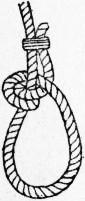 |
 |
 |
 |
| Fig. 29. | Fig. 30. | Fig. 31. | Fig. 32. |
Turk’s Head (fig. 30).—With fine line (very dry) make a clove hitch round the rope; cross the bights twice, passing an end the reverse way (up or down) each time; then keeping the whole spread flat, let each end follow its own part round and round till it is too tight to receive any more. Used as an ornament variously on side-ropes and foot-ropes of jibbooms. It may also be made with three ends, two formed by the same piece of line secured through the rope and one single piece. Form with them a diamond knot; then each end crossed over its neighbour follows its own part as above.
Turk’s Head (fig. 30).—Using a fine, dry line, create a clove hitch around the rope; cross the loops twice, passing one end in the opposite direction (either up or down) each time. While keeping everything flat, let each end wrap around its section repeatedly until it’s too tight to add more. This knot is often used as decoration on side ropes and foot ropes of jibbooms. It can also be made with three ends, two from the same piece of line secured through the rope and one separate piece. Form a diamond knot with them; then let each end cross over its neighbor and follow its own section as described above.
Spanish Windlass (fig. 31).—An iron bar and two marling-spikes are taken; two parts of a seizing are twisted like a cat’s-paw (fig. 16), passed round the bar, and hove round till sufficiently taut. In heaving shrouds together to form an eye two round turns are taken with a strand and the two ends hove upon. When a lever is placed between the parts of a long lashing or frapping and hove round, we have what is also called a Spanish windlass.
Spanish Windlass (fig. 31).—An iron bar and two marling spikes are used; two lengths of rope are twisted together like a cat’s paw (fig. 16), wrapped around the bar, and pulled tight until they’re snug. To bring shrouds together to create a loop, two round turns are made with a strand and the two ends are pulled tight. When a lever is inserted between the sections of a long lashing or frapping and pulled tight, this is also referred to as a Spanish windlass.
Slings (fig. 32).—This is simply the bight of a rope turned up over its own part; it is frequently made of chain, when a shackle (bow up) takes the place of the bight at s and another at y, connecting the two ends with the part which goes round the mast-head. Used to sling lower yards. For boat’s yards it should be a grummet with a thimble seized in at y. As the tendency of all yards is to cant forward with the weight of the sail, the part marked by an arrow should be the fore-side—easily illustrated by a round ruler and a piece of twine.
Slings (fig. 32).—This is simply a loop of rope turned up over itself; it’s often made of chain, where a shackle (bow up) replaces the loop at s and another at y, connecting the two ends with the part that goes around the mast-head. It’s used to support lower yards. For a boat’s yards, it should be a grommet with a thimble attached at y. Since all yards tend to tilt forward with the weight of the sail, the part marked with an arrow should be the front side—this can be easily shown with a round ruler and a piece of twine.
Sprit-Sail Sheet Knot (fig. 33).—This knot consists of a double wall and double crown made by the two ends, consequently with six strands, with the ends turned down. Used formerly in the clews of sails, now as an excellent stopper, a lashing or shackle being placed at s and a lanyard round the head at l.
Sprit-Sail Sheet Knot (fig. 33).—This knot is made up of a double wall and double crown created by the two ends, resulting in six strands, with the ends turned down. It was previously used in sail clews, and is now a great stopper, with a lashing or shackle placed at s and a lanyard around the head at l.
 |
 |
 |
| Fig. 33. | Fig. 34. | Fig. 35. |
Turning in a Dead-Eye Cutter-Stay fashion (fig. 34).—A bend is made in the stay or shroud round its own part and hove together with a bar and strand; two or three seizings diminishing in size (one round and one or two either round or flat) are hove on taut and snug, the end being at the side of the fellow part. The dead-eye is put in and the eye driven down with a commander.
Turning in a Dead-Eye Cutter-Stay fashion (fig. 34).—A bend is made in the stay or shroud around its own part and pulled tight together with a bar and strand; two or three bindings, getting smaller in size (one round and one or two either round or flat) are pulled on tight and snug, with the end at the side of the other part. The dead-eye is inserted and the eye is driven down with a hammer.
Turning in a Dead-Eye end up (fig. 35).—The shroud is measured round the dead-eye and marked where a throat-seizing is hove on; the dead-eye is then forced into its place, or it may be put in first. The end beyond a is taken up taut and secured with a round seizing; higher still the end is secured by another seizing. As it is important that the lay should always be kept in the rope as much as possible, these eyes should be formed conformably, either right-handed or left-handed. It is easily seen which way a rope would naturally kink by putting a little extra twist into it. A shroud whose dead-eye is turned in end up will bear a fairer strain, but is more dependent on the seizings; the under turns of the throat are the first to break and the others the first to slip. With the cutter-stay fashion the standing part of the shroud gives way under the nip of the eye. A rope will afford the greatest resistance to strain when secured round large thimbles with a straight end and a sufficient number of flat or racking seizings. To splice shrouds round dead-eyes is objectionable on account of opening the strands and admitting water, thus hastening decay. In small vessels, especially yachts, it is admissible on the score of neatness; in that case a round seizing is placed between the dead-eye and the splice. The dead-eyes should be in diameter 1½ times the circumference of a hemp shroud and thrice that of wire; the lanyard should be half the nominal size of hemp and the same size as wire: thus, hemp-shroud 12 in., wire 6 in., dead-eye 18 in., lanyard 6 in.
Turning in a Dead-Eye end up (fig. 35).—The shroud is measured around the dead-eye and marked where a throat-seizing is tied on; the dead-eye is then forced into its place, or it may be put in first. The end beyond a is pulled tight and secured with a round seizing; higher up, the end is secured by another seizing. Since it's important to keep the lay in the rope as much as possible, these eyes should be formed appropriately, either right-handed or left-handed. You can easily see which way a rope would naturally kink by adding a little extra twist to it. A shroud whose dead-eye is turned in end up will handle a better strain, but relies more on the seizings; the under turns of the throat are the first to break and the others are the first to slip. With the cutter-stay style, the standing part of the shroud gives way under the nip of the eye. A rope will resist strain the best when secured around large thimbles with a straight end and a sufficient number of flat or racking seizings. Splicing shrouds around dead-eyes is not advisable because it opens the strands and lets in water, which speeds up decay. In small vessels, especially yachts, this is acceptable for the sake of neatness; in that case, a round seizing is placed between the dead-eye and the splice. The dead-eyes should have a diameter 1½ times the circumference of a hemp shroud and three times that of wire; the lanyard should be half the nominal size of hemp and the same size as wire: thus, hemp-shroud 12 in., wire 6 in., dead-eye 18 in., lanyard 6 in.
 |
| Fig. 36. |
Short Splice (fig. 36).—The most common description of splice is when a rope is lengthened by another of the same size, or nearly so. Fig. 36 represents a splice of this kind: the strands have been unlaid, married and passed through with the assistance of a marling-spike, over one strand and under the next, twice each way. The ends are then cut off close. To render the splice neater the strands should have been halved before turning them in a second time, the upper half of each strand only being turned in; then all are cut off smooth. Eye Splice.—Unlay the strands and place them upon the same rope spread at such a distance as to give the size of the eye; enter the centre strand (unlaid) under a strand of the rope (as above), and the other two in a similar manner on their respective sides of the first; taper each end and pass them through again. If neatness is desired, reduce the ends and pass them through once more; cut off smooth and serve the part disturbed tightly with suitable hard line. Uses too numerous to mention. Cut Splice.—Made in a similar manner to an eye splice, but of two pieces of rope, therefore with two splices. Used for mast-head pendants, jib-guys, breast backstays, and even odd shrouds, to keep the eyes of the rigging lower by one part. It is not so strong as two separate eyes. Horseshoe Splice.—Made similar to the above, but one part much shorter than the other, or another piece of rope is spliced across an eye, forming a horseshoe with two long legs. Used for back-ropes on dolphin striker, back stays (one on each side) and cutter’s runner pendants. Long Splice.—The strands must be unlaid about three times as much as for a short splice and married—care being taken to preserve the lay or shape of each. Unlay one of the strands still further and follow up 874 the vacant space with the corresponding strand of the other part, fitting it firmly into the rope till only a few inches remain. Treat the other side in a similar manner. There will then appear two long strands in the centre and a long and a short one on each side. The splice is practically divided into three distinct parts; at each the strands are divided and the corresponding halves knotted (as shown on the top of fig. 38) and turned in twice. The half strand may, if desired, be still further reduced before the halves are turned in for the second time. This and all other splices should be well stretched and hammered into shape before the ends are cut off. The long splice alone is adapted to running ropes.
Short Splice (fig. 36).—The most common type of splice occurs when a rope is lengthened by adding another rope of the same size or something close to it. Fig. 36 shows this kind of splice: the strands have been unraveled, combined, and woven through with the help of a marling spike, over one strand and under the next, twice in each direction. The ends are then cut off close to the splice. To make the splice look neater, the strands should have been halved before turning them in a second time, with only the upper half of each strand turned in; then all ends should be trimmed smoothly. Eye Splice. — Unravel the strands and lay them on the same rope spread out at a distance that gives the desired size of the eye; insert the center unraveled strand under a strand of the rope (as described above), and do the same with the other two strands on their respective sides of the first; taper each end and run them through again. If a neat finish is important, trim the ends and pass them through once more; cut off smoothly and tightly secure the disturbed part with a suitable strong line. Uses are too many to mention. Cut Splice. — This is made similarly to an eye splice but involves two pieces of rope, resulting in two splices. It is used for masthead pendants, jib guys, breast backstays, and even random shrouds, to lower the eyes of the rigging by one part. It is not as strong as two separate eyes. Horseshoe Splice. — This is made similarly to the cut splice, but one part is significantly shorter than the other, or a separate piece of rope is spliced across an eye, forming a horseshoe shape with two long legs. It is used for back-ropes on dolphin strikers, back stays (one on each side), and cutter runner pendants. Long Splice. — The strands must be unraveled about three times as much as in a short splice and then combined, taking care to maintain the original lay or shape of each strand. Unravel one of the strands further and fill the open space with the corresponding strand from the other piece, fitting it snugly into the rope until only a few inches remain. Do the same on the other side. You will then have two long strands in the center and a long and a short one on each side. The splice is effectively divided into three distinct parts; at each section, the strands are divided, and the matching halves are knotted (as shown at the top of fig. 38) and turned in twice. If desired, the half strands can be further reduced before the halves are turned in for the second time. This and all other splices should be stretched and shaped well before cutting off the ends. The long splice is the only one suitable for running ropes.
 |
| Fig. 37. |
Shroud Knot (fig. 37).—Pass a stop at such distance from each end of the broken shroud as to afford sufficient length of strands, when it is unlaid, to form a single wall knot on each side after the parts have been married; it will then appear as represented in the figure, the strands having been well tarred and hove taut separately. The part a provides the knot on the opposite side and the ends b, b; the part c provides the knot and the ends d, d. After the knot has been well stretched the ends are tapered, laid smoothly between the strands of the shroud, and firmly served over. This knot is used when shrouds or stays are broken. French Shroud Knot.—Marry the parts with a similar amount of and as before; stop one set of strands taut up on the shroud (to keep the parts together), and turn the ends back on their own part, forming bights. Make a single wall knot with the other three strands round the said bights and shroud; haul the knot taut first and stretch the whole; then heave down the bights close: it will look like the ordinary shroud knot. It is very liable to slip. If the ends by which the wall knot is made after being hove were passed through the bights, it would make the knot stronger. The ends would be tapered and served.
Shroud Knot (fig. 37).—Make a stop at a distance from each end of the broken shroud that allows enough length of strands, when unlaid, to create a single wall knot on each side after the parts have been joined. It will then look like the figure, with the strands well tarred and pulled tight separately. The part a makes the knot on the opposite side and the ends b, b; the part c forms the knot and the ends d, d. After the knot has been securely tightened, the ends are tapered, laid flat between the strands of the shroud, and tightly served over. This knot is used when shrouds or stays are broken. French Shroud Knot.—Join the parts with a similar amount as before; stop one set of strands tight on the shroud (to keep the parts together) and turn the ends back on their own part, forming bights. Make a single wall knot with the other three strands around the said bights and shroud; pull the knot tight first and stretch everything; then pull the bights close: it will look like the standard shroud knot. It is very likely to slip. If the ends used to create the wall knot after being tightened were passed through the bights, it would make the knot stronger. The ends would be tapered and served.
 |
| Fig. 38. |
Flemish Eye (fig. 38).—Secure a spar or toggle twice the circumference of the rope intended to be rove through the eye; unlay the rope which is to form the eye about three times its circumference, at which part place a strong whipping. Point the rope vertically under the eye, and bind it taut up by the core if it is four-stranded rope, otherwise by a few yarns. While doing so arrange six or twelve pieces of spun-yarn at equal distances on the wood and exactly halve the number of yarns that have been unlaid. If it is a small rope, select two or three yarns from each side near the centre; cross them over the top at a, and half-knot them tightly. So continue till all are expended and drawn down tightly on the opposite side to that from which they came, being thoroughly intermixed. Tie the pieces of spun-yarn which were placed under the eye tightly round various parts, to keep the eye in shape when taken off the spar, till they are replaced by turns of marline hove on as taut as possible, the hitches forming a central line outside the eye. Heave on a good seizing of spun-yarn close below the spar, and another between six and twelve inches below the first; it may then be parcelled and served; the eye is served over twice, and well tarred each time. As large ropes are composed of so many yarns, a greater number must be knotted over the toggle each time; a 4-in. rope has 132 yarns, which would require 22 knottings of six each time; a 10-in. rope has 834 yarns, therefore, if ten are taken from each side every time, about twice that number of hitches will be required; sometimes only half the yarns are hitched, the others being merely passed over. The chief use of these eyes has been to form the collars of stays, the whole stay in each case having to be rove through it—a very inconvenient device. It is almost superseded for that purpose by a leg spliced in the stay and lashing eyes abaft the mast, for which it is commonly used at present. This eye is not always called by the same name, but the weight of evidence is in favour of calling it a Flemish eye. Ropemaker’s Eye, which also has alternative names, is formed by taking out of a rope one strand longer by 6 in. or a foot than the required eye, then placing the ends of the two strands a similar distance below the disturbance of the one strand, that is, at the size of the eye; the single strand is led back through the vacant space it left till it arrives at the neck of the eye, with a similar length of spare end to the other two strands. They are all seized together, scraped, tapered, marled and served. The principal merit is neatness. Mouse on a Stay.—Formed by turns of coarse spun-yarn hove taut round the stay, over parcelling at the requisite distance from the eye to form the collar; assistance is given by a padding of short yarns distributed equally round the rope, which, after being firmly secured, especially at what is to be the under part, are turned back over the first layer and seized down again, thus making a shoulder; sometimes it is formed with parcelling only. In either case it is finished by marling, followed by serving or grafting. The use is to prevent the Flemish eye in the end of the stay from slipping up any farther.
Flemish Eye (fig. 38).—Get a spar or toggle that is twice the circumference of the rope you plan to pass through the eye. Unlay the rope that will form the eye about three times its circumference, and at that point, secure it with a strong whipping. Position the rope vertically under the eye and bind it tightly up by the core if it’s a four-stranded rope; otherwise, use a few yarns. While doing this, arrange six or twelve pieces of spun-yarn evenly on the wood and ensure you halve the number of yarns that have been unlaid. If the rope is small, choose two or three yarns from each side near the center; cross them over at the top at a and tie a half-knot tightly. Continue this process until all yarns are used, drawing them tightly on the opposite side from where they came, ensuring they are well mixed. Tie the spun-yarn pieces placed under the eye tightly around various parts to maintain the eye's shape when taken off the spar, until they are replaced by turns of marline pulled on as tightly as possible, with the hitches forming a central line outside the eye. Make a good securing of spun-yarn just below the spar, and another securing six to twelve inches below the first; it can then be parcelled and served. The eye is served over twice and well tarred each time. Since large ropes are made up of many yarns, more knots must be made over the toggle each time; a 4-inch rope has 132 yarns, which would need 22 knots of six each time; a 10-inch rope has 834 yarns, meaning if ten are taken from each side each time, about double that number of hitches will be needed; sometimes only half the yarns are hitched, while the rest are simply passed over. The main use of these eyes has been to create the collars of stays, with the entire stay needing to be rove through it—a pretty inconvenient setup. It is almost replaced for that purpose by a leg spliced in the stay and lashing eyes behind the mast, which is more commonly used nowadays. This eye isn’t always called the same name, but most evidence suggests it should be called a Flemish eye. Ropemaker’s Eye, which also goes by different names, is created by pulling one strand out of a rope that is six inches to a foot longer than the required eye, then positioning the ends of the two strands a similar distance below where the single strand was disturbed, that is, at the size of the eye. The single strand is threaded back through the open space it created until it reaches the neck of the eye, leaving an equal length of spare end as the other two strands. They are all secured together, scraped, tapered, marled, and served. The key advantage is neatness. Mouse on a Stay.—This is made by wrapping coarse spun-yarn tightly around the stay, over parceling at the required distance from the eye to create the collar. Short yarns are padded evenly around the rope, and once firmly secured—especially at the bottom—are turned back over the first layer and seized down again, forming a shoulder; sometimes it’s made with parceling only. In either case, it concludes with marling, followed by serving or grafting. The purpose is to prevent the Flemish eye at the end of the stay from slipping up any further.
Rolling Hitch (fig. 39).—Two round turns are taken round a spar or large rope in the direction in which it is to be hauled and one half-hitch on the other side of the hauling part. This is very useful, as it can be put on and off quickly.
Rolling Hitch (fig. 39).—Make two complete turns around a pole or large rope in the direction you want to pull it, then add one half-hitch on the opposite side of the pulling part. This knot is really handy because it can be put on and taken off easily.
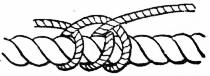 |
 |
| Fig. 39. | Fig. 40. |
Round Seizing (fig. 40).—So named when the rope it secures does not cross another and there are three sets of turns. The size of the seizing line is about one-sixth (nominal) that of the ropes to be secured, but varies according to the number of turns to be taken. An eye is spliced in the line and the end rove through it, embracing both parts. If either part is to be spread open, commence farthest from that part; place tarred canvas under the seizing; pass the line round as many times (with much slack) as it is intended to have under-turns; and pass the end back through them all and through the eye. Secure the eye from rendering round by the ends of its splice; heave the turns on with a marling-spike (see fig. 17), perhaps seven or nine; haul the end through taut, and commence again the riding turns in the hollows of the first. If the end is not taken back through the eye, but pushed up between the last two turns (as is sometimes recommended), the riders must be passed the opposite way in order to follow the direction of the under-turns, which are always one more in number than the riders. When the riders are complete, the end is forced between the last lower turns and two cross turns are taken, the end coming up where it went down, when a wall knot is made with the strands and the ends cut close; or the end may be taken once round the shroud. Throat Seizing.—Two ropes or parts of ropes are laid on each other parallel and receive a seizing similar to that shown in figure 35—that is with upper and riding but no cross turns. As the two parts of rope are intended to turn up at right angles to the direction in which they were secured, the seizing should be of stouter line and short, not exceeding seven lower and six riding turns. The end is better secured with a turn round the standing part. Used for turning in dead-eyes and variously. Flat Seizing.—Commenced similarly to the above, but it has neither riding nor cross turns.
Round Seizing (fig. 40).—This is called round seizing when the rope it secures doesn’t cross another and has three sets of turns. The size of the seizing line is about one-sixth (nominal) of the size of the ropes being secured, but it can vary based on the number of turns taken. An eye is spliced into the line, and the end is threaded through it, wrapping around both parts. If you need to open either part, start at the furthest point from that part; place tarred canvas underneath the seizing; wrap the line around as many times (with plenty of slack) as you want under-turns; then pass the end back through all of them and through the eye. Secure the eye from turning round by using the ends of its splice; tighten the turns with a marling spike (see fig. 17), usually about seven or nine; pull the end through tight, and start the riding turns in the gaps of the first. If the end is not threaded back through the eye but pushed up between the last two turns (as is sometimes suggested), the riders must be passed the opposite way to follow the direction of the under-turns, which are always one more than the number of riders. Once the riders are complete, the end is pushed between the last lower turns, and you take two cross turns, with the end coming up where it went down, then make a wall knot with the strands and cut the ends close; alternatively, the end can be wrapped once around the shroud. Throat Seizing.—Two ropes or parts of ropes are laid parallel on top of each other and receive a seizing similar to that shown in figure 35—that is with upper and riding turns but no cross turns. Since the two parts of rope are meant to turn at right angles to the direction they were secured, the seizing should be of a stronger line and short, not exceeding seven lower and six riding turns. The end is better secured with a turn around the standing part. This is used for turning in dead-eyes and various other purposes. Flat Seizing.—This is started similarly to the above, but it has neither riding nor cross turns.
 |
 |
 |
| Fig. 41. | Fig. 42. | Fig. 43. |
Racking Seizing (fig. 41).—A running eye having been spliced round one part of the rope, the line is passed entirely round the other part, crossed back round the first part, and so on for ten to twenty turns, according to the expected strain, every turn being hove as tight as possible; after which round turns are passed to fill the spaces at the back of each rope, by taking the end a over both parts into the hollow at b, returning at c, and going over to d. When it reaches e a turn may be taken round that rope only, the end rove under it, and a half-hitch taken, which will form a clove-hitch; knot the end and cut it close. When the shrouds are wire (which is half the size of hemp) and the end turned up round a dead-eye of any kind, wire seizings are preferable. It appears very undesirable to have wire rigging combined with plates or screws for setting it up, as in case of accident—such as that of the mast going over the side, a shot or collision breaking the ironwork—the seamen are powerless.
Racking Seizing (fig. 41).—After splicing a running eye around one part of the rope, wrap the line completely around the other part, crossing it back around the first part, and continue this for ten to twenty turns, depending on the expected strain, with each turn tightened as much as possible. Then, add round turns to fill the gaps at the back of each rope by taking the end a over both parts into the hollow at b, returning at c, and going over to d. When it reaches e, take a turn around that rope only, thread the end under it, and make a half-hitch, which will create a clove-hitch; tie off the end and cut it close. When using wire shrouds (which are half the size of hemp), and if the end is turned up around a dead-eye of any kind, wire seizings are preferred. It seems very undesirable to have wire rigging combined with plates or screws for tensioning, as in the event of an accident—like the mast falling over the side, or a shot or collision breaking the ironwork—sailors find themselves powerless.
Diamond Knot (figs. 42, 43).—The rope must be unlaid as far as the centre if the knot is required there, and the strands handled with great care to keep the lay in them. Three bights are turned up as in fig. 42, and the end of a is taken over b and up the bight c. The end of b is taken over c and up through a. The end c is taken over a and through b. When hauled taut and the strands are laid up again it will appear as in fig. 43. Any number of knots may be made on the same rope. They were used on man-ropes, the foot-ropes on the jibboom, and similar places, where it was necessary to give a good hold for the hands or feet. Turk’s heads are now generally used. Double Diamond.—Made by the ends of a single diamond following their own part till the knot is repeated. Used at the upper end of a side rope as an ornamental stopper-knot.
Diamond Knot (figs. 42, 43).—The rope needs to be unlaid halfway if you want the knot there, and the strands should be handled carefully to maintain their twist. Three loops are formed as shown in fig. 42, and the end of a goes over b and up through the loop c. Then, the end of b goes over c and up through a. The end c goes over a and through b. Once pulled tight and the strands are laid up again, it will look like fig. 43. You can make multiple knots on the same rope. They were used on man-ropes, the foot-ropes on the jibboom, and similar areas where a good grip was needed for hands or feet. Turk’s heads are now the preferred option. Double Diamond.—Created by following the ends of a single diamond along their path until the knot repeats. It's used at the upper end of a side rope as a decorative stopper-knot.
Stropping-Blocks.—There are various modes of securing blocks to ropes; the most simple is to splice an eye at the end of the rope a little longer than the block and pass a round seizing to keep it in place; such is the case with jib-pendants. As a general rule, the parts of a strop combined should possess greater strength than the parts of the fall which act against it. The shell of an ordinary block 875 should be about three times the circumference of the rope which is to reeve through it, as a 9-in. block for a 3-in. rope; but small ropes require larger blocks in proportion, as a 4-in. block for a 1-in. rope. When the work to be done is very important the blocks are much larger: brace-blocks are more than five times the nominal size of the brace. Leading-blocks and sheaves in racks are generally smaller than the blocks through which the ropes pass farther away, which appears to be a mistake, as more power is lost by friction. A clump-block should be double the nominal size of the rope. A single strop may be made by joining the ends of a rope of sufficient length to go round the block and thimble by a common short splice, which rests on the crown of the block (the opposite end to the thimble) and is stretched into place by a jigger; a strand is then passed twice round the space between the block and the thimble and hove taut by a Spanish windlass to cramp the parts together ready for the reception of a small round seizing. The cramping or pinching into shape is sometimes done by machinery invented by a rigger in Portsmouth dockyard. The strop may be made the required length by a long splice, but it would not possess any advantage.
Stropping-Blocks.—There are different ways to secure blocks to ropes; the simplest method is to create an eye at the end of the rope that is slightly longer than the block and use a round seizing to keep it in place; this is how jib-pendants are typically set up. Generally, the combined parts of a strop should be stronger than the parts of the fall that act against it. The shell of an ordinary block 875 should be about three times the circumference of the rope that will go through it, like a 9-inch block for a 3-inch rope; however, smaller ropes require proportionately larger blocks, such as a 4-inch block for a 1-inch rope. When the task is especially important, the blocks are often much larger: brace-blocks are more than five times the nominal size of the brace. Leading-blocks and sheaves in racks are usually smaller than the blocks that the ropes pass through, which seems like a mistake since more power is lost due to friction. A clump-block should be double the nominal size of the rope. A single strop can be made by joining the ends of a sufficiently long rope that can go around the block and thimble with a basic short splice, which rests on the crown of the block (the side opposite the thimble) and is tightened into place with a jigger; a strand is then wrapped twice around the area between the block and the thimble and tightened with a Spanish windlass to secure the parts together, preparing them for a small round seizing. The cramping or shaping is sometimes done using machinery invented by a rigger at the Portsmouth dockyard. The strop can be made to the desired length using a long splice, but this would not provide any real advantage.
 |
 |
| Fig. 44. | Fig. 45. |
Grummet-Strop (fig. 44).—Made by unlaying a piece of rope of the desired size about a foot more than three times the length required for the strop. Place the centre of the rope round the block and thimble; mark with chalk where the parts cross; take one strand out of the rope; bring the two chalk marks together; and cross the strand in the lay on both sides, continuing round and round till the two ends meet the third time; they are then halved, and the upper halves half-knotted and passed over and under the next strands, exactly as one part of a long splice. A piece of worn or well-stretched rope will better retain its shape, upon which success entirely depends. The object is neatness, and if three or multiples of three strops are to be made it is economical.
Grummet-Strop (fig. 44).—Start by unlaying a piece of rope that's about a foot longer than three times the length needed for the strop. Center the rope around the block and thimble; use chalk to mark where the parts intersect. Remove one strand from the rope; bring the two chalk marks together and cross the strand in the lay on both sides, continuing this motion until the two ends meet for the third time. Then, halved the strands, take the upper halves and half-knot them, passing them over and under the next strands, just like one part of a long splice. A piece of worn or well-stretched rope will hold its shape better, which is essential for success. The goal is neatness, and if three or multiples of three strops are needed, it's also cost-effective.
Double Strop (fig. 45).—Made with one piece of rope, the splice being brought as usual to the crown of the block t, the bights fitting into scores some inches apart, converging to the upper part, above which the thimble receives the bights a, a; and the four parts of the strop are secured at s, s by a round seizing doubly crossed. If the block be not then on the right slew (the shell horizontal or vertical) a union thimble is used with another strop, which produces the desired effect; thus the fore and main brace-blocks, being very large and thin, are required (for appearance) to lie horizontally; a single strop round the yard vertically has a union thimble between it and the double strop round the block. The double strop is used for large blocks; it gives more support to the shell than the single strop and admits of smaller rope being used. Wire rope is much used for block-strops; the fitting is similar. Metal blocks are also used in fixed positions; durability is their chief recommendation. Great care should be taken that they do not chafe the ropes which pass by them as well as those which reeve through.
Double Strop (fig. 45).—Made from a single piece of rope, with the splice brought to the crown of the block t, the bights fitting into grooves a few inches apart, converging to the upper section, where the thimble accommodates the bights a, a; and the four parts of the strop are secured at s, s by a round seizing that is doubly crossed. If the block isn't in the correct position (the shell either horizontal or vertical), a union thimble is used with another strop to achieve the desired effect; thus, the fore and main brace-blocks, which are quite large and thin, need to be positioned horizontally for aesthetic reasons; a single strop around the yard vertically has a union thimble between it and the double strop around the block. The double strop is used for larger blocks; it provides more support to the shell than the single strop and allows for the use of smaller rope. Wire rope is frequently used for block-strops; the fitting is similar. Metal blocks are also used in fixed positions; their main advantage is durability. Care should be taken to ensure they do not chafe the ropes that pass by them or those that pass through them.
Selvagee Strop.—Twine, rope-yarn or rope is warped round two or more pegs placed at the desired distance apart, till it assumes the requisite size and strength; the two ends are then knotted or spliced. Temporary firm seizings are applied in several places to bind the parts together before the rope or twine is removed from the pegs, after which it is marled with suitable material. A large strop should be warped round four or six pegs in order to give it the shape in which it is to be used. This description of strop is much stronger and more supple than rope of similar size. Twine strops (covered with duck) are used for boats’ blocks and in similar places requiring neatness. Rope-yarn and spun-yarn strops are used for attaching luff-tackles to shrouds and for many similar purposes. To bring to a shroud or hawser, the centre of the strop is passed round the rope and each part crossed three or four times before hooking the “luff”; a spun-yarn stop above the centre will prevent slipping and is very necessary with wire rope. As an instance of a large selvagee block-strop being used—when the “Melville” was hove down at Chusan (China), the main-purchase-block was double stropped with a selvagee containing 28 parts of 3-in. rope; that would produce 112 parts in the neck, equal to a breaking strain of 280 tons, which is more than four parts of a 19-in cable. The estimated strain it bore was 80 tons.
Selvagee Strop.—Twine, rope-yarn, or rope is wrapped around two or more pegs set at the desired distance apart until it reaches the required size and strength; the two ends are then tied or spliced together. Temporary secure bindings are added in several spots to hold the parts together before the rope or twine is taken off the pegs, after which it is twisted with suitable material. A large strop should be wrapped around four or six pegs to give it the shape in which it will be used. This type of strop is much stronger and more flexible than rope of similar size. Twine strops (covered with canvas) are used for boat blocks and in similar places where neatness is essential. Rope-yarn and spun-yarn strops are used to attach luff-tackles to shrouds and for many similar purposes. To secure it to a shroud or hawser, the center of the strop is wrapped around the rope, and each section is crossed three or four times before hooking the “luff”; a spun-yarn stop above the center will prevent slipping and is very important with wire rope. For example, when the “Melville” was hove down at Chusan (China), the main-purchase block was double-stropped with a selvagee made of 28 parts of 3-in. rope; this would produce 112 parts in the neck, equal to a breaking strain of 280 tons, which is more than four times the strength of a 19-in cable. The estimated strain it handled was 80 tons.
Stoppers for ordinary running ropes are made by splicing a piece of rope to a bolt or to a hook and thimble, unlaying 3 or 4 ft., tapering it by cutting away some of the yarns, and marling it down securely, with a good whipping also on the end. It is used by taking a half-hitch round the rope which is to be hauled upon, dogging the end up in the lay and holding it by hand. The rope can come through it when hauled, but cannot go back.
Stoppers for regular running ropes are made by splicing a section of rope to a bolt or a hook and thimble, unlaying 3 or 4 feet, tapering it by trimming some of the yarns, and securely marling it down, adding a solid whipping on the end. It's used by making a half-hitch around the rope that needs to be pulled, securing the end in the lay and holding it by hand. The rope can slide through it when pulled, but can't go back.
Whipping and Pointing.—The end of every working rope should at least be whipped to prevent it fagging out; in ships of war and yachts they are invariably pointed. Whipping is done by placing the end of a piece of twine or knittle-stuff on a rope about an inch from the end, taking three or four turns taut over it (working towards the end); the twine is then laid on the rope again lengthways contrary to the first, leaving a slack bight of twine; and taut turns are repeatedly passed round the rope, over the first end and over the bight, till there are in all six to ten turns; then haul the bight taut through between the turns and cut it close. To point a rope, place a good whipping a few inches from the end, according to size; open out the end entirely; select all the outer yarns and twist them into knittles either singly or two or three together; scrape down and taper the central part, marling it firmly. Turn every alternate knittle and secure the remainder down by a turn of twine or a smooth yarn hitched close up, which acts as the weft in weaving. The knittles are then reversed and another turn of the weft taken, and this is continued till far enough to look well. At the last turn the ends of the knittles which are laid back are led forward over and under the weft and hauled through tightly, making it present a circle of small bights, level with which the core is cut off smoothly. Hawsers and large ropes have a becket formed in their ends during the process of pointing. A piece of 1 to 1½ in. rope about 1½ to 2 ft. long is spliced into the core by each end while it is open: from four to seven yarns (equal to a strand) are taken at a time and twisted up; open the ends of the becket only sufficient to marry them close in; turn in the twisted yarns between the strands (as splicing) three times, and stop it above and below. Both ends are treated alike; when the pointing is completed a loop a few inches in length will protrude from the end of the rope, which is very useful for reeving it. A hauling line or reeving line should only be rove through the becket as a fair lead. Grafting is very similar to pointing, and frequently done the whole length of a rope, as a side-rope. Pieces of white line more than double the length of the rope, sufficient in number to encircle it, are made up in hanks called foxes; the centre of each is made fast by twine and the weaving process continued as in pointing. Block-strops are sometimes so covered; but, as it causes decay, a small wove mat which can be taken off occasionally is preferable.
Whipping and Pointing.—The end of every working rope should be whipped at least to stop it from fraying; in warships and yachts, they are always pointed. To whip a rope, place the end of a piece of twine or thick thread an inch from the end of the rope, then take three or four tight turns around it (working towards the end). Next, lay the twine lengthwise on the rope in the opposite direction, leaving a slack loop of twine; then wrap taut turns around the rope over the first end and over the loop, until there are six to ten turns in total. Then pull the loop tight through the turns and cut it close. To point a rope, make a good whipping a few inches from the end, depending on the size. Completely open out the end, select all the outer strands, and twist them into knots either individually or in pairs or triples. Taper down the middle part and secure it firmly. Turn every alternate knot and hold the others down with a piece of twine or a smooth yarn hitched close, which acts like the weft in weaving. The knots are then reversed and another turn of the weft is added, continuing this until it looks good. For the last turn, the ends of the knots that are laid back are pulled forward over and under the weft and tugged through tightly, creating a circle of small loops, and the core is cut off smoothly with them level. Hawsers and large ropes have a becket formed in their ends during the pointing process. A piece of 1 to 1½ inches of rope, about 1½ to 2 feet long, is spliced into the core at each end while it’s open: take four to seven strands (equal to a strand) and twist them together; open the ends of the becket just enough to fit them together; twist the yarns between the strands (as with splicing) three times, and secure it above and below. Both ends are treated the same way; when the pointing is finished, a loop a few inches long will stick out from the end of the rope, which is very handy for threading it. A hauling line or reeving line should only be threaded through the becket as a fair lead. Grafting is quite similar to pointing, often done along the entire length of a rope as a side-rope. Lengths of white line more than double the length of the rope, in sufficient quantity to wrap around it, are made into hanks called foxes; the center of each is secured with twine, and the weaving process continues as in pointing. Block-strops are sometimes covered this way; however, since it causes decay, a small woven mat that can be removed occasionally is preferred.
 |
| Fig. 46. |
Sheep-Shank (fig. 46).—Formed by making a long bight in a topgallant back-stay, or any rope which it is desirable to shorten, and taking a half-hitch near each bend, as at a, a. Rope-yarn stops at b, b are desirable to keep it in place till the strain is brought on it. Wire rope cannot be so treated, and it is injurious to hemp rope that is large and stiff.
Sheep-Shank (fig. 46).—This knot is made by creating a long loop in a topgallant backstay or any rope you need to shorten, and then securing each bend with a half-hitch, as shown at a, a. It's helpful to use rope-yarn stops at b, b to hold everything in place until there's tension on it. You can't use this method with wire rope, and it's not good for large, stiff hemp ropes either.
Knotting Yarns (fig. 47).—This operation becomes necessary when, a comparatively short piece of junk is to be made into spun-yarn, or large rope into small, which is called twice laid. The end of each yarn is divided, rubbed smooth and married (as for splicing). Two of the divided parts, as c, c and d, d, are passed in opposite directions round all the other parts and knotted. The ends e and f remain passive. The figure is drawn open, but the forks of A and B should be pressed close together, the knot hauled taut and the ends cut off.
Knotting Yarns (fig. 47).—This process is needed when a relatively short piece of junk is turned into spun yarn, or when thick rope is reduced to thinner pieces, a process known as twice laid. The end of each yarn is split, smoothed out, and joined together (similar to splicing). Two of the split sections, like c, c and d, d, are wrapped in opposite directions around all the other sections and tied together. The ends e and f stay inactive. The figure is shown spread out, but the forks of A and B should be pressed together, the knot pulled tight, and the ends trimmed off.
 |
 |
| Fig. 47. | Fig. 48. |
Butt Slings (fig. 48).—Made of 4-in. rope, each pair being 26 ft. in length, with an eye spliced in one end, through which the other is rove before being placed over one end of the cask; the rope is then passed round the opposite side of the cask and two half-hitches made with the end, forming another running eye, both of which are beaten down taut as the tackle receives the weight. Slings for smaller casks requiring care should be of this description, though of smaller rope, as the cask cannot possibly slip out. Bale Slings are made by splicing the ends of about 3 fathoms of 3-in. rope together, which then looks like a long strop, similar to the double strop represented in fig. 45—the bights t being placed under the cask or bale and one of the 876 bights a, a rove through the other and attached to the whip or tackle.
Butt Slings (fig. 48).—Made from 4-inch rope, each pair is 26 feet long, with a loop spliced at one end. You thread the other end through this loop before placing it over one end of the cask. Then, the rope wraps around the opposite side of the cask, and you tie two half-hitches with the end, creating another running loop. Both loops are pulled tight as the tackle takes on the weight. Slings for smaller casks that require careful handling should be like this, but made with thinner rope, ensuring the cask won't slip out. Bale Slings are created by splicing the ends of about 3 fathoms of 3-inch rope together, which looks like a long strap, similar to the double strap shown in fig. 45—the bights t are placed under the cask or bale, and one of the bights a, a is threaded through the other and attached to the whip or tackle.
For a complete treatise on the subject the reader may be referred to The Book of Knots, being a Complete Treatise on the Art of Cordage, illustrated by 172 Diagrams, showing the Manner of making every Knot, Tie and Splice, by Tom Bowling (London, 1890).
For a detailed discussion on the topic, the reader can check out The Book of Knots, being a Complete Treatise on the Art of Cordage, illustrated by 172 Diagrams, showing the Manner of making every Knot, Tie and Splice, by Tom Bowling (London, 1890).
Mathematical Theory of Knots.
Mathematical Theory of Knots.
In the scientific sense a knot is an endless physical line which cannot be deformed into a circle. A physical line is flexible and inextensible, and cannot be cut—so that no lap of it can be drawn through another.
In scientific terms, a knot is a continuous physical line that can’t be shaped into a circle. A physical line is flexible and unbreakable, meaning it can’t be cut—so no part of it can be pulled through another part.
The founder of the theory of knots is undoubtedly Johann Benedict Listing (1808-1882). In his “Vorstudien zur Topologie” (Göttinger Studien, 1847), a work in many respects of startling originality, a few pages only are devoted to the subject.1 He treats knots from the elementary notion of twisting one physical line (or thread) round another, and shows that from the projection of a knot on a surface we can thus obtain a notion of the relative situation of its coils. He distinguishes “reduced” from “reducible” forms, the number of crossings in the reduced knot being the smallest possible. The simplest form of reduced knot is of two species, as in figs. 49 and 50. Listing points out that these are formed, the first by right-handed the second by left-handed twisting. In fact, if three half-twists be given to a long strip of paper, and the ends be then pasted together, the two edges become one line, which is the knot in question. We may free it by slitting the paper along its middle line; and then we have the juggler’s trick of putting a knot on an endless unknotted band. One of the above forms cannot be deformed into the other. The one is, in Listing’s language, the “perversion” of the other, i.e. its image in a plane mirror. He gives a method of symbolizing reduced knots, but shows that in this method the same knot may, in certain cases, be represented by different symbols. It is clear that the brief notice he published contains a mere sketch of his investigations.
The founder of knot theory is undoubtedly Johann Benedict Listing (1808-1882). In his "Vorstudien zur Topologie" (Göttinger Studien, 1847), a work that is strikingly original in many ways, only a few pages are dedicated to the topic.1 He discusses knots based on the basic idea of twisting one physical line (or thread) around another, and demonstrates that by projecting a knot onto a surface, we can understand the relative arrangement of its loops. He differentiates between "reduced" and "reducible" forms, with the number of crossings in the reduced knot being the lowest possible. The simplest form of reduced knot has two types, as shown in figs. 49 and 50. Listing notes that these are created, the first from right-handed twisting and the second from left-handed twisting. In fact, if you twist a long strip of paper three times and then join the ends together, the two edges become one line, which is the knot in question. We can free it by cutting the paper along its centerline, and then we achieve the juggler’s trick of placing a knot on an endless unknotted band. One of these forms cannot be transformed into the other. One is, in Listing’s terms, the “perversion” of the other, i.e. its image in a flat mirror. He provides a way to symbolize reduced knots but shows that this method can represent the same knot with different symbols in some cases. It's evident that the brief notice he published is just a sketch of his research.
The most extensive dissertation on the properties of knots is that of Peter Guthrie Tait (Trans. Roy. Soc. Edin., xxviii. 145, where the substance of a number of papers in the Proceedings of the same society is reproduced). It was for the most part written in ignorance of the work of Listing, and was suggested by an inquiry concerning vortex atoms.
The most comprehensive study on the characteristics of knots is by Peter Guthrie Tait (Trans. Roy. Soc. Edin., xxviii. 145, where the essence of several papers in the Proceedings of the same society is included). It was mainly written without knowledge of Listing's work and was prompted by a question about vortex atoms.
 |
 |
 |
 |
| Fig. 49. | Fig. 50. | Fig. 51. | Fig. 52. |
Tait starts with the almost self-evident proposition that, if any plane closed curve have double points only, in passing continuously along the curve from one of these to the same again an even number of double points has been passed through. Hence the crossings may be taken alternately over and under. On this he bases a scheme for the representation of knots of every kind, and employs it to find all the distinct forms of knots which have, in their simplest projections, 3, 4, 5, 6 and 7 crossings only. Their numbers are shown to be 1, 1, 2, 4 and 8. The unique knot of three crossings has been already given as drawn by Listing. The unique knot of four crossings merits a few words, because its properties lead to a very singular conclusion. It can be deformed into any of the four forms—figs. 51 and 52 and their perversions. Knots which can be deformed into their own perversion Tait calls “amphicheiral” (from the Greek ἀμφί, on both sides, around, χείρ, hand), and he has shown that there is at least one knot of this kind for every even number of crossings. He shows also that “links” (in which two endless physical lines are linked together) possess a similar property; and he then points out that there is a third mode of making a complex figure of endless physical lines, without either knotting or linking. This may be called “lacing” or “locking.” Its nature is obvious from fig. 53, in which it will be seen that no one of the three lines is knotted, no two are linked, and yet the three are inseparably fastened together.
Tait begins with the nearly obvious idea that if any closed curve on a plane has only double points, traveling continuously along the curve from one double point to the same one again means that an even number of double points has been crossed. Therefore, these crossings can be alternated between over and under. He bases a scheme on this for representing all kinds of knots and uses it to identify all the distinct forms of knots that have, in their simplest projections, 3, 4, 5, 6, and 7 crossings only. The counts are shown to be 1, 1, 2, 4, and 8. The unique knot with three crossings has already been depicted as drawn by Listing. The unique knot with four crossings deserves some attention, as its characteristics lead to a very interesting conclusion. It can be transformed into any of the four forms—figs. 51 and 52 and their variations. Knots that can be transformed into their own variations are labeled by Tait as “amphicheiral” (from the Greek around, meaning on both sides, and hand, meaning hand). He demonstrates that there is at least one knot of this type for every even number of crossings. He also shows that “links” (where two continuous physical lines are intertwined) share a similar property. Tait goes on to identify a third way of creating a complex figure of continuous physical lines, without tying knots or linking. This can be referred to as “lacing” or “locking.” Its nature is clear from fig. 53, where it will be evident that none of the three lines are knotted, no two are linked, yet all three are inseparably secured together.
The rest of Tait’s paper deals chiefly with numerical characteristics of knots, such as their “knottiness,” “beknottedness” and “knotfulness.” He also shows that any knot, however complex, can be fully represented by three closed plane curves, none of which has double points and no two of which intersect. It may be stated here that the notion of beknottedness is founded on a remark of Gauss, who in 1833 considered the problem of the number of inter-linkings of two closed circuits, and expressed it by the electro-dynamic measure of the work required to carry a unit magnetic pole round one of the interlinked curves, while a unit electric current is kept circulating in the other. This original suggestion has been developed at considerable length by Otto Boeddicker (Erweiterung der Gauss’schen Theorie der Verschlingungen (Stuttgart, 1876). This author treats also of the connexion of knots with Riemann’s surfaces.
The rest of Tait’s paper mainly focuses on the numerical characteristics of knots, like their “knottiness,” “beknottedness,” and “knotfulness.” He also demonstrates that any knot, no matter how complicated, can be completely represented by three closed plane curves, none of which have double points and no two of which intersect. It’s worth noting that the concept of beknottedness is based on a statement by Gauss, who in 1833 looked at the problem of the number of interlinkings of two closed circuits and described it using the electro-dynamic measure of the work needed to move a unit magnetic pole around one of the interlinked curves while a unit electric current flows in the other. This initial idea has been explored in detail by Otto Boeddicker (Erweiterung der Gauss’schen Theorie der Verschlingungen (Stuttgart, 1876). This author also discusses the connection between knots and Riemann’s surfaces.
 |
 |
| Fig. 53. | Fig. 54. |
It is to be noticed that, although every knot in which the crossings are alternately over and under is irreducible, the converse is not generally true. This is obvious at once from fig. 54, which is merely the three-crossing knot with a doubled string—what Listing calls “paradromic.”
It should be noted that, while every knot where the crossings alternate between over and under is irreducible, the opposite is not usually the case. This is clear from fig. 54, which is simply the three-crossing knot with a doubled string—what Listing refers to as "paradromic."
Christian Felix Klein, in the Mathematische Annalen, ix. 478, has proved the remarkable proposition that knots cannot exist in space of four dimensions.
Christian Felix Klein, in the Mathematische Annalen, ix. 478, has proven the remarkable idea that knots cannot exist in four-dimensional space.
KNOUT (from the French transliteration of a Russian word of Scandinavian origin; cf. A.-S. cnotta, Eng. knot), the whip used in Russia for flogging criminals and political offenders. It is said to have been introduced under Ivan III. (1462-1505). The knout had different forms. One was a lash of raw hide, 16 in. long, attached to a wooden handle, 9 in. long. The lash ended in a metal ring, to which was attached a second lash as long, ending also in a ring, to which in turn was attached a few inches of hard leather ending in a beak-like hook. Another kind consisted of many thongs of skin plaited and interwoven with wire, ending in loose wired ends, like the cat-o’-nine tails. The victim was tied to a post or on a triangle of wood and stripped, receiving the specified number of strokes on the back. A sentence of 100 or 120 lashes was equivalent to a death sentence; but few lived to receive so many. The executioner was usually a criminal who had to pass through a probation and regular training; being let off his own penalties in return for his services. Peter the Great is traditionally accused of knouting his son Alexis to death, and there is little doubt that the boy was actually beaten till he died, whoever was the executioner. The emperor Nicholas I. abolished the earlier forms of knout and substituted the pleti, a three-thonged lash. Ostensibly the knout has been abolished throughout Russia and reserved for the penal settlements.
KNOUT (from the French transliteration of a Russian word of Scandinavian origin; cf. A.-S. cnotta, Eng. knot), is the whip used in Russia for flogging criminals and political offenders. It’s said to have been introduced under Ivan III. (1462-1505). The knout had different forms. One was a lash made of raw hide, 16 inches long, attached to a wooden handle, 9 inches long. The lash ended in a metal ring, to which a second lash of the same length was attached, also ending in a ring, which in turn had a few inches of hard leather ending in a beak-like hook. Another kind consisted of multiple thongs of skin braided and intertwined with wire, ending in loose wired ends, similar to the cat-o’-nine tails. The victim was tied to a post or a triangle of wood and stripped, receiving the specified number of strokes on the back. A sentence of 100 or 120 lashes was equivalent to a death sentence; however, few survived to receive so many. The executioner was usually a criminal who went through probation and regular training, being excused from their own penalties in exchange for their services. Peter the Great is traditionally accused of having knouted his son Alexis to death, and there is little doubt that the boy was indeed beaten to death, regardless of who the executioner was. Emperor Nicholas I abolished the earlier forms of the knout and replaced it with the pleti, a three-thonged lash. Officially, the knout has been abolished throughout Russia and is now reserved for penal settlements.
KNOWLES, SIR JAMES (1831-1908), English architect and editor, was born in London in 1831, and was educated, with a view to following his father’s profession, as an architect at University College and in Italy. His literary tastes also brought him at an early age into the field of authorship. In 1860 he published The Story of King Arthur. In 1867 he was introduced to Tennyson, whose house, Aldworth, on Blackdown, he designed; this led to a close friendship, Knowles assisting Tennyson in business matters, and among other things helping to design scenery for The Cup, when Irving produced that play in 1880. Knowles became intimate with a number of the most interesting men of the day, and in 1869, with Tennyson’s co-operation, he started the Metaphysical Society, the object of which was to attempt some intellectual rapprochement between religion and science by getting the leading representatives of faith and unfaith to meet and exchange views.
KNOWLES, SIR JAMES (1831-1908), an English architect and editor, was born in London in 1831. He studied to pursue his father's career in architecture at University College and in Italy. His love for literature also led him to write at an early age. In 1860, he published The Story of King Arthur. In 1867, he met Tennyson, for whom he designed the house Aldworth on Blackdown; this sparked a close friendship, with Knowles helping Tennyson in business and designing scenery for The Cup when Irving staged the play in 1880. Knowles became close with several prominent figures of his time, and in 1869, with Tennyson’s support, he launched the Metaphysical Society. The goal of the society was to create an intellectual rapprochement between religion and science by bringing together key representatives of faith and skepticism to share their perspectives.
The members from first to last were as follows: Dean Stanley, Seeley, Roden Noel, Martineau, W. B. Carpenter, Hinton, Huxley, Pritchard, Hutton, Ward, Bagehot, Froude, Tennyson, Tyndall, Alfred Barry, Lord Arthur Russell, Gladstone, Manning, Knowles, Lord Avebury, Dean Alford, Alex. Grant, Bishop Thirlwall, F. Harrison, Father Dalgairns, Sir G. Grove, Shadworth Hodgson, 877 H. Sidgwick, E. Lushington, Bishop Ellicott, Mark Pattison, duke of Argyll, Ruskin, Robert Lowe, Grant Duff, Greg, A. C. Fraser, Henry Acland, Maurice, Archbishop Thomson, Mozley, Dean Church, Bishop Magee, Croom Robertson, FitzJames Stephen, Sylvester, J. C. Bucknill, Andrew Clark, W. K. Clifford, St George Mivart, M. Boulton, Lord Selborne, John Morley, Leslie Stephen, F. Pollock, Gasquet, C. B. Upton, William Gull, Robert Clarke, A. J. Balfour, James Sully and A. Barratt.
The members from first to last were as follows: Dean Stanley, Seeley, Roden Noel, Martineau, W. B. Carpenter, Hinton, Huxley, Pritchard, Hutton, Ward, Bagehot, Froude, Tennyson, Tyndall, Alfred Barry, Lord Arthur Russell, Gladstone, Manning, Knowles, Lord Avebury, Dean Alford, Alex. Grant, Bishop Thirlwall, F. Harrison, Father Dalgairns, Sir G. Grove, Shadworth Hodgson, 877 H. Sidgwick, E. Lushington, Bishop Ellicott, Mark Pattison, duke of Argyll, Ruskin, Robert Lowe, Grant Duff, Greg, A. C. Fraser, Henry Acland, Maurice, Archbishop Thomson, Mozley, Dean Church, Bishop Magee, Croom Robertson, FitzJames Stephen, Sylvester, J. C. Bucknill, Andrew Clark, W. K. Clifford, St George Mivart, M. Boulton, Lord Selborne, John Morley, Leslie Stephen, F. Pollock, Gasquet, C. B. Upton, William Gull, Robert Clarke, A. J. Balfour, James Sully and A. Barratt.
Papers were read and discussed at the various meetings on such subjects as the ultimate grounds of belief in the objective and moral sciences, the immortality of the soul, &c. An interesting description of one of the meetings was given by Magee (then bishop of Peterborough) in a letter of 13th of February 1873:—
Papers were read and discussed at various meetings on topics like the basis of belief in the objective and moral sciences, the immortality of the soul, and more. Magee (who was the bishop of Peterborough at the time) provided an intriguing description of one of the meetings in a letter dated February 13, 1873:—
“Archbishop Manning in the chair was flanked by two Protestant bishops right and left; on my right was Hutton, editor of the Spectator, an Arian; then came Father Dalgairns, a very able Roman Catholic priest; opposite him Lord A. Russell, a Deist; then two Scotch metaphysical writers, Freethinkers; then Knowles, the very broad editor of the Contemporary; then, dressed as a layman and looking like a country squire, was Ward, formerly Rev. Ward, and earliest of the perverts to Rome; then Greg, author of The Creed of Christendom, a Deist; then Froude, the historian, once a deacon in our Church, now a Deist; then Roden Noel, an actual Atheist and red republican, and looking very like one! Lastly Ruskin, who read a paper on miracles, which we discussed for an hour and a half! Nothing could be calmer, fairer, or even, on the whole, more reverent then the discussion. In my opinion, we, the Christians, had much the best of it. Dalgairns, the priest, was very masterly; Manning, clever and precise and weighty; Froude, very acute, and so was Greg. We only wanted a Jew and a Mahommedan to make our Religious Museum complete” (Life, i. 284).
“Archbishop Manning in the chair was flanked by two Protestant bishops on either side; to my right was Hutton, editor of the Spectator, an Arian; next to him was Father Dalgairns, a very skilled Roman Catholic priest; opposite him was Lord A. Russell, a Deist; then two Scottish metaphysical writers, both Freethinkers; then Knowles, the very open-minded editor of the Contemporary; then, dressed as a layman and looking like a country gentleman, was Ward, formerly Rev. Ward, and one of the first converts to Rome; then Greg, author of The Creed of Christendom, a Deist; then Froude, the historian, who was once a deacon in our Church, now a Deist; then Roden Noel, an outright Atheist and red republican, looking quite the part! Finally, Ruskin, who presented a paper on miracles, which we discussed for an hour and a half! Nothing could be calmer, fairer, or even, overall, more respectful than the discussion. In my opinion, we, the Christians, came out on top. Dalgairns, the priest, was very impressive; Manning was clever, precise, and substantial; Froude was very sharp, as was Greg. We just needed a Jew and a Muslim to complete our Religious Museum” (Life, i. 284).
The last meeting of the society was held on 16th May 1880. Huxley said that it died “of too much love”; Tennyson, “because after ten years of strenuous effort no one had succeeded in even defining metaphysics.” According to Dean Stanley, “We all meant the same thing if we only knew it.” The society formed the nucleus of the distinguished list of contributors who supported Knowles in his capacity as an editor. In 1870 he became editor of the Contemporary Review, but left it in 1877 and founded the Nineteenth Century (to the title of which, in 1901, were added the words And After). Both periodicals became very influential under him, and formed the type of the new sort of monthly review which came to occupy the place formerly held by the quarterlies. In 1904 he received the honour of knighthood. He died at Brighton on the 13th of February 1908.
The last meeting of the society was held on May 16, 1880. Huxley said it died "from too much love"; Tennyson claimed it was because after ten years of hard work, no one had managed to even define metaphysics. Dean Stanley remarked, "We all meant the same thing if we only knew it." The society formed the foundation of the distinguished list of contributors who supported Knowles in his role as editor. In 1870, he became the editor of the Contemporary Review, but left it in 1877 to start the Nineteenth Century (to which, in 1901, the words And After were added). Both magazines became very influential under his leadership and shaped the new kind of monthly review that replaced the former quarterlies. In 1904, he was honored with a knighthood. He passed away in Brighton on February 13, 1908.
KNOWLES, JAMES SHERIDAN (1784-1862), Irish dramatist and actor, was born in Cork, on the 12th of May 1784. His father was the lexicographer, James Knowles (1759-1840), cousin-german of Richard Brinsley Sheridan. The family removed to London in 1793, and at the age of fourteen Knowles published a ballad entitled The Welsh Harper, which, set to music, was very popular. The boy’s talents secured him the friendship of Hazlitt, who introduced him to Lamb and Coleridge. He served for some time in the Wiltshire and afterwards in the Tower Hamlets militia, leaving the service to become pupil of Dr Robert Willan (1757-1812). He obtained the degree of M.D., and was appointed vaccinator to the Jennerian Society. Although, however, Dr Willan generously offered him a share in his practice, he resolved to forsake medicine for the stage, making his first appearance probably at Bath, and playing Hamlet at the Crow Theatre, Dublin. At Wexford he married, in October 1809, Maria Charteris, an actress from the Edinburgh Theatre. In 1810 he wrote Leo, in which Edmund Kean acted with great success; another play, Brian Boroihme, written for the Belfast Theatre in the next year, also drew crowded houses, but his earnings were so small that he was obliged to become assistant to his father at the Belfast Academical Institution. In 1817 he removed from Belfast to Glasgow, where, besides conducting a flourishing school, he continued to write for the stage. His first important success was Caius Gracchus, produced at Belfast in 1815; and his Virginius, written for Edmund Kean, was first performed in 1820 at Covent Garden. In William Tell (1825) Macready found one of his favourite parts. His best-known play, The Hunchback, was produced at Covent Garden in 1832; The Wife was brought out at the same theatre in 1833; and The Love Chase in 1837. In his later years he forsook the stage for the pulpit, and as a Baptist preacher attracted large audiences at Exeter Hall and elsewhere. He published two polemical works—the Rock of Rome and the Idol Demolished by its own Priests—in both of which he combated the special doctrines of the Roman Catholic Church. Knowles was for some years in the receipt of an annual pension of £200, bestowed by Sir Robert Peel. He died at Torquay on the 30th of November 1862.
KNOWLES, JAMES SHERIDAN (1784-1862), Irish playwright and actor, was born in Cork on May 12, 1784. His father was the lexicographer James Knowles (1759-1840), a cousin of Richard Brinsley Sheridan. The family moved to London in 1793, and at fourteen, Knowles published a ballad called The Welsh Harper, which became quite popular when set to music. His talent earned him the friendship of Hazlitt, who introduced him to Lamb and Coleridge. He served for a while in the Wiltshire militia and later in the Tower Hamlets militia, then left to study under Dr. Robert Willan (1757-1812). He earned an M.D. and became a vaccinator for the Jennerian Society. Although Dr. Willan generously offered him a partnership in his practice, Knowles chose to pursue a career in acting, likely making his debut in Bath and playing Hamlet at the Crow Theatre in Dublin. In October 1809, he married Maria Charteris, an actress from the Edinburgh Theatre, in Wexford. In 1810, he wrote Leo, which Edmund Kean performed successfully; another play, Brian Boroihme, written for the Belfast Theatre the following year, also drew big crowds, but his earnings were so meager that he had to become an assistant to his father at the Belfast Academical Institution. In 1817, he moved from Belfast to Glasgow, where, in addition to running a successful school, he continued writing for the stage. His first major success was Caius Gracchus, produced in Belfast in 1815; his Virginius, written for Edmund Kean, premiered in 1820 at Covent Garden. In William Tell (1825), Macready found one of his favorite roles. His most famous play, The Hunchback, was staged at Covent Garden in 1832; The Wife debuted at the same theatre in 1833, and The Love Chase followed in 1837. In his later years, he left the stage for the pulpit, and as a Baptist preacher, he drew large crowds at Exeter Hall and beyond. He published two contentious works—The Rock of Rome and The Idol Demolished by its own Priests—in which he challenged the specific doctrines of the Roman Catholic Church. For several years, Knowles received an annual pension of £200 from Sir Robert Peel. He passed away in Torquay on November 30, 1862.
A full list of the works of Knowles and of the various notices of him will be found in the Life (1872), privately printed by his son, Richard Brinsley Knowles (1820-1882), who was well known as a journalist.
A complete list of Knowles' works and the various notices about him can be found in the Life (1872), privately published by his son, Richard Brinsley Knowles (1820-1882), who was well-known as a journalist.
KNOW NOTHING (or American) PARTY, in United States history, a political party of great importance in the decade before 1860. Its principle was political proscription of naturalized citizens and of Roman Catholics. Distrust of alien immigrants, because of presumptive attachment to European institutions, has always been more or less widely diffused, and race antagonisms have been recurrently of political moment; while anti-Catholic sentiment went back to colonial sectarianism. These were the elements of the political “nativism”—i.e. hostility to foreign influence in politics—of 1830-1860. In these years Irish immigration became increasingly preponderant; and that of Catholics was even more so. The geographical segregation and the clannishness of foreign voters in the cities gave them a power that Whigs and Democrats alike (the latter more successfully) strove to control, to the great aggravation of naturalization and election frauds. “No one can deny that ignorant foreign suffrage had grown to be an evil of immense proportions” (J. F. Rhodes). In labour disputes, political feuds and social clannishness, the alien elements—especially the Irish and German—displayed their power, and at times gave offence by their hostile criticism of American institutions.1 In immigration centres like Boston, Philadelphia and New York, the Catholic Church, very largely foreign in membership and proclaiming a foreign allegiance of disputed extent, was really “the symbol and strength of foreign influence” (Scisco); many regarded it as a transplanted foreign institution, un-American in organization and ideas.2 Thus it became involved in politics. The decade 1830-1840 was marked by anti-Catholic (anti-Irish) riots in various cities and by party organization of nativists in many places in local elections. Thus arose the American-Republican (later the Native-American) Party, whose national career begun practically in 1845, and which in Louisiana in 1841 first received a state organization. New York City in 1844 and Boston in 1845 were carried by the nativists, but their success was due to Whig support, which was not continued,3 and the national organization was by 1847—in which year it endorsed the Whig nominee for the presidency—practically dead. Though some Whig leaders had strong nativist leanings, and though the party secured a few representatives in Congress, it accomplished little at this time in national politics. In the early ’fifties nativism was revivified by an unparalleled inflow of aliens. Catholics, moreover, had combated the Native-Americans defiantly. In 1852 both Whigs and Democrats were forced to defend their presidential nominees against charges of anti-Catholic sentiment. In 1853-1854 there was a wide-spread “anti-popery” propaganda and riots against Catholics in various cities. Meanwhile the Know Nothing Party had sprung from nativist secret societies, whose relations remain obscure.4 Its organization was secret; and hence its name—for a member, when interrogated, always 878 answered that he knew nothing about it. Selecting candidates secretly from among those nominated by the other parties, and giving them no public endorsement, the Know Nothings, as soon as they gained the balance of power, could shatter at will Whig and Democratic calculations. Their power was evident by 1852—from which time, accordingly, “Know Nothingism” is most properly dated. The charges they brought against naturalization abuses were only too well founded; and those against election frauds not less so—though, unfortunately, the Know Nothings themselves followed scandalous election methods in some cities. The proposed proscription of the foreign-born knew no exceptions: many wished never to concede to them all the rights of natives, nor to their children unless educated in the public schools. As for Catholics, the real animus of Know Nothingism was against political Romanism; therefore, secondarily, against papal allegiance and episcopal church administration (in place of administration by lay trustees, as was earlier common practice in the United States); and, primarily, against public aid to Catholic schools, and the alleged greed (i.e. the power and success) of the Irish in politics. The times were propitious for the success of an aggressive third party; for the Whigs were broken by the death of Clay and Webster and the crushing defeat of 1852, and both the Whig and Democratic parties were disintegrating on the slavery issue. But the Know Nothings lacked aggression. In entering national politics the party abandoned its mysteries, without making compensatory gains; when it was compelled to publish a platform of principles, factions arose in its ranks; moreover, to draw recruits the faster from Whigs and Democrats, it “straddled” the slavery question, and this, although a temporary success, ultimately meant ruin. In 1854, however, Know Nothing gains were remarkable.5 Thereafter the organization spread like wildfire in the South, in which section there were almost no aliens, and the Whig dissolution was far advanced. The Virginia election of May 1855 proved conclusively, however, that Know Nothingism was no stronger against the Democrats than was the Whig party it had absorbed; it was the same organization under a new name. In the North it was even clearer that slavery must be faced. Know Nothing evasion probably helped the South,6 but neither Republicans nor Democrats would endure the evasion; Douglas and Seward, and later (1855-1856) their parties, denounced it. In the North-West the Know Nothings were swept into the anti-slavery movement in 1854 without retaining their organization. In the state campaigns of 1855 professions were measured to the latitude. The national platform of 1856 (adopted by a secret grand council), besides including anti-alien and anti-Catholic planks, offered sops to the North, the South and the “doughfaces” on the slavery issue. Millard Fillmore was nominated for the presidency. The anti-slavery delegates of eight Northern states bolted the convention, and eight months later the Republican wave swept the Know Nothings out of the North.7 The national field being thus lost, the state councils became supreme, and local opportunism fostered variation and weakness. By 1859 the party was confined almost entirely to the border states. The Constitutional Union—the “Do Nothing”—Party of 1860 was mainly composed of Know Nothing remnants.8 The year 1860 practically marked, also, the disappearance of the party as a local power.9
KNOW NOTHING (or U.S.) Party in United States history, was a significant political party in the decade leading up to 1860. Its main principle was the political exclusion of naturalized citizens and Roman Catholics. Distrust of immigrant populations, due to supposed allegiance to European systems, has always been somewhat widespread, with racial tensions often impacting politics; meanwhile, anti-Catholic sentiment came from colonial religious divisions. These factors contributed to the political "nativism"—i.e. hostility towards foreign influence in politics—of 1830-1860. During this time, Irish immigration increased significantly, particularly among Catholics. The geographical segregation and tight-knit nature of foreign voters in urban areas gave them political influence that both Whigs and Democrats (with the Democrats being more successful) sought to manage, which aggravated issues surrounding naturalization and election fraud. “No one can deny that ignorant foreign suffrage had grown to be an evil of immense proportions” (J. F. Rhodes). In labor disputes, political conflicts, and social divisions, immigrant groups—especially the Irish and Germans—displayed their influence and sometimes offended others with their criticism of American institutions. In centers of immigration like Boston, Philadelphia, and New York, the Catholic Church, mostly comprised of foreign members claiming questionable degrees of foreign loyalty, became “the symbol and strength of foreign influence” (Scisco); many viewed it as a foreign institution that was un-American in its structure and beliefs. As a result, it became politically involved. The decade of 1830-1840 saw anti-Catholic (anti-Irish) riots erupt in various cities and the formation of nativist parties in many areas during local elections. From this emerged the American-Republican (later the Native-American) Party, which began its national presence around 1845, first finding state organization in Louisiana in 1841. Nativists achieved victories in New York City in 1844 and Boston in 1845, but these successes were largely due to Whig support, which did not last. By 1847, the national organization—which endorsed the Whig presidential candidate that year—was essentially defunct. Although some Whig leaders had strong nativist sentiments and the party managed to gain a few seats in Congress, it achieved little in national politics at that time. In the early 1850s, nativism was revived by a large influx of immigrants. Catholics, furthermore, reacted defiantly against the Native-Americans. In 1852, both Whigs and Democrats had to defend their presidential candidates against accusations of anti-Catholic sentiment. From 1853-1854, there was extensive “anti-popery” propaganda and riots against Catholics in several cities. Meanwhile, the Know Nothing Party emerged from nativist secret societies, though their relationships remain unclear. Its organization was clandestine; hence the name—members replied they "knew nothing" when questioned about it. By secretly selecting candidates from those nominated by other parties and not publicly endorsing them, the Know Nothings could disrupt Whig and Democratic plans once they gained the balance of power. Their influence was apparent by 1852, marking the beginning of “Know Nothingism.” The accusations they made about issues with naturalization were very valid, and their claims about election fraud were too—albeit the Know Nothings themselves employed questionable election tactics in some cities. Their proposed exclusion of immigrants imposed no exceptions: many did not want to grant them all the rights belonging to natives, nor to their children unless they were educated in public schools. As for Catholics, the true motivation behind Know Nothingism was opposition to political Romanism; therefore, it was also against papal loyalty and church governance by bishops rather than lay trustees, which had been common practice in the U.S. previously; most importantly, it was against public funding for Catholic schools and the perceived political ambition of the Irish. The situation was ripe for an assertive third party's success; the Whigs were weakened by the deaths of Clay and Webster and their defeat in 1852, and both Whig and Democratic parties were fracturing over the slavery issue. However, the Know Nothings lacked assertiveness. By entering national politics, the party abandoned its secrecy without gaining any advantages; when they were forced to publish a platform of principles, internal factions emerged. Additionally, in an attempt to rapidly attract members from the Whigs and Democrats, they wavered on the slavery question, which, while providing short-term gains, ultimately led to their downfall. In 1854, however, Know Nothing gains were notable. After that, the organization spread rapidly in the South, where there were almost no immigrants, and the Whig dissolution was well underway. The Virginia election of May 1855 conclusively demonstrated, however, that Know Nothingism was no stronger against the Democrats than the Whig party it had absorbed; it operated as the same organization under a new name. In the North, it became increasingly clear that the issue of slavery had to be addressed. Know Nothing evasion likely benefitted the South, but neither the Republicans nor the Democrats would tolerate it; Douglas and Seward, along with their parties, condemned it. In the North-West, the Know Nothings were drawn into the anti-slavery movement in 1854 without retaining their structure. In the state elections of 1855, their actions were closely aligned with regional interests. The national platform of 1856 (adopted by a secret grand council), aside from including anti-immigrant and anti-Catholic positions, made concessions to the North, the South, and the “doughfaces” regarding the slavery issue. Millard Fillmore was nominated for president. Anti-slavery delegates from eight Northern states left the convention, and eight months later, a Republican wave swept the Know Nothings out of the North. With the national influence lost, state councils took precedence, and local opportunism led to variation and weakness. By 1859, the party had almost entirely retreated to the border states. The Constitutional Union—the “Do Nothing” Party of 1860—was mainly made up of remnants of the Know Nothings. The year 1860 essentially marked the party's disappearance as a local force.
Except in city politics nativism had no vitality; in state and national politics it really had no excuse. Race antipathies gave it local cohesive power in the North; various causes, already mentioned, advanced it in the South; and as a device to win offices it was of wide-spread attraction. Its only real contribution to government was the proof that nativism is not Americanism. Public opinion has never accepted its estimate of the alien nor of Catholic citizens. Some of its anti-Church principles, however—as the non-support of denominational schools—have been generally accepted; others—as the refusal to exclude the (Protestant) Bible from public schools—have been generally rejected; others—as the taxation of all Church property—remain disputed.
Except in local politics, nativism had no real power; in state and national politics, it didn’t even have a reason to exist. Racial biases provided it with local strength in the North; various other factors, already mentioned, pushed it forward in the South; and as a strategy to gain political positions, it was quite appealing. Its only genuine contribution to governance was proving that nativism isn’t true Americanism. Public opinion has never accepted its views on immigrants or Catholic citizens. Some of its anti-Church principles, like opposing funding for religious schools, have been largely accepted; others, like the refusal to keep the (Protestant) Bible out of public schools, have been mostly rejected; and still others, like taxing all Church property, continue to be debated.
See L. D. Scisco, Political Nativism in New York State (doctoral thesis, Columbia University, New York, 1901); L. F. Schmeckebier, Know Nothing Party in Maryland (Johns Hopkins University, Baltimore, 1899); G. H. Haynes, “A Know Nothing Legislature” (Mass., 1855), in American Historical Assoc. Report, pt. 1 (1896); J. B. McMaster, With the Fathers, including “The Riotous Career of the Know Nothings” (New York, 1896); H. F. Desmond, The Know Nothing Party (Washington, 1905).
See L. D. Scisco, Political Nativism in New York State (doctoral thesis, Columbia University, New York, 1901); L. F. Schmeckebier, Know Nothing Party in Maryland (Johns Hopkins University, Baltimore, 1899); G. H. Haynes, “A Know Nothing Legislature” (Mass., 1855), in American Historical Assoc. Report, pt. 1 (1896); J. B. McMaster, With the Fathers, including “The Riotous Career of the Know Nothings” (New York, 1896); H. F. Desmond, The Know Nothing Party (Washington, 1905).
1 E.g. for some extraordinary “reform” programmes among German immigrants see Schmeckebier (as below), pp. 48-50.
1 For example, for some remarkable “reform” programs among German immigrants, see Schmeckebier (as mentioned below), pp. 48-50.
2 “The actual offence of the Catholic Church was its non-conformity to American methods of church administration and popular education” (Scisco).
2 “The real problem with the Catholic Church was that it didn't align with American ways of managing churches and community education” (Scisco).
3 The Whigs bargained aid in New York city for “American” support in the state, and charged that the latter was not given. Millard Fillmore attributed the Whig loss of the state (see Liberty Party) to the disaffection of Catholic Whigs angered by the alliance with the nativists.
3 The Whigs negotiated for support in New York City in exchange for "American" backing in the state, and claimed that this support was not provided. Millard Fillmore pointed to the Whig defeat in the state (see Liberty Party) as a result of the discontent among Catholic Whigs who were frustrated by the partnership with nativists.
4 The Order of United Americans and the Order of the Star Spangled Banner, established in New York respectively in 1845 and 1850, were the most important sources of its membership.
4 The Order of United Americans and the Order of the Star Spangled Banner, founded in New York in 1845 and 1850 respectively, were the main sources for its membership.
5 This year “American Party” became the official name. Its strength in Congress was almost thirty-fold that of 1852. It elected governors, legislatures, or both, in four New England states, and in Maryland, Kentucky and California; minor officers elsewhere; and almost won six Southern states.
5 This year, "American Party" became the official name. Its strength in Congress was nearly thirty times what it was in 1852. It elected governors, legislatures, or both in four New England states, as well as in Maryland, Kentucky, and California; it had minor offices elsewhere; and it nearly won in six Southern states.
6 For it delayed anti-slavery organization in the North, and presumably discouraged immigration, which was a source of strength to the North rather than to the South.
6 It held back anti-slavery efforts in the North and likely discouraged immigration, which was more of a strength for the North than for the South.
7 They carried only Maryland. The popular vote in the North was under one-seventh, in the South above three-sevenths, of the total vote cast.
7 They only represented Maryland. The popular vote in the North was less than one-seventh, while in the South it was more than three-sevenths of the total votes cast.
KNOX, HENRY (1750-1806), American general, was born in Boston, Massachusetts, of Scottish-Irish parentage, on the 25th of July 1750. He was prominent in the colonial militia and tried to keep the Boston crowd and the British soldiers from the clash known as the Boston massacre (1770). In 1771 he opened the “London Book-Store” in Boston. He had read much of tactics and strategy, joined the American army at the outbreak of the War of Independence, and fought at Bunker Hill, planned the defences of the camps of the army before Boston, and brought from Lake George and border forts much-needed artillery. At Trenton he crossed the river before the main body, and in the attack rendered such good service that he was made brigadier-general and chief of artillery in the Continental army on the following day. He was present at Princeton; was chiefly responsible for the mistake in attacking the “Chew House” at Germantown; urged New York as the objective of the campaign of 1778; served with efficiency at Monmouth and at Yorktown; and after the surrender of Cornwallis was promoted major-general, and served as a commissioner on the exchange of prisoners. His services throughout the war were of great value to the American cause; he was one of General Washington’s most trusted advisers, and he brought the artillery to a high degree of efficiency. From December 1783 until June 1784 he was the senior officer of the United States army. In April 1783 he had drafted a scheme of a society to be formed by the American officers and the French officers who had served in America during the war, and to be called the “Cincinnati”; of this society he was the first secretary-general (1783-1799) and in 1805 became vice-president-general. In 1785-1794 Knox was secretary of war, being the first man to hold this position after the organization of the Federal government in 1789. He urged ineffectually a national militia system, to enroll all citizens over 18 and under 60 in the “advanced corps,” the “main corps” or the “reserve,” and for this and his close friendship with Washington was bitterly assailed by the Republicans. In 1793 he had begun to build his house, Montpelier, at Thomaston, Maine, where he speculated unsuccessfully in the holdings of the Eastern Land Association; and he lived there until his death on the 25th of October 1806.
KNOX, HENRY (1750-1806), American general, was born in Boston, Massachusetts, to Scottish-Irish parents, on July 25, 1750. He was a key figure in the colonial militia and worked to prevent a confrontation between the Boston crowd and British soldiers during the Boston Massacre (1770). In 1771, he opened the “London Book-Store” in Boston. He had extensively studied tactics and strategy, joined the American army at the start of the War of Independence, and fought at Bunker Hill. He also planned the defenses of the army's camps before Boston and transported much-needed artillery from Lake George and border forts. At Trenton, he crossed the river ahead of the main force, and during the attack, he performed so well that he was named brigadier-general and chief of artillery in the Continental army the next day. He was present at Princeton; he was primarily responsible for the error in attacking the “Chew House” at Germantown; he advocated for New York as the goal of the 1778 campaign; he effectively served at Monmouth and Yorktown; and after Cornwallis’s surrender, he was promoted to major-general and served as a commissioner for prisoner exchanges. His contributions throughout the war were invaluable to the American cause; he was one of General Washington’s most trusted advisors and greatly improved the efficiency of the artillery. From December 1783 until June 1784, he was the senior officer of the United States army. In April 1783, he drafted a plan for a society to be created by American and French officers who served in America during the war, called the “Cincinnati.” He was the first secretary-general of this society (1783-1799) and became vice-president-general in 1805. From 1785 to 1794, Knox served as secretary of war, being the first person to hold this position after the Federal government was established in 1789. He unsuccessfully advocated for a national militia system to enlist all citizens over 18 and under 60 in the “advanced corps,” the “main corps,” or the “reserve,” and for this, along with his close friendship with Washington, he faced harsh criticism from the Republicans. In 1793, he began building his house, Montpelier, in Thomaston, Maine, where he faced unsuccessful speculation in Eastern Land Association holdings; he lived there until his death on October 25, 1806.
See F. S. Drake, Memoir of General Henry Knox (Boston, 1873); and Noah Brooks, Henry Knox (New York, 1900) in the “American Men of Energy” series.
See F. S. Drake, Memoir of General Henry Knox (Boston, 1873); and Noah Brooks, Henry Knox (New York, 1900) in the “American Men of Energy” series.
KNOX, JOHN (c. 1505-1572), Scottish reformer and historian. Of his early life very little is certainly known, in spite of the fact that his History of the Reformation and his private letters, especially the latter, are often vividly autobiographical. Even the year of his birth, usually given as 1505, is matter of dispute. Beza, in his Icones, published in 1580, makes it 1515; Sir Peter Young (tutor to James VI. of Scotland), writing to Beza from Edinburgh in 1579, says 1513; and a strong case has been made out for holding that the generally accepted date is due to an error in transcription (see Dr Hay Fleming in the Bookman, Sept. 1905). But Knox seems to have been reticent about his early life, even to his contemporaries. What is known is that he 879 was a son of William Knox, who lived in or near the town of Haddington, that his mother’s name was Sinclair, and that his forefathers on both sides had fought under the banner of the Bothwells. William Knox was “simple,” not “gentle”—perhaps a prosperous East Lothian peasant. But he sent his son John to school (no doubt the well-known grammar school of Haddington), and thereafter to the university, where, like his contemporary George Buchanan, he sat “at the feet” of John Major. Major was a native of Haddington, who had recently returned to Scotland from Paris with a great academical reputation. He retained to the last, as his History of Greater Britain shows, the repugnance characteristic of the university of Paris to the tyranny of kings and nobles; but like it, he was now alarmed by the revolt of Luther, and ceased to urge its ancient protest against the supremacy of the pope. He exchanged his “regency” or professorship in Glasgow University for one in that of St Andrews in 1523. If Knox’s college time was later than that date (as it must have been, if he was born near 1515), it was no doubt spent, as Beza narrates, at St Andrews, and probably exclusively there. But in Major’s last Glasgow session a “Joannes Knox” (not an uncommon name, however, at that time in the west of Scotland) matriculated there; and if this were the future reformer, he may thereafter either have followed his master to St Andrews or returned from Glasgow straight to Haddington. But till twenty years after that date his career has not been again traced. Then he reappears in his native district as a priest without a university degree (Sir John Knox) and a notary of the diocese of St Andrews. In 1543 he certainly signed himself “minister of the sacred altar” under the archbishop of St Andrews. But in 1546 he was carrying a two-handed sword in defence of the reformer George Wishart, on the day when the latter was arrested by the archbishop’s order. Knox would have resisted, though the arrest was by his feudal superior, Lord Bothwell; but Wishart himself commanded his submission, with the words “One is sufficient for a sacrifice,” and was handed over for trial at St Andrews. And next year the archbishop himself had been murdered, and Knox was preaching in St Andrews a fully developed Protestantism.
KNOX, JOHN (c. 1505-1572), Scottish reformer and historian. Very little is known for sure about his early life, even though his History of the Reformation and his private letters, especially the latter, are often quite autobiographical. Even the year of his birth, usually listed as 1505, is a topic of debate. Beza, in his Icones, published in 1580, claims it was 1515; Sir Peter Young (tutor to James VI of Scotland), writing to Beza from Edinburgh in 1579, says it was 1513; and a strong argument has been made that the commonly accepted date is due to a transcription error (see Dr Hay Fleming in the Bookman, Sept. 1905). However, Knox seems to have been reserved about his early life, even with those around him. What is known is that he was the son of William Knox, who lived in or near the town of Haddington, that his mother’s name was Sinclair, and that his ancestors on both sides had fought under the banner of the Bothwells. William Knox was “simple,” not “gentle”—likely a prosperous East Lothian farmer. But he sent his son John to school (likely the well-known grammar school of Haddington) and then to the university, where, like his contemporary George Buchanan, he studied “at the feet” of John Major. Major was from Haddington, who had recently returned to Scotland from Paris and had a great academic reputation. He always retained, as his History of Greater Britain shows, the resistance typical of the University of Paris to the tyranny of kings and nobles; however, like many, he was now alarmed by Luther’s rebellion and stopped advocating the ancient protest against the pope's supremacy. He swapped his professorship in Glasgow University for one at St Andrews in 1523. If Knox's time at college was after that date (which it must have been if he was born around 1515), it was likely spent, as Beza states, at St Andrews, and probably entirely there. But in Major's last session at Glasgow, a “Joannes Knox” (a not uncommon name at that time in the west of Scotland) enrolled there; and if this was the future reformer, he might have either followed his mentor to St Andrews or returned directly to Haddington from Glasgow. However, for twenty years after that date, his career is not traced again. Then he reappears in his home area as a priest without a university degree (Sir John Knox) and as a notary for the diocese of St Andrews. In 1543, he definitely referred to himself as “minister of the sacred altar” under the archbishop of St Andrews. But in 1546, he was wielding a two-handed sword to defend the reformer George Wishart on the day Wishart was arrested by the archbishop’s orders. Knox would have resisted, even though the arrest was by his feudal superior, Lord Bothwell; but Wishart himself commanded his submission, saying, “One is sufficient for a sacrifice,” and was handed over for trial at St Andrews. The following year, the archbishop was murdered, and Knox was preaching a fully developed form of Protestantism in St Andrews.
Knox gives us no information as to how this startling change in himself was brought about. During those twenty years Scotland had been slowly tending to freedom in religious profession, and to friendship with England rather than with France. The Scottish hierarchy, by this time corrupt and even profligate, saw the twofold danger and met it firmly. James V., the “Commons’ King” had put himself into the hands of the Beatons, who in 1528 burned Patrick Hamilton. On James’s death there was a slight reaction, but the cardinal-archbishop took possession of the weak regent Arran, and in 1546 burned George Wishart. England had by this time rejected the pope’s supremacy. In Scotland by a recent statute it was death even to argue against it; and Knox after Wishart’s execution was fleeing from place to place, when, hearing that certain gentlemen of Fife had slain the cardinal and were in possession of his castle of St Andrews, he gladly joined himself to them. In St Andrews he taught “John’s Gospel” and a certain catechism—probably that which Wishart had got from “Helvetia” and translated; but his teaching was supposed to be private and tutorial and for the benefit of his friends’ “bairns.” The men about him however—among them Sir David Lindsay of the Mount, “Lyon King” and poet—saw his capacity for greater things, and, on his at first refusing “to run where God had not called him,” planned a solemn appeal to Knox from the pulpit to accept “the public office and charge of preaching.” At the close of it the speaker (in Knox’s own narrative) “said to those that were present, ‘Was not this your charge to me? And do ye not approve this vocation?’ They answered, ‘It was, and we approve it.’ Whereat the said Johnne, abashed, burst forth in most abundant tears and withdrew himself to his chamber,” remaining there in “heaviness” for days, until he came forth resolved and prepared. Knox is probably not wrong in regarding this strange incident as the spring of his own public life. The St Andrews invitation was really one to danger and death; John Rough, who spoke it, died a few years after in the flames at Smithfield. But it was a call which many in that ardent dawn were ready to accept, and it had now at length found, or made, a statesman and leader of men. For what to the others was chiefly a promise of personal salvation became for the indomitable will of Knox an assurance also of victory, even in this world, over embattled forces of ancient wrong. It is certain at least that from this date he never changed and scarcely even varied his public course. And looking back upon that course afterwards, he records with much complacency how his earliest St Andrews sermon built up a whole fabric of aggressive Protestantism upon Puritan theory, so that his startled hearers muttered, “Others sned (snipped) the branches; this man strikes at the root.”
Knox doesn’t tell us how this shocking change in him happened. Over those twenty years, Scotland had been gradually moving towards religious freedom and forming a friendship with England instead of France. By this time, the Scottish hierarchy was corrupt and even scandalous, recognizing the dual threat and addressing it firmly. James V., known as the "Commons’ King," handed power over to the Beatons, who in 1528 executed Patrick Hamilton. After James’s death, there was a slight backlash, but the cardinal-archbishop quickly took control of the weak regent Arran and executed George Wishart in 1546. By then, England had rejected the pope’s authority. In Scotland, a recent law made it punishable by death to even debate against it; following Wishart’s execution, Knox was fleeing from place to place when he heard that some gentlemen from Fife had killed the cardinal and taken over his castle at St Andrews. He eagerly joined them. In St Andrews, he taught “John’s Gospel” and a catechism—likely that which Wishart had translated from “Helvetia”—but his teaching was considered private and for the benefit of his friends’ children. However, the people around him, including Sir David Lindsay of the Mount, “Lyon King” and poet, recognized his potential for greater things. After initially resisting “to run where God had not called him,” they organized a formal appeal from the pulpit for Knox to take on “the public office and charge of preaching.” At the end of it, the speaker (in Knox’s own words) “said to those present, ‘Wasn’t this your charge to me? And do you not approve this vocation?’ They replied, ‘It was, and we approve it.’ Knox, feeling overwhelmed, burst into tears and withdrew to his room,” remaining there in “sorrow” for days until he emerged resolved and ready. Knox likely wasn’t mistaken in viewing this unusual event as the beginning of his public life. The invitation from St Andrews was essentially one to danger and death; John Rough, who delivered it, would die in the flames at Smithfield just a few years later. But it was a call many were eager to respond to, and it finally found, or created, a statesman and leader. What was a promise of personal salvation for others became, for Knox’s indomitable will, a guarantee of victory even in this life against entrenched forces of injustice. It’s clear that from this point onward, he never wavered in his public course. Looking back at that journey later, he proudly noted how his first sermon in St Andrews built a whole structure of aggressive Protestantism based on Puritan theory, causing his astonished listeners to whisper, “Others snip the branches; this man strikes at the root.”
Meantime the system attacked was safe for other thirteen years. In June 1547 St Andrews yielded to the French fleet, and the prisoners, including Knox, were thrown into the galleys on the Loire, to remain in irons and under the lash for at least nineteen months. Released at last (apparently through the influence of the young English king, Edward VI.), Knox was appointed one of the licensed preachers of the new faith for England, and stationed in the great garrison of Berwick, and afterwards at Newcastle. In 1551 he seems to have been made a royal chaplain; in 1552 he was certainly offered an English bishopric, which he declined; and during most of this year he used his influence, as preacher at court and in London, to make the new English settlement more Protestant. To him at least is due the Prayer-book rubric which explains that, when kneeling at the sacrament is ordered, “no adoration is intended or ought to be done.” While in Northumberland Knox had been betrothed to Margaret Bowes, one of the fifteen children of Richard Bowes, the captain of Norham Castle. Her mother, Elizabeth, co-heiress of Aske in Yorkshire, was the earliest of that little band of women-friends whose correspondence with Knox on religious matters throws an unexpected light on his discriminating tenderness of heart. But now Mary Tudor succeeded her brother, and Knox in March 1554 escaped into five years’ exile abroad, leaving Mrs. Bowes a fine treatise on “Affliction,” and sending back to England two editions of a more acrid “Faithful Admonition” on the crisis there. He first drifted to Frankfort, where the English congregation divided as English Protestants have always done, and the party opposed to Knox got rid of him at last by a complaint to the authorities of treason against the emperor Charles V. as well as Philip and Mary. At Geneva he found a more congenial pastorate. Christopher Goodman (c. 1520-1603) and he, with other exiles, began there the Puritan tradition, and prepared the earlier English version of the Bible, “the household book of the English-speaking nations” during the great age of Elizabeth. Here, and afterwards at Dieppe (where he preached in French), Knox kept in communication with the other Reformers, studied Greek and Hebrew in the interest of theology, and having brought his wife and her mother from England in 1555 lived for years a peaceful life.
Meanwhile, the system that was attacked stayed intact for another thirteen years. In June 1547, St Andrews surrendered to the French fleet, and the prisoners, including Knox, were thrown into the galleys on the Loire, where they endured chains and beatings for at least nineteen months. Finally released—apparently due to the influence of the young English king, Edward VI—Knox was made one of the licensed preachers of the new faith in England and was stationed at the major garrison in Berwick, later moving to Newcastle. By 1551, he seemed to have been appointed as a royal chaplain; in 1552 he was definitely offered an English bishopric, which he declined; and throughout most of that year, he used his influence as a preacher at court and in London to promote a more Protestant settlement in England. He is credited with the Prayer-book rubric that clarifies that when kneeling at the sacrament is instructed, “no adoration is intended or ought to be done.” While in Northumberland, Knox was engaged to Margaret Bowes, one of the fifteen children of Richard Bowes, the captain of Norham Castle. Her mother, Elizabeth, co-heiress of Aske in Yorkshire, was the first of a small group of women friends whose letters with Knox on religious topics reveal an unexpected depth of his caring nature. However, when Mary Tudor ascended to the throne after her brother, Knox escaped into five years of exile abroad in March 1554, leaving Mrs. Bowes a comprehensive treatise on “Affliction” and sending back to England two editions of a sharper “Faithful Admonition” regarding the situation there. He initially ended up in Frankfort, where the English congregation split, as English Protestants often do, and the faction opposed to Knox ultimately got rid of him by complaining to the authorities about treason against Emperor Charles V, as well as Philip and Mary. In Geneva, he found a more welcoming pastoral role. Christopher Goodman (c. 1520-1603) and he, along with other exiles, began the Puritan tradition there and worked on the earlier English version of the Bible, “the household book of the English-speaking nations” during the great age of Elizabeth. Knox maintained communication with other Reformers, studied Greek and Hebrew for theological purposes, and after bringing his wife and her mother from England in 1555, enjoyed a peaceful life for several years.
But even here Knox was preparing for Scotland, and facing the difficulties of the future, theoretical as well as practical. In his first year abroad he consulted Calvin and Bullinger as to the right of the civil “authority” to prescribe religion to his subjects—in particular, whether the godly should obey “a magistrate who enforces idolatry and condemns true religion,” and whom should they join “in the case of a religious nobility resisting an idolatrous sovereign.” In August 1555 be visited his native country and found the queen-mother, Mary of Lorraine, acting as regent in place of the real “sovereign,” the youthful and better-known Mary, now being brought up at the court of France. Scripture-reading and the new views had spread widely, and the regent was disposed to wink at this in the case of the “religious nobility.” Knox was accordingly allowed to preach privately for six months throughout the south of Scotland, and was listened to with an enthusiasm which made him break out, “O sweet were the death which should follow such forty days in Edinburgh as here I have had three!” Before leaving he 880 even addressed a letter to the regent, urging her to favour the Evangel. She accepted it jocularly as a “pasquil,” and Knox on his departure was condemned and burned in effigy. But he left behind him a “Wholesome Counsel” to Scottish heads of families, reminding them that within their own houses they were “bishop and kings,” and recommending the institution of something like the early apostolic worship in private congregations. Of the Protestant barons Knox, though in exile, seems to have been henceforward the chief adviser; and before the end of 1557 they, under the name of the “Lords of the Congregation,” had entered into the first of the religious “bands” or “covenants” afterwards famous in Scotland. In 1558 he published his “Appellation” to the nobles, estates and commonalty against the sentence of death recently pronounced upon him, and along with it a stirring appeal “To his beloved brethren, the Commonalty of Scotland,” urging that the care of religion fell to them also as being “God’s creatures, created and formed in His own image,” and having a right to defend their conscience against persecution. About this time, indeed, there was in Scotland a remarkable approximation to that solution of the toleration difficulty which later ages have approved; for the regent was understood to favour the demand of the “congregation” that at least the penal statutes against heretics “be suspended and abrogated,” and “that it be lawful to us to use ourselves in matters of religion and conscience as we must answer to God.” It was a consummation too ideal for that early date; and next year the regent, whose daughter was now queen of France and there mixed up with the persecuting policy of the Guises, forbade the reformed preaching in Scotland. A rupture ensued at once, and Knox appeared in Edinburgh on the 2nd of May 1559 “even in the brunt of the battle.” He was promptly “blown to the horn” at the Cross there as an outlaw, but escaped to Dundee, and commenced public preaching in the chief towns of central Scotland. At Perth and at St Andrews his sermons were followed by the destruction of the monasteries, institutions disliked in that age in Scotland alike by the devout and the profane. But while he notes that in Perth the act was that of “the rascal multitude,” he was glad to claim in St Andrews the support of the civic “authority”; and indeed the burghs, which were throughout Europe generally in favour of freedom, soon became in Scotland a main support of the Reformation. Edinburgh was still doubtful, and the queen regent held the castle; but a truce between her and the lords for six months to the 1st of January 1560 was arranged on the footing that every man there “may have freedom to use his own conscience to the day foresaid”—a freedom interpreted to let Knox and his brethren preach publicly and incessantly.
But even here, Knox was preparing for Scotland and facing the challenges ahead, both theoretical and practical. During his first year abroad, he consulted Calvin and Bullinger about whether civil authorities have the right to dictate religion to their subjects—specifically, if the faithful should obey “a magistrate who promotes idolatry and condemns true religion,” and who they should side with “in the case of a religious nobility resisting an idolatrous sovereign.” In August 1555, he visited his homeland and found the queen mother, Mary of Lorraine, acting as regent for the real “sovereign,” the young and more famous Mary, who was being raised at the court in France. The reading of scripture and new ideas had spread widely, and the regent was inclined to overlook this among the “religious nobility.” As a result, Knox was allowed to preach privately for six months throughout southern Scotland, drawing an enthusiastic response that made him exclaim, “Oh, how sweet would death be after such forty days in Edinburgh as I have had here for three!” Before leaving, he even wrote a letter to the regent, urging her to support the Evangel. She took it lightly, calling it a “pasquil,” and upon his departure, he was condemned and burned in effigy. However, he left behind a “Wholesome Counsel” for Scottish heads of families, reminding them that within their own homes they were “bishops and kings,” and suggesting the establishment of something akin to early apostolic worship in private gatherings. Among the Protestant barons, Knox, despite being in exile, appeared to be their chief adviser from then on; by the end of 1557, they had formed the first of the religious “bands” or “covenants” that later became famous in Scotland under the name of the “Lords of the Congregation.” In 1558, he published his “Appellation” to the nobles, estates, and common people, challenging the death sentence recently issued against him, alongside a passionate appeal “To his beloved brethren, the Commonalty of Scotland,” urging them to take responsibility for religion as they were “God’s creatures, created in His own image,” with the right to defend their conscience against persecution. Around this time, Scotland was moving towards a notable solution to the issue of toleration that later generations would approve; the regent was believed to support the “congregation’s” demand to at least have the penal laws against heretics “suspended and abrogated,” and “that it be lawful for us to manage our matters of religion and conscience as we must answer to God.” It was a goal too idealistic for that period; the following year, the regent, whose daughter was now queen of France and involved in the Guises’ persecuting policies, prohibited reformed preaching in Scotland. A split occurred immediately, and Knox appeared in Edinburgh on May 2, 1559, “right in the heat of the battle.” He was quickly declared an outlaw at the Cross there, but he escaped to Dundee and began public preaching in the major towns of central Scotland. Following his sermons in Perth and St Andrews, the monasteries were destroyed, institutions that were unpopular in Scotland at that time among both the devout and the secular. While he noted that in Perth the destruction was driven by “the rascal multitude,” he was pleased to claim the support of the civic “authority” in St Andrews; in fact, the burghs, generally favoring freedom across Europe, soon became a key support for the Reformation in Scotland. Edinburgh remained uncertain, and the queen regent held the castle; however, a truce was arranged between her and the lords for six months until January 1, 1560, permitting everyone there “the freedom to follow their own conscience until that day”—a freedom interpreted to allow Knox and his colleagues to preach publicly and constantly.
Scotland, like its capital, was divided. Both parties lapsed from the freedom-of-conscience solution to which each when unsuccessful appealed; both betook themselves to arms; and the immediate future of the little kingdom was to be decided by its external alliances. Knox now took a leading part in the great transaction by which the friendship of France was exchanged for that of England. He had one serious difficulty. Before Elizabeth’s accession to the English crown, and after the queen mother in Scotland had disappointed his hopes, he had published a treatise against what he called “The Monstrous Regiment (regimen or government) of Women”; though the despotism of that despotic age was scarcely appreciably worse when it happened to be in female hands. Elizabeth never forgave him; but Cecil corresponded with the Scottish lords, and their answer in July 1559, in Knox’s handwriting, assures England not only of their own constancy, but of “a charge and commandment to our posterity, that the amity and league between you and us, contracted and begun in Christ Jesus, may by them be kept inviolated for ever.” The league was promised by England; but the army of France was first in the field, and towards the end of the year drove the forces of the “congregation” from Leith into Edinburgh, and then out of it in a midnight rout to Stirling—“that dark and dolorous night,” as Knox long afterwards said, “wherein all ye, my lords, with shame and fear left this town,” and from which only a memorable sermon by their great preacher roused the despairing multitude into new hope. Their leaders renounced allegiance to the regent; she ended her not unkindly, but as Knox calls it “unhappy,” life in the castle of Edinburgh; the English troops, after the usual Elizabethan delays and evasions, joined their Scots allies; and the French embarked from Leith. On the 6th of July 1560 a treaty was at last made, nominally between Elizabeth and the queen of France and Scotland; while Cecil instructed his mistress’s plenipotentiaries to agree “that the government of Scotland be granted to the nation of the land.” The revolution was in the meantime complete; and Knox, who takes credit for having done much to end the enmity with England which was so long thought necessary for Scotland’s independence, was strangely enough destined, beyond all other men, to leave the stamp of a more inward independence upon his country and its history.
Scotland, like its capital, was divided. Both sides moved away from the freedom-of-conscience solution they had each relied on when they faced defeat; both took up arms, and the immediate future of the small kingdom was set to be determined by its external alliances. Knox played a key role in the major shift where the friendship of France was traded for that of England. He faced one significant challenge. Before Elizabeth became queen of England, and after the Scottish queen mother let him down, he published a treatise against what he termed “The Monstrous Regiment (regimen or government) of Women”; although the tyranny of that time was hardly any better when it was in female hands. Elizabeth never forgave him; however, Cecil communicated with the Scottish lords, and their response in July 1559, written in Knox’s hand, assured England not only of their own loyalty but also included “a charge and commandment to our posterity that the friendship and alliance between you and us, formed in Christ Jesus, may be maintained unbroken forever.” England promised the alliance, but the French army was the first to act, and by the end of the year drove the forces of the “congregation” from Leith into Edinburgh, and then out in a chaotic retreat to Stirling—“that dark and sorrowful night,” as Knox later referred to it, “when all you, my lords, shamefully and fearfully left this town,” from which only a powerful sermon by their great preacher lifted the despondent crowd into renewed hope. Their leaders renounced allegiance to the regent; she ended her life in the Edinburgh castle, which Knox described as “unhappy” despite not being unkind; the English troops, after the usual Elizabethan delays and evasion, joined their Scottish allies; and the French departed from Leith. On July 6, 1560, a treaty was finally established, nominally between Elizabeth and the queens of France and Scotland; while Cecil directed his mistress’s envoys to agree “that the government of Scotland be granted to the nation of the land.” Meanwhile, the revolution was complete; and Knox, who claimed to have contributed significantly to ending the hostility with England that had long been viewed as essential for Scotland’s independence, ironically became the person most destined to leave a deeper sense of independence on his country and its history.
At the first meeting of the Estates, in August 1560, the Protestants were invited to present a confession of their faith. Knox and three others drafted it, and were present when it was offered and read to the parliament. The statute-book says it was “by the estates of Scotland ratified and approved, as wholesome and sound doctrine grounded upon the infallible truth of God’s word.” The Scots confession, though of course drawn up independently, is in substantial accord with the others then springing up in the countries of the Reformation, but is Calvinist rather than Lutheran. It remained for two centuries the authorized Scottish creed, though in the first instance the faith of only a fragment of the people. Yet its approval became the basis for three acts passed a week later; the first of which, abolishing the pope’s authority and jurisdiction in Scotland, may perhaps have been consistent with toleration, as the second, rescinding old statutes which had established and enforced that and other catholic tenets, undoubtedly was. But the third, inflicting heavy penalties, with death on a third conviction, on those who should celebrate mass or even be present at it, showed that the reformer and his friends had crossed the line, and that their position could no longer be described as, in Knox’s words, “requiring nothing but the liberty of conscience, and our religion and fact to be tried by the word of God.” He was prepared indeed to fall back upon that, in the event of the Estates at any time refusing sanction to either church or creed, as their sovereign in Paris promptly refused it. But the parliament of 1560 gave no express sanction to the Reformed Church, and Knox did not wait until it should do so. Already “in our towns and places reformed,” as the Confession puts it, there were local or “particular kirks,” and these grew and spread and were provincially united, till, in the last month of this memorable year, the first General Assembly of their representatives met, and became the “universal kirk,” or “the whole church convened.” It had before it the plan for church government and maintenance, drafted in August at the same time with the Confession, under the name of The Book of Discipline, and by the same framers. Knox was even more clearly in this case the chief author, and he had by this time come to desire a much more rigid Presbyterianism than he had sketched in his “Wholesome Counsel” of 1555. In planning it he seems to have used his acquaintance with the “Ordonnances” of the Genevan Church under Calvin, and with the “Forma” of the German Church in London under John Laski (or A. Lasco). Starting with “truth” contained in Scripture as the church’s foundation, and the Word and Sacraments as means of building it up, it provides ministers and elders to be elected by the congregations, with a subordinate class of “readers,” and by their means sermons and prayers each “Sunday” in every parish. In large towns these were to be also on other days, with a weekly meeting for conference or “prophesying.” The “plantation” of new churches is to go on everywhere under the guidance of higher church officers called superintendents. All are to help their brethren, “for no man may be permitted to live as best pleaseth him within the Church of God.” And above all things the young and the ignorant are to be instructed, the former by a regular gradation or ladder of parish or elementary schools, secondary schools and universities. Even the poor were to be fed by the Church’s hands; and behind 881 its moral influence, and a discipline over both poor and rich, was to be not only the coercive authority of the civil power but its money. Knox had from the first proclaimed that “the teinds (tithes of yearly fruits) by God’s law do not appertain of necessity to the kirkmen.” And this book now demands that out of them “must not only the ministers be sustained, but also the poor and schools.” But Knox broadens his plan so as to claim also the property which had been really gifted to the Church by princes and nobles—given by them indeed, as he held, without any moral right and to the injury of the people, yet so as to be Church patrimony. From all such property, whether land or the sheaves and fruits of land, and also from the personal property of burghers in the towns, Knox now held that the state should authorize the kirk to claim the salaries of the ministers, and the salaries of teachers in the schools and universities, but above all, the relief of the poor—not only of the absolutely “indigent” but of “your poor brethren, the labourers and handworkers of the ground.” For the danger now was that some gentlemen were already cruel in exactions of their tenants, “requiring of them whatever before they paid to the Church, so that the papistical tyranny shall only be changed into the tyranny of the lords or of the laird.” The danger foreseen alike to the new Church, and to the commonalty and poor, began to be fulfilled a month later, when the lords, some of whom had already acquired, as others were about to acquire, much of the Church property, declined to make any of it over for Knox’s magnificent scheme. It was, they said, “a devout imagination.” Seven years afterwards, however, when the contest with the Crown was ended, the kirk was expressly acknowledged as the only Church in Scotland, and jurisdiction given it over all who should attempt to be outsiders; while the preaching of the Evangel and the planting of congregations went on in all the accessible parts of Scotland. Gradually too stipends for most Scottish parishes were assigned to the ministers out of the yearly teinds; and the Church received—what it retained even down to recent times—the administration both of the public schools and of the Poor Law of Scotland. But the victorious rush of 1560 was already somewhat stayed, and the very next year raised the question whether the transfer of intolerance to the side of the new faith was as wise as it had at first seemed to be successful.
At the first meeting of the Estates in August 1560, the Protestants were invited to present a statement of their faith. Knox and three others drafted it and were present when it was presented and read to parliament. The statute book states it was “ratified and approved by the estates of Scotland, as wholesome and sound doctrine based on the infallible truth of God’s word.” The Scottish confession, although created independently, is largely in line with others emerging in Reformation countries, but it is Calvinist rather than Lutheran. It remained the official Scottish creed for two centuries, although initially, it represented only a fraction of the population. However, its approval became the foundation for three acts passed a week later; the first abolished the pope’s authority and jurisdiction in Scotland, which might have been seen as consistent with toleration, while the second, which revoked old laws that had enforced Catholic beliefs, definitely was. But the third, which imposed severe penalties, including death after a third conviction, on those who celebrated mass or even attended one, showed that the reformers had crossed a line, and their stance could no longer be described, as Knox had once put it, as “requiring nothing but the freedom of conscience, and our religion and actions to be judged by the word of God.” He was indeed ready to rely on that if the Estates ever refused to sanction either church or creed, as their sovereign in Paris had promptly done. Yet the parliament of 1560 did not explicitly approve the Reformed Church, and Knox did not wait for that to happen. Already “in our towns and places reformed,” as the Confession states, there were local or “particular kirks,” which grew and spread and became united regionally until, in the last month of that remarkable year, the first General Assembly of their representatives met and formed the “universal kirk,” or “the whole church convened.” It reviewed the plan for church governance and maintenance, drafted in August alongside the Confession, under the title of The Book of Discipline, and by the same authors. Knox was clearly the leading author in this case, and by this time, he had come to advocate a much stricter form of Presbyterianism than he had outlined in his “Wholesome Counsel” of 1555. In its planning, he seems to have relied on his knowledge of the “Ordonnances” of the Genevan Church under Calvin and the “Forma” of the German Church in London under John Laski (or A. Lasco). Starting with the “truth” found in Scripture as the foundation of the church, and with the Word and Sacraments as means of its growth, it established that ministers and elders should be elected by the congregations, along with a subordinate group of “readers,” allowing for sermons and prayers every “Sunday” in every parish. In larger towns, these services were to take place on other days as well, with a weekly meeting for discussion or “prophesying.” The “planting” of new churches was to occur everywhere under the guidance of higher church officials called superintendents. All were to assist their fellow members, as “no man may be allowed to live as he pleases within the Church of God.” Above all, the young and the uneducated were to be taught, the former through a structured system of parish or elementary schools, secondary schools, and universities. The church was also responsible for feeding the poor; and behind its moral influence and discipline over both the wealthy and the destitute would be not just the coercive power of civil authority but also financial resources. Knox had initially asserted that “the teinds (tithes of yearly produce) by God’s law do not necessarily belong to the clergy.” Now, this book demanded that from these resources “not only should ministers be supported, but also the poor and schools.” Knox expanded his proposal to claim property that was actually gifted to the Church by kings and nobles—given to them, he believed, without moral justification and to the detriment of the people, yet still recognized as Church property. From all such property, whether land or produce, and also from the personal assets of townspeople, Knox argued that the state should empower the church to claim the salaries of ministers, teachers in schools and universities, and most importantly, support for the poor—not only for those who were completely “indigent,” but also for “your poor brethren, the laborers and workers of the land.” The concern was that some gentlemen were already being harsh in demanding payments from their tenants, “seeking whatever they had previously paid to the Church, so that papal tyranny would simply be replaced by the tyranny of the lords or the laird.” The threat to the new Church, as well as to the common people and the poor, became apparent a month later when the lords, some of whom were already acquiring, and others were about to acquire, much of the Church’s property, refused to transfer any of it for Knox’s ambitious plan. They called it “a devout imagination.” However, seven years later, after the conflict with the Crown had concluded, the church was officially recognized as the sole Church in Scotland, with jurisdiction over anyone who attempted to remain outside it; meanwhile, the preaching of the Gospel and the establishment of congregations continued throughout accessible areas of Scotland. Gradually, stipends for most Scottish parishes were allocated to ministers from the yearly teinds; and the Church received—what it kept even up to recent times—the management of both public schools and the Poor Law of Scotland. Yet, the swift momentum of 1560 had already begun to slow, and the very next year raised the issue of whether transferring intolerance to the side of the new faith was as wise as it had initially seemed successful.
Mary Queen of Scots had been for a short time also queen of France, and in 1561 returned to her native land, a young widow on whom the eyes of Europe were fixed. Knox’s objections to the “regiment of women” were theoretical, and in the present case he hoped at first for the best, favouring rather his queen’s marriage with the heir of the house of Hamilton. Mary had put herself into the hands of her half-brother, Lord James Stuart afterwards earl of Moray, the only man who could perhaps have pulled her through. A proclamation now continued the “state of religion” begun the previous year; but mass was celebrated in the queen’s household, and Lord James himself defended it with his sword against Protestant intrusion. Knox publicly protested; and Moray, who probably understood and liked both parties, brought the preacher to the presence of his queen. There is nothing revealed to us by “the broad clear light of that wonderful book,”1 The History of the Reformation in Scotland, more remarkable than the four Dialogues or interviews, which, though recorded only by Knox, bear the strongest stamp of truth, and do almost more justice to his opponent than to himself. Mary took the aggressive and very soon raised the real question. “Ye have taught the people to receive another religion than their princes can allow; and how can that doctrine be of God, seeing that God commands subjects to obey their princes?” The point was made keener by the fact that Knox’s own Confession of Faith (like all those of that age, in which an unbalanced monarchical power culminated) had held kings to be appointed “for maintenance of the true religion,” and suppression of the false; and the reformer now fell back on his more fundamental principle, that “right religion took neither original nor authority from worldly princes, but from the Eternal God alone.” All through this dialogue too, as in another at Lochleven two years afterwards, Knox was driven to axioms, not of religion but of constitutionalism, which Buchanan and he may have learned from their teacher Major, but which were not to be accepted till a later age. “’Think ye,’ quoth she, ‘that subjects, having power, may resist their princes?’ ‘If their princes exceed their bounds, Madam, they may be resisted and even deposed,’” Knox replied. But these dialectics, creditable to both parties, had little effect upon the general situation. Knox had gone too far in intolerance, and Moray and Maitland of Lethington gradually withdrew their support. The court and parliament, guided by them, declined to press the queen or to pass the Book of Discipline; and meantime the negotiations as to the queen’s marriage with a Spanish, a French or an Austrian prince revealed the real difficulty and peril of the situation. Her marriage to a great Catholic prince would be ruinous to Scotland, probably also to England, and perhaps to all Protestantism. Knox had already by letter formally broken with the earl of Moray, “committing you to your own wit, and to the conducting of those who better please you”; and now, in one of his greatest sermons before the assembled lords, he drove at the heart of the situation—the risk of a Catholic marriage. The queen sent for him for the last time and burst into passionate tears as she asked, “What have you to do with my marriage? Or what are you within this commonwealth?” “A subject born within the same,” was the answer of the son of the East Lothian peasant; and the Scottish nobility, while thinking him overbold, refused to find him guilty of any crime, even when, later on, he had “convocated the lieges” to Edinburgh to meet a crown prosecution. In 1564 a change came. Mary had wearied of her guiding statesmen, Moray and the more pliant Maitland; the Italian secretary David Rizzio, through whom she had corresponded with the pope, now more and more usurped their place; and a weak fancy for her handsome cousin, Henry Darnley, brought about a sudden marriage in 1565 and swept the opposing Protestant lords into exile. Darnley, though a Catholic, thought it well to go to Knox’s preaching; but was so unfortunate as to hear a very long sermon, with allusions not only to “babes and women” as rulers, but to Ahab who did not control his strong-minded wife. Mary and the lords still in her council ordered Knox not to preach while she was in Edinburgh, and he was absent or silent during the weeks in which the queen’s growing distaste for her husband, and advancement of Rizzio over the nobility remaining in Edinburgh, brought about the conspiracy by Darnley, Morton and Ruthven. Knox does not seem to have known beforehand of Rizzio’s “slaughter,” which had been intended to be a semi-judicial act; but soon after it he records that “that vile knave Davie was justly punished, for abusing of the commonwealth, and for other villainy which we list not to express.” The immediate effect however of what Knox thus approved was to bring his cause to its lowest ebb, and on the very day when Mary rode from Holyrood to her army, he sat down and penned the prayer, “Lord Jesus, put an end to this my miserable life, for justice and truth are not to be found among the sons of men!” He added a short autobiographic fragment, whose mingled self-abasement and exultation are not unworthy of its striking title—“John Knox, with deliberate mind, to his God.” During the rest of the year he was hidden in Ayrshire or elsewhere, and throughout 1566 he was forbidden to preach when the court was in Edinburgh. But he was influential at the December Assembly in the capital where a greater tragedy was now preparing, for Mary’s infatuation for Bothwell was visible to all. At the Assembly’s request, however, Knox undertook a long visit to England, where his two sons by his first wife were being educated, and were afterwards to be Fellows of St John’s, Cambridge, the younger becoming a parish clergyman. It was thus during the reformer’s absence that the murder of Darnley, the abduction and subsequent marriage of Mary, the flight of Bothwell, and the imprisonment in Lochleven of the queen, unrolled themselves 882 before the eyes of Scotland. Knox returned in time to guide the Assembly which sat on the 25th of June 1567 in dealing with this unparalleled crisis, and to wind up the revolution by preaching at Stirling on the 9th of July 1567, after Mary’s abdication, at the coronation of the infant king.
Mary Queen of Scots had briefly been queen of France and returned to her homeland in 1561 as a young widow, drawing the attention of all of Europe. Knox’s objections to the “rule of women” were theoretical, and initially, he hoped for the best, favoring his queen’s marriage to the heir of the house of Hamilton. Mary placed herself under the care of her half-brother, Lord James Stuart, later the earl of Moray, the only person who might have helped her succeed. A proclamation maintained the “state of religion” established the previous year; however, mass was celebrated in the queen’s household, and Lord James defended it with his sword against Protestant interference. Knox openly protested, and Moray, who likely understood and appreciated both sides, brought the preacher to meet the queen. Nothing is more notable in “the broad clear light of that wonderful book,” The History of the Reformation in Scotland, than the four Dialogues or interviews, which, although recorded only by Knox, have a strong sense of truth and often portray his opponent more favorably than himself. Mary took the initiative and quickly raised the crucial question: “You’ve taught the people to accept a different religion than what their princes allow; how can that doctrine come from God, when God commands subjects to obey their princes?” This point was sharpened by the fact that Knox’s own Confession of Faith (like all those from that era, which culminated in an unbalanced monarchical power) stated that kings were appointed "to maintain the true religion" and suppress the false; the reformer then fell back on his fundamental principle that "true religion derives neither origin nor authority from worldly princes, but from the Eternal God alone." Throughout this dialogue, as in another at Lochleven two years later, Knox was forced back to axioms, not of religion but constitutionalism, which he and Buchanan might have learned from their mentor Major, principles not widely accepted until later. “Do you think,” she asked, “that subjects with power can resist their princes?” “If their princes overstep their bounds, Madam, they can be resisted and even deposed,” Knox replied. However, these discussions, commendable to both parties, had little impact on the overall situation. Knox had become too intolerant, and Moray and Maitland of Lethington slowly withdrew their support. The court and parliament, under their guidance, hesitated to pressure the queen or endorse the Book of Discipline; meanwhile, negotiations for the queen's marriage to a Spanish, French, or Austrian prince exposed the real challenges and dangers of the situation. Her marrying a major Catholic prince could spell disaster for Scotland, likely for England, and perhaps for all of Protestantism. Knox had already officially broken with the earl of Moray in a letter, saying he was “committing you to your own judgment and to those who please you better”; then, in one of his most significant sermons before the gathered lords, he addressed the central issue—the threat of a Catholic marriage. The queen called for him one last time and burst into tears, asking, “What business do you have with my marriage? What role do you play in this commonwealth?” “A subject born within it,” was the reply from the son of the East Lothian peasant; and while the Scottish nobility considered him excessively bold, they did not find him guilty of any crime, even when, later, he had “gathered the loyal” in Edinburgh to face a crown prosecution. In 1564, things changed. Mary had grown tired of her guiding statesmen, Moray and the more adaptable Maitland; the Italian secretary David Rizzio, with whom she corresponded with the pope, increasingly took their place; and a weak attachment to her attractive cousin Henry Darnley led to a sudden marriage in 1565, pushing the opposing Protestant lords into exile. Darnley, despite being Catholic, opted to attend Knox’s preaching but was unfortunate enough to hear a long sermon referencing “babes and women” as rulers and Ahab, who failed to control his strong-willed wife. Mary and the lords still in her council instructed Knox not to preach while she was in Edinburgh, and he was absent or silent during the weeks when the queen's growing discontent with her husband and Rizzio’s rise over the remaining nobility in Edinburgh prompted a conspiracy by Darnley, Morton, and Ruthven. Knox doesn’t seem to have been aware beforehand of Rizzio’s “murder,” intended as a half-judicial act; but soon after, he noted that “that vile knave Davie was justly punished for abusing the commonwealth and for other villainy we shall not specify.” The immediate consequence of Knox's approval was that it led his cause to its lowest point, and on the very day Mary rode from Holyrood to her army, he sat down and wrote the prayer, “Lord Jesus, end this miserable life, for justice and truth are not to be found among the sons of men!” He added a brief autobiographical fragment, whose mixture of humiliation and triumph are worthy of its striking title—“John Knox, with deliberate mind, to his God.” For the remainder of the year, he hid out in Ayrshire or elsewhere, and throughout 1566 he was forbidden to preach while the court was in Edinburgh. However, he wielded influence at the December Assembly in the capital, where a greater tragedy was now unfolding, as Mary’s obsession with Bothwell became apparent to everyone. At the request of the Assembly, Knox took a long trip to England to visit his two sons from his first marriage, who were being educated there and would later become Fellows of St John's, Cambridge, with the younger becoming a parish minister. It was during the reformer’s absence that the murder of Darnley, the abduction and subsequent marriage of Mary, the flight of Bothwell, and the queen's imprisonment in Lochleven occurred. Knox returned just in time to lead the Assembly that convened on June 25, 1567, to address this unprecedented crisis, and to conclude the revolution by preaching in Stirling on July 9, 1567, after Mary’s abdication, at the coronation of the infant king.
His main work was now really done; for the parliament of 1567 made Moray regent, and Knox was only too glad to have his old friend back in power, though they seem to have differed on the question whether the queen should be allowed to pass into retirement without trial for her husband’s death, as they had differed all along on the question of tolerating her private religion. Knox’s victory had not come too early, for his physical strength soon began to fail. But Mary’s escape in 1568 resulted only in her defeat at Langside, and in a long imprisonment and death in England. In Scotland the regent’s assassination in 1570 opened a miserable civil war, but it made no permanent change. The massacre of St Bartholomew rather united English and Scottish Protestantism; and Knox in St Giles’ pulpit, challenging the French ambassador to report his words, denounced God’s vengeance on the crowned murderer and his posterity. When open war broke out between Edinburgh Castle, held by Mary’s friends, and the town, held for her son, both parties agreed that the reformer, who had already had a stroke of paralysis, should remove to St Andrews. While there he wrote his will, and published his last book, in the preface to which he says, “I heartily take my good-night of the faithful of both realms ... for as the world is weary of me, so am I of it.” And when he now merely signs his name, it is “John Knox, with my dead hand and glad heart.” In the autumn of 1572 he returned to Edinburgh to die, probably in the picturesque house in the “throat of the Bow,” which for generations has been called by his name. With him were his wife and three young daughters; for though he had lost Margaret Bowes at the close of his year of triumph 1560, he had four years after married Margaret Stewart, a daughter of his friend Lord Ochiltree. She was a bride of only seventeen and was related to the royal house; yet, as his Catholic biographer put it, “by sorcery and witchcraft he did so allure that poor gentlewoman that she could not live without him.” But lords, ladies and burghers also crowded around his bed, and his colleague and his servant have severally transmitted to us the words in which his weakness daily strove with pain, rising on the day before his death into a solemn exultation—yet characteristically, not so much on his own account as for “the troubled Church of God.” He died on the 24th of November 1572, and at his funeral in St Giles’ Churchyard the new Regent Morton, speaking under the hostile guns of the castle, expressed the first surprise of those around as they looked back on that stormy life, that one who had “neither flattered nor feared any flesh” had now “ended his days in peace and honour.” Knox himself had a short time before put in writing a larger claim for the historic future, “What I have been to my country, though this unthankful age will not know, yet the ages to come will be compelled to bear witness to the truth.”
His main work was really done; the parliament of 1567 made Moray the regent, and Knox was more than happy to have his old friend back in power, even though they seemed to disagree on whether the queen should be allowed to retire without facing trial for her husband’s death, as they had consistently differed on tolerating her private religion. Knox’s victory came not a moment too soon, as his physical strength soon began to decline. But Mary’s escape in 1568 only led to her defeat at Langside, followed by a long imprisonment and death in England. In Scotland, the regent's assassination in 1570 sparked a miserable civil war, but it didn't lead to any lasting changes. The massacre of St. Bartholomew actually united English and Scottish Protestantism; and Knox, in the pulpit at St. Giles', challenged the French ambassador to report his words, denouncing God’s vengeance on the crowned murderer and his descendants. When open war broke out between Edinburgh Castle, held by Mary’s supporters, and the town, held for her son, both sides agreed that the reformer, who had already suffered a stroke, should move to St. Andrews. While there, he wrote his will and published his last book, in the preface of which he said, “I heartily take my good-night of the faithful of both realms... for as the world is weary of me, so am I of it.” When he simply signed his name, it was “John Knox, with my dead hand and glad heart.” In the autumn of 1572, he returned to Edinburgh to die, likely in the charming house in the “throat of the Bow,” which for generations has been known by his name. With him were his wife and three young daughters; although he had lost Margaret Bowes at the end of his triumphant year of 1560, he remarried four years later to Margaret Stewart, a daughter of his friend Lord Ochiltree. She was only seventeen and related to the royal family; yet, as his Catholic biographer described it, “by sorcery and witchcraft he so enchanted that poor gentlewoman that she could not live without him.” But lords, ladies, and townspeople also gathered around his bed, and his colleague and servant have separately passed down to us the words in which his frailty faced pain daily, rising on the day before his death into solemn exultation—yet characteristically, not so much for himself but for “the troubled Church of God.” He died on November 24, 1572, and at his funeral in St. Giles’ Churchyard, the new Regent Morton, speaking under the hostile guns of the castle, expressed the surprise of those around him as they reflected on that tumultuous life, that one who had “neither flattered nor feared any flesh” had now “ended his days in peace and honor.” Knox himself had previously penned a larger claim for future history, stating, “What I have been to my country, although this ungrateful age will not recognize, yet the ages to come will be compelled to bear witness to the truth.”
Knox was a rather small man, with a well-knit body; he had a powerful face, with dark blue eyes under a ridge of eyebrow, high cheek-bones, and a long black beard which latterly turned grey. This description, taken from a letter in 1579 by his junior contemporary Sir Peter Young, is very like Beza’s fine engraving of him in the Icones—an engraving probably founded on a portrait which was to be sent by Young to Beza along with the letter. The portrait, which was unfortunately adopted by Carlyle, has neither pedigree nor probability. After his two years in the French galleys, if not before, Knox suffered permanently from gravel and dyspepsia, and he confesses that his nature “was for the most part oppressed with melancholy.” Yet he was always a hard worker; as sole minister of Edinburgh studying for two sermons on Sunday and three during the week, besides having innumerable cares of churches at home and abroad. He was undoubtedly sincere in his religious faith, and most disinterested in his devotion to it and to the good of his countrymen. But like too many of them, he was self-conscious, self-willed and dogmatic; and his transformation in middle life, while it immensely enriched his sympathies as well as his energies, left him unable to put himself in the place of those who retained the views which he had himself held. All his training too, university, priestly and in foreign parts, tended to make him logical overmuch. But this was mitigated by a strong sense of humour (not always sarcastic, though sometimes savagely so), and by tenderness, best seen in his epistolary friendships with women; and it was quite overborne by an instinct and passion for great practical affairs. Hence it was that Knox as a statesman so often struck successfully at the centre of the complex motives of his time, leaving it to later critics to reconcile his theories of action. But hence too he more than once took doubtful shortcuts to some of his most important ends; giving the ministry within the new Church more power over laymen than Protestant principles would suggest, and binding the masses outside who were not members of it, equally with their countrymen who were, to join in its worship, submit to its jurisdiction, and contribute to its support. And hence also his style (which contemporaries called anglicized and modern), though it occasionally rises into liturgical beauty, and often flashes into vivid historical portraiture, is generally kept close to the harsh necessities of the few years in which he had to work for the future. That work was indeed chiefly done by the living voice; and in speaking, this “one man,” as Elizabeth’s very critical ambassador wrote from Edinburgh, was “able in one hour to put more life in us than five hundred trumpets continually blustering in our ears.” But even his eloquence was constraining and constructive—a personal call for immediate and universal co-operation; and that personal influence survives to this day in the institutions of his people, and perhaps still more in their character. His countrymen indeed have always believed that to Knox more than to any other man Scotland owes her political and religious individuality. And since his 19th century biography by Dr Thomas McCrie, or at least since his recognition in the following generation by Thomas Carlyle, the same view has taken its place in literature.
Knox was a fairly short man with a strong build; he had a striking face, with dark blue eyes beneath a prominent brow, high cheekbones, and a long black beard that later turned grey. This description, taken from a letter in 1579 by his younger contemporary Sir Peter Young, closely resembles Beza’s fine engraving of him in the Icones—an engraving likely based on a portrait that Young was supposed to send to Beza along with the letter. The portrait, which Carlyle unfortunately adopted, has no verified origin or credibility. After spending two years in the French galleys, if not earlier, Knox suffered lasting issues with gallstones and indigestion, and he admitted that his nature “was mostly burdened with melancholy.” Nevertheless, he was always a hard worker; as the sole minister of Edinburgh, he prepared for two sermons on Sundays and three during the week, in addition to handling countless concerns for churches both at home and abroad. He was genuinely committed to his faith and deeply devoted to the well-being of his fellow countrymen. However, like many of his contemporaries, he was self-aware, determined, and dogmatic; his transformation in middle life, while significantly broadening his sympathies and energies, made it difficult for him to empathize with those who still held the views he had once maintained. His education—at university, as a priest, and abroad—tended to make him excessively logical. However, this was softened by a strong sense of humor (not always sarcastic, though sometimes quite pointed) and a tenderness best shown in his friendships with women through letters; it was also overshadowed by a deep drive and passion for significant practical matters. This is why Knox, as a statesman, frequently struck effectively at the heart of the complicated motives of his era, leaving later critics to reconcile his theories of action. But this also led him to take questionable shortcuts to achieve some of his key goals; he granted the ministry within the new Church more power over laypeople than Protestant principles would dictate and compelled those outside it—along with their fellow countrymen who were members—to participate in its worship, obey its authority, and support it financially. Consequently, his style (which contemporaries described as anglicized and modern), though it occasionally reached liturgical beauty and often sparked into vivid historical depictions, generally stayed attuned to the harsh realities of the few years he had to shape the future. That work was primarily carried out through direct speech; and when speaking, this “one man,” as Elizabeth’s critical ambassador noted from Edinburgh, was “able in one hour to put more life in us than five hundred trumpets constantly blaring in our ears.” Yet even his eloquence was demanding and constructive— a personal appeal for immediate and widespread cooperation; and that personal influence still endures today in the institutions of his people, possibly even more in their character. His fellow countrymen have always believed that Scotland owes its political and religious identity more to Knox than to any other individual. And since Dr. Thomas McCrie’s biography in the 19th century, or at least since Thomas Carlyle recognized him in the following generation, this view has been reflected in literature.
Bibliography.—Knox’s books, pamphlets, public documents and letters are collected into the great edition in six volumes of Knox’s Works, by David Laing (Edinburgh, 1846-1864), with introductions, appendices and notes. Of his books the chief are the following: 1.—The History of the Reformation in Scotland, incorporating the Confession and the Book of Discipline. Begun by Knox as a party manifesto in 1560, it was continued and revised by himself in 1566 as so to form four books, with a fifth book apparently written after his death from materials left by him. It was partly printed in London in 1586 by Vautrollier, but was suppressed by authority and published by David Buchanan, with a Life, in 1664. 2.—On Predestination: an Answer to an Anabaptist (London, 1591). 3.—On Prayer (1554). 4.—On Affliction (1556). 5.—Epistles, and Admonition, both to English Brethren in 1554. 6.—The First Blast of the Trumpet against the Monstrous Regiment of Women (1558). 7.—An Answer to a Scottish Jesuit (1572).
References.—Knox’s books, pamphlets, public documents, and letters are collected in a major six-volume edition of Knox’s Works, edited by David Laing (Edinburgh, 1846-1864), complete with introductions, appendices, and notes. His main works include the following: 1.—The History of the Reformation in Scotland, which includes the Confession and the Book of Discipline. Knox started this as a party manifesto in 1560, and he continued and revised it himself in 1566, resulting in four books, with a fifth apparently written after his death from materials he left behind. It was partially printed in London in 1586 by Vautrollier but was suppressed by authorities and later published by David Buchanan with a Life in 1664. 2.—On Predestination: an Answer to an Anabaptist (London, 1591). 3.—On Prayer (1554). 4.—On Affliction (1556). 5.—Epistles and Admonition, both addressed to English Brethren in 1554. 6.—The First Blast of the Trumpet against the Monstrous Regiment of Women (1558). 7.—An Answer to a Scottish Jesuit (1572).
Knox’s life is more or less touched upon by all the Scottish histories and Church histories which include his period, as well as in the mass of literature as to Queen Mary. Dr Laing’s edition of the Works contains important biographical material. But among the many express biographies two especially should be consulted—those by Thomas McCrie (Edinburgh, 1811; revised and enlarged in 1813, the later editions containing valuable notes by the author); and by P. Hume Brown (Edinburgh, 1895). John Knox and the Reformation, by Andrew Lang (London, 1905), is not so much a biography as a collection of materials, bearing upon many parts of the life, but nearly all on the unfavourable side.
Knox's life is covered in various Scottish histories and Church histories from his time, along with a lot of literature about Queen Mary. Dr. Laing's edition of the Works includes important biographical information. However, among the numerous biographies, two in particular should be referenced—those by Thomas McCrie (Edinburgh, 1811; revised and expanded in 1813, with later editions including valuable notes by the author) and by P. Hume Brown (Edinburgh, 1895). John Knox and the Reformation, by Andrew Lang (London, 1905), is less of a biography and more of a collection of materials related to various parts of Knox's life, though nearly all present an unfavorable view.
1 John Hill Burton (Hist. of Scotland, iii. 339). Mr Burton’s view (differing from that of Professor Hume Brown) was that the dialogues—the earlier of them at least—must have been spoken in the French tongue, in which Knox had recently preached for a year.
1 John Hill Burton (Hist. of Scotland, iii. 339). Mr. Burton believed (unlike Professor Hume Brown) that the dialogues—at least the earlier ones—had to have been spoken in French, the language in which Knox had recently preached for a year.
KNOX, PHILANDER CHASE (1853- ), American lawyer and political leader, was born in Brownsville, Pennsylvania, on the 4th of May 1853. He graduated from Mount Union College (Ohio) in 1872, and was admitted to the Pennsylvania bar in 1875. He settled in Pittsburg, where he continued in private practice, with the exception of two years’ service (1876-1877) as assistant United States district attorney, acquiring a large practice as a corporation lawyer. In April 1901 he became attorney-general of the United States in the cabinet of President McKinley, and retained this position after the accession of President Roosevelt until June 1904, when he was appointed by Governor Pennypacker of Pennsylvania to fill the unexpired term of Matthew S. Quay in the United States Senate; in 1905 he 883 was re-elected to the Senate for the full term. In March 1909 he became secretary of state in the cabinet of President Taft.
KNOX, PHILANDER CHASE (1853- ), American lawyer and political leader, was born in Brownsville, Pennsylvania, on May 4, 1853. He graduated from Mount Union College (Ohio) in 1872 and was admitted to the Pennsylvania bar in 1875. He settled in Pittsburgh, where he continued in private practice, except for two years of service (1876-1877) as an assistant United States district attorney, building a significant practice as a corporate lawyer. In April 1901, he became attorney general of the United States in President McKinley’s cabinet and kept this role after President Roosevelt took office until June 1904, when he was appointed by Pennsylvania Governor Pennypacker to fill the remaining term of Matthew S. Quay in the United States Senate; in 1905 he 883 was re-elected to the Senate for a full term. In March 1909, he became secretary of state in President Taft’s cabinet.
KNOXVILLE, a city and the county-seat of Knox county, Tennessee, U.S.A., in the E. part of the state, 160 m. E. of Nashville, and about 190 m. S.E. of Louisville, Kentucky, on the right bank of the Tennessee river, 4 m. below the point where it is formed by the junction of the French Broad and Holston Rivers. Pop. (1880), 9693; (1890), 22,535; (1900), 32,637, of whom 7359 were negroes and 895 were foreign-born; (1910 census), 36,346. It is served by the main line and by branches of the Louisville & Nashville and the Southern railways, by the Knoxville & Bristol railway (Morristown to Knoxville, 58 m.), by the short Knoxville & Augusta railroad (Knoxville to Walland, 26 m.), and by passenger and freight steamboat lines on the Tennessee river, which is here navigable for the greater part of the year. A steel and concrete street-car bridge crosses the Tennessee at Knoxville. Knoxville is picturesquely situated at an elevation of from 850 to 1000 ft. in the valley between the Smoky Mountains and the Cumberland Mountains, and is one of the healthiest cities in the United States. There are several beautiful parks, of which Chilhowie and Fountain City are the largest, and among the public buildings are a city-hall, Federal building, court-house, the Knoxville general hospital, the Lincoln memorial hospital, the Margaret McClung industrial home, a Young Men’s Christian Association building and the Lawson-McGhee public library. A monument to John Sevier stands on the site of the blockhouse first built there. Knoxville is the seat of Knoxville College (United Presbyterian, 1875) for negroes, East Tennessee institute, a secondary school for girls, the Baker-Himel school for boys, Tennessee Medical College (1889), two commercial schools and the university of Tennessee. The last, a state co-educational institution, was chartered as Blount College in 1794 and as East Tennessee College in 1807, but not opened until 1820—the present name was adopted in 1879. It had in 1907-1908 106 instructors, 755 students (536 in academic departments), and a library of 25,000 volumes. With the university is combined the state college of agriculture and engineering; and a large summer school for teachers is maintained. At Knoxville are the Eastern State insane asylum, state asylums for the deaf and dumb (for both white and negro), and a national cemetery in which more than 3200 soldiers are buried. Knoxville is an important commercial and industrial centre and does a large jobbing business. It is near hardwood forests and is an important market for hardwood mantels. Coal-mines in the vicinity produce more than 2,000,000 tons annually, and neighbouring quarries furnish the famous Tennessee marble, which is largely exported. Excellent building and pottery clays are found near Knoxville. Among the city’s industrial establishments are flour and grist mills, cotton and woollen mills, furniture, desk, office supplies and sash, door, and blind factories, meat-packing establishments, clothing factories, iron, steel and boiler works, foundries and machine shops, stove works and brick and cement works. The value of the factory product increased from $6,201,840 in 1900 to $12,432,880 in 1905, or 100.5%, in 1905 the value of the flour and grist mill products alone being $2,048,509. Just outside the city the Southern railway maintains large car and repair shops. Knoxville was settled in 1786 by James White (1737-1815), a North Carolina pioneer, and was first known as “White’s Fort”; it was laid out as a town in 1791, and named in honour of General Henry Knox, then secretary of war in Washington’s cabinet. In 1791 the Knoxville Gazette, the first newspaper in Tennessee (the early issue, printed at Rogersville) began publication. From 1792 to 1796 Knoxville was the capital of the “Territory South of the Ohio,” and until 1811 and again in 1817 it was the capital of the state. In 1796 the convention which framed the constitution of the new state of Tennessee met here, and here later in the same year the first state legislature was convened. Knoxville was chartered as a city in 1815. In its early years it was several times attacked by the Indians, but was never captured. During the Civil War there was considerable Union sentiment in East Tennessee, and in the summer of 1863 the Federal authorities determined to take possession of Knoxville as well as Chattanooga and to interrupt railway communications between the Confederates of the East and West through this region. As the Confederates had erected only slight defences for the protection of the city, Burnside, with about 12,000 men, easily gained possession on the 2nd of September 1863. Fortifications were immediately begun for its defence, and on the 4th of November, Bragg, thinking his position at Chattanooga impregnable against Grant, Sherman, Thomas and Hooker, despatched a force of 20,000 men under Longstreet to engage Burnside. Longstreet arrived in the vicinity on the 16th of November, and on the following day began a siege, which was continued with numerous assaults until the 28th, when a desperate but unsuccessful attack was made on Fort Sanders, and upon the approach of a relief force under Sherman, Longstreet withdrew on the night of the 4th of December. The Confederate losses during the siege were 182 killed, 768 wounded and 192 captured or missing; the Union losses were 92 killed, 394 wounded and 207 captured or missing. West Knoxville (incorporated in 1888) and North Knoxville (incorporated in 1889) were annexed to Knoxville in 1898.
KNOXVILLE, is a city and the county seat of Knox County, Tennessee, U.S.A., located in the eastern part of the state, 160 miles east of Nashville and about 190 miles southeast of Louisville, Kentucky. It sits on the right bank of the Tennessee River, 4 miles downstream from where the French Broad and Holston Rivers converge. The population was 9,693 in 1880; 22,535 in 1890; and 32,637 in 1900, with 7,359 being African American and 895 foreign-born; according to the 1910 census, it reached 36,346. It is served by the main line and branches of the Louisville & Nashville and the Southern railways, the Knoxville & Bristol railway (Morristown to Knoxville, 58 miles), a short Knoxville & Augusta railroad (Knoxville to Walland, 26 miles), and passenger and freight steamboat lines on the Tennessee River, which is navigable for most of the year. A steel and concrete streetcar bridge spans the Tennessee River at Knoxville. The city is attractively situated at an elevation of 850 to 1,000 feet in the valley between the Smoky Mountains and the Cumberland Mountains, making it one of the healthiest cities in the United States. There are several beautiful parks, with Chilhowie and Fountain City being the largest. Public buildings include the city hall, Federal building, courthouse, Knoxville General Hospital, Lincoln Memorial Hospital, Margaret McClung Industrial Home, a YMCA building, and the Lawson-McGhee Public Library. A monument to John Sevier stands on the site of the first blockhouse built there. Knoxville is home to Knoxville College (United Presbyterian, 1875) for African Americans, East Tennessee Institute, a secondary school for girls, Baker-Himel School for boys, Tennessee Medical College (1889), two commercial schools, and the University of Tennessee. The university, a state co-educational institution, was chartered as Blount College in 1794 and East Tennessee College in 1807, but it didn’t open until 1820—the name was changed to the University of Tennessee in 1879. In 1907-1908, there were 106 instructors and 755 students (536 in academic departments), along with a library of 25,000 volumes. The University also includes the State College of Agriculture and Engineering and maintains a large summer school for teachers. Knoxville hosts the Eastern State Insane Asylum, state asylums for the deaf and dumb (for both white and African American), and a national cemetery where over 3,200 soldiers are buried. Knoxville is a significant commercial and industrial center and has a large wholesale trade. It is close to hardwood forests and serves as a major market for hardwood mantels. Local coal mines produce over 2,000,000 tons annually, while nearby quarries supply the famous Tennessee marble, which is widely exported. Excellent building and pottery clays can be found near Knoxville. Some of the city’s industries include flour and grist mills, cotton and woolen mills, furniture, office supplies, and sash, door, and blind factories, meatpacking establishments, clothing factories, iron, steel, and boiler works, foundries and machine shops, stove works, and brick and cement factories. The value of factory production grew from $6,201,840 in 1900 to $12,432,880 in 1905, indicating a 100.5% increase; in 1905 alone, the value of flour and grist mill products was $2,048,509. Just outside the city, the Southern Railway operates large car and repair shops. Knoxville was settled in 1786 by James White (1737-1815), a North Carolina pioneer, and was initially known as “White's Fort.” The town was laid out in 1791 and named in honor of General Henry Knox, who was Secretary of War in Washington's cabinet. In 1791, the Knoxville Gazette, the first newspaper in Tennessee (the early issues were printed in Rogersville), began publication. From 1792 to 1796, Knoxville served as the capital of the "Territory South of the Ohio," and it was the state capital from 1796 until 1811 and again in 1817. In 1796, the convention that drafted the constitution of the new state of Tennessee met here, and later that same year, the first state legislature convened. Knoxville was chartered as a city in 1815. In its early years, the city was attacked several times by Native Americans but was never captured. During the Civil War, there was substantial Union sentiment in East Tennessee, and in the summer of 1863, Federal authorities aimed to secure Knoxville along with Chattanooga to disrupt railway connections between Confederate forces in the East and West. As the Confederates had constructed only minimal defenses to protect the city, General Burnside, with about 12,000 troops, easily took control on September 2, 1863. Fortifications were quickly set up for its defense, and on November 4, Bragg, believing his position in Chattanooga was unbeatable against Grant, Sherman, Thomas, and Hooker, sent a force of 20,000 men under Longstreet to confront Burnside. Longstreet arrived in the area on November 16 and began a siege the next day, which included numerous assaults until the 28th, when a desperate but unsuccessful attack was made on Fort Sanders. As a relief force led by Sherman approached, Longstreet retreated on the night of December 4. The Confederate losses during the siege were 182 killed, 768 wounded, and 192 captured or missing; Union losses were 92 killed, 394 wounded, and 207 captured or missing. West Knoxville (incorporated in 1888) and North Knoxville (incorporated in 1889) were annexed to Knoxville in 1898.
See the sketch by Joshua W. Caldwell in Historic Towns of the Southern States, edited by L. P. Powell (New York, 1900); and W. Rule, G. F. Mellen and J. Wooldridge, Standard History of Knoxville (Chicago, 1900).
See the sketch by Joshua W. Caldwell in Historic Towns of the Southern States, edited by L. P. Powell (New York, 1900); and W. Rule, G. F. Mellen, and J. Wooldridge, Standard History of Knoxville (Chicago, 1900).
KNUCKLE (apparently the diminutive of a word for “bone,” found in Ger. Knochen), the joint of a finger, which, when the hand is shut, is brought into prominence. In mechanical use the word is applied to the round projecting part of a hinge through which the pin is run, and in ship-building to an acute angle on some of the timbers. A “knuckle-duster,” said to have originally come from the criminal slang of the United States, is a brass or metal instrument fitting on to the hand across the knuckles, with projecting studs and used for inflicting a brutal blow.
KNUCKLE (seemingly a smaller version of a word for “bone,” found in Ger. Knochen), is the joint of a finger that sticks out when the hand is closed. In mechanical terms, the word refers to the round protruding part of a hinge that the pin goes through, and in shipbuilding, it describes a sharp angle on certain timbers. A “knuckle-duster,” which is thought to have originated from criminal slang in the United States, is a brass or metal device that fits over the hand across the knuckles and has protruding studs, used to deliver a violent punch.
KNUCKLEBONES (Hucklebones, Dibs, Jackstones, Chuck-stones, Five-stones), a game of very ancient origin, played with five small objects, originally the knucklebones of a sheep, which are thrown up and caught in various ways. Modern “knucklebones” consist of six points, or knobs, proceeding from a common base, and are usually of metal. The winner is he who first completes successfully a prescribed series of throws, which, while of the same general character, differ widely in detail. The simplest consists in tossing up one stone, the jack, and picking up one or more from the table while it is in the air; and so on until all five stones have been picked up. Another consists in tossing up first one stone, then two, then three and so on, and catching them on the back of the hand. Different throws have received distinctive names, such as “riding the elephant,” “peas in the pod,” and “horses in the stable.”
KNUCKLEBONES (Hucklebones, Claimed, Jacks, rock throwing, Five stones) is a game with very ancient origins, played with five small objects, originally the knucklebones of a sheep, which are thrown and caught in various ways. Modern “knucklebones” are made up of six points, or knobs, extending from a common base, and are usually made of metal. The winner is the person who first completes a specific series of throws successfully, which, while generally similar, differ greatly in detail. The simplest version involves tossing up one stone, the jack, and picking up one or more from the table while it’s in the air; and so on until all five stones have been picked up. Another version starts by tossing up one stone, then two, then three, and so on, catching them on the back of the hand. Different throws have unique names, like “riding the elephant,” “peas in the pod,” and “horses in the stable.”
The origin of knucklebones is closely connected with that of dice, of which it is probably a primitive form, and is doubtless Asiatic. Sophocles, in a fragment, ascribed the invention of draughts and knucklebones (astragaloi) to Palamedes, who taught them to his Greek countrymen during the Trojan War. Both the Iliad and the Odyssey contain allusions to games similar in character to knucklebones, and the Palamedes tradition, as flattering to the national pride, was generally accepted throughout Greece, as is indicated by numerous literary and plastic evidences. Thus Pausanias (Corinth xx.) mentions a temple of Fortune in which Palamedes made an offering of his newly invented game. According to a still more ancient tradition, Zeus, perceiving that Ganymede longed for his playmates upon Mount Ida, gave him Eros for a companion and golden dibs with which to play, and even condescended sometimes to join in the game (Apollonius). It is significant, however, that both Herodotus and Plato ascribe to the game a foreign origin. Plato (Phaedrus) names the Egyptian god Theuth as its inventor, while Herodotus relates that the Lydians, during a period of famine in the days of King Atys, originated this game and indeed almost all other games except chess. There were two methods of playing in ancient times. The first, and probably the primitive method, consisted in tossing up and catching the bones on the 884 back of the hand, very much as the game is played to-day. In the Museum of Naples may be seen a painting excavated at Pompeii, which represents the goddesses Latona, Niobe, Phoebe, Aglaia and Hileaera, the last two being engaged in playing at Knucklebones (see Greek Art, fig. 42). According to an epigram of Asclepiodotus, astragals were given as prizes to school-children, and we are reminded of Plutarch’s anecdote of the youthful Alcibiades, who, when a teamster threatened to drive over some of his knucklebones that had fallen into the wagon-ruts, boldly threw himself in front of the advancing team. This simple form of the game was generally played only by women and children, and was called pentalitha or five-stones. There were several varieties of it besides the usual toss and catch, one being called tropa, or hole-game, the object having been to toss the bones into a hole in the earth. Another was the simple and primitive game of “odd or even.”
The origin of knucklebones is closely tied to dice, which are likely an earlier version of it and probably have Asian roots. Sophocles, in a fragment, credited Palamedes with inventing draughts and knucklebones (astragaloi), teaching them to his fellow Greeks during the Trojan War. Both the Iliad and the Odyssey reference games similar to knucklebones, and the Palamedes story, flattering to national pride, was widely accepted across Greece, as shown by various literary and artistic evidence. For example, Pausanias (Corinth xx.) mentions a temple of Fortune where Palamedes made an offering of his newly invented game. According to even older tradition, Zeus, noticing that Ganymede missed his friends on Mount Ida, gave him Eros as a companion and golden dibs to play with, sometimes even joining in the fun (Apollonius). However, it's notable that both Herodotus and Plato attribute a foreign origin to the game. Plato (Phaedrus) names the Egyptian god Theuth as the inventor, while Herodotus states that the Lydians created the game during a famine in the time of King Atys and also nearly all other games except chess. There were two ancient methods of playing. The first, likely the original method, involved tossing and catching the bones on the back of the hand, similar to how it's played today. In the Museum of Naples, there is a painting found at Pompeii depicting the goddesses Latona, Niobe, Phoebe, Aglaia, and Hileaera, with the last two engaged in a game of Knucklebones (see Greek Art, fig. 42). According to an epigram by Asclepiodotus, astragals were awarded as prizes to schoolchildren, reminding us of Plutarch’s story about the young Alcibiades, who boldly jumped in front of a wagon when a teamster threatened to drive over some of his knucklebones that had fallen into the ruts. This simple game was mostly played by women and children and was called pentalitha or five-stones. There were several variations of it besides the regular toss and catch, one of which was called tropa, or hole-game, where the goal was to toss the bones into a hole in the ground. Another was the basic and primitive game of “odd or even.”
The second, probably derivative, form of the game was one of pure chance, the stones being thrown upon a table, either with the hand or from a cup, and the values of the sides upon which they fell counted. In this game the shape of the pastern-bones used for astralagoi, as well as for the tali of the Romans, with whom knucklebones was also popular, determined the manner of counting. The pastern-bone of a sheep, goat or calf has, besides two rounded ends upon which it cannot stand, two broad and two narrow sides, one of each pair being concave and one convex. The convex narrow side, called chios or “the dog” counted 1; the convex broad side 3; the concave broad side 4; and the concave narrow side 6. Four astragals were used and 35 different scores were possible at a single throw, many receiving distinctive names such as Aphrodite, Midas, Solon, Alexander, and, among the Romans, Venus, King, Vulture, &c. The highest throw in Greece, counting 40, was the Euripides, and was probably a combination throw, since more than four sixes could not be thrown at one time. The lowest throw, both in Greece and Rome, was the Dog.
The second, likely derived, version of the game was purely based on chance, with the stones tossed onto a table either by hand or from a cup, and the values of the sides they landed on were counted. In this game, the shape of the pastern bones used for astragaloi, as well as for the tali of the Romans, who also enjoyed knucklebones, influenced the scoring. The pastern bone from a sheep, goat, or calf has, aside from two rounded ends on which it can't stand, two broad sides and two narrow sides, with one of each pair being concave and the other convex. The convex narrow side, called chios or “the dog,” counted as 1; the convex broad side counted as 3; the concave broad side counted as 4; and the concave narrow side counted as 6. Four astragals were used and there were 35 possible scores from a single throw, many of which had unique names like Aphrodite, Midas, Solon, Alexander, and among the Romans, Venus, King, Vulture, etc. The highest score in Greece, which counted as 40, was termed the Euripides, and it was likely a combination throw since more than four sixes couldn't be rolled in one go. The lowest throw, in both Greece and Rome, was known as the Dog.
See Cassell’s Book of Sports and Pastimes (London, 1896); Games and Songs of American Children, by W. W. Newell (1893); and The Young Folks’ Cyclopaedia of Games and Sports (New York, 1899), for the modern children’s game. For the history see Les Jeux des Anciens, by L. Becq de Fouquières (Paris, 1869); Das Knochelspiel der Alten, by Bolle (Wismar, 1886); Die Spiele der Griechen und Römer, by W. Richter (Leipzig, 1887).
See Cassell’s Book of Sports and Pastimes (London, 1896); Games and Songs of American Children, by W. W. Newell (1893); and The Young Folks’ Cyclopaedia of Games and Sports (New York, 1899) for the modern children's game. For the history, see Les Jeux des Anciens, by L. Becq de Fouquières (Paris, 1869); Das Knochelspiel der Alten, by Bolle (Wismar, 1886); Die Spiele der Griechen und Römer, by W. Richter (Leipzig, 1887).
KNUTSFORD, a market town in the Knutsford parliamentary division of Cheshire, England; on the London & North-Western and Great Central railways, 24 m. E.N.E. of Chester, on the Cheshire Lines and London & North-Western railway. Pop. of urban district (1901), 5172. It is pleasantly situated on an elevated ridge, with the fine domains of Tatton Park and Tabley respectively north and west of it. The meres in these domains are especially picturesque. Knutsford is noted in modern times as the scene of Mrs Gaskell’s novel Cranford. Among several ancient houses the most interesting are a cottage with the date 1411 carved on its woodwork, and the Rose and Crown tavern, dated 1641. A number of curious old customs linger in the town, such as the practice of working designs in coloured sand, when a wedding takes place, before the bride’s house. In what is probably the oldest Unitarian graveyard in the kingdom Mrs Gaskell lies buried; and in a churchyard a mile from the town stood the ancient church, which, though partially rebuilt in the time of Henry VIII., fell into ruin in 1741. The church of St John, built in 1744, and enlarged in 1879, was supplemented, in 1880, by St Cross Church, in Perpendicular style. The town has a grammar school, founded before the reign of Henry VIII., but reorganized in 1885. Lord Egerton built the Egerton schools in 1893. The industries comprise cotton, worsted and leather manufactures; but Knutsford is mainly a residential town, as many Manchester merchants have settled here, attracted by the fine climate and surroundings. Knutsford was the birthplace of Sir Henry Holland, Physician Extraordinary to Queen Victoria (1788-1873); and his son, the second Sir Henry, who was secretary of state for the colonies (1887-1892), was raised to the peerage in 1888 with the title of Baron Knutsford.
KNUTSFORD, is a market town in the Knutsford parliamentary division of Cheshire, England. It is located on the London & North-Western and Great Central railways, 24 miles east-northeast of Chester, on the Cheshire Lines and the London & North-Western railway. The population of the urban district in 1901 was 5,172. It’s nicely positioned on a high ridge, with the beautiful estates of Tatton Park and Tabley to the north and west. The lakes in these estates are particularly picturesque. In modern times, Knutsford is known as the setting of Mrs. Gaskell’s novel Cranford. Among several historic houses, the most notable are a cottage with the date 1411 carved into its woodwork and the Rose and Crown tavern, dated 1641. Several old customs still exist in the town, such as creating designs in colored sand in front of the bride’s home during weddings. In what is likely the oldest Unitarian graveyard in the country, Mrs. Gaskell is buried; and in a churchyard about a mile from the town was the ancient church that, despite being partially rebuilt during Henry VIII’s reign, fell into disrepair in 1741. The church of St. John, built in 1744 and expanded in 1879, was later supplemented in 1880 by St. Cross Church, built in the Perpendicular style. The town has a grammar school that was established before Henry VIII's reign but was reorganized in 1885. Lord Egerton established the Egerton schools in 1893. The local industries include cotton, worsted, and leather manufacturing; however, Knutsford is primarily a residential town, with many Manchester merchants having settled here due to the pleasant climate and surroundings. Knutsford was the birthplace of Sir Henry Holland, Physician Extraordinary to Queen Victoria (1788-1873), and his son, the second Sir Henry, who served as Secretary of State for the Colonies from 1887 to 1892, was elevated to peerage in 1888 with the title of Baron Knutsford.
The name Knutsford (Cunetesford, Knotesford) is said to signify Cnut’s ford, but there is no evidence of a settlement here previous to Domesday. In 1086 Erthebrand held Knutsford immediately of William FitzNigel, baron of Halton, who was himself a mesne lord of Hugh Lupus earl of Chester. In 1292 William de Tabley, lord of both Over and Nether Knutsford, granted free burgage to his burgesses in both Knutsfords. This charter is the only one which gives Knutsford a claim to the title of borough. It provided that the burgesses might elect a bailiff from amongst themselves every year. The office however carried little real power with it, and soon lapsed. In the same year as the charter to Knutsford the king granted to William de Tabley a market every Saturday at Nether Knutsford, and a three days’ fair at the Feast of St Peter and St Paul. When this charter was confirmed by Edward III. another market (Friday) and another three days’ fair (Feast of St Simon and St Jude) were added. The Friday market was certainly dropped by 1592, if it was ever held. May-day revels are still kept up here and attract large crowds from the neighbourhood. A silk mill was erected here in 1770, and there was also an attempt to foster the cotton trade, but the lack of means of communication made the undertaking impossible.
The name Knutsford (Cunetesford, Knotesford) is believed to mean Cnut’s ford, but there’s no proof of a settlement here before the Domesday Book. In 1086, Erthebrand owned Knutsford directly from William FitzNigel, the baron of Halton, who was also a lord under Hugh Lupus, the earl of Chester. In 1292, William de Tabley, lord of both Over and Nether Knutsford, granted free burgage to his citizens in both areas. This charter is the only one that gives Knutsford a claim to the title of borough. It allowed the citizens to elect a bailiff from among themselves each year. However, the position held little real power and eventually faded away. In the same year as the charter for Knutsford, the king granted William de Tabley a market every Saturday at Nether Knutsford, along with a three-day fair for the Feast of St. Peter and St. Paul. When this charter was confirmed by Edward III, another market (on Friday) and another three-day fair (for the Feast of St. Simon and St. Jude) were added. The Friday market was definitely discontinued by 1592, if it was ever held. May-day festivities are still celebrated here and draw large crowds from the surrounding area. A silk mill was built here in 1770, and there was also an effort to promote the cotton trade, but the lack of transportation made this endeavor impossible.
See Henry Green, History of Knutsford (1859).
See Henry Green, *History of Knutsford* (1859).
KOALA (Phascolarctus cinereus), a stoutly built marsupial, of the family Phascolmyidae, which also contains the wombats. This animal, which inhabits the south-eastern parts of the Australian continent, is about 2 ft. in length, and of an ash-grey colour, an excellent climber, residing generally in lofty eucalyptus trees, the buds and tender shoots of which form its principal food, though occasionally it descends to the ground in the night in search of roots. From its shape the koala is called by the colonists the “native bear”; the term “native sloth” being also applied to it, from its arboreal habits and slow deliberate movements. The flesh is highly prized by the natives, and is palatable to Europeans. The skins are largely imported into England, for the manufacture of articles in which a cheap and durable fur is required.
KOALA (Phascolarctus cinereus) is a sturdy marsupial from the family Phascolmyidae, which also includes wombats. This animal lives in the southeastern parts of Australia, measures about 2 feet long, and has an ash-gray color. It's an excellent climber and typically resides in tall eucalyptus trees, primarily feeding on their buds and tender shoots, although it occasionally comes down to the ground at night to look for roots. Because of its shape, the koala is referred to by colonists as the “native bear,” and it’s also called the “native sloth,” due to its tree-dwelling lifestyle and slow, deliberate movements. The flesh is highly valued by the natives and is tasty to Europeans. The skins are commonly imported into England for making items that require a cheap and durable fur.
KOBDO, a town of the Chinese Empire, in north-west Mongolia, at the northern foot of the Mongolian Altai, on the right bank of the Buyantu River, 13 m. from its entrance into Lake Khara-usu; 500 m. E.S.E. of Biysk (Russian), and 470 m. W. of Ulyasutai. It is situated amidst a dreary plain, and consists of a fortress, the residence of the governor of the Kobdo district, and a small trading town, chiefly peopled by Chinese and a few Mongols. It is, however, an important centre for trade between the cattle-breeding nomads and Peking. It was founded by the Chinese in 1731, and pillaged by the Mussulmans in 1872. The district of Kobdo occupies the north-western corner of Mongolia, and is peopled chiefly by Mongols, and also by Kirghiz and a few Soyotes, Uryankhes and Khotons. It is governed by a Chinese commissioner, who has under him a special Mongol functionary (Mongol, dzurgan). The chief monastery is at Ulangom. Considerable numbers of sheep (about 1,000,000), sheepskins, sheep and camel wool are exported to China, while Chinese cottons, brick tea and various small goods are imported. Leather, velveteen, cotton, iron and copper goods boxes, &c., are imported from Russia in exchange for cattle, furs and wool. The absence of a cart road to Biysk hinders the development of this trade.
KOBDO, is a town in the Chinese Empire, located in north-west Mongolia, at the northern foot of the Mongolian Altai, on the right bank of the Buyantu River, 13 km from where it flows into Lake Khara-usu; 500 km E.S.E. of Biysk (Russia), and 470 km W. of Ulyasutai. It sits in a bleak plain and consists of a fortress, which is the residence of the governor of the Kobdo district, and a small trading town mainly inhabited by Chinese with a few Mongols. However, it is an important hub for trade between the cattle-breeding nomads and Peking. The town was established by the Chinese in 1731 and was looted by Muslims in 1872. The Kobdo district occupies the north-western corner of Mongolia and is primarily populated by Mongols, along with some Kirghiz and a few Soyotes, Uryankhes, and Khotons. It is governed by a Chinese commissioner, who has a special Mongol official (Mongol, dzurgan) under him. The main monastery is located in Ulangom. A significant number of sheep (about 1,000,000), sheepskins, and sheep and camel wool are exported to China, while Chinese cottons, brick tea, and various small goods are imported. Leather, velveteen, cotton, iron, and copper goods like boxes, etc., are imported from Russia in exchange for cattle, furs, and wool. The lack of a cart road to Biysk hampers the growth of this trade.
KOBELL, WOLFGANG XAVER FRANZ, Baron Von (1803-1882), German mineralogist, was born at Munich on the 19th of July 1803. He studied chemistry and mineralogy at Landshut (1820-1823), and in 1826 became professor of mineralogy in the university of Munich. He introduced some new methods of mineral analyses, and in 1835 invented the stauroscope for the study of the optical properties of crystals. He contributed numerous papers to scientific journals, and described many new minerals. He died at Munich on the 11th of November, 1882.
KOBELL, WOLFGANG XAVER FRANZ, Baron Von (1803-1882), German mineralogist, was born in Munich on July 19, 1803. He studied chemistry and mineralogy at Landshut (1820-1823) and became a professor of mineralogy at the University of Munich in 1826. He introduced new methods for mineral analysis and invented the stauroscope in 1835 for studying the optical properties of crystals. He published many papers in scientific journals and described numerous new minerals. He passed away in Munich on November 11, 1882.
Publications.—Charakteristik der Mineralien (2 vols. 1830-1831); Tafeln zur Bestimmung der Mineralien &c. (1833; and later editions, ed. 12, by K. Oebbeke, 1884); Grundzüge der Mineralogie (1838); Geschichte der Mineralogie von 1650-1860 (1864).
Publications.—Characteristics of Minerals (2 vols. 1830-1831); Tables for the Identification of Minerals &c. (1833; and later editions, ed. 12, by K. Oebbeke, 1884); Fundamentals of Mineralogy (1838); History of Mineralogy from 1650-1860 (1864).
KOCH, ROBERT (1843-1910), German bacteriologist, was born at Klausthal, Hanover, on the 11th of December 1843. He studied medicine at Göttingen, and it was while he was practising as a physician at Wollstein that he began those bacteriological researches that made his name famous. In 1876 he obtained a pure culture of the bacillus of anthrax, announcing a method of preventive inoculation against that disease seven years later. He became a member of the Sanitary Commission at Berlin and a professor at the School of Medicine in 1880, and five years later he was appointed to a chair in Berlin University and director of the Institute of Health. In 1882, largely as the result of the improved methods of bacteriological investigation he was able to elaborate, he discovered the bacillus of tuberculosis; and in the following year, having been sent on an official mission to Egypt and India to study the aetiology of Asiatic cholera, he identified the comma bacillus as the specific organism of that malady. In 1890 great hopes were aroused by the announcement that in tuberculin he had prepared an agent which exercised an inimical influence on the growth of the tubercle bacillus, but the expectations that were formed of it as a remedy for consumption were not fulfilled, though it came into considerable vogue as a means of diagnosing the existence of tuberculosis in animals intended for food. At the Congress on Tuberculosis held in London in 1901 he maintained that tuberculosis in man and in cattle is not the same disease, the practical inference being that the danger to men of infection from milk and meat is less than from other human subjects suffering from the disease. This statement, however, was not regarded as properly proved, and one of its results was the appointment of a British Royal Commission to study the question. Dr Koch also investigated the nature of rinderpest in South Africa in 1896, and found means of combating the disease. In 1897 he went to Bombay at the head of a commission formed to investigate the bubonic plague, and he subsequently undertook extensive travels in pursuit of his studies on the origin and treatment of malaria. He was summoned to South Africa a second time in 1903 to give expert advice on other cattle diseases, and on his return was elected a member of the Berlin Academy of Sciences. In 1906-1907 he spent eighteen months in East Africa, investigating sleeping-sickness. He died at Baden-Baden of heart-disease on the 28th of May 1910. Koch was undoubtedly one of the greatest bacteriologists ever known, and a great benefactor of humanity by his discoveries. Honours were showered upon him, and in 1905 he was awarded the Nobel prize for medicine.
KOCH, ROBERT (1843-1910), German bacteriologist, was born in Klausthal, Hanover, on December 11, 1843. He studied medicine at Göttingen, and while practicing as a physician in Wollstein, he began the bacteriological research that would make him famous. In 1876, he obtained a pure culture of the anthrax bacillus and announced a method for preventive inoculation against the disease seven years later. He became a member of the Sanitary Commission in Berlin and a professor at the School of Medicine in 1880. Five years later, he was appointed to a chair at Berlin University and became the director of the Institute of Health. In 1882, thanks to the improved bacteriological investigation methods he developed, he discovered the tuberculosis bacillus. The following year, while on an official mission to Egypt and India to study the causes of Asiatic cholera, he identified the comma bacillus as the specific organism responsible for that disease. In 1890, there was great excitement over his announcement that he had prepared tuberculin, an agent that had a negative impact on the growth of the tubercle bacillus, but it did not live up to expectations as a remedy for consumption; however, it became quite popular as a way to diagnose tuberculosis in food animals. At the 1901 Congress on Tuberculosis in London, he argued that tuberculosis in humans and cattle is not the same disease, implying that the risk of infection from milk and meat is lower than from other humans with the disease. This statement, however, was not accepted as conclusively proven, leading to the appointment of a British Royal Commission to study the issue. Dr. Koch also researched rinderpest in South Africa in 1896 and found ways to combat it. In 1897, he went to Bombay to lead a commission investigating the bubonic plague and later traveled extensively to study the origin and treatment of malaria. He was called back to South Africa in 1903 for expert advice on other cattle diseases, and upon his return, he was elected to the Berlin Academy of Sciences. From 1906 to 1907, he spent eighteen months in East Africa studying sleeping sickness. He died of heart disease in Baden-Baden on May 28, 1910. Koch was undoubtedly one of the greatest bacteriologists in history and a significant benefactor to humanity through his discoveries. He received numerous honors, including the Nobel Prize for Medicine in 1905.
Among his works may be mentioned: Weitere Mitteilungen über ein Heilmittel gegen Tuberkulose (Leipzig, 1891); and Reiseberichte über Rinderpest, Bubonenpest in Indien und Afrika, Tsetse- oder Surra-Krankheit, Texasfieber, tropische Malaria, Schwarzwasserfieber (Berlin, 1898). From 1886 onwards he edited, with Dr Karl Flügge, the Zeitschrift für Hygiene und Infektionskrankheiten (published at Leipzig). See Loeffler, “Robert Koch, zum 60ten Geburtstage” in Deut. Medizin. Wochenschr. (No. 50, 1903).
Among his works are: Further Communications on a Cure for Tuberculosis (Leipzig, 1891); and Travel Reports on Cattle Plague, Bubonic Plague in India and Africa, Tsetse or Surra Disease, Texas Fever, Tropical Malaria, Blackwater Fever (Berlin, 1898). From 1886 onwards, he co-edited, along with Dr. Karl Flügge, the Journal of Hygiene and Infectious Diseases (published in Leipzig). See Loeffler, “Robert Koch, on His 60th Birthday” in German Medical Weekly (No. 50, 1903).
KOCH, a tribe of north-eastern India, which has given its name to the state of Kuch Behar (q.v.). They are probably of Mongolian stock, akin to the Mech, Kachari, Garo and Tippera tribes, and originally spoke, like these, a language of the Bodo group. But since one of their chiefs established a powerful kingdom at Kuch Behar in the 16th century they have gradually become Hinduized, and now adopt the name of Rajbansi (= “of royal blood”). In 1901 the number in Eastern Bengal and Assam was returned at nearly 2½ millions.
KOCH, is a tribe from northeastern India that has given its name to the state of Kuch Behar (q.v.). They likely have Mongolian ancestry, similar to the Mech, Kachari, Garo, and Tippera tribes, and originally spoke a language from the Bodo group. However, after one of their chiefs established a strong kingdom in Kuch Behar in the 16th century, they gradually adopted Hinduism and now refer to themselves as Rajbansi (= “of royal blood”). In 1901, their population in Eastern Bengal and Assam was reported to be nearly 2.5 million.
KOCK, CHARLES PAUL DE (1793-1871), French novelist, was born at Passy on the 21st of May 1793. He was a posthumous child, his father, a banker of Dutch extraction, having been a victim of the Terror. Paul de Kock began life as a banker’s clerk. For the most part he resided on the Boulevard St Martin, and was one of the most inveterate of Parisians. He died in Paris on the 27th of April 1871. He began to write for the stage very early, and composed many operatic libretti. His first novel, L’Enfant de ma femme (1811), was published at his own expense. In 1820 he began his long and successful series of novels dealing with Parisian life with Georgette, ou la mère du Tabellion. His period of greatest and most successful activity was the Restoration and the early days of Louis Philippe. He was relatively less popular in France itself than abroad, where he was considered as the special painter of life in Paris. Major Pendennis’s remark that he had read nothing of the novel kind for thirty years except Paul de Kock, “who certainly made him laugh,” is likely to remain one of the most durable of his testimonials, and may be classed with the legendary question of a foreign sovereign to a Frenchman who was paying his respects, “Vous venez de Paris et vous devez savoir des nouvelles. Comment se porte Paul de Kock?” The disappearance of the grisette and of the cheap dissipation described by Henri Murger practically made Paul de Kock obsolete. But to the student of manners his portraiture of low and middle class life in the first half of the 19th century at Paris still has its value.
KOCK, CHARLES PAUL DE (1793-1871), French novelist, was born in Passy on May 21, 1793. He was a posthumous child; his father, a banker of Dutch descent, was a victim of the Terror. Paul de Kock started his career as a banker’s clerk. For the most part, he lived on Boulevard St Martin and was one of the most dedicated Parisians. He passed away in Paris on April 27, 1871. He began writing for the stage early on and created many operatic libretti. His first novel, L’Enfant de ma femme (1811), was published at his own cost. In 1820, he kicked off his long and successful series of novels about Parisian life with Georgette, ou la mère du Tabellion. His most prolific and successful period was during the Restoration and the early days of Louis Philippe. He was relatively less popular in France itself than internationally, where he was seen as the go-to storyteller of life in Paris. Major Pendennis’s comment that he hadn’t read anything in novel form for thirty years except Paul de Kock, “who certainly made him laugh,” is likely to remain one of the most lasting endorsements, along with the legendary question from a foreign sovereign to a Frenchman who came to pay his respects: “You come from Paris and must have news. How is Paul de Kock?” The decline of the grisette and the cheap leisure described by Henri Murger essentially made Paul de Kock outdated. However, for those studying social customs, his depictions of low and middle-class life in Paris during the first half of the 19th century still hold value.
The works of Paul de Kock are very numerous. With the exception of a few not very felicitous excursions into historical romance and some miscellaneous works of which his share in La Grande ville, Paris (1842), is the chief, they are all stories of middle-class Parisian life, of guinguettes and cabarets and equivocal adventures of one sort or another. The most famous are André le Savoyard (1825) and Le Barbier de Paris (1826).
The works of Paul de Kock are quite numerous. Aside from a few not-so-successful attempts at historical romance and some miscellaneous pieces, of which his contribution to La Grande ville, Paris (1842) is the most notable, they are all stories about middle-class life in Paris, featuring guinguettes, cabarets, and various ambiguous adventures. The most famous ones are André le Savoyard (1825) and Le Barbier de Paris (1826).
His Mémoires were published in 1873. See also Th. Trimm, La Vie de Charles Paul de Kock (1873).
His Mémoires were published in 1873. See also Th. Trimm, La Vie de Charles Paul de Kock (1873).
KODAIKANAL, a sanatorium of southern India, in the Madura district of Madras, situated in the Palni hills, about 7000 ft. above sea-level; pop. (1901), 1912, but the number in the hot season would be much larger. It is difficult of access, being 44 m. from a railway station, and the last 11 m. are impracticable for wheeled vehicles. It contains a government observatory, the appliances of which are specially adapted for the study of terrestrial magnetism, seismology and solar physics.
Kodaikanal, is a sanatorium in southern India, located in the Madura district of Madras, in the Palni hills at an altitude of about 7000 ft. The population was 1912 in 1901, but it would be much larger during the hot season. It's challenging to reach, being 44 miles from the nearest railway station, and the last 11 miles cannot be traveled by wheeled vehicles. It has a government observatory equipped specifically for studying terrestrial magnetism, seismology, and solar physics.
KODAMA, GENTARO, Count (1852-1907), Japanese general, was born in Choshu. He studied military science in Germany, and was appointed vice-minister of war in 1892. He became governor-general of Formosa in 1900, holding at the same time the portfolio of war. When the conflict with Russia became imminent in 1903, he gave up his portfolio to become vice-chief of the general staff, a sacrifice which elicited much public applause. Throughout the Russo-Japanese War (1904-5) he served as chief of staff to Field Marshal Oyama, and it was well understood that his genius guided the strategy of the whole campaign, as that of General Kawakami had done in the war with China ten years previously. General Kodama was raised in rapid succession to the ranks of baron, viscount and count, and his death in 1907 was regarded as a national calamity.
KODAMA, GENTARO, Count (1852-1907), Japanese general, was born in Choshu. He studied military science in Germany and was appointed vice-minister of war in 1892. He became governor-general of Formosa in 1900, while also holding the position of minister of war. When the conflict with Russia was about to begin in 1903, he stepped down from his position to take on the role of vice-chief of the general staff, a decision that earned him significant public admiration. During the Russo-Japanese War (1904-5), he served as chief of staff to Field Marshal Oyama, and it was widely recognized that his intelligence shaped the strategy of the entire campaign, similar to how General Kawakami had done in the war with China a decade earlier. General Kodama was quickly promoted through the ranks to baron, viscount, and count, and his death in 1907 was seen as a national tragedy.
KODUNGALUR (or Cranganur), a town of southern India, in Cochin state, within the presidency of Madras. Though now a place of little importance, its historical interest is considerable. Tradition assigns to it the double honour of having been the first field of St Thomas’s labours (A.D. 52) in India and the seat of Cheraman Perumal’s government. The visit of St Thomas is generally considered mythical; but it is certain that the Syrian Church was firmly established here before the 9th century (Burnell), and probably the Jews’ settlement was still earlier. The latter, in fact, claim to hold grants dated A.D. 378. The cruelty of the Portuguese drove most of the Jews to Cochin. Up to 1314, when the Vypin harbour was formed, the only opening in the Cochin backwater, and outlet for the Periyar, was at Kodungalur, which must then have been the best harbour on the coast. In 1502 the Syrian Christians invoked the protection of the Portuguese. In 1523 the latter built their first fort there, and in 1565 enlarged it. In 1661 the Dutch took the fort, the possession of which for the next forty years was contested between this nation, the zamorin, and the raja of Kodungalur. In 1776 Tippoo seized the stronghold. The Dutch recaptured it two years later, and, having ceded it to Tippoo in 1784, sold it to the Travancore raja, and again in 1789 to Tippoo, who destroyed it in the following year. The country round Kodungalur now forms an autonomous principality, tributary to the raja of Cochin.
KODUNGALUR (or Cranganore) is a town in southern India, located in the Cochin state, within the presidency of Madras. Though it's now not very significant, it has considerable historical interest. Tradition credits it with the honor of being the first place where St. Thomas worked in India (around A.D. 52) and as the seat of Cheraman Perumal’s government. The visit of St. Thomas is generally thought to be a myth; however, it is certain that the Syrian Church was well established here before the 9th century (Burnell), and it's likely the Jewish settlement was even earlier. The Jews actually claim to have records dated CE 378. The cruelty of the Portuguese forced many Jews to move to Cochin. Until 1314, when Vypin harbor was created, the only opening in the Cochin backwater and outlet for the Periyar river was at Kodungalur, which must have been the best harbor on the coast at that time. In 1502, the Syrian Christians sought the protection of the Portuguese. In 1523, they built their first fort there and expanded it in 1565. Then in 1661, the Dutch captured the fort, which was contested for the next forty years between this nation, the zamorin, and the raja of Kodungalur. In 1776, Tippoo took control of the stronghold. The Dutch regained it two years later, ceded it to Tippoo in 1784, sold it to the Travancore raja, and then again in 1789 to Tippoo, who destroyed it the following year. The area around Kodungalur is now an autonomous principality that pays tribute to the raja of Cochin.
KOENIG, KARL DIETRICH EBERHARD (1774-1851), German palaeontologist, was born at Brunswick in 1774, and was educated at Göttingen. In 1807 he became assistant keeper, and in 1813 he was appointed keeper, of the department of natural history in the British Museum, and afterwards of geology and mineralogy, retaining the post until the close of his life. He described many fossils in the British Museum in a classic work entitled Icones fossilium sectiles (1820-1825). He died in London on the 6th of September 1851.
KOENIG, KARL DIETRICH EBERHARD (1774-1851), German paleontologist, was born in Brunswick in 1774 and educated at Göttingen. In 1807, he became an assistant keeper, and in 1813, he was appointed keeper of the natural history department at the British Museum, and later of geology and mineralogy, holding that position until his death. He described many fossils at the British Museum in a notable work titled Icones fossilium sectiles (1820-1825). He passed away in London on September 6, 1851.
KOESFELD, a town of Germany, in the Prussian province of Westphalia, on the Berkel, 38 m. by rail N.N.W. of Dortmund. Pop. (1905), 8449. It has three Roman Catholic churches, one of which—the Gymnasial Kirche—is used by the Protestant community. Here are the ruins of the Ludgeri Castle, formerly the residence of the bishops of Münster, and also the castle of Varlar, the residence of the princes of Salm-Horstmar. The leading industries include the making of linen goods and machinery.
KOESFELD, is a town in Germany's Prussian province of Westphalia, located on the Berkel River, 38 miles by rail north-northwest of Dortmund. The population was 8,449 in 1905. There are three Roman Catholic churches, one of which—the Gymnasial Kirche—is used by the Protestant community. The town features the ruins of Ludgeri Castle, once the home of the bishops of Münster, and also Varlar Castle, the residence of the princes of Salm-Horstmar. Key industries include manufacturing linen goods and machinery.
KOHAT, a town and district of British India, in the Peshawar division of the North-West Frontier Province. The town is 37 m. south of Peshawar by the Kohat Pass, along which a military road was opened in 1901. The population in 1901 was 30,762, including 12,670 in the cantonment, which is garrisoned by artillery, cavalry and infantry. In the Tirah campaign of 1897-98 Kohat was the starting-point of Sir William Lockhart’s expedition against the Orakzais and Afridis. It is the military base for the southern Afridi frontier as Peshawar is for the northern frontier of the same tribe, and it lies in the heart of the Pathan country.
Kohat, is a town and district in British India, located in the Peshawar division of the North-West Frontier Province. The town is 37 miles south of Peshawar, accessible via the Kohat Pass, where a military road was built in 1901. The population in 1901 was 30,762, with 12,670 residing in the cantonment, which is home to artillery, cavalry, and infantry units. During the Tirah campaign from 1897-98, Kohat was the launch point for Sir William Lockhart’s expedition against the Orakzais and Afridis. It serves as the military base for the southern Afridi frontier, similar to how Peshawar functions for the northern frontier of the same tribe, and it is situated in the center of Pathan territory.
The District of Kohat has an area of 2973 sq. m. It consists chiefly of a bare and intricate mountain region east of the Indus, deeply scored with river valleys and ravines, but enclosing a few scattered patches of cultivated lowland. The eastern or Khattak country especially comprises a perfect labyrinth of ranges, which fall, however, into two principal groups, to the north and south of the Teri Toi river. The Miranzai valley, in the extreme west, appears by comparison a rich and fertile tract. In its small but carefully tilled glens, the plane, palm, fig and many orchard trees flourish luxuriantly; while a brushwood of wild olive, mimosa and other thorny bushes clothes the rugged ravines upon the upper slopes. Occasional grassy glades upon their sides form favourite pasture grounds for the Waziri tribes. The Teri Toi, rising on the eastern limit of Upper Miranzai, runs due eastward to the Indus, which it joins 12 m. N. of Makhad, dividing the district into two main portions. The drainage from the northern half flows southward into the Teri Toi itself, and northward into the parallel stream of the Kohat Toi. That of the southern tract falls northwards also into the Teri Toi, and southwards towards the Kurram and the Indus. The frontier mountains, continuations of the Safed Koh system, attain in places a considerable elevation, the two principal peaks, Dupa Sir and Mazi Garh, just beyond the British frontier, being 8260 and 7940 ft. above the sea respectively. The Waziri hills, on the south, extend like a wedge between the boundaries of Bannu and Kohat, with a general elevation of less than 4000 ft. The salt-mines are situated in the low line of hills crossing the valley of the Teri Toi, and extending along both banks of that river. The deposit has a width of a quarter of a mile, with a thickness of 1000 ft.; it sometimes forms hills 200 ft. in height, almost entirely composed of solid rock-salt, and may probably rank as one of the largest veins of its kind in the world. The most extensive exposure occurs at Bahadur Khel, on the south bank of the Teri Toi. The annual output is about 16,000 tons, yielding a revenue of £40,000. Petroleum springs exude from a rock at Panoba, 23 m. east of Kohat; and sulphur abounds in the northern range. In 1901 the population was 217,865, showing an increase of 11% in the decade. The frontier tribes on the Kohat border are the Afridis, Orakzais, Zaimukhts and Turis. All these are described under their separate names. A railway runs from Kushalgarh through Kohat to Thal, and the river Indus has been bridged at Kushalgarh.
The Kohat District covers an area of 2,973 sq. miles. It mainly consists of a bare and complex mountain region to the east of the Indus, marked by deep river valleys and ravines, but also includes a few scattered areas of cultivated lowland. The eastern part, or Khattak country, is especially a confusing maze of ranges that split into two main groups, north and south of the Teri Toi river. By contrast, the Miranzai valley in the far west appears to be a rich and fertile area. In its small but well-tended glens, plane trees, palm trees, fig trees, and various orchard trees thrive abundantly; alongside this, wild olive, mimosa, and other thorny bushes cover the rugged ravines on the upper slopes. Occasional grassy clearings on these sides serve as popular grazing lands for the Waziri tribes. The Teri Toi, which starts on the eastern edge of Upper Miranzai, flows eastward to join the Indus, located 12 miles north of Makhad, effectively dividing the district into two main sections. Water from the northern half drains south into the Teri Toi and north into the parallel stream of the Kohat Toi. The drainage from the southern area also flows north into the Teri Toi and south toward the Kurram and the Indus. The frontier mountains, extensions of the Safed Koh system, reach significant heights in places, with the two main peaks, Dupa Sir and Mazi Garh, just beyond the British frontier, standing at 8,260 and 7,940 feet above sea level, respectively. The Waziri hills to the south extend like a wedge between the borders of Bannu and Kohat, generally rising to less than 4,000 feet. The salt mines are located in the low hills crossing the Teri Toi valley, stretching along both sides of the river. The deposit is a quarter of a mile wide and 1,000 feet thick; it occasionally forms hills that are 200 feet high, mostly made up of solid rock-salt and is likely one of the largest veins of this kind in the world. The most significant exposure occurs at Bahadur Khel on the south bank of the Teri Toi. The annual output is about 16,000 tons, generating a revenue of £40,000. Petroleum springs flow from a rock at Panoba, 23 miles east of Kohat, and sulfur is abundant in the northern range. In 1901, the population was 217,865, reflecting an 11% increase over the decade. The frontier tribes on the Kohat border include the Afridis, Orakzais, Zaimukhts, and Turis, all of which are detailed under their names. A railway runs from Kushalgarh through Kohat to Thal, and a bridge over the Indus has been built at Kushalgarh.
KOHAT PASS, a mountain pass in the North-West Frontier Province of India, connecting Kohat with Peshawar. From the north side the defile commences at 4½ m. S.W. of Fort Mackeson, whence it is about 12 or 13 m. to the Kohat entrance. The pass varies from 400 yds. to 1¼ m. in width, and its summit is some 600 to 700 ft. above the plain. It is inhabited by the Adam Khel Afridis, and nearly all British relations with that tribe have been concerned with this pass, which is the only connexion between two British districts without crossing and recrossing the Indus (see Afridi). It is now traversed by a cart-road.
Kohat Pass, a mountain pass in the North-West Frontier Province of India, connects Kohat with Peshawar. On the north side, the pass starts about 4.5 miles southwest of Fort Mackeson, and it's approximately 12 to 13 miles to the Kohat entrance. The pass varies in width from 400 yards to 1.25 miles, and its peak is about 600 to 700 feet above the plain. It is inhabited by the Adam Khel Afridis, and nearly all British interactions with that tribe have focused on this pass, which is the only link between two British districts without having to cross and recross the Indus (see Afridi). It is now accessible by a cart road.
KOHISTAN, a tract of country on the Peshawar border of the North-West Frontier Province of India. Kohistan means the “country of the hills” and corresponds to the English word highlands; but it is specially applied to a district, which is very little known, to the south and west of Chilas, between the Kagan valley and the river Indus. It comprises an area of over 1000 sq. m., and is bounded on the N.W. by the river Indus, on the N.E. by Chilas, and on the S. by Kagan, the Chor Glen and Allai. It consists roughly of two main valleys running east and west, and separated from each other by a mountain range over 16,000 ft. high. Like the mountains of Chilas, those in Kohistan are snow-bound and rocky wastes from their crests downwards to 12,000 ft. Below this the hills are covered with fine forest and grass to 5000 or 6000 ft., and in the valleys, especially near the Indus, are fertile basins under cultivation. The Kohistanis are Mahommedans, but not of Pathan race, and appear to be closely allied to the Chilasis. They are a well-built, brave but quiet people who carry on a trade with British districts, and have never given the government much trouble. There is little doubt that the Kohistanis are, like the Kafirs of Kafiristan, the remnants of old races driven by Mahommedan invasions from the valleys and plains into the higher mountains. The majority have been converted to Islam within the last 200 years. The total population is about 16,000.
Kohistan, is an area located on the Peshawar border of the North-West Frontier Province of India. Kohistan means "country of the hills," which is similar to the English word highlands; however, it specifically refers to a region that is not very well known, situated to the south and west of Chilas, between the Kagan valley and the river Indus. It covers an area of over 1000 square miles and is bordered to the northwest by the river Indus, to the northeast by Chilas, and to the south by Kagan, the Chor Glen, and Allai. The region is roughly made up of two main valleys running east and west, separated by a mountain range over 16,000 feet high. Like the mountains of Chilas, those in Kohistan are snow-covered and rocky from their peaks down to 12,000 feet. Below this elevation, the hills are lush with forests and grass up to 5000 or 6000 feet, and in the valleys, especially near the Indus, there are fertile areas used for farming. The people of Kohistan are Muslims, but they are not of Pathan descent and seem to be closely related to the Chilasis. They are a strong, brave, yet peaceful people who engage in trade with British districts and have not caused much trouble for the government. There is little doubt that the Kohistanis, like the Kafirs of Kafiristan, are remnants of ancient races that were pushed into the higher mountains by Muslim invasions from the valleys and plains. Most of them have converted to Islam in the last 200 years. The total population is around 16,000.
An important district also known as Kohistan lies to the north of Kabul in Afghanistan, extending to the Hindu Kush. The Kohistani Tajiks proved to be the most powerful and the best organized clans that opposed the British occupation of Kabul in 1879-80. Part of their country is highly cultivated, abounding in fruit, and includes many important villages. It is here that the remains of an ancient city have been lately discovered by the amir’s officials, which may prove to be the great city of Alexander’s founding, known to be to the north of Kabul, but which had hitherto escaped identification.
An important region known as Kohistan is located to the north of Kabul in Afghanistan, stretching all the way to the Hindu Kush. The Kohistani Tajiks were the strongest and most organized clans that resisted the British occupation of Kabul in 1879-80. Part of their area is highly cultivated, rich in fruits, and includes many significant villages. Recently, the amir’s officials discovered the remains of an ancient city here, which could potentially be the great city founded by Alexander, believed to be north of Kabul but previously unidentified.
The name of Kohistan is also applied to a tract of barren and hilly country on the east border of Karachi district, Sind.
The name Kohistan is also used to refer to a desolate and hilly area on the eastern border of the Karachi district, Sind.
KOHL. (1) The name of the cosmetic used from the earliest times in the East by women to darken the eyelids, in order to increase the lustre of the eyes. It is usually composed of finely powdered antimony, but smoke black obtained from burnt almond-shells or frankincense is also used. The Arabic word koḥl, from which has been derived “alcohol,” is derived from kaḥala, to stain. (2) “Kohl” or “kohl-rabi” (cole-rape, from Lat. caulis, cabbage) is a kind of cabbage (q.v.), with a turnip-shaped top, cultivated chiefly as food for cattle.
KOHL. (1) The name of the cosmetic that has been used by women in the East since ancient times to darken their eyelids and enhance the brightness of their eyes. It's typically made from finely powdered antimony, but black soot from burnt almond shells or frankincense is also used. The Arabic word koḥl, which is the root of the word “alcohol,” comes from kaḥala, meaning to stain. (2) “Kohl” or “kohl-rabi” (cole-rape, from Lat. caulis, meaning cabbage) refers to a type of cabbage (q.v.) that has a turnip-shaped top and is primarily grown as animal feed.
KOHLHASE, HANS, a German historical figure about whose personality some controversy exists. He is chiefly known as the hero of Heinrich von Kleist’s novel, Michael Kohlhaas. He was a merchant, and not, as some have supposed, a horsedealer, and he lived at Kölln in Brandenburg. In October 1532, so the story runs, whilst proceeding to the fair at Leipzig, he was attacked and his horses were taken from him by the servants of a Saxon nobleman, one Günter von Zaschwitz. In consequence of the delay the merchant suffered some loss of business at the fair and on his return he refused to pay the small sum which Zaschwitz demanded as a condition of returning the horses. Instead Kohlhase asked for a substantial amount of money as compensation for his loss, and failing to secure this he invoked the aid of his sovereign, the elector of Brandenburg. Finding however that it was impossible to recover his horses, he paid Zaschwitz the sum required for them, but reserved to himself the right to take further action. Then unable to obtain redress 887 in the courts of law, the merchant, in a Fehdebrief, threw down a challenge, not only to his aggressor, but to the whole of Saxony. Acts of lawlessness were soon attributed to him, and after an attempt to settle the feud had failed, the elector of Saxony, John Frederick I., set a price upon the head of the angry merchant. Kohlhase now sought revenge in earnest. Gathering around him a band of criminals and of desperadoes he spread terror throughout the whole of Saxony; travellers were robbed, villages were burned and towns were plundered. For some time the authorities were practically powerless to stop these outrages, but in March 1540 Kohlhase and his principal associate, Georg Nagelschmidt, were seized, and on the 22nd of the month they were broken on the wheel in Berlin.
KOHLHASE, HANS, is a German historical figure surrounded by some controversy regarding his character. He is mainly recognized as the protagonist of Heinrich von Kleist’s novel, Michael Kohlhaas. He was a merchant, not as some have mistakenly thought, a horse dealer, and he lived in Kölln, Brandenburg. In October 1532, the story goes, while on his way to the fair in Leipzig, he was attacked, and his horses were taken by the servants of a Saxon nobleman, Günter von Zaschwitz. Due to this delay, the merchant lost business at the fair, and upon his return, he refused to pay the small amount Zaschwitz demanded to get his horses back. Instead, Kohlhase requested a significant sum of money as compensation for his loss, and when he couldn’t get that, he sought help from his ruler, the elector of Brandenburg. However, realizing it was impossible to recover his horses, he paid Zaschwitz the amount needed for them but kept the right to take further action. When he couldn’t find justice in the courts, the merchant sent out a Fehdebrief, challenging not only his assailant but all of Saxony. Soon, acts of lawlessness were attributed to him, and after an attempt to resolve the feud failed, the elector of Saxony, John Frederick I, placed a bounty on the angry merchant's head. Kohlhase now pursued revenge seriously. Gathering a group of criminals and outlaws, he spread fear across Saxony; travelers were robbed, villages were burned, and towns were plundered. For some time, the authorities were nearly powerless to stop these crimes, but in March 1540, Kohlhase and his main associate, Georg Nagelschmidt, were captured, and on the 22nd of that month, they were executed by breaking on the wheel in Berlin.
The life and fate of Kohlhase are dealt with in several dramas. See Burkhardt, Der historische Hans Kohlhase und H. von Kleists Michael Kohlhaas (Leipzig, 1864).
The life and fate of Kohlhase are explored in several plays. See Burkhardt, Der historische Hans Kohlhase und H. von Kleists Michael Kohlhaas (Leipzig, 1864).
KOKOMO, a city and the county-seat of Howard county, Indiana, U.S.A., on the Wildcat River, about 50 m. N. of Indianapolis. Pop. (1890), 8261; (1900), 10,609 of whom 499 were foreign-born and 359 negroes; (1910 census), 17,010. It is served by the Lake Erie & Western, the Pittsburg Cincinnati Chicago & St Louis, and the Toledo St Louis & Western railways, and by two interurban electric lines. Kokomo is a centre of trade in agricultural products, and has various manufactures, including flint, plate and opalescent glass, &c. The total value of the factory product increased from $2,062,156 in 1900 to $3,651,105 in 1905, or 77.1%; and in 1905 the glass product was valued at $864,567, or 23.7% of the total. Kokomo was settled about 1840 and became a city (under a state law) in 1865.
KOKOMO, is a city and the county seat of Howard County, Indiana, U.S.A., located on the Wildcat River, about 50 miles north of Indianapolis. Population: (1890), 8,261; (1900), 10,609 of whom 499 were foreign-born and 359 were Black; (1910 census), 17,010. The city is served by the Lake Erie & Western, the Pittsburgh Cincinnati Chicago & St Louis, and the Toledo St Louis & Western railways, as well as two interurban electric lines. Kokomo is a hub for trade in agricultural products and has various manufacturing industries, including flint, plate, and opalescent glass, etc. The total value of factory production increased from $2,062,156 in 1900 to $3,651,105 in 1905, a 77.1% increase; in 1905, the glass products were valued at $864,567, making up 23.7% of the total. Kokomo was settled around 1840 and became a city (under state law) in 1865.
KOKO-NOR (or Kuku-Nor) (Tsing-hai of the Chinese, and Tso-ngombo of the Tanguts), a lake of Central Asia, situated at an altitude of 9975 ft., in the extreme N.E. of Tibet, 30 m. from the W. frontier of the Chinese province of Kan-suh, in 100° E. and 37° N. It lies amongst the eastern ranges of the Kuen-lun, having the Nan-shan Mountains to the north, and the southern Koko-nor range (10,000 ft.) on the south. It measures 66 m. by 40 m., and contains half a dozen islands, on one of which is a Buddhist (i.e. Lamaist) monastery, to which pilgrims resort. The water is salt, though an abundance of fish live in it, and it often remains frozen for three months together in winter. The surface is at times subject to considerable variations of level. The lake is entered on the west by the river Buhain-gol. The nomads who dwell round its shores are Tanguts.
KOKO-NOR (or Kuku-Nor) (Tsing-hai in Chinese and Tso-ngombo in Tangut), is a lake in Central Asia, located at an elevation of 9,975 feet in the far northeast of Tibet, about 30 miles from the western border of the Chinese province of Gansu, positioned at 100° E and 37° N. It sits among the eastern ranges of the Kuen-lun mountains, with the Nan-shan Mountains to the north and the southern Koko-nor range (10,000 ft) to the south. The lake measures 66 miles by 40 miles and has several islands, one of which features a Buddhist (i.e., Lamaist) monastery that attracts pilgrims. The water is salty, yet many fish thrive in it, and the lake often stays frozen for three consecutive months in winter. The surface levels can fluctuate significantly at times. The lake is fed from the west by the Buhain-gol River. The nomads living along its shores are Tanguts.
KOKSHAROV, NĪKOLAÍ ĪVANOVICH VON (1818-1893), Russian mineralogist and major-general in the Russian army, was born at Ust-Kamenogork in Tomsk, on the 5th of December 1818 (O.S.). He was educated at the military school of mines in St Petersburg. At the age of twenty-two he was selected to accompany R. I. Murchison and De Verneuil, and afterwards De Keyserling, in their geological survey of the Russian Empire. Subsequently he devoted his attention mainly to the study of mineralogy and mining, and was appointed director of the Institute of Mines. In 1865 he became director of the Imperial Mineralogical Society of St Petersburg. He contributed numerous papers on euclase, zircon, epidote, orthite, monazite and other mineralogical subjects to the St Petersburg and Vienna academies of science, to Poggendorf’s Annalen, Leonhard and Brown’s Jahrbuch, &c. He also issued as separate works Materialen zur Mineralogie Russlands (10 vols., 1853-1891), and Vorlesungen über Mineralogie (1865). He died in St Petersburg on the 3rd of January 1893 (O.S.).
KOKSHAROV, NĪKOLAÍ ĪVANOVICH VON (1818-1893), a Russian mineralogist and major-general in the Russian army, was born in Ust-Kamenogorsk, Tomsk, on December 5, 1818 (O.S.). He studied at the military school of mines in St. Petersburg. At the age of twenty-two, he was chosen to join R. I. Murchison and De Verneuil, and later De Keyserling, in their geological survey of the Russian Empire. After that, he focused mainly on the study of mineralogy and mining and was appointed director of the Institute of Mines. In 1865, he became director of the Imperial Mineralogical Society in St. Petersburg. He published numerous papers on euclase, zircon, epidote, orthite, monazite, and other mineralogical topics in the St. Petersburg and Vienna academies of science, in Poggendorf’s Annalen, and in Leonhard and Brown’s Jahrbuch, among others. He also published separate works, including Materialen zur Mineralogie Russlands (10 vols., 1853-1891) and Vorlesungen über Mineralogie (1865). He died in St. Petersburg on January 3, 1893 (O.S.).
KOKSTAD, a town of South Africa, the capital of Griqualand East, 236 m. by rail S.W. of Durban, 110 m. N. by W. of Port Shepstone, and 150 m. N. of Port St John, Pondoland. Pop. (1904), 2903, of whom a third were Griquas. The town is built on the outer slopes of the Drakensberg and is 4270 ft. above the sea. Behind it Mount Currie rises to a height of 7297 ft. An excellent water supply is derived from the mountains. The town is well laid out, and possesses several handsome public buildings. It is the centre of a thriving agricultural district and has a considerable trade in wool, grain, cattle and horses with Basutoland, Pondoland and the neighbouring regions of Natal. The town is named after the Griqua chief Adam Kok, who founded it in 1869. In 1879 it came into the possession of Cape Colony and was granted municipal government in 1893. It is the residence of the Headman of the Griqua nation. (See Kaffraria and Griqualand.)
Kokstad, a town in South Africa, the capital of Griqualand East, located 236 km by rail southwest of Durban, 110 km northwest of Port Shepstone, and 150 km north of Port St John in Pondoland. Population (1904) was 2,903, with about a third being Griquas. The town is situated on the outer slopes of the Drakensberg and is 4,270 ft. above sea level. Mount Currie rises behind it to a height of 7,297 ft. The mountains provide an excellent water supply. The town is well-planned, featuring several attractive public buildings. It serves as the center of a bustling agricultural area and has significant trade in wool, grain, cattle, and horses with Basutoland, Pondoland, and the surrounding regions of Natal. The town was named after the Griqua chief Adam Kok, who founded it in 1869. In 1879, it was taken over by Cape Colony and received municipal government in 1893. It is the residence of the Headman of the Griqua nation. (See Kaffraria and Griqualand.)
KOLA, a peninsula of northern Russia, lying between the Arctic Ocean on the N. and the White Sea on the S. It forms part of the region of Lapland and belongs administratively to the government of Archangel. The Arctic coast, known as the Murman coast (Murman being a corruption of Norman), is 260 m. long, and being subject to the influence of the North Atlantic drift, is free from ice all the year round. It is a rocky coast, built of granite, and rising to 650 ft., and is broken by several excellent bays. On one of these, Kola Bay, the Russian government founded in 1895 the naval harbour of Alexandrovsk. From May to August a productive fishery is carried on along this coast. Inland the peninsula rises up to a plateau, 1000 ft. in general elevation, and crossed by several ranges of low mountains, which go up to over 3000 ft. in altitude. The lower slopes of these mountains are clothed with forest up to 1300 ft., and in places thickly studded with lakes, some of them of very considerable extent, e.g. Imandra (330 sq. m.), Ump-jaur, Nuorti-järvi, Guolle-jaur or Kola Lake, and Lu-jaur. From these issue streams of appreciable magnitude, such as the Tuloma, Voronya, Yovkyok or Yokanka, and Ponoi, all flowing into the Arctic, and the Varsuga and Umba, into the White Sea. The area of the peninsula is estimated at 50,000 sq. m.
KOLA, is a peninsula in northern Russia, situated between the Arctic Ocean to the north and the White Sea to the south. It is part of the Lapland region and is administratively under the Archangel government. The Arctic coast, known as the Murman coast (with Murman being a corrupted form of Norman), stretches 260 miles long and, influenced by the North Atlantic drift, remains ice-free year-round. This rocky coast, made of granite, rises up to 650 feet and features several great bays. One of these, Kola Bay, is where the Russian government established the naval harbor of Alexandrovsk in 1895. From May to August, a thriving fishery operates along this coast. Inland, the peninsula ascends to a plateau with an average elevation of 1,000 feet, crossed by several ranges of low mountains that reach over 3,000 feet high. The lower slopes of these mountains are covered with forests up to 1,300 feet, and in some areas, they are densely dotted with lakes, some quite large, such as Imandra (330 square miles), Ump-jaur, Nuorti-järvi, Guolle-jaur or Kola Lake, and Lu-jaur. These lakes are fed by significant streams like the Tuloma, Voronya, Yovkyok or Yokanka, and Ponoi, all flowing into the Arctic, while the Varsuga and Umba flow into the White Sea. The total area of the peninsula is estimated at 50,000 square miles.
See A. O. Kihlmann and Palmén, Die Expedition nach der Halbinsel Kola (1887-1892) (Helsingfors); A. O. Kihlmann, Bericht einer naturwissenschaftlichen Reise durch Russisch-Lappland (Helsingfors, 1890); and W. Ramsay, Geologische Beobachtungen auf der Halbinsel Kola (Helsingfors, 1899).
See A. O. Kihlmann and Palmén, The Expedition to the Kola Peninsula (1887-1892) (Helsinki); A. O. Kihlmann, Report on a Scientific Journey through Russian Lapland (Helsinki, 1890); and W. Ramsay, Geological Observations on the Kola Peninsula (Helsinki, 1899).
KOLABA (or Colaba), a district of British India, in the southern division of Bombay. Area, 2131 sq. m.; pop. (1901), 605,566, showing an increase of 2% in the decade. The headquarters are at Alibagh. Lying between the Western Ghats and the sea, Kolaba district abounds in hills, some being spurs running at right angles to the main range, while others are isolated peaks or lofty detached ridges. The sea frontage, of about 20 m., is throughout the greater part of its length fringed by a belt of coco-nut and betel-nut palms. Behind this belt lies a stretch of flat country devoted to rice cultivation. In many places along the banks of the salt-water creeks there are extensive tracts of salt marshland, some of them reclaimed, some still subject to tidal inundation, and others set apart for the manufacture of salt. The district is traversed by a few small streams. Tidal inlets, of which the principal are the Nagothna on the north, the Roha or Chaul in the west, and the Bankot creek in the south, run inland for 30 or 40 m., forming highways for a brisk trade in rice, salt, firewood, and dried fish. Near the coast especially, the district is well supplied with reservoirs. The Western Ghats have two remarkable peaks—Raigarh, where Sivaji built his capital, and Miradongar. There are extensive teak and black wood forests, the value of which is increased by their proximity to Bombay. The Great Indian Peninsula railway crosses part of the district, and communication with Bombay is maintained by a steam ferry. Owing to its nearness to that city, the district has suffered severely from plague. Kolaba district takes its name from a little island off Alibagh, which was one of the strongholds of Angria, the Mahratta pirate of the 18th century. The same island has given its name to Kolaba Point, the spur of Bombay Island running south that protects the entrance to the harbour. On Kolaba Point are the terminus of the Bombay & Baroda railway, barracks for a European regiment, lunatic asylum and observatory.
KOLABA (or Colaba), a district of British India, in the southern part of Bombay. Area: 2,131 sq. miles; population (1901), 605,566, with a 2% increase over the decade. The headquarters are in Alibagh. Nestled between the Western Ghats and the sea, Kolaba district is full of hills, some of which are spurs running at right angles to the main range, while others are isolated peaks or tall ridges. The coastline, about 20 miles long, is mostly lined with coconut and betel-nut palms. Behind this palm belt, there's a flat area used for rice cultivation. Along the banks of the saltwater creeks, there are large areas of salt marsh, some of which have been reclaimed, others still getting flooded by tides, and some designated for salt production. A few small streams run through the district. Tidal inlets, the main ones being Nagothna to the north, Roha or Chaul to the west, and Bankot creek to the south, extend inland for 30 to 40 miles, serving as trade routes for rice, salt, firewood, and dried fish. Especially near the coast, the district has plenty of reservoirs. The Western Ghats have two notable peaks—Raigarh, where Shivaji built his capital, and Miradongar. There are also extensive teak and blackwood forests, which are valuable due to their closeness to Bombay. The Great Indian Peninsula railway runs through part of the district, and a steam ferry connects it to Bombay. Because of its proximity to the city, the district has been heavily impacted by plague. Kolaba district is named after a small island off Alibagh, which was one of the strongholds of Angria, the Mahratta pirate of the 18th century. This island also lends its name to Kolaba Point, the southern spur of Bombay Island that shields the harbour entrance. Kolaba Point is home to the terminus of the Bombay & Baroda railway, barracks for a European regiment, a lunatic asylum, and an observatory.
The District of Kolar has an area of 3180 sq. m. It occupies the portion of the Mysore table-land immediately bordering the Eastern Ghats. The principal watershed lies in the north-west, around the hill of Nandidrug (4810 ft.), from which rivers radiate in all directions; and the whole country is broken by numerous hill ranges. The chief rivers are the Palar, the South Pinakini or Pennar, the North Pinakini, and the Papagani, which are industriously utilized for irrigation by means of anicuts and tanks. The rocks of the district are mostly syenite or granite, with a small admixture of mica and feldspar. The soil in the valleys consists of a fertile loam; and in the higher levels sand and gravel are found. The hills are covered with scrub, jungle and brushwood. In 1901 the population was 723,600, showing an increase of 22% in the decade. The district is traversed by the Bangalore line of the Madras railway, with a branch 10 m. long, known as the Kolar Goldfields railway. Gold prospecting in this region began in 1876, and the industry is now settled on a secure basis. Here are situated the mines of the Mysore, Champion Reef, Ooregum, and Nandidrug companies. To the end of 1904 the total value of gold produced was 21 millions sterling, and there had been paid in dividends 9 millions, and in royalty to the Mysore state one million. The municipality called the Kolar Gold Fields had in 1901 a population of 38,204; it has suffered severely from plague. Electricity from the falls of the Cauvery (93 m. distant) is utilized as the motive power in the mines. Sugar manufacture and silk and cotton weaving are the other principal industries in the district. The chief historical interest of modern times centres round the hill fort of Nandidrug, which was stormed by the British in 1791, after a bombardment of 21 days.
The Kolar District covers an area of 3,180 sq. m. It is located in the Mysore table-land right next to the Eastern Ghats. The main watershed is in the northwest, around the hill of Nandidrug (4,810 ft.), from which rivers flow in all directions, and the area is hilly with many ranges. The major rivers include the Palar, South Pinakini (or Pennar), North Pinakini, and Papagani, which are actively used for irrigation through anicuts and tanks. The district's rocks are mainly syenite or granite, with some mica and feldspar mixed in. The soil in the valleys is fertile loam, while sand and gravel are found at higher elevations. The hills are covered with scrub, jungle, and brushwood. In 1901, the population was 723,600, reflecting a 22% increase over the previous decade. The Bangalore line of the Madras railway runs through the district, with a 10-mile branch called the Kolar Goldfields railway. Gold prospecting started in this area in 1876 and has since become a well-established industry. The mines operated by the Mysore, Champion Reef, Ooregum, and Nandidrug companies are located here. By the end of 1904, the total gold production value was 21 million sterling, with dividends paid out amounting to 9 million, and 1 million paid in royalties to the Mysore state. The municipality known as Kolar Gold Fields had a population of 38,204 in 1901, and it has faced severe outbreaks of plague. Electricity from the Cauvery Falls (93 miles away) powers the mines. Sugar production and silk and cotton weaving are other key industries in the district. The main historical significance of recent times is tied to the hill fort of Nandidrug, which was captured by the British in 1791 after a 21-day bombardment.
KOLBE, ADOLPHE WILHELM HERMANN (1818-1884), German chemist, was born on the 27th of September 1818 at Elliehausen, near Göttingen, where in 1838 he began to study chemistry under F. Wöhler. In 1842 he became assistant to R. W. von Bunsen at Marburg, and three years later to Lyon Playfair at London. From 1847 to 1851 he was engaged at Brunswick in editing the Dictionary of Chemistry started by Liebig, but in the latter year he went to Marburg as successor to Bunsen in the chair of chemistry. In 1865 he was called to Leipzig in the same capacity, and he died in that city on the 25th of November 1884. Kolbe had an important share in the great development of chemical theory that occurred about the middle of the 19th century, especially in regard to the constitution of organic compounds, which he viewed as derivatives of inorganic ones, formed from the latter—in some cases directly—by simple processes of substitution. Unable to accept Berzelius’s doctrine of the unalterability of organic radicals, he also gave a new interpretation to the meaning of copulae under the influence of his fellow-worker Edward Frankland’s conception of definite atomic saturation-capacities, and thus contributed in an important degree to the subsequent establishment of the structure theory. Kolbe was a very successful teacher, a ready and vigorous writer, and a brilliant experimentalist whose work revealed the nature of many compounds the composition of which had not previously been understood. He published a Lehrbuch der organischen Chemie in 1854, smaller textbooks of organic and inorganic chemistry in 1877-1883, and Zur Entwickelungsgeschichte der theoretischen Chemie in 1881. From 1870 he was editor of the Journal für praktische Chemie, in which many trenchant criticisms of contemporary chemists and their doctrines appeared from his pen.
KOLBE, ADOLPHE WILHELM HERMANN (1818-1884), German chemist, was born on September 27, 1818, in Elliehausen, near Göttingen, where he started studying chemistry under F. Wöhler in 1838. In 1842, he became an assistant to R. W. von Bunsen in Marburg, and three years later, he worked with Lyon Playfair in London. From 1847 to 1851, he was in Brunswick editing the Dictionary of Chemistry that Liebig had started, but in 1851, he moved to Marburg to take over Bunsen's chemistry chair. In 1865, he was appointed to a similar position in Leipzig, where he died on November 25, 1884. Kolbe played a significant role in the major advancements in chemical theory that took place around the mid-19th century, particularly concerning the structure of organic compounds, which he considered to be derived from inorganic ones, formed directly from them in certain instances through simple substitution processes. He rejected Berzelius’s idea of the permanence of organic radicals and offered a new perspective on the meaning of copulae, influenced by his colleague Edward Frankland’s concept of defined atomic saturation capacities, thus significantly contributing to the later establishment of structure theory. Kolbe was a highly effective teacher, an enthusiastic and dynamic writer, and a brilliant experimentalist whose work clarified the nature of many compounds that were not well understood before. He published a Lehrbuch der organischen Chemie in 1854, smaller textbooks on organic and inorganic chemistry between 1877 and 1883, and Zur Entwickelungsgeschichte der theoretischen Chemie in 1881. From 1870, he served as editor of the Journal für praktische Chemie, where he published numerous sharp critiques of contemporary chemists and their theories.
KOLBERG (or Colberg), a town of Germany, and seaport of the Prussian province of Pomerania, on the right bank of the Persante, which falls into the Baltic about a mile below the town, and at the junction of the railway lines to Belgard and Gollnow. Pop. (1905), 22,804. It has a handsome market-place with a statue of Frederick William III.; and there are extensive suburbs, of which the most important is Münde. The principal buildings are the huge red-brick church of St Mary, with five aisles, one of the most remarkable churches in Pomerania, dating from the 14th century; the council-house (Rathaus), erected after the plans of Ernst F. Zwirner; and the citadel. Kolberg also possesses four other churches, a theatre, a gymnasium, a school of navigation, and an exchange. Its bathing establishments are largely frequented and attract a considerable number of summer visitors. It has a harbour at the mouth of the Persante, where there is a lighthouse. Woollen cloth, machinery and spirits are manufactured; there is an extensive salt-mine in the neighbouring Zillenberg; the salmon and lamprey fisheries are important; and a fair amount of commercial activity is maintained. In 1903 a monument was erected to the memory of Gneisenau and the patriot, Joachim Christian Nettelbeck (1738-1824), through whose efforts the town was saved from the French in 1806-7.
KOLBERG (or Colberg) is a town in Germany and a seaport in the Prussian province of Pomerania, located on the right bank of the Persante River, which flows into the Baltic Sea about a mile downstream from the town, and at the intersection of the railway lines to Belgard and Gollnow. Population (1905): 22,804. The town features a beautiful marketplace with a statue of Frederick William III.; there are also extensive suburbs, the most significant of which is Münde. The main landmarks include the large red-brick Church of St. Mary, which has five aisles and is one of the most notable churches in Pomerania, dating back to the 14th century; the council house (Rathaus), built according to the designs of Ernst F. Zwirner; and the citadel. Kolberg also has four other churches, a theater, a gymnasium, a navigation school, and an exchange. Its bathing facilities are popular and attract a large number of summer visitors. There's a harbor at the mouth of the Persante, which includes a lighthouse. The area produces woolen cloth, machinery, and alcoholic beverages; there’s also a large salt mine nearby in Zillenberg; and the salmon and lamprey fisheries are significant, alongside a healthy level of commercial activity. In 1903, a monument was unveiled in honor of Gneisenau and the patriot Joachim Christian Nettelbeck (1738-1824), whose efforts saved the town from the French in 1806-07.
Originally a Slavonic fort, Kolberg is one of the oldest places of Pomerania. At an early date it became the seat of a bishop, and although it soon lost this distinction it obtained municipal privileges in 1255. From about 1276 it ranked as the most important place in the episcopal principality of Kamin, and from 1284 it was a member of the Hanseatic League. During the Thirty Years’ War it was captured by the Swedes in 1631, passing by the treaty of Westphalia to the elector of Brandenburg, Frederick William I., who strengthened its fortifications. The town was a centre of conflict during the Seven Years’ War. In 1758 and again in 1760 the Russians besieged Kolberg in vain, but in 1762 they succeeded in capturing it. Soon restored to Brandenburg, it was vigorously attacked by the French in 1806 and 1807, but it was saved by the long resistance of its inhabitants. In 1887 the fortifications of the town were razed, and it has since become a fashionable watering-place, receiving annually nearly 15,000 visitors.
Originally a Slavic fort, Kolberg is one of the oldest places in Pomerania. Early on, it became the seat of a bishop, and even though it quickly lost that status, it gained municipal privileges in 1255. From around 1276, it was the most important location in the episcopal principality of Kamin, and since 1284, it has been a member of the Hanseatic League. During the Thirty Years' War, the Swedes captured it in 1631, and by the Treaty of Westphalia, it was passed to the elector of Brandenburg, Frederick William I, who strengthened its defenses. The town was a hotspot during the Seven Years' War. In 1758 and again in 1760, the Russians besieged Kolberg unsuccessfully, but in 1762 they managed to take it. Soon returned to Brandenburg, it was heavily attacked by the French in 1806 and 1807, but the persistent resistance of its residents saved it. In 1887, the town’s fortifications were demolished, and it has since become a popular resort, drawing nearly 15,000 visitors each year.
See Riemann, Geschichte der Stadt Kolberg (Kolberg, 1873); Stoewer, Geschichte der Stadt Kolberg (Kolberg, 1897); Schönlein, Geschichte der Belagerungen Kolbergs in den Jahren 1758, 1760, 1761 und 1807 (Kolberg, 1878); and Kempin, Führer durch Bad Kolberg (Kolberg, 1899).
See Riemann, History of the City of Kolberg (Kolberg, 1873); Stoewer, History of the City of Kolberg (Kolberg, 1897); Schönlein, History of the Sieges of Kolberg in the Years 1758, 1760, 1761 and 1807 (Kolberg, 1878); and Kempin, Guide to Bad Kolberg (Kolberg, 1899).
KÖLCSEY, FERENCZ (1790-1838), Hungarian poet, critic and orator, was born at Szodemeter, in Transylvania, on the 8th of August 1790. In his fifteenth year he made the acquaintance of Kazinczy and zealously adopted his linguistic reforms. In 1809 Kölcsey went to Pest and became a “notary to the royal board.” Law proved distasteful, and at Cseke in Szatmár county he devoted his time to aesthetical study, poetry, criticism, and the defence of the theories of Kazinczy. Kölcsey’s early metrical pieces contributed to the Transylvanian Museum did not attract much attention, whilst his severe criticisms of Csokonai, Kis, and especially Berzsenyi, published in 1817, rendered him very unpopular. From 1821 to 1826 he published many separate poems of great beauty in the Aurora, Hebe, Aspasia, and other magazines of polite literature. He joined Paul Szemere in a new periodical, styled Élet és literatura (“Life and Literature”), which appeared from 1826 to 1829, in 4 vols., and gained for Kölcsey the highest reputation as a critical writer. From 1832 to 1835 he sat in the Hungarian Diet, where his extreme liberal views and his singular eloquence soon rendered him famous as a parliamentary leader. Elected on the 17th of November 1830 a member of the Hungarian Academy of Sciences, he took part in its first grand meeting; in 1832, he delivered his famous oration on Kazinczy, and in 1836 that on his former opponent Daniel Berzsenyi. When in 1838 Baron Wesselényi was unjustly thrown into prison upon a charge of treason, Kölcsey eloquently though unsuccessfully conducted his defence; and he died about a week afterwards (August 24) from internal inflammation. His collected works, in 6 vols., were published at Pest, 1840-1848, and his journal of the diet of 1832-1836 appeared in 1848. A monument erected to the memory of Kölcsey was unveiled at Szatmár-Németi on the 25th of September 1864.
Kölcsey, Ferenc (1790-1838), Hungarian poet, critic, and speaker, was born in Szodemeter, Transylvania, on August 8, 1790. At fifteen, he met Kazinczy and eagerly embraced his language reforms. In 1809, Kölcsey moved to Pest and became a "notary to the royal board." He found law uninteresting and spent his time in Cseke, Szatmár county, focusing on aesthetic studies, poetry, criticism, and defending Kazinczy's theories. Kölcsey's early poems published in the Transylvanian Museum did not gain much attention, while his harsh critiques of Csokonai, Kis, and especially Berzsenyi, published in 1817, made him quite unpopular. From 1821 to 1826, he released many beautiful poems in magazines like Aurora, Hebe, Aspasia, and others devoted to polite literature. He teamed up with Paul Szemere to create a new periodical called Élet és literatura (“Life and Literature”), which ran from 1826 to 1829 in 4 volumes and earned Kölcsey significant recognition as a critic. From 1832 to 1835, he served in the Hungarian Diet, where his very liberal views and unique eloquence quickly made him a well-known parliamentary leader. Elected as a member of the Hungarian Academy of Sciences on November 17, 1830, he participated in its first grand meeting; in 1832, he delivered a famous speech on Kazinczy and in 1836, one on his previous adversary Daniel Berzsenyi. In 1838, when Baron Wesselényi was unjustly imprisoned on a treason charge, Kölcsey eloquently, though unsuccessfully, defended him; he died about a week later (August 24) from internal inflammation. His collected works were published in 6 volumes in Pest from 1840 to 1848, and his journal from the diet of 1832-1836 came out in 1848. A monument honoring Kölcsey was unveiled in Szatmár-Németi on September 25, 1864.
See G. Steinacker, Ungarische Lyriker (Leipzig, and Pest, 1874); F. Toldy, Magyar Költök élete (2 vols., Pest, 1871); J. Ferenczy and J. Danielik, Magyar Irók (2 vols., Pest, 1856-1858).
See G. Steinacker, Hungarian Lyricists (Leipzig and Pest, 1874); F. Toldy, Lives of Hungarian Poets (2 vols., Pest, 1871); J. Ferenczy and J. Danielik, Hungarian Writers (2 vols., Pest, 1856-1858).
KOLDING, a town of Denmark in the amt (county) of Vejle, on the east coast of Jutland, on the Koldingfjord, an inlet of the 889 Little Belt, 9 m. N. of the German frontier. Pop. (1901), 12,516. It is on the Eastern railway of Jutland. The harbour throughout has a depth of over 20 ft. A little to the north-west is the splendid remnant of the royal castle Koldinghuus, formerly called Oernsborg or Arensborg. It was begun by Duke Abel in 1248; in 1808 it was burned. The large square tower was built by Christian IV. (1588-1648), and was surmounted by colossal statues, of which one is still standing. It contains an antiquarian and historical museum (1892). The name of Kolding occurs in the 10th century, but its earliest known town-rights date from 1321. In 1644 it was the scene of a Danish victory over the Swedes, and on the 22nd of April 1849 of a Danish defeat by the troops of Schleswig-Holstein. A comprehensive view of the Little Belt with its islands, and over the mainland, is obtained from the Skamlingsbank, a slight elevation 8½ m. S.E., where an obelisk (1863) commemorates the effort made to preserve the Danish language in Schleswig.
KOLDING, is a town in Denmark located in the amt (county) of Vejle, on the east coast of Jutland, by the Koldingfjord, which is an inlet of the 889 Little Belt, 9 miles north of the German border. The population was 12,516 in 1901. It lies on the Eastern railway of Jutland. The harbor has a depth of over 20 feet throughout. Just a little to the northwest is the impressive remnant of the royal castle Koldinghuus, previously called Oernsborg or Arensborg. Duke Abel started its construction in 1248, but it was burned down in 1808. The large square tower was built by Christian IV. (1588-1648) and was topped with colossal statues, one of which still remains. The castle houses an antiquarian and historical museum established in 1892. The name Kolding appears in the 10th century, but its first known town rights date back to 1321. In 1644, it was the site of a Danish victory over the Swedes, and on April 22, 1849, it witnessed a Danish defeat by the troops of Schleswig-Holstein. A panoramic view of the Little Belt and its islands, as well as over the mainland, can be seen from Skamlingsbank, a slight hill located 8½ miles southeast, where an obelisk (1863) honors the efforts to preserve the Danish language in Schleswig.
KOLGUEV, Kolgueff or Kalguyev, an island off the north-west of Russia in Europe, belonging to the government of Archangel. It lies about 50 m. from the nearest point of the mainland, and is of roughly oval form, 54 m. in length from N.N.E. to S.S.W. and 39 m. in extreme breadth. It lies in a shallow sea, and is quite low, the highest point being 250 ft. above the sea. Peat-bogs and grass lands cover the greater part of the surface; there are several considerable streams and a large number of small lakes. The island is of recent geological formation; it consists almost wholly of disintegrated sandstone or clay (which rises at the north-west into cliffs up to 60 ft. high), with scattered masses of granite. Vegetation is scanty, but bears, foxes and other Arctic animals, geese, swans, &c., provide means of livelihood for a few Samoyed hunters.
KOLGUEV, Kolgueff or Kalguyev is an island located off the northwest coast of Russia in Europe, governed by the Archangel region. It is about 50 miles from the nearest part of the mainland and has an oval shape, measuring 54 miles in length from N.N.E. to S.S.W. and 39 miles at its widest point. The island is situated in shallow waters and is relatively low, with its highest point reaching 250 feet above sea level. Most of the island is covered in peat bogs and grasslands, featuring several sizable streams and numerous small lakes. The island has a relatively recent geological history and is primarily made up of broken-down sandstone or clay (which rises at the northwest into cliffs up to 60 feet high), along with scattered granite formations. Vegetation is sparse, but bears, foxes, and other Arctic animals, as well as geese and swans, offer a livelihood to a few Samoyed hunters.
KOLHAPUR, a native state of India, within the Deccan division of Bombay. It is the fourth in importance of the Mahratta principalities, the other three being Baroda, Gwalior and Indore; and it is the principal state under the political control of the government of Bombay. Together with its jagirs or feudatories, it covers an area of 3165 sq. m. In 1901 the population was 910,011. The estimated revenue is £300,000. Kolhapur stretches from the heart of the Western Ghats eastwards into the plain of the Deccan. Along the spurs of the main chain of the Ghats lie wild and picturesque hill slopes and valleys, producing little but timber, and till recently covered with rich forests. The centre of the state is crossed by several lines of low hills running at right angles from the main range. In the east the country becomes more open and presents the unpicturesque uniformity of a well-cultivated and treeless plain, broken only by an occasional river. Among the western hills are the ancient Mahratta strongholds of Panhala, Vishalgarh, Bavda and Rungna. The rivers, though navigable during the rains by boats of 2 tons burthen, are all fordable during the hot months. Iron ore is found in the hills, and smelting was formerly carried on to a considerable extent; but now the Kolhapur mineral cannot compete with that imported from Europe. There are several good stone quarries. The principal agricultural products are rice, millets, sugar-cane, tobacco, cotton, safflower and vegetables.
KOLHAPUR, is a native state in India, located in the Deccan region of Bombay. It ranks fourth in importance among the Mahratta principalities, following Baroda, Gwalior, and Indore; it is the primary state under the political oversight of the Bombay government. Along with its jagirs or feudatories, it covers an area of 3,165 square miles. In 1901, the population was 910,011, and the estimated revenue is £300,000. Kolhapur extends from the core of the Western Ghats eastward into the Deccan plain. The spurs of the main chain of the Ghats feature wild and scenic hill slopes and valleys that primarily produce timber and were recently covered with lush forests. The center of the state is intersected by several lines of low hills that run perpendicular to the main range. In the east, the landscape opens up, revealing a rather dull uniformity of a well-farmed and treeless plain, interrupted only by the occasional river. Among the western hills are the historic Mahratta fortresses of Panhala, Vishalgarh, Bavda, and Rungna. The rivers are navigable during the monsoon season by boats weighing up to 2 tons, but they are all crossable during the dry months. Iron ore is found in the hills, and smelting used to be done to a significant degree; however, Kolhapur's mineral cannot compete with imports from Europe today. There are several good stone quarries. The main agricultural products include rice, millets, sugar cane, tobacco, cotton, safflower, and vegetables.
The rajas of Kolhapur trace their descent from Raja Ram, a younger son of Sivaji the Great, the founder of the Mahratta power. The prevalence of piracy caused the British government to send expeditions against Kolhapur in 1765 and 1792; and in the early years of the 19th century the misgovernment of the chief compelled the British to resort to military operations, and ultimately to appoint an officer to manage the state. In recent years the state has been conspicuously well governed, on the pattern of British administration. The raja Shahu Chhatrapati, G.C.S.I. (who is entitled to a salute of 21 guns) was born in 1874, and ten years later succeeded to the throne by adoption. The principal institutions are the Rajaram college, the high school, a technical school, an agricultural school, and training-schools for both masters and mistresses. The state railway from Miraj junction to Kolhapur town is worked by the Southern Mahratta company. In recent years the state has suffered from both famine and plague.
The rulers of Kolhapur trace their lineage back to Raja Ram, a younger son of Shivaji the Great, who founded the Mahratta Empire. The rise of piracy prompted the British government to launch expeditions against Kolhapur in 1765 and 1792; and in the early 19th century, the poor management of the chief forced the British to take military action and eventually appoint an officer to oversee the state. In recent years, the state has been notably well-managed, following the British administrative model. Raja Shahu Chhatrapati, G.C.S.I., who is entitled to a 21-gun salute, was born in 1874 and ascended the throne through adoption ten years later. The main institutions include Rajaram College, a high school, a technical school, an agricultural school, and training schools for both male and female teachers. The state railway connecting Miraj Junction to Kolhapur town is operated by the Southern Mahratta Company. Recently, the state has faced challenges from both famine and plague.
The town of Kolhapur, or Karvir, is the terminus of a branch of the Southern Mahratta railway, 30 m. from the main line. Pop. (1901), 54,373. Besides a number of handsome modern public buildings, the town has many evidences of antiquity. Originally it appears to have been an important religious centre, and numerous Buddhist remains have been discovered in the neighbourhood.
The town of Kolhapur, also known as Karvir, is the end point of a branch of the Southern Mahratta railway, located 30 miles from the main line. Population (1901) was 54,373. In addition to several impressive modern public buildings, the town showcases many signs of its historical past. It seems to have originally been a significant religious hub, and many Buddhist relics have been found in the surrounding area.
KOLIN, or Neu-Kolin (also Kollin; Czech, Nový Kolín), a town of Bohemia, Austria, 40 m. E. of Prague by rail. Pop. (1900), 15,025, mostly Czech. It is situated on the Elbe, and amongst its noteworthy buildings may be specially mentioned the beautiful early Gothic church of St Bartholomew, erected during the latter half of the 14th century. The industries of the town include sugar-refining, steam mills, brewing, and the manufacture of starch, syrup, spirits, potash and tin ware. The neighbourhood is known for the excellence of its fruit and vegetables. Kolin is chiefly famous on account of the battle here on the 18th of June 1757, when the Prussians under Frederick the Great were defeated by the Austrians under Daun (see Seven Years’ War). The result was the raising of the siege of Prague and the evacuation of Bohemia by the Prussians. Kolin was colonized in the 13th century by German settlers and made a royal city. In 1421 it was captured by the men of Prague, and the German inhabitants who refused to accept “the four articles” were expelled. In 1427 the town declared against Prague, was besieged by Prokop the Great, and surrendered to him upon conditions at the close of the year.
KOLIN, or New Kolin (also Kollin; Czech, Nový Kolín), a town in Bohemia, Austria, located 40 m. E. of Prague by rail. Population (1900) was 15,025, mostly Czech. It is situated on the Elbe River, and among its notable buildings is the stunning early Gothic church of St. Bartholomew, built during the latter half of the 14th century. The town’s industries include sugar refining, steam mills, brewing, and the production of starch, syrup, spirits, potash, and tin ware. The area is known for its excellent fruits and vegetables. Kolin is primarily famous for the battle that took place here on June 18, 1757, when the Prussians, led by Frederick the Great, were defeated by the Austrians under Daun (see Seven Years’ War). This battle led to the lifting of the siege of Prague and the withdrawal of the Prussians from Bohemia. Kolin was colonized in the 13th century by German settlers and became a royal city. In 1421, it was captured by the forces of Prague, and the German residents who refused to accept "the four articles" were expelled. In 1427, the town turned against Prague, was besieged by Prokop the Great, and eventually surrendered to him under certain conditions at the end of the year.
KOLIS, a caste or tribe of Western India, of uncertain origin. Possibly the name is derived from the Turki kuleh a slave; and, according to one theory, this name has been passed on to the familiar word “cooly” for an agricultural labourer. They form the main part of the inferior agricultural population of Gujarat, where they were formerly notorious as robbers; but they also extend into the Konkan and the Deccan. In 1901 the number of Kolis in all India was returned as nearly 3¾ millions; but this total includes a distinct weaving caste of Kolis or Koris in northern India.
KOLIS, are a group or tribe from Western India with an unclear background. The name might come from the Turkish word kuleh, meaning slave, which some believe led to the common term “cooly” used for agricultural workers. They make up a significant portion of the lower agricultural workforce in Gujarat, where they used to be known for robbery; however, their presence also extends into the Konkan and the Deccan regions. In 1901, the total number of Kolis across India was reported to be nearly 3.75 million, but this figure includes a separate weaving group of Kolis or Koris in northern India.
KÖLLIKER, RUDOLPH ALBERT VON (1817-1905), Swiss anatomist and physiologist, was born at Zürich on the 6th of July 1817. His father and his mother were both Zürich people, and he in due time married a lady from Aargau, so that Switzerland can claim him as wholly her own, though he lived the greater part of his life in Germany. His early education was carried on in Zürich, and he entered the university there in 1836. After two years, however, he moved to the university of Bonn, and later to that of Berlin, becoming at the latter place the pupil of Johannes Müller and of F. G. J. Henle. He graduated in philosophy at Zürich in 1841, and in medicine at Heidelberg in 1842. The first academic post which he held was that of prosector of anatomy under Henle; but his tenure of this office was brief, for in 1844 his native city called him back to its university to occupy a chair as professor extraordinary of physiology and comparative anatomy. His stay here too, however, was brief, for in 1847 the university of Würzburg, attracted by his rising fame, offered him the post of professor of physiology and of microscopical and comparative anatomy. He accepted the appointment, and at Würzburg he remained thenceforth, refusing all offers tempting him to leave the quiet academic life of the Bavarian town, where he died on the 2nd of November 1905.
KÖLLIKER, RUDOLPH ALBERT VON (1817-1905), Swiss anatomist and physiologist, was born in Zürich on July 6, 1817. Both his parents were from Zürich, and he eventually married a woman from Aargau, making Switzerland able to claim him as one of its own, even though he spent most of his life in Germany. He received his early education in Zürich and enrolled at the university there in 1836. However, after two years, he transferred to the university of Bonn, and later to Berlin, where he studied under Johannes Müller and F. G. J. Henle. He earned his degree in philosophy at Zürich in 1841 and his medical degree at Heidelberg in 1842. His first academic job was as prosector of anatomy under Henle, but this role was short-lived; in 1844, his hometown called him back to its university for a position as an extraordinary professor of physiology and comparative anatomy. His time there was also brief, as in 1847, the university of Würzburg, drawn by his growing reputation, offered him a role as professor of physiology and of microscopical and comparative anatomy. He accepted the position and remained in Würzburg, turning down all offers that tempted him to leave the peaceful academic life of the Bavarian town, where he died on November 2, 1905.
Kölliker’s name will ever be associated with that of the tool with which during his long life he so assiduously and successfully worked, the microscope. The time at which he began his studies coincided with that of the revival of the microscopic investigation of living beings. Two centuries earlier the great Italian Malpighi had started, and with his own hand had carried far the study by the help of the microscope of the minute structure of animals and plants. After Malpighi this branch of knowledge, though continually progressing, made no remarkable bounds forward until the second quarter of the 19th century, when the improvement of the compound microscope on the one hand, and the promulgation by Theodor Schwann and Matthias Schleiden of the “cell theory” on the other, inaugurated a new era of 890 microscopic investigation. Into this new learning Kölliker threw himself with all the zeal of youth, wisely initiated into it by his great teacher Henle, whose sober and exact mode of inquiry went far at the time to give the new learning a right direction and to counteract the somewhat fantastic views which, under the name of the cell theory, were tending to be prominent. Henle’s labours were for the most part limited to the microscopic investigation of the minute structure of the tissues of man and of the higher animals, the latter being studied by him mainly with the view of illustrating the former. But Kölliker had another teacher besides Henle, the even greater Johannes Müller, whose active mind was sweeping over the whole animal kingdom, striving to pierce the secrets of the structure of living creatures of all sorts, and keeping steadily in view the wide biological problems of function and of origin, which the facts of structure might serve to solve. We may probably trace to the influence of these two great teachers, strengthened by the spirit of the times, the threefold character of Kölliker’s long-continued and varied labours. In all of them, or in almost all of them, the microscope was the instrument of inquiry, but the problem to be solved by means of the instrument belonged now to one branch of biology, now to another.
Kölliker’s name will always be linked to the tool he diligently and successfully used throughout his life: the microscope. He began his studies during a time when the microscopic investigation of living beings was experiencing a revival. Two centuries earlier, the renowned Italian Malpighi had started this journey and significantly advanced the study of the intricate structures of animals and plants with the microscope. Following Malpighi, this area of knowledge, while steadily evolving, did not make any significant progress until the mid-19th century. This was when improvements in the compound microscope coincided with Theodor Schwann and Matthias Schleiden introducing the “cell theory,” marking the start of a new era of 890 microscopic research. Kölliker embraced this new knowledge with youthful enthusiasm, wisely guided by his great teacher Henle, whose methodical and precise approach helped to steer the emerging field in the right direction and counterbalance some of the more extravagant ideas previously associated with the cell theory. Henle primarily focused on the microscopic study of human and higher animal tissue structures, mainly to illustrate human tissues. However, Kölliker had another significant mentor in the even more prominent Johannes Müller. Müller’s inquisitive mind explored the entire animal kingdom, aiming to uncover the secrets of the structures of living beings of all kinds while keeping an eye on broader biological questions of function and origin that structural facts might help resolve. The combined influence of these two outstanding educators, bolstered by the spirit of their time, likely shaped the diverse and lasting contributions of Kölliker. In almost all of his work, the microscope was the key tool for his investigations, but the issues he tackled varied across different branches of biology.
At Zürich, and afterwards at Würzburg, the title of the chair which he held laid upon him the duty of teaching comparative anatomy, and very many of the numerous memoirs which he published, including the very first paper which he wrote, and which appeared in 1841 before he graduated, “On the Nature of the so-called Seminal Animalcules,” were directed towards elucidating, by help of the microscope, the structure of animals of the most varied kinds—that is to say, were zoological in character. Notable among these were his papers on the Medusae and allied creatures. His activity in this direction led him to make zoological excursions to the Mediterranean Sea and to the coasts of Scotland, as well as to undertake, conjointly with his friend C. T. E. von Siebold, the editorship of the Zeitschrift für Wissenschaftliche Zoologie, which, founded in 1848, continued under his hands to be one of the most important zoological periodicals.
At Zürich, and later at Würzburg, the title of the chair he held required him to teach comparative anatomy, and many of the numerous papers he published—including the very first one he wrote, which appeared in 1841 before he graduated, titled “On the Nature of the so-called Seminal Animalcules”—focused on using the microscope to clarify the structure of various animals, meaning they were zoological in nature. Notable among these were his papers on Medusae and related creatures. His work in this area prompted him to go on zoological excursions to the Mediterranean Sea and the coasts of Scotland, and he also co-edited the Zeitschrift für Wissenschaftliche Zoologie with his friend C. T. E. von Siebold. Founded in 1848, this journal continued to be one of the most significant zoological periodicals under his leadership.
At the time when Kölliker was beginning his career the influence of Karl Ernst von Baer’s embryological teaching was already being widely felt, men were learning to recognize the importance to morphological and zoological studies of a knowledge of the development of animals; and Kölliker plunged with enthusiasm into the relatively new line of inquiry. His earlier efforts were directed to the invertebrata, and his memoir on the development of cephalopods, which appeared in 1844, is a classical work; but he soon passed on to the vertebrata, and studied not only the amphibian embryo and the chick, but also the mammalian embryo. He was among the first, if not the very first, to introduce into this branch of biological inquiry the newer microscopic technique—the methods of hardening, section-cutting and staining. By doing so, not only was he enabled to make rapid progress himself, but he also placed in the hands of others the means of a like advance. The remarkable strides forward which embryology made during the middle and during the latter half of the 19th century will always be associated with his name. His Lectures on Development, published in 1861, at once became a standard work.
At the time Kölliker was starting his career, the impact of Karl Ernst von Baer’s embryology teachings was already being felt widely. People were beginning to recognize how important understanding animal development was for morphology and zoology studies, and Kölliker eagerly dove into this relatively new area of research. His early work focused on invertebrates, and his paper on the development of cephalopods, published in 1844, is a classic. However, he quickly shifted to studying vertebrates, examining not just amphibian embryos and chicks, but also mammalian embryos. He was one of the first, if not the very first, to bring the newer microscopic techniques—such as methods for hardening, section-cutting, and staining—into this field of biological research. This not only allowed him to make significant progress himself, but also provided others with the tools to advance as well. The significant advancements in embryology during the mid to late 19th century will always be linked to his name. His Lectures on Development, published in 1861, quickly became a standard reference.
But neither zoology nor embryology furnished Kölliker’s chief claim to fame. If he did much for these branches of science, he did still more for histology, the knowledge of the minute structure of the animal tissues. This he made emphatically his own. It may indeed be said that there is no fragment of the body of man and of the higher animals on which he did not leave his mark, and in more places than one his mark was a mark of fundamental importance. Among his earlier results may be mentioned the demonstration in 1847 that smooth or unstriated muscle is made up of distinct units, of nucleated muscle-cells. In this work he followed in the footsteps of his master Henle. A few years before this men were doubting whether arteries were muscular, and no solid histological basis as yet existed for those views as to the action of the nervous system on the circulation, which were soon to be put forward, and which had such a great influence on the progress of physiology. By the above discovery Kölliker completed that basis.
But neither zoology nor embryology was Kölliker’s main claim to fame. While he contributed a lot to these areas of science, he did even more for histology, which is the study of the tiny structure of animal tissues. This became distinctly his specialty. It can be said that there is no part of the human body or that of higher animals where he didn’t leave his mark, and in several instances, his contributions were fundamentally important. Among his earlier achievements, he demonstrated in 1847 that smooth or unstriated muscle is made up of distinct units, namely nucleated muscle cells. In this research, he followed in the footsteps of his mentor, Henle. A few years prior, people were unsure whether arteries were muscular, and there was no solid histological basis yet for the ideas about the nervous system's role in circulation that would soon emerge and significantly impact the development of physiology. Kölliker's discovery provided that foundation.
Even to enumerate, certainly to dwell on, all his contributions to histology would be impossible here: smooth muscle, striated muscle, skin, bone, teeth, blood-vessels and viscera were all investigated by him; and he touched none of them without striking out some new truths. The results at which he arrived were recorded partly in separate memoirs, partly in his great textbook on microscopical anatomy, which first saw the light in 1850, and by which he advanced histology no less than by his own researches. In the case of almost every tissue our present knowledge contains something great or small which we owe to Kölliker; but it is on the nervous system that his name is written in largest letters. So early as 1845, while still at Zürich, he supplied what was as yet still lacking, the clear proof that nerve-fibres are continuous with nerve-cells, and so furnished the absolutely necessary basis for all sound speculations as to the actions of the central nervous system. From that time onward he continually laboured, and always fruitfully, at the histology of the nervous system, and more especially at the difficult problems presented by the intricate patterns in which fibres and cells are woven together in the brain and spinal cord. In his old age, at a time when he had fully earned the right to fold his arms, and to rest and be thankful, he still enriched neurological science with results of the highest value. From his early days a master of method, he saw at a glance the value of the new Golgi method for the investigation of the central nervous system, and, to the great benefit of science, took up once more in his old age, with the aid of a new means, the studies for which he had done so much in his youth. It may truly be said that much of that exact knowledge of the inner structure of the brain, which is rendering possible new and faithful conceptions of its working, came from his hands.
Even to list, definitely to focus on, all his contributions to histology would be impossible here: smooth muscle, striated muscle, skin, bone, teeth, blood vessels, and organs were all studied by him; and he impacted each of them by uncovering new truths. The results he achieved were recorded partly in separate papers, and partly in his major textbook on microscopic anatomy, which was first published in 1850, and by which he advanced histology just as much as through his own research. In the case of almost every tissue, our current knowledge contains something significant or minor that we owe to Kölliker; but his name is most prominently associated with the nervous system. As early as 1845, while still in Zürich, he provided what was missing at the time, clear proof that nerve fibers are continuous with nerve cells, laying the essential groundwork for all sound theories regarding the actions of the central nervous system. From that point on, he worked continuously, and always productively, on the histology of the nervous system, particularly on the complex problems posed by the intricate patterns in which fibers and cells are interconnected in the brain and spinal cord. Even in his old age, a time when he had certainly earned the right to relax and be grateful, he still enriched neurological science with results of the highest value. A master of method from his early days, he quickly recognized the importance of the new Golgi method for studying the central nervous system, and, to the great benefit of science, resumed in his old age the studies he had worked on so much in his youth with the help of this new method. It can truly be said that much of the precise knowledge about the inner structure of the brain, which is enabling new and accurate concepts of its functioning, came from his work.
Lastly, Kölliker was in his earlier years professor of physiology as well as of anatomy; and not only did his histological labours almost always carry physiological lessons, but he also enriched physiology with the results of direct researches of an experimental kind, notably those on curare and some other poisons. In fact, we have to go back to the science of centuries ago to find a man of science of so many-sided an activity as he. His life constituted in a certain sense a protest against that specialized differentiation which, however much it may under certain aspects be regretted, seems to be one of the necessities of modern development. In Johannes Müller’s days no one thought of parting anatomy and physiology; nowadays no one thinks of joining them together. Kölliker did in his work join them together, and indeed said himself that he thought they ought never to be kept apart.
Lastly, Kölliker, in his earlier years, was a professor of both physiology and anatomy. His histological research often included physiological lessons, and he also advanced physiology with the results of hands-on experimental research, especially his studies on curare and other poisons. In fact, we have to look back to the science of centuries past to find a scientist as versatile as he was. His life was, in a sense, a challenge to the specialized divisions that, although regrettable in some respects, seem to be a necessity of modern development. In Johannes Müller’s time, no one considered separating anatomy and physiology; today, no one thinks about combining them. Kölliker, in his work, did indeed bring them together, and he himself stated that he believed they should never be separated.
Naturally a man of so much accomplishment was not left without honours. Formerly known simply as Kölliker, the title “von” was added to his name. He was made a member of the learned societies of many countries; in England, which he visited more than once, and where he became well known, the Royal Society made him a fellow in 1860, and in 1897 gave him its highest token of esteem, the Copley medal.
Naturally, a man with so many achievements wasn't left without recognition. Previously known just as Kölliker, the title “von” was added to his name. He became a member of prestigious societies in many countries; in England, which he visited multiple times and where he became well-known, the Royal Society elected him as a fellow in 1860 and awarded him its highest honor, the Copley medal, in 1897.
KOLLONTAJ, HUGO (1750-1812), Polish politician and writer, was born in 1750 at Niecislawice in Sandomir, and educated at Pinczow and Cracow. After taking orders he went (1770) to Rome, where he obtained the degree of doctor of theology and common law, and devoted himself enthusiastically to the study of the fine arts, especially of architecture and painting. At Rome too he obtained a canonry attached to Cracow cathedral, and on his return to Poland in 1755 threw himself heart and soul into the question of educational reform. His efforts were impeded by the obstruction of the clergy of Cracow, who regarded him as an adventurer; but he succeeded in reforming the university after his own mind, and was its rector for three years (1782-1785). Kollontaj next turned his attention to politics. In 1786 he was appointed referendarius of Lithuania, and during the Four Years’ Diet (1788-1792) displayed an amazing and many-sided activity as one of the reformers of the constitution. He grouped around him all the leading writers, publicists and progressive young men 891 of the day; declaimed against prejudices; stimulated the timid; inspired the lukewarm with enthusiasm; and never rested till the constitution of the 3rd of May 1791 had been carried through. In June 1791 Kollontaj was appointed vice-chancellor. On the triumph of the reactionaries and the fall of the national party, he secretly placed in the king’s hands his adhesion to the triumphant Confederation of Targowica, a false step, much blamed at the time, but due not to personal ambition but to a desire to save something from the wreck of the constitution. He then emigrated to Dresden. On the outbreak of Kosciuszko’s insurrection he returned to Poland, and as member of the national government and minister of finance took a leading part in affairs. But his radicalism had now become of a disruptive quality, and he quarrelled with and even thwarted Kosciuszko because the dictator would not admit that the Polish republic could only be saved by the methods of Jacobinism. On the other hand, the more conservative section of the Poles regarded Kollontaj as “a second Robespierre,” and he is even suspected of complicity in the outrages of the 17th and 18th of June 1794, when the Warsaw mob massacred the political prisoners. On the collapse of the insurrection Kollontaj emigrated to Austria, where from 1795 to 1802 he was detained as a prisoner. He was finally released through the mediation of Prince Adam Czartoryski, and returned to Poland utterly discredited. The remainder of his life was a ceaseless struggle against privation and prejudice. He died at Warsaw on the 28th of February 1812.
KOLLONTAJ, HUGO (1750-1812), Polish politician and writer, was born in 1750 in Niecislawice in Sandomir and educated in Pinczow and Cracow. After becoming a priest, he went to Rome in 1770, where he earned degrees in theology and common law, and passionately studied the fine arts, particularly architecture and painting. While in Rome, he also secured a canonry at Cracow cathedral, and upon returning to Poland in 1755, dedicated himself to educational reform. His efforts faced resistance from the clergy in Cracow, who viewed him as a troublemaker; however, he succeeded in reshaping the university according to his vision and served as its rector for three years (1782-1785). Kollontaj then shifted his focus to politics. In 1786, he was appointed referendarius of Lithuania, and during the Four Years’ Diet (1788-1792), he was highly active as a constitutional reformer. He gathered leading writers, publicists, and progressive young people of the time; spoke out against prejudices; encouraged the hesitant; inspired the indifferent; and worked tirelessly until the constitution of May 3, 1791 was passed. In June 1791, Kollontaj became vice-chancellor. When reactionaries triumphed and the national party fell, he secretly pledged his support to the victorious Confederation of Targowica, a move that was heavily criticized but stemmed not from personal ambition but from a wish to salvage some part of the constitution. He then emigrated to Dresden. When Kosciuszko’s insurrection broke out, he returned to Poland and was involved as a member of the national government and finance minister. However, his radicalism began to destabilize the cause, leading to conflicts with Kosciuszko, who did not agree that the Polish republic could only be saved through Jacobin methods. Conversely, conservative Poles viewed Kollontaj as “a second Robespierre,” and he was even suspected of being involved in the violence on June 17 and 18, 1794, when the Warsaw mob killed political prisoners. After the insurrection collapsed, Kollontaj left for Austria, where he was imprisoned from 1795 to 1802. He was ultimately freed through Prince Adam Czartoryski's intervention and returned to Poland with his reputation in ruins. The rest of his life was spent in a relentless battle against poverty and prejudice. He died in Warsaw on February 28, 1812.
Of his numerous works the most notable are: Political Speeches as Vice-Chancellor (Pol.) (in 6 vols., Warsaw, 1791); On the Erection and Fall of the Constitution of May (Pol.) (Leipzig, 1793; Paris, 1868); Correspondence with T. Czacki (Pol.) (Cracow, 1854); Letters written during Emigration, 1792-1794 (Pol.) (Posen, 1872).
Of his many works, the most noteworthy are: Political Speeches as Vice-Chancellor (Pol.) (in 6 volumes, Warsaw, 1791); On the Erection and Fall of the Constitution of May (Pol.) (Leipzig, 1793; Paris, 1868); Correspondence with T. Czacki (Pol.) (Cracow, 1854); Letters Written during Emigration, 1792-1794 (Pol.) (Posen, 1872).
See Ignacz Badeni, Necrology of Hugo Kollontaj (Pol.) (Cracow, 1819); Henryk Schmitt, Review of the Life and Works of Kollontaj (Pol.) (Lemberg, 1860); Wojciek Grochowski, “Life of Kollontaj” (Pol.) in Tygod Illus. (Warsaw, 1861).
See Ignacz Badeni, Necrology of Hugo Kollontaj (Pol.) (Cracow, 1819); Henryk Schmitt, Review of the Life and Works of Kollontaj (Pol.) (Lemberg, 1860); Wojciek Grochowski, “Life of Kollontaj” (Pol.) in Tygod Illus. (Warsaw, 1861).
KOLOMEA (Polish, Kolomyja), a town of Austria, in Galicia, 122 m. S. of Lemberg by rail. Pop. (1900), 34,188, of which half were Jews. It is situated on the Pruth, and has an active trade in agricultural products. To the N.E. of Kolomea, near the Dniester, lies the village of Czernelica, with ruins of a strongly fortified castle, which served as the residence of John Sobieski during his campaigns against the Turks. Kolomea is a very old town and is mentioned already in 1240, but the assertion that it was a Roman settlement under the name of Colonia is not proved. It was the principal town of the Polish province of Pokutia, and it suffered severely during the 15th and 16th centuries from the attacks of the Moldavians and the Tatars.
KOLOMEA (Polish, Kolomyja), a town in Austria, located in Galicia, 122 miles south of Lemberg by train. Population (1900), 34,188, with about half being Jewish. It's situated on the Pruth River and has a lively trade in agricultural products. To the northeast of Kolomea, near the Dniester, is the village of Czernelica, which has ruins of a heavily fortified castle that was the residence of John Sobieski during his campaigns against the Turks. Kolomea is a very old town, first mentioned in 1240, though the claim that it was a Roman settlement called Colonia has not been proven. It was the main town of the Polish province of Pokutia and faced significant hardship during the 15th and 16th centuries due to attacks from the Moldavians and the Tatars.
KOLOMNA, a town of Russia, in the government of Moscow, situated on the railway between Moscow and Ryazan, 72 m. S.E. of Moscow, at the confluence of the Moskva river with the Kolomenka. Pop. (1897), 20,970. It is an old town, mentioned in the annals in 1177, and until the 14th century was the capital of the Ryazan principality. It suffered greatly from the invasions of the Tatars in the 13th century, who destroyed it four times, as well as from the wars of the 17th century; but it always recovered and has never lost its commercial importance. During the 19th century it became a centre for the manufacture of silks, cottons, ropes and leather. Here too are railway workshops, where locomotives and wagons are made. Kolomna carries on an active trade in grain, cattle, tallow, skins, salt and timber. It has several old churches of great archaeological interest, including two of the 14th century, one being the cathedral. One gate (restored in 1895) of the fortifications of the Kreml still survives.
KOLOMNA, is a town in Russia, located in the Moscow region, on the railway line between Moscow and Ryazan, 72 miles southeast of Moscow, at the point where the Moskva river meets the Kolomenka. Population (1897), 20,970. It’s an ancient town, first mentioned in historical records in 1177, and was the capital of the Ryazan principality until the 14th century. It suffered significantly from Tatar invasions in the 13th century, which destroyed it four times, as well as from the wars of the 17th century; however, it always bounced back and has never lost its commercial significance. Throughout the 19th century, it became a hub for manufacturing silks, cottons, ropes, and leather. It’s also home to railway workshops that produce locomotives and wagons. Kolomna engages in a lively trade of grain, livestock, tallow, hides, salt, and timber. The town features several ancient churches of substantial archaeological interest, including two from the 14th century, one of which is the cathedral. One gate (restored in 1895) from the fortifications of the Kreml still stands.
KOLOZSVÁR (Ger. Klausenburg; Rum. Cluj), a town of Hungary, in Transylvania, the capital of the county of Kolozs, and formerly the capital of the whole of Transylvania, 248 m. E.S.E. of Budapest by rail. Pop. (1900), 46,670. It is situated in a picturesque valley on the banks of the Little Szamos, and comprises the inner town (formerly surrounded with walls) and five suburbs. The greater part of the town lies on the right bank of the river, while on the other side is the so-called Bridge Suburb and the citadel (erected in 1715). Upon the slopes of the citadel hill there is a gipsy quarter. With the exception of the old quarter, Kolozsvár is generally well laid out, and contains many broad and fine streets, several of which diverge at right angles from the principal square. In this square is situated the Gothic church of St Michael (1396-1432); in front is a bronze equestrian statue of King Matthias Corvinus by the Hungarian sculptor Fadrusz (1902). Other noteworthy buildings are the Reformed church, built by Matthias Corvinus in 1486 and ceded to the Calvinists by Bethlen Gabor in 1622; the house in which Matthias Corvinus was born (1443), which contains an ethnographical museum; the county and town halls, a museum, and the university buildings. A feature of Kolozsvár is the large number of handsome mansions belonging to the Transylvanian nobles, who reside here during the winter. It is the seat of a Unitarian bishop, and of the superintendent of the Calvinists for the Transylvanian circle. Kolozsvár is the literary and scientific centre of Transylvania, and is the seat of numerous literary and scientific associations. It contains a university (founded in 1872), with four faculties—theology, philosophy, law and medicine—frequented by about 1900 students in 1905; and amongst its other educational establishments are a seminary for Unitarian priests, an agricultural college, two training schools for teachers, a commercial academy, and several secondary schools for boys and girls. The industry comprises establishments for the manufacture of woollen and linen cloth, paper, sugar, candles, soap, earthenwares, as well as breweries and distilleries.
KOLOZSVÁR (Ger. Klausenburg; Rum. Cluj), a town in Hungary, located in Transylvania, is the capital of Kolozs County and was formerly the capital of all Transylvania, situated 248 m. E.S.E. of Budapest by rail. Population (1900) was 46,670. It lies in a beautiful valley along the Little Szamos River and includes the inner town (which used to be walled) and five suburbs. Most of the town is on the right bank of the river, while on the left side there’s the Bridge Suburb and the citadel (built in 1715). On the slopes of the citadel hill, there’s a gypsy quarter. Aside from the old quarter, Kolozsvár is generally well-organized, featuring many wide, beautiful streets, with several that intersect at right angles from the main square. In this square stands the Gothic church of St. Michael (1396-1432); in front of it is a bronze equestrian statue of King Matthias Corvinus by Hungarian sculptor Fadrusz (1902). Other significant buildings include the Reformed church, erected by Matthias Corvinus in 1486 and given to the Calvinists by Bethlen Gabor in 1622; the house where Matthias Corvinus was born (1443), which houses an ethnographic museum; the county and town halls, a museum, and the university buildings. A notable feature of Kolozsvár is the many elegant mansions owned by Transylvanian nobles who stay here during the winter. It is home to a Unitarian bishop and the superintendent of the Calvinists for the Transylvanian circle. Kolozsvár serves as the literary and scientific hub of Transylvania and is the headquarters for many literary and scientific associations. It has a university (founded in 1872) with four faculties—theology, philosophy, law, and medicine—attended by about 1,900 students in 1905; and among its other educational institutions are a seminary for Unitarian priests, an agricultural college, two teacher training schools, a commercial academy, and several secondary schools for boys and girls. The local industry includes manufacturing facilities for woolen and linen textiles, paper, sugar, candles, soap, ceramics, as well as breweries and distilleries.
Kolozsvár is believed to occupy the site of a Roman settlement named Napoca. Colonized by Saxons in 1178, it then received its German name of Klausenburg, from the old word Klause, signifying a “mountain pass.” Between the years 1545 and 1570 large numbers of the Saxon population left the town in consequence of the introduction of Unitarian doctrines. In 1798 the town was to a great extent destroyed by fire. As capital of Transylvania and the seat of the Transylvanian diets, Kolozsvár from 1830 to 1848 became the centre of the Hungarian national movement in the grand principality; and in December 1848 it was taken and garrisoned by the Hungarians under General Bem.
Kolozsvár is believed to be located on the site of a Roman settlement called Napoca. It was colonized by Saxons in 1178 and got its German name, Klausenburg, from the old word Klause, which means “mountain pass.” Between 1545 and 1570, many Saxons left the town due to the spread of Unitarian beliefs. In 1798, the town was largely destroyed by fire. As the capital of Transylvania and the site of the Transylvanian diets, Kolozsvár became the center of the Hungarian national movement in the grand principality from 1830 to 1848; in December 1848, it was taken and occupied by the Hungarians under General Bem.
KOLPINO, one of the chief iron-works of the crown in Russia, in the government of St Petersburg, 16 m. S.E. of the city of St Petersburg, on the railway to Moscow, and on the Izhora river. Pop. (1897), 8076. A sacred image of St Nicholas in the Trinity church is visited by numerous pilgrims on the 22nd of May every year. Here is an iron-foundry of the Russian admiralty.
KOLPINO, is one of the main ironworks owned by the crown in Russia, located in the St. Petersburg region, 16 miles southeast of the city of St. Petersburg, along the railway to Moscow and next to the Izhora River. Population (1897) was 8,076. A revered image of St. Nicholas in the Trinity church attracts many pilgrims every year on May 22nd. There is also an iron foundry operated by the Russian admiralty here.
KOLS, a generic name applied by Hindus to the Munda, Ho and Oraon tribes of Bengal. The Mundas are an aboriginal tribe of Dravidian physical type, inhabiting the Chota Nagpur division, and numbering 438,000 in 1901. The majority of them are animists in religion, but Christianity is making rapid strides among them. The village community in its primitive form still exists among the Mundas; the discontent due to the oppression of their landlords led to the Munda rising of 1899, and to the remedy of the alleged grievances by a new settlement of the district. The Hos, who are closely akin to the Mundas, also inhabit the Chota Nagpur division; in 1901 they numbered 386,000. They were formerly a very pugnacious race, who successfully defended their territory against all comers until they were subdued by the British in the early part of the 19th century, being known as the Larka (or fighting) Kols. They are still great sportsmen, using the bow and arrow. Like the Mundas they are animists, but they show little inclination for Christianity. Both Mundas and Hos speak dialects of the obscure linguistic family known as Munda or Kol.
KOLs, is a general term used by Hindus to refer to the Munda, Ho, and Oraon tribes in Bengal. The Mundas are an indigenous tribe of Dravidian descent living in the Chota Nagpur region, with a population of 438,000 as of 1901. Most of them practice animism, but Christianity is growing quickly among them. The traditional village community still exists among the Mundas; their dissatisfaction with landlord oppression led to the Munda uprising of 1899 and resulted in a new settlement to address their grievances. The Hos, who are closely related to the Mundas, also reside in the Chota Nagpur region and numbered 386,000 in 1901. They were historically a very fierce group who successfully defended their land from outsiders until they were overpowered by the British in the early 19th century, earning the nickname Larka (or fighting) Kols. They remain excellent sportsmen, adept with the bow and arrow. Like the Mundas, they practice animism, but they show little interest in adopting Christianity. Both the Mundas and the Hos speak dialects from the little-known Munda or Kol language family.
See Imp. Gazetteer of India, vols. xiii., xviii. (Oxford, 1908).
See Imp. Gazetteer of India, vols. 13, 18. (Oxford, 1908).
KOLYVAÑ. (1) A town of West Siberia, in the government of Tomsk, on the Chaus river, 5 m. from the Ob and 120 m. S.S.W. of the city of Tomsk. It is a wealthy town, the merchants carrying on a considerable export trade in cattle, hides, tallow, corn and fish. It was founded in 1713 under the name of Chausky Ostrog, and has grown rapidly. Pop. (1897), 11,703. (2) Kolyvañskiy Zavod, another town of the same government, in the district of Biysk, Altai region, on the Byelaya river, 192 m. 892 S.E. of Barnaul; altitude, 1290 ft. It is renowned for its stone-cutting factory, where marble, jasper, various porphyries and breccias are worked into vases, columns, &c. Pop., 5000. (3) Old name of Reval (q.v.).
KOLYVAÑ. (1) A town in West Siberia, within the Tomsk region, located on the Chaus River, 5 miles from the Ob River and 120 miles S.S.W. of the city of Tomsk. It's a wealthy town where merchants engage in significant export trades of cattle, hides, tallow, corn, and fish. It was established in 1713 under the name Chausky Ostrog and has grown quickly. Population (1897), 11,703. (2) Kolyvañskiy Factory, another town in the same region, situated in the Biysk district of the Altai region, on the Byelaya River, 192 miles S.E. of Barnaul; altitude, 1290 ft. It's famous for its stone-cutting factory, where marble, jasper, various porphyries, and breccias are crafted into vases, columns, etc. Population, 5000. (3) Old name of Reval (q.v.).
KOMÁROM (Ger., Komorn), the capital of the county of Komárom, Hungary, 65 m. W.N.W. of Budapest by rail. Pop. (1900), 16,816. It is situated at the eastern extremity of the island Csallóköz or Grosse Schütt, at the confluence of the Waag with the Danube. Just below Komárom the two arms into which the Danube separates below Pressburg, forming the Grosse Schütt island, unite again. Since 1896 the market-town of Uj-Szöny, which lies on the opposite bank of the Danube, has been incorporated with Komárom. The town is celebrated chiefly for its fortifications, which form the centre of the inland fortifications of the Austro-Hungarian monarchy. A brisk trade in cereals, timber, wine and fish is carried on. Komárom is one of the oldest towns of Hungary, having received its charter in 1265. The fortifications were begun by Matthias Corvinus, and were enlarged and strengthened during the Turkish wars (1526-64). New forts were constructed in 1663 and were greatly enlarged between 1805 and 1809. In 1543, 1594, 1598 and 1663 it was beleaguered by the Turks. It was raised to the dignity of a royal free town in 1751. During the revolutionary war of 1848-49 Komárom was a principal point of military operations, and was long unsuccessfully besieged by the Austrians, who on the 11th of July 1849 were defeated there by General Görgei, and on the 3rd of August by General Klapka. On the 27th of September the fortress capitulated to the Austrians upon honourable terms, and on the 3rd and 4th of October was evacuated by the Hungarian troops. The treasure of the Austrian national bank was removed here from Vienna in 1866, when that city was threatened by the Prussians.
KOMÁROM (Ger., Komorn), the capital of Komárom County, Hungary, is located 65 miles W.N.W. of Budapest by rail. Population (1900) was 16,816. It sits at the eastern end of the island Csallóköz or Grosse Schütt, where the Waag River meets the Danube. Just downstream from Komárom, the two branches of the Danube that split below Pressburg, forming the Grosse Schütt island, come back together. Since 1896, the market town of Uj-Szöny on the opposite bank of the Danube has been part of Komárom. The town is mostly known for its fortifications, which are at the heart of the inland defenses of the Austro-Hungarian monarchy. It has a lively trade in grains, timber, wine, and fish. Komárom is one of Hungary's oldest towns, having been granted its charter in 1265. The fortifications were started by Matthias Corvinus and were expanded and reinforced during the Turkish wars (1526-64). New forts were built in 1663 and significantly expanded between 1805 and 1809. It was besieged by the Turks in 1543, 1594, 1598, and 1663. It was granted the title of a royal free town in 1751. During the revolutionary war of 1848-49, Komárom was a key military stronghold, enduring a long siege by the Austrians, who were defeated there on July 11, 1849, by General Görgei, and again on August 3 by General Klapka. On September 27, the fortress surrendered to the Austrians on honorable terms, and on October 3 and 4, it was evacuated by the Hungarian troops. In 1866, the treasure of the Austrian national bank was moved here from Vienna when the city was under threat from the Prussians.
KOMATI, a river of south-eastern Africa. It rises at an elevation of about 5000 ft. in the Ermelo district of the Transvaal, 11 m. W. of the source of the Vaal, and flowing in a general N. and E. direction reaches the Indian Ocean at Delagoa Bay, after a course of some 500 miles. In its upper valley near Steynsdorp are gold-fields, but the reefs are almost entirely of low grade ore. The river descends the Drakensberg by a pass 30 m. S. of Barberton, and at the eastern border of Swaziland is deflected northward, keeping a course parallel to the Lebombo mountains. Just W. of 32° E. and in 25° 25´ S. it is joined by one of the many rivers of South Africa named Crocodile. This tributary rises, as the Elands river, in the Bergendal (6437 ft.) near the upper waters of the Komati, and flows E. across the high veld, being turned northward as it reaches the Drakensberg escarpment. The fall to the low veld is over 2000 ft. in 30 m., and across the country between the Drakensberg and the Lebombo (100 m.) there is a further fall of 3000 ft. A mile below the junction of the Crocodile and Komati, the united stream, which from this point is also known as the Manhissa, passes to the coast plain through a cleft 626 ft. high in the Lebombo known as Komati Poort, where are some picturesque falls. At Komati Poort, which marks the frontier between British and Portuguese territory, the river is less than 60 m. from its mouth in a direct line, but in crossing the plain it makes a wide sweep of 200 m., first N. and then S., forming lagoon-like expanses and backwaters and receiving from the north several tributaries. In flood time there is a connexion northward through the swamps with the basin of the Limpopo. The Komati enters the sea 15 m. N. of Lourenço Marques. It is navigable from its mouth, where the water is from 12 to 18 ft. deep, to the foot of the Lebombo.
KOMATI, is a river in southeastern Africa. It starts at about 5000 ft. elevation in the Ermelo district of the Transvaal, 11 miles west of the Vaal's source. Flowing generally north and east, it reaches the Indian Ocean at Delagoa Bay after about 500 miles. In its upper valley near Steynsdorp, there are gold fields, but the reefs mostly contain low-grade ore. The river descends the Drakensberg via a pass 30 miles south of Barberton, and at the eastern border of Swaziland, it bends northward, following a course parallel to the Lebombo mountains. Just west of 32° E and at 25° 25´ S, it is joined by one of many rivers in South Africa called Crocodile. This tributary rises, known as the Elands River, in Bergendal (6437 ft.) near the upper waters of the Komati and flows east across the high veld, turning northward as it approaches the Drakensberg escarpment. The drop to the low veld is over 2000 ft. in 30 miles, and across the area between the Drakensberg and the Lebombo (100 miles), there is an additional drop of 3000 ft. A mile downstream from the junction of the Crocodile and Komati, the combined stream—also known as the Manhissa from this point—flows toward the coastal plain through a gorge 626 ft. high in the Lebombo, called Komati Poort, where scenic waterfalls can be found. At Komati Poort, which marks the border between British and Portuguese territories, the river is less than 60 miles from its mouth in a straight line, but in crossing the plain, it takes a wide 200-mile sweep, first north and then south, creating lagoon-like areas and backwaters and collecting several tributaries from the north. During flooding, there is a connection northward through the swamps with the Limpopo basin. The Komati empties into the sea 15 miles north of Lourenço Marques. The river is navigable from its mouth, where the water depth ranges from 12 to 18 ft., up to the foot of the Lebombo.
The railway from Lourenço Marques to Pretoria traverses the plain in a direct line, and at mile 45 reaches the Komati. It follows the south bank of the river and enters the high country at Komati Poort. At a small town with the same name, 2 m. W. of the Poort, on the 23rd of September 1900, during the war with England, 3000 Boers crossed the frontier and surrendered to the Portuguese authorities. From the Poort westward the railway skirts the south bank of the Crocodile river throughout its length.
The train line from Lourenço Marques to Pretoria runs straight across the plain and reaches the Komati River at mile 45. It follows the south bank of the river and enters the highlands at Komati Poort. In a small town with the same name, located 2 miles west of the Poort, on September 23, 1900, during the war with England, 3,000 Boers crossed the border and surrendered to the Portuguese authorities. From the Poort heading west, the railway runs along the south bank of the Crocodile River for its entire length.
KOMOTAU (Czech, Chomútov), a town of Bohemia, Austria 79 m. N.N.W. of Prague by rail. Pop. (1900), 15,925, almost exclusively German. It has an old Gothic church, and its town-hall was formerly a commandery of the Teutonic knights. The industrial establishments comprise manufactories of woollen cloth, linen and paper, dyeing houses, breweries, distilleries, vinegar works and the central workshops of the Buschtĕhrad railway. Lignite is worked in the neighbourhood. Komotau was originally a Czech market-place, but in 1252 it came into the possession of the Teutonic Order and was completely Germanized. In 1396 it received a town charter; and in 1416 the knights sold both town and lordship to Wenceslaus IV. On the 16th of March 1421, the town was stormed by the Taborites, sacked and burned. After several changes of ownership, Komotau came in 1588 to Popel of Lobkovic, who established the Jesuits here, which led to trouble between the Protestant burghers and the over-lord. In 1594 the lordship fell to the crown, and in 1605 the town purchased its freedom and was created a royal city.
KOMOTAU (Czech, Chomútov), a town in Bohemia, Austria, located 79 m. N.N.W. of Prague by rail. Population (1900) was 15,925, almost entirely German. It has an old Gothic church, and its town hall used to be a commandery of the Teutonic knights. The industries here include woolen cloth, linen and paper manufacturing, dyeing houses, breweries, distilleries, vinegar production, and the central workshops of the Buschtěhrad railway. Lignite is mined in the nearby area. Komotau started as a Czech market place but was taken over by the Teutonic Order in 1252, leading to its complete Germanization. It was granted a town charter in 1396, and in 1416, the knights sold both the town and the lordship to Wenceslaus IV. On March 16, 1421, the town was attacked by the Taborites, who looted and burned it. After several changes in ownership, Komotau came under Popel of Lobkovic in 1588, who brought the Jesuits to the area, causing conflict between the Protestant citizens and the overlord. In 1594, the lordship passed to the crown, and in 1605, the town bought its freedom and became a royal city.
KOMURA, JUTARO, Count (1855- ), Japanese statesman, was born in Hiuga. He graduated at Harvard in 1877, and entered the foreign office in Tokyo in 1884. He served as chargé d’affaires in Peking, as Japanese minister in Seoul, in Washington, in St Petersburg, and in Peking (during the Boxer trouble), earning in every post a high reputation for diplomatic ability. In 1901 he received the portfolio of foreign affairs, and held it throughout the course of the negotiations with Russia and the subsequent war (1904-5), being finally appointed by his sovereign to meet the Russian plenipotentiaries at Portsmouth, and subsequently the Chinese representatives in Peking, on which occasions the Portsmouth treaty of September 1905 and the Peking treaty of November in the same year were concluded. For these services, and for negotiating the second Anglo-Japanese alliance, he received the Japanese title of count and was made a K.C.B. by King Edward VII. He resigned his portfolio in 1906 and became privy councillor, from which post he was transferred to the embassy in London, but he returned to Tokyo in 1908 and resumed the portfolio of foreign affairs in the second Katsura cabinet.
KOMURA, JUTARO, Count (1855- ), Japanese statesman, was born in Hiuga. He graduated from Harvard in 1877 and joined the foreign office in Tokyo in 1884. He served as chargé d’affaires in Peking, as the Japanese minister in Seoul, Washington, St. Petersburg, and Peking (during the Boxer Rebellion), earning a strong reputation for his diplomatic skills in each position. In 1901, he became the foreign affairs minister and managed the negotiations with Russia and the subsequent war (1904-05), ultimately being appointed by his sovereign to meet with Russian diplomats in Portsmouth and later Chinese representatives in Peking, where the Portsmouth Treaty of September 1905 and the Peking Treaty of November of the same year were finalized. For these efforts, and for negotiating the second Anglo-Japanese alliance, he was granted the Japanese title of count and made a K.C.B. by King Edward VII. He resigned from his role in 1906 and became a privy councillor, later transferring to the embassy in London, but returned to Tokyo in 1908 to resume the foreign affairs minister position in the second Katsura cabinet.
KONARAK or Kanarak, a ruined temple in India, in the Puri district of Orissa, which has been described as for its size “the most richly ornamented building—externally at least—in the whole world.” It was erected in the middle of the 13th century, and was dedicated to the sun-god. It consisted of a tower, probably once over 180 ft. high, with a porch in front 140 ft. high, sculptured with figures of lions, elephants, horses, &c.
KONARAK or Kanarak, a ruined temple in India, located in the Puri district of Orissa, has been described as “the most richly ornamented building—at least on the outside—in the entire world” due to its size. It was built in the mid-13th century and was dedicated to the sun-god. The temple featured a tower that was probably over 180 ft. tall, with a porch in front that was 140 ft. high, adorned with sculptures of lions, elephants, horses, and more.
KONG, the name of a town, district and range of hills in the N.W. of the Ivory Coast colony, French West Africa. The hills are part of the band of high ground separating the inner plains of West Africa from the coast regions. In maps of the first half of the 19th century the range is shown as part of a great mountain chain supposed to run east and west across Africa, and is thus made to appear a continuation of the Mountains of the Moon, or the snow-clad heights of Ruwenzori. The culminating point of the Kong system is the Pic des Kommono, 4757 ft. high. In general the summits of the hills are below 2000 ft. and not more than 700 ft. above the level of the country. The “circle of Kong,” one of the administrative divisions of the Ivory Coast colony, covers 46,000 sq. m. and has a population of some 400,000. The inhabitants are negroes, chiefly Bambara and Mandingo. About a fourth of the population profess Mahommedanism; the remainder are spirit worshippers. The town of Kong, situated in 9° N., 4° 20´ W., is not now of great importance. Probably René Caillié, who spent some time in the western part of the country in 1827, was the first European to visit Kong. In 1888 Captain L. G. Binger induced the native chiefs to place themselves under the protection of France, and in 1893 the protectorate was attached to the Ivory Coast colony. For a time Kong was overrun by the armies of Samory (see Senegal), but the capture of that chief in 1898 was followed by the peaceful development of the district by France (see Ivory Coast).
KONG, is the name of a town, district, and hill range in the northwest of the Ivory Coast colony, French West Africa. The hills are part of the elevated area that separates the inner plains of West Africa from the coastal regions. In maps from the first half of the 19th century, this range is depicted as part of a large mountain chain thought to stretch east and west across Africa, making it appear to be an extension of the Mountains of the Moon or the snow-covered heights of Ruwenzori. The highest point of the Kong system is Pic des Kommono, which stands at 4,757 ft. Generally, the peaks of the hills are below 2,000 ft. and no more than 700 ft. above the surrounding landscape. The “circle of Kong,” one of the administrative divisions of the Ivory Coast colony, spans 46,000 sq. miles and has a population of about 400,000. The residents are primarily Black Africans, mainly Bambara and Mandingo. About a quarter of the population practices Islam, while the rest follow traditional spirit worship. The town of Kong, located at 9° N., 4° 20' W., is currently not very significant. Likely, René Caillié, who spent time in the western part of the country in 1827, was the first European to visit Kong. In 1888, Captain L. G. Binger persuaded the local chiefs to come under French protection, and in 1893, the protectorate was attached to the Ivory Coast colony. For a period, Kong was invaded by the armies of Samory (see Senegal), but after the capture of that chief in 1898, the district was peacefully developed by France (see Ivory Coast).
KONGSBERG, a mining town of Norway in Buskerud amt (county), on the Laagen, 500 ft. above the sea, and 61 m. W.S.W. 893 of Christiania by rail. Pop. (1900), 5585. With the exception of the church and the town-house, the buildings are mostly of wood. The origin and whole industry of the town are connected with the government silver-mines in the neighbourhood. Their first discovery was made by a peasant in 1623, since which time they have been worked with varying success. During the 18th century Kongsberg was more important than now, and contained double its present population. Within the town are situated the smelting-works, the mint, and a Government weapon factory. Three miles below the Laagen forms a fine fall of 140 ft. (Labrofos). The neighbouring Jonksnut (2950 ft.) commands extensive views of the Telemark. A driving-road from Kongsberg follows a favourite route for travellers through this district, connecting with routes to Sand and Odde on the west coast.
KONGSBERG, is a mining town in Norway, located in Buskerud amt (county), on the Laagen River, 500 ft. above sea level and 61 m. W.S.W. 893 from Christiania by rail. It had a population of 5,585 in 1900. Aside from the church and the town hall, most buildings are made of wood. The town's origins and its entire industry are linked to the government silver mines in the area. A peasant discovered them in 1623, and they have been mined with varying success since then. During the 18th century, Kongsberg was more significant than it is now, with a population double its current size. The town hosts smelting works, a mint, and a government weapon factory. Three miles down the Laagen River, there is a beautiful waterfall that drops 140 ft. (Labrofos). The nearby Jonksnut, standing at 2,950 ft., offers extensive views of the Telemark region. A driving road from Kongsberg provides a popular route for travelers through the area, connecting to routes leading to Sand and Odde on the west coast.
KONIA. (1) A vilayet in Asia Minor which includes the whole, or parts of, Pamphylia, Pisidia, Phrygia, Lycaonia, Cilicia and Cappadocia. It was formed in 1864 by adding to the old eyalet of Karamania the western half of Adana, and part of south-eastern Anadoli. It is divided into five sanjaks: Adalia, Buldur, Hamid-abad, Konia and Nigdeh. The population (990,000 Moslems and 80,000 Christians) is for the most part agricultural and pastoral. The only industries are carpet-weaving and the manufacture of cotton and silk stuffs. There are mines of chrome, mercury, cinnabar, argentiferous lead and rock salt. The principal exports are salt, minerals, opium, cotton, cereals, wool and livestock; and the imports cloth-goods, coffee, rice and petroleum. The vilayet is now traversed by the Anatolian railway, and contains the railhead of the Ottoman line from Smyrna.
KONIA. (1) A province in Asia Minor that includes all or parts of Pamphylia, Pisidia, Phrygia, Lycaonia, Cilicia, and Cappadocia. It was established in 1864 by adding the western half of Adana to the old eyalet of Karamania and a portion of southeastern Anatolia. It is divided into five districts: Adalia, Buldur, Hamid-abad, Konia, and Nigdeh. The population consists of 990,000 Muslims and 80,000 Christians, and is primarily engaged in agriculture and livestock farming. The main industries are carpet weaving and the production of cotton and silk fabrics. There are mines for chrome, mercury, cinnabar, argentiferous lead, and rock salt. The main exports are salt, minerals, opium, cotton, grains, wool, and livestock; imports include textiles, coffee, rice, and petroleum. The province is now crossed by the Anatolian railway and houses the railhead of the Ottoman line from Smyrna.
(2) The chief town [anc. Iconium (q.v.)], altitude 3320 ft., situated at the S.W. edge of the vast central plain of Asia Minor, amidst luxuriant orchards famous in the middle ages for their yellow plums and apricots and watered by streams from the hills. Pop. 45,000, including 5000 Christians. There are interesting remains of Seljuk buildings, all showing strong traces of Persian influence in their decorative details. The principal ruin is that of the palace of Kilij Arslan II., which contained a famous hall. The most important mosques are the great Tekke, which contains the tomb of the poet Mevlana Jelal ed-din Rumi, a mystic (sufi) poet, founder of the order of Mevlevi (whirling) dervishes, and those of his successors, the “Golden” mosque and those of Ala ed-Din and Sultan Selim. The walls, largely the work of Ala ed-Din I., are preserved in great part and notable for the number of ancient inscriptions built into them. They once had twelve gates and were 30 ells in height. The climate is good—hot in summer and cold, with snow, in winter. Konia is connected by railway with Constantinople and is the starting-point of the extension towards Bagdad. After the capture of Nicaea by the Crusaders (1097), Konia became the capital of the Seljuk Sultans of Rum (see Seljuks and Turks). It was temporarily occupied by Godfrey, and again by Frederick Barbarossa, but this scarcely affected its prosperity. During the reign of Ala ed-Din I. (1219-1236) the city was thronged with artists, poets, historians, jurists and dervishes, driven westwards from Persia and Bokhara by the advance of the Mongols, and there was a brief period of great splendour. After the break up of the empire of Rum, Konia became a secondary city of the amirate of Karamania and in part fell to ruin. In 1472 it was annexed to the Osmanli empire by Mahommed II. In 1832 it was occupied by Ibrahim Pasha who defeated and captured the Turkish general, Reshid Pasha, not far from the walls. It had come to fill only part of its ancient circuit, but of recent years it has revived considerably, and, since the railway reached it, has acquired a semi-European quarter, with a German hotel, cafés and Greek shops, &c.
(2) The main town [anc. Iconium (q.v.)], at an altitude of 3320 ft., is located at the southwest edge of the vast central plain of Asia Minor, surrounded by lush orchards that were famous in the Middle Ages for their yellow plums and apricots, and fed by streams from the hills. The population is 45,000, including 5,000 Christians. There are fascinating remains of Seljuk buildings that strongly show Persian influence in their decorative details. The most significant ruin is the palace of Kilij Arslan II., which housed a well-known hall. The major mosques include the grand Tekke, which contains the tomb of the poet Mevlana Jelal ed-din Rumi, a mystic (Sufi) poet and founder of the Mevlevi (whirling) dervish order, along with those of his successors, the "Golden" mosque, and the mosques of Ala ed-Din and Sultan Selim. The walls, mostly built by Ala ed-Din I., are mostly preserved and notable for the many ancient inscriptions embedded in them. They once featured twelve gates and stood 30 ells high. The climate is pleasant—hot in the summer and cold, with snow, in the winter. Konia is connected by railway to Constantinople and serves as the starting point for an extension towards Baghdad. After the Crusaders captured Nicaea in 1097, Konia became the capital of the Seljuk Sultans of Rum (see Seljuks and Turks). It was temporarily occupied by Godfrey and later by Frederick Barbarossa, but this hardly impacted its prosperity. During Ala ed-Din I.'s reign (1219-1236), the city thrived with artists, poets, historians, jurists, and dervishes fleeing westward from Persia and Bokhara due to the Mongol advance, marking a brief period of great splendor. After the disintegration of the Rum empire, Konia became a secondary city within the amirate of Karamania and fell partially into ruin. In 1472, it was annexed to the Osmanli Empire by Mahommed II. In 1832, it was occupied by Ibrahim Pasha, who defeated and captured the Turkish general Reshid Pasha not far from the city walls. While it had only filled part of its original boundaries, it has seen considerable revival in recent years, and since the railway arrived, it has developed a semi-European quarter, complete with a German hotel, cafés, Greek shops, etc.
See W. M. Ramsay, Historical Geography of Asia Minor (1890); St Paul the Traveller (1895); G. Le Strange, Lands of the E. Caliphate (1905).
See W. M. Ramsay, Historical Geography of Asia Minor (1890); St Paul the Traveller (1895); G. Le Strange, Lands of the E. Caliphate (1905).
KONIECPOLSKI, STANISLAUS (1591-1646), Polish soldier, was the most illustrious member of an ancient Polish family which rendered great services to the Republic. Educated at the academy of Cracow, he learned the science of war under the great Jan Chodkiewicz, whom he accompanied on his Muscovite campaigns, and under the equally great Stanislaus Zolkiewski, whose daughter Catherine he married. On the death of his first wife he wedded, in 1619, Christina Lubomirska. In 1619 he took part in the expedition against the Turks which terminated so disastrously at Cecora, and after a valiant resistance was captured and sent to Constantinople, where he remained a close prisoner for three years. On his return he was appointed commander of all the forces of the Republic, and at the head of an army of 25,000 men routed 60,000 Tatars at Martynow, following up this success with fresh victories, for which he received the thanks of the diet and the palatinate of Sandomeria from the king. In 1625 he was appointed guardian of the Ukraine against the Tatars, but in 1626 was transferred to Prussia to check the victorious advance of Gustavus Adolphus. Swedish historians have too often ignored the fact that Koniecpolski’s superior strategy neutralized all the efforts of the Swedish king, whom he defeated again and again, notably at Homerstein (April 1627) and at Trzciand (April 1629). But for the most part the fatal parsimony of his country compelled Koniecpolski to confine himself to the harassing guerrilla warfare in which he was an expert. In 1632 he was appointed to the long vacant post of hetman wielki koronny, or commander in chief of Poland, and in that capacity routed the Tatars at Sasowy Rogi (April 1633) and at Paniawce (April and October 1633), and the Turks, with terrific loss, at Abazd Basha. To keep the Cossacks of the Ukraine in order he also built the fortress of Kudak. As one of the largest proprietors in the Ukraine he suffered severely from Cossack depredations and offered many concessions to them. Only after years of conflict, however, did he succeed in reducing these unruly desperadoes to something like obedience. In 1644 he once more routed the Tatars at Ockmatow, and again in 1646 at Brody. This was his last exploit, for he died the same year, to the great grief of Wladislaus IV., who had already concerted with him the plan for a campaign on a grand scale against the Turks, and relied principally upon the Grand Hetman for its success. Though less famous than his contemporaries Zolkiehwski and Chodkiewicz, Koniecpolski was fully their equal as a general, and his inexorable severity made him an ideal lord-marcher.
KONIECPOLSKI, STANISLAUS (1591-1646), a Polish soldier, was the most distinguished member of an ancient Polish family that provided significant service to the Republic. He was educated at the Academy of Cracow, where he studied warfare under the great Jan Chodkiewicz, whom he accompanied on campaigns in Muscovy, and under the equally great Stanislaus Zolkiewski, whose daughter Catherine he married. After the death of his first wife, he married Christina Lubomirska in 1619. That same year, he participated in the ill-fated expedition against the Turks at Cecora, where, after a brave stand, he was captured and taken to Constantinople, where he remained a close prisoner for three years. Upon his return, he was appointed commander of all the forces of the Republic and, leading an army of 25,000 men, defeated 60,000 Tatars at Martynow, following this victory with more successes, for which he received gratitude from the diet and the palatinate of Sandomeria from the king. In 1625, he was appointed guardian of Ukraine against the Tatars but was transferred to Prussia in 1626 to halt the victorious progress of Gustavus Adolphus. Swedish historians have too often overlooked the fact that Koniecpolski's superior strategy neutralized all of Gustavus's efforts, defeating him repeatedly, particularly at Homerstein (April 1627) and Trzciand (April 1629). However, due to his country's unfortunate lack of resources, Koniecpolski mostly had to limit himself to expert guerrilla warfare. In 1632, he was appointed to the long-vacant position of hetman wielki koronny, or commander-in-chief of Poland, and in this role, he defeated the Tatars at Sasowy Rogi (April 1633) and at Paniawce (April and October 1633), as well as the Turks, causing significant losses, at Abazd Basha. To manage the Cossacks of Ukraine, he also constructed the fortress of Kudak. As one of the largest landowners in Ukraine, he suffered greatly from Cossack raids and made numerous concessions to them. Only after years of conflict did he manage to bring these unruly fighters into line. In 1644, he once again defeated the Tatars at Ockmatow, and again in 1646 at Brody. This was his final achievement, as he died the same year, to the deep sorrow of Wladislaus IV., who had already planned a grand campaign against the Turks with him and relied mainly on the Grand Hetman for its success. Although less famous than his contemporaries Zolkiewski and Chodkiewicz, Koniecpolski was their equal as a general, and his harshness made him an ideal lord-marcher.
See an unfinished biography in the Tyg. Illus. of Warsaw for 1863; Stanislaw Przylenski, Memorials of the Koniecpolskis (Pol.) (Lemberg, 1842).
See an unfinished biography in the Tyg. Illus. of Warsaw for 1863; Stanislaw Przylenski, Memorials of the Koniecpolskis (Pol.) (Lemberg, 1842).
KÖNIG, KARL RUDOLPH (1832-1901), German physicist, was born at Königsberg (Prussia) on the 26th of November 1832, and studied at the university of his native town, taking the degree of Ph.D. About 1852 he went to Paris, and became apprentice to the famous violin-maker, J. B. Vuillaume, and some six years later he started business on his own account. He called himself a “maker of musical instruments,” but the instruments for which his name is best known are tuning-forks, which speedily gained a high reputation among physicists for their accuracy and general excellence. From this business König derived his livelihood for the rest of his life. He was, however, very far from being a mere tradesman, and even as a manufacturer he regarded the quality of the articles that left his workshop as a matter of greater solicitude than the profits they yielded. Acoustical research was his real interest, and to that he devoted all the time and money he could spare from his business. An exhibit which he sent to the London Exhibition of 1862 gained a gold medal, and at the Philadelphia Exposition at 1876 great admiration was expressed for a tonometric apparatus of his manufacture. This consisted of about 670 tuning-forks, of as many different pitches, extending over four octaves, and it afforded a perfect means for testing, by enumeration of the beats, the number of vibrations producing any given note and for accurately tuning any musical instrument. An attempt was made to secure this apparatus for the university of Pennsylvania, and König was induced to leave it behind him in America on the assurance that it would be purchased; but, ultimately, the money not being forthcoming, the arrangement fell through, to his great disappointment and pecuniary loss. Some of the forks he disposed of to the university of Toronto and the remainder he used as a 894 nucleus for the construction of a still more elaborate tonometer. While the range of the old apparatus was only between 128 and 4096 vibrations a second, the lowest fork of the new one made only 16 vibrations a second, while the highest gave a sound too shrill to be perceptible by the human ear. König will also be remembered as the inventor and constructor of many other beautiful pieces of apparatus for the investigation of acoustical problems, among which may be mentioned his wave-sirens, the first of which was shown at Philadelphia in 1876. His original work dealt, among other things, with Wheatstone’s sound-figures, the characteristic notes of the different vowels, manometric flames, &c.; but perhaps the most important of his researches are those devoted to the phenomena produced by the interference of two tones, in which he controverted the views of H. von Helmholtz as to the existence of summation and difference tones. He died in Paris on the 2nd of October 1901.
KÖNIG, KARL RUDOLPH (1832-1901), a German physicist, was born in Königsberg (Prussia) on November 26, 1832, and studied at his hometown university, earning a Ph.D. Around 1852, he moved to Paris and became an apprentice to the famous violin maker, J. B. Vuillaume. About six years later, he started his own business. He referred to himself as a “maker of musical instruments,” but he is best known for his tuning forks, which quickly gained a strong reputation among physicists for their accuracy and quality. This business provided him with a livelihood for the rest of his life. However, he was far from just a tradesman; even as a manufacturer, he valued the quality of the items produced in his workshop over the profits they generated. His true passion was acoustical research, and he dedicated all the time and money he could spare from his business to it. An exhibit he sent to the London Exhibition of 1862 won a gold medal, and at the Philadelphia Exposition in 1876, his tonometric apparatus received great admiration. This apparatus consisted of about 670 tuning forks, each with different pitches spanning four octaves, which provided a perfect means to test vibrations producing a given note and accurately tune any musical instrument. An effort was made to secure this apparatus for the University of Pennsylvania, and König was persuaded to leave it in America with the promise that it would be purchased; unfortunately, when the funds failed to materialize, the arrangement fell through, leading to his great disappointment and financial loss. He sold some of the forks to the University of Toronto and used the rest as a 894 foundation for building an even more advanced tonometer. While the old apparatus had a range of only 128 to 4096 vibrations per second, the lowest fork of the new one made only 16 vibrations per second, while the highest produced a sound too shrill for the human ear to hear. König is also remembered as the inventor and builder of various beautiful devices for studying acoustical problems, including his wave sirens, the first of which was exhibited in Philadelphia in 1876. His original work covered several topics, including Wheatstone’s sound figures, the characteristic notes of different vowels, and manometric flames; but perhaps the most significant of his research focused on the phenomena caused by the interference of two tones, where he challenged H. von Helmholtz's views on the existence of summation and difference tones. He passed away in Paris on October 2, 1901.
KÖNIGGRÄTZ (Czech, Hradec Králové), a town and episcopal see of Bohemia, Austria, 74 m. E. of Prague by rail. Pop. (1900), 9773, mostly Czech. It is situated in the centre of a very fertile region called the “Golden Road,” and contains many buildings of historical and architectural interest. The cathedral was founded in 1303 by Elizabeth, wife of Wenceslaus II; and the church of St John, built in 1710, stands on the ruins of the old castle. The industries include the manufacture of musical instruments, machinery, colours, and carton-pierre, as well as gloves and wax candles. The original name of Königgrätz, one of the oldest settlements in Bohemia, was Chlumec Dobroslavský; the name Hradec, or “the Castle,” was given to it when it became the seat of a count, and Kralove, “of the queen” (Ger. Königin), was prefixed when it became one of the dower towns of the queen of Wenceslaus II., Elizabeth of Poland, who lived here for thirty years. It remained a dower town till 1620. Königgrätz was the first of the towns to declare for the national cause during the Hussite wars. After the battle of the White Mountain (1620) a large part of the Protestant population left the place. In 1639 the town was occupied for eight months by the Swedes. Several churches and convents were pulled down to make way for the fortifications erected under Joseph II. The fortress was finally dismantled in 1884. Near Königgrätz took place, on the 3rd of July 1866, the decisive battle (formerly called Sadowa) of the Austro-Prussian war (see Seven Weeks’ War).
Königgrätz (Czech, Hradec Králové), a town and the seat of a bishop in Bohemia, Austria, is located 74 miles east of Prague by train. Population (1900) was 9,773, mostly Czech. It's set in the heart of a very fertile area known as the “Golden Road” and features many buildings of historical and architectural significance. The cathedral was established in 1303 by Elizabeth, the wife of Wenceslaus II; the church of St John, built in 1710, stands on the site of the old castle. Local industries include making musical instruments, machinery, paints, and carton-pierre, as well as gloves and wax candles. The original name of Königgrätz, one of the oldest settlements in Bohemia, was Chlumec Dobroslavský; it was renamed Hradec, meaning “the Castle,” when it became the seat of a count, and Kralove, meaning “of the queen” (Ger. Königin), was added when it became one of the dower towns for Wenceslaus II's queen, Elizabeth of Poland, who lived here for thirty years. It remained a dower town until 1620. Königgrätz was the first town to support the national cause during the Hussite wars. After the Battle of the White Mountain (1620), a large portion of the Protestant population left. In 1639, the town was occupied by the Swedes for eight months. Several churches and convents were demolished to make room for the fortifications built under Joseph II. The fortress was ultimately dismantled in 1884. Near Königgrätz, on July 3, 1866, the decisive battle (formerly called Sadowa) of the Austro-Prussian War took place (see Seven Weeks’ War).
KÖNIGINHOF (Dvur Kralove in Czech), the seat of a provincial district and of a provincial law-court, is situated in north-eastern Bohemia on the left bank of the Elbe, about 160 kilometres from Prague. Brewing, corn-milling and cotton-weaving are the principal industries. Pop. about 11,000. The city is of very ancient origin. Founded by King Wenceslaus II. of Bohemia (1278-1305), it was given by him to his wife Elizabeth, and thus received the name of Dvur Kralove (the court of the queen). During the Hussite wars, Dvur Kralove was several times taken and retaken by the contending parties. In a battle fought partly within the streets of the town, the Austrian army was totally defeated by the Prussians on the 29th of June 1866. In the 19th century Dvur Kralove became widely known as the spot where a MS. was found that was long believed to be one of the oldest written documents in the Czech language. In 1817 Wenceslas Hanka, afterwards for a long period librarian of the Bohemian museum, declared that he had found in the church tower in the town of Dvur Kralove when on a visit there, a very ancient MS. containing epic and lyric poems. Though Dobrovsky, the greatest Czech philologist of the time, from the first expressed suspicions, the MS. known as the Kralodvorsky Rukopis manuscript of Königinhof was long accepted as genuine, frequently printed and translated into most European languages. Doubts as to the genuineness of the document never, however, ceased, and they became stronger when Hanka was convicted of having fabricated other false Bohemian documents. A series of works and articles written by Professors Goll, Gebauer, Masoryk, and others have recently proved that the MS. is a forgery, and hardly any Bohemian scholars of the present day believe in its genuineness.
Königinhof (Dvur Kralove in Czech), which is the seat of a provincial district and law court, is located in northeastern Bohemia along the left bank of the Elbe River, about 160 kilometers from Prague. The main industries are brewing, corn milling, and cotton weaving. Its population is around 11,000. The city has very ancient origins. It was founded by King Wenceslaus II of Bohemia (1278-1305), who gave it to his wife Elizabeth, which is how it got the name Dvur Kralove (the court of the queen). During the Hussite wars, Dvur Kralove changed hands several times between the warring factions. A battle that took place partly in the town’s streets ended in a complete defeat for the Austrian army at the hands of the Prussians on June 29, 1866. In the 19th century, Dvur Kralove became famous as the location where a manuscript was discovered that was believed to be one of the oldest written documents in the Czech language. In 1817, Wenceslas Hanka, who later served as the librarian for the Bohemian museum for many years, claimed to have found an ancient manuscript containing epic and lyric poems in the church tower while visiting Dvur Kralove. Although Dobrovsky, the leading Czech philologist of the time, expressed doubts from the beginning, the manuscript known as the Kralodvorsky Rukopis of Königinhof was long accepted as authentic and was frequently printed and translated into many European languages. However, skepticism about its authenticity persisted and grew stronger when Hanka was found to have fabricated other false Bohemian documents. Recent works and articles by Professors Goll, Gebauer, Masoryk, and others have confirmed that the manuscript is a forgery, and very few contemporary Bohemian scholars believe in its authenticity.
The discussion of the authenticity of the MS. of Dvur Kralove lasted with short interruptions about seventy years, and the Bohemian works written on the subject would fill a considerable library. Count Lützow’s History of Bohemian Literature gives a brief account of the controversy.
The debate over the authenticity of the Dvur Kralove manuscript went on, with brief interruptions, for about seventy years, and the works written on the topic in Bohemia would fill a substantial library. Count Lützow’s History of Bohemian Literature provides a brief overview of the controversy.
KÖNIGSBERG (Polish Krolewiec), a town of Germany, capital of the province of East Prussia and a fortress of the first rank. Pop. (1880), 140,800; (1890), 161,666; (1905), 219,862 (including the incorporated suburbs). It is situated on rising ground, on both sides of the Pregel, 4½ m. from its mouth in the Frische Haff, 397 m. N. E. of Berlin, on the railway to Eydtkuhnen and at the junction of lines to Pillau, Tilsit and Kranz. It consists of three parts, which were formerly independent administrative units, the Altstadt (old town), to the west, Löbenicht to the east, and the island Kneiphof, together with numerous suburbs, all embraced in a circuit of 9½ miles. The Pregel, spanned by many bridges, flows through the town in two branches, which unite below the Grüne Brücke. Its greatest breadth within the town is from 80 to 90 yards, and it is usually frozen from November to March. Königsberg does not retain many marks of antiquity. The Altstadt has long and narrow streets, but the Kneiphof quarter is roomier. Of the seven market-places only that in the Altstadt retains something of its former appearance. Among the more interesting buildings are the Schloss, a long rectangle begun in 1255 and added to later, with a Gothic tower 277 ft. high and a chapel built in 1592, in which Frederick I. in 1701 and William I. in 1861 crowned themselves kings of Prussia; and the cathedral, begun in 1333 and restored in 1856, a Gothic building with a tower 164 ft. high, adjoining which is the tomb of Kant. The Schloss was originally the residence of the Grand Masters of the Teutonic order and later of the dukes of Prussia. Behind is the parade-ground, with the statues of Albert I. and of Frederick William III. by August Kiss, and the grounds also contain monuments to Frederick I. and William I. To the east is the Schlossteich, a long narrow ornamental lake covering 12 acres. The north-west side of the parade-ground is occupied by the new university buildings, completed in 1865; these and the new exchange on the south side of the Pregel are the finest architectural features of the town. The university (Collegium Albertinum) was founded in 1544 by Albert I., duke of Prussia, as a “purely Lutheran” place of learning. It is chiefly distinguished for its mathematical and philosophical studies, and possesses a famous observatory, established in 1811 by Frederick William Bessel, a library of about 240,000 volumes, a zoological museum, a botanical garden, laboratories and valuable mathematical and other scientific collections. Among its famous professors have been Kant (who was born here in 1724 and to whom a monument was erected in 1864), J. G. von Herder, Bessel, F. Neumann and J. F. Herbart. It is attended by about 1000 students and has a teaching staff of over 100. Among other educational establishments, Königsberg numbers four classical schools (gymnasia) and three commercial schools, an academy of painting and a school of music. The hospitals and benevolent institutions are numerous. The town is less well equipped with museums and similar institutions, the most noteworthy being the Prussia museum of antiquities, which is especially rich in East Prussian finds from the Stone age to the Viking period. Besides the cathedral the town has fourteen churches.
Königsberg (Polish Krolewiec) is a town in Germany, the capital of the province of East Prussia and a major fortress. Population: (1880) 140,800; (1890) 161,666; (1905) 219,862 (including the suburbs). It is located on elevated ground on both sides of the Pregel River, 4½ miles from its mouth in the Frische Haff, 397 miles northeast of Berlin, on the railway line to Eydtkuhnen and at the intersection of routes to Pillau, Tilsit, and Kranz. The town is made up of three areas that were once separate administrative units: Altstadt (Old Town) to the west, Löbenicht to the east, and the island of Kneiphof, along with several suburbs, all within a perimeter of 9½ miles. The Pregel is crossed by many bridges and flows through the town in two branches, which merge below the Grüne Brücke. Its widest point in the town is between 80 and 90 yards, and it typically freezes over from November to March. Königsberg does not have many ancient features. The Altstadt features long, narrow streets, while the Kneiphof area is more spacious. Of the seven market squares, only the one in Altstadt retains some of its original character. Notable buildings include the Schloss, a long rectangular structure that began construction in 1255 and was later expanded, featuring a Gothic tower that reaches 277 feet and a chapel built in 1592, where Frederick I. in 1701 and William I. in 1861 were crowned kings of Prussia; and the cathedral, which started in 1333 and was restored in 1856, is a Gothic structure with a 164-foot tower, next to the tomb of Kant. The Schloss was originally home to the Grand Masters of the Teutonic Order and later the Dukes of Prussia. Behind it lies the parade ground, adorned with statues of Albert I. and Frederick William III. by August Kiss, along with monuments to Frederick I. and William I. To the east is the Schlossteich, a long, narrow ornamental lake covering 12 acres. The northwest side of the parade ground is taken up by the new university buildings, completed in 1865; these, along with the new exchange building on the south side of the Pregel, are the town's most impressive architectural highlights. The university (Collegium Albertinum) was founded in 1544 by Albert I., Duke of Prussia, as a “purely Lutheran” institution. It is particularly noted for its mathematical and philosophical programs, and it has a renowned observatory established in 1811 by Frederick William Bessel, a library with around 240,000 volumes, a zoological museum, a botanical garden, as well as laboratories and valuable mathematical and other scientific collections. Among its distinguished professors have been Kant (who was born here in 1724, with a monument erected in 1864), J. G. von Herder, Bessel, F. Neumann, and J. F. Herbart. The university serves about 1,000 students and has a teaching staff of over 100. Other educational institutions in Königsberg include four classical schools (gymnasia) and three commercial schools, an art academy, and a music school. There are numerous hospitals and charitable organizations. The town has fewer museums and similar institutions; the most significant is the Prussia Museum of Antiquities, which is particularly rich in East Prussian artifacts ranging from the Stone Age to the Viking Era. In addition to the cathedral, the town contains fourteen churches.
Königsberg is a naval and military fortress of the first order. The fortifications were begun in 1843 and were only completed in 1905, although the place was surrounded by walls in early times. The works consist of an inner wall, brought into connexion with an outlying system of works, and of twelve detached forts, of which six are on the right and six on the left bank of the Pregel. Between them lie two great forts, that of Friedrichsburg on an island in the Pregel and that of the Kaserne Kronprinz on the east of the town, both within the environing ramparts. The protected position of its harbour has made Königsberg one of the most important commercial cities of Germany. A new channel has recently been made between it and its port, Pillau, 29 miles distant, on the outer side of the Frische Haff, so as to admit vessels drawing 20 feet of water right up to the quays of 895 Königsberg, and the result has been to stimulate the trade of the city. It is protected for a long distance by moles, in which a break has been left in the Fischhauser Wiek, to permit of freer circulation of the water and to prevent damage to the mainland.
Königsberg is a top-tier naval and military fortress. The fortifications began in 1843 and were only finished in 1905, although the area had walls since ancient times. The structure includes an inner wall connected to an outer system, along with twelve detached forts—six on the right bank and six on the left bank of the Pregel River. Between them are two major forts: Friedrichsburg, located on an island in the Pregel, and the Kaserne Kronprinz, positioned to the east of the city, both within the surrounding ramparts. The safe location of its harbor has made Königsberg one of Germany's key commercial cities. A new channel was recently created between it and its port, Pillau, which is 29 miles away on the outer side of the Frische Haff, allowing ships that draw 20 feet of water to reach the quays of 895 Königsberg, boosting the city's trade. The harbor is safeguarded over a long distance by moles, with a break left in the Fischhauser Wiek to allow better water circulation and to protect the mainland from damage.
The industries of Königsberg have made great advances within recent years, notable among them are printing-works and manufactures of machinery, locomotives, carriages, chemicals, toys, sugar, cellulose, beer, tobacco and cigars, pianos and amber wares. The principal exports are cereals and flour, cattle, horses, hemp, flax, timber, sugar and oilcake. There are two pretty public parks, one in the Hufen, with a zoological garden attached, another the Luisenwahl which commemorates the sojourn of Queen Louisa of Prussia in the town in the disastrous year 1806.
The industries in Königsberg have made significant progress in recent years, including printing, machinery production, locomotives, carriages, chemicals, toys, sugar, cellulose, beer, tobacco and cigars, pianos, and amber products. The main exports are grains and flour, cattle, horses, hemp, flax, timber, sugar, and oilcake. There are two lovely public parks: one in Hufen that includes a zoo, and another called Luisenwahl, which honors Queen Louisa of Prussia's visit to the town during the troubled year of 1806.
The Altstadt of Königsberg grew up around the castle built in 1255 by the Teutonic Order, on the advice of Ottaker II. King of Bohemia, after whom the place was named. Its first site was near the fishing village of Steindamm, but after its destruction by the Prussians in 1263 it was rebuilt in its present position. It received civic privileges in 1286, the two other parts of the present town—Löbenicht and Kneiphof—receiving them a few years later. In 1340 Königsberg entered the Hanseatic League. From 1457 it was the residence of the grand master of the Teutonic Order, and from 1525 till 1618 of the dukes of Prussia. The trade of Königsberg was much hindered by the constant shifting and silting up of the channels leading to its harbour; and the great northern wars did it immense harm, but before the end of the 17th century it had almost recovered.
The Altstadt of Königsberg developed around the castle built in 1255 by the Teutonic Order, following the advice of Ottaker II, King of Bohemia, after whom the place was named. Its original location was near the fishing village of Steindamm, but after being destroyed by the Prussians in 1263, it was rebuilt in its current spot. It gained civic privileges in 1286, while the other two parts of the present town—Löbenicht and Kneiphof—received theirs a few years later. In 1340, Königsberg joined the Hanseatic League. From 1457, it served as the residence of the grand master of the Teutonic Order, and from 1525 until 1618, it was the home of the dukes of Prussia. The trade of Königsberg was significantly hindered by the continual shifting and silting of the channels leading to its harbor; the northern wars also caused considerable damage, but by the end of the 17th century, it had nearly recovered.
In 1724 the three independent parts were united into a single town by Frederick William I.
In 1724, the three separate sections were combined into one town by Frederick William I.
Königsberg suffered severely during the war of liberation and was occupied by the French in 1807. In 1813 the town was the scene of the deliberations which led to the successful uprising of Prussia against Napoleon. During the 19th century the opening of a railway system in East Prussia and Russia gave a new impetus to its commerce, making it the principal outlet for the Russian staples—grain, seeds, flax and hemp. It has now regular steam communication with Memel, Stettin, Kiel, Amsterdam and Hull.
Königsberg endured significant hardship during the war for liberation and was taken over by the French in 1807. In 1813, the town was the setting for discussions that resulted in Prussia's successful uprising against Napoleon. Throughout the 19th century, the establishment of a railway system in East Prussia and Russia provided a new boost to its trade, establishing it as the main hub for Russian goods like grain, seeds, flax, and hemp. It now has regular steamship connections with Memel, Stettin, Kiel, Amsterdam, and Hull.
See Faber, Die Haupt- und Residenzstadt Königsberg in Preussen (Königsberg, 1840); Schubert, Zur 600-jährigen Jubelfeier Königsbergs (Königsberg, 1855); Beckherrn, Geschichte der Befestigungen Königsbergs (Königsberg, 1890); H. G. Prutz, Die königliche Albertus-Universität zu Königsberg im 19 Jahrhundert (Königsberg, 1894); Armstedt, Geschichte der königlichen Haupt- und Residenzstadt Königsberg (Stuttgart, 1899); M. Schultze, Königsberg und Ostpreussen zu Anfang 1813 (Berlin, 1901); and Gordak, Wegweiser durch Königsberg (Königsberg, 1904).
See Faber, The Capital and Residence City of Königsberg in Prussia (Königsberg, 1840); Schubert, For the 600th Anniversary Celebration of Königsberg (Königsberg, 1855); Beckherrn, History of the Fortifications of Königsberg (Königsberg, 1890); H. G. Prutz, The Royal Albertus University in Königsberg in the 19th Century (Königsberg, 1894); Armstedt, History of the Royal Capital and Residence City of Königsberg (Stuttgart, 1899); M. Schultze, Königsberg and East Prussia at the Beginning of 1813 (Berlin, 1901); and Gordak, Guide through Königsberg (Königsberg, 1904).
KÖNIGSBORN, a spa of Germany, in the Prussian province of Westphalia, immediately to the N. of the town of Unna, of which it practically forms a suburb. It has large saltworks, producing annually over 15,000 tons. The brine springs, in connexion with which there is a hydropathic establishment, have a temperature of 93° F., and are efficacious in skin diseases, rheumatism and scrofula.
Königsborn, is a spa in Germany, located in the Prussian province of Westphalia, just north of the town of Unna, which it essentially serves as a suburb. It has large saltworks that produce over 15,000 tons annually. The brine springs, associated with a hydropathic facility, are at a temperature of 93° F and are effective for treating skin diseases, rheumatism, and scrofula.
See Wegele, Bad Königsborn und seine Heilmittel (Essen, 1902).
See Wegele, Bad Königsborn and its Remedies (Essen, 1902).
KÖNIGSHÜTTE, a town of Germany, in the Prussian province of Silesia, situated in the middle of the Upper Silesian coal and iron district, 3 m. S. of Beuthen and 122 m. by rail S.E. of Breslau. Pop. (1852), 4495; (1875), 26,040; (1900), 57,919. In 1869 it was incorporated with various neighbouring villages, and raised to the dignity of a town. It has two Protestant and three Roman Catholic churches and several schools and benevolent institutions. The largest iron-works in Silesia is situated at Königshütte, and includes puddling works, rolling-mills, and zinc-works. Founded in 1797, it was formerly in the hands of government, but is now carried on by a company. There are also manufactures of bricks and glass and a trade in wood and coal. Nearly one-half of the population of the town consists of Poles.
Königshütte, is a town in Germany, located in the Prussian province of Silesia, right in the middle of the Upper Silesian coal and iron district, 3 miles south of Beuthen and 122 miles by rail southeast of Breslau. The population was 4,495 in 1852, 26,040 in 1875, and 57,919 in 1900. In 1869, it merged with several nearby villages and was elevated to the status of a town. It has two Protestant churches, three Roman Catholic churches, and various schools and charitable institutions. The largest ironworks in Silesia is located in Königshütte, which includes puddling works, rolling mills, and zinc works. Established in 1797, it was originally government-operated but is now run by a company. Additionally, there are brick and glass manufacturing industries and a trade in wood and coal. Almost half of the town's population consists of Poles.
See Mohr, Geschichte der Stadt Königshütte (Königshütte, 1890).
See Mohr, History of the City of Königshütte (Königshütte, 1890).
KÖNIGSLUTTER, a town of Germany, in the duchy of Brunswick, on the Lutter 36 m. E. of Brunswick by the railway to Eisleben and Magdeburg. Pop. (1905), 3260. It possesses an Evangelical church, a castle and some interesting old houses. Its chief manufactures are sugar, machinery, paper and beer. Near the town are the ruins of a Benedictine abbey founded in 1135. In its beautiful church, which has not been destroyed, are the tombs of the emperor Lothair II., his wife Richenza, and of his son-in-law, Duke Henry the Proud of Saxony and Bavaria.
Königslutter, is a town in Germany, located in the duchy of Brunswick, about 36 miles east of Brunswick, accessible by train to Eisleben and Magdeburg. Population (1905): 3,260. The town features an Evangelical church, a castle, and several interesting old houses. Its main products include sugar, machinery, paper, and beer. Nearby, you can find the ruins of a Benedictine abbey that was established in 1135. In its beautiful church, which remains intact, are the tombs of Emperor Lothair II., his wife Richenza, and his son-in-law, Duke Henry the Proud of Saxony and Bavaria.
KÖNIGSMARK, MARIA AURORA, Countess of (1662-1728), mistress of Augustus the Strong, elector of Saxony and king of Poland, belonged to a noble Swedish family, and was born on the 8th of May 1662. Having passed some years at Hamburg, where she attracted attention both by her beauty and her talents, Aurora went in 1694 to Dresden to make inquiries about her brother Philipp Christoph, count of Königsmark, who had suddenly and mysteriously disappeared from Hanover. Here she was noticed by Augustus, who made her his mistress; and in October 1696 she gave birth to a son Maurice, afterwards the famous marshal de Saxe. The elector however quickly tired of Aurora, who then spent her time in efforts to secure the position of abbess of Quedlinburg, an office which carried with it the dignity of a princess of the Empire, and to recover the lost inheritance of her family in Sweden. She was made coadjutor abbess and lady-provost (Pröpstin) of Quedlinburg, but lived mainly in Berlin, Dresden and Hamburg. In 1702 she went on a diplomatic errand to Charles XII. of Sweden on behalf of Augustus, but her adventurous journey ended in failure. The countess, who was described by Voltaire as “the most famous woman of two centuries,” died at Quedlinburg on the 16th of February 1728.
Königsmark, Maria Aurora, Countess of (1662-1728), mistress of Augustus the Strong, elector of Saxony and king of Poland, came from a noble Swedish family and was born on May 8, 1662. After spending a few years in Hamburg, where she drew attention for both her beauty and her talents, Aurora went to Dresden in 1694 to look for her brother Philipp Christoph, count of Königsmark, who had suddenly and mysteriously disappeared from Hanover. Here, she caught the eye of Augustus, who took her as his mistress; in October 1696, she gave birth to a son, Maurice, later known as the famous Marshal de Saxe. However, Augustus soon lost interest in Aurora, who then focused on trying to secure the position of abbess of Quedlinburg, a role that came with the status of a princess of the Empire, and to reclaim her family's lost inheritance in Sweden. She was appointed coadjutor abbess and lady-provost (Pröpstin) of Quedlinburg but primarily lived in Berlin, Dresden, and Hamburg. In 1702, she undertook a diplomatic mission to Charles XII of Sweden on behalf of Augustus, but her challenging journey ended unsuccessfully. The countess, who Voltaire described as “the most famous woman of two centuries,” passed away in Quedlinburg on February 16, 1728.
See F. Cramer, Denkwürdigkeiten der Gräfin M. A. Königsmark (Leipzig, 1836); and Biographische Nachrichten von der Gräfin M. A. Königsmark (Quedlinburg, 1833); W. F. Palmblad, Aurora Königsmark und ihre Verwandte (Leipzig, 1848-1853); C. L. de Pöllnitz, La Saxe galante (Amsterdam, 1734); and O. J. B. von Corvin-Wiersbitzki, Maria Aurora, Gräfin von Königsmark (Rudolstadt, 1902).
See F. Cramer, Memoirs of Countess M. A. Königsmark (Leipzig, 1836); and Biographical Notes on Countess M. A. Königsmark (Quedlinburg, 1833); W. F. Palmblad, Aurora Königsmark and Her Relatives (Leipzig, 1848-1853); C. L. de Pöllnitz, Gallant Saxony (Amsterdam, 1734); and O. J. B. von Corvin-Wiersbitzki, Maria Aurora, Countess of Königsmark (Rudolstadt, 1902).
KÖNIGSMARK, PHILIPP CHRISTOPH, Count of (1665-1694), was a member of a noble Swedish family, and is chiefly known as the lover of Sophia Dorothea, wife of the English king George I. then electoral prince of Hanover. Born on the 14th of March 1665, Königsmark was a brother of the countess noticed above. After wandering and fighting in various parts of Europe he entered the service of Ernest Augustus, elector of Hanover. Here he made the acquaintance of Sophia Dorothea, and assisted her in one or two futile attempts to escape from Hanover. Regarded, rightly or wrongly, as the lover of the princess, he was seized, and disappeared from history, probably by assassination, on the 1st of July 1694. One authority states that George I. was accustomed to boast about this deed; but this statement is doubted, and the Hanoverian court resolutely opposed all efforts to clear up the mystery. It is not absolutely certain that Sophia Dorothea was guilty of a criminal intrigue with Königsmark, as it is probable that the letters which purport to have passed between the pair are forgeries. The question of her guilt or innocence, however, has been and still remains a fruitful and popular subject for romance and speculation.
Königsmark, Philipp Christoph, Count of (1665-1694), was part of a noble Swedish family and is mainly known as the lover of Sophia Dorothea, the wife of King George I of England, who was then the electoral prince of Hanover. Born on March 14, 1665, Königsmark was the brother of the countess mentioned earlier. After wandering and fighting across different parts of Europe, he joined the service of Ernest Augustus, elector of Hanover. There, he got to know Sophia Dorothea and helped her in one or two unsuccessful attempts to escape from Hanover. He was viewed, rightly or wrongly, as the lover of the princess and was captured, disappearing from history, likely due to assassination, on July 1, 1694. One source claims that George I used to boast about this act, but this claim is disputed, and the Hanoverian court firmly resisted all attempts to uncover the truth. It is not definitively clear that Sophia Dorothea was involved in an illicit affair with Königsmark, as it is likely that the letters said to have been exchanged between them are fakes. Nevertheless, the debate over her guilt or innocence has been, and continues to be, a rich and popular topic for romance and speculation.
See Briefwechsel des Grafen Königsmark und der Prinzessin Sophie Dorothea von Celle, edited by W. F. Palmblad (Leipzig, 1847); A. Köcher, “Die Prinzessin von Ahlden,” in the Historische Zeitschrift (Munich, 1882); and W. H. Wilkins, The Love of an Uncrowned Queen (London, 1900).
See Briefwechsel des Grafen Königsmark und der Prinzessin Sophie Dorothea von Celle, edited by W. F. Palmblad (Leipzig, 1847); A. Köcher, “Die Prinzessin von Ahlden,” in the Historische Zeitschrift (Munich, 1882); and W. H. Wilkins, The Love of an Uncrowned Queen (London, 1900).
KÖNIGSSEE, or Lake of St Bartholomew, a lake of Germany, in the kingdom of Bavaria, province of Upper Bavaria, about 2½ m. S. from Berchtesgaden, 1850 ft. above sea-level. It has a length of 5 m., and a breadth varying from 500 yards to a little over a mile, and attains a maximum depth of 600 ft. The Königssee is the most beautiful of all the lakes in the German Alps, pent in by limestone mountains rising to an altitude of 6500 ft., the flanks of which descend precipitously to the green waters below. The lake abounds in trout, and the surrounding 896 country is rich in game. On a promontory by the side of the lake is a chapel to which pilgrimages are made on St Bartholomew’s Day. Separated by a narrow strip of land from the Königssee is the Obersee, a smaller lake.
Königssee, or Lake of St Bartholomew, is a lake in Germany, located in Bavaria, specifically in Upper Bavaria, about 2.5 miles south of Berchtesgaden, and sits at 1850 feet above sea level. It stretches 5 miles long and varies in width from 500 yards to a little over a mile, reaching a maximum depth of 600 feet. The Königssee is considered the most beautiful lake in the German Alps, surrounded by limestone mountains that rise up to 6500 feet, with steep slopes plunging down to the green waters below. The lake is rich in trout, and the nearby area is abundant in wildlife. On a promontory by the lake, there’s a chapel that attracts pilgrims on St Bartholomew’s Day. The Obersee, a smaller lake, is separated from the Königssee by a narrow strip of land.
KÖNIGSTEIN, a town of Germany, in the kingdom of Saxony, situated in a deep valley on the left bank of the Elbe, at the influx of the Biela, in the centre of Saxon Switzerland, 25 m. S.E. of Dresden by the railway to Bodenbach and Testchen. It contains a Roman Catholic and a Protestant church, a monument to the composer Julius Otto, and has some small manufactures of machinery, celluloid, paper, vinegar and buttons. It is chiefly remarkable for the huge fortress, lying immediately to the north-west of the town, which crowns a sandstone rock rising abruptly from the Elbe to a height of 750 ft. Across the Elbe lies the Lilienstein, a similar formation, but unfortified. The fortress of Königstein was probably a Slav stronghold as early as the 12th century, but it is not mentioned in chronicles before the year 1241, when it was a fief of Bohemia. In 1401 it passed to the margraves of Meissen and by the treaty of Eger in 1459 it was formally ceded by Bohemia to Saxony. About 1540 the works were strengthened, and the place was used as a point d’appui against inroads from Bohemia. Hence the phrase frequently employed by historians that Königstein is “the key to Bohemia.” As a fact, the main road from Dresden into that country lies across the hills several miles to the south-west, and the fortress has exercised little, if any, influence in strategic operations, either during the middle ages or in modern times. It was further strengthened under the electors Christian I., John George I. and Frederick Augustus II. of Saxony, the last of whom completed it in its present form. During the Prussian invasion of Saxony in 1756 it served as a place of refuge for the King of Poland, Augustus III., as it did also in 1849, during the Dresden insurrection of May in that year, to the King of Saxony, Frederick Augustus II. and his ministers. It was occupied by the Prussians in 1867, who retained possession of it until the peace of 1871. It is garrisoned by detachments of several Saxon infantry regiments, and serves as a treasure house for the state and also as a place of detention for officers sentenced to fortress imprisonment. A remarkable feature of the place is a well, hewn out of the solid rock to a depth of 470 ft.
Königstein, is a town in Germany, located in the kingdom of Saxony, situated in a deep valley on the left bank of the Elbe River, at the confluence with the Biela, right in the heart of Saxon Switzerland, 25 miles southeast of Dresden by railway to Bodenbach and Testchen. It has a Roman Catholic church and a Protestant church, a monument to the composer Julius Otto, and a few small factories producing machinery, celluloid, paper, vinegar, and buttons. What stands out the most is the massive fortress located just northwest of the town, which sits atop a sandstone rock that rises abruptly from the Elbe to a height of 750 feet. On the opposite side of the Elbe is Lilienstein, a similar rock formation, though it isn’t fortified. The fortress of Königstein likely served as a Slavic stronghold as early as the 12th century but isn’t mentioned in any records until 1241, when it was a fief of Bohemia. In 1401, it was transferred to the margraves of Meissen and was formally ceded to Saxony by Bohemia through the treaty of Eger in 1459. Around 1540, the fortifications were enhanced, and the site was used as a point of support against invasions from Bohemia. This led to the historical reference that Königstein is “the key to Bohemia.” In reality, the main route from Dresden into that region runs several miles to the southwest over the hills, and the fortress has had little influence on military operations, either in the medieval period or in modern times. It was further reinforced under electors Christian I., John George I., and Frederick Augustus II. of Saxony, with the last completing it in its current form. During the Prussian invasion of Saxony in 1756, it served as a refuge for the King of Poland, Augustus III, and again in 1849 during the Dresden uprising in May, it provided shelter for the King of Saxony, Frederick Augustus II, and his ministers. The Prussians occupied it in 1867 and held it until the peace of 1871. Today, it is garrisoned by units from several Saxon infantry regiments and functions as a treasury for the state as well as a detention center for officers sentenced to fortress imprisonment. A notable feature of the site is a well carved out of solid rock, reaching a depth of 470 feet.
See Klemm, Der Königstein in alter und neuer Zeit (Leipzig, 1905); and Gautsch, Aelteste Geschichte der sächsischen Schweiz (Dresden, 1880).
See Klemm, Der Königstein in alter und neuer Zeit (Leipzig, 1905); and Gautsch, Aelteste Geschichte der sächsischen Schweiz (Dresden, 1880).
KÖNIGSWINTER, a town and summer resort of Germany, in the Prussian Rhine province, on the right bank of the Rhine, 24 m. S.S.E. of Cologne by the railway to Frankfort-on-Main, at the foot of the Siebengebirge. Pop. (1905), 3944. The romantic Drachenfels (1010 ft.), crowned by the ruins of a castle built early in the 12th century by the archbishop of Cologne, rises behind the town. From the summit, to which there is a funicular railway, there is a magnificent view, celebrated by Byron in Childe Harold’s Pilgrimage. A cave in the hill is said to have sheltered the dragon which was slain by the hero Siegfried. The mountain is quarried, and from 1267 onward supplied stone (trachyte) for the building of Cologne cathedral. The castle of Drachenburg, built in 1883, is on the north side of the hill. Königswinter has a Roman Catholic and an Evangelical church, some small manufactures and a little shipping. It has a monument to the poet, Wolfgang Müller. Near the town are the ruins of the abbey of Heisterbach.
Königswinter, is a town and summer resort in Germany, located in the Prussian Rhine province on the right bank of the Rhine, about 24 miles S.S.E. of Cologne by train to Frankfurt-on-Main, at the foot of the Siebengebirge. Population (1905) was 3,944. The romantic Drachenfels (3,310 ft.), topped by the ruins of a castle built in the early 12th century by the Archbishop of Cologne, rises behind the town. From the summit, accessible by a funicular railway, there is a stunning view, famously described by Byron in Childe Harold’s Pilgrimage. A cave in the hill is said to have been the hideout of the dragon slain by the hero Siegfried. The mountain has been quarried, and starting in 1267, it provided stone (trachyte) for constructing Cologne Cathedral. The Drachenburg Castle, built in 1883, is located on the north side of the hill. Königswinter has a Roman Catholic and an Evangelical church, some small manufacturing industries, and a bit of shipping. There is a monument to the poet Wolfgang Müller. The ruins of the abbey of Heisterbach are located near the town.
KONINCK, LAURENT GUILLAUME DE (1809-1887), Belgian palaeontologist and chemist, was born at Louvain on the 3rd of May 1809. He studied medicine in the university of his native town, and in 1831 he became assistant in the chemical schools. He pursued the study of chemistry in Paris, Berlin and Giessen, and was subsequently engaged in teaching the science at Ghent and Liége. In 1856 he was appointed professor of chemistry in the Liége University, and he retained this post until the close of his life. About the year 1835 he began to devote his leisure to the investigation of the Carboniferous fossils around Liége, and ultimately he became distinguished for his researches on the palaeontology of the Palaeozoic rocks, and especially for his descriptions of the mollusca, brachiopods, crustacea and crinoids of the Carboniferous limestone of Belgium. In recognition of this work the Wollaston medal was awarded to him in 1875 by the Geological Society of London, and in 1876 he was appointed professor of palaeontology at Liége. He died at Liége on the 16th of July 1887.
KONINCK, LAURENT GUILLAUME DE (1809-1887), Belgian palaeontologist and chemist, was born in Louvain on May 3, 1809. He studied medicine at the university in his hometown, and in 1831, he became an assistant in the chemistry department. He continued his chemistry studies in Paris, Berlin, and Giessen, and later taught the subject at Ghent and Liège. In 1856, he was appointed professor of chemistry at the University of Liège, a position he held until his death. Around 1835, he started to spend his free time studying Carboniferous fossils around Liège, and he eventually became well-known for his research on the palaeontology of Palaeozoic rocks, particularly his descriptions of the mollusks, brachiopods, crustaceans, and crinoids found in Belgium's Carboniferous limestone. In recognition of his contributions, the Geological Society of London awarded him the Wollaston medal in 1875, and in 1876, he became a professor of palaeontology at Liège. He passed away in Liège on July 16, 1887.
Publications.—Éléments de chimie inorganique (1839); Description des animaux fossiles qui se trouvent dans le terrain Carbonifère de Belgique (1842-1844, supp. 1851); Recherches sur les animaux fossiles (1847, 1873). See Notice sur L. G. de Koninck, by E. Dupont; Annuaire de l’Acad. roy. de Belgique (1891), with portrait and bibliography.
Publications.—Elements of Inorganic Chemistry (1839); Description of Fossil Animals Found in the Carboniferous Layer of Belgium (1842-1844, added in 1851); Research on Fossil Animals (1847, 1873). See Notice on L. G. de Koninck, by E. Dupont; Yearbook of the Royal Academy of Belgium (1891), with portrait and bibliography.
KONINCK, PHILIP DE [de Coninck, de Koningh, van Koening] (1619-1688), Dutch landscape painter, was born in Amsterdam in 1619. Little is known of his history, except that he was a pupil of Rembrandt, whose influence is to be seen in all his work. He painted chiefly broad sunny landscapes, full of space, light and atmosphere. Portraits by him, somewhat in the manner of Rembrandt, also exist; there are examples of these in the galleries at Copenhagen and Christiania. Of his landscapes the principal are “Vue de l’embouchure d’une rivière,” at the Hague; a slightly larger replica is in the National Gallery, London; “Lisière d’un bois,” and “Paysage” (with figures by A. Vandevelde) at Amsterdam; and landscapes in Brussels, Florence (Uffizi), Berlin and Cologne.
KONINCK, PHILIP DE [de Coninck, de Koningh, van Koening] (1619-1688), a Dutch landscape painter, was born in Amsterdam in 1619. Not much is known about his life, except that he studied under Rembrandt, whose influence can be seen in all his artwork. He mainly painted expansive sunny landscapes, filled with space, light, and atmosphere. He also created portraits that echo Rembrandt’s style; examples of these can be found in the galleries in Copenhagen and Christiania. Some of his major landscapes include “Vue de l’embouchure d’une rivière” in The Hague; a slightly larger replica in the National Gallery, London; “Lisière d’un bois” and “Paysage” (featuring figures by A. Vandevelde) in Amsterdam; and landscapes located in Brussels, Florence (Uffizi), Berlin, and Cologne.
Several of his works have been falsely attributed to Rembrandt, and many more to his namesake and fellow-townsman Salomon de Koninck (1609-1656), who was also a disciple of Rembrandt; his paintings and etchings consist mainly of portraits and biblical scenes.
Several of his works have been wrongly credited to Rembrandt, and many others to his namesake and fellow townsman Salomon de Koninck (1609-1656), who was also a student of Rembrandt; his paintings and etchings primarily feature portraits and biblical scenes.
Both these painters are to be distinguished from David de Koninck (1636-?1687), who is also known as “Rammelaar.” He was born in Antwerp. He studied there under Jan Fyt, and later settled in Rome, where he is stated to have died in 1687; this is, however, doubtful. His pictures are chiefly landscapes with animals, and still-life.
Both of these painters are different from David de Koninck (1636-?1687), who is also known as “Rammelaar.” He was born in Antwerp. He studied there under Jan Fyt and later moved to Rome, where it’s said he died in 1687; however, this is doubtful. His works mainly consist of landscapes with animals and still-life.
KONITZ, a town of Germany, in the province of West Prussia, at the junction of railways to Schneidemühl and Gnesen, 68 m. S.W. of Danzig. Pop. (1905), 11,014. It is still surrounded by its old fortifications, has two Evangelical and two Roman Catholic churches, a new town-hall, handsome public offices, and a prison. It has iron-foundries, saw-mills, electrical works, and manufactures of bricks. Konitz was the first fortified post established in Prussia by Hermann Balk, who in 1230 had been commissioned as Landmeister, by the grand-master of the Teutonic order, to reduce the heathen Prussians. For a long time it continued to be a place of military importance.
KONITZ, a town in Germany, located in the province of West Prussia, at the crossroads of railways to Schneidemühl and Gnesen, 68 miles southwest of Danzig. Population (1905): 11,014. It is still surrounded by its old fortifications and has two Evangelical and two Roman Catholic churches, a new town hall, attractive public offices, and a prison. The town has iron foundries, sawmills, electrical works, and brick manufacturing. Konitz was the first fortified post established in Prussia by Hermann Balk, who in 1230 was appointed as Landmeister by the grand master of the Teutonic Order to convert the pagan Prussians. For a long time, it remained a site of military significance.
See Uppenkamp, Geschichte der Stadt Konitz (Konitz, 1873).
See Uppenkamp, Geschichte der Stadt Konitz (Konitz, 1873).
KONKAN, or Concan, a maritime tract of Western India, situated within the limits of the Presidency of Bombay, and extending from the Portuguese settlement of Goa on the S. to the territory of Daman, belonging to the same nation, on the N. On the E. it is bounded by the Western Ghats, and on the W. by the Indian Ocean. This tract comprises the three British districts of Thana, Ratnagiri and Kolaba, and the native states of Janjira and Sawantwari. It may be estimated at 300 m. in length, with an average breadth of about 40. From the mountains on its eastern frontier, which in one place attain a height of 4700 ft., the surface, marked by a succession of irregular hilly spurs from the Ghats, slopes to the westward, where the mean elevation of the coast is not more than 100 ft. above the level of the sea. Several mountain streams, but none of any magnitude, traverse the country in the same direction. One of the most striking characteristics of the climate is the violence of the monsoon rains—the mean annual fall at Mahabaleshwar amounting to 239 in. The coast has a straight general outline, but is much broken into small bays and harbours. This, with the uninterrupted view along the shore, and the land and sea breezes, which force vessels steering along the coast to be always within sight of it, rendered this country from time immemorial the seat of piracy; and so formidable 897 had the pirates become in the 18th century, that all ships suffered which did not receive a pass from their chiefs. The Great Mogul maintained a fleet for the express purpose of checking them, and they were frequently attacked by the Portuguese. British commerce was protected by occasional expeditions from Bombay; but the piratical system was not finally extinguished until 1812. The southern Konkan has given its name to a dialect of Marathi, which is the vernacular of the Roman Catholics of Goa.
KONKAN, or Concan, is a coastal region in Western India, located within the boundaries of the Bombay Presidency, stretching from the Portuguese settlement of Goa in the south to the territory of Daman, which also belongs to Portugal, in the north. It is bordered by the Western Ghats to the east and the Indian Ocean to the west. This area includes the three British districts of Thana, Ratnagiri, and Kolaba, along with the native states of Janjira and Sawantwari. It measures approximately 300 miles long, with an average width of about 40 miles. The eastern mountains reach heights of up to 4,700 feet, and the landscape, which consists of a series of irregular hilly ridges from the Ghats, slopes down towards the west, where the coast is generally only about 100 feet above sea level. Several mountain streams, though not large, flow across the region in the same direction. One of the most notable features of the climate is the intensity of the monsoon rains, with an average annual rainfall of 239 inches recorded in Mahabaleshwar. The coastline is mostly straight but features many small bays and harbors. This, along with the clear views along the shore and the land and sea breezes that keep vessels sailing close to the coast always in sight, made this area a hotspot for piracy from ancient times. By the 18th century, pirates had become so powerful that any ships that didn't have a pass from their leaders faced serious trouble. The Great Mogul maintained a fleet specifically to combat them, and they were often attacked by the Portuguese. British trade was occasionally safeguarded by expeditions from Bombay, but the piracy problem wasn't fully resolved until 1812. The southern Konkan has also given its name to a dialect of Marathi, which is the native language of the Roman Catholics in Goa.
KONTAGORA, a province in the British protectorate of Northern Nigeria, on the east bank of the Niger to the north of Nupe and opposite Borgu. It is bounded W. by the Niger, S. by the province of Nupe, E. by that of Zaria, and N. by that of Sokoto. It has an area of 14,500 sq. m. and a population estimated at about 80,000. At the time of the British occupation of Northern Nigeria the province formed a Fula emirate. Before the Fula domination, which was established in 1864, the ancient pagan kingdom of Yauri was the most important of the lesser kingdoms which occupied this territory. The Fula conquest was made from Nupe on the south and a tribe of independent and warlike pagans continued to hold the country between Kontagora and Sokoto on the north. The province was brought under British domination in 1901 as the result of a military expedition sent to prevent audacious slave-raiding in British protected territory and of threats directed against the British military station of Jebba on the Niger. The town of Kontagora was taken in January of 1901. The emir Ibrahim fled, and was not captured till early in 1902. The province, after having been held for a time in military occupation, was organized for administration on the same system as the rest of the protectorate. In 1903 Ibrahim, after agreeing to take the oath of allegiance to the British crown and to accept the usual conditions of appointment, which include the abolition of the slave trade within the province, was reinstated as emir and the British garrison was withdrawn. Since then the development of the province has progressed favourably. Roads have been opened and Kontagora connected by telegraph with headquarters at Zungeru. British courts of justice have been established at the British headquarters, and native courts in every district. In 1904 an expedition reduced to submission the hitherto independent tribes in the northern belt, who had up to that time blocked the road to Sokoto. Their arms were confiscated and their country organized as a district of the province under a chief and a British assistant resident.
KONTAGORA, is a region in the British protectorate of Northern Nigeria, located on the east bank of the Niger River, north of Nupe and across from Borgu. It is bordered to the west by the Niger, to the south by the province of Nupe, to the east by Zaria, and to the north by Sokoto. The area covers 14,500 square miles and has a population estimated at about 80,000. When the British occupied Northern Nigeria, this province was part of a Fula emirate. Before the Fula took control in 1864, the ancient pagan kingdom of Yauri was the most significant of the smaller kingdoms in the area. The Fula conquest came from Nupe to the south, while a tribe of independent, warlike pagans continued to inhabit the land between Kontagora and Sokoto to the north. The province fell under British control in 1901 after a military campaign aimed at stopping bold slave-raiding in British-protected territory and addressing threats against the British military base in Jebba on the Niger. Kontagora was captured in January 1901. The emir, Ibrahim, fled and wasn’t caught until early 1902. After a period of military occupation, the province was organized for administration in line with the rest of the protectorate. In 1903, Ibrahim was reinstated as emir after agreeing to pledge allegiance to the British crown and accept the standard conditions for appointment, which included the abolition of the slave trade in the province. The British garrison was then withdrawn. Since then, the province has seen positive development. Roads have been built, and Kontagora was connected by telegraph to the headquarters in Zungeru. British courts have been established at the British headquarters, along with native courts in every district. In 1904, an expedition brought the previously independent tribes in the northern region under control, who had until then obstructed access to Sokoto. Their weapons were confiscated, and their territory was organized as a district of the province, overseen by a chief and a British assistant resident.
KOORINGA [Burra], a town of Burra county, South Australia on Burra Creek, 101 m. by rail N. by E. of Adelaide. Pop. (1901), 1994. It is the centre of a mining and agricultural district in which large areas are devoted to wheat-growing. The famous Burra Burra copper mine, discovered by a shepherd in 1844, is close to the town, while silver and lead ore is also found in the vicinity.
KOORINGA [Burra], a town in Burra County, South Australia, located on Burra Creek, 101 km by rail northeast of Adelaide. Population (1901) was 1,994. It's the center of a mining and agricultural area where large sections are dedicated to wheat farming. The well-known Burra Burra copper mine, discovered by a shepherd in 1844, is near the town, and silver and lead ore can also be found in the area.
KÖPENICK (Cöpenick), a town of Germany, in the Prussian province of Brandenburg, on an island in the Spree, 9 m. S.E. from Berlin by the railway to Fürstenwalde. Pop. (1905), 27,721. It contains a royal residence, which was built on the site of a palace which belonged to the great elector, Frederick William. This is surrounded by gardens and contains a fine banqueting hall and a chapel. Other buildings are a Roman Catholic and a Protestant church and a teachers’ seminary. The varied industries embrace the manufacture of glass, linoleum, sealing-wax and ink. In the vicinity is Spindlersfeld, with important dye-works.
Köpenick (Cöpenick) is a town in Germany, located in the Prussian province of Brandenburg, on an island in the Spree River, 9 km southeast of Berlin by train to Fürstenwalde. Its population was 27,721 in 1905. The town features a royal residence built on the site of a palace that once belonged to the great elector, Frederick William. This residence is surrounded by gardens and includes a beautiful banquet hall and a chapel. Other notable buildings include a Roman Catholic church, a Protestant church, and a teachers' seminary. The town's diverse industries include the production of glass, linoleum, sealing wax, and ink. Nearby is Spindlersfeld, which has significant dye factories.
Köpenick, which dates from the 12th century, received municipal rights in 1225. Shortly afterwards, it became the bone of contention between Brandenburg and Meissen, but, at the issue of the feud, remained with the former, becoming a favourite residence of the electors of Brandenburg. In the palace the famous court martial was held in 1730, which condemned the crown-prince of Prussia, afterwards Frederick the Great, to death. In 1906 the place derived ephemeral fame from the daring feat of a cobbler, one Wilhelm Voigt, who, attired as a captain in the army, accompanied by soldiers, whom his apparent rank deceived, took the mayor prisoner, on a fictitious charge of having falsified accounts and absconded with a considerable sum of municipal money. The “captain of Köpenick” was arrested, tried, and sentenced to a term of imprisonment.
Köpenick, which has origins in the 12th century, gained municipal rights in 1225. Not long after, it became a point of conflict between Brandenburg and Meissen, but in the end, it stayed with the former and became a favorite residence for the electors of Brandenburg. The famous court martial was held in the palace in 1730, which sentenced the crown prince of Prussia, who later became Frederick the Great, to death. In 1906, the town gained brief fame thanks to a bold act by a cobbler named Wilhelm Voigt, who, dressed as an army captain and accompanied by soldiers misled by his false rank, arrested the mayor on a made-up charge of embezzling funds and fleeing with a large sum of municipal money. The "captain of Köpenick" was apprehended, put on trial, and received a prison sentence.
See Graf zu Dohna, Kurfürstliche Schlösser in der Mark Brandenburg (Berlin, 1890).
See Graf zu Dohna, Electoral Palaces in the Mark Brandenburg (Berlin, 1890).
KOPISCH, AUGUST (1799-1853), German poet, was born at Breslau on the 26th of May 1799. In 1815 he began the study of painting at the Prague academy, but an injury to his hand precluded the prospects of any great success in this profession, and he turned to literature. After a residence in Dresden Kopisch proceeded, in 1822, to Italy, where, at Naples, he formed an intimate friendship with the poet August, count of Platen Hallermund. He was an expert swimmer, a quality which enabled him in company with Ernst Fries to discover the blue grotto of Capri. In 1828 he settled at Berlin and was granted a pension by Frederick William IV., who in 1838 conferred upon him the title of professor. He died at Berlin on the 3rd of February 1853. Kopisch produced some very original poetry, light in language and in form. He especially treated legends and popular subjects, and among his Gedichte (Berlin, 1836) are some naïve and humorous little pieces such as Die Historie von Noah, Die Heinzelmännchen, Das grüne Tier and Der Scheiderjunge von Krippstedt, which became widely popular. He also published a translation of Dante’s Divine Comedy (Berlin, 1840), and under the title Agrumi (Berlin, 1838) a collection of translations of Italian folk songs.
KOPISCH, AUGUST (1799-1853), German poet, was born in Breslau on May 26, 1799. In 1815, he started studying painting at the Prague Academy, but an injury to his hand prevented him from achieving significant success in that field, so he turned to literature. After living in Dresden, Kopisch moved to Italy in 1822, where he developed a close friendship with the poet August, Count of Platen Hallermund, in Naples. He was a skilled swimmer, which allowed him and Ernst Fries to discover the blue grotto of Capri. In 1828, he settled in Berlin and received a pension from Frederick William IV, who named him a professor in 1838. He passed away in Berlin on February 3, 1853. Kopisch created some very original poetry, light in both language and style. He often focused on legends and popular themes, and among his Gedichte (Berlin, 1836) are charming and humorous pieces like Die Historie von Noah, Die Heinzelmännchen, Das grüne Tier, and Der Scheiderjunge von Krippstedt, which became quite popular. He also published a translation of Dante’s Divine Comedy (Berlin, 1840), and a collection of translations of Italian folk songs under the title Agrumi (Berlin, 1838).
Kopisch’s collected works were published in 5 vols. (Berlin, 1856.)
Kopisch’s collected works were published in 5 volumes (Berlin, 1856).
After attending the gymnasium of his native town, he studied at Marburg and Heidelberg, and then, attracted by the fame of Liebig, went in 1839 to Giessen, where he became a privatdozent in 1841, and professor of chemistry twelve years later. In 1864 he was called to Heidelberg in the same capacity, and he remained there till his death on the 20th of February 1892. Kopp devoted himself especially to physico-chemical inquiries, and in the history of chemical theory his name is associated with several of the most important correlations of the physical properties of substances with their chemical constitution. Much of his work was concerned with specific volumes, the conception of which he set forth in a paper published when he was only twenty-two years of age; and the principles he established have formed the basis of subsequent investigations in that subject, although his results have in some cases undergone modification. Another question to which he gave much attention was the connexion of the boiling-point of compounds, organic ones in particular, with their composition. In addition to these and other laborious researches, Kopp was a prolific writer. In 1843-1847 he published a comprehensive History of Chemistry, in four volumes, to which three supplements were added in 1869-1875. The Development of Chemistry in Recent Times appeared in 1871-1874, and in 1886 he published a work in two volumes on Alchemy in Ancient and Modern Times. In addition he wrote (1863) on theoretical and physical chemistry for the Graham-Otto Lehrbuch der Chemie, and for many years assisted Liebig in editing the Annalen der Chemie and the Jahresbericht.
After going to school in his hometown, he studied at Marburg and Heidelberg, and in 1839, drawn by Liebig's reputation, he moved to Giessen, where he became a privatdozent in 1841 and a professor of chemistry twelve years later. In 1864, he was invited to Heidelberg for the same position, and he stayed there until his death on February 20, 1892. Kopp focused especially on physical-chemical research, and in the history of chemical theory, his name is linked to several key connections between the physical properties of substances and their chemical makeup. Much of his work revolved around specific volumes, a concept he introduced in a paper published when he was just twenty-two; the principles he established have formed the foundation for later studies in this area, although some of his findings have been modified over time. Another area he examined closely was the relationship between the boiling point of compounds, particularly organic ones, and their composition. Besides these and other extensive research efforts, Kopp was a prolific author. From 1843 to 1847, he published a comprehensive History of Chemistry in four volumes, to which three supplements were added from 1869 to 1875. The Development of Chemistry in Recent Times was released from 1871 to 1874, and in 1886 he published a two-volume work titled Alchemy in Ancient and Modern Times. Additionally, he wrote (1863) on theoretical and physical chemistry for the Graham-Otto Lehrbuch der Chemie, and for many years he helped Liebig edit the Annalen der Chemie and the Jahresbericht.
He must not be confused with Emil Kopp (1817-1875), who, born at Warselnheim, Alsace, became in 1847 professor of toxicology and chemistry at the École supérieure de Pharmacie at Strasburg, in 1849 professor of physics and chemistry at Lausanne, in 1852 chemist to a Turkey-red factory near Manchester, in 1868 professor of technology at Turin, and finally, in 1871, professor of technical chemistry at the Polytechnic of Zürich, where he died in 1875.
He should not be mistaken for Emil Kopp (1817-1875), who, born in Warselnheim, Alsace, became a professor of toxicology and chemistry at the École supérieure de Pharmacie in Strasbourg in 1847. In 1849, he was appointed professor of physics and chemistry at Lausanne, and in 1852, he worked as a chemist at a Turkey-red factory near Manchester. In 1868, he became a professor of technology in Turin, and finally, in 1871, he took on the role of professor of technical chemistry at the Polytechnic of Zürich, where he passed away in 1875.
KOPRÜLÜ, or Kuprili (Bulgarian Valésa, Greek Vélissa), a town of Macedonia, European Turkey, in the vilayet of Salonica, 898 situated 600 ft. above sea-level, on the river Vardar, and on the Salonica-Mitrovitza railway, 25 m. S.E. of Uskub. Pop. (1905), about 22,000. Koprülü has a flourishing trade in silk; maize and mulberries are cultivated in the neighbourhood. The Greek and Bulgarian names of the town may be corrupt forms of the ancient Bylazora, described by Polybius as the chief city of Paeonia.
KOPRÜLÜ, or Kuprili (Bulgarian Valésa, Greek Vélissa), is a town in Macedonia, European Turkey, located in the Salonica vilayet, 898 sitting 600 feet above sea level, along the Vardar River, and on the Salonica-Mitrovitza railway, 25 miles southeast of Uskub. As of 1905, the population was around 22,000. Koprülü has a booming silk trade, and the surrounding area grows maize and mulberries. The Greek and Bulgarian names for the town may be distorted versions of the ancient Bylazora, which Polybius referred to as the main city in Paeonia.
KORA, or Cora, an ancient town of Northern India, in the Fatehpur district of the United Provinces. Pop. (1901), 2806. As the capital of a Mahommedan province, it gave its name to part of the tract (with Allahabad) granted by Lord Clive to the titular Mogul emperor, Shah Alam, in 1765.
KORA, or Cora, an ancient town in Northern India, located in the Fatehpur district of the United Provinces. Population (1901), 2806. As the capital of a Muslim province, it lent its name to a section of the area (along with Allahabad) that Lord Clive granted to the nominal Mogul emperor, Shah Alam, in 1765.
KORAN. The Koran (Kor’án) is the sacred Book of Islam, on which the religion of more than two hundred millions of Mahommedans is founded, being regarded by them as the immediate word of God. And since the use of the Koran in public worship, in schools and otherwise, is much more extensive than, for example, the reading of the Bible in most Christian countries, it has been truly described as the most widely-read book in existence. This circumstance alone is sufficient to give it an urgent claim on our attention, whether it suit our taste and fall in with our religious and philosophical views or not. Besides, it is the work of Mahomet, and as such is fitted to afford a clue to the spiritual development of that most successful of all prophets and religious personalities. It must be owned that the first perusal leaves on a European an impression of chaotic confusion—not that the book is so very extensive, for it is not quite as large as the New Testament. This impression can in some degree be modified only by the application of a critical analysis with the assistance of Arabian tradition.
KORAN. The Koran (Kor’án) is the holy book of Islam, which forms the foundation for the faith of over two hundred million Muslims, who regard it as the direct word of God. The Koran is used far more extensively in public worship, schools, and other settings than, for example, the Bible is in most Christian countries, making it the most widely-read book in the world. This fact alone gives it a significant claim on our attention, regardless of whether we find it appealing or it aligns with our religious or philosophical beliefs. Additionally, it is attributed to Muhammad, offering insights into the spiritual journey of one of history's most influential prophets and religious figures. It's true that upon first reading, many Europeans may find it confusing and chaotic—not because the book is particularly lengthy; it’s actually shorter than the New Testament. This initial impression can be somewhat clarified through critical analysis with the help of Arab traditions.
To the faith of the Moslems, as has been said, the Koran is the word of God, and such also is the claim which the book itself advances. For except in sur. i.—which is a prayer for men—and some few passages where Mahomet (vi. 104, 114; xxvii. 93; xlii. 8) or the angels (xix. 65; xxxvii. 164 sqq.) speak in the first person without the intervention of the usual imperative “say” (sing. or pl.), the speaker throughout is God, either in the first person singular or more commonly the plural of majesty “we.” The same mode of address is familiar to us from the prophets of the Old Testament; the human personality disappears, in the moment of inspiration, behind the God by whom it is filled. But all the greatest of the Hebrew prophets fall back speedily upon the unassuming human “I”; while in the Koran the divine “I” is the stereotyped form of address. Mahomet, however, really felt Mahomet’s View of Revelation. himself to be the instrument of God; this consciousness was no doubt brighter at his first appearance than it afterwards became, but it never entirely forsook him. Nevertheless we cannot doubt his good-faith, not even in the cases in which the moral quality of his actions leaves most to be desired. In spite of all, the dominant fact remains, that to the end he was zealous for his God and for the salvation of his people, nay, of the whole of humanity, and that he never lost the unconquerable certainty of his divine mission.
To the faith of Muslims, as mentioned, the Quran is the word of God, and that's also what the book claims for itself. Except for Surah 1—which is a prayer for mankind—and a few passages where Muhammad (6:104, 114; 27:93; 42:8) or the angels (19:65; 37:164 ff.) speak in the first person without the usual imperative "say," the speaker throughout is God, either in the singular first person or more commonly using the majestic plural "we." This way of speaking is familiar to us from the prophets of the Old Testament; the human aspect fades away during moments of inspiration behind the God who fills it. However, all the greatest Hebrew prophets quickly return to the simple human "I," while in the Quran, the divine "I" is the constant form of address. Muhammad, however, truly saw himself as the instrument of God; this awareness was likely stronger at the beginning than it later became, but it never completely left him. Still, we cannot doubt his sincerity, even in instances where the moral quality of his actions is less than ideal. Above all, the key fact remains that throughout his life, he was dedicated to his God and the salvation of his people, indeed, of all humanity, and he never lost the unwavering certainty of his divine mission.
The rationale of revelation is explained in the Koran itself as follows: In heaven is the original text (“the mother of the book,” xliii. 3; “a concealed book,” lv. 77; “a well-guarded tablet,” lxxxv. 22). By the process of “sending down” (tanzíl), one piece after another was communicated to the Prophet. The mediator was an angel, who is called sometimes the “Spirit” (xxvi. 193), sometimes the “holy Spirit” (xvi. 104), and at a later time “Gabriel” (only in ii. 91, 92; lxvi. 4). This angel dictates the revelation to the Prophet, who repeats it after him, and afterwards proclaims it to the world (lxxxvii. 6, &c.). It is plain that we have here a somewhat crude attempt of the Prophet to represent to himself the more or less unconscious process by which his ideas arose and gradually took shape in his mind. It is no wonder if in such confused imagery the details are not always self-consistent. When, for example, this heavenly archetype is said to be in the hands of “exalted scribes” (lxxx. 13 sqq.), this seems a transition to a quite different set of ideas, namely, the books of fate, or the record of all human actions—conceptions which are actually found in the Koran. It is to be observed, at all events, that Mahomet’s transcendental idea of God, as a Being exalted altogether above the world, excludes the thought of direct intercourse between the Prophet and God.
The reason for revelation is explained in the Koran itself like this: In heaven is the original text (“the mother of the book,” xliii. 3; “a concealed book,” lv. 77; “a well-guarded tablet,” lxxxv. 22). Through the process of “sending down” (tanzíl), it was communicated to the Prophet piece by piece. The mediator was an angel, who is sometimes called the “Spirit” (xxvi. 193), sometimes the “holy Spirit” (xvi. 104), and later referred to as “Gabriel” (only in ii. 91, 92; lxvi. 4). This angel dictates the revelation to the Prophet, who repeats it back and then shares it with the world (lxxxvii. 6, &c.). It’s clear that we see here a somewhat simple attempt by the Prophet to understand the more or less unconscious process by which his ideas developed and took shape in his mind. It’s no surprise that in such mixed imagery the details aren't always consistent. For instance, when this heavenly archetype is said to be in the hands of “exalted scribes” (lxxx. 13 sqq.), it seems to shift towards a completely different set of ideas, namely, the books of fate or the record of all human actions—concepts that are indeed found in the Koran. It is worth noting that Muhammad’s transcendent idea of God, as a Being completely above the world, excludes the notion of direct interaction between the Prophet and God.
It is an explicit statement of the Koran that the sacred book was revealed (“sent down”) by God, not all at once, but piecemeal and gradually (xxv. 34). This is evident from the actual composition of the book, and is Component Parts of the Koran. confirmed by Moslem tradition. That is to say, Mahomet issued his revelations in fly-leaves of greater or less extent. A single piece of this kind was called either, like the entire collection, kor’ān, i.e. “recitation,” “reading,” or, better still, is the equivalent of Aramaic geryānā “lectionary”; or kitāb, “writing”; or sūra, which is perhaps the late-Hebrew shūrā, and means literally “series.” The last became, in the lifetime of Mahomet, the regular designation of the individual sections as distinguished from the whole collection; and accordingly it is the name given to the separate chapters of the existing Koran. These chapters are of very unequal length. Since many of the shorter ones are undoubtedly complete in themselves, it is natural to assume that the longer, which are sometimes very comprehensive, have arisen from the amalgamation of various originally distinct revelations. This supposition is favoured by the numerous traditions which give us the circumstances under which this or that short piece, now incorporated in a larger section, was revealed; and also by the fact that the connexion of thought in the present sūras often seems to be interrupted. And in reality many pieces of the long sūras have to be severed out as originally independent; even in the short ones parts are often found which cannot have been there at first. At the same time we must beware of carrying this sifting operation too far,—as Nöldeke now believes himself to have done in his earlier works, and as Sprenger also sometimes seems to do. That some sūras were of considerable length from the first is seen, for example, from xii., which contains a short introduction, then the history of Joseph, and then a few concluding observations, and is therefore perfectly homogeneous. In like manner, xx., which is mainly occupied with the history of Moses, forms a complete whole. The same is true of xviii., which at first sight seems to fall into several pieces; the history of the seven sleepers, the grotesque narrative about Moses, and that about Alexander “the Horned,” are all connected together, and the same rhyme through the whole sūra. Even in the separate narrations we may observe how readily the Koran passes from one subject to another, how little care is taken to express all the transitions of thought, and how frequently clauses are omitted, which are almost indispensable. We are not at liberty, therefore, in every case where the connexion in the Koran is obscure, to say that it is really broken, and set it down as the clumsy patchwork of a later hand. Even in the old Arabic poetry such abrupt transitions are of very frequent occurrence. It is not uncommon for the Koran, after a new subject has been entered on, to return gradually or suddenly to the former theme,—a proof that there at least separation is not to be thought of. In short, however imperfectly the Koran may have been redacted, in the majority of cases the present sūras are identical with the originals.
It is clearly stated in the Koran that the sacred book was revealed (“sent down”) by God, not all at once, but gradually and in parts (xxv. 34). This is evident from the way the book is composed, and is Parts of the Quran. supported by Muslim tradition. Specifically, Mahomet presented his revelations on separate leaves, varying in length. A single piece of this type was called either, like the entire collection, kor’ān, meaning “recitation” or “reading,” or more accurately, the Aramaic geryānā meaning “lectionary”; or kitāb, which means “writing”; or sūra, possibly derived from the late-Hebrew shūrā, meaning “series.” The last term became the standard name for the individual sections during Mahomet’s lifetime, distinguishing them from the complete collection; thus, it is the term used for the separate chapters of the current Koran. These chapters vary significantly in length. Many of the shorter ones are clearly complete on their own, leading to the assumption that the longer ones, which can be quite comprehensive, emerged from combining different originally distinct revelations. This suggestion is supported by the many traditions that explain the circumstances under which specific short pieces, now part of a larger section, were revealed; and also by the fact that the flow of thought in the present sūras often seems disrupted. Indeed, parts of the longer sūras should be considered as originally independent; even in the shorter ones, there are often sections that likely weren’t included initially. However, we should be cautious about taking this analysis too far, as Nöldeke believes he might have done in his earlier works, and Sprenger sometimes seems to as well. The length of some sūras from the beginning is evident, for example, in chapter xii, which has a brief introduction, the story of Joseph, and a few concluding remarks, making it completely cohesive. Similarly, chapter xx, primarily focused on the story of Moses, is a complete unit. Chapter xviii also appears to consist of several parts at first glance; however, the stories of the seven sleepers, the unusual tale about Moses, and the account of Alexander “the Horned” are all interconnected and share the same rhyme throughout the whole sūra. Even within the separate stories, we can see how easily the Koran shifts from one subject to another, how little effort is made to define transitions of thought, and how frequently crucial clauses are omitted. Therefore, we cannot always conclude that when the connections in the Koran are unclear, it means that they are genuinely broken or that they represent the awkward patchwork of a later hand. Even in ancient Arabic poetry, such abrupt shifts are quite common. It’s not unusual for the Koran to switch topics and then gradually or suddenly return to the previous theme, demonstrating that in those cases, separation isn’t really valid. In summary, regardless of how imperfectly the Koran may have been compiled, in most instances, the current sūras are identical to the originals.
How these revelations actually arose in Mahomet’s mind is a question which it is almost as idle to discuss as it would be to analyse the workings of the mind of a poet. In his early career, sometimes perhaps in its later stages also, many revelations must have burst from him in uncontrollable excitement, so that he could not possibly regard them otherwise than as divine inspirations. We must bear in mind that he was no cold systematic thinker, but an Oriental visionary, brought up in crass superstition, and without intellectual discipline; a man whose nervous temperament had been powerfully worked on by ascetic austerities, and who was all the more irritated by the opposition he encountered, because he had little of the heroic in his nature. Filled with his religious ideas and visions, he might well fancy he heard the angel bidding him recite what was said to him. There may have been many a revelation of this kind which no one ever heard but himself, as he repeated it to himself in the silence 899 of the night (lxxiii. 4). Indeed the Koran itself admits that he forgot some revelations (lxxxvii. 7). But by far the greatest part of the book is undoubtedly the result of deliberation, touched more or less with emotion, and animated by a certain rhetorical rather than poetical glow. Many passages are based upon purely intellectual reflection. It is said that Mahomet occasionally uttered such a passage immediately after one of those epileptic fits which not only his followers, but (for a time at least) he himself also, regarded as tokens of intercourse with the higher powers. If that is the case, it is impossible to say whether the trick was in the utterance of the revelation or in the fit itself.
How these revelations actually came to Mahomet is a question that's almost as pointless to discuss as it would be to analyze the mind of a poet. In his early career, and perhaps even later, many revelations likely erupted from him in uncontrollable excitement, leading him to see them as divine inspirations. We need to remember that he wasn't a cold, systematic thinker but rather an Eastern visionary, raised in deep superstition and lacking intellectual training; a man whose sensitive nature had been strongly influenced by strict ascetic practices, and who became even more irritated by the opposition he faced because he had little heroism in him. Filled with his religious ideas and visions, he could easily have imagined he heard an angel telling him to recite what he had been given. There may have been many such revelations that no one ever heard but him, as he repeated them to himself in the quiet of the night (lxxiii. 4). In fact, the Koran itself acknowledges that he forgot some revelations (lxxxvii. 7). However, the majority of the book is clearly a product of contemplation, infused with emotion, and characterized by a more rhetorical than poetic flair. Many sections are based purely on intellectual reflection. It is said that Mahomet sometimes spoke such a passage right after one of those epileptic fits, which not only his followers but (at least for a time) he himself also saw as signs of connection with higher powers. If that's the case, it's impossible to determine whether the trick was in the delivery of the revelation or in the fit itself.
How the various pieces of the Koran took literary form is uncertain. Mahomet himself, so far as we can discover, never wrote down anything. The question whether he could read and write has been much debated The Koran Written. among Moslems, unfortunately more with dogmatic arguments and spurious traditions than authentic proofs. At present one is inclined to say that he was not altogether ignorant of these arts, but that from want of practice he found it convenient to employ some one else whenever he had anything to write. After the migration to Medina (A.D. 622) we are told that short pieces—chiefly legal decisions—were taken down immediately after they were revealed, by an adherent whom he summoned for the purpose; so that nothing stood in the way of their publication. Hence it is probable that in Mecca, where the art of writing was commoner than in Medina, he had already begun to have his oracles committed to writing. That even long portions of the Koran existed in written form from an early date may be pretty safely inferred from various indications; especially from the fact that in Mecca the Prophet had caused insertions to be made, and pieces to be erased in his previous revelations. For we cannot suppose that he knew the longer sūras by heart so perfectly that he was able after a time to lay his finger upon any particular passage. In some instances, indeed, he may have relied too much on his memory. For example, he seems to have occasionally dictated the same sūra to different persons in slightly different terms. In such cases, no doubt, he may have partly intended to introduce improvements; and so long as the difference was merely in expression, without affecting the sense, it could occasion no perplexity to his followers. None of them had literary pedantry enough to question the consistency of the divine revelation on that ground. In particular instances, however, the difference of reading was too important to be overlooked. Thus the Koran itself confesses that the unbelievers cast it up as a reproach to the Prophet that God sometimes substituted one verse for another (xvi. 103). On one occasion, when a dispute arose between two of his own followers as to the true reading of a passage which both had received from the Prophet himself, Mahomet is said to have explained that the Koran was revealed in seven forms. In this apparently genuine dictum seven stands, of course, as in many other cases, for an indefinite but limited number. But one may imagine what a world of trouble it has cost the Moslem theologians to explain the saying in accordance with their dogmatic beliefs. A great number of explanations are current, some of which claim the authority of the Prophet himself; as, indeed, fictitious utterances of Mahomet play throughout a conspicuous part in the exegesis of the Koran. One very favourite, but utterly untenable interpretation is that the “seven forms,” are seven different Arabic dialects.
How the various parts of the Koran came to be written is unclear. Muhammad himself, as far as we know, never wrote anything down. There's been a lot of debate among Muslims about whether he could read and write, but unfortunately, that discussion is more about dogmatic beliefs and false traditions than real evidence. Right now, it seems likely that he wasn’t completely illiterate, but due to a lack of practice, he preferred to have someone else write things down for him. After the migration to Medina (A.D. 622), we hear that short pieces—mostly legal rulings—were recorded right after they were revealed by a follower he called upon for that purpose, so there was nothing stopping them from being published. Therefore, it’s probable that in Mecca, where writing was more common than in Medina, he had already started getting his messages written down. The fact that even long sections of the Koran existed in written form early on can be inferred from various signs, especially the fact that in Mecca, the Prophet had additions made and parts erased in his earlier revelations. We can’t assume he memorized the longer suras so perfectly that he could simply point to any specific passage later on. In some cases, he may have relied too heavily on his memory. For instance, he seems to have occasionally dictated the same sura to different people in slightly different wording. In those instances, he likely intended to make improvements, and as long as the differences were just in phrasing without changing the meaning, it wouldn’t have confused his followers. None of them were pedantic enough about literature to doubt the consistency of divine revelation based on that. However, in some specific cases, the differences in reading were too significant to ignore. The Koran itself acknowledges that the unbelievers used it as a criticism against the Prophet that God sometimes replaced one verse with another (xvi. 103). On one occasion, when two of his followers argued about the correct reading of a passage they had both received from the Prophet, Muhammad reportedly explained that the Koran was revealed in seven forms. In this seemingly genuine statement, seven stands, as it often does, for an indefinite but limited number. But it’s easy to imagine the troubles this has caused Muslim theologians trying to interpret the saying to fit their beliefs. There are many interpretations out there, some claiming to have the authority of the Prophet himself; indeed, fabricated sayings of Muhammad play a prominent role throughout the interpretation of the Koran. One popular but completely unfounded interpretation is that the "seven forms" are seven different Arabic dialects.
When such discrepancies came to the cognizance of Mahomet it was doubtless his desire that only one of the conflicting texts should be considered authentic; only he never gave himself much trouble to have his wish carried into Abrogated Readings. effect. Although in theory he was an upholder of verbal inspiration, he did not push the doctrine to its extreme consequences; his practical good sense did not take these things so strictly as the theologians of later centuries. Sometimes, however, he did suppress whole sections or verses, enjoining his followers to efface or forget them, and declaring them to be “abrogated.” A very remarkable case is that of the two verses in liii., when he had recognized three heathen goddesses as exalted beings, possessing influence with God. This had occurred in a moment of weakness, in order that by such a promise, which yet left Allah in his lofty position, he might gain over his fellow-countrymen. This object he achieved, but soon his conscience smote him, and he declared these words to have been an inspiration of Satan.
When Mahomet became aware of these inconsistencies, he likely wanted only one of the conflicting texts to be seen as authentic; however, he didn't put much effort into making that happen. Although he theoretically supported the idea of verbal inspiration, he didn't take it to its extreme like the theologians of later centuries did. Sometimes, though, he did suppress entire sections or verses, telling his followers to erase or forget them, and labeling them as “abrogated.” A notable example is the two verses in chapter 53, where he had acknowledged three pagan goddesses as powerful beings with influence over God. This happened in a moment of weakness, to win over his fellow countrymen while still keeping Allah in His exalted position. He was successful in this goal, but soon felt guilty and declared those words to be a demonic inspiration.
So much for abrogated readings; the case is somewhat different when we come to the abrogation of laws and directions to the Moslems, which often occurs in the Koran. There is nothing in this at variance with Mahomet’s idea Abrogated Laws. of God. God is to him an absolute despot, who declares a thing right or wrong from no inherent necessity but by his arbitrary fiat. This God varies his commands at pleasure, prescribes one law for the Christians, another for the Jews, and a third for the Moslems; nay, he even changes his instructions to the Moslems when it pleases him. Thus, for example, the Koran contains very different directions, suited to varying circumstances, as to the treatment which idolaters are to receive at the hands of believers. But Mahomet showed no anxiety to have these superseded enactments destroyed. Believers could be in no uncertainty as to which of two contradictory passages remained in force; and they might still find edification in that which had become obsolete. That later generations might not so easily distinguish the “abrogated” from the “abrogating” did not occur to Mahomet, whose vision, naturally enough, seldom extended to the future of his religious community. Current events were invariably kept in view in the revelations. In Medina it called forth the admiration of the Faithful to observe how often God gave them the answer to a question whose settlement was urgently required at the moment. The same näiveté appears in a remark of the Caliph Othman about a doubtful case: “If the Apostle of God were still alive, methinks there had been a Koran passage revealed on this point.” Not unfrequently the divine word was found to coincide with the advice which Mahomet had received from his most intimate disciples. “Omar was many a time of a certain opinion,” says one tradition, “and the Koran was then revealed accordingly.”
So much for canceled readings; the situation is a bit different when it comes to the cancellation of laws and guidelines for Muslims, which often happen in the Quran. There’s nothing contradictory about this to Muhammad’s view of God. To him, God is an absolute ruler who determines what is right or wrong based on His own authority, not from any inherent necessity. This God changes His commands at will, prescribing one law for Christians, another for Jews, and a different one for Muslims; He even alters His instructions to Muslims when He chooses. For example, the Quran contains various directives regarding how believers should treat idolaters, depending on the situation. However, Muhammad was not particularly concerned about having these superseded laws destroyed. Believers could have no doubt about which of two contradictory passages was still valid; they might still find value in what had become obsolete. It didn’t occur to Muhammad that later generations might not easily distinguish the “canceled” from the “cancelling,” as his perspective rarely extended to the future of his religious community. Current events were always front and center in the revelations. In Medina, the faithful admired how often God provided them with answers to questions that needed immediate resolution. The same simplicity is evident in a comment by Caliph Uthman regarding a questionable case: “If the Apostle of God were still alive, I think there would have been a Quran passage revealed about this matter.” Quite often, the divine word aligned with the advice Muhammad received from his closest followers. “Omar was often of a certain opinion,” says one tradition, “and the Quran was then revealed accordingly.”
The contents of the different parts of the Koran are extremely varied. Many passages consist of theological or moral reflections. We are reminded of the greatness, the goodness, the righteousness of God as manifested Contents of the Koran. in Nature, in history, and in revelation through the prophets, especially through Mahomet. God is magnified as the One, the All-powerful. Idolatry and all deification of created beings, such as the worship of Christ as the Son of God, are unsparingly condemned. The joys of heaven and the pains of hell are depicted in vivid sensuous imagery, as is also the terror of the whole creation at the advent of the last day and the judgment of the world. Believers receive general moral instruction, as well as directions for special circumstances. The lukewarm are rebuked, the enemies threatened with terrible punishment, both temporal and eternal. To the sceptical the truth of Islam is held forth; and a certain, not very cogent, method of demonstration predominates. In many passages the sacred book falls into a diffuse preaching style, others seem more like proclamations or general orders. A great number contain ceremonial or civil laws, or even special commands to individuals down to such matters as the regulation of Mahomet’s harem. In not a few definite questions are answered which had actually been propounded to the Prophet by believers or infidels. Mahomet himself, too, repeatedly receives direct injunctions, and does not escape an occasional rebuke. One sūra (i.) is a prayer, two (cxiii. cxiv.) are magical formulas. Many sūras treat of a single topic, others embrace several.
The contents of the different parts of the Quran are extremely varied. Many passages consist of theological or moral reflections. We are reminded of the greatness, goodness, and righteousness of God as shown in Nature, in history, and in revelation through the prophets, especially through Muhammad. God is celebrated as the One, the All-powerful. Idolatry and the worship of created beings, such as the belief in Christ as the Son of God, are harshly condemned. The joys of heaven and the pains of hell are described with vivid imagery, as is the terror of all creation at the arrival of the last day and the judgment of the world. Believers receive general moral guidance, as well as specific instructions for particular situations. The indifferent are rebuked, and enemies are threatened with severe punishment, both in this life and the next. For skeptics, the truth of Islam is presented, though the method of demonstration is sometimes not very convincing. In many passages, the sacred text adopts a diffuse preaching style, while others resemble proclamations or general orders. A large number include ceremonial or civil laws, or even specific commands to individuals, including details about the management of Muhammad’s harem. Many specific questions that were actually posed to the Prophet by believers or non-believers are addressed. Muhammad himself also receives direct instructions and is occasionally reprimanded. One surah (i.) is a prayer, while two (cxiii. cxiv.) are magical formulas. Many surahs focus on a single topic, while others cover several.
From the mass of material comprised in the Koran—and the account we have given is far from exhaustive—we should select the histories of the ancient prophets and saints as possessing a peculiar interest. The purpose of Narratives. Mahomet is to show from these histories how God in former times had rewarded the righteous and punished their enemies. For the most part the old prophets only serve to introduce a little variety in point of form, for they are almost in every case facsimiles of Mahomet himself. They preach exactly like 900 him, they have to bring the very same charges against their opponents, who on their part behave exactly as the unbelieving inhabitants of Mecca. The Koran even goes so far as to make Noah contend against the worship of certain false gods, mentioned by name, who were worshipped by the Arabs of Mahomet’s time. In an address which is put in the mouth of Abraham (xxvi. 75 sqq.), the reader quite forgets that it is Abraham, and not Mahomet (or God himself), who is speaking. Other narratives are intended rather for amusement, although they are always well seasoned with edifying phrases. It is no wonder that the godless Korrishites thought these stories of the Koran not nearly so entertaining as those of Rostam and Ispandiār, related by Naḍr the son of Ḥārith, who had learned in the course of his trade journeys on the Euphrates the heroic mythology of the Persians. But the Prophet was so exasperated by this rivalry that when Naḍr fell into his power after the battle of Badr, he caused him to be executed; although in all other cases he readily pardoned his fellow-countrymen.
From the wealth of content in the Koran—and the summary we've provided is hardly complete—we should highlight the stories of the ancient prophets and saints as particularly intriguing. Mahomet's goal is to demonstrate through these stories how God has rewarded the righteous and punished their foes in the past. Generally, the old prophets mostly serve to provide a bit of variation in style, as they are nearly all reflections of Mahomet himself. They preach just like him, bringing the same accusations against their adversaries, who behave exactly like the disbelieving residents of Mecca. The Koran even goes as far as to have Noah argue against the worship of specific false gods, named explicitly, that were worshipped by the Arabs in Mahomet’s time. In a speech attributed to Abraham (xxvi. 75 sqq.), it's easy to forget that it's Abraham speaking, not Mahomet (or God himself). Other stories are meant more for entertainment, though they are always sprinkled with moral lessons. It’s no surprise that the nonbelieving Korrishites found these Koranic tales far less engaging than the adventures of Rostam and Ispandiār, which were told by Naḍr the son of Ḥārith, who had picked up the heroic myths of the Persians during his trade trips along the Euphrates. However, the Prophet was so irritated by this competition that when Naḍr fell into his hands after the battle of Badr, he ordered his execution; though in other cases, he typically forgave his fellow countrymen.
These histories are chiefly about Scripture characters, especially those of the Old Testament. But the deviations from the Biblical narratives are very marked. Many of the alterations are found in the legendary anecdotes Relation to the Old and New Testaments. of the Jewish Haggada and the New Testament Apocrypha; but many more are due perhaps to misconceptions such as only a listener (not the reader of a book) could fall into. One would suppose that the most ignorant Jew could never have mistaken Haman, the minister of Ahasuerus, for the minister of Pharaoh, as happens in the Koran, or identified Miriam, the sister of Moses, with Mary (= Mariām), the mother of Christ. So long, however, as we have no closer acquaintance with Arab Judaism and Christianity, we must always reckon with the possibility that many of these mistakes were due to adherents of these religions who were his authorities, or were a naïve reproduction of versions already widely accepted by his contemporaries. In addition to his misconceptions there are sundry capricious alterations, some of them very grotesque, due to Mahomet himself. For instance, in his ignorance of everything out of Arabia, he makes the fertility of Egypt—where rain is almost never seen and never missed—depend on rain instead of the inundations of the Nile (xii. 49).
These stories mainly focus on characters from the Bible, especially from the Old Testament. However, there are significant departures from the Biblical accounts. Many of the changes can be traced back to the legendary tales found in the Jewish Haggada and the New Testament Apocrypha, but even more may stem from misunderstandings that only a listener (not someone reading a book) might make. One would think that even the most uninformed Jew would never confuse Haman, the minister of Ahasuerus, with the minister of Pharaoh, as is the case in the Koran, or mix up Miriam, the sister of Moses, with Mary (or Mariām), the mother of Christ. Until we have a better understanding of Arab Judaism and Christianity, we must consider that many of these errors might be attributed to followers of these faiths who served as his sources, or were simply a naïve repetition of narratives that were already popular among his contemporaries. Beyond these misunderstandings, there are various whimsical changes, some quite absurd, attributed to Mahomet himself. For example, in his lack of knowledge about anything outside of Arabia, he mistakenly ties Egypt's fertility—which rarely experiences rain and doesn’t rely on it—to precipitation instead of the Nile's flooding (xii. 49).
It is uncertain whether his account of Alexander was borrowed from Jews or Christians, since the romance of Alexander belonged to the stereotyped literature of that age. The description of Alexander as “the Horned” in the Koran is, however, in accordance with the result of recent researches, to be traced to a Syrian legend dating from A.D. 514-515 (Th. Nöldeke, “Beiträge zur Gesch. des Alexanderromanes” in Denkschriften Akad. Wien, vol. xxxviii. No. 5, p. 27, &c.). According to this, God caused horns to grow on Alexander’s head to enable him to overthrow all things. This detail of the legend is ultimately traceable, as Hottinger long ago supposed, to the numerous coins on which Alexander is represented with the ram’s horns of Ammon.1 Besides Jewish and Christian histories there are a few about old Arabian prophets. In these he seems to have handled his materials even more freely than in the others.
It’s unclear whether his story about Alexander came from Jews or Christians, since the tales of Alexander were common literature of that time. The reference to Alexander as “the Horned” in the Koran matches recent research, which traces it back to a Syrian legend from CE 514-515 (Th. Nöldeke, “Beiträge zur Gesch. des Alexanderromanes” in Denkschriften Akad. Wien, vol. xxxviii. No. 5, p. 27, &c.). According to this legend, God made horns grow on Alexander’s head so he could conquer everything. This part of the story can ultimately be linked, as Hottinger noted long ago, to the many coins that show Alexander with ram’s horns of Ammon.1 Besides Jewish and Christian histories, there are a few about ancient Arabian prophets. In these, he seems to have used his sources even more creatively than in the others.
The opinion has already been expressed that Mahomet did not make use of written sources. Coincidences and divergences alike can always be accounted for by oral communications from Jews who knew a little and Christians who knew next to nothing. Even in the rare passages where we can trace direct resemblances to the text of the Old Testament (cf. xxi. 105 with Ps. xxxvii. 29; i. 5 with Ps. xxvii. 11) or the New (cf. vii. 48 with Luke xvi. 24; xlvi. 19 with Luke xvi. 25), there is nothing more than might readily have been picked up in conversation with any Jew or Christian. In Medina, where he had the opportunity of becoming acquainted with Jews of some culture, he learned some things out of the Mishna, e.g. v. 35 corresponds almost word for word with Mishna Sanhedrin iv. 5; compare also ii. 183 with Mishna Berak’hoth i. 2. That these are only cases of oral communication will be admitted by any one with the slightest knowledge of the circumstances. Otherwise we might even conclude that Mahomet had studied the Talmud; e.g. the regulation as to ablution by rubbing with sand, where water cannot be obtained (iv. 46), corresponds to a talmudic ordinance (Berak’hoth 15 a). Of Christianity he can have been able to learn very little, even in Medina; as may be seen from the absurd travesty of the institution of the Eucharist in v. 112 sqq. For the rest, it is highly improbable that before the Koran any real literary production—anything that could be strictly called a book—existed in the Arabic language.
The view has been expressed that Muhammad did not rely on written sources. Both similarities and differences can easily be explained through oral discussions with Jews who had some knowledge and Christians who had little understanding. Even in the rare instances where we can find direct parallels to the Old Testament text (see xxi. 105 with Ps. xxxvii. 29; i. 5 with Ps. xxvii. 11) or the New Testament (see vii. 48 with Luke xvi. 24; xlvi. 19 with Luke xvi. 25), these could simply have been picked up in conversations with any Jew or Christian. In Medina, where he had the chance to interact with educated Jews, he learned some things from the Mishna; for example, v. 35 closely matches Mishna Sanhedrin iv. 5, and also ii. 183 aligns with Mishna Berak’hoth i. 2. Anyone with even a basic understanding of the situation would agree that these are just cases of oral communication. Otherwise, we might even think Muhammad had studied the Talmud; for instance, the rule about performing ablution by rubbing with sand when water isn’t available (iv. 46) aligns with a Talmudic regulation (Berak’hoth 15 a). He likely learned very little about Christianity, even in Medina, which is evident from the ridiculous distortion of the Eucharist in v. 112 and following. Lastly, it’s highly unlikely that there was any significant literary work—anything that could be called a book—before the Quran in the Arabic language.
In point of style and artistic effect, the different parts of the Koran are of very unequal value. An unprejudiced and critical reader will certainly find very few passages where his aesthetic susceptibilities are thoroughly satisfied. Style. But he will often be struck, especially in the older pieces, by a wild force of passion, and a vigorous, if not rich, imagination. Descriptions of heaven and hell, and allusions to God’s working in Nature, not unfrequently show a certain amount of poetic power. In other places also the style is sometimes lively and impressive; though it is rarely indeed that we come across such strains of touching simplicity as in the middle of xciii. The greater part of the Koran is decidedly prosaic; much of it indeed is stiff in style. Of course, with such a variety of material, we cannot expect every part to be equally vivacious, or imaginative, or poetic. A decree about the right of inheritance, or a point of ritual, must necessarily be expressed in prose, if it is to be intelligible. No one complains of the civil laws in Exodus or the sacrificial ritual in Leviticus, because they want the fire of Isaiah or the tenderness of Deuteronomy. But Mahomet’s mistake consists in persistent and slavish adherence to the semi-poetic form which he had at first adopted in accordance with his own taste and that of his hearers. For instance, he employs rhyme in dealing with the most prosaic subjects, and thus produces the disagreeable effect of incongruity between style and matter. It has to be considered, however, that many of those sermonizing pieces which are so tedious to us, especially when we read two or three in succession (perhaps in a very inadequate translation), must have had a quite different effect when recited under the burning sky and on the barren soil of Mecca. There, thoughts about God’s greatness and man’s duty, which are familiar to us from childhood, were all new to the hearers—it is hearers we have to think of in the first instance, not readers—to whom, at the same time, every allusion had a meaning which often escapes our notice. When Mahomet spoke of the goodness of the Lord in creating the clouds, and bringing them across the cheerless desert, and pouring them out on the earth to restore its rich vegetation, that must have been a picture of thrilling interest to the Arabs, who are accustomed to see from three to five years elapse before a copious shower comes to clothe the wilderness once more with luxuriant pastures. It requires an effort for us, under our clouded skies, to realize in some degree the intensity of that impression.
In terms of style and artistic impact, different sections of the Koran vary greatly in quality. An unbiased and critical reader will likely discover very few passages that fully satisfy their aesthetic sensibilities. Style. However, they may often be struck, particularly by the older sections, by a raw passion and a strong, if not lush, imagination. Descriptions of heaven and hell, as well as references to God’s influence in Nature, frequently display a level of poetic power. In other parts, the style is sometimes lively and impressive; though it’s rare to find moments of touching simplicity, like in the middle of chapter xciii. Most of the Koran is clearly prosaic; much of it is indeed stiff in style. Naturally, with such a variety of content, we can’t expect every part to be equally vibrant, imaginative, or poetic. A decree about inheritance rights or a rule of ritual must be expressed in prose to be clear. No one criticizes the civil laws in Exodus or the sacrificial rituals in Leviticus because they don’t have the fire of Isaiah or the compassion of Deuteronomy. But Muhammad’s error lies in his continual and rigid adherence to the semi-poetic form he initially adopted, according to his own preferences and those of his listeners. For example, he uses rhyme when discussing the most prosaic topics, creating an uncomfortable disconnect between style and content. It must be noted, though, that many of those sermon-like pieces that seem tedious to us, especially when read two or three in a row (perhaps in a very poor translation), likely had a very different impact when recited under the scorching sun of Mecca on its barren soil. There, thoughts about God’s majesty and humanity’s responsibilities, which are familiar to us from childhood, were entirely new to the listeners—we need to think of listeners first, not readers—who also found deep meanings in every reference that often escape our attention. When Muhammad talked about the goodness of the Lord in creating clouds, bringing them across the desolate desert, and raining them down to revive the earth’s lush vegetation, it must have painted a profoundly interesting picture for the Arabs, who had seen years go by without a substantial rain to cover the wilderness with rich pastures again. It takes effort for us, under our often overcast skies, to grasp the intensity of that impression.
The fact that scraps of poetical phraseology are specially numerous in the earlier sūras, enables us to understand why the prosaic mercantile community of Mecca regarded their eccentric townsman as a “poet,” or even a Rhetorical Form and Rhyme. “possessed poet.” Mahomet himself had to disclaim such titles, because he felt himself to be a divinely inspired prophet; but we too, from our standpoint, shall fully acquit him of poetic genius. Like many other predominantly religious characters, he had no appreciation of poetic beauty; and if we may believe one anecdote related of him, at a time when every one made verses, he affected ignorance of the most elementary rules of prosody. Hence the style of the Koran is not poetical but rhetorical; and the powerful effect which some portions produce on us is gained by rhetorical means. Accordingly the sacred book has not even the artistic form of poetry; which, among the Arabs, includes a stringent metre, as well as rhyme. The Koran is never metrical, and only a few exceptionally 901 eloquent portions fall into a sort of spontaneous rhythm. On the other hand, the rhyme is regularly maintained; although, especially in the later pieces, after a very slovenly fashion. Rhymed prose was a favourite form of composition among the Arabs of that day, and Mahomet adopted it; but if it imparts a certain sprightliness to some passages, it proves on the whole a burdensome yoke. The Moslems themselves have observed that the tyranny of the rhyme often makes itself apparent in derangement of the order of words, and in the choice of verbal forms which would not otherwise have been employed; e.g. an imperfect instead of a perfect. In one place, to save the rhyme, he calls Mount Sinai Sīnīn (xcv. 2) instead of Sīnā (xxiii. 20); in another Elijah is called Ilyāsīn (xxxvii. 130) instead of Ilyās (vi. 85; xxxvii. 123). The substance even is modified to suit exigencies of rhyme. Thus the Prophet would scarcely have fixed on the unusual number of eight angels round the throne of God (lxix. 17) if the word thamāniyah, “eight,” had not happened to fall in so well with the rhyme. And when lv. speaks of two heavenly gardens, each with two fountains and two kinds of fruit, and again of two similar gardens, all this is simply because the dual termination (ān) corresponds to the syllable that controls the rhyme in that whole sūra. In the later pieces, Mahomet often inserts edifying remarks, entirely out of keeping with the context, merely to complete his rhyme. In Arabic it is such an easy thing to accumulate masses of words with the same termination, that the gross negligence of the rhyme in the Koran is doubly remarkable. One may say that this is another mark of the Prophet’s want of mental training, and incapacity for introspective criticism.
The fact that there are many poetic phrases in the earlier sūras helps us understand why the business-oriented community of Mecca saw their unusual townsman as a “poet,” or even a “possessed poet.” Muhammad himself had to deny such titles because he viewed himself as a divinely inspired prophet; however, from our perspective, we can fully absolve him of any poetic talent. Like many other mainly religious figures, he didn’t appreciate poetic beauty, and if we can believe a certain story about him, during a time when everyone was composing verses, he pretended not to know the most basic rules of prosody. Therefore, the style of the Koran is not poetic but rhetorical, and the strong impact some sections have on us comes from rhetorical techniques. As a result, the sacred text lacks the artistic structure of poetry, which among the Arabs includes strict meter as well as rhyme. The Koran is never metrical, and only a few particularly eloquent sections have a kind of spontaneous rhythm. On the other hand, the rhyme is consistently used, although especially in the later passages, it’s done very carelessly. Rhymed prose was a popular writing style among the Arabs of that time, and Muhammad adopted it; but while it gives some passages a certain liveliness, it ultimately becomes a heavy burden. Muslims themselves have noted that the constraints of rhyme often result in awkward word order and the use of forms that wouldn’t otherwise be chosen; for example, using an imperfect instead of a perfect form. In one instance, to keep the rhyme, he refers to Mount Sinai as Sīnīn instead of Sīnā; in another, Elijah is called Ilyāsīn instead of Ilyās. The content is even altered to fit the demands of rhyme. Thus, the Prophet likely wouldn’t have picked the unusual number of eight angels surrounding God’s throne if the word thamāniyah, “eight,” hadn’t fit so neatly with the rhyme. And when Surah 55 talks about two heavenly gardens, each with two fountains and two kinds of fruit, and again mentions two similar gardens, all this is simply because the dual ending (ān) matches the syllable that controls the rhyme in that entire surah. In the later sections, Muhammad often inserts moralizing comments that don’t fit the context, just to complete his rhyme. In Arabic, it’s quite easy to gather many words ending similarly, which makes the glaring carelessness of the rhyme in the Koran all the more striking. One could argue that this is another sign of the Prophet’s lack of mental training and inability for self-reflection.
On the whole, while many parts of the Koran undoubtedly have considerable rhetorical power, even over an unbelieving reader, the book, aesthetically considered, is by no means a first-rate performance. To begin with Stylistic Weaknesses. what we are most competent to criticize, let us look at some of the more extended narratives. It has already been noticed how vehement and abrupt they are where they ought to be characterized by epic repose. Indispensable links, both in expression and in the sequence of events, are often omitted, so that to understand these histories is sometimes far easier for us than for those who heard them first, because we know most of them from better sources. Along with this, there is a great deal of superfluous verbiage; and nowhere do we find a steady advance in the narration. Contrast in these respects the history of Joseph (xii.) and its glaring improprieties with the admirably conceived and admirably executed story in Genesis. Similar faults are found in the non-narrative portions of the Koran. The connexion of ideas is extremely loose, and even the syntax betrays great awkwardness. Anacolutha are of frequent occurrence, and cannot be explained as conscious literary devices. Many sentences begin with a “when” or “on the day when” which seems to hover in the air, so that the commentators are driven to supply a “think of this” or some such ellipsis. Again, there is no great literary skill evinced in the frequent and needless harping on the same words and phrases; in xviii., for example, “till that” (ḥattā idhā) occurs no fewer than eight times. Mahomet, in short, is not in any sense a master of style. This opinion will be endorsed by any European who reads through the book with an impartial spirit and some knowledge of the language, without taking into account the tiresome effect of its endless iterations. But in the ears of every pious Moslem such a judgment will sound almost as shocking as downright atheism or polytheism. Among Dogma of the Stylistic Perfection of the Koran. the Moslems, the Koran has always been looked on as the most perfect model of style and language. This feature of it is in their dogmatic the greatest of all miracles, the incontestable proof of its divine origin. Such a view on the part of men who knew Arabic infinitely better than the most accomplished European Arabist will ever do, may well startle us. In fact, the Koran boldly challenged its opponents to produce ten sūras, or even a single one, like those of the sacred book, and they never did so. That, to be sure, on calm reflection, is not so very surprising. Revelations of the kind which Mahomet uttered, no unbeliever could produce without making himself a laughing-stock. However little real originality there is in Mahomet’s doctrines, as against his own countrymen he was thoroughly original, even in the form of his oracles. To compose such revelations at will was beyond the power of the most expert literary artist; it would have required either a prophet or a shameless impostor. And if such a character appeared after Mahomet, still he could never be anything but an imitator, like the false prophets who arose about the time of his death and afterwards. That the adversaries should produce any sample whatsoever of poetry or rhetoric equal to the Koran is not at all what the Prophet demands. In that case he would have been put to shame, even in the eyes of many of his own followers, by the first poem that came to hand. Nevertheless, it is on a false interpretation of this challenge that the dogma of the incomparable excellence of the style and diction of the Koran is based. The rest has been accomplished by dogmatic prejudice, which is quite capable of working other miracles besides turning a defective literary production into an unrivalled masterpiece in the eyes of believers. This view once accepted, the next step was to find everywhere evidence of the perfection of the style and language. And if here and there, as one can scarcely doubt, there was among the old Moslems a lover of poetry who had his difficulties about this dogma, he had to beware of uttering an opinion which might have cost him his head. We know of at least one rationalistic theologian who defined the dogma in such a way that we can see he did not believe it (Shahrastānī, p. 39). The truth is, it would have been a miracle indeed if the style of the Koran had been perfect. For although there was at that time a recognized poetical style, already degenerating to mannerism, a developed prose style did not exist. All beginnings are difficult; and it can never be esteemed a serious charge against Mahomet that his book, the first prose work of a high order in the language, testifies to the awkwardness of the beginner. And further, we must always remember that entertainment and aesthetic effect were at most subsidiary objects. The great aim was persuasion and conversion; and, say what we will, that aim has been realized on the most imposing scale.
Overall, while many parts of the Quran clearly have significant rhetorical power, even for a non-believing reader, the book, when looked at aesthetically, is not a top-tier work. To start with Stylistic Weaknesses. our area of expertise in criticism, let's examine some of the longer narratives. It's already been noted how intense and abrupt they are when they should possess an epic calm. Essential connections, both in language and in the sequence of events, are often missing, making it easier for us to understand these stories than for those who first heard them, since we mostly learn them from better sources. Additionally, there's a lot of unnecessary wording, and we don’t see a steady progression in the storytelling. Compare the history of Joseph (xii.) with its obvious flaws to the well-conceived and well-executed story in Genesis. Similar issues are found in the non-narrative sections of the Quran. The flow of ideas is extremely loose, and even the grammar reveals considerable awkwardness. Instances of anacolutha are common and can't be justified as intentional literary choices. Many sentences begin with “when” or “on the day when,” which seems to hang in the air, leading commentators to fill in phrases like “think of this” or similar. Moreover, there isn’t much literary skill found in the frequent and unnecessary repetition of the same words and phrases; for example, in xviii., “till that” (ḥattā idhā) appears no less than eight times. Muhammad, in short, is not a master of style. This opinion will be echoed by any European who reads the book with an unbiased perspective and some knowledge of the language, without considering the exhausting effect of its constant repetitions. But to every devout Muslim, such a judgment would sound almost as shocking as outright atheism or polytheism. Among Doctrine of the Stylistic Perfection of the Quran. Muslims, the Quran has always been regarded as the most perfect model of style and language. This characteristic is, in their dogma, the greatest miracle of all, the undeniable proof of its divine origin. Such a perspective from people who understood Arabic far better than even the most skilled European Arabist may astonish us. In fact, the Quran boldly challenged its opponents to produce ten sūras, or even a single one, like those found in the holy book, and they never managed to do so. That, upon careful thought, is not particularly surprising. The kinds of revelations that Muhammad delivered are something no non-believer could produce without making themselves a laughingstock. Regardless of how little genuine originality there is in Muhammad’s doctrines, he was fully original compared to his own countrymen, even in the form of his revelations. Composing such revelations at will would be beyond the capability of the most skilled literary artist; it would have required either a prophet or a brazen imposter. And if such a figure arose after Muhammad, they could only ever be an imitator, like the false prophets who appeared around the time of his death and later. That his adversaries should produce any example of poetry or rhetoric equal to the Quran is not at all what the Prophet demanded. In that case, he would have been humiliated, even in the eyes of many of his own followers, by the first poem that came along. Nonetheless, the dogma claiming the unparalleled excellence of the Quran’s style and language is based on a misunderstanding of this challenge. The rest has been shaped by dogmatic bias, which can work miracles beyond just transforming a flawed literary piece into an unrivaled masterpiece in the eyes of believers. Once this view is accepted, the next step is to seek evidence of the perfection of style and language everywhere. And if here and there, as one can hardly doubt, there was among early Muslims a poetry lover who struggled with this dogma, he had to be careful not to voice an opinion that might cost him his life. We know of at least one rationalist theologian who defined the dogma in a way that makes it clear he didn’t believe it (Shahrastānī, p. 39). The truth is, it would have been a genuine miracle if the style of the Quran had been perfect. For although there was a recognized poetic style at that time, which was already slipping into mannerism, a developed prose style didn't yet exist. All beginnings are difficult; and it can never be considered a serious complaint against Muhammad that his book, the first significant prose work in the language, reflects the awkwardness of a beginner. Additionally, we must always keep in mind that entertainment and aesthetic appeal were at most secondary goals. The main aim was persuasion and conversion; and, regardless of what we say, that aim has been achieved on an impressive scale.
Mahomet repeatedly calls attention to the fact that the Koran
is not written, like other sacred books, in a strange language, but
in Arabic, and therefore is intelligible to all. At
that time, along with foreign ideas, many foreign
Foreign words.
words had crept into the language; especially
Aramaic terms for religious conceptions of Jewish or Christian
origin. Some of these had already passed into general use,
while others were confined to a more limited circle. Mahomet,
who could not fully express his new ideas in the common language
of his countrymen, but had frequently to find out new terms for
himself, made free use of such Jewish and Christian words, as was
done, though perhaps to a smaller extent, by certain thinkers
and poets of that age who had more or less risen above the level
of heathenism. In Mahomet’s case this is the less wonderful
because he was indebted to the instruction of Jews and Christians,
whose Arabic—as the Koran pretty clearly intimates with regard
to one of them—was very defective. On the other hand, it is
yet more remarkable that several of such borrowed words in the
Koran have a sense which they do not possess in the original
language. It is not necessary that this phenomenon should in
every case be due to the same cause. Just as the prophet often
misunderstood traditional traits of the sacred history, he may,
as an unlearned man, likewise have often employed foreign
expressions wrongly. Other remarkable senses of words were
possibly already acclimatized in the language of Arabian Jews
or Christians. Thus, forqān means really “redemption,” but
Mahomet uses it for “revelation.” The widespread opinion that
this sense first asserted itself in reference to the Arab root  (faraqa), “sever,” or “decide,” is open to considerable doubt.
There is, for instance, no difficulty in deriving the Arab meaning
of “revelation” from the common Aramaic “salvation,” and
this transference must have taken place in a community for
which salvation formed the central object of faith, i.e. either
amongst those Jews who looked to the coming of a Messiah or
902
more probably, among Christians, since Christianity is in a very
peculiar sense the religion of salvation. Milla is properly
“word” (= Aramaic mellthā), but in the Koran “religion.” It
is actually used of the religion of the Jews and Christians (once),
of the heathen (5 times), but mostly (8 times) of the religion
of Abraham, which Mahomet in the Medina period places on the
same level with Islam. Although of the Aramaic dialects none
employs the term Melltha in the sense of religion, it appears that
the prophet found such a use. Illiyūn, which Mahomet uses of
a heavenly book (Sūra 83; 18, 19), is clearly the Hebrew elyōn,
“high” or “exalted.” It is, however, doubtful in what sense
this word appeared to him, either as a name of God, as in the Old
Testament it often occurs and regularly without the article, or
actually as the epithet of a heavenly book, although this use
cannot be substantiated from Jewish literature. So again the
word mathānī is, as Geiger has conjectured, the regular plural
of the Aramaic mathnīthā, which is the same as the Hebrew
Mishnah, and denotes in Jewish usage a legal decision of some
of the ancient Rabbins. But in the Koran Mahomet appears
to have understood it in the sense of “saying” or “sentence”
(cf. xxxix. 24). On the other hand, it is by no means certain
that by “the Seven Mathani” (xv. 87) the seven verses of Sūra i.
are meant. Words of undoubtedly Christian origin are less
frequent in the Koran. It is an interesting fact that of these a
few have come over from the Abyssinian; such as hawārīyūn
“apostles,” māida “table,” munāfig “doubter, sceptic,” ragūn
“cursed,” miḥrāb “temple”; the first three of these make their
first appearance in sūras of the Medina period. The word
shaitān “Satan,” which was likewise borrowed, at least in the
first instance, from the Abyssinian, had probably been already
introduced into the language. Sprenger has rightly observed
that Mahomet makes a certain parade of these foreign terms, as
of other peculiarly constructed expressions; in this he followed
a favourite practice of contemporary poets. It is the tendency
of the imperfectly educated to delight in out-of-the-way expressions,
and on such minds they readily produce a remarkably
solemn and mysterious impression. This was exactly the kind
of effect that Mahomet desired, and to secure it he seems even
to have invented a few odd vocables, as ghislīn (lxix. 36), sijjīn
(lxxxiii. 7, 8), tasnīm (lxxxiii. 27), and salsabīl (lxxvi. 18). But,
of course, the necessity of enabling his hearers to understand
ideas which they must have found sufficiently novel in themselves,
imposed tolerably narrow limits on such eccentricities.
(faraqa), “sever,” or “decide,” is open to considerable doubt.
There is, for instance, no difficulty in deriving the Arab meaning
of “revelation” from the common Aramaic “salvation,” and
this transference must have taken place in a community for
which salvation formed the central object of faith, i.e. either
amongst those Jews who looked to the coming of a Messiah or
902
more probably, among Christians, since Christianity is in a very
peculiar sense the religion of salvation. Milla is properly
“word” (= Aramaic mellthā), but in the Koran “religion.” It
is actually used of the religion of the Jews and Christians (once),
of the heathen (5 times), but mostly (8 times) of the religion
of Abraham, which Mahomet in the Medina period places on the
same level with Islam. Although of the Aramaic dialects none
employs the term Melltha in the sense of religion, it appears that
the prophet found such a use. Illiyūn, which Mahomet uses of
a heavenly book (Sūra 83; 18, 19), is clearly the Hebrew elyōn,
“high” or “exalted.” It is, however, doubtful in what sense
this word appeared to him, either as a name of God, as in the Old
Testament it often occurs and regularly without the article, or
actually as the epithet of a heavenly book, although this use
cannot be substantiated from Jewish literature. So again the
word mathānī is, as Geiger has conjectured, the regular plural
of the Aramaic mathnīthā, which is the same as the Hebrew
Mishnah, and denotes in Jewish usage a legal decision of some
of the ancient Rabbins. But in the Koran Mahomet appears
to have understood it in the sense of “saying” or “sentence”
(cf. xxxix. 24). On the other hand, it is by no means certain
that by “the Seven Mathani” (xv. 87) the seven verses of Sūra i.
are meant. Words of undoubtedly Christian origin are less
frequent in the Koran. It is an interesting fact that of these a
few have come over from the Abyssinian; such as hawārīyūn
“apostles,” māida “table,” munāfig “doubter, sceptic,” ragūn
“cursed,” miḥrāb “temple”; the first three of these make their
first appearance in sūras of the Medina period. The word
shaitān “Satan,” which was likewise borrowed, at least in the
first instance, from the Abyssinian, had probably been already
introduced into the language. Sprenger has rightly observed
that Mahomet makes a certain parade of these foreign terms, as
of other peculiarly constructed expressions; in this he followed
a favourite practice of contemporary poets. It is the tendency
of the imperfectly educated to delight in out-of-the-way expressions,
and on such minds they readily produce a remarkably
solemn and mysterious impression. This was exactly the kind
of effect that Mahomet desired, and to secure it he seems even
to have invented a few odd vocables, as ghislīn (lxix. 36), sijjīn
(lxxxiii. 7, 8), tasnīm (lxxxiii. 27), and salsabīl (lxxvi. 18). But,
of course, the necessity of enabling his hearers to understand
ideas which they must have found sufficiently novel in themselves,
imposed tolerably narrow limits on such eccentricities.
Mahomet continually points out that the Koran isn’t written in a strange language like other sacred texts but in Arabic, making it understandable to everyone. At that time, many foreign ideas and words, particularly Aramaic terms with Jewish or Christian roots, had entered the language. Some of these words were already commonly used, while others were limited to a smaller audience. Mahomet couldn’t fully articulate his new ideas using the everyday language of his people and often had to create new terms for himself. He frequently borrowed Jewish and Christian words, similar to how some thinkers and poets of that time, who had somewhat risen above pagan beliefs, did—though perhaps to a lesser extent. This isn’t surprising, given that he had received education from Jews and Christians, whose Arabic, as the Koran suggests about one of them, was quite imperfect. It’s even more notable that several borrowed words in the Koran have meanings not found in their original languages. This occurrence doesn’t necessarily have to have the same reason in every case. Just as the prophet often misunderstood traditional aspects of sacred history, he may, as an uneducated person, also have used foreign expressions incorrectly. Other significant meanings of these words could already have been established in the languages of Arabian Jews or Christians. For example, forqān actually means “redemption,” but Mahomet uses it to mean “revelation.” The common belief that this meaning came first from the Arab root (faraqa), meaning “sever” or “decide,” is questionable. For instance, it’s not hard to derive the meaning of “revelation” in Arabic from the common Aramaic word for “salvation,” and this transition must have happened in a community where salvation was the core of faith—specifically, among Jews waiting for a Messiah or probably among Christians, since Christianity is uniquely the religion of salvation. Milla traditionally means “word” (equivalent to the Aramaic mellthā), but in the Koran, it means “religion.” It’s used once for the religion of Jews and Christians, five times for pagans, but mostly (eight times) for the religion of Abraham, which Mahomet equates with Islam during the Medina period. Even though no Aramaic dialect uses the term Melltha to mean religion, it seems the prophet adopted that usage. Illiyūn, which Mahomet refers to when talking about a heavenly book (Sūra 83; 18, 19), clearly comes from the Hebrew elyōn, meaning “high” or “exalted.” It’s unclear how he understood this term—whether he viewed it as a name for God, as in the Old Testament, where it often appears without the article, or specifically as the title for a heavenly book, even though this usage isn’t found in Jewish literature. Similarly, the word mathānī is, as Geiger speculated, the regular plural of the Aramaic mathnīthā, equivalent to the Hebrew Mishnah, which in Jewish tradition refers to a legal ruling from ancient Rabbis. However, in the Koran, Mahomet seems to interpret it as “saying” or “sentence” (cf. xxxix. 24). Furthermore, it’s uncertain if “the Seven Mathani” (xv. 87) refers to the seven verses of Sūra i. Words of unmistakably Christian origin are less common in the Koran. It’s interesting that some of these were borrowed from Abyssinian; for example, hawārīyūn means “apostles,” māida means “table,” munāfig means “doubter, skeptic,” ragūn means “cursed,” and miḥrāb means “temple”; the first three appear for the first time in Medina period sūras. The word shaitān means “Satan,” which was also borrowed, likely at first from Abyssinian, though it had probably already entered the language. Sprenger observed correctly that Mahomet showcased these foreign terms, as well as other uniquely constructed expressions, following a popular trend among contemporary poets. It’s common for the less educated to take pleasure in unusual expressions, which can produce a notably solemn and mysterious impression on such audiences. This is exactly the effect that Mahomet aimed for, and to achieve it, he seems to have even created a few unusual terms, like ghislīn (lxix. 36), sijjīn (lxxxiii. 7, 8), tasnīm (lxxxiii. 27), and salsabīl (lxxvi. 18). But, of course, the need to help his listeners grasp ideas that must have been quite novel for them limited these eccentricities significantly.
The constituents of our present Koran belong partly to the Mecca period2 (before A.D. 622), partly to the period commencing with the migration to Medina (from the autumn of 622 to 8th June 632). Mahomet’s position in Date of the Several Parts. Medina was entirely different from that which he had occupied in his native town. In the former he was from the first the leader of a powerful party, and gradually became the autocratic ruler of Arabia; in the latter he was only the despised preacher of a small congregation. This difference, as was to be expected, appears in the Koran. The Medina pieces, whether entire sūras or isolated passages interpolated in Meccan sūras, are accordingly pretty broadly distinct, as to their contents, from those issued in Mecca. In the great majority of cases there can be no doubt whatever whether a piece first saw the light in Mecca or in Medina; and for the most part the internal evidence is borne out by Moslem tradition. And since the revelations given in Medina frequently take notice of events about which we have fairly accurate information, and whose dates are at least approximately known, we are often in a position to fix their date with at any rate considerable certainty; here again tradition renders valuable assistance. Even with regard to the Medina passages, however, a great deal remains uncertain, partly because the allusions to historical events and circumstances are generally rather obscure, partly because traditions about the occasion of the revelation of the various pieces are often fluctuating, and often rest on misunderstanding or arbitrary conjecture. An important criterion for judging the period during which individual Meccan sūras, interpolated in Medina revelations, arose (e.g. Sūr. xvi. 124, vi. 162) is provided by the Ibrāhīm legend, the great importance of which, as throwing light on the evolution of Mahomet’s doctrine in its relation to older revealed religions, has been convincingly set forth by Dr Snouck Hurgronje in his dissertation for the doctor’s degree and in later essays.3 According to this, Ibrāhīm, after the controversy with the Jews, first of all became Mahomet’s special forerunner in Medina, then the first Moslem, and finally the founder of the Ka’ba. But at all events it is far easier to arrange in some sort of chronological order the Medina sūras than those composed in Mecca. There is, indeed, one tradition which professes to furnish a chronological list of all the sūras. But not to mention that it occurs in several divergent forms, and that it takes no account of the fact that our present sūras are partly composed of pieces of different dates, it contains so many suspicious or undoubtedly false statements, that it is impossible to attach any great importance to it. Besides, it is a priori unlikely that a contemporary of Mahomet should have drawn up such a list; and if any one had made the attempt he would have found it almost impossible to obtain reliable information as to the order of the earlier Meccan sūras. We have in this list no genuine tradition, but rather the lucubrations of an undoubtedly conscientious Moslem critic, who may have lived about a century after the Flight.
The contents of our current Koran are partly from the Meccan period2 (before CE 622) and partly from the period starting with the migration to Medina (from autumn 622 to June 8, 632). Muhammad's role in Medina was completely different from the one he had in his hometown. In Medina, he was initially the leader of a strong faction and gradually became the absolute ruler of Arabia; in Mecca, he was just the disregarded preacher of a small group. This difference is reflected in the Koran. The sections from Medina, whether as complete sūras or individual passages added to Meccan sūras, are quite clearly distinct in their content from those produced in Mecca. In most cases, we can easily determine whether a piece originated in Mecca or Medina, and the internal evidence is typically supported by Muslim tradition. Since the revelations given in Medina often reference events we have reasonable details about, and whose dates are at least somewhat known, we can often establish their dates with considerable confidence; once again, tradition provides valuable help. However, even regarding the Medina passages, a lot remains uncertain, partly because references to historical events are usually rather unclear, and partly because traditions about the context of various revelations often vary and are sometimes based on misunderstandings or random guesses. An important factor for determining when individual Meccan sūras, incorporated into Medina revelations, were created (e.g. Sūr. xvi. 124, vi. 162) is given by the Ibrāhīm legend, which significantly sheds light on the development of Muhammad’s teachings in relation to earlier revealed religions, as convincingly discussed by Dr. Snouck Hurgronje in his doctoral dissertation and subsequent essays.3 According to this, Ibrāhīm, following the dispute with the Jews, became Muhammad’s special forerunner in Medina, then the first Muslim, and ultimately the founder of the Ka’ba. However, it is definitely easier to arrange the Medina sūras chronologically than those created in Mecca. There is, indeed, one tradition claiming to provide a chronological list of all the sūras. But aside from the fact that it exists in several conflicting forms and ignores that our current sūras are made up of pieces from different dates, it contains so many dubious or clearly false statements that it's impossible to give it much credit. Furthermore, it is unlikely that someone contemporary with Muhammad would have compiled such a list; and if anyone did try, they would have found it nearly impossible to get accurate information about the order of the earlier Meccan sūras. This list does not represent a genuine tradition, but rather the reflections of a conscientious Muslim critic, likely living about a century after the Hijra.
Among the revelations put forth in Mecca there is a considerable number of (for the most part) short sūras, which strike every attentive reader as being the oldest. They are in an altogether different strain from many others, The Meccan Sūras. and in their whole composition they show least resemblance to the Medina pieces. It is no doubt conceivable—as Sprenger supposes—that Mahomet might have returned at intervals to his earlier manner; but since this group possesses a remarkable similarity of style, and since the gradual formation of a different style is on the whole an unmistakable fact, the assumption has little probability; and we shall therefore abide by the opinion that these form a distinct group. At the opposite extreme from them stands another cluster, showing quite obvious affinities with the style of the Medina sūras, which must therefore be assigned to the later part of the Prophet’s work in Mecca. Between these two groups stand a number of other Meccan sūras, which in every respect mark the transition from the first period to the third. It need hardly be said that the three periods—which were first distinguished by Professor Weil—are not separated by sharp lines of division. With regard to some sūras, it may be doubtful whether they ought to be reckoned amongst the middle group, or with one or other of the extremes. And it is altogether impossible, within these groups, to establish even a probable chronological arrangement of the individual revelations. In default of clear allusions to well-known events, or events whose date can be determined, we might indeed endeavour to trace the psychological development of the Prophet by means of the Koran, and arrange its parts accordingly. But in such an undertaking one is always apt to take subjective assumptions or mere fancies for established data. Good traditions about the origin of the Meccan revelations are not very numerous. In fact the whole history of Mahomet previous to the Flight is so imperfectly related that we are not even sure in what year he appeared as a prophet. Probably it was in A.D. 610; it may have been somewhat earlier, but scarcely later. If, as one tradition says, xxx. 1 seq. (“The Romans are overcome in the nearest neighbouring land”) refers to the defeat of the Byzantines by the Persians, not far from Damascus, about the spring of 614, it would follow that the third group, to which this passage belongs, covers the greater part of the Meccan period. And it is not in itself unlikely that the passionate vehemence which characterizes the first group was of short duration. Nor is the assumption contradicted by the tolerably well attested, though far from incontestable statement, that when Omar was converted (A.D. 615 or 616), xx., which belongs to the second group, already existed in writing. But the reference of xxx. 1 seq. to this particular battle is by no means so certain that positive conclusions 903 can be drawn from it. It is the same with other allusions in the Meccan sūras to occurrences whose chronology can be partially ascertained. It is better, therefore, to rest satisfied with a merely relative determination of the order of even the three great clusters of Meccan revelations.
Among the insights presented in Mecca, there are quite a few (mostly) short sūras that any careful reader will notice as the oldest. They have a completely different tone from many others, The Meccan Surahs. and in their overall composition, they show the least resemblance to the Medina pieces. It's certainly possible—as Sprenger suggests—that Mahomet might have reverted to his earlier style at times; however, since this group has a remarkable similarity in style, and since the gradual development of a different style is clearly evident, this assumption seems unlikely. Therefore, we will stick to the view that these form a distinct group. On the opposite end, there is another cluster that clearly aligns with the style of the Medina sūras, which must be assigned to the later part of the Prophet’s work in Mecca. Between these two groups are several other Meccan sūras that mark the transition from the first period to the third. It goes without saying that the three periods—which were first identified by Professor Weil—are not marked by definitive boundaries. For some sūras, it can be unclear whether they belong to the middle group or one of the extremes. Additionally, it's impossible to establish even a likely chronological order for the individual revelations within these groups. In the absence of clear references to well-known events or events with dates that can be determined, we might try to trace the psychological development of the Prophet through the Koran and arrange its sections accordingly. However, in such an effort, one often risks mistaking subjective assumptions or mere speculations for established facts. There aren't many solid traditions regarding the origins of the Meccan revelations. In fact, the entire history of Mahomet before the Flight is so poorly documented that we're not even certain in which year he began his prophetic mission. It was likely in A.D. 610; it may have been a bit earlier, but hardly later. If, as one tradition suggests, xxx. 1 seq. (“The Romans are defeated in the nearby land”) refers to the Byzantines' defeat by the Persians near Damascus around the spring of 614, it would imply that the third group, to which this passage belongs, spans most of the Meccan period. It's also not unlikely that the intense passion characterizing the first group was short-lived. This assumption is supported by the fairly well-documented, though far from indisputable, claim that when Omar converted (CE 615 or 616), xx., which belongs to the second group, was already written down. However, the connection of xxx. 1 seq. to this specific battle is not so certain that definitive conclusions can be drawn from it. The same goes for other references in the Meccan sūras to events whose timing can be partially established. Therefore, it’s better to settle for a relative determination of the order of even the three major clusters of Meccan revelations.
In the pieces of the first period the convulsive excitement of the Prophet often expresses itself with the utmost vehemence. He is so carried away by his emotion that he cannot choose his words; they seem rather to burst from Oldest Meccan Sūras. him. Many of these pieces remind us of the oracles of the old heathen soothsayers, whose style is known to us from imitations, although we have perhaps not a single genuine specimen. Like those other oracles, the sūras of this period, which are never very long, are composed of short sentences with tolerably pure but rapidly changing rhymes. The oaths, too, with which many of them begin were largely used by the soothsayers. Some of these oaths are very uncouth and hard to understand, some of them perhaps were not meant to be understood, for indeed all sorts of strange things are met with in these chapters. Here and there Mahomet speaks of visions, and appears even to see angels before him in bodily form. There are some intensely vivid descriptions of the resurrection and the last day which must have exercised a demonic power over men who were quite unfamiliar with such pictures. Other pieces paint in glowing colours the joys of heaven and the pains of hell. However, the sūras of this period are not all so wild as these; and those which are conceived in a calmer mood appear to be the oldest. Yet, one must repeat, it is exceedingly difficult to make out any strict chronological sequence. For instance, it is by no means certain whether the beginning of xcvi. is really, what a widely circulated tradition calls it, the oldest part of the whole Koran. That tradition goes back to the Prophet’s favourite wife Ayesha; but as she was not born at the time when the revelation is said to have been made, it can only contain at the best what Mahomet told her years afterwards, from his own not very clear recollection, with or without fictitious additions, and this woman is little trustworthy. Moreover, there are other pieces mentioned by others as the oldest. In any case xcvi. 1 sqq. is certainly very early. According to the traditional view, which appears to be correct, it treats of a vision in which the Prophet receives an injunction to recite a revelation conveyed to him by the angel. It is interesting to observe that here already two things are brought forward as proofs of the omnipotence and care of God: one is the creation of man out of a seminal drop—an idea to which Mahomet often recurs; the other is the then recently introduced art of writing, which the Prophet instinctively seizes on as a means of propagating his doctrines. It was only after Mahomet encountered obstinate resistance that the tone of the revelations became thoroughly passionate. In such cases he was not slow to utter terrible threats against those who ridiculed the preaching of the unity of God, of the resurrection, and of the judgment. His own uncle Abū Lahab had rudely repelled him, and in a brief special sūra (cxi.) he and his wife are consigned to hell. The sūras of this period form almost exclusively the concluding portions of the present text. One is disposed to assume, however, that they were at one time more numerous, and that many of them were lost at an early period.
In the pieces from the first period, the intense excitement of the Prophet often comes through very strongly. He gets so caught up in his emotions that he can’t choose his words; they seem to spill out of him. Many of these pieces remind us of the oracles from ancient pagan seers, whose style we know from imitations, even though we might not have a single authentic example. Like those other oracles, the sūras from this period, which are generally short, consist of brief sentences with reasonably clear but quickly changing rhymes. The oaths with which many of them begin were commonly used by seers. Some of these oaths are quite awkward and hard to understand, and some might not have been intended to be understood at all, because really strange things pop up in these chapters. Occasionally, Muhammad talks about visions and even seems to see angels in physical form. There are some incredibly vivid descriptions of the resurrection and the last day that must have had a powerful effect on people who were completely unfamiliar with such images. Other pieces describe in vibrant detail the joys of heaven and the torments of hell. However, the sūras from this period aren’t all so extreme; those that are written in a calmer tone seem to be the oldest. Still, it must be emphasized that it’s extremely difficult to determine any strict chronological order. For example, it’s not at all certain whether the beginning of xcvi. is truly, as a popular tradition suggests, the oldest part of the entire Koran. That tradition comes from the Prophet’s favorite wife Ayesha; however, since she wasn’t born at the time the revelation is said to have occurred, she can only relay what Muhammad told her years later from his own not very clear memory, possibly with fictional additions, and this woman is not entirely reliable. Additionally, other pieces are mentioned by others as being the oldest. In any case, xcvi. 1 sqq. is definitely very early. According to the traditional view, which appears to be correct, it deals with a vision in which the Prophet receives a command to recite a revelation given to him by the angel. It’s interesting to note that here, two aspects are presented as evidence of God’s omnipotence and care: one is the creation of man from a drop of semen—an idea that Muhammad often returns to; the other is the recently introduced art of writing, which the Prophet instinctively recognizes as a way to spread his teachings. Only after Muhammad faced stubborn resistance did the tone of the revelations become intensely passionate. In those situations, he was quick to speak terrible threats against those who mocked the preaching of God’s unity, the resurrection, and the judgment. His own uncle Abū Lahab harshly rejected him, and in a brief special sūra (cxi.), he and his wife are condemned to hell. The sūras from this period make up almost exclusively the concluding parts of the current text. However, one might assume that they were once more numerous, and that many were lost early on.
Since Mahomet’s strength lay in his enthusiastic and fiery imagination rather than in the wealth of ideas and clearness of abstract thought on which exact reasoning depends, it follows that the older sūras, in which the former qualities have free scope, must be more attractive to us than the later. In the sūras of the second period the imaginative glow perceptibly diminishes; there is still fire and animation, but the tone becomes gradually more prosaic. As the feverish restlessness subsides, the periods are drawn out, and the revelations as a whole become longer. The truth of the new doctrine is proved by accumulated instances of God’s working in nature and in history; the objections of opponents, whether advanced in good faith or in jest, are controverted by arguments; but the demonstration is often confused or even weak. The histories of the earlier prophets, which had occasionally been briefly touched on in the first period, are now related, sometimes at great length. On the whole, the charm of the style is passing away.
Since Muhammad's strength was in his passionate and vivid imagination rather than in a wealth of ideas and clarity of abstract thought that precise reasoning relies on, it follows that the older sūras, where those qualities are fully expressed, must appeal to us more than the later ones. In the sūras from the second period, the imaginative spark noticeably lessens; there's still energy and liveliness, but the tone gradually becomes more mundane. As the intense restlessness eases, the sections get drawn out, and the revelations as a whole become longer. The truth of the new doctrine is demonstrated through numerous examples of God’s actions in nature and history; the objections from opponents, whether made in sincerity or in jest, are countered with arguments; however, the evidence is often unclear or even weak. The stories of the earlier prophets, which were sometimes briefly mentioned in the first period, are now recounted, occasionally in great detail. Overall, the charm of the style is fading away.
There is one piece of the Koran, belonging to the beginning of this period, if not to the close of the former, which claims particular notice. This is Sūra i., the Lord’s Prayer of The Fātiḥa. the Moslems, a vigorous hymn of praise to God, the Lord of both worlds, which ends in a petition for aid and true guidance (hudā). The words of this sūra, which is known as al-fātiḥa (“the opening one”), are as follows:—
There is one section of the Quran, from the start of this period, if not the end of the previous one, that deserves special attention. This is Sūra i., the Lord’s Prayer of The Fātiḥa. It’s a powerful hymn of praise to God, the Lord of both worlds, which concludes with a request for help and true guidance (hudā). The words of this sūra, known as al-fātiḥa (“the opening one”), are as follows:—
(1) In the name of God, the compassionate compassioner. (2) Praise be [literally “is”] to God, the Lord of the worlds, (3) the compassionate compassioner, (4) the Sovereign of the day of judgment. (5) Thee do we worship and of Thee do we beg assistance. (6) Direct us in the right way; (7) in the way of those to whom Thou hast been gracious, on whom there is no wrath, and who go not astray.
(1) In the name of God, the Most Compassionate. (2) Praise be to God, the Lord of all worlds, (3) the Most Compassionate, (4) the Sovereign of the Day of Judgment. (5) You alone we worship and ask for help. (6) Guide us on the right path; (7) the path of those who have received Your grace, not those who have earned Your anger, and who do not go astray.
The thoughts are so simple as to need no explanation; and yet the prayer is full of meaning. It is true that there is not a single original idea of Mahomet’s in it. Of the seven verses of the sūra no less than five (verses 1, 2, 3, 4, 6) have an extremely suspicious relationship with the stereotyped formulae of Jewish and Christian liturgies. Verse 6 agrees, word for word, with Ps. xxvii. 11. On the other hand, the question must remain open whether Mahomet only gave free renderings of the several borrowed formulae, or whether in actually composing them he kept existing models. The designation of God as the “Compassioner,” Raḥmān, is simply the Jewish Raḥmānā, which was a favourite name for God in the Talmudic period. The word had long before Mahomet’s time been used for God in southern Arabia (cf. e.g. the Sabaean Inscriptions, Glaser, 554, line 32; 618, line 2).
The thoughts are so simple that they need no explanation; yet the prayer is full of meaning. It's true that there isn't a single original idea from Muhammad in it. Of the seven verses in the surah, at least five (verses 1, 2, 3, 4, 6) have a highly questionable connection to the standard phrases of Jewish and Christian liturgies. Verse 6 matches, word for word, with Psalm 27:11. On the other hand, it's still up for debate whether Muhammad simply paraphrased the various borrowed phrases or if he actually composed them while keeping existing models in mind. Referring to God as the "Compassionate," Raḥmān, is just the Jewish Raḥmānā, which was a popular name for God during the Talmudic period. The term had already been used for God in southern Arabia long before Muhammad's time (see e.g. the Sabaean Inscriptions, Glaser, 554, line 32; 618, line 2).
Mahomet seems for a while to have entertained the thought of adopting al-Raḥmān as a proper name of God, in place of Allāh, which was already used by the heathens.4 This purpose he ultimately relinquished, but it is just in the sūras of the second period that the use of Raḥmān is specially frequent. If, for this reason, it is to a certain extent certain that Sūra i. belongs to this period, yet we can neither prove that it belongs to the beginning of the Mecca period nor that the present introductory formula “In the name of God,” &c., belonged to it from the first. It may therefore even be doubted whether Mahomet at the outset looked upon the latter as revealed. Tradition, of course, knows in this connexion no doubt, and looks upon the Fātiḥa precisely as the most exalted portion of the Koran. Every Moslem who says his five prayers regularly—as the most of them do—repeats it not less than twenty times a day.
Mahomet seems to have briefly considered using al-Raḥmān as a name for God instead of Allāh, which was already in use by the pagans.4 He eventually abandoned this idea, but the term Raḥmān appears frequently in the sūras from the second period. For this reason, we can somewhat reasonably assume that Sūra i. belongs to this period, yet we cannot prove that it is from the beginning of the Mecca period or that the current introductory formula "In the name of God," & c., was part of it from the start. It may even be questioned whether Mahomet originally considered this latter phrase to be revealed. However, tradition certainly has no doubts in this regard and views the Fātiḥa as the most esteemed section of the Koran. Every Muslim who prays five times a day—as most do—recites it at least twenty times daily.
The sūras of the third Meccan period, which form a fairly large part of our present Koran, are almost entirely prosaic. Some of the revelations are of considerable extent, and the single verses also are much longer than in the older Latest Meccan Sūras. sūras. Only now and then a gleam of poetic power flashes out. A sermonizing tone predominates. The sūras are very edifying for one who is already reconciled to their import, but to us at least they do not seem very well fitted to carry conviction to the minds of unbelievers. That impression, however, is not correct, for in reality the demonstrations of these longer Meccan sūras appear to have been peculiarly influential for the propagation of Islam. Mahomet’s mission was not to Europeans, but to a people who, though quick-witted and receptive, were not accustomed to logical thinking, while they had outgrown their ancient religion.
The suras from the third Meccan period, which make up a significant portion of the current Quran, are mostly in prose. Some of the revelations are quite lengthy, and individual verses are also longer than in the older Latest Meccan Surahs. suras. Occasionally, a flash of poetic brilliance appears. The overall tone is more sermon-like. These suras are quite instructive for those who already understand their meaning, but for us, they don’t seem particularly convincing to non-believers. However, that impression isn’t accurate, as these longer Meccan suras actually seem to have been especially effective in spreading Islam. Mohammad's mission was aimed not at Europeans, but at a people who, although sharp and open to new ideas, were not used to logical reasoning and had moved beyond their old religion.
When we reach the Medina period it becomes, as has been indicated, much easier to understand the revelations in their historical relations, since our knowledge of the history of 904 Mahomet in Medina is tolerably complete. In many cases the Medinan Sūras. historical occasion is perfectly clear, in others we can at least recognize the general situation from which they arose, and thus approximately fix their time. There still remains, however, a remnant, of which we can only say that it belongs to Medina.
When we get to the Medina period, it becomes, as noted, much easier to understand the revelations in their historical context, since our knowledge of the history of 904 Muhammad in Medina is fairly complete. In many instances, the Medina Surahs. historical context is quite clear; in others, we can at least identify the general situation from which they originated, allowing us to roughly determine their timing. However, there remains a portion that we can only say belongs to Medina.
The style of this period bears a fairly close resemblance to that of the latest Meccan period. It is for the most part pure prose, enriched by occasional rhetorical embellishments. Yet even here there are many bright and impressive passages, especially in those sections which may be regarded as proclamations to the army of the faithful. For the Moslems Mahomet has many different messages. At one time it is a summons to do battle for the faith; at another, a series of reflections on recently experienced success or misfortune, or a rebuke for their weak faith; or an exhortation to virtue, and so on. He often addresses himself to the “doubters,” some of whom vacillate between faith and unbelief, others make a pretence of faith, while others scarcely take the trouble even to do that. They are no consolidated party, but to Mahomet they are all equally vexatious, because, as soon as danger has to be encountered, or a contribution is levied, they all alike fall away. There are frequent outbursts, ever increasing in bitterness, against the Jews, who were very numerous in Medina and its neighbourhood when Mahomet arrived. He has much less to say against the Christians, with whom he never came closely in contact; and as for the idolaters, there was little occasion in Medina to have many words with them. A part of the Medina pieces consists of formal laws belonging to the ceremonial, civil and criminal codes; or directions about certain temporary complications. The most objectionable parts of the whole Koran are those which treat of Mahomet’s relations with women. The laws and regulations were generally very concise revelations, but most of them have been amalgamated with other pieces of similar or dissimilar import, and are now found in very long sūras.
The style of this period is quite similar to the latest Meccan period. Mostly, it’s straightforward prose, enhanced by occasional rhetorical flourishes. Still, there are many striking and memorable passages, particularly in sections that can be seen as messages to the community of believers. For Muslims, Muhammad delivers varied messages. Sometimes he calls for action in defense of the faith; at other times, he reflects on recent successes or hardships, critiques their wavering belief, or encourages them towards virtue, among other things. He often speaks to the “doubters,” some of whom flip between faith and skepticism, some pretending to believe, while others barely make any effort at all. They are not a united group, but to Muhammad, they are equally frustrating, as they all tend to disappear when faced with danger or when contributions are requested. There are frequent outbursts, increasingly bitter, against the Jews, who were numerous in Medina and its surroundings when Muhammad arrived. He has much less to say about Christians, with whom he never really interacted closely; and as for the idolaters, there wasn’t much need to engage with them in Medina. Some of the writings from Medina include formal laws related to ceremonial, civil, and criminal codes, or instructions about specific temporary issues. The most controversial parts of the entire Quran are those concerning Muhammad’s relationships with women. The laws and regulations are generally brief revelations, but most have been combined with other related or unrelated texts, resulting in very lengthy surahs.
Such is an imperfect sketch of the composition and the internal history of the Koran, but it is probably sufficient to show that the book is a very heterogeneous collection. If only those passages had been preserved which had a permanent value for the theology, the ethics, or the jurisprudence of the Moslems, a few fragments would have been amply sufficient. Fortunately for knowledge, respect for the sacredness of the letter has led to the collection of all the revelations that could possibly be collected—the “abrogating” along with the “abrogated,” passages referring to passing circumstances as well as those of lasting importance. Every one who takes up the book in the proper religious frame of mind, like most of the Moslems, reads pieces directed against long-obsolete absurd customs of Mecca just as devoutly as the weightiest moral precepts—perhaps even more devoutly, because he does not understand them so well.
This is an imperfect outline of the composition and internal history of the Koran, but it's probably enough to show that the book is a very diverse collection. If only the passages with long-lasting value for the theology, ethics, or laws of Muslims had been preserved, a few fragments would have sufficed. Luckily for our understanding, respect for the sacredness of the text has led to the collection of all possible revelations—the “abrogating” alongside the “abrogated,” passages related to temporary circumstances as well as those of lasting significance. Anyone who approaches the book with the right religious mindset, like most Muslims, reads sections targeting long-outdated customs of Mecca just as devotedly as the most important moral teachings—perhaps even more devoutly because they don’t understand them as well.
At the head of twenty-nine of the sūras stand certain initial
letters, from which no clear sense can be obtained. Thus, before
ii. iii. xxxi. xxxii. we find  (Alif Lām Mīm), before
xl.-xlvi.
(Alif Lām Mīm), before
xl.-xlvi.  (Ḥā Mīm). Nöldeke at one time suggested
Mysterious Letters.
that these initials did not belong to Mahomet’s text,
but might be the monograms of possessors of codices, which, through
negligence on the part of the editors, were incorporated in the final
form of the Koran; he now deems it more probable that they are
to be traced to the Prophet himself, as Sprenger, Loth and others
suppose. One cannot indeed admit the truth of Loth’s statement
that in the proper opening words of these sūras we may generally
find an allusion to the accompanying initials; but it can scarcely
be accidental that the first verse of the great majority of them (in
iii. it is the second verse) contains the word “book,” “revelation,”
or some equivalent. They usually begin with: “This is the book,”
or “Revelation (’down sending’) of the book,” or something similar.
Of sūras which commence in this way only a few (xviii. xxiv. xxv.
xxxix.) want the initials, while only xxix. and xxx. have the initials
and begin differently. These few exceptions may easily have proceeded
from ancient corruptions; at all events they cannot neutralize
the evidence of the greater number. Mahomet seems to have meant
these letters for a mystic reference to the archetypal text in heaven.
To a man who regarded the art of writing, of which at the best he had
but a slight knowledge, as something supernatural, and who lived
amongst illiterate people, an A B C may well have seemed more
significant than to us who have been initiated into the mysteries
of this art from our childhood. The Prophet himself can hardly
have attached any particular meaning to these symbols: they served
their purpose if they conveyed an impression of solemnity and
enigmatical obscurity. In fact, the Koran admits that it contains
many things which neither can be, nor were intended to be, understood
(iii. 5). To regard these letters as ciphers is a precarious
hypothesis, for the simple reason that cryptography is not to be
looked for in the very infancy of Arabic writing. If they are actually
ciphers, the multiplicity of possible explanations at once precludes
the hope of a plausible interpretation. None of the efforts in this
direction, whether by Moslem scholars or by Europeans, has led
to convincing results. This remark applies even to the ingenious
conjecture of Sprenger, that the letters
(Ḥā Mīm). Nöldeke at one time suggested
Mysterious Letters.
that these initials did not belong to Mahomet’s text,
but might be the monograms of possessors of codices, which, through
negligence on the part of the editors, were incorporated in the final
form of the Koran; he now deems it more probable that they are
to be traced to the Prophet himself, as Sprenger, Loth and others
suppose. One cannot indeed admit the truth of Loth’s statement
that in the proper opening words of these sūras we may generally
find an allusion to the accompanying initials; but it can scarcely
be accidental that the first verse of the great majority of them (in
iii. it is the second verse) contains the word “book,” “revelation,”
or some equivalent. They usually begin with: “This is the book,”
or “Revelation (’down sending’) of the book,” or something similar.
Of sūras which commence in this way only a few (xviii. xxiv. xxv.
xxxix.) want the initials, while only xxix. and xxx. have the initials
and begin differently. These few exceptions may easily have proceeded
from ancient corruptions; at all events they cannot neutralize
the evidence of the greater number. Mahomet seems to have meant
these letters for a mystic reference to the archetypal text in heaven.
To a man who regarded the art of writing, of which at the best he had
but a slight knowledge, as something supernatural, and who lived
amongst illiterate people, an A B C may well have seemed more
significant than to us who have been initiated into the mysteries
of this art from our childhood. The Prophet himself can hardly
have attached any particular meaning to these symbols: they served
their purpose if they conveyed an impression of solemnity and
enigmatical obscurity. In fact, the Koran admits that it contains
many things which neither can be, nor were intended to be, understood
(iii. 5). To regard these letters as ciphers is a precarious
hypothesis, for the simple reason that cryptography is not to be
looked for in the very infancy of Arabic writing. If they are actually
ciphers, the multiplicity of possible explanations at once precludes
the hope of a plausible interpretation. None of the efforts in this
direction, whether by Moslem scholars or by Europeans, has led
to convincing results. This remark applies even to the ingenious
conjecture of Sprenger, that the letters  (Kāf Hē Yē Ain Sād)
before xix. (which treats of John and Jesus, and, according to tradition,
was sent to the Christian king of Abyssinia) stand for Jesus
Nazarenus Rex Judaeorum. Sprenger arrives at this explanation by a
very artificial method; and besides, Mahomet was not so simple as
the Moslem traditionalists, who imagined that the Abyssinians could
read a piece of the Arabic Koran. It need hardly be said that the
Moslems have from of old applied themselves with great assiduity
to the decipherment of these initials, and have sometimes found the
deepest mysteries in them. Generally, however, they are content
with the prudent conclusion that God alone knows the meaning of
these letters.
(Kāf Hē Yē Ain Sād)
before xix. (which treats of John and Jesus, and, according to tradition,
was sent to the Christian king of Abyssinia) stand for Jesus
Nazarenus Rex Judaeorum. Sprenger arrives at this explanation by a
very artificial method; and besides, Mahomet was not so simple as
the Moslem traditionalists, who imagined that the Abyssinians could
read a piece of the Arabic Koran. It need hardly be said that the
Moslems have from of old applied themselves with great assiduity
to the decipherment of these initials, and have sometimes found the
deepest mysteries in them. Generally, however, they are content
with the prudent conclusion that God alone knows the meaning of
these letters.
At the beginning of twenty-nine of the surahs, there are certain initial letters that don’t seem to have a clear meaning. For example, before surahs ii, iii, xxxi, and xxxii, we find (Alif Lām Mīm), and before surahs xl to xlvi, we have (Ḥā Mīm). Nöldeke once suggested that these initials didn't originate from Muhammad's text but could have been monograms of the owners of ancient manuscripts, which were unintentionally included during the final compilation of the Quran. He now thinks it’s more likely they originated with the Prophet himself, as Sprenger, Loth, and others believe. It’s hard to agree with Loth’s claim that the main opening phrases of these surahs usually reference the accompanying initials; however, it seems unlikely that it's just a coincidence that the first verse of most of them (with the exception of surah iii, where it’s the second verse) mentions “book,” “revelation,” or something similar. They typically start with phrases like: “This is the book,” or “Revelation (’down sending’) of the book,” or something along those lines. Among the surahs that start this way, only a few (xviii, xxiv, xxv, xxxix) lack the initials, while only xxix and xxx have the initials and begin differently. These few exceptions might easily stem from ancient corruptions; in any case, they don’t counter the evidence from the majority. Muhammad likely intended these letters to be a mystical reference to the original text in heaven. To someone who perceived the art of writing—of which he had only a limited understanding—as something supernatural, and who lived among illiterate people, an A B C might have felt more significant than it does to us, who have been familiar with this art since childhood. The Prophet himself probably didn’t attach any specific meaning to these symbols; they served their purpose by creating an impression of seriousness and mystery. In fact, the Quran acknowledges that it contains many things that can’t be understood and weren’t meant to be understood (iii. 5). Seeing these letters as codes is a shaky theory, particularly because encrypted messages are unlikely at the very early stage of Arabic writing. If they are indeed codes, the many possible explanations immediately make it difficult to find a plausible interpretation. None of the attempts at deciphering them, whether by Muslim scholars or Europeans, has yielded convincing results. This is also true for Sprenger’s clever suggestion that the letters (Kāf Hē Yē Ain Sād) before xix—which discusses John and Jesus, and is said to have been sent to the Christian king of Abyssinia—stands for Jesus Nazarenus Rex Judaeorum. Sprenger's reasoning is quite contrived, and furthermore, Muhammad wasn't naive enough to believe that the Abyssinians could read a piece of the Arabic Quran. It goes without saying that Muslims have long devoted themselves to deciphering these initials and at times have discovered profound mysteries within them. Generally, however, they come to the sensible conclusion that only God knows the true meaning of these letters.
It is probable (see above) that Mahomet had already caused revelations to be written down at Mecca, and that this began from the moment when he felt certain that he was the transmitter of the actual text of a heavenly book to mankind. It is even true that he may at some time or another have formed the intention of collecting these revelations. The idea of a heavenly model would in itself have suggested such a course and, only in an inferior degree to this, the necessity of setting a new and uncorrupted document of the divine will over against the sacred scriptures of the Jews and Christians, the people of the Book, as the Koran calls them. In any case, when Mahomet died, the separate pieces of the Koran, notwithstanding their theoretical Transmission of the Koran. sacredness, existed only in scattered copies; they were consequently in great danger of being partially or entirely destroyed. Many Moslems knew large portions by heart, but certainly no one knew the whole; and a merely oral propagation would have left the door open to all kinds of deliberate and inadvertent alterations. But now, after the death of the Prophet, most of the Arabs revolted against his successor, and had to be reduced to submission by force. Especially sanguinary was the struggle against the prophet Maslama (Mubarrad, Kāmil 443, 5), commonly known by the derisive diminutive Mosailima. At that time (A.D. 633) many of the most devoted Moslems fell, the very men who knew most Koran pieces by heart. Omar then began to fear that the Koran might be entirely forgotten, and he induced the Caliph Abū Bekr to undertake the collection of all its parts. The Caliph laid the duty on Zaid ibn Thābit, a native of Medina, Zaid’s First Koran. then about twenty-two years of age, who had often acted as amanuensis to the Prophet, in whose service he is even said to have learned the Jewish letters. The account of this collection of the Koran has reached us in several substantially identical forms, and goes back to Zaid himself. According to it, he collected the revelations from copies written on flat stones, pieces of leather, ribs of palm-leaves (not palm-leaves themselves), and such-like material, but chiefly “from the breasts of men,” i.e. from their memory. From these he wrote a fair copy, which he gave to Abū Bekr, from whom it came to his successor Omar, who again bequeathed it to his daughter Ḥafṣa, one of the widows of the Prophet. This redaction, commonly called al-ṣoḥof (“the leaves”), had from the first no canonical authority; and its internal arrangement can only be conjectured.
It’s likely (see above) that Muhammad had already started having revelations written down in Mecca, beginning when he felt sure he was conveying the actual text of a divine book to humanity. He may have even intended at some point to gather these revelations. The notion of a heavenly model would have suggested such an idea, as would the need to present a new and untainted document of divine will alongside the sacred scriptures of the Jewish and Christian communities, referred to as the people of the Book in the Quran. In any case, when Muhammad died, the separate parts of the Quran, despite their claimed sacredness, existed only in scattered copies and were thus at significant risk of being lost or destroyed. Many Muslims had large sections memorized, but certainly no one knew the entire text; merely relying on oral transmission would have opened the door to various deliberate and unintentional deviations. However, after the Prophet's death, most Arabs rebelled against his successor, needing to be subdued by force. The conflict against the prophet Maslama (Mubarrad, Kāmil 443, 5), often mockingly called Mosailima, was particularly bloody. At that time (CE 633), many of the most dedicated Muslims, who had memorized many parts of the Quran, were lost. Omar then grew worried that the Quran might be completely forgotten, so he persuaded Caliph Abu Bakr to collect all its fragments. The Caliph appointed Zaid ibn Thabit, a native of Medina who was around twenty-two years old at the time and had often served as a scribe to the Prophet—he is even said to have learned the Jewish letters while assisting him. We have several accounts of this Quran compilation, which originate from Zaid himself. According to him, he gathered the revelations from writings on flat stones, pieces of leather, palm leaf stalks (not the leaves themselves), and other materials, but mainly “from the hearts of men,” meaning from their memories. He then created a clean copy, which he presented to Abu Bakr, and from there it passed to his successor Omar, who later entrusted it to his daughter Hafsa, one of the Prophet's widows. This compilation, generally referred to as al-ṣoḥof (“the leaves”), initially lacked any canonical authority, and its internal structure can only be assumed.
The Moslems were as far as ever from possessing a uniform text of the Koran. The bravest of their warriors sometimes knew deplorably little about it; distinction on that field they cheerfully accorded to pious men like Ibn Mas‘ūd. It was inevitable, however, that discrepancies should emerge between the texts of professed scholars, and as these men in their several localities were authorities on the reading of the Koran, quarrels began to break out between the levies from different districts about the true form 905 of the sacred book. During a campaign in A.H. 30 (A.D. 650-651), Ḥodhaifa, the victor in the great and decisive battle of Nehāveand (see Caliphate; and Persia: History) perceived that such disputes might become dangerous, and therefore urged on the caliph Othmān the necessity for a universally Othman’s Koran. binding text. The matter was entrusted to Zaid, who had made the former collection, with three leading Koreishites. These brought together as many copies as they could lay their hands on, and prepared an edition which was to be canonical for all Moslems. To prevent any further disputes, they burned all the other codices except that of Ḥafṣa, which, however, was soon afterwards destroyed by Merwān the governor of Medina. The destruction of the earlier codices was an irreparable loss to criticism; but, for the essentially political object of putting an end to controversies by admitting only one form of the common book of religion and of law, this measure was necessary.
The Muslims were still far from having a standardized version of the Koran. Even the bravest of their warriors often knew disappointingly little about it; they readily recognized figures like Ibn Mas‘ūd for their religious knowledge. However, it was inevitable that differences would arise between the versions claimed by various scholars, and since these individuals were regarded as authorities on the Koran in their respective areas, disputes began to flare up among troops from different regions over the correct version of the holy text. During a campaign in A.H. 30 (A.D. 650-651), Ḥodhaifa, who had triumphed in the significant battle of Nehāveand (see Caliphate; and Persia: History), recognized that such disagreements could become hazardous. He urged Caliph Othmān to create a universally accepted version. The task was assigned to Zaid, who had previously compiled a version, along with three prominent Koreishites. They gathered as many copies as possible and created an edition that would be authoritative for all Muslims. To prevent future conflicts, they burned all other manuscripts except for Ḥafṣa's, which was later destroyed by Merwān, the governor of Medina. The loss of the earlier manuscripts was a significant setback for scholarly criticism; however, in terms of the political goal of ending disputes by establishing a single version of the common religious and legal text, this action was deemed necessary.
The result of these labours is in our hands; as to how they were conducted we have no trustworthy information, tradition being here too much under the influence of dogmatic presuppositions. The critical methods of a modern scientific commission will not be expected of an age when the highest literary education for an Arab consisted in ability to read and write. It now appears highly probable that this second redaction took this simple form: Zaid read off from the codex which he had previously written, and his associates, simultaneously or successively, wrote one copy each to his dictation. These three manuscripts will therefore be those which the caliph, according to trustworthy tradition, sent in the first instance as standard copies to Damascus, Basra and Kufa to the warriors of the provinces of which these were the capitals, while he retained one at Medina. Be that as it may, it is impossible now to distinguish in the present form of the book what belongs to the first redaction from what is due to the second.
The outcome of these efforts is in our hands; however, we lack reliable information on how they were carried out, as tradition here is too influenced by dogmatic assumptions. We can't expect the critical methods of a modern scientific commission from a time when the highest level of literacy for an Arab was simply the ability to read and write. It now seems very likely that this second version took this straightforward form: Zaid read from the codex he had written earlier, and his associates, either simultaneously or one after another, each wrote down a copy as he dictated. These three manuscripts are likely the ones that the caliph, according to reliable tradition, initially sent as standard copies to Damascus, Basra, and Kufa for the warriors in those provincial capitals, while keeping one in Medina. Regardless, it's now impossible to tell which parts of the current version of the book come from the first edition and which come from the second.
In the arrangement of the separate sections, a classification according to contents was impracticable because of the variety of subjects often dealt with in one sūra. A chronological arrangement was out of the question, because the chronology of the older pieces must have been imperfectly known, and because in some cases passages of different dates had been joined together. Indeed, systematic principles of this kind were altogether disregarded at that period. The pieces were accordingly arranged in indiscriminate order, the only rule observed being to place the long sūras first and the shorter towards the end, and even that was far from strictly adhered to. The two magic formulae, sūras cxiii., cxiv. owe their position at the end of the collection to their peculiar contents, which differ from all the other sūras; they are protecting spells for the faithful. Similarly it is by reason of its contents that sūra i. stands at the beginning: not only because it is in praise of Allah, as Psalm i. is in praise of the righteous man, but because it gives classical expression to important articles of the faith. These are the only special traces of design. The combination of pieces of different origin may proceed partly from the possessors of the codices from which Zaid compiled his first complete copy, partly from Zaid himself. The individual sūras are separated simply by the superscription: “In the name of God, the compassionate Compassioner,” which is wanting only in the ninth. The additional headings found in our texts (the name of the sūras, the number of verses, &c.) were not in the original codices, and form no integral part of the Koran.
In organizing the separate sections, a classification based on content was not feasible because of the variety of topics often covered in a single sūra. A chronological arrangement was also impossible since the timeline of the older pieces was likely not well understood, and, in some cases, passages from different times had been combined. In fact, systematic methods like these were completely ignored at that time. The pieces were, therefore, arranged in no particular order, with the only guideline being to place the longer sūras at the beginning and the shorter ones towards the end, and even that was not consistently followed. The two magic formulas, sūras cxiii and cxiv, are located at the end of the collection because of their unique content, which sets them apart from all the other sūras; they serve as protective spells for the believers. Similarly, sūra i is at the beginning not only because it praises Allah, like Psalm i praises the righteous man, but also because it articulates important articles of faith. These are the only clear indications of design. The mix of pieces from different origins may stem partly from the holders of the manuscripts from which Zaid compiled his first complete copy, and partly from Zaid himself. The individual sūras are separated simply by the heading: “In the name of God, the compassionate Compassioner,” which is missing only in the ninth. The additional headings found in our texts (the name of the sūras, the number of verses, etc.) were not in the original manuscripts and do not constitute an integral part of the Koran.
It is said that Othmān directed Zaid and his associates, in cases of disagreement, to follow the Ḳoreish dialect; but, though well attested, this account can scarcely be correct. The extremely primitive writing of those days was quite incapable of rendering such minute differences as can have existed between the pronunciation of Mecca and that of Medina.
It’s said that Othmān instructed Zaid and his associates, in case of disagreement, to stick to the Ḳoreish dialect; however, even though this is well documented, it’s hard to believe. The very basic writing of that time couldn’t accurately capture the subtle differences that must have existed between the pronunciation in Mecca and that in Medina.
Othmān’s Koran was not complete. Some passages are evidently fragmentary; and a few detached pieces are still extant which were originally parts of the Koran, although they have been omitted by Zaid. Amongst these are The Koran not complete. some which there is no reason to suppose Mahomet desired to suppress. Zaid may easily have overlooked a few stray fragments, but that he purposely omitted anything which he believed to belong to the Koran is very unlikely. It has been conjectured that in deference to his superiors he kept out of the book the names of Mahomet’s enemies, if they or their families came afterwards to be respected. But it must be remembered that it was never Mahomet’s practice to refer explicitly to contemporary persons and affairs in the Koran. Only a single friend, his adopted son Zaid (xxxiii. 37), and a single enemy, his uncle Abū Lahab (cxi.)—and these for very special reasons—are mentioned by name; and the name of the latter has been left in the Koran with a fearful curse annexed to it, although his son had embraced Islam before the death of Mahomet, and his descendants belonged to the noblest families. So, on the other hand, there is no single verse or clause which can be plausibly made out to be an interpolation by Zaid at the instance of Abū Bekr, Omar, or Othmān. Slight clerical errors there may have been, but the Koran of Othmān contains none but genuine elements—though sometimes in very strange order. All efforts of European scholars to prove the existence of later interpolations in the Koran have failed.
Othmān’s Koran wasn't complete. Some sections are clearly incomplete, and a few separate pieces still exist that were originally part of the Koran, although they were left out by Zaid. Among these are The Quran is not complete. some that there's no reason to think Mahomet wanted to eliminate. Zaid might have easily missed a few stray fragments, but it's very unlikely he deliberately left out anything he thought belonged in the Koran. Some have speculated that to please his superiors, he excluded the names of Mahomet’s enemies if they or their families became respected later on. However, it’s important to note that Mahomet never specifically referred to contemporary people and events in the Koran. Only one friend, his adopted son Zaid (xxxiii. 37), and one enemy, his uncle Abū Lahab (cxi.)—and only for very specific reasons—are mentioned by name; and Abū Lahab’s name remains in the Koran with a severe curse attached to it, even though his son had converted to Islam before Mahomet’s death and his descendants belonged to the noblest families. On the other hand, there's no verse or clause that can convincingly be argued to be an addition made by Zaid at the request of Abū Bekr, Omar, or Othmān. There may have been some minor clerical errors, but the Koran of Othmān includes only authentic content—though sometimes in a very unusual order. All attempts by European scholars to demonstrate the presence of later additions in the Koran have been unsuccessful.
Of the four exemplars of Othmān’s Koran, one was kept in Medina, and one was sent to each of the three metropolitan cities, Kufa, Baṣra, and Damascus. It can still be pretty clearly shown in detail that these four codices deviated from one another in points of orthography, in the insertion or omission of a wa (“and”) and such-like minutiae; but these variations nowhere affect the sense. All later manuscripts are derived from these four originals.
Of the four copies of Othmān’s Koran, one was kept in Medina, and one was sent to each of the three major cities: Kufa, Baṣra, and Damascus. It can still be clearly demonstrated that these four texts differed from each other in terms of spelling, the inclusion or exclusion of the word wa (“and”), and other minor details; however, these differences do not change the meaning. All later manuscripts are based on these four originals.
At the same time, the other forms of the Koran did not at once become extinct. In particular we have some information about the codex of Ubay ibn Ka’b. If the list which gives the order of its sūras is correct, it must have Other Editions. contained substantially the same materials as our text; in that case Ubay ibn Ka’b must have used the original collection of Zaid. The same is true of the codex of Ibn Mas’ūd, of which we have also a catalogue. It appears that the principle of putting the longer sūras before the shorter was more consistently carried out by him than by Zaid. He omits i. and the magical formulae of cxiii., cxiv. Ubay, on the other hand, had embodied two additional short prayers, which we may regard as Mahomet’s. One can easily understand that differences of opinion may have existed as to whether and how far formularies of this kind belonged to the Koran. Some of the divergent readings of both these texts have been preserved as well as a considerable number of other ancient variants. Most of them are decidedly inferior to the received readings, but some are quite as good, and a few deserve preference.
At the same time, other versions of the Koran didn’t immediately disappear. Specifically, we have some information about the codex of Ubay ibn Ka’b. If the list that outlines the order of its sūras is accurate, it likely contained almost the same material as our text; in that case, Ubay ibn Ka’b must have used the original collection from Zaid. The same applies to the codex of Ibn Mas’ūd, of which we also have a listing. It seems that he more consistently followed the principle of putting the longer sūras before the shorter ones compared to Zaid. He omits i. and the magical phrases from cxiii. and cxiv. Ubay, on the other hand, included two extra short prayers that we can consider as belonging to Mahomet. It’s easy to see that there may have been differing opinions on whether and to what extent formularies like these were part of the Koran. Some of the different readings from both these texts have been preserved, along with a significant number of other ancient variations. Most of them are clearly inferior to the accepted readings, but some are just as good, and a few are even preferable.
The only man who appears to have seriously opposed the general introduction of Othmān’s text is Ibn Mas‘ūd. He was one of the oldest disciples of the Prophet, and had often rendered him personal service; but he was a man of contracted Ibn Mas‘ūd. views, although he is one of the pillars of Moslem theology. His opposition had no effect. Now when we consider that at that time there were many Moslems who had heard the Koran from the mouth of the Prophet, that other measures of the imbecile Othmān met with the most vehement resistance on the part of the bigoted champions of the faith, that these were still further incited against him by some of his ambitious old comrades until at last they murdered him, and finally that in the civil wars after his death the several parties were glad of any pretext for branding their opponents as infidels;—when we consider all this, we must regard it as a strong testimony in favour of Othmān’s Koran that no party found fault with his conduct in this matter, or repudiated the text formed by Zaid, who was one of the most devoted adherents of Othmān and his family, and that even among the Shiites criticism of the caliph’s action is only met with as a rare exception.
The only person who seems to have genuinely opposed the widespread acceptance of Othmān’s text is Ibn Mas‘ūd. He was one of the Prophet's earliest followers and had often helped him personally; however, he had a narrow perspective, even though he is considered a key figure in Islamic theology. His opposition didn't make an impact. Considering that at that time there were many Muslims who had heard the Quran directly from the Prophet, that Othmān's other foolish decisions faced strong resistance from the staunch defenders of the faith, that these defenders were further fueled against him by some of his ambitious former companions until they ultimately killed him, and that in the civil wars following his death, various factions jumped at any chance to label their rivals as infidels—when we take all this into account, it is significant that no group criticized Othmān's handling of this issue or rejected the text created by Zaid, who was one of Othmān and his family's most loyal supporters. Even among the Shiites, criticism of the caliph's actions is found only on rare occasions.
But this redaction is not the close of the textual history of the Koran. The ancient Arabic alphabet was very imperfect; it not only wanted marks for the short and in part even for the long vowels, but it often expressed several consonants by the same sign, Later History of the Text. e.g. one and the same character could mean B, T, Th at the beginning and N and J (I) in the middle of words. Hence there were 906 many words which could be read in very different ways. This variety of possible readings was at first very great, and many readers seem to have actually made it their object to discover pronunciations which were new, provided they were at all appropriate to the ambiguous text. There was also a dialectic licence in grammatical forms, which had not as yet been greatly restricted. An effort was made by many to establish a more refined pronunciation for the Koran than was usual in common life or in secular literature. The various schools of “readers” differed very widely from one another; although for the most part there was no important divergence as to the sense of words. A few of them gradually rose to special authority, and the rest disappeared. Seven readers are generally reckoned chief authorities, but for practical purposes this number was continually reduced in process of time; so that at present only two “reading-styles” are in actual use,—the common style of Ḥafṣ, and that of Nāfi’; which prevails in Africa to the west of Egypt. There is, however, a very comprehensive massoretic literature in which a number of other styles are indicated. The invention of vowel-signs of diacritic points to distinguish similarly formed consonants, and of other orthographic signs, soon put a stop to arbitrary conjectures on the part of the readers. Many zealots objected to the introduction of these innovations in the sacred text, but theological consistency had to yield to practical necessity. In accurate codices, indeed, all such additions, as well as the titles of the sūra, &c., are written in coloured ink, while the black characters profess to represent exactly the original of Othmān. But there is probably no copy quite faithful in this respect. Moreover, the right recitation of the Koran is an art which even people of Arab tongue can only learn with great difficulty. In addition to the nuances of pronunciation already alluded to, there is a semi-musical modulation. In these matters also the various schools differ.
But this version isn't the end of the Koran's textual history. The old Arabic alphabet was quite flawed; it didn't have marks for short and even some long vowels, and it often represented several consonants with the same character. Later History of the Text. e.g. a single character could stand for B, T, Th at the beginning of words and N and J (I) in the middle. As a result, many words could be read in very different ways. Initially, there was a lot of variation in possible readings, and many readers seemed to actively seek out new pronunciations, as long as they fit the ambiguous text. There was also flexibility in grammatical forms that hadn't yet been significantly restricted. Many worked to establish a more refined pronunciation for the Koran than what was usual in everyday life or in secular literature. The different schools of “readers” varied widely from one another, although for the most part, they didn't differ significantly in the meaning of words. A few of these schools gradually gained special authority, while the others faded away. Seven readers are usually considered the main authorities, but over time, this number was continually reduced, so that today, only two “reading styles” are in common use—the common style of Ḥafṣ and that of Nāfi’, which is prevalent in Africa to the west of Egypt. However, there is a large body of masoretic literature that indicates several other styles. The introduction of vowel signs and diacritic points to differentiate similarly formed consonants, along with other orthographic signs, quickly stopped arbitrary guesses made by readers. Many zealots opposed these innovations in the sacred text, but practical necessity outweighed theological consistency. In accurate codices, all such additions, as well as the titles of the sūra, etc., are written in colored ink, while the black characters are supposed to represent exactly the original of Othmān. However, it's likely that no copy is completely faithful in this regard. Moreover, proper recitation of the Koran is an art that even native Arabic speakers can only learn with great difficulty. Besides the pronunciation nuances already mentioned, there is also a semi-musical intonation. In these aspects, the various schools also differ.
In European libraries, besides innumerable modern manuscripts of the Koran, there are also codices, or fragments, of high antiquity, some of them probably dating from the 1st century of the Flight. For the restoration of the text, however, Manuscripts. the works of ancient scholars on its readings and modes of writing are more important than the manuscripts; which, however elegantly they may be written and ornamented, proceed from irresponsible copyists. The original, written by Othmān himself, has indeed been exhibited in various parts of the Mahommedan world. The library of the India Office contains one such manuscript, bearing the subscription: “Written by ‘Othmān the son of ‘Affān.” These, of course, are barefaced forgeries, although of very ancient date; so are those which profess to be from the hand of ‘Alī, one of which is preserved in the same library. In recent times the Koran has been often printed and lithographed, both in the East and the West. In Mahommedan countries lithography alone is employed.
In European libraries, along with countless modern manuscripts of the Koran, there are also ancient codices or fragments, some likely dating back to the 1st century of the Hijra. For restoring the text, however, the works of ancient scholars on its readings and styles of writing are more critical than the manuscripts themselves; no matter how beautifully they are written and decorated, they come from unreliable copyists. The original, written by Othmān himself, has been shown in various parts of the Islamic world. The library of the India Office has one such manuscript, marked: “Written by ‘Othmān the son of ‘Affān.” These, of course, are blatant forgeries, even though they are quite old; the same goes for those that claim to be authored by ‘Alī, one of which is kept in the same library. Recently, the Koran has been frequently printed and lithographed, both in the East and the West. In Muslim countries, only lithography is used.
Shortly after Mahomet’s death certain individuals applied themselves to the exposition of the Koran. Much of it was obscure from the beginning, other sections were unintelligible apart from a knowledge of the circumstances of their origin. Commentators. Unfortunately, those who took possession of this field were not very honourable. Ibn ‘Abbās, a cousin of Mahomet, and the chief source of the traditional exegesis of the Koran, has, on theological and other grounds, given currency to a number of falsehoods; and at least some of his pupils have emulated his example. These earliest expositions dealt more with the sense and connexion of whole verses than with the separate words. Afterwards, as the knowledge of the old language declined, and the study of philology arose, more attention began to be paid to the explanation of vocables. A good many fragments of this older theological and philological exegesis have survived from the first two centuries of the Flight, although we have no complete commentary of this period. The great commentary of Ṭabarī, A.D. 839-923, of which for the last few years we have possessed an Oriental edition in 30 parts (Cairo A.H. 1321 = A.D. 1903), is very full when it comes to speak of canonical law, as well as in its accounts of the occasions of the several revelations; for, as in his great historical work, he faithfully records a large number of traditions with the channels by which they have come down to us (genealogical trees, isnād). In other respects the hopes based upon this commentary have not been fulfilled.
Shortly after Muhammad’s death, some people began to explain the Koran. Much of it was unclear from the start, while other sections were hard to understand without knowing the context of their origins. Commentators. Unfortunately, those who entered this field were not very trustworthy. Ibn ‘Abbās, a cousin of Muhammad and a key figure in traditional interpretations of the Koran, spread several falsehoods for theological and other reasons; and at least some of his students followed his lead. These early interpretations focused more on understanding the meaning and connections of entire verses rather than on individual words. Later, as knowledge of the older language faded and the study of language became more prominent, more attention was paid to explaining specific words. Many fragments of this earlier theological and linguistic interpretation have survived from the first two centuries of the Hijra, although we have no complete commentary from that time. The great commentary by Ṭabarī, A.D. 839-923, which we have had an Oriental edition of in 30 parts since Cairo A.H. 1321 = CE 1903, is very detailed when discussing canonical law and the contexts of the different revelations; in his major historical work, he faithfully records many traditions along with the paths by which they have been transmitted (genealogical trees, isnād). In other respects, the hopes placed in this commentary have not been realized.
Another very famous commentary is that of Zamakhsharī (A.D. 1075-1144), edited by Nassau-Lees, Calcutta, 1859; but this scholar, with his great insight and still greater subtlety, is too apt to read his own scholastic ideas into the Koran. The favourite commentary of Baiḍāwī (d. A.D. 1286), edited by Fleischer (Leipzig, 1846-1848), is little more than an abridgment of Zamakhsharī’s. Thousands of commentaries on the Koran, some of them of prodigious size, have been written by Moslems; and even the number of those still extant in manuscript is by no means small. Although these works all contain much that is useless or false, yet they are invaluable aids to our understanding of the sacred book. An unbiased European can, no doubt, see many things at a glance more clearly than a good Moslem who is under the influence of religious prejudice; but we should still be helpless without the exegetical literature of the Mahommedans. Even the Arabian Moslems would only understand the Koran very dimly and imperfectly if they did not give special attention to the study of its interpretation. The advantage of being in a language commonly understood, which the holy book claims for itself, has vanished in the course of thirteen centuries. According to the dominant view, however, the ritual use of the Koran is not in the least concerned with the sacred words being understood, but solely with their being quite properly recited. Nevertheless, a great deal remains to be accomplished by European scholarship for the correct interpretation of the Koran. We want, for example, an exhaustive classification and discussion of all the Jewish elements in the Koran; a praiseworthy beginning was made in Geiger’s youthful essay Was hat Mohamed aus dem Judenthum aufgenommen? (Bonn, 1833; the “second revised edition,” Leipzig, 1902, is only a reprint). We want especially a thorough commentary, executed Translations. with the methods and resources of modern science. No European language, it would seem, can even boast of a translation which completely satisfies modern requirements. The best are in English; where we have the extremely paraphrastic, but for its time admirable translation of George Sale (repeatedly printed), that of Rodwell (1861), which seeks to give the pieces in chronological order, and that of Palmer (1880), who wisely follows the traditional arrangements. The introduction which accompanies Palmer’s translation is not in all respects abreast of the most recent scholarship. Considerable extracts from the Koran are well translated in E. W. Lane’s Selections from the Kur-ān. Not much can be said in praise of the complete translations into the German language, neither of that of Ullmann, which has appeared in several editions, nor of that of Henning (Leipzig) and Grigull (Halle), all of them shallow amateurs who have no notion of the difficulties to be met with in the task, and are almost entirely dependent on Sale. Friedrich Rückert’s excellent version (published by August Müller, Frankfort-on-Maine, 1888) gives only selections. M. Klamroth’s translation of the fifty oldest sūras, Die fünfzig ältesten Suren (Hamburg, 1890) attempts successfully to reproduce the rhymed form of the originals. The publication of the translation of the Koran by the great Leipzig Arabic scholar, H. L. Fleischer (d. 1888) has so far unfortunately been delayed. (For modern editions, commentaries, &c., see Mahommedan Religion: Bibliography).
Another well-known commentary is by Zamakhsharī (CE 1075-1144), edited by Nassau-Lees, Calcutta, 1859; however, this scholar, with his deep insight and even deeper subtlety, tends to project his own academic ideas onto the Koran. The favored commentary of Baiḍāwī (d. AD 1286), edited by Fleischer (Leipzig, 1846-1848), is mostly just a shortened version of Zamakhsharī’s. Thousands of commentaries on the Koran, some quite extensive, have been written by Muslims; and even the number of those still available in manuscript is substantial. While these works contain plenty that is unnecessary or incorrect, they are essential in helping us understand the sacred text. An unbiased European can likely see many aspects more clearly at a glance than a devout Muslim influenced by religious bias; however, we would still be lost without the exegetical literature of the Muslims. Even Arab Muslims would struggle to grasp the Koran clearly if they didn’t focus on studying its interpretation. The advantage of being in a commonly understood language, which the holy book claims for itself, has faded over thirteen centuries. According to the prevailing view, the ritual use of the Koran is not at all about understanding the sacred words but solely about reciting them properly. Nevertheless, there is still much work to be done by European scholars for the accurate interpretation of the Koran. For example, we need a comprehensive classification and analysis of all the Jewish elements within the Koran; a commendable start was made in Geiger’s early essay Was hat Mohamed aus dem Judenthum aufgenommen? (Bonn, 1833; the “second revised edition,” Leipzig, 1902, is merely a reprint). We especially need a thorough commentary, done using modern scientific methods and resources. No European language seems to offer a translation that fully meets today's standards. The best translations are in English; among them is George Sale's extremely paraphrased but commendable translation (reprinted several times), Rodwell’s translation (1861), which aims to present the pieces in chronological order, and Palmer’s (1880), who wisely maintains the traditional arrangements. The introduction that comes with Palmer’s translation is not fully aligned with the latest scholarship. Substantial excerpts from the Koran are effectively translated in E. W. Lane’s Selections from the Kur-ān. Unfortunately, not much can be praised about the complete translations into German, including Ullmann's (which has multiple editions), and those by Henning (Leipzig) and Grigull (Halle), all of which are superficial amateurs who have little grasp of the challenges involved and rely mainly on Sale. Friedrich Rückert’s excellent version (published by August Müller, Frankfort-on-Maine, 1888) offers only selections. M. Klamroth’s translation of the fifty oldest sūras, Die fünfzig ältesten Suren (Hamburg, 1890) successfully tries to replicate the rhymed form of the originals. The publication of the Koran translation by the eminent Leipzig Arabic scholar, H. L. Fleischer (d. 1888), has unfortunately been delayed. (For modern editions, commentaries, &c., see Mahommedan Religion: Bibliography).
Besides commentaries on the whole Koran, or on special parts and topics, the Moslems possess a whole literature bearing on their sacred book. There are works on the spelling and right pronunciation of the Koran, works on the beauty of its language, on the number of its verses, words and letters, &c.; nay, there are even works which would nowadays be called “historical and critical introductions.” Moreover, the origin of Arabic philology is intimately connected with the recitation and exegesis of the Koran. To exhibit the importance of the sacred book for the whole mental life of the Moslems would be simply to write the history of that life itself; for there is no department in which its all-pervading, but unfortunately not always salutary, influence has not been felt.
Besides commentaries on the entire Quran or specific sections and topics, Muslims have a vast body of literature related to their sacred text. There are works focused on the spelling and correct pronunciation of the Quran, studies on the beauty of its language, analyses of the number of its verses, words, and letters, etc.; in fact, there are even works that today would be considered "historical and critical introductions." Additionally, the roots of Arabic philology are closely linked to the recitation and interpretation of the Quran. Demonstrating the significance of this sacred book for the entire intellectual life of Muslims would essentially involve writing the history of that life itself; there is no field where its widespread, though not always beneficial, influence hasn't been felt.
The unbounded reverence of the Moslems for the Koran reaches its climax in the dogma that this book, as the divine word, i.e. thought, is immanent in God, and consequently eternal and uncreated. This dogma, which was doubtless due Eternity of the Koran. to the influence of the Christian doctrine of the eternal Word of God, has been accepted by almost all Mahommedans since the beginning of the 3rd century. Some theologians did indeed protest against it with great energy; it was in fact too preposterous to declare that a book composed of unstable words and letters, and full of variants, was absolutely divine. But what were the distinctions and sophisms of the theologians for, if they could not remove such contradictions, and convict their opponents of heresy?
The intense reverence Muslims have for the Quran peaks in the belief that this book, as the divine word, is inherent in God and therefore eternal and uncreated. This belief, likely influenced by the Christian doctrine of the eternal Word of God, has been accepted by nearly all Muslims since the early 3rd century. While some theologians vigorously opposed it, arguing it was absurd to claim that a book made of changing words and letters, full of variations, could be completely divine, what did the distinctions and arguments of these theologians matter if they couldn’t resolve such contradictions and label their opponents as heretics?
Bibliography.—The following works may be especially consulted: Weil, Einleitung in den Korān (2nd ed., 1878); Th. Nöldeke, Geschichte des Qorān’s (Göttingen, 1860; 2nd ed. by Friedrich Schwally, 1908); the Lives of Mahomet by William Muir and Aloys Sprenger (vols. i.-iii., Berlin, 1861-1865; 2nd ed., 1869); C. Snouck Hurgronje, Het mekkaansche Feest (Leiden, 1880), De Islam (de Gids, 1886, ii. 257-273, 454-498, iii. 90-134); “Une nouvelle biographie de Mohammed,” Revue de l’histoire des religions, tome 29, p. 48 f., 149 sqq.; Leone Caetani, Annali dell’ Islam, i. (Milan, 1905), ii.(Milan, 1907); Frants Buhl, Muhammeds Liv (Copenhagen, 1903).
References.—The following works are recommended for further reading: Weil, Introduction to the Qur'an (2nd ed., 1878); Th. Nöldeke, History of the Qur'an (Göttingen, 1860; 2nd ed. by Friedrich Schwally, 1908); the Lives of Muhammad by William Muir and Aloys Sprenger (vols. i.-iii., Berlin, 1861-1865; 2nd ed., 1869); C. Snouck Hurgronje, The Meccan Festival (Leiden, 1880), Islam (de Gids, 1886, ii. 257-273, 454-498, iii. 90-134); “A New Biography of Muhammad,” Review of the History of Religions, volume 29, p. 48 f., 149 sqq.; Leone Caetani, Annals of Islam, i. (Milan, 1905), ii. (Milan, 1907); Frants Buhl, The Life of Muhammad (Copenhagen, 1903).
1 Reproductions of such Ptolemaic and Lysimachan coins are to be found in J. J. Bernouilli, Die erhaltenen Darstellungen Alexanders d. Gr. (Munich, 1905), Tab. VIII.; also in Theodor Schreiber, “Studien über das Bildniss Alexanders des Gr.” in the Abh. Sachs. Gesellschaft der Wissenschaften, Bd. xxi. (1903), Tab. XIII.
1 You can find reproductions of Ptolemaic and Lysimachan coins in J. J. Bernouilli’s Die erhaltenen Darstellungen Alexanders d. Gr. (Munich, 1905), Tab. VIII.; as well as in Theodor Schreiber’s “Studien über das Bildniss Alexanders des Gr.” in the Abh. Sachs. Gesellschaft der Wissenschaften, Vol. xxi. (1903), Tab. XIII.
2 For the schemes of Nöldeke and Grimm see Mahommedan Religion.
2 For the plans of Nöldeke and Grimm, see Mahommedan Religion.
3 See Bibliography at end.
__A_TAG_PLACEHOLDER_0__ See bibliography at the end.
4 Since in Arabic also the root  signifies “to have pity,” the
Arabs must have at once perceived the force of the new name.
While the foreign word Raḥmān is, in accordance with its origin,
everywhere in the Koran to be understood as “Merciful,” there is
some doubt as to Raḥīm. The close connexion of the two expressions,
it is true, makes it probable that Mahomet only added the
adjective Raḥīm to the substantive Raḥmān in order to strengthen
the conception. But the genuine Arab meaning of Raḥīm is
“gracious,” and thus, the old Mahommedan Arab papyri render this
word by φιλάνθρωπος.
signifies “to have pity,” the
Arabs must have at once perceived the force of the new name.
While the foreign word Raḥmān is, in accordance with its origin,
everywhere in the Koran to be understood as “Merciful,” there is
some doubt as to Raḥīm. The close connexion of the two expressions,
it is true, makes it probable that Mahomet only added the
adjective Raḥīm to the substantive Raḥmān in order to strengthen
the conception. But the genuine Arab meaning of Raḥīm is
“gracious,” and thus, the old Mahommedan Arab papyri render this
word by φιλάνθρωπος.
4 Since in Arabic the root also means “to have pity,” the Arabs must have immediately recognized the significance of the new name. While the foreign word Raḥmān is to be understood as “Merciful” throughout the Koran, there is some uncertainty regarding Raḥīm. The close connection of the two terms suggests that Muhammad likely added the adjective Raḥīm to the noun Raḥmān to enhance the idea. However, the true Arabic meaning of Raḥīm is “gracious,” and therefore, the ancient Mohammedan Arab papyri translate this word as philanthropist.
KORAT, the capital of the provincial division (Monton) of Nakawn Racha Sema, or “the frontier country,” in Siam; in 102° 5´ E., 14° 59´ N. Pop. about 7000, mixed Cambodian and Siamese. It is the headquarters of a high commissioner and of an army division. It is the terminus of a railway from Bangkok, 170 m. distant, and the distributing centre for the whole of the plateau district which forms the eastern part of Siam. There are copper mines of reputed wealth in the neighbourhood. It is the centre of a silk-growing district and is the headquarters of the government sericultural department, instituted in 1904 with the assistance of Japanese experts for the purpose of improving the quality of Siamese silk. The government is that of an ordinary provincial division of Siam. A French vice-consul resides here. Since the founding of Ayuthia in the 14th century, 907 Korat has been tributary to, or part of, Siam, with occasional lapses into independence or temporary subjection to Cambodia. Before that period it was probably part of Cambodia, as appears from the nature of the ruins still to be seen in its neighbourhood. In 1896 the last vestige of its tributary condition vanished with the introduction of the present system of Siamese rural administration.
Korat is the capital of the provincial division (Monton) of Nakawn Racha Sema, or “the frontier country,” in Thailand; located at 102° 5´ E., 14° 59´ N. It has a population of around 7,000, a mix of Cambodians and Thais. Korat serves as the headquarters for a high commissioner and an army division. It is the endpoint of a railway from Bangkok, which is 170 miles away, and acts as the distribution center for the entire plateau region that makes up the eastern part of Thailand. Nearby, there are copper mines known for their wealth. Korat is also the center of a silk-growing region and hosts the government sericulture department, established in 1904 with support from Japanese experts to improve the quality of Thai silk. The government operates under the standard provincial administration of Thailand. A French vice-consul lives here. Since Ayuthia was founded in the 14th century, 907 Korat has been a tributary to, or part of, Thailand, with occasional periods of independence or temporary control by Cambodia. Prior to that time, it was likely part of Cambodia, as indicated by the ruins still visible in the area. The last remnants of its tributary status ended in 1896 with the implementation of the current system of Thai rural administration.
KORDOFAN, a country of north-east Africa, forming a mudiria (province) of the Anglo-Egyptian Sudan. It lies mainly between 12° and 16° W. and 29° and 32½° E., and has an area of about 130,000 sq. m., being bounded W. by Darfur, N. by the Bayuda steppes, E. by the White Nile mudiria and S. by the country of the Shilluks and other negro tribes, forming part of the Upper Nile mudiria.
KORDOFAN, is a region in northeast Africa, part of the Anglo-Egyptian Sudan. It is mainly located between 12° and 16° W and 29° and 32½° E, covering an area of about 130,000 square miles. It is bordered on the west by Darfur, on the north by the Bayuda steppes, on the east by the White Nile region, and on the south by the lands of the Shilluks and other ethnic groups, which are part of the Upper Nile region.
The greater part of Kordofan consists of undulating plains, riverless, barren, monotonous, with an average altitude of 1500 ft. Thickets and small acacias dot the steppes, which, green during the kharif or rainy season, at other times present a dull brown burnt-up aspect. In the west, isolated peaks, such as Jebel Abu Senum and Jebel Kordofan, rise from 150 to 600 ft. above the plain. North-west are the mountain groups of Kaja and Katul (2000 to 3000 ft.), in the east are the Jebel Daier and Jebel Tagale (Togale), ragged granitic ranges with precipitous sides. In the south are flat, fertile and thickly wooded plains, which give place to jungle at the foot of the hills of Dar Nuba, the district forming the south-east part of Kordofan. Dar Nuba is well-watered, the scenery is diversified and pretty, affording a welcome contrast to that of the rest of the country. Some of the Nuba hills exceed 3000 ft. in height. The south-western part of the country, a vast and almost level plain, is known as Dar Homr. A granitic sand with abundance of mica and feldspar forms the upper stratum throughout the greater part of Kordofan; but an admixture of clay, which is observable in the north, becomes strongly marked in the south, where there are also stretches of black vegetable mould. Beneath there appears to be an unbroken surface of mica schist. Though there are no perennial rivers, there are watercourses (khors or wadis) in the rainy season; the chief being the Khor Abu Habl, which traverses the south-central region. In Dar Homr the Wadi el Ghalla and the Khor Shalango drain towards the Homr affluent of the Bahr el Ghazal. During the rainy season there is a considerable body of water in these channels, but owing partly to rapid evaporation and partly to the porous character of the soil the surface of the country dries rapidly. The water which has found its way through the granitic sand flows over the surface of the mica schist and settles in the hollows, and by sinking wells to the solid rock a supply of water can generally be obtained. It is estimated that (apart from those in a few areas where the sand stratum is thin and water is reached at the depth of a few feet) there are about 900 of these wells. They are narrow shafts going down usually 30 to 50 ft., but some are over 200 ft. deep. The water is raised by rope and bucket at the cost of enormous labour, and in few cases is any available for irrigation. The very cattle are trained to go a long time without drinking. Entire villages migrate after the harvest to the neighbourhood of some plentiful well. In a few localities the surface depressions hold water for the greater part of the year but there is only one permanent lake—Keilat, which is some four miles by two. As there is no highland area draining into Kordofan, the underground reservoirs are dependent on the local rainfall, and a large number of the wells are dry during many months. The rainy season lasts from mid-June to the end of September, rain usually falling every three or four days in brief but violent showers. In general the climate is healthy except in the rainy season, when large tracts are converted into swamps and fever is very prevalent. In the shita or cold weather (October to February inclusive) there is a cold wind from the north. The seif or hot weather lasts from March to mid-June; the temperature rarely exceeds 105° F.
The majority of Kordofan is made up of rolling plains that are dry, barren, and repetitive, averaging 1500 ft in elevation. Scrubby bushes and small acacia trees are scattered across the steppes, which turn green during the kharif or rainy season but look dull and brown the rest of the year. To the west, isolated peaks like Jebel Abu Senum and Jebel Kordofan rise between 150 and 600 ft above the plains. To the northwest are the Kaja and Katul mountain ranges (2,000 to 3,000 ft), while the Jebel Daier and Jebel Tagale (Togale) lie to the east, forming jagged granitic ridges with steep sides. In the south, the plains are flat, fertile, and densely wooded, transitioning into jungle at the base of the Dar Nuba hills, which make up the southeast part of Kordofan. Dar Nuba is well-watered and features varied and attractive scenery, providing a refreshing contrast to the rest of Kordofan. Some of the Nuba hills rise above 3,000 ft. The southwestern region, a vast and nearly flat plain, is called Dar Homr. The top layer throughout much of Kordofan is made of granitic sand that contains a lot of mica and feldspar, but in the north there's a mix of clay, which becomes more pronounced in the south, where there are also patches of dark, fertile soil. Below, there seems to be a continuous layer of mica schist. Although there are no permanent rivers, there are seasonal water channels (khors or wadis) during the rainy season, the main one being the Khor Abu Habl, which flows through the central-south area. In Dar Homr, the Wadi el Ghalla and Khor Shalango drain towards the Homr branch of the Bahr el Ghazal. During the rainy season, these channels contain a significant amount of water, but they dry out quickly due to both rapid evaporation and the soil's porous nature. Water that seeps through the granitic sand flows over the mica schist and collects in low areas, and drilling wells down to the solid rock usually provides a water supply. It is estimated that there are about 900 of these wells, primarily except in areas where the sand layer is thin and water is just a few feet down. These wells are narrow shafts typically ranging from 30 to 50 ft deep, although some extend over 200 ft. The water is drawn up with ropes and buckets, which requires a lot of labor, and in few cases is there enough for irrigation. Cattle are even trained to go long periods without drinking. Entire villages move after the harvest to be near a reliable well. In a few places, surface depressions hold water for most of the year, but there is only one permanent lake—Keilat, which is about four miles long and two miles wide. Since there are no highland areas draining into Kordofan, the underground reservoirs rely on local rainfall, and many wells can be dry for several months. The rainy season lasts from mid-June to the end of September, with rain typically falling every three or four days in short but intense showers. Generally, the climate is healthy except during the rainy season when large areas turn into swamps, making fever quite common. In the shita or cold season (October to February), cold winds blow from the north. The seif or hot season runs from March to mid-June, with temperatures rarely exceeding 105° F.
The chief constituent of the low scrub which covers the northern part of the country is the grey gum acacia (hashob). In the south the red gum acacias (talh) are abundant. In Dar Hamid, in the N.W. of Kordofan, date, dom and other palms grow. The basbab or calabash tree, known in the eastern Sudan as the tebeldi and locally Homr, is fairly common and being naturally hollow the trees collect water, which the natives regularly tap. Another common source of water supply is a small kind of water melon which grows wild and is also cultivated. In the dense jungles of the south are immense creepers, some of them rubber-vines. The cotton plant is also found. The fauna includes the elephant, rhinoceros, buffalo, giraffe, lion, leopard, cheetah, roan-antelope, hartebeeste, kudu and many other kinds of antelope, wart-hog, hares, quail, partridge, jungle-fowl, bustard and guinea-fowl. Nearly all the kinds of game mentioned are found chiefly in the western and southern districts. The ril or addra gazelle found in N. and N.W. Kordofan are not known elsewhere in the eastern Sudan. Reptiles, sand-flies and mosquitoes are common. Ostriches are found in the northern steppes. The chief wealth of the people consists in the gum obtained from the grey acacias, in oxen, camels and ostrich feathers. The finest cattle are of the humped variety, the bulls of the Baggara being trained to the saddle and to carry burdens. There are large herds of camel, the camel-owning Arabs usually owning also large numbers of sheep and goats. Dukhn, a species of millet which can grow in the arid northern districts is there the chief grain crop, its place in the south being taken by durra. Dukhn is, however, the only crop cultivated in Dar Homr. From this grain a beer called merissa is brewed. Barley and cotton are cultivated in some districts. A little gold dust is obtained, but the old gold and other mines in the Tagale country have been, apparently, worked out. Iron is found in many districts and is smelted in a few places. In the absence of fuel the industry is necessarily a small one. There are large beds of hematite some 60 m. N.W. and the same distance N.E. of El Obeid.
The main plant that makes up the low scrub in the northern part of the country is the grey gum acacia (hashob). In the south, you can find a lot of red gum acacias (talh). In Dar Hamid, in the northwest of Kordofan, date palms, dom palms, and other types of palms grow. The basbab or calabash tree, known as tebeldi in eastern Sudan and locally as Homr, is quite common. These trees are naturally hollow, allowing them to collect water, which people regularly access. Another common water source is a small type of watermelon that grows wild and is also cultivated. In the thick jungles of the south, there are huge creepers, some being rubber vines. The cotton plant can also be found. The wildlife includes elephants, rhinoceroses, buffalo, giraffes, lions, leopards, cheetahs, roan antelopes, hartebeests, kudus, and many other types of antelope, as well as warthogs, hares, quails, partridges, jungle fowls, bustards, and guinea fowls. Most of the mentioned game is primarily located in the western and southern districts. The ril or addra gazelle found in northern and northwestern Kordofan is not found anywhere else in eastern Sudan. Reptiles, sandflies, and mosquitoes are common. Ostriches are present in the northern steppes. The main wealth of the people comes from the gum harvested from grey acacias, along with oxen, camels, and ostrich feathers. The best cattle are of the humped variety, with Baggara bulls being trained for riding and carrying loads. There are large herds of camels, and camel-owning Arabs usually also have many sheep and goats. Dukhn, a type of millet that can grow in the arid northern regions, is the main grain crop there, while in the south, sorghum takes its place. However, dukhn is the only crop grown in Dar Homr. From this grain, a beer called merissa is brewed. Barley and cotton are grown in some areas. A small amount of gold dust is collected, but the old gold and other mines in the Tagale country seem to have been exhausted. Iron is found in many districts and is smelted in a few locations. Due to the lack of fuel, the industry is relatively small. There are large deposits of hematite about 60 miles northwest and the same distance northeast of El Obeid.
Inhabitants.—The population of Kordofan was officially estimated in 1903 to be 550,000. The inhabitants are roughly divisible into two types—Arabs in the plains and Nubas in the hills. Many of the villagers of the plains are however of very mixed blood—Arab, Egyptian, Turkish, Levantine and Negro. It is said that some village communities are descended from the original negro inhabitants. They all speak Arabic. The most important village tribe is the Gowama, who own most of the gum-producing country. Other large tribes are the Dar Hamid and the Bederia—the last-named living round El Obeid. The nomad Arabs are of two classes, camel owners (Siat El Ilbil) and cattle owners (Baggara), the first-named dwelling in the dry northern regions, the Baggara in southern Kordofan. Of the camel-owning tribes the chief are the Hamar and the Kabbabish. Many of the Hamar have settled down in villages. The Baggara are great hunters, and formerly were noted slave raiders. They possess many horses, but when journeying place their baggage on their oxen. They use a stabbing spear, small throwing spears, and a broad-bladed short sword. Some of the richer men possess suits of chain armour. The principal Baggara tribes are the Hawazma, Meseria, Kenana, Habbania, and Homr. The Homr are said to have entered Kordofan from Wadai about the end of the 18th century and to have come from North Africa. They speak a purer Arabic than the riverain tribes. The Nubas are split into many tribes, each under a mek or king, who is not uncommonly of Arab descent. The Nubas have their own language, though the inhabitants of each hill have usually a different dialect. They are a primitive race, very black, of small build but distinctive negro features. They have feuds with one another and with the Baggara. During the mahdia they maintained their independence. The Nubas appear to have been the aboriginal inhabitants of the country and are believed to be the original stock of the Nubians of the Nile Valley (see Nubia). In the northern hills are communities of black people with woolly hair but of non-negro features. They speak Arabic and are called Nuba Arabs. Some of the southern hills are occupied by Arab-speaking negroes, escaped slaves and their descendants, who called themselves after the tribe they formerly served and who have little intercourse with the Nubas.
Inhabitants.—The population of Kordofan was officially estimated in 1903 to be 550,000. The people can be roughly divided into two groups—Arabs in the plains and Nubas in the hills. However, many villagers in the plains have mixed heritage—Arab, Egyptian, Turkish, Levantine, and African. It's said that some village communities trace their ancestry back to the original African inhabitants. They all speak Arabic. The most significant village tribe is the Gowama, who own most of the gum-producing land. Other large tribes include the Dar Hamid and the Bederia, the latter living around El Obeid. The nomadic Arabs are classified into two groups, camel owners (Siat El Ilbil) and cattle owners (Baggara), with the former residing in the dry northern areas and the Baggara in southern Kordofan. Among the camel-owning tribes, the main ones are the Hamar and the Kabbabish. Many Hamar have settled in villages. The Baggara are skilled hunters and were once known for slave raiding. They own many horses, but when traveling, they transport their goods on oxen. They use a stabbing spear, small throwing spears, and a broad-bladed short sword. Some wealthier individuals have suits of chain armor. The main Baggara tribes include the Hawazma, Meseria, Kenana, Habbania, and Homr. The Homr are said to have come to Kordofan from Wadai around the end of the 18th century, originally from North Africa. They speak a purer form of Arabic than the riverine tribes. The Nubas are divided into many tribes, each led by a mek or king, who is often of Arab descent. The Nubas have their language, though the inhabitants of each hill usually speak a different dialect. They are a primitive people, very dark-skinned, small in stature but with distinctive African features. They have conflicts with each other and with the Baggara. During the mahdia, they maintained their independence. The Nubas appear to be the original inhabitants of the region and are believed to be the ancestral stock of the Nubians of the Nile Valley (see Nubia). In the northern hills, there are communities of black people with curly hair but non-African features. They speak Arabic and are known as Nuba Arabs. Some of the southern hills are inhabited by Arabic-speaking Africans, escaped slaves and their descendants, who take their names from the tribe they once served and have little interaction with the Nubas.
The capital, El Obeid (q.v.), is centrally situated. On it converge various trade routes, notably from Darfur and from Dueim, a town on the White Nile 125 m. above Khartum, which served as port for the province. Thence was despatched the gum for the Omdurman market. But the railway from Khartum to El Obeid, via Sennar, built in 1909-1911, crosses the Nile some 60 m. farther south above Abba Island. Nahud 908 (pop. about 10,000), 165 m. W.S.W. of El Obeid, is a commercial centre which has sprung into importance since the fall of the dervishes. All the trade with Darfur passes through the town, the chief commerce being in cattle, feathers, ivory and cotton goods. Trade is largely in the hands of Greeks, Syrians, Danagla and Jaalin. Taiara, on the route between El Obeid and the Nile, was destroyed by the dervishes but has been rebuilt and is a thriving mart for the gum trade. El Odoaiya or Eddaiya is the headquarters of the Homr country. It and Baraka in the Muglad district are on the trade road between Nahud and Shakka in Darfur.
The capital, El Obeid (q.v.), is located in a central position. Various trade routes intersect here, particularly those from Darfur and from Dueim, a town on the White Nile situated 125 miles above Khartum, which acted as the port for the province. From there, gum was shipped to the Omdurman market. However, the railway connecting Khartum to El Obeid, via Sennar, was built between 1909 and 1911 and crosses the Nile about 60 miles further south above Abba Island. Nahud 908 (population around 10,000), located 165 miles W.S.W. of El Obeid, has become a significant commercial center since the fall of the dervishes. All trade with Darfur flows through this town, with the main goods being cattle, feathers, ivory, and cotton products. Greek, Syrian, Danagla, and Jaalin traders predominantly control the trade. Taiara, situated on the route between El Obeid and the Nile, was destroyed by the dervishes but has been rebuilt and is now a bustling market for the gum trade. El Odoaiya or Eddaiya serves as the headquarters of the Homr region. Both it and Baraka in the Muglad district are located along the trade route between Nahud and Shakka in Darfur.
Bara is a small town some 50 m. N.N.E. of Obeid. Talodi and Tendek are government stations in the Nuba country. The Nubas have no large towns. They live in villages on the hillsides or summits. The usual habitation built both by Arabs and Nubas is the tukl, a conical-shaped hut made of stone, mud, wattle and daub or straw. The Nuba tukls are the better built. In the chief towns houses are built of mud bricks with flat roofs.
Bara is a small town located about 50 miles N.N.E. of Obeid. Talodi and Tendek are government stations in the Nuba region. The Nubas don't have large towns; they live in villages on the hillsides or peaks. The typical dwelling, built by both Arabs and Nubas, is the tukl, a conical-shaped hut made of stone, mud, wattle and daub, or straw. Nuba tukls are generally better constructed. In the main towns, houses are made of mud bricks with flat roofs.
History.—Of the early history of Kordofan there is little record. It never formed an independent state. About the beginning of the 16th century Funj from Sennar settled in the country; towards the end of that century Kordofan was conquered by Suleiman Solon, sultan of Darfur. About 1775 it was conquered by the Funj, and there followed a considerable immigration of Arab tribes into the country. The Sennari however suffered a decisive defeat in 1784 and thereafter under Darfur viceroys the country enjoyed prosperity. In 1821 Kordofan was conquered by Mahommed Bey the defterdar, son-in-law of Mehemet Ali, pasha of Egypt. It remained under Egyptian rule till 1882 when Mahommed Ahmed, the mahdi, raised the country to revolt. It was in Kordofan that Hicks Pasha and his army, sent to crush the revolt, were annihilated (Nov. 1883). The Baggara of Kordofan from that time onward were the chief supporters of the mahdi, and his successor, the khalifa Abdullah, was a Baggara. In Kordofan in 1899 the khalifa met his death, the country having already passed into the hands of the new Sudan government. The chief difficulty experienced by the administration was to habituate the Arabs and Nubas, both naturally warlike, to a state of peace. In consequence of the anti-slave raiding measures adopted, the Arabs of Talodi in May 1906 treacherously massacred the mamur of that place and 40 men of the Sudanese regiment. The promptness with which this disturbance was suppressed averted what otherwise might have been a serious rising. (See Sudan: Anglo-Egyptian, § “History.”)
History.—There is little record of Kordofan's early history. It never became an independent state. Around the start of the 16th century, the Funj from Sennar settled in the area; by the late 16th century, Kordofan was taken over by Suleiman Solon, the sultan of Darfur. Around 1775, it fell to the Funj, which led to a significant influx of Arab tribes into the region. However, the Sennari faced a major defeat in 1784, and from then on, the country thrived under Darfur viceroys. In 1821, Kordofan was conquered by Mahommed Bey, the defterdar and son-in-law of Mehemet Ali, pasha of Egypt. It stayed under Egyptian control until 1882 when Mahommed Ahmed, the mahdi, led a revolt. It was in Kordofan that Hicks Pasha and his army, sent to suppress the uprising, were destroyed (Nov. 1883). The Baggara of Kordofan became the main supporters of the mahdi, and his successor, khalifa Abdullah, was a Baggara as well. In Kordofan in 1899, the khalifa was killed as the region transitioned into the hands of the new Sudan government. The main challenge for the administration was getting the Arabs and Nubas, both naturally warlike, to adapt to a peaceful state. As a result of the anti-slave raiding measures put in place, the Arabs of Talodi ambushed and killed the mamur and 40 men of the Sudanese regiment in May 1906. The swift response to this disturbance prevented what could have escalated into a serious uprising. (See Sudan: Anglo-Egyptian, § “History.”)
See The Anglo-Egyptian Sudan, edited by Count Gleichen (London, 1905); H. A. MacMichael, Notes on the History of Kordofan before the Egyptian Conquest (Cairo, 1907); John Petherick, Egypt, the Sudan, and Central Africa (London, 1861); Ignaz Pallme, Beschreibung von Kordofan (Stuttgart, 1843; trans. Travels in Kordofan, London, 1844); Major H. G. Prout, General Report on Province of Kordofan (Cairo, 1877); Ernst Marno, Reise in der egypt. Equat. Provinz (Vienna, 1879); papers (with maps) by Capt. W. Lloyd in the Geog. Journ. (June 1907 and March 1910); and the bibliography given under Sudan: Anglo-Egyptian.
See The Anglo-Egyptian Sudan, edited by Count Gleichen (London, 1905); H. A. MacMichael, Notes on the History of Kordofan before the Egyptian Conquest (Cairo, 1907); John Petherick, Egypt, the Sudan, and Central Africa (London, 1861); Ignaz Pallme, Beschreibung von Kordofan (Stuttgart, 1843; trans. Travels in Kordofan, London, 1844); Major H. G. Prout, General Report on Province of Kordofan (Cairo, 1877); Ernst Marno, Reise in der egypt. Equat. Provinz (Vienna, 1879); papers (with maps) by Capt. W. Lloyd in the Geog. Journ. (June 1907 and March 1910); and the bibliography given under Sudan: Anglo-Egyptian.
KOREA, or Corea (Ch’ao Hsien, Dai han). Its mainland portion consists of a peninsula stretching southwards from Manchuria, with an estimated length of about 600 m., an extreme breadth of 135 m., and a coast-line of 1740 m. It extends from 34° 18´ to 43° N., and from 124° 36´ to 130° 47´ E. Its northern boundary is marked by the Tumen and Yalu rivers; the eastern boundary by the Sea of Japan; the southern boundary by Korea Strait; and the western boundary by the Yalu and the Yellow Sea. For 11 m. along the Tumen river the north frontier is conterminous with Russia (Siberia); otherwise Korea has China (Manchuria) on its land frontier. Nearly the whole surface of the country is mountainous. (For map, see Japan.)
KOREA, or Korea (Chao Hsien, Dai han). The mainland part is a peninsula that extends southward from Manchuria, measuring about 600 miles in length, 135 miles at its widest point, and has a coastline of 1,740 miles. It stretches from 34° 18' to 43° N., and from 124° 36' to 130° 47' E. The northern border is defined by the Tumen and Yalu rivers; the eastern boundary is the Sea of Japan; the southern edge is the Korea Strait; and the western limit is marked by the Yalu River and the Yellow Sea. For 11 miles along the Tumen River, the northern border is adjacent to Russia (Siberia); otherwise, Korea shares its land border with China (Manchuria). Almost the entire area of the country is mountainous. (For a map, see Japan.)
The south and west coasts are fringed by about 200 islands (exclusive of islets), two-thirds of which are inhabited; 100 of them are from 100 to 2000 ft. in height, and many consist of bold bare masses of volcanic rock. The most important are Quelpart and the Nan Hau group. The latter, 36 m. from the eastern end of Quelpart, possesses the deep, well-sheltered and roomy harbour of Port Hamilton, which lies between the north points of the large and well-cultivated islands of Sun-ho-dan and So-dan, which have a population of 2000. Aitan, between their south-east points, completes this noble harbour. The east coast of Korea is steep and rock-bound, with deep water and a tidal rise and fall of 1 to 2 ft. The west coast is often low and shelving, and abounds in mud-banks, and the tidal rise and fall is from 20 to 36 ft. Korean harbours, except two or three which are closed by drift ice for some weeks in winter, are ice-free. Among them are Port Shestakov, Port Lazarev, and Wön-san (Gensan), in Broughton Bay;1 Fusan, Ma-san-po, at the mouth of the Nak-tong, on the south coast; Mok-po, Chin-nampo, near the mouth of the Tai-dong; and Chemulpo, near the mouth of the Han, the port of the capital and the sea terminus of the first Korean railway on the west coast.
The south and west coasts are lined with about 200 islands (not counting small islets), two-thirds of which are inhabited. Among them, 100 range from 100 to 2000 ft. in height, and many are made up of prominent, bare volcanic rock formations. The most significant of these islands are Quelpart and the Nan Hau group. The latter, located 36 miles from the eastern end of Quelpart, features the deep, sheltered, and spacious Port Hamilton harbor, which sits between the northern points of the large and well-cultivated islands of Sun-ho-dan and So-dan, both home to around 2000 people. Aitan, located between their southeast points, completes this impressive harbor. The east coast of Korea is steep and rocky, with deep waters and a tidal rise and fall of 1 to 2 ft. In contrast, the west coast is often low and sloping, filled with mud banks, and experiences a tidal rise and fall of 20 to 36 ft. Korean harbors, except for two or three that are closed off by drifting ice for several weeks in winter, remain ice-free. These include Port Shestakov, Port Lazarev, and Wön-san (Gensan) in Broughton Bay; Fusan, Ma-san-po at the mouth of the Nak-tong on the south coast; Mok-po, Chin-nampo near the mouth of the Tai-dong; and Chemulpo, near the mouth of the Han, which serves as the port for the capital and the sea terminus of the first Korean railway on the west coast.
Korea is distinctly mountainous, and has no plains deserving the name. In the north there are mountain groups with definite centres, the most notable being Paik-tu San or Pei-shan (8700 ft.) which contains the sources of the Yalu and Tumen. From these groups a lofty range runs southwards, dividing the empire into two unequal parts. On its east, between it and the coast, which it follows at a moderate distance, is a fertile strip difficult of access, and on the west it throws off so many lateral ranges and spurs as to break up the country into a chaos of corrugated and precipitous hills and steep-sided valleys, each with a rapid perennial stream. Farther south this axial range, which includes the Diamond Mountain group, falls away towards the sea in treeless spurs and small and often infertile levels. The northern groups and the Diamond Mountain are heavily timbered, but the hills are covered mainly with coarse, sour grass and oak and chestnut scrub. The rivers are shallow and rocky, and are usually only navigable for a few miles from the sea. Among the exceptions are the Yalu (Amnok), Tumen, Tai-dong, Naktong, Mok-po, and Han. The last, rising in Kang-wön-do, 30 m. from the east coast, cuts Korea nearly in half, reaching the sea on the west coast near Chemulpo; and, in spite of many serious rapids, is a valuable highway for commerce for over 150 miles.
Korea is primarily mountainous, with no significant flatlands. In the north, there are distinct mountain ranges, with the most famous being Paik-tu San or Pei-shan (8700 ft.), which is the source of the Yalu and Tumen rivers. From these ranges, a high mountain chain extends south, dividing the country into two uneven sections. To the east, between the mountains and the coast, lies a fertile but hard-to-reach strip of land, while to the west, the mountains create numerous smaller ranges and spurs, resulting in a landscape of rugged hills and steep valleys, each with fast-flowing streams. Further south, this main range, which includes the Diamond Mountain group, descends towards the sea with treeless spurs and small, often unproductive flat areas. The northern mountain ranges and the Diamond Mountain are densely forested, but the hills are primarily covered in coarse grass, and oak and chestnut bushes. The rivers are generally shallow and rocky, typically navigable only for a short distance from the sea. Notable exceptions are the Yalu (Amnok), Tumen, Tai-dong, Naktong, Mok-po, and Han rivers. The Han, which originates in Kang-wön-do, 30 miles from the east coast, splits Korea nearly in half and flows into the sea on the west coast near Chemulpo; despite numerous challenging rapids, it serves as an important trade route for over 150 miles.
Geology.—The geology of Korea is very imperfectly known. Crystalline schists occupy a large part of the country, forming all the higher mountain ranges. They are always strongly folded and it is in them that the mineral wealth of Korea is situated. Towards the Manchurian frontier they are covered unconformably by some 1600 ft. of sandstones, clay-slates and limestones, which contain Cambrian fossils and are the equivalents of a part of the Sinian system of China. Carboniferous beds, consisting chiefly of slates, sandstones and conglomerates, are found in the south-eastern provinces. They contain a few seams of coal, but the most important coal-bearing deposits of the country belong to the Tertiary period. Recent eruptive and volcanic rocks are met with in the interior of Korea and also in the island of Quelpart. The principal mountain in the latter, Hal-la-san (or Mount Auckland), according to Chinese stories, was in eruption in the year 1007. With this possible exception there are no active volcanoes in Korea, and the region has also been remarkably free from earthquakes throughout historic times.
Geology.—The geology of Korea is not very well understood. Crystalline schists cover a significant portion of the country, forming all the major mountain ranges. They are always intensely folded and contain Korea's mineral resources. Toward the Manchurian border, these rocks are covered unconformably by about 1600 feet of sandstones, clay-slates, and limestones, which hold Cambrian fossils and are equivalent to part of the Sinian system from China. Carboniferous layers, primarily made up of slates, sandstones, and conglomerates, are present in the southeastern provinces. They include a few coal seams, but the most important coal deposits in the country are from the Tertiary period. Recent eruptive and volcanic rocks are found in the interior of Korea and on the island of Quelpart. The main mountain there, Hal-la-san (or Mount Auckland), according to Chinese legends, erupted in the year 1007. Aside from this potential exception, there are no active volcanoes in Korea, and the region has been remarkably free from earthquakes throughout recorded history.
Climate.—The climate is superb for nine months of the year, and the three months of rain, heat and damp are not injurious to health. Koreans suffer from malaria, but Europeans and their children are fairly free from climatic maladies, and enjoy robust health. The summer mean temperature of Seoul is about 75° F., that of winter about 33°; the average rainfall, 36.3 in. in the year, and of the rainy season 21.86 in. The rains come in July and August on the west and north-east coasts, and from April to July on the south coast, the approximate mean annual rainfall of these localities being 30, 35 and 42 in. respectively. These averages are based on the observations of seven years only.
Climate.—The climate is excellent for nine months of the year, and the three months of rain, heat, and humidity are not harmful to health. Koreans deal with malaria, but Europeans and their children are mostly free from climate-related illnesses and enjoy good health. The average summer temperature in Seoul is around 75° F., while the winter average is about 33°; the total annual rainfall is 36.3 inches, with 21.86 inches falling during the rainy season. The rains arrive in July and August on the west and northeast coasts, and from April to July on the south coast, with the average annual rainfall for these areas being 30, 35, and 42 inches respectively. These averages are based on just seven years of observations.
Flora.—The plants and animals await study and classification. Among the indigenous trees are the Abies excelsa, Abies microsperma, Pinus sinensis, Pinus pinea, three species of oak, five of maple, lime, birch, juniper, mountain ash, walnut, Spanish chestnut, hazel, willow, hornbeam, hawthorn, plum, pear, peach, Rhus vernicifera, (?) Rhus semipinnata, Acanthopanax ricinifolia, Zelkawa, Thuja orientalis, Elaeagnus, Sophora Japonica, &c. Azaleas and rhododendrons are widely distributed, as well as other flowering shrubs and creepers, Ampelopsis Veitchii being universal. Liliaceous plants 909 and cruciferae are numerous. The native fruits, except walnuts and chestnuts, are worthless. The persimmon attains perfection, and experiment has proved the suitability of the climate to many foreign fruits. The indigenous economic plants are few, and are of no commercial value, excepting wild ginseng, bamboo, which is applied to countless uses, and “tak-pul” (Hibiscus Manihot), used in the manufacture of paper.
Flora.—The plants and animals are waiting to be studied and classified. Among the native trees are the Abies excelsa, Abies microsperma, Pinus sinensis, Pinus pinea, three types of oak, five types of maple, lime, birch, juniper, mountain ash, walnut, Spanish chestnut, hazel, willow, hornbeam, hawthorn, plum, pear, peach, Rhus vernicifera, (?) Rhus semipinnata, Acanthopanax ricinifolia, Zelkawa, Thuja orientalis, Elaeagnus, Sophora Japonica, etc. Azaleas and rhododendrons are widely spread, along with other flowering shrubs and vines, with Ampelopsis Veitchii being very common. There are many liliaceous and cruciferous plants. The native fruits, except for walnuts and chestnuts, are not valuable. The persimmon reaches its best quality, and experiments have shown that the climate is suitable for many foreign fruits. The native economic plants are limited and have no commercial value, apart from wild ginseng and bamboo, which is used for countless purposes, and “tak-pul” (Hibiscus Manihot), which is used for paper making.
Fauna.—The tiger takes the first place among wild animals. He is of great size, his skin is magnificent, and he is so widely distributed as to be a peril to man and beast. Tiger-hunting is a profession with special privileges. Leopards are numerous, and have even been shot within the walls of Seoul. There are deer (at least five species), boars, bears, antelopes, beavers, otters, badgers, tiger-cats, marten, an inferior sable, striped squirrels, &c. Among birds there are black eagles, peregrines (largely used in hawking), and, specially protected by law, turkey bustards, three varieties of pheasants, swans, geese, common and spectacled teal, mallards, mandarin ducks white and pink ibis, cranes, storks, egrets, herons, curlews, pigeons, doves, nightjars, common and blue magpies, rooks, crows, orioles, halcyon and blue kingfishers, jays, nut-hatches, redstarts, snipe, grey shrikes, hawks, kites, &c. But, pending further observations, it is not possible to say which of the smaller birds actually breed in Korea and which only make it a halting-place in their annual migrations.
Fauna.—The tiger ranks first among wild animals. It's large, its coat is stunning, and it's found in such numbers that it poses a threat to both humans and animals. Hunting tigers is a profession that comes with special privileges. Leopards are common and have even been spotted within the walls of Seoul. There are deer (at least five species), wild boars, bears, antelopes, beavers, otters, badgers, tiger cats, martens, a lesser-known sable, striped squirrels, etc. Among birds, there are black eagles, peregrine falcons (often used in falconry), and those specially protected by law, such as turkey bustards, three types of pheasants, swans, geese, common and spectacled teal, mallards, mandarin ducks, white and pink ibises, cranes, storks, egrets, herons, curlews, pigeons, doves, nightjars, common and blue magpies, rooks, crows, orioles, kingfishers (halcyon and blue), jays, nuthatches, redstarts, snipe, gray shrikes, hawks, kites, etc. However, until more observations are made, it's unclear which of the smaller birds actually nest in Korea and which ones just stop here during their migrations.
Area and Population.—The estimated area is 82,000 sq. m.—somewhat under that of Great Britain. The first complete census was taken in 1897, and returned the population in round numbers at 17,000,000, females being in the majority. It was subsequently, however, estimated at a maximum of 12,000,000. There is a foreign population of about 65,000, of whom 60,000 are Japanese. It is estimated that little more than half the arable land is under cultivation, and that the soil could support an additional 7,000,000. The native population is absolutely homogeneous. Northern Korea, with its severe climate, is thinly peopled, while the rich and warm provinces of the south and west are populous. A large majority of the people are engaged in agriculture. There is little emigration, except into Russian and Chinese territory, but some Koreans have emigrated to Hawaii and Mexico.
Area and Population.—The estimated area is 82,000 sq. m.—slightly less than that of Great Britain. The first complete census was taken in 1897, which recorded the population at around 17,000,000, with females making up the majority. However, it was later estimated to be a maximum of 12,000,000. There is a foreign population of about 65,000, of which 60,000 are Japanese. It's estimated that just over half of the arable land is cultivated, and the soil could support an additional 7,000,000 people. The native population is completely homogeneous. Northern Korea, with its harsh climate, is sparsely populated, while the rich and warm southern and western provinces are densely populated. A large majority of the population is engaged in agriculture. There is little emigration, except to Russian and Chinese territories, but some Koreans have moved to Hawaii and Mexico.
The capital is the inland city of Seoul, with a population of nearly 200,000. Among other towns, Songdo (Kaisöng), the capital from about 910 to 1392, is a walled city of the first rank, 25 m. N.W. of Seoul, with a population of 60,000. It possesses the stately remains of the palace of the Korean kings of the Wang dynasty, is a great centre of the grain trade and the sole centre of the ginseng manufacture, makes wooden shoes, coarse pottery and fine matting, and manufactures with sesamum oil the stout oiled paper for which Korea is famous. Phyöng-yang, a city on the Tai-dong, had a population of 60,000 before the war of 1894, in which it was nearly destroyed; but it fast regained its population. It lies on rocky heights above a region of stoneless alluvium on the east, and with the largest and richest plain in Korea on the west. It has five coal-mines within ten miles, and the district is rich in iron, silk, cotton, and grain. It has easy communication with the sea (its port being Chin-nampo), and is important historically and commercially. Auriferous quartz is worked by a foreign company in its neighbourhood. Near the city is the illustrated standard of land measurement cut by Ki-tze in 1124 B.C.
The capital is the inland city of Seoul, with a population of nearly 200,000. Among other towns, Songdo (Kaisöng), which was the capital from about 910 to 1392, is a prominent walled city located 25 miles northwest of Seoul and has a population of 60,000. It features the majestic remnants of the palace of the Korean kings from the Wang dynasty, serves as a major center for grain trade, and is the only hub for ginseng production. The town also makes wooden shoes, coarse pottery, and fine matting, and produces the stout oiled paper for which Korea is well known using sesame oil. Phyöng-yang, a city situated on the Tai-dong river, had a population of 60,000 before the war of 1894, which nearly destroyed it; however, it quickly rebuilt its population. It is located on rocky heights above a region of stoneless alluvium to the east and borders the largest and richest plain in Korea to the west. There are five coal mines within ten miles, and the area is abundant in iron, silk, cotton, and grain. It has easy access to the sea (with its port at Chin-nampo) and holds historical and commercial significance. A foreign company operates gold-bearing quartz mines nearby. Close to the city is the illustrated standard for land measurement established by Ki-tze in 1124 B.C.
With the exceptions of Kang-hwa, Chöng-ju, Tung-nai, Fusan, and Wön-san, it is very doubtful if any other Korean towns reach a population of 15,000. The provincial capitals and many other cities are walled. Most of the larger towns are in the warm and fertile southern provinces. One is very much like another, and nearly all their streets are replicas of the better alleys of Seoul. The actual antiquities of Korea are dolmens, sepulchral pottery, and Korean and Japanese fortifications.
With the exceptions of Kang-hwa, Chöng-ju, Tung-nai, Fusan, and Wön-san, it’s very questionable whether any other Korean towns have a population of 15,000. The provincial capitals and many other cities are walled. Most of the larger towns are located in the warm and fertile southern provinces. They’re all quite similar, and nearly all their streets resemble the better alleys of Seoul. The actual historical artifacts of Korea are dolmens, burial pottery, and Korean and Japanese fortifications.
Race.—The origin of the Korean people is unknown. They are of the Mongol family; their language belongs to the so-called Turanian group, is polysyllabic, possesses an alphabet of 11 vowels and 14 consonants, and a script named En-mun. Literature of the higher class and official and upper class correspondence are exclusively in Chinese characters, but since 1895 official documents have contained an admixture of En-mun. The Koreans are distinct from both Chinese and Japanese in physiognomy, though dark straight hair, dark oblique eyes, and a tinge of bronze in the skin are always present. The cheek-bones are high; the nose inclined to flatness; the mouth thin-lipped and refined among patricians, and wide and full-lipped among plebeians; the ears are small, and the brow fairly well developed. The expression indicates quick intelligence rather than force and mental calibre. The male height averages 5 ft. 4½ in. The hands and feet are small and well-formed. The physique is good, and porters carry on journeys from 100 to 200 ℔. Men marry at from 18 to 20 years, girls at 16, and have large families, in which a strumous taint is nearly universal. Women are secluded and occupy a very inferior position. The Koreans are rigid monogamists, but concubinage has a recognized status.
Race.—The origin of the Korean people is unknown. They belong to the Mongol family; their language is part of the so-called Turanian group, is polysyllabic, has an alphabet of 11 vowels and 14 consonants, and a script called En-mun. High-class literature and official correspondence are exclusively in Chinese characters, but since 1895, official documents have included some En-mun. Koreans are physically distinct from both Chinese and Japanese, though they typically have dark straight hair, dark slanted eyes, and a bronze tint to their skin. They have high cheekbones, noses that are somewhat flat, thin-lipped and refined mouths among the upper class, and wide, full lips among the lower class; their ears are small, and their foreheads are fairly well-developed. Their expression suggests quick intelligence rather than strength or intellectual depth. The average male height is 5 ft. 4½ in. Their hands and feet are small and well-proportioned. They have a good physique, and porters can carry loads ranging from 100 to 200 pounds on journeys. Men typically marry between 18 and 20 years old, and women at 16, often having large families, in which a strumous condition is nearly universal. Women live in seclusion and hold a very inferior social position. Koreans are strict monogamists, but concubinage is socially recognized.
Production and Industries. i. Minerals.—Extensive coal-fields, producing coal of fair quality, as yet undeveloped, occur in Hwang-hai Do and elsewhere. Iron is abundant, especially in Phyöng-an Do, and rich copper ore, silver and galena are found. Crystal is a noted product of Korea, and talc of good quality is also present. In 1885 the rudest process of “placer” washing produced an export of gold dust amounting to £120,000; quartz-mining methods were subsequently introduced, and the annual declared value of gold produced rose to about £450,000; but much is believed to have been sent out of the country clandestinely. The reefs were left untouched till 1897, when an American company, which had obtained a concession in Phyöng-an Do in 1895, introduced the latest mining appliances, and raised the declared export of 1898 to £240,047, believed to represent a yield for that year of £600,000. Russian, German, English, French and Japanese applicants subsequently obtained concessions. The concessionnaires regard Korean labour as docile and intelligent. The privilege of owning mines in Korea was extended to aliens under the Mining Regulations of 1906.
Production and Industries. i. Minerals.—There are large coal fields producing decent quality coal, which are still undeveloped, in Hwang-hai Do and other areas. Iron is plentiful, especially in Phyöng-an Do, along with valuable copper ore, silver, and galena. Crystal is a well-known product of Korea, and there is also high-quality talc. In 1885, a basic "placer" washing technique exported gold dust worth £120,000; later, quartz-mining methods were adopted, increasing the declared annual gold production value to about £450,000, although much is thought to have been smuggled out of the country. The reefs remained untouched until 1897, when an American company that had secured a concession in Phyöng-an Do in 1895 introduced modern mining equipment, raising the declared export value in 1898 to £240,047, which is believed to represent a yield of £600,000 for that year. Subsequently, concession rights were granted to Russian, German, English, French, and Japanese applicants. The concessionnaires view Korean labor as compliant and skilled. The Mining Regulations of 1906 allowed foreigners to own mines in Korea.
ii. Agriculture.—Korean soil consists largely of light sandy loam, disintegrated lava, and rich, stoneless alluvium, from 3 to 10 ft. deep. The rainfall is abundant during the necessitous months of the year, facilities for the irrigation of the rice crop are ample, and drought and floods are seldom known. Land is held from the proprietors on the terms of receiving seed from them and returning half the produce, the landlord paying the taxes. Any Korean can become a landowner by reclaiming and cultivating unoccupied crown land for three years free of taxation, after which he pays taxes annually. Good land produces two crops a year. The implements used are two makes of iron-shod wooden ploughs; a large shovel, worked by three or five men, one working the handle, the others jerking the blade by ropes attached to it; a short sharp-pointed hoe, a bamboo rake, and a wooden barrow, all of rude construction. Rice is threshed by beating the ears on a log; other grains, with flails on mud threshing-floors. Winnowing is performed by throwing up the grain on windy days. Rice is hulled and grain coarsely ground in stone querns or by water pestles. There are provincial horse-breeding stations, where pony stallions, from 10 to 12 hands high, are bred for carrying burdens. Magnificent red bulls are bred by the farmers for ploughing and other farming operations, and for the transport of goods. Sheep and goats are bred on the imperial farms, but only for sacrifice. Small, hairy, black pigs, and fowls, are universal. The cultivation does not compare in neatness and thoroughness with that of China and Japan. There are no trustworthy estimates of the yield of any given measurement of land. The farmers put the average yield of rice at thirty-fold, and of other grain at twenty-fold. Korea produces all cereals and root crops except the tropical, along with cotton, tobacco, a species of the Rhea plant used for making grass-cloth, and the Brousonettia papyrifera. The articles chiefly cultivated are rice, millet, beans, ginseng (at Songdo), cotton, hemp, oil-seeds, bearded wheat, oats, barley, sorghum, and sweet and Irish potatoes. Korean agriculture suffers from infamous roads, the want of the exchange of seed, and the insecurity of the gains of labour. It occupies about three-fourths of the population.
ii. Agriculture.—Korean soil is mainly composed of light sandy loam, broken-down lava, and rich, stoneless alluvium, ranging from 3 to 10 feet deep. Rainfall is plentiful during the crucial months of the year, with plenty of facilities for irrigating rice crops, and droughts and floods are rarely experienced. Land is leased from landlords with the understanding that tenants receive seeds from them and return half the harvest, while the landlord pays the taxes. Any Korean can become a landowner by reclaiming and farming vacant crown land for three years without paying taxes, after which they must pay taxes annually. Good land can yield two crops a year. The tools used include two types of iron-shod wooden plows; a large shovel operated by three to five people—one handling the handle and the others pulling the blade with ropes; a short, sharp hoe, a bamboo rake, and a wooden barrow, all of simple design. Rice is threshed by beating the ears against a log; other grains are threshed on mud floors with flails. Winnowing is done by tossing the grain into the air on windy days. Rice is hulled and grains are coarsely ground using stone querns or water pestles. There are provincial horse-breeding stations that raise pony stallions, around 10 to 12 hands high, for carrying loads. Farmers breed impressive red bulls for plowing and other farming tasks, as well as for transporting goods. Sheep and goats are raised on imperial farms, but only for sacrificial purposes. Small, hairy black pigs and chickens are common. The farming practices are not as neat or thorough as those in China and Japan. There are no reliable estimates of the yield for specific areas of land. Farmers estimate the average yield of rice at thirty times the amount sown and other grains at twenty times. Korea grows all types of cereals and root crops except tropical ones, along with cotton, tobacco, a type of Rhea plant used for making grass cloth, and Brousonettia papyrifera. The main crops cultivated include rice, millet, beans, ginseng (found in Songdo), cotton, hemp, oil seeds, bearded wheat, oats, barley, sorghum, and sweet and Irish potatoes. Korean agriculture struggles due to poor roads, lack of seed exchanges, and the instability of labor earnings. It employs about three-quarters of the population.
iii. Other Industries.—The industries of Korea, apart from supplying the actual necessaries of a poor population, are few and rarely collective. They consist chiefly in the manufacture 910 of sea-salt, of varied and admirable paper, thin and poor silk, horse-hair crinoline for hats, fine split bamboo blinds, hats and mats, coarse pottery, hemp cloth for mourners, brass bowls and grass-cloth. Wön-san and Fusan are large fishing centres, and salt fish and fish manure are important exports; but the prolific fishing-grounds are worked chiefly by Japanese labour and capital. Paper and ginseng are the only manufactured articles on the list of Korean exports. The arts are nil.
iii. Other Industries.—Korea's industries, apart from providing essential goods for a struggling population, are limited and rarely collaborative. They mainly involve producing sea salt, various types of impressive paper, thin and low-quality silk, horse-hair crinoline for hats, fine split bamboo blinds, hats and mats, rough pottery, hemp cloth for mourning, brass bowls, and grass-cloth. Wön-san and Fusan are major fishing hubs, and salted fish and fish fertilizer are significant exports; however, the abundant fishing areas are mostly operated by Japanese labor and investment. Paper and ginseng are the only manufactured goods among Korea's exports. The arts are virtually nonexistent.
Commerce.—A commercial treaty was concluded with Japan in 1876, and treaties with the European countries and the United States of America were concluded subsequently. An imperial edict of the 20th of May 1904 annulled all Korean treaties with Russia. After the opening of certain Korean ports to foreign trade, the customs were placed under the management of European commissioners nominated by Sir Robert Hart from Peking. The ports and other towns open are Seoul, Chemulpo, Fusan, Wön-san, Chin-nampo, Mok-po, Kun-san, Ma-san-po, Song-chin, Wiju, Yong-ampo, and Phyöng-yang. The value of foreign trade of the open ports has fluctuated considerably, but has shown a tendency to increase on the whole. For example, in 1884 imports were valued at £170,113 and exports at £95,377. By 1890 imports had risen to £790,261, and thereafter fluctuated greatly, standing at only £473,598 in 1893, but at £1,017,238 in 1897, and £1,382,352 in 1901, but under abnormal conditions in 1904 this last amount was nearly doubled. Exports in 1890 were valued at £591,746; they also fluctuated greatly, falling to £316,072 in 1893, but standing at £863,828 in 1901, and having a further increase in some subsequent years. These figures exclude the value of gold dust. The principal imports are cotton goods, railway materials, mining supplies and metals, tobacco, kerosene, timber, and clothing. Japanese cotton yarns are imported to be woven into a strong cloth on Korean hand-looms. Beans and peas, rice, cowhides, and ginseng are the chief exports, apart from gold.
Commerce.—A trade treaty was signed with Japan in 1876, followed by agreements with European countries and the United States. An imperial decree on May 20, 1904, canceled all Korean treaties with Russia. After certain Korean ports were opened to foreign trade, customs operations were handled by European commissioners appointed by Sir Robert Hart from Beijing. The ports and other towns that are open include Seoul, Chemulpo, Fusan, Wön-san, Chin-nampo, Mok-po, Kun-san, Ma-san-po, Song-chin, Wiju, Yong-ampo, and Phyöng-yang. The value of foreign trade at these open ports has varied significantly, but overall, it has shown an upward trend. For example, in 1884, imports were valued at £170,113 and exports at £95,377. By 1890, imports had surged to £790,261, and then fluctuated wildly, dropping to just £473,598 in 1893, rising to £1,017,238 in 1897, and reaching £1,382,352 in 1901; however, under unusual circumstances in 1904, this last figure nearly doubled. Exports in 1890 were worth £591,746; they also saw great fluctuations, declining to £316,072 in 1893 but climbing back to £863,828 in 1901, with further increases in subsequent years. These figures do not include the value of gold dust. The main imports include cotton goods, railway materials, mining supplies and metals, tobacco, kerosene, timber, and clothing. Japanese cotton yarns are brought in to be woven into sturdy cloth on Korean hand-looms. The primary exports, aside from gold, are beans and peas, rice, cowhides, and ginseng.
Communications.—Under Japanese auspices a railway from Chemulpo to Seoul was completed in 1900. This became a branch of the longer line from Fusan to Seoul (286 m.), the concession for which was granted in 1898. This line was pushed forward rapidly on the outbreak of the Russo-Japanese War, and the whole was opened early in 1905. A railway from Seoul to Wiju was planned under French engineers, but the work was started by the Korean government. This line also, however, was taken over by the Japanese military authorities, and the first trains ran through early in 1905, in which year Japan obtained control of the whole of the Korean internal communications. The main roads centring in Seoul are seldom fit even for the passage of ox-carts, and the secondary roads are bad bridle-tracks, frequently degenerating into “rock ladders.” Some improvements, however, have been effected under Japanese direction. The inland transit of goods is almost entirely on the backs of bulls carrying from 450 to 600 ℔, on ponies carrying 200 ℔, and on men carrying from 100 to 150 ℔, bringing the average cost up to a fraction over 8d. per mile per ton. The corvée exists, with its usual hardships. Bridges are made of posts, carrying a framework either covered with timber or with pine branches and earth. They are removed at the beginning of the rainy season, and are not replaced for three months. The larger rivers are unbridged, but there are numerous government ferries. The infamous roads and the risks during the bridgeless season greatly hamper trade. Japanese steamers ply on the Han between Chemulpo and Seoul.
Communications.—With Japanese support, a railway from Chemulpo to Seoul was finished in 1900. This line became a branch of the longer route from Fusan to Seoul (286 m.), for which the concession was granted in 1898. The construction of this line accelerated quickly with the start of the Russo-Japanese War, and it was fully opened in early 1905. A rail line from Seoul to Wiju was planned with French engineers involved, but the Korean government initiated the work. However, this line was also taken over by Japanese military authorities, and the first trains ran through early in 1905, the same year Japan gained control of all internal communications in Korea. The main roads centered in Seoul are rarely suitable even for ox-carts, and the secondary roads are poorly maintained bridle-tracks, often turning into “rock ladders.” Some improvements have been made under Japanese guidance. The transport of goods inland relies almost entirely on bulls carrying between 450 to 600 lbs, ponies carrying 200 lbs, and men carrying between 100 to 150 lbs, bringing the average cost to just over 8d. per mile per ton. The corvée system is in place, bringing its usual difficulties. Bridges are constructed from posts supporting a framework covered with either timber or pine branches and dirt. These are taken down at the start of the rainy season and not replaced for three months. The larger rivers remain unbridged, but there are many government-operated ferries. The terrible roads and the dangers during the bridgeless season significantly hinder trade. Japanese steamers operate on the Han River between Chemulpo and Seoul.
A postal system, established in 1894-1895, has been gradually extended. There are postage stamps of four values. The Japanese, under the agreement of 1905, took over the postal, telegraphic and telephone services. Korea is connected with the Chinese and Japanese telegraph systems by a Japanese line from Chemulpo via Seoul to Fusan, and by a line acquired by the empire between Seoul and Wiju. The state has also lines from Seoul to the open ports, &c. Korea has regular steam communication with ports in Japan, the Gulf of Pechili, Shanghai, &c. Her own mercantile marine is considerable.
A postal system, established between 1894 and 1895, has gradually expanded. There are postage stamps in four denominations. The Japanese, under an agreement in 1905, took over postal, telegraphic, and telephone services. Korea is linked to the Chinese and Japanese telegraph systems by a Japanese line from Chemulpo through Seoul to Fusan, and by a line acquired by the empire between Seoul and Wiju. The country also has lines running from Seoul to the open ports, etc. Korea has regular steamship services to ports in Japan, the Gulf of Pechili, Shanghai, etc. Its own merchant fleet is significant.
Government.—From 1895, when China renounced her claims to suzerainty, to 1910 the king (since 1897 emperor) was in theory an independent sovereign, Japan in 1904 guaranteeing the welfare and dignity of the imperial house. Under a treaty signed at Seoul on the 17th of November 1905, Japan directed the external relations of Korea, and Japanese diplomatic and consular representatives took charge of Korean subjects and interests in foreign countries. Japan undertook the maintenance of existing treaties between Korea and foreign powers; and Korea agreed that her future foreign treaties should be concluded through the medium of Japan. A resident-general represented Japan at Seoul, to direct diplomatic affairs, the first being the Marquis Ito. Under a further convention of July 1907, the resident-general’s powers were enormously increased. In administrative reforms the Korean government followed his guidance; laws could not be enacted nor administrative measures undertaken without his consent; the appointment and dismissal of high officials, and the engagement of foreigners in government employ, were subject to his pleasure. Each department of state has a Japanese vice-minister, and a large proportion of Japanese officials were introduced into these departments as well as Japanese chiefs of the bureaus of police and customs. By a treaty dated August 22nd 1910, which came into effect seven days later the emperor of Korea made “complete and permanent cession to the emperor of Japan of all rights of sovereignty over the whole of Korea.” The entire direction of the administration was then taken over by the Japanese resident-general, who was given the title of governor-general. The jurisdiction of the consular courts was abolished but Japan guaranteed the continuance of the existing Korean tariff for ten years.
Government.—From 1895, when China gave up its claims to control, until 1910, the king (emperor since 1897) was theoretically an independent ruler, with Japan guaranteeing the well-being and dignity of the imperial family in 1904. A treaty signed in Seoul on November 17, 1905, stated that Japan would manage Korea's external relations, with Japanese diplomats and consuls overseeing the interests of Koreans abroad. Japan agreed to uphold existing treaties between Korea and other countries, and Korea accepted that future foreign treaties would be handled through Japan. A resident-general represented Japan in Seoul to oversee diplomatic matters, the first being Marquis Ito. A subsequent agreement in July 1907 significantly expanded the resident-general’s powers. The Korean government followed his advice on administrative reforms; no laws could be passed or administrative actions taken without his approval. The appointment and dismissal of high officials, as well as hiring foreigners for government jobs, depended on his consent. Each government department had a Japanese vice-minister, and many Japanese officials were added to these departments, along with Japanese leaders in the police and customs bureaus. By a treaty dated August 22, 1910, which took effect a week later, the emperor of Korea completely and permanently ceded all rights of sovereignty over Korea to the emperor of Japan. After this, the Japanese resident-general took full control of the administration and was titled governor-general. The consular courts' jurisdiction was abolished, but Japan promised to maintain the current Korean tariff for ten years.
Local Administration.—Korea for administrative purposes is divided into provinces and prefectures or magistracies. Japanese reforms in this department have been complete. Each provincial government has a Japanese secretary, police inspector and clerks. The secretary may represent the governor in his absence.
Local Administration.—For administrative purposes, Korea is divided into provinces and prefectures or magistracies. Japanese reforms in this area have been thorough. Each provincial government has a Japanese secretary, police inspector, and clerks. The secretary can represent the governor when he is not available.
Law.—A criminal code, scarcely equalled for barbarity, though twice mitigated by royal edict since 1785, remained in force in its main provisions till 1895. Subsequently, a mixed commission of revision carried out some good work. Elaborate legal machinery was devised, though its provisions were constantly violated by the imperial will and the gross corruption of officials. Five classes of law courts were established, and provision was made for appeals in both civil and criminal cases. Abuses in legal administration and in tax-collecting were the chief grievances which led to local insurrections. Oppression by the throne and the official and noble classes prevailed extensively; but the weak protected themselves by the use of the Kyei, or principle of association, which developed among Koreans into powerful trading gilds, trades-unions, mutual benefit associations, money-lending gilds, &c. Nearly all traders, porters and artisans were members of gilds, powerfully bound together and strong by combined action and mutual helpfulness in time of need. Under the Japanese régime the judiciary and the executive were rigidly separated. The law courts, including the court of cassation, three courts of appeal, eight local courts, and 115 district courts, were put under Japanese judges, and the codification of the laws was undertaken. The prison system was also reformed.
Law.—A criminal code, nearly unmatched in its cruelty, had been modified twice by royal decree since 1785 but remained in effect in its key aspects until 1895. After that, a mixed review commission improved some things. A complex legal system was created, although its rules were frequently ignored due to the imperial will and widespread corruption among officials. Five types of courts were established, and there was a way to appeal in both civil and criminal matters. Mismanagement of the legal system and tax collection were the main complaints that led to local uprisings. Widespread oppression from the monarchy and the official and noble classes existed; however, the vulnerable found ways to protect themselves through the Kyei, or principle of association, which evolved among Koreans into strong trading groups, labor unions, mutual aid societies, money-lending groups, etc. Almost all traders, porters, and craftsmen were part of these guilds, which were tightly knit and powerful through collective action and support during tough times. Under Japanese rule, the judicial and executive branches were strictly separated. The courts, including the court of cassation, three appellate courts, eight local courts, and 115 district courts, were staffed by Japanese judges, and efforts were made to codify the laws. The prison system was also restructured.
Finance and Money.—Until 1904 the finances of Korea were completely disorganized; the currency was chaotic, and the budget was an official formality making little or no attempt at accuracy. By agreement of the 22nd of August 1904, Korea accepted a Japanese financial adviser, and valuable reforms were quickly entered upon under the direction of the first Japanese official, Mr T. Megata. He had to contend against corrupt officialdom, indiscriminate expenditure, and absence of organization in the collection of revenue, apart from the confusion with regard to the currency. This last was nominally on a silver standard. The coins chiefly in use were (i) copper cash, which were strung in hundreds on strings of straw, and, as about 9℔ weight was equal to one shilling, were excessively cumbrous, but were nevertheless valued at their face value; (ii) nickel coins, which, being profitable to mint, were issued in enormous quantities, quickly depreciated, and were moreover extensively forged. The Dai Ichi Ginko (First Bank of Japan), which has a branch in Seoul and agencies in other towns, was made the government central treasury, and its notes were recognized as legal tender in Korea. The currency of Korea being thus fixed, the first step was to reorganize the nickel coinage. From the 1st of August 1905 the old nickels paid into the treasury were remitted and the issue carefully regulated; so also with the cash, which was retained as a subsidiary coinage, while a supplementary coinage was issued of silver 10-sen pieces and bronze 1-sen and half-sen pieces. To aid the free circulation of money and facilitate trade, the government grants subsidies for the establishment of co-operative warehouse companies with bonded warehouses. Regulations have also been promulgated with respect to promissory notes, which have long existed in Korea. They took the form of a piece of paper about an inch broad and five to eight inches long, on which was written the sum, the date of payment and the name of the payer and payee, with their seals; the paper was then torn down its length, and one half given to each party. The debtor was obliged to pay the amount of the debt to any person who presented the missing half of the bill. The readiness with which they were accepted led to over-issue, and, 911 consequently, financial crises. The new regulations require the amount of the notes to be expressed in yen, not to be payable in old nickel coins or cash. The notes can only be issued by members of a note association, a body constituted under government regulations, whose members must uphold the credit and validity of their notes. The notes must also be made payable to a definite person and require endorsement, safeguards which were previously lacking. Administrative reform was also taken in hand; the large number of superfluous and badly paid officials was considerably reduced, and the status and salary of all existing government officials considerably improved. An endeavour was made to publish an annual budget, in which the revenue and expenditure should accurately represent the sums actually received and expended. Regulations were framed for the purpose of establishing adequate supervision over the revenue and expenditure for the abolition of irregular taxation and extortions, as well as the practice of farming out the collection of the revenue to individuals, and, generally, to adapt the whole collection and expenditure of the national revenue to modern ideas of public finance. Down to 1910 the sum expended by Japan on Korean reforms was estimated to approach fifteen millions sterling. Among reforms not specifically referred to may be mentioned the improvement of coastwise navigation, the provision of posts, roads, railways, public buildings, hospitals and sanitary works, and the official advancement of industries.
Finance and Money.—Until 1904, Korea's finances were completely disorganized; the currency was chaotic, and the budget was an official formality that made little or no attempt at accuracy. By an agreement on August 22, 1904, Korea accepted a Japanese financial adviser, and valuable reforms began quickly under the direction of the first Japanese official, Mr. T. Megata. He faced corrupt officials, excessive spending, and a lack of organization in collecting revenue, along with confusion regarding the currency. The currency was nominally on a silver standard. The coins primarily in use were (i) copper cash, which were strung together in hundreds on straw strings, and, since about 9℔ weight was equal to one shilling, were very cumbersome, but were still valued at their face value; (ii) nickel coins, which were profitable to mint, were issued in huge quantities, quickly depreciated, and were widely forged. The Dai Ichi Ginko (First Bank of Japan), which has a branch in Seoul and agencies in other towns, became the government central treasury, and its notes were recognized as legal tender in Korea. With Korea's currency established, the first step was to reorganize the nickel coinage. Starting August 1, 1905, old nickels paid into the treasury were phased out, and issuance was carefully regulated; cash was kept as a subsidiary coinage, while additional coinage was issued consisting of silver 10-sen pieces and bronze 1-sen and half-sen pieces. To promote the free circulation of money and facilitate trade, the government provided subsidies for setting up co-operative warehouse companies with bonded warehouses. Regulations were also introduced regarding promissory notes, which had long been used in Korea. These notes were typically a piece of paper about an inch wide and five to eight inches long, with the amount, date of payment, and the names of the payer and payee written on it, along with their seals; the paper was then torn lengthwise, with one half given to each party. The debtor was required to pay the debt to anyone presenting the missing half of the note. The ease with which they were accepted led to over-issuance and, consequently, financial crises. The new regulations require the amount on the notes to be expressed in yen, with no payments allowed in old nickel coins or cash. The notes can only be issued by members of a note association, a body established under government regulations, whose members must support the credit and validity of their notes. The notes must also be made payable to a specific person and require endorsement, safeguards that were previously absent. Administrative reform was also undertaken; the large number of unnecessary and poorly paid officials was significantly reduced, and the status and salary of all existing government officials improved. An effort was made to publish an annual budget that accurately reflected the actual revenue and expenditure. Regulations were created to ensure adequate supervision over revenue and expenditure to eliminate irregular taxation and extortion, as well as to stop outsourcing revenue collection to individuals, generally modernizing the entire process of collecting and spending national revenue. By 1910, the amount spent by Japan on Korean reforms was estimated to be around fifteen million sterling. Among the reforms not specifically mentioned were improvements in coastal navigation, the establishment of postal services, roads, railways, public buildings, hospitals, sanitary works, and the official promotion of industries.
Religion.—Buddhism, which swayed Korea from the 10th to the 14th century, has been discredited for three centuries, and its priests are ignorant, immoral and despised. Confucianism is the official cult, and all officials offer sacrifices and homage at stated seasons in the Confucian temples. Confucian ethics are the basis of morality and social order. Ancestor-worship is universal. The popular cult is, however, the propitiation of demons, a modification of the Shamanism of northern Asia. The belief in demons, mostly malignant, keeps the Koreans in constant terror, and much of their substance is spent on propitiations. Sorceresses and blind sorcerers are the intermediaries. At the close of the 19th century the fees annually paid to these persons were estimated at £150,000; there were in Seoul 1000 sorceresses, and very large sums are paid to the male sorcerers and geomancers.
Religion.—Buddhism, which influenced Korea from the 10th to the 14th century, has been discredited for three centuries, and its priests are viewed as ignorant, immoral, and despised. Confucianism is the official belief system, and all officials perform sacrifices and pay respect at designated times in the Confucian temples. Confucian ethics form the foundation of morality and social order. Ancestor worship is widespread. However, the popular belief revolves around appeasing demons, a variation of the Shamanism found in northern Asia. The belief in demons, mostly malevolent, keeps Koreans in a state of constant fear, and a significant portion of their income is spent on appeasements. Female sorcerers and blind male sorcerers act as intermediaries. By the end of the 19th century, the annual fees paid to these individuals were estimated at £150,000; there were around 1,000 female sorcerers in Seoul, and very large amounts were paid to male sorcerers and geomancers.
Putting aside the temporary Christian work of a Jesuit chaplain to the Japanese Christian General Konishe, in 1594 during the Japanese invasion, as well as that on a larger scale by students who received the evangel in the Roman form from Peking in 1792, and had made 4000 converts by the end of 1793, the first serious attempt at the conversion of Korea was made by the French Société des Missions Étrangères in 1835. In spite of frequent persecutions, there were 16,500 converts in 1857 and 20,000 in 1866, in which year the French bishops and priests were martyred by order of the emperor’s father, and several thousand native Christians were beheaded, banished or imprisoned. This mission in 1900 had about 30 missionaries and 40,000 converts. In 1884 and 1885, toleration being established, Protestant missionaries of the American Presbyterian and Methodist Episcopal Churches entered Korea, and were followed by a large number of agents of other denominations. An English bishop, clergy, doctors and nursing sisters arrived in 1890. Hospitals, orphanages, schools and an admirable college in Seoul have been founded, along with tri-lingual (Chinese, Korean and English) printing-presses; religious, historical and scientific works and much of the Bible have been translated into En-mun, and periodicals of an enlightened nature in the Korean script are also circulated. The progress of Protestant missions was very slow for some years, but from 1895 converts multiplied.
Setting aside the temporary Christian work of a Jesuit chaplain to the Japanese Christian General Konishe in 1594 during the Japanese invasion, as well as the larger efforts by students who received the gospel in its Roman form from Peking in 1792 and made 4,000 converts by the end of 1793, the first serious attempt at converting Korea was made by the French Société des Missions Étrangères in 1835. Despite frequent persecutions, there were 16,500 converts in 1857 and 20,000 in 1866. That year, the French bishops and priests were martyred by order of the emperor’s father, and thousands of native Christians were beheaded, exiled, or imprisoned. By 1900, this mission had about 30 missionaries and 40,000 converts. With the establishment of tolerance in 1884 and 1885, Protestant missionaries from the American Presbyterian and Methodist Episcopal Churches entered Korea, followed by a large number of agents from other denominations. An English bishop, clergy, doctors, and nursing sisters arrived in 1890. Hospitals, orphanages, schools, and an excellent college in Seoul were founded, along with tri-lingual (Chinese, Korean, and English) printing presses; religious, historical, and scientific works, as well as much of the Bible, were translated into En-mun, and periodicals with an enlightened focus in the Korean script were also circulated. The growth of Protestant missions was initially slow for several years, but after 1895, the number of converts increased significantly.
Education.—The “Royal Examinations” in Chinese literature held in Seoul up to 1894, which were the entrance to official position, being abolished, the desire for a purely Chinese education diminished. In Seoul there were established an imperial English school with two foreign teachers, a reorganized Confucian college, a normal college under a very efficient foreign principal, Japanese, Chinese, Russian and French schools, chiefly linguistic, several Korean primary schools, mission boarding-schools, and the Pai Chai College connected with the American Methodist Episcopal Church, under imperial patronage, and subsidized by government, in which a liberal education of a high class was given and En-mun receives much attention. The Koreans are expert linguists, and the government made liberal grants to the linguistic schools. In the primary schools boys learn arithmetic, and geography and Korean history are taught, with the outlines of the governmental systems of other civilized countries. The education department has been entirely reorganized under the Japanese régime, Japanese models being followed.
Education.—The “Royal Examinations” in Chinese literature held in Seoul until 1894, which served as the gateway to official positions, were abolished, leading to a decline in the interest for purely Chinese education. In Seoul, an imperial English school was established with two foreign teachers, alongside a revamped Confucian college, a normal college led by a highly effective foreign principal, as well as various Japanese, Chinese, Russian, and French schools focused mainly on languages, several Korean primary schools, mission boarding schools, and the Pai Chai College associated with the American Methodist Episcopal Church, which was under imperial support and government funding. This institution provided a high-quality liberal education and emphasized En-mun. Koreans are skilled linguists, and the government allocated significant resources to the linguistic schools. In primary schools, boys study arithmetic, while geography and Korean history are part of the curriculum, along with an overview of the governmental systems of other developed countries. The education department has been completely reorganized under the Japanese regime, following Japanese models.
History.—By both Korean and Chinese tradition Ki-tze—a councillor of the last sovereign of the 3rd Chinese dynasty, a sage, and the reputed author of parts of the famous Chinese classic, the Shu-King—is represented as entering Korea in 1122 B.C. with several thousand Chinese emigrants, who made him their king. The peninsula was then peopled by savages living in caves and subterranean holes. By both learned and popular belief in Korea Ki-tze is recognized as the founder of Korean social order, and is greatly reverenced. He called the new kingdom Ch’ao-Hsien, pacified and policed its borders, and introduced laws and Chinese etiquette and polity. Korean ancient history is far from satisfying the rigid demands of modern criticism, but it appears that Ki-tze’s dynasty ruled the peninsula until the 4th century B.C., from which period until the 10th century A.D. civil wars and foreign aggressions are prominent. Nevertheless, Hiaksai, which with Korai and Shinra then constituted Korea, was a centre of literary culture in the 4th century, through which the Chinese classics and the art of writing reached the other two kingdoms. Buddhism, a forceful civilizing element, reached Hiaksai in A.D. 384, and from it the sutras and images of northern Buddhism were carried to Japan, as well as Chinese letters and ethics. Internecine wars were terminated about 913 by Wang the Founder, who unified the peninsula under the name Korai, made Song-do its capital, and endowed Buddhism as the state religion. In the 11th century Korea was stripped of her territory west of the Yalu by a warlike horde of Tungus stock, since which time her frontiers have been stationary. The Wang dynasty perished in 1392, an important epoch in the peninsula, when Ni Taijo, or Litan, the founder of the present dynasty, ascended the throne, after his country had suffered severely from Jenghiz and Khublai Khan. He tendered his homage to the first Ming emperor of China, received from him his investiture as sovereign, and accepted from him the Chinese calendar and chronology, in itself a declaration of fealty. He revived the name Ch’ao-Hsien, changed the capital from Song-do to Seoul, organized an administrative system, which with some modifications continued till 1895, and exists partially still, carried out vigorous reforms, disestablished Buddhism, made merit in Chinese literary examinations the basis of appointment to office, made Confucianism the state religion, abolished human sacrifices and the burying of old men alive, and introduced that Confucian system of education, polity, and social order which has dominated Korea for five centuries. Either this king or an immediate successor introduced the present national costume, the dress worn by the Chinese before the Manchu conquest. The early heirs of this vigorous and capable monarch used their power, like him, for the good of the people; but later decay set in, and Japanese buccaneers ravaged the coasts, though for two centuries under Chinese protection Korea was free from actual foreign invasion. In 1592 occurred the epoch-making invasion of Korea by a Japanese army of 300,000 men, by order of the great regent Hideyoshi. China came to the rescue with 60,000 men, and six years of a gigantic and bloody war followed, in which Japan used firearms for the first time against a foreign foe. Seoul and several of the oldest cities were captured, and in some instances destroyed, the country was desolated, and the art treasures and the artists were carried to Japan. The Japanese troops were recalled in 1598 at Hideyoshi’s death. The port and fishing privileges of Fusan remained in Japanese possession, a heavy tribute was exacted, and until 1790 the Korean king stood in humiliating relations towards Japan. Korea never recovered from the effects of this invasion, which bequeathed to all Koreans an intense hatred of the Japanese.
History.—According to both Korean and Chinese traditions, Ki-tze—a counselor to the last ruler of the 3rd Chinese dynasty, a sage, and the supposed author of parts of the renowned Chinese classic, the Shu-King—is said to have arrived in Korea in 1122 B.C. with several thousand Chinese immigrants, who made him their king. At that time, the peninsula was inhabited by primitive people living in caves and underground holes. It is widely believed in Korea that Ki-tze founded the social structure of the nation and is highly revered. He named the new kingdom Ch’ao-Hsien, established order and security at its borders, and introduced laws along with Chinese customs and governance. While ancient Korean history doesn't meet modern standards of scrutiny, it seems that Ki-tze’s dynasty ruled the peninsula until the 4th century BCE, after which civil wars and foreign invasions became prevalent until the 10th century CE. Nonetheless, Hiaksai, which together with Korai and Shinra made up Korea at the time, became a center of literary culture in the 4th century, facilitating the transmission of Chinese classics and writing to the other two kingdoms. Buddhism, a significant civilizing force, arrived in Hiaksai in AD 384, and from there, northern Buddhism's texts and imagery spread to Japan, along with Chinese writing and ethics. Internal conflicts ended around 913 with Wang the Founder, who unified the peninsula as Korai, established Song-do as the capital, and recognized Buddhism as the state religion. In the 11th century, Korea lost its territory west of the Yalu River to a warlike group of Tungus descent, and her borders have remained unchanged since then. The Wang dynasty ended in 1392, a crucial turning point for the peninsula, when Ni Taijo, or Litan, the founder of the current dynasty, took the throne after his country faced severe hardships due to Jenghiz and Khublai Khan. He paid tribute to the first Ming emperor of China, received his official recognition as a ruler, and adopted the Chinese calendar and system of chronology, marking a declaration of loyalty. He revived the name Ch’ao-Hsien, moved the capital from Song-do to Seoul, established an administrative system that, with some modifications, lasted until 1895 and still partially exists, implemented extensive reforms, disestablished Buddhism, made success in Chinese literary examinations the criterion for government appointments, established Confucianism as the state religion, abolished human sacrifices and the practice of burying elderly individuals alive, and introduced a Confucian framework of education, governance, and social structure that has influenced Korea for five centuries. Either this king or a close successor introduced the current national costume, which mirrors the attire the Chinese wore before the Manchu conquest. The early successors of this capable ruler used their power, like him, for the benefit of the people; however, a decline eventually set in, and Japanese pirates raided the coasts, although for two centuries, Korea remained free from foreign invasion under Chinese protection. In 1592, Japan invaded Korea with an army of 300,000 men under the orders of the great regent Hideyoshi. China intervened with 60,000 troops, leading to a massive and bloody conflict lasting six years, during which Japan employed firearms against a foreign enemy for the first time. Seoul and several of the oldest cities were captured, some even destroyed, leaving the country devastated, with art treasures and artists taken to Japan. The Japanese troops withdrew in 1598 following Hideyoshi’s death, but Japan retained control of the port and fishing rights at Fusan, imposed heavy tributes, and until 1790, the Korean king was in a subordinate position to Japan. Korea never fully recovered from the aftermath of this invasion, which instilled a deep-rooted animosity towards the Japanese among Koreans.
In 1866, 1867, and 1871 French and American punitive expeditions attacked parts of Korea in which French missionaries and American adventurers had been put to death, and inflicted much loss of life, but retired without securing any diplomatic successes, and Korea continued to preserve her complete isolation. The first indirect step towards breaking it down had been taken in 1860, when Russia obtained from China the cession of the Usuri province, thus bringing a European power down to the Tumen. A large emigration of famine-stricken Koreans and persecuted Christians into Russian territory followed. The emigrants were very kindly received, and many of them became thrifty and prosperous farmers. In 1876 Japan, with the consent of China, wrung a treaty from Korea by which Fusan was fully opened to Japanese settlement and trade, and Wön-san (Gensan) and Inchiun (Chemulpo) were opened to her in 1880. In 1882 China promulgated her “Trade and Frontier Regulations,” and America negotiated a commercial treaty, followed by Germany and Great Britain in 1883, Italy and Russia in 1884, 912 France in 1886, and Austria in 1892. A “Trade Convention” was also concluded with Russia. Seoul was opened in 1884 to foreign residence, and the provinces to foreign travel, and the diplomatic agents of the contracting powers obtained a recognized status at the capital. These treaties terminated the absolute isolation which Korea had effectually preserved. During the negotiations, although under Chinese suzerainty, she was treated with as an independent state. Between 1897 and 1899, under diplomatic pressure, a number of ports were opened to foreign trade and residence. From 1882 to 1894 the chief event in the newly opened kingdom was a plot by the Tai-won-Kun, the father of the emperor, to seize on power, which led to an attack on the Japanese legation, the members of which were compelled to fight their way, and that not bloodlessly, to the sea. Japan secured ample compensation; and the Chinese resident, aided by Chinese troops, deported the Tai-won-Kun to Tientsin. In 1884 at an official banquet the leaders of the progressive party assassinated six leading Korean statesmen, and the intrigues in Korea of the banished or escaped conspirators created difficulties which were very slow to subside. In spite of a constant struggle for ascendancy between the queen and the returned Tai-won-Kun, the next decade was one of quiet. China, always esteemed in Korea, consolidated her influence under the new conditions through a powerful resident; prosperity advanced, and certain reforms were projected by foreign “advisers.” In May 1894 a more important insurrectionary rising than usual led the king to ask armed aid from China. She landed 2000 troops on the 10th of June, having previously, in accordance with treaty provisions, notified Japan of her intention. Soon after this Japan had 12,000 troops in Korea, and occupied the capital and the treaty ports. Then Japan made three sensible proposals for Korean reform, to be undertaken jointly by herself and China. China replied that Korea must be left to reform herself, and that the withdrawal of the Japanese troops must precede negotiations. Japan rejected this suggestion, and on the 23rd of July attacked and occupied the royal palace. After some further negotiations and fights by land and sea between Japan and China war was declared formally by Japan, and Korea was for some time the battle-ground of the belligerents. The Japanese victories resulted for Korea in the solemn renunciation of Chinese suzerainty by the Korean king, the substitution of Japanese for Chinese influence, the introduction of many important reforms under Japanese advisers, and of checks on the absolutism of the throne. Everything promised well. The finances flourished under the capable control of Mr (afterwards Sir) M‘Leavy Brown, C.M.G. Large and judicious retrenchments were carried out in most of the government departments. A measure of judicial and prison reform was granted. Taxation was placed on an equable basis. The pressure of the trade gilds was relaxed. Postal and educational systems were introduced. An approach to a constitution was made. The distinction between patrician and plebeian, domestic slavery, and beating and slicing to death were abolished. The age for marriage of both sexes was raised. Chinese literary examinations ceased to be a passport to office. Classes previously degraded were enfranchised, and the alliance between two essentially corrupt systems of government was severed. For about eighteen months all the departments were practically under Japanese control. On the 8th of October 1895 the Tai-won-Kun, with Korean troops, aided by Japanese troops under the orders of Viscount Miura, the Japanese minister, captured the palace, assassinated the queen, and made a prisoner of the king, who, however, four months later, escaped to the Russian legation, where he remained till the spring of 1897. Japanese influence waned. The engagements of the advisers were not renewed. A strong retrograde movement set in. Reforms were dropped. The king, with the checks upon his absolutism removed, reverted to the worst traditions of his dynasty, and the control and arrangements of finance were upset by Russia.
In 1866, 1867, and 1871, French and American military campaigns targeted areas in Korea where French missionaries and American adventurers had been killed. These operations resulted in significant loss of life, but ultimately they withdrew without achieving any diplomatic victories, and Korea maintained its complete isolation. The first indirect step toward breaking this isolation occurred in 1860, when Russia obtained the Usuri province from China, effectively bringing a European power to the Tumen River. This led to a large emigration of famine-stricken Koreans and persecuted Christians into Russian territory. The immigrants were warmly welcomed, and many became successful farmers. In 1876, Japan, with China’s consent, forced a treaty upon Korea that opened Fusan for Japanese settlement and trade, followed by Wön-san (Gensan) and Inchiun (Chemulpo) in 1880. In 1882, China announced its “Trade and Frontier Regulations,” and the U.S. negotiated a commercial treaty, followed by Germany and Great Britain in 1883, Italy and Russia in 1884, France in 1886, and Austria in 1892. A “Trade Convention” was also established with Russia. In 1884, Seoul was opened to foreign residents, the provinces were opened to foreign travelers, and the diplomatic representatives of the involved countries received official recognition in the capital. These treaties ended the complete isolation that Korea had effectively maintained. During the negotiations, even though under Chinese overlordship, Korea was treated as an independent state. Between 1897 and 1899, due to diplomatic pressure, several ports were opened to foreign trade and settlements. From 1882 to 1894, the main event in the newly opened kingdom was a plot by the Tai-won-Kun, the emperor's father, to seize power, which led to an attack on the Japanese legation, where members had to fight their way to safety, not without bloodshed. Japan received substantial compensation, and with the help of Chinese troops, the Chinese resident deported the Tai-won-Kun to Tientsin. In 1884, at an official banquet, leaders of the reformist faction assassinated six prominent Korean statesmen, and the schemes of the exiled or escaped conspirators created enduring challenges. Despite ongoing power struggles between the queen and the returning Tai-won-Kun, the next decade was relatively calm. China, still respected in Korea, strengthened its influence through a powerful resident; prosperity grew, and certain reforms were proposed by foreign “advisers.” In May 1894, a more significant uprising than usual prompted the king to request military assistance from China. On June 10, China landed 2,000 troops, having previously notified Japan in accordance with treaty agreements. Shortly after, Japan deployed 12,000 troops to Korea and took control of the capital and treaty ports. Japan then proposed three reasonable reform measures for Korea, to be jointly implemented with China. China insisted that Korea must manage its own reforms and that Japanese troops needed to withdraw before any negotiations could take place. Japan rejected this condition and on July 23 attacked and occupied the royal palace. Following additional negotiations and military confrontations between Japan and China, Japan formally declared war, and Korea became a battleground for the two powers. The Japanese victories led to Korea's formal renunciation of Chinese suzerainty, a shift in influence from China to Japan, the introduction of significant reforms under Japanese advisers, and limitations on the monarchy’s absolute power. Things looked promising. The economy improved under the capable management of Mr. (later Sir) M‘Leavy Brown, C.M.G. Significant and wise budget cuts were made across many government departments. Judicial and prison reforms were implemented. Taxation was made more equitable. The influence of trade guilds was eased. New postal and educational systems were established. Steps were taken toward creating a constitution. The distinctions between the upper class and the lower class, domestic slavery, and cruel forms of punishment were abolished. The legal minimum age for marriage for both genders was raised. Chinese literary examinations were no longer a requirement for government positions. Disenfranchised classes were given voting rights, and the alliance between two corrupt systems of government was dissolved. For about eighteen months, all departments were effectively under Japanese control. On October 8, 1895, the Tai-won-Kun, with Korean troops and support from Japanese forces under Viscount Miura, the Japanese minister, seized the palace, assassinated the queen, and captured the king, who, four months later, escaped to the Russian legation and remained there until spring 1897. Japanese influence declined. The contracts for advisers were not renewed. A strong regression began. Reforms were abandoned. The king, now unrestrained, reverted to the worst practices of his rule, and financial management fell into disarray due to Russian interference.
At the close of 1897 the king assumed the title of emperor, and changed the official designation of the empire to Dai Han—Great Han. By 1898 the imperial will, working under partially new conditions, produced continual chaos, and by 1900 succeeded in practically overriding all constitutional restraints. Meanwhile Russian intrigue was constantly active. At last Japan resorted to arms, and her success against Russia in the war of 1904-5 enabled her to resume her influence over Korea. On the 23rd of February 1904 an agreement was determined whereby Japan resumed her position as administrative adviser to Korea, guaranteed the integrity of the country, and bound herself to maintain the imperial house in its position. Her interests were recognized by Russia in the treaty of peace (September 5, 1905), and by Great Britain in the Anglo-Japanese agreement of the 12th of August 1905. The Koreans did not accept the restoration of Japanese influence without demur. In August 1905 disturbances arose owing to an attempt by some merchants to obtain special assistance from the treasury on the pretext of embarrassment caused by Japanese financial reforms; these disturbances spread to some of the provinces, and the Japanese were compelled to make a show of force. Prolonged negotiations were necessary to the completion of the treaty of the 17th of November 1905, whereby Japan obtained the control of Korea’s foreign affairs and relations, and the confirmation of previous agreements, the far-reaching results of which have been indicated. Nor was opposition to Japanese reforms confined to popular demonstration. In 1907 a Korean delegacy, headed by Prince Yong, a member of the imperial family, was sent out to lay before the Hague conference of that year, and before all the principal governments, a protest against the treatment of Korea by Japan. While this was of course fruitless from the Korean point of view, it indicated that the Japanese must take strong measures to suppress the intrigues of the Korean court.
At the end of 1897, the king took on the title of emperor and changed the official name of the empire to Dai Han—Great Han. By 1898, the imperial will, operating under somewhat new conditions, had created ongoing chaos, and by 1900, it had managed to effectively bypass all constitutional limits. Meanwhile, Russian scheming was always in play. Finally, Japan turned to military action, and its victory over Russia in the war of 1904-05 allowed it to re-establish its influence over Korea. On February 23, 1904, an agreement was reached where Japan took back its role as the administrative adviser to Korea, guaranteed the country’s integrity, and pledged to uphold the imperial family’s position. Japan’s interests were acknowledged by Russia in the peace treaty on September 5, 1905, and by Great Britain in the Anglo-Japanese agreement on August 12, 1905. The Koreans didn’t accept the reinstatement of Japanese influence without protest. In August 1905, unrest broke out due to some merchants trying to get special support from the treasury, claiming it was due to difficulties caused by Japanese financial reforms; this unrest spread to some provinces, forcing the Japanese to show military strength. Lengthy negotiations were required to finalize the treaty on November 17, 1905, which granted Japan control over Korea’s foreign affairs and relations, along with confirmation of earlier agreements, the significant consequences of which have been noted. Opposition to Japanese reforms wasn't limited to public protests. In 1907, a Korean delegation led by Prince Yong, a member of the imperial family, was sent to present a protest against Japan's treatment of Korea at that year's Hague conference and to major world governments. While this was obviously a futile effort from Korea’s perspective, it highlighted that the Japanese needed to take serious steps to quash the intrigues within the Korean court.
At the instigation of the Korean ministry the emperor abdicated on the 19th of July 1907, handing over the crown to his son. Somewhat serious émeutes followed in Seoul and elsewhere, and the Japanese proposals for a new convention, increasing the powers of the resident general, had to be presented to the cabinet under a strong guard. The convention was signed on the 25th of July. One of the reforms immediately undertaken was the disbanding of the Korean standing army, which led to an insurrection and an intermittent guerrilla warfare which, owing to the nature of the country, was not easy to subdue. Under the direction of Prince Ito (q.v.) the work of reform was vigorously prosecuted. In July 1909, General Teranchi, Japanese minister of war, became resident-general, with the mission to bring about annexation. This was effected peacefully in August 1910, the emperor of Korea by formal treaty surrendering his country and crown. (See Japan.)
At the urging of the Korean ministry, the emperor stepped down on July 19, 1907, passing the crown to his son. This led to some serious protests in Seoul and other places, and the Japanese proposals for a new agreement that would expand the powers of the resident general had to be presented to the cabinet under heavy security. The agreement was signed on July 25. One of the immediate reforms was the disbanding of the Korean standing army, which resulted in an uprising and ongoing guerrilla warfare that was hard to control due to the terrain. Under the leadership of Prince Ito (q.v.), reform efforts were actively pursued. In July 1909, General Teranchi, the Japanese minister of war, became the resident general, tasked with achieving annexation. This was successfully carried out in August 1910, when the emperor of Korea formally surrendered his country and crown through a treaty. (See Japan.)
Authorities.—The first Asiatic notice of Korea is by Khordadbeh, an Arab geographer of the 9th century A.D., in his Book of Roads and Provinces, quoted by Baron Richthofen in his great work on China, p. 575. The earliest European source of information is a narrative by H. Hamel, a Dutchman, who was shipwrecked on the coast of Quelpart in 1654, and held in captivity in Korea for thirteen years. The amount of papers on Korea scattered through English, German, French and Russian magazines, and the proceedings of geographical societies, is very great, and for the last three centuries Japanese writers have contributed largely to the sum of general knowledge of the peninsula. The list which follows includes some of the more recent works which illustrate the history, manners and customs, and awakening of Korea: British Foreign Office Reports on Korean Trade, Annual Series (London); Bibliographie koréanne (3 vols., Paris, 1897); Mrs. I. L. Bishop, Korea and her Neighbours (2 vols., London, 1897); M. von Brandt, Ostasiatische Fragen (Leipzig, 1897); A. E. J. Cavendish and H. E. Goold Adams, Korea, and the Sacred White Mountain (London, 1894); Stewart Culin, Korean Games (Philadelphia, 1895); Curzon, Problems of the Far East (London, 1896); Dallet, Histoire de l’église de Korée (2 vols., Paris, 1874); J. S. Gale, Korean Sketches (Edinburgh, 1898); W. E. Griffis, The Hermit Nation (8th and revised edition, New York, 1907); H. Hamel, Relation du naufrage d’un vaisseau Halindois, &c., traduite du Flamond par M. Minutoli (Paris, 1670); Okoji Hidemoto, Der Feldzug der Japanir gegen Korea im Jahre 1597; translated from Japanese by Professor von Pfizmaier (2 vols., Vienna, 1875); M. Jametel, “La Korée: ses ressources, son avenir commercial,” L’Économiste française (Paris, July 1881); Percival Lowell, Chosön: The Land of the Morning Calm (London, Boston, 1886); L. J. Miln, 913 Quaint Korea (Harper, New York, 1895); V. de Laguerie, La Korée indépendante, russe ou japonaise? (Paris, 1898); J. Ross, Korea: Its History, Manners and Customs (Paisley, 1880); W. H. Wilkinson, The Korean Government: Constitutional Changes in Korea during the period 23rd July 1894—30th June 1896 (Shanghai, 1896); A. Hamilton, Korea (London, 1903); C. J. D. Taylor, Koreans at Home (London, 1904); E. Boudaret, En Corée (Paris, 1904); Laurent-Crémazy, Le Code pénal de la Corée (Paris, 1904); G. T. Ladd, In Korea with Marquis Itō (London, 1908); Dictionaries and vocabularies by W. F. Myers (English secretary of Legation at Peking), the French missionaries, and others, were superseded in 1898 by a large and learned volume by the Rev J. S. Gale, a Presbyterian missionary, who devoted some years to the work. On geology, see C. Gottsche, “Geologische Skizze von Korea,” Sitz. preuss. Akad. Wiss. (Berlin, Jahrg. 1886, pp. 857-873, Pl. viii.). A summary of this paper, with a reproduction of the map, is given by L. Pervinquière in Rev. sci. Paris, 5th series, vol. i. (1904), pp. 545-552.
Authorities.—The first mention of Korea by an Asian source comes from Khordadbeh, an Arab geographer from the 9th century CE, in his Book of Roads and Provinces, as cited by Baron Richthofen in his major work on China, p. 575. The earliest European account is a narrative by H. Hamel, a Dutchman who was shipwrecked off the coast of Quelpart in 1654 and was held captive in Korea for thirteen years. There is a vast amount of writings about Korea found in English, German, French, and Russian magazines, as well as proceedings of geographical societies, and for the past three centuries, Japanese authors have significantly contributed to the broader understanding of the peninsula. The list below includes some of the more recent works that illustrate the history, customs, and awakening of Korea: British Foreign Office Reports on Korean Trade, Annual Series (London); Bibliographie koréanne (3 vols., Paris, 1897); Mrs. I. L. Bishop, Korea and her Neighbours (2 vols., London, 1897); M. von Brandt, Ostasiatische Fragen (Leipzig, 1897); A. E. J. Cavendish and H. E. Goold Adams, Korea, and the Sacred White Mountain (London, 1894); Stewart Culin, Korean Games (Philadelphia, 1895); Curzon, Problems of the Far East (London, 1896); Dallet, Histoire de l’église de Korée (2 vols., Paris, 1874); J. S. Gale, Korean Sketches (Edinburgh, 1898); W. E. Griffis, The Hermit Nation (8th and revised edition, New York, 1907); H. Hamel, Relation du naufrage d’un vaisseau Halindois, &c., traduite du Flamond par M. Minutoli (Paris, 1670); Okoji Hidemoto, Der Feldzug der Japanir gegen Korea im Jahre 1597; translated from Japanese by Professor von Pfizmaier (2 vols., Vienna, 1875); M. Jametel, “La Korée: ses ressources, son avenir commercial,” L’Économiste française (Paris, July 1881); Percival Lowell, Chosön: The Land of the Morning Calm (London, Boston, 1886); L. J. Miln, 913 Quaint Korea (Harper, New York, 1895); V. de Laguerie, La Korée indépendante, russe ou japonaise? (Paris, 1898); J. Ross, Korea: Its History, Manners and Customs (Paisley, 1880); W. H. Wilkinson, The Korean Government: Constitutional Changes in Korea during the period 23rd July 1894—30th June 1896 (Shanghai, 1896); A. Hamilton, Korea (London, 1903); C. J. D. Taylor, Koreans at Home (London, 1904); E. Boudaret, En Corée (Paris, 1904); Laurent-Crémazy, Le Code pénal de la Corée (Paris, 1904); G. T. Ladd, In Korea with Marquis Itō (London, 1908); Dictionaries and vocabularies by W. F. Myers (English secretary of Legation at Peking), the French missionaries, and others, were succeeded in 1898 by a large and scholarly volume by the Rev J. S. Gale, a Presbyterian missionary who dedicated several years to the effort. For information on geology, see C. Gottsche, “Geologische Skizze von Korea,” Sitz. preuss. Akad. Wiss. (Berlin, Jahrg. 1886, pp. 857-873, Pl. viii.). A summary of this paper, along with a reproduction of the map, is provided by L. Pervinquière in Rev. sci. Paris, 5th series, vol. i. (1904), pp. 545-552.
KOREA, a tributary state of India, transferred from Bengal to the Central Provinces in 1905; area, 1631 sq. m.; pop. (1901), 35,113, or only 22 persons per sq. m.; estimated revenue, £1200. It consists of an elevated table-land, with hills rising to above 3000 ft. Such traffic as there is is carried by means of pack-bullocks.
Korea, a tributary state of India, changed from Bengal to the Central Provinces in 1905; area, 1631 sq. m.; population (1901), 35,113, or just 22 people per sq. m.; estimated revenue, £1200. It features a high plateau, with hills reaching over 3000 ft. The limited transportation is done using pack-bullocks.
KORESHAN ECCLESIA, THE, or Church Archtriumphant, a communistic body, founded by Cyrus R. Teed, a medical practitioner, who was born at Utica, New York, in 1839. Teed was regarded by his adherents as “the new Messiah now in the World,” and many other extravagant views both in science and economics are held by them. Two communities were founded: in Chicago (1886) and at Estero, in Lee county, Florida (1894), where in 1903 the Chicago community removed. Their name is derived from Koresh, the Hebrew form of Cyrus, and they have a journal, The Flaming Sword.
KORESHAN ECCLESIA, THE or Church Archtriumphant, a communist group, was founded by Cyrus R. Teed, a doctor born in Utica, New York, in 1839. Teed was seen by his followers as “the new Messiah now in the World,” and they hold many other extravagant beliefs in both science and economics. Two communities were established: one in Chicago (1886) and another in Estero, Lee County, Florida (1894), where the Chicago community relocated in 1903. Their name comes from Koresh, the Hebrew version of Cyrus, and they publish a journal called The Flaming Sword.
KŌRIN, OGATA (c. 1657-1716), Japanese painter and lacquerer, was born at Kōtō, the son of a wealthy merchant who had a taste for the arts and is said to have given his son some elementary instruction therein. Kōrin also studied under Soken Yamamoto, Kanō, Tsunenobu and Gukei Sumiyoshi; and he was greatly influenced by his predecessors Kōyetsu and Sōtatsu. On arriving at maturity, however, he broke away from all tradition, and developed a very original and quite distinctive style of his own, both in painting and in the decoration of lacquer. The characteristic of this is a bold impressionism, which is expressed in few and simple highly idealized forms, with an absolute disregard either of realism or of the usual conventions. In lacquer Kōrin’s use of white metals arid of mother-of-pearl is notable; but herein he followed Kōyetsu. Kōrin died on the 2nd of June 1716, at the age of fifty-nine. His chief pupils were Kagei Tatebashi and Shikō Watanable; but the present knowledge and appreciation of his work are largely due to the efforts of Hōitsu Sakai, who brought about a revival of Kōrin’s style.
KŌRIN, OGATA (c. 1657-1716), Japanese painter and lacquer artist, was born in Kōtō, the son of a wealthy merchant who had an appreciation for the arts and is said to have provided his son with some basic instruction in them. Kōrin also studied under Soken Yamamoto, Kanō, Tsunenobu, and Gukei Sumiyoshi; he was heavily influenced by his predecessors Kōyetsu and Sōtatsu. However, as he matured, he broke away from tradition and developed a unique and very original style of his own in both painting and lacquer decoration. His work is characterized by bold impressionism, expressed through few and simple highly idealized forms, completely ignoring realism and the usual conventions. In lacquer, Kōrin’s use of white metals and mother-of-pearl is noteworthy, although he was influenced in this by Kōyetsu. Kōrin died on June 2, 1716, at the age of fifty-nine. His main students were Kagei Tatebashi and Shikō Watanable; however, the current knowledge and appreciation of his work are largely thanks to Hōitsu Sakai, who played a key role in reviving Kōrin’s style.
See A. Morrison, The Painters of Japan (1902); S. Tajima, Masterpieces selected from the Kōrin School (1903); S. Hōitsu, The 100 Designs by Kōrin (1815) and More Designs by Kōrin (1826).
See A. Morrison, The Painters of Japan (1902); S. Tajima, Masterpieces selected from the Kōrin School (1903); S. Hōitsu, The 100 Designs by Kōrin (1815) and More Designs by Kōrin (1826).
KORKUS, an aboriginal tribe of India, dwelling on the Satpura hills in the Central Provinces. They are of interest as being the westernmost representatives of the Munda family of speech. They are rapidly becoming hinduized, as may be gathered from the figures of the census of 1901, which show 140,000 Korkus by race, but only 88,000 speakers of the Korku language.
KORKUS, is an indigenous tribe in India living in the Satpura hills of the Central Provinces. They are significant as the westernmost representatives of the Munda language family. They are quickly adopting Hindu practices, as indicated by the 1901 census figures, which show 140,000 Korkus by ethnic identity, but only 88,000 who speak the Korku language.
KÖRMÖCZBÁNYA (German, Kremnitz), an old mining town, in the county of Bars, in Hungary, 158 m. N. of Budapest by rail. Pop. (1900), 4299. It is situated in a deep valley in the Hungarian Ore Mountains region. Among its principal buildings are the castle, several Roman Catholic (from the 13th and 14th centuries) and Lutheran churches, a Franciscan monastery (founded 1634), the town-hall, and the mint where the celebrated Kremnitz gold ducats were formerly struck. The bulk of the inhabitants find employment in connexion with the gold and silver mines. By means of a tunnel 9 m. in length, constructed in 1851-1852, the water is drained off from the mines into the river Gran. According to tradition, Körmöczbánya was founded in the 8th century by Saxons. The place is mentioned in documents in 1317, and became a royal free town in 1328, being therefore one of the oldest free towns in Hungary.
Körmöcbánya (German, Kremnitz) is an old mining town located 158 km north of Budapest by train, in the Bar County, Hungary. Population (1900) was 4299. It sits in a deep valley in the Hungarian Ore Mountains region. Some of its main buildings include a castle, several Roman Catholic churches (from the 13th and 14th centuries), Lutheran churches, a Franciscan monastery (founded in 1634), the town hall, and the mint where the famous Kremnitz gold ducats were once produced. Most residents work in connection with the gold and silver mines. A tunnel 9 meters long, built between 1851 and 1852, drains water from the mines into the Gran River. According to tradition, Körmöczbánya was founded in the 8th century by Saxons. The town is mentioned in documents from 1317 and became a royal free town in 1328, making it one of the oldest free towns in Hungary.
KÖRNER, KARL THEODOR (1791-1813), German poet and patriot, often called the German “Tyrtaeus,” was born at Dresden on the 23rd of September 1791. His father, Christian Gottfried Körner (1756-1831), a distinguished Saxon jurist, was Schiller’s most intimate friend. He was educated at the Kreuzschule in Dresden and entered at the age of seventeen the mining academy at Freiburg in Saxony, where he remained two years. Here he occupied himself less with science than with verse, a collection of which appeared under the title Knospen in 1810. In this year he went to the university of Leipzig, in order to study law; but he became involved in a serious conflict with the police and was obliged to continue his studies in Berlin. In August 1811 Körner went to Vienna, where he devoted himself entirely to literary pursuits; he became engaged to the actress Antonie Adamberger, and, after the success of several plays produced in 1812, he was appointed poet to the Hofburgtheater. When the German nation rose against the French yoke, in 1813, Körner gave up all his prospects at Vienna and joined Lützow’s famous corps of volunteers at Breslau. On his march to Leipzig he passed through Dresden, where he issued his spirited Aufruf an die Sachsen, in which he called upon his countrymen to rise against their oppressors. He became lieutenant towards the end of April, and took part in a skirmish at Kitzen near Leipzig on the 7th of June, when he was severely wounded. After being nursed by friends at Leipzig and Carlsbad, he rejoined his corps and fell in an engagement outside a wood near Gadebusch in Mecklenburg on the 26th of August 1813. He was buried by his comrades under an oak close to the village of Wöbbelin, where there is a monument to him.
KÖRNER, KARL THEODOR (1791-1813), a German poet and patriot often referred to as the German “Tyrtaeus,” was born in Dresden on September 23, 1791. His father, Christian Gottfried Körner (1756-1831), a prominent Saxon jurist, was the closest friend of Schiller. He was educated at the Kreuzschule in Dresden and, at the age of seventeen, entered the mining academy in Freiburg, Saxony, where he studied for two years. During this time, he focused more on writing poetry than on science, and a collection of his verses was published under the title Knospen in 1810. That year, he enrolled at the University of Leipzig to study law but became embroiled in serious trouble with the police and had to continue his studies in Berlin. In August 1811, Körner moved to Vienna, dedicating himself entirely to literature; he became engaged to the actress Antonie Adamberger, and after several of his plays were successful in 1812, he was appointed poet for the Hofburgtheater. When the German nation rose against the French oppression in 1813, Körner abandoned all his prospects in Vienna and joined Lützow’s famous volunteer corps in Breslau. On his way to Leipzig, he passed through Dresden, where he published his passionate Aufruf an die Sachsen, calling on his fellow countrymen to rise up against their oppressors. He became a lieutenant by the end of April and participated in a skirmish at Kitzen near Leipzig on June 7, where he was seriously wounded. After being cared for by friends in Leipzig and Carlsbad, he rejoined his unit and was killed in battle near a forest outside Gadebusch in Mecklenburg on August 26, 1813. His comrades buried him under an oak tree close to the village of Wöbbelin, where there is a memorial dedicated to him.
The abiding interest in Körner is patriotic and political rather than literary. His fame as a poet rests upon his patriotic lyrics, which were published by his father under the title Leier und Schwert in 1814. These songs, which fired the poet’s comrades to deeds of heroism in 1813, bear eloquent testimony to the intensity of the national feeling against Napoleon, but judged as literature they contain more bombast than poetry. Among the best known are “Lützow’s wilde verwegene Jagd,” “Gebet während der Schlacht” (set to music by Weber) and “Das Schwertlied.” This last was written immediately before his death, and the last stanza added on the fatal morning. As a dramatist Körner was remarkably prolific, but his comedies hardly touch the level of Kotzebue’s and his tragedies, of which the best is Zriny (1814), are rhetorical imitations of Schiller’s.
The ongoing interest in Körner is more about patriotism and politics than literature. His reputation as a poet comes from his patriotic songs, which were published by his father under the title Leier und Schwert in 1814. These songs inspired the poet's friends to acts of heroism in 1813 and clearly reflect the strong national sentiment against Napoleon; however, when viewed as literature, they tend to have more grandiosity than true poetry. Some of the most famous include “Lützow’s wilde verwegene Jagd,” “Gebet während der Schlacht” (set to music by Weber), and “Das Schwertlied.” The latter was written just before his death, with the final stanza added on that fateful morning. Körner was quite prolific as a playwright, but his comedies hardly match the level of Kotzebue’s, and his tragedies, with the best being Zriny (1814), are rhetorical imitations of Schiller’s.
His works have passed through many editions. Among the more recent are: Sämtliche Werke (Stuttgart, 1890), edited by Adolf Stern; by H. Zimmer (2 vols., Leipzig, 1893) and by E. Goetze (Berlin, 1900). The most valuable contributions to our knowledge of the poet have been furnished by E. Peschel, the founder and director of the Körner Museum in Dresden, in Theodor Körners Tagebuch und Kriegslieder, aus dem Jahre 1813 (Freiburg, 1893) and, in conjunction with E. Wildenow, Theodor Körner und die Seinen (Leipzig, 1898).
His works have gone through many editions. Among the more recent ones are: Sämtliche Werke (Stuttgart, 1890), edited by Adolf Stern; by H. Zimmer (2 vols., Leipzig, 1893) and by E. Goetze (Berlin, 1900). The most valuable contributions to our understanding of the poet have come from E. Peschel, the founder and director of the Körner Museum in Dresden, in Theodor Körners Tagebuch und Kriegslieder, aus dem Jahre 1813 (Freiburg, 1893) and, together with E. Wildenow, Theodor Körner und die Seinen (Leipzig, 1898).
KORNEUBURG, a town of Austria, in Lower Austria, 9 m. N.W. of Vienna by rail. Pop. (1900), 8298. It is situated on the left bank of the Danube, opposite Klosterneuburg. It is a steamship station and an important emporium of the salt and corn trade. The industry comprises the manufacture of coarse textiles, pasteboard, &c. Its charter as a town dates from 1298, and it was a much frequented market in the preceding century. At the beginning of the 15th century it was surrounded by walls, and in 1450 a fortress was erected. It was frequently involved in the conflict between the Hungarian king Matthias Corvinus and the emperor Frederick William III., and also during the Thirty Years’ War.
Korneuburg, a town in Austria, located in Lower Austria, 9 miles northwest of Vienna by train. Population (1900), 8,298. It lies on the left bank of the Danube, directly across from Klosterneuburg. It serves as a steamship station and is a key hub for the salt and grain trade. Its industries include the production of coarse textiles, cardboard, and more. It has held town status since 1298 and was a popular market in the century before that. By the early 15th century, it was surrounded by walls, and a fortress was built there in 1450. It was often caught up in the struggles between the Hungarian king Matthias Corvinus and Emperor Frederick William III, as well as during the Thirty Years' War.
KOROCHA, a town of central Russia, in the government of Kursk, 75 m. S.S.E. of the city of Kursk, on the Korocha river. Pop. (1897), 14,405. Its inhabitants live by gardening, exporting large quantities of dried cherries, by making candles and leather, and by trade; the merchants purchase cattle, grain and salt in the south and send them to Moscow. Founded in 1638, Korocha was formerly a small fort intended to check the Tatar invasions.
KOROCHA, is a town in central Russia, located in the Kursk region, 75 miles S.S.E. of the city of Kursk, along the Korocha River. Population (1897): 14,405. The residents support themselves through gardening, exporting large amounts of dried cherries, candle-making, leather production, and trade; merchants buy cattle, grain, and salt in the south and ship them to Moscow. Founded in 1638, Korocha was initially a small fort built to defend against Tatar invasions.
KORSÖR, a seaport of Denmark, in the amt (county) of the island of Zealand, 69 m. by rail W.S.W. of Copenhagen, on the east shore of the Great Belt. Pop. (1901), 6054. The harbour, which is formed by a bay of the Baltic, has a depth throughout of 20 ft. It is the point of departure and arrival of the steam ferry to Nyborg on Fünen, lying on the Hamburg, Schleswig, Fredericia and Copenhagen route. There is also regular communication by water with Kiel. The chief exports are fish, cereals, bacon; imports, petroleum and coal. A market town since the 14th century, Korsör has ruins of an old fortified castle, on the south side of the channel, dating from the 14th and 17th centuries.
KORSÖR, is a seaport in Denmark, located in the amt (county) of Zealand, 69 miles by train W.S.W. of Copenhagen, on the eastern shore of the Great Belt. Population (1901) was 6,054. The harbor, created by a bay of the Baltic, has a depth of 20 feet throughout. It serves as the departure and arrival point for the steam ferry to Nyborg on Fünen, which is on the Hamburg, Schleswig, Fredericia, and Copenhagen route. There is also regular water communication with Kiel. The main exports are fish, cereals, and bacon; the main imports are petroleum and coal. Korsör has been a market town since the 14th century and features the ruins of an old fortified castle on the south side of the channel, dating back to the 14th and 17th centuries.
KORTCHA (Slavonic, Goritza or Koritza), a city of Albania, European Turkey, in the vilayet of Iannina, in a wide plain watered by the Devol and Dunavitza rivers, and surrounded by mountains on every side except the north, where Lake Malik constitutes the boundary. Pop. (1905), about 10,000, including Greeks, Albanians and Slavs. Kortcha is the see of an Orthodox Greek metropolitan, whose large cathedral is richly decorated in the interior with paintings and statues. The Kortcha school for girls, conducted by American missionaries, is the only educational establishment in which the Turkish government permits the use of Albanian as the language of instruction. The local trade is chiefly agricultural.
KORTCHA (Slavonic, Goritza or Koritza), a city in Albania, European Turkey, located in the Iannina province, sits in a large plain irrigated by the Devol and Dunavitza rivers. It's surrounded by mountains on all sides except to the north, where Lake Malik serves as the boundary. Population (1905) was approximately 10,000, consisting of Greeks, Albanians, and Slavs. Kortcha is the seat of an Orthodox Greek metropolitan, and its large cathedral is beautifully adorned inside with paintings and sculptures. The Kortcha school for girls, run by American missionaries, is the only educational institution where the Turkish government allows Albanian to be used as the language of instruction. The local economy is primarily agricultural.
KORYAKS, a Mongoloid people of north-eastern Siberia, inhabiting the coast-lands of the Bering Sea to the south of the Anadyr basin and the country to the immediate north of the Kamchatka Peninsula, the southernmost limit of their range being Tigilsk. They are akin to the Chukchis, whom they closely resemble in physique and in manner of life. Thus they are divided into the settled fishing tribes and the nomad reindeer breeders and hunters. The former are described as being more morally and physically degraded even than the Chukchis, and hopelessly poor. The Koryaks of the interior, on the other hand, still own enormous reindeer herds, to which they are so attached that they refuse to part with an animal to a stranger at any price. They are in disposition brave, intelligent and self-reliant, and recognize no master. They have ever tenaciously resisted Russian aggression, and in their fights with the Cossacks have proved themselves recklessly brave. When outnumbered they would kill their women and children, set fire to their homes, and die fighting. Families usually gather in groups of sixes or sevens, forming miniature states, in which the nominal chief has no predominating authority, but all are equal. The Koryaks are polygamous, earning their wives by working for their fathers-in-law. The women and children are treated well, and Koryak courtesy and hospitality are proverbial. The chief wedding ceremony is a forcible abduction of the bride. They kill the aged and infirm, in the belief that thus to save them from protracted sufferings is the highest proof of affection. The victims choose their mode of death, and young Koryaks practise the art of giving the fatal blow quickly and mercifully. Infanticide was formerly common, and one of twins was always sacrificed. They burn their dead. The prevailing religion is Shamanism; sacrifices are made to evil spirits, the heads of the victims being placed on stones facing east.
Koryaks, are a Mongoloid people from northeastern Siberia, living along the coast of the Bering Sea south of the Anadyr basin and in the area just north of the Kamchatka Peninsula, with their southernmost limit at Tigilsk. They are closely related to the Chukchis, sharing similarities in appearance and lifestyle. They divide into settled fishing tribes and nomadic reindeer herders and hunters. The fishing tribes are described as being more morally and physically degraded than the Chukchis and are hopelessly poor. In contrast, the Koryaks in the interior still own vast reindeer herds, with such strong attachments to them that they refuse to sell any animal to a stranger at any price. They are brave, intelligent, and self-reliant, recognizing no master. They have consistently resisted Russian aggression and have shown reckless bravery in their battles with the Cossacks. When outnumbered, they would kill their women and children, set their homes on fire, and die fighting. Families typically gather in groups of six or seven, forming small communities where the nominal chief has no dominant authority, and all members are considered equal. The Koryaks practice polygamy, earning their wives by working for their fathers-in-law. Women and children are treated well, and Koryak hospitality is well-known. The main wedding ceremony involves the forcible abduction of the bride. They believe that killing the elderly and infirm is the highest form of love, as it saves them from prolonged suffering. The victims can choose how they want to die, and young Koryaks learn to deliver a quick and merciful fatal blow. Infanticide was once common, and one of twins was always sacrificed. They cremate their dead. The dominant religion is Shamanism; sacrifices are made to evil spirits, with the heads of the victims placed on stones facing east.
See G. Kennan, Tent Life in Siberia (1871); “Über die Koriaken u. ihnen nähe verwandten Tchouktchen,” in Bul. Acad. Sc. St. Petersburg, xii. 99.
See G. Kennan, Tent Life in Siberia (1871); “About the Koryaks and their closely related Chukchi,” in Bulletin of the Academy of Sciences St. Petersburg, xii. 99.
KOSCIUSCO, the highest mountain in Australia, in the range of the Australian Alps, towards the south-eastern extremity of New South Wales. Its height is 7328 ft. An adjacent peak to the south, Mueller’s Peak, long considered the highest in the continent, is 7268 ft. high. A meteorological station was established on Kosciusco in 1897.
KOSCIUSCO, is the tallest mountain in Australia, located in the Australian Alps at the southeastern end of New South Wales. It stands at 7,328 feet. A nearby peak to the south, Mueller’s Peak, which was once thought to be the highest in the continent, is 7,268 feet tall. A weather station was set up on Kosciusko in 1897.
KOSCIUSZKO, TADEUSZ ANDRZEJ BONAWENTURA (1746-1817), Polish soldier and statesman, the son of Ludwik Kosciuszko, sword-bearer of the palatinate of Brzesc, and Tekla Ratomska, was born in the village of Mereczowszczyno. After being educated at home he entered the corps of cadets at Warsaw, where his unusual ability and energy attracted the notice of Prince Adam Casimir Czartoryski, by whose influence in 1769 he was sent abroad at the expense of the state to complete his military education. In Germany, Italy and France he studied diligently, completing his course at Brest, where he learnt fortification and naval tactics, returning to Poland in 1774 with the rank of captain of artillery. While engaged in teaching the daughters of the Grand Hetman, Sosnowski of Sosnowica, drawing and mathematics, he fell in love with the youngest of them, Ludwika, and not venturing to hope for the consent of her father, the lovers resolved to fly and be married privately. Before they could accomplish their design, however, the wooer was attacked by Sosnowski’s retainers, but defended himself valiantly till, covered with wounds, he was ejected from the house. This was in 1776. Equally unfortunate was Kosciuszko’s wooing of Tekla Zurowska in 1791, the father of the lady in this case also refusing his consent.
KOSCIUSZKO, TADEUSZ ANDRZEJ BONAWENTURA (1746-1817), Polish soldier and statesman, the son of Ludwik Kosciuszko, sword-bearer of the palatinate of Brzesc, and Tekla Ratomska, was born in the village of Mereczowszczyno. After being homeschooled, he joined the corps of cadets in Warsaw, where his exceptional talent and energy caught the attention of Prince Adam Casimir Czartoryski. Thanks to his influence, in 1769, Kosciuszko was sent abroad at the government's expense to complete his military education. He studied hard in Germany, Italy, and France, finishing his training at Brest, where he learned about fortifications and naval tactics, returning to Poland in 1774 with the rank of captain of artillery. While teaching drawing and mathematics to the daughters of Grand Hetman Sosnowski of Sosnowica, he fell in love with the youngest, Ludwika. Fearing he wouldn't get her father's approval, they decided to elope and get married in secret. Before they could carry out their plan, however, he was attacked by Sosnowski's retainers and fought back bravely, but he was eventually forced out of the house, covered in wounds. This happened in 1776. Kosciuszko also faced similar misfortune when trying to woo Tekla Zurowska in 1791, with her father again refusing his consent.
In the interval between these amorous episodes Kosciuszko won his spurs in the New World. In 1776 he entered the army of the United States as a volunteer, and brilliantly distinguished himself, especially during the operations about New York and at Yorktown. Washington promoted Kosciuszko to the rank of a colonel of artillery and made him his adjutant. His humanity and charm of manner made him moreover one the most popular of the American officers. In 1783 Kosciuszko was rewarded for his services and his devotion to the cause of American independence with the thanks of Congress, the privilege of American citizenship, a considerable annual pension with landed estates, and the rank of brigadier-general, which he retained in the Polish service.
In the time between these romantic events, Kosciuszko made a name for himself in the New World. In 1776, he joined the U.S. Army as a volunteer and distinguished himself, especially during operations around New York and at Yorktown. Washington promoted Kosciuszko to colonel of artillery and made him his aide. His kindness and charm made him one of the most popular American officers. In 1783, Kosciuszko was honored for his service and dedication to American independence with thanks from Congress, the privilege of American citizenship, a substantial annual pension along with land, and the rank of brigadier-general, which he kept in the Polish service.
In the war following upon the proclamation of the constitution of the 3rd of May 1791 and the formation of the reactionary Confederation of Targowica (see Poland: History), Kosciuszko took a leading part. As the commander of a division under Prince Joseph Poniatowski he distinguished himself at the battle of Zielence in 1792, and at Dubienka (July 18) with 4000 men and 10 guns defended the line of the Bug for five days against the Russians with 18,000 men and 60 guns, subsequently retiring upon Warsaw unmolested. When the king acceded to the Targowicians, Kosciuszko with many other Polish generals threw up his commission and retired to Leipzig, which speedily became the centre of the Polish emigration. In January 1793, provided with letters of introduction from the French agent Perandier, Kosciuszko went on a political mission to Paris to induce the revolutionary government to espouse the cause of Poland. In return for assistance he promised to make the future government of Poland as close a copy of the French government as possible; but the Jacobins, already intent on detaching Prussia from the anti-French coalition, had no serious intention of fighting Poland’s battles. The fact that Kosciuszko’s visit synchronized with the execution of Louis XVI. subsequently gave the enemies of Poland a plausible pretext for accusing her of Jacobinism, and thus prejudicing Europe against her. On his return to Leipzig Kosciuszko was invited by the Polish insurgents to take the command of the national armies, with dictatorial power. He hesitated at first, well aware that a rising in the circumstances was premature. “I will have nothing to do with Cossack raiding,” he replied; “if war we have, it must be a regular war.” He also insisted that the war must be conducted on the model of the American War of Independence, and settled down in the neighbourhood of Cracow to await events. When, however, he heard that the insurrection had already broken out, and that the Russian armies were concentrating to crush it, Kosciuszko hesitated no longer, but hastened to Cracow, which he reached on the 23rd of March 1794. On the following day his arms were consecrated according to ancient custom at the church of the Capucins, by way of giving the insurrection a religious sanction incompatible with Jacobinism. The same day, amidst a vast concourse of people in the market-place, Kosciuszko took an oath of fidelity to the Polish nation; swore to wage war against the enemies of his country; but protested at the same time that he would fight only for the independence and territorial integrity of Poland.
In the war that followed the proclamation of the constitution on May 3, 1791, and the formation of the reactionary Confederation of Targowica (see Poland: History), Kosciuszko played a key role. As the commander of a division under Prince Joseph Poniatowski, he distinguished himself at the battle of Zielence in 1792 and, with 4,000 men and 10 guns, defended the Bug line at Dubienka (July 18) for five days against 18,000 Russians and 60 guns, later retreating to Warsaw without being harmed. When the king aligned with the Targowicians, Kosciuszko and many other Polish generals resigned their commissions and moved to Leipzig, which quickly became the center of Polish emigration. In January 1793, armed with letters of introduction from the French agent Perandier, Kosciuszko went on a political mission to Paris to persuade the revolutionary government to support Poland’s cause. In exchange for assistance, he promised to model Poland's future government closely after the French government; however, the Jacobins, already focused on pulling Prussia away from the anti-French coalition, had no real intention of fighting for Poland. The timing of Kosciuszko’s visit with the execution of Louis XVI later gave Poland’s enemies a convenient excuse to accuse her of Jacobinism, creating prejudice against her in Europe. Upon returning to Leipzig, Kosciuszko was invited by Polish insurgents to take command of the national armies with dictatorial powers. He initially hesitated, knowing that a revolt under the current circumstances was too soon. “I will have nothing to do with Cossack raiding,” he replied; “if there is war, it has to be a regular war.” He also insisted that the war be conducted in the style of the American War of Independence and settled near Krakow to wait for developments. However, when he learned that the insurrection had already begun and that Russian armies were gathering to suppress it, Kosciuszko no longer hesitated and rushed to Krakow, arriving on March 23, 1794. The following day, his weapons were consecrated in the ancient tradition at the Church of the Capuchins to give the insurrection a religious legitimacy that was incompatible with Jacobinism. On the same day, in front of a huge crowd in the marketplace, Kosciuszko took an oath of loyalty to the Polish nation; he swore to fight against the enemies of his country but insisted that he would only fight for the independence and territorial integrity of Poland.
The insurrection had from the first a purely popular character. We find none of the great historic names of Poland in the lists of the original confederates. For the most part the confederates of Kosciuszko were small squires, traders, peasants and men of 915 low degree generally. Yet the comparatively few gentlemen who joined the movement sacrificed everything to it. Thus, to take but a single instance, Karol Prozor sold the whole of his ancestral estates and thus contributed 1,000,000 thalers to the cause. From the 24th of March to the 1st of April Kosciuszko remained at Cracow organizing his forces. On the 3rd of April at Raclawice, with 4000 regulars, and 2000 peasants armed only with scythes and pikes, and next to no artillery, he defeated the Russians, who had 5000 veterans and 30 guns. This victory had an immense moral effect, and brought into the Polish camp crowds of waverers to what had at first seemed a desperate cause. For the next two months Kosciuszko remained on the defensive near Sandomir. He durst not risk another engagement with the only army which Poland so far possessed, and he had neither money, officers nor artillery. The country, harried incessantly during the last two years, was in a pitiable condition. There was nothing to feed the troops in the very provinces they occupied, and provisions had to be imported from Galicia. Money could only be obtained by such desperate expedients as the melting of the plate of the churches and monasteries, which was brought in to Kosciuszko’s camp at Pinczow and subsequently coined at Warsaw, minus the royal effigy, with the inscription: “Freedom, Integrity and Independence of the Republic, 1794.” Moreover, Poland was unprepared. Most of the regular troops were incorporated in the Russian army, from which it was very difficult to break away, and until these soldiers came in Kosciuszko had principally to depend on the valour of his scythemen. But in the month of April the whole situation improved. On the 17th of that month the 2000 Polish troops in Warsaw expelled the Russian garrison after days of street fighting, chiefly through the ability of General Mokronowski, and a provisional government was formed. Five days later Jakob Jasinski drove the Russians from Wilna.
The uprising was from the start completely grassroots. We don't see any of Poland's major historical figures in the lists of the original confederates. Most of the confederates supporting Kosciuszko were small landowners, traders, peasants, and generally people of low status. Still, the relatively few gentlemen who joined the movement gave everything they had to it. For example, Karol Prozor sold all of his family estates and donated 1,000,000 thalers to the cause. From March 24th to April 1st, Kosciuszko stayed in Cracow organizing his forces. On April 3rd at Raclawice, with 4,000 regulars and 2,000 peasants armed only with scythes and pikes, and almost no artillery, he defeated the Russians, who had 5,000 seasoned soldiers and 30 cannon. This victory had a huge morale boost and drew in crowds of undecided supporters to what initially appeared to be a hopeless cause. For the next two months, Kosciuszko stayed on the defensive near Sandomir. He didn't dare risk another battle with Poland's only existing army, and he lacked money, officers, and artillery. The country, ravaged continuously for the past two years, was in a dire state. There was nothing to feed the troops even in the provinces they occupied, so supplies had to be brought in from Galicia. Money was only obtainable through desperate measures like melting down church and monastery silver, which was then taken to Kosciuszko’s camp in Pinczow and later minted in Warsaw, without the royal emblem, featuring the inscription: “Freedom, Integrity and Independence of the Republic, 1794.” Furthermore, Poland was not ready. Most of the regular troops had been incorporated into the Russian army, from which it was very hard to break free, and until those soldiers returned, Kosciuszko mainly had to rely on the bravery of his scythe-wielding fighters. But in April, the whole situation improved. On the 17th of that month, the 2,000 Polish troops in Warsaw expelled the Russian garrison after days of street fighting, largely due to General Mokronowski's leadership, and a provisional government was established. Five days later, Jakob Jasinski pushed the Russians out of Wilna.
By this time Kosciuszko’s forces had risen to 14,000, of whom 10,000 were regulars, and he was thus able to resume the offensive. He had carefully avoided doing anything to provoke Austria or Prussia. The former was described in his manifestoes as a potential friend; the latter he never alluded to as an enemy. “Remember,” he wrote, “that the only war we have upon our hands is war to the death against the Muscovite tyranny.” Nevertheless Austria remained suspicious and obstructive; and the Prussians, while professing neutrality, very speedily effected a junction with the Russian forces. This Kosciuszko, misled by the treacherous assurances of Frederick William’s ministers, never anticipated, when on the 4th of June he marched against General Denisov. He encountered the enemy on the 5th of June at Szczekociny, and then discovered that his 14,000 men had to do not merely with a Russian division but with the combined forces of Russia and Prussia, numbering 25,000 men. Nevertheless, the Poles acquitted themselves manfully, and at dusk retreated in perfect order upon Warsaw unpursued. Yet their losses had been terrible, and of the six Polish generals present three, whose loss proved to be irreparable, were slain, and two of the others were seriously wounded. A week later another Polish division was defeated at Kholm; Cracow was taken by the Prussians on the 22nd of June; and the mob at Warsaw broke upon the gaols and murdered the political prisoners in cold blood. Kosciuszko summarily punished the ringleaders of the massacres and had 10,000 of the rank and file drafted into his camp, which measures had a quieting effect. But now dissensions broke out among the members of the Polish government, and it required all the tact of Kosciuszko to restore order amidst this chaos of suspicions and recriminations. At this very time too he had need of all his ability and resource to meet the external foes of Poland. On the 9th of July Warsaw was invested by Frederick William of Prussia with an army of 25,000 men and 179 guns, and the Russian general Fersen with 16,000 men and 74 guns, while a third force of 11,000 occupied the right bank of the Vistula. Kosciuszko for the defence of the city and its outlying fortifications could dispose of 35,000 men, of whom 10,000 were regulars. But the position, defended by 200 inferior guns, was a strong one, and the valour of the Poles and the engineering skill of Kosciuszko, who was now in his element, frustrated all the efforts of the enemy. Two unsuccessful assaults were made upon the Polish positions on the 26th of August and the 1st of September, and on the 6th the Prussians, alarmed by the progress of the Polish arms in Great Poland, where Jan Henryk Dabrowski captured the Prussian fortress of Bydogoszcz and compelled General Schwerin with his 20,000 men to retire upon Kalisz, raised the siege. Elsewhere, indeed, after a brief triumph the Poles were everywhere worsted, and Suvarov, after driving them before him out of Lithuania was advancing by forced marches upon Warsaw. Even now, however, the situation was not desperate, for the Polish forces were still numerically superior to the Russian. But the Polish generals proved unequal to carrying out the plans of the dictator; they allowed themselves to be beaten in detail, and could not prevent the junction of Suvarov and Fersen. Kosciuszko himself, relying on the support of Poninski’s division 4 m. away, attacked Fersen at Maciejowice on the 10th of October. But Poninski never appeared, and after a bloody encounter the Polish army of 7000 was almost annihilated by the 16,000 Russians; and Kosciuszko, seriously wounded and insensible, was made a prisoner on the field of battle. The long credited story that he cried “Finis Poloniae!” as he fell is a fiction.
By this time, Kosciuszko’s forces had grown to 14,000, with 10,000 being regular troops, allowing him to take the offensive. He had carefully avoided actions that could provoke Austria or Prussia. He referred to Austria as a potential ally in his manifestos, while he never referred to Prussia as an enemy. “Remember,” he wrote, “that the only war we are in is a fight to the death against Muscovite tyranny.” Despite this, Austria remained suspicious and obstructive, and the Prussians, while claiming to be neutral, quickly formed an alliance with the Russian forces. Kosciuszko, misled by the deceptive assurances from Frederick William’s ministers, did not foresee this when he marched against General Denisov on June 4th. He faced the enemy on June 5th at Szczekociny and discovered that his 14,000 men were not just up against a Russian division but the combined forces of Russia and Prussia, totaling 25,000 troops. Nevertheless, the Polish soldiers fought bravely and retreated in perfect order towards Warsaw without being pursued. However, their losses were severe, with three out of six Polish generals present being killed, which was an irreparable blow, and two others seriously wounded. A week later, another Polish division was defeated at Kholm; Cracow fell to the Prussians on June 22nd; and a mob in Warsaw broke into prisons and murdered political prisoners in cold blood. Kosciuszko swiftly punished the leaders of the massacre and drafted 10,000 of the rank and file into his camp, which had a calming effect. But now conflicts arose among the members of the Polish government, and it took all of Kosciuszko’s tact to restore order amid this chaos of suspicion and blame. Around this time, he also needed all his skill and resources to face Poland's external enemies. On July 9th, Warsaw was besieged by Frederick William of Prussia with an army of 25,000 men and 179 guns, and Russian General Fersen with 16,000 men and 74 guns, while a third force of 11,000 held the right bank of the Vistula. For the defense of the city and its outskirts, Kosciuszko could mobilize 35,000 men, including 10,000 regulars. However, the position, defended by 200 inferior guns, was strong, and the bravery of the Poles combined with Kosciuszko's engineering skills thwarted all enemy efforts. Two unsuccessful assaults against the Polish positions occurred on August 26th and September 1st, and on the 6th, the Prussians, alarmed by the Polish success in Greater Poland where Jan Henryk Dabrowski captured the Prussian fortress of Bydogoszcz and forced General Schwerin’s 20,000 troops to retreat to Kalisz, lifted the siege. Elsewhere, however, after a brief victory, the Poles were defeated everywhere, and Suvarov, having pushed them out of Lithuania, was advancing rapidly on Warsaw. Even so, the situation wasn’t hopeless, as the Polish forces still outnumbered the Russians. However, the Polish generals struggled to execute the dictator's plans; they lost battles individually and were unable to prevent the merging of Suvarov and Fersen’s forces. On October 10th, Kosciuszko, counting on the support of Poninski’s division four miles away, attacked Fersen at Maciejowice. But Poninski never showed up, and after a bloody clash, the Polish army of 7,000 was nearly wiped out by the 16,000 Russians; Kosciuszko, severely wounded and unconscious, was taken prisoner on the battlefield. The long-held story that he exclaimed “Finis Poloniae!” as he fell is a myth.
Kosciuszko was conveyed to Russia, where he remained till the accession of Paul in 1796. On his return on the 19th of December 1796 he paid a second visit to America, and lived at Philadelphia till May 1798, when he went to Paris, where the First Consul earnestly invited his co-operation against the Allies. But he refused to draw his sword unless Napoleon undertook to give the restoration of Poland a leading place in his plans; and to this, as he no doubt foresaw, Bonaparte would not consent. Again and again he received offers of high commands in the French army, but he kept aloof from public life in his house at Berville, near Paris, where the emperor Alexander visited him in 1814. At the Congress of Vienna his importunities on behalf of Poland finally wearied Alexander, who preferred to follow the counsels of Czartoryski; and Kosciuszko retired to Solothurn, where he lived with his friend Zeltner. Shortly before his death, on the 2nd of April 1817, he emancipated his serfs, insisting only on the maintenance of schools on the liberated estates. His remains were carried to Cracow and buried in the cathedral; while the people, reviving an ancient custom, raised a huge mound to his memory near the city.
Kosciuszko was taken to Russia, where he stayed until Paul became ruler in 1796. He returned on December 19, 1796, paid a second visit to America, and lived in Philadelphia until May 1798, when he went to Paris. There, the First Consul eagerly invited him to join the fight against the Allies. However, he refused to take up arms unless Napoleon agreed to prioritize the restoration of Poland in his plans, which Bonaparte, as he likely predicted, would not agree to. Time and again, he received offers for high positions in the French army, but he stayed away from public life at his home in Berville, near Paris, where Emperor Alexander visited him in 1814. At the Congress of Vienna, his persistent pleas for Poland finally exhausted Alexander, who chose to listen to Czartoryski instead; Kosciuszko then retreated to Solothurn, where he lived with his friend Zeltner. Shortly before his death on April 2, 1817, he freed his serfs, insisting only on the continued support of schools on the freed estates. His remains were taken to Cracow and buried in the cathedral, while the people revived an ancient custom and built a large mound in his memory near the city.
Kosciuszko was essentially a democrat, but a democrat of the school of Jefferson and Lafayette. He maintained that the republic could only be regenerated on the basis of absolute liberty and equality before the law; but in this respect he was far in advance of his age, and the aristocratic prejudices of his countrymen compelled him to resort to half measures. He wrote Manœuvres of Horse Artillery (New York, 1808) and a description of the campaign of 1792 (in vol. xvi. of E. Raczynski’s Sketch of the Poles and Poland (Posen, 1843).
Kosciuszko was fundamentally a democrat, but he was influenced by the ideas of Jefferson and Lafayette. He believed that the republic could only be renewed through complete freedom and equality under the law; however, he was significantly ahead of his time, and the aristocratic biases of his fellow countrymen forced him to settle for compromises. He wrote Manœuvres of Horse Artillery (New York, 1808) and provided a description of the 1792 campaign (in vol. xvi of E. Raczynski’s Sketch of the Poles and Poland (Posen, 1843).
See Jozef Zajaczek, History of the Revolution of 1794 (Pol.) (Lemberg, 1881); Leonard Jakob Borejko Chodzko, Biographie du général Kosciuszko (Fontainebleau, 1837); Karol Falkenstein, Thaddäus Kosciuszko (2nd ed., Leipzig, 1834; French ed., Paris, 1839); Antoni Choloniewski, Tadeusz Kosciuszko (Pol.) (Lemberg, 1902); Franciszek Rychlicki, T. Kosciuszko and the Partition of Poland (Pol.) (Cracow, 1875).
See Jozef Zajaczek, History of the Revolution of 1794 (Pol.) (Lemberg, 1881); Leonard Jakob Borejko Chodzko, Biography of General Kosciuszko (Fontainebleau, 1837); Karol Falkenstein, Thaddeus Kosciuszko (2nd ed., Leipzig, 1834; French ed., Paris, 1839); Antoni Choloniewski, Tadeusz Kosciuszko (Pol.) (Lemberg, 1902); Franciszek Rychlicki, T. Kosciuszko and the Partition of Poland (Pol.) (Cracow, 1875).
KÖSEN, a village and summer resort of Germany, in the Prussian province of Saxony, 33 m. by rail S. by W. of Halle, on the Saale. Pop. (1905), 2990. The town has a mineral spring, which is used for bathing, being efficacious for rheumatism and other complaints. Kösen, which became a town in 1869, has large mill-works; it has a trade in wood and wine. On the adjacent Rudelsburg, where there is a ruined castle, the German students have erected a monument to their comrades who fell in the Franco-German War of 1870-71. Hereon are also memorials to Bismarck and to the emperor William I. The town is famous as the central meeting-place of the German students’ corps, which hold an annual congress here every Whitsuntide.
KÖSEN, is a village and summer resort in Germany, located in the Prussian province of Saxony, 33 miles by rail southwest of Halle, along the Saale River. The population in 1905 was 2,990. The town features a mineral spring that is used for bathing and is effective for treating rheumatism and other ailments. Kösen became an official town in 1869 and has significant milling operations; it also engages in trade involving wood and wine. Nearby, on the Rudelsburg, where there are the ruins of a castle, German students have built a monument to their peers who died in the Franco-German War of 1870-71. This site also features memorials to Bismarck and Emperor William I. The town is well-known as the central gathering place for German student corps, which hold an annual congress here every Whitsun.
See Techow, Führer durch Kösen und Umgegend (Kösen, 1889); and Rosenberg, Kösen (Naumburg, 1877).
See Techow, Führer durch Kösen und Umgegend (Kösen, 1889); and Rosenberg, Kösen (Naumburg, 1877).
KOSHER, or Kasher (Hebrew clean, right, or fit), the Jewish term for any food or vessels for food made ritually fit for use, in contradistinction to those pasul, unfit, and terefah, forbidden. Thus the vessels used at the Passover are “kosher,” as are also new metal vessels bought from a Gentile after they have been washed in a ritual bath. But the term is specially used of meat slaughtered in accordance with the law of Moses. The schochat or butcher must be a devout Jew and of high moral character, and be duly licensed by the chief rabbi. The slaughtering—the object of which is to insure the complete bleeding of the body, the Jews being forbidden to eat blood—is done by severing the windpipe with a long and razor-sharp knife by one continuous stroke backwards and forwards. No unnecessary force is permitted, and no stoppage must occur during the operation. The knife is then carefully examined, and if there be the slightest flaw in its blade the meat cannot be eaten, as the cut would not have been clean, the uneven blade causing a thrill to pass through the beast and thus driving the blood again through the arteries. After this every portion of the animal is thoroughly examined, for if there is any organic disease the devout Jew cannot taste the meat. In order to soften meat before it is salted, so as to allow the salt to extract the blood more freely, the meat is soaked in water for about half an hour. It is then covered with salt for about an hour and afterwards washed three times. Kosher meat is labelled with the name of the slaughterer and the date of killing.
KOSHER or Kosher (Hebrew for clean, right, or fit) is the Jewish term for any food or utensils used for food that have been made ritually suitable for use, distinguishing them from those that are pasul (unfit) and terefah (forbidden). Therefore, the dishes used during Passover are “kosher,” as are new metal utensils bought from a non-Jew once they have been washed in a ritual bath. This term is specifically used for meat that has been slaughtered according to the laws of Moses. The schochat or butcher must be a devout Jew of high moral character and properly licensed by the chief rabbi. The slaughtering, which aims to ensure that all blood is completely drained from the body (since Jews are forbidden to consume blood), is done by cutting the windpipe with a long, razor-sharp knife in one continuous stroke backward and forward. No unnecessary force is permitted, and there must be no interruptions during the process. The knife is then carefully inspected, and if there’s any flaw in its blade, the meat cannot be consumed, as the cut would not be clean, with an uneven blade causing a shudder in the animal, pushing blood back into the arteries. After this, every part of the animal is thoroughly checked, as a devout Jew cannot eat the meat if any organic disease is found. To soften the meat before salting it, which helps the salt draw out blood more easily, the meat is soaked in water for about half an hour. It is then coated in salt for about an hour and washed three times afterward. Kosher meat is labeled with the name of the slaughterer and the date it was killed.
KÖSLIN, or Cöslin, a town of Germany, in the Prussian province of Pomerania, at the foot of the Gollenberg (450 ft.), 5 m. from the Baltic, and 105 m. N.E. of Stettin by rail. Pop. (1905), 21,474. The town has two Evangelical and a Roman Catholic church, a gymnasium, a cadet academy and a deaf and dumb asylum. In the large market place is the statue of the Prussian king Frederick William I., erected in 1824, and there is a war memorial on the Friedrich Wilhelm Platz. The industries include the manufacture of soap, tobacco, machinery, paper, bricks and tiles, beer and other goods. Köslin was built about 1188 by the Saxons, and raised to the rank of a town in 1266. In 1532 it accepted the doctrines of the Reformation. It was severely tried in the Thirty Years’ War and in the Seven Years’ War, and in 1720 it was burned down. On the Gollenberg stands a monument to the memory of the Pomeranians who fell in the war of 1813-15.
Köslin, or Cłusk, a town in Germany, located in the Prussian province of Pomerania, at the base of the Gollenberg (450 ft.), 5 miles from the Baltic Sea, and 105 miles N.E. of Stettin by train. Population (1905), 21,474. The town features two Evangelical churches and a Roman Catholic church, a gymnasium, a military academy, and a school for the deaf and hard of hearing. In the large marketplace, there is a statue of the Prussian king Frederick William I., erected in 1824, as well as a war memorial on Friedrich Wilhelm Platz. Its industries include soap, tobacco, machinery, paper, bricks and tiles, beer, and other products. Köslin was established around 1188 by the Saxons and was granted town status in 1266. It embraced the teachings of the Reformation in 1532. The town faced significant hardships during the Thirty Years' War and the Seven Years' War, and it was completely burned down in 1720. On the Gollenberg, there is a monument dedicated to the Pomeranians who died in the wars of 1813-15.
KOSSOVO, or Kosovo, a vilayet of European Turkey, comprising the sanjak of Uskub in Macedonia, and the sanjaks of Prizren and Novibazar (q.v.) in northern Albania. Pop. (1905), about 1,100,000; area, 12,700 sq. m. For an account of the physical features of Kossovo, see Albania and Macedonia. The inhabitants are chiefly Albanians and Slavs, with smaller communities of Greeks, Turks, Vlachs and gipsies. A few good roads traverse the vilayet (see Usküb), and the railway from Salonica northward bifurcates at Usküb, the capital, one branch going to Mitrovitza in Albania, the other to Nish in Servia. Despite the undoubted mineral wealth of the vilayet, the only mines working in 1907 were two chrome mines, at Orasha and Verbeshtitza. In the volume of its agricultural trade, however, Kossovo is unsurpassed by any Turkish province. The exports, worth about £950,000, include livestock, large quantities of grain and fruit, tobacco, vegetables, opium, hemp and skins. Rice is cultivated for local consumption, and sericulture is a growing industry, encouraged by the Administration of the Ottoman Debt. The yearly value of the imports is approximately £1,200,000; these include machinery and other manufactured goods, metals, groceries, chemical products and petroleum, which is used in the flour-mills and factories on account of the prohibitive price of coal. There is practically no trade with Adriatic ports; two-thirds of both exports and imports pass through Salonica, the remainder going by rail into Servia. The chief towns, Usküb (32,000), Prizren (30,000), Koprülü (22,000), Ishtib [Slav. Stip] (21,000), Novibazar (12,000) and Prishtina (11,000) are described in separate articles.
KOSOVO, or Kosovo, is a province of European Turkey, including the district of Uskub in Macedonia, as well as the districts of Prizren and Novibazar in northern Albania. Population (1905) is around 1,100,000; area is 12,700 sq. m. For details about the physical features of Kossovo, see Albania and Macedonia. The main inhabitants are Albanians and Slavs, along with smaller groups of Greeks, Turks, Vlachs, and Roma. A few decent roads run through the province (see Usküb), and the railway from Salonica heads north, splitting at Usküb, the capital—one line goes to Mitrovitza in Albania, while the other goes to Nish in Servia. Even though the province has valuable mineral resources, by 1907, the only active mines were two chrome mines located in Orasha and Verbeshtitza. However, Kossovo leads all Turkish provinces in agricultural trade volume. Exports, valued at about £950,000, include livestock, significant amounts of grain and fruit, tobacco, vegetables, opium, hemp, and hides. Rice is grown for local use, and sericulture is an expanding industry, supported by the Administration of the Ottoman Debt. The annual value of imports is around £1,200,000; these consist of machinery and other manufactured items, metals, groceries, chemical products, and petroleum, which is used in flour mills and factories due to the high cost of coal. There is virtually no trade with Adriatic ports; two-thirds of both exports and imports go through Salonica, with the rest transported by rail to Servia. The main towns, Usküb (32,000), Prizren (30,000), Koprülü (22,000), Ishtib [Slav. Stip] (21,000), Novibazar (12,000), and Prishtina (11,000) are covered in separate articles.
In the middle ages the vilayet formed part of the Servian Empire, its northern districts are still known to the Serbs as Old Servia (Stara Srbiya). The plain of Kossovo (Kossovopolje, “Field of Blackbirds”), a long valley lying west of Prishtina and watered by the Sibnitza, a tributary of the Servian Ibar, is famous in Balkan history and legend as the scene of the battle of Kossovo (1389), in which the power of Servia was destroyed by the Turks. (See Servia: History.)
In the Middle Ages, the province was part of the Serbian Empire, and its northern areas are still referred to by the Serbs as Old Serbia (Stara Srbiya). The plain of Kosovo (Kossovopolje, “Field of Blackbirds”) is a long valley located west of Prishtina and is fed by the Sibnitza, a tributary of the Serbian Ibar. This area is famous in Balkan history and legend as the site of the Battle of Kosovo (1389), where the power of Serbia was defeated by the Turks. (See Servia: History.)
KOSSUTH, FERENCZ LAJOS AKOS (1841- ), Hungarian statesman, the son of Lajos Kossuth, was born on the 16th of November 1841, and educated at the Paris Polytechnic and the London University, where in 1859 he won a prize for political economy. After working as a civil engineer on the Dean Forest railway he went (1861) to Italy, where he resided for the next thirty-three years, taking a considerable part in the railway construction of the peninsula, and at the same time keeping alive the Hungarian independence question by a whole series of pamphlets and newspaper articles. At Cesena in 1876 he married Emily Hoggins. In 1885 he was decorated for his services by the Italian government. His last great engineering work was the construction of the steel bridges for the Nile. In 1894 he escorted his father’s remains to Hungary, and the following year resolved to settle in his native land and took the oath of allegiance. As early as 1867 he had been twice elected a member of the Hungarian diet, but on both occasions refused to accept the mandate. On the 10th of April 1895 he was returned for Tapolca and in 1896 for Cegléd, and from that time took an active part in Hungarian politics. In the autumn of 1898 he became the leader of the obstructionists or “Independence Party,” against the successive Szell, Khuen-Haderváry, Szápáry and Stephen Tisza administrations (1898-1904), exercising great influence not only in parliament but upon the public at large through his articles in the Egyetértés. The elections of 1905 having sent his party back with a large majority, he was received in audience by the king and helped to construct the Wekerle ministry, of which he was one of the most distinguished members.
Kossuth, Ferencz Lajos Akos (1841- ), Hungarian statesman, the son of Lajos Kossuth, was born on November 16, 1841, and educated at the Paris Polytechnic and University College London, where he won a prize for political economy in 1859. After working as a civil engineer on the Dean Forest railway, he moved to Italy in 1861, where he lived for the next thirty-three years. He played a significant role in railway construction across the peninsula while also keeping the Hungarian independence movement alive through his numerous pamphlets and newspaper articles. In 1876, he married Emily Hoggins in Cesena. He was honored by the Italian government in 1885 for his contributions. His last major engineering project was building steel bridges for the Nile. In 1894, he accompanied his father’s remains back to Hungary, and the following year, he decided to settle in his homeland and took the oath of allegiance. Although he had been elected twice to the Hungarian diet in 1867, he refused to accept the mandate both times. On April 10, 1895, he was elected for Tapolca and in 1896 for Cegléd, after which he actively participated in Hungarian politics. By the autumn of 1898, he became the leader of the obstructionists or “Independence Party,” opposing the successive Szell, Khuen-Haderváry, Szápáry, and Stephen Tisza administrations from 1898 to 1904. He had a significant influence not only in parliament but also on the public through his articles in the Egyetértés. After the 1905 elections returned his party with a large majority, he was received by the king and helped to form the Wekerle ministry, of which he was one of the most notable members.
See Sturm, The Almanack of the Hungarian Diet (1905-1910), art. “Kossuth” (Hung.) (Budapest, 1905).
See Sturm, The Almanack of the Hungarian Diet (1905-1910), art. “Kossuth” (Hung.) (Budapest, 1905).
KOSSUTH, LAJOS [Louis] (1802-1894), Hungarian patriot, was born at Monok, a small town in the county of Zemplin, on the 19th of September 1802. His father, who was descended from an old untitled noble family and possessed a small estate, was by profession an advocate. Louis, who was the eldest of four children, received from his mother a strict religious training. His education was completed at the Calvinist college of Sárospatak and at the university of Budapest. At the age of nineteen he returned home and began practice with his father. His talents and amiability soon won him great popularity, especially among the peasants. He was also appointed steward to the countess Szápáry, a widow with large estates, and as her representative had a seat in the county assembly. This position he lost owing to a quarrel with his patroness, and he was accused of appropriating money to pay a gambling debt. His fault cannot have been very serious, for he was shortly afterwards (he had in the meantime settled in Pesth) appointed by Count Hunyady to be his deputy at the National Diet in Pressburg (1825-1827, and again in 1832). It was a time when, under able leaders, a great national party was beginning the struggle for reform against the stagnant Austrian government. As deputy he had no vote, and he naturally took little share in the debates, but it was part of his duty to send written reports of the proceedings to his patron, since the government, with a well-grounded fear of all that might stir popular feeling, refused to allow any published reports. Kossuth’s letters were so excellent that they were circulated in MS. among the Liberal magnates, and soon developed into an organized parliamentary gazette (Orszagyulesi tudositasok), of which he was editor. At once his name and influence spread. In order to increase the circulation, he ventured on lithographing the letters. This brought them under the official censure, and was forbidden. He continued the paper in MS., and when the government refused to allow it to be circulated through the post sent it out by hand. In 1836 the Diet was dissolved. Kossuth continued the agitation by reporting in letter form the debates of the county assemblies, to which he thereby gave a political 917 importance which they had not had when each was ignorant of the proceedings of the others. The fact that he embellished with his own great literary ability the speeches of the Liberals and Reformers only added to the influence of his news-letters. The government in vain attempted to suppress the letters, and other means having failed, he was in May 1837, with Weszelenyi and several others, arrested on a charge of high treason. After spending a year in prison at Ofen, he was tried and condemned to four more years’ imprisonment. His confinement was strict and injured his health, but he was allowed the use of books. He greatly increased his political information, and also acquired, from the study of the Bible and Shakespeare, a wonderful knowledge of English. His arrest had caused great indignation. The Diet, which met in 1839, supported the agitation for the release of the prisoners, and refused to pass any government measures; Metternich long remained obdurate, but the danger of war in 1840 obliged him to give way. Immediately after his release Kossuth married Teresa Meszleny, a Catholic, who during his prison days had shown great interest in him. Henceforward she strongly urged him on in his political career; and it was the refusal of the Roman priests to bless their union that first prompted Kossuth to take up the defence of mixed marriages.
Kossuth, Lajos [Louis] (1802-1894), Hungarian patriot, was born in Monok, a small town in Zemplin County, on September 19, 1802. His father, from an old untitled noble family and owner of a small estate, was a lawyer. Louis, the eldest of four children, received strict religious training from his mother. He completed his education at the Calvinist college of Sárospatak and the University of Budapest. At nineteen, he returned home and began working with his father. His talents and friendly nature quickly made him popular, especially among the peasants. He was also appointed steward to Countess Szápáry, a wealthy widow, and represented her in the county assembly. He lost this position due to a disagreement with her and was accused of misappropriating funds to cover a gambling debt. His offense couldn't have been too serious, as he was soon after (by then settled in Pesth) appointed by Count Hunyady as his deputy at the National Diet in Pressburg (1825-1827, and again in 1832). During this time, under skilled leadership, a significant national party was starting the fight for reform against the stagnant Austrian government. As a deputy, he didn't have a vote and naturally participated little in the debates, but it was his duty to send written reports of the proceedings to his patron since the government, fearing any stirrings of popular sentiment, forbade published reports. Kossuth's letters were so well-written that they circulated in manuscript among the Liberal aristocrats and soon developed into an organized parliamentary newspaper (Orszagyulesi tudositasok), of which he was the editor. His name and influence quickly grew. To increase circulation, he took the risk of lithographing the letters. This made them subject to official censorship and was subsequently banned. He continued the publication in manuscript and, when the government blocked its circulation by mail, distributed it by hand. In 1836, the Diet was dissolved. Kossuth continued the agitation by reporting the debates of the county assemblies in letter form, giving them a political relevance they lacked when each was unaware of the others' proceedings. His ability to enhance the speeches of Liberals and Reformers with his literary talent only boosted the influence of his newsletters. The government unsuccessfully tried to suppress the letters, and after other efforts failed, he was arrested in May 1837, along with Weszelenyi and several others, on charges of high treason. After spending a year in prison in Ofen, he was tried and sentenced to four more years of imprisonment. His confinement was harsh and affected his health, but he was allowed access to books. He greatly expanded his political knowledge and also gained a remarkable understanding of English through his study of the Bible and Shakespeare. His arrest sparked considerable outrage. The Diet, which convened in 1839, supported the push for the prisoners' release and declined to pass any government initiatives; Metternich remained stubborn for a long time, but the threat of war in 1840 forced him to back down. Immediately after his release, Kossuth married Teresa Meszleny, a Catholic who had shown significant interest in him during his incarceration. From then on, she strongly encouraged him in his political endeavors; and the refusal of the Roman priests to bless their marriage was what first motivated Kossuth to advocate for the defense of mixed marriages.
He had now become a popular leader. As soon as his health was restored he was appointed (January 1841) editor of the Pesti Hirlap, the newly founded organ of the party. Strangely enough, the government did not refuse its consent. The success of the paper was unprecedented. The circulation soon reached what was then the immense figure of 7000. The attempts of the government to counteract his influence by founding a rival paper, the Vilag, only increased his importance and added to the political excitement. The warning of the great reformer Szechenyi that by his appeal to the passions of the people he was leading the nation to revolution was neglected. Kossuth, indeed, was not content with advocating those reforms—the abolition of entail, the abolition of feudal burdens, taxation of the nobles—which were demanded by all the Liberals. By insisting on the superiority of the Magyars to the Slavonic inhabitants of Hungary, by his violent attacks on Austria (he already discussed the possibility of a breach with Austria), he raised the national pride to a dangerous pitch. At last, in 1844, the government succeeded in breaking his connexion with the paper. The proprietor, in obedience to orders from Vienna (this seems the most probable account), took advantage of a dispute about salary to dismiss him. He then applied for permission to start a paper of his own. In a personal interview Metternich offered to take him into the government service. The offer was refused, and for three years he was without a regular position. He continued the agitation with the object of attaining both the political and commercial independence of Hungary. He adopted the economic principles of List, and founded a society, the “Vedegylet,” the members of which were to consume none but home produce. He advocated the creation of a Hungarian port at Fiume. With the autumn of 1847 the great opportunity of his life came. Supported by the influence of Louis Batthyany, after a keenly fought struggle he was elected member for Budapest in the new Diet. “Now that I am a deputy, I will cease to be an agitator,” he said. He at once became chief leader of the Extreme Liberals. Deak was absent. Batthyany, Szechenyi, Szemere, Eotvos, his rivals, saw how his intense personal ambition and egoism led him always to assume the chief place, and to use his parliamentary position to establish himself as leader of the nation; but before his eloquence and energy all apprehensions were useless. His eloquence was of that nature, in its impassioned appeals to the strongest emotions, that it required for its full effect the highest themes and the most dramatic situations. In a time of rest, though he could never have been obscure, he would never have attained the highest power. It was therefore a necessity of his nature, perhaps unconsciously, always to drive things to a crisis. The crisis came, and he used it to the full.
He had now become a popular leader. As soon as he regained his health, he was appointed (January 1841) editor of the Pesti Hirlap, the newly founded official paper of the party. Strangely, the government didn’t refuse its approval. The paper's success was unprecedented. Its circulation quickly reached what was then a huge number, 7,000. The government's attempts to undermine his influence by starting a rival paper, the Vilag, only boosted his importance and heightened the political excitement. The warning from the great reformer Szechenyi that his appeal to people's passions was leading the nation toward revolution was ignored. Kossuth wasn't satisfied with just advocating reforms—the abolition of entail, the end of feudal burdens, and taxing the nobles—that all the Liberals were demanding. By insisting on the superiority of the Magyars over the Slavic inhabitants of Hungary and making harsh attacks on Austria (he was already considering a break with Austria), he stirred national pride to a risky level. Finally, in 1844, the government managed to cut his connection with the paper. The owner, following orders from Vienna (this seems to be the most likely explanation), took advantage of a salary dispute to fire him. He then sought permission to start his own paper. In a personal meeting, Metternich offered him a position in the government. He refused the offer, and for three years he was without a regular job. He continued to push for both political and commercial independence for Hungary. He adopted the economic principles of List and founded a society called the “Vedegylet,” where members were to consume only local products. He advocated for the creation of a Hungarian port at Fiume. By the fall of 1847, his great opportunity arrived. Supported by the influence of Louis Batthyany, he was elected as a member for Budapest in the new Diet after a fiercely contested struggle. “Now that I am a deputy, I will stop being an agitator,” he said. He quickly became the chief leader of the Extreme Liberals. Deak was absent. Batthyany, Szechenyi, Szemere, Eotvos, his rivals, saw how his intense personal ambition and egoism always led him to take the lead and use his parliamentary position to establish himself as the nation's leader; but his eloquence and energy made their concerns irrelevant. His eloquence was such that it thrived on passionate appeals to the strongest emotions and required grand themes and dramatic situations for its full effect. In a time of peace, while he could never have been unremarkable, he would not have reached the highest power. Therefore, it was a necessity of his nature, perhaps unconsciously, to always push things to a crisis. The crisis came, and he made the most of it.
On the 3rd of March 1848, as soon as the news of the revolution in Paris had arrived, in a speech of surpassing power he demanded parliamentary government for Hungary and constitutional government for the rest of Austria. He appealed to the hope of the Habsburgs, “our beloved Archduke Francis Joseph,” to perpetuate the ancient glory of the dynasty by meeting half-way the aspirations of a free people. He at once became the leader of the European revolution; his speech was read aloud in the streets of Vienna to the mob by which Metternich was overthrown (March 13), and when a deputation from the Diet visited Vienna to receive the assent of the emperor to their petition it was Kossuth who received the chief ovation. Batthyany, who formed the first responsible ministry, could not refuse to admit Kossuth, but he gave him the ministry of finance, probably because that seemed to open to him fewest prospects of engrossing popularity. If that was the object, it was in vain. With wonderful energy he began developing the internal resources of the country: he established a separate Hungarian coinage—as always, using every means to increase the national self-consciousness; and it was characteristic that on the new Hungarian notes which he issued his own name was the most prominent inscription; hence the name of Kossuth Notes, which was long celebrated. A new paper was started, to which was given the name of Kossuth Hirlapia, so that from the first it was Kossuth rather than the Palatine or the president of the ministry whose name was in the minds of the people associated with the new government. Much more was this the case when, in the summer, the dangers from the Croats, Serbs and the reaction at Vienna increased. In a great speech of 11th July he asked that the nation should arm in self-defence, and demanded 200,000 men; amid a scene of wild enthusiasm this was granted by acclamation. When Jellachich was marching on Pesth he went from town to town rousing the people to the defence of the country, and the popular force of the Honved was his creation. When Batthyany resigned he was appointed with Szemere to carry on the government provisionally, and at the end of September he was made President of the Committee of National Defence. From this time he was in fact, if not in name, the dictator. With marvellous energy he kept in his own hands the direction of the whole government. Not a soldier himself, he had to control and direct the movements of armies; can we be surprised if he failed, or if he was unable to keep control over the generals or to establish that military co-operation so essential to success? Especially it was Görgei (q.v.) whose great abilities he was the first to recognize, who refused obedience; the two men were in truth the very opposite to one another: the one all feeling, enthusiasm, sensibility; the other cold, stoical, reckless of life. Twice Kossuth deposed him from the command; twice he had to restore him. It would have been well if Kossuth had had something more of Görgei’s calculated ruthlessness, for, as has been truly said, the revolutionary power he had seized could only be held by revolutionary means; but he was by nature soft-hearted and always merciful; though often audacious, he lacked decision in dealing with men. It has been said that he showed a want of personal courage; this is not improbable, the excess of feeling which made him so great an orator could hardly be combined with the coolness in danger required of a soldier; but no one was able, as he was, to infuse courage into others. During all the terrible winter which followed, his energy and spirit never failed him. It was he who overcame the reluctance of the army to march to the relief of Vienna; after the defeat of Schwechat, at which he was present, he sent Bem to carry on the war in Transylvania. At the end of the year, when the Austrians were approaching Pesth, he asked for the mediation of Mr Stiles, the American envoy. Windischgrätz, however, refused all terms, and the Diet and government fled to Debrecszin, Kossuth taking with him the regalia of St Stephen, the sacred Palladium of the Hungarian nation. Immediately after the accession of the Emperor Francis Joseph all the concessions of March had been revoked and Kossuth with his colleagues outlawed. In April 1849, when the Hungarians had won many successes, after sounding the army, he issued the celebrated declaration of Hungarian independence, in which he declared that “the house of Habsburg-Lorraine, perjured in the sight of God and man, had forfeited 918 the Hungarian throne.” It was a step characteristic of his love for extreme and dramatic action, but it added to the dissensions between him and those who wished only for autonomy under the old dynasty, and his enemies did not scruple to accuse him of aiming at the crown himself. For the time the future form of government was left undecided, but Kossuth was appointed responsible governor. The hopes of ultimate success were frustrated by the intervention of Russia; all appeals to the western powers were vain, and on the 11th of August Kossuth abdicated in favour of Görgei, on the ground that in the last extremity the general alone could save the nation. How Görgei used his authority to surrender is well known; the capitulation was indeed inevitable, but a greater man than Kossuth would not have avoided the last duty of conducting the negotiations so as to get the best terms.
On March 3, 1848, as soon as the news of the revolution in Paris arrived, he gave a powerful speech demanding parliamentary government for Hungary and constitutional government for the rest of Austria. He appealed to the Habsburgs' hope, specifically “our beloved Archduke Francis Joseph,” to uphold the dynasty's ancient glory by meeting the desires of a free people. He quickly became the leader of the European revolution; his speech was read aloud in the streets of Vienna to the crowd that overthrew Metternich (March 13). When a delegation from the Diet visited Vienna to seek the emperor’s agreement to their petition, it was Kossuth who received the biggest cheers. Batthyany, who formed the first responsible ministry, couldn't refuse to include Kossuth, but he assigned him the finance ministry, likely believing it would limit his popularity. If that was the intention, it failed. With remarkable energy, Kossuth began developing the country’s resources: he established a separate Hungarian currency—always using every means to boost national pride; notably, his name was the most prominent on the new Hungarian banknotes, hence known as Kossuth Notes, which became well-known. A new newspaper was launched under the name Kossuth Hirlapia, so from the start, Kossuth's name, rather than the Palatine’s or the president of the ministry's, was linked in the public's mind with the new government. This connection grew stronger during the summer as threats from the Croats, Serbs, and reactionaries in Vienna increased. In a major speech on July 11, he called for the nation to arm for self-defense and requested 200,000 men; this was granted by acclamation amid wild enthusiasm. When Jellachich was advancing on Pesth, Kossuth traveled from town to town rallying support for the nation's defense, creating the popular force known as Honved. After Batthyany resigned, he and Szemere were appointed to temporarily run the government, and by the end of September, he became President of the Committee of National Defense. From that point on, he was effectively, if not officially, the dictator. With incredible energy, he controlled the entire government. Though not a soldier himself, he had to oversee and direct army movements; can we be surprised he struggled, or that he couldn't maintain control over the generals or establish the necessary military cooperation for success? Especially Görgei (q.v.), whose talents he was the first to recognize, refused to obey; the two men were essentially opposites: one was full of feeling, enthusiasm, and sensitivity; the other cold, stoic, and indifferent to life. Kossuth deposed him from command twice, only to restore him both times. It would have been beneficial if Kossuth had possessed some of Görgei's calculated ruthlessness, as it has been rightly said that the revolutionary power he seized could only be maintained by revolutionary means; however, he was naturally soft-hearted and always merciful; though often bold, he lacked decisiveness in dealing with people. It has been suggested that he lacked personal courage; this seems plausible, as the emotional depth that made him a great speaker was hard to reconcile with the calmness needed in danger that a soldier requires; yet no one could inspire courage in others quite like he could. Throughout the harsh winter that followed, his energy and spirit never wavered. He was the one who overcame the army's reluctance to march to Vienna's aid; after the defeat at Schwechat, which he attended, he sent Bem to continue the war in Transylvania. By the end of the year, as the Austrians neared Pesth, he sought the mediation of Mr. Stiles, the American envoy. However, Windischgrätz rejected all terms, and the Diet and government fled to Debrecszin, with Kossuth taking the regalia of St. Stephen, the sacred Palladium of the Hungarian nation. Shortly after Emperor Francis Joseph came to power, all concessions made in March were revoked, and Kossuth and his colleagues were declared outlaws. In April 1849, after the Hungarians had achieved several victories, he polled the army and issued the famous declaration of Hungarian independence, stating that “the house of Habsburg-Lorraine, perjured in the sight of God and man, had forfeited the Hungarian throne.” This move reflected his penchant for extreme and dramatic action, but it further divided him from those who sought only autonomy under the old dynasty, and his opponents didn't hesitate to accuse him of wanting the crown for himself. For the moment, the future government structure was left undecided, but Kossuth was appointed responsible governor. Hopes for ultimate success were dashed by Russia's intervention; all appeals to the western powers proved futile, and on August 11, Kossuth abdicated in favor of Görgei, believing that only the general could save the nation in such dire circumstances. How Görgei used his authority to surrender is well known; the capitulation was indeed unavoidable, but a greater leader than Kossuth would have managed the negotiations better to secure the best terms.
With the capitulation of Villagos Kossuth’s career was at an end. A solitary fugitive, he crossed the Turkish frontier. He was hospitably received by the Turkish authorities, who, supported by Great Britain, refused, notwithstanding the threats of the allied emperors, to surrender him and the other fugitives to the merciless vengeance of the Austrians. In January 1849 he was removed from Widdin, where he had been kept in honourable confinement, to Shumla, and thence to Katahia in Asia Minor. Here he was joined by his children, who had been confined at Pressburg; his wife (a price had been set on her head) had joined him earlier, having escaped in disguise. In September 1851 he was liberated and embarked on an American man-of-war. He first landed at Marseilles, where he received an enthusiastic welcome from the people, but the prince-president refused to allow him to cross France. On the 23rd of October he landed at Southampton and spent three weeks in England, where he was the object of extraordinary enthusiasm, equalled only by that with which Garibaldi was received ten years later. Addresses were presented to him at Southampton, Birmingham and other towns; he was officially entertained by the lord mayor of London; at each place he pleaded the cause of his unhappy country. Speaking in English, he displayed an eloquence and command of the language scarcely excelled by the greatest orators in their own tongue. The agitation had no immediate effect, but the indignation which he aroused against Russian policy had much to do with the strong anti-Russian feeling which made the Crimean War possible.
With the fall of Villagos, Kossuth’s career came to an end. As a lone fugitive, he crossed the Turkish border. The Turkish authorities welcomed him warmly, and, with the support of Great Britain, refused to hand him and the other fugitives over to the ruthless vengeance of the Austrians, despite threats from the allied emperors. In January 1849, he was moved from Widdin, where he had been kept in respectful detention, to Shumla, and then on to Katahia in Asia Minor. There, he was reunited with his children, who had been held in Pressburg; his wife (a bounty had been placed on her head) had joined him earlier after escaping in disguise. In September 1851, he was freed and boarded an American warship. He first arrived in Marseilles, where the people gave him an enthusiastic welcome, but the prince-president wouldn’t let him travel through France. On October 23, he arrived in Southampton and spent three weeks in England, where he was met with extraordinary enthusiasm, rivaled only by the welcome Garibaldi received ten years later. He was presented with addresses in Southampton, Birmingham, and other towns; the lord mayor of London officially hosted him. In each place, he advocated for his suffering country. Speaking in English, he showed an eloquence and command of the language that could match the greatest orators. Although the agitation didn’t have immediate results, the outrage he sparked against Russian policy significantly contributed to the strong anti-Russian sentiment that made the Crimean War possible.
From England he went to the United States of America: there his reception was equally enthusiastic, if less dignified; an element of charlatanism appeared in his words and acts which soon destroyed his real influence. Other Hungarian exiles protested against the claim he appeared to make that he was the one national hero of the revolution. Count Casimir Batthyany attacked him in The Times, and Szemere, who had been prime minister under him, published a bitter criticism of his acts and character, accusing him of arrogance, cowardice and duplicity. He soon returned to England, where he lived for eight years in close connexion with Mazzini, by whom, with some misgiving, he was persuaded to join the Revolutionary Committee. Quarrels of a kind only too common among exiles followed; the Hungarians were especially offended by his claim still to be called governor. He watched with anxiety every opportunity of once more freeing his country from Austria. An attempt to organize a Hungarian legion during the Crimean War was stopped; but in 1859 he entered into negotiations with Napoleon, left England for Italy, and began the organization of a Hungarian legion, which was to make a descent on the coast of Dalmatia. The Peace of Villafranca made this impossible. From that time he resided in Italy; he refused to follow the other Hungarian patriots, who, under the lead of Deak, accepted the composition of 1867; for him there could be no reconciliation with the house of Habsburg, nor would he accept less than full independence and a republic. He would not avail himself of the amnesty, and, though elected to the Diet of 1867, never took his seat. He never lost the affections of his countrymen, but he refrained from an attempt to give practical effect to his opinions, nor did he allow his name to become a new cause of dissension. A law of 1879, which deprived of citizenship all Hungarians who had voluntarily been absent ten years, was a bitter blow to him.
From England, he traveled to the United States of America; there, his welcome was just as enthusiastic, though less dignified. A sense of showiness emerged in his words and actions, which quickly undermined his genuine influence. Other Hungarian exiles objected to the impression he gave that he was the sole national hero of the revolution. Count Casimir Batthyany criticized him in The Times, while Szemere, who had served as prime minister under him, published a harsh critique of his actions and character, accusing him of arrogance, cowardice, and deceit. He soon returned to England, where he spent eight years closely associated with Mazzini, who, with some reservations, convinced him to join the Revolutionary Committee. Arguments typical of exiles ensued; the Hungarians were particularly upset by his insistence on being called governor. He anxiously awaited every chance to liberate his country from Austria again. An attempt to set up a Hungarian legion during the Crimean War was thwarted; however, in 1859, he began negotiations with Napoleon, left England for Italy, and started organizing a Hungarian legion intended to land on the Dalmatian coast. The Peace of Villafranca made this impossible. From that point on, he lived in Italy; he refused to follow other Hungarian patriots, who, under Deak's leadership, accepted the compromise of 1867; for him, there could be no reconciliation with the Habsburgs, and he wouldn't settle for anything less than full independence and a republic. He declined to take advantage of the amnesty, and though elected to the Diet of 1867, he never took his seat. He maintained the affection of his countrymen but avoided trying to put his beliefs into action, nor did he let his name become a new source of division. A law in 1879 that stripped citizenship from all Hungarians who had voluntarily been absent for ten years hit him hard.
He died in Turin on the 20th of March 1894; his body was taken to Pesth, where he was buried amid the mourning of the whole nation, Maurus Jokai delivering the funeral oration. A bronze statue, erected by public subscription, in the Kerepes cemetery, commemorates Hungary’s purest patriot and greatest orator.
He died in Turin on March 20, 1894; his body was brought to Pesth, where he was buried in the presence of a grieving nation, with Maurus Jokai giving the eulogy. A bronze statue, funded by public donations, in the Kerepes cemetery honors Hungary’s most devoted patriot and greatest speaker.
Many points in Kossuth’s career and character will probably always remain the subject of controversy. His complete works were published in Hungarian at Budapest in 1880-1895. The fullest account of the Revolution is given in Helfert, Geschichte Oesterreichs (Leipzig, 1869, &c.), representing the Austrian view, which may be compared with that of C. Gracza, History of the Hungarian War of Independence, 1848-1849 (in Hungarian) (Budapest, 1894). See also E. O. S., Hungary and its Revolutions, with a Memoir of Louis Kossuth (Bohn, 1854); Horvath, 25 Jahre aus der Geschichte Ungarns, 1823-1848 (Leipzig, 1867); Maurice, Revolutions of 1848-1849; W. H. Stiles, Austria in 1848-1849 (New York, 1852); Szemere, Politische Charakterskizzen: III. Kossuth (Hamburg, 1853); Louis Kossuth, Memoirs of my Exile (London, 1880); Pulszky, Meine Zeit, mein Leben (Pressburg, 1880); A. Somogyi, Ludwig Kossuth (Berlin, 1894).
Many aspects of Kossuth’s life and character will likely always be controversial. His complete works were published in Hungarian in Budapest from 1880 to 1895. The most detailed account of the Revolution is found in Helfert, Geschichte Oesterreichs (Leipzig, 1869, etc.), which presents the Austrian perspective, in contrast to C. Gracza's History of the Hungarian War of Independence, 1848-1849 (in Hungarian) (Budapest, 1894). Other noteworthy references include E. O. S., Hungary and its Revolutions, with a Memoir of Louis Kossuth (Bohn, 1854); Horvath, 25 Jahre aus der Geschichte Ungarns, 1823-1848 (Leipzig, 1867); Maurice, Revolutions of 1848-1849; W. H. Stiles, Austria in 1848-1849 (New York, 1852); Szemere, Politische Charakterskizzen: III. Kossuth (Hamburg, 1853); Louis Kossuth, Memoirs of my Exile (London, 1880); Pulszky, Meine Zeit, mein Leben (Pressburg, 1880); A. Somogyi, Ludwig Kossuth (Berlin, 1894).
KOSTER (or Coster), LAURENS (c. 1370-1440), Dutch printer, whose claims to be considered at least one of the inventors of the art (see Typography) have been recognized by many investigators. His real name was Laurens Janssoen-Koster (i.e. sacristan) being merely the title which he bore as an official of the great parish church of Haarlem. We find him mentioned several times between 1417 and 1434 as a member of the great council, as an assessor (scabinus), and as the city treasurer. He probably perished in the plague that visited Haarlem in 1439-1440; his widow is mentioned in the latter year. His descendants, through his daughter Lucia, can be traced down to 1724.
KOSTER (or Costume), LAURENS (c. 1370-1440), was a Dutch printer whose contributions to the field are recognized by many researchers as significant, making him at least one of the inventors of the art (see Typography). His real name was Laurens Janssoen-Koster (i.e. sacristan), which was simply the title he held as an official of the major parish church in Haarlem. He is mentioned several times between 1417 and 1434 as a member of the city council, as an assessor (scabinus), and as the city treasurer. He likely died during the plague that struck Haarlem in 1439-1440; his widow is mentioned in that same year. His descendants can be traced through his daughter Lucia up to 1724.
See Peter Scriver, Beschryvinge der Stad Harlem (Haarlem, 1628); Scheltema, Levensschets van Laurens d. Koster (Haarlem, 1834); Van der Linde, De Haarlemsche Costerlegende (Hague, 1870).
See Peter Scriver, Beschrijving van de Stad Haarlem (Haarlem, 1628); Scheltema, Levensschets van Laurens d. Koster (Haarlem, 1834); Van der Linde, De Haarlemsche Costerlegende (Hague, 1870).
KOSTROMA, a government of central Russia, surrounded by those of Vologda, Vyatka, Nizhniy-Novgorod, Vladimir and Yaroslav, lying mostly on the left bank of the upper Volga. It has an area of 32,480 sq. m. Its surface is generally undulating, with hilly tracts on the right bank of the Volga, and extensive flat and marshy districts in the east. Rocks of the Permian system predominate, though a small tract belongs to the Jurassic, and both are overlain by thick deposits of Quaternary clays. The soil in the east is for the most part sand or a sandy clay; a few patches, however, are fertile black earth. Forests, yielding excellent timber for ship-building, and in many cases still untouched, occupy 61% of the area of the government. The export of timber is greatly facilitated by the navigable tributaries of the Volga, e.g. the Kostroma, Unzha, Neya, Vioksa and Vetluga. The climate is severe; frosts of −22° F. are common in January, and the mean temperature of the year is only 3°.1 (summer, 64°.5; winter, −13°.3). The population, which numbered 1,176,000 in 1870 and 1,424,171 in 1897, is almost entirely Russian. The estimated population in 1906 was 1,596,700. Out of 20,000,000 acres, 7,861,500 acres belong to private owners, 6,379,500 to the peasant communities, 3,660,800 to the crown, and 1,243,000 to the imperial family. Agriculture is at a low ebb; only 4,000,000 acres are under crops (rye, oats, wheat and barley), and the yield of corn is insufficient for the wants of the population. Flax and hops are cultivated to an increasing extent. But market-gardening is of some importance. Bee-keeping was formerly an important industry. The chief articles of commerce are timber, fuel, pitch, tar, mushrooms, and wooden wares for building and household purposes, which are largely manufactured by the peasantry and exported to the steppe governments of the lower Volga and the Don. Boat-building is also carried on. Some other small industries, such as the manufacture of silver and copper wares, leather goods, bast mats and sacks, lace and felt boots, are carried on in the villages; but the trade in linen and towelling, formerly the staple, is declining. There are cotton, flax and linen mills, engineering and chemical works, distilleries, tanneries and paper mills. The government of Kostroma is divided into twelve districts, the 919 chief towns of which, with populations in 1897, are Kostroma (q.v.), Bui (2626), Chukhloma (2200), Galich (6182), Kineshma (7564), Kologriv (2566), Makariev (6068), Nerekhta (3002), Soligalich (3420), Varnavin (1140), Vetluga (5200) and Yurievets (4778).
KOSTROMA, is a region in central Russia, bordered by Vologda, Vyatka, Nizhniy-Novgorod, Vladimir, and Yaroslav, mostly located on the left bank of the upper Volga River. It covers an area of 32,480 square miles. The landscape is mostly rolling, with hilly areas on the right bank of the Volga and large flat and marshy regions in the east. The predominant rocks are from the Permian era, although a small area belongs to the Jurassic period, both covered by thick layers of Quaternary clays. The soil in the east is mainly sandy or sandy clay, with some fertile black earth patches. Forests, which provide excellent timber for shipbuilding and are largely untouched, cover 61% of the region. The export of timber is significantly supported by the navigable tributaries of the Volga, such as the Kostroma, Unzha, Neya, Vioksa, and Vetluga rivers. The climate is harsh; temperatures can drop to −22° F. in January, and the annual average temperature is only 3.1° (summer, 64.5°; winter, −13.3°). The population was 1,176,000 in 1870 and 1,424,171 in 1897, almost entirely Russian. The estimated population in 1906 was 1,596,700. Of the 20,000,000 acres, 7,861,500 acres are privately owned, 6,379,500 acres belong to peasant communities, 3,660,800 acres are crown land, and 1,243,000 acres belong to the imperial family. Agriculture is struggling, with only 4,000,000 acres cultivated (rye, oats, wheat, and barley), and the corn yield is not enough to meet the population's needs. Flax and hops are increasingly being grown, and market gardening plays a crucial role. Beekeeping used to be a significant industry. The main commercial products are timber, fuel, pitch, tar, mushrooms, and wooden goods for construction and home use, primarily produced by the peasantry and exported to the lower Volga and Don regions. Boat building is also practiced. Other small-scale industries, including the production of silver and copper items, leather goods, bast mats, sacks, lace, and felt boots, are found in the villages; however, the trade in linen and toweling, which used to be the primary product, is declining. There are mills for cotton, flax, and linen, as well as engineering, chemical plants, distilleries, tanneries, and paper mills. The Kostroma region is divided into twelve districts, the 919 main towns of which, with populations in 1897, are Kostroma (q.v.), Bui (2626), Chukhloma (2200), Galich (6182), Kineshma (7564), Kologriv (2566), Makariev (6068), Nerekhta (3002), Soligalich (3420), Varnavin (1140), Vetluga (5200), and Yurievets (4778).
KOSTROMA, a town of Russia, capital of the government of the same name, 230 m. N.N.E. of Moscow and 57 m. E.N.E. from Yaroslav, on the left bank of the Volga, at the mouth of the navigable Kostroma, with suburbs on the opposite side of the Volga. Pop. (1897), 41,268. Its glittering gilded cupolas make it a conspicuous feature in the landscape as it climbs up the terraced river bank. It is one of the oldest towns of Russia, having been founded in 1152. Its fort was often the refuge of the princes of Moscow during war, but the town was plundered more than once by the Tatars. The cathedral, built in 1239 and rebuilt in 1773, is situated in the kreml, or citadel, and is a fine monument of old Russian architecture. In the centre of the town is a monument to the peasant Ivan Susanin and the tsar Michael (1851). The former sacrificed his own life in 1669 by leading the Poles astray in the forests in order to save the life of his own tsar Michael Fedeorovich. On the opposite bank of the Volga, close to the water’s edge, stands the monastery of Ipatiyev, founded in 1330, with a cathedral built in 1586, both associated with the election of Tsar Michael (1669). Kostroma has been renowned since the 16th century for its linen, which was exported to Holland, and the manufacture of linen and linen-yarn is still kept up to some extent. The town has also cotton-mills, tanneries, saw-mills, an iron-foundry and a machine factory. It carries on an active trade—importing grain, and exporting linen, linen yarn, leather, and especially timber and wooden wares.
KOSTROMA, is a town in Russia, the capital of the similarly named government, located 230 miles N.N.E. of Moscow and 57 miles E.N.E. of Yaroslav, on the left bank of the Volga River, at the mouth of the navigable Kostroma River, with suburbs on the opposite side of the Volga. Population (1897) was 41,268. Its shimmering gilded domes make it a standout feature in the landscape as it rises up the terraced riverbank. It’s one of Russia’s oldest towns, founded in 1152. Its fort often served as a refuge for Moscow’s princes during times of war, but the town has been plundered multiple times by the Tatars. The cathedral, built in 1239 and reconstructed in 1773, is located in the kreml, or citadel, and is a remarkable example of ancient Russian architecture. In the center of the town is a monument to the peasant Ivan Susanin and Tsar Michael (1851). Susanin sacrificed his own life in 1669 by misleading the Poles in the forests to protect Tsar Michael Fedorovich. On the opposite bank of the Volga, near the water, stands the Ipatiyev Monastery, founded in 1330, with a cathedral built in 1586, both linked to the election of Tsar Michael (1669). Since the 16th century, Kostroma has been famous for its linen, which was exported to Holland, and the production of linen and linen yarn is still maintained to some degree. The town also has cotton mills, tanneries, sawmills, an iron foundry, and a machinery factory. It has an active trade—importing grain and exporting linen, linen yarn, leather, and especially timber and wooden goods.
KÖSZEG (Ger. Güns), a town in the county of Vas, in Hungary, 173 m. W. of Budapest by rail. Pop. (1900), 7422. It is pleasantly situated in the valley of the Güns, and is dominated towards the west by the peaks of Altenhaus (2000 ft.) and of the Geschriebene Stein (2900 ft.). It possesses a castle of Count Esterhazy, a modern Roman Catholic Church in Gothic style and two convents. It has important cloth factories and a lively trade in fruit and wine. The town has a special historical interest for the heroic and successful defence of the fortress by Nicolas Jurisics against a large army of Sultan Soliman, in July-August 1532, which frustrated the advance of the Turks to Vienna for that year.
KÖSZEG (Ger. Güns), a town in Vas County, Hungary, is located 173 km west of Budapest by train. Population (1900), 7,422. It is nicely situated in the Güns Valley and is flanked to the west by the Altenhaus peaks (2,000 ft.) and the Geschriebene Stein (2,900 ft.). The town features a castle belonging to Count Esterhazy, a modern Roman Catholic Church built in Gothic style, and two convents. It is home to significant cloth factories and has a vibrant trade in fruit and wine. The town holds special historical significance due to the heroic and successful defense of the fortress by Nicolas Jurisics against a large army led by Sultan Suleiman in July-August 1532, which halted the Turks' advance toward Vienna that year.
To the south-east of Köszeg, at the confluence of the Güns with the Raab, is situated the town of Sárvár (pop. 3158), formerly fortified, where in 1526 the first printing press in Hungary was established.
To the southeast of Köszeg, at the meeting point of the Güns and the Raab rivers, is the town of Sárvár (pop. 3,158), which used to have fortifications. It was here that the first printing press in Hungary was set up in 1526.
KOTAH, a native state of India, in the Rajputana agency, with an area of 5684 sq. m. The country slopes gently northwards from the high table-land of Malwa, and is drained by the Chambal with its tributaries, all flowing in a northerly or north-easterly direction. The Mokandarra range, from 1200 to 1600 ft. above sea-level, runs from south-east to north-west. The Mokandarra Pass through these hills, in the neighbourhood of the highest peak (1671 ft.), has been rendered memorable by the passage of Colonel Monson’s army on its disastrous retreat in 1804. There are extensive game preserves, chiefly covered with grass. In addition to the usual Indian grains, wheat, cotton, poppy, and a little tobacco of good quality are cultivated. The manufactures are very limited. Cotton fabrics are woven, but are being rapidly superseded by the cheap products of Bombay and Manchaster. Articles of wooden furniture are also constructed. The chief articles of export are opium and grain; salt, cotton and woollen cloth are imported.
KOTAH, is a native state in India, located in the Rajputana agency, with an area of 5,684 square miles. The land gradually slopes northward from the high plateau of Malwa and is drained by the Chambal River and its tributaries, all flowing in a northern or north-eastern direction. The Mokandarra range, reaching heights of 1,200 to 1,600 feet above sea level, stretches from south-east to north-west. The Mokandarra Pass, near the highest peak (1,671 feet), is historically significant due to Colonel Monson’s army passing through it during their disastrous retreat in 1804. There are large game reserves primarily covered in grass. Besides the usual Indian grains, wheat, cotton, poppy, and some high-quality tobacco are grown. Manufacturing is limited; cotton fabrics are woven but are quickly being replaced by the inexpensive products from Bombay and Manchester. Wooden furniture is also made. The main exports are opium and grain, while salt, cotton, and woolen cloth are imported.
Kotah is an offshoot from Bundi state, having been bestowed upon a younger son of the Bundi raja by the emperor Shah Jahan in return for services rendered him when the latter was in rebellion against his father Jahangir. In 1897 a considerable portion of the area taken to form Jhalawar (q.v.) in 1838 was restored to Kotah. In 1901 the population was 544,879, showing a decrease of 24% due to the results of famine. The estimated revenue is £206,000; tribute, £28,000. The maharao Umad Singh, was born in 1873, and succeeded in 1889. He was educated at the Mayo College, Ajmere, and became a major in the British army. A continuation of the branch line of the Indian Midland railway from Goona to Baran passes through Kotah, and it is also traversed by a new line, opened in 1909. The state suffered from drought in 1896-1897, and again more severely in 1899-1900.
Kotah is a branch of Bundi state, given to a younger son of the Bundi raja by Emperor Shah Jahan as a reward for his help during the rebellion against his father, Jahangir. In 1897, a significant part of the area that was used to create Jhalawar (q.v.) in 1838 was returned to Kotah. By 1901, the population was 544,879, reflecting a 24% decrease due to famine. The estimated revenue is £206,000, with a tribute of £28,000. Maharaja Umad Singh was born in 1873 and took over in 1889. He was educated at Mayo College in Ajmer and became a major in the British Army. A branch of the Indian Midland railway runs from Goona to Baran through Kotah, and a new line that opened in 1909 also passes through it. The state experienced droughts in 1896-1897 and again more severely in 1899-1900.
The town of Kotah is on the right bank of the Chambal. Pop. (1901), 33,679. It is surrounded and also divided into three parts by massive walls, and contains an old and a new palace of the maharao and a number of fine temples. Muslins are the chief articles of manufacture, but the town has no great trade, and this and the unhealthiness of the site may account for the decrease in population.
The town of Kotah is located on the right bank of the Chambal River. Population (1901) was 33,679. It is surrounded and divided into three sections by large walls, and it includes both an old and a new palace of the maharao, along with several beautiful temples. Muslins are the main manufactured goods, but the town doesn’t have much trade, and the unhealthy conditions of the area might explain the drop in population.
KOTAS (Kotar, Koter, Kohatur, Gauhatar), an aboriginal tribe of the Nilgiri hills, India. They are a well-made people, of good features, tall, and of a dull copper colour, but some of them are among the fairest of the hill tribes. They recognize no caste among themselves, but are divided into keris (streets), and a man must marry outside his keri. Their villages (of which there are seven) are large, averaging from thirty to sixty huts. They are agriculturists and herdsmen, and the only one of the hill tribes who practise industrial arts, being excellent as carpenters, smiths, tanners and basket-makers. They do menial work for the Todas, to whom they pay a tribute. They worship ideal gods, which are not represented by any images. Their language is an old and rude dialect of Kanarese. In 1901 they numbered 1267.
KOTAS (Kotar, Koter, Kohatur, Gauhatar) is an indigenous tribe from the Nilgiri hills in India. They are a robust people with attractive features, tall stature, and a reddish-brown skin tone, though some are among the lightest-skinned of the hill tribes. They don’t recognize caste within their group but are divided into keris (streets), and a man must marry someone outside his keri. Their seven villages are sizable, typically consisting of thirty to sixty huts. They engage in farming and herding and are the only hill tribe that practices various crafts, excelling as carpenters, blacksmiths, tanners, and basket-makers. They perform labor for the Todas and pay them a tribute. They worship ideal gods, which are not represented by any images. Their language is an ancient and basic dialect of Kanarese. In 1901, their population was 1,267.
KOTKA, a seaport of Finland, in the province of Viborg, 35 m. by rail from Kuivola junction on the Helsingfors railway, on an island of the same name at the mouth of the Kymmene river. Pop. (1904), 7628. It is the chief port for exports from and imports to east Finland and a centre of the timber trade.
KOTKA, is a seaport in Finland, located in the province of Viborg, 35 km by train from Kuivola junction on the Helsingfors railway, on an island of the same name at the mouth of the Kymmene River. Population (1904), 7628. It serves as the main port for exports and imports in eastern Finland and is a hub for the timber trade.
KOTRI, a town of British India, in Karachi district, Sind, situated on the right bank of the Indus. Pop. (1901), 7617. Kotri is the junction of branches of the North-Western railway, serving each bank of the Indus, which is here crossed by a railway bridge. It was formerly the station for Hyderabad, which lies across the Indus, and the headquarters of the Indus steam flotilla, now abolished in consequence of the development of railway facilities. Besides its importance as a railway centre, however, Kotri still has a considerable general transit trade by river.
KOTRI, a town in British India, located in the Karachi district of Sind, lies on the right bank of the Indus River. Population (1901), 7,617. Kotri is the hub for branches of the North-Western Railway, connecting both banks of the Indus, which is traversed by a railway bridge here. It used to serve as the station for Hyderabad, situated across the Indus, and was the base for the Indus steam flotilla, which has since been discontinued due to the expansion of railway services. In addition to its vital role as a railway center, Kotri still engages in a significant amount of general transit trade via river.
KOTZEBUE, AUGUST FRIEDRICH FERDINAND VON (1761-1819), German dramatist, was born on the 3rd of May, 1761, at Weimar. After attending the gymnasium of his native town, he went in his sixteenth year to the university of Jena, and afterwards studied about a year in Duisburg. In 1780 he completed his legal course and was admitted an advocate. Through the influence of Graf Görtz, Prussian ambassador at the Russian court, he became secretary of the governor-general of St Petersburg. In 1783 he received the appointment of assessor to the high court of appeal in Reval, where he married the daughter of a Russian lieutenant-general. He was ennobled in 1785, and became president of the magistracy of the province of Esthonia. In Reval he acquired considerable reputation by his novels, Die Leiden der Ortenbergischen Familie (1785) and Geschichte meines Vaters (1788), and still more by the plays Adelheid von Wulfingen (1789), Menschenhass und Reue (1790) and Die Indianer in England (1790). The good impression produced by these works was, however, almost effaced by a cynical dramatic satire, Doktor Bahrdt mit der eisernen Stirn, which appeared in 1790 with the name of Knigge on the title-page. After the death of his first wife Kotzebue retired from the Russian service, and lived for a time in Paris and Mainz; he then settled in 1795 on an estate which he had acquired near Reval and gave himself up to literary work. Within a few years he published six volumes of miscellaneous sketches and stories (Die jüngsten Kinder meiner Laune, 1793-1796) and more than twenty plays, the majority of which were translated into several European languages. In 1798 he accepted the office of dramatist to the court theatre in Vienna, but owing to differences with the actors he was soon obliged to resign. He now returned to 920 his native town, but as he was not on good terms with Goethe, and had openly attacked the Romantic school, his position in Weimar was not a pleasant one. He had thoughts of returning to St Petersburg, and on his journey thither he was, for some unknown reason, arrested at the frontier and transported to Siberia. Fortunately he had written a comedy which flattered the vanity of the emperor Paul I.; he was consequently speedily brought back, presented with an estate from the crown lands of Livonia, and made director of the German theatre in St Petersburg. He returned to Germany when the emperor Paul died, and again settled in Weimar; he found it, however, as impossible as ever to gain a footing in literary society, and turned his steps to Berlin, where in association with Garlieb Merkel (1769-1850) he edited Der Freimütige (1803-1807) and began his Almanach dramatischer Spiele (1803-1820). Towards the end of 1806 he was once more in Russia, and in the security of his estate in Esthonia wrote many satirical articles against Napoleon in his journals Die Biene and Die Grille. As councillor of state he was attached in 1816 to the department for foreign affairs in St Petersburg, and in 1817 went to Germany as a kind of spy in the service of Russia, with a salary of 15,000 roubles. In a weekly journal (Literarisches Wochenblatt) which he published in Weimar he scoffed at the pretensions of those Germans who demanded free institutions, and became an object of such general dislike that he was obliged to move to Mannheim. He was especially detested by the young enthusiasts for liberty, and one of them, Karl Ludwig Sand, a theological student, stabbed him, in Mannheim, on the 23rd of March 1819. Sand was executed, and the government made his crime an excuse for placing the universities under strict supervision.
KOTZEBUE, AUGUST FRIEDRICH FERDINAND VON (1761-1819), a German playwright, was born on May 3, 1761, in Weimar. After finishing his education at the local high school, he went to the University of Jena when he was sixteen, and later studied for about a year in Duisburg. In 1780, he completed his law studies and became a lawyer. Thanks to Graf Görtz, the Prussian ambassador to the Russian court, he became the secretary to the governor-general of St. Petersburg. In 1783, he was appointed assessor to the high court of appeal in Reval, where he married the daughter of a Russian lieutenant-general. He was ennobled in 1785 and became president of the magistracy of the province of Esthonia. In Reval, he gained considerable fame with his novels, Die Leiden der Ortenbergischen Familie (1785) and Geschichte meines Vaters (1788), and even more so with the plays Adelheid von Wulfingen (1789), Menschenhass und Reue (1790), and Die Indianer in England (1790). However, the positive impression made by these works was nearly ruined by a cynical dramatic satire, Doktor Bahrdt mit der eisernen Stirn, which was published in 1790 under Knigge's name. After his first wife's death, Kotzebue left the Russian service and spent some time in Paris and Mainz; he then settled in 1795 on a estate he had acquired near Reval and devoted himself to writing. Within a few years, he published six volumes of various sketches and stories (Die jüngsten Kinder meiner Laune, 1793-1796) and more than twenty plays, most of which were translated into several European languages. In 1798, he took the position of playwright for the court theatre in Vienna, but due to disagreements with the actors, he soon had to resign. He returned to 920 his hometown, but since he was not on good terms with Goethe and had openly criticized the Romantic movement, his standing in Weimar was not favorable. He considered going back to St. Petersburg, but during his journey there, for some unknown reason, he was arrested at the border and sent to Siberia. Luckily, he had written a comedy that flattered Emperor Paul I.'s ego; as a result, he was quickly brought back, awarded an estate from the crown lands in Livonia, and appointed director of the German theatre in St. Petersburg. He returned to Germany after Emperor Paul’s death and settled back in Weimar; however, he found it just as difficult as before to fit into literary society, leading him to move to Berlin, where he collaborated with Garlieb Merkel (1769-1850) to edit Der Freimütige (1803-1807) and started his Almanach dramatischer Spiele (1803-1820). By the end of 1806, he was once again in Russia, and in the safety of his estate in Esthonia, he wrote many satirical pieces against Napoleon for his journals Die Biene and Die Grille. In 1816, he was appointed a state counselor in the foreign affairs department in St. Petersburg, and in 1817, he traveled to Germany as a sort of spy for Russia with a salary of 15,000 roubles. In a weekly publication (Literarisches Wochenblatt) he released in Weimar, he mocked the demands of Germans calling for free institutions, which led to him being widely disliked, forcing him to move to Mannheim. He was particularly despised by young freedom advocates, and one of them, Karl Ludwig Sand, a theology student, stabbed him in Mannheim on March 23, 1819. Sand was executed, and the government used his crime as an excuse to put the universities under strict scrutiny.
Besides his plays, Kotzebue wrote several historical works, which, however, are too one-sided and prejudiced to have much value. Of more interest are his autobiographical writings, Meine Flucht nach Paris im Winter 1790 (1791), Über meinen Aufenthalt in Wien (1799), Das merkwürdigste Jahr meines Lebens (1801), Erinnerungen aus Paris (1804), and Erinnerungen von meiner Reise aus Liefland nach Rom und Neapel (1805). As a dramatist he was extraordinarily prolific, his plays numbering over 200; his popularity, not merely on the German, but on the European stage, was unprecedented. His success, however, was due less to any conspicuous literary or poetic ability than to an extraordinary facility in the invention of effective situations; he possessed, as few German playwrights before or since, the unerring instinct for the theatre; and his influence on the technique of the modern drama from Scribe to Sardou and from Bauernfeld to Sudermann is unmistakable. Kotzebue is to be seen to best advantage in his comedies, such as Der Wildfang, Die beiden Klingsberg and Die deutschen Kleinstädter, which contain admirable genre pictures of German life. These plays held the stage in Germany long after the once famous Menschenhass und Reue (known in England as The Stranger), Graf Benjowsky, or ambitious exotic tragedies like Die Sonnenjungfrau and Die Spanier in Peru (which Sheridan adapted as Pizarro) were forgotten.
Besides his plays, Kotzebue wrote several historical works, which, however, are too one-sided and biased to be of much value. More interesting are his autobiographical writings, Meine Flucht nach Paris im Winter 1790 (1791), Über meinen Aufenthalt in Wien (1799), Das merkwürdigste Jahr meines Lebens (1801), Erinnerungen aus Paris (1804), and Erinnerungen von meiner Reise aus Liefland nach Rom und Neapel (1805). As a playwright, he was extraordinarily prolific, with more than 200 plays; his popularity, not just in Germany but across Europe, was unprecedented. His success, however, came less from any standout literary or poetic talent and more from an exceptional knack for creating impactful situations; he had, more than almost any German playwright before or since, an instinct for the theater. His influence on the technique of modern drama, from Scribe to Sardou and from Bauernfeld to Sudermann, is undeniable. Kotzebue shines most in his comedies, such as Der Wildfang, Die beiden Klingsberg, and Die deutschen Kleinstädter, which provide excellent genre depictions of German life. These plays remained popular in Germany long after the once-renowned Menschenhass und Reue (known in England as The Stranger), Graf Benjowsky, or ambitious exotic tragedies like Die Sonnenjungfrau and Die Spanier in Peru (which Sheridan adapted as Pizarro) were forgotten.
Two collections of Kotzebue’s dramas were published during his lifetime: Schauspiele (5 vols., 1797); Neue Schauspiele (23 vols., 1798-1820). His Sämtliche dramatische Werke appeared in 44 vols., in 1827-1829, and again, under the title Theater, in 40 vols., in 1840-1841. A selection of his plays in 10 vols, appeared at Leipzig in 1867-1868. Cp. H. Döring, A. von Kotzebues Leben (1830); W. von Kotzebue, A. von Kotzebue (1881); Ch. Rabany, Kotzebue, sa vie et son temps (1893); W. Sellier, Kotzebue in England (1901).
Two collections of Kotzebue’s dramas were published during his lifetime: Schauspiele (5 vols., 1797); Neue Schauspiele (23 vols., 1798-1820). His Sämtliche dramatische Werke came out in 44 vols., between 1827-1829, and again, under the title Theater, in 40 vols., in 1840-1841. A selection of his plays in 10 vols. was published in Leipzig in 1867-1868. See H. Döring, A. von Kotzebues Leben (1830); W. von Kotzebue, A. von Kotzebue (1881); Ch. Rabany, Kotzebue, sa vie et son temps (1893); W. Sellier, Kotzebue in England (1901).
KOTZEBUE, OTTO VON (1787-1846), Russian navigator, second son of the foregoing, was born at Reval on the 30th of December 1787. After being educated at the St Petersburg school of cadets, he accompanied Krusenstern on his voyage of 1803-1806. After his promotion to lieutenant Kotzebue was placed in command of an expedition, fitted out at the expense of the imperial chancellor, Count Rumantsoff, in the brig “Rurick.” In this vessel, with only twenty-seven men, Kotzebue set out on the 30th of July 1815 to find a passage across the Arctic Ocean and explore the less-known parts of Oceania. Proceeding by Cape Horn, he discovered the Romanzov, Rurik and Krusenstern Islands, then made for Kamchatka, and in the middle of July proceeded northward, coasting along the north-west coast of America, and discovering and naming Kotzebue Gulf or Sound and Krusenstern Cape. Returning by the coast of Asia, he again sailed to the south, sojourned for three weeks at the Sandwich Islands, and on the 1st of January 1817 discovered New Year Island. After some further cruising in the Pacific he again proceeded north, but a severe attack of illness compelling him to return to Europe, he reached the Neva on the 3rd of August 1818, bringing home a large collection of previously unknown plants and much new ethnological information. In 1823 Kotzebue, now a captain, was entrusted with the command of an expedition in two ships of war, the main object of which was to take reinforcements to Kamchatka. There was, however, a staff of scientists on board, who collected much valuable information and material in geography, ethnography and natural history. The expedition, proceeding by Cape Horn, visited the Radak and Society Islands, and reached Petropavlovsk in July 1824. Many positions along the coast were rectified, the Navigator islands visited, and several discoveries made. The expedition returned by the Marianna, Philippine, New Caledonia and Hawaiian Islands, reaching Kronstadt on the 10th of July 1826. There are English translations of both Kotzebue’s narratives: A Voyage of Discovery into the South Sea and Beering’s Straits for the Purpose of exploring a North-East Passage, undertaken in the Years 1815-1818 (3 vols. 1821), and A New Voyage Round the World in the Years 1823-1826 (1830). Three years after his return from his second voyage, Kotzebue died at Reval on the 15th of February 1846.
KOTZEBUE, OTTO VON (1787-1846), Russian navigator, second son of the previous individual, was born in Reval on December 30, 1787. After being educated at the St. Petersburg military academy, he went with Krusenstern on his voyage from 1803 to 1806. After being promoted to lieutenant, Kotzebue was given command of an expedition funded by the imperial chancellor, Count Rumantsoff, aboard the brig "Rurick." With just twenty-seven crew members, Kotzebue set sail on July 30, 1815, to find a route across the Arctic Ocean and explore lesser-known areas of Oceania. Traveling around Cape Horn, he discovered the Romanzov, Rurik, and Krusenstern Islands, then headed toward Kamchatka, and in mid-July, he moved north along the northwest coast of America, discovering and naming Kotzebue Gulf or Sound and Krusenstern Cape. Returning along the coast of Asia, he sailed south again, spent three weeks at the Sandwich Islands, and on January 1, 1817, discovered New Year Island. After some additional cruising in the Pacific, he headed north again, but a severe illness forced him to return to Europe, where he reached the Neva on August 3, 1818, bringing back a large collection of previously unknown plants and a wealth of new ethnological information. In 1823, Kotzebue, now a captain, was given command of an expedition on two warships, primarily aimed at delivering reinforcements to Kamchatka. However, there was also a team of scientists onboard, who gathered valuable information and materials in geography, ethnography, and natural history. The expedition, traveling around Cape Horn, visited the Radak and Society Islands and arrived in Petropavlovsk in July 1824. Many positions along the coast were corrected, the Navigator Islands were visited, and several discoveries were made. The expedition returned through the Marianna, Philippine, New Caledonia, and Hawaiian Islands, reaching Kronstadt on July 10, 1826. There are English translations of both Kotzebue’s accounts: A Voyage of Discovery into the South Sea and Beering’s Straits for the Purpose of exploring a North-East Passage, undertaken in the Years 1815-1818 (3 vols. 1821) and A New Voyage Round the World in the Years 1823-1826 (1830). Three years after returning from his second voyage, Kotzebue died in Reval on February 15, 1846.
KOUMISS, milk-wine, or milk brandy, a fermented alcoholic beverage prepared from milk. It is of very ancient origin, and according to Herodotus was known to the Scythians. The name is said to be derived from an ancient Asiatic tribe, the Kumanes or Komans. It is one of the staple articles of diet of the Siberian and Caucasian races, but of late years it has also been manufactured on a considerable scale in western Europe, on account of its valuable medicinal properties. It is generally made from mares’ or camels’ milk by a process of fermentation set up by the addition to the fresh milk of a small quantity of the finished article. This fermentation, which appears to be of a symbiotic nature, being dependent on the action of two distinct types of organisms, the one a fission fungus, the other a true yeast, eventuates in the conversion of a part of the milk sugar into lactic acid and alcohol. Koumiss generally contains 1 to 2% of alcohol, 0.5 to 1.5% of lactic acid, 2 to 4% of milk sugar and 1 to 2% of fat. Kefir is similar to koumiss, but is usually prepared from cows’ milk, and the fermentation is brought about by the so-called Kefir Grains (derived from a plant).
KOUMISS is a fermented alcoholic drink made from milk, often referred to as milk-wine or milk brandy. It has very ancient origins and, according to Herodotus, was known to the Scythians. The name likely comes from an ancient Asian tribe, the Kumanes or Komans. It's a staple food for the Siberian and Caucasian people, but in recent years, it has also been produced on a large scale in Western Europe due to its valuable medicinal properties. Koumiss is typically made from mares' or camels' milk through a fermentation process initiated by adding a small amount of the finished product to fresh milk. This fermentation seems to involve a symbiotic relationship between two different types of organisms: a fission fungus and true yeast. This process converts part of the milk sugar into lactic
KOUMOUNDOUROS, ALEXANDROS (1814-1883), Greek statesman, whose name is commonly spelt Coumoundouros, was born in 1814. His studies at the university of Athens were repeatedly interrupted for lack of means, and he began to earn his living as a clerk. He took part in the Cretan insurrection of 1841, and in the demonstration of 1843, by which the Greek constitution was obtained from King Otto, he was secretary to General Theodoraki Grivas. He then settled down to the bar at Kalamata in Messenia, where he married a lady belonging to the Mavromichalis family. He was elected to the chamber in 1851, and four years later his eloquence and ability had secured the president’s chair for him. He became minister of finance in 1856, and again in 1857 and 1859. He adhered to the moderate wing of the Liberal party until the revolution of 1862 and the dethronement of King Otto, when he was minister of justice in the provincial government. He was twice minister of the interior under Kanaris, in 1864 and in 1865. In March 1865 he became prime minister, and he formed several subsequent administrations in the intervals of the ascendancy of Tricoupi. During the Cretan insurrection of 1866-68 he made active warlike preparations against Turkey, but was dismissed by King George, who recognized that Greece could not act without the support of the Powers. He was again premier at the time of the outbreak 921 of the insurrection in Thessaly in January 1878, and supported by Delyanni as minister of foreign affairs he sent an army of 10,000 men to help the insurgents against Turkey. The troops were recalled on the understanding that Greece should be represented at the Congress of Berlin. In October 1880 the fall of the Tricoupi ministry restored him to power, when he resumed his warlike policy, but repeated appeals to the courts of Europe yielded little practical result, and Koumoundouros was obliged to reduce his territorial demands and to accept the limited cessions in Thessaly and Epirus, which were carried out in July 1881. His ministry was overturned in 1882 by the votes of the new Thessalian deputies, who were dissatisfied with the administrative arrangements of the new province, and he died at Athens on the 9th of March 1883.
KOUMOUNDOUROS, ALEXANDROS (1814-1883), Greek statesman, whose name is commonly spelled Coumoundouros, was born in 1814. His studies at the University of Athens were frequently interrupted due to financial difficulties, and he started working as a clerk to support himself. He participated in the Cretan uprising of 1841 and took part in the demonstration of 1843, which led to the Greek constitution being granted by King Otto, serving as secretary to General Theodoraki Grivas. He then established his career as a lawyer in Kalamata, Messenia, where he married into the Mavromichalis family. He was elected to the chamber in 1851, and four years later, his eloquence and skill had secured him the position of president. He became the Minister of Finance in 1856 and again in 1857 and 1859. He aligned himself with the moderate wing of the Liberal party until the revolution of 1862, which resulted in the dethronement of King Otto, during which he served as Minister of Justice in the provincial government. He served twice as Minister of the Interior under Kanaris, in 1864 and 1865. In March 1865, he became Prime Minister and formed several administrations while Tricoupi held power. During the Cretan revolt of 1866-68, he actively prepared for war against Turkey but was dismissed by King George, who realized that Greece could not operate without the support of the major powers. He was Prime Minister again at the outbreak of the insurrection in Thessaly in January 1878, and with Delyanni as Minister of Foreign Affairs, he sent an army of 10,000 men to assist the insurgents against Turkey. The troops were recalled under the condition that Greece would be represented at the Congress of Berlin. In October 1880, following the fall of the Tricoupi ministry, he returned to power and resumed his aggressive stance, but repeated requests to the European courts had little effect, forcing Koumoundouros to scale back his territorial claims and accept limited concessions in Thessaly and Epirus, which were implemented in July 1881. His ministry was ousted in 1882 by the votes of the new Thessalian deputies, who were unhappy with the province's administrative arrangements, and he died in Athens on March 9, 1883.
KOUSSO (Kosso or Cusso), a drug which consists of the panicles of the pistillate flowers of Brayera anthelmintica, a handsome rosaceous tree 60 ft. high, growing throughout the table-land of Abyssinia, at an elevation of 3000 to 8000 ft. above the sea-level. The drug as imported is in the form of cylindrical rolls, about 18 in. in length and 2 in. in diameter, and comprises the entire inflorescence or panicle kept in form by a band wound transversely round it. The active principle is koussin or kosin, C31H38O10, which is soluble in alcohol and alkalis, and may be given in doses of thirty grains. Kousso is also used in the form of an unstrained infusion of ¼ to ½ oz. of the coarsely powdered flowers, which are swallowed with the liquid. It is considered to be an effectual vermifuge for Taenia solium. In its anthelmintic action it is nearly allied to male fern, but it is much inferior to that drug and is very rarely used in Great Britain.
KOUSSO (Kosso or Cusso) is a drug made from the clusters of female flowers of Brayera anthelmintica, a beautiful rosaceous tree that grows up to 60 feet tall on the tableland of Abyssinia, at elevations of 3000 to 8000 feet above sea level. The drug, when imported, comes in cylindrical rolls about 18 inches long and 2 inches in diameter, containing the entire flower cluster wrapped with a band around it. The active ingredient is koussin or kosin, C31H38O10, which dissolves in alcohol and alkaline solutions, and can be administered in doses of thirty grains. Kousso can also be taken as an unstrained infusion made from ¼ to ½ ounce of the coarsely powdered flowers, which are swallowed with the liquid. It is considered an effective treatment for Taenia solium. In terms of its ability to eliminate worms, it is similar to male fern but is much less effective and is rarely used in Great Britain.
KOVALEVSKY, SOPHIE (1850-1891), Russian mathematician, daughter of General Corvin-Krukovsky, was born at Moscow on the 15th of January 1850. As a young girl she was fired by the aspiration after intellectual liberty that animated so many young Russian women at that period, and drove them to study at foreign universities, since their own were closed to them. This led her, in 1868, to contract one of those conventional marriages in vogue at the time, with a young student, Waldemar Kovalevsky, and the two went together to Germany to continue their studies. In 1869 she went to Heidelberg, where she studied under H. von Helmholtz, G. R. Kirchhoff, L. Königsberger and P. du Bois-Reymond, and from 1871-1874 read privately with Karl Weierstrass at Berlin, as the public lectures were not then open to women. In 1874 the university of Göttingen granted her a degree in absentia, excusing her from the oral examination on account of the remarkable excellence of the three dissertations sent in, one of which, on the theory of partial differential equations, is one of her most remarkable works. Another was an elucidation of P. S. Laplace’s mathematical theory of the form of Saturn’s rings. Soon after this she returned to Russia with her husband, who was appointed professor of palaeontology at Moscow, where he died in 1883. At this time Madame Kovalevsky was at Stockholm, where Gustaf Mittag Leffler, also a pupil of Weierstrass, who had been recently appointed to the chair of mathematics at the newly founded university, had procured for her a post as lecturer. She discharged her duties so successfully that in 1884 she was appointed full professor. This post she held till her death on the 10th of February 1891. In 1888 she achieved the greatest of her successes, gaining the Prix Bordin offered by the Paris Academy. The problem set was “to perfect in one important point the theory of the movement of a solid body round an immovable point,” and her solution added a result of the highest interest to those transmitted to us by Leonhard Euler and J. L. Lagrange. So remarkable was this work that the value of the prize was doubled as a recognition of unusual merit. Unfortunately Madame Kovalevsky did not live to reap the full reward of her labours, for she died just as she had attained the height of her fame and had won recognition even in her own country by election to membership of the St Petersburg Academy of Science.
KOVALEVSKY, SOPHIE (1850-1891), was a Russian mathematician, the daughter of General Corvin-Krukovsky, born in Moscow on January 15, 1850. As a young girl, she was inspired by the pursuit of intellectual freedom that motivated many young Russian women at that time, prompting them to study at foreign universities since their own were inaccessible. In 1868, this led her to enter one of the traditional marriages typical of the era with a young student, Waldemar Kovalevsky, and they moved to Germany together to continue their education. In 1869, she studied in Heidelberg under H. von Helmholtz, G. R. Kirchhoff, L. Königsberger, and P. du Bois-Reymond, and from 1871 to 1874, she studied privately with Karl Weierstrass in Berlin, as public lectures were not available to women at that time. In 1874, the University of Göttingen awarded her a degree in absentia, waiving the oral examination due to the exceptional quality of the three dissertations she submitted, one of which on the theory of partial differential equations is considered one of her most significant works. Another dissertation explained P. S. Laplace’s mathematical theory of the shape of Saturn’s rings. Shortly after, she returned to Russia with her husband, who became a professor of paleontology in Moscow, where he passed away in 1883. During this time, Madame Kovalevsky was in Stockholm, where Gustaf Mittag Leffler, also a student of Weierstrass, had recently been appointed as the chair of mathematics at the newly established university and secured her a lecturer position. She performed her duties so well that in 1884, she was promoted to full professor, a role she maintained until her death on February 10, 1891. In 1888, she achieved her greatest success by winning the Prix Bordin from the Paris Academy. The problem posed was “to improve one important aspect of the theory of a solid body's motion around a fixed point,” and her solution contributed a finding of significant interest to those legacies left by Leonhard Euler and J. L. Lagrange. Her work was so impressive that the prize's value was doubled in recognition of her exceptional merit. Sadly, Madame Kovalevsky did not live to fully enjoy the rewards of her efforts, as she died just as she was achieving the peak of her fame and earning recognition in her homeland by being elected to the St Petersburg Academy of Science.
See E. de Kerbedz, “Sophie de Kowalevski,” Benidiconti del circolo mathematico di Palermo (1891); the obituary notice by G. Mittag Leffler in the Acta mathematica, vol. xvi.; and J. C. Poggendorff, Biographisch-literarisches Handwörterbuch.
See E. de Kerbedz, “Sophie de Kowalevski,” Benidiconti del circolo mathematico di Palermo (1891); the obituary notice by G. Mittag Leffler in the Acta mathematica, vol. xvi.; and J. C. Poggendorff, Biographisch-literarisches Handwörterbuch.
KOVNO (in Lithuanian Kauna), a government of north-western Russia, bounded N. by the governments of Courland and Vitebsk, S.E. by that of Vilna, and S. and S.W. by Suwalki and the province of East Prussia, a narrow strip touching the Baltic near Memel. It has an area of 15,687 sq. m. The level uniformity of its surface is broken only by two low ridges which nowhere rise above 800 ft. The geological character is varied, the Silurian, Devonian, Jurassic and Tertiary systems being all represented; the Devonian is that which occurs most frequently, and all are covered with Quaternary boulder-clays. The soil is either a sandy clay or a more fertile kind of black earth. The government is drained by the Niemen, Windau, Courland Aa and Dvina, which have navigable tributaries. In the flat depressions covered with boulder-clays there are many lakes and marshes, while forests occupy about 25½% of the surface. The climate is comparatively mild, the mean temperature at the city of Kovno being 44°F. The population was 1,156,040 in 1870, and 1,553,244 in 1897. The estimated population in 1906 was 1,683,600. It is varied, consisting of Lithuanians proper and Zhmuds (together 74%), Jews (14%), Germans (2½%), Poles (9%), with Letts and Russians; 76.6% are Roman Catholics, 13.7% Jews, 4.5% Protestants, and 5% belong to the Greek Church. Of the total 788,102 were women in 1897 and 147,878 were classed as urban. The principal occupation of the inhabitants is agriculture, 63% of the surface being under crops; both grain (wheat, rye, oats and barley) and potatoes are exported. Flax is cultivated and the linseed exported. Dairying flourishes, and horse and cattle breeding are attracting attention. Fishing is important, and the navigation on the rivers is brisk. A variety of petty domestic industries are carried on by the Jews, but only to a slight extent in the villages. As many as 18,000 to 24,000 men are compelled every year to migrate in search of work. The factories consist principally of distilleries, tobacco and steam flour-mills, and hardware manufactories. Trade, especially the transit trade, is brisk, from the situation of the government on the Prussian frontier, the custom-houses of Yerburg and Tauroggen being amongst the most important in Russia. The chief towns of the seven districts into which the government is divided, with their populations in 1897, are Kovno (q.v.), Novo-Alexandrovsk (6370), Ponevyezh (13,044), Rosieny (7455), Shavli (15,914), Telshi (6215) and Vilkemir (13,509).
Kovno (in Lithuanian Kauna) is a region in north-western Russia, bordered to the north by the regions of Courland and Vitebsk, to the southeast by Vilna, and to the south and southwest by Suwalki and East Prussia, which is a narrow area touching the Baltic Sea near Memel. It spans an area of 15,687 square miles. The landscape is mostly flat, with only two low ridges that rise to no more than 800 feet. The geology is diverse, featuring Silurian, Devonian, Jurassic, and Tertiary systems, with Devonian formations being the most common, all covered by Quaternary boulder clays. The soil varies between sandy clay and a more fertile type of black earth. The area is drained by the Niemen, Windau, Courland Aa, and Dvina rivers, which have navigable tributaries. In the flat areas with boulder clays, there are many lakes and marshes, while forests cover about 25.5% of the land. The climate is relatively mild, with an average temperature in Kovno of 44°F. The population was 1,156,040 in 1870 and increased to 1,553,244 by 1897. The estimated population in 1906 was 1,683,600. The population is diverse, including Lithuanians and Zhmuds (together making up 74%), Jews (14%), Germans (2.5%), Poles (9%), along with Letts and Russians; 76.6% are Roman Catholics, 13.7% are Jews, 4.5% are Protestants, and 5% belong to the Greek Church. In 1897, out of a total population of 788,102, there were 147,878 classified as urban. The main occupation is agriculture, with 63% of the land dedicated to crops; both grain (including wheat, rye, oats, and barley) and potatoes are commonly exported. Flax is grown and linseed is exported. Dairying is thriving, and horse and cattle breeding are becoming more popular. Fishing plays a significant role, and river navigation is active. A variety of small domestic industries are run by Jews, but there is limited activity in the villages. Each year, between 18,000 and 24,000 men migrate for work. The factories primarily include distilleries, tobacco and steam flour mills, and hardware manufacturing. Trade, especially transit trade, is robust due to the region's location near the Prussian border, with the customs houses of Yerburg and Tauroggen being among the most significant in Russia. The main towns of the seven districts in which the region is divided, along with their populations in 1897, are Kovno (q.v.), Novo-Alexandrovsk (6370), Ponevyezh (13,044), Rosieny (7455), Shavli (15,914), Telshi (6215), and Vilkemir (13,509).
The territory which now constitutes the government of Kovno was formerly known as Samogitia and formed part of Lithuania. During the 13th, 14th and 15th centuries the Livonian and Teutonic Knights continually invaded and plundered it, especially the western part, which was peopled with Zhmuds. In 1569 it was annexed, along with the rest of the principality of Lithuania, to Poland; and it suffered very much from the wars of Russia with Sweden and Poland, and from the invasion of Charles XII. in 1701. In 1795 the principality of Lithuania was annexed to Russia, and until 1872, when the government of Kovno was constituted, the territory now forming it was a part of the government of Vilna.
The area that is now the government of Kovno was once known as Samogitia and was part of Lithuania. In the 13th, 14th, and 15th centuries, the Livonian and Teutonic Knights constantly invaded and plundered it, particularly the western part, which was inhabited by the Zhmuds. In 1569, it was annexed, along with the rest of Lithuania's principality, to Poland; and it suffered significantly due to the wars between Russia and Sweden, as well as the invasion by Charles XII in 1701. In 1795, the principality of Lithuania was annexed by Russia, and until 1872, when the government of Kovno was established, the territory now making it up was part of the government of Vilna.
KOVNO, a town and fortress of Russia, capital of the government of the same name, stands at the confluence of the Niemen with the Viliya, 550 m. S.W. of St Petersburg by rail, and 55 m. from the Prussian frontier. Pop. (1863), 23,937; (1903), 73,743, nearly one-half being Jews. It consists of a cramped Old Town and a New Town stretching up the side of the Niemen. It is a first-class fortress, being surrounded at a mean distance of 2½ m. by a girdle of forts, eleven in number. The town lies for the most part in the fork and is guarded by three forts in the direction of Vilna, one covers the Vilna bridge, while the southern approaches are protected by seven. Kovno commands and bars the railway Vilna-Eydtkuhnen. Its factories produce nails, wire-work and other metal goods, mead and bone-meal. It is an important entrepôt for timber, cereals, flax, flour, spirits, bone-meal, fish, coal and building-stone passing from and to Prussia. The city possesses some 15th-century churches. It was founded in the 11th century; and from 1384 to 1398 belonged 922 to the Teutonic Knights. Tsar Alexis of Russia plundered and burnt it in 1655. Here the Russians defeated the Poles on the 26th of June 1831.
Kovno, is a town and fortress in Russia, serving as the capital of the same-named government. It’s located at the point where the Niemen River meets the Viliya, 550 km southwest of St. Petersburg by rail, and 55 km from the Prussian border. Population (1863): 23,937; (1903): 73,743, with nearly half being Jewish. The town features a compact Old Town and a New Town that extends along the banks of the Niemen. It is a top-tier fortress, encircled by a ring of forts averaging 2.5 km away, totaling eleven in number. The town is mostly situated in the fork of the rivers and is protected by three forts towards Vilna, one of which overlooks the Vilna bridge, while seven forts guard the southern approaches. Kovno controls and obstructs the Vilna-Eydtkuhnen railway. Its factories produce nails, wire products, and other metal goods, as well as mead and bone meal. It is a significant hub for timber, grains, flax, flour, spirits, bone meal, fish, coal, and building stone being transported to and from Prussia. The city has some churches dating back to the 15th century. It was founded in the 11th century and was under the control of the Teutonic Knights from 1384 to 1398. Tsar Alexis of Russia looted and burned it in 1655. The Russians defeated the Poles here on June 26, 1831.
KOVROV, a town of Russia, in the government of Vladimir, 40 m. N.E. of the city of Vladimir by the railway from Moscow to Nizhniy-Novgorod, and on the Klyazma River. It has railway-carriage works, cotton mills, steam flour mills, tallow works and quarries of limestone, and carries on an active trade in the export of wooden wares and in the import of grain, salt and fish, brought from the Volga governments. Pop. (1890), 6600; (1900), 16,806.
KOVROV, is a town in Russia, located in the Vladimir region, 40 miles northeast of the city of Vladimir along the railway from Moscow to Nizhniy-Novgorod, and situated on the Klyazma River. The town has railcar manufacturing plants, cotton mills, steam flour mills, tallow factories, and limestone quarries, and engages in active trade by exporting wooden products and importing grain, salt, and fish from the Volga region. Population: (1890) 6,600; (1900) 16,806.
KOWTOW, or Kotou, the Chinese ceremonial act of prostration as a sign of homage, submission, or worship. The word is formed from ko, knock, and tou, head. To the emperor, the “kowtow” is performed by kneeling three times, each act accompanied by touching the ground with the forehead.
Kiss the ground, or Kotou, is a traditional Chinese act of bowing down as a sign of respect, submission, or worship. The term comes from ko, which means knock, and tou, meaning head. When addressing the emperor, the "kowtow" involves kneeling three times, with each movement including touching the ground with the forehead.
KOZLOV, a town of Russia, in the government of Tambov, on the Lyesnoi Voronezh River, 45 m. W.N.W. of the city of Tambov by rail. Pop. (1900), 41,555. Kozlov had its origin in a small monastery, founded in the forest in 1627; nine years later, an earthwork was raised close by, for the protection of the Russian frontier against the Tatars. Situated in a very fertile country, on the highway to Astrakhan and at the head of water communication with the Don, the town soon became a centre of trade; as the junction of the railways leading to the Sea of Azov, to Tsaritsyn on the lower Volga, to Saratov and to Orel, its importance has recently been still further increased. Its export of cattle, grain, meat, eggs (22,000,000), tallow, hides, &c., is steadily growing, and it possesses factories, flour mills, tallow works, distilleries, tanneries and glue works.
KOZLOV, is a town in Russia, located in the Tambov region, on the Lyesnoi Voronezh River, 45 miles W.N.W. of the city of Tambov by rail. Population (1900), 41,555. Kozlov started as a small monastery founded in the forest in 1627; nine years later, an earthwork was built nearby to protect the Russian border against the Tatars. Set in a very fertile area, along the highway to Astrakhan and at the head of water communication with the Don, the town quickly became a trading center. As a junction of railways leading to the Sea of Azov, Tsaritsyn on the lower Volga, Saratov, and Orel, its significance has recently increased further. Its exports of cattle, grain, meat, eggs (22,000,000), tallow, hides, etc., are steadily growing, and it has factories, flour mills, tallow works, distilleries, tanneries, and glue works.
KRAAL, also spelt craal, kraul, &c. (South African Dutch, derived possibly from a native African word, but probably from the Spanish corral, Portuguese curral, an enclosure for horses, cattle and the like), in South and Central Africa, a native village surrounded by a palisade, mud wall or other fencing roughly circular in form; by transference, the community living within the enclosure. Folds for animals and enclosures made specially for defensive purposes are also called kraals.
Kraal, also spelled craal, kraul, etc. (South African Dutch, likely from a native African word but probably derived from the Spanish corral, Portuguese curral, which means an enclosure for horses, cattle, and similar animals), refers to a native village in South and Central Africa that is surrounded by a palisade, mud wall, or other types of fencing that is roughly circular in shape; it can also mean the community that lives within this enclosure. Enclosures for animals and those built specifically for defensive purposes are also called kraals.
KRAFFT (or Kraft), ADAM (c. 1455-1507), German sculptor, of the Nuremberg school, was born, probably at Nuremberg, about the middle of the 15th century, and died, some say in the hospital, at Schwabach, about 1507. He seems to have emerged as sculptor about 1490, the date of the seven reliefs of scenes from the life of Christ, which, like almost every other specimen of his work, are at Nuremberg. The date of his last work, an Entombment, with fifteen life-size figures, in the Holzschuher chapel of the St John’s cemetery, is 1507. Besides these, Krafft’s chief works are several monumental reliefs in the various churches of Nuremberg; he produced the great Schreyer monument (1492) for St Sebald’s at Nuremberg, a skilful though mannered piece of sculpture opposite the Rathaus, with realistic figures in the costume of the time, carved in a way more suited to wood than stone, and too pictorial in effect; Christ bearing the Cross, above the altar of the same church; and various works made for public and private buildings, as the relief over the door of the Wagehaus, a St George and the Dragon, several Madonnas, and some purely decorative pieces, as coats of arms. His masterpiece is perhaps the magnificent tabernacle, 62 ft. high, in the church of St Laurence (1493-1500). He also made the great tabernacle for the Host, 80 ft. high, covered with statuettes, in Ulm Cathedral, and the very spirited “Stations of the Cross” on the road to the Nuremberg cemetery.
KRAFFT (or Kraft Foods), ADAM (c. 1455-1507), was a German sculptor from the Nuremberg school. He was likely born in Nuremberg around the middle of the 15th century and died, some say in a hospital, in Schwabach around 1507. He seems to have started his career as a sculptor around 1490, which is when he created seven reliefs depicting scenes from the life of Christ, found in Nuremberg like almost all his other works. His last piece, an Entombment with fifteen life-size figures, is located in the Holzschuher chapel at St John's cemetery and dates to 1507. Apart from these, Krafft's main works include several monumental reliefs in various churches around Nuremberg; he created the impressive Schreyer monument (1492) for St Sebald's in Nuremberg, a skillful yet somewhat stylized sculpture across from the Rathaus, featuring realistic figures dressed in period attire, carved in a style that works better for wood than stone and with an overly pictorial effect; Christ bearing the Cross, which is above the altar of the same church; and several pieces made for public and private buildings, including a relief over the door of the Wagehaus, a St George and the Dragon, several Madonnas, and some purely decorative works like coats of arms. His masterpiece could be the stunning tabernacle, 62 ft. high, in the church of St Laurence (1493-1500). He also created the large tabernacle for the Host, 80 ft. high, adorned with statuettes, in Ulm Cathedral, and the vibrant “Stations of the Cross” along the road to the Nuremberg cemetery.
See Adam Krafft und seine Schule, by Friedrich Wanderer (1869); Adam Krafft und die Künstler seiner Zeit, by Berthold Daun (1897); Albert Gümbel in Repertorium für Kunstwissenschaft, Bd. xxv. Heft 5, 1902.
See Adam Krafft and His School, by Friedrich Wanderer (1869); Adam Krafft and the Artists of His Time, by Berthold Daun (1897); Albert Gümbel in Repertorium for Art Science, Vol. xxv. Issue 5, 1902.
KRAGUYEVATS (also written Kraguievatz and Kragujevac), the capital of the Kraguyevats department of Servia; situated 59 m. S.S.W. of Belgrade, in a valley of the Shumadia, or “forest-land,” and on the Lepenitsa, a small stream flowing north-east to join the Morava. On the opposite bank stands the picturesque hamlet of Obilichevo, with a large powder factory. Kraguyevats itself is the main arsenal of Servia, and possesses an iron-foundry and a steam flour-mill. It is the seat of the district prefecture, of a tribunal, of a fine library, and of a large garrison. It boasts the finest college building and the finest modern cathedral (in Byzantine style) in Servia. In the first years of Servia’s autonomy under Prince Milosh, it was the residence of the prince and the seat of government (1818-1839). Even later, between 1868 and 1880, the national assembly (Narodna Skupshtina) usually met there. In 1885 it was connected by a branch line (Kraguyevats-Lapovo) with the principal railway (Belgrade-Nish), and thenceforward the prosperity of the town steadily increased. Pop. (1900), 14,160.
KRAGUYEVATS (also spelled Kragujevac and Kragujevac), the capital of the Kraguyevats department of Serbia; located 59 miles S.S.W. of Belgrade, in a valley of Shumadia, or “forest-land,” and along the Lepenitsa, a small stream that flows northeast to join the Morava. On the opposite bank is the charming village of Obilichevo, home to a large powder factory. Kraguyevats itself is the main arsenal of Serbia and has an iron foundry and a steam flour mill. It is the seat of the district prefecture, a court, a great library, and a large garrison. It features the best college building and the most impressive modern cathedral (in Byzantine style) in Serbia. In the early years of Serbia’s autonomy under Prince Milosh, it served as the prince's residence and the government seat (1818-1839). Later, between 1868 and 1880, the national assembly (Narodna Skupshtina) typically met there. In 1885, it was connected by a branch line (Kraguyevats-Lapovo) to the main railway (Belgrade-Nish), and from then on, the town's prosperity steadily grew. Pop. (1900), 14,160.
KRAKATOA (Krakatao, Krakatau), a small volcanic island in Sunda Strait, between the islands of Java and Sumatra, celebrated for its eruption in 1883, one of the most stupendous ever recorded. At some early period a large volcano rose in the centre of the tract where the Sunda Strait now runs. Long before any European had visited these waters an explosion took place by which the mountain was so completely blown away that only the outer portions of its base were left as a broken ring of islands. Subsequent eruptions gradually built up a new series of small cones within the great crater ring. Of these the most important rose to a height of 2623 ft. above the sea and formed the peak of the volcanic island of Krakatoa. But compared with the great neighbouring volcanoes of Java and Sumatra, the islets of the Sunda Strait were comparatively unknown. Krakatoa was uninhabited, and no satisfactory map or chart of it had been made. In 1680 it appears to have been in eruption, when great earthquakes took place and large quantities of pumice were ejected. But the effects of this disturbance had been so concealed by the subsequent spread of tropical vegetation that the very occurrence of the eruption had sometimes been called in question. At last, about 1877, earthquakes began to occur frequently in the Sunda Strait and continued for the next few years. In 1883 the manifestations of subterranean commotion became more decided, for in May Krakatoa broke out in eruption. For some time the efforts of the volcano appear to have consisted mainly in the discharge of pumice and dust, with the usual accompaniment of detonations and earthquakes. But on the 26th of August a succession of paroxysmal explosions began which lasted till the morning of the 28th. The four most violent took place on the morning of the 27th. The whole of the northern and lower portion of the island of Krakatoa, lying within the original crater ring of prehistoric times, was blown away; the northern part of the cone of Rakata almost entirely disappeared, leaving a vertical cliff which laid bare the inner structure of that volcano. Instead of the volcanic island which had previously existed, and rose from 300 to 1400 ft. above the sea, there was now left a submarine cavity, the bottom of which was here and there more than 1000 ft. below the sea-level. This prodigious evisceration was the result of successive violent explosions of the superheated vapour absorbed in the molten magma within the crust of the earth. The vigour and repetition of these explosions, it has been suggested, may have been caused by sudden inrushes of the water of the ocean as the throat of the volcano was cleared and the crater ring was lowered and ruptured. The access of large bodies of cold water to the top of the column of molten lava would probably give rise at once to some minor explosions, and then to a chilling of the surface of the lava and a consequent temporary diminution or even cessation of the volcanic eructations. But until the pent-up water-vapour in the lava below had found relief it would only gather strength until it was able to burst through the chilled crust and overlying water, and to hurl a vast mass of cooled lava, pumice and dust into the air.
KRAKATOA (Krakatoa, Krakatoa), a small volcanic island in the Sunda Strait, situated between the islands of Java and Sumatra, is famous for its eruption in 1883, one of the most extraordinary ever recorded. Long ago, a large volcano emerged in the center of the area where the Sunda Strait now exists. Well before any Europeans explored these waters, an explosion occurred that completely blew away the mountain, leaving only the outer sections of its base as a fragmented ring of islands. Over time, subsequent eruptions built a new series of small cones within the great crater ring. The most significant of these rose to a height of 2,623 feet above sea level and formed the peak of the volcanic island of Krakatoa. However, compared to the large neighboring volcanoes of Java and Sumatra, the islets in the Sunda Strait were relatively unknown. Krakatoa was uninhabited, and there wasn’t a reliable map or chart of it. In 1680, it appeared to be erupting, accompanied by massive earthquakes and large amounts of pumice being expelled. However, the impact of this disturbance was obscured by the later growth of tropical vegetation, leading some to question whether the eruption actually occurred. Finally, around 1877, earthquakes began to happen frequently in the Sunda Strait and continued for several years. In 1883, the signs of underground activity became more evident when Krakatoa erupted in May. Initially, the volcano seemed to mainly release pumice and dust, along with the usual eruptions and earthquakes. But on August 26, a series of intense explosions started that continued until the morning of August 28. The four most powerful explosions occurred on the morning of August 27, blowing away the entire northern and lower portion of Krakatoa that lay within the original prehistoric crater ring. The northern part of the Rakata cone almost completely vanished, leaving a vertical cliff that exposed the inner structure of the volcano. Instead of the volcanic island that had previously existed, rising 300 to 1,400 feet above sea level, there was now a submarine cavity, with parts of the bottom over 1,000 feet below sea level. This massive removal was the result of successive explosive blasts of superheated vapor trapped in the molten magma beneath the earth's crust. It has been suggested that the intensity and frequency of these explosions may have been triggered by sudden influxes of ocean water as the volcano’s throat was cleared and the crater ring was lowered and ruptured. The inflow of large volumes of cold water onto the molten lava column likely prompted some smaller explosions and cooled the lava's surface, temporarily reducing or even halting the volcanic eruptions. However, until the trapped steam in the lava below was released, it would continue to build up pressure, ultimately breaking through the cooled crust and the overlaying water, and propelling a massive amount of cooled lava, pumice, and dust into the atmosphere.
The amount of material discharged during the two days of paroxysmal energy was enormous, though there are no satisfactory data for even approximately estimating it. A large cavity was formed where the island had previously stood, and the sea-bottom around this crater was covered with a wide and thick sheet of fragmentary materials. Some of the surrounding islands received such a thick accumulation of ejected stones and 923 dust as to bury their forests and greatly to increase the area of the land. So much was the sea filled up that a number of new islands rose above its level. But a vast body of the fine dust was carried far and wide by aerial currents, while the floating pumice was transported for many hundreds of miles on the surface of the ocean. At Batavia, 100 m. from the centre of eruption, the sky was darkened by the quantity of ashes borne across it, and lamps had to be used in the houses at midday. The darkness even reached as far as Bandong, a distance of nearly 150 miles. It was computed that the column of stones, dust and ashes projected from the volcano shot up into the air for a height of 17 m. or more. The finer particles coming into the higher layers of the atmosphere were diffused over a large part of the surface of the earth, and showed their presence by the brilliant sunset glows to which they gave rise. Within the tropics they were at first borne along by air-currents at an estimated rate of about 73 m. an hour from east to west, until within a period of six weeks they were diffused over nearly the whole space between the latitudes 30° N. and 45° S. Eventually they spread northwards and southwards and were carried over North and South America, Europe, Asia, South Africa and Australasia. In the Old World they spread from the north of Scandinavia to the Cape of Good Hope.
The amount of material released during the two days of intense activity was massive, though there's no reliable data for even a rough estimate. A large hole formed where the island used to be, and the sea floor around this crater was covered with a thick layer of rubble. Some nearby islands accumulated so much ejected rock and dust that they buried their forests and significantly expanded their land area. The sea was so filled up that several new islands emerged above the water. Meanwhile, a vast cloud of fine dust was carried far and wide by the wind, and floating pumice drifted hundreds of miles across the ocean. In Batavia, 100 miles from the eruption's center, the sky darkened from the amount of ash in the air, and people had to use lamps in their homes during the day. The darkness even reached Bandong, nearly 150 miles away. It was estimated that the column of stones, dust, and ash shot up into the air for over 17 miles. The smaller particles that reached higher layers of the atmosphere spread over a large part of the Earth's surface, creating stunning sunset hues. Within the tropics, they were initially moved by air currents at about 73 miles per hour from east to west, until within six weeks, they were spread over almost the entire area between latitudes 30° N. and 45° S. Eventually, they moved north and south, traveling over North and South America, Europe, Asia, South Africa, and Australasia. In the Old World, they spread from northern Scandinavia to the Cape of Good Hope.
Another remarkable result of this eruption was the world-wide disturbance of the atmosphere. The culminating paroxysm on the morning of the 27th of August gave rise to an atmospheric wave or oscillation, which, travelling outwards from the volcano as a centre, became a great circle at 180° from its point of origin, whence it continued travelling onwards and contracting till it reached a node at the antipodes to Krakatoa. It was then reflected or reproduced, travelling backwards again to the volcano, whence it once more returned in its original direction. “In this manner its repetition was observed not fewer than seven times at many of the stations, four passages having been those of the wave travelling from Krakatoa, and three those of the wave travelling from its antipodes, subsequently to which its traces were lost” (Sir R. Strachey).
Another remarkable result of this eruption was the worldwide disturbance of the atmosphere. The peak event on the morning of August 27 created an atmospheric wave or oscillation that spread out from the volcano as its center, forming a great circle 180° from where it started, continuing to travel and contract until it reached a point directly opposite Krakatoa. It was then reflected or reproduced, traveling back toward the volcano, where it returned in its original direction. “In this way, its repetition was observed no fewer than seven times at many of the stations, with four instances being the wave traveling from Krakatoa, and three instances being the wave coming from its opposite side, after which its traces were lost” (Sir R. Strachey).
The actual sounds of the volcanic explosions were heard over a vast area, especially towards the west. Thus they were noticed at Rodriguez, nearly 3000 English miles away, at Bangkok (1413 m.), in the Philippine Islands (about 1450 m.), in Ceylon (2058 m.) and in West and South Australia (from 1300 to 2250 m.). On no other occasion have sound-waves ever been perceived at anything like the extreme distances to which the detonations of Krakatoa reached.
The actual sounds of the volcanic explosions were heard over a vast area, especially toward the west. They were detected at Rodriguez, almost 3,000 miles away, in Bangkok (around 1413 miles), in the Philippine Islands (about 1450 miles), in Ceylon (2058 miles), and in West and South Australia (ranging from 1300 to 2250 miles). There has never been another instance where sound waves were heard at distances even close to those that the detonations of Krakatoa reached.
Not less manifest and far more serious were the effects of the successive explosions of the volcano upon the waters of the ocean. A succession of waves was generated which appear to have been of two kinds, long waves with periods of more than an hour, and shorter but higher waves, with irregular and much briefer intervals. The greatest disturbance, probably resulting from a combination of both kinds of waves, reached a height of about 50 ft. The destruction caused by the rush of such a body of sea-water along the coasts and low islands was enormous. All vessels lying in harbour or near the shore were stranded, the towns, villages and settlements close to the sea were either at once, or by successive inundations, entirely destroyed, and more than 36,000 human beings perished. The sea-waves travelled to vast distances from the centre of propagation. The long wave reached Cape Horn (7818 geographical miles) and possibly the English Channel (11,040 m.). The shorter waves reached Ceylon and perhaps Mauritius (2900 m.).
Not only were the effects of the volcano's eruptions on the ocean waters obvious, but they were also much more severe. A series of waves was created, which seemed to be of two types: long waves with periods exceeding an hour and shorter, higher waves with irregular and much quicker intervals. The most significant disturbance, likely a result of both types of waves, reached a height of about 50 feet. The destruction caused by the surge of such a large volume of seawater along the coastlines and low islands was massive. All ships in the harbor or near the shore were stranded, and the towns, villages, and settlements close to the coast were either instantly or through a series of floods completely wiped out, resulting in the loss of over 36,000 lives. The sea waves traveled great distances from the origin of the disturbance. The long wave reached Cape Horn (7818 geographical miles) and possibly the English Channel (11,040 m.). The shorter waves reached Ceylon and perhaps Mauritius (2900 m.).
See R. D. M. Verbeek, Krakatau (Batavia, 1886); “The Eruption of Krakatoa and Subsequent Phenomena,” Report of the Krakatoa Committee of the Royal Society (London, 1888).
See R. D. M. Verbeek, Krakatau (Batavia, 1886); “The Eruption of Krakatoa and Subsequent Phenomena,” Report of the Krakatoa Committee of the Royal Society (London, 1888).
KRAKEN, in Norwegian folk-lore, a sea-monster, believed to haunt the coasts of Norway. It was described in 1752 by the Norwegian bishop Pontoppidan as having a back about a mile and a half round and a body which showed above the sea like an island, and its arms were long enough to enclose the largest ship. The further assertion that the kraken darkened the water around it by an excretion suggests that the myth was based on the appearance of some gigantic cuttle-fish.
KRAKEN, in Norwegian folklore, is a sea monster believed to haunt the coasts of Norway. In 1752, the Norwegian bishop Pontoppidan described it as having a back about a mile and a half in circumference and a body that emerged from the sea like an island, with arms long enough to wrap around the biggest ship. The additional claim that the kraken darkened the water around it by releasing a substance suggests that the myth was inspired by the appearance of some enormous cuttlefish.
See J. Gibson, Monsters of the Sea (1887); A. S. Packard, “Colossal Cuttle-fishes,” American Naturalist (Salem, 1873), vol. vii.; A. E. Verrill, “The Colossal Cephalopods of the Western Atlantic,” in American Naturalist (Salem, 1875), vol. ix.; and “Gigantic Squids,” in Trans. of Connecticut Academy (1879), vol. v.
See J. Gibson, Monsters of the Sea (1887); A. S. Packard, “Colossal Cuttle-fishes,” American Naturalist (Salem, 1873), vol. vii.; A. E. Verrill, “The Colossal Cephalopods of the Western Atlantic,” in American Naturalist (Salem, 1875), vol. ix.; and “Gigantic Squids,” in Trans. of Connecticut Academy (1879), vol. v.
KRALYEVO (sometimes written Kraljevo or Kralievo), a city of Servia, and capital of a department bearing the same name. Kralyevo is built beside the river Ibar, 4 m. W. of its confluence with the Servian Morava; and in the midst of an upland valley, between the Kotlenik Mountains, on the north, and the Stolovi Mountains, on the south. Formerly known as Karanovats, Kralyevo received its present name, signifying “the King’s Town,” from King Milan (1868-1889), who also made it a bishopric, instead of Chachak, 22 m. W. by N. Kralyevo is a garrison town, with a prefecture, court of first instance, and an agricultural school. But by far its most interesting feature is the Coronation church belonging to Jicha monastery. Here six or seven kings are said to have been crowned. The church is Byzantine in style, and has been partially restored; but the main tower dates from the year 1210, when it was founded by St Sava, the patron saint of Servia. Pop. (1900), about 3600.
KRALYEVO (sometimes spelled Kraljevo or Kraljevo) is a city in Serbia and the capital of a department with the same name. Kralyevo is located next to the Ibar River, 4 miles west of where it meets the Serbian Morava, situated in an upland valley between the Kotlenik Mountains to the north and the Stolovi Mountains to the south. Previously known as Karanovats, Kralyevo got its current name, meaning “the King’s Town,” from King Milan (1868-1889), who also designated it as a bishopric, replacing Chachak, which is 22 miles northwest. Kralyevo functions as a garrison town, home to a prefecture, a court of first instance, and an agricultural school. Its most notable feature is the Coronation Church of Jicha Monastery, where it is said that six or seven kings were crowned. The church is in the Byzantine style and has been partially restored; however, the main tower dates back to 1210, when it was founded by St. Sava, the patron saint of Serbia. Population (1900) was about 3,600.
The famous monastery of Studenitsa, 24 m. S. by W. of Kralyevo, stands high up among the south-western mountains, overlooking the Studenitsa, a tributary of the Ibar. It consists of a group of old-fashioned timber and plaster buildings, a tall belfry, and a diminutive church of white marble, founded in 1190 by King Stephen Nemanya, who himself turned monk and was canonized as St Simeon. The carvings round the north, south and west doors have been partially defaced by the Turks. The inner walls are decorated with Byzantine frescoes, among which only a painting of the Last Supper, and the portraits of five saints, remain unrestored. The dome and narthex are modern additions. Besides the silver shrine of St Simeon, many gold and silver ornaments, church vessels and old manuscripts, there are a set of vestments and a reliquary, believed by the monks to have been the property of St Sava.
The famous monastery of Studenitsa, 24 miles southwest of Kralyevo, stands high in the southwestern mountains, overlooking the Studenitsa, a tributary of the Ibar. It consists of a collection of traditional timber and plaster buildings, a tall bell tower, and a small church made of white marble, founded in 1190 by King Stephen Nemanya, who later became a monk and was canonized as St. Simeon. The carvings on the north, south, and west doors have been partially damaged by the Turks. The inner walls are decorated with Byzantine frescoes, with only a painting of the Last Supper and portraits of five saints remaining unrestored. The dome and narthex are modern additions. In addition to the silver shrine of St. Simeon, there are many gold and silver ornaments, church vessels, old manuscripts, a set of vestments, and a reliquary, which the monks believe once belonged to St. Sava.
KRANTZ (or Crantz), ALBERT (c. 1450-1517), German historian, was a native of Hamburg. He studied law, theology and history at Rostock and Cologne, and after travelling through western and southern Europe was appointed professor, first of philosophy and subsequently of theology, in the university of Rostock, of which he was rector in 1482. In 1493 he returned to Hamburg as theological lecturer, canon and prebendary in the cathedral. By the senate of Hamburg he was employed on more than one diplomatic mission abroad, and in 1500 he was chosen by the king of Denmark and the duke of Holstein as arbiter in their dispute regarding the province of Dithmarschen. As dean of the cathedral chapter, to which office he was appointed in 1508, Krantz applied himself with zeal to the reform of ecclesiastical abuses, but, though opposed to various corruptions connected with church discipline, he had little sympathy with the drastic measures of Wycliffe or Huss. With Luther’s protest against the abuse of Indulgences he was in general sympathy, but with the reformer’s later attitude he could not agree. When, on his death-bed, he heard of the ninety-five theses, he is said, on good authority, to have exclaimed: “Brother, Brother, go into thy cell and say, God have mercy upon me!” Krantz died on the 7th of December 1517.
KRANTZ (or Crantz), ALBERT (c. 1450-1517), was a German historian from Hamburg. He studied law, theology, and history at Rostock and Cologne, and after traveling through Western and Southern Europe, he became a professor, first of philosophy and later of theology, at the University of Rostock, where he served as rector in 1482. In 1493, he returned to Hamburg as a theological lecturer, canon, and prebendary at the cathedral. The Hamburg senate sent him on several diplomatic missions abroad, and in 1500, he was chosen by the King of Denmark and the Duke of Holstein as an arbitrator in their dispute over the province of Dithmarschen. Appointed dean of the cathedral chapter in 1508, Krantz worked diligently to reform ecclesiastical abuses, but while he opposed various corrupt practices in church discipline, he did not align with the drastic measures advocated by Wycliffe or Huss. He generally agreed with Luther’s protest against the abuse of indulgences, but he disagreed with the reformer's later stance. When he heard about the ninety-five theses on his deathbed, he reportedly exclaimed, “Brother, Brother, go into your cell and say, God have mercy upon me!” Krantz died on December 7, 1517.
Krantz was the author of a number of historical works which for the period when they were written are characterized by exceptional impartiality and research. The principal of these are Chronica regnorum aquilonarium Daniae, Sueciae, et Norvagiae (Strassburg, 1546); Vandalia, sive Historia de Vandalorum vera origine, &c. (Cologne, 1518); Saxonia (1520); and Metropolis, sive Historia de ecclesiis sub Carolo Magno in Saxonia (Basel, 1548). See life by N. Wilckens (Hamburg, 1722).
Krantz was the author of several historical works that, for their time, stand out for their remarkable impartiality and research. The main ones include Chronica regnorum aquilonarium Daniae, Sueciae, et Norvagiae (Strassburg, 1546); Vandalia, sive Historia de Vandalorum vera origine, &c. (Cologne, 1518); Saxonia (1520); and Metropolis, sive Historia de ecclesiis sub Carolo Magno in Saxonia (Basel, 1548). See the biography by N. Wilckens (Hamburg, 1722).
KRASNOVODSK, a seaport of Russian Transcaspia, on the N. shore of Balkhan or Krasnovodsk Bay, on the S. side of the Caspian Sea, opposite to Baku, and at 69 ft. below sea-level. Pop. (1897), 6359. It is defended by a fort. Here begins the Transcaspian railway to Merv and Bokhara. There is a fishing 924 industry, and salt and sulphur are obtained. Krasnovodsk, which is the capital of the Transcaspian province, was founded in 1869.
KRASNOVODSK, is a seaport in Russian Transcaspia, located on the northern shore of Balkhan or Krasnovodsk Bay, on the southern side of the Caspian Sea, directly across from Baku, and situated 69 ft. below sea level. Population (1897), 6,359. The town is protected by a fort. This is where the Transcaspian railway to Merv and Bokhara begins. It has a fishing industry, and salt and sulfur are extracted here. Krasnovodsk, which is the capital of the Transcaspian province, was established in 1869.
KRASNOYARSK, a town of Eastern Siberia, capital of the government of Yeniseisk, on the left bank of the Yenisei River, at its confluence with the Kacha, and on the highway from Moscow to Irkutsk, 670 m. by rail N.W. from the latter. Pop. (1900), 33,337. It has a municipal museum and a railway technical school. It was founded by Cossacks in 1628, and during the early years of its existence it was more than once besieged by the Tatars and the Kirghiz. Its commercial importance depends entirely upon the gold-washings of the Yeniseisk district. Brick-making, soap-boiling, tanning and iron-founding are carried on. The climate is very cold, but dry. The Yenisei River is frozen here for 160 days in the year.
KRASNOYARSK, is a town in Eastern Siberia, the capital of the Yeniseisk region, located on the left bank of the Yenisei River, at the point where it meets the Kacha, and along the highway from Moscow to Irkutsk, which is 670 km by rail northwest of Irkutsk. Population (1900): 33,337. It has a municipal museum and a technical school for railways. Founded by Cossacks in 1628, it faced multiple sieges by the Tatars and Kirghiz in its early years. Its commercial significance relies exclusively on the gold-washing activities in the Yeniseisk area. Industries such as brick-making, soap production, tanning, and iron founding are also present. The climate is extremely cold but dry, with the Yenisei River being frozen for 160 days a year.
KRASZEWSKI, JOSEPH IGNATIUS (1812-1887), Polish novelist and miscellaneous writer, was born at Warsaw on the 28th of July 1812, of an aristocratic family. He showed a precocious talent for authorship, beginning his literary career with a volume of sketches from society as early as 1829, and for more than half a century scarcely ever intermitting his literary production, except during a period of imprisonment upon a charge of complicity in the insurrection of 1831. He narrowly escaped being sent to Siberia, but, rescued by the intercession of powerful friends, he settled upon his landed property near Grodno, and devoted himself to literature with such industry that a mere selection from his fiction alone, reprinted at Lemberg from 1871 to 1875, occupies 102 volumes. He was thus the most conspicuous literary figure of his day in Poland. His extreme fertility was suggestive of haste and carelessness, but he declared that the contrivance of his plot gave him three times as much trouble as the composition of his novel. Apart from his gifts as a story-teller, he did not possess extraordinary mental powers; the “profound thoughts” culled from his writings by his admiring biographer Bohdanowicz are for the most part mere truisms. His copious invention is nevertheless combined with real truth to nature, especially evinced in the beautiful little story of Jermola the Potter (1857), from which George Eliot appears to have derived the idea of Silas Marner, though she can only have known it at second hand. Compared with the exquisite art of Silas Marner, Jermola appears rude and unskilful, but it is not on this account the less touching in its fidelity to the tenderest elements of human nature. Kraszewski’s literary activity falls into two well-marked epochs, the earlier when, residing upon his estate, he produced romances like Jermola, Ulana (1843), Kordecki (1852), devoid of any special tendency, and that after 1863, when the suspicions of the Russian government compelled him to settle in Dresden. To this period belong several political novels published under the pseudonym of Boleslawita, historical fictions such as Countess Cosel, and the “culture” romances Morituri (1874-1875) and Resurrecturi (1876), by which he is perhaps best known out of his own country. In 1884 he was accused of plotting against the German government and sentenced to seven years’ imprisonment in a fortress, but was released in 1886, and withdrew to Geneva, where he died on the 19th of March 1887. His remains were brought to Poland and interred at Cracow. Kraszewski was also a poet and dramatist; his most celebrated poem is his epic Anafielas (3 vols., 1840-1843) on the history of Lithuania. He was indefatigable as literary critic, editor and translator, wrote several historical works, and was conspicuous as a restorer of the study of national archaeology in Poland. Among his most valuable works were Litwa (Warsaw, 2 vols., 1847-1850), a collection of Lithuanian antiquities; and an aesthetic history of Poland (Posen, 3 vols., 1873-1875).
KRASZEWSKI, JOSEPH IGNATIUS (1812-1887), Polish novelist and versatile writer, was born in Warsaw on July 28, 1812, into an aristocratic family. He displayed exceptional talent for writing early on, launching his literary career with a collection of social sketches as early as 1829, and for over fifty years he rarely paused his literary output, except during a time he was imprisoned for being involved in the 1831 insurrection. He narrowly avoided being sent to Siberia, but was saved through the influence of powerful friends, allowing him to settle on his land near Grodno, where he committed himself to writing with such diligence that a selection of his works, reprinted in Lemberg from 1871 to 1875, fills 102 volumes. He became the most prominent literary figure of his time in Poland. While his prolific output suggested a certain haste and carelessness, he insisted that crafting his plots was three times more challenging than writing the novels themselves. Aside from his storytelling abilities, he didn't have extraordinary intellectual depth; the "profound thoughts" highlighted by his admiring biographer Bohdanowicz are mostly just common truths. However, his abundant creativity is blended with genuine authenticity to life, particularly evident in the charming short story Jermola the Potter (1857), which seems to have inspired George Eliot's Silas Marner, although she likely encountered it indirectly. In comparison to the exquisite artistry of Silas Marner, Jermola may come across as rough and unrefined, but it remains powerful in its heartfelt representation of human nature's tender aspects. Kraszewski's literary career is divided into two distinct periods: the first, while living on his estate, where he wrote romances like Jermola, Ulana (1843), and Kordecki (1852), which lacked any particular agenda; and the second, after 1863, when the Russian government’s scrutiny forced him to move to Dresden. This latter period includes several political novels published under the pseudonym Boleslawita, historical fiction like Countess Cosel, and the "culture" romances Morituri (1874-1875) and Resurrecturi (1876), by which he is perhaps best known outside of Poland. In 1884, he was accused of conspiring against the German government and sentenced to seven years in a fortress prison, but he was released in 1886 and moved to Geneva, where he died on March 19, 1887. His remains were returned to Poland and buried in Cracow. Kraszewski was also a poet and playwright; his most famous poem is the epic Anafielas (3 vols., 1840-1843) about Lithuania's history. He was tireless as a literary critic, editor, and translator, authored several historical works, and played a key role in reviving the study of national archaeology in Poland. Among his most notable works are Litwa (Warsaw, 2 vols., 1847-1850), a collection of Lithuanian antiquities; and an aesthetic history of Poland (Posen, 3 vols., 1873-1875).
KRAUSE, KARL CHRISTIAN FRIEDRICH (1781-1832), German philosopher, was born at Eisenberg on the 4th of May 1781, and died at Munich on the 27th of September 1832. Educated at first at Eisenberg, he proceeded to Jena, where he studied philosophy under Hegel and Fichte and became privatdozent in 1802. In the same year, with characteristic imprudence, he married a wife without dowry. Two years after, lack of pupils compelled him to move to Rudolstadt and later to Dresden, where he gave lessons in music. In 1805 his ideal of a universal world-society led him to join the Freemasons, whose principles seemed to tend in the direction he desired. He published two books on Freemasonry, Die drei ältesten Kunsturkunden der Freimaurerbrüderschaft and Höhere Vergeistigung der echt überlieferten Grundsymbole der Freimaurerei, but his opinions drew upon him the opposition of the Masons. He lived for a time in Berlin and became a privatdozent, but was unable to obtain a professorship. He therefore proceeded to Göttingen and afterwards to Munich, where he died of apoplexy at the very moment when the influence of Franz von Baader had at last obtained a position for him.
Krause, Karl Christian Friedrich (1781-1832), German philosopher, was born in Eisenberg on May 4, 1781, and passed away in Munich on September 27, 1832. He initially studied in Eisenberg, then moved to Jena, where he learned philosophy under Hegel and Fichte, becoming a privatdozent in 1802. In the same year, acting with typical recklessness, he married a woman without a dowry. Two years later, due to a lack of students, he had to relocate to Rudolstadt and later to Dresden, where he taught music. In 1805, his vision of a universal world society led him to join the Freemasons, whose ideals aligned with his aspirations. He published two books on Freemasonry, Die drei ältesten Kunsturkunden der Freimaurerbrüderschaft and Höhere Vergeistigung der echt überlieferten Grundsymbole der Freimaurerei, but his views encountered opposition from the Masons. He spent some time in Berlin and became a privatdozent there, but he couldn’t secure a professorship. He then moved to Göttingen and later to Munich, where he died of a stroke just as Franz von Baader’s influence finally secured him a position.
One of the so-called “Philosophers of Identity,” Krause endeavoured to reconcile the ideas of a God known by Faith or Conscience and the world as known to sense. God, intuitively known by Conscience, is not a personality (which implies limitations), but an all-inclusive essence (Wesen), which contains the Universe within itself. This system he called Panentheism, a combination of Theism and Pantheism. His theory of the world and of humanity is universal and idealistic. The world itself and mankind, its highest component, constitute an organism (Gliedbau), and the universe is therefore a divine organism (Wesengliedbau). The process of development is the formation of higher unities, and the last stage is the identification of the world with God. The form which this development takes, according to Krause, is Right or the Perfect Law. Right is not the sum of the conditions of external liberty but of absolute liberty, and embraces all the existence of nature, reason and humanity. It is the mode, or rationale, of all progress from the lower to the highest unity or identification. By its operation the reality of nature and reason rises into the reality of humanity. God is the reality which transcends and includes both nature and humanity. Right is, therefore, at once the dynamic and the safeguard of progress. Ideal society results from the widening of the organic operation of this principle from the individual man to small groups of men, and finally to mankind as a whole. The differences disappear as the inherent identity of structure predominates in an ever-increasing degree, and in the final unity Man is merged in God.
One of the so-called “Philosophers of Identity,” Krause aimed to bring together the ideas of a God known through Faith or Conscience and the world understood through our senses. God, known intuitively by Conscience, isn't a personality (which suggests limitations), but an all-encompassing essence (Wesen) that contains the Universe within itself. He named this approach Panentheism, blending Theism and Pantheism. His view of the world and humanity is universal and idealistic. The world itself and humanity, its highest component, form an organism (Gliedbau), making the universe a divine organism (Wesengliedbau). Development involves forming higher unities, with the ultimate goal being the identification of the world with God. According to Krause, this development manifests as Right or the Perfect Law. Right isn't just the sum of conditions for external liberty but rather embodies absolute liberty, encompassing all aspects of nature, reason, and humanity. It is the method, or rationale, behind all progress from lower to higher unity or identification. Through its action, the reality of nature and reason elevates to the reality of humanity. God represents the reality that transcends and includes both nature and humanity. Right therefore acts as both the driving force and protector of progress. An ideal society emerges from expanding this principle’s organic operation from individual people to small groups and ultimately to humanity as a whole. Differences fade as the inherent similarities in structure become more prominent, culminating in the final unity where Man is merged with God.
The comparatively small area of Krause’s influence was due partly to the overshadowing brilliance of Hegel, and partly to two intrinsic defects. The spirit of his thought is mystical and by no means easy to follow, and this difficulty is accentuated, even to German readers, by the use of artificial terminology. He makes use of germanized foreign terms which are unintelligible to the ordinary man. His principal works are (beside those quoted above): Entwurf des Systems der Philosophie (1804); System der Sittenlehre (1810); Das Urbild der Menschheit (1811); and Vorlesungen über das System der Philosophie (1828). He left behind him at his death a mass of unpublished notes, part of which has been collected and published by his disciples, H. Ahrens (1808-1874), Leonhardi, Tiberghien and others.
The relatively small impact of Krause was partly due to the overwhelming brilliance of Hegel and partly because of two inherent flaws. The essence of his thought is mystical and quite hard to grasp, and this difficulty is even more pronounced for German readers because of his use of specialized terminology. He employs germanized foreign terms that are not easily understood by the average person. His main works include (besides those mentioned above): Entwurf des Systems der Philosophie (1804); System der Sittenlehre (1810); Das Urbild der Menschheit (1811); and Vorlesungen über das System der Philosophie (1828). He left behind a large collection of unpublished notes at his death, some of which have been compiled and published by his followers, H. Ahrens (1808-1874), Leonhardi, Tiberghien, and others.
See H. S. Lindemann, Uebersichtliche Darstellung des Lebens ... Krauses (1839); P. Hohlfeld, Die Krausesche Philosophie (1879); A. Procksch, Krause, ein Lebensbild nach seinen Briefen (1880); R. Eucken, Zur Erinnerung an Krause (1881); B. Martin, Krauses Leben und Bedeutung (1881), and Histories of Philosophy by Zeller, Windelband and Höffding.
See H. S. Lindemann, Overview of Life ... Krauses (1839); P. Hohlfeld, The Philosophy of Krause (1879); A. Procksch, Krause: A Portrait Based on His Letters (1880); R. Eucken, In Memory of Krause (1881); B. Martin, Krause's Life and Significance (1881), and Histories of Philosophy by Zeller, Windelband, and Höffding.
KRAWANG, a residency of the island of Java, Dutch East Indies, bounded E. and S. by Charibon and the Preanger, W. by Batavia, and N. by the Java Sea, and comprising a few insignificant islands. The natives are Sundanese, but contain a large admixture of Middle Javanese and Bantamers in the north, where they established colonies in the 17th century. Like the residency of Batavia, the northern half of Krawang is flat and occasionally marshy, while the southern half is mountainous and volcanic. Warm and cold mineral, salt and sulphur springs occur in the hills. Salt is extracted by the government, though in smaller quantities now than formerly. The principal products are rice, coffee, sugar, vanilla, indigo and nutmeg. Fishing is practised along the coast and forest culture in the hills, while the 925 industries also include the manufacture of coarse linen, sacks and leather tanning. Gold and silver were formerly thought to be hidden in the Parang mountain in the Gandasoli district south-west of Purwakarta, and mining was begun by the Dutch East India Company in 1722. The largest part of the residency consists of private lands, and only the Purwakarta and Krawang divisions forming the middle and north-west sections come directly under government control. The remainder of the residency is divided between the Pamanukan-Chiasem lands occupying the whole eastern half of the residency and the Tegalwaru lands in the south-western corner. The former is owned by a company and forms the largest estate in Java. The Tegalwaru is chiefly owned by Chinese proprietors. Purwakarta is the capital of the residency. Subang and Pamanukan both lie at the junction of several roads near the borders of Cheribon and are the chief centres of activity in the east of the residency.
KRAWANG, is a region located on the island of Java in the Dutch East Indies, bordered to the east and south by Charibon and the Preanger, to the west by Batavia, and to the north by the Java Sea. It includes a few minor islands. The local people are mainly Sundanese, but there is also a significant mix of Middle Javanese and Bantamers in the north, where they established colonies in the 17th century. Like the residency of Batavia, the northern half of Krawang is flat and somewhat marshy, while the southern half is mountainous and volcanic. There are warm and cold mineral, salt, and sulfur springs in the hills. The government extracts salt here, but in smaller amounts than in the past. The main products include rice, coffee, sugar, vanilla, indigo, and nutmeg. Fishing is done along the coast, and farming occurs in the hills, while the 925 industries also involve making coarse linen, sacks, and leather tanning. Gold and silver were once believed to be hidden in the Parang mountain in the Gandasoli district, southwest of Purwakarta, leading to mining operations by the Dutch East India Company starting in 1722. Most of the residency consists of private land, with only the Purwakarta and Krawang divisions in the middle and northwest sections directly under government control. The rest of the residency is split between the Pamanukan-Chiasem lands, which cover the entire eastern half, and the Tegalwaru lands in the southwestern corner. The former is owned by a company and is the largest estate in Java, while Tegalwaru is mainly owned by Chinese proprietors. Purwakarta serves as the capital of the residency. Subang and Pamanukan are located at the crossroads of several roads near the borders of Cheribon and are the main centers of activity in the eastern part of the residency.
KRAY VON KRAJOVA, PAUL, Freiherr (1735-1804), Austrian soldier. Entering the Austrian army at the age of nineteen, he arrived somewhat rapidly at the grade of major, but it was many years before he had any opportunity of distinguishing himself. In 1784 he suppressed a rising in Transylvania, and in the Turkish wars he took an active part at Porczeny and the Vulcan Pass. Made major-general in 1790, three years later he commanded the advanced guard of the Allies operating in France. He distinguished himself at Famars, Charleroi, Fleurus, Weissenberg, and indeed at almost every encounter with the troops of the French Republic. In the celebrated campaign of 1796 on the Rhine and Danube he did conspicuous service as a corps commander. At Wetzlar he defeated Kléber, and at Amberg and Würzburg he was largely responsible for the victory of the archduke Charles. In the following year he was less successful, being twice defeated on the Lahn and the Main. Kray commanded in Italy in 1799, and reconquered from the French the plain of Lombardy. For his victories of Verona, Mantua, Legnago and Magnano he was promoted Feldzeugmeister, and he ended the campaign by further victories at Novi and Fossano. Next year he commanded on the Rhine against Moreau. (For the events of this memorable campaign see French Revolutionary Wars.) As a consequence of the defeats he underwent at Biberach, Messkirch, &c., Kray was driven into Ulm, but by a skilful march round Moreau’s flank succeeded in escaping to Bohemia. He was relieved of his command by the Austrian government, and passed his remaining years in retirement. He died in 1804. Kray was one of the best representatives of the old Austrian army. Tied to an obsolete system and unable from habit to realize the changed conditions of warfare, he failed, but his enemies held him in the highest respect as a brave, skilful and chivalrous opponent. It was he who at Altenkirchen cared for the dying Marceau, and the white uniforms of Kray and his staff mingled with the blue of the French in the funeral procession of the young general of the Republic.
KRAY VON KRAJOVA, PAUL, Baron (1735-1804), Austrian soldier. He joined the Austrian army at nineteen and quickly rose to the rank of major, but it took many years before he had a chance to make a name for himself. In 1784, he quelled a revolt in Transylvania, and during the Turkish wars, he played an active role at Porczeny and the Vulcan Pass. Promoted to major-general in 1790, three years later he led the advance guard of the Allies fighting in France. He stood out at Famars, Charleroi, Fleurus, Weissenberg, and in almost every clash with the French Republic's forces. During the famous 1796 campaign on the Rhine and Danube, he served notably as a corps commander. At Wetzlar, he defeated Kléber, and in Amberg and Würzburg, he was largely credited for the archduke Charles's victory. The following year was less fortunate for him, as he faced defeats on the Lahn and the Main. Kray commanded in Italy in 1799, reclaiming the plains of Lombardy from the French. For his wins at Verona, Mantua, Legnago, and Magnano, he was promoted to Feldzeugmeister, concluding the campaign with additional victories at Novi and Fossano. The next year, he commanded on the Rhine against Moreau. (For the events of this memorable campaign see French Revolutionary Wars.) Due to the defeats he suffered at Biberach, Messkirch, etc., Kray retreated to Ulm but cleverly maneuvered around Moreau's flank to escape to Bohemia. He was relieved of his command by the Austrian government and spent his remaining years in retirement. He died in 1804. Kray was one of the last great representatives of the old Austrian army. Bound to an outdated system and unable to adapt to the new realities of warfare due to habit, he failed, but his enemies greatly respected him as a brave, skilled, and honorable opponent. He was the one who, at Altenkirchen, cared for the dying Marceau, and the white uniforms of Kray and his staff mingled with the blue of the French in the funeral procession for the young general of the Republic.
KREMENCHUG, a town of south-west Russia, in the government of Poltava, on the left bank of the Dnieper (which periodically overflows its banks), 73 m. S.W. of the city of Poltava, on the Kharkov-Nikolayev railway. Pop. (1887), 31,000; (1897, with Kryukov suburb), 58,648. The most notable public buildings are the cathedral (built in 1808), the arsenal and the town-hall. The town is supposed to have been founded in 1571. From its situation at the southern terminus of the navigable course of the Dnieper, and on the highway from Moscow to Odessa, it early acquired great commercial importance, and by 1655 it was a wealthy town. From 1765 to 1789 it was the capital of “New Russia.” It has a suburb, Kryukov, on the right bank of the Dnieper, united with the town by a railway bridge. Nearly all commercial transactions in salt with White Russia are effected at Kremenchug. The town is also the centre of the tallow trade with Warsaw; considerable quantities of timber are floated down to this place. Nearly all the trade in the brandy manufactured in the government of Kharkov, and destined for the governments of Ekaterinoslav and Taurida, is concentrated here, as also is the trade in linseed between the districts situated on the left affluents of the Dnieper and the southern ports. Other articles of commerce are rye, rye-flour, wheat, oats and buckwheat, which are sent partly up the Dnieper to Pinsk, partly by land to Odessa and Berislav, but principally to Ekaterinoslav, on light boats floated down during the spring floods. The Dnieper is crossed at Kremenchug by a tubular bridge 1081 yds. long; there is also a bridge of boats. The manufactures consist of carriages, agricultural machinery, tobacco, steam flour-mills, steam saw-mills and forges.
KREMENCHUG, is a town in southwestern Russia, in the Poltava region, located on the left bank of the Dnieper River (which occasionally floods), 73 miles southwest of the city of Poltava, along the Kharkov-Nikolayev railway. Population (1887), 31,000; (1897, including the Kryukov suburb), 58,648. The most significant public buildings are the cathedral (built in 1808), the arsenal, and the town hall. The town is believed to have been founded in 1571. Due to its position at the southern end of the navigable Dnieper and along the route from Moscow to Odessa, it quickly gained commercial importance and was a wealthy town by 1655. From 1765 to 1789, it served as the capital of “New Russia.” It has a suburb, Kryukov, on the right bank of the Dnieper, connected to the town by a railway bridge. Almost all trade in salt with White Russia takes place at Kremenchug. The town is also the hub of the tallow trade with Warsaw, and significant amounts of timber are transported here. Nearly all trade in brandy produced in the Kharkov region, destined for the Ekaterinoslav and Taurida regions, is concentrated here, as is the trade in linseed between areas along the left tributaries of the Dnieper and the southern ports. Other commercial products include rye, rye flour, wheat, oats, and buckwheat, which are sent partly up the Dnieper to Pinsk and partly overland to Odessa and Berislav, but mainly to Ekaterinoslav on light boats carried down during the spring floods. The Dnieper is crossed at Kremenchug by a tubular bridge that is 1081 yards long; there is also a bridge of boats. The local industries produce carriages, agricultural machinery, tobacco, steam flour mills, steam sawmills, and forges.
KREMENETS (Polish, Krzemieniec), a town of south-west Russia, in the government of Volhynia, 130 m. W. of Zhitomir, and 25 m. E. of Brody railway station (Austrian Galicia). Pop. (1900), 16,534. It is situated in a gorge of the Kremenets Hills. The Jews, who are numerous, carry on a brisk trade in tobacco and grain exported to Galicia and Odessa. The picturesque ruins of an old castle on a crag close by the town are usually known as the castle of Queen Bona, i.e. Bona Sforza (wife of Sigismund I. of Poland); it was built, however, in the 8th or 9th century. The Mongols vainly besieged it in 1241 and 1255. From that time Kremenets was under the dominion alternately of Lithuania and Poland, till 1648, when it was taken by the Zaporogian Cossacks. From 1805 to 1832 its Polish lyceum was the centre of superior instruction for the western provinces of Little Russia; but after the Polish insurrection of 1831 the lyceum was transferred to Kiev, and is now the university of that town.
KREMENETS (Polish, Krzemieniec), a town in southwestern Russia, located in the Volhynia region, 130 miles west of Zhitomir and 25 miles east of the Brody railway station (Austrian Galicia). Population (1900), 16,534. It sits in a gorge of the Kremenets Hills. The Jewish community, which is quite large, engages in a thriving trade in tobacco and grain exported to Galicia and Odessa. The scenic ruins of an old castle on a cliff near the town are commonly referred to as the castle of Queen Bona, i.e. Bona Sforza (wife of Sigismund I of Poland); however, it was actually built in the 8th or 9th century. The Mongols unsuccessfully laid siege to it in 1241 and 1255. From that point, Kremenets was alternately ruled by Lithuania and Poland until 1648 when it was captured by the Zaporogian Cossacks. From 1805 to 1832, its Polish lyceum served as the center for advanced education in the western provinces of Little Russia; but following the Polish uprising of 1831, the lyceum was moved to Kiev and is now the university of that city.
KREMS, a town of Austria, in lower Austria, 40 m. W.N.W. of Vienna by rail. Pop. (1900), 12,657. It is situated at the confluence of the Krems with the Danube. The manufactures comprise steel goods, mustard and vinegar, and a special kind of white lead (Kremser Weiss) is prepared from deposits in the neighbourhood. The trade is mainly in these products and in wine and saffron. The Danube harbour of Krems is at the adjoining town of Stein (pop., 4299).
KREMS, is a town in Austria, located in Lower Austria, 40 miles W.N.W. of Vienna by train. Population (1900) was 12,657. It sits at the point where the Krems River meets the Danube. The local manufacturing includes steel products, mustard, vinegar, and a special type of white lead (Kremser Weiss) made from local deposits. The main trade revolves around these goods as well as wine and saffron. The Danube harbor of Krems is located in the nearby town of Stein (population, 4,299).
KREMSIER, (Czech, Kroměříž), a town of Austria, in Moravia, 37 m. E. by N. of Brünn by rail. Pop. (1900), 13,991, mostly Czech. It is situated on the March, in the fertile region of the Hanna, and not far from the confluence of these two rivers. It is the summer residence of the bishop of Olmütz, whose palace, surrounded by a fine park and gardens, and containing a picture gallery, library and various collections, forms the chief object of interest. Its industries include the manufacture of machinery and iron-founding, brewing and corn-milling, and there is a considerable trade in corn, cattle, fruit and manufactures. In 1131 Kremsier was the seat of a bishopric. It suffered considerably during the Hussite war; and in 1643 it was taken and burned by the Swedes. After the rising of 1848 the Austrian parliament met in the palace at Kremsier from November 1848 till March 1849. In August 1885 a meeting took place here between the Austrian and the Russian emperors.
KREMSIER, (Czech, Kroměříž), a town in Austria, located in Moravia, 37 miles east-northeast of Brünn by train. Population (1900): 13,991, mostly Czech. It's situated on the March River, in the fertile Hanna region, and not far from where these two rivers meet. It serves as the summer residence for the bishop of Olmütz, whose palace, surrounded by a beautiful park and gardens, includes a picture gallery, library, and various collections, which are the main attractions. The town has industries such as machinery manufacturing, iron founding, brewing, and grain milling, and there is significant trade in grain, cattle, fruit, and manufactured goods. Kremsier became the seat of a bishopric in 1131. It suffered greatly during the Hussite war and was captured and burned by the Swedes in 1643. After the 1848 uprising, the Austrian parliament convened in the palace at Kremsier from November 1848 until March 1849. In August 1885, a meeting was held here between the Austrian and Russian emperors.
KREUTZER, KONRADIN (1780-1849), German musical composer, was born on the 22nd of November 1780 in Messkirch in Baden, and died on the 14th of December 1849 in Riga. He owes his fame almost exclusively to one opera, Das Nachtlager von Granada (1834), which kept the stage for half a century in spite of the changes in musical taste. It was written in the style of Weber, and is remarkable especially for its flow of genuine melody and depth of feeling. The same qualities are found in Kreutzer’s part-songs for men’s voices, which at one time were extremely popular in Germany, and are still listened to with pleasure. Amongst these “Der Tag des Herrn” (“The Lord’s Day”) may be named as the most excellent. Kreutzer was a prolific composer, and wrote a number of operas for the theatre at Vienna, which have disappeared from the stage and are not likely to be revived. He was from 1812 to 1816 Kapellmeister to the king of Württemberg, and in 1840 became conductor of the opera at Cologne. His daughter, Cecilia Kreutzer, was a singer of some renown.
Kreutzer, Konradin (1780-1849), was a German composer born on November 22, 1780, in Messkirch, Baden, and he passed away on December 14, 1849, in Riga. He is mostly known for one opera, Das Nachtlager von Granada (1834), which remained popular for fifty years despite changes in musical tastes. Written in Weber's style, it stands out for its genuine melodies and emotional depth. The same qualities are evident in Kreutzer’s part-songs for men’s voices, which were extremely popular in Germany and are still enjoyed today. Among these, “Der Tag des Herrn” (“The Lord’s Day”) is particularly notable. Kreutzer was a prolific composer and wrote several operas for the theater in Vienna, though these works have fallen out of favor and are unlikely to return to the stage. He served as Kapellmeister to the King of Württemberg from 1812 to 1816 and became the conductor of the opera in Cologne in 1840. His daughter, Cecilia Kreutzer, was a well-known singer.
KREUTZER, RUDOLPH (1766-1831), French violinist, of German extraction, was born at Versailles, his father being a musician in the royal chapel. Rudolph gradually became 926 famous as a violinist, playing with great success at various continental capitals. It was to him that in 1803 Beethoven dedicated his famous violin sonata (op. 47) known as the “Kreutzer.” Apart, however, from his fame as a violinist, Kreutzer was also a prolific composer; he wrote twenty-nine operas, many of which were successfully produced, besides nineteen violin concertos and chamber music. He died at Geneva in 1831.
KREUTZER, RUDOLPH (1766-1831), a French violinist of German descent, was born in Versailles, where his father was a musician in the royal chapel. Rudolph gradually became 926 well-known as a violinist, performing with great success in various capitals across Europe. In 1803, Beethoven dedicated his famous violin sonata (op. 47), known as the “Kreutzer,” to him. Besides his reputation as a violinist, Kreutzer was also a prolific composer; he wrote twenty-nine operas, many of which were successfully staged, along with nineteen violin concertos and chamber music. He passed away in Geneva in 1831.
KREUZBURG, a town of Germany, in the Prussian province of Silesia, on the Stober, 24 m. N.N.E. of Oppeln. Pop. (1905), 10,919. It has an Evangelical and a Roman Catholic church, a gymnasium and a teacher’s seminary. Here are flour-mills, distilleries, iron-works, breweries, and manufactories of sugar and of machinery. Kreuzburg, which became a town in 1252, was the birthplace of the novelist Gustav Freytag.
Kreuzburg, is a town in Germany, located in the Prussian province of Silesia, on the Stober River, 24 miles north-northeast of Oppeln. As of 1905, it has a population of 10,919. The town features both an Evangelical and a Roman Catholic church, a gymnasium, and a teacher's seminary. It also has flour mills, distilleries, ironworks, breweries, and factories for sugar and machinery. Kreuzburg, which became a town in 1252, is the birthplace of the novelist Gustav Freytag.
KREUZNACH (Creuznach), a town and watering-place of Germany, in the Prussian Rhine province, situated on the Nahe, a tributary of the Rhine, 9 m. by rail S. of Bingerbrück. Pop. (1900), 21,321. It consists of the old town on the right bank of the river, the new town on the left, and the Bade Insel (bath island), connected by a fine stone bridge. The town has two Evangelical and three Roman Catholic churches, a gymnasium, a commercial school and a hospital. There is a collection of Roman and medieval antiquities, among which is preserved a fine Roman mosaic discovered in 1893. On the Bade Insel is the Kurhaus (1872) and also the chief spring, the Elisabethquelle, impregnated with iodine and bromine, and prescribed for scrofulous, bronchial and rheumatic disorders. The chief industries are marble-polishing and the manufacture of leather, glass and tobacco. Vines are cultivated on the neighbouring hills, and there is a trade in wine and corn.
KREUZNACH (Creuznach), a town and spa in Germany, located in the Prussian Rhine province, sits on the Nahe River, a tributary of the Rhine, 9 miles by rail south of Bingerbrück. Population (1900) was 21,321. It includes the old town on the right bank of the river, the new town on the left, and the Bade Insel (bath island), linked by a beautiful stone bridge. The town has two Evangelical and three Roman Catholic churches, a gymnasium, a commercial school, and a hospital. There’s a collection of Roman and medieval artifacts, including a beautiful Roman mosaic found in 1893. On the Bade Insel is the Kurhaus (1872) and the main spring, the Elisabethquelle, which is rich in iodine and bromine and recommended for scrofulous, bronchial, and rheumatic issues. The main industries are marble polishing and the production of leather, glass, and tobacco. Vines are grown on the nearby hills, and there's a trade in wine and grain.
The earliest mention of the springs of Kreuznach occurs in 1478, but it was only in the early part of the 19th century that Dr Prieger, to whom there is a statue in the town, brought them into prominence. Now the annual number of visitors amounts to several thousands. Kreuznach was evidently a Roman town, as the ruins of a Roman fortification, the Heidenmauer, and various antiquities have been found in its immediate neighbourhood. In the 9th century it was known as Cruciniacum, and it had a palace of the Carolingian kings. In 1065 the emperor Henry IV. presented it to the bishopric of Spires; in the 13th century it obtained civic privileges and passed to the counts of Sponheim; in 1416 it became part of the Palatinate. The town was ceded to Prussia in 1814. In 1689 the French reduced the strong castle of Kauzenberg to the ruin which now stands on a hill above Kreuznach.
The first mention of the Kreuznach springs appears in 1478, but it wasn't until the early 19th century that Dr. Prieger, who has a statue in the town, brought them into the spotlight. Now, the annual number of visitors reaches several thousands. Kreuznach was clearly a Roman town, as the ruins of a Roman fortification, the Heidenmauer, and various artifacts have been discovered nearby. In the 9th century, it was called Cruciniacum and had a palace belonging to the Carolingian kings. In 1065, Emperor Henry IV presented it to the bishopric of Spires; in the 13th century, it gained civic privileges and came under the control of the counts of Sponheim; and in 1416, it became part of the Palatinate. The town was handed over to Prussia in 1814. In 1689, the French reduced the stronghold of Kauzenberg to the ruins that now sit on a hill above Kreuznach.
See Schneegans, Historisch-topographische Beschreibung Kreuznachs und seiner Umgebung (7th ed., 1904); Engelmann, Kreuznach und seine Heilquellen (8th ed., 1890); and Stabel, Das Solbad Kreuznach für Ärzte dargestellt (Kreuznach, 1887).
See Schneegans, Historical-Topographical Description of Kreuznach and Its Surroundings (7th ed., 1904); Engelmann, Kreuznach and Its Healing Springs (8th ed., 1890); and Stabel, The Saltwater Bath of Kreuznach Explained for Doctors (Kreuznach, 1887).
KRIEMHILD (Grîmhild), the heroine of the Nibelungenlied and wife of the hero Siegfried. The name (from O. H. Ger. grîma, a mask or helm, and hiltja or hilta, war) means “the masked warrior woman,” and has been taken to prove her to have been originally a mythical, daemonic figure, an impersonation of the powers of darkness and of death. In the north, indeed, the name Grimhildr continued to have a purely mythical character and to be applied only to daemonic beings; but in Germany, the original home of the Nibelungen myth, it certainly lost all trace of this significance, and in the Nibelungenlied Kriemhild is no more than a beautiful princess, the daughter of King Dancrât and Queen Uote, and sister of the Burgundian kings Gunther, Giselhêr and Gêrnôt, the masters of the Nibelungen hoard. As she appears in the Nibelungen legend, however, Kriemhild would seem to have an historical origin, as the wife of Attila, king of the Huns, as well as sister of the Nibelung kings. According to Jordanes (c. 49), who takes his information from the contemporary and trustworthy account of Priscus, Attila died of a violent hemorrhage at night, as he lay beside a girl named Ildico (i.e. O. H. Ger. Hildikô). The story got abroad that he had perished by the hand of a woman in revenge for her relations slain by him; according to some (e.g. Saxo Poeta and the Quedlinburg chronicle) it was her father whom she revenged; but when the treacherous overthrow of the Burgundians by Attila had become a theme for epic poets, she figured as a Burgundian princess, and her act as done in revenge for her brothers. Now the name Hildikô is the diminutive of Hilda or Hild, which again—in accordance with a custom common enough—may have been used as an abbreviation of Grîmhild (cf. Hildr for Brynhildr). It has been suggested (Symons, Heldensage, p. 55) that when the legend of the overthrow of the Burgundians, which took place in 437, became attached to that of the death of Attila (453), Hild, the supposed sister of the Burgundian kings, was identified with the daemonic Grîmhild, the sister of the mythical Nibelung brothers, and thus helped the process by which the Nibelung myth became fused with the historical story of the fall of the Burgundian kingdom. The older story, according to which Grîmhild slays her husband Attila in revenge for her brothers, is preserved in the Norse tradition, though Grîmhild’s part is played by Gudrun, a change probably due to the fact, mentioned above, that the name Grîmhild still retained in the north its sinister significance. The name of Grîmhild is transferred to Gudrun’s mother, the “wise wife,” a semi-daemonic figure, who brews the potion that makes Sigurd forget his love for Brunhild and his plighted troth. In the Nibelungenlied, however, the primitive supremacy of the blood-tie has given place to the more modern idea of the supremacy of the passion of love, and Kriemhild marries Attila (Etzel) in order to compass the death of her brothers, in revenge for the murder of Siegfried. Theodor Abeling, who is disposed to reject or minimize the mythical origins, further suggests a confusion of the story of Attila’s wife Ildico with that of the murder of Sigimund the Burgundian by the sons of Chrothildis, wife of Clovis. (See Nibelungenlied.)
KRIEMHILD (Grîmhild), the heroine of the Nibelungenlied and wife of the hero Siegfried. The name (from Old High German grîma, meaning a mask or helm, and hiltja or hilta, meaning war) translates to “the masked warrior woman,” suggesting she was originally a mythical, demonic figure representing the powers of darkness and death. In the north, the name Grimhildr remained purely mythical and was only used for demonic beings; however, in Germany, the original home of the Nibelungen myth, it lost all trace of this meaning, and in the Nibelungenlied, Kriemhild is just a beautiful princess, the daughter of King Dancrât and Queen Uote, and sister of the Burgundian kings Gunther, Giselhêr, and Gêrnôt, who control the Nibelungen hoard. Nonetheless, in the Nibelungen legend, Kriemhild seems to have a historical origin as the wife of Attila, king of the Huns, and sister of the Nibelung kings. According to Jordanes (c. 49), who drew from the reliable account of Priscus, Attila died from a violent hemorrhage at night while lying beside a girl named Ildico (i.e. Old High German Hildikô). The story spread that he was killed by a woman seeking revenge for her relatives he had slain; some sources (e.g., Saxo Poeta and the Quedlinburg chronicle) say it was her father she avenged; but when the betrayal of the Burgundians by Attila became a theme for epic poets, she was depicted as a Burgundian princess, motivated by revenge for her brothers. The name Hildikô is a diminutive of Hilda or Hild, which—following a common practice—might have been a shorthand for Grîmhild (cf. Hildr for Brynhildr). Some have suggested (Symons, Heldensage, p. 55) that when the legend of the Burgundians' downfall, which happened in 437, merged with that of Attila's death (453), Hild, the supposed sister of the Burgundian kings, was linked to the demonic Grîmhild, sister of the mythical Nibelung brothers, thus aiding the merging of the Nibelung myth with the historical tale of the fall of the Burgundian kingdom. The earlier story, in which Grîmhild kills her husband Attila out of revenge for her brothers, is retained in Norse tradition, though Grîmhild’s role is taken by Gudrun, likely due to the name Grîmhild still carrying its dark meaning in the north. The name Grîmhild is passed on to Gudrun’s mother, the “wise wife,” a semi-demonic figure who brews the potion that makes Sigurd forget his love for Brunhild and his promise. In the Nibelungenlied, however, the primitive focus on blood ties has shifted to the more modern emphasis on romantic passion, leading Kriemhild to marry Attila (Etzel) to orchestrate the death of her brothers as revenge for Siegfried's murder. Theodor Abeling, who tends to downplay the mythical origins, also proposes a mix-up between the story of Attila’s wife Ildico and the murder of Sigimund the Burgundian by the sons of Chrothildis, wife of Clovis. (See Nibelungenlied.)
See B. Symons, Germanische Heldensage (Strassburg, 1905); F. Zarnke, Das Nibelungenlied, p. ii. (Leipzig, 1875); T. Abeling, Einleitung in das Nibelungenlied (Freiburg-im-Breisgau, 1909).
See B. Symons, Germanic Heroic Legends (Strasbourg, 1905); F. Zarnke, The Nibelungenlied, p. ii. (Leipzig, 1875); T. Abeling, Introduction to the Nibelungenlied (Freiburg im Breisgau, 1909).
KRILOFF (or Kruilov), IVAN ANDREEVICH (1768-1844), the great national fabulist of Russia, was born on the 14th of February 1768, at Moscow, but his early years were spent at Orenburg and Tver. His father, a distinguished military officer, died in 1779; and young Kriloff was left with no richer patrimony than a chest of old books, to be brought up by the exertions of a heroic mother. In the course of a few years his mother removed to St Petersburg, in the hope of securing a government pension; and there Kriloff obtained a post in the civil service, but he gave it up immediately after his mother’s death in 1788. Already in 1783 he had sold to a bookseller a comedy of his own composition, and by this means had procured for himself the works of Molière, Racine, Boileau; and now, probably under the influence of these writers, he produced Philomela and Cleopatra, which gave him access to the dramatic circle of Knyazhin. Several attempts he made to start a literary magazine met with little success; but, together with his plays, they served to make the author known in society. For about four years (1797-1801) Kriloff lived at the country seats of Prince Sergius Galitzin, and when the prince was appointed military governor of Livonia he accompanied him as official secretary. Of the years which follow his resignation of this post little is known, the common opinion being that he wandered from town to town under the influence of a passion for card-playing. Before long he found his place as a fabulist, the first collection of his Fables, 23 in number, appearing in 1809. From 1812 to 1841 he held a congenial appointment in the Imperial Public Library—first as assistant, and then as head of the Russian books department. He died on the 21st of November 1844. His statue in the Summer Garden is one of the finest monuments in St Petersburg.
KRILOFF (or Kruilov), IVAN ANDREEVICH (1768-1844), the great national fabulist of Russia, was born on February 14, 1768, in Moscow, but he spent his early years in Orenburg and Tver. His father, a notable military officer, passed away in 1779, leaving young Kriloff with nothing but a trunk of old books, raised by the efforts of a determined mother. A few years later, his mother moved to St. Petersburg, hoping to secure a government pension; there, Kriloff got a job in the civil service but quit right after his mother died in 1788. By 1783, he had sold a comedy he wrote to a bookseller, which allowed him to get the works of Molière, Racine, and Boileau; influenced by these writers, he created Philomela and Cleopatra, which connected him to the dramatic circle of Knyazhin. He tried to start a literary magazine several times but had little success; however, his plays and efforts made him known in society. For about four years (1797-1801), Kriloff lived at the country estates of Prince Sergius Galitzin, and when the prince became the military governor of Livonia, Kriloff went with him as official secretary. Little is known about the years after he resigned from this position; it’s commonly believed he drifted from town to town, driven by a passion for card games. Soon, he found his niche as a fabulist, with his first collection of Fables, consisting of 23 stories, published in 1809. From 1812 to 1841, he held a suitable position at the Imperial Public Library—first as an assistant and then as head of the Russian books department. He died on November 21, 1844. His statue in the Summer Garden is one of the most impressive monuments in St. Petersburg.
Honours were showered upon Kriloff while he yet lived: the Academy of Sciences admitted him a member in 1811, and bestowed upon him its gold medal; in 1838 a great festival was held under imperial sanction to celebrate the jubilee of his first 927 appearance as an author; and the emperor assigned him a handsome pension. Before his death about 77,000 copies of his Fables had found sale in Russia; and his wisdom and humour had become the common possession of the many. He was at once poet and sage. His fables for the most part struck root in some actual event, and they told at once by their grip and by their beauty. Though he began as a translator and imitator he soon showed himself a master of invention, who found abundant material in the life of his native land. To the Russian ear his verse is of matchless quality; while word and phrase are direct, simple and eminently idiomatic, colour and cadence vary with the theme.
Honors were given to Kriloff during his lifetime: the Academy of Sciences welcomed him as a member in 1811 and awarded him its gold medal; in 1838, a grand festival was held with imperial approval to celebrate the anniversary of his first 927 debut as an author; and the emperor granted him a generous pension. Before his death, about 77,000 copies of his Fables had sold in Russia, making his wisdom and humor widely accessible. He was both a poet and a sage. Most of his fables were rooted in real events, and they captivated readers with their impact and beauty. Although he started as a translator and imitator, he quickly proved to be a master of creativity, drawing plentiful inspiration from the life around him in his homeland. To the Russian ear, his poetry is of unmatched quality; while the words and phrases are straightforward, simple, and highly idiomatic, the color and rhythm change with the subject.
A collected edition of Kriloff’s works appeared at St Petersburg, 1844. Of the numerous editions of his Fables, which have been often translated, may be mentioned that illustrated by Trutovski, 1872. The author’s life has been written in Russian by Pletneff, by Lebanoff and by Grot, Liter, zhizn Kruilova. “Materials” for his life are published in vol. vi. of the Sbornik Statei of the literary department of the Academy of Sciences. W. R. S. Ralston prefixed an excellent sketch to his English prose version of the Fables (1868; 2nd ed. 1871). Another translation, by T. H. Harrison, appeared in 1883.
A collected edition of Kriloff’s works was published in St. Petersburg in 1844. Among the many editions of his Fables, one to note is the illustrated version by Trutovski from 1872. The author’s life has been documented in Russian by Pletneff, Lebanoff, and Grot in Liter, zhizn Kruilova. "Materials" about his life are published in volume vi of the Sbornik Statei from the literary department of the Academy of Sciences. W. R. S. Ralston included an excellent introduction in his English prose version of the Fables (1868; 2nd ed. 1871). Another translation by T. H. Harrison was released in 1883.
KRISHNA (the Dark One), an incarnation of Vishnu, or rather the form in which Vishnu himself is the most popular object of worship throughout northern India. In origin, Krishna, like Rama, was undoubtedly a deified hero of the Kshatriya caste. In the older framework of the Mahābhārata he appears as a great chieftain and ally of the Pandava brothers; and it is only in the interpolated episode of the Bhagavad-gita that he is identified with Vishnu and becomes the revealer of the doctrine of bhakti or religious devotion. Of still later date are the popular developments of the modern cult of Krishna associated with Radha, as found in the Vishnu Purana. Here he is represented as the son of a king saved from a slaughter of the innocents, brought up by a cowherd, sporting with the milkmaids, and performing miraculous feats in his childhood. The scene is laid in the neighbourhood of Muttra, on the right bank of the Jumna, where the whole country to the present day is holy ground. Another place associated with incidents of his later life is Dwarka, the westernmost point in the peninsula of Kathiawar. The two most famous preachers of Krishna-worship and founders of sects in his honour were Vallabha and Chaitanya, both born towards the close of the 15th century. The followers of the former are now found chiefly in Rajputana and Gujarat. They are known as Vallabhacharyas, and their gosains or high priests as maharajas, to whom semi-divine honours are paid. The licentious practices of this sect were exposed in a lawsuit before the high court at Bombay in 1862. Chaitanya was the Vaishnav reformer of Bengal, with his home at Nadiya. A third influential Krishna-preacher of the 19th century was Swami Narayan, who was encountered by Bishop Heber in Gujarat, where his followers at this day are numerous and wealthy. Among the names of Krishna are Gopal, the cowherd; Gopinath, the lord of the milkmaids; and Mathuranath, the lord of Muttra. His legitimate consort was Rukmini, daughter of the king of Berar; but Radha is always associated with him in his temples. (See Hinduism.)
KRISHNA (the Dark One), an incarnation of Vishnu, is the form in which Vishnu is most commonly worshipped throughout northern India. Originally, like Rama, Krishna was a deified hero from the Kshatriya caste. In the earlier version of the Mahābhārata, he appears as a powerful chieftain and ally of the Pandava brothers; it’s only in the later episode of the Bhagavad-gita that he is linked to Vishnu and becomes the embodiment of the concept of bhakti or religious devotion. The more recent popular developments of Krishna worship, associated with Radha, can be found in the Vishnu Purana. He is depicted as the son of a king who escaped a massacre of innocents, raised by a cowherd, playing with the milkmaids, and performing miraculous deeds in his childhood. The story is set in the area around Muttra, on the right bank of the Jumna River, which remains holy ground to this day. Another significant location linked to his later life is Dwarka, at the western tip of the Kathiawar peninsula. The two most renowned teachers of Krishna worship and founders of sects in his honor were Vallabha and Chaitanya, both born toward the end of the 15th century. Vallabha's followers, known as Vallabhacharyas, primarily reside in Rajputana and Gujarat, where their high priests, called maharajas, receive semi-divine honors. The controversial practices of this sect were revealed during a court case in Bombay in 1862. Chaitanya was a Vaishnav reformer from Bengal, residing in Nadiya. A third notable Krishna preacher from the 19th century was Swami Narayan, who met Bishop Heber in Gujarat, where his followers are now numerous and affluent. Krishna is referred to by various names, including Gopal, the cowherd; Gopinath, the lord of the milkmaids; and Mathuranath, the lord of Muttra. His official consort was Rukmini, daughter of the king of Berar, but Radha is always associated with him in his temples. (See Hinduism.)
KRISHNAGAR, a town of British India, headquarters of Nadia district in Bengal, situated on the left bank of the river Jalangi and connected with Ranaghat, on the Eastern Bengal railway, by a light railway. Pop. (1901), 24,547. It is the residence of the raja of Nadia and contains a government college. Coloured clay figures are manufactured.
KRISHNAGAR, is a town in British India, serving as the headquarters of Nadia district in Bengal. It's located on the left bank of the Jalangi River and is connected to Ranaghat on the Eastern Bengal railway by a light railway. As of 1901, the population was 24,547. It is the residence of the raja of Nadia and has a government college. The town also produces colored clay figures.
KRISTIANSTAD (Christianstad), a port of Sweden, chief town of the district (län) of Kristianstad, on a peninsula in Lake Sjövik, an expansion of the river Helge, 10 m. from the Baltic. Pop. (1900), 10,318. Its harbour, custom-house, &c., are at Åhus at the mouth of the river. It is among the first twelve manufacturing towns of Sweden as regards value of output, having engineering works, flour-mills, distilleries, weaving mills and sugar factories. Granite and wood-pulp are exported, and coal and grain imported. The town is the seat of the court of appeal for the provinces of Skane and Blekinge. It was founded and fortified in 1614 by Christian IV. of Denmark, who built the fine ornate church. The town was ceded to Sweden in 1658, retaken by Christian V. in 1676, and again acquired by Sweden in 1678.
KRISTIANSTAD (Christiansstad) is a port in Sweden, the main town of the district (län) of Kristianstad, located on a peninsula in Lake Sjövik, which is an extension of the Helge River, 10 m. from the Baltic Sea. Population (1900): 10,318. Its harbor, customs house, etc., are in Åhus at the mouth of the river. It is one of the top twelve manufacturing towns in Sweden based on output value, featuring engineering works, flour mills, distilleries, weaving mills, and sugar factories. The town exports granite and wood pulp, while importing coal and grain. It is also the seat of the court of appeal for the Skåne and Blekinge provinces. The town was founded and fortified in 1614 by Christian IV of Denmark, who built the beautiful ornate church. It was ceded to Sweden in 1658, retaken by Christian V in 1676, and then reacquired by Sweden in 1678.
KRIVOY ROG, a town of south Russia, in the government of Kherson, on the Ingulets River, near the station of the same name on the Ekaterinoslav railway, 113 m. S.W. of the city of Ekaterinoslav. Pop. (1900), about 10,000. It is the centre of a district very rich in minerals, obtained from a narrow stretch of crystalline schists underlying the Tertiary deposits. Iron ores (60 to 70% of iron), copper ores, colours, brown coal, graphite, slate, and lithographic stone are obtained—nearly 2,000,000 tons of iron ore annually.
KRIVOY ROG, is a town in southern Russia, located in the Kherson region along the Ingulets River, close to the station with the same name on the Ekaterinoslav railway, 113 miles southwest of the city of Ekaterinoslav. As of 1900, the population was around 10,000. It serves as the center of a district abundant in minerals, sourced from a narrow band of crystalline schists beneath the Tertiary deposits. Iron ores (with 60 to 70% iron), copper ores, colors, brown coal, graphite, slate, and lithographic stone are mined here, with nearly 2 million tons of iron ore extracted annually.
KROCHMAL, NAḤMAN (1785-1840), Jewish scholar, was born at Brody in Galicia in 1785. He was one of the pioneers in the revival of Jewish learning which followed on the age of Moses Mendelssohn. His chief work was the Moreh Nebuche hazeman (“Guide for the Perplexed of the Age”), a title imitated from that of the 12th-century “Guide for the Perplexed” of Maimonides (q.v.). This book was not published till after the author’s death, when it was edited by Zunz (1851). The book is a philosophy of Jewish history, and has a double importance. On the one side it was a critical examination of the Rabbinic literature and much influenced subsequent investigators. On the other side, Krochmal, in the words of N. Slouschz, “was the first Jewish scholar who views Judaism, not as a distinct and independent entity, but as a part of the whole of civilization.” Krochmal, under Hegelian influences, regarded the nationality of Israel as consisting in its religious genius, its spiritual gifts. Thus Krochmal may be called the originator of the idea of the mission of the Jewish people, “cultural Zionism” as it has more recently been termed. He died at Tarnopol in 1840.
KROCHMAL, NAḤMAN (1785-1840), a Jewish scholar, was born in Brody, Galicia, in 1785. He was one of the pioneers in the revival of Jewish learning that followed the era of Moses Mendelssohn. His main work was the Moreh Nebuche hazeman (“Guide for the Perplexed of the Age”), a title inspired by the 12th-century “Guide for the Perplexed” by Maimonides (q.v.). This book was not published until after his death, when it was edited by Zunz (1851). The book is a philosophy of Jewish history and holds two significant aspects. On one hand, it critically examines Rabbinic literature and heavily influenced future researchers. On the other hand, Krochmal, as noted by N. Slouschz, “was the first Jewish scholar to view Judaism not as a distinct and independent entity, but as part of the broader civilization.” Under Hegelian influences, Krochmal saw Israel’s nationality as rooted in its religious genius and spiritual gifts. Therefore, he can be considered the originator of the idea of the mission of the Jewish people, referred to as “cultural Zionism” in more recent discussions. He passed away in Tarnopol in 1840.
See S. Schechter, Studies in Judaism (1896), pp. 56 seq.; N. Slouschz, Renascence of Hebrew Literature (1909), pp. 63 seq.
See S. Schechter, Studies in Judaism (1896), pp. 56 seq.; N. Slouschz, Renascence of Hebrew Literature (1909), pp. 63 seq.
KRONENBERG, a town of Germany in the Prussian Rhine Province, 6 m. S.W. from Elberfeld, with which it is connected by railway and by an electric tramway line. Pop. (1905), 11,340. It is a scattered community, consisting of an agglomeration of seventy-three different hamlets. It has a Roman Catholic and two Protestant churches, a handsome modern town-hall and considerable industries, consisting mainly of steel and iron manufactures.
KRONENBERG, is a town in Germany located in the Prussian Rhine Province, 6 miles southwest of Elberfeld, which it is connected to by railway and an electric tram line. The population in 1905 was 11,340. It is a dispersed community made up of seventy-three different hamlets. The town features a Roman Catholic church and two Protestant churches, an attractive modern town hall, and has significant industries, primarily focused on steel and iron manufacturing.
KRONSTADT or Cronstadt, a strongly fortified seaport town of Russia, the chief naval station of the Russian fleet in the northern seas, and the seat of the Russian admiralty. Pop. (1867), 45,115; (1897), 59,539. It is situated on the island of Kotlin, near the head of the Gulf of Finland, 20 m. W. of St Petersburg, of which it is the chief port, in 59° 59´ 30´´ N. and 29° 46´ 30´´ E. Kronstadt, always strong, has been thoroughly refortified on modern principles. The old “three-decker” forts, five in number, which formerly constituted the principal defences of the place, and defied the Anglo-French fleets during the Crimean War, are now of secondary importance. From the plans of Todleben a new fort, Constantine, and four batteries were constructed (1856-1871) to defend the principal approach, and seven batteries to cover the shallower northern channel. All these modern fortifications are low and thickly armoured earthworks, powerfully armed with heavy Krupp guns in turrets. The town itself is surrounded with an enceinte. The island of Kotlin, or Kettle (Finn., Retusari, or Rat Island) in general outline forms an elongated triangle, 7½ m. in length by about 1 in breadth, with its base towards St Petersburg. The eastern or broad end is occupied by the town of Kronstadt, and shoals extend for a mile and a half from the western point of the island to the rock on which the Tolbaaken lighthouse is built. The island thus divides the seaward approach to St Petersburg into two channels; that on the northern side is obstructed by shoals which extend across it from Kotlin to Lisynos on the Finnish mainland, and is only passable by vessels drawing less than 15 ft. of water; the southern channel, the highway to the capital, is narrowed by a spit which projects from 928 opposite Oranienbaum on the Russian mainland, and, lying close to Kronstadt, has been strongly guarded by batteries. The approach to the capital has been greatly facilitated by the construction in 1875-1885 of a canal, 23 ft. deep, through the shallows. The town of Kronstadt is built on level ground, and is thus exposed to inundations, from one of which it suffered in 1824. On the south side of the town there are three harbours—the large western or merchant harbour, the western flank of which is formed by a great mole joining the fortifications which traverse the breadth of the island on this side; the middle harbour, used chiefly for fitting out and repairing vessels; and the eastern or war harbour for vessels of the Russian navy. The Peter and Catherine canals, communicating with the merchant and middle harbours, traverse the town. Between them stood the old Italian palace of Prince Menshikov, the site of which is now occupied by the pilot school. Among other public buildings are the naval hospital, the British seaman’s hospital (established in 1867), the civic hospital, admiralty (founded 1785), arsenal, dockyards and foundries, school of marine engineering, the cathedral of St Andrew, and the English church. The port is ice-bound for 140 to 160 days in the year, from the beginning of December till April. A very large proportion of the inhabitants are sailors, and large numbers of artisans are employed in the dockyards. Kronstadt was founded in 1710 by Peter the Great, who took the island of Kotlin from the Swedes in 1703, when the first fortifications were constructed.
KRONSTADT or Kronstadt is a heavily fortified seaport town in Russia, serving as the main naval base for the Russian fleet in the northern seas and the headquarters of the Russian admiralty. Population: (1867) 45,115; (1897) 59,539. It's located on Kotlin Island, near the head of the Gulf of Finland, 20 miles west of St Petersburg, which is its main port, at 59° 59′ 30″ N and 29° 46′ 30″ E. Kronstadt has always been a stronghold but has been extensively refortified according to modern standards. The five old "three-decker" forts that once made up its main defenses and withstood the Anglo-French fleets during the Crimean War are now of lesser significance. Based on plans by Todleben, a new fort named Constantine and four batteries were built (1856-1871) to protect the main approach, alongside seven batteries to safeguard the shallower northern channel. All these modern fortifications are low, heavily armored earthworks armed with powerful heavy Krupp guns in turrets. The town is surrounded by an enceinte. Kotlin Island, or Kettle (Finn. Retusari, or Rat Island), has an overall elongated triangular shape, measuring 7½ miles long and about 1 mile wide, with its base facing St Petersburg. The eastern or wider end hosts the town of Kronstadt, while shoals extend for a mile and a half from the western point of the island to the rock where the Tolbaaken lighthouse is located. The island divides the sea approach to St Petersburg into two channels; the northern channel is blocked by shoals extending from Kotlin to Lisynos on the Finnish mainland and allows only vessels with a draft of less than 15 feet. The southern channel, the main route to the capital, tapers due to a spit projecting from 928 opposite Oranienbaum on the Russian mainland, and is closely guarded by batteries near Kronstadt. The capital's access has improved significantly due to the construction of a 23-foot deep canal through the shallows between 1875 and 1885. Kronstadt is built on flat land, making it vulnerable to flooding; it experienced one such event in 1824. On the south side of the town, there are three harbors: the large western or merchant harbor, which has a significant mole connecting to the fortifications that span the width of the island on this side; the middle harbor, used primarily for outfitting and repairing ships; and the eastern or war harbor, reserved for Russian navy vessels. The Peter and Catherine canals, linking the merchant and middle harbors, run through the town. The former location of the old Italian palace of Prince Menshikov now houses the pilot school. Other public buildings include the naval hospital, the British seaman's hospital (established in 1867), the civic hospital, the admiralty (founded in 1785), arsenal, dockyards and foundries, the marine engineering school, the cathedral of St Andrew, and the English church. The port is frozen for 140 to 160 days each year, from early December until April. A significant number of the residents are sailors, and many artisans work in the dockyards. Kronstadt was established in 1710 by Peter the Great, who captured Kotlin Island from the Swedes in 1703 when the first fortifications were built.
KROONSTAD, a town of Orange River Colony, 127 m. by rail N.E. of Bloemfontein and 130 m. S.W. of Johannesburg. Pop. (1904), 7191, of whom 3708 were whites. Kroonstad lies 4489 ft. above the sea and is built on the banks of the Valsch River, a perennial tributary of the Vaal. It is a busy town, being the centre of a rich agricultural district and of the diamond and coal-mining industry of the north-western parts of the colony. It is also a favourite residential place and resort of visitors from Johannesburg. It enjoys a healthy climate, affords opportunities for boating rare in South Africa, and boasts a golf-links. The principal building is the Dutch Reformed church in the centre of the market square.
KROONSTAD, a town in the Orange River Colony, 127 miles by rail northeast of Bloemfontein and 130 miles southwest of Johannesburg. Population (1904) was 7,191, of which 3,708 were white. Kroonstad is located 4,489 feet above sea level and is situated along the banks of the Valsch River, a perennial tributary of the Vaal. It is a bustling town, serving as the hub of a rich agricultural area and the diamond and coal-mining industries in the northwestern part of the colony. It is also a popular residential area and destination for visitors from Johannesburg. The town has a healthy climate, offers rare opportunities for boating in South Africa, and features a golf course. The main building is the Dutch Reformed church in the center of the market square.
On the capture of Bloemfontein by the British during the Anglo-Boer War of 1899-1902 Kroonstad was chosen by the Orange Free State Boers as the capital of the state, a dignity it held from the 13th of March to the 11th of May 1900. On the following day the town was occupied by Lord Roberts. The linking of the town in 1906 with the Natal system made the route via Kroonstad the shortest railway connexion between Cape Town and Durban. Another line goes N.W. from Kroonstad to Klerksdorp, passing (17 miles) the Lace diamond mine and (45 miles) the coal mines at Vierfontein.
On the capture of Bloemfontein by the British during the Anglo-Boer War from 1899 to 1902, Kroonstad was selected by the Orange Free State Boers as the capital of the state, a title it held from March 13 to May 11, 1900. The next day, the town was occupied by Lord Roberts. The connection of the town in 1906 with the Natal system made the route through Kroonstad the shortest railway link between Cape Town and Durban. Another line goes northwest from Kroonstad to Klerksdorp, passing 17 miles by the Lace diamond mine and 45 miles by the coal mines at Vierfontein.
KROPOTKIN, PETER ALEXEIVICH, Prince (1842- ), Russian geographer, author and revolutionary, was born at Moscow in 1842. His father, Prince Alexei Petrovich Kropotkin, belonged to the old Russian nobility; his mother, the daughter of a general in the Russian army, had remarkable literary and liberal tastes. At the age of fifteen Prince Peter Kropotkin, who had been designed by his father for the army, entered the Corps of Pages at St Petersburg (1857). Only a hundred and fifty boys—mostly children of the nobility belonging to the court—were educated in this privileged corps, which combined the character of a military school endowed with special rights and of a Court institution attached to the imperial household. Here he remained till 1862, reading widely on his own account, and giving special attention to the works of the French encyclopaedists and to modern French history. Before he left Moscow Prince Kropotkin had developed an interest in the condition of the Russian peasantry, and this interest increased as he grew older. The years 1857-1861 witnessed a rich growth in the intellectual forces of Russia, and Kropotkin came under the influence of the new Liberal-revolutionary literature, which indeed largely expressed his own aspirations. In 1862 he was promoted from the Corps of Pages to the army. The members of the corps had the prescriptive right of choosing the regiment to which they would be attached. Kropotkin had never wished for a military career, but, as he had not the means to enter the St Petersburg University, he elected to join a Siberian Cossack regiment in the recently annexed Amur district, where there were prospects of administrative work. For some time he was aide de camp to the governor of Transbaikalia at Chita, subsequently being appointed attaché for Cossack affairs to the governor-general of East Siberia at Irkutsk. Opportunities for administrative work, however, were scanty, and in 1864 Kropotkin accepted charge of a geographical survey expedition, crossing North Manchuria from Transbaikalia to the Amur, and shortly afterwards was attached to another expedition which proceeded up the Sungari River into the heart of Manchuria. Both these expeditions yielded most valuable geographical results. The impossibility of obtaining any real administrative reforms in Siberia now induced Kropotkin to devote himself almost entirely to scientific exploration, in which he continued to be highly successful. In 1867 he quitted the army and returned to St Petersburg, where he entered the university, becoming at the same time secretary to the physical geography section of the Russian Geographical Society. In 1873 he published an important contribution to science, a map and paper in which he proved that the existing maps of Asia entirely misrepresented the physical formation of the country, the main structural lines being in fact from south-west to north-east, not from north to south, or from east to west as had been previously supposed. In 1871 he explored the glacial deposits of Finland and Sweden for the Russian Geographical Society, and while engaged in this work was offered the secretaryship of that society. But by this time he had determined that it was his duty not to work at fresh discoveries but to aid in diffusing existing knowledge among the people at large, and he accordingly refused the offer, and returned to St Petersburg, where he joined the revolutionary party. In 1872 he visited Switzerland, and became a member of the International Workingmen’s Association at Geneva. The socialism of this body was not, however, advanced enough for his views, and after studying the programme of the more violent Jura Federation at Neuchâtel and spending some time in the company of the leading members, he definitely adopted the creed of anarchism (q.v.) and, on returning to Russia, took an active part in spreading the nihilist propaganda. In 1874 he was arrested and imprisoned, but escaped in 1876 and went to England, removing after a short stay to Switzerland, where he joined the Jura Federation. In 1877 he went to Paris, where he helped to start the socialist movement, returning to Switzerland in 1878, where he edited for the Jura Federation a revolutionary newspaper, Le Révolté, subsequently also publishing various revolutionary pamphlets. Shortly after the assassination of the tsar Alexander II. (1881) Kropotkin was expelled from Switzerland by the Swiss government, and after a short stay at Thonon (Savoy) went to London, where he remained for nearly a year, returning to Thonon towards the end of 1882. Shortly afterwards he was arrested by the French government, and, after a trial at Lyons, sentenced by a police-court magistrate (under a special law passed on the fall of the Commune) to five years’ imprisonment, on the ground that he had belonged to the International Workingmen’s Association (1883). In 1886 however, as the result of repeated agitation on his behalf in the French Chamber, he was released, and settled near London.
KROPOTKIN, PETER ALEXEIVICH, Prince (1842- ), Russian geographer, author, and revolutionary, was born in Moscow in 1842. His father, Prince Alexei Petrovich Kropotkin, was part of the old Russian nobility; his mother, the daughter of a general in the Russian army, had notable literary and progressive interests. At fifteen, Prince Peter Kropotkin, who his father intended for a military career, entered the Corps of Pages in St. Petersburg (1857). Only one hundred and fifty boys—mostly children of nobility from the court—were educated in this privileged corps, which functioned as a military school with special rights and as a Court institution tied to the imperial household. He stayed there until 1862, reading extensively on his own and focusing on the works of the French encyclopedists and modern French history. Before leaving Moscow, Prince Kropotkin had developed an interest in the plight of the Russian peasantry, which grew as he got older. The years 1857-1861 saw significant intellectual growth in Russia, and Kropotkin was influenced by the new Liberal-revolutionary literature that largely represented his own aspirations. In 1862, he moved from the Corps of Pages to the army. Members of the corps had the right to choose the regiment they would join. Kropotkin never desired a military career, but since he couldn't afford to enter St. Petersburg University, he decided to join a Siberian Cossack regiment in the recently annexed Amur district, where there were opportunities for administrative work. For a time, he served as aide-de-camp to the governor of Transbaikalia in Chita, and later became attached to the governor-general of East Siberia in Irkutsk for Cossack affairs. However, opportunities for administrative work were limited, and in 1864, Kropotkin took charge of a geographical survey expedition across North Manchuria from Transbaikalia to the Amur, followed shortly after by another expedition up the Sungari River into the heart of Manchuria. Both expeditions produced valuable geographical findings. The lack of real administrative reforms in Siberia motivated Kropotkin to focus almost entirely on scientific exploration, where he continued to achieve great success. In 1867, he left the army and returned to St. Petersburg, enrolling in the university while also becoming secretary of the physical geography section of the Russian Geographical Society. In 1873, he published a significant scientific contribution, a map and paper demonstrating that existing maps of Asia misrepresented the country’s physical geography, with the main structural lines actually running from south-west to north-east rather than from north to south or east to west as previously believed. In 1871, he explored glacial deposits in Finland and Sweden for the Russian Geographical Society, and during this work, he was offered the secretary position at that society. By this point, however, he felt it was his duty to focus not on new discoveries but on sharing existing knowledge with the public, so he declined the offer and returned to St. Petersburg, where he joined the revolutionary party. In 1872, he visited Switzerland and became a member of the International Workingmen’s Association in Geneva. However, the socialism of this group was not radical enough for him, and after studying the more militant Jura Federation in Neuchâtel and spending time with its leaders, he fully embraced anarchism (q.v.) and, upon returning to Russia, actively participated in spreading nihilist propaganda. In 1874, he was arrested and imprisoned but escaped in 1876, moving to England and shortly after to Switzerland, where he joined the Jura Federation. In 1877, he went to Paris and helped launch the socialist movement, returning to Switzerland in 1878, where he edited a revolutionary newspaper for the Jura Federation, Le Révolté, and published various revolutionary pamphlets. Soon after the assassination of Tsar Alexander II (1881), the Swiss government expelled Kropotkin, and after a brief stay in Thonon (Savoy), he moved to London, where he spent nearly a year before returning to Thonon toward the end of 1882. Shortly after, he was arrested by the French government and, after a trial in Lyons, sentenced to five years in prison by a police court magistrate (under a special law invoked after the fall of the Commune) for his association with the International Workingmen’s Association (1883). However, in 1886, after ongoing advocacy on his behalf in the French Chamber, he was released and settled near London.
Prince Kropotkin’s authority as a writer on Russia is universally acknowledged, and he has contributed largely to the Encyclopaedia Britannica. Among his other works may be named Paroles d’un révolté (1884); La Conquête du pain (1888); L’Anarchie: sa philosophie, son idéal (1896); The State, its Part in History (1898); Fields, Factories and Workshops (1899); Memoirs of a Revolutionist (1900); Mutual Aid, a Factor of Evolution (1902); Modern Science and Anarchism (Philadelphia, 1903); The Desiccation of Asia (1904); The Orography of Asia (1904); and Russian Literature (1905).
Prince Kropotkin’s reputation as a writer about Russia is widely recognized, and he has made significant contributions to the Encyclopaedia Britannica. Among his other works are Paroles d’un révolté (1884); La Conquête du pain (1888); L’Anarchie: sa philosophie, son idéal (1896); The State, its Part in History (1898); Fields, Factories and Workshops (1899); Memoirs of a Revolutionist (1900); Mutual Aid, a Factor of Evolution (1902); Modern Science and Anarchism (Philadelphia, 1903); The Desiccation of Asia (1904); The Orography of Asia (1904); and Russian Literature (1905).
KROTOSCHIN (in Polish, Krotoszyn), a town of Germany, in the Prussian province of Posen, 32 m. S.E. of Posen. Pop. (1900), 12,373. It has three churches, a synagogue, steam saw-mills, 929 and a steam brewery, and carries on trade in grain and seeds. The castle of Krotoschin is the chief place of a mediatized principality which was formed in 1819 out of the domains of the Prussian crown and was granted to the prince of Thurn and Taxis in compensation for the relinquishment by him of the monopoly of the Prussian postal system, formerly held by his family.
KROTOSCHIN (in Polish, Krotoszyn), a town in Germany, located in the Prussian province of Posen, 32 miles southeast of Posen. Population (1900): 12,373. It has three churches, a synagogue, steam sawmills, 929 and a steam brewery, and engages in trade in grains and seeds. The castle of Krotoschin is the main site of a mediatized principality that was established in 1819 from the lands of the Prussian crown and was awarded to the prince of Thurn and Taxis as compensation for giving up his family's monopoly on the Prussian postal system.
KRÜDENER, BARBARA JULIANA, Baroness von (1764-1824), Russian religious mystic and author, was born at Riga in Livonia on the 11th of November 1764. Her father, Otto Hermann von Vietinghoff, who had fought as a colonel in Catherine II.’s wars, was one of the two councillors for Livonia and a man of immense wealth; her mother, née Countess Anna Ulrica von Münnich, was a grand-daughter of the celebrated field marshal. Juliana, as she was usually called, was one of a numerous family. Her education, according to her own account, consisted of lessons in French spelling, deportment and sewing; and at the age of eighteen (Sept. 29, 1782) she was married to Baron Burckhard Alexis Constantin von Krüdener, a widower sixteen years her senior. The baron, a diplomatist of distinction, was cold and reserved; the baroness was frivolous, pleasure-loving, and possessed of an insatiable thirst for attention and flattery; and the strained relations due to this incompatibility of temper were embittered by her limitless extravagance, which constantly involved herself and her husband in financial difficulties. At first indeed all went well. On the 31st of January 1784 a son was born to them, named Paul after the grand-duke Paul (afterwards emperor), who acted as god-father. The same year Baron Krüdener became ambassador at Venice,1 where he remained until transferred to Copenhagen in 1786.
KRÜDENER, BARBARA JULIANA, Baroness Von (1764-1824), Russian religious mystic and author, was born in Riga, Livonia, on November 11, 1764. Her father, Otto Hermann von Vietinghoff, who served as a colonel in Catherine II.'s wars, was one of the two councillors for Livonia and was very wealthy. Her mother, née Countess Anna Ulrica von Münnich, was the granddaughter of the famous field marshal. Juliana, as she was commonly called, was one of many siblings. According to her own account, her education included lessons in French spelling, manners, and sewing; and at eighteen years old (September 29, 1782), she married Baron Burckhard Alexis Constantin von Krüdener, a widower who was sixteen years older than her. The baron, a distinguished diplomat, was cold and reserved; the baroness was frivolous, loved pleasure, and had an insatiable need for attention and flattery. Their strained relationship due to this temperament clash was worsened by her reckless spending, which continually put both her and her husband in financial trouble. Initially, everything seemed fine. On January 31, 1784, they welcomed a son named Paul, after the grand-duke Paul (who later became emperor), who served as his godfather. That same year, Baron Krüdener became ambassador in Venice, 1 where he stayed until being transferred to Copenhagen in 1786.
In 1787 the birth of a daughter (Juliette) aggravated the nervous disorders from which the baroness had for some time been suffering, and it was decided that she must go to the south for her health; she accordingly left, with her infant daughter and her step-daughter Sophie. In 1789 she was at Paris when the states general met; a year later, at Montpellier, she met a young cavalry captain, Charles Louis de Frégeville, and a passionate attachment sprang up between them. They returned together to Copenhagen, where the baroness told her husband that her heart could no longer be his. The baron was coldly kind; he refused to hear of a divorce and attempted to arrange a modus vivendi, which was facilitated by the departure of De Frégeville for the war. All was useless; Juliana refused to remain at Copenhagen, and, setting out on her travels, visited Riga, St Petersburg—where her father had become a senator2—Berlin, Leipzig and Switzerland. In 1798 her husband became ambassador at Berlin, and she joined him there. But the stiff court society of Prussia was irksome to her; money difficulties continued; and by way of climax, the murder of the tsar Paul, in whose favour Baron Krüdener had stood high, made the position of the ambassador extremely precarious. The baroness seized the occasion to leave for the baths of Teplitz, whence she wrote to her husband that the doctors had ordered her to winter in the south. He died on the 14th of June 1802, without ever having seen her again.
In 1787, the birth of a daughter (Juliette) worsened the nervous issues the baroness had been dealing with for a while, and it was decided that she needed to go south for her health. She set off with her infant daughter and her stepdaughter Sophie. In 1789, she was in Paris when the states general met; a year later, in Montpellier, she met a young cavalry captain, Charles Louis de Frégeville, and they developed a passionate connection. They returned together to Copenhagen, where the baroness told her husband that she could no longer give him her heart. The baron was coolly polite; he refused to consider a divorce and tried to come up with a solution, which was made easier by De Frégeville’s departure for war. It was all in vain; Juliana refused to stay in Copenhagen and, starting her travels, visited Riga, St Petersburg—where her father had become a senator2—Berlin, Leipzig, and Switzerland. In 1798, her husband became ambassador in Berlin, and she joined him there. However, the formal court society of Prussia felt stifling to her; financial issues persisted; and to top it all off, the murder of Tsar Paul, who had favored Baron Krüdener, made the ambassador's position very unstable. The baroness took this opportunity to leave for the baths of Teplitz, from where she wrote to her husband that the doctors had advised her to spend the winter in the south. He passed away on June 14, 1802, without ever having seen her again.
Meanwhile the baroness had been revelling in the intellectual society of Coppet and of Paris. She was now thirty-six; her charms were fading, but her passion for admiration survived. She had tried the effect of the shawl dance, in imitation of Emma, Lady Hamilton; she now sought fame in literature, and in 1803, after consulting Châteaubriand and other writers of distinction, published her Valérie, a sentimental romance, of which under a thin veil of anonymity she herself was the heroine. In January 1804 she returned to Livonia.
Meanwhile, the baroness had been enjoying the stimulating company in Coppet and Paris. Now thirty-six, her beauty was fading, but her desire for attention remained strong. She had attempted the shawl dance, inspired by Emma, Lady Hamilton; now she aimed for fame in literature. In 1803, after consulting with Châteaubriand and other notable writers, she published her Valérie, a sentimental romance where she herself was the heroine, hidden behind a thin veil of anonymity. In January 1804, she returned to Livonia.
At Riga occurred her “conversion.” A gentleman of her acquaintance when about to salute her fell dying at her feet. The shock overset her not too well balanced mind; she sought for consolation, and found it in the ministrations of her shoemaker, an ardent disciple of the Moravian Brethren. Though she had “found peace,” however, the disorder of her nerves continued, and she was ordered by her doctor to the baths of Wiesbaden. At Königsberg she had an interview with Queen Louise, and, more important still, with one Adam Müller, a rough peasant, to whom the Lord had revealed a prophetic mission to King Frederick William III. “Chiliasm” was in the air. Napoleon was evidently Antichrist; and the “latter days” were about to be accomplished. Under the influence of the pietistic movement the belief was widely spread, in royal courts, in country parsonages, in peasants’ hovels: a man would be raised up “from the north ... from the rising of the sun” (Isa. xli. 25); Antichrist would be overthrown, and Christ would come to reign a thousand years upon the earth. The interview determined the direction of the baroness’s religious development. A short visit to the Moravians at Herrenhut followed; then she went, via Dresden, to Karlsruhe, to sit at the feet of Heinrich Jung-Stilling (q.v.), the high priest of occultist pietism, whose influence was supreme at the court of Baden and infected those of Stockholm and St Petersburg.3 By him she was instructed in the chiliastic faith and in the mysteries of the supernatural world. Then, hearing that a certain pastor in the Vosges, Jean Frédéric Fontaines, was prophesying and working miracles, she determined to go to him. On the 5th of June 1801, accordingly, she arrived at the Protestant parsonage of Sainte Marie-aux-Mines, accompanied by her daughter Juliette, her step-daughter Sophie and a Russian valet.
At Riga, she experienced her "conversion." A gentleman she knew fell dying at her feet just as he was about to greet her. The shock unsettled her already fragile mind; seeking comfort, she found it in the guidance of her shoemaker, a passionate follower of the Moravian Brethren. Even though she had "found peace," her nerves remained unsteady, and her doctor advised her to visit the baths in Wiesbaden. In Königsberg, she met with Queen Louise and, more significantly, with a man named Adam Müller, a rough peasant who believed he had received a prophetic mission from the Lord for King Frederick William III. "Chiliasm" was in the air. Napoleon was seen as the Antichrist, and the "latter days" were believed to be at hand. Influenced by the pietistic movement, the belief spread widely in royal courts, rural parsonages, and peasant homes: a man would be raised "from the north ... from the rising of the sun" (Isa. xli. 25); the Antichrist would be defeated, and Christ would reign on earth for a thousand years. This meeting shaped the direction of the baroness’s religious journey. She then briefly visited the Moravians in Herrenhut before traveling through Dresden to Karlsruhe to learn from Heinrich Jung-Stilling (q.v.), the leading figure of occultist pietism, whose influence was dominant in the court of Baden and also affected those of Stockholm and St Petersburg. He taught her about the chiliastic faith and the mysteries of the supernatural realm. Afterward, upon hearing that a pastor named Jean Frédéric Fontaines in the Vosges was prophesying and performing miracles, she decided to visit him. On June 5, 1801, she arrived at the Protestant parsonage of Sainte Marie-aux-Mines, accompanied by her daughter Juliette, her stepdaughter Sophie, and a Russian servant.
This remained for two years her headquarters. Fontaines, half-charlatan, half-dupe, had introduced into his household a prophetess named Marie Gottliebin Kummer,4 whose visions, carefully calculated for her own purposes, became the oracle of the divine mysteries for the baroness. Under this influence she believed more firmly than ever in the approaching millennium and her own mission to proclaim it. Her rank, her reckless charities, and her exuberant eloquence produced a great effect on the simple country folk; and when, in 1809, it was decided to found a colony of the “elect” in order to wait for “the coming of the Lord,” many wretched peasants sold or distributed all they possessed and followed the baroness and Fontaines into Württemberg, where the settlement was established at Catharinenplaisir and the château of Bönnigheim, only to be dispersed (May 1) by an unsympathetic government.5 Further wanderings followed: to Lichtenthal near Baden; to Karlsruhe and the congenial society of pietistic princesses; to Riga, where she was present at the death-bed of her mother (Jan. 24, 1811); then back to Karlsruhe. The influence of Fontaines, to whom she had been “spiritually married” (Madame Fontaines being content with the part of Martha in the household, so long as the baroness’s funds lasted), had now waned, and she had fallen under that of Johann Kaspar Wegelin (1766-1833), a pious linen-draper of Strassburg, who taught her the sweetness of “complete annihilation of the will and mystic death.” Her preaching and her indiscriminate charities now began to attract curious crowds from afar; and her appearance everywhere was accompanied by an epidemic of visions and prophesyings, which culminated in the appearance in 1811 of the comet, a sure sign of the approaching end. In 1812 she was at Strassburg, whence she paid more than one visit to J. F. Oberlin (q.v.), the famous pastor of Waldbach in Steinthal (Ban de la Roche), and where she had the glory of converting her host, Adrien de Lazay-Marnesia, the prefect. In 1813 she was at Geneva, where she established the faith of a band of young pietists in revolt against the Calvinist Church authorities—notably Henri Louis Empeytaz, afterwards destined to be the companion of her crowning evangelistic triumph. In September 1814 she was again at Waldbach, where Empeytaz had preceded her; and at Strassburg, where the party was joined by Franz Karl von Berckheim, who afterwards married 930 Juliette.6 At the end of the year she returned with her daughters and Empeytaz to Baden, a fateful migration.
This was her base for two years. Fontaines, part con artist and part fool, had brought into his home a prophetess named Marie Gottliebin Kummer, whose visions, cleverly manipulated for her own agenda, became the guiding voice for the baroness regarding divine mysteries. Under this influence, she believed more strongly than ever in the upcoming millennium and her mission to announce it. Her status, her reckless charity, and her lively speeches made a big impact on the simple country people. When, in 1809, it was decided to start a colony of the "elect" to wait for "the coming of the Lord," many desperate peasants sold or gave away everything they owned and followed the baroness and Fontaines into Württemberg, where the settlement was established at Catharinenplaisir and the château of Bönnigheim, only to be scattered (May 1) by an unsympathetic government. More travels followed: to Lichtenthal near Baden; to Karlsruhe and the friendly company of religious princesses; to Riga, where she was at her mother's deathbed (Jan. 24, 1811); and then back to Karlsruhe. The influence of Fontaines, to whom she had been “spiritually married” (Madame Fontaines being fine with playing the role of Martha in the household as long as the baroness had funds), had now faded, and she had come under the sway of Johann Kaspar Wegelin (1766-1833), a devout linen merchant from Strassburg, who taught her about the beauty of “complete annihilation of the will and mystic death.” Her preaching and her indiscriminate generosity began to draw curious crowds from afar; her presence was always accompanied by a wave of visions and prophecies, culminating in the appearance of the comet in 1811, a clear sign of the impending end. In 1812 she was in Strassburg, where she made several visits to J. F. Oberlin (q.v.), the famous pastor of Waldbach in Steinthal (Ban de la Roche), and had the honor of converting her host, Adrien de Lazay-Marnesia, the prefect. In 1813 she was in Geneva, where she inspired a group of young pietists rebelling against the Calvinist Church authorities—notably Henri Louis Empeytaz, who would later become a key partner in her greatest evangelistic success. In September 1814, she was back at Waldbach, where Empeytaz had arrived ahead of her, and in Strassburg, where the group was joined by Franz Karl von Berckheim, who later married Juliette. At the end of the year, she returned with her daughters and Empeytaz to Baden, marking a significant migration.
The empress Elizabeth of Russia was now at Karlsruhe; and she and the pietist ladies of her entourage hoped that the emperor Alexander might find at the hands of Madame de Krüdener the peace which an interview with Jung-Stilling had failed to bring him. The baroness herself wrote urgent letters to Roxane de Stourdza, sister of the tsar’s Rumanian secretary, begging her to procure an interview. There seemed to be no result; but the correspondence paved the way for the opportunity which a strange chance was to give her of realizing her ambition. In the spring of 1815 the baroness was settled at Schlüchtern, a piece of Baden territory enclavé in Württemberg, busy persuading the peasants to sell all and fly from the wrath to come. Near this, at Heilbronn, the emperor Alexander established his headquarters on the 4th of June. That very night the baroness sought and obtained an interview. To the tsar, who had been brooding alone over an open Bible, her sudden arrival seemed an answer to his prayers; for three hours the prophetess preached her strange gospel, while the most powerful man in Europe sat, his face buried in his hands, sobbing like a child; until at last he declared that he had “found peace.” At the tsar’s request she followed him to Heidelberg and later to Paris, where she was lodged at the Hôtel Montchenu, next door to the imperial headquarters in the Elysée Palace. A private door connected the establishments, and every evening the emperor went to take part in the prayer-meetings conducted by the baroness and Empeytaz. Chiliasm seemed to have found an entrance into the high councils of Europe, and the baroness von Krüdener had become a political force to be reckoned with. Admission to her religious gatherings was sought by a crowd of people celebrated in the intellectual and social world; Châteaubriand came, and Benjamin Constant, Madame Récamier, the duchesse de Bourbon, and Madame de Duras. The fame of the wonderful conversion, moreover, attracted other members of the chiliastic fraternity, among them Fontaines, who brought with him the prophetess Marie Kummer.
The empress Elizabeth of Russia was now in Karlsruhe, and she and the religious ladies with her hoped that Emperor Alexander might find the peace he didn’t get from his meeting with Jung-Stilling through Madame de Krüdener. The baroness herself wrote urgent letters to Roxane de Stourdza, the sister of the tsar’s Romanian secretary, asking her to arrange a meeting. It seemed like nothing came of it, but the letters opened the door for a strange opportunity that would allow her to achieve her ambition. In the spring of 1815, the baroness was staying in Schlüchtern, a piece of Baden territory surrounded by Württemberg, working hard to convince peasants to sell everything and escape the impending disaster. Nearby, at Heilbronn, Emperor Alexander set up his headquarters on June 4th. That very night, the baroness sought and got a meeting with him. To the tsar, who had been lost in thought over an open Bible, her sudden appearance felt like an answer to his prayers; for three hours, the prophetess preached her unusual beliefs while the most powerful man in Europe sat there, his face buried in his hands, crying like a child. Eventually, he declared that he had “found peace.” At the tsar’s request, she accompanied him to Heidelberg and later to Paris, where she was accommodated at the Hôtel Montchenu, right next to the imperial headquarters in the Elysée Palace. A private door connected the two places, and every evening the emperor participated in the prayer meetings led by the baroness and Empeytaz. Chiliasm seemed to have made its way into the high councils of Europe, and Baroness von Krüdener had become a political force to be recognized. Many prominent figures in the intellectual and social scene sought admission to her religious gatherings; Châteaubriand came, along with Benjamin Constant, Madame Récamier, the duchesse de Bourbon, and Madame de Duras. The news of the remarkable conversion also drew in more members of the chiliastic community, including Fontaines, who brought along the prophetess Marie Kummer.
In this religious forcing-house the idea of the Holy Alliance germinated and grew to rapid maturity. On the 26th of September the portentous proclamation, which was to herald the opening of a new age of peace and goodwill on earth, was signed by the sovereigns of Russia, Austria and Prussia (see Holy Alliance; and Europe: History). Its authorship has ever been a matter of dispute. Madame de Krüdener herself claimed that she had suggested the idea, and that Alexander had submitted the draft for her approval. This is probably correct, though the tsar later, when he had recovered his mental equilibrium, reproved her for her indiscretion in talking of the matter. His eyes, indeed, had begun to be opened before he left Paris, and Marie Kummer was the unintentional cause. At the very first séance the prophetess, whose revelations had been praised by the baroness in extravagant terms, had the evil inspiration to announce in her trance to the emperor that it was God’s will that he should endow the religious colony to which she belonged! Alexander merely remarked that he had received too many such revelations before to be impressed. The baroness’s influence was shaken but not destroyed, and before he left Paris Alexander gave her a passport to Russia. She was not, however, destined to see him again.
In this religious stronghold, the idea of the Holy Alliance took root and quickly blossomed. On September 26th, the significant proclamation that would signal the start of a new era of peace and goodwill on earth was signed by the rulers of Russia, Austria, and Prussia (see Holy Alliance; and Europe: History). The question of who actually came up with the idea has always been debated. Madame de Krüdener claimed that she had suggested it and that Alexander had presented the draft for her approval. This is likely true, even though the tsar later criticized her for her indiscretion in discussing it once he had regained his composure. His perspective had started to change before he left Paris, and Marie Kummer unintentionally played a role in it. At the very first meeting, the prophetess—whose revelations had been wildly praised by the baroness—made the questionable decision to announce in her trance to the emperor that it was God’s will for him to support the religious colony she was part of! Alexander simply noted that he had received too many similar messages in the past to be swayed. The baroness's influence was weakened but not completely gone, and before he departed Paris, Alexander issued her a passport to Russia. However, she was not destined to see him again.
She left Paris on the 22nd of October 1815, intending to travel to St Petersburg by way of Switzerland. The tsar, however, offended by her indiscretions and sensible of the ridicule which his relations with her had brought upon him, showed little disposition to hurry her arrival. She remained in Switzerland, where she presently fell under the influence of an unscrupulous adventurer named J. G. Kellner. For months Empeytaz, an honest enthusiast, struggled to save her from this man’s clutches, but in vain. Kellner too well knew how to flatter the baroness’s inordinate vanity: the author of the Holy Alliance could be none other than the “woman clothed with the sun” of Rev. xii. 1. She wandered with Kellner from place to place, proclaiming her mission, working miracles, persuading her converts to sell all and follow her. Crowds of beggars and rapscallions of every description gathered wherever she went, supported by the charities squandered from the common fund. She became a nuisance to the authorities and a menace to the peace; Württemberg had expelled her, and the example was followed by every Swiss canton she entered in turn. At last, in August 1817, she set out for her estate in Livonia, accompanied by Kellner and a remnant of the elect.
She left Paris on October 22, 1815, planning to travel to St. Petersburg through Switzerland. The tsar, however, irritated by her missteps and aware of the mockery his relationship with her had caused, wasn’t in a rush to welcome her. She stayed in Switzerland, where she soon fell under the influence of a shady adventurer named J. G. Kellner. For months, Empeytaz, an honest supporter, tried to rescue her from this man’s grip, but it was futile. Kellner knew just how to feed the baroness’s excessive vanity: the author of the Holy Alliance could only be the “woman clothed with the sun” from Rev. xii. 1. She traveled with Kellner from place to place, declaring her mission, performing miracles, and convincing her followers to give everything up and follow her. Crowds of beggars and miscreants of all kinds gathered wherever she went, supported by the charity wasted from the common fund. She became a nuisance to the authorities and a threat to public order; Württemberg had expelled her, and every Swiss canton she entered soon followed suit. Finally, in August 1817, she left for her estate in Livonia, accompanied by Kellner and a small group of her followers.
The emperor Alexander having opened the Crimea to German and Swiss chiliasts in search of a land of promise, the baroness’s son-in-law Berckheim and his wife now proceeded thither to help establish the new colonies. In November 1820 the baroness at last went herself to St Petersburg, where Berckheim was lying ill. She was there when the news arrived of Ypsilanti’s invasion of the Danubian principalities, which opened the war of Greek independence. She at once proclaimed the divine mission of the tsar to take up arms on behalf of Christendom. Alexander, however, had long since exchanged her influence for that of Metternich, and he was far from anxious to be forced into even a holy war. To the baroness’s overtures he replied in a long and polite letter, the gist of which was that she must leave St Petersburg at once. In 1823 the death of Kellner, whom to the last she regarded as a saint, was a severe blow to her. Her health was failing, but she allowed herself to be persuaded by Princess Galitzin to accompany her to the Crimea, where she had established a Swiss colony. Here, at Karasu Bazar, she died on the 25th of December 1824.
The emperor Alexander opened the Crimea to German and Swiss enthusiasts looking for a promised land, so the baroness's son-in-law Berckheim and his wife went there to help set up the new colonies. In November 1820, the baroness finally traveled to St Petersburg, where Berckheim was sick. She was there when news came of Ypsilanti's invasion of the Danubian principalities, which triggered the Greek War of Independence. She immediately declared the tsar’s divine mission to defend Christendom. However, Alexander had long since replaced her influence with that of Metternich, and he was not eager to be drawn into even a holy war. In response to the baroness's proposals, he wrote a lengthy, polite letter, essentially saying she needed to leave St Petersburg right away. In 1823, the death of Kellner, whom she still considered a saint, was a heavy blow for her. Her health was declining, but she was convinced by Princess Galitzin to join her in Crimea, where a Swiss colony had been established. She died there at Karasu Bazar on December 25, 1824.
Sainte-Beuve said of Madame de Krüdener: “Elle avait un immense besoin que le monde s’occupât d’elle...; l’amour propre, toujours l’amour propre...!” A kindlier epitaph might, perhaps, be written in her own words, uttered after the revelation of the misery of the Crimean colonists had at last opened her eyes: “The good that I have done will endure; the evil that I have done (for how often have I not mistaken for the voice of God that which was no more than the result of my imagination and my pride) the mercy of God will blot out.”
Sainte-Beuve said of Madame de Krüdener: “She had an immense need for the world to pay attention to her...; self-love, always self-love...!” A kinder epitaph might, perhaps, be written in her own words, spoken after the revelation of the suffering of the Crimean colonists finally opened her eyes: “The good that I have done will last; the bad I have done (for how often have I mistaken my imagination and pride for the voice of God) the mercy of God will erase.”
Much information about Madame de Krüdener, coloured by the author’s views, is to be found in H. L. Empeytaz’s Notice sur Alexandre, empereur de Russie (2nd ed., Paris, 1840). The Vie de Madame de Krudener (2 vols., Paris, 1849), by the Swiss banker and Philhellene J. G. Eynard, was long the standard life and contains much material, but is far from authoritative. In English appeared the Life and Letters of Madame de Krüdener, by Clarence Ford (London, 1893). The most authoritative study, based on a wealth of original research, is E. Muhlenbeck’s Étude sur les origines de la Sainte-Alliance (Paris, 1909), in which numerous references are given.
Much information about Madame de Krüdener, influenced by the author's opinions, can be found in H. L. Empeytaz’s Notice sur Alexandre, empereur de Russie (2nd ed., Paris, 1840). The Vie de Madame de Krudener (2 vols., Paris, 1849), by the Swiss banker and Philhellene J. G. Eynard, was long considered the standard biography and contains a lot of material, but it's far from authoritative. In English, the Life and Letters of Madame de Krüdener, by Clarence Ford (London, 1893), was published. The most authoritative study, based on extensive original research, is E. Muhlenbeck’s Étude sur les origines de la Sainte-Alliance (Paris, 1909), which includes numerous references.
1 A portrait of Madame de Krüdener and her son as “Venus disarming Cupid,” by Angelica Kauffmann, of this period, is in the Louvre.
1 A portrait of Madame de Krüdener and her son as “Venus disarming Cupid,” by Angelica Kauffmann, from this period, is in the Louvre.
3 The consorts of Alexander I. of Russia and of Gustavus Adolphus IV. of Sweden were princesses of Baden.
3 The wives of Alexander I of Russia and Gustavus Adolphus IV of Sweden were princesses from Baden.
4 She had been condemned some years previously in Württemberg to the pillory and three years’ imprisonment as a “swindler” (Betrügerin), on her own confession. Her curious history is given in detail by M. Muhlenbeck.
4 She had been sentenced a few years earlier in Württemberg to the stocks and three years in prison as a “swindler” (Betrügerin), based on her own confession. Her intriguing story is detailed by M. Muhlenbeck.
KRUG, WILHELM TRAUGOTT (1770-1842), German philosopher and author, was born at Radis in Prussia on the 22nd of June 1770, and died at Leipzig on the 12th of January 1842. He studied at Wittenberg under Reinhard and Jehnichen, at Jena under Reinhold, and at Göttingen. From 1801 to 1804 he was professor of philosophy at Frankfort-on-the-Oder, after which he succeeded Kant in the chair of logic and metaphysics at the university of Königsberg. From 1809 till his death he was professor of philosophy at Leipzig. He was a prolific writer on a great variety of subjects, in all of which he excelled as a popularizer rather than as an original thinker. In philosophy his method was psychological; he attempted to explain the Ego by examining the nature of its reflection upon the facts of consciousness. Being is known to us only through its presentation in consciousness; consciousness only in its relation to Being. Both Being and Consciousness, however, are immediately known to us, as also the relation existing between them. By this Transcendental Synthesis he proposed to reconcile Realism and Idealism, and to destroy the traditional difficulty between transcendental, or pure, thought and “things in themselves.” Apart from the intrinsic value of his work, it is admitted that it had the effect of promoting the study of philosophy and of stimulating freedom of thought in religion and politics. His principal works are: Briefe über den neuesten Idealismus 931 (1801); Versuch über die Principien der philosophischen Erkenntniss (1801); Fundamentalphilosophie (1803); System der theoretischen Philosophie (1806-1810), System der praktischen Philosophie (1817-1819); Handbuch der Philosophie (1820; 3rd ed., 1828); Logik oder Denklehre (1827); Geschichte der Philos. alter Zeit (1815; 2nd ed., 1825); Allgemeines Handwörterbuch der philosophischen Wissenschaften (1827-1834; 2nd ed., 1832-1838); Universal-philosophische Vorlesungen für Gebildete beiderlei Geschlechts. His work Beiträge zur Geschichte der Philos. des XIX. Jahrh. (1835-1837) contains interesting criticisms of Hegel and Schelling.
KRUG, WILHELM TRAUGOTT (1770-1842), a German philosopher and author, was born in Radis, Prussia, on June 22, 1770, and passed away in Leipzig on January 12, 1842. He studied at Wittenberg under Reinhard and Jehnichen, at Jena under Reinhold, and at Göttingen. From 1801 to 1804, he was a philosophy professor at Frankfort-on-the-Oder, and then he took over Kant’s position in logic and metaphysics at the University of Königsberg. From 1809 until his death, he was a philosophy professor in Leipzig. He wrote extensively on a wide range of topics, excelling more as a popularizer than an original thinker. In philosophy, his approach was psychological; he aimed to explain the Ego by examining how it reflects on the facts of consciousness. We know being only through its manifestation in consciousness; consciousness is known only in relation to being. However, both being and consciousness are immediately understood by us, as is the relationship between them. Through this Transcendental Synthesis, he aimed to reconcile Realism and Idealism, and to resolve the traditional issue between transcendental, or pure, thought and “things in themselves.” Besides the intrinsic worth of his work, it's acknowledged that it fostered the study of philosophy and encouraged freedom of thought in religion and politics. His main works include: Briefe über den neuesten Idealismus 931 (1801); Versuch über die Principien der philosophischen Erkenntniss (1801); Fundamentalphilosophie (1803); System der theoretischen Philosophie (1806-1810), System der praktischen Philosophie (1817-1819); Handbuch der Philosophie (1820; 3rd ed., 1828); Logik oder Denklehre (1827); Geschichte der Philos. alter Zeit (1815; 2nd ed., 1825); Allgemeines Handwörterbuch der philosophischen Wissenschaften (1827-1834; 2nd ed., 1832-1838); Universal-philosophische Vorlesungen für Gebildete beiderlei Geschlechts. His work Beiträge zur Geschichte der Philos. des XIX. Jahrh. (1835-1837) includes intriguing critiques of Hegel and Schelling.
See also his autobiography, Meine Lebensreise (Leipzig, 2nd ed., 1840).
See also his autobiography, Meine Lebensreise (Leipzig, 2nd ed., 1840).
KRUGER, STEPHANUS JOHANNES PAULUS (1825-1904), president of the Transvaal Republic, was born in Colesberg, Cape Colony, on the 10th of October 1825. His father was Caspar Jan Hendrick Kruger, who was born in 1796, and whose wife bore the name of Steyn. In his ancestry on both sides occur Huguenot names. The founder of the Kruger family appears to have been a German named Jacob Kruger, who in 1713 was sent with others by the Dutch East India Company to the Cape. At the age of ten Paul Kruger—as he afterwards came to be known—accompanied his parents in the migration, known as the Great Trek, from the Cape Colony to the territories north of the Orange in the years 1835-1840. From boyhood his life was one of adventure. Brought up on the borderland between civilization and barbarism, constantly trekking, fighting and hunting, his education was necessarily of the most primitive character. He learnt to read and to write, and was taught the narrowest form of Dutch Presbyterianism. His literature was almost confined to the Bible, and the Old Testament was preferred to the New. It is related of Kruger, as indeed it has been said of Piet Retief and others of the early Boer leaders, that he believed himself the object of special Divine guidance. At about the age of twenty-five he is said to have disappeared into the veldt, where he remained alone for several days, under the influence of deep religious fervour. During this sojourn in the wilderness Kruger stated that he had been especially favoured by God, who had communed with and inspired him. Throughout his life he professed this faith in God’s will and guidance, and much of his influence over his followers is attributable to their belief in his sincerity and in his enjoyment of Divine favour. The Dutch Reformed Church in the Transvaal, pervaded by a spirit and faith not unlike those which distinguished the Covenanters, was divided in the early days into three sects. Of these the narrowest, most puritanical, and most bigoted was the Dopper sect, to which Kruger belonged. His Dopper following was always unswerving in its support, and at all critical times in the internal quarrels of the state rallied round him. The charge of hypocrisy, frequently made against Kruger—if by this charge is meant the mere juggling with religion for purely political ends—does not appear entirely just. The subordination of reason to a sense of superstitious fanaticism is the keynote of his character, and largely the explanation of his life. Where faith is so profound as to believe the Divine guidance all, and the individual intelligence nil, a man is able to persuade himself that any course he chooses to take is the one he is directed to take. Where bigotry is so blind, reason is but dust in the balance. At the same time there were incidents in Kruger’s life which but ill conform to any Biblical standard he might choose to adopt or feel imposed upon him. Even van Oordt, his eloquent historian and apologist, is cognisant of this fact.
KRUGER, STEPHANUS JOHANNES PAULUS (1825-1904), president of the Transvaal Republic, was born in Colesberg, Cape Colony, on October 10, 1825. His father was Caspar Jan Hendrick Kruger, born in 1796, and his mother was named Steyn. His ancestry on both sides includes Huguenot names. The founder of the Kruger family seems to have been a German named Jacob Kruger, who was sent in 1713 by the Dutch East India Company to the Cape with others. At the age of ten, Paul Kruger—who later became known as such—joined his parents in the migration called the Great Trek, moving from the Cape Colony to lands north of the Orange between 1835 and 1840. From a young age, his life was full of adventure. Raised on the border between civilization and wilderness, constantly trekking, fighting, and hunting, his education was necessarily very basic. He learned to read and write and was taught a strict form of Dutch Presbyterianism. His reading material was mainly the Bible, with a preference for the Old Testament over the New. It's said that Kruger, like Piet Retief and other early Boer leaders, believed he received special Divine guidance. Around the age of twenty-five, he reportedly disappeared into the veldt, where he spent several days alone, experiencing deep religious fervor. During this time in the wilderness, Kruger claimed to have been favored by God, who communicated with and inspired him. Throughout his life, he maintained this faith in God’s will and guidance, and much of his influence over his followers stemmed from their belief in his sincerity and Divine favor. The Dutch Reformed Church in the Transvaal, characterized by a spirit and faith similar to those of the Covenanters, was divided into three sects in its early days. Of these, the strictest, most puritanical, and most narrow-minded was the Dopper sect, to which Kruger belonged. His Dopper supporters were always steadfast in their loyalty and rallied around him during critical times in the state’s internal conflicts. The accusation of hypocrisy often leveled at Kruger—if it implies manipulating religion for political purposes—doesn't seem entirely fair. The dominance of superstition over reason is a key aspect of his character and largely explains his life. When faith is so strong that it considers Divine guidance as everything and personal intelligence as nothing, a person can convince themselves that whichever path they choose is the one they're meant to follow. When bigotry becomes so blind, reason is virtually irrelevant. However, there were events in Kruger’s life that did not align well with any Biblical standard he might adopt or feel he should adhere to. Even van Oordt, his eloquent historian and defender, acknowledges this truth.
When the lad, who had already taken part in fights with the Matabele and the Zulus, was fourteen his family settled north of the Vaal and were among the founders of the Transvaal state. At the age of seventeen Paul found himself an assistant field cornet, at twenty he was field cornet, and at twenty-seven held a command in an expedition against the Bechuana chief Sechele—the expedition in which David Livingstone’s mission-house was destroyed.
When the young man, who had already fought with the Matabele and the Zulus, was fourteen, his family moved north of the Vaal and became some of the founders of the Transvaal state. By the age of seventeen, Paul was an assistant field cornet; at twenty, he became a field cornet, and by twenty-seven, he was in charge of a mission against the Bechuana chief Sechele—the mission during which David Livingstone’s mission-house was destroyed.
In 1853 he took part in another expedition against Montsioa. When not fighting natives in those early days Kruger was engaged in distant hunting excursions which took him as far north as the Zambezi. In 1852 the Transvaal secured the recognition of its independence from Great Britain in the Sand River convention. For many years after this date the condition of the country was one bordering upon anarchy, and into the faction strife which was continually going on Kruger freely entered. In 1856-1857 he joined M. W. Pretorius in his attempt to abolish the district governments in the Transvaal and to overthrow the Orange Free State government and compel a federation between the two countries. The raid into the Free State failed; the blackest incident in connexion with it was the attempt of the Pretorius and Kruger party to induce the Basuto to harass the Free State forces behind, while they were attacking them in front.
In 1853, he participated in another expedition against Montsioa. When he wasn't fighting locals in those early days, Kruger was out on distant hunting trips that took him as far north as the Zambezi. In 1852, the Transvaal gained recognition of its independence from Great Britain in the Sand River convention. For many years after that, the state of the country was close to anarchy, and Kruger actively engaged in the ongoing faction struggles. In 1856-1857, he teamed up with M. W. Pretorius in an effort to eliminate the district governments in the Transvaal and to overthrow the Orange Free State government, pushing for a federation between the two countries. The raid into the Free State failed; the darkest moment connected to it was the attempt by Pretorius and Kruger’s group to get the Basuto to attack the Free State forces from behind while they were assaulting them from the front.
From this time forward Kruger’s life is so intimately bound up with the history of his country, and even in later years of South Africa, that a study of that history is essential to an understanding of it (see Transvaal and South Africa). In 1864, when the faction fighting ended and Pretorius was president, Kruger was elected commandant-general of the forces of the Transvaal. In 1870 a boundary dispute arose with the British government, which was settled by the Keate award (1871). The decision caused so much discontent in the Transvaal that it brought about the downfall of President Pretorius and his party; and Thomas François Burgers, an educated Dutch minister, resident in Cape Colony, was elected to succeed him. During the term of Burgers’ presidency Kruger appeared to great disadvantage. Instead of loyally supporting the president in the difficult task of building up a stable state, he did everything in his power to undermine his authority, going so far as to urge the Boers to pay no taxes while Burgers was in office. The faction of which he was a prominent member was chiefly responsible for bringing about that impasse in the government of the country which drew such bitter protest from Burgers and terminated in the annexation by the British in April 1877. At this period of Transvaal history it is impossible to trace any true patriotism in the action of the majority of the inhabitants. The one idea of Kruger and his faction was to oust Burgers from office on any pretext, and, if possible, to put Kruger in his place. When the downfall of Burgers was assured and annexation offered itself as the alternative resulting from his downfall, it is true that Kruger opposed it. But matters had gone too far. Annexation became an accomplished fact, and Kruger accepted paid office under the British government. He continued, however, so openly to agitate for the retrocession of the country, being a member of two deputations which went to England endeavouring to get the annexation annulled, that in 1878 Sir Theophilus Shepstone, the British administrator, dismissed him from his service. In 1880 the Boer rebellion occurred, and Kruger was one of the famous triumvirate, of which General Piet Joubert and Pretorius were the other members, who, after Majuba, negotiated the terms of peace on which the Pretoria convention of August 1881 was drafted. In 1883 he was elected president of the Transvaal, receiving 3431 votes as against 1171 recorded for Joubert.
From this point on, Kruger's life is closely connected to the history of his country, and even later developments in South Africa, so understanding that history is crucial (see Transvaal and South Africa). In 1864, after the faction fighting ended and Pretorius became president, Kruger was elected commandant-general of the Transvaal forces. In 1870, a border dispute emerged with the British government, which was resolved through the Keate award (1871). This decision created significant unrest in the Transvaal, leading to the downfall of President Pretorius and his party; Thomas François Burgers, an educated Dutch minister living in the Cape Colony, was elected to replace him. During Burgers' presidency, Kruger appeared to be quite unsupportive. Instead of backing the president in the challenging task of creating a stable government, he actively worked to undermine Burgers' authority, even encouraging the Boers not to pay taxes while Burgers was in office. The faction of which he was a key member primarily contributed to the political deadlock that drew strong objections from Burgers and ultimately led to the annexation by the British in April 1877. At this point in Transvaal history, it is hard to find any genuine patriotism among most of the citizens. Kruger and his faction's main goal was to remove Burgers from power for any reason and, if possible, to take his position. While Kruger did oppose annexation once Burgers' fall was inevitable and annexation seemed to be the only outcome, it was too late. Annexation became a reality, and Kruger accepted a paid role in the British government. However, he continued to push for the return of the country, being part of two delegations that traveled to England to try to reverse the annexation, which led to Sir Theophilus Shepstone, the British administrator, dismissing him from his position in 1878. In 1880, the Boer rebellion broke out, and Kruger became one of the notable trio alongside General Piet Joubert and Pretorius, who negotiated the terms of peace after Majuba that resulted in the Pretoria convention of August 1881. In 1883, he was elected president of the Transvaal, receiving 3,431 votes compared to 1,171 for Joubert.
In November 1883 President Kruger again visited England, this time for the purpose of getting another convention. The visit was successful, the London convention, which for years was a subject of controversy, being granted by Lord Derby in 1884 on behalf of the British government. The government of the Transvaal being once more in the hands of the Boers, the country rapidly drifted towards that state of national bankruptcy from which it had only been saved by annexation in 1877. In 1886, the year in which the Rand mines were discovered, President Kruger was by no means a popular man even among his own followers; as an administrator of internal affairs he had shown himself grossly incompetent, and it was only the specious success of his negotiations with the British government which had retained him any measure of support. In 1888 he was elected president for a second term of office. In 1889 Dr. Leyds, a young Hollander, was appointed state secretary, and the system of state monopolies around which so much corruption grew up was soon 932 in full course of development. The principle of government monopoly in trade being thus established, President Kruger now turned his attention to the further securing of Boer political monopoly. The Uitlanders were increasing in numbers, as well as providing the state with a revenue. In 1890, 1891, 1892, and 1894 the franchise laws (which at the time of the convention were on a liberal basis) were so modified that all Uitlanders were practically excluded altogether. In 1893 Kruger had to face a third presidential election, and on this occasion the opposition he had raised among the burgers, largely by the favouritism he displayed to the Hollander party, was so strong that it was fully anticipated that his more liberal opponent, General Joubert, would be elected. Before the election was decided Kruger took care to conciliate the volksraad members, as well as to see that at all the volksraad elections, which occurred shortly before the presidential election, his supporters were returned, or, if not returned, that his opponents were objected to on some trivial pretext, and by this means prevented from actually sitting in the volksraad until the presidential election was over. The Hollander and concessionnaire influence, which had become a strong power in the state, was all in favour of President Kruger. In spite of these facts Kruger’s position was insecure. “General Joubert was, without any doubt whatever, elected by a very considerable majority.”1 But the figures as announced gave Kruger a majority of about 700 votes. General Joubert accused the government of tampering with the returns, and appealed to the volksraad. The appeal, however, was fruitless, and Kruger retained office. The action taken by President Kruger at this election, and his previous actions in ousting President Burgers and in absolutely excluding the Uitlanders from the franchise, all show that at any cost, in his opinion, the government must remain a close corporation, and that while he lived he must remain at the head of it.
In November 1883, President Kruger visited England again, this time to secure another convention. The visit was successful, leading to the London convention, which had been controversial for years, being granted by Lord Derby in 1884 on behalf of the British government. With the Transvaal government back in the hands of the Boers, the country quickly moved towards a state of national bankruptcy from which it had only been rescued by annexation in 1877. In 1886, the year the Rand mines were discovered, President Kruger was not very popular, even among his own supporters; as an administrator of internal affairs, he had proven to be grossly incompetent, and it was only the questionable success of his negotiations with the British government that kept him some level of support. In 1888, he was elected president for a second term. In 1889, Dr. Leyds, a young Dutchman, was appointed state secretary, and the system of state monopolies that bred so much corruption was soon fully developed. With the principle of government monopoly in trade established, President Kruger focused on securing Boer political dominance. The Uitlanders were increasing in number and providing revenue for the state. From 1890 to 1894, the franchise laws (which had been relatively liberal at the time of the convention) were modified to effectively exclude all Uitlanders. In 1893, Kruger faced a third presidential election, and the opposition he faced among the citizens, largely due to his favoritism towards the Dutch party, was so strong that it was widely expected that his more liberal opponent, General Joubert, would win. Before the election was decided, Kruger took steps to appease the volksraad members and ensured that during the volksraad elections held shortly before the presidential election, his supporters were elected or, if not, his opponents were disqualified for trivial reasons, preventing them from actually taking their seats until after the presidential election. The Dutch and concessionaire influence, which had become a major force in the state, was all in favor of President Kruger. Despite these circumstances, Kruger's position was unstable. "General Joubert was, without any doubt whatever, elected by a very considerable majority." But the numbers announced gave Kruger a majority of about 700 votes. General Joubert accused the government of tampering with the results and appealed to the volksraad. However, the appeal was unsuccessful, and Kruger remained in office. The actions taken by President Kruger in this election, as well as his earlier moves to oust President Burgers and completely exclude the Uitlanders from the franchise, demonstrate that, in his view, the government must remain a closed corporation at all costs, and he must stay at its head for as long as he lived.
From 1877 onward Kruger’s external policy was consistently anti-British, and on every side—in Bechuanaland, in Rhodesia, in Zululand—he attempted to enlarge the frontiers of the Transvaal at the expense of Great Britain. In these disputes he usually gained something, and it was not until 1895 that he was definitely defeated in his endeavours to obtain a seaport. His internal policy was blind, reckless and unscrupulous, and inevitably led to disaster. It may be summed up in his own words when replying to a deputation of Uitlanders, who desired to obtain the legalization of the use of the English language in the Transvaal. “This,” said Kruger, “is my country; these are my laws. Those who do not like to obey my laws can leave my country.” This rejection of the advances of the Uitlanders—by whose aid he could have built up a free and stable republic—led to his downfall, though the failure of the Jameson Raid in the first days of 1896 gave him a signal opportunity to secure the safety of his country by the grant of real reforms. But the Raid taught him no lesson of this kind, and despite the intervention of the British government the Uitlanders’ grievances were not remedied.
From 1877 onward, Kruger’s foreign policy was consistently anti-British, and in every direction—in Bechuanaland, in Rhodesia, in Zululand—he tried to expand the borders of the Transvaal at Great Britain's expense. In these conflicts, he usually gained something, and it wasn't until 1895 that he was decisively defeated in his efforts to secure a seaport. His domestic policy was blind, reckless, and unscrupulous, which inevitably led to disaster. It can be summarized in his own words when he responded to a delegation of Uitlanders, who wanted to legalize the use of the English language in the Transvaal. “This,” said Kruger, “is my country; these are my laws. Those who do not want to obey my laws can leave my country.” This rejection of the Uitlanders' advances—by whose support he could have built a free and stable republic—led to his downfall, although the failure of the Jameson Raid in early 1896 provided him a significant opportunity to ensure the safety of his country through real reforms. However, the Raid taught him no such lesson, and despite the British government's intervention, the Uitlanders’ grievances were not addressed.
In 1898 Kruger was elected president of the Transvaal for the fourth and last time. In 1899 relations between the Transvaal and Great Britain had become so strained, by reason of the oppression of the foreign population, that a conference was arranged at Bloemfontein between Sir Alfred (afterwards Lord) Milner, the high commissioner, and President Kruger. Kruger was true to his principles. At every juncture in his life his object had been to gain for himself and his own narrow policy everything that he could, while conceding nothing in return. It was for this reason that he invariably failed to come to any arrangement with Sir John Brand while the latter was president of the Free State. In 1889, the very year following President Brand’s death, he was able to make a treaty with President Reitz, his successor, which bound each of the Boer republics to assist the other in case its independence was menaced, unless the quarrel could be shown to be an unjust one on the part of the state so menaced. In effect it bound the Free State to share all the hazardous risk of the reckless anti-British Transvaal policy, without the Free State itself receiving anything in return. Kruger thus achieved one of the objects of his life. With such a history of apparent success, it is not to be wondered at that the Transvaal president came to Bloemfontein to meet Sir Alfred Milner in no mood for concession. It is true that he made an ostensible offer on the franchise question, but that proposal was made dependent on so many conditions that it was a palpable sham. Every proposition which Sir Alfred Milner made was met by the objection that it threatened the independence of the Transvaal. This retort was President Kruger’s rallying cry whenever he found himself in the least degree pressed, either from within or without the state. To admit Uitlanders to the franchise, to no matter how moderate a degree, would destroy the independence of the state. In October 1899, after a long and fruitless correspondence with the British government, war with Great Britain was ushered in by an ultimatum from the Transvaal. Immediately after the ultimatum Natal and the Cape Colony were invaded by the Boers both of the Transvaal and the Free State. Yet one of the most memorable utterances made by Kruger at the Bloemfontein conference was couched in the following terms: “We follow out what God says, ‘Accursed be he that removeth his neighbour’s landmark.’ As long as your Excellency lives you will see that we shall never be the attacking party on another man’s land.” The course of the war that followed is described under Transvaal. In 1900, Bloemfontein and Pretoria having been occupied by British troops, Kruger, too old to go on commando, with the consent of his executive proceeded to Europe, where he endeavoured to induce the European powers to intervene on his behalf, but without success.
In 1898, Kruger was elected president of the Transvaal for the fourth and final time. By 1899, tensions between the Transvaal and Great Britain had escalated due to the mistreatment of the foreign population, leading to a conference in Bloemfontein between Sir Alfred (later Lord) Milner, the high commissioner, and President Kruger. Kruger stayed true to his principles. Throughout his life, his goal was to secure as much as he could for himself and his narrow agenda while giving nothing in return. This is why he consistently failed to reach any agreement with Sir John Brand when Brand was president of the Free State. In 1889, the year after President Brand passed away, he managed to create a treaty with President Reitz, Brand's successor, which obligated both Boer republics to support each other if their independence was threatened, unless it could be shown that the dispute was unjust on the part of the threatened state. Essentially, this bound the Free State to share the risks of the reckless anti-British policy of the Transvaal without gaining anything in return. Kruger thus accomplished one of his major goals in life. With this track record of apparent success, it's no surprise that the president of the Transvaal arrived at Bloemfontein to meet Sir Alfred Milner in no mood to compromise. While he did make a nominal offer regarding the franchise issue, it was contingent on so many conditions that it was clearly insincere. Every proposal from Sir Alfred Milner was met with the argument that it endangered the independence of the Transvaal. This became Kruger’s rallying cry whenever he felt pressured, whether internally or externally. To grant the Uitlanders the franchise, even to a limited extent, would compromise the independence of the state. In October 1899, after lengthy and unproductive correspondence with the British government, war with Great Britain was initiated by an ultimatum from the Transvaal. Following the ultimatum, Natal and the Cape Colony were invaded by the Boers from both the Transvaal and the Free State. One of Kruger's most memorable statements at the Bloemfontein conference was, “We follow what God says, ‘Cursed be he that removes his neighbor’s landmark.’ As long as your Excellency lives, you will see that we shall never be the attacking party on another man’s land.” The subsequent events of the war are detailed under Transvaal. In 1900, after British troops occupied Bloemfontein and Pretoria, Kruger, too old to fight, sought his executive's consent to head to Europe, where he attempted to convince European powers to intervene on his behalf, but he was unsuccessful.
From this time he ceased to have any political influence. He took up his residence at Utrecht, where he dictated a record of his career, published in 1902 under the title of The Memoirs of Paul Kruger. He died on the 14th of July 1904 at Clarens, near Vevey, on the shores of the Lake of Geneva, whither he had gone for the sake of his health. He was buried at Pretoria on the following 16th of December, Dingaan’s Day, the anniversary of the day in 1838 when the Boers crushed the Zulu king Dingaan—a fight in which Kruger, then a lad of thirteen, had taken part. Kruger was thrice married, and had a large family. His second wife died in 1891. When he went to Europe he left his third wife in Lord Roberts’s custody at Pretoria, but she gradually failed, and died there (July 1901). It was in her grave that the body of her husband was laid. It is recorded that when a statue to President Kruger at Pretoria was erected, it was by Mrs. Kruger’s wish that the hat was left open at the top, in order that the rain-water might collect there for the birds to drink.
From that point on, he lost all political influence. He settled in Utrecht, where he wrote about his life, published in 1902 as The Memoirs of Paul Kruger. He passed away on July 14, 1904, in Clarens, near Vevey, by Lake Geneva, where he had gone to improve his health. He was buried in Pretoria on December 16 of the same year, Dingaan’s Day, the anniversary of the 1838 battle where the Boers defeated the Zulu king Dingaan—a battle in which Kruger, at just thirteen, had participated. Kruger was married three times and had a large family. His second wife died in 1891. When he traveled to Europe, he left his third wife under Lord Roberts’s care in Pretoria, but she gradually declined and passed away there in July 1901. His body was laid to rest in her grave. When a statue of President Kruger was erected in Pretoria, it was at Mrs. Kruger’s request that the hat was left open at the top so rainwater could collect for the birds to drink.
See J. F. van Oordt, P. Kruger en de opkomst d. Zuid-Afrikaansche Republiek (Amsterdam, 1898); the Memoirs already mentioned; F. R. Statham, Paul Kruger and his Times (1898); and, among works with a wider scope, G. M. Theal, History of South Africa (for events down to 1872 only); Sir J. P. Fitzpatrick, The Transvaal from Within (1899); The Times History of the War in South Africa (1900-9); and A. P. Hillier, South African Studies (1900).
See J. F. van Oordt, P. Kruger and the Rise of the South African Republic (Amsterdam, 1898); the Memoirs mentioned earlier; F. R. Statham, Paul Kruger and His Times (1898); and, among broader works, G. M. Theal, History of South Africa (covering events up to 1872 only); Sir J. P. Fitzpatrick, The Transvaal from Within (1899); The Times History of the War in South Africa (1900-9); and A. P. Hillier, South African Studies (1900).
KRUGERSDORP, a town of the Transvaal, 21 m. N.W. of Johannesburg by rail. Pop. (1904), 20,073, of whom 6946 were whites. It is built on the Witwatersrand at an elevation of 5709 ft. above the sea, and is a mining centre of some importance. It is also the starting-point of a railway to Zeerust and Mafeking. Krugersdorp was founded in 1887 at the time of the discovery of gold on the Rand and is named after President Kruger. Within the municipal area is the Paardekraal monument erected to commemorate the victory gained by the Boers under Andries Pretorius in 1838 over the Zulu king Dingaan, and on the 16th of December each year, kept as a public holiday, large numbers of Boers assemble at the monument to celebrate the event. Here in December 1880 a great meeting of Boers resolved again to proclaim the independence of the Transvaal. The formal proclamation was made on Dingaan’s Day, and after the defeat of the British at Majuba Hill in 1881 that victory was also commemorated at Paardekraal on the 16th of December. The monument, which was damaged during the war of 1899-1902, 933 was restored by the British authorities. It was at Doornkop, near Krugersdorp, that Dr L. S. Jameson and his “raiders” surrendered to Commandant Piet Cronje on the 2nd of January 1896 (see Transvaal: History). At Sterkfontein, 8 m. N.W. of Krugersdorp, are limestone caves containing beautiful stalactites.
KRUGERSDORP, a town in the Transvaal, 21 miles northwest of Johannesburg by rail. Population (1904) was 20,073, of which 6,946 were white. It is located on the Witwatersrand at an elevation of 5,709 feet above sea level and is a significant mining hub. It also serves as the starting point for a railway to Zeerust and Mafeking. Krugersdorp was established in 1887 following the discovery of gold in the Rand and is named after President Kruger. Within the town limits is the Paardekraal monument, built to honor the victory won by the Boers led by Andries Pretorius over the Zulu king Dingaan in 1838, and every year on December 16, a public holiday, many Boers gather at the monument to celebrate the event. In December 1880, a significant meeting of Boers decided to declare the independence of the Transvaal again. The official proclamation took place on Dingaan’s Day, and after the British defeat at Majuba Hill in 1881, that victory was also commemorated at Paardekraal on December 16. The monument, which was damaged during the war of 1899-1902, 933 was restored by British authorities. It was at Doornkop, near Krugersdorp, where Dr. L. S. Jameson and his “raiders” surrendered to Commandant Piet Cronje on January 2, 1896 (see Transvaal: History). At Sterkfontein, 8 miles northwest of Krugersdorp, there are limestone caves featuring stunning stalactites.
KRUMAU (in Czech, Krumlov), is a town in Bohemia situated on the banks of the Moldau (Vitava). It has about 8000 inhabitants, partly of Czech, partly of German nationality. Krumau is principally celebrated because its ancient castle was long the stronghold of the Rosenberg family, known also as pani z ruze, the lords of the rose. Henry II. of Rosenberg (d. 1310) was the first member of the family to reside at Krumau. His son Peter I. (d. 1349) raised the place to the rank of a city. The last two members of the family were two brothers, William, created prince of Ursini-Rosenberg in 1556 (d. 1592), and Peter Vok, who played a very large part in Bohemian history. Their librarian was Wenceslas Brezan, who has left a valuable work on the annals of the Rosenberg family. Peter Vok of Rosenberg, a strong adherent of the Utraquist party, sold Krumau shortly before his death (1611), because the Jesuits had established themselves in the neighbourhood.
KRUMAU (in Czech, Krumlov), is a town in Bohemia located on the banks of the Moldau (Vitava). It has about 8,000 residents, with a mix of Czech and German backgrounds. Krumau is mainly known for its ancient castle, which was long the stronghold of the Rosenberg family, also known as pani z ruze, the lords of the rose. Henry II of Rosenberg (d. 1310) was the first member of the family to live in Krumau. His son Peter I (d. 1349) elevated the town to city status. The last two members of the family were brothers William, who was made prince of Ursini-Rosenberg in 1556 (d. 1592), and Peter Vok, who played a significant role in Bohemian history. Their librarian was Wenceslas Brezan, who produced a valuable work on the history of the Rosenberg family. Peter Vok of Rosenberg, a strong supporter of the Utraquist party, sold Krumau shortly before his death (1611) because the Jesuits had established themselves in the area.
The lordship, one of the most extensive in the monarchy, was bought by the emperor Rudolph II. for his natural son, Julius of Austria. In 1622 the emperor Ferdinand II. presented the lordship to his minister, Hans Ulrich von Eggenberg, and in 1625 raised it to the rank of an hereditary duchy in his favour. From the Eggenberg family Krumau passed in 1719 to Prince Adam Franz Karl of Schwarzenberg, who was created duke of Krumau in 1723. The head of the Schwarzenberg family bears the title of duke of Krumau. The castle, one of the largest and finest in Bohemia, preserves much of its ancient character.
The lordship, one of the largest in the monarchy, was purchased by Emperor Rudolph II. for his illegitimate son, Julius of Austria. In 1622, Emperor Ferdinand II. gave the lordship to his minister, Hans Ulrich von Eggenberg, and in 1625 elevated it to an hereditary duchy for him. Krumau passed from the Eggenberg family to Prince Adam Franz Karl of Schwarzenberg in 1719, who was made duke of Krumau in 1723. The head of the Schwarzenberg family holds the title of duke of Krumau. The castle, one of the biggest and finest in Bohemia, retains much of its historical character.
See W. Brezan, Zivot Vilema z Rosenberka (Life of William of Rosenberg), 1847; also Zivot Petra Voka z Rosenberka (Life of Peter Vok of Rosenberg), 1880.
See W. Brezan, Life of William of Rosenberg, 1847; also Life of Peter Vok of Rosenberg, 1880.
KRUMBACHER, CARL (1856-1909), German Byzantine scholar, was born at Kürnach in Bavaria on the 23rd of September 1856. He was educated at the universities of Munich and Leipzig, and held the professorship of the middle age and modern Greek language and literature in the former from 1897 to his death. His greatest work is his Geschichte der byzantinischen Litteratur (from Justinian to the fall of the Eastern Empire, 1453), a second edition of which was published in 1897, with the collaboration of A. Ehrhard (section on theology) and H. Gelzer (general sketch of Byzantine history, A.D. 395-1453). The value of the work is greatly enhanced by the elaborate bibliographies contained in the body of the work and in a special supplement. Krumbacher also founded the Byzantinische Zeitschrift (1892) and the Byzantinisches Archiv (1898). He travelled extensively and the results of a journey to Greece appeared in his Griechische Reise (1886). Other works by him are: Casia (1897), a treatise on a 9th-century Byzantine poetess, with the fragments; Michael Glykas (1894); “Die griechische Litteratur des Mittelalters” in P. Hinneberg’s Die Kultur der Gegenwart, i. 8 (1905); Das Problem der neugriechischen Schriftsprache (1902), in which he strongly opposed the efforts of the purists to introduce the classical style into modern Greek literature, and Populäre Aufsätze (1909).
KRUMBACHER, CARL (1856-1909), German Byzantine scholar, was born in Kürnach, Bavaria, on September 23, 1856. He studied at the universities of Munich and Leipzig, and served as a professor of medieval and modern Greek language and literature at Munich from 1897 until his death. His most significant work is his Geschichte der byzantinischen Litteratur (from Justinian to the fall of the Eastern Empire, 1453), with a second edition published in 1897, featuring contributions from A. Ehrhard (theology section) and H. Gelzer (general overview of Byzantine history, CE 395-1453). The work's value is significantly increased by the detailed bibliographies included within the text and in a special supplement. Krumbacher also established the Byzantinische Zeitschrift (1892) and the Byzantinisches Archiv (1898). He traveled extensively, and his experiences from a trip to Greece were published in his Griechische Reise (1886). Other works include Casia (1897), a study of a 9th-century Byzantine poetess along with her fragments; Michael Glykas (1894); “Die griechische Litteratur des Mittelalters” in P. Hinneberg’s Die Kultur der Gegenwart, i. 8 (1905); Das Problem der neugriechischen Schriftsprache (1902), where he strongly criticized the efforts of purists to impose classical style on modern Greek literature; and Populäre Aufsätze (1909).
KRUMEN (Kroomen, Krooboys, Krus, or Croos), a negro people of the West Coast of Africa. They dwell in villages scattered along the coast of Liberia from below Monrovia nearly to Cape Palmas. The name has been wrongly derived from the English word “crew,” with reference to the fact that Krumen were the first West African people to take service in European vessels. It is probably from Kraoh, the primitive name of one of their tribes. Under Krumen are now grouped many kindred tribes, the Grebo, Basa, Nifu, &c., who collectively number some 40,000. The Krus proper live in the narrow strip of coast between the Sino river and Cape Palmas, where are their five chief villages, Kruber, Little Kru, Settra Kru, Nana Kru and King William’s Town. They are traditionally from the interior, but have long been noted as skilful seamen and daring fishermen. They are a stout, muscular, broad-chested race, probably the most robust of African peoples. They have true negro features—skin of a blue-black hue and woolly and abundant hair. The women are of a lighter shade than negro women generally, and in several respects come much nearer to a European standard. Morally as well as physically the Krumen are one of the most remarkable races in Africa. They are honest, brave, proud, so passionately fond of freedom that they will starve or drown themselves to escape capture, and have never trafficked in slaves. Politically the Krus are divided into small commonwealths, each with an hereditary chief whose duty is simply to represent the people in their dealings with strangers. The real government is vested in the elders, who wear as insignia iron rings on their legs. Their president, the head fetish-man, guards the national symbols, and his house is sanctuary for offenders till their guilt is proved. Personal property is held in common by each family. Land also is communal, but the rights of the actual cultivator cease only when he fails to farm it.
KRUMEN (Crew, Kroo Boys, Krus, or Cruz), a Black people from the West Coast of Africa. They live in villages spread along the coast of Liberia from just below Monrovia to nearly Cape Palmas. The name has been inaccurately linked to the English word “crew,” since Krumen were the first West African people to work on European ships. It likely comes from Kraoh, the original name of one of their tribes. The term Krumen now encompasses many related tribes, including the Grebo, Basa, Nifu, etc., totaling around 40,000 people. The Krus specifically reside in the narrow coastal area between the Sino River and Cape Palmas, where their five main villages—Kruber, Little Kru, Settra Kru, Nana Kru, and King William’s Town—are located. They are traditionally from the interior but have long been recognized as skilled sailors and brave fishermen. They are a strong, muscular, broad-chested group, likely the most robust among African peoples. They have distinct Black features, with skin that is a blue-black color and thick, curly hair. The women tend to be lighter in complexion than most Black women and often resemble Europeans in several respects. Morally and physically, the Krumen are one of the most notable groups in Africa. They are honest, courageous, proud, and so passionately love their freedom that they are willing to starve or drown themselves to avoid being captured. They have never engaged in the slave trade. Politically, the Krus are organized into small communities, each led by an hereditary chief who mainly represents the people in interactions with outsiders. The real power lies with the elders, who wear iron rings on their legs as a symbol of their status. Their president, the chief spiritual leader, safeguards the national symbols, and his home serves as a refuge for those accused of crimes until their guilt is determined. Personal property is collectively owned by each family. Land is also held in common, but the rights of the actual cultivator only end if they stop farming it.
At 14 or 15 the Kru “boys” eagerly contract themselves for voyages of twelve or eighteen months. Generally they prefer work near at home, and are to be found on almost every ship trading on the Guinea coast. As soon as they have saved enough to buy a wife they return home and settle down. Krumen ornament their faces with tribal marks—black or blue lines on the forehead and from ear to ear. They tattoo their arms and mutilate the incisor teeth. As a race they are singularly intelligent, and exhibit their enterprise in numerous settlements along the coast. Sierra Leone, Grand Bassa and Monrovia all have their Kru towns. Dr Bleek classifies the Kru language with the Mandingo family, and in this he is followed by Dr R. G. Latham; Dr Kölle, who published a Kru grammar (1854), considers it as distinct.
At 14 or 15, the Kru “boys” eagerly sign up for voyages that last twelve to eighteen months. Typically, they prefer work close to home and can be found on almost every ship trading along the Guinea coast. Once they’ve saved enough to buy a wife, they return home and settle down. Krumen decorate their faces with tribal marks—black or blue lines across the forehead and from ear to ear. They tattoo their arms and modify their front teeth. As a group, they are notably intelligent and show their entrepreneurial spirit in various settlements along the coast. Sierra Leone, Grand Bassa, and Monrovia all have their Kru towns. Dr. Bleek categorizes the Kru language as part of the Mandingo family, and Dr. R. G. Latham agrees with him; however, Dr. Kölle, who published a Kru grammar in 1854, views it as distinct.
See A. de Quatrefages and E. T. Hamy, Crania ethnica, ix. 363 (1878-1879); Schlagintweit-Sakunlunski, in the Sitzungsberichte of the academy at Munich (1875); Nicholas, in Bull. de la Soc. d’Anthrop. (Paris, 1872); J. Büttikofer, Reisebilder aus Liberia (Leiden, 1890); Sir H. H. Johnston, Liberia (London, 1906).
See A. de Quatrefages and E. T. Hamy, Crania ethnica, ix. 363 (1878-1879); Schlagintweit-Sakunlunski, in the Sitzungsberichte of the academy at Munich (1875); Nicholas, in Bull. de la Soc. d’Anthrop. (Paris, 1872); J. Büttikofer, Reisebilder aus Liberia (Leiden, 1890); Sir H. H. Johnston, Liberia (London, 1906).
KRUMMACHER, FRIEDRICH ADOLF (1767-1845), German theologian, was born on the 13th of July 1767 at Tecklenburg, Westphalia. Having studied theology at Lingen and Halle, he became successively rector of the grammar school at Mörs (1793), professor of theology at Duisburg (1800), preacher at Crefeld, and afterwards at Kettwig, Consistorialrath and superintendent in Bernburg, and, after declining an invitation to the university of Bonn, pastor of the Ansgariuskirche in Bremen (1824). He died at Bremen on the 14th of April 1845. He was the author of many religious works, but is best known by his Parabeln (1805; 9th ed. 1876; Eng. trans. 1844).
KRUMMACHER, FRIEDRICH ADOLF (1767-1845), a German theologian, was born on July 13, 1767, in Tecklenburg, Westphalia. After studying theology at Lingen and Halle, he served as the rector of the grammar school in Mörs (1793), a professor of theology in Duisburg (1800), a preacher in Crefeld, and later in Kettwig, Consistorialrath and superintendent in Bernburg. He declined an invitation to the University of Bonn and became the pastor of the Ansgariuskirche in Bremen (1824). He passed away in Bremen on April 14, 1845. He wrote many religious works but is best known for his Parabeln (1805; 9th ed. 1876; Eng. trans. 1844).
A. W. Möller published his life and letters in 1849.
A. W. Möller released his life and letters in 1849.
His brother Gottfried Daniel Krummacher (1774-1837), who studied theology at Duisburg and became pastor successively in Bärl (1798), Wülfrath (1801) and Elberfeld (1816), was the leader of the “pietists” of Wupperthal, and published several volumes of sermons, including one entitled Die Wanderungen Israels durch d. Wüste nach Kanaan (1834).
His brother Gottfried Daniel Krummacher (1774-1837), who studied theology at Duisburg and eventually became a pastor in Bärl (1798), Wülfrath (1801), and Elberfeld (1816), led the “pietists” of Wuppertal and published several volumes of sermons, including one titled Die Wanderungen Israels durch d. Wüste nach Kanaan (1834).
Friedrich Wilhelm Krummacher (1796-1868), son of Friedrich Adolf, studied theology at Halle and Jena, and became pastor successively at Frankfort (1819), Ruhrort (1823), Gemarke, near Barmen in the Wupperthal (1825), and Elberfeld (1834). In 1847 he received an appointment to the Trinity Church in Berlin, and in 1853 he became court chaplain at Potsdam. He was an influential promoter of the Evangelical Alliance. His best-known works are Elias der Thisbiter (1828-1833; 6th ed. 1874; Eng. trans. 1838); Elisa (1837) and Das Passionsbuch, der leidende Christus (1854, in English The Suffering Saviour, 1870). His Autobiography was published in 1869 (Eng. trans. 1871).
Friedrich Wilhelm Krummacher (1796-1868), son of Friedrich Adolf, studied theology at Halle and Jena, and served as a pastor in Frankfort (1819), Ruhrort (1823), Gemarke near Barmen in the Wupperthal (1825), and Elberfeld (1834). In 1847, he was appointed to the Trinity Church in Berlin, and in 1853 he became the court chaplain in Potsdam. He was a significant advocate for the Evangelical Alliance. His most famous works include Elias der Thisbiter (1828-1833; 6th ed. 1874; Eng. trans. 1838); Elisa (1837) and Das Passionsbuch, der leidende Christus (1854; in English The Suffering Saviour, 1870). His Autobiography was published in 1869 (Eng. trans. 1871).
Emil Wilhelm Krummacher (1798-1886), another son, was born at Mörs in 1798. In 1841 he became pastor in Duisburg. He wrote, amongst other works, Herzensmanna aus Luthers 934 Werken (1852). His son Hermann (1828-1890), who was appointed Consistorialrath in Stettin in 1877, was the author of Deutsches Leben in Nordamerika (1874).
Emil Wilhelm Krummacher (1798-1886), another son, was born in Mörs in 1798. In 1841, he became a pastor in Duisburg. He wrote, among other works, Herzensmanna aus Luthers 934 Werken (1852). His son Hermann (1828-1890), who was appointed Consistorialrath in Stettin in 1877, was the author of Deutsches Leben in Nordamerika (1874).
KRUPP, ALFRED (1812-1887), German metallurgist, was born at Essen on the 26th of April 1812. His father, Friedrich Krupp (1787-1826), had purchased a small forge in that town about 1810, and devoted himself to the problem of manufacturing cast steel; but though that product was put on the market by him in 1815, it commanded but little sale, and the firm was far from prosperous. After his death the works were carried on by his widow, and Alfred, as the eldest son, found himself obliged, a boy of fourteen, to leave school and undertake their direction. For many years his efforts met with little success, and the concern, which in 1845 employed only 122 workmen, did scarcely more than pay its way. But in 1847 Krupp made a 3 pdr. muzzle-loading gun of cast steel, and at the Great Exhibition of London in 1851 he exhibited a solid flawless ingot of cast steel weighing 2 tons. This exhibit caused a sensation in the industrial world, and the Essen works sprang into fame. Another successful invention, the manufacture of weldless steel tires for railway vehicles, was introduced soon afterwards. The profits derived from these and other steel manufactures were devoted to the expansion of the works and to the development of the artillery with which the name of Krupp is especially associated (see Ordnance). The model settlement, which is one of the best-known features of the Krupp works, was started in the ’sixties, when difficulty began to be found in housing the increasing number of workmen; and now there are various “colonies,” practically separate villages, dotted about to the south and south-west of the town, with schools, libraries, recreation grounds, clubs, stores, &c. The policy also was adopted of acquiring iron and coal mines, so that the firm might have command of supplies of the raw material required for its operations. Alfred Krupp, who was known as the “Cannon King,” died at Essen on the 14th of July 1887, and was succeeded by his only son, Friedrich Alfred Krupp (1854-1902), who was born at Essen on the 17th of February 1854. The latter devoted himself to the financial rather than to the technical side of the business, and under him it again underwent enormous expansion. Among other things he in 1896 leased the “Germania” ship-building yard at Kiel, and in 1902 it passed into the complete ownership of the firm. In the latter year, which was also the year of his death, on the 22nd of November, the total number of men employed at Essen and its associated works was over 40,000. His elder daughter Bertha, who succeeded him, was married in October 1906 to Dr Gustav von Bohlen und Halbach, who on that occasion received the right to bear the name Krupp von Bohlen und Halbach. The enormous increase in the German navy involved further expansion in the operations of the Krupp firm as manufacturers of the armour plates and guns required for the new ships, and in 1908 its capital, then standing at £9,000,000, was augmented by £2,500,000.
KRUPP, ALFRED (1812-1887), a German metallurgist, was born in Essen on April 26, 1812. His father, Friedrich Krupp (1787-1826), had bought a small forge in the town around 1810 and focused on producing cast steel. Although he managed to sell this product in 1815, it didn’t have much demand, and the business struggled. After his father passed away, his widow took over the operations, and Alfred, at just fourteen, had to leave school to lead the company. For years, his attempts were largely unsuccessful, and by 1845, the business only employed 122 workers and barely broke even. However, in 1847, Krupp created a 3-pound muzzle-loading gun made of cast steel, and he showcased a solid flawless 2-ton ingot of cast steel at the Great Exhibition in London in 1851. This presentation made a big impact in the industrial sector, and the Essen works gained recognition. Soon after, another successful innovation—the production of weldless steel tires for rail vehicles—was introduced. The profits from these and other steel products were reinvested into expanding the works and developing the artillery that the Krupp name is particularly known for (see Ordnance). The model settlement, now one of the most recognized aspects of the Krupp works, began in the 1860s when housing for the growing number of workers became a challenge. Now there are various “colonies,” almost like separate villages, spread to the south and southwest of the town, featuring schools, libraries, recreation areas, clubs, stores, etc. The company also adopted a policy of acquiring iron and coal mines to secure a steady supply of raw materials necessary for its operations. Alfred Krupp, often referred to as the “Cannon King,” died in Essen on July 14, 1887, and his only son, Friedrich Alfred Krupp (1854-1902), born in Essen on February 17, 1854, took over. Friedrich Alfred focused more on the financial side than the technical aspects of the business, and under his leadership, it expanded significantly. For example, in 1896 he leased the "Germania" shipyard in Kiel, which became fully owned by the company in 1902. That same year, the year of his death on November 22, the total number of employees at Essen and its associated works exceeded 40,000. His eldest daughter Bertha, who succeeded him, married Dr. Gustav von Bohlen und Halbach in October 1906, and he received the right to carry the name Krupp von Bohlen und Halbach. The substantial growth of the German navy necessitated even more expansion of the Krupp firm to manufacture the armor plates and guns needed for the new ships, and in 1908, its capital, which stood at £9,000,000, was increased by £2,500,000.
KRUSENSTERN, ADAM IVAN (1770-1846), Russian navigator, hydrographer and admiral, was born at Haggud in Esthonia on the 19th of November 1770. In 1785 he entered the corps of naval cadets, after leaving which, in 1788, with the grade of midshipman, he served in the war against Sweden. Having been appointed to serve in the British fleet for several years (1793-1799), he visited America, India and China. After publishing a paper pointing out the advantages of direct communication between Russia and China by Cape Horn and the Cape of Good Hope, he was appointed by the emperor Alexander I. to make a voyage to the east coast of Asia to endeavour to carry out the project. Two English ships were bought, in which the expedition left Kronstadt in August 1803 and proceeded by Cape Horn and the Sandwich Islands to Kamchatka, and thence to Japan. Returning to Europe by the Cape of Good Hope, after an extended series of explorations, Krusenstern reached Kronstadt in August 1806, his being the first Russian expedition to circumnavigate the world. The emperor conferred several honours upon him, and he ultimately became admiral. As director of the Russian naval school Krusenstern did much useful work. He was also a member of the scientific committee of the marine department, and his contrivance for counteracting the influence of the iron in vessels on the compass was adopted in the navy. He died at Reval on the 24th of August 1846.
KRUSENSTERN, ADAM IVAN (1770-1846), was a Russian navigator, hydrographer, and admiral, born in Haggud, Esthonia on November 19, 1770. He joined the naval cadet corps in 1785 and served in the war against Sweden as a midshipman in 1788. He spent several years (1793-1799) in the British fleet, during which he traveled to America, India, and China. After publishing a paper highlighting the benefits of a direct route between Russia and China via Cape Horn and the Cape of Good Hope, Emperor Alexander I appointed him to voyage to the east coast of Asia to pursue this project. Two British ships were purchased for the expedition, which departed from Kronstadt in August 1803 and traveled via Cape Horn and the Sandwich Islands to Kamchatka, then onto Japan. After an extensive series of explorations, Krusenstern returned to Europe by way of the Cape of Good Hope, completing the first Russian circumnavigation of the globe when he reached Kronstadt in August 1806. The emperor bestowed several honors upon him, and he eventually rose to the rank of admiral. As the director of the Russian naval school, Krusenstern contributed significantly to naval education. He was also part of the scientific committee of the marine department, and his invention for mitigating the impact of iron in ships on the compass was adopted by the navy. He passed away in Reval on August 24, 1846.
Krusenstern’s Voyage Round the World in 1803-1806 was published at St Petersburg in 1810-1814, in 3 vols., with folio atlas of 104 plates and maps (Eng. ed., 2 vols. 1813; French ed., 2 vols., and atlas of 30 plates, 1820). His narrative contains a good many important discoveries and rectifications, especially in the region of Japan, and the contributions made by the various savants were of much scientific importance. A valuable work is his Atlas de l’Océan Pacifique, with its accompanying Recueil des mémoires hydrographiques (St Petersburg, 1824-1827). See Memoir by his daughter, Madame Charlotte Bernhardi, translated by Sir John Ross (1856).
Krusenstern’s Voyage Round the World in 1803-1806 was published in St. Petersburg between 1810 and 1814, in 3 volumes, along with a folio atlas that includes 104 plates and maps (English edition, 2 volumes, 1813; French edition, 2 volumes, and atlas of 30 plates, 1820). His narrative features many significant discoveries and corrections, particularly in the area of Japan, and the contributions from various scholars were of great scientific value. A noteworthy work is his Atlas de l’Océan Pacifique, along with its accompanying Recueil des mémoires hydrographiques (St. Petersburg, 1824-1827). See the Memoir by his daughter, Madame Charlotte Bernhardi, translated by Sir John Ross (1856).
KRUSHEVATS (or Kruševac), a town of Servia, lying in a fertile region of hills and dales near the right bank of the Servian Morava. Pop. (1900), about 10,000. Krushevats is the capital of a department bearing the same name, and has an active trade in tobacco, hemp, flax, grain and livestock, for the sale of which it possesses about a dozen markets. It was in Krushevats that the last Servian tsar, Lazar, assembled his army to march against the Turks, and lose his empire, at Kosovo, in 1389. The site of his palace is marked by a ruined enclosure containing a fragment of the tower of Queen Militsa, whither, according to legend, tidings of the defeat were brought her by crows from the battlefield. Within the enclosure stands a church, dating from the reign of Stephen Dushan (1336-1356), with beautiful rose windows and with imperial peacocks, dragons and eagles sculptured on the walls. Several old Turkish houses were left at the beginning of the 20th century, besides an ancient Turkish fountain and bath.
KRUSHEVATS (or Kruševac), a town in Serbia, is located in a fertile area of hills and valleys near the right bank of the Serbian Morava. Population (1900) was about 10,000. Kruševac is the capital of a department with the same name and has a bustling trade in tobacco, hemp, flax, grain, and livestock, supported by around a dozen markets. It was in Kruševac that the last Serbian tsar, Lazar, gathered his army to march against the Turks, ultimately losing his empire at Kosovo in 1389. The site of his palace is marked by a ruined enclosure that contains a fragment of the tower of Queen Militsa, where, according to legend, crows brought her news of the defeat from the battlefield. Inside the enclosure stands a church from the reign of Stephen Dushan (1336-1356), featuring beautiful rose windows and sculptures of imperial peacocks, dragons, and eagles on the walls. A few old Turkish houses remained at the beginning of the 20th century, along with an ancient Turkish fountain and bath.
KSHATTRIYA, one of the four original Indian castes, the other three being the Brahman, the Vaisya and the Sudra. The Kshattriya was the warrior caste, and their function was to protect the people and abstain from sensual pleasures. On the rise of Brahmin ascendancy the Kshattriyas were repressed, and their consequent revolt gave rise to Buddhism and Jainism, the founders of both these religions belonging to the Kshattriya caste. Though, according to tradition, the Kshattriyas were all exterminated by Parasurama, the rank is now conceded to the modern Rajputs, and also to the ruling families of native states. (See Caste.)
Kshatriya, one of the four original Indian castes, along with the Brahman, the Vaisya, and the Sudra. The Kshattriya was the warrior caste, and their role was to protect the people and avoid indulgence in sensual pleasures. As the Brahmins gained power, the Kshattriyas were pushed down, and their resulting uprising led to the emergence of Buddhism and Jainism, with the founders of both religions coming from the Kshattriya caste. Although tradition says that Parasurama wiped out all the Kshattriyas, the title is now recognized among modern Rajputs and the ruling families of princely states. (See Caste.)
KUBAN, a river of southern Russia, rising on the W. slope of the Elbruz, in the Caucasus, at an altitude of 13,930 ft., races down the N. face of the Caucasus as a mountain-torrent, but upon getting down to the lower-lying steppe country S. of Stavropol it turns, at 1075 ft. altitude, towards the N.W., and eventually, assuming a westerly course, enters the Gulf of Kyzyl-tash, on the Black Sea, in the vicinity of the Straits of Kerch. Its lower course lies for some distance through marshes, where in times of overflow its breadth increases from the normal 700 ft. to over half a mile. Its total length is 500 m., the area of its basin 21,480 sq. m. It is navigable for steamers for 73 m., as far as the confluence of its tributary, the Laba (200 m. long). This, like its other affluents, the Byelaya (155 m.), Urup, and Great and Little Zelenchuk, joins it from the left. The Kuban is the ancient Hypanis and Vardanes and the Pshishche of the Circassians.
KUBAN, is a river in southern Russia that starts on the western slope of the Elbruz in the Caucasus, at an elevation of 13,930 feet. It rushes down the northern face of the Caucasus like a mountain torrent, but as it reaches the lower-lying steppe area south of Stavropol, it changes direction at an altitude of 1,075 feet towards the northwest. Eventually, it takes a westerly path and flows into the Gulf of Kyzyl-tash, near the Straits of Kerch on the Black Sea. Its lower section runs through marshes, where during floods its width expands from the usual 700 feet to over half a mile. The total length of the river is 500 miles, and its basin covers an area of 21,480 square miles. It is navigable by steamers for 73 miles, up to where it meets its tributary, the Laba (200 miles long). Like its other tributaries, including the Byelaya (155 miles), Urup, and Great and Little Zelenchuk, the Laba flows into the Kuban from the left. The Kuban is known as the ancient Hypanis and Vardanes, and it is referred to as the Pshishche by the Circassians.
KUBAÑ, a province of Russian Caucasia, having the Sea of Azov on the W., the territory of Don Cossacks on the N., the government of Stavropol and the province of Terek on the E., and the government of Kutais and the Black Sea district on the S. and S.W. It thus contains the low and marshy lowlands on the Sea of Azov, the western portion of the fertile steppes of northern Caucasia, and the northern slopes of the Caucasus range from its north-west extremity to the Elbruz. The area is 36,370 sq. m. On the south the province includes the parallel ranges of the Black Mountains (Kara-dagh), 3000 to 6000 ft. high, which are intersected by gorges that grow deeper and wider as the main range is approached. Owing to a relatively wet climate and numerous streams, these mountains are densely clothed with woods, under the shadow of which a thick 935 undergrowth of rhododendrons, “Caucasian palms” (Buxus sempervirens), ivy, clematis, &c., develops, so as to render the forests almost impassable. These cover altogether nearly 20% of the aggregate area. Wide, treeless plains, from 1000 to 2000 ft. high, stretch north of the Kubañ, and are profusely watered by that river and its many tributaries—the Little and Great Zelenchuk, Urup, Laba, Byelaya, Pshish—mountain torrents that rush through narrow gorges from the Caucasus range. In its lower course the Kubañ forms a wide, low delta, covered with rushes, haunted by wild boar, and very unhealthy. The same characteristics mark the low plains on the east of the Sea of Azov, dotted over with numerous semi-stagnant lakes. Malaria is the enemy of these regions, and is especially deadly on the Tamañ Peninsula, as also along the left bank of the lower and middle Kubañ.
KUBAÑ,, a province in the Russian Caucasus, bordered by the Sea of Azov to the west, the territory of the Don Cossacks to the north, the Stavropol Krai and Terek province to the east, and the Kutaisi region and the Black Sea area to the south and southwest. It features low, marshy areas along the Sea of Azov, the fertile steppes of northern Caucasus, and the northern slopes of the Caucasus range extending from its northwest point to Elbrus. The area measures 36,370 square miles. To the south, the province encompasses the parallel ranges of the Black Mountains (Kara-dagh), which rise between 3,000 and 6,000 feet and are cut through by gorges that deepen and widen as they approach the main range. Due to a relatively wet climate and numerous streams, these mountains are covered in dense forests, under which a thick 935 undergrowth of rhododendrons, “Caucasian palms” (Buxus sempervirens), ivy, clematis, and more develops, making the forests nearly impassable. These forests cover nearly 20% of the total area. North of the Kubañ, wide, treeless plains rise from 1,000 to 2,000 feet, abundantly watered by the river and its many tributaries—the Little and Great Zelenchuk, Urup, Laba, Byelaya, and Pshish—mountain torrents that rush through narrow gorges from the Caucasus range. In its lower course, the Kubañ creates a wide, low delta covered with reeds, inhabited by wild boar, and is quite unhealthy. The same features are seen in the low plains east of the Sea of Azov, which are dotted with numerous semi-stagnant lakes. Malaria is a threat in these regions, particularly deadly on the Tamañ Peninsula and along the left bank of the lower and middle Kubañ.
There is considerable mineral wealth. Coal is found on the Kubañ and its tributaries, but its extraction is still insignificant (less than 10,000 tons per annum). Petroleum wells exist in the district of Maikop, but the best are in the Tamañ Peninsula, where they range over 570 sq. m. Iron ores, silver and zinc are found; alabaster is extracted, as also some salt, soda and Epsom salts. The best mineral waters are at Psekup and Tamañ, where there are also numbers of mud volcanoes, ranging from small hillocks to hills 365 ft. high and more. The soil is very fertile in the plains, parts of which consist of black earth and are being rapidly populated.
There is significant mineral wealth. Coal is found along the Kubañ River and its tributaries, but its extraction is still minimal (less than 10,000 tons per year). Oil wells are located in the Maikop area, but the best ones are on the Tamañ Peninsula, which spans over 570 square miles. There are iron ores, silver, and zinc available; alabaster is extracted, along with some salt, soda, and Epsom salts. The best mineral waters can be found at Psekup and Tamañ, where there are also numerous mud volcanoes, ranging from small hillocks to hills over 365 feet tall. The soil in the plains is very fertile, with parts consisting of black earth and rapidly increasing population.
The population reached 1,928,419 in 1897, of whom 1,788,622 were Russians, 13,926 Armenians, 20,137 Greeks and 20,778 Germans. There were at the same date 945,873 women, and only 156,486 people lived in towns. The estimated population in 1906 was 2,275,400. The aborigines were represented by 100,000 Circassians, 5000 Nogai Tatars and some Ossetes. The Circassians or Adyghe, who formerly occupied the mountain valleys, were compelled, after the Russian conquest in 1861, either to settle on the flat land or to emigrate; those who refused to move voluntarily were driven across the mountains to the Black Sea coast. Most of them (nearly 200,000) emigrated to Turkey, where they formed the Bashi-bazouks. Peasants from the interior provinces of Russia occupied the plains of the Kubañ, and they now number over 1,000,000, while the Kubañ Cossacks in 1897 numbered 804,372 (405,428 women). In point of religion 90% of the population were in 1897 members of the Orthodox Greek Church, 4% Raskolniks and other Christians and 5.4% Mahommedans, the rest being Jews.
The population reached 1,928,419 in 1897, consisting of 1,788,622 Russians, 13,926 Armenians, 20,137 Greeks, and 20,778 Germans. At that time, there were 945,873 women, and only 156,486 people lived in towns. The estimated population in 1906 was 2,275,400. The indigenous people included 100,000 Circassians, 5,000 Nogai Tatars, and some Ossetes. The Circassians, or Adyghe, who used to live in the mountain valleys, were forced to either settle on flat land or leave after the Russian conquest in 1861; those who didn't move voluntarily were pushed across the mountains to the Black Sea coast. Most of them (around 200,000) emigrated to Turkey, where they became known as the Bashi-bazouks. Peasants from the interior provinces of Russia moved into the plains of the Kubañ, and they now exceed 1,000,000, while the Kubañ Cossacks in 1897 numbered 804,372 (405,428 women). In terms of religion, 90% of the population in 1897 were members of the Orthodox Greek Church, 4% were Raskolniks and other Christians, 5.4% were Muslims, and the remainder were Jews.
Wheat is by far the chief crop (nearly three-quarters of the total area under crops are under wheat); rye, oats, barley, millet, Indian corn, some flax and potatoes, as also tobacco, are grown. Agricultural machinery is largely employed, and the province is a reserve granary for Russia. Livestock, especially sheep, is kept in large numbers on the steppes. Bee-keeping is general, and gardening and vine-growing are spreading rapidly. Fishing in the Black Sea and Sea of Azov, as also in the Kubañ, is important.
Wheat is by far the main crop (about three-quarters of the total farmland is dedicated to wheat); other crops grown include rye, oats, barley, millet, corn, some flax, potatoes, and tobacco. A lot of agricultural machinery is used, and the region serves as a reserve grain supply for Russia. Livestock, particularly sheep, are raised in large numbers on the steppes. Beekeeping is common, and gardening and grape-growing are becoming more popular. Fishing in the Black Sea and the Sea of Azov, as well as in the Kubañ, is significant.
Two main lines of railway intersect the province, one running N.W. to S.E., from Rostov to Vladikavkaz, and another starting from the former south-westwards to Novorossiysk on the north coast of the Black Sea. The province is divided into seven districts, the chief towns of which, with their populations in 1897, are Ekaterinodar, capital of the province (65,697), Anapa (6676), Labinsk (6388), Batalpashinsk (8100), Maikop (34,191), Temryuk (14,476) and Yeisk (35,446).
Two main railway lines cross the province: one runs northwest to southeast from Rostov to Vladikavkaz, and the other starts from Rostov and goes southwest to Novorossiysk on the north coast of the Black Sea. The province is divided into seven districts, with the main towns and their populations in 1897 being Ekaterinodar, the capital of the province (65,697), Anapa (6,676), Labinsk (6,388), Batalpashinsk (8,100), Maikop (34,191), Temryuk (14,476), and Yeisk (35,446).
The history of the original settlements of the various native tribes, and their language and worship before the introduction of Mahommedanism, remain a blank page in the legends of the Caucasus. The peninsula of Tamañ, a land teeming with relics of ancient Greek colonists, has been occupied successively by the Cimmerians, Sarmatians, Khazars, Mongols and other nations. The Genoese, who established an extensive trade in the 13th century, were expelled by the Turks in 1484, and in 1784 Russia obtained by treaty the entire peninsula and the territory on the right bank of the Kubañ, the latter being granted by Catherine II. in 1792 to the Cossacks of the Dnieper. Then commenced the bloody struggle with the Circassians, which continued for more than half a century. Not only domestic, but even field work, is conducted mostly by the women, who are remarkable for their physical strength and endurance. The native mountaineers, known under the general name of Circassians, but locally distinguished as the Karachai, Abadsikh, Khakuchy, Shapsugh, have greatly altered their mode of life since the pacification of the Caucasus, still, however, maintaining Mahommedanism, speaking their vernacular, and strictly observing the customs of their ancestors. Exports include wheat, tobacco, leather, wool, petroleum, timber, fish, salt and live cattle; imports, dry goods, grocery and hardware. Local industry is limited to a few tanneries, petroleum refineries and spirit distilleries.
The history of the original settlements of various native tribes, along with their language and worship prior to the arrival of Islam, is largely unknown in the legends of the Caucasus. The Tamañ peninsula, rich in remnants of ancient Greek settlers, has been inhabited in turn by the Cimmerians, Sarmatians, Khazars, Mongols, and other peoples. The Genoese established a thriving trade in the 13th century but were driven out by the Turks in 1484. In 1784, Russia gained control of the entire peninsula and the land on the right bank of the Kubañ through a treaty, with Catherine II granting the latter to the Cossacks of the Dnieper in 1792. This led to a bloody conflict with the Circassians that lasted for over fifty years. Most domestic and even agricultural work is done by women, known for their physical strength and endurance. The native mountain people, referred to collectively as Circassians but locally known as Karachai, Abadsikh, Khakuchy, and Shapsugh, have significantly changed their way of life since the pacification of the Caucasus, yet still practice Islam, speak their native languages, and observe their ancestral customs. Exports include wheat, tobacco, leather, wool, petroleum, timber, fish, salt, and live cattle; imports consist of dry goods, groceries, and hardware. Local industry is limited to a few tanneries, petroleum refineries, and distilleries.
KUBELIK, JAN (1880- ), Bohemian violinist, was born near Prague, of humble parentage. He learnt the violin from childhood, and appeared in public at Prague in 1888, subsequently being trained at the Conservatorium by the famous teacher Ottakar Sevčik. From him he learnt an extraordinary technique, and from 1898 onwards his genius was acclaimed at concerts throughout Europe. He first appeared in London in 1900, and in America in 1901, creating a furore everywhere. In 1903 he married the Countess Czaky Szell.
KUBELIK, JAN (1880- ), Bohemian violinist, was born near Prague to humble parents. He started playing the violin as a child and made his public debut in Prague in 1888. He then trained at the Conservatorium under the renowned teacher Ottakar Sevčik. From him, he developed an incredible technique, and from 1898 onward, his talent was celebrated at concerts across Europe. He first performed in London in 1900 and in America in 1901, creating a sensation everywhere. In 1903, he married Countess Czaky Szell.
KUBERA (or Kuvera), in Hindu mythology, the god of wealth. Originally he appears as king of the powers of evil, a kind of Pluto. His home is Alaka in Mount Kailasa, and his garden, the world’s treasure-house, is Chaitraratha, on Mount Mandara. Kubera is half-brother to the demon Ravana, and was driven from Ceylon by the latter.
KUBERA (or Kuvera), in Hindu mythology, is the god of wealth. Initially, he appears as the king of the forces of evil, similar to Pluto. His residence is Alaka on Mount Kailasa, and his garden, known as the world’s treasure-house, is Chaitraratha on Mount Mandara. Kubera is the half-brother of the demon Ravana, who expelled him from Ceylon.
KUBLAI KHAN (or Ḳaan, as the supreme ruler descended from Jenghiz was usually distinctively termed in the 13th century) (1216-1294), the most eminent of the successors of Jenghiz (Chinghiz), and the founder of the Mongol dynasty in China. He was the second son of Tulē, youngest of the four sons of Jenghiz by his favourite wife. Jenghiz was succeeded in the khanship by his third son Okkodai, or Ogdai (1229), he by his son Kuyuk (1246), and Kuyuk by Mangu, eldest son of Tulē (1252). Kublai was born in 1216, and, young as he was, took part with his younger brother Hulagu (afterwards conqueror of the caliph and founder of the Mongol dynasty in Persia) in the last campaign of Jenghiz (1226-27). The Mongol poetical chronicler, Sanang Setzen, records a tradition that Jenghiz himself on his death-bed discerned young Kublai’s promise and predicted his distinction.
Kublai Khan (or Ḳaan, which is how the supreme ruler descended from Genghis was typically referred to in the 13th century) (1216-1294), was the most prominent of Genghis's successors and the founder of the Mongol dynasty in China. He was the second son of Tule, the youngest of Jenghiz's four sons with his favorite wife. Genghis was succeeded in leadership by his third son Okkodai (Ogadai) in 1229, who was followed by his son Kuyuk in 1246, and then Kuyuk was succeeded by Mongke, the eldest son of Tule, in 1252. Kublai was born in 1216, and even at a young age, he participated with his younger brother Hulagu (who later conquered the caliph and founded the Mongol dynasty in Persia) in the last campaign of Genghis (1226-27). The Mongol poetical chronicler, Sanang Setzen, records a tradition that Genghis, on his deathbed, recognized Kublai's promise and predicted his future greatness.
Northern China, Cathay as it was called, had been partially conquered by Jenghiz himself, and the conquest had been followed up till the Kin or “golden” dynasty of Tatars, reigning at K’ai-fēng Fu on the Yellow River, were completely subjugated (1234). But China south of the Yangtsze-kiang remained many years later subject to the native dynasty of Sung, reigning at the great city of Lingan, or Kinsai (King-sz’, “capital”), now known as Hang-chow Fu. Operations to subdue this region had commenced in 1235, but languished till Mangu’s accession. Kublai was then named his brother’s lieutenant in Cathay, and operations were resumed. By what seems a vast and risky strategy, of which the motives are not quite clear, the first campaign of Kublai was directed to the subjugation of the remote western province of Yunnan. After the capture of Tali Fu (well known in recent years as the capital of a Mahommedan insurgent sultan), Kublai returned north, leaving the war in Yunnan to a trusted general. Some years later (1257) the khan Mangu himself entered on a campaign in west China, and died there, before Ho-chow in Sze-ch’uen (1259).
Northern China, known as Cathay, had been partially conquered by Genghis Khan himself, and this conquest continued until the Jin or "Golden" dynasty of the Tatars, ruling from K’ai-fēng Fu on the Yellow River, was completely defeated in 1234. However, the area of China south of the Yangtze River remained under the control of the native Song dynasty, which was based in the great city of Lingan, also known as Kinsai (King-sz’, “capital”), now called Hangzhou. Efforts to conquer this region began in 1235 but stalled until Mangu came to power. Kublai was then appointed his brother’s lieutenant in Cathay, and the campaign resumed. In what appears to be a significant and risky strategy, the motives of which are a bit unclear, Kublai’s first campaign focused on subduing the distant western province of Yunnan. After capturing Tali Fu (which has recently been known as the capital of a Muslim insurgent sultan), Kublai returned north, leaving the conflict in Yunnan to a trusted general. A few years later, in 1257, Khan Mangu himself launched an offensive in western China but died there, before Ho-chow in Sichuan, in 1259.
Kublai assumed the succession, but it was disputed by his brother Arikbugha and by his cousin Kaidu, and wars with these retarded the prosecution of the southern conquest. Doubtless, however, this was constantly before Kublai as a great task to be accomplished, and its fulfilment was in his mind when he selected as the future capital of his empire the Chinese city that we now know as Peking. Here, in 1264, to the north-east of the old city, which under the name of Yenking had been an occasional residence of the Kin sovereigns, he founded his new 936 capital, a great rectangular plot of 18 m. in circuit. The (so-called) “Tatar city” of modern Peking is the city of Kublai, with about one-third at the north cut off, but Kublai’s walls are also on this retrenched portion still traceable.
Kublai took over the succession, but it was challenged by his brother Arikbugha and his cousin Kaidu, and conflicts with them delayed the southern conquest. Still, this task was always on Kublai’s mind as something he needed to achieve, and it was a key consideration when he chose the Chinese city we now know as Beijing as the future capital of his empire. In 1264, he established his new capital to the northeast of the old city, which was known as Yenking and had been a temporary residence for the Kin rulers. He created a large rectangular area measuring 18 miles around. The so-called “Tatar city” of modern Beijing is actually Kublai's city, although about one-third of it in the north has been removed; the walls that Kublai built are still visible in the remaining area.
The new city, officially termed T’ai-tu (“great court”), but known among the Mongols and western people as Kaan-baligh (“city of the khan”) was finished in 1267. The next year war against the Sung Empire was resumed, but was long retarded by the strenuous defence of the twin cities of Siang-yang and Fan-chēng, on opposite sides of the river Han, and commanding two great lines of approach to the basin of the Yangtsze-kiang. The siege occupied nearly five years. After this Bayan, Kublai’s best lieutenant, a man of high military genius and noble character, took command. It was not, however, till 1276 that the Sung capital surrendered, and Bayan rode into the city (then probably the greatest in the world) as its conqueror. The young emperor, with his mother, was sent prisoner to Kaan-baligh; but two younger princes had been despatched to the south before the fall of the city, and these successively were proclaimed emperor by the adherents of the native throne. An attempt to maintain their cause was made in Fu-kien, and afterwards in the province of Kwang-tung; but in 1279 these efforts were finally extinguished, and the faithful minister who had inspired them terminated the struggle by jumping with his young lord into the sea.
The new city, officially called T’ai-tu (“great court”), but known among the Mongols and westerners as Kaan-baligh (“city of the khan”), was completed in 1267. The following year, the war against the Sung Empire resumed, but it was significantly delayed by the strong defenses of the twin cities of Siang-yang and Fan-chēng, which were on opposite sides of the Han River and controlled two major approaches to the Yangtsze-kiang basin. The siege lasted nearly five years. After that, Bayan, Kublai’s top lieutenant, known for his military brilliance and noble character, took command. However, it wasn't until 1276 that the Sung capital surrendered, and Bayan entered the city (which was probably the largest in the world at that time) as its conqueror. The young emperor, along with his mother, was taken prisoner to Kaan-baligh, but two younger princes had been sent south before the city fell, and they were later proclaimed emperor by supporters of the native throne. There was an attempt to sustain their cause in Fu-kien and then in the province of Kwang-tung; however, in 1279, these efforts were ultimately crushed, and the loyal minister who had inspired them ended the struggle by jumping into the sea with his young lord.
Even under the degenerate Sung dynasty the conquest of southern China had occupied the Mongols during half a century of intermittent campaigns. But at last Kublai was ruler of all China, and probably the sovereign (at least nominally) of a greater population than had ever acknowledged one man’s supremacy. For, though his rule was disputed by the princes of his house in Turkestan, it was acknowledged by those on the Volga, whose rule reached to the frontier of Poland, and by the family of his brother Hulagu, whose dominion extended from the Oxus to the Arabian desert. For the first time in history the name and character of an emperor of China were familiar as far west as the Black Sea and not unknown in Europe. The Chinese seals which Kublai conferred on his kinsmen reigning at Tabriz are stamped upon their letters to the kings of France, and survive in the archives of Paris. Adventurers from Turkestan, Persia, Armenia, Byzantium, even from Venice, served him as ministers, generals, governors, envoys, astronomers or physicians; soldiers from all Asia to the Caucasus fought his battles in the south of China. Once in his old age (1287) Kublai was compelled to take the field in person against a serious revolt, raised by Nayan, a prince of his family, who held a vast domain on the borders of Manchuria. Nayan was taken and executed. The revolt had been stirred up by Kaidu, who survived his imperial rival, and died in 1301. Kublai himself died in 1294, at the age of seventy-eight.
Even during the corrupt Sung dynasty, the Mongols spent half a century engaged in ongoing campaigns to conquer southern China. But eventually, Kublai became the ruler of all China and likely the leader (at least in name) of a larger population than any single person had ever ruled before. Although his authority was challenged by princes from his family in Turkestan, it was recognized by those along the Volga, whose territories reached the border of Poland, and by his brother Hulagu’s family, whose empire stretched from the Oxus to the Arabian desert. For the first time in history, the name and influence of a Chinese emperor were known as far west as the Black Sea and even reached Europe. The Chinese seals that Kublai gave to his relatives ruling in Tabriz appeared on their letters to the kings of France and are still preserved in the archives of Paris. Adventurers from Turkestan, Persia, Armenia, Byzantium, and even Venice served him as ministers, generals, governors, envoys, astronomers, or doctors; soldiers from all across Asia to the Caucasus fought his battles in southern China. Once, in his old age (1287), Kublai had to lead troops himself against a serious uprising caused by Nayan, a prince from his family who controlled a large area on the borders of Manchuria. Nayan was captured and executed. The revolt had been instigated by Kaidu, who outlived his imperial rival and died in 1301. Kublai himself died in 1294 at the age of seventy-eight.
Though a great figure in Asiatic history, and far from deserving a niche in the long gallery of Asiatic tyrants, Kublai misses a record in the short list of the good rulers. His historical locus was a happy one, for, whilst he was the first of his race to rise above the innate barbarism of the Mongols, he retained the force and warlike character of his ancestors, which vanished utterly in the effeminacy of those who came after him. He had great intelligence and a keen desire for knowledge, with apparently a good deal of natural benevolence and magnanimity. But his love of splendour, and his fruitless expeditions beyond sea, created enormous demands for money, and he shut his eyes to the character and methods of those whom he employed to raise it. A remarkable narrative of the oppressions of one of these, Ahmed of Fenāket, and of the revolt which they provoked, is given by Marco Polo, in substantial accordance with the Chinese annals.
Though a significant figure in Asian history and not deserving of a spot among the long list of Asian tyrants, Kublai is absent from the short list of good rulers. His historical position was fortunate because, while he was the first of his lineage to rise above the inherent barbarism of the Mongols, he maintained the strength and warrior spirit of his ancestors, which completely disappeared in the softness of those who came after him. He was highly intelligent and had a strong thirst for knowledge, along with a good amount of natural kindness and generosity. However, his love for luxury and his pointless overseas campaigns created huge financial demands, and he turned a blind eye to the character and methods of those he hired to raise the funds. A remarkable account of the oppressions by one of these, Ahmed of Fenāket, and the revolt that resulted from them is provided by Marco Polo, aligning closely with the Chinese records.
Kublai patronized Chinese literature and culture generally. The great astronomical instruments which he caused to be made were long preserved at Peking, but were carried off to Berlin in 1900. Though he put hardly any Chinese into the first ranks of his administration, he attached many to his confidence, and was personally popular among them. Had his endeavour to procure European priests for the instruction of his people, of which we know through Marco Polo, prospered, the Roman Catholic church, which gained some ground under his successors, might have taken stronger root in China. Failing this momentary effort, Kublai probably saw in the organized force of Tibetan Buddhism the readiest instrument in the civilization of his countrymen, and that system received his special countenance. An early act of his reign had been to constitute a young lama of intelligence and learning the head of the Lamaite Church, and eventually also prince of Tibet, an act which may be regarded as a precursory form of the rule of the “grand lamas” of Lassa. The same ecclesiastic, Mati Dhwaja, was employed by Kublai to devise a special alphabet for use with the Mongol language. It was chiefly based on Tibetan forms of Nagari; some coins and inscriptions in it are extant; but it had no great vogue, and soon perished. Of the splendour of his court and entertainments, of his palaces, summer and winter, of his great hunting expeditions, of his revenues and extraordinary paper currency, of his elaborate system of posts and much else, an account is given in the book of Marco Polo, who passed many years in Kublai’s service.
Kublai supported Chinese literature and culture as a whole. The impressive astronomical instruments he had created were kept in Peking for a long time but were taken to Berlin in 1900. Although he hardly included any Chinese in key positions within his administration, he built trust with many of them and was personally well-liked. If his effort to bring in European priests to educate his people, which we know about through Marco Polo, had succeeded, the Roman Catholic Church, which made some progress under his successors, might have become more established in China. Since this short-lived effort didn't work out, Kublai probably viewed the organized strength of Tibetan Buddhism as the best way to civilize his people, and he gave it his strong support. One of his early acts was to appoint an intelligent and learned young lama as the head of the Lamaite Church, who eventually also became the prince of Tibet, an action that can be seen as an early form of the future rule of the "grand lamas" of Lhasa. This same religious leader, Mati Dhwaja, was tasked by Kublai to create a special alphabet for the Mongol language. It was mainly based on Tibetan styles of Nagari; some coins and inscriptions in it still exist, but it never became widespread and quickly faded away. An account of the splendor of his court and entertainment, his palaces for summer and winter, his grand hunting trips, his wealth, and unique paper currency, as well as his detailed postal system and much more, can be found in the book by Marco Polo, who spent many years in Kublai’s service.
We have alluded to his foreign expeditions, which were almost all disastrous. Nearly all arose out of a hankering for the nominal extension of his empire by claiming submission and tribute. Expeditions against Japan were several times repeated; the last, in 1281, on an immense scale, met with huge discomfiture. Kublai’s preparations to avenge it were abandoned owing to the intense discontent which they created. In 1278 he made a claim of submission upon Champa, an ancient state representing what we now call Cochin China. This eventually led to an attempt to invade the country through Tongking, and to a war with the latter state, in which the Mongols had much the worst of it. War with Burma (or Mien, as the Chinese called it) was provoked in very similar fashion, but the result was more favourable to Kublai’s arms. The country was overrun as far as the Irrawaddy delta, the ancient capital, Pagān, with its magnificent temples, destroyed, and the old royal dynasty overthrown. The last attempt of the kind was against Java, and occurred in the last year of the old khan’s reign. The envoy whom he had commissioned to claim homage was sent back with ignominy. A great armament was equipped in the ports of Fu-kien to avenge this insult; but after some temporary success the force was compelled to re-embark with a loss of 3000 men. The death of Kublai prevented further action.
We’ve mentioned his foreign campaigns, which were nearly all failures. Most of them stemmed from his desire to expand his empire by demanding submission and tribute. He attempted several expeditions against Japan; the last one in 1281 was on a massive scale but ended in a significant defeat. Kublai abandoned his plans for revenge due to the strong dissatisfaction they caused. In 1278, he claimed submission from Champa, an ancient state corresponding to what we now call Cochin China. This ultimately led to an invasion attempt through Tongking and a war with the region, where the Mongols came out worse. A war with Burma (referred to as Mien by the Chinese) was triggered in a similar way, but the outcome was more favorable for Kublai. The area was conquered as far as the Irrawaddy delta, the ancient capital Pagān, along with its magnificent temples, was destroyed, and the old royal dynasty was overthrown. The last such effort was against Java in the final year of the old khan's reign. The envoy he sent to demand tribute was sent back in disgrace. A large naval force was assembled in the ports of Fu-kien to retaliate for this insult; however, after some temporary success, the troops had to reboard with the loss of 3,000 men. Kublai's death prevented any further military action.
Some other expeditions, in which force was not used, gratified the khan’s vanity by bringing back professions of homage, with presents, and with the curious reports of foreign countries in which Kublai delighted. Such expeditions extended to the states of southern India, to eastern Africa, and even to Madagascar.
Some other expeditions, where force wasn’t used, satisfied the khan’s ego by returning with declarations of loyalty, gifts, and interesting reports about foreign lands that Kublai enjoyed. These expeditions reached the regions of southern India, eastern Africa, and even Madagascar.
Of Kublai’s twelve legitimate sons, Chingkim, the favourite and designated successor, died in 1284/5; and Timur, the son of Chingkim, took his place. No great king arose in the dynasty after Kublai. He had in all nine successors of his house on the throne of Kaan-baligh, but the long and imbecile reign of the ninth, Toghon Timur, ended (1368) in disgrace and expulsion and the native dynasty of Ming reigned in their stead.
Of Kublai’s twelve legitimate sons, Chingkim, his favorite and chosen successor, died in 1284/5, and Timur, Chingkim's son, took over. No great kings emerged from the dynasty after Kublai. There were a total of nine successors from his line on the throne of Kaan-baligh, but the long and weak reign of the ninth, Toghon Timur, ended in 1368 with disgrace and exile, and the native Ming dynasty took over in their place.
KUBUS, a tribe inhabiting the central parts of Sumatra. They are nomadic savages living entirely in the forests in shelters of branches and leaves built on platforms. It has been suggested that they represent a Sumatran aboriginal race; but Dr J. G. Garson, reporting on Kubu skulls and skeletons submitted to him by Mr. H. O. Forbes, declared them decidedly Malay, though the frizzle in the hair might indicate a certain mixture of negrito blood (Jour. Anthrop. Instit., April 1884). They are of a rich olive-brown tint, their hair jet black and inclined to curl, and, though not dwarfs, are below the average height.
KUBUS, is a tribe living in the central parts of Sumatra. They are nomadic people who live entirely in the forests in shelters made of branches and leaves built on platforms. Some have suggested that they represent an indigenous race of Sumatra; however, Dr. J. G. Garson, who examined Kubu skulls and skeletons sent to him by Mr. H. O. Forbes, concluded that they are clearly Malay, although the curliness of their hair might suggest some mixed heritage with negrito ancestry (Jour. Anthrop. Instit., April 1884). They have a rich olive-brown complexion, with jet black hair that tends to be curly, and while they are not dwarfs, they are shorter than average.
KUCHĀN, a fertile and populous district of the province Khorasan in Persia, bounded N. by the Russian Transcaspian territory, W. by Bujnurd, S. by Isfaraïn, and extending in the E. to near Radkan. Its area is about 3000 sq. m. and its 937 population, principally composed of Zafaranlu Kurds, descendants of tribes settled there by Shah Abbas I. in the 17th century, is estimated at 100,000. About 3000 families are nomads and live in tents. The district produces much grain, 25,000 to 30,000 tons yearly, and contains two towns, Kuchan and Shirvan (pop. 6000), and many villages.
KUCHĀN, is a fertile and densely populated area in the Khorasan province of Persia, bordered to the north by the Russian Transcaspian territory, to the west by Bujnurd, to the south by Isfaraïn, and extending to the east near Radkan. It covers roughly 3000 square miles and has a population, primarily made up of Zafaranlu Kurds—descendants of tribes settled there by Shah Abbas I in the 17th century—estimated at 100,000. Around 3000 families are nomadic and live in tents. The district produces a significant amount of grain, about 25,000 to 30,000 tons annually, and includes two towns, Kuchan and Shirvan (population 6000), along with numerous villages.
Kuchan, the capital of the district, has suffered much from the effects of earthquakes, notably in 1875, 1894 and 1895. The last earthquake laid the whole town in ruins and caused considerable loss of life. About 8000 of the survivors removed to a site 7½ m. E. and there built a new town named Nasseriyeh after Nasr-ud-din Shah, but known better as Kuchan i jadid, i.e. New Kuchan, and about 1000 remained in the ruined city in order to be near their vineyards and gardens. The geographical position of the old town is 37° 8´ N., 58° 25´ E., elevation 4100 ft. The new town has been regularly laid out with broad streets and spacious bazaars, and, situated as it is half-way between Meshed and Askabad on the cart-road connecting those two places, has much trade. Its population is estimated at 10,000. There are telegraph and post offices.
Kuchan, the capital of the district, has endured a lot due to earthquakes, especially in 1875, 1894, and 1895. The last earthquake devastated the entire town and resulted in significant loss of life. About 8,000 survivors relocated to a site 7½ miles east and built a new town called Nasseriyeh in honor of Nasr-ud-din Shah, but it’s better known as Kuchan i jadid, i.e. New Kuchan. Around 1,000 people stayed in the ruined city to remain close to their vineyards and gardens. The geographical coordinates of the old town are 37° 8´ N., 58° 25´ E., at an elevation of 4,100 ft. The new town has been carefully planned with wide streets and spacious bazaars, and, located midway between Meshed and Askabad along the road connecting the two, it enjoys a lot of trade. Its population is estimated at 10,000. There are telegraph and post offices.
KUCH BEHAR, or Cooch Behar, a native state of India, in Bengal, consisting of a submontane tract, not far from Darjeeling, entirely surrounded by British territory. Area, 1307 sq. m. Pop. (1901), 566,974; estimated revenue, £140,000. The state forms a level plain of triangular shape, intersected by numerous rivers. The greater portion is fertile and well cultivated, but tracts of jungle are to be seen in the north-east corner, which abuts upon Assam. The soil is uniform in character throughout, consisting of a light, friable loam, varying in depth from 6 in. to 3 ft., superimposed upon a deep bed of sand. The whole is detritus, washed down by torrents from the neighbouring Himalayas. The rivers all pass through the state from north to south, to join the main stream of the Brahmaputra. Some half-dozen are navigable for small trading boats throughout the year, and are nowhere fordable; and there are about twenty minor streams which become navigable only during the rainy season. The streams have a tendency to cut new channels for themselves after every annual flood, and they communicate with one another by cross-country watercourses. Rice is grown on three-fourths of the cultivated area. Jute and tobacco are also largely grown for export. The only special industries are the weaving of a strong silk obtained from worms fed on the castor-oil plant, and of a coarse jute cloth used for screens and bedding. The external trade is chiefly in the hands of Marwari immigrants from Rajputana. Among other improvements a railway has been constructed, with the assistance of a loan from the British government. The earthquake of the 12th of June 1897 caused damage to public buildings, roads, &c., in the state to the estimated amount of £100,000.
KUCH BEHAR, or Cooch Behar is a princely state in India, located in Bengal, featuring a low-lying area not far from Darjeeling and completely surrounded by British territory. It has an area of 1307 sq. m. and a population of 566,974 as of 1901, with an estimated revenue of £140,000. The state comprises a flat, triangular region intersected by many rivers. Most of the land is fertile and well-farmed, but you can find areas of jungle in the northeast that border Assam. The soil is consistent across the area, made up of a light, crumbly loam that ranges from 6 inches to 3 feet deep, layered over a thick bed of sand. This land is composed of debris washed down from the nearby Himalayas. All the rivers flow through the state from north to south, eventually merging with the main channel of the Brahmaputra. About six of these rivers are navigable for small trading boats year-round and cannot be crossed on foot; approximately twenty smaller streams only become navigable during the rainy season. The rivers often carve out new paths after each annual flood and connect with one another through cross-country waterways. Rice is cultivated on three-fourths of the arable land. Jute and tobacco are also extensively grown for export. The only notable industries are the production of a strong silk made from worms fed on castor oil plants and coarse jute cloth used for screens and bedding. The external trade is mainly managed by Marwari immigrants from Rajputana. Among other improvements, a railway has been built with a loan from the British government. The earthquake on June 12, 1897, caused an estimated £100,000 in damage to public buildings, roads, and more in the state.
The Koch or Rajbansi, from which the name of the state is derived, are a widely spread tribe, evidently of aboriginal descent, found throughout all northern Bengal, from Purnea district to the Assam valley. They are akin to the Indo-Chinese races of the north-east frontier; but they have now become largely hinduized, especially in their own home, where the appellation “Koch” has come to be used as a term of reproach. Their total number in all India was returned in 1901 as nearly 2½ millions.
The Koch or Rajbansi, from which the state's name comes, are a widely spread tribe clearly of indigenous descent, found all across northern Bengal, from the Purnea district to the Assam valley. They are related to the Indo-Chinese races of the northeast frontier, but they have largely become Hindu over time, especially in their own region, where the term “Koch” has taken on a derogatory meaning. Their total population in India was reported in 1901 to be nearly 2.5 million.
As in the case of many other small native states, the royal family of Kuch Behar lays claim to a divine origin in order to conceal an impure aboriginal descent. The greatest monarch of the dynasty was Nar Narayan, the son of Visu Singh, who began to reign about 1550. He conquered the whole of Kamrup, built temples in Assam, of which ruins still exist bearing inscriptions with his name, and extended his power southwards over what is now part of the British districts of Rangpur and Purnea. His son, Lakshmi Narayan, who succeeded him in Kuch Behar, became tributary to the Mogul Empire. In 1772 a competitor for the throne, having been driven out of the country by his rivals, applied for assistance to Warren Hastings. A detachment of sepoys was accordingly marched into the state; the Bhutias, whose interference had led to this intervention, were expelled, and forced to sue for peace through the mediation of the lama of Tibet. By the treaty made on this occasion, April 1773, the raja acknowledged subjection to the Company, and made over to it one-half of his annual revenues. In 1863, on the death of the raja, leaving a son and heir only ten months old, a British commissioner was appointed to undertake the direct management of affairs during the minority of the prince, and many important reforms were successfully introduced. The maharaja Sir Nripendra Narayan, G.C.I.E., born in 1862, was educated under British guardianship at Patna and Calcutta, and became hon. lieutenant-colonel of the 6th Bengal Cavalry. In 1897-98 he served in the Tirah campaign on the staff of General Yeatman-Biggs, and received the distinction of a C.B. He was present at the Jubilee in 1887, the Diamond Jubilee of 1897, and King Edward’s Coronation in 1902, and became a well-known figure in London society. In 1878 he married a daughter of Keshub Chunder Sen, the Brahmo leader. His eldest son was educated in England.
As with many other small native states, the royal family of Kuch Behar claims a divine origin to hide a less noble ancestry. The most prominent ruler of this dynasty was Nar Narayan, the son of Visu Singh, who began his reign around 1550. He conquered all of Kamrup, built temples in Assam, some of which still have ruins with his name on the inscriptions, and expanded his influence southward into what is now part of the British districts of Rangpur and Purnea. His son, Lakshmi Narayan, who took over in Kuch Behar, became a vassal of the Mughal Empire. In 1772, a rival for the throne, having been ousted by his opponents, sought help from Warren Hastings. As a result, a group of sepoys was sent into the state; the Bhutias, whose actions prompted this intervention, were expelled and compelled to negotiate peace through the lama of Tibet. By the treaty signed in April 1773, the raja acknowledged his subservience to the Company and handed over half of his annual income. In 1863, when the raja passed away, leaving behind a ten-month-old son and heir, a British commissioner was appointed to directly manage the affairs during the prince’s minority, successfully implementing many significant reforms. Maharaja Sir Nripendra Narayan, G.C.I.E., born in 1862, was educated under British supervision in Patna and Calcutta and became an honorary lieutenant-colonel of the 6th Bengal Cavalry. In 1897-98, he participated in the Tirah campaign on General Yeatman-Biggs’ staff and earned the honor of being a C.B. He attended the Jubilee in 1887, the Diamond Jubilee in 1897, and King Edward’s Coronation in 1902, becoming a well-known figure in London society. In 1878, he married a daughter of Keshub Chunder Sen, the Brahmo leader. His eldest son was educated in England.
The town of Kuch Behar is situated on the river Tursa, and has a railway station. Pop. (1901), 10,458. It contains a college affiliated to the Calcutta University.
The town of Kuch Behar is located on the Tursa River and has a train station. Population (1901), 10,458. It features a college that is part of Calcutta University.
KUDU (koodoo), the native name for a large species of African antelope (q.v.), with large corkscrew-like horns in the male, and the body marked with narrow vertical white lines in both sexes. The female is hornless. Strepsiceros capensis (or S. strepsiceros) is the scientific name of the true kudu, which ranges from the Cape to Somaliland; but there is also a much smaller species (S. imberbis) in East and North-East Africa.
Kudu (koodoo) is the native name for a large species of African antelope (q.v.), known for the males' large corkscrew-like horns and both sexes having bodies marked with narrow vertical white stripes. Females do not have horns. The scientific name for the true kudu is Strepsiceros capensis (or S. strepsiceros), which can be found from the Cape to Somaliland; however, there is also a much smaller species (S. imberbis) located in East and North-East Africa.
 |
| Male Kudu. |
KUENEN, ABRAHAM (1828-1891), Dutch Protestant theologian, the son of an apothecary, was born on the 16th of September 1828, at Haarlem, North Holland. On his father’s death it became necessary for him to leave school and take a humble place in the business. By the generosity of friends he was educated at the gymnasium at Haarlem and afterwards at the university of Leiden. He studied theology, and won his doctor’s degree by an edition of thirty-four chapters of Genesis from the Arabic version of the Samaritan Pentateuch. In 1853 he became professor extraordinarius of theology at Leiden, and in 1855 full professor. He married a daughter of W. Muurling, one of the founders of the Gröningen school, which made the first pronounced breach with Calvinistic theology in the Reformed Church of Holland. Kuenen himself soon became one of the main supports of the modern theology, of which J. N. Scholten (1811-1885) and Karel Willem Opzoomer (b. 1821) were the chief founders, and of which Leiden became the headquarters. His first great work, an historico-critical introduction to the Old Testament, Historisch-kritisch onderzoek naar het onstaan en de verzameling van de boeken des Ouden Verbonds (3 vols., 1861-1865; 2nd ed., 1885-1893; German by T. Weber and C. T. Müller, 1885-1894), followed the lines of the 938 dominant school of Heinrich Ewald. But before long he came under the influence of J. W. Colenso, and learned to regard the prophetic narrative of Genesis, Exodus, and Numbers as older than what was by the Germans denominated Grundschrift (“Book of Origins”). In 1869-1870 he published his book on the religion of Israel, De godsdienst van Israël tot den ondergang van der Joodschen Staat (Eng. trans., 1874-1875). This was followed in 1875 by a study of Hebrew prophecy, De profeten en de profetie onder Israel (Eng. trans., 1877), largely polemical in its scope, and specially directed against those who rest theological dogmas on the fulfilment of prophecy. In 1882 Kuenen went to England to deliver a course of Hibbert lectures, National Religions and Universal Religion; in the following year he presided at the congress of Orientalists held at Leiden. In 1886 his volume on the Hexateuch was published in England. He died at Leiden on the 10th of December 1891.
KUENEN, ABRAHAM (1828-1891), a Dutch Protestant theologian, born on September 16, 1828, in Haarlem, North Holland, was the son of an apothecary. After his father's death, he had to leave school and take a modest position in the family business. Thanks to the kindness of friends, he was able to study at the gymnasium in Haarlem and later at Leiden University. He focused on theology and earned his doctorate with an edition of thirty-four chapters of Genesis based on the Arabic version of the Samaritan Pentateuch. In 1853, he became an extraordinary professor of theology at Leiden, and by 1855, he was a full professor. He married the daughter of W. Muurling, one of the founders of the Gröningen school, which was the first to notably break from Calvinist theology in the Reformed Church of Holland. Kuenen quickly emerged as a leading advocate of modern theology, which was primarily founded by J. N. Scholten (1811-1885) and Karel Willem Opzoomer (b. 1821), with Leiden as its center. His first major work, an historico-critical introduction to the Old Testament, Historisch-kritisch onderzoek naar het onstaan en de verzameling van de boeken des Ouden Verbonds (3 vols., 1861-1865; 2nd ed., 1885-1893; German by T. Weber and C. T. Müller, 1885-1894), followed the approach of the dominant school led by Heinrich Ewald. However, he soon came under the influence of J. W. Colenso and began to see the prophetic narratives of Genesis, Exodus, and Numbers as older than what the Germans called Grundschrift (“Book of Origins”). In 1869-1870, he published his work on the religion of Israel, De godsdienst van Israël tot den ondergang van der Joodschen Staat (Eng. trans., 1874-1875). This was followed in 1875 by a study of Hebrew prophecy, De profeten en de profetie onder Israel (Eng. trans., 1877), which was largely polemical and specifically aimed at those who base theological doctrines on the fulfillment of prophecy. In 1882, Kuenen traveled to England to give a series of Hibbert lectures, National Religions and Universal Religion; the following year, he presided over the congress of Orientalists held in Leiden. His volume on the Hexateuch was published in England in 1886. He passed away in Leiden on December 10, 1891.
Kuenen was also the author of many articles, papers and reviews; a series on the Hexateuch, which appeared in the Theologisch Tijdschrift, of which in 1866 he became joint editor, is one of the finest products of modern criticism. His collected works were translated into German and published by K. Budde in 1894. Several of his works have been translated into English by Philip Wicksteed. See the article in Herzog-Hauck, Realencyklopädie.
Kuenen wrote numerous articles, papers, and reviews. A series on the Hexateuch that was published in the Theologisch Tijdschrift, for which he became a joint editor in 1866, is considered one of the best examples of modern criticism. His collected works were translated into German and published by K. Budde in 1894. Several of his works were translated into English by Philip Wicksteed. Check out the article in Herzog-Hauck, Realencyklopädie.
KUEN-LUN, or Kwen-Lun, a term used to designate generally the mountain ranges which run along the northern edge of the great Tibetan plateau in Central Asia. In a wider application it means the succession of ranges which extend from the Pamirs on the W. to 113° E., until it strikes against or merges in the steep escarpments of the S.E. flank of the Mongolian plateau. In the narrower acceptation it applies only to those ranges which part the desert of Takla-makan on the N. from the Tibetan plateau on the S. between the Pamirs and the transverse glen of the Kara-muren, that is, nearly to the longitude of the town of Cherchen (about 85½° E.). Although the use of the name is thus restricted in geographical usage, the mountain system so designated does, as a fact, extend eastwards as far as the great depression of Tsaidam (say 95° E.), though it is uncertain whether its direct orographical continuation eastwards is to be identified with the Astin-tagh, or, as F. Grenard and K. Bogdanovich believe—and with them Sven Hedin is inclined to agree—with the parallel ranges of Kalta-alaghan and Arka-tagh, which lie S. of the Astin-tagh. At any rate the Astin-tagh, whether it is the principal continuation of the Kuen-lun or only a subsidiary flanking system, is itself the westward continuation of the Nan-shan or Southern Mountains, which reach down far into China (to 113° E.).
KUEN-LUN, or K'un-Lun, is a term generally used to refer to the mountain ranges that stretch along the northern edge of the vast Tibetan plateau in Central Asia. More broadly, it refers to the sequence of ranges that extend from the Pamirs in the west to 113° E., merging into the steep cliffs of the southeast side of the Mongolian plateau. In a more specific sense, it refers only to those ranges that separate the Takla-makan Desert to the north from the Tibetan plateau to the south, lying between the Pamirs and the cross valley of the Kara-muren, approximately reaching the longitude of Cherchen (around 85½° E.). While the name is geologically restricted, the mountain system designated does extend eastward as far as the significant depression of Tsaidam (about 95° E.). However, it remains unclear if its direct geographical continuation to the east should be identified with the Astin-tagh, or as F. Grenard and K. Bogdanovich suggest—and with Sven Hedin leaning toward this view—with the parallel ranges of Kalta-alaghan and Arka-tagh, located south of the Astin-tagh. Regardless, the Astin-tagh, whether it is the main continuation of the Kuen-lun or just a subsidiary flanking system, is itself the western extension of the Nan-shan or Southern Mountains, which extend deep into China (to 113° E.).
Taken in its widest meaning, the Kuen-lun Mountains thus stretch in a wavy line for nearly 2500 m. from E. to W., and while in the W. their constituent ranges are folded and squeezed by lateral compression into a breadth of some 150-200 m., their summits being forced up to correspondingly higher altitudes, in the E. they spread out to a breadth of some 600 m., the ranges being in that quarter less folded, and consequently both flatter and lower. In the tectonic structure of Asia the Kuen-lun forms, as it were, the backbone of the continent. In point of age it is very much older than either the Himalayas to the S. or the Tian-shan to the N. But although the crests of its component ranges reach altitudes of 21,500 to 22,000 ft., they are not as a rule overtopped by individual peaks of commanding and towering elevation, as the Himalayas are, but run on the whole tolerably uniform and relatively at little greater altitude than the lofty valleys which separate them one from another. It is a strikingly marked characteristic of the northern edge of the Tibetan plateau that its outermost border-range (e.g. Western Kuen-lun and Astin-tagh) is throughout double; and this “twinning” of the mountain-ranges, as also of the intermont lake-basins among the Kuen-lun ranges, is a peculiar feature of the Tibetan plateau.
Taken in its broadest sense, the Kuen-lun Mountains stretch in a wavy line for nearly 2500 miles from east to west. While in the west, their ranges are compressed laterally, narrowing to about 150-200 miles and pushing their summits to higher altitudes, in the east they spread out to about 600 miles in width, with less folding, making them both flatter and lower. In Asia's tectonic structure, the Kuen-lun acts like the backbone of the continent. It is much older than both the Himalayas to the south and the Tian-shan to the north. However, even though the peaks of its ranges reach heights of 21,500 to 22,000 feet, they are generally not overshadowed by individual towering peaks like those in the Himalayas; instead, they maintain a relatively uniform height, similar to the lofty valleys that separate them. A notable feature of the northern edge of the Tibetan plateau is that its outermost border range (e.g. Western Kuen-lun and Astin-tagh) is consistently double. This "twinning" of the mountain ranges, as well as the intermountain lake basins among the Kuen-lun ranges, is a distinctive characteristic of the Tibetan plateau.
The supreme orographic importance of this great Central Asian mountain system was recognized in a fashion even by the geographers of ancient Greece. They used to suppose that an immense range of mountains crossed Asia from west to east on the parallel of the island of Rhodes, extending through Asia Minor, the Kurdish highlands, the N. of Persia, the N. of Bactria (Afghanistan), the Hindu-kush, and so on into China. This long range they supposed to separate the waters which flow N. to the Arctic from those which flow S. to the Indian Ocean. K. Ritter (Asien, ii.) was the first of modern geographers to recognize the true character of the Kuen-lun as a border range of the Tibetan plateau; and Baron von Richthofen (China, i. 1876) still further defined and accentuated the conception of the system by representing it as a complex arrangement of several parallel ranges, running in wavy lines from the Pamirs (76° E.) eastwards to 118° E. But though von Richthofen’s general conception of the Kuen-lun system was broadly sound and in accordance with facts, the details both of his description and of that of his pupil Wegener1 require now very considerable revision, and need even to be in part recast, as a consequence of explorations and investigations made since they wrote by, amongst others, the Russian explorers N. M. Przhevalsky, M. V. Pyevtsov, V. I. Roboroysky, P. K. Kozlov, K. Bogdanovich, V. A. Obruchev, and (?) Skassi; by the Englishmen A. D. Carey, A. Dalgleish, St G. R. Littledale, H. Bower, H. H. P. Deasy and M. S. Wellby; by the American W. W. Rockhill; the Frenchmen J. L. Dutreuil de Rhins, F. Grenard, P. G. Bonvalot and Prince Henri d’Orléans; by the Hungarians L. von Loczy and Count Szechényi; and above all by the Swede Sven Hedin.
The significant geographic importance of this vast Central Asian mountain range was recognized even by the ancient Greek geographers. They believed that a massive mountain range ran across Asia from west to east along the latitude of the island of Rhodes, extending through Asia Minor, the Kurdish highlands, northern Persia, northern Bactria (Afghanistan), the Hindu Kush, and into China. They thought this long range separated the waters flowing north to the Arctic from those flowing south to the Indian Ocean. K. Ritter (Asien, ii.) was the first modern geographer to identify the Kuen-lun as a boundary range of the Tibetan plateau. Baron von Richthofen (China, i. 1876) further clarified and emphasized this idea by depicting it as a complex arrangement of several parallel ranges, wavy lines running from the Pamirs (76° E.) eastward to 118° E. However, while von Richthofen’s general understanding of the Kuen-lun system was largely accurate and aligned with the facts, both his descriptions and those of his student Wegener1 now require significant revision and need to be partly reworked, due to explorations and research conducted since their time by various researchers, including Russian explorers N. M. Przhevalsky, M. V. Pyevtsov, V. I. Roboroysky, P. K. Kozlov, K. Bogdanovich, V. A. Obruchev, and (?) Skassi; by Englishmen A. D. Carey, A. Dalgleish, St G. R. Littledale, H. Bower, H. H. P. Deasy, and M. S. Wellby; by American W. W. Rockhill; Frenchmen J. L. Dutreuil de Rhins, F. Grenard, P. G. Bonvalot, and Prince Henri d’Orléans; Hungarians L. von Loczy and Count Szechényi; and most notably by Swedish explorer Sven Hedin.
Western Kuen-lun.—On the east the Pamir highlands are fenced off from the East Turkestan lowlands by the double border-ridge of Sarik-kol (the Sarik-kol range and the Muztagh or Kashgar range), which has its eastern foot down in the Tarim basin (4000-4500 ft.) and its western up on the Pamirs at 10,500 to 13,000 ft. above sea-level, while its own summits, e.g. the Muztagh-ata (25,780 ft.), shoot up far above the limits of perpetual snow. This double border-ridge is continued east of the meridian of Yarkand or Yarkent (77° E.) by a succession of twin ranges, all running, though under different names, from the W.N.W. to the E.S.E. According to the investigations of F. Stoliczka and K. Bogdanovich, the same fossils occur in both sets of border ranges, in the Sarik-kol and in their eastward continuations, e.g. corals, Stromatophorae, Bryozoa, Atrypa reticularis, A. latilinguis and A. aspera, Spirifer verneuili, &c., and these the latter geologist assigns to the Devonian epoch. These eastward continuations of the double border-range of the Pamirs are the constituent ranges of the Kuen-lun proper. The names given to them are the Kilian or Kiliang, the Khotan and the Keriya Mountains in the more northerly range and the Raskem or Raskan, the Sughet and the Ullugh-tagh Mountains in the more southerly range. Although they all decrease in altitude from west to east, they nevertheless reach elevations of 19,000 ft., with individual peaks ascending some 2000-2500 ft. higher. From the East Turkestan lowlands on the north the ascent is very steep, and the passes across both sets of ranges lie at great altitudes; for example, the pass of Sanju-davan in the lower range is 16,325 ft. above sea-level, and the Kyzyl-davan, farther east, is 16,900 ft., while the Sughet-davan in the higher range is 17,825 ft. The latter range is separated from the Karakorum Mountains by the deeply trenched gorge of the Raskem or Yarkand-darya, while the deep glen of the Kara-kash or Khotan-darya intervenes between the upper (Sughet Mountains) and the lower (Kilian Mountains) border-ranges. Altogether this western extremity of the Kuen-lun system is a very rugged mountainous region, a consequence partly of the intricacy of the flanking ranges and spurs, partly of the powerful lateral compression to which they have been subjected, and partly of the great and abrupt differences in vertical elevation between the crests of the ranges and the bottoms of the deep, narrow, rugged glens between them. In the broad orographical disposition of the ranges there is considerable similarity between north Tibet and west Persia, in that in both cases the ranges are crowded together in the west, but spread out wider as they advance towards the east. To the two principal ranges in this part of the system F. Grenard, who accompanied J. L. Dutreuil de Rhins on his journey in 1890-1895, gives the names the Altyn-tagh and Ustun-tagh, though he names no less than six parallel ranges altogether. Now as Altyn-tagh2 is an accepted, though in point of fact erroneous, name for Astin-tagh, it is clear that Grenard considers the main Kuen-lun ranges to be continued directly by the Astin-tagh.
Western Kuen-lun.—On the east, the Pamir highlands are separated from the East Turkestan lowlands by the double border ridge of Sarik-kol (comprising the Sarik-kol range and the Muztagh or Kashgar range). The eastern foot of this ridge is in the Tarim basin (4000-4500 ft.), while the western foot rises up on the Pamirs at altitudes of 10,500 to 13,000 ft. above sea level. Its highest peaks, like the Muztagh-ata (25,780 ft.), extend well above the line of perpetual snow. To the east of the meridian of Yarkand or Yarkent (77° E.), this double border ridge continues with a series of twin ranges, running from the W.N.W. to the E.S.E. under various names. Research by F. Stoliczka and K. Bogdanovich shows that the same fossils are found in both sets of border ranges: in Sarik-kol and its eastern extensions, such as corals, Stromatophorae, Bryozoa, Atrypa reticularis, A. latilinguis, A. aspera, Spirifer verneuili, etc., which the latter geologist dates to the Devonian period. These eastern extensions of the double border range of the Pamirs are the main ranges of the Kuen-lun. They include the Kilian or Kiliang, Khotan, and Keriya Mountains in the northern range, and the Raskem or Raskan, Sughet, and Ullugh-tagh Mountains in the southern range. Although they decrease in height from west to east, they still reach elevations of 19,000 ft., with some individual peaks rising 2000-2500 ft. higher. The ascent from the East Turkestan lowlands to the north is very steep, and the passes across both sets of ranges are at high altitudes; for example, the Sanju-davan pass in the lower range is at 16,325 ft. above sea level, and the Kyzyl-davan farther east is at 16,900 ft., while the Sughet-davan in the higher range reaches 17,825 ft. The latter range is separated from the Karakorum Mountains by the deep gorge of the Raskem or Yarkand-darya, while the steep glen of the Kara-kash or Khotan-darya lies between the upper (Sughet Mountains) and the lower (Kilian Mountains) border ranges. Overall, the western end of the Kuen-lun system is a very rugged mountainous area, partly due to the complexity of the surrounding ranges and spurs, partly because of the strong lateral compression they've experienced, and partly due to the large and sudden differences in elevation between the mountain peaks and the bottoms of the deep, narrow, rugged valleys between them. In the broader layout of the ranges, there's a notable similarity between northern Tibet and western Persia. In both cases, the ranges are tightly grouped in the west but spread out as they extend towards the east. The two main ranges in this part of the system are named the Altyn-tagh and Ustun-tagh by F. Grenard, who traveled with J. L. Dutreuil de Rhins from 1890 to 1895, although he notes a total of six parallel ranges. Since Altyn-tagh2 is an accepted, though technically incorrect, name for Astin-tagh, it is clear that Grenard believes the main Kuen-lun ranges continue directly into the Astin-tagh.
From the transverse breach of the Keriya-darya (about 81½° E.) to that of the Kara-muren in the longitude of Cherchen (about 85½° E.) the parallel border-ranges of the Tibetan plateau trend to the E.N.E., and here occur in the lower or outer range the passes of Dalai-kurghan-art (14,290 ft.), Choka-davan, i.e. Littledale’s Chokur Pass (9530 ft.) and others at altitudes ranging from 8600 to 939 11,500 ft., while in the upper range are the At-to-davan (16,600 ft.), Yapkak-lik-davan (15,550 ft.), Sarshu-davan (15,680 ft.) and others not named at 16,590 and 17,300 ft.
From the transverse break of the Keriya-darya (about 81½° E.) to that of the Kara-muren near Cherchen (about 85½° E.), the parallel border ranges of the Tibetan plateau extend to the east-northeast. In the lower or outer range, you'll find the passes of Dalai-kurghan-art (14,290 ft.), Choka-davan, also known as Littledale’s Chokur Pass (9,530 ft.), and others at elevations ranging from 8,600 to 939 11,500 ft. Meanwhile, in the upper range are the At-to-davan (16,600 ft.), Yapkak-lik-davan (15,550 ft.), Sarshu-davan (15,680 ft.), and several others not named, at 16,590 and 17,300 ft.
Middle Kuen-lun.—Between the upper transverse glens of the Kara-muren (or Mitt River) and the Cherchen-darya stretches the short range of Tokuz-davan. From it, on the east side of the Cherchen-daryt, in about 86° E., the component ranges of the middle Kuen-lun begin to diverge and radiate outwards (i.e. to north and to south) like the fingers of the outspread human hand. And here at least four principal ranges or groups of ranges admit of being discriminated, namely the Astin-tagh, the Chimen-tagh, the Kalta-alaghan and the Arka-tagh, all belonging to the mountainous country which borders on the north the actual plateau region of Tibet. Although these several ranges, or systems of ranges, differ considerably in their orographical characteristics, the following description will apply generally to the entire region from the Astin-tagh southwards to the Arka-tagh. The broad features of the surface configuration are a series of nearly parallel mountain-ranges, running from W.S.W. E.N.E. to W.N.W. E.S.E., and separated by high intermont valleys, which are choked with disintegrated material and divided into a chequered pattern of self-contained, shallow lacustrine basins. As a rule the crests of the ranges are worn down by aerial denudation and have the general appearance of rounded domes. Hard rock (mostly granite and crystalline schists, with red sandstone in places) appears only in the transverse glens, which are often choked with their débris in the form either of gravel-and-shingle or loose blocks of stone or both. The flanks of the mountains are so deeply buried in disintegrated material that the difference in vertical altitude between the floors of the valleys and the summits of the ranges is comparatively small. But as each successive range, proceeding south, represents a higher step in the terraced ascent from the desert of Gobi to the plateau of Tibet, the ranges when viewed from the north frequently appear like veritable upstanding mountain ranges, and this appearance is accentuated by the general steepness of the ascent; whereas, when viewed on the other hand from the south, these several ranges, owing to their long and gentle slope in that direction, have the appearance of comparatively gentle swellings of the earth’s surface rather than of well-defined mountain ranges. As a rule, the streams flow alternately east and west down the intermont latitudinal valleys, until they break through some transverse glen in the range on the northern side of the valley. In the western parts of the system they mostly go to feed the Kara-muren or the Cherchen-darya, while farther east they flow down into some larger self-contained basin of internal drainage, such as the Achik-kol, the two lakes Kara-kol, or the Ghaz-kol, and even yet farther east make their way, some of them into the lakes of the Tsaidam depression or become lost in its sands or in those of the Kum-tagh desert on the north, or go to feed the headstreams of the great rivers, the Hwang-ho (Yellow River) and the Yangtsze-kiang (Blue River) in the south. It appears to be a rule that the rivers which eventually terminate in the deserts of Gobi and Takla-makan grow increasingly larger in magnitude from east to west. Another law appears to distinguish the hydrography of at any rate the great latitudinal valleys of the Arka-tagh and the Chimen valley (north of the Chimen-tagh): the streams flow close under the foot of the range that shuts in each individual valley on the north. But in respect of precipitation there is a very marked difference between the valleys of the north and those of the south. Whereas both the mountains and valleys of the Astin-tagh and of the Akato-tagh (the next large range to the Astin-tagh on the south) are arid and desolate in the extreme, smitten as it were with the desiccating breath of the desert, those of the Arka-tagh and beyond are supersaturated with moisture, so that, at any rate in summer, the surface is in many parts little better than a quaking quagmire. Throughout vegetation is scanty and faunal life poor in species, though in some respects certain of the species, e.g. wild yaks, wild asses (kulans), antelopes (orongo and others), marmots, hares and partridges exist locally in large numbers. The wild camel approaches the north outliers of the Astin-tagh, but rarely, if ever, ventures to enter their fastnesses. Bears, wolves, foxes, goats (kökmet), wild sheep (arkharis), lizards, earth-rats, and a small rodent (teshikan), with ravens, eagles, wild ducks and wild geese are the other varieties principally encountered. The vegetation consists almost entirely of scrubby bushes of several varieties, including tamarisks and wild briers, of reeds (kamish), and of grass on the yaylaks (pasture-grounds) of the middle ranges. On the Arka-tagh even the moss, the last surviving representative of the flora, disappears entirely. In the eastern Astin-tagh a variety of wild tea (chay, mountain tea) is used by the Mongols. Gold is obtained in very small quantities in a few places in the Astin-tagh and the Kalta-alaghan. The nomenclature of the numerous ranges in this part of the Kuen-lun is extremely confusing, owing to different travellers having applied the same name to different ranges and to different travellers have applied different names to what is probably often identically the same range. In this article the nomenclature adopted is that employed by the latest, and probably the most thorough, explorer of this part of Central Asia, namely, Sven Hedin. Nevertheless, owing to the fact that nearly all the longer and more important crossings of Tibet and its northern montane region have been made from north to south, or vice versa, that is, transversely across the ranges, and comparatively few from east to west along the intermont latitudinal valleys, the identifications between ranges in the east and ranges in the west are in more than one instance more or less doubtful.
Middle Kuen-lun.—Between the upper transverse valleys of the Kara-muren (or Mitt River) and the Cherchen-darya lies the short range of Tokuz-davan. From it, on the east side of the Cherchen-darya, around 86° E., the component ranges of the middle Kuen-lun start to spread outwards (i.e., to the north and to the south) like the fingers of an open hand. Here, at least four main ranges or groups of ranges can be distinguished: the Astin-tagh, the Chimen-tagh, the Kalta-alaghan, and the Arka-tagh, all part of the mountainous region that lies to the north of the actual plateau of Tibet. Although these various ranges, or systems of ranges, differ significantly in their geological features, the following description generally applies to the entire area from the Astin-tagh southward to the Arka-tagh. The main features of the landscape are a series of nearly parallel mountain ranges running from W.S.W. E.N.E. to W.N.W. E.S.E., separated by high intermountain valleys that are filled with fragmented material and divided into a checkered pattern of self-contained, shallow lake basins. Typically, the peaks of the ranges are worn down by weathering and appear rounded like domes. Hard rock (mostly granite and crystalline schists, with red sandstone in some places) only appears in the transverse valleys, which are often filled with debris in the form of gravel, shingle, loose stone blocks, or both. The sides of the mountains are so buried under fragmented material that the height difference between the valley floors and the mountain summits is relatively small. However, as each successive range moving south represents a higher level in the step-like ascent from the Gobi Desert to the Tibetan plateau, the ranges often look like prominent mountain ranges when viewed from the north, especially due to the steepness of the ascent; whereas from the south, these ranges, with their long and gentle slope in that direction, appear as relatively gentle rises of the earth’s surface rather than as distinct mountain ranges. Generally, streams flow alternately east and west down the intermountain latitudinal valleys until they break through a transverse valley in the range on the northern side of the valley. In the western parts of the system, they mostly feed into the Kara-muren or the Cherchen-darya, while farther east they flow into larger self-contained drainage basins, such as the Achik-kol, the two lakes Kara-kol, or the Ghaz-kol, and even further east some flow into the lakes of the Tsaidam depression or become lost in its sands or in those of the Kum-tagh desert to the north, or contribute to the headwaters of major rivers like the Hwang-ho (Yellow River) and the Yangtsze-kiang (Blue River) in the south. It seems to be a rule that rivers eventually ending in the deserts of Gobi and Takla-makan become progressively larger from east to west. Another trend appears in the hydrography of at least the major latitudinal valleys of the Arka-tagh and the Chimen valley (north of the Chimen-tagh): the streams flow closely along the base of the range that confines each valley to the north. However, there is a clear distinction in precipitation between the northern and southern valleys. While both the mountains and valleys of the Astin-tagh and the Akato-tagh (the next major range south of the Astin-tagh) are extremely dry and desolate, as if afflicted by the desert's drying influence, those of the Arka-tagh and beyond are saturated with moisture, so that during the summer, the surface in many areas is barely more than a quagmire. Vegetation is sparse, and animal life is limited in species, though in some respects, certain species like wild yaks, wild asses (kulans), antelopes (orongo and others), marmots, hares, and partridges are found locally in large numbers. The wild camel approaches the northern fringes of the Astin-tagh but rarely, if ever, enters their depths. Bears, wolves, foxes, goats (kökmet), wild sheep (arkharis), lizards, earth-rats, a small rodent (teshikan), and birds like ravens, eagles, wild ducks, and wild geese are other common varieties encountered. The vegetation mainly consists of scraggly bushes of several types, including tamarisks and wild briers, reeds (kamish), and grasses on the yaylaks (pasture-grounds) of the middle ranges. On the Arka-tagh, even moss, the last remnant of flora, completely disappears. In the eastern Astin-tagh, a type of wild tea (chay, mountain tea) is utilized by the Mongols. Gold is found in very small quantities in a few places within the Astin-tagh and Kalta-alaghan. The naming of the numerous ranges in this part of the Kuen-lun is quite confusing, as different travelers have used the same name for different ranges and different names for what is likely the same range. In this article, the naming convention adopted is that used by the most recent and likely the most thorough explorer of this part of Central Asia, Sven Hedin. Nevertheless, since nearly all the major crossings of Tibet and its northern mountainous area have been made from north to south, or vice versa, that is, across the ranges, and relatively few from east to west along the intermountain latitudinal valleys, the identifications between ranges in the east and west are in several instances somewhat uncertain.
The Astin-tagh, although it occupies a similar position to the twin ranges of the Western Kuen-lun, in that it forms the outermost escarpment or border-ridge on the north of the Tibetan plateau, would appear in the opinion of the most competent judges (e.g. Grenard, Bogdanovich, Sven Hedin, Przhevalsky), to be only a branch or subsidiary range of the main range of the Kuen-lun. It is not however a single, long, continuous chain, as it is shown, for example, on the map of the Russian general staff, but consists of two parallel main ranges, and in the east of three, and even to the N.E. of Tsaidam of four, parallel main ranges, flanked throughout by several subsidiary chains, spurs and offshoots. Beyond that it swells out into the vast massif of Anambaruin-ula, which is traversed by at least three minor parallel chains. But on the east of the Anambaruin-ula it once more contracts to two main ranges, the more southerly being that which Przhevalsky called the Humboldt Range (crossed by a pass at 13,200 ft.). This branch is probably continued in the range which overhangs the Koko-nor on the south, namely, the south Koko-nor Range. The northern branch merges eastwards into the Nan-shan or Southern Mountains.3 The passes in the Lower Astin-tagh range from altitudes of 10,150 to 10,700 ft., and in the Upper Astin-tagh at 11,770 to 15,680 ft. (Tash-davan), though one pass beside the Charkhlik-su is only 9660 ft. high. And as the relative altitudes of crest and pass remain approximately the same as in the Western Kuen-lun, it is evident how greatly the general elevation of the twin border ridge decreases towards the east. But there exists a striking difference between the crests of the Astin-tagh and those of the ranges which give rise to the gigantic ridge and furrow arrangement on the Tibetan plateau. “Here in the Astin-tagh the mountains, like those in the Kuruk-tagh,4 are indeed severely weathered, but they always consist, from base to summit, of hard rock, bare and barren, most frequently piled up in eccentric, rugged masses, denticulated, pinnacled crests and peaks. On the Tibetan plateau, on the other hand, most of the ranges are distinguished by their rounded outlines and soft consistency, and their striking poverty in hard rock, which in the best cases only crops out near the summits. There too disintegration has been to a remarkable extent operative. This gives rise to the great morphological difference, that in the former regions, the Astin-tagh and the Kuruk-tagh, the products of disintegration are almost always carried away by the wind, and so disappear; no matter how powerful or how active the disintegration may be, none of the loosened material ever succeeds either in gathering amongst the mountains or in accumulating at their foot. The climate is so arid, and precipitation so extremely rare, that the fine powdery material falls a helpless prey to the winds. On the other hand, the precipitation on the Tibetan plateau is so copious, and so uniformly distributed, that it is able to retain the loosened material in situ, and causes it to heap itself up in rounded masses on the flanks of the mountains that are its primitive source of origin, these projecting in great part like skeletons from the midst of their own ruins.”5 The twin ranges of the Astin-tagh are fairly equivalent in point of magnitude and regularity; but while the Lower Range, on the north, sensibly decreases in altitude towards the east, the Upper Range, on the south, maintains its general altitude in a remarkable way, and is gapped by steep, wild, deeply incised transverse glens directed towards the north, and generally fenced in by dark precipitous walls of rock. The great valley between the two is “cut up into a series of self-contained basins, each serving as the gathering ground of the brooks that run down off the adjacent mountains. Outside the lower end of each large transverse glen there is a scree of sedimentary matter. These screes are however very flat and their lower edges generally reach all the way down to the central part of the basin, which is occupied by an expanse of yellow clay, perfectly flat and fairly hard, as well as dry and barren, often cracked into polygonal cakes and drawn out in the direction of the long axis of the valley.... But though the great morphological features of this latitudinal valley forcibly recall the latitudinal valleys of Tibet, the climatic differences give rise to differences between the basins corresponding to the differences between the mountain-ranges themselves. For while the self-contained basins of Tibet generally possess a salt lake in the middle, into which brooks and streams of greater or less magnitude gather, often from very considerable distances, these self-contained basins of the Astin-tagh are very small in area, and it is extremely seldom that their central parts receive any water at all, only in fact after copious rain. These terminal lakes, or more accurately sedimentary plains, are therefore almost always dry.”6
The Astin-tagh is similar to the twin ranges of the Western Kuen-lun, as it forms the outermost edge or border ridge on the north side of the Tibetan plateau. However, according to the most knowledgeable experts (like Grenard, Bogdanovich, Sven Hedin, and Przhevalsky), it appears to be just a branch or smaller range of the main Kuen-lun range. It's not a single, long chain as depicted on the Russian general staff map, but consists of two main parallel ranges, three in the east, and even four to the northeast of Tsaidam, all with several smaller chains, spurs, and offshoots alongside. Beyond that, it expands into the vast massif of Anambaruin-ula, which has at least three minor parallel chains running through it. To the east of the Anambaruin-ula, it narrows down again to two main ranges, with the southern one being what Przhevalsky referred to as the Humboldt Range (crossed by a pass at 13,200 ft.). This branch likely continues in the range south of the Koko-nor, known as the south Koko-nor Range. The northern branch extends eastward into the Nan-shan or Southern Mountains. The passes in the Lower Astin-tagh range from 10,150 to 10,700 ft., while those in the Upper Astin-tagh range from 11,770 to 15,680 ft. (Tash-davan), though one pass near the Charkhlik-su is only 9,660 ft. high. Since the relative heights of the peaks and passes are roughly the same as in the Western Kuen-lun, it's clear that the overall elevation of this twin border ridge decreases significantly toward the east. However, there's a noticeable difference between the peaks of the Astin-tagh and those of the ranges that create the massive ridge and furrow patterns on the Tibetan plateau. “Here in the Astin-tagh, the mountains, like those in the Kuruk-tagh, are indeed heavily eroded, but they always consist of hard rock from base to summit, bare and desolate, frequently piled up in uneven, rugged formations, with jagged, pointed peaks. In contrast, most of the ranges on the Tibetan plateau have rounded shapes and a softer composition, lacking hard rock, which typically only appears near the tops. There, disintegration has occurred to a remarkable degree. This creates a significant morphological difference: in the Astin-tagh and Kuruk-tagh regions, the products of disintegration are almost always blown away by the wind, so they vanish; no matter how strong or active the disintegration is, the loosened material never manages to gather amidst the mountains or accumulate at their base. The climate is so dry, and rainfall so rare, that the fine powdery material easily succumbs to the winds. Conversely, on the Tibetan plateau, the rainfall is abundant and evenly distributed, allowing it to retain the loosened material in situ, causing it to pile up into rounded masses on the slopes of the mountains from which they originated, with much of it protruding like skeletons from their own remains.”5 The twin ranges of the Astin-tagh are about equal in size and regularity; but while the Lower Range, to the north, noticeably declines in height toward the east, the Upper Range, to the south, maintains a remarkable level of altitude, with steep, wild, deeply cut transverse valleys directed northward and typically surrounded by dark, steep rock walls. The vast valley between the two is “divided into a series of self-contained basins, each serving as the collection area for the streams that flow down from the neighboring mountains. At the lower end of each large transverse valley, there’s a scree of sediment. These screes are generally very flat, with their lower edges usually reaching all the way down to the center of the basin, which is covered by a flat, fairly hard, dry, and barren expanse of yellow clay, often cracked into polygonal chunks and stretched along the long axis of the valley.... Though the overall morphological features of this latitudinal valley strongly resemble the latitudinal valleys of Tibet, the climatic variations lead to differences between the basins corresponding to those between the mountain ranges themselves. While the self-contained basins of Tibet typically have a salt lake in the center, where streams and rivers from considerable distances converge, the self-contained basins of the Astin-tagh are quite small in size, and it is extremely rare for their centers to receive any water at all, really only after heavy rain. These terminal lakes, or more accurately, sedimentary plains, are therefore almost always dry.”6
The next parallel range on the south, the Akato-tagh, and the valley which separates it from the Astin-tagh, are equally arid and waterless. The valley, known by the general name of Kakir, meaning a “hard, dry, sterile expanse of clay,” is chequered with shallow self-contained basins of the usual type and has remarkably gentle slopes 940 up to the mountains on both north and south. Its surface slopes from altitudes of 10,100 to 10,600 ft. in the west, where is the lake of Uzunshor (9650 ft.) to 9400 ft. in the east, in which direction it continues as far as the Anambaruin-ula (see below) and the plain or flat basin of Särtäng, a north extension of Tsaidam. This range of Akato-tagh, the Altun Range of Carey, is the same as that which on the map of the Russian general staff bears the name Chimen-tagh. Like the Astin-tagh it stretches towards the E.N.E., and, like it, appears to be built up of granite and schists, but its crest is greatly denuded, so that it is a mere crumbling skeleton protruding above the deep mantle of disintegrated material which masks its flanks. The slopes on both north and south are extremely gentle, but that on the south is eight to ten times as long as that on the north. In the east the range is mostly narrow, and dies away on the edge of the Tsaidam depression; but in the west it swells out into the lofty and imposing mass of the Ilve-chimen or Shia-manglay, which is capped with perpetual snow. This part of the range is crossed by the pass of Chopur-alik at an altitude of 16,160 ft., but farther east the passes lie at altitudes of 13,380 to 10,520 ft. The latitudinal valley that intervenes between the Akato-tagh and the next great range on the south, the Chimen-tagh, slopes for the most part eastwards, from 12,500 ft. down to the shallow salt lake of Ghaz-kol or Chimen-koli (9305 ft.). In the western part of this valley occurs the very important transverse water-divide of Gulcha-davan (14,150 ft.), which separates the basin of the Cherchen-darya that goes down into the Tarim basin from the area that drains down to the Ghaz-kol, which belongs to the Tsaidam depression. This, the Chimen valley, contains in places a good deal of drift-sand, which however is stationary in the mass and heaped up along the northern foot of the Chimen-tagh. Nevertheless the Akato-tagh is only of secondary importance in the general Kuen-lun system, being nothing more than a central ridge running along the broad Kakir valley that separates the Astin-tagh from the Chimen-tagh.
The next parallel range to the south, the Akato-tagh, along with the valley that separates it from the Astin-tagh, is just as dry and devoid of water. This valley, commonly called Kakir, which means a “hard, dry, barren stretch of clay,” is marked with shallow, self-contained basins typical of the area and features very gentle slopes leading up to the mountains on both the north and south sides. Its surface elevation drops from altitudes of 10,100 to 10,600 ft. in the west, where Lake Uzunshor (9650 ft.) is located, down to 9400 ft. in the east, continuing in the direction of the Anambaruin-ula (see below) and the flat basin of Särtäng, which extends north from Tsaidam. This range of Akato-tagh, also known as the Altun Range of Carey, appears on the Russian general staff's map as Chimen-tagh. Like the Astin-tagh, it stretches east-northeast and, similar to it, seems to be composed of granite and schists. However, its crest is significantly worn down, resembling a crumbling skeleton that juts above the deep layer of disintegrated material covering its sides. The slopes on both the north and south are very gentle, but the one on the south is eight to ten times longer than that on the north. In the east, the range is mostly narrow and fades at the edge of the Tsaidam depression, while in the west, it bulges into the tall and impressive mass of the Ilve-chimen or Shia-manglay, which is topped with permanent snow. This part of the range is crossed by the Chopur-alik pass at an altitude of 16,160 ft., but further east, the passes range from altitudes of 13,380 to 10,520 ft. The eastward-sloping valley between the Akato-tagh and the next major range to the south, the Chimen-tagh, descends from 12,500 ft. down to the shallow salt lake of Ghaz-kol or Chimen-koli (9305 ft.). In the western part of this valley lies the significant water divide of Gulcha-davan (14,150 ft.), which separates the Cherchen-darya basin that flows into the Tarim basin from the area that drains into Ghaz-kol, belonging to the Tsaidam depression. This Chimen valley contains some drift-sand, which is stationary and has built up along the northern base of the Chimen-tagh. Nevertheless, the Akato-tagh is of secondary importance in the greater Kuen-lun system, serving merely as a central ridge that runs along the wide Kakir valley, dividing the Astin-tagh from the Chimen-tagh.
The latter range, the Chimen-tagh, is identical in its western parts with the Piazlik-tagh and in the east must be equated with the Tsaidam chain of Przhevalsky; and it is probably continued westwards by the range which the Russian explorers call the Moscow Range or the Achik-tagh, running north of the Achik-kol and, according to Przhevalsky, connecting on the west with the Tokuz-davan. The Chimen-tagh rises into imposing summits, some rounded, some pyramidal in outline, which are capped with snow, though the snow melts in summer. This range acts as a “breakwater” to the clouds, arresting and condensing the moisture which is carried northwards by the south winds. Hence its slopes are not so arid as those of the Akato-tagh and the Astin-tagh. Snow falls all the year round on the Chimen-tagh, even in July, and water is abundant everywhere. The southern slope of the range is gentle but short, the northern slope long and steep. Grass is able to grow, and animal life is more abundant. The range is crossed by passes at 13,970, 13,230 and 13,760 ft., and the Piazlik-tagh by a pass at an altitude of 13,640 ft.
The eastern range, the Chimen-tagh, is similar in its western parts to the Piazlik-tagh and in the east corresponds to the Tsaidam chain identified by Przhevalsky; it likely extends westward into the range known to Russian explorers as the Moscow Range or the Achik-tagh, located north of the Achik-kol and, according to Przhevalsky, connecting on the west with the Tokuz-davan. The Chimen-tagh features impressive peaks, some rounded and some pyramid-shaped, which are covered in snow, although the snow melts during the summer. This range serves as a “breakwater” for the clouds, capturing and condensing the moisture carried north by southern winds. As a result, its slopes are not as dry as those of the Akato-tagh and the Astin-tagh. Snow falls throughout the year on the Chimen-tagh, even in July, making water plentiful everywhere. The southern slope of the range is gentle but short, while the northern slope is long and steep. Grass can grow, and animal life is more plentiful. The range has passes at elevations of 13,970, 13,230, and 13,760 ft., and the Piazlik-tagh has a pass at an elevation of 13,640 ft.
The next important range, still going south, is the Kalta-alaghan, Carey’s Chimen-tagh Range, Przhevalsky’s Columbus Range and the range which is variously designated (e.g. by Pyevtsov) as the Ambal-ashkan, Kalga-lagan and Ara-tagh. This last is, however, properly the name of a short secondary range which rises along the middle (ara = middle) of the valley between the Chimen-tagh and the Kalta-alaghan. Not only is it of lower elevation than them both, but it dies away towards the west, the valleys on each side of it meeting round its extremity to form one broad, open valley, with an altitude of 11,790 to 13,725 ft. The Ara-tagh is crossed by a pass at an altitude of 14,345 ft. In the Kalta-alaghan, which is the culminating range of this part of the Kuen-lun, and is overtopped by towering, snow-clad peaks, the passes climb to considerably higher altitudes, namely, 14,560, 14,470, 14,430 and 14,190 ft., while the pass of Avraz-davan ascends to 15,700 ft. This range appears to be linked on to the Tokuz-davan by the Muzluk-tagh, in which there are passes at 16,870 and 15,450 ft. It is possible however that the Muzluk-tagh belongs more intimately to the Chimen-tagh system, that is, to the Moscow or Achik-kol ranges, Indeed Bogdanovich considers that the Tokuz-davan, the Muzluk-tagh, the Moscow Range and the Chimen-tagh form one single closely connected chain, in which he also places Przhevalsky’s isolated peak of Mount Kreml (15,055 ft.). Sven Hedin, whilst agreeing that this may possibly be the true conception, inclines to the view that the Achik-kol Range dies away towards the E., and that the Chimen-tagh and the Kalta-alaghan merge westwards into the border-ranges that lie north of the Muzluk-tagh and the Tokuz-davan. Unlike most of the other parallel ranges of N. Tibet, the Kalta-alaghan does not decrease, but it increases in elevation towards the east, where, like the Chimen-tagh, it abuts upon and merges in the ranges that border Tsaidam on the south.
The next significant range going south is the Kalta-alaghan, followed by Carey’s Chimen-tagh Range, Przhevalsky’s Columbus Range, and the range that has various names (like e.g. Pyevtsov’s Ambal-ashkan, Kalga-lagan, and Ara-tagh). However, the Ara-tagh is specifically the name of a short secondary range that rises in the middle (ara = middle) of the valley between the Chimen-tagh and the Kalta-alaghan. Not only is it shorter than both of those, but it fades out towards the west, with the valleys on either side coming together at its end to create one wide, open valley with an elevation of 11,790 to 13,725 ft. The Ara-tagh has a pass that reaches an altitude of 14,345 ft. In the Kalta-alaghan, which is the highest range in this part of the Kuen-lun and features towering, snow-covered peaks, the passes climb to significantly higher elevations, specifically 14,560, 14,470, 14,430, and 14,190 ft., while the Avraz-davan pass ascends to 15,700 ft. This range seems to connect to the Tokuz-davan through the Muzluk-tagh, where passes reach 16,870 and 15,450 ft. However, it's possible that the Muzluk-tagh is more closely related to the Chimen-tagh system, which includes the Moscow or Achik-kol ranges. In fact, Bogdanovich believes that the Tokuz-davan, Muzluk-tagh, Moscow Range, and Chimen-tagh form one interconnected chain, which also includes Przhevalsky's isolated peak of Mount Kreml (15,055 ft.). Sven Hedin agrees this might be the accurate interpretation, but suggests that the Achik-kol Range tapers off to the east and that the Chimen-tagh and Kalta-alaghan blend westward into the border ranges north of the Muzluk-tagh and Tokuz-davan. Unlike most other parallel ranges in N. Tibet, the Kalta-alaghan does not decrease but instead rises in elevation towards the east, where, like the Chimen-tagh, it meets and merges with the ranges bordering Tsaidam on the south.
Immediately south of the Kalta-alaghan comes a relatively deep depression, the Kum-kol valley, forming a very well-marked feature in the physical conformation of this region. It is crossed transversely by a water-divide which separates the basin of the twin-lakes of Kum-kol (12,700 ft.) from the basin of Tsaidam, some 3500 ft. lower. The floor of the valley consequently slopes away in both directions, like the Chimen valley between the Akato-tagh and the Chimen-tagh; and in so far as it slopes westwards towards the Kum-kol lakes it differs from nearly all the other great latitudinal valleys that run parallel with it, because they slope generally towards the east. Not far from the Kum-kol lakes there is a drift-sand area, though the dunes are stationary. The upper lake of Kum-kol (Chon-kum-kol) (12,730 ft.), which contains fresh water, is of small area (8 sq. m.) and in depth nowhere exceeds 13 ft.; but the lower lake (Ayak-kum-kol) (12,685 ft.), which is salt, is much bigger (283 sq. m.) and goes down to depths of 64 and 79 ft. Farther west, lying between the Muzluk-tagh and the Arka-tagh, is the lake of Achik-kol (13,940 ft.), 16½ m. broad and 50 m. in circuit.
Immediately south of the Kalta-alaghan is a relatively deep depression known as the Kum-kol valley, which is a prominent feature in the physical landscape of this region. A water-divide runs across it, separating the basin of the twin lakes of Kum-kol (12,700 ft.) from the basin of Tsaidam, which is about 3,500 ft. lower. As a result, the valley floor slopes in both directions, similar to the Chimen valley found between the Akato-tagh and the Chimen-tagh. However, unlike most other major latitudinal valleys that run parallel to it, the section that slopes westward toward the Kum-kol lakes is different because those other valleys generally slope eastward. Not far from the Kum-kol lakes is an area of drift sand, although the dunes themselves are stable. The upper lake of Kum-kol (Chon-kum-kol) (12,730 ft.) is relatively small (8 sq. m.) and has a maximum depth of 13 ft., containing fresh water. In contrast, the lower lake (Ayak-kum-kol) (12,685 ft.), which is saltwater, is much larger (283 sq. m.) and reaches depths of 64 and 79 ft. Further west, nestled between the Muzluk-tagh and the Arka-tagh, is Achik-kol lake (13,940 ft.), which is 16½ m. wide and has a perimeter of 50 m.
The next great parallel range is the lofty and imposing Arka-tagh, the Przhevalsky Range of the Russian geographers, which has its eastward continuations in the Marco Polo Range (general altitude 15,750-16,250 ft.) and Gurbu-naiji Mountains of Przhevalsky. The Arka-tagh7 is the true backbone of the Kuen-lun system, and in Central Asia is exceeded in elevation only by the Tang-la, a long way farther south, this last being probably an eastern wing of the Karakorum Mountains of the Pamirs region. At the same time the Arka-tagh is the actual border-range of the Tibetan plateau properly so-called; to the south of it none of the long succession of lofty parallel ranges which ridge the Tibetan highlands seems to have any connexion with the Kuen-lun system. Of great length, the Arka-tagh, which is a mountain-system rather than a range, varies greatly in configuration in different parts, sometimes exhibiting a sharply defined main crest, with several lower flanking ranges, and sometimes consisting of numerous parallel crests of nearly uniform altitude. Amongst these it is possible to distinguish in the middle of the system four predominant ranges, of which the second from the north is probably the principal range, though the fourth is the highest. The passes across the first range (north) lie at altitudes of 15,675, 16,420, 17,320 and 18,300 ft.; across the second at 16,830, 17,020, 17,070 and 17,220 ft.; across the third at 16,800, 16,660, 17,065, 17,830 and 17,880 ft.; and across the fourth at 16,540, 16,765, 16,780, 18,100 and 18,110 ft. The crests of the ranges lie comparatively little higher than the valleys which separate them, the altitudes in the latter running at 14,940 to 16,700 ft., if not higher, and being only 500 to 1000 ft. lower than the crests of the accompanying ranges. The Arka-tagh ranges do not culminate in lofty jagged, pinnacled peaks, but in broad rounded, flattened domes, a characteristic feature of the system throughout. These Arka-tagh mountains are built up, at all events superficially, of sand and powdery, finely sifted disintegrated material. Where the hard rock does crop out on the surface, it is so excessively weathered as to be with difficulty recognized as rock at all. The culminating summits of the ranges generally present the appearance of a flat, rounded swelling, and when they are crowned with glaciers, as many of them are, these shape themselves into what may be described as a mantle, a breast-plate, or a flat cap, from which lappets and fringes project at intervals; nowhere do there exist any of the long, narrow, winding glacier tongues which are so characteristic of the Alps of Europe. But not the slightest indication has been discovered that these mountains were ever panoplied with ice. The process of disintegration and levelling down has reached such an advanced stage that, if ever there did exist evidences of former glaciation, they have now become entirely obliterated, even to the complete pulverization of the erratic blocks, supposing there were any. The view that meets the eye southwards from the heights of the Kalta-alaghan is the picture of a chaos of mountain chains, ridges, crests, peaks, spurs, detached masses, in fact, montane conformations of every possible description and in every possible arrangement. Immediately north of the Arka-tagh the country is studded with three or four exceptionally conspicuous and imposing detached mountain masses, all capped with snow and some of them carrying small glaciers. Amongst them are Shapka Monomakha or the Monk’s Cap; the Chulak-akkan, which may however be only Shapka Monomakha seen from a different point of view; Tömürlik-tagh8 (i.e. the Iron Mountain); and farther west, Ullugh-muz-tagh, which, according to Grenard, reaches an altitude of 24,140 ft. But the relations in which these detached mountain-masses stand to one another and to the Arka-tagh behind them have not yet been elucidated. In the vicinity of the Ullugh-muz-tagh there exist numerous indications of former volcanic activity, the eminences and summits frequently being capped with tuff, and smaller fragments of tuff are scattered over other parts of the Arka-tagh ranges.
The next major parallel mountain range is the tall and impressive Arka-tagh, known as the Przhevalsky Range by Russian geographers. It extends eastward into the Marco Polo Range (with an average elevation of 15,750-16,250 ft.) and the Gurbu-naiji Mountains of Przhevalsky. The Arka-tagh7 serves as the backbone of the Kuen-lun system, and in Central Asia, it’s surpassed in height only by the Tang-la, which is significantly further south and is likely an eastern branch of the Karakorum Mountains in the Pamirs region. Simultaneously, the Arka-tagh marks the true boundary of the Tibetan plateau; south of it, the long succession of high parallel ranges that define the Tibetan highlands doesn’t seem to connect with the Kuen-lun system. The Arka-tagh, being more of a mountain system than a single range, is lengthy and varies significantly in shape across different areas, sometimes displaying a sharply defined main crest with several lower flanking ranges, and at other times consisting of numerous parallel crests of nearly equal height. Among these, you can identify four main ranges in the middle of the system; the second range from the north is likely the primary range, although the fourth is the tallest. The passes through the first range (north) are at elevations of 15,675, 16,420, 17,320, and 18,300 ft.; the second at 16,830, 17,020, 17,070, and 17,220 ft.; the third at 16,800, 16,660, 17,065, 17,830, and 17,880 ft.; and the fourth at 16,540, 16,765, 16,780, 18,100, and 18,110 ft. The crests of these ranges are only slightly higher than the valleys separating them, which range from 14,940 to 16,700 ft., often being just 500 to 1,000 ft. lower than the crests of the adjacent ranges. The Arka-tagh does not peak in sharp, jagged, pointed summits but rather in broad, rounded, flat dome shapes, which is a distinctive characteristic of the system. These Arka-tagh mountains are primarily composed of sand and powdery, finely sifted debris. When hard rock does emerge on the surface, it is so weathered that it’s hard to even identify as rock. The highest peaks of the ranges generally look like flat, rounded bumps, and when they are topped with glaciers, as many are, these take the form of a mantle, a breastplate, or a flat cap, creating lappets and fringes at intervals; there are no long, narrow, winding glacial tongues typical of the Alps in Europe. However, there’s no sign that these mountains were ever covered in ice. The process of erosion and leveling has progressed so far that if there were ever signs of past glaciation, they have been completely erased, including the full pulverization of any erratic blocks, assuming they existed at all. The view to the south from the heights of the Kalta-alaghan reveals a chaotic landscape of mountain chains, ridges, crests, peaks, spurs, and detached masses—essentially mountain formations of every kind and in every arrangement. Just north of the Arka-tagh, the area is dotted with three or four remarkably distinct and impressive mountain masses, all snow-capped and some featuring small glaciers. These include Shapka Monomakha or the Monk’s Cap; the Chulak-akkan, which might just be a different perspective of Shapka Monomakha; Tömürlik-tagh8 (i.e., the Iron Mountain); and further west, Ullugh-muz-tagh, which Grenard claims reaches an altitude of 24,140 ft. However, how these detached mountain masses relate to each other and to the Arka-tagh behind them has yet to be clarified. Near Ullugh-muz-tagh, there are many signs of previous volcanic activity, with hills and peaks often capped in tuff and smaller tuff fragments scattered across other parts of the Arka-tagh ranges.
The next succeeding parallel range, the Koko-shili, which is continued eastwards by the Bayan-khara-ula, between the upper headstreams of the Hwang-ho or Yellow River and the Yangtsze-kiang, belongs orographically to the plateau of Tibet.
The next parallel mountain range, the Koko-shili, which continues eastward as the Bayan-khara-ula, is situated between the upper tributaries of the Hwang-ho or Yellow River and the Yangtsze-kiang, and it is geographically part of the Tibetan plateau.
The succession of ranges which follow one another from the deserts of Takla-makan and Gobi up to the plateau proper of Tibet rise in steps or terraces, each range being higher than the range to the north of it and lower than the range to the south of it. The difference in altitude between the lowest, most northerly range, the Lower Astin-tagh, and the most southerly of the Arka-tagh ranges amounts to nearly 7500 ft. With one exception, namely the climb out of the Kum-kol valley to the Arka-tagh, the first three steps are 941 individually the biggest; whereas the Upper Astin-tagh exceeds the Lower Astin-tagh by an altitude of some 1350 ft., it is itself exceeded by the Akato-tagh to the extent of 1760 ft. There is also a considerable rise of 880 ft. from the Akato-tagh to the Chimen-tagh. But between the Chimen-tagh, the Ara-tagh and the Kalta-alaghan there is comparatively little difference in point of elevation, namely, 730 ft. in all. The biggest ascent is that from the Kalta-alaghan to the Arka-tagh, namely, nearly 1850 ft. The ranges of the Arka-tagh, again, run at pretty nearly the same absolute general altitudes, namely, 16,470 to 17,260 ft. When the altitudes of the intermont latitudinal valleys are compared, the significance orographically of the Chimen valley and of the Kum-kol valley is strikingly emphasized. Both are much more deeply excavated than all the other latitudinal valleys that run parallel to them, the Chimen valley being 875 ft. above the valley to the north of it, but no less than 2235 ft. below the valley to the south of it. The case of the Kum-kol valley is altogether exceptional, for it lies not higher, but 680 ft. lower, than the valley to the north of it, and consequently the climb up out of it to the first (on north) of the Arka-tagh valleys amounts to no less than 2900 ft. Hence these ten parallel ranges of the middle Kuen-lun system may be grouped in three divisions—(1) the more strictly border ranges of the Upper and Lower Astin-tagh and the Akato-tagh; (2) the three ranges of Chimen-tagh, Ara-tagh and Kalta-alaghan, which may be considered as forming a transitional system between the foregoing and the third division; (3) the Arka-tagh, which constitute the elevated rampart of the Tibetan plateau proper.
The series of mountain ranges that stretch from the Takla-makan and Gobi deserts up to the actual Tibetan plateau rise in steps or terraces, with each range being higher than the one to the north and lower than the one to the south. The altitude difference between the lowest, northernmost range, the Lower Astin-tagh, and the southernmost Arka-tagh ranges is nearly 7,500 feet. With one exception, the climb from the Kum-kol valley to the Arka-tagh, the first three steps are individually the tallest; while the Upper Astin-tagh is about 1,350 feet higher than the Lower Astin-tagh, it’s also lower than the Akato-tagh by about 1,760 feet. There’s an additional rise of 880 feet from the Akato-tagh to the Chimen-tagh. However, the elevation difference between the Chimen-tagh, Ara-tagh, and Kalta-alaghan is relatively small, only 730 feet in total. The largest ascent is from the Kalta-alaghan to the Arka-tagh, which is nearly 1,850 feet. The Arka-tagh ranges themselves are mostly at similar general heights, around 16,470 to 17,260 feet. When comparing the altitudes of the valleys in between the ranges, the significance of the Chimen valley and the Kum-kol valley becomes very clear. Both valleys are much deeper than the other parallel valleys, with the Chimen valley being 875 feet above the valley to the north but 2,235 feet below the valley to the south. The Kum-kol valley is particularly unique, lying 680 feet lower than the valley to the north, so the ascent out of it to the first Arka-tagh valley (to the north) is a significant 2,900 feet. Therefore, these ten parallel ranges of the middle Kuen-lun system can be divided into three groups: (1) the border ranges of the Upper and Lower Astin-tagh and the Akato-tagh; (2) the three ranges of Chimen-tagh, Ara-tagh, and Kalta-alaghan, which act as a transitional system between the first group and the third; (3) the Arka-tagh, forming the high wall of the actual Tibetan plateau.
The Nan-shan Highlands overlook Tsaidam on the N.E. They embrace a region 380 m. long and 260 m. wide, entirely occupied with parallel mountain ranges all running from the N.W. to the S.E. Broad, flat, longitudinal valleys, at altitudes of 12,000 to 14,000 ft. (9000 to 10,000 at the south-western border) and dotted with lakes (Koko-nor, 9970 ft.; Khara-nor, 13,285 ft.), fill up the space between these mountain ranges. In the S.E. the Nan-shan highlands abut upon the highlands of the Chinese province of Kan-suh, and near the great northward bend of the Hwang-ho they meet the escarpments by which the Great Khingan and the In-shan ranges are continued, and by which the Mongolian plateau steps down to the lowlands of China. On the N.E. the Nan-shan highlands have their foot on the Mongolian plateau (average altitude, 4000 ft.), i.e. in the Ala-shan. On the N.W. they are fringed by a border range, the Da-sue-shan, a continuation of the Astin-tagh, which rises to 12,200-13,000 ft. in its passes, and is pierced by several rivers flowing west to Lake Khala-chi or Khara-nor. This border-range, which continues on to the 97th meridian, separates the Nan-shan range from the Pe-shan range.
The Nan-shan Highlands overlook Tsaidam to the northeast. They cover an area that is 380 miles long and 260 miles wide, made up entirely of parallel mountain ranges that run from the northwest to the southeast. Broad, flat, long valleys, at elevations of 12,000 to 14,000 feet (9,000 to 10,000 at the southwestern edge), are dotted with lakes (Koko-nor, 9,970 feet; Khara-nor, 13,285 feet), filling the space between these mountain ranges. In the southeast, the Nan-shan highlands border the highlands of the Chinese province of Kan-suh, and near the significant northward bend of the Hwang-ho, they connect with the cliffs that extend the Great Khingan and the In-shan ranges and lead down from the Mongolian plateau to the lowlands of China. To the northeast, the Nan-shan highlands sit on the Mongolian plateau (average elevation, 4,000 feet), specifically in the Ala-shan. To the northwest, they are bordered by a range called the Da-sue-shan, which continues from the Astin-tagh, rising to 12,200-13,000 feet in its passes, and is intersected by several rivers flowing west to Lake Khala-chi or Khara-nor. This border range, which continues to the 97th meridian, separates the Nan-shan range from the Pe-shan range.
On the S.W. the Nan-shan mountains consist of short irregular chains, separated by broad plains, dotted with lakes, which differ but slightly in altitude from Tsaidam (8800-9000 ft.). Next a succession of narrow ranges intervene between this lower border terrace and the higher terrace (12,000-13,500 ft.). The first mountain range on this higher terrace is Ritter’s range, covered in part with extensive snow-fields. The passes at both ends of this snow-clad massif lie at altitudes of 15,990 ft. and 14,680 ft. The next range is Humboldt or Ama-surgu range, which runs N.W. to S.E. from the Astin-tagh to about 38° N., and is perhaps continued by the southern Kuku (Koko)-nor range, which strikes the Hwang-ho with an elevation of 7440 ft. It includes, in fact, several other parallel ranges—e.g. the Mushketov, Semenov, Suess, Alexander III., Bain-sarlyk—the mutual relations of which are, however, not yet definitely settled.
On the southwest, the Nan-shan mountains have short, uneven chains separated by wide plains, which are scattered with lakes and only slightly vary in altitude from Tsaidam (8,800-9,000 ft.). Next, a series of narrow ranges lie between this lower border terrace and the higher terrace (12,000-13,500 ft.). The first mountain range on this higher terrace is Ritter’s range, partially covered by large snowfields. The passes at both ends of this snow-covered massif are at altitudes of 15,990 ft. and 14,680 ft. The next range is the Humboldt or Ama-surgu range, which runs northwest to southeast from the Astin-tagh to about 38° N., and may continue into the southern Kuku (Koko)-nor range, which meets the Hwang-ho at an elevation of 7,440 ft. It actually includes several other parallel ranges—such as the Mushketov, Semenov, Suess, Alexander III., and Bain-sarlyk—though the exact relationships between them are still not fully understood.
Small lateral chains of mountains, rising some 2000 ft. above the general level of that plateau, connect the central Nan-shan with the next parallel ranges, namely, those of the eastern Nan-shan. The mutual relations of the latter, as well as the names of the several constituent chains, are equally unsettled. Thus, one of them is named indiscriminately Nan-shan, Richthofen Range and Momo-shan. In fact, the region is dominated by three ranges of nearly equal altitude, all lifting many of their peaks above the snow-line. Finally, there is a range of mountains, about 10,000 ft. high, named Lung-shan by Obruchev, which borders the Kan-chow and Lian-chow valley on the N.E., and belongs to the Nan-shan system. But the string of oases in Kan-suh province, which stretches between the towns named, lies on the lower level of the Mongolian plateau (4000 to 5000 ft.), so that the Lung-shan ought possibly to be regarded as a continuation of the Pe-shan mountains of the Gobi.
Small lateral chains of mountains, rising about 2,000 feet above the general level of that plateau, connect the central Nan-shan with the next parallel ranges, specifically those of the eastern Nan-shan. The relationships among these ranges, as well as the names of the various constituent chains, are also unclear. For instance, one of them is referred to interchangeably as Nan-shan, Richthofen Range, and Momo-shan. In reality, the region is characterized by three ranges of nearly equal height, many of which have peaks that rise above the snow line. Finally, there is a mountain range, approximately 10,000 feet high, called Lung-shan by Obruchev, which borders the Kan-chow and Lian-chow valleys in the northeast and is part of the Nan-shan system. However, the string of oases in Kan-suh province, which stretches between those towns, lies at a lower elevation on the Mongolian plateau (4,000 to 5,000 feet), suggesting that Lung-shan may be considered a continuation of the Pe-shan mountains of the Gobi.
Generally speaking, the Nan-shan highlands are a region raised 12,000 to 14,000 ft. above the sea, and intersected by wild, stony and partly snow-clad mountains, towering another 4000 to 7000 ft. above its surface, and arranged in narrow parallel chains all running N.W. to S.E. The chains of mountains are severally from 8 to 17 m. wide, seldom as much as 35, while the broad, flat valleys between them attain widths of 20 to 27 m. As a rule the passes are at an altitude of 12,000 to 14,000 ft., and the peaks reach 18,000 to 20,000 ft. in the western portion of the highlands, while in the eastern portion they may be about 2000 ft. lower. The glaciers also attain a greater development in the western portion of the Nan-shan, but the valleys are dry, and the slopes of both the mountains and the valleys, furrowed by deep ravines, are devoid of vegetation. Good pasture grounds are only found near the streams. The soil is dry gravel and clay, upon which bushes of Ephedra, Nitraria and Salsolaceae grow sparsely. In the north-eastern Nan-shan, on the contrary, a stream runs through each gorge, and both the mountain slopes and the bottoms of the valleys are covered with vegetation. Forests of conifers (Picea obovata) and deciduous trees—Przhevalsky’s poplar, birch, mountain ash, &c., and a variety of bushes—are common everywhere. Higher up, in the picturesque gorges, grow rhododendrons, willows, Potentilla fruticosa, Spriaeae, Lonicereae, &c., and the rains must evidently be more copious and better distributed. In the central Nan-shan it is only the north-eastern slopes that bear forests. In the south, where the Nan-shan enters Kan-suh province, extensive accumulations of loess make their appearance, and it is only the northern slopes of the hills that are clothed with trees.
Generally speaking, the Nan-shan highlands are an area that rises 12,000 to 14,000 feet above sea level, intersected by rugged, rocky, and partially snow-covered mountains that reach another 4,000 to 7,000 feet higher. These mountains are arranged in narrow parallel chains that run northwest to southeast. The chains of mountains vary in width from 8 to 17 miles, and rarely reach 35 miles, while the spacious, flat valleys between them can be 20 to 27 miles wide. Generally, the mountain passes are at altitudes of 12,000 to 14,000 feet, with peaks in the western part of the highlands reaching 18,000 to 20,000 feet, while in the eastern part they may be about 2,000 feet lower. The glaciers are more prominent in the western part of the Nan-shan, but the valleys are dry, and both the mountains and valley slopes, marked by deep ravines, lack vegetation. Good grazing land is found only near the streams. The soil is dry gravel and clay, supporting sparse bushes of Ephedra, Nitraria, and Salsolaceae. In contrast, the northeastern Nan-shan features streams flowing through each gorge, and both the mountain slopes and valley floors are lush with vegetation. Forests of conifers (Picea obovata) and deciduous trees—like Przhevalsky’s poplar, birch, mountain ash, etc.—as well as various bushes, are widespread. Higher up, in the scenic gorges, you can find rhododendrons, willows, Potentilla fruticosa, Spriaeae, Lonicereae, etc., indicating that rainfall is likely more abundant and well distributed. In the central Nan-shan, only the northeastern slopes have forests. In the south, where the Nan-shan enters Kan-suh province, large deposits of loess appear, and only the northern slopes of the hills are covered with trees.
Authorities.—An enumeration of the works published before 1890, and a map of itineraries, will be found in Wegener’s Versuch einer Orographie des Kuen-lun (Marburg, 1891), but his map is only approximately correct. Of the books published since 1890 the most important are Sven Hedin’s Scientific Results of a Journey in Central Asia, 1899-1902 (Stockholm, 1905-1907, 6 vols.), with an elaborate atlas and a general map of Tibet on the scale of 1 : 1,000,000; H. H. P. Deasy’s In Tibet and Chinese Turkestan (London, 1901), with a good map; F. Grenard’s vol. (iii.) of J. L. Dutreuil de Rhins’s Mission scientifique dans la haute Asie, 1890-1895 (n.p., 1897), also with a very useful map; W. W. Rockhill’s Diary of a Journey through Mongolia and Tibet in 1891 and 1892 (Washington, 1894); M. S. Wellby’s Through Unknown Tibet (London, 1898); P. G. Bonvalot’s De Paris au Tonkin à travers le Tibet inconnu (Paris, 1892); St G. R. Littledale’s “A Journey across Tibet,” in Geog. Journal (May 1896); H. Bower’s Diary of a Journey across Tibet (London, 1894); the Izvestia of the Russian Geog. Soc. and Geog. Journal, both passim.
Authorities.—A list of works published before 1890, along with a map of itineraries, can be found in Wegener’s Versuch einer Orographie des Kuen-lun (Marburg, 1891), but his map is only roughly accurate. Among the books published since 1890, the most significant are Sven Hedin’s Scientific Results of a Journey in Central Asia, 1899-1902 (Stockholm, 1905-1907, 6 vols.), featuring an extensive atlas and a general map of Tibet scaled at 1:1,000,000; H. H. P. Deasy’s In Tibet and Chinese Turkestan (London, 1901), which includes a good map; F. Grenard’s volume (iii.) of J. L. Dutreuil de Rhins’s Mission scientifique dans la haute Asie, 1890-1895 (n.p., 1897), also with a very helpful map; W. W. Rockhill’s Diary of a Journey through Mongolia and Tibet in 1891 and 1892 (Washington, 1894); M. S. Wellby’s Through Unknown Tibet (London, 1898); P. G. Bonvalot’s De Paris au Tonkin à travers le Tibet inconnu (Paris, 1892); St G. R. Littledale’s “A Journey across Tibet,” in Geog. Journal (May 1896); H. Bower’s Diary of a Journey across Tibet (London, 1894); the Izvestia of the Russian Geog. Soc. and Geog. Journal, both passim.
1 In “Orographie des Kwen-lun,” in Zeitschrift der Gesellschaft für Erdkunde zu Berlin (1891).
1 In “Orography of the Kwen-lun,” in Journal of the Society for Geography in Berlin (1891).
2 It is used, for instance, on the map of “Inner-Asien” (No. 62) of Stieler’s Hand-atlas (ed. 1905) and in the Atlas of the Russian General Staff. Etymologically the correct form is Astin-tagh or Astun-tagh, meaning the Lower or Nearer Mountains. Ustun-tagh, which appears on Stieler’s map as an alternative name for Altyn-tagh, means Higher or Farther Mountains, and though not used locally of any specific range, would be appropriately employed to designate the higher and more southerly of the twin border-ranges of the Tibetan plateau.
2 It is used, for example, on the map of “Inner Asia” (No. 62) of Stieler’s Hand Atlas (ed. 1905) and in the Atlas of the Russian General Staff. The correct form etymologically is Astin-tagh or Astun-tagh, meaning the Lower or Nearer Mountains. Ustun-tagh, which appears on Stieler’s map as an alternative name for Altyn-tagh, means Higher or Farther Mountains, and while it's not used locally to refer to any specific range, it would be fitting to describe the higher and more southerly of the twin border ranges of the Tibetan plateau.
4 On the opposite or north side of the desert of Lop (desert of Gobi).
4 On the north side of the Lop Desert (Gobi Desert).
5 Sven Hedin, Scientific Results, iii. 308.
__A_TAG_PLACEHOLDER_0__ Sven Hedin, Scientific Results, vol. 3, p. 308.
6 Ibid. 310-311.
__A_TAG_PLACEHOLDER_0__ Same source. 310-311.
7 This is the correct form, Arka-tagh meaning the Farther or Remoter Mountains. The form Akka-tagh is incorrect.
7 This is the correct form, Arka-tagh meaning the Farther or Remoter Mountains. The form Akka-tagh is incorrect.
8 The form Tumenlik-tagh is erroneous.
__A_TAG_PLACEHOLDER_0__ The term Tumenlik-tagh is wrong.
KUFA, a Moslem city, situated on the shore of the Hindieh canal, about 4 m. E. by N. of Nejef (32° 4´ N., 44° 20´ E.), was founded by the Arabs after the battle of Kadesiya in A.D. 638 as one of the two capitals of the new territory of Irak, the whole country being divided into the sawads, or districts, of Basra and Kufa. The caliph ‘Ali made it his residence and the capital of his caliphate. After the removal of the capital to Bagdad, in the middle of the following century, Kufa lost its importance and began to fall into decay. At the beginning of the 19th century, travellers reported extensive and important ruins as marking the ancient site. Since that time the ruins have served as quarries for bricks for the building of Nejef, and at the present time little remains but holes in the ground, representing excavations for bricks, with broken fragments of brick and glass strewn over a considerable area. A mosque still stands on the spot where ‘Ali is reputed to have worshipped. (For history see Caliphate.)
KUFA, a Muslim city located on the banks of the Hindieh canal, about 4 miles east-northeast of Najaf (32° 4´ N., 44° 20´ E.), was established by the Arabs after the battle of Qadisiyyah in CE 638 as one of the two capitals of the new region of Iraq, with the entire area divided into the sawads, or districts, of Basra and Kufa. The caliph ‘Ali made it his residence and the center of his caliphate. After the capital was moved to Baghdad in the middle of the next century, Kufa lost its significance and began to decline. By the early 19th century, travelers reported vast and significant ruins marking the ancient site. Since then, the ruins have been used as quarries for bricks to build Najaf, and today little remains except for holes in the ground from brick excavations, with broken pieces of brick and glass scattered over a wide area. A mosque still stands where ‘Ali is believed to have worshipped. (For history see Caliphate.)
KUHN, FRANZ FELIX ADALBERT (1812-1881), German philologist and folklorist, was born at Königsberg in Neumark on the 19th of November 1812. From 1841 he was connected with the Köllnisches Gymnasium at Berlin, of which he was appointed director in 1870. He died at Berlin on the 5th of May 1881. Kuhn was the founder of a new school of comparative mythology, based upon comparative philology. Inspired by Grimm’s Deutsche Mythologie, he first devoted himself to German stories and legends, and published Märkische Sagen und Märchen (1842), Norddeutsche Sagen, Märchen und Gebräuche (1848), and Sagen, Gebräuche und Märchen aus Westfalen (1859). But it is on his researches into the language and history of the Indo-Germanic peoples as a whole that his reputation is founded. His chief works in this connexion are: Zur ältesten Geschichte der Indogermanischen Völker (1845), in which he endeavoured to give an account of the earliest civilization of the Indo-Germanic peoples before their separation into different families, by comparing and analysing the original meaning of the words and stems common to the different languages; Die Herabkunft des Feuers und des Göttertranks (1859; new ed. by E. Kuhn, under title of Mythologische Studien, 1886); and Über Entwicklungsstufen der Mythenbildung (1873), in which he maintained that the origin of myths was to be looked for in the domain of language, and that their most essential factors were polyonymy and homonymy. The Zeitschrift für vergleichende Sprachforschung auf dem Gebiete der Indogermanischen Sprachen, with which he was intimately connected, is the standard periodical on the subject.
KUHN, FRANZ FELIX ADALBERT (1812-1881), a German philologist and folklorist, was born in Königsberg in Neumark on November 19, 1812. From 1841, he was associated with the Köllnisches Gymnasium in Berlin, where he became director in 1870. He passed away in Berlin on May 5, 1881. Kuhn founded a new school of comparative mythology based on comparative philology. Inspired by Grimm’s Deutsche Mythologie, he initially focused on German stories and legends, publishing Märkische Sagen und Märchen (1842), Norddeutsche Sagen, Märchen und Gebräuche (1848), and Sagen, Gebräuche und Märchen aus Westfalen (1859). However, his reputation is primarily built on his research into the language and history of the Indo-Germanic peoples as a whole. His main works in this area include: Zur ältesten Geschichte der Indogermanischen Völker (1845), where he aimed to detail the earliest civilization of the Indo-Germanic peoples before their division into different families by comparing and analyzing the original meanings of words and roots common across various languages; Die Herabkunft des Feuers und des Göttertranks (1859; new edition by E. Kuhn titled Mythologische Studien, 1886); and Über Entwicklungsstufen der Mythenbildung (1873), in which he argued that the origin of myths should be sought in the realm of language, emphasizing that their key components were polyonymy and homonymy. The Zeitschrift für vergleichende Sprachforschung auf dem Gebiete der Indogermanischen Sprachen, with which he was closely associated, is the leading journal on the topic.
See obituary notice by C. Bruchmann in Bursian’s Biographisches Jahrbuch (1881) and J. Schmidt in the above Zeitschrift, xxvi. n.s. 6.
See obituary notice by C. Bruchmann in Bursian’s Biographisches Jahrbuch (1881) and J. Schmidt in the above Zeitschrift, xxvi. n.s. 6.
KÜHNE, WILLY (1837-1900), German physiologist, was born at Hamburg on the 28th of March 1837. After attending the gymnasium at Lüneburg, he went to Göttingen, where his master in chemistry was F. Wöhler and in physiology R. Wagner. Having graduated in 1856, he studied under various famous physiologists, including E. Du Bois-Reymond at Berlin, Claude Bernard in Paris, and K. F. W. Ludwig and E. W. Brücke in Vienna. At the end of 1863 he was put in charge of the chemical department of the pathological laboratory at Berlin, under R. von Virchow; in 1868 he was appointed professor of physiology at Amsterdam; and in 1871 he was chosen to succeed H. von Helmholtz in the same capacity at Heidelberg, where he died on the 10th of June 1900. His original work falls into two main groups—the physiology of muscle and nerve, which occupied the earlier years of his life, and the chemistry of digestion, which he began to investigate while at Berlin with Virchow. He was also known for his researches on vision and the chemical changes occurring in the retina under the influence of light. The visual purple, described by Franz Boll in 1876, he attempted to make the basis of a photochemical theory of vision, but though he was able to establish its importance in connexion with vision in light of low intensity, its absence from the retinal area of most distinct vision detracted from the completeness of the theory and precluded its general acceptance.
KÜHNE, WILLY (1837-1900), a German physiologist, was born in Hamburg on March 28, 1837. After attending the gymnasium in Lüneburg, he went to Göttingen, where his chemistry teacher was F. Wöhler and his physiology teacher was R. Wagner. He graduated in 1856 and then studied under various renowned physiologists, including E. Du Bois-Reymond in Berlin, Claude Bernard in Paris, and K. F. W. Ludwig and E. W. Brücke in Vienna. By the end of 1863, he was appointed head of the chemical department of the pathological laboratory in Berlin, under R. von Virchow. In 1868, he became a professor of physiology in Amsterdam, and in 1871, he was selected to succeed H. von Helmholtz in the same role at Heidelberg, where he passed away on June 10, 1900. His key contributions fall into two main categories: the physiology of muscle and nerve, which he focused on in his early years, and the chemistry of digestion, which he started researching while in Berlin with Virchow. He was also known for his studies on vision and the chemical changes that occur in the retina when exposed to light. He attempted to base a photochemical theory of vision on the visual purple, described by Franz Boll in 1876, but while he demonstrated its significance for vision under low light conditions, its absence in the retinal area of most distinct vision limited the theory’s completeness and hindered its widespread acceptance.
KUKA, or Kukawa, a town of Bornu, a Mahommedan state of the central Sudan, incorporated in the British protectorate of Nigeria (see Bornu). Kuka is situated in 12° 55´ N. and 13° 34´ E., 4½ m. from the western shores of Lake Chad, in the midst of an extensive plain. It is the headquarters of the British administration in Bornu, and was formerly the residence of the native sovereign, who in Bornu bears the title of shehu.
KUKA, or Kukawa, a town in Bornu, a Muslim state in central Sudan, is part of the British protectorate of Nigeria (see Bornu). Kuka is located at 12° 55´ N and 13° 34´ E, about 4½ miles from the western shores of Lake Chad, in the middle of a large plain. It serves as the headquarters of the British administration in Bornu and was previously the residence of the local ruler, who holds the title of shehu in Bornu.
The modern town of Kuka was founded c. 1810 by Sheikh Mahommed al Amin al Kanemi, the deliverer of Bornu from the Fula invaders. It is supposed to have received its name from the kuka or monkey bread tree (Adansonia digitata), of which there are extensive plantations in the neighbourhood. Kuka or Kaoukaou was a common name in the Sudan in the middle ages. The number of towns of this name gave occasion for much geographical confusion, but Idrisi writing in the 12th century, and Ibn Khaldun in the 14th century, both mention two important towns called Kaou Kaou, of which one would seem to have occupied a position very near to that of the modern Kuka. Ibn Khaldun speaks of it as the capital of Bornu and as situated on the meridian of Tripoli. In 1840 the present town was laid waste by Mahommed Sherif, the sultan of Wadai; and when it was restored by Sheikh Omar he built two towns separated by more than half a mile of open country, each town being surrounded by walls of white clay. It was probably owing to there being two towns that the plural Kukawa became the ordinary designation of the town in Kano and throughout the Sudan, though the inhabitants used the singular Kuka. The town became wealthy and populous (containing some 60,000 inhabitants), being a centre for caravans to Tripoli and a stopping-place of pilgrims from the Hausa countries going across Africa to Mecca. The chief building was the great palace of the sheikh. Between 1823 and 1872 Kuka was visited by several English and German travellers. In 1893 Bornu was seized by the ex-slave Rabah (q.v.), an adventurer from the Bahr-el-Ghazal, who chose a new capital, Dikwa, Kuka falling into complete decay. The town was found in ruins in 1902 by the British expedition which replaced on the throne of Bornu a descendant of the ancient rulers. In the same year the rebuilding of Kuka was begun and the town speedily regained part of its former importance. It is now one of the principal British stations of eastern Bornu. Owing, however, to the increasing importance of Maidugari, a town 80 m. S.S.W. of Kuka, the court of the shehu was removed thither in 1908.
The modern town of Kuka was founded around 1810 by Sheikh Mahommed al Amin al Kanemi, who freed Bornu from the Fula invaders. It’s believed to have gotten its name from the kuka or monkey bread tree (Adansonia digitata), which has extensive plantations nearby. Kuka or Kaoukaou was a common name in Sudan during the Middle Ages. The number of towns with this name caused a lot of geographical confusion, but Idrisi, writing in the 12th century, and Ibn Khaldun in the 14th century both mention two important towns called Kaou Kaou, one of which seemed to be located very close to modern Kuka. Ibn Khaldun described it as the capital of Bornu and stated that it was situated on the meridian of Tripoli. In 1840, the current town was destroyed by Mahommed Sherif, the sultan of Wadai; when Sheikh Omar restored it, he built two towns separated by more than half a mile of open land, each surrounded by walls made of white clay. It was likely because of the existence of these two towns that the plural Kukawa became the common name for the town in Kano and throughout Sudan, although the locals referred to it as Kuka. The town became wealthy and populated, housing about 60,000 residents, and served as a hub for caravans heading to Tripoli and a stop for pilgrims from the Hausa regions traveling across Africa to Mecca. The main structure was the large palace of the sheikh. Between 1823 and 1872, Kuka was visited by several English and German travelers. In 1893, Bornu was taken over by the former slave Rabah (q.v.), an adventurer from Bahr-el-Ghazal, who established a new capital in Dikwa, leading to Kuka’s decline. In 1902, the British expedition found the town in ruins and reinstated a descendant of the ancient rulers on the throne of Bornu. That same year, the reconstruction of Kuka began, and the town quickly regained some of its former importance. It is now one of the main British stations in eastern Bornu. However, due to the rising significance of Maidugari, located 80 miles S.S.W. of Kuka, the court of the shehu was moved there in 1908.
For an account of Kuka before its destruction by Rabah, see the Travels of Heinrich Barth (new ed., London, 1890); and Sahara und Sudan, by Gustav Nachtigal (Berlin, 1879), i. 581-748.
For a look at Kuka before Rabah destroyed it, check out the Travels of Heinrich Barth (new edition, London, 1890) and Sahara und Sudan by Gustav Nachtigal (Berlin, 1879), i. 581-748.
KU KLUX KLAN, the name of an American secret association of Southern whites united for self-protection and to oppose the Reconstruction measures of the United States Congress, 1865-1876. The name is generally applied not only to the order of Ku Klux Klan, but to other similar societies that existed at the same time, such as the Knights of the White Camelia, a larger order than the Klan; the White Brotherhood; the White League; Pale Faces; Constitutional Union Guards; Black Cavalry; White Rose; The ’76 Association; and hundreds of smaller societies that sprang up in the South after the Civil War. The object was to protect the whites during the disorders that followed the Civil War, and to oppose the policy of the North towards the South, and the result of the whole movement was a more or less successful revolution against the Reconstruction and an overthrow of the governments based on negro suffrage. It may be compared in some degree to such European societies as the Carbonara, Young Italy, the Tugendbund, the Confréries of France, the Freemasons in Catholic countries, and the Vehmgericht.
KU KLUX KLAN, is the name of an American secret organization of Southern whites formed for self-defense and to oppose the Reconstruction policies established by the United States Congress from 1865 to 1876. The term is often used not only for the Ku Klux Klan itself but also for other similar groups that emerged during that period, such as the Knights of the White Camelia, which was larger than the Klan; the White Brotherhood; the White League; Pale Faces; Constitutional Union Guards; Black Cavalry; White Rose; The ’76 Association; and numerous smaller organizations that appeared in the South after the Civil War. Their goal was to protect white citizens during the chaos that followed the Civil War and to resist Northern policies toward the South, ultimately leading to a largely successful revolt against Reconstruction and the dismantling of governments based on Black suffrage. It can be somewhat compared to various European societies like the Carbonara, Young Italy, the Tugendbund, the Confréries of France, Freemasons in Catholic nations, and the Vehmgericht.
The most important orders were the Ku Klux Klan and the Knights of the White Camelia. The former began in 1865 in Pulaski, Tennessee, as a social club of young men. It had an absurd ritual and a strange uniform. The members accidentally discovered that the fear of it had a great influence over the lawless but superstitious blacks, and soon the club expanded into a great federation of regulators, absorbing numerous local bodies that had been formed in the absence of civil law and partaking of the nature of the old English neighbourhood police and the ante-bellum slave patrol. The White Camelia was formed in 1867 in Louisiana and rapidly spread over the states of the late Confederacy. The period of organization and development of the Ku Klux movement was from 1865 to 1868; the period of greatest activity was from 1868 to 1870, after which came the decline.
The most significant groups were the Ku Klux Klan and the Knights of the White Camelia. The Klan started in 1865 in Pulaski, Tennessee, as a social club for young men. It had ridiculous rituals and a strange uniform. The members found out that the fear it instilled had a significant impact on the lawless but superstitious Black community, and soon the club grew into a large network of regulators, incorporating many local groups that had formed in the absence of civil law, resembling the old English neighborhood watch and the antebellum slave patrol. The White Camelia was established in 1867 in Louisiana and quickly spread throughout the former Confederate states. The Ku Klux movement's organization and growth phase was from 1865 to 1868; its peak activity occurred from 1868 to 1870, after which it began to decline.
The various causes assigned for the origin and development of this movement were: the absence of stable government in the South for several years after the Civil War; the corrupt and tyrannical rule of the alien, renegade and negro, and the belief that it was supported by the Federal troops which controlled elections and legislative bodies; the disfranchisement of whites; the spread of ideas of social and political equality among the negroes; fear of negro insurrections; the arming of negro militia and the disarming of the whites; outrages upon white women by black men; the influence of Northern adventurers in the Freedmen’s Bureau (q.v.) and the Union League (q.v.) in alienating the races; the humiliation of Confederate soldiers after they had been paroled—in general, the insecurity felt by Southern whites during the decade after the collapse of the Confederacy.
The various reasons given for the origin and development of this movement were: the lack of stable government in the South for several years following the Civil War; the corrupt and oppressive rule of outsiders, renegades, and Black people, along with the belief that it was backed by Federal troops who controlled elections and legislative bodies; the disenfranchisement of white citizens; the spread of ideas about social and political equality among Black people; fear of Black uprisings; the arming of Black militias and the disarming of white people; assaults on white women by Black men; the influence of Northern opportunists in the Freedmen’s Bureau (q.v.) and the Union League (q.v.) in creating division between the races; the humiliation faced by Confederate soldiers after being paroled—in general, the sense of insecurity felt by Southern whites during the decade following the fall of the Confederacy.
In organization the Klan was modelled after the Federal Union. Its Prescript or constitution, adopted in 1867, and revised in 1868, provided for the following organization: The entire South was the Invisible Empire under a Grand Wizard, General N. B. Forrest; each state was a Realm under a Grand Dragon; several counties formed a Dominion under a Grand Titan; each county was a Province under a Grand Giant; the smallest division being a Den under a Grand Cyclops. The staff officers bore similar titles, relics of the time when the order existed only for amusement: Genii, Hydras, Furies, Goblins, Night Hawks, Magi, Monks and Turks. The private members were called Ghouls. The Klan was twice reorganized, in 1867 and in 1868, each time being more centralized; in 1869 the central organization was disbanded and the order then gradually declined. The White Camelia with a similar history had a similar organization, without the queer titles. Its members were called Brothers and Knights, and its officials Commanders.
In its structure, the Klan was modeled after the Federal Union. Its guidelines or constitution, adopted in 1867 and revised in 1868, established the following organization: the entire South was the Invisible Empire under a Grand Wizard, General N. B. Forrest; each state was a Realm under a Grand Dragon; several counties formed a Dominion under a Grand Titan; each county was a Province under a Grand Giant; the smallest division was a Den under a Grand Cyclops. The staff officers had similar titles, remnants from when the order existed solely for entertainment: Genii, Hydras, Furies, Goblins, Night Hawks, Magi, Monks, and Turks. The private members were referred to as Ghouls. The Klan underwent two reorganizations, in 1867 and 1868, each time becoming more centralized; by 1869, the central organization was disbanded, and the order gradually declined thereafter. The White Camelia, which had a similar history, also had a similar structure but without the unusual titles. Its members were called Brothers and Knights, and its officials were referred to as Commanders.
The constitutions and rituals of these secret orders have declarations of principles, of which the following are characteristic: to protect and succour the weak and unfortunate, especially the widows and orphans of Confederate soldiers; to protect members of the white race in life, honour and property from the encroachments of the blacks; to oppose the Radical Republican party and the Union League; to defend constitutional liberty, to prevent usurpation, emancipate the whites, maintain peace 943 and order, the laws of God, the principles of 1776, and the political and social supremacy of the white race—in short, to oppose African influence in government and society, and to prevent any intermingling of the races.
The constitutions and rituals of these secret orders include statements of principles, which are characterized by the following: to protect and support the weak and unfortunate, especially the widows and orphans of Confederate soldiers; to safeguard members of the white race in their lives, honor, and property from the encroachments of Black individuals; to oppose the Radical Republican party and the Union League; to defend constitutional liberty, to prevent usurpation, to free the whites, and maintain peace and order, uphold the laws of God, the principles of 1776, and the political and social dominance of the white race—in short, to resist African influence in government and society and to prevent any mixing of the races.
During the Reconstruction the people of the South were divided thus: nearly all native whites (the most prominent of whom were disfranchised) on one side irrespective of former political faith, and on the other side the ex-slaves organized and led by a few native and Northern whites called respectively scalawags and carpet-baggers, who were supported by the United States government and who controlled the Southern state governments. The Ku Klux movement in its wider aspects was the effort of the first class to destroy the control of the second class. To control the negro the Klan played upon his superstitious fears by having night patrols, parades and drills of silent horsemen covered with white sheets, carrying skulls with coals of fire for eyes, sacks of bones to rattle, and wearing hideous masks. In calling upon dangerous blacks at night they pretended to be the spirits of dead Confederates, “just from Hell,” and to quench their thirst would pretend to drink gallons of water which was poured into rubber sacks concealed under their robes. Mysterious signs and warnings were sent to disorderly negro politicians. The whites who were responsible for the conduct of the blacks were warned or driven away by social and business ostracism or by violence. Nearly all southern whites (except “scalawags”), whether members of the secret societies or not, in some way took part in the Ku Klux movement. As the work of the societies succeeded, they gradually passed out of existence. In some communities they fell into the control of violent men and became simply bands of outlaws, dangerous even to the former members; and the anarchical aspects of the movement excited the North to vigorous condemnation.1 The United States Congress in 1871-1872 enacted a series of “Force Laws” intended to break up the secret societies and to control the Southern elections. Several hundred arrests were made, and a few convictions were secured. The elections were controlled for a few years, and violence was checked, but the Ku Klux movement went on until it accomplished its object by giving protection to the whites, reducing the blacks to order, replacing the whites in control of society and state, expelling the worst of the carpet-baggers and scalawags, and nullifying those laws of Congress which had resulted in placing the Southern whites under the control of a party composed principally of ex-slaves.
During Reconstruction, the South was split into two groups: almost all native whites (most of whom were disenfranchised) on one side, regardless of their previous political beliefs, and on the other side, the ex-slaves organized and led by a few native and Northern whites known as scalawags and carpet-baggers. These groups were backed by the U.S. government and held power over Southern state governments. The Ku Klux Klan emerged as a wider effort by the native whites to regain control over the ex-slaves. To dominate the Black community, the Klan exploited their superstitious fears by staging nighttime patrols, parades, and drills with silent horsemen dressed in white sheets, carrying skulls that glowed like fiery eyes and rattling bones while wearing terrifying masks. When they confronted Black individuals at night, they pretended to be the spirits of dead Confederates, “just from Hell,” and to quench their thirst, they would fake drinking gallons of water poured into rubber sacks hidden under their robes. Mysterious signs and warnings were sent to disrupt unruly Black politicians. Whites responsible for the behavior of the Black community faced social and economic ostracism or violence. Almost all Southern whites (except scalawags), whether they were part of the secret societies or not, somehow participated in the Ku Klux movement. As the societies achieved their goals, they slowly faded away. In some areas, they fell under the control of violent individuals and became mere gangs of outlaws, posing a threat even to their former members, while the chaotic nature of the movement drew strong disapproval from the North. During 1871-1872, the U.S. Congress passed a series of “Force Laws” aimed at dismantling the secret societies and regulating Southern elections. Hundreds of arrests were made, and a few convictions followed. Elections were controlled for a few years, and violence was curbed, but the Ku Klux movement continued until it succeeded in protecting white dominance, suppressing the Black community, reestablishing white control over society and the state, driving out the worst carpet-baggers and scalawags, and nullifying Congressional laws that had put Southern whites under the authority of a party largely made up of ex-slaves.
Authorities.—J. C. Lester and D. L. Wilson, Ku Klux Klan (New York, 1905); W. L. Fleming, Civil War and Reconstruction in Alabama (New York, 1905), and Documentary History of Reconstruction (Cleveland, 1906); J. W. Garner, Reconstruction in Mississippi (New York, 1901); W. G. Brown, Lower South in American History (New York, 1901); J. M. Beard, Ku Klux Sketches (Philadelphia, 1876); J. W. Burgess, Reconstruction and the Constitution (New York, 1901).
Authorities.—J. C. Lester and D. L. Wilson, Ku Klux Klan (New York, 1905); W. L. Fleming, Civil War and Reconstruction in Alabama (New York, 1905), and Documentary History of Reconstruction (Cleveland, 1906); J. W. Garner, Reconstruction in Mississippi (New York, 1901); W. G. Brown, Lower South in American History (New York, 1901); J. M. Beard, Ku Klux Sketches (Philadelphia, 1876); J. W. Burgess, Reconstruction and the Constitution (New York, 1901).
1 The judgment of the historian William Garrott Brown, himself a Southerner, is worth quoting: “That violence was often used cannot be denied. Negroes were often whipped, and so were carpet-baggers. The incidents related in such stories as Tourgée’s A Fool’s Errand all have their counterparts in the testimony before congressional committees and courts of law. In some cases, after repeated warnings, men were dragged from their beds and slain by persons in disguise, and the courts were unable to find or to convict the murderers. Survivors of the orders affirm that such work was done in most cases by persons not connected with them or acting under their authority. It is impossible to prove or disprove their statements. When such outrages were committed, not on worthless adventurers, who had no station in the Northern communities from which they came, but on cultivated persons who had gone South from genuinely philanthropic motives—no matter how unwisely or tactlessly they went about their work—the natural effect was to horrify and enrage the North.”
1 Historian William Garrott Brown, a Southerner himself, provides a notable perspective: “It's undeniable that violence was commonly used. Black people were frequently whipped, and so were carpetbaggers. The accounts found in stories like Tourgée’s A Fool’s Errand have real-life counterparts in the testimonies presented to congressional committees and courts. In some cases, after multiple warnings, men were pulled from their beds and killed by people in disguise, and the legal system failed to identify or convict their murderers. Those who survived the events claim that most of these acts were carried out by individuals not linked to any organizations or operating under their direction. It's impossible to confirm or refute their claims. When such atrocities were committed against respectable individuals—who had come South with genuinely altruistic intentions, regardless of how misguided or tactless their approach was—the immediate result was to shock and anger the North.”
KUKU KHOTO (Chinese Kwei-hwa), a city of the Chinese province of Shan-si, situated to the north of the Great Wall, in 40° 50´ N. and 111° 45´ E., about 160 m. W. of Kalgan. It lies in the valley of a small river which joins the Hwang-ho 50 m. to the south. There are two distinct walled towns in Kuku Khoto, at an interval of a mile and a half; the one is the seat of the civil governor and is surrounded by the trading town, and the other is the seat of the military governor, and stands in the open country. In the first or old town more especially there are strong traces of western Asiatic influence; the houses are not in the Chinese style, being built all round with brick or stone and having flat roofs, while a large number of the people are still Mahommedans and, there is little doubt, descended from western settlers. The town at the same time is a great seat of Buddhism—the lamaseries containing, it is said, no less than 20,000 persons devoted to a religious life. As the southern terminus of the routes across the desert of Gobi from Ulyasutai and the Tian Shan, Kuku Khoto is a great mart for the exchange of flour, millet and manufactured goods for the raw products of Mongolia. A Catholic and a Protestant mission are maintained in the town. Lieut. Watts-Jones, R.E., was murdered at Kwei-hwa during the Boxer outbreak in 1900.
KUKU KHOTO (Chinese Kwei-hwa) is a city in China's Shanxi province, located north of the Great Wall, at 40° 50´ N. and 111° 45´ E., about 160 miles west of Kalgan. It sits in the valley of a small river that flows into the Yellow River 50 miles to the south. There are two distinct walled towns in Kuku Khoto, separated by a mile and a half; one is where the civil governor resides and is surrounded by a trading town, while the other is where the military governor is based and is located in the open countryside. In the older town, especially, there are strong signs of Western Asian influence; the houses aren’t built in the traditional Chinese style; they are constructed entirely of brick or stone with flat roofs. A large number of the residents are still Muslims and are likely descendants of Western settlers. The town is also a significant center for Buddhism, with lamaseries housing around 20,000 individuals dedicated to religious life. As the southern endpoint of the trade routes across the Gobi Desert from Ulyasutai and the Tian Shan, Kuku Khoto serves as a major marketplace for trading flour, millet, and manufactured goods for Mongolia's raw products. Both a Catholic and a Protestant mission operate in the town. Lieutenant Watts-Jones, R.E., was killed in Kwei-hwa during the Boxer Rebellion in 1900.
Early notices of Kuku Khoto will be found in Gerbillon (1688-1698, in Du Halde (vol. ii., Eng. ed.), and in Astley’s Collection (vol. iv.)
Early mentions of Kuku Khoto can be found in Gerbillon (1688-1698), in Du Halde (vol. ii., Eng. ed.), and in Astley’s Collection (vol. iv.)
KULJA (Chinese, Ili-ho), a territory in north-west China; bounded, according to the treaty of St Petersburg of 1881, on the W. by the Semiryechensk province of Russian Turkestan, on the N. by the Boro-khoro Mountains, and on the S. by the mountains Khan-tengri, Muz-art, Terskei, Eshik-bashi and Narat. It comprises the valleys of the Tekez (middle and lower portion), Kunghez, the Ili as far as the Russian frontier and its tributary, the Kash, with the slopes of the mountains turned towards these rivers. Its area occupies about 19,000 sq. m. (Grum-Grzimailo). The valley of the Kash is about 160 m. long, and is cultivated in its lower parts, while the Boro-khoro Mountains are snow-clad in their eastern portion, and fall with very steep slopes to the valley. The Avral Mountains, which separate the Kash from the Kunghez, are lower, but rocky, naked and difficult of access. The valley of the Kunghez is about 120 m. long; the river flows first in a gorge, then amidst thickets of rushes, and very small portions of its valley are fit for cultivation. The Narat Mountains in the south are also very wild, but are covered with forests of deciduous trees (apple tree, apricot tree, birch, poplar, &c.) and pine trees. The Tekez flows in the mountains, and pierces narrow gorges. The mountains which separate it from the Kunghez are also snow-clad, while those to the south of it reach 24,000 ft. of altitude in Khan-tengri, and are covered with snow and glaciers—the only pass through them being the Muzart. Forests and alpine meadows cover their northern slopes. Agriculture was formerly developed on the Tekez, as is testified by old irrigation canals. The Ili is formed by the junction of the Kunghez with the Tekez, and for 120 m. it flows through Kulja, its valley reaching a width of 50 m. at Horgos-koljat. This valley is famed for its fertility, and is admirably irrigated by canals, part of which, however, fell into decay after 55,000 of the inhabitants migrated to Russian territory in 1881. The climate of this part of the valley is, of course, continental—frosts of −22° F. and heats of 170° F. being experienced—but snow lasts only for one and a half months, and the summer heat is tempered by the proximity of the high mountains. Apricots, peaches, pears and some vines are grown, as also some cotton-trees near the town of Kulja, where the average yearly temperature is 48°.5 F. (January 15°, July 77°). Barley is grown up to an altitude of 6500 ft.
KULJA (Chinese, Ili-ho), a region in northwest China; bordered, according to the 1881 St. Petersburg treaty, on the west by the Semiryechensk province of Russian Turkestan, on the north by the Boro-khoro Mountains, and on the south by the Khan-tengri, Muz-art, Terskei, Eshik-bashi, and Narat mountains. It includes the valleys of the Tekez (middle and lower sections), Kunghez, and the Ili as far as the Russian border, plus its tributary, the Kash, along with the mountain slopes facing these rivers. It covers an area of about 19,000 square miles (Grum-Grzimailo). The Kash valley is about 160 miles long and is cultivated in its lower parts, while the eastern portion of the Boro-khoro Mountains is snow-covered and steeply slopes down to the valley. The Avral Mountains, separating the Kash from the Kunghez, are lower but rocky, bare, and hard to access. The Kunghez valley is about 120 miles long; the river initially flows through a gorge, then through dense reeds, with very small areas of its valley suitable for farming. The Narat Mountains to the south are also rugged but are filled with deciduous forests (apple, apricot, birch, poplar, etc.) and pine trees. The Tekez flows through the mountains, cutting through narrow gorges. The mountains separating it from the Kunghez are also snow-capped, while those to its south reach an elevation of 24,000 feet at Khan-tengri and are covered with snow and glaciers—the only pass through them is Muzart. Forests and alpine meadows cover their northern slopes. Agriculture used to thrive along the Tekez, as shown by old irrigation canals. The Ili is created by the merging of the Kunghez and Tekez, flowing through Kulja for 120 miles, with its valley reaching a width of 50 miles at Horgos-koljat. This valley is known for its fertility and is well-irrigated by canals, although some fell into disrepair after 55,000 residents migrated to Russian territory in 1881. The climate in this part of the valley is continental—experiencing frosts of -22°F and heats of 170°F—but snow lasts only for one and a half months, and the summer heat is moderated by the nearby high mountains. Apricots, peaches, pears, and some vines are cultivated, along with cotton trees near the town of Kulja, which has an average yearly temperature of 48.5°F (15°F in January, 77°F in July). Barley is grown up to an altitude of 6,500 feet.
The population may number about 125,000, of whom 75,000 are settled and about 50,000 nomads (Grum-Grzimailo). The Taranchis from East Turkestan represent about 40% of the population; about 40,000 of them left Kulja when the Russian troops evacuated the territory, and the Chinese government sent some 8000 families from different towns of Kashgaria to take their place. There are, besides, about 20,000 Sibos and Solons, 3500 Kara-kidans, a few Dungans, and more than 10,000 Chinese. The nomads are represented by about 18,000 Kalmucks, and the remainder by Kirghiz. Agriculture is insufficient to satisfy the needs of the population, and food is imported from Semiryechensk. Excellent beds of coal are 944 found in different places, especially about Kulja, but the fairly rich copper ores and silver ores have ceased to be worked.
The population is around 125,000, with 75,000 settled and about 50,000 nomads (Grum-Grzimailo). The Taranchis from East Turkestan make up about 40% of the population; around 40,000 of them left Kulja when the Russian troops withdrew, and the Chinese government brought in about 8,000 families from various towns in Kashgaria to fill their spots. Additionally, there are about 20,000 Sibos and Solons, 3,500 Kara-kidans, a few Dungans, and more than 10,000 Chinese. The nomadic population includes about 18,000 Kalmucks, with the rest being Kirghiz. Agriculture doesn't produce enough to meet the population's needs, so food is imported from Semiryechensk. There are excellent coal deposits in various areas, especially around Kulja, but the fairly rich copper and silver ores are no longer being mined.
The chief towns are Suidun, capital of the province, and Kulja. The latter (Old Kulja) is on the Ili river. It is one of the chief cities of the region, owing to the importance of its bazaars, and is the seat of the Russian consul and a telegraph station. The walled town is nearly square, each side being about a mile in length; and the walls are not only 30 ft. high but broad enough on the top to serve as a carriage drive. Two broad streets cut the enclosed area into four nearly equal sections. Since 1870 a Russian suburb has been laid out on a wide scale. The houses of Kulja are almost all clay-built and flat-roofed, and except in the special Chinese quarter in the eastern end of the town only a few public buildings show the influence of Chinese architecture. Of these the most noteworthy are the Taranchi and Dungan mosques, both with turned-up roofs, and the latter with a pagoda-looking minaret. The population is mainly Mahommedan, and there are only two Buddhist pagodas. A small Chinese Roman Catholic church has maintained its existence through all the vicissitudes of modern times. Paper and vermicelli are manufactured with rude appliances in the town. The outskirts are richly cultivated with wheat, barley, lucerne and poppies. Schuyler estimated the population, which includes Taranchis, Dungans, Sarts, Chinese, Kalmucks and Russians, at 10,000 in 1873; it has since increased.
The main towns are Suidun, the provincial capital, and Kulja. The latter (Old Kulja) is located by the Ili River. It is one of the key cities in the area due to the significance of its bazaars and is home to the Russian consul and a telegraph station. The walled town is nearly square, with each side measuring about a mile in length; the walls are not only 30 feet high but also wide enough on top to serve as a carriage driveway. Two broad streets divide the enclosed area into four nearly equal sections. Since 1870, a Russian suburb has been developed on a large scale. Most of the houses in Kulja are made of clay and have flat roofs, and except for the specific Chinese quarter at the eastern end of the town, only a few public buildings display the influence of Chinese architecture. The most notable of these are the Taranchi and Dungan mosques, both featuring upturned roofs, with the latter having a pagoda-like minaret. The population is primarily Muslim, with only two Buddhist pagodas. A small Chinese Roman Catholic church has survived through all the challenges of modern times. Paper and vermicelli are produced using basic methods in the town. The surrounding areas are well-cultivated with wheat, barley, alfalfa, and poppies. Schuyler estimated the population, which includes Taranchis, Dungans, Sarts, Chinese, Kalmucks, and Russians, at 10,000 in 1873; this number has increased since then.
New Kulja, Manchu Kulja, or Ili, which lies lower down the valley on the same side of the stream, has been a pile of ruins since the terrible massacre of all its inhabitants by the insurgent Dungans in 1868. It was previously the seat of the Chinese government for the province, with a large penal establishment and strong garrison; its population was about 70,000.
New Kulja, Manchu Kulja, or Ili, located further down the valley on the same side of the river, has been nothing but ruins since the horrific massacre of all its residents by the insurgent Dungans in 1868. It used to be the center of the Chinese government for the province, complete with a large prison facility and a strong military presence; its population was around 70,000.
History.—Two centuries B.C. the region was occupied by the fair and blue-eyed Ussuns, who were driven away in the 6th century of our era by the northern Huns. Later the Kulja territory became a dependency of Dzungaria. The Uighurs, and in the 12th century the Kara-Khitai, took possession of it in turn. Jenghiz Khan conquered Kulja in the 13th century, and the Mongol Khans resided in the valley of the Ili. It is supposed (Grum-Grzimailo) that the Oirads conquered it at the end of the 16th or the beginning of the 17th century; they kept it till 1755, when the Chinese annexed it. During the insurrection of 1864 the Dungans and the Taranchis formed here the Taranchi sultanate, and this led to the occupation of Kulja by the Russians in 1871. Ten years later the territory was restored to China.
History.—Two centuries BCE, the area was inhabited by the fair-skinned, blue-eyed Ussuns, who were driven out in the 6th century A.D. by the northern Huns. Later, the Kulja region became a part of Dzungaria. The Uighurs, followed by the Kara-Khitai in the 12th century, took control of it in succession. Jenghiz Khan conquered Kulja in the 13th century, and the Mongol Khans settled in the Ili Valley. It is believed (Grum-Grzimailo) that the Oirads took over at the end of the 16th or the beginning of the 17th century; they held it until 1755, when the Chinese annexed it. During the uprising of 1864, the Dungans and the Taranchis established the Taranchi sultanate here, which led to the Russians occupying Kulja in 1871. Ten years later, the territory was returned to China.
KULM (Culm). (1) A town of Germany, in the province of West Prussia, 33 m. by rail N.W. of Thorn, on an elevation above the plain, and 1 m. E. of the Vistula. Pop. (1905), 11,665. It is surrounded by old walls, dating from the 13th century, and contains some interesting buildings, notably its churches, of which two are Roman Catholic and two Protestant, and its medieval town-hall. The cadet school, founded here in 1776 by Frederick the Great, was removed to Köslin in 1890. There are large oil mills, also iron foundries and machine shops, as well as an important trade in agricultural produce, including fruit and vegetables. Kulm gives name to the oldest bishopric in Prussia, although the bishop resides at Pelplin. It was presented about 1220 by Duke Conrad of Masovia to the bishop of Prussia. Frederick II. pledged it in 1226 to the Teutonic order, to whom it owes its early development. By the second peace of Thorn in 1466 it passed to Poland, and it was annexed to Prussia in 1772. It joined the Hanseatic League, and used to carry on very extensive manufactures of cloth.
KULM (Culm). (1) A town in Germany, located in West Prussia, 33 miles by rail northwest of Thorn, situated on an elevation above the plain and 1 mile east of the Vistula River. Population (1905) was 11,665. The town is surrounded by old walls from the 13th century and features some notable buildings, especially its churches—two Roman Catholic and two Protestant—as well as its medieval town hall. The cadet school, established here in 1776 by Frederick the Great, was relocated to Köslin in 1890. There are large oil mills, iron foundries, and machine shops, as well as a significant trade in agricultural products like fruits and vegetables. Kulm is named after the oldest bishopric in Prussia, although the bishop actually lives in Pelplin. It was donated around 1220 by Duke Conrad of Masovia to the bishop of Prussia. In 1226, Frederick II pledged it to the Teutonic Order, which contributed to its early growth. Following the second peace of Thorn in 1466, it became part of Poland and was annexed by Prussia in 1772. It joined the Hanseatic League and once had extensive cloth manufacturing.
(2) A village of Bohemia about 3 m. N.E. of Teplitz, at the foot of the Erzgebirge, celebrated as the scene of a battle in which the French were defeated by the Austrians, Prussians and Russians on the 29th and 30th of August 1813 (see Napoleonic Campaigns).
(2) A village in Bohemia located about 3 miles northeast of Teplitz, at the base of the Erzgebirge, known for being the site of a battle where the French were defeated by the Austrians, Prussians, and Russians on August 29th and 30th, 1813 (see Napoleonic Campaigns).
KULMBACH, or Culmbach, a town of Germany, in the Bavarian province of Upper Franconia, picturesquely situated on the Weisser Main, and the Munich-Bamberg-Hof railway, 11 m. N.W. from Bayreuth. Pop. (1900), 9428. It contains a Roman Catholic and three Protestant churches, a museum and several schools. The town has several linen manufactories and a large cotton spinnery, but is chiefly famed for its many extensive breweries, which mainly produce a black beer, not unlike English porter, which is largely exported. Connected with these are malting and bottling works. On a rocky eminence, 1300 ft. in height, to the south-east of the town stands the former fortress of Plassenburg, during the 14th and 15th centuries the residence of the margraves of Bayreuth, called also margraves of Brandenburg-Kulmbach. It was dismantled in 1807, and is now used as a prison. Kulmbach and Plassenburg belonged to the dukes of Meran, and then to the counts of Orlamunde, from whom they passed in the 14th century to the Hohenzollerns, burgraves of Nuremberg, and thus to the margraves of Bayreuth.
KULMBACH, or Culmbach, a town in Germany, located in the Bavarian province of Upper Franconia, is beautifully positioned on the Weisser Main and along the Munich-Bamberg-Hof railway, 11 miles northwest of Bayreuth. Population (1900): 9,428. It has a Roman Catholic church and three Protestant churches, a museum, and several schools. The town hosts several linen manufacturers and a large cotton spinning factory, but it is best known for its numerous extensive breweries, mostly producing a dark beer similar to English porter, which is exported in large quantities. Associated with these breweries are malting and bottling facilities. On a rocky hill 1,300 feet high, southeast of the town, stands the former fortress of Plassenburg, which served as the residence of the margraves of Bayreuth during the 14th and 15th centuries and was also known as the margraves of Brandenburg-Kulmbach. It was dismantled in 1807 and is now used as a prison. Kulmbach and Plassenburg originally belonged to the dukes of Meran and later to the counts of Orlamunde, before they passed to the Hohenzollerns, burgraves of Nuremberg, and subsequently to the margraves of Bayreuth.
See F. Stein, Kulmbach und die Plassenburg in alter und neuer Zeit (Kulmbach, 1903); Huther, Kulmbach und Umgebung (Kulmbach, 1886); and C. Meyer, Quellen zur Geschichte der Stadt Kulmbach (Munich, 1895).
See F. Stein, Kulmbach and the Plassenburg in Old and New Times (Kulmbach, 1903); Huther, Kulmbach and Surroundings (Kulmbach, 1886); and C. Meyer, Sources on the History of the City of Kulmbach (Munich, 1895).
KULMSEE, a town of Germany, in the Prussian province of West Prussia, on a lake, 14 m. by rail N. of Thorn and at the junction of railways to Bromberg and Marienburg. Pop. (1900), 8987. It has a fine Roman Catholic cathedral, which was built in the 13th, and restored in the 15th century, and an Evangelical church. Until 1823 the town was the seat of the bishops of Kulm.
KULMSEE, is a town in Germany, located in the Prussian province of West Prussia, on a lake, 14 miles by rail north of Thorn and at the crossroads of railways to Bromberg and Marienburg. Population (1900) was 8,987. The town features a beautiful Roman Catholic cathedral that was built in the 13th century and restored in the 15th century, along with an Evangelical church. Until 1823, it served as the residence of the bishops of Kulm.
KULP, a town of Russian Transcaucasia, in the government of Erivan, 60 m. W.S.W. from the town of Erivan and 2 m. S. of the Aras river. Pop. (1897), 3074. Close by is the Kulp salt mountain, about 1000 ft. high, consisting of beds of clay intermingled with thick deposits of rock salt, which has been worked from time immemorial. Regular galleries are cut in the transparent, horizontal salt layers, from which cubes of about 70 ℔ weight are extracted, to the amount of 27,500 tons every year.
KULP, is a town in Russian Transcaucasia, located in the Erivan region, 60 miles west-southwest of Erivan and 2 miles south of the Aras River. Its population was 3,074 in 1897. Nearby is the Kulp salt mountain, which rises about 1,000 feet and features layers of clay mixed with thick deposits of rock salt that have been mined for centuries. Regular tunnels are carved into the clear, horizontal salt layers, from which 70-pound cubes are extracted, totaling around 27,500 tons each year.
KULU, a subdivision of Kangra district, Punjab, British India, which nominally includes the two Himalayan cantons or waziris of Lahul and Spiti. The tahsil of Kulu has an area of 1054 sq. m., of which only 60 sq. m. are cultivated; pop. (1901), 68,954. The Sainj, which joins the Beas at Largi, divides the tract into two portions, Kulu proper and Soraj. Kulu proper, north of the Sainj, together with inner Soraj, forms a great basin or depression in the midst of the Himalayan system, having the narrow gorge of the Beas at Largi as the only outlet for its waters. North and east the Bara Bangahal and mid-Himalayan ranges rise to a mean elevation of 18,000 ft., while southward the Jalori and Dhaoladhar ridges attain a height of 11,000 ft. The higher villages stand 9000 ft. above the sea; and even the cultivated tracts have probably an average elevation of 5000 ft. The houses consist of four-storeyed châlets in little groups, huddled closely together on the ledges or slopes of the valleys, picturesquely built with projecting eaves and carved wooden verandas. The Beas, which, with its tributaries, drains the entire basin, rises at the crest of the Rohtang pass, 13,326 ft. above the sea, and has an average fall of 125 ft. per mile. Its course presents a succession of magnificent scenery, including cataracts, gorges, precipitous cliffs, and mountains clad with forests of deodar, towering above the tiers of pine on the lower rocky ledges. It is crossed by several suspension bridges. Great mineral wealth exists, but the difficulty of transport and labour prevents its development. Hot springs occur at three localities, much resorted to as places of pilgrimage. The character of the hillmen resembles that of most other mountaineers in its mixture of simplicity, independence and superstition. Tibetan polyandry still prevails in Soraj, but has almost died out elsewhere. The temples are dedicated rather to local deities than to the greater gods of the Hindu pantheon. Kulu is an ancient Rajput principality, which was conquered by Ranjit Singh about 1812. Its hereditary ruler, 945 with the title of rai, is now recognized by the British government as jagirdar of Rupi.
KULU, is a part of the Kangra district in Punjab, British India, which includes the two Himalayan regions or waziris of Lahul and Spiti. The tahsil of Kulu covers an area of 1054 sq. m., with only 60 sq. m. being farmed; population (1901), 68,954. The Sainj River, which merges with the Beas at Largi, splits the region into two parts: Kulu proper and Soraj. Kulu proper, located north of the Sainj, along with inner Soraj, forms a large basin or depression within the Himalayan range, with the narrow gorge of the Beas at Largi serving as the only outlet for its waters. To the north and east, the Bara Bangahal and mid-Himalayan ranges rise to an average height of 18,000 ft., while the Jalori and Dhaoladhar ridges to the south reach up to 11,000 ft. The higher villages are situated 9000 ft. above sea level, and even the cultivated areas likely have an average elevation of 5000 ft. The houses are four-story chalets grouped closely together on the ledges or slopes of the valleys, attractively built with overhanging eaves and intricately carved wooden verandas. The Beas, along with its tributaries, drains the entire basin and originates at the Rohtang pass, 13,326 ft. above sea level, with an average drop of 125 ft. per mile. Its route features stunning scenery, including waterfalls, gorges, steep cliffs, and mountains covered in deodar forests, towering above layers of pine on the lower rocky ledges. There are several suspension bridges crossing it. There is significant mineral wealth here, but challenges related to transportation and labor hinder its development. Hot springs can be found at three locations, which are popular as pilgrimage sites. The character of the hill people reflects that of many other mountaineers, combining simplicity, independence, and superstition. Tibetan polyandry is still practiced in Soraj, though it has nearly disappeared in other areas. The temples are more devoted to local deities than to the major gods of the Hindu pantheon. Kulu is an ancient Rajput principality that was conquered by Ranjit Singh around 1812. Its hereditary ruler, 945, with the title of rai, is currently recognized by the British government as a jagirdar of Rupi.
KUM, a small province in Persia, between Teheran on the N. and Kashan on the S. It is divided into seven bulūk (districts): (1) Humeh, with town; (2) Kumrud; (3) Vazkerud; (4) Kinar Rud Khaneh; (5) Kuhistan; (6) Jasb; (7) Ardahal; has a population of 45,000 to 50,000, and pays a yearly revenue of about £8000. The province produces much grain and a fine quality of cotton with a very long staple.
KUM, is a small province in Persia, located between Teheran to the north and Kashan to the south. It is divided into seven bulūk (districts): (1) Humeh, which has a town; (2) Kumrud; (3) Vazkerud; (4) Kinar Rud Khaneh; (5) Kuhistan; (6) Jasb; (7) Ardahal. The population is around 45,000 to 50,000, and it generates an annual revenue of about £8000. The province grows a lot of grain and produces high-quality cotton with a very long staple.
Kum, the capital, in 34° 39´ N. and 50° 55´ E., on the Anarbar river, which rises near Khunsar, has an elevation of 3100 ft. It owes much of its importance to the fact that it contains the tomb of Imam Reza’s sister Fatmeh, who died there A.D. 816, and large numbers of pilgrims visit the city during six or seven months of the year. The fixed population is between 25,000 and 30,000. A carriage road 92 m. in length, constructed in 1890-1893, connects the city with Teheran. It has post and telegraph offices.
Kum, the capital, located at 34° 39´ N and 50° 55´ E along the Anarbar River— which originates near Khunsar—sits at an elevation of 3100 ft. Its significance largely comes from housing the tomb of Imam Reza’s sister Fatmeh, who passed away there in CE 816. Large numbers of pilgrims flock to the city for six to seven months each year. The permanent population ranges from 25,000 to 30,000. A 92-meter-long road, built between 1890 and 1893, connects the city to Tehran. It also has postal and telegraph offices.
See Eastern Persian Irak, R. G. S. suppl. (London, 1896).
See Eastern Persian Irak, R. G. S. suppl. (London, 1896).
KUMAIT IBN ZAID (679-743), Arabian poet, was born in the reign of the first Omayyad caliph and lived in the reigns of nine others. He was, however, a strong supporter of the house of Hāshim and an enemy of the South Arabians. He was imprisoned by the caliph Hishām for his verse in praise of the Hāshimites, but escaped by the help of his wife and was pardoned by the intercession of the caliph’s son Maslama. Taking part in a rebellion, he was killed by the troops of Khālid ul-Qasrī.
Kumait Ibn Zaid (679-743), an Arabian poet, was born during the reign of the first Umayyad caliph and lived under the reigns of nine others. He was a strong supporter of the Hāshim family and opposed the South Arabians. He was imprisoned by Caliph Hishām for his poems praising the Hāshimites, but escaped with the help of his wife and was pardoned through the intercession of the caliph’s son, Maslama. He participated in a rebellion and was killed by the soldiers of Khālid ul-Qasrī.
His poems, the Hāshimīyyāt, have been edited by J. Horovitz (Leiden, 1904). An account of him is contained in the Kitāb ul-Aghāni, xv. 113-130.
His poems, the Hāshimīyyāt, were edited by J. Horovitz (Leiden, 1904). You can find a description of him in the Kitāb ul-Aghāni, xv. 113-130.
KUMAON, or Kumaun, an administrative division of British India, in the United Provinces, with headquarters at Naini Tal. It consists of a large Himalayan tract, together with two submontane strips called the Tarai and the Bhabhar; area 13,725 sq. m.; pop. (1901), 1,207,030, showing an increase of less than 2% in the decade. The submontane strips were up to 1850 an almost impenetrable forest, given up to wild animals; but since then the numerous clearings have attracted a large population from the hills, who cultivate the rich soil during the hot and cold seasons, returning to the hills in the rains. The rest of Kumaon is a maze of mountains, some of which are among the loftiest known. In a tract not more than 140 m. in length and 40 m. in breadth there are over thirty peaks rising to elevations exceeding 18,000 ft. (see Himalaya). The rivers rise chiefly in the southern slope of the Tibetan watershed north of the loftiest peaks, amongst which they make their way down valleys of rapid declivity and extraordinary depth. The principal are the Sarda (Kali), the Pindar and Kailganga, whose waters join the Alaknanda. The valuable timber of the yet uncleared forest tracts is now under official supervision. The chief trees are the chir, or three-leaved Himalayan pine, the cypress, fir, alder, sāl or iron-wood, and saindan. Limestone, sandstone, slate, gneiss and granite constitute the principal geological formations. Mines of iron, copper, gypsum, lead and asbestos exist; but they are not thoroughly worked. Except in the submontane strips and deep valleys the climate is mild. The rainfall of the outer Himalayan range, which is first struck by the monsoon, is double that of the central hills, in the average proportion of 80 in. to 40. No winter passes without snow on the higher ridges, and in some years it is universal throughout the mountain tract. Frosts, especially in the valleys, are often severe. Kumaon is occasionally visited by epidemic cholera. Leprosy is most prevalent in the east of the district. Goitre and cretinism afflict a small proportion of the inhabitants. The hill fevers at times exhibit the rapid and malignant features of plague.
KUMAON, or Kumaon, was an administrative division of British India, located in the United Provinces, with its headquarters in Naini Tal. It covers a large area of the Himalayas, along with two low-lying strips known as the Tarai and the Bhabhar; the total area is 13,725 sq. m. The population in 1901 was 1,207,030, showing an increase of less than 2% over the previous decade. Up until 1850, the low-lying strips were nearly impenetrable forests teeming with wild animals; however, since then, numerous clearings have attracted many people from the hills, who farm the fertile land during the warmer months and return to the hills when it rains. The rest of Kumaon is a complex of mountains, some of which are among the highest in the world. Within a stretch of just 140 m in length and 40 m in width, there are over thirty peaks exceeding 18,000 ft. (see Himalaya). The rivers primarily originate on the southern slope of the Tibetan watershed, north of the tallest peaks, and flow down steep and deep valleys. The main rivers include the Sarda (Kali), the Pindar, and the Kailganga, which feed into the Alaknanda. The valuable timber in the still untamed forest areas is now under government management. The main types of trees include chir (three-leaved Himalayan pine), cypress, fir, alder, sāl (iron-wood), and saindan. The primary geological formations are limestone, sandstone, slate, gneiss, and granite. There are iron, copper, gypsum, lead, and asbestos mines, but they are not extensively operated. The climate is generally mild, except in the low-lying areas and deep valleys. The rainfall in the outer Himalayan range, which is the first to be hit by the monsoon, is double that of the central hills, averaging about 80 inches compared to 40. No winter goes by without some snow on the higher ridges, and in some years, it blankets the entire mountainous region. Frosts, especially in the valleys, can be quite severe. Kumaon sometimes experiences outbreaks of epidemic cholera. Leprosy is most common in the eastern part of the district. A small percentage of the residents suffer from goitre and cretinism. Hill fevers occasionally display the rapid and aggressive characteristics of plague.
In 1891 the division was composed of the three districts of Kumaon, Garhwal and the Tarai; but the two districts of Kumaon and the Tarai were subsequently redistributed and renamed after their headquarters, Naini Tal and Almora. Kumaon proper constituted an old Rajput principality, which became extinct at the beginning of the 19th century. The country was annexed after the Gurkha war of 1815, and was governed for seventy years on the non-regulation system by three most successful administrators—Mr Traill, Mr J. H. Batten and Sir Henry Ramsay.
In 1891, the division included the three districts of Kumaon, Garhwal, and the Tarai. However, the Kumaon and Tarai districts were later redistributed and renamed after their main towns, Naini Tal and Almora. Kumaon itself used to be an old Rajput principality that became defunct at the start of the 19th century. The area was annexed after the Gurkha war of 1815 and was managed for seventy years under a non-regulation system by three very effective administrators—Mr. Traill, Mr. J. H. Batten, and Sir Henry Ramsay.
KUMASI, or Coomassie, the capital of Ashanti, British West Africa, in 6° 34´ 50´´ N., 2° 12´ W., 168 m. by rail N. of Sekondi and 120 m. by road N.N.W. of Cape Coast. Pop. (1906), 6280; including suburbs, over 12,000. Kumasi is situated on a low rocky eminence, from which it extends across a valley to the hill opposite. It lies in a clearing of the dense forest which covers the greater part of Ashanti, and occupies an area about 1½ m. in length and over 3 m. in circumference. The land immediately around the town, once marshy, has been drained. On the north-west is the small river Dah, one of the headstreams of the Prah. The name Kum-asi, more correctly Kum-ase (under the okum tree) was given to the town because of the number of those trees in its streets. The most imposing building in Kumasi is the fort, built in 1896. It is the residence of the chief commissioner and is capable of holding a garrison of several hundred men. There are also officers’ quarters and cantonments outside the fort, European and native hospitals, and stations of the Basel and Wesleyan missions. The native houses are built with red clay in the style universal throughout Ashanti. They are somewhat richly ornamented, and those of the better class are enclosed in compounds within which are several separate buildings. Near the railway station are the leading mercantile houses. The principal Ashanti chiefs own large houses, built in European style, and these are leased to strangers.
Kumasi, or Coomassie Blue, the capital of Ashanti, British West Africa, is located at 6° 34' 50" N, 2° 12' W, 168 km by rail north of Sekondi and 120 km by road north-northwest of Cape Coast. The population in 1906 was 6,280; including suburbs, it exceeded 12,000. Kumasi sits on a low rocky hill, extending across a valley to the opposite hill. It is in a clearing within the dense forest covering much of Ashanti and stretches approximately 1.5 miles long and over 3 miles in circumference. The land surrounding the town, once marshy, has been drained. To the northwest is the small Dah River, one of the headstreams of the Prah. The name Kum-asi, more accurately Kum-ase (under the okum tree), was given to the town because of the abundance of these trees lining its streets. The most notable building in Kumasi is the fort, constructed in 1896. It serves as the residence of the chief commissioner and can accommodate several hundred troops. There are also officers' quarters and military camps outside the fort, as well as European and native hospitals and stations for the Basel and Wesleyan missions. The native houses are built with red clay in a style common throughout Ashanti, richly adorned, and the higher-class homes are enclosed within compounds that feature several separate buildings. Near the railway station are the main commercial establishments. The principal Ashanti chiefs have large European-style homes, which they lease to outsiders.
Before its destruction by the British in 1874 the city presented a handsome appearance and bore many marks of a comparatively high state of culture. The king’s palace, built of red sandstone, had been modelled, it is believed, on Dutch buildings at Elmina. It was blown up by Sir Garnet (subsequently Viscount) Wolseley’s forces on the 6th of February 1874, and but scanty vestiges of it remain. The town was only partially rebuilt on the withdrawal of the British troops, and it is difficult from the meagre accounts of early travellers to obtain an adequate idea of the capital of the Ashanti kingdom when at the height of its prosperity (middle of the 18th to middle of the 19th century). The streets were numerous, broad and regular; the main avenue was 70 yds. wide. A large market-place existed on the south-east, and behind it in a grove of trees was the Spirit House. This was the place of execution. Of its population before the British occupation there is no trustworthy information. It appears not to have exceeded 20,000 in the first quarter of the 19th century. This is owing partly to the fact that the commercial capital of Ashanti, and the meeting-place of several caravan routes from the north and east, was Kintampo, a town farther north. The decline of Kumasi after 1874 was marked. A new royal palace was built, but it was of clay, not brick, and within the limits of the former town were wide stretches of grass-grown country. In 1896 the town again suffered at the hands of the British, when several of the largest and most ancient houses in the royal and priestly suburb of Bantama were destroyed by fire. In the revolt of 1900 Kumasi was once more injured. The railway from the coast, which passes through the Tarkwa and Obuassi gold-fields, reached Kumasi in September 1903. Many merchants at the Gold Coast ports thereupon opened branches in Kumasi. A marked revival in trade followed, leading to the rapid expansion of the town. By 1906 Kumasi had supplanted the coast towns and had become the distributing centre for the whole of Ashanti.
Before it was destroyed by the British in 1874, the city looked impressive and showed signs of a relatively high level of culture. The king’s palace, made of red sandstone, was thought to be modeled after Dutch buildings in Elmina. It was blown up by Sir Garnet (later Viscount) Wolseley’s forces on February 6, 1874, and only a few remnants remain. The town was only partially rebuilt after the British troops left, and it’s hard to get a clear picture of the capital of the Ashanti kingdom during its peak (from the mid-18th to the mid-19th century) based on the sparse reports of early travelers. The streets were numerous, wide, and orderly; the main avenue was 70 yards wide. There was a large market in the southeast, and behind it, in a grove of trees, was the Spirit House, which was the site of executions. There’s no reliable information about its population before British rule, but it seems it didn't exceed 20,000 in the early 19th century. This is partly because Kintampo, a town further north, was the commercial capital of Ashanti and a meeting point for several caravan routes from the north and east. After 1874, Kumasi saw a significant decline. A new royal palace was built, but it was made of clay rather than brick, and there were large areas of grassland within the former town's limits. In 1896, the town was again affected by the British when several of the largest and oldest homes in the royal and priestly suburb of Bantama were destroyed by fire. During the revolt of 1900, Kumasi suffered more damage. The railway from the coast, which goes through the Tarkwa and Obuassi gold fields, reached Kumasi in September 1903. Many merchants at the Gold Coast ports then opened branches in Kumasi. A noticeable revival in trade followed, leading to the town's rapid growth. By 1906, Kumasi had overtaken the coastal towns and had become the main distributing center for all of Ashanti.
KUMISHAH, a district and town in the province of Isfahan, Persia. The district, which has a length of 50 and a breadth of 16 m., and contains about 40 villages, produces much grain. The town is situated on the high road from Isfahan to Shiraz, 52 m. S. of the former. It was a flourishing city several miles in circuit when it was destroyed by the Afghans in 1722, but is now a decayed place, with crumbled walls and mouldering towers and a population of barely 15,000. It has post and telegraph offices. South of the city and extending to the village Maksudbeggi, 16 m. away, is a level plain, which in 1835 (February 28) was the scene of a battle in which the army (2000 men, 16 guns) 946 of Mahommed Shah, commanded by Sir H. Lindsay-Bethune, routed the much superior combined forces (6000 men) of the shah’s two rebellious uncles, Firman-Firma and Shuja es Saltana.
KUMISHAH, is a district and town in the province of Isfahan, Persia. The district, which is 50 miles long and 16 miles wide, contains about 40 villages and produces a lot of grain. The town is located on the main road from Isfahan to Shiraz, 52 miles south of Isfahan. It used to be a thriving city several miles around until it was destroyed by the Afghans in 1722, but now it's a rundown place, with crumbling walls and decaying towers, and a population of only about 15,000. It has post and telegraph offices. South of the town, extending to the village of Maksudbeggi, which is 16 miles away, is a flat plain that was the site of a battle on February 28, 1835, where the army of Mahommed Shah, consisting of 2,000 men and 16 guns, commanded by Sir H. Lindsay-Bethune, defeated the much larger combined forces of the shah’s two rebellious uncles, Firman-Firma and Shuja es Saltana, who had 6,000 men. 946
KUMQUAT (Citrus japonica), a much-branched shrub from 8 to 12 ft. high, the branches sometimes bearing small thorns, with dark green glossy leaves and pure white orange-like flowers standing singly or clustered in the leaf-axils. The bright orange-yellow fruit is round or ellipsoidal, about 1 in. in diameter, with a thick minutely tuberculate rind, the inner lining of which is sweet, and a watery acidulous pulp. It has long been cultivated in China and Japan, and was introduced to Europe in 1846 by Mr Fortune, collector for the London Horticultural Society, and shortly after into North America. It is much hardier than most plants of the orange tribe, and succeeds well when grafted on the wild species, Citrus trifoliata. It is largely used by the Chinese as a sweetmeat preserved in sugar.
Kumquat (Citrus japonica) is a highly branched shrub that grows between 8 to 12 feet tall. Its branches sometimes have small thorns, featuring dark green glossy leaves and pure white, orange-like flowers that appear either singly or in clusters in the leaf axils. The bright orange-yellow fruit is round or oval-shaped, about 1 inch in diameter, with a thick, slightly bumpy rind. The inner lining is sweet, and the pulp is watery and tart. This plant has been cultivated in China and Japan for a long time and was brought to Europe in 1846 by Mr. Fortune, a collector for the London Horticultural Society, and shortly after to North America. It is much hardier than most orange plants and thrives well when grafted onto the wild species, Citrus trifoliata. The Chinese often use it as a sweet treat preserved in sugar.
KUMTA, or Coompta, a sea-coast town of British India, in the North Kanara district of Bombay, 40 m. S. of Karwar. Pop. (1901), 10,818. It has an open roadstead, with a considerable trade. Carving in sandal-wood is a speciality. The commercial importance of Kumta has declined since the opening of the Southern Mahratta railway system.
KUMTA, or Coompta, is a coastal town in British India, located in the North Kanara district of Bombay, 40 miles south of Karwar. The population in 1901 was 10,818. It features an open roadstead and has a significant trade. Sandalwood carving is a specialty. The commercial importance of Kumta has decreased since the Southern Mahratta railway system was introduced.
KUMYKS, a people of Turkish stock in Caucasia, occupying the Kumyk plateau in north Daghestan and south Terek, and the lands bordering the Caspian. It is supposed that Ptolemy knew them under the name of Kami and Kamaks. Various explorers see in them descendants of the Khazars. A. Vambéry supposes that they settled in their present quarters during the flourishing period of the Khazar kingdom in the 8th century. It is certain that some Kabardians also settled later. The Russians built forts in their territory in 1559 and under Peter I. Having long been more civilized than the surrounding Caucasian mountaineers, the Kumyks have always enjoyed some respect among them. The upper terraces of the Kumyk plateau, which the Kumyks occupy, leaving its lower parts to the Nogai Tatars, are very fertile.
Kumyk people, are a Turkish ethnic group in the Caucasus, living on the Kumyk plateau in northern Daghestan and southern Terek, as well as in the areas near the Caspian Sea. It is believed that Ptolemy referred to them as Kami and Kamaks. Various explorers consider them to be descendants of the Khazars. A. Vambéry thinks they settled in their current locations during the prosperous period of the Khazar kingdom in the 8th century. It's clear that some Kabardians also moved in later. The Russians established forts in their territory in 1559 and during Peter I's rule. Having been more advanced than the neighboring Caucasian mountaineers for a long time, the Kumyks have always been respected among them. The upper terraces of the Kumyk plateau, which the Kumyks inhabit, are very fertile, while they leave the lower parts to the Nogai Tatars.
KUNAR, a river and valley of Afghanistan, on the north-west frontier of British India. The Kunar valley (Khoaspes in the classics) is the southern section of that great river system which reaches from the Hindu Kush to the Kabul river near Jalalabad, and which, under the names of Yarkhun, Chitral, Kashkar, &c., is more extensive than the Kabul basin itself. The lower reaches of the Kunar are wide and comparatively shallow, the river meandering in a multitude of channels through a broad and fairly open valley, well cultivated and fertile, with large flourishing villages and a mixed population of Mohmand and other tribes of Afghan origin. Here the hills to the eastward are comparatively low, though they shut in the valley closely. Beyond them are the Bajour uplands. To the west are the great mountains of Kafiristan, called Kashmund, snow-capped, and running to 14,000 ft. of altitude. Amongst them are many wild but beautiful valleys occupied by Kafirs, who are rapidly submitting to Afghan rule. From 20 to 30 miles up the river on its left bank, under the Bajour hills, are thick clusters of villages, amongst which are the ancient towns of Kunar and Pashat. The chief tributary from the Kafiristan hills is the Pechdara, which joins the river close to Chagan Sarai. It is a fine, broad, swift-flowing stream, with an excellent bridge over it (part of Abdur Rahman’s military road developments), and has been largely utilized for irrigation. The Pechdara finds its sources in the Kafir hills, amongst forests of pine and deodar and thick tangles of wild vine and ivy, wild figs, pomegranates, olives and oaks, and dense masses of sweet-scented shrubs. Above Chagan Sarai, as far as Arnawai, where the Afghan boundary crosses the river, and above which the valley belongs to Chitral, the river narrows to a swift mountain stream obstructed by boulders and hedged in with steep cliffs and difficult “parris” or slopes of rocky hill-side. Wild almond here sheds its blossoms into the stream, and in the dawn of summer much of the floral beauty of Kashmir is to be found. At Asmar there is a slight widening of the valley, and the opportunity for a large Afghan military encampment, spreading to both sides of the river and connected by a very creditable bridge built on the cantilever system. There are no apparent relics of Buddhism in the Kunar, such as are common about Jalalabad or Chitral, or throughout Swat and Dir. This is probably due to the late occupation of the valley by Kafirs, who spread eastwards into Bajour within comparatively recent historical times, and who still adhere to their fastnesses in the Kashmund hills. The Kunar valley route to Chitral and to Kafiristan is being developed by Afghan engineering. It may possibly extend ultimately unto Badakshan, in which case it will form the most direct connexion between the Oxus and India, and become an important feature in the strategical geography of Asia.
KUNAR, is a river and valley in Afghanistan, located on the north-west frontier of British India. The Kunar valley (known as Khoaspes in ancient times) is the southern part of a major river system that stretches from the Hindu Kush to the Kabul river near Jalalabad. This system, which includes rivers like Yarkhun, Chitral, Kashkar, and others, is actually larger than the Kabul basin itself. The lower parts of the Kunar are wide and fairly shallow, with the river winding through many channels in a broad and relatively open valley that is well cultivated and fertile, featuring large, thriving villages and a mix of Mohmand and other Afghan tribes. To the east, the hills are relatively low but closely surround the valley. Beyond those hills are the Bajour uplands. To the west rise the great snow-capped mountains of Kafiristan, called Kashmund, which reach heights of 14,000 feet. These mountains house many wild yet beautiful valleys inhabited by Kafirs, who are quickly accepting Afghan rule. About 20 to 30 miles up the river on its left bank, under the Bajour hills, there are dense clusters of villages, including the ancient towns of Kunar and Pashat. The main tributary from the Kafiristan hills is the Pechdara, which merges with the river near Chagan Sarai. It is a large, fast-flowing stream with a solid bridge built as part of Abdur Rahman’s military road projects, and it has been heavily used for irrigation. The Pechdara begins in the Kafir hills, surrounded by pine and deodar forests, along with thick tangles of wild vine and ivy, and wild figs, pomegranates, olives, oaks, and dense clusters of sweet-smelling shrubs. Above Chagan Sarai, up to Arnawai, where the Afghan boundary crosses the river and where the valley belongs to Chitral, the river narrows into a fast mountain stream, obstructed by boulders and bordered by steep cliffs and challenging rocky slopes. Wild almond trees shed their blossoms into the stream here, and in early summer, much of Kashmir's floral beauty can be found. At Asmar, the valley slightly widens, creating a space for a large Afghan military camp that spreads to both sides of the river, connected by a well-built cantilever bridge. There are no visible remains of Buddhism in Kunar, unlike what's commonly found around Jalalabad, Chitral, or throughout Swat and Dir. This is likely because Kafirs occupied the valley relatively recently, moving east into Bajour in historical times, and still maintain their stronghold in the Kashmund hills. Afghan engineering is developing the Kunar valley route to Chitral and Kafiristan, which may eventually connect to Badakshan. If that happens, it will become the most direct link between the Oxus and India, playing a crucial role in the strategic geography of Asia.
KUNBIS, the great agricultural caste of Western India, corresponding to the Kurmis in the north and the Kapus in the Telugu country. Ethnically they cannot be distinguished from the Mahrattas, though the latter name is sometimes confined to the class who claim higher rank as representing the descendants of Sivaji’s soldiers. In some districts of the Deccan they form an actual majority of the population, which is not the case with any other Indian caste. In 1901 the total number of both Kunbis and Mahrattas in all India was returned at nearly 8¾ millions.
KUNBIS, the major agricultural group in Western India, similar to the Kurmis in the north and the Kapus in the Telugu region. Ethnically, they are indistinguishable from the Mahrattas, although the term Mahratta is sometimes used specifically for those who assert higher status as descendants of Sivaji’s soldiers. In some areas of the Deccan, they make up an actual majority of the population, which is unique compared to any other Indian caste. In 1901, the combined total of both Kunbis and Mahrattas across India was recorded at nearly 8¾ million.
KUNDT, AUGUST ADOLPH EDUARD EBERHARD (1839-1894), German physicist, was born at Schwerin in Mecklenburg on the 18th of November 1839. He began his scientific studies at Leipzig, but afterwards went to Berlin. At first he devoted himself to astronomy, but coming under the influence of H. G. Magnus, he turned his attention to physics, and graduated in 1864 with a thesis on the depolarization of light. In 1867 he became privatdozent in Berlin University, and in the following year was chosen professor of physics at the Zürich Polytechnic; then, after a year or two at Würzburg, he was called in 1872 to Strassburg, where he took a great part in the organization of the new university, and was largely concerned in the erection of the Physical Institute. Finally in 1888 he went to Berlin as successor to H. von Helmholtz in the chair of experimental physics and directorship of the Berlin Physical Institute. He died after a protracted illness at Israelsdorf, near Lübeck, on the 21st of May 1894. As an original worker Kundt was especially successful in the domains of sound and light. In the former he developed a valuable method for the investigation of aerial waves within pipes, based on the fact that a finely divided powder—lycopodium, for example—when dusted over the interior of a tube in which is established a vibrating column of air, tends to collect in heaps at the nodes, the distance between which can thus be ascertained. An extension of the method renders possible the determination of the velocity of sound in different gases. In light Kundt’s name is widely known for his inquiries in anomalous dispersion, not only in liquids and vapours, but even in metals, which he obtained in very thin films by means of a laborious process of electrolytic deposition upon platinized glass. He also carried out many experiments in magneto-optics, and succeeded in showing, what Faraday had failed to detect, the rotation under the influence of magnetic force of the plane of polarization in certain gases and vapours.
KUNDT, AUGUST ADOLPH EDUARD EBERHARD (1839-1894), German physicist, was born in Schwerin, Mecklenburg, on November 18, 1839. He started his scientific studies at Leipzig but later moved to Berlin. Initially, he focused on astronomy, but under the influence of H. G. Magnus, he shifted his attention to physics and graduated in 1864 with a thesis on the depolarization of light. In 1867, he became a privatdozent at Berlin University, and the following year, he was appointed professor of physics at the Zürich Polytechnic. After a year or two at Würzburg, he was called to Strassburg in 1872, where he played a significant role in organizing the new university and was heavily involved in the construction of the Physical Institute. In 1888, he moved to Berlin, succeeding H. von Helmholtz in the chair of experimental physics and the directorship of the Berlin Physical Institute. He passed away after a long illness at Israelsdorf, near Lübeck, on May 21, 1894. As an original researcher, Kundt achieved notable success in the fields of sound and light. In acoustics, he developed a valuable method for studying sound waves in pipes based on the fact that a fine powder—like lycopodium—when sprinkled inside a tube with a vibrating air column, tends to gather in clumps at the nodes, allowing the distance between these nodes to be measured. An extension of this method enables the determination of the speed of sound in different gases. In optics, Kundt is well-known for his research on anomalous dispersion, not just in liquids and vapors, but also in metals, which he produced in very thin films through a meticulous process of electrolytic deposition on platinized glass. He conducted many experiments in magneto-optics and succeeded in demonstrating, contrary to what Faraday had failed to observe, the rotation of the polarization plane in certain gases and vapors under magnetic force.
KUNDUZ, a khanate and town of Afghan Turkestan. The khanate is bounded on the E. by Badakshan, on the W. by Tashkurghan, on the N. by the Oxus and on the S. by the Hindu Kush. It is inhabited mainly by Uzbegs. Very little is known about the town, which is the trade centre of a considerable district, including Kataghan, where the best horses in Afghanistan are bred.
KUNDUZ, is a khanate and town in Afghan Turkestan. The khanate is bordered to the east by Badakshan, to the west by Tashkurghan, to the north by the Oxus River, and to the south by the Hindu Kush. It is primarily populated by Uzbegs. There is limited information available about the town, which serves as the trade center for a large region, including Kataghan, known for breeding some of the best horses in Afghanistan.
KUNENE, formerly known also as Nourse, a river of South-West Africa, with a length of over 700 m., mainly within Portuguese territory, but in its lower course forming the boundary between Angola and German South-West Africa. The upper basin of the river lies on the inner versant of the high plateau region which runs southwards from Bihe parallel to the coast, forming in places ranges of mountains which give rise to many streams running south to swell the Kunene. The main stream rises in 12° 30´ S. and about 160 m. in a direct line from the sea 947 at Benguella, runs generally from north to south through four degrees of latitude, but finally flows west to the sea through a break in the outer highlands. A little south of 16° S. it receives the Kulonga from the east, and in about 16° 50´ the Kakulovar from the west. The Kakulovar has its sources in the Serra da Chella and other ranges of the Humpata district behind Mossamedes, but, though the longest tributary of the Kunene, is but a small river in its lower course, which traverses the arid region comprised within the lower basin of the Kunene. Between the mouths of the Kulonga and Kakulovar the Kunene traverses a swampy plain, inundated during high water, and containing several small lakes at other parts of the year. From this swampy region divergent branches run S.E. They are mainly intermittent, but the Kwamatuo, which leaves the main stream in about 15° 8´ E., 17° 15´ S., flows into a large marsh or lake called Etosha, which occupies a depression in the inner table-land about 3400 ft. above sea-level. From the S.E. end of the Etosha lake streams issue in the direction of the Okavango, to which in times of great flood they contribute some water. From the existence of this divergent system it is conjectured that at one time the Kunene formed part of the Okavango, and thus of the Zambezi basin. (See Ngami.)
KUNENE, previously known as Nourse, is a river in South-West Africa that stretches over 700 miles, primarily within Portuguese territory, but it marks the boundary between Angola and German South-West Africa in its lower course. The upper part of the river lies on the inner slope of the high plateau region that runs south from Bihe parallel to the coast, creating mountain ranges that feed numerous streams flowing southward into the Kunene. The main river starts at 12° 30' S, approximately 160 miles in a straight line from the sea at Benguella, and generally flows north to south across four degrees of latitude, ultimately heading west to the sea through a gap in the outer highlands. Just south of 16° S, it collects the Kulonga from the east, and around 16° 50' it takes in the Kakulovar from the west. The Kakulovar originates in the Serra da Chella and other ranges in the Humpata district behind Mossamedes, but although it's the longest tributary of the Kunene, it is a small river in its lower section, traveling through the dry area of the lower Kunene basin. Between the mouths of the Kulonga and Kakulovar, the Kunene passes through a swampy plain that floods during high water and contains several small lakes at other times of the year. From this marshy region, branches extend southeast. These are mainly seasonal, but the Kwamatuo, which diverges from the main river at about 15° 8' E, 17° 15' S, empties into a large marsh or lake called Etosha, located in a depression of the inner tableland about 3,400 feet above sea level. From the southeast end of the Etosha lake, streams flow towards the Okavango, contributing some water during major floods. The existence of this diverging system suggests that at one time the Kunene was part of the Okavango, and thus part of the Zambezi basin. (See Ngami.)
On leaving the swampy region the Kunene turns decidedly to the west, and descends to the coast plain by a number of cataracts, of which the chief (in 17° 25´ S., 14° 20´ E.) has a fall of 330 ft. The river becomes smaller in volume as it passes through an almost desert region with little or no vegetation. The stream is sometimes shallow and fordable, at others confined to a narrow rocky channel. Near the sea the Kunene traverses a region of sand-hills, its mouth being completely blocked at low water. The river enters the Atlantic in 17° 18´ S., 11° 40´ E. There are indications that a former branch of the river once entered a bay to the south.
On leaving the swampy area, the Kunene shifts clearly to the west and descends to the coastal plain through several waterfalls, with the main one (at 17° 25´ S., 14° 20´ E.) dropping 330 feet. The river gets smaller as it flows through an almost desert landscape with little or no vegetation. At times, the water is shallow and can be crossed, while at other times, it is squeezed into a narrow rocky channel. Near the ocean, the Kunene cuts through sandy hills, and its mouth is completely blocked at low tide. The river enters the Atlantic at 17° 18´ S., 11° 40´ E. There are signs that a former branch of the river once flowed into a bay to the south.
KUNERSDORF, a village of Prussia, 4 m. E. of Frankfurt-on-Oder, the scene of a great battle, fought on the 12th of August 1759, between the Prussian army commanded by Frederick the Great and the allied Russians under Soltykov and Austrians under Loudon, in which Frederick was defeated with enormous losses and his army temporarily ruined. (See Seven Years’ War.)
KUNERSDORF, a village in Prussia, 4 miles east of Frankfurt-on-Oder, was the site of a significant battle that took place on August 12, 1759, between the Prussian army led by Frederick the Great and the allied Russians under Soltykov and Austrians under Loudon. In this battle, Frederick was defeated with heavy losses, and his army was left temporarily devastated. (See Seven Years’ War.)
KUNGUR, a town of eastern Russia, in the government of Perm, on the highway to Siberia, 58 m. S.S.E. of the city of Perm. Pop. (1892), 12,400; (1897), 14,324. Tanneries and the manufacture of boots, gloves, leather, overcoats, iron castings and machinery are the chief industries. It has trade in boots, iron wares, cereals, tallow and linseed exported, and in tea imported direct from China.
KUNGUR, is a town in eastern Russia, located in the Perm region, along the main road to Siberia, 58 miles south-southeast of the city of Perm. Population: (1892) 12,400; (1897) 14,324. The main industries include tanneries and the production of boots, gloves, leather goods, overcoats, iron castings, and machinery. It trades boots, iron products, cereals, tallow, and linseed for export, and imports tea directly from China.
KUNKEL (or Kunckel) VON LOWENSTJERN, JOHANN (1630-1703), German chemist, was born in 1630 (or 1638), near Rendsburg, his father being alchemist to the court of Holstein. He became chemist and apothecary to the dukes of Lauenburg, and then to the elector of Saxony, Johann Georg II., who put him in charge of the royal laboratory at Dresden. Intrigues engineered against him caused him to resign this position in 1677, and for a time he lectured on chemistry at Annaberg and Wittenberg. Invited to Berlin by Frederick William, in 1679 he became director of the laboratory and glass works of Brandenburg, and in 1688 Charles XI. brought him to Stockholm, giving him the title of Baron von Lowenstjern in 1693 and making him a member of the council of mines. He died on the 20th of March 1703 (others say 1702) at Dreissighufen, his country house near Pernau. Kunkel shares with Boyle the honour of having discovered the secret of the process by which Brand of Hamburg had prepared phosphorus in 1669, and he found how to make artificial ruby (red glass) by the incorporation of purple of Cassius. His work also included observations on putrefaction and fermentation, which he spoke of as sisters, on the nature of salts, and on the preparation of pure metals. Though he lived in an atmosphere of alchemy, he derided the notion of the alkahest or universal solvent, and denounced the deceptions of the adepts who pretended to effect the transmutation of metals; but he believed mercury to be a constituent of all metals and heavy minerals, though he held there was no proof of the presence of “sulphur comburens.”
KUNKEL (or Kunckel) VON LOWENSTJERN, JOHANN (1630-1703), a German chemist, was born in 1630 (or 1638) near Rendsburg, with his father serving as an alchemist to the court of Holstein. He worked as a chemist and apothecary for the dukes of Lauenburg and later for the elector of Saxony, Johann Georg II., who appointed him to oversee the royal laboratory in Dresden. Due to intrigues against him, he resigned from this role in 1677 and spent some time lecturing on chemistry at Annaberg and Wittenberg. In 1679, he was invited to Berlin by Frederick William, where he became the director of the laboratory and glassworks of Brandenburg. In 1688, Charles XI. brought him to Stockholm, where he was given the title of Baron von Lowenstjern in 1693 and became a member of the council of mines. He passed away on March 20, 1703 (though some say 1702) at Dreissighufen, his country house near Pernau. Kunkel, along with Boyle, is credited with discovering the secret process used by Brand of Hamburg to prepare phosphorus in 1669, and he figured out how to create artificial ruby (red glass) by incorporating purple of Cassius. His work also included studies on putrefaction and fermentation, which he described as sisters, as well as research on the nature of salts and the preparation of pure metals. Despite living in an alchemical environment, he ridiculed the idea of alkahest or universal solvent and condemned the frauds of those who claimed to transmute metals; however, he believed that mercury was a fundamental component of all metals and heavy minerals, although he thought there was no evidence for the existence of “sulphur comburens.”
His chief works were Oeffentliche Zuschrift von dem Phosphor Mirabil (1678); Ars vitriaria experimentalis (1689) and Laboratorium chymicum (1716).
His main works were Public Letter on Phosphor Mirabil (1678); Experimental Art of Glassmaking (1689) and Chemical Laboratory (1716).
KUNLONG, the name of a district and ferry on the Salween, in the northern Shan States of Burma. Both are insignificant, but the place has gained notoriety from being the nominal terminus in British territory of the railway across the northern Shan States to the borders of Yunnan, with its present terminus at Lashio. In point of fact, however, this terminus will be 7 m. below the ferry and outside of Kunlong circle. At present Kunlong ferry is little used, and the village was burnt by Kachins in 1893. It is served by dug-outs, three in number in 1899, and capable of carrying about fifteen men on a trip. Formerly the trade was very considerable, and the Burmese had a customs station on the island, from which the place takes its name; but the rebellion in the great state of Theinni, and the southward movement of the Kachins, as well as the Mahommedan rebellion in Yunnan, diverted the caravans to the northern route to Bhamo, which is still chiefly followed. The Wa, who inhabit the hills immediately overlooking the Nam Ting valley, now make the route dangerous for traders. The great majority of these Wa live in unadministered British territory.
KUNLONG, is the name of a district and ferry on the Salween River, located in the northern Shan States of Burma. Both the district and ferry are unremarkable, but the area has gained a reputation for being the nominal end of the railway across the northern Shan States, which extends to the borders of Yunnan, with the actual terminus currently situated at Lashio. In reality, though, this terminus is 7 miles below the ferry and outside of the Kunlong area. Right now, the Kunlong ferry is not frequently used, and the village was burned down by the Kachins in 1893. In 1899, there were three dug-out canoes available, each capable of carrying about fifteen people per trip. Previously, the trade here was quite significant, and the Burmese maintained a customs station on the island, from which the place gets its name; however, the rebellion in the major state of Theinni and the Kachins' movement southward, along with the Muslim rebellion in Yunnan, redirected caravans to the northern route to Bhamo, which is still mainly followed today. The Wa people, who live in the hills directly overlooking the Nam Ting valley, now make this route dangerous for traders. Most of these Wa reside in unadministered British territory.
KUNZITE, a transparent lilac-coloured variety of spodumene, used as a gem-stone. It was discovered in 1902 near Pala, in San Diego county, California, not far from the locality which yields the fine specimens of rubellite and lepidolite, well known to mineralogists. The mineral was named by Dr C. Baskerville after Dr George F. Kunz, the gem expert of New York, who first described it. Analysis by R. O. E. Davis showed it to be a spodumene. Kunzite occurs in large crystals, some weighing as much as 1000 grams each, and presents delicate hues from rosy lilac to deep pink. It is strongly dichroic. Near the surface it may lose colour by exposure. Kunzite becomes strongly phosphorescent under the Röntgen rays, or by the action of radium or on exposure to ultra-violet rays. (See Spodumene.)
Kunzite, a clear lilac-colored variety of spodumene, used as a gemstone. It was discovered in 1902 near Pala, in San Diego County, California, close to the area known for its fine specimens of rubellite and lepidolite, which are well-known to mineralogists. The mineral was named by Dr. C. Baskerville after Dr. George F. Kunz, the gem expert from New York, who first described it. An analysis by R. O. E. Davis confirmed it to be spodumene. Kunzite occurs in large crystals, some weighing as much as 1000 grams each, and showcases delicate shades ranging from rosy lilac to deep pink. It is strongly dichroic. Near the surface, it may lose color when exposed. Kunzite becomes highly phosphorescent under X-rays, or through the effects of radium or when exposed to ultraviolet rays. (See Spodumene.)
KUOPIO, a province of Finland, which includes northern Karelia, bounded on the N.W. and N. by Uleåborg, on the E. by Olonets, on the S.E. by Viborg, on the S. by St Michel and on the W. by Vasa. Its area covers 16,500 sq. m., and the population (1900) was 313,951, of whom 312,875 were Finnish-speaking. The surface is hilly, reaching from 600 to 800 ft. of altitude in the north (Suomenselkä hills), and from 300 to 400 ft. in the south. It is built up of gneisso-granites, which are covered, especially in the middle and east, with younger granites, and partly of gneisses, quartzite, and talc schists and augitic rocks. The whole is covered with glacial and later lacustrine deposits. The soil is of moderate fertility, but often full of boulders. Large lakes cover 16% of surface, marshes and peat bogs over 29% of the area, and forests occupy 2,672,240 hectares. Steamers ply along the lakes as far as Joensuu. The climate is severe, the average temperature being for the year 36° F., for January 13° and for July 63°. Only 2.3% of the whole surface is under cultivation. Rye, barley, oats and potatoes are the chief crops, and in good years these meet the needs of the population. Dairy farming and cattle breeding are of rapidly increasing importance. Nearly 38,800 tons of iron ore are extracted every year, and nearly 12,000 tons of pig iron and 6420 tons of iron and steel are obtained in ten iron-works. Engineering and chemical works, tanneries, saw-mills, paper-mills and distilleries are the chief industrial establishments. The preparation of carts, sledges and other wooden goods is an important domestic industry. Timber, iron, butter, furs and game are exported. The chief towns of the government are Kuopio (13,519), Joensuu (3954) and Iisalmi (1871).
KUOPIO, is a province in Finland that includes northern Karelia. It is bordered to the northwest and north by Uleåborg, to the east by Olonets, to the southeast by Viborg, to the south by St. Michel, and to the west by Vasa. The area spans 16,500 square miles, and in 1900, the population was 313,951, with 312,875 speaking Finnish. The terrain is hilly, rising from 600 to 800 feet in the north (Suomenselkä hills) and from 300 to 400 feet in the south. The land is composed of gneisso-granites, particularly in the middle and east where younger granites cover it, as well as gneisses, quartzite, talc schists, and augitic rocks. The entire area is layered with glacial and later lacustrine deposits. The soil has moderate fertility but is often rocky. Large lakes account for 16% of the surface, marshes and peat bogs cover over 29% of the area, and forests occupy 2,672,240 hectares. Steamers operate along the lakes as far as Joensuu. The climate is harsh, with an average annual temperature of 36° F., January averaging 13°, and July averaging 63°. Only 2.3% of the entire area is cultivated. Rye, barley, oats, and potatoes are the main crops, which can satisfy the population's needs in good years. Dairy farming and cattle breeding are becoming increasingly important. About 38,800 tons of iron ore are extracted each year, along with nearly 12,000 tons of pig iron and 6,420 tons of iron and steel produced in ten ironworks. Engineering and chemical factories, tanneries, sawmills, paper mills, and distilleries are the primary industrial establishments. The production of carts, sledges, and other wooden goods is a significant domestic industry. Exports include timber, iron, butter, furs, and game. The main towns in the province are Kuopio (13,519), Joensuu (3,954), and Iisalmi (1,871).
KUOPIO, capital of the Finnish province of that name, situated on Lake Kalla-vesi, 180 m. by rail from the Kuivola junction of the St Petersburg-Helsingfors main line. Pop. (1904), 13,519. It is picturesquely situated, is the seat of a bishop, and has a cathedral, two lyceums and two gymnasia (both for boys and girls), a commercial and several professional schools. There is an agricultural school at Leväis, close by. Kuopio, in consequence of its steamer communication with middle Finland and the sea (via Saima Canal), is a trading centre of considerable importance.
KUOPIO, is the capital of the Finnish province of the same name, located on Lake Kalla-vesi, 180 km by rail from the Kuivola junction of the St. Petersburg-Helsinki main line. Population (1904) was 13,519. It’s beautifully situated, serves as the seat of a bishop, and has a cathedral, two high schools, and two secondary schools (for both boys and girls), along with a commercial school and several vocational schools. There is an agricultural school in nearby Leväis. Kuopio, thanks to its steamer connections with central Finland and the sea (via the Saimaa Canal), is an important trading hub.
1. Mahommed Kuprili (c. 1586-1661) was the grandson of an Albanian who had settled at Kupri in Asia Minor. He began life as a scullion in the imperial kitchen, became cook, then purse-bearer to Khosrev Pasha, and so, by wit and favour, rose to be master of the horse, “pasha of two tails,” and governor of a series of important cities and sanjaks. In 1656 he was appointed governor of Tripoli; but before he had set out to his new post he was nominated to the grand vizierate at the instance of powerful friends. He accepted office only on condition of being allowed a free hand. He signalized his accession to power by suppressing an émeute of orthodox Mussulman fanatics in Constantinople (Sept. 22), and by putting to death certain favourites of the powerful Valide Sultana, by whose corruption and intrigues the administration had been confused. A little later (January 1657) he suppressed with ruthless severity a rising of the spahis; a certain Sheik Salim, leader of the fanatical mob of the capital, was drowned in the Bosporus; and the Greek Patriarch, who had written to the voivode of Wallachia to announce the approaching downfall of Islam, was hanged. This impartial severity was a foretaste of Kuprili’s rule, which was characterized throughout by a vigour which belied the expectations based upon his advanced years, and by a ruthlessness which in time grew to be almost blood-lust. His justification was the new life which he breathed into the decaying bones of the Ottoman empire.
1.Mahommed Kuprili (c. 1586-1661) was the grandson of an Albanian who settled in Kupri, Asia Minor. He started out as a kitchen helper in the imperial kitchen, then became a cook, then the purse-bearer to Khosrev Pasha, and through skill and connections, he rose to become the master of the horse, “pasha of two tails,” and governor of several important cities and sanjaks. In 1656, he was appointed governor of Tripoli; but before he could leave for his new position, powerful friends nominated him for the grand vizierate. He agreed to take the job only if he could operate independently. He marked his rise to power by quelling a riot of orthodox Muslim extremists in Constantinople (Sept. 22) and executing some favorites of the influential Valide Sultana, whose corruption and scheming had muddled the administration. A little later (January 1657), he harshly crushed a revolt by the spahis; a certain Sheik Salim, the leader of the radical mob in the capital, was drowned in the Bosporus, and the Greek Patriarch, who had written to the voivode of Wallachia to announce the imminent fall of Islam, was hanged. This impartial harshness was a preview of Kuprili’s rule, which was marked throughout by a vigor that contradicted the expectations based on his old age, and by a ruthlessness that gradually became almost bloodthirsty. His justification was the renewed life he breathed into the waning Ottoman empire.
Having cowed the disaffected elements in the state, he turned his attention to foreign enemies. The victory of the Venetians off Chios (May 2, 1657) was a severe blow to the Turkish sea-power, which Kuprili set himself energetically to repair. A second battle, fought in the Dardanelles (July 17-19), ended by a lucky shot blowing up the Venetian flag-ship; the losses of the Ottoman fleet were repaired, and in the middle of August Kuprili appeared off Tenedos, which was captured on the 31st and reincorporated permanently in the Turkish empire. Thus the Ottoman prestige was restored at sea, while Kuprili’s ruthless enforcement of discipline in the army and suppression of revolts, whether in Europe or Asia, restored it also on land. It was, however, due to his haughty and violent temper that the traditional friendly relations between Turkey and France were broken. The French ambassador, de la Haye, had delayed bringing him the customary gifts, with the idea that he would, like his predecessors, speedily give place to a new grand vizier; Kuprili was bitterly offended, and, on pretext of an abuse of the immunities of diplomatic correspondence, bastinadoed the ambassador’s son and cast him and the ambassador himself into prison. A special envoy, sent by Louis XIV., to make inquiries and demand reparation, was treated with studied insult; and the result was that Mazarin abandoned the Turkish alliance and threw the power of France on to the side of Venice, openly assisting the Venetians in the defence of Crete.
Having intimidated the unhappy factions in the state, he shifted his focus to foreign enemies. The Venetians' victory near Chios (May 2, 1657) was a serious setback for Turkish naval power, which Kuprili vigorously aimed to restore. A second battle, fought in the Dardanelles (July 17-19), concluded with a lucky shot that sank the Venetian flagship; the losses of the Ottoman fleet were repaired, and by mid-August, Kuprili appeared near Tenedos, which was captured on the 31st and permanently reintegrated into the Turkish empire. This restored Ottoman prestige at sea, while Kuprili's ruthless enforcement of discipline in the army and suppression of revolts, whether in Europe or Asia, also restored it on land. However, it was his arrogant and violent nature that shattered the longstanding friendly relations between Turkey and France. The French ambassador, de la Haye, delayed bringing him the usual gifts, thinking he would, like his predecessors, soon be replaced by a new grand vizier; Kuprili was deeply offended and, under the pretense of an abuse of diplomatic correspondence privileges, ordered the bastinado on the ambassador’s son and imprisoned both him and the ambassador. A special envoy, sent by Louis XIV. to inquire and demand compensation, was met with deliberate insult; the outcome was that Mazarin ended the Turkish alliance and aligned France with Venice, openly supporting the Venetians in their defense of Crete.
Kuprili’s restless energy continued to the last, exhibiting itself on one side in wholesale executions, on the other in vast building operations. By his orders castles were built at the mouth of the Don and on the bank of the Dnieper, outworks against the ever-aggressive Tatars, as well as on either shore of the Dardanelles. His last activity as a statesman was to spur the sultan on to press the war against Hungary. He died on the 31st of October 1661. The advice which, on his death-bed, he is said to have given to the sultan is characteristic of his Machiavellian statecraft. This was: never to pay attention to the advice of women, to allow nobody to grow too rich, to keep his treasury well filled, and himself and his troops constantly occupied. Had he so desired, Kuprili might have taken advantage of the revolts of the Janissaries to place himself on the throne; instead, he recommended the sultan to appoint his son as his successor, and so founded a dynasty of able statesmen who occupied the grand vizierate almost without interruption for half a century.
Kuprili’s relentless energy lasted until the end, showing itself in mass executions on one side and large-scale construction projects on the other. He ordered the construction of castles at the mouth of the Don and along the banks of the Dnieper, as defenses against the ever-threatening Tatars, as well as on both sides of the Dardanelles. His final act as a statesman was to urge the sultan to intensify the war against Hungary. He died on October 31, 1661. The advice he supposedly gave to the sultan on his deathbed reflects his Machiavellian approach to governance. He advised him never to heed the advice of women, to prevent anyone from becoming too wealthy, to keep his treasury well-stocked, and to ensure that both he and his troops remained constantly busy. If he had wanted, Kuprili could have taken advantage of the Janissary revolts to seize the throne; instead, he advised the sultan to name his son as his successor, thus establishing a dynasty of capable statesmen who would hold the grand vizierate almost continuously for half a century.
2. Fazil Ahmed Kuprili (1635-1676), son of the preceding, succeeded his father as grand vizier in 1661 (this being the first instance of a son succeeding his father in that office since the time of the Chenderélis). He began life in the clerical career, which he left, at the age of twenty-three, when he had attained the rank of muderris. Usually humane and generous, he sought to relieve the people of the excessive taxation and to secure them against unlawful exactions. Three years after his accession to office Turkey suffered a crushing defeat at the battle of St Gothard and was obliged to make peace with the Empire. But Kuprili’s influence with the sultan remained unshaken, and five years later Crete fell to his arms (1669). The next war in which he was called upon to take part was with Poland, in defence of the Cossacks, who had appealed to Turkey for protection. At first successful, Kuprili was defeated by the Poles under John Sobieski at Khotin and Lemberg; the Turks, however, continued to hold their own, and finally in October 1676 consented to honourable terms of peace by the treaty of Zurawno (October 16, 1676), retaining Kaminiec, Podolia and the greater part of the Ukraine. Three days later Ahmed Kuprili died. His military capacity was far inferior to his administrative qualities. He was a liberal protector of art and literature, and the kindliness of his disposition formed a marked contrast to the cruelty of his father; but he was given to intemperance, and the cause of his death was dropsy brought on by alcoholic abuse.
2. Fazil Ahmed Kuprili (1635-1676), son of the previous grand vizier, took over his father's position in 1661 (the first time a son had succeeded his father in that role since the time of the Chenderélis). He started his career in clerical work but left it at the age of twenty-three after reaching the rank of muderris. Generally kind and generous, he sought to alleviate the heavy taxation on the people and protect them from illegal demands. Three years after he took office, Turkey faced a devastating defeat at the battle of St Gothard and had to make peace with the Empire. However, Kuprili's influence with the sultan remained strong, and five years later, he successfully captured Crete (1669). The next war he was involved in was against Poland, defending the Cossacks, who had asked Turkey for help. Initially successful, Kuprili was eventually defeated by the Poles led by John Sobieski at Khotin and Lemberg. Nonetheless, the Turks managed to hold their ground and ultimately agreed to honorable peace terms in the treaty of Zurawno (October 16, 1676), keeping Kaminiec, Podolia, and most of the Ukraine. Three days later, Ahmed Kuprili passed away. His military skills were significantly less impressive than his abilities in administration. He was a generous supporter of art and literature, and his kind nature was a stark contrast to his father's cruelty, but he struggled with alcoholism, which ultimately led to his death from dropsy caused by his substance abuse.
3. Zade Mustafa Kuprili (1637-1691), surnamed Fazil, son of Mahommed Kuprili, became grand vizier to Suleiman II. in 1689. Called to office after disaster had driven Turkey’s forces from Hungary and Poland and her fleets from the Mediterranean, he began by ordering strict economy and reform in the taxation; himself setting the example, which was widely followed, of voluntary contributions for the army, which with the navy he reorganized as quickly as he could. His wisdom is shown by the prudent measures which he took by enacting the Nizam-i-jedid, or new regulations for the improvement of the condition of the Christian rayas, and for affording them security for life and property; a conciliatory attitude which at once bore fruit in Greece, where the people abandoned the Venetian cause and returned to their allegiance to the Porte. He met his death at the battle of Salankamen in 1691, when the total defeat of the Turks by the Austrians under Prince Louis of Baden led to their expulsion from Hungary.
3. Zade Mustafa Kuprili (1637-1691), nicknamed Fazil, son of Mahommed Kuprili, became grand vizier to Suleiman II in 1689. He took office after a disaster had forced Turkey's forces out of Hungary and Poland and pushed its fleets out of the Mediterranean. He started by implementing strict cost-cutting measures and tax reforms; he led by example, encouraging voluntary contributions for the army, and quickly reorganized it along with the navy. His wisdom was evident in the cautious steps he took by establishing the Nizam-i-jedid, or new regulations, to improve the conditions of the Christian rayas and ensure their safety regarding life and property. This conciliatory approach paid off in Greece, where the population switched from supporting the Venetians back to being loyal to the Porte. He died in the battle of Salankamen in 1691, when the Turks were completely defeated by the Austrians under Prince Louis of Baden, which resulted in their expulsion from Hungary.
4. Hussein Kuprili (surnamed Amuja-Zade) was the son of Hassan, a younger brother of Mahommed Kuprili. After occupying various important posts he became grand vizier in 1697, and owing to his ability and energy the Turks were able to drive the Austrians back over the Save, and Turkish fleets were sent into the Black Sea and the Mediterranean. The efforts of European diplomacy succeeded in inducing Austria and Turkey to come to terms by the treaty of Carlowitz, whereby Turkey was shorn of her chief conquests (1699). After this event Hussein Kuprili, surnamed “the Wise,” devoted himself to the suppression of the revolts which had broken out in Arabia, Egypt and the Crimea, to the reduction of the Janissaries, and to the institution of administrative and financial reform. Unfortunately the intrigues against him drove him from office in 1702, and soon afterwards he died.
4. Hussein Kuprili (nicknamed Amuja-Zade) was the son of Hassan, who was the younger brother of Mahommed Kuprili. After holding several important positions, he became the grand vizier in 1697. Thanks to his skill and determination, the Turks managed to push the Austrians back over the Save, and Turkish fleets were deployed in the Black Sea and the Mediterranean. European diplomatic efforts successfully encouraged Austria and Turkey to reach an agreement through the Treaty of Carlowitz, which resulted in Turkey losing its main conquests in 1699. Following this, Hussein Kuprili, known as “the Wise,” focused on quelling the uprisings that had erupted in Arabia, Egypt, and the Crimea, reducing the power of the Janissaries, and implementing administrative and financial reforms. Unfortunately, political intrigue led to his removal from office in 1702, and he died soon after.
5. Numan Kuprili, son of Mustafa Fazil, became grand vizier in 1710. The expectations formed of him were not fulfilled, as although he was tolerant, wise and just like his father, he injudiciously sought to take upon himself all the details of administration, a task which proved to be beyond his powers. He failed to introduce order into the administration and was dismissed from office in less than fourteen months after his appointment.
5. Numan Kuprili, son of Mustafa Fazil, became the grand vizier in 1710. The expectations people had for him were not met, as he, despite being tolerant, wise, and just like his father, foolishly tried to handle all the details of administration himself, a job that was beyond his capabilities. He couldn’t bring order to the administration and was removed from office in less than fourteen months after taking the position.
6. Abdullah Kuprili, a son of Mustafa Fazil Kuprili, was appointed Kaimmakam or locum tenens of the grand vizier in 1703. He commanded the Persian expedition in 1723 and captured Tabriz in 1725, resigning his office in 1726. In 1735 he again commanded against the Persians, but fell at the disastrous battle of Bagaverd, thus emulating his father’s heroic death at Selankamen.
6. Abdullah Kuprili, the son of Mustafa Fazil Kuprili, was appointed Kaimmakam or acting grand vizier in 1703. He led the Persian campaign in 1723 and took Tabriz in 1725, resigning from his position in 1726. In 1735, he commanded another campaign against the Persians but was killed in the disastrous battle of Bagaverd, mirroring his father's heroic death at Selankamen.
KURAKIN, BORIS IVANOVICH, Prince (1676-1727), Russian diplomatist, was the brother-in-law of Peter the Great, their wives being sisters. He was one of the earliest of Peter’s pupils. In 1697 he was sent to Italy to learn navigation. His long and honourable diplomatic career began in 1707, when he was sent to Rome to induce the pope not to recognize Charles XII.’s candidate, Stanislaus Leszczynski, as king of Poland. From 1708 to 1712 he represented Russia at London, Hanover, and the Hague successively, and, in 1713, was the principal Russian plenipotentiary at the peace congress of Utrecht. From 1716 to 1722 he held the post of ambassador at Paris, and when, in 1724, Peter set forth on his Persian campaign, Kurakin was appointed the supervisor of all the Russian ambassadors accredited to the various European courts. “The father of Russian diplomacy,” as he has justly been called, was remarkable throughout his career for infinite tact and insight, and a wonderfully correct appreciation of men and events. He was most useful to Russia perhaps when the Great Northern war (see Sweden, History) was drawing to a close. Notably he prevented Great Britain from declaring war against Peter’s close ally, Denmark, at the crisis of the struggle. Kurakin was one of the best-educated Russians of his day, and his autobiography, carried down to 1709, is an historical document of the first importance. He intended to write a history of his own times with Peter the Great as the central figure, but got no further than the summary, entitled History of Tsar Peter Aleksievich and the People Nearest to Him (1682-1694) (Rus.).
KURAKIN, BORIS IVANOVICH, Prince (1676-1727), Russian diplomat, was the brother-in-law of Peter the Great, as their wives were sisters. He was one of Peter’s earliest students. In 1697, he was sent to Italy to learn navigation. His long and distinguished diplomatic career started in 1707 when he was sent to Rome to persuade the pope not to recognize Charles XII’s candidate, Stanislaus Leszczynski, as king of Poland. From 1708 to 1712, he represented Russia in London, Hanover, and The Hague in succession, and in 1713, he was the chief Russian plenipotentiary at the peace congress of Utrecht. From 1716 to 1722, he served as the ambassador in Paris, and when Peter embarked on his Persian campaign in 1724, Kurakin was appointed to oversee all Russian ambassadors accredited to various European courts. Described as “the father of Russian diplomacy,” he was known throughout his career for his exceptional tact and insight, as well as a keen understanding of people and events. He was particularly valuable to Russia when the Great Northern War (see Sweden, History) was nearing its end. Notably, he prevented Great Britain from declaring war against Peter’s close ally, Denmark, during a critical moment of the conflict. Kurakin was one of the most well-educated Russians of his time, and his autobiography, which extends to 1709, is a crucial historical document. He planned to write a history of his era with Peter the Great as the central figure, but only completed the summary titled History of Tsar Peter Aleksievich and the People Nearest to Him (1682-1694) (Rus.).
See Archives of Prince A. Th. Kurakin (Rus.) (St Petersburg, 1890); A. Brückner, A Russian Tourist in Western Europe in the beginning of the XVIIIth Century (Rus.) (St Petersburg, 1892).
See Archives of Prince A. Th. Kurakin (Rus.) (St Petersburg, 1890); A. Brückner, A Russian Tourist in Western Europe in the beginning of the XVIIIth Century (Rus.) (St Petersburg, 1892).
KURBASH, or Kourbash (from the Arabic qurbash, a whip; Turkish qirbach; and French courbache), a whip or strap about a yard in length, made of the hide of the hippopotamus or rhinoceros. It is an instrument of punishment and torture used in various Mahommedan countries, especially in the Turkish empire. “Government by kurbash” denotes the oppression of a people by the constant abuse of the kurbash to maintain authority, to collect taxes, or to pervert justice. The use of the kurbash for such purposes, once common in Egypt, has been abolished by the British authorities.
Kurbash, or Kourbash (a type of whip) (from the Arabic qurbash, a whip; Turkish qirbach; and French courbache), is a whip or strap about a yard long, made from the hide of a hippopotamus or rhinoceros. It's used as a tool for punishment and torture in various Muslim countries, especially within the Turkish empire. The phrase “Government by kurbash” refers to the oppression of people through the frequent misuse of the kurbash to enforce authority, collect taxes, or distort justice. The use of the kurbash for these reasons, which was once widespread in Egypt, has been abolished by British authorities.
KŪRDISTĀN, in its wider sense, the “country of the Kūrds” (Koords), including that part of Mount Taurus which buttresses the Armenian table-land (see Armenia), and is intersected by the Batman Su, the Bohtan Su, and other tributaries of the Tigris; and the wild mountain district, watered by the Great and Little Zab, which marks the western termination of the great Iranian plateau.
Kurdistan, broadly refers to the “land of the Kurds” (Koords), which includes the part of Mount Taurus that supports the Armenian highlands (see Armenia). It is crossed by the Batman River, the Bohtan River, and other tributaries of the Tigris, along with the rugged mountain region fed by the Great and Little Zab, which defines the western edge of the vast Iranian plateau.
Population.—The total Kūrd population probably exceeds two and a half millions, namely, Turkish Kūrds 1,650,000, Persian 800,000, Russian 50,000, but there are no trustworthy statistics. The great mass of the population has its home in Kūrdistān. But Kūrds are scattered irregularly over the country from the river Sakarīa on the west to Lake Urmia on the east, and from Kars on the north to Jebel Sinjar on the south. There is also an isolated settlement in Khorasan. The tribes, ashiret, into which the Kūrds are divided, resemble in some respects the Highland clans of Scotland. Very few of them number more than 10,000 souls, and the average is about 3000. The sedentary and pastoral Kūrds, Yerli, who live in villages in winter and encamp on their own pasture-grounds in summer, form an increasing majority of the population. The nomad Kūrds, Kocher, who always dwell in tents, are the wealthiest and most independent. They spend the summer on the mountains and high plateaus, which they enter in May and leave in October; and pass the winter on the banks of the Tigris and on the great plain north of Jebel Sinjar, where they purchase right of pasturage from the Shammar Arabs. Each tribe has its own pasture-grounds, and trespass by other tribes is a fertile source of quarrel. During the periodical migrations Moslem and Christian alike suffer from the predatory instincts of the Kūrd, and disturbances are frequent in the districts traversed. In Turkey the sedentary Kūrds pay taxes; but the nomads only pay the sheep tax, which is collected as they cross the Tigris on their way to their summer pastures.
Population.—The total Kurdish population likely exceeds two and a half million, specifically, Turkish Kurds 1,650,000, Persian 800,000, Russian 50,000, but there are no reliable statistics. The majority of the population resides in Kurdistan. However, Kurds are irregularly spread across the region from the Sakarya River in the west to Lake Urmia in the east, and from Kars in the north to Jebel Sinjar in the south. There is also a small community in Khorasan. The tribes, ashiret, into which the Kurds are divided, are somewhat similar to the Highland clans of Scotland. Very few of them have more than 10,000 members, with the average being around 3,000. The sedentary and pastoral Kurds, Yerli, who live in villages during the winter and camp on their pastures in the summer, are becoming the majority of the population. The nomadic Kurds, Kocher, who always live in tents, are the wealthiest and most self-sufficient. They spend the summer in the mountains and high plateaus, entering in May and leaving in October; and they winter along the banks of the Tigris and on the great plain north of Jebel Sinjar, where they buy grazing rights from the Shammar Arabs. Each tribe has its own grazing areas, and trespassing by other tribes often leads to conflict. During seasonal migrations, both Muslims and Christians suffer from the predatory behavior of the Kurds, and disturbances are common in the areas they travel through. In Turkey, sedentary Kurds pay taxes; however, the nomads pay only the sheep tax, which is collected as they cross the Tigris on their way to their summer pastures.
Character.—The Kūrd delights in the bracing air and unrestricted liberty of the mountains. He is rarely a muleteer or camel-man, and does not take kindly to handicrafts. The Kūrds generally bear a very indifferent reputation, a worse reputation perhaps, than they really deserve. Being aliens to the Turks in language and to the Persians in religion, they are everywhere treated with mistrust, and live as it were in a state of chronic warfare with the powers that be. Such a condition is not of course favourable to the development of the better qualities of human nature. The Kūrds are thus wild and lawless; they are much given to brigandage; they oppress and frequently maltreat the Christian populations with whom they are brought in contact,—these populations being the Armenians in Diarbekr, Erzerum and Van, the Jacobites and Syrians in the Jebel-Tūr, and the Nestorians and Chaldaeans in the Hakkāri country.
Character.—The Kūrds enjoy the fresh air and the freedom of the mountains. They're seldom muleteers or camel drivers and aren’t particularly keen on crafts. Kūrds usually have a pretty bad reputation, often worse than they actually deserve. Being outsiders to the Turks in language and to the Persians in religion, they're generally met with distrust and live in a constant state of conflict with those in power. This situation is obviously not conducive to fostering the better qualities of human nature. As a result, the Kūrds tend to be wild and lawless; they are prone to banditry and often oppress and mistreat the Christian groups they encounter—these groups include the Armenians in Diarbekr, Erzerum, and Van, the Jacobites and Syrians in the Jebel-Tūr, and the Nestorians and Chaldaeans in the Hakkāri region.
Perhaps the most distinguishing characteristic of the Kūrdish chief is pride of ancestry. This feeling is in many cases exaggerated, for in reality the present tribal organization does not date from any great antiquity. In the list indeed of eighteen principal tribes of the nation which was drawn up by the Arabian historian Masudi, in the 10th century, only two or three names are to be recognized at the present day. A 14th-century list, however, translated by Quatremère,1 presents a great number of identical names, and there seems no reason to doubt that certain Kūrdish families can trace their descent from the Omayyad caliphs, while only in recent years the Babān chief of Suleimania, representing the old Sohrans, and the Ardelān chief of Sinna,2 representing an elder branch of the Gurāns, each claimed an ancestry of at least five hundred years. There was up to a recent period no more picturesque or interesting scene to be witnessed in the east than the court of one of these great Kūrdish chiefs, where, like another Saladin, the bey ruled in patriarchal state, surrounded by an hereditary nobility, regarded by his clansmen with reverence and affection, and attended by a bodyguard of young Kūrdish warriors, clad in chain armour, with flaunting silken scarfs, and bearing javelin, lance and sword as in the time of the crusades.
Perhaps the most notable feature of the Kurdish chief is his pride in his ancestry. This feeling is often exaggerated, as the current tribal organization doesn’t actually go back very far. In a list of eighteen main tribes of the nation created by the Arabian historian Masudi in the 10th century, only two or three names can still be recognized today. However, a 14th-century list translated by Quatremère presents many identical names, and there seems to be no reason to doubt that certain Kurdish families can trace their descent back to the Umayyad caliphs. In recent years, both the Babān chief of Suleimania, representing the old Sohrans, and the Ardelān chief of Sinna, representing an older branch of the Gurāns, each claimed an ancestry of at least five hundred years. Until recently, there was no more picturesque or interesting sight in the east than the court of one of these great Kurdish chiefs, where, like another Saladin, the bey ruled in a patriarchal state, surrounded by an hereditary nobility, respected and loved by his clansmen, and attended by a bodyguard of young Kurdish warriors, dressed in chainmail, with flamboyant silk scarves, armed with javelins, lances, and swords as they would have been during the time of the Crusades.
Though ignorant and unsophisticated the Kūrd is not wanting in natural intelligence. In recent years educated Kūrds have held high office under the sultan, including that of grand vizier, have assisted in translating the Bible into Turkish, and in editing a newspaper. The men are lithe, active and strong, but rarely of unusual stature. The women do not veil, and are allowed 950 great freedom. The Kūrds as a race are proud, faithful and hospitable, and have rude but strict feelings of honour. They are, however, much under the influence of dervishes, and when their fanaticism is aroused their habitual lawlessness is apt to degenerate into savage barbarity. They are not deficient in martial spirit, but have an innate dislike to the restraints of military service. The country is rich in traditions and legends, and in lyric and in epic poems, which have been handed down from earlier times and are recited in a weird melancholy tone.
Though uneducated and unsophisticated, the Kurds are not lacking in natural intelligence. In recent years, educated Kurds have held high positions under the sultan, including that of grand vizier, and have contributed to translating the Bible into Turkish as well as editing a newspaper. The men are agile, energetic, and strong but are rarely tall. The women do not wear veils and enjoy significant freedom. The Kurds as a people are proud, loyal, and hospitable, with rough but strong feelings of honor. However, they are heavily influenced by dervishes, and when their fanaticism flares up, their usual lawlessness can turn into brutal savagery. They possess a strong martial spirit but have an inherent dislike for the restrictions of military service. The region is rich in traditions and legends, as well as lyric and epic poems, which have been passed down from earlier times and are recited in a haunting, melancholic tone.
Antiquities.—Kūrdistān abounds in antiquities of the most varied and interesting character. But it has been very little opened up to modern research. A series of rock-cut cuneiform inscriptions extend from Malatia on the west to Miandoāb (in Persia) on the east, and from the banks of the Aras on the north to Rowanduz on the south, which record the glories of a Turanian dynasty, who ruled the country of Nairi during the 8th and 7th centuries, B.C., contemporaneously with the lower Assyrian empire. Intermingled with these are a few genuine Assyrian inscriptions of an earlier date; and in one instance, at Van, a later tablet of Xerxes brings the record down to the period of Grecian history. The most ancient monuments of this class, however, are to be found at Holwān and in the neighbourhood, where the sculptures and inscriptions belong probably to the Guti and Luli tribes, and date from the early Babylonian period.
Antiquities.—Kurdistan is rich in a wide variety of fascinating ancient artifacts. However, it has been largely unexplored by modern researchers. A series of rock-cut cuneiform inscriptions stretch from Malatya in the west to Miandoab (in Persia) in the east, and from the banks of the Aras in the north to Rowanduz in the south. These inscriptions document the achievements of a Turanian dynasty that governed the region of Nairi during the 8th and 7th centuries BCE, coinciding with the lower Assyrian empire. Alongside these, there are a few authentic Assyrian inscriptions from earlier times; in one case, at Van, a later tablet from Xerxes updates the record to the period of Greek history. Nevertheless, the oldest monuments of this type can be found at Holwan and its surroundings, where the sculptures and inscriptions likely belong to the Guti and Luli tribes and date back to the early Babylonian period.
In the northern Kūrdish districts which represent the Arzanene, Intilene, Anzitene, Zabdicene, and Moxuene of the ancients, there are many interesting remains of Roman cities, e.g. at Arzen, Miyafarikin (anc. Martyropolis), Sisauronon, and the ruins of Dunisir near Dara, which Sachau identified with the Armenian capital of Tigranocerta. Of the Macedonian and Parthian periods there are remains both sculptured and inscribed at several points in Kūrdistān; at Bisitun or Behistun (q.v.), in a cave at Amadīa, at the Mithraic temple of Kereftū, on the rocks at Sir Pūl-o-Zohab near the ruins of Holwān, and probably in some other localities, such as the Bālik country between Lahijān and Koi-Sanjāk; but the most interesting site in all Kūrdistān, perhaps in all western Asia, is the ruined fire temple of Pāī Kūlī on the southern frontier of Suleimanīa. Among the débris of this temple, which is scattered over a bare hillside, are to be found above one hundred slabs, inscribed with Parthian and Pahlavi characters, the fragments of a wall which formerly supported the eastern face of the edifice, and bore a bilingual legend of great length, dating from the Sassanian period. There are also remarkable Sassanian remains in other parts of Kūrdistān—at Salmūs to the north, and at Kermānshāh and Kasr-i-Shīrīn on the Turkish frontier to the south.
In the northern Kurdish regions, which correspond to the ancient Arzanene, Intilene, Anzitene, Zabdicene, and Moxuene, there are many fascinating ruins of Roman cities, such as at Arzen, Miyafarikin (anc. Martyropolis), Sisauronon, and the remnants of Dunisir near Dara, which Sachau identified as the Armenian capital of Tigranocerta. From the Macedonian and Parthian periods, there are both sculptured and inscribed remains found at various locations in Kurdistan; at Bisitun or Behistun (q.v.), in a cave at Amadīa, at the Mithraic temple of Kereftū, on the rocks at Sir Pūl-o-Zohab near the ruins of Holwān, and likely in some other areas, like the Bālik country between Lahijān and Koi-Sanjāk. However, the most remarkable site in all of Kurdistan, and perhaps in all of western Asia, is the ruined fire temple of Pāī Kūlī on the southern border of Suleimanīa. Among the debris of this temple, spread out over a treeless hillside, you can find over a hundred slabs inscribed with Parthian and Pahlavi scripts, the remnants of a wall that once supported the eastern side of the building and featured a lengthy bilingual inscription from the Sassanian period. There are also significant Sassanian remnants in other areas of Kurdistan—at Salmūs to the north and at Kermānshāh and Kasr-i-Shīrīn on the Turkish border to the south.
Language.—The Kūrdish language, Kermānjī, is an old Persian patois, intermixed to the north with Chaldaean words and to the south with a certain Turanian element which may not improbably have come down from Babylonian times. Several peculiar dialects are spoken in secluded districts in the mountains, but the only varieties which, from their extensive use, require to be specified are the Zaza and the Gurān. The Zaza is spoken throughout the western portion of the Dersim country, and is said to be unintelligible to the Kermānjī-speaking Kūrds. It is largely intermingled with Armenian, and may contain some trace of the old Cappadocian, but is no doubt of the same Aryan stock as the standard Kūrdish. The Gurān dialect again, which is spoken throughout Ardelān and Kermānshāh3 chiefly differs from the northern Kūrdish in being entirely free from any Semitic intermixture. It is thus somewhat nearer to the Persian than the Kermānjī dialect, but is essentially the same language. It is a mistake to suppose that there is no Kūrdish literature. Many of the popular Persian poets have been translated into Kūrdish, and there are also books relating to the religious mysteries of the Ali-Illāhis in the hands of the Dersimlis to the north and of the Gurāns of Kermānshāh to the south. The New Testament in Kurdish was printed at Constantinople in 1857. The Rev. Samuel Rhea published a grammar and vocabulary of the Hakkāri dialect in 1872. In 1879 there appeared, under the auspices of the imperial academy of St Petersburg a French-Kūrdish dictionary compiled originally by Mons. Jaba, many years Russian consul at Erzerum, but completed by Ferdinand Justi by the help of a rich assortment of Kurdish tales and ballads, collected by Socin and Prym in Assyria.
Language.—The Kurdish language, Kermānajī, is an old Persian dialect mixed with Chaldaean words to the north and some Turanian elements to the south, which likely date back to Babylonian times. Several unique dialects are spoken in remote mountain areas, but the main ones that need to be mentioned due to their widespread use are Zaza and Gurān. Zaza is spoken throughout the western part of the Dersim region and is reported to be unintelligible to the Kermānajī-speaking Kurds. It has a significant amount of Armenian influence and may include some elements of the old Cappadocian language, but it undoubtedly belongs to the same Aryan family as standard Kurdish. The Gurān dialect, spoken across Ardelān and Kermānshāh, differs from northern Kurdish by lacking any Semitic influences. Because of this, it is somewhat closer to Persian than the Kermānajī dialect, though it is fundamentally the same language. It's a misconception that there is no Kurdish literature. Many popular Persian poets have been translated into Kurdish, and there are also books on the religious mysteries of the Ali-Illāhis held by the Dersimlis in the north and the Gurāns of Kermānshāh in the south. The New Testament in Kurdish was printed in Constantinople in 1857. Rev. Samuel Rhea published a grammar and vocabulary of the Hakkāri dialect in 1872. In 1879, a French-Kurdish dictionary originally compiled by Mons. Jaba, a long-time Russian consul at Erzerum, was completed by Ferdinand Justi with a rich collection of Kurdish tales and ballads gathered by Socin and Prym in Assyria, under the sponsorship of the imperial academy in St. Petersburg.
Religion.—The great body of the nation, in Persia as well as in Turkey, are Sunnis of the Shafi’ite sect, but in the recesses of the Dersim to the north and of Zagros to the south there are large half-pagan communities, who are called indifferently Ali-Illahi and Kizjil-bāsh, and who hold tenets of some obscurity, but of considerable interest. Outwardly professing to be Shi’ites or “followers of Ali,” they observe secret ceremonies and hold esoteric doctrines which have probably descended to them from very early ages, and of which the essential condition is that there must always be upon the earth a visible manifestation of the Deity. While paying reverence to the supposed incarnations of ancient days, to Moses, David, Christ, Ali and his tutor Salmān-ul-Farisi, and several of the Shi’ite imams and saints, they have thus usually some recent local celebrity at whose shrine they worship and make vows; and there is, moreover, in every community of Ali-Illahis some living personage, not necessarily ascetic, to whom, as representing the godhead, the superstitious tribesmen pay almost idolatrous honours. Among the Gurāns of the south the shrine of Baba Yadgār, in a gorge of the hills above the old city of Holwān, is thus regarded with a supreme veneration. Similar institutions are also found in other parts of the mountains, which may be compared with the tenets of the Druses and Nosairis in Syria and the Ismailites in Persia.
Religion.—The majority of the population in both Persia and Turkey are Sunnis of the Shafi’ite sect, but in the remote areas of Dersim in the north and Zagros in the south, there are large semi-pagan communities known as Ali-Illahi and Kizjil-bāsh. They follow obscure beliefs that are quite fascinating. While they outwardly identify as Shi’ites or "followers of Ali," they practice secret rituals and hold esoteric views likely passed down from ancient times. A key belief among them is that there must always be a visible representation of the Deity on earth. They honor supposed incarnations from ancient times, including Moses, David, Christ, Ali, his mentor Salmān-ul-Farisi, and various Shi’ite imams and saints. They also have a local figure, often a recent celebrity, at whose shrine they worship and make vows. Additionally, within every Ali-Illahi community, there is a living person, not necessarily a recluse, to whom the superstitious tribespeople give almost idolatrous respect as a representation of the divine. Among the Gurāns in the south, the shrine of Baba Yadgār, located in a gorge above the ancient city of Holwān, is held in the highest reverence. Similar practices can be found in other mountainous regions, comparable to the beliefs of the Druses and Nosairis in Syria and the Ismailites in Persia.
History.—With regard to the origin of the Kūrds, it was formerly considered sufficient to describe them as the descendants of the Carduchi, who opposed the retreat of the Ten Thousand through the mountains, but modern research traces them far beyond the period of the Greeks. At the dawn of history the mountains overhanging Assyria were held by a people named Gūtū, a title which signified “a warrior,” and which was rendered in Assyrian by the synonym of Gardu or Kardu, the precise term quoted by Strabo to explain the name of the Cardaces (Κάρδακες). These Gūtū were a Turanian tribe of such power as to be placed in the early cuneiform records on an equality with the other nations of western Asia, that is, with the Syrians and Hittites, the Susians, Elamites, and Akkadians of Babylonia; and during the whole period of the Assyrian empire they seem to have preserved a more or less independent political position. After the fall of Nineveh they coalesced with the Medes, and, in common with all the nations inhabiting the high plateaus of Asia Minor, Armenia and Persia, became gradually Aryanized, owing to the immigration at this period of history of tribes in overwhelming numbers which, from whatever quarter they may have sprung, belonged certainly to the Aryan family.
History.—Regarding the origin of the Kurds, it used to be thought that it was enough to describe them as the descendants of the Carduchi, who opposed the retreat of the Ten Thousand through the mountains. However, modern research traces their lineage much further back than the period of the Greeks. At the beginning of history, the mountains overlooking Assyria were inhabited by a people called Gūtū, which meant “a warrior,” and was expressed in Assyrian as Gardu or Kardu, the exact term used by Strabo to describe the Cardaces (Kardakes). These Gūtū were a Turanian tribe powerful enough to be mentioned in early cuneiform records alongside other nations of western Asia, such as the Syrians and Hittites, the Susians, Elamites, and Akkadians of Babylonia. Throughout the entire period of the Assyrian empire, they seemed to maintain a fairly independent political status. After the fall of Nineveh, they merged with the Medes and, like all the nations living in the high plateaus of Asia Minor, Armenia, and Persia, gradually became Aryanized due to the large-scale immigration of tribes belonging to the Aryan family during this period of history.
The Gūtū or Kūrdu were reduced to subjection by Cyrus before he descended upon Babylon, and furnished a contingent of fighting men to his successors, being thus mentioned under the names of Saspirians and Alarodians in the muster roll of the army of Xerxes which was preserved by Herodotus.
The Gūtū or Kūrdu were brought under control by Cyrus before he attacked Babylon and provided a group of soldiers for his successors. They are referred to as Saspirians and Alarodians in the army list of Xerxes that was kept by Herodotus.
In later times they passed successively under the sway of the Macedonians, the Parthians, and Sassanians, being especially befriended, if we may judge from tradition as well as from the remains still existing in the country, by the Arsacian monarchs, who were probably of a cognate race. Gotarzes indeed, whose name may perhaps be translated “chief of the Gūtū,” was traditionally believed to be the founder of the Gurāns, the principal tribe of southern Kūrdistān,4 and his name and titles are still preserved in a Greek inscription at 951 Behistun near the Kūrdish capital of Kermānshāh. Under the caliphs of Bagdad the Kūrds were always giving trouble in one quarter or another. In A.D. 838, and again in 905, there were formidable insurrections in northern Kūrdistān; the amir, Adod-addaula, was obliged to lead the forces of the caliphate against the southern Kūrds, capturing the famous fortress of Sermāj, of which the ruins are to be seen at the present day near Behistun, and reducing the province of Shahrizor with its capital city now marked by the great mound of Yassin Teppeh. The most flourishing period of Kūrdish power was probably during the 12th century of our era, when the great Saladin, who belonged to the Rawendi branch of the Hadabāni tribe, founded the Ayyubite dynasty of Syria, and Kūrdish chiefships were established, not only to the east and west of the Kūrdistān mountains, but as far as Khorāsān upon one side and Egypt and Yemen on the other. During the Mongol and Tatar domination of western Asia the Kūrds in the mountains remained for the most part passive, yielding a reluctant obedience to the provincial governors of the plains.
In later times, they successively came under the control of the Macedonians, the Parthians, and the Sassanians. They were particularly favored, judging by both tradition and the remnants still found in the country, by the Arsacid kings, who were likely of a related lineage. Gotarzes, whose name might be translated to “chief of the Gūtū,” was traditionally thought to be the founder of the Gurāns, the main tribe of southern Kūrdistān, and his name and titles are still mentioned in a Greek inscription at 951 Behistun, near the Kūdish capital of Kermānshāh. Under the caliphs of Baghdad, the Kūrds were always causing trouble in one area or another. In CE 838, and again in 905, there were significant uprisings in northern Kūrdistān; the amir, Adod-addaula, had to lead the caliphate's forces against the southern Kūrds, capturing the well-known fortress of Sermāj, whose ruins can still be seen today near Behistun, and subduing the province of Shahrizor, with its capital now indicated by the large mound of Yassin Teppeh. The peak of Kūrdis power was likely during the 12th century, when the great Saladin, a member of the Rawendi branch of the Hadabāni tribe, established the Ayyubite dynasty in Syria. Kūrdis chiefdoms were set up not only to the east and west of the Kūrdistān mountains but as far as Khorāsān on one side and Egypt and Yemen on the other. During the Mongol and Tatar rule over western Asia, the Kūrds in the mountains mostly remained passive, reluctantly obeying the provincial governors of the plains.
When Sultan Selim I., after defeating Shah Ismail, 1514, annexed Armenia and Kūrdistān, he entrusted the organization of the conquered territories to Idris, the historian, who was a Kūrd of Bitlis. Idris found Kūrdistān bristling with castles, held by hereditary tribal chiefs of Kūrd, Arab, and Armenian descent, who were practically independent, and passed their time in tribal warfare or in raiding the agricultural population. He divided the territory into sanjaks or districts, and, making no attempt to interfere with the principle of heredity, installed the local chiefs as governors. He also resettled the rich pastoral country between Erzerūm and Erivan, which had lain waste since the passage of Timūr, with Kūrds from the Hakkiari and Bohtan districts. The system of administration introduced by Idris remained unchanged until the close of the Russo-Turkish War of 1828-29. But the Kūrds, owing to the remoteness of their country from the capital and the decline of Turkey, had greatly increased in influence and power, and had spread westwards over the country as far as Angora. After the war the Kūrds attempted to free themselves from Turkish control, and in 1834 it became necessary to reduce them to subjection. This was done by Reshid Pasha. The principal towns were strongly garrisoned, and many of the Kūrd beys were replaced by Turkish governors. A rising under Bedr Khān Bey in 1843 was firmly repressed, and after the Crimean War the Turks strengthened their hold on the country. The Russo-Turkish War of 1877-78 was followed by the attempt of Sheikh Obaidullah, 1880-81, to found an independent Kūrd principality under the protection of Turkey. The attempt, at first encouraged by the Porte, as a reply to the projected creation of an Armenian state under the suzerainty of Russia (see Armenia), collapsed after Obaidullah’s raid into Persia, when various circumstances led the central government to reassert its supreme authority. Until the Russo-Turkish War of 1828-29 there had been little hostile feeling between the Kūrds and the Armenians, and as late as 1877-1878 the mountaineers of both races had got on fairly well together. Both suffered from Turkey, both dreaded Russia. But the national movement amongst the Armenians, and its encouragement by Russia after the last war, gradually aroused race hatred and fanaticism. In 1891 the activity of the Armenian Committees induced the Porte to strengthen the position of the Kūrds by raising a body of Kūrdish irregular cavalry, which was well armed and called Hamidieh after the Sultan. The opportunities thus offered for plunder and the gratification of race hatred brought out the worst qualities of the Kūrds. Minor disturbances constantly occurred, and were soon followed by the massacre of Armenians at Sasūn and other places, 1894-96, in which the Kūrds took an active part.
When Sultan Selim I, after defeating Shah Ismail in 1514, annexed Armenia and Kurdistan, he tasked Idris, a historian who was a Kurd from Bitlis, with organizing the conquered lands. Idris discovered that Kurdistan was dotted with castles controlled by hereditary tribal chiefs of Kurdish, Arab, and Armenian descent, who were mostly independent and spent their time engaged in tribal warfare or raiding the farming population. He divided the area into districts called sanjaks and, without trying to change the hereditary system, appointed the local chiefs as governors. He also resettled the fertile pastoral region between Erzurum and Yerevan, which had been devastated since Timur's invasion, with Kurds from the Hakkiari and Bohtan areas. The administrative system that Idris set up remained intact until the end of the Russo-Turkish War in 1828-29. However, the Kurds, due to the distance of their territory from the capital and the decline of Turkey, had gained significant influence and power, spreading westward into the region as far as Ankara. After the war, the Kurds sought to free themselves from Turkish rule, and in 1834, it became necessary to bring them back under control. This was accomplished by Reshid Pasha. The main towns were heavily garrisoned, and many of the Kurdish chiefs were replaced by Turkish governors. A rebellion led by Bedr Khan Bey in 1843 was decisively quashed, and after the Crimean War, the Turks reinforced their control over the area. Following the Russo-Turkish War of 1877-78, Sheikh Obaidullah attempted to establish an independent Kurdish principality under Turkish protection between 1880 and 1881. Initially supported by the Ottoman government in response to plans for an Armenian state under Russian oversight (see Armenia), this effort fell apart after Obaidullah's raid into Persia, as various factors compelled the central government to reaffirm its authority. Up until the Russo-Turkish War of 1828-29, there had been little animosity between the Kurds and Armenians, and as recently as 1877-1878, the mountaineers of both ethnic groups coexisted reasonably well. Both suffered under Turkey and feared Russia. However, the rising national movement among Armenians, along with Russian backing after the previous war, gradually fueled ethnic hatred and fanaticism. In 1891, the activities of Armenian committees prompted the Ottoman government to bolster the Kurds' position by forming a unit of Kurdish irregular cavalry, well-armed and named Hamidieh after the Sultan. This created opportunities for looting and unleashed the worst aspects of the Kurds. Minor disturbances were frequent, soon leading to the massacres of Armenians in Sasun and elsewhere between 1894 and 1896, where the Kurds took an active role.
Authorities.—Rich, Narrative of a Residence in Koordistan (1836); Wagner, Reise nach Persien und dem Lande der Kurden (Leipzig, 1852); Consul Taylor in R. G. S. Journal (1865); Millingen, Wild Life among the Koords (1870); Von Luschan, “Die Wandervolker Kleinasiens,” in Vn. d. G. für Anthropologie (Berlin, 1886); Clayton, “The Mountains of Kūrdistān,” in Alpine Journal (1887); Binder, Au Kūrdistan (Paris, 1887); Naumann, Vom Goldnen Horn zu den Quellen des Euphrat (Munich, 1893); Murray, Handbook to Asia Minor, &c. (1895); Lerch, Forschungen über die Kurden (St Petersburg, 1857-58); Jaba, Dict. Kurde-Français (St Petersburg, 1879); Justi, Kurdische Grammatik (1880); Prym and Socin, Kurdische Sammlungen (1890); Makas, Kurdische Studien (1901); Earl Percy, Highlands of Asiatic Turkey (1901); Lynch, Armenia (1901); A. V. Williams Jackson, Persia, Past and Present (1906).
Authorities.—Rich, Narrative of a Residence in Koordistan (1836); Wagner, Travel to Persia and the Land of the Kurds (Leipzig, 1852); Consul Taylor in R. G. S. Journal (1865); Millingen, Wild Life among the Koords (1870); Von Luschan, “The Nomadic Peoples of Asia Minor,” in Vn. d. G. für Anthropologie (Berlin, 1886); Clayton, “The Mountains of Kūrdistān,” in Alpine Journal (1887); Binder, In Kurdistan (Paris, 1887); Naumann, From the Golden Horn to the Sources of the Euphrates (Munich, 1893); Murray, Handbook to Asia Minor, etc. (1895); Lerch, Research on the Kurds (St Petersburg, 1857-58); Jaba, Kurdish-French Dictionary (St Petersburg, 1879); Justi, Kurdish Grammar (1880); Prym and Socin, Kurdish Collections (1890); Makas, Kurdish Studies (1901); Earl Percy, Highlands of Asiatic Turkey (1901); Lynch, Armenia (1901); A. V. Williams Jackson, Persia, Past and Present (1906).
1 See Notices et Extraits des MSS., xiii. 305. Of the tribes enumerated in this work of the 14th century who still retain a leading place among the Kūrds, the following names may be quoted: Guranieh of Dartang, modern Gurans; Zengeneh, in Hamadan hills, now in Kermānshāh; Hasnani of Kerkuk and Arbil, now in the Dersim mountains, having originally come from Khorāsān according to tradition; Sohrīeh of Shekelabad and Tel-Haftūn, modern Sohrān, from whom descend the Babān of Suleimanieh; Zerzari of Hinjarīn mountains, modern Zerzas of Ushnu (cuneiform pillars of Kel-i-shīn and Sidek noticed by author); Julamerkīeh, modern Julamerik, said to be descended from the caliph Merwān-ibn-Hakam; Hakkarīeh, Hakkāri inhabiting Zuzan of Arab geography; Bokhtieh, modern Bohtān. The Rowadi, to whom Saladin belonged, are probably modern Rawendi, as they held the fortress of Arbil (Arbela). Some twenty other names are mentioned, but the orthography is so doubtful that it is useless to try to identify them.
1 See Notices et Extraits des MSS., xiii. 305. Of the tribes listed in this 14th-century work that still play a significant role among the Kūrds, the following names can be mentioned: Guranieh of Dartang, now known as Gurans; Zengeneh, from the Hamadan hills, currently in Kermānshāh; Hasnani of Kerkuk and Arbil, now located in the Dersim mountains, originally thought to have come from Khorāsān; Sohrīeh of Shekelabad and Tel-Haftūn, modern-day Sohrān, from whom the Babān of Suleimanieh are descended; Zerzari of the Hinjarīn mountains, now called Zerzas of Ushnu (noted cuneiform pillars of Kel-i-shīn and Sidek by the author); Julamerkīeh, now Julamerik, believed to be descendants of the caliph Merwān-ibn-Hakam; Hakkarīeh, referring to Hakkāri in Zuzan of Arab geography; Bokhtieh, currently Bohtān. The Rowadi, to which Saladin belonged, are likely modern Rawendi, as they held the fortress of Arbil (Arbela). About twenty other names are mentioned, but their spellings are so uncertain that it's pointless to try to identify them.
2 The Sheref-nama, a history of the Kūrds dating from the 16th century, tells us that “towards the close of the reign of the Jenghizians, a man named Baba Ardilān, a descendant of the governors of Diarbekr, and related to the famous Ahmed-ibn-Merwān, after remaining for some time among the Gurāns, gained possession of the country of Shahrizor” and the Ardelān family history, with the gradual extension of their power over Persian Kūrdistān, is then traced down to the Saffavid period.
2 The Sheref-nama, a history of the Kūrds from the 16th century, states that “toward the end of the Jenghizian era, a man named Baba Ardilān, a descendant of the governors of Diarbekr and related to the notable Ahmed-ibn-Merwān, after spending some time among the Gurāns, took control of the region of Shahrizor.” The history of the Ardelān family, along with the gradual expansion of their influence over Persian Kūrdistān, is then traced through to the Safavid period.
3 The Gurān are mentioned in the Mesalik-el-Absār as the dominant tribe in southern Kūrdistān in the 14th century, occupying very much the same seats as at present, from the Hamadan frontier to Shahrizor. Their name probably signifies merely “the mountaineers,” being derived from gur or giri, “a mountain,” which is also found in Zagros, i.e. za-giri, “beyond the mountain,” or Pusht-i-koh, as the name is translated in Persian. They are a fine, active and hardy race, individually brave, and make excellent soldiers, though in appearance very inferior to the tribal Kūrds of the northern districts. These latter indeed delight in gay colours, while the Gurāns dress in the most homely costume, wearing coarse blue cotton vests, with felt caps and coats. In a great part of Kūrdistān the name Gurān has become synonymous with an agricultural peasantry, as opposed to the migratory shepherds.
3 The Gurān are mentioned in the Mesalik-el-Absār as the main tribe in southern Kūrdistān in the 14th century, occupying much the same areas as they do today, from the Hamadan border to Shahrizor. Their name likely just means “the mountaineers,” coming from gur or giri, which means “a mountain.” This can also be seen in Zagros, i.e. za-giri, “beyond the mountain,” or Pusht-i-koh, as it is called in Persian. They are a strong, energetic, and resilient people, individually courageous, making excellent soldiers, though they appear very different from the tribal Kūrds in the northern regions. The latter tend to favor bright colors, while the Gurāns dress in very plain clothing, wearing rough blue cotton vests along with felt caps and coats. In much of Kūrdistān, the name Gurān has become associated with an agricultural class, contrasting with the nomadic shepherds.
4 “The Kalhūr tribe are traditionally descended from Gudarz-ibn-Gīo, whose son Roham was sent by Bahman Keiāni to destroy Jerusalem and bring the Jews into captivity. This Roham is the individual usually called Bokht-i-nasser (Nebuchadrezzar) and he ultimately succeeded to the throne. The neighbouring country has ever since remained in the hands of his descendants, who are called Gurāns” (Sheref-Nama, Persian MS.). The same popular tradition still exists in the country, and ΓΩΤΑΡΖΗΟ ΓΕΟΠΟΘΡΟΣ is found on the rock at Behistun, showing that Gudarz-ibn-Gīo was really an historic personage. See Journ. Roy. Geog. Soc. ix. 114.
4 “The Kalhūr tribe traditionally traces its roots back to Gudarz-ibn-Gīo, whose son Roham was sent by Bahman Keiāni to destroy Jerusalem and take the Jews captive. This Roham is commonly known as Bokht-i-nasser (Nebuchadrezzar), and he ultimately became king. The neighboring region has since been held by his descendants, known as Gurāns” (Sheref-Nama, Persian MS.). This popular tradition still exists in the country, and ΓΩΤΑΡΖΗΟ ΓΕΟΠΟΘΡΟΣ can be found on the rock at Behistun, indicating that Gudarz-ibn-Gīo was indeed a historical figure. See Journ. Roy. Geog. Soc. ix. 114.
KŪRDISTĀN, in the narrower sense, a province of Persia, situated in the hilly districts between Azerbaijan and Kermanshah, and extending to the Turkish frontier on the W., and bounded on the E. by Gerrus and Hamadan. In proportion to its size and population it pays a very small yearly revenue—only about £14,000—due to the fact that a great part of the population consists of wild and disorderly nomad Kūrds. Some of these nomads pass their winters in Turkish territory, and have their summer pasture-grounds in the highlands of Kūrdistān. This adds much to the difficulty of collecting taxation. The province is divided into sixteen districts, and its eastern part, in which the capital is situated, is known as Ardelan. The capital is Senendij, usually known as Sinna (not Sihna, or Sahna, as some writers have it), situated 60 m. N.W. of Hamadan, in 35° 15´ N., 47° 18´ E., at an elevation of 5300 ft. The city has a population of about 35,000 and manufactures great quantities of carpets and felts for the supply of the province and for export. Some of the carpets are very fine and expensive, rugs 2 yards by 1½ costing £15 to £20. Post and telegraph offices have been established since 1879.
Kurdistan, is a region in Persia, located in the hilly areas between Azerbaijan and Kermanshah, stretching to the Turkish border on the west and bordered by Gerrus and Hamadan on the east. It generates a relatively small annual revenue of about £14,000, considering its size and population, mainly because a large part of the population consists of wild and unruly nomadic Kūrds. Some of these nomads winter in Turkey and spend their summers on the highlands of Kūrdistān, which complicates tax collection. The province is divided into sixteen districts, with its eastern section, where the capital is located, known as Ardelan. The capital, Senendij, commonly referred to as Sinna (not Sihna or Sahna, as some authors mistakenly call it), is situated 60 miles northwest of Hamadan, at coordinates 35° 15´ N., 47° 18´ E., and at an elevation of 5300 feet. The city has a population of about 35,000 and produces a large quantity of carpets and felts for local use and export. Some carpets are quite fine and costly, with rugs measuring 2 yards by 1½ costing between £15 and £20. Post and telegraph offices have been in operation since 1879.
KURGAN, a town (founded 1553) of West Siberia, in the government of Tobolsk, on the Siberian railway, 160 m. E. of Chelyabinsk, and on the left bank of the Tobol, in a wealthy agricultural district. Pop. (1897), 10,579. Owing to its position at the terminus of steam navigation up the river Tobol, it has become second only to Tyumeń as a commercial centre. It has a public library and a botanic garden. There is a large trade in cattle with Petropavlovsk, and considerable export of grain, tallow, meat, hides, butter, game and fish, there being three large fairs in the year. In the vicinity are a great number of prehistoric kurgans or burial-mounds.
KURGAN, is a town in West Siberia, founded in 1553, located in the Tobolsk government along the Siberian railway, 160 miles east of Chelyabinsk, on the left bank of the Tobol River, in a prosperous agricultural area. Its population was 10,579 in 1897. Due to its location at the end of steam navigation on the Tobol River, it has become a major commercial center, second only to Tyumen. The town features a public library and a botanical garden. There is significant trade in cattle with Petropavlovsk and substantial exports of grain, tallow, meat, hides, butter, game, and fish, with three major fairs held each year. Nearby, there are many prehistoric kurgans, or burial mounds.
KURIA MURIA ISLANDS, a group of five islands in the Arabian Sea, close under the coast of Arabia, belonging to Britain and forming a dependency of Aden. They are lofty and rocky, and have a total area of 28 sq. m., that of the largest, Hallania, being 22 sq. m. They are identified with the ancient Insulae Zenobii, and were ceded by the sultan of Muscat to Britain in 1854 for the purposes of a cable station. They are inhabited by a few families of Arabs, who however speak a dialect differing considerably from the ordinary Arabic. The islands yield some guano.
Kuria Muria Islands, are a group of five islands in the Arabian Sea, situated close to the coast of Arabia. They are a British territory and are part of Aden. The islands are tall and rocky, covering a total area of 28 square miles, with the largest, Hallania, being 22 square miles. They are associated with the ancient Insulae Zenobii and were given to Britain by the sultan of Muscat in 1854 for a cable station. A small number of Arab families live there, but they speak a dialect that is quite different from standard Arabic. The islands produce some guano.
KURILES (Jap. Chishima, “thousand islands”), a chain of small islands belonging to Japan, stretching in a north-easterly direction from Nemuro Bay, on the extreme east of the island of Yezo, to Chishima-kaikyo (Kuriles Strait), which separates them from the southernmost point of Kamchatka. They extend from 44° 45´ to 50° 56´ N. and from 145° 25´ to 156° 32´ E. Their coasts measure 1496 m.; their area is 6159 sq. m.; their total number is 32, and the names of the eight principal islands, counting from the south, are Kunashiri, Shikotan, Etorofu (generally called Etorop, and known formerly to Europe as Staten Island), Urup, Simusir, Onnekotan, Paramoshiri (Paramusir) and Shumshiri. From Noshapzaki (Notsu-no-sake or Notsu Cape), the most easterly point of Nemuro province, to Tomari, the most westerly point in Kunashiri, the distance is 71⁄3 m., and the Kuriles Strait separating Shumshiri from Kamchatka is about the same width. The name “Kurile” is derived from the Russian kurit (to smoke), in allusion to the active volcanic character of the group. The dense fogs that envelop these islands, and the violence of the currents in their vicinity, have greatly hindered exploration, so that little is known of their physiography. They lie entangled in a vast net of sea-weed; are the resort of innumerable birds, and used to be largely frequented by seals and sea-otters, which, however, have been 952 almost completely driven away by unregulated hunting. Near the south-eastern coast of Kunashiri stands a mountain called Rausunobori (3005 ft. high), round whose base sulphur bubbles up in large quantities, and hot springs as well as a hot stream are found. On the west coast of the same island is a boiling lake, called Ponto, which deposits on its bed and round its shores black sand, consisting almost entirely of pure sulphur. This island has several lofty peaks; Ponnobori-yama near the east coast, and Chachanobori and Rurindake in the north. Chachanobori (about 7382 ft.) is described by Messrs Chamberlain and Mason as “a cone within a cone, the inner and higher of the two being—so the natives say—surrounded by a lake.” The island has extensive forests of conifers with an undergrowth of ferns and flowering plants, and bears are numerous. The chief port of Kunashiri is Tomari, on the south coast. The island of Shikotan is remarkable for the growth of a species of bamboo (called Shikotan-chiku), having dark brown spots on the cane. Etorofu has a coast-line broken by deep bays, of which the principal are Naibo-wan, Rubetsu-wan and Bettobuwan on the northern shore and Shitokap-wan on the southern. It is covered almost completely with dense forest, and has a number of streams abounding with salmon. Shana, the chief port, is in Rubetsu Bay. This island, the principal of the group, is divided into four provinces for administrative purposes, namely, Etorofu, Furubetsu, Shana and Shibetoro. Its mountains are Atosha-nobori (4035 ft.) in Etorofu; Chiripnupari (5009 ft.) in Shana; and Mokoro-nobori (3930 ft.) and Atuiyadake (3932 ft.) in Shibetoro. Among the other islands three only call for notice on account of their altitudes, namely, Ketoi-jima, Rashua-jima and Matua-jima, which rise to heights of 3944, 3304 and 5240 ft. respectively.
Kuril Islands (Jap. Chishima, “thousand islands”) is a chain of small islands that belong to Japan. They stretch in a north-eastern direction from Nemuro Bay, located at the far east of the island of Yezo, to Chishima-kaikyo (Kuriles Strait), which separates them from the southernmost tip of Kamchatka. The islands extend from 44° 45´ to 50° 56´ N. and from 145° 25´ to 156° 32´ E. Their coastlines measure 1,496 miles; their total area is 6,159 square miles; and there are 32 islands in total. The names of the eight main islands, starting from the south, are Kunashiri, Shikotan, Etorofu (commonly referred to as Etorop and previously known in Europe as Staten Island), Urup, Simusir, Onnekotan, Paramoshiri (Paramusir), and Shumshiri. The distance from Noshapzaki (Notsu-no-sake or Notsu Cape), the easternmost point of Nemuro province, to Tomari, the westernmost point in Kunashiri, is 71⁄3 miles, and the Kuriles Strait separating Shumshiri from Kamchatka is roughly the same width. The name “Kurile” comes from the Russian word kurit (to smoke), referring to the active volcanic nature of the islands. The thick fogs that shroud these islands and the strong currents in the area have significantly hampered exploration, leaving little known about their geography. The islands are tangled in a massive seaweed bed; they are a haven for countless birds and used to be heavily populated by seals and sea otters, which have been nearly wiped out due to uncontrolled hunting. Near the southeast coast of Kunashiri stands Rausunobori Mountain (3,005 ft. high), where sulfur bubbles up in large amounts, and hot springs as well as a hot stream are present. On the west coast of the same island, there's a boiling lake called Ponto, which leaves black sand made almost entirely of pure sulfur along its bed and shores. This island has several tall peaks, including Ponnobori-yama near the east coast and Chachanobori and Rurindake to the north. Chachanobori (about 7,382 ft.) is described by Messrs Chamberlain and Mason as “a cone within a cone, the inner and taller being—according to local lore—surrounded by a lake.” The island features extensive coniferous forests with an undergrowth of ferns and flowering plants, and bears are numerous. The main port of Kunashiri is Tomari, situated on the south coast. Shikotan Island is notable for a type of bamboo (known as Shikotan-chiku) with dark brown spots on its stalks. Etorofu has a coastline marked by deep bays, with the main ones being Naibo-wan, Rubetsu-wan, and Bettobuwan on the northern shore, and Shitokap-wan on the southern. It's almost entirely covered in dense forests and has many streams filled with salmon. Shana, the main port, is located in Rubetsu Bay. This island, the largest in the group, is divided into four provinces for administrative purposes: Etorofu, Furubetsu, Shana, and Shibetoro. Its mountains include Atosha-nobori (4,035 ft.) in Etorofu, Chiripnupari (5,009 ft.) in Shana, and Mokoro-nobori (3,930 ft.) and Atuiyadake (3,932 ft.) in Shibetoro. Among the other islands, three stand out for their heights: Ketoi-jima, Rashua-jima, and Matua-jima, which rise to elevations of 3,944, 3,304, and 5,240 ft. respectively.
Population.—Not much is known about the aborigines. By some authorities Ainu colonists are supposed to have been the first settlers, and to have arrived there via Yezo; by others, the earliest comers are believed to have been a hyperborean tribe travelling southwards by way of Kamchatka. The islands themselves have not been sufficiently explored to determine whether they furnish any ethnological evidences. The present population aggregates about 4400, or 0.7 per sq. m., of whom about 600 are Ainu (q.v.). There is little disposition to emigrate thither from Japan proper, the number of settlers being less than 100 annually.
Population.—Not much is known about the native people. Some experts believe the Ainu settlers were the first to arrive, coming from Yezo; others think the earliest inhabitants were a tribe from the north traveling south through Kamchatka. The islands themselves haven’t been thoroughly explored to find any cultural evidence. The current population is around 4,400, or 0.7 per square mile, with about 600 being Ainu (q.v.). There’s little interest in moving there from mainland Japan, with fewer than 100 new settlers each year.
History.—The Kurile Islands were discovered in 1634 by the Dutch navigator Martin de Vries. The three southern islands, Kunashiri, Etorofu, and Shikotan, are believed to have belonged to Japan from a remote date, but at the beginning of the 18th century the Russians, having conquered Kamchatka, found their way to the northern part of the Kuriles in pursuit of fur-bearing animals, with which the islands then abounded. Gradually these encroachments were pushed farther south, simultaneously with aggressions imperilling the Japanese settlements in the southern half of Sakhalin. Japan’s occupation was far from effective in either region, and in 1875 she was not unwilling to conclude a convention by which she agreed to withdraw altogether from Sakhalin provided that Russia withdrew from the Kuriles.
History.—The Kurile Islands were discovered in 1634 by the Dutch navigator Martin de Vries. The three southern islands, Kunashiri, Etorofu, and Shikotan, are thought to have been part of Japan for a long time, but in the early 18th century, the Russians, after conquering Kamchatka, made their way to the northern part of the Kuriles in search of fur-bearing animals, which were plentiful on the islands at the time. Gradually, these incursions moved further south, along with actions that threatened Japanese settlements in the southern part of Sakhalin. Japan's control over both regions was quite limited, and in 1875, Japan was willing to agree to a pact that would have her completely withdraw from Sakhalin in exchange for Russia's withdrawal from the Kuriles.
An officer of the Japanese navy, Lieut. Gunji, left Tokyo with about forty comrades in 1892, his intention being to form a settlement on Shumshiri, the most northerly of the Kurile Islands. They embarked in open boats, and for that reason, as well as because they were going to constitute themselves their country’s extreme outpost, the enterprise attracted public enthusiasm. After a long struggle the immigrants became fairly prosperous.
An officer of the Japanese navy, Lieut. Gunji, left Tokyo with about forty comrades in 1892, aiming to establish a settlement on Shumshiri, the northernmost of the Kurile Islands. They set out in open boats, which, along with the fact that they were going to be their country’s furthest outpost, generated a lot of public excitement. After a long struggle, the immigrants managed to become fairly prosperous.
See Capt. H. J. Snow, Notes on the Kurile Islands (London, 1896).
See Capt. H. J. Snow, Notes on the Kurile Islands (London, 1896).
KURISCHES HAFF, a lagoon of Germany, on the Baltic coast of East Prussia, stretching from Labiau to Memel, a distance of 60 m., has an area of nearly 680 sq. m. It is mostly shallow and only close to Memel attains a depth of 23 ft. It is thus unnavigable except for small coasting and fishing boats, and sea-going vessels proceed through the Memeler Tief (Memel Deep), which connects the Baltic with Memel and has a depth of 19 ft. and a breadth of 800 to 1900 ft. The Kurisches Haff is separated from the Baltic by a long spit, or tongue of land, the so-called Kurische Nehrung, 72 m. in length and with a breadth of 1 to 2 miles. The latter is fringed throughout its whole length by a chain of dunes, which rise in places to a height of nearly 200 ft. and threaten, unless checked, to be pressed farther inland and silt up the whole Haff.
KURISCHES HAFF, is a lagoon in Germany, located on the Baltic coast of East Prussia. It stretches from Labiau to Memel, covering a distance of 60 miles and has an area of nearly 680 square miles. The lagoon is mostly shallow, only reaching a depth of 23 feet near Memel. This makes it unsuitable for navigation except by small coastal and fishing boats. Larger vessels must navigate through the Memeler Tief (Memel Deep), which connects the Baltic to Memel and has a depth of 19 feet and a width ranging from 800 to 1900 feet. The Kurisches Haff is separated from the Baltic by a long spit of land known as the Kurische Nehrung, which is 72 miles long and between 1 to 2 miles wide. The spit is lined with a series of dunes that rise up to nearly 200 feet in places, posing a risk of being pushed inland and potentially silting up the entire lagoon if not controlled.
See Berendt, Geologie des Kurischen Haffs (Königsberg, 1869); Sommer, Das Kurische Haff (Danzig, 1889); A. Bezzenberger, Die Kurische Nehrung und ihre Bewohner (Stuttgart, 1889); and Lindner, Die Preussische Wüste einst und jetzt, Bilder von der Kurischen Nehrung (Osterwieck, 1898).
See Berendt, Geologie des Kurischen Haffs (Königsberg, 1869); Sommer, Das Kurische Haff (Danzig, 1889); A. Bezzenberger, Die Kurische Nehrung und ihre Bewohner (Stuttgart, 1889); and Lindner, Die Preussische Wüste einst und jetzt, Bilder von der Kurischen Nehrung (Osterwieck, 1898).
KURNOOL, or Karnul, a town and district of British India, in the Madras presidency. The town is built on a rocky soil at the junction of the Hindri and Tungabhadra rivers 33 m. from a railway station. The old Hindu fort was levelled in 1865, with the exception of one of the gates, which was preserved as a specimen of ancient architecture. Cotton cloth and carpets are manufactured. Pop. (1901), 25,376, of whom half are Mussulmans.
KURNOOL, or Karnul, a town and district in British India, in the Madras presidency. The town is built on rocky soil at the confluence of the Hindri and Tungabhadra rivers, 33 miles from the nearest railway station. The old Hindu fort was demolished in 1865, except for one gate, which was preserved as an example of ancient architecture. Cotton fabric and carpets are produced here. Population (1901): 25,376, of whom half are Muslims.
The District of Kurnool has an area of 7578 sq. m., pop. (1901), 872,055, showing an increase of 6% in the decade. Two long mountain ranges, the Nallamalais and the Yellamalais, extend in parallel lines, north and south, through its centre. The principal heights of the Nallamalai range are Biranikonda (3149 ft.), Gundlabrahmeswaram (3055 ft.), and Durugapukonda (3086 ft.). The Yellamalai is a low range, generally flat-topped with scarped sides; the highest point is about 2000 ft. Several low ridges run parallel to the Nallamalais, broken here and there by gorges, through which mountain streams take their course. Several of these gaps were dammed across under native rule, to form tanks for purposes of irrigation. The principal rivers are the Tungabhadra and Kistna, which bound the district on the north. When in flood, the Tungabhadra averages 900 yards broad and 15 ft. deep. The Kistna here flows chiefly through uninhabited jungles, sometimes in long smooth reaches, with intervening shingly rapids. The Bhavanasi rises on the Nallamalais, and falls into the Kistna at Sungameswaram, a place of pilgrimage. During the 18th century Kurnool formed the jagir of a semi-independent Pathan Nawab, whose descendant was dispossessed by the British government for treason in 1838. The principal crops are millets, cotton, oil-seeds, and rice, with a little indigo and tobacco. Kurnool suffered very severely from the famine of 1876-1877, and to a slight extent in 1896-1897. It is the chief scene of the operations of the Madras Irrigation Company taken over by government in 1882. The canal, which starts from the Tungabhadra river near Kurnool town, was constructed at a total cost of two millions sterling, but has not been a financial success. A more successful work is the Cumbum tank, formed under native rule by damming a gorge of the Gundlakamma river. Apart from the weaving of coarse cotton cloth, the chief industrial establishments are cotton presses, indigo vats, and saltpetre refineries. The district is served by the Southern Mahratta railway.
The Kurnool District covers an area of 7,578 sq. m. and had a population of 872,055 in 1901, showing a 6% growth over the decade. Two long mountain ranges, the Nallamalais and the Yellamalais, run parallel to each other from north to south through the center of the district. The main peaks of the Nallamalai range are Biranikonda (3,149 ft.), Gundlabrahmeswaram (3,055 ft.), and Durugapukonda (3,086 ft.). The Yellamalai is a lower range, generally flat-topped with steep sides; its highest point is about 2,000 ft. Several low ridges run parallel to the Nallamalais, interrupted here and there by gorges through which mountain streams flow. Many of these gaps were dammed under local rule to create tanks for irrigation. The main rivers are the Tungabhadra and Kistna, which form the northern border of the district. When flooded, the Tungabhadra averages 900 yards wide and 15 ft. deep. The Kistna flows mostly through uninhabited jungles, sometimes in long, smooth stretches with intervening rocky rapids. The Bhavanasi rises in the Nallamalais and flows into the Kistna at Sungameswaram, a place of pilgrimage. In the 18th century, Kurnool was the jagir of a semi-independent Pathan Nawab, whose descendant was removed by the British government for treason in 1838. The main crops are millets, cotton, oilseeds, and rice, with some indigo and tobacco. Kurnool was hit hard by the famine of 1876-1877 and to a lesser extent in 1896-1897. It is the main area of activity for the Madras Irrigation Company, which was taken over by the government in 1882. The canal, which begins from the Tungabhadra river near Kurnool town, was built at a total cost of two million pounds but has not been financially successful. A more successful project is the Cumbum tank, created under local rule by damming a gorge of the Gundlakamma river. Besides weaving coarse cotton cloth, the main industrial facilities are cotton presses, indigo vats, and saltpetre refineries. The district is connected by the Southern Mahratta railway.
KUROKI, ITEI, Count (1844- ), Japanese general, was born in Satsuma. He distinguished himself in the Chino-Japanese War of 1894-95. He commanded the I. Army in the Russo-Japanese War (1904-5), when he won the opening battle of the war at the Yalu river, and afterwards advanced through the mountains and took part with the other armies in the battles of Liao-Yang, Shaho and Mukden (see Russo-japanese War). He was created baron for his services in the former war, and count for his services in the latter.
KUROKI, ITEI, Count (1844- ), a Japanese general, was born in Satsuma. He made a name for himself in the First Sino-Japanese War of 1894-95. He commanded the First Army in the Russo-Japanese War (1904-5), where he won the opening battle at the Yalu River and then advanced through the mountains, participating in the battles of Liao-Yang, Shaho, and Mukden (see Russo-japanese War). He was appointed baron for his contributions in the first war and count for his efforts in the second.
KUROPATKIN, ALEXEI NIKOLAIEVICH (1848- ), Russian general, was born in 1848 and entered the army in 1864. From 1872 to 1874 he studied at the Nicholas staff college, after which he spent a short time with the French troops in Algiers. In 1875 he was employed in diplomatic work in Kashgaria and in 1876 he took part in military operations in Turkistan, Kokan and Samerkand. In the war of 1877-78 against Turkey he earned a great reputation as chief of staff to the younger Skobelev, and after the war he wrote a detailed and critical history of the operations which is still regarded as the classical work on the subject and is available for other nations in the German translation by Major Krahmer. After the war he served again on the south-eastern borders in command of the Turkestan Rifle Brigade, 953 and in 1881 he won further fame by a march of 500 miles from Tashkent to Geok-Tēpē, taking part in the storming of the latter place. In 1882 he was promoted major-general, at the early age of 34, and he henceforth was regarded by the army as the natural successor of Skobelev. In 1890 he was promoted lieutenant-general, and thirteen years later, having acquired in peace and war the reputation of being one of the foremost soldiers in Europe, he quitted the post of minister of war which he then held and took command of the Russian army then gathering in Manchuria for the contest with Japan. His ill-success in the great war of 1904-5, astonishing as it seemed at the time, was largely attributable to his subjection to the superior command of Admiral Alexeiev, the tsar’s viceroy in the Far East, and to internal friction amongst the generals, though in his history of the war (Eng. trans., 1909) he frankly admitted his own mistakes and paid the highest tribute to the gallantry of the troops who had been committed to battle under conditions unfavourable to success. After the defeat of Mukden and the retirement of the whole army to Tieling he resigned the command to General Linievich, taking the latter officer’s place at the head of one of the three armies in Manchuria. (See Russo-Japanese War.)
KUROPATKIN, ALEXEI NIKOLAIEVICH (1848- ), Russian general, was born in 1848 and joined the army in 1864. From 1872 to 1874, he studied at the Nicholas Staff College, after which he spent some time with French troops in Algeria. In 1875, he worked in diplomacy in Kashgaria, and in 1876, he participated in military operations in Turkistan, Kokan, and Samarkand. During the 1877-78 war against Turkey, he gained a strong reputation as chief of staff to the younger Skobelev. After the war, he wrote a detailed and critical history of the operations, which is still considered the authoritative work on the subject and is available in German translation by Major Krahmer. After the war, he served again on the southeastern borders as commander of the Turkestan Rifle Brigade, 953 and in 1881, he gained further fame for a 500-mile march from Tashkent to Geok-Tēpē, participating in the storming of that place. In 1882, he was promoted to major-general at the young age of 34, and from then on, the army viewed him as the natural successor to Skobelev. In 1890, he was promoted to lieutenant-general, and thirteen years later, having built a reputation as one of the top soldiers in Europe during both peace and war, he stepped down from the position of minister of war and took command of the Russian army that was assembling in Manchuria for the conflict with Japan. His poor performance in the major war of 1904-5, surprising as it was at the time, stemmed largely from being under the command of Admiral Alexeiev, the tsar’s viceroy in the Far East, and from internal conflicts among the generals. However, in his history of the war (Eng. trans., 1909), he openly acknowledged his own mistakes and praised the bravery of the troops who were sent into battle under challenging conditions. After the defeat at Mukden and the withdrawal of the entire army to Tieling, he resigned his command to General Linievich, taking over Linievich's position at the head of one of the three armies in Manchuria. (See Russo-Japanese War.)
KURO SIWO, or Kuro Shio (literally blue salt), a stream current in the Pacific Ocean, easily distinguishable by the warm temperature and blue colour of its waters, flowing north-eastwards along the east coast of Japan, and separated from it by a strip of cold water. The current persists as a stream to about 40 N., between the meridians of 150° E. and 160° E., when it merges in the general easterly drift of the North Pacific. The Kuro Siwo is the analogue of the Gulf Stream in the Atlantic.
KURO SIWO, or Kuro Shio (literally blue salt), is a current in the Pacific Ocean. It's easy to identify due to the warm temperature and blue color of its waters, flowing northeast along the east coast of Japan, separated from it by a strip of cold water. The current continues as a stream up to about 40° N, between the longitudes of 150° E and 160° E, before merging into the general easterly flow of the North Pacific. The Kuro Siwo is similar to the Gulf Stream in the Atlantic.
KURRAM, a river and district on the Kohat border of the North-West Frontier province of India. The Kurram river drains the southern flanks of the Safed Koh, enters the plains a few miles above Bannu, and joins the Indus near Isa-Khel after a course of more than 200 miles. The district has an area of 1278 sq. m.; pop. (1901), 54,257. It lies between the Miranzai Valley and the Afghan border, and is inhabited by the Turis, a tribe of Turki origin who are supposed to have subjugated the Bangash Pathans five hundred years ago. It is highly irrigated, well peopled, and crowded with small fortified villages, orchards and groves, to which a fine background is afforded by the dark pine forests and alpine snows of the Safed Koh. The beauty and climate of the valley attracted some of the Mogul emperors of Delhi, and the remains exist of a garden planted by Shah Jahan. Formerly the Kurram valley was under the government of Kabul, and every five or six years a military expedition was sent to collect the revenue, the soldiers living meanwhile at free quarters on the people. It was not until about 1848 that the Turis were brought directly under the control of Kabul, when a governor was appointed, who established himself in Kurram. The Turis, being Shiah Mahommedans, never liked the Afghan rule. During the second Afghan War, when Sir Frederick Roberts advanced by way of the Kurram valley and the Peiwar Kotal to Kabul, the Turis lent him every assistance in their power, and in consequence their independence was granted them in 1880. The administration of the Kurram valley was finally undertaken by the British government, at the request of the Turis themselves, in 1890. Technically it ranks, not as a British district, but as an agency or administered area. Two expeditions in the Kurram valley also require mention: (1) The Kurram expedition of 1856 under Brigadier Chamberlain. The Turis on the first annexation of the Kohat district by the British had given much trouble. They had repeatedly leagued with other tribes to harry the Miranzai valley, harbouring fugitives, encouraging resistance, and frequently attacking Bangash and Khattak villages in the Kohat district. Accordingly in 1856 a British force of 4896 troops traversed their country, and the tribe entered into engagements for future good conduct. (2) The Kohat-Kurram expedition of 1897 under Colonel W. Hill. During the frontier risings of 1897 the inhabitants of the Kurram valley, chiefly the Massozai section of the Orakzais, were infected by the general excitement, and attacked the British camp at Sadda and other posts. A force of 14,230 British troops traversed the country, and the tribesmen were severely punished. In Lord Curzon’s reorganization of the frontier in 1900-1901, the British troops were withdrawn from the forts in the Kurram valley, and were replaced by the Kurram militia, reorganized in two battalions, and chiefly drawn from the Turi tribe.
KURRAM, is a river and district on the Kohat border of the North-West Frontier province of India. The Kurram river drains the southern slopes of the Safed Koh, enters the plains a few miles above Bannu, and joins the Indus near Isa-Khel after traveling over 200 miles. The district covers an area of 1278 sq. m., with a population of 54,257 as of 1901. It sits between the Miranzai Valley and the Afghan border, and is inhabited by the Turis, a tribe of Turki origin believed to have conquered the Bangash Pathans five hundred years ago. It is extensively irrigated, well-populated, and filled with small fortified villages, orchards, and groves, all set against the backdrop of the dark pine forests and snowy peaks of the Safed Koh. The beauty and climate of the valley attracted some of the Mughal emperors of Delhi, and remnants of a garden planted by Shah Jahan still exist. Originally, the Kurram valley was governed by Kabul, and every five or six years, a military expedition was sent to collect taxes, with soldiers staying at the expense of the locals. It wasn't until about 1848 that the Turis came under direct control of Kabul, when a governor was appointed to establish his authority in Kurram. The Turis, who are Shiah Muslims, never favored Afghan rule. During the second Afghan War, when Sir Frederick Roberts advanced through the Kurram valley and the Peiwar Kotal to Kabul, the Turis offered him all the help they could, and as a result, their independence was granted in 1880. The British government took over the administration of the Kurram valley in 1890 at the request of the Turis themselves. Technically, it is classified, not as a British district, but as an agency or administered area. Two expeditions in the Kurram valley are notable: (1) The Kurram expedition of 1856 led by Brigadier Chamberlain. The Turis caused significant issues following the initial annexation of the Kohat district by the British, forming alliances with other tribes to raid the Miranzai valley, shelter fugitives, encourage resistance, and frequently attack the Bangash and Khattak villages in the Kohat district. In response, in 1856, a British force of 4896 troops crossed their territory, and the tribe agreed to future good behavior. (2) The Kohat-Kurram expedition of 1897 under Colonel W. Hill. During the frontier uprisings of 1897, the residents of the Kurram valley, particularly the Massozai section of the Orakzais, were swept up in the general excitement and attacked the British camp at Sadda and other positions. A force of 14,230 British troops moved through the area, and the tribesmen faced severe repercussions. In Lord Curzon’s reorganization of the frontier in 1900-1901, British troops were withdrawn from the forts in the Kurram valley and replaced by the Kurram militia, reorganized into two battalions and primarily composed of the Turi tribe.
KURSEONG, or Karsiang, a sanatorium of northern India, in the Darjeeling district of Bengal, 20 m. S. of Darjeeling and 4860 ft. above sea-level; pop. (1901), 4469. It has a station on the mountain railway, and is a centre of the tea trade. It also contains boys’ and girls’ schools for Europeans and Eurasians.
Kurseong, or Karsiang, is a health resort in northern India, located in the Darjeeling district of Bengal, 20 miles south of Darjeeling and at an elevation of 4860 feet above sea level; population (1901) was 4469. It has a station on the mountain railway and serves as a hub for the tea trade. The town also has schools for boys and girls, catering to Europeans and Eurasians.
KURSK, a government of middle Russia, bounded N. by the government of Orel, E. by that of Voronezh, S. by Kharkov and W. by Chernigov. Area, 17,932 sq. m. It belongs to the central plateau of middle Russia, of which it mostly occupies the southern slope, the highest parts being in Orel and Kaluga, to the north of Kursk. Its surface is 700 to 1100 ft. high, deeply trenched by ravines, and consequently assumes a hilly aspect when viewed from the river valleys. Cretaceous and Eocene rocks prevail, and chalk, iron-stone, potters’ clay and phosphates are among the economic minerals. No fewer than four hundred streams are counted within its borders, but none of them is of any service as waterways. A layer of fertile loess covers the whole surface, and Kursk belongs almost entirely to the black-earth region. The flora is distinct from that of the governments to the north, not only on account of the black-earth flora which enters into its composition, but also of the plants of south-western Russia which belong to it, a characteristic which is accentuated in the southern portion of the government. The climate is milder than that of middle Russia generally, and winds from the south-east and the south-west prevail in winter. The average temperatures are—for the year 42° F., for January 14° F. and for July 67° F. The very interesting magnetic phenomenon, known as the Byelgorod anomaly, covering an oval area 20 m. long and 12 m. wide, has been studied near the town of this name. The population, 1,893,597 in 1862, was 2,391,091 in 1897, of whom 1,208,488 were women and 199,676 lived in towns. The estimated pop. in 1906 was 2,797,000. It is thoroughly Russian (76% Great Russians and 24% Little Russians), and 94% are peasants who own over 59% of the land, and live mostly in large villages. Owing to the rapid increase of the peasantry and the small size of the allotments given at the emancipation of the serfs in 1861, emigration, chiefly to Siberia, is on the increase, while 80,000 to 100,000 men leave home every summer to work in the neighbouring governments. Three-quarters of the available land is under crops, chiefly rye, other crops being wheat, oats, barley, buckwheat, millet, potatoes, sugar-beets, hemp, flax, sunflowers and fruits. Grain is exported in considerable quantities. Bees are commonly kept, as also are large numbers of livestock. Factories (steam flour-mills, sugar-factories, distilleries, wool-washing, tobacco factories) give occupation to about 23,000 workers. Domestic and petty trades are on the increase in the villages, and new ones are being introduced, the chief products being boots, ikons (sacred images) and shrines, toys, caps, vehicles, baskets, and pottery. About 17 m. from the chief town is held the Korennaya fair, formerly the greatest in South Russia, and still with an annual trade valued at £900,000. The Kursk district contains more than sixty old town sites; and barrows or burial mounds (kurgans) are extremely abundant. Notwithstanding the active efforts of the local councils (zemstvos), less than 10% of the population read and write. The government is crossed from north to south and from west to south by two main lines of railway. The trade in grain, hemp, hemp-seed oil, sheepskins, hides, tallow, felt goods, wax, honey and leather goods is very brisk. There are fifteen districts, the chief towns of which, with their populations in 1897, are Kursk (q.v.) Byelgorod (21,850), Dmitriev (7315), Fatezh (4959), Graivoron (7669), Korocha (14,405), Lgov (5376), Novyi Oskol (2762), Oboyañ (11872), Putivl (8965), Rylsk (11,415), Staryi Oskol (16,662), Shchigry (3329), Suja (12,856) and Tim (7380). There are more than twenty villages which have from 5000 to 12,000 inhabitants each.
KURSK, is a region in central Russia, bordered to the north by Orel, to the east by Voronezh, to the south by Kharkov, and to the west by Chernigov. It has an area of 17,932 square miles. This area is part of the central plateau of central Russia, primarily located on the southern slope, with the highest elevations found in Orel and Kaluga, north of Kursk. The land ranges from 700 to 1100 feet high, with many ravines that give it a hilly appearance when viewed from the river valleys. The region is primarily composed of Cretaceous and Eocene rocks, and its economic minerals include chalk, ironstone, potter's clay, and phosphates. There are about four hundred streams within its borders, but none are useful as waterways. A layer of fertile loess covers the entire area, and Kursk is almost entirely situated in the black-earth region. The plant life differs from that found in the northern regions, not just due to the inclusion of black-earth flora, but also because of the plants typical of southwestern Russia, a trait that is especially evident in the southern part of the area. The climate is milder than that of central Russia overall, with prevailing winter winds coming from the southeast and southwest. The average temperatures are 42°F for the year, 14°F for January, and 67°F for July. The notable magnetic phenomenon called the Byelgorod anomaly, which covers an oval area 20 miles long and 12 miles wide, has been studied near the town of the same name. The population was 1,893,597 in 1862 and grew to 2,391,091 by 1897, including 1,208,488 women and 199,676 people living in cities. The estimated population in 1906 was around 2,797,000. The population is predominantly Russian (76% Great Russians and 24% Little Russians), with 94% being peasants who own over 59% of the land and primarily live in large villages. Due to the rapid growth of the peasant population and the small land allotments given after the emancipation of serfs in 1861, emigration, mainly to Siberia, is increasing, with 80,000 to 100,000 people leaving home every summer to work in nearby regions. About three-quarters of the available land is used for crops, primarily rye, with other crops including wheat, oats, barley, buckwheat, millet, potatoes, sugar beets, hemp, flax, sunflowers, and fruits. Grain is exported in significant quantities. Beekeeping is common, and there are large numbers of livestock. Factories such as steam flour mills, sugar factories, distilleries, wool-washing, and tobacco factories employ around 23,000 workers. Home industries and small trades are increasing in the villages, introducing new products like boots, icons (sacred images), shrines, toys, caps, vehicles, baskets, and pottery. About 17 miles from the main town, the Korennaya fair is held, once the largest in South Russia, still generating an annual trade valued at £900,000. The Kursk district has more than sixty ancient town sites, and burial mounds (kurgans) are very common. Despite active efforts by local councils (zemstvos), less than 10% of the population can read and write. The region is served by two main railway lines running north to south and west to south. The trade of grain, hemp, hemp-seed oil, sheepskins, hides, tallow, felt goods, wax, honey, and leather goods is very active. There are fifteen districts, with chief towns and their populations in 1897 being Kursk (q.v.), Byelgorod (21,850), Dmitriev (7,315), Fatezh (4,959), Graivoron (7,669), Korocha (14,405), Lgov (5,376), Novyi Oskol (2,762), Oboyañ (11,872), Putivl (8,965), Rylsk (11,415), Staryi Oskol (16,662), Shchigry (3,329), Suja (12,856), and Tim (7,380). There are more than twenty villages with populations ranging from 5,000 to 12,000 inhabitants each.
KURSK, a town of Russia, capital of the government of the same name, at the junction of the railways from Moscow, Kiev and Kharkov, 330 m. S.S.W. from Moscow. Pop. (1897), 52,896. It is built on two hills (750 ft.), the slopes of which are planted with orchards. The environs all round are well wooded and the woods are famous for their nightingales. Among the public buildings the more noticeable are a monastery with an image of the Virgin, greatly venerated since 1295; the Orthodox Greek cathedral (18th century); and the episcopal palace, Kursk being a bishopric of the national church. It is essentially a provincial town, and is revered as the birthplace of Theodosius, one of the most venerated of Russian saints. It has a public garden, and has become the seat of several societies (medical, musical, educational and for sport). Its factories include steam flour-mills, distilleries, tobacco-works, hemp-crushing mills, tanneries, soap-works and iron-works. It has a great yearly fair (Korennaya), and an active trade in cereals, linen, leather, fruit, horses, cattle, hides, sheepskins, furs, down, bristles, wax, tallow and manufactured goods.
KURSK, is a town in Russia, serving as the capital of the same-named government, located at the meeting point of the railways from Moscow, Kiev, and Kharkov, 330 miles S.S.W. of Moscow. Its population was 52,896 in 1897. The town is set on two hills (750 ft.), with the slopes covered in orchards. The surrounding area is well-forested, and the woods are well-known for their nightingales. Among the notable public buildings are a monastery housing a revered image of the Virgin, which has been venerated since 1295; the Orthodox Greek cathedral (built in the 18th century); and the episcopal palace, as Kursk is a bishopric of the national church. It is primarily a provincial town and is honored as the birthplace of Theodosius, one of the most respected Russian saints. The town features a public garden and hosts several societies (medical, musical, educational, and sports). Its industries include steam flour mills, distilleries, tobacco production, hemp-crushing mills, tanneries, soap factories, and ironworks. There is a major annual fair (Korennaya), and it has a thriving trade in cereals, linen, leather, fruits, horses, cattle, hides, sheepskins, furs, down, bristles, wax, tallow, and manufactured goods.
Kursk was in existence in 1032. It was completely destroyed by the Mongols in 1240. The defence of the town against an incursion of the Turkish Polovtsi (or Comans or Cumani) is celebrated in The Triumph of Igor, an epic which forms one of the most valuable relics of early Russian literature. From 1586 to the close of the 18th century the citadel was a place of considerable strength; the remains are now comparatively few.
Kursk was founded in 1032. It was completely destroyed by the Mongols in 1240. The town's defense against an attack from the Turkish Polovtsi (also known as Comans or Cumani) is celebrated in The Triumph of Igor, an epic that is one of the most significant treasures of early Russian literature. From 1586 until the end of the 18th century, the citadel was a stronghold; today, only a few remnants remain.
KURTZ, JOHANN HEINRICH (1809-1890), German Lutheran theologian, was born at Montjoie near Aix la Chapelle on the 13th of December 1809, and was educated at Halle and Bonn. Abandoning the idea of a commercial career, he gave himself to the study of theology and became religious instructor at the gymnasium of Mitau in 1835, and ordinary professor of theology (church history, 1850; exegesis, 1859) at Dorpat. He resigned his chair in 1870 and went to live at Marburg, where he died on the 26th of April 1890. Kurtz was a prolific writer, and many of his books, especially the Lehrbuch der heiligen Geschichte (1843), became very popular. In the field of biblical criticism he wrote a Geschichte des Alten Bundes (1848-1855), Zur Theologie der Psalmen (1865) and Erklärung des Briefs an die Hebräer (1869). His chief work was done in church history, among his productions being Lehrbuch der Kirchengeschichte für Studierende (1849), Abriss der Kirchengeschichte (1852) and Handbuch der allgemeinen Kirchengeschichte (1853-1856). Several of his books have been translated into English.
Kurtz, Johann Heinrich (1809-1890), a German Lutheran theologian, was born in Montjoie near Aix la Chapelle on December 13, 1809, and was educated at Halle and Bonn. He decided to abandon a commercial career to study theology and became a religious instructor at the gymnasium in Mitau in 1835, later becoming a full professor of theology (church history, 1850; exegesis, 1859) at Dorpat. He resigned from his position in 1870 and moved to Marburg, where he passed away on April 26, 1890. Kurtz was a prolific writer, and many of his books, especially the Lehrbuch der heiligen Geschichte (1843), gained significant popularity. In biblical criticism, he wrote Geschichte des Alten Bundes (1848-1855), Zur Theologie der Psalmen (1865), and Erklärung des Briefs an die Hebräer (1869). His major contributions were in church history, including Lehrbuch der Kirchengeschichte für Studierende (1849), Abriss der Kirchengeschichte (1852), and Handbuch der allgemeinen Kirchengeschichte (1853-1856). Several of his books have been translated into English.
KURUMAN, a town in the Bechuanaland division of Cape Colony, 120 m. N.W. of Kimberley and 85 m. S.W. of Vryburg. It is a station of the London Missionary Society, founded in 1818, and from 1821 to 1870 was the scene of the labours of Robert Moffat (q.v.) who here translated the Bible into the Bechuana tongue. In the middle period of the 19th century Kuruman was the rendezvous of all travellers going north or south. Of these the best known is David Livingstone. The trunk railway line passing considerably to the east of the town, Kuruman is no longer a place of much importance. It is pleasantly situated on the upper course of the Kuruman river, being beautified by gardens and orchards, and presents a striking contrast to the desert conditions of the surrounding country. Its name is that of the son and heir of Mosilikatze, the founder of the Matabele nation. Kuruman disappeared during his father’s lifetime and the succession passed to Lobengula (see Rhodesia: History). In November 1899 the town was besieged by a Boer force. The garrison, less than a hundred strong, held out for six weeks against over 1000 of the enemy, but was forced to surrender on the 1st of January 1900. In June following it was reoccupied by the British.
KURUMAN, a town in the Bechuanaland division of Cape Colony, 120 miles northwest of Kimberley and 85 miles southwest of Vryburg. It is a station of the London Missionary Society, established in 1818, and from 1821 to 1870 was where Robert Moffat (q.v.) worked, translating the Bible into the Bechuana language. In the mid-19th century, Kuruman was a meeting point for travelers heading north or south, the most notable being David Livingstone. With the main railway line running far to the east of the town, Kuruman has lost much of its importance. It is nicely located along the upper course of the Kuruman River, adorned with gardens and orchards, providing a stark contrast to the arid conditions of the surrounding area. Its name comes from the son and heir of Mosilikatze, the founder of the Matabele nation. Kuruman vanished during his father's lifetime, and the succession went to Lobengula (see Rhodesia: History). In November 1899, the town was besieged by a Boer force. The garrison, fewer than a hundred troops, held out for six weeks against over 1000 enemy combatants but had to surrender on January 1, 1900. It was reoccupied by the British in June of the same year.
KURUMBAS and KURUBAS, aboriginal tribes of southern India, by some thought to be of distinct races. There are two types of Kurumbas, those who live on the Nilgiri plateau, speak the Kurumba dialect and are mere savages; and those who live in the plains, speak Kanarese and are civilized. The former are a small people, with wild matted hair and scanty beard, sickly-looking, pot-bellied, large-mouthed, with projecting jaws, prominent teeth and thick lips. Their villages are called mottas, groups of four or five huts, built in mountain glens or forests. At the 1901 census the numbers were returned at 4083.
KURUMBAS and KURUBAS are indigenous tribes from southern India, with some considering them to be separate races. There are two types of Kurumbas: those living on the Nilgiri plateau who speak the Kurumba dialect and are quite primitive, and those in the plains who speak Kanarese and are more civilized. The first group is small, with wild tangled hair and sparse beards, appearing sickly, with potbellies, large mouths, protruding jaws, prominent teeth, and thick lips. Their villages are known as mottas, which are clusters of four or five huts located in mountain valleys or forests. According to the 1901 census, their population was reported as 4,083.
See James W. Breeks, An Account of Primitive Tribes of the Nilgiris (1873); Dr John Shortt, Hill Ranges of Southern India, pt. i. 47-53; Rev. F. Metz, Tribes Inhabiting the Neilgherry Hills (Mangalore, 1864).
See James W. Breeks, An Account of Primitive Tribes of the Nilgiris (1873); Dr. John Shortt, Hill Ranges of Southern India, pt. i. 47-53; Rev. F. Metz, Tribes Inhabiting the Neilgherry Hills (Mangalore, 1864).
KURUNEGALA, the chief town in the north-western province of Ceylon. Pop. of the town, 6483; of the district, 249,429. It was the residence of the kings of Ceylon from A.D. 1319 to 1347, and is romantically situated under the shade of Adagalla (the rock of the Tusked Elephant), which is 600 ft. high. It was in 1902 the terminus of the Northern railway (59 m. from Colombo), which has since been extended 200 m. farther, to the northernmost coast of the Jaffna Peninsula. Kurunegala is the centre of rice, coco-nut, tea, coffee and cocoa cultivation.
KURUNEGALA, is the main town in the north-western province of Ceylon. The population of the town is 6,483, and the district has 249,429 residents. It was the home of the kings of Ceylon from A.D. 1319 to 1347 and is beautifully located under the shade of Adagalla (the rock of the Tusked Elephant), which stands 600 feet high. In 1902, it became the terminus of the Northern railway (59 miles from Colombo), which has since been extended an additional 200 miles to the northernmost coast of the Jaffna Peninsula. Kurunegala is a central hub for the cultivation of rice, coconuts, tea, coffee, and cocoa.
KURUNTWAD, or Kurandvad, a native state of India, in the Deccan division of Bombay, forming part of the Southern Mahratta jagirs. Originally created in 1772 by a grant from the peshwa, the state was divided in 1811 into two parts, one of which, called Shedbal, lapsed to the British government in 1857. In 1855 Kuruntwad was further divided between a senior and a junior branch. The territory of both is widely scattered among other native states and British districts. Area of the senior branch, 185 sq. m.; pop. (1901), 42,474; revenue, £13,000. Area of junior branch, 114 sq. m.; pop. (1901), 34,003; revenue, £9000. The joint tribute is £640. The chiefs are Brahmans by caste, of the Patwardhan family. The town of Kuruntwad, in which both branches have their residence, is on the right bank of the Panchganga river near its junction with the Kistna. Pop. (1901), 10,451.
KURUNTWAD, or Kurandvad, a princely state in India, located in the Deccan region of Bombay and part of the Southern Mahratta jagirs. It was originally established in 1772 through a grant from the peshwa and was divided in 1811 into two sections, one of which, known as Shedbal, was ceded to the British government in 1857. In 1855, Kuruntwad was further split between a senior and a junior branch. The territories of both branches are spread out among various other native states and British areas. The area of the senior branch is 185 sq. miles; the population (1901) was 42,474, with a revenue of £13,000. The area of the junior branch is 114 sq. miles; the population (1901) was 34,003, with a revenue of £9,000. The combined tribute amounts to £640. The chiefs belong to the Brahmin caste and are from the Patwardhan family. The town of Kuruntwad, where both branches reside, is located on the right bank of the Panchganga river, near its confluence with the Kistna. Population (1901) was 10,451.
KURZ, HERMANN (1813-1873), German poet and novelist, was born at Reutlingen on the 30th of November 1813. Having studied at the theological seminary at Maulbronn and at the university of Tübingen, he was for a time assistant pastor at Ehningen. He then entered upon a literary career, and in 1863 was appointed university librarian at Tübingen, where he died on the 10th of October 1873. Kurz is less known to fame by his poems, Gedichte (1836) and Dichtungen (1839), than by his historical novels, Schillers Heimatjahre (1843, 3rd ed., 1899) and Der Sonnenwirt (1854, 2nd ed., 1862), and his excellent translations from English, Italian and Spanish. He also published a successful modern German version of Gottfried von Strassburg’s Tristan und Isolde (1844). His collected works were published in ten volumes (Stuttgart, 1874), also in twelve volumes (Leipzig, 1904).
KURZ, HERMANN (1813-1873), was a German poet and novelist, born in Reutlingen on November 30, 1813. After studying at the theological seminary in Maulbronn and the University of Tübingen, he served briefly as an assistant pastor in Ehningen. He then pursued a literary career and in 1863 became the university librarian at Tübingen, where he passed away on October 10, 1873. Kurz is better known for his historical novels, Schillers Heimatjahre (1843, 3rd ed., 1899) and Der Sonnenwirt (1854, 2nd ed., 1862), than for his poems, Gedichte (1836) and Dichtungen (1839), as well as his excellent translations from English, Italian, and Spanish. He also published a popular modern German version of Gottfried von Strassburg’s Tristan und Isolde (1844). His collected works were published in ten volumes (Stuttgart, 1874) and again in twelve volumes (Leipzig, 1904).
His daughter, Isolde Kurz, born on the 21st of December 1853 at Stuttgart, takes a high place among contemporary lyric poets in Germany with her Gedichte (Stuttgart, 1888, 3rd ed. 1898) and Neue Gedichte (1903). Her short stories, Florentiner Novellen (1890, 2nd ed. 1893), Phantasien und Märchen (1890), Italienische Erzählungen (1895) and Von Dazumal (1900) are distinguished by a fine sense of form and clear-cut style.
His daughter, Isolde Kurz, born on December 21, 1853, in Stuttgart, holds a prominent position among contemporary lyric poets in Germany with her Gedichte (Stuttgart, 1888, 3rd ed. 1898) and Neue Gedichte (1903). Her short stories, Florentiner Novellen (1890, 2nd ed. 1893), Phantasien und Märchen (1890), Italienische Erzählungen (1895), and Von Dazumal (1900) are noted for their excellent sense of form and clear style.
KUSAN (“lake” or “inland bay”), a small group of North American Indian tribes, formerly living on the Coos river and the coast of Oregon. They call themselves Anasitch, and other names given them have been Ka-us or Kwo-Kwoos, Kowes and Cook-koo-oose. They appear to be in no way related to their neighbours. The few survivors, mostly of mixed blood, are on the Siletz reservation, Oregon.
KUSAN (“lake” or “inland bay”), a small group of North American Indian tribes, used to live along the Coos River and the coast of Oregon. They refer to themselves as Anasitch, while other names given to them include Ka-us, Kwo-Kwoos, Kowes, and Cook-koo-oose. They don't seem to be related to their neighbors at all. The few survivors, mostly of mixed heritage, currently reside on the Siletz reservation in Oregon.
KUSHK, a river of Afghanistan, which also gives its name to the chief town in the Afghan province of Badghis, and to a military post on the border of Russian Turkestan. The river Kushk, during a portion of its course, forms the boundary between Afghan and Russian territory; but the town is some 20 m. from the border. Kushk, or Kushkinski Post, is now a fourth-class Russian fortress, on a Russian branch railway from Merv, the 955 terminus of which is 12 m. to the south, at Chahil Dukteran. It is served by both the Transcaspian and the Orenburg-Tashkent railways. The terminus is only 66 m. from Herat, and in the event of war would become an important base for a Russian advance. Some confusion has arisen through the popular application of the name of Kushk to this terminus, though it is situated neither at the Russian post nor at the old town.
KUSHK, is a river in Afghanistan, which also names the main town in the Afghan province of Badghis and a military post on the border of Russian Turkestan. The river Kushk forms part of the boundary between Afghan and Russian territory; however, the town is about 20 miles from the border. Kushk, or Kushkinski Post, is now a fourth-class Russian fortress located on a Russian branch railway from Merv, the 955 terminus of which is 12 miles to the south, at Chahil Dukteran. It is served by both the Transcaspian and the Orenburg-Tashkent railways. The terminus is only 66 miles from Herat and would become a significant base for a Russian advance in the event of war. Some confusion has arisen from the common use of the name Kushk to refer to this terminus, even though it is not located at the Russian post or the old town.
KUSTANAISK, a town of Asiatic Russia, in the province of Turgai, on the Tobol river, 410 m. E.N.E. of Orenburg, in a very fertile part of the steppes. Pop. (1897), 14,065. The first buildings were erected in 1871, and it has since grown with American-like rapidity. The immigrants from Russia built a large village, which became the centre of the district administration in 1884, and a town in 1893, under the name of Nicolaevsk, changed later into Kustanaisk. It is an educational centre, and a cathedral has been built. There are tanneries, tallow works, potteries, and a fair for cattle, while its trade makes it a rival to Orenburg and Troitsk.
KUSTANAISK, is a town in Asian Russia, located in the Turgai province on the Tobol River, 410 miles E.N.E. of Orenburg, in a highly fertile area of the steppes. Population (1897) was 14,065. The first buildings appeared in 1871, and since then, it has grown with remarkable speed similar to American growth. Immigrants from Russia established a large village, which became the district administration center in 1884 and was officially recognized as a town in 1893 under the name Nicolaevsk, later renamed Kustanaisk. It serves as an educational hub, and a cathedral has been built. The town has tanneries, tallow works, potteries, and hosts a cattle fair, making it competitive with Orenburg and Troitsk in trade.
KÜSTENLAND (coast-land or littoral), a common name for the three crown-lands of Austria, Görz and Gradisca, Istria and Trieste. Their combined area is 3084 sq. m., and their population in 1900 was 755,183. They are united for certain administrative purposes under the governor of Trieste, the legal and financial authorities of which also exercise jurisdiction over the entire littoral.
KÜSTENLAND (coastland or littoral), a general term for the three crown lands of Austria: Görz and Gradisca, Istria, and Trieste. Their total area is 3,084 square miles, and the population in 1900 was 755,183. They are grouped together for specific administrative purposes under the governor of Trieste, whose legal and financial authorities also have jurisdiction over the whole littoral.
KUTAIAH, Kutaya, or Kiutahia, the chief town of a sanjak in the vilayet of Brusa (Khudavendikiar), Asia Minor, is situated on the Pursaksu, an affluent of the Sakaria (anc. Sangarius). The town lies at an important point of the great road across Asia Minor from Constantinople to Aleppo, and is connected by a branch line with the main line from Eski-shehr to Afium Kara-Hissar, of the Anatolian railway. It has a busy trade; pop. estimated at 22,000. Kutaiah has been identified with the ancient Cotiaeum.
KUTAIAH, Kutaya, or Kiutahia, the main town of a sanjak in the province of Brusa (Khudavendikiar), Asia Minor, is located on the Pursaksu, a tributary of the Sakaria (anc. Sangarius). The town is positioned at a crucial point along the major road that runs across Asia Minor from Constantinople to Aleppo and is connected by a branch line to the main line from Eski-shehr to Afium Kara-Hissar, part of the Anatolian railway. It has a thriving trade and a population estimated at 22,000. Kutaiah has been linked to the ancient Cotiaeum.
See V. Cuinet, Turquie d’Asie, vol. iv. (Paris, 1894).
See V. Cuinet, Turkey in Asia, vol. iv. (Paris, 1894).
KUTAIS, a government of Russian Transcaucasia, situated between the Caucasus range on the N. and the Black Sea on the W., the government of Tiflis on the E. and the province of Kars on the S. Area, 14,313 sq. m. The government includes the districts of Guria, Mingrelia, Imeretia, Abkhasia and Svanetia, and consists of four distinct parts: (1) the lowlands, drained by the Rion, and continued N.W. along the shore of the Black Sea; (2) the southern slopes of the main Caucasus range; (3) the western slopes of the Suram mountains, which separate Kutais from Tiflis; and (4) the slopes of the Armenian highlands, as well as a portion of the highlands themselves, drained by the Chorokh and its tributary, the Ajaris-tskhali, which formerly constituted the Batum province. Generally speaking, the government is mountainous in the north and south. Many secondary ridges and spurs shoot off the main range, forming high, narrow valleys (see Caucasus). The district of Batum and Artvin in the S.W., which in 1903 were in part separated for administration as the semi-military district of Batum, are filled up by spurs of the Pontic range, 9000 to 11,240 ft. high, the Arzyan ridge separating them from the plateau of Kars. Deep gorges, through which tributaries of the Chorokh force their passage to the main river, intersect these highlands, forming most picturesque gorges. The lowlands occupy over 2400 sq. m. They are mostly barren in the littoral region, but extremely fertile higher up the Rion.
KUTAIS, is a region in Russian Transcaucasia, located between the Caucasus range to the north and the Black Sea to the west, bordered by the Tiflis region to the east and the Kars province to the south. It covers an area of 14,313 square miles. The region includes the districts of Guria, Mingrelia, Imeretia, Abkhasia, and Svanetia and is made up of four distinct parts: (1) the lowlands, drained by the Rion River, extending northwest along the Black Sea coast; (2) the southern slopes of the main Caucasus range; (3) the western slopes of the Suram mountains, which separate Kutais from Tiflis; and (4) the slopes of the Armenian highlands, including a portion of the highlands themselves, drained by the Chorokh River and its tributary, the Ajaris-tskhali, which used to be part of the Batum province. In general, the region is mountainous in both the north and south. Several secondary ridges and spurs branch off the main range, creating high, narrow valleys (see Caucasus). The districts of Batum and Artvin in the southwest, which were partially separated for administration as the semi-military district of Batum in 1903, are filled with spurs from the Pontic range, reaching heights of 9,000 to 11,240 feet, with the Arzyan ridge acting as a barrier from the Kars plateau. Deep gorges, through which tributaries of the Chorokh flow to the main river, cut through these highlands, creating picturesque landscapes. The lowlands cover more than 2,400 square miles. They are mostly barren along the coast but very fertile further up the Rion.
The climate is very moist and warm. The winters are often without frost at all in the lowlands, while the lowest temperatures observed are 18° F. at Batum and 9° at Poti. The mountains condense the moisture brought by the west winds, and the yearly amount of rain varies from 50 to 120 in. The chief rivers are the Rion, which enters the Black Sea at Poti; the Chorokh, which enters the same sea at Batum; and the Ingur, the Kodor and the Bzyb, also flowing into the Black Sea in Abkhasia. The vegetation is extremely rich, its character suggesting the sub-tropic regions of Japan (see Caucasia). The population belongs almost entirely to the Kartvelian or Georgian group, and is distributed as follows: Imeretians, 41.2%; Mingrelians and Lazes, 22.5%; Gurians, 7.3%; Ajars, 5.8%; Svanetians, 1.3%; of other nationalities there are 6% of Abkhasians, 2.6% of Turks, 2.3% of Armenians, besides Russians, Jews, Greeks, Persians, Kurds, Ossetes and Germans. By religion 87% of the population are Greek Orthodox and only 10% Mussulmans. The total population was 933,773 in 1897, of whom 508,468 were women and 77,702 lived in towns. The estimated population in 1906 was 924,800. The land is excessively subdivided, and, owing to excellent cultivation, fetches very high prices. The chief crops are maize, wheat, barley, beans, rye, hemp, potatoes and tobacco. Maize, wine and timber are largely exported. Some cotton-trees have been planted. The vine, olive, mulberry and all sorts of fruit trees are cultivated, as also many exotic plants (eucalyptus, cork-oak, camellia, and even tea). Manganese ore is the chief mineral, and is extracted for export to the extent of 160,000 to 180,000 tons annually, besides coal, lead and silver ores, copper, naphtha, some gold, lithographic stone and marble. Factories are still in infancy, but silk is spun. A railway runs from the Caspian Sea, via Tiflis and the Suram tunnel, to Kutais, and thence to Poti and Batum, and from Kutais to the Tkvibuli coal and manganese mines. The export of both local produce and goods shipped by rail from other ports of Transcaucasia is considerable, Batum and Poti being the two chief ports of Caucasia. Kutais is divided into seven districts, of which the chief towns, with their populations in 1897, are Kutais, capital of the province (q.v.); Lailashi (834), chief town of Lechgum, of which Svanetia makes a separate administrative unit; Ozurgeti (4694); Oni, chief town of Racha; Senaki (101); Kvirili, of Sharopan district; Zugdidi; and two semi-military districts—Batum (28,512) with Artvin (7000) and Sukhum-kaleh (7809).
The climate is very humid and warm. The winters in the lowlands often have no frost at all, with the lowest recorded temperatures being 18°F at Batumi and 9°F at Poti. The mountains trap the moisture carried by the west winds, and the yearly rainfall ranges from 50 to 120 inches. The main rivers are the Rion, which flows into the Black Sea at Poti; the Chorokh, which also enters the Black Sea at Batumi; and the Ingur, Kodor, and Bzyb, which flow into the Black Sea in Abkhazia. The plant life is incredibly diverse, resembling the subtropical regions of Japan (see Caucasia). The population is mostly composed of the Kartvelian or Georgian group, distributed as follows: Imeretians, 41.2%; Mingrelians and Lazes, 22.5%; Gurians, 7.3%; Ajars, 5.8%; Svanetians, 1.3%; with 6% being Abkhasians, 2.6% Turks, 2.3% Armenians, along with Russians, Jews, Greeks, Persians, Kurds, Ossetians, and Germans. Regarding religion, 87% of the population is Greek Orthodox and only 10% are Muslims. The total population in 1897 was 933,773, with 508,468 being women and 77,702 living in towns. The estimated population in 1906 was 924,800. The land is highly fragmented, and due to excellent farming practices, it commands very high prices. The main crops include corn, wheat, barley, beans, rye, hemp, potatoes, and tobacco. Corn, wine, and timber are major exports. Some cotton trees have been planted. Grapes, olives, mulberries, and various fruit trees are grown, along with many exotic plants (eucalyptus, cork oak, camellia, and even tea). Manganese ore is the primary mineral, with exports ranging from 160,000 to 180,000 tons annually, along with coal, lead, silver ores, copper, naphtha, some gold, lithographic stone, and marble. Industries are still in their early stages, but silk is being spun. A railway connects the Caspian Sea, passing through Tbilisi and the Suram tunnel, to Kutaisi, and then to Poti and Batumi, as well as from Kutaisi to the Tkvibuli coal and manganese mines. The export of local products and goods transported by rail from other ports in Transcaucasia is substantial, with Batumi and Poti being the two main ports of the Caucasus. Kutaisi is divided into seven districts, with the main towns and their populations in 1897 being Kutaisi, the provincial capital (q.v.); Lailashi (834), the chief town of Lechkhum, which is a separate administrative unit of Svanetia; Ozurgeti (4,694); Oni, the chief town of Racha; Senaki (101); Kvirili, from the Sharopan district; Zugdidi; and two semi-military districts—Batumi (28,512) with Artvin (7,000) and Sukhum-kaleh (7,809).
KUTAIS, a town of Russian Caucasia, capital of the government of the same name, 60 m. by rail E. of Poti and 5 m. from the Rion station of the railway between Poti and Tiflis. Pop. (1897), 32,492. It is one of the oldest towns of Caucasia, having been the ancient capital (Aea or Kutaea) of Colchis, and later the capital of Imeretia (from 792); Procopius mentions it under the name of Kotatision. Persians, Mongols, Turks and Russians have again and again destroyed the town and its fortress. In 1810 it became Russian. It is situated on both banks of the Rion river, which is spanned by three bridges. Its most remarkable building is the ruined cathedral, erected in the 11th century by the Bagratids, the ruling dynasty of Georgia, and destroyed by the Turks in 1692; it is the most important representative extant of Georgian architecture. The fort, mentioned by Procopius, is now a heap of ruins, destroyed by the Russians in 1770. The inhabitants make hats and silks, and trade in agricultural produce and wine. On the right bank of the Rion is a government model garden, with a model farm.
KUTAIS, is a town in the Russian Caucasus and the capital of the same-named government, located 60 miles by rail east of Poti and 5 miles from the Rion station on the railway connecting Poti and Tiflis. As of 1897, the population was 32,492. It's one of the oldest towns in the Caucasus, having been the ancient capital (Aea or Kutaea) of Colchis and later the capital of Imeretia (since 792); Procopius referred to it as Kotatision. The town and its fortress have been destroyed multiple times by Persians, Mongols, Turks, and Russians. It became part of Russia in 1810. Kutais lies on both banks of the Rion River, which is crossed by three bridges. The most notable structure is the ruined cathedral built in the 11th century by the Bagratid dynasty of Georgia and destroyed by the Turks in 1692; it's the most significant example of Georgian architecture still around. The fortress mentioned by Procopius is now just a pile of ruins, having been destroyed by the Russians in 1770. The locals produce hats and silk and engage in trading agricultural goods and wine. On the right bank of the Rion, there is a government model garden, which includes a model farm.
KUT-EL-AMARA, a small town in Turkish Asia, on the east bank of the Tigris (32° 29´ 19´´ N., 44° 45´ 37´´ E.) at the point where the Shatt-el-Haï leaves that stream. It is a coaling station of the steamers plying between Basra and Bagdad, and an important Turkish post for the control of the lower Tigris.
KUT-EL-AMARA, is a small town in Turkey, located on the east bank of the Tigris River (32° 29´ 19´´ N., 44° 45´ 37´´ E.) where the Shatt-el-Haï branches off. It serves as a coal station for steamers traveling between Basra and Baghdad, and is a significant Turkish outpost for overseeing the lower Tigris.
KUTENAI (Kutonaga), a group of North-American Indian tribes forming the distinct stock of Kitunahan. Their former range was British Columbia, along the Kootenay lake and river. They were always friendly to the whites and noted for their honesty. In 1904 there were some 550 in British Columbia; and in 1908 there were 606 on the Flathead Agency, Montana.
Kutenai (Kutonaga) is a group of Native American tribes that make up the unique Kitunahan community. They originally lived in British Columbia, around Kootenay Lake and River. They were always friendly with white settlers and known for their honesty. In 1904, there were about 550 of them in British Columbia; by 1908, there were 606 at the Flathead Agency in Montana.
KUTTALAM, or Courtallum, a sanatorium of southern India, in the Tinnevelly district of Madras; pop. (1901), 1197. Though situated only 450 ft. above sea-level, it possesses the climate of a much higher elevation, owing to the breezes that reach it through a gap in the Ghats. It has long been a favourite resort for European visitors, the season lasting from July to September; and it has recently been made more accessible by the opening of the railway from Tinnevelly into Travancore. The scenery is most picturesque, including a famous waterfall.
Kuttalam, or Courtallam, a health resort in southern India, located in the Tinnevelly district of Madras; population (1901), 1197. Although it’s only 450 ft. above sea level, it has the climate of a much higher place, thanks to the breezes that come in through a gap in the Ghats. It has long been a popular destination for European visitors, with the season running from July to September; and it has recently become more accessible with the opening of the railway from Tinnevelly to Travancore. The scenery is very picturesque, featuring a famous waterfall.
KUTTENBERG (Czech, Kutná Hora), a town of Bohemia, Austria, 45 m. E. by S. of Prague. Pop. (1900), 14,799, mostly 956 Czech. Amongst its buildings are the Gothic five-naved church of St Barbara, begun in 1368, the Gothic church of St Jacob (14th century) and the Late Gothic Trinity church (end of 15th century). The Wälscher Hof, formerly a royal residence and mint, was built at the end of the 13th century, and the Gothic Steinerne Haus, which since 1849 serves as town-hall, contains one of the richest archives in Bohemia. The industry includes sugar-refining, brewing, the manufacture of cotton and woollen stuffs, leather goods and agricultural implements.
KUTTENBERG (Czech, Kutná Hora), a town in Bohemia, Austria, located 45 miles east-southeast of Prague. Population (1900), 14,799, mostly 956 Czech. Notable buildings include the Gothic five-nave Church of St. Barbara, which began construction in 1368, the Gothic Church of St. Jacob (14th century), and the Late Gothic Trinity Church (end of the 15th century). The Wälscher Hof, once a royal residence and mint, was built at the end of the 13th century, and the Gothic Steinerne Haus, which has served as the town hall since 1849, houses one of the richest archives in Bohemia. The local industry comprises sugar refining, brewing, the production of cotton and woolen textiles, leather goods, and agricultural tools.
The town of Kuttenberg owes its origin to the silver mines, the existence of which can be traced back to the first part of the 13th century. The city developed with great rapidity, and at the outbreak of the Hussite troubles, early in the 14th century, was next to Prague the most important in Bohemia, having become the favourite residence of several of the Bohemian kings. It was here that, on the 18th of January 1410, Wenceslaus IV. signed the famous decree of Kuttenberg, by which the Bohemian nation was given three votes in the elections to the faculty of Prague University as against one for the three other “nations.” In the autumn of the same year Kuttenberg was the scene of horrible atrocities. The fierce mining population of the town was mainly German, and fanatically Catholic, in contrast with Prague, which was Czech and utraquist. By way of reprisals for the Hussite outrages in Prague, the miners of Kuttenberg seized on any Hussites they could find, and burned, beheaded or threw them alive into the shafts of disused mines. In this way 1600 people are said to have perished, including the magistrates and clergy of the town of Kauřim, which the Kuttenbergers had taken. In 1420 the emperor Sigismund made the city the base for his unsuccessful attack on the Taborites; Kuttenberg was taken by Žižka, and after a temporary reconciliation of the warring parties was burned by the imperial troops in 1422, to prevent its falling again into the hands of the Taborites. Žižka none the less took the place, and under Bohemian auspices it awoke to a new period of prosperity. In 1541 the richest mine was hopelessly flooded; in the insurrection of Bohemia against Ferdinand I. the city lost all its privileges; repeated visitations of the plague and the horrors of the Thirty Years’ War completed its ruin. Half-hearted attempts after the peace to repair the ruined mines failed; the town became impoverished, and in 1770 was devastated by fire. The mines were abandoned at the end of the 18th century; one mine was again opened by the government in 1874, but the work was discontinued in 1903.
The town of Kuttenberg began because of the silver mines, which have been around since the early 13th century. The city grew quickly, and by the time the Hussite troubles started in the early 14th century, it was the second most important place in Bohemia after Prague, becoming the preferred home for several Bohemian kings. It was here, on January 18, 1410, that Wenceslaus IV signed the famous Kuttenberg decree, granting the Bohemian nation three votes in the elections for the faculty of Prague University, compared to one for the other three “nations.” That autumn, Kuttenberg became the site of terrible atrocities. The town's predominantly German, fiercely Catholic mining population contrasted with Prague's Czech, utraquist community. In retaliation for the Hussite attacks in Prague, the Kuttenberg miners captured any Hussites they found, torturing and killing them in horrifying ways, including burning, beheading, or throwing them alive into abandoned mine shafts. It is said that around 1,600 people died in these events, including the magistrates and clergy from the town of Kauřim, which the Kuttenbergers had taken over. In 1420, Emperor Sigismund used the city as a base for his failed assault on the Taborites; Kuttenberg was captured by Žižka, and after a brief truce between the fighting sides, the imperial troops burned it down in 1422 to keep it from falling back into Taborite hands. Nonetheless, Žižka retook the city, and with Bohemian support, it entered a new period of prosperity. In 1541, the richest mine was completely flooded; during the Bohemian rebellion against Ferdinand I, the city lost all its privileges; repeated outbreaks of plague and the devastation of the Thirty Years’ War led to its downfall. Half-hearted attempts to restore the ruined mines after the peace were unsuccessful; the town fell into poverty, and in 1770, it was ravaged by fire. The mines were abandoned by the end of the 18th century; one mine was reopened by the government in 1874, but operations ceased in 1903.
KUTUSOV [Golenishchev-Kutuzov], MIKHAIL LARIONOVICH, Prince of Smolensk (1745-1813), Russian field marshal, was born on the 16th of September 1745 at St Petersburg, and entered the Russian army in 1759 or 1760. He saw active service in Poland, 1764-69, and against the Turks, 1770-74; lost an eye in action in the latter year; and after that travelled for some years in central and western Europe. In 1784 he became major-general, in 1787 governor-general of the Crimea; and under Suvorov, whose constant companion he became, he won considerable distinction in the Turkish War of 1788-91, at the taking of Ochakov, Odessa, Benda and Ismail, and the battles of Rimnik and Mashin. He was now (1791) a lieutenant-general, and successively occupied the positions of ambassador at Constantinople, governor-general of Finland, commandant of the corps of cadets at St Petersburg, ambassador at Berlin, and governor-general of St Petersburg. In 1805 he commanded the Russian corps which opposed Napoleon’s advance on Vienna (see Napoleonic Campaigns), and won the hard-fought action of Dürrenstein on the 18th-19th of November.
KUTUSOV [Golenishchev-Kutuzov], MIKHAIL LARIONOVICH, Prince of Smolensk (1745-1813), was a Russian field marshal. He was born on September 16, 1745, in St. Petersburg and joined the Russian army in 1759 or 1760. He served actively in Poland from 1764 to 1769 and against the Turks from 1770 to 1774, where he lost an eye in battle. After that, he traveled for several years in central and western Europe. In 1784, he was promoted to major-general and in 1787 became the governor-general of Crimea. He became a significant figure under Suvorov, winning notable recognition during the Turkish War from 1788 to 1791, particularly at the captures of Ochakov, Odessa, Benda, and Ismail, and in the battles of Rimnik and Mashin. By 1791, he held the rank of lieutenant-general and successively took on roles as ambassador to Constantinople, governor-general of Finland, commandant of the cadet corps in St. Petersburg, ambassador to Berlin, and governor-general of St. Petersburg. In 1805, he led the Russian corps against Napoleon’s advance on Vienna (see Napoleonic Campaigns), achieving a hard-fought victory at Dürrenstein on November 18-19.
On the eve of Austerlitz (q.v.) he tried to prevent the Allied generals from fighting a battle, and when he was overruled took so little interest in the event that he fell asleep during the reading of the orders. He was, however, present at the battle itself, and was wounded. From 1806 to 1811 Kutusov was governor-general of Lithuania and Kiev, and in 1811, being then commander-in-chief in the war against the Turks, he was made a prince. Shortly after this he was called by the unanimous voice of the army and the people to command the army that was retreating before Napoleon’s advance. He gave battle at Borodino (q.v.), and was defeated, but not decisively, and after retreating to the south-west of Moscow, he forced Napoleon to begin the celebrated retreat. The old general’s cautious pursuit evoked much criticism, but at any rate he allowed only a remnant of the Grand Army to regain Prussian soil. He was now field marshal and prince of Smolensk—this title having been given him for a victory over part of the French army at that place in November 1812. Early in the following year he carried the war into Germany, took command of the allied Russians and Prussians, and prepared to raise all central Europe in arms against Napoleon’s domination, but before the opening of the campaign he fell ill and died on the 25th of March 1813 at Bunzlau. Memorials have been erected to him at that place and at St Petersburg.
On the night before Austerlitz (q.v.), he attempted to stop the Allied generals from engaging in battle, and when his wishes were ignored, he became so disinterested in the situation that he fell asleep while the orders were being read. However, he was present at the battle itself and got wounded. From 1806 to 1811, Kutusov served as governor-general of Lithuania and Kiev, and in 1811, while he was the commander-in-chief in the war against the Turks, he was granted the title of prince. Shortly after, he was called by the unanimous support of the army and the people to lead the army that was retreating from Napoleon’s advance. He fought at Borodino (q.v.) and was defeated, though not decisively, and after retreating to the southwest of Moscow, he forced Napoleon to start the famous retreat. The cautious strategy of the old general faced a lot of criticism, but ultimately he allowed only a small part of the Grand Army to return to Prussian territory. He was now a field marshal and prince of Smolensk—this title awarded for his victory over part of the French army at that location in November 1812. Early the next year, he took the fight into Germany, assumed command of the allied Russian and Prussian forces, and prepared to mobilize central Europe against Napoleon’s rule, but before the campaign began, he fell ill and passed away on March 25, 1813, in Bunzlau. Memorials have been established in his honor at that location and in St Petersburg.
Mikhailovsky-Danilevski’s life of Kutusov (St Petersburg, 1850) was translated into French by A. Fizelier (Paris, 1850).
Mikhailovsky-Danilevski’s biography of Kutusov (St Petersburg, 1850) was translated into French by A. Fizelier (Paris, 1850).
KUWĒT (Kuweit, Koweit), a port in Arabia at the north-western angle of the Persian Gulf in 29° 20’ N. and 48° E., about 80 m. due S. of Basra and 60 m. S.W. of the mouth of the Shat el Arab. The name Kuwēt is the diminutive form of Kut, a common term in Irāk for a walled village; it is also shown in some maps as Grane or Grain, a corruption of Kurēn, the diminutive of Karn, a horn. It lies on the south side of a bay 20 m. long and 5 m. wide, the mouth of which is protected by two islands, forming a fine natural harbour, with good anchorage in from 4 to 9 fathoms of water. The town has 15,000 inhabitants and is clean and well built; the country around being practically desert, it depends entirely on the sea and its trade, and its sailors have a high reputation as the most skilful and trustworthy on the Persian Gulf; while its position as the nearest port to Upper Nejd gives it great importance as the port of entry for rice, piece goods, &c., and of export for horses, sheep, wool and other products of the interior. Kuwēt was recommended in 1850 by General F. R. Chesney as the terminus of his proposed Euphrates Valley railway, and since 1898, when the extension of the Anatolian railway to Bagdad and the Gulf has been under discussion, attention has again been directed to it. An alternative site for the terminus has been suggested in Um Khasa, at the head of the Khor `Abdallah, where a branch of the Shat el Arab formerly entered the sea; it lies some 20 m. N.E. of Kuwēt and separated from it by the island of Bubiān, which has for some time been in Turkish occupation. An attempt by Turkey to occupy Kuwēt in 1898 was met by a formal protest from Great Britain against any infringement of the status quo, and in 1899 Sheikh Mubārak of Kuwēt placed his interests under British protection.
KUWAIT (Kuwait), is a port in Arabia located at the north-western corner of the Persian Gulf at 29° 20’ N and 48° E. It’s about 80 miles south of Basra and 60 miles southwest of the mouth of the Shat el Arab. The name Kuwēt is a smaller version of Kut, which is commonly used in Irāk to refer to a walled village. Some maps also refer to it as Grane or Grain, a variation of Kurēn, meaning a small horn. It sits on the south side of a bay that is 20 miles long and 5 miles wide, with the opening protected by two islands, creating a great natural harbor that allows for anchorage in water depths of 4 to 9 fathoms. The town has a population of 15,000 residents and is clean and well-constructed. With the surrounding area being mostly desert, it relies completely on the sea and its trade, and its sailors are known for being the most skilled and reliable on the Persian Gulf. Its location as the closest port to Upper Nejd makes it significant as the entry port for rice, textiles, and more, while also being a point of export for horses, sheep, wool, and other inland products. In 1850, General F. R. Chesney recommended Kuwēt as the endpoint for his proposed Euphrates Valley railway. Since 1898, when discussions began about extending the Anatolian railway to Baghdad and the Gulf, interest in Kuwēt has resurfaced. An alternative location for the terminus has been suggested at Um Khasa, at the head of the Khor `Abdallah, where a branch of the Shat el Arab used to flow into the sea. This site is about 20 miles northeast of Kuwēt and is separated from it by the island of Bubiān, which has been occupied by Turkey for some time. An attempt by Turkey to seize Kuwēt in 1898 prompted a formal protest from Great Britain against any change to the status quo, and in 1899 Sheikh Mubārak of Kuwēt put his interests under British protection.
The total trade passing through Kuwēt in 1904-1905 was valued at £160,000. The imports include arms and ammunition, piece goods, rice, coffee, sugar, &c.; and the exports, horses, pearls, dates, wool, &c. The steamers of the British India Steamship Company call fortnightly.
The total trade passing through Kuwait in 1904-1905 was valued at £160,000. The imports included arms and ammunition, textiles, rice, coffee, sugar, etc.; and the exports were horses, pearls, dates, wool, etc. The steamers of the British India Steamship Company stop by every two weeks.
KUZNETSK, two towns of Russia. (1) A town in the government of Saratov, 74 m. by rail east of Penza. It has grown rapidly since the development of the railway system in the Volga basin. It has manufactures of agricultural machinery and hardware, in a number of small factories and workshops, besides tanneries, rope-works, boot and shoe making in houses, and there is considerable trade in sheepskins, grain, salt and wooden goods exported to the treeless regions of south-east Russia. Pop. (1897), 21,740. (2) A town in West Siberia, in the government of Tomsk, 150 m. E.N.E. of Barnaul, on the Upper Tom river, at the head of navigation. It has trade in grain, cattle, furs, cedarwood, nuts, wax, honey and tallow, and is the centre of a coal-mining district. Pop. (1897), 3141.
KUZNETSK, two towns in Russia. (1) A town in the Saratov region, 74 miles by rail east of Penza. It has grown rapidly since the railway system was developed in the Volga basin. It has manufacturing of agricultural machinery and hardware in several small factories and workshops, as well as tanneries, rope-making, and boot and shoe production in homes. There's also significant trade in sheepskins, grain, salt, and wooden goods exported to the treeless areas of southeast Russia. Pop. (1897), 21,740. (2) A town in West Siberia, in the Tomsk region, 150 miles E.N.E. of Barnaul, on the Upper Tom River, at the head of navigation. It trades in grain, cattle, furs, cedarwood, nuts, wax, honey, and tallow, and is the center of a coal-mining area. Pop. (1897), 3,141.
KVASS, or Kwass (a Russian word for “leaven”), one of the national alcoholic drinks of Russia, and popular also in eastern Europe. It is made, by a simultaneous acid and alcoholic fermentation, of wheat, rye, barley and buckwheat meal or of rye-bread, with the addition of sugar or fruit. It has been a universal drink in Russia since the 16th century. Though in the large towns it is made commercially, elsewhere it is frequently an article of domestic production. Kvass is of very low alcoholic content (0.7 to 2.2%). There are, beside the ordinary kind, superior forms of the drink, such as apple or raspberry kvass.
KVASS, or Kwass (a Russian word meaning “leaven”), is one of the national alcoholic beverages of Russia and is also popular in Eastern Europe. It’s made through a combination of acid and alcoholic fermentation from wheat, rye, barley, and buckwheat flour or rye bread, along with sugar or fruit. Kvass has been a common drink in Russia since the 16th century. While it’s produced commercially in large cities, it's often made at home in other areas. Kvass has a very low alcohol content (0.7 to 2.2%). Besides the regular type, there are also premium versions of the drink, like apple or raspberry kvass.
KWAKIUTL, a tribe of North-American Indians of Wakashan stock. They number about 2000. Formerly the term was used of the one tribe in the north-east of Vancouver, but now it is the collective name for a group of Wakashan peoples. The Kwakiutl Indians are remarkable for their conservatism in all matters and specially their adherence to the custom of Potlatch, which it is sometimes suggested originated with them. Tribal government is in the hands of secret societies. There are three social ranks, hereditary chiefs, middle and third estates, most of the latter being slaves or their descendants. Entry to the societies is forbidden the latter, and can only be obtained by the former after torture and fasting. The hamatsa or cannibal society is only open to those who have been members of a lower society for eight years.
KWAKIUTL, is a tribe of North American Indians from the Wakashan family. They have about 2000 members. In the past, this term referred specifically to the tribe in the northeast of Vancouver, but now it serves as a collective name for a group of Wakashan peoples. The Kwakiutl Indians are known for their strong traditionalism in all aspects of life, particularly their commitment to the Potlatch custom, which some believe originated with them. Tribal governance is managed by secret societies. There are three social classes: hereditary chiefs, middle class, and lower class, with most of the lower class being slaves or their descendants. Entry to the societies is not allowed for the lower class and can only be gained by the upper class after undergoing torture and fasting. The hamatsa or cannibal society is only accessible to those who have been part of a lower society for eight years.
KWANGCHOW BAY (Kwangchow Wan), a coaling station on the south coast of China, acquired, along with other concessions, by the French government in April 1898. It is situated on the east side of the peninsula of Lienchow, in the province of Kwang-tung, and directly north of the island of Hainan. It is held on lease for 99 years on similar terms to those by which Kiaochow is held by Germany, Port Arthur by Japan and Wei-hai-wei by Great Britain. The cession includes the islands lying in the bay; these enclose a roadstead 18 m. long by 6 m. wide, with admirable natural defences and a depth at no part of less than 33 ft. The bay forms the estuary of the Ma-Ts‘e river, navigable by the largest men-of-war for 12 m. from the coast. The limits of the concession inland were fixed in November 1899. On the left bank of the Ma-Ts’e France gained from Kow Chow Fu a strip of territory 11 m. by 6 m., and on the right bank a strip 15 m. by 11 m. from Lei Chow Fu. The country is well populated; the capital and chief town is Lei Chow. The cession carries with it full territorial jurisdiction during the continuance of the lease. In January 1900 it was placed under the authority of the governor-general of Indo-China, who in the same month appointed a civil administrator over the country, which was divided into three districts. The population of the territory is about 189,000. A mixed tribunal has been instituted, but the local organization is maintained for purposes of administration. In addition to the territory acquired, the right has been given to connect the bay by railway with the city and harbour of Ompon, situated on the west side of the peninsula, and in consequence of difficulties which were offered by the provincial government on the occasion of taking possession, and which compelled the French to have recourse to arms, the latter demanded and obtained exclusive mining rights in the three adjoining prefectures. Two lines of French steamships call at the bay. By reason of the great strategical importance of the bay, and the presence of large coal-beds in the near neighbourhood, much importance is attached by the French to the acquirement of Kwangchow Wan.
KWANGCHOW BAY (Guangzhou Bay) is a coal station on the south coast of China, obtained, along with other territories, by the French government in April 1898. It’s located on the east side of the Lienchow Peninsula in Guangdong province, directly north of Hainan Island. The lease is for 99 years under terms similar to those of Kiaochow held by Germany, Port Arthur by Japan, and Wei-hai-wei by Great Britain. The agreement includes the islands in the bay, which create a sheltered area 18 meters long and 6 meters wide, offering excellent natural defenses and a depth of at least 10 meters throughout. The bay serves as the mouth of the Ma-Ts’e River, navigable by the largest warships for 12 miles from the coast. The concession’s inland boundaries were established in November 1899. On the left bank of the Ma-Ts’e, France obtained a strip of land from Kow Chow Fu measuring 11 miles by 6 miles, and on the right bank, a 15-mile by 11-mile strip from Lei Chow Fu. The area is densely populated, and the capital and main town is Lei Chow. The lease grants full territorial authority during its duration. In January 1900, it was placed under the governor-general of Indo-China’s control, who appointed a civil administrator that same month, dividing the territory into three districts. The population of the area is around 189,000. A mixed tribunal has been set up, but local governance remains for administrative purposes. Besides the territory acquired, there’s permission to link the bay by railway to the city and harbor of Ompon, located on the west side of the peninsula. Due to challenges from the provincial government during the takeover, which forced the French to resort to force, they demanded and secured exclusive mining rights in the three nearby prefectures. Two lines of French steamships dock at the bay. Because of its significant strategic value and the presence of large nearby coal deposits, the French place a lot of importance on acquiring Kwangchow Wan.
KWANG-SI, a southern province of China, bounded N. by Kwei-chow and Hu-nan, E. and S. by Kwang-tung, S.W. and W. by French Indo-Chino and Yun-nan. It covers an area of 80,000 sq. m. It is the least populous province of China, its inhabitants numbering (1908) little over 5,000,000. The Skias, an aboriginal race, form two-thirds of the population. The provincial capital is Kwei-lin Fu, or City of the Forest of Cinnamon Trees, and there are besides ten prefectural cities. The province is largely mountainous. The principal rivers are the Si-kiang and the Kwei-kiang, or Cinnamon River, which takes its rise in the district of Hing-gan, in the north of the province, and in the neighbourhood of that of the Siang river, which flows northward through Hu-nan to the Tung-t‘ing Lake. The Kwei-kiang, on the other hand, takes a southerly course, and passes the cities of Kwei-lin, Yang-so Hien, P‘ing-lē Fu, Chao-p’ing Hien, and so finds its way to Wu-chow Fu, where it joins the waters of the Si-kiang. Another considerable river is the Liu-kiang, or Willow River, which rises in the mountains inhabited by the Miao-tsze, in Kwei-chow. Leaving its source it takes a south-easterly direction, and enters Kwang-si, in the district of Hwai-yuen. After encircling the city of that name, it flows south as far as Liu-ch’ēng Hien, where it forms a junction with the Lung-kiang, or Dragon River. Adopting the trend of this last-named stream, which has its head-waters in Kwei-chow, the mingled flow passes eastward, and farther on in a south-easterly direction, by Lai-chow Fu, Wu-suan Hien, and Sin-chow Fu, where it receives the waters of the Si-kiang, and thenceforth changes its name for that of its affluent. The treaty ports in Kwang-si are Wu-chow Fu, Lung-chow and Nanning Fu.
KWANG-SI is a southern province of China, bordered to the north by Kwei-chow and Hu-nan, and to the east and south by Kwang-tung. It is also flanked to the southwest and west by French Indo-China and Yun-nan. The province covers an area of 80,000 square miles and has the smallest population in China, with just over 5,000,000 residents as of 1908. The Skias, an indigenous group, make up two-thirds of the population. The provincial capital is Kwei-lin Fu, also known as the City of the Forest of Cinnamon Trees, along with ten other prefectural cities. The region is mostly mountainous, featuring the Si-kiang and Kwei-kiang rivers, the latter of which originates in the Hing-gan district in the north and is near the Siang river that flows northward through Hu-nan to Tung-t’ing Lake. In contrast, the Kwei-kiang flows southwards, passing through the cities of Kwei-lin, Yang-so Hien, P‘ing-lē Fu, and Chao-p’ing Hien, eventually reaching Wu-chow Fu where it merges with the Si-kiang. Another significant river is the Liu-kiang, or Willow River, which begins in the mountains inhabited by the Miao-tsze in Kwei-chow. It travels southeast into Kwang-si, entering through Hwai-yuen district. After circling the city of Hwai-yuen, it continues south to Liu-ch’ēng Hien, where it meets the Lung-kiang, or Dragon River. Following the path of the Lung-kiang, which has its sources in Kwei-chow, the combined waters flow eastward and then southeast, passing Lai-chow Fu, Wu-suan Hien, and Sin-chow Fu, where it takes on the name of its tributary after receiving the Si-kiang. The treaty ports in Kwang-si include Wu-chow Fu, Lung-chow, and Nanning Fu.
KWANG-TUNG, a southern province of China, bounded N. by Hu-nan, Kiang-si and Fu-kien, S. and E. by the sea, and W. by Kwang-si. It contains an area, including the island of Hainan, of 75,500 sq. m., and is divided into nine prefectures; and the population is estimated at about 30,000,000. Its name, which signifies “east of Kwang,” is derived, according to Chinese writers, from the fact of its being to the east of the old province of Hu-kwang, in the same way that Kwang-si derives its name from its position to the west of Hu-kwang. Kwang-tung extends for more than 600 m. from east to west, and for about 420 from north to south. It may be described as a hilly region, forming part as it does of the Nan Shan ranges. These mountains, speaking generally, trend in a north-east and south-westerly direction, and are divided by valleys of great fertility. The principal rivers of the province are the Si-kiang, the Pei-kiang, or North River, which rises in the mountains to the north of the province, and after a southerly course joins the Si-kiang at San-shui Hien; the Tung-kiang, or East River, which, after flowing in a south-westerly direction from its source in the north-east of the province, empties itself into the estuary which separates the city of Canton from the sea; and the Han River, which runs a north and south course across the eastern portion of the province, taking its rise in the mountains on the western frontier of Fu-kien and emptying itself into the China Sea in the neighbourhood of Swatow. Kwang-tung is one of the most productive provinces of the empire. Its mineral wealth is very considerable, and the soil of the valleys and plains is extremely fertile. The principal article of export is silk, which is produced in the district forming the river delta, extending from Canton to Macao and having its apex at San-shui Hien. Three large coal-fields exist in the province, namely, the Shao-chow Fu field in the north; the Hwa Hien field, distant about 30 m. from Canton; and the west coast field, in the south-west. The last is by far the largest of the three and extends over the districts of Wu-ch‘uen, Tien-pai, Yang-kiang, Yang-ch‘un, Gan-p‘ing, K‘ai-p‘ing, Sin-hing, Ho-shan, Sin-hwang, and Sin-ning. The coal from the two first-named fields is of an inferior quality, but that in the west coast field is of a more valuable kind. Iron ore is found in about twenty different districts, notably in Ts‘ing-yuen, Ts‘ung-hwa, Lung-mēn, and Lu-fēng. None, however, is exported in its raw state, as all which is produced is manufactured in the province, and principally at Fat-shan, which has been called the Birmingham of China. The Kwang-tung coast abounds with islands, the largest of which is Hainan, which forms part of the prefecture of K‘iung-chow Fu. This island extends for about 100 m. from north to south and the same distance from east to west. The southern and eastern portions of Hainan are mountainous, but on the north there is a plain of some extent. Gold is found in the central part; and sugar, coco-nuts, betel-nuts, birds’ nests, and agar agar, or sea vegetable, are among the other products of the island. Canton, Swatow, K‘iung-chow (in Hainan), Pakhoi, San-shui are among the treaty ports. Three ports in the province have been ceded or leased to foreign powers—Macao to Portugal, Hong-Kong (with Kowloon) to Great Britain, and Kwangchow to France.
KWANG-TUNG, is a southern province of China, bordered to the north by Hu-nan, Kiang-si, and Fu-kien, to the south and east by the sea, and to the west by Kwang-si. It has an area of 75,500 square miles, including the island of Hainan, and is divided into nine prefectures, with an estimated population of about 30,000,000. Its name means “east of Kwang” and comes from being located to the east of the old province of Hu-kwang, similar to how Kwang-si gets its name from being to the west of Hu-kwang. Kwang-tung stretches over 600 miles from east to west and about 420 miles from north to south. The region is hilly and part of the Nan Shan mountain range, which generally trends northeast to southwest and is separated by fertile valleys. The main rivers in the province are the Si-kiang, the Pei-kiang (North River), which starts in the northern mountains and connects with the Si-kiang at San-shui Hien, the Tung-kiang (East River), which flows southwest from its northeastern source into the estuary that separates Canton from the sea, and the Han River, which runs north to south across the eastern part of the province, rising in the western mountains of Fu-kien and flowing into the China Sea near Swatow. Kwang-tung is one of the most productive provinces in the empire, with significant mineral wealth and extremely fertile soil in its valleys and plains. The main export is silk, produced in the river delta area from Canton to Macao, with its apex at San-shui Hien. There are three major coal fields in the province: the Shao-chow Fu field in the north, the Hwa Hien field about 30 miles from Canton, and the west coast field in the southwest, which is the largest and covers the districts of Wu-ch‘uen, Tien-pai, Yang-kiang, Yang-ch‘un, Gan-p‘ing, K‘ai-p‘ing, Sin-hing, Ho-shan, Sin-hwang, and Sin-ning. The coal from the first two fields is of lower quality, while the west coast field produces more valuable coal. Iron ore is found in around twenty different districts, especially in Ts‘ing-yuen, Ts‘ung-hwa, Lung-mēn, and Lu-fēng, but none is exported raw; all produced is manufactured locally, mainly in Fat-shan, known as the Birmingham of China. The Kwang-tung coast is dotted with islands, the largest being Hainan, part of the K‘iung-chow Fu prefecture. This island spans about 100 miles north to south and the same east to west. The southern and eastern parts of Hainan are mountainous, while the northern area has some plains. Gold is located in the central part, and other products include sugar, coconuts, betel nuts, birds' nests, and agar agar (sea vegetable). Treaty ports include Canton, Swatow, K‘iung-chow (in Hainan), Pakhoi, and San-shui. Three ports in the province have been ceded or leased to foreign powers: Macao to Portugal, Hong Kong (with Kowloon) to Great Britain, and Kwangchow to France.
KWANZA (Coanza or Quanza), a river of West Africa, with a course of about 700 m. entirely within the Portuguese territory of Angola. The source lies in about 13° 40´ S., 17° 30´ E. on the Bihe plateau, at an altitude of over 5000 ft. It runs first N.E. and soon attains fairly large dimensions. Just north of 12° it is about 60 yds. wide and 13 to 16 ft. deep. From this point to 10° it flows N.W., receiving many tributaries, 958 especially the Luando from the east. In about 10°, and at intervals during its westerly passage through the outer plateau escarpments, its course is broken by rapids, the river flowing in a well-defined valley flanked by higher ground. The lowest fall is that of Kambamba, or Livingstone, with a drop of 70 ft. Thence to the sea, a distance of some 160 m., it is navigable by small steamers, though very shallow in the dry season. The river enters the sea in 9° 15´ S., 13° 20´ E., 40 m. S. of Loanda. There is a shifting bar at its mouth, difficult to cross, but the river as a waterway has become of less importance since the fertile district in its middle basin has been served by the railway from Loanda to Ambaca (see Angola).
KWANZA (Coanza or Kwanzaa) is a river in West Africa, about 700 miles long, entirely within the Portuguese territory of Angola. It starts around 13° 40' S., 17° 30' E. on the Bihe plateau, at an elevation of over 5,000 feet. It initially flows northeast and quickly expands in size. Just north of 12°, it is about 60 yards wide and 13 to 16 feet deep. From this point to 10°, it flows northwest, receiving numerous tributaries, especially the Luando from the east. Around 10° and intermittently during its western journey through the outer plateau cliffs, it faces rapids, flowing in a clearly defined valley bordered by higher ground. The lowest waterfall is Kambamba, or Livingstone, with a drop of 70 feet. From there to the sea, approximately 160 miles, it is navigable by small steamers, although it gets quite shallow during the dry season. The river meets the sea at 9° 15' S., 13° 20' E., 40 miles south of Loanda. There's a shifting sandbar at its mouth that's tricky to cross, but the river has become less significant as a waterway since the fertile area in its middle basin has been connected by the railway from Loanda to Ambaca (see Angola).
KWEI-CHOW, a south-western province of China, bounded N. by Sze-ch‘uen, E. by Hu-nan, S. by Kwang-si, and W. by Yun-nan. It contains 67,000 sq. m., and has a population of about 8,000,000. Kwei-yang Fu is the provincial capital, and besides this there are eleven prefectural cities in the province. With the exception of plains in the neighbourhood of Kwei-yang Fu, Ta-ting Fu, and Tsun-i Fu, in the central and northern regions, the province may be described as mountainous. The mountain ranges in the south are largely inhabited by Miao-tsze, who are the original owners of the soil and have been constantly goaded into a state of rebellion by the oppression to which they have been subjected by the Chinese officials. To this disturbing cause was added another in 1861 by the spread of the Mahommedan rebellion in Yun-nan into some of the south-western districts of the province. The devastating effects of these civil wars were most disastrous to the trade and the prosperity of Kwei-chow. The climate is by nature unhealthy, the supply of running water being small, and that of stagnant water, from which arises a fatal malaria, being considerable. The agricultural products of the province are very limited, and its chief wealth lies in its minerals. Copper, silver, lead, and zinc are found in considerable quantities, and as regards quicksilver, Kwei-chow is probably the richest country in the world. This has been from of old the chief product of the province, and the belt in which it occurs extends through the whole district from south-west to north-east. One of the principal mining districts is K‘ai Chow, in the prefecture of Kwei-yang Fu, and this district has the advantage of being situated near Hwang-p‘ing Chow, from which place the products can be conveniently and cheaply shipped to Hankow. Cinnabar, realgar, orpiment and coal form the rest of the mineral products of Kwei-chow. Wild silk is another valuable article of export. It is chiefly manufactured in the prefecture of Tsun-i Fu.
KWEI-CHOW, is a southwestern province of China, bordered to the north by Sze-ch‘uen, to the east by Hu-nan, to the south by Kwang-si, and to the west by Yun-nan. It covers an area of 67,000 square miles and has a population of around 8,000,000. Kwei-yang Fu is the provincial capital, and there are eleven prefectural cities in the province. Aside from the plains near Kwei-yang Fu, Ta-ting Fu, and Tsun-i Fu in the central and northern regions, the province is mostly mountainous. The mountain ranges in the south are largely inhabited by the Miao-tsze, who are the original inhabitants and have been continually pushed towards rebellion due to the oppression from Chinese officials. This situation worsened in 1861 with the spread of the Muslim rebellion in Yun-nan into some of the southwestern districts of the province. The devastating impact of these civil wars severely affected the trade and prosperity of Kwei-chow. The climate is naturally unhealthy, with a small supply of running water and a significant amount of stagnant water, leading to fatal malaria. The province's agricultural products are quite limited, and its main wealth comes from its minerals. Significant quantities of copper, silver, lead, and zinc are present, and when it comes to mercury, Kwei-chow is likely the richest area in the world. This has traditionally been the main product of the province, with the belt where it is found stretching across the entire region from southwest to northeast. One of the major mining districts is K‘ai Chow, in the prefecture of Kwei-yang Fu, which benefits from its proximity to Hwang-p‘ing Chow, allowing for convenient and inexpensive shipping of products to Hankow. Other mineral products from Kwei-chow include cinnabar, realgar, orpiment, and coal. Wild silk is another valuable export, primarily produced in the prefecture of Tsun-i Fu.
KYAUKPYU, a district in the Arakan division of Lower Burma, on the eastern coast of the Bay of Bengal. It consists of, first, a strip of mainland along the Bay of Bengal, extending from the An pass, across the main range, to the Ma-ī River, and, secondly, the large islands of Ramree and Cheduba, with many others to the south, lying off the coast of Sandoway. The mainland in the north and east is highly mountainous and forest-clad, and the lower portion is cut up into numerous islands by a network of tidal creeks. Between the mainland and Ramree lies a group of islands separated by deep, narrow, salt-water inlets, forming the north-eastern shore of Kyaukpyu harbour, which extends for nearly 30 m. along Ramree in a south-easterly direction, and has an average breadth of 3 m. The principal mountains are the Arakan Yomas, which send out spurs and sub-spurs almost to the sea-coast. The An pass, an important trade route, rises to a height of 4664 ft. above sea-level. The Dha-let and the An rivers are navigable by large boats for 25 and 45 m. respectively. Above these distances they are mere mountain torrents. Large forests of valuable timber cover an area of about 650 sq. m. Kyaukpyu contains numerous “mud volcanoes,” from which marsh gas is frequently discharged, with occasional issue of flame. The largest of these is situated in the centre of Cheduba island. Earth-oil wells exist in several places in the district. The oil when brought to the surface has the appearance of a whitish-blue water, which gives out brilliant straw-coloured rays, and emits a strong pungent odour. Limestone, iron and coal are also found. Area 4387 sq. m.; pop. (1901), 168,827, showing an increase in the decade of 2.3%.
KYAUKPYU, is a district in the Arakan division of Lower Burma, located on the east coast of the Bay of Bengal. It includes a stretch of mainland along the bay that runs from the An pass across the main range to the Ma-ī River, as well as the large islands of Ramree and Cheduba, along with many smaller ones to the south near Sandoway. The northern and eastern parts of the mainland are very mountainous and covered in forests, while the lower areas are divided into numerous islands by a network of tidal creeks. Between the mainland and Ramree, there's a cluster of islands separated by deep, narrow salt-water inlets, forming the northeastern shore of Kyaukpyu harbour, which stretches nearly 30 miles along Ramree in a southeast direction and has an average width of 3 miles. The main mountain range is the Arakan Yomas, which extend spurs and smaller ridges almost to the coastline. The An pass, an essential trade route, rises to an elevation of 4,664 feet above sea level. The Dha-let and An rivers can accommodate large boats for 25 and 45 miles, respectively; beyond these points, they essentially turn into mountain streams. Extensive forests of valuable timber cover around 650 square miles. Kyaukpyu is home to numerous “mud volcanoes,” from which marsh gas regularly escapes, occasionally igniting into flames. The largest one is located in the center of Cheduba island. Oil wells can be found in several areas throughout the district. The oil, when extracted, resembles a whitish-blue liquid that emits bright straw-colored rays and has a strong, pungent smell. Limestone, iron, and coal are also present. Area 4,387 sq. miles; pop. (1901), 168,827, showing a growth of 2.3% over the decade.
The chief town, Kyaukpyu, had a population in 1901 of 3145. It has a municipal committee of twelve members, three ex officio and nine appointed by the local government, and there is a third-class district gaol. Kyaukpyu is a port under the Indian Ports Act (X. of 1889), and the steamers of the British India Navigation Company call there once a week going and coming between Rangoon and Calcutta.
The main town, Kyaukpyu, had a population of 3,145 in 1901. It has a municipal committee made up of twelve members, three of whom are ex officio and nine appointed by the local government. There is also a third-class district jail. Kyaukpyu is a port regulated under the Indian Ports Act (X. of 1889), and the steamers of the British India Navigation Company stop there once a week, traveling between Rangoon and Calcutta.
KYAUKSĒ, a district in the Meiktila division of Upper Burma, with an area of 1274 sq. m., and a population in 1901 of 141,253. It is also known as the Ko-kayaing, so called from the original nine canals of the district. It consists of a generally level strip running north and south at the foot of the Shan Hills, and of a hilly region rising up these hills to the east, and including the Yeyaman tract, which lies between 21° 30’ and 21° 40’ N. and 96° 15’ and 96° 45’ E., with peaks rising to between 4500 and 5000 ft. This tract is rugged and scored by ravines, and is very sparsely inhabited. The Panlaung and Zawgyi rivers from the Shan States flow through the district and are utilized for the numerous irrigation canals. Notwithstanding this, much timber is floated down, and the Panlaung is navigable for small boats all the year round. Rain is very scarce, but the canals supply ample water for cultivation and all other purposes. They are said to have been dug by King Nawrahtā in 1092. He is alleged to have completed the system of nine canals and weirs in three years’ time. Others have been constructed since the annexation of Upper Burma. At that time many were in serious disrepair, but most of them have been greatly improved by the construction of proper regulators and sluices. Two-thirds of the population are dependent entirely on cultivation for their support, and this is mainly rice on irrigated land. In the Yeyaman tract the chief crop is rice. The great majority of the population is pure Burmese, but in the hills there are a good many Danus, a cross between Shans and Burmese. The railway runs through the centre of the rice-producing area, and feeder roads open up the country as far as the Shan foot-hills. The greater part of the district consists of state land, the cultivators being tenants of government, but there is a certain amount of hereditary freehold.
KYAUKSĒ, is a district in the Meiktila division of Upper Burma, covering an area of 1274 sq. m., with a population of 141,253 in 1901. It's also known as the Ko-kayaing, named after the original nine canals in the area. The district features a mostly flat strip that runs north and south at the base of the Shan Hills, along with a hilly area that rises toward the east, including the Yeyaman region, located between 21° 30’ and 21° 40’ N and 96° 15’ and 96° 45’ E, with peaks that reach between 4500 and 5000 ft. This area is rugged, marked by ravines, and is very sparsely populated. The Panlaung and Zawgyi rivers from the Shan States flow through the district and are used for many irrigation canals. Despite the limited rainfall, the canals provide sufficient water for farming and other needs. They are said to have been dug by King Nawrahtā in 1092, and he supposedly completed the system of nine canals and weirs in three years. Additional canals have been built since the annexation of Upper Burma. Many of these were in serious disrepair at that time, but most have since been greatly improved with proper regulators and sluices. About two-thirds of the population relies entirely on agriculture for their livelihood, primarily cultivating rice on irrigated land. In the Yeyaman tract, rice is the main crop. The vast majority of the population is ethnically Burmese, but there are quite a few Danus in the hills, a mix of Shans and Burmese. A railway runs through the heart of the rice-producing area, with feeder roads extending into the Shan foothills. Most of the district consists of state land, with cultivators as tenants of the government, although there is some hereditary freehold land.
Kyauksē town is situated on the Zawgyi River and on the Rangoon-Mandalay railway line, and is well laid out in regular streets, covering an area of about a square mile. It has a population (1901) of 5420, mostly Burmese, with a colony of Indian traders. Above it are some bare rocky hillocks, picturesquely studded with pagodas.
Kyauksē town is located on the Zawgyi River and along the Rangoon-Mandalay railway line. The town has a well-organized layout with regular streets, covering about a square mile. Its population in 1901 was 5,420, primarily Burmese, along with a group of Indian traders. Above the town, there are some bare rocky hills charmingly adorned with pagodas.
KYD, THOMAS (1558-1594), one of the most important of the English Elizabethan dramatists who preceded Shakespeare. Kyd remained until the last decade of the 19th century in what appeared likely to be impenetrable obscurity. Even his name was forgotten until Thomas Hawkins about 1773 discovered it in connexion with The Spanish Tragedy in Thomas Heywood’s Apologie for Actors. But by the industry of English and German scholars a great deal of light has since been thrown on his life and writings. He was the son of Francis Kyd, citizen and scrivener of London, and was baptized in the church of St Mary Woolnoth, Lombard Street, on the 6th of November 1558. His mother, who survived her son, was named Agnes, or Anna. In October 1565 Kyd entered the newly founded Merchant Taylors’ School, where Edmund Spenser and perhaps Thomas Lodge were at different times his school-fellows. It is thought that Kyd did not proceed to either of the universities; he apparently followed, soon after leaving school, his father’s business as a scrivener. But Nashe describes him as a “shifting companion that ran through every art and throve by none.” He showed a fairly wide range of reading in Latin. The author on whom he draws most freely is Seneca, but there are many reminiscences, and occasionally mistranslations of other authors. Nashe contemptuously said that “English Seneca read by candlelight yeeldes many good sentences,” no doubt exaggerating his indebtedness to Thomas Newton’s translation. John Lyly had a more marked influence on his manner than any of his contemporaries. It is believed that he produced his famous play, The Spanish Tragedy, between 1584 959 and 1589; the quarto in the British Museum (which is probably earlier than the Göttingen and Ellesmere quartos, dated 1594 and 1599) is undated, and the play was licensed for the press in 1592. The full title runs, The Spanish Tragedie containing the Lamentable End of Don Horatio and Bel-imperia; with the Pitiful Death of Old Hieronimo, and the play is commonly referred to by Henslowe and other contemporaries as Hieronimo. This drama enjoyed all through the age of Elizabeth and even of James I. and Charles I. so unflagging a success that it has been styled the most popular of all old English plays. Certain expressions in Nashe’s preface to the 1589 edition of Robert Greene’s Menaphon may be said to have started a whole world of speculation with regard to Kyd’s activity. Much of this is still very puzzling; nor is it really understood why Ben Jonson called him “sporting Kyd.” In 1592 there was added a sort of prologue to The Spanish Tragedy, called The First Part of Jeronimo, or The Warres of Portugal, not printed till 1605. Professor Boas concludes that Kyd had nothing to do with this melodramatic production, which gives a different version of the story and presents Jeronimo as little more than a buffoon. On the other hand, it becomes more and more certain that what German criticism calls the Ur-Hamlet, the original draft of the tragedy of the prince of Denmark, was a lost work by Kyd, probably composed by him in 1587. This theory has been very elaborately worked out by Professor Sarrazin, and confirmed by Professor Boas; these scholars are doubtless right in holding that traces of Kyd’s play survive in the first two acts of the 1603 first quarto of Hamlet, but they probably go too far in attributing much of the actual language of the last three acts to Kyd. Kyd’s next work was in all probability the tragedy of Soliman and Perseda, written perhaps in 1588 and licensed for the press in 1592, which, although anonymous, is assigned to him on strong internal evidence by Mr Boas. No copy of the first edition has come down to us; but it was reprinted, after Kyd’s death, in 1599. In the summer or autumn of 1590 Kyd seems to have given up writing for the stage, and to have entered the service of an unnamed lord, who employed a troop of “players.” Kyd was probably the private secretary of this nobleman, in whom Professor Boas sees Robert Radcliffe, afterwards fifth earl of Sussex. To the wife of the earl (Bridget Morison of Cassiobury) Kyd dedicated in the last year of his life his translation of Garnier’s Cornelia (1594), to the dedication of which he attached his initials. Two prose works of the dramatist have survived, a treatise on domestic economy, The Householder’s Philosophy, translated from the Italian of Tasso (1588); and a sensational account of The Most Wicked and Secret Murdering of John Brewer, Goldsmith (1592). His name is written on the title-page of the unique copy of the last-named pamphlet at Lambeth, but probably not by his hand. That many of Kyd’s plays and poems have been lost is proved by the fact that fragments exist, attributed to him, which are found in no surviving context. Towards the close of his life Kyd was brought into relations with Marlowe. It would seem that in 1590, soon after he entered the service of this nobleman, Kyd formed his acquaintance. If he is to be believed, he shrank at once from Marlowe as a man “intemperate and of a cruel heart” and “irreligious.” This, however, was said by Kyd with the rope round his neck, and is scarcely consistent with a good deal of apparent intimacy between him and Marlowe. When, in May 1593, the “lewd libels” and “blasphemies” of Marlowe came before the notice of the Star Chamber, Kyd was immediately arrested, papers of his having been found “shuffled” with some of Marlowe’s, who was imprisoned a week later. A visitation on Kyd’s papers was made in consequence of his having attached a seditious libel to the wall of the Dutch churchyard in Austin Friars. Of this he was innocent, but there was found in his chamber a paper of “vile heretical conceits denying the deity of Jesus Christ.” Kyd was arrested and put to the torture in Bridewell. He asserted that he knew nothing of this document and tried to shift the responsibility of it upon Marlowe, but he was kept in prison until after the death of that poet (June 1, 1593). When he was at length dismissed, his patron refused to take him back into his service. He fell into utter destitution, and sank under the weight of “bitter times and privy broken passions.” He must have died late in 1594, and on the 30th of December of that year his parents renounced their administration of the goods of their deceased son, in a document of great importance discovered by Professor Schick.
KYD, THOMAS (1558-1594) was one of the key English Elizabethan playwrights who came before Shakespeare. Kyd remained largely forgotten until the late 19th century, with his name only surfacing when Thomas Hawkins found it around 1773 in relation to The Spanish Tragedy while referencing Thomas Heywood’s Apologie for Actors. Thanks to the efforts of English and German scholars, much more has been revealed about his life and works. He was the son of Francis Kyd, a citizen and scrivener of London, and was baptized at St Mary Woolnoth church, Lombard Street, on November 6, 1558. His mother, who outlived him, was named Agnes or Anna. In October 1565, Kyd began attending the newly established Merchant Taylors’ School, where he may have been schoolmates with Edmund Spenser and possibly Thomas Lodge. It is believed that he did not go on to attend any universities and instead took up his father’s work as a scrivener shortly after leaving school. However, Nashe described him as a “shifting companion that ran through every art and thrived by none.” He demonstrated a reasonably extensive knowledge of Latin literature. The author he frequently referenced was Seneca, although he also exhibited many recollections and sometimes mistranslations of other authors. Nashe disdainfully remarked that “English Seneca read by candlelight yields many good sentences,” likely overstating Kyd’s reliance on Thomas Newton’s translation. John Lyly had a more significant impact on his style than any of his contemporaries. It is believed he completed his famous play, The Spanish Tragedy, between 1584 959 and 1589; the quarto found in the British Museum (possibly earlier than the Göttingen and Ellesmere quartos, dated 1594 and 1599) is undated, with the play licensed for publication in 1592. Its full title is The Spanish Tragedie containing the Lamentable End of Don Horatio and Bel-imperia; with the Pitiful Death of Old Hieronimo, and the play is commonly referred to as Hieronimo by Henslowe and other contemporaries. This drama remained a massive success throughout Elizabeth’s reign and even during James I and Charles I’s time, earning the title of the most popular of all old English plays. Certain phrases in Nashe’s preface to the 1589 edition of Robert Greene’s Menaphon may have sparked extensive speculation about Kyd’s activities. Much of this remains puzzling; it is still unclear why Ben Jonson referred to him as “sporting Kyd.” In 1592, a sort of prologue titled The First Part of Jeronimo, or The Warres of Portugal was added to The Spanish Tragedy, but it wasn’t printed until 1605. Professor Boas concludes that Kyd had no involvement in this melodramatic work, which offers a different take on the story and depicts Jeronimo as little more than a buffoon. Conversely, it seems increasingly likely that what German criticism calls the Ur-Hamlet, the original draft of the Danish prince’s tragedy, was a lost work by Kyd, likely written in 1587. This idea has been extensively developed by Professor Sarrazin and supported by Professor Boas; these scholars are likely correct in asserting that traces of Kyd’s play are found in the first two acts of the first quarto of Hamlet from 1603, but they probably overstate Kyd’s contribution to the actual language in the last three acts. Kyd’s next work was probably the tragedy Soliman and Perseda, written perhaps in 1588 and allowed for press in 1592, which although published anonymously, is strongly attributed to him by Mr Boas based on internal evidence. No copies of the first edition remain; however, it was reprinted after Kyd’s death in 1599. By the summer or fall of 1590, Kyd seems to have stopped writing for the stage and entered the service of an unnamed lord who had a troop of “players.” Kyd was likely this nobleman’s private secretary, whom Professor Boas identifies as Robert Radcliffe, later the fifth Earl of Sussex. Kyd dedicated his translation of Garnier’s Cornelia (1594) to the Earl’s wife (Bridget Morison of Cassiobury) in the last year of his life, signing the dedication with his initials. Two prose works by the playwright have survived: a treatise on domestic management, The Householder’s Philosophy, translated from Tasso’s Italian (1588); and a sensational account titled The Most Wicked and Secret Murdering of John Brewer, Goldsmith (1592). His name appears on the title page of the unique copy of the latter pamphlet at Lambeth, although it wasn’t likely written in his hand. The loss of many of Kyd’s plays and poems is evident since fragments attributed to him exist without any surviving context. Toward the end of his life, Kyd became associated with Marlowe; it seems that in 1590, shortly after he started working for the nobleman, Kyd met Marlowe. If his accounts are to be trusted, he immediately found Marlowe to be “intemperate and of a cruel heart” and “irreligious.” However, Kyd made these claims while in dire circumstances, which contradicts the signs of apparent closeness between him and Marlowe. When the “lewd libels” and “blasphemies” of Marlowe were brought to the attention of the Star Chamber in May 1593, Kyd was promptly arrested after papers of his were found “shuffled” with some of Marlowe’s, who was imprisoned a week later. A search of Kyd’s papers occurred due to his having attached a seditious libel to the wall of the Dutch churchyard in Austin Friars; he was innocent of this task, but a document containing “vile heretical ideas denying the deity of Jesus Christ” was discovered in his room. Kyd was arrested and tortured in Bridewell. He claimed to know nothing of this document and attempted to shift the blame to Marlowe but remained imprisoned until after the poet's death (June 1, 1593). When he was finally released, his patron refused to reinstate him. He fell into complete destitution and succumbed to the burden of “bitter times and private broken passions.” He likely died late in 1594, and on December 30 of that year, his parents renounced their administration of their deceased son's estate in a significant document discovered by Professor Schick.
The importance of Kyd, as the pioneer in the wonderful movement of secular drama in England, gives great interest to his works, and we are now able at last to assert what many critics have long conjectured, that he takes in that movement the position of a leader and almost of an inventor. Regarded from this point of view, The Spanish Tragedy is a work of extraordinary value, since it is the earliest specimen of effective stage poetry existing in English literature. It had been preceded only by the pageant-poems of Peele and Lyly, in which all that constitutes in the modern sense theatrical technique and effective construction was entirely absent. These gifts, in which the whole power of the theatre as a place of general entertainment was to consist, were supplied earliest among English playwrights to Kyd, and were first exercised by him, so far as we can see, in 1586. This, then, is a more or less definite starting date for Elizabethan drama, and of peculiar value to its historians. Curiously enough, The Spanish Tragedy, which was the earliest stage-play of the great period, was also the most popular, and held its own right through the careers of Shakespeare, Ben Jonson, and Fletcher. It was not any shortcoming in its harrowing and exciting plot, but the tameness of its archaic versification, which probably led in 1602 to its receiving “additions,” which have been a great stumbling-block to the critics. It is known that Ben Jonson was paid for these additional scenes, but they are extremely unlike all other known writings of his, and several scholars have independently conjectured that John Webster wrote them. Of Kyd himself it seems needful to point out that neither the Germans nor even Professor Boas seems to realize how little definite merit his poetry has. He is important, not in himself, but as a pioneer. The influence of Kyd is marked on all the immediate predecessors of Shakespeare, and the bold way in which scenes of violent crime were treated on the Elizabethan stage appears to be directly owing to the example of Kyd’s innovating genius. His relation to Hamlet has already been noted, and Titus Andronicus presents and exaggerates so many of his characteristics that Mr Sidney Lee and others have supposed that tragedy to be a work of Kyd’s touched up by Shakespeare. Professor Boas, however, brings cogent objections against this theory, founding them on what he considers the imitative inferiority of Titus Andronicus to The Spanish Tragedy. The German critics have pushed too far their attempt to find indications of Kyd’s influence on later plays of Shakespeare. The extraordinary interest felt for Kyd in Germany is explained by the fact that The Spanish Tragedy was long the best known of all Elizabethan plays abroad. It was acted at Frankfort in 1601, and published soon afterwards at Nuremberg. It continued to be a stock piece in Germany until the beginning of the 18th century; it was equally popular in Holland, and potent in its effect upon Dutch dramatic literature.
The significance of Kyd as the trailblazer of the secular drama movement in England makes his works particularly fascinating. We can now confidently say what many critics have speculated for a long time: he plays the role of a leader and almost an inventor in this movement. Viewed in this light, The Spanish Tragedy is an exceptionally valuable work, as it is the earliest example of effective stage poetry in English literature. It was only preceded by the pageant-poems of Peele and Lyly, which lack what we now consider modern theatrical techniques and effective structure. Kyd was the first English playwright to incorporate these elements, and he began doing so around 1586. This marks a significant starting point for Elizabethan drama and is of special importance to its historians. Interestingly, The Spanish Tragedy, the first stage play of this great period, was also the most popular, maintaining its presence throughout the careers of Shakespeare, Ben Jonson, and Fletcher. Its gripping and intense plot was not the reason for its decline, but rather its outdated versification likely led to its “additions” in 1602, which have posed challenges for critics. It’s known that Ben Jonson was paid for these added scenes, yet they are very different from his other known works, and several scholars have independently suggested that John Webster might have written them. It's worth noting that neither the Germans nor Professor Boas seem to recognize how little distinct merit Kyd's poetry actually has. He is significant not because of his own merit but as a pioneer. Kyd's influence is evident on all Shakespeare’s immediate predecessors, and the audacious way in which scenes of violent crime were handled on the Elizabethan stage seems to stem directly from Kyd’s innovative genius. His connection to Hamlet has already been highlighted, and Titus Andronicus contains and amplifies many of his traits, leading Mr. Sidney Lee and others to speculate that it could be a work of Kyd, revised by Shakespeare. However, Professor Boas presents compelling objections to this theory, based on what he sees as the imitative shortcomings of Titus Andronicus compared to The Spanish Tragedy. German critics have gone too far in their efforts to identify signs of Kyd’s influence in Shakespeare's later plays. The remarkable interest in Kyd in Germany can be attributed to the fact that The Spanish Tragedy was for a long time the best-known Elizabethan play abroad. It was performed in Frankfurt in 1601 and published shortly after in Nuremberg. It remained a staple piece in Germany until the early 18th century and was equally popular in Holland, significantly impacting Dutch dramatic literature.
Kyd’s works were first collected and his life written by Professor F. S. Boas in 1901. Of modern editions of The Spanish Tragedy may be mentioned that by Professor J. M. Manly in Specimens of the Pre-Shakespearean Drama, vol. ii. (Boston, 1897), and by J. Schick in the Temple Dramatists (1898). See also Cornelia (ed. H. Gassner, 1894); C. Markscheffel, T. Kyd’s Tragödien (1885); Gregor Sarrazin, Thomas Kyd und sein Kreis (1892); G. O. Fleischer, “Bemerkungen über Thomas Kyd’s Spanish Tragedy” (Jahresbericht der Drei-Königschule zu Dresden-Neustadt (1896); J. Schick, “T. Kyd’s Spanish Tragedy” (Literarhistorische Forschungen, vol. 19, 1901); and R. Koppel, in Prölss, Altengl. Theater (vol. i., 1904).
Kyd’s works were first compiled and his biography written by Professor F. S. Boas in 1901. Notable modern editions of The Spanish Tragedy include one by Professor J. M. Manly in Specimens of the Pre-Shakespearean Drama, vol. ii. (Boston, 1897), and another by J. Schick in the Temple Dramatists (1898). Additional references include Cornelia (edited by H. Gassner, 1894); C. Markscheffel, T. Kyd’s Tragödien (1885); Gregor Sarrazin, Thomas Kyd und sein Kreis (1892); G. O. Fleischer, “Bemerkungen über Thomas Kyd’s Spanish Tragedy” (Jahresbericht der Drei-Königschule zu Dresden-Neustadt (1896); J. Schick, “T. Kyd’s Spanish Tragedy” (Literarhistorische Forschungen, vol. 19, 1901); and R. Koppel, in Prölss, Altengl. Theater (vol. i., 1904).
KYFFHÄUSER, a double line of hills in Thuringia, Germany. The northern part looks steeply down upon the valley of the Goldene Aue, and is crowned by two ruined castles, Rothenburg (1440 ft.) on the west, and Kyffhausen (1542 ft.) on the east. The latter, built probably in the 10th century, was frequently the residence of the Hohenstaufen emperors, and was finally destroyed in the 16th century. The existing ruins are those of the Oberburg with its tower, and of the Unterburg with its chapel. The hill is surmounted by an imposing monument to the emperor William I., the equestrian statue of the emperor being 31 ft. 960 high and the height of the whole 210 ft. This was erected in 1896. According to an old and popular legend, the emperor Frederick Barbarossa sits asleep beside a marble table in the interior of the mountain, surrounded by his knights, awaiting the destined day when he shall awaken and lead the united peoples of Germany against her enemies, and so inaugurate an era of unexampled glory. But G. Vogt has advanced cogent reasons (see Hist. Zeitschrift, xxvi. 131-187) for believing that the real hero of the legend is the other great Hohenstaufen emperor, Frederick II., not Frederick I. Around him gradually crystallized the hopes of the German peoples, and to him they looked for help in the hour of their sorest need. But this is not the only legend of a slumbering future deliverer which lives on in Germany. Similar hopes cling to the memory of Charlemagne, sleeping in a hill near Paderborn; to that of the Saxon hero Widukind, in a hill in Westphalia; to Siegfried, in the hill of Geroldseck; and to Henry I., in a hill near Goslar.
KYFFHÄUSER, a double line of hills in Thuringia, Germany. The northern part looks steeply down on the valley of the Goldene Aue and is topped by two ruined castles, Rothenburg (1440 ft.) on the west and Kyffhausen (1542 ft.) on the east. The latter, likely built in the 10th century, was often the home of the Hohenstaufen emperors and was ultimately destroyed in the 16th century. The remaining ruins include the Oberburg with its tower and the Unterburg with its chapel. The hill is topped by an impressive monument to Emperor William I., with the equestrian statue of the emperor standing 31 ft. high and the total height of the monument reaching 210 ft. This was built in 1896. According to an old and popular legend, Emperor Frederick Barbarossa is said to be sleeping beside a marble table inside the mountain, surrounded by his knights, waiting for the day he will awaken and lead the united people of Germany against their enemies, ushering in an era of unparalleled glory. However, G. Vogt has put forth solid reasons (see Hist. Zeitschrift, xxvi. 131-187) to believe that the true hero of the legend is the other great Hohenstaufen emperor, Frederick II., not Frederick I. Around him gathered the hopes of the German people, and they looked to him for help in their time of greatest need. But this is not the only legend of a sleeping future savior that endures in Germany. Similar hopes are connected to the memory of Charlemagne, resting in a hill near Paderborn; to the Saxon hero Widukind, in a hill in Westphalia; to Siegfried, in the hill of Geroldseck; and to Henry I., in a hill near Goslar.
See Richter, Das deutsche Kyffhäusergebirge (Eisleben, 1876); Lemcke, Der deutsche Kaisertraum und der Kyffhäuser (Magdeburg, 1887); and Führer durch das Kyffhäusergebirge (Sangerhausen, 1891); Baltzer, Das Kyffhäusergebirge (Rudolstadt, 1882); A. Fulda, Die Kyffhäusersage (Sangerhausen, 1889); and Anemüller, Kyffhäuser und Rothenburg (Detmold, 1892).
See Richter, The German Kyffhäuser Mountains (Eisleben, 1876); Lemcke, The German Emperor's Dream and the Kyffhäuser (Magdeburg, 1887); and Guide to the Kyffhäuser Mountains (Sangerhausen, 1891); Baltzer, The Kyffhäuser Mountains (Rudolstadt, 1882); A. Fulda, The Kyffhäuser Legend (Sangerhausen, 1889); and Anemüller, Kyffhäuser and Rothenburg (Detmold, 1892).
KYNASTON, EDWARD (c. 1640-1706), English actor, was born in London and first appeared in Rhodes’s company, having been, like Betterton, a clerk in Rhodes’s book-shop before he set up a company in the Cockpit in Drury Lane. Kynaston was probably the last and certainly the best of the male actors of female parts, for which his personal beauty admirably fitted him. His last female part was Evadne in The Maid’s Tragedy in 1661 with Killigrew’s company. In 1665 he was playing important male parts at Covent Garden. He joined Betterton at Lincoln’s Inn Fields in 1695, after which he received less important rôles, retiring in 1699. He died in 1706, and was buried on the 18th of January.
KYNASTON, EDWARD (c. 1640-1706), an English actor, was born in London. He first appeared in Rhodes’s company, having been, like Betterton, a clerk in Rhodes’s bookshop before he established a company at the Cockpit in Drury Lane. Kynaston was likely the last and definitely the best of the male actors who played female roles, which suited him well due to his good looks. His final female role was Evadne in The Maid’s Tragedy in 1661 with Killigrew’s company. By 1665, he was taking on significant male roles at Covent Garden. He joined Betterton at Lincoln’s Inn Fields in 1695, after which he received less prominent roles, retiring in 1699. He passed away in 1706 and was buried on January 18th.
KYNETON, a town of Dalhousie county, Victoria, Australia, on the river Campaspe, 56 m. by rail N.N.W. of Melbourne. Pop. (1901), 3274. It is the centre of a prosperous agricultural and pastoral district. Important stock sales and an annual exhibition of stock are held. There are, moreover, some rich gold quartz reefs in the neighbourhood. Kyneton lies at an elevation of 1687 ft., and the scenery of the district, which includes some beautiful waterfalls, attracts visitors in summer.
KYNETON, is a town in Dalhousie County, Victoria, Australia, situated on the Campaspe River, 56 miles by rail north-northwest of Melbourne. The population in 1901 was 3,274. It serves as the center of a thriving agricultural and pastoral area. Important livestock sales and an annual stock exhibition take place here. Additionally, there are rich gold quartz reefs in the surrounding area. Kyneton is located at an elevation of 1,687 feet, and the area's scenery, which includes beautiful waterfalls, draws visitors during the summer.
KYŌSAI, SHO-FU (1831-1889), Japanese painter, was born at Koga in the province of Shimotsuke, Japan, in 1831. After working for a short time, as a boy, with Kuniyoshi, he received his artistic training in the studio of Kanō Dōhaku, but soon abandoned the formal traditions of his master for the greater freedom of the popular school. During the political ferment which produced and followed the revolution of 1867, Kyōsai attained a considerable reputation as a caricaturist. He was three times arrested and imprisoned by the authorities of the shogunate. Soon after the assumption of effective power by the mikado, a great congress of painters and men of letters was held, at which Kyōsai was present. He again expressed his opinion of the new movement in a caricature, which had a great popular success, but also brought him into the hands of the police—this time of the opposite party. Kyōsai must be considered the greatest successor of Hokusai (of whom, however, he was not a pupil), and as the first political caricaturist of Japan. His work—like his life—is somewhat wild and undisciplined, and “occasionally smacks of the sakē cup.” But if he did not possess Hokusai’s dignity, power and reticence, he substituted an exuberant fancy, which always lends interest to draughtsmanship of very great technical excellence. In addition to his caricatures, Kyōsai painted a large number of pictures and sketches, often choosing subjects from the folk-lore of his country. A fine collection of these works is preserved in the British Museum; and there are also good examples in the National Art Library at South Kensington, and the Musée Guimet at Paris. Among his illustrated books may be mentioned Yehon Taka-kagami, Illustrations of Hawks (5 vols., 1870, &c.); Kyōsai Gwafu (1880); Kyōsai Dongwa; Kyōsai Raku-gwa; Kyōsai Riaku-gwa; Kyōsai Mangwa (1881); Kyōsai Suigwa (1882); and Kyōsai Gwaden (1887). The latter is illustrated by him under the name of Kawanabe Tōyoku, and two of its four volumes are devoted to an account of his own art and life. He died in 1889.
KYŌSAI, SHO-FU (1831-1889), a Japanese painter, was born in Koga, Shimotsuke province, Japan, in 1831. After working briefly as a boy with Kuniyoshi, he trained artistically in the studio of Kanō Dōhaku but soon left the formal traditions of his master for the greater freedom offered by the popular school. During the political upheaval that led to and followed the revolution of 1867, Kyōsai gained a significant reputation as a caricaturist. He was arrested and imprisoned by the shogunate authorities three times. After the mikado gained effective power, a major congress of painters and writers was held, and Kyōsai was present. He again shared his views on the new movement through a caricature, which was very popular but also got him in trouble with the police—this time from the opposing party. Kyōsai is considered the greatest successor to Hokusai (of whom he was not a student) and the first political caricaturist in Japan. His work—like his life—has a somewhat wild and unrestrained quality, and “sometimes reflects the sakē cup.” While he may not have had Hokusai’s dignity, power, and restraint, he brought a lively imagination that consistently adds intrigue to his artwork, which showcases very high technical skill. In addition to his caricatures, Kyōsai created a large number of paintings and sketches, often selecting subjects from his country's folklore. A fine collection of his works is housed in the British Museum, with additional good examples in the National Art Library at South Kensington and the Musée Guimet in Paris. Among his illustrated books are Yehon Taka-kagami, Illustrations of Hawks (5 vols., 1870, etc.); Kyōsai Gwafu (1880); Kyōsai Dongwa; Kyōsai Raku-gwa; Kyōsai Riaku-gwa; Kyōsai Mangwa (1881); Kyōsai Suigwa (1882); and Kyōsai Gwaden (1887). The last one is illustrated by him under the name Kawanabe Tōyoku, and two of its four volumes focus on his own art and life. He passed away in 1889.
See Guimet (É.) and Regamey (F.), Promenades japonaises (Paris, 1880); Anderson (W.), Catalogue of Japanese Painting in the British Museum (London, 1886); Mortimer Menpes, “A Personal View of Japanese Art: A Lesson from Kyōsai,” Magazine of Art (1888).
See Guimet (É.) and Regamey (F.), Promenades japonaises (Paris, 1880); Anderson (W.), Catalogue of Japanese Painting in the British Museum (London, 1886); Mortimer Menpes, “A Personal View of Japanese Art: A Lesson from Kyōsai,” Magazine of Art (1888).
KYRIE (in full kyrie eleison, or eleeson, Gr. κύριε ἐλέησον; cf. Ps. cxxii. 3, Matt. XV. 22, &c., meaning “Lord, have mercy”), the words of petition used at the beginning of the Mass and in other offices of the Eastern and Roman Churches. In the Anglican Book of Common Prayer the Kyrie is introduced into the orders for Morning and Evening Prayer, and also, with an additional petition, as a response made by the congregation after the reading of each of the Ten Commandments at the opening of the Communion Service. These responses are usually sung, and the name Kyrie is thus also applied to their musical setting. In the Lutheran Church the Kyrie is still said or sung in the original Greek. “Kyrielle,” a shortened form of Kyrie eleison, is applied to eight-syllabled four-line verses, the last line in each verse being repeated as a refrain.
KYRIE (fully kyrie eleison, or eleeson, Gr. Lord, have mercy.; cf. Ps. cxxii. 3, Matt. XV. 22, &c., meaning “Lord, have mercy”), are the words of request used at the start of the Mass and in other services of the Eastern and Roman Churches. In the Anglican Book of Common Prayer, the Kyrie is included in the orders for Morning and Evening Prayer and also, with an extra request, as a response from the congregation after reading each of the Ten Commandments at the beginning of the Communion Service. These responses are usually sung, and the name Kyrie is also used to refer to their musical setting. In the Lutheran Church, the Kyrie is still spoken or sung in the original Greek. “Kyrielle,” a shortened version of Kyrie eleison, refers to eight-syllable, four-line verses, with the last line of each verse repeated as a refrain.
KYRLE, JOHN (1637-1724), “the Man of Ross,” English philanthropist, was born in the parish of Dymock, Gloucestershire, on the 22nd of May 1637. His father was a barrister and M.P., and the family had lived at Ross, in Herefordshire, for many generations. He was educated at Balliol College, Oxford, and having succeeded to the property at Ross took up his abode there. In everything that concerned the welfare of the little town in which he lived he took a lively interest—in the education of the children, the distribution of alms, in improving and embellishing the town. He delighted in mediating between those who had quarrelled and in preventing lawsuits. He was generous to the poor and spent all he had in good works. He lived a great deal in the open air working with the labourers on his farm. He died on the 7th of November 1724, and was buried in the chancel of Ross Church. His memory is preserved by the Kyrie Society, founded in 1877, to better the lot of working people, by laying out parks, encouraging house decoration, window gardening and flower growing. Ross was eulogized by Pope in the third Moral Epistle (1732), and by Coleridge in an early poem (1794).
KYRLE, JOHN (1637-1724), known as “the Man of Ross,” was an English philanthropist born in Dymock, Gloucestershire, on May 22, 1637. His father was a barrister and Member of Parliament, and the family had lived in Ross, Herefordshire, for many generations. He was educated at Balliol College, Oxford, and after inheriting the property in Ross, he settled there. He was deeply interested in the welfare of the small town he lived in—caring for the education of children, distributing alms, and working to improve and beautify the town. He enjoyed mediating disputes and preventing lawsuits. He was generous to the poor and dedicated all his resources to charitable work. He spent a lot of time outdoors, working alongside laborers on his farm. He passed away on November 7, 1724, and was buried in the chancel of Ross Church. His legacy continues through the Kyrie Society, founded in 1877, which aims to improve the lives of working people by creating parks and promoting house decoration, window gardening, and flower growing. Ross was praised by Pope in the third Moral Epistle (1732) and by Coleridge in an early poem (1794).
KYSHTYM, a town of Russia, in the government of Perm, 56 m. by rail N.N.W. of Chelyabinsk, on a river of the same name which connects two lakes. Pop. (1897), 12,331. The official name is Verkhne-Kyshtymskiy-Zavod, or Upper Kyshtym Works, to distinguish it from the Lower (Nizhne) Kyshtym Works, situated two miles lower down the same river.
Kyshtym, is a town in Russia, located in the Perm region, 56 miles by rail N.N.W. of Chelyabinsk, on a river that shares its name, which connects two lakes. Population (1897) was 12,331. The official name is Verkhne-Kyshtymskiy-Zavod, or Upper Kyshtym Works, to differentiate it from the Lower (Nizhne) Kyshtym Works, which is situated two miles downstream on the same river.
Download ePUB
If you like this ebook, consider a donation!