This is a modern-English version of Berkshire, originally written by Monckton, Horace Woollaston.
It has been thoroughly updated, including changes to sentence structure, words, spelling,
and grammar—to ensure clarity for contemporary readers, while preserving the original spirit and nuance. If
you click on a paragraph, you will see the original text that we modified, and you can toggle between the two versions.
Scroll to the bottom of this page and you will find a free ePUB download link for this book.


PHYSICAL MAP OF BERKSHIRE
MAP OF BERKSHIRE
The Cambridge University Press
The Cambridge University Press
Copyright, George Philip & Son Ltd.
Copyright, George Philip & Son Ltd.
[2]
[__A_TAG_PLACEHOLDER_0__]
[3]
[__A_TAG_PLACEHOLDER_0__]
CAMBRIDGE UNIVERSITY PRESS
London: FETTER LANE, E.C.
C. F. CLAY, Manager
CAMBRIDGE UNIVERSITY PRESS
London: FETTER LANE, E.C.
C. F. CLAY, Manager

Edinburgh: 100, PRINCES STREET
Berlin: A. ASHER AND CO.
Leipzig: F. A. BROCKHAUS
New York: G. P. PUTNAM’S SONS
Bombay and Calcutta: MACMILLAN AND CO., Ltd.
Edinburgh: 100, PRINCES STREET
Berlin: A. ASHER AND CO.
Leipzig: F. A. BROCKHAUS
New York: G. P. PUTNAM’S SONS
Bombay and Calcutta: MACMILLAN AND CO., Ltd.
All rights reserved [4]
All rights reserved [__A_TAG_PLACEHOLDER_0__]
at the University Press
1911
[5]
[__A_TAG_PLACEHOLDER_0__]
Cambridge:
PRINTED BY JOHN CLAY, M.A.
AT THE UNIVERSITY PRESS [6]
Cambridge:
PRINTED BY JOHN CLAY, M.A.
AT THE UNIVERSITY PRESS [__A_TAG_PLACEHOLDER_0__]
CONTENTS
| PAGE | ||||||
| 1. | County and Shire. Meaning of the Words | 1 | ||||
| 2. | General Characteristics | 6 | ||||
| 3. | Size. Shape. Boundaries | 8 | ||||
| 4. | Surface and General Features | 15 | ||||
| 5. | Watershed. Rivers and their Courses. Lakes | 18 | ||||
| 6. | Geology and Soil | 25 | ||||
| 7. | Natural History | 41 | ||||
| 8. | Climate and Rainfall | 47 | ||||
| 9. | People—Race. Population | 52 | ||||
| 10. | Agriculture | 55 | ||||
| 11. | Industries and Manufactures | 57 | ||||
| 12. | Minerals. Building Materials | 61 | ||||
| 13. | The History of Berkshire | 65 | ||||
| 14. | History (continued) | 75 | ||||
| 15. | Antiquities—(a) Prehistoric | 80 | ||||
| 16. | Antiquities—(b) Roman and Saxon | 89 | ||||
| 17. | Architecture—(a) Ecclesiastical. Churches [__A_TAG_PLACEHOLDER_0__] | 91 | ||||
| 18. | Architecture—(b) Religious Houses | 102 | ||||
| 19. | Architecture—(c) Military | 109 | ||||
| 20. | Architecture—(d) Domestic | 113 | ||||
| 21. | Communications—Ancient and Modern | 117 | ||||
| 22. | Administration and Divisions—Ancient and Modern | 125 | ||||
| 23. | Public and Educational Establishments | 128 | ||||
| 24. | The Forest in Berkshire | 135 | ||||
| 25. | Roll of Honour | 137 | ||||
| 26. | The Chief Towns and Villages of Berkshire | 146 | ||||
[8]
[__A_TAG_PLACEHOLDER_0__]
ILLUSTRATIONS
MAPS
Maps
| Berkshire, Topographical | Front Cover | |||||||
|
Back Cover | |||||||
| England and Wales, showing Annual Rainfall | 50 | |||||||
The illustrations on pages 7, 33, 61, 84, 88, 96, 106, are from photographs by Mr Llewellyn Treacher, of Twyford; those on pages 83 and 87 are from photographs by Mr H. A. King, of Reading; those on pages 37, 40, 46, 64, 74, 105, 158, 163 [11]are from photographs by the author. The portraits on pages 139 and 144 are reproduced from photographs supplied by Mr Emery Walker; while the illustrations on pages 67, 69, 71, 92, 94, 97, 99, 100, 103, 110, 112, 122, 127, 129, 130, 132, 133, 153, 156, are from photographs supplied by the Homeland Association; and those on pages 2, 10, 12, 13, 16, 17, 19, 21, 22, 24, 39, 45, 58, 63, 78, 79, 98, 101, 104, 107, 115, 116, 118, 120, 121, 123, 131, 136, 141, 146, 148, 149, 151, 154, 159, 161, are from photographs supplied by Messrs F. Frith & Co., Ltd., of Reigate. [12]
The illustrations on pages 7, 33, 61, 84, 88, 96, 106 are from photographs by Mr. Llewellyn Treacher from Twyford; those on pages 83 and 87 are from photographs by Mr. H. A. King from Reading; those on pages 37, 40, 46, 64, 74, 105, 158, 163 [__A_TAG_PLACEHOLDER_0__] are from photographs by the author. The portraits on pages 139 and 144 are reproduced from photographs provided by Mr. Emery Walker; while the illustrations on pages 67, 69, 71, 92, 94, 97, 99, 100, 103, 110, 112, 122, 127, 129, 130, 132, 133, 153, 156 are from photographs supplied by the Homeland Association; and those on pages 2, 10, 12, 13, 16, 17, 19, 21, 22, 24, 39, 45, 58, 63, 78, 79, 98, 101, 104, 107, 115, 116, 118, 120, 121, 123, 131, 136, 141, 146, 148, 149, 151, 154, 159, 161 are from photographs supplied by Messrs. F. Frith & Co., Ltd., from Reigate. [__A_TAG_PLACEHOLDER_0__]
1. County and Shire. Meaning of the Words.
If we take a map of England and contrast it with a map of the United States, perhaps one of the first things we shall notice is the dissimilarity of the arbitrary divisions of land of which the countries are composed. In America the rigidly straight boundaries and rectangular shape of the majority of the States strike the eye at once; in England our wonder is rather how the boundaries have come to be so tortuous and complicated—to such a degree, indeed, that until recently many counties had outlying islands, as it were, within their neighbours’ territory. We naturally infer that the conditions under which the divisions arose cannot have been the same, and that while in America these formal square blocks of land, like vast allotment gardens, were probably the creation of a central authority, and portioned off much about the same time, the divisions we find in England have no such simple origin. Such, in fact, is more or less the case. The formation of the English counties in many instances was (and is—for they have altered up to to-day) an affair of slow growth, and their origin was—as their names tell us—of very diverse nature. [13]
If we look at a map of England and compare it to a map of the United States, one of the first things we might notice is how different the land divisions are. In America, the straight boundaries and rectangular shapes of most states stand out immediately; in England, we’re more intrigued by how winding and complex the boundaries are—so much so that, until recently, many counties had areas that seemed like isolated islands within their neighboring territory. It’s clear that the conditions under which these boundaries were created must have been different. In America, it seems like these square land divisions, reminiscent of large community gardens, were likely established by a central authority and divided around the same time, while the divisions in England have a much more complicated history. This is largely true. The development of English counties has often been a gradual process (and continues to change even today), with their origins—as their names suggest—being quite varied. [__A_TAG_PLACEHOLDER_0__]

Windsor Castle from the North-West
Windsor Castle from the NW
[14]
[__A_TAG_PLACEHOLDER_0__]
Let us turn once more to our map of England. Collectively, we call all our divisions counties, but not every one of them is accurately thus described. Some have names complete in themselves, such as Kent and Sussex, and we find these to be old English kingdoms with but little alteration either in their boundaries or their names. To others the terminal shire is appended, which tells us that they were shorn from a larger domain—shares of Mercia or Northumbria or some other of the great English kingdoms.
Let’s take another look at our map of England. We generally refer to all our divisions as counties, but not every one of them fits that description perfectly. Some have names that stand on their own, like Kent and Sussex, which are actually old English kingdoms with little change in their boundaries or names. Others have the suffix shire, which indicates that they were shorn from a larger area—shares of Mercia, Northumbria, or another of the major English kingdoms.
The division of England into counties or shires has often been attributed to King Alfred (A.D. 871–901), but the shire of Berks is mentioned as early as the time of Ethelbert (A.D. 860–866), and Berkshire very probably existed as a county from the days of Egbert (died 836).
The division of England into counties or shires is often credited to King Alfred (CE 871–901), but the shire of Berks is mentioned as early as the time of Ethelbert (CE 860–866), and Berkshire likely existed as a county from the days of Egbert (died 836).
The words county and shire mean practically the same thing, but the former is derived from the Latin comitatus through the French comté, the dominion of a comes, or Count, and the latter from the Saxon scir (from sciran to divide). The termination “shire” is generally used for Berkshire and four of the neighbouring counties, viz. Buckinghamshire, Oxfordshire, Gloucestershire, and Wiltshire. The next neighbouring county is usually called Hampshire, but in Acts of Parliament and official papers it is called the county of Southampton. For the remaining county, Surrey, the termination shire is not used: its name—Suthrege—tells us that it was “the South Kingdom.”
The terms county and shire essentially mean the same thing, but "county" comes from the Latin comitatus via the French comté, which refers to the domain of a comes or Count, while "shire" comes from the Saxon scir (meaning to divide). The ending “shire” is typically used for Berkshire and four neighboring counties: Buckinghamshire, Oxfordshire, Gloucestershire, and Wiltshire. The next closest county is usually referred to as Hampshire, but in official documents and Acts of Parliament, it's called the county of Southampton. For the remaining county, Surrey, the suffix shire isn’t used; its name—Suthrege—indicates it was known as “the South Kingdom.”
The boundary of the county follows in great part the river Thames or its tributaries but in many places it is [15]not distinguished from the neighbouring counties by any natural features. On the west the chalk downs run from Wiltshire into Berkshire with no change at the boundary of the county, and on the south there is little distinction between the forest and moorland of Berkshire and of the adjoining tracts of Hampshire and Surrey.
The county's boundary mostly follows the River Thames or its tributaries, but in many areas it isn't marked by any natural features that separate it from neighboring counties. To the west, the chalk hills extend from Wiltshire into Berkshire without any noticeable change at the county line, and to the south, there's hardly any distinction between the forests and moorland of Berkshire and the neighboring regions of Hampshire and Surrey.
Berkshire has thus existed as a county for about 1100 years; previously it was part of the Saxon kingdom of Wessex, which also comprised Hampshire, Wiltshire, Somerset, Dorset, Devon, and part of Cornwall. The Saxons were called in by the Britons to assist them against the Picts and Scots (A.D. 429–449). This was a short time after the departure of the Romans, A.D. 418, or nearly fifteen hundred years ago. The Roman rule in our district may be taken as from A.D. 40 to 418, a period of 378 years. We shall realise the length of their rule if we remember that 378 years ago Henry VIII was reigning in England.
Berkshire has been a county for about 1100 years; before that, it was part of the Saxon kingdom of Wessex, which also included Hampshire, Wiltshire, Somerset, Dorset, Devon, and part of Cornwall. The Britons called on the Saxons for help against the Picts and Scots (A.D. 429–449). This was not long after the Romans left in A.D. 418, almost fifteen hundred years ago. The Roman rule in our area lasted from A.D. 40 to 418, a total of 378 years. We can grasp the duration of their rule if we remember that 378 years ago, Henry VIII was on the throne in England.
When the Romans came to the district they found it occupied by a tribe of Britons named the Atrebates; and Silchester, just over our county boundary in Hampshire, was their chief town or settlement.
When the Romans arrived in the area, they discovered it was occupied by a tribe of Britons called the Atrebates, and Silchester, just across our county boundary in Hampshire, was their main town or settlement.
The written history of the district does not go further back than the Atrebates, but we find many relics of man of a much earlier date. There are in our museums human bones found in old graves, but it is not possible to give them a date or to name the tribe or tribes to which they belonged. There are also early gold coins without any inscription, but bearing a rude figure of a horse not unlike the celebrated white horse cut in the chalk hill above [16]Uffington. These coins take us back to about B.C. 200. There are also various weapons and implements of iron, bronze, and stone, found in graves or barrows or in the beds of our rivers, about which we shall say more in a subsequent chapter. All these remains belong to a period when the surface of the county, though no doubt covered to a great extent with forest, was not very different from what it is to-day. The streams and rivers followed to some extent the same courses and flowed at much the same level as now.
The written history of the district doesn't go back further than the Atrebates, but we find many remnants of humans from much earlier times. In our museums, there are human bones discovered in ancient graves, but we can't date them or identify the tribe or tribes they belonged to. There are also early gold coins that have no inscriptions but feature a rough image of a horse, similar to the famous white horse carved into the chalk hill above [__A_TAG_PLACEHOLDER_0__]Uffington. These coins date back to around BCE 200. Additionally, various weapons and tools made of iron, bronze, and stone have been found in graves, barrows, or the beds of our rivers, which we will discuss in more detail in a later chapter. All these remains are from a time when the county's landscape, likely covered mostly in forest, wasn't very different from what it is today. The streams and rivers followed similar paths and flowed at about the same levels as they do now.
But there are remains of man which carry us back to a very much earlier date. In what is known as the Palaeolithic Period our rivers flowed at much higher levels than now; possibly the land has risen since that time, but however that may be, there are beds of gravel of the river Thames as much as 114 feet above the present river, and these gravels contain implements made by man. These, which are at least as old as the gravel in which we find them, are nearly all of flint, and often beautifully made. A large collection from Berkshire is in the Reading Museum.
But there are remnants of humans that take us back to a much earlier time. During what is known as the Palaeolithic Period, our rivers flowed at levels that were significantly higher than they are now; the land may have risen since then, but regardless, there are gravel beds of the River Thames that are up to 114 feet above the current river level, and these gravels contain tools made by humans. These tools, which are at least as old as the gravel they’re found in, are mostly made of flint, and many are crafted beautifully. A large collection from Berkshire is housed in the Reading Museum.
Several animals now extinct were living at that time. The mammoth, the woolly rhinoceros, and the Irish elk roamed through the forest of Berkshire, and in all probability were hunted by Palaeolithic man. [17]
Several animals that are now extinct lived during that time. The mammoth, the woolly rhinoceros, and the Irish elk roamed the forests of Berkshire, and they were probably hunted by Paleolithic humans. [__A_TAG_PLACEHOLDER_0__]
2. General Characteristics.
Berkshire is an inland county separated from the English Channel by the full width of Hampshire. The river Thames, however, gives a waterway to the sea, and the county town, Reading, is especially well served by railways and has mainly on that account become the centre of trades of great importance. Reading biscuits and Reading seeds have a world-wide celebrity, and printing is now extensively carried on in the town.
Berkshire is a county located inland, separated from the English Channel by the entire width of Hampshire. However, the River Thames provides a waterway to the sea, and the county town, Reading, is well connected by rail, which has made it a major hub for important trades. Reading biscuits and Reading seeds are famous around the world, and printing is now widely done in the town.
Berkshire is, however, essentially an agricultural county, and some of the most fertile corn land in England is found in it. Until quite modern times great tracts were waste, or woodland and moorland. But these, though of no agricultural value, are for the most part very good to live in and are now being rapidly built over.
Berkshire is mainly an agricultural county, and it's home to some of the most fertile farmland in England. Until fairly recently, large areas were either wasteland or covered in woods and moors. However, even though these areas didn’t have much agricultural value, they’re really nice places to live and are being developed quickly.
The county is divided by nature into three well-marked districts. The first of these natural divisions is formed by the Vale of White Horse and the part of the county north of it, as well as the low-lying ground between Wallingford and Steventon. The soil is clay and sand, and a few beds of limestone occur in places.
The county is divided by nature into three distinct districts. The first of these natural divisions consists of the Vale of White Horse and the area of the county to the north, along with the low-lying land between Wallingford and Steventon. The soil is made up of clay and sand, with some limestone beds appearing in certain areas.
The second division is the great chalk district forming central Berkshire, with Ashbury, Wantage, and Wallingford on the north and Hungerford, Kintbury, Chieveley, Bradfield, and Tilehurst on the south. The tract included in the curve of the river Thames between Twyford and Maidenhead also belongs to the chalk district. The chalk is not always at the surface of the [18]ground, for it is often covered by thin beds of clay or gravel, but it will always be found at a little depth below the surface in this district.
The second division is the large chalk area that makes up central Berkshire, which includes Ashbury, Wantage, and Wallingford to the north and Hungerford, Kintbury, Chieveley, Bradfield, and Tilehurst to the south. The area within the bend of the River Thames between Twyford and Maidenhead also falls under the chalk region. The chalk isn't always near the surface of the [__A_TAG_PLACEHOLDER_0__]ground because it's often covered by thin layers of clay or gravel, but it's usually found just below the surface in this area.

The Ridgeway—Uffington Castle in the distance
The Ridgeway—Uffington Castle in the distance
The third division comprises the forest country of the southern and south-eastern parts of the shire. Its northern boundary runs from Inkpen in the west to Maidenhead in the east, but in places tracts north of this line belong to the third division and in other places the chalk comes to the surface south of it. The soil in the third division consists of clay and sand with no limestone. These clays and sands are very thick in the south-east of the county, but everywhere the chalk is below them if we go deep enough.
The third division includes the forested area in the southern and southeastern parts of the county. Its northern boundary stretches from Inkpen in the west to Maidenhead in the east, although there are spots to the north of this line that are part of the third division, and in other areas, the chalk appears on the surface to the south of it. The soil in this division is made up of clay and sand, with no limestone present. These clays and sands are quite thick in the southeast of the county, but generally, the chalk lies beneath them if we dig deep enough.
The chalk downs of the central division are dotted over with mounds and earthworks, probably for the most [19]part the work of man before the Roman occupation, for it was an inhabited part of the county in the time of the Britons. On the other hand the Vale of White Horse division was in those days mainly or wholly uncultivated, but it is now the most fertile part of Berkshire. The south or forest division has been thinly populated up to quite modern times, though the Roman town of Silchester stood in the Hampshire part of this forest country.
The chalk downs of the central division are scattered with mounds and earthworks, likely mostly created by humans before the Roman occupation, as this area was inhabited during the time of the Britons. In contrast, the Vale of White Horse division was largely or entirely uncultivated back then, but it is now the most fertile part of Berkshire. The southern or forest division had a sparse population until quite recently, although the Roman town of Silchester was located in the Hampshire section of this forested area.
Berkshire is almost all within the drainage area of the river Thames and its tributaries, and the natural line of communication between our county and the sea is by river, Windsor being some 85 miles from the Nore.
Berkshire is mostly within the drainage area of the River Thames and its tributaries, and the main route for communication between our county and the sea is by river, with Windsor being about 85 miles from the Nore.
The estuary of the Severn is less than 32 miles from Faringdon, and there seems to have been a tolerably good road from Berkshire to the west coast in quite early times. Formerly a very usual line of communication between our county and the sea was from the south coast across the chalk downs. Hungerford is only 35 miles from Southampton, and the roadways across the Chalk are very old and fairly direct.
The Severn estuary is less than 32 miles from Faringdon, and there appears to have been a pretty good road from Berkshire to the west coast for quite a long time. In the past, a common route for communication between our county and the sea was from the south coast across the chalk downs. Hungerford is only 35 miles from Southampton, and the roads across the Chalk are very old and fairly straightforward.
3. Size. Shape. Boundaries.
The length of Berkshire on an east and west line is 41 miles. It may be described as a rectangle with a somewhat square projection at the south-eastern corner. Ashmole compares it to a lute and Fuller to a slipper. The northern boundary is practically formed by the river Thames, and is in consequence most irregular. Where [20]the river curves in a southerly direction, the width of the county is contracted until it is less than seven miles at Reading. Until 1844 Three Mile Cross and the country between that place and the Hampshire border was an outlying part of Wiltshire, so that the width of Berkshire at Reading was less than four miles. This little bit of Wiltshire has however now been joined to Berkshire.
The length of Berkshire from east to west is 41 miles. It can be described as a rectangle with a somewhat square section at the southeast corner. Ashmole compares it to a lute, while Fuller likens it to a slipper. The northern border is mainly defined by the river Thames, making it quite irregular. Where [__A_TAG_PLACEHOLDER_0__] the river bends southward, the width of the county narrows to less than seven miles at Reading. Until 1844, Three Mile Cross and the area between there and the Hampshire border were part of Wiltshire, meaning that the width of Berkshire at Reading was less than four miles. However, this small section of Wiltshire is now part of Berkshire.
Berkshire as it is shown upon most maps is known as the “Geographical” or “Ancient County” of Berkshire, and its area is 462,208 acres, that is about one-seventieth of the area of England.
Berkshire, as shown on most maps, is referred to as the "Geographical" or "Ancient County" of Berkshire, covering an area of 462,208 acres, which is about one-seventieth of England's total area.
For administrative purposes the boundaries are slightly different, and the area of Administrative Berkshire including the county borough of Reading is 462,367 acres. By deducting from this the area under water, i.e. rivers, ponds, lakes, etc., we arrive at the figures 459,403, which are used as the area of Berkshire in acres for the purpose of agricultural and other returns issued by Government. The county of Berks for registration purposes, that is for Parliamentary elections, etc., includes all the Administrative County and also Egham in the east, Culham and Crowmarsh in the north-east, small bits of Oxfordshire and Gloucestershire in the north, and the rural district of Ramsbury in the west, giving a total area of 573,689 acres.
For administrative purposes, the boundaries are slightly different, and the area of Administrative Berkshire, which includes the county borough of Reading, is 462,367 acres. By subtracting the area covered by water—like rivers, ponds, lakes, etc.—we get the figure of 459,403 acres, which is used as the area of Berkshire for agricultural and other reports issued by the government. The county of Berks for registration purposes, such as for Parliamentary elections, includes the entire Administrative County and also Egham in the east, Culham and Crowmarsh in the northeast, small parts of Oxfordshire and Gloucestershire in the north, and the rural district of Ramsbury in the west, resulting in a total area of 573,689 acres.
The Thames near Pangbourne
The Thames by Pangbourne
Berkshire was, as we have said, a part of the Saxon kingdom of Wessex, and it has inherited from that kingdom its northern boundary, the river Thames. It is interesting to note that some rivers have been selected as boundaries to a much greater extent than others. Thus [22]the Thames forms a county boundary for a great part of its course, whilst the river Severn flows through the middle of counties.
Berkshire was, as we mentioned, part of the Saxon kingdom of Wessex, and it has inherited its northern boundary from that kingdom, which is the river Thames. It's worth noting that some rivers are used as boundaries much more than others. For example, [__A_TAG_PLACEHOLDER_0__] the Thames serves as a county boundary for a large portion of its length, while the river Severn runs through the center of counties.
The Thames at Maidenhead
The Thames at Maidenhead
The Thames forms the county boundary at Old Windsor from a point a little above Magna Charta Island and separates Berkshire from Buckinghamshire, and later on from Oxfordshire, the boundary sometimes running in midstream, sometimes on one bank, and sometimes on the other bank. Near Oxford the boundary passes for a short distance a little to the west of the river, that is on the Berks side. The Upper Thames or Isis becomes the boundary between Berkshire and Oxfordshire, and then for a very short distance between Berkshire and Gloucestershire, until near Buscot the river Cole joins the Isis and the boundary turns in a southerly direction near to the bank of the Cole, the adjoining county being then Wiltshire. The county boundary runs by or close to the river Cole to near Bourton, and it then crosses the chalk country with no definite marks. At one point it crosses an old earthwork, Membury Fort, and reaches the river Kennet a little east of Chilton Foliat. From this point to near Woodhay, a distance of some 14 miles, the boundary of the county for administrative purposes differs from the boundary of the ancient or geographical county (see page 9), indeed considerable alterations have been made in this part of the county boundary at various times. The present administrative boundary after crossing the Kennet, turns in a westerly and then in a south-easterly direction following the border of Hungerford and Inkpen parishes and runs on to a point at the south-western [23]corner of Combe parish where Berkshire, Wiltshire, and Hampshire meet. The Berkshire boundary then runs west to Pilot Hill and then turning takes a northerly or north-easterly course until it reaches the stream Emborne which it follows for several miles until near Brimpton the stream bends sharply northwards to join the river Kennet, while the county boundary continues its easterly course through a forest country to the Imp Stone plantation. It then makes a wide detour to the north leaving Mortimer West End and the Roman town of Silchester in Hampshire. This part of the boundary has at more than one date been subject to alteration and for a time it ran close to Silchester and is thus marked on many maps. Stratfield Mortimer is in Berkshire, and about a mile to the east of Silchester the county boundary reaches a Roman road which it follows pretty closely for a considerable distance, [24]crossing the river Loddon at Stamford End Mill. On the east of the Loddon we come to a small tract which, until modern times, was an outlying part of Wiltshire, bounded in part by Berkshire and in part by Hampshire. It is now included in the former county, and the Berkshire boundary continues its easterly direction on or near the Roman road until it reaches the stream Whitewater close to its junction with the Blackwater. The county boundary reaches the latter river close to a ford, no doubt a well-known place, for these fords are in most cases very old crossing-places and this one certainly goes back to Roman times and may very likely have been used in still earlier days. The boundary then turns along the Blackwater, and though it does not always follow the present course of the stream, it keeps near to it [25]for some eight miles, until we reach the Blackwater Bridge on the London and Southampton Road. This is another ancient crossing-place, and here the counties of Berkshire, Hampshire, and Surrey meet. The Berkshire and Surrey boundary now runs in a north-easterly direction, through the grounds of the Royal Military College, Sandhurst, up a small stream to a place named Wishmoor Cross, possibly the site of a cross in former days, and evidently a well-known place, for five parishes meet there. From this point the boundary crosses the forest district of Bagshot Heath, celebrated in connection with highwaymen, and eventually reaches the Thames near Old Windsor.
The Thames marks the county line at Old Windsor, starting just above Magna Charta Island and dividing Berkshire from Buckinghamshire, and later from Oxfordshire. The boundary sometimes runs in the middle of the river, and other times along one bank or the other. Near Oxford, it shifts slightly to the west of the river, on the Berkshire side. The Upper Thames, also known as the Isis, serves as the boundary between Berkshire and Oxfordshire, and briefly between Berkshire and Gloucestershire, until the river Cole joins the Isis near Buscot, causing the boundary to turn south alongside the Cole, bordering Wiltshire. The county boundary follows or runs close to the river Cole until near Bourton, then crosses the chalk hills without clear markers. At one point, it crosses an old earthwork, Membury Fort, reaching the river Kennet just east of Chilton Foliat. From here to about Woodhay, roughly 14 miles, the administrative boundary of the county differs from the ancient or geographical boundary (see page 9), as significant changes have occurred at various times in this area. The current administrative boundary, after crossing the Kennet, moves west and then southeast, following the border of Hungerford and Inkpen parishes until it reaches the southwestern [__A_TAG_PLACEHOLDER_0__]corner of Combe parish, where Berkshire, Wiltshire, and Hampshire meet. The Berkshire boundary then extends west to Pilot Hill, then turns north or northeast until it reaches the stream Emborne, which it follows for several miles until near Brimpton, where the stream sharply bends north to join the river Kennet, while the county boundary continues east through forested land to the Imp Stone plantation. It then makes a wide detour north, avoiding Mortimer West End and the Roman town of Silchester in Hampshire. This section of the boundary has been altered multiple times and once ran close to Silchester, as indicated on many maps. Stratfield Mortimer lies in Berkshire, and about a mile east of Silchester, the county boundary reaches a Roman road, which it closely follows for a significant distance, [__A_TAG_PLACEHOLDER_0__]crossing the river Loddon at Stamford End Mill. To the east of the Loddon, there’s a small area that, until modern times, was an outlying part of Wiltshire, bordered by Berkshire and Hampshire. It is now part of Berkshire, and the boundary continues east along or near the Roman road until it reaches the stream Whitewater, close to its junction with the Blackwater. The county boundary reaches the latter river near a ford, likely a well-known spot since fords are generally ancient crossing places, and this one dates back to Roman times, possibly even earlier. The boundary then follows the Blackwater; while it doesn’t strictly adhere to the current course of the stream, it stays close to it [__A_TAG_PLACEHOLDER_0__]for about eight miles, until reaching Blackwater Bridge on the London and Southampton Road. This is another ancient crossing point where the counties of Berkshire, Hampshire, and Surrey meet. The Berkshire and Surrey boundary now heads northeast, through the grounds of the Royal Military College, Sandhurst, along a small stream to a location called Wishmoor Cross, possibly an old cross site, and evidently a well-known spot where five parishes converge. From this point, the boundary crosses the forested area of Bagshot Heath, famous for its connection to highwaymen, eventually leading back to the Thames near Old Windsor.

The River Kennet at Hungerford
The Kennet River at Hungerford
In old maps it will be noticed that there are detached portions of Berkshire surrounded by Oxfordshire, and also detached portions of Wiltshire partially or wholly surrounded by Berkshire, but in modern times the county boundaries have been much modified for purposes of convenience. Thus an Act of Parliament was passed in 1844 to annex detached parts of counties to the counties in which they are situated. This Act transferred from Wiltshire to Berkshire parts of the parishes of Shinfield, Swallowfield, and Wokingham. Shilton and Little Faringdon were transferred from Berkshire to Oxfordshire, and part of Inglesham was given to Wiltshire. The boundaries of counties were still further simplified by an Act of Parliament of 1887, one of the objects of which was to arrange that no Union, Borough, Sanitary District, or Parish should be in more than one county. [26]
In old maps, you'll notice that there are parts of Berkshire that are cut off and fully surrounded by Oxfordshire, as well as parts of Wiltshire that are partially or completely surrounded by Berkshire. However, in modern times, the county boundaries have been changed quite a bit for convenience. An Act of Parliament was passed in 1844 to attach these detached parts of counties to the counties they belong to. This Act moved parts of the parishes of Shinfield, Swallowfield, and Wokingham from Wiltshire to Berkshire. Shilton and Little Faringdon were shifted from Berkshire to Oxfordshire, and part of Inglesham was transferred to Wiltshire. The county boundaries were further simplified by an Act of Parliament in 1887, which aimed to ensure that no Union, Borough, Sanitary District, or Parish would be located in more than one county. [__A_TAG_PLACEHOLDER_0__]
4. Surface and General Features.
We have already mentioned that Berkshire may be divided into three natural divisions. The northern or Vale of White Horse district is for the most part rather low-lying ground, but there is a small range of hills along the course of the Thames or Isis from Faringdon towards Oxford. Badbury Hill, 530 feet above the sea, and Faringdon Clump, 445 feet, are quite prominent from a distance, and some of the other hills from Buckland to Wytham look imposing when seen from the river. Much of this district was to a large extent swampy and boggy ground in old days, and a part of it is still spoken of as “the moors” by the country people. Some of the village names end in “ey,” suggesting that they were islands in the marsh district. Goosey and Charney are examples. A good deal of the district is stiff clay, and there is difficulty in getting a supply of good water, hence we find a number of towns and villages, like Wantage for instance, close to the chalk downs, where there are many springs.
We’ve already mentioned that Berkshire can be divided into three natural areas. The northern area, known as the Vale of White Horse, is mostly flat land, but there’s a small range of hills along the Thames or Isis from Faringdon towards Oxford. Badbury Hill, at 530 feet above sea level, and Faringdon Clump, at 445 feet, stand out from a distance, and some of the other hills from Buckland to Wytham look impressive when viewed from the river. A lot of this area used to be quite swampy and boggy, and part of it is still referred to as “the moors” by locals. Some village names end with “ey,” indicating that they were once islands in the marshes, like Goosey and Charney. Much of the area consists of tough clay, making it hard to find good water, which is why we see several towns and villages, like Wantage, located near the chalk downs where there are plenty of springs.
The second or central division of Berkshire is the district of the chalk land. The downs of Berkshire are separated from the Chiltern Hills, which are the chalk hills of Oxfordshire, by the valley of the river Thames, whilst on the west the chalk downs run on into Wiltshire without any natural break. The chalk ridge rises sharply up from the Vale of White Horse, and a large part of the crest is over 700 feet above the sea. White Horse [27]Hill attains a height of 856 feet, and the village of Farnborough is 712 feet above sea level. There is a general slope of the chalk surface downwards towards the south, so that even the high part of Lambourn Downs is well below the 700-feet contour line, and long and beautiful valleys run up from the Newbury district into the chalk downs.
The second or main section of Berkshire is the chalk land area. The Berkshire downs are separated from the Chiltern Hills, which are the chalk hills in Oxfordshire, by the valley of the River Thames. To the west, the chalk downs extend into Wiltshire without any natural interruption. The chalk ridge rises steeply from the Vale of White Horse, with a large portion of the crest being over 700 feet above sea level. White Horse [__A_TAG_PLACEHOLDER_0__] Hill reaches a height of 856 feet, while the village of Farnborough sits at 712 feet above sea level. Generally, the chalk surface slopes downward toward the south, meaning even the highest point of Lambourn Downs is below the 700-foot contour line, and long, beautiful valleys extend from the Newbury area into the chalk downs.
Crown Hill, South Ascot
Crown Hill, South Ascot
(Showing characteristics of a sandy district)
(Showing characteristics of a sandy area)
The northern border of the chalk district is a well defined line; not so the southern border. The chalk gradually bends downwards underground and is covered by sand, gravel, and clay, so that in many places we find the upper part of the hills sandy or clayey whilst the valleys beneath them are chalk. Thus Bussocks Camp [28]and Snelsmore Common near Newbury are situated upon a ridge of gravel, sand, and clay, but the road from Chieveley to Newbury in the valley below the camp runs for most of the way along a chalk valley, and the chalk extends all around, but underneath the sand, gravel, and clay. Hence there is no definite southern boundary to the chalk district, and there is a bit of chalk country near Inkpen. The projecting part of Berkshire, bounded on the south by a line drawn from Twyford to Maidenhead and on the other sides by the river Thames, is also mainly a chalk district.
The northern edge of the chalk area is a clear boundary; however, the southern edge is not as distinct. The chalk gradually slopes down underground and is covered by sand, gravel, and clay, so in many areas, the tops of the hills are sandy or clay-like while the valleys below them consist of chalk. For example, Bussocks Camp [__A_TAG_PLACEHOLDER_0__] and Snelsmore Common near Newbury are located on a ridge made of gravel, sand, and clay, but the road from Chieveley to Newbury in the valley below the camp runs mostly along a chalk valley, with chalk surrounding it, but beneath the layers of sand, gravel, and clay. As a result, there is no clear southern boundary to the chalk area, and there is some chalk land near Inkpen. The part of Berkshire that extends southward, defined by a line drawn from Twyford to Maidenhead and bordered by the River Thames on the other sides, is primarily a chalk area.

Cookham Dean
Cookham Dean
(Showing characteristic chalk country)
Showing typical chalk landscape
The southern division of the county has in consequence no definite northern border, but a line drawn [29]from Hungerford in the west to Maidenhead in the east will have very little of chalk district to the south and very little forest country to the north, and is consequently a good practical boundary between the second and third divisions of Berkshire.
The southern part of the county doesn’t have a clear northern border. However, a line drawn [__A_TAG_PLACEHOLDER_0__] from Hungerford in the west to Maidenhead in the east will include only a small amount of chalk land to the south and very little forest area to the north, making it a practical boundary between the second and third divisions of Berkshire.
The scenery of the southern division is quite different from that of the other two divisions. The country consists to a great extent of wide and flat table-land 300 to 400 feet above the sea, in which the rivers and streams have cut valleys. There are also extensive tracts of clay land, but the clay is often concealed under a few feet of gravel.
The landscape in the southern region is quite different from that of the other two regions. The area mostly features wide, flat plateaus that are 300 to 400 feet above sea level, where rivers and streams have carved out valleys. There are also large areas of clay land, but the clay is often hidden under a few feet of gravel.
5. Watershed. Rivers and their Courses. Lakes.
With the exception of a small tract in the south-western corner the county is wholly drained by the river Thames and its tributaries; that is to say, with a very few exceptions, every brook and stream in Berkshire is more or less directly a tributary of the Thames.
With the exception of a small area in the southwestern corner, the entire county is drained by the River Thames and its tributaries; in other words, almost every brook and stream in Berkshire is, directly or indirectly, a tributary of the Thames.
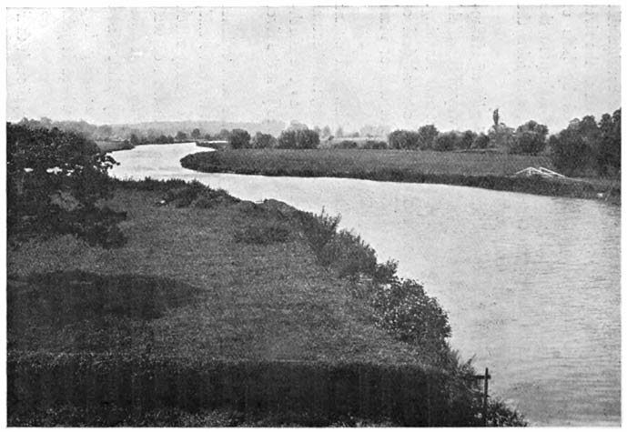
Streatley from Goring
Goring to Streatley
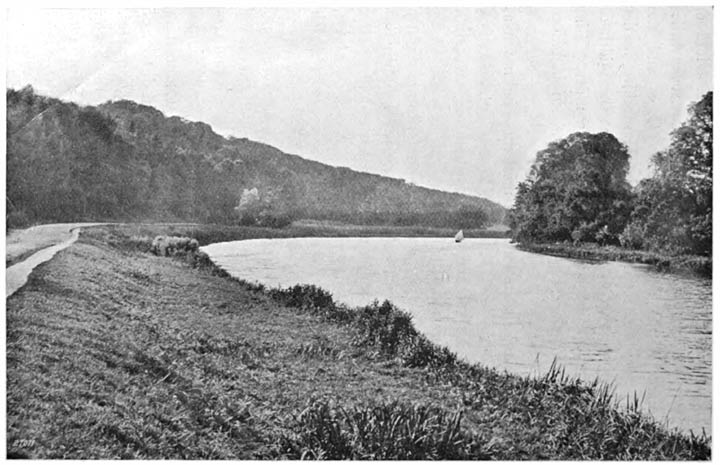
The river Thames or Isis becomes the boundary between Berkshire and Gloucestershire near Lechlade, and it flows in an easterly direction over a clay country, keeping a little to the north of the ridge of limestone hills upon which the villages of Buckland and Hinton Waldrist stand. Near Appleton the river bends to the north, curving round the outlying patch of limestone which forms Wytham Hill, and being joined by the river Evenlode. The united streams soon take a southerly [30]course, and a little below Oxford are joined on the north by the Cherwell. The river then crosses the limestone formation near Sandford, and curves round by Radley to Abingdon. From Abingdon the river pursues a somewhat serpentine course with a general south-easterly trend towards Benson, being joined on the north near Dorchester by the river Thame. A little south of Benson the river, now the Thames proper, enters upon the chalk formation, across which it flows in a southerly direction to Streatley, and then takes a south-easterly course to Reading. At Streatley the river valley is deep, with steep sides separating the chalk downs of Berkshire from the chalk hills known as the Chilterns. The illustration above [31]shows the Berkshire downs in the distance and the valley of the Thames in the foreground.
The River Thames, also known as Isis, marks the border between Berkshire and Gloucestershire near Lechlade. It flows east through a clay landscape, staying slightly north of the ridge of limestone hills where the villages of Buckland and Hinton Waldrist are located. Near Appleton, the river curves north around the limestone outcrop that forms Wytham Hill, and it joins the River Evenlode. The combined streams soon head south, and just below Oxford, they’re joined from the north by the Cherwell. The river then crosses over the limestone formation near Sandford and winds its way around Radley to Abingdon. From Abingdon, the river takes a somewhat winding route with a general south-easterly direction towards Benson, joining the River Thame from the north near Dorchester. Just south of Benson, the river officially becomes the Thames as it enters chalk territory, flowing southward to Streatley before taking a south-easterly direction toward Reading. At Streatley, the river valley is deep, with steep sides separating the chalk downs of Berkshire from the chalk hills known as the Chilterns. The illustration above [__A_TAG_PLACEHOLDER_0__] shows the Berkshire downs in the background and the valley of the Thames in the foreground.
At Reading the Thames is joined by the Kennet, and it is interesting to notice that the main stream adopts the direction of the tributary and flows with a north-easterly course to Wargrave, near which place the river Loddon meets it from the south, and again the direction of flow of the tributary is adopted, the Thames taking a northerly course past Henley. It is also of interest to observe that the river has turned away from the soft clays which form the ground south and east of Reading, and has cut a deep valley in the hard chalk from Wargrave onwards. Beyond Remenham the course of the river becomes easterly, and near Cookham it turns south and flows past Maidenhead to Bray.
At Reading, the Thames is joined by the Kennet, and it's interesting to note that the main river follows the direction of the tributary, flowing northeast towards Wargrave. Near there, the Loddon joins it from the south, and once again, the Thames adopts the tributary's flow direction, heading north past Henley. It's also noteworthy that the river has shifted away from the soft clays that make up the ground south and east of Reading, carving a deep valley in the hard chalk from Wargrave onward. Beyond Remenham, the river’s path shifts east, and near Cookham, it turns south, flowing past Maidenhead to Bray.
Near Bray the Thames leaves the chalk over which it has flowed for some 40 miles and enters upon a clay country, making its way in a fairly direct line to Windsor, the one place in the district where a knob of chalk sticks up through the clay. Windsor Castle stands upon this knob of chalk. The course of the river from Bray to Windsor is on the whole south-east, and after a big curve north at Eton the course becomes more southerly, with another big curve near Old Windsor. At Runnymede House the Berkshire boundary leaves the river, which flows on to London and the sea.
Near Bray, the Thames leaves the chalk it has flowed over for about 40 miles and moves into a clay area, heading in a fairly straight line to Windsor, the only place in the area where a bump of chalk rises through the clay. Windsor Castle is located on this chalk bump. The river's path from Bray to Windsor generally heads southeast, and after a big northward curve at Eton, it turns more southerly, with another significant curve near Old Windsor. At Runnymede House, the Berkshire boundary moves away from the river, which continues on to London and the sea.
The river Cole rises on the chalk not far from Ashbury, and flowing in a northerly direction joins the Upper Thames or Isis at the extreme western boundary of the county. [32]
The river Cole starts in the chalk hills near Ashbury and flows north, eventually joining the Upper Thames, or Isis, at the far western edge of the county. [__A_TAG_PLACEHOLDER_0__]
The river Ock rises on the chalk near Uffington, and flows down the Vale of White Horse to join the Thames at Abingdon.
The river Ock starts in the chalk hills near Uffington and flows through the Vale of White Horse to meet the Thames at Abingdon.

The Pang at Pangbourne
The Pang River at Pangbourne
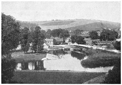
The river Pang rises on the chalk not far from Compton, and flows in a southerly direction to near Bucklebury, where it turns eastward, passing through a beautiful valley by way of Stanford Dingley and Bradfield to a point near Tidmarsh. It then makes a sharp turn to the north and joins the Thames at Pangbourne. This lower part of the course of the Pang is worthy of study, for there is a continuous band of river alluvium along the valley from the Thames at Pangbourne to the Kennet at Theale. The source of the river, too, is well worthy of investigation. In dry times it will be found in the valley near Compton, but in wet seasons it [33]is much further up in a branch valley towards East Ilsley.
The Pang River starts in the chalk hills near Compton and flows south until it gets close to Bucklebury, where it turns east. It passes through a lovely valley, going through Stanford Dingley and Bradfield, until it reaches a spot near Tidmarsh. Then, it makes a sharp turn north and meets the Thames at Pangbourne. The lower section of the Pang's route is worth examining because there's a continuous strip of river sediment along the valley from the Thames at Pangbourne to the Kennet at Theale. The river's source is also worth investigating. During dry periods, it can be found in the valley near Compton, but in wet seasons, it [__A_TAG_PLACEHOLDER_0__]is located much further upstream in a side valley toward East Ilsley.
The Lambourn also rises on the chalk near the place of that name, and it flows in a south-easterly direction and joins the Kennet close to Newbury. The Pang and the Lambourn flow in chalk valleys for the whole of their course.
The Lambourn also starts on the chalk near its namesake location, flowing southeast and joining the Kennet near Newbury. Both the Pang and the Lambourn flow through chalk valleys for their entire route.

Pangbourne
Pangbourne
The river Kennet rises in Wiltshire, enters Berkshire near Hungerford, and flows with an easterly course by way of Kintbury, Newbury, and Theale, finally joining the Thames close to Reading. It is a chalk river, and obtains a considerable amount of water from springs in the valley along its course.
The Kennet River starts in Wiltshire, enters Berkshire near Hungerford, and flows eastward through Kintbury, Newbury, and Theale, finally merging with the Thames near Reading. It's a chalk river and gets a significant amount of water from springs in the valley along its path.
The Emborne is not a chalk stream. It rises in the [34]Inkpen district and flows in an easterly direction, forming, as we have seen, the county boundary for a considerable distance. Its course is almost parallel to that of the river Kennet, the two valleys being separated by hills or plateaux of clay, sand, and gravel. Near Brimpton the Emborne turns sharply to the north-east, and joins the river Kennet near Sulhampstead Bannister.
The Emborne isn't a chalk stream. It starts in the Inkpen area and flows eastward, creating the county boundary for quite a distance. Its path runs almost alongside the river Kennet, with hills or plateaus of clay, sand, and gravel in between. Near Brimpton, the Emborne makes a sharp turn to the northeast and meets the river Kennet near Sulhampstead Bannister.
The Foudry Brook rises in a clay district of Hampshire, not far from Silchester, and runs by way of Stratfield Mortimer and Grazeley to the river Kennet near Reading. It is a small stream now, but there is a good deal of alluvium along its course, showing that it was of more importance in former times.
The Foudry Brook starts in a clay area of Hampshire, not far from Silchester, and flows through Stratfield Mortimer and Grazeley to the river Kennet near Reading. It's a small stream today, but there's a lot of alluvium along its path, indicating that it was more significant in the past.
The river Loddon rises in Hampshire and enters Berkshire at the edge of Strathfieldsaye Park, its direction being northerly. Soon, however, it turns to the north-east and flows in a tolerably straight line to join the river Thames near Wargrave.
The river Loddon starts in Hampshire and enters Berkshire at the edge of Strathfieldsaye Park, flowing north. However, it quickly shifts to the northeast and flows fairly straight to join the river Thames near Wargrave.
The Blackwater rises near Aldershot and reaches Berkshire at Blackwater Bridge, where, as we have said, the counties of Berkshire, Hampshire, and Surrey meet. From this point the river flows in a north-west or west direction and forms the Berkshire boundary for eight miles to a point near Little Ford below Farley Hill. The Blackwater then turns into Berkshire, running in a north-westerly direction to Swallowfield, where it joins the river Loddon.
The Blackwater starts near Aldershot and reaches Berkshire at Blackwater Bridge, where, as mentioned, the counties of Berkshire, Hampshire, and Surrey come together. From here, the river flows northwest or west and serves as the Berkshire boundary for eight miles to a spot near Little Ford below Farley Hill. The Blackwater then turns into Berkshire, flowing northwest to Swallowfield, where it connects with the River Loddon.
There are no natural lakes in Berkshire, though there are the deposits of a former lake in the valley of the Kennet near Newbury. [35]
There are no natural lakes in Berkshire, but there are remnants of an ancient lake in the Kennet Valley near Newbury. [__A_TAG_PLACEHOLDER_0__]
The Thames near Abingdon
The Thames by Abingdon
[36]
[__A_TAG_PLACEHOLDER_0__]
There was formerly a sheet of water near Twyford named Ruscombe Lake, which had some claim to be called a natural lake, in that it was a low-lying bit of ground which was flooded owing to the absence of a good outlet. Its natural outlet was into the river Loddon, and there is a patch of alluvium extending from its site through Stanlake Park to that river. It was eventually drained by making a deep channel called the “Cut,” draining a considerable area into the Thames near Bray. It has been asked why the river Thames did not follow the line of Ruscombe Lake and the Bray Cut, all soft clayey soil and low ground, instead of cutting the great and deep valley through the chalk by way of Wargrave, Henley, Great Marlow, and Maidenhead. The explanation probably is that the river Thames existed before any of these valleys, and that its course was determined by local features which have long since been destroyed by rain and streams, and by the river itself.
There used to be a body of water near Twyford called Ruscombe Lake, which could be considered a natural lake because it was a low area that flooded due to a lack of a proper outlet. Its natural outlet flowed into the River Loddon, and there's a patch of alluvial soil that stretches from its location through Stanlake Park to that river. It was eventually drained by creating a deep channel known as the “Cut,” which drained a significant area into the Thames near Bray. People have wondered why the River Thames doesn’t follow the line of Ruscombe Lake and the Bray Cut, since it's all soft, clayey soil and low ground, instead of carving out the deep valley through chalk at Wargrave, Henley, Great Marlow, and Maidenhead. The likely explanation is that the River Thames was around before any of these valleys formed, and its path was shaped by local features that have long been eroded by rain, streams, and the river itself.
6. Geology and Soil.
Before giving further account of the physical geography of the county it is necessary to learn somewhat of its geology, as the physical conditions are to a large extent dependent upon geological structure.
Before providing more details about the physical geography of the county, it’s important to understand its geology a bit, since the physical conditions largely depend on the geological structure.
By Geology we mean the study of the rocks, and we must at the outset explain that the term rock is used by the geologist without any reference to the hardness or [37]compactness of the material to which the name is applied; thus he speaks of loose sand as a rock equally with a hard substance like granite.
By geology, we mean the study of rocks. First, we should clarify that the term rock is used by geologists without considering the hardness or [__A_TAG_PLACEHOLDER_0__]compactness of the material it's referring to; for example, they refer to loose sand as a rock just as they do with a hard material like granite.
Rocks are of two kinds, (1) those laid down mostly under water; (2) those due to the action of heat.
Rocks come in two types: (1) those formed mostly underwater; (2) those created by heat.
The first kind may be compared to sheets of paper one over the other. These sheets are called beds, and such beds are usually formed of sand (often containing pebbles), mud or clay, and limestone, or mixtures of these materials. They are laid down as flat or nearly flat sheets, but may afterwards be tilted as the result of movement of the earth’s crust, just as you may tilt sheets of paper, folding them into arches and troughs, by pressing them at either end. Again, we may find the tops of the folds so produced worn away as the result of the constant action of rivers, glaciers, and sea-waves upon them, as one might cut off the tops of the folds of the paper with a pair of shears. This has happened with the ancient beds forming parts of the earth’s crust, and we therefore often find them tilted, with the upper parts removed. Tilted beds are said to dip, the direction of dip being that in which the beds plunge downwards, thus the beds of an arch dip away from its crest, those of a trough towards its middle. The dip is at a low angle when the beds are nearly horizontal, and at a high angle when they approach the vertical position. The horizontal line at right angles to the direction of the dip is called the line of strike. Beds form strips at the surface, and the portion where they appear at the surface is called the outcrop. On a large scale the direction of outcrop generally corresponds with [38]that of the strike. Beds may also be displaced along great cracks, so that one set of beds abuts against a different set at the sides of the crack, when the beds are said to be faulted.
The first type can be likened to layers of paper stacked on top of each other. These layers are known as beds, usually made up of sand (often mixed with pebbles), mud or clay, and limestone, or combinations of these materials. They are laid down flat or almost flat, but can later be tilted due to movements in the earth's crust, much like how you can tilt sheets of paper by pressing down on either end, creating folds and dips. Additionally, the peaks of these folds can be worn down over time by the ongoing action of rivers, glaciers, and ocean waves, similar to how you might cut the tops of paper folds with scissors. This has occurred with ancient beds that are part of the earth's crust, leading to situations where they are often tilted and the upper sections are eroded away. Tilted beds are said to dip, with the dip's direction indicating where the beds slope downwards. Consequently, in an arch, the beds dip away from its top, while in a trough, they dip toward its center. The dip is shallow when the beds are almost horizontal and steep when they are close to vertical. The horizontal line perpendicular to the dip direction is called the line of strike. The beds create strips at the surface, and the area where they surface is referred to as the outcrop. On a larger scale, the outcrop direction typically aligns with [__A_TAG_PLACEHOLDER_0__] the strike direction. Beds can also be shifted along large cracks, causing one set of beds to meet a different set at the edges of the crack, making the beds faulted.
The other kinds of rocks are known as igneous rocks, which have been melted under the action of heat and become solid on cooling. When in the molten state they have been poured out at the surface as the lava of volcanoes, or have been forced into other rocks and cooled in the cracks and other places of weakness. Much material is also thrown out of volcanoes as volcanic ash and dust, and is piled up on the sides of the volcano. Such ashy material may be arranged in beds, so that it partakes to some extent of the qualities of the two great rock groups.
The other types of rocks are called igneous rocks, which have melted due to heat and solidified when they cooled. When they’re in a molten state, they’ve been released at the surface as volcanic lava or forced into other rocks, cooling in cracks and weak spots. A lot of material is also ejected from volcanoes as volcanic ash and dust, which accumulates on the sides of the volcano. This ashy material can be layered, giving it some characteristics of both major rock groups.
The production of beds is of great importance to geologists, for by means of these beds we can classify the rocks according to age. If we take two sheets of paper, and lay one on the top of the other on a table, the upper one has been laid down after the other. Similarly with two beds, the upper is also the newer, and the newer will remain on the top after earth-movements, save in very exceptional cases which need not be regarded by us here, and for general purposes we may regard any bed or set of beds resting on any other in our own country as being the newer bed or set.
The production of beds is really important to geologists because these layers help us classify rocks by age. If you take two sheets of paper and place one on top of the other on a table, the top sheet was laid down after the bottom one. The same goes for rock layers; the top layer is also newer, and it will stay on top after any earth movements, except in very rare cases that we don't need to consider here. For general purposes, we can treat any bed or set of beds sitting on another in our area as the newer one.
The movements which affect beds may occur at different times. One set of beds may be laid down flat, then thrown into folds by movement, the tops of the beds worn off, and another set of beds laid down upon the [39]worn surface of the older beds, the edges of which will abut against the oldest of the new set of flatly deposited beds, which latter may in turn undergo disturbance and removal of their upper portions.
The movements that impact sedimentary layers can happen at different times. One layer may be deposited flat, then folded due to movement, with the tops eroded away, followed by another layer laid down on the worn surface of the older layer. The edges of this new layer will meet the oldest part of the new flat layer, which may also experience disturbances and loss of its upper sections.
Again, after the formation of the beds many changes may occur in them. They may become hardened, pebble-beds being changed into conglomerates, sands into sandstones, muds and clays into mudstones and shales, soft deposits of lime into limestone, and loose volcanic ashes into exceedingly hard rocks. They may also become cracked, and the cracks are often very regular, running in two directions at right angles one to the other. Such cracks are known as joints, and the joints are very important in affecting the physical geography of a district. As the result of great pressure applied sideways, the rocks may be so changed that they can be split into thin slabs, which usually, though not necessarily, split along planes standing at high angles to the horizontal. Rocks affected in this way are known as slates.
Again, after the formation of the beds, many changes can happen to them. They can harden, with pebble beds transforming into conglomerates, sands turning into sandstones, muds and clays becoming mudstones and shales, soft deposits of lime changing into limestone, and loose volcanic ashes turning into very hard rocks. They can also crack, and the cracks are often very regular, running in two directions at right angles to each other. These cracks are called joints, and the joints are important in shaping the physical geography of an area. Due to significant sideways pressure, the rocks may change to the point where they can be split into thin slabs, which usually, though not always, break along planes that are at high angles to the horizontal. Rocks affected in this way are known as slates.
If we could flatten out all the beds of England, and arrange them one over the other and bore a shaft through them, we should see them on the sides of the shaft, the newest appearing at the top and the oldest at the bottom. Such a shaft would have a depth of between 50,000 and 100,000 feet. The beds are divided into three great groups called Primary or Palaeozoic, Secondary or Mesozoic, and Tertiary or Cainozoic, and at the base of the Primary rocks are the oldest rocks of Britain, which form as it were the foundation stones on which the other rocks rest, and are termed Precambrian rocks. The three [41]great groups are divided into minor divisions known as systems.
If we could flatten all the layers of England and stack them on top of each other, then drill a hole through them, we would see the newest layers at the top and the oldest layers at the bottom. This hole would be between 50,000 and 100,000 feet deep. The layers are split into three main groups called Primary or Palaeozoic, Secondary or Mesozoic, and Tertiary or Cainozoic. At the base of the Primary rocks are the oldest rocks in Britain, which serve as the foundation for the other layers and are referred to as Precambrian rocks. The three [__A_TAG_PLACEHOLDER_0__] main groups are further divided into smaller categories known as systems.
| Names of Systems | Subdivisions | Characters of Rocks | ||||||
| TERTIARY | Recent Pleistocene | Metal Age | Deposits | Superficial Deposits | ||||
| Neolithic |
|
|||||||
| Palaeolithic |
|
|||||||
| Glacial |
|
|||||||
| Pliocene | Cromer Series | Sands chiefly | ||||||
| Weybourne Crag | ||||||||
| Chillesford and Norwich Crags | ||||||||
| Red and Walton Crags | ||||||||
| Coralline Crag | ||||||||
| Miocene | Absent from Britain | |||||||
| Eocene | Fluviomarine Beds of Hampshire | Clays and Sands chiefly | ||||||
| Bagshot Beds | ||||||||
| London Clay | ||||||||
| Oldhaven Beds, Woolwich and Reading Groups | ||||||||
| Thanet Sands | ||||||||
| SECONDARY | Cretaceous | Chalk | Chalk at top Sandstones, Mud and Clays below | |||||
| Upper Greensand and Gault | ||||||||
| Lower Greensand | ||||||||
| Weald Clay | ||||||||
| Hastings Sands | ||||||||
| Jurassic | Purbeck Beds | Shales, Sandstones and Oolitic Limestones | ||||||
| Portland Beds | ||||||||
| Kimmeridge Clay | ||||||||
| Corallian Beds | ||||||||
| Oxford Clay and Kellaways Rock | ||||||||
| Cornbrash | ||||||||
| Forest Marble | ||||||||
| Great Oolite with Stonesfield Slate | ||||||||
| Inferior Oolite | ||||||||
| Lias—Upper, Middle, and Lower | ||||||||
| Triassic | Rhaetic | Red Sandstones and Marls, Gypsum and Salt | ||||||
| Keuper Marls | ||||||||
| Keuper Sandstone | ||||||||
| Upper Bunter Sandstone | ||||||||
| Bunter Pebble Beds | ||||||||
| Lower Bunter Sandstone | ||||||||
| PRIMARY | Permian | Magnesian Limestone and Sandstone | Red Sandstones and Magnesian Limestone | |||||
| Marl Slate | ||||||||
| Lower Permian Sandstone | ||||||||
| Carboniferous | Coal Measures | Sandstones, Shales and Coals at top Sandstones in middle Limestone and Shales below | ||||||
| Millstone Grit | ||||||||
| Mountain Limestone | ||||||||
| Basal Carboniferous Rocks | ||||||||
| Devonian | Upper | Devonian and Old Red Sandstone | Red Sandstones, Shales, Slates and Limestones | |||||
| Mid | ||||||||
| Lower | ||||||||
| Silurian | Ludlow Beds | Sandstones, Shales and Thin Limestones | ||||||
| Wenlock Beds | ||||||||
| Llandovery Beds | ||||||||
| Ordovician | Caradoc Beds | Shales, Slates, Sandstones and Thin Limestones | ||||||
| Llandeilo Beds | ||||||||
| Arenig Beds | ||||||||
| Cambrian | Tremadoc Slates | Slates and Sandstones | ||||||
| Lingula Flags | ||||||||
| Menevian Beds | ||||||||
| Harlech Grits and Llanberis Slates | ||||||||
| Pre-Cambrian | No definite classification yet made | Sandstones, Slates and Volcanic Rocks | ||||||
In the preceding table (p. 29) a representation of the various great subdivisions or ‘systems’ of the beds which are found in the British Islands is shown. The names of the great divisions are given on the left-hand side, in the centre the chief divisions of the rocks of each system are enumerated, and on the right-hand the general characters of the rocks of each system are given.
In the previous table (p. 29), you can see a breakdown of the different major subdivisions or 'systems' of the rock layers found in the British Islands. The names of the main divisions are listed on the left side, the key subdivisions of the rocks in each system are detailed in the center, and on the right side, you'll find the general characteristics of the rocks in each system.

Diagram to illustrate the Geology of Berkshire
Diagram to show the Geology of Berkshire
Berkshire is now part of an island and is a long way from the sea, but there have been times when the arrangement of land and sea on the globe was very different from what it is now. Our district has during some periods been part of a continent, and in others it has been overflowed by the sea.
Berkshire is now on an island and far from the ocean, but there have been times when the layout of land and sea on the planet was very different from today. Our area has, at times, been part of a continent, and at other times, it has been covered by the ocean.
These changes in the distribution of land and water were due to movements of the crust of the earth, and very largely to movements of compression from the sides, causing folding of the strata of which the crust of the earth is composed.
These changes in how land and water are distributed were caused by movements in the Earth's crust, primarily due to compressive forces from the sides, leading to the folding of the layers that make up the Earth's crust.
After many and great changes, at a time geologically [42]recent, but still long before the beginning of history in the usual sense of the word, the district now known as Berkshire rose above the sea for the last time.
After many significant changes, in a time that was geologically recent, but still long before recorded history as we know it, the area now called Berkshire rose above the sea for the last time.

Diagram-section of the Berkshire Rocks
Diagram section of the Berkshire Rocks
Since that date deposits of clay, sand, etc., have been formed in our area, and their formation is indeed still going on to some extent, but though these are true geological deposits they are of no great thickness, seldom as much as 20 feet. They are, however, at or near the surface of the ground, and consequently exercise considerable influence on the character of the country. We will, however, leave them out of account for the moment and [43]consider the deposits formed before the district finally rose above the sea.
Since that date, deposits of clay, sand, and other materials have accumulated in our area, and their formation is still happening to some degree. While these are indeed true geological deposits, they aren't very thick, usually less than 20 feet. However, they are located at or near the surface, so they significantly influence the landscape. For now, though, we'll ignore them and [__A_TAG_PLACEHOLDER_0__]focus on the deposits that formed before the region finally emerged above the sea.
These deposits are usually spoken of as forming the solid geology of the area, and the three divisions, into which as we have said Berkshire is divided, are characterised as follows:—
These deposits are typically referred to as forming the solid geology of the area, and the three divisions, into which we have mentioned Berkshire is divided, are characterized as follows:—
- 1. In the northern part of the county, including the Vale of White Horse, the geological strata are older than the chalk formation.
- 2. In the central part of Berkshire the chalk formation is at or near the surface of the ground.
- 3. In the forest country of south and east Berkshire, the surface is formed of geological formations newer than the chalk, but the chalk is always to be found underground if one goes deep enough.
If we look at a sectional plan of geological strata we shall see that none of the formations which come to the surface in our county are of any great antiquity, but somewhere deep down, say over a thousand feet below us, there is a platform of much older rocks, upon which those that come to the surface rest in an irregular manner. What these old rocks may be we do not know, but probably New Red Sandstone and possibly beds of coal may occur amongst them.
If we examine a cross-section of the geological layers, we'll see that none of the formations visible in our county are very old. However, deep below us, around a thousand feet down, there's a base of much older rocks that the surface formations rest on unevenly. We don’t know exactly what these ancient rocks are, but they might include New Red Sandstone and possibly even some coal deposits.
Speaking generally, we pass from older to newer geological formations as we go from the north-west towards the south-east, and we find that the Oxford Clay is the oldest formation which comes to the surface in Berkshire. [44]
Speaking generally, we transition from older to newer geological formations as we move from the northwest to the southeast, and we discover that the Oxford Clay is the oldest formation that appears at the surface in Berkshire. [__A_TAG_PLACEHOLDER_0__]
The Oxford Clay forms a strip of low land along the banks of the Isis from the Cole to the Cherwell near Oxford. It was originally mud deposited in a sea which extended over a great part of England. It is dark coloured, often shaley, with a little clayey limestone. A large oyster is one of its common fossils. Its thickness is about 450 feet, and it is not a water-bearing formation. The Oxford Clay dips underground to the east and is covered by newer rocks, the first of which is the Corallian.
The Oxford Clay is a stretch of low land along the banks of the Isis, from the Cole to the Cherwell near Oxford. It was originally mud that settled in a sea which covered much of England. It's dark in color, often flaky, with some clayey limestone. A large oyster is a common fossil found here. Its thickness is about 450 feet, and it doesn't hold water. The Oxford Clay slopes underground to the east and is covered by newer rocks, the first being the Corallian.

Corallian Rock, Shellingford
Corallian Rock, Shellingford
The Corallian forms a very well-marked band running across the county from the Cole to the Thames. Wytham Hill is formed of it, and Shrivenham, Coleshill, Faringdon, [45]Buckland, Fyfield, Appleton, and Cumnor are situated upon it. It is essentially a calcareous formation with some hard limestone beds, and has a thickness of from 50 to 80 feet. It was formed in the sea; probably a shallow sea with shoals, sand, and coral banks. Fossil corals are abundant, and many specimens of Ammonites and other marine shells are to be found. There are some good examples of these from Marcham in the Reading Museum. Supplies of good water may often be obtained from this formation. The Corallian beds are quarried for building stone and road material in many places.
The Corallian creates a clearly defined strip that stretches across the county from the Cole to the Thames. Wytham Hill is made of it, and Shrivenham, Coleshill, Faringdon, [__A_TAG_PLACEHOLDER_0__]Buckland, Fyfield, Appleton, and Cumnor are all located on it. It is primarily a chalky formation that includes some hard limestone layers, with a thickness ranging from 50 to 80 feet. It was formed in the ocean, likely in shallow waters with shoals, sand, and coral reefs. Fossil corals are common, and many samples of Ammonites and other sea shells can be found. There are some great examples of these from Marcham in the Reading Museum. This formation often provides good sources of water. The Corallian beds are quarried for building stone and road materials in various locations.
The Kimmeridge Clay, which comes above the Corallian, is, like the Oxford Clay, a bed of hardened marine mud. It has now become a shaley clay, and is about 140 feet thick. It forms a narrow east and west band across the county. Much of the Vale of White Horse is on this clay, and the town of Abingdon stands upon it. It is not a water-bearing formation.
The Kimmeridge Clay, which lies above the Corallian, is, similar to the Oxford Clay, a layer of hardened marine mud. It has now turned into a shaley clay and is about 140 feet thick. It creates a narrow band running east to west across the county. Much of the Vale of White Horse is situated on this clay, and the town of Abingdon is built on it. It does not hold water.
The Portland Beds. A small patch of this formation is found resting upon the Kimmeridge Clay in Berkshire. It caps the rising ground south of Shrivenham, and the village of Bourton stands upon it. Its thickness is about 20 feet.
The Portland Beds. A small section of this formation is located on top of the Kimmeridge Clay in Berkshire. It sits on the elevated land south of Shrivenham, and the village of Bourton is built on it. Its thickness is around 20 feet.
After the deposition of the Portland rocks, which are of marine origin, there is reason to believe that our district became land and a part of a continent, but no relics of this period remain here. They were all swept away when the land sank again and the Cretaceous sea flowed over Berkshire.
After the deposition of the Portland rocks, which come from marine origins, there's reason to think that our area became land and part of a continent, but no evidence of this time remains here. Everything was washed away when the land sank again and the Cretaceous sea covered Berkshire.
The Lower Greensand—our next deposit—was formed [46]after a long interval, and, owing to earth movements which had taken place during that interval, it rests upon the older rocks in an irregular manner. It is a marine formation, and only occurs in patches, the largest of which extends from Uffington to near Faringdon. Its greatest thickness is about 60 feet, and it consists of sand with some ironstone and chert, pebble beds, and a calcareous sponge gravel. The sponge gravel, so-called from the number of fossil sponges it contains, is dug for garden paths and walks, and is exported to long distances. The fossil sponges in the gravel are abundant and beautifully preserved, and they seem to have lived on the spot. The ironstone was at one time worked near Faringdon. At New Lodge, in the parish of Winkfield, the Lower Greensand was reached in a boring at a depth of 1234 feet. A good supply of water was obtained, but it contains a large quantity of common salt.
The Lower Greensand—our next deposit—was formed [__A_TAG_PLACEHOLDER_0__] after a long break, and due to shifts in the earth that occurred during that time, it sits on the older rocks in an uneven way. It's a marine formation and only appears in scattered areas, the largest of which stretches from Uffington to near Faringdon. Its maximum thickness is about 60 feet, and it consists of sand mixed with some ironstone and chert, pebble beds, and a type of gravel called calcareous sponge gravel. This sponge gravel, named for the many fossil sponges it contains, is used for garden paths and walkways and is shipped over long distances. The fossil sponges found in the gravel are plentiful and well-preserved, suggesting they lived right there. At one point, the ironstone was mined near Faringdon. In New Lodge, located in the parish of Winkfield, the Lower Greensand was encountered in a boring at a depth of 1,234 feet. A good water supply was found, but it contains a lot of common salt.
The Gault, the next formation, consists of grey clay in the lower part and of a silty marl in the upper part, with a total thickness of some 220 feet. It crosses the county as a band, from one to three miles in width, from Ashbury to the Thames between Abingdon and Wallingford. It is a marine formation, and does not give a water-supply.
The Gault, the next layer, is made up of grey clay in the lower section and silty marl in the upper section, with a total thickness of about 220 feet. It spans the county as a strip, ranging from one to three miles wide, from Ashbury to the Thames between Abingdon and Wallingford. It is a marine layer and doesn't provide a water supply.
The Upper Greensand runs across the county as a narrow and irregular band about 90 feet thick, and consists of green sands and grey marl, with beds of stone in places. It is of marine origin, and provides a supply of excellent water, and consequently many villages stand upon or close to it. Ashbury, Childrey, Wantage, Hendred, and Harwell are examples. [47]
The Upper Greensand stretches across the county as a narrow and uneven band about 90 feet thick, made up of green sands and gray marl, with layers of stone in some areas. It comes from a marine environment and offers a great supply of water, which is why many villages are located on or near it. Examples include Ashbury, Childrey, Wantage, Hendred, and Harwell. [__A_TAG_PLACEHOLDER_0__]
The Chalk. This is far the most important geological formation in Berkshire, for it occupies a large portion of the surface of the county, and in the eastern part, when not at the surface, it is to be found underground. It is a light-coloured limestone, usually soft and earthy, but in parts very hard. Its full thickness is over 700 feet, and being a porous rock, the rain which falls on its great surface sinks in and furnishes a water-supply over its whole area whether the chalk be at the surface or underground. It was deposited in a sea which not only covered our district but spread over much of Europe. There was, however, probably land to the west which included Cornwall, parts of Wales, and of Ireland. The upper part of the Berkshire Chalk contains many layers and nodules of flint.
The Chalk. This is by far the most important geological formation in Berkshire, as it covers a large part of the county's surface, and in the eastern area, it can also be found underground when it’s not exposed. It's a light-colored limestone, typically soft and earthy, but some sections are very hard. Its total thickness is over 700 feet, and because it’s a porous rock, rain that falls on its vast surface seeps in and supplies water across the entire area, whether the chalk is above or below ground. It was formed in a sea that not only covered our region but also extended over much of Europe. However, there was likely land to the west that included Cornwall, parts of Wales, and Ireland. The upper section of the Berkshire Chalk has many layers and nodules of flint.
There is a long break in our geological record after the newest beds of the Chalk found in Berkshire had been deposited, for both the top of the Chalk and the bottom of the next series are wanting here, and in order to fill the interval we have to study rocks in other parts of England, in Belgium, and in Denmark. During this great interval in time the chalk sea retired, and much of Britain became land.
There is a significant gap in our geological record after the most recent layers of Chalk found in Berkshire were laid down, as both the upper part of the Chalk and the lower part of the next series are missing here. To understand this gap, we need to examine rocks from other areas in England, Belgium, and Denmark. During this long period, the chalk sea receded, and much of Britain transformed into land.
The Reading Beds repose upon a water- and weather-worn surface of chalk. They consist of clays and sands, and were deposited in the bed of a great river. Their thickness is from 70 to 90 feet, and good water may be obtained from the sands. In the lower part we find a bed of oysters, and rather higher up there is in some places a bed of leaves, known as the “Reading Leaf-Bed,” [48]a specimen of which is shown below. It will be noticed that the leaves are crowded together, and were no doubt buried in the mud of the river.
The Reading Beds rest on a weathered chalk surface that’s been shaped by water. They’re made up of clays and sands, deposited in the bed of a large river. Their thickness ranges from 70 to 90 feet, and you can get good water from the sands. In the lower section, there’s a layer of oysters, and a bit higher up, there are some areas with a layer of leaves, known as the “Reading Leaf-Bed,” [__A_TAG_PLACEHOLDER_0__] a sample of which is shown below. You’ll notice that the leaves are packed tightly together, and they were likely buried in the river’s mud.

Specimen from the Reading Leaf-Bed
Specimen from the Reading Leaf Bed
The Basement Bed of the London Clay comes next in order and the fossils are marine, showing that the sea was [49]again spreading over our area. It is from 6 to 16 feet in thickness, and consists of loam and clay with green sand and pebbles. A set of shells from this bed is arranged in the Reading Museum.
The Basement Bed of the London Clay comes next, and the fossils found here are marine, indicating that the sea was [__A_TAG_PLACEHOLDER_0__] spreading over our area again. It ranges from 6 to 16 feet thick, made up of loam and clay with green sand and pebbles. A collection of shells from this bed is displayed in the Reading Museum.
The London Clay is a marine formation of very uniform character, a stiff clay, blue underground, but becoming brown near the surface, owing to the action of surface water. It contains layers of cement-stones. The thickness in the east of the county is nearly 350 feet, but the formation thins to the west, and is under 50 feet thick at Inkpen. Fossils are not uncommon, and there is a fair collection of Berkshire London Clay fossils in the Wellington College Museum. It is not a water-bearing formation. Most of Windsor Park is on London Clay, and a number of places the names of which end with “field” are upon this formation, such as Arborfield, Binfield, Burghfield, Shinfield, Swallowfield, Warfield, and Winkfield.
The London Clay is a marine formation that's pretty uniform, consisting of stiff clay that looks blue underground but turns brown near the surface due to surface water. It has layers of cement stones. In the eastern part of the county, it is about 350 feet thick, but it gets thinner as you go west and is less than 50 feet thick at Inkpen. Fossils are fairly common, with a decent collection of Berkshire London Clay fossils in the Wellington College Museum. This formation does not hold water. Most of Windsor Park is on London Clay, and several places with names ending in “field” are located on this formation, like Arborfield, Binfield, Burghfield, Shinfield, Swallowfield, Warfield, and Winkfield.
The Bagshot Beds, named after Bagshot Heath, consist of sand with a few beds of clay. The maximum thickness is nearly 350 feet. They are probably mainly of marine origin, but formed near the estuary of a large river. Fossils are rare in this formation in Berkshire, but a few specimens will be found in the Museums at Reading and at Wellington College. The Bagshot Beds are a water-bearing formation, but the water is not always of a satisfactory character. The scenery of the sandy Bagshot country is well shown by the view opposite.
The Bagshot Beds, named after Bagshot Heath, are made up of sand with some layers of clay. They can reach a maximum thickness of nearly 350 feet. They likely mostly formed from marine origins, but close to the estuary of a large river. Fossils are rare in this area of Berkshire, but a few can be found in the Museums at Reading and Wellington College. The Bagshot Beds hold water, but the quality isn't always good. The landscape of the sandy Bagshot area is clearly illustrated in the view opposite.
Some indefinite time after the deposition of the Bagshot Beds considerable earth movements took place in the [50]south of England, and Berkshire became, and has since remained, dry land. The Bagshot Beds are consequently the last marine formation in our district, and we thus complete our account of the solid geology of the county.
Some time after the deposition of the Bagshot Beds, significant earth movements occurred in the [__A_TAG_PLACEHOLDER_0__]south of England, and Berkshire turned into dry land and has stayed that way since. As a result, the Bagshot Beds are the last marine formation in our area, and we've now finished our overview of the solid geology of the county.

Bagshot Heath Country from Bog Hill
Bagshot Heath Country from Bog Hill
The solid strata are, however, to a considerable extent covered with a variety of geological deposits due to rain, frost, streams, and rivers. These deposits, often termed Drift, though not marked on the majority of geological maps, have a great importance for the dwellers in our county, simply because they form the actual surface and determine the character of the soil.
The solid layers of rock are mostly covered by various geological deposits caused by rain, frost, streams, and rivers. These deposits, often called Drift, may not be shown on most geological maps, but they are very important for the people living in our county because they make up the actual surface and influence the type of soil.
Clay with Flints is a formation covering a good deal of our Chalk. It is partly débris of the chalk formation and partly of clay beds which once rested on the Chalk. [51]In places it is 20 feet thick. Some of the best timber in the county grows upon it.
Clay with Flints is a layer that covers a lot of our Chalk. It consists partly of leftover material from the chalk formation and partly of clay layers that used to sit on top of the Chalk. [__A_TAG_PLACEHOLDER_0__]In some areas, it is 20 feet thick. Some of the best timber in the county grows on it.
Gravel covers a good deal of the surface in Berkshire. It is found both on the high ground and in the valleys. The high-level gravels are often over 10 feet thick and the valley gravels are more than 20 feet thick in several places. Windsor, Bray, Maidenhead, Cookham, Twyford, Wokingham, Reading, Theale, Pangbourne, and Newbury stand partly or wholly upon gravel.
Gravel covers a large portion of the ground in Berkshire. It's found both on the high ground and in the valleys. The gravel at higher elevations is often over 10 feet thick, while the valley gravel exceeds 20 feet thick in several areas. Windsor, Bray, Maidenhead, Cookham, Twyford, Wokingham, Reading, Theale, Pangbourne, and Newbury are built partly or entirely on gravel.

Sarsens in Gravel, Chobham Ridges
Sarsens in Gravel, Chobham Ridges
Alluvium, the modern deposit of the rivers, covers a good deal of ground in some places, more especially in the valley of the Kennet.
Alluvium, the modern sediment from rivers, covers a lot of land in some areas, especially in the valley of the Kennet.
Sarsens are blocks of sandstone which are found on or [52]near the surface of the ground or in the beds of gravel. They were probably derived in part from the Reading Beds and in part from the Bagshot Beds. The illustration on page 40 shows three sarsen stones lying at the bottom of a thick bed of gravel in a gravel pit on Chobham Ridges. The locality is in Surrey, but not far from the Berkshire border, and similar examples occur in Berkshire.
Sarsens are blocks of sandstone that are found on or [__A_TAG_PLACEHOLDER_0__]near the surface of the ground or in gravel beds. They likely come from both the Reading Beds and the Bagshot Beds. The illustration on page 40 shows three sarsen stones resting at the bottom of a thick layer of gravel in a gravel pit on Chobham Ridges. This area is in Surrey, but close to the Berkshire border, and similar examples can be found in Berkshire.
7. Natural History.
The fertile district of the Vale of White Horse, the wide chalk downs, and the forest country with its sandy tracts covered by heather or pines, together with the river Thames and its tributaries, give us a considerable variety of soil, of climate, and of general conditions; and we consequently have a large variety of species both of animals and of plants, though being an inland county, many forms which people the coast are absent, or merely come as rare visitors. Naturally, too, the increase of population and the advance of civilisation have caused a great change in animal and plant life. Many species, once common, are no longer to be found and many new species have been introduced.
The fertile area of the Vale of White Horse, the wide chalk hills, and the forested regions with their sandy areas covered in heather or pines, along with the River Thames and its tributaries, provide a significant variety of soil, climate, and overall conditions. As a result, we have a wide range of species of both animals and plants. However, since it’s an inland county, many forms found on the coast are missing or only appear as rare visitors. Naturally, the rise in population and the progress of civilization have led to significant changes in animal and plant life. Many species that used to be common are now gone, and many new species have been introduced.
Probably the most imposing of the animals which have roamed over our district since the advent of man was the form of elephant known as the mammoth. It possessed enormous tusks and was covered with long coarse hair with an under pelage of short woolly hair [53]so as to be fitted for life in a cold climate. Its bones have been found in several places in Berkshire, and teeth from Abingdon and Reading are in the Reading Museum.
Probably the most impressive animal that has roamed our area since humans arrived is the elephant known as the mammoth. It had huge tusks and was covered in long, rough hair with a layer of short, woolly hair underneath [__A_TAG_PLACEHOLDER_0__] so it could survive in a cold climate. Its bones have been found in several locations in Berkshire, and teeth from Abingdon and Reading are displayed in the Reading Museum.
The rhinoceros once lived in Berkshire, for bones, probably belonging to a woolly species, have been found in a railway cutting near Chilton. Bones of the bear, wolf, and bison have been found in the Drift deposits, and the wild boar was hunted in Berkshire in historic times.
The rhinoceros once lived in Berkshire, as bones, likely from a woolly species, have been discovered in a railway cutting near Chilton. Bones of bears, wolves, and bison have been found in the Drift deposits, and wild boars were hunted in Berkshire during historic times.
The badger is a harmless animal which lives a quiet life, spending the daytime in a burrow, often in a fox earth, and only coming out at night. It is in consequence much more common than is generally supposed, and our county forms no exception.
The badger is a harmless animal that lives a quiet life, spending the day in a burrow, often in a fox den, and only coming out at night. Because of this, it's much more common than most people think, and our county is no exception.
The history of the various forms of deer in Berkshire is of considerable interest. The red deer is a native of the county, for its remains have been found in the marsh deposits. It lived in various parks until the Commonwealth, when most of the deer were killed. It has been reintroduced and is now to be seen in Windsor Park, Calcot Park, and at Hampstead Marshall. The fallow deer lives in a more or less tame state in several parks in the county, and it is probably an original inhabitant of Berkshire, for it occurs as a fossil at Brentford, in Middlesex. The roe is certainly a native, for remains have been found in the Newbury marshes. It now lives in the woods about Virginia Water and Sunningdale. The reindeer has been found as a fossil at Windsor.
The history of the different types of deer in Berkshire is quite interesting. The red deer is native to the county, as its remains have been discovered in the marsh deposits. It used to live in various parks until the Commonwealth when most of the deer were killed off. It has been brought back and can now be seen in Windsor Park, Calcot Park, and Hampstead Marshall. The fallow deer exists in a fairly tame state in several parks across the county, and it’s likely one of the original residents of Berkshire, as fossil evidence has been found at Brentford in Middlesex. The roe deer is definitely native because remains have been found in the Newbury marshes. It currently resides in the woods near Virginia Water and Sunningdale. Fossil evidence of reindeer has also been discovered at Windsor.
An imperfect skull of the musk ox was found in a bed of gravel near Maidenhead in 1855, and is now in the Natural History Museum at South Kensington. [54]It was the first discovery of the remains of this animal in Britain.
An incomplete skull of a musk ox was discovered in a gravel bed near Maidenhead in 1855, and it is now housed at the Natural History Museum in South Kensington. [__A_TAG_PLACEHOLDER_0__] This was the first time the remains of this animal were found in Britain.
As might be expected there are no very outstanding features in Berkshire ornithology. The midland position of the county is against any long list of foreign visitors, and there are no fens or broads to tempt the special birds affecting such localities. The heron is often to be seen, and there is a heronry at Virginia Water, and others at Coley Park, Buscot, and Wytham Abbey. Woodpeckers, as might be supposed, are more especially common in the forest districts of eastern Berkshire. The carrion crow is a resident but is very local in occurrence. The hooded crow is a rather uncommon winter visitor. The peregrine falcon often visits us, but the buzzard, which used to live and breed in the county, is now but a rare visitor. The great bustard was a resident up to the end of the eighteenth century but is now no longer to be counted as a British bird. The swans which we see on the rivers and on many lakes and ponds are for the most part private property, but there are often wild birds amongst them.
As you might expect, there aren’t many remarkable features in Berkshire birdwatching. The county’s midland location means there isn’t a long list of rare visitors, and there are no marshes or lakes to attract special birds typically found in those areas. Herons are often spotted, with a heronry at Virginia Water and others at Coley Park, Buscot, and Wytham Abbey. Woodpeckers are fairly common, especially in the forest areas of eastern Berkshire. The carrion crow is a resident but appears only in specific locations. The hooded crow is somewhat uncommon as a winter visitor. The peregrine falcon often stops by, but the buzzard, which used to live and breed in the county, is now just a rare visitor. The great bustard was resident until the end of the eighteenth century but is no longer considered a British bird. The swans we see on rivers and many lakes and ponds are mostly privately owned, although there are often wild birds among them.
Of reptiles found in Berkshire, the slow-worm, common snake, and lizard abound on the moorlands, and the first of these on the chalk; the adder is not at all common.
Of the reptiles found in Berkshire, the slow-worm, common snake, and lizard are plentiful in the moorlands, with the slow-worm also found on the chalk; the adder is quite rare.
Time was, and that not so very long ago, when the salmon might be caught in the Thames. In the reign of Edward III (1341), a petition was made to the King, complaining that salmon and other fish in the Thames were taken and destroyed by engines placed to catch the fry, which were then used for feeding pigs. [55]The King was asked to forbid the use of these engines between London and the sea, and also to decree that no salmon be taken between Gravesend and Henley bridge in winter. A book on angling published in 1815 speaking of salmon says, “some are found in the Thames which the writer believes were justly considered to be superior to any bred in other rivers.”
There was a time, not too long ago, when you could catch salmon in the Thames. In the reign of Edward III (1341), a petition was presented to the King, complaining that salmon and other fish in the Thames were being caught and destroyed by traps set to catch the fry, which were then used to feed pigs. [__A_TAG_PLACEHOLDER_0__]The King was asked to ban the use of these traps between London and the sea and to declare that no salmon could be caught between Gravesend and Henley bridge in the winter. A book on fishing published in 1815 mentions salmon, stating, “some are found in the Thames which the writer believes were justly considered to be superior to any bred in other rivers.”
In recent years an attempt has been made to reintroduce the salmon into the Thames, and many young salmon have been turned out in the river, but so far without any useful result.
In recent years, there has been an effort to reintroduce salmon into the Thames, and many young salmon have been released into the river, but so far, it hasn't yielded any positive results.
But though the salmon has been, and again may be an inhabitant of the Thames, the brown trout is, and always has been, the fish of Berkshire. It attains a large size, and fish of from 8 to 12 lbs. are frequently caught in the Thames. There is, however, a scarcity of suitable breeding-places for trout in the river, and the stock, during recent years, has been kept up by introducing young fish, and not only brown trout but also Lochleven trout and rainbow trout have been turned into the river in great numbers. Many of the tributaries of the Thames are excellent trout streams, the Lambourn being a particularly good one.
But while salmon have lived in the Thames and might again, brown trout are, and always have been, the fish of Berkshire. They grow quite large, and fish weighing between 8 to 12 lbs. are often caught in the Thames. However, there aren’t enough suitable breeding spots for trout in the river, so in recent years, young fish have been introduced to maintain the stock, including not just brown trout but also Lochleven trout and rainbow trout in large numbers. Many of the Thames’ tributaries are great for trout fishing, with the Lambourn being especially good.
The pike is found in the rivers and in many a lake and pond throughout Berkshire. Grayling occur in the Kennet and are occasionally caught in the Thames. The gudgeon is a well-known Thames fish; and perch, roach, dace, barbel and minnows abound. The little ruff or pope is fairly common in the Thames, and the miller’s thumb, another small fish belonging to the cooler parts of [56]the world, is to be seen in most of our streams darting from place to place with great rapidity. The rudd, which is generally distributed through the more level part of England, is not common in Berkshire. The bream is occasionally caught in the Thames, but it is not a native and was probably introduced from Norfolk.
The pike can be found in the rivers, as well as in many lakes and ponds across Berkshire. Grayling are present in the Kennet and are sometimes caught in the Thames. The gudgeon is a popular fish in the Thames, and perch, roach, dace, barbel, and minnows are plentiful. The little ruff or pope is quite common in the Thames, and the miller’s thumb, another small fish that prefers cooler areas of [__A_TAG_PLACEHOLDER_0__]the world, can be seen darting around in most of our streams with great speed. The rudd, usually found throughout the flatter regions of England, is not commonly seen in Berkshire. The bream is occasionally caught in the Thames but is not native; it was likely introduced from Norfolk.

The Pine Plantations near Wellington College
The Pine Plantations close to Wellington College
The great variety of soil found in the river valleys, on the chalk downs, and in the forest district gives rise to much difference in the vegetation in different parts of the county. The beds of bullrush, the yellow and purple loosestrife, and the white and yellow water-lily are intimately associated with the beauty of the Thames. [57]
The wide range of soil in the river valleys, on the chalk hills, and in the woodland areas leads to significant differences in the plants found throughout the county. The beds of bulrushes, yellow and purple loosestrife, and white and yellow water-lilies are closely linked to the beauty of the Thames. [__A_TAG_PLACEHOLDER_0__]
The ling, the bell heather, and the cross-leaved heath cover large tracts in the eastern part of the county, and the bilberry is found in the woods of the same district. The bramble abounds in the forest parts, and of cultivated fruits we have large orchards of plums and cherries in the northern part of the county. Some rare orchids are to be found on the chalk, and in the peat districts the interesting little sundew is quite common.
The ling, bell heather, and cross-leaved heath cover large areas in the eastern part of the county, and you can find bilberries in the woods of that region. Brambles are plentiful in the forested areas, and there are large orchards of plums and cherries in the northern part of the county. Some rare orchids can be found on the chalk, and in the peat areas, the interesting little sundew is fairly common.

Wellingtonia Avenue near Wellington College
Wellingtonia Avenue by Wellington College
In the chalk district the holly and beech grow well, and fine oaks are to be seen in many parts of our county. Herne’s Oak, in Windsor Park, has given rise to much discussion, but there can be little doubt that the tree known by that name to Shakespeare was cut down in 1796. There are some avenues of fine elms in Windsor Park—notably the Long Walk. [58]
In the chalk district, holly and beech trees thrive, and you can find impressive oaks in many areas of our county. Herne’s Oak in Windsor Park has sparked a lot of conversation, but there’s little doubt that the tree Shakespeare referred to by that name was chopped down in 1796. There are some beautiful elm avenues in Windsor Park, especially the Long Walk. [__A_TAG_PLACEHOLDER_0__]
Of the conifers, the yew is a native of our district and grows well on the chalk, and the so-called Scotch fir (in reality a pine), a native of Scotland, has been introduced and forms extensive woods in the sandy parts of the county. The cedar of Lebanon, various kinds of cypress, the araucaria of Chile, the cryptomeria of Japan and the Wellingtonia (Sequoia) of California have been introduced into the county. On the opposite page is a view of an avenue of the Wellingtonia near Wellington College.
Of the conifers, the yew is native to our area and grows well on chalk soil, while the so-called Scotch fir (actually a type of pine), originally from Scotland, has been introduced and creates large forests in the sandy regions of the county. The cedar of Lebanon, various types of cypress, the araucaria from Chile, the cryptomeria from Japan, and the Wellingtonia (Sequoia) from California have also been brought into the county. On the opposite page is a view of an avenue of Wellingtonia near Wellington College.
8. Climate and Rainfall.
The climate of a country or district is, briefly, the average weather of that country or district, and it depends upon various factors, all mutually interacting, upon the latitude, the temperature, the direction and strength of the winds, the rainfall, the character of the soil, and the proximity of the district to the sea.
The climate of a country or region is basically the average weather in that area, and it relies on several factors that all interact with each other, including latitude, temperature, wind direction and strength, rainfall, soil type, and how close the area is to the sea.
The differences in the climates of the world depend mainly upon latitude, but a scarcely less important factor is proximity to the sea. Along any great climatic zone there will be found variations in proportion to this proximity, the extremes being “continental” climates in the centres of continents far from the oceans, and “insular” climates in small tracts surrounded by sea. Continental climates show great differences in seasonal temperatures, the winters tending to be unusually cold and the summers unusually warm, while the climate of insular tracts is characterised by equableness and also by [59]greater dampness. Great Britain possesses, by reason of its position, a temperate insular climate, but its average annual temperature is much higher than could be expected from its latitude. The prevalent south-westerly winds cause a drift of the surface-waters of the Atlantic towards our shores, and this warm-water current, which we know as the Gulf Stream, is the chief cause of the mildness of our winters.
The differences in the world's climates mainly depend on latitude, but another important factor is how close an area is to the sea. In any major climatic zone, you'll find variations based on this proximity, with the extremes being "continental" climates in the center of continents far from oceans and "insular" climates in small areas surrounded by water. Continental climates have significant differences in seasonal temperatures, with winters often being extremely cold and summers extremely warm, while insular areas tend to have milder temperatures and more humidity. Great Britain, because of its location, has a temperate insular climate, but its average annual temperature is much higher than what you'd expect for its latitude. The dominant south-westerly winds cause the surface waters of the Atlantic to flow towards our shores, and this warm-water current, known as the Gulf Stream, is the main reason our winters are so mild.
Most of our weather comes to us from the Atlantic. It would be impossible here within the limits of a short chapter to discuss fully the causes which affect or control weather changes. It must suffice to say that the conditions are in the main either cyclonic or anticyclonic, which terms may be best explained, perhaps, by comparing the air currents to a stream of water. In a stream a chain of eddies may often be seen fringing the more steadily-moving central water. Regarding the general north-easterly moving air from the Atlantic as such a stream, a chain of eddies may be developed in a belt parallel with its general direction. This belt of eddies or cyclones, as they are termed, tends to shift its position, sometimes passing over our islands, sometimes to the north or south of them, and it is to this shifting that most of our weather changes are due. Cyclonic conditions are associated with a greater or less amount of atmospheric disturbance; anticyclonic with calms.
Most of our weather comes from the Atlantic. It would be impossible in the limits of a short chapter to fully discuss the causes that affect or control weather changes. It’s enough to say that the conditions are mainly either cyclonic or anticyclonic, which can be best understood by comparing air currents to a stream of water. In a stream, there are often eddies along the edges of the more steadily moving central water. If we consider the generally north-easterly moving air from the Atlantic as such a stream, a chain of eddies may form in a belt parallel to its general direction. This belt of eddies, or cyclones as they are called, tends to shift its position, sometimes passing over our islands and sometimes to the north or south of them, and it is this shifting that causes most of our weather changes. Cyclonic conditions are associated with varying degrees of atmospheric disturbance, while anticyclonic conditions are linked to calm weather.
The prevalent Atlantic winds largely affect our island in another way, namely in its rainfall. The air, heavily laden with moisture from its passage over the ocean, meets with elevated land-tracts directly it reaches our [60]shores—the moorland of Devon and Cornwall, the Welsh mountains, or the fells of Cumberland and Westmorland—and blowing up the rising land-surface, parts with this moisture as rain. To how great an extent this occurs is best seen by reference to the map of the annual rainfall of England on the next page, where it will at once be noticed that the heaviest fall is in the west, and that it decreases with remarkable regularity until the least fall is reached on our eastern shores. Thus in 1906, the maximum rainfall for the year occurred at Glaslyn in the Snowdon district, where 205 inches of rain fell; and the lowest was at Boyton in Suffolk, with a record of just under 20 inches. These western highlands, therefore, may not inaptly be compared to an umbrella, sheltering the country further eastward from the rain.
The prevailing Atlantic winds significantly influence our island in another way, specifically in terms of rainfall. The air, heavy with moisture from crossing the ocean, encounters elevated land as soon as it reaches our [__A_TAG_PLACEHOLDER_0__] shores—the moors of Devon and Cornwall, the Welsh mountains, or the fells of Cumberland and Westmorland. As the air rises over the land, it releases this moisture as rain. The extent of this effect is best illustrated by looking at the map of annual rainfall in England on the next page, where it’s immediately clear that the heaviest rainfall occurs in the west, decreasing consistently until the least rainfall is found along our eastern shores. For example, in 1906, the maximum annual rainfall was recorded at Glaslyn in the Snowdon area, with 205 inches of rain, while the lowest was at Boyton in Suffolk, with just under 20 inches. Thus, these western highlands can be aptly compared to an umbrella, providing shelter to the areas further east from the rain.
The above causes, then, are those mainly concerned in influencing the weather, but there are other and more local factors which often affect greatly the climate of a place, such, for example, as configuration, position, and soil. The shelter of a range of hills, a southern aspect, a sandy soil, will thus produce conditions which may differ greatly from those of a place—perhaps at no great distance—situated on a wind-swept northern slope with a cold clay soil.
The main causes mentioned above mainly influence the weather, but there are also other local factors that can significantly affect the climate of a location, such as its shape, position, and soil type. For instance, the protection offered by a range of hills, a south-facing slope, or sandy soil can create conditions that are very different from those found in a place—possibly not far away—located on a windy northern slope with a cold clay soil.
Berkshire is an inland county but no part of it is as much as 75 miles from the coast. The chalk downs have a fine bracing climate, and though some of the valleys may be relaxing and some of the moorland tracts bleak, the general climate of the county is exceedingly healthy. Compared with the south coast of England [62]Berkshire is rather cooler, with somewhat less sunshine and less rain than the coast.
Berkshire is an inland county, but no part of it is more than 75 miles from the coast. The chalk hills have a refreshing climate, and while some valleys may be soothing and some moorland areas may feel desolate, the overall climate of the county is very healthy. Compared to the south coast of England [__A_TAG_PLACEHOLDER_0__], Berkshire is a bit cooler, with slightly less sunshine and less rain than the coast.

(The figures give the approximate annual rainfall in inches)
(The numbers show the roughly yearly rainfall in inches)
Temperature, it should be remarked, varies according to height above sea level, falling about 1° Fahr. for each 100 to 300 feet upwards. In a comparatively level district, like Berkshire, this is not a very serious consideration. The mean temperature for the year varies in different parts of England from about 47·3 in the north-eastern counties to about 49·6 in the south-east. The mean temperature is about 49·0 in northern Berkshire and about 47·5 in south-western Berkshire. It may be of interest to give the mean temperature for one year at places in and close around Berkshire. We take the year 1907 and the figures are as follows—Maidenhead 49·4, Wokingham 47·7, Swarraton in Hampshire 47·9, Marlborough in Wiltshire 47·4, and Oxford 48·9.
Temperature varies based on altitude, decreasing by about 1°F for every 100 to 300 feet you go up. In relatively flat areas like Berkshire, this isn't a major issue. The average temperature throughout the year differs across England, ranging from about 47.3°F in the north-eastern counties to around 49.6°F in the south-east. In northern Berkshire, the average temperature is about 49.0°F, while in south-western Berkshire it’s approximately 47.5°F. It might be interesting to look at the average temperature for one year at locations in and around Berkshire. Taking the year 1907, the numbers are as follows—Maidenhead 49.4°F, Wokingham 47.7°F, Swarraton in Hampshire 47.9°F, Marlborough in Wiltshire 47.4°F, and Oxford 48.9°F.
The average temperature in the month of January varies from 37·0 to 38·0 in different parts of the county, and the average temperature for July from 59·7 to 62·0.
The average temperature in January ranges from 37.0 to 38.0 across different areas of the county, while the average temperature in July ranges from 59.7 to 62.0.
In England bright sunshine is most prevalent on the coast and decreases inland. The annual total amount for the south and east coast from Cornwall to Norfolk is nearly 1800 hours, whilst in the northern midland counties the amount is about 1200 hours. There are no definite data available for giving the amount for Berkshire, but there are probably about 1500 hours of bright sunshine in the year.
In England, bright sunshine is mostly found on the coast and becomes less common as you move inland. The total annual sunshine hours for the south and east coast, from Cornwall to Norfolk, is nearly 1800 hours, while the northern midland counties receive around 1200 hours. There aren't specific data available for Berkshire, but it likely gets about 1500 hours of bright sunshine each year.
The rainfall varies a good deal in different parts of the county. The amount is lowest in the north-east and highest in the south-west. Thus Wallingford and [63]Cookham have a rainfall of about 23 inches a year on an average. At Reading, which is somewhat to the south-west, the amount is nearly 24 inches a year, and on a line running through Wellington College and Yattendon the amount is nearly 25 inches. Letcombe Regis and Ashbury have a rainfall of between 25 and 26 inches. At Faringdon the figure is above 26, and in the south-western corner of the county there is a rainfall of about 29 inches a year. The average yearly rainfall for the whole of England is 31·62 inches, and for the British Isles it is 39·25 inches. Looking at the extremes of rainfall in England we find the lowest at Shoeburyness with an average of 19·7 inches for the year, whilst Seathwaite in Cumberland has an average rainfall of 133·53 inches per annum.
The rainfall varies significantly across different areas of the county. The lowest amount is in the northeast, while the highest is in the southwest. Wallingford and [__A_TAG_PLACEHOLDER_0__]Cookham receive about 23 inches of rain on average each year. In Reading, which is slightly further southwest, the average increases to nearly 24 inches. Along a line that goes through Wellington College and Yattendon, the rainfall reaches close to 25 inches. Letcombe Regis and Ashbury see between 25 and 26 inches. Faringdon exceeds 26 inches, and the southwestern corner of the county gets about 29 inches annually. The average yearly rainfall for all of England is 31.62 inches, while for the British Isles, it’s 39.25 inches. Looking at the extremes in rainfall across England, Shoeburyness has the lowest average at 19.7 inches per year, whereas Seathwaite in Cumberland tops the scale with an average of 133.53 inches annually.
9. People—Race. Population.
We know little about the ancient people who made and used the flint implements which are found in the river gravels around Reading and at other places, and even when we come to the latter part of the Stone Age, though we find skeletons in the barrows or mounds upon our downs, our information about the race is exceedingly small, and this is perhaps not to be wondered at, for in no case do we find any knowledge of the art of writing in the stage of culture when only stone and no metal implements were used. Moreover, we must bear in mind that all we know about early England from written [64]history is from the works of foreign merchants or of foreign conquerors.
We know very little about the ancient people who created and used the flint tools found in the river gravel around Reading and other locations. Even when we get to the later part of the Stone Age, although we discover skeletons in the burial mounds on our hills, our knowledge about that society is very limited. This isn't surprising, since we find no evidence of writing from the time when only stone tools were used and no metal ones existed. Additionally, we need to remember that everything we learn about early England from written [__A_TAG_PLACEHOLDER_0__] history comes from the accounts of foreign traders or conquerors.
The Belgae who occupied the part of Britain south of the Thames at the time of Caesar’s invasion may have been partly or mostly Gauls. The tribe named the Atrebates occupied most or all of what is now Berkshire, and Silchester in Hampshire was their chief town.
The Belgae who lived in the area of Britain south of the Thames during Caesar’s invasion might have been partly or mostly Gauls. The tribe called the Atrebates occupied most or all of what is now Berkshire, and Silchester in Hampshire was their main town.
During the Roman occupation the district was far from the frontier, and the inhabitants continued their peaceful village life, becoming more or less Romanised.
During the Roman occupation, the area was far from the border, and the residents continued their quiet village life, becoming more or less Romanized.
After the departure of the Romans the Saxons spread gradually over the country and were probably settled in Berkshire before A.D. 568. The invaders made a clean sweep of Roman civilisation, destroyed the villages and houses, and extirpated the Christian religion.
After the Romans left, the Saxons gradually spread across the country and were likely settled in Berkshire by A.D. 568. The invaders completely wiped out Roman civilization, destroyed the villages and homes, and eliminated the Christian religion.
In A.D. 597 Augustine with his band of monks landed in the Isle of Thanet, and the conversion of the Saxons proceeded rapidly, and in time letters, arts, and civilisation returned to the county.
In CE 597, Augustine and his group of monks arrived at the Isle of Thanet, and the conversion of the Saxons happened quickly. Eventually, literacy, arts, and civilization returned to the region.
In later times Berkshire was overwhelmed by the Danes, and conquered by the Normans, but neither Danes nor Normans made anything like so great a change in the face of the country as had been effected by the Saxons, and there is even now a large Saxon element in our people, in our language, and in our manners and customs.
In later times, Berkshire was taken over by the Danes and conquered by the Normans, but neither the Danes nor the Normans made such a significant change to the landscape of the country as the Saxons had. Even today, there is still a strong Saxon influence in our people, language, and customs.
In early days there was a considerable population living on the chalk downs, but by degrees they moved elsewhere, and for a long time the people were mainly gathered in the valleys, especially along the banks of the [65]rivers Thames and Kennet. Nearly all the Berkshire towns are situated upon one or other of those rivers. In quite modern times there has been a great increase of population in the eastern end of the county, large areas of heath-land having been built over.
In the early days, a significant population lived on the chalk downs, but gradually they moved away, and for a long time, most people were concentrated in the valleys, especially along the banks of the [__A_TAG_PLACEHOLDER_0__]Thames and Kennet rivers. Almost all the towns in Berkshire are located by one of those rivers. Recently, there has been a huge increase in population in the eastern part of the county, with large areas of heathland being developed.
The population of Berkshire was steadily increasing during the whole of the last century. In 1801 the census gave a population of 110,752, and this had increased in 1851 to 170,243, and in 1901 to 256,509. That is to say the population of the county had more than doubled in the century.
The population of Berkshire was steadily growing throughout the last century. In 1801, the census recorded a population of 110,752, which increased to 170,243 in 1851, and to 256,509 in 1901. This means the county's population more than doubled over the century.
In 1901 there were 72,217 people living in the county borough of Reading. Of the six municipal boroughs in Berkshire Windsor had the largest population, and the others in order of numbers of inhabitants were Maidenhead, Newbury, Abingdon, Wokingham, and Wallingford.
In 1901, there were 72,217 people living in the county borough of Reading. Of the six municipal boroughs in Berkshire, Windsor had the largest population, and the others, in order of their number of inhabitants, were Maidenhead, Newbury, Abingdon, Wokingham, and Wallingford.
Of the persons registered as inhabitants of Berkshire in 1901, 398 were in hospital, 150 of whom were in the Royal Berkshire Hospital at Reading; 1638 were in Lunatic Asylums, of whom 646 were in the County Lunatic Asylum, Cholsey; 657 in the Criminal Lunatic Asylum at Broadmoor, and 335 in the Holloway Sanatorium, Egham, which is in the county of Surrey, but is included in Berkshire for registration purposes.
Of the people registered as residents of Berkshire in 1901, 398 were in the hospital, 150 of whom were in the Royal Berkshire Hospital in Reading; 1,638 were in psychiatric hospitals, with 646 in the County Lunatic Asylum in Cholsey; 657 in the Criminal Lunatic Asylum at Broadmoor, and 335 in the Holloway Sanatorium in Egham, which is located in Surrey but included in Berkshire for registration purposes.
One man and one woman were described as over 100 years of age and they were both living in Reading. Five men and thirteen women were described as between 95 and 100 years of age.
One man and one woman were noted to be over 100 years old, and they both lived in Reading. Five men and thirteen women were noted to be between 95 and 100 years old.
In the military barracks in the county there were [66]392 officers and 1860 non-commissioned officers and men—the 344 cadets at the Royal Military College, Sandhurst, being included amongst the officers.
In the military barracks in the county, there were [__A_TAG_PLACEHOLDER_0__]392 officers and 1,860 non-commissioned officers and soldiers, including the 344 cadets at the Royal Military College, Sandhurst, among the officers.
The number of men engaged in the general or local government of the county was 1423. The number engaged in teaching as schoolmasters, professors, etc., was 590 men and 1712 women.
The number of men involved in the overall or local government of the county was 1,423. The number of people teaching as schoolmasters, professors, etc., included 590 men and 1,712 women.
In many counties a large number of persons are described as living in ships, barges or boats, but in Berkshire the number in 1901 was only nine.
In many counties, a lot of people are said to be living on ships, barges, or boats, but in Berkshire, the number in 1901 was just nine.
10. Agriculture.
The cultivation of the soil has probably been carried on, to some extent, since the days of the people who made the stone implements, though they doubtless chiefly concerned themselves with the chase. The early inhabitants lived partly on the chalk land and partly on the banks of the rivers. The art of cultivation no doubt spread by degrees amongst the natives, and not only the flat chalk surfaces but even the steep sides of the downs were brought into service, and they may be seen now scored with horizontal terraces in many places, partly the result of cultivation in long strips on the hill side, and partly made intentionally to assist cultivation. Terraces of this kind are found in many parts of England and are known as “linchets” or “lynchets.” They form a marked feature in the landscape, near Compton Beauchamp for instance, and were at one time thought [67]to be old sea beaches, but this was an error; the sea had nothing to do with their formation. They are cultivation terraces in most cases, though in some instances they may be, at least in part, due to landslip or to a natural accumulation of rain wash.
The farming of the land has likely been happening, in some way, since the time of the people who created stone tools, even though they were mainly focused on hunting. The early inhabitants lived both on the chalk hills and along the riverbanks. The practice of farming probably spread gradually among the locals, taking advantage of not just the flat chalk areas but also the steep slopes of the hills. You can now see these hills marked with horizontal terraces in many places, formed partly by long strips of cultivation on the hillside and partly created intentionally to aid in farming. These types of terraces are found throughout England and are known as “linchets” or “lynchets.” They are a distinctive feature in the landscape, such as near Compton Beauchamp, and were once mistakenly thought [__A_TAG_PLACEHOLDER_0__]to be old sea beaches, but that was an error; the sea had nothing to do with their creation. In most cases, they are farming terraces, although in some cases, they may also be partly due to landslides or natural rainwash accumulation.
During Saxon times the greater part of Berkshire came under cultivation, and agriculture has ever since been the main industry of our county. The Vale of White Horse and its neighbourhood is one of the most fertile tracts in England, and there is also some rich pasture land on the alluvium by the rivers at Abingdon, Purley, Newbury, Woolhampton, Theale, Reading, and Twyford.
During Saxon times, most of Berkshire was farmland, and agriculture has been the main industry in our county ever since. The Vale of White Horse and its surrounding area is one of the most fertile regions in England, and there’s also some rich pasture land on the riverbanks at Abingdon, Purley, Newbury, Woolhampton, Theale, Reading, and Twyford.
In the eighteenth and the early part of the nineteenth centuries corn-growing was very profitable, and a great deal of land was laid down in corn, some of it being far from suited to the purpose. In later times the profit on corn has been reduced and some of this land has been turned to other uses or has gone out of cultivation. In 1905 the area in Berkshire devoted to corn was 98,968 acres, and in 1908 the area was 96,169 acres, a reduction of 2799 acres. The reduction was mainly in the crop of wheat, there was only a slight reduction in barley, whilst there was an increase in the amount of oats. The relative amount of wheat, barley, and oats grown in 1908 is shown in the diagram at the end of this volume.
In the 18th and early 19th centuries, growing corn was very profitable, and a lot of land was used for this purpose, even some that wasn't really suitable. Over time, the profit from corn decreased, and some of this land has been repurposed or has stopped being cultivated. In 1905, the area in Berkshire devoted to corn was 98,968 acres, and by 1908, it had dropped to 96,169 acres, a reduction of 2,799 acres. The decrease was mainly in wheat crops, with only a slight decline in barley, while the amount of oats increased. The relative amounts of wheat, barley, and oats grown in 1908 are illustrated in the diagram at the end of this volume.
Berkshire is not one of the great fruit-growing counties. In 1908 the acreage returned as orchards was 2942.
Berkshire isn't known for being one of the top fruit-growing counties. In 1908, the reported area of orchards was 2,942 acres.
The total amount of arable land in the county in 1908 was 179,047 acres. This includes the land under [68]clover, sainfoin, and grasses under rotation 35,760 acres. The area of permanent grass was 175,017 acres, making a total of 354,064 acres under either crops or grass.
The total amount of farmland in the county in 1908 was 179,047 acres. This includes the land used for clover, sainfoin, and grasses in rotation at 35,760 acres. The area of permanent grass was 175,017 acres, bringing the total to 354,064 acres used for crops or grass.
At the present time the production of milk is one of the most important industries of the county, the chief dairy district being the northern part and the tracts along the rivers. In 1908 the number of cattle in the county was 48,118. A cheese like single Gloucester is made in the Vale of White Horse.
At the moment, milk production is one of the most important industries in the county, with the main dairy area being in the northern part and along the rivers. In 1908, there were 48,118 cattle in the county. A cheese similar to single Gloucester is produced in the Vale of White Horse.
The number of sheep in Berkshire was returned as 167,413. They do not belong to the breed formerly known as “Berkshire.” This was a large animal with black face and black or mottled legs, which is now replaced by other kinds. The county has long been famous for its pigs, which numbered 26,171 in the year 1908.
The number of sheep in Berkshire was reported as 167,413. They aren’t from the breed that used to be called “Berkshire.” This was a large animal with a black face and black or spotted legs, which has now been replaced by other breeds. The county has been known for its pigs for a long time, which numbered 26,171 in 1908.
In former days the vine was cultivated in Berkshire, and a little vineyard existed as late as the reign of George III outside Windsor Castle and to the east of Henry VIII’s gateway. We also find mention of vineyards at Abingdon, Bisham, Burghfield, and Wallingford.
In the past, vines were grown in Berkshire, and a small vineyard was still there during the reign of George III, located outside Windsor Castle and to the east of Henry VIII’s gateway. There are also mentions of vineyards in Abingdon, Bisham, Burghfield, and Wallingford.
The number of men engaged in agriculture in Berkshire was 14,918 at the time of the last census.
The number of men working in agriculture in Berkshire was 14,918 during the last census.
11. Industries and Manufactures.
As we have said, Berkshire is essentially an agricultural county, and the cloth-making which in the days of Ashmole was so great a trade that almost the whole nation was supplied from our county, has become practically [69]obsolete. There are however at the present day several industries which give employment to a large number of workers in the county. Probably the one most definitely connected with our county town Reading is the making of biscuits, an industry of quite modern growth. Printing, too, is carried on at important works at Reading belonging in many cases to London firms, and there are also more or less active printing presses at nearly all our towns and in country places too. Printing in Berkshire goes back certainly to 1528, when John Scolar set up a press in the Abbey of Abingdon and printed a breviary, a copy of which is preserved at Emmanuel College, Cambridge. One of the oldest of existing newspapers is the Reading Mercury, started in that town in 1723.
As we mentioned, Berkshire is mainly an agricultural county, and the cloth-making industry that was so significant during Ashmole's time—supplying almost the entire nation—has become largely [__A_TAG_PLACEHOLDER_0__]obsolete. However, today there are several industries that employ a large number of workers in the county. The industry most closely associated with our county town, Reading, is biscuit production, which has developed relatively recently. Printing is also significant in Reading, with many of the important facilities owned by London firms, and there are also active printing presses in nearly all our towns and rural areas. Printing in Berkshire dates back to at least 1528 when John Scolar established a press in the Abbey of Abingdon and printed a breviary, a copy of which is preserved at Emmanuel College, Cambridge. One of the oldest newspapers still in circulation is the Reading Mercury, which started in that town in 1723.
Factory Girls leaving Work at Reading
Factory Girls leaving Work at Reading
[70]
[__A_TAG_PLACEHOLDER_0__]
Brewing has been carried on from the days of the monks, and no doubt plenty of good ale was brewed in the Abbeys of Abingdon and Reading. There is a record of malting mills in Wallingford Castle in 1300. At the present time there are large breweries at Reading, Windsor, and other places. Tanning is another very old industry which is still carried on with activity. The bark of the oak was formerly used to a large extent in tanning, and there has always been an abundance of oak trees in the county. Oak bark is still used to some extent. Shoe-making used to be an important cottage industry, but the introduction of machinery has carried the work to large factories elsewhere.
Brewing has been a tradition since the days of the monks, and there's no doubt that a lot of quality ale was made in the Abbeys of Abingdon and Reading. There is a record of malting mills in Wallingford Castle from 1300. Nowadays, there are large breweries in Reading, Windsor, and other locations. Tanning is another very old industry that is still actively practiced. The bark of the oak tree was once heavily used in tanning, and there has always been a lot of oak trees in the county. Oak bark is still used to some extent. Shoe-making used to be an important cottage industry, but the advent of machinery has moved the work to large factories in other areas.
Newbury was at one time a great place for barge building, and boats of many kinds are now built at various places on the Thames and Kennet, indeed boat building counts amongst the more important of our active industries.
Newbury used to be a major hub for barge building, and now different kinds of boats are constructed at various locations along the Thames and Kennet. In fact, boat building is one of the more significant industries we have today.
We have already mentioned cloth-making as one of the great industries of the county in former times. The chief centres were Reading, Abingdon, and Newbury. A fulling mill at Newbury is mentioned in 1205. The interesting Cloth Hall at that place, now a museum, was built by the Guild of Clothworkers of Newbury, which was incorporated in 1601, and the beautiful old house of Shaw was built by a Newbury clothier named Thomas Dolman in 1581. The most famous of the Berkshire clothiers was John Winchcombe or Smalwoode, known as Jack of Newbury (died 1520). During the seventeenth and eighteenth centuries the clothing trade declined. This [71]was partly due to the activity of the northern clothiers and to the introduction of machinery with the resulting factory system. Still as late as 1816 there were works in Katesgrove Lane, Reading, where sail-cloth for the navy was manufactured in large quantity.
We’ve already talked about cloth-making as one of the major industries in the county in the past. The main hubs were Reading, Abingdon, and Newbury. A fulling mill in Newbury is noted in 1205. The interesting Cloth Hall there, now a museum, was built by the Guild of Clothworkers of Newbury, which was established in 1601, and the beautiful old house of Shaw was created by a Newbury clothier named Thomas Dolman in 1581. The most famous clothier from Berkshire was John Winchcombe, also known as Smalwoode, or Jack of Newbury (died 1520). During the seventeenth and eighteenth centuries, the clothing trade declined. This [__A_TAG_PLACEHOLDER_0__] was partly because of competition from northern clothiers and the introduction of machinery that led to the factory system. Even as late as 1816, there were operations in Katesgrove Lane, Reading, where sailcloth for the navy was produced in large quantities.
The silk industry too, once of some importance, has left the district. At the end of the sixteenth century silk-stocking making was quite an important industry at Wokingham, and many mulberry trees were planted in and near the town. Silk manufactures were also active at Reading, Newbury, Kintbury, Twyford, and other places.
The silk industry, which was once significant, has now disappeared from the area. By the end of the sixteenth century, silk stocking production was a notable industry in Wokingham, leading to the planting of many mulberry trees in and around the town. Silk manufacturing was also thriving in Reading, Newbury, Kintbury, Twyford, and other locations.
Seed-growing is an important industry at Reading and employs a large number of people.
Seed-growing is a crucial industry in Reading and employs a significant number of people.
Iron and brass foundries of some importance are established at Reading and many other places, and there are large engineering works at Wantage.
Iron and brass foundries of some significance are set up in Reading and many other locations, and there are major engineering facilities in Wantage.
There was a good bell-foundry at Wokingham in the last quarter of the fourteenth century (temp. Richard II), and several bells made there still exist. About 1495 the business was transferred to Reading, and bell-founding was carried on at that place until the beginning of the eighteenth century.
There was a good bell foundry in Wokingham during the last part of the 14th century (around the time of Richard II), and several bells made there still exist. Around 1495, the business moved to Reading, where bell founding continued until the early 18th century.
Lastly, the open country near Lambourn has long been used for training race-horses, and there are very large stables in this part of the country. The “gallops” now extend from Compton, Ilsley, and Wantage to Lambourn. [72]
Lastly, the open countryside near Lambourn has been used for training racehorses for a long time, and there are very large stables in this area. The “gallops” now stretch from Compton, Ilsley, and Wantage to Lambourn. [__A_TAG_PLACEHOLDER_0__]
12. Minerals. Building Materials.
There is very little in the way of minerals in the rock or soil of the county. Bands of ironstone are found in the Lower Greensand formation, and it appears to have been worked near Faringdon. A group of small hollows to the east of Little Coxwell are known as Cole’s Pits and were probably dug to get the iron ore.
There are very few minerals in the rock or soil of the county. Ironstone bands can be found in the Lower Greensand formation, and they seem to have been mined near Faringdon. A cluster of small depressions east of Little Coxwell is called Cole’s Pits and was likely excavated to obtain iron ore.
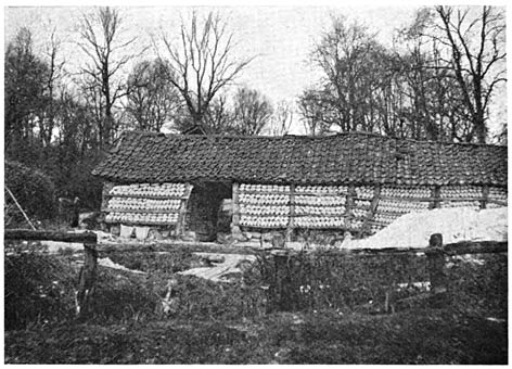
Whitening Factory, Kintbury
Whitening Factory, Kintbury
Two chalybeate springs at Sunninghill were at one time quite well known.
Two iron-rich springs at Sunninghill were once quite famous.
Whiting or whitening has for a long time been manufactured at Kintbury from soft chalk which is dug there. A layer in the Reading Beds at Reading used to be dug as fuller’s earth for the clothiers of that town. [73]
Whiting or whitening has long been produced at Kintbury from soft chalk that’s extracted there. A layer in the Reading Beds at Reading used to be mined as fuller’s earth for the textile workers in that town. [__A_TAG_PLACEHOLDER_0__]
Before the Norman conquest most of the buildings in the county were of wood, and of course wood has been very largely used in buildings at all times. Splendid examples of hewn timber-work may be seen in many of our churches and other buildings. There is for example some very fine old timber in the Canon’s Cloisters at Windsor Castle.
Before the Norman conquest, most buildings in the county were made of wood, and wood has always been widely used in construction. You can see stunning examples of crafted timber-work in many of our churches and other structures. For instance, there is some beautiful old timber in the Canon’s Cloisters at Windsor Castle.
Brick was a building material in the time of the Romans and its use was most probably never wholly discontinued. In Tudor times many of the buildings were of brick and timber, and picturesque brick and timber structures of various dates will be found in all parts of our county. The gallery at Christ’s Hospital, Abingdon, shown on the next page, is a good example.
Brick was a construction material during the Roman era, and it's likely that its use was never completely stopped. In Tudor times, many buildings were made of brick and timber, and you'll find charming brick and timber structures from different periods throughout our county. The gallery at Christ's Hospital, Abingdon, shown on the next page, is a great example.
All the clay formations in Berkshire have been used for brick and tile making. The works at Katesgrove and other places on the banks of the Kennet at Reading are very old and certainly go back to the sixteenth century. In 1901 there were 1029 men and 35 women engaged in brick, cement, pottery, and like works in Berkshire.
All the clay formations in Berkshire have been used to make bricks and tiles. The facilities at Katesgrove and other locations along the Kennet River in Reading are quite old and definitely date back to the sixteenth century. In 1901, there were 1,029 men and 35 women involved in brick, cement, pottery, and similar industries in Berkshire.
The limestone rocks of the Corallian formation have been much quarried in the district between Faringdon and the river Thames near Oxford, and the stone has been used in buildings of all ages.
The limestone rocks of the Corallian formation have been heavily quarried in the area between Faringdon and the Thames River near Oxford, and the stone has been used in buildings from all periods.
Chalk has also been extensively quarried for building purposes. There is a great deal of chalk in the walls of the Dean’s Cloisters and also in other parts of Windsor Castle. Chalk frame-work may be seen in many church windows, at Old Windsor and Bray for instance. At Waltham St Lawrence there is a very curious example, [74]for some flints are actually left in the chalk mullions of the east window of the north chantry. It may be of interest to mention that in the valley of the Seine in northern France chalk has been extensively used as a building stone—in some of the best buildings at Rouen for example.
Chalk has also been widely mined for construction. A lot of chalk is found in the walls of the Dean’s Cloisters and in other areas of Windsor Castle. Chalk frameworks can be seen in many church windows, such as those in Old Windsor and Bray. At Waltham St Lawrence, there is a very interesting example, [__A_TAG_PLACEHOLDER_0__] where some flints are actually embedded in the chalk mullions of the east window of the north chantry. It's worth noting that in the Seine Valley in northern France, chalk has been extensively used as a building material—especially in some of the finest buildings in Rouen, for instance.

Christ’s Hospital, Abingdon
Christ's Hospital, Abingdon
Flints from the chalk are much used as building-material in Berkshire; they are employed fixed in concrete to form the core of walls, as at Reading Abbey, and as facing to walls with stone corners and window-frames. Shottesbrooke Church is faced with beautifully dressed little flints. In other churches the flints are not squared but in the rough state. At St Mary’s Church, Reading, there is building of a chess-board pattern, one set of [75]squares being stone and the others formed of small dressed flints. Another example of this chequer-work is shown in the view of the church at White Waltham here given.
Flints from the chalk are widely used as building material in Berkshire; they are fixed in concrete to create the core of walls, like at Reading Abbey, and are also used as facing for walls with stone corners and window frames. Shottesbrooke Church has beautifully dressed small flints on its exterior. In other churches, the flints are left rough and not squared. At St Mary’s Church in Reading, there’s a building with a checkerboard pattern, where one set of [__A_TAG_PLACEHOLDER_0__] squares is stone and the others are made of small dressed flints. Another example of this checkerboard style can be seen in the view of the church at White Waltham presented here.
The hard sandstone which has been derived from the Eocene strata and is termed “sarsen” (see p. 40) is an important Berkshire building stone. There is a great deal of it in the walls all over Windsor Castle, several of the towers and walls being faced with sarsen.
The tough sandstone derived from the Eocene layers, known as “sarsen” (see p. 40), is an important building stone in Berkshire. Much of it is used in the walls throughout Windsor Castle, with several towers and walls being made of sarsen.

White Waltham Church
White Waltham Church
In some of the Berkshire gravel beds there is a hard irony conglomerate, and this has been used as a building material. There is a good deal in the tower of St Giles Church, Reading, and in the parish church at Wokingham. [76]
In some of the gravel pits in Berkshire, there's a tough iron-rich conglomerate that has been used as a building material. A significant amount of it can be found in the tower of St. Giles Church in Reading and in the parish church at Wokingham. [__A_TAG_PLACEHOLDER_0__]
There are many building-materials used in the county which have been brought from other districts, but this chapter only deals with things found in Berkshire itself.
There are many building materials used in the county that have been brought in from other areas, but this chapter only focuses on materials found in Berkshire itself.
Chalk was formerly used to a large extent for chalking the soil, but the practice has now almost fallen into disuse, and in consequence one sees abandoned chalk pits all over the chalk district. The reasons for giving up chalking are the increase in the cost of labour and the decrease in the value of corn crops, together with the much larger use of artificial manures. The fertility of many farms now is nevertheless due to the liming and chalking of old days, and it is to be regretted that the practice has been abandoned to so great an extent.
Chalk used to be widely used for treating the soil, but now this practice has nearly disappeared, leading to many abandoned chalk pits throughout the chalk region. The reasons for this decline include rising labor costs, decreased corn crop values, and the increased use of synthetic fertilizers. Despite this, the fertility of many farms today can still be attributed to the liming and chalking methods from the past, and it's unfortunate that these practices have been so largely abandoned.
13. The History of Berkshire.
It has already been mentioned that Berkshire probably came into existence as a county in the time of King Egbert, who brought the long struggle between the kingdoms of the Heptarchy to a close and established the ascendancy of Wessex over much of the south of England. It is probable that there was still a population living on the chalk downs and in occupation of the old forts, and the fertile Vale of White Horse was gradually coming under cultivation. In any case there was a royal residence at Wantage, where Alfred the Great was born in 849, and a religious foundation at Abingdon. There were also at least two towns, Reading and Wallingford. [77]
It has already been noted that Berkshire likely became a county during the reign of King Egbert, who ended the long conflict between the kingdoms of the Heptarchy and established Wessex's dominance over much of southern England. It's likely that there were still people living on the chalk downs and occupying the old forts, while the fertile Vale of White Horse was slowly being cultivated. In any case, there was a royal residence in Wantage, where Alfred the Great was born in 849, and a religious establishment in Abingdon. There were also at least two towns, Reading and Wallingford. [__A_TAG_PLACEHOLDER_0__]
Already in the previous century the English coast had been harried by the Viking pirates, but there is no record of their having penetrated to our district. In 851 they did indeed make their way up the Thames into Surrey, but were defeated by Ethelwulf, the son of Egbert, and his son Ethelbald at Ockley. They next approached Berkshire from the south coast, and in 860 attacked and plundered Winchester, but were defeated by the united forces of Berkshire and Hampshire. Ivor the Dane is said to have reached Reading in 868, and Reading was captured and occupied by the Danes in 871.
Already in the previous century, the English coast had been attacked by Viking pirates, but there’s no record of them reaching our area. In 851, they did manage to travel up the Thames into Surrey but were defeated by Ethelwulf, the son of Egbert, along with his son Ethelbald at Ockley. They then approached Berkshire from the south coast and, in 860, attacked and plundered Winchester but were defeated by the combined forces of Berkshire and Hampshire. Ivor the Dane is said to have arrived in Reading in 868, and Reading was captured and occupied by the Danes in 871.
Ethelred was at this time king and together with his brother Alfred fought the Danes near Reading, but was not successful and retreated westwards. The Danes followed and the great battle of Assandun, in which the Danes were put to flight, was fought on the chalk downs at some place to the west of Aldworth in 871. There is much doubt as to the exact site of the battle. At one time it was supposed that the White Horse was cut on the hill-side as a memorial of the victory, but it is now known that this was not so, for the horse is much older than the date of the battle. The Danes retreated to Reading, and only 14 days afterwards they got the better of the Saxons in a fight at Basing in Hampshire, and were again victorious two months later at Merton. A truce, however, followed and the Danes retired to London. All this was in the year 871, and during the same year King Ethelred died and Alfred the Great became king. How King Alfred, who ruled until 901, eventually defeated the Danes and came to terms with [78]them is well known, and Berkshire for a time enjoyed peace.
Ethelred was king at this time, and along with his brother Alfred, he fought the Danes near Reading but wasn't successful and retreated westward. The Danes pursued them, and the great battle of Assandun, where the Danes were defeated, took place on the chalk downs somewhere west of Aldworth in 871. There's a lot of uncertainty about the exact location of the battle. At one point, it was believed that the White Horse was carved into the hillside as a memorial of the victory, but it's now known that this isn't true, as the horse is much older than the battle. The Danes fell back to Reading, and just 14 days later, they overpowered the Saxons in a fight at Basing in Hampshire, and were victorious again two months later at Merton. A truce followed, and the Danes retreated to London. All of this happened in 871, and during the same year, King Ethelred died, and Alfred the Great became king. How King Alfred, who ruled until 901, ultimately defeated the Danes and reached an agreement with [__A_TAG_PLACEHOLDER_0__]them is well known, and Berkshire enjoyed peace for a while.

Statue of King Alfred, Wantage
Statue of King Alfred, Wantage
About this time there was a royal residence at Faringdon, for it is recorded that Edward the Elder died there in 925. His son Athelstan had a mint at Wallingford, and three coins struck by him at that place are in the collection at the British Museum. The monastery at Abingdon had been destroyed by the Danes, and St Ethelwold was told by King Edred to re-establish it, but [79]the work was not accomplished until the reign of Edgar. Ethelred the Unready had a mint at Reading.
About this time, there was a royal residence in Faringdon, as it's noted that Edward the Elder died there in 925. His son Athelstan had a mint in Wallingford, and three coins minted by him from that place are part of the collection at the British Museum. The monastery at Abingdon had been destroyed by the Danes, and St. Ethelwold was instructed by King Edred to restore it, but [__A_TAG_PLACEHOLDER_0__] the work wasn't completed until the reign of Edgar. Ethelred the Unready had a mint in Reading.
In 1006 the Danes again appeared in Berkshire and burnt Reading. They then advanced up the Thames to Wallingford and burnt that town. They did not, however, remain in the county, but carried their booty to the sea by way of Winchester. Both Reading and Wallingford were soon rebuilt. Edward the Confessor struck coins at both these towns, and there are specimens in the British Museum. The Confessor had a residence at Old Windsor, and the great Earl Godwin is said to have died there in a manner attributed to the judgment of God. The King gave Windsor to the Abbey of Westminster, but William the Conqueror exchanged it for some land in Essex, and built a castle on the chalk hill near the Thames where the present Windsor Castle stands. Ever since the time of the Conqueror Windsor has been a favourite residence of our Sovereigns.
In 1006, the Danes returned to Berkshire and burned Reading. They then moved up the Thames to Wallingford and set that town on fire as well. However, they didn't stay in the county; instead, they took their loot to the sea via Winchester. Both Reading and Wallingford were quickly rebuilt. Edward the Confessor minted coins in both towns, and some of those can be found in the British Museum. The Confessor had a residence at Old Windsor, and it’s said that the great Earl Godwin died there, believed to be due to divine judgment. The King granted Windsor to the Abbey of Westminster, but William the Conqueror traded it for some land in Essex and built a castle on the chalk hill near the Thames, where the present Windsor Castle is located. Since the time of the Conqueror, Windsor has been a favored residence of our Sovereigns.
In 1121 Reading Abbey was founded by King Henry I and the first Abbot was appointed in 1123. Henry added to the buildings at Windsor, and his marriage to his second wife Adelais, daughter of Godfrey Count of Louvain, took place there in 1121. There was at this time a castle at Wallingford, for it is recorded that Waleran, Earl of Mellent, was imprisoned there in 1126.
In 1121, King Henry I established Reading Abbey, and the first Abbot was appointed in 1123. Henry expanded the buildings at Windsor, and he married his second wife, Adelais, the daughter of Godfrey, Count of Louvain, there in 1121. At this time, there was a castle in Wallingford, as it's recorded that Waleran, Earl of Mellent, was imprisoned there in 1126.

St George’s Chapel, Windsor Castle
St. George's Chapel, Windsor Castle
Henry I died in 1135 and was buried in Reading Abbey. On his death the peace of the county was disturbed by civil war, for the crown was claimed by Henry’s nephew, Stephen of Blois, though he had sworn to support the cause of Henry’s daughter Maud or [81]Matilda. Matilda had been married twice, and as her first husband was Henry V, the Emperor of the Holy Roman Empire, she is known as the Empress Matilda. War between Stephen and Matilda began in 1139 and spread over most of England. Windsor and Reading were held for Stephen, whilst Brian of Wallingford, a great magnate in Berkshire, took the side of Matilda. Wallingford Castle was besieged by Stephen in 1139 and again in 1145, but without success. A castle at Faringdon built by Robert Earl of Gloucester was taken and destroyed by Stephen. In 1145 Matilda gave up the contest and retired to France, but in 1152 her son Henry renewed the war and Stephen again besieged Wallingford and again unsuccessfully. He also besieged Newbury Castle, which was held by John Marshal of Hampstead Marshall. Eventually in 1153 peace was made at Wallingford—Stephen to be king for life and to be succeeded by Henry, son of Matilda. Stephen died in the next year, 1154, and Henry was crowned as King Henry II. He possessed himself of Wallingford Castle and held a Council there in 1155. Henry added to the buildings at Windsor Castle, and the lower part of the south side of the Upper Ward dates from his time.
Henry I died in 1135 and was buried in Reading Abbey. After his death, the peace of the county was disrupted by civil war, as the crown was claimed by Henry’s nephew, Stephen of Blois, even though he had promised to support the claim of Henry’s daughter Matilda. Matilda had been married twice, and because her first husband was Henry V, the Emperor of the Holy Roman Empire, she is known as the Empress Matilda. The war between Stephen and Matilda started in 1139 and spread across most of England. Windsor and Reading were held for Stephen, while Brian of Wallingford, a major noble in Berkshire, supported Matilda. Wallingford Castle was besieged by Stephen in 1139 and again in 1145, but he was unsuccessful both times. A castle at Faringdon, built by Robert Earl of Gloucester, was taken and destroyed by Stephen. In 1145, Matilda gave up the fight and retreated to France, but in 1152 her son Henry resumed the war, and Stephen again besieged Wallingford, but without success. He also besieged Newbury Castle, which was held by John Marshal of Hampstead Marshall. Eventually, in 1153, peace was established at Wallingford—Stephen would be king for life and would be succeeded by Henry, Matilda's son. Stephen died the following year, in 1154, and Henry was crowned as King Henry II. He took control of Wallingford Castle and held a Council there in 1155. Henry expanded the buildings at Windsor Castle, and the lower part of the south side of the Upper Ward dates back to his time.
In 1163 a duel or wager of battle was fought between Robert de Montfort and Henry of Essex on an island in the Thames below Caversham Bridge. Essex was accused of treachery or cowardice, having thrown away the standard in a battle at Coleshill. He was defeated in the duel and was allowed to join the community of Reading Abbey. [82]
In 1163, a duel or battle wager took place between Robert de Montfort and Henry of Essex on an island in the Thames, just below Caversham Bridge. Essex faced accusations of treachery or cowardice for abandoning the standard in a battle at Coleshill. He lost the duel and was permitted to join the community of Reading Abbey. [__A_TAG_PLACEHOLDER_0__]

St George’s Chapel: the Interior
St George's Chapel: the Inside
On April 19th, 1164, the ceremony of hallowing the Abbey Church at Reading was performed by Thomas à Becket, Archbishop of Canterbury, in the presence of the King. In 1175 Henry held a royal festival at Reading, and in 1185 we hear of a state ceremony at this town, when Henry received Heraclius, the Patriarch of Jerusalem. Henry died in 1189 and was succeeded by his son Richard I. Soon after his accession Richard left England on a crusade, having appointed the Bishops of Ely and Durham guardians of the kingdom during his absence. To his brother John he gave the government of some English districts and places, including the Honour of Wallingford. After Richard’s departure a quarrel arose [83]between the Bishop of Ely, whose name was Longchamp, and Geoffrey Archbishop of York, and Longchamp caused Geoffrey to be arrested. Prince John took the part of Geoffrey and called a Council at Reading to demand justification from Longchamp, who was summoned to meet the prince at Loddon Bridge, presumably the bridge on the Reading and Wokingham road. Longchamp did not appear, and all the participators in the arrest of the Archbishop were excommunicated in Reading church. Longchamp eventually retired to the continent, and John obtained possession of Windsor Castle, but gave it up to Queen Eleanor until Richard should come back—which he did in 1194. On Richard’s death, in 1199, his brother John became King. In 1204 he obtained possession of Beckett near Shrivenham, once the property of the Earls of Evreux, and he probably lived there at times, for a mandate to the Sheriff of Oxfordshire is dated from Beckett. In 1213 John held an important ecclesiastical Council at Reading Abbey. He died in 1216 and was succeeded by his son Henry, who was in his tenth year. William Marshal, Earl of Pembroke, son of John Marshal already mentioned, was appointed Regent of the kingdom, and he held the office until his death in 1219.
On April 19, 1164, Thomas à Becket, the Archbishop of Canterbury, led the ceremony to dedicate the Abbey Church at Reading in front of the King. In 1175, Henry hosted a royal festival at Reading, and in 1185, there's a record of a state event in this town where Henry welcomed Heraclius, the Patriarch of Jerusalem. Henry passed away in 1189 and was succeeded by his son Richard I. Shortly after taking the throne, Richard left England to go on a crusade, appointing the Bishops of Ely and Durham as guardians of the kingdom during his absence. He gave his brother John control over some areas in England, including the Honour of Wallingford. After Richard's departure, a dispute broke out between the Bishop of Ely, named Longchamp, and Geoffrey, the Archbishop of York, leading Longchamp to have Geoffrey arrested. Prince John supported Geoffrey and called a Council in Reading to demand an explanation from Longchamp, who was summoned to meet John at Loddon Bridge, likely the bridge on the Reading and Wokingham road. Longchamp did not show up, and everyone involved in the Archbishop's arrest was excommunicated in Reading church. Longchamp eventually fled to the continent, and John took over Windsor Castle, but later handed it to Queen Eleanor until Richard returned, which he did in 1194. Upon Richard's death in 1199, John became King. In 1204, he gained control of Beckett near Shrivenham, which had previously been owned by the Earls of Evreux, and he probably stayed there at times, as a mandate to the Sheriff of Oxfordshire is dated from Beckett. In 1213, John held an important ecclesiastical Council at Reading Abbey. He died in 1216 and was succeeded by his son Henry, who was only ten years old at the time. William Marshal, Earl of Pembroke and son of John Marshal, was appointed Regent of the kingdom, a position he held until his death in 1219.
In the Dean’s Cloisters at Windsor may be still seen the crowned head of Henry painted during his life by William the monk of Westminster. Henry added largely to Windsor Castle, and the outer walls and towers of the Lower Ward are to a great extent his work. Disputes arose between Henry and his barons, and Berkshire was again the scene of civil war. In 1261 Parliament was [84]summoned to meet at Windsor, and the castle was fortified by Prince Edward. It was taken in 1263 by Simon de Montfort, and the prince was captured. In time, however, he escaped and got the better of the barons.
In the Dean’s Cloisters at Windsor, you can still see the crowned head of Henry, painted during his life by William the monk of Westminster. Henry significantly expanded Windsor Castle, and the outer walls and towers of the Lower Ward are largely his creation. Conflicts arose between Henry and his barons, leading to another civil war in Berkshire. In 1261, Parliament was [__A_TAG_PLACEHOLDER_0__]called to meet at Windsor, and Prince Edward fortified the castle. It was captured in 1263 by Simon de Montfort, and the prince was taken prisoner. Eventually, he escaped and overcame the barons.
In 1295 Berkshire sent two knights of the shire to Parliament, and Reading and Wallingford also sent representatives. In 1307 the Templars were expelled from their Preceptories at Bisham and Templeton. In the time of Edward II we hear complaints of robbers in Windsor Forest.
In 1295, Berkshire sent two knights to Parliament, and Reading and Wallingford also had representatives. In 1307, the Templars were kicked out of their Preceptories in Bisham and Templeton. During Edward II's reign, there were complaints about robbers in Windsor Forest.
Edward III was born at Windsor in 1312, and his tenure of power began at a Court held at Wallingford in 1326, though his father was not deposed until the next year. King Edward wished to hold a Round Table in imitation of King Arthur, and he invited a number of knights both English and foreign to assemble at Windsor Castle in 1344. No doubt a splendid tournament took place and others followed in subsequent years. In 1347 or 1348 a garter with the motto Hony soit qui mal y pense was worn as a device at jousts at Windsor, and the institution of the Order of the Garter in all probability took place at Windsor in 1348, though some authorities give the date as 1349. At Christmas, 1346, the King was at Reading and a great jousting was held in his honour, and in 1359 John of Gaunt, afterwards Duke of Lancaster, was married at Reading, and there was a great pageant and a tournament in which the King and his sons took part.
Edward III was born in Windsor in 1312, and he began his rule at a court held in Wallingford in 1326, although his father wasn’t removed from power until the following year. King Edward wanted to create a Round Table like King Arthur's, so he invited several knights, both English and foreign, to gather at Windsor Castle in 1344. A magnificent tournament surely took place, followed by more in the coming years. In 1347 or 1348, a garter featuring the motto Hony soit qui mal y pense was worn as a symbol at jousts in Windsor, and the establishment of the Order of the Garter likely occurred at Windsor in 1348, although some sources suggest it was in 1349. During Christmas 1346, the King was in Reading, where a grand jousting event was held in his honor, and in 1359, John of Gaunt, who later became the Duke of Lancaster, got married in Reading, accompanied by a grand pageant and a tournament that the King and his sons participated in.
During the reign of Edward III, William of Wykeham built, or re-built, the Round Tower and much of the castle [85]at Windsor. The sword of the King is still preserved there.
During the rule of Edward III, William of Wykeham built or remodeled the Round Tower and much of the castle [__A_TAG_PLACEHOLDER_0__]at Windsor. The King's sword is still kept there.
In 1327 Abingdon had a little fight of its own. Some of the townspeople, assisted by the Mayor of Oxford and it is said by some scholars, attacked the Abbey and drove out the monks, part of the buildings being burnt and the muniments destroyed. In the end twelve of the attacking party were hanged and the monks restored.
In 1327, Abingdon had its own little conflict. Some townspeople, with help from the Mayor of Oxford and, according to some scholars, attacked the Abbey and drove out the monks. Part of the buildings were burned, and the records were destroyed. In the end, twelve members of the attacking group were hanged, and the monks were restored.

Abingdon Abbey
Abingdon Abbey
In 1361 the Black Prince married Joan the Fair Maid of Kent. The marriage took place at Windsor, and after her husband’s death Joan lived a good deal at Wallingford.
In 1361, the Black Prince married Joan the Fair Maid of Kent. The wedding happened at Windsor, and after her husband died, Joan spent a lot of time at Wallingford.
The reign of Richard II, which lasted from 1377 to 1399, was marked by constant troubles between the King with his favourites on the one hand and the nobles on the [86]other. In 1387 Radcot Bridge was the scene of a fight between the King’s party of 5000 men under De Vere, Duke of Ireland, and Henry Earl of Derby (afterwards Henry IV). De Vere was defeated, and only escaped by swimming down the Thames.
The reign of Richard II, which lasted from 1377 to 1399, was marked by continuous conflicts between the King and his favorites on one side, and the nobles on the [__A_TAG_PLACEHOLDER_0__]other. In 1387, Radcot Bridge was the site of a battle between the King's group of 5,000 men led by De Vere, Duke of Ireland, and Henry, Earl of Derby (who later became Henry IV). De Vere was defeated and only managed to escape by swimming down the Thames.
In 1399 Richard’s inglorious reign came to an end. He was deposed in favour of Henry of Bolingbroke, son of John of Gaunt, who became King as Henry IV.
In 1399, Richard's shameful reign ended. He was removed from power in favor of Henry of Bolingbroke, the son of John of Gaunt, who became king as Henry IV.
14. The History of Berkshire (continued).
The reign of Henry IV lasted from 1399 to 1413. The hereditary heir to the Crown on the death of Richard II was a child, Edmund Mortimer, Earl of March, and he was detained a prisoner at Windsor Castle during the whole of Henry’s reign, and only liberated by Henry V in 1413. There was at least one fight in Berkshire during the time of Henry IV. In 1400 an attempt was made by some of the nobles to fall on the King at Windsor, but he was warned in time, and retired to London, and when the insurgents reached Windsor, they entered the Castle without opposition, searched for the King, but found he had gone. Meanwhile he had raised a force in London, and came to attack the insurgent nobles, who retreated, and a sharp encounter took place at Maidenhead Bridge. The insurgents retired to Oxford and were eventually defeated.
The reign of Henry IV lasted from 1399 to 1413. The rightful heir to the throne after Richard II's death was a child, Edmund Mortimer, Earl of March, who was held prisoner in Windsor Castle for the entire duration of Henry's reign, only being released by Henry V in 1413. There was at least one conflict in Berkshire during Henry IV's time. In 1400, some nobles tried to ambush the King at Windsor, but he was warned in time and fled to London. When the rebels reached Windsor, they entered the Castle without any resistance and looked for the King, but found he had already left. In the meantime, he gathered a force in London and returned to confront the rebel nobles, who withdrew, leading to a fierce clash at Maidenhead Bridge. The insurgents retreated to Oxford and were ultimately defeated.
James I, King of Scotland, was a prisoner at Windsor during most of the last ten years of his long captivity, [87]which ended by his release in 1424. His book, The King’s Quhair, was written at Windsor, and it was at Windsor that he fell in love with Jane Beaufort, who afterwards became his Queen.
James I, King of Scotland, was a prisoner at Windsor for most of the last ten years of his long captivity, [__A_TAG_PLACEHOLDER_0__]which ended with his release in 1424. His book, The King’s Quhair, was written at Windsor, and it was there that he fell in love with Jane Beaufort, who later became his Queen.
Henry VI was born at Windsor in 1421, and became King when about nine months old. He grew up weak in mind, and during his reign all England was involved in the Wars of the Roses. Berkshire was during most of the time held by the Lancastrian party, but in 1460 Newbury was taken by the Earl of Wiltshire on behalf of the Yorkists. In the next year, 1461, the Duke of York obtained the Crown under the name of Edward IV.
Henry VI was born in Windsor in 1421 and became king when he was around nine months old. He grew up to be weak-minded, and during his reign, all of England was caught up in the Wars of the Roses. For most of that time, Berkshire was controlled by the Lancastrian faction, but in 1460, Newbury was captured by the Earl of Wiltshire on behalf of the Yorkists. The following year, 1461, the Duke of York took the Crown as Edward IV.
Henry VI held several Parliaments at Reading, and Edward IV also visited the Abbey, and it is recorded that in 1464 he made the first public announcement of his marriage with Elizabeth Woodville at a great Council of the Peers at Reading. The marriage was not popular, and it was especially disliked by the Nevilles, the most powerful of whom, Richard Earl of Warwick, subsequently defeated Edward’s forces and restored Henry VI, but Henry’s renewed reign lasted only some six months, for Edward defeated Warwick, who was killed, at the battle of Barnet in 1471. Warwick and his brother the Marquis of Montagu, also killed at Barnet, were both buried at Bisham Abbey in Berkshire.
Henry VI held several Parliaments in Reading, and Edward IV also visited the Abbey. It's recorded that in 1464, he publicly announced his marriage to Elizabeth Woodville during a major Council of the Peers in Reading. The marriage wasn't popular and was particularly disapproved of by the Nevilles, especially Richard, the Earl of Warwick, who was the most powerful among them. He later defeated Edward's forces and restored Henry VI, but Henry's second reign lasted only about six months. Edward defeated Warwick, who was killed at the Battle of Barnet in 1471. Warwick and his brother, the Marquis of Montagu, who was also killed at Barnet, were buried at Bisham Abbey in Berkshire.
The greater part of St George’s Chapel in Windsor Castle dates from the reign of King Edward IV, and he was the first of our kings to be buried there, 1483. The body of his rival Henry VI was removed to Windsor from Chertsey Abbey in 1484. The beautiful Rutland Chapel [88]in St George’s Chapel was built by Sir Thomas St Leger in memory of his wife Ann, sister of Edward IV. St Leger was beheaded by Richard III, but was buried in the chapel and a brass to himself and his wife still remains on the wall there.
The majority of St George’s Chapel in Windsor Castle was built during the reign of King Edward IV, who was the first of our kings to be buried there in 1483. The body of his rival, Henry VI, was moved to Windsor from Chertsey Abbey in 1484. The stunning Rutland Chapel [__A_TAG_PLACEHOLDER_0__]in St George’s Chapel was constructed by Sir Thomas St Leger in honor of his wife Ann, who was Edward IV’s sister. St Leger was executed by Richard III but was interred in the chapel, and a brass memorial for him and his wife still remains on the wall there.
After the Wars of the Roses peace reigned in Berkshire for many a long year, and the county no doubt increased in wealth and prospered generally. A considerable part of the land was in the possession of the Church, but in the days of King Henry VIII the whole of the monastic institutions were swept away.
After the Wars of the Roses, there was peace in Berkshire for many years, and the county likely grew richer and thrived overall. A significant portion of the land was owned by the Church, but during the reign of King Henry VIII, all the monastic institutions were abolished.
Owing to the dissolution of the monasteries a large part of the land in Berkshire passed into the hands of the Crown. Some of it was granted to Oxford colleges and much to private persons.
Owing to the closure of the monasteries, a significant portion of the land in Berkshire became the property of the Crown. Some of it was given to Oxford colleges, and a lot went to private individuals.
In 1544 three persons, Testwood, Filmer, and Peerson were burnt at Windsor as heretics, and in 1556 Julius Palmer, Master of Reading Grammar School, John Gwin, and Thomas Askew were burnt at the sandpits near Newbury.
In 1544, three people—Testwood, Filmer, and Peerson—were burned at Windsor as heretics, and in 1556, Julius Palmer, the head of Reading Grammar School, John Gwin, and Thomas Askew were burned at the sandpits near Newbury.
Elizabeth, before her accession in 1558, lived for some three years at Sir Thomas Hoby’s house at Bisham; indeed she was practically a prisoner under the charge of Sir Thomas and his wife’s sisters. When she came to the throne Elizabeth like her predecessors lived a good deal at Windsor, and we hear of visits by her to Reading, Englefield House (Sir F. Walsingham) and other places. It was in her days that the tragedy took place which made “Cumnor Hall” known all over the world, though its celebrity is due more to Scott’s novel Kenilworth [89]than to history. The real facts were, however, sufficiently tragic. Amy, the daughter of Sir John Robsart, married Lord Robert Dudley, afterwards Earl of Leicester, in 1550. Ten years later she was found dead, at Cumnor Place, which had been recently purchased by Anthony Forster the steward of Lord Robert. Foul play was suspected and it was suggested that Dudley had reasons for wishing to get rid of his wife as she stood in the way of higher ambitions. There were no “haunted towers of Cumnor Hall” for Cumnor Place was not a large house. Now only a few remains of walls are left on the site.
Elizabeth, before she became queen in 1558, spent around three years at Sir Thomas Hoby’s house in Bisham; she was effectively a prisoner under the care of Sir Thomas and his wife's sisters. Once she ascended to the throne, Elizabeth, like her predecessors, spent a lot of time at Windsor, and we hear about her visits to Reading, Englefield House (Sir F. Walsingham), and other locations. It was during her reign that the tragedy occurred that made “Cumnor Hall” famous worldwide, though its notoriety is more due to Scott’s novel Kenilworth [__A_TAG_PLACEHOLDER_0__]than to actual history. The true events were, however, quite tragic. Amy, the daughter of Sir John Robsart, married Lord Robert Dudley, later the Earl of Leicester, in 1550. Ten years later, she was found dead at Cumnor Place, which had recently been bought by Anthony Forster, the steward of Lord Robert. There were suspicions of foul play, and it was suggested that Dudley might have had reasons for wanting to dispose of his wife since she obstructed his higher ambitions. There were no “haunted towers of Cumnor Hall” because Cumnor Place was not a large house. Now, only a few remnants of walls remain at the site.
St George’s Hall: Windsor Castle
St. George's Hall: Windsor Castle
At the beginning of the Civil War Berkshire was generally Royalist, and the county was the scene of much fighting during the whole war, an account of which can [90]be found in any History of England. The Earl of Essex captured Reading after a siege in 1643, and on September 20th of the same year there was a hard-fought battle between Charles and Essex near Newbury. Lord Falkland, who was on the King’s side, was killed at this battle, and a granite monument to his memory stands on the high ground south of the town.
At the start of the Civil War, Berkshire was mostly Royalist, and the county saw a lot of fighting throughout the war, which is detailed in any History of England. The Earl of Essex took Reading after a siege in 1643, and on September 20th of that same year, there was a fierce battle between Charles and Essex near Newbury. Lord Falkland, who fought for the King, was killed in this battle, and a granite monument in his honor stands on the high ground south of the town.

Statue of Queen Victoria at Windsor
Statue of Queen Victoria at Windsor
[91]
[__A_TAG_PLACEHOLDER_0__]
A second battle took place near Newbury on October 27th, 1644, when the Royalists occupied a position near Shaw House between the rivers Kennet and Lambourn. Earthworks, remains of this fight, may still be seen at Shaw House. Donnington Castle, near by, held out for the King until 1646, and Wallingford Castle fell into the hands of the Parliament in the same year.
A second battle happened near Newbury on October 27th, 1644, when the Royalists took a position near Shaw House between the Kennet and Lambourn rivers. You can still see the earthworks from this fight at Shaw House. Donnington Castle, nearby, held strong for the King until 1646, while Wallingford Castle was captured by Parliament in the same year.
On February 8th, 1649, Charles was buried in St George’s Chapel at Windsor Castle.
On February 8, 1649, Charles was buried in St. George’s Chapel at Windsor Castle.
Since the Civil War there has been only one small fight in Berkshire and that was in 1688. On December 6th of that year William of Orange reached Hungerford, and a force of 250 of his men came into conflict with 600 of James’s Irish troops at Reading. Superior discipline enabled William’s men to drive the Irish in confusion through the streets into the market-place where they attempted to rally, but being vigorously attacked in front, and fired upon at the same time by the inhabitants from the windows, they fled with the loss of their colours and 50 men, the conquerors only sustaining a loss of five.
Since the Civil War, there has only been one small skirmish in Berkshire, and that was in 1688. On December 6th of that year, William of Orange arrived in Hungerford, and a force of 250 of his soldiers clashed with 600 of James’s Irish troops in Reading. Better discipline allowed William’s men to push the Irish into a state of confusion through the streets into the market square, where the Irish tried to regroup. However, they were aggressively attacked from the front and simultaneously fired upon by locals from their windows, leading them to flee, losing their colors and 50 men, while the victors suffered only five casualties.
There is not much to say of the history of the county since that date, though, owing to the frequent residence of the Sovereign at Windsor, many an event of the highest importance and interest has taken place there.
There isn’t a lot to say about the county's history since that time, although, because the Sovereign often lived at Windsor, many significant and interesting events have occurred there.
15. Antiquities—(a) Prehistoric.
We have no written records of Man as he first lived in our land long ages ago. Writing was an unknown art, and records—even if they had existed—could not have [92]survived to come down to us. We therefore speak of this period as the Prehistoric—the time when the people of the past were unable themselves to record their story. Yet, though these sources of information are closed to us, we are able from the relics they have left behind them—the implements and weapons that they used, the bones of the animals they fed upon, the structures they erected—to form a fairly clear idea of these early peoples.
We don't have any written records of how people lived in our land many ages ago. Writing was a skill that hadn't been discovered, and even if records had existed, they wouldn't have lasted to reach us. So, we refer to this time as Prehistoric—the era when people couldn't document their own stories. However, despite the lack of direct information, we can get a pretty clear picture of these early societies from the relics they've left behind—the tools and weapons they used, the bones of the animals they ate, and the structures they built.
But this Prehistoric period, vast in its extent, has for convenience sake been further subdivided. At first the metals were unknown, or at least unused, and this period is spoken of as the Stone Age, for it was of flints and other stones that weapons and domestic implements were mainly fashioned. Later, man learnt how to get the easily-worked ores of tin and copper from the rocks and by their admixture to form bronze. From this, beautiful weapons and other articles were made, and from the time of the discovery we date what is known as the Bronze Age. Doubtless the ores of iron had long been known, but how to smelt them was another matter. At length the method was discovered, and mankind was in possession of hard metal implements having great advantages for all purposes over those previously employed. Thus the Iron Age began, and the early inhabitants of Britain had arrived at this stage of civilisation when the Romans came to our land.
But this prehistoric period, which was very extensive, has been further divided for convenience. At first, metals were unknown or at least not used, and this time is referred to as the Stone Age because weapons and everyday tools were mainly made from flint and other stones. Later, people learned to extract the easily worked ores of tin and copper from rocks, allowing them to mix these metals to create bronze. This led to the production of beautiful weapons and other items, and the time of this discovery marks what we call the Bronze Age. The ores of iron were probably known for a long time, but figuring out how to smelt them was a different challenge. Eventually, the method was discovered, and humanity had access to hard metal tools that offered significant advantages over those previously used. Thus, the Iron Age began, and the early inhabitants of Britain had reached this level of civilization by the time the Romans arrived in our land.
We may now turn to a consideration of these various epochs in their order. Firstly the Stone Age. This, though a convenient term as covering all the period before the advent of the Metal Ages, is too indefinite [93]both as to time and race, and hence it is usual to speak of the Palaeolithic or Old Stone Age, and the Neolithic or New Stone Age. The people of these two Ages were very distinct, and most authorities hold that—at all events in our land—a vast gap of time separated them, though no such gap occurred between the later Ages. Palaeolithic man, from various causes, ceased to inhabit what we now call Britain, and when the country was re-peopled it was by Neolithic man. Palaeolithic man lived in the days when the mammoth, reindeer, and hyaena roamed over our country; made leaf-shaped roughly-flaked flint weapons which were never ground or polished; cultivated no plants and tamed no animals; and built no monuments, graves, or houses. Neolithic man, on the other hand, learnt how to grind and polish his implements; was both a farmer and a breeder of stock; had many industries; and built megalithic monuments, houses, and graves—the remains of which survive to the present day.
We can now look at these different periods in order. First up is the Stone Age. While it's a useful term to describe everything before the Metal Ages, it's too vague in terms of both time and people. That's why we typically refer to the Palaeolithic or Old Stone Age and the Neolithic or New Stone Age. The people from these two periods were very different, and most experts believe that—at least in our country—a huge gap of time separated them, unlike the later ages. Palaeolithic humans, for various reasons, stopped living in what we now call Britain, and when the country was repopulated, it was by Neolithic humans. Palaeolithic people lived during a time when mammoths, reindeer, and hyenas roamed our land; they made leaf-shaped, roughly chipped flint tools that were never ground or polished; they didn’t cultivate plants or domesticate animals; and they built no monuments, graves, or houses. In contrast, Neolithic humans learned to grind and polish their tools; they were both farmers and livestock breeders; they had various industries; and they constructed megalithic monuments, houses, and graves—the remnants of which still exist today.
The earliest signs of the existence of man in Berkshire are, as we have said, the implements of stone, mostly flint, found in the gravels; and the implements of the Palaeolithic Period take us back to a very old time, so old that the surface features of our district were then quite different from what we see now.
The earliest signs of human existence in Berkshire are, as we mentioned, the stone tools, mostly made of flint, found in the gravel. These tools from the Palaeolithic Period date back to a time so ancient that the landscape of our area looked completely different from what we see today.
There is a fine series of Palaeolithic implements in the Reading Museum, and most of them have been found in gravel-pits near the river Thames in the Reading and Twyford district, or in the Cookham and Maidenhead district. The implements occur in the gravel in such a way as to prove that they were brought into the position [94]in which we find them at the same time and in the same manner as the other stones in the gravel, and the men who made them consequently lived at or before the date of the making of the beds of gravel. All the gravels in question were made by our rivers, and as the places where we find the implements are in some cases from 85 to 114 feet above the present level of the river, we infer that the valley has been deepened as much as from 85 to 114 feet since the time when the men who made the implements lived.
There is a remarkable collection of Paleolithic tools at the Reading Museum, most of which were discovered in gravel pits near the River Thames in the Reading and Twyford area, or in the Cookham and Maidenhead area. The tools are found in the gravel in such a way that it shows they were placed there at the same time and in the same way as the other stones, indicating that the people who made them lived at or before the time when the gravel beds were formed. All of the gravels in question were created by our rivers, and since the locations where we find the tools are sometimes between 85 and 114 feet above the current river level, we conclude that the valley has been deepened by 85 to 114 feet since the time when the toolmakers lived.

Wayland Smith’s Cave
Wayland Smith's Cave
We now come to the Neolithic Period when, as we have seen, man was a much more civilised person than [95]the earlier man is believed to have been. Some of his burial mounds still remain, and being oval in plan are known as long barrows. Wayland Smith’s Cave, a mile to the east of Ashbury (p. 83), is composed of some 32 stones, the remains of a long barrow of Neolithic times.
We now arrive at the Neolithic Period when, as we have seen, humans were much more civilized than the earlier humans are believed to have been. Some of their burial mounds still exist, and being oval in shape, they are known as long barrows. Wayland Smith’s Cave, located a mile east of Ashbury (p. 83), consists of around 32 stones, which are the remnants of a long barrow from Neolithic times.

Flint Implements of the Neolithic Period found in Berkshire
Flint Tools from the Neolithic Era Discovered in Berkshire
Neolithic implements are of stone, but in many cases they are unlike the older implements in being of polished stone. In the Reading Museum there is a fine polished flint chisel from Englefield, and also polished axes from [96]Broadmoor, from Pangbourne, and from the beds of the Thames and Kennet. In the British Museum there is a beautiful dagger of flint from a barrow on Lambourn Down. Pretty little arrow-heads have been found at many places on the downs and in the Wallingford district.
Neolithic tools are made of stone, but unlike older tools, many of them are crafted from polished stone. At the Reading Museum, there’s an impressive polished flint chisel from Englefield, along with polished axes from [__A_TAG_PLACEHOLDER_0__] Broadmoor, Pangbourne, and the riverbeds of the Thames and Kennet. The British Museum holds a stunning flint dagger from a barrow on Lambourn Down. Numerous pretty little arrowheads have been discovered in various locations on the downs and in the Wallingford area.
There was in Berkshire a long interval between the Palaeolithic and the Neolithic Periods, but so far as we know there was no such break between the Neolithic Period and the Bronze Age. All we can say is that there was a time when the inhabitants of our district began to use implements of copper, or of copper alloyed with tin, i.e. bronze, for some purposes, but they still continued to use implements of stone, and it is not always possible to say whether a stone implement belongs to the Neolithic Period, to the Bronze Age, or to an even later date.
There was a long gap in Berkshire between the Paleolithic and Neolithic Periods, but as far as we know, there was no such break between the Neolithic Period and the Bronze Age. All we can say is that there came a time when the people in our area started using tools made of copper or a copper-tin alloy, which we call bronze, for certain tasks, but they still kept using stone tools. It's not always clear whether a stone tool is from the Neolithic Period, the Bronze Age, or even a later time.
Many remains of the Bronze Age have been found in burial-mounds or barrows, and the barrows of this period are circular, with a diameter of fifty to one hundred feet, and hence termed round barrows. Many pieces of sepulchral pottery of this age from Berkshire will be found both in the British Museum and the Reading Museum. A considerable number of bronze implements were found in one place at Yattendon, and another hoard of them was discovered at Wallingford. A great many bronze swords, daggers, and spear-heads have been found in the river Thames, and are to be seen in the Museums.
Many remains from the Bronze Age have been discovered in burial mounds, or barrows, which are round in shape, measuring between fifty and one hundred feet in diameter, and are therefore called round barrows. Numerous pieces of funerary pottery from this time period, originating from Berkshire, can be found in both the British Museum and the Reading Museum. A significant number of bronze tools were uncovered at Yattendon, and another stash was found at Wallingford. Many bronze swords, daggers, and spearheads have been recovered from the River Thames and are displayed in the museums.
A cemetery of this period was found at Sulham, and many earthenware urns from it are in the Reading [97]Museum. There are also in the Museum some urns from Neolithic barrows at Sunningdale.
A cemetery from this time was discovered at Sulham, and many earthenware urns from it are displayed in the Reading [__A_TAG_PLACEHOLDER_0__]Museum. The Museum also has some urns from Neolithic burial mounds at Sunningdale.
The extensive deposits of peat at and around Newbury show that it was a marsh and lake district until historical time, and remains of pile dwellings have been found in the market-place, in Bartholomew Street, and in Cheap Street. Their date cannot be fixed with certainty, but they are almost certainly prehistoric in age.
The large deposits of peat at and around Newbury indicate that it was a marsh and lake area until historical times, and remains of pile dwellings have been discovered in the market square, on Bartholomew Street, and on Cheap Street. Their exact date can't be pinpointed with certainty, but they are most likely prehistoric.
The substitution of iron for bronze indicates a considerable advance in knowledge, for, except in meteorites, pure iron is not found in nature, and no small skill is required to separate the metal from the earth or rock in which it occurs. There is, however, no definite division between the Bronze and the Iron Age, for implements and ornaments of both bronze and stone continued to be used. Nor is there any definite end to the Iron Age: it passes onwards into the period of written history.
The replacement of iron for bronze shows a significant advancement in knowledge because, apart from meteorites, pure iron isn’t found in nature, and it takes quite a bit of skill to extract the metal from the soil or rock where it’s located. However, there’s no clear boundary between the Bronze and Iron Ages, as tools and decorative items made of both bronze and stone were still being used. Similarly, there’s no clear end to the Iron Age; it seamlessly transitions into the period of recorded history.
A number of bones and various objects found in a grave on Hagbourne Hill seemed to show that a man, a horse, and possibly also a chariot had been buried there.
A number of bones and various objects found in a grave on Hagbourne Hill seemed to indicate that a man, a horse, and possibly a chariot had been buried there.
Ancient British coins have been found at Brightwell, Newbury, Wallingford, and at other places in Berkshire. Many of them bear on one side a rude representation of a horse, probably an imitation of the horse on the gold stater of Philip II of Macedon, who became king in B.C. 359. These gold coins, known as Philips, were current in Greece and in the East for a long period, and have been occasionally found in circulation even in modern times. The White Horse, which is cut in the turf on the [98]chalk hill above Uffington, bears a considerable resemblance to the horse on the British coins, and may very probably be of the same date.
Ancient British coins have been discovered at Brightwell, Newbury, Wallingford, and various other locations in Berkshire. Many of them feature a rough image of a horse on one side, likely mimicking the horse on the gold stater of Philip II of Macedon, who became king in BCE 359. These gold coins, known as Philips, were used in Greece and the East for a long time and have occasionally been found in circulation even in recent years. The White Horse, which is carved into the turf on the [__A_TAG_PLACEHOLDER_0__]chalk hill above Uffington, closely resembles the horse on the British coins and may very well date from the same period.
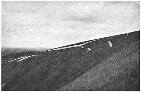
The White Horse
The White Horse
There are a great number of mounds and earthworks scattered over Berkshire, and it is exceedingly difficult to assign to them their proper dates. We have already mentioned Wayland Smith’s Cave as the remains of a long barrow of the Neolithic Period, and we have also referred to the round barrows of the Bronze Age. Some of the fortifications may date from these early times but many are probably of later date. It was for a long time needful to provide defence for the dwellings, not only against men, but also against wild animals, and the earthworks were no doubt used over and over again by successive peoples. [99]
There are many mounds and earthworks spread throughout Berkshire, and it's really hard to determine their exact dates. We've already talked about Wayland Smith’s Cave as the remains of a long barrow from the Neolithic Period, and we've also mentioned the round barrows from the Bronze Age. Some of the fortifications might date back to these early periods, but many are likely from later times. For a long time, it was essential to create defenses for homes, not just against people but also against wild animals, and these earthworks were probably used repeatedly by different groups over the years. [__A_TAG_PLACEHOLDER_0__]
As we have said, the chalk district was at one time the most populous part of the county, and we consequently find the downs dotted over with mounds and earthworks of very ancient date. Perhaps the best known of these is the fine earthwork named Uffington Castle on White Horse Hill (see p. 7). Alfred’s Castle is a circular earthwork close to Ashdown Park and three miles south-west of Uffington Castle. Letcombe Castle is another fair-sized work on the Ridge Way, rather more than five miles east of White Horse Hill. There is a large earthwork called Danish Camp on Blewburton Hill to the south of Didcot.
As we mentioned, the chalk district was once the most populated area of the county, so we find the downs scattered with ancient mounds and earthworks. One of the best known is the impressive earthwork called Uffington Castle on White Horse Hill (see p. 7). Alfred’s Castle is a circular earthwork located near Ashdown Park, three miles southwest of Uffington Castle. Letcombe Castle is another sizable structure on the Ridge Way, just over five miles east of White Horse Hill. There’s a large earthwork known as Danish Camp on Blewburton Hill, south of Didcot.

Blewburton Hill, near Blewbury
Blewburton Hill, close to Blewbury
There are a few old earthworks in the Vale of White Horse district. One crowns Badbury Hill near Faringdon. Cherbury Camp is a large oval work on low ground near Buckland. Sinodun Hill to the north of Wallingford has evidently been fortified in early times, [100]and Wallingford itself has the remains of an old and extensive earthwork round the town.
There are several ancient earthworks in the Vale of White Horse area. One sits atop Badbury Hill near Faringdon. Cherbury Camp is a large, oval structure on low ground near Buckland. Sinodun Hill, located north of Wallingford, clearly had fortifications in ancient times, [__A_TAG_PLACEHOLDER_0__] and Wallingford itself has the remnants of a vast old earthwork surrounding the town.
Passing to the Forest District we find many mounds and banks on the heaths, and there is one very fine earthwork known as Caesar’s Camp near Easthampstead. It was very likely used by the Romans, but is almost certainly of still older date. Finally it is highly probable that Windsor Castle stands on the site of an old fort.
Passing into the Forest District, we come across many mounds and banks on the heaths, and there's a notable earthwork called Caesar’s Camp near Easthampstead. It was probably used by the Romans, but dates back even further. Lastly, it's quite likely that Windsor Castle is built on the site of an ancient fort.
16. Antiquities—(b) Roman and Saxon.
The Reading Museum contains one of the finest Anglo-Roman collections in England. It is the result of careful and systematic excavation, carried on for a series of years, on the site of the town of Silchester, and the collection is of the greatest interest to us as illustrating the life in an English country town in the days of the Romans. The locality is however in Hampshire, the Berkshire boundary making a detour so as to leave it in the neighbouring county.
The Reading Museum has one of the best Anglo-Roman collections in England. It's the result of thorough and systematic excavations carried out over several years at the site of the town of Silchester. This collection is particularly fascinating as it showcases life in an English country town during the Roman era. However, the area is in Hampshire, as the boundary of Berkshire makes a detour to keep it in the neighboring county.
According to the ordnance map, Speen House near Newbury was the site of the Roman Spinae, but no Roman remains have been found there, though there is evidence of a settlement of some importance at Newbury itself.
According to the ordinance map, Speen House near Newbury was the location of the Roman Spinae, but no Roman artifacts have been discovered there, although there is proof of a significant settlement at Newbury itself.
The foundations of houses of the Roman period have been found at several places in Berkshire; thus at Frilford near Marcham the remains of a small Romano-British house were found; and near by, in Frilford Field, a cemetery of the same period, which had subsequently been [101]used by the Anglo-Saxons. Remains of a house with tessellated pavements were found on the Great Western Railway at Basildon, and other remains of Romano-British buildings have been discovered near Maidenhead and Waltham St Lawrence.
The foundations of houses from the Roman period have been discovered in various locations in Berkshire. For instance, at Frilford near Marcham, the remains of a small Romano-British house were found, and nearby, in Frilford Field, there was a cemetery from the same period that was later [__A_TAG_PLACEHOLDER_0__]used by the Anglo-Saxons. Remains of a house with mosaic floors were uncovered by the Great Western Railway at Basildon, and additional Romano-British structures have been found near Maidenhead and Waltham St Lawrence.
The words “Roman Villa” will be found marked on the ordnance map at two places to the south of Hampstead Norris, and remains of buildings have been discovered near Letcombe Regis, and at other places. The earthworks on Lowbury Hill to the west of Streatley are usually believed to be a Roman camp, and it is probable that the Roman soldiers occupied many of the old British forts at one time or another.
The term “Roman Villa” is marked on the ordnance map in two spots south of Hampstead Norris, and remnants of buildings have been found near Letcombe Regis and in other locations. The earthworks on Lowbury Hill, west of Streatley, are generally thought to be a Roman camp, and it's likely that Roman soldiers occupied many of the old British forts at various times.
Roman coins and pottery of the Romano-British period have been found almost all over the county, though they may be said to be most common along the valley of the Thames and least so near Faringdon. In the Reading Museum there are a good many objects of Roman date which were found in Reading itself. Specimens are exhibited from two small hoards of coins dating from the Emperor Valentinian A.D. 364 to the Emperor Honorius A.D. 423. The coins are in very good preservation and were probably hidden when the Roman soldiers departed from England.
Roman coins and pottery from the Romano-British period have been discovered almost all over the county, although they are most commonly found along the Thames valley and least often near Faringdon. The Reading Museum has quite a few Roman artifacts that came from Reading itself. There are displays from two small hoards of coins that date from Emperor Valentinian A.D. 364 to Emperor Honorius A.D. 423. The coins are well-preserved and were likely buried when the Roman soldiers left England.
There are signs of Roman settlements along the Devil’s Highway, the road from Silchester to London. Thus there was evidently a Romano-British village at Wickham Bushes close to Caesar’s Camp on Easthampstead Plain. A collection from this locality exists at Wellington College. [102]
There are signs of Roman settlements along the Devil’s Highway, the road from Silchester to London. So, there was clearly a Romano-British village at Wickham Bushes near Caesar’s Camp on Easthampstead Plain. A collection from this area is at Wellington College. [__A_TAG_PLACEHOLDER_0__]
A number of objects of the Anglo-Saxon period found in Berkshire will be seen in the Anglo-Saxon room at the British Museum. There is a very fine sword-blade from Ashdown, and a variety of objects—shield-bosses, knives, etc.—from Long Wittenham, where a Saxon burial-place has been explored. In some cases the body had been burnt, whilst in others the skeletons remained, and were found to be of a large-sized and robust race. Another Anglo-Saxon cemetery was discovered at Arne Hill near Lockinge, and a number of Anglo-Saxon interments in the Lambourn valley near East Shefford. Two burial-places of this period have been found at Reading. One contained spear-heads, knives, and bronze ornaments, and was probably of pagan date, whilst the other is believed to have been to some extent a Christian burial-place. In it a pewter chalice was found which may have been buried with a priest. The objects from these two localities are in the Reading Museum. Numbers of Anglo-Saxon coins have been dug up in Berkshire, more especially in the Cholsey and Wallingford district. They are of silver about the diameter of a sixpence but much thinner and are called pennies.
A variety of Anglo-Saxon artifacts found in Berkshire can be seen in the Anglo-Saxon room at the British Museum. There’s a very impressive sword blade from Ashdown, along with various objects like shield bosses and knives from Long Wittenham, where a Saxon burial site was uncovered. In some cases, the bodies were cremated, while in others the skeletons were discovered in good condition and belonged to a large, robust group of people. Another Anglo-Saxon cemetery was found at Arne Hill near Lockinge, and several Anglo-Saxon burials were located in the Lambourn valley near East Shefford. Two burial sites from this period have been discovered in Reading. One contained spearheads, knives, and bronze ornaments, likely from pagan times, while the other is thought to have been partially a Christian burial site. A pewter chalice found there may have been buried with a priest. Artifacts from these two locations are housed in the Reading Museum. Many Anglo-Saxon coins have also been discovered in Berkshire, especially in the Cholsey and Wallingford area. They’re silver, about the size of a sixpence but much thinner, and are known as pennies.
17. Architecture—(a) Ecclesiastical. Churches.
A preliminary word on the various styles of English architecture is necessary before we consider the churches and other important buildings of our county. [103]
A quick note on the different styles of English architecture is needed before we look at the churches and other significant buildings in our county. [__A_TAG_PLACEHOLDER_0__]
Pre-Norman or, as it is usually, though with no great certainty termed, Saxon building in England, was the work of early craftsmen with an imperfect knowledge of stone construction, who commonly used rough rubble walls, no buttresses, small semi-circular or triangular arches, and square towers with what is termed “long-and-short work” at the quoins or corners. It survives almost solely in portions of small churches.
Pre-Norman, or what is often called Saxon, building in England was done by early craftsmen who had a limited understanding of stone construction. They typically used rough rubble walls, didn't incorporate buttresses, and utilized small semi-circular or triangular arches, along with square towers that featured what’s known as “long-and-short work” at the corners. This style mostly remains in parts of small churches.

St Nicholas’s Church, Abingdon
St. Nicholas Church, Abingdon
The Norman conquest started a widespread building of massive churches and castles in the continental style [104]called Romanesque, which in England has got the name of “Norman.” They had walls of great thickness, semi-circular vaults, round-headed doors and windows, and lofty square towers.
The Norman conquest kicked off a major construction boom of large churches and castles in the continental style known as Romanesque, which in England came to be called "Norman." These buildings featured thick walls, semi-circular vaults, round-headed doors and windows, and tall square towers. [__A_TAG_PLACEHOLDER_0__]
From 1150 to 1200 the building became lighter, the arches pointed, and there was perfected the science of vaulting, by which the weight is brought upon piers and buttresses. This method of building, the “Gothic,” originated from the endeavour to cover the widest and loftiest areas with the greatest economy of stone. The first English Gothic, called “Early English,” from about 1180 to 1250, is characterised by slender piers (commonly of marble), lofty pointed vaults, and long, narrow, lancet-headed windows. After 1250 the windows became broader, divided up, and ornamented by patterns of tracery, while in the vault the ribs were multiplied. The greatest elegance of English Gothic was reached from 1260 to 1290, at which date English sculpture was at its highest, and art in painting, coloured glass making, and general craftsmanship at its zenith.
From 1150 to 1200, buildings became lighter, the arches became pointed, and the technique of vaulting was perfected, allowing weight to be distributed onto piers and buttresses. This style of architecture, known as "Gothic," developed from the desire to cover the widest and tallest spaces using the least amount of stone. The first English Gothic style, called "Early English," which lasted from about 1180 to 1250, is recognized for its slim piers (often made of marble), tall pointed vaults, and long, narrow, lancet windows. After 1250, the windows became wider, were divided into sections, and decorated with intricate tracery patterns, while in the vaults, the ribs were increased. The pinnacle of English Gothic elegance was achieved between 1260 and 1290, during which English sculpture reached its peak, and painting, stained glass, and general craftsmanship flourished.
After 1300 the structure of stone buildings began to be overlaid with ornament, the window tracery and vault ribs were of intricate patterns, the pinnacles and spires loaded with crocket and ornament. This later style is known as “Decorated,” and came to an end with the Black Death, which stopped all building for a time.
After 1300, the design of stone buildings started to feature more decorative elements, with intricate patterns in the window tracery and vault ribs, and pinnacles and spires adorned with crocket and ornamentation. This later style is called “Decorated” and came to a halt with the Black Death, which temporarily put a stop to all construction.
With the changed conditions of life the type of building changed. With curious uniformity and quickness the style called “Perpendicular”—which is unknown abroad—developed after 1360 in all parts of England and [105]lasted with scarcely any change up to 1520. As its name implies, it is characterised by the perpendicular arrangement of the tracery and panels on walls and in windows, and it is also distinguished by the flattened arches and the square arrangement of the mouldings over them, by the elaborate vault-traceries (especially fan-vaulting), and by the use of flat roofs and towers without spires.
With the changed conditions of life, the type of building evolved. With curious uniformity and speed, the style called “Perpendicular”—which is unknown outside England—developed after 1360 in all parts of England and [__A_TAG_PLACEHOLDER_0__]lasted with very few changes up to 1520. As its name suggests, it is characterized by the vertical arrangement of the tracery and panels on walls and in windows. It is also noted for the flattened arches and the square arrangement of the moldings above them, for the intricate vault-traceries (especially fan-vaulting), and for the use of flat roofs and towers without spires.

Abbey Gateway, Abingdon
Abbey Gateway, Abingdon
The mediaeval styles in England ended with the dissolution of the monasteries (1530–1540), for the Reformation checked the building of churches. There succeeded the building of manor-houses, in which the style called “Tudor” arose—distinguished by flat-headed windows, level ceilings, and panelled rooms. The ornaments [106]of classic style were introduced under the influences of Renaissance sculpture and distinguish the “Jacobean” style, so called after James I. About this time the professional architect arose. Hitherto, building had been entirely in the hands of the builder and the craftsman.
The medieval styles in England came to an end with the dissolution of the monasteries (1530–1540), which was caused by the Reformation that halted church construction. This led to the construction of manor houses, where the style known as “Tudor” emerged—characterized by flat-headed windows, level ceilings, and paneled rooms. Classic-style ornaments [__A_TAG_PLACEHOLDER_0__] were introduced under the influence of Renaissance sculpture, giving rise to the “Jacobean” style, named after James I. Around this time, the professional architect began to appear. Until then, building had been solely the work of builders and craftsmen.
Much of the stone used in Berkshire is of local origin, as has already been mentioned in Chapter 12, but a great deal has also been brought from a distance. Thus it is recorded that when the Abbot of Abingdon in 1100 rebuilt the conventual buildings as well as much of the abbey church, the materials were brought from Wales, six waggons, each drawn by twelve oxen, being engaged in the work. A great deal of Bath stone will be found in Berkshire buildings and some has even been brought from Caen in Normandy. Pillars and tombstones of Purbeck marble are common in the churches. In the south wall of the Dean’s Cloisters at Windsor (temp. Henry III) there are clusters of columns and one column in each is of Purbeck marble.
Much of the stone used in Berkshire comes from local sources, as mentioned in Chapter 12, but a significant amount has also been transported from far away. It is noted that when the Abbot of Abingdon rebuilt the convent buildings and much of the abbey church in 1100, materials were brought from Wales, requiring six wagons, each pulled by twelve oxen. You'll find a lot of Bath stone in Berkshire buildings, and some was even imported from Caen in Normandy. You'll commonly see pillars and tombstones made of Purbeck marble in the churches. In the south wall of the Dean’s Cloisters at Windsor (during the reign of Henry III), there are clusters of columns, with one column in each cluster made of Purbeck marble.
The tower of the church at Wickham, north-west of Newbury, is of a very early style of architecture, showing a variety of “long and short” work. Two of the belfry windows are double with a pillar in the middle, and are characteristic of this early work. The walls are very thick. The remainder of the church has been rebuilt.
The tower of the church in Wickham, northwest of Newbury, features a very early architectural style, showcasing a mix of “long and short” work. Two of the belfry windows are double with a pillar in the middle, which is typical of this early design. The walls are quite thick. The rest of the church has been rebuilt.

North Door, Faringdon Church
North Door, Faringdon Church
On pages 96 and 97 there are views of Norman doorways at Faringdon, both round-headed and one with an embattled moulding over the door. The church at Avington on the banks of the river Kennet a little below Hungerford is a good example of the Norman style of [107]architecture, and there is a most interesting little church at Finchampstead near Wokingham of which a view is given on page 98. It was built in the twelfth century and the east end of the chancel is round, as was usual at that time. The original windows were probably very small, and those which we now see were cut in the wall since Norman times. The north aisle, too, is newer than the body of the church, and the brick tower only dates from the seventeenth century. In the church there is a Norman font. There is more or less Norman work remaining in many of our other churches. Thus the illustration [108]on page 92 gives a view of the church of St Nicholas at Abingdon, and a round-headed Norman doorway will be seen under the tower, whilst the remainder of the building belongs to a later style of architecture, probably of the fifteenth century. The tower of West Shefford church is curious, the lower part is round and of Norman date, whilst the upper part is octagonal and was built subsequently.
On pages 96 and 97, there are pictures of Norman doorways in Faringdon, featuring both round-headed designs and one with an embattled molding above the door. The church at Avington, located on the banks of the River Kennet just below Hungerford, is a great example of the Norman style of [__A_TAG_PLACEHOLDER_0__]architecture. There's also a really interesting little church in Finchampstead near Wokingham, shown on page 98. It was built in the twelfth century, and the east end of the chancel is rounded, which was typical for that era. The original windows were likely very small, and the windows we see now were added later. The north aisle is also newer than the main part of the church, and the brick tower dates back only to the seventeenth century. Inside the church, there's a Norman font. There are remnants of Norman work in many of our other churches as well. For instance, the illustration [__A_TAG_PLACEHOLDER_0__]on page 92 shows the church of St Nicholas in Abingdon, where you can see a round-headed Norman doorway beneath the tower, while the rest of the building features a later architectural style, likely from the fifteenth century. The tower of West Shefford church is interesting; the lower part is round and dates back to the Norman period, while the upper part is octagonal and was added later.

South Door, Faringdon Church
South Door, Faringdon Church
Passing now to the Early English style of architecture there is on page 99 a view of Faringdon Church, which it [109]will be seen is built in the form of a cross with a massive square tower in the middle. Some of the arches inside the church are round-headed like Norman arches, but the windows are of the long narrow shape usual in the Early English style of building. We have churches built mainly in this style in many places, such as Ardington, Buckland, and Uffington.
Passing now to the Early English style of architecture, there is on page 99 a view of Faringdon Church, which it [__A_TAG_PLACEHOLDER_0__]will be seen is built in the form of a cross with a massive square tower in the middle. Some of the arches inside the church are round-headed like Norman arches, but the windows are long and narrow, which is typical in the Early English style of building. We have churches mainly built in this style in many places, such as Ardington, Buckland, and Uffington.

Finchampstead Church
Finchampstead Church
Of the Decorated style there is a most beautiful church at Shottesbrook near White Waltham, which was built by Sir William Tressel in 1337. It is cruciform with a tall spire. The walls are of small dressed flints, with corners and window and door frames of stone. The [110]roof is tiled and the spire of stone, the east end window large with beautiful stone tracery (p. 158), and the church is an unusually good example of the Decorated style. The Greyfriars Church at Reading was also built in the Decorated style. It was long a ruin or used for various purposes, but is now restored. We also have churches mainly in this style of architecture at Sparsholt, Warfield, and at other places.
Of the Decorated style, there's a beautiful church in Shottesbrook near White Waltham, built by Sir William Tressel in 1337. It has a cross shape with a tall spire. The walls are made of small dressed flints, with stone corners and window and door frames. The [__A_TAG_PLACEHOLDER_0__]roof is tiled, and the spire is made of stone, with a large east end window featuring stunning stone tracery (p. 158). The church is an outstanding example of the Decorated style. The Greyfriars Church in Reading was also constructed in this style. It was in ruins or used for various purposes for a long time but has since been restored. We also have churches primarily in this architectural style at Sparsholt, Warfield, and other places.
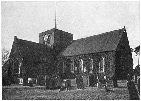
Faringdon Parish Church
Faringdon Community Church

The Upper Cross: East Hagbourne Village
The Upper Cross: East Hagbourne Village
We have many examples of Perpendicular style in Berkshire, but by far the best is the Chapel of St George in Windsor Castle (pp. 69, 71). The greater part of this chapel was built in the time of Edward IV. The windows are large and the nave consequently very light. The stone [111]roof of the nave was added by Henry VII, and that of the choir by Henry VIII. In the choir are the stalls of the Knights of the Garter, and installation ceremonies of the Order are performed here. St Helen’s Church, Abingdon, is our best Berkshire parish church in the Perpendicular style (the tower is Early English). It is large, with five aisles, as will be seen in the illustration here given. The church at Bray is chiefly celebrated on account of a vicar, one Simon Aleyn, who died in 1588 after holding the living under Henry VIII, Edward VI, Mary, and Elizabeth and altering his views as occasion required. The church is however of itself interesting, and in it will be found examples of Early English, Decorated, and Perpendicular work. The tower belongs [112]to the latest of these styles and is but badly joined on to the aisle of Edwardian date. It is mostly built of flints, but a broad band of chalk will be noticed about half-way up (p. 149). There is a good example of a church in this style at Newbury.
We have many examples of Perpendicular style in Berkshire, but the best one is the Chapel of St George in Windsor Castle (pp. 69, 71). Most of this chapel was built during the reign of Edward IV. The large windows make the nave very bright. The stone [__A_TAG_PLACEHOLDER_0__]roof of the nave was added by Henry VII, while that of the choir was added by Henry VIII. The choir features the stalls for the Knights of the Garter, where the installation ceremonies for the Order take place. St Helen’s Church in Abingdon is our finest parish church in the Perpendicular style (the tower is Early English). It’s large, with five aisles, as shown in the illustration here. The church in Bray is famous mainly because of a vicar, Simon Aleyn, who died in 1588 after serving under Henry VIII, Edward VI, Mary, and Elizabeth, changing his views as needed. However, the church itself is interesting, featuring examples of Early English, Decorated, and Perpendicular styles. The tower is from the latest of these styles and is poorly connected to the Edwardian aisle. It is mostly made of flints, but you'll notice a broad band of chalk about halfway up (p. 149). There’s also a good example of a church in this style in Newbury.

Abingdon Parish Church
Abingdon Parish Church
Brick church towers are a feature of eastern Berkshire and many of them date from the seventeenth century. One of these, at Finchampstead, is shown in the illustration on page 98.
Brick church towers are a characteristic of eastern Berkshire, and many of them date back to the seventeenth century. One of these, at Finchampstead, is depicted in the illustration on page 98.
There are crosses or their remains in many of the churchyards and villages. At Ardington there is both a new cross and the shaft of an old one. There are crosses at Denchworth, Goosey, East Hagbourne, Inglesham, North or Ferry Hinksey, Steventon, etc. [113]
There are crosses or what's left of them in many churchyards and villages. In Ardington, there's both a new cross and the remains of an old one. You can find crosses in Denchworth, Goosey, East Hagbourne, Inglesham, North or Ferry Hinksey, Steventon, and more. [__A_TAG_PLACEHOLDER_0__]
At Harwell the rood-screen still remains; there are interesting lead fonts at Childrey and at Long Wittenham; and stands for hour-glasses still exist in the churches at Binfield, Hurst, and Inglesham.
At Harwell, the rood screen is still there; there are fascinating lead fonts at Childrey and Long Wittenham; and hourglass stands can still be found in the churches at Binfield, Hurst, and Inglesham.
In former times it was very common to keep books in the churches fastened to the shelf or reading-desk by chains, and a few of them still remain. There are several in St Helen’s Church, Abingdon. A chained Bible of 1611 is in Cumnor church, and until recently there were several at Denchworth, but they have been removed to the vicarage, and Caxton’s Golden Legend of 1483 which used to be chained in Denchworth Church is now in the Bodleian Library.
In the past, it was very common to keep books in churches secured to shelves or reading desks with chains, and a few of them still exist. There are several in St Helen’s Church, Abingdon. A chained Bible from 1611 is in Cumnor Church, and until recently there were several in Denchworth, but they have been moved to the vicarage. Caxton’s Golden Legend from 1483, which used to be chained in Denchworth Church, is now in the Bodleian Library.
18. Architecture—(b) Religious Houses.
In the year A.D. 528 Benedict of Nursia drew up his celebrated rules at Monte Cassino in Italy, and founded the order of the Benedictine or Black Monks. The order rapidly spread over Europe and was established in Berkshire at an early period. The great Abbey of Abingdon dates from the days of the Saxon Kings, and at the time of Domesday survey it possessed 30 manors in Berkshire besides lands in other counties, and it continued to grow in wealth and power until its dissolution by Henry VIII. The great church of the abbey has been destroyed, but there are some interesting remains of the abbey buildings which, after having been put to varied uses, are now in the hands of the Corporation and carefully preserved. [114]The illustration given on page 74 shows the south side of what appears to have been a dormitory divided by partitions.
In the year A.D. 528, Benedict of Nursia established his well-known rules at Monte Cassino in Italy and founded the order of the Benedictine or Black Monks. The order quickly spread across Europe and was set up in Berkshire at an early stage. The great Abbey of Abingdon dates back to the time of the Saxon Kings, and during the Domesday survey, it owned 30 manors in Berkshire along with lands in other counties, continuing to grow in wealth and power until it was dissolved by Henry VIII. The large church of the abbey has been destroyed, but there are some interesting remnants of the abbey buildings, which, after being used for various purposes, are now owned by the Corporation and carefully preserved. [__A_TAG_PLACEHOLDER_0__] The illustration on page 74 shows the south side of what looks like a dormitory that was divided by partitions.

Ruins of Reading Abbey
Reading Abbey Ruins
In 1121 Henry I founded a second great Benedictine abbey in Berkshire at Reading, probably upon the site of an older monastic dwelling. Cluny had been founded in 910 as an order with a reformed Benedictine rule, and Reading was founded as an abbey of that order. Its connection with Cluny did not, however, last long, and early in the thirteenth century the abbey seems to have become attached to the general Benedictine order. Reading became one of the greatest of English abbeys. Its abbot, like the Abbot of Abingdon, was entitled to [115]wear the mitre and was summoned with the other spiritual peers to attend parliament.
In 1121, Henry I established a second major Benedictine abbey in Berkshire at Reading, likely on the site of an earlier monastic community. Cluny had been founded in 910 as a reformed Benedictine order, and Reading was created as an abbey of that order. However, its connection to Cluny didn't last long, and by the early thirteenth century, the abbey seems to have aligned with the general Benedictine order. Reading became one of the most significant English abbeys. Its abbot, like the Abbot of Abingdon, had the right to wear the mitre and was called along with other spiritual peers to attend parliament.

Part of the Hospitium of St John, Reading Abbey
Part of the Hospitium of St. John, Reading Abbey
Both Reading and Abingdon were dissolved by Henry VIII, and on November 14th, 1539, Hugh Faringdon, the 31st abbot of Reading, was hanged, drawn, and quartered within sight of his own gateway. The last abbot of Abingdon had made himself more agreeable to the king, and was granted the manor of Cumnor for life, and a pension as well.
Both Reading and Abingdon were shut down by Henry VIII, and on November 14, 1539, Hugh Faringdon, the 31st abbot of Reading, was hanged, drawn, and quartered in view of his own gate. The last abbot of Abingdon had been more accommodating to the king, and was given the manor of Cumnor for life, along with a pension.
The stone from Reading Abbey was much used for buildings in Reading and the neighbourhood, and in 1556, during the reign of Philip and Mary, a great deal was removed from the abbey and taken by river to Windsor for [116]building the Poor Knights’ Lodgings. The inner gateway of the abbey is still standing but has been partially rebuilt in modern times. There are also some remains of the abbey buildings probably belonging to the Hospice of St John.
The stone from Reading Abbey was widely used for buildings in Reading and the surrounding area. In 1556, during the reign of Philip and Mary, a significant amount was taken from the abbey and transported by river to Windsor for [__A_TAG_PLACEHOLDER_0__]building the Poor Knights’ Lodgings. The inner gateway of the abbey still stands, although it has been partially rebuilt in modern times. There are also some remnants of the abbey buildings, likely associated with the Hospice of St John.
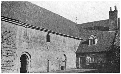
The Refectory, Hurley Priory
The Café, Hurley Priory
In the time of William the Conqueror (about 1086) Geoffrey de Mandeville gave the church of St Mary at Hurley, together with certain lands, for a cell of Benedictine monks to be subject to the Abbey of Westminster, and the remains of the priory thus founded are exceedingly beautiful and of much interest. The chapel, built in the Norman style of architecture, is now the parish church of Hurley. The illustration above shows the refectory or dining hall of the priory. The lower part is in the Norman style and the upper part of Edwardian [117]date. On the opposite side of this building is the river Thames.
In the time of William the Conqueror (around 1086), Geoffrey de Mandeville donated the church of St. Mary at Hurley, along with some lands, for a community of Benedictine monks under the Abbey of Westminster. The remains of the priory that was established are incredibly beautiful and of great interest. The chapel, built in the Norman architectural style, is now the parish church of Hurley. The illustration above shows the refectory or dining hall of the priory. The lower part is in the Norman style, while the upper part dates back to the Edwardian period. On the opposite side of this building is the River Thames.
There was a priory of the Benedictines at Wallingford, and a Benedictine nunnery at Bromhall in the parish of Sunninghill, but there are now no remains of either.
There was a Benedictine priory in Wallingford and a Benedictine nunnery in Bromhall within the parish of Sunninghill, but there are currently no remnants of either.

The Abbey Barn, Great Coxwell
The Abbey Barn, Great Coxwell
The only establishment connected with the great order of the Cistercians in the county was a small cell at Faringdon and a grange or barn at Great Coxwell, both belonging to the Abbey of Beaulieu in Hampshire. The fine abbey barn, dating from the fourteenth century, still remains.
The only place linked to the Cistercian order in the county was a small cell at Faringdon and a grange or barn at Great Coxwell, both owned by the Abbey of Beaulieu in Hampshire. The impressive abbey barn, dating back to the fourteenth century, is still standing.
The Austin Canons, an order founded at Avignon about 1061, had priories at Bisham, Poughley, and Sandleford. [118]After the dissolution of the monasteries Bisham Abbey became the seat of the Hoby family. It is beautifully situated on the Thames. Poughley Priory was situated in the chalk district one and a half miles south of Chaddleworth, and there are remains of the buildings at a farm. Sandleford Priory is about the same distance south of Newbury, and some remains are incorporated in the modern house which was built after plans by Wyatt in 1781 for Elizabeth Montague (1720–1800) the leader of the Blue-stockings.
The Austin Canons, an order started in Avignon around 1061, had priories at Bisham, Poughley, and Sandleford. [__A_TAG_PLACEHOLDER_0__]After the monasteries were dissolved, Bisham Abbey became the home of the Hoby family. It has a stunning location on the Thames. Poughley Priory was located in the chalk area about one and a half miles south of Chaddleworth, and you can still see the remains of the buildings at a farm there. Sandleford Priory is roughly the same distance south of Newbury, and some remnants are part of the modern house built in 1781 based on plans by Wyatt for Elizabeth Montague (1720–1800), who led the Blue-stockings.

Bisham Abbey
Bisham Abbey
We have already mentioned Bisham as an abbey of the Austin Canons, founded in 1338, but it had previously been a preceptory of the Knights Templars. That great military order was however suppressed in the time of Edward II and the preceptory dissolved (cir. 1312). [119]The Templars also had a preceptory at Brimpton which passed into the possession of the other great military order of monks, the Knights Hospitallers. Their chapel, which stands close to Brimpton Manor, still remains and is an interesting building. Shalford farm, a little to the east, was also the property of the Hospitallers. The order was suppressed in England in 1540, and was only temporarily revived under Queen Mary.
We’ve already talked about Bisham as an abbey of the Austin Canons, founded in 1338, but it used to be a preceptory of the Knights Templars. That powerful military order was suppressed during Edward II's reign, and the preceptory was dissolved around 1312. [__A_TAG_PLACEHOLDER_0__] The Templars also had a preceptory at Brimpton, which later became part of the other major military order of monks, the Knights Hospitallers. Their chapel, located near Brimpton Manor, is still standing and is an interesting building. Shalford Farm, slightly to the east, was also owned by the Hospitallers. The order was disbanded in England in 1540 and only briefly revived under Queen Mary.
There were priories in the county belonging to foreign abbeys and hence termed Alien Priories—one at Steventon belonging to the Abbey of Bec in Normandy, and the other known as Stratfieldsaye, but in Berkshire, belonging to the Abbey of Vallemont, also in Normandy. Both were abolished in the time of Edward III and there are no remains of buildings. A farm named the Priory near Beech Hill occupies the place of the latter, which was on the site of an old hermitage.
There were priories in the county that belonged to foreign abbeys, known as Alien Priories—one at Steventon that belonged to the Abbey of Bec in Normandy, and the other called Stratfieldsaye, located in Berkshire, which belonged to the Abbey of Vallemont, also in Normandy. Both were dissolved during the time of Edward III, and there are no remnants of the buildings. A farm called the Priory near Beech Hill now occupies the site of the latter, which was where an old hermitage used to be.
There were colleges at Shottesbrook, Windsor, and Wallingford. They were houses of priests who performed divine service in the churches attached to the colleges. We have already mentioned Shottesbrook. There is a very curious alabaster monument to William Throckmorton, one of the later Wardens of the college, in the chancel of the church representing him lying in his coffin.
There were colleges in Shottesbrook, Windsor, and Wallingford. They were residences for priests who conducted religious services in the churches connected to the colleges. We’ve already talked about Shottesbrook. There is a very interesting alabaster monument of William Throckmorton, one of the later Wardens of the college, in the chancel of the church, showing him lying in his coffin.
Besides these religious houses there were houses of Friars at Reading and Donnington, and a number of Hospitals in the county. [120]
Besides these religious houses, there were Friaries in Reading and Donnington, along with several Hospitals in the county. [__A_TAG_PLACEHOLDER_0__]
19. Architecture—(c) Military.
Attention has already been drawn to the earliest fortifications in the county. They were banks of earth and had probably wooden palisades. In Norman times fortified residences became common and were usually of stone. The history of a Norman castle was probably often as follows. In the first place a tower called a “keep” was built and was protected by a moat and probably by some earthworks. Then at a later date the earthworks were replaced by walls, which usually enclosed a larger space than the older fortification. The walls were usually strengthened by towers, but the keep still remained the citadel of the fortress.
Attention has already been drawn to the earliest fortifications in the county. They were earthen mounds and likely had wooden fences. During Norman times, fortified homes became common and were typically made of stone. The history of a Norman castle probably followed this pattern: first, a tower called a “keep” was built, protected by a moat and likely some earthworks. Later on, the earthworks were replaced by walls that usually enclosed a larger area than the earlier fortifications. The walls were often reinforced by towers, but the keep still remained the main stronghold of the fortress.
We know that William the Conqueror built a castle on the chalk hill at Windsor before the year 1086, but we know nothing of its plan or form, for no part of the present castle can be dated before the reign of Henry II, and even of that time there are only the foundations and part of the lower story on the south side of the Upper Ward. The imposing western wall of the Lower Ward, with its three towers, belongs to the time of Henry III. The Round Tower on its high mound is the keep of the castle, and much of it is as old as the time of Henry III. The top part, however, is modern. Close to the Round Tower is an old Norman gate which was rebuilt by Henry III and again by Edward III. The gateway could be closed by doors and also by a portcullis or grille let down from above, and the portcullis is still in its place ready to be lowered. [121]
We know that William the Conqueror built a castle on the chalk hill at Windsor before 1086, but we have no details about its design or shape because no part of the current castle can be traced back before the reign of Henry II. Even from that time, only the foundations and part of the lower level on the south side of the Upper Ward remain. The impressive western wall of the Lower Ward, with its three towers, dates back to the time of Henry III. The Round Tower on its high mound is the castle's keep, and a lot of it is from Henry III's era, although the top part is modern. Nearby, there's an old Norman gate that was rebuilt by Henry III and again by Edward III. The gateway could be shut with doors and also with a portcullis lowered from above, and the portcullis is still in place, ready to be dropped. [__A_TAG_PLACEHOLDER_0__]

The Round Tower, Windsor Castle
The Round Tower, Windsor Castle
The view of Windsor Castle given on p. 2 is taken from the Buckinghamshire bank of the river Thames and shows the north side of the castle. On the left are the buildings which contain the state apartments; in the centre is the Round Tower. To the right we see St George’s Chapel with its great west end window, and still further to the right is the Clewer or Curfew Tower with the pointed roof. The main part of this tower dates from Henry III, and it has been used as a bell tower since the time of Edward III. The pointed roof is [122]modern. St George’s Hall (p. 78) is in the part of Windsor Castle known as the State Apartments, and in it the feasts of the Knights of the Garter are held. It is an old hall, but was much altered by Sir Jeffry Wyatville, the architect employed by George IV to repair the castle. There was nearly always a well in the keep of a Norman castle, and this was the case at Windsor, the well in the Round Tower being 160 feet deep.
The view of Windsor Castle shown on p. 2 is taken from the Buckinghamshire side of the River Thames and displays the north side of the castle. On the left are the buildings that house the state apartments; in the center is the Round Tower. To the right, we can see St George’s Chapel with its large west end window, and further to the right is the Clewer or Curfew Tower with its pointed roof. The main part of this tower dates back to Henry III, and it has been used as a bell tower since the time of Edward III. The pointed roof is [__A_TAG_PLACEHOLDER_0__]modern. St George’s Hall (p. 78) is located in the area of Windsor Castle known as the State Apartments, where the feasts of the Knights of the Garter take place. It is an old hall, but was significantly modified by Sir Jeffry Wyatville, the architect hired by George IV to renovate the castle. There was almost always a well in the keep of a Norman castle, and this is true for Windsor as well, with the well in the Round Tower being 160 feet deep.
There is a great rectangular earthwork at Wallingford which may go back to Roman or early British times, but in any case it was adopted by the Normans and a castle was built on the site. The mound on which the keep was built still exists, but little else of these buildings survives.
There’s a large rectangular earthwork at Wallingford that could date back to Roman or early British times, but either way, the Normans used it and built a castle there. The mound where the keep was constructed is still there, but not much else from those buildings remains.
No remains of the castle at Newbury exist. It stood on the south bank of the river Kennet and was built about 1140. The mound upon which the keep stood is all that we have left of the castle of the St Walerys at Hinton Waldrist, and a moated enclosure by the side of the river Loddon is all that remains to mark the site of the castle named Beaumyss, built by one of the De la Beche family in 1338.
No remains of the castle at Newbury exist. It was located on the south bank of the river Kennet and was built around 1140. The mound that supported the keep is all that’s left of the St Walerys' castle at Hinton Waldrist, and a moated area next to the river Loddon is all that marks the site of the castle called Beaumyss, built by a member of the De la Beche family in 1338.
Of Donnington Castle near Newbury we have the remains of some walls and a gateway with two round towers. The walls are mainly flint with some stones of various sorts intermingled. There are stone courses and stone door and window frames. Repairs have been made with brick. The castle was built in the time of Richard II. It stands upon a hill or spur which runs out in a southerly direction from the plateau named [123]Snelsmore Common, and it overlooks the valley of Newbury. On the west and south there is a steep slope down towards the river Lambourn, and on the east is a deep valley in the chalk. On the north the slope up to the Common is gradual, and so the position is a very strong one. Donnington Castle played an important part in the Civil War of 1642–9, and underwent a long siege in 1644–6.
Of Donnington Castle near Newbury, we have the remains of some walls and a gateway with two round towers. The walls are mostly made of flint with various types of stones mixed in. There are stone courses and stone door and window frames. Repairs have been done with brick. The castle was built during the time of Richard II. It sits on a hill or spur that extends south from the plateau named [__A_TAG_PLACEHOLDER_0__]Snelsmore Common, overlooking the Newbury valley. To the west and south, there's a steep slope down to the river Lambourn, and to the east, there's a deep valley in the chalk. The slope to the north leading up to the Common is gradual, making the location very strong. Donnington Castle played a significant role in the Civil War of 1642-9 and endured a long siege from 1644 to 1646.
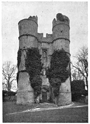
Gateway, Donnington Castle, Newbury
Gateway, Donnington Castle, Newbury
In former times dwelling places, even though not fortified, were at least protected by a moat. The interesting [124]old manor house of Ashbury is still moated on three sides, and the old moat remains in a more or less perfect state round many a farm in the county.
In the past, homes, although not walled, were at least safeguarded by a moat. The fascinating [__A_TAG_PLACEHOLDER_0__]old manor house of Ashbury is still surrounded by a moat on three sides, and the old moat is still largely intact around many farms in the county.
20. Architecture—(d) Domestic.
The churches of the eleventh and succeeding centuries which remain are well adapted for their use now, but this cannot be said of the dwelling-houses of Norman or Edwardian landowners, and this is one reason why we have but few left in anything like perfect condition. The residence of the chief landowners of the twelfth century, when not a castle, consisted of a hall, usually on the ground floor, but sometimes with a lower story half below the surface level, and the hall was not only a reception and dining room, but was also the sleeping place for the greater number of the persons living in the house. In many cases there were, no doubt, subsidiary chambers, which might serve as more or less private apartments for the landowner himself, and as time went on the number of the subsidiary chambers increased and the importance of the hall diminished, but it impressed itself so firmly on the popular mind that the word still remains in use for the house of the landowner, which is often spoken of as “the Hall.”
The churches from the eleventh century and later that still exist are well-suited for their current use, but the same can't be said for the homes of Norman or Edwardian landowners. This is one reason why so few remain in good condition. The main residence of the top landowners during the twelfth century, when it wasn't a castle, typically had a hall, usually on the ground floor, sometimes with a lower level partially below ground. The hall served not only as a reception and dining area but also as the sleeping space for most of the people living in the house. In many cases, there were likely additional rooms that could serve as more private spaces for the landowner, and over time, the number of these extra rooms increased while the hall's importance decreased. However, the term "hall" stuck in the public's mind, and it's still commonly used to refer to the landowner's house, often called "the Hall."
There is a doorway belonging to a hall of the Norman period at Appleton in the northern part of the county, and we have already noticed some remains of the residential buildings of the monks of Abingdon, belonging to the [125]thirteenth century. At Charney, about seven miles to the west of Abingdon, there are some interesting remains of a building which was occasionally the residence of the Abbots. The private chapel and much of the house are still standing. These buildings, known as the “Monks House,” date from the thirteenth century and are incorporated in a modern house.
There’s a doorway from the Norman period in a hall at Appleton in the northern part of the county, and we've already mentioned some remnants of the residential buildings used by the monks of Abingdon, dating back to the [__A_TAG_PLACEHOLDER_0__]thirteenth century. At Charney, about seven miles west of Abingdon, there are some notable remains of a building that was sometimes the residence of the Abbots. The private chapel and much of the house are still intact. These structures, known as the “Monks House,” originate from the thirteenth century and are connected to a modern house.
There are two old houses at Sutton Courtney south of Abingdon. The one is opposite the tower of the church, and is of Norman and Early English style, the second is a manor house of the time of Edward III, the hall of which, with its roof and windows, has been very little altered. Cumnor Hall has vanished, excepting a fragment of wall, but some of the windows and a doorway are still to be seen in Wytham Church.
There are two old houses in Sutton Courtney, south of Abingdon. One is across from the church tower and features Norman and Early English architecture, while the other is a manor house from the time of Edward III, and its hall, along with its roof and windows, has hardly changed. Cumnor Hall is gone, except for a piece of wall, but you can still see some windows and a doorway in Wytham Church.
It has been mentioned that one reason why few old dwelling-houses remain is that they would not be suited to modern requirements, but another reason is that they were often built of wood. In the fifteenth century buildings of timber and brick became common, and some of them remain at the present day. Ockwells, rather more than a mile south-west of Maidenhead station, was probably built in the time of Edward IV. It was for some time the residence of the Norris family (see page 138). The house was not fortified, and is of timber and brick with a tiled roof. One may gain a good idea of the appearance of the dwellings of our ancestors in Tudor times from the Horseshoe Cloisters in Windsor Castle, though they were practically rebuilt recently by Sir Gilbert Scott. Timber and brick farmhouses [126]and cottages may be seen all over the county, belonging to all dates from the Tudor times to the present day.
It has been noted that one reason why few old homes still exist is that they don't meet modern needs, but another reason is that they were often made of wood. In the fifteenth century, buildings made from timber and brick became common, and some of them still stand today. Ockwells, located a little over a mile southwest of Maidenhead station, was likely built during the time of Edward IV. It was once the home of the Norris family (see page 138). The house isn't fortified and is constructed of timber and brick with a tiled roof. You can get a good sense of what the homes of our ancestors looked like during Tudor times from the Horseshoe Cloisters in Windsor Castle, even though they were basically rebuilt recently by Sir Gilbert Scott. Timber and brick farmhouses [__A_TAG_PLACEHOLDER_0__]and cottages can be found throughout the county, dating from Tudor times to the present day.

Cottage at Cookham Dean
Cottage in Cookham Dean
Many of the most beautiful private houses in England were built during the reign of Queen Elizabeth, and we have some examples in Berkshire. Shaw House, about a mile north-east of Newbury, was built in 1581. It is of red brick, with tall brick chimneys and a tiled roof. The corners of the house and the window and door frames are of stone, and in fact there is a good deal of stone. The house was occupied by Charles I on the day of the second [127]battle of Newbury, October 27th, 1644, and the remains of earthworks thrown up by his troops are still to be seen in the garden. Billingbear, near Binfield, is an Elizabethan house standing in a large and beautiful park.
Many of the most stunning private homes in England were constructed during Queen Elizabeth's reign, and we have a few examples in Berkshire. Shaw House, located about a mile northeast of Newbury, was built in 1581. It features red brick, tall brick chimneys, and a tiled roof. The corners of the house, along with the window and door frames, are made of stone, and there is actually quite a bit of stonework. The house was inhabited by Charles I on the day of the second [__A_TAG_PLACEHOLDER_0__] battle of Newbury, October 27th, 1644, and the remnants of earthworks created by his troops can still be seen in the garden. Billingbear, located near Binfield, is an Elizabethan house set in a large and beautiful park.
Ufton Court, near Aldermaston, was built in the latter part of the sixteenth century. Farmhouses of the same period are to be seen at Lyford, west of Abingdon, East Hendred, Great Coxwell and at other places.
Ufton Court, close to Aldermaston, was built in the late sixteenth century. You can find farmhouses from the same time at Lyford, west of Abingdon, East Hendred, Great Coxwell, and other locations.

Wayside Cottages, Bisham
Wayside Cottages, Bisham
Secret rooms are often to be found in old houses. There is an example at Bisham Abbey, with a fireplace, the chimney of which is said to be connected with that of the hall, so as to prevent its smoke being observed. At Ufton Court there are several hiding-places, one of which has an exit to the open air. It is said that Charles I [128]passed the night of November 19th, 1644, in a secret room at the manor house, West Shefford.
Secret rooms are often found in old houses. There's an example at Bisham Abbey, where a fireplace is reportedly linked to the chimney of the hall to keep its smoke hidden. At Ufton Court, there are several hiding spots, one of which leads outside. It's said that Charles I [__A_TAG_PLACEHOLDER_0__] spent the night of November 19th, 1644, in a secret room at the manor house in West Shefford.
In 1852 some houses which stood on the site of the former ditch of Windsor Castle were removed, and a passage was found cut through the chalk, with stone steps and stone arching. It had probably been a secret way from the interior of the Castle to the moat.
In 1852, some houses that were on the site of the old ditch of Windsor Castle were taken down, and a pathway was discovered cut through the chalk, complete with stone steps and stone arches. It was likely a hidden passage from inside the Castle to the moat.
We have many buildings in Berkshire belonging to the seventeenth century. Coleshill House, south-west of Faringdon, was built by the celebrated architect Inigo Jones (1572–1652) at the time of the Commonwealth, and he also built most of Milton House, near Steventon, in which village are some beautiful old houses. Buscot House, in the north-west corner of Berkshire, is an example of the comfortable, though not very beautiful mansions built at the close of the eighteenth century. The residential part of Windsor Castle dates in part from the reign of Henry II, but it has been greatly altered from time to time. Its present appearance is largely due to Sir Jeffry Wyatville (1766–1840), who modified and rebuilt a great deal in the time of George IV. His object was to make the Castle a comfortable residence and at the same time to preserve the appearance of an ancient fortress.
We have many buildings in Berkshire from the seventeenth century. Coleshill House, located south-west of Faringdon, was designed by the famous architect Inigo Jones (1572–1652) during the Commonwealth period, and he also constructed most of Milton House, near Steventon, where there are some lovely old houses. Buscot House, in the north-west corner of Berkshire, is an example of the comfortable, though not very attractive, mansions built at the end of the eighteenth century. The residential section of Windsor Castle partly dates back to the reign of Henry II, but it has been significantly altered over time. Its current look is largely thanks to Sir Jeffry Wyatville (1766–1840), who made many modifications and rebuilds during the time of George IV. His goal was to create a comfortable home while still maintaining the look of an ancient fortress.
21. Communications—Ancient and Modern.
The Ridge Way is one of the oldest roads in England. It enters Berkshire on the chalk downs above Ashbury at a level of 600 feet above the sea, and runs in an easterly [129]direction by Wayland Smith’s Cave and Uffington Castle; thence by Hackpen Hill to Letcombe Castle, along the top of the ridge north of West and East Ilsley. From here, turning to the right across the little valley on Compton Downs, the road probably reached the river Thames at Streatley. This old road is also known as the Icknield Way, and there is another old road named [130]the Port Way, which follows the valley north of the chalk downs, running through Ashbury and Wantage. It is marked on the maps as a Roman road, and probably both roads were in use in Roman times, though the Ridge Way at least is almost certainly of much older date.
The Ridge Way is one of the oldest roads in England. It enters Berkshire on the chalk downs above Ashbury at 600 feet above sea level, and runs eastward [__A_TAG_PLACEHOLDER_0__]by Wayland Smith’s Cave and Uffington Castle; then it goes by Hackpen Hill to Letcombe Castle, along the top of the ridge north of West and East Ilsley. From here, it turns right across the small valley on Compton Downs, likely reaching the River Thames at Streatley. This ancient road is also known as the Icknield Way, and there's another old road called [__A_TAG_PLACEHOLDER_0__the Port Way, which follows the valley north of the chalk downs, running through Ashbury and Wantage. It's indicated on maps as a Roman road, and both roads were probably used in Roman times, although the Ridge Way is likely much older.

The London Road near Sunninghill
London Road near Sunninghill
The Roman road from Marlborough to Silchester followed much the same line as the modern road from Hungerford to Speen near Newbury, but there does not seem to be any trace of the road from that place to Silchester. The Roman road from Cirencester to Silchester ran by way of Baydon and Wickham, joining the Marlborough road at Speen. There is but little trace of the Roman road from Silchester to Dorchester in Oxfordshire, but the Silchester and London road is fairly well marked, and part of it, as we said in a former chapter, is known as the “Devil’s Highway.”
The Roman road from Marlborough to Silchester followed a path similar to the modern route from Hungerford to Speen near Newbury, but there don’t seem to be any remnants of the road from that point to Silchester. The Roman road from Cirencester to Silchester went through Baydon and Wickham, connecting with the Marlborough road at Speen. There are only a few signs of the Roman road from Silchester to Dorchester in Oxfordshire, but the Silchester and London road is fairly well defined, and part of it, as mentioned in an earlier chapter, is known as the “Devil’s Highway.”
In the middle ages the roads were exceedingly bad, and even in the seventeenth century they were far from satisfactory. Pepys mentions, in his Diary, June 16th, 1668, that he lost his way driving from Newbury to Reading. This, it will be observed, was in the summer, and one would think on a well-known road.
In the Middle Ages, the roads were really terrible, and even in the seventeenth century, they were far from great. Pepys mentions in his Diary, June 16th, 1668, that he got lost driving from Newbury to Reading. It's worth noting that this was in the summer, and you’d expect it to be on a well-known road.
In the eighteenth century the roads were gradually improved, and towards the end of the century began to be kept in good order for the coaches, which were also rapidly improving.
In the eighteenth century, the roads were gradually being improved, and by the end of the century, they started to be maintained in good condition for the coaches, which were also rapidly getting better.
In the early part of the nineteenth century two mail coach routes ran through Berkshire.
In the early 1800s, two mail coach routes traveled through Berkshire.
The road from London to Gloucester entered Berkshire at Maidenhead and left the county at Henley. [131]After passing through Oxford it again entered Berkshire, and ran by Cumnor and Fyfield to Faringdon. From that place it ran by Buscot Park and crossed the river Isis at St John’s Bridge near Lechlade.
The road from London to Gloucester entered Berkshire at Maidenhead and left the county at Henley. [__A_TAG_PLACEHOLDER_0__]After passing through Oxford, it re-entered Berkshire, passing by Cumnor and Fyfield on its way to Faringdon. From there, it went by Buscot Park and crossed the river Isis at St John’s Bridge near Lechlade.
The London and Bath mail route ran through the county by Maidenhead, Reading, Newbury, and Hungerford.
The London and Bath mail route passed through the county via Maidenhead, Reading, Newbury, and Hungerford.

Hungerford Canal
Hungerford Canal

Hambleden Weir
Hambleden Weir
Besides these mail-coach routes there were several roads in the county which came under the head of “turnpike roads.” The term turnpike road means a road having toll-gates or bars on it. The toll-gates were first constructed about the middle of the eighteenth century, and were called turns, and the turnpike road was one upon which those who refused to pay toll could be turned back. Turnpike roads are now practically extinct and a new [133]species of highway called main roads has taken their place. The cost of repair is borne partly by the county and partly by the Local Highway Authority.
Besides these mail-coach routes, there were several roads in the county classified as “turnpike roads.” A turnpike road is one that has tollgates or barriers. The first tollgates were built around the middle of the eighteenth century and were known as turns, and a turnpike road was one where those who didn’t pay the toll could be turned away. Turnpike roads are now nearly extinct, replaced by a new [__A_TAG_PLACEHOLDER_0__]type of highway called main roads. The repair costs are shared between the county and the Local Highway Authority.

Disused Canal between Abingdon and Wantage
Disused Canal between Abingdon and Wantage
Canals and Rivers. Canals have to a large extent been superseded by railways in these days. It is, however, possible that the advent of cheap motor traction may cause them to revive. The Kennet and Avon Canal runs from Newbury, and entering Wiltshire near Hungerford furnishes a waterway from the Thames to the Severn. The navigation of the river Thames is improved by a number of weirs and locks, most of which have been re-made in recent times, and if more useful they are much less picturesque than in former days. The level of the [134]river at Hambleden weir is just about 100 feet above the sea. The river Kennet is also provided with a series of weirs and locks. A canal which ran from Wantage to Abingdon is now disused.
Canals and Rivers. Canals have largely been replaced by railways these days. However, the introduction of affordable motor transport might lead to a revival of canals. The Kennet and Avon Canal starts in Newbury and enters Wiltshire near Hungerford, creating a waterway from the Thames to the Severn. The navigation of the River Thames has been enhanced by a number of weirs and locks, most of which have been remodeled recently. While they're more functional now, they are much less picturesque than they used to be. The river level at Hambleden weir is about 100 feet above sea level. The River Kennet also features a series of weirs and locks. A canal that used to connect Wantage and Abingdon is now out of use.

Boulter’s Lock
Boulter’s Lock
The bridges over the rivers are for the most part modern, but many of them replace older structures, indeed most of the crossing-places are very old. The bridge at Abingdon was originally built in the fifteenth century, and was under the charge of the Guild of the Holy Cross, and Maidenhead Bridge was the property of a corporation from early days.
The bridges over the rivers are mostly modern, but many replace older structures; in fact, most crossing points are quite old. The bridge at Abingdon was originally built in the fifteenth century and was managed by the Guild of the Holy Cross, while Maidenhead Bridge has been owned by a corporation since ancient times.
Railways. The Great Western Railway enters Berkshire at Maidenhead, and runs by way of Reading to near Goring, where it crosses the Thames into Oxfordshire, [135]returning into Berkshire near Moulsford. It then passes by way of Didcot into Wiltshire, which county is entered a little before the line reaches Swindon. An important branch of the Great Western runs from Didcot to Oxford, and another branch of the same railway from Reading to Newbury, Hungerford, etc. Express trains to the west of England pass over both the Didcot and the Newbury line, and in these days they are frequently run from Paddington to far beyond the Berkshire border without a stop.
Railways. The Great Western Railway enters Berkshire at Maidenhead and travels through Reading to near Goring, where it crosses the Thames into Oxfordshire, [__A_TAG_PLACEHOLDER_0__] returning to Berkshire near Moulsford. It then goes through Didcot into Wiltshire, entering the county just before reaching Swindon. An important branch of the Great Western runs from Didcot to Oxford, and another branch goes from Reading to Newbury, Hungerford, and so on. Express trains traveling to the west of England use both the Didcot and the Newbury lines, and nowadays, they often operate from Paddington to well beyond the Berkshire border without stopping.
The Great Western has branch lines to Windsor, to Cookham for High Wycombe, to Henley, to Wallingford, to Abingdon, and to Faringdon, and also a rather important line from Reading to Basingstoke, giving a communication from Oxford to the south coast. There is also a light railway with auto-cars running between Newbury and Lambourn which belongs to the Great Western.
The Great Western has branch lines to Windsor, Cookham for High Wycombe, Henley, Wallingford, Abingdon, and Faringdon, as well as a significant line from Reading to Basingstoke, connecting Oxford to the south coast. There's also a light railway with auto-cars operating between Newbury and Lambourn that is owned by the Great Western.
The Didcot, Newbury, and Southampton Railway runs from the first-named place in a southerly direction, crossing the Reading and Newbury line at right angles.
The Didcot, Newbury, and Southampton Railway goes from Didcot southward, intersecting the Reading and Newbury line at a right angle.
The South Eastern and Chatham Railway Company have a branch line running to Reading. It enters Berkshire near the village of Sandhurst.
The South Eastern and Chatham Railway Company has a branch line that goes to Reading. It enters Berkshire near the village of Sandhurst.
The London and South Western Railway have branches to Windsor and to Wokingham, and from the latter place run trains over the South Eastern line to Reading. [136]
The London and South Western Railway has branches to Windsor and Wokingham, and from Wokingham, trains run over the South Eastern line to Reading. [__A_TAG_PLACEHOLDER_0__]
22. Administration and Divisions—Ancient and Modern.
The division of the county into Hundreds dates from Saxon times. Each Hundred was governed by a High Constable, or Bailiff, and formerly there was a Court of Justice, called the Hundred Court, which was held regularly for the trial of causes, but this court fell into disuse. By various Acts of Parliament the Hundred is made liable for damage caused to persons by riots.
The division of the county into Hundreds goes back to Saxon times. Each Hundred was overseen by a High Constable or Bailiff, and there used to be a Court of Justice called the Hundred Court, which was held regularly to settle disputes, but this court has fallen out of use. Through various Acts of Parliament, the Hundred is held responsible for damages caused to individuals during riots.
In early days most of Berkshire was divided amongst different manors, and each manor had a Manorial Court or Court Baron.
In the early days, most of Berkshire was split among different manors, and each manor had a Manorial Court or Court Baron.
It has been already explained in Chapter 3 that the present administrative county differs somewhat from the geographical county, and as the town of Reading with a tract around it has been formed into the “County Borough of Reading” it is not for most administrative purposes a part of the county of Berks.
It has already been explained in Chapter 3 that the current administrative county is slightly different from the geographical county, and since the town of Reading and the surrounding area have been established as the “County Borough of Reading,” it is not considered part of the county of Berks for most administrative purposes.
The chief officials of Berkshire, under His Majesty the King, are the Lord Lieutenant, the Custos Rotulorum, and the Sheriff. The first two of these offices are usually held by the same person.
The main officials of Berkshire, under His Majesty the King, are the Lord Lieutenant, the Custodian of the Records, and the Sheriff. The first two of these positions are typically held by the same person.
The office of Lord Lieutenant dates from about the time of Edward IV, and he was formerly the chief military officer of the Crown in the county. The Custos Rotulorum is the first amongst the justices, but the High Sheriff has precedence in the county. The Custos selects the county magistrates, and they are appointed by the [137]Lord Chancellor. The office of Custos dates from the time of Edward III. He is nominally the keeper of the County Records, but in these days they are in fact in the charge of the Clerk of the Peace.
The office of Lord Lieutenant goes back to around the time of Edward IV, and he used to be the main military officer of the Crown in the county. The Custos Rotulorum is the top justice, but the High Sheriff has priority in the county. The Custos selects the county magistrates, and they are appointed by the [__A_TAG_PLACEHOLDER_0__]Lord Chancellor. The Custos position has been around since the time of Edward III. He is officially the keeper of the County Records, but nowadays, they are actually managed by the Clerk of the Peace.
The Sheriff was originally elected by the people in the county, but since the time of Edward II he has been appointed by the Crown. He was the agent through whom the King collected his dues, and in time became the military as well as the judicial and executive head of the county and headed the posse comitatus or power of the county. During the Wars of the Roses his influence became less, and the Lord Lieutenant took his place to some extent. It is recorded in Domesday Book that Godric the Sheriff of Berkshire gave a lady with the name of Aluuid half an acre of the royal domain as a present for teaching his daughter the art of gold embroidery.
The Sheriff was originally elected by the people in the county, but since the time of Edward II, he has been appointed by the Crown. He acted as the agent through whom the King collected his dues and eventually became the military, judicial, and executive leader of the county, leading the posse comitatus or the power of the county. During the Wars of the Roses, his influence decreased, and the Lord Lieutenant took over some of his roles. It's recorded in the Domesday Book that Godric the Sheriff of Berkshire gave a woman named Aluuid half an acre of the royal land as a gift for teaching his daughter how to do gold embroidery.
The Sheriff is the first man in the county, taking precedence of all peers and of the Lord Lieutenant. He is appointed annually.
The Sheriff is the top official in the county, taking priority over all peers and the Lord Lieutenant. He is appointed every year.
The county is divided into Petty Sessional divisions for magisterial purposes, and the Court of Quarter Sessions is a general meeting of all the justices of the county. In boroughs, Reading, Abingdon, Newbury, and Windsor, the Court of Quarter Sessions is held by a Recorder.
The county is split into Petty Sessional divisions for legal purposes, and the Court of Quarter Sessions is a general gathering of all the justices in the county. In boroughs like Reading, Abingdon, Newbury, and Windsor, the Court of Quarter Sessions is held by a Recorder.
The affairs of the county (not including Reading, which is a County Borough of itself) are managed by the County Council, which was established by statute of 1888, and by District and Parish Councils, which were established by an Act of 1894. The county is divided into eleven districts, Bradfield, Windsor, Cookham, [138]Easthampstead, Wokingham, Newbury, Hungerford, Wantage, Wallingford, Faringdon, and Abingdon.
The county's affairs (excluding Reading, which is its own County Borough) are overseen by the County Council, created by legislation in 1888, along with District and Parish Councils established by an Act in 1894. The county is divided into eleven districts: Bradfield, Windsor, Cookham, [__A_TAG_PLACEHOLDER_0__]Easthampstead, Wokingham, Newbury, Hungerford, Wantage, Wallingford, Faringdon, and Abingdon.
The affairs of the County Borough of Reading are managed by its Mayor and Corporation.
The affairs of the County Borough of Reading are handled by its Mayor and Corporation.

The Town Hall, Abingdon
Abingdon Town Hall
For purposes of Assizes, Berkshire is on the Oxford circuit, and the Court is held at Reading. County Courts are held from time to time at the various towns. The [139]County Court circuits are quite different from the Assize Court circuits.
For Assizes, Berkshire is in the Oxford circuit, and the Court is held in Reading. County Courts meet from time to time in different towns. The [__A_TAG_PLACEHOLDER_0__] County Court circuits are completely different from the Assize Court circuits.
For Parliamentary elections the county is divided into three divisions, Abingdon, Newbury, and Wokingham, each of which returns one member to Parliament. Reading also returns a member to Parliament, and so does Windsor, but the Parliamentary borough of Windsor includes a considerable tract outside Berkshire.
For parliamentary elections, the county is split into three divisions: Abingdon, Newbury, and Wokingham, with each division electing one member to Parliament. Reading also elects a member to Parliament, as does Windsor, but the parliamentary borough of Windsor covers a significant area outside of Berkshire.
23. Public and Educational Establishments.
The municipal buildings at Reading were erected during the period 1875–1897, and consist of two Town Halls, the Borough Council offices, a Free Library, the Museum, and an Art Gallery. On the walls of the reading-room there is a good collection of views of Reading and of the river Thames.
The municipal buildings in Reading were built between 1875 and 1897, and include two Town Halls, the Borough Council offices, a Free Library, a Museum, and an Art Gallery. The walls of the reading room feature a nice collection of views of Reading and the River Thames.
The Town Hall at Windsor was built by Sir Christopher Wren. On the exterior there are statues of Queen Anne and her husband, Prince George of Denmark. The Town Halls at Wokingham and Newbury are modern brick buildings. The Cloth Hall at the latter place, now a museum, is very interesting. It was built by the Guild of Clothworkers of Newbury, which was incorporated in 1601, and has a picturesque wooden cornice and wooden pillars, and a red tiled roof.
The Town Hall in Windsor was designed by Sir Christopher Wren. On the outside, there are statues of Queen Anne and her husband, Prince George of Denmark. The Town Halls in Wokingham and Newbury are modern brick buildings. The Cloth Hall in Newbury, which is now a museum, is quite interesting. It was built by the Guild of Clothworkers of Newbury, established in 1601, and features a charming wooden cornice, wooden pillars, and a red tiled roof.
The Town Hall at Wallingford dates from 1670, and is supported by pillars, leaving an open undercroft. The [140]Abingdon Town Hall has also an undercroft and dates from 1677. It is said, however, to have been designed by Inigo Jones, who died in 1652. There is an interesting old Town Hall at Faringdon.
The Town Hall in Wallingford was built in 1670 and has pillars that create an open space underneath. The [__A_TAG_PLACEHOLDER_0__] Abingdon Town Hall also features an open space underneath and was constructed in 1677. However, it is believed to have been designed by Inigo Jones, who passed away in 1652. There’s also a notable old Town Hall in Faringdon.

The Cloth Hall, Newbury
The Cloth Hall, Newbury
The Royal Berkshire Hospital at Reading was opened in 1839, and there are many hospitals, homes, and orphanages in various parts of the county. [141]
The Royal Berkshire Hospital in Reading opened in 1839, and there are many hospitals, homes, and orphanages located throughout the county. [__A_TAG_PLACEHOLDER_0__]
The Prison at Reading stands upon part of the site of Reading Abbey. There is a large County and Borough lunatic asylum at Moulsford, and a very large criminal lunatic asylum at Broadmoor, in the eastern end of the county.
The prison in Reading is built on part of the site of Reading Abbey. There's a big county and borough mental health facility in Moulsford, as well as a very large criminal mental health facility at Broadmoor, located in the eastern part of the county.

The Town Hall, Wallingford
Wallingford Town Hall
The Royal Military College, Sandhurst, is one of the chief Government institutions for the education of officers for the army. It was built in 1812, and though quite plain in style, the long frontage on a rising ground, above a fine lake, is distinctly effective. The Staff College is in the same grounds, but is in Surrey. Considerable additions are now (1910) being made to the buildings at the Military College. [142]
The Royal Military College, Sandhurst, is one of the main government institutions for training army officers. It was established in 1812, and while it's quite simple in design, the long facade on elevated land overlooking a beautiful lake is quite striking. The Staff College is located on the same grounds, but it's in Surrey. Significant expansions are currently underway (1910) at the Military College. [__A_TAG_PLACEHOLDER_0__]

Royal Military College, Sandhurst
Royal Military Academy, Sandhurst
[143]
[__A_TAG_PLACEHOLDER_0__]
Wellington College, also near Sandhurst, was built as a public school by public subscription in memory of the great Duke of Wellington, who died in 1852. By the end of 1858 a sum of £145,785 had been received. This included a grant of £25,000 from the Patriotic Fund. The buildings are of red brick with stone corners, etc., and were completed in 1859. They have, however, been greatly added to since. The chapel is by Sir Gilbert Scott. The first head master was Edward White Benson, who subsequently became Archbishop of Canterbury.
Wellington College, also located near Sandhurst, was established as a public school through public donations in honor of the great Duke of Wellington, who passed away in 1852. By the end of 1858, a total of £145,785 had been collected, which included a £25,000 grant from the Patriotic Fund. The buildings are made of red brick with stone corners and were finished in 1859. Since then, they have seen significant additions. The chapel was designed by Sir Gilbert Scott. The first headmaster was Edward White Benson, who later became the Archbishop of Canterbury.
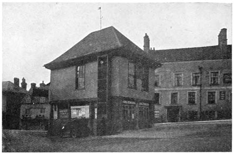
The Town Hall, Faringdon
The Town Hall, Faringdon
Bradfield College is another important public school, founded by Thomas Stevens in 1850. The buildings are of red brick and flint, and are partly old. There is an open-air theatre where Greek plays are performed. [144]
Bradfield College is another significant public school, established by Thomas Stevens in 1850. The buildings are made of red brick and flint, with some being quite old. There’s an open-air theater where Greek plays are performed. [__A_TAG_PLACEHOLDER_0__]
Radley College is beautifully situated by the river Thames. The site was part of the property of the Abbots of Abingdon, and passed through the hands of the families of Stonehouse and Bowyer. Much of the old mansion is incorporated in the college buildings. The college was founded by the Rev. William Sewell, D.D.
Radley College is perfectly located by the River Thames. The land was originally owned by the Abbots of Abingdon and later changed hands between the Stonehouse and Bowyer families. A lot of the old mansion is now part of the college buildings. The college was established by Rev. William Sewell, D.D.

Gate of the Old Grammar School, Abingdon
Gate of the Old Grammar School, Abingdon
University College, Reading, is a comparatively new establishment, and the buildings are still in process of construction. Higher teaching in literary and scientific [145]subjects is given, and there is an Agricultural Department, a Dairy Institute, and a Horticultural Department. There has been a school at Reading from quite early times, but its history has been a somewhat broken one. In 1783 John Lempriere published his Classical Dictionary whilst an assistant master at the school, and Richard Valpy was its head master for 55 years (1781–1836).
University College, Reading, is a relatively new institution, and the buildings are still under construction. Advanced education in literary and scientific [__A_TAG_PLACEHOLDER_0__]subjects is offered, along with an Agricultural Department, a Dairy Institute, and a Horticultural Department. There has been a school at Reading since quite early times, but its history has been somewhat inconsistent. In 1783, John Lempriere published his Classical Dictionary while serving as an assistant master at the school, and Richard Valpy was its headmaster for 55 years (1781–1836).
In addition to the above there are several important recognised secondary schools at Abingdon, Bracknell, Clewer, Maidenhead, Newbury, Wallingford, Wantage and Windsor.
In addition to the above, there are several important recognized secondary schools in Abingdon, Bracknell, Clewer, Maidenhead, Newbury, Wallingford, Wantage, and Windsor.
There are many almshouses in Berkshire, the most interesting of which is Christ’s Hospital, Abingdon. It is of brick and timber with an open gallery (p. 63). It was founded under its present name by Charter of Edward VI, but had a previous existence. The almshouses near Wokingham, built 1663, and known as Lucas Hospital, are a good example of seventeenth century brickwork, and are very picturesque. The Jesus Hospital at Bray was founded in 1627 for 40 poor persons. It is a most attractive red brick building, with a quadrangle in the middle, and a small chapel, the windows of which have stone frames which were probably taken from an older building. The quadrangle is shown in the picture by Frederick Walker in the Tate Gallery, named “The Harbour of Refuge.” [146]
There are many almshouses in Berkshire, the most interesting of which is Christ's Hospital, Abingdon. It’s made of brick and timber with an open gallery (p. 63). It was founded under its current name by a Charter of Edward VI, but it had existed before that. The almshouses near Wokingham, built in 1663 and known as Lucas Hospital, are a great example of seventeenth-century brickwork and are quite picturesque. The Jesus Hospital at Bray was established in 1627 for 40 poor people. It's a very attractive red brick building with a courtyard in the middle and a small chapel, the windows of which have stone frames that were probably taken from an older building. The courtyard is depicted in a painting by Frederick Walker in the Tate Gallery, titled “The Harbour of Refuge.” [__A_TAG_PLACEHOLDER_0__]
24. The Forest in Berkshire.
Windsor Forest consisted in early times of a tract of wood and heath which even before the Norman Conquest was looked upon as Crown property. It is one of the five forests mentioned by name in Domesday. It was no doubt of great extent, but its boundaries are not known even if they were ever very clearly defined. There is in the British Museum a volume of maps and plans of Windsor by John Norden, made in the early part of the reign of James I, and the map of the forest shows that it was at that time bounded by the Thames on the north, by the Loddon on the west, by the Blackwater on the south, and that it extended to the east into Surrey as far as the Hog’s Back, Guildford, and the river Wey.
Windsor Forest used to be a large area of woods and heath that was considered Crown property even before the Norman Conquest. It's one of the five forests listed in the Domesday Book. While it must have been quite extensive, its exact boundaries are not known, and it’s unclear if they were ever really defined. The British Museum has a collection of maps and plans of Windsor created by John Norden in the early part of James I's reign. The map of the forest shows that, at that time, it was bordered by the Thames to the north, the Loddon to the west, the Blackwater to the south, and extended east into Surrey as far as the Hog’s Back, Guildford, and the river Wey.
The forest was at that time divided into 16 walks, each under a Keeper. Two of these, Cranbourne and New Lodge Walks, appear to have been previously known as Cranbourne Chase, and together with Egham Walk were the part of the forest lying nearest to the castle, and including what is now the Home Park and the Great Park. The other walks in Berkshire were Swinley Walk, Easthampstead Walk, Sandhurst Walk, Bigshot Walk, Bearwood Walk, and Warfield Walk. There was also a large district extending from Maidenhead and Bray to Wokingham and Twyford, which was called the Fines Bayliwick, and of which Sir Henry Neville claimed to be Keeper by inheritance.
The forest was then split into 16 paths, each managed by a Keeper. Two of these, Cranbourne and New Lodge Walks, seem to have once been known as Cranbourne Chase, and along with Egham Walk, were the sections of the forest closest to the castle, including what we now call Home Park and the Great Park. The other paths in Berkshire included Swinley Walk, Easthampstead Walk, Sandhurst Walk, Bigshot Walk, Bearwood Walk, and Warfield Walk. There was also a large area extending from Maidenhead and Bray to Wokingham and Twyford, known as the Fines Bayliwick, which Sir Henry Neville claimed to manage by inheritance.
Several parks are marked in the forest. Of these the [147]Little Park is now the Home Park, Windsor, and the Great Park and Moat Park are in the present Windsor Great Park. Sunninghill Park, Foliejon Park, Easthampstead Park, and Bagshot Park, the last mostly in Surrey, still remain.
Several parks are highlighted in the forest. Among them, the [__A_TAG_PLACEHOLDER_0__]Little Park is now known as Home Park, Windsor, while the Great Park and Moat Park are currently part of Windsor Great Park. Sunninghill Park, Foliejon Park, Easthampstead Park, and Bagshot Park, with the latter mostly located in Surrey, still exist.
Ascot Race Course
Ascot Racecourse
Besides the Parks there were certain enclosed places called Rails. Cranbourne Rails is in Windsor Park. Swinley Rails was until recently the place where the deer for the Royal Hunt were kept, and Bigshot Rails is apparently the place now named Ravenswood, near Wellington College.
Besides the Parks, there were some enclosed areas called Rails. Cranbourne Rails is in Windsor Park. Swinley Rails was, until recently, where the deer for the Royal Hunt were kept, and Bigshot Rails is now known as Ravenswood, near Wellington College.
In the early part of the nineteenth century there was a great deal of discussion as to the rights of the Crown over Windsor Forest, and in 1813 an Act of Parliament was passed dealing with the matter, and the Forest is now [148]enclosed either as Crown land or as the property of private persons. Ascot Race Course is in the old Swinley Walk.
In the early 1800s, there was a lot of debate about the Crown's rights over Windsor Forest. In 1813, Parliament passed a law addressing this issue, and the Forest is now [__A_TAG_PLACEHOLDER_0__] either designated as Crown land or owned by private individuals. Ascot Race Course is located in the old Swinley Walk.
Walter Fitz Other was appointed by William the Conqueror Castellan, or Governor of Windsor Castle, and Warden of the Forest; and the office, which has become known as that of Constable of the Castle, has existed from his appointment to the present day.
Walter Fitz Other was appointed by William the Conqueror as the Castellan, or Governor of Windsor Castle, and Warden of the Forest; the role, which is now known as the Constable of the Castle, has been in existence since his appointment up to today.
25. Roll of Honour.
King Alfred was born at Wantage in the year 849, and his statue by Count Gleichen stands in the market place. The exact site of the palace of the Kings of Wessex, in which he was born, is not known, probably it was a wooden building. Edward III and Henry VI were both born at Windsor; Henry I was buried at Reading; Henry VI, Edward IV, Henry VIII, Charles I, George III, George IV, and William IV were buried at Windsor; and Queen Victoria and the Prince Consort lie in the mausoleum at Frogmore, in Windsor Park. King Edward VII was buried at Windsor May 20, 1910.
King Alfred was born in Wantage in 849, and his statue by Count Gleichen stands in the marketplace. The exact location of the palace of the Kings of Wessex, where he was born, isn’t known; it was probably a wooden structure. Edward III and Henry VI were both born in Windsor; Henry I was buried in Reading; Henry VI, Edward IV, Henry VIII, Charles I, George III, George IV, and William IV were buried in Windsor; and Queen Victoria and the Prince Consort are laid to rest in the mausoleum at Frogmore, in Windsor Park. King Edward VII was buried in Windsor on May 20, 1910.
The Marshals of Hampstead Marshall were a family of warriors. The most distinguished of them was William, first Earl of Pembroke. When he was a child his father, John Marshal, was besieged at Newbury by King Stephen, 1152, and William was given as a hostage for a truce and the surrender of Newbury Castle. The father did not keep his terms, and the child would have been killed had not Stephen taken a liking to him and saved his life. He [149]became a great soldier and served Henry II, Richard I, John, and Henry III with the utmost fidelity, becoming Regent of England during the early part of the reign of Henry III. He died in 1219 at Caversham, and is buried in the Temple Church in London.
The Marshals of Hampstead Marshall were a family of warriors. The most notable among them was William, the first Earl of Pembroke. When he was a child, his father, John Marshal, was under siege at Newbury by King Stephen in 1152, and William was taken as a hostage to secure a truce and the surrender of Newbury Castle. His father failed to uphold the agreement, and the child would have been killed if Stephen hadn't developed a fondness for him and saved his life. He [__A_TAG_PLACEHOLDER_0__]grew up to be an exceptional soldier, serving Henry II, Richard I, John, and Henry III with unwavering loyalty, eventually becoming Regent of England during the early years of Henry III's reign. He passed away in 1219 at Caversham and is buried in the Temple Church in London.
In later times another warrior owned Hampstead Marshall. This was William Craven, Earl of Craven (1606–1697). He fought in the German wars of 1632–37 and was the faithful champion of Elizabeth Queen of Bohemia, the only daughter of James I. At the Revolution of 1688, though over 80 years old, he was in command of the King’s Guards, and Macaulay, in his History of England, describes how unwillingly the stout old soldier made way for the Dutch troops at Whitehall. Ashdown Park was another seat of the Earl, and is still in the possession of his descendant.
In later years, another warrior took ownership of Hampstead Marshall. This was William Craven, Earl of Craven (1606–1697). He fought in the German wars from 1632 to 1637 and was a loyal supporter of Elizabeth, Queen of Bohemia, the only daughter of James I. During the Revolution of 1688, despite being over 80 years old, he commanded the King’s Guards. Macaulay, in his History of England, recounts how the stout old soldier begrudgingly allowed the Dutch troops to pass at Whitehall. Ashdown Park was another estate of the Earl and is still owned by his descendant.
Radley belonged to a gallant sailor, Admiral Sir George Bowyer, Bart. (1740?–1800), who lost a leg off Ushant, June 1st, 1794. Another Admiral, Samuel Barrington (1729–1800), is buried at Shrivenham. He served under Hawke and Rodney, and was commander-in-chief in the West Indies.
Radley was owned by a brave sailor, Admiral Sir George Bowyer, Bart. (1740?–1800), who lost a leg near Ushant on June 1, 1794. Another Admiral, Samuel Barrington (1729–1800), is buried in Shrivenham. He served under Hawke and Rodney and was the commander-in-chief in the West Indies.

Archbishop Laud
Archbishop Laud
The family of Norris or Norreys has long been connected with Berkshire. Richard de Norreys, a member of a Lancashire family, held the office of cook to Eleanor, wife of Henry III, and in 1267 the manor of Ockholt, near Maidenhead, was granted to him. One of his descendants, John Norris, who held office in the Court of both Henry VI and Edward IV, built the house Ockwells at Ockholt, which has been already mentioned [150]on page 114. He was buried at Bray in 1467. One branch of the family settled at Fyfield, and another branch became Norris of Rycote, which is in Buckinghamshire, but they too held much Berkshire property. Hampstead Norris derives its second name from this family. Henry Norris was an intimate friend of Henry VIII, and was present at the Field of the Cloth of Gold. He, however, fell under the suspicion of being a lover of Anne Boleyn, and was in consequence executed in 1536. His son, also named Henry, was created Baron Norris of Rycote in [151]1572. He died at Englefield, and there is a monument to him and to one of his six soldier sons, Sir John Norris, in Yattendon church. Francis Norris, a grandson of Henry Lord Norris, was born at Wytham, and in 1621 was created Earl of Berkshire. He left no sons, and the earldom became extinct at his death, 1623. The barony descended through two ladies, Elizabeth and Bridget, to James Bertie, who was created Earl of Abingdon 1682. The present peer, whose seat is Wytham Abbey, is the seventh Earl of Abingdon.
The Norris or Norreys family has long been associated with Berkshire. Richard de Norreys, who came from a Lancashire family, served as the cook for Eleanor, the wife of Henry III, and in 1267, he was granted the manor of Ockholt, near Maidenhead. One of his descendants, John Norris, who served in the courts of both Henry VI and Edward IV, built the house Ockwells at Ockholt, which has already been mentioned [__A_TAG_PLACEHOLDER_0__]on page 114. He was buried at Bray in 1467. One branch of the family settled in Fyfield, and another became known as Norris of Rycote in Buckinghamshire, but they also owned a lot of property in Berkshire. Hampstead Norris gets its second name from this family. Henry Norris was a close friend of Henry VIII and was present at the Field of the Cloth of Gold. However, he fell under suspicion of being Anne Boleyn's lover and was executed in 1536. His son, also named Henry, was made Baron Norris of Rycote in [__A_TAG_PLACEHOLDER_0__]1572. He died at Englefield, and there's a monument for him and one of his six soldier sons, Sir John Norris, in Yattendon church. Francis Norris, a grandson of Henry Lord Norris, was born at Wytham and became Earl of Berkshire in 1621. He had no sons, and the earldom became extinct when he died in 1623. The barony passed through two women, Elizabeth and Bridget, to James Bertie, who was made Earl of Abingdon in 1682. The current peer, whose seat is Wytham Abbey, is the seventh Earl of Abingdon.
St Edmund (1170?–1240), Archbishop of Canterbury, was born at Abingdon, and William Laud (1573–1645), also Archbishop of Canterbury, was born at Reading, the only son of William Laud, a clothier. He was educated at the Free School at Reading, and he gave a farm to Reading for charitable purposes. It was sold a short time ago, and the purchase money invested, producing some £330 a year. Another charity at Wokingham established by him also still exists.
St Edmund (1170?–1240), Archbishop of Canterbury, was born in Abingdon, and William Laud (1573–1645), also Archbishop of Canterbury, was born in Reading as the only son of William Laud, a clothier. He was educated at the Free School in Reading and donated a farm to Reading for charitable purposes. That farm was sold not long ago, and the money from the sale has been invested, generating about £330 a year. Another charity he established in Wokingham is still in existence.
John Jewel, Bishop of Salisbury (1522–1571), was for some time vicar of Sunningwell. He was a voluminous writer on theological subjects. Another churchman connected with Sunningwell was John Fell (1625–1686), Bishop of Oxford, who was born either there or at Longworth. His father was rector of the parish. In 1648, at the time of the Civil War, he was turned out of his Studentship at Oxford, but continued to celebrate the rites of the church in a house opposite Merton College. He was a distinguished man, but is best known by the lines referring to him which begin “I do not [152]love thee, Doctor Fell.” Joseph Butler (1692–1752), Bishop of Durham, and the author of the Analogy of Religion Natural and Revealed to the Constitution and Course of Nature, was born at Wantage, the son of a retired draper who lived at the Priory.
John Jewel, Bishop of Salisbury (1522–1571), was once the vicar of Sunningwell. He was a prolific writer on theological topics. Another clergyman linked to Sunningwell was John Fell (1625–1686), Bishop of Oxford, who was either born there or in Longworth. His father was the rector of the parish. In 1648, during the Civil War, he lost his Studentship at Oxford but continued to perform church services in a house across from Merton College. He was a prominent figure, but he’s most famously known for the lines that start with “I do not [__A_TAG_PLACEHOLDER_0__]love thee, Doctor Fell.” Joseph Butler (1692–1752), Bishop of Durham, and the author of the Analogy of Religion Natural and Revealed to the Constitution and Course of Nature, was born in Wantage as the son of a retired draper who lived at the Priory.
The Hoby Chapel, Bisham Church
The Hoby Chapel, Bisham Church
Sir Philip Hoby (1505–1558) and his half-brother, Sir Thomas Hoby (1530–1566), were both distinguished diplomatists. The former received the manor of Bisham from Henry VIII, and they are both buried there. Queen Elizabeth was domiciled at Bisham under the charge of the Hobys for a time during the reign of her sister Mary.
Sir Philip Hoby (1505–1558) and his half-brother, Sir Thomas Hoby (1530–1566), were both notable diplomats. The former was granted the manor of Bisham by Henry VIII, and they are both buried there. Queen Elizabeth lived at Bisham under the care of the Hobys for a time during the reign of her sister Mary.
Sir John Mason, another diplomatist of the same period, was the son of a cowherd at Abingdon. He is [153]described as a paragon of caution, coldness, and craft, and held high office, diplomatic and political, under Henry VIII, Edward VI, Mary, and Elizabeth, being in favour with all these sovereigns.
Sir John Mason, another diplomat from the same time, was the son of a cowherd in Abingdon. He is [__A_TAG_PLACEHOLDER_0__]described as a model of caution, aloofness, and cunning, and held important diplomatic and political positions under Henry VIII, Edward VI, Mary, and Elizabeth, earning the favor of all these monarchs.
Sir Henry Unton, or Umpton, who died in 1596, was both diplomatist and soldier of the time of Elizabeth. He was born at Wadley Hall, near Faringdon, where the Queen visited him in 1574. The house is still standing. There is a fine alabaster monument to him in Faringdon church.
Sir Henry Unton, or Umpton, who died in 1596, was both a diplomat and a soldier during Elizabeth's reign. He was born at Wadley Hall, near Faringdon, where the Queen visited him in 1574. The house is still standing. There is a beautiful alabaster monument to him in Faringdon church.
In 1626 the title of Earl of Berkshire was conferred on the Hon. Thomas Howard, of Charlton, Wilts. He was a son of the Earl of Suffolk, and in 1745 the two titles passed to one man, and are so held at the present day.
In 1626, the title of Earl of Berkshire was given to the Hon. Thomas Howard from Charlton, Wilts. He was the son of the Earl of Suffolk, and in 1745, the two titles were combined under one person, which is how they are held today.
William Lenthall (1591–1662), the Speaker of the House of Commons in the Long Parliament, bought Besselsleigh, the house of the ancient family of Besils, and his descendants still own it.
William Lenthall (1591–1662), the Speaker of the House of Commons during the Long Parliament, purchased Besselsleigh, which belongs to the historic family of Besils, and his descendants still own it.
William Penn (1644–1718), the Quaker and founder of Pennsylvania, though London-born, lived at Ruscomb, near Twyford, for some time towards the end of his life and died there.
William Penn (1644–1718), the Quaker and founder of Pennsylvania, although born in London, lived at Ruscomb, near Twyford, for a while towards the end of his life and died there.
Passing now to authors, Henry Hallam (1777–1859), the historian, was born at Windsor, the son of one of the canons. Catherine Sawbridge (1731–1791), who became in turn Mrs Macaulay and Mrs Graham, was the authoress of a History of England. In her later years she lived at Binfield and is buried in the churchyard there. The antiquary, Thomas Hearne (1678–1735), was the son of [154]the parish clerk at White Waltham, and was born at Littlefield Green.
Passing now to authors, Henry Hallam (1777–1859), the historian, was born in Windsor, the son of one of the canons. Catherine Sawbridge (1731–1791), who later became Mrs. Macaulay and Mrs. Graham, wrote a History of England. In her later years, she lived in Binfield and is buried in the churchyard there. The antiquary, Thomas Hearne (1678–1735), was the son of the parish clerk at White Waltham and was born at Littlefield Green.
Jethro Tull (1680–1741), a well-known writer on agriculture, was born at Basildon, and farmed land first near Wallingford, then in Oxfordshire, and finally near Hungerford. About the year 1701 he invented a horse-drill for sowing seed. He is buried at Basildon.
Jethro Tull (1680–1741), a notable agricultural writer, was born in Basildon. He farmed land initially near Wallingford, then in Oxfordshire, and finally near Hungerford. Around 1701, he invented a horse-drawn seed drill. He is buried in Basildon.
Sir William Blackstone (1723–1780), of the Commentaries, was buried in St Peter’s, Wallingford, at which place he had spent much of the latter part of his life. John Shute, first Viscount Barrington (1678–1734), author of the History of the Apostles, lived at Beckett House, Shrivenham, which was left to him by Sir John Wildman.
Sir William Blackstone (1723–1780), author of the Commentaries, was buried in St Peter’s, Wallingford, where he spent much of the later part of his life. John Shute, the first Viscount Barrington (1678–1734), who wrote the History of the Apostles, lived at Beckett House, Shrivenham, which was bequeathed to him by Sir John Wildman.
Several poets were connected with Berkshire, but chief of them all was Alexander Pope (1688–1744), whose father owned a small property at Binfield. Here the poet lived for much of the early part of his life. His poem Windsor Forest contains many lines dealing with the district around Binfield. Sir William Trumbull (1639–1716), the friend of Pope, and Secretary of State in 1695, lived at Easthampstead, not far from Binfield; and Elijah Fenton (1683–1730), another of Pope’s friends, himself a poet, lived with the Trumbull family during his last years.
Several poets were associated with Berkshire, but the most notable was Alexander Pope (1688–1744), whose father owned a small property in Binfield. The poet spent much of his early life there. His poem Windsor Forest includes many lines about the area around Binfield. Sir William Trumbull (1639–1716), a friend of Pope and Secretary of State in 1695, lived in Easthampstead, not far from Binfield. Another of Pope’s friends, the poet Elijah Fenton (1683–1730), lived with the Trumbull family during his final years.
Henry James Pye (1745–1813), though Poet Laureate, wrote but poor verses. He commuted the tierce of canary to which the Poet Laureate was entitled for £27 a year. He was a son of Henry Pye of Faringdon, and at one time was M.P. for Berkshire. Joshua Sylvester (1563–1618), also a poet, is said to have lived at Lambourn as [155]steward to the ancient family of Essex, and one of his volumes is dedicated to Mistress Essex of Lambourn.
Henry James Pye (1745–1813), even though he was Poet Laureate, wrote some pretty bad poetry. He traded the tierce of canary that came with being Poet Laureate for £27 a year. He was the son of Henry Pye from Faringdon and at one point was an M.P. for Berkshire. Joshua Sylvester (1563–1618), who was also a poet, is said to have lived in Lambourn as [__A_TAG_PLACEHOLDER_0__]steward to the old Essex family, and one of his books is dedicated to Mistress Essex of Lambourn.

Miss Mitford
Miss Mitford
Mrs Elizabeth Montague (1720–1800), whose London house was a centre of intellect and fashion, where the term “Blue-stocking” was first applied to her conversation parties, lived a good deal at Sandleford Priory, near Newbury, and built a large house there from plans by Wyatt.
Mrs. Elizabeth Montague (1720–1800), whose London home was a hub of intellect and fashion, where the term “Blue-stocking” was first used to describe her conversation parties, spent a lot of time at Sandleford Priory, near Newbury, and constructed a large house there based on designs by Wyatt.
She cannot, however, claim the close connection with Berkshire, both as regards life and writings, which is so [156]characteristic of Mary Russell Mitford (1787–1855) who lived for a time at Reading, then at Three Mile Cross, and finally at Swallowfield, in the churchyard of which place she lies buried. Her best known work is Our Village, the scenes in which are laid in the district at and around Three Mile Cross.
She can't, however, claim the close connection with Berkshire, both in terms of her life and her writings, that is so [__A_TAG_PLACEHOLDER_0__]typical of Mary Russell Mitford (1787–1855), who lived for a while in Reading, then at Three Mile Cross, and finally at Swallowfield, where she is buried in the churchyard. Her most famous work is Our Village, which is set in the area around Three Mile Cross.
Thomas Day (1748–1789), the author of Sandford and Merton, was the owner of Bear Hill, Wargrave.
Thomas Day (1748–1789), the author of Sandford and Merton, owned Bear Hill in Wargrave.
John Winchcombe, alias Smalwoode (died 1520), was a pioneer of the clothing manufacture at Newbury, and acquired thereby great wealth. He built a house at Bucklebury on land which had belonged to the Abbey of Reading. His descendant, Frances Winchcombe, married in 1700 the celebrated Viscount Bolingbroke, who resided at Bucklebury for a time. John Winchcombe is buried in Newbury church. He was popularly known as “Jack of Newbury” and many fables are told about him. Thomas Deloney, a weaver by trade, who lived in the latter part of the sixteenth century, wrote the ballad “The Pleasant History of John Winchcomb, in his younger days called Jack of Newbury.” [157]
John Winchcombe, also known as Smalwoode (died 1520), was a pioneer in the clothing industry in Newbury and became very wealthy from it. He built a house in Bucklebury on land that used to belong to the Abbey of Reading. His descendant, Frances Winchcombe, married the famous Viscount Bolingbroke in 1700, who lived in Bucklebury for a while. John Winchcombe is buried in Newbury church. He was commonly referred to as “Jack of Newbury,” and many stories are told about him. Thomas Deloney, a weaver by trade who lived in the late sixteenth century, wrote the ballad “The Pleasant History of John Winchcomb, in his younger days called Jack of Newbury.” [__A_TAG_PLACEHOLDER_0__]
26. The Chief Towns and Villages of Berkshire.
(The figures in brackets after each name give the population of the town or parish in 1901, and those at the end of the sections give the references to the text.)
(The figures in brackets after each name give the population of the town or parish in 1901, and those at the end of the sections give the references to the text.)

Abingdon Bridge
Abingdon Bridge
Abingdon (6441). A municipal borough in the Abingdon division of the county. It is situated at the junction of the river Ock with the Thames, 61 miles from Paddington by railway, and 56 miles from London by road. It was incorporated by Charter granted by Philip and Mary in 1555. Its trade is mainly in agricultural produce, and its manufactures are carpets, woollen [158]goods, and sacking. We have already referred to the remains of its great Benedictine Abbey as well as to its churches, Christ’s Hospital, and the Town Hall. The Earl of Abingdon is the High Steward of the borough. (pp. 19, 24, 34, 57, 62, 65, 74, 92, 94, 97, 100, 101–4, 113, 116, 122, 123, 129, 134, 140.)
Abingdon (6441). A municipal borough in the Abingdon division of the county. It’s located where the river Ock meets the Thames, 61 miles from Paddington by train, and 56 miles from London by road. It was incorporated by a charter granted by Philip and Mary in 1555. Its economy mainly revolves around agricultural products, and it manufactures carpets, woollen [__A_TAG_PLACEHOLDER_0__] goods, and sacking. We've already mentioned the remains of its significant Benedictine Abbey, as well as its churches, Christ’s Hospital, and the Town Hall. The Earl of Abingdon serves as the High Steward of the borough. (pp. 19, 24, 34, 57, 62, 65, 74, 92, 94, 97, 100, 101–4, 113, 116, 122, 123, 129, 134, 140.)
Aldermaston (482). A village with a railway station eight miles from Reading on the Newbury line. The church is of various styles. There is a Norman doorway built in at the west end under the tower. The east window of three lights is Early English. (p. 116.)
Aldermaston (482). A village with a train station eight miles from Reading on the Newbury line. The church features various architectural styles. There's a Norman doorway built into the west end under the tower. The east window, which has three sections, is Early English. (p. 116.)
Aldworth (211). A village on the chalk downs three miles west of Streatley. The church is celebrated for the series of tombs of the De la Beche family with effigies and canopies of the Edwardian period.
Aldworth (211). A village on the chalk downs three miles west of Streatley. The church is famous for the series of tombs belonging to the De la Beche family, featuring effigies and canopies from the Edwardian period.
Appleton (466). A village near the Thames five miles north-west of Abingdon. The remains of a Norman manor house exist near the church. It is defended by a moat, and there are two other moated houses at no great distance. (pp. 18, 113.)
Appleton (466). A village near the Thames, five miles northwest of Abingdon. The ruins of a Norman manor house are located near the church. It is surrounded by a moat, and there are two other moated houses not far away. (pp. 18, 113.)
Ardington (433), a village at the north side of Lockinge Park with a church mainly in the Early English style. There is a fine chancel arch, and the north doorway is round-headed. (pp. 78, 101.)
Ardington (433), a village on the north side of Lockinge Park with a church primarily in the Early English style. There’s a beautiful chancel arch, and the north doorway is rounded. (pp. 78, 101.)
Ascot Heath (1927). A village and parish with a railway station 29 miles from Waterloo. The race-course is close to the station. (pp. 16, 39, 136.)
Ascot Heath (1927). A village and parish with a train station 29 miles from Waterloo. The racetrack is near the station. (pp. 16, 39, 136.)
Ashbury (589). A village five miles north-west of Lambourn; the church with some windows in the Decorated style, a good Norman doorway, and other points of interest. In the parish there is a manor house of the fifteenth century moated on three sides. The area of the parish is 5609 acres and the population has been reduced from 786 in 1851 to 589 in 1901. (pp. 84, 113, 117, 119.) [159]
Ashbury (589). A village located five miles northwest of Lambourn; the church features some windows in the Decorated style, a nice Norman doorway, and other areas of interest. In the parish, there is a manor house from the fifteenth century that is surrounded by a moat on three sides. The parish covers an area of 5,609 acres, and the population has decreased from 786 in 1851 to 589 in 1901. (pp. 84, 113, 117, 119.) [__A_TAG_PLACEHOLDER_0__]
Avington (97). A village on the river Kennet two and a half miles east of Hungerford. It has a very curious and fine Norman church with a rich arch between the nave and the chancel. The font with 13 figures is Norman. (p. 95.)
Avington (97). A village on the river Kennet, two and a half miles east of Hungerford. It features a fascinating and beautiful Norman church with an elaborate arch between the nave and the chancel. The font, which has 13 figures, is also Norman. (p. 95.)
Balking (295). A village in Uffington parish, and near Uffington station. The church is small with a very good Early English chancel, and an east window of three lancet lights.
Balking (295). A village in Uffington parish, close to Uffington station. The church is small, featuring a really nice Early English chancel and an east window with three lancet lights.
Basildon. (pp. 90, 142.)
Basildon. (pp. 90, 142.)
Beech Hill (265). (p. 108.)
Beech Hill (265). (p. 108.)

Binfield Rectory
Binfield Vicarage
Beedon (232). A scattered village or hamlet in the chalk district south-west of Compton. The church belongs to the period of transition between the Norman and Early English styles. The font is Early English.
Beedon (232). A small village or hamlet in the chalk area southwest of Compton. The church reflects the transition between Norman and Early English architectural styles. The font is Early English.
Binfield (1892). A village and district three miles north-east of Wokingham, the early home of the poet Pope. The church is largely built of conglomerate from the gravel. The arch under the tower, Perpendicular in style, is of chalk. In the church there [160]is a chained copy of the Paraphrase of Erasmus upon the New Testament. Billingbear, a fine Elizabethan house with a large park, lies to the north-west of the village. (pp. 101, 116, 142, 143.)
Binfield (1892). A village and area three miles northeast of Wokingham, it was the early home of the poet Pope. The church is mostly constructed from gravel conglomerate. The arch under the tower, in the Perpendicular style, is made of chalk. Inside the church, there is a chained copy of Erasmus's Paraphrase of the New Testament. Billingbear, an impressive Elizabethan house with a large park, is located to the northwest of the village. (pp. 101, 116, 142, 143.)
Bisham (594). A parish on the Thames a little above Cookham. The church and abbey have been already referred to. (pp. 57, 73, 76, 77, 106, 107, 116, 141.)
Bisham (594). A parish on the Thames just above Cookham. The church and abbey have already been mentioned. (pp. 57, 73, 76, 77, 106, 107, 116, 141.)
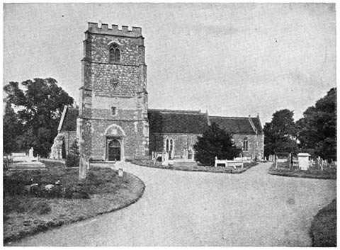
Bray Church
Bray Church
Boxford (461). A village with a railway station on the Lambourn line four miles north-west of Newbury. Many Roman remains have been found in the parish.
Boxford (461). A village with a train station on the Lambourn line, located four miles northwest of Newbury. Numerous Roman artifacts have been discovered in the parish.
Bradfield (1526). A village seven miles to the west of Reading. Bradfield College is a well-known public school. (pp. 21, 132.)
Bradfield (1526). A village seven miles west of Reading. Bradfield College is a renowned public school. (pp. 21, 132.)
Bray (1722). A village on the Thames between Maidenhead and Windsor. The well-known vicar, Simon Aleyn (died 1588) [161]succeeded in retaining his living during the reigns of Henry VIII, Edward VI, Mary, and Elizabeth. The song wrongly gives him a later date. The church is partly Early English; the tower is Perpendicular. Bray gives its name to the Hundred, which includes most of Maidenhead. (pp. 20, 62, 100, 134, 138.)
Bray (1722). A village on the Thames between Maidenhead and Windsor. The well-known vicar, Simon Aleyn (died 1588) [__A_TAG_PLACEHOLDER_0__] managed to keep his position during the reigns of Henry VIII, Edward VI, Mary, and Elizabeth. The song incorrectly gives him a later date. The church has elements from the Early English period; the tower is in the Perpendicular style. Bray gives its name to the Hundred, which includes most of Maidenhead. (pp. 20, 62, 100, 134, 138.)
Buckland (665). A large village four miles north-east of Faringdon. The large cruciform church is mostly Early English. The central tower is low and massive with fine Early English tower arches. The tracery has in modern times been removed from most of the windows. The population of the parish has diminished in recent years. (pp. 88, 98.)
Buckland (665). A large village located four miles northeast of Faringdon. The significant cross-shaped church is mostly in the Early English style. The central tower is short and sturdy, featuring beautiful Early English tower arches. In more recent times, the intricate designs have been removed from most of the windows. The population of the parish has decreased in recent years. (pp. 88, 98.)
Bucklebury (1066). A village in a large parish six miles north-east of Newbury. Swift visited Henry St John, Viscount Bolingbroke, at Bucklebury in 1711. (p. 21.)
Bucklebury (1066). A village in a large parish six miles northeast of Newbury. Swift visited Henry St John, Viscount Bolingbroke, at Bucklebury in 1711. (p. 21.)
Burghfield (1352). A village in the clay district five miles south-west of Reading. A curious wooden effigy of the fourteenth century is preserved in the church. (p. 57.)
Burghfield (1352). A village in the clay region, five miles southwest of Reading. A fascinating wooden statue from the fourteenth century is kept in the church. (p. 57.)
Chieveley (1204). A village four miles north of Newbury. The church is partly in the Early English style, the chancel with good lancet windows. The south doorway is round-headed and late Norman. Cromwell is said to have slept at the Old Blue Boar Inn the night before the second battle of Newbury.
Chieveley (1204). A village four miles north of Newbury. The church features a mix of Early English style, with attractive lancet windows in the chancel. The south doorway is round-headed and dates back to the late Norman period. It's said that Cromwell slept at the Old Blue Boar Inn the night before the second battle of Newbury.
Cholsey (1826). A large village with a railway station 48–1/2 miles from Paddington, the junction for Wallingford, distant 2–1/2 miles to the north-east. The large cruciform church has a fine Early English chancel. The arches of the central tower are massive and early Norman, and there are good Norman doors and windows in the church. The upper part of the tower belongs to the Decorated period. (p. 91.)
Cholsey (1826). A large village with a train station 48.5 miles from Paddington, with the junction for Wallingford located 2.5 miles to the northeast. The large cross-shaped church features a beautiful Early English chancel. The arches of the central tower are massive and date back to early Norman times, and there are impressive Norman doors and windows in the church. The upper part of the tower is from the Decorated period. (p. 91.)
Clewer (6171) on the river Thames is practically a suburb of Windsor, with numerous orphanages, homes, and other charitable institutions. [162]
Clewer (6171) on the River Thames is essentially a suburb of Windsor, featuring many orphanages, homes, and other charitable organizations. [__A_TAG_PLACEHOLDER_0__]
Coleshill (342). A village three and a half miles west-south-west of Faringdon on the Berkshire side of the river Cole. Coleshill House was built from designs by Inigo Jones. There are late Norman and also Early English arches in the church and the tower with its parapet and pinnacles is a good example of the Perpendicular style. The base and shaft of a village cross remain in the churchyard. (p. 117.)
Coleshill (342). A village located three and a half miles west-south-west of Faringdon on the Berkshire side of the river Cole. Coleshill House was designed by Inigo Jones. The church features late Norman and Early English arches, and the tower, with its parapet and pinnacles, is a fine example of the Perpendicular style. The base and shaft of a village cross can still be found in the churchyard. (p. 117.)

Cookham Lock
Cookham Lock
Cookham (3007). A village with a railway station on the Thames a little above Maidenhead. The church is largely Early English in style, the solid square tower is Perpendicular and is a prominent object from the river. (p. 17.)
Cookham (3007). A village with a train station on the Thames, just above Maidenhead. The church is mostly in Early English style, and its sturdy square tower is Perpendicular, making it a prominent landmark from the river. (p. 17.)
Coxwell, Great (264). (pp. 106, 116.)
Coxwell, Great (264). (pp. 106, 116.)
Crowthorne (3185). A village and ecclesiastical district in the parish of Sandhurst. On Norden’s map of Windsor Forest (temp. James I) the name is given to a tree at a point [163]where three of the Walks met, and the place is also on the boundary of three parishes. Wellington College and Broadmoor Lunatic Asylum are close to the village.
Crowthorne (3185). A village and church district in the parish of Sandhurst. On Norden’s map of Windsor Forest (during the reign of James I), the name refers to a tree located at a point [__A_TAG_PLACEHOLDER_0__] where three of the Walks intersect, and the area is also on the boundary of three parishes. Wellington College and Broadmoor Lunatic Asylum are nearby the village.
Cumnor (870). A village three miles south-west of Oxford. The church is late Norman and Early English with some later work. The tower has a round-headed west doorway and good Transition tower arch. There are scarcely any remains of Cumnor Hall. (pp. 77, 102, 104, 114, 120.)
Cumnor (870). A village located three miles southwest of Oxford. The church features late Norman and Early English architecture, along with some later additions. The tower has a round-headed west doorway and a nice Transition tower arch. There are hardly any remnants of Cumnor Hall. (pp. 77, 102, 104, 114, 120.)
Didcot (420). An important junction on the Great Western Railway 53 miles from Paddington. In the church is an effigy of the thirteenth century with a mitre, supposed to be that of the first mitred abbot of Abingdon. The base of the cross in the churchyard is old. (pp. 88, 124.)
Didcot (420). A key junction on the Great Western Railway, located 53 miles from Paddington. The church features an effigy from the thirteenth century with a mitre, believed to be that of the first mitred abbot of Abingdon. The base of the cross in the churchyard is ancient. (pp. 88, 124.)
Donnington. A hamlet two miles north of Newbury, with a castle and priory. (pp. 80, 108, 111.)
Donnington. A small village two miles north of Newbury, featuring a castle and a priory. (pp. 80, 108, 111.)
Earley (10,485), is becoming a suburb of Reading. Whiteknights, a seat of the 4th Duke of Marlborough, has now vanished and the park is partly built over.
Earley (10,485) is turning into a suburb of Reading. Whiteknights, once the residence of the 4th Duke of Marlborough, has now disappeared, and part of the park has been developed.
Easthampstead (1708), a village three and a half miles south-east of Wokingham, gave its name to one of the Walks in Windsor Forest. Caesar’s Camp (see page 89) is a mile to the south. There are four windows by Burne Jones in the church. (pp. 89, 90, 135, 143.)
Easthampstead (1708), a village located three and a half miles southeast of Wokingham, lent its name to one of the Walks in Windsor Forest. Caesar’s Camp (see page 89) is about a mile to the south. The church features four windows created by Burne Jones. (pp. 89, 90, 135, 143.)
Englefield (315). A village and park five miles west of Reading. (pp. 77, 139.)
Englefield (315). A village and park located five miles west of Reading. (pp. 77, 139.)
Faringdon (2770). A market town with railway station 70 miles from Paddington. The trade is mainly in cattle, sheep, bacon, and corn. (pp. 35, 62, 67, 70, 88, 95, 97, 99, 106, 117, 120, 129, 141, 143.)
Faringdon (2770). A market town with a train station located 70 miles from Paddington. The main industries here are cattle, sheep, bacon, and grain. (pp. 35, 62, 67, 70, 88, 95, 97, 99, 106, 117, 120, 129, 141, 143.)
Finchampstead (666). A village three miles south-west of Wokingham. (pp. 96, 98.) [164]
Finchampstead (666). A village located three miles southwest of Wokingham. (pp. 96, 98.) [__A_TAG_PLACEHOLDER_0__]
Hagbourne, East and West (1360). Villages near Didcot junction, both very attractive, with old cottages and half-timbered houses. There are two village crosses and part of a third. In the church at East Hagbourne are good examples of Transition Norman and of all the later styles of architecture. The chancel arch is Transition, the tower arch and chancel Early English, and the tower Perpendicular in style. (p. 86.)
Hagbourne, East and West (1360). These are charming villages located near Didcot junction, featuring picturesque old cottages and half-timbered houses. You can find two village crosses and part of a third. The church at East Hagbourne showcases impressive examples of Transition Norman and several later architectural styles. The chancel arch is in the Transition style, the tower arch and chancel reflect Early English style, while the tower is designed in the Perpendicular style. (p. 86.)
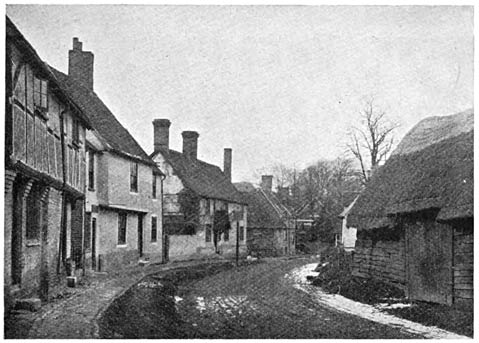
East Hagbourne Village
East Hagbourne Village
Hampstead Marshall (244). A village three and a half miles south-west of Newbury. There is a beautiful deer park, the house in which was burnt in 1718 and has not been rebuilt. (p. 137.)
Hampstead Marshall (244). A village located three and a half miles southwest of Newbury. There's a beautiful deer park, but the house that used to be there was burned down in 1718 and hasn't been rebuilt. (p. 137.)
Hampstead Norris (760). A village and railway station on the Didcot-Newbury line and in the chalk district. The church has a Norman doorway and an Early English chancel, and the staircase to the rood-loft remains. (pp. 21, 90, 138.) [165]
Hampstead Norris (760). A village and train station on the Didcot-Newbury line located in the chalk area. The church features a Norman doorway and an Early English chancel, and the staircase to the rood-loft is still intact. (pp. 21, 90, 138.) [__A_TAG_PLACEHOLDER_0__]
Hendred, East and West (1038) are villages between Wantage and Didcot, both most attractive, with half-timbered houses and churches of mixed styles but with many points of note. Hendred House with an old chapel attached is of considerable interest. (p. 116.)
Hendred, East and West (1038) are charming villages located between Wantage and Didcot, featuring half-timbered houses and churches of various architectural styles, each with several noteworthy details. Hendred House, which has an old chapel attached, is particularly interesting. (p. 116.)
Hungerford (2364). A market town on the old Roman road to Bath on the river Kennet, a part of the town being in Wiltshire. It is a great resort of anglers. Charles I was at the Bear Inn, November 1644, and at the same inn William of Orange met the commissioners from James II in 1688. (pp. 8, 13, 18, 22, 80, 119, 120, 142.)
Hungerford (2364). A market town on the ancient Roman road to Bath along the river Kennet, with part of the town located in Wiltshire. It’s a popular spot for anglers. Charles I stayed at the Bear Inn in November 1644, and William of Orange met the commissioners from James II at the same inn in 1688. (pp. 8, 13, 18, 22, 80, 119, 120, 142.)

Hurley Church and Site of Lady Place
Hurley Church and Site of Lady Place
Hurley (493). An interesting village on the Thames with old houses, four miles north-west of Maidenhead. (p. 105.)
Hurley (493). A charming village on the Thames featuring historic homes, located four miles northwest of Maidenhead. (p. 105.)
Hurst (1214). A village three miles north-west of Wokingham. (p. 101.) [166]
Hurst (1214). A village located three miles northwest of Wokingham. (p. 101.) [__A_TAG_PLACEHOLDER_0__]
Ilsley, East (482). A small town in the chalk district two and a half miles from Compton station with a large sheep market. The Duke of Cumberland, uncle of George III, had a house and training stables here, and it is now a great place for training horses. The church is mainly Early English. (pp. 80, 118.)
Ilsley, East (482). A small town in the chalk district, located two and a half miles from Compton station, with a large sheep market. The Duke of Cumberland, who was the uncle of George III, owned a house and training stables here, and it's now a popular spot for training horses. The church is primarily Early English. (pp. 80, 118.)
Inkpen (658). A village four miles south-east of Hungerford. To the south of the village there is a range of chalk hills, the highest of which is Inkpen Beacon, 975 feet above the sea. Walbury Camp is a large earthwork on the same range a little to the east, with an altitude of 959 feet. (p. 12.)
Inkpen (658). A village located four miles southeast of Hungerford. To the south of the village, there’s a series of chalk hills, the tallest of which is Inkpen Beacon, standing at 975 feet above sea level. Walbury Camp is a large earthwork on the same hill range, slightly to the east, with an elevation of 959 feet. (p. 12.)
Kintbury (1548). A large village with a railway station nearly midway between Newbury and Hungerford. It is on the river Kennet. Brick-making is carried on in the neighbourhood and there is a whitening factory. The church is largely Norman with an Early English tower. (pp. 60, 61.)
Kintbury (1548). A large village with a train station situated almost halfway between Newbury and Hungerford. It's located on the river Kennet. Brick-making occurs in the area, and there is a whitening factory. The church is mainly Norman style with an Early English tower. (pp. 60, 61.)
Lambourn (1476). A small town in the midst of the chalk district with a light railway to Newbury (12 miles). It is an important centre for training race-horses. The river Lambourn is a good trout stream. There is an old market cross. The large church is cruciform with a central tower which is Norman in character with small round-headed windows. Much of the church is Transition Norman. The east window is of the Perpendicular period. (pp. 85, 143.)
Lambourn (1476). A small town in the chalk district with a light railway to Newbury (12 miles). It’s an important hub for training racehorses. The River Lambourn is a great trout stream. There’s an old market cross. The large church is shaped like a cross, with a central tower that has a Norman style and small round-headed windows. Much of the church reflects Transition Norman architecture. The east window is from the Perpendicular period. (pp. 85, 143.)
Lockinge, East (301). A village two miles south-east of Wantage. The church, mainly of the Decorated style but with a good Norman doorway, has been recently enlarged. Lockinge House stands in a beautiful park close to the village. (p. 91.)
Lockinge, East (301). A village located two miles southeast of Wantage. The church, primarily in the Decorated style but featuring a well-preserved Norman doorway, has recently been expanded. Lockinge House is situated in a beautiful park near the village. (p. 91.)
Maidenhead (10,757). A municipal borough and market-town on the Thames with a railway station 24–1/2 miles from Paddington. The borough is partly in Bray and partly in Cookham parish. There are grain mills and breweries, and some trade in timber is carried on. (pp. 12, 17, 20, 75, 90, 114, 119, 120, 123, 138.) [167]
Maidenhead (10,757). A town and municipal borough on the Thames, located 24.5 miles from Paddington by train. The borough spans parts of Bray and Cookham parish. It has grain mills and breweries, and also some timber trade. (pp. 12, 17, 20, 75, 90, 114, 119, 120, 123, 138.) [__A_TAG_PLACEHOLDER_0__]
Marcham (798). A village two and a half miles west of Abingdon with many stone quarries in the neighbourhood. (pp. 34, 89.)
Marcham (798). A village two and a half miles west of Abingdon with many stone quarries nearby. (pp. 34, 89.)
Mortimer. See Stratfield Mortimer.
Mortimer. See Stratfield Mortimer.
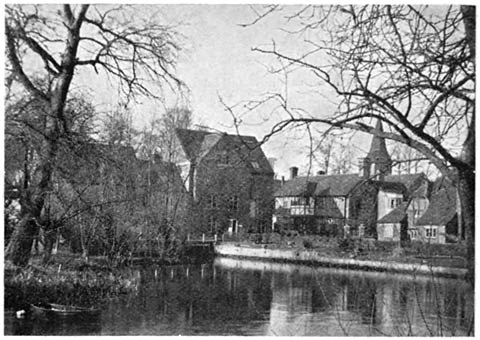
Pangbourne
Pangbourne
Newbury (8924). A municipal borough and market-town with a railway station on the Great Western 53 miles from Paddington, and also with railways to Didcot, Southampton, and Lambourn. The borough was incorporated by charter of Elizabeth. The chief trade is in agricultural produce. There are maltings and corn mills. The town has large new municipal buildings, a free library, a district hospital, and a large grammar school as well as many charities. A race-course has recently been made a little to the east of the town with a separate railway station. (pp. 17, 22, 59, 70, 76, 79, 86, 89, 101, 111, 115, 119, 128, 129, 137, 145.) [168]
Newbury (8924). A municipal borough and market town with a train station on the Great Western, 53 miles from Paddington, and also connected to Didcot, Southampton, and Lambourn by rail. The borough was established by a charter from Elizabeth. The main trade is in agricultural goods. There are malting facilities and flour mills. The town features large new municipal buildings, a public library, a district hospital, and a large grammar school, along with several charities. A racecourse has recently been built a little to the east of the town, complete with its own train station. (pp. 17, 22, 59, 70, 76, 79, 86, 89, 101, 111, 115, 119, 128, 129, 137, 145.) [__A_TAG_PLACEHOLDER_0__]
Pangbourne (1235). A village with a railway station 41–1/2 miles from Paddington, situated at the junction of the river Pang with the Thames. (pp. 10, 21, 85.)
Pangbourne (1235). A village with a train station 41.5 miles from Paddington, located at the point where the river Pang meets the Thames. (pp. 10, 21, 85.)
Radley (444). A village with a railway station 58 miles from Paddington. Radley College, a large public school, is situated a mile to the west of the village. (pp. 133, 138.)
Radley (444). A village with a train station 58 miles from Paddington. Radley College, a large public school, is located a mile to the west of the village. (pp. 133, 138.)
Reading (52,660). A county, municipal, and parliamentary borough, and the county town of Berkshire. It is a most important railway centre 36 miles from Paddington and is served by the South Western and South Eastern as well as by the Great Western railways. It has, in fact, excellent railway communication with every part of England and Wales. The charter of incorporation was granted by Henry III.
Reading (52,660). A county, municipal, and parliamentary borough, and the county town of Berkshire. It is a major railway hub located 36 miles from Paddington, served by South Western, South Eastern, and Great Western railways. It actually has excellent train connections to every part of England and Wales. The charter of incorporation was granted by Henry III.
Reading is situated on the river Kennet close to its junction with the Thames. There are large municipal buildings with a free library and an excellent museum, a county hospital, a university college, a grammar school, and many other schools and charitable institutions. The Berkshire County Hall and the Assize Courts are at Reading and are close to the old gateway of Reading Abbey. The few remains of the abbey are now the property of the Corporation and are laid out as gardens adjoining the public Forbury garden. The railway works are extensive and there are iron foundries, engine and agricultural implement works, cycle works, electric-light works, printing works, a very large establishment for making biscuits, and also one for the production and sale of seeds. There are also flour mills, breweries, brick and tile works, steam launch and boat-building yards, and establishments for making ropes and sacks. St Mary’s church is said to have been built of materials from the ruins of the abbey. The walls are largely of a chequer pattern of dressed flints and squares of freestone. (pp. 6, 19, 22, 36, 54, 58, 62, 64–84, 89, 90, 99, 103, 104, 108, 125–133, 140, 144.) [169]
Reading is located by the River Kennet, near where it meets the Thames. The area features large municipal buildings, a free library, a great museum, a county hospital, a university college, a grammar school, and many other schools and charitable organizations. Berkshire County Hall and the Assize Courts are also in Reading, close to the old entrance of Reading Abbey. The remnants of the abbey now belong to the Corporation and are set up as gardens next to the public Forbury garden. The railway works are extensive, and there are iron foundries, engine and agricultural implement factories, cycle manufacturers, electric light operations, printing presses, a large biscuit-making factory, and a facility for producing and selling seeds. Additionally, there are flour mills, breweries, brick and tile factories, steam launch and boat-building yards, and businesses that make ropes and sacks. St. Mary’s Church is thought to have been constructed using materials from the abbey's ruins. The walls feature a checkered pattern of dressed flints and squares of freestone. (pp. 6, 19, 22, 36, 54, 58, 62, 64–84, 89, 90, 99, 103, 104, 108, 125–133, 140, 144.) [__A_TAG_PLACEHOLDER_0__]
Sandhurst (2386). A village on the river Blackwater four and a half miles south-east of Wokingham with a railway station on the South Eastern and Chatham railway. The Royal Military College is two miles south-east of the village near Blackwater station. (pp. 130, 132.)
Sandhurst (2386). A village on the Blackwater River, located four and a half miles southeast of Wokingham, featuring a railway station on the South Eastern and Chatham line. The Royal Military College is situated two miles southeast of the village, close to Blackwater station. (pp. 130, 132.)
Shefford, Great or West Shefford (422). A village between Lambourn and Newbury. The church has been already mentioned. (p. 117.)
Shefford, Great or West Shefford (422). A village located between Lambourn and Newbury. The church has already been mentioned. (p. 117.)

Shottesbrook Church from the Park
Shottesbrook Church from the Park
Shinfield (1015). A large village three miles south of Reading.
Shinfield (1015). A big village located three miles south of Reading.
Shottesbrook. A park four miles south-west of Maidenhead. The beautiful church has been already mentioned. (pp. 63, 108.)
Shottesbrook. A park located four miles south-west of Maidenhead. The lovely church has been mentioned earlier. (pp. 63, 108.)
Shrivenham (951). A village with a railway station on the Great Western 71–1/2 miles from Paddington, near the border of Wiltshire. It gives its name to the Hundred. (pp. 72, 138, 143.) [170]
Shrivenham (951). A village with a train station on the Great Western, 71.5 miles from Paddington, near the Wiltshire border. It lends its name to the Hundred. (pp. 72, 138, 143.) [__A_TAG_PLACEHOLDER_0__]
Sonning (526). A very attractive village on the Thames two and a half miles below Reading, the parish is partly in Oxfordshire. In the tenth and eleventh centuries there was a Bishop of Berks and Wilts and the palace was at this place. The church is large with Early English arches and many monuments.
Sonning (526). A charming village on the Thames, located two and a half miles downstream from Reading, with part of the parish extending into Oxfordshire. In the tenth and eleventh centuries, there was a Bishop of Berks and Wilts, and the palace was situated here. The church is spacious, featuring Early English arches and numerous monuments.
Sparsholt (646). A village three and a quarter miles west of Wantage. There is a fine church in the Decorated style. (p. 99.)
Sparsholt (646). A village about 3.25 miles west of Wantage. It features a beautiful church in the Decorated style. (p. 99.)

Streatley Mill
Streatley Mill
Stanford in the Vale (853). A village nearly four miles south-east of Faringdon. The church, in mixed styles, is interesting. The tower is Early English, there is a squint from the north aisle to the altar, and a very curious piscina with a reliquary above it.
Stanford in the Vale (853). A village almost four miles southeast of Faringdon. The church, featuring a mix of architectural styles, is quite interesting. The tower is Early English, there's a squint from the north aisle to the altar, and a very unusual piscina with a reliquary above it.
Steventon (797). A village with railway station on the Great Western three and a half miles south-south-west of Abingdon. There is a raised flood-path by the road through the village, a number of old houses, and a church in mixed styles with a [171]south aisle and tower arches of the Decorated period. (pp. 101 108, 117.)
Steventon (797). A village with a railway station on the Great Western, located three and a half miles south-south-west of Abingdon. There’s a raised flood path along the road through the village, several old houses, and a church with mixed architectural styles featuring a [__A_TAG_PLACEHOLDER_0__] south aisle and tower arches from the Decorated period. (pp. 101 108, 117.)
Stratfield Mortimer (1405). A village and residential district with a railway station named Mortimer on the Reading and Basingstoke line, the nearest station to the Roman town of Silchester in Hampshire.
Stratfield Mortimer (1405). A village and residential area with a train station called Mortimer on the Reading and Basingstoke line, which is the closest station to the Roman town of Silchester in Hampshire.
Streatley (562). A village on the Thames opposite Goring in Oxfordshire, with which it is connected by a bridge. This is a very old crossing place and the Ridgeway is directed towards this point. (pp. 19, 90, 118.)
Streatley (562). A village on the Thames across from Goring in Oxfordshire, linked by a bridge. This has been a crossing point for a long time, and the Ridgeway leads to this location. (pp. 19, 90, 118.)
Sunningdale (1409), five miles south of Windsor, with a station on the London and South Western, was until recently a district of heath and pine woods, but it is being rapidly built over and good golf links attract many visitors. (p. 86.)
Sunningdale (1409), five miles south of Windsor, with a station on the London and South Western, was recently a rural area of heath and pine forests, but it's quickly being developed, and great golf courses draw in many visitors. (p. 86.)
Sunninghill (2479). A village and residential district close to the above. Two chalybeate springs, Sunninghill Wells, were a fashionable resort in the eighteenth century. (pp. 106, 118, 135.)
Sunninghill (2479). A village and residential area near the one mentioned above. Two iron-rich springs, Sunninghill Wells, were a popular destination in the eighteenth century. (pp. 106, 118, 135.)
Sunningwell (289). A village two miles north of Abingdon. Bishop Jewel was vicar and is said to have built the singular octagonal porch at the west end of the church.
Sunningwell (289). A village two miles north of Abingdon. Bishop Jewel was the vicar and is believed to have constructed the unique octagonal porch at the west end of the church.
Sutton Courtney (1295). A village on the Thames two miles south of Abingdon. The abbey, the manor house, and the manor farm were buildings connected with Abingdon Abbey, and are all of interest, dating from the twelfth to the thirteenth century. In the church the chancel arch and walls are Transition Norman, the tower arch is Norman. (p. 114.)
Sutton Courtney (1295). A village on the Thames two miles south of Abingdon. The abbey, the manor house, and the manor farm are buildings associated with Abingdon Abbey and are all significant, dating from the twelfth to thirteenth century. In the church, the chancel arch and walls are Transition Norman, and the tower arch is Norman. (p. 114.)
Swallowfield (1375). A village on the river Blackwater five miles south of Reading. The church has a wooden bell-cot with very fine old timber work. A Bible of 1613 is preserved in the church and Miss Mitford’s grave is in the churchyard. (p. 144.) [172]
Swallowfield (1375). A village by the Blackwater River, located five miles south of Reading. The church features a wooden bell-cot with impressive old timber work. A Bible from 1613 is kept in the church, and Miss Mitford’s grave can be found in the churchyard. (p. 144.) [__A_TAG_PLACEHOLDER_0__]
Thatcham (2177). A large village three miles east of Newbury which was once a small town with a market. There is some good Norman work in the church.
Thatcham (2177). A large village located three miles east of Newbury that used to be a small town with a market. The church features some impressive Norman architecture.
Three Mile Cross. (p. 144.)
Three Mile Cross. (p. 144.)
Tidmarsh. (pp. 21, 30.)
Tidmarsh. (pp. 21, 30.)
Tilehurst (5965). A village on the plateau two miles west of Reading with a considerable brickmaking industry.
Tilehurst (5965). A village on the plateau two miles west of Reading known for its significant brickmaking industry.

Wallingford Bridge
Wallingford Bridge
Twyford (1106). A small town in Hurst parish four miles north-east of Reading, with a railway station on the Great Western, the junction for the Henley line. (pp. 17, 142.)
Twyford (1106). A small town in Hurst parish located four miles northeast of Reading, featuring a railway station on the Great Western, which is the junction for the Henley line. (pp. 17, 142.)
Uffington (518). A village in the Vale of White Horse about six miles west of Wantage with a railway station 66–1/2 miles from Paddington, the junction for the Faringdon line. There is a large cruciform church mainly dating from the Early English period. The central tower is octagonal. Uffington Castle is a large earthwork on the chalk downs close to the White Horse and two miles south of the village. (pp. 5, 7, 86, 88, 98.) [173]
Uffington (518). A village in the Vale of White Horse, about six miles west of Wantage, with a railway station 66.5 miles from Paddington, which is the junction for the Faringdon line. There is a large cross-shaped church mainly from the Early English period. The central tower is octagonal. Uffington Castle is a large earthwork on the chalk hills near the White Horse and two miles south of the village. (pp. 5, 7, 86, 88, 98.) [__A_TAG_PLACEHOLDER_0__]
Upton (338). A village with railway station on the Didcot and Newbury line, two and a half miles south of the former and on the edge of the chalk district. The church is a small Norman chapel of early character.
Upton (338). A village with a railway station on the Didcot and Newbury line, two and a half miles south of Didcot and on the edge of the chalk district. The church is a small Norman chapel from an early period.
Wallingford (3049). A municipal borough and market-town 51 miles by rail from Paddington and 46 miles by road from London. It is situated on the Thames and is built on a wide area of river gravel. The charter of its incorporation dates from the time of Henry II. There is a bridge over the river built in 1809 on the site of an older structure. The town hall with an undercroft of 1670 has been already mentioned (page 128). There is a corn exchange, free library, and grammar school. The trade is in agricultural produce and malt. On the three sides of the town away from the river are very ancient earth ramparts, and the keep-mound and some slight remains of a Norman castle still exist. (pp. 57, 59, 65, 67, 68, 70, 71, 73, 74, 80, 85, 88, 91, 106, 111, 128, 142, 143.)
Wallingford (3049). A municipal borough and market town located 51 miles by train from Paddington and 46 miles by road from London. It's situated on the Thames and built on a large area of river gravel. Its charter of incorporation dates back to the time of Henry II. There's a bridge over the river, built in 1809, on the site of an older structure. The town hall, which has an undercroft from 1670, has already been mentioned (page 128). There is a corn exchange, free library, and grammar school. The local economy is based on agricultural produce and malt. On three sides of the town, away from the river, there are very old earthen ramparts, and the keep-mound along with some remnants of a Norman castle still exist. (pp. 57, 59, 65, 67, 68, 70, 71, 73, 74, 80, 85, 88, 91, 106, 111, 128, 142, 143.)
Waltham St Lawrence (867). A village four and a half miles south-west of Maidenhead. (pp. 62, 90.)
Waltham St Lawrence (867). A village located four and a half miles southwest of Maidenhead. (pp. 62, 90.)
Waltham, White. See White Waltham.
Waltham, White. See White Waltham.
Wantage (4146). A market-town in the Vale of White Horse. The railway station, Wantage Road, is nearly two and a half miles from the town. There are ironworks but otherwise the trade is mainly in agricultural produce. The church is large, cruciform and in mixed styles. Wantage was the birthplace of Alfred the Great, and Butler, the author of the Analogy, was also a native. (pp. 30, 67, 119, 122, 137, 140.)
Wantage (4146). A market town in the Vale of White Horse. The railway station, Wantage Road, is about two and a half miles from the town. There are ironworks, but most of the trade is focused on agricultural products. The church is large, shaped like a cross, and features a mix of architectural styles. Wantage was the birthplace of Alfred the Great, and Butler, the author of the Analogy, was also from here. (pp. 30, 67, 119, 122, 137, 140.)
Warfield (919). A village in Windsor Forest with an interesting church mainly in the Decorated style. A mile to the north-west is the steeplechase course of Hawthorn Hill. (p. 99.)
Warfield (919). A village in Windsor Forest featuring an intriguing church primarily in the Decorated style. A mile to the northwest is the steeplechase course at Hawthorn Hill. (p. 99.)
Wargrave (1857). A large village on the river Thames between Reading and Henley. (pp. 20, 23, 144.) [174]
Wargrave (1857). A big village on the river Thames located between Reading and Henley. (pp. 20, 23, 144.) [__A_TAG_PLACEHOLDER_0__]
White Waltham (679). A village three miles south-west of Maidenhead. Prince Arthur, son of Henry VII, lived in the manor house, now a farm. (pp. 64, 142.)
White Waltham (679). A village located three miles southwest of Maidenhead. Prince Arthur, the son of Henry VII, lived in the manor house, which is now a farm. (pp. 64, 142.)
Wickham. A village on a clayey hill five and a half miles north-west of Newbury. The very old church tower has been already noticed. (pp. 95, 119.)
Wickham. A village on a clay hill five and a half miles northwest of Newbury. The ancient church tower has already been mentioned. (pp. 95, 119.)

The Stocks at White Waltham
The Stocks at White Waltham
Windsor or New Windsor (13,958). A municipal borough and market-town 22 miles from London. It is a parliamentary borough, a large part of which is in Buckinghamshire. The town, which has grown up round the castle, was incorporated by Edward I. The High Steward is H.R.H. Prince Christian. There is a town hall, public library, and reading room, and both cavalry and infantry barracks. Windsor Castle has long been a favourite residence of our Kings and Queens. (pp. 20, 62, 68–80, 89, 95, 99, 104, 108, 114, 117, 128, 134, 142.) [175]
Windsor or New Windsor (13,958). A municipal borough and market town located 22 miles from London. It is a parliamentary borough, with a significant portion in Buckinghamshire. The town developed around the castle and was incorporated by Edward I. The High Steward is H.R.H. Prince Christian. There is a town hall, a public library, and a reading room, along with cavalry and infantry barracks. Windsor Castle has been a favorite residence for our Kings and Queens for a long time. (pp. 20, 62, 68–80, 89, 95, 99, 104, 108, 114, 117, 128, 134, 142.) [__A_TAG_PLACEHOLDER_0__]
Windsor, Old (1962). A village two miles south-east of the castle. It was the residence of Edward the Confessor. The church is a small one in the Early English style. Beaumont College is in this parish.
Windsor, Old (1962). A village two miles southeast of the castle. It was the home of Edward the Confessor. The church is a small one in the Early English style. Beaumont College is located in this parish.
Winkfield (1026). A village in Windsor Forest four and a half miles south-west of Windsor. Foliejon Park is a little to the north of the village. (p. 35.)
Winkfield (1026). A village in Windsor Forest, located four and a half miles southwest of Windsor. Foliejon Park is just north of the village. (p. 35.)
Wittenham, Long (470). A village on the Thames between Abingdon and Wallingford with an interesting church of mixed styles but mainly of the Decorated period. (pp. 91, 101.)
Wittenham, Long (470). A village on the Thames between Abingdon and Wallingford featuring an interesting church with a mix of styles, primarily from the Decorated period. (pp. 91, 101.)
Wokingham (5923). A municipal borough and market-town with a railway station 36–1/4 miles from Waterloo. The charter of incorporation was granted by Queen Elizabeth. There is a town hall and also a number of charitable endowments, one of which was founded by Archbishop Laud. The trade is mainly in agricultural produce, timber, bricks and tiles. (pp. 60, 128, 134, 140.)
Wokingham (5923). A municipal borough and market town with a railway station 36.25 miles from Waterloo. The charter of incorporation was granted by Queen Elizabeth. There is a town hall and several charitable endowments, one of which was established by Archbishop Laud. The main trades are in agricultural products, timber, bricks, and tiles. (pp. 60, 128, 134, 140.)
Wytham (230). A village in the most northern corner of Berkshire, close to Oxford. The church is built of material which was mostly brought from Cumnor Hall. Wytham Abbey, a building of the sixteenth century, is close to the church and has a fine park. (pp. 114, 139, 140.)
Wytham (230). A village in the northernmost part of Berkshire, near Oxford. The church is made from materials that were mostly brought from Cumnor Hall. Wytham Abbey, a structure from the sixteenth century, is near the church and has a lovely park. (pp. 114, 139, 140.)
Yattendon (274) stands on a clayey hill five and a half miles west of Pangbourn. The church, built about 1450, is a good example of the Perpendicular style. There are some extensive and ancient underground galleries in the chalk near this place. (pp. 85, 139.) [176]
Yattendon (274) is situated on a clay hill five and a half miles west of Pangbourne. The church, constructed around 1450, is a great example of the Perpendicular style. There are some large and old underground tunnels in the chalk near this area. (pp. 85, 139.) [__A_TAG_PLACEHOLDER_0__]
DIAGRAMS

Fig. 1. Area of Berkshire (462,208 acres) compared with that of England and Wales
Fig. 1. Area of Berkshire (462,208 acres) compared to that of England and Wales

Fig. 2. Population of Berkshire (256,509) compared with that of England and Wales in 1901
Fig. 2. Population of Berkshire (256,509) compared to that of England and Wales in 1901

Fig. 3. Increase of population in Berkshire from 1861 to 1901
Fig. 3. Population growth in Berkshire from 1861 to 1901
[177]
[__A_TAG_PLACEHOLDER_0__]

Fig. 4. Comparative Density of Population to the square mile in (a) England and Wales, (b) Berkshire, (c) Lancashire
Fig. 4. Comparative Density of Population per square mile in (a) England and Wales, (b) Berkshire, (c) Lancashire
(Each dot represents 10 persons)
(Each dot represents 10 people)

Fig. 5. Proportionate Area under Corn Crops in Berkshire in 1908
Fig. 5. Proportionate Area under Corn Crops in Berkshire in 1908
[178]
[__A_TAG_PLACEHOLDER_0__]

Fig. 6. Proportionate Area in Acres of chief Cereals in Berkshire in 1908
Fig. 6. Proportionate Area in Acres of Major Cereals in Berkshire in 1908

Fig. 7. Proportion of Permanent Pasture in Berkshire in 1908
Fig. 7. Percentage of Permanent Pasture in Berkshire in 1908
[179]
[__A_TAG_PLACEHOLDER_0__]

Fig. 8. Proportion of Permanent Pasture to other Areas in Berkshire in 1908
Fig. 8. Ratio of Permanent Pasture to other Areas in Berkshire in 1908

Fig. 9. Proportionate numbers of Live Stock in Berkshire in 1908
Fig. 9. Proportional numbers of Livestock in Berkshire in 1908
CAMBRIDGE: PRINTED BY JOHN CLAY, M.A. AT THE UNIVERSITY PRESS. [180]
CAMBRIDGE: PRINTED BY JOHN CLAY, M.A. AT THE UNIVERSITY PRESS. [__A_TAG_PLACEHOLDER_0__]

GEOLOGICAL MAP OF BERKSHIRE
Berkshire Geological Map
The Cambridge University Press
Cambridge University Press
Copyright, George Philip & Son Ltd.
Copyright, George Philip & Son Ltd.
Colophon
Availability
Related Open Library catalog page (for source): OL7074147M.
Related Open Library catalog page (for source): OL7074147M.
Encoding
Revision History
- 2014-03-16 Started.
External References
Download ePUB
If you like this ebook, consider a donation!