This is a modern-English version of The Lake Dwellings of Ireland: Or ancient lacustrine habitations of Erin, commonly called crannogs., originally written by Wood-Martin, W. G. (William Gregory).
It has been thoroughly updated, including changes to sentence structure, words, spelling,
and grammar—to ensure clarity for contemporary readers, while preserving the original spirit and nuance. If
you click on a paragraph, you will see the original text that we modified, and you can toggle between the two versions.
Scroll to the bottom of this page and you will find a free ePUB download link for this book.
Some illustrations are described as “One-half size” or similar. These descriptions relate to the size of the image in the original printed book and not to the size they are displayed in this e-text. For reference: a full page was 26cm in height; Plate XIX is an example of a full page image; efforts have been made to retain the sizes of images relative to each other.
Some illustrations are labeled as “Half size” or something similar. These labels refer to the size of the image in the original printed book, not to how they appear in this e-text. For reference: a full page was 26cm tall; Plate XIX is an example of a full page image; we’ve worked to keep the sizes of images consistent with one another.
THE
Lake houses
OF
IRELAND.
Frontispiece.
Cover page.

IRISH LAKE DWELLING OF THE ISOLATED TYPE.
IRISH LAKE HOUSE OF THE ISOLATED TYPE.
Ideally restored from inspection of numerous sites.
Restored based on the examination of several sites.
THE
LAKE DWELLINGS
OF
IRELAND:
THE
LAKE HOMES
OF
IRELAND:
OR ANCIENT
LACUSTRINE HABITATIONS OF ERIN,
COMMONLY CALLED CRANNOGS.
OR ANCIENT
Irish Lake Dwellings
COMMONLY KNOWN AS CRANNOGS.
BY
W. G. WOOD-MARTIN, M.R.I.A., F.R.H.A.A.I.,
LIEUT.-COLONEL 8TH BRIGADE NORTH IRISH DIVISION, R.A.;
Author of “Sligo and the Enniskilleners”;
“History of Sligo, from the Earliest Ages to the close of the Reign of Queen Elizabeth.”
BY
W. G. Wood-Martin, M.R.I.A., F.R.H.A.A.I.,
LIEUT.-COLONEL 8TH BRIGADE NORTH IRISH DIVISION, R.A.;
Author of “Sligo and the Enniskilleners”;
“History of Sligo, from the Earliest Ages to the end of Queen Elizabeth's Reign.”
DUBLIN:
HODGES, FIGGIS & CO., GRAFTON STREET.
PUBLISHERS TO THE UNIVERSITY.
LONDON:
LONGMANS, GREEN & CO., PATERNOSTER ROW.
1886.
DUBLIN:
HODGES, FIGGIS & CO., GRAFTON STREET.
PUBLISHERS FOR THE UNIVERSITY.
LONDON:
LONGMANS, GREEN & CO., PATERNOSTER ROW.
1886.
ALL RIGHTS RESERVED.
All rights reserved.
DUBLIN: PRINTED AT THE UNIVERSITY PRESS.
DUBLIN: PRINTED AT THE UNIVERSITY PRESS.

PREFACE.

The object the writer has in view in this Publication is to place on record the remarkable discoveries made in a department of Archæology hitherto almost unnoticed in Ireland, except in the Proceedings, Catalogues, and Journals of various learned Societies. So far back as 1861 a writer remarked that such a work would be “a real boon to archæology,” yet in the interval none has appeared. The cause is not far to seek. A publication treating of the habits and social economy of long-forgotten generations is little calculated to gain a rapid foothold with the general public, by whom the study of the past may probably be considered dull as well as useless reading. To many, however, it proves most interesting to observe—despite widest variations of climatic conditions—the great similarity of the ways and habits of man while in a rude uncultivated state—acting as it were by a[Pg vi] common instinct—and again to trace his upward progress towards civilization. A wide tract in this field of archæological research is fortunately opened up by a comparison of the Irish Lake Dwellings and their “finds” with those of other countries, more especially with the discoveries brought into such prominent notice by Keller in Switzerland, and Munro in Scotland.
The goal of the writer in this publication is to record the remarkable discoveries made in a branch of archaeology that has largely gone unnoticed in Ireland, except in the proceedings, catalogs, and journals of various scholarly societies. As far back as 1861, a writer noted that such a work would be “a real benefit to archaeology,” yet none has come out in the meantime. The reason is pretty clear. A publication focused on the habits and social structures of long-forgotten generations is unlikely to gain quick traction with the general public, who might view the study of the past as boring and pointless. However, for many, it is fascinating to see—despite the wide range of climatic conditions—the significant similarities in the ways and habits of humans in a primitive, uncultivated state, acting almost on instinct, and to trace their journey toward civilization. Fortunately, a vast area in this field of archaeological research is opened up by comparing the Irish Lake Dwellings and their findings with those of other countries, particularly with the discoveries highlighted by Keller in Switzerland and Munro in Scotland.
To the late Sir William Wilde belongs the honour of first drawing general attention to the water habitations of Erin; his labours have been ably followed up by W. F. Wakeman, who has so largely contributed to the Journal of the Royal Historical and Archæological Association of Ireland both Papers and Drawings illustrative of the subject. In the present work, Kinahan, Reeves, Graves, Wilde, and other specialists, have been freely quoted, as evidenced in the text; in short, the observations of every author have been utilized, provided they touched on points that could tend in any degree to elucidate the subject under consideration. “A dwarf on a giant’s shoulders sees further of the two”: thus the writer, standing in this line of investigation on the eminence created by his predecessors, may perhaps be enabled to lay before his readers a distinct and comprehensive view of the Ancient Lake Dwellings in Ireland. Recent discoveries and new matter will be found in these pages; but the special intention has been to collect carefully all the information hitherto furnished by the explorers of Irish Lake Dwellings, and to present that information in a condensed form, “an abridgment of all that is pleasant,” so as to render it acceptable to[Pg vii] archæologists, and perchance agreeable to the general reader, who, not having had his attention previously directed towards the subject, can scarcely be supposed willing to explore the voluminous records of scientific societies in search of items connected with the question of lacustrine remains in Ireland.
To the late Sir William Wilde goes the credit for first bringing attention to the water dwellings of Ireland; his work has been effectively continued by W. F. Wakeman, who has made significant contributions to the Journal of the Royal Historical and Archæological Association of Ireland through both papers and drawings related to this topic. In this work, Kinahan, Reeves, Graves, Wilde, and other experts have been extensively cited, as indicated in the text; in short, the insights of every author have been used, as long as they offered information that could help clarify the topic at hand. “A dwarf on a giant’s shoulders sees further than either”: thus the author, standing on the foundation laid by his predecessors, may be able to present a clear and comprehensive overview of the Ancient Lake Dwellings in Ireland. New discoveries and fresh content will be found within these pages; however, the primary goal has been to carefully gather all the information that has been provided by the explorers of Irish Lake Dwellings and to present it in a concise form, “an abridgment of all that is pleasant,” making it accessible to [Pg vii] archaeologists, and perhaps enjoyable to the general reader, who, having not previously focused on the topic, may not be inclined to sift through the extensive records of scientific societies in search of details regarding the question of lake remains in Ireland.
This Publication may, perhaps, help to diffuse more generally the knowledge already possessed, so that when fresh discoveries are made in any new locality increased care may be devoted to the exploration; for every artificial island is not necessarily of remote antiquity, and the most careful examination is essential before arriving at a decision respecting the probable period of the primary construction of a crannog. It would be fortunate indeed should these pages excite sufficient attention to prove, even remotely, the cause of having the various relics indicative of the social economy and industries of the inhabitants of our ancient “water-towns” arranged systematically in the new Museum of the Science and Art Department, now in course of construction in Dublin. The facility thus afforded of studying these antiquities—some of them safely protected during untold centuries by their covering of peat and water—could not fail to lead to a clearer comprehension of the real condition of ancient culture and civilization in Erin.
This publication may help spread the knowledge already available, so that when new discoveries are made in different areas, more attention can be given to exploration. Not every artificial island is necessarily ancient, and a thorough examination is crucial before deciding on the likely period of a crannog's original construction. It would be truly fortunate if these pages gain enough interest to even slightly assist in organizing the various relics that reflect the social structure and industries of the people in our ancient “water-towns” systematically in the new Museum of the Science and Art Department, currently being built in Dublin. The opportunity to study these artifacts—some of which have been safely preserved for centuries under layers of peat and water—will certainly lead to a better understanding of the actual state of ancient culture and civilization in Ireland.
The Council of the Royal Irish Academy most generously permitted for this work the use of all the woodcuts in their possession illustrative of lacustrine remains, and the same favour was accorded by the Royal Historical[Pg viii] and Archæological Association of Ireland, through the Secretary, the Rev. James Graves.
The Council of the Royal Irish Academy generously allowed the use of all the woodcuts in their collection that illustrate lake-based remains, and the same support was provided by the Royal Historical[Pg viii] and Archaeological Association of Ireland, thanks to the Secretary, the Rev. James Graves.
Plate VIII. and figures 18, 27, 57, 129, 188, 196, 197, and 216 were granted by the Council of the Royal Archæological Institute of Great Britain and Ireland; figures 206 and 207 by the Society of Antiquaries of London, together with plate III. taken from The Archæologia; figures 6, 7, and 8, by the Anthropological Society; figures 214 and 215 by the well-known antiquary, John Evans; plate XXXVIII., by W. T. Lockwood; and by permission of Robert Mac Adam figures 126, 147, and 148, are reproduced from the Ulster Journal of Archæology. As far as practicable, every hitherto published illustration bearing on the subject was applied for, and, with but one exception, most kindly granted.
Plate VIII. and figures 18, 27, 57, 129, 188, 196, 197, and 216 were authorized by the Council of the Royal Archaeological Institute of Great Britain and Ireland; figures 206 and 207 by the Society of Antiquaries of London, along with plate III. taken from The Archaeologia; figures 6, 7, and 8 by the Anthropological Society; figures 214 and 215 by the well-known antiquarian, John Evans; plate XXXVIII. by W. T. Lockwood; and with permission from Robert Mac Adam, figures 126, 147, and 148 are reproduced from the Ulster Journal of Archaeology. As much as possible, every previously published illustration related to the topic was requested, and, with only one exception, most were generously granted.
Much valuable information was furnished by W. F. Wakeman, who has also drawn most of the illustrations, their character and expression being well carried out by the engraver, William Oldham.
Much valuable information was provided by W. F. Wakeman, who also created most of the illustrations, which were skillfully executed by the engraver, William Oldham.
Cleveragh, Sligo,
October, 1885.
Cleveragh, Sligo,
October 1885.
CONTENTS.
| PART I. | |
| ORIGIN, CONSTRUCTION, AND CIVILIZATION OF THE ANCIENT LACUSTRINE HABITATIONS OF IRELAND, AS ILLUSTRATED BY THEIR REMAINS AND THE ANTIQUITIES FOUND IN OR AROUND THEM. | |
| Page | |
| Introduction, | 1-23 |
| Wooded nature of the country. Wild animals. Climatic changes. Lakes. Lake-dwellings of all countries. | |
| Lakeside homes of Ireland, | 23-55 |
| Crannog, derivation of the word; a common townland name. Submarine crannog. Favourite sites for crannogs; mode of construction. Stone lake-dwellings. Theory of crannogs being only temporary refuges untenable. Palisades. Dwellings. Gangways to crannogs. Canoes. Paddles. Anchors. Curach. Ingenuity of lake-dwellers. Clothing, &c. | |
| Stone, Bronze, and Iron Ages, | 55-73 |
| Weapons and tools. Armour. Stone moulds. | |
| Food and Vegetable Waste, | 73-81 |
| Hammer-stones. Mammalia. Butter. Yokes. Piscatory implements. | |
| Household Economy, etc., | 81-105 |
| Grain-rubbers. Querns. Human remains. Fireplaces on the shore. Pottery. Wooden vessels. Drinking cups. Wooden mallets. “Whorls.” Colouring-matter. Spinning. | |
| Toiletries or Personal Care Items, | 105-125 |
| Pins of iron, bronze, bone, and wood, &c. Iron shears and knives. Combs of bone and wood. Bronze tweezers. Stone and bronze ornaments: brooches, penannular rings, circlets, &c. Touchstones. Crucibles. Ornaments of gold and silver. Rings of stone, jet, and glass. Beads of stone, bone, jet, lead, earthenware, wood, and glass. | |
| Tunes, | 125-128 |
| Harps and harp pins, trumpets, &c. | |
| Entertainment, | 128-132 |
| Chess a game of great antiquity in Ireland—anecdotes of; game-board. Counters or discs of bone, perforated and unperforated. Stone chessman. | |
| Engravings, | 132-135 |
| Ogham, inscriptions in.—Anecdotes of. | |
| Cash, | 135-136 |
| Coins found in crannogs.—Anecdotes of. | |
| Equine Gear, | 136-138 |
| Saddle, bronze cheek-pieces, iron bits, and enamelled plates. | |
| Misc Articles, | 138-145 |
| Decorated bones and plates of bone, bone spoon, spatula-shaped bone, miscellaneous articles found in the crannogs of Randalstown, Lough Guile, Ballykinler, and Cloonfinlough. Bronze and iron objects from Lagore. Iron fishing implements. | |
| Historical Records of Crannogs, | 145-160 |
| Extracts from State documents and the Irish Annals, tracing their existence from the seventeenth century back to prehistoric times. | |
| PART II. | |
| DESCRIPTION AND GEOGRAPHICAL DISTRIBUTION OF ALL KNOWN LACUSTRINE SITES IN IRELAND, WITH AN ACCOUNT OF THE ANTIQUITIES FOUND IN OR AROUND THEM. | |
| Ulster Province, | 163-203 |
| Leinster Province, | 204-211 |
| Munster Province, | 212-220 |
| Connacht, | 221-249 |
| INDEX, | 251-268 |
LIST OF ILLUSTRATIONS.
LIST OF PLATES.
| LAKE DWELLINGS OF IRELAND. | ||
| Plate. | Page | |
| Front cover.—Irish Lake-dwelling of the isolated type. | ||
| I. | Crannog Hut, Kilnamaddo. Restored from existing remains, | 39 |
| II. | Crannog Hut discovered at Inver, Co. Donegal. Drawn from the Model in the Museum, R.I.A., | 40 |
| III. | Front, side elevation, and ground plan, &c., of Crannog Hut, discovered at Inver, Co. Donegal, | 40 |
| IV. | Single-piece Canoes, Paddle, and Anchors, | 48 |
| V. | Curach, as used on the Boyne, 1848, | 52 |
| STONE, BONE, BRONZE, AND IRON IMPLEMENTS, &c. | ||
| VI. | Flint, Wood, and Bone Implements from Crannogs, | 58 |
| VII. | Hafted Bronze Rapier Sword, showing both sides. Full size, | 60 |
| VIII. | Iron Weapons and Manacle from Lagore, | 61 |
| IX. | Weapons of Iron from Crannogs, | 62 |
| X. | Iron Spear-head, from Lisnacroghera, side and edge view. Half-size, | 63 |
| XI. | Portion of Spear-shaft, with ferrules and rivet of bronze. Full size, | 64 |
| XII. | Sides of Bronze Sword Sheaths, from the Crannog of Lisnacroghera, | 66 |
| XIII. | Iron Tools, &c., found in the bottom of a “dug-out” at Cornagall, | 67 |
| XIV. | Front View of Bronze Shield from Lough Gur. Diameter, twenty-eight inches, | 71 |
| XV. | Boss-like Objects, and Rings of Bronze, from Lisnacroghera. Full size, | 72 |
| WOODEN IMPLEMENTS. | ||
| XVI. | Wooden Yokes found in Donagh Bog and on the margin of Lough Erne, | 79 |
| HOUSEHOLD ECONOMY. | ||
| XVII. | Culinary Utensils, Implements, &c., stone, bronze, wood, and iron, | 82 |
| XVIII. | Fragments of Pottery, from No. 3 Crannog, Lough Eyes. (Discovered by W. F. Wakeman), | 99 |
| XIX. | Fragments of Pottery, from No. 5 and No. 6 Crannogs, Lough Eyes. (Discovered by W. F. Wakeman), | 99 |
| XX. | Wooden Platters, | 102 |
| ARTICLES OF THE TOILET, &c., OR OF PERSONAL ADORNMENT. | ||
| XXI. | Scribed Pins from Ballinderry Crannog, | 106 |
| XXII. | Scribed Pins from Ballinderry Crannog, | 107 |
| XXIII. | Scribed Pins from Ballinderry Crannog, | 108 |
| XXIV. | Iron and Bone Pins from Lagore, | 111 |
| XXV. | Articles of Wood, | 112 |
| XXVI. | Bronze Brooch from Lagore, | 117 |
| XXVII. | Beads, composed of various materials, from Ardakillen, Lagore, Ballinderry, Drumdarragh, Cloonfinlough, and Lough Eyes, | 122 |
| MUSIC. | ||
| XXVIII. | Harp, from the Crannog of Ballinderry. Woodwork restored, | 125 |
| XXIX. | Bronze Trumpet, now in the Museum of the Royal Irish Academy, | 127 |
| AMUSEMENTS. | ||
| XXX. | Stone and Bone Circular Discs from Crannogs, | 132 |
| HORSE FURNITURE. | ||
| XXXI. | Forefront of Ancient Irish Saddle. Back and Front view, | 136 |
| MISCELLANEOUS ARTICLES. | ||
| XXXII. | Decorated Bones from the Crannogs of Ardakillen and Lagore. Use unknown, | 139 |
| XXXIII. | Miscellaneous Articles found in Crannogs, | 141 |
| XXXIV. | Miscellaneous Articles found in Crannogs, | 142 |
| XXXV. | Objects of various Materials from the Crannogs of Cloonfinlough, and now in the British Museum, | 143 |
| XXXVI. | Fishing Implements of Iron from Crannogs. Nos. 2, 3, 4, 5, 6, 7, and 8, from Ardakillen or Strokestown Crannogs. No. 9 from Lagore. All one-third real size, | 144 |
| PART II. PLANS, SECTIONS, AND GENERAL APPEARANCE OF CRANNOGS, WITH MISCELLANEOUS ARTICLES FOUND IN THEM. |
||
| XXXVII. | Bronze Weapons from Crannog Sites on Toome Bar, | 171 |
| XXXVIII. | Crannogs in Lough Mourne, | 172 |
| XXXIX. | Haft of Iron Sword, with Bronze Mountings, from Lisnacroghera. Full size, | 174 |
| XL. | Upper and lower portion of Sides of the Bronze Sheath, from Lisnacroghera, full size, of which a half-size representation is given, Plate XII. fig. 2, | 175 |
| XLI. | Elevation, Plan, Section, and details of the Ballydoolough Crannog, Co. Fermanagh, | 182 |
| XLII. | Drumgay Crannogs, | 184 |
| XLIII. | Lough Eyes Crannogs. Plate I., | 189 |
| XLIV. | Lough Eyes Crannogs. Plate II., | 190 |
| XLV. | General View of the half-drained Lake of Loughavilly, | 191 |
| XLVI. | Remains, &c., found at Loughavilly, Kilnamaddo, and “The Miracles,” | 192 |
| XLVII. | (Figs. 202, 203, 204).—General Plan of the Bed of the Drained Lake of Cloneygonnel, alias Tonymore; General View of the exposed Lake Bed; Section of Crannog, | 197 |
| XLVIII. | (Figs. 206, 207).—General Plan of Drumkeery Lake, and Plan of Promontory, with Crannog, | 200 |
| XLIX. | (Figs. 220, 221, 222, 223).—View of Loughrea, showing Shore and Ash Island; Plan of Shore Island; Section of Shore Island; Section of Shore Island, | 226 |
| L. | Map of Ireland, showing approximate distribution of all known Lacustrine Sites, | 250 |
ERRATA.
Pages __A_TAG_PLACEHOLDER_0__, __A_TAG_PLACEHOLDER_1__, __A_TAG_PLACEHOLDER_2__, __A_TAG_PLACEHOLDER_3__, for Cervus elephas, read Cervus elaphus.
” 181—Fort Lough is situated in the Co. Donegal, not (as given) in the Co. Derry.
” 181—Fort Lough is located in County Donegal, not (as stated) in County Derry.
LAKE DWELLINGS.
PART I.
ORIGIN, CONSTRUCTION, AND CIVILIZATION
OF THE
ANCIENT LACUSTRINE HABITATIONS OF IRELAND,
AS ILLUSTRATED BY THEIR REMAINS, AND THE ANTIQUITIES
FOUND IN AND AROUND THEM.
ORIGIN, CONSTRUCTION, AND CIVILIZATION
OF THE
ANCIENT LAKE DWELLINGS OF IRELAND,
AS SHOWN BY THEIR REMAINS AND THE ANTIQUITIES
FOUND IN AND AROUND THEM.
“To look back to antiquity is one thing; to go back to it is another. If we look back to antiquity it should be as those who are winning a race—to press forward the faster, and to leave the beaten still farther behind.”
“To look back at the past is one thing; to return to it is another. If we look back at the past, it should be like runners in a race—pushing forward faster and leaving those who have fallen behind even further back.”

Let us travel back in thought some thousands of years, and picture to ourselves the aspect of Erin at that period. After all, this retrospect is comparatively short, if we take as correct the present computed period of man’s existence on this globe. Geology now assigns to the human race a duration it was long considered heterodox to imagine: generation upon generation, who shall say how many, lie beneath the sod over which our footsteps now pass.
Let’s take a mental trip back thousands of years and imagine what Erin looked like back then. In the grand scheme of things, this look back isn’t that long when you consider the current estimate of how long humans have been on this planet. Geology now says that the human race has existed for a much longer time than was once thought possible: countless generations, we can’t even say how many, are buried beneath the ground we walk on today.
The words of Genesis are in no way antagonistic to the discoveries of modern geologists, nor even to the theory of evolution. That the term “day,” as used in the Book of Genesis, is not to be understood as confined to a mere duration of twenty-four hours, but should be taken as an undefined period of time, is a point now so generally admitted that it is scarcely needful to quote the words of Scripture, that “one day is with the Lord as a thousand years, and a thousand years as one day.” In common parlance we speak of events that occurred “in days of old” without intention to limit the idea to periods of twenty-four hours: the form of expression may be held to cover an indefinite number of centuries. In the modern acceptation of the word used to denote the duration of twenty-four hours, we consider the day to be represented by the morning and the evening: there is the brightness of morn followed by the gloom[Pg 2] of eve. How different is the idea conveyed by the words of Moses, who was versed in all the learning of the Egyptians, “the Evening and the Morning were the first day,” and so on to the end of the six days or intervals of time. While in its course through the heavens our planet was in process of solidifying, “the earth was without form and void, and darkness was upon the face of the deep.” Here we have the evening: afterwards “there was light,” that is to say, morning followed, marking full completion of the first day, or interval of time in the earth’s progress towards its present state. It is therefore plain that the term evening cannot be considered to represent a decline from the state of the previous period; rather it betokens the nature of the morn about to follow. We watch with interest the signs of the evening, not in relation to the day which has already passed away, but as foreshowing the kind of morn that is to succeed.
The words of Genesis aren't at all opposed to the findings of modern geologists or even to the theory of evolution. The term “day” in the Book of Genesis shouldn't be seen as just a twenty-four-hour period but rather as an indefinite span of time. This idea is now widely accepted that it hardly needs quoting the Scripture that “one day is with the Lord as a thousand years, and a thousand years as one day.” We often refer to events that happened “in days of old” without meaning to limit it to just twenty-four hours; that expression can cover an indefinite number of centuries. In today's understanding of the word for a twenty-four-hour period, we think of a day as consisting of morning and evening: the brightness of the morning followed by the darkness of evening. Moses, who was skilled in all the learning of the Egyptians, said, “the Evening and the Morning were the first day,” continuing this pattern for the six days or time intervals. While our planet was solidifying in its journey through space, “the earth was without form and void, and darkness was upon the face of the deep.” This represents the evening: then “there was light,” which means morning followed, marking the completion of the first day or interval in the earth's progress to its current state. It's clear that the term evening doesn't signify a decline from the previous period; instead, it indicates the nature of the morning that's about to come. We observe the signs of the evening, not in relation to the day that has already passed, but as a forecast of the kind of morning that will follow.
In looking back through the pages of history we arrive at a period when all written records cease; but the remains of the dwellings of man, of his arts and industries, enable us to trace out in some degree the general routine of his every-day life. In the matter now under consideration, prehistoric archæology interests chiefly as demonstrating, in a practical manner, the state of the people who occupied Erin long before the beginning of authentic history. Recent researches enable us to lift the veil that heretofore concealed the past of subsided lake-dwellings in Ireland, to bid
In reflecting on history, we reach a point where all written records end; however, the remnants of human dwellings, along with their arts and industries, help us piece together the everyday life of those times. In this context, prehistoric archaeology is particularly interesting because it provides practical insights into the lives of the people who lived in Ireland long before recorded history began. Recent research allows us to uncover the past of the ancient lake dwellings in Ireland.
to realize to a great extent the physical past of their inhabitants, and in imagination to partake of their daily life. If till lately the learned were on this subject purblind, it is the less surprising that the uncultured fisherman, gliding in his skiff over the placid surface of the waters and peering into the clear depths, should have failed to recognize that the mouldering stems projecting from the[Pg 3] oozy bottom were traces of the love of security of his forefathers, that in the muddy matrix of the ever-accumulating lacustrine deposit, are preserved material evidence of a state of society long since passed away.
to a great extent realize the physical past of their inhabitants, and to imagine sharing in their daily life. If until recently the educated were blind to this subject, it’s not surprising that the uneducated fisherman, gliding in his boat over the calm waters and looking into the clear depths, wouldn’t recognize that the rotting stumps sticking out from the[Pg 3] muddy bottom were remnants of his ancestors’ desire for safety, and that in the muddy layers of the ever-accumulating lake deposit, there is preserved material evidence of a society that has long since disappeared.
Until the first half of this nineteenth century all memory of the ancient lake-dwellers of Ireland seemed to have vanished completely, but with the study of ethnology the interest excited in tracing out the idiosyncrasies of the various races of man penetrated to Ireland also, and now “few things can be more interesting than the spectacle of an ancient, long-forgotten people, thus rising, as it were, from the waters of oblivion to take that place which properly belongs to it in the history of the human race.”[1] Beyond the limits of history and archæology there extends a boundless period of human existence. Far back in this indefinite past we catch glimpses of a shadowy race, the first dwellers in Erin, who, it may be fairly surmised, were in a very rude state—nomad hunters and fishers, subsisting by the chase, which they supplemented by indigenous wild fruits:
Until the first half of the nineteenth century, all memory of the ancient lake-dwellers of Ireland seemed to have completely disappeared. However, with the study of ethnology, the interest in exploring the unique traits of various human races extended to Ireland as well. Now, "few things can be more interesting than the spectacle of an ancient, long-forgotten people, rising, as it were, from the waters of oblivion to take their rightful place in the history of the human race."[1] Beyond the bounds of history and archaeology, there is a vast period of human existence. Deep in this indistinct past, we catch glimpses of a shadowy race, the first inhabitants of Erin, who can be reasonably assumed to have lived in a very primitive state—nomadic hunters and fishers, surviving by the hunt, which they supplemented with local wild fruits.
They formed their ordinary implements and their weapons of warfare from flint, stone, bone, shells, and even wood.
They made their everyday tools and weapons from flint, stone, bone, shells, and even wood.
New comer succeeded new comer in Erin. This epoch was eminently characterized by the sway of brute force—a warlike front alone secured immunity from spoliation; in short, these times were governed on
Newcomer succeeded newcomer in Erin. This era was marked by the dominance of brute force—only a warlike presence ensured protection from plunder; in short, these times were governed on
Wooded nature of the Country.—The ancient classical name of Ireland was Ierne, which some etymologists derive through its Greek form from the Celtic, signifying, they say, “the extremity,”[2][Pg 4] the “Ultima Thule” of classic writers; a mystic land, girded by unknown seas, and protected by phantom dangers, the product of imagination,
Wooded nature of the Country.—The ancient classical name for Ireland was Ierne, which some etymologists trace back from its Greek form to the Celtic, meaning, they say, “the extremity,”[2][Pg 4] the “Ultima Thule” of classical writers; a mythical land, surrounded by mysterious seas, and shielded by imaginary dangers, a creation of the mind,
The witty and eccentric Dean Swift, remarking on the custom of writers of his day, said:—
The clever and quirky Dean Swift, commenting on the habits of writers in his time, said:—
It is strange how long this ignorance both as regards Ireland and the “Dark Continent” continued. One of the earliest names of Ireland, given her by her own native poets, is very descriptive, Fidh-inis, “the woody island.” This name at once brings before our minds the then characteristic feature of the country, even as its modern poetical designation, “The Emerald Isle,” depicts the luxuriant vegetation watered by the cloud-masses of the Atlantic. The bogs of Ireland, however, speak even more eloquently on this point than her bards, for in these bogs vestiges of ancient forests are found buried, sometimes at great depth below the present surface; the remains of oak, birch, mountain ash, alder, yew, beech, deal, &c., testify to the variety of the arboreous vegetation: they lie either prostrate in a horizontal position, or bear marks of having been felled by man. According to old bardic accounts, the first proceeding chronicled of the earliest settlers was the clearing of timber off many great plains in various parts of Ireland, evidently showing the paucity of arable land.
It's strange how long this ignorance about Ireland and the "Dark Continent" lasted. One of the earliest names for Ireland, given by its own poets, is very descriptive: Fidh-inis, "the woody island." This name immediately brings to mind the defining feature of the country, just as its modern poetic name, "The Emerald Isle," reflects the lush vegetation nourished by the Atlantic's rain. However, the bogs of Ireland speak even more powerfully about this than her poets do. In these bogs, remnants of ancient forests have been found buried, sometimes deep below the current surface; remains of oak, birch, mountain ash, alder, yew, beech, and pine demonstrate the variety of tree life. They either lie flat in a horizontal position or show signs of having been cut down by humans. According to old bardic stories, the first thing recorded about the earliest settlers was their clearing of timber from many large plains in different parts of Ireland, clearly indicating the lack of arable land.
Wild Animals.—This continuous forest must have swarmed with wild animals of every description. Wolves, which even in the present day prove a scourge occasionally in parts of Europe, were numerous; the caves which abounded in the country were the home of the bear, and the boar fed beneath the deep forest shade. In these remote times, too, the Irish elk, with its huge, broad, branching antlers, a creature of immense size and strength, was existent. Remains of this gigantic deer, the Megaceros Hibernicus, have been found, covered by the peat at various depths, sometimes close to the surface; and from allusions in Irish poetry and legends[3][Pg 5] it is more than probable that it continued to exist down to a much later period than most of the other animals now extinct. In a very curious legend, one of the great Irish bards who is reputed to have lived in the third century, and to have himself attained a very advanced age, is described as reciting at a banquet a poem in which he extolled the greatness and strength of his contemporaries and forefathers, and described the tall gigantic deer hunted by them. His listeners laughed incredulously, whereat the old man rose in anger, and going to a neighbouring heap where were piled the relics of bygone hunts, he selected therefrom a shank-bone, and returning to the banquet, took from the table one of the shank-bones of the deer on which the guests were then feasting, and dropped it through the hollow of the bone he had brought in. This legend of the dim old times tends to prove that at a very remote period tradition alone kept up the memory of the Irish Bighorn.[4] The fact of the co-existence of the Megaceros with man does not, however, rest on mere legend; for in a locality called the “Elk Hole,” Co. Wexford, numerous skeletons of the extinct deer have been found in company with the remains of man, also a skull and horns, in the “kitchen midden” of the largest of the lake dwellings in Loughrea, Co. Galway, measuring over 13 feet from tip to tip of the antlers;[5] whilst in the refuse heap at Breagho, Co. Fermanagh, portion of an antler (according to the opinion of Professor Owen) was discovered, sawn and perforated with holes. It does not necessarily follow that this relic had belonged to an animal killed and utilized by the lake-dwellers; the horn may have been found by them on some spot where it had rested for ages. However, in the lake-dwelling at Cloonfinlough, Co. Roscommon, bones of the Megaceros Hibernicus have been dug up in a very broken state, as if fractured for the purpose of extracting the marrow, whilst remains of the Megaceros, in company with a greenstone celt, were discovered in a cave at Cappagh, the bones broken and formed into implements by the hands of[Pg 6] man.[6] In Lough Gur, Co. Limerick, wherein is the site of a lake dwelling, remains of the Cervus tarandus, or reindeer,[7] were found, together with those of the bear; and near Ballybetagh, Co. Dublin, similar remains were associated with those of the Megaceros, whilst elsewhere bones of the Cervus alces, or true elk, have been exhumed, and traces of the mammoth, Elephas primigenius, have been found near Dungannon.
Wild Animals.—This continuous forest must have been teeming with wild animals of all kinds. Wolves, which occasionally still cause issues in parts of Europe today, were abundant; the caves that were common in the area were home to bears, and wild boars roamed beneath the thick forest canopy. In those ancient times, the Irish elk, with its massive, wide, branching antlers—a creature of great size and strength—was also present. Remains of this gigantic deer, the Megaceros Hibernicus, have been discovered buried in peat at various depths, sometimes close to the surface; and from references in Irish poetry and legends[3][Pg 5] it’s likely that it survived much longer than most of the other now-extinct animals. In an intriguing legend, a great Irish poet from the third century, known for living to an advanced age, is said to have recited a poem at a feast, praising the greatness and strength of his contemporaries and ancestors while describing the tall, gigantic deer they hunted. His audience laughed doubtfully, prompting the old man to rise in anger. He approached a nearby pile where remnants of past hunts were stacked, chose a shank-bone from it, and returned to the feast, taking a shank-bone of the deer they were eating and dropping it through the hollow of the bone he brought in. This ancient legend suggests that tradition alone kept the memory of the Irish Bighorn alive.[4] However, the fact that the Megaceros coexisted with humans is not just based on legend; in a place called the “Elk Hole” in Co. Wexford, many skeletons of the extinct deer have been found alongside human remains, and in the “kitchen midden” of the largest lake dwelling in Loughrea, Co. Galway, a skull and antlers measuring over 13 feet from tip to tip have been discovered;[5] while in the refuse pile at Breagho, Co. Fermanagh, a portion of an antler (as suggested by Professor Owen) was found, cut and drilled with holes. It doesn’t necessarily mean that this relic came from an animal killed and used by the lake dwellers; they might have found it where it had lain for ages. Nonetheless, in the lake dwelling at Cloonfinlough, Co. Roscommon, bones of the Megaceros Hibernicus were excavated in a highly fragmented state, as if broken to extract the marrow, and remains of the Megaceros, found alongside a greenstone celt, were located in a cave at Cappagh, with the bones broken and shaped into tools by humans.[6] In Lough Gur, Co. Limerick, where a lake dwelling site is located, remains of the Cervus tarandus, or reindeer,[7] were uncovered, along with those of bears; and near Ballybetagh, Co. Dublin, similar remains were found with those of the Megaceros, while elsewhere bones of the Cervus alces, or true elk, have been exhumed, and traces of the mammoth, Elephas primigenius, have been found near Dungannon.
Climatic Changes.—If reliance can be placed on the accounts of classical writers, it would appear that two thousand years ago an excessive degree of cold prevailed in the climate of Europe. The great number and extent, of forests, lakes, and morasses, which according to classical authors existed in their time, must have rendered the climate of Europe exceedingly cold and moist. The forests have nearly all been felled, the stagnant water drained, thus producing a very considerable difference between the temperature described as existing in these latitudes 2000 years ago and in the present day. What occurred on the Continent occurred also in Ireland, which, shaded with forests and abounding in marshes, must have had an atmosphere more frigid than if its soil were then, as now, freely exposed to solar influence.
Climatic Changes.—If we can trust the accounts of ancient writers, it seems that two thousand years ago, Europe had a much colder climate. The large number of forests, lakes, and marshes that classical authors mentioned must have made Europe's climate very cold and damp. Almost all the forests have been cut down, and the stagnant water drained, resulting in a significant difference between the temperatures noted in these regions 2,000 years ago and today. The same changes that took place on the Continent also happened in Ireland, which, covered in forests and full of marshes, must have had a colder atmosphere than it would have if the land were freely exposed to sunlight as it is now.
Claudian applied to Ireland the epithet ‘icy’: Strabo looked on it as a country scarcely habitable; Mela described the climate as cold and unfavourable: however, to counterbalance these authorities, it may be inferred from Tacitus that Ireland was considered milder in climate than Gaul; in that point of view Æthicus says it was superior to Britain, and Solinus states that it abounded in pastures. Owing to the disappearance of Erin’s former leafy mantle, and the absence of pestilential exhalations from stagnant fens, the summers have become much colder and the winters warmer than in remote times.
Claudian referred to Ireland as "icy"; Strabo viewed it as a barely habitable place; Mela described its climate as cold and unfavorable. However, in contrast to these views, Tacitus suggests that Ireland had a milder climate than Gaul. From that perspective, Æthicus claims it was better than Britain, and Solinus notes that it had plenty of pastures. Due to the loss of Erin’s once lush greenery and the lack of harmful vapors from stagnant wetlands, summers have become much colder and winters warm than they were in ancient times.
The turf-cutter in Ireland finds that[Pg 7] “usually the roots and trunks of the trees under the peat, or in the lowest strata, are principally those of the oak and yew, as if prior to the growth of the peat the low country was a vast forest of these trees. It would appear that subsequently mosses and other peat-producing plants began to grow and flourish, until eventually they stopped the drainage, and formed an envelope of peat, thus killing the trees, which one by one toppled over and were buried in the succeeding growth of peat. After the disappearance of the major portion of the oak trees, the bogs, year by year, gradually increased in depth, until apparently suddenly, for some as yet unexplained cause, their growth ceased, and on their surface forests, principally of deals, sprang up.”[8] Thus we see that since the glacial period there have been great changes in the aspect and the surface of Ireland: first, the great oak forest age; then an age in which was an active growth of peat; thirdly, a period when forests of deal sprang up; fourthly, again a period of luxuriant peat growth.
The turf-cutter in Ireland finds that[Pg 7] “usually the roots and trunks of the trees under the peat, or in the lowest layers, are mainly those of oak and yew, as if before the peat formed, the lowlands were a massive forest of these trees. It seems that later, mosses and other plants that produce peat began to grow and thrive, eventually blocking drainage and creating a layer of peat that killed the trees, which then fell one by one and were buried by the growing peat. After most of the oak trees disappeared, the bogs gradually became deeper year after year, until seemingly suddenly, for reasons that are still unclear, their growth stopped, and forests, mostly of firs, emerged on their surfaces.”[8] This shows us that since the glacial period, there have been significant changes in the landscape and surface of Ireland: first, the great oak forest period; then a time of active peat formation; third, a period when fir forests grew; and finally, another phase of abundant peat growth.
The remains of human handicraft, in the form of log-houses or lake-dwellings, have been found buried under each and all these peat growths: a depth of 25 feet had overgrown the log-house discovered at Inver, Co. Donegal, and on the floor-level, outside the building, were traces of the corkers of the great oak forest age. It is practically impossible to estimate the rate at which a bog grows: if there be a fall, and consequent drainage, it will increase but little, whereas an undrained bog augments with considerable rapidity: so many contingencies are thus introduced as practically to invalidate in a great degree calculations regarding the growth of peat over prehistoric or other remains. G. H. Kinahan has estimated that in undisturbed conditions each year’s growth, represented by a layer or lamina somewhat resembling the markings on a forest tree, would average one hundred laminæ to the foot in white or surface turf, two to three hundred to the foot in brown turf, and six to eight hundred to the foot in black turf, so that the accumulation of 25 feet above the log-house at Inver, according to this painstaking calculation, would represent an age of startling remoteness.
The remains of human craftsmanship, like log cabins or lakeside homes, have been discovered buried beneath all these layers of peat: a depth of 25 feet had covered the log cabin found at Inver, Co. Donegal, and at the ground level outside the building, there were signs of the corkers from the time of the great oak forests. It's nearly impossible to predict how fast a bog grows: if there's a drop in water levels and drainage occurs, it won't grow much, whereas an undrained bog increases quite rapidly. Many factors come into play that largely undermine calculations regarding the growth of peat above prehistoric or other remains. G. H. Kinahan estimated that in undisturbed conditions, each year's growth, shown by a layer or lamina similar to the rings on a tree, would average about one hundred layers per foot in white or surface peat, two to three hundred layers per foot in brown peat, and six to eight hundred layers per foot in black peat. Therefore, the accumulation of 25 feet above the log cabin at Inver, based on this thorough calculation, would indicate an age that's astonishingly ancient.
Lakes.—Ireland was a land of lakes as well as of forests, for the white-shell marl, which forms the substratum of peat bog in low-lying situations, was formerly covered by water, till gradually displaced by the encroachments of the surrounding[Pg 8] bog. Many of the smiling districts of to-day were then covered by water—
Lakes.—Ireland was a country filled with lakes as well as forests, because the white-shell marl, which makes up the layer beneath the peat bog in low areas, used to be underwater until it was gradually pushed out by the spreading of the surrounding[Pg 8] bog. Many of the cheerful areas we see today were once submerged—
Lakes were thickly scattered over the face of the country—lakes of irregular shape connected by stagnant shallows—the majority of small size, half marsh, half water, fringed with forest, and abounding in fish: The axe of the primitive pioneer and the modern engineers’ spade have revolutionized the aspect of the landscape: this process however was gradual, the forests were only driven back little by little, and it is comparatively yesterday since draining operations on a large scale have been carried out; within the memory of persons still living there were numerous localities throughout the kingdom, where
Lakes were thickly scattered across the land—lakes of various shapes linked by still shallows—most of them small, half marsh, half water, bordered by forests, and rich in fish. The work of early pioneers and modern engineers has completely changed the look of the landscape. However, this change happened gradually; the forests were pushed back little by little, and it wasn’t too long ago that large-scale draining projects began. In the memory of people still living today, there were many places throughout the kingdom where
It is only after drainage on a great, or rather thorough scale, that anything like complete inspection of the original structure of a lake dwelling, or any extensive “find” can be hoped for, the majority of such sites being surrounded by soft pulpy bog to such a depth and extent as to bewilder the most enthusiastic explorer.
It is only after significant, or rather thorough drainage that we can expect to fully inspect the original structure of a lake dwelling or any large discovery, as most of these sites are surrounded by soft, mushy bog that can confuse even the most passionate explorer.
Lough or Loch is the term applied both in Ireland and Scotland to a lake: it also signifies an arm of the sea. The shores of small sheets of water, and marshes with sedge-grown borders, were generally surrounded by bog, and the annual growth of this latter substance gradually encroached on the lake, till its former shining surface was changed into a peat moss.
Lough or Loch is the term used in both Ireland and Scotland for a lake; it also refers to an arm of the sea. The edges of small bodies of water and marshes with grassy borders were typically surrounded by bog, and over the years, this bog gradually took over the lake, transforming its once shiny surface into a patch of peat moss.
It has been remarked, that occasionally the silt now occupying the former lake-bed, demonstrates the fact, that the under stratum was formed in great measure by decomposed vegetable matter, probably aqueous plants and the shed foliage of the encircling forest: the later deposit is considerably mixed with fine clay. The most probable solution of this problem is, that on the disappearance of the woods the exposed surface of the soil was washed down from the surrounding heights by every shower that fell, and if the land were tilled this denudation would be accelerated. Consequent upon the discharge of the water deepening and extending the outlet, and the contemporaneous deposition of matter held in solution in the lake-bed, small loughs in some[Pg 9] instances now occupy sites which, from natural evidences, it is apparent must formerly have been extensive sheets of water; in other instances the large lake of ancient days, is now represented by several of diminutive size, connected by marshes that had at one time formed part of a great whole. In ancient times, however, the lakes most frequently appear to have gradually increased in height: this was due to the silting up of the outlet, under any circumstance a long and tedious process; for though the aqueous growth on the bottom of the outlet would, during the summer, impede and catch the heavy particles washed down or held in solution by the current, yet in winter, when it decayed, most of the accumulated matter would be swept away, so that in a hundred years the increase in height of the outlet would be scarcely perceptible. What then must be the age of lake dwellings, where three and even four superincumbent floors testify to the necessity of providing against the ever-rising water level!
It has been noted that sometimes the silt now covering the former lakebed shows that the underlying layer was mostly made up of decomposed plant material, likely aquatic plants and fallen leaves from the surrounding forest. The newer deposits are significantly mixed with fine clay. The most likely explanation for this is that when the forests disappeared, the exposed soil was washed down from the surrounding heights with every rainfall, and if the land was farmed, this erosion would speed up. As a result, the water's release deepened and widened the outlet, and at the same time, materials held in solution settled in the lakebed. In some cases, small lakes now occupy spots that, based on natural evidence, must have once been large sheets of water. In other cases, the large ancient lake is now represented by several small ones connected by marshes that were once part of a larger body of water. However, in ancient times, the lakes seem to have gradually risen in height. This was because the outlet would become clogged with silt, which was always a long and slow process. Although the plant growth at the bottom of the outlet would trap heavy particles washed down or held in solution during the summer, during winter, when it decayed, most of the accumulated matter would be washed away. Therefore, in a hundred years, the increase in the outlet's height would be barely noticeable. What then must be the age of lake dwellings where three or even four overlapping floors indicate the need to protect against the constantly rising water level!
Lakes, marshes, and woods, have in all ages afforded shelter to the conquered, and have often enabled them to set the invader at defiance. Pliny describes the Caledonian forests as “Romanorum armis terminus.” A race inferior in numbers, in arms, or in physical development, would avail themselves of artificial or natural bulwarks to ward off the attacks of dreaded enemies, and water and woods have from the earliest times formed important factors in the art of defence.
Lakes, marshes, and forests have always provided refuge for the defeated and have often allowed them to stand up to their invaders. Pliny describes the Caledonian forests as the “boundary of the Romans.” A group that is weaker in numbers, weapons, or physical strength would use man-made or natural barriers to protect themselves from feared enemies, and water and woods have been crucial elements in defense strategies since ancient times.
One cause to which may be ascribed the first erection of lake dwellings in Ireland was the original paucity of open country, for on the arrival of the first colonists (if credence is to be given to the early native annals) the only plain not covered with forest was the level district stretching between Dublin and Howth. This statement of the superabundance of forest is, to some extent, corroborated by the vast number of local names derived from Irish words signifying woods or timber of some description. However, the most probable cause of their erection was to serve as places of refuge, for these island homes would necessarily provide safety and protection; indeed such, in their later or historical existence, was undoubtedly the cause of their continuous occupation. It is quite obvious that in primitive times, especially, a habitation on water was of great security—more secure than could be a stockaded doon or fort.
One reason for the early construction of lake dwellings in Ireland was the initial lack of open land. According to early native records, when the first settlers arrived, the only flat area not covered by forest was the stretch of land between Dublin and Howth. This claim about the abundance of forests is somewhat supported by the many local names that come from Irish words related to woods or timber. However, the most likely reason for building these dwellings was to create safe havens, as these island homes provided security and protection. Indeed, this need for safety was probably the reason they were occupied continuously throughout their later historical existence. It's clear that in ancient times, living on water offered a significant level of security—more so than a stockaded doon or fort.
Lake dwellings have been universally employed both in ancient and modern times: similar physical surroundings originated practically the same style of structures amongst far distant and even ocean-separated tribes. “Man is moulded to a remarkable degree, physically as well as mentally, by manner of living, food, and climate. Among barbarous nations,” says Humboldt, “we find a tribal, rather than an individual physiognomy; there are no varieties of intellectual development to stamp the face with diversity of character: thus the slave-dealers in Upper Egypt never ask for the individual character of a slave; they only inquire where he was born, his character being that of his tribe.”
Lake dwellings have been used universally in both ancient and modern times; similar physical environments led to nearly the same types of structures among distant tribes, even those separated by oceans. “People are shaped to a significant extent, both physically and mentally, by their way of life, food, and climate. Among primitive societies,” Humboldt states, “we observe a tribal rather than an individual identity; there are no variations in intellectual development that leave distinct marks on the face. For this reason, slave traders in Upper Egypt never ask for the individual character of a slave; they only want to know where he was born, as his character reflects that of his tribe.”
Let us now, like Puck,
Let's now, like Puck,
and inspect these habitations for ourselves. Ancient classical writers are not altogether silent on the subject. Hippocrates, who lived upwards of 400 years B.C., when describing the manner of life of the inhabitants of Phasis, a region of the Black Sea, says that the country was fenny and wooded, the climate warm and humid; but despite these disadvantages, the natives lived entirely in the swamps, “for their dwellings are constructed of wood and reeds, and are erected amidst the waters.” He adds that they seldom practise walking, either in the city or the market, but sail up and down in canoes constructed out of single trees, for there are many canals there.[9]
and check out these places ourselves. Ancient classical writers don’t completely ignore the topic. Hippocrates, who lived over 400 years BCE, when talking about the lifestyle of the people in Phasis, a region by the Black Sea, says that the land was marshy and forested, with a warm and humid climate; but despite these challenges, the locals lived entirely in the swamps, “because their homes are made of wood and reeds, and are built right in the water.” He also mentions that they rarely walk, whether in the city or the market, but instead paddle around in canoes made from single trees, since there are many canals there.[9]
An account is given by Herodotus of the abode of a Thracian tribe, the Pæonians, who lived on Lake Prasias, now Lake Takinos, situated in the country known in the present day as Roumelia. The habitations of this tribe were reared on platforms, raised on piles above the water, and connected with the shore by a narrow causeway of similar formation. This tribe successfully resisted the attack of a Persian army under the satrap Myabyzus. The Father of History thus describes this settlement:—[Pg 11]“The habitations on the lake of Prasias are of this nature—floors laid on lofty poles stand in the middle of the lake,[10] with a narrow entrance by one bridge from the mainland. All the inhabitants used to drive, at their common expense, the piles that served to support the floors. Subsequently they have adopted the following regulation: for every woman a man marries he is to drive three piles, which they procure from a mountain called Orbelus. Now, every man takes several wives. They dwell here in the following manner: each has a hut in which he lives, and a trap-door in the floor opening down to the water. To their horses and draught cattle they give as fodder fish, of which there is such an abundance that when one opens his trap-door, and lets down his empty basket into the lake by a cord, after waiting only a short time, he hauls it up full of fish.”[11] The fishermen of this lake still continue, as in the time of Herodotus, to inhabit huts built over the water.[12]
An account is given by Herodotus about the home of a Thracian tribe, the Pæonians, who lived on Lake Prasias, now called Lake Takinos, located in the region known today as Roumelia. The members of this tribe built their homes on platforms raised on piles above the water, connected to the shore by a narrow causeway of similar design. This tribe successfully defended themselves against an attack from a Persian army led by the satrap Myabyzus. The Father of History describes this settlement as follows:—[Pg 11]“The homes on Lake Prasias are like this—floors supported by tall poles stand in the middle of the lake,[10] with a narrow entrance via one bridge from the mainland. All the residents used to collectively drive the piles that supported the floors. Later, they established this rule: for every woman a man marries, he must drive three piles, which they get from a mountain called Orbelus. Each man tends to have several wives. They live in the following way: each has a hut where he resides, and a trap-door in the floor that opens down to the water. They feed their horses and draft animals with fish, which are so plentiful that when someone opens his trap-door and lowers an empty basket into the lake on a cord, after waiting a short while, he pulls it up full of fish.”[11] The fishermen of this lake still live in huts built over the water, just like in the time of Herodotus.[12]
In Layard’s work, descriptive of the discoveries on the site of Nineveh, there is an engraving of a bas-relief from the palace of Sennacherib, which represents an artificial island, apparently formed by weaving together the tall reeds that grew on the banks of the Euphrates; and a prehistoric age is indicated by the dwellings which existed in the Gocktscha lake in Armenia.
In Layard’s work, detailing the discoveries at the site of Nineveh, there's an engraving of a bas-relief from the palace of Sennacherib that shows an artificial island, seemingly made by weaving together the tall reeds that grew along the banks of the Euphrates. Additionally, a prehistoric era is suggested by the homes that existed in the Gocktscha lake in Armenia.
It is certain that lake dwellings were used as places of permanent abode. Remains of such works of ancient date are, on the continent of Europe, by no means confined to the area of Switzerland, to which country they were for some time popularly supposed to belong exclusively; they have been found in Savoy, in the north of Italy, Würtemberg, Bavaria, Austria (Carinthia), Hungary, Mecklenburg, Denmark, Pomerania, Brandenburg, and also in France. If dependence can be placed on remains found in these numerous and widely-distributed sites, many of them would appear to have been occupied so late as the period of the Romans; and the silence of their historians on the subject is therefore singular, as in general the characteristic traits of the tribes with which the Roman legions came in contact were depicted with remarkable fidelity.
It’s clear that lake houses were used as permanent residences. Remnants of these ancient structures are found across Europe, not just in Switzerland, which many once thought was their exclusive home. They’ve also been discovered in Savoy, northern Italy, Württemberg, Bavaria, Austria (Carinthia), Hungary, Mecklenburg, Denmark, Pomerania, Brandenburg, and even in France. If the remains found at these various and widespread locations can be trusted, many of them seem to have been occupied well into the Roman period; it’s interesting that Roman historians didn't mention them, especially since they usually depicted the characteristics of the tribes they encountered with remarkable accuracy.
In Switzerland, during the year 1829, an excavation was made on the shore at Ober Meilen, on the lake of Zurich, for the purpose of deepening the harbour; and although piles and other antiquities were then discovered, they appear to have attracted no attention. So matters stood till the winter of 1853-4, when an extraordinary drought and long-continued frost caused the lakes to sink to a[Pg 12] level never before known. This circumstance presented great facilities for the reclamation of land along the shores, and the inhabitants of Ober Meilen proceeded to rescue from the water some of the land thus temporarily exposed. When making excavations to form an embankment, they came upon a net-work of wooden piles, a great number of stags’ horns, and various implements, only two of which were of bronze. The discovery of this settlement aroused peculiar interest, not merely on account of its being apparently the first recorded, but because it evidently belonged almost exclusively to the stone age. Similar structures were immediately after discovered in almost all the lakes of Switzerland, the favourite site being a sunny sheltered bay, with soft and gently-shelving bottom. They were of three classes—first, pile dwellings: the piles, sometimes 30 feet in length, were driven into the bottom of the lake, and occasionally further strengthened by the deposit of stones around their base: these constructions always occur in deep water. Secondly, frame pile dwellings, in which the piles, instead of being driven into the mud, were fixed by a mortise and tenon arrangement into split trunks lying horizontally along the bottom of the lake. Thirdly, fascine dwellings, formed by layers of fagots, alternating with brushwood, clay, gravel, and stones, one over the other, till the top reached the required level above the surface of the water; piles were driven in around to bind the heap together, and the whole overlaid by a wooden floor, upon which the dwellings were erected.
In Switzerland, in 1829, an excavation was done at Ober Meilen on the shore of Lake Zurich to deepen the harbor. Even though piles and other old items were found, they didn’t seem to grab anyone’s attention. Things stayed that way until the winter of 1853-54, when an unusual drought and prolonged freeze caused the lakes to drop to a level never seen before. This situation made it easier to reclaim land along the shores, and the people of Ober Meilen started to recover some of the land that had been temporarily exposed. While digging to create an embankment, they discovered a network of wooden piles, many stags' horns, and various tools, with only two of them made of bronze. The find of this settlement sparked particular interest, not just because it seemed to be the first recorded, but also because it clearly belonged almost entirely to the Stone Age. Similar structures were soon found in nearly all the lakes of Switzerland, typically in a sunny, sheltered bay with a soft, gently sloping bottom. There were three types: first, pile dwellings: the piles, sometimes 30 feet long, were driven into the lakebed and occasionally reinforced with stones around their base; these structures were always found in deep water. Second, frame pile dwellings, where the piles were not driven into the mud but instead fixed by a mortise and tenon setup into split trunks lying horizontally on the lake bottom. Third, fascine dwellings, made from layers of bundles, interspersed with brushwood, clay, gravel, and stones, built up until the top reached the desired level above the water's surface; piles were driven in around to hold everything together, and the entire structure was covered with a wooden floor on which the dwellings were built.

This construction bears a close family resemblance to the Irish type, in which the huts stood, so to speak, on terra firma, and not en l’air, above the surface of the water. Like Irish dwellings of analogous formation, this species of substructure has as yet been found only in small lakes with soft and muddy bottoms, and of little depth and extent; they owe their origin to the fact, that piles driven into the oozy lake bottom could not have supported the necessary weight; for, if heavily laden, they must have sunk altogether below the surface of the water, or at least could not have retained their relative positions. This formation seems to have[Pg 13] been of more ancient date than the artificial stages upon piles alone, inasmuch as few, if any, instances have been discovered in which bronze remains are associated with fascine dwellings. So far as can be judged from the manner in which the timbers are mortised together, as well as from the characteristics of the fictile ware found, their inhabitants differed in nothing from those who, owing to their better acquaintance with metal, constructed dwellings of greater solidity, in deeper water, and under more varied conditions. “It was impossible to adopt the fascine structure in the larger lakes, for it must have been foreseen that the waves which could drive amongst the upright piles of the usual pile dwelling without injuring them, would, in stormy weather, wash over the edges of the fascine platform and tear it in pieces.”[13]
This construction closely resembles the Irish type, where the huts were situated, so to speak, on terra firma, and not en l’air, above the water's surface. Similar to Irish homes of the same kind, this type of substructure has only been found in small lakes with soft, muddy bottoms that are shallow and limited in size; they originated because the piles driven into the wet lake bottom couldn't support the necessary weight. If they were too heavily loaded, they would have sunk below the surface of the water or at least couldn't have maintained their relative positions. This type of construction seems to date back further than the artificial platforms made solely on piles, as few, if any, examples have been found where bronze remains are associated with fascine dwellings. From how the timbers are joined together and the characteristics of the pottery found, it appears their inhabitants were no different from those who, because of their better knowledge of metal, built sturdier homes in deeper water and under more varied conditions. “It was impossible to use the fascine structure in larger lakes, as it must have been anticipated that the waves which could batter against the upright piles of typical pile dwellings without damaging them would, during stormy weather, wash over the edges of the fascine platform and tear it apart.”[13]
The “fascine” lake dwelling in the lake of Fuschl, near the Mondsee in Austria, resembles, in most respects, those found in Switzerland, Ireland, and Scotland. This little lake is rich in fish, and its banks abound with game; on its western shore, in a little inlet, lies an artificial island nearly circular, about fifty paces in diameter, separated from the mainland by a narrow channel, now almost choked with peat-moss and marsh plants. The islet is only just above the ordinary water-level, and on inspection its construction was found to be as follows:—
The “fascine” lake dwelling in Fuschl lake, near Mondsee in Austria, is quite similar to those found in Switzerland, Ireland, and Scotland. This small lake is full of fish, and its shores are rich in wildlife; on its western side, in a small inlet, there’s an artificial island that’s nearly round, about fifty paces across, separated from the mainland by a narrow channel, now almost blocked with peat and marsh plants. The islet is barely above the usual water level, and upon closer examination, its construction was determined to be as follows:—
First, a thick layer of peat-moss, then a stratum of branches, principally of mountain pine and dwarf birch: the foundation consists of large boughs or trunks of pine trees, the top pointing inwards. Small piles were driven through the different layers to hold the mass together, whilst on the exterior, a number of much smaller piles were driven into the lake-bed, probably to protect the structure from wave action. The difference in general constructive details between the dwellings on Helvetian and Hibernian lakes may be accounted for by the depth of water of the former, and the shallow muddy bottoms of the latter. Remains of a dwelling have been found embedded in the peat-bogs by which the hill of Chamblon is surrounded. The peat-cutters of Les Uttins, discovered horizontal beams with mortises, and a wooden roadway across the marsh leading to the spot. There are two settlements here, both very ancient: one is situated at a distance of 1850 yards from the lake, the other at a distance of 2200 yards, in an alluvial[Pg 14] plain formed since their erection. Dr. Keller also describes ‘steinberge’ or stonehills, i. e. elevations on the bottom of the lakes, composed of stones and gravel artificially deposited. These were formed by the natives on natural shallows, for the purpose of lessening the depth of water. At Nidau, in the lake of Bienne, there is an artificial island encircled with piles, planks being laid horizontally at the bottom to retain in place the stones of which it is composed. At Möringen, in the same lake, there is a structure of similar type; whilst a large canoe, which had probably been used at its formation, was found lying at the bottom laden with a cargo of stones. Structures almost identical with the Irish have been found in the lakes of Inkwyler, Nussbaumen, and Wauwyl. The pile dwellings of Switzerland, i. e. those erected in deep water and in the larger lakes, bear a much closer resemblance to the description given by Herodotus than to the dwellings discovered in Ireland and Scotland. The settlement at Morges, on the Lake of Geneva, was 1200 feet in length by 120 in width, so that if entirely covered by a platform its area, according to the computation of M. Troyan, would have been sufficiently ample to accommodate a population of upwards of 1200 souls. Sometimes, as at Wangan, the villages were built close to the shore, and seem, as in Ireland, to have been protected by palisades.
First, a thick layer of peat moss, then a layer of branches, mainly from mountain pine and dwarf birch: the foundation consists of large branches or trunks of pine trees, with the tops pointing inward. Small piles were driven through the different layers to hold everything together, while on the outside, a number of much smaller piles were driven into the lakebed, likely to shield the structure from wave action. The differences in the construction details between the dwellings on Helvetian and Hibernian lakes can be explained by the deeper water of the former and the shallow muddy bottoms of the latter. Remains of a dwelling have been found embedded in the peat bogs surrounding the hill of Chamblon. The peat cutters of Les Uttins discovered horizontal beams with notches, along with a wooden path across the marsh leading to the site. There are two settlements here, both very ancient: one is located 1850 yards from the lake, and the other is 2200 yards away, in an alluvial plain that formed since their construction. Dr. Keller also describes ‘steinberge’ or stone hills, meaning elevations on the bottoms of the lakes made up of stones and gravel that were placed there deliberately. These were created by the locals on natural shallows to reduce the water depth. At Nidau, in Lake Bienne, there is an artificial island surrounded by piles, with planks laid horizontally on the bottom to keep the stones in place. At Möringen, in the same lake, there is a similar structure; while a large canoe, likely used during its construction, was found at the bottom loaded with stones. Structures almost identical to those in Ireland have been discovered in the lakes of Inkwyler, Nussbaumen, and Wauwyl. The pile dwellings of Switzerland, that is, those built in deep water and in the larger lakes, resemble the description given by Herodotus much more closely than the dwellings found in Ireland and Scotland. The settlement at Morges, on Lake Geneva, was 1200 feet long and 120 feet wide, so if it were fully covered by a platform, its area, according to M. Troyan’s calculations, would have been large enough to accommodate a population of over 1200 people. Sometimes, as at Wangan, the villages were built close to the shore and seem, like in Ireland, to have been protected by palisades.
The framework of the huts was probably made of logs and wattles, or of hurdles plastered over with clay: portions of the latter, with marks of the wattling still distinct on them, have been drawn from their watery bed. The Swiss dwellings appear to have been rectangular, resembling perhaps the châlets of the present day: it has not been decided whether they were divided into rooms, but, just as in the Irish dwellings, each hut had its hearth, of which the flat stones still often lie in situ; the invariable presence of clay weights indicates that most families possessed a loom, whilst from the remains of straw and reeds, it may be inferred that the roofs were thatched. The wide chronological range of these remains is very remarkable. The settlements in which stone implements have been found are more widely spread and more numerous than those of the metallic period. In Switzerland these lake villages appear to have commenced to decay, or to have been abandoned towards the close of the bronze age, and to have almost ceased to exist on the introduction of iron. In the stone era the bones of wild animals, of stags, of urus, of aurocles, and wild boar, are[Pg 15] found, whilst in the metallic ages remains of domesticated animals preponderate more and more, till the final abandonment of these “water-towns.” The remains of human handicraft around the dwellings illustrate the habits, domestic usages, and skill, of their inhabitants during untold centuries; but the most striking fact is not so much their similarity to the Irish structures, as the identity in form and use of the articles discovered in them, both those employed in war and in the chase, as also the culinary and domestic implements, the objects of personal decoration, and those employed in the toilet.[14]
The huts were likely built from logs and woven branches, or made of hurdles covered with clay. Some of the clay pieces, which still show signs of weaving, have been pulled from the water. The Swiss homes seem to have been rectangular, possibly similar to modern chalets. It’s unclear if they were divided into rooms, but like Irish homes, each hut had its own hearth, with flat stones often still found in place; the consistent presence of clay weights suggests that many families had a loom, and from the remains of straw and reeds, we can guess that the roofs were thatched. It’s noteworthy how wide the chronological range of these remains is. The locations where stone tools have been discovered are more widespread and numerous than those from the metal age. In Switzerland, these lake villages seem to have started to decline or been deserted towards the end of the Bronze Age, almost disappearing with the arrival of iron. During the Stone Age, remains of wild animals like deer, aurochs, and wild boar are found, while in the Metal Ages, domesticated animals become more prevalent until these “water-towns” were ultimately abandoned. The artifacts around the homes shed light on the lifestyles, daily practices, and craftsmanship of their inhabitants over countless centuries; however, what stands out the most is not just their resemblance to Irish structures, but the identical forms and uses of items found in both places, including those used in warfare and hunting, as well as cooking and household tools, personal adornments, and grooming items.[14]
Scottish archæologists were aroused by the lacustrine discoveries on the Continent to investigation of similar remains occurring in their own country. It was found that early historic references to island forts, and incidental notices of the exposure of artificial islands, consequent on drainage operations, had been entirely overlooked. A crannog, that of Lochinadorb, in Moray, was honoured by a visit from Edward I. in 1303, and was considered of such importance, that thirty-three years later Edward III. led an army to its relief. A crannog in Loch Kinord, in Aberdeenshire, is mentioned in history in the year 1335: it received James IV. as a guest in 1506, and enjoyed a continuous existence until 1648, when its fortifications were razed by order of Parliament. Forty years after the dismantling of this island fortress, the crannog of Lochan-Eilean, in Strathspey, is described as “useful to the country in times of trouble or wars, for the people put in their goods and children here, and it is easily defended.” Artificial islands formed of wood or stone, often identical with those a short time previously ascertained to have existed in Ireland, were found more or less spread over the entire of Scotland. These have been lately classified and considerably added to by Dr. Munro, and in his work[15] at least fifty-three well-authenticated discoveries of wooden lake structures in Scotland are enumerated.
Scottish archaeologists were inspired by the discoveries in lakes on the Continent to explore similar remains in their own country. They found that early historical references to island forts and mentions of artificial islands revealed by drainage operations had been completely overlooked. A crannog at Lochinadorb in Moray was visited by Edward I in 1303 and was considered so important that thirty-three years later, Edward III led an army to support it. A crannog in Loch Kinord in Aberdeenshire is mentioned in history from the year 1335; it hosted James IV as a guest in 1506 and continued to exist until 1648, when its fortifications were destroyed by order of Parliament. Forty years after the dismantling of this island fortress, the crannog of Lochan-Eilean in Strathspey was described as “useful to the country in times of trouble or wars, for the people would put their goods and children here, and it is easily defended.” Artificial islands made of wood or stone, often similar to those recently confirmed to have existed in Ireland, were found scattered across all of Scotland. These have been recently classified and significantly expanded upon by Dr. Munro, and in his work[15], at least fifty-three well-documented discoveries of wooden lake structures in Scotland are listed.
The Dowalton settlement, in the lake of that name, in Wigtownshire, seems to have been abandoned by its inhabitants at an early period: nothing mediæval was found on the site; a copper coin indeed (described, however, as of doubtful character) was picked up; but as it may have been dropped into the water at any period,[Pg 16] its presence need not disturb such inference as we may draw from the other articles discovered. Mr. Stuart says, “there is a peculiar interest in the small colony of Dowalton, from its neighbourhood to the site of Ptolemy’s Roman town of Leucophibia … and that at least one object of Roman workmanship … has been found amongst the relics of the old inhabitants of the islands. It was only a matter of conjecture how it came there—whether in the course of commerce, by gift, or by appropriation after the removal of their Roman neighbours. It seems, however, not unreasonable to regard the occurrence of a Roman vessel at Dowalton, associated as it is with relics which are elsewhere found in early sepulchral cairns and British hut circles, as pointing to a period of occupation of the islands not later, and probably earlier, than that of the Roman settlement.” The list of antiquities brought to light at Dowalton is therefore extremely valuable for Irish Archæologists, as it included specimens of almost everything usually found in Irish crannogs (with the exception of the copper coin of doubtful character), also of a bronze vessel of undoubted Roman manufacture.
The Dowalton settlement, located in the lake of the same name in Wigtownshire, seems to have been deserted by its residents quite early on: nothing medieval was discovered at the site; indeed, a copper coin was found (though it is described as questionable), but since it could have been dropped into the water at any time, its presence doesn’t affect the conclusions we can draw from the other items found. Mr. Stuart notes, “there is a unique interest in the small colony of Dowalton, due to its proximity to the site of Ptolemy’s Roman town of Leucophibia … and that at least one object of Roman craftsmanship … has been discovered among the relics of the old inhabitants of the islands. It remains purely speculative how it got there—whether through trade, as a gift, or taken after the Romans left. However, it isn’t unreasonable to think that the finding of a Roman artifact at Dowalton, particularly as it is linked to relics that are typically found in early burial cairns and British hut circles, suggests a period of habitation in the islands that is not later, and probably earlier, than the Roman settlement.” Therefore, the assortment of antiques uncovered at Dowalton is extremely valuable for Irish archaeologists, as it includes examples of nearly everything usually found in Irish crannogs (except for the questionable copper coin), as well as a bronze vessel of confirmed Roman origin.
The Irish lake dwellings have, over and over again, yielded articles precisely similar to the annexed list,[16] but as a rule they are more prolific in objects of early manufacture, which, from their style of ornamentation, are commonly referred to a period from the fifth to the tenth century. Dr. Munro remarks, that although we cannot “argue definitely from the present geographical distribution of Scottish lake dwellings, the indications are so clearly suggestive of their having been peculiar to those districts formerly occupied by Celtic races, that the significance of this generalization cannot be overlooked.”
The Irish lake dwellings have repeatedly produced items that are exactly like those in the attached list,[16] but generally, they tend to have more early manufactured objects, which, based on their decorative style, are usually dated from the fifth to the tenth century. Dr. Munro points out that while we can’t “definitely argue from the current geographical distribution of Scottish lake dwellings, the evidence strongly suggests that these were unique to the areas historically inhabited by Celtic groups, making this generalization significant and hard to ignore.”
The unlooked-for discovery of lake dwellings in Yorkshire, resembling those of Ireland and Scotland, proves that in Britain[Pg 17] also there had been a lacustrine population in times probably prehistoric. During the execution of drainage operations in the Holderness district, bone tools and fragments of piles were exhumed: this led to the discovery of the remains of lake dwellings. The excavations made it apparent that the construction, as is observable also in many Irish crannogs, was of two ages—the stone and the bronze. In the upper stratum, bronze objects, then rude stone, flint, and bone weapons. As in the Irish so in the British remains, the very dressing of the timber framework demonstrates the fact of the constructors having worked in the lower portion with stone, and in the upper with metal hatchets.
The unexpected discovery of lake dwellings in Yorkshire, similar to those in Ireland and Scotland, shows that there was a lakeside population in Britain[Pg 17] as well, likely during prehistoric times. While carrying out drainage work in the Holderness area, bone tools and pieces of wooden piles were uncovered, leading to the finding of lake dwelling remains. The excavations revealed that the construction, much like many Irish crannogs, was from two different periods—the stone and the bronze ages. In the upper layer, there were bronze objects, followed by crude stone, flint, and bone weapons. Just like in the Irish findings, the way the timber framework was fashioned indicates that the builders worked with stone in the lower section and used metal hatchets in the upper section.
It may be remarked that the great city of London seems to have risen from a collection of rude pile dwellings, as traces of these structures have been found both near London-Wall and at Southwark. They are thus described by General Lane-Fox:—“Upon looking over the ground, my attention was at once attracted by a number of piles, the decayed tops of which appeared above the unexcavated portions of the peat, dotted here and there over the whole of the space cleared.… Commencing on the south, a row of them ran north and south on the west side: to the right of these a curved row, as if forming part of a ring. Higher up, and running obliquely across the ground, was a row of piles having a plank about an inch and half thick, and a foot broad, placed along the south face, as if binding the piles together.… The points of the piles were inserted from one to two feet in the gravel, and were for the most part well preserved, but all the tops had rotted off at about two feet above the gravel, which must have been the surface of the ground, or of the water at the time these structures were in existence.”[17] The vast majority of the relics belonged to the Roman era, but there were others of ruder workmanship. The kitchen middens contained cockle, mussel, oyster, and periwinkle shells: amongst the animal remains were those of the red deer, horse, wild boar, goat, dog, and the Bos-primigenius, Trochoceros, Longifrons, and Frontosus. The superincumbent strata varied from 18 to 21 feet in depth. The Thames, formerly a less deep but[Pg 18] wider river than at present, appears to have had a pile-dwelling population established on its shallows at various favourable points. At Kew, near the mouth of the Brent, piles have been disclosed to view, marking as is supposed the site of an ancient “water-town;” and at Barnes, in the opposite bend of the stream, similar remains have been observed associated with flints, celts, and other primitive relics. Well-authenticated lacustrine sites have been discovered at Wretham Mere, in Norfolk;[18] at Barton Mere, near Bury St. Edmund’s;[19] on Cold Ash Common, Berks;[20] and in Llangorse lake, near Brecon, South Wales.[21]
It can be noted that the great city of London seems to have emerged from a collection of simple pile dwellings, as evidence of these structures has been found both near London Wall and at Southwark. General Lane-Fox described them this way: “As I surveyed the area, I was immediately drawn to several piles, the decayed tops of which were visible above the unexcavated layers of peat, scattered throughout the entire cleared space.… Starting from the south, a row ran north and south on the west side: to the right of these was a curved row, as if part of a ring. Further up, running diagonally across the ground, was a row of piles with a plank about an inch and a half thick and a foot wide placed along the southern side, seemingly binding the piles together.… The tips of the piles were embedded between one and two feet into the gravel, and were mostly well-preserved, though all the tops had rotted away about two feet above the gravel, which must have been the ground or water surface when these structures were in use.”[17] The vast majority of the artifacts belonged to the Roman period, but there were others with rougher craftsmanship. The kitchen middens contained shells from cockles, mussels, oysters, and periwinkles: among the animal remains were those of red deer, horse, wild boar, goat, dog, and the Bos-primigenius, Trochoceros, Longifrons, and Frontosus. The overlaying layers were between 18 to 21 feet deep. The Thames, which was previously a shallower but wider river than it is today, seems to have had a population living in pile dwellings established on its shallows at various favorable spots. At Kew, near the mouth of the Brent, piles have been exposed, marking what is believed to be the site of an ancient “water-town;” and at Barnes, on the opposite curve of the river, similar remains have been found along with flints, celts, and other primitive artifacts. Well-documented lake sites have been discovered at Wretham Mere in Norfolk;[18] at Barton Mere, near Bury St. Edmund’s;[19] on Cold Ash Common, Berks;[20] and in Llangorse Lake, near Brecon, South Wales.[21]
Dr. Munro is of opinion that the lake dwellings of Scotland were erected by the semi-Romanized Celtic inhabitants, as a means of protection when they were left to contend against the attacks of the Angles, the Picts, and the Scots, upon the withdrawal of the Roman legions from Britain; but when Cæsar arrived on the banks of the Thames the use of wooden stakes, palisading, and piles, for defensive purposes, was, as described by him,[22] common amongst the Britons—defences which were in fact of the nature of the palisading with which Irish and Scotch lake dwellings were surrounded. These works seem to have been of an enduring character, for the Venerable Bede, writing at the commencement of the eighth century, states that some of the stakes retained their position even in his day. A very interesting account given by Adulfeda, Syrian Prince and historian, who wrote about the commencement of the fourteenth century, depicts the Apamæan lake as a collection of small sheets of water of little depth, linked together by huge swamps. The string of lakelets was margined with dense borders of reeds, flags, and willows, and abounded in game and fish. Adulfeda describes the most northerly lake of this chain as “commonly called the lake of the Christians, because[Pg 19] it is inhabited by Christian fishermen who live here on the lake in wooden huts built upon piles.”[23]
Dr. Munro believes that the lake dwellings in Scotland were built by the semi-Romanized Celtic people as a way to protect themselves against attacks from the Angles, Picts, and Scots after the Roman legions left Britain. However, when Caesar arrived by the Thames, he noted that the use of wooden stakes, palisades, and piles for defense was already common among the Britons—defenses similar to those surrounding the Irish and Scottish lake dwellings. These constructions seem to have lasted a long time, as the Venerable Bede mentioned in the early eighth century that some of the stakes were still standing in his time. An intriguing account by Adulfeda, a Syrian prince and historian who wrote around the early fourteenth century, describes the Apamæan lake as a series of shallow ponds connected by large swamps. This string of small lakes was lined with thick borders of reeds, flags, and willows, teeming with game and fish. Adulfeda refers to the northernmost lake in this series as “commonly called the lake of the Christians, because it is inhabited by Christian fishermen who live here on the lake in wooden huts built on piles.”
Venice, the once proud Queen of the Adriatic, the whilom mart of Europe, with her lofty campanile, her beautiful temples, and her marble palaces, rising vision-like from her watery bed, was in origin but a cluster of fisher huts perched on piles in the shallow lagoons at the mouth of the Po, a site selected by these toilers of the sea for security and refuge from the ravages of the Huns under Attila. In the commencement of the sixteenth century, when the Spaniards marched on Mexico, “they saw, as they passed along, several large towns resting on piles, and reaching far into the water, a kind of architecture which found great favour with the Aztecs.” These first founders of what now is the city of Mexico, after enduring the casualties and hardships of a migratory life, at length resolved to erect a permanent abode; and to protect themselves from their surrounding enemies, laid the foundations of the future city “by sinking piles into the shallows, for the low marshes were half buried under water: on these they erected their light fabrics of reeds and rushes, and sought a precarious subsistence from fishing, and from the wild fowl which frequented the waters, as well as from the cultivation of such simple vegetables as they could raise on their floating gardens.”[24] The Spaniards who first visited the shores of Maracaibo, to the North of the South American Continent, found the natives living in huts on piles in the water. They named the locality Venezuela i. e. “Little Venice”: that name now embraces a forest tract as large as France, a mountain tract larger than Switzerland, and steppes like those of Mongolia. Vasco Nunez failed in an attack on a tribe in Dabaybe, who lived in huts stretching from tree trunk to tree trunk growing in a watery swamp. The city of Tchakash is built over the river Don, and it has been suggested that the huts raised on piles by the fishermen of the Bosphorus may represent there the last lingering traces of an ancient custom.
Venice, once the proud Queen of the Adriatic and a thriving marketplace in Europe, with her tall bell tower, stunning temples, and marble palaces rising like visions from her watery foundation, originally began as a cluster of fisher huts on stilts in the shallow lagoons at the mouth of the Po. This location was chosen by these sea workers for safety and refuge from the Huns during Attila's reign. In the early sixteenth century, when the Spaniards marched on Mexico, “they saw, as they passed through, several large towns on piles that extended far into the water, a type of architecture that greatly appealed to the Aztecs.” These early founders of what is now Mexico City, after enduring the struggles and hardships of a nomadic life, finally decided to build a permanent home. To protect themselves from surrounding enemies, they laid the foundations of the future city “by sinking piles into the shallow waters, as the low marshes were partly submerged; on top of these, they built their light structures made of reeds and rushes and sought a precarious living through fishing, hunting the wild birds in the waters, and growing simple vegetables on their floating gardens.”[24] The Spaniards who first reached the shores of Maracaibo, in northern South America, found the locals living in huts on stilts over the water. They named the area Venezuela, meaning “Little Venice”: that name now covers a forest area as large as France, a mountain region larger than Switzerland, and vast steppes like those in Mongolia. Vasco Nunez attempted an attack on a tribe in Dabaybe, who lived in huts that stretched from one tree trunk to another across a watery swamp. The city of Tchakash is built over the Don River, and it has been suggested that the huts on stilts built by the fishermen of the Bosphorus represent the last remnants of an ancient practice.
Captain Hiram Cox, in his Journal of a Residence in the Burmhan Empire, written in the year 1796-7, describes the villages along the banks of the Rangoon river as “built of bamboo and cadjan,[Pg 20] raised on piles in the manner of the Malays,” and throughout his diary he makes frequent allusion to this singular custom. Forrest says that in many parts of the coast of New Guinea the people live in huts placed on stages erected on posts, as a means of protection against the attacks of their enemies, the Haraforas, from the interior of the country. On these stages they haul up their proas or canoes. Similar structures have been described by travellers in the Celebes, the Caroline Islands, and elsewhere in Polynesia.
Captain Hiram Cox, in his Journal of a Residence in the Burmhan Empire, written between 1796 and 1797, describes the villages along the banks of the Rangoon river as “built of bamboo and cadjan,[Pg 20] raised on stilts like the Malays.” Throughout his diary, he frequently refers to this unique custom. Forrest mentions that in many areas along the coast of New Guinea, people live in huts built on platforms raised on posts, which serves as protection against attacks from their enemies, the Haraforas, from the interior. On these platforms, they haul up their proas or canoes. Similar structures have been described by travelers in the Celebes, the Caroline Islands, and other places in Polynesia.
D’Albertes, in his New Guinea, states that the house inhabited by him at Salwatee was suspended over the sea on piles, and adds, “all, or nearly all, the houses are built like ours, on piles, and are surrounded by water at high tide, some indeed at all times, and the people go to and fro by means of a bridge made of the trunks of small trees. At a distance of little more than half a mile there is another small village.” On the river Ramoi, D’Albertes saw four or five houses built on piles about 20 feet high; and when describing a native village, of the people of Mausniam, he states that all “the houses are built on wooden piles driven into the sea, and approached by a bridge constructed of the trunks of small trees.” At Lorony nearly the entire village was over the water. “The houses of Mafor are built entirely in the water, so that a little bridge is necessary to enter them from the shore.” “The Arfahs live in small villages, in houses built on piles.”[25]
D’Albertes, in his New Guinea, mentions that the house where he stayed in Salwatee was elevated over the sea on stilts, and adds, “almost all the houses are built like ours, on stilts, and are surrounded by water at high tide, some even at all times, and the people move back and forth using a bridge made from the trunks of small trees. Just over half a mile away, there's another small village.” On the Ramoi River, D’Albertes spotted four or five houses built on stilts about 20 feet high; when describing a native village of the Mausniam people, he states that all “the houses are built on wooden piles driven into the sea and accessed via a bridge made from the trunks of small trees.” At Lorony, nearly the entire village was over the water. “The houses at Mafor are built entirely in the water, so a small bridge is needed to access them from the shore.” “The Arfahs live in small villages, in houses built on stilts.”[25]
In the bay of Dorei, in New Guinea, there are four villages erected on piles over the sea. Each village contains from eight to fifteen houses; each house consists of a row of distinct rooms, and contains several families. These structures are entirely formed of wood very roughly finished. The same writer states, “Formerly the entire town of Tondano was erected in the lake, the only means of communication from one house to another being by boat. In the year 1810, relying on the strength of this position, the inhabitants, who were at strife with the Dutch, tried to shake off their yoke, took up arms, and were beaten. It was with difficulty the Dutch succeeded in subduing them, for which purpose they had to employ artillery and to build gunboats. To avoid a repetition of similar troubles, the natives were forbidden in the future to construct their dwellings on the lake.”[26]
In the bay of Dorei, in New Guinea, there are four villages built on stilts over the sea. Each village has between eight and fifteen houses; each house is made up of a series of separate rooms and accommodates several families. These buildings are made entirely of wood and are very roughly finished. The same writer notes, “In the past, the entire town of Tondano was built on the lake, and the only way to get from one house to another was by boat. In 1810, confident in their location, the inhabitants, who were in conflict with the Dutch, tried to break free from their control, took up arms, and were defeated. The Dutch had a tough time subduing them and had to use artillery and build gunboats. To prevent similar issues in the future, the natives were not allowed to build their homes on the lake anymore.”[26]
The dwellings of the Dyaks are described by the Bishop of Labuan as “built along the river side on an elevated platform 20 or 30 feet high, in a long row, or rather it is a whole village in one row of some hundreds of feet long. The platforms are first framed with beams, and then crossed with laths about two inches wide and two inches apart.”[27] Munro draws attention to the lake dwellings at Singapore, erected on a series of tall piles, the flooring considerably above the surface of the water: in the intervening space light boats were suspended. It would also appear that pile dwellings of circular shape are to be observed in parts of Japan. Captain Cook notices the summer and winter habitations of a tribe called Tschutski in Kamtschatka. The winter lodge is sunk below the surface; the summer, raised above the ground and constructed on a platform supported on poles.
The homes of the Dyaks are described by the Bishop of Labuan as “built along the river on an elevated platform 20 to 30 feet high, in a long row, or rather, it’s a whole village in one row stretching several hundred feet long. The platforms are initially framed with beams and then crossed with laths about two inches wide and two inches apart.”[27] Munro highlights the lake homes in Singapore, built on a series of tall poles, with the flooring well above the water's surface: in the space below, light boats were hung. It seems that circular pile dwellings can also be found in parts of Japan. Captain Cook notes the summer and winter homes of a tribe called Tschutski in Kamchatka. The winter lodge is built below ground level, while the summer one is elevated and built on a platform supported by poles.
Whilst staying at Maracaibo, in Venezuela, a traveller took great interest in a singular tribe of Indians called Guajiros, who lived near the town in “pile dwellings.” He was conveyed to his destination in a rude canoe, formed simply of the hollowed-out trunk of a tree. On reaching the village, the huts, with their low sloping roofs, were seen to be perched on high piles over the shallow waters, and to be connected with each other by narrow plank bridges formed of the split stems of palm trees. To enter the huts, the visitor had to climb an upright pole by means of notches cut in the side.[Pg 22] “Each house or cock-loft consisted of two parts, the pent-roof shelter being partitioned off in the middle; the front apartment served the double purpose of entrance hall and kitchen; the rear apartment as a reception and dwelling chamber, and it was not a little surprising to observe how clean it was kept. The floor was formed of split stems of trees, set close together, and covered with mats. Weapons and utensils were placed in order in the corners.… The positions chosen for their erection are near the mouths of rivers and in shallow waters; the piles on which they rest are driven deep into the oozy bottom, and so firmly do they hold that there is no shakiness of the loftily-perched dwelling perceptible, even when crowded with people.… They are the invention, not exactly of savages, but of tribes of men in a very primitive stage of culture: such probably were the people who lived in the prehistoric lake dwellings of Switzerland.”[28] Similar habitations are to be found
While staying in Maracaibo, Venezuela, a traveler became fascinated by a unique tribe of Indians known as the Guajiros, who lived near the town in “pile dwellings.” He was transported to his destination in a crude canoe made from the hollowed-out trunk of a tree. Upon arriving at the village, he saw that the huts, with their low sloping roofs, were perched high on piles over shallow waters and connected to each other by narrow plank bridges made from split palm tree trunks. To enter the huts, the visitor had to climb up a vertical pole using notches carved into the side.[Pg 22] “Each house or loft consisted of two parts, with the pent-roof shelter divided in the middle; the front room served as both an entrance hall and kitchen, while the back room was a reception and living area. It was quite surprising to see how clean it was. The floor was made of tightly spaced split tree trunks and covered with mats. Weapons and utensils were neatly arranged in the corners. The locations chosen for these homes are near river mouths and in shallow waters; the piles supporting them are driven deep into the muddy bottom, holding so firmly that there's no noticeable shakiness in the high-perched dwelling, even when filled with people. They are the creation of not exactly savages, but of tribes at a very primitive level of culture: similar to the people who lived in the prehistoric lake dwellings of Switzerland.”[28] Similar dwellings can be found
and on the banks of the Amazon they are also to be seen perched on piles driven into the muddy bottom. The delta of the Parana, which is scarcely above high-water mark, is called the Venetia of South America. Here the houses are built on piles in order to keep the flooring free from the sudden rising of floods. Near Rosario, in Buenos-Ayres, gauchos, who have given up horses and horse stealing and taken to canoes and petty larceny, have constructed rude abodes in the swamps along the banks of one of the tributaries of the La Plata.[29] Captain Burton mentions an African tribe who had erected their dwellings in the same way at a great distance from the shore.[30] Lake Moyhrga or Realmah, in Central Africa, presents at the present day the characteristic features pertaining to the descriptions of an ancient Irish lacustrine site. Cameron[31] describes this lake as lying in a small basin embosomed in low-wooded hills, interspersed with patches of cultivated ground. The lake is small—only two miles in length by one in width—the margin girt with floating vegetation corresponding to the reeds, flags, and aqueous growth of more temperate climes. Three villages, besides detached huts, were scattered irregularly over its surface: the huts were built on platforms raised about six feet above the surface of the water, supported on stout piles driven into the bed of the lake; underneath the platform canoes were moored and nets hung to dry. Some huts were oblong in shape, others round, with occasionally, a projecting roof over the door, and they were constructed in a manner precisely similar to those on terra firma. The inmates live in these[Pg 23] dwellings with their fowl and goats, only going ashore in their “dug-outs” to cultivate their small patches of tillage, and to allow their goats to graze. These lake-dwellers were very unapproachable when on land, always running to their canoes and paddling away on the appearance of a stranger. The paddles are described as resembling large circular shallow spoons with long straight handles, the canoes about 25 feet in length. In Eastern Africa also pile dwellings are to be found, as at Mayunga, in Madagascar. At Mirambaus, in Eastern Africa, the score or so of houses composing the village are constructed on posts raised some 8 feet above the ground,[32] whilst in the neighbouring village of Mujurumbe huts formed of bamboo and cocoa-nut leaf are erected on piles. Thus we see that a habitat on the water has been, or is still, used by races of men not having the slightest affinity to each other, as the boat-living population of China, the lake-dwellers of Central Africa, Europe, New Guinea, Great Britain, Ireland, &c.
and on the banks of the Amazon, you can also see them perched on piles driven into the muddy bottom. The delta of the Paraná, which is barely above high-water mark, is known as the Venetia of South America. Here, the houses are built on stilts to keep the floor dry from sudden floods. Near Rosario, in Buenos Aires, gauchos who have given up their horses and horse theft for canoes and minor theft have built makeshift homes in the swamps along the banks of one of the tributaries of the La Plata.[29] Captain Burton mentions an African tribe that constructed their homes in a similar way far from the shore.[30] Lake Moyhrga or Realmah, in Central Africa, today shows features that match descriptions of ancient Irish lake sites. Cameron[31] describes this lake as lying in a small basin surrounded by low wooded hills, with patches of cultivated land. The lake is small—only two miles long and one mile wide—with its edges lined by floating vegetation similar to the reeds, flags, and aquatic plants found in more temperate regions. Three villages, along with scattered huts, were irregularly spread across its surface: the huts were built on platforms elevated about six feet above the water, supported by strong piles driven into the lake bed; underneath the platforms, canoes were tied up and nets hung to dry. Some huts were rectangular, while others were round, occasionally with a roof extending over the door, and they were built in a way that was exactly like those on solid ground.[Pg 23] The inhabitants live in these dwellings with their chickens and goats, only going ashore in their “dug-outs” to tend to their small plots of crops and let their goats graze. These lake-dwellers were quite unfriendly when on land, always running back to their canoes and paddling away when they saw a stranger. The paddles are described as large, circular, shallow spoons with long straight handles, and the canoes are about 25 feet long. Pile dwellings can also be found in Eastern Africa, like at Mayunga in Madagascar. At Mirambaus in Eastern Africa, the village consists of about twenty houses built on posts raised around 8 feet above the ground,[32] while in the nearby village of Mujurumbe, huts made of bamboo and coconut leaves are raised on piles. Thus, we see that living on the water has been or is still used by various groups of people with no connection to each other at all, such as the boat-dwelling population of China, the lake-dwellers of Central Africa, Europe, New Guinea, Great Britain, Ireland, etc.
Although in 1810 a lake-dwelling in Ireland had been discovered by Mr. William Trench near Roscrea, Co. Tipperary, its original use was not known, no interest was excited, nor was the importance of the event appreciated; and it was not till 1839[33] that the archæological value of the investigation of lacustrine sites was perceived. The following year Mr., afterwards Sir William, Wilde published an account of the discovery at Lagore, Co. Meath, of the first great lacustrine retreat noticed in Ireland in modern times. It had been anciently the residence of the chief of a small territory in Meath. The formation or eruption of the lake is chronicled in the Irish Annals as having occurred A.M. 3581. Under dates A.D. 848, 933, 967 mention is made of the destruction of the Lagore crannog, and from its being situated near the village of Dunshaughlin, either name is indiscriminately applied to it in the present day. W. F. Wakeman, the only archæologist probably now living who can speak from personal knowledge of the circumstances connected with the original discovery, relates that, when he was with Petrie in the office of the Topographical Department of the Ordnance Survey of Ireland, he recollects how a dealer in[Pg 24] Irish antiquities, named Underwood, made his appearance day after day, bringing for sale objects of more or less archæological interest, which he stated had been found near Dunshaughlin. Struck by the frequency of the dealer’s calls, Petrie decided to unravel the mystery by visiting the place; accordingly, accompanied by Wilde, he reached Lagore House, and there, carelessly thrown on the floor of a barn, he saw a large and miscellaneous collection of antiquities, consisting chiefly of weapons composed of iron—swords, daggers, spear and axe-heads, saws, chains, shears, small culinary vessels, &c. &c; pins and brooches of bronze, articles of bone, and even of wood, all of which had been found by labourers engaged in making a drain through the ancient lake bed. Petrie endeavoured to procure some of these for his collection, but the steward, or caretaker, in the absence of his employer, would not part with any; and when the dealer returned after a short lapse of time the collection was already greatly scattered: many objects had been presented to curiosity-seekers in the neighbourhood, and many, it was supposed, went to England. A few, however, found their way to the Royal Irish Academy, to Dean Dawson, Lord Talbot de Malahide, and Petrie.
In 1810, a lake-dwelling was discovered in Ireland by Mr. William Trench near Roscrea, Co. Tipperary, but its original use was unknown, and there was no interest or appreciation for its significance at the time. It wasn't until 1839[33] that the archaeological importance of studying lake sites became clear. The following year, Mr. Wilde, who later became Sir William, published details about the discovery at Lagore, Co. Meath, which was the first major lake retreat noted in Ireland in modern history. This site had once been the home of the leader of a small territory in Meath. The formation of the lake is recorded in the Irish Annals as having happened A.M. 3581. The destruction of the Lagore crannog is mentioned in the records for the years CE 848, 933, and 967, and since it is located near the village of Dunshaughlin, either name is often used to refer to it today. W. F. Wakeman, likely the only living archaeologist with personal knowledge of the original discovery, recalls how, when he was working with Petrie in the Topographical Department of the Ordnance Survey of Ireland, a dealer in[Pg 24] Irish antiques named Underwood showed up repeatedly with items of varying archaeological interest that he claimed to have found near Dunshaughlin. Intrigued by the dealer's frequent visits, Petrie decided to investigate, and with Wilde, they arrived at Lagore House. There, carelessly tossed on the floor of a barn, they discovered a large and assorted collection of artifacts, mostly made of iron—swords, daggers, spear and axe-heads, saws, chains, shears, small cooking vessels, etc.; along with bronze pins and brooches, items made from bone, and even wood, all of which had been uncovered by laborers digging a drain through the old lake bed. Petrie tried to acquire some of these for his collection, but the steward, or caretaker, refused to let any go in the absence of his employer. When the dealer returned shortly after, the collection was already largely scattered: many items had been given away to curious locals, and it was believed that some even made their way to England. However, a few did end up at the Royal Irish Academy, with Dean Dawson, Lord Talbot de Malahide, and Petrie.
For some years after the drainage operations, the soil of Lagore remained unturned by the spade; but in 1846, 1847 and 1848, the site of the crannog was reopened by men engaged in the process of turf-cutting, and, as on the previous occasion, quantities of bones were exhumed, and with them a surprising number of antiquities, together with remains of the ancient stockading, and the ruins of several structures evidently used as huts; one of them is thus described by W. F. Wakeman: “Let the reader imagine a foundation formed of four roughly-squared planks of oak, each about twelve feet in length (so arranged as to enclose a quadrangle), the ends of which were carefully fitted together. From the angles of this square rose four posts, also of oak, to the height of about nine feet. In these grooves were cut, into which roughly-split planks of oak had been slipped so as to form the sides of the house; the irregularities between the boards were tightly caulked with moss; a low and narrow opening in one of the sides had evidently served as an entrance. There were no traces of window or chimney.”[34]
For several years after the drainage work, the soil of Lagore was left untouched. However, in 1846, 1847, and 1848, workers cutting turf reopened the site of the crannog. Just like before, they unearthed many bones along with a surprising number of artifacts, remains of the ancient stockade, and the ruins of several structures that were clearly used as huts. One of these was described by W. F. Wakeman: “Imagine a foundation made of four roughly squared oak planks, each about twelve feet long, arranged to enclose a square area, with the ends carefully fitted together. From the corners of this square rose four oak posts about nine feet high. In these posts were grooves into which roughly split oak planks were inserted to form the sides of the house; the gaps between the boards were tightly packed with moss; a low and narrow opening on one side clearly served as the entrance. There were no signs of windows or a chimney.”[34]
Lagore crannog differed from others brought to light at a later date, in not being either submerged or surrounded by water at the time of its discovery. Wilde describes it as consisting of a circular mound of about 520 feet in circumference, slightly raised above the surrounding bog or marshy ground, which forms a basin of about a mile and a-half in circuit, and is bounded by elevated lands. “The circumference of the circle was formed by upright posts of black oak, measuring from six to eight feet in height; these were mortised into beams of similar material laid flat upon the marl and sand beneath the bog, and nearly sixteen feet below the present surface. The upright posts were held together by connecting cross-beams, and (said to be) fastened by large iron (?) nails: parts of a second upper tier of posts were likewise found resting on the lower ones. The space thus enclosed was divided into separate compartments by septa or divisions that intersected one another in different directions; these were also formed of oaken beams in a state of great preservation, joined together with greater accuracy than the former, in some cases having their sides grooved and rabbeted to admit large panels driven down between them.”
Lagore crannog was different from others discovered later because it wasn't submerged or surrounded by water at the time it was found. Wilde describes it as a circular mound about 520 feet around, slightly elevated above the surrounding bog or marshy ground, which forms a basin about one and a half miles in circumference and is bordered by higher land. “The circle's circumference was made up of upright black oak posts, standing six to eight feet tall; these were mortised into beams of the same material that were laid flat on the marl and sand below the bog, nearly sixteen feet beneath the current surface. The upright posts were connected by cross-beams, which were (allegedly) fastened with large iron (?) nails: parts of a second tier of posts were also found resting on the lower ones. The enclosed space was divided into separate sections by septa or partitions that crossed each other in various directions; these were also made from well-preserved oak beams, assembled with greater precision than the lower ones, with some sides grooved and rabbeted to allow for large panels to be driven in between them.”
It may be inferred that fire was the final agent of destruction, as almost everywhere amongst the timbers lay half-consumed logs and numerous pieces of charcoal. Unfortunately, investigations on the site do not seem to have produced results such as might have been expected, owing principally, as was supposed, to want of friendly co-operation on the part of those engaged in searches. The “find” is now widely dispersed, and can never be re-collected; but the Petrie Museum deposited in the Royal Irish Academy, as well as some private cabinets, would still furnish material for scores of illustrations.
It can be concluded that fire was the main cause of destruction, as there were almost everywhere among the wooden beams half-burned logs and many pieces of charcoal. Unfortunately, the investigations at the site don’t seem to have produced the expected results, mainly due to a lack of cooperation from those involved in the searches. The “find” is now widely scattered and can never be gathered again; however, the Petrie Museum at the Royal Irish Academy, along with some private collections, still holds enough material for dozens of illustrations.
At about the same date as the Lagore crannog, that of Lough Gur, Co. Limerick, became visible when the waters of the lake were lowered. The existence of this artificial island in ancient times was traditionally known to the neighbouring peasantry: the stones by which it was overlaid were in places distinctly visible to a person passing over them in a boat when the lake level was low and the water calm. A large tripod composed of iron was at times plainly to be seen, and had attracted Mr. Wakeman’s attention; but, from superstitious feelings on the part of the boatmen by whom he was accompanied, no attempt at its recovery was then made; it is said to be now in the collection of the Royal[Pg 26] Irish Academy. A number of antiquities have been from time to time obtained from the site, and there was a vast collection of bones; but, according to the evidence of a clergyman then living in the neighbourhood of Bruff, there does not appear to have been any vestige of staking on or around this crannog. Other remains of the same class were brought to light in rapid succession, so that in 1857 no less than forty-seven of them had been recorded: since that time the number has increased to about 200, and every succeeding year adds to the total.
Around the same time as the Lagore crannog, the one at Lough Gur in County Limerick became visible when the lake's water level dropped. The local peasantry traditionally knew about this artificial island from ancient times: the stones covering it were sometimes clearly visible to someone passing over in a boat when the lake was low and the water calm. A large iron tripod was often seen, capturing Mr. Wakeman's attention; however, due to the superstitious beliefs of the boatmen he was with, they didn’t try to recover it at that time. It's said to be in the collection of the Royal[Pg 26] Irish Academy now. Over the years, several antiquities have been retrieved from the site, including a large collection of bones; but according to a local clergyman living near Bruff at the time, there doesn’t seem to have been any signs of staking on or around this crannog. Other similar remains were quickly discovered, leading to the recording of no less than forty-seven of them by 1857. Since then, that number has grown to about 200, with each passing year adding to the total.
In 1853-4, owing principally to the writings of Keller, the entire attention of archæologists was attracted to the lacustrine remains of Switzerland, and it was the more easily diverted from the Irish sites by the pronouncement of Sir William Wilde, that no stone, and but few bronze weapons, had been found in them: he also suggested, that from the ninth to the seventeenth century might be considered the probable date of the lacustrine period in Ireland. These theories have since been abundantly confuted; but they served at the time to check investigation, because detracting from the impression of antiquity.
In 1853-54, mainly due to Keller's writings, all the attention of archaeologists was focused on the lakeside remains in Switzerland. This interest was easily shifted away from the Irish sites by Sir William Wilde's statement that no stone and only a few bronze weapons had been discovered there. He also suggested that the lakeside period in Ireland could be dated from the ninth to the seventeenth century. These theories have since been thoroughly disproven, but at the time, they hindered investigation because they reduced the perception of ancient history.
Crannog, derivation of the word.—In the Irish Annals, lake-dwellings are called crannogs, derived from the term crann, which signifies a tree. That word, always spelled with a double n, is in Irish generally applied to a tree with foliage and branches, as crann na coille, trees of the wood, but in its primary meaning it refers to some massive object of timber standing erect—as stems of the forest, or a ship’s mast, which is also called crann. The last syllable in crannog, i.e. og, is the terminal form of numerous Irish words; “sometimes it carries the force of a diminutive, but more frequently not. Crannog is no doubt formed in the same manner as cuaróg, the name usually applied to a wild bee’s nest, and derived from the noun cuar, any conical hollow with the diminutive ending og attached thereto. In some country places, the old kind of pulpit or form was called crannóg, and in others crannghail or crannghaoil, a word of somewhat similar meaning. This latter word, too, was the Irish term for a hurdle, and was commonly used for those wicker-chimneys so common formerly in country cottages.”[35]
Crannog, derivation of the word.—In the Irish Annals, lake-dwellings are called crannogs, derived from the term crann, which means a tree. That word, always spelled with a double n, is generally used in Irish to refer to a tree with leaves and branches, as in tree of the forest, trees of the wood, but in its original sense, it refers to a large object made of wood standing upright—like tree trunks or a ship’s mast, which is also called crane. The last syllable in crannog, i.e. og, is a common ending for many Irish words; sometimes it suggests a smaller version, but more often it does not. Crannog is likely formed the same way as cuaróg, the term usually used for a wild bee’s nest, derived from the noun cuar, which means any conical hollow, with the diminutive ending og added. In some rural areas, the old type of pulpit or bench was called crannóg, while in others it was referred to as crannghail or crannghaoil, a word with a somewhat similar meaning. This latter term was also the Irish word for a hurdle and was commonly used for the wicker chimneys that used to be common in country cottages.”[35]
It is doubtful whether the term crannog was originally applied to the timber framework of which the island was constructed, or to the wooden huts erected on it; though now-a-days it is generally understood to include the whole structure, both island and dwelling. In its topographical sense, the word is applied to wooden lake dwellings, but in another sense the Anglo-Irish employed it to designate a basket, hamper, or measure of a certain size for measuring or gauging grain or corn.[36] G. H. Kinahan states[37] that, although “crannog” is now the generally-accepted appellation for the ancient lake dwellings of Ireland, it is, nevertheless, “a modern term introduced to supply the place of the ancient one, which is unknown or unrecognized.”
It’s unclear whether the term crannog originally referred to the wooden framework that made up the island or the wooden huts built on it; however, today it is typically understood to mean the entire structure, including both the island and the dwelling. In a geographical sense, the word refers to wooden dwellings on lakes, but in another context, the Anglo-Irish used it to mean a basket, hamper, or a specific size used for measuring or gauging grain or corn.[36] G. H. Kinahan states[37] that, although “crannog” is now the commonly accepted name for the ancient lake dwellings of Ireland, it is still “a modern term introduced to replace the ancient one, which is unknown or unrecognized.”
Lake dwellings bore in Scotland the same designation. In a document dated 14th April, 1608, directed to State officials, concerning the surrender of some rebellious clans, it is ordered, that “the haill houssis of defence, strongholdis and cranokis in the yllis perteining to thame and their foirsaidis sal be delyveret to his Maiestie,” &c. Although the term crannog is to be found in the Irish Annals, yet in the earliest entries these dwellings are designated simply as Inish, i. e. island: for instance, in an old Irish MS., “The wars of the Gaedhiel with the Gaill,” it is recorded that, in the year 1013, Brian Boru repaired inir locha Gair, i. e. the island of Lough Gur, county Limerick, which is one of the most important as also apparently one of the most ancient Irish lacustrine sites; for, as before stated, remains of the reindeer, the Megaceros Hibernicus, and bear, were found in the lake bed.
Lake dwellings in Scotland were called the same thing. In a document dated April 14, 1608, addressed to state officials concerning the surrender of some rebellious clans, it is ordered that “all the houses of defense, strongholds, and crannogs in the islands belonging to them and their predecessors will be delivered to His Majesty,” etc. Although the term crannog appears in the Irish Annals, in the earliest entries these dwellings are simply referred to as Inish, meaning island. For example, in an old Irish Ms., “The Wars of the Gaedhiel with the Gaill,” it is noted that in the year 1013, Brian Boru repaired inir locha Gair, meaning the island of Lough Gur, County Limerick, which is one of the most important and apparently one of the oldest Irish lake sites; as previously mentioned, remains of reindeer, the Megaceros Hibernicus, and bear were found in the lake bed.
Crannog, a common Townland Name.—There are numerous localities throughout Ireland in which the term “crannog” is embodied in the name, and where, consequently, must have been formerly a lake or swamp, with its accompanying artificial island, although in some cases the lake has now disappeared, and the swamp has been drained. In most of the districts in which these islands were found several small lakes are clustered together. In Connaught, near the demesne of Longford, county Sligo, the residence of Sir Malby Crofton, Bart., in a small pond, almost dry in summer, there is an islet, still called by the country people “crannog:” it has bequeathed its name to the townland in which[Pg 28] it is situated, i.e. “Lochanacrannog,” signifying the little lake of the crannog.[38] In the parish of Cloonclare, county Leitrim, is a locality called Crannog Island. In Connemara, county Galway, there is an island in Ballinahinch lake which has given name to a parish and to a barony, the word Ballinahinch signifying village of the island. In Ulster there is a townland in county Tyrone called Crannog. In county Donegal, Crannog-boy, or the yellow lake dwelling, was the head quarters of The O’Boyle, a steady supporter of the O’Donnels. In county Antrim, Lough Crannagh, situated over Fair Head, probably derives its name from a small artificial island which lies in the centre of the lake.[39] In Loughmacnean, county Fermanagh, are several artificial islets, one of which is called “Crannog Island.” In Leinster there is a townland in county Kilkenny called Cronoge. In Munster there is a place in the parish of Ardagh, county Limerick, called Coolcranoge, the angle of the lake dwelling. “Crannog Island,” “sunken island,” “drowned island,” “Inish,” or “the island,” are common designations for diminutive artificial islets, showing themselves above water only during summer drought in many lakes throughout the kingdom. There is hardly a large sheet of water to which is not attached a tradition of a frightful outbreak of flood, covering what was formerly “a town;” or which does not possess its legend of an enchanted well, which, consequent upon some affront offered to its guardian spirit, covered the valley, its inhabitants, and houses. May not these traditions be traceable to lingering remembrance of former lacustrine habitations, for Giraldus Cambrensis, writing in the twelfth century, described the tradition that then prevailed in the north of Ireland, of waters having overwhelmed the plains now occupied by Lough Neagh, a locality the most thickly studded with these remains; and the legend has been immortalized by Moore, who thus alludes to it:—
Crannog, a common Townland Name.—There are many places throughout Ireland where the word “crannog” is part of the name, indicating that there used to be a lake or swamp with an artificial island. In some cases, the lake has since dried up, and the swamp has been drained. In most areas where these islands were found, several small lakes are located close together. In Connaught, near the estate of Longford in County Sligo, where Sir Malby Crofton, Bart., lives, there's a small pond that nearly dries up in the summer, which has an islet still referred to by local people as “crannog.” This name has been passed on to the townland where it is located, i.e. “Lochanacrannog,” meaning the little lake of the crannog.[Pg 28] In the parish of Cloonclare, County Leitrim, there's a place called Crannog Island. In Connemara, County Galway, there's an island in Ballinahinch Lake that has given its name to a parish and a barony; Ballinahinch means village of the island. In Ulster, there's a townland in County Tyrone called Crannog. In County Donegal, Crannog-boy, or the yellow lake dwelling, was the headquarters of The O’Boyle, a loyal supporter of the O’Donnels. In County Antrim, Lough Crannagh, located above Fair Head, likely gets its name from a small artificial island in the center of the lake.[39] In Loughmacnean, County Fermanagh, there are several artificial islets, one of which is called “Crannog Island.” In Leinster, there's a townland in County Kilkenny named Cronoge. In Munster, there's a place in the parish of Ardagh, County Limerick, known as Coolcranoge, the angle of the lake dwelling. “Crannog Island,” “sunken island,” “drowned island,” “Inish,” or “the island” are common names for small artificial islets that are only visible above water during summer droughts in many lakes throughout the kingdom. Almost every large body of water has a story of a terrifying flood that once submerged what used to be “a town” or has a legend of an enchanted well that, due to some slight to its guardian spirit, flooded the valley along with its inhabitants and homes. Could these stories be remnants of the past memories of earlier lake-dwelling communities? Giraldus Cambrensis, writing in the twelfth century, described a prevailing belief in northern Ireland that waters had once engulfed the plains now covered by Lough Neagh, which is densely filled with these remains; and this legend has been preserved by Moore, who referred to it as follows:—
Similar legends of submerged towns are prevalent in the south of Scotland, on the littoral facing the Irish coast. In the neighbourhood of Carlingwark Loch, Kircudbrightshire, in which are sites of crannogs, there has been from time immemorial a tradition that “there had been a town in the loch which sunk or was drowned;”[40] whilst a Scotch writer states that, “amongst other points of coincidence between Scotch and Irish crannogs may be noticed a tradition connected with some of them, common to both countries, which seems to have arisen from the submersion of the island homes by the rising of the waters in the loughs.”[41] The same idea is held by the natives of Central India: “from this hill is heard the sound of fairy drums; in that lake are seen reflected the ruins of a buried city.”[42]
Similar legends of underwater towns are common in the southern part of Scotland, along the coast facing Ireland. Near Carlingwark Loch in Kircudbrightshire, where there are sites of crannogs, there has long been a tradition that “there was a town in the loch that sank or was drowned;”[40] while a Scottish writer notes that, “among other similarities between Scottish and Irish crannogs, there is a tradition associated with some of them, shared by both countries, which seems to have originated from the submergence of the island homes due to rising waters in the loughs.”[41] The same belief is held by the locals of Central India: “from this hill, the sound of fairy drums can be heard; in that lake, the ruins of a buried city can be seen reflected.”[42]
The tradition of towns buried beneath the waters is not confined merely to the lakes of Ireland: there is the beautiful fable of the City of Gold, hid beneath the angry ocean, sometimes seen, but ever in different localities:
The tradition of towns hidden beneath the waters isn't just limited to the lakes of Ireland: there's the lovely tale of the City of Gold, concealed under the restless ocean, occasionally visible, but always in different places:
Submarine Crannogs.—After a very high tide at Ardmore, near Youghal, the waters retired more than customary, disclosing the fact that this particular portion of the sea-shore had been the site of a forest, as remains of trees were found in various parts of the submarine deposit. This submerged tract extends to between the four and five fathom line, but it has not been ascertained to what further distance it may stretch seaward. A bank of shingle having shifted by a change of current, laid bare the substructure of an undoubted crannog: at high water it was covered by the tide to a considerable depth. Either this dwelling had been erected when Ireland was joined to Great Britain, or it was existent when Ireland was at a greater elevation above the sea, and therefore of greater extent than at present. The theory is enunciated by eminent geologists that many of our present harbours had been[Pg 30] inland lakes in prehistoric times, and thus the Bay of Ardmore may have formerly presented a similar appearance to the Gulf or Lake of Maricaibo in Venezuela at the present day.
Submarine Crannogs.—After a really high tide at Ardmore, near Youghal, the waters receded more than usual, revealing that this area of the shoreline used to be a forest, as remnants of trees were discovered in different spots of the underwater deposit. This submerged area extends to between the four and five fathom line, but it’s not known how far it may reach out to sea. A bank of pebbles shifted due to a change in the current, exposing the foundation of a definite crannog: at high tide, it was covered by a significant depth of water. Either this structure was built when Ireland was connected to Great Britain, or it existed when Ireland was at a higher elevation above sea level, making it larger than it is now. Leading geologists propose that many of our current harbors were once inland lakes in prehistoric times, so the Bay of Ardmore might have looked similar to the Gulf or Lake Maracaibo in Venezuela today.
In the Irish Records, lake dwellings are likewise designated “Stockaded Islands,” and in the Ulster Inquisitions of 1605, the term applied to them is insula fortificata. Although antiquarians have differed in opinion respecting the age of these remains, yet after patient analysis of the characteristic features of the numerous excavations made in recent years, the weight of evidence seems to indicate that these constructions were of all ages, some being very ancient; it is quite apparent that they have been built and rebuilt, and in them have been found implements of stone, bronze, and iron in their respective strata. It would seem, indeed, that the “age of bronze” had in many instances largely overlapped that of iron. The chronology of this period is a subject that has not as yet been determined, and the time when it commenced and when it ended is still unsettled.
In the Irish Records, lake dwellings are also called “Stockaded Islands,” and in the Ulster Inquisitions of 1605, they are referred to as insula fortificata. While antiquarians have disagreed about the age of these remains, after careful analysis of the distinct features from various excavations conducted in recent years, the evidence suggests that these constructions were of all ages, with some being very ancient. It is clear that they have been built and rebuilt over time, and tools made of stone, bronze, and iron have been found in their respective layers. It appears that the “age of bronze” often significantly overlapped with the age of iron. The timeline for this period is still undecided, and the exact beginning and end remain unclear.
Favourite Sites for Crannogs.—Marshes, small loughs surrounded by woods, and large sheets of water, were alike suitable for the home of the Irish lake-dweller, his great and primary need being protection; he was bound by no conventional engineering rule, he did not exclusively employ wood, but appears to have been guided by surrounding circumstances. On peaty or muddy sites a wooden substructure was essential; on hard bottoms, stone, gravel, or earth were, if convenient, employed. As providing good fishing grounds, the entrance or exit of stream from lake was a favourite site, and natural shoals thus placed were eagerly selected.
Favorite Sites for Crannogs.—Marshes, small lakes surrounded by woods, and large bodies of water were all suitable homes for the Irish lake-dweller, whose main need was protection. He wasn't restricted by any conventional engineering rules and didn't only use wood; instead, he seemed to be guided by the conditions around him. In peaty or muddy areas, a wooden base was necessary; on solid ground, stone, gravel, or dirt were used when convenient. The entrances or exits of streams from lakes were popular sites for good fishing spots, and natural shoals in those locations were eagerly chosen.
Mode of Construction of.—Having decided on the position, the crannog builder set to work by driving stakes into the bottom of the lake in a circle of from sixty to eighty feet in diameter, a considerable length of the stake sometimes projecting above the water; these were in many instances joined together by horizontal beams, the interior filled up by branches of trees, stones, gravel, earth, and bracken. Often an inner row (or more than one) of piling is found about five feet distant from the outer, and piles are driven in various parts of the interior, either to consolidate the mass or to act as stays for the walls of the dwelling. Next were placed one or two layers of round logs, cut into lengths of about six feet, generally mortised into the upright piles, kept in position by layers of stone, clay, and gravel. In some cases, where the foundation was[Pg 31] soft, the superincumbent layers of timber were of great depth; in other cases, where the bottom of the lake was firm, the platform of timber was confined to a portion of the island. The side most affected by the action of the water was frequently strengthened by rows of piles, sometimes five or six deep, as well as by a breakwater of stones.[43] On the foundation, when raised sufficiently above the water, the dwelling was erected; the hearth was in the centre of the island, for in almost every case a collection of flag-stones has been discovered in the interior of the enclosure, bearing on them marks of fire. At times several hearths occur. In some instances there are indications of these structures having had additions made to their height at various times, either to keep pace with the chronic rising of the level of the lough; or, taking into consideration the compressible nature of the component parts of the foundation, the island may have required increased elevation, owing to the effect of natural subsidence. The enormous amount of wood employed in the formation of a crannog, despite the mass of stones and other material with which it was laden, must have had at first a buoyant tendency, but according as the wood became completely saturated with water, consolidation of a more or less pronounced character would, in the course of time, become observable. The stones deposited over the lower strata of fern, bracken, and branches, were indubitably used to compress and solidify the substructure, as likewise were the stones on the upper strata used for a similar purpose. Considerable ingenuity was displayed in the formation of these island homes, which were frequently constructed in a depth of twelve to fourteen feet of water; and, apart from having served in their day as secure retreats for large numbers of persons, they have proved their durability by resisting successfully the ravages of time, which may be reckoned by centuries.
Mode of Construction of.—After choosing the location, the crannog builder began by driving stakes into the lake bed to form a circle about sixty to eighty feet in diameter, with some stakes extending above the water. These were often connected by horizontal beams, and the interior was filled with tree branches, stones, gravel, earth, and bracken. Usually, there was an inner row (or more) of stakes about five feet away from the outer circle, and additional stakes were placed throughout the interior to strengthen the structure or support the walls of the dwelling. Next, one or two layers of round logs, cut to about six feet long, were added, typically mortised into the upright stakes and secured with layers of stone, clay, and gravel. In some cases, where the foundation was soft, the wooden layers were quite deep; in other situations, where the lake bottom was solid, the timber platform covered only part of the island. The side facing the water was often reinforced with rows of stakes, sometimes five or six deep, along with a stone breakwater. [43] Once the foundation was high enough above the water, the dwelling was built on top. The hearth was located in the center of the island, as collections of flagstones with signs of fire have frequently been found in the center of the enclosure. Sometimes there were multiple hearths. Indications exist that these structures were raised at various times, perhaps due to the gradual rise of the lake level or the compressible nature of the foundation materials, necessitating increased height from natural settling. The large quantity of wood used in building a crannog, despite the stones and other materials, likely made it buoyant initially, but as the wood became fully saturated with water, noticeable consolidation would occur over time. The stones placed over the lower layers of ferns, bracken, and branches clearly served to compress and stabilize the substructure, as did those on the upper layers. Significant ingenuity was evident in the construction of these island homes, which were often built in depths of twelve to fourteen feet of water; they not only provided secure retreats for many people in their time but have also shown remarkable durability, withstanding the passage of centuries.
The Scottish lake dwellings were formed in almost identically the same manner; in fact, the structural details are so completely analogous as almost to necessitate the belief of their having been erected by the same race. Up to the present time, out of the fifty-three lake dwellings constructed of timber, discovered in Scotland,[Pg 32] thirty-three have been found in Wightown,[44] Kirkcudbright,[45] Dumfries,[46] Ayr,[47] and Bute,[48] in south-western Scotland, whilst the greater number of those found in Ireland are situate on the opposite coast, i.e. in Ulster.
The Scottish lake dwellings were built almost exactly the same way; in fact, the construction details are so similar that it almost suggests they were made by the same people. So far, out of the fifty-three timber lake dwellings discovered in Scotland,[Pg 32] thirty-three have been found in Wightown,[44] Kirkcudbright,[45] Dumfries,[46] Ayr,[47] and Bute,[48] in southwestern Scotland, while the majority of those found in Ireland are located on the opposite coast, i.e. in Ulster.

Fig. 2.
Fig. 2.
Excavation in a Crannog in Loughrea, showing wicker-work wall and basket flooring.
Excavation in a Crannog in Loughrea, showing wicker wall and basket flooring.
G. H. Kinahan, who explored crannogs in four localities,[49] states that in all of them floors of wicker- or basket-work were found. The first discovered by him was in the large crannog of Loughrea. In one of the excavations there became apparent a perpendicular single wicker-work wall or partition that went down to the level of the basket flooring; from it, for eleven feet towards the north there was a rough pavement, on which was a thin layer of gravel. The surface of the pavement was on a level with the basket flooring. The rods of which it was composed were soft and rotten—in fact reduced to mould, gave no resistance to the spade, and might easily escape ordinary observation. The heads of the piles forming the partition walls may, according to this authority, be seen in an unexcavated crannog near Strokestown, county Roscommon. There seems,[Pg 33] therefore, reason to suppose that all piles situated in the interior of crannogs point out the direction of the partition wall or walls of the habitations, as, whatever may otherwise have been the mode of construction—whether of wicker-work or rods—they were supported at intervals by piles. May not the so-called basket flooring have been a portion of the wattle walls which had fallen down? Other experts on the subject have been unable in their explorations to detect the presence of wicker-work floors; but in the year 1858, in a small island about 200 yards from the shore, in the lake formed by the Shannon at Castleforbes, county Longford, the Earl of Granard discovered traces of stockading and piling, together with a coarse sort of wicker-work.[50] This, however, was in the encircling palisades, and W. F. Wakeman has recently noticed similar remains around the crannog of Lisnacroghera.
G. H. Kinahan, who investigated crannogs in four locations,[49] states that floors made of wicker or basketwork were found in all of them. The first one he discovered was in the large crannog at Loughrea. During one of the excavations, a vertical single wicker-work wall or partition was revealed, extending down to the level of the basket flooring. From this wall, there was a rough pavement leading north for eleven feet, covered by a thin layer of gravel. The surface of the pavement was level with the basket flooring. The rods that made up the pavement were soft and decayed—in fact, they had broken down to a moldy state, providing no resistance to the spade and could easily go unnoticed. According to Kinahan, the tops of the piles that formed the partition walls can be seen in an unexcavated crannog near Strokestown, County Roscommon. There seems,[Pg 33] therefore, to be reason to believe that all piles located within crannogs indicate the direction of the partition wall or walls of the dwellings, as, regardless of the construction methods—whether made of wicker or rods—they were supported at intervals by piles. Could the so-called basket flooring have been part of the wattle walls that had collapsed? Other experts in the field have not been able to find evidence of wicker-work floors in their explorations; however, in 1858, on a small island about 200 yards from the shore, in the lake formed by the Shannon at Castleforbes, County Longford, the Earl of Granard found signs of stockading and piling, along with a coarse type of wicker-work.[50] This, however, was part of the surrounding palisades, and W. F. Wakeman has recently observed similar remains around the crannog of Lisnacroghera.
Stone Lake Dwellings.—On some of these artificial islands the last structures seemed to have been formed of stone: for example, in Loughtamand, county Antrim, a stone house or castle, the stronghold of the MacQuillans, replaced a circular structure composed of wood; a similar change seems to have been made in one of the crannogs of Loughrea. The transition from buildings of wood to those of stone has also been observed in Scotland. Mention may be made of a few stone-built island fortresses; and although, strictly speaking, the term “crannog” is scarcely applicable, yet many of them that present a modern appearance are structures erected on ancient foundations. In parts of Galway and Mayo, where timber was either scarce or of stunted growth, buildings of stone seem to be most numerous, whilst in Ulster they occur in the rocky districts of Antrim and Donegal.
Stone Lake Dwellings.—On some of these artificial islands, the last structures appear to have been made of stone: for instance, in Loughtamand, County Antrim, a stone house or castle, the stronghold of the MacQuillans, replaced a circular wooden structure; a similar change seems to have occurred in one of the crannogs of Loughrea. The shift from wooden buildings to stone has also been noted in Scotland. A few stone-built island fortresses can be mentioned; and although the term “crannog” doesn’t strictly apply, many of those that look modern are built on ancient foundations. In parts of Galway and Mayo, where timber was either scarce or of limited growth, stone buildings appear to be most common, while in Ulster, they can be found in the rocky areas of Antrim and Donegal.
Goromna Island, in Lough Hilbert, county Galway, is a peculiar structure, which, though not formed of wood, is somewhat allied to a crannog, being wholly or in part an artificial island. A large and good specimen, Caislen-na-Caillighe, or the Hag’s Castle, stands in Lough Mask. It is one of the oldest fortresses mentioned in the Irish Annals, being noticed at the date A.D. 1195. In 1233 the Anglo-Norman castle erected on its site was demolished by Felim O’Conor, chief of Connaught, and so late as 1586 it was with difficulty captured by Sir Richard Bingham. This great circular[Pg 34] enclosure, ninety feet in diameter and thirty feet in height, occupies almost the entire island. The walls, which are still eight feet in depth at top, exhibit the characteristic inward slope peculiar to the cashel; its situation near the mouth of a river (the Robe) is characteristic of crannogs. In Lough Bola there is a curious cashel, or stone lake dwelling; the accompanying sketch gives an idea of its present appearance. A primitive habitation lies in Lough Cam, north of Roundstone, and two miles west of Toombeola. All these islands have a crannog-like aspect. To the south of Ballinahinch lake lies that of Ballinafad, and in its northern portion there becomes visible, when the water is low, a circle of stones and a small island, evidently the remains of some artificial structure. O’Flahertie, in his History of Iar-Connaught, mentions that the ancient castle of the O’Flaherties of Bunowen, in the lake of Ballinahinch, was built on an artificial island: this had been constructed by one of the original septs long prior to the occupation of the country by the O’Flaherties, who in their turn were driven out by the Martins.[51]
Goromna Island, in Lough Hilbert, County Galway, is a unique structure that, while not made of wood, is somewhat similar to a crannog, being entirely or partly an artificial island. A notable example, Caislen-na-Caillighe, or the Hag’s Castle, is located in Lough Mask. It’s one of the oldest fortresses mentioned in the Irish Annals, recorded in the year CE 1195. In 1233, the Anglo-Norman castle built there was destroyed by Felim O’Conor, the chief of Connacht, and as late as 1586, it was only with great difficulty that Sir Richard Bingham captured it. This large circular [Pg 34] enclosure, ninety feet in diameter and thirty feet high, takes up almost the entire island. The walls, still eight feet thick at the top, show the characteristic inward slope typical of a cashel; its location near the mouth of the Robe River is also typical of crannogs. In Lough Bola, there’s an interesting cashel, or stone lake dwelling; the accompanying sketch illustrates what it looks like today. A primitive dwelling is located in Lough Cam, north of Roundstone, and two miles west of Toombeola. All these islands have a crannog-like appearance. To the south of Ballinahinch Lake is Ballinafad, and in its northern part, a circle of stones and a small island can be seen when the water levels are low, clearly the remnants of some artificial structure. O’Flahertie, in his History of Iar-Connaught, notes that the ancient castle of the O’Flaherties of Bunowen, located in Ballinahinch Lake, was built on an artificial island: this was constructed by one of the original clans long before the O’Flaherties took over the area, who were later themselves displaced by the Martins.[51]

Theory of Crannogs being only Temporary Refuges.—The opinion has been frequently advanced that crannogs were merely refuges used in case of hostile incursion—not a general or habitual residence; and if a rath chance to be in the immediate vicinity, it is pointed out as the abode of the chief on shore. The great mass of bones, however, and remains of household gear, found upon and around some of the sites, point conclusively to their having been places of residence for long and various periods, and many of them bear signs which denote their having been often demolished, burnt, and rebuilt, the Celt clinging to his watery home with as much pertinacity as in latter days he clings to his cottage on terra firma. Keller was of opinion that the great distinction between the continental pile dwellings (pfahlbauten), and the crannogs of Ireland and kindred lake dwellings of Scotland, is that the latter served merely as places of refuge for chieftains, their families, and property, i. e. strongholds belonging to individuals, whilst the Swiss lacustrine dwellings were inhabited century after century by groups of families; here they fabricated their pottery, their utensils, their wearing apparel, their fishing implements, their weapons of warfare; and hence in Swiss waters rows of huts are found, each furnished with its hearth and its weaving loom. Although Irish and Scottish lacustrine dwellings may have been the abode of chiefs, yet the clan clustered around them, for in many Irish lakes a large crannog is observable, whilst in close proximity—sometimes connected with it—are others of smaller size and meaner construction; might we not fairly surmise that the larger one was the abode of the chief, the others those of his followers? The theory that these dwellings were places of merely temporary refuge can be refuted on many grounds. The evidences of repeated renovations and re-erection of crannogs after having been burnt,[52] also the traces of cattle, which appear to have been kept in them, the enormous quantity of bones contained in the kitchen middens, the hearths, the remains of fire, of cooking utensils, of spindle whorls, of household gear, the domestic arrangements made in each hut for the accommodation of a family, the[Pg 36] various articles for personal adornment and for amusement, all tend to denote continuous occupancy; finally, we must bear in mind the enormous expenditure of time and labour that would be required for erection of what was, on such a theory, to serve only as a place of temporary shelter.
Theory of Crannogs as Temporary Shelters.—It has often been suggested that crannogs were just shelters used during hostile attacks—not a permanent or usual living space; and if a rath happens to be nearby, it is pointed out as the residence of the chief on land. However, the large number of bones and household items found on and around several sites indicates that these were indeed places of residence for long durations, and many show signs of having been frequently destroyed, burned, and rebuilt, with the Celts holding onto their watery homes just as stubbornly as they later held onto their cottages on solid ground. Keller believed that the main difference between the pile dwellings on the continent (pfahlbauten) and the crannogs of Ireland and similar lake dwellings in Scotland is that the latter were used solely as refuge for chieftains, their families, and belongings, i.e., strongholds owned by individuals, while the Swiss lake dwellings were inhabited for centuries by groups of families. There, they made pottery, tools, clothing, fishing gear, and weapons; thus, in Swiss waters, rows of huts can be found, each equipped with its own hearth and weaving loom. Although the Irish and Scottish lake dwellings may have served as the homes of chiefs, the clan gathered around them since in many Irish lakes a large crannog can be seen, while nearby—sometimes connected—are smaller and simpler structures; can we not reasonably assume that the larger one was the chief's residence, and the others were for his followers? The idea that these dwellings were just temporary shelters can be disproven on many grounds. Evidence of repeated renovations and rebuilding of crannogs after they were burned,[52] as well as signs of cattle that seem to have been kept there, the vast quantity of bones found in kitchen middens, the hearths, remnants of fire, cooking utensils, spindle whorls, household items, the domestic setups in each hut for family living, the[Pg 36]various personal adornments and recreational items, all indicate continuous habitation; finally, we must consider the enormous amount of time and labor it would take to build something that, according to such a theory, would serve only as a temporary shelter.
Palisades and Dwellings.—Palisaded fortifications are unquestionably very primitive. Around the cyclopean wall of Dun Ængus and other prehistoric forts in the Isles of Arran, county Galway, are found palisades, or chevaux-de-frise, of sharp-pointed stones, and such defences have in all ages proved effective under skilful management. Even in the present advanced state of military science, the various wars in New Zealand have demonstrated the formidable nature of the Maori pah or fort. The outer range of piles around crannogs rose considerably above the water, and thus formed a stockade or breastwork for repelling an attack from enemies. The Lord Deputy Sidney, describing to Elizabeth a repulse of her troops from one of these retreats, says that at a distance it did not appear formidable, as it was simply encircled with a stout palisade bristling with rows of sharpened stakes; but when assaulted, the soldiers found it impossible either to scale or undermine it. This style of defensive work was of ancient origin in Ireland, for the Annals state that, in the year 990, the island as well as “the dreach and rampart of Lough Cimbe” (now Lough Hackett, county Galway) were swept away by a violent storm.
Palisades and Dwellings.—Palisaded fortifications are definitely quite primitive. Surrounding the massive wall of Dun Ængus and other ancient forts in the Isles of Arran, County Galway, are palisades, or chevaux-de-frise, made of sharp-pointed stones, and these defenses have proven effective throughout history when managed skillfully. Even today, with advanced military science, the wars in New Zealand have shown just how formidable the Maori pah, or fort, can be. The outer rows of piles around crannogs were built high above the water, creating a stockade or breastwork to defend against attacks from enemies. The Lord Deputy Sidney, explaining to Elizabeth a defeat of her troops from one of these strongholds, noted that from a distance it didn’t seem intimidating; it was just surrounded by a strong palisade lined with sharpened stakes. But when attacked, the soldiers found it impossible to either climb over or dig under it. This style of defense is very old in Ireland, as the Annals record that in 990, the island and “the dreach and rampart of Lough Cimbe” (now Lough Hackett, County Galway) were destroyed by a violent storm.
Within the area enclosed stood the hut or huts in which the families lived; the stockade served equally for shelter and defence, fulfilling the same purpose as did the circumvallation of the rath or doon on terra firma. Edifices constructed of logs, of wattling, and hurdles daubed over with clay, and thatched with reeds, were in early times considered characteristic of the Irish; even public buildings were constructed of these materials. Bede states that an Irish monk, who had been elected Bishop of Lindisfarn, built a church for his see “altogether of sawn oak, and covered it with reeds, after the manner of the Scots” (i. e. the Irish). We need not, however, refer to history, or depend upon conjecture, in order to reconstruct these island dwellings; for the foundations, and even some of the log walls, have been exposed to view. Good examples are presented by the flooring of an oblong house at Drumaleague, county Leitrim, and at Cargaghoge, county Monaghan; remains[Pg 37] of a wooden hut at Kilnock, county Antrim; and the following in county Fermanagh—mortised beams at Loughavilly, a house at Gortalough, angle posts at “The Miracles,” and lower framework of a house at Ballydoolough. At Kilnamaddo, in the same county, log huts were found buried under seventeen feet of peat; these were practically almost perfect, wanting nothing save the roof; they were very low, the side walls scarcely four feet in height, and they might be looked upon rather as lairs for sleeping in, than dwellings in the modern sense of the word; indeed, the primitive races of Ireland, whether building in stone or wood, made use of low roofs and consequently low doors. The openings left for egress and ingress were probably closed by hurdles of wicker-work, as demonstrated by the old Irish proverb, Fuair se air suibhal eadar cliath a’s ursainn (he got off ’twixt hurdle and door-post), equivalent to the saying, “he escaped by the skin of his teeth.”
Within the enclosed area stood the hut or huts where the families lived; the stockade served both as shelter and defense, similar to the surrounding walls of the rath or doon on solid ground. Structures made of logs, woven materials, and clay-covered hurdles thatched with reeds were historically typical of the Irish; even public buildings were built using these materials. Bede mentions that an Irish monk, elected as Bishop of Lindisfarne, constructed a church for his diocese “entirely of sawn oak, covered with reeds, like the Scots” (i. e. the Irish). However, we don’t need to look to history or rely on guesswork to visualize these island homes; the foundations and some of the log walls have been uncovered. Good examples include the flooring of an oblong house at Drumaleague in County Leitrim and at Cargaghoge in County Monaghan; remnants of a wooden hut at Kilnock in County Antrim; and in County Fermanagh—mortised beams at Loughavilly, a house at Gortalough, corner posts at “The Miracles,” and the lower framework of a house at Ballydoolough. At Kilnamaddo, in the same county, log huts were found buried under seventeen feet of peat; these were nearly perfect, missing only the roofs; they were very low, with side walls just about four feet high, and could be seen more as sleeping quarters than as homes in the modern sense of the word; indeed, the early people of Ireland, whether constructing in stone or wood, used low roofs and, consequently, low doors. The openings for entrance and exit were likely covered with wickerwork hurdles, as shown by the old Irish proverb, Fuair se air suibhal eadar cliath a’s ursainn (he got off ’twixt hurdle and door-post), which means “he escaped by the skin of his teeth.”
A considerable portion of the townland of Kilnamaddo (the wood of the dog) had apparently, in olden times, formed the basin of a sheet of water, and upon one of its shoals some primitive tribe had erected a habitation. The piling can still be traced, but the chief antiquarian interest attached to the discovery consisted in the remains of the huts already referred to, and which were constructed of oak beams. They were two in number, stood about fifty feet apart, and somewhat resembled the hut exposed to view by Captain Mudge in Donegal, but differed from it in not being divided into an upper and lower story. The Kilnamaddo huts were quadrangular, and the larger and more perfect specimen measured on the outside eleven feet six inches by ten feet. To make the structure, four massive posts of oak, averaging seven feet in length and seven feet in circumference, were set in the ground. These timbers, near their upper ends, have mortised holes averaging eleven inches in height by eight and a-half in breadth, through which passed the ends of beams to which slabs of oak were attached, and the floor was also composed of oaken planks. The roof, as well as a great portion of the sides, did not remain in situ at the time of the discovery, but a number of timbers found immediately adjoining each of the structures were admirably suited for the purpose of forming side walls and roofing. The lower frame of the work appears to have been very similar to that upon which the roof had rested. In the lower portions of the four upright posts were very curious mortise holes, evidently intended[Pg 38] for the reception of beam ends. The sides of this edifice were retained in position and pressed to the frame below by a row of small, well-sharpened piles; no sign of pinning or grooving in the upper portion of the frame could be discovered, therefore the conclusion may be drawn that the huts were originally built within an excavation, the peat was then heaped against the sides, probably even over the roof, and a small passage left as an entrance. In short, it was a structure of wood, but otherwise analogous to the stone-lined chambers and passages so generally found in raths. Almost in the immediate neighbourhood, may still be observed a subterraneous work of uncemented stones, styled “St. Lasser’s Cell.” In it are three very small, low-roofed chambers, connected by passages equally low; but there is no reason to suppose they had communication with any other structure, and, although named after a “saint,” they rather convey the impression of pre-Christian origin. Unlike the remains of most crannogs, that of Kilnamaddo presented no indication of having been destroyed by fire; had such been the case, the posts would have shown undoubted signs of charring. Evident traces of a kitchen midden were discovered in the bog close to the hut, but at a level slightly above it. The height of the interior of the most perfect of the huts, without making any allowance for a sloping roof, being only four feet, they would thus correspond to the souterrains of a rath. It has been suggested that they were used by the crannog occupants only for the preservation of perishable commodities; and in seeming corroboration of this theory, large lumps of the substance called “bog-butter” were discovered in them carefully rolled up in cowhide.
A significant part of the land in Kilnamaddo (the wood of the dog) seems to have once formed the basin of a body of water, and on one of its shallows, an ancient tribe built a dwelling. The structure can still be seen, but the main historical interest in the find lies in the remains of the huts already mentioned, which were made of oak beams. There were two huts, about fifty feet apart, and they were somewhat similar to the hut uncovered by Captain Mudge in Donegal, but unlike it, they weren't divided into upper and lower levels. The Kilnamaddo huts were rectangular, and the larger, more complete hut measured about eleven feet six inches by ten feet. To construct the building, four large oak posts, averaging seven feet in length and seven feet in circumference, were set in the ground. Near the top of these posts were mortised holes measuring about eleven inches high and eight and a half inches wide, through which the ends of beams passed that held slabs of oak. The floor was also made of oak planks. At the time of discovery, the roof and most of the sides were missing, but several timbers found nearby were perfect for building side walls and the roof. The lower frame of the structure appeared very similar to the one that held up the roof. In the lower parts of the four upright posts were interesting mortise holes obviously meant for supporting beam ends. The sides of this building were held in place and pressed against the frame below by a row of small, well-sharpened stakes; there were no signs of pinning or grooving in the upper part of the frame, leading to the conclusion that the huts were likely built within a pit, with peat piled against the sides, probably even over the roof, leaving a small opening as an entrance. In essence, it was a wooden structure, but similar to the stone-lined chambers and passages typically found in raths. Almost nearby, there is still a subterranean stone structure known as “St. Lasser’s Cell.” Inside, there are three very small, low-roofed rooms connected by equally low passages; however, there's no evidence suggesting they were connected to any other structure, and despite being named after a “saint,” they seem to have a pre-Christian origin. Unlike most crannog remains, Kilnamaddo showed no signs of having been destroyed by fire; if that were the case, the posts would have certainly shown signs of burning. Clear traces of a kitchen midden were found in the bog close to the hut, but at a slightly higher level. The height of the interior of the best-preserved hut, without considering a sloping roof, was only four feet, which is similar to the souterrains of a rath. It has been suggested that they were used by the crannog residents solely for storing perishable goods; supporting this idea, large pieces of a substance called “bog-butter” were found inside, carefully rolled up in cowhide.
It is difficult to arrive at even an approximate estimate of the age of these curious structures: the mortise-holes, pierced clean through timbers more than seven feet in circumference, could hardly have been formed by the aid of stone hatchets or chisels: several of the piles and other portions of the work show traces of long, clean cuts, such as are given by sharp metallic tools; yet the only implements found here were of stone, and by the aid of such it is possible that some of the timbers were more or less worked. The roots and part of the trunk of a yew were found in situ in the bog, on a higher level than the roof of the more perfect hut. It has been computed, from the girth of this yew, that it would take at least one thousand years to attain the bulk it showed when first laid bare, and the[Pg 39] eleven feet of bog by which it was covered would take at least another thousand years to grow.[53]
It's tough to get even a rough estimate of the age of these strange structures: the mortise holes, drilled clean through timbers over seven feet in circumference, could hardly have been made with stone hatchets or chisels. Some of the piles and other parts of the work show signs of long, clean cuts, likely made by sharp metal tools. However, the only tools found here were stone, and it's possible that some of the timbers were worked to some extent with those. The roots and part of the trunk of a yew were found in situ in the bog, on a higher level than the roof of the more intact hut. Based on the girth of this yew, it's estimated that it would take at least a thousand years to reach the size it was when first uncovered, and the eleven feet of bog covering it would take at least another thousand years to develop.[Pg 39] eleven feet of bog by which it was covered would take at least another thousand years to grow.[53]

Plate I.
Plate I.
Crannog Hut, Kilnamaddo. Restored from existing Remains.
Crannog Hut, Kilnamaddo. Restored from existing remains.
Plate I., fig. 4, represents the most perfect of the Kilnamaddo huts restored. When the drawing was taken, all the timbers in the illustration were on the spot, and some of these retained their original position. Fig. 3 is a slab of oak measuring six feet by two feet nine; it is not so thick as fig. 2, which represents a slab of oak five feet ten inches in length by one foot six inches in breadth, the depressions at its broader end being five inches by six, and it is one foot two inches in thickness; this and fig. 3 were found lying by the side of the hut, and it is conjectured that they formed a portion of the roof. Fig. 1 represents an angle-post five feet six inches in length, and four feet ten inches in circumference. This style of construction appears, as far as is yet known, to have been confined to the north-west portion of Ireland, the two somewhat similar huts being those discovered by Captain Mudge in Donegal, and by Mr. Morant in Monaghan.
Plate I., fig. 4, is the best-preserved of the Kilnamaddo huts. When the drawing was made, all the timber in the illustration was in place, and some of it held its original position. Fig. 3 is an oak slab measuring six feet by two feet nine inches; it is not as thick as fig. 2, which shows a slab of oak that is five feet ten inches long and one foot six inches wide, with depressions at its wider end measuring five inches by six inches, and a thickness of one foot two inches; this and fig. 3 were found next to the hut, and it is believed they were part of the roof. Fig. 1 shows an angle-post that is five feet six inches long and four feet ten inches around. This construction style seems to have been limited, as far as is known, to the north-west part of Ireland, with two similar huts found by Captain Mudge in Donegal and Mr. Morant in Monaghan.
A representation is given (plate II.) of the wooden hut discovered in 1833, by Captain W. Mudge, R.N., in the bog of Drumkelin, parish of Inver, county Donegal, it being the most perfectly preserved primitive dwelling of that material yet brought to light in Ireland. It was surrounded with a staked enclosure; portions of the gates also were discovered. The flooring of the house (plate III., fig. 3) rested on hazel branches covered with a layer of fine sand; a paved causeway (plate III., fig. 4), over a foundation of hazel branches and logs, led from the door of the house to a fireplace, on and around which lay ashes, charred wood, and half-consumed turf. This unique structure was nearly square, twelve feet wide, and nine feet high, formed of rough logs and planks of oak, apparently split by wedges, the interstices filled with a compound of grease and fine sea sand. One side of the hut, supposed to be the front, was left entirely open. The framework[54] consisted of upright posts and[Pg 40] horizontal sleepers, mortised at the angles, the end of each post being inserted into the lower sleeper of the frame, and fastened with a large block of wood. The discoverer states that the mortises were very rough, as if made with a kind of blunt instrument, the wood being bruised rather than cut, and it may be inferred that a stone celt found lying upon the floor of the house was the identical tool with which the mortises had been formed (plate III. figs. 6 and 7). By comparing the chisel with the marks of the tool used in making the mortises and grooves, it was found to correspond exactly with them, even to the slight curved surface of the chisel; but the logs had evidently been hewn with a larger instrument in the shape of an axe, undoubtedly of stone, as the marks, though larger than those the chisel would have made, are of the same character, being somewhat hollow and small cuts, not presenting the smooth surface produced by a common iron axe. A second but larger stone was also found on the floor, which, being ground at one end to an edge, was probably used as a wedge for splitting timber (plate III. fig. 5). There was also a flat freestone slab, measuring three feet by one, and two inches thick, having a hollow in the middle about three-fourths of an inch deep; large quantities of whole and broken nuts were found near it, together with several round shingle stones. The hollow in the flag is supposed to have been a receptacle for the nuts, the small stones being used as hammers to break them.
A representation is given (plate II.) of the wooden hut discovered in 1833 by Captain W. Mudge, R.N., in the bog of Drumkelin, parish of Inver, county Donegal. It is the most perfectly preserved primitive dwelling of that material ever found in Ireland. The hut was surrounded by a staked enclosure, and parts of the gates were also discovered. The flooring of the house (plate III., fig. 3) rested on hazel branches covered with a layer of fine sand. A paved path (plate III., fig. 4) built on a foundation of hazel branches and logs led from the door of the house to a fireplace, where ashes, charred wood, and half-burned turf lay scattered around. This unique structure was nearly square, measuring twelve feet wide and nine feet high, made of rough logs and planks of oak, seemingly split with wedges, with the gaps filled with a mixture of grease and fine sea sand. One side of the hut, believed to be the front, was completely open. The framework[54] consisted of upright posts and horizontal sleepers, joined at the corners, with the end of each post inserted into the lower sleeper of the frame and secured with a large block of wood. The discoverer notes that the mortises were very rough, as if made with a blunt instrument, bruising the wood rather than cutting it. It can be inferred that a stone celt found on the floor of the house was likely the exact tool used to create the mortises (plate III. figs. 6 and 7). When comparing the chisel with the markings left by the tool used to form the mortises and grooves, it was found to match precisely, including the slightly curved surface of the chisel. However, the logs had clearly been cut with a larger tool resembling an axe, likely made of stone, since the markings—while larger than those of the chisel—were of a similar type, showing small, somewhat hollow cuts rather than the smooth surface made by a typical iron axe. A second, larger stone was also found on the floor, which had been ground to a sharp edge on one end, likely used as a wedge for splitting wood (plate III. fig. 5). Additionally, there was a flat freestone slab measuring three feet by one and two inches thick, with a hollow in the center about three-fourths of an inch deep. Large quantities of whole and broken nuts were found nearby, along with several round shingle stones. The hollow in the slab is thought to have been used for collecting the nuts, with the small stones serving as hammers to crack them open.

Plate II.
Plate II.
Crannog Hut discovered at Inver, Co. Donegal. Drawn from the Model in the Museum, R. I. A.
Crannog hut found at Inver, Co. Donegal. Based on the model in the museum, R. I. A.
The interior of the structure was divided into two stories, each about four feet in height (plate III. figs. 1 and 2); its flat roof was sixteen feet beneath the original surface; therefore, nearly twenty-five feet of bog must have grown around it since its first erection; a piece of a leather sandal,[55] a flint arrow-head and wooden sword were found; the latter relic was quite perfect when dug up, it was subsequently broken into two pieces, one of which—the pointed end—may[Pg 41] be seen in the Museum, R.I.A., and is here represented (fig. 4); the portion remaining measures twenty-seven and a-half inches in length, its greatest breadth being three inches.
The inside of the structure was split into two stories, each about four feet high (plate III. figs. 1 and 2); its flat roof was sixteen feet below the original surface, meaning nearly twenty-five feet of bog must have accumulated around it since it was first built. A piece of a leather sandal,[55] a flint arrowhead, and a wooden sword were found; the sword was in almost perfect condition when excavated but was later broken into two pieces, one of which—the pointed end—can[Pg 41] be seen in the Museum, R.I.A., and is shown here (fig. 4); the remaining piece measures twenty-seven and a half inches long, with the widest part being three inches.

Plate III.
Plate 3.
Front, Side Elevation, Ground Plan, &c., of Crannog Hut, discovered at Inver, Co. Donegal.
Front, Side Elevation, Ground Plan, etc., of Crannog Hut, found at Inver, County Donegal.
The depth at which the hut was buried, and the flint and stone implements found in it, seem to prove unquestionably its extreme antiquity; added to which, upon the level of the floor, and extending all around, were the corkers of a forest of hard wood trees that had co-existed with the occupation of this structure. Wood, in large masses, when either thoroughly immersed in water or buried under ground, lasts longer in a semi-decomposed state than is generally supposed, for calcined ends of timber antæ and rafters were dug out from the pseudo site of Troy.[56]
The depth at which the hut was buried, along with the flint and stone tools found inside, clearly indicate its great age. Additionally, all around the floor were the remains of a forest of hardwood trees that existed while this structure was in use. Wood, when it's fully submerged in water or buried underground, can actually last longer in a semi-decayed state than most people think. This is evidenced by the charred ends of timber beams and rafters that were excavated from the supposed site of Troy.[56]

Fig. 4.
Fig. 4.
Remaining Fragment of Wooden Sword found at Inver.
Remaining Fragment of Wooden Sword found at Inver.
At the time of Captain Mudge’s discovery, so little was known on the subject of lake dwellings, that many were the conjectures floated in connexion with this Donegal “find.” Now, however, this famous log house is pronounced to be simply a very well preserved example of the ordinary crannog hut of an extremely early period, i.e. of a time when axe-heads of stone were still in use, and when metal, if known at all, was so precious that ordinary weapons were occasionally at least formed out of hard wood. That the structure in question occupied a crannog will be sufficiently obvious to any inquirer who examines the model of it preserved in the Royal Irish Academy. The stakes represented in situ, to the left of the illustration (plate II.), are plainly remains of the stockade, one timber of which appears in the foreground; and, in the sides of the drain made to carry off the water from the excavation, Captain Mudge observed a number of ends of large oak logs placed in regular order, portion evidently of the usual crannog foundation.[57]
At the time of Captain Mudge’s discovery, very little was known about lake dwellings, leading to many speculations related to this Donegal “find.” However, this famous log house is now recognized as just a very well-preserved example of the common crannog hut from a very early period, meaning a time when stone axe-heads were still in use, and when metal, if it was known at all, was so valuable that everyday weapons were sometimes made from hard wood. It's clear to anyone who looks at the model of it preserved in the Royal Irish Academy that the structure in question occupied a crannog. The stakes shown in the illustration to the left (plate II.) are clearly remains of the stockade, and one timber is visible in the foreground; additionally, in the sides of the drain built to remove water from the excavation, Captain Mudge noticed several large oak logs arranged in a regular pattern, which are obviously part of the typical crannog foundation.[57]

Fig. 5.
Fig. 5.
Sketch of Ancient Floor in the townland of Cargaghoge, barony of Farney.
Sketch of Ancient Floor in the area of Cargaghoge, barony of Farney.
From A to B, 18 ft. 4 in.; from C to D, 17 ft. 6 in.; from B to E, 11 ft. 6 in.; F, fireplace; G, large tree stump; H, remains of posts; I, dotted line showing ends of planks bared by the tenants.
From A to B, 18 feet 4 inches; from C to D, 17 feet 6 inches; from B to E, 11 feet 6 inches; F, fireplace; G, large tree stump; H, remains of posts; I, dotted line showing ends of planks exposed by the tenants.
In 1867, the remains of a dwelling brought to light in the townland of Cargaghoge, near Carrickmacross, county Monaghan, is thus described:—[58] A man engaged in cutting turf, having uncovered the ends of three planks of oak, the circumstance, when reported to Mr. G. Morant, induced him to have the superincumbent bog carefully dug away, and after some hours’ work the floor of a house became exposed to view; as the explorers approached its level, they were particularly careful to examine the layers next to it, in the hope of discovering some relics of its inhabitants; but, beyond ashes, nutshells (both in considerable quantities), some pieces of very rude pottery, and a few small worked flints, nothing was found. The floor, as may be seen by the accompanying engraving, is approached by a narrow causeway of black oak planks, similar to those of the floor itself, very rudely formed, of unequal size, and laid loosely, without any apparent fastening, except by occasional posts, as marked on the sketch. At the end of the causeway nearest to the floor are the remains of posts, which probably formed the entrance to the house, and at one side is a large tree stump of some soft wood resembling sallow. The timbers of both causeway and floor have evidently been fitted to the boll of the tree, proving that it must have existed before either the causeway or floor was laid. The latter sloped at a considerable angle to the south-west, owing to the withdrawal[Pg 43] of the water from a small lake not far from the site of this ancient floor; the bog in former days was at least fourteen feet deep over it. In the memory of persons still living, this portion of Cargaghoge was entirely covered with water. About the centre of the floor was a collection of stone slabs, closely fitted together, with a substratum of blue clay, but all laid on planks of timber forming part of the floor. On this fireplace there was a quantity of ashes, and on the edge of the hearth a small corn-crusher of stone. Underneath the planks, as far as could be observed without disturbing them, a thick deposit of hazel and birch branches formed a foundation for the support of the flooring.
In 1867, the remains of a dwelling were discovered in the townland of Cargaghoge, near Carrickmacross, county Monaghan. A man cutting turf uncovered the ends of three oak planks, which led Mr. G. Morant to carefully remove the bog above. After several hours of work, the floor of a house was revealed. As the explorers got closer, they carefully examined the layers nearby in hopes of finding artifacts from the inhabitants. However, aside from ashes, a significant amount of nutshells, some very basic pottery, and a few small worked flints, nothing else was found. The floor, as shown in the accompanying engraving, is accessed by a narrow causeway of black oak planks, similar to the floor, made in a rough manner, of uneven sizes, and laid loosely without visible fasteners, except for a few posts, as indicated in the sketch. At the end of the causeway closest to the floor, there are remnants of posts that likely marked the entrance to the house, and on one side, there is a large tree stump of soft wood resembling willow. The timbers of both the causeway and the floor appear to have been shaped around the tree’s trunk, indicating that the tree existed before either the causeway or floor was installed. The floor sloped significantly to the southwest due to the draining of a small lake not far from this ancient site; in earlier times, the bog was at least fourteen feet deep above it. In the memories of some still living, this part of Cargaghoge was completely underwater. Towards the center of the floor was a collection of stone slabs tightly fitted together, resting on a layer of blue clay, but all supported by timber planks that were part of the floor. Above this fireplace was a layer of ashes, and on the edge of the hearth sat a small stone corn-crusher. Under the planks, as much as could be seen without disturbing them, lay a thick layer of hazel and birch branches that provided support for the flooring.
From the descriptions given in Irish MSS., it would appear as if the very earliest wooden dwellings were either rectangular or of oblong form, but there is absolute proof of the co-existence of circular houses, made chiefly or wholly of wicker-work. Similar dwellings of the Gauls are figured on Roman bas-reliefs; the plan of this kind of house resembled a tent; the poles were driven into the ground in a circle, the spaces between filled in with wicker-work, and the interstices made weather-tight by daubing them with clay. In the centre of the interior, a stout post, commensurate with the required height of the conical roof point, was firmly erected, and to this the rafters were attached, descending at a steep incline to the upright wall poles. According as they radiated from the central post their distance from each other correspondingly increased; in these spaces cross-beams were inserted, and across the radial rafters narrow slips of wood were fastened, forming a complete covering from the conical point of the roof to the eaves; a sheeting of rods was laid over this at right angles, and the framework of the roof was then thatched with straw, rushes, or sedge bound down with scollops.[59]
From the descriptions found in Irish Manuscripts., it seems that the earliest wooden homes were either rectangular or oblong in shape, but there's clear evidence that circular houses also existed, made mostly or entirely from wicker. Similar homes of the Gauls are depicted on Roman bas-reliefs; the layout of this type of house resembled a tent. Poles were driven into the ground in a circle, the gaps were filled with wicker, and the spaces were sealed with clay to keep out the weather. In the center of the house, a strong post was firmly placed at the height needed for the conical roof peak, and rafters were attached to this post, sloping down steeply to the vertical wall poles. As they radiated from the center post, the distance between them increased; in these spaces, cross-beams were added, and narrow strips of wood were fastened across the angled rafters, creating a full covering from the peak of the roof to the eaves. A layer of rods was laid over this at right angles, and then the roof's framework was thatched with straw, rushes, or sedge secured with scollops.[59]
Gangways.—Some crannogs were connected with the shore by a wooden gangway supported on piles driven into the bed of the lake. The artificial island in the lake of Effernan, county Clare, affords a good example of this kind of passage. It has been often stated that the characteristic feature of Irish lake dwellings was their insularity, their complete disconnection with the land; yet it would be tedious to enumerate the many instances in which remains of both pile gangways and stone causeways have been discovered;[Pg 44] although with regard to the latter it is quite possible that in some cases the so-called causeways may have been merely the stones that had been deposited around the base of the piles, to give solidity to the uprights supporting the footpath.[60] It has been suggested that these gangways, being under the water level, were meant to provide on sudden emergencies a means of secret access to the crannog, and that their oblique, sometimes even tortuous, course was for the purpose of preventing any but those accustomed to the submerged path from making use of it. Is it not more probable that the people who made it merely availed themselves either of a shoal or of the best foundation into which uprights might be driven? Wooden roads and causeways across the deep, treacherous morasses and soft miry banks with which lake dwellings were environed have been frequently discovered. A roadway, evidently made for convenience of the crannog in Loughnahinch, county Tipperary, was covered with a great accumulation of peat.[61] Another submerged roadway, constructed somewhat like an American corduroy road, was discovered in a bog between Castleconnell and the Esker of Goig, in county Limerick.[62] In the north portion of the Wexford estuary was a causeway that in ancient times connected Begerin to other islands; there were two rows of oak piles on which, apparently, had formerly been transverse beams.[63] In Duncan’s flow bog, Ballyalbanagh, county Antrim, was a wooden roadway laid on the surface of the black turf, level with stumps of deal corkers; this road was seven feet wide, formed of longitudinal oak beams sheeted with transverse planking of the same material. In the centre of the bog, where the foundation was soft (fig. 6), there were eight longitudinal beams, whilst in the firmer ground (fig. 7), near the edge of the bog, there were but three, one at each side and one in the centre. The roadway, with the exception of one log, was formed entirely of oak; holes worn in the oak planking had been mended (fig. 8)[Pg 45] with pieces of deal fixed in position across the aperture. “On the roadway there are now five feet of uncut turf, while ten feet of ‘good turf’ are said to have been cut away. Over the good turf there must have been ‘white turf’ and clearing, which would add at least about five feet more to the thickness of peat over the cash,” or roadway.[64] A paved causeway, covered to the depth of eight or nine feet with bog, leads down to what used to be the edge of the water, at Kilnock crannog, county Antrim.[65] On an ancient wooden causeway or road in Ballykillen Bog, barony of Coolistown, King’s County, a remarkable axe, formed of bone (fig. 9), was found seven feet below the then surface of the bog; the axe is eight inches long, and the sharp cutting edge at the small extremity had been formed by an oblique cut of the bone. With it was a flint arrow-head (fig. 10) in a briar-root shaft, the thong which tied it still adhering.[66] Remains of cut reeds, ferns, heather, and sand or clay, are very frequently found strewn on the roads thus leading into crannogs.
Gangways.—Some crannogs were linked to the shore by a wooden gangway supported on piles driven into the lake bed. The artificial island in the lake of Effernan, county Clare, serves as a good example of this type of passage. It's often said that the defining feature of Irish lake dwellings was their isolation, their complete disconnection from the land; yet it would be tedious to list the many instances in which remains of both pile gangways and stone causeways have been found;[Pg 44] although regarding the latter, it’s quite possible that in some cases the so-called causeways were merely stones deposited around the base of the piles to give stability to the supports holding up the pathway.[60] It’s been suggested that these gangways, being below water level, were intended to provide a secret way to the crannog in emergencies, and that their winding, sometimes even twisted, path was to prevent anyone unfamiliar with the submerged route from using it. Is it not more likely that the people who built it simply took advantage of a shoal or the best foundation for driving in the uprights? Wooden roads and causeways across the deep, dangerous bogs and soft muddy banks surrounding these lake dwellings have been frequently discovered. A roadway, clearly built for the convenience of the crannog at Loughnahinch, county Tipperary, was covered with a large layer of peat.[61] Another submerged road, built similarly to an American corduroy road, was found in a bog between Castleconnell and the Esker of Goig, in county Limerick.[62] In the northern part of the Wexford estuary was a causeway that in ancient times connected Begerin to other islands; there were two rows of oak piles on which, it appears, there had once been cross beams.[63] In Duncan’s flow bog, Ballyalbanagh, county Antrim, there was a wooden roadway laid on the surface of the black turf, level with stumps of deal corkers; this road was seven feet wide, made of longitudinal oak beams topped with transverse planks of the same material. In the center of the bog, where the foundation was soft (fig. 6), there were eight longitudinal beams, while in the firmer ground (fig. 7), near the edge of the bog, there were only three, one on each side and one in the center. The roadway, except for one log, was entirely made of oak; holes worn in the oak planking had been patched (fig. 8)[Pg 45] with pieces of deal fixed across the openings. “On the roadway, there are currently five feet of uncut turf, while it's said that ten feet of ‘good turf’ have been cut away. Above the good turf, there must have been ‘white turf’ and clearing, which would add at least about five more feet to the thickness of peat over the cash,” or roadway.[64] A paved causeway, covered by eight or nine feet of bog, leads down to what used to be the water's edge at Kilnock crannog, county Antrim.[65] On an ancient wooden causeway or road in Ballykillen Bog, barony of Coolistown, King’s County, a remarkable axe made of bone (fig. 9) was found seven feet below the then surface of the bog; the axe is eight inches long, and the sharp cutting edge at the small end was shaped by an angled cut of the bone. Along with it was a flint arrowhead (fig. 10) in a briar root shaft, with the thong still attached.[66] Remains of cut reeds, ferns, heather, and sand or clay are frequently found scattered along the roads leading into crannogs.

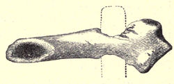

Fig. 10.
Fig. 10.
Flint Arrow-head, Shaft and Thong still adhering.
Flint arrowhead, shaft, and thong still attached.
Kitchen Middens and Refuse Heaps.—The most usual site of the kitchen midden, or collection of refuse thrown out of the dwelling, is at the entrance to the crannog, where was formerly the landing-stage or gangway leading to the shore; and what more natural than that prehistoric housekeepers should take the easiest method of[Pg 46] getting rid of refuse by merely throwing it out of the door, a practice followed, on terra firma, by many of their descendants in Ireland at the present day. The accumulated mass of bones (invariably found in a broken state for extraction of the marrow) is in some instances immense; it is estimated that at Dunshaughlin, in Meath, about two hundred tons were sold for manure, three hundred tons were exhumed from the kitchen midden of one of the lake dwellings in Loughrea, county Galway, and fifty tons from that of Ardakillen, county Roscommon; the bones in the heaps have, evidently, in some instances, been gnawed by dogs after their owners had extracted the marrow, for which dainty the Irish appear to have had a peculiar relish, judging from their proverb, Ma bhris tu an cnamh char dhuighail tu an smior, i. e., though you have broken the bone, you have not sucked out the marrow: equivalent to saying, “you have done the most difficult part of the work, though you have not completed it.” Refuse heaps may be said to form also a perfect mine of antiquities, for every “cast” article of household gear was thrown into them; hence, the objects though numerous are generally fractured. After bones the next most frequent “find” consists of fragments of fictile ware. It has been remarked that if the former site of a crannog becomes again exposed to the light of day, by the gradual cutting away of the peat under which it lay buried, perhaps during centuries, then many objects calculated to excite the interest of archæologists might be turned up from time to time without attracting particular notice, and thus no means would be left to form even an approximate estimate of the date of the crannog; but if careful examination be made of a kitchen midden, exposed to view by the simple drainage of water from the site, then the antiquities discovered afford tolerably correct and safe data from which to calculate the age of the structure.
Kitchen Middens and Refuse Heaps.—The most common place for a kitchen midden, or pile of waste discarded from the home, is at the entrance of the crannog, where the landing stage or walkway used to lead to the shore. It's only natural that prehistoric residents would choose the easiest way to dispose of waste by simply throwing it out the door—a practice still seen today among many of their descendants in Ireland. The large accumulation of bones (usually found broken to extract the marrow) can be immense; it's estimated that about two hundred tons were sold for fertilizer at Dunshaughlin in Meath, three hundred tons were dug up from the kitchen midden of one of the lake dwellings in Loughrea, County Galway, and fifty tons from Ardakillen in County Roscommon. The bones in these heaps appear to have been chewed by dogs after their owners took the marrow, which the Irish seemed to particularly enjoy, as suggested by their proverb, Ma bhris tu an cnamh char dhuighail tu an smior, meaning, “though you’ve broken the bone, you haven’t sucked out the marrow,” which is similar to saying, “you’ve done the hardest part, but you haven’t finished the job.” These refuse heaps can also be seen as a treasure trove of antiquities since every discarded item of household gear was thrown into them; thus, while there are many objects, they are mostly broken. After bones, the next most commonly found items are fragments of pottery. It has been noted that if the original site of a crannog is gradually exposed due to the cutting away of peat that has buried it for possibly centuries, various items that might interest archaeologists could emerge over time without drawing much attention, resulting in a lack of evidence for estimating the age of the crannog. However, if a kitchen midden is carefully examined after being revealed by simple water drainage from the site, the discovered artifacts provide fairly accurate and reliable data for calculating the age of the structure.
Canoes.—Some crannogs appear to have been veritable islands, the only means of communication with the land being by canoes; of these, in Irish and Scottish waters alike, remains have been frequently found near the dwelling, in some instances alongside the landing-stage, as if sunk at their moorings.[67] A canoe formed by[Pg 47] hollowing out the trunk of a tree seems to have been almost universally the first attempt at boat-building, and to effect this, a people even in the rudest state of existence would possess sufficient ingenuity. Canoes are so universally found associated with crannogs, that their discovery in lakes and bogs in Ireland has been considered an indication of the existence of lacustrine dwellings in the immediate vicinity; but it may be safely concluded that, unless implements or articles of stone or bronze are found with “dug-outs,” they do not of themselves carry us back to prehistoric times, nor do they necessarily indicate the great antiquity commonly attributed to them. Canoes have been found of the oldest type known, and yet containing articles of iron of very modern form; therefore, it may be surmised that a people of primitive habits like the lake dwellers clung tenaciously to old customs, and their models remained unchanged during many ages. Irish single-piece canoes may be roughly divided into three classes or varieties—(1) the first, generally either sharp or rounded at both extremities, averages twenty feet in length, and about two in breadth, some however have been discovered square at both ends. Again, some are flat-bottomed and others round: the inside depth varies according to their state of preservation; (2) the second kind is generally of much greater length; one found, measuring forty feet, was round in the bow, but square in the stern, which was formed of a separate piece, let into a groove within a few inches of the extremity: this make is altogether more heavy and clumsy than the preceding; (3) the third variety is trough-shaped, and has been appropriately designated “the portable canoe”; the length is from eight to twelve feet; it is square at both ends, round in the bottom, and having projecting handles at either extremity, apparently for the convenience of carrying it from lake to lake. All alike seem to have been hollowed out of a single tree, probably in the fashion described by Captain Speke, in his Travels in Central Africa, wherein he says the negroes fell a large tree, lop off the branches, shape the timber, then cover its upper surface with wet mud, as it lies on the ground, and set fire to it, burning out the core, and finishing off with roughly-constructed hatchets the part unconsumed by fire.[68] In Lough Owel, county Westmeath, in the[Pg 48] immediate neighbourhood of a crannog, a very large canoe was found in company with two of smaller size. The prow was in shape like a curved beak; it might be expected that the principle of the curve would have been carried out in its after end, but, whilst the entry is spoon-shaped, the stern is square, and a hollow but shallow groove cut at the very end was formerly filled by the stern board. This canoe was round in the bottom; twenty-four holes were drilled through the sides, and the same number through the floor. A canoe twenty feet nine inches long, four feet seven inches broad, and one foot eight inches deep, was found at Derryhollagh, county Antrim; another in the lake of Moynalty was twenty-four feet in length.[69] One unearthed at Ardakillen measured forty feet in length, by four feet across the bow,[70] whilst another in Drumaleague Lough, county Leitrim, was only eighteen feet long by twenty-two inches broad—not formed for speed, certainly—being square at stem and stern. A canoe at Cahore, in Wexford, was twenty-two feet in length, two-and-a-half feet across amidships, and eleven inches in depth (plate IV. fig. 1). At a place called Cornagall, about six miles from Cavan, was found one more than half consumed by the conflagration which had destroyed the crannog itself; in the bottom of this boat lay a complete set of tools, belonging to an ancient craftsman who had lived at a period subsequent to the adoption of iron tools.
Canoes.—Some crannogs seem to have truly been islands, with the only way to reach the land being by canoes. Remains of these canoes have often been discovered near the dwelling, sometimes right next to the landing stage, as if they sank at their moorings.[67] A canoe made by hollowing out a tree trunk appears to have been almost universally the first step in boat-building, and even people in the simplest living conditions would have enough ingenuity to create one. Canoes are so commonly found alongside crannogs that their discovery in lakes and bogs in Ireland has been seen as a sign that there were lake houses nearby; however, it's safe to say that unless tools or items made of stone or bronze are found with these dug-out canoes, they don’t by themselves prove a prehistoric origin, nor do they necessarily indicate the great age often attributed to them. Canoes of the oldest known type have been found, yet they contained objects made of iron in very modern styles; therefore, it's likely that primitive societies like the lake dwellers held onto old customs, and their designs remained unchanged for many ages. Irish single-piece canoes can be roughly divided into three types or varieties—(1) the first type is generally either pointed or rounded at both ends, averaging twenty feet in length and about two feet in width, though some have been found with square ends. Additionally, some are flat-bottomed and others rounded: the depth inside varies based on how well they’ve been preserved; (2) the second type is typically much longer; one example measured forty feet long, with a rounded bow and a square stern, which was made from a separate piece fitted into a groove a few inches from the end: this style is much bulkier and clumsier than the first; (3) the third type is trough-shaped and is fittingly called “the portable canoe”; it ranges in length from eight to twelve feet; it has square ends, a rounded bottom, and protruding handles at both ends for easier carrying from lake to lake. All these seem to have been carved from a single tree, likely using the technique described by Captain Speke in his Travels in Central Africa, where he mentions that locals would fell a large tree, trim off the branches, shape the wood, cover the top with wet mud while it lay on the ground, then set fire to it, burning out the inside and finishing off the remaining parts with roughly-made hatchets.[68] In Lough Owel, County Westmeath, near a crannog, a very large canoe was discovered alongside two smaller ones. The front had a shape like a curved beak; while one might expect the curve to continue at the back, the entry is spoon-shaped and the stern is square, with a shallow groove cut at the very end which used to hold the stern board. This canoe had a rounded bottom, with twenty-four holes drilled through the sides and another twenty-four in the floor. A canoe measuring twenty feet nine inches long, four feet seven inches wide, and one foot eight inches deep was found at Derryhollagh, County Antrim; another in the lake of Moynalty measured twenty-four feet in length.[69] One unearthed at Ardakillen was forty feet long and four feet wide at the bow,[70] while another in Drumaleague Lough, County Leitrim, was just eighteen feet long and twenty-two inches wide—not built for speed, certainly—being square at both ends. A canoe found at Cahore in Wexford measured twenty-two feet long, two-and-a-half feet wide amidships, and eleven inches deep (plate IV. fig. 1). At a location called Cornagall, about six miles from Cavan, a canoe was found that was more than half burned from the fire that destroyed the crannog itself; in the bottom of this boat lay a complete set of tools belonging to an ancient craftsman who lived after the use of iron tools became common.
In consequence of the low level of the Boyne in the summer of 1837, workmen engaged in taking gravel from the river, near the obelisk erected to commemorate the period
In the summer of 1837, due to the low water level of the Boyne, workers were involved in extracting gravel from the river, close to the obelisk built to commemorate the period
discovered a well-preserved “single tree” canoe, which was for many years after exhibited as a curiosity in Liverpool, but finally presented to the Royal Irish Academy. The length of this canoe is eighteen feet nine inches, it averages two feet ten inches in width, is twenty inches high in the side, and has three circular and artificial apertures in the bottom, as shown in the illustration[71] (plate IV. fig. 2.) Three canoes were found at Toome Bar; the one[Pg 49] figured (plate IV. fig. 3), is hollowed out of a single piece of oak, the length, fifteen feet, with projecting beaks at prow and stern; it is twenty inches wide, fourteen inches deep, and is flat-bottomed; it lay “from six to eight feet below the surface, in a bed of sand and Lough Neagh clay.”
discovered a well-preserved “single tree” canoe, which was displayed for many years as a curiosity in Liverpool but was eventually given to the Royal Irish Academy. The canoe is eighteen feet nine inches long, averages two feet ten inches in width, stands twenty inches high at the sides, and has three circular and artificial holes in the bottom, as shown in the illustration[71] (plate IV. fig. 2.) Three canoes were found at Toome Bar; the one[Pg 49] shown (plate IV. fig. 3), is carved from a single piece of oak, measuring fifteen feet in length, with extended ends at the front and back; it is twenty inches wide, fourteen inches deep, and has a flat bottom; it was found “from six to eight feet below the surface, in a bed of sand and Lough Neagh clay.”

Plate IV.
Plate 4.
Fig. 1. Single-piece Canoe from Cahore, Co. Wexford.
Fig. 1. Single-piece Canoe from Cahore, County Wexford.
Fig. 2. Single-piece Canoe from the Boyne.
Fig. 2. Single-piece Canoe from the Boyne.
Fig. 3. Single-piece Canoe from Toome Bar.
Fig. 3. One-piece Canoe from Toome Bar.
Fig. 4. Supposed Single-piece portable Canoe from near Enniskillen.
Fig. 4. Alleged single-piece portable canoe from near Enniskillen.
Fig. 5. Paddle from Toome Bar.
Fig. 5. Paddle from Toome Bar.
Fig. 6. Stone Anchor.
Fig. 6. Stone Anchor.
Fig. 7. Iron Anchor or Grappling from Toome Bar.
Fig. 7. Iron Anchor or Grappling from Toome Bar.
Single-piece Canoes, Paddle, and Anchors.
Single-piece kayaks, paddles, and anchors.
The discovery of an ancient canoe beneath the waters of Lough Erne was made in a somewhat romantic manner. A steamer plying upon that lake attempted, in consequence of the unusual height of the water, to make a short cut, but grounded on a bank, and in so doing pushed upwards her ancient sister into the light of day. The “dug-out” thus found is of oak, eight feet in length, by one foot five and a-half inches in breadth, its internal depth is seven and a-half inches, the sides averaging about an inch and a-half in thickness. In shape it differs from any other canoe in the Museum, Royal Irish Academy, and, taken as a whole, conveys the idea of the elongated bowl of a table spoon; it also presents a peculiar characteristic, in that a number of holes at almost regular intervals, in sets of three, have been pierced through its floor; there are three sets of these holes, each about an inch in diameter; they cross the boat in threes, at right angles with a line drawn through the middle from end to end.
The discovery of an ancient canoe beneath the waters of Lough Erne happened in a pretty interesting way. A steamer navigating the lake, due to the unusually high water level, tried to take a shortcut but ended up running aground on a bank. This caused the ancient canoe to be pushed up into the light. The "dug-out" that was found is made of oak, eight feet long, and one foot five and a half inches wide. Its internal depth is seven and a half inches, and the sides are about an inch and a half thick. In shape, it looks different from any other canoe in the Museum of the Royal Irish Academy and gives the impression of an elongated bowl like a tablespoon. It also has a unique feature: several holes have been drilled through its floor nearly at regular intervals, in sets of three. There are three sets of these holes, each about an inch in diameter, arranged in threes and crossing the canoe at right angles to a line drawn from end to end.
During the operation of changing a line of road about a mile and a-half from Enniskillen, the antique figured (plate IV. fig. 4), was exposed to view. Its position was almost equidistant from Lough Erne and Lough Rossole. Owing to the smallness of its proportions as regards beam, objections have been raised to its claim to be classed as a canoe, and it has been suggested that it was perhaps a brewing vat for manufacture of some kind of drink. Impossible to say what the original length of this square and hollowed block of oak may have been, but the remaining portion measures about fifteen feet: the sides and bottom are thin, the depth is one foot, the breadth at its remaining end only one foot three inches; that end, however, is seven inches thick, and from it, on the exterior, two handles cut out of the solid block project, as shown in the drawing.[72] The great difference between the thickness of the sides and end[Pg 50] may be accounted for by the presence of the handles, as they would need to be attached to solid timber if required for use as lifting agents; the diameter of these handles is about three inches, the length six inches, and at the end, between the handles, there is a hole by which this antique could be drained. If it be really a canoe, the handles would prove most serviceable for the purpose of transportation from one lake to another, and for the chase of wild fowl on lake or river, would meet the requirements of the primitive sportsman. A groove cut upon the interior of what may be termed the remaining portion of the gunwale, seems as if intended for reception of a covering in the style of an Esquimaux canoe, and, owing to the extreme narrowness of the supposed craft, this arrangement would be absolutely necessary for the safety of the occupant.[73] A portable single-piece oaken canoe or trough of similar description, twelve feet in length, by three in breadth, and furnished with handles, was found in the bog of Ardagh, parish of Maghe-Ross, and is figured in Shirley’s Dominion of Farney.
While changing a road about a mile and a half from Enniskillen, an ancient artifact (plate IV. fig. 4) was uncovered. It was situated almost equally between Lough Erne and Lough Rossole. Due to its small size in terms of beam, some people have questioned whether it should be considered a canoe. There’s a suggestion that it might have been a brewing vat for some type of drink. It's hard to determine the original length of this square, hollowed block of oak, but what's left measures about fifteen feet. The sides and bottom are thin, the depth is one foot, and the width at the remaining end is just one foot three inches. That end, however, is seven inches thick, and there are two handles carved out from the solid block that extend outwards, as shown in the drawing.[72] The significant difference in thickness between the sides and the end[Pg 50] can be explained by the presence of the handles, which would need to be made from solid wood if they were to be functional for lifting. The handles have a diameter of about three inches and are six inches long. There’s also a hole located between the handles for draining this piece. If it is indeed a canoe, the handles would be very useful for transporting it between lakes, and for hunting wildfowl in lakes or rivers, meeting the needs of early sportsmen. A groove cut inside what could be called the remaining part of the gunwale appears to be designed to hold a cover similar to those used in Eskimo canoes, and because of the extreme narrowness of this proposed vessel, such a feature would be essential for the safety of its occupant.[73] A portable single-piece oak canoe or a similar trough, twelve feet long and three feet wide, with handles, was discovered in the Ardagh bog, in the parish of Maghe-Ross, and is illustrated in Shirley’s Dominion of Farney.
The foregoing furnish specimens of the three classes into which canoes may be divided; in all, about fifty have been found in Ireland.[74] Owing to the preservative properties of peaty matter, the wood of some of these canoes was in a fairly sound state when dug up: one of the largest and most perfect found in connexion with the Strokestown crannogs, was cut up by a “grim utilitarian” for roofing material, and the best canoe belonging to the Ballinderry crannog was split into firewood.
The examples above show the three categories into which canoes can be classified; in total, about fifty have been discovered in Ireland.[74] Thanks to the preserving qualities of peaty soil, the wood of some of these canoes was in pretty good condition when excavated: one of the largest and most well-preserved found near the Strokestown crannogs was cut up by a “grim utilitarian” for roofing material, and the best canoe from the Ballinderry crannog was chopped up for firewood.
Paddles.—For the purpose of propelling a canoe paddles were essential, and of these numbers have been discovered: there are several in the Museum of the Royal Historical and Archæological Association at Kilkenny, as also in the Museum of the Royal Irish[Pg 51] Academy, Dublin. The paddle, two feet seven inches long, by five and a-half inches across the blade, as represented (in plate IV. fig. 5), was found in the immediate neighbourhood of a crannog site at Toome Bar, on the Lower Bann. It is the largest of two from the same locality; both are imperfect, the handle of each being fractured in the same spot, so that the original length cannot be ascertained; but as they were not more than half an inch thick, they could only have been employed in propelling a very light craft, perhaps a portable canoe.[75]
Paddles.—Paddles were crucial for moving a canoe, and many have been discovered. Some are in the Museum of the Royal Historical and Archaeological Association in Kilkenny, as well as in the Museum of the Royal Irish[Pg 51] Academy in Dublin. The paddle shown (in plate IV. fig. 5) is two feet seven inches long and five and a half inches wide at the blade. It was found near a crannog site at Toome Bar on the Lower Bann. This paddle is the larger of two found in the same area; both are damaged, with the handle of each broken in the same place, so we can't determine their original length. However, since they were no more than half an inch thick, they could only have been used for a very light boat, possibly a portable canoe.[75]
Anchors.—For the purpose of holding a canoe stationary an anchor is requisite, but of these not more than three have as yet been discovered. The one figured (plate IV. fig. 6) is of stone. The shank must have been of wood, lashed to the stone. There was with the canoe discovered in the Boyne what bore the appearance of a kind of wooden anchor. At Toome Bar was found an anchor or grappling instrument twenty-one inches long, but being formed of iron it should be viewed as comparatively modern (plate IV. fig. 7).
Anchors.—To keep a canoe in place, an anchor is necessary, but so far, only three types have been found. The one shown (plate IV. fig. 6) is made of stone. The shank was probably made of wood, attached to the stone. Along with the canoe discovered in the Boyne, there was something that looked like a wooden anchor. At Toome Bar, an anchor or grappling tool measuring twenty-one inches was found, but since it was made of iron, it should be considered relatively modern (plate IV. fig. 7).
Curach.—There is yet another kind of boat, the curach, that must have been employed by these lake dwellers; of it, however, on account of the perishable materials of which it was composed, no remains have as yet been exhumed. We may all recollect, when reading English history in our childhood, the description given of the primitive Celtic boat, constructed of basket-work and covered with skins, in which the Picts and Scots are said to have invaded Britain in crowds, and of which the Britons themselves made use: this is frequently referred to by old classical writers. Herodotus mentions boats of this kind as existent in his time on the Tigris and Euphrates; similar skiffs are used on those rivers at the present day; boats of analogous construction are employed in some parts of India; they are propelled by paddles where the water is deep, and poled over the shallows. Nothing can be more simple than the construction of these skiffs; only two materials are requisite, and they the most accessible in the country, i.e. bamboo and hides. When Cæsar had constructed boats in Spain, after the manner learnt by him in Britain, it is said that[Pg 52] “the keels and ribs were made of light timber, the rest of the hull being woven together with basket-work, and covered with hides.”[76]
Curach.—There’s another type of boat called the curach that must have been used by these lake dwellers; however, because it was made from perishable materials, no remains have been found yet. We can all remember reading in childhood about the primitive Celtic boat made from basket-weaving and covered with animal skins, in which the Picts and Scots are said to have invaded Britain in large numbers, and which the Britons also used: this is often mentioned by ancient writers. Herodotus noted these kinds of boats were around during his time on the Tigris and Euphrates; similar vessels are still used on those rivers today; boats of a similar design are found in some areas of India; they are moved by paddles in deeper water and pushed by poles in shallower areas. The construction of these boats is incredibly simple; only two materials are needed, which are the most readily available in the region, i.e. bamboo and hides. When Cæsar built boats in Spain, following the methods he learned in Britain, it’s said that[Pg 52] “the keels and ribs were made of light timber, and the rest of the hull was woven together with basket-work and covered with hides.”[76]
Pliny says:—“Even now, in the British channel, they (the boats) are made of osiers, covered with hides sewn together.” Solinus, describing the rough sea between Britain and Ireland, says that the natives “sail in ships made of osiers, which they surround with a covering of hides.” Adamnan, in his life of St. Columba, refers to a voyage made in a curach by St. Cormac. The curach is said to be still in use on the Severn,[77] and on some parts of the coast of Ireland, in shape and build similar to those of thousands of years ago; at the same time it may be affirmed that few persons of the present generation could declare they have seen the true curach, that term having been now transferred to boats covered with coarse tarred canvas, and which differ widely both in form and method of construction from their ancient prototype. The curach seen by W. F. Wakeman in use on the river Boyne so late as the year 1848 is thus described by him:—A regular frame of willow ribs, generally laid in pairs, and extending along the sides and floor, formed the skeleton of the future boat, which was in the form of the bowl of a spoon, a little broader towards one end than the other; about eight feet in length, but very nearly circular. The extremities of the ribs for a depth of about eighteen inches from what would now be called the gunwale, were set in a very thick, strong, and closely-woven band of wicker-work, above which the ends of the rods slightly projected. Midships was a thwart of ash or oak pierced with four holes, two near either end, through which were rove thongs, composed of twisted osiers connecting the seat, or thwart, with various portions of the above mentioned band, so as to bind the work together. The frame was then covered over on the outside with skin, untanned, of the horse or cow; and the result was the[Pg 53] completion of a boat well adapted for the requirements of fishermen.[78] The raw hide of a newly slain animal, properly extended presented a ready means of constructing a boat, and became to the early inhabitants of the British Islands what the birch-tree bark is to the American Indian. In the sculptures from Nineveh a similar use of the hide is observed, as a means of crossing rivers, but the application is less ingenious, being merely a skin inflated with air like what is called on some parts of the Irish coast a “stookey,” and with which, not unfrequently, fishermen, so late as the year 1860, floated their nets and lines; the skin of a dog or any other animal served the purpose.[79]
Pliny says:—“Even now, in the English Channel, they (the boats) are made of willow branches, covered with hides sewn together.” Solinus, describing the rough seas between Britain and Ireland, notes that the locals “sail in boats made of willow, which they surround with a covering of hides.” Adamnan, in his biography of St. Columba, mentions a trip taken in a curach by St. Cormac. The curach is said to still be used on the Severn,[77] and in some areas along the coast of Ireland, shaped and constructed similarly to those from thousands of years ago; however, it can also be said that few people today would claim they have seen the true curach, as that term has now shifted to refer to boats covered with rough tarred canvas, which are quite different in shape and construction from their ancient counterpart. The curach seen by W. F. Wakeman on the River Boyne as recently as 1848 is described by him as follows:—A regular frame of willow ribs, usually arranged in pairs, extending along the sides and bottom, formed the skeleton of the future boat, which resembled the bowl of a spoon, slightly wider at one end than the other; about eight feet long, but almost perfectly circular. The ends of the ribs for about eighteen inches from what we would now call the gunwale were set into a very thick, strong, and tightly woven band of wickerwork, above which the ends of the rods protruded slightly. In the middle was a thwart made of ash or oak, with four holes, two near each end, through which twisted willow thongs connected the seat, or thwart, with various parts of the aforementioned band, binding the construction together. The frame was then covered on the outside with untanned hide from a horse or cow, resulting in the[Pg 53] completion of a boat well-suited for the needs of fishermen.[78] The raw hide from a freshly killed animal, properly stretched, provided an easy way to make a boat, similar to how birch bark is used by Native Americans. In sculptures from Nineveh, a similar use of hide was observed for crossing rivers, but the method was less sophisticated, simply using a skin inflated with air, like what is called a “stookey” in some parts of the Irish coast, which fishermen as late as 1860 often used to float their nets and lines; the skin of a dog or any other animal served this purpose.[79]

Ingenuity of Lake Dwellers, Clothing, &c.—It has been remarked that the brains of most savages and the skulls of most primitive races are larger than, in theory, they ought to be; often rather larger than the brains and skulls of the average masses of the great cities of the present day; but this need not cause surprise, if the life of intelligent interest passed by the savage child be taken into consideration. From the tenderest age he was observant of all the devices practised by his parents for procuring clothing, food, means of defence, in short, all the essentials of existence; the natural result of his wild life was health and strength; indeed, on the principle of the survival of the fittest, it could only be the robust who lived through the hardships and climatic exposure incidental to a savage life. The lake dweller was no exception to this rule, for his ingenuity would be most fully exercised in endeavouring to procure the means of sustenance for his family. It is easy to imagine the various daily occupations needful in his struggles for existence. Timber from the forest supplied him with materials both for his dwelling and for fuel; the skins of wild animals furnished him with clothing, he shaped them with a sharp flint flake, and sewed them with thongs, using as needle the pierced bone of some bird or small mammal. In early Irish history mention occurs of skin or leather garments: when Muircheartach MacNeill made his celebrated circuit of Ireland, A.D. 942, it is stated that his soldiers were clad in long leather cloaks.[Pg 54] We are not left to mere conjecture regarding the manner in which the men of these primitive times protected themselves from the inclemency of the weather. In the year 1821 the body of a man, about six feet in height, with dark, reddish-coloured hair, short beard, and teeth in a good state of preservation, was found ten feet below the surface of a bog, on the lands of Gallagh, near Castle Blakeney, county Galway. The head, legs, and feet were bare, but the body was covered with a deer-skin tunic reaching to the knees and half-way down the arms; in front it was laced and fastened by thongs of the same material. The mantle was, unfortunately, much injured in the disinterment, but a few fragments of it still hung together; portions of the seams sewed with fine gut of three strands still remained; “the regularity and closeness of the stitches are most remarkable, as shown by the accompanying cut, in which a portion of one of the joinings is represented double the natural size. This closure was effected by what is termed the looped stitch, similar to that used in working a button-hole, so that by having each stitch knotted the chance of ripping was lessened.”[80] The age of the Irish mummy (if we may apply that term to the body here described) is considered by some to date back at least 2000 years.
Ingenuity of Lake Dwellers, Clothing, &c.—It has been noted that the brains of most savages and the skulls of many primitive groups are larger than what theory suggests; often even larger than those of the average populations in today’s major cities. This shouldn't be surprising when you consider the intellectually stimulating life that savage children experience. From a young age, they pay close attention to all the strategies their parents use to get clothing, food, and protection—essentially everything needed for survival. The natural outcome of their wild lifestyle is health and strength; in fact, based on the survival of the fittest, only the strongest individuals could withstand the challenges and harsh climates associated with a savage way of life. The lake dweller was no exception to this principle, as his creativity would be fully engaged in finding ways to provide for his family. It’s easy to imagine the various daily tasks required in his fight for survival. Timber from the forest supplied him with materials for his home and fuel; the skins of wild animals provided clothing, which he fashioned using a sharp flint flake and sewed with thongs, utilizing the pierced bone of a bird or small mammal as a needle. Early Irish history mentions garments made from skin or leather: when Muircheartach MacNeill made his famed journey around Ireland in A.D. 942, it is said that his soldiers wore long leather cloaks.[Pg 54] We have more than mere speculation about how people in these primitive times shielded themselves from harsh weather. In 1821, the body of a man about six feet tall, with dark reddish hair, a short beard, and well-preserved teeth, was discovered ten feet beneath the surface of a bog in Gallagh, near Castle Blakeney, county Galway. His head, legs, and feet were bare, but his body was covered with a deer-skin tunic that reached his knees and halfway down his arms; it was laced and fastened in front with thongs of the same material. Unfortunately, the mantle was heavily damaged during excavation, but a few pieces still stuck together; parts of the seams sewn with fine three-strand gut remained. “The evenness and tightness of the stitches are quite remarkable, as shown by the included illustration, which depicts part of one of the joinings at double the actual size. This fastening was done using what is called the looped stitch, similar to a buttonhole stitch, so that by knotting each stitch, the risk of tearing was reduced.”[80] The age of the Irish mummy (if we can use that term for the body described) is believed by some to go back at least 2000 years.

A bed of growing peat is endowed with marvellous powers. It seems to act like the ancient Egyptian process of embalming on the bodies of men or animals that have become accidentally entombed in it, preserving them for centuries after their contemporaries have, by the ordinary laws of nature, totally disappeared, and organic substances, such as butter, seem also to feel its influence. Peat may bear comparison with ice, the well-known preservative properties of which were strikingly illustrated by the discovery on the shores of Lake Oncoul, in Siberia, of a carcass of the Elephas primigenius, or mammoth (supposed to have become extinct in the Pleistocene period) in a perfect state, and so well refrigerated that, when thawed, the dogs of the neighbourhood devoured its flesh. Again, in 1846, the summer in Siberia had been unusually hot; the frozen[Pg 55] marshes which extend along each side of the river Indigirka were thawed, and a perfectly preserved carcass of a mammoth floated down the stream. This monster had most probably met his death centuries before by sinking into the deep snow of the morasses, was frozen over, and thus remained until the exceptional summer heat melted his icy prison.
A bed of growing peat has incredible powers. It acts like the ancient Egyptian embalming method on the bodies of people or animals that have accidentally become trapped in it, preserving them for centuries after their contemporaries have long since disappeared due to the usual laws of nature. Organic materials, like butter, also seem to be affected by it. Peat can be compared to ice, whose well-known preserving qualities were dramatically demonstrated by the discovery on the shores of Lake Oncoul in Siberia of a carcass of the Elephas primigenius, or mammoth (thought to have gone extinct in the Pleistocene era), in perfect condition and so well refrigerated that when it thawed, local dogs ate its flesh. Additionally, in 1846, the summer in Siberia was unusually hot; the frozen[Pg 55] marshes along each side of the Indigirka River thawed, and a perfectly preserved mammoth carcass floated down the river. This giant likely died centuries earlier after sinking into deep snow in the marshes, was frozen over, and remained that way until the exceptional summer heat melted its icy prison.
Stone, Bronze, and Iron Ages.—We know that the learned have divided the period man has inhabited the globe into what may roughly be called three Ages—the Stone, the Bronze, and the Iron. Ancient mythology presented us with another, ycleped the Golden, when our planet was supposed to be a paradise, and man lived in a state of perpetual happiness; it is to be feared that the idea of a golden age, either past or to come, is purely mythical. Future archæologists may, perhaps, be tempted to apply the designation “Steel” to the present or now commencing epoch, in order to distinguish it from the mere “Iron Age.” Improved methods of manufacture are now-a-days causing steel in some degree to supersede its parent metal, iron, even as iron superseded bronze. Excavations on the site of crannogs have demonstrated clearly the fact that some of them have had a continuous existence throughout the three ages of Stone, Bronze, and Iron. Classification of the earth’s history into those three ages does not, however, imply a defined and distinctive period when stone, bronze, or iron alone was in exclusive use, though there may possibly have been a time in which only stone and bone were available. When the empires of the Tigris and Nile were in their prime, the northern littoral of Europe was inhabited by a race using implements of bone and stone, but these regions were in the Bronze Age[81] at the period when the Phœnicians had attained the zenith of their power. According to some writers, the inhabitants of the Baltic littoral had not till early in the Christian era discarded bronze and stone for iron. Although weapons of bone or flint were certainly of an earlier age than bronze and iron, yet it is more than probable that flint, bronze, and iron may have been in use at one and the same period, and even in the same locality, down to a period long subsequent to the Christian era. To this day the Esquimaux use bone implements, but they also employ iron, so that in remote countries a stone age might be said still to exist, the few iron implements in possession of the wild tribes[Pg 56] being acquired by recent contact with western civilization. In Ireland there is no fixed line of demarcation between the stone, the bronze, and the iron age; there was an overlapping and co-mingling as the better and more useful metal gradually superseded its predecessor. Thus a stone instrument, by itself, would be a most deceptive guide in determining the state of civilization of the inhabitants of the site on which it was discovered, because stone implements are also found associated with articles both of bronze and iron. “Like the three principal colours of the rainbow,” writes Mr. Evans, “these three stages of civilization overlap, intermingle, and shade off, the one into the other; and yet their succession, as far as Western Europe is concerned, appears to be equally well defined with that of the prismatic colours, though the proportions of the spectrum may vary in different countries.” Petrie, the well-known Irish antiquary, was the first to claim for a large class of iron remains the position of an interesting connecting link, which they are now allowed to hold, between the bronze manufacture of a remote age and the industrial achievements of comparatively modern days. At the period of the first discovery of the remains of Irish lake dwellings, archæologists looked upon objects of iron found in lakes, or in their immediate vicinity, with very little interest, for it was considered that they could not have held out against the corroding influence of water for a lengthened period; therefore iron was supposed to stamp lacustrine habitations with a mediæval or even modern impress. The belief was then very general that the inhabitants of Erin of the prehistoric period, having existed generation after generation as manufacturers of flint and stone weapons, had gradually, through some unknown channel, become acquainted with gold, silver, and bronze, and that this latter metal, down even to the advent of St. Patrick, was used almost exclusively in the manufacture of weapons of war, small ornaments for personal adornment, and objects of domestic use. Articles of stone, bone, wood, bronze, and iron have been discovered in strange medley: swords, spear and javelin heads, axes, daggers, knives, hones, querns, shears, tweezers, chains, combs, pins, brooches, beads, horse trappings, cauldrons of hammered bronze, lumps of iron slag, &c.—in short, every conceivable object, from the rudest flint implement to highly-finished silver ornaments.
Stone, Bronze, and Iron Ages.—We know that scholars have divided the time humans have lived on Earth into three main Ages: the Stone Age, the Bronze Age, and the Iron Age. Ancient myths spoke of another Age, called the Golden Age, when the world was thought to be a paradise and people lived in constant happiness; however, it's likely that the idea of a golden age, whether in the past or future, is purely fictional. Future archaeologists might be tempted to call the current or newly starting era the “Steel Age” to differentiate it from the “Iron Age.” Better manufacturing methods are increasingly making steel replace its parent metal, iron, just as iron once replaced bronze. Excavations at crannog sites have clearly shown that some of these structures have existed continuously through the Stone, Bronze, and Iron Ages. However, classifying Earth's history into these three ages doesn’t mean there was a precise time when stone, bronze, or iron was used exclusively; there may have been periods when only stone and bone were available. When the empires along the Tigris and Nile were at their height, the northern coast of Europe was home to a people using bone and stone tools while these regions were already in the Bronze Age during the peak of Phoenician power. Some historians suggest that the people along the Baltic coast didn’t fully transition from bronze and stone to iron until the early Christian era. Although weapons made of bone or flint were definitely from an earlier time than bronze and iron, it’s quite likely that flint, bronze, and iron were all in use simultaneously, even in the same areas, well after the start of the Christian era. To this day, the Inuit use bone tools, but they also use iron, which suggests that a stone age might still be considered to exist in remote regions, with the few iron tools some indigenous tribes have being obtained through recent interactions with Western civilization. In Ireland, there is no clear dividing line between the stone, bronze, and iron ages; there was a merging as the more advanced metal gradually replaced the previous one. Thus, finding a stone tool alone could be misleading in determining the level of civilization of the people who lived where it was found, because stone tools are also found alongside bronze and iron items. “Like the three primary colors of the rainbow,” writes Mr. Evans, “these three stages of civilization overlap, blend, and fade into one another; yet their succession, as far as Western Europe is concerned, appears to be just as well defined as the colors of the spectrum, even though the ratios may differ in various countries.” Petrie, the famous Irish antiquarian, was the first to suggest that a significant number of iron artifacts serve as an intriguing link between the ancient production of bronze and the industrial advancements of more recent times. At the time when Irish lake dwellings were first discovered, archaeologists were largely indifferent to iron objects found in or near lakes since it was believed they couldn’t have survived the damaging effects of water for long; thus, iron was thought to indicate medieval or even modern living conditions. It was widely believed that the prehistoric people of Ireland, who had made flint and stone weapons for generations, gradually learned about gold, silver, and bronze through some unknown means, and that bronze was used almost exclusively for war weapons, small personal ornaments, and household items right up to the arrival of St. Patrick. Various items made of stone, bone, wood, bronze, and iron have been found in an unusual mix: swords, spear and javelin points, axes, daggers, knives, sharpening stones, mills, shears, tweezers, chains, combs, pins, brooches, beads, horse gear, hammered bronze cauldrons, lumps of iron slag, etc.—in short, every conceivable object, from simple flint tools to finely crafted silver ornaments.
The accidental discovery of the great historical crannog of Lagore, in the county Meath, already referred to, presents the first,[Pg 57] and probably the most important, treasure-trove of earliest iron implements. In A.D. 848 an Irish chief, with his Danish allies, plundered this island fortress and burnt it; whilst in 933, nearly a century later, the place again suffered a similar fate at the hands of another marauder. Nothing more was heard of it till the date of its disinterment, about the year 1840. The latest period, therefore, to which the majority of the antiquities so plentifully found within and around this stronghold may be referred, is somewhere between the eleventh and earliest half of the tenth century. This approximate date is about the historic limit in which the so-called “Iron Age” may be allowed to have reached back in Ireland. How long it had previously existed there must be matter of conjecture; but it is almost incredible that its natives should have been far behind their neighbours in the art of metallurgy; and we know that Cæsar[82] found the Britons acquainted with the use of iron. It can only be surmised that, at some very remote period, bronze as the prevailing material gave way to iron, but the period of transition may probably be counted by centuries.[83]
The accidental discovery of the significant crannog at Lagore in County Meath, mentioned earlier, reveals the first, and likely most important, collection of early iron tools. In A.D. 848, an Irish leader, along with his Danish allies, raided this island fortress and set it on fire; then in 933, nearly a century later, it faced a similar destruction by another invader. It remained forgotten until it was unearthed around 1840. Therefore, the latest period to which most of the numerous antiquities found inside and around this fortress can be dated is sometime between the early tenth and the eleventh century. This approximate date marks the historical edge of the so-called "Iron Age" in Ireland. How long it had existed prior is uncertain; however, it’s hard to believe that its inhabitants were significantly behind their neighbors in metallurgy, as we know that Caesar found the Britons familiar with ironworking. It's likely that, at some very distant time, bronze gave way to iron as the dominant material, but the transition probably spanned several centuries.
Weapons and Tools.—In nearly all Irish crannogs, more especially in the larger sites, weapons of war and of the chase have been discovered in abundance, consisting chiefly of arrow- and spear-heads, swords, daggers or skeans, knives, and axe-heads. The numerous fragments of artificially fashioned bone found in and around crannogs plainly demonstrate how much that material was utilized by their inhabitants; many tips of the antlers of deer contained in the collection of the Royal Irish Academy and in that of the Royal Historical and Archæological Association, have evidently been sawn from the original branches, and employed in forming handles for swords, knives and daggers; some are ornamented, whilst others are pierced with a hole at one extremity, having evidently been fabricated for a distinct purpose, for spear- or javelin-heads, &c.; these were attached to handles or shafts, by means of the sinews of animals, or thongs of skin. Amongst primitive races the transition from tool to weapon is slight; the same article must, in many cases, have served the double purpose.[Pg 58] Arrow- or spear-heads have been found of bone, horn, flint, bronze, and iron; they are usually of small size. Figs. 12 and 13, from Lough Ravel, county Antrim, represent (half-size) flakes fashioned into arrow- or spear-heads. Fig. 14 is a flake of basalt (full-size) from Toombridge, in the same county. Fig. 15 is a flint implement from the recently discovered crannog of Lisnacroghera.[84]
Weapons and Tools.—In almost every Irish crannog, especially the larger sites, there have been many weapons for war and hunting found, including arrow and spear heads, swords, daggers (or skeans), knives, and axe heads. The many fragments of crafted bone discovered in and around crannogs clearly show how much this material was used by the inhabitants; numerous deer antler tips found in the collections of the Royal Irish Academy and the Royal Historical and Archaeological Association have clearly been cut from the original branches and used to make handles for swords, knives, and daggers. Some are decorated, while others have a hole at one end, indicating they were made for specific purposes like spear or javelin heads; these were attached to handles or shafts using animal sinews or leather thongs. Among early societies, the shift from tool to weapon is minimal; often, the same item served both purposes. Arrow or spear heads have been found made of bone, horn, flint, bronze, and iron; they are usually small. Figs. 12 and 13, from Lough Ravel, County Antrim, show (half-size) flakes shaped into arrow or spear heads. Fig. 14 is a flake of basalt (full-size) from Toombridge, in the same county. Fig. 15 is a flint tool from the recently discovered crannog of Lisnacroghera.[84]

Fig. 12. Fig. 13. Flint flakes from the Crannog of Lough Ravel. Half-size.
Fig. 12. Fig. 13. Flint flakes from the Crannog of Lough Ravel. Half-size.
Fig. 14. Flake of Basalt from Toombridge. Full-size.
Fig. 14. Piece of Basalt from Toombridge. Actual size.

Fig. 15.
Fig. 15.
Worked Flint from Lisnacroghera. Full-size.
Worked Flint from Lisnacroghera. Full-size.
Plate VI., No. 1 is a flint implement, probably a knife. No. 2—A well-worked flint, most likely used for the same purpose. No. 3—A flint “scraper,” that appears to be somewhat injured at one end. No. 4 represents what antiquaries style a “core” of flint. It is in fact the remains of a block, from which flakes have been struck for the purpose of forming them into arrow-heads, knives, &c., &c. No. 5 is a specimen of the hammer-stone so frequently discovered in the refuse heaps of Irish crannogs. They are usually abraded at the extremities, as if from long use, and similar articles occur in the shell mounds[Pg 59] of our coasts, having probably been used for breaking crustaceæ. No. 6 is an ordinary stone hatchet. No. 7 represents a wooden object which has all the appearance of having been used as the handle of a stone-hatchet. It is here given ⅛ of the real size. The aperture, supposed to have been made for the reception of a stone celt, measures in length, 3⅜ in., but the shrinking of the wood in drying renders it impossible to say what its original breadth may have been. The dotted line is introduced to show how the cutting instrument was most probably placed. No. 8 may have been either a dagger or a spear-head; it is of bone; a rivet-hole indicates that a handle was at one time attached. No. 9—A knife of bone, the handle and blade in one piece. It measures 8 in. in length, and the haft portion, as shown in the illustration, is ornamented with a series of squares enclosing a rude pattern composed of dots. No. 10 is a very curious little article formed of bone, and not untastefully decorated in the same style as the socket portion of the iron spear-head, as shown in plate IX., fig. 6. It was evidently a scoop, and would be serviceable in the extraction of marrow from bones of deer, or other animals used as food by the lake dwellers. Nos. 11 and 12 are rude unornamented knives, in a single piece each. It is not easy to guess what articles of this kind could have been employed to cut, but so early as the times of stone chambers, knives of bone were in requisition.[85]
Plate VI., No. 1 is a flint tool, likely a knife. No. 2 is a well-made flint, presumably used for the same purpose. No. 3 is a flint “scraper,” which seems to be slightly damaged on one end. No. 4 represents what experts call a “core” of flint. It is actually the leftover part of a block from which flakes have been removed to create arrowheads, knives, etc. No. 5 is a hammerstone, commonly found in the waste piles of Irish crannogs. They are usually worn down at the ends, suggesting long use, and similar items appear in the shell mounds of our coasts, likely used for breaking shellfish. No. 6 is a regular stone hatchet. No. 7 is a wooden piece that looks like it was used as the handle for a stone hatchet. It is shown at ⅛ of its actual size. The hole, believed to have been made for a stone celt, measures 3⅜ inches in length, but the wood's shrinkage as it dried makes it impossible to determine its original width. The dotted line indicates where the cutting tool was most likely attached. No. 8 could have been either a dagger or a spearhead; it’s made of bone, and a rivet hole suggests it once had a handle. No. 9 is a bone knife, with the handle and blade as one piece. It is 8 inches long, and the haft area, as depicted, is decorated with a series of squares containing a simple pattern of dots. No. 10 is a very interesting little item made of bone, not unattractively decorated in the same style as the socket of the iron spearhead, as illustrated in plate IX., fig. 6. It was clearly a scoop and would have been useful for extracting marrow from the bones of deer or other animals eaten by the lake dwellers. Nos. 11 and 12 are simple, unadorned knives, each made from a single piece. It’s hard to guess what these types of items were used to cut, but as far back as the stone chamber era, bone knives were in use.[85]

Plate VI.
Plate 6.
Flint, Wood, and Bone Implements from Crannogs.
Flint, wood, and bone tools from crannogs.

Fig. 16.
Fig. 16.
Axe-head of red-deer’s Horn from Lough Eyes. Quarter-size.
Axe-head made from red deer horn from Lough Eyes. About the size of a quarter.
Fig. 16, from Lough Eyes, represents the horn of a red-deer converted into a weapon; its weight is considerable, and there can be little doubt that it had served as a rude battle-axe; its broader end had been fined to a cutting edge, and a notch shows where a leathern thong or sinew was lashed for attachment of the axe-head to the handle into which it had been set in the manner of a stone or flint celt. This antler, together with the bone axe-head from[Pg 60] Ballykillen, are the only specimens of that special class of weapon; but both spear-heads and daggers formed of bone have been found at Ardakillen, Ballinderry, and other crannogs. In the Swiss “Pfahlbauten” it was only the handle of the axe that was composed of horn, the cutting portion being flint or stone, inserted into the shaft at its thicker end.[86]
Fig. 16, from Lough Eyes, represents the horn of a red deer turned into a weapon. It's quite heavy, and there's no doubt it was used as a crude battle-axe. The wider end was sharpened to create a cutting edge, and a notch indicates where a leather thong or sinew was tied to attach the axe head to the handle, similar to how a stone or flint axe head would be set. This antler, along with the bone axe head from[Pg 60] Ballykillen, are the only examples of this specific type of weapon. However, both spearheads and daggers made of bone have been discovered at Ardakillen, Ballinderry, and other crannogs. In the Swiss “Pfahlbauten,” only the handle of the axe was made from horn, while the cutting part was flint or stone, fitted into the thicker end of the shaft.[86]
Swords, whether of bronze or iron, are almost invariably of small size, and double edged. There is usually a central rib to the blade, but in some instances fluting occurs. The ordinary crannog sword may be described generally as of two kinds, the one increasing in breadth from the handle to the end, which terminates in the form of a triangle; the other is shorter, with a broad straight-edged blade obtusely pointed. Their handles were composed of bone or horn, and sometimes wood was used. There was no hilt or guard, properly speaking, though the handle usually somewhat overlaps the edges of the blade, while it recedes in a curve tending in a direction opposite to that of the pommel.
Swords, whether made of bronze or iron, are usually small and double-edged. They typically have a central ridge on the blade, though sometimes they feature fluting. The standard crannog sword can generally be categorized into two types: one that widens from the handle to the tip, which ends in a triangular shape; the other is shorter, with a broad, straight-edged blade that has a blunt point. Their handles were made of bone or horn, and occasionally wood was used. There wasn't a proper hilt or guard, but the handle generally extends slightly over the edges of the blade, curving away from the pommel.

Plate VII.
Plate 7.
Hafted Bronze Rapier Sword, showing both sides. Full size.
Hafted Bronze Rapier Sword, displaying both sides. Actual size.
In April, 1864, a sword-blade of bronze, with the haft still attached, was found adjoining a lake containing a small artificial island, in the townland of Galbally, county Tyrone. The extreme length of blade, 25 in.; breadth at tang, 1¾ in.; weight, 13¾ ounces. The handle (both sides of which are represented in the accompanying plate) is of bone, probably cetacean; its length, 3½ inches; weight 1 ounce; thickness, ⅝ of an inch. The smallness of the handle is very remarkable, taking into consideration the popular idea of the great stature and strength of Erin’s ancient inhabitants.[87] A well-preserved iron sword, with bronze mountings to the handle, was found in the crannog of Lisnacroghera. The blade tapers gradually to a point from about midway down its length, with a central ridge. The bronze mountings of the sword-handle are four in number. “Of these, one is at the pommel, another hoods as it were the butt of the blade, two others are intermediate, and very probably do not now occupy their original position, one of them certainly being movable. It is, therefore, impossible to judge of the space which had been left for reception of the swordsman’s hand. It may be observed that the edges of all these fittings had been serrated or milled, but no[Pg 61] other attempt at decoration appears upon them. The blade measures in length 14¾ in., the handle 5 in.”[88]
In April 1864, a bronze sword blade, still attached to its handle, was discovered near a lake that has a small artificial island, in the town of Galbally, County Tyrone. The blade measures 25 inches long, 1¾ inches wide at the tang, and weighs 13¾ ounces. The handle, which is shown on both sides in the accompanying plate, is made of bone, likely from a whale; it is 3½ inches long, weighs 1 ounce, and is ⅝ of an inch thick. The small size of the handle is quite notable, especially considering the common belief about the great height and strength of ancient Irish people.[87] A well-preserved iron sword, featuring bronze fittings on the handle, was found in the crannog of Lisnacroghera. The blade tapers to a point from about halfway down, with a central ridge. There are four bronze fittings on the sword handle. “One is at the pommel, another covers the butt of the blade, and the two others are in the middle, likely not in their original positions, with one of them certainly being adjustable. Therefore, it’s impossible to determine how much space was left for the swordsman’s hand. It’s worth noting that the edges of all these fittings are serrated or milled, but there doesn’t seem to be any other decorative efforts on them. The blade is 14¾ inches long, and the handle is 5 inches.”[88]


Fig. 17. Iron Sword from Lisnacroghera, about ⅖ real size.
Fig. 17. Iron Sword from Lisnacroghera, about ⅖ actual size.
Plate VIII. presents good examples of iron swords, two of them double-edged: (1) the one measures 22¼ in., including the strig or tang that passed through the hilt; the blade is 18½ in. long and 1⅜ in. wide, with a broad shallow groove or channel along its entire length; the other double-edged sword (2) measures 15¼ in., and the blade is formed with a central ridge. No. 3 somewhat resembles an oriental weapon, the blade being curved towards the point; the length is 13¼ in., width 1 in., and the curved portion alone has a cutting edge. No. 4 is a peculiar, single-edged weapon of diminutive size; the blade measures 8 in., and the entire length is only 13 in., including the cross ornamented socket into which the haft was fixed.
Plate VIII. shows examples of iron swords, two of which are double-edged: (1) one measures 22¼ inches, including the tang that goes through the hilt; the blade is 18½ inches long and 1⅜ inches wide, featuring a broad shallow groove running its full length; the other double-edged sword (2) measures 15¼ inches, and its blade has a central ridge. No. 3 resembles an oriental weapon somewhat, as the blade curves towards the point; it is 13¼ inches long, 1 inch wide, and the curved portion has a cutting edge. No. 4 is a unique, single-edged weapon of small size; the blade is 8 inches long, and the total length is just 13 inches, including the cross-ornamented socket where the haft was attached.
With these articles an iron ring was found (5) having a portion of chain still attached; it is seemingly part of a manacle. In ancient Irish writings mention is made of “golden” fetters, and no doubt the “golden” swords,[89] also noticed in old poems as having been used by the Dalcassians, were so described on account of the[Pg 62] yellow colour of the bronze of which they were composed; a fine example of neck fetters may be seen in the Royal Irish Academy, with a chain of considerable length and strength attached.[90]
With these articles, an iron ring was discovered (5) with a section of chain still connected; it seems to be part of a handcuff. Ancient Irish texts mention “golden” restraints, and it’s likely that the “golden” swords,[89] referenced in old poems as having been used by the Dalcassians were labeled as such because of the yellow tint of the bronze they were made from; a great example of neck restraints can be seen at the Royal Irish Academy, featuring a chain of considerable length and strength attached.[90]
No. 1, plate IX., is an iron sword, with bronze mounting at handle, measuring 25¾ in. in length; the breadth of blade is 1½ in.; and the handle 3½ in. long. This was considered by Petrie to be the finest specimen of its class then found. No. 2 may be also considered a very characteristic specimen of the ordinary crannog sword; its length is 23 in. including the handle, which measures 4 in. No. 3 exhibits a beautifully executed bronze fitting which separated the handle from the blade; the ornamentation of the bronze is a fine specimen of the “trumpet pattern.” The total length is 21½ in. No. 4 is characteristic of the shorter crannog sword or dagger; total length 14¼ in.
No. 1, plate IX., is an iron sword with bronze fittings on the handle, measuring 25¾ inches long; the blade width is 1½ inches; and the handle is 3½ inches long. Petrie considered this to be the finest example of its type found at the time. No. 2 can also be regarded as a very representative example of the typical crannog sword, measuring 23 inches total, including a 4-inch handle. No. 3 features a beautifully crafted bronze fitting that separates the handle from the blade; the decoration on the bronze is an excellent example of the “trumpet pattern.” The overall length is 21½ inches. No. 4 represents the shorter crannog sword or dagger, with a total length of 14¼ inches.
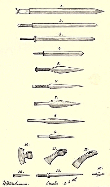
Few darts or spear-heads have been found of bronze, but the iron examples are very numerous, often of beautiful form and highly ornamented; they vary in length from about 6 to 18 inches. No. 5 represents a spear-head of iron in a wonderful state of preservation, and retaining two rivets, by which it was attached to the handle. The socket is ornamented with an elegant pattern in lines obliquely crossing each other, but the work is too fine to admit of being properly shown on the scale here given; length 13⅛ in. No. 6. A spear-head, its socket strengthened by two bronze ferrules, is very curiously ornamented with a number of small crosses, separated from each other by fillets; there are apertures for four rivets which do not now remain; possibly they were of wood; length 14½ in. No. 7. A spear-head, interesting on account of the ornamentation on its socket, as also from its general contour, which resembles that of some of the finest known bronze examples; length 13⅛ in. No. 8. An extremely slender spear-head from Ballinderry, where it was found with a good many others; length 16 in. No. 9. A spear- or javelin-head; the form is very slender: entire length 9 in. No. 10 is a well-preserved and interesting axe-head of iron, its cutting edge well steeled. It measures 4½ in. at the edge, and 3¾ in. from edge to back. Axe-heads of this peculiar form are to be seen in Scotland, sculptured on early monumental stones, probably of the Pictish age. No. 11 is an axe-head of the form most[Pg 63] commonly found in Irish crannogs; it measures 7 in. in length. No. 12 was found with the last described; it measures 7½ in. This form of axe-head, although of rather rare occurrence in Ireland, is common on the Continent. No. 13 is an iron dagger, no doubt in use contemporaneously with the swords just noticed. The handle is of bone or horn, and it is valuable as an illustration of the style of hafting early iron weapons of the sword and dagger class. No. 14 is a point formed of iron, and containing a socket. It was most likely an arrow-head. No. 15 is a very beautifully formed arrow-head from Lough Gur; length 3¼ in. From the size of the socket the shaft must have been extremely slender.[91] Arrow-heads of this kind are rare in Irish crannogs.
Few bronze darts or spearheads have been discovered, but many iron examples are available, often beautifully designed and highly decorated; they range in length from about 6 to 18 inches. No. 5 shows an iron spearhead in excellent condition, still featuring two rivets used to attach it to the handle. The socket has a stylish pattern of lines that cross each other at angles, but the detail is too fine to be clearly displayed at this scale; length 13⅛ in. No. 6. A spearhead, with its socket reinforced by two bronze ferrules, is uniquely decorated with several small crosses, spaced apart by fillets; it has openings for four rivets which are not currently present; these may have been made of wood; length 14½ in. No. 7. A spearhead notable for the decoration on its socket, as well as its overall shape, which resembles some of the finest known bronze examples; length 13⅛ in. No. 8. An exceptionally slender spearhead found in Ballinderry, where many others were located; length 16 in. No. 9. A spear or javelin head; its design is very slender: total length 9 in. No. 10 is a well-preserved and interesting iron axe head, featuring a well-steeled cutting edge. It measures 4½ in. at the edge and 3¾ in. from edge to back. Axe heads of this distinctive shape can be seen in Scotland, carved on early monumental stones, likely from the Pictish era. No. 11 is an axe head of the form most commonly found in Irish crannogs; it measures 7 in. in length. No. 12 was found with the previous item; it measures 7½ in. This axe head shape, while relatively rare in Ireland, is common on the Continent. No. 13 is an iron dagger, certainly used at the same time as the swords just mentioned. The handle is made of bone or horn, and it is significant for illustrating the style of hafting early iron weapons of the sword and dagger types. No. 14 is a point made of iron with a socket. It was likely an arrowhead. No. 15 is a beautifully shaped arrowhead from Lough Gur; length 3¼ in. Given the size of the socket, the shaft must have been very slender. Arrowheads of this type are rare in Irish crannogs.

Plate X.
Plate X.
Iron Spear-head, from Lisnacroghera, side and edge view. Half size.
Iron spearhead, from Lisnacroghera, side and edge view. Half size.


Fig. 19.
Fig. 19.
Fig. 20. Fig. 21.
Fig. 20. Fig. 21.
Fig. 22. Fig. 23.
Fig. 22. Fig. 23.
Spear Butt-ends of Bronze from Lisnacroghera. Two-thirds natural size.
Spear Butt-ends of Bronze from Lisnacroghera. Two-thirds natural size.
The two spear-heads from Lagore, (fig. 18), are in fine preservation and very sharp; their length 10 in. In the crannog of Lisnacroghera, a magnificent spear-head of iron was discovered, of which a front and side view (half-size) is given, plate X. Spear-heads of this class have been commonly met with in the larger lacustrine sites, but this specimen is invested with a peculiar interest, from its being found in company with a number of bronze objects, whose use up to the present was unknown to antiquarians. It is now certain they were the butt-ends of spear-shafts—indeed two were discovered with the ends of their shafts still remaining in them. The mode in which one—and probably others also—had been attached to the handle is thus described by Canon Greenwell:—“The end of the shaft is split, and into the split is inserted a wedge of iron, so that when driven home, the wedge expanded the end of the shaft, and kept it firm in the butt.” In Anderson’s Scotland in Pre-historic Times one is described as having been found in Orkney. Like its Lisnacroghera fellows, it differs from the generality of Irish remains of its class, in the possession[Pg 64] of a rich moulding bisecting the neck, but in all other particulars the style is identical. All the specimens of this class here figured were obtained by Canon Grainger from the crannog of Lisnacroghera. To one bronze butt was attached the whole of the shaft, 8 feet in length, furnished at top with a beautifully designed loop of bronze (see plate XI), and upon it was displayed a perfect Greek fret, with provision for the reception of enamel. From the same locality was procured also the highly interesting fragment which forms the central object of plate XI. It is portion of a spear-shaft retaining its bronze ferrule, and the rivet, also of bronze, by which the head was secured; this band or ferrule, being exceptionally beautiful, has been drawn as if rolled out. Adjoining the edges are slightly projecting fillets, enclosing a space through which runs a graceful wavy pattern in relief. The hollows were doubtless enamelled, as in the case of similar ornamentation on some bronze remains in the same “find.” The space between the fillets or bands is occupied by a singular design, and this design, all but the circular bosses, four in number, may be described as in low relief. The intervening spaces, like those of the fillets above and below, at one time contained coloured[Pg 65] enamel. Altogether the style of this object represents as it were a combination of classic and Celtic ornamentation. The smaller and even more classic-looking ferrule to the left of plate XI. has already been noticed (ante, p. 64); the figure to the right (plate XI.) represents a bronze rivet of curious form, with well-sunk depressions on one of its sides, like those seen on a cog-wheel.[92]
The two spearheads from Lagore, (fig. 18), are well-preserved and very sharp; they measure 10 inches in length. At the crannog of Lisnacroghera, a stunning iron spearhead was discovered, with a front and side view (half-size) provided, plate X. Spearheads of this type have commonly been found in larger lake sites, but this particular specimen holds special interest since it was found alongside several bronze objects, whose purpose was previously unknown to historians. It is now clear that they were the butt ends of spear shafts—two were even found with the ends of their shafts still attached. Canon Greenwell describes how one—and likely others—was fastened to the handle: “The end of the shaft is split, and into the split is inserted a wedge of iron, so that when driven in, the wedge expanded the end of the shaft and kept it firmly in the butt.” Anderson’s Scotland in Pre-historic Times notes that one was found in Orkney. Like its Lisnacroghera counterparts, it differs from most Irish examples of its kind by having a rich molding bisecting the neck, but in all other aspects, the style is identical. All the specimens shown here were collected by Canon Grainger from the crannog of Lisnacroghera. One bronze butt was connected to an entire shaft, which is 8 feet long, topped with a beautifully designed bronze loop (see plate XI), and it featured an intricate Greek fret with space for enamel. From the same site, a highly interesting fragment was also found, which forms the central piece of plate XI. It is a portion of a spear shaft that still has its bronze ferrule and the bronze rivet that secured the head; this band or ferrule, being exceptionally beautiful, has been illustrated as if rolled out. Adjacent to the edges are slightly raised fillets, enclosing a space through which runs a graceful wavy pattern in relief. The hollows were likely enameled, similar to the decorative features on some bronze items in the same find. The area between the fillets or bands showcases a unique design, all but the four circular bosses can be described as being in low relief. The spaces in between, just like those of the fillets above and below, once held colored enamel.[Pg 64] In total, the style of this object represents a blend of classic and Celtic ornamentation. The smaller, even more classically styled ferrule to the left of plate XI. has been previously mentioned (ante, p. 64); the figure to the right (plate XI.) shows a curious-looking bronze rivet, featuring well-sunk depressions on one side, similar to those found on a cogwheel.[92]

Plate XI.
Plate 11.
Portion of Spear-shaft, with ferrules and rivet of Bronze. Full size.
Portion of spear shaft, with bronze ferrules and rivet. Full size.


The distinguishing characteristic of the bronze dagger or skean from Lagore (fig. 24) consists in its openwork handle forming one piece with the blade. The weapon is 9¾ inches in length; the handle, 3⅛. The blade, 1⅜ inches in width, is flat, with broad bevelled edges. Fig. 25, found at Loughran Island, in the Lower Bann, is 4⅞ inches in length by 1¾ in width. It is a thin, flat, angular-shaped dagger blade, decorated on the surface of the mid-rib with a series of dotted lines, and pierced at the broad end by four small rivet-holes.[93] Daggers or skeans of bone, as well as of bronze and iron, have been frequently found in Irish lake dwellings, and knives formed of flint are not uncommon. The iron knives found in the crannog of Ballinderry, and now in the Museum of the Royal Irish Academy, resembled those figured in Munro’s Ancient Scottish Lake Dwellings.[94]
The key feature of the bronze dagger or skean from Lagore (fig. 24) is its openwork handle, which is made from a single piece with the blade. The weapon measures 9¾ inches long, with a handle length of 3⅛ inches. The blade, which is flat and has broad beveled edges, is 1⅜ inches wide. Fig. 25, discovered at Loughran Island in the Lower Bann, measures 4⅞ inches in length and 1¾ inches in width. This thin, flat, angular-shaped dagger blade is adorned on the mid-rib surface with a series of dotted lines and has four small rivet-holes at the broad end.[93] Daggers or skeans made of bone, as well as those made of bronze and iron, have often been found in Irish lake dwellings, and flint knives are quite common. The iron knives discovered in the crannog of Ballinderry, now housed in the Museum of the Royal Irish Academy, were similar to those depicted in Munro’s Ancient Scottish Lake Dwellings.[94]
At the time the Catalogue of the Museum of the Royal Irish Academy was compiled by the late Sir W. Wilde, although some objects of bronze, supposed to have been ornaments on leather or wooden dagger sheaths, are mentioned by him, yet he was unable to point to any example composed altogether of bronze. Since that period, however, three sword-sheaths of that metal have been discovered in the crannog of Lisnacroghera, county Antrim. Their workmanship is exquisite. They bear traces of enamel, and one of them contained a sword of iron so firmly attached to it by corrugation that any attempt to withdraw it must have involved the[Pg 66] mutilation or utter destruction of the bronze in which it was encased.
At the time the Catalogue of the Museum of the Royal Irish Academy was put together by the late Sir W. Wilde, he mentioned some bronze objects that were likely ornaments from leather or wooden dagger sheaths, but he couldn't identify any examples made entirely of bronze. Since then, however, three sword sheaths made of bronze have been found in the crannog of Lisnacroghera, county Antrim. Their craftsmanship is stunning. They show signs of enamel, and one of them contained an iron sword that was so tightly attached by corrugation that trying to pull it out would have resulted in the mutilation or complete destruction of the bronze it was encased in.
The decoration of the sheath, plate XII, No. 2, is very remarkable; the distinctive peculiarity being its spiral character, a perfect specimen of those combinations of involved circles and curvilinear lines, supposed to be characteristic of early Celtic art. Some portions of the sheath, near its end, still retain settings in enamel, the colour of which, though now faded, must have been rich vermillion. Enamel of the same hue and material once occupied the little saucer-like depressions which occur on the terminating snake-suggesting head. One of the circles (that had been, doubtless, intended to represent eyes) shows that it had been so filled, as were, probably, the little raised bosses, two in number, that may be observed at the opposite extremity. The interior of what might be styled the crescent-shaped patterns, nine in number, which occupy the chief plane of the sheath, as also the minor spirals of their adjacent spaces in the general figure, exhibit a design suggestive of basket-work. It is now impossible to determine whether the sheaths had been formed by casting, or were beaten into shape from a plain sheet of copper. It is evident that for the production of the ornamentation a graver had been used. The lines are sharply and deeply incised, and appear to have been intended for the reception of enamel of a black shade, some traces of which appear here and there. The enamel on the sheath “was, in all probability, niello, a composition of silver, copper, sulphur, and lead, the nigellum of ancient writers. It was not so hard or lasting as the ordinary enamel of glass or vitrified paste, some examples of which may be seen on several early ecclesiastical remains. The art of enamelling in niello is of the very highest antiquity; it was practised by the Egyptians. Specimens of it, of various ages, even of modern times, are numerous, and it appears to have been known to the Anglo-Saxons, as a ring of Bishop Ethelwulf (ninth century) is ornamented with it.”
The decoration of the sheath, plate XII, No. 2, is quite remarkable; its unique feature is its spiral design, a perfect example of the complex circles and curved lines thought to be typical of early Celtic art. Some parts of the sheath near its end still have enamel settings, which, although faded now, must have originally been a rich vermilion. Enamel of the same color and material once filled the small, saucer-like depressions on the snake-like head at the end. One of the circles, likely meant to represent eyes, shows signs that it was filled, as were probably the two small raised bumps found at the opposite end. The interior of the crescent-shaped patterns—nine in total—on the main surface of the sheath, along with the smaller spirals in the adjoining areas, displays a design reminiscent of basket weaving. It's currently unclear whether the sheaths were made by casting or hammered from a flat sheet of copper. It’s clear that a graver was used for the ornamentation. The lines are sharply and deeply incised and appear to have been meant to hold enamel of a black color, some remnants of which are visible here and there. The enamel on the sheath was likely niello, a mix of silver, copper, sulfur, and lead, known as nigellum by ancient writers. It wasn’t as hard or durable as regular glass enamel or vitrified paste, examples of which can be found in several early ecclesiastical artifacts. The art of enameling with niello is very ancient; it was practiced by the Egyptians. Many specimens from various periods, including modern times, exist, and it seems to have been known to the Anglo-Saxons, as a ring belonging to Bishop Ethelwulf (ninth century) is adorned with it.
Although the decoration of the third sheath is similar in style, yet some of its features are peculiar, especially the dot and circle pattern along one of the edges, and which appears to have extended from handle to extremity.
Although the decoration of the third sheath is similar in style, some of its features are unique, especially the dot and circle pattern along one of the edges, which seems to extend from the handle to the tip.
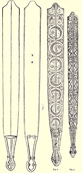
Plate XII.
Plate 12.
Fig. 1.—Sides of Bronze Sheath, containing an Iron Sword.
Fig. 1.—Sides of Bronze Sheath, holding an Iron Sword.
Figs. 2 and 3.—Sides of Bronze Sword Sheaths, from the Crannog of Lisnacroghera.
Figs. 2 and 3.—Sides of Bronze Sword Sheaths, from the Crannog of Lisnacroghera.
Fig. 26 represents an object supposed to have been an ornamental termination of the pommel of a sword; it is of bronze, richly decorated with bands of white and red enamelled designs in[Pg 67] a chevron or wavy pattern. The form is oval, and upon the upper rim are representations of two birds. Early Irish decorative art is characterised by bird-like forms, and figures of this kind are to be seen on early MSS. and on articles of the toilet or of personal adornment.[95]
Fig. 26 represents an object that was likely an ornamental end piece of a sword's pommel; it is made of bronze and is intricately decorated with bands of white and red enamel designs in[Pg 67] a chevron or wavy pattern. The shape is oval, and on the upper edge are depictions of two birds. Early Irish decorative art is known for its bird-like forms, and similar figures can be seen on early manuscripts and personal items.[95]

Plate XIII.
Plate 13.
Iron Tools, &c., found in the bottom of a “dug-out” at Cornagall.
Iron tools, etc., found at the bottom of a “dug-out” in Cornagall.

Fig. 26. Bronze enamelled object from Lisnacroghera. Full size.
Fig. 26. Bronze enamel object from Lisnacroghera. Actual size.
In a small lake called Cornagall (the Hillock of the Dane or Stranger), about six miles from Cavan, there is an almost circular artificial island, thirty yards in diameter, its crannog nature, attested by rows of oaken stakes fencing its margin, showing above the summer level of the lake. In August, 1869, the water being then particularly low, a log of timber that bore evident traces of manual labour was ascertained to be the end of a “dug-out” embedded in soft, boggy matter. It proved, however, to be only a fragment, the other portion having been destroyed by fire, as evinced by the charred appearance of the remains: the large quantity of charcoal, half consumed sticks and chips visible on the margin of the crannog indicated its destruction also by that element. A set of iron tools lay on the floor of the canoe thus discovered, all here represented one-third their real size. The following is a brief description of them:—
In a small lake called Cornagall (the Hillock of the Dane or Stranger), about six miles from Cavan, there’s an almost circular artificial island, thirty yards across. Its crannog nature is confirmed by rows of oak stakes that fence its edge, rising above the summer level of the lake. In August 1869, when the water was particularly low, a log that showed clear signs of human work was found to be the end of a “dug-out” buried in soft, boggy ground. However, it turned out to be just a fragment, as the rest had been destroyed by fire, which was evident from the charred look of the remains. A large amount of charcoal, half-burned sticks, and chips were seen around the edge of the crannog, indicating that fire had also caused its destruction. A set of iron tools was discovered on the floor of the canoe, all represented here at one-third their actual size. Here’s a brief description of them:—
Plate XIII., No. 1, is an adze in a perfect state: the metallic portion consists of soft iron, well steeled to a considerable distance from its cutting edge. No. 2 is an adze, scraper, or implement of the same class, but differing from the former in that it shows no perforation; its narrow-pointed end had evidently been intended for insertion in a wooden handle: the edge being broken, it is impossible to determine whether it had been steeled. No. 3 is a hammer of iron, the handle of oak, split at its upper extremity for the insertion of a wedge, which still remains. No. 4 is a celt or chisel—a somewhat similar object (from Lagore), but considerably broader, is preserved in the Museum of the Royal Irish Academy. Nos. 5 and 6 represent a thin, knife-like piece of iron and a wooden handle, originally, perhaps, portions of one implement; the wood, hollowed[Pg 68] for reception of the blade, is perforated for the insertion of a rivet, which no longer remains. With the iron tools in the canoe was found a remarkable object, composed of oak, use unknown; it is curiously notched upon one of its sides, near the edge. Figs. 8 and 9 represent two views of it.[96]
Plate XIII., No. 1, is a perfectly preserved adze: the metal part is made of soft iron, well hardened to a significant distance from its cutting edge. No. 2 is another adze, scraper, or similar tool, but unlike the previous one, it has no hole; its narrow pointed end was clearly meant to be inserted into a wooden handle. Since the edge is broken, we can't tell if it was hardened. No. 3 is an iron hammer with an oak handle, which is split at the top for a wedge that is still in place. No. 4 is a celt or chisel—a similar object (from Lagore), but much wider, is kept in the Museum of the Royal Irish Academy. Nos. 5 and 6 represents a thin, knife-like piece of iron and a wooden handle, which might have originally been parts of the same tool; the wood, hollowed out for the blade, has a hole for inserting a rivet that is no longer there. Along with the iron tools found in the canoe was an intriguing object made of oak, its purpose unknown; it is oddly notched on one side near the edge. Figs. 8 and 9 represents two views of it.[96]

Fig. 27, an iron axe-head, from Lagore, is seven inches in length, massive, and of considerable weight; the cutting edge singularly narrow. A great number, made of stone, have come to light; and all that are composed of iron are well steeled round the cutting edge. Axe-heads are of great diversity of form.
Fig. 27, an iron axe head from Lagore, is seven inches long, heavy, and quite substantial; the cutting edge is unusually narrow. Many stone versions have been found, and all the iron ones have a well-tempered cutting edge. Axe heads come in a wide variety of shapes.
A front and side view (fig. 31) is given of an iron adze, six inches and a-quarter long, from the crannog of Lisnacroghera, as were also the three objects of iron here represented (figs. 28, 29, 30), the uppermost, probably a knife, and having a hole through what appears to have been the haft end. The other two articles are said to be the remains of a saw, and the long fragment, perforated in four places, is supposed to be the strengthening bar attached to the piece of wood into which the back of the saw had been inserted.
A front and side view (fig. 31) is provided of an iron adze, six and a quarter inches long, from the crannog of Lisnacroghera, along with the three iron objects shown here (figs. 28, 29, 30). The top one is probably a knife and has a hole at what looks like the end of the handle. The other two items are said to be remnants of a saw, and the long piece, which is perforated in four places, is thought to be the strengthening bar attached to the piece of wood where the back of the saw was inserted.

Figs. 28, 29, 30.—Iron Objects from Lisnacroghera.
Figs. 28, 29, 30.—Iron Objects from Lisnacroghera.
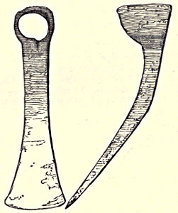
Fig. 31.—Front and side-view of Iron Adze from Lisnacroghera.
Fig. 31.—Front and side view of Iron Adze from Lisnacroghera.
Hones.—Hones and sharpening stones are very commonly met with in crannogs; they plainly denote that at some period during their habitable existence the occupiers possessed metallic weapons or tools. The Cornagall “find” presents two specimens of whetstones; one is given (plate XIII. fig. 7); the material dark-grey in colour, almost black, extremely hard, and close-grained; they are symmetrical in form, and partake greatly of the character of the so-called touchstones. Fig. 32 is a perforated example.
Hones.—Hones and sharpening stones are frequently found in crannogs; they clearly indicate that at some point during their time of occupation, the residents had metallic weapons or tools. The Cornagall “find” includes two examples of whetstones; one is shown (plate XIII. fig. 7); the material is dark grey, almost black, very hard, and finely grained; they are symmetrical in shape and closely resemble the so-called touchstones. Fig. 32 is a perforated example.
Armour.—Amongst crannog “finds” no well-authenticated remains of defensive armour have been recorded, with the exception of a fragment of chain armour from Inisrush, and the ancient “golden bronze” shield from Lough Gur. The armour found on the site of the crannog in Lough Annagh is not here taken into consideration, it being evidently seventeenth century work.
Armor.—Among the crannog discoveries, no confirmed remains of defensive armor have been documented, except for a piece of chainmail from Inisrush and the ancient “golden bronze” shield from Lough Gur. The armor found at the crannog site in Lough Annagh is not included here, as it is clearly a seventeenth-century creation.
In the townland of Monea, about five miles from Enniskillen,[Pg 70] county Fermanagh, in a small but deep lake,[97] there is a very fine circular crannog, about seventy-five feet in diameter, composed almost entirely of timber, and surrounded with remains of staking; a complete examination of the site was not possible, owing to the thick mass of roots and fibres thrown out by the trees with which it was studded. Upon digging into that portion of the shore offering the greatest facility, there were discovered several fragments of bones of the Bos longifrons and other animals, quantities of charcoal, some iron slag, and the remains of the curious iron helmet here figured, which must, however, be viewed as of comparatively modern date. The helmet is entirely devoid of ornamentation, is acutely conical in shape, and no traces of nasal or cheek pieces remain. A casque, very similar to this, was found in the river Nore, near Borris-in-Ossory, Queen’s County, and is preserved in the Museum of the Royal Irish Academy.
In the area of Monea, about five miles from Enniskillen, [Pg 70] county Fermanagh, there’s a small but deep lake,[97] featuring a well-preserved circular crannog, roughly seventy-five feet in diameter, made almost entirely of wood and surrounded by remains of stakes. A complete examination of the site wasn’t possible due to the thick mass of roots and fibers from the trees that covered it. When we dug into the part of the shore that was easiest to access, we found several fragments of bones from the Bos longifrons and other animals, a lot of charcoal, some iron slag, and the remains of a unique iron helmet shown here, which should probably be considered relatively modern. The helmet has no decorations, is sharply conical in shape, and there are no signs of nasal or cheek pieces. A similar helmet was discovered in the river Nore, near Borris-in-Ossory, Queen’s County, and it is now kept in the Museum of the Royal Irish Academy.

Fig. 33.—Iron Helmet found in the Monea Crannog, front and side view.
Fig. 33.—Iron Helmet discovered in the Monea Crannog, front and side view.

Plate XIV.
Plate 14.
Front View of Bronze Shield from Lough Gur. Diameter 28 inches.
Front View of Bronze Shield from Lough Gur. Diameter 28 inches.
The shield, of which the accompanying plate gives a correct representation, was found in the bog close to the banks of Lough Gur, County Limerick; and near it were the head and antlers of a Megaceros Hibernicus. This shield is a disc of bronze, slightly convex, and strengthened by a series of six concentric circles formed of hollow bosses, about two hundred in number, surrounding the central umbo. It appears to have been carried slung on the shoulder, the slinging loops being fixed so as to form bosses on the obverse equal in size to those contained in the circle: it was furnished with a very small handle, interiorly traversing the umbo. The rim is an inch three-quarters in width; the diameter, two feet three and three-quarter inches. The holes with which the shield is pierced are not proofs of warfare; it was the discoverer—a boy with a fishing gaff—who inflicted the injuries in bringing his novel spoil to land.[98] The Rev. James Graves considered the looseness of the rivets at the inside loops for the strap by which the shield was carried, to be proof that some material, most probably the hide of an animal, had originally formed an inner lining, as the thin bronze being in itself incapable of withstanding the impact of a fishing-gaff, could afford little real protection against even ordinary weapons of warfare. The coating of sheet bronze may be viewed rather as ornamentation than as rendering the shield more impenetrable; or it may have been but a variety of the arrangement of studs or circles of bronze affixed to bucklers of wood or leather—
The shield, shown accurately in the accompanying image, was discovered in the bog near the shores of Lough Gur, County Limerick, along with the head and antlers of a Megaceros Hibernicus. This shield is a slightly curved disc made of bronze, reinforced by a series of six concentric circles formed by about two hundred hollow bosses surrounding the central bump. It seems to have been carried over the shoulder, with the carrying loops designed to form bosses on the front that are the same size as those in the circle: it also had a small handle that went through the bump on the inside. The rim is one and three-quarters inches wide, and the diameter is two feet, three and three-quarters inches. The holes in the shield are not evidence of battle; they were made by the finder—a boy with a fishing gaff—while bringing his unusual find to shore.[98] The Rev. James Graves believed that the looseness of the rivets on the inner loops where the strap was attached indicated that some material, likely the hide of an animal, originally served as an inner lining, since the thin bronze alone couldn't withstand the impact of a fishing gaff and would offer little protection against even basic weapons. The bronze coating might be seen more as decoration than as a means of making the shield more resistant; or it could have simply been a variation of the arrangement of studs or circles of bronze attached to wooden or leather shields.
In the Museum of Antiquities at Edinburgh may be seen a bronze shield of like character.
In the Museum of Antiquities in Edinburgh, you can see a bronze shield of a similar type.
In the Crannog of Lisnacroghera was discovered, with many warlike weapons, a disc of thin bronze, its centre from one-third its circumference descending into a hollow, at the base of which is an aperture: the ornamented side, as here portrayed, must have been intended to be the front, as the other side is quite plain.[Pg 72] “Can it be the centre of a shield, other portions of which were composed of less durable materials? Certain it is, that thin circular plates of bronze, displaying similar depressions, have been found both in England and in Ireland, and are supposed to be connected with the mounting of shields.”
In the Crannog of Lisnacroghera, a number of warlike weapons were found along with a thin bronze disc. Its center dips down into a hollow that has an opening at the base. The decorated side, as shown here, was likely meant to be the front, since the other side is completely plain.[Pg 72] “Could it be the center of a shield, with other parts made from less durable materials? It's clear that thin circular bronze plates with similar dips have been discovered in both England and Ireland and are thought to be related to shield mounts.”

The first figure to the left, plate XV., represents an object of the same class, but slightly smaller, and not so much ornamented. To the right are two views of another article, which presents all the appearance of an umbo. On the same plate (XV.) are four bronze rings: one of them is formed of two very thin plates, secured together by rivets of the same material; the three remaining rings are solid, and of a class which some antiquaries suppose formed a kind of defensive armour. It is imagined that they were attached pretty closely together to portions of the ancient warrior’s garment; and it is worthy of remark that in the collection of the Academy a number of such rings, or objects very like them, may be seen looped together by bronze fastenings.[99]
The first figure to the left, plate XV., shows an object from the same category, but it's a bit smaller and less ornate. To the right are two views of another item that looks like an umbo. On the same plate (XV.) are four bronze rings: one is made of two very thin plates held together by rivets made of the same material; the other three rings are solid and are believed by some historians to have been part of a kind of defensive armor. It's thought that they were closely attached to parts of the ancient warrior's clothing; it's also interesting to note that in the Academy's collection, a number of such rings, or very similar items, can be seen linked together with bronze fastenings.[99]

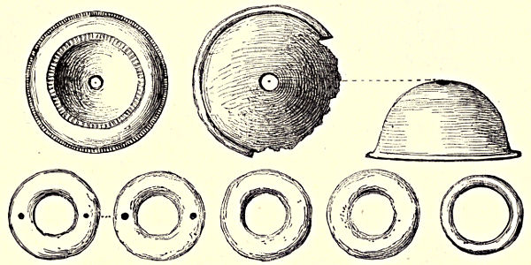
Plate XV.
Plate 15.
Boss-like Objects, and Rings of Bronze, from Lisnacroghera. Full size.
Boss-like Objects and Bronze Rings from Lisnacroghera. Full size.
Stone moulds, evidently employed in casting celts, weapons, tools, and other articles of bronze, have been brought to light. Fig. 35, discovered in the Crannog of Lough Scur, county Leitrim, is a triangular block of coarse white sandstone 7½ inches long, 5¼ wide, and 3½ thick, having both sides indented for castings. On the side here presented are moulds for a plain celt three inches long, and another celt four inches long, with cross strop and ring for attachment to the shaft.[Pg 73] Castings taken from this mould “delivered” implements closely resembling several in the Museum, R. I.A.[100] At Lough Ramor, county Cavan, a very curious block of sandstone was found, having a mould on three of its faces: the one here represented is for a broad arrow-head, with side rings. Upon the obverse is one for a small spear and leaf-shaped arrow; on the right side is another arrow-mould.[101]
Stone molds, clearly used for casting celts, weapons, tools, and other bronze items, have been uncovered. Fig. 35, found in the Crannog of Lough Scur, County Leitrim, is a triangular block of coarse white sandstone measuring 7½ inches long, 5¼ inches wide, and 3½ inches thick, with both sides indented for castings. On the side shown, there are molds for a plain celt that is three inches long and another celt that is four inches long, featuring a cross strop and ring for attaching to the shaft.[Pg 73] Castings made from this mold produced tools that closely resemble several in the Museum, R.I.A. [100] At Lough Ramor, County Cavan, a very interesting block of sandstone was found, with a mold on three of its faces: the one shown here is for a broad arrowhead with side rings. On the front side is a mold for a small spear and leaf-shaped arrow; on the right side is another arrow mold. [101]
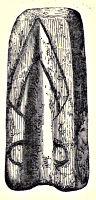
Vegetable Remains.—The ancient Irish set great value upon the hazel plant, a fact demonstrated by the frequent mention made of it in their best and oldest MSS.; the numerous round stones met with in crannogs are supposed to have been used for breaking the nuts; their shells form the most considerable portion of vegetable remains in the kitchen middens, where beech nuts also are present; and it is known that within historic times the Irish kept large herds of swine that fed on masts in the woods, for then
Vegetable Remains.—The ancient Irish highly valued the hazel plant, as shown by its frequent mentions in their best and oldest Ms.; the many round stones found in crannogs are thought to have been used for crushing the nuts; their shells make up the largest part of the plant remains found in kitchen middens, where beech nuts are also found; and it is known that, in historic times, the Irish kept large herds of pigs that foraged on mast in the forests, for then
Grain (species not stated), and various kinds of wild fruit, have been discovered; walnuts at Lough Nahinch, cherrystones at Ballinlough.[102]
Grain (species not specified) and different types of wild fruit have been found; walnuts at Lough Nahinch, cherrystones at Ballinlough.[102]
Hammer-stones.—It cannot be doubted that in a few instances the round stones, sometimes designated “sling-stones,” have been artificially worked, but the great majority must be looked upon simply as water-worn pebbles that had been utilized as hammer-stones. Many of the egg-shaped specimens are more or less frayed or chipped at their extremities; and similar stones, used, as is supposed, for breaking crustacea, are common in the “shell mounds” on the coast, as also amongst the “kitchen middens” of ancient settlements that abound within the sand dunes of the north-western littoral of Ireland. A large flat stone implement, with circular termination, rough sides, and polished edges, was found in the crannog of “The Miracles,” county Fermanagh. It measured[Pg 74] about eleven inches by three, and was one inch thick. Its flat end shows marks of wear, as if used for a pounding instrument. A stone exactly similar was found in a “kitchen midden” at Ardnahue, county Carlow, which had all the appearance of having been grasped in the hand for use, hence the edges polished from constant friction.[103]
Hammer-stones.—It’s clear that in some cases, the round stones, sometimes called “sling-stones,” have been modified by people, but most of them should just be seen as naturally rounded pebbles that were used as hammer-stones. Many of the egg-shaped ones are somewhat worn or chipped at the ends; similar stones thought to be used for breaking shellfish are commonly found in the “shell mounds” along the coast, as well as among the “kitchen middens” of ancient settlements located within the sand dunes along the north-western coast of Ireland. A large, flat stone tool with a circular end, rough sides, and polished edges was discovered in the crannog at “The Miracles,” County Fermanagh. It measured[Pg 74] about eleven inches by three, and was one inch thick. Its flat end shows signs of wear, suggesting it was used as a pounding tool. An identical stone was found in a “kitchen midden” at Ardnahue, County Carlow, which seemed to have been held in the hand for use, resulting in edges that were polished from constant friction.[103]

Fig. 37.—Stone Implement from the Crannog of “The Miracles.”
Fig. 37.—Stone Tool from the Crannog of “The Miracles.”

Mammalia.—Amongst animal remains, those of the Sus scrofa are very numerous. This species of wild swine lived in the woods and marshes, was long-faced, and had great length of tusks.
Mammals.—Among animal remains, those of the Sus scrofa are quite numerous. This species of wild pig lived in forests and wetlands, had a long face, and possessed very long tusks.
The accompanying illustration represents a lower jaw of this ancient Irish pig, procured from the crannog of Lough Gur, county Limerick; it is of a yellowish-brown colour, a hue that pervades all the animal remains from that locality.
The illustration shows the lower jaw of this ancient Irish pig, obtained from the crannog at Lough Gur, County Limerick. It has a yellowish-brown color, which is the same shade found in all the animal remains from that area.


Bones of the red deer (Cervus elephas) are extremely plentiful in lacustrine sites. It is the wild animal most frequently mentioned in early Irish history, and of which there were many until a comparatively modern epoch: so late as 1752 they abounded in the barony of Erris, county Mayo, and some few exist still in Killarney. The head and antlers here shown came from the crannog of Ballinderry, county Westmeath. The horns in this specimen are still attached to the cranium, and there were originally seven tines on the right, and eight on the left side. Bones of the Magaceros Hibernicus, or Irish big-horn, of the wolf and fox, of a small breed of horse, and of the ass, have been also met with. The remains of sheep belong to the horned class. There are several specimens of the four-horned variety of the goat (fig. 42), but those of the ordinary kind are more numerous: figs. 40 and 41 are from Dunshaughlin. Amongst the vast collection of animal remains on the site of this crannog were heads of canine animals: of the largest of these the accompanying cut gives a faithful representation. “It is nearly eleven inches in length, measured from the end of the occipital ridge to the alveolar process at the roots of the upper incisors, and is principally characterized by the magnitude of the crest.”[104] The profile view of the outline, and the prolonged muzzle, rather lead to the belief of its having belonged to the true Irish wolf-dog of former times, a large long-coated hound, of an iron-grey colour.
Bones of the red deer (Cervus elephas) are very common in lake sites. It's the wild animal most often mentioned in early Irish history, and there were many until relatively recently: as late as 1752, they were abundant in the barony of Erris, County Mayo, and a few still exist in Killarney. The head and antlers shown here were found at the crannog of Ballinderry, County Westmeath. The horns on this specimen are still attached to the skull, and there were originally seven tines on the right and eight on the left. Bones of the Magaceros Hibernicus, or Irish big-horn, as well as wolf and fox remains, a small breed of horse, and donkey remains, have also been discovered. The remains of sheep belong to the horned variety. There are several specimens of the four-horned type of goat (fig. 42), but the common kind is more numerous: figs. 40 and 41 are from Dunshaughlin. Among the large collection of animal remains found at this crannog were heads of canine animals; the largest of these is accurately depicted in the accompanying image. "It is nearly eleven inches long, measured from the end of the occipital ridge to the alveolar process at the roots of the upper incisors, and is mainly characterized by the size of the crest." [104] The profile view and the elongated muzzle suggest that it belonged to the true Irish wolf-dog of the past, a large long-haired hound with an iron-grey coat.
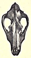
According to the best authorities, there were in Europe in[Pg 76] early times four great types of oxen: first, the Bos priscus, or Urus, the great Auroch, that even in classic times roamed through the forests of Germany; and its bones have been found in Swiss lacustrine sites: it was of great size, had long upright horns, a narrow forehead, high frontal crest, projecting orbits, and a warm shaggy coat, reddish-brown in colour. The second type, the Bos primigenus, was found by the Romans amongst the wilds of Europe; it had long, slightly-curved horns, set on at right angles to the head, but turning forward at the extremities, and spreading to a breadth of nearly five feet from tip to tip. The third variety, the Bos trochocerus had a very narrow head, and long cylindrical horn-cores rising high above the level of the back of the occiput, then curving forwards and inwards. The fourth type, which is almost peculiar to Ireland, has been denominated Bos longifrons, the long-fronted or small fossil ox—somewhat of a misnomer it must be confessed, because, properly speaking, it should be denominated Bos latifrons, from the exceeding breadth of forehead and face, in which particular it differs in an especial manner from the three former.
According to the best sources, in early times there were four main types of oxen in Europe: first, the Bos priscus, or Urus, the large Auroch that roamed the forests of Germany even during classical times; its bones have been discovered in Swiss lake deposits. It was very large, had long upright horns, a narrow forehead, a high frontal crest, prominent eye sockets, and a warm, shaggy reddish-brown coat. The second type, the Bos primigenus, was found by the Romans in the wilds of Europe; it had long, slightly curved horns set at right angles to the head, curving forward at the tips, and spreading nearly five feet from tip to tip. The third variety, the Bos trochocerus, had a very narrow head and long cylindrical horn cores that rose high above the back of the head, then curved forward and inward. The fourth type, which is almost unique to Ireland, is called Bos longifrons, the long-fronted or small fossil ox—though that name is somewhat misleading, as it should rightly be called Bos latifrons due to its extremely broad forehead and face, which sets it apart from the first three types.

Specimens of the crania of four distinct breeds of cattle from crannogs are here given as described by Wilde, who named them very appositely: 1, the straight-horn, or Drom-adharach; 2, the crumpled-horn, or Crom-adharach; 3, the short-horn, or Gearr-adharach; 4, the Hornless, or Maol. Of the first type (Fig. 44), which was found at Dunshaughlin, Wilde states that there are none now existing in Ireland of this race, evidently domesticated descendants of the ancient wild Bos longifrons. The cranium is “broad in the face, flat on the forehead, nearly level between the horns, with but slight projecting orbits, short thick slugs or horn-cores rising but little above the occipital crest, and turning slightly inwards, like some of the best short-horned bulls of the present day. It is eighteen inches long in the face, and nineteen from tip to tip of horn-core.”
Specimens of the skulls of four different breeds of cattle from crannogs are provided here as described by Wilde, who very aptly named them: 1, the straight-horn, or Drom-adharach; 2, the crumpled-horn, or Crom-adharach; 3, the short-horn, or Gearr-adharach; 4, the Hornless, or Maol. Of the first type (Fig. 44), which was found at Dunshaughlin, Wilde notes that there are no longer any of this breed in Ireland, clearly domesticated descendants of the ancient wild Bos longifrons. The skull is “broad in the face, flat on the forehead, nearly level between the horns, with only slight projecting orbits, short thick slugs or horn-cores rising just above the occipital crest, and turning slightly inwards, like some of the best short-horned bulls of today. It is eighteen inches long in the face, and nineteen from the tip to tip of the horn-core.”

Fig. 45.—Cranium of the Crom-adharach, or Crumpled-horn Ox.
Fig. 45.—Skull of the Crom-adharach, or Crumpled-horn Ox.
Fig. 45 represents a cranium of the Crom-adharach or Crumpled-horn, which, judging by its remains, appears to have been the most numerous variety. This magnificent head of a bull of the race is “in point of size as fine a specimen as has yet been found: it is twenty-three and a-half inches long, and eight inches[Pg 78] across the forehead, which has been broken in by some blunt instrument, probably in slaughtering. The horn-cores are not so large at the base, but more than twice as long as those of the “straight-horned” race; they are curved considerably inwards, so that the tips of the horns, when perfect, must have approached much nearer than their bases. Each horn-core was, when perfect, about eleven inches long.” This head, together with many similar crania, came from the crannog of Lough Gur, county Limerick.
Fig. 45 represents a skull of the Crom-adharach or Crumpled-horn, which, based on its remains, seems to have been the most common type. This impressive bull's head is “in terms of size, one of the finest specimens found so far: it measures twenty-three and a half inches long and eight inches[Pg 78] across the forehead, which has been damaged by some blunt object, likely during slaughter. The horn-cores aren't as thick at the base but are more than twice as long as those of the “straight-horned” type; they curve significantly inward, so the tips of the horns, when intact, must have been much closer together than their bases. Each horn-core was about eleven inches long when complete.” This skull, along with many similar ones, was found at the crannog of Lough Gur, County Limerick.

Fig. 46. Cranium of the Gearr-adharach, or Short-horned Ox.
Fig. 46. Skull of the Gearr-adharach, or Short-horned Ox.
Fig. 47. Cranium of the Maol, or Hornless Ox.
Fig. 47. Skull of the Maol, or Hornless Ox.
The third class, or “short-horn”, had long narrow faces, with exceedingly small horn-cores curving abruptly inwards. The cranium of one specimen (female) measured seventeen inches in length of face, six inches across the forehead, and eleven inches from tip to tip of horn-core. Fig. 46 gives a good illustration of this breed, which was abundant. The fourth class, the Maol, or Myleen (the hornless or bald), differs in nothing from those of the present day, save that it appears to have been of smaller size than its modern representative. The average length of face is about seventeen inches, by about eight inches across the orbits. Almost all the heads of this variety presented by Wilde to the R. I. A. came from the crannog of Dunshaughlin: they exhibit a remarkable protuberance or frontal crest.
The third class, or “short-horn,” had long, narrow faces with very small horn-cores that curved sharply inwards. The cranium of one specimen (female) measured seventeen inches in facial length, six inches across the forehead, and eleven inches from one horn-core tip to the other. Fig. 46 provides a good illustration of this breed, which was quite common. The fourth class, the Maol, or Myleen (the hornless or bald), doesn’t differ from those of today, except that it seems to have been smaller than its modern equivalent. The average facial length is about seventeen inches, with about eight inches across the eye sockets. Almost all the heads of this variety presented by Wilde to the R. I. A. came from the crannog of Dunshaughlin; they show a notable bulge or frontal crest.

Plate XVI.
Plate 16.
Figs. 1 and 2.—Top and Side view of Yoke found in Donagh Bog.
Figs. 1 and 2.—Top and Side view of Yoke discovered in Donagh Bog.
Figs. 3 and 4.—Yoke found on the margin of Lough Erne.
Figs. 3 and 4.—Yoke discovered on the edge of Lough Erne.
Figs. 5 and 6.—Yoke found with Figs. 3 and 4.
Figs. 5 and 6.—Yoke discovered alongside Figs. 3 and 4.
Wooden Yokes found in Donagh Bog and on the margin of Lough Erne.
Wooden yokes discovered in Donagh Bog and along the edge of Lough Erne.
In Switzerland, at Robenhausen, a settlement of the Stone Age which had been buried under a bed of peat, it is stated by Keller that horizontal layers were discovered of a foreign substance, from two to ten inches thick, ascertained on analysis to be composed of the fæces of cattle. May not some of the dark strata on crannogs be composed of like matter? for there is documentary evidence that the Irish chiefs kept cattle on their islands in time of war. The Lord Treasurer Winchester, writing to announce the decease of Shane O’Neill to the Lord Deputy, says, that “he ought to inspect Shane’s lodging in the fen, where he built his abode, and kept his cattle and all his men,” &c., &c. This “abode” is known to have been a crannog.
In Switzerland, at Robenhausen, a Stone Age settlement that was buried under a layer of peat, Keller reports that horizontal layers of a foreign substance, ranging from two to ten inches thick, were found. Analysis determined that this substance was made up of cattle dung. Could some of the dark layers in crannogs be made of similar material? There's documented evidence that Irish chiefs kept cattle on their islands during wartime. The Lord Treasurer Winchester, writing to inform the Lord Deputy about Shane O’Neill's death, mentions that “he ought to inspect Shane’s lodging in the fen, where he built his home and kept his cattle and all his men,” and so on. This “home” is known to have been a crannog.
Butter.—The custom of burying or hiding butter in bogs is probably of very ancient origin, but, like many old customs, was carried down in Ireland to a very late period. Thomas Dineley, in a diary of his visit to Ireland in the reign of Charles II., states that the Irish used “Butter layd up in wicker basketts, mixed with store of … a sort of garlick, and buried for some time in a bog.” Sir William Petty mentions “butter made rancid by keeping in bogs.” The custom is thus described in the Irish Hudibras:—
Butter.—The practice of burying or hiding butter in bogs likely goes back a long way, but, like many old traditions, it continued in Ireland for quite some time. Thomas Dineley, in a diary from his trip to Ireland during the reign of Charles II, notes that the Irish would “store butter in wicker baskets, mixed with a lot of... a kind of garlic, and buried it for a while in a bog.” Sir William Petty refers to “butter that has gone rancid from being kept in bogs.” The tradition is described in the Irish Hudibras:—
The Faröe islanders had a similar practice with regard to tallow. Bog butter, or mineral tallow, is usually met with in single-piece wooden vessels, like long firkins.
The Faroe Islanders had a similar approach to tallow. Bog butter, or mineral tallow, is typically found in single-piece wooden containers, like long firkins.
Yokes.—For beasts of burden, the yoke was in use from the earliest ages, but any that have been hitherto discovered, whether double or single, appear too small for cattle of species still existent; however, the old race of domesticated kine in Ireland may have been smaller in size than those of the present day. Probably the first yoke that attracted notice was the one described and illustrated by Wilde in his Catalogue of the Museum of the Royal Irish Academy, for it was not until a comparatively late period that the attention of antiquaries was directed towards this class of remains, usually found covered by a considerable depth of bog. A good idea of their general appearance is conveyed by the accompanying illustrations (plate XVI.) representing two yokes of wood that were discovered under eighteen feet of peat in Donagh,[Pg 80] county Monaghan, in the year 1867. Fig. 2 is drawn on a somewhat larger scale than fig. 1. Figs. 3 and 4 represent yokes found by turf-cutters about the year 1874, deeply buried in a bog abutting on Lough Erne. One of them was composed of oak. Figs. 5 and 6 are specimens curiously contorted, twisted, and split, the result of over-hasty drying.[105]
Yokes.—Yokes for draft animals have been around since the earliest times, but any that have been found so far, whether they’re double or single, seem too small for the cattle we have today; although, the ancient domesticated cattle in Ireland might have been smaller than what we see now. Probably the first notable yoke was the one that Wilde described and illustrated in his Catalogue of the Museum of the Royal Irish Academy. It wasn't until a much later time that antiquarians started paying attention to these kinds of remains, which are usually found buried under a lot of bog. The accompanying illustrations (plate XVI.) show two wooden yokes that were found eighteen feet deep in peat in Donagh,[Pg 80], county Monaghan, in 1867. Fig. 2 is drawn on a slightly larger scale than fig. 1. Figs. 3 and 4 shows yokes found by turf-cutters around 1874, buried deep in a bog next to Lough Erne. One of these yokes was made of oak. Figs. 5 and 6 are examples that are oddly contorted, twisted, and split, a result of drying too quickly.[105]

Fig. 48. Fig. 49. Fig. 50. Fig. 51. Fig. 52.
Fig. 48. Fig. 49. Fig. 50. Fig. 51. Fig. 52.
Piscatory Implements or Arrows and Spear-heads.
Piscatory Implements or Arrows and Spear-heads.
Piscatory Implements.—In the crannog of Drumgay, county Fermanagh, there were implements for forming the meshes of nets. They consisted of nine pieces of deer’s horn, varying in size from six to little more than three inches in length. Four of them are curiously fashioned. Similar objects, composed of the tips of deer’s horn, have frequently occurred in crannog “finds,” and, during excavations made about the year 1851, in Christchurch-place and Fishamble-street, Dublin, many like specimens were discovered. There can be little doubt that they were used for making fishing lines or nets: indeed one of the discoverers having procured some thread, at once proceeded to illustrate his theory by the manufacture of a fishing line. The suggestion has also been[Pg 81] offered that they may have been arrow or javelin heads. From vegetable fibre the crannog dweller made nets with which he obtained an ample supply of fish from the waters around him, and sink-stones, used for either fishing lines or nets, are by no means a rare “find.” Quoit-like discs of sandstone, pierced with a hole to attach them to the bottom rope of a net, are not uncommonly employed, even in the present day, in remote localities. A bronze fishing-hook picked up from the bottom of a lake is here figured, and in plate XXIX., vol. ii., of Keller’s work, there is a representation of one closely resembling it. In 1845 there was found in Lough-na-Glack, county Monaghan, a bolt or missive of bronze, 16½ inches in length, evidently used for spearing fish, and of which two illustrations are given in Shirley’s History of the County Monaghan. The thong or string attached to this weapon, and by which it was hauled back after projection, was called in Irish fuainemain. The name is in the present day applied by the herring fishermen of the south of Ireland to the bolt-rope of their fishing-nets.
Piscatory Implements.—In the crannog of Drumgay, County Fermanagh, there were tools for making the meshes of nets. They consisted of nine pieces of deer antler, ranging from six to just over three inches long. Four of them are uniquely shaped. Similar items made from deer antler tips have often been found in crannog excavations. During digs around 1851 in Christchurch Place and Fishamble Street, Dublin, many similar specimens were discovered. It's clear that they were used for creating fishing lines or nets; in fact, one of the finders quickly demonstrated his theory by making a fishing line with some thread. It's also been suggested that they could have been arrow or javelin heads. The crannog inhabitants made nets from plant fibers to catch plenty of fish from the surrounding waters, and sink stones for either fishing lines or nets are quite common finds. Disc-shaped stones resembling quoits, with a hole for attaching them to the bottom rope of a net, are still commonly used today in remote areas. A bronze fishing hook found at the bottom of a lake is shown here, and in plate XXIX., vol. ii., of Keller’s work, there’s a depiction of one that looks very similar. In 1845, a 16½-inch bronze spear or bolt was found in Lough-na-Glack, County Monaghan, clearly used for catching fish, and two images of it are provided in Shirley’s History of the County Monaghan. The thong or string attached to this weapon, used to pull it back after being thrown, was called fuainemain in Irish. This name is still used today by herring fishermen in southern Ireland to refer to the bolt-rope of their fishing nets.


Household Economy.—In crannogs vessels of iron have been brought to light, also many cooking utensils of bronze; some, as may be noticed, of remarkable shape. Cauldrons both of large and small dimensions, hammered out of single sheets of copper, are numerous.[106] Plate XVII., No. 1 is a cup composed of “soapstone,” discovered with other remains, now scattered and lost, in the crannog of Drumsloe, near Ballinamallard, county Fermanagh. Articles hollowed out of stone are somewhat rare in Ireland, but more than one fine specimen occurs in the collection of the Royal Irish Academy. A very perfect example similar to that found at Drumsloe, and represented at page 114, fig. 87, in the Catalogue, was brought to light in the river Shannon, and a portion of another may[Pg 82] be seen in Canon Grainger’s interesting Museum at Broughshane, county Antrim. These curious vessels, though formed of stone, are usually found with objects belonging to a supposed late iron period. Cups strongly resembling them have been exhumed in connexion with the so-called “Picts’ Houses” in Scotland, and in some of the Lake Dwellings of that country.[107] No. 2 is a cauldron-like vessel of thin, hammered bronze, measuring 22½ inches in diameter by six inches in depth: it was found with many other objects of interest in the crannog of Cloonfinlough. On its upper side it presents a rim or lip measuring one inch in breadth, strengthened by four small plates, fastened to the vessel by bronze rivets, and placed at about equal distances from each other. No. 3 represents the upper portion of what had been a very large cauldron, with rivet-holes indicating the points where staples had been fixed for reception of rings, or the ends of a handle. The bronze, beaten to extreme thinness, of which this specimen is composed, seems to be of very early character. No. 4, a shallow bowl of oak, about twelve inches in diameter, exhumed, with other remains, from the crannog of Breagho, county Fermanagh, was quite perfect when first laid bare, but on exposure to the atmosphere it split into several pieces. No. 5, found in the crannog of Cloonfree, county Roscommon, is a beautiful little vessel hollowed out of a single piece of wood, and tastefully mounted with bronze fittings, but the scale on which it is drawn is too small to admit of the delicacy of its ornamentation being properly displayed. No. 6 represents an artistically formed ladle of extremely thin bronze, measuring in all 11½ inches, the internal diameter of its bowl being five inches. This ladle was discovered by turf-cutters in the bog of Bohermeen, county Meath, in close proximity to a large number of pointed stakes and other remains of timber, doubtless portion of the framework of a crannog; but in 1848—the date of its discovery—very little was known about lake dwellings, and few particulars of the “find” can now be chronicled. This vessel was bought at the time by W. F. Wakeman, and by him (together with a beautiful bronze pin found with it) presented to the late well-known antiquary Petrie, amongst whose collection, deposited in the R. I. A., it may now be seen. In the same Museum are several similar vessels, turned up during drainage[Pg 83] operations in various parts of the country. They are supposed by some writers, but apparently without sufficient reason, to be of Roman origin: in Ireland, however, they are usually discovered in connexion with remains of purely Celtic type, and it is not known that in any instance classic decoration occurs upon an Irish example, although in Munro’s Ancient Scottish Lake Dwellings, a bronze vessel (fig. 13. p. 45) of similar style is ornamented in undoubtedly late Roman art. No. 7 is a “coffee-pot”-shaped utensil of bronze, discovered in the crannog of Rooskey, parish of Killevan, county Monaghan, in June, 1876. It is seven inches in height, by four in breadth at the centre. The sketch is from a photograph of the original, kindly supplied for this work by Dr. Gillespie, of Clones. The spout branches into two, each terminating in the form of a monster’s head; the legs are finished like claws, and the animal ornamentation on the concentric rings or bands encircling the body of the vessel furnishes distinct evidence of very late Celtic art. The handle no longer remains. This is the only example recorded as having been as yet met with in an Irish crannog, although bronze articles of the same class are not uncommon—at least six others may be seen in the Museum, R. I. A., all from different localities, found either in bogs or in the beds of rivers. A similar example, save that it does not possess a dual spout, is figured at p. 24, Ancient Scottish Lake Dwellings, and thus is established another point of resemblance between the crannog remains of the two countries, although Stuart in his Notices of Scottish Crannogs remarks, that hardly any mention is made of the bronze dishes, pots, or “coffee-pot” vessels, amongst the relics of Irish crannogs which are so frequently found in those of Scotland. Characteristic examples from Lagore of iron remains of a domestic character are No. 8, evidently a flesh-fork, which measures, at present, 13¼ inches from end to end; and No. 10, a knife, measuring eighteen inches.
Household Economy.—In crannogs, iron vessels have been uncovered, along with many bronze cooking utensils; some, as you may notice, are quite uniquely shaped. There are many cauldrons, both large and small, made from single sheets of copper. [106] Plate XVII., No. 1 is a cup made of “soapstone,” discovered along with other remains, which are now scattered and lost, in the crannog of Drumsloe, near Ballinamallard, county Fermanagh. Articles carved from stone are somewhat rare in Ireland, but several fine examples can be found in the collection of the Royal Irish Academy. A very good example similar to the one found at Drumsloe, shown on page 114, fig. 87, in the Catalogue, was discovered in the River Shannon, and part of another can be seen in Canon Grainger’s fascinating Museum at Broughshane, county Antrim. These interesting vessels, although made of stone, are usually found with items thought to belong to a late Iron Age. Cups that closely resemble them have been excavated in connection with the so-called “Picts’ Houses” in Scotland and in some of that country’s lake dwellings. [107] No. 2 is a cauldron-like vessel made of thin, hammered bronze, measuring 22½ inches in diameter by six inches deep: it was found along with many other interesting objects in the crannog of Cloonfinlough. On its top side, it has a rim or lip that measures one inch in width, reinforced by four small plates, attached to the vessel with bronze rivets, placed about evenly apart. No. 3 shows the upper part of what had been a very large cauldron, with rivet holes indicating where staples were attached for the reception of rings or the ends of a handle. The bronze, shaped to extreme thinness, from which this piece is made, appears to be very ancient. No. 4, a shallow oak bowl about twelve inches in diameter, was excavated, along with other remains, from the crannog of Breagho, county Fermanagh; it was entirely intact when first uncovered but split into several pieces when exposed to the air. No. 5, found in the crannog of Cloonfree, county Roscommon, is a lovely small vessel carved from a single piece of wood and elegantly adorned with bronze fittings, but the scale of its drawing is too small to show the detail of its decoration properly. No. 6 illustrates an artistically crafted ladle made from extremely thin bronze, measuring in total 11½ inches, with an internal bowl diameter of five inches. This ladle was discovered by turf-cutters in the bog of Bohermeen, county Meath, near a large number of pointed stakes and other wooden remains, presumably part of a crannog’s framework; however, in 1848—the year of its discovery—very little was known about lake dwellings, and few details of the “find” can now be recorded. This vessel was bought at the time by W. F. Wakeman, who then presented it, along with a beautiful bronze pin found with it, to the late well-known antiquarian Petrie, among whose collection, now deposited in the R. I. A., it can still be seen. The same Museum contains several similar vessels, uncovered during drainage operations in different parts of the country. Some writers suggest, though apparently without enough evidence, that they are of Roman origin: in Ireland, however, they are generally found associated with remains of a purely Celtic type, and it is unknown if any instance includes classical decoration on an Irish piece, although in Munro’s Ancient Scottish Lake Dwellings, a bronze vessel (fig. 13. p. 45) of a similar style is adorned with definitely late Roman art. No. 7 is a “coffee-pot”-shaped utensil made of bronze, discovered in the crannog of Rooskey, parish of Killevan, county Monaghan, in June 1876. It stands seven inches tall and is four inches wide at the center. The sketch is based on a photograph of the original, kindly provided for this work by Dr. Gillespie of Clones. The spout splits into two, each ending in the shape of a monster’s head; the legs are shaped like claws, and the animal decoration on the concentric rings or bands around the vessel’s body provides clear evidence of very late Celtic art. The handle is no longer present. This is the only record of such a piece found in an Irish crannog, although bronze items of this type are not uncommon—at least six others can be seen in the Museum, R. I. A., all from different locations, recovered either from bogs or riverbeds. A similar piece, except it does not have a dual spout, is depicted on page 24 of Ancient Scottish Lake Dwellings, establishing another point of resemblance between the crannog remains of the two countries, although Stuart in his Notices of Scottish Crannogs remarks that hardly any mention is made of the bronze dishes, pots, or “coffee-pot” vessels among the relics of Irish crannogs, which are frequently found in Scottish sites. Characteristic examples from Lagore of iron remains with a domestic purpose are No. 8, clearly a flesh fork, measuring currently 13¼ inches from end to end; and No. 10, a knife measuring eighteen inches.

Plate XVII.
Plate 17.
Culinary Utensils, Implements, &c., stone, bronze, wood, and iron.
Culinary utensils, tools, etc., made of stone, bronze, wood, and iron.
It will be seen that the majority of crannog culinary articles are more or less rounded at their base; thus when placed over a fire they would require to be suspended or have a support to steady them. No. 9, from the great crannog of Lough Gur, county Limerick, is composed of very fine iron, which had evidently been smelted with wood charcoal; it is admirably adapted for the purpose of sustaining a pot or other vessel over a fire of peat or wood, but it is a comparatively modern article.
It’s evident that most crannog cooking tools have a rounded base, so when used over a fire, they need to be suspended or supported to stay steady. No. 9, from the famous crannog at Lough Gur in County Limerick, is made of high-quality iron, which was clearly smelted using wood charcoal. It’s perfect for holding a pot or another container over a peat or wood fire, but it’s a relatively modern item.
Bones of deer and other animals found in connexion with Irish crannogs frequently bear marks of a saw, and No. 11, from Lagore, represents an instrument of this class, measuring six inches in length. It was, no doubt, secured by rivets to a back or handle of wood, but the rivets no longer remain. Saws of this kind, some larger, some smaller, have constantly accompanied crannog implements of iron. No. 12, also from Lagore, is, seemingly, a ladle or miniature frying-pan, scarcely eight inches in length.
Bones of deer and other animals found in connection with Irish crannogs often show saw marks, and No. 11, from Lagore, represents a tool of this type, measuring six inches long. It was likely attached with rivets to a wooden handle, but those rivets are no longer there. Saws like this, some larger and some smaller, have consistently been found alongside iron tools from crannogs. No. 12, also from Lagore, appears to be a ladle or a small frying pan, measuring just under eight inches in length.
In the Museum of the Royal Irish Academy there is a beautiful thin saucer-shaped vessel, hammered out of a single piece of bronze that has been cleaned to show the rich red golden colour of the metal.
In the Museum of the Royal Irish Academy, there's a stunning thin saucer-shaped bowl, crafted from a single piece of bronze that has been polished to reveal the rich red-gold hue of the metal.
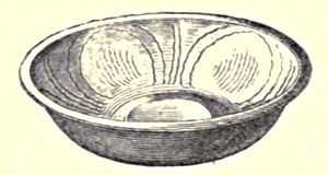
Fig. 55.—Saucer-shaped Vessel of Bronze from Cloonfinlough. About one-fifth real size.
Fig. 55.—Bronze Saucer-shaped Vessel from Cloonfinlough. About one-fifth actual size.
It is 7¾ inches in diameter, the rim pierced with two small holes as if for suspending it, and decorated externally with a number of indentations.[108] The crannog of Lisnacroghera furnished a vessel of fairly graceful form, composed of extremely thin bronze; but it is unprovided with either handles or holes for suspension.
It has a diameter of 7¾ inches, and the rim has two small holes, likely for hanging it up, while the outside is adorned with several indentations.[108] The crannog of Lisnacroghera provided a vessel that has a fairly elegant shape, made of very thin bronze; however, it doesn’t have any handles or holes for hanging.

Fig. 56.—Bronze Vessel from Lisnacroghera. Slightly over six inches in diameter.
Fig. 56.—Bronze Vessel from Lisnacroghera. Just over six inches in diameter.

Fig. 57.—Bronze Vessel and Iron Ladle from Lagore.
Fig. 57.—Bronze Vessel and Iron Ladle from Lagore.

Fig. 58.—Iron Vessel from Lagore. One-tenth the real size.
Fig. 58.—Iron Vessel from Lagore. One-tenth the actual size.
A bowl or vessel of bronze measuring 5¼ inches in diameter and three inches in height, together with an iron ladle, were amongst the numerous objects procured at Lagore,[109] also another vessel 9⅞ inches in diameter, formed of thin iron.
A bronze bowl or vessel that's 5¼ inches wide and 3 inches tall, along with an iron ladle, was among the many items obtained at Lagore,[109] as well as another vessel that measures 9⅞ inches in diameter and is made of thin iron.

Fig. 59.—Grain-rubber. About one-tenth the real size.
Fig. 59.—Grain-rubber. About one-tenth the actual size.
Querns, or hand-mills, both of ancient and modern type, either in a perfect state or else more or less broken, have been found in most crannogs.[Pg 86] “Grain-rubbers, for triturating corn, are, perhaps, the most primitive implements used in the manufacture of cereal food. Each consisted of a flag or flat stone slightly hollowed upon the upper surface, so as to hold the parched grain, and a convex rubber, or mullet, which was passed backwards and forwards with the hand, and thus bruised the corn into meal. Querns are evidently the next step in food-making machinery.… Although there are several varieties, the most simple and natural division of them is twofold. The first is that in which the upper and lower stone are simply circular discs from twelve to twenty inches across, the upper rotating upon the lower by means of a wooden handle, or sometimes two, inserted into the top, and fed or supplied with corn by an aperture in the centre, analogous to the hopper, and which may be termed the ‘grain-hole’ or eye. In this quern the meal passed out between the margins of the stones. The upper stones are usually concave and the lower convex, so as to prevent their sliding off, and also to give a fall to the meal.” The second variety is usually styled a pot-quern, and has a lip or margin in the lower stone, which encircles or overlaps the upper, the meal passing down through a hole in the side of the former. Most of this variety are of smaller size than the foregoing, which is evidently the more ancient and simple form, as well as that which presents us with the greatest diversity. The upper stone in the pot-quern was turned, as in the first-named kind, either by one or sometimes by two wooden handles. This kind of quern was denominated “bró.” The word, used in the signification “to grind,” occurs in Proverbs, chap. xxvii., v. 22: “Though thou shouldest bray a fool in a mortar among wheat with a pestle, yet will not his foolishness depart from him.”
Querns, or hand mills, both ancient and modern, whether in perfect condition or somewhat damaged, have been found in most crannogs.[Pg 86] “Grain rubbers, used for grinding corn, are probably the most basic tools for making cereal food. Each consisted of a flat stone with a slight depression on top to hold the roasted grain and a rounded tool, or rubber, which was moved back and forth by hand to crush the corn into meal. Querns clearly represent the next advancement in food-making tools.… While there are several types, the simplest way to categorize them is in two groups. The first group includes querns where the upper and lower stones are just circular discs ranging from twelve to twenty inches wide, with the upper stone rotating on the lower one using a wooden handle, or sometimes two, inserted into the top. Corn is added through a center opening, similar to a hopper, known as the 'grain hole' or eye. In this type of quern, the meal comes out between the edges of the stones. The upper stones are usually concave, and the lower ones convex, to prevent slipping and allow the meal to fall correctly.” The second type is called a pot quern, which has a lip around the lower stone that overlaps the upper stone, allowing the meal to pass through a hole on the side of the lower stone. Most of this type is smaller than the former, which is clearly the more ancient and basic design, as well as the one with the most variety. The upper stone in the pot quern was rotated, like in the first type, by either one or sometimes two wooden handles. This style of quern was called “bró.” The term, meaning “to grind,” appears in Proverbs, chapter 27, verse 22: “Though you grind a fool in a mortar among wheat with a pestle, his foolishness will not depart from him.”

Fig. 60.—Section of ordinary Quern. About one-fourteenth the usual size.
Fig. 60.—Section of a typical Quern. About one-fourteenth the normal size.
A gentleman in Ireland, who at the commencement of the present century saw a quern at work, describes it as having the upper stone (fig. 60, A) about twenty-two inches in diameter, its under surface considerably concaved; the lower stone (B) was convexed, so that an easy descent was afforded for the meal (E) when ground. In the centre of the upper stone was a circular hole nearly three inches in diameter, and through it the quern was “fed,” as it is called, i. e. supplied with fresh corn (EEE) as fast as the bran and flour fell from the sides of the machine. Within about two inches of the edge was set an upright wooden handle (D) for moving the upper stone, which rested in equilibrio on a strong peg or pivot (C) in the centre of the lower stone. There were generally two women employed in the operation. They sat on the ground facing each other, the quern between. One of them with her right hand pushed the handle to the woman opposite, who again sent it to her companion, and in this manner a rapid rotatory motion was communicated to the upper stone, whilst the left hand of the operator was engaged in the “feeding” process. The corn, previously dried over a slow fire, when arrived at a certain degree of crispness, was taken up to be ground. This[Pg 87] preparation prevented the raw taste perceptible in meal from modern mills. Little cookery was required. The ordinary way of using it was to mix the meal in its raw state with milk, to the consistency of thick porridge, and it was then eaten without any other accompaniment, the simple mixture being called “a crowdie.” A quern is evidently the primitive kind of mill referred to in the Scriptures, where it is said “two women shall be grinding at the mill:” and Shakspeare makes Puck to “sometimes labour in the quern.”
A man in Ireland, who at the start of this century saw a quern in operation, describes it as having the upper stone (fig. 60, A) about twenty-two inches wide, with its under surface significantly concaved. The lower stone (B) was convex, allowing the ground meal (E) to easily flow down. In the center of the upper stone was a circular hole nearly three inches in diameter, and through it, the quern was “fed,” meaning it received fresh corn (EEE) as quickly as the bran and flour fell from the sides of the machine. About two inches from the edge, there was an upright wooden handle (D) used to move the upper stone, which balanced on a strong peg or pivot (C) in the middle of the lower stone. Typically, two women operated it. They sat on the ground facing each other with the quern between them. One of them pushed the handle with her right hand to the woman opposite, who then sent it back to her partner. This way, a quick rotary motion was created in the upper stone while the operator's left hand was busy “feeding” the quern. The corn, previously dried over a low fire until it reached a certain crispness, was taken to be ground. This preparation eliminated the raw taste found in meal from modern mills. Minimal cooking was needed. The usual way to use it was to mix the raw meal with milk until it turned into a thick porridge, which was then eaten on its own, the simple mixture referred to as “a crowdie.” A quern is clearly the primitive type of mill mentioned in the Scriptures, where it says “two women shall be grinding at the mill,” and Shakespeare mentions Puck “sometimes laboring in the quern.”

Fig. 61.—Upper surface of Quern from the Crannog of Drumsloe. About one-ninth the real size.
Fig. 61.—Top view of the quern from the Crannog of Drumsloe. Approximately one-ninth of actual size.
In the centre of the crannog of Drumgay, county Fermanagh, there was a large block of stone punctured with a cross, and another resembling it was discovered many feet deep, in the centre of the pagan carn of “The Miracles,” in the same district. Similar figures are inscribed or punched upon rocks and upon the sides of natural, or partly artificial caves, as at Loch na Cloyduff, The Lake of the Dark Trench or Diggings, and the “Lettered Cave,” in the cliffs of Knockmore, “Great Knoll,” county Fermanagh. Within the precincts of well-authenticated pagan tumuli, as at Dowth, cross patterns have been found, accompanied in several instances by “scorings,” at present unintelligible. On the base of a sepulchral urn, preserved in the Museum of the Royal Irish Academy, the cross is displayed, and the figure of a cross within a circle occurs on an urn discovered at Broughderg, county Tyrone. Mr. Albert Wray has described some spoon-shaped objects of antique bronze, all decorated with the figure of a cross similar in design to the symbol as observable upon the earliest Irish quern-stones. The bronze articles in question exhibit a style of workmanship which has invariably been associated with pre-Christian times in both Britain and Ireland; whilst in the latter country discs and thin plates of gold belonging to the same period have been found presenting a cross-like ornamentation. At Drumgay, at Lough Eyes, at Roughan, and at Drumsloe, the Ridge of the Host, were cross-inscribed querns. Drumsloe lake, now almost drained, is situated within a short distance of Ballinamallard[Pg 88] county Fermanagh. Interesting objects, now dispersed or lost, have been there from time to time turned up on the site of a crannog, the traces of which are now nearly obliterated, and the curious quern or bró, of which the accompanying cut is a facsimile, is one of the few remaining relics authentically connected with the locality. The quernstone measures one foot six inches in diameter.[110]
In the center of the crannog at Drumgay, County Fermanagh, there was a large stone block marked with a cross, and another similar one was found many feet deep in the center of the pagan carn known as "The Miracles" in the same area. Similar symbols are carved or drilled into rocks and on the walls of natural or partly artificial caves, like at Loch na Cloyduff, The Lake of the Dark Trench or Diggings, and the “Lettered Cave” in the cliffs of Knockmore, “Great Knoll,” County Fermanagh. Within the boundaries of well-documented pagan burial mounds, like at Dowth, cross patterns have been discovered, often accompanied by “scorings” that are currently unreadable. A cross is shown on the base of a burial urn kept in the Museum of the Royal Irish Academy, and a cross within a circle appears on an urn found at Broughderg, County Tyrone. Mr. Albert Wray has described some spoon-shaped antique bronze objects, all decorated with a cross design similar to the symbols found on the earliest Irish quern-stones. The bronze items in question feature a style of craftsmanship that has always been linked to pre-Christian times in both Britain and Ireland; meanwhile, in Ireland, gold discs and thin plates from the same era have been found with cross-like designs. At Drumgay, Lough Eyes, Roughan, and Drumsloe, the Ridge of the Host, querns with cross inscriptions were discovered. Drumsloe Lake, which is now almost drained, is located not far from Ballinamallard[Pg 88] County Fermanagh. Notable artifacts, now scattered or missing, have occasionally surfaced at the site of a crannog, where the remnants are now nearly gone, and the unique quern or bró, which is seen in the accompanying image, is one of the few remaining artifacts authentically linked to the area. The quernstone measures one foot six inches in diameter.[110]

Fig. 62.—Upper surface of Quernstone from Roughan Lake. One-eighth the real size.
Fig. 62.—Top surface of Quernstone from Roughan Lake. One-eighth of the actual size.
Fig. 63.—Quernstone from Lough Eyes. About one-tenth the real size.
Fig. 63.—Quernstone from Lough Eyes. About one-tenth the actual size.
About the year 1839, upon lowering the level of the water for drainage purposes in Roughan lake, near Dungannon, county Tyrone, an island artificially formed was exposed to view. On it were numerous fragments of pottery and bones, a bronze pin, a few bronze spear-heads, together with a quern. The illustration (fig. 62) represents the top stone, which is eighteen inches in diameter, and two and a-half inches thick; it is formed of sandstone, the ornamentation being in high relief. The hole or socket for reception of the handle is in one of the arms of the cross, and goes quite through the stone.[111] Portions of a highly decorated quernstone, restored in the accompanying illustration (fig. 63), were found in one of the crannogs in Lough Eyes.[Pg 89] On “Bone Island,” in the lake of Drumgay, several fragments of quern-stones were collected. Two of those obtained were inscribed with a cross-like ornamentation, one of them presenting a most unusual style of crannog geometrical decoration.
Around 1839, when the water level was lowered for drainage in Roughan Lake near Dungannon, County Tyrone, an artificially created island was revealed. On it, there were numerous pieces of pottery and bones, a bronze pin, a few bronze spearheads, and a quern. The illustration (fig. 62) shows the top stone, which is eighteen inches in diameter and two and a half inches thick; it is made of sandstone, with the decoration in high relief. The hole for the handle is located in one of the cross's arms and extends all the way through the stone.[111] Parts of a highly decorated quernstone, which is shown in the accompanying illustration (fig. 63), were found in one of the crannogs in Lough Eyes.[Pg 89] On "Bone Island" in the lake of Drumgay, several fragments of quernstones were collected. Two of these had a cross-like design, and one displayed a very unusual style of geometric decoration from the crannog.

Fig. 64.—Quernstones with Cross and Geometrical Decoration. About one-twelfth the real size.
Fig. 64.—Quernstones with Cross and Geometric Decoration. About one-twelfth the actual size.
On pottery at Ballydoolough, a cross pattern was observable, as
also on a comparatively modern iron article at Cloonfinlough, and
there was in a crannog in Argyleshire a Greek cross, with crosslets
as a pattern, or ornamentation, burnt into a piece of oak.[112] The
“Croix gammée,” or Swastika, occurs on sculptured stones in Scotland,
and appears on a mosaic pavement in the recently discovered
Roman villa in the Isle of Wight. In Keller’s Lake Dwellings
of Switzerland,[113] a cross within a circle is represented: it was
found at Auvernier, and had seemingly been an article of personal
adornment. Layard, in his work entitled Nineveh and Babylon,
states that he found what is now called the Maltese and Irish
cross in such connexion as led him to identify it with the sun.
In these ancient sculptures the cross was often inserted within a
circle, which, having neither beginning nor end, was considered
to be the emblem of eternity, and may be so observed in Assyrian
sculptures. Dr. Schliemann, in his Troja (p. 167), gives a representation
of a curious copper or bronze ring, about the size of an
ordinary napkin ring, but very heavy. It has five compartments,
each ornamented with a cross marked by openings cut in the metal.
Amongst the whorls found[Pg 90]
by Dr. Schliemann, numbers
are ornamented with  and
and  . The same sign is
found in Pompeii, and amongst
the ancient heathen population
of Yucatan and Paraguay.
“Later still, it was even adopted
by the Christians as a
suitable variety of their own
cross, and became variously
modified geometrically.” In
No. 1 crannog, in the lake of
Drumgay, there was a very
peculiar cross-sculptured stone,
two feet in length by three
inches in thickness. It is
seemingly of no great antiquity,
and was most probably
intended for a tombstone to
be placed in the neighbouring cemetery of Devenish.
. The same sign is
found in Pompeii, and amongst
the ancient heathen population
of Yucatan and Paraguay.
“Later still, it was even adopted
by the Christians as a
suitable variety of their own
cross, and became variously
modified geometrically.” In
No. 1 crannog, in the lake of
Drumgay, there was a very
peculiar cross-sculptured stone,
two feet in length by three
inches in thickness. It is
seemingly of no great antiquity,
and was most probably
intended for a tombstone to
be placed in the neighbouring cemetery of Devenish.
On the pottery found at Ballydoolough, a cross pattern was visible, as well as on a relatively modern iron piece at Cloonfinlough. In a crannog in Argyleshire, there was a Greek cross with smaller crosses as a design, burned into a piece of oak.[112] The “Croix gammée,” or Swastika, can be seen on carved stones in Scotland and appears on a mosaic floor in the recently discovered Roman villa on the Isle of Wight. In Keller’s Lake Dwellings of Switzerland,[113] a cross inside a circle is shown: it was found in Auvernier and seems to have been a piece of jewelry. Layard, in his book Nineveh and Babylon, mentions that he discovered what is now known as the Maltese and Irish cross in a context that led him to connect it with the sun. In these ancient carvings, the cross was often placed within a circle, which, having no beginning or end, was seen as a symbol of eternity—something that can also be observed in Assyrian sculptures. Dr. Schliemann, in his Troja (p. 167), depicts an interesting copper or bronze ring, about the size of a regular napkin ring but quite heavy. It has five sections, each decorated with a cross made by openings cut into the metal. Among the whorls collected[Pg 90] by Dr. Schliemann, several are decorated with and

Fig. 65.
Fig. 65.
Sculptured Stone from No. 1 Crannog, Lake of Drumgay. About one-eighth the real size.
Sculptured Stone from No. 1 Crannog, Lake of Drumgay. About one-eighth the actual size.
Human Remains.—There have been, as yet, few instances of the discovery of human bones in crannogs. At Dunshaughlin, in Meath, at Ardakillen and Cloonfinlough, in Roscommon, the people appear to have met with a violent end, and there is no reason to believe that the remains are very ancient. The lake dwellers of Switzerland had cemeteries on the mainland, directly opposite their habitations, and it is probable that the Irish disposed of their dead in the same manner, but up to the present this subject has not been investigated.
Human Remains.—So far, there have been few cases of human bones being found in crannogs. At Dunshaughlin in Meath, and at Ardakillen and Cloonfinlough in Roscommon, it seems that people met a violent end, and there’s no reason to think the remains are very old. The lake dwellers of Switzerland had cemeteries on the mainland, right across from their homes, and it's likely that the Irish handled their dead in a similar way, but this topic hasn’t been explored yet.
Fireplaces on the Shore.—Numerous fireplaces on the shore adjoining crannogs were discovered at Drumkeery lough, and at Lough Eyes. In the immediate vicinity of the latter were traces of gins or traps for catching game. In the neighbouring bogs labourers have, at various times and in different localities, met with stakes planted in the original surface soil, in a vertical position, and sharpened to a point, seemingly by a clean-cutting metallic tool. Since fixed in their original position the peat had grown so much that it is now, on an average, about five feet above the pointed ends. It has been often surmised that stakes planted[Pg 91] thus were in some way connected with the trapping of deer and other wild animals.[114]
Fireplaces on the Shore.—Many fireplaces along the shore next to crannogs were found at Drumkeery Lough and Lough Eyes. Close to the latter, there were signs of gins or traps used for catching game. In the nearby bogs, workers have, at different times and locations, uncovered stakes that were planted upright in the original soil, pointed at the end, and seemingly made with a sharp metal tool. Since then, the peat has grown so much that it is now about five feet above these pointed ends. It has often been speculated that these stakes were somehow related to trapping deer and other wild animals.[Pg 91]
Pottery.—Dr. Schliemann rightly designates fragments of pottery as the cornucopia of archæological science; it is always abundant, and it possesses two qualities—those, namely, of being easy to break, and yet difficult to destroy, which render it very valuable in an archæological point of view. Investigation has shown that the inhabitants of crannogs had in use a description of fictile ware, distinctly characteristic in style, graceful in form, and well manufactured, admitted by English archæologists to be superior to that possessed by the Britons or early Saxons. It is known that the primitive people of Ireland possessed the art of constructing excellent fictile ware for mortuary purposes of fire-hardened clay; they could therefore manufacture every-day culinary vessels of the same material. An immense quantity of pottery has been found in connexion with many crannogs, by which means facilities are afforded for comparing ordinary domestic vessels with the urns and vases of an undoubtedly prehistoric and pagan period. The great majority of specimens of crannog pottery present designs marked upon them, similar in style to the ornamentation observable on the walls of sepulchral cairns and the vessels deposited in them, on golden or bronze ornaments, on implements, and on the surface of rocks, all of which are usually acknowledged to date from prehistoric times.[115] Mr. Rau states that the fictile vessels discovered by him amongst the debris of Indian relics on the left bank of the Cahokia Creek, on the Mississippi, opposite St. Louis, resemble the ancient Irish fictilia, “more especially those found in crannogs and kitchen middens.” One fragment showed punctured and impressed ornamentation of the class so usual on Celtic urns. Mr. Graves observes that the arts of primeval peoples may be illustrated by comparison with those that prevail under similar conditions of civilization existing in or near our own times. Thus in India cromleac builders raise their megalithic monuments on hills. In the Hebrides, cloghans, i. e. mortarless stone-built and roofed habitations, similar to those strewn over the western littoral of Connaught, and also lake dwellings in various parts of the world, are even still occupied.
Pottery.—Dr. Schliemann accurately refers to pieces of pottery as the treasure trove of archaeological science; it is always plentiful and has two characteristics—being easy to break yet hard to completely destroy—that make it very valuable from an archaeological perspective. Research has revealed that the people living in crannogs used a type of pottery that is distinctly styled, elegantly shaped, and well made, which English archaeologists agree is superior to what the Britons or early Saxons had. It’s known that the ancient people of Ireland mastered the art of creating high-quality pottery from fire-hardened clay for burial purposes, which means they could also make everyday cooking vessels from the same material. A vast amount of pottery has been discovered alongside many crannogs, allowing for comparisons between ordinary household items and urns and vases from what is clearly a prehistoric and pagan era. Most examples of crannog pottery feature designs that are similar in style to the decorations found on the walls of burial cairns and the vessels within them, on gold or bronze ornaments, on tools, and on rock surfaces, all of which are generally recognized as dating back to prehistoric times.[115] Mr. Rau notes that the pottery he found among the debris of Native American relics on the left bank of Cahokia Creek, near the Mississippi River opposite St. Louis, resembles the ancient Irish pottery, “especially those found in crannogs and kitchen middens.” One fragment displayed punctured and impressed designs typical of Celtic urns. Mr. Graves points out that the artistic practices of ancient peoples can be understood by comparing them to those that exist under similar conditions of civilization in our current times. For example, in India, builders of cromlechs construct their megalithic monuments on hills. In the Hebrides, cloghans, which are mortarless stone-built and roofed dwellings, similar to those found throughout the western coast of Connaught, and lake dwellings in various parts of the world, are still in use today.

Fig. 66.—Pitcher from Lough Faughan. About one-seventh the real size.
Fig. 66.—Pitcher from Lough Faughan. About one-seventh the actual size.
From the crannog of Lough Faughan, Co. Down, was procured the pitcher No. 9, Museum of the Royal Irish Academy; also another pitcher, 13 inches in height, and 32 in girth, of a description of pottery so light as only to weigh 5 lbs. 10 oz. It figures as No. 10 in the collection of food implements. Externally it is dark in colour, and being partially glazed, is, therefore, not of very ancient date: it is so rounded at the bottom that it cannot stand upright: about the neck, and for some distance down the sides, it is tastefully decorated, and the handle is peculiar in form.[116]
From the crannog of Lough Faughan, Co. Down, a pitcher (No. 9) was obtained for the Museum of the Royal Irish Academy. Additionally, there's another pitcher that stands 13 inches tall and has a girth of 32 inches, made from a type of pottery that's so lightweight it only weighs 5 lbs. 10 oz. This one is listed as No. 10 in the collection of food implements. Its exterior is dark in color and it is partially glazed, indicating it's not very old. The bottom is so rounded that it can't stand up on its own. The neck and a portion of the sides are tastefully decorated, and the handle has a unique shape.[116]

Fig. 67.—Fictile Vessel from Ballydoolough, restored.
Fig. 67.—Restored Pottery Vessel from Ballydoolough.
The accompanying engraving (fig. 67), a good specimen of another class of fictile ware, represents, in a restored form, one of the finest of the crocks found at Ballydoolough. In colour it is light-yellowish red; it measures three feet two inches round the mouth, and is tastefully ornamented on the rim and sides. This decoration had been evidently impressed upon the soft clay before the vessel was burnt, and the pattern conveys the idea of such antiquity that, if found in a tumulus, it would be referred to[Pg 93] a prehistoric age.
The accompanying engraving (fig. 67), a good example of another type of pottery, shows, in a restored form, one of the finest crocks discovered at Ballydoolough. It's a light yellowish-red color, measuring three feet two inches around the mouth, and is beautifully decorated on the rim and sides. This decoration was clearly stamped into the soft clay before the vessel was fired, and the design suggests such ancient origins that, if it were found in a burial mound, it would be dated to[Pg 93] a prehistoric era.

Fig. 68.—Fictile Vessel, Drumgay Crannog, restored. Quarter size.
Fig. 68.—Clay Vessel, Drumgay Crannog, restored. Quarter size.
A large fragment of fictile ware was discovered on one of the crannogs in the lake of Drumgay; it was of size sufficient to enable a restored representation (fig. 68) to be made of a vessel that had been in use by the former inhabitants of the crannog for culinary purposes.
A large piece of pottery was found on one of the crannogs in Drumgay Lake; it was big enough to create a reconstructed version (fig. 68) of a vessel that the previous inhabitants of the crannog used for cooking.

Fig. 69.—Restored Vessel from Lough Eyes. One-fourth the real size.
Fig. 69.—Restored Vessel from Lough Eyes. One-fourth the actual size.
The following illustrations (figs. 69 and 70) represent two of the vessels found in the crannog in Lough Eyes, county Fermanagh,[Pg 94] carefully restored from fragments discovered on the sites. With the remains of these vessels were numerous flat discs formed of the same kind of clay, and that would seem to have been their covers or lids.
The following illustrations (figs. 69 and 70) show two of the vessels found in the crannog in Lough Eyes, County Fermanagh,[Pg 94] which were carefully restored from fragments uncovered at the site. Along with these vessels, there were many flat discs made of the same type of clay, which likely served as their covers or lids.

Fig. 70.—Restored Vessel from Lough Eyes. One-fifth the real size.
Fig. 70.—Restored Vessel from Lough Eyes. One-fifth the actual size.

Fig. 71.—Baked Clay Pot Cover from Lough Eyes. One-fourth the real size.
Fig. 71.—Baked Clay Pot Cover from Lough Eyes. One-fourth the actual size.
For the escape of steam during the process of boiling, a simple provision is observable in several of these earthen pots. In the neck of the vessel, just below the point where the lid would be supported, is a small circular hole (see figs. 72 and 73). The aperture occurs in numerous fragments, but it is not now possible to determine whether this class of vessel, when entire, was in[Pg 95]variably perforated.[117]
For the release of steam during the boiling process, a simple feature can be seen in several of these earthen pots. There's a small circular hole in the neck of the vessel, just below where the lid would sit (see figs. 72 and 73). This opening can be found in many fragments, but it's unclear whether this type of vessel was always made with a hole when complete.[Pg 95][117]

Fig. 72.—Portion of a Perforated Vessel from Lough Eyes. One-half the real size.
Fig. 72.—Part of a Perforated Vessel from Lough Eyes. Half the actual size.

Fig. 73.—Portion of a Perforated Vessel from Lough Eyes. One-third the real size.
Fig. 73.—Part of a Perforated Vessel from Lough Eyes. One-third the actual size.

Fig. 74.—Portion of Fictile Vessel found on Ballydoolough Crannog. One-half the real size.
Fig. 74.—Part of a clay pot found at Ballydoolough Crannog. Half the actual size.
About 140 fragments of earthen vessels were discovered in the Ballydoolough crannog—none, however, in an entire state; but several pieces of the same article being found to fit together, a restoration giving a correct idea of the perfect vessel was easily attained. Fig. 67 (see ante, page 92), has been thus reconstructed. The next engraving (fig. 74) represents a fragment of what must have been a very large vessel, ornamented on the side with a[Pg 96] chevron, and on the rim with an oblique pattern; it is composed of very hard-baked clay, dark in colour.
About 140 pieces of clay pots were found in the Ballydoolough crannog—none of them complete; however, since several fragments of the same item were discovered that fit together, a reconstruction provided a clear idea of what the complete vessel looked like. Fig. 67 (see ante, page 92), has been successfully rebuilt. The next image (fig. 74) shows a piece of what must have been a very large vessel, decorated on the side with a chevron and an angled pattern on the rim; it is made of very hard-baked clay and is dark in color.

Fig. 75.—Portion of Fictile Vessel found on Ballydoolough Crannog. One-half the real size.
Fig. 75.—Part of a ceramic vessel discovered at Ballydoolough Crannog. Half the actual size.

A third fragment (fig. 75) partakes of the character of the last described. The decoration is more elaborate and the punctured design or chevron slightly different. Many of the indentations are of semicircular form, and not angular or semiangular, as in most of the other crocks. The material is very hard, like fig. 74, and of a dark colour. Fig. 76 is portion of a large, straight-lipped vessel, that measured originally over three feet in circumference round the rim; it is unornamented, and formed of hard, well-baked, darkish-coloured clay.
A third fragment (fig. 75) is similar to the last one described. The decoration is more intricate, and the punctured design or chevron is slightly different. Many of the indentations are semicircular instead of angular or semi-angular, like in most of the other pieces. The material is very hard, like fig. 74, and has a dark color. Fig. 76 is part of a large, straight-lipped vessel that originally measured over three feet in circumference around the rim; it has no decorations and is made of hard, well-baked, dark-colored clay.

Fig. 77 is the only pattern of its kind found at Ballydoolough. It is drawn half-size. Whether this specimen and fig. 76 were originally furnished with ears it is now impossible to say. Figs. 78 and 79, drawn one-half the real size, represent portions of vessels. The larger fragment bears upon its ear, or handle, two figures somewhat like a St. Andrew’s cross; on the smaller there is only one.
Fig. 77 is the only pattern of its kind found at Ballydoolough. It's drawn at half-size. Whether this specimen and fig. 76 originally had ears is impossible to determine now. Figs. 78 and 79, drawn at half the actual size, show parts of vessels. The larger fragment has two figures on its ear, or handle, that look somewhat like a St. Andrew’s cross; the smaller one only has one.

Fig. 78. Cross inscribed Pottery.
Fig. 78. Cross-inscribed pottery.
Fig. 79. Cross inscribed Pottery.
Fig. 79. Cross-inscribed pottery.
Fig. 80, drawn half-size, exhibits a bold but rude chevron pattern.
Fig. 80, drawn at half the size, shows a striking but harsh chevron pattern.

Fig. 80.—Portion of Fictile Vessel found at Ballydoolough Crannog.
Fig. 80.—Part of a pottery vessel found at Ballydoolough Crannog.
There were thirty-five distinct patterns on the various fragments unearthed, yet the locality was not thoroughly explored. Specimens of the pottery from Ballydoolough were forwarded to Mr. Albert Wray, a well-known authority on such subjects, and he would not refer them to a very early age, or to that in which the use of bronze was prevalent. The mode of ornamentation appeared to present a slight resemblance to the “Cuerdale Hoard,” which is sometimes ascribed to the ninth century. W. F. Wakeman, however, is of opinion that amongst the numerous designs found upon the crannog vessels there is none suggestive [Pg 98]of the work of Christian times in Ireland, unless the cross-marked fragments be considered as such, chevrons and circular depressions being all expressive of Pagan ideas of ornamental art.
There were thirty-five different patterns on the various fragments that were dug up, but the area wasn't fully explored. Samples of the pottery from Ballydoolough were sent to Mr. Albert Wray, a well-known expert in this field, and he didn't think they dated back to a very early period or to the time when bronze was common. The way the pottery was decorated seemed to have a slight resemblance to the “Cuerdale Hoard,” which is sometimes dated to the ninth century. W. F. Wakeman, however, believes that among the many designs found on the crannog vessels, none indicate the influence of Christian times in Ireland, unless the fragments marked with crosses are considered as such, as the chevrons and circular depressions reflect Pagan ideas of decorative art.
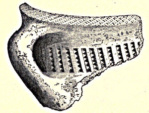
Fig. 81.—Portion of Fictile Vessel, with Ear, Drumgay Crannog. One-half size.
Fig. 81.—Part of a Pottery Vessel, with Ear, Drumgay Crannog. Half size.
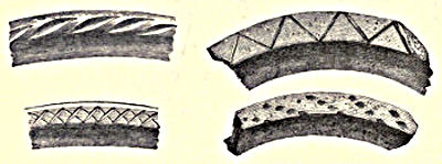
Fig. 82.—Rim Ornaments of Fictile Vessels, Drumgay Crannog. One-half size.
Fig. 82.—Rim Ornaments of Clay Vessels, Drumgay Crannog. Half size.
On “Bone Island,” in the lake of Drumgay, were several fragments of earthen vessels. The one represented in the annexed cut, drawn half size, is a portion of what had been a large and well-formed vessel with ears. The top of the rim is ornamented with a pattern. The diameter of the vessel at the mouth is about eleven inches; the neck is short, and the sides are decorated with indented lines about an inch in length, placed diagonally. There were also several fragments of fictile ware consisting of unimportant portions of rims decorated as shown in the accompanying representations. One pattern is a simple chevron. The accompanying illustrations[Pg 99] represent characteristic examples of the pottery found in abundance on No. 3 crannog in Lough Eyes, county Fermanagh (plate XVIII., figs. 83 to 88).
On “Bone Island,” in the lake of Drumgay, there were several pieces of clay pots. The one shown in the attached image, drawn to half size, is a part of what used to be a large and well-made pot with handles. The top edge has a decorative pattern. The diameter of the pot at the opening is about eleven inches; the neck is short, and the sides have designs with indented lines about an inch long, arranged diagonally. There were also several pieces of pottery that included unimportant parts of rims decorated as illustrated in the accompanying images. One pattern is a simple chevron. The accompanying illustrations[Pg 99] show typical examples of the pottery found in abundance on No. 3 crannog in Lough Eyes, county Fermanagh (plate XVIII., figs. 83 to 88).

Plate XVIII.
Plate 18.
Fig. 83.—Fragment of Fictile Vessel from Lough Eyes.
Fig. 83.—Piece of Clay Pot from Lough Eyes.
Fig. 84.—Fragment of Fictile Vessel from Lough Eyes. One-half size.
Fig. 84.—Piece of a Clay Pot from Lough Eyes. Half size.
Fig. 85.—Fragment of Fictile Vessel from Lough Eyes. One-half size.
Fig. 85.—Piece of Clay Pot from Lough Eyes. Half the size.
Fig. 86.—Ear of Vessel from Lough Eyes. One-half size.
Fig. 86.—Ear of Vessel from Lough Eyes. One-half size.
Fig. 87.—Fragment of Vessel from Lough Eyes. One-third size.
Fig. 87.—Piece of a Container from Lough Eyes. One-third size.
Fig. 88.—Lip of Vessel from Lough Eyes. One-half size.
Fig. 88.—Lip of Vessel from Lough Eyes. Half the original size.
Fragments of Pottery, from No. 3 Crannog, Lough Eyes.
Fragments of pottery from No. 3 Crannog, Lough Eyes.
(Discovered by W. F. Wakeman.)
(Found by W. F. Wakeman.)
Numerous fragments of fictile ware, of which five rims are given as specimens, were in No. 5 crannog, in the same locality (plate XIX., figs. 90, 91, 92, 95, 96); and fragments were found in No. 6 crannog, of which four examples are given (plate XIX., figs. 89, 93, 94, 97).
Numerous pieces of pottery, with five rims shown as examples, were found in No. 5 crannog, in the same location (plate XIX., figs. 90, 91, 92, 95, 96); and pieces were also discovered in No. 6 crannog, with four examples provided (plate XIX., figs. 89, 93, 94, 97).

Plate XIX.
Plate 19.
Fig. 89.—Fragment of Vessel from Lough Eyes. One-half size.
Fig. 89.—Fragment of Vessel from Lough Eyes. Half size.
Fig. 90.—Rim of Vessel from Lough Eyes. One-half size.
Fig. 90.—Rim of Vessel from Lough Eyes. Half size.
Fig. 91.—Rim of Vessel from Lough Eyes. One-half size.
Fig. 91.—Rim of Vessel from Lough Eyes. One-half size.
Fig. 92.—Rim of Vessel from Lough Eyes. One-half size.
Fig. 92.—Rim of Vessel from Lough Eyes. Half size.
Fig. 93.—Fragment of Vessel from Lough Eyes. One-half size.
Fig. 93.—Fragment of Vessel from Lough Eyes. Half size.
Fig. 94.—Fragment of base of Vessel from Lough Eyes. One-half size.
Fig. 94.—Fragment of the base of a vessel from Lough Eyes. Half their original size.
Fig. 95.—Rim of Vessel from Lough Eyes. One-half size.
Fig. 95.—Rim of Vessel from Lough Eyes. Half size.
Fig. 96.—Rim of Vessel from Lough Eyes. One-half size.
Fig. 96.—Rim of Vessel from Lough Eyes. One-half size.
Fig. 97.—Fragment of Vessel from Lough Eyes.
Fig. 97.—Piece of Vessel from Lough Eyes.
Fragments of Pottery, from No. 5 and No. 6 Crannogs, Lough Eyes.
Fragments of pottery from the No. 5 and No. 6 crannogs at Lough Eyes.
(Discovered by W. F. Wakeman.)
(Found by W. F. Wakeman.)

Fig. 98.—Fragment of Fictile Ware, Lough Eyes. One-half size.
Fig. 98.—Piece of Pottery, Lough Eyes. Half size.
Fig. 99.—Fragment of Fictile Ware, Lough Eyes. One-half size.
Fig. 99.—Piece of Clay Pottery, Lough Eyes. Half size.
Figs. 98 and 99 represent fragments of fictile ware also from Lough Eyes. Fig. 98 has evidently been a deep-lipped vessel, and its “herring-bone” ornamentation is almost identical with the pattern that prevails most upon burial urns, and closely resembles that figured upon the vessel found in “One Man’s Cairn,” at Moytirra, county Mayo, as represented in Wilde’s Lough Corrib, p. 235: the same style of decoration is a characteristic of early bronze celts and other remains of the prehistoric period. Fig. 99 presents the same style of ornamentation. It was apparently an eared vessel, of reddish-drab colour.
Figs. 98 and 99 show pieces of pottery also from Lough Eyes. Fig. 98 seems to have been a deep-lipped container, and its "herring-bone" design is almost identical to the pattern most commonly found on burial urns. It closely resembles the design on the vessel discovered in “One Man’s Cairn” at Moytirra, county Mayo, as shown in Wilde’s Lough Corrib, p. 235: the same style of decoration is typical of early bronze celts and other artifacts from the prehistoric era. Fig. 99 features the same decoration style. It was likely an eared vessel with a reddish-drab color.

Fig. 100 has evidently formed portion of what was a well-finished vessel. So far as at present known, its style of ornamentation is extremely rare, being identical with that seen upon[Pg 100] portion of a decorated leathern shoe found in the crannog of Dowalton loch, Wigtonshire, and of which a representation is given at p. 49 of Munro’s Ancient Scottish Lake Dwellings. The fragments of vessels found in Lough Eyes were all hand-made, and well burnt, whilst the action of the fire would seem to have been greater on the interior than on the exterior. The material used was the sandy clay of the district, or perhaps the grit may have been added in order to give greater consistency to the paste. In most of the specimens there are distinct traces of this sand, and in the ruder examples particles of white stone of the size of very small peas project from the surface. The colour varies from light drab to a very dark brown, almost black, whilst some few are of a reddish hue—but all are unglazed. Many fragments of pottery have from time to time been disinterred from the site of the crannogs in the lake of Drumskimly, county Fermanagh: one of them is figured in the Journal Royal Hist. and Arch. Asso. of Ireland,[118] in connexion with a vase evidently of Pagan origin, from the “Bar” of Fintona, near Trillick, county Tyrone.
Fig. 100 is clearly part of what was a well-crafted vessel. So far, its ornamental style is extremely rare, identical to that seen on[Pg 100] a decorated leather shoe found in the crannog of Dowalton loch, Wigtonshire, which is illustrated on p. 49 of Munro’s Ancient Scottish Lake Dwellings. The fragments of vessels discovered in Lough Eyes were all handmade and well-fired, with evidence suggesting that the fire had a greater impact on the inside than the outside. The material used was the sandy clay from the area, possibly with added grit to enhance the consistency of the paste. Most specimens show distinct traces of this sand, and in the rougher examples, bits of white stone the size of small peas stick out from the surface. The color ranges from light drab to very dark brown, almost black, while a few have a reddish tint—but all are unglazed. Numerous pottery fragments have been unearthed from the site of the crannogs in the lake of Drumskimly, county Fermanagh: one of them is illustrated in the Journal Royal Hist. and Arch. Asso. of Ireland,[118] along with a vase clearly of Pagan origin, from the "Bar" of Fintona, near Trillick, county Tyrone.

Fig. 101.—Stamped pattern on fragment of Fictile Ware from Drumskimly.
Fig. 101.—Stamped pattern on a piece of pottery from Drumskimly.
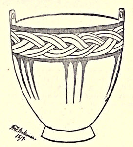
Fig. 102.—Carved Wooden Vessel found at Cavancarragh.
Fig. 102.—Carved Wooden Container discovered at Cavancarragh.

Fig. 103.—Wooden Vessel from Ballydoolough Crannog.
Fig. 103.—Wooden Vessel from Ballydoolough Crannog.
The term “Lestar” comprises vessels of various shapes, and of all kinds of material, although it is more generally applied to those made of wood—several have been found in crannogs. In a bog, occupying what in distant ages appears to have been the site of a small lake, on the lands of Cavancarragh, county Fermanagh, implements of flint, a fine bronze spear-head, and a beautifully-shaped wooden vessel, were discovered, all buried under peat. Now, according to the theory of some geologists, a peat formation of such depth as covered them would, accord[Pg 101]ing to circumstances, take from six hundred to one thousand years to accumulate, so that the articles found might be referred back to any period from the thirteenth to the ninth century; and at about this latter period, it is remarked, with regard to the ornamentation observable on the wooden vessel, that a similar style prevailed in the MSS. and on stone work of that era, still extant. The vessel was made of oak, the bottom alone being alder: when first exhumed it was entire, and had a cover; the original form seems to have been one of unusual beauty, and the height about fifteen inches. The lid, now unfortunately lost, is described as slightly convex, with a knob-like handle in the centre, the ornamental work on it similar to that of the vessel itself. On the dark shading round the rim, and between the interlacing ornamentation, both of vessel and lid, traces were apparent of some kind of pigment, or enamel, with which the surface of the wood had been overlaid. In the crannog of Ballydoolough, county Fermanagh, a vessel of wood was discovered in an entire state, but from long saturation redu[Pg 102]ced almost to a state of pulp. The engraving (about one-fifth the real size), gives a good idea of it. In process of drying, the vessel soon lost all shape, and became strangely twisted and distorted. On comparing this woodcut with a vase found in a small stone chamber at Knocknecoura, near Bagnalstown, county Carlow, and now in the Museum, R.I.A., a striking resemblance in form is observable; the latter vessel is, however, more ornamental. To find in a grave an urn of almost exactly the same shape as a vessel undoubtedly used to hold food, suggests the idea that the so-called sepulchral urns in cairns and graves need not be viewed as necessarily intended to hold human ashes, or the cremated bones of sacrifices. Might not the object of their position have been to supply the warrior with food on his way to the Happy Hunting Grounds of Tirnanog? A willow platter, 15 inches by 14 (fig. 104), was found in the crannog of Ballinderry. It did not split much in drying, and is in a very good state of preservation: one handle, however is defective, the other is 2¾ inches in length by 4 in breadth. The dimensions of fig. 105 are as follows: extreme length from handle to handle, 31⅛ inches; length inside, 25¾ inches; extreme breadth across the rim, 21⅛ inches. It is not so well preserved as its confrere from Ballinderry, as it rent in drying, but has not become either warped or twisted like the great majority of wooden utensils exhumed from peat.
The term “Lestar” refers to vessels of various shapes and materials, although it's more commonly used for those made of wood—many have been found in crannogs. In a bog, where it seems there was once a small lake, in Cavancarragh, county Fermanagh, flint tools, a fine bronze spearhead, and a beautifully shaped wooden vessel were discovered, all buried under peat. Some geologists theorize that a peat layer as thick as the one covering these items could take from six hundred to one thousand years to form, suggesting that the items might date back to anywhere from the thirteenth to the ninth century. Around the latter date, it's noted that the decoration on the wooden vessel resembles a similar style seen in manuscripts and stonework from that time. The vessel was made of oak, with the bottom made of alder; it was whole and had a cover when first uncovered. Its original design was likely quite stunning, standing about fifteen inches tall. The lid, now unfortunately missing, was described as slightly convex with a knob-like handle in the center, featuring decorative work similar to the vessel. Around the rim and between the intertwining designs on both the vessel and lid, there were signs of some kind of pigment or enamel that had coated the wood's surface. In the crannog at Ballydoolough, county Fermanagh, a completely intact wooden vessel was found, though it had deteriorated almost to pulp due to prolonged saturation. The engraving (about one-fifth the actual size) gives a good idea of what it looked like. As it dried, the vessel quickly lost its shape and became oddly twisted and misshapen. When comparing this woodcut with a vase found in a small stone chamber at Knocknecoura, near Bagnalstown, county Carlow, which is now in the Museum, R.I.A., a notable similarity in shape is seen; however, the latter vessel is more decorative. Finding an urn in a grave with nearly the same shape as a vessel likely used for food raises the question of whether the so-called burial urns in cairns and graves were necessarily designed to hold human ashes or the cremated bones of sacrifices. Could it be that their purpose was to provide the warrior with food on his journey to the Happy Hunting Grounds of Tirnanog? A willow platter measuring 15 inches by 14 (fig. 104) was discovered in the crannog at Ballinderry. It did not split much while drying and is in very good condition, although one handle is damaged, while the other measures 2¾ inches in length and 4 inches in width. The dimensions of fig. 105 are as follows: extreme length from handle to handle, 31⅛ inches; inside length, 25¾ inches; extreme width across the rim, 21⅛ inches. It is not as well preserved as the one from Ballinderry, as it cracked while drying but hasn't warped or twisted like most of the wooden utensils unearthed from peat.

Plate XX.
Plate XX.
Fig. 104.—Willow Platter from the Crannog of Ballinderry, Co. Westmeath. (Museum, R. I. A.)
Fig. 104.—Willow Platter from the Crannog of Ballinderry, Co. Westmeath. (Museum, R. I. A.)
Fig. 105.—Carved Platter made of Fir, from Ballykeine Bog, Co. Antrim.
Fig. 105.—Carved platter made of fir, from Ballykeine Bog, County Antrim.
Wooden Platters.
Wooden Serving Boards.
“Meadar,” or “Mether,” is the Irish designation for a species of drinking cup, so called, it is said, because it was employed to contain “mead.” It seems to have been commonly made of yew, was quadrangular at the lip, and round at the bottom. It was usually provided with two or more handles for the purpose of passing it round from hand to hand. There was a curious cup of this description in one of the crannogs of Lough Rea, county Galway, too much decomposed, however, to be dug out in an entire state; and at Lagore, near Dunshaughlin, was a four-sided drinking vessel, composed of horn, and very small, being only 2½ inches in height; it resembles one discovered in the parish of Tamlaght O’Crilly, county Derry.[119] The use of the Mether appears to have been universal in Ireland, and continued to a late period, whilst judging from the great depth at which it is found buried in peat, its antiquity must be extreme. In drinking out of the Mether, it was not the side, but one of the four corners that should be applied to the mouth. It is related that when Lord Townsend’s term of the Irish Vice-royalty had expired, he carried over to England, on his return, two large methers, which were always produced at his dinner parties. His guests generally applied the side of the vessel to the mouth, therefore seldom escaped without a drenched neck-cloth, vest, or doublet, and the host (after enjoying the joke), if an Irishman chanced to be present, called upon him to teach the Saxons the mether drill.
“Meadar,” or “Mether,” is the Irish name for a type of drinking cup, supposedly named because it was used to hold “mead.” It was usually made of yew, with a square top and a round bottom. Typically, it had two or more handles to make it easy to pass around. A notable cup of this kind was found in one of the crannogs at Lough Rea, County Galway, but it was too decayed to be removed in one piece. At Lagore, near Dunshaughlin, there was a small four-sided drinking vessel made from horn that stood only 2½ inches tall; it looked similar to one found in the parish of Tamlaght O’Crilly, County Derry.[119] The use of the Mether was widespread in Ireland and continued for a long time; judging by how deep it is found buried in peat, it must be very ancient. When drinking from the Mether, it wasn’t the side but one of the four corners that should be brought to the mouth. There's a story that when Lord Townsend’s time as the Irish Viceroy ended, he took two large methers back to England with him, which he always used at his dinner parties. His guests usually drank from the side of the vessel, often ending up with wet neckties, vests, or coats, and the host (after having a laugh) would ask any Irishman present to teach the English how to properly use the mether drill.

Fig. 106.—Mether, or Drinking Cup, from Tamlaght O’Crilly.
Fig. 106.—Mether, or Drinking Cup, from Tamlaght O’Crilly.
Dean Swift, in his translation of “O’Rourke’s Noble Feast”—a poem written about 1720, in the Irish language—thus alludes to this species of drinking cup—
Dean Swift, in his translation of “O’Rourke’s Noble Feast”—a poem written around 1720 in Irish—refers to this type of drinking cup—


The object here represented (fig. 107), is a wooden mallet, 1 foot 7 inches in length, found about fifteen feet below the original surface of the crannog of Lisnacroghera.[120] Fig. 108, about 10½ inches in length, may be also a mallet, but was more probably used as a peg to keep some part of the framework in position. It rested on one of the beams of the western crannog in Glencar, county Sligo.
The object shown here (fig. 107) is a wooden mallet, 1 foot 7 inches long, found about fifteen feet beneath the original surface of the crannog in Lisnacroghera.[120] Fig. 108, measuring about 10½ inches, may also be a mallet, but it was more likely used as a peg to hold some part of the framework in place. It was resting on one of the beams of the western crannog in Glencar, County Sligo.
The MS. Book of Ballymote contains an ancient Irish poem, which states “It was Tigearnmas first established in Ireland the art of dyeing cloth of purple, and many colours.” This monarch is alleged to have lived, A.M. 2816(?), therefore in Ireland the arts of weaving and dyeing are of remotest antiquity. Some bright red colouring matter (realgar?), rolled up in a piece of birch bark, was discovered in one of the crannogs of Loughrea, county Galway;[121] orpiment, a yellow sulphuret, probably used in dyeing, was found in Cloneygonnell;[122] and, whorls, or little discs, popularly called by the peasantry “fairy mill-stones,” are found in great numbers; of these fig. 109 is a good example. The whorl was supposed to be simply a weight, used to aid the rotation of the sti[Pg 105]ck fixed to a ring on the spindle: it can be seen in Egyptian, Greek, and Roman sculptures, and wall paintings, and Schliemann in his excavations at Hissarlisk found thousands of these objects. It has been suggested that a curious ovoid piece of hard polished bone, found at Ardakillen, may have been utilised in weaving, for the purpose of keeping the threads, or cords in their proper places; its longest diameter was 2½ inches, and it was perforated with ten holes of slightly different sizes.[123] Investigation has led to the belief that flax was cultivated in Egypt more than forty centuries ago, and was thence brought into Europe; it was discovered in the oldest lake dwellings in Switzerland, of the kind which is native to the Mediterranean countries; the term lin—the root of the English word linen,—is to be traced in nearly every European language: in spoken Irish it is leen, i.e. flax. The art of spinning, being of a sedentary nature, was exclusively allotted to women, which is supposed to explain the fact of such a number of whorls being found on the site of crannogs, where this peaceful occupation was carried on. In the present day, the province of Ulster seems to have monopolized an industry that may be traced back to the primitive inhabitants of the lake dwellings of Ireland.
The Ms. Book of Ballymote contains an ancient Irish poem that says, “It was Tigearnmas who first established the art of dyeing cloth in purple and many colors in Ireland.” This monarch is believed to have lived around A.M. 2816(?), which suggests that the arts of weaving and dyeing in Ireland go back a long way. A bright red coloring substance (realgar?) was found wrapped in birch bark in one of the crannogs at Loughrea, County Galway;[121] and orpiment, a yellow sulfide likely used for dyeing, was discovered in Cloneygonnell;[122] plus, whorls, or small discs that the locals call “fairy mill-stones,” are found in large numbers; fig. 109 is a good example of this. The whorl was thought to be just a weight used to help rotate the stick attached to a ring on the spindle: it appears in Egyptian, Greek, and Roman art and Schliemann found thousands of these items in his digs at Hissarlisk. There’s a theory that a peculiar oval piece of polished bone found at Ardakillen might have been used in weaving to keep threads or cords in place; it measured 2½ inches across the longest diameter and had ten holes of slightly different sizes.[123] Research suggests that flax was cultivated in Egypt over forty centuries ago and then introduced to Europe; it was discovered in the oldest lake dwellings in Switzerland, consistent with what is found in Mediterranean countries. The term lin—the source of the English word linen— is found in nearly every European language: in spoken Irish, it's leen, meaning flax. The art of spinning, being a sedentary activity, was exclusively assigned to women, which likely explains the abundance of whorls found at crannog sites, where this peaceful practice took place. Today, the province of Ulster appears to have taken over an industry that traces back to the early inhabitants of Ireland's lake dwellings.
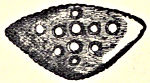
Fig. 110.
Fig. 110.
Ovoid piece of polished Bone from Ardakillen.
Ovoid piece of polished bone from Ardakillen.

Fig. 111. Fig. 112. Fig. 113. Fig. 114. Fig. 115. Fig. 116. Fig. 117.
Fig. 111. Fig. 112. Fig. 113. Fig. 114. Fig. 115. Fig. 116. Fig. 117.
Figs. 115, 116, and 117 are Bone Pins with attached Heads, from the Crannog of Ballinderry.
Figs. 115, 116, and 117 are bone pins with attached heads, from the Crannog of Ballinderry.

Plate XXI.
Plate 21.
Fig. 118. Fig. 119. Fig. 120.
Fig. 118. Fig. 119. Fig. 120.
Scribed Pins from Ballinderry Crannog.
Scribed Pins from Ballinderry Crannog.
Articles of the Toilet, etc., or of Personal Adornment.—In crannogs, pins form one of the most numerous handicraft “finds;” they are fashioned of bone, wood, bronze, iron, and gold: great variety is observable in their shape and design: indeed there are few articles on which the crannog artificer has bestowed more pains than on these cloak or dress fasteners. At Lagore, pins of bone occurred absolutely in hundreds—the great majority were of very plain character, something like skewers—flat-headed, and perforated with one hole; some of the richer examples were singular in design—their heads presenting grotesque human figures, or carvings of beasts; a few of them terminated in plain bulbs, or in a series of graceful mouldings: but whether in bone, wood, or metal, the designs and style of ornamentation are very varied, and so minute in some instances is the decoration, as only fully to be descried by the aid of a magnifying[Pg 106] glass. Fig. 111, of simple form, is here represented full size; it is ornamented with diagonal lines; the head is perforated, but the ring (if it ever contained one) has disappeared.[124] Fig. 112, found at Grosses Island, on the Shannon, is large, and dark in colour, it is 9 inches long, and 2½ inches thick at the head: it seems too large to be classed as a mantle pin. Fig. 113 is of less simple outline. The shank of fig. 114 is formed like a knife-blade, with a rise near the top, probably intended as a catch to secure it in the garment which it fastened. Fig. 115 is 3½ inches long, and has an oblong head of bone, with four indentations, one in each corner; it rests upon a shoulder cut in the shank. Fig. 116, 4½ inches in length, has a circular head 1 inch in diameter. Fig. 117 is another highly decorated pin, square in the shank, and 5½ inches long, with a looped head, through which is passed a ring. Fig. 118 (plate XXI.) has an acus 4¼ inches long, ornamented with the “dot-and-circle,” and the front of its flat discoid pendant has an inscription of ogham[Pg 107]ic character surrounding a dot and double circle, enclosed within an ornamented border—
Articles of the Toilet, etc., or of Personal Adornment.—In crannogs, pins are one of the most common artifacts found; they’re made from bone, wood, bronze, iron, and gold: there’s a wide range of shapes and designs. In fact, there are few items on which the crannog craftsman has put in more effort than these fasteners for cloaks or dresses. At Lagore, bone pins were found in the hundreds—the vast majority were quite plain, resembling skewers—flat-headed and with a single hole; some of the more elaborate examples featured unique designs, with their heads depicting strange human figures or carvings of animals; a few ended in simple bulbs or a series of elegant shapes. But whether made of bone, wood, or metal, the designs and decoration styles are very diverse, and in some cases, the details are so fine that they can only be fully seen with a magnifying glass.[Pg 106] Fig. 111, which has a simple shape, is shown here at full size; it has diagonal line decorations; the head is perforated, but the ring (if it ever had one) is missing.[124] Fig. 112, found at Grosses Island on the Shannon, is large and dark in color, measuring 9 inches long and 2½ inches thick at the head: it seems too large to be considered a mantle pin. Fig. 113 has a less simple shape. The shank of fig. 114 resembles a knife blade, with a rise near the top, likely designed as a catch to hold it in the garment it fastened. Fig. 115 measures 3½ inches long and features an oblong head made of bone, with four indentations, one in each corner; it rests on a shoulder cut into the shank. Fig. 116, 4½ inches in length, has a circular head that is 1 inch in diameter. Fig. 117 is another intricately designed pin, square in shape along the shank, and 5½ inches long, with a looped head that has a ring passed through it. Fig. 118 (plate XXI.) has an acu that is 4¼ inches long, decorated with a “dot-and-circle,” and the front of its flat, disk-shaped pendant features an ogham-style inscription surrounding a dot and double circle, enclosed within an ornamented border—
The loop at the head is not continuous. In fig. 119 (plate XXI.) the acus is 4⅞ inches long, with an irregular oval ring as pendant, ornamented with the dot-and-circle. The acus has a swelling in the middle, which at one side has the dot-and-circle, and on the other a runic-like scoring—
The loop at the top isn't continuous. In fig. 119 (plate XXI.) the needle measures 4⅞ inches in length, featuring an irregular oval ring as a pendant, decorated with the dot-and-circle design. The needle has a bulge in the center, which on one side displays the dot-and-circle, while the other side has a runic-like pattern—

Fig. 120 (plate XXI.) has an acus 3¾ inches long, it bears a pendant carved in the shape of a Maltese cross, ornamented on both sides with the dot-and-circle. The acus has an ogham-like scoring on one face—
Fig. 120 (plate XXI.) has a needle 3¾ inches long, featuring a charm carved like a Maltese cross, decorated on both sides with dots and circles. The needle has an ogham-like engraving on one side—

Plate XXII.
Plate 22.
Fig. 121. Fig. 122. Fig. 123. Fig. 124.
Fig. 121. Fig. 122. Fig. 123. Fig. 124.
Scribed Pins from Ballinderry Crannog.
Scribed Pins from Ballinderry Crannog.
In fig. 121 (plate XXII.) the acus is 7⅝ inches long, flattish, and ornamented by cross notchings, which seem merely ornamental, although at one side the character N is repeated many times; the pendant is somewhat rectangular in form, and perforated with a round opening—its rim ornamented with dots and lines. Fig. 122 (plate XXII.) is a pin 5⅜ inches long, with a large flat pendant, rudely and irregularly decorated in front. The acus has no ornament, but about its centre there is a square enlargement to keep it firm when inserted in the dress, and this projection has ogham-like scribings on three of its faces. Fig. 123 (plate XXII.) has an acus 3 inches long, with a small circle as a pendant, ornamented with dots; one side of the acus has a herring-bone pattern, the other bears scores—
In fig. 121 (plate XXII.), the needle measures 7⅝ inches long, is somewhat flat, and features cross notches that seem purely decorative, although the letter N is repeated several times on one side. The pendant is slightly rectangular and has a round hole in the center, with its edge decorated with dots and lines. Fig. 122 (plate XXII.) is a pin that is 5⅜ inches long, with a large flat pendant that has a rough and irregular decoration on the front. The needle itself is plain, but in the center, there is a square bulge designed to hold it securely when inserted into clothing, and this bulge has ogham-like carvings on three of its faces. Fig. 123 (plate XXII.) shows a needle that is 3 inches long, with a small circular pendant decorated with dots; one side of the needle features a herring-bone pattern, while the other side has markings.
Fig. 124 has the acus 3½ inches long, and a circular ring for pendant; the ring has scoring on one face—
Fig. 124 has a 3½ inch long acus and a circular ring for a pendant; the ring has markings on one side—
One side of the acus is ornamented with the [Pg 108]dot-and-circle; on the other (shown in the cut) is a runic-like scoring—
One side of the acus is decorated with the [Pg 108] dot-and-circle; on the other side (shown in the image) is a scoring that looks like runes—

There are cracks, or openings, in the rings at the head of each acus, by means of which the pendants may have been introduced; but these cracks are possibly the result of wear or straining, and it may be that both pendant and acus were originally carved out of one piece, like Chinese chains of ivory rings. From the same “find” came a pin with acus 4¾ inches long, having a flat discoid pendant of considerable size, both acus and pendant ornamented with the dot-and-circle; also a plain bone pin 2¼ inches long, with a hole at the head for a wire ring; another plain bone pin 3 inches long, with a flat head unpierced for ring or pendant; and a pin of yew, 2¼ inches long, with a round head.[125]
There are cracks, or openings, in the rings at the top of each acus, which might have allowed the pendants to be added; however, these cracks could also be due to wear or strain. It's possible that both the pendant and acus were originally carved from a single piece, similar to Chinese chains made of ivory rings. From the same discovery came a pin with an acus measuring 4¾ inches long, featuring a large flat discoid pendant, with both the acus and pendant decorated with dot-and-circle designs. Additionally, there was a plain bone pin that was 2¼ inches long, equipped with a hole at the top for a wire ring; another plain bone pin measuring 3 inches long, with a flat, unpierced head for a ring or pendant; and a yew pin that is 2¼ inches long, with a round head.[125]

Plate XXIII.
Plate 23.
Scribed Pins from the Crannog of Ballinderry.
Scribed Pins from the Ballinderry Crannog.
The scorings on these pins, though mostly mere ornament, seem in some cases greatly to resemble Ogham and runic characters, but Professor Stephens, of Copenhagen, to whom photographs of the runic-like scribings were submitted, could not decide that they were actually runes; and again, other examples of bone pins from Ballinderry, preserved in the Museum, R. I. A., bear seemingly well-marked Ogham scorings, yet Professor Rhys and Sir Samuel Ferguson were unable to interpret them.[126] The pin given, plate XXIII., fig. 1 (full size), bears ogham-like scorings on the front of its disc, no doubt originally intended to convey a meaning, but up to the present no key has been discovered by which they can be read; it is possible they were intended as a charm of some kind. Fig. 2 (plate XXIII.) was not in the Academy when Wilde compiled his catalogue: the head of this pin is of stone, said to be agate, secured to the bone stem, seemingly, by a small wedge of bronze. Near its termination, the pin assumes an acutely quadrangular form, each face bearing an ogham-like set of scorings; these may possibly also have been talismans. Pins of bone, as well as of bronze, have been frequently found with rings of that metal attached[Pg 109] to them, of a more or less ornamental type, but sometimes consisting of a mere piece of wire. Fig. 125, from Lisnacroghera, represents a rude ring of this nature; and quite recently a bronze pin, with similar attachment, was picked up from the bed of Drumcliff river, county Sligo. A pin of unusual form, and ornamented with two human heads, fig. 126, was brought to light in the crannog of Loughravel; the material is dark-coloured bronze, cast in the required form, but finished off with a chasing tool. In fig. 127 the ring, with which most pins are decorated, assumes the form of a coin, or flattened disc with a notch at top to allow it free play in the loop. In some specimens the disc of the coin is smooth and plain, but in others, as that here represented, it is highly ornate. Fig. 128 shows a rude plain specimen of the penannular pin, decorated in the inferior enlargements.[127] Fig. 129 from Lagore, has a head of singular fashion, and the bronze ornament claims special notice “on account of the analogy of type which it[Pg 110] presents as compared with the remarkable silver pins found at Largo, in Fifeshire,” and with the “Hammer-headed pins” in the Museum, R.I.A. Fig. 130,[128] of similar form, is ornamented on its semicircular plate; the ground had originally been filled in with enamel, as were probably the front terminations of the tubes. It was found near a crannog in Craigywarren bog, parish of Skerry, county Antrim. Fig. 131, from Lagore, is unique; its entire length is 3 inches, and it has three rings passing through apertures in the elongated head, which is the only part here repr[Pg 111]esented; its inferior extremity is decorated with a cross-like ornamentation.[129] Fig. 132, from Ballinderry, is a plain pin, with a wheel-like head, having a small hole in the neck, through which a ring passed.[130] Crannogs and street cuttings are the principal localities from which the small pins, figs. a, b, c, d, e, f, g, h have been procured, they vary in length from 2¼ to 7½ inches; fig. d is from Ardakillen.[131] All the articles figured in plate XXIV. were found at Lagore, and now form part of the Petrie Collection in the Museum, R.I.A. Nos. 1, 2, 3, and 4 are of iron, of which material very few ornamental objects have been found in Irish crannogs. No. 1 is remarkable as presenting a fine example of the torque pattern. Nos. 2, 3, and 4, in form strongly resemble brooch pins of bronze, which there is every reason to believe belong to an extremely remote period. The bone pins, Nos. 5, 6, 7, 8, 9, 10, and 11, are faithful representations of the leading varieties of that article, as found in Irish lake dwellings, and indeed in some pagan tombs. Nos. 1, 2, 3, 4, 5, and 6 (plate XXV.), are believed to represent wooden pins for the hair. No. 1 remains in a perfect state: the mouldings upon its lower and thinner end were doubtless intended to keep the article in its proper place, and prevent its slipping from the “back hair” of some long-forgotten beauty. No. 2 is unfortunately imperfect, but it is of interest on account of the boldness of the mouldings by which its head is decorated. No. 3 is perhaps the most remarkable pin composed of wood which has been recorded as found in a crannog: its decoration consists chiefly of varieties of the divergent spiral, highly characteristic of early Celtic art. No. 4 may possibly have been a hair-pin, but it was more probably used as a bodkin. Nos. 5 and 6, with serrated edges, seem well designed for the purpos[Pg 112]e of securing the hair in position. Pins of this kind were probably used in pairs, attached together with a string. No. 7 is a nondescript piece of wood, with two perforations; and No. 8 represents a handle, probably belonging to a very small wooden vessel. No. 9, shaped like one half of a wheel, is cut out of the solid, and appears to have been very carefully worked. It is almost impossible to form an opinion as to the character of this object: possibly it may have formed portion of the head of a cross: if so, it is the only relic of that kind hitherto reported to have occurred in a crannog. Nos. 10 and 11 are noticed by Wilde as seal-like articles. The former of these is solid; but the latter, from its thicker end to the moulding, is hollow.[132]
The carvings on these pins, while mostly just decorative, sometimes look a lot like Ogham and runic characters. However, Professor Stephens from Copenhagen, who received photos of these runic-like inscriptions, couldn't confirm they were actual runes. Additionally, some bone pins from Ballinderry in the Museum, R.I.A., show clear Ogham markings, but Professor Rhys and Sir Samuel Ferguson couldn't interpret them. [126] The given pin, plate XXIII., fig. 1 (full size), has ogham-like carvings on the front of its disk, likely meant to convey some kind of meaning, but so far, no key has been found to read them; it's possible they were used as a charm. Fig. 2 (plate XXIII.) wasn't available to the Academy when Wilde made his catalog; the head of this pin is made of stone, believed to be agate, attached to the bone stem by a small bronze wedge. Near its end, the pin takes on a sharp four-sided shape, with each side featuring ogham-like markings; these might have also served as talismans. Bone pins, along with bronze ones, have frequently been found with rings of that metal attached, varying in design from ornamental to just a simple piece of wire. Fig. 125, from Lisnacroghera, shows a crude ring of this type; recently, a bronze pin with a similar attachment was found in the Drumcliff River, County Sligo. A uniquely shaped pin, decorated with two human heads, fig. 126, was discovered in the crannog of Loughravel; it's made of dark-colored bronze, cast in the desired shape but finished with a chasing tool. In fig. 127, the ring that most pins are designed with looks like a coin or flattened disc with a notch at the top, allowing it to move freely in the loop. In some examples, the coin disc is smooth and plain, while in others, like the one shown here, it's very ornate. Fig. 128 displays a simple example of the penannular pin, decorated in its inferior enlargements. [127] Fig. 129 from Lagore, has a uniquely designed head, and the bronze decoration deserves special attention due to its similarity to the notable silver pins found at Largo in Fifeshire, as well as the “Hammer-headed pins” in the Museum, R.I.A. Fig. 130, [128] of a similar kind, is adorned on its semicircular plate; the background was originally filled with enamel, likely the same for the front ends of the tubes. It was found near a crannog in Craigywarren Bog, Skerry parish, County Antrim. Fig. 131, from Lagore, is one of a kind; it measures 3 inches in total length and features three rings passing through openings in its long head, which is the only part shown here; the bottom end is decorated with a cross-like design. [129] Fig. 132, from Ballinderry, is a simple pin with a wheel-like head that has a small hole in the neck for a ring to pass through. [130] Crannogs and street excavations are the primary sources of the small pins, figs. a, b, c, d, e, f, g, h that have been found, varying in length from 2¼ to 7½ inches; fig. d is from Ardakillen. [131] All the items presented in plate XXIV. were found at Lagore and now constitute part of the Petrie Collection in the Museum, R.I.A. Nos. 1, 2, 3, and 4 are made of iron, with very few ornamental items made from this material discovered in Irish crannogs. No. 1 is notable for presenting a fine example of the torque pattern. Nos. 2, 3, and 4, in form, closely resembles bronze brooch pins, which likely belong to a very ancient period. The bone pins, Nos. 5, 6, 7, 8, 9, 10, and 11, accurately represent the main types of this item, as found in Irish lake dwellings and some pagan burial sites. Nos. 1, 2, 3, 4, 5, and 6 (plate XXV.) are thought to be wooden hairpins. No. 1 remains in perfect condition: the carvings on its lower and thinner end were likely meant to secure the item in place and prevent it from slipping out of the “back hair” of some long-forgotten beauty. No. 2 is regrettably incomplete, but it's intriguing due to the bold designs decorating its head. No. 3 is perhaps the most notable wooden pin recorded as found in a crannog: its decoration mainly consists of various divergent spirals, which are highly characteristic of early Celtic art. No. 4 may have been a hairpin, although it was probably used as a bodkin. Nos. 5 and 6, with serrated edges, seems well designed for securing hair in position. Pins like this were probably used in pairs, linked by a string. No. 7 is an unremarkable piece of wood with two holes, and No. 8 represents a handle, likely belonging to a very small wooden vessel. No. 9, shaped like half of a wheel, is carved from a solid piece and appears to have been carefully made. It's almost impossible to determine the purpose of this object: it may have been part of a cross head; if so, it would be the only known relic of that kind found in a crannog. Nos. 10 and 11 are noted by Wilde as seal-like objects. The former is solid; the latter, from its thicker end to the carving, is hollow. [132]
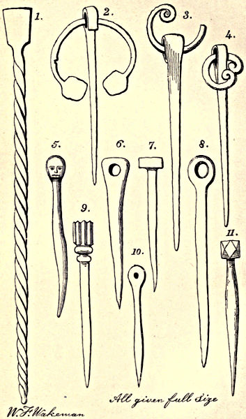

Fig. 125.—Bronze Wire Ring from Lisnacroghera. Full size.
Fig. 125.—Bronze Wire Ring from Lisnacroghera. Full size.

Fig. 126. Bronze Pin, with human heads, found in the Crannog of Loughravel. Full size.
Fig. 126. Bronze Pin, featuring human heads, discovered in the Crannog of Loughravel. Full size.
Fig. 127. Flattened disc-headed Pin from Ballinderry. Full size.
Fig. 127. Flattened disc-headed pin from Ballinderry. Actual size.
Fig. 128. Penannular Bronze Pin from Lagore. Full size.
Fig. 128. Penannular Bronze Pin from Lagore. Full size.


Fig. a. Fig. b. Fig. c. Fig. d. Fig. e. Fig. f. Fig. g. Fig. h.
Fig. a. Fig. b. Fig. c. Fig. d. Fig. e. Fig. f. Fig. g. Fig. h.


Shears composed of iron, and doubtless used for all the purposes of modern scissors, are common in Irish crannogs. Some from Lagore are of graceful form, resembling articles of the same class found in Roman settlements: the one represented, fig. 133, is of very large size, 8½ inches in length. Figs. 134 and 135 differ but little from fig. 133, and they all resemble the implements commonly used for shearing sheep in the present day. Figs. 136 and 137 are small iron knives, with tangs for insertion into horn or wooden handles;[Pg 113] at Lagore, where these articles were found, great numbers of blades, some not exceeding three inches in length, were discovered.
Shears made of iron, likely used for the same purposes as modern scissors, are commonly found in Irish crannogs. Some from Lagore have an elegant shape, similar to items of the same type discovered in Roman settlements: the one shown, fig. 133, is quite large, measuring 8½ inches in length. Figs. 134 and 135 are very similar to fig. 133, and they all look like tools currently used for shearing sheep. Figs. 136 and 137 are small iron knives with tangs designed to fit into horn or wooden handles;[Pg 113] at Lagore, where these items were found, numerous blades, some as short as three inches, were uncovered.

Of combs, the most numerous specimens are from the crannogs of Ardakillen, Ballinderry, Lagore, and Cloonfinlough: in some, brass teeth have been substituted for those of bone that had given way, showing that, at the time the repairs were made, that metal was easily procured and worked. Strangely enough, the most usual decoration consists of a series of dot-and-circle patterns. The same style of ornamentation was observed upon many of the combs found in the lake habitations of Switzerland, and amongst the waifs of Roman settlements in Britain. In the remains of such articles, in Irish and in Scottish lacustrine sites, there is a striking resemblance; indeed the bone combs, figured in Munro’s work, are identical with many existing Irish examples. Although the material is usually bone, yet specimens formed of wood are not uncommon: the great majority of combs discovered in Irish crannogs are highly artistic in design—the handle portion sometimes presenting animal forms. Sir John Lubbock says: “It is somewhat remarkable that, while even in the stone period we find fair drawings of animals, yet in the latter part of the stone age, and throughout that of the bronze, they are almost entirely wanting, and the ornamentation is confined to various combinations of straight and curved lines and geometrical patterns;” and this he believes will eventually be found to imply “a difference of race between the populations of Western Europe at these different periods.”[133] The comb, fig. 138, was procured from the crannog of Ardakillen, near Strokestown, county Roscommon. It is restored from the fragments, and in its original state was (as delineated) about 10 inches long, and 1¾ wide, it is now shrunk to a length of only 5½ inches. The toothed portions are in separate pieces, and by this contrivance the pectinated portion, if worn or broken, could easily be replaced. The comb, fig. 139, is the finest[Pg 114] specimen of its class preserved in the Museum, R. I. A., it is 2½ inches long, and 1¾ deep. The three pectinated portions are held together by flat sides, decorated with scrolls and circles. The top shows a triple openwork ornamentation: the side pieces are grooved at one end, for the purpose of receiving the clasp of a metal tooth placed in substitution of one that had been lost. Fig. 140, of the same class, is a specimen of a short, one-sided, highly decorated comb, 2¼ inches long, by 1⅜ deep. It is formed out of a single piece of bone, is of graceful outline, and decorated upon the sides with a number of dotted lines and circles. The three elevated rivets projecting above the toothed portion, fastened metal plates which had been attached to the comb, either when it was originally made, or after it had been broken and mended.[134] Fig. 141 is also formed out of a single piece of bone, ornamented with a dot-and-circle pattern; it was found in the same crannog. A third variety of comb, being double-toothed, is of a type so modern, that it seems to call for no special description.
Of combs, the most numerous examples come from the crannogs of Ardakillen, Ballinderry, Lagore, and Cloonfinlough: in some, brass teeth were used instead of the bone ones that had decayed, showing that, during the repairs, that metal was readily available and easy to work with. Interestingly, the most common decoration features a series of dot-and-circle patterns. This same style was found on many of the combs discovered in the lake settlements of Switzerland, as well as among the remnants of Roman sites in Britain. The remains of these items, found in Irish and Scottish lake sites, show a striking similarity; indeed, the bone combs depicted in Munro’s work are identical to many existing Irish examples. Although most are made from bone, wooden specimens are also fairly common: the majority of combs found in Irish crannogs have intricate designs—the handle sometimes taking on animal shapes. Sir John Lubbock remarks: “It is somewhat remarkable that, while even in the stone period we find fair drawings of animals, yet in the latter part of the stone age, and throughout that of the bronze, they are almost entirely absent, and the decoration is limited to various combinations of straight and curved lines and geometric patterns;” and he believes that this will eventually suggest “a difference of race between the populations of Western Europe at these different periods.”[133] The comb, fig. 138, was obtained from the crannog of Ardakillen, near Strokestown, county Roscommon. It has been restored from fragments, and in its original state was (as shown) about 10 inches long and 1¾ wide; it is now reduced to a length of only 5½ inches. The toothed sections are in separate pieces, allowing the decorated part, if worn or broken, to be easily replaced. The comb, fig. 139, is the finest[Pg 114] example of its kind preserved in the Museum, R. I. A.; it is 2½ inches long and 1¾ deep. The three toothed sections are held together by flat sides, adorned with scrolls and circles. The top displays a triple openwork design: the side pieces are grooved at one end to hold the clasp of a metal tooth replacing a lost one. Fig. 140, from the same category, is a short, one-sided, highly decorated comb, 2¼ inches long by 1⅜ deep. It is made from a single piece of bone, has an elegant shape, and is decorated on the sides with numerous dotted lines and circles. The three raised rivets above the toothed part secured metal plates that were attached to the comb, either when it was first made or after it was repaired.[134] Fig. 141 is also carved from a single piece of bone, decorated with a dot-and-circle pattern, and was found in the same crannog. A third type of comb, which has double teeth, is so modern in design that it doesn’t need special description.

Fig. 139.—Bone Comb from Ballinderry.
Fig. 139.—Bone Comb from Ballinderry.
Fig. 140.—Bone Comb from Lagore.
Bone Comb from Lagore.

Fig. 141.—Bone Comb from Lagore. Two-thirds real size.
Fig. 141.—Bone Comb from Lagore. Two-thirds actual size.


Fig. 143.—Stone Pendent Amulet from Ballinderry Crannog.
Fig. 143.—Stone Hanging Amulet from Ballinderry Crannog.
Fig. 144.—Nodule of Clay-slate from Ballinderry Crannog.
Fig. 144.—Nodule of clay slate from Ballinderry Crannog.
Save combs, very few articles for the toilet have been brought to light in Irish crannogs, compared with the numbers found in other countries: the accompanying engraving represents, however, what appears to be tweezers, 3 inches long, made of bronze, and decorated on the external surfaces with dot-and-circle pattern.[135] This, and the two following articles, are from Ballinderry. Fig. 143, a pendant or amulet, ornamented with dots in circles (as represented in the engraving), is carved out of soft stone, and the inscription which it bore is so much defaced as to be now undefinable. It is 3 inches long, including the handle, or loop, for suspension, 1¼ inch wide, and about ⅝ inch thick. The inscription is at top, separated by a line from the ornamentation in the central part: the back is plain. Fig. 144 is a flattish nodule of clay-slate iron ore: at one side, dots, each[Pg 116] with two concentric circles in the shape of a double cross, scribed on it, surrounded by a border of similar ornamentation; on the other face, there are a number of the same circles, irregularly disposed (as shown in fig. 144), and, at one side of it, a runic-like scribing. The stone measures 3 inches by 2½, and is about 1½ inches thick. It is, to a certain extent, polished.[136]
Save for combs, very few toilet items have been discovered in Irish crannogs, especially when compared to the quantity found in other countries. The engraving included here shows what seems to be tweezers, 3 inches long, made of bronze and decorated on the outside with a dot-and-circle pattern.[135] This item, along with the next two, is from Ballinderry. Fig. 143, a pendant or amulet, is embellished with dots in circles (as depicted in the engraving) and is carved from soft stone. The inscription it carried is now so worn that it can't be read. It measures 3 inches long, including the handle or loop for hanging, is 1¼ inches wide, and about ⅝ inch thick. The inscription is at the top, separated by a line from the decorative pattern in the middle: the back is plain. Fig. 144 is a flat piece of clay-slate iron ore: on one side, there are dots, each with two concentric circles shaped like a double cross, surrounded by a border of similar designs; on the other side, there are several of the same circles arranged irregularly (as shown in fig. 144), and on one side, there's a runic-like engraving. The stone measures 3 inches by 2½ inches and is about 1½ inches thick. It is somewhat polished.[136]


Fig. 145.—Bronze Amulet, or Ornament, from Lisnacroghera.
Fig. 145.—Bronze Amulet or Ornament from Lisnacroghera.
Fig. 145, found in the crannog of Lisnacroghera is a small bronze object, considered by W. F. Wakeman to have been an amulet: “the figures which it bears are curvilinear examples of a symbol known to antiquarians as the swastica. There can be little or no question as to the eastern origin of this form of cross.”[137]
From the tenacity with which craftsmen adhered to ancient designs or patterns, it is difficult to assign even an approximate date to many remains of articles suitable for personal decoration; however, any brooch, pin, or other object, upon which interlacing tracery is displayed, should not be referred to a period antecedent to the introduction of Christianity into Ireland.
From the determination with which craftsmen stuck to ancient designs or patterns, it's hard to pinpoint even an approximate date for many pieces intended for personal decoration; however, any brooch, pin, or other item that features interlacing patterns shouldn’t be dated to a time before Christianity came to Ireland.


Fig. 147.—Bronze Fibula from Lough Ravel.
Fig. 147.—Bronze Brooch from Lough Ravel.
Fig. 148.—Penannular Ring, or Brooch, from Lough Ravel.
Fig. 148.—Penannular Ring, or Brooch, from Lough Ravel.

Fig. 149.
Fig. 149.
Penannular Ring from Ardakillen. Two-thirds real size.
Penannular Ring from Ardakillen. Two-thirds actual size.
Of bronze articles connected with personal adornment, few can equal in design and workmanship the hinge brooch from Ardakillen, here represented; it is considered to be of great antiquity. The decoration on the enlarged ends partakes of the “Celtic trumpet pattern,” while the central connecting curved strap, with a raised intertwinement, like that seen on some sculptured crosses, and in the illumination of ancient MSS., would appear to have been cast. The thin ornamented plate in front is fastened by eight rivets to a stout flat plate behind, which also overlaps the edges of the strap; its flat pin is hinged at the back.[138] The very remarkable brooch, represented full size, plate XXVI., was obtained by Petrie[139] soon after the first opening of the Lagore crannog. The original discoverer stated that it was enclosed in an ancient case or box of yew—this has unfortunately been lost. The material of which the brooch is composed, is fine golden-coloured bronze, so lustrous that, in places which have been rubbed or exposed to friction, it is difficult to decide whether the article had not been originally gilt. The pin is 6⅝ inches in length: the diameter of the ring 3⅝ inches. The deeply set compartments, or panels, some thirteen in number, into which the ring is divided, contain ornamentation in what is generally designated the Celtic style: these designs, various in character and admirably executed, remain as sharp as when originally made. It is decorated on the front only. The ring, as is usual, expands on one of its sides, so as to fill up nearly one-half of the circle. The head of the acus is secured to the ring by a boldly projecting loop. The thickness of the plate forming the ring is about a quarter of an inch; the edges are plain. Another bronze brooch,[140] in use amongst the crannog dwell[Pg 118]ers of Lagore, is smaller than that shown on plate XXVI. The ring measures but 2 inches in diameter; the head of the acus contains a series of circular concentric mouldings, the intermediate spaces being deeply sunk; in the centre is a cavity which formerly contained a setting. The ring is continuous, and one of its sides expands, exhibiting circles (similar to those ornamenting the head of the pin), in one of which a fine setting of amber still remains; the other is now empty. There is no trace of enamel having been used on this brooch. A beautiful bronze fibula, or brooch, found on the site of the crannog of Lough Ravel, is here reproduced (full size), from the engraving in the late Ulster Journal of Archæology. This brooch, and one of silver from the same locality, are distinguished by their peculiar bird-head ornamentation on the superior extremity. From the same crannog came the penannular ring or brooch (fig. 148); and, from Ardakillen, a small penannular ring (fig. 149), of most curious torque pattern; indeed, penannular rings of bronze, of various sizes, sometimes highly decorated in very primitive style, are of not unfrequent occurrence in Ireland: they are supposed by some writers to have been used as a kind of money; others have pronounced them to be finger-rings, or bracelets, according to their size; similar objects are met with in gold[Pg 119], and, like their bronze prototypes, have greatly puzzled the learned in antiquarian matters. At the crannog of Lisnacroghera were found two penannular rings, formed of very thin, golden-coloured bronze. They are hollow, and consequently extremely light, so that they could scarcely have served as money: and the smallness of their diameter, which is only 1⅜ inches, shows that they could not have been bracelets. The following articles are also from Lisnacroghera. Fig. 151, a bronze stud—use problematical. Fig. 152, a plain bronze rivet. The circlets of bronze, figs. 153, 154, 155, may have been either the rings of brooches or pins, or perhaps buckles which had lost their tongues. Fig. 155 still retains traces of red enamel in its chevron, or wavy ornamentation.[141]
Of bronze items related to personal decoration, few match the design and craftsmanship of the hinge brooch from Ardakillen, shown here; it is thought to be very ancient. The decoration on the enlarged ends features the "Celtic trumpet pattern," while the central curved strap, with an interwoven raised design similar to some sculpted crosses and the illumination found in ancient MSS., seems to have been cast. The thin decorative plate in front is attached by eight rivets to a sturdy flat plate behind, which also overlaps the edges of the strap; the flat pin is hinged at the back.[138] The remarkable brooch, shown full size, plate XXVI., was acquired by Petrie[139] soon after the initial excavation of the Lagore crannog. The original discoverer mentioned that it was enclosed in an ancient yew case or box, which has unfortunately been lost. The brooch is made of fine golden-colored bronze, so shiny that, in areas that have been worn or rubbed, it is difficult to tell if it was originally gilded. The pin is 6⅝ inches long; the diameter of the ring is 3⅝ inches. The deeply set compartments or panels, about thirteen in total, into which the ring is divided, feature decorations typically known as the Celtic style: these designs, varied in nature and beautifully executed, remain as sharp as when they were first made. It is decorated only on the front. The ring, as is common, expands on one side, covering nearly one-half of the circle. The tip of the pin is attached to the ring by a prominently projecting loop. The thickness of the plate forming the ring is about a quarter of an inch; the edges are straightforward. Another bronze brooch,[140] used by the inhabitants of the Lagore crannog, is smaller than the one shown on plate XXVI.. The ring measures just 2 inches in diameter; the pin's head features a series of circular concentric moldings, with deeply sunk intermediate spaces; in the center is a cavity that once held a setting. The ring is continuous, and one side expands, displaying circles (similar to those that decorate the head of the pin), one of which still holds a fine amber setting; the other is currently empty. There’s no sign of enamel used on this brooch. A beautiful bronze fibula, or brooch, found at the crannog site of Lough Ravel is reproduced here (full size), based on an engraving from the late Ulster Journal of Archæology. This brooch, along with a silver one from the same location, is notable for its distinctive bird-head decoration at the top. From the same crannog came the penannular ring or brooch (fig. 148); and from Ardakillen, a small penannular ring (fig. 149), featuring a very unique torque pattern; in fact, penannular rings of bronze, varying in size and often richly decorated in a very primitive style, are not uncommon in Ireland: some authors suggest they were used as a form of currency; others believe they served as finger rings or bracelets, depending on their size; similar items can also be found in gold[Pg 119], and like their bronze counterparts, they have greatly intrigued scholars of antiquity. At the crannog of Lisnacroghera, two penannular rings made of very thin, golden-colored bronze were discovered. They are hollow and extremely lightweight, indicating they probably couldn’t have served as currency: and their small diameter, which measures only 1⅜ inches, shows that they are unlikely to have been bracelets. The following items also come from Lisnacroghera. Fig. 151, a bronze stud—its purpose is uncertain. Fig. 152, a plain bronze rivet. The bronze circlets, figs. 153, 154, 155, might have been the rings of brooches or pins, or possibly buckles that lost their tongues. Fig. 155 still shows traces of red enamel in its chevron or wavy design.[141]

Fig. 150.—Hollow Bronze Penannular Rings from Lisnacroghera.
Fig. 150.—Hollow Bronze Penannular Rings from Lisnacroghera.


Touchstones would appear, from their make, to have been worn about the person, several being pierced with a hole, seemingly for attachment of a string. Sir W. Wilde remarks that they have been found both flat and four-sided, and with and without perforation. They are formed generally of black Lydian stone or of jasper, either material being suitable for gold-testing. Lydian stone, or black chert, is “an impure flint, found in the central portions of the carboniferous limestone of Ireland, and at the base of the Kilkenny coal formation. It is of a dull dark colour, approaching to black; is more opaque, brittle, and stone-like, than flint; never possesses the same translucency, and does not so readily chip into conchoidal fragments: but, next to flint, it is one of the hardest of the siliceous rocks, and hence was used occasionally for forming tools and weapons by the inhabitants of those districts where flint was rare. Lydian stone, ‘Lapis Lydius,’ or, ‘Lapis Hibernicus,’ as it was denominated by the old Dutch writer De Boot, so long ago as 1647, is the true touchstone of the ancients.”
Touchstones seem to have been worn as accessories, with several of them featuring a hole, likely for attaching a string. Sir W. Wilde notes that they have been found both flat and four-sided, and either with or without holes. They are usually made from black Lydian stone or jasper, as both materials are suitable for testing gold. Lydian stone, or black chert, is “an impure flint found in the central regions of the carboniferous limestone in Ireland and at the base of the Kilkenny coal formation. It has a dull dark color, almost black; it is more opaque, brittle, and stone-like than flint; it never has the same translucency and does not easily chip into conchoidal fragments. However, next to flint, it is one of the hardest siliceous rocks, and thus was occasionally used for making tools and weapons by the inhabitants of areas where flint was scarce. Lydian stone, ‘Lapis Lydius,’ or ‘Lapis Hibernicus,’ as the old Dutch writer De Boot called it back in 1647, is the true touchstone of the ancients.”

Few ornaments of silver, and still fewer of gold, have been brought to light in crannogs, the antiquities of which consist mainly of the more homely class of bone, bronze, and iron articles for personal adornment; yet numerous gold ornaments have doubtless been discovered, but remained unrecorded, from fear of detection on the part of the finder, before the Treasury Minute respecting “Treasure Trove” came into operation. Antique articles of gold have been turned up in the bogs of Ireland, and in various parts of the country. Is it likely that the inhabitants of “island fortresses” should alone be devoid of the precious metal, especially as in them have been found both small earthen crucibles—so diminutive as to have been useful only for gold or silver smelting,—and also small pipe-clay cupels for refining purposes, like those used in the present day for the assay of gold and silver? Fig. 156 represents a pipe-clay crucible from the crannog of Lagore, 2 inches broad, and 1 inch high. A well authenticated instance of the discovery of the precious metal in a crannog, was that of “several gold pins,” at Loughtamand, county Antrim;[142] and, in the autumn of 1870, a beautiful, almost unique, specimen of early Irish art came to light on the site of[Pg 121] the former lake dwelling of Lough Ravel, county Antrim. The accompanying woodcut is the size of the original. This silver brooch, or fibula, represents two bird-headed serpents joined together: both sides of the ornament are alike; the silver is slightly thinner than a shilling piece; the pin is missing. In the design there seems to be a resemblance to some of the initial letters in the “Book of Kells,” and other early Irish MSS., so that its probable age is not later than the tenth century.[143]
Few silver ornaments, and even fewer gold ones, have been found in crannogs, which mostly contain more everyday items made of bone, bronze, and iron for personal decoration. However, many gold ornaments were likely discovered but never recorded because finders feared being caught before the Treasury Minute on "Treasure Trove" was enacted. Antique gold items have been found in Ireland's bogs and various regions. Is it plausible that the people living in "island fortresses" were the only ones lacking precious metal, especially since small earthen crucibles, too tiny to be useful for anything other than gold or silver smelting, and small pipe-clay cupels for refining—like those still used today for assaying gold and silver—have been discovered there? Fig. 156 represents a pipe-clay crucible from the crannog of Lagore, 2 inches wide and 1 inch high. A well-documented case of finding precious metal in a crannog was that of "several gold pins" at Loughtamand, County Antrim; [142] and in the autumn of 1870, a stunning, almost unique example of early Irish art was uncovered at the site of[Pg 121] the former lake dwelling of Lough Ravel, County Antrim. The accompanying woodcut is the same size as the original. This silver brooch, or fibula, features two bird-headed serpents intertwined: both sides of the ornament are identical; the silver is slightly thinner than a shilling; the pin is missing. The design resembles some of the initial letters in the "Book of Kells" and other early Irish MSS., suggesting it likely dates to no later than the tenth century. [143]

Fig. 157.—Silver Brooch from the Crannog of Lough Ravel.
Fig. 157.—Silver Brooch from the Crannog of Lough Ravel.

Fig. 158.—Stone Ring. One-third size.
Fig. 158.—Stone Ring. 1/3 size.
Fig. 159.—Stone Ring. One-half size.
Fig. 159.—Stone Ring. 50% size.

Fig. 160. Jet Bracelet, or Ring. One-quarter size.
Fig. 160. Jet Bracelet or Ring. One-quarter size.
Fig. 161. Glass Bracelet, or Ring. One-third size.
Fig. 161. Glass Bracelet or Ring. One-third size.
Figs. 158 and 159 are good examples of stone rings, the former 2½ inches in the clear; the latter, 2¾ inches. Fig. 160, drawn one-fourth the real size, is a bracelet of jet, from Lough Eyes, restored from the fragments; and fig. 161, restored from existing remains in the Museum, R.I.A., is of blue-coloured glass, decorated with spots and a cable pattern.
Figs. 158 and 159 are great examples of stone rings; the first one measures 2½ inches in diameter, while the second is 2¾ inches. Fig. 160, depicted at one-fourth the actual size, is a bracelet made of jet from Lough Eyes, reconstructed from fragments. fig. 161, reconstructed from the pieces on display in the Museum, R.I.A., is made of blue glass and features spot designs and a cable pattern.

Plate XXVII.
Plate 27.
Beads, composed of various materials, from Ardakillen, Lagore, Ballinderry, Drumdarragh, Cloonfinlough, and Lough Eyes.
Beads made from different materials, found in Ardakillen, Lagore, Ballinderry, Drumdarragh, Cloonfinlough, and Lough Eyes.
Beads of stone, bone, jet, earthenware, and wood, occur in crannogs; also beads of amber, of which many are in modern use amongst the peasantry as prayer-beads. O’Flaherty, in his Iar Connaught, states that amber was procured in more or less quantities on the coast of Galway. Ornaments of glass, from the most simple and unpretending plain blue bead to that studded with settings of enamel or vitreous paste, so varied in colour and of so much beauty in outline that they might be worn at the present day, are still met with in crannogs, as well as in pagan sepulchres. Blue appears to have been the favourite colour, but some are pale green, white, yellow and red, with spirals and decorations of varied colours; whilst others have a dark groundwork, and are studded with fragments of red, green, yellow, blue and white enamel. All the beads figured in plate XXVII. are drawn full size. No. 1, formed of stone, presents an average specimen of its class. No. 2 is from Lagore, where a considerable number, but of smaller size, occurred. No. 3, composed of bone, is probably the largest bead of that material found in any crannog: usually, they are scarcely the size of an ordinary pea. No. 4 is a pendant of black opaque glass; it probably formed the centre of a necklace. One resembling it, but composed of stone, may be seen in the Petrie Collection, R.I.A. No. 5 is a small bead of blue glass; its form is one of rare occurrence. No. 6, of plain cylindrical outline, was accompanied by several others of the same class: in colour it is a dull green. No. 7, a small globular bead of glass: colour deep blue; and No. 8, of similar shape, is composed of opaque white glass, or porcelain. No. 9 is a beautiful bead of green glass, presenting in dark-blue the dot-and-circle pattern; the spaces between the dots and their surrounding circles are pure white, so that a very pleasing effect is produced. No. 10 is an unusually long bead, of material similar to No. 6. No. 11 is a curious bead, through which passed a piece of bronze wire, which probably formed the loop of a pin. No. 12 is formed of dark-green glass, relieved by yellow ornamentation, as shown in the representation; and No. 13 is of dark-blue opaque glass, or paste, with chevrons of white glass, or enamel, passing round it. No. 14 is formed of white glass, or porcelain, ornamented with a pattern in black, and the opening for the string unusually large. No. 15 is composed of very light-coloured blue glass; and No. 16 of pure crystal. No. 17, formed of jet, was accompanied by fragments of bracelets of the same material. No. 18, appar[Pg 123]ently formed of fine clay, its colour what artists call Venetian red, is in the Petrie Collection. No. 19 is, undoubtedly, most curious, not on account of its form or design, which is common, but in regard to its being made of lead—perhaps the only example of a bead of that material discovered in Irish crannogs. No. 20 is a fine specimen of the amber bead, so often discovered in connexion with very early remains. No. 22 is also an amber bead, of rather unusual form, being almost flat, like a wheel. Nos. 23 and 24 were picked up by W. F. Wakeman, from the shores of one of the crannogs of Lough Eyes, but at a time subsequent to the publication of his Paper on that locality.[144] The collection of glass and enamel beads in the Museum, R.I.A., contains one of long cylindrical form, composed of blue, white, and yellow enamel; it is ¾ of an inch long, is decorated with a blue and white band round each extremity, and has yellow spots on the centre: it is of the same character as No. 41, represented by fig. 162. No. 21, one of the most beautiful beads in the collection, fig. 163, measures half an inch in the longest diameter, and is composed of clear glass, with bright yellow spirals of opaque enamel covering its sides. No. 27, represented by fig. 164, is an opaque bead of glass, light-green in colour: the aperture is rather large, so that it may have been used as a necklace, or pin-bead; it is grooved in melon-form. Two beads, composed of green glazed-ware, and also of melon-shape, may be seen figured at page 178, in Munro’s Scottish Lake Dwellings. Nos. 20, 21, and 27, Museum, R. I. A., are from the crannog of Lagore.
Beads made of stone, bone, jet, earthenware, and wood can be found in crannogs; there are also amber beads, many of which are still used today by peasants as prayer beads. O’Flaherty, in his Iar Connaught, mentions that amber was found in varying amounts along the Galway coast. Glass ornaments, ranging from simple blue beads to those adorned with enamel or glass paste, are so colorful and beautifully shaped that they could be worn today. These are still found in crannogs and pagan burial sites. Blue seems to have been the preferred color, but there are also pale green, white, yellow, and red beads, featuring spirals and various decorations; some have a dark base and are decorated with bits of red, green, yellow, blue, and white enamel. All the beads shown in plate XXVII. are drawn to full size. No. 1, made of stone, is an average example of its type. No. 2 comes from Lagore, where many smaller examples were discovered. No. 3, made of bone, is probably the largest bead of that type found in any crannog; usually, they are no bigger than a regular pea. No. 4 is a pendant of black opaque glass, likely the centerpiece of a necklace. A similar one made of stone can be seen in the Petrie Collection, R.I.A. No. 5 is a small blue glass bead; its shape is quite rare. No. 6, which has a plain cylindrical shape, was found among several others of the same type and is a dull green color. No. 7 is a small round bead of deep blue glass, while No. 8, of a similar shape, is made of opaque white glass or porcelain. No. 9 is a beautiful green glass bead featuring a dark-blue dot-and-circle pattern; the spaces between the dots and their surrounding circles are pure white, creating a very pleasing effect. No. 10 is an unusually long bead made of material similar to No. 6. No. 11 is an interesting bead that has a piece of bronze wire running through it, likely forming the loop of a pin. No. 12 is made of dark-green glass with yellow decoration, as shown in the representation, and No. 13 is dark-blue opaque glass or paste, featuring white glass or enamel chevrons around it. No. 14 is made of white glass or porcelain, decorated with a black pattern, and has an unusually large opening for the string. No. 15 consists of very light blue glass, while No. 16 is made of pure crystal. No. 17, made of jet, was found with pieces of bracelets of the same material. No. 18, seemingly made of fine clay and colored what artists refer to as Venetian red, is in the Petrie Collection. No. 19 is undoubtedly fascinating, not because of its shape or design, which is common, but because it is made of lead—possibly the only lead bead found in Irish crannogs. No. 20 is a fine example of the amber bead often found with very early remains. No. 22 is also an amber bead but has an unusual shape, being almost flat like a wheel. Nos. 23 and 24 was collected by W. F. Wakeman from the shores of one of the crannogs at Lough Eyes, but that was after he published his paper on that location. [144] The Museum R.I.A. has a collection of glass and enamel beads, including one that is long and cylindrical, made of blue, white, and yellow enamel; it measures ¾ of an inch long, decorated with a blue and white band at each end and yellow spots in the center, similar to No. 41, shown by fig. 162. No. 21, one of the most beautiful beads in the collection, fig. 163, measures half an inch at its longest diameter and is made of clear glass with bright yellow spirals of opaque enamel on its sides. No. 27, shown by fig. 164, is an opaque light-green glass bead; it has a rather large hole and may have been used as a necklace or pin bead; it has a melon-like groove. Two beads made of green glazed ware, also in a melon shape, can be seen illustrated on page 178 of Munro's Scottish Lake Dwellings. Nos. 20, 21, and 27 from the Museum, R.I.A., are from the crannog of Lagore.

Fig. 162. Bead from Lagore.
Fig. 162. Bead from Lagore.
Fig. 163. Bead from Lagore.
Fig. 163. Lagore bead.
Fig. 164. Bead from Lagore.
Fig. 164. Bead from Lagore.

Fig. 165. Fig. 166. Fig. 167.
Fig. 165. Fig. 166. Fig. 167.
Beads from Lisnacroghera.
Beads from Lisnacroghera.


The three following beads here described are from the crannog of Lisnacroghera. Fig. 165, of opaque blue glass, very dark in colour, but relieved with white streaks of the same material, crossing each other obliquely. Fig. 166, of ordinary blue glass, quite plain; and, fig. 167, an elongated cylindrical bead of amber.[145] In Wilson’s Prehistoric Annals of Scotland, and in Keller’s Ancient Lake Dwellings of Switzerland, may be seen representations of beads, greatly resembling one from the crannog of Lough Ravel, county Antrim, as shown in fig. 168. Fig. 169, from the same locality, is somewhat similar, but the yellow, raised and rope-like decoration which encircles it does not form an integral part of the glass; it has been produced by laying the colour on the surface, instead of its being fused into the glass. The bead, fig. 170, although from the lands of Ballintlea, near Timahoe, Queen’s County, is of the same class as many discovered in crannogs. At top and bottom it exhibited indications of friction, showing it had been strung with others as a necklace, or some article of personal adornment. It is formed of sea-green glass, moulded to represent interlaced cords, the strands composed of threads of white glass; round the upper and lower rims there are small knobs of opaque yellow glass. That these beads are[Pg 125] of native Irish manufacture is extremely probable, as, in two instances at least, lumps of blue glass in an unfashioned state have been discovered in connexion with crannogs, which also yielded beads of exactly the same colour and material. The majority of the beads present internal evidence of the manner in which they were made: “the glass has at first been in the form of a rod, then a portion, when in a soft state, was bent into the form of a bead, and sufficiently heated to cause the ends to unite.… When the ornamentation is composed of a spiral rod, it has been laid on in the same way, and the line of junction can be made out in every case.”[146]
The three beads described here are from the crannog of Lisnacroghera. Fig. 165, made of opaque blue glass, is very dark in color but has white streaks of the same material crossing each other obliquely. Fig. 166, made of regular blue glass, is quite plain; and fig. 167, is an elongated cylindrical bead made of amber.[145] In Wilson’s Prehistoric Annals of Scotland, and in Keller’s Ancient Lake Dwellings of Switzerland, you can see representations of beads that look a lot like one from the crannog of Lough Ravel, county Antrim, as shown in fig. 168. Fig. 169, from the same area, is somewhat similar, but the yellow, raised, rope-like decoration that surrounds it is not an integral part of the glass; it has been applied to the surface instead of being fused into the glass. The bead, fig. 170, though from Ballintlea near Timahoe in Queen's County, belongs to the same category as many found in crannogs. It shows signs of wear at the top and bottom, indicating it was strung with others as a necklace or some personal adornment. It’s made of sea-green glass, shaped to resemble interlaced cords, with strands made of white glass threads; around the upper and lower edges, there are small knobs of opaque yellow glass. It’s highly likely that these beads are[Pg 125] of native Irish manufacture, as at least two instances have been found where lumps of unshaped blue glass are associated with crannogs, which also yielded beads of the same color and material. Most of the beads show clear evidence of how they were made: “the glass was initially shaped into a rod, then a part, when it was soft, was bent into a bead and heated enough to fuse the ends together.… When the decoration is formed with a spiral rod, it’s been applied in the same manner, and the junction line is recognizable in every case.”[146]
Fig. 171.—Bone Harp Pin from Ardakillen. Half-size.
Fig. 171.—Bone Harp Pin from Ardakillen. Half-size.

Plate XXVIII.
Plate 28.
Harp, from the Crannog of Ballinderry. Woodwork restored.
Harp, from the Crannog of Ballinderry. Woodwork restored.
Music.—It has been remarked that, in order to form a just estimate of the character of any particular people, it is necessary to investigate the pastimes and amusements most prevalent amongst them; war, and other contingent circumstances may place men at different times in different points of view, but when we follow them into the retirement of their homes, we are most likely to see them in their true state. In crannogs few musical instruments have come to light, owing probably to the perishable materials of which they were usually composed, yet enough remain to prove that, in time of peace, the sweet sound of the harp, and in war, the hoarse bray of the trumpet, resounded over the waters of the lakes. Portions of ancient harps have not unfrequently occurred in crannogs, but no fairly perfect example has as yet come to light. Some harp pins are formed of bronze, and several of bone were found at Ardakillen. In the Museum, R.I.A., there are upwards of twenty harp pins, the majority obtained from crannogs: they vary in length from 2⅛ to 4⅛ inches, are square in the head, and perforated in the smaller extremity, for holding the wire string. In the accompanying plate XXVIII., is figured (1) an Irish harp as restored: it stands at present 37 inches in height, all the metal portions were discovered in the crannog of Ballinderry[Pg 126], county Westmeath, and the proportions and form of the modern woodwork were regulated by the size and form of the original metal work; the thirty-five pins show the number of strings that were formerly attached. Although the style of decoration is of a very early character, yet as the letters I.H.S., surmounted by a cross, appear engraved on a brass plate in front of the instrument, the work cannot be older than the sixteenth century. Nos. 1, 2, 3, 4, and 5, convey a clear idea of the kind of ornamentation on the metal fittings, and No. 7 (from Drumdarragh crannog) represents a harp pin of the usual kind.
Music.—It has been noted that to truly understand the character of any specific people, we need to look into their favorite pastimes and entertainment. Wars and other events may show people in different ways at various times, but when we observe them in the comfort of their homes, we are more likely to see their true selves. In crannogs, few musical instruments have been discovered, likely due to the materials they were usually made from being perishable. However, there is enough evidence to confirm that during peaceful times, the pleasant sound of the harp filled the air, and during wartime, the loud blast of the trumpet echoed over the lakes. Fragments of ancient harps have often been found in crannogs, but no complete examples have surfaced yet. Some harp pins are made of bronze, and several bone pins were discovered at Ardakillen. In the Museum, R.I.A., there are more than twenty harp pins, most of which were found in crannogs. They vary in length from 2⅛ to 4⅛ inches, have square heads, and are pierced at the smaller end to hold the wire strings. In the accompanying plate XXVIII., is illustrated (1) an Irish harp as restored: it currently stands 37 inches tall, and all the metal parts were found in the crannog at Ballinderry[Pg 126], County Westmeath, with the modern woodwork’s size and shape based on the original metal pieces; the thirty-five pins indicate the number of strings that were originally attached. Although the decoration style is very early, the letters I.H.S., topped with a cross, are engraved on a brass plate at the front of the instrument, indicating that it cannot be older than the sixteenth century. Nos. 1, 2, 3, 4, and 5, provide a clear idea of the type of decoration on the metal fittings, and No. 7 (from Drumdarragh crannog) shows a typical harp pin.


Fig. 173.—Showing riveting of Trumpet. Full-size.
Fig. 173.—Showing the riveting of the Trumpet. Full size.

Plate XXIX.
Plate XXIX.
BRONZE TRUMPET, NOW IN THE MUSEUM OF THE ROYAL IRISH ACADEMY.
BRONZE TRUMPET, NOW IN THE MUSEUM OF THE ROYAL IRISH ACADEMY.
Found in the Co. Down, A.D. 1809.
Located in County Down, A.D. 1809.
Figures 2 and 3 side view of Trumpet, scale one and a-half inch to a foot; Fig. 4 shows the joining of the plate, and of the two lines of rivets of Fig. 2; Fig. 3 is similarly rivetted.
Figures 2 and 3 show a side view of the Trumpet, scaled at one and a half inches to a foot; Fig. 4 illustrates how the plate is joined, along with the two lines of rivets from Fig. 2; Fig. 3 is riveted in a similar way.
Fig. 1 section of fig. 2 at larger end, full size, showing strap and rivets.
Fig. 1 section of fig. 2 at larger end, full size, showing strap and rivets.
In 1809, at Ardbin, parish of Annaghclone, county Down, both joints of a very large and perfect curved bronze trumpet, or bugle-horn, were disinterred from a peat bog that had been a sheet of water about the middle of the last century. As conclusive proof of there having been a crannog in this former lake-bed, a stratum of burnt oak, a canoe scooped out of a single tree, together with four short paddles, were dug up from the peat. Of the trumpet, the remains—minutely described in the Newry Magazine for 1815—are now in the Museum, R. I. A., and in the accompanying engraving (fig. 172) the outside trumpet is a representation of this instrument. As may be observed, from comparison with the various other horns in the Museum, it is by far the largest of that collection, and is probably (as asserted by Wilde) the finest of its kind discovered in Europe. The trumpet is given on a larger scale in plate XXIX.: “it measures 8 feet 5 inches along the convex margin, and consists of tw[Pg 127]o portions, each formed of very strong sheet bronze of a yellowish red colour, and joined along the seam.” It is 3½ inches wide at the open of the large end, and ⅝ at the upper; the small tube has parallel sides, and is about the size of the small extremity of the larger. By what means the two were joined together, or whether a mouth-piece was attached to the small extremity, is unknown, yet a variety of loud martial tones can be produced by the lower fragment. “The riveting of the edges in this instrument is the most perfect thing of its kind yet discovered, and is well exhibited in the accompanying cut, drawn the natural size from portions of its external and internal surfaces. The bronze strap which covers the joining on the inside is studded with small circular-headed studs, riveted on the outside, as shown in the lower section of the cut. There is no strap externally; and the perfection of the riveting has long been a subject of admiration to the curious, there being as many as 638 rivets in the lower portion.[147] By what means they were introduced throughout, or what description of mandril was employed for riveting them upon, is still subject of speculation.”[148] To judge from its size, this kind of war trumpet should give no uncertain sound. It is stated by Polybius, that on the continent “the parade and tumult of the Celts terrified the Romans, for t[Pg 128]here was amongst them an infinite number of horns and trumpets,” &c. And in describing the Celtic Gauls, Diodorus Siculus says, “they have amongst them trumpets peculiar as well to themselves as to other nations; these by inflation emit an hoarse sound well suited to the din of battle.”
In 1809, in Ardbin, Annaghclone parish, county Down, both parts of a very large and well-preserved curved bronze trumpet, or bugle-horn, were uncovered from a peat bog that had once been a body of water in the mid-1800s. To conclusively prove there had been a crannog in this former lakebed, a layer of burned oak, a canoe carved from a single tree, and four short paddles were also excavated from the peat. The remains of the trumpet—detailed in the Newry Magazine for 1815—are now housed in the Museum, R. I. A., and in the accompanying illustration (fig. 172) the exterior of the trumpet is depicted. As seen by comparing it with the various other horns in the Museum, it is by far the largest collection piece, and it is likely (as Wilde claimed) the finest of its kind found in Europe. The trumpet is shown on a larger scale in plate XXIX.: “it measures 8 feet 5 inches along the convex edge, and consists of two sections, each made from very strong sheet bronze of a yellowish-red color, joined along the seam.” It is 3½ inches wide at the large end and ⅝ at the small end; the small tube has straight sides and is about the diameter of the smaller end of the larger section. It is unclear how the two parts were connected or if a mouthpiece was attached to the small end, yet a variety of loud martial sounds can be produced by the lower piece. “The riveting of the edges in this instrument is the most perfect of its kind discovered to date, as illustrated in the accompanying image, drawn to natural size from parts of its external and internal surfaces. The bronze strap covering the joint on the inside is studded with small circular-headed studs, riveted on the outside, as depicted in the lower section of the image. There is no external strap, and the excellence of the riveting has long been admired, with as many as 638 rivets in the lower portion.[147] How they were fitted throughout, or what type of mandrel was used for riveting, is still a topic of speculation.”[148] Judging by its size, this type of war trumpet should definitely be heard. Polybius noted that on the continent, “the parade and noise of the Celts frightened the Romans, for there was among them an endless number of horns and trumpets,” etc. And when describing the Celtic Gauls, Diodorus Siculus states, “they have their own distinctive trumpets as well as those from other nations; these produce a deep sound when blown that fits the chaos of battle.”
Chess, &c.—In early Irish MSS. frequent mention is made of chess as a favourite amusement of the Celtic people; and in “The Dialogue of the Ancient Men”—a valuable tract contained in the Book of Lismore—there is a curious passage relating to a game of chess, the players being Finn Ban Mac Breasel, son of the king of Leinster, and Guaire Goll, one of Fionn Mac Cumhail’s chess-bearers; the wager was three ounces of gold, and the players quarrelled as usual. The passage is here given as a record of the prevalence of this game at a remote period: “And these two played for three days, and Guaire did not win one game during that time. And he threw down his wager, and insulted and abused the other man, and he said ‘he was not a servant in service, nor a vassal in vassalage, nor a hero in heroism;’ and Finn Ban raised his fist, and gave Goll a blow that brought three front teeth out of his upper jaw, and they fell together on the back of the chess board.” Another anecdote in proof of the prevalence of the game may be found in O’Curry’s Manners and Customs of the[Pg 129] Ancient Irish; in it the scene is also laid in the pagan age, but anterior to the time of the famous Finn Mac Cumhail—[149] “It was a century before the Incarnation, that Eochaidh Airemh was monarch of Erinn, and his queen was the celebrated Edain, a lady remarkable not only for her beauty, but for her learning and accomplishments. One day that Eochaidh was in his palace at Teamair (according to this ancient story), a stranger of remarkable appearance presented himself before him: ‘Who is this man who is not known to us, and what is his business?’ said the king. ‘He is not a man of any distinction, but he has come to play a game at chess with you,’ said the stranger. ‘Are you a good chess-player?’ said the king. ‘A trial will tell,’ said the stranger. ‘Our chess-board is in the queen’s apartment, and we cannot disturb her at present,’ said the king. ‘It matters not, for I have a chess-board of no inferior kind here with me,’ said the stranger. ‘What do we play for?’ said the king. ‘Whatever the winner demands,’ said the stranger. They played then a game, which was won by the stranger. ‘What is your demand now?’ said the king. ‘Edain, your queen,’ said the stranger, ‘but I will not demand her till the end of a year.’ The king was astonished and confounded; and the stranger, without more words, speedily disappeared.” It is clear that chess is a game of great antiquity,
Chess, &c.—In early Irish MSS., chess is frequently mentioned as a favorite pastime of the Celtic people; and in “The Dialogue of the Ancient Men”—a valuable text included in the Book of Lismore—there's an interesting section about a game of chess between Finn Ban Mac Breasel, son of the king of Leinster, and Guaire Goll, one of Fionn Mac Cumhail’s chess bearers. They wagered three ounces of gold and argued, as was typical. The excerpt serves as a record of how popular this game was in ancient times: “And these two played for three days, and Guaire didn’t win a single game during that time. Frustrated, he threw down his wager, insulted the other player, and claimed ‘he was not a servant in service, nor a vassal in vassalage, nor a hero in heroism;’ and Finn Ban raised his fist and struck Goll, knocking three of his front teeth out, which fell onto the back of the chessboard.” Another story that illustrates the popularity of the game can be found in O’Curry’s Manners and Customs of the [Pg 129]Ancient Irish; this scene is also set in the pagan era but earlier than the era of the famous Finn Mac Cumhail—[149] “It was a century before the Incarnation that Eochaidh Airemh was king of Erinn, and his queen was the famous Edain, known not only for her beauty but also for her intelligence and talents. One day, while Eochaidh was in his palace at Teamair (according to this old tale), a remarkable-looking stranger appeared before him: ‘Who is this man we don’t know, and what does he want?’ asked the king. ‘He’s not a man of any importance, but he has come to challenge you to a game of chess,’ replied the stranger. ‘Are you a good chess player?’ asked the king. ‘You’ll find out after we play,’ said the stranger. ‘Our chessboard is in the queen’s quarters, and we can’t disturb her now,’ said the king. ‘That’s fine; I have my own high-quality chessboard here with me,’ said the stranger. ‘What are we playing for?’ asked the king. ‘Whatever the winner wants,’ said the stranger. They then played a game, which the stranger won. ‘What is your demand now?’ the king asked. ‘Edain, your queen,’ the stranger said, ‘but I won’t demand her until a year has passed.’ The king was shocked and speechless; and the stranger, without another word, quickly vanished.” It’s clear that chess is an ancient game,
From the crannog of Lagore was obtained a thin stone or slab of squarish form, measuring about 14 inches on either side. It presented upon its upper surface a number of squares as on a chess-board.[150] The material for this purpose, however, varied considerably, for in the “Annals of Clonmacnoise” it is stated that when Muirchertach of the leathern cloaks (who lived in the middle of the tenth century) carried off the body of Cerbhall, king of Leinster, he caused a chess-board to be formed out of his bones[Pg 130]. Instances of utilizing the osseous remains of a dead adversary were, in ancient times, not uncommon. The old Vikings, in imitation of their gods, quaffed their ale out of goblets composed of the crania of their enemies.
From the crannog of Lagore, a thin stone slab of a square shape was discovered, measuring about 14 inches on each side. Its upper surface had several squares like a chessboard.[150] The materials used for this purpose, however, varied a lot, because in the "Annals of Clonmacnoise," it is mentioned that when Muirchertach, known for his leather cloaks and who lived in the mid-tenth century, took the body of Cerbhall, king of Leinster, he had a chessboard made from his bones[Pg 130]. Using the bones of a defeated enemy was not uncommon in ancient times. The old Vikings, following the example of their gods, drank their ale from goblets made from the skulls of their foes.

In Irish lacustrine sites a number of discs, formed apparently of deer’s horn, or bone, have been frequently met with; these articles, as a rule, are ornamented on one side only with the dot and circle pattern, such as appears upon combs and other objects of bone; many were found at Lagore, Cloonfinlough, Ballinderry, &c., and they resemble one from the Loch of Forfar, figured in Munro’s Ancient Scottish Lake Dwellings. The term “whorl” has been very generally applied to these discs, the supposition being, that their use was to aid in the rotation of the distaff or spindle. Some Irish archæologists, however, have suggested the idea of their being rather draughtsmen, or counters for a game; and English antiquarians have pronounced a similar opinion with regard to ivory discs discovered in that country. The latter suggestion certainly carries with it a great degree of probability; and although the game of draughts as now played cannot claim great antiquity, yet there were other pastimes in which little stones, shells, or nuts were employed by the ancients; but, as the arts of man progressed, “stones and shells were laid aside, and ivory counters became their substitute.” Croften Croker in his tour through Ireland early in the present century observed two peculiar games then almost universal amongst the peasantry; one of them was played on lines usually marked on a board with chalk, as shown in fig. 174. “Each player is provided with three counters (small black and white pebbles or shells) which are simply deposited on the board in turn; the game is won by getting these three counters in a straight line. The centre point is considered the most advantageous, and is always taken by the first player: when all the counters are deposited, moves are made from one point to the next should it be unoccupied, and so on until a careless move on either side decides the game, by allowing the adversary to form his three counters in a row.” The unperforated discs ornamented on one side only it may be fairly surmised had served either in draughts or in games[Pg 131] of that nature. Fig. 175 represents a specimen of this class found in a “souterraine” at Drumcliff, county Sligo, in company with calcined bones and traces of iron remains; it seems to be identical in style, size, and material with those found in crannogs, as for example fig. 176, from the crannog of Cloonfinlough, ornamented with a border of circles with dots in the centre surrounding four groups of similar circles: each group consists of four circles. Fig. 177, from the same locality, is plainly decorated with five circles arranged in a cruciform pattern. Both these articles are stained a dark-brown colour.[151]
In Irish lake sites, numerous discs made from deer antler or bone have been frequently discovered. Generally, these items are decorated on one side only with a dot-and-circle pattern, similar to those found on combs and other bone objects. Many were found at Lagore, Cloonfinlough, Ballinderry, etc., and they resemble one from the Loch of Forfar, illustrated in Munro’s Ancient Scottish Lake Dwellings. These discs are commonly referred to as “whorls,” based on the assumption that they were used to help rotate a distaff or spindle. However, some Irish archaeologists have proposed that they might have been draughtsmen or game counters, and English antiquarians have expressed similar opinions about ivory discs found in their country. This latter suggestion seems quite plausible; although the game of draughts as we know it today isn't very old, there were other games in which small stones, shells, or nuts were used by ancient peoples. As human skills developed, “stones and shells were set aside, and ivory counters became their replacement.” Croften Croker, during his travels in Ireland early this century, noted two unique games that were nearly universal among the peasantry; one of these was played on lines usually chalked on a board, as shown in fig. 174. “Each player has three counters (small black and white pebbles or shells) that are placed on the board in turn. The game is won by aligning these three counters in a straight line. The center position is regarded as the most advantageous and is always claimed by the first player. Once all counters are placed, moves are made from one point to another if it’s unoccupied, and this continues until an oversight by either player determines the game by allowing the opponent to line up their three counters.” It can be reasonably assumed that the unperforated discs, decorated on one side only, were used in draughts or similar games[Pg 131]. Fig. 175 represents a specimen of this type found in a “souterraine” at Drumcliff, county Sligo, alongside calcined bones and traces of iron; it appears to match in style, size, and material with those discovered in crannogs, such as fig. 176, from the crannog at Cloonfinlough, which is decorated with a border of circles with dots in the center surrounding four groups of similar circles, each containing four circles. Fig. 177, from the same site, is simply adorned with five circles arranged in a cruciform pattern. Both of these items are stained a dark brown color.[151]

Fig. 175.—Unperforated Bone Disc from Drumcliff, Co. Sligo. One-half size.
Fig. 175.—Unperforated Bone Disc from Drumcliff, Co. Sligo. One-half size.
Fig. 176. Fig. 177. Unperforated Bone Discs from Cloonfinlough. Full size.
Fig. 176. Fig. 177. Unperforated Bone Discs from Cloonfinlough. Actual size.

Fig. 178.—Perforated ornamented Bone Disc from Lagore. One-half size.
Fig. 178.—Decorated Bone Disc with Holes from Lagore. Half size.
Fig. 179. Fig. 180. Perforated Bone Discs, with Spike, from Lagore. One-half size.
Fig. 179. Fig. 180. Perforated Bone Discs, with Spike, from Lagore. Half size.
With regard to the perforated discs, it should be borne in mind that they were of the same size as the unperforated, were decorated with similar designs on one side only, and that it is almost incredible so much trouble should have been bestowed on the ornamentation of an object intended to serve merely as a spindle whorl, as for example on the accompanying examples from Lagore. The more natural inference seems to be, that these discs were employed in some game—say chess—the pe[Pg 132]rforations being intended for reception of the upper parts, marking the distinctive character of the various pieces used in the game. Nos. 10 and 11, plate XXV., may possibly have been these distinctive upper portions. An object similar to fig. 180 is described in the Catalogue of the Museum, R.I.A., as a “whorl,” in which a portion of the lower end of the bone spindle still projects; but might it not equally be supposed to represent a chessman—possibly a pawn—judging from the simple outlines of its projecting portion?
Regarding the perforated discs, it's important to remember that they were the same size as the unperforated ones, decorated with similar designs on one side only. It's quite remarkable that so much effort went into embellishing an object meant to function simply as a spindle whorl, like the examples from Lagore. A more logical conclusion seems to be that these discs were used in some game—perhaps chess—the perforations likely designed to hold the upper parts, distinguishing the various pieces in the game. Nos. 10 and 11, plate XXV., could possibly have represented these unique upper portions. A similar object to fig. 180 is mentioned in the Catalogue of the Museum, R.I.A., referred to as a “whorl,” where part of the lower end of the bone spindle still sticks out; but couldn't it also be viewed as depicting a chess piece—maybe a pawn—based on the simple shape of its protruding part?
Plate XXX., Nos. 1, 2, 3, 4, from Lagore, and now in the Petrie Collection, R.I.A., are all perforated. Nos. 5, 6, 7, 8, 9, 10, and 11 are discs formed of bone or horn, varying in thickness from ¼ to ⅛ of an inch; No. 6, however, is scarcely ¹⁄₁₆ of an inch. All these are unperforated, therefore could not have been used as “spindle-whorls.” No. 11 is quite plain, the other specimens are ornamented, but only on one side; all the above are of bone; Nos. 12 and 13—both of them composed of stone and perforated—also came from some of the crannogs in the neighbourhood of Strokestown, and the latter is a good specimen of the so-called “whorl” commonly found in the northern counties, where hundreds of them have been discovered in a great variety of places, in carns, crannogs, plough lands, &c.
Plate XXX., Nos. 1, 2, 3, 4, from Lagore, and now in the Petrie Collection, R.I.A., are all perforated. Nos. 5, 6, 7, 8, 9, 10, and 11 are discs made of bone or horn, ranging in thickness from ¼ to ⅛ of an inch; No. 6, however, is barely ¹⁄₁₆ of an inch. All of these are unperforated, so they couldn't have been used as "spindle-whorls." No. 11 is quite plain, while the other specimens are decorated, but only on one side; all the aforementioned are made of bone; Nos. 12 and 13—both of them made of stone and perforated—also came from some of the crannogs near Strokestown, and the latter is a good example of the so-called "whorl" commonly found in the northern counties, where countless have been discovered in various locations, including carns, crannogs, plough lands, etc.

Fig. 181, from Cloonfinlough, is, it is believed, a unique specimen of a stone chessman, rounded in the body, diminishing towards the top, and flattened at both extremities. It is 1³⁄₁₆ inch in height, ¾ inch in diameter, and is polished; the material beautifully veined, yellow, pale brown, and white.
Fig. 181, from Cloonfinlough, is thought to be a one-of-a-kind stone chess piece, rounded in the body, tapering towards the top, and flat on both ends. It stands at 1³⁄₁₆ inches tall, has a diameter of ¾ inch, and has a polished finish; the material is beautifully veined with shades of yellow, pale brown, and white.

Plate XXX.
Plate 30.
Stone and Bone Circular Discs from Crannogs.
Stone and Bone Circular Discs from Crannogs.
Ogham.—It is a disputed point, with regard to Ogham inscriptions, whether the signs represent a very ancient alphabet, or are merely a mediæval invention, or cipher. Some allusions to be found in old Irish MSS. refer them to ante-Christian times; but it may also be observed, that in similar writings frequent mention is made of a man’s Ogham name as being scribed on a stone raised in commemoration of him; such name must therefore be inferred to differ from that by which he was ordinarily known. Now, if Ogham be viewed as a cipher, dating only from the early monkish period of Christianity, the Ogham name may [Pg 133]mean simply what in the present day would be termed the name in Religion. It is, however, immaterial for the present purpose to which category Ogham characters be assigned, for in either case they belong to the metallic age, as probably no race in the stone age had attained the art of communicating ideas by means of an alphabet. Even in the present day, when seeking to civilize barbarous tribes, it is found essential, for the purpose of imparting information, to adapt their languages to an alphabet. Ogham may be briefly described as an arrangement of strokes, or indented lines or notches cut on the arris, though sometimes found on the flat of the stone or other material, when a straight line is substituted for the arris. The letter is denoted by the length of the stroke or notch, its position, whether above or below the arris or line, or appearing both above and below, and likewise the number of strokes or notches grouped together. Oghamic scribings have been found on a stone in the crannog of Ballydoolough, and on bone pins and other ornaments in the crannogs of Ballinderry and the Strokestown group. Ogham appears to have been employed not only for mortuary inscriptions carved on pillar-stones erected over celebrated warriors, but also, in the same manner as we now use the Roman alphabet, for communication by messengers, &c. On one occasion a celebrated mythical Irish hero, named Cuchullain, when traversing a forest saw an inscribed pillar-stone, and hung round it a verse in Ogham character, carved by him upon a withe.[152] The MS. from which this anecdote is quoted was compiled about the year 1106. The same hero is elsewhere represented as sending information to Meave, queen of Connaught, by means of cutting or scribing on wands; the son of a Scottish chief is described as cutting Ogham characters on a spear. The date of the latter incident is assigned to the commencement of the Christian era. Another instance is mentioned, partaking however more of the nature of a regular letter. In A.D. 408, Corc, son of the king of Munster, was driven by his father into exile; he fled to the court of Scotland; but, before appearing in the king’s presence, an Ogham inscription on his shield was discovered and deciphered by a friend, who thus saved the prince’s life, the inscription being to the effect that, should he arrive at the Scottish Court by day, hi[Pg 134]s head was to be cut off before evening, and if by night it was to be cut off before morning.[153]
Ogham.—There's an ongoing debate about Ogham inscriptions: do the signs represent a very ancient alphabet, or are they just a medieval creation or cipher? Some references in old Irish manuscripts suggest they date back to pre-Christian times. However, it's also noted that similar writings often mention a person's Ogham name being engraved on a stone erected in their honor; this name likely differs from what they were normally called. If we consider Ogham to be a cipher that originated during the early monastic period of Christianity, the Ogham name might simply mean what we would today refer to as the name in Religion. Nonetheless, for our current discussion, it's unimportant to which category Ogham characters belong; in either case, they belong to the metal age, as it's unlikely any culture in the stone age had developed an alphabet for conveying ideas. Even today, when trying to civilize remote tribes, it is often necessary to adapt their languages to an alphabet for effective communication. Ogham can be briefly described as a series of strokes or indentations cut into the edge of a stone, although it can also appear flat, using a straight line instead of the edge. A letter is indicated by the stroke or notch length, its position—whether above or below the edge or line, or both—and the number of strokes or notches grouped together. Ogham inscriptions have been found on a stone in the crannog at Ballydoolough, as well as on bone pins and other artifacts in the crannogs of Ballinderry and the Strokestown group. Ogham seems to have been used not only for grave markers on pillar stones over notable warriors but also, like the Roman alphabet today, for communication through messengers, etc. There's a story about a famous mythical Irish hero named Cuchullain, who, while passing through a forest, saw an inscribed pillar stone and hung a verse in Ogham characters that he carved on a twig. [152] The Ms. from which this story is taken was compiled around the year 1106. The same hero is described elsewhere as sending messages to Meave, queen of Connaught, by carving on sticks; the son of a Scottish chief is depicted as engraving Ogham characters on a spear. This latter incident is said to have occurred at the beginning of the Christian era. Another example, which is more akin to a formal letter, involves Corc, the son of the king of Munster, who was exiled by his father in A.D. 408; he escaped to the Scottish court, but before meeting the king, a friend discovered and deciphered an Ogham inscription on his shield, which saved the prince's life. The inscription warned that if he arrived at the Scottish Court by day, his head would be cut off before evening, and if he arrived by night, it would be cut off before morning.[153]
It is almost needless to add, that all Ogham mortuary scribings are in very antique language, thereby adding considerably to the difficulties attending any attempt at translation of these archaic inscriptions. The Gaelic of to-day, where it yet lingers, is to the ancient dialect much what modern English is to the Anglo-Saxon of olden times. The oldest lettered characters of the Irish lake dwellers are Ogham or runic-like markings on stones, amulets, pins, and brooches. An important “find” at Ballydoolough consists of a block of hard reddish sandstone, measuring 2 feet 1 inch in length, by 4½ inches in breadth, and 6 inches in depth. On it are well-marked Ogham characters, and these, when read by the light of the Ogham alphabet, would seem to spell the word BALHU.
It’s almost unnecessary to mention that all Ogham burial writings are in a very old language, which makes translating these ancient inscriptions quite challenging. Today's Gaelic, where it still exists, is to the old dialect what modern English is to the old Anglo-Saxon. The earliest written characters of the Irish lake dwellers are Ogham or runic-like symbols on stones, amulets, pins, and brooches. An important discovery at Ballydoolough consists of a block of hard reddish sandstone, measuring 2 feet 1 inch long, 4½ inches wide, and 6 inches deep. It features clearly marked Ogham characters, and when interpreted using the Ogham alphabet, they seem to spell the word BALHU.

In the comparison of Irish and Gaulish names by Professor Adolph. Picket[154] is found the Celtic name “Balanan” (Balanu), which seems very like that on the stone. At the thicker end of this stone, just before the commencement of the Ogham, a slightly-marked cross of peculiar form may be traced;[155] and the accompanying illustration represents, full size, a fragment of an[Pg 135] ornamented stone, from Ardakillen, inscribed with Ogham-like scores.
In Professor Adolph Picket's comparison of Irish and Gaulish names, he identifies the Celtic name “Balanan” (Balanu), which resembles the one on the stone. At the thicker end of this stone, just before the start of the Ogham, a slightly marked cross of unusual shape can be seen;[155] and the accompanying illustration shows, at full size, a fragment of an[Pg 135] ornamented stone from Ardakillen, marked with Ogham-like lines.

Fig. 183.—Scribed Stone from the Crannog of Ardakillen. Full size.
Fig. 183.—Engraved Stone from the Crannog of Ardakillen. Actual size.
Money.—The precious metals, shaped for purposes of traffic, at once stamp crannog “finds” with a modern, or at least with an historic date. Very few coins, however, have come to light; the most numerous are of the reigns of Mary and Elizabeth, some of them being forgeries. In the crannog of Cloonfinlough the coins varied in date from one of the Emperor Hadrian to a specimen of the brass money of James II. One coin was discovered under such strange circumstances that it claims special mention:—In the lake adjoining the glebe house, in the parish of Aghnamullen, county Monaghan, there are two islands, and about the year 1850 one of them was for the first time ploughed, and many curious antiquities turned up. In 1863, the rector then in possession, while seated on the island, and peering into the water, observed what to him appeared a button on the leaf of a water-plant growing up from the bottom of the lake; on pulling the leaf, this proved, however, to be an ancient coin—a half groat of the reign of Edward III. The natural growth of the aqueous vegetation had thus lifted to the surface of the lough some of its buried treasures.[156]
Money.—The precious metals, shaped for trade, immediately give crannog "finds" a modern or at least historic date. However, very few coins have been discovered; the most common ones are from the reigns of Mary and Elizabeth, with some being forgeries. In the crannog of Cloonfinlough, the coins dated from one of Emperor Hadrian to a piece of brass money from James II. One coin was found under such unusual circumstances that it deserves special mention: In the lake next to the glebe house in the parish of Aghnamullen, county Monaghan, there are two islands. Around 1850, one of them was plowed for the first time, uncovering many intriguing artifacts. In 1863, the rector at the time, while sitting on the island and looking into the water, noticed what seemed to him like a button on the leaf of an aquatic plant growing from the lake's bottom; upon pulling the leaf, it turned out to be an ancient coin—a half groat from the reign of Edward III. The natural growth of the water plants had thus brought some of its buried treasures to the surface of the lough.[156]
Strange as is this incident, it is surpassed by one related in connexion with the discovery of a silver penny of King John. It appears that upon preparing a fish of the bream species, taken in Dalkey Sound, the coin referred to was found in its stomach, and as it is on record that some time during the reign of John, a[Pg 136] ship containing a large sum of money was sunk close to the place where the fish was captured, it is but reasonable to suppose that the coin in question had formed a portion of the lost treasure.
As strange as this incident is, it’s even more surprising when you hear about the discovery of a silver penny from King John. It turns out that while preparing a bream fish caught in Dalkey Sound, the mentioned coin was found in its stomach. Since it's recorded that during King John's reign, a[Pg 136]ship carrying a significant amount of money sank near where the fish was caught, it seems reasonable to think that the coin was part of the lost treasure.

Horse Furniture.—At Ballinacarriga, near Moate, county Westmeath, the peaty mould of a lake, now almost dried up, has at various times yielded numerous objects of interest. One of them (plate XXXI.) is thus described by Alderman Day, F.S.A.:—“It somewhat resembles in shape the wooden forepart of a cavalry saddle of the present day, but here the likeness ends; this piece of horse furniture is covered with interlaced knot-work of the choicest kind, similar to the well-known ornamentation upon our ancient Irish crosses. The timber composing it is yew, which fortunately was preserved by being deposited in the peaty mould of the lake bottom. The centre of the pommel is pierced by a very Moorish-looking horse-shoe ornament, and both sides of the timber are carved in compartments, no two of which are alike in their filling up of scroll and net-work. Even the top of the pommel, of both near and off side, differs in the pattern of the ornament. The points of the pommel at both sides are pierced with two holes, where the mark of the fong is apparent, by which the forepart was secured to the lateral boards which formed the seat of the saddle, and both points are grooved for the reception of these boards.” Bridle-bits, or cheek-pieces, were discovered in Loughran Island, in the river Bann: of these, one is quite plain, and the other remarkably slender; it measures 6 inches across—the two[Pg 137] metal rein-straps still remain on the posterior loop. The third, fig. 184, represents a fragment merely, of one that had borne ornamentation.
Horse Furniture.—At Ballinacarriga, near Moate, County Westmeath, the peaty soil of a lake, which is now almost dried up, has at various times revealed many interesting objects. One of them (plate XXXI.) is described by Alderman Day, F.S.A.:—“It somewhat resembles the front part of a modern cavalry saddle, but the similarities stop there; this piece of horse equipment is decorated with intricate knot-work of the finest quality, similar to the well-known designs found on our ancient Irish crosses. The material is yew wood, which has been preserved due to being buried in the peaty soil at the bottom of the lake. The center of the pommel has a Moorish-inspired horse-shoe ornament, and both sides of the wood are carved into unique compartments, each filled with different scroll and net-work designs. Even the top of the pommel, on both the near and off side, features different patterns. The tips of the pommel on both sides have two holes, showing the marks of the fong, which secured the front part to the side boards that made up the seat of the saddle, and both ends are grooved to hold these boards in place.” Bridle-bits, or cheek-pieces, were found on Loughran Island in the River Bann: one is quite plain, while the other is exceptionally slender; it measures 6 inches across—the two metal rein-straps are still attached to the back loop. The third, fig. 184, is just a fragment of one that was once decorated.

Plate XXXI.
Plate 31.
Forefront of Ancient Irish Saddle. Back and Front view.
Forefront of Ancient Irish Saddle. Back and Front view.

Fig. 185.—Cheek-pieces of Bits from Lough Faughan and Ardakillen. Two-thirds real size.
Fig. 185.—Cheek-pieces of Bits from Lough Faughan and Ardakillen. Two-thirds actual size.

Fig. 186.—Iron Bit from Lagore. One-fourth real size.
Fig. 186.—Iron Bit from Lagore. One-fourth actual size.
Fig. 185 represents cheek-pieces from the crannog of Lough Faughan, and from Ardakillen. The bit proper, by which cheek-pieces of this class were connected, appears to have been almost invariably composed of iron. A perfect specimen with bronze mountings is represented in Shirley’s History of County Monaghan. An example of the iron bit which is supposed to have succeeded that composed of bronze and iron is here given. It came from Lagore, as did also several flat pieces of iron, which there is reason to believe had been attached as ornaments to some article of horse trapping. They measure 3 inches or so in length, by about ¾ of an inch in breadth, and are most curiously decorated in enamel of various colours, the patterns being geometrical interlacing figures in the style known as Opus Hibernicum; at the time of their discovery, they presented the only examples of enamel on iron which had then been noticed, and some of them may now be seen in the Petrie Collection of the Museum, R. I. A. It is not known when enamel was first used in Ireland. Some writers refer its invention to the Gauls, on the authority [Pg 138]of a passage from Philostratus (who lived about the commencement of the third century), to the effect that the barbarians bordering on the ocean knew how to spread colours upon hot metal so as to become on the cooling of the material as hard as the substance over which they were laid. Fig. 187 represents a small plate of iron, covered with a rich pattern in enamel—vermilion, yellow, and black; and fig. 188 is an ornament of mixed metal supposed, like the preceding, to belong to a piece of horse furniture: it is inlaid with red, brown, and yellow enamel, and “exhibits also specimens of a remarkable glass-mosaic in chequered work of blue and white, encrusted in cavities chiselled out on the face of the metal. This kind of ornament is found occasionally on ancient Irish works in metal, it bears much resemblance to some antique ornaments discovered with Roman remains, and it occurs on the curious bronze basin found in the bed of the river Witham near Lincoln.”
Fig. 185 represents cheek-pieces from the crannog of Lough Faughan and from Ardakillen. The actual bit that connected cheek-pieces of this type was almost always made of iron. A perfect specimen with bronze fittings is shown in Shirley’s History of County Monaghan. An example of the iron bit that is believed to have followed the one made of bronze and iron is provided here. It came from Lagore, along with several flat pieces of iron that likely served as ornaments for some horse gear. They measure about 3 inches in length and around ¾ of an inch in width, and they’re uniquely decorated with enamel in various colors, featuring geometric interlacing designs in the style known as Opus Hibernicum; at the time they were discovered, they were the only examples of enamel on iron noted, and some of them can now be seen in the Petrie Collection of the Museum, R. I. A. It’s unclear when enamel was first used in Ireland. Some writers attribute its invention to the Gauls, based on a passage from Philostratus (who lived around the start of the third century), suggesting that the barbarians by the ocean knew how to spread colors on hot metal so that once it cooled, it became as hard as the material it covered. Fig. 187 represents a small iron plate adorned with a vibrant enamel pattern—vermilion, yellow, and black; and fig. 188 is a mixed metal ornament believed, like the previous item, to belong to a piece of horse gear: it is inlaid with red, brown, and yellow enamel and “also displays examples of a striking glass mosaic in a checkered pattern of blue and white, set into grooves carved into the metal’s surface. This type of ornament occasionally appears on ancient Irish metalwork, closely resembling some antique ornaments found with Roman artifacts, and it is also seen on the unusual bronze basin discovered in the river Witham near Lincoln.”

Fig. 187.—Enamelled Plate of Iron from Lagore. One-half size.
Fig. 187.—Enamelled Iron Plate from Lagore. Half size.

Fig. 188.—Inlaid Ornament of Mixed Metal from Lagore. Two-thirds real size.
Fig. 188.—Inlaid Ornament of Mixed Metal from Lagore. Two-thirds actual size.
Miscellaneous Articles.—It would be impossible to classify all the articles brought to light on lacustrine sites; indeed the use to which some of them were, or could be, applied must now be purely conjectural, so widely do the habits of life in the present advanced state of society differ from the rude and primitive existence of the lake dweller. To the representation of objects, whose use could not now be defined with any degree of accuracy, have been added—since the work went to press—a few plates of miscellaneous articles that fell under the writer’s observation in the interval. They are of interest, as throwing still further light on the details of the lake dwellers’ ordinary pursuits.
Miscellaneous Articles.—It's impossible to categorize all the items discovered at lake sites; in fact, the way some of them were, or could be, used is now mostly a guess, considering how different modern life is from the basic and primitive existence of people living by the lake. To the depiction of objects, whose uses can’t be precisely identified anymore, have been added—since the work was published—some additional images of miscellaneous items that the writer noticed in the meantime. They are interesting, as they provide even more insight into the everyday activities of the lake dwellers.
Amongst the debris of crannogs have been found several designs carved upon the polished surface of the larger bones of mammalia. Sir W. Wilde observed that clear, sharp, and accurate[Pg 139] impressions might be made from some of these carvings in the same way that proofs are taken from a woodcut. In some instances the pattern is elaborately finished, and would answer equally well “as a design for the panel of a stone cross, the decoration of a doorway, or cornice of a round tower, a compartment of a brooch pin, the capital of an early ecclesiastical archway, the illumination of a MS., or the graving of a piece of warlike furniture.” An example of this kind of decoration is shown on plate XXXII., fig. 1; it is the leg bone of a deer, 8½ inches long, highly polished, and covered with carvings; its precise use is as yet conjectural. Figs. 3, 4, 5, are fac-similes of the embossed patterns on this bone.
Among the ruins of crannogs, several designs carved into the smooth surface of larger animal bones have been discovered. Sir W. Wilde noted that clear, sharp, and accurate impressions can be made from some of these carvings, similar to how proofs are taken from a woodcut. In some cases, the patterns are intricately detailed and could serve as designs for the panel of a stone cross, the decoration of a doorway, the cornice of a round tower, a section of a brooch pin, the capital of an early church archway, the illumination of a manuscript, or the engraving on a piece of warlike furniture. An example of this kind of decoration is shown on plate XXXII., fig. 1; it is a polished leg bone from a deer, measuring 8½ inches long and adorned with carvings; its exact purpose is still uncertain. Figs. 3, 4, 5, are fac-similes of the embossed patterns on this bone.
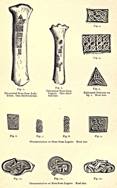
Plate XXXII.
Plate 32.
Fig. 1. Decorated Bone from Ardakillen. One-third real size.
Fig. 1. Decorated Bone from Ardakillen. One-third actual size.
Fig. 2. Decorated Bone from Lagore. One-third real size.
Fig. 2. Decorated Bone from Lagore. One-third actual size.
Fig. 3. Fig. 4. Fig. 5. Embossed Patterns on fig. 1. Real size.
Fig. 3. Fig. 4. Fig. 5. Raised Patterns on fig. 1. Actual size.
Fig. 6. Fig. 7. Fig. 8. Fig. 9. Ornamentation on Bone from Lagore. Real size.
Fig. 6. Fig. 7. Fig. 8. Fig. 9. Decoration on Bone from Lagore. Actual size.
Fig. 10. Fig. 11. Fig. 12. Ornamentation on Bone from Lagore. Real size.
Fig. 10. Fig. 11. Fig. 12. Decoration on Bone from Lagore. Actual size.
Decorated Bones from the Crannogs of Ardakillen and Lagore. Use unknown.
Decorated Bones from the Crannogs of Ardakillen and Lagore. Purpose unknown.
Another carved leg bone of a deer (plate XXXII.), fig. 2, is stained a dark brown colour, probably by lying in peat; its polished surface shows how much it had been handled. Upon the surface of this bone there are various devices traced with a graver or other sharp tool. Figs. 6, 7, 8, 9, represent these (full size), and figs. 10, 11, 12, are characteristic of Celtic animal ornamentation.
Another carved leg bone of a deer (plate XXXII.), fig. 2, is stained a dark brown color, likely from lying in peat; its polished surface shows how much it had been handled. On the surface of this bone, there are various designs etched with a graver or another sharp tool. Figs. 6, 7, 8, 9, represent these (full size), and figs. 10, 11, 12, are typical of Celtic animal decoration.
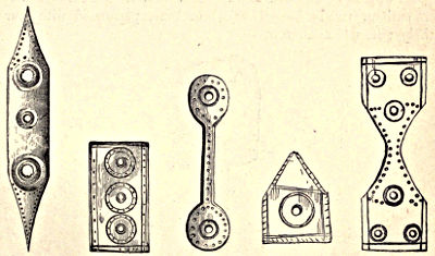
Fig. 189. Fig. 190. Fig. 191. Fig. 192. Fig. 193.
Fig. 189. Fig. 190. Fig. 191. Fig. 192. Fig. 193.
Plates of Bone, decorated, use not known.
Plates made of bone, decorated; purpose unknown.
In the Museum, R. I. A., there are eight thin plates of bone, varying in length from 1 to 5½ inches; they are of every variety of shape—square, triangular, irregular, but the majority oblong. In some respects they resemble in form, size, and ornamentation, the class of small stone articles supposed to have served as toy[Pg 140]s, amulets, or in some kind of game. According to Wilde, however, their more probable use was either for the decoration of small caskets, or for dress fasteners. They are generally perforated in several places, and the foregoing illustrations display great variety of outline. Their outer surface, smooth and convex, was more or less decorated with a number of circular indentations and dotted lines. Most of the specimens were found in the crannogs of Ballinderry and Ardakillen.
In the Museum, R. I. A., there are eight thin bone plates, ranging in length from 1 to 5½ inches. They come in various shapes—square, triangular, irregular, but most are oblong. In some ways, they resemble small stone items thought to have been used as toys, amulets, or in some kind of game. However, according to Wilde, their more likely use was for decorating small boxes or as dress fasteners. They usually have several holes perforated in them, and the illustrations show a great variety of outlines. Their outer surface is smooth and rounded, often decorated with circular indentations and dotted lines. Most of the specimens were found in the crannogs of Ballinderry and Ardakillen.

Fig. 194.—Rude Bone Spoon found at Clooneygonnel. Two-thirds real size.
Fig. 194.—Simple bone spoon discovered at Clooneygonnel. Two-thirds actual size.
Spoons formed of thin cuticular horn are not of unusual occurrence. The specimen represented, fig. 194, is one of two such articles found in the crannog of Clooneygonnel, and shaped out of the concave epiphyses, or joint surfaces of the vertebræ of some large mammal. A wooden handle had probably been originally attached to it.[157] Fig. 195, from Ballinderry, is a curious, rudely formed object of bone, perforated with four holes; its use unknown.[158]
Spoons made from thin layers of keratin are not uncommon. The specimen shown, fig. 194, is one of two such items discovered in the crannog of Clooneygonnel, shaped from the concave surfaces of the vertebrae of some large mammal. A wooden handle was likely attached to it originally. [157] Fig. 195, from Ballinderry, is a strange, roughly made bone object with four holes; its purpose is unknown. [158]


Plate XXXIII.
Plate 33.
Miscellaneous Articles found in Crannogs.
Miscellaneous items found in crannogs.
Plates XXXIII. and XXXIV. contain representations of miscellaneous crannog “finds” from Randalstown and Lough Guile, county Antrim, and Ballykinler, county Down: when not otherwise specified the articles are from the first-named locality. Plate XXXIII., 1, a piece of pottery (¼ size) that seems to have formed part of an earthen vessel; it is coarse, strong, well made, and graceful in design; other fragments were met with, and judging from the appearance of fire on the outside of one, it had been used for cooking purposes. 2. A remarkable object of granite (½ size); two of similar form were found at Ballykinler crannog. 3. A paddle or oar made of oak, its length 3 feet 7 inches by 4½ inches in breadth. 4. A wooden scoop; total length 12 inches, the handle 4 inches, thickness 1½. 5. A wooden vessel found with a canoe; its diameter 7 inches, depth 3, and thickness 1 inch; it would be adapted for baling out a boat. 6 seems to be a netting needle (½ size); it is made of iron. 7. A battle-axe; length from face to end of projection at back 7 inches, length of face 5½ inches, breadth 1 inch at the one end, and at the other 1½ inches. 8. Iron sock of a plough; length 7½ inches, greatest breadth 4 inches; it terminates in a point.
Plates XXXIII. and XXXIV. show various finds from crannogs in Randalstown and Lough Guile, County Antrim, and Ballykinler, County Down: unless stated otherwise, the items are from the first location mentioned. Plate XXXIII., 1, a piece of pottery (¼ size) appears to be part of an earthen vessel; it is coarse, sturdy, well-crafted, and elegantly designed; other fragments were discovered, and judging by the signs of fire on the outside of one, it had been used for cooking. 2. A unique granite object (½ size); two similar pieces were found at the Ballykinler crannog. 3. A paddle or oar made of oak, measuring 3 feet 7 inches in length and 4½ inches in width. 4. A wooden scoop; total length 12 inches, the handle 4 inches, with a thickness of 1½ inches. 5. A wooden vessel discovered with a canoe; its diameter is 7 inches, depth 3 inches, and thickness 1 inch; it would be useful for bailing out a boat. 6 appears to be a netting needle (½ size); it is made of iron. 7. A battle-axe; it measures 7 inches from the face to the end of the projection at the back, the face length is 5½ inches, with a width of 1 inch at one end and 1½ inches at the other. 8. Iron socket of a plough; it measures 7½ inches in length and 4 inches at its widest point; it tapers to a point.
The following objects are all drawn one-half size:—9. A knife, the only specimen met with at Ballykinler crannog, having a handle. The haft is of goat’s horn, and the blade like a penknife of large size; it does not seem applicable to any ordinary domestic purpose, but it may have been used for bleeding or operating on animals. 10. A wooden instrument—of which two were found—made of soft, long-grained wood of the pine kind; they might have been used for coarse knitting. 11. An instrument of similar wood, use unknown. 12. There were several like No. 12, formed of soft wood; they might have served as fastenings for mantle or hair. 13. An instrument of bone, neatly made and polished, which might have been used as a pin. 14. A pin, made of a close-grained, hard, white wood, probably holly; several of these were brought to light. 15. An article of iron, use unknown. 16. A pin of iron; several of these were found. 17, 18, 19, 20, 21, 22, 23, are pins of bronze. There were a great number resembling No. 17, also several of No. 19. 24. A large button made of bronze; the eyes are not fastened in but cast. 25. A crucible, seemingly of foreign manufacture, and unused; but several were met with greatly calcined. 26, 27, 28, seem to be fastenings for leather or other garments; they are of very thin bronze.[Pg 142] 29 is a comb made of bone and riveted with iron (found at Ballykinler crannog).
The following objects are all drawn half size:—9. A knife, the only example found at Ballykinler crannog, with a handle. The handle is made of goat’s horn, and the blade resembles a large penknife; it doesn’t seem to have any common household use, but it may have been for bleeding or performing operations on animals. 10. A wooden tool—two of these were found—made from soft, long-grained pine wood; they might have been used for coarse knitting. 11. A tool made of similar wood, purpose unknown. 12. There were several like No. 12, made from soft wood; they could have been used as fastenings for cloaks or hair. 13. A bone tool, well-made and polished, which might have been used as a pin. 14. A pin made of dense, hard, white wood, likely holly; several of these were uncovered. 15. An iron item, purpose unknown. 16. An iron pin; several of these were found. 17, 18, 19, 20, 21, 22, 23, are bronze pins. There were many that looked like No. 17, as well as several of No. 19. 24. A large button made of bronze; the eyes are cast, not pinned in. 25. A crucible, seemingly from abroad, and unused; however, several were found that were heavily calcined. 26, 27, 28, appear to be fastenings for leather or other clothing; they are made of very thin bronze.[Pg 142] 29 is a comb made of bone and riveted with iron (found at Ballykinler crannog).
Plate XXXIV., 1, is a pointed and socketed iron instrument from Ballymena. 2, drawn about half-size, is evidently a lamp of late, or perhaps mediæval form, composed of iron, and the workmanship good; it had an upright handle pierced by an oblong hole, with another hole in a projection at end of handle. A gentleman saw a lamp of this class in use near Carrickfergus in the year 1840, as also in the islands off the coast of Ulster. 3 is a canoe paddle made of oak, and about 3 feet in length; 4 is of stone, and was found in a crannog in the county Down; 5 is a “spindle-whorl” (so called) made of jet, and having indentations on it for a thong or string; 6 is a flint knife (full size); the form is rather unusual, flint knives being generally straight; 7 is a full-size representation of the smallest of two bronze knives; the other differs from it in being 1 inch longer, and the shape not so curved; it should however be observed, that these two articles are supposed by some authorities to be modern forgeries. 8 is a bronze instrument about 6 inches long, and very sharp at the point; the metal and workmanship being similar to the knives, it therefore may also be spurious. 9. A lozenge-shaped “spindle-whorl” of jet. This and the three preceding are said to have come from Lough Guile. 10 is a stone, natural size, perforated with two holes crossing at right angles, and at each end a hole going a short way in. It is suggested that it may have been the axis of a small wheel, “the arms being inserted through the holes in the body of the stone, while it worked on two projections inserted into the holes at the ends.”[159]
Plate XXXIV., 1, is a pointed and socketed iron tool from Ballymena. 2, drawn about half-size, is clearly a lamp of late or possibly medieval design, made of iron, and the craftsmanship is good; it had an upright handle with an oblong hole, as well as another hole at the end of the handle. A gentleman saw a lamp like this in use near Carrickfergus in 1840, and also in the islands off the coast of Ulster. 3 is a canoe paddle made of oak, approximately 3 feet long; 4 is made of stone and was found in a crannog in County Down; 5 is a "spindle-whorl" made of jet, featuring indentations for a thong or string; 6 is a flint knife (full size); its shape is fairly unusual, as flint knives are usually straight; 7 is a full-size depiction of the smaller of two bronze knives; the other one is 1 inch longer and not as curved; however, it's important to note that some experts believe these two items might be modern forgeries. 8 is a bronze tool about 6 inches long, very sharp at the tip; since the metal and workmanship are similar to the knives, it too could be a fake. 9. A lozenge-shaped "spindle-whorl" made of jet. This and the three previous items are said to have originated from Lough Guile. 10 is a stone, actual size, with two holes crossing at right angles, and a short hole at each end. It's suggested that this might have been the axis of a small wheel, with "the arms being inserted through the holes in the body of the stone, while it worked on two projections inserted into the holes at the ends.”[159]
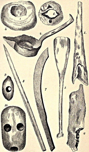
Plate XXXIV.
Plate 34.
Miscellaneous Articles found in Crannogs.
Miscellaneous Items Found in Crannogs.
A pair of scales were found at Loughtarmin, and several at Lagore. At the latter place were also a number of sewing-needles, composed of various materials: the majority were of bone, about six or eight of iron, and four or five of bronze. Those made of metal were comparatively small and fine. Needles of the same kind have been met with in the great crannogs of Ardakillen and Ballinderry.
A pair of scales was found at Loughtarmin, and several at Lagore. At the latter location, there were also a number of sewing needles made from different materials: most were made of bone, about six or eight were made of iron, and four or five were made of bronze. The metal needles were relatively small and fine. Needles of the same type have also been discovered in the large crannogs of Ardakillen and Ballinderry.
At Lagore was found a bronze object, use unknown, fig. 196. In one part it is ornamented with a beautiful chased design, once probably enamelled. In the same crannog there was a square iron pipe, 2½ inches in length, to which a long hook was attached.
At Lagore, a bronze object of unknown purpose was discovered, fig. 196. One side is decorated with a lovely chased design, which was likely once enamelled. In the same crannog, there was a square iron pipe, 2½ inches long, with a long hook attached to it.

Fig. 196.—Bronze Object found at Lagore. Full-size.
Fig. 196.—Bronze Object found at Lagore. Actual size.

Fig. 197.—Iron Pipe with Hook, from Lagore. Full-size.
Fig. 197.—Iron Pipe with Hook, from Lagore. Actual size.
All the articles figured on plate XXXV. were found in the crannog of Cloonfinlough, and are now in the British Museum. No. 1 (one-fourth real size) represents a leaf-shaped dagger, skean, or knife, of an extremely early type; it is a characteristic specimen of its class. Similar weapons have, in Ireland, frequently occurred in company with socketed celts, paalstaves, spear-heads, and other implements of the so-called “Bronze Age.” The handle is very small, perforated for insertion of a rivet, and probably the haft had been originally prolonged by the addition of a piece of bone, horn, or wood, secured to the bronze by means of the rivet. No. 2 (full-size) is an eo or brooch of bronze of a not unusual design, having a long pin and broad flat ends, with a sunk lozenge in each, filled with a hatched pattern. This form of dress-fastener must have remained unchanged during many ages, for whilst it seems to have been common in the later “Iron period,” it has[Pg 144] also occasionally been found under circumstances which point to much earlier days and usages. One example was discovered in a cinerary urn amongst calcined bones. No. 3 (full-size) is a pin of bronze with a crozier-like termination, ornamented with a series of minute indentations, arranged without any regular pattern. A number of these objects have been discovered in Christian cemeteries in Ireland—as at Clonmacnoise and the Arran Islands. No. 4 (full-size) is a very small arrow-head of iron; traces of a rivet hole are yet discernible. No. 5 (one-third real size) is a ring made from the crown of a stag’s horn, and polished on the interior; its use unknown. No. 6 (one-third real size) represents a double-bladed axe-head; similar implements occurred at Lagore and at Drumdarragh; they belong to the late “Iron period,” and vary greatly in dimensions. No. 7 (one-third real size) is a single-piece shoe of leather, joined at the heel and toe; at each side is a slit for a thong or strap to be brought over the instep. Articles of this kind were used amongst the Irish down to a very late period. Some specimens, highly decorated in early Celtic style, have been figured by Wilde.
All the items listed on plate XXXV. were found in the crannog of Cloonfinlough and are now in the British Museum. No. 1 (one-fourth actual size) shows a leaf-shaped dagger, skean, or knife of an extremely early type; it is a typical example of its class. Similar weapons have often been found in Ireland alongside socketed celts, paalstaves, spear-heads, and other tools from the so-called "Bronze Age." The handle is very small, with a hole for a rivet, and it’s likely that the haft was originally extended with a piece of bone, horn, or wood, secured to the bronze with the rivet. No. 2 (full-size) is a bronze eo or brooch of a common design, featuring a long pin and broad flat ends, with a sunk diamond shape in each, filled with a hatched pattern. This type of dress-fastener probably remained unchanged for many ages, as it seems to have been common in the later "Iron period," but it has also been found in contexts suggesting much earlier use. One example was discovered in a cinerary urn among burnt bones. No. 3 (full-size) is a bronze pin with a crozier-like end, decorated with a series of tiny indentations arranged in no particular pattern. Many of these items have been found in Christian cemeteries in Ireland, such as at Clonmacnoise and the Arran Islands. No. 4 (full-size) is a very small iron arrowhead; traces of a rivet hole are still visible. No. 5 (one-third actual size) is a ring made from the crown of a stag’s horn, polished on the inside; its use is unknown. No. 6 (one-third actual size) represents a double-bladed axe-head; similar tools were found at Lagore and Drumdarragh; they belong to the late "Iron period" and vary significantly in size. No. 7 (one-third actual size) is a single-piece leather shoe, sewn at the heel and toe; there is a slit on each side for a thong or strap to go over the instep. Items like this were used by the Irish until a very late period. Some examples, richly decorated in early Celtic style, have been illustrated by Wilde.
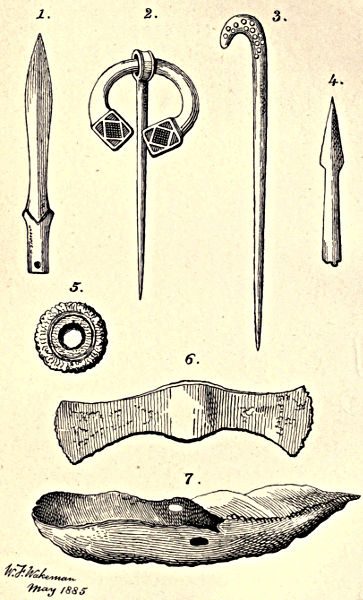
Plate XXXV.
Plate 35.
Objects of various Materials from the Crannog of Cloonfinlough, and now in the British Museum.
Objects made from different materials from the Crannog of Cloonfinlough are now in the British Museum.
Fishing Implements.—It is probable that on account of the smallness of their size, many bronze fishing-hooks may have been overlooked by searchers amongst crannog sites, though a number of specimens formed of iron occurred amongst the relics of ancient Dublin during the excavations made many years ago in Christ Church-place, and Fishamble-street. Several implements of iron, evidently designed for the capture of fresh-water prey, have been found on the sites of crannogs, and may now be seen in the Museum, R. I. A. Plate XXXVI. No. 1 is the head of an eel-spear, one of several exhumed from the debris of the Ardakillen crannogs; no trace of the handle remained. The implement consists of nine barbed prongs (the wings of the heads nearly touching each other) set in an oblong-shaped socket, composed of extremely thin iron plates or bands, that measure in width 5½ inches, in depth 2¾ inches, and are of sufficient strength to receive and secure the prongs; these average somewhat less than a quarter of an inch at their greatest diameter, which occurs near the head. The socket in its various parts is secured together by a number of rivets, irregularly set; from it descends a shaft measuring 4¾ inches. It is at first quadrangular, but midway assumes a cylindrical form, resembling sockets of crannog spears of the later “iron peri[Pg 145]od,” and like them secured to wooden handles by a rivet. The implement presents altogether a rough and bizarre appearance. No. 2 is a smaller example of an eel-spear, with socket, and having only eight barbed prongs. No. 3 is another form of fish-spear, or gaff. It measures 9½ inches in length, and is furnished at its pointed head with two long narrow barbs designed for holding. Unlike the spear and arrow-heads used in war, or in the chase, this implement was secured to its wooden shaft by a tang. Nos. 4, 5, 7, and 8, are darts or spear-heads of the same class. Save in size, they differ very slightly from No. 3, but are considerably eroded by the moisture of the bog-stuff in which they were embedded. No. 6 is a highly-finished head of the fish-spear class, though at first sight it might almost be taken for an arrow-head. Its barbs were, however, evidently intended to hold any substance into which they might be struck; the tang is solid and octangular, and just at the point where it joins the head there are three rather deep transverse notches. No. 9 is an ordinary iron fish-hook.
Fishing Implements.—It’s likely that due to their small size, many bronze fishing hooks have been missed by those searching crannog sites. However, some iron specimens were found among the artifacts of ancient Dublin during excavations years ago in Christ Church-place and Fishamble-street. Several iron tools clearly made for catching freshwater fish have been discovered at crannog locations, and many are now displayed in the Museum, R. I. A. Plate XXXVI. No. 1 is the head of an eel spear, part of a collection excavated from the debris of the Ardakillen crannogs; no trace of the handle is left. This implement has nine barbed prongs (the tips nearly touching) anchored in an oblong socket, made of very thin iron plates or bands, which measure 5½ inches wide and 2¾ inches deep, strong enough to hold the prongs in place; these average just under a quarter of an inch at their widest point near the head. The socket is held together by several irregularly placed rivets; a shaft measuring 4¾ inches extends from it. Initially quadrangular, it becomes cylindrical halfway down, resembling the sockets of crannog spears from the later “iron period,” also attached to wooden handles by a rivet. The implement looks quite rough and unusual. No. 2 is a smaller example of an eel spear with a socket, featuring only eight barbed prongs. No. 3 is another type of fish spear, or gaff. It is 9½ inches long and has a pointed head equipped with two long narrow barbs meant for gripping. Unlike the spear and arrow heads used in warfare or hunting, this tool was attached to its wooden shaft by a tang. Nos. 4, 5, 7, and 8 are darts or spear heads of the same category. Aside from their size, they differ very little from No. 3, but are significantly worn due to the moisture in the bog where they were found. No. 6 is a highly finished head from the fish spear category, although at first glance, it might be mistaken for an arrow head. Its barbs were clearly designed to hold onto anything they punctured; the tang is solid and octagonal, and where it connects to the head, there are three fairly deep cross notches. No. 9 is a standard iron fish hook.
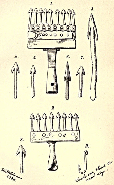
Plate XXXVI.
Plate 36.
Fishing Implements of Iron from Crannogs. Nos. 2, 3, 4, 5, 6, 7, and 8 from Ardakillen or Strokestown Crannogs. No. 9 from Lagore. All one-third real size.
Fishing Tools Made of Iron from Crannogs. Nos. 2, 3, 4, 5, 6, 7, and 8 from Ardakillen or Strokestown Crannogs. No. 9 from Lagore. All one-third actual size.
Historical Notices of Crannogs.—According to Keller, Swiss “Pfahlbauten,” or pile dwellings, attained their highest development about fifteen hundred years B.C. This statement he founds on the absence in them of traces of winter corn, hemp, and domestic fowl (unknown to the Greeks till the time of Pericles). These lacustrine sites appear to have been abandoned about, or perhaps before, the commencement of the Christian era; whilst on the other hand, although we have no account of the first erection of crannogs in Ireland, and must therefore consider their origin to date back from prehistoric times, yet we have undoubted proofs of their continued use down to the close of the seventeenth century; although now where
Historical Notices of Crannogs.—According to Keller, Swiss “Pfahlbauten,” or pile dwellings, reached their peak about fifteen hundred years BCE He bases this statement on the lack of evidence for winter crops, hemp, and domesticated birds (which were unknown to the Greeks until Pericles' time). These lake sites seem to have been abandoned around, or possibly before, the beginning of the Christian era; however, even though we have no record of when crannogs were first built in Ireland, we can assume their origins go back to prehistoric times, and we have clear evidence of their use all the way to the end of the seventeenth century; although now where
In Connaught, next after Ulster, the greatest number of lake dwellings have been discovered, but a list of them could have only temporary value, as further explorations might greatly change, or even reverse, the numerical superiority of the crannog sites in Ulster. It is only of late that Munster can be said to be embra[Pg 146]ced within the lake-dwelling area, whose ambit now includes the entire kingdom. From the present stand-point, the northern province, however, seems to have been facile princeps the home of the lake-dweller. Its population, even to the close of the seventeenth century, followed a life of rude and primitive character. The waters of the Erne, its tributaries and lakes, stretched for a distance of nearly sixty miles; the counties of Monaghan and Cavan of the present day formed then a district of low wooded hills, interlaced with a perfect net-work of bogs and lakes, through which ran but one road—that by Carrickmacross in the barony of Farney—whilst the Few mountains, at that period wooded, served to complete a “scientific frontier” of nature’s own formation. The term “Lake Country” has often been applied to the county Fermanagh: indeed the whole territory would seem at no very remote date to have been a watery maze. Upon almost every side may be observed either marshes that had once been lakes, or else sheets of water varying in size, from what may be termed lakes to mere lakelets; and at a period when the whole neighbouring country was one mass of wood these inland loughs served as tolerably secure retreats. At the time of the Anglo-Norman invasion of Ireland castles on terra firma seem to have been but lightly esteemed by the northern chieftains, for the conqueror of Ulster had erected many strongholds to secure the subjugated territory, more especially in the country of Mac Mahon, who “with solemn protestations vowed to become a true and faithful subject, whereupon de Courcy gave him two castles with their demeanes to hold of him. Within one month after this Mac Mahon brake down the castles, and made them even with the ground. Sir John de Courcy sent unto him to know the cause: his answer was, that he promised not to hold stones of him, but the land.” Later on one Thomas Pettiplace, in answer to an inquiry from the Government as to what castles or forts O’Neil was possessed of, in a letter of the 15th May, 1567, states:—“For castles I think it be not unknown unto yr honors he trusteth no points thereunto for his safety, as appeareth by the raising (razing) of the strongest castles of all his countries, and that fortification that he only dependeth upon is in sartin ffreshwater loghes in his country, which from the sea there come neither ship nor boat to approach them; it is thought that there in ye said fortified islands lyeth all his plate, wch is much, and [Pg 147]money, prisoners, and gages, wch islands hath in wars before been attempted, and now of late again by ye Lord Deputy Sr Harry Sydney, wch, for want of means for safe conduct upon ye water, it hath not prevailed.” Of the unsuccessful attack on the crannog or stockaded island, to which allusion is thus made, the account forwarded by Sir Henry Sydney to Elizabeth, dated Drogheda, 12th November, 1566, is here given:—“On Thursday, the 17th of the last September, I, your Highnes[Pg 148]s’ Deputy, accompanied with the Earl of Kildare, the Marshal Francis Agarnde and Jaques Wingefelde, with the rest of the captains and soldiers of your Highness’ army—each man in his calling as willing to serve your Majesty as ever I saw men—issued out of this town of Drogheda, and encamped in the confines of the English Pale and O’Hanlon’s country, at a place called Roskeaghe, where we were forced to remain, for sundry necessary things not come as then out of the English Pale, four nights. So, on the 21st of the same month, we removed and marched towards Ardmach, and in the way, having occasion to encamp hard by a logh, in which was an island, and in the same, by universal opinion and report of divers of that country, a great quantity of the rebels’ goods and victuals kept, only without guns, as it was thought, not greatly strong as it seemed, being but hedged about, and the distance from the main not being passed five-score yards, the army coming timely to the camp, divers soldiers were very desirous to attempt the winning of it, which was granted to them, I the Deputy making choice only of such as could swim; nevertheless there was prepared for them a bridge which floated upon barrels, whereupon they went but disorderly, for many more went than were appointed, among whom Edward Vaughan, a gentleman of Wales, who being none of the army, but come over to serve this journey, as many more gentlemen and others of that country and the marches of the same did, was one who, unwitting to me your Highness’ Deputy, being gone from the place where the bridge did lie, to stay the shot of the army, least they should hurt their followers, with divers others not appointed, stepped upon the bridge and rowed away, which overcharge of men caused the bridge more to sink than else it would, and yet not so much but that it floated still and carried them over, but in such sort as the fireworks conveyed with them miscarried, so they were able therewith to do nothing. They found the place better manned than it was thought, and they of better courage than before that time the like men had ever shewed themselves in the like place. They found the hedge so bearded with stakes and other sharp wood, as it was not without extreme difficulty scaleable, and so ramparted as if the hedge had been burned—for doing whereof the fireworks failed—without a long time it was not to be digged down. Yet some scaled to the top, whereof Edward Vaughan was one, who being pushed with a pike from the same, fell between the hedge and the bridge, and being heavily armed—albeit he could swim perfect well—was drowned, and two others hurt upon the rampart and drowned; one other slain upon the bridge with a shot; a man of mine, the Deputy, slain upon the main with a shot; and Anthony Deringe, a servant of the Earl of Leycester’s, stricken through the thigh without perishing any bone, and is perfectly recovered; the rest, unhurt, returned upon the bridge to the land. We write of this trifle thus largely to your Most Excellent Majesty least some malice or ignorance might inform the same contrary to the truth; and as many of us as were at the journey by these our letters affirm this to be the truth, and the whole truth, of that fact.”
In Connaught, following Ulster, the highest number of lake dwellings have been found, but making a list of them would only be temporarily useful, as further research could significantly alter, or even overturn, the numerical dominance of the crannog sites in Ulster. Only recently can we say that Munster has been included in the lake-dwelling area, which now covers the entire kingdom. From our current perspective, however, the northern province seems to have clearly been the main home of the lake-dwellers. Its residents lived a rough and primitive lifestyle, even up until the end of the seventeenth century. The waters of the Erne, along with its tributaries and lakes, stretched nearly sixty miles; the present counties of Monaghan and Cavan then formed a region of low wooded hills, interspersed with a perfect network of bogs and lakes, through which there was only one road—that by Carrickmacross in the barony of Farney—while a few mountains, which were forested at that time, helped to create a "scientific frontier" of nature’s own making. The term “Lake Country” is often used to describe County Fermanagh: indeed, it seems that not so long ago, the whole area was a watery maze. Almost everywhere you look, there are either marshes that used to be lakes or bodies of water that range from what we would call lakes to small ponds; and at a time when the entire surrounding area was densely wooded, these inland loughs provided relatively safe retreats. During the Anglo-Norman invasion of Ireland, castles on solid ground didn't seem to be highly valued by the northern chiefs, as the conqueror of Ulster constructed many strongholds to secure the conquered land, particularly in the territory of Mac Mahon, who “with solemn vows promised to become a true and loyal subject, whereupon de Courcy gave him two castles and their lands to hold from him. Within a month, Mac Mahon demolished the castles and leveled them to the ground. Sir John de Courcy sent a message to ask why he had done this; Mac Mahon replied that he did not promise to hold stones from him, but the land.” Later, a Thomas Pettiplace, in response to a government inquiry regarding O’Neil's castles or forts, wrote in a letter dated May 15, 1567: “As for castles, I think it is not unknown to your honors that he relies on no points there for his safety, as shown by the dismantling of the strongest castles in all his lands, and the fortification he depends upon is in certain freshwater loughs in his territory, which neither ships nor boats approach from the sea; it is believed that all his valuables, which are considerable, along with money, prisoners, and pledges, lie within those so-called fortified islands, which have been attacked in previous wars and recently again by Lord Deputy Sir Henry Sydney, who, due to a lack of means for safe passage on the water, was unsuccessful.” Regarding the failed assault on the crannog or fortified island mentioned here, the report sent by Sir Henry Sydney to Elizabeth, dated Drogheda, November 12, 1566, is as follows: “On Thursday, September 17, I, your Highness’s Deputy, along with the Earl of Kildare, Marshal Francis Agarnde, and Jaques Wingefelde, along with the other captains and soldiers of your Highness’s army—each man in his role, eager to serve your Majesty as I have ever seen men do—left this town of Drogheda and camped on the border of the English Pale and O’Hanlon’s land, at a place called Roskeaghe, where we had to stay for four nights due to various necessary items not arriving from the English Pale. On the 21st of the same month, we moved and marched towards Ardmach, and on the way, needing to camp near a lough that contained an island which, according to widespread opinion and reports from various locals, held a large amount of the rebels’ goods and supplies, was thought to be not very well defended, as it appeared only to be surrounded by a hedge and was less than five hundred yards from the mainland. When the army arrived in time at the camp, several soldiers were very eager to try and take it, which was allowed, with me, the Deputy, choosing only those who could swim; nevertheless, there was a floating bridge made from barrels prepared for them, but they crossed it in a chaotic manner, as more people joined than were planned, among whom was Edward Vaughan, a gentleman from Wales, who was not part of the army but had come to join this mission, along with many other gentlemen and others from that area and its borders. Unbeknownst to me, your Highness’s Deputy, he left the spot where the bridge was to shield the army from getting shot, so that their followers wouldn’t be harmed, and along with various others not assigned, stepped onto the bridge and rowed away. This overload caused the bridge to sink more than it otherwise would have, and yet it remained buoyant enough to carry them across, but in such a manner that the fireworks they took with them failed, so they were of no use. They found the location better defended than they had anticipated, and although they seemed braver than similar individuals had previously shown themselves to be in such places, they encountered a hedge fortified with stakes and other sharp wood that was extremely difficult to scale, and it was so barricaded as if the hedge had been burned—which was what the fireworks had failed to accomplish—that it would take a long time to dig down. Still, some managed to reach the top, including Edward Vaughan, who was pushed back with a pike, fell between the hedge and the bridge, and though he could swim very well, was drowned due to his heavy armor; two others were hurt on the rampart and drowned; one man on my side, the Deputy, was shot and killed on the mainland; and Anthony Deringe, a servant of the Earl of Leycester, was struck through the thigh without any bones being broken, and he has fully recovered; the rest, unharmed, returned across the bridge to shore. We write about this trivial matter in detail to your Most Excellent Majesty to prevent any malice or ignorance from misinforming you about the truth; and those of us who were part of the mission confirm this is the truth, and the whole truth, regarding that incident.”
Extracts that here follow, from notices of crannogs contained in native annals,[160] trace back their existence in Ireland during a period of over a thousand years from the seventeenth century.
Extracts that follow, from records of crannogs found in local histories,[160] trace their existence in Ireland for over a thousand years since the seventeenth century.
After the surrender of Charlemont, Sir Phelim O’Neil “retired to a fortified island called Raghan (? Roughan) Isle, and was there captured in February, 1653, by William Lord Charlemont.”[161]
After Charlemont surrendered, Sir Phelim O’Neil "withdrew to a fortified island called Raghan (? Roughan) Isle, where he was captured in February 1653 by William Lord Charlemont.”[161]
A small lake situated somewhat to the north-west of the village of Desertmartin has given title to the barony of Loughinsholin, lying south of the city of Londonderry; it was so named from Inis Ua Fhloinne (O’Lynn’s Island), a stockaded dwelling near its eastern margin. The lake itself is now known as Lough Shillen. The oak piling that formerly surrounded the island was removed for firewood, leaving a mere bank covered with reeds and low bushes. In Father O’Mellan’s Journal (written in Irish) of the rebellion of 1642, he mentions two attacks on the island by the English, in the years 1642, 1643; and again in 1645, its final abandonment and destruction by fire on the part of the Irish, owing to inability to hold out from want of provisions. He st[Pg 149]ates that on the “27th April, 1642, the Coleraine detachment (i.e. the English) came upon Cormac O’Neill, son of Fedhlim Oge, at Rayleagh, and robbed and killed his people, namely the Clann William; thence they proceeded to Lough-inis-olyn, and to Moneymore, until the two forces were near one another. They collected a great deal of spoil, and the creaghts fled to Dungannon. After plundering far and near, the English returned to Lough-inis-olyn. They sent Rory Ballagh O’Mellan to demand the island from Shane O’Hagan, son of John, son of Edmond Oge. It was refused them. They then fired three shots from a cannon, which they had with them, and departed from the place, returning to their homes laden with spoil.”
A small lake located a bit northwest of the village of Desertmartin gives its name to the barony of Loughinsholin, which lies south of the city of Londonderry. It was named after Inis Ua Fhloinne (O’Lynn’s Island), a fortified dwelling near its eastern edge. The lake is now called Lough Shillen. The oak piling that once surrounded the island was taken for firewood, leaving just a bank covered with reeds and small bushes. In Father O’Mellan’s Journal (written in Irish) about the rebellion of 1642, he notes two attacks on the island by the English in 1642 and 1643; and again in 1645, when it was finally abandoned and destroyed by fire by the Irish due to a lack of provisions. He states that on “27th April, 1642, the Coleraine detachment (i.e. the English) came upon Cormac O’Neill, son of Fedhlim Oge, at Rayleagh, stealing from and killing his people, namely the Clann William; from there they moved to Lough-inis-olyn, and then to Moneymore, until the two forces were close to each other. They gathered a lot of loot, and the creaghts fled to Dungannon. After plundering far and wide, the English returned to Lough-inis-olyn. They sent Rory Ballagh O’Mellan to demand the island from Shane O’Hagan, son of John, son of Edmond Oge. They were denied. They then fired three cannon shots, which they had with them, and departed from the place, returning home loaded with spoils.”
Again, on “August 25, 1643, Inis-O’Luin was garrisoned by Shane O’Hagan. The enemy came and called on them to surrender, which they refused to do. They then stopped up a stream which ran out of the lake, and turned the course of another into it, so that they contrived to flood the island. The garrison kept watch in the island house, and one of their men was killed by a cannon ball while on watch. However, they refused to surrender the island on any terms. One man in attempting to swim away had his legs broken. The enemy at length departed.” The latest entry occurs under date 7th March, 1645, when “The people of O’Hagan burned Inis-O’Lynn, for want of provisions, and followed the general eastwards.”[162]
Again, on August 25, 1643, Inis-O’Luin was held by Shane O’Hagan. The enemy arrived and demanded their surrender, which they refused. They then blocked a stream that flowed out of the lake and redirected another one into it, managing to flood the island. The garrison kept watch in the island house, and one of their men was killed by a cannonball while on guard. Nevertheless, they wouldn't surrender the island under any circumstances. One man trying to swim away ended up with broken legs. Eventually, the enemy left. The latest entry is dated March 7, 1645, when the people of O’Hagan burned Inis-O’Lynn due to a lack of supplies, and followed the general eastward.[162]
The crannog of Mac Navin,[163] county Galway, was taken in the year 1610; it is previously mentioned under date 1601. G. H.[Pg 150] Kinahan, who searched for but could find no trace of this crannog, imagined its site must have been somewhere in the large alluvial flat and bog that extends south of the townland of Crannagh, in the parish of Tynagh, county Galway. This supposed site lies about four miles E.N.E. of the crannog of Ballinlough. The difficulty experienced in identifying the site is the more remarkable as the descendants of the sept of Mac Navin still reside in the locality, and the crannog was inhabited up to a very late period.[164] In 1603, after the subjugation of Leitrim by the Crown, “O’Rourke was obliged to remain with a small force in the woods, in the remote glens and on the islands in the lakes in his country;” whilst the same year Hugh Boy O’Donnell was conveyed by his adherents to the retirement of a crannog, to be healed of his wounds. This retreat, called “Crannog-na-n-Duini, in Ross Guill, in the Tuathas,” was situated in the parish of Mevagh, county Donegal, between Redhaven and Sheephaven. In 1599 the crannog of Lough Gur, county Limerick, was taken from the “Queen’s people” by the Earl of Desmond, then in rebellion against Elizabeth. Sir George Carew relates that the Lord President of Munster, who reconnoitred the crannog for the purpose of its recapture in the following year, i.e. 1600, observed two small islets (the crannogs) and one large island; this latter “he found to be a place of exceeding strength, by reason that it was an island encompassed with a deep lough, the breadth thereof being, in the narrowest place, a caliver’s shot over. Upon one side thereof standeth a very strong castle, which at this time was manned with a good garrison, for there was within the island John Fitz Thomas with two hundred men at the least.”[165] “After much parade in the preparation of ordnance to reduce Lough Gur, its surrender was purchased for sixty pounds from Owen Grome, who had been entrusted with its defence.”[166] There yet lingers here “the reflex of a legend past,” for it is supposed that beneath the waters of the lake lie enchanted the grand old castle of the Desmonds, the great earl himself, his beautiful countess, and all the retinue that surrounded him in the days of his splendour. “In one of the lakes is a small island, rocky and wooded, whic[Pg 151]h is believed by the peasantry to represent the top of the highest tower of the castle, which sank under a spell to the bottom.”[167]
The crannog of Mac Navin,[163] County Galway, was occupied in 1610; it was mentioned earlier in 1601. G. H.[Pg 150] Kinahan looked for this crannog but couldn’t find any evidence of it. He speculated that its location must have been somewhere in the large alluvial flat and bog that stretches south of the townland of Crannagh, in the parish of Tynagh, County Galway. This presumed site is about four miles E.N.E. of the crannog at Ballinlough. The challenge in pinpointing the site is even more surprising since the descendants of the Mac Navin clan still live in the area, and the crannog was occupied until quite recently.[164] In 1603, after the Crown took control of Leitrim, “O’Rourke was forced to stay with a small force in the woods, in remote glens, and on the islands in the lakes of his territory;” at the same time, Hugh Boy O’Donnell was taken by his followers to hide on a crannog while he recovered from his wounds. This retreat, known as “Crannog-na-n-Duini, in Ross Guill, in the Tuathas,” was located in the parish of Mevagh, County Donegal, between Redhaven and Sheephaven. In 1599, the crannog of Lough Gur, County Limerick, was seized from the “Queen’s people” by the Earl of Desmond, who was rebelling against Elizabeth at the time. Sir George Carew recounts that the Lord President of Munster, who surveyed the crannog in order to reclaim it the following year, i.e. 1600, noticed two small islets (the crannogs) and one large island; he found this large island to be exceptionally fortified since it was surrounded by a deep lake, with its narrowest point being a caliver’s shot wide. On one side of it stood a very strong castle, which at that time was garrisoned well because John Fitz Thomas was inside the island with at least two hundred men.”[165] “After much show in preparing artillery to take Lough Gur, its surrender was bought for sixty pounds from Owen Grome, who had been left to defend it.”[166] A legend lingers here, as it is said that beneath the lake's waters lies the enchanted grand old castle of the Desmonds, the great earl himself, his beautiful countess, and all the retinue that surrounded him in his days of glory. “In one of the lakes is a small, rocky, wooded island that the local people believe represents the tip of the highest tower of the castle, which sank under a spell to the bottom.”[167]
In a plan-drawing of the siege of Enniskillen castle, in the year 1592, the remains of a crannog appear in the river close to the castle, where seemingly a circle of stakes encloses a diminutive island.[168] The survey or maps of the county Monaghan, made by one Francis Jobson in 1590, though meagre, and certainly—as its designer expresses in an apologetic note to Burghley—“nothing perfect,” is nevertheless highly interesting by reason of the rude sketches of the water-laved abodes of the chiefs of Monaghan. Each barony possessed one, designated “the island”; that in Farney was at Lisanisk, written Lysonske, and it is marked on the map as “The Island, Ever M’Cooley’s house.” In the year 1843 traces of this structure were discovered; the former artificial island was then a peninsula, having been joined to the shore. Seven feet below the surface of the ground, and two feet below the water level, a double row of piles was disclosed, formed of young trees with the bark still adhering, and from six to twelve inches in diameter; the area thus enclosed was an oval sixty feet by forty-two feet.[169] In Jobson’s map several crannogs are represented in Lough Mucknoe, barony of Cremorne; also “Mac Mahoun’s house,” or crannog, is shown in Lough Monnachin. According to the same authority, a sub-chief of the present county Monaghan, named Mac Kenna, resided in a crannog either on the lake of Glaslough or that of Erny in the parish of Donagh. The map is so rough that it is difficult to decide which of the lakes is intended. Francis Jobson likewise represents the residence of a chieftain named Brian Mahon, as a crannog on Lough Rouskey, in the parish of Killeevan. In 1588 Aedh O’Donnell and nine of his followers were murdered in the crannog of Mongavlin, parish of Taughboyne, county Donegal. “The crannog is not now traceable, nor is there any water in the locality in which such a structure could have existed, with the exception of Lough Foyle, on the margin of which Mongavlin is situated.”[170] In 1571 the Mac Dermots burned Inis-Floinn and Inis-Mi[Pg 152]c-David,[171] situated somewhere on the borders of Roscommon and Sligo. The statement that the islands were burned seems to sufficiently demonstrate their artificial character. In the sixteenth century the island fortress of Inishrush was held by an Irish sub-chief named Brian Carragh; and Dr. Reeves quotes a document from the State Paper Office, in which allusion is made to it in the form of a letter to a Captain Piers, dated 10th December, 1566. The writer says:—“Als mony as we migt drywe and dreaf ower ye Ban all ye carycht yt Brean Karriche hade … and ane innyse (i.e. Island, namely Inishrush), yt Brean Karriche hade of befair and Oneiles servand tuk yt, and now we have gotten ye innys agane, and that harchips I behuffit to Sla yame to be meet to my arme.” The crannog of Inishrush (i. e. the island of the wood), or perhaps, peninsula, has long ceased to bear that name. It is a small island in the middle of a marshy basin called Green Lough, in the townland of Inishrush, barony of Loughinsholin, county Derry. Some years ago this marsh was a sheet of water about half a mile in circumference, the drainage of which was effected by means of a deep cut that carried its contents into the Clady river. About the centre of the lakelet was a circular artificial mound composed of clay and gravel, the sides gradually shelving downwards. It was girt with a circle—about one hundred and fifty feet in circumference—of oak piles, most of them still in position. Horizontal beams of oak were mortised in the upper ends, and upon this framework rested seemingly the foundation of a wooden house securely attached to the supporting timbers. An artificial causeway, leading from the western margin of the lough, appears to have formerly connected the crannog with terra firma. The sole discovery made was a fragment of chain-armour. The lake basin became again partly submerged owing to neglect of the drainage, and when Dr. Reeves visited the locality in 1859, he failed to reach the crannog. It remained, however, above water, prominently covered with a luxuriant growth of grass.[172]
In a map documenting the siege of Enniskillen castle in 1592, remnants of a crannog are visible in the river near the castle, where a circle of stakes seemingly encircles a small island.[168] The survey or maps of county Monaghan, created by Francis Jobson in 1590, although sparse and certainly—according to its creator’s apologetic note to Burghley—“far from perfect,” are still quite interesting due to the rough sketches of the water-edge homes of the chiefs of Monaghan. Each barony had one, referred to as “the island”; the one in Farney was at Lisanisk, noted as Lysonske, and it is labeled on the map as “The Island, Ever M’Cooley’s house.” In 1843, traces of this structure were found; the former artificial island had become a peninsula, now connected to the shore. Seven feet below the surface and two feet below the water level, a double row of piles was uncovered, made of young trees with the bark still on, ranging from six to twelve inches in diameter; the enclosed area measured an oval sixty feet by forty-two feet.[169] Jobson’s map depicts several crannogs in Lough Mucknoe, in the barony of Cremorne; “Mac Mahoun’s house,” or crannog, is marked in Lough Monnachin. According to the same source, a sub-chief of present-day county Monaghan, named Mac Kenna, lived in a crannog either on the lake of Glaslough or that of Erny in the parish of Donagh. The map is so rough that it is hard to determine which lake is indicated. Francis Jobson also shows the residence of a chieftain named Brian Mahon as a crannog on Lough Rouskey, in the parish of Killeevan. In 1588, Aedh O’Donnell and nine of his followers were killed in the crannog of Mongavlin, parish of Taughboyne, county Donegal. “The crannog is no longer traceable, nor is there any water in the area where such a structure might have existed, except for Lough Foyle, on the edge of which Mongavlin is located.”[170] In 1571, the Mac Dermots burned Inis-Floinn and Inis-Mi[Pg 152]c-David,[171] located somewhere on the borders of Roscommon and Sligo. The fact that the islands were burned seems to clearly indicate they were man-made. In the sixteenth century, the island fortress of Inishrush was occupied by an Irish sub-chief named Brian Carragh; Dr. Reeves cites a document from the State Paper Office that references it in a letter to Captain Piers, dated December 10, 1566. The writer states: “As many as we might drive and draw over ye Ban all ye carycht yt Brean Karriche hade… and an inne (i.e. Island, namely Inishrush), yt Brean Karriche had before and O’Neiles' servant took yt, and now we have gotten ye innys agane, and that hardship I had to slay them to be meet to my arm.” The crannog of Inishrush (i.e. the island of the wood), or possibly, peninsula, no longer carries that name. It is a small island in the center of a marshy area known as Green Lough, in the townland of Inishrush, barony of Loughinsholin, county Derry. A few years ago, this marsh was a body of water about half a mile in circumference, drained by a deep cut leading into the Clady river. At the center of the small lake was a circular artificial mound made of clay and gravel, with sides gently sloping downward. It was surrounded by a circle—about one hundred and fifty feet in circumference—of oak piles, most of which remain in place. Horizontal oak beams were mortised into the upper ends, and upon this framework was what seems to be the foundation of a wooden house securely attached to the supporting beams. An artificial causeway, extending from the western edge of the lough, appears to have once connected the crannog to solid ground. The only discovery made was a piece of chain mail. The basin of the lake has become partly submerged again due to neglect of the drainage, and when Dr. Reeves visited the area in 1859, he was unable to reach the crannog. However, it still appeared above water, prominently covered in lush grass.[172]
In 1560 O’Rourke was drowned “whilst going to sleep on a low sequestered crannog in Muinter Eolius,” county Leitrim. Under heading of the year 1544, crannogs in the county Antrim are referred to in the Annals of the Four Masters:—“O’Donnell marched with a force into the Routes, and took (i.) Ini[Pg 153]s-an-Lochain, on which was a wooden castle and an impregnable fortress in the possession of Mac Quillan; and after O’Donnell had taken the castle he gave the castle to O’Kane. On the same expedition O’Donnell took the castle of (ii.) Baile-an-locha, and he found much property, consisting of arms, armour, brass, iron, butter and provisions, in those castles. O’Donnell also took after that (iii.) Inis-locha-Burrann, and (iv.) Inis-locha-Leithinnsi, in which he likewise found much property.” (i.) Inis-an-Lochain (i. e. the island of the little lake) lies in the river Bann, about a mile and a-half to the south of Coleraine. It is now called Loughan Island. The crannog had been erected, or perhaps, re-erected in 1170. (ii.) Baile-an-locha (i. e. the village of the lake), anglicised Ballylough, and (iv.) Locha-Leithinnsi (i. e. the lake of the half island), now known as Lough Lynch, are both situated in the parish of Billy. Lough Lynch originally covered about twenty acres, but has been drained, and the former island is now accessible by dry land. This crannog “is shown as the birthplace of Colkitto, a chief who figured in Montrose’s wars,” and who has found a place in Sir Walter Scott’s “Legend of Montrose,” as well as in one of Milton’s sonnets, written on the critics who cut up the title of his book “Tetrachordon:”—
In 1560, O’Rourke drowned “while going to sleep on a low secluded crannog in Muinter Eolius,” County Leitrim. Under the entry for the year 1544, crannogs in County Antrim are mentioned in the Annals of the Four Masters:—“O’Donnell marched with a force into the Routes and took (i.) Ini[Pg 153]s-an-Lochain, which had a wooden castle and was an impregnable fortress belonging to Mac Quillan. After O’Donnell captured the castle, he handed it over to O’Kane. During the same expedition, O’Donnell also took the castle of (ii.) Baile-an-locha, where he found a lot of property, including arms, armor, brass, iron, butter, and supplies, in those castles. O’Donnell then captured (iii.) Inis-locha-Burrann, and (iv.) Inis-locha-Leithinnsi, in which he also discovered a lot of property.” (i.) Inis-an-Lochain (i.e. the island of the little lake) is located in the river Bann, about a mile and a half south of Coleraine. It is now known as Loughan Island. The crannog was built, or possibly re-built, in 1170. (ii.) Baile-an-locha (i.e. the village of the lake), anglicized to Ballylough, and (iv.) Locha-Leithinnsi (i.e. the lake of the half island), now referred to as Lough Lynch, are both found in the parish of Billy. Lough Lynch originally covered about twenty acres but has been drained, and the former island is now accessible by dry land. This crannog “is shown as the birthplace of Colkitto, a chief who played a role in Montrose’s wars,” and who is featured in Sir Walter Scott’s “Legend of Montrose,” as well as in one of Milton’s sonnets, written in response to critics who tore apart the title of his book “Tetrachordon:”
Colkitto’s real name was Alexander Mac Donnell, a relative of the Earl of Antrim. (iii.) Inis-locha-Burrann was situated in the parish of Ballintoy; the lake is now drained, and the place known by the name of Loughavarra.[173]
Colkitto's real name was Alexander Mac Donnell, a relative of the Earl of Antrim. (iii.) Inis-locha-Burrann was located in the parish of Ballintoy; the lake is now drained, and the area is known as Loughavarra.[173]
In 1541 the eastern crannog in the lake of Glencar, on the borders of Sligo and Leitrim, was taken by one sept of the O’Rourkes from another. Shortly afterwards the dispossessed proprietor attempted to set fire to the “fortress,” but was discovered, pursued by boats, taken prisoner, and hanged. I[Pg 154]n the summer of 1540, O’Donnell besieged the crannog of Loch Betha, now Lough Veagh, county Donegal. He encamped round the lake shores, but failed to take the stronghold. In the autumn he, however, defeated his opponents, and “broke up and completely demolished the crannog.” Previous mention is made of it as the scene of strife in the year 1524, when Eoghan O’Donnell took Niall O’Donnell’s “town” (i.e. the crannog of Loch Betha); whilst in 1257 O’Donnell was confined to this crannog during twelve months from wounds received in a battle near Sligo. In 1512 the crannog of Mac Gauran was taken by Mac Guire. In 1495 Mac Gauran, a chief of Tallaghaw, in the present county Cavan, was drowned in Loch Crannoige of Coill-an-mhuilinn (i. e. Lake Crannog of the Wood of the Mill), now Ballywillen Lough. In 1477 a violent tempest swept over Ireland which did great damage, especially to crannogs. Had these structures not been very numerous, the chroniclers would scarcely have drawn special attention to the havoc thus wrought. In 1455 Torlogh Mac Guire took and plundered the crannog of Mac Clancy on Lough Melvin, county Leitrim. In 1452 O’Hanley was murdered by his own tribe in the crannog of Loch-Leisi (stated by O’Donovan to be now called Muckenagh Lough), in the parish of Kilmeam, county Roscommon; whilst in 1246 it is of record that O’Conor made his escape when a prisoner from the same lake-dwelling, after drowning his guards. In 1368 an O’Conor was taken prisoner in the crannog of Ardakillen, parish of Killukin, county Roscommon, and in 1388 another O’Conor burned this crannog and the Island of Loch-Cairgin (i. e. Cargin’s Lough[174]), near Tulsk in the same county. In 1365 Brian Mac Mahon, chief of Oriel, invited his father-in-law to a banquet, where he made him prisoner, and “put him in a lake to conceal him”[175]—evidently meaning his confinement in a crannog—for Mac Geoghegan states that the captive was committed “to a strong place on a lough to be kept.” In 1247 Mac Costello took and garrisoned the crannog of Cloonloch (now Lough Clean), county Leitrim, and expelled the proprietor, Mac Rannall, who, however, succeeded in recapturing his stronghold.
In 1541, the eastern crannog in Lake Glencar, on the borders of Sligo and Leitrim, was seized by one clan of the O'Rourkes from another. Soon after, the ousted owner tried to set the "fortress" on fire, but he was caught, chased by boats, captured, and hanged. In the summer of 1540, O'Donnell besieged the crannog of Loch Betha, now Lough Veagh, in County Donegal. He camped around the lake's shores but failed to take the stronghold. However, in the autumn, he defeated his opponents and "broke up and completely demolished the crannog." It was previously mentioned as a site of conflict in 1524, when Eoghan O'Donnell took Niall O'Donnell's "town" (i.e., the crannog of Loch Betha); in 1257, O'Donnell was confined to this crannog for twelve months due to injuries sustained in a battle near Sligo. In 1512, the crannog of Mac Gauran was captured by Mac Guire. In 1495, Mac Gauran, a chief of Tallaghaw in present-day County Cavan, drowned in Loch Crannoige of Coill-an-mhuilinn (i.e., Lake Crannog of the Wood of the Mill), now Ballywillen Lough. In 1477, a violent storm swept over Ireland, causing significant damage, especially to crannogs. If these structures hadn't been so numerous, the chroniclers likely wouldn't have highlighted the destruction caused. In 1455, Torlogh Mac Guire captured and plundered the crannog of Mac Clancy on Lough Melvin, County Leitrim. In 1452, O'Hanley was murdered by his own tribe in the crannog of Loch-Leisi (now called Muckenagh Lough, according to O'Donovan), in the parish of Kilmeam, County Roscommon; in 1246, it was recorded that O'Conor escaped as a prisoner from the same lake dwelling after drowning his guards. In 1368, an O'Conor was captured in the crannog of Ardakillen, in the parish of Killukin, County Roscommon, and in 1388 another O'Conor burned this crannog and the Island of Loch-Cairgin (i.e., Cargin's Lough[174]), near Tulsk in the same county. In 1365, Brian Mac Mahon, chief of Oriel, invited his father-in-law to a feast, where he imprisoned him and "put him in a lake to conceal him"[175]—clearly referring to his confinement in a crannog—because Mac Geoghegan states that the captive was placed "in a strong place on a lough for safekeeping." In 1247, Mac Costello captured and garrisoned the crannog of Cloonloch (now Lough Clean), County Leitrim, and expelled the owner, Mac Rannall, who, however, managed to recapture his stronghold.
In 1223 William de Lacy, one of the great Anglo-Norman settlers in Ireland erected “the crannog of Inis-Laodhachain, and the Connacht men entered forcibly upon it, and let out on parole the people who were in it.” This erection of a lake-dwelling by a Norman baron is an instance of the habit laid to the charge of many of the English, of forsaking their own language and usages, and of living according to the manner of the Irish amongst whom they dwelt. “The names Inis-Laodhachain and Loch-Laodhachain are now obsolete.” In 1220 “Walter de Laci came to Erinn, and performed a great hosting to the crannog of O’Raighilligh.[176] He went upon it and obtained hostages and great power.” The crannog here referred to “appears to have been situated in Lough Oughter, county Cavan, where the old castle of Cloch-Uachtair (or Cloch-Oughter) now stands. In a letter from Guy de Chatillon to Henry III., dated July, 1224, Grennoch Oraely (as the name is therein written) is stated to have been captured from William de Lacy by Oraely, Walter de Riddelsford, and Richard Tuit, on the same day on which the castle of Kilmore (county Cavan) was taken, from which it appears to have been in the neighbourhood.”
In 1223, William de Lacy, one of the prominent Anglo-Norman settlers in Ireland, built “the crannog of Inis-Laodhachain, and the Connacht men took control of it by force, releasing the people who were there on parole.” This construction of a lake-dwelling by a Norman lord reflects a trend among many of the English, who were accused of abandoning their language and customs to adopt the ways of the Irish around them. “The names Inis-Laodhachain and Loch-Laodhachain are now no longer in use.” In 1220, “Walter de Laci arrived in Ireland and led a significant campaign to the crannog of O’Raighilligh.[176] He went onto it and secured hostages and significant power.” The crannog mentioned “seems to have been located in Lough Oughter, County Cavan, where the old castle of Cloch-Uachtair (or Cloch-Oughter) currently stands. In a letter from Guy de Chatillon to Henry III., dated July 1224, Grennoch Oraely (as it is spelled there) is reported to have been taken from William de Lacy by Oraely, Walter de Riddelsford, and Richard Tuit, on the same day the castle of Kilmore (County Cavan) was captured, indicating it was nearby.”
There is evidence that some crannogs were constructed by the Northmen, for in 1170 the chief of a small territory in the barony and county Monaghan “was killed by the men of a fleet which came from the Orkneys, in the island which had been constructed by themselves in Loch-Ruidhe, i. e. Inis-Lachain.” There is no lake in Ireland now known by that name; but to the south of Coleraine there is a small island in the river Bann called “the Loughan,” which bears all the appearance of having been artificially constructed.[177] In 1150 an Irish chief was killed “on the island of Loch-Laighaire.” This crannog lay in the country of the “Sliocht O’Neills,” and, as appears from subsequent references, was situated to the south of Lifford, in the barony of Clogher, county Tyrone, and was the residence of that branch of the O’Neills. It is written Loch-Laoghaire and Loch-Laighaire, i. e.[Pg 156] Leary’s Lake, said to have been so called from “Leary the Victorious,” one of the heroes of the Red Branch Knights of Ulster, in the first century; but for nearly two hundred years it has been generally known under the designation Corcreevy, i. e. wooded hill. In 1845, when the water had been drained off, the crannog was here discovered. There are several allusions to it in the Irish Annals. In 1325 “O’Donnell, the son of Brian O’Neill, Lord of Tyrone, died at Loch-Laighaire. In 1431 Nachtan O’Donnell went to assault the castle of Loch-Laighaire, and took it from Turlough O’Donnell, and all the spoils that were in it he carried off.” In 1436 the crannog had been seized by the O’Neills, when some of the same sept summoned Mac Guire to their assistance and “commenced constructing boats to go to the crannog, but the sons of Bryan, who were then in the crannog, came to the resolution of delivering it up.” In 1500 Hugh Roe O’Donnell “burned the crannog of Loch-Laighaire;” whilst in 1509 there is a notice of a fight between two septs of the O’Neills on the shores of the lake.
There is evidence that some crannogs were built by the Northmen, because in 1170, the leader of a small area in the barony and county Monaghan “was killed by the men of a fleet that came from the Orkneys, on the island they had constructed in Loch-Ruidhe, i.e., Inis-Lachain.” There isn’t a lake in Ireland known by that name today, but south of Coleraine, there's a small island in the river Bann called “the Loughan,” which looks like it could have been artificially created.[177] In 1150, an Irish chief was killed “on the island of Loch-Laighaire.” This crannog was located in the territory of the “Sliocht O’Neills,” and as later mentions indicate, was south of Lifford, in the barony of Clogher, county Tyrone, and served as the home for that branch of the O’Neills. It is written as Loch-Laoghaire and Loch-Laighaire, meaning [Pg 156] Leary’s Lake, named after “Leary the Victorious,” one of the heroes of the Red Branch Knights of Ulster, in the first century; however, for almost two hundred years, it has mostly been known as Corcreevy, meaning wooded hill. In 1845, when the water was drained, the crannog was uncovered. There are several references to it in the Irish Annals. In 1325, “O’Donnell, the son of Brian O’Neill, Lord of Tyrone, died at Loch-Laighaire.” In 1431, Nachtan O’Donnell went to attack the castle of Loch-Laighaire, took it from Turlough O’Donnell, and carried off all the spoils that were inside.” In 1436, the crannog had been taken by the O’Neills, when some of their clan called for Mac Guire to help them and “began building boats to go to the crannog, but the sons of Bryan, who were then at the crannog, decided to surrender it.” In 1500, Hugh Roe O’Donnell “burned the crannog of Loch-Laighaire;” and in 1509, there’s a record of a fight between two clans of the O’Neills on the shores of the lake.
In 1025, it is stated in the Annals of Loch Cé, that a predatory expedition was made by the inhabitants of Fermanagh, on which occasion they burned the crannog on Loch-n-Uaithne (Lough Ooney), “and slew seventeen men on the margin of the lake.” Lough Ooney lies in the county Monaghan, in the barony of Dartry, the chiefs of which territory had their principal residence on this lake, whence they were sometimes designated “Lords of Loch-n-Uaithne.”
In 1025, the Annals of Loch Cé report that the people of Fermanagh launched a raid during which they burned the crannog on Loch-n-Uaithne (Lough Ooney) and killed seventeen men by the lake's edge. Lough Ooney is located in County Monaghan, in the barony of Dartry, where the local chiefs had their main residence by the lake, and they were occasionally called “Lords of Loch-n-Uaithne.”
In the enumeration of various kinds of fortresses repaired by Brian Borumha, crannogs are included, as recorded in a well-known Irish ms. entitled “The Wars of the Gaedhiel with the Gaill.” In it mention is made of four crannogs, one being near Knockany, county Limerick, and situated in Lough Cend, now drained; also the celebrated crannog in Lough Gur, in the same county. The site of the crannog of Loch Saiglend has not been identified;[178] the site of Inis-an-ghaill-duibh (i. e. the island of the black foreigner or Dane,[179]) is unknown, or at least uncertain; however, in the Dublin copy of the Annals of Innisfallen, under date 1016, it is stated to have been situated in the river Shannon. We learn that in some[Pg 157] of his numerous conflicts with the Danes, Brian Borumha pillaged various islands in the Shannon, where the invaders had placed their women and children for safety, as well as their treasure, as “there was much gold and other wealth in these islands and fortifications.” In 990 a violent tempest “sunk the island of Lough Cimbe (now Lough Hackett) suddenly, dreach and rampart, i. e. thirty feet;” this crannog was afterwards rebuilt by Brian Borumha.
In the list of different types of fortresses repaired by Brian Borumha, crannogs are included, as noted in a famous Irish manuscript called “The Wars of the Gaedhiel with the Gaill.” It mentions four crannogs, one located near Knockany in County Limerick, situated in Lough Cend, which is now drained; and also the famous crannog in Lough Gur, in the same county. The location of the crannog at Loch Saiglend has not been identified;[178] the location of Inis-an-ghaill-duibh (i. e. the island of the black foreigner or Dane,[179]) is unknown, or at least uncertain; however, the Dublin copy of the Annals of Innisfallen states that it was located in the river Shannon in the year 1016. We learn that in some[Pg 157] of his many battles with the Danes, Brian Borumha raided several islands in the Shannon, where the invaders had put their women and children for safety, as well as their treasures, since “there was much gold and other wealth in these islands and fortifications.” In 990, a violent storm “sunk the island of Lough Cimbe (now Lough Hackett) suddenly, dreach and rampart, i. e. thirty feet;” this crannog was later rebuilt by Brian Borumha.
With the Danes, the struggle in Ireland between invaders and invaded was carried on as much in the lakes and rivers as on terra firma. Of the importance attached to crannogs during this contest many instances might be given, but a few will here suffice. In 984 “the islands of Connaught were destroyed by these marauders.” In 933 the crannog of Lagore in Meath was burnt by them; whilst in 848 they fired and dismantled it. Lagore being the residence of one of the principal chiefs of Meath, frequent notices of it appear in the annals, where it is written Loch-Gabhar. “Gabhur” is an ancient Irish and British word for a horse, and accordingly the name Loch-gabhra, which occurs in the life of St. Aidus, is translated Stagnum-equi, the lake of the horse,[180] now euphonized “Lagore.” In 967 Beollán, “king” of this place, died; in 907 Maelogra, also “king” of Lagore, was slain; whilst in 868 the son of Edirscel, “king” of Lagore, fell fighting against the Danes. In 865 Tighernach, “king” of Lagore and “half-king” of Meath, died; and in 856 Cinaedh, chief of the present baronies of Upper and Lower Duleek, in Meath, in alliance with the Danes, “spoiled the islands” of Lagore. This entry is of great importance, as it points to the probability of the site of another crannog or crannogs in close proximity to the celebrated historical stronghold dug out of its peaty covering in 1847, and which as early as A.D. 673, must have been of importance, for in that year a considerable battle took place on the shores of the lake. In 927 and 928 the Danes plundered “the islands of Lough Neagh,” and in 922 the same fate befel “the islands of Lough Rea.”
With the Danes, the battle in Ireland between invaders and the invaded happened just as much in the lakes and rivers as on solid ground. There are many examples showing the significance of crannogs during this conflict, but a few will be enough here. In 984, “the islands of Connaught were destroyed by these raiders.” In 933, the crannog of Lagore in Meath was burned by them; while in 848, they set it on fire and wrecked it. Lagore was the home of one of the main chiefs of Meath, and it’s mentioned frequently in the annals, where it’s referred to as Loch-Gabhar. “Gabhur” is an old Irish and British word for a horse, and that’s why the name Loch-gabhra, which appears in the life of St. Aidus, is translated as Stagnum-equi, the lake of the horse,[180] now called “Lagore.” In 967, Beollán, “king” of this place, died; in 907, Maelogra, also “king” of Lagore, was killed; while in 868, the son of Edirscel, “king” of Lagore, died fighting against the Danes. In 865, Tighernach, “king” of Lagore and “half-king” of Meath, died; and in 856, Cinaedh, leader of the current baronies of Upper and Lower Duleek in Meath, teamed up with the Danes to “spoil the islands” of Lagore. This record is very important, as it suggests the likelihood of another crannog or crannogs nearby the famous historical stronghold uncovered from its peaty covering in 1847, which must have been significant as early as CE 673, since a major battle occurred on the shores of the lake that year. In 927 and 928, the Danes looted “the islands of Lough Neagh,” and in 922, the same fate befell “the islands of Lough Rea.”
In 847 “the island of Inis-Muinremhar,” in Lough Ramor, county Cavan, was “demolished by the inhabitants of Leyney, county Sligo, and[Pg 158] Gallen, county Mayo, who were plundering the territories after the manner of the Gentiles.”[181] In 636 a chieftain named Maelduin was burned to death in “the island” of Inishkeen, county Louth, on the borders of Monaghan,[182] and in the same year mention is made in the Annals of the Four Masters of “a lake in which a crannog was built, situated in Oriel (but not now known), called Loch-da-damh, the lake of the two oxen.”[183]
In 847, “the island of Inis-Muinremhar,” located in Lough Ramor, county Cavan, was “destroyed by the people of Leyney, county Sligo, and Gallen, county Mayo, who were raiding the lands like the Gentiles.”[181] In 636, a chieftain named Maelduin was burned alive on “the island” of Inishkeen, county Louth, near the border with Monaghan,[182] and that same year, the Annals of the Four Masters mention “a lake where a crannog was built, located in Oriel (now unknown), called Loch-da-damh, the lake of the two oxen.”[183]
There is an ancient poem in Irish,[184] attributed to St. Columbkille, which commences—
There is an ancient poem in Irish,[184] attributed to St. Columbkille, which begins—
The Saint is flying from his enemies after the order of banishment from Erin had been issued against him: he subsequently exclaims—
The Saint is escaping from his enemies after the exile order from Ireland was issued against him: he then says—
A well-known Irish scholar, the Rev. Canon Bourke, gives the following translation of the same passage:—
A well-known Irish scholar, the Rev. Canon Bourke, provides this translation of the same passage:—
There is said to be an ancient Life of St. Patrick which contains a notice of one of those dwellings; and in a translation into English of an ancient Irish ms., the “Pursuit of Diarmuid and Grainne”—two characters belonging to the earliest, indeed generally supposed mythic, period of Irish history—Fionn and Diarmuid are represented as addressing each other, and the one calls [Pg 159]to mind that Miodhach the son of Colgan, “had a Bruighean upon land, and a Bruighean upon the wave” (i. e. an island). The word Bruighean means a palace. The island upon which this structure stood was, according to the text, situated upon the Shannon, and was approached by a “ford.”
There’s an old Life of St. Patrick that mentions one of those homes; and in an English translation of an ancient Irish manuscript, the “Pursuit of Diarmuid and Grainne”—which features characters from what is typically considered the mythical early period of Irish history—Fionn and Diarmuid are shown speaking to each other, with one recalling that Miodhach, the son of Colgan, “had a Bruighean on land, and a Bruighean upon the wave” (i. e. an island). The term Bruighean means a palace. According to the text, the island where this structure was located was on the Shannon River and was accessed by a “ford.”
Thus can be clearly traced a continuous historical occupancy of these structures until all written record of them ceases, and their origin is lost in the mists of antiquity: enough proof has been advanced to show that crannogs existed, as may be fairly surmised, from the first colonization of Erin. In the most diverse climates “water towns” seem to have sprung up independently, by virtue of the natural laws which govern man’s action in a semi-civilized state—
Thus, we can clearly see a long history of people living in these structures until all written records disappear, and their origin is lost in the fog of ancient times: there is sufficient evidence to suggest that crannogs existed, as can be reasonably assumed, from the initial settlement of Ireland. In a variety of climates, “water towns” appear to have emerged independently, thanks to the natural laws that influence human behavior in a semi-civilized state—
The continuance in Ireland of this very primitive form of habitation was doubtless prolonged in consequence of the restless internecine feuds and generally unsettled state of the country. However, the “silver streak” around the island homes of Ireland’s early inhabitants was not always a secure barrier; during severe winters, when the water was sufficiently frozen, it no longer presented an obstacle, but on the contrary was of considerable assistance to marauders. In the native chronicles most notices of crannogs are connected with scenes of strife, the island of the weaker party being usually given to the flames. A disturbed state of society up to a very late period was also characteristic of the sister kingdom of Scotland, and the antiquarian and poetical genius of Sir Walter Scott brings the feuds of the past before the eyes of the modern reader. The scene wherein the Lowlanders or Saxons fruitlessly essay to reach the island on Loch Katrine, where the Highlanders or Celts had placed their women, children, and goods for safety, had most probably its foundation in some real occurrence. In his History of the Rise of the Dutch Republic, Motley traces the gradual development of what is now the kingdom of Holland, from a race of ichthyophagi who dwelt upon mounds which they raised like beavers above the almost fluid soil, but whether there ever was in Erin a period purely lacustrine, or to what extent villages on terra firma may have co-existed, is a problem that will most probably never be solved. From careful examination, however,[Pg 160] of the “finds” in lake dwellings, the conclusion may be drawn that civilization in Ireland, from the earliest dawn, has been on the whole steadily progressive, for
The continued existence of this very basic type of housing in Ireland was likely extended due to the constant internal conflicts and the generally unstable conditions in the country. However, the "silver streak" around the island homes of Ireland's early residents wasn't always a secure barrier; during harsh winters, when the water froze enough, it became no barrier at all and actually helped raiders. In local records, mentions of crannogs are mostly linked to conflicts, with the island of the weaker side often being set ablaze. A disrupted society persisted well into the later periods and was also typical of neighboring Scotland, where the historical and poetic talent of Sir Walter Scott vividly recreates the feuds of the past for today's readers. The scene where the Lowlanders or Saxons unsuccessfully attempt to reach the island on Loch Katrine, where the Highlanders or Celts had secured their women, children, and belongings for safety, likely has its roots in some real events. In his History of the Rise of the Dutch Republic, Motley outlines the gradual rise of what is now the Kingdom of Holland, from a group of fish-eaters who lived on mounds they built like beavers above the almost swampy soil, but whether there was ever a strictly lake-based period in Ireland, or to what extent villages on solid ground may have existed alongside, is a question that may never be resolved. However, through careful examination of the artifacts found in lake dwellings, it can be concluded that civilization in Ireland, from its very beginnings, has generally progressed steadily, for
There is something in the continuity of these successive ages that may be considered analogous to the connecting links of a chain. The Palaeolithic, or rude stone period; the Neolithic, or polished stone age, as well as the Bronze age, in all probability overlapped more, and had a longer continuance, than elsewhere in Europe. But the mere fact of the discovery of stone implements, particularly as in Ireland, in a stone-producing country, is not necessarily proof of a barbarous state of society, for, as remarked by the Duke of Argyll, the remains of the first Chaldean monarchy plainly demonstrate that a high state of civilization co-existed with the use of stone implements of a very rude character.
There’s something about the continuity of these different ages that can be seen as similar to the links in a chain. The Palaeolithic, or early stone age; the Neolithic, or new stone age; and the Bronze age likely overlapped more and lasted longer than in other parts of Europe. However, just finding stone tools, especially in Ireland where stone is abundant, doesn’t necessarily prove a primitive state of society. As the Duke of Argyll pointed out, the remains of the first Chaldean monarchy clearly show that a high level of civilization existed alongside the use of very basic stone tools.
END OF PART I.
END OF PART I.
LAKE DWELLINGS.
PART II.
DESCRIPTION
AND
GEOGRAPHICAL DISTRIBUTION
OF
ALL KNOWN LACUSTRINE SITES IN IRELAND,
WITH AN ACCOUNT OF
THE ANTIQUITIES DISCOVERED IN OR AROUND THEM.
DESCRIPTION
AND
GEOGRAPHICAL DISTRIBUTION
OF
ALL KNOWN LAKE SITES IN IRELAND,
WITH A SUMMARY OF
THE ANTIQUITIES FOUND IN OR NEAR THEM.
PROVINCE OF ULSTER.
COUNTY ANTRIM.
Lough Ravel (otherwise Derryhollagh).—This name is but a modern corruption of the ancient form, found in the Inquisition of 1605 to be in the district of the “Feenagh”:—“Est in eodem tuogh quidam lacus vocatus Loughdireare in quo est insula fortificata.” The site of this crannog, lying between Toomebridge and Randalstown, is known to the country people as “the island” in Aghaloughan bog; it seems to have been entirely artificial, constructed on oak piles driven into the bed of the lough, and bound together by horizontal beams of the same timber mortised to the piles. The interior was filled up with wood and earth, thus forming an island of about twenty-eight yards in diameter; and beyond this, at the distance of some six or eight yards, there still remain several oaken piles, probably traces of an outer stockade. On the crannog were stone hearths with marks of fire on them, and partially within the enclosure was a very perfect single-piece canoe of oak, twenty feet nine inches long, by four feet seven inches broad, the sides twenty inches deep. In the island and its immediate vicinity were querns, several wooden and copper dishes, daggers and spear-heads of bronze, iron celts, and stones with holes perforated in them; also some articles seemingly intended for ornamental purposes, and others of strange shape, regarding the use of which no conjecture can be formed. These “finds” have been sold from time to time to various collectors. At a short distance from the island, and twelve feet below the surface of the bog, was brought to light in the summer of 1856, a pan-shaped circular vessel of thin hammered copper, twenty-two inches in diameter, and eight inches in depth; it is now in the B[Pg 164]elfast Museum, and a label attached to it states that a few years previously a similar one had been found nearer to the island; and in 1859 another vessel of small size, made of hammered copper, was discovered in the same locality. A bronze needle or bodkin, three inches long, with the eye quite perfect; a narrow iron hatchet, eight inches in length, and one and a-half inches wide at its cutting edge;[185] a bronze pin of unusual form, ornamented with two human heads (ante, p. 109, fig. 126); two bronze fibulæ (ante, p. 118, figs. 147 and 148); undressed flint flakes (ante, p. 58, figs. 12 and 13); the glass beads figured (ante, p. 124, figs. 168 and 169); and a beautifully designed silver brooch (ante, p. 121, fig. 157), were found in this crannog.[186]
Lough Ravel (also known as Derryhollagh).—This name is just a modern alteration of the old version, mentioned in the Inquisition of 1605, which indicates it was located in the "Feenagh" area:—“In the same townland, there is a certain lake called Loughdireare, in which there is a fortified island.” The site of this crannog, situated between Toomebridge and Randalstown, is referred to by locals as “the island” in Aghaloughan bog; it appears to have been completely man-made, built on oak piles driven into the lake's bottom, and secured with horizontal beams of the same wood joined to the piles. The interior was filled with wood and earth, creating an island about twenty-eight yards in diameter; in addition, at a distance of about six or eight yards, there are still several oaken piles, likely remnants of an outer fortification. On the crannog were stone hearths with evidence of fire, and partially within the enclosure was a very well-preserved single-piece canoe made of oak, measuring twenty feet nine inches long, four feet seven inches wide, and with sides twenty inches deep. On the island and nearby were querns, several wooden and copper dishes, bronze daggers and spearheads, iron celts, and stones with holes drilled in them; there were also some items that seemed to be for decorative purposes, along with others of unusual shapes, the purpose of which is unclear. These items have been sold over time to various collectors. A short distance from the island, and twelve feet below the bog's surface, a pan-shaped circular vessel made of thin hammered copper, twenty-two inches in diameter and eight inches deep, was uncovered in the summer of 1856; it is now in the B[Pg 164]elfast Museum, with a label stating that a similar one had been found closer to the island a few years earlier, and in 1859 another small hammered copper vessel was discovered in the same area. A bronze needle or bodkin, three inches long, with a perfectly intact eye; a narrow iron hatchet, eight inches long, and one and a half inches wide at the cutting edge; [185] a bronze pin of unique design, adorned with two human heads (ante, p. 109, fig. 126); two bronze fibulae (ante, p. 118, figs. 147 and 148); unworked flint flakes (ante, p. 58, figs. 12 and 13); the glass beads shown (ante, p. 124, figs. 168 and 169); and a beautifully crafted silver brooch (ante, p. 121, fig. 157), were found in this crannog.[186]
Loughmagarry.—The townland of this name is in the parish of Craigs, barony of Toome lower; it contains within it a low-lying piece of land, the former bed of a lake that was drained towards the close of the last century. The present name bears no resemblance to its designation in the Inquisition of 1605,[187] but it has been identified as the same by Dr. Reeves; the large townland which adjoins it on the west, and of which it appears to have been formerly a sub-denomination, is called Feenagh. The Loughinchefeaghny of the deed of 1605 is a compound word, signifying—according to the above authority—“the lake of the island of Feenagh,” but perhaps may be interpreted the island of Fiodhnach, i. e. the wooded place. The crannog stood close to the shore of the lake near its western margin, where the bank rises abruptly from the hollow; it is now a mere gravelly knoll, but the country[Pg 165] people recollected seeing it surrounded with an external framing of oak posts, the interior filled in with gravel and clay. Several curiosities (now dispersed) are said to have been found in it.[188]
Loughmagarry.—This townland is located in the parish of Craigs, in the barony of Toome lower. It includes a low-lying area that used to be the bed of a lake, which was drained near the end of the last century. The current name doesn't resemble its designation from the 1605 Inquisition,[187] but Dr. Reeves has identified it as the same place. The larger townland to the west, which seems to have previously been a sub-denomination, is called Feenagh. The Loughinchefeaghny mentioned in the 1605 deed is a compound term that means—according to the aforementioned source—“the lake of the island of Feenagh,” but it might also be interpreted as the island of Fiodhnach, i.e. the wooded area. The crannog was located close to the shore of the lake near its western edge, where the bank rises sharply from the hollow; it is now just a gravelly mound, but locals remember it being surrounded by a frame made of oak posts, with the interior filled with gravel and clay. Several interesting artifacts (now spread out) are said to have been discovered there.[188]
Loughtamand, or Loughtarmin.—In the townland of Lisnahunshin, parish of Craigs, barony of Toome lower, and four miles N. W. of the village of Ahoghill, a crannog became apparent about 1849, when the lake was drained. According to the description given by labourers employed in the operations, a kind of framework, consisting of oaken beams in a good state of preservation, was discovered, entirely surrounding an island. Local tradition assigns this stronghold to the sept of the Mac Quillans, and being situated on the boundary of the districts of Dalaradia and Dalrieda, it afforded great security as a place of retreat, after marauding expeditions—a recommendation that in ancient times would render it a position of considerable importance. Its site was identified by Dr. Reeves as the “Loughtoman” mentioned in the Inquisition of 1605: “Est in eodem le tuogh quidam lacus sive stagnum vocatum Loughtoman in quo est insula fortificata.” The lough is bordered on the east and south by traces of bog, and enclosed on the north and west by hills three in number, from two of which the country slopes down with a regular fall to the river Bann. Between the hills on the north and north-west there is a considerable depression, and at this point a small stream flowed, carrying off the surface water, and which stream, being deepened, served as a drain for the lough. Before the withdrawal of its contents, about fifty acres were submerged, the water varying in depth from seven to ten feet. In the year 1820 the lough was drained by Lord O’Neil, but from after neglect the water once more accumulated in the hollow; it was, however, again drained, and is now under pasture. On the east side the banks of the bog which formed the margin were from twenty to thirty feet in perpendicular height, the outline of the basin being thus well defined; it was of irregular oval shape, and about a mile in circumference. The island itself, of circular form, and seventy yards in diameter, was situated almost in the centre, though somewhat nearer to the north and east sides; it was visible even before the drainage, and on it was a stone house. In the draining operations the main cut was carried across the long diameter of the lough from south-eas[Pg 166]t to north-west, passing through the middle of the island, where the workmen came upon oak piles. These piles—from seventeen to twenty feet long, and from six to eight inches thick—were driven into the bed of the lough, and projected five or six feet above it; they were bound together at the top by horizontal oak beams, into which they were mortised and secured by stout wooden pegs. Above the top of these piles there was a depth of three or four feet of earth, and it was only when the earth had been removed from time to time that the wooden structure became apparent in its integrity. The piles—twenty-six in number—were arranged in a circle of about fifteen yards in diameter in the centre of the island, and just under where the stone house stood. It was stated that a few feet below the present surface of the bed of the lough a paved causeway of stone, about five feet broad, led from its western margin across to the island, which is now reduced to the level of the surrounding ground from the effects of cattle tramping over it, and persons digging down in search of treasure. The horizontal beams were removed and used for various purposes; the drain formed a tangent to the circle of piles touching it on the east, where some of them were dragged up on being laid bare. A single-piece oak canoe, in tolerable preservation, was discovered about thirty yards from the island on the north-west side, and from time to time the following articles were found in it: metal dishes; small axe-heads; two iron swords; a small anvil; a pair of scale; many small hammers; “several gold pins;” an iron cauldron of low dilated shape, and a stone yellowish-white in colour, beautifully polished, about twelve inches long, three and a-half inches broad, and two inches thick, accurately squared at the sides, having at each end a round hole one and a-quarter inches deep, and a-half inch in diameter, the top surface and one of the sides being covered with carved devices. Lord O’Neil obtained the swords; the anvil, scales, and hammers, were sold for trifling sums to an itinerant dealer; the iron cauldron was in use as a potato pot, and the polished stone was given by the finder to a friend as a “rubbing-stone” for his web.[189]
Loughtamand, or Loughtarmin.—In the townland of Lisnahunshin, parish of Craigs, barony of Toome Lower, and about four miles northwest of the village of Ahoghill, a crannog became visible around 1849 when the lake was drained. According to the description provided by laborers involved in the work, a type of framework made of well-preserved oak beams was discovered completely surrounding an island. Local tradition claims this stronghold belonged to the Mac Quillans clan, and being located on the border of Dalaradia and Dalrieda, it provided significant security as a refuge after raids—a feature that would have made it quite important in ancient times. Dr. Reeves identified its location as the “Loughtoman” mentioned in the Inquisition of 1605: “Est in eodem le tuogh quidam lacus sive stagnum vocatum Loughtoman in quo est insula fortificata.” The lough is bordered on the east and south by remnants of bog, and encircled on the north and west by three hills, from two of which the land slopes down toward the River Bann. Between the hills to the north and northwest, there is a notable depression where a small stream flowed, carrying off surface water. This stream, after being deepened, also acted as a drain for the lough. Before the water was removed, around fifty acres were underwater, with depths ranging from seven to ten feet. In 1820, the lough was drained by Lord O’Neil, but after some neglect, water again collected in the hollow; it was drained once more and is now used for pasture. On the eastern side, the bog banks that formed the edge were vertical, rising from twenty to thirty feet, giving a clear outline of the basin, which had an irregular oval shape and measured about a mile in circumference. The island itself was circular, about seventy yards in diameter, located almost at the center but slightly closer to the north and east sides; it was visible even before the drainage, and had a stone house on it. During the draining work, the main channel was cut across the long diameter of the lough from southeast to northwest, cutting through the middle of the island, where workers discovered oak piles. These piles, ranging from seventeen to twenty feet long and six to eight inches thick, were driven into the lough's bed and extended five or six feet above it; they were bound together at the top by horizontal oak beams, which were mortised and secured with strong wooden pegs. Above these piles was a depth of three or four feet of earth, and it was only as the earth was gradually removed that the wooden structure became fully visible. The piles—twenty-six in total—were arranged in a circle about fifteen yards in diameter at the center of the island, right beneath where the stone house stood. It was reported that a few feet below the current surface of the lough’s bed, a paved stone causeway, roughly five feet wide, led from its western edge across to the island, which has now been leveled with the surrounding ground due to cattle trampling and people digging for treasure. The horizontal beams were taken out and repurposed; the drain formed a tangent to the circle of piles, contacting it on the east side, where some of the piles were pulled up when exposed. A single-piece oak canoe, in fairly good condition, was found about thirty yards from the island on the northwest side, and various items were occasionally discovered in it: metal dishes, small axe heads, two iron swords, a small anvil, a pair of scales, several small hammers, “a few gold pins,” a low, wide iron cauldron, and a yellowish-white stone that was beautifully polished, about twelve inches long, three and a half inches wide, and two inches thick, with precisely squared edges, featuring a round hole at each end that was one and a quarter inches deep and a half inch in diameter, with the top surface and one side adorned with carved designs. Lord O’Neil took possession of the swords; the anvil, scales, and hammers were sold for small amounts to a traveling dealer; the iron cauldron was used for cooking potatoes, and the polished stone was given by the finder to a friend as a “rubbing-stone” for weaving.[189]
Kilknock.—In the Ulster Inquisition sped at Antrim on the 12th July, 1605, which still remains of record, it was found, amongst other things, by the jury, “Et quod est infra metas e[Pg 167]t bundas ejusdem le tuogh quoddam stagnum vocatum Loughernegilly in quo est insula fortificata.” Although that name is now obsolete, yet Dr. Reeves, after careful research, succeeded in identifying it with Kilknock lough situated in the north-west corner of Drummaul, in the townlands of Kilknock, Ballybollen, and Gillistown. In former times this lake covered fifty acres, but it was drained about the close of the last century: by this means the crannog was brought to light, and the oak piles on which it was constructed were exposed to view. It is described as of nearly circular shape, sixty feet in diameter, and on it were the remains of a wooden hut, constructed of oak beams; these timbers were removed, and some of them utilized as roofing material for a neighbouring barn. A canoe was found (at the same time) in the lough. Owing to a dispute, which afterwards arose, as to the ownership of the drained land, the outlets of the water were allowed to close up, and in consequence a considerable portion of the former lake had become again submerged. The island could be reached by wading, but was distinguishable from the rest of the marsh only by its greater firmness. Over the tops of the oak piles—said to be about two feet in diameter—was a considerable depth of soft boggy matter, and a paved causeway, covered eight or nine feet deep, led down to what used to be the edge of the water. The bog around the lake, thickly studded with trunks of oak, varying from one to three feet in diameter, prove it to have been at some remote period the site of an extensive wood.[190]
Kilknock.—During the Ulster Inquisition held in Antrim on July 12, 1605, which is still on record, the jury found, among other things, “And that within the boundaries of the said lands there is a certain lake called Loughernegilly, in which there is a fortified island.” Although that name has fallen out of use, Dr. Reeves, after thorough research, identified it as Kilknock Lough located in the northwest corner of Drummaul, specifically in the townlands of Kilknock, Ballybollen, and Gillistown. In the past, this lake covered fifty acres, but it was drained around the end of the last century. This drainage revealed a crannog, and the oak piles it was built on became visible. It's described as almost circular, sixty feet in diameter, and there were remnants of a wooden hut made from oak beams; these timbers were removed and some were repurposed as roofing material for a nearby barn. A canoe was also discovered in the lough at the same time. Due to a dispute over the ownership of the drained land, the water outlets were allowed to close, causing a significant portion of the former lake to submerge again. The island could be accessed by wading and was distinguishable from the surrounding marsh by its greater firmness. Above the oak piles—said to be about two feet in diameter—was a considerable depth of soft, boggy material, and a paved causeway, which was eight or nine feet deep, led down to where the shoreline used to be. The bog surrounding the lake, densely populated with oak trunks ranging from one to three feet in diameter, indicates that it was once the site of an extensive forest.[190]
Randalstown.—The large crannog in this locality appears to have been formed with very heavy beams laid horizontally, but its condition when discovered must render any account of the original construction quite conjectural. The island is said to have been formerly occupied by a sub-chief of the O’Neils; the lake in which it stood was long since drained, and a peat-moss now occupies the place. Many articles discovered in this crannog are now dispersed; they would seem to have been of all ages, and to have been deposited at varying intervals of time: a stone hatchet of rather diminutive size, but in shape neither remarkable nor uncommon, was probably the most ancient relic, and the most modern was a base coin of Philip and Mary. The surrounding bog has yielded up not merely several fragments of canoes,[Pg 168] but also some in an entire state. One of large size, and quite perfect, was (in 1860) exhumed from a depth of sixteen feet of peat: when first raised it retained its original shape, but from drying and atmospheric exposure it soon warped and became shapeless. The length of this canoe was about twenty feet by four feet wide at the stern, and three feet at the stem; from thence for about two-thirds of its length it was formed out of a single log, the stern end being composed of thick short planks well fastened with strong wooden pegs. In the bottom was a neatly made paddle of oak, three and a-half feet long (plate XXXIII., No. 3); beside it lay a wooden bowl that would contain about a quart; it had been hollowed out of a single piece of wood, and its sides were thick and rough (plate XXXIII., No. 5). Later on another canoe paddle of oak was discovered measuring three feet in length (plate XXXIV., No. 3). A good idea of the importance of this stronghold may be formed from the number of tools and appliances found in it for carrying on the ordinary business of every-day life, such as the tongs and supposed anvil of the smith—the latter a rough lump of iron somewhat smoothed on one side, and weighing fifty or sixty pounds—many crucibles, one unused, but several greatly worn and burnt, the most perfect specimen being about the size of a hen’s egg; a netting-needle of iron; a battle-axe, such as was borne by the ancient gallowglasses; a very small sock of a plough (plate XXXIII., Nos. 25, 6, 7, 8), and an iron lamp (plate XXXIV., No. 2).[191]
Randalstown.—The large crannog in this area seems to have been built with very heavy beams placed horizontally, but its condition when discovered makes any description of the original construction purely speculative. The island is believed to have been previously occupied by a sub-chief of the O’Neils; the lake it once sat in has long since been drained, and now a peat bog covers the site. Many artifacts found in this crannog are now scattered; they appear to be from various periods and were deposited at different times: a small stone hatchet, which isn’t remarkable in shape or uncommon, is probably the oldest relic, while the most recent find was a base coin from Philip and Mary. The surrounding bog has not only provided several fragments of canoes,[Pg 168] but also some that are complete. One large and intact canoe was excavated in 1860 from a depth of sixteen feet of peat: initially, it kept its original shape, but dried out and warped when exposed to the air. This canoe measured about twenty feet long, four feet wide at the back, and three feet wide at the front; for about two-thirds of its length, it was carved from a single log, with the back made from thick short planks securely fastened with strong wooden pegs. Inside, there was a well-made oak paddle that was three and a half feet long (plate XXXIII., No. 3); next to it lay a wooden bowl that could hold about a quart; it had been carved from a single piece of wood, with thick, rough sides (plate XXXIII., No. 5). Later, another oak canoe paddle measuring three feet was found (plate XXXIV., No. 3). You can get a good sense of the importance of this stronghold from the number of tools and items found for everyday tasks, such as tongs and what is thought to be a smith’s anvil—a rough piece of iron that was somewhat smoothed on one side, weighing about fifty or sixty pounds—numerous crucibles, one unused but several worn and burned, the most intact being about the size of a hen’s egg; an iron netting needle; a battle-axe like those used by the ancient gallowglasses; a very small sock for a plow (plate XXXIII., Nos. 25, 6, 7, 8), and an iron lamp (plate XXXIV., No. 2).[191]
Ballymena.—At a distance of about four miles from this town, and near Cloughwater, the site of a crannog was discovered in the middle of a bog, formerly the basin of a lake, that had been filled up by peat, which had grown to such an extent as to entirely bury the island dwelling until laid bare by turf-cutters. Seemingly the crannog was not of great size, neither did it contain objects of special interest in themselves, their peculiarity being that instruments of iron and stone were found in company, also a bronze pin and several fragments of crucibles, together with remains of the fuel used. A pointed and socketed iron instrument (plate XXXIV., No. 1); two small flint knives; a stone celt; a round flat stone, two inches in diameter, having an oblong indentation on either side; and several pieces of rude pottery, bearing marks of fire, were amongst the articles brought to light.
Ballymena.—About four miles from this town, near Cloughwater, a crannog site was found in the middle of a bog that used to be a lake basin, filled up with peat that had grown thick enough to completely cover the island dwelling until it was uncovered by turf-cutters. The crannog didn’t seem to be very large, nor did it have particularly interesting items by themselves; however, it was notable because iron and stone tools were found together, along with a bronze pin, several pieces of crucibles, and remnants of the fuel that was used. Among the items discovered were a pointed and socketed iron tool (plate XXXIV., No. 1); two small flint knives; a stone celt; a round flat stone, two inches in diameter with an oblong indentation on both sides; and several pieces of crude pottery showing signs of fire.
Lough Guile.—In the parish of same name, and on the site of a crannog situated in a bog, are said to have been discovered two bronze knives, and with them a bronze instrument, six inches long and very sharp in the point (plate XXXIV., figs. 8 and 7); and on the same plate, fig. 6, is a flint knife, the form rather unusual: there were several of the articles commonly called “spindle-whorls,” some of lozenge shape, but most of them round; one was composed of jet, having indentations on it as for a thong or string. No description of the special formation of this crannog is recorded.[192]
Lough Guile.—In the parish of the same name, and on the site of a crannog located in a bog, two bronze knives are said to have been discovered, along with a six-inch bronze tool that has a very sharp point (plate XXXIV., figs. 8 and 7); and on the same plate, fig. 6, there is a flint knife with a rather unusual shape: several items commonly referred to as “spindle-whorls” were found, some in a lozenge shape, but most of them were round; one was made of jet and had indentations as if for a thong or string. No specific details about the design of this crannog are recorded.[192]
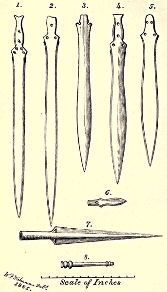
Plate XXXVII.
Plate 37.
Bronze Weapons from Crannog sites on Toome Bar.
Bronze Weapons from Crannog sites in Toome Bar.
Toome Bar.—In 1864 Robert Day, junior, gave the following interesting description of sites of crannogs in this neighbourhood. The bridge which spans the river at Toome forms a connecting link between the counties Antrim and Derry. At this place Lough Neagh presents the appearance of a great V, having the space between the points filled with a sand-bank, known as Toome bar, and which is almost invariably covered with from two to three feet of water. Barton, who published a work on Lough Neagh in 1751, states that before the autumnal season the water discharged at Toome was so very inconsiderable as not to afford a depth greater than that which may reach to the ankle or the knee of a person wading, and that on one occasion a man, taking advantage of an inblowing wind, walked over dryshod. Strewn upon the bar, and imbedded in it, were logs and balks of timber, some bearing the marks of fire, while others still retained their[Pg 170] upright position. They must have been placed there artificially, as the bar of sand extends a quarter of a mile into the lake, outside of which there is deep water, and if it were by the force of the water they had been thrown up, it is equally probable they would have been swept away by the first flood. From this it may be inferred that there was on the spot, at a very remote period, a crannog or lacustrine settlement. The large number of flint weapons found on the surface, or imbedded in the sandy bottom, renders it more than probable that they had been in use by the dwellers in this island village. Flint is not found within seven miles of Toome, so that it must have been carried to and manufactured in the crannog. The most conclusive proof of their having been made on the site was furnished by the presence of the large cores of flint from which the weapons had been struck. Two rudely-shaped, barbed spear-heads were here obtained, and four celts of the ordinary type, made from the trap rock, two of them polished, but the others were made with less care, the edge alone showing signs of careful working. Antiquities of great variety belonging to the stone and bronze periods were found at the time the river Bann was deepened; these were deposited in the Museum, R. I. A. All the good specimens, evidently designed for special purposes, and to which had been given certain and definite shapes, were made out of rocks characterised by possession of all the essential qualities needful for such articles; whilst the rude, ill-formed implements were composed of shale, slate, schist, grit, or any other stone which presented itself within reach. The greater number of the flint weapons were formed by not more, probably, than three or four skilful strokes, thus: one would strike the fragment from the core, two more would form the mid-rib giving it a leaf-shape, and a fourth stroke would cause the slight depression at the base intended to secure the weapon to its shaft or handle. These opaque flint flakes, of the largest size and honey yellow in colour, were found six feet under the bed of the river Bann, lying with several others and a stone celt “in one mass on the old or former gravel-bed of the river, not far from Toome Castle, on the county Antrim side.” At Toome were found also the bronze weapons figured plate XXXVII., in which No. 1 represents a sword in a perfect state, having the point worked down below the level of the blade, for about four inches; it has a broad handle-plate, cleft for pommel, with six rivets still in position; it is 25⅜ inches long and 1⅛ broad. No. 2 is a complete blade, but[Pg 171] the handle-plate is defective; it is brazed in two places, only half an inch asunder, the line of junction being scarcely discernible; it is bevel-edged, has hilt notches, four rivet-holes, and is 26½ inches long, by 1¼ broad. No. 3 is a plain blade, slightly corroded, and wanting part of handle; its length is 19¼ inches, by 1¾ broad. No. 4, ibid., perfect, feather-edged, slight hilt notch, four rivet-holes in handle-plate, 21 inches long, by 1⅜ broad. No. 5 is a leaf-shaped blade, 19 inches long and 1⅞ wide at broadest part: this weapon is from the crannog of Bohermeen, county Meath, and is here given for purpose of comparison. No. 6 is a perfect knife-shaped dagger, grooved in casting; slight raised notch on handle-plate, and 4¾ inches in length. No. 7 is a perfect specimen of the long narrow spear-head; it has straight edges, loops at angle of slender socket, broad bevelled edges, and is 16¼ inches long, by 2 in. broad at base. No. 8 is a thick, short, cast bronze spear-handle, with bulbous extremities, 6¾ inches long, and it “still contains a fragment of the ancient shaft.” This relic points to a close intercourse between the north of Ireland and Scotland, for in their wars against the Romans, A.D. 208, the Caledonians had, amongst other weapons of offence, a spear of peculiar construction, “having a brazen knob at the end of the shaft, which they shook to terrify their enemies.”[193]
Toome Bar.—In 1864, Robert Day Jr. provided an interesting description of crannogs in this area. The bridge that crosses the river at Toome connects Antrim and Derry. Here, Lough Neagh looks like a giant V, with the area between the points filled by a sandbank known as Toome bar, which is usually covered by two to three feet of water. Barton, who wrote about Lough Neagh in 1751, noted that before autumn, the water flowing out at Toome was so shallow that it barely reached the ankle or knee of someone wading through. He even mentioned that once, a man walked across dry due to a strong wind. Scattered across the bar and embedded in it were logs and beams of timber, some showing signs of fire, while others were still standing upright. These must have been placed there intentionally since the sandbar extends a quarter mile into the lake, and beyond that is deep water; if they had been washed up by strong currents, they likely would have been swept away in the first flood. This suggests that there was a crannog or lakeside settlement in this spot a long time ago. The numerous flint tools found on the surface or buried in the sandy bottom strongly indicate that they were used by the residents of this island village. Flint isn't found within seven miles of Toome, so it was likely brought in and crafted at the crannog. The presence of large flint cores, from which the tools were made, provides solid evidence of their creation on-site. Two rough barbed spearheads and four standard celts were discovered here; two of the celts were polished, while the others showed less care, with only the edges finely worked. A wide variety of artifacts from both the Stone and Bronze Ages were uncovered when the river Bann was deepened; these are now housed in the Museum, R.I.A. All the well-crafted pieces, clearly designed for specific uses and with distinct shapes, were made from rocks that had the necessary qualities for such items, while the crude, poorly made tools were made from shale, slate, schist, grit, or whatever stone was available nearby. Most of the flint weapons were shaped by just three or four precise strikes: one would pop a piece off the core, the second and third would shape it into a leaf form, and the fourth would create the minor indentation at the base to secure it to a handle. Large opaque flint flakes, honey-yellow in color, were found six feet below the river bed, lying among several other pieces and a stone celt "in one mass on the old gravel bed of the river, not far from Toome Castle, on the county Antrim side." At Toome, bronze weapons were also found, including plate XXXVII., which shows a sword in excellent condition, with the point tapered below the blade level for about four inches; it has a broad handle plate with a cleft for a pommel, and six rivets still intact; it measures 25⅜ inches long and 1⅛ wide. No. 1 shows a complete blade, but it's missing part of the handle plate; it is brazed in two spots, half an inch apart, with the seams barely visible; it's beveled, has hilt notches, and four rivet holes, measuring 26½ inches long and 1¼ wide. No. 2 is a plain blade, slightly corroded, and missing part of the handle; its length is 19¼ inches and 1¾ wide. No. 4, ibid., is perfect, feather-edged with a minor hilt notch, featuring four rivet holes in the handle plate, measuring 21 inches long and 1⅜ wide. No. 5 is a leaf-shaped blade, 19 inches long and 1⅞ wide at its widest point; this weapon comes from the crannog of Bohermeen, county Meath, and is included here for comparison. No. 6 is a complete knife-shaped dagger, with grooves from casting; it has a slight raised notch on the handle plate and is 4¾ inches long. No. 7 is a perfect example of a long, narrow spearhead; it features straight edges, loops at the angle of the slender socket, broad beveled edges, and measures 16¼ inches long by 2 inches wide at the base. No. 8 is a thick, short cast bronze spear-handle, featuring bulbous ends, measuring 6¾ inches long, and it "still contains a fragment of the ancient shaft." This artifact suggests strong connections between northern Ireland and Scotland, as the Caledonians, during their battles against the Romans in A.D. 208, used a spear with a unique design, "having a brass knob at the end of the shaft, which they shook to intimidate their foes."[193]

Plate XXXVIII.
Plate 38.
CRANNOGES, LOUGH MOURNE.
Crannogs, Lough Mourne.
Examined August 1882.
Examined August 1882.
PLAN OF SMALLER SINGLE CRANNOGE.
PLAN OF SMALLER SINGLE CRANNOGE.
PLAN OF FOUR LARGER CRANNOGES.
PLAN OF FOUR LARGER ISLANDS.
SECTION THROUGH LARGER CRANNOGES.
SECTION THROUGH LARGER CRANNOGES.
SECTION THROUGH SINGLE CRANNOGE.
SECTION THROUGH SINGLE CRANNOGE.
1. LARGE STONES.
LARGE STONES.
2. LAYER OF MOSS TURNED TO PEAT.
2. Moss layer transformed into peat.
3. RADIATING TIMBERS.
3. RADIATING TIMBERS.
4. HEATHER AND BRUSHWOOD.
4. HEATHER AND BRUSHWOOD.
5. STONES.
5. ROCKS.
Lough Mourne.—The waters of this small lake, situated upon a hill about 600 feet above the level of the sea, and three miles due W. of Carrickfergus, were temporarily drained off in the summer of 1882, to enable the engineers of the water-works to carry on their operations; and, when the level of the lake had bee[Pg 172]n lowered ten feet, a number of artificial islands were exposed to view. There was a group of crannogs consisting of four islets erected on one common pile foundation, and at some little distance there was a solitary crannog. The group was formed of some hundreds of piles, four or five inches in diameter, with a cross timbering of branches of various sizes upon a thick layer of heather and moss. Upon this the four islets were built of boulder-stones to form the floors of the wooden houses … the piles generally retained their bark, and were mostly of pine, willow, and ash, with occasionally some of oak; they were rudely pointed on one side only. Many of the stones bore traces of fire, and had evidently formed part of the hearth; a piled causeway, one hundred yards long, led part of the way to the shore; the interior was filled with heather and moss. The single crannog lay somewhat farther from the shore, and in deeper water than the others; greater skill, too, appears to have been displayed in its construction. The lowest course (see section, plate XXXVIII.) was composed of large stones, whose exact depth could not be ascertained owing to a strong spring of water which flowed up between them; upon this was a layer, two feet thick, of moss, which time and pressure had converted into peat. Upon the moss were radiating timbers, the outer ends of which rested on and were notched or mortised into piles disposed in several rings round the island; these piles and cross timbers were larger than in the composite crannog, and many of them were of oak. Upon the timbers was a layer of heather and brushwood, upon which rested the stones forming the floor of the hut: in this case there was no causeway to the land. The relics discovered were not numerous, but the soft, almost liquid nature of the mud rendered a thorough search almost impossible. There was found about five feet of the prow of a “dug out,” and, in addition to charcoal and bones in considerable quantity, there were two small stone crucibles, calcined flint flakes, several fossil sea urchins from the chalk, worn smooth by having been carried about as ornaments or charms; a small stone with a hole in it—possibly also a charm—and a pair of “rubbing-stones.”[194] In midsummer, 1884, a very fine canoe of oak, found entire in the bed of this lake, was presented to the Field Club by the Water Co[Pg 173]mmissioners, and has been by them lodged in the Belfast Museum. This canoe appears to have been shaped chiefly by the axe; it is hollowed out of a single trunk, is twelve feet eight inches in length, and two feet six inches in width, the inside depth being nine inches—the same breadth continues throughout—the bottom of the canoe is perforated with six rather cleanly cut round holes, about three quarters of an inch in diameter.
Lough Mourne.—The waters of this small lake, located on a hill about 600 feet above sea level and three miles west of Carrickfergus, were temporarily drained in the summer of 1882 so the waterworks engineers could carry out their operations. When the lake level was lowered by ten feet, several artificial islands came into view. There was a group of crannogs made up of four islets built on one common foundation, and at a distance, there was a solitary crannog. The group consisted of several hundred piles, four or five inches in diameter, with cross timbering made of branches of various sizes sitting on a thick layer of heather and moss. The four islets were constructed with boulder stones that formed the floors of wooden houses. The piles generally kept their bark and were mostly made of pine, willow, and ash, with some oak mixed in; they were roughly pointed on one side. Many of the stones showed signs of fire, clearly having been part of the hearth; a piled causeway, one hundred yards long, extended partway to the shore, and the interior was filled with heather and moss. The single crannog was positioned slightly farther from the shore and in deeper water than the others; it also showed greater skill in its construction. The lowest course (see section, plate XXXVIII.) was made of large stones, but the exact depth couldn't be determined due to a strong spring of water flowing up between them. On top of this was a layer, two feet thick, of moss that time and pressure had turned into peat. Radiating timbers were laid on the moss, with the outer ends resting on and notched or mortised into piles arranged in several rings around the island; these piles and cross timbers were larger than those in the composite crannog, and many were oak. On the timbers, there was a layer of heather and brushwood, which supported the stones forming the hut's floor: in this case, there was no causeway leading to the land. The artifacts found were not numerous, but the soft, almost liquid nature of the mud made thorough searching nearly impossible. About five feet of the prow of a “dug out” was discovered, along with a significant amount of charcoal and bones, two small stone crucibles, calcined flint flakes, several worn fossil sea urchins from the chalk, likely carried as ornaments or charms, a small stone with a hole in it—possibly another charm—and a pair of “rubbing-stones.”[194] In midsummer, 1884, a beautifully intact oak canoe was found at the bottom of this lake and was presented to the Field Club by the Water Commissioners, who then lodged it in the Belfast Museum. This canoe appears to have been shaped mainly by an axe; it is hollowed out from a single trunk, measuring twelve feet eight inches in length and two feet six inches in width, with an inside depth of nine inches—the same width continues throughout. The bottom of the canoe has six neatly cut round holes, each about three-quarters of an inch in diameter.

Fig. 198.—Dug-out Canoe found near the Crannog of Lough Mourne.
Fig. 198.—Dug-out canoe discovered near the crannog of Lough Mourne.
Lisnacroghera crannog lies at a little distance from Broughshane, in the parish of Skerry, barony of Antrim. About the year 1882, workmen employed in cutting turf—bared by the partial drainage of the lough—came upon oaken timbers laid in regular order; unfortunately nearly all were removed before anyone acquainted with the peculiarities of crannog structure had seen them, and in the autumn of 1883, most of the timbers had disappeared, though a few of the encircling piles remained in position. Some remarkable antiquities, discovered either within or around it, have been rescued from oblivion and destruction. A spear with iron head and butt, and rivets of bronze, and the iron sword-blades enclosed in sheaths of bronze (which are now in Canon Grainger’s museum), seem to call for prominent notice. With regard to these the Rev. James Graves says:—“It cannot be denied that this crannog find is one of the most [Pg 174]important and valuable yet recorded in Ireland, especially in its bearing on the style and the chronology of the art of that early period when the bronze and iron eras overlapped. The spears have bronze butts, with terminal iron heads, for such were discovered in the crannog, whilst no spear-heads of bronze—an imperishable metal—were found. The bronze rivets remained in the shafts by which the iron heads had been secured. All this reminded one of the ninth century legend of the armourers of the Tuatha dé Danann when preparing for battle with the Fomorians at the northern Moytura. The mode of workmanship is graphically described:—Goibniu at his forge finishes the spear-heads in three hammer-strokes (probably they went through three processes in their fabrication); so it was also with the work of Luchtiné on the ashen spear-shafts, and Creidné on the bronze rivets. When Goibniu had finished the iron lance-head, he seized it with his pincers and sent it quivering into the door-post. Then Luchtiné launched the finished shaft so surely aimed that it found the socket of the lance-head, and penetrating to the bottom was firmly fixed there: whilst Creidné instantly flung from his pincers the finished bronze rivet with so sure and true an aim that it entered the rivet-holes to the required depth, and so the weapon was completed (Three Irish Glossaries, p. 32, Sanas Cormaic, p. 123). Hence, without assuming that the bronze-iron age should be thrown back to the mythic period of the Tuatha dé Danann and the Fomorians, it is evident that in the ninth century there was a tradition of its characteristics and existence in Ireland, and that of so remote a date as to suit the myth of the contest of the gods of light and life with the deities of darkness and death. The fashion of the spears, of the swords, and of their sheaths, prevailing at this early period, when the use of bronze and iron overlapped, has been hitherto but sparingly revealed to us by finds of weapons in England, Scotland, and Scandinavia. Kemble, in his Horæ Ferales, engraves several examples of short swords or daggers, the fashion of which is identical with that now for the first time so clearly shown us by the Lisnacroghera crannog find.” Professor Anderson, in his Rhind Lectures, has recorded the discovery of a bronze spear-butt, exactly similar, in one of the brochs of Scotland; it is correlated by him with the pagan iron age; and in a recent number of the Proceedings of the Royal Society of Antiquaries of Denmark there is engraved an iron sword-blade, with bronze haft-mountings, nearly identical in form and fashion with those discovered at Lisnacroghera.[195]
Lisnacroghera crannog is located not far from Broughshane, in the parish of Skerry, barony of Antrim. Around 1882, workers who were cutting turf—exposed by the partial drainage of the lough—discovered oaken timbers arranged in a regular pattern; unfortunately, most of them were taken away before anyone who understood crannog structures could examine them, and by the autumn of 1883, most of the timbers were gone, though a few of the surrounding piles remained standing. Some remarkable artifacts found either inside or around it have been preserved from being forgotten or destroyed. A spear with an iron head and butt, along with rivets made of bronze, and the iron sword blades encased in bronze sheaths (which are now housed in Canon Grainger’s museum), certainly deserve prominent mention. Concerning these, Rev. James Graves states: “It cannot be denied that this crannog find is one of the most [Pg 174]important and valuable yet recorded in Ireland, particularly in relation to the style and timeline of art during that early period when the bronze and iron ages overlapped. The spears have bronze butts with terminal iron heads, as those were found in the crannog, while no bronze spearheads—being a durable material—were discovered. The bronze rivets were found on the shafts used to secure the iron heads. This all brings to mind the ninth-century legend of the smiths of the Tuatha dé Danann preparing for battle against the Fomorians at the northern Moytura. The craftsmanship is vividly described: Goibniu at his forge finishes the spearheads in three hammer strokes (likely they went through three stages in their creation); it was the same with Luchtiné's work on the ash spear shafts, and Creidné's on the bronze rivets. Once Goibniu completed the iron lance head, he grabbed it with his tongs and sent it quivering into the door frame. Luchtiné then skillfully launched the finished shaft so accurately that it fitted perfectly into the lance head, going all the way in and securing it tightly: while Creidné instantly tossed from his tongs the completed bronze rivet with such precision that it sank into the rivet holes to the appropriate depth, thus completing the weapon (Three Irish Glossaries, p. 32, Sanas Cormaic, p. 123). Therefore, without suggesting that the bronze-iron age should be placed in the mythical period of the Tuatha dé Danann and the Fomorians, it is clear that in the ninth century there was a tradition regarding its characteristics and existence in Ireland, dating back far enough to fit the myth of the clash between the gods of light and life and the deities of darkness and death. The design of the spears, swords, and their sheaths from this early period, when the use of bronze and iron overlapped, has only been sparsely revealed through finds of weapons in England, Scotland, and Scandinavia. Kemble, in his Horæ Ferales, illustrates several examples of short swords or daggers, whose designs are identical to those now revealed to us for the first time by the Lisnacroghera crannog find.” Professor Anderson, in his Rhind Lectures, recorded the discovery of a bronze spear butt, exactly like one found in a broch in Scotland; he correlates it with the pagan iron age; and in a recent issue of the Proceedings of the Royal Society of Antiquaries of Denmark, there is an illustration of an iron sword blade, with bronze haft fittings, nearly identical in form and style to those found at Lisnacroghera.[195]

Plate XXXIX.
Plate 39.
Haft of Iron Sword, with Bronze Mountings, from Lisnacroghera. Full size.
Haft of Iron Sword, with Bronze Mountings, from Lisnacroghera. Full size.
The antiquities found in this crannog consisted of a plain bronze sheath (plate XII., fig. 1), containing an iron sword (p. 61, fig. 17): the haft is represented full size (plate XXXIX.). One side[Pg 175] of ornamented sheath slightly smaller than the former (plate 12, fig. 2): a full-sized representation is given (plate XL.).
The ancient items discovered in this crannog included a simple bronze sheath (plate XII., fig. 1), which held an iron sword (p. 61, fig. 17): the handle is shown at full size (plate XXXIX.). One side of the decorated sheath is slightly smaller than the previous one (plate 12, fig. 2): a full-sized depiction is provided (plate 40.).

Plate XL.
Plate 40.
Upper and lower portions of side of the Bronze Sheath, from Lisnacroghera, full size, of which a half-size representation is given, Plate XII. fig. 2.
Upper and lower parts of the side of the Bronze Sheath, from Lisnacroghera, full size, of which a half-size representation is given, Plate XII. fig. 2.

Fig. 199.—Upper portion of Bronze Sheath. Full-size.
Fig. 199.—Upper part of the Bronze Sheath. Full size.

Fig. 200.—Iron Sickle. Eleven inches from point of blade to end of tang.
Fig. 200.—Iron Sickle. Eleven inches from the tip of the blade to the end of the handle.
Another ornamented bronze sheath (plate XII., fig. 3), of which the upper portion is here given, full size. A sword of iron with bronze fittings to the handle: this is not the sword to which th[Pg 176]e sheath belongs. An iron sickle that had been affixed to its handle by a tang; their usual length was twelve inches—occasionally much smaller—and they may be divided into two classes, bronze and iron. Sickles of iron have been found amongst Roman and Saxon remains in Britain. A spear-head of iron (ante, plate X.). An iron adze (ante, p. 69, fig. 31), and some miscellaneous objects of the same metal (ante, p. 68, figs. 28 to 30). Six butt-ends of[Pg 177] spear-shafts formed of bronze: five of these are represented (p. 64, figs. 19 to 23); the sixth is here given (fig. 201). Boss-like objects (six in number) and rings of bronze, supposed to be fragments of defensive armour (plate XV.). A bronze rivet (ante, p. 119, fig. 152). Two hollow penannular rings of bronze (ante, p. 119, fig. 150). An article composed of bronze, probably an amulet (ante, p. 116, fig. 145). An object in bronze, richly decorated (ante, p. 67, fig. 26). Three circlets of bronze (ante, p. 119, figs. 153-5). A small loop of bronze (ante, p. 109, fig. 135). A disc composed of thin bronze (ante, p. 72, fig. 34). A small boss or stud of bronze (ante, p. 119, fig. 151). Portion of an amulet of jet. Three beads of glass (ante, p. 124, figs. 165-7).
Another decorated bronze sheath (plate XII., fig. 3), the upper part of which is shown here at full size. An iron sword with bronze fittings on the handle: this isn’t the sword that fits the sheath. An iron sickle that had been attached to its handle by a tang; their typical length was twelve inches—sometimes much smaller—and they can be split into two types, bronze and iron. Iron sickles have been discovered among Roman and Saxon remains in Britain. An iron spearhead (ante, plate X.). An iron adze (ante, p. 69, fig. 31), along with some other miscellaneous items made of the same metal (ante, p. 68, figs. 28 to 30). Six butt ends of spear shafts made from bronze: five of these are depicted (p. 64, figs. 19 to 23); the sixth is shown here (fig. 201). Six boss-like objects and bronze rings, believed to be pieces of defensive armor (plate XV.). A bronze rivet (ante, p. 119, fig. 152). Two hollow penannular rings of bronze (ante, p. 119, fig. 150). An item made of bronze, likely an amulet (ante, p. 116, fig. 145). A richly decorated bronze object (ante, p. 67, fig. 26). Three bronze circlets (ante, p. 119, figs. 153-5). A small bronze loop (ante, p. 109, fig. 135). A disc made of thin bronze (ante, p. 72, fig. 34). A small bronze boss or stud (ante, p. 119, fig. 151). A piece of a jet amulet. Three glass beads (ante, p. 124, figs. 165-7).

Fig. 201.—Bronze Butt of Spear-shaft. Two-thirds natural size.
Fig. 201.—Bronze Butt of Spear Shaft. Two-thirds natural size.
Craigywarren.—Ante, p. 110.
Craigywarren.—Before, p. __A_TAG_PLACEHOLDER_0__.
Loughavarra.—Ante, p. 153.
Loughavarra.—Ante, p. __A_TAG_PLACEHOLDER_0__.
Lough Lynch.—Ante, p. 153.
Lough Lynch. — Ante, p. __A_TAG_PLACEHOLDER_0__.
Lough Crannagh (or Lough-na-crannagh).—Ante, p. 28.—Amongst the scientific grants for the year 1885, recommended by the Council, R.I.A., appears the following;—“£20 to Mr. Alexander M’Henry for a report on the animal and other remains found in the sand-hills of Ballintoy and the crannog of Lough-na-crannagh.”
Lough Crannagh (or Lough-na-crannagh).—Ante, p. 28.—Among the scientific grants for 1885, recommended by the Council, R.I.A., is the following;—“£20 to Mr. Alexander M’Henry for a report on the animal and other remains found in the sand dunes of Ballintoy and the crannog of Lough-na-crannagh.”
Lough Ronel is a name set down in the MS. register of Irish crannog objects, &c., British Museum. It is most probably an incorrect designation for Lough Ravel.
Lough Ronel is a name listed in the Ms. register of Irish crannog items, etc., at the British Museum. It's likely a mistaken name for Lough Ravel.
COUNTY DOWN.
During the working of the Commission for the Arterial Drainage of Ireland, a crannog—no name given—was discovered in this county, and traces of another at Ardbrin (ante, pp. 126-8).
During the work of the Commission for the Arterial Drainage of Ireland, a crannog—no name provided—was found in this county, along with signs of another one at Ardbrin (ante, pp. 126-8).
Ballykinler.—In 1860 this crannog was no longer traceable, but fortunately a short description of it had been previously given. The section made through its centre showed it to be of the usual construction—surrounded by a circle of small piles, driven deep into the mud, and secured by cross-beams firmly mortised togethe[Pg 178]r, the space so enclosed filled with brushwood, on which was placed a layer of gravel and earth, that process being repeated until the surface became perfectly solid.[196]
Ballykinler.—By 1860, this crannog was no longer visible, but luckily, a brief description of it had been recorded earlier. The cross-section taken through its center revealed it was built in the typical way—surrounded by a circle of small piles driven deep into the mud and secured with cross-beams that were firmly joined together. The enclosed area was filled with brushwood, topped with a layer of gravel and soil, and this process was repeated until the surface became completely solid.[Pg 178][196]
Lough Faughan, or Falcon, in the barony of Lecale.—About the year 1845 a crannog was discovered in this lake. “There were large stakes driven into the ground, completely enclosing the space within, and not rising above the surface as a palisade, but evidently for the purpose of keeping in the soil from encroachment of the water. The tradition respecting it is, that there had been a castle on the shore opposite, the chieftain of which caused this island to be made as a place of refuge from the sudden onslaughts of the O’Neils; and to render this retreat more secure he would never allow more than one boat or canoe on the lake.” During drainage operations a “dug-out” of oak was found near this crannog, from which locality were also procured two earthen pitchers (ante, p. 92, fig. 66).
Lough Faughan, or Falcon, in the barony of Lecale.—Around 1845, a crannog was found in this lake. “There were large stakes driven into the ground, completely surrounding the area within, not sticking up above the surface like a palisade, but clearly intended to keep the soil from being washed away by the water. The local legend says that there was a castle on the opposite shore, and the chieftain had this island built as a refuge against the surprise attacks from the O’Neils; to make this hideout more secure, he would only allow one boat or canoe on the lake at a time.” During drainage work, a dug-out canoe made of oak was discovered near this crannog, and two earthen pitchers were also found from this same area (ante, p. 92, fig. 66).
Ballywoolen.—This crannog was entire when seen in 1860, in a lake surrounded by hills, the surface of the island nearly level with the water. At one spot there was a flagging of flat stones where the hearth had been, and near it lay a quern.[197] The discoverer states the site of this crannog to be in the county Down; but the only townland in Ireland named Ballywoolen, is set down in the Ordnance Survey as situated in the parish of Dunboe, barony of Coleraine, county Derry.
Ballywoolen.—This crannog was completely intact when it was viewed in 1860, in a lake surrounded by hills, with the island's surface nearly level with the water. At one point, there was a patch of flat stones where the hearth had been, and nearby was a quern.[197] The person who discovered it claims that this crannog is located in County Down; however, the only townland in Ireland named Ballywoolen is recorded in the Ordnance Survey as being in the parish of Dunboe, barony of Coleraine, County Derry.
COUNTY ARMAGH.
Camlough has a crannog at its north end.
Camlough has a man-made island at its north end.
Marlacoo Lough, near Armagh, has another.
Marlacoo Lough, close to Armagh, has one too.
Lough Ross, near Crossmaglen, also contains one, stated to have been the place of meeting of the Irish leaders in 1641.[198]
Lough Ross, near Crossmaglen, is also said to have been the meeting place of the Irish leaders in 1641.[198]
COUNTY TYRONE.
During the working of the Commission for the Arterial Drainage of Ireland, a crannog was discovered in this county, but its exact locality was not defined.
During the operation of the Commission for the Arterial Drainage of Ireland, a crannog was found in this county, but its specific location was not identified.
Corcreevy (alias Loch-Laoghaire), by which latter name it is mentioned in the Annals (ante, pp. 155-6).—The site was examined and the following articles brought to light: a pair of bronze and iron manacles; a double comb of bone in a perfect state, length 3 inches, and breadth 2⅜ inches, and having a brass ring attached to one extremity—it is now in the Museum, R.I.A.; parts of a musical instrument; an arrow-head; a spear-head; a sling, or hammer-stone.[199]
Corcreevy (also called Loch-Laoghaire), which is the name used in the Annals (ante, pp. 155-6).—The site was investigated, and the following items were uncovered: a pair of bronze and iron handcuffs; a double-sided bone comb that is in perfect condition, measuring 3 inches long and 2⅜ inches wide, with a brass ring attached to one end—it is now housed in the Museum, R.I.A.; pieces of a musical instrument; an arrowhead; a spearhead; and a sling or hammerstone.[199]
Cranny townland in this county possibly derives its name from having been the former site of a lake dwelling.
Cranny townland in this county likely gets its name from being the former location of a lake house.
Clogherny, in the parish of this name, in the barony of East Omagh. The Rev. R. V. Dixon, D.D., thus notices the discovery of a crannog situated in a bog on the borders of the townland of Roscavey. About eight or ten feet below the surface turf-cutters laid bare the tops of a row of oaken planks which described a circle about seventy feet in diameter. These planks were from eight inches to fourteen inches in width, and from three inches to five inches in thickness, roughly split from the log, the lower extremities pointed and driven ten or twelve inches into the ground; their tops were all decayed; the length of the remaining part was about four feet. Each plank was pierced by a square hole, bearing marks of having been made by a blunt tool, and this orifice was narrower at the centre than at the edges. The planks forming the enclosure were placed edge to edge, and several rough logs of alder and birch, from two inches to four inches in diameter, were laid horizontally against the lower part of the planks on the ins[Pg 180]ide of the enclosure, which was floored with oak, and underneath was about two feet of peat. Between the oaken floor and the outer fence were several flag-stones, evidently the old hearths, as shown by the quantity of charred wood that was about them. Southward two square posts were found. This crannog lay in a depression running nearly E. and W. between two sloping hills. “The fall of this hollow is towards the east, where it spreads out and sinks into a large basin, or glen, closed by rising ground of considerable height to the north and east; by a gravel ridge, or ‘esker,’ on the south; and opening on the west into the hollow in which the crannog stood. A considerable mountain stream enters this basin from the east, and after flowing round a conical gravel hill (connected with the esker) which stands in the middle of it, escapes through a deep natural cut or gap in the esker which, as before mentioned, closes the basin on the south. If this cut were closed, the basin would be filled up by the stream which now flows through it, and the level of the water would probably rise sufficiently high to fill the hollow in which the crannog stood, and this hollow would then form a shallow arm of the lake.”[200]
Clogherny, in the parish of the same name, located in the barony of East Omagh. The Rev. R. V. Dixon, D.D., notes the discovery of a crannog found in a bog at the edge of the townland of Roscavey. Turf-cutters unearthed the tops of a row of oak planks about eight or ten feet below the surface, which formed a circle roughly seventy feet in diameter. These planks ranged from eight to fourteen inches in width and three to five inches in thickness, crudely split from logs, with their lower ends pointed and driven ten to twelve inches into the ground; their tops were all decayed, and the remaining length was about four feet. Each plank had a square hole, showing signs of being made by a blunt tool, and this hole was narrower in the center than at the sides. The planks that made up the enclosure were placed edge to edge, and several rough logs of alder and birch, measuring two to four inches in diameter, were laid horizontally against the lower part of the planks on the inside of the enclosure, which had an oak floor and about two feet of peat underneath. Between the oak floor and the outer fence, there were several flagstones, clearly the remnants of old hearths, indicated by the amount of charred wood around them. To the south, two square posts were discovered. This crannog was situated in a depression running nearly east to west, nestled between two sloping hills. “The slope of this hollow is towards the east, where it expands and descends into a large basin, or glen, bordered by elevated ground to the north and east; by a gravel ridge, or ‘esker,’ to the south; and opening to the west into the hollow where the crannog is located. A significant mountain stream enters this basin from the east and flows around a conical gravel hill (part of the esker) in the center before exiting through a deep natural cut or gap in the esker, which, as mentioned before, encloses the basin to the south. If this gap were blocked, the basin would fill with the stream that currently flows through it, raising the water level high enough to fill the hollow where the crannog is situated, and this hollow would then turn into a shallow arm of the lake.”[200]
Galbally.—Ante, p. 60, plate VII.
Galbally.—Before, p. __A_TAG_PLACEHOLDER_0__, __A_TAG_PLACEHOLDER_1__
Roughan.—Ante, p. 88.
Roughan.—Ante, p. __A_TAG_PLACEHOLDER_0__.
COUNTY DONEGAL.
Crannog-boy, parish of Inishkeel, barony of Banagh.—Ante, p. 28.
Crannog-boy, parish of Inishkeel, barony of Banagh.—Before, p. 28.
Mongavlin, parish of Taughboyne, barony of Raphoe.—Ante, p. 151.
Mongavlin, parish of Taughboyne, barony of Raphoe.—Before, p. 151.
Lough Veagh.—Ante, p. 154.
Lough Veagh.—Ante, p. __A_TAG_PLACEHOLDER_0__.
Drumkelin, or Drumkeelin, parish of Inver, barony of Banagh.—The account of the crannog-hut here exhumed is given, ante, pp. 39-41.
Drumkelin, or Drumkeelin, parish of Inver, barony of Banagh.—The account of the crannog hut that was dug up here is provided, ante, pp. 39-41.
COUNTY DERRY.
Inishrush.—Ante, p. 152.
Inishrush.—Ante, p. __A_TAG_PLACEHOLDER_0__.
Loughshillen.—Ante, pp. 148-9.
Loughshillen.—Before, pp. __A_TAG_PLACEHOLDER_0__.
Fort Lough occupies nearly the centre of an extensive bog on the right-hand side of one of the roads leading from St. Johnstown to Burt on Lough Swilly. It is described as about one mile long, and a quarter wide, but was formerly of much greater extent. There was a tradition that formerly a castle erected in the centre of this lake had been submerged by the neglect of a girl in not carefully re-covering a fairy fountain in the vaults, and consequently the waters burst forth in a raging torrent! After drainage operations, when the level of the lough subsided, marks of an island became visible in the centre, and by degrees stonework was observed rising above the surface, proving that the subaquatic castle was not altogether mere visionary fiction. These walls were found supporting a deposit of peat.[202]
Fort Lough is situated almost in the middle of a large bog on the right side of one of the roads that leads from St. Johnstown to Burt on Lough Swilly. It's described as being about a mile long and a quarter mile wide, but it used to be much bigger. There’s a legend that a castle built in the center of this lake was submerged because a girl neglected to properly re-cover a fairy fountain in the vaults, causing the waters to overflow wildly! After drainage work, when the level of the lough went down, signs of an island emerged in the center, and gradually, stone structures were seen rising above the water, showing that the underwater castle wasn’t just a figment of imagination. These walls were found supporting a layer of peat.[202]
COUNTY FERMANAGH.

Plate XLI.
Plate 41.
ELEVATION, PLAN, SECTION and DETAILS of the BALLYDOOLOUGH CRANNOG, Co. FERMANAGH.
ELEVATION, PLAN, SECTION and DETAILS of the BALLYDOOLOUGH CRANNOG, Co. FERMANAGH.
W.F. Wakeman, 1870.
W.F. Wakeman, 1870.
Ballydoolough (the place of the dark lake) is five miles distant from the town of Enniskillen; the expanse of water covers not more than twenty-four acres, and even during times of flood never exceeds twenty feet in depth; at the bottom could be discerned remains of a primæval forest. In June, 1870, from the effect either of drainage or of long-continued drought, a small island became apparent, on which were found fragments of fictile ware, and this led to a careful examination being made. Near the centre was an oaken beam, fifteen feet seven inches long, having evidently formed portion of one side of the lower framework of a[Pg 182] dwelling. It was grooved throughout its entire length (plate XLI., No. 7), and had two holes—measuring nine inches by six—that were plainly intended for the reception of upright posts, to which the sheeting or side-boards of the structure were attached. Several oaken slabs, grooved at the sides (plate XLI., No. 9), were discovered in close proximity buried in the sand and mud. Upon clearing the foundation, the framework of the house was shown to be composed of well-squared beams of oak, grooved for the reception of planks, and mortised for the insertion of uprights, the angles dovetailed together, and fastened with wooden pins. The beam forming the eastern foundation of the house rested upon two blocks of dressed oak that projected from it at a right-angle to a distance of seven feet (plate XLI., No. 2), and this foundation may perhaps have supported a landing-stage. The lowest timbers of house and projecting beams were secured in position externally and internally by a row of wooden pegs, or small stakes, which enclosed the entire foundation, and rested against it on the exterior (on the plan these are indicated by a dotted line); the south-western angle of the house was strengthened by a flat block (No. 6). Of the upper work of the edifice no description can be attempted, though several dressed boards (Nos. 4, 5, 8, 9, 10, 13, on a scale of ⅛ inch to a foot), that had evidently formed part of the structure, were found scattered about.[203] On the western side of the island, being the one most exposed to the action of the water, the stakes were in greatest number, placed four, and at one point even five, feet deep. In some instances their upper extremities had been inserted in holes cut for their reception in beams of oak laid horizontally, and although only one such beam was found still in situ, yet an inhabitant of the locality stated that within his memory many of the horizontal timbers could be seen actually resting upon the stakes or piles, just below the surface of the water. The kitchen-midden of the dwelling contained a considerable quantity of bones, intermixed with numerous fragments of pottery. A selection of the bones having been forwarded to Professor Richard Owen for analysis, he pronounced them to be parts of Bos longifrons, Cervus elephas, Sus scrofa, and Equus asinus. In a more or less restored form, characteristic specimens of the pottery are figured (ante, pp. 92, 95, 96, 97). There were not many articles of[Pg 183] bronze, but mention may be made of a plate of that metal, oblong in form, about as thick as a sixpenny-piece, and measuring five and a-half inches in length, by four and a-half inches in breadth; it retained a number of rivets, and appeared like a patch off some pan or dish. In Ireland the majority of cauldrons or dishes composed of thin golden bronze are usually found to have been carefully mended. Of wood, a vessel was discovered in an entire state, but from long saturation reduced almost to a pulp (ante, p. 102, fig. 103); and there was a small oaken vessel formed with staves. There were also balls of stone, varying in size from that of an orange to a walnut; several querns, and the inscribed stone described and figured (ante, p. 134).[204]
Ballydoolough (the place of the dark lake) is five miles away from the town of Enniskillen; the body of water covers no more than twenty-four acres, and even during floods, it never exceeds twenty feet in depth; at the bottom, you can see remains of an ancient forest. In June 1870, due to either drainage or an extended drought, a small island appeared, where fragments of pottery were found, prompting a thorough examination. Near the center was an oak beam, fifteen feet seven inches long, which clearly formed part of one side of the lower framework of a[Pg 182] dwelling. It had a groove running the entire length (plate XLI., No. 7), and two holes measuring nine inches by six, designed for upright posts to which the siding or boards of the structure were attached. Several oak slabs, grooved at the sides (plate XLI., No. 9), were discovered buried in the sand and mud nearby. Upon clearing the foundation, it was shown that the house's framework was made of well-squared oak beams, grooved for receiving planks, and mortised for inserting uprights, with the corners dovetailed together and secured with wooden pins. The beam forming the eastern foundation of the house was supported by two blocks of dressed oak that extended outward at a right angle to a distance of seven feet (plate XLI., No. 2), which may have supported a landing stage. The lowest timbers of the house and the projecting beams were held in place externally and internally by a row of wooden pegs or small stakes, which surrounded the entire foundation and rested against it on the outside (on the plan, these are shown by a dotted line); the southwestern angle of the house was reinforced by a flat block (No. 6). There is no way to describe the upper part of the building, though several dressed boards (Nos. 4, 5, 8, 9, 10, 13, on a scale of ⅛ inch to a foot) that clearly were part of the structure were found scattered around.[203] On the western side of the island, which was most exposed to the water, the stakes were most numerous, placed four and, at one point, even five feet deep. In some cases, their upper ends were inserted into holes cut for them in horizontally laid oak beams, and although only one such beam was found still in situ, a local resident claimed that in his memory many of the horizontal timbers could be seen actually resting on the stakes or piles, just below the water's surface. The kitchen dump of the dwelling contained a significant amount of bones mixed with numerous fragments of pottery. A selection of these bones was sent to Professor Richard Owen for analysis, and he identified them as parts of Bos longifrons, Cervus elephas, Sus scrofa, and Equus asinus. In a more or less restored form, characteristic specimens of the pottery can be seen (ante, pp. 92, 95, 96, 97). There were not many bronze items, but one notable piece was a rectangular plate, about as thick as a sixpenny coin, measuring five and a half inches in length by four and a half inches in width; it had several rivets and looked like a patch from some pan or dish. In Ireland, most cauldrons or dishes made of thin golden bronze are usually found to have been carefully repaired. A wooden vessel was discovered in nearly perfect condition but had been reduced almost to a pulp due to long exposure to moisture (ante, p. 102, fig. 103); and a small oak vessel built with staves was also found. Additionally, there were stone balls, ranging in size from that of an orange to a walnut; several querns, and the inscribed stone mentioned and illustrated (ante, p. 134).[204]
Coolyermer is the name of a lake four miles from Enniskillen, in the direction of Letterbreen; it contains an island which seemed to be composed entirely of oaken beams; the water, however, was too high to admit of an examination being made.
Coolyermer is the name of a lake located four miles from Enniskillen, towards Letterbreen; it has an island that appears to be made entirely of oak beams. However, the water was too high to allow for an examination.
Drumdarragh, otherwise Trillick, has been recently thoroughly examined by W. F. Wakeman, whose report, accompanied by numerous drawings of remains discovered within the crannog, is prepared for publication in the Journal of the Royal Hist. and Arch. Association of Ireland. To the Museum of that Society the Earl of Enniskillen, in 1875, presented an oak paddle found at Drumdarragh crannog, in company with a single-tree canoe that had been unfortunately destroyed.[205]
Drumdarragh, also known as Trillick, has been thoroughly examined recently by W. F. Wakeman. His report, which includes several drawings of the remains found within the crannog, is set to be published in the Journal of the Royal Hist. and Arch. Association of Ireland. In 1875, the Earl of Enniskillen donated an oak paddle discovered at the Drumdarragh crannog to the Museum of that Society, along with a single-tree canoe that was unfortunately destroyed.[205]

Drumgay (the ridge of the geese) lies nearly four miles to the north of the town of Enniskillen, and separated from the northern shore of Lough Erne by a narrow belt of land. This sheet of water is completely land-locked; there are in it three islets, and the south-eastern shore has a projecting point of artificial construction that becomes an island owing to the rise of water in winter time. Plate XLII., No. 1, conveys an excellent idea of the general aspect of the lake, and of the position of the islands; the large wooded one, situated near the centre, and now known as “Bone Island”—although its older appellation appears to have been “Cherry Island”—is constructed of beams of oak, ash, and pine, laid in rough blocks, radiating from a centre to the edge of a circle formed of stakes set in the ground, the diameter from north to south being one hundred and five feet, but from east to west a few feet less (plate XLII., No. 2). When the lake is at summer level the encircling piles are plainly visible; they had been roughly trimmed with an instrument of metal; the longitudinal cuts measured nearly a foot, and some of the piles were of oak (plate XLII., No. 7); they had no slope outward, and only at a few points did the rough wood and small branches usually interwoven with them still remain in position. From a point near the centre of the crannog, in a direct line to the eastern shore, a trench was dug; it commenced in the centre, was cut outwards to the water’s edge, and thus prevented sudden flooding; a similar trench was subsequently made on the opposite shore. As the result of these excavations, a very distinct idea of the internal construction of the work was obtained (plate XLII., No. 4). The old crannog-builders appear to have selected a natural shoal in the lough as the scene of their operations. This shoal consisted of marl covered by a streak of whitish sand about four inches in depth; over the sand, to a height of six or eight inches, was a stratum of yellowish clay, which supported unhewn logs of oak and birch, together with an immense quantity of small branches, twigs, brambles, and small pebbles, all compressed into a peat-like mass about two feet thick; this was covered by two feet of earth, containing here and there layers of burnt clay and bones; the clay was mixed throughout with bones of animals greatly broken, articles of early manufacture, slag or dross iron, charcoal, and rough stones. The surface of the island was in many parts covered with flat stones of considerable size, and stakes larger than those which formed the outer circle, yet of the same character, were found here and th[Pg 185]ere, even in the highest and most central parts; they were designed to stay and prop the work, for their points were deeply imbedded in the marl which formed the bottom of the lough. It was impossible to procure any perfect specimen of these supports, as the wood, softened by saturation, broke off on application of the slightest pressure. Scattered amongst the bones that lay upon the shore of the island, were several fragments of earthen vessels; the one represented (ante, p. 93) was found here. Although search was made, yet comparatively few antiques were brought to light.[206]
Drumgay (the ridge of the geese) is located nearly four miles north of Enniskillen and is separated from the northern shore of Lough Erne by a narrow stretch of land. This body of water is entirely land-locked; it has three small islands, and the southeastern shore features a protruding point of artificial construction that turns into an island during the winter due to rising water levels. Plate XLII., No. 1, provides a great view of the general appearance of the lake and the position of the islands; the large wooded island, situated near the center and now called “Bone Island”—though its older name seems to have been “Cherry Island”—is made of beams of oak, ash, and pine arranged in rough blocks, radiating outward from a center to the edge of a circle formed by stakes driven into the ground. The diameter from north to south is one hundred and five feet, but it's a few feet less from east to west (plate XLII., No. 2). When the lake is at summer level, the surrounding piles are clearly visible; they had been roughly trimmed with a metal tool, with the longitudinal cuts measuring nearly a foot, and some of the piles were made of oak (plate XLII., No. 7); they had no outward slope, and only in a few places did the rough wood and small branches usually woven with them remain in place. From a point near the center of the crannog, a trench was dug directly towards the eastern shore; it started in the center and extended outward to the water's edge to prevent sudden flooding; a similar trench was later made on the opposite shore. As a result of these excavations, a clear understanding of the internal construction of the structure was revealed (plate XLII., No. 4). The ancient builders of the crannog seem to have chosen a natural shoal in the lough as the site for their work. This shoal was made up of marl covered by a layer of whitish sand about four inches thick; on top of the sand was a layer of yellowish clay, six to eight inches high, which supported unhewn logs of oak and birch, along with a huge amount of small branches, twigs, brambles, and small pebbles, all compacted into a peat-like mass about two feet thick; this was covered with two feet of soil, which occasionally contained layers of burnt clay and bones. The clay was mixed with fragmented animal bones, early artifacts, iron slag or dross, charcoal, and rough stones. The island's surface was often covered with large flat stones, and larger stakes than those forming the outer circle, yet similar in nature, were found here and there, even in the highest and most central areas; these were meant to support the structure, with their points deeply embedded in the marl at the lough's bottom. It was impossible to obtain a perfect specimen of these supports, as the wood, softened by moisture, broke off with the slightest pressure. Scattered among the bones on the island's shore were several fragments of earthen vessels; the one depicted (ante, p. 93) was found here. Despite thorough searches, relatively few antiques were uncovered.[206]
In plate XLII. a large island is represented to the extreme left; this is what may be termed a composite crannog. The body of the island, formed entirely of stones, was formerly surrounded by rows of oaken stakes; none, however, are now to be seen; they served as fuel to a man who lived on the shores of the lake. The greatest height of this island above summer level of the water was about five feet, the form an irregular oval, two hundred and seventy feet in length, by one hundred and thirty-eight feet in breadth, and a trench cut through to a depth of five feet reached what seemed to have been the ancient bottom of the lake. The great peculiarity of this structure is that the collection of small flat sandstones of which it was composed had been placed on edge (plate XLII., No. 5). By the country people it is appropriately styled “the quarry.” Close to the north-western extremity of the lake may be seen a small crannog—about thirty feet in diameter—that is all but submerged even in the dryest season; the few oaken timbers that remain seem to radiate from a common centre, and are intermixed with stones, as shown in plate XLII., No. 3. Evidently[Pg 186] this islet had originally been strongly staked. The fourth and last crannog is represented at the extreme right of the general view of the lake; but here the crannog wrecker had been at work, and the stakes that formerly entirely surrounded it were pulled up and used as fuel. A curiously sculptured stone (ante, p. 90) was discovered here. The last two crannogs lay at a very low level, owing perhaps to the fact of an unusual quantity of boughs and compressible matter having been used in their construction. Portion of a single-tree canoe of oak was found in the lake, as also two very neatly formed paddles of oak, measuring about two and a-half feet in length.[207]
In plate XLII., a large island is shown on the far left; this can be described as a composite crannog. The island itself, made entirely of stones, used to be surrounded by rows of oak stakes, but none are visible now; they were used as firewood by a man living by the lake. The highest point of this island above the summer water level was about five feet, taking an irregular oval shape, measuring two hundred and seventy feet long and one hundred and thirty-eight feet wide. A trench dug to a depth of five feet reached what appeared to be the ancient bottom of the lake. A unique feature of this structure is that the collection of small flat sandstones that make it up was placed on edge (plate XLII., No. 5). Locals fittingly call it “the quarry.” Near the north-western end of the lake, there is a small crannog—about thirty feet in diameter—that is almost completely submerged even in the driest season; the few remaining oak timbers seem to fan out from a central point and are mixed with stones, as shown in plate XLII., No. 3. Clearly[Pg 186], this islet was originally supported by strong stakes. The fourth and final crannog is depicted at the far right of the overall view of the lake; however, here the crannog destroyer had been active, and the stakes that used to fully surround it were pulled up and used as firewood. A uniquely carved stone (ante, p. 90) was found here. The last two crannogs are situated at a very low level, possibly due to the fact that an unusual amount of branches and soft materials were used in their construction. A piece of an oak canoe tree trunk was discovered in the lake, along with two neatly made oak paddles measuring about two and a half feet long.[207]
Gortalough (the field of the lake) is situated near Drumgay, and within three miles of Enniskillen. Here a log-house, or crannog-hut was discovered buried under many feet of peat, but no trace of it now remains.[208]
Gortalough (the field of the lake) is located near Drumgay, just three miles from Enniskillen. A log house, or crannog hut, was found buried under several feet of peat, but there's no sign of it left now.[208]
Drumskimly, near Derrygonnelly.—In this lake, now almost drained, there were formerly two crannogs that are in the present day dry and under cultivation; but there remained a little island surrounded by water and well palisaded in the usual manner; it was circular in form, and about thirty-five feet in diameter; its surface has been converted into a garden. From time to time were here disinterred a spear-head and arrow-head, both of iron; a pair of quern-stones, and many fragments of pottery; one of the latter is figured (ante, p. 100).[209]
Drumskimly, near Derrygonnelly.—This lake, now almost drained, used to have two crannogs that are now dry and being farmed; however, there is still a small island surrounded by water and well-fortified in the usual way; it is circular in shape and about thirty-five feet wide; its surface has been turned into a garden. Occasionally, a spearhead and an arrowhead, both made of iron, were discovered here; a pair of quern stones, and many shards of pottery; one of these is illustrated (ante, p. 100).[209]
Drumsloe.—See ante, pp. 87-88.
Drumsloe.—See ante, pp. __A_TAG_PLACEHOLDER_0__.
Ballaghmore is the name now applied to a lake (about a mile and a-half from Enniskillen) in which was a crannog seemingly composed entirely of earth and stones, in a soft depth of mud, surrounded with a mass of aqueous vegetation. No piles were visible.
Ballaghmore is the name now given to a lake (about a mile and a half from Enniskillen) that once had a crannog made mostly of earth and stones, resting in a soft layer of mud, surrounded by a dense growth of water plants. No wooden piles were seen.
Moinenoe (the bog of the yew) is a locality about a mile from Enniskillen, and sometimes called Chanter Hill. It was the former site of a lake which now in summer becomes a soft and treacherous swamp, and such traces of the crannog as yet remain would be difficult to explore. A single-tree canoe was found in the bed of the ancient lough.
Moinenoe (the bog of the yew) is a place located about a mile from Enniskillen, sometimes referred to as Chanter Hill. It used to be the site of a lake, which now turns into a soft and hazardous swamp in the summer. The remaining traces of the crannog would be hard to investigate. A single-tree canoe was discovered in the bottom of the ancient lough.
Breagho (wolf-field).—Near a place of this name labourers when cutting turf came upon a stockaded enclosure buried some twelve or fourteen feet below the then surface of the bog; the crannog was circular, and about thirty-five feet in diameter. A pair of quern-stones, a large oaken, bowl-shaped vessel, split in several places, and the sawn and perforated bones of a Megaceros hibernicus, were the only “finds” recorded.
Breagho (wolf-field).—In an area with this name, workers cutting turf discovered a stockaded enclosure buried about twelve to fourteen feet below the surface of the bog. The crannog was circular and around thirty-five feet in diameter. The only “finds” noted were a pair of quern stones, a large oak bowl-shaped vessel broken in several places, and the sawn and perforated bones of a Megaceros hibernicus.
Aughlish.—In a lake so called, about five miles from Enniskillen, in the direction of Boho, there is a crannog, but the height of the water precluded an examination. The tops of numerous piles are frequently visible in summer-time.
Aughlish.—In a lake by that name, roughly five miles from Enniskillen, heading towards Boho, there is a crannog, but the high water levels made it impossible to inspect. The tops of many piles are often visible during the summer.
Killynure (the wood of the yews) is a small lakelet, distant a mile from Enniskillen, on the Tempo road. It contains a crannog which is usually flooded.
Killynure (the wood of the yews) is a small lake, located about a mile from Enniskillen on the Tempo road. It has a crannog that is usually submerged.
Lough Acrussel is situated near Enniskillen. The crannog was found standing in deep water; but after a continuance of dry weather the piling all around could be distinctly seen, and the posts were, as a rule, connected by horizontal beams. Near the centre of the island there was a large flag-stone that had evidently been used as a hearth. Upon sinking shallow trenches through portions of the work, bones and teeth of animals of the usual character were discovered, as also iron slag, wood charcoal in small quantities, and some thin pieces of bronze, seemingly parts of a cauldron or dish. The plan of the crannog was nearly a perfect circle, and its diameter sixty feet.[210]
Lough Acrussel is located near Enniskillen. The crannog was found standing in deep water, but after a period of dry weather, the piling all around became clearly visible, and the posts were generally connected by horizontal beams. Near the center of the island, there was a large flagstone that had obviously been used as a hearth. When shallow trenches were dug through parts of the structure, bones and teeth of typical animals were found, as well as iron slag, small amounts of wood charcoal, and some thin pieces of bronze, which seemed to be parts of a cauldron or dish. The design of the crannog was almost a perfect circle, with a diameter of sixty feet.[210]
Lough Yoan.—In the summer of 1883, the crannog in this lake was visited by W. F. Wakeman, who reported that its surface seemed covered with bones of various animals, the larger of them having been broken apparently for extraction of the marrow. There were several whetstones and fragments of querns; but no traces of woodwork remained visible, though possibly by digging through the sand and stones, of which the shoal is chiefly composed, some discoveries might be made.
Lough Yoan.—In the summer of 1883, W. F. Wakeman visited the crannog in this lake and noted that its surface appeared to be covered with bones from different animals, with the larger ones seemingly broken open to get to the marrow. He found several whetstones and pieces of querns, but no signs of any wooden structures were visible. However, it’s possible that by digging through the sand and stones, which mainly make up the shallow area, some discoveries could be uncovered.
Lankhill.—In this lake, situated near Enniskillen, a crannog was discovered by W. F. Wakeman, by whom it will be described in a forthcoming number of the Journal Royal Hist. and Arc[Pg 188]h. Association of Ireland.
Lankhill.—In this lake near Enniskillen, W. F. Wakeman discovered a crannog, which he will describe in an upcoming issue of the Journal Royal Hist. and Arc[Pg 188]h. Association of Ireland.
Lough Macnean contains four islets, the one lying close to the western shore being appropriately designated “Crannog Island.” Its diameter is about sixty-four feet, and the work, which consists of a cairn of stones—rising to a height of eight or ten feet above the winter level of the water—had been formerly enclosed by a double row of piles composed of oak, yew, and pine. The usual amount of bones, a couple of fragments of pottery, and a large quantity of iron slag and charcoal, alone were discovered, although the shore was carefully searched. The island situated near Belcoo was of the same dimensions and formation; nothing but bones, slag, and charcoal, were found in it. In the crannog at the southern extremity of the lake, digging had to be discontinued in consequence of the percolation of the water. Much of the piling was still visible, although everywhere reduced to a state of pulp. The fourth islet, named Inishee (i. e. fairy island), yielded nothing; it was of natural formation.[211]
Lough Macnean has four small islands, with the one closest to the western shore aptly named “Crannog Island.” It measures about sixty-four feet in diameter and consists of a stone cairn rising about eight to ten feet above the winter water level. Originally, it was surrounded by a double row of piles made from oak, yew, and pine. During the careful search of the shore, only the usual bones, a few fragments of pottery, and a large amount of iron slag and charcoal were found. The island near Belcoo was the same size and shape, but only bones, slag, and charcoal were discovered there, too. At the crannog at the southern end of the lake, excavation had to stop due to water seeping in. Much of the piling was still visible, although it had mostly turned to pulp. The fourth island, called Inishee (meaning fairy island), yielded no finds; it was naturally formed.[211]
Lenaghan.—Here, about three miles from Enniskillen, is a small lake containing a crannog. On it were found immense numbers of animal bones, as also some few antiquities; one of them, a dagger of bone, measured fourteen inches in length.
Lenaghan.—Here, about three miles from Enniskillen, is a small lake with a crannog. Many animal bones were discovered there, along with a few historical artifacts; one of them, a bone dagger, was fourteen inches long.

Plate XLIII.
Plate 43.
LOUGH EYES CRANNOGS.
LOUGH EYES CRANNOGS.
Plate 1. W. F. Wakeman 1870.
Plate 1. W. F. Wakeman 1870.
Lough Eyes is situated two miles north-east of the village of Lisbellaw; it is about two-thirds of a mile long, by less than a quarter of a mile across at its greatest breadth. This lough was not known to possess any manner of interest, scenic or otherwise, except indeed for the disciples of Isaak Walton, who found it well stocked with scaly prey. The Irish name of the lake appears to have been lost, possibly corrupted, or perhaps translated, for near the southern shore a spring called Tobernasoul—“the well of the eyes”—still gives forth water forming a small rivulet that connects the well with the lake, so that in all probability this furnishes a clue to the modern name of the sheet of water. Lough Eyes, like the crannog retreats of Ballydoolough and Drumgay—distant respectively about three miles—was anciently embosomed in a dense primæval forest. The roots and portions of the stems of oak, pine, and alder, of immense size, remained in situ, and were in such close proximity that their foliage must have commingled and formed a canopy impervious to storm. The forest, however, has been “par[Pg 189]ed to the stump,” as may be seen from the sketch of the locality—taken from the south-east—which conveys a fair idea of the tout ensemble of the scene. In consequence of the exceptional dryness of the summer of 1870, the level of the water was greatly diminished, and the islands (six in number) became exposed to view (plate XLIII., No. 1). Although the elevation of the remains above the surface of the water was unequal, still the rows of piling by which the lake dwellings had been protected and enclosed were on about the same plane. The crannog that was situated in the deepest part of the lake would appear to have sunk, but its subsidence may be attributed to the perishable nature of its component parts—logs and branches. The other habitations were constructed upon shoals—in one instance upon a natural turf-bank artificially strengthened, and then raised to the required height with layers of sticks, brambles, earth, and stones. Plate XLIII., Nos. 2, 3, 4, give the ground-plan, section, and general aspect of the most important crannog of the group; its greatest height above summer level is ten feet, but it is never entirely submerged; it measures two hundred and eight feet in circumference. A trench cut across the island (plate XLIII., No. 3) demonstrated its artificial strata to be as follows:—The surface consisted of a layer—averaging a foot in depth—of stones deposited without any appearance of regularity; these stones rested upon a layer of earth (A) of similar thickness, from which broken bones and small particles of charcoal were disinterred. Underneath was a stratum (B) that had been formed of branches of oak, alder, pine, hazel, &c., roughly thrown together, and with traces of the bark still distinctly discernible, intermixed also with remains of brambles, decayed foliage, small stones or gravel, a little earth and bog mould. Next followed about six feet of a seemingly undisturbed stratum of peat (C), lying upon a deposit of sand and marl (D and E), which probably at some very remote period had formed the original lake bottom. The stockading that originally surrounded the islet still existed. To the west and north the stakes were four deep, driven in close together, and forming an almost solid whole; they were nearly all of oak, roughly hewn, and sharply pointed by a metal instrument (plate XLIII., No. 5). Half buried in the soil were several pieces of oak—one a barrel-shaped block (plate XLIII., No. 8), one foot four inches in length, by one foot ten inches in circumference; the groove cut in one of its sides is two inches deep, by one a[Pg 190]nd a-half inches broad. The other block (plate XLIII., No. 6) measures one foot seven inches, by six inches; another is slightly smaller; and a fourth (No. 9) has all the appearance of having formed portion of the bottom of a wooden vessel; it measures twelve inches across.
Lough Eyes is located two miles northeast of Lisbellaw; it's about two-thirds of a mile long and less than a quarter of a mile wide at its widest point. This lake wasn't known for anything interesting, scenic or otherwise, except to those who follow Isaak Walton, who found it full of fish. The Irish name of the lake seems to have been lost, possibly altered, or maybe translated, because near the southern shore there’s a spring called Tobernasoul—“the well of the eyes”—that still flows and forms a small stream connecting the well to the lake. This likely gives a hint to the modern name of the body of water. Lough Eyes, similar to the crannog retreats of Ballydoolough and Drumgay—about three miles away—was once surrounded by a dense ancient forest. The roots and parts of the trunks of enormous oak, pine, and alder trees remained in place, so close to each other that their leaves probably mingled and created a canopy resistant to storms. However, the forest has been “pared to the stump,” as shown in a sketch of the area—taken from the southeast—which gives a good idea of the overall scene. Due to the unusually dry summer of 1870, the water level dropped significantly, exposing the six islands (_plate XLIII., No. 1_). Although the height of the remains above the water's surface varied, the rows of piles that protected and enclosed the lake dwellings were generally on the same level. The crannog in the deepest part of the lake appears to have sunk, likely because of the decaying nature of its materials—logs and branches. The other homes were built on shallow areas—in one case on a natural turf bank that was artificially reinforced and raised to the needed height with layers of sticks, brambles, earth, and stones. Plate XLIII., Nos. 2, 3, 4 shows the layout, section, and general view of the most important crannog in the group; its highest point above the summer water level is ten feet, but it never completely goes underwater; it has a circumference of two hundred and eight feet. A trench cut across the island (plate XLIII., No. 3) revealed its man-made layers as follows:—the top layer consisted of stones, averaging a foot deep, placed without any apparent order; these stones rested on a layer of soil (A) of similar thickness, from which broken bones and small pieces of charcoal were found. Under that was a layer (B) made of branches from oak, alder, pine, hazel, etc., roughly arranged, with traces of bark still visible, along with remains of brambles, decaying leaves, small stones or gravel, some earth, and bog soil. Next was about six feet of seemingly undisturbed peat layer (C), sitting on top of a layer of sand and marl (D and E), which likely formed the original lake bottom a long time ago. The fence that originally surrounded the island was still there. On the west and north sides, the stakes were four deep, closely packed together, forming an almost solid barrier; most were made of oak, roughly carved, and sharpened on one end with a metal tool (plate XLIII., No. 5). Partially buried in the ground were several pieces of oak—one being a barrel-shaped block (plate XLIII., No. 8), one foot four inches long, with a circumference of one foot ten inches; the groove cut into one side is two inches deep and two and a half inches wide. The other block (plate XLIII., No. 6) measures one foot seven inches by six inches; another is slightly smaller; and a fourth (No. 9) looks like it was part of the bottom of a wooden vessel; it measures twelve inches across.

Plate XLIV.
Plate 44.
LOUGH EYES.
Lough Eyes.
Plate 2. W. F. Wakeman 1870.
Plate 2. W. F. Wakeman 1870.
Subsequently, at a season when the water was exceptionally low, the locality was again examined, and a shoal or ridge, evidently the remains of a piled causeway by which the islands in Lough Eyes had been connected together, was then discovered. In the neighbourhood a tradition existed that in ancient times “a road passed through Lough Eyes.” This lingering belief would be fully explained by the existence of a kesh or causeway—and upon this, as well as upon the main crannog, was found a quantity of bones of the Bos longifrons, red deer, ass, sheep, goat, and pig. Mixed with the animal remains was an extraordinary collection of broken earthen vessels like those in the Drumgay and Ballydoolough sites. The fragments were nearly all more or less ornamented with indented patterns, sometimes arranged simply in lines, in other cases presenting chevron designs. The illustrations (ante, pp. 93, 94) represent two of these vessels restored. Fig. 71 is a flat disc, seemingly a cover or lid. Figs. 72, 73, 98, 99, and 100, were also found in this locality. Second in position from the left side of the general view of Lough Eyes (plate XLIII.), a very small island (No. 2 crannog) may be discerned in the distance: this is a sunken crannog; its appearance is shown in the lowest sketch (plate XLIV.). To the right, in the general view (plate XLIII.), is the most northern crannog (No. 3) of the group; its general plan and details form the three upper sketches of plate XLIV. The shape was circular, the diameter about fifty feet, the piles stood almost as originally driven, but the horizontal timbers of the interior had disappeared. A cruciform section demonstrated that the island consisted of a low mound formed of sand, earth, and stones, which had settled down into their then position. A whetstone, and portion of a highly decorated quern (ante, p. 88), rewarded the search. Bones lay scattered along the beach, as well as over the surface of the islet, and pottery was found in abundance (see ante, plate XVIII.). The fourth island (No. 4) from the left of the view is represented in the sketch second from the bottom (plate XLIV.). It was similar to the last described: a cruciform section of considerable[Pg 191] depth threw little light on the internal construction; there were only layers of earth, sand, and sticks. The result of a search and digging along the shore brought to light a portion of the upper stone of a quern, fractured bones, and small fragments of pottery. The fifth crannog was of the sunken class, although some of the stakes were still in situ. It was low and narrow, seldom above water, therefore its exploration was practically impossible. Some bones and fragments of pottery (ante, plate XIX.), a whetstone, and pieces of a jet bracelet, were the sole mementoes discovered. The sixth, and last crannog is to the extreme right of the general view (plate XLIII.). In summer-time, during low water, it was a peninsula. Many of the stakes retained their position, but a section made into it presented nothing of importance. From about the group of crannogs, fragmentary specimens of what had probably been bracelets of jet were discovered, and the axe-head of deer’s horn figured and described (ante, p. 59) was dug up in this locality. The bones, pottery, and other debris, seemed to be distributed pretty equally all around. Copper vessels had been found in connexion with these lake dwellings, but attracted no attention as they were supposed to be part of the “plant” of poteen distillers.[212] In the neighbourhood small mounds—consisting chiefly of heaps of burnt sandstone—were very common; these stones were easily pulverised.
Subsequently, during a time when the water level was particularly low, the area was examined again, revealing a shoal or ridge, clearly the remnants of a raised causeway that connected the islands in Lough Eyes. Locally, there was a tradition that in ancient times “a road passed through Lough Eyes.” This lingering belief could be explained by the presence of a kesh or causeway. On this and the main crannog, a significant quantity of bones from Bos longifrons, red deer, donkey, sheep, goat, and pig were found. Alongside the animal remains was an impressive collection of broken pottery resembling the pieces found at the Drumgay and Ballydoolough sites. Most of the fragments were decorated with indented patterns, sometimes simply arranged in lines and other times featuring chevron designs. The illustrations (ante, pp. 93, 94) show two of these restored vessels. Fig. 71 is a flat disc that appears to be a cover or lid. Figs. 72, 73, 98, 99, and 100 were also found in this area. Second from the left in the general view of Lough Eyes (plate XLIII.), a tiny island (No. 2 crannog) is visible in the distance: this is a sunken crannog, shown in the lowest sketch (plate XLIV.). To the right, in the general view (plate XLIII.), is the northernmost crannog (No. 3) of the group; its overall layout and details appear in the three upper sketches of plate XLIV.. The shape was circular, about fifty feet in diameter, with the piles standing almost as originally driven, but the horizontal timbers of the interior had decayed. A cross-section revealed that the island was made of a low mound of sand, earth, and stones that had settled into its current position. A whetstone and part of a beautifully decorated quern (ante, p. 88) were found as well. Bones were scattered on the beach and across the surface of the islet, along with an abundance of pottery (see ante, plate XVIII.). The fourth island (No. 4) from the left in the view is depicted in the sketch second from the bottom (plate XLIV.). It resembled the last one described: a cross-section of significant depth provided little insight into its internal structure; there were only layers of earth, sand, and sticks. Searching and digging along the shore revealed part of the upper stone of a quern, broken bones, and small pottery fragments. The fifth crannog was of the sunken type, although some stakes were still in situ. It was low and narrow, frequently submerged, making exploration nearly impossible. Only a few bones, fragments of pottery (ante, plate XIX.), a whetstone, and pieces of a jet bracelet were found there. The sixth and final crannog is located at the far right of the general view (plate XLIII.). In the summer, during low water, it resembled a peninsula. Many stakes remained in place, but a section made into it yielded nothing significant. Around the group of crannogs, fragments of what were likely jet bracelets were discovered, and the deer horn axe-head shown and described (ante, p. 59) was unearthed in this area. The bones, pottery, and other debris appeared to be evenly spread throughout. Copper vessels had been found associated with these lake dwellings but received little attention as they were thought to be part of the equipment used by poteen distillers.[212] Nearby, small mounds—composed mainly of heaps of burnt sandstone—were common; these stones were easily ground into powder.

Plate XLV.
Plate 45.
General View of the half-drained Lake of Loughavilly.
General View of the partially drained Lake of Loughavilly.
Pad, or Boat Lough, close to Lough Eyes, is a very small lake, in which is the site of a crannog, not yet explored on account of the depth of the water.
Pad, or Boat Lough, near Lough Eyes, is a tiny lake where there's a crannog that hasn't been explored due to the water's depth.
Monea.—See ante, pp. 69-70.
Monea.—See before, pp. __A_TAG_PLACEHOLDER_0__.
Wolf Loch.—There is said to have been formerly a crannog in this lake.
Wolf Loch.—It’s said that there used to be a crannog in this lake.
Loughavilly (the lake of the old tree), now nearly drained, is represented (plate XLV.) as seen from the south, with Topped Mountain in the background. The piled mound visible in the middle distance, to the right, is the remains of a crannog that appeared to belong to an age when stone implements were in use, judging from the character of the few antiquities found within it. In the summer of 1871 there was still observable a small portion of the original lake dwelling. “This consisted of a roughly[Pg 192] squared block of oak, measuring four feet three inches in length, by one foot in breadth. It was nine inches in thickness, and exhibited upon what appeared to have been its upper surface two quadrangular mortise-holes, one of which was a square, six inches by six inches, and four inches in depth; the other, an oblong, six inches by five inches, and somewhat shallower than the former. They were placed at a distance of one foot three inches apart, and presented all the appearance of having been fashioned by a rude stone instrument.” The mortise-holes were not deeply sunk in the two logs remaining on this crannog; they are represented (plate XLVI., figs. 14 and 15). Fig. 16, a rudely-shaped stone axe-head or chisel, four and a-half inches in length by two and a-half inches in extreme breadth, was also discovered here.
Loughavilly (the lake of the old tree), now almost drained, is shown (plate XLV.) as viewed from the south, with Topped Mountain in the background. The mound visible in the middle distance, to the right, is the remains of a crannog that seems to date back to a time when stone tools were used, based on the few ancient items found inside it. In the summer of 1871, a small part of the original lake dwelling was still visible. “This consisted of a roughly[Pg 192] squared block of oak, measuring four feet three inches long, by one foot wide. It was nine inches thick and showed what looked like its upper surface with two quadrangular mortise-holes, one of which was a square, six inches by six inches, and four inches deep; the other was oblong, six inches by five inches, and a bit shallower than the first. They were spaced one foot three inches apart and looked like they had been made with a crude stone tool.” The mortise-holes weren’t deeply cut into the two logs that remained on this crannog; they are illustrated (plate XLVI., figs. 14 and 15). Fig. 16, a rough stone axe-head or chisel, measuring four and a half inches long by two and a half inches wide, was also found here.
Kilnamaddo.—For description of this crannog, see ante, pp. 37-39. Amongst the “finds” were an ordinary whetstone, a couple of hammer-stones, some flint-flakes, a large tray-like vessel composed of oak, some fragments of rude pottery, and a pair of rubbing-stones. Plate XLVI., figs. 5 and 9, are angle-posts of the second hut, they measure respectively three feet eleven inches, and four feet nine inches. Figs. 6, 7, and 8 (about one foot four inches in length), are pegs used probably to secure the lower logs in position; these pegs varied in size, and bore the marks of being cleanly cut by a sharp metallic instrument.
Kilnamaddo.—For a description of this crannog, see ante, pp. 37-39. Among the “finds” were a regular whetstone, a couple of hammer stones, some flint flakes, a large tray-like vessel made of oak, some pieces of rough pottery, and a pair of rubbing stones. Plate XLVI., figs. 5 and 9, are the angle posts of the second hut, measuring three feet eleven inches and four feet nine inches respectively. Figs. 6, 7, and 8 (about one foot four inches in length) are pegs likely used to secure the lower logs in place; these pegs came in different sizes and showed signs of being neatly cut with a sharp metal tool.

Plate XLVI.
Plate 46.
Remains, &c., found at Loughavilly, Kilnamaddo, and the Miracles.
Remains, etc., found at Loughavilly, Kilnamaddo, and the Miracles.
The Miracles.—At a place bearing this singular name, and situated near the village of Monea, turf-cutters in the year 1875 came upon the remains of a hut occupying the centre of an artificial island which stood in the middle of what had formerly been a small lake. Unfortunately the timbers and beams with which it was constructed were carried off before anyone skilled in archæological matters had seen them in situ; but the posts represented (plate XLVI., figs. 11, 12, and 13) were evidently angle-posts, resembling those in Kilnamaddo, and, like them, not exhibiting the bruised appearance produced by stone hatchets. There were pieces of iron slag, quantities of burnt wood, a well-formed crucible, sharpening and grinding stones, a stone or pounding instrument (ante, p. 74), and a beautifully-formed, highly-polished, axe-head, and a chisel of stone. Amongst the “finds” were numerous articles of bronze, which are now dispersed, and cannot be traced; but from the description given of them by the workmen they were probably fibulæ. There were also several oaken paddles, of whic[Pg 193]h one is now in the Museum, R. I. A.; the dimensions of another were seven and a-quarter inches in length, the breadth of the blade being three inches; the handle terminated in an oval expansion measuring two and a-half inches across. Single-piece canoes have, from time to time, been discovered in the neighbourhood.[213]
The Miracles.—In a place with this unique name, located near the village of Monea, turf-cutters in 1875 discovered the remains of a hut at the center of an artificial island that used to sit in what was once a small lake. Unfortunately, the wood and beams used to build it were taken away before anyone with archaeological expertise could examine them in situ; however, the posts represented (plate XLVI., figs. 11, 12, and 13) were clearly angle-posts, similar to those found in Kilnamaddo, and like those, did not show the marks left by stone hatchets. There were pieces of iron slag, a lot of burned wood, a well-shaped crucible, sharpening and grinding stones, a stone or pounding tool (ante, p. 74), a beautifully formed, highly polished axe-head, and a stone chisel. Among the "finds" were numerous bronze items, which are now scattered and cannot be tracked; but based on the descriptions from the workers, they were likely fibulæ. There were also several oak paddles, one of which is now in the Museum, R. I. A.; another measured seven and a quarter inches long, with a blade width of three inches; the handle ended in an oval section measuring two and a half inches across. Single-piece canoes have been found from time to time in the area.[Pg 193][213]
Rossole Lake.—In the neighbourhood of this sheet of water (ante, p. 49) there lingers a tradition of a “buried city” lying in its depths; therefore, in the event of drainage, it is more than probable a crannog site might be disclosed to view.
Rossole Lake.—Near this body of water (ante, p. 49) there’s a legend about a “buried city” beneath its surface; so, if the lake were drained, it’s likely that a crannog site would be revealed.
COUNTY MONAGHAN.
During the working of the Commission for the Arterial Drainage of Ireland, six crannogs were disclosed in this county; four of these sites have not been identified.
During the work of the Commission for the Arterial Drainage of Ireland, six crannogs were uncovered in this county; four of these sites have not been identified.
Lough Fea.—A stockaded island in this lake (discovered in 1843) is described in Shirley’s Dominion of Farney.
Lough Fea.—A fortified island in this lake (found in 1843) is mentioned in Shirley’s Dominion of Farney.
Aghnamullen.—Ante, p. 135.
Aghnamullen.—Before, p. __A_TAG_PLACEHOLDER_0__.
Lough Ooney.—Ante, p. 156.
Lough Ooney.—Ante, p. __A_TAG_PLACEHOLDER_0__.
Ballyhoe Lake, distant about five miles from Carrickmacross, was described by G. Morant as situated on the southern verge of the county Monaghan, the greater part of it being in Meath. The lake, of horse-shoe form, is of tolerable extent; the river Glyde, or Lagan, runs through it, and by this stream it is connected with several lakelets lying more northward in the county Monaghan; at the toe of the horse-shoe, owing to the large deposit of mud brought down by the river, the water is very shallow. In this lake were two artificial islands, one of great extent, the other much smaller. In the larger island, to which a causeway led from the mainland, were numerous mounds which had been partially excavated, and here were found two fine specimens of bronze pins, other articles of lesser interest in lead and iron; also a flint spear-head. The shores of the lake were for the most part boggy and full of large timber, stumps and stems appearing in gre[Pg 194]at quantities, both above and below the level of the water, which was reduced several feet by the drainage of the river. The centre of the horse-shoe was occupied by a peninsula of bog-land with a coating of grass: this tract also abounded with timber, the stumps in many places projecting above the soil. In August, 1864, on the east shore of this peninsula, were observed two chert spear-heads lying just beneath the water at its lowest summer level, and a few yards further along the beach was a rude stone hatchet, about six inches long and two inches deep in its broadest part. The following spring, when the winter floods had subsided, measures were taken to search very carefully, and the result was the collection of a great many flint implements of various types, the greater number of which were lying only a few inches below the surface of the soil, and generally ashes were found with them. In one place a dark-coloured glass bead of barrel-shape was with the flint-flakes, and close to the stump of a large tree was a very fine polished stone hatchet with squared sides, the edge sharp and quite uninjured. In one of the holes made in the bog by the feet of cattle lay a beautiful little arrow-head of dark flint, triangular in shape, chipped to an exquisite sharpness, and curved inwards at the base to form the barbs. With the flakes, knives, scrapers, arrow and spear-heads of flint, were also many specimens in chert or Lydian stone. Near the exit of the river from the lake two different types of light-coloured flint arrow-heads were discovered, the one barbed, and about one and three-quarter inches, the other two inches in length, and of peculiar form; the latter lay where a deep cutting had been made during the drainage works, and near this spot was anciently a ford, the scene of several encounters between the Danes and Irish, and where in later times the forces of Elizabeth, and the Irish under Tyrone, met in battle array. In a field on the Meath side of the river, stood a castle of which no vestige now remains above the ground: the foundation may, however, still be traced, and many articles have, from time to time, been ploughed and dug up about the site of this old fortalice of the Pale. A fine silver coin of Mary, and a good specimen of a pin-brooch in bronze, with red enamel setting, were found there.
Ballyhoe Lake, about five miles from Carrickmacross, was described by G. Morant as being on the southern edge of County Monaghan, with most of it in Meath. The lake has a horse-shoe shape and is fairly large; the river Glyde, or Lagan, runs through it, connecting it to several smaller lakes further north in County Monaghan. At the bottom of the horse-shoe, the water is very shallow due to the large amount of mud brought down by the river. There were two artificial islands in this lake, one large and the other much smaller. On the larger island, accessible by a causeway from the mainland, there were many mounds that had been partially excavated, which revealed two fine bronze pins and other less interesting items made of lead and iron, as well as a flint spearhead. The shores of the lake were mostly boggy and filled with large timber, with stumps and stems visible both above and below the water level, which had been lowered by several feet due to the drainage of the river. The center of the horse-shoe was taken up by a bog-land peninsula covered in grass, which also had plenty of timber, with stumps protruding in many areas. In August 1864, on the eastern shore of this peninsula, two chert spearheads were found just beneath the water at its lowest summer level, and a few yards further along the beach was a rough stone hatchet, about six inches long and two inches deep at its widest point. The following spring, after the winter floods had receded, a careful search was conducted, resulting in the collection of many flint tools of various types, most of which were only a few inches below the soil's surface, typically found with ashes. In one spot, a dark-colored glass bead shaped like a barrel was found alongside the flint flakes, and near a large tree stump was a beautifully polished stone hatchet with squared sides and a sharp, undamaged edge. In one of the holes left by cattle in the bog, a lovely little triangular arrowhead made of dark flint was found, exquisitely sharp and curved inward at the base to form barbs. Along with the flakes, knives, scrapers, arrows, and spearheads made of flint, there were also many pieces made of chert or Lydian stone. Near where the river exits the lake, two different types of light-colored flint arrowheads were discovered—one barbed, about one and three-quarters inches long, and the other two inches long with a unique shape. The latter was found where a deep cut had been made during drainage work, near an ancient ford that was the site of several battles between the Danes and Irish, and where the forces of Elizabeth and the Irish under Tyrone faced off later. In a field on the Meath side of the river stood a castle of which no trace remains above ground now; however, its foundation can still be identified, and many items have been plowed up around the site of this old stronghold of the Pale. A fine silver coin of Mary and a well-preserved bronze pin-brooch with a red enamel setting were found there.
The larger crannog, separated from the mainland by a shallow channel, was in summer accessible by a narrow causeway. In one of its mounds—principally composed of ashes—were leaden bullets, sharpening-stones, and implements of iron; on its shores a flint[Pg 195] spear-head and bronze pins; on the edges of the lake close by, flint arrow-heads, hatchets, &c., all of which, found at about the same level, were certainly submerged until the drainage works permanently reduced the height of the lake by several feet. Bullets discovered in these crannogs prove that they were occupied up to a comparatively late date.[214]
The larger crannog, separated from the mainland by a shallow channel, was accessible in the summer by a narrow causeway. In one of its mounds—mainly made up of ashes—there were lead bullets, sharpening stones, and iron tools; on its shores, a flint spearhead and bronze pins; and on the edges of the nearby lake, flint arrowheads, hatchets, etc., all of which were found at roughly the same level, confirming they were probably underwater until the drainage work permanently lowered the lake's level by several feet. The bullets found in these crannogs indicate that they were inhabited up until a relatively recent time.[214]
Cargaghoge.—Ante, p. 42.
Cargaghoge.—Before, p. __A_TAG_PLACEHOLDER_0__.
Glaslough, or Erny Lough.—Ante, p. 151.
Glaslough, or Erny Lough.—Ante, p. __A_TAG_PLACEHOLDER_0__.
Lisanisk.—Ante, p. 151.
Lisanisk.—Before, p. __A_TAG_PLACEHOLDER_0__.
Lough-na-glack.—Ante, p. 81. Two bronze instruments, supposed to have been used for piscatory purposes, were found in connexion with this crannog, also several beads of amber and blue glass; a comb and three pins made of bone; an iron dagger fifteen inches in length; several primitive iron plough-coulters; fragments of iron instruments (use unknown); a long gun-barrel, or caliver; part of the lock of a pistol, and many bullets of lead.[215]
Lough-na-glack.—Ante, p. 81. Two bronze tools, believed to have been used for fishing, were discovered along with this crannog, along with several beads made of amber and blue glass; a comb and three bone pins; an iron dagger that is fifteen inches long; several basic iron plough blades; bits of iron tools (purpose unknown); a long gun barrel, or caliver; a part of a pistol lock, and many lead bullets.[215]
Lough Mucknoe.—Ante, p. 151.
Lough Mucknoe.—Before, p. __A_TAG_PLACEHOLDER_0__.
Lough Monnachin.—Ante, p. 151.
Lough Monnachin.—Before, p. __A_TAG_PLACEHOLDER_0__.
Lough Rouskey.—Ante, p. 151.
Lough Rouskey.—Before, p. __A_TAG_PLACEHOLDER_0__.
Monalty (near Lisanisk).—The first mention of the discovery of various ancient relics in a small artificial island in this lake was made by Mr. Shirley. There was a canoe (hollowed out of a single piece of oak), measuring twenty-four feet in length, also stone and bronze celts, spear-heads, needles, pins, &c., from all which it would seem that here had been one of the strongholds of the chiefs of the district. This crannog—afterwards explored by G. Morant—is situated close to the shore, and during the low state of the water in the year 1863, it became accessible by wading over a few yards of mud. When searching on the exposed side of the island a jewelled ornament was perceived, slightly projecting above the gravel, stones, and mud of which the beach was composed. This proved to be a rock crystal, oval in shape, and set transparently; the crystal, with its silver setting, measured two and a-half inches in length, by one and three-quarter inches across, and was much corroded on the front; the little points were surrounded with a cable-twist, as was also the setting. It was pronounced by a competent authority to be a work of the fourteenth or fifteent[Pg 196]h century. Lying on the surface of the boggy soil was another antique, considered to be a harp-pin; it was of highly-finished work in bronze, the barrel having within it indications of rust.[216] The crannog had been searched long previously by a man who made a trade of selling antiquities, so that the good fortune of discovering these curiosities must be attributed to the fact of the water-level having been so exceptionally low in the year 1863.
Monalty (near Lisanisk).—Mr. Shirley was the first to mention the discovery of various ancient relics on a small artificial island in this lake. Among the finds was a canoe carved from a single piece of oak, measuring twenty-four feet long, as well as stone and bronze tools, spearheads, needles, pins, and more. This suggests that this site was once a stronghold of the local chiefs. This crannog, later explored by G. Morant, is located near the shore, and during the low water levels in 1863, it became accessible by wading through a few yards of mud. While searching the exposed side of the island, a jeweled ornament was spotted, slightly sticking out from the gravel, stones, and mud of the beach. It turned out to be a rock crystal, oval in shape and set transparently; the crystal, along with its silver setting, measured two and a half inches in length and one and three-quarter inches across, with significant corrosion on the front. The little points were surrounded by a twisted cable design, as was the setting. A qualified expert dated it to the fourteenth or fifteenth century. Another antique, thought to be a harp pin, was found lying on the boggy surface. It was finely crafted from bronze, showing signs of rust inside the barrel. The crannog had been previously searched by a man who sold antiquities, so the fortunate discovery of these items is likely due to the unusually low water levels in 1863.
Rahan’s Lake is situated near Carrickmacross, and here in 1863 the hearth of a crannog was uncovered; on it were found a quantity of ashes, together with five Queen Mary shillings, fused into a mass, probably by the conflagration which had consumed the dwelling. A bronze pin, a flat spear-head, and stone celt, were also brought to light.[217]
Rahan’s Lake is located near Carrickmacross, and in 1863, the remains of a crannog were discovered here; on it were found a large amount of ashes along with five Queen Mary shillings, melted together, likely due to the fire that destroyed the dwelling. A bronze pin, a flat spearhead, and a stone axe were also uncovered.[217]
Leesborough Lake.—An iron skean, seventeen inches long including the tang, the blade thirteen inches, one and a-quarter inches wide at the handle, and one-quarter inch thick, tapering to the point, was found here.
Leesborough Lake.—A metal knife, seventeen inches long including the handle, with a blade thirteen inches long, one and a quarter inches wide at the handle, and one-quarter inch thick, narrowing to a point, was found here.
Kilmore Lake.—Two crannogs are known to have existed in this sheet of water.[218]
Kilmore Lake.—Two crannogs are known to have existed in this body of water.[218]

Plate XLVII.
Plate 47.
Fig. 202.—General Plan of the Bed of the Drained Lake of Cloneygonnel, alias Tonymore.
Fig. 202.—General Plan of the Bed of the Drained Lake of Cloneygonnel, also known as Tonymore.
Fig. 203.—General View of the exposed Lake Bed.
Fig. 203.—Overview of the exposed lakebed.
Fig. 204.—Section of Large Crannog.
Fig. 204.—Section of Large Crannog.
COUNTY CAVAN.
Cloneygonnell (otherwise Tonymore)—a townland in the parish of Kilmore, barony of Lower Loughtee—contained three crannogs that became exposed when the waters of Tonymore Lough had been run off by arterial drainage. Although the tops of the outer row of piles could be seen projecting above the surface, yet the real nature of the largest of these islands—a green oblong mound—was not suspected until after the railway had passed through a portion of it. The land was described as rising, in a succession of low hills, from what had been the ancient margin of the lake; on the north and south sides were the raths of Shancloon and Cloneygonnell, as shown (plate XLVII., fig. 202), and there were several raths of minor importance. In 1862, Dr. Malcomson of Cavan, carefully examined the locality, and made a sketch of the general appearance of the ancient lake bed and neighbourhood (fig. 203), as well as a representation of the section of the larger crannog where cut by the railway (fig. 204). The piles or stakes were arranged in two circles, one within the other, the diameter of the greater one being one hundred and twenty feet, and that of the other ninety feet. The piles in the outer circle were very numerous, and in some instances driven in close proximity to each other; a few appeared about three feet above the surface, and upon being withdrawn and examined were found to have been carefully pointed. The stakes in the inner row were not so numerous; some of them were of oak, others being of sallow or other soft wood. Within the stockade were observed two small mounds, one at the north, the other at the south. Corresponding with the depression between these, and three feet under the soil, was discovered during the excavation a flat stone four feet square and three inches thick, resting on a number of upright blocks of oak; this, no doubt, was a hearthstone. The most elevated point of the mound, towards the south of the island, had a crater-like appearance. Besides the wooden stakes which entered into the formation of the circles, others appear to have been laid horizontally, their beam-like ends showing at that part of the enclosure which was disturbed by the passage of the railway. On exploring the crannog, and when the excavations had b[Pg 198]een carried to the centre, the cut surface presented from above, downwards—
Cloneygonnell (also known as Tonymore)—a townland in the parish of Kilmore, barony of Lower Loughtee—had three crannogs that became visible when the water of Tonymore Lough was drained. Although you could see the tops of the outer row of piles sticking out of the water, the true nature of the largest of these islands—a green rectangular mound—wasn't realized until the railway passed through part of it. The land rose in a series of low hills from what used to be the ancient lake shore; on the north and south sides were the raths of Shancloon and Cloneygonnell, as shown in (plate XLVII., fig. 202), along with several smaller raths. In 1862, Dr. Malcomson from Cavan carefully examined the area and made a sketch of the general appearance of the ancient lake bed and its surroundings (fig. 203), as well as a representation of the section of the larger crannog that was cut by the railway (fig. 204). The piles or stakes were arranged in two circles, one inside the other, with the outer circle having a diameter of one hundred and twenty feet, and the inner one ninety feet. The piles in the outer circle were very numerous, and in some cases, they were driven in close to each other; a few rose about three feet above the surface, and when pulled out and examined, were found to be carefully sharpened. The stakes in the inner row were not as numerous; some were made of oak, while others were of willow or other soft wood. Inside the enclosure, two small mounds were observed, one to the north and the other to the south. Corresponding with the depression between these mounds, and three feet beneath the soil, a flat stone measuring four feet square and three inches thick was discovered during excavation, resting on several upright blocks of oak; this was likely a hearthstone. The highest point of the mound, towards the south of the island, had a crater-like shape. Besides the wooden stakes that formed the circles, others seemed to be laid horizontally, with their beam-like ends visible at the part of the enclosure disturbed by the railway. Upon exploring the crannog, and once the excavations were taken to the center, the cut surface presented from above, downwards—
1st. Clay.
1st. Clay.
2nd. Black and grey ashes, with small stones and sand.
2nd. Black and gray ashes, with small stones and sand.
3rd. Bones and ashes, with lumps of blue and yellow clay.
3rd. Bones and ashes, along with chunks of blue and yellow clay.
4th. A quantity of grey ashes, and
4th. A quantity of gray ashes, and
5th. The horizontal sleepers, or stretchers, and hazel branches resting on the peat bottom. (Plate XLVII., fig. 204.)
5th. The horizontal beams, or stretchers, and hazel branches resting on the peat bottom. (Plate XLVII., fig. 204.)

Fig. 205.—Plan of Crannog, showing the radial arrangement of the timbers.
Fig. 205.—Plan of Crannog, showing the radial layout of the timbers.
The superficial soil was gradually removed in order to expose the original flooring and examine its peculiar arrangement. During the removal of this stratum the workmen turned up a few antique specimens, amongst them portion of a glazed crucible, and a large mass of brownish metallic dross, quite convex on one surface. The principal stretchers—about forty in number—which composed the flooring were of black oak, in a tolerable state of preservation; each plank was from six to twelve feet in length, and from six to twelve inches square. They were laid down so as to extend lengthways from the circumference towards the centre, forming a number of radiæ somewhat like the spokes of a wheel; their outer ends were kept in position by slender crooked trunks of oak-trees forming a kind of circle, these again being fixed into their places by the outer row of stockades. The planks were not in close apposition, and the spaces so left were filled with thick branches of sallow, deal, and hazel, with the bark on; many of the branches extended underneath the sleepers, thus separating them from the peat bottom. The branches were for the most part rotten, and[Pg 199] easily broken down. Hazel nuts were found here hard and brown, as if but just fallen from the tree. When the peat was removed to a depth of two feet near the outer part of the enclosure, the space so left was immediately filled up with bog water. A similar examination made near the centre exposed a hard foundation of blue clay. The timbers composing the crannog appeared to have been roughly hewn, and were not joined together by nails or mortises; two of the stretchers, however, had mortises. This site was most thoroughly examined. In the same marsh, but nearer to the ruin of Tonymore Castle, there were traces of two other stockaded dwellings (plate XLVII., fig. 202), an elevated causeway leading from them to what had been formerly the mainland.[219]
The top layer of soil was gradually removed to reveal the original flooring and examine its unique layout. During this process, the workers discovered a few ancient artifacts, including part of a glazed crucible and a large piece of brownish metallic waste, which was slightly curved on one side. The main beams—about forty in total—that made up the flooring were made of black oak and were in reasonably good condition; each plank measured between six to twelve feet long and six to twelve inches wide. They were arranged to extend from the edge toward the center, creating several spokes similar to a wheel; their outer ends were held in place by thin, twisted oak trunks arranged in a circle, secured by the outer row of stockades. The planks did not fit tightly together, and the gaps were filled with thick branches of willow, fir, and hazel, with the bark still on; many of the branches ran beneath the beams, separating them from the layer of peat below. Most of the branches were decayed and could be easily broken. Hazel nuts were found here, hard and brown, as if they had just fallen from the tree. When the peat was dug out to a depth of two feet near the outer edge of the enclosure, the space left quickly filled with bog water. A similar examination at the center revealed a solid base of blue clay. The wood used for the crannog seemed to have been roughly cut and was not connected with nails or mortises; however, two of the beams did have mortises. This site was thoroughly investigated. In the same marsh, but closer to the ruins of Tonymore Castle, there were signs of two other stockaded structures (plate XLVII., fig. 202), along with an elevated pathway leading from them to what used to be the mainland.[219]
Cornagall.—Ante, p. 67.
Cornagall.—Ante, p. __A_TAG_PLACEHOLDER_0__.
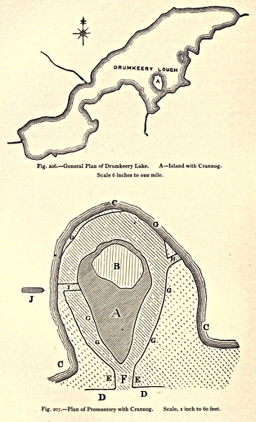
Plate XLVIII.
Plate 48.
Fig. 206.—General Plan of Drumkeery Lake. A—Island with Crannog. Scale 6 inches to one mile.
Fig. 206.—General Plan of Drumkeery Lake. A—Island with Crannog. Scale 6 inches to one mile.
Fig. 207.—Plan of Promontory with Crannog. Scale, 1 inch to 60 feet.
Fig. 207.—Map of Promontory with Crannog. Scale, 1 inch to 60 feet.
Drumkeery Lough is situated two and a-half miles north of Bailieborough. In 1863 the level of this lake having been lowered, the fact became apparent that it had been, in olden times, the abode of a lacustrine population. Plate XLVIII., fig. 206, shows the former extent and shape of the lake. Near its southern margin there was an oval-shaped island, converted into a peninsula by the change in the water-level. The aspect of the locality is described, and also represented in an outline sketch, by Professor Harkness, the original island being shown (plate XLVIII., fig. 207) by the portion marked A, including the area B, while the present peninsula is indicated by the letters CCC. The crannog was situated on the peninsula, and the approach to it had been from the south, as indicated by remains of a stockade of birch piles, DD, extending from both sides of the entrance, whilst at the eastern corner of the latter was a large oak pile with a four-sided hole cut through it. Large vertical oak slabs, with interspaces of three feet between each pile, formed the sides of the entrance EE, the interspaces filled in with smaller slabs of oak inclined outwards; the strong vertical piles had been well secured; on examination it was found that about nine feet of their length lay below the then surface. The floor of the entrance F was formed of large flat stones, and underlying this rude pavement were pieces of cleft oak. The area occupied by the crannog was an Irish acre—the longer axis being nearly north and south—and it was enclosed by piling composed principally of birch, retaining the bark. These birch poles, on the end inserted into the ground, had usually a wedge-shaped outline; some of the smaller trees seem to have been cut down by a single blow, and driven into the ground without further sharpening. Piles of oak which also occurred in the crannog were much better pointed, tapering regularly in some cases from their extremity for four feet upwards. Round oak piles were found in several parts of the stockade; whilst cleft oak was[Pg 201] observed only at the entrance in one or two parts of the stockade, and in single piles here and there in the crannog. It has been computed that the number of piles used in forming and strengthening the construction must have exceeded 30,000. The stockade was composed of piles placed in close contiguity, without interspaces; and in the interior, near the piling, there was a layer of gravelly clay and large stones, varying from two inches to two feet in thickness, its object being to give a uniform level; and this comparatively narrow space was the only artificially elevated portion of surface in the crannog, which differed from most others previously met with in Ireland, in apparently not having required to be raised above the water; but there is evidence of the level having risen five and a-half feet since the period of its occupation. At the northern extremity of what had been the crannog was a space about a rood and a-half in size, B, occupied by fragments of burnt bones and charcoal—the kitchen midden of the place. This deposit, nine inches in thickness, rested upon the natural surface of the island, of which the entire area AB was flat, and before the lake was lowered stood two and a-half feet above the ordinary level. On the north side the supports for a landing-stage, H, were composed of two rows of piles that ran obliquely outwards from the girdle of piling G; and on the east side was another series of double piling, I, the piles about three and a-half feet apart, and they differed from the formation on the N.W. in extending inwards from the main stockade. Opposite to this, and firmly embedded in the oozy bottom of the lake, was seen a single-piece canoe, J, formed out of an oak trunk; the double row of piling extending inwards doubtless enclosed a “dock” destined to receive and secure the canoe when not in use.[220]
Drumkeery Lough is located two and a half miles north of Bailieborough. In 1863, after the water level of this lake was lowered, it became clear that it had once been home to a population living on the water. Plate XLVIII., fig. 206, shows how large and shaped the lake used to be. Near the south edge, there was an oval-shaped island that turned into a peninsula due to the change in water level. Professor Harkness described the area's appearance and provided an outline sketch, showing the original island (plate 48., fig. 207) marked as A, which includes the area B, while the current peninsula is shown by the letters CCC. The crannog was on the peninsula, and access to it was from the south, as indicated by remnants of a stockade made of birch piles, DD, extending from both sides of the entrance. At the eastern corner of the entrance, there was a large oak pile with a square hole cut through it. Large vertical oak slabs with three feet gaps between each pile formed the sides of the entrance EE, with the gaps filled with smaller slabs of oak leaning outwards. The sturdy vertical piles were securely anchored; upon examination, it was found that about nine feet of their length extended below the then-current surface. The floor of the entrance F was made of large flat stones, and underneath this rough pavement were pieces of cleft oak. The crannog covered an area of an Irish acre, with the long axis running nearly north and south, surrounded by birch piles that still had their bark. The tops of these birch poles, which were inserted into the ground, were typically wedge-shaped. Some of the smaller trees seemed to have been felled with a single strike and driven into the ground without any additional sharpening. The oak piles found in the crannog were much better pointed, tapering regularly for about four feet from their tips. Round oak piles appeared in various parts of the stockade, while cleft oak was[Pg 201] found only at the entrance and in a few areas of the stockade, as well as scattered single piles throughout the crannog. It's estimated that over 30,000 piles were used to build and reinforce the structure. The stockade consisted of closely placed piles with no gaps; inside, near the piling, there was a layer of gravelly clay and large stones, varying from two inches to two feet thick, aimed at creating a level surface. This relatively narrow area was the only artificially raised part of the surface in the crannog, which was different from most others found in Ireland, as it apparently didn't need to be elevated above the water; however, evidence suggests that the water level has risen five and a half feet since it was occupied. At the northern end of what was the crannog, there was a space about a rood and a half in size, B, filled with fragments of burnt bones and charcoal—the kitchen refuse of the site. This deposit, nine inches thick, rested on the natural ground of the island, which was completely flat, and before the lake was lowered, it stood two and a half feet above the normal water level. On the north side, the supports for a landing stage, H, were made of two rows of piles that slanted outward from the surrounding piling G; on the east side was another series of double piling, I, with piles about three and a half feet apart, extending inward from the main stockade, unlike the structure on the northwest side. On the opposite side, firmly embedded in the muddy bottom of the lake, was a single-piece canoe, J, carved from an oak trunk; the double row of piling that extended inward likely formed a “dock” to hold and secure the canoe when not in use.[220]
On the north side of the lough, nearly opposite this crannog, there were traces of another of smaller size. Birch and round piles of oak were distinctly recognizable; these occurred also at various intervals along the margin of the water, indicating the former existence of several lake dwellings. Along the shore have been discovered traces of many ancient fireplaces[221] more than six inches above the present surface of the lake, but five and a-half feet below its level previous to drainage; the largest of these consisted of a heap, thirteen feet in diameter, of small flattish, angular-shaped stones resting on peat; the small stones had a reddish colour, and consisted of fragments of greywacke shale. Immediately contiguous to this heap of small stones was another, about four feet in diameter, made up of large stones, some a foot and a-half in breadth. These larger blocks exhibited no trace of the action of fire which had given to the smaller fragments their red colour.[222]
On the north side of the lake, almost across from this crannog, there were signs of another, smaller one. Birch and round oak piles were clearly visible; these were also seen at various intervals along the water's edge, suggesting several lake dwellings used to exist there. Along the shore, many ancient fireplaces have been found, more than six inches above the current water level, but five and a half feet below its level before drainage. The largest of these consisted of a mound, thirteen feet in diameter, made up of small flat, angular stones resting on peat; these stones were reddish and were fragments of greywacke shale. Right next to this mound of small stones was another one, about four feet in diameter, composed of larger stones, some measuring a foot and a half wide. These larger stones showed no signs of fire, which was what gave the smaller fragments their red color.
Lough Ramor.—There are numerous islands on this lake, which is five miles in length, and from a mile to a mile and a-half in breadth. In the Irish Annals this sheet of water is said to have burst forth A.M. 2859, and in A.D. 845, King Malachy is reputed to have here attacked and destroyed an island on which rebels had fortified themselves after joining with the Danes, and from whence they continued to commit depredations on the neighbouring districts. On its shores was found the curious stone mould figured ante, p. 73; a bronze vessel like a modern pot, eleven and a-half inches high, and the same wide, with small handles attached below the rim, and one foot wanting; another bronze vessel in a perfect state, with three transverse raised lines on sides, trident-shaped ornaments spring from the base of each leg, angular handles attached between junction of rim and conical pot, fifteen and three-quarter inches high, twelve across mouth. These latter articles were both found in Lough Ramor, and in Museum, R. I. A. they appear as Nos. 40 and 43.
Lough Ramor.—This lake has many islands and is five miles long, with a width ranging from one to one and a half miles. According to the Irish Annals, this body of water is said to have emerged in AM 2859. In CE 845, King Malachy reportedly attacked and destroyed an island where rebels had fortified themselves after joining forces with the Danes, from which they continued to raid nearby areas. On its shores, a fascinating stone mold was discovered, as described ante, p. 73; a bronze vessel similar to a modern pot, measuring eleven and a half inches high and wide, with small handles below the rim, and one foot missing; another bronze vessel in perfect condition, featuring three raised lines on the sides and trident-shaped ornaments at the base of each leg, with angular handles connecting the rim and the conical pot, measuring fifteen and three-quarter inches high and twelve inches across the mouth. These items were both found in Lough Ramor and are displayed in the Museum, R. I. A. as Nos. 40 and 43.
Lough Crannog.—Judging from the name, there was formerly an artificial island in this lake.
Lough Crannog.—Based on the name, there used to be an artificial island in this lake.
Lough Aconnick and Derreskit Lough.[223]
Lough Aconnick and Derreskit Lough. __A_TAG_PLACEHOLDER_0__
At a meeting of the Royal Historical and Archæological Association of Ireland, held at Portrush, July, 1885, a paper on the crannogs of the county Cavan was read by Mr. Seaton Milligan of Belfast, who stated that he had at various times visited several of those structures, which he considered to be more numerous in Cavan than in any other county in Ireland, owing perhaps to the great number of lakes scattered over its surface. He described some eleven sites that lay within a radius of seven or eight miles from the town of Cavan; and was of opinion that their outer row of piling was generally formed of oak, and the inner circles of smaller stakes of hazel and sallow. A looped spear-head of bronze was shown by him, and he minutely described two canoes dug out of a bog on the shores of a lake containing a crannog, and situated near Heath Lodge. A bronze rapier found near a crannog in Lough Oughter was also exhibited by him, and a description given of the castle of the same name, where Bishop Bedell was protected by the Irish during the troublous times of 1641. This castle stands on an island surrounded by piling, and bearing the impress of having been an ancient crannog whereon the more modern structure was erected (ante, p. 155).
At a meeting of the Royal Historical and Archaeological Association of Ireland, held in Portrush in July 1885, Mr. Seaton Milligan from Belfast presented a paper on the crannogs of County Cavan. He mentioned that he had visited several of these structures multiple times, believing they were more numerous in Cavan than in any other county in Ireland, likely due to the abundance of lakes in the area. He described about eleven sites located within a seven or eight-mile radius of Cavan town and suggested that the outer row of their piling was generally made of oak, while the inner circles were formed from smaller stakes of hazel and sallow. He showcased a looped bronze spearhead and detailed two canoes that were dug from a bog on the shores of a lake with a crannog near Heath Lodge. He also displayed a bronze rapier found near a crannog in Lough Oughter and described the castle of the same name, where Bishop Bedell was sheltered by the Irish during the turbulent times of 1641. This castle sits on an island surrounded by piling and shows signs of having been an ancient crannog on which the more modern structure was built (ante, p. 155).
PROVINCE OF LEINSTER.
COUNTY MEATH.

Lagore, otherwise Dunshaughlin. (See ante, pp. 23-5, 157, for the discovery and historical account of this celebrated crannog.)—In the kitchen midden were bones of the Bos longifrons, Bos frontosus, four-horned goat, wolf, dog, bear,[224] red deer, wild boar, sheep, fox, horse, &c.; also a sea-shell (Fusus antiquus), here figured one-third its real size. This relic is preserved in the Petrie Collection, R. I. A. It is curious to find a shell of any marine species within the bounds of a crannog situated many miles inland; and with it were shells of limpets and baccinums, together with numerous portions of fictile ware.[225] Around the crannog were several single-tree canoes, and near the centre there were two human skeletons lying at full length; the country people would not allow them to be removed; one specimen was, however, secured, and deposited in the Museum, R. I. A.[226]
Lagore, also known as Dunshaughlin. (See ante, pp. 23-5, 157, for the discovery and historical account of this famous crannog.)—In the kitchen mound were bones of the Bos longifrons, Bos frontosus, four-horned goat, wolf, dog, bear,[224] red deer, wild boar, sheep, fox, horse, etc.; also a sea shell (Fusus antiquus), shown here one-third its actual size. This artifact is kept in the Petrie Collection, R. I. A. It's interesting to find a shell from any marine species within the area of a crannog located miles inland; and along with it were shells of limpets and baccinums, along with many pieces of pottery.[225] Around the crannog were several single-log canoes, and near the center, there were two human skeletons lying fully extended; the local people wouldn't allow them to be moved; however, one specimen was secured and placed in the Museum, R. I. A.[226]
Bohermeen.—Ante, pp. __A_TAG_PLACEHOLDER_0__ and __A_TAG_PLACEHOLDER_1__.
COUNTY WESTMEATH.
During the working of the Commission for the Arterial Drainage of Ireland a crannog was discovered in this county, but its site is unidentified.
During the operation of the Commission for the Arterial Drainage of Ireland, a crannog was found in this county, but its exact location is unknown.
Joristown.—In this townland, parish of Killucan, there would seem to have been formerly a crannog in the river Deel, for when deepening the bed of the stream a bronze spear-head was found five feet below the surface, and in the immediate neighbourhood of an artificial island, which is described upon the label attached to this weapon in the R. I. A. as “a little mound, formerly an island, which contained a quantity of bones and some iron spears.”[227]
Joristown.—In this area, part of the parish of Killucan, there seems to have once been a crannog in the river Deel. When the stream's bed was deepened, a bronze spearhead was discovered five feet below the surface, near an artificial island. The label attached to this weapon in the R. I. A. describes it as “a little mound, formerly an island, which contained a quantity of bones and some iron spears.”[227]
Ballinderry, in the parish of Kilcumreragh, barony of Clonlonan, is situated not far from Moate. When, as the result of drainage, the water of this lake fell, it was discovered that it had formerly contained a large crannog surrounded by a stockade of oak piles, around and on which was an immense quantity of the antlers of red deer, and fractured bones of deer, oxen, sheep, and other mammalia, all afterwards sold as manure. Many objects of archæological interest found here were obtained by various collectors—some are in the Museum, R. I. A., and others have been figured in the Journal of the Royal Historical and Archæological Association of Ireland. The first notice of the crannog occurred in 1844, when Mr. Hayes forwarded to Sir W. Wilde a description[Pg 206] of it, together with a plan and map of the locality. Two single-piece canoes were disinterred from this site, and portion of an ancient harp of wood. The pendent amulet of stone, figured p. 115, was found here.[228]
Ballinderry, in the parish of Kilcumreragh, barony of Clonlonan, is located not far from Moate. When the lake’s water levels dropped due to drainage, it was revealed that it once had a large crannog surrounded by an oak pile stockade. Around and on it were a huge amount of red deer antlers and broken bones from deer, cattle, sheep, and other mammals, all of which were later sold as fertilizer. Many items of archaeological interest discovered here were collected by various individuals—some are in the Museum, R. I. A., and others have been published in the Journal of the Royal Historical and Archaeological Association of Ireland. The first mention of the crannog was in 1844 when Mr. Hayes sent a description to Sir W. Wilde along with a plan and map of the area. Two single-piece canoes and part of an ancient wooden harp were uncovered from this site. The stone pendant amulet, illustrated on p. 115, was also found here.[228]
Ballinacarriga.—Ante, p. 136.
Ballinacarriga.—Before, p. __A_TAG_PLACEHOLDER_0__.
Lough Owel.—A canoe was here found, and a crannog is said to exist beneath the waters of this lake, opposite Portlenon. It is situated on a shallow, still called by the fishermen “the Old Crannog.”
Lough Owel.—A canoe was found here, and it’s said that a crannog lies beneath the waters of this lake, across from Portlenon. It’s located in a shallow area that the fishermen call “the Old Crannog.”
COUNTY LONGFORD.
Castle Forbes.—Ante, p. 33.
Castle Forbes.—Ante, p. __A_TAG_PLACEHOLDER_0__.
Aughamore, near Granard.—At this place was said to have been discovered a curious wooden hut, constructed of black bog-oak, which lay under water in an exhausted bog at considerable depth beneath the surface. It measured twenty-three feet by ten, and had eight very strong beams supported by cross-beams firmly jointed; the side-beams mortised, as if intended for uprights. It was taken asunder in the process of raising, and as far as can be ascertained it has never been viewed by any person competent to form an opinion on the matter, so that no conjecture can be hazarded regarding the age or purpose of this so-called hut.
Aughamore, near Granard.—At this location, a fascinating wooden hut made of black bog-oak was reportedly found submerged in a drained bog, lying at significant depth below the surface. It measured twenty-three feet by ten and featured eight very sturdy beams supported by cross-beams that were securely joined; the side beams were mortised, as if meant to serve as uprights. It was taken apart during the process of raising it, and to date, it seems that no one qualified has seen it to form an opinion, leaving no possibility to speculate on the age or purpose of this so-called hut.
COUNTY LOUTH.
Iniskeen.—Ante, p. 158.
Iniskeen.—Before, p. __A_TAG_PLACEHOLDER_0__.
Ballyhoe Lake.—A stone pestle, an amulet made of black stone, and a flat circular stone, were here found,[229] and from the bed of the river Glyde were obtained a portion of a double comb and two beads of bone, the one seven-eighths of an inch in diameter, the other one-half inch wide.
Ballyhoe Lake.—A stone pestle, a black stone amulet, and a flat round stone were found here,[229] and from the bed of the river Glyde were retrieved part of a double comb and two bone beads, one measuring seven-eighths of an inch in diameter and the other half an inch wide.
KING’S COUNTY.
During the working of the Commission for the Arterial Drainage of Ireland, a crannog was discovered in this county, locality not mentioned.[230] “Just above the Pass Bridge, at the east end of Droughtville demesne, is a marsh, called the ‘Muddy Lake’ on the Ordnance Map, but by the people, the ‘Island Lough.’ On the north side of this marsh there is a small island, on which are the remains of Kiltubrid Castle. Between the castle and mainland, on the north side, there is an ancient causeway about one hundred yards in length.” A new channel made by the Drainage Commissioners in 1852, crossed this causeway within thirty yards of the castle. In the excavation several large pieces of oak were found, having evidently formed portion of a framework, as the mortises were tolerably perfect. Here also were discovered an article formed of wood, a pan of white bronze or findruin, three coins of the reign of Charles I., two of Elizabeth, and numerous others worn and defaced.[231]
During the work of the Commission for the Arterial Drainage of Ireland, a crannog was found in this county, though the specific location isn't mentioned.[230] “Just above the Pass Bridge, at the east end of Droughtville estate, there’s a marsh known as the ‘Muddy Lake’ on the Ordnance Map, but the locals call it the ‘Island Lough.’ On the north side of this marsh, there's a small island that has the remains of Kiltubrid Castle. Between the castle and the mainland, on the north side, there’s an ancient causeway about one hundred yards long.” A new channel constructed by the Drainage Commissioners in 1852 crossed this causeway within thirty yards of the castle. During the excavation, several large pieces of oak were found, which clearly formed part of a framework, as the mortises were fairly intact. Here too, an item made of wood was discovered, along with a pan of white bronze or findruin, three coins from the reign of Charles I, two coins from Elizabeth, and a number of others that were worn and damaged.[231]
QUEEN’S COUNTY.
Grantstown.—About the year 1860, the permanent water-level of this lake being lowered six feet, disclosed an artificial island; the stakes forming the enclosure were very sharply pointed; those laid horizontally in the centre were grooved and nailed together. R. Langrishe—who had visited Grantstown, and was often on the lake—states that the country people spoke of these remains as “the castle”: they said “it had sunk.” No canoe was found, the water in the immediate vicinity of the crannog being upwards of eighty feet in depth. The only relics discovered were an iron hasp, two nails with large heads, an arrow or spear of charred wood, a polished piece of bone resembling a pin for the hair, having grooved circles all round it at top, an enormous quantity of animal bones and charred timber, a lump of gypsum, also a rude box, about four and a-half feet in length, which contained two small bones.[232]
Grantstown.—Around the year 1860, when the permanent water level of this lake dropped by six feet, an artificial island was revealed; the stakes forming the enclosure were sharply pointed, and those laid horizontally in the center were grooved and nailed together. R. Langrishe—who had visited Grantstown and often spent time on the lake—says that the local people referred to these remains as “the castle”, claiming “it had sunk.” No canoe was found, as the water near the crannog was over eighty feet deep. The only artifacts discovered were an iron hasp, two large-headed nails, a charred arrow or spear, a polished piece of bone that looked like a hairpin with grooved circles around the top, a huge number of animal bones, charred wood, a lump of gypsum, and a rough box about four and a half feet long, which held two small bones.[232]
Lough Annagh, situated in the barony of Tinnehinch, separates the King’s from the Queen’s County; it is three miles in circumference, and the waters abound with pike, roach, and perch. In the middle of this lake, where most shallow, oak framing was visible, and a tradition existed that “in the war of 1641 a party of insurgents had a wooden house erected on this platform, whence they went out at night in a boat and plundered the surrounding country.” The site was suitable for such a retreat, the lake having formerly been embowered in forest. Queen Elizabeth thanked one of her commanders for conducting a detachment of horse in safety through the surrounding woods of the district. T. Stanley, who visited the place in 1868, observed an island-like patch rising a little above the water-level; of piles then visible he counted upwards of one hundred and twenty, arranged in lines, with spaces of two feet between the alignments, the average diameter being about five inches. The island sloped down gradually in every direction, and the piles—apparent only on one side—accommodated themselves to the slope, and were in general only a few inches above the surface of the water. Four piles had been uprooted,[Pg 209] and thus showed that originally they were pointed with a sharp instrument, possibly with small iron hatchets similar to those found on the spot a few days previous to T. Stanley’s visit. Between the island and the shore there was a half-submerged space, about thirty feet in diameter, strewn with stones and broken querns; a few piles appeared among this debris. There was a lesser tract closely adjoining, where well-burnt brick, both whole and broken, were mingled with the stones. On the mainland, near the crannog were traces of a curious bog-pass, made like an American corduroy road, and there can be little doubt of this being “the tougher of Malahone,” mentioned by Major Edward Wood in his despatch, giving an account of an action fought by him on the 4th May, 1691,[233] when he defeated a portion of the Irish army on a hill above the lough. It is more than probable that the crannogs in question had either been the head-quarters of the Irish force, or that after their defeat the fugitives took refuge on the islands, for in the year 1868, the Rev. J. Graves saw at Tullamore articles purchased from the men who had picked them up near the crannog. The items first named seem to tell their own story.[234]
Lough Annagh, located in the barony of Tinnehinch, divides the King’s County from the Queen’s County; it measures three miles around, and the waters are rich with pike, roach, and perch. In the shallowest part of this lake, remnants of oak framing were visible, and there's a tradition that “in the war of 1641, a group of rebels built a wooden house on this platform, from which they would leave at night in a boat to raid the surrounding area.” The location was perfect for such a hideout, as the lake was once surrounded by forests. Queen Elizabeth thanked one of her commanders for safely guiding a cavalry unit through the woods of the region. T. Stanley, who visited the area in 1868, noted an island-like patch that rose slightly above the water level; he counted over one hundred and twenty visible wooden piles arranged in lines, with two feet of space between them, each about five inches in diameter. The island sloped down gradually in all directions, and the piles, visible only on one side, conformed to the slope, generally just a few inches above the water's surface. Four piles had been uprooted,[Pg 209] revealing that they were originally pointed with a sharp tool, possibly small iron hatchets similar to those found in the area a few days before T. Stanley’s visit. Between the island and the shore was a half-submerged area, about thirty feet wide, scattered with stones and broken querns; a few piles could be seen among this debris. There was also a smaller adjacent area where well-burnt bricks, both intact and broken, were mixed in with the stones. On the mainland, near the crannog, there were signs of a peculiar bog-pass, constructed like an American corduroy road, and it's likely this was “the tougher of Malahone,” mentioned by Major Edward Wood in his report about a battle he fought on May 4, 1691,[233] where he defeated part of the Irish army on a hill above the lough. It is highly probable that the crannogs were either the headquarters of the Irish forces or that after their defeat, the survivors sought refuge on the islands, as in 1868, Rev. J. Graves observed items bought from men who had retrieved them near the crannog. The first items mentioned seem to reveal their own story.[234]

Fig. 209.—Part of Lough Annagh, enlarged from the Ordnance Survey six-inch Map, showing Sites of Crannogs.
Fig. 209.—Part of Lough Annagh, enlarged from the Ordnance Survey six-inch Map, showing locations of Crannogs.
During the progress of drainage operations, five canoes became exposed to view; they lay at the bottom in the same part of the lake, with their bow in a north-westerly direction, all having the same inclination or dip in the sandy or muddy deposit. A drawing was made, with measured plans and sections of the most perfect of the “dug-outs”; it was, however, split or fissured from starboard right through to the stern; it measured twenty-two feet seven inches over all, its greatest beam being thirty-one inches. It was formed out of one large trunk of oak, and appeared to have been hollowed by means of fire; close inspection showed that edged tools had been used in finishing it. The bottom (two inches thick) was perfectly flat, and without keel, and its perfectly smooth sides inclined outwards from the bottom. Two stout ridges of solid timber, one near either end of the “dug-out,” served to prevent the sides from collapsing, and between them and the bow and stern cavities had been hollowed out of the solid trunk, seemingly for the purpose of rendering the craft more buoyant. The port side was several inches lower than the starboard—manifestly the effect of accident. There were no traces of thwarts or benches; the sides had neither row-locks nor thole-pins; the canoe must therefore have been intended for propulsion by paddles. A horizontal hole, about one and a-half inch in diameter, had been bored in the most forward and highest part of the stern.
During the drainage operations, five canoes were revealed; they rested at the bottom of the same area in the lake, with their bows facing northwest, all at the same angle in the sandy or muddy sediment. A drawing was made, including measured plans and sections of the best-preserved “dug-out”; it was, however, cracked from the starboard side all the way to the stern; it measured twenty-two feet seven inches in total length, with a maximum width of thirty-one inches. It was carved from a single large oak trunk and seemed to have been hollowed out using fire; a close look indicated that edged tools were used to finish it. The bottom (two inches thick) was completely flat and lacked a keel, and its smooth sides slanted outward from the bottom. Two sturdy ridges of solid wood, one near each end of the “dug-out,” helped prevent the sides from collapsing, and between these and the bow and stern, cavities had been carved out of the solid trunk, seemingly to make the craft more buoyant. The port side was several inches lower than the starboard—obviously a result of damage. There were no signs of thwarts or benches; the sides had neither row-locks nor thole-pins; therefore, the canoe was likely designed for propulsion by paddles. A horizontal hole, about one and a half inches in diameter, had been drilled in the most forward and highest part of the stern.
This entire fleet of ancient boats, together with several querns and bones found in the locality, were, in 1868, at Brittas, the residence of the Right Hon. General Dunn.[235]
This whole fleet of old boats, along with several grinding stones and bones discovered in the area, was, in 1868, at Brittas, the home of the Right Hon. General Dunn.[235]
Cullina.—Mr. Louis Orr states that in 1872 he saw exposed by turf-cutters in the bog of Cullina, about three miles from Maryborough, the remains of a primitive wooden dwelling. “The building lay from ten to twelve feet beneat[Pg 211]h the original surface of the bog, and consisted chiefly of four upright posts, which formed the angles of a square of six or seven feet across. These posts were about six feet in height. A quantity of timber, consisting of planks and trunks of trees, principally oak, lay scattered around, and some of the woodwork appeared to have been charred by fire. Within what had been the area of the hut was a trough made of oak, measuring three feet in length by two in breadth.” A piece of thin metal (whether bronze or iron is not stated), very much corroded, was also discovered. It was supposed to have been a sword.
Cullina.—Mr. Louis Orr reports that in 1872, he observed turf-cutters in the Cullina bog, about three miles from Maryborough, uncovering the remnants of a primitive wooden dwelling. “The structure was located about ten to twelve feet below the original surface of the bog and mainly comprised four upright posts that formed the corners of a square measuring six or seven feet across. These posts stood about six feet tall. A collection of timber, including planks and tree trunks, mostly oak, was scattered around, and some of the wood appeared to have been burned. Inside what had once been the area of the hut was a trough made of oak, measuring three feet long by two feet wide.” A piece of thin metal (it’s unclear whether it was bronze or iron) was also found, which was heavily corroded. It was believed to be a sword.
PROVINCE OF MUNSTER.
COUNTY TIPPERARY.
Annagh, in the parish of Kilbarron.—There is here (as stated by the Rev. James Graves) a piled crannog, situated at the extremity of a shallow spit—submerged except when the river Shannon is very low—and at the outlet of a great circular spring or small lake, six or seven hundred yards in diameter, which runs into Lough Derg. This site has not yet been examined, but a map of the locality is here given.
Annagh, in the parish of Kilbarron.—According to the Rev. James Graves, there is a stacked crannog at the end of a shallow spit—underwater except when the river Shannon is very low—situated at the outlet of a large circular spring or small lake, about six or seven hundred yards across, which flows into Lough Derg. This site hasn’t been explored yet, but a map of the area is provided here.

Fig. 210.—General Plan of the neighbourhood of the Crannog of Annagh. A. Piled Crannog. B. Shallow Spit, usually submerged. C. Spring, or Lough. D. Outlet into Lough Derg.
Fig. 210.—General Plan of the neighborhood of the Crannog of Annagh. A. Piled Crannog. B. Shallow Spit, usually underwater. C. Spring or Lough. D. Outlet into Lough Derg.
Monaincha (the island of the bog) is—as stated by W. F. Wakeman—an artificial construction, on which had been subsequently erected a church in the Hiberno-Romanesque style. It is to the present day surrounded by bog.
Monaincha (the island of the bog) is—as noted by W. F. Wakeman—an artificial structure, upon which a church was later built in the Hiberno-Romanesque style. To this day, it is still surrounded by bog.
Lough Nahinch (the lake of the island).—In the year 1810 the waters of this lake, situated near Roscrea (at the junction of King’s County and Tipperary), having been lowered four feet by drainage,[Pg 213] a considerable portion of the land it once covered (fig. 211, b b b b b) was laid bare, and the site of a crannog became apparent. The lake is now much reduced in dimensions, but the surrounding ground being low, its expanse in winter (a a) is greater than in summer. Mr. Trench of Cangort Park—although at the time of its discovery unaware of the real nature of the construction—gave the following graphic description of it:—“The bottom (of the lake) consists of blue shelly marl, which seems to extend to a great depth, and when dry it is exceedingly light. In the highest part of this reclaimed land, which is about the middle of the old lake, there is seen a circular part resembling in shape the top of an immense tub, about sixty feet in diameter. The large planks which form the staves are from one to ten feet (?) broad, and six inches thick, quite straight as far as it has yet been possible to trace them downwards; none of them have been raised without cutting them.” There was no appearance of either axe or saw having been used in their formation.[236]
Lough Nahinch (the lake of the island).—In 1810, the water levels of this lake, located near Roscrea (at the border of King’s County and Tipperary), were lowered by four feet due to drainage,[Pg 213] revealing a significant portion of the land it had previously covered (fig. 211, b b b b b) and exposing the site of a crannog. The lake is now much smaller, but because the surrounding land is low, its size in winter (a a) is larger than in summer. Mr. Trench of Cangort Park—although he did not initially understand the true nature of the construction—provided the following vivid description: “The lake’s bottom consists of blue shelly marl, which appears to extend to a great depth and is extremely light when dry. In the highest part of this reclaimed land, roughly in the center of the old lake, there is a circular area resembling the top of a huge tub, about sixty feet in diameter. The large planks that make up the staves range from one to ten feet (?) wide and are six inches thick, remaining straight as far down as has been traced; none of them were removed without cutting.” There was no sign of either an axe or saw having been used in their production.[236]

Fig. 211.—Map showing former and present summer and winter level of Lough Nahinch.
Fig. 211.—Map showing the past and current summer and winter water levels of Lough Nahinch.
Since the change in the water level, the original aspect of the crannog has been completely transformed, its circular shape changed, many of the piles removed, and where the water was deep a quay was built for the convenience of landing turf from the southern shore. On the east there was a track into the mainland (c), and at its junction with the quay at the S.E. of the island, was one of the old oak sheeting piles. On the north, oak piles were noted forming part of a circle, and from them, running S. and S.E., there were two rows of round perpendicular ash piles (two feet five inches in diameter), that may have formed part of walls, or partitions dividing the space inside the circle of sheet piles into rooms or dwellings. On the N.W. of the island, about three yards from the present shore, were also some of the circle of sheet piles, and between them and the land ran E. and W. beams four feet apart, and four feet lower than the surface of the island: above these were irregularly-laid logs of oak, mingled with large stones. On the S.W. there was a set of oak sheet piles bounding the end of the quay. Only the general section of the island could be made on account of the inrush of water into the excavation.
Since the water level changed, the original look of the crannog has been completely altered. Its circular shape is different, many of the piles have been removed, and where the water was deep, a quay was built to make it easier to land turf from the southern shore. On the east side, there was a path leading to the mainland (c), and at its junction with the quay in the southeast part of the island was one of the old oak sheeting piles. To the north, oak piles were observed forming part of a circle, and from them, running south and southeast, there were two rows of vertical round ash piles (two feet five inches in diameter), which might have been part of walls or partitions that divided the interior of the circle of sheet piles into rooms or living spaces. On the northwest side of the island, about three yards from the current shoreline, there were also some of the circular sheet piles, and between them and the land, east and west beams ran four feet apart and were set four feet lower than the island's surface. Above these were irregularly placed oak logs mixed with large stones. On the southwest side, there was a set of oak sheet piles marking the end of the quay. Only the general section of the island could be observed due to the inflow of water into the excavation.
GENERAL SECTION.
GENERAL SECTION.
| ft. | in. | ||
| 6. Bog, | (about) | 0 | 6 |
| 5. Bog, ashes, bones, and nuts, | 1 | 6 | |
| 4. Stones and large oak sticks irregularly laid, | 0 | 6 | |
| 3. Peat, bones, and ashes, in which were oak beams lying in different directions, | 1 | 6 | |
| 2. Oak beams, about four feet apart, and laid nearly E. and W., | 0 | 6 | |
| 1. Peat, wood chips, and bones, | (over) | 1 | 0 |
| ——— | |||
| 5 | 6 | ||
The artificial work, measured from the present surface, was more than five feet six inches in thickness. On the beams (layer 2 in section) there seemed to have been a basket flooring, but of this there could not be certainty, owing to the depth of water in the excavation. In connexion with them were observed wicker-walls made of hazel rods, and where these crossed the oak beams there were round holes through the latter for the stakes to pass through. In the vicinity of these beams a small rude stone implement of Silurian grit was found, but so rotten that it broke when handled. The beams in layer 3 were charred on the under surface, as if they had formed the rafters of an edifice destroyed[Pg 215] by fire. Near the north of the island, immediately over these charred beams, there was a plank pointing N.W. and S.E.; it was ten feet long, twenty inches wide, and two inches thick; at about one foot nine inches from its N.W. end there were two holes through it, running N. and S. in a line with the north and south piles seen on the N. shore, and on each side of the plank there were upright stakes ranging in the same direction. The conclusion may be drawn that the island was occupied at two distinct periods—the first being when the E. and W. beams formed the floor of the habitations which seemed to have been destroyed by fire: afterwards the oak sticks and stones—irregularly laid—were placed as a floor for new dwellings, and between the periods it must be supposed that the water of the lake had risen considerably.[237]
The artificial structure, measured from the current surface, was more than five feet six inches thick. On the beams (layer 2 in section), there appeared to be a basket flooring, but this couldn't be confirmed due to the depth of water in the excavation. Along with them, wicker-walls made of hazel rods were observed, and where these crossed the oak beams, there were round holes in the beams for the stakes to pass through. Near these beams, a small crude stone tool made of Silurian grit was found, but it was so fragile that it broke when handled. The beams in layer 3 were burned on the underside, as if they had been the rafters of a structure destroyed by fire.[Pg 215] Close to the north of the island, directly above these charred beams, there was a plank oriented N.W. and S.E.; it was ten feet long, twenty inches wide, and two inches thick. About one foot nine inches from its N.W. end, there were two holes in it, aligned N. and S. with the north and south piles seen on the N. shore, and on each side of the plank, there were upright stakes arranged in the same direction. It's reasonable to conclude that the island was occupied during two separate periods—first when the E. and W. beams made up the floor of the dwellings that seemed to have been destroyed by fire; later, oak sticks and stones—laid out irregularly—were used as a floor for new homes. It can be assumed that in between these periods, the water of the lake had risen significantly.[237]
COUNTY WATERFORD.

Ardmore Bay.—Here, in the year 1879, a submarine crannog was discovered on the shore under high water-mark, where a small stream runs into the sea between Ardmore chapel and the old coastguard houses; this little stream described a semicircle around the crannog at low water, but at high water all was submerged; a bank of shingle had covered it in whole or in part, but the rapid denudation going on from the action of the sea had removed the shingle and is wearing down the bed of turf, so that it is quite possible no remains of the crannog may be left. Its greatest diameter was from ninety-two to one hundred feet: the turf was over nine feet deep where the piles were driven in; these were of oak, rud[Pg 216]ely pointed and forming a double enceinte—irregularly oval in shape—of which the inner row of piles generally sloped slightly inwards, and those of the outer row—closer together and more numerous than the inner—sloped outwards. In many cases they stood above the turf, and were for the most part large—as thick as a man’s thigh. Several smaller piles were in the S.E. quarter of the crannog, probably the remains of wattled partitions. To the N.E. the sea denudation had been very great, and there, at the surface, were found many roots of bog-timber, similar to those which near the centre of the crannog lay more than two feet below the level of the solid peat.
Ardmore Bay.—In 1879, a submerged crannog was found on the shore, just above the high water mark, where a small stream flows into the sea between Ardmore chapel and the old coastguard houses. This little stream created a semicircle around the crannog at low tide, but at high tide, everything was underwater. It was partially covered by a bank of shingle, but the rapid erosion caused by the sea had washed away the shingle and was wearing down the turf bed, so it’s quite possible that no remains of the crannog are left. Its largest diameter ranged from ninety-two to one hundred feet, with the turf being over nine feet deep where the piles were driven in. These piles, made of oak, were roughly pointed and formed a double enclosure—irregularly oval in shape—with the inner row of piles generally sloping slightly inward, while the outer row, which was closer together and more numerous, sloped outward. Many of them were above the turf and were mostly quite large—about the thickness of a man’s thigh. Several smaller piles were found in the southeast quadrant of the crannog, likely the remains of woven partitions. To the northeast, the sea erosion was significant, and at the surface, many roots of bog-timber were found, similar to those that lay more than two feet below the level of the solid peat near the center of the crannog.
SECTION INSIDE EAST MARGIN OF CRANNOG.
SECTION INSIDE EAST MARGIN OF CRANNOG.
| ft. | in. | ||
| 8. Peat, | Understood! Please provide the text that you would like me to modernize. | 1 | 0 |
| 7. Thin stratum of bluish clay with worn pebbles, | |||
| 6. Peat, | } | 1 | 0 |
| 5. Thin stratum of bluish clay and an angular piece of limestone, | |||
| 4. Thin stratum of charcoal, | |||
| 3. Peat, | 2 | 0 | |
| 2. Clayey peat, | 3 | 0 | |
| 1. Very clayey peat full of small oak roots, | 0 | 6 | |
| ——— | |||
| 7 | 6 | ||

In the peat Nos. 1, 2, and 3, roots and twigs of oak occurred, and in the peat Nos. 6 and 8 were many twigs and boughs of oak, also stouter pieces of sallow. The cross-section taken along the line AB shows the present surface of the ground, with the oak[Pg 217] piles, hazel stakes, planks, beams, &c., found in the excavation, also the high water-mark of average spring tides, and the depth of the peat—where proved. Any implements, or other relics that may have remained in this site, must have been long since washed away. A few antiquities are said to have been discovered in the Ardmore peat, but not within the bounds of the crannog, so that some charcoal found in one spot, two feet below the surface, and the “kitchen midden”—which at the close of 1880 became exposed by the action of the sea—form the only traces remaining of man’s former presence in this abode.[239]
In the peat layers 1, 2, and 3, there were roots and twigs of oak, and in layers 6 and 8, many twigs and branches of oak, along with thicker pieces of willow. The cross-section taken along the line AB shows the current ground surface, with the oak[Pg 217] piles, hazel stakes, planks, beams, etc., found in the excavation, as well as the high water mark of average spring tides, and the depth of the peat—where it was tested. Any tools or other artifacts that might have been left at this site must have been washed away a long time ago. A few ancient items are said to have been found in the Ardmore peat, but not within the area of the crannog, so the charcoal discovered in one spot, two feet below the surface, and the “kitchen midden”—which was exposed by the sea's action at the end of 1880—are the only remnants of human presence in this location.[239]
On Arranmore island, in the Bay of Galway, the Rev. W. Kilbride discovered habitations and artificial structures extending from above high water-mark to under the low water-level of spring tides: from this it may be inferred that man existed in Ireland before the last subsidence of the land. The Irish Annals contain much that was formerly looked upon as fabulous relations of inbreaks of the ocean, but which may be reasonably held to be the reflex of traditionary tales having some foundation in fact. Geologists assert that at one time Great Britain and Ireland were connected with the Continent by a great level plain, over which roamed the Megaceros, so that even within the period of the existence of this animal, whose contemporaneity with man may be considered beyond dispute, both seas and continents have changed.
On Arranmore Island, in the Bay of Galway, Rev. W. Kilbride found homes and man-made structures extending from above the high water mark down to the low water level of spring tides. From this, we can infer that humans existed in Ireland before the last drop in land levels. The Irish Annals contain many accounts that were once considered myths about the ocean's invasions but can reasonably be viewed as reflections of traditional stories grounded in reality. Geologists claim that at one point, Great Britain and Ireland were connected to the continent by a vast plain, over which the Megaceros roamed. This means that even during the time this animal existed, which undoubtedly overlaps with human presence, both seas and landmasses have changed.
There are proofs of elevation and subsidence in the Bay of Baiæ, where the Temple of Jupiter Serapis “affords in itself alone unequivocal evidence that the relative level of land and sea have changed twice at Puzzuoli since the beginning of the Christian era; and each movement, both of elevation and subsidence, has exceeded twenty feet.”[240] It is difficult to decide whether the crannog at Ardmore had, like the Temple of Jupiter, subsided with the land, and had again been elevated: the denudation of the crannog may point to the possibility of the latter hypothesis.
There’s evidence of rising and sinking in the Bay of Baiæ, where the Temple of Jupiter Serapis “provides clear proof that the relative level of land and sea has changed twice at Puzzuoli since the start of the Christian era; and each movement, both rising and sinking, has exceeded twenty feet.”[240] It’s hard to determine whether the crannog at Ardmore, like the Temple of Jupiter, has sunk with the land and then been raised again: the erosion of the crannog might suggest that the latter is possible.
COUNTY LIMERICK.
A crannog was discovered in this county during the working of the Arterial Drainage Commissioners. Site unidentified.
A crannog was found in this county while the Arterial Drainage Commissioners were working. Location unknown.
Coolcranoge.—Ante, p. 28.
Coolcranoge.—Before, p. __A_TAG_PLACEHOLDER_0__.
Knockanny.—Ante, p. 156.
Knockanny.—Before, p. __A_TAG_PLACEHOLDER_0__.

Fig. 214.—Spear-head of Bronze from Lough Gur. One-half real size.
Fig. 214.—Bronze Spearhead from Lough Gur. Actual size is half.
Fig. 215. Ferrule, showing Gold Ornamentation. Full size.
Fig. 215. Ferrule, showing Gold Ornamentation. Full size.
Lough Gur.—Ante, pp. 6, 25-6, 83, 150, 156, &c. There was
found here a remarkably fine bronze spear-head,
now in the collection of General A. Pitt Rivers,
F. R. S. The lower part of its socket was ornamented
with gold (see figs. 214 and 215). Homer
more than once mentions the gold ring, or ferrule,
around the spear-head of Hector. The two following
relics—also from Lough Gur—may be seen
in the British Museum:—(1) A moiety of a stone
mould for casting spear-heads and other pointed
objects of various sizes: “it is a four-sided prism,
six and a-half inches long, and two and a half
inches broad at one end of each face, and one and
three-quarter inches at the other. A second similar
prism would, it has been observed, give four perfect
moulds for casting spear-heads slightly varying in
form, but in each case provided with side-loops.
These loops are, as usual, semicircular in form on
the mould, and were no doubt destined
to be flattened in the usual manner by
a subsequent process of hammering.
There is one special feature in this
mould, viz., that at the base of the
blade there is a transverse notch in the
stone, evidently destined to receive a
small pin which would serve to keep
the core for the socket in its proper
position. There is a similar transverse
notch in one of the smaller moulds
for the pointed objects”[241] (fig. 216). (2) An iron sword, which
is ornamented on the blade thus, ![]() . The cross-like
form does not necessarily denote that the weapon belongs to
the Christian era, for an almost similar symbol
. The cross-like
form does not necessarily denote that the weapon belongs to
the Christian era, for an almost similar symbol ![]() [Pg 219]appears in an
ancient Mexican MS. now in the Belfast Museum.[242]
[Pg 219]appears in an
ancient Mexican MS. now in the Belfast Museum.[242]
Lough Gur.—Ante, pp. 6, 25-6, 83, 150, 156, &c. They found here a remarkably fine bronze spearhead, now in the collection of General A. Pitt Rivers, F. R. S. The bottom part of its socket was decorated with gold (see figs. 214 and 215). Homer mentions the gold ring, or ferrule, around Hector's spearhead several times. The two following relics—also from Lough Gur—can be seen in the British Museum:—(1) Part of a stone mold for casting spearheads and other pointed objects of various sizes: “it’s a four-sided prism, six and a half inches long, and two and a half inches wide at one end of each face, and one and three-quarter inches at the other. A second similar prism would, as noted, create four perfect molds for casting spearheads that slightly vary in shape, but each is equipped with side loops. These loops are, as usual, semicircular in shape on the mold and were likely intended to be flattened during a subsequent hammering process. There’s one special feature in this mold: at the base of the blade, there’s a transverse notch in the stone, clearly meant to hold a small pin to keep the core for the socket in place. A similar transverse notch is found in one of the smaller molds for pointed objects”[241] (fig. 216). (2) An iron sword, which has the following decoration on the blade, ![]() . The cross-like shape does not necessarily mean the weapon is from the Christian era, as a nearly identical symbol
. The cross-like shape does not necessarily mean the weapon is from the Christian era, as a nearly identical symbol ![]() [Pg 219]appears in an ancient Mexican Ms. currently in the Belfast Museum.[242]
[Pg 219]appears in an ancient Mexican Ms. currently in the Belfast Museum.[242]

Fig. 216.—Stone Mould for casting weapons, from Lough Gur.
Fig. 216.—Stone mold for casting weapons, from Lough Gur.
COUNTY CLARE.
Effernan.—In the year 1873, a gentleman desirous to provide his residence with an ample supply of water, decided on bringing it down from this lake, situated at a distance of about two miles, and at a level of three hundred feet above his house. Before a syphon could be placed in working order, it was necessary to reduce the height of the water much below its ordinary summer level, which was effected by clearing and deepening the outlet. When making the cutting the labourers, at about six feet below the surface, came upon a densely-intertwined layer of roots of a [Pg 220]pine forest; the trees had evidently attained maturity in the position in which they were found, and they extended also under the water. The forest must have been very ancient, as no lake could have been formed there at the time of its existence. The roots were in the exact position in which the trees grew, and these, with the direction to which their stumps pointed, seemed to indicate that, while the present prevailing wind is the S.W., it must then have been the N.W. Hills and valleys guide the aerial currents, and some convulsion of the earth’s crust may have altered these, and formed the present lake. When, by drainage, the water had been reduced nine feet, there was laid bare a low neck of land stretching into the lake, its outer end being highest. Along this neck of land ran, in irregular order, a row of posts, from four to six inches in diameter, and which, in general, only just topped the ground. At the extremity of the promontory was an unmistakable crannog, circular in form, and with wooden piles surrounding the exterior; the floor was of stone; and one large flag—seemingly the fireplace—took up the greater part of the interior space. Unfortunately, no one specially interested about lake dwellings was at the time aware of this discovery, and the syphon being completed, crannog and causeway became once more submerged.[243]
Effernan.—In 1873, a man who wanted to supply his home with plenty of water decided to bring it from a lake about two miles away, situated three hundred feet above his house. Before a siphon could be put into operation, it was necessary to lower the water level significantly below its usual summer height, which was accomplished by clearing and deepening the outlet. While digging, the workers encountered a thick layer of intertwined roots from a pine forest about six feet below the surface; the trees had clearly matured where they were found and extended under the water as well. The forest must have been very old, as a lake could not have formed there while it existed. The roots were positioned exactly where the trees grew, and the direction of their stumps suggested that, while the current prevailing wind is from the southwest, it must have been from the northwest back then. Hills and valleys shape the wind currents, and some shift in the earth’s crust may have changed these and created the present lake. After draining the water by nine feet, a low neck of land emerged stretching into the lake, with the outer end being the highest point. Along this neck of land was a row of posts, ranging from four to six inches in diameter, generally just above ground level. At the end of the promontory was a clear crannog, circular in shape, surrounded by wooden piles; the floor was made of stone, and a large flagstone—likely the fireplace—occupied most of the interior space. Unfortunately, no one with a specific interest in lake dwellings was aware of this discovery at the time, and once the siphon was completed, the crannog and causeway were submerged again.[Pg 220][243]
PROVINCE OF CONNAUGHT.
COUNTY GALWAY.

Ballinlough is situated in the barony of Leitrim, and parish of Ballinakill; in it were four islands, bearing no distinctive appellation; but G. H. Kinahan, who made the explorations, named them, respectively—North Island (1), (fig. 217), West Island (2), Middle Island (3), East Island (4). In the general view of the lake (fig. 218), North Island (1) is in the far distance; near the mouth of the rivulet is West Island (2); to its right lies Middle Island (3); whilst a glimpse of a portion only of East Island (4) is to be seen. The horns and skulls of numerous red deer have been discovered at various times in the lake-bed; also the head and horns of a Megaceros hibernicus. North Island (1) is nearly one hundred yards from the shore, to which, during the dry season, it was connected by a reedy bank, and, when visited, was a foo[Pg 222]t above the surface of the water; the excavation was stopped on finding the stratum undisturbed, and no traces around of ancient dwellings, either of stone, or of piling. West Island (2), twenty-six yards from the shore, was connected with it during the dry season; its form was a rude oval, the diameter thirty-three and fifteen yards, respectively, and there were flat stones round the outside. An excavation in the centre showed:—
Ballinlough is located in the Leitrim barony and the parish of Ballinakill. It consists of four islands that don’t have specific names, but G. H. Kinahan, who conducted the explorations, named them: North Island (1), (fig. 217), West Island (2), Middle Island (3), and East Island (4). In the overall view of the lake (fig. 218), North Island (1) is in the far distance; West Island (2) is near the mouth of the stream; to its right is Middle Island (3); and only a part of East Island (4) can be seen. The horns and skulls of many red deer have been found at various times in the lakebed, including the head and horns of a Megaceros hibernicus. North Island (1) is almost one hundred yards from the shore, which was connected to it by a reedy bank during the dry season, and when visited, it was a foot above the water surface. The excavation was halted upon discovering that the layer was undisturbed, with no signs of ancient dwellings, either built of stone or on pilings. West Island (2), located twenty-six yards from the shore, was also connected during the dry season. Its shape was a rough oval, measuring thirty-three and fifteen yards in diameter, with flat stones around the edges. An excavation in the center revealed:—
| ft. | in. | ||
| Bog and clay, with a few bones, | 2 | 0 | |
| Wood ashes, full of charred bones, | over | 1 | 6 |
| ——— | |||
| 3 | 6 | ||
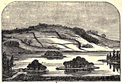
Middle Island (3) lies nearly eighty-four yards from West Island (2); it was almost circular, its diameter being thirty-two yards; and outside, for a width of nearly twelve feet, it was lined with regularly-placed flat stones. When the water was low, piles could be distinctly observed around it; but the porous nature of the materials, joined to the height of the water at the time, precluded a systematic examination. A small excavation near the western extremity gave the following section:—
Middle Island (3) is almost eighty-four yards from West Island (2); it was nearly circular, with a diameter of thirty-two yards; and along the edge, for a width of almost twelve feet, it was bordered with neatly arranged flat stones. When the water was low, piles could be clearly seen around it; however, the porous nature of the materials, combined with the water's height at that time, made a thorough examination impossible. A small dig near the western edge revealed the following section:—
| ft. | in. | ||
| 6. Peat and clay, | about | 0 | 9 |
| 5. Peat and stones, with a few bones, | 0 | 9 | |
| 4. Wood ashes and peat, quantities of unbroken cherry stones, broken hazel nuts, broken animal bones and teeth, also a ball of red colouring matter, | 2 | 6 | |
| 3. Basket flooring, one and a-half inch thick, | 0 | 1.5 | |
| 2. Oak beams, | 0 | 6 | |
| 1. Peat, | over | 0 | 6 |
| ——— | |||
| 5 | 1.5 | ||
The oak beams were sawn, not split; they seemed to run nearly N. and S.; through them, at distances of nine inches, were pairs of dowels, and at intervals of nine inches were ash poles, two and a-half inches thick, through which the dowels passed and secured the flooring beams. The wicker-work flooring was formed of hazel rods; and the crannog would appear to have been divided into huts, or apartments, as portion of a row of ash piles was observable. Below the beams there was a stratum of peat; but in consequence of the rapid influx of water, the working had to be abandoned at this point. No relics were discovered, owing probably to the narrow area of the excavation. East Island (4) was of irregular pear-shape, sixty-seven yards by fifty; it lay three hundred feet from the southern shore, and seemed to be partly natural, partly artificial. An excavation in the centre gave four feet of peat, and under it was shell marl, whilst for a radius of about twelve feet around the island there were layers of regularly-placed stones, small and flat; also at the S.E. shore there were two beams, seven inches wide; the height of the water, however, precluded further examination.
The oak beams were cut, not split; they seemed to run almost north and south. At nine-inch intervals, there were pairs of dowels, and at nine-inch gaps were ash poles, two and a half inches thick, through which the dowels went to secure the flooring beams. The woven flooring was made of hazel rods, and the crannog appeared to be divided into huts or rooms, as part of a row of ash piles was visible. Beneath the beams was a layer of peat; however, due to the quick influx of water, the excavation had to be stopped at this point. No artifacts were found, likely due to the small size of the dig. East Island (4) had an irregular pear shape, measuring sixty-seven yards by fifty; it was located three hundred feet from the southern shore and seemed to be partly natural and partly man-made. An excavation in the center revealed four feet of peat, with shell marl underneath, while around the island, in a radius of about twelve feet, there were layers of small, flat stones placed in an orderly manner. Additionally, at the southeast shore, there were two beams, seven inches wide; however, the water level prevented further investigation.
The lake occupied a hollow among low hills, the only outlet being at the village of Ballinlough, where there is an artificial cut through a bank of coarse boulder clay. If this cut were filled up, the water would rise at least four feet higher than at present; and it would seem to have been at that level not long since, for all round the beach, to over that height, there is a deposit of shell marl and peat. In the bank of drift on the west of the village is the trace of an ancient ravine, artificially filled up with stuff taken from an oblong excavation (marked a on fig. 217). To account for this artificial filling, it may be suggested that the inhabitants of the crannogs were flooded out by an enemy, who stopped the[Pg 224] egress of the lake, thus raising the water until the islands were swamped; after this they remained submerged until the opening of the present cut. In later years they had been occasionally occupied for purposes of illicit distillation.[244]
The lake was situated in a depression among low hills, with the only outlet at the village of Ballinlough, where an artificial channel cuts through a bank of rough boulder clay. If this channel were to be blocked, the water level would rise at least four feet higher than it is now; and it seems to have been at that higher level not long ago, as there is a deposit of shell marl and peat all around the beach, reaching above that height. In the bank of drift to the west of the village, there is evidence of an ancient ravine, filled in artificially with material taken from a rectangular excavation (marked a on fig. 217). To explain this artificial filling, it could be suggested that the people living on the crannogs were forced out by an enemy who blocked the lake's outflow, causing the water to rise until the islands were submerged; they remained underwater until the current channel was opened. In later years, they were sometimes used for illegal distillation purposes.[244]
Lough Naneevin is situated in the townland of Gortacarnam, barony of Moycullen. In the summer of 1865, G. H. Kinahan observed, in this lake, a crannog which is described as oval in form, about one hundred and fifty feet in length, seventy-five feet wide, and on the south a narrow causeway, then partly submerged, had joined it to the mainland. The island bore traces of having (since last inhabited) been covered with water at least two feet higher, for shell marl was deposited on the portion below that level. On the south shore of the crannog there was a row of round oak piles, four inches in diameter, and on the S.W. shore were two rows of similar piles, five feet apart; alongside them were oak beams, and there was a double row of piles, seemingly part of a wall, bearing north and south. No piles were observable on the east of the crannog, but there was an irregularly-laid flooring of beams of ash, oak, and sallow; from these latter, it was supposed, had sprouted the sallow trees, which at that time formed a fringe round the island. The piles had been pointed with a sharp-cutting instrument; therefore metal had been in use either when the crannog was constructed, or repaired.
Lough Naneevin is located in the townland of Gortacarnam, barony of Moycullen. In the summer of 1865, G. H. Kinahan noted that this lake contained a crannog, which was described as oval-shaped, about one hundred and fifty feet long and seventy-five feet wide. To the south, a narrow causeway, which was partly submerged at the time, connected it to the mainland. The island showed signs of having been covered with water at least two feet higher in the past, as shell marl was found deposited on the area below that level. On the south side of the crannog, there was a line of round oak piles, each four inches in diameter, and on the southwest shore, there were two lines of similar piles spaced five feet apart. Next to them were oak beams, and there was a double row of piles that appeared to be part of a wall running north and south. No piles were found on the east side of the crannog, but there was an unevenly laid floor made of ash, oak, and sallow beams. It was believed that the sallow trees, which then surrounded the island, had grown from these beams. The piles had been sharpened with a cutting tool, indicating that metal was used either during the construction or repair of the crannog.
Six small excavations made near the centre of the island, where the surface of the crannog was three feet above the water-level, disclosed the following section:—
Six small dig sites made near the center of the island, where the surface of the crannog was three feet above the water level, revealed the following section:—
| ft. | in. | ||
| Bog, with a few bones, sticks, and stones, | 3 | 6 | |
| A bed of regularly laid fern-stalks and leaves (Pteris aquilina, or brake fern), on a flooring of wicker-work, made of hazel rods, about an inch in diameter; over the ferns were a few bones and a quantity of nutshells, | 0 | 6 | |
| Bog-stuff, mixed with branches, and containing a few stones and logs of timber, | (over) | 5 | 0 |
About a foot below the water-level were traces of what G. H. [Pg 225]Kinahan considered to be a basket-flooring; and a large flag-stone, used as a hearth, was found resting on an accumulation of wood-ashes, three feet in depth. Some distance to the west was a long rude bench (or perhaps the foundation of a wall) formed of stones. The height of the water prevented excavations outside the crannog, therefore few bones were met with, but a little east of the fireplace was the probable site of the kitchen midden.[245]
About a foot below the water level, there were signs of what G. H. Kinahan thought was a basket-like flooring. A large flagstone, which was used as a hearth, was found resting on a three-foot accumulation of wood ashes. A little distance to the west, there was a long, rough bench (or maybe the base of a wall) made of stones. The water was too high for excavations outside the crannog, so few bones were discovered, but just east of the fireplace was likely the site of the kitchen midden.[245]
Loughrea is situated in the barony of same name. In the locality there lingered a tradition that a city lay buried under this lake, and indeed on a clear calm day—where the waters are shallow—there may be observed various heaps of stones, placed with a degree of regularity that renders it probable they may be remains of ancient lake dwellings. Upon examination it was ascertained that four of the islands in the lough were undoubted crannogs, and it was quite possible that another (known as Blake Island) might prove to be also of artificial formation.
Loughrea is located in the barony of the same name. There's a local tradition that a city is buried beneath this lake, and on a clear, calm day—when the waters are shallow—you can see various piles of stones arranged in a way that suggests they could be the remains of ancient lake dwellings. It was found that four of the islands in the lake were definitely crannogs, and it’s quite possible that another one (known as Blake Island) might also be man-made.

Fig. 219.—Plan and Section of Reed Island. Scale, 20 feet to 1 inch.
Fig. 219.—Plan and Section of Reed Island. Scale, 20 feet to 1 inch.
Reed Island, situated at the N.W. corner of the lake, about fifty yards from the shore, lies too low to be observable in any picture. Excavations showed (section, fig. 219)—(6) marl; (5) peat; (4) large stones; (3) a layer of birch trunks and branches; (2 and 1) two layers of squared oak beams, laid at right angles to each other. The island was surrounded with a circle of piles (fig. 219)—two feet apart—that were seemingly strengthened[Pg 226] against wave action by a layer of flat stones, deposited with great regularity; three sets of piles crossed the crannog, which rose about six inches above the ordinary level of the lake, and the lowest beams (1 in section) were four feet two inches beneath the then water surface. The island originally consisted of a wooden platform, enclosed by “a circular wall, the framework of which was the piles, the interstices being filled with sods. As the lake rose, it was found necessary to raise the floor, first by a mass of birch timbers and branches, and afterwards by a layer of stones.”[246]
Reed Island, located at the northwest corner of the lake, about fifty yards from the shore, is too low to be seen in any photo. Excavations revealed (section, fig. 219)—(6) marl; (5) peat; (4) large stones; (3) a layer of birch trunks and branches; (2 and 1) two layers of squared oak beams, placed at right angles to each other. The island was enclosed by a circle of piles (fig. 219)—two feet apart—that seemed to be reinforced[Pg 226] against wave action by a layer of flat stones, laid down very consistently; three sets of piles crossed the crannog, which rose about six inches above the regular lake level, and the lowest beams (1 in section) were four feet two inches below the water surface at that time. The island originally consisted of a wooden platform, surrounded by “a circular wall, made from the piles, with the gaps filled with sods. As the lake level rose, it became necessary to elevate the floor, first using a mass of birch timbers and branches, and later by adding a layer of stones.”[246]

Plate XLIX.
Plate 49.
Fig. 220.—View of Loughrea, showing Shore and Ash Island.
Fig. 220.—View of Loughrea, showing Shore and Ash Island.
Fig. 221.—Plan of Shore Island. Scale, 80 feet to 1 inch.
Fig. 221.—Map of Shore Island. Scale, 80 feet per inch.
Fig. 222.—Section of Shore Island.
Fig. 222.—Shore Island Section.
Fig. 223.—Section of Shore Island.
Fig. 223.—Part of Shore Island.
Shore Island, situated immediately below Lord Dunlo’s house, and a quarter of a mile from Reed Island, appears to have been formerly connected with the mainland by a causeway formed of marl and peat; but in comparatively recent times the waters of the lake have worn a gap through it, about fifteen yards in breadth. (Plate XLIX., figs. 220 to 223.) The S.S.E. and E. shores were found to be a mass of stone, between and outside two semicircles of oak piles, whilst the W. and N. were banked up with shell marl. Twenty yards south of the island, three circles of piles, three feet apart, could on a calm day be seen below the water. Thirty-five feet from the E. shore part of a circle of piles was visible under the water, being perhaps portion of the circle found in the most northern excavation made. From the east shore a double row of piles extended from the circle, and on the north of these were horizontal beams in parallel line. A little N.W. of the double row, in an old working, there was part of a circle of piles, and in another a row of piles running nearly E. and W. Some of the upright piles formerly bore marks showing that horizontal beams had been mortised on them. This settlement was thoroughly explored, and in it basket-flooring and partitions were noticed (ante, p. 32). In 1848, among the numerous bones raised from this site were perfect crania of oxen, sheep, goats, deer, pigs, and what seemed to be those of large dogs, or wolves, together with the head of a Megaceros hibernicus, measuring over thirteen feet from tip to tip of the antlers.[247]
Shore Island, located just below Lord Dunlo’s house and a quarter mile from Reed Island, seems to have once been connected to the mainland by a causeway made of marl and peat. However, in relatively recent times, the waters of the lake have eroded a gap through it, about fifteen yards wide. (Plate 49., figs. 220 to 223.) The southeastern and eastern shores were found to be a mass of stone, situated between two semicircles of oak piles, while the western and northern sides were built up with shell marl. Twenty yards south of the island, three circles of piles, three feet apart, could be seen below the water on a calm day. Thirty-five feet from the eastern shore, part of a circle of piles was visible underwater, possibly a section of the circle from the most northern excavation made. From the eastern shore, a double row of piles extended out from the circle, and north of these were horizontal beams arranged in parallel lines. A little northwest of the double row, in an old working area, there was part of a circle of piles, and in another spot, a row of piles running nearly east and west. Some of the upright piles previously bore marks indicating that horizontal beams had been mortised into them. This settlement was thoroughly explored, and basket flooring and partitions were noted (ante, p. 32). In 1848, among the many bones recovered from this site were intact skulls of oxen, sheep, goats, deer, pigs, and what appeared to be those of large dogs or wolves, along with the head of a Megaceros hibernicus, measuring over thirteen feet from tip to tip of the antlers.[247]

Fig. 224.—Plan of Ash Island. Scale 20 feet to 1 inch.
Fig. 224.—Map of Ash Island. Scale 20 feet to 1 inch.
Ash Island (figs. 220 and 224) is sixty yards from the shore at the south-west corner of the lake. When examined, the surface above water measured twenty yards in diameter, and it was covered with flat stones, which continued for a short distance under the water. Towards the S. W. a spur, covered with small shingle, extended[Pg 228] outwards about three yards, and to the N. and S. W. were similar spurs stretching to a distance of four yards from the water edge. On the N. E. there were visible, below the water, a number of parallel logs of round ash, six inches in diameter, and two feet apart; also one or two logs on the east side. A few piles of oak were discovered; there were no indications, however, that the island had at any time been surrounded by a regular piling, but there was found a wicker, or dividing wall, the stakes composed of round fir, two inches in diameter, and one foot apart. The finds consisted merely of fractured bones, wood ashes, hazel-nuts, two hones, and a round sea-stone.
Ash Island (figs. 220 and 224) is sixty yards from the shore at the southwest corner of the lake. When examined, the surface above water measured twenty yards in diameter, and it was covered with flat stones, which continued for a short distance underwater. Toward the southwest, a spur covered with small pebbles extended outwards about three yards, and to the northeast and southwest were similar spurs stretching about four yards from the water's edge. On the northeast, several parallel logs of round ash, six inches in diameter and two feet apart, were visible underwater; there were also one or two logs on the east side. A few piles of oak were found; however, there were no signs that the island had ever been surrounded by a regular piling, but a wicker or dividing wall was discovered, made of round fir stakes, two inches in diameter and one foot apart. The finds included only broken bones, wood ashes, hazelnuts, two hones, and a round sea stone.
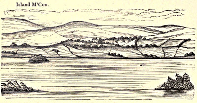
Fig. 225.—View of Loughrea, Island M’Coo in the distance.
Fig. 225.—View of Loughrea, Island M’Coo in the background.
Island M’Coo is one hundred and eighty yards from the nearest shore. It seemed to be surrounded by a circle of piles thirty-five feet in diameter, and in a season of low water gun-barrels and bronze spear-heads were said to have been brought up in the prongs of eel-spears. The incongruity of the juxta-position of gun-barrels and bronze spear-heads can easily be explained. In the year 1798 all the guns seized throughout the surrounding country were brought into the town of Loughrea, and the magistrate in charge, having orders to destroy them, caused them to be carried out and sunk in the lake. At the east side of the island were observed traces of four canoes with their prows turned towards the shore. An attempt to raise one of them—a single-piece canoe of oak—failed, it being so decomposed that it broke across in the middle.
Island M’Coo is one hundred eighty yards from the nearest shore. It appeared to be surrounded by a circle of piles thirty-five feet in diameter, and during low water, gun-barrels and bronze spear-heads were said to have been brought up in the prongs of eel-spears. The odd combination of gun-barrels and bronze spear-heads can easily be explained. In 1798, all the guns seized from the surrounding area were taken to the town of Loughrea, and the magistrate in charge, following orders to destroy them, had them carried out and sunk in the lake. On the east side of the island, traces of four canoes were observed with their prows facing the shore. An attempt to raise one of them—a single-piece canoe made of oak—failed, as it had decayed so much that it broke apart in the middle.
The age of these crannogs was estimated to be over 1800 years, [Pg 229]or before the Christian era. When they were first constructed the surface of the lake must have been at least seven feet lower, and at a subsequent period the west part of the lake must have been twelve feet deeper. The change in the level of the water was caused by the silting up of its outlet. The ancient stream from the lake seems to have been at the west end of the town of Loughrea, where is an alluvial deposit; whilst at its modern outlet there is strong corn gravel, and a little below its present bed there seems to be rock. The town is more than four hundred years old, and since that date the water could scarcely have changed its level, because the eastern outlet of the lake ran at the foot of the town wall; and thus forming part of the town defences, the inhabitants would have kept the stream free.[248]
The crannogs are estimated to be over 1800 years old, [Pg 229]dating back to before the Christian era. When they were first built, the lake's surface was probably at least seven feet lower, and later on, the western part of the lake was likely twelve feet deeper. The change in water level happened because of the silting up of its outlet. The ancient stream from the lake seems to have been at the west end of Loughrea, where there is an alluvial deposit; while at its current outlet, there's strong corn gravel, and just below its present bed, there appears to be rock. The town is over four hundred years old, and since then, the water level likely hasn't changed much because the eastern outlet of the lake ran at the base of the town wall; thus, as part of the town's defenses, the residents would have made sure the stream was clear.[248]
Crannog Mac Navin.—Ante, pp. 149-50.
Crannog Mac Navin.—Before, pp. __A_TAG_PLACEHOLDER_0__.
Ballinafad.—Ante, p. 24.
Ballinafad.—Before, p. __A_TAG_PLACEHOLDER_0__.
Ballinahinch.—Ante, p. 34.
Ballinahinch.—Before, p. __A_TAG_PLACEHOLDER_0__.
Caislen-na-Caillighe.—Ante, pp. 33-4.
Caislen-na-Caillighe.—Before, pp. __A_TAG_PLACEHOLDER_0__.
Goromna Island.—Ante, p. 33.
Goromna Island.—Ante, p. __A_TAG_PLACEHOLDER_0__.
Lough Bola.—Ante, p. 34.
Lough Bola.—Before, p. __A_TAG_PLACEHOLDER_0__.
Lough Cam.—Ante, p. 34.
Lough Cam.—Before, p. __A_TAG_PLACEHOLDER_0__.
Lough Hackett, formerly Lough Cimbe (pronounced Kimmay), ante, p. 157.—An allusion that, in all probability, refers to a siege of this crannog, occurs in the Annals of Lough Cé, under date A.D. 1067, where it is stated that Torlogh O’Brien led “a hosting to Loch-Cime.”
Lough Hackett, previously known as Lough Cimbe (pronounced Kimmay), ante, p. 157.—A reference that likely pertains to a siege of this crannog appears in the Annals of Lough Cé, dated CE 1067, noting that Torlogh O’Brien led “a hosting to Loch-Cime.”
COUNTY MAYO.
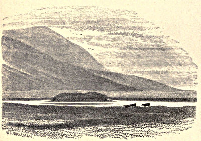
Fig. 226.—General view of the Crannog of Loughannaderriga, Achill Island.
Fig. 226.—Overall view of the Crannog at Loughannaderriga, Achill Island.
Loughannaderriga.—There are, doubtless, many persons who, if asked to point out the exact position of Achill, would be unable to do so, yet it contains an area of about thirty-six thousand acres, and a population which may be reckoned by thousands. Here, two miles from the village of Doogort, is an “imperium in imperio,” an island within an island, and this is believed to be, at present, the only authenticated crannog in Mayo, to which county Achill Island belongs. Loughannaderriga (the lakelet of the oaks) is about two hundred yards in diameter, and in shape somewhat inclined to an oval; it is environed by abrupt banks of peat, which, in recent years, have considerably encroached on the water-area. The bottom consists of deep, treacherous mud, so that an exploration could only be attempted by aid of planks, and even then a cursory examination was alone found practicable, the water not having been withdrawn by drainage.
Loughannaderriga.—There are definitely many people who, if asked to point out the exact location of Achill, wouldn’t be able to do so, yet it covers an area of about thirty-six thousand acres and has a population that can be counted in the thousands. Here, two miles from the village of Doogort, lies an “imperium in imperio,” an island within an island, and this is currently believed to be the only confirmed crannog in Mayo, the county to which Achill Island belongs. Loughannaderriga (the lakelet of the oaks) is about two hundred yards in diameter and is somewhat oval in shape; it is surrounded by steep banks of peat, which in recent years have significantly encroached on the water area. The bottom consists of deep, treacherous mud, so that any exploration could only be attempted with the help of planks, and even then, only a quick examination was found to be feasible, as the water had not been drained.
Of the crannog, the diameter is about sixty feet; its exterior [Pg 231]face so worn away by wave action, that the traces of the outer row of piling are now some feet distant. The Irish-speaking natives still call it the Crannogh, and in English designate it “the island”; its surface is covered with a luxuriant growth of bilberry and Osmunda regalis. An excavation showed—
Of the crannog, the diameter is about sixty feet; its exterior [Pg 231]face is so worn down by wave action that the remains of the outer row of piling are now several feet away. The Irish-speaking locals still call it the Crannog, and in English, they refer to it as “the island”; its surface is covered with a rich growth of bilberry and Osmunda regalis. An excavation showed—
1. A natural growth of peat, about three and a-half feet thick.
1. A natural layer of peat, around three and a half feet thick.
2. A layer of branches.
A canopy of branches.
3. Small stones.
Pebbles.
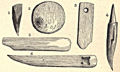
Fig. 227.—Miscellaneous wooden Objects. 2, 3, 5 one-eighth real size; 6 one-fourteenth real size; 1, 4 one-sixteenth real size.
Fig. 227.—Various Wooden Objects. 2, 3, 5 one-eighth actual size; 6 one-fourteenth actual size; 1, 4 one-sixteenth actual size.
Some feet from the exterior face of the crannog, on the side shown in fig. 226, numerous pointed ends of stakes, evidently dressed with a sharp metallic tool, were extracted from the mud (fig. 227, No. 1), and a large portion of another (No. 4) lay on the beach. A fragment of a beam, mortised at one extremity, was found in close proximity (No. 6); its quadrangular incision, which did not quite penetrate the plank, was saucer-shaped at bottom, and an unique arrangement of a peg-hole in each corner shows the firm manner in which it had been originally secured: it probably belonged to the framework of the crannog hut. Not far from this was part of the blade of a canoe paddle (No. 5), the bottom of a wooden vessel, one side bearing traces of fire (No. 2), and a stave (most likely of the same utensil), pierced for reception of the handle (No. 3). There were also several nonde[Pg 232]script portions of worked timber, numerous chips, pieces of charred wood, and a couple of white sling-stones, consisting of water-worn sea-beach pebbles. Deeply imbedded in the mud was a large whetstone (fig. 228), much worn on three sides by the friction of whetting, and bearing deep and sharp indentations produced by the edges of metallic tools; the fourth side presents the natural surface of the stone.
Some distance from the outer side of the crannog, on the side shown in fig. 226, many pointed ends of stakes, clearly fashioned with a sharp metal tool, were pulled from the mud (fig. 227, No. 1), and a large part of another (No. 4) lay on the beach. A piece of a beam, notched at one end, was found nearby (No. 6); its rectangular cut, which didn't fully penetrate the plank, was shaped like a saucer at the bottom, and the unique setup of a peg-hole in each corner shows how securely it was originally fastened: it likely belonged to the framework of the crannog hut. Close to this was part of the blade of a canoe paddle (No. 5), the bottom of a wooden vessel with one side showing signs of fire (No. 2), and a stave (probably from the same item) with a hole for the handle (No. 3). There were also several unremarkable pieces of worked timber, many wood chips, bits of charred wood, and a couple of white sling-stones made from smooth beach pebbles. Deeply embedded in the mud was a large whetstone (fig. 228), worn down on three sides from use, showing deep and sharp indentations made by metal tools; the fourth side showed the natural surface of the stone.


The most interesting “find” was a bronze pin (fig. 229), very sharp at point, the superior portion of the acus ornamented with a row of circular indentations, and the flattened head pierced with a round hole, through which passed a thin golden-bronze loop, of material so fragile that it crumbled away when touched. The pin itself was covered with a thick coating of “patina” and boggy sediment, which at once scaled off; it is composed of early and pure bronze called “golden,” from its resemblance to the precious metal, and it is of the type of those found in the ancient Emania destroyed in the third century. There were no traces of either bones or pottery; as the probable level, on which they might be expected to rest, was not reached.
The most interesting discovery was a bronze pin (fig. 229), very sharp at the point, with the upper part of the pin decorated with a row of circular indentations, and the flattened head pierced with a round hole, through which a thin golden-bronze loop passed, made of material so delicate that it crumbled away when touched. The pin itself was covered with a thick layer of “patina” and muddy sediment, which came off easily; it is made of early and pure bronze called “golden,” due to its resemblance to the precious metal, and it is of the type found in the ancient Emania destroyed in the third century. There were no signs of either bones or pottery, as the expected layer where they might be found was not reached.
COUNTY ROSCOMMON.
Twelve crannogs were discovered in this county during the working of the Commission for the Arterial Drainage of Ireland: these sites have all been identified.
Twelve crannogs were found in this county while the Commission for the Arterial Drainage of Ireland was working: all of these sites have been identified.
Loughlea.—A flint mass, a piece of a circular grindstone, a fragment of a bone spike, two portions of the blades of iron swords, and an antique-shaped iron key, were here brought to light. There were three crannog sites in this lake.[249]
Loughlea.—A flint chunk, a piece of a round grindstone, a fragment of a bone spike, two sections of iron sword blades, and an old-fashioned iron key were discovered here. There were three crannog sites in this lake.[249]
Muckenagh.—Ante, p. 154.
Muckenagh.—Before, p. __A_TAG_PLACEHOLDER_0__.
Derreen Lake.—There were here found an iron hatchet and a pair of stirrup irons.[250]
Derreen Lake.—An iron hatchet and a pair of stirrup irons were found here.[250]
Kilglass.[251]—Of this site the name alone is given.
Kilglass.[251]—The site is referred to by this name only.
Cloonfree, Cloonfinlough.—In the year 1852, by the operation of drainage works in the vicinity of Strokestown, the level of the three lakes of Cloonfree,[252] Cloonfinlough, and Ardakillen was greatly lowered, and one artificial islet in the first-named sheet of water, and two in Cloonfinlough were laid bare. Of the latter, one island was one hundred and thirty feet in diameter, constructed on oak piles driven into the soft marl at regular distances, bound together by horizontal oak stretchers forming a triple stockade, with an interval of five feet between each. To the N. W. were a number of irregularly-placed piles, stretching a short distance from the islet. The centre of the stockades was laid with trunks of small oak-trees, placed flat on the marl; they all pointed to a common centre, thus forming a platform whereon the island itself was constructed. When first observed, there was jutting out from the island, towards the west, a kind of jetty or pier, formed of a double row of piles and stretchers running parallel, and about eight feet asunder, on which logs of timber were laid closely and horizontally.
Cloonfree, Cloonfinlough.—In 1852, due to drainage works near Strokestown, the water level of the three lakes, Cloonfree,[252] Cloonfinlough, and Ardakillen, was significantly lowered, revealing an artificial island in Cloonfree and two in Cloonfinlough. One of the islands in Cloonfinlough measured one hundred and thirty feet in diameter, built on oak piles driven into the soft marl at regular intervals, connected by horizontal oak stretchers forming a triple stockade, with five feet between each. To the northwest, there were several irregularly placed piles extending a short distance from the island. The center of the stockades was laid with trunks of small oak trees, placed flat on the marl; they all pointed towards a common center, creating a platform upon which the island itself was constructed. When first noticed, there was a kind of jetty or pier extending from the island towards the west, made of a double row of piles and stretchers running parallel and about eight feet apart, on which logs of timber were positioned closely and horizontally.
In a short time very little of either the gangway or stockades remained, [Pg 234]so much had been broken up and removed by the peasantry. A trench—twenty feet long by five wide—having been cut as near the centre of the island as possible, there was found, at about eight inches under the surface, a very closely-laid pavement of irregular-sized boulder stones; then a stratum of black earth, with occasional fragments of bones through it, became exposed, and about six inches beneath this was a considerable layer of burnt earth, with several inches of unburnt clay under it. It is evident that the height of the island had been raised and a new surface pavement laid, for then came a second very closely-laid floor of large-sized, flat-surfaced stones, beneath which were alternate layers of black earth, burnt clay, and marl, reaching down to the log flooring, and interspersed, like the one above it, with occasional bones and fragments of bones. A human skull, and portions of others, were got on the exterior edge. Between the island and the ruined church were found two single-piece oak canoes, little more than two feet wide, the stern of one being perforated with numerous auger holes about an inch in diameter.[253]
In a short time, there was hardly any of the gangway or stockades left, [Pg 234]so much had been dismantled and removed by the local villagers. A trench—twenty feet long and five feet wide—was cut as close to the center of the island as possible, where they found a tightly laid pavement of boulder stones about eight inches under the surface; then a layer of black earth, with occasional bone fragments, was uncovered, and about six inches beneath that was a significant layer of burnt earth, with several inches of unburned clay below it. It's clear that the height of the island had been raised and a new surface laid down, because beneath this was a second tightly laid floor of large, flat stones, under which were alternating layers of black earth, burnt clay, and marl, extending down to the log flooring, and interspersed, like the layer above, with occasional bones and fragments. A human skull and parts of others were found on the outer edge. Between the island and the ruined church, two single-piece oak canoes were discovered, just over two feet wide, with the stern of one having numerous holes drilled about an inch in diameter.[253]
Close to the island were numerous articles of a miscellaneous description, some of great antiquity, others of more modern date; also a deposit of bones of Bos longifrons, Cervus elaphus, Equus caballus, Sus scrofa, Capra hircus, fallow deer, sheep, fowl, dogs, &c. One or two osseous fragments, said to be human, were found in the lowest stratum, together with splintered bones and horns of the Megaceros hibernicus. Traces of this great “Bighorn” have (as already noticed) been found also in the crannog of Breagho, in the lacustrine settlement in Loughrea, and in Ballinlough, i.e. in connection with four crannog sites, whilst the exploration of the cave of Ballynamintra,[254] situated near Cappagh, county Waterford, has proved the contemporaneity of man with the Megaceros. In that cave, and lying but a little over the stratum which contained the bones of the Megaceros, was found the bone handle of what, judging from its ferruginous colour, appeared to have been an iron blade.[255]
Close to the island were various items, some very old and others more recent; there was also a collection of bones from Bos longifrons, Cervus elaphus, Equus caballus, Sus scrofa, Capra hircus, fallow deer, sheep, birds, dogs, etc. One or two bone fragments, believed to be human, were discovered in the lowest layer, along with broken bones and horns from the Megaceros hibernicus. Remains of this large "Bighorn" have also been found in the crannog of Breagho, in the lake settlement at Loughrea, and in Ballinlough, meaning they are linked to four crannog sites. Meanwhile, exploring the cave of Ballynamintra,[254] located near Cappagh, county Waterford, has demonstrated that humans coexisted with the Megaceros. In that cave, just above the layer containing the Megaceros bones, a bone handle was found that looked like it might have been an iron blade, based on its rusty color.[255]

[Pg 235]Amongst the bronze relics, not the least remarkable was a lamp, of which the accompanying illustration affords a correct idea. It measures in extreme length four inches and five-eighths. The bottom was perforated, evidently for the admission of a support or stand, up or down which the lamp could have been slid to suit the convenience of anyone using it. Lamps fashioned in this way are still in common use in Italy. The aperture to admit a stand has been covered by a small plate of iron about the thickness of a shilling. A similar lamp in the collection of Celtic antiquities formed by the late Dean Dawson, as well as the Cloonfinlough specimen, are now in the Museum of the Royal Irish Academy. The design is graceful and classic, so much so, indeed, as to suggest the idea that the little object may have formed portion of [Pg 236]a spoil taken from Britain at a time while yet Roman influence there prevailed. Raids by the Irish on the coasts of Britain were very frequent, from whence they generally returned laden with spoil: this may account for traces of Roman civilization discovered in Ireland, for hoards of Roman coin have been unearthed in various localities.
[Pg 235]Among the bronze artifacts, one of the most notable was a lamp, which the accompanying illustration accurately depicts. It measures four inches and five-eighths in total length. The bottom was pierced, clearly intended for a support or stand, allowing the lamp to be adjusted for anyone using it. Lamps designed this way are still commonly used in Italy. The opening for the stand has been covered with a small iron plate about the thickness of a shilling. A similar lamp from the collection of Celtic antiquities assembled by the late Dean Dawson, as well as the Cloonfinlough example, is now housed in the Museum of the Royal Irish Academy. The design is elegant and classic, to the extent that it suggests this small item might have been part of [Pg 236]a loot taken from Britain while Roman influence was still present there. Irish raids on the British coasts were quite frequent, from which they often returned with spoils: this could explain the traces of Roman civilization found in Ireland, as hoards of Roman coins have been discovered in various locations.
Ardakillen.—In this lake one of the four crannogs discovered was constructed of both stones and oak piling. Fig. 231 represents a section of this island. The upper line (a) shows the former high water-level before the drainage operations; (b) the ordinary winter flood; and (c) the average summer level.
Ardakillen.—In this lake, one of the four crannogs found was built using both stones and oak piles. Fig. 231 represents a part of this island. The upper line (a) indicates the previous high water level before the drainage work; (b) shows the regular winter flood; and (c) illustrates the typical summer level.

Fig. 231.—Section of one of the Ardakillen Crannogs.
Fig. 231.—Section of one of the Ardakillen Crannogs.

Fig. 232. Skull and Iron Fetters from the Crannog of Ardakillen. One-eighth real size.
Fig. 232. Skull and Iron Shackles from the Crannog of Ardakillen. One-eighth actual size.
Fig. 233. Iron Fetters from one of the Strokestown Crannogs. One-third real size.
Fig. 233. Iron Chains from one of the Strokestown Crannogs. One-third actual size.
Under a slight earthy deposit there was a deep layer of loose stones, bounded by an enclosing wall, the foundation supported by piling. The lower portion of the island consisted of clay, peat, and stones, mingled with strata of ashes, bones, and logs of timber. The various rows of oak-piling are shown in the section; the sheet-piling, driven in obliquely, formed an unbroken circle round the island. When the level of the lake was lowered, four islands became visible, and on the largest upwards of fifty tons of bones were found: this is probably the crannog mentioned in the Irish Annals, under dates 1368 and 1388 (ante, p. 154). The scene which this site presented shortly after the lowering of the water-level was very remarkable; scores of persons visited it, at first in search of bones, for which they found a ready sale as manure, and afterwards with the view of picking up antiques, with which the bog-matter around the sheet-piling or stockade was plentifully studded. Large numbers of these were disposed of to an English collector, and amongst the objects known to have been obtained by him was a beautifully-formed vessel of wood, bound round with plates of thin golden bronze, upon which a variety of designs were displayed.[256] What appears to have been a very similar article was found many years ago in deepening the bed of the Kinnegad[Pg 237] river, and is figured (p. 67) in Wilde’s Boyne and Blackwater. A “dug out,” eighteen feet in length, discovered lying on the bottom of the lake, was wantonly destroyed, and ultimately utilised for firewood. Near the crannog was a canoe, forty feet in length, and four feet across the bow; it was hollowed out of a single trunk of oak, and in it were a skull, a spear-head, and a bronze pin. The skull bears the mark of no less than twenty sword-cuts, showing the murderous conflict in which its owner must have been engaged. Near it was found a neck-piece of iron with twenty feet of rude chain attached[257] (fig. 232). Another set of “irons” (fig. 233) came from a crannog in the immediate neighbourhood, and from the size it is likely they were intended for ankle-fetters; it is stated that similar instruments have elsewhere occurred in Irish lacustrine sites, and, stra[Pg 238]nge to say, in one instance there were traces of gilding. In Irish MSS. allusions frequently occur to the practice of putting captives in fetters; they were sometimes so severely manacled as to produce almost unbearable torture. Prisoners were often slain when fettered. One instance, though a comparatively modern one, will suffice:—According to the Annals of Loch Cé, in the year 1585, a son of Teige O’Rorke, and a son of Magnus Oge O’Currin, were captured, “placed in irons on Loch-na-cula,” in the county Leitrim, and slain.
Under a thin layer of dirt, there was a deep bed of loose stones, surrounded by a wall that was supported by piles. The lower part of the island was made up of clay, peat, and stones, mixed with layers of ashes, bones, and logs. The different rows of oak piles are shown in the section, while the sheet piles, driven in at an angle, created a continuous circle around the island. When the lake level dropped, four islands appeared, and on the largest one, over fifty tons of bones were discovered; this is likely the crannog mentioned in the Irish Annals, from the years 1368 and 1388 (ante, p. 154). The scene at this site shortly after the water level decreased was quite remarkable; many people came to visit initially searching for bones, which they could easily sell as fertilizer, and later to collect antiques that were abundant in the bog around the sheet piles or stockade. A significant number of these items were sold to an English collector, and among the known pieces he acquired was a beautifully crafted wooden vessel, wrapped in thin plates of golden bronze, featuring a variety of designs.[256] A similar item was found many years ago while deepening the bed of the Kinnegad[Pg 237] river, which is illustrated (p. 67) in Wilde’s Boyne and Blackwater. An “dug out,” measuring eighteen feet long, was carelessly destroyed and ultimately used as firewood. Close to the crannog, there was a canoe, forty feet long and four feet wide at the bow; it was carved from a single oak trunk, and inside were a skull, a spearhead, and a bronze pin. The skull shows evidence of at least twenty sword cuts, indicating the violent conflict its owner experienced. Nearby, a neckpiece of iron was found with a twenty-foot crude chain attached[257] (fig. 232). Another set of “irons” (fig. 233) was retrieved from a crannog nearby, and given their size, they were likely meant for ankle fetters; it has been noted that similar items have appeared in other Irish lake sites, and interestingly, in one case, there were signs of gilding. Irish manuscripts frequently mention the practice of putting captives in chains; sometimes they were shackled so severely that it caused almost unbearable pain. Prisoners were often killed while in chains. One example, although relatively modern, is noteworthy: According to the Annals of Loch Cé, in 1585, a son of Teige O’Rorke and a son of Magnus Oge O’Currin were captured, “placed in irons on Loch-na-cula,” in County Leitrim, and executed.
The skull found lying in the bottom of the canoe was of the oval or elliptical (Dolicho cephalic) type, characteristic of the natives of western or southern Europe. There is a theory that in primeval times in Erin there were two races, each distinctly marked both by features and the form of the cranium. The one possessed thick elliptical skulls, low foreheads, deep orbits, high cheek-bones, prominent mouths, and narrow chins; the other had round, or globular (Brachi cephalic) skulls, possessed more intellect, and less marked features. Wilde observes that the two fragments of human skulls discovered in the crannog of Lagore[258] (ante, p. 204) partook of the character of the long-headed race, whilst the antiquities found with them would lead to the belief that the persons to whom the skulls had belonged did not live later than the tenth century. Good examples of both races may still be seen amongst the modern Irish.
The skull found at the bottom of the canoe was of the oval or elliptical (Dolicho cephalic) type, typical of natives from western or southern Europe. There’s a theory that in ancient times in Ireland, there were two distinct races, each marked by unique features and skull shapes. One had thick elliptical skulls, low foreheads, deep eye sockets, high cheekbones, prominent mouths, and narrow chins; the other had round or globular (Brachi cephalic) skulls, showed more intellect, and had less pronounced features. Wilde notes that the two fragments of human skulls found in the crannog of Lagore[258] (ante, p. 204) resembled the long-headed race, while the artifacts found with them suggest that the people to whom the skulls belonged lived no later than the tenth century. Good examples of both races can still be seen among modern Irish people.
“There are reasons for considering that the Ardakillen skull belonged to a young adult, or to a man in the prime of life. This opinion is based upon the fact that the coronal and sagittal sutures were not obliterated. (The coronal suture is the name given to the line of articulation between the frontal and parietal bones; it forms a vertical transverse line over the top of the front of the skull. The sagittal, or interparietal suture, occupies a median longitudinal position between the two parietal bones.) The coalescence into one plate of bone (calvarium, or skull-cap) of the frontal and the two parietal bones, and the consequent obliteration of the sutures (coronal and sagittal), generally occurs between thirty and forty years of age; however, the period at which this union commences, and the order in which it proceeds, is subject to so much variation, that no more than an approximation to the ag[Pg 239]e of the skull is attainable thereby.
“There are reasons to think that the Ardakillen skull belonged to a young adult or a man in his prime. This conclusion is based on the fact that the coronal and sagittal sutures were not fused. (The coronal suture is the seam between the frontal and parietal bones; it creates a vertical transverse line across the top front of the skull. The sagittal, or interparietal suture, runs along a median longitudinal line between the two parietal bones.) The joining of the frontal and two parietal bones into one piece of bone (calvarium, or skull-cap) and the resulting fusion of the sutures (coronal and sagittal) usually happens between the ages of thirty and forty; however, the timing of this fusion and the order it follows varies so much that we can only estimate the ag[Pg 239]e of the skull.”
“Examination of the teeth remaining in one side of the upper jaw—the opposite side of the jaw was broken away—showed that the third molar tooth (dens sapientiæ) had been erupted.
Examination of the teeth still present on one side of the upper jaw—the other side of the jaw was broken off—showed that the third molar tooth (dens sapientiæ) had come in.
“The many marks of cutting instruments upon the skull were found chiefly over the vertex and the frontal and occipital regions. In many the force had been applied at right angles to the cranium, resulting in nicks or linear marks; in several horizontally, so as to slice or shave off a portion of the outer table of the bone. In no case was there a perforation of the inner table apparent, nor a fracture or fissure of the entire thickness of the skull, whence it might be inferred that the weapons were not of any great weight; the force of the blows might have been broken by protecting headgear, thick coils of matted hair, or by defensive movements of the arms. There were no appearances to negative the idea that all, or the majority of, the cuts were received about the same date. They have all the characters of ante mortem injuries, as contrasted with such injuries as the skull is liable to from rough usage, or from its being knocked about. From the distribution of the marks it may be assumed that the man was in an upright or semi-upright position. In the hacking of a dead and prostrate enemy the wounds would be on the part of the head which was uppermost.
The numerous cuts on the skull were mainly found on the top and in the front and back areas. In many cases, the force was applied at a right angle to the skull, resulting in small cuts or linear marks; in some cases, it was applied horizontally, shaving off a portion of the outer layer of the bone. There was no evidence of any perforation of the inner layer, nor was there any fracture or fissure through the entire thickness of the skull, suggesting that the weapons weren't very heavy; the impact of the blows might have been softened by protective headgear, thick mats of hair, or defensive arm movements. There were no signs to suggest that all, or most, of the cuts were made at different times. They all showed characteristics of ante mortem injuries, as opposed to injuries the skull might sustain from rough handling or being struck. Based on the distribution of the marks, it can be inferred that the man was in an upright or semi-upright position. If he had been struck while lying down, the wounds would have been on the part of the head facing up.
“Though there is no single wound which must have proved fatal ex necessitate rei, death might have ensued from the accumulation of injuries, from concussion, erysipelas, or secondary inflammation of the brain or its membranes.”[259]
“While there isn’t one specific injury that had to be fatal ex necessitate rei, death could have resulted from a buildup of injuries, concussion, erysipelas, or secondary inflammation of the brain or its membranes.”[259]
COUNTY LEITRIM.
Twenty crannogs were discovered in this county during the working of the Commission for the arterial drainage of Ireland: these sites have all been identified.
Twenty crannogs were found in this county while the Commission was working on the arterial drainage of Ireland: all these sites have been identified.
Drumaleague may be cited as a good example of a lacustrine dwelling: the form circular, and, with the exception of the hearth-stones, it was composed wholly of wood, principally alder. Drumaleague lake, situated in the vicinity of Lough Scur, was originally about a mile in length. The level of the water having been lowered thirteen feet, two crannogs became visible, as also a canoe—hollowed out of a single trunk of oak—eighteen feet long, twenty-two inches broad, square at stem and stern, and having apertures or row-locks cut in the sides.
Drumaleague is a prime example of a lake dwelling: it was circular in shape and made entirely of wood, mainly alder, except for the hearth stones. Drumaleague Lake, located near Lough Scur, was originally about a mile long. After the water level dropped thirteen feet, two crannogs became visible, along with a canoe carved from a single oak trunk, measuring eighteen feet long, twenty-two inches wide, with squared ends and row-locks cut into the sides.

Fig. 234.—Plan of Crannog in Drumaleague Lake. Scale, twenty feet to one inch.
Fig. 234.—Plan of Crannog in Drumaleague Lake. Scale: twenty feet to one inch.
The annexed plan of one of the islands conveys a good idea of the general arrangement of this class of structure. The outer line of stakes enclosed a circle sixty feet in diameter, and within the enclosure there were groups of stakes—in some parts two or three deep—driven into the ground, seemingly for purposes connected with some internal arrangement. A, the central oblong portion, consists of a platform of round logs cut in lengths of[Pg 241] from four to six feet, possibly the floor of the hut; B, a collection of stones with marks of fire on them; C, a heap of stiff clay; D, the root of a large tree nearly buried in the peat, the surface of the wood bevelled off, so as to form a sort of table, under which was found a considerable quantity of bones, apparently those of deer and swine.
The attached plan of one of the islands gives a clear idea of the general layout of this type of structure. The outer line of stakes formed a circle sixty feet in diameter, and within this area, there were clusters of stakes—in some spots two or three deep—driven into the ground, seemingly for purposes related to some internal organization. A, the central rectangular section, consists of a platform made of round logs cut to lengths of[Pg 241] four to six feet, possibly the floor of the hut; B, a collection of stones showing signs of fire; C, a pile of stiff clay; D, the root of a large tree almost buried in the peat, with the surface of the wood shaped to form a sort of table, under which a significant amount of bones was found, apparently from deer and pigs.

Fig. 235.—Section of second Crannog in Drumaleague Lake.
Fig. 235.—Section of the second Crannog in Drumaleague Lake.
Fig. 235 is a section of the second crannog, which was surrounded by a tolerably regular circular enclosure formed of a single row of oak stakes F, F; it was seventy-two feet in diameter. The upper stratum B, consisted of horizontal logs of alder, reposing upon a black peaty surface; the logs were from three to eight inches in diameter, completely water soaked and rotten: this stratum of timber was three feet six inches deep. A, a heap of stones with marks of fire on them. Other hearths were found in different parts of the island. C, the lower stratum of decayed and blackened sticks and branches of all descriptions lying in every direction: this layer extended as far as it was pierced in the examination, viz., about four feet, but was evidently of greater depth. D, D, two heaps of stones found in the lower stratum. E, the kitchen midden, in which was a large quantity of bones of deer, swine, oxen, &c., that lay four feet below the surface. There was here found also the thin topstone of a quern, formed of micaceous quartzite, smooth upon the grinding surface, but otherwise rude and unfinished: the hole for the handle passes quite through; the grain-hole, two and a-half inches in diameter, is not directly in the centre.[260]
Fig. 235 is a section of the second crannog, which was surrounded by a fairly regular circular enclosure made of a single row of oak stakes F, F; it measured seventy-two feet in diameter. The upper layer B consisted of horizontal logs of alder resting on a black peaty surface; the logs ranged from three to eight inches in diameter, thoroughly soaked with water and rotting: this layer of timber was three feet six inches deep. A, a pile of stones with marks of fire on them. Other hearths were discovered in various parts of the island. C, the lower layer of decayed and charred sticks and branches of all kinds scattered in every direction: this layer extended as far as it was examined, approximately four feet, but was clearly deeper. D, D, two piles of stones found in the lower layer. E, the kitchen midden, which contained a large quantity of bones from deer, pigs, cows, etc., that were lying four feet below the surface. There was also found the thin top stone of a quern, made of micaceous quartzite, smooth on the grinding surface but otherwise rough and unfinished: the hole for the handle goes completely through; the grain hole, two and a half inches in diameter, is not directly centered.[260]
Lough Scur.—This crannog is alluded to in the Annals of Loch Cé, under the following dates:—1345, four sons of Cathal Mac-in-caich Mac Raghnaill were taken prisoners on Loch-an-Scuir, and put to death; 1390, O’Rorke, who had been in confinement, escaped to the castle of Loch-an-Scuir, but was overtaken and[Pg 242] slain “when coming out of his cott”; 1580, Loch-an-Scuir was taken, and Maelsechlainn Mac Raghnaill slain. On this site was found the largest quern in the Museum, R.I.A., the nether-stone being twenty and three-quarter inches long by three and three-quarter inches thick; the aperture for the pivot one and three-quarter inches deep, the same across; it is surrounded by a raised lip to retain in position the upper stone, which is nineteen and a-half inches in diameter by two and three-quarter inches in thickness: the grain aperture is three and a-half inches wide; upon the upper surface is the mark of the cross-bar of the pivot, its upper surface left in a rude state; it has one handle-hole. The stone mould, figured ante, p. 72, was found here, and a model of a portion of the oak framework of the crannog—one-quarter real size—was deposited in the Museum, R.I.A.
Lough Scur.—This crannog is mentioned in the Annals of Loch Cé on the following dates:—1345, four sons of Cathal Mac-in-caich Mac Raghnaill were captured on Loch-an-Scuir and executed; 1390, O’Rorke, who had been imprisoned, escaped to the castle of Loch-an-Scuir, but was caught and[Pg 242] killed “when coming out of his cottage”; 1580, Loch-an-Scuir was seized, and Maelsechlainn Mac Raghnaill was killed. On this site, the largest quern in the Museum, R.I.A. was discovered, with the nether-stone measuring twenty and three-quarter inches long by three and three-quarter inches thick; the pivot hole is one and three-quarter inches deep, with the same width; it features a raised lip to hold the upper stone in place, which is nineteen and a-half inches in diameter by two and three-quarter inches thick: the grain hole is three and a-half inches wide; the upper surface shows the mark of the pivot's cross-bar, and its upper surface has a rough texture; it includes one handle hole. The stone mold, illustrated ante, p. 72, was found here, and a model of a section of the oak framework of the crannog—one-quarter real size—was placed in the Museum, R.I.A.
Lough Rinn (the lake of the promontory) lies in the barony of Mohill. It is mentioned in the Annals of Loch Cé, under date 1345, when O’Conor, “king” of Connaught, was killed by an arrow at Loch Airinn whilst assisting Mac Raghnaill, to whom the crannog on the lake belonged; for the sept of the Mac Rannals formerly possessed the neighbouring district, then called Conmaicue Moyrein. In the year 1847, the waters of Lough Rinn having being lowered, two canoes were found imbedded in the mud near an old castle at the promontory from whence the locality derives its name; there was also a chain, or manacle, composed of iron rods, looped at their ends, like one found in the Strokestown crannogs. One of these canoes was a “single-piece,” hollowed out of oak, and flat-bottomed, the length thirteen feet and the breadth nearly two feet throughout; the sides were only four inches high; but the original depth must have been greater. In front of the old castle stands an island covered with self-sown ash and thorn, and constructed with wooden piles, of slight scantling, but perfectly sound; “the paling was interlaced and pegged down in a very rude manner: the island appeared to have been formed inside of it, and raised upon a similar description of work.” A small bronze arrow and a spear-head were found two feet deep in a gravel shoal close to Rinn Castle, between Loughs Rinn and Sallagh.
Lough Rinn (the lake of the promontory) is located in the barony of Mohill. It's mentioned in the Annals of Loch Cé, dating back to 1345, when O’Conor, the “king” of Connaught, was killed by an arrow at Loch Airinn while supporting Mac Raghnaill, who owned the crannog on the lake; the Mac Rannal family once controlled the nearby region, known as Conmaicue Moyrein. In 1847, when the waters of Lough Rinn receded, two canoes were discovered embedded in the mud near an old castle at the promontory, which is where the area gets its name; there was also a chain or manacle made of iron rods with looped ends, similar to one found in the Strokestown crannogs. One of these canoes was carved from a single piece of oak, flat-bottomed, measuring thirteen feet long and nearly two feet wide throughout; the sides were only four inches high, but it must have originally been deeper. In front of the old castle is an island covered with self-sown ash and thorn, built with wooden piles that are small but perfectly intact; “the fence was woven and pegged down in a very rough way: the island seemed to have been formed inside it and elevated on a similar kind of structure.” A small bronze arrow and a spearhead were found two feet deep in a gravel bank near Rinn Castle, between Loughs Rinn and Sallagh.
St. John’s Lough contained four crannogs, in which three [Pg 243]silver coins of Edward I., II., and III. were found.
St. John’s Lough had four crannogs, where three [Pg 243]silver coins from Edward I, II, and III were discovered.
Loughtown crannog measured one hundred and twenty feet from east to west by one hundred feet from north to south, and was surrounded by a mass of stakes upwards of fifteen feet wide, inclining in towards the centre of the island.
Loughtown crannog was one hundred and twenty feet long from east to west and one hundred feet wide from north to south, surrounded by a thick barrier of stakes over fifteen feet tall, slanting in toward the center of the island.
Aghakilconnel Lough.—Three iron pots, one of them triangular in form, were found on this site.
Aghakilconnel Lough.—Three iron pots, with one being triangular in shape, were discovered at this location.
Lough MacHugh contained two crannogs; one measured seventy-four feet by one hundred and eighteen feet.
Lough MacHugh had two crannogs; one was seventy-four feet by one hundred eighteen feet.
Cloonbo and Cloonturk Loughs had each two sites.
Cloonbo and Cloonturk Loughs had two sites each.
Cloonfinnan, Cloonboniagh, Castlefore, and Funshinagh Loughs, each contained a crannog.
Cloonfinnan, Cloonboniagh, Castlefore, and Funshinagh Loughs, each had a crannog.
Crannog Island.—No account is given of this site.
Crannog Island.—There is no information available about this location.
Manorhamilton.—A crannog, a canoe paddle, and other articles were discovered not far from this village.[261]
Manorhamilton.—A crannog, a canoe paddle, and other items were found close to this village.[261]
Muinter Eolius.—A crannog in this district is mentioned in the Irish Annals (ante, p. 152).
Muinter Eolius.—A crannog in this area is noted in the Irish Annals (ante, p. 152).
COUNTY SLIGO.
Glencar lake, situated between the counties of Sligo and Leitrim, is embosomed in mountains; to the north lies the Ben-Bulben range, and to the south the Castlegal range with bold precipitous sides, its grey limestone cliffs resembling ancient weather-beaten fortifications, and its slopes in parts clothed with plantations of fir. The rain that falls on the summits of the Ben-Bulben range descends to the vale in numerous streamlets, which, after a continuance of wet weather, appear when viewed from a distance like streaks of silver. Some form waterfalls of more or less magnitude, of which one is called in Irish Sruth-an-ail-an-ard, or the stream against the height; because in this instance, when the wind blows from a certain point, the ordinary laws of hydrology seem to be reversed, and the water, instead of falling, is either driven upwards and back against the mountain, or it is blown outwards in a sheet of spray, like a pennant. Ben-Bulben, or Ben-Gulban, Gulban’s Peak, is said to be so named from Gulban, son of Nial of the Nine Hostages, who was fostered near it. Gulban was[Pg 244] ancestor of the O’Donnells, who, through this mountain gorge, frequently poured their forces into Sligo. In the year 1595 O’Donnell, when pursued by Bingham, retired to this valley, in full confidence that the wary Saxon would not attempt to follow him through the narrow and difficult defile, and in 1597, the same chief encamped in the immediate vicinity of the eastern crannog. So late as 1609, in a curious old map of the county, the valley of Glencar and the slopes of Ben-Bulben are delineated as covered with wood, and the following quaintly-worded information is appended:—“Ye high hills of Ben-Bulben, where yearly timbereth a falcon esteemed the hardiest in Ireland.” The locality is still the habitat of the peregrine falcon.
Glencar Lake, located between the counties of Sligo and Leitrim, is surrounded by mountains; to the north is the Ben-Bulben range, and to the south is the Castlegal range, featuring steep, dramatic sides. Its gray limestone cliffs look like ancient, weathered fortifications, while some parts of the slopes are covered with fir plantations. The rain that falls on the peaks of the Ben-Bulben range flows into the valley as numerous small streams, which, after a spell of wet weather, appear from a distance like silver streaks. Some create waterfalls of various sizes, one of which is known in Irish as Sruth-an-ail-an-ard, meaning the stream against the height; because in this instance, when the wind blows from a certain direction, the usual rules of hydrology seem to reverse, and the water, instead of falling, is either blown upwards and back against the mountain or sprayed outward like a flag. Ben-Bulben, or Ben-Gulban, Gulban’s Peak, is said to be named after Gulban, the son of Nial of the Nine Hostages, who was raised nearby. Gulban was[Pg 244] an ancestor of the O’Donnells, who often used this mountain pass to launch their forces into Sligo. In 1595, O’Donnell, while being chased by Bingham, took refuge in this valley, fully confident that the cautious Saxon wouldn’t try to follow him through the narrow and challenging pass. In 1597, the same leader camped near the eastern crannog. Even as late as 1609, an old map of the county shows the valley of Glencar and the slopes of Ben-Bulben depicted as forested, with the following quaint note added: “Ye high hills of Ben-Bulben, where yearly timbereth a falcon esteemed the hardiest in Ireland.” The area is still home to the peregrine falcon.
Although, in the present day, lovers of the picturesque resort to Glencar, yet, probably, few are aware that the locality was anciently the home of a considerable lacustrine population. In the early part of this century, when the level of the lake had been lowered by drainage operations, several crannogs became visible; and the one situated at the eastern extremity, where the stream enters the lake, had seemingly been the largest. Broken bones, antlers of deer, a quantity of old timber, and some articles of bronze (amongst them a tweezers) were said to have been obtained. In the Annals of the Four Masters, under date 1541, this site is noticed as the scene of strife between two branches of the O’Rourkes.—“The eastern crannog, on the lake of Glen Dallain,[262] was taken by the sons of Donal, son of Donogh O’Rourke, from Donogh, the son of Donogh O’Rourke. In some time after, the sons of Donogh O’Rourke, namely, Donal and Ferganainm, made an attack on the crannog, and privately set fire to the fortress; that act was perceived and detected, and they were pursued on the lake and were overtaken by the sons of Donal; Ferganainm, the son of Donogh, was slain, and drowned by them; and Donal having been taken prisoner, was hanged by the sons of Donal, the son of Donogh O’Rourke.” At the western end of the lake—on the subsidence of the water after drainage—four crannogs became visible; but, owing to the subsequent silting up of the cutting in the bed of the Drumcliff river, they have all again disappe[Pg 245]ared, with the exception of the largest, which, at the time of the drainage, was accessible from the land dryshod, though now the water reaches to a wader’s knees. To the east of this crannog there is still a considerable depth of water: the beach descends rapidly, and layers of large beams, from six to seven inches in diameter, can be seen radiating from a common centre; in some instances, three or even four layers can be traced. Cross-beams are noticeable, also piles driven in at intervals; these are only three or four inches in diameter, and sharply pointed at the ends; this side of the crannog presents the appearance of having been denuded of stones. The height of the water prevents exploration; but it has been roughly computed that, including the wooden substructure now submerged, the diameter had formerly averaged seventy feet, or possibly more. Careful search amongst the stones merely led to the discovery of fractured bones of Bos longifrons, Cervus elaphus, Sus scrofa, &c., and numerous teeth of mammalia, together with a fossil, possibly a selected specimen used as an ornament or charm, and pronounced to be a Zaphrentis—a coral of the carboniferous formation.
Even though today, people who love scenic views flock to Glencar, probably not many realize that this area used to be home to a large population living by the lake. Early in this century, when the lake's water level had dropped due to drainage work, several crannogs emerged; the one at the eastern end, where the stream flows into the lake, appeared to be the biggest. Broken bones, deer antlers, a lot of old wood, and some bronze items (including a pair of tweezers) were reportedly found. In the Annals of the Four Masters, dated 1541, this location is mentioned as the site of a conflict between two branches of the O’Rourkes. “The eastern crannog on the lake of Glen Dallain was taken by the sons of Donal, the son of Donogh O’Rourke, from Donogh, the son of Donogh O’Rourke. Later, the sons of Donogh O’Rourke, namely, Donal and Ferganainm, attacked the crannog and secretly set fire to the fortress; this was noticed and they were pursued across the lake and caught by the sons of Donal; Ferganainm, the son of Donogh, was killed and drowned; Donal was captured and hanged by the sons of Donal, the son of Donogh O’Rourke.” At the western end of the lake, as the water receded after drainage, four crannogs appeared; however, due to subsequent silt buildup in the bed of the Drumcliff river, they have all disappeared again, except for the largest, which was accessible on foot during the drainage but is now submerged to knee depth. To the east of this crannog, there is still a significant depth of water: the shoreline drops steeply, and large beams, six to seven inches in diameter, can be seen radiating from a central point; in some cases, three or even four layers can be traced. Cross-beams are also visible, along with piles driven in at regular intervals; these are only three or four inches in diameter and sharply pointed at the ends; this side of the crannog looks like it has been stripped of stones. The height of the water prevents exploration, but it has been estimated that including the submerged wooden foundation, the diameter was probably around seventy feet or more. A thorough search among the stones only led to finding broken bones of Bos longifrons, Cervus elaphus, Sus scrofa, etc., numerous mammal teeth, along with a fossil, possibly a chosen item used as decoration or charm, identified as a Zaphrentis—a coral from the carboniferous period.
Opposite the crannog, the beach on the mainland is strewn with fractured bones similar to those on the island. The antlers of a Cervus elaphus were found close to the shore, and a wooden peg (ante, p. 104, fig. 108) was seen lying on the bottom near a beam. In one of the mythical legends of the “Pursuit of Diarmuid and Grainne,” mention is made of the Glencar lake-dwellings as one of their places of refuge.
Opposite the crannog, the beach on the mainland is covered with broken bones similar to those on the island. The antlers of a Cervus elaphus were found near the shore, and a wooden peg (ante, p. 104, fig. 108) was seen lying on the bottom near a beam. In one of the legendary stories of the “Pursuit of Diarmuid and Grainne,” the Glencar lake-dwellings are mentioned as one of their places of refuge.
Lough Arrow.—Not far from the old Abbey of Ballindoon is an artificial island formed almost entirely of stones; the earth—in which a few young firs are now growing—was brought to it by the late proprietor, J. Gethin. This crannog, the largest of a group, still stands well above the surface of the lake. To the north—but separated from it by a deep and narrow channel—is a shoal called “Sunken Island,” which is in summer weather almost dry, and around both these sites were numerous fractured bones of the Bos longifrons, Cervus elaphus, and Sus scrofa. Still further to the north, and close to the shore of Ballindoon demesne, is pla[Pg 246]inly discernible the summit of a large pile of stones, evidently deposited by human agency, but the depth of water effectually precluded any hope of obtaining handicraft “finds.” The island at Annaghcloy Point is said to be artificial, and around Oilean-na-prechaun (Crow Island)—seemingly formed of small stones, and situated near the exit of the river Unshin from Lough Arrow, at Bellarush bridge—were found lying on the beach numerous fractured bones of the usual crannog type.
Lough Arrow.—Not far from the old Abbey of Ballindoon is an artificial island made almost entirely of stones; the soil—in which a few young fir trees are currently growing—was brought in by the late owner, J. Gethin. This crannog, the largest of a group, still rises well above the surface of the lake. To the north—but separated from it by a deep and narrow channel—is a shoal called “Sunken Island,” which is nearly dry in the summer. Around both these sites were numerous broken bones of the Bos longifrons, Cervus elaphus, and Sus scrofa. Further north, close to the shore of Ballindoon estate, is plainly visible the top of a large pile of stones, clearly placed there by human activity, but the depth of the water effectively ruled out any chance of finding crafted items. The island at Annaghcloy Point is said to be artificial, and around Oilean-na-prechaun (Crow Island)—seemingly made of small stones and located near the outlet of the river Unshin from Lough Arrow at Bellarush bridge—numerous broken bones of the typical crannog type were found lying on the beach.
Lochanacrannog is the name of a small townland in the barony of Tireragh, near the residence of Sir Malby Crofton, Bart. The small pond in which the crannog is situated becomes almost dry in summer, yet, despite this favourable circumstance, no relics have been discovered. A trench cut through the island showed that it was composed of clay mingled with some few stones, and these, around the exterior edge, were arranged in a systematic manner.
Lochanacrannog is the name of a small area in the barony of Tireragh, close to the home of Sir Malby Crofton, Bart. The small pond where the crannog is located almost dries up in the summer, yet, despite this favorable condition, no artifacts have been found. A trench dug through the island revealed that it was made of clay mixed with a few stones, which were arranged in an organized way around the outer edge.
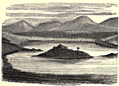

Fig. 237.—General view of Ballygawley Lake and Crannog.
Fig. 237.—Overview of Ballygawley Lake and the Crannog.
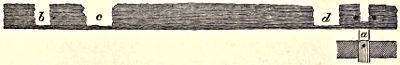
Fig. 238.—Beam, or Stretcher, binding tops of Piles, 10 ft. 6 in. long by 9 in. broad.
Fig. 238.—Beam, or Stretcher, connecting the tops of Piles, 10 ft. 6 in. long by 9 in. wide.
Ballygawley.—This lake, picturesquely situated at the foot of the Slieve Dæane range of mountains, is embosomed in wood, which may be viewed as now representing the primeval mantle that had formerly covered the neighbouring slopes, when
Ballygawley.—This lake, beautifully located at the base of the Slieve Dæane mountain range, is surrounded by woods, which can be seen as a reflection of the ancient cover that once blanketed the nearby hills when
The crannog lies about one hundred and eighty yards from the eastern shore, and the diameter of the area covered with stones is eighty-five feet, but the wooden substructure extends to a considerable distance under water. The beams, protruding from under the superincumbent stones, appeared—as is usual—to radiate from a common centre, but two beams on the west shore, and one that was raised from a depth of one foot under the present water surface on the south shore, seemed to lie at a tangent to the circle of the crannog. In fig. 238 the mortises a, b secured the heads of piles, and c, d (of larger size) may have held some of the radial beams. The highest point of the crannog now stands about five feet above the level of the lake, which has been reduced three feet in height, as the result of drainage operations carried out by the proprietor, Colonel Cooper. Some of the encircling piles remain in position; three were noticed on the north, and one on the south[Pg 248]-east shore. To the west and south the water is shallow, and this shoal would seem to have been the “kitchen midden,” or refuse heap, for numerous teeth of the Bos longifrons were here dredged up, and close to the encircling piles lay a quantity of fractured hazel nuts and some pieces of charcoal. On the east and west there were, in the fine sand on the crannog beach, small portions of calcined bones, resembling those found in the cromlech interments at Carrowmore. A. W. Foot, M.D., to whom they were submitted, states that these fragments were “undoubtedly bone, several of them unmistakably calcined (from carbonaceous residue). Some of the fragments are entirely composed of carbonate of lime, others are a mixture of carbonate and phosphate of lime. It could not be determined whether they are animal or human; this should be conjectured from surrounding or collateral circumstances.”
The crannog is located about one hundred and eighty yards from the eastern shore, with a stone-covered area that measures eighty-five feet in diameter, while the wooden structure extends far under the water. The beams, sticking out from beneath the stones, typically appear to radiate from a central point, but two beams on the west shore and one that was pulled from a depth of one foot below the current water surface on the south shore seemed to angle away from the circle of the crannog. In fig. 238, the mortises a, b held the tops of piles, and c, d (which were larger) might have secured some of the radial beams. The highest part of the crannog now rises about five feet above the lake level, which has dropped three feet due to drainage work done by Colonel Cooper, the owner. Some of the surrounding piles are still intact; three were observed on the north side and one on the southeast shore. To the west and south, the water is shallow, and this area likely served as a “kitchen midden,” or refuse pile, as many teeth from the Bos longifrons were dredged up here, and near the surrounding piles, there were several broken hazelnuts and some pieces of charcoal. On the east and west sides, small fragments of calcined bones were found in the fine sand on the crannog beach, similar to those discovered in the cromlech burials at Carrowmore. A. W. Foot, M.D., to whom these samples were sent, noted that these fragments were “clearly bone, with several unmistakably calcined (due to carbonaceous residue). Some of the fragments consist entirely of calcium carbonate, while others are a mix of calcium carbonate and phosphate. It couldn't be determined if they are from animals or humans; this should be inferred from the surrounding context.”
Lough Gill is one of the numerous localities in Ireland to which is attached the legend of a buried city. Amongst the peasantry there long lingered a tradition that these waters had overspread a plain whereon stood the ancient town of Sligo, the numerous islands being supposed to represent former knolls on its green expanse. As the result of recent extensive drainage operations in the county Leitrim, a large additional amount of water has, through the river Bonnett, been directed into Lough Gill at its eastern extremity. The consequent greatly increased height of surface would, of itself, present an insuperable bar to exploration, so that no means remain of ascertaining if an extensive lacustrine settlement had ever really existed here of old. Within the actual bounds of the lake, which is seven miles in length, the islands, highly picturesque, and of some extent—one of them contains twenty-five acres—are of undoubted natural formation; there is, however, near the site of the ancient Castle of Annagh—noticed in the Annals of the Four Masters, under date 1533—one small islet, bearing a crannog-like appearance, but, as far as can now be ascertained, no traces of occupation have been found around it. The short stretch of the Garvogue, or Sligo river, which forms the outlet from the lake to the sea, seems to present the peculiar features characteristic of sites the most favoured by a lacustrine population, viz., good fishing-ground, and wide borders of marsh on the adjoining mainland. The ancient name of the demesne of Hazlewood was Annagh (a swamp), and a portion of the grounds which skirt the river, and now remarkable for its pecul[Pg 249]iarly ornamental planting, was so late as sixty years since a mere spongy bog, on which no firm footing was obtainable. The opposite shore, called Cleveragh, was of still softer and more watery nature, and its name implies that either hurdles or rude wicker-work bridges had been formerly used for crossing the river or the marshy spots near it.[263] Along this side, and but a short distance from the shore, there were, at varying intervals of space from each other, three shoals, about the size of ordinary crannogs, and nearly circular in form. They were occasionally so little perceptible as to prove an obstruction for boats, and in the early part of this century the proprietor, after surrounding each shoal with a low wall of masonry, caused a sufficient quantity of soil to be conveyed to them for the growth of a few trees. At that period nothing was known respecting former lacustrine populations in any part of Europe, so that no special examination was made of the nature of the shoals in question. In the present day, however, with the aid of the light thrown upon the construction of lake dwellings by modern discoveries, the position and aspect of the three islets becomes striking, and cannot fail to call to the mind of an observer the old tradition of a “buried city” in Lough Gill.
Lough Gill is one of the many places in Ireland that has the legend of a buried city attached to it. For a long time, local people believed that these waters covered a plain where the ancient town of Sligo once stood, with the many islands thought to be remnants of hills on its green landscape. Recently, due to extensive drainage work in County Leitrim, a significant amount of water has flowed into Lough Gill at its eastern end via the river Bonnett. This increase in water level makes it nearly impossible to explore the area, leaving us unable to find out if a large lakeside settlement ever existed here in the past. Within the actual lake, which is seven miles long, the islands, which are quite picturesque and reasonably sized—one of them is twenty-five acres—are definitely naturally formed. However, near the site of the old Castle of Annagh—mentioned in the Annals of the Four Masters in 1533—there's a small islet that looks like a crannog, but so far, no signs of past habitation have been found around it. The short stretch of the Garvogue, or Sligo river, that connects the lake to the sea shows distinct features typical of areas favored by lakeside communities, such as good fishing and wide marshy borders on the nearby mainland. The old name for the demesne of Hazlewood was Annagh (a swamp), and parts of the land next to the river, which are now known for their beautiful landscaping, were just a soggy bog sixty years ago, where no solid footing was possible. The opposite shore, called Cleveragh, was even softer and more waterlogged, and its name suggests that hurdles or crude wicker bridges were once used to cross the river or the marshy areas nearby.[263] Along this side, not far from the shore, there were three shoals, about the size of regular crannogs and nearly circular in shape, spaced out at varying intervals. They were sometimes so subtle that they posed an obstacle for boats, and in the early part of this century, the landowner, after surrounding each shoal with a low masonry wall, had enough soil brought in for a few trees to be planted on them. Back then, not much was known about ancient lakeside populations anywhere in Europe, so the nature of these shoals wasn’t closely examined. Today, however, with the insights from modern discoveries about lake dwellings, the location and appearance of the three islets stand out, likely bringing to mind the old legend of a “buried city” in Lough Gill.
The number of lacustrine sites in each county in Ireland is marked within a small circle on the map (plate L.), and the lake dwelling area, as at present known, is shown by a shading, light or dark, according to the number of sites. The province of Ulster (including historical notices of crannogs) contains one hundred and twenty-four; Leinster, nineteen; Munster, nine; and Connaught, sixty-nine. This makes for all Ireland a total of two hundred and twenty-one. The ascertained sites are, however, in all probability, but a mere fraction of the multitude that had formerly existed. Further explorations amongst the remains of Irish and Scottish lake dwellings would, doubtless, tend to strengthen the evidence of these structures having been the work of a people who, at that remote period, formed most probably a homogeneous community.
The number of lake sites in each county in Ireland is shown with a small circle on the map (plate L.), and the area of lake dwellings, as currently understood, is indicated by shading—light or dark—based on the number of sites. The province of Ulster (including historical references to crannogs) has one hundred and twenty-four; Leinster has nineteen; Munster has nine; and Connaught has sixty-nine. This adds up to a total of two hundred and twenty-one for all of Ireland. However, the identified sites are likely just a small fraction of the many that once existed. Further investigations into the remnants of Irish and Scottish lake dwellings would probably provide even more evidence that these structures were built by a people who, during that distant time, likely formed a mostly unified community.
In the opinion of some theorists, these dwellings seem characteristic of an early wave of immigration from the East—then throwing off its superabundant population as does now the West—and in this manner it is supposed that the lakes of Central Europe and Great Britain became studded with water-laved homes. However, as before stated, they, with a greater degree of probability, sprang up independently by reason of the natural laws which govern man’s actions in a semi-civilized state—in Erin, their first founders being rude flint-armed hunters of the Megaceros, the bear, the wolf, and their descendants wielders of the pike and matchlock. Recent investigation traces “island homes” back to a period so remote, that the evidences of man’s formation and occupation of these retreats prove in their way as interesting as the remains of the buried cities of Herculaneum and Pompeii, for lacustrine dwellings, also, show traces of a species of civilization long passed away (evidences of which were observable on the sites of Venice, Mexico, and London), and the purposes of their primitive founders were alike, whether situated on the lagoons of the Adriatic, the flats of Central America, or the reaches of the Thames.
Some theorists believe these homes are typical of an early wave of immigration from the East, similar to how the West is currently shedding its excess population. This is thought to explain how the lakes of Central Europe and Great Britain became dotted with houses by the water. However, as mentioned earlier, it's more likely that they developed independently due to the natural laws guiding human behavior in a semi-civilized state—in Ireland, for example, where their first creators were primitive hunters armed with flint, who hunted the Megaceros, bears, and wolves, and their descendants used spears and early firearms. Recent research traces these "island homes" back to such ancient times that the evidence of human presence and use of these places is as fascinating as the remains of the buried cities of Herculaneum and Pompeii. The lake dwellings also show signs of a long-gone civilization, similar to those found in the locations of Venice, Mexico, and London, with the original purposes of their early inhabitants being remarkably alike, whether on the lagoons of the Adriatic, the plains of Central America, or the banks of the Thames.

Plate L.
Plate L.
Map of Ireland shewing approximate distribution of all known Lacustrine Sites
Map of Ireland displaying the approximate locations of all known lake sites.
FOOTNOTES
[4] Sir John Lubbock, writing of extinct mammalia, states that remains of the Megaceros Hibernicus never occur in the ‘Kjökken-moddings,’ lake habitations, or sepulchral remains; nor are there any traditions in Western Europe which can be regarded as indicating even obscurely a memory of this gigantic mammal.—Prehistoric Times, 2nd ed., 1869, p. 291.
[4] Sir John Lubbock, discussing extinct mammals, notes that remains of the Megaceros Hibernicus are never found in the ‘Kjökken-moddings,’ lake dwellings, or burial sites; nor are there any traditions in Western Europe that seem to suggest a vague memory of this massive mammal.—Prehistoric Times, 2nd ed., 1869, p. 291.
[7] “As far as we can judge from the present evidence, the first appearance of the reindeer in Europe coincided with that of the mammoth, and took place at a later period than that of the cave bear or Irish elk.”—Sir John Lubbock, Prehistoric Times, 2nd ed., 1869, p. 293.
[7] “From what we can see with the evidence we have today, the reindeer first showed up in Europe around the same time as the mammoth, and this happened later than the cave bear or Irish elk.”—Sir John Lubbock, Prehistoric Times, 2nd ed., 1869, p. 293.
[10] ὲν μέση ἒστηκε τῇλίμνῃ. These dwellings in the middle of the lake were out of bow-shot, out of reach of fiery projectiles against thatched roofs and wooden walls—a description of attack to which some of the Helvetian settlements probably succumbed.
[10] In the middle of the lake, these homes were far enough away that no arrows could reach them, and they were safe from fiery attacks on their thatched roofs and wooden walls—a type of assault that some of the Helvetian settlements likely fell victim to.
[11] Herodotus, Book v., chap. xvi.
[15] Ancient Scottish Lake Dwellings.
__A_TAG_PLACEHOLDER_0__ Ancient Scottish Lake Homes.
[16] (1) bronze dish with handle of Roman work; (2) two bronze dishes hammered out of the solid; (3) a small bronze dish of separate pieces rivetted together; (4) a bronze ring having attached to it a portion of the vessel of which it had been the handle; (5) fragment of leather with a stamped pattern on it; (6) a large blue glass bead; (7) two glass beads with streaks and spots; (8) a bead of amber; (9) a bead of vitreous paste; (10) a small brooch of bronze; (11) a small ring of bronze; (12) a copper coin; (13) five querns; (14) a fragment of bronze; (15) a piece of iron slag; (16) a small earthen crucible; (17) whetstone; (18) three iron hammers; (19) portions of armlets of enamelled glass; (20) five canoes.—Notices of Scottish Crannogs, John Stewart, p. 8.
[16] (1) bronze dish with a handle from Roman times; (2) two bronze dishes made from solid metal; (3) a small bronze dish made from separate pieces joined together; (4) a bronze ring with part of the vessel it was once a handle for; (5) a fragment of leather with a stamped design; (6) a large blue glass bead; (7) two glass beads with streaks and spots; (8) an amber bead; (9) a bead made of glass paste; (10) a small bronze brooch; (11) a small bronze ring; (12) a copper coin; (13) five querns; (14) a fragment of bronze; (15) a piece of iron slag; (16) a small earthen crucible; (17) a whetstone; (18) three iron hammers; (19) parts of armlets made of enamelled glass; (20) five canoes.—Notices of Scottish Crannogs, John Stewart, p. 8.
[17] “A description of certain piles, found near London-wall and Southwark, possibly the remains of Pile-Buildings.” A Paper read before the Anthropological Society, December 18, 1866.
[17] “A description of some piles found near London Wall and Southwark, possibly the remnants of pile structures.” A paper presented to the Anthropological Society on December 18, 1866.
[20] Nature, vol. xvii. p. 424.
[22] De Bello Gallico, lib. v. xviii: “ripa autem erat acutis sudibus præfixis munita; eiusdemque generis sub aqua defixæ sudes flumine, tegebantur.” The oppidum of Cassivellaunus is described as being, “Sylvis paludibusque munitum,” and by Orosius, “inter duas paludes situm, obtentu insuper sylvarum munitum.” Cæsar also states, lib. v. xxi., “oppidum autem Britanni vocant, quum silvas impeditas vallo atque fossa munierunt, quo incursionis hostium vitandæ caussa convenire consuerunt.”
[22] De Bello Gallico, book v. 18: “The bank was fortified with sharpened stakes; similar stakes were also anchored underwater, covered by the river.” The oppidum of Cassivellaunus is described as being, “protected by forests and marshes,” and by Orosius, “situated between two marshes and additionally fortified by the cover of the woods.” Caesar also states, book v. 21, “The Britons call it an oppidum when they fortified the dense forests with a wall and trench, where they usually gather to avoid enemy incursions.”
[24] Prescott’s Conquest of Mexico.
[26] “Jadis toute la ville de Tondano était construite sur le lac, et l’on ne communiquait d’une maison à une autre qu’en bâteau. Forts de cette disposition, en 1810, les habitants eurent de démèlés avec les Hollandais, et voulurent secouer leur joug, ils s’ármèrent et furent battus. Ce ne fut pas sans peine qu’on en vint à bout; il fallait y porter de l’artillerie et constuire des bateaux canoniers. Depuis ce temps, et pour éviter cet inconvénient on a défendu aux indigènes de construire leurs habitations sur le lac.”—Histoire, Dumont D’Urville, vol iv. p. 607; vol. v. p. 635.
[26] “Once, the entire city of Tondano was built on the lake, and people could only get from one house to another by boat. In 1810, the residents had conflicts with the Dutch and wanted to shake off their control. They took up arms but were defeated. It wasn’t easy to resolve this; they had to bring in artillery and build armed boats. Since then, to prevent this issue, the locals have been prohibited from building their homes on the lake.”—Histoire, Dumont D’Urville, vol iv. p. 607; vol. v. p. 635.
[31] Across Africa.
__A_TAG_PLACEHOLDER_0__ Throughout Africa.
[33] In Lewis’s Topographical Dictionary, published 1837, mention is made of a “wooden house” which formerly existed in Lough Annagh, vol. ii. p. 175.
[33] In Lewis’s Topographical Dictionary, published in 1837, there’s a reference to a “wooden house” that used to be in Lough Annagh, vol. ii. p. 175.
[37] Geology of Ireland, p. 278.
[38] The peasantry of the neighbourhood say that “crannog” signifies the hopper of a mill, and that in all probability there was formerly a mill there. This is the popular explanation given of every crannog in the kingdom.—MS. Letters, Ordnance Survey.
[38] The local villagers say that “crannog” means the hopper of a mill, and it’s likely that there used to be a mill there. This is the common explanation given for every crannog in the country.—MS. Letters, Ordnance Survey.
[43] In the year 1508, it is of record that a Scottish monastery granted a lease of a crannog, one of the covenants being that the occupant was to place a certain quantity of stones outside the piling in each year, to protect the structure from the destructive influence of the waters of the lake.
[43] In 1508, it's documented that a Scottish monastery leased a crannog, with one of the agreements being that the tenant had to place a specific amount of stones outside the piling each year to safeguard the structure from the damaging effects of the lake's waters.
[48] Bute: Dhu Loch, Loch Quien. The remainder of the Scottish sites are situated as follows:—
[48] Bute: Dhu Loch, Loch Quien. The other Scottish locations are as follows:—
Aberdeen: Banchory, Loch Canmore. Argyll: Kielziebar, Ledaig, Loch-na-Mial (Mull), Lochnell. Forfar: Loch of Forfar. Inverness: Loch-in-Croy, Loch Lochy. Lanark: Greenknowe. Linlithgow: Loch Cot. Moray, Nairn and Elgin: Loch Flemington, Lochindorb, Loch-in-Dunty, Loch of the Clans, Loch Spinie. Perth: Loch Rannoch. Ross: Loch Achilty, Loch of Kinellan. Stirling: Loch Lomond.
Aberdeen: Banchory, Loch Canmore. Argyll: Kielziebar, Ledaig, Loch-na-Mial (Mull), Lochnell. Forfar: Loch of Forfar. Inverness: Loch-in-Croy, Loch Lochy. Lanark: Greenknowe. Linlithgow: Loch Cot. Moray, Nairn and Elgin: Loch Flemington, Lochindorb, Loch-in-Dunty, Loch of the Clans, Loch Spinie. Perth: Loch Rannoch. Ross: Loch Achilty, Loch of Kinellan. Stirling: Loch Lomond.
[49] Namely at Loughrea, county Galway; at Ballinlough, near Marble Hill, same county; at Lough Nahinch, on the borders of Tipperary and King’s County, and Lough Naneevin, West Galway.
[49] Specifically at Loughrea, County Galway; at Ballinlough, near Marble Hill, in the same county; at Lough Nahinch, on the borders of Tipperary and King’s County, and Lough Naneevin, West Galway.
[50] Proceedings R. I. A., vol. vii. p. 150. This crannog may be said to form portion of the Strokestown group; excavations were made, and several bronze pins found.
[50] Proceedings R. I. A., vol. vii. p. 150. This crannog can be considered part of the Strokestown group; excavations were carried out, and several bronze pins were discovered.
[52] Toome Bar, county Antrim; Rahans, county Monaghan; Drumkeery and Cornagall, county Cavan; Lagore, near Dunshaughlin, county Meath; Nahinch, county Tipperary; Cloonfinlough, county Roscommon; are examples of crannogs which show visible traces of having been consumed by fire, and some of them of having been rebuilt.
[52] Toome Bar in County Antrim; Rahans in County Monaghan; Drumkeery and Cornagall in County Cavan; Lagore near Dunshaughlin in County Meath; Nahinch in County Tipperary; and Cloonfinlough in County Roscommon are examples of crannogs that display visible signs of having been burned, and some of them show evidence of having been rebuilt.
[54] “The framework was composed of oak logs, as shown in the sketch (fig. 1. side elevation); the main sleepers, one on each side, were principal pieces, and rested on the sand. These logs were made from a large oak-tree, split in two, with the round part upwards; they measured, when put together, twenty-three inches in diameter and twenty-four feet in length; into these the upright pieces, or posts B of the frame, were mortised, p; and the end of the post protruding through the mortise in the sleeper A, was forelocked by a large block of wood below, as shown, fig. 1. The mortises were roughly cut, as if they had been made by a kind of blunt instrument.… The planks which formed the sides D were laid edgewise, one upon another, the lower one resting in a groove cut in the sleeper A, as shown in fig. 2, and the but-ends on a log of wood mortised into the framework, as in fig. 1. The planks butting home against the supports, … were more firmly fixed by the two uprights, which passed through a hole in the cross-beam c, fig. 1, and slipped into the mortise in the sleeper.”
[54] “The structure was built from oak logs, like in the sketch (fig. 1. side elevation); the main beams, one on each side, were key parts that sat on the sand. These logs came from a big oak tree, split in half with the round side facing up; together they measured twenty-three inches in diameter and twenty-four feet long. The vertical pieces, or posts B of the frame, were fitted into these logs, p; and the end of each post sticking out through the mortise in the beam A was secured by a large block of wood underneath, as shown in fig. 1. The mortises were roughly cut, as if done with a blunt tool. The planks that made up the sides D were stacked on edge, one on top of the other, with the bottom one resting in a groove cut in the beam A, as shown in fig. 2, and the ends resting on a log of wood that was fitted into the framework, like in fig. 1. The planks, which fit tightly against the supports, were held more securely by the two vertical pieces that went through a hole in the cross-beam c, fig. 1, and slid into the mortise in the beam.”
[56] “These jambs, of which there were six at each extremity, stood on well-wrought foundation stones, but of course in a calcined state.”—Schlieman, Troja, p. 80.
[56] “These supports, with six at each end, rested on carefully crafted foundation stones, though obviously in a burned condition.”—Schlieman, Troja, p. 80.
[60] Mr. Mackinlay, describing a crannog in Loch Quien in Bute, states that two rows of piles extended obliquely from it to the shore of the lake, between which the ground was covered with flat stones, “not raised like a causeway.”
[60] Mr. Mackinlay, describing a crannog in Loch Quien in Bute, says that two lines of piles slanted from it to the lake shore, with the space in between covered with flat stones, “not elevated like a causeway.”
[62] Mem. Geol. Sur. Ireland.
[67] A writer states that around the Crannog of Lough Ravel were found “a whole fleet of boats,” each cut out of a single trunk of oak; one was made fast to a stake of the crannog by a rude chain.
[67] A writer mentions that near the Crannog of Lough Ravel, they discovered “a whole fleet of boats,” each crafted from a single oak trunk; one was tied to a stake of the crannog by a rough chain.
[72] It may be observed that a canoe found at Cudrelin, on the Lake of Neufchatel, had a similar kind of handle.—Lake Dwellings of Switzerland, Keller, 2nd ed., p. 282.
[72] It's noted that a canoe discovered at Cudrelin, on Lake Neufchatel, had a similar type of handle.—Lake Dwellings of Switzerland, Keller, 2nd ed., p. 282.
[74] The following list of single-tree canoes, though necessarily incomplete, yet enables an approximate estimate to be made of the number already discovered:—Ardagh, 1; Ardakillen, 1; Ballinderry, 2; Boyne, 1; Cahore, 1; Cloonfinlough, 1; Cornagall, 1; Derryhollagh (several), 1; Drumaleague, 1; Drumdarragh, 1; Drumgay, 1; Drumkeery, 1; Erne, 2; Lough Eyes, 3; Kilnock, 1; Lough Annagh, 5; Lough Faughan, 1; Lough Owel, 1; Loughrea, 4; Lough Rinn, 2; Loughtamand, 1; Miracles (several), 1; Moinalty, 1; Moinenoe, 1; Mourne, 2; Randalstown (several), 1; Sligo (Ballydoogan), 1; Toome, 3.
[74] The following list of single-tree canoes, while not exhaustive, still allows for an approximate estimate of the number already found:—Ardagh, 1; Ardakillen, 1; Ballinderry, 2; Boyne, 1; Cahore, 1; Cloonfinlough, 1; Cornagall, 1; Derryhollagh (several), 1; Drumaleague, 1; Drumdarragh, 1; Drumgay, 1; Drumkeery, 1; Erne, 2; Lough Eyes, 3; Kilnock, 1; Lough Annagh, 5; Lough Faughan, 1; Lough Owel, 1; Loughrea, 4; Lough Rinn, 2; Loughtamand, 1; Miracles (several), 1; Moinalty, 1; Moinenoe, 1; Mourne, 2; Randalstown (several), 1; Sligo (Ballydoogan), 1; Toome, 3.
[75] The above illustration represents No. 3 in the Museum, R. I. A. No. 4 in the same collection is two feet two inches long, by five inches across the blade.
[75] The illustration above shows No. 3 in the Museum, R. I. A. No. 4 in the same collection measures two feet two inches long and five inches across the blade.
[76] De. Bel. Civil. 1-54.
__A_TAG_PLACEHOLDER_0__ De. Bel. Civil. 1-54.
[77] The coracles used still in Caermarthenshire are of oval form, five feet and a-half long, by four feet and a-half broad; the hides forming the skin of the skiff are pitched.
[77] The coracles that are still used in Caermarthenshire are oval-shaped, measuring five and a half feet long and four and a half feet wide; the hides that make up the skin of the boat are coated with pitch.
[82] Utuntur aut aere, aut taleis ferreis, ad certum pondus examinatis, pro nummo. Nascitur ibi plumbum album in mediterraneis regionibus, in maritimis ferrum; sed eius exigua est copia; aere utuntur importato.—Cæsar, De Bel. Gal. Lib 5. cap. xii.
[82] They use either bronze or iron weights that have been checked for a specific weight, instead of coins. There is silver found in the Mediterranean regions, and iron along the coast, but it's very scarce; they use imported bronze.—Caesar, De Bel. Gal. Book 5, Chapter 12.
[89] Quite recently a bronze axe-head, now in the writer’s possession, was supposed by its peasant discoverer to be “rale goold”—and it was not till after repeated failures to effect sale of his “find” as gold that he could be convinced of the real nature of the metal.
[89] Not long ago, a bronze axe head, currently owned by the writer, was thought by its peasant discoverer to be “real gold”—and it was only after multiple unsuccessful attempts to sell his “find” as gold that he was persuaded of the true nature of the metal.
[90] See Ardakillen Crannog.
[94] pp. 222-3, figs. 224-30.
[97] “There is a tradition that this lough contains a brazen cauldron full of treasure and guarded by a piast in the form of a serpent. Old people say that some years since a farmer actually saw the vessel, and with the aid of plough harness endeavoured to get it out of the water. The demon guardian, however, was too strong, the tackle broke, and with a horrible hiss the serpent regained his lair, taking the cauldron along with him.”—Journal Royal Hist. and Arch. Asso. of Ireland, vol. ii. (4th Series), p. 319.
[97] “There’s a legend that this lake holds a golden cauldron packed with treasure, guarded by a piast in the form of a serpent. Elderly locals say that several years ago, a farmer actually spotted the vessel and tried to pull it out of the water using plow gear. However, the demon guardian was too powerful, the equipment broke, and with a terrible hiss, the serpent returned to its lair, taking the cauldron with it.”—Journal Royal Hist. and Arch. Asso. of Ireland, vol. ii. (4th Series), p. 319.
[101] Ibid., p. 93.
[102] In Swiss lacustrine sites, stones of the cherry and of the sloe are found together in heaps, mixed with plentiful remains of the seeds of the blackberry and raspberry.
[102] In Swiss lake sites, stones from cherry and sloe are found piled together, mixed with a lot of seeds from blackberries and raspberries.
[106] A fine example of a utensil of this kind was discovered at Navan Rath (the ancient Eamhain), the seat of the sovereigns of Ulster down to the year A.D. 332; and a curious account of the value in which bronze cauldrons of this description were held in Ireland in the middle of the fifth century is given by Dr. Reeves in his translation of a portion of the “Book of Armagh,” written in the eighth century.
[106] A great example of this type of utensil was found at Navan Rath (the ancient Eamhain), which was the home of the kings of Ulster until the year A.D. 332. Dr. Reeves provides an interesting account of how bronze cauldrons like this were valued in Ireland during the mid-fifth century in his translation of part of the “Book of Armagh,” written in the eighth century.
[111] It is No. 19 in the collection of querns in the Museum R.I.A. Roughan Crannog is said to be the last retreat of Sir Phelin O’Neill in 1641: it held out until boats were brought to the lake from Charlemont to aid in the attack.
[111] It is No. 19 in the collection of querns at the Museum R.I.A. Roughan Crannog is described as the final refuge of Sir Phelin O’Neill in 1641: it held out until boats were brought to the lake from Charlemont to support the assault.
[116] Cat. Mus. R.I.A., p. 158.
[119] Cat. Mus. R.I.A., p. 265.
[122] Several soft lumps of what appeared to be a blue and a red pigment were discovered in the crannog of Lochlee, in Ayrshire, though the latter specimen shortly after turned blue; whilst at Lochspouts were found two pieces of colouring matter, the one red and the other black; and at Holderness, in Yorkshire, “red ochre” was picked up on the site of a lake dwelling.—Ancient Scottish Lake Dwellings, pp. 139, 160, 300.
[122] A few soft lumps of what looked like blue and red pigments were found in the crannog of Lochlee, in Ayrshire, although the red one soon turned blue; at Lochspouts, two pieces of coloring material were discovered, one red and the other black; and at Holderness, in Yorkshire, “red ochre” was collected from the site of a lake dwelling.—Ancient Scottish Lake Dwellings, pp. 139, 160, 300.
[123] Cat. Mus., R.I.A., p. 303.
[124] Cat. Mus., R.I.A., p. 333.
[126] Ibid., pp. 198-202.—Rev. James Graves.
[128] Now in the British Museum.
Now at the British Museum.
[129] Cat. Mus. R.I.A., p. 560.
[130] Ibid., p. 559.
[131] Ibid., p. 556.
[132] Nos. 1, 2, 3, and 4 are from Lagore; the remainder were discovered in crannogs, but the exact sites not now known. Wilde alludes to Nos. 10 and 11 “as conical bits of carved wood, like chessmen. The former, however, is hollowed at the base, as if for the insertion of a stamp, and the latter is carved upon the face of the base, with a device not unlike a seal: each is 2½ inches high.”
[132] Items 1, 2, 3, and 4 are from Lagore; the others were found in crannogs, but the exact locations are now unknown. Wilde mentions items 10 and 11 as “conical pieces of carved wood, similar to chess pieces. The first is hollowed out at the base, possibly for inserting a stamp, and the second is carved on the face of the base with a design that looks like a seal: each stands 2.5 inches tall.”
[134] Cat. Mus., R.I.A., pp. 271-2.
[135] Cat. Mus., R.I.A., p. 549.
[138] Cat. Mus., R.I.A., p. 568.
[139] Petrie Collection, Mus., R.I.A., No. 157.
[140] Petrie Collection, Mus., R.I.A., No. 156.
[144] Nos. 1, 3, 20, 21, are from Ardakillen. Nos. 2, 11, 12, 13, 15, 18, from Lagore. Nos. 5, 6, 7, 8, 9, 10, 14, 16, from Ballinderry. No. 17, from Drumdarragh. No. 22, from Cloonfinlough. Nos. 23, 24, from Lough Eyes.
[144] Numbers 1, 3, 20, and 21 are from Ardakillen. Numbers 2, 11, 12, 13, 15, and 18 are from Lagore. Numbers 5, 6, 7, 8, 9, 10, 14, and 16 are from Ballinderry. Number 17 is from Drumdarragh. Number 22 is from Cloonfinlough. Numbers 23 and 24 are from Lough Eyes.
[147] Cat. Mus., R.I.A., pp. 531-2.
__A_TAG_PLACEHOLDER_0__ Cat. Mus., R.I.A., pp. 531-2.
[148] Sir Denham Jephson Norreys, in a Paper contributed to the R. Hist, and Arch. Asso. Ireland (Journal, vol. iv., pp. 278-79), thus explains the original process of riveting:—
[148] Sir Denham Jephson Norreys, in a paper contributed to the R. Hist, and Arch. Asso. Ireland (Journal, vol. iv., pp. 278-79), explains the original process of riveting as follows:—
“1st. Prepare a wooden core, or mandril, of the size and form of the inside of the trumpet.
“1st. Prepare a wooden core, or mandrel, that matches the size and shape of the inside of the trumpet.
“2ndly. Place the strap of bronze to hold the rivets in the centre of its inner surface.
“2ndly. Place the bronze strap to hold the rivets in the center of its inner surface.
“3rdly. Cut the plate of bronze which is to form the trumpet to such a size that, when folded on the core, the edges may meet accurately on the centre of the bronze strap: hold all together by solder, or by any other means—perhaps coils of wire may have been used.
“3rdly. Cut the bronze plate that will make the trumpet to a size that, when wrapped around the core, the edges meet precisely at the center of the bronze strap: secure everything together with solder, or by any other method—maybe coils of wire were used.”
“4thly. Drill the holes for the rivets, countersinking them on the outside. See Plate XXIX., fig. 1.
“4thly. Drill the holes for the rivets, making sure to countersink them on the outside. See Plate XXIX., fig. 1.”
“5thly. Remove the wooden core.
Fifth, remove the wooden core.
“6thly. By means of a cleft stick (or other contrivance) insert the rivets from the inside, outwards.
“6thly. Use a cleft stick (or another tool) to push the rivets from the inside out.”
“7thly. As each rivet passes through to the surface it is to be drawn up as tightly as possible; the shank is to be bent back, or held up by any other means, so that the head of the rivet shall not be allowed to fall.
“7thly. As each rivet goes through to the surface, it should be tightened as much as possible; the shank should be bent back, or held up by any other means, so that the head of the rivet doesn’t fall.”
“8thly. Having inserted all the rivets, insert a metal core, or mandril, fitting the interior with great exactness.
“8thly. Once all the rivets are in place, insert a metal core or mandrel, ensuring it fits the interior precisely.”
“9thly. Complete the riveting from the outside, the metal core preventing the rivet-heads from being disturbed, and allowing the countersunk portion of the hole to be securely filled by a portion of the shank.
“9thly. Finish the riveting from the outside, with the metal core keeping the rivet heads in place, and enabling the recessed part of the hole to be securely filled with a part of the shank.”
“10thly. Remove the metal core. The trumpet is now ready to be burnished off.
“10thly. Take out the metal core. The trumpet is now ready to be polished up.”
“After writing the above, it occurred to me that I had neglected to inquire how the inner strap was to be held in its place for the insertion of the rivets. Ordinary solder could not have been used, as none appears between the strap and the plates. It might, perhaps, have been effected by a slow removal of the wooden core, and by the insertion, from the smaller end of temporary rivets or fastenings, as the core was being pushed forward; by such means at least half of the length of the strap could be firmly held in its place.”
“After writing the above, I realized that I forgot to ask how the inner strap was kept in place for inserting the rivets. Regular solder couldn’t have been used since none is visible between the strap and the plates. It might have been done by gradually removing the wooden core and inserting temporary rivets or fastenings from the smaller end as the core was pushed forward; this way, at least half of the length of the strap could be securely held in place.”
[149] The MSS. from which it was extracted by O’Curry is the “Leabhar-na-h-Uidhre,” written about A.D. 1106, but the tale, as therein recounted, was extracted from the “Book of Dromsneachta,” a work undoubtedly written before, or about the year 430.
[149] The MS. that O’Curry used comes from the “Leabhar-na-h-Uidhre,” written around A.D. 1106, but the story told in it was taken from the “Book of Dromsneachta,” which was definitely written before or around the year 430.
[150] W. F. Wakeman states that at one time this slab was in the possession of Petrie, the well-known antiquary. An engraving of a chess-board of the fourteenth century shows but 42 squares, 7 × 6.
[150] W. F. Wakeman mentions that this slab was once owned by Petrie, the famous antiquarian. An engraving of a 14th-century chessboard displays only 42 squares, arranged 7 × 6.
[151] British Museum.
__A_TAG_PLACEHOLDER_0__ British Museum.
[155] W. F. Wakeman offers a suggestion in connection with the name Balhu; he states that Joyce in his Irish Names of Places translates the name of the Fermanagh town of Lisbellaw, Lis-bel-atha, the lis of the ford mouth. Now, there was no river ever there, consequently there could be no “ford mouth.” There is certainly a lis or ford in the neighbourhood, but the little stream which now drives the woollen mill of Lisbellaw flows through a deep cutting communicating with Loch Eyes, and which was made only in recent times. The natural outlet from the loch ran, and still runs, in a northerly direction, and cannot have influenced the naming of Lisbellaw, as its course commences at a distance of some miles from the village. “The name Lisbellaw seems to invite investigation. Could it be translated ‘the fort or lis of Balhu,’ even as Dunleary is ‘the fort or dun of Laighaire’”?
[155] W. F. Wakeman suggests something about the name Balhu; he mentions that Joyce, in his Irish Names of Places, translates the name of the Fermanagh town of Lisbellaw, Lis-bel-atha, the lis of the ford mouth. However, there has never been a river there, so there couldn't be a “ford mouth.” There is definitely a lis or ford nearby, but the small stream that currently powers the woollen mill in Lisbellaw flows through a deep cut that connects to Loch Eyes, which was created only recently. The natural outlet from the loch flowed, and still flows, to the north, and it couldn't have played a role in naming Lisbellaw, as its path starts several miles away from the village. “The name Lisbellaw seems to call for further exploration. Could it be translated as ‘the fort or lis of Balhu,’ just like Dunleary means ‘the fort or dun of Laighaire’”?
[157] Cat. Mus. R.I.A., p. 267.
[158] Ibid., p. 343.
[163] “Mac Cnaimhain,” now anglicised Mac Nevin, and among the peasantry shortened to Neavin and Nevin. This family was originally settled at Crannog-Meg-Cnaimhain, now Crannagh-Mac-Nevin, in the south-east extremity of the parish of Tynagh, barony of Leitrim, county Galway, and the name is still general in that and the adjoining barony of Loughrea. The first notice of this family to be found in Irish history occurs in the Annals of the Four Masters, at the year 1159, where it is recorded that “Athius Mac Nevin was slain at Ardee.” The crannog is mentioned in an inquisition taken at Galway on the 10th of October, 1605:—“Quod Hugo Mac Knavin, alius dictus Mac Kellie intravit in actionem Rebellionis et captus et suspensus fuit 4 Junii, 1602; et fuit seisitus in Ballilie Cranach Mac Knavin,” &c. “In a grant to the Earl of Clanrickarde, dated 19th July, 1610, mention is made—among various other lands granted to him—of part of the lands of Crannach-Mac Knavin, parcel of the estate of Hugh Mac Knavin, otherwise O’Kelly of Cranagh-Mac Knavin, executed in rebellion”(a).
[163] “Mac Cnaimhain,” now anglicized to Mac Nevin, and often shortened by local people to Neavin and Nevin. This family originally settled at Crannog-Meg-Cnaimhain, now Crannagh-Mac-Nevin, in the southeastern part of the parish of Tynagh, barony of Leitrim, county Galway; the name is still common in that area and the neighboring barony of Loughrea. The first mention of this family in Irish history is found in the Annals of the Four Masters, from the year 1159, which states, “Athius Mac Nevin was killed at Ardee.” The crannog is noted in an inquisition conducted in Galway on October 10, 1605: “Hugo Mac Knavin, also known as Mac Kellie, was involved in an act of Rebellion and was captured and hanged on June 4, 1602; he was seized in Ballilie Cranach Mac Knavin,” etc. “In a grant to the Earl of Clanrickarde, dated July 19, 1610, there is mention—among various other lands granted to him—of part of the lands of Crannach-Mac Knavin, a part of the estate of Hugh Mac Knavin, otherwise O’Kelly of Cranagh-Mac Knavin, who was executed for rebellion” (a).
(a) The Tribes and Customs of Hy-Many. Note by O’Donovan, pp. 68-9.
(a) The Tribes and Customs of Hy-Many. Note by O’Donovan, pp. 68-9.
[166] Researches in the South of Ireland. Crofton-Croker.
__A_TAG_PLACEHOLDER_0__ Studies in Southern Ireland. Crofton-Croker.
[167] Stories of Lough Gur.
[169] Shirley’s Dominion of Farney, pp. 93-4.
__A_TAG_PLACEHOLDER_0__ Shirley’s Dominion of Farney, pp. 93-4.
[171] Annals of Loch Cé.
[175] Annals of Loch Cé.
[176] Annals of Loch Cé. Note by W. M. Hennessy. This is doubtless the place (then in possession of Cathal O’Raighilligh) against which O’Donnell led a great hosting in 1281; “and they brought vessels with them upon Loch Uachtair and plundered Eo-innis.” Again, in 1369, a naval expedition was made by Philip Mac Udhir to Loch Uachtair, and Cloch Ui Raighilligh was taken by him, and Philip O’Raighilligh, “King” of Brefne, who was imprisoned therein, was taken out of it.
[176] Annals of Loch Cé. Note by W. M. Hennessy. This is definitely the site (then owned by Cathal O’Raighilligh) where O’Donnell launched a major campaign in 1281; “and they brought ships with them to Loch Uachtair and looted Eo-innis.” Again, in 1369, a naval mission was carried out by Philip Mac Udhir to Loch Uachtair, and he captured Cloch Ui Raighilligh, releasing Philip O’Raighilligh, the “King” of Brefne, who had been imprisoned there.
[177] Ibid., vol. i., p. 143.
[178] Could it be Inis-Sgeillend?
Could it be Inis-Sgeillend?
[181] Chronicon Scotorum.
[182] Aois Criost, sé chéd triocha asch … Maolduin, mac Aodha do lorcadh i ninis caoin. In the Annals of Ulster this chieftain’s death is under date 640. “Combustes Maelduin in insula Caini.”
[182] In the name of Christ, thirty-three years ago... Maolduin, son of Aodha, was buried in a gentle meadow. In the Annals of Ulster, this chieftain’s death is recorded for the year 640. “Maelduin was burned on the island of Caini.”
[185] Museum, R.I.A., No. 259.
[186] Also the following articles: a circular stone not unlike the upper stone of a pot-quern; it was perforated in the centre, and decorated at the top. A small whorl of red grit, and a water-worn pebble that may have been used as a net weight or sinkstone (a). A whetstone, four inches long (a). A curved stone, five inches long, bearing on it some rudely carved devices (a). A celt-shaped, smooth, flat stone, about six inches in length, evidently a natural formation (a), and much resembling the modern polished stone used by linen weavers as a “rubbing-stone.” Two fragments of pottery, exceedingly rude, one of them unglazed (a): the first is portion of a small pipkin, between three and four inches wide, and two and three-quarter inches high, with an indented band round the top; it bears marks of the long-continued action of fire, and is in composition very like a cinerary urn.
[186] There are also the following items: a circular stone similar to the top stone of a hand mill; it had a hole in the center and was decorated on top. A small whorl made of red grit, and a water-smoothed pebble that could have been used as a net weight or sinkstone (a). A whetstone that was four inches long (a). A curved stone, five inches long, with some roughly carved designs on it (a). A celt-shaped, smooth, flat stone about six inches long, clearly a natural formation (a), and very similar to the modern polished stone used by linen weavers as a “rubbing-stone.” Two pieces of pottery, very crude; one of them unglazed (a): the first is a part of a small pipkin, between three and four inches wide and two and three-quarters inches high, with an indented band around the top; it shows signs of having been exposed to fire for a long time and is made from material very similar to a cremation urn.
The articles marked (a), appear in Museum, R. I. A., as Nos. 36, 67, 128, 84, 30, 31, 10 and 11.
The articles marked (a) appear in Museum, R. I. A., as Nos. 36, 67, 128, 84, 30, 31, 10, and 11.
[191] There were also shears of various sizes; two well-formed needles of bronze; a shoemaker’s awl with blade of bronze and handle of stone; several axes or hatchets; a light spade of wood tipped with iron; an iron sword; a horse-shoe of ordinary size, thicker at the outer edge and without raised heels, but drawn out at the extremities to a great length; many whetstones; knives, very narrow and sharp at the point, but thick on the back; a bronze dish much scored, its diameter fifteen inches, including the rim; a wooden scoop; a large bead and small crescent-shaped piece of glass, which bore marks of having been set as a jewel; several pins of bronze, iron, bone, and wood, varying greatly in shape; the fragments of pottery were evidently the remains of strong, well-shaped vessels; the bones and horns of mammalia were principally those of oxen (of short-horn species), sheep, goat, deer, and dog; there were tusks of the boar, and in one instance the skull of a Cervus Elephas showed that the horns had been sawn off. In the museum of the College of Surgeons, London, is preserved the skull of an Irish deer from which the horns had been similarly cut, and it is said to have been found in that state in the west of Ireland.—Journal Royal Hist. and Arch. Asso. of Ireland, vol. iii., pp. 86, 90; vol. iv., pp. 36, 38.—E. Benn.
[191] There were also various sizes of shears; two nicely shaped bronze needles; a shoemaker’s awl with a bronze blade and a stone handle; several axes or hatchets; a lightweight wooden spade with an iron tip; an iron sword; a standard-sized horseshoe, thicker at the outer edge and without raised heels, but extended at the ends to a great length; many whetstones; narrow and sharp-pointed knives, but thick on the back; a heavily marked bronze dish with a diameter of fifteen inches, including the rim; a wooden scoop; a large bead and a small crescent-shaped piece of glass that showed signs of having been set as a jewel; several pins made of bronze, iron, bone, and wood in various shapes; the pottery fragments were clearly from strong, well-made vessels; the bones and horns of mammals were mainly from short-horned oxen, sheep, goats, deer, and dogs; there were boar tusks, and in one case, the skull of a Cervus Elephas showed that the horns had been sawn off. The skull of an Irish deer, from which the horns had been similarly cut, is preserved in the museum of the College of Surgeons in London, and it is said to have been found in that condition in the west of Ireland.—Journal Royal Hist. and Arch. Asso. of Ireland, vol. iii., pp. 86, 90; vol. iv., pp. 36, 38.—E. Benn.
The remaining bronze weapons from Toome Bar, now in the Museum, R. I. A., are therein numbered as follows:—No. 1, a long and perfect leaf-shaped sword-blade, narrow above the handle, and with a central mid-rib; no side bevel, broad edges to handle-plate, which had been probably covered with gold; there is a longitudinal perforation instead of rivet-holes; length 26½ inches, by 1⅝ broad in the widest part of the blade. No. 2 is also in a perfect state. No. 3 has a plain, smooth blade, with a slight rib within margin, hilt cleft, nine holes in handle-plate; 24⅝ inches long, by 1⅝ broad. No. 4 is composed of bright Dowris-coloured metal, smooth and narrow above handle-plate, which has four perforations; the length is 23¾ inches, by 1¾ broad. No. 10 has an imperfect handle, notched for hilt, bevel edge, six rivet-holes; length 20 inches, by 1¾. No. 122 is a small sword, rapier blade, narrow handle-plate; 16 inches by 1⅞. No. 147 is a rapier-shaped dagger-blade; wants point, has two rivet-holes, one rivet still in position; 8⅝ inches in length.
The remaining bronze weapons from Toome Bar, now in the Museum, R. I. A., are numbered as follows:—No. 1 is a long and perfect leaf-shaped sword blade, narrow above the handle, with a central mid-rib; it has no side bevel and broad edges on the handle plate, which was probably covered in gold; there is a longitudinal hole instead of rivet holes; its length is 26½ inches and it is 1⅝ inches wide at the broadest part of the blade. No. 2 is also in perfect condition. No. 3 has a plain, smooth blade with a slight rib along the edge, a cleft hilt, and nine holes in the handle plate; it measures 24⅝ inches long and is 1⅝ inches wide. No. 4 is made of bright Dowris-colored metal, smooth and narrow above the handle plate, which has four holes; it is 23¾ inches long and 1¾ inches wide. No. 10 has an imperfect handle, notched for the hilt, with beveled edges and six rivet holes; it is 20 inches long and 1¾ inches wide. No. 122 is a small sword with a rapier blade and narrow handle plate; it measures 16 inches by 1⅞. No. 147 is a rapier-shaped dagger blade; it is missing the point, has two rivet holes, and one rivet still in place; it is 8⅝ inches long.
[195] Journal Royal. Hist. and Arch. Asso. of Ireland, vol. vi. (4th Series), pp. 406-8.—Rev. James Graves.
[195] Journal of the Royal Historical and Archaeological Association of Ireland, vol. 6 (4th Series), pp. 406-8.—Rev. James Graves.
“Solinus relates that the Irish formed the handles of their swords from the teeth of large sea-monsters which they polished to a most beautiful whiteness.” “That the handles were very much smaller than those of modern swords with guards, and used for cutting as well as thrusting, there can be no doubt, yet some of them are large enough to receive a moderate-sized hand. Without discussing the generally received opinion that the men who used such swords had very small hands—like some of the Asiatics of the present day—the mode of using these weapons must not be forgotten. They were employed for stabbing and fencing, in which the middle, ring, and little fingers alone grasped the handle completely, while the thumb and fore-finger passed upwards on each side of the blade, fitting into the curved hollows of the hilt—and not like the method of the cavalry soldier of the present day, who, when about to deal a heavy blow, grasps his weapon with the closed hand, which must occupy a space of about four and a-half inches.”—Cat. Mus., R.I.A., p. 456.
“Solinus mentions that the Irish made the handles of their swords from the teeth of large sea monsters, which they polished to a striking whiteness.” “There’s no doubt that the handles were much smaller than those of modern swords with guards, and were used for both cutting and thrusting, though some were large enough to fit a moderately sized hand. Without getting into the widely held belief that the men who wielded such swords had very small hands—similar to some Asians today—the way these weapons were used should be noted. They were used for stabbing and fencing, where only the middle, ring, and little fingers completely gripped the handle, while the thumb and forefinger extended upwards on either side of the blade, resting in the curved hollows of the hilt—not like how modern cavalry soldiers do, who, when preparing to deliver a heavy blow, grip their weapon with a closed hand that takes up about four and a half inches of space.”—Cat. Mus., R.I.A., p. 456.
[196] In the kitchen-midden was the ordinary complement of bones, principally those of the ox, boar, sheep, goat, dog, and deer. Seven short scythes of bronze, a plough-sock of iron, a plough-share of flint, several iron spear-heads, and some pins, were also brought to light.
[196] In the kitchen area, there was a usual collection of bones, mainly from oxen, boars, sheep, goats, dogs, and deer. Seven short bronze scythes, an iron plough sock, a flint plough share, several iron spearheads, and some pins were also discovered.
[203] A considerable portion of the timbers of this dwelling was presented by the Earl of Enniskillen to the Museum of the Royal Hist. and Arch. Association of Ireland.
[203] A large part of the wood used in this house was given by the Earl of Enniskillen to the Museum of the Royal Historical and Archaeological Association of Ireland.
[204] The following is a list of antiquities of minor interest:—A crucible of the usual crannog kind, in a perfect state. A brooch, or fibula, composed of iron, bronze, and a white metal—perhaps silver; it had evidently been prepared for enamel—the pin was eaten away by corrosion. An iron knife, with bronze mounting to the handle, which was pierced for rivets. An ordinary crannog knife-blade, like those found in Anglo-Saxon interments. Portion of a small iron shoe for horse or ass. Piece of an iron band. A thin bronze fillet that might have been used for securing the staves of a small wooden vessel, or intended for a hair-band: a lady who tried it on, pronounced it to be decidedly an article of feminine adornment—let that decide the point! A small article of late bronze, apparently belonging to horse trappings. A whetstone. A worked stone or disc. A lump of iron dross or “slag.” The under stone of a quern. From time to time no fewer than three single-piece canoes have been discovered beneath the waters of the lough; one was for years used as a trough for cattle, and afterwards cut up for firewood; the others were utilized in the roofs of out-offices.—Journal Royal Hist. and Arch. Asso. of Ireland, vol. i. (4th Series), pp. 360, 371.
[204] Here’s a list of minor antiquities of interest:—A crucible of the typical crannog type, in perfect condition. A brooch, or fibula, made of iron, bronze, and a white metal—possibly silver; it had clearly been prepared for enamel, but the pin was corroded away. An iron knife, with a bronze mount on the handle, which had holes for rivets. A standard crannog knife blade, similar to those found in Anglo-Saxon burials. A fragment of a small iron shoe for a horse or donkey. A piece of an iron band. A thin bronze strip that may have been used to secure the staves of a small wooden container or meant as a hair band: a woman who tried it on concluded it was definitely a piece of women’s jewelry—let that settle the matter! A small piece of late bronze, likely part of horse gear. A whetstone. A worked stone or disk. A chunk of iron dross or “slag.” The bottom stone of a quern. From time to time, at least three single-piece canoes have been found beneath the waters of the lough; one was used for years as a trough for cattle and later cut up for firewood; the others were used in the roofs of outbuildings.—Journal Royal Hist. and Arch. Asso. of Ireland, vol. i. (4th Series), pp. 360, 371.
[206] The following is a list of the articles found on “Bone Island”:—Nine pieces of deer’s horn, four of them curiously fashioned (ante, p. 80). Several fragments of quern-stones; it was stated by the older inhabitants of the surrounding district that many years previously the entire surface of the island was covered with querns in a more or less perfect condition; two of those obtained (ante, p. 89) were inscribed with a cross-like ornamentation. Four whetstones of the usual four-sided crannog type; they vary in size from six inches to four inches in length. Portions of rims of vessels of fictile ware (ante, p. 98); a large fragment had been discovered on the island some time previously. There were also articles both of bronze and iron, but so greatly fractured and corroded that their character could not well be defined. When excavating near the centre of the island, at a distance of about two and a-half feet from the surface, a large stone was found with a punched cross-like pattern upon one of its sides (plate XLII., No. 6). Bones of animals, principally of the cow, goat, sheep, and pig, were found in such immense numbers, that the crannog became known as “Bone Island.”
[206] Here’s a list of the items discovered on “Bone Island”:—Nine pieces of deer antlers, four of which were oddly shaped (ante, p. 80). Several fragments of grindstones; older residents from the nearby area claimed that many years ago, the whole island was covered with grindstones in more or less perfect condition; two of these found (ante, p. 89) were marked with a cross-like design. Four whetstones of the typical four-sided crannog style; their lengths range from six inches to four inches. Pieces of vessel rims made of clay (ante, p. 98); a large fragment had previously been found on the island. There were also items made of bronze and iron, but they were so broken and corroded that their exact nature couldn’t be determined. While digging near the center of the island, about two and a half feet below the surface, a large stone was found with a punched cross-like pattern on one side (plate XLII., No. 6). Animal bones, mainly from cows, goats, sheep, and pigs, were found in such large quantities that the crannog became known as “Bone Island.”
[210] Holly Island, in Lough Erne, had evidently been fortified; it is situated within a mile of Enniskillen, and in summer-time distinct traces become visible of the stockade by which it had been defended on the side facing the mainland; the island itself is, however, of entirely natural formation.
[210] Holly Island, in Lough Erne, was clearly fortified; it’s located less than a mile from Enniskillen, and in the summer, you can see clear signs of the stockade that once defended it from the mainland; however, the island itself is completely naturally formed.
[216] There were also found here a pair of quern-stones; burnt corn; numerous fragments of coarse earthenware vessels; fragments of thick dark glass; an earthen pot; a “grey-beard,” with the representation of a man’s head beneath the spout; worked oval stones; “spindle-whorls”; hones of different shapes and sizes; a brass token, almost defaced.
[216] They also found a pair of quern-stones, burnt corn, a lot of pieces of coarse earthenware pots, bits of thick dark glass, an earthen pot, a “grey-beard” with a man's head design under the spout, worked oval stones, “spindle-whorls,” hones of various shapes and sizes, and a nearly worn-out brass token.
The following antiquities were found on crannog sites in the county Monaghan, but the exact localities not mentioned:—Three bronze celts, with loops on their side—in one instance traces of the handle still remained; a bronze dagger, twelve inches in length; two double-pointed bronze arrow-heads; a bronze gouge or chisel; the head of a bronze hunting-spear; part of a bronze sword; a bronze cap, seemingly the termination of the butt of some weapon; the bronze handle of a javelin or spear, with loop attached; the boss of a shield of bronze; a bronze knife, with traces of gilding; two bronze daggers, the one ten and a-half inches, the other seven inches in length; several bronze rings of different sizes, two of them with transverse spring openings, others hollow, being probably parts of armour or horse-trappings; two bronze needles; a bronze pin, the head hollowed like a cup; several bronze pins, of which some were ornamented, and two were of large size and common type; parts of bronze fibulae; fragments of several bronze instruments and numerous rivets; a small circular bell and three bronze hair-pins of various sizes.—Archæological Journal, vol. iii., pp. 47-8.
The following antiquities were discovered at crannog sites in County Monaghan, though the specific locations are not mentioned:—Three bronze celts, with loops on their sides—in one case, traces of the handle still remained; a bronze dagger, twelve inches long; two double-pointed bronze arrowheads; a bronze gouge or chisel; the head of a bronze hunting spear; part of a bronze sword; a bronze cap, likely the end of a weapon; the bronze handle of a javelin or spear, with a loop attached; the boss of a bronze shield; a bronze knife with traces of gilding; two bronze daggers, one measuring ten and a half inches, and the other seven inches long; several bronze rings of varying sizes, two of which have transverse spring openings, while others are hollow, likely parts of armor or horse-trappings; two bronze needles; a bronze pin, the head shaped like a cup; several bronze pins, some decorated, and two large and common types; parts of bronze fibulae; fragments of various bronze tools and numerous rivets; a small circular bell; and three bronze hairpins of different sizes.—Archæological Journal, vol. iii., pp. 47-8.
[219] Proceedings R. I. A., vol. viii., pp. 275-6, 290-2, 301.
[219] Proceedings R. I. A., vol. viii., pp. 275-6, 290-2, 301.
The following articles, discovered in the large crannog, were presented to the Museum, R. I. A.:—The upper stone of a grain-rubber; a perfect quern, seventeen inches in diameter, its upper surface highly decorated; a flat circular stone disc or quoit, like some found in connexion with cinerary urns; three do., one-half inch thick, and three and a-quarter inches in diameter; a portion of the stone coulter of a plough, thirteen inches long, with an artificial hole near the broad end for attaching it to the beam; a mortar, eight inches high, by seventeen and a-half inches wide, decorated at the corners with grotesque figures; a stone mould, with the casting groove in the long axis; two weapon-sharpeners of a remarkably hard stone resembling quartz; eleven fragments of sharpening-stones, averaging from two and a-half inches to six inches in length, two of them perforated; a four-sided whetstone, twenty inches by three inches; a large oval stone, artificially smoothed on all its surfaces—like a web-polisher—it measures ten and a-half inches, by three and a-half inches; several smaller-sized do.; a curved, water-worn, dark-coloured stone, highly polished, probably a burnisher; a flat red touchstone, three and a-half inches long, formed of jasper, and used for testing gold; a portion of slate with three circular cavities; a stone half perforated; a small perforated stone like a “whorl”; five globular stones like sink-stones for nets; a stone bullet, three inches in diameter; three oval-shaped, artificially worked stones; a bone spoon (p. 140, fig. 194); four portions of combs; two large beads; a ferrule, solid at one end, and two and a-half inches long; a small, highly-polished pin, and a very perfect piercer of bone; two horns of red deer, both imperfect; ten large boar-tusks, and some teeth of ruminants; a ring of bronze, that had been probably part of a fibula—it was in an imperfect state; a ring, three and a-quarter inches in diameter; a large decorated bronze pin, seven and a-half inches long, and a smaller one that measured three inches; the head of a battle-axe of iron; a knife-blade, with perforated haft, eight and a-half inches, and a smaller blade, two and three-quarter inches in length; a globular piece of iron, two and three-quarter inches in diameter; the head of a small hammer; three fragments of rings, and eleven other fragments of iron, the former uses of which could not be determined; several pieces of slag; fourteen pieces of broken pottery—amongst them was part of a bowl or urn, unglazed, decorated on the outside with deeply-grooved lines, and with slight indentations on the inverted lip—it was formed of very dark-coloured clay, mixed with particles of white quartz or felspar; four small earthen crucibles of the usual shape, three of them very small; a pipe-clay vessel, manifestly intended for refining purposes; the bowls of two small pipes, commonly, but erroneously, denominated “Danish tobacco-pipes”; a flat, highly-coloured bead of amber, and a larger one of irregular shape; a small bead of enamel paste, showing a mixture of the colours red, yellow, and blue; also fragments of Kimmage coal-rings; parts of a bracelet, which seems to have been pointed at one end. Great numbers of hazel nuts were found throughout the crannog, and there was a barrel-shaped piece of wood, three and a-quarter inches long, hollow, and perforated with six holes; it had been used either in weaving, or as a net float.
The following items, found in the large crannog, were submitted to the Museum, R. I. A.:—The top stone of a grain mill; a complete quern, seventeen inches in diameter, with a beautifully decorated upper surface; a flat circular stone disc or quoit, similar to those found with cremation urns; three others of the same type, half an inch thick, and three and a-quarter inches in diameter; a piece of the stone coulter from a plough, thirteen inches long, with a hole near the broad end for attaching it to the beam; a mortar, eight inches high and seventeen and a-half inches wide, adorned at the corners with strange figures; a stone mold, with a casting groove along the long axis; two weapon sharpeners made from a remarkably hard stone that looks like quartz; eleven pieces of sharpening stones, ranging from two and a-half to six inches in length, two of which are perforated; a four-sided whetstone, twenty inches by three inches; a large oval stone, smoothed on all surfaces—like a web polisher—that measures ten and a-half inches by three and a-half inches; several smaller stones; a curved, water-worn, dark-colored stone, highly polished, likely a burnisher; a flat red touchstone, three and a-half inches long, made of jasper, used for testing gold; a piece of slate with three circular cavities; a half-perforated stone; a small perforated stone like a “whorl”; five round stones similar to sink stones for nets; a stone bullet, three inches in diameter; three oval-shaped, worked stones; a bone spoon (p. 140, fig. 194); four parts of combs; two large beads; a ferrule, solid at one end, and two and a-half inches long; a small, highly polished pin, and a very well-made bone piercer; two imperfect horns from red deer; ten large boar tusks, and some teeth from ruminants; a ring of bronze, probably a piece of a fibula—it was not intact; a ring, three and a-quarter inches in diameter; a large decorated bronze pin, seven and a-half inches long, and a smaller one measuring three inches; the head of an iron battle-axe; a knife blade, with a perforated handle, eight and a-half inches long, and a smaller blade, two and three-quarter inches in length; a round piece of iron, two and three-quarter inches in diameter; the head of a small hammer; three fragments of rings, and eleven other pieces of iron, the original uses of which couldn’t be determined; several pieces of slag; fourteen fragments of broken pottery—among them was part of a bowl or urn, unglazed, decorated on the outside with deep grooves and slight indentations on the inverted lip—it was made of very dark clay, mixed with bits of white quartz or felspar; four small earthen crucibles of the usual shape, three of which were very small; a pipe clay vessel, clearly intended for refinement; the bowls of two small pipes, often inaccurately called “Danish tobacco pipes”; a flat, colorful amber bead, and a larger irregularly shaped bead; a small bead made of enamel paste, showing a mix of red, yellow, and blue colors; also fragments of Kimmage coal rings; parts of a bracelet, which seems to have been pointed at one end. Many hazelnuts were found throughout the crannog, along with a barrel-shaped piece of wood, three and a-quarter inches long, hollow, and drilled with six holes; it had been used either for weaving or as a net float.
[220] In addition to the usual collection of bones, the articles obtained from the crannog were as follows:—A large stone, hollowed in its upper surface, used evidently for crushing corn, the rock forming this crusher, being coarse basalt, is foreign to the district; it appears to be portion of a block of columnar basalt, brought to the spot probably from the N. E. of Ireland. There was another large stone of a carboniferous grit foreign to the locality, evidently the upper stone of a grain-rubber; it was slightly convex on one side, and had an artificially-polished surface. Two round stones—the one of quartz, the other of carboniferous grit. Three pieces of spoon-shaped flint. A stone ring, made from the ordinary greywacke shale of the district; it was too small for the finger. Part of another ring, somewhat larger in size. A bead of glass, and one of amber. Portion of a jet bracelet. Some articles of brass, comparatively modern. Fragments of pottery (undescribed). A crucible. An article formed of baked clay, two inches in length by one in breadth, having one of its surfaces convex, and the other concave; it bore the mark of a cross near one of its extremities. Several pieces of iron ore; and a bronze axe that was discovered in 1843 on the shores of the lake in the immediate vicinity of the crannog.
[220] Along with the usual collection of bones, the items found at the crannog included: a large stone with a hollowed top, clearly used for grinding corn; this stone, made of coarse basalt, is not native to the area; it seems to be part of a block of columnar basalt that was likely transported from the northeast of Ireland. There was another large stone made from a carboniferous grit, also not local, which appears to be the upper stone of a grain grinder; it was slightly curved on one side and had a polished surface. Two round stones—one made of quartz and the other of carboniferous grit. Three pieces of spoon-shaped flint. A stone ring made from the typical greywacke shale of the area; it was too small for a finger. A larger piece of another ring. A glass bead and one made of amber. A section of a jet bracelet. Some items made of brass, which are fairly modern. Fragments of unlisted pottery. A crucible. An object made from baked clay, measuring two inches long and one inch wide, with one curved side and one concave side; it had a cross mark near one end. Several pieces of iron ore, and a bronze axe that was found in 1843 on the lake shore close to the crannog.
[222] Archæologia, vol. xxxix., pp. 433-440.
The following are a few of the articles found on this site, and nearly all are now in Museum, R. I. A.:—Two double-edged swords of iron. A curved blade. A peculiar single-edged weapon. An iron ring and chain, supposed to have formed portion of a manacle (plate VIII., p. 61). Two spear-heads in fine preservation (p. 63). An axe-head (p. 68). A bowl and a ladle (p. 85). A small single-edged knife. An iron pipe, with hook attached. A bronze object of unknown use (p. 143). Three armillæ of rude fashion; one of them formed of a thin plate measuring rather more than half an inch in diameter; the extremities slightly recurved. An ornament of mixed metal, and an enamelled plate of iron (p. 138). Portions of a small ring fibula, with cavities in the metal in which enamel appears to have been encrusted. Numerous bronze pins of various sizes and fashion. A skean or dagger (p. 65). A thin triangular blade, corroded at edges; the lower portion prolonged into a tang; the bevel on the edge, continued round the flat handle-plate, shows that the article was cast and not subsequently hammered out. A very rude piece of bronze somewhat resembling a broad arrow. A sling stone of quartz rock. An oblong or natural kidney-shaped stone, five inches long, and rounded at the extremities. Several whetstones. Two bone needles or bodkins, perforated at the extremity. A double-toothed comb, rudely ornamented with lines and concentric circles; and other combs, or fragments of same, one of them being a small perfect specimen, four inches long. A horn tine, polished at top. A very small four-sided drinking vessel of horn, two and a-half inches high. A polished leg-bone of a deer, curiously carved. A wooden spike, broad in the middle, and sharpened at each end; it is supposed to belong to the weapon class. There were also amber, jet, glass, and enamelled beads, now in the Museum, R. I. A.
The following are a few of the articles found on this site, and nearly all are now in the Museum, R. I. A.:—Two double-edged iron swords. A curved blade. A unique single-edged weapon. An iron ring and chain, believed to have been part of a manacle (plate VIII., p. 61). Two well-preserved spearheads (p. 63). An axe head (p. 68). A bowl and a ladle (p. 85). A small single-edged knife. An iron pipe with a hooked attachment. A bronze item of unknown purpose (p. 143). Three poorly made armillae; one made from a thin plate measuring just over half an inch in diameter, with slightly curved ends. An ornament made of mixed metals and an enamelled iron plate (p. 138). Pieces of a small ring fibula, with cavities in the metal where enamel was likely embedded. Numerous bronze pins of different sizes and styles. A skean or dagger (p. 65). A thin triangular blade, corroded along the edges; the lower part extends into a tang; the beveled edge around the flat handle plate indicates that it was cast rather than hammered out. A very rough piece of bronze resembling a broad arrow. A quartz slingstone. An elongated or natural kidney-shaped stone, five inches long, rounded at both ends. Several whetstones. Two bone needles or bodkins with holes at the end. A double-toothed comb, crudely decorated with lines and concentric circles; and other combs or fragments of them, one being a small, complete specimen, four inches long. A polished horn tine at the top. A very small four-sided drinking vessel made of horn, two and a half inches high. A polished leg bone of a deer, intricately carved. A wooden spike, wide in the middle and sharpened at both ends; it is believed to belong to the weapon category. There were also amber, jet, glass, and enamelled beads, now in the Museum, R. I. A.
[228] And also the following antiquities:—A small stone, on which was carved a headless naked human figure. A sandstone ring. Several whetstones. A dark-coloured piece of shale and sandstone, three inches across, marked on the surface like the “game stones” in the Museum, R. I. A. A mould, formed of agalmatolite or potstone; on one side it had a circular cast for a harness stud. A decorated bone comb, and portions of eight others. Many curious bone pins (described ante “Articles of the Toilet,” &c.). A spatula-shaped bone (ante, p. 140). Flat pieces of ornamental bone (p. 139). A bone knife or skean, highly decorated on the handle and along a portion of the blade. A knife and fork of bone, colour dark brown; the handles are square, and decorated with the domino pattern. Several miscellaneous bone articles, consisting of pins, handles, knives, &c. Bronze tweezers, and several ornamented bronze pins. An admirably-designed brooch, or brooch-pin, of findruin or white bronze; its ring, two inches in diameter, was a mass of spiral ornamentation, pointing to an extremely early age. A very perfect short-bladed bolt-head, with narrow loops. A narrow dagger-blade, with high mid-rib and ridge on handle-plate. Amongst the iron remains there occurred, swords, varying in length from six to eighteen inches, axe-heads, spear-heads, shears, bodkins, and many small articles of domestic use.
[228] Also, the following ancient items:—A small stone with a carved headless naked human figure. A sandstone ring. Several whetstones. A dark-colored piece of shale and sandstone, about three inches across, marked on the surface like the “game stones” in the R. I. A. Museum. A mold made of agalmatolite or potstone; one side had a circular cast for a harness stud. A decorated bone comb, along with parts of eight others. Many interesting bone pins (described ante “Articles of the Toilet,” etc.). A spatula-shaped bone (ante, p. 140). Flat pieces of decorative bone (p. 139). A bone knife or skean, exquisitely decorated on the handle and part of the blade. A knife and fork made of dark brown bone; the handles are square and decorated with a domino pattern. Several assorted bone items, including pins, handles, knives, etc. Bronze tweezers and several decorated bronze pins. An elegantly designed brooch, or brooch pin, made of findruin or white bronze; its ring, two inches in diameter, was covered in spiral decorations, indicating an extremely early age. A very well-made short-bladed bolt-head, with narrow loops. A narrow dagger blade, featuring a high mid-rib and ridge on the handle plate. Among the iron remains, there were swords ranging in length from six to eighteen inches, axe heads, spear heads, shears, bodkins, and many small household items.
[230] Not far from Tullamore, on the direct route from the crannog of Lough Annagh to Killeigh, and under a considerable depth of bog, was found a very fine bronze pin, eleven inches long; it tapered to a sharp point at the end, and was headed with a disc, one and a-half inches in diameter, having an obtusely pointed boss in the centre.
[230] Not far from Tullamore, along the straight path from the crannog of Lough Annagh to Killeigh, beneath a significant amount of bog, a beautiful bronze pin was discovered, measuring eleven inches in length; it narrowed to a sharp point at the end and was topped with a disc that was one and a-half inches in diameter, featuring a rounded, pointed boss at the center.
[234] The “finds” were as follows:—An iron cuirass, ornamented with sunk lines and projecting pigeon-breast medial line; it was furnished with hook and staple to fasten the “back-piece” to the “breast.” This piece of armour was undoubtedly of the seventeenth century; a matchlock, barrel thirty-six inches long; a gun-barrel of small calibre; three pistol-barrels; an iron halbert—a fine sixteenth century specimen; an iron spade, trowel, chisel, axe, and door-bolt; an iron skean or dagger, thirteen inches long, and another, four and a-half inches long; a small iron knife; two sword-blades, twenty-six inches in length; a nondescript article of iron; three curiously-wrought iron keys; a fragment of a bronze ornament; two iron spurs of antique shape; a “spindle-whorl” of stone; a bronze ladle; a bronze spear-head, and a very curiously-shaped brick.
[234] The “finds” were as follows:—An iron breastplate, decorated with recessed lines and a protruding center line; it had a hook and latch to attach the “back-piece” to the “front.” This piece of armor was clearly from the seventeenth century; a matchlock gun with a thirty-six-inch barrel; a gun barrel of small diameter; three pistol barrels; an iron halberd—a fine example from the sixteenth century; an iron spade, trowel, chisel, axe, and door bolt; an iron dagger, thirteen inches long, and another one, four and a half inches long; a small iron knife; two sword blades, each twenty-six inches long; an unidentifiable piece of iron; three intricately designed iron keys; a piece of bronze decoration; two antique-shaped iron spurs; a stone “spindle-whorl”; a bronze ladle; a bronze spearhead, and a very unusually shaped brick.
[239] Journal Royal Hist. and Arch. Asso. of Ireland, October, 1879. Proceedings R. I. A. (2nd Series), vol. ii., December, 1880.—R. J. Ussher and G. H. Kinahan.
[239] Journal Royal Hist. and Arch. Assoc. of Ireland, October 1879. Proceedings R. I. A. (2nd Series), vol. 2, December 1880.—R. J. Ussher and G. H. Kinahan.
[242] In the Museum, R. I. A., Nos. 297 to 302, are stone celts from this crannog, and amongst the miscellaneous bone articles Nos. 1 to 4, and 18, are bone hafts or handles, one of them stained black, and ornamented by spiral and interrupted grooves. There are two horn tines, artificially shaped, and No. 40 is a shank-bone of a sheep or goat, stained black, highly polished, and perforated at one end. Besides the celebrated bronze shield described (ante, p. 71), the following antiquities are recorded as having been discovered in this site:—“A long, narrow, spear-head of bronze, in excellent preservation, the socket—circular in form—measuring nearly twenty-three inches in length, and two one-eighth inches in breadth at base of blade, along which there is a ridge with a feather edge running into flat compressed loops at the junction of blade and socket. A bronze spear-head, slightly defective in socket, but blade perfect; it was found with a portion of the charred handle remaining in it. A very small dagger-blade of bronze, with wide notches in the handle-plate. A bronze tube, probably the ferrule-end of a spear, and having a rivet-hole.”—Cat. Mus., R. I. A., pp. 487, 507-517.
[242] In the Museum, R. I. A., Nos. 297 to 302, there are stone axes from this crannog, and among the assorted bone items Nos. 1 to 4 and 18, there are bone handles, one of which is stained black and decorated with spiral and interrupted grooves. There are two artificially shaped horn tines, and No. 40 is a sheep or goat bone, stained black, highly polished, and with a hole at one end. In addition to the famous bronze shield described (ante, p. 71), the following artifacts are noted as having been found at this site:—“A long, narrow bronze spearhead in excellent condition, with a circular socket measuring nearly twenty-three inches in length and two one-eighth inches in width at the base of the blade, which has a ridge with a sharp edge that leads into flat compressed loops where the blade meets the socket. A bronze spearhead, slightly damaged at the socket but with a perfect blade; it was discovered with part of the charred handle still attached. A very small bronze dagger blade with wide notches in the handle. A bronze tube, likely the ferrule-end of a spear, with a rivet hole.”—Cat. Mus., R. I. A., pp. 487, 507-517.
[245] The “finds” here were unimportant, they consisted of a polishing-stone; a dart or arrow-head formed of the carboniferous sandstone of the district; a few sea-shells; some charred bones, principally those of the cow, sheep, pig, and goose—the latter very numerous; hazel nutshells; pieces of chert, off some of which chips seemed to have been struck; small round pebbles of white quartz.—Proceedings R. I. A., vol. x., pp. 31, 33.—G. H. Kinahan.
[245] The “finds” here weren’t significant; they included a polishing stone, a dart or arrowhead made of the local carboniferous sandstone, a few seashells, some charred bones, primarily from cows, sheep, pigs, and notably, geese; hazel nutshells; pieces of chert, with some showing signs of having been chipped; and small round pebbles of white quartz.—Proceedings R. I. A., vol. x., pp. 31, 33.—G. H. Kinahan.
[246] The “finds” on Reed Island were, a whetstone, and fragments of another; a slab of sandstone (probably the hearth); a piece of iron, seemingly portion of some cutting instrument; a quantity of wood-ashes; a circular wooden noggin, with a small round handle; the handle of another vessel; some bright-red colouring matter, rolled up in a piece of birch bark. Near the outside piles were bones of the ox, sheep, and pig, all very much broken and gnawed.
[246] The “finds” on Reed Island included a whetstone and fragments of another, a slab of sandstone (likely the hearth), a piece of iron that seemed to be part of a cutting tool, a quantity of wood ashes, a circular wooden noggin with a small round handle, the handle of another vessel, and some bright-red coloring matter rolled up in a piece of birch bark. Near the outer piles were bones of an ox, sheep, and pig, all heavily broken and chewed.
[247] Other “finds” on Shore Island were, numerous flat stones, bearing marks of fire—evidently ancient hearths; fragments of upper and lower stones of a two-handled quern; a small arrow-head (chert); a small celt; eighteen hones of various sizes; a rubbing-stone; several sling-stones; two pieces of Silurian grit (artificially worked); a large Silurian nodule; part of a clay crucible; a bronze pin with a swivel head; a crozier of bronze inlaid with silver; iron shears, like sheep-shears of the present day, but some of them small and fine; a battle-axe, hatchet-edged on the one side, and spiked on the other; a vessel of hammered iron, that had been used for smelting purposes; a knife set in a rude bone handle; a semicircular knife; a piercer of bone; a cut piece of deer’s horn; a bone handle of an iron instrument; part of a deer’s horn; many heaps of ashes, and hazel nuts.
[247] Other discoveries on Shore Island included numerous flat stones with fire marks—clearly evidence of ancient hearths; pieces of upper and lower stones from a two-handled quern; a small arrowhead (made of chert); a small celt; eighteen hones of different sizes; a rubbing stone; several sling stones; two pieces of worked Silurian grit; a large nodule of Silurian rock; part of a clay crucible; a bronze pin with a swivel head; a bronze crozier inlaid with silver; iron shears similar to modern sheep shears, though some were small and delicate; a battle-axe with a hatchet edge on one side and a spike on the other; a vessel made of hammered iron that had been used for smelting; a knife with a rough bone handle; a semicircular knife; a bone piercer; a cut piece of deer horn; a bone handle of an iron tool; part of a deer horn; many piles of ashes, and hazelnuts.
[251] Ibid.
__A_TAG_PLACEHOLDER_0__ Ibid.
[252] No special description of the Cloonfree crannogs (2) has been furnished; but the following antiquities, found in or around them, were presented to the Museum R. I. A.:—A small bone spear-head, four inches long; a rude pin, formed apparently of the long bone of a fowl; a boar’s tusk; bronze tweezers; a pin, with ornamental head, carved on two sides; a long pin, with ornamental spike-head; a ring; a (?) buckle; an iron horse-shoe; a fragment, like part of the hilt of a sword; a spike, for butt-end of spear; a pair of tweezers; a small pin, the head bound with bronze wire; two amber beads, one of them flat in shape.—Proceedings R. I. A., vol. v., p. 219.
[252] No specific description of the Cloonfree crannogs (2) has been provided; however, the following artifacts, discovered in or around them, were donated to the Museum R. I. A.:—A small bone spearhead, four inches long; a simple pin, apparently made from a bird’s long bone; a boar’s tusk; bronze tweezers; a pin with a decorative head, carved on both sides; a long pin with a decorative spike head; a ring; a (?) buckle; an iron horseshoe; a fragment resembling part of a sword hilt; a spike for the butt end of a spear; a pair of tweezers; a small pin with the head wrapped in bronze wire; and two amber beads, one of which is flat in shape.—Proceedings R. I. A., vol. v., p. 219.
[255] In the crannogs of Cloonfinlough (2) there were found several bronze spear-heads; pins of great variety of form; a bowl hammered out of the solid (ante, p. 84); a fragment of another (ante, plate XVII., No. 3); two vessels composed of small pieces curiously rivetted together; a brooch of handsome workmanship (ante, p. 117); numerous bone pins and implements; combs of great artistic merit (ante, p. 113); discs and deer’s horns; knives, sickles, hatchets, swords, and spear-heads of iron; an implement made of sheet iron rivetted together, having in the centre a circular ornament with a cross, that evidently once had borne an arabesque pattern; many diminutive frying-pans; small whetstones; single and double bronze rings; a coin of the Emperor Hadrian; a Bulla of Pope Paul V.; several silver coins of the Edwards—one so late as James II.; also a silver coin, unfigured, it is stated, in any collection. From the same locality the following articles, purchased from Mrs. E. Devenish, Clonfinla House, Strokestown, are now in the British Museum:—A bronze dagger and brooch (ante, plate XXXV., Nos. 1 and 2); a plain brooch pin, 5¾ inches in length; fourteen bronze pins of varying size and shape; a cruciform object for attachment, diameter, 1⅞ inches; a harp pin, quatre-foil at one end, round at the other, which is pierced with a hole for the string, length, 2¾ inches; an iron bill-hook, penannular socket, one rivet-hole; a double axe (plate XXXV., No. 6); a spear-head much corroded, no rivet-hole, length, 7⅝ inches; an arrow-head (plate XXXV., No. 4); a knife with long handle, all of iron, length, 7¼ inches; a gouge and chisel combined, length, 9 inches; a gouge, 7⅛ inches; a pair of shears, length, 7¼ inches; a piece of iron with remains of loop handle, length, 4½ inches; a circular pan with straight handles, remains of a loop at the end, length, 7 inches; diameter, 3½ inches; a key, openwork handle, length, 2⅛ inches; a stone chessman (ante, p. 132); a sharpener, grey in colour, square in section, decreasing to each end, length, 4¾ inches; a flat bead of dark-grey shale, diameter, ½ inch; a bone scoop resembling No. 8, on plate VI., and having two rivet-holes at butt, ornamented with group of four dots, length, 5⅞ inches; a curved pin of bone, with flattened head, length, 4⅜ inches; a second pin about half that size; two needles of bone, varying in length from 3⅝ to 2⅞ inches; a ring of stag’s horn (plate XXXV., No. 5); draughtsmen of stag’s horn (p. 131, figs. 176, 177); a wooden peg, roughly cut, length, 2½ inches; a bucket stave, with marks of two bands on outside surface, and furrow for bottom on inside, length, 7⅝ inches; a single-piece leather shoe (plate XXXV., No. 7); a silver Scottish 20 shilling piece, obv., crowned head of king, to left in field XX—legend, CAR·D·G·MAG·BR·FR·ET·HIB·REX.—R. crowned thistle—legend, IVST·THRONVM·FIRMAT.
[255] In the crannogs of Cloonfinlough (2), several bronze spearheads were discovered; pins of various designs; a bowl hammered from solid metal (ante, p. 84); a fragment of another bowl (ante, plate XVII., No. 3); two vessels made from small pieces expertly riveted together; a beautifully crafted brooch (ante, p. 117); numerous bone pins and tools; artistically made combs (ante, p. 113); discs and deer antlers; iron knives, sickles, hatchets, swords, and spearheads; an iron tool made from sheet metal riveted together, featuring a circular ornament with a cross in the center, which once had an arabesque design; many small frying pans; small whetstones; single and double bronze rings; a coin from Emperor Hadrian; a Bulla from Pope Paul V; several silver coins from the Edwards, with one as recent as James II; and also a silver coin not illustrated in any collection. From the same area, the following items, purchased from Mrs. E. Devenish of Clonfinla House, Strokestown, are now in the British Museum:—A bronze dagger and brooch (ante, plate XXXV., Nos. 1 and 2); a plain brooch pin, 5¾ inches long; fourteen bronze pins of various sizes and shapes; a cruciform attachment object, 1⅞ inches in diameter; a harp pin, quatrefoil at one end and round at the other, with a hole for the string, measuring 2¾ inches; an iron billhook with a penannular socket and one rivet hole; a double axe (plate XXXV., No. 6); a heavily corroded spearhead without a rivet hole, measuring 7⅝ inches; an arrowhead (plate XXXV., No. 4); a knife with a long handle, all made of iron, measuring 7¼ inches; a combined gouge and chisel, 9 inches long; a gouge, 7⅛ inches; a pair of shears, 7¼ inches long; a piece of iron with remnants of a loop handle, 4½ inches long; a circular pan with straight handles, with the remains of a loop at the end, measuring 7 inches long and 3½ inches in diameter; a key with an openwork handle, 2⅛ inches long; a stone chess piece (ante, p. 132); a grey sharpener, square in cross-section and tapering towards each end, 4¾ inches long; a flat bead made of dark-grey shale, ½ inch in diameter; a bone scoop, resembling No. 8, on plate VI., with two rivet holes at the butt, decorated with a group of four dots, measuring 5⅞ inches long; a curved bone pin with a flat head, measuring 4⅜ inches; a second pin about half that size; two bone needles measuring from 3⅝ to 2⅞ inches; a stag's horn ring (plate XXXV., No. 5); draughtsmen made of stag's horn (p. 131, figs. 176, 177); a roughly cut wooden peg, 2½ inches long; a bucket stave showing marks of two bands on the outside and a channel for the bottom on the inside, 7⅝ inches long; a single-piece leather shoe (plate XXXV., No. 7); a Scottish silver 20 shilling piece, obv., crowned head of king, facing left in the field XX—legend, CAR·D·G·MAG·BR·FR·ET·HIB·REX.—R. crowned thistle—legend, IVST·THRONVM·FIRMAT.
[256] The following “finds” from Ardakillen are deposited in the Museum, R. I. A.:—Numerous bone pins of various sizes and designs; twenty-two combs or fragments of same; a bone dart, six and a-half inches long; do., five and a-half inches long; do., four and three-quarter inches long; do., five inches long; a curved piece of deer’s horn, hollowed at the base, and another piece slightly longer; a tine of deer’s horn, hollowed at base; numerous harp-pins of bone (one is figured, ante, p. 125); a curious ovoid piece of bone, polished (ante, p. 105); the leg-bone of a deer, covered with carvings (plate XXXII.); a bronze brooch (ante, p. 117); a small slender torque-pattern ring (ante, p. 118); a bridle-bit (ante, p. 137); several whetstones; a very perfect, thin, narrow rapier-blade, double notches in handle-plate; beads of stone, bone, wood, porcelain, glass, and amber; numerous bronze pins; an oaken water-scoop, with a hollowed-out handle; a wooden mallet; some ogham-inscribed wooden objects.—Journal Royal Hist. and Arch. Assoc. of Ireland, vol. iii. (4th Series), p. 206.
[256] The following "finds" from Ardakillen are held in the Museum, R. I. A.:—Numerous bone pins in various sizes and designs; twenty-two combs or pieces of combs; a bone dart measuring six and a half inches long; another measuring five and a half inches long; another at four and three-quarters inches long; another at five inches long; a curved piece of deer horn, hollowed at the base, along with another piece that’s slightly longer; a tine of deer horn, also hollowed at the base; several harp pins made of bone (one is illustrated, ante, p. 125); a curious ovoid piece of polished bone (ante, p. 105); the leg bone of a deer, covered with carvings (plate XXXII.); a bronze brooch (ante, p. 117); a small slender torque-pattern ring (ante, p. 118); a bridle bit (ante, p. 137); several whetstones; a very perfect, thin, narrow rapier blade with double notches in the handle plate; beads made of stone, bone, wood, porcelain, glass, and amber; numerous bronze pins; an oaken water scoop with a hollowed-out handle; a wooden mallet; and some ogham-inscribed wooden objects.—Journal Royal Hist. and Arch. Assoc. of Ireland, vol. iii. (4th Series), p. 206.
[260] Cat. Mus., R.I.A., p. 110.
[262] Another name for Glencar lake. This crannog lies within the bounds of the Co. Leitrim. The more ancient name of Glencar, as used by the Four Masters, was Cairthe Mulchean, i.e. Mulchan’s Pillar-stone. Gleann-a-Chairthe, pronounced Glencarna, and Glen Dallain, signify the Glen of the Pillar-stone.
[262] Another name for Glencar Lake. This crannog is located in County Leitrim. The older name for Glencar, as used by the Four Masters, was Cairthe Mulchean, which means Mulchan’s Pillar-stone. Gleann-a-Chairthe, pronounced Glencarna, and Glen Dallain, mean the Glen of the Pillar-stone.
INDEX.
- Aberdeenshire, crannogs in, 15, 32.
- Achill Island, crannog in, 230-32.
- Adze, iron, 67, 69, 176.
- African tribes, pile dwellings of, 22-23.
- Aghakilconnel Lough, crannog in, 243.
- Aghaloughan Bog, crannog in, 163.
- Aghnamullen, crannog of, 135, 193.
- Ahoghill, crannog near, 165.
- Amazon, pile dwellings on the, 22.
- Amber beads, 118, 122, 195, 200 n., 201 n., 205 n., 233 n., 237 n.
- Amulets, 116, 117, 177, 206, 207.
- Amusements, 36: see chess, counters, discs, games.
- Anchors, canoe, 51.
- Ancient forests cut down, 4, 189.
- Ancient Scottish Lake Dwellings: see Munro.
- Anderson, Professor, 174.
- Ankle fetters, 238: see fetters.
- Annagh, crannog of, 212.
- Annagh (Sligo), 248.
- Annaghclone, 126.
- Annaghcloy Point, crannog at, 246.
- Antlers: see deer.
- Antrim, barony of, 173.
- Antrim, county, 33, 35, 37, 44, 45, 48, 58, 110, 120, 121, 124, 141, 170.
- Antrim, county, crannogs in, 152-3, 163-177.
- Anvil, 166, 168.
- Apamæan lake, pile dwellings on the, 18-19.
- Arabesque pattern, 235 n.
- Archæologia, VIII., 41 n.
- Ardakillen, crannog of, 59, 60, 62, 90, 105, 118, 135, 137, 142, 154, 233, 236-39.
- Ardbrin, crannog of, 126, 177.
- Ardbrin, crannog of, trumpet from, 126.
- Ardmach: see Armagh.
- Ardmore, crannog at, 29, 216-17.
- Ardnahue, kitchen midden at, 74.
- Argyleshire, crannogs in, 32, 89.
- Armagh, county, crannogs in, 178.
- Armagh, crannog near, 147.
- Armagh, crannog near, attack on, 147-8.
- Armillæ, 204 n.
- Armour, 69, 72, 177, 196 n., 209 n.
- Arran, Isles of, 36.
- Arrow-heads, bone, 80, 237 n.
- Arrow-heads, bronze, 196 n., 205 n., 242.
- Arrow-heads, iron, 144, 179, 186, 235 n.
- Arrow-heads, stone, 40, 45, 225 n., 227 n.
- Arrow-heads, wooden, 200.
- Arterial Drainage Commission, crannogs discovered by the, 77, 179, 193, 205, 207, 218, 233, 240.
- Articles, miscellaneous, 163, 185 n., 204 n., 206 n.
- Ash island, 227.
- Ash spear-shafts, 174.
- Ashes, 42, 43, 194, 196, 198, 214, 222, 223, 225, 226, 227 n., 228, 236.
- Attacks on crannogs, 36, 88 n., 147, 148-9, 150, 151, 152, 153, 154, 155, 156, 157, 229, 244.
- Aughamore, crannog of, 206.
- Auglish, crannog of, 187.
- Austria, lake dwellings in, resemble Irish, 11, 12-13.
- Auvernier, 89.
- Axe-heads, bone, 45, 59, 60, 191.
- Axe-heads, bronze, 202 n.
- Axe-heads, iron, 141, 144, 164, 168 n., 199 n., 204 n., 206 n., 209, 210 n., 227 n., 233, 235 n.
- Axe-heads, stone, 59, 167, 192.
- Axis, stone, 142.
- Ayrshire, crannogs in, 32, 104.
- Aztecs, pile dwellings of the, 19.
- Baccinums, 204.
- Baiæ, bay of, 217.
- Baile-an-locha, crannog of, 152.
- Baked clay pot-cover, 94.
- Balhu, ogham name of, 134-5.
- Ballaghmore, crannog of, 186.
- Ballinacarriga, crannog of, 136, 206.
- Ballinafad, crannog of, 34, 229.
- Ballinahinch, crannog of, 28, 34, 229.
- Ballinakill, parish of, 221.
- Ballinamallard, crannog near, 81, 87.
- Ballinderry, crannog of, 59, 60, 62, 63, 65, 75, 108, 109, 114, 133, 139, 142, 146, 207.
- Ballinderry crannog, unique pins from, 106-8, 109, 110, 111.
- Ballindoon, crannogs near, 245-6.
- Ballinlough, crannogs in, 32, 73, 150, 221-4, 234.
- Ballintlea, glass beads from, 124.
- Ballintoy, crannog in, 153.
- Ballintoy, sand-hills of, 177.
- Ballyalbanagh, wooden roadway in, 44.
- Ballybetagh, 6.
- Ballybollen, crannog near, 167.
- Ballydoolough, crannog of, 37, 92, 95, 96, 132, 133, 181, 183, 188, 190.
- Ballydoolough crannog, pottery at, 89, 95, 96, 97.
- Ballydoolough crannog, pottery resembling a sepulchral urn, 102.
- Ballydoolough crannog, wooden vessels from, 102.
- Ballygawley, crannog of, 246-8.
- Ballyhoe Lake, crannogs in, 193, 195, 207.
- Ballykeine Bog, 102.
- Ballykillen Bog, 45, 60.
- Ballykinler, crannog of, 177-178.
- Ballylough, crannog of, 152.
- Ballymena, crannog near, 142, 169.
- Ballymote, the Book of, 104.
- Ballynamintra, cave of, 234.
- Ballywillen Lough, crannog in, 154.
- Ballywoolen, crannog of, 178.
- Balls of stone, 183.
- Banagh, barony of, 180.
- Band, iron, 183 n.
- Bann, river, 135, 155, 165, 170.
- Barnes, pile-dwellings at, 18.
- Barton, 169.
- Barton Mere, pile-dwellings at, 18.
- Basket-work: see wicker-work.
- Bavaria, lake dwellings in, 11.
- Bead, lead, 123.
- Beads, amber, 118, 122-3, 195, 200 n., 201 n., 205 n., 233 n., 237 n.
- Beads, bone, 122, 199 n., 207, 237 n.
- Beads, earthenware, 122-3.
- Beads, glass, 124, 164, 168 n., 195, 201 n., 205 n., 237 n.
- Beads, jet, 122, 205 n.
- Beads of various materials, 122-4, 168 n.
- Beads, porcelain, 205 n., 237 n.
- Beads, stone, 122, 235 n., 237 n.
- Beads, wood, 122, 237 n.
- Beams, mortised, radial, stretcher, etc., 163, 166, 178, 181, 183, 184, 187, 192, 198, 207, 208, 214, 223, 224, 226, 231, 233, 241, 245, 247.
- Bede, 36.
- Bedell, bishop, 203.
- Belfast Field-club, 173.
- Belfast Museum, 142, 164, 173, 219.
- Bell, circular, 196 n.
- Ben-Bulben, 243-4.
- Bench, stone, 225.
- Benn Collection, 142.
- Benn, E., 142, 168.
- Begerin, 44.
- Belcoo, crannog near, 188.
- Bellarush, 246.
- Bighorn: see Megaceros.
- Bilberry, 231.
- Billy, parish of, 152.
- Bird-headed ornamentation, 67, 118.
- Bits, bridle, 136-7, 181, 237 n.
- Bittern, 8.
- Blackberries, 73 n.
- Black Sea, 10.
- Blake Island, 225.
- Boar, 4, 73, 74, 168 n., 178 n., 182, 185 n., 190, 199 n., 204, 225 n., 226, 233 n., 241, 245, 246.
- Boat lough: see Pad-lough.
- Bodkins, 164, 205 n., 206 n.
- Bogs of Ireland, 4.
- Bohermeen, crannog of, 81, 171, 204.
- Boho, 187.
- Bolts, bronze, 81, 206 n.
- Bone implements, 59, 60, 80, 188, 219, 337 n.
- Bone Island, 89, 184, 185 n.
- Bone, spatula-shaped, 206 n.
- Bone spoon, 140.
- Bones, 88, 172, 182, 184, 187, 188, 190, 199, 205, 208, 214, 222, 223, 224, 225 n., 228, 232, 234, 236, 241, 244, 245, 248.
- Bones, broken for the marrow, 46, 187.
- Bones, calcined, 201, 225, 248.
- Bones, immense quantities of sold as manure, 46, 205, 236.
- Borris-in-Ossory, 70, 77.
- Bos frontosus, 204.
- Bos longifrons, 70, 66, 182, 190, 204, 234, 245, 246, 248: see Oxen.
- Bosphorus, pile-dwellings on the, 19.
- Boss-like objects, 177, 196 n.
- Bowl, bronze, 85, 204 n., 234 n., 235 n.
- Bowl, wooden, 168.
- Box, rude, 208.
- Bracelets, 121, 123, 191, 200 n., 201 n.
- Brachi cephalic crania, 238.
- Brandenburg, lake dwellings in, 11.
- Breagho, crannog of, 4, 82, 187, 234.
- Brian Borumha, 27, 156-7.
- Brick, 218 n.
- Britain, lake dwellings in, 15.
- British Museum, crannog objects in, 143-4, 218, 235 n.
- British Museum, register of, 177.
- Brittas, crannog near, 210.
- Bro: see Querns.
- Brochs of Scotland, 174.
- Bronze age, 30, 55-6, 160.
- Bronze age, animal ornamentation rare in, 113.
- Bronze age, chronology undetermined, 30.
- Bronze age, overlapping of the, 160.
- Bronze and iron age, 174.
- Bronze objects, 116, 119, 142, 177, 183, 196 n., 201 n.
- Brooch, bronze, shape unchanged for ages, 143.
- Brooch, of mixed metal, 183.
- Brooch, silver, 121, 164.
- Brooches, bronze, 117, 118, 143, 206 n., 235 n., 237 n.
- Broughderg, 87.
- Broughshane, Canon Grainger’s Museum at, 82, 173.
- Brute force, sway of, 3.
- Buckets, 231, 232, 235 n.
- Buckle, bronze, 233 n.
- Bulla, 235 n.
- Buried cities, legends of, 28-9, 193, 225, 248, 249.
- Burnisher: see Polishing-stone.
- Burt, crannog near, 181.
- Buteshire, crannogs in, 32, 44.
- Butter, bog, 79.
- Button, bronze, 141.
- Butts of spear-shafts, 63-4, 173, 196 n., 233 n.
- Cable pattern, 121, 195.
- Cæsar, 18, 57.
- Caislen-na-caillighe, 33, 34, 229.
- Caledonian forests, 9.
- Caledonians and Romans, wars of the, 3, 171.
- Camlough, crannog in, 178.
- Cangort Park, crannog near, 213.
- Canoes, 46, 67, 126, 163, 166, 167, 168, 172, 173, 178, 183, 183 n., 186, 193, 203, 204, 206, 228, 234, 237, 240, 242.
- Canoes at Ardagh, 49.
- Canoes at Ardakillen, 43, 50 n., 237.
- Canoes at Ballinderry, 50 n., 206.
- Canoes at Ballydoolough, 183 n.
- Canoes at Cahore, 48-49.
- Canoes at Cornagall, 48, 50 n., 76.
- Canoes at Derryhollagh, 48, 50 n., 163.
- Canoes at Drumdarragh, 50 n., 183.
- Canoes at Drumgay, 50 n., 183.
- Canoes at Drumkeery, 50 n., 201.
- Canoes at Drumaleague, 50 n., 240.
- Canoes at Kilnock, 50 n., 167.
- Canoes at Lough Annagh, 50, 210.
- Canoes at Lough Erne, 49, 50.
- Canoes at Lough Eyes, 50 n.
- Canoes at Lough Faughan, 50 n., 178.
- Canoes at Lough Mourne, 50, 172-3.
- Canoes at Lough Owel, 47, 48, 50 n.
- Canoes at Loughrea, 50 n., 228.
- Canoes at Lough Rinn, 50 n., 242.
- Canoes at Lough Rossole, 49.
- Canoes at Loughtamand, 50 n., 193.
- Canoes at Miracles, 50 n., 193.
- Canoes at Moinenoe, 50 n., 193.
- Canoes at Moynalty, 48, 50 n., 195.
- Canoes at Randalstown, 50, 168.
- Canoes at Sligo, 50 n.
- Canoes at Toomebar, 48, 50 n., 172-173.
- Canoes, dock for, 201.
- Canoes, fleet of, 46 n., 218.
- Canoes, perforated with holes, 48, 173.
- Canoes, portable, 49 n., 50.
- Canoes, various form of, 47.
- Canoes, wanton destruction of, 50, 183 n., 237.
- Cappagh, cave of, 5.
- Capra hircus: see Goat.
- Carbonate of lime, 248.
- Cargaghoge, crannog of, 36, 42, 43, 195.
- Cargin’s Lough, crannog in, 154.
- Carlingwark Loch, 29.
- Carlow, county, 74.
- Caroline Islands, pile-dwellings in the, 20.
- Carrickfergus, 171.
- Carrickmacross, 42, 193, 196.
- Carved bones, 205 n., 237 n.
- Castleblakeney, 54.
- Castleconnell, 44.
- Castleforbes, crannog near, 33, 206.
- Castlefore Lough, crannog in, 243.
- Castles, antipathy of the Irish to, 146.
- Castles, erected on crannogs, 33-4, 203.
- Cattle kept in crannogs, 79.
- Cauldrons, 82, 166, 187.
- Causeways to crannogs, 166, 167, 172, 190, 193, 194, 199, 207, 224, 226.
- Cavan, 203.
- Cavan, county, 35, 48, 67, 69, 73, 154, 155, 157, 197, 203.
- Cavancarragh, 100.
- Celebes, pile-dwellings in the, 20.
- Celtic, trumpet pattern, 117.
- Celts, bronze, 181, 195, 106 n.
- Celts, iron, 163.
- Celts, stone, 59, 164, 169, 181, 192, 195, 196, 219 n., 227.
- Cervus alces, 6.
- Cervus elaphus: see Deer, red.
- Cervus tarandus, 6.
- Chanter Hill: see Moinenoe.
- Charcoal, 172, 184, 187, 188, 201, 216, 207, 248.
- Charms, 172, 245.
- Cherry Island, 184.
- Cherry stones, 73, 223.
- Chert spear-heads, 194, 225 n.
- Chess, 128-132.
- Chess, a favourite amusement, 128.
- Chess, anecdotes of, 129.
- Chess-board of human bones, 130.
- Chess, fight at, 128.
- Chess in the Pagan age, 129.
- Chessman, stone, 132, 235 n.
- Chips of wood, 214, 232.
- Chisel, bronze, 196 n.
- Chisel, iron, 210 n., 235 n.
- Chisel, stone, 192.
- Circlets, bronze, 119, 177.
- Civilization, crannog, progressive, 160.
- Clare co., crannogs in, 43, 219-220.
- Cleveragh, 249.
- Climatic changes, 6.
- Cloch-Oughter Castle, 155, 203.
- Clogher, barony of, 155.
- Clogherny, crannog of, 179-80.
- Cloneygonnel, crannog of, 104, 140, 197-199.
- Cloonbo Lough, crannog in, 243.
- Cloonboniagh Lough, 243.
- Cloonfinnan Lough, crannog in, 243.
- Cloonfree, crannog of, 82, 233.
- Cloonfinlough, crannog of, 5, 82, 84, 89, 90, 113, 135, 143, 144, 233, 236.
- Cloonloch, crannog of, 154.
- Cloonturk Lough, crannog in, 243.
- Clothing of lake dwellers, 53.
- Cloughwater, 169.
- Coffee-pot shaped utensil, 33.
- Coins, 135, 167, 194, 196, 207, 235 n., 236, 243.
- Cold Ash Common, 18.
- Coleraine, barony of, 178.
- Colkitto, birthplace of, 153.
- Colouring matter in Irish lake dwellings, 104, 223, 226 n.
- Colouring matter in Scottish and Yorkshire lake dwellings, 104, 223, 226 n.
- Combs, 113, 114, 179, 195, 199 n., 205 n., 206 n., 207 n., 235 n.
- Combs, Irish, Swiss, and Roman, with dot and circle pattern, 113.
- Conmaicue Moyrein, crannog in, 242.
- Connaught, province of, great numbers of crannogs in, 145, 221-249.
- Connaught, islands of, 157.
- Coolcranoge, 28, 218.
- Coolistown, barony of, 45.
- Coolyermer, crannog of, 183.
- Corcreevy, crannog of, 155-6, 179: see Loch Laighaire.
- Corduroy road, 44, 209.
- Cornagall, crannog of, 67-8, 200.
- Corn, burnt, 196 n.
- Corn-crusher: see querns.
- Coulter, stone, 199 n.
- Counters: see Discs.
- Craigs, parish of, 164-5.
- Craigywarren, crannog of, 110, 177.
- Coral, 245.
- Crania: see human remains.
- Crannog, a modern term, 26.
- Crannog, a townland name, 27.
- Crannog, attempt to flood a, 149, 223-4.
- Crannog-boy, crannog of, 28, 179, 180.
- Crannog builders bound by no conventional engineering rule, 30.
- Crannog, derivation of, 26.
- Crannog fictilia, resemble mortuary, 99.
- Crannog, first discovery of an Irish, 23.
- Crannog Island, 28, 188, 243.
- Crannog-na-n-Duini: see Mevagh.
- Crannog of Lough Leisi, 154.
- Crannog of Mac Clancy, 154.
- Crannog of Mac Gauran, 154.
- Crannog of Mac Navin, 149-50, 229.
- Crannog of O’Raighilligh, 155, 342.
- Crannog sites unidentified, 177, 179, 193, 205, 207, 218.
- Crannog, townland of, 28.
- Crannoge, townland of, 150.
- Crannogs, a list of, but of temporary value, 145.
- Crannogs are of all ages, 30.
- Crannogs, buoyant tendency of, 178, 180.
- Crannogs, burnt, list of, 35.
- Crannogs connected by causeways: see causeways.
- Crannogs damaged by tempests, 36, 154.
- Crannogs, favourite sites for, 30.
- Crannogs, greatest number in Ulster, 32.
- Crannogs, highest development of, 145.
- Crannogs, historical occupancy of, traced, 145-160.
- Crannogs, numbers discovered in 1857, 26.
- Crannogs, numbers discovered in 1885, 249.
- Crannogs, mode of construction of, 30-31.
- Crannogs occur in groups, 35, 172, 190.
- Crannogs preferred to castles, 146.
- Crannogs, submarine, 29, 215-217.
- Crannogs, subsidence of, 31, 215-217, 224.
- Crannogs, Wilde on the age of, 26.
- Cranny, townland of, 179.
- Creidné, the bronze worker, 174.
- Cremorne, barony of, 151.
- Croker, Crofton, 130, 150.
- Cross, figure of the, 87, 89, 90, 126, 185, 202 n., 235 n.
- Cross, wooden, 112.
- Crossmaglen, crannog near, 178.
- Crow Island, 246.
- Crozier, bronze, 227 n.
- Crucibles, 120, 141, 168, 172, 183, 192, 198, 200 n., 202 n., 227.
- Crystal ornament, 195.
- Cullina, crannog at, 110-111.
- Curach, description of a, 51-53.
- Dabaybe, tribe of, 19.
- Daggers, bone, 65, 188.
- Daggers, bronze, 65, 143, 163, 171, 196 n., 205, 206 n., 219 n., 235 n.
- Daggers, iron, 65, 195, 210 n.
- Dalaradia, 165.
- Dalrieda, 165.
- Danes and Irish, encounters between, 194.
- Danes destroy crannogs, 57, 155-57.
- Danish tobacco pipes, 200 n.
- Dartry, barony of, 156.
- Dawson’s, Dean, collection, 235.
- Day, Alderman, 136.
- Day, Robert, 169.
- Deal forest age, 7.
- De Boot, 120.
- Deel river, crannog in, 205.
- Deer, fallow, 234.
- Deer, red, 74-75, 168 n., 178 n., 182, 185 n., 190, 199, 204, 205, 205 n., 219, 221, 226, 227 n., 235 n., 234, 237, 241, 244, 245, 246.
- Denmark, lake dwellings in, 11.
- Denudation of a crannog, 216.
- Derreen Lake, crannog in, 233.
- Derreskit Lough, crannog in, 203.
- Derry, co., 103, 152, 169, 178, 181.
- Derrygonnelly, crannogs near, 186.
- Derryhollagh: see Lough Ravel.
- Desertmartin, 148.
- Designs on bones, 138-140.
- Designs on bones, their purpose problematical, 138-140.
- Devenish, 90.
- Discs, bone, 130-132, 235 n.
- Discs, bronze, 71, 177.
- Discs, flat earthenware, 190.
- Discs, stone, 183 n., 199 n.
- Discs, with dot and circle pattern, 130-131.
- Dish, bronze, 166, 168 n.
- Dish, wooden, 102, 163.
- Distillation, crannogs used for illicit, 191, 224.
- Divergent spiral ornamentation, 111.
- Dixon, Rev. R. V., 179.
- Dock for canoe, 201.
- Dog, bones of, 168 n., 178 n., 204, 227, 234.
- Dolicho cephalic crania, 238.
- Donagh, parish of, 151.
- Donegal, co., 33, 39, 150, 151, 154, 80.
- Doogort, crannog near, 230-232.
- Door-bolt, iron, 210 n.
- Dorei, pile-dwellings in, 20.
- Dot and circle pattern, 106-7, 113-4, 115, 130-1, 206 n.
- Dowalton, settlement of, 15-16.
- Down, co., 92, 97, 126, 177, 178, 140, 141.
- Dowris metal, 171 n.
- Dowth, 87.
- Draughtsmen: see discs, chess.
- Drinking-cup, 205 n.
- Drom-adharach: see oxen.
- Dross, metallic, 198.
- Droughtville, crannog near, 207.
- Drowned, chief going to a crannog, 152.
- Drowned, guards, 154.
- Drowned island, 28.
- Drumaleague Lake, crannogs in, 36, 240-1.
- Drumdarragh, crannog of, 59, 100, 183.
- Drumgay, crannog of, 80, 87, 89, 90, 93, 184-186, 188, 190.
- Drumkeelin, crannog at, 39, 180.
- Drumkeery Lough, crannogs in, 35, 91, 200-202.
- Drummaul, 167.
- Drumskimley, crannogs at, 100, 186.
- Drumsloe, crannogs of, 59, 82, 87, 186.
- Dug-outs: see canoes.
- Dumfries, crannogs in, 32.
- Dun Ængus, 36.
- Dunboe, parish of, 178.
- Duncan’s flow bog, 44.
- Dungannon, 6, 88.
- Dunn, Right Hon. General, 210.
- Dunshaughlin: see Lagore.
- Dwellings: see huts.
- Dyaks, pile-dwellings of the, 21.
- Dyeing, the art of, 104.
- Eamhain, 81, 232.
- Early allusion to crannogs, 157-9.
- Earthenware: see pottery.
- East Omagh, barony of, 179.
- Eel spears, 144-45.
- Effernan, crannog near, 43, 219-220.
- Elephas primigenius, 6, 54-55.
- Elizabeth, Queen, repulse of her troops from a crannog, 36, 147-8.
- Elk, Irish: see Megaceros.
- Elk hole, 5.
- Emania: see Eamhain.
- Enamel, 66, 119, 137-8.
- Enamel, Irish resembles British, 138.
- Enamel, Philostratus on, 138.
- Enamelled iron, 138, 205.
- Enniskillen, 69, 183, 184, 186, 187, 187 n., 188.
- Enniskillen Castle, remains of a crannog near, 151.
- Enniskillen, Earl of, 182 n., 183.
- Eo: see brooch.
- Equus asinus: see ass.
- Equus cabalus: see horse.
- Erin, first dwellers in, 3, 250.
- Erny Lough: see Glaslough.
- Esker of Goig, 44.
- Euphrates, pile dwellings on the, 11.
- Fæces of cattle, 78.
- Fairy mill-stones: see whorls.
- Fastening, dress, 141-142.
- Feenagh, townland of, 164.
- Fermanagh, county, 37, 70, 73, 81, 82, 87, 88, 94, 100, 146, 181, 194.
- Ferrule, 199 n., 218, 219 n.
- Fettered captives, 238.
- Fetters, gilt, 238.
- Fetters, iron and bronze, 61, 179, 204 n., 237, 238, 242.
- Fibulæ, 118, 164, 181, 193, 196, 199 n., 205.
- Fictile ware: see pottery.
- Fidh-inis, 4.
- Fillet, bronze, 183.
- Findruin, 206 n., 207.
- Fireplaces: see hearths.
- Fireplaces on shores of lakes, 90, 191, 202.
- Fir platter, 102.
- Fishing implements, 80-81, 144-145, 195.
- Flax, 105.
- Fleet of canoes, 46, 228.
- Flesh-fork, iron, 83.
- Flint arrow-heads, 40, 45, 100, 194, 195.
- Flint cores, 58, 170, 233.
- Flint flakes, 42, 172, 192.
- Flint implements, 58-9, 101, 194, 195.
- Flooding crannogs, 149, 223-4.
- Flooring, 32, 198, 223-4, 234, 241.
- Foote, A. W., M.D., 238-9, 248.
- Forests, 6-7, 188, 189, 244, 247.
- Forests, submerged, 194, 220.
- Forfar, crannogs in, 32.
- Fork, bone, 206 n.
- Fomorians, 173, 174.
- Fort Lough, crannog of, XXII., 181.
- Fossils, 172, 245.
- Fowl, bones of, 233 n.
- Fox, 75, 204.
- France, lake dwellings in, 11.
- Funshinagh Lough, crannog in, 243.
- Fusus antiquus, 204.
- Galbally, crannog of, 60-61, 180.
- Gallagh, 54.
- Galway, barony of, 217.
- Galway, county, 33, 36, 54, 103, 122, 150, 221.
- Games: see chess, discs.
- Gangways to crannogs, 43-45, 190, 220, 234.
- Gangways, various forms of, 44-45.
- Garvogue river, 248.
- Gearr-adharach: see oxen.
- Gocktscha lake, pile-dwellings in the, 11.
- Geometrical decoration, 89.
- Geographical distribution of Irish lake-dwellings, 161, 250.
- Gilding, 196 n., 238.
- Gillespie, Dr., 83.
- Gillistown, 167.
- Glaslough, crannog in, 151, 195.
- Glass beads, 122, 124, 125, 164, 177, 194, 195, 201 n., 205 n.
- Glass beads of all colours, 122.
- Glass beads of native manufacture, 125.
- Glass, lumps of, found, 125.
- Glass, ornamental, 168 n.
- Glencar, crannogs of, 104, 153-4, 243-245.
- Glyde river, 193, 207.
- Goat, 75, 168 n., 178 n., 185 n., 190, 204, 219 n., 234.
- Goibniu the smith, 173-4.
- Gold, bronze spear ornamented with, 218.
- Gold in crannogs, 157.
- Gold ornaments, 120, 166.
- Golden age, 55.
- Golden bronze, 117, 232, 237.
- Goose, bones of, 225 n.
- Goromna Island, 33.
- Gortacarnam, townland of, 224.
- Gortalough, crannog of, 37, 186.
- Gouges, 196 n., 235 n.
- Grain, 73, 196 n.: see Corn.
- Grainger, Canon, Museum of, 64, 173.
- Granite, object of, 141.
- Granard, crannog near, 206.
- Grantstown, crannog at, 208.
- Graves, Rev. James, 71, 108, 116, 173, 174, 209, 212.
- Greybeard, 196 n.
- Grinding stones: see whetstones.
- Green Lough, crannog in, 152.
- Grosses Island, 106.
- Gun-barrels, 195, 228.
- Gypsum, 208.
- Hadrian, coin of, the Emperor, 135, 235 n.
- Hafts, sword, 60, 61, 62, 174-5 n.
- Hag’s Castle, 33-34.
- Hair-pins, bronze, 196 n.
- Hair-pins, wooden, 111-112.
- Halbert, iron, 210 n.
- Hall, Mr. and Mrs. J. C., 181 n.
- Hammer-headed pins, 110-111.
- Hammer stones, 58, 73, 179, 192, 194.
- Hammers, iron, 67, 166, 199 n.
- Handles, bone, 206 n., 219 n.
- Handles, stone, 168 n.
- Handles, wooden, 50, 196 n., 219 n.
- Handmills: see querns.
- Harkness, Professor, 200.
- Harp-pins, 125, 126, 196, 235 n., 237 n.
- Harps, 125-6, 206.
- Hatchets: see axes.
- Hazel nuts, 73, 214, 223, 224, 225 n., 227 n., 228, 248.
- Hazel rods, 214, 223, 224, 248.
- Hearths, 31, 163, 172, 178, 186, 187, 196, 197, 220, 225, 226 n., 227 n., 240, 241.
- Heath Lodge, crannog near, 203.
- Herodotus, on lake dwellings, 10-11.
- Hippocrates, on lake dwellings, 10.
- Historical notices of crannogs, 23, 27, 145-160, 202, 236, 238, 241, 242, 244, 248.
- Holderness, lake dwellings in, 17.
- Holland, lake dwellings in, 159.
- Holly Island, 187 n.
- Hones, 69, 196 n., 227 n., 228.
- Horæ Ferales, 174.
- Horse, bones of the, 75, 204, 234.
- Horse furniture, 136-8, 183 n., 196 n., 233.
- Horse-shoes, 168 n., 183 n., 233 n.
- Household economy, 81-105.
- Houses, stone, on crannogs, 36, 165.
- Human race, duration of, 1.
- Human remains, 90, 204, 234, 237-239.
- Hungary, lake dwellings in, 11.
- Huts, crannog, 23, 36-37, 167, 172, 181-182, 186, 192, 210-11, 223, 231.
- Iar Connaught, 122.
- Implements, bone and iron, 169, 226 n., 227 n., 235 n.
- Implements, bronze, 169.
- Implements, stone, 214.
- Implements, stone and iron, found together, 169.
- Importance of crannogs, 157.
- Inis-an-Lochain, crannog of, 152.
- Inis Floinn burnt, 152.
- Inish, 28.
- Inishee, 188.
- Inishrush, crannog of, 181.
- Iniskeel, parish of, 180.
- Iniskeen, 158, 207.
- Inis-Lachain, crannog of, 155.
- Inis-Laodhachain, crannog of, 155.
- Inis-locha-Burrann, crannog of, 153.
- Inis-locha-Leithinnsi, crannog of, 153.
- Inis-Mic-David, 152.
- Inis-Muinremhar, crannog of, 157.
- Inis-na-ghaill-dubh, 156.
- Inis-o-Lynn: see Lough Shillen.
- Inis-ua-Fhloinne: see Lough Shillen.
- Inscribed stone, 183.
- Insula fortificata, 30, 163, 164 n., 165, 167.
- Interlacing tracery, not antecedent to Christianity, 116.
- Inver, parish of, 39, 180.
- Irish beads resemble Scottish, 124.
- Irish lake dwellings, continuous use of, 145.
- Irish prefer crannogs to castles, 146.
- Iron age, 144, 174.
- Iron age, articles of the, 83, 112, 141, 142, 193, 195, 199 n.
- Iron age, form of brooches in the, 144.
- Iron, cross on, 89.
- Iron lamp, 142.
- Iron ore, pieces of, 202 n.
- Iron pins, 105, 111, 141, 233 n.
- Iron shears: see shears.
- Iron vessels, 81, 166.
- Island Lough, 207.
- Island M’Coo, 228.
- Japan, pile-dwellings in, 21.
- Jasper, 120, 199 n.
- Javelins: see spears.
- Jet, articles of, 121, 122, 123, 142, 169, 177, 191, 201 n., 205 n.
- Jetties on crannogs, 46, 201, 233.
- Jewelled ornament, 195.
- Joristown, crannog at, 205.
- Joyce, Irish names of places, 27, 134, 135 n., 157, 158, 249.
- Jupiter Serapis, Temple of, 217.
- Kamtschatka, pile-dwellings in, 21.
- Keller, Dr. F., 13, 18, 49 n., 81, 124.
- Kemble, 174.
- Kew, pile-dwellings at, 18.
- Keys, iron, 210 n., 233, 235 n.
- Kilbride, Rev. W., 26, 217.
- Kilcumreragh, parish of, 205.
- Kilglass, crannog of, 233.
- Killeevan, parish of, 83, 151.
- Killeigh, 207 n.
- Killucan, parish of, 205.
- Killukin, parish of, 154.
- Killynure, crannog of, 187.
- Kilmean, parish of, 154.
- Kilmore Lake, crannogs in, 169.
- Kilmore, parish of, 197.
- Kilnamaddo, crannog of, 37-39, 192.
- Kilnock, crannog of, 37, 45, 166-167.
- Kiltubrid Castle, 207.
- Kimmage-coal rings, 200 n.
- Kinmay lough, crannog of, 229.
- Kinahan, G. H., 7, 27, 150, 215, 216, 217, 221, 224, 225, 229.
- King’s Co., 45, 207, 208, 212.
- Kinnegad river, 237.
- Kircudbright, crannogs in, 32.
- Kitchen middens, 38, 45, 46, 71, 178 n., 182, 201, 204, 217, 225, 241, 248.
- Kitchen middens, mines of antiquities, 46.
- Knives, bone, 59, 206 n., 235 n.
- Knives, bronze, 65, 142, 169, 196 n.
- Knives, iron, 83, 141, 168 n., 183 n., 199 n., 204 n., 227, 234, 235.
- Knockany, crannog of, 156, 218.
- Knockmore, 87.
- Knowles, W. J., 125.
- Lacustrine period? was there a purely, 159.
- Ladle, bronze, 82, 210 n.
- Ladle, iron, 84, 85, 204 n.
- Lagan river, 193.
- Lagore, crannog of, 23-5, 35, 46, 56-7, 59, 63, 65, 68, 75, 78, 83, 84, 85, 90, 110, 204, 205 n., 238.
- Lagore, crannog of, derivation of name, 157.
- Lagore, crannog of, destroyed by fire, 25, 35, 157.
- Lagore, crannog of, first discovery of, 23-25.
- Lagore, crannog of, mass of bones from, 24.
- Lagore, crannog of, objects, use unknown, 143.
- Lagore, crannog of, undiscovered sites at, 157.
- Lagore, crannog of, weapons from, 24, 61, 63, 112.
- Lake country: see Fermanagh.
- Lake dwellings, age of, VII., 9, 250.
- Lake dwellings, area of, 145-146, 249-250.
- Lake dwellings, classical writers on, 11.
- Lake dwellings, of all countries, 10-23.
- Lake dwellings, Swiss, Scottish, and Irish, identity of, 11-15, 73 n.
- Lake Moyhrga, pile dwellings in, 22-23.
- Lake Prasias, pile dwellings in, 10-11.
- Lake Rossole, crannog in, 193.
- Lakes, contraction and expansion of, 7-9.
- Lamps, 142, 168, 235.
- Lanark, crannogs in, 32.
- Landing stages: see jetties.
- Langrishe, R., 208.
- Lankhill, crannog of, 187-88.
- Lapis Hibernicus, 120.
- Lapis Lydius, 120.
- Lead, articles of, 123, 193, 194, 195.
- Leather cloaks, 54, 129.
- Lecale, barony of, 178.
- Leesborough Lake, crannog in, 196.
- Leinster, crannogs in, 204-211, 249.
- Leitrim, county, crannogs in, 36, 48, 72, 150, 152, 153, 134, 238, 240-2.
- Leitrim, barony of, 221.
- Lenaghan, crannog of, 188.
- Lestar, 100.
- Lett, H. W., 178 n.
- Letters, ancient, on crannogs, 146-8, 152.
- Letterbreen, 183.
- Lettered cave, 87.
- Leucophibia, 16.
- Limerick, county, 44, 71, 74, 83, 156, 218-219.
- Limpets, 204.
- Lindisfarn, bishop of, 36.
- Linen, 105.
- Linlithgow, crannogs in, 32.
- Lisanisk, crannog of, 151, 195.
- Lisbellaw, crannog near, 134-135, 188-191.
- Lisnacroghera, crannog of, 33, 58, 60, 63, 65, 68, 71, 84, 104, 109, 116, 119, 173-177.
- Llangorse Lake, pile-dwelling in, 18.
- Loch-an-Scuir: see Lough Scur.
- Loch Cairgin, 154.
- Loch Crannoige, 154.
- Loch-da-Damh, 158, 203.
- Loch Dowalton, 15-16.
- Loch Kinord, 15.
- Loch Laodhachain, 155.
- Loch Laighaire, 155-156.
- Loch-n-Uaithne: see Lough Ooney.
- Loch-na-Cloyduff, 87.
- Loch-na-Cula, 238.
- Loch of Forfar, 130.
- Loch Quien, 44 n.
- Loch Ruidhe, 155.
- Loch Saiglend, 156.
- Lochan Eilean, 15.
- Lochanacrannog, 27-28, 246.
- Lochinadorb, 15.
- Lochlea, 104, 155-156.
- Lockwood, W. T., 172.
- Log houses: see huts.
- London, pile dwellings in, 17, 250.
- Londonderry, 148.
- Longford, co., 33, 206.
- Loops, bronze, 177, 232.
- Lorony, pile dwellings at, 20.
- Lough Aconnick, crannog in, 203.
- Lough Acrussil, crannog in, 187.
- Lough Annagh, crannogs in, 23, 69, 208-210.
- Lough Arrow, crannogs in, 245-246.
- Lough Betha: see Lough Veagh.
- Lough Bola, 34, 229.
- Lough Cam, 35, 229.
- Lough Cend, 156.
- Lough Cimbe, 36, 157, 229.
- Lough Crannagh, 28, 177.
- Lough Crannog, 203.
- Lough Derg, 212.
- Lough Erne, 184, 187 n.
- Lough Eyes, crannogs in, 59, 87, 88, 90, 91, 93, 94, 99, 100, 123, 135, 188-191.
- Lough Falcon, or Faughan, crannog in, 92, 137, 178.
- Lough Fea, crannog in, 193.
- Lough Foyle, 151.
- Lough Gill, 248-249.
- Lough Guile, crannog in, 141-2, 169.
- Lough Gur, crannog in, 6, 25, 27, 63, 69, 74, 78, 150, 156.
- Lough Gur, crannog in, repaired, 27.
- Lough Gur, crannog in, siege of, 150.
- Lough Gur, discovery in, 25.
- Lough Hackett, crannog in, 36, 157, 229.
- Lough Hilbert, 33.
- Lough-inis-olyn: see Lough Shillen.
- Lough Leisi, crannog in, 154.
- Lough Lynch, crannog in, 152, 177.
- Lough Lynch, birthplace of Colkitto, 153.
- Lough Mac Hugh, crannogs in, 243.
- Lough Macnean, crannogs in, 28, 188.
- Lough Mask, 33.
- Lough Melvin, crannog in, 154.
- Lough Monnachin, crannog in, 151, 195.
- Lough Mourne, crannogs in, 171, 173.
- Lough Mucknoe, crannog in, 151, 195.
- Lough-na-Glack, crannog in, 81, 195.
- Lough Nahinch, crannog in, 32, 35, 44, 73, 212, 215.
- Lough Naneevin, crannog in, 32, 224-225.
- Lough Neagh, 28, 169.
- Lough Neagh, islands of, 157.
- Lough Ooney, crannog in, 156, 193.
- Lough Oughter, crannogs in, 155, 203.
- Lough Owel, crannog in, 47-8, 206.
- Lough Ramor, crannogs in, 73, 157, 202.
- Lough Ravel, crannog in, 46, 58, 118, 124, 163-4, 177.
- Lough Rinn, crannog of, 242.
- Lough Ronel, crannog of, 177.
- Lough Ross, crannog of, 178.
- Lough Rouskey, crannog of, 151.
- Lough Sallagh, 242.
- Lough Scur, crannog of, 72, 240, 241-2.
- Lough Shillen, crannog of, 148-9, 181.
- Lough Shillen, crannog of, attack on the, 148-9.
- Lough Swilly, 181.
- Lough Veagh, crannog in, 154, 180.
- Lough Yoan, crannog in, 187.
- Loughan Island, 67, 136-7, 152, 155, 181.
- Loughannaderriga, crannog in, 230-232.
- Loughavarra, crannog in, 153, 177.
- Loughavilly, crannog in, 37, 191-2.
- Loughernegilly, crannog in, 167.
- Loughinchefeaghny, crannog in, 164.
- Loughinsholin, crannog in, 148, 152.
- Loughlea, crannog in, 233.
- Loughmagarry, crannog in, 164-5.
- Loughran: see Loughan.
- Loughrea, crannogs in, 32-3, 157, 225-229.
- Loughrea, town of, 228, 229.
- Loughspouts, 104.
- Loughtamand, Loughtarmin, or Loughtoman, crannog of, 33, 120, 142, 165, 166.
- Loughtee, lower, 195.
- Loughtown crannog, 243.
- Louth, co., 158.
- Lubbock, Sir T., 3, 5, 6, 11, 113.
- Luchtiné, 174.
- Lydian stone, 120, 194.
- Lyell, Sir C., 217.
- MacClancy, crannog of, 154.
- MacGauran, crannog of, 154.
- MacHenry, Alexander, grant to, for crannog exploration, 177.
- MacNavin, crannog of, 149-150, 229.
- MacQuillan, crannog of, 33, 153, 165.
- MacRaighnaill, crannog of, 242.
- Madder: see mether.
- Madagascar, pile dwellings in, 23.
- Mafar, pile dwellings of, 20.
- Magh-gabhlin: see Mongavlin.
- Magh Ross, parish of, 50.
- Malachy, King, destroys a crannog, 202.
- Malahone, tougher of, 209.
- Malcomson, Dr., 197.
- Mallets, 104, 237 n.
- Mammalia, crannog, 74-79.
- Mammoth: see Elephas primigenius.
- Manacles: see fetters.
- Manorhamilton, crannog near, 243.
- Maol: see oxen, various breeds of.
- Maori pah, 36.
- Maricaibo, pile dwellings of, 19-22.
- Marlacoo Lough, crannog of, 178.
- Maryborough, crannog near, 220.
- Mausniam, pile dwellings of, 20.
- Mayo, co., 33, 230-232.
- Meader: see mether.
- Meath, co., 56, 82, 90, 171, 193, 194, 204.
- Mecklenberg, pile dwellings in, 11.
- Megaceros Hibernicus, contemporaneity of with man, 4, 5, 6, 71, 75, 187, 217, 222, 227, 234.
- Megaceros Hibernicus, worked bones of, 187.
- Melon-shaped beads, 123.
- Mether, 103, 226 n.
- Mevagh, crannog in, 150.
- Mexican MS., 219.
- Mexico, pile dwellings of, 19, 250.
- Milligan, Seaton, on crannogs, 203.
- Millstones: see querns.
- Mineral tallow, 79.
- Miscellaneous articles, 138-145, 176-177, 231-232, 234, 243, 244.
- Moate, crannog near, 136, 205.
- Model of a crannog, 40, 242.
- Modern period, crannogs inhabited to a, 149-150.
- Moinenoe, crannog of, 186.
- Monaghan, co., 35, 36, 42, 79, 81, 83, 135, 151, 156, 193-196.
- Monaincha, crannog of, 212.
- Monalty, crannog of, 195-6.
- Monea, crannog of, 69-70, 191.
- Money: see coins.
- Mongavlin, crannog of, 151.
- Morant, G., 39, 42, 193, 195.
- Moray, crannogs in, 15, 32.
- Mortar, stone, 199 n.
- Mortise: see beams.
- Moulds, stone, 72-3, 199 n., 202, 206, 218, 219, 242.
- Moycullen, barony of, 224.
- Moytirra, 99, 173.
- Muckenagh Lough, crannog in, 154, 233.
- Muddy Lake, crannog in, 207.
- Mudge, Capt. W. S., R. N., crannog hut discovered by, 37, 39, 40-41.
- Muinter Eolius, crannog in, 152, 243.
- Mummy, Irish, 54.
- Munro, Dr. R., 15, 100, 104, 113, 123, 130.
- Munster, crannogs in, 146, 212-220, 249.
- Murders in crannogs, 151, 154, 155, 237, 239, 242.
- Museum, R. H. A. A. I., 182 n., 183.
- Music, 125-128.
- Nails, iron, 25, 208.
- Navan Rath: see Eamhain.
- Needles, bone, 142, 195, 205 n., 235 n.
- Needles, bronze, 142, 164, 168 n., 196.
- Needles, iron, 141, 142, 168.
- Neolithic period, 160.
- Net floats, 53, 200 n.
- Net weights, 50, 164 n., 199 n.
- Nets, fishing, 80, 81.
- New Guinea, pile dwellings in, 20.
- Newry Magazine, 126.
- New Zealand, 36.
- Niello, 66.
- Nodule, ornamented, 115-16.
- Noggin: see mether.
- Nore, river, 70.
- Norman Baron, crannog erected by a, 155.
- Norrys, Sir D. J., 127-8 n.
- Northmen, crannog erected by, 155.
- Nuts: see hazel.
- Oak, block of, 189, 190, 192.
- Oak bowl, 82.
- Oak forest age, 7.
- Oak trough, 211.
- Oak vessel, 187, 192.
- Ober Meilen, pile dwellings at, 11-12.
- Ocean, inbreak of the, 217.
- O’Curry, Eugene, 129, 134.
- O’Flaherty, 34, 122.
- Ogham, 132-5, 237 n.
- Ogham, definition of, 133.
- Ogham found in crannogs, 133-135.
- Ogham, how used, 134.
- Ogham-like inscriptions undecipherable, 107-8.
- Ogham stone, 134.
- Oilean-na-prechaun, 246.
- O’Lynn’s Island, 148-9.
- O’Neill, Sir Phelim, takes refuge in a crannog, 88 n., 148.
- Opus Hibernicum, 137.
- O’Raighilligh, crannog of, 155.
- Oriel, crannog in, 158.
- Orinoco, pile dwellings on the, 22.
- Ornament, 205 n., 210 n.
- Ornamentation, bird-headed, 121.
- Ornamentation, cross-like, 89, 219.
- Ornamentation, difference in, may imply difference in race, 113.
- Ornamentation on sword, 219.
- Osmunda regalis, 231.
- Oval stone, 196 n., 199 n.
- Overlapping of stone, bronze, and iron ages, 160, 174.
- Ovoid bone, 237 n.
- Owen, Professor Richard, 5, 182.
- Oxen, bones of, 168 n., 178 n., 185 n., 205, 225, 226, 245, 246, 248.
- Oxen, various breeds of, 75-79.
- Paddles, canoe, 50-51, 126, 141, 144, 168, 183, 186, 193, 231, 243.
- Pad Lough, crannog of, 191.
- Pagan age, scenes laid in the, 129.
- Palæolithic period, overlapping of the, 160.
- Palisades: see stockades.
- Pan, iron, 84, 85, 235 n.
- Partitions: see wicker-work.
- Pass Bridge, 207.
- Patch on dish, 183.
- Patina, 232.
- Patterson, W. H., 121.
- Paul V., Pope, Bulla of, 235 n.
- Pavements, superincumbent, 32, 234.
- Peat, preservative, property of, 54.
- Peat, time required for formation of, 6-7, 46, 101.
- Peg holes, 231, 247.
- Pegs, wooden, 104, 182, 235 n.
- Penannular bracelets, 118.
- Penannular rings, 118, 177.
- Pendant, stone, 115.
- Peninsula, crannog situated on a, 200-1.
- Perforated stones, 142.
- Personal adornment, articles of, 36, 105-125.
- Perth, crannogs in, 32 n.
- Pestle, stone, 207.
- Petrie, Dr., 23, 24, 56, 82, 117, 129.
- Petrie collection, 111, 117, 118, 122-3, 132, 137, 204.
- Phasis, pile-dwellings in, 10.
- Pictish axe, 62.
- Picts’ houses, 82.
- Piercer, bone, 199 n., 227 n.
- Pig: see boar.
- Pile-dwellings of all countries, 10-23.
- Piles, 163, 166, 167, 172, 177-8, 182, 186, 187, 188, 189, 190, 191, 197, 200, 201, 205, 208, 209, 214, 216, 220, 222, 223, 224, 226, 227, 228, 231, 233, 236, 240, 243, 248.
- Pins, bone, 105, 106, 109, 141, 168 n., 195, 199 n., 205, 206 n., 208, 233 n., 235 n., 237 n.
- Pins, bone, leading varieties of, 111-114.
- Pins, bone, manner pendants were inserted, 108.
- Pins, bronze, 88, 105, 141, 144, 168 n., 193, 195, 196, 196 n., 199 n., 206 n., 207 n., 227 n., 232, 233, 234 n., 235 n., 237.
- Pins, iron, 105, 111, 141, 233 n.
- Pins, numerous in crannogs, 105.
- Pins, wooden, 141, 168.
- Pipe-clay, crucible, 120, 200 n.
- Pipe, iron, 143, 204 n.
- Pipes, bowls of, 200 n.
- Piscatory implements, 80-1, 144-5, 195.
- Pistols, 195, 210 n.
- Planks: see beams.
- Platters, wooden, 102.
- Plough coulters, iron, 195.
- Ploughshare, flint, 178 n.
- Plough sock, 168, 141, 178 n.
- Polishing stones, 199 n., 235 n.
- Polynesia, pile dwellings in, 20.
- Pomerania, lake dwellings in, 11.
- Pommel, sword, 66-7.
- Portlenon, crannog near, 206.
- Poteen: see distillation.
- Pottery, 42, 88, 89, 91, 96-9, 141, 164 n., 168 n., 169, 178, 181, 182, 185, 186, 188, 190, 191, 192, 196, 199 n., 202 n., 204 n.
- Pottery, characteristic in style, 91.
- Pottery, colour of, 102.
- Pottery, hand-made, 102.
- Pottery, Indian resembles Irish, 91.
- Pottery, Irish, superior to British, 91.
- Pottery, lids found with, 94-5.
- Pottery, material of, 102.
- Pottery not suggestive of Christian times, 98.
- Pottery, resembles mortuary fictilia, 91, 99.
- Pottery, well baked, 102.
- Pounding instrument, 74, 192.
- Prehistoric archæology, 2.
- Prisoners kept in crannogs, 154.
- Proverbs, Irish, 37, 46.
- Pteris aquilina, 224.
- Puzzuoli, 217.
- Quarry island, 185.
- Queen’s Co., crannogs in, 70, 124, 208-211.
- “Queen’s people,” crannog taken from the, 150.
- Querns, 42, 85, 86, 88, 90, 163, 178, 183, 183 n., 185 n., 186, 187, 190, 191, 196 n., 199 n., 209, 227 n., 241, 242.
- Quern, cross inscribed, 88.
- Querns, how worked, 86.
- Querns, mentioned in scripture, 86.
- Quern, pot, 86.
- Quoit stone, 199 n.
- Raghan, crannog of, 88 n., 148, 180.
- Rahans lake, crannog in, 196.
- Ramoi river, pile-dwellings in the, 20.
- Randalstown, crannog of, 141, 163, 167-8.
- Rangoon river, pile-dwellings on the, 19-20.
- Raphoe, barony of, 180.
- Rapier blade, bronze, 60, 61, 171 n., 203, 237 n.
- Rapier dagger, bronze, 171 n.
- Realgar, 104.
- Red-deer: see deer.
- Redhaven, crannog near, 150.
- Reed island, 225-226.
- Reeves, Dr., 120, 152, 164, 165, 167.
- Refining: see crucibles.
- Refuse-heaps: see kitchen middens.
- Rein-deer: see Cervus tarandus.
- Repulse of Sir Henry Sidney from a crannog, 36, 147-8.
- Rhind lectures, 174.
- Rings, bronze, 72, 109, 118, 196 n., 199 n., 233 n., 235 n., 237 n.
- Rings, iron, 199 n.
- Rings, stag’s horn, 235.
- Rings, stone, 121, 201 n., 206 n.
- Rinn Castle, 242.
- Rise of the waters of lakes, 3, 214, 226, 229.
- Rivers, General A. P., collection of, 218.
- Rivets, bronze, 119, 173, 174, 177, 196.
- Robenhausen, settlement of, 79.
- Robe, river, 34.
- Roman coins, 235 n., 236.
- Roman origin of ladle, 83.
- Roman origin of lamp, 235-6.
- Rosario, pile-dwellings at, 22.
- Roscavey, townland of, 179.
- Roscommon co., 35, 82, 90, 113, 152, 154, 233-239.
- Roscrea, crannog near, 212.
- Ross, crannogs in, 32.
- Ross-Guill: see Mevagh.
- Roughan: see Raghan.
- Rouskey, crannog of, 83, 151, 195.
- Rubbing-stone, 192, 227 n.
- Saddle, 136.
- Saint Columbkille alludes to a crannog, 158.
- Saint John’s Lough, crannog in, 243.
- Saint Johnstown, crannog near, 181.
- Saint Lasser’s Cell, 38.
- Saint Patrick, advent of, 56.
- Saint Patrick, crannog mentioned in Life of, 158.
- Salwatee, pile dwellings at, 20.
- Sanas Cormaic, 174.
- Sandals, leather, 40, 144, 235 n.
- Savoy, lake dwellings in, 11.
- Saws, iron, 84.
- Scales, 142, 166.
- Scenes of strife in crannogs, 147-159, 244.
- Schlieman, discoveries of, 41 n., 90.
- Scoop, bone, 59, 235 n.
- Scoop, wooden water, 141, 168 n., 237 n.
- Scoring on pins, 106-9.
- Scotland, crannogs of, 32.
- Scottish crannog, lease given of, 31 n.
- Scottish crannogs, 15, 16, 27, 31, 83, 104.
- Scottish crannogs, colouring matter found in, 104.
- Scottish crannogs, identical with the Irish, 31, 249-250.
- Scottish crannogs, number discovered, 31.
- Sculptured stone, 186.
- Scythes, bronze, 178.
- Seal-like articles, 112.
- Sea pebbles, 228, 232.
- Sea shells, 204, 225 n.
- Shancloon, rath of, 197.
- Shannon, river, 81, 106, 159, 212.
- Sharpeners: see whetstones.
- Shears, iron, 112, 168 n., 206 n., 227 n.,235 n.
- Sheep, bones of, 75, 168 n., 178 n., 185 n., 190, 204, 205, 219, 225-26, 234.
- Sheephaven, 150.
- Shell marl, deposit of, over crannogs, 223, 224.
- Shell mounds, 73.
- Shield, bronze, 69, 71, 219 n.
- Shield, bronze boss of, 196 n.
- Shoe: see sandal.
- Shore Island, 226.
- Siberia, 54.
- Sickles, iron, 176, 235 n.
- Siculus, Diodorus, 128.
- Sidney, Lord Deputy, 36, 147-8.
- Silver, bronze inlaid with, 227 n.
- Silver brooch, 164.
- Silver coins: see coins.
- Silver ornaments, 120, 121.
- Silurian grit, artificially worked, 214, 227.
- Similarity of “finds” in Irish and Scottish lake dwellings, 83, 249-50.
- Singapore, pile dwellings at, 21.
- Sink-stones: see net weights.
- Skeans: see knives.
- Skeletons: see human remains.
- Skerry, parish of, 110, 173.
- Slag, iron, 70, 183 n., 184, 187, 188, 192, 199.
- Slate, article of, 199.
- Slieve Dæane, 246.
- Sligo, co., 104, 131, 152, 153, 243, 249.
- Sligo river, 248-9.
- Sling-stones, 73, 179, 205 n., 227 n., 232.
- Society, disturbed state of, 159.
- Solinus on the Irish, 174 n.
- Southwark, remains of pile dwellings at, 17.
- Spades, 168, 210 n.
- Spatula-shaped bone, 140.
- Spear butts, bronze, 63-5, 174, 177.
- Spear handle, bronze, 171.
- Spear heads, bone, 233 n., 235 n.
- Spear heads, bronze, 88, 163, 171, 179, 196 n., 203, 205, 210 n., 218, 219 n., 228, 234 n., 237, 242.
- Spear heads, iron, 62, 63, 174, 176, 178, 179, 186, 204 n.
- Spear heads, stone, 194, 225 n.
- Spear shafts, 63-64.
- Speke, Captain, 47.
- Spike, bone, 233.
- Spike, iron, 181, 233 n.
- Spike, wooden, 205 n.
- Spindle whorls: see whorls.
- Spiral ornamentation, 206 n.
- Spoon, bone, 140, 199 n.
- Stag’s horn ring, 144.
- Stakes: see piles.
- Stanley, T., 208, 209.
- Staves, 183, 232, 235.
- Steel age, 55.
- Stirling, crannogs in, 32.
- Stirrup: see horse furniture.
- Stockades, 30, 36, 200, 233, 234, 241.
- Stone age, antiquities of, 170.
- Stone age, late, animal ornamentation rare in, 113.
- Stone age, late, geometrical pattern characteristic of, 113.
- Stone, bronze, and iron ages, 55-6.
- Stone, carved, 164 n., 206 n., 207.
- Stone, perforated, 172, 199 n.
- Stone implements no proof of barbarous society, 160.
- Stone lake dwellings, 33-4, 155, 203.
- Stones, worked, 169, 199 n., 201 n., 205 n.
- Story’s history, 209 n.
- Strange medley, antiquities found in, 56.
- Strathspey, crannog in, 15.
- Street cuttings, antiquities found in, 111.
- Stretcher: see beams.
- Strife, crannogs scenes of, 147-159.
- Strokestown, crannogs near, 33, 113, 132, 133, 144-5, 237.
- Stud, bronze, 119, 177.
- Submarine crannogs, 29-30, 215-217.
- Subsidence of crannogs, 189, 215, 217.
- Sulphuret, yellow, 104.
- Sunken island, 245.
- Supposed origin of Scottish crannogs, 18.
- Sus scrofa: see boar.
- Swastica, 89, 116.
- Swine: see boar.
- Swiss fascine dwellings resemble Irish, 12-13.
- Switzerland, lake dwellings in, 11-15.
- Swords, bronze, 60-61, 170-171, 203, 237 n.
- Swords, hafts of, 60, 66-7, 174-5, 233 n.
- Swords, iron, 60, 65, 166, 173, 174, 175, 204 n., 206, 210 n., 211, 218-19, 225.
- Swords, sheaths of, 65, 66, 173, 175.
- Taughboyne, parish of, 151, 180.
- Tchakash, city of, built on piles, 19.
- Teeth of ruminants: see bones.
- Tempest, crannogs damaged by a, 154, 157.
- Tempo, crannogs near, 187.
- Thames, ancient pile dwellings on the, 17-18, 250.
- The Island, 163.
- The Miracles, crannog of, 37, 73, 192-193.
- “The old crannog,” 206.
- Tigearnmas, the monarch, 104.
- Tinnehinch, barony of, 208.
- Timahoe, glass bead from, 124.
- Tines: see deer.
- Tipperary, co., 35, 44, 212-215.
- Tireragh, barony of, 246.
- Tobernasoul, 188.
- Toilet, articles of the, 105-125.
- Tonymore: see Cloneygonnel.
- Tondano, pile dwellings at, 20.
- Tongs, 168.
- Tools, iron, 67-68.
- Tools, transition from to weapons, 57.
- Toomebar, crannog settlement of, 35, 169-171.
- Toomebridge, 169.
- Toome Castle, 170.
- Toome, Lower, barony of, 164, 165.
- Topped Mountain, 191.
- Torque pattern, 118, 237.
- Touchstones: see jasper.
- Trappings, horse, 136-138.
- Trap rock, celts of, 170.
- Traps for catching game, 90-91.
- Triangular iron pot, 243.
- Trillick: see Drumdarragh.
- Tripod, iron, 25, 83.
- Trowel, iron, 210 n.
- Troy, 41.
- Trumpets, bronze, 126.
- Tuatha de Danann, 173, 174.
- Tullamore, 207 n., 209.
- Tulsk, 154.
- Tweezers, bronze, 115, 206 n., 233 n., 244.
- Tyrone, county, 60, 87, 88, 100, 179, 180.
- Ulster, circumstances favoured lake dwellings in, 33, 145, 146.
- Ulster inquisitions, 30, 163, 164, 165, 166.
- Ulster Journal of Archæology, 118, 133-134.
- Ulster, lake dwellings in, 163-203, 229.
- Ulster, scientific frontier of, 146.
- Ulster, staple industry of, traced back to crannogs, 105.
- Ulster, the chosen home of the lake dweller, 146.
- Umbo, bronze, 72.
- Unshin, River, 246.
- Usher, R. J., 216-217.
- Utensils, culinary, 25, 81, 83, 84, 191, 202.
- Vegetable remains, 73: see corn, grain, hazel.
- Venezuela, pile dwellings in, 19, 21-22.
- Venice, a pile settlement, 19, 250.
- Vessels, bronze, 183, 184, 187, 191, 202.
- Vessels, iron, 85, 166, 243.
- Vessels, wooden, 100, 141, 183, 187, 190, 192, 232, 236, 237.
- Vikings, strange customs of the, 130.
- Wakefield’s Ireland, 213.
- Wakeman, W. F., 23, 24, 25, 33, 52, 82, 97, 104, 116, 119, 123, 124, 129, 134, 183, 187, 191 n., 193 n., 212, 220.
- Walnuts, 73.
- Water, districts covered by, 8.
- Water levels, variety of, 8, 165, 167, 169, 171, 181, 192, 195, 202, 205, 216, 219-20, 236, 245, 248.
- Waterford, co., 29-30, 215-217, 234.
- Weapons, ancient account of fabrication of, 173-174.
- Weapons: see swords, spears, daggers, knives, axes.
- Weaving, bone utilized in, 105.
- Weaving, block utilized in, or as net float, 200 n.
- Weaving in crannogs, 105.
- Web polishers, 199 n.
- Westmeath, co., 47, 126, 136.
- Wexford, co., 40, 44.
- Wheel-shaped objects, 112, 142.
- Whet-stones, 69, 164 n., 168 n., 183 n., 185 n., 187 n., 190, 191, 192, 194 n., 195, 199, 205 n., 226 n., 232 n., 233, 235 n., 237.
- White bronze: see findruin.
- Whorls, 130-132, 142, 164 n., 169, 196 n., 199 n., 210 n.
- Whorls, cross-marked, 90.
- Whorls, great numbers of, 104.
- Whorls, in classic sculptures, 105.
- Wicker-work, 32, 33, 214, 223, 224, 225-226, 228.
- Wigtonshire, crannogs in, 32, 40 n.
- Wild animals, 4-6, 250.
- Wild fruit, 73.
- Wilde, Sir W., 23, 126, 139, 140, 206, 237.
- Willow platter, 102, 227.
- Wilson’s Prehistoric Annals of Scotland, 124.
- Wolf-hound, 75.
- Wolf Loch, crannog in, 191.
- Wolves, 4, 75, 250.
- Wood, enduring properties of, 41.
- Wooded country, 3-4.
- Wooden articles from Lagore, 205 n.
- Wooden buildings, earliest form of, 43.
- Wooden cross, 112.
- Wooden hair-pins, 111-112.
- Wooden handle of celt, 59.
- Wooden objects, 104, 192, 231-232.
- Wooden sword, 40-41.
- Wooden vessels, 82, 100-102, 112, 183.
- Wray, Albert, 87, 97.
- Wurtemberg, lake dwellings in, 11.
- Yellow glass, 125.
- Yellow sulphuret, 104.
- Yew case, 117.
- Yokes, oxen, 79.
- Yorkshire, lake dwellings in, 15.
- Yorkshire lake-dwellings, colouring-matter found in, 104.
- Zaphrentis, 245.
- Zurich, pile dwellings near, 11.
THE END.
THE END.
Download ePUB
If you like this ebook, consider a donation!