This is a modern-English version of History of the Ordinance of 1787 and the Old Northwest Territory: A Supplemental Text for School Use, originally written by unknown author(s).
It has been thoroughly updated, including changes to sentence structure, words, spelling,
and grammar—to ensure clarity for contemporary readers, while preserving the original spirit and nuance. If
you click on a paragraph, you will see the original text that we modified, and you can toggle between the two versions.
Scroll to the bottom of this page and you will find a free ePUB download link for this book.


NORTHWEST TERRITORY
NWT
THIS CARTOGRAPHIC MAP OF NORTHWEST TERRITORY
WITH THE ORDINANCE OF 1787 ON THE MAP BACK
THIS MAP OF THE NORTHWEST TERRITORY
WITH THE ORDINANCE OF 1787 ON THE BACK OF THE MAP
In full color, this attractive pictorial map 18″×24″, shows how the United States came into possession of the territory and how the states developed from it—more history in easily understandable form than is usual in a book.
In vibrant color, this appealing pictorial map 18″×24″ illustrates how the United States acquired the territory and how the states emerged from it—offering more history in a straightforward format than typically found in a book.
Under the celebration plan, the supplying of these maps to school students in a state is a function of the State Commissions for Northwest Territory Celebration. Where the state commissions do not provide these maps, they may be procured from the Federal Northwest Territory Celebration Commission, Marietta, Ohio, at the following prices:
Under the celebration plan, providing these maps to school students in a state is the responsibility of the State Commissions for the Northwest Territory Celebration. If the state commissions do not supply these maps, they can be obtained from the Federal Northwest Territory Celebration Commission in Marietta, Ohio, at the following prices:
25 maps—50 cents postpaid 100 maps—$1.50 postpaid
25 maps—50 cents, shipping included 100 maps—$1.50, shipping included
HISTORY OF THE
ORDINANCE OF 1787 AND THE
OLD NORTHWEST
TERRITORY
(A Supplemental Text for School Use)
(A Supplemental Text for School Use)
Prepared for the
NORTHWEST TERRITORY CELEBRATION COMMISSION
under the Direction of a Committee Representing the States
of the Northwest Territory:
Prepared for the
NORTHWEST TERRITORY CELEBRATION COMMISSION
under the Direction of a Committee Representing the States
of the Northwest Territory:
Harlow Lindley, Chairman
Norris F. Schneider
and
Milo M. Quaife
Harlow Lindley, Chairman
Norris F. Schneider
and
Milo M. Quaife
The Federal Writers’ Project Cooperating
The Federal Writers' Project Collaboration
Northwest Territory Celebration Commission
Marietta, Ohio
1937
Northwest Territory Celebration Commission
Marietta, Ohio
1937
PRINTED IN U. S. A.—1937
Printed in the USA—1937
This book is distributed free to the school and college teachers of Northwest Territory through the state departments of education of the various states. It is offered to all others, along with an 18″×24″ cartographic map of Northwest Territory in full color and art copy of Ordinance of 1787, at ten cents per copy, postpaid (coin, no stamps) by
This book is given out for free to school and college teachers in the Northwest Territory through the state education departments of the different states. It is available to everyone else, along with a full-color 18″×24″ map of the Northwest Territory and an art copy of the Ordinance of 1787, for ten cents per copy, including shipping (cash only, no stamps).
NORTHWEST TERRITORY CELEBRATION COMMISSION
Marietta, Ohio
NORTHWEST TERRITORY CELEBRATION COMMISSION
Marietta, OH
HOW TO MAKE A BEAUTIFUL HOME DECORATION OF THE CARTOGRAPHIC MAP OF NORTHWEST TERRITORY
HOW TO CREATE A BEAUTIFUL HOME DECORATION USING A MAP OF THE NORTHWEST TERRITORY
The pictorial maps available are very popular for home decoration, especially when “antiqued.” Splendid wall pieces, lamp shades, wastebasket covers, etc., can be made from them. Similar pieces in the art stores sell at $1.00 to $5.00.
The decorative maps available are really popular for home decor, especially when they have an "antique" finish. You can create beautiful wall hangings, lamp shades, wastebasket covers, and more from them. Similar items in art stores sell for $1.00 to $5.00.
INSTRUCTIONS FOR ANTIQUING
Antiquing Instructions
Stretch the map flat, using thumbtacks at its corners. With a soft brush apply two coats of orange shellac. Let each dry thoroughly. Other antique effects can be secured by the use of umber, burnt sienna, Vandyke brown, etc., ground in oil and thinned with turpentine. To mount the map on wallboard or other background, apply flour paste to back; let the paper stretch thoroughly; apply carefully and rub out all wrinkles.
Lay the map flat and secure the corners with thumbtacks. Use a soft brush to apply two coats of orange shellac, allowing each coat to dry completely. You can achieve other antique effects using umber, burnt sienna, Vandyke brown, or similar colors, mixed with oil and thinned with turpentine. To attach the map to wallboard or another surface, spread flour paste on the back; let the paper adjust properly; carefully place it and smooth out any wrinkles.
CONTENTS
| PAGE | |||
| Introduction | 6 | ||
| Foreword | 7 | ||
| Chapter | I— | Pre-Ordinance Summary | 9 |
| Chapter | II— | History of the Ordinance of 1787 | 16 |
| Chapter | III— | The First Settlement of the Northwest Territory under the Ordinance of 1787 | 30 |
| Chapter | IV— | The Beginnings of Government | 45 |
| Chapter | V— | Growth of Settlements | 50 |
| Chapter | VI— | Evolution of the Northwest Territory | 66 |
| Chapter | VII— | Significance of the Ordinance of 1787 | 75 |
| Bibliography | 85 | ||
| School Contests | 91 | ||
INTRODUCTION
The Northwest Territory Celebration Commission, created by Congress to design and execute plans for commemorating the passage of the Ordinance of 1787 and the establishment of the Northwest Territory, takes pleasure in presenting this brief outline of the history involved, to the public, and particularly to the schools, whose students of today will be our citizens almost before we realize it.
The Northwest Territory Celebration Commission, formed by Congress to plan and implement events celebrating the passage of the Ordinance of 1787 and the creation of the Northwest Territory, is excited to share this brief overview of the history involved with the public, especially with schools, whose students will soon become our citizens before we know it.
Through the study of the thinking and the deeds of ordinary American people during the formative—usually called “critical”—period of our nation’s history, even though not so exciting or colorful as were battles and heroes, we may find some understanding of how this nation attained greatness, and provide inspiration to our own and future generations.
By examining the thoughts and actions of everyday Americans during the crucial period of our nation's history, often referred to as the "critical" period, we can gain insight into how this country achieved greatness, even if their experiences aren't as thrilling or vivid as battles and legendary figures. This understanding can inspire both our generation and those to come.
Through the years vast amounts of material and substantiating evidence have come to light, and as historians have been able to view this formative period in perspective, it has assumed an ever-increasing importance in the foundation upon which our civilization rests.
Through the years, a large amount of material and supporting evidence has emerged, and as historians have been able to consider this formative period from a broader perspective, it has taken on greater significance in the foundation of our civilization.
As yet, that accumulating recognition is largely scattered through a vast number of specialized studies and books, as various authorities have unearthed important and vital related facts.
As of now, that growing recognition is mainly spread out across a wide range of specialized studies and books, as different experts have discovered important and crucial related information.
And so this commission has asked the state historians of the states of the Northwest Territory, with Dr. Harlow Lindley as chairman, and with such acceptable assistance as they might secure, to digest the available material into this brief but coordinated summary.
And so, this commission has asked the state historians of the Northwest Territory, with Dr. Harlow Lindley as the chair, and with whatever helpful assistance they could find, to compile the available material into this concise but organized summary.
It is impracticable and unnecessary, for the purposes of this book, to go into further original research. There is ample accurate material now available for these pages, the prime purpose of which is to give a fundamental knowledge to all whom it may reach, and to inspire a further study by those so inclined, to the end that America may know why America is, and what it really rests upon, and what may be our surest and soundest path for progress to the continued betterment of mankind through government.
It’s impractical and unnecessary, for the purpose of this book, to conduct more original research. There’s plenty of accurate material available for these pages, which aim to provide a basic understanding to everyone who reads it, and to inspire further study for those interested, so that America can understand why it exists, what it truly depends on, and what our best path for progress is to improve humanity through government.
Northwest Territory Celebration Commission,
Northwest Territory Celebration Commission,
George White, Chairman
E. M. Hawes, Executive Director
George White, Chair
E. M. Hawes, Executive Director
FOREWORD
This brief elementary textbook presenting the history of the Ordinance of 1787 and the establishment of civil government in the old Northwest Territory out of which was created later the states of Ohio, Indiana, Illinois, Michigan, Wisconsin and part of Minnesota, has been prepared at the suggestion of the Northwest Territory Celebration Commission for supplementary study in the schools.
This short introductory textbook outlines the history of the Ordinance of 1787 and the creation of civil government in the Northwest Territory, which later became the states of Ohio, Indiana, Illinois, Michigan, Wisconsin, and part of Minnesota. It has been developed at the request of the Northwest Territory Celebration Commission for additional study in schools.
Under the instructions of the commission, and according to our own concepts of the purposes of this book, it has seemed impossible to attempt original research or study into less substantiated phases of the history covered. Rather, it has been our purpose to digest in correlated form, and briefly, the fund of material which already has been developed by countless individual studies and writings.
Under the commission's guidance and based on our understanding of the goals of this book, we felt it was no longer feasible to conduct original research or explore the less established aspects of the history addressed. Instead, our aim has been to summarize and organize the wealth of information that has already been produced by numerous individual studies and writings.
This available material, although now generous in amount and amply authenticated, requires some explanation. It is to be remembered that the people of our early westward movement and, to a great extent, of all our early history, were makers of history, rather than writers of it. There were settled communities of individuals who summarized the more humble events of life, even though these events might be more substantial and indicative than colorful armies and battles.
This available material, while now plentiful and well-documented, needs some explanation. It's important to remember that the people during our early westward movement and, to a large extent, throughout our early history were more makers of history than writers of it. There were established communities of people who chronicled the simpler events of life, even though these events might be more significant and telling than flashy armies and battles.
Resultantly, research into this history of necessity has been largely confined to the casual and incidental records of the time—letters, diaries, the meager public records and scarce newspapers and publications. This has so far resulted in many specialized studies which are available. The need now is that these be brought together into a correlated record of an epoch, which will fit itself into the fabric of our national history.
As a result, research into this necessary history has mostly been limited to the casual and incidental records from that time—letters, diaries, sparse public records, and rare newspapers and publications. So far, this has led to many specialized studies that are available. The current need is to compile these into a connected account of an era that will integrate into the broader narrative of our national history.
Hence this book.
So, this book.
Attention is called to the bibliography, which is included as an aid to further study. Even this list of published material is necessarily abridged from the more complete bibliography which is available.
Attention is drawn to the bibliography, which is provided as a resource for further study. Even this list of published works is necessarily shortened from the more comprehensive bibliography that is available.
Some repetition is experienced in the text, as is likely with subjects involving many ramifications and treated by different writers.
Some repetition can be found in the text, as often happens with topics that have many facets and are addressed by various authors.
Those immediately in charge of this work have consulted with representatives of various historical agencies and a number of prominent educators in each of the states concerned.
Those directly responsible for this work have talked with representatives from various historical organizations and several notable educators in each of the relevant states.
Harlow Lindley, secretary, editor and librarian of the Ohio State Archaeological and Historical Society, as chairman of the committee appointed by the commission, has been responsible for collecting and organizing the material. The executive director of the Northwest Territory Celebration Commission prepared Chapter I and the latter part of Chapter V. Mr. Norris F. Schneider of the Zanesville (Ohio) High School, has written Chapter III. Dr. Milo M. Quaife, secretary and editor of the Burton Historical Collection in the Detroit Public Library, not only has represented the state of Michigan in making the plans for the book, but also has contributed Chapter VII.
Harlow Lindley, the secretary, editor, and librarian of the Ohio State Archaeological and Historical Society, has been in charge of collecting and organizing the material as the chair of the committee appointed by the commission. The executive director of the Northwest Territory Celebration Commission prepared Chapter I and the latter part of Chapter V. Mr. Norris F. Schneider from Zanesville (Ohio) High School wrote Chapter III. Dr. Milo M. Quaife, secretary and editor of the Burton Historical Collection at the Detroit Public Library, not only represented the state of Michigan in planning the book but also contributed Chapter VII.
One unique feature of the project is the fact that most of the illustrations are the work of students in the schools of the states which evolved from the old Northwest Territory. These were made possible as a result of an illustration contest sponsored by the commission.
One unique aspect of the project is that most of the illustrations are created by students in schools from the states that emerged from the old Northwest Territory. These were made possible through an illustration contest organized by the commission.
The readers of this book are referred to the pictorial map of the Northwest Territory issued by the Northwest Territory Celebration Commission to which reference is made on page 4. This map tells the story of the evolution of the old Northwest Territory and also contains a copy of the Ordinance of 1787.
The readers of this book are directed to the pictorial map of the Northwest Territory issued by the Northwest Territory Celebration Commission mentioned on page 4. This map illustrates the history of the old Northwest Territory and also includes a copy of the Ordinance of 1787.
Harlow Lindley, Chairman.
Harlow Lindley, Chair.
Columbus, Ohio
Columbus, OH
July 1, 1937
July 1, 1937
Chapter 1
Before the law summary
While much of the history of the American colonies has been ably presented in other school history texts, and it is not the province of this book to rehearse it, there is reason for a brief summary which will place in the mind of the reader the background for the events of which this book treats.
While a lot of the history of the American colonies is well covered in other school history books, and this book doesn’t aim to repeat it, a brief summary is necessary to give readers some context for the events discussed in this book.
It is not easy to value or even to understand the forces which were at work in America unless we consider what types of people were involved. While most of the colonies were settled by Englishmen, this did not mean that they were always congenial. The Puritans of New England, radical in their beliefs and zealous in their doctrines, had little in common, even while they were in England, with their fellow countrymen who settled Virginia, the Carolinas, and Georgia. In between these discordant groups were the Dutch of New York, the Swedes of Delaware, the Catholics of Maryland, and the Quakers and Germans of Pennsylvania.
It’s not easy to value or even understand the forces that were at play in America unless we think about what types of people were involved. While most of the colonies were settled by English people, that didn’t mean they got along. The Puritans in New England, who had radical beliefs and were passionate about their doctrines, had little in common— even while they were in England— with their fellow countrymen who settled in Virginia, the Carolinas, and Georgia. In between these differing groups were the Dutch in New York, the Swedes in Delaware, the Catholics in Maryland, and the Quakers and Germans in Pennsylvania.
Beyond these national and social differences were the trends brought about by their environments in this new land. The rocky and discouraging soils of the northern colonies, even the climate itself, tended to widen the gulf between these people and the pleasure-loving folk of the South, with its broad fertile acres and mild climate. It was inevitable that the New Englanders should turn to manufacture and trade, while the South should remain agrarian, and equally inevitable that this should result in jealousy and rivalry.
Beyond these national and social differences were the trends created by their surroundings in this new land. The rocky and challenging soils of the northern colonies, along with the climate itself, tended to widen the gap between these people and the pleasure-seeking folks of the South, with its vast fertile lands and mild climate. It was natural for the New Englanders to focus on manufacturing and trade, while the South continued to be agricultural, and equally natural that this would lead to jealousy and competition.
But a still more vital force was at work to encourage distrust and dislike. People of that day took their religious beliefs very seriously. Even those who fled from a state church could not escape the idea of state and religion being inexorably related.
But an even more powerful force was at play, fueling distrust and dislike. People back then took their religious beliefs very seriously. Even those who escaped a state church couldn't avoid the notion that state and religion were inextricably linked.
Although the Puritans of Massachusetts had fled England to gain “religious freedom,” they might better have said to gain freedom for their own sort of religion, for they were as intolerant of other religious beliefs as had been the Church of England of theirs. Indeed, Connecticut and Rhode Island were split off from the Massachusetts colony because of religious disputes. The southern colonies, still clinging to the state church of the mother country, were anathema to New England and New England to them. With the Quakers in Pennsylvania, and the Catholics in Maryland—and all zealous for their own religious contentions—the tendency[10] was even further from, rather than toward, the building of a common nation.
Although the Puritans in Massachusetts fled England seeking "religious freedom," they could have more accurately said they wanted freedom for their own type of religion, as they were just as intolerant of other beliefs as the Church of England had been toward theirs. In fact, Connecticut and Rhode Island separated from the Massachusetts colony due to religious conflicts. The southern colonies, still loyal to the state church of England, were completely opposed to New England, and vice versa. With Quakers in Pennsylvania and Catholics in Maryland—each fervently defending their own beliefs—the tendency was moving even further away from, rather than towards, the establishment of a unified nation.
And so, with diverse nationalities, religious and economic and moral distinctions; with widely varying charters from the king and jealousies between rival groups of European “owners,” we may well wonder that the colonies got along together at all.
And so, with various nationalities, religious, economic, and moral differences; with greatly differing charters from the king and rivalries between competing groups of European “owners,” it’s a wonder that the colonies managed to coexist at all.
For a century and a half the population increased, and with it the discordant feeling between at least many of the colonies. They had only one thing in common—an increasing distrust of and rebellious spirit toward the mother country and the king. This could result in the joining of forces against a common and more powerful enemy. And so it did finally. But in all this there had been no proposal for a new nation, or, more particularly, for a new theory and plan of government. True enough, there had been a convention called at Albany in 1754 for united effort against the Indians, but the colonies were not strongly in favor of it, and the king would not tolerate the union.
For a hundred and fifty years, the population grew, and so did the growing tension among many of the colonies. They shared only one thing—an increasing distrust and rebellious attitude toward the mother country and the king. This could lead to a coalition against a common and stronger enemy. And eventually, it did happen. However, during all of this, there was no proposal for a new nation, or more specifically, for a new theory and plan of government. It’s true that a convention was called in Albany in 1754 for a united effort against the Indians, but the colonies weren’t strongly in favor of it, and the king wouldn’t allow the union.
As lands along the coast became more occupied and therefore higher priced, and the political uncertainties more acute, the more adventurous colonists, perhaps irked by the restraint of individual freedom which any government imposes, struck out for the wilderness westward.
As coastal lands became more populated and expensive, and political uncertainties grew, the more daring colonists, possibly frustrated by the limitations on personal freedom imposed by any government, ventured out into the wilderness to the west.

MARQUETTE
MARQUETTE
Drawn by Howard Petrey, Superior, Wisconsin
Illustrated by Howard Petrey, Superior, Wisconsin
Also, because we are trying here to study what was in the minds of men, why they did this or that, it must be remembered that the world was still looking for the Northwest Passage to Cathay. As late as the outbreak of the Revolution, and even later, England was subsidizing efforts to locate this short route to the fabled East. Thus the same urge which had led Columbus to the discovery of America played a part in the development of colonial plans.
Also, since we are trying to understand what was on people's minds—why they made certain choices—it should be noted that the world was still searching for the Northwest Passage to Cathay. As late as the start of the Revolution, and even after, England was funding efforts to find this shortcut to the legendary East. Therefore, the same motivation that drove Columbus to discover America influenced the development of colonial plans.
From the seventeenth century onward, French missionaries and fur traders had extended their explorations and their scattered posts, effecting[11] alliances with the Indians, and inciting violent resistance to English and colonial approach. As late as 1749 Celoron led a considerable expedition down the Ohio River, up the Great Miami and to the Lakes, tacking notices on trees and planting leaden plates claiming possession in the name of the king of France. This had an ominous meaning, in that the French had done almost nothing in settling Ohio, whereas it was in this very direction that English settlement pressed.
From the seventeenth century onward, French missionaries and fur traders expanded their explorations and established scattered posts, forming alliances with the Native Americans and provoking strong resistance to English and colonial advances. In 1749, Celoron led a significant expedition down the Ohio River, up the Great Miami, and to the Lakes, posting notices on trees and burying lead plates to assert ownership in the name of the king of France. This had a troubling implication, as the French had barely settled in Ohio, while English settlement was aggressively moving in that direction.
During this period, which culminated in the French and Indian War, the colonies did not cooperate, although, as has already been said, the need for united effort was first publicly urged at the Albany convention. After the French and Indian war was over, and the title to the Northwest had been ceded to England, she herself became suspicious of westward American settlement, and forbade it, even to the extent of giving to the province of Quebec the lands she had previously given to the American colonies.
During this time, which ended with the French and Indian War, the colonies didn’t work together, even though the need for unity was first publicly emphasized at the Albany convention. After the French and Indian War concluded, and the territory in the Northwest was ceded to England, she became wary of American settlement to the west and prohibited it, even going so far as to give the lands she had previously allocated to the American colonies to the province of Quebec.
The rugged and fearless individualists who were most likely to settle the West were the least inclined to conform to stabilized government, especially if that government were objectionable in any of its phases. And, removed beyond the Alleghany Mountains, they would be beyond hope of subjection. Those who had already migrated to the West asked nothing from the colonies except help in defense against the Indians—and of this received very little. They were free men—perhaps the freest of any considerable group of individuals in ages of history. Ahead of them lay a wide continent, blessed with God’s bounties, and, as law and restraint caught up with them, all that was necessary was to move farther westward to seemingly endless lands and natural resources—and freedom.
The tough and fearless individualists who were most likely to move out West were the least likely to accept a stable government, especially if they found it to be objectionable in any way. And, once they were beyond the Alleghany Mountains, they would be out of reach of control. Those who had already moved to the West asked for nothing from the colonies except help in defending against the Indians—and received very little. They were free men—possibly the freest substantial group of individuals in ages of history. In front of them stretched a vast continent, filled with nature's gifts, and as laws and restrictions began to catch up with them, all they needed to do was move further west to seemingly endless lands and natural resources—and freedom.

ROBERT CAVALIER DE LA SALLE
Robert La Salle
Drawn by Marie Kellogg, Superior, Wisconsin
Drawn by Marie Kellogg, Superior, Wisconsin
In 1776 Virginia, in the fervor of her revolt, did give indication of the trend of her people’s feelings through her “Bill of Rights,” and this undoubtedly expressed the long restrained but culminating American idea. When revolt mounted to the utterance of the Declaration of Independence, that great document set forth in fervid terms the general principles of the rights of man. But there was nothing discernible in it as to what specific form or type of government should make those principles effective.
In 1776 Virginia, during the excitement of her rebellion, indicated the feelings of her people through her “Bill of Rights,” which clearly reflected the long-held but rising American ideals. When the revolt escalated to the Declaration of Independence, that significant document passionately outlined the fundamental principles of human rights. However, it did not specify what particular form or type of government should implement those principles.
The Articles of Confederation, which immediately followed, were but the forced cooperation of the colonies for defensive purposes.
The Articles of Confederation that came next were just the reluctant collaboration of the colonies for defense reasons.
The soldiers, realizing fully that they probably never would be paid in sound money, with their own meager fortunes ruined by their years of struggle, and disgusted with the politics, the compromises, and ineffectiveness of the Continental Congress, turned to the idea of western lands. At least, their almost worthless pay certificates could be used in buying land from the government which had issued such money. In these far-off wildernesses they would find the freedom they craved and escape from the seeming ineffectiveness of government under the Articles of Confederation.
The soldiers, fully aware that they likely wouldn’t be paid in real money, with their own small savings wiped out from years of hardship, and fed up with the politics, the compromises, and the ineffectiveness of the Continental Congress, began to consider western lands. At least their nearly worthless pay certificates could be used to purchase land from the government that had issued such currency. In those remote wilderness areas, they hoped to find the freedom they desired and escape from the apparent ineffectiveness of the government under the Articles of Confederation.
Congress had actually voted at the very beginning of the war, and long before the nation owned a square foot of these lands, to give western lands as bounties for military service. The separate colonies, especially Virginia, had given such bounties for service in the earlier wars against Indians and French. Washington had made a trip to the Ohio country in 1770 to select such bounty lands, and had been so impressed that he chose some 40,000 acres of his own. As hero of the troops, and the greatest single factor in preventing their mutinies, it seems certain that his enthusiasm for these lands heightened that of the soldiers.
Congress had actually voted at the very start of the war, long before the nation owned any of this land, to offer western lands as rewards for military service. The individual colonies, especially Virginia, had provided similar rewards for service in earlier wars against the Indians and the French. Washington took a trip to the Ohio region in 1770 to scout for these bounty lands, and he was so impressed that he selected about 40,000 acres for himself. As the hero of the troops and a key figure in preventing their mutinies, it’s clear that his excitement for these lands boosted the soldiers' enthusiasm as well.
Washington, too, saw that a western frontier peopled by veterans whose earnestness of purpose and abilities could not be questioned, would form the safest bulwark against attack by the Indians, or by the British—who if they gave up title at all, would do so unwillingly and with tongues in their cheeks. But, as yet, there was no determination, or even clearly defined suggestion as to the form of government which would apply to the United States. The Articles of Confederation were unwieldy, undependable, and, if anything, were working against the idea of representative government.
Washington also recognized that a western frontier filled with veterans, whose sincerity and skills were beyond doubt, would provide the strongest defense against attacks from the Indians or the British—who, if they ever relinquished their claims, would do so reluctantly and mockingly. However, there was still no clear decision or even a well-defined proposal regarding the type of government that would govern the United States. The Articles of Confederation were clumsy, unreliable, and, if anything, were counterproductive to the concept of representative government.
In 1783, while the troops were in camp awaiting the signing of the Treaty of Paris, and on the verge of being discharged to go to—they knew not what—with no money, and with the rebuilding of their worlds yet before them, they expressed in writing their hopes and aspirations for their own and America’s future.
In 1783, while the soldiers were camped out waiting for the signing of the Treaty of Paris, and about to be discharged to an uncertain future—with no money and the challenges of rebuilding their lives ahead of them—they wrote down their hopes and dreams for themselves and for America’s future.
This humble document, recorded by Timothy Pickering as scribe, and signed by 283 leaders of the men, set forth not only their desire for lands in the West, but for certain principles of government as fundamental to their hopes, ambitions and plans. This plan became known to history variously as the Pickering Plan, the Newburgh Petition, and the Army Plan.
This simple document, written by Timothy Pickering as the scribe, and signed by 283 leaders, expressed not just their wish for land in the West, but also for specific principles of government that were essential to their hopes, ambitions, and plans. This plan became known in history as the Pickering Plan, the Newburgh Petition, and the Army Plan.
Essentially, it was the innermost determination of ordinary Americans who had proved their sincerity of purpose. It was probably the first crystallized expression from the men who had fought to establish the new[13] nation as to what its tenets of government should be. A study of this document will disclose a striking similarity to the Ordinance of 1787, when we get to that point in our history.
Basically, it was the deepest resolve of everyday Americans who had shown their true intentions. It was likely the first clear statement from those who had fought to create the new[13] nation about what its government principles should be. A look at this document will reveal a remarkable similarity to the Ordinance of 1787 when we reach that part of our history.
We must now go back to another phase of the nation’s development, which was altogether human, and which is with us today. This was the element of hope for riches and private profit. In those days it was specifically called “land hunger.”
We need to return to another stage in the country’s growth, which was entirely human and is still relevant today. This was the desire for wealth and personal gain. Back then, it was specifically referred to as “land hunger.”
All of the earliest westward colonization schemes for America were what we might call “land grabbing schemes” of various merits. To discourage this tendency many plans were evolved for the development of the West. From about 1750 one plan followed another in rapid succession. Each was an improvement over the one preceding it. One is particularly significant—that of Peletiah Webster who proposed the surveying into townships of the lands adjoining the colonies—now states—on the west, and their sale in small lots only, and one range at a time to the westward. This would have established a strong and well-settled frontier, without large speculative holdings, and would have conserved for orderly growth the great untold areas of the West.
All the early plans for westward colonization in America were basically what we’d now call “land grabbing schemes,” each with varying levels of merit. To curb this trend, numerous strategies were developed for the advancement of the West. Starting around 1750, one plan after another came out in quick succession, with each new proposal being an improvement over the last. One plan stands out in particular—that of Peletiah Webster, who suggested surveying the lands next to the colonies—now states—on the west, and selling them in small lots only, and one range at a time to the west. This approach would have created a strong and well-established frontier, avoiding large speculative holdings, and would have preserved the vast, untapped areas of the West for orderly growth.

GEORGE ROGERS CLARK WADING SWAMPS WITH TROOPS
GEORGE ROGERS CLARK WADING THROUGH SWAMPS WITH TROOPS
Drawn by Merle June Dehls, Vincennes, Ind.
Drawn by Merle June Dehls, Vincennes, IN.
After the Revolutionary War was over, the United States had only in effect a quitclaim deed from England to the lands north and west of the Ohio.
After the Revolutionary War ended, the United States basically had a quitclaim deed from England for the lands north and west of the Ohio.
But the colonies now asserted their individual claims more vociferously than ever. There were now 13 states, in effect different and independent nations, each with a desire for expansion westward. Virginia had, of her own volition, sent George Rogers Clark into the West during the Revolution to drive the British from what were ostensibly her lands in the Illinois country. Clark had done a superb job—and claims are made that he not only acquired these lands by conquest for Virginia, but destroyed the budding Indian conspiracy that the British under Henry Hamilton were[14] fomenting, and which, by attack from the rear, would have destroyed the entire American cause.
But the colonies now asserted their individual claims more loudly than ever. There were now 13 states, effectively different and independent nations, each eager to expand westward. Virginia had, on her own initiative, sent George Rogers Clark into the West during the Revolution to drive the British out of what were mostly her lands in the Illinois region. Clark had done an excellent job—and it’s claimed that he not only acquired these lands by conquest for Virginia but also broke up the emerging Indian alliance that the British, under Henry Hamilton, were[14] encouraging, which, if attacked from behind, could have undermined the entire American effort.
Connecticut and Massachusetts refurbished their charter claims and New York, through its treaty with the Iroquois Indians, made indeterminate but extensive demands to the territory.
Connecticut and Massachusetts updated their charter claims, and New York, through its treaty with the Iroquois Indians, made vague but extensive demands on the territory.
And, lastly, there were the undeniable rights of the Indians to be acquired by purchase or by conquest.
And finally, there were the undeniable rights of the Indigenous people to be obtained through purchase or conquest.
Under pressure of states whose colonial charter boundaries had been more restricted, principally Maryland, the states with wide-flung claims were urged to cede all their western lands to the nation at large. The contention was that these lands had been won from the British by common effort and should therefore be common property. Here, at last, was a definite indication that development was to be toward one nation, rather than an alliance of 13 smaller independent governments. How strong this point really was is not certain, however, for one of the great objectives was to lessen the common debt, and thus relieve each of the states of its obligations.
Under pressure from states with more limited colonial borders, mainly Maryland, the states with extensive land claims were pushed to give up all their western territories to the nation as a whole. The argument was that these lands had been acquired from the British through a collective effort and should therefore be treated as shared property. This was finally a clear sign that development was moving towards a single nation instead of a coalition of 13 smaller independent governments. However, how strong this argument really was remains uncertain, as one of the major goals was to reduce the shared debt and relieve each state of its individual obligations.
However, the unified nation movement was gaining strength. Intermingling of men in the army, common purposes in defense, and now, property held in common were breaking down the old animosities.
However, the unified nation movement was gaining strength. The mixing of men in the army, shared goals for defense, and now, property held in common were breaking down the old grudges.

GEORGE ROGERS CLARK
GEORGE ROGERS CLARK
Drawn by Sam Delaney, Marietta, Ohio
Illustrated by Sam Delaney, Marietta, Ohio
New York took the lead in ceding her claims in 1780. Virginia, richest, most populous and with best substantiated claims, followed in 1784. This was immediately followed by the Ordinance of 1784, the first plan to be evolved for the West, that made any reference to the principles of government. This ordinance, although passed by Congress, never became effective because it made no provisions for acquisition or ownership of land, and, in fact, there still remained the necessity of Massachusetts and Connecticut cessions and the acquisition of title from the Indians. Massachusetts and Connecticut finally ceded their rights, but there still were no clearly indicative signs of what American principles of government were to become, beyond a broader right of franchise.
New York led the way in giving up its claims in 1780. Virginia, the wealthiest, most populated, and with the strongest claims, followed in 1784. This was soon after the Ordinance of 1784, the first plan proposed for the West, which made any reference to government principles. Although Congress passed this ordinance, it never went into effect because it didn’t include provisions for land acquisition or ownership, and Massachusetts and Connecticut still needed to give up their claims and acquire titles from the Native Americans. Eventually, Massachusetts and Connecticut ceded their rights, but there were still no clear signs of what American government principles would be beyond a broader right to vote.
Later, Congress passed the Ordinance of 1785—commonly called the “Land Ordinance.” This did provide for the survey and sale of lands. It[15] contained some of the proposals of wise old Peletiah Webster, made years before, for township surveys, sale by succeeding western ranges, and in plots small enough to prevent large speculation. But it said nothing about laws to go with the land, and it, too, became largely ineffective in its purpose.
Later, Congress passed the Ordinance of 1785—commonly known as the “Land Ordinance.” This did establish a framework for surveying and selling lands. It[15] included some of the ideas from the insightful Peletiah Webster, proposed years earlier, regarding township surveys, sale in successive western ranges, and in smaller plots to avoid large-scale speculation. However, it didn’t address any laws that should accompany the land, and as a result, it also became mostly ineffective in achieving its goals.
And so was enacted the Ordinance of 1787 with all its portent for government built primarily for man, rather than man for government.
And so the Ordinance of 1787 was established, carrying great significance for a government designed mainly for people, rather than people being designed for government.
As the ordinance was passed by the Continental Congress sitting in New York, the Constitutional Convention was sitting in session at Philadelphia. Two months later the United States Constitution was adopted by that convention and submitted to the states for ratification. In that great document as submitted to the states there were no provisions for these rights of men.
As the law was approved by the Continental Congress meeting in New York, the Constitutional Convention was in session in Philadelphia. Two months later, the United States Constitution was adopted by that convention and sent to the states for approval. In that important document sent to the states, there were no provisions for these rights of men.
But the people of the United States were not at all indefinite as to their wishes and interests. Only by assurance that the bill of rights would be included was it possible to obtain ratification of the Constitution.
But the people of the United States were very clear about their wishes and interests. They only agreed to ratify the Constitution after being assured that a bill of rights would be included.
The Ordinance of 1787 was now in effect. America had started westward under a law of highest hope and modern ideals.
The Ordinance of 1787 was now in effect. America had started moving west under a law filled with great hope and contemporary ideals.

INDIAN TREATY
Indian Treaty
Drawn by William R. Willison, Marietta, Ohio
Illustrated by William R. Willison, Marietta, Ohio
Most of the humanitarian provisions of the Ordinance of 1787 became part of the United States Constitution in the first amendments made four years later—1791—and one of the greatest found its way into our organic law 78 years afterward, when slavery was abolished by the thirteenth amendment.
Most of the humanitarian provisions of the Ordinance of 1787 became part of the United States Constitution in the first amendments made four years later—1791—and one of the greatest was included in our fundamental law 78 years later, when slavery was abolished by the thirteenth amendment.
This is not, however, the whole story of the Ordinance of 1787 and “How this Nation?” As Abraham Lincoln later said,
This isn't the complete story of the Ordinance of 1787 and "How this Nation?" As Abraham Lincoln later said,
“The Ordinance of 1787 was constantly looked to whenever a new Territory was to become a State. Congress always traced their course by that Ordinance.”
“The Ordinance of 1787 was always referenced whenever a new Territory was about to become a State. Congress consistently followed the guidelines set by that Ordinance.”
Every state constitution subsequently adopted as the nation marched across the continent to the Pacific Ocean reflected the influence of that great ordinance. Thus, the concepts of Americans, which perhaps were planted with the first colonists but which bore fruit in the Ordinance of 1787, determined the most cherished fundamentals of this nation today.
Every state constitution that was adopted as the nation expanded across the continent to the Pacific Ocean showed the impact of that significant ordinance. Therefore, the ideas of Americans, which may have originated with the first colonists but became fully realized in the Ordinance of 1787, shaped the core values that we hold dear in this nation today.
Chapter 2
HISTORY OF THE ORDINANCE OF 1787
A century and a half ago, on the thirteenth day of July, 1787, the Congress of the United States, in session at New York, among its last acts under the Articles of Confederation, enacted an ordinance for the government of the territory of the United States northwest of the Ohio River. We know of no legislative enactment, proposed and accomplished in any country, in any age, by monarch, by representatives, or by the peoples themselves, that has received praise so exalted, and at the same time so richly deserved, as has this same Ordinance of 1787.
A hundred and fifty years ago, on July 13, 1787, the Congress of the United States, meeting in New York, passed an ordinance to govern the territory northwest of the Ohio River. There's no other law, proposed and enacted in any country, in any time, by a monarch, representatives, or the people themselves, that has received such high praise, and at the same time, so rightly earned, as this Ordinance of 1787.
It has been lauded by our great statesmen, great jurists, great orators, and great educators.
It has been praised by our distinguished politicians, prominent judges, influential speakers, and outstanding teachers.
In his notable speech in reply to Robert Young Hayne, delivered in the United States Senate in January, 1830, Daniel Webster said of it:
In his famous speech responding to Robert Young Hayne, delivered in the United States Senate in January 1830, Daniel Webster said about it:
“We are accustomed to praise the law-givers of antiquity; we help to perpetuate the fame of Solon and Lycurgus; but I doubt whether one single law of any law-giver, ancient or modern, has produced effects of more distinct, marked, and lasting character than the Ordinance of 1787. We see its consequences at this moment, and we shall never cease to see them, perhaps, while the Ohio shall flow.”
“We often praise the law-givers of ancient times; we help to keep the legacies of Solon and Lycurgus alive; but I question whether any single law from any law-giver, ancient or modern, has had effects as clear, significant, and enduring as the Ordinance of 1787. We see its impact right now, and we might never stop seeing it, perhaps for as long as the Ohio River flows.”
Judge Timothy Walker, in an address delivered in 1837 at Cincinnati, spoke upon this subject in the following words:
Judge Timothy Walker, in a speech given in 1837 in Cincinnati, talked about this topic in these words:
“Upon the surpassing excellence of this ordinance no language of panegyric would be extravagant. It approaches as nearly to absolute perfection as anything to be found in the legislation of mankind; for after the experience of fifty years, it would perhaps be impossible to alter without marring it. In short, it is one of those matchless specimens of sagacious forecast which even the reckless spirit of innovation would not venture to assail. The emigrant knew beforehand that this was a land of the highest political, as well as national, promise, and, under the auspices of another Moses, he journeyed with confidence to his new Canaan.”
“Given the outstanding quality of this law, no praise would be too much. It’s as close to perfection as anything you’ll find in human legislation; after fifty years, it might even be impossible to change it without ruining it. In short, it’s one of those rare examples of wise planning that even the boldest innovators wouldn't dare challenge. The emigrant knew in advance that this was a place full of political and national promise, and with the guidance of another Moses, he traveled confidently to his new Canaan.”
Chief Justice Salmon P. Chase said of it:
Chief Justice Salmon P. Chase said this about it:
“Never, probably, in the history of the world, did a measure of legislation so accurately fulfill, and yet so mightily exceed, the anticipations of the legislators. The Ordinance has well been described as having been a pillar of cloud by day and of fire by night in the settlement and government of the Northwestern States.”
“Never, probably, in the history of the world, did a piece of legislation so perfectly meet, and yet so greatly surpass, the expectations of its creators. The Ordinance has rightly been described as a pillar of cloud by day and fire by night in the settlement and governance of the Northwestern States.”
Peter Force, in 1847, in tracing its history, declared:
Peter Force, in 1847, while outlining its history, stated:
“It has been distinguished as one of the greatest monuments of civil jurisprudence.”
“It has been recognized as one of the greatest achievements of civil law.”
George V. N. Lothrop, LL.D., in an address delivered at the annual commencement of the University of Michigan, June 27, 1878, said substantially:
George V. N. Lothrop, LL.D., in a speech given at the annual graduation ceremony of the University of Michigan on June 27, 1878, stated essentially:
“In advance of the coming millions, it had, as it were, shaped the earth and the heavens of the sleeping empire. The Great Charter of the Northwest had consecrated it irrevocably to human freedom, to religion, learning, and free thought. This one act is the most dominant one in our whole history, since the landing of the Pilgrims. It is the act that became decisive in the Great Rebellion. Without it, so far as human judgment can discover, the victory of free labor would have been impossible.”
“In anticipation of the millions to come, it had, in a sense, molded the land and the skies of the dormant empire. The Great Charter of the Northwest had permanently dedicated it to human freedom, faith, education, and independent thought. This single act is the most significant in our entire history since the Pilgrims arrived. It was the act that proved crucial during the Great Rebellion. Without it, as far as human judgment can determine, the triumph of free labor would have been unachievable.”
Notwithstanding the high praises that have been bestowed upon the ordinance, and the many and great benefits that have flowed from it, its authorship was, for nearly a century, a matter of dispute. No less than four different persons have had claims to authorship advanced for them by their friends.
Notwithstanding the high praises that have been given to the ordinance, and the many significant benefits that have come from it, the question of who wrote it was a topic of debate for almost a century. Four different individuals have had claims to authorship put forth by their supporters.
Who, if any one man, was primarily the author of the ordinance, is uncertain, and now of little moment. The long contention which was waged as to its authorship serves its greatest purpose in emphasizing the importance which was then and has since been attributed to the document.
Who, if anyone, was the main author of the ordinance is unclear and now doesn’t really matter. The lengthy debate over who wrote it highlights the significance that was placed on the document then and continues to be today.
Because of the geographic implications later involved it is worth while, however, to consider briefly the various assertions of authorship.
Because of the geographic implications that come into play later, it's worth taking a moment to briefly consider the different claims of authorship.
Webster, in his famous two-day speech in reply to Hayne, gives to Nathan Dane, of Massachusetts, the entire credit for devising the ordinance, and such was the confidence in Webster’s statement, that many writers since have accepted it as a demonstrated fact.
Webster, in his well-known two-day speech in response to Hayne, gives Nathan Dane from Massachusetts all the credit for creating the ordinance. So much trust was placed in Webster’s statement that many writers since have taken it as a proven fact.
Thomas H. Benton, in the debate following Webster’s speech, replied:
Thomas H. Benton, in the discussion after Webster’s speech, responded:
“He [Webster] has brought before us a certain Nathan Dane, of Beverly, Mass., and loaded him with such an exuberance of blushing honors as no modern name has been known to merit or claim. So much glory was caused by a single act, and that act the supposed authorship of the Ordinance of 1787, and especially the clause in it which prohibits slavery and involuntary servitude. So much encomium and such greatful consequences it seems a pity to spoil, but spoilt it must be; for Mr. Dane was no more the author of that Ordinance, sir, than you or I.... That Ordinance, and especially the non-slavery clause, was not the work of Nathan Dane of Massachusetts, but of Thomas Jefferson of Virginia.”
“He [Webster] has introduced us to a certain Nathan Dane from Beverly, Mass., and showered him with accolades that no modern individual has been known to deserve or claim. So much praise was generated by a single act, specifically the alleged authorship of the Ordinance of 1787, particularly the clause that prohibits slavery and involuntary servitude. It seems unfortunate to tarnish such praise and its positive consequences, but it must be done; for Mr. Dane was no more the author of that Ordinance, sir, than you or I.... That Ordinance, especially the anti-slavery clause, was not created by Nathan Dane of Massachusetts, but by Thomas Jefferson of Virginia.”
Charles King, president of Columbia College, in 1855 published a paper on the Northwest Territory in which he claimed for his father, Rufus King, the authorship of the non-slavery clause.
Charles King, president of Columbia College, published a paper in 1855 about the Northwest Territory, claiming that his father, Rufus King, was the one who authored the non-slavery clause.
Ex-Governor Edward Coles, in a paper on the “History of the Ordinance of 1787,” prepared for the Pennsylvania Historical Society in 1850, disputed Webster’s claim for Dane, and asserted the claim of Thomas Jefferson.
Ex-Governor Edward Coles, in a paper on the “History of the Ordinance of 1787,” prepared for the Pennsylvania Historical Society in 1850, challenged Webster’s claim for Dane and supported the claim of Thomas Jefferson.
Force undertook to gather from the archives of Congress materials for a complete history of this document, but he found nothing that settled the question of authorship; and although he probably knew more of the original documents pertaining to the Northwest Territory than any other man since its adoption, he died in ignorance of the real author.
Force tried to collect materials from the Congressional archives for a complete history of this document, but he found nothing that answered the question of who wrote it. Even though he likely knew more about the original documents related to the Northwest Territory than anyone else since it was adopted, he died without knowing the identity of the true author.
Hon. R. W. Thompson, in an eloquent address on “Education,” ascribed the ordinance to the wise statesmanship and the unselfish and far-reaching patriotism of Jefferson.
Hon. R. W. Thompson, in a powerful speech on “Education,” credited the ordinance to the smart leadership and the selfless and broad-minded patriotism of Jefferson.
Lothrop, in his Ann Arbor address in 1878, on “Education as a Public Duty,” said:
Lothrop, in his Ann Arbor speech in 1878, on “Education as a Public Duty,” said:
“It was a graduate of Harvard, who, in 1787, when framing the Great Charter for the Northwest, had consecrated it irrevocably to Human Freedom, to Religion, Learning, and Free Thought. It was the proud boast of Themistocles, that he knew how to make of a small city a great state. Greater than his was the wisdom and prescience of Nathan Dane, who knew how to take pledges of the future, and to snatch from the wilderness an inviolable Republic of Free Labor and Free Thought.”
“It was a Harvard graduate who, in 1787, while creating the Great Charter for the Northwest, dedicated it forever to Human Freedom, Religion, Learning, and Free Thought. Themistocles proudly claimed he could turn a small city into a great state. Even greater was the insight and vision of Nathan Dane, who understood how to secure the future and bring forth an untouchable Republic of Free Labor and Free Thought from the wilderness.”
In 1876, a year in which many buried historical facts were unearthed, William Frederick Poole, in an admirable article published in the North American Review, presented the history of the Ordinance in a most scholarly manner. But discarding the absoluteness of the claims heretofore set forth, he presents, as the chief actor in this mysterious drama, Dr. Manasseh Cutler, of Massachusetts.
In 1876, a year when many hidden historical facts came to light, William Frederick Poole, in an impressive article published in the North American Review, provided a scholarly account of the Ordinance. However, moving away from the definitiveness of previous claims, he identifies Dr. Manasseh Cutler of Massachusetts as the main figure in this intriguing story.
Following, in a general way, the line of argument laid down by Poole, it is interesting to examine the foregoing claims in the light of the known facts. In January, 1781, Thomas Jefferson, then Governor of Virginia, acting under instructions from his state, ceded to the general government Virginia’s claims to that magnificent tract of country known as the Northwest Territory, which had been acquired by Virginia by king’s charter and also as a result of its conquest by George Rogers Clark in 1778-79. The Virginia cession, regarded as the most crucial of the necessary relinquishments of state claims, was not completed in form satisfactory to the United States until 1784. On the first of March of the same year Jefferson, then a member of Congress and chairman of a committee appointed for the purpose, presented an ordinance for the government of all the territory lying westward of the 13 original states to the Mississippi River. There were two notable features in this paper; first, it provided for the exclusion of slavery and involuntary servitude after the year 1800; second, it provided for[19] Articles of Compact, the non-slavery clause being one of them. By this provision there were five articles that could never be set aside without the consent of both Congress and the people of the territory. The non-slavery article was rejected by Congress, and the rest was adopted with some unimportant modifications, on the twenty-third of April, 1784. Whether even this ordinance was actually drafted by Jefferson is disputed, because it was an almost identical copy of the plan submitted by David Howell of Rhode Island in the previous year. However, on the tenth of May, 17 days after the Ordinance of 1784 was adopted, Jefferson resigned his seat in Congress to assume the duties of United States Minister to France. As the Ordinance of 1787 was not adopted until three years after Jefferson had gone to France, and since he did not return until December, 1789, more than two years after its passage, there is serious question as to his possible influence upon it.
Following a general line of argument laid out by Poole, it’s interesting to look at the earlier claims in light of the known facts. In January 1781, Thomas Jefferson, who was then Governor of Virginia, acting on instructions from his state, ceded Virginia’s claims to the vast area known as the Northwest Territory. Virginia had acquired this land through a king’s charter and also through its conquest by George Rogers Clark in 1778-79. The Virginia cession, seen as the most critical of the necessary relinquishments of state claims, wasn’t formally completed to the satisfaction of the United States until 1784. On March 1 of the same year, Jefferson, now a member of Congress and chairman of a committee set up for this purpose, presented an ordinance for the governance of all the territory lying west of the 13 original states up to the Mississippi River. This document had two notable features: first, it called for the exclusion of slavery and involuntary servitude after the year 1800; second, it included [19] Articles of Compact, with the non-slavery clause being one of them. This provision included five articles that could not be set aside without the consent of both Congress and the residents of the territory. Congress rejected the non-slavery article, but adopted the rest with some minor modifications on April 23, 1784. There is some debate about whether Jefferson even drafted this ordinance, as it was almost identical to a plan submitted by David Howell of Rhode Island the previous year. However, on May 10, 17 days after the Ordinance of 1784 was adopted, Jefferson resigned from Congress to take on the responsibilities of United States Minister to France. The Ordinance of 1787 wasn’t adopted until three years after Jefferson left for France, and he didn’t return until December 1789, more than two years after its passage, raising serious questions about his potential influence on it.
Moreover, careful comparison of the Ordinance of 1784 with that of 1787, shows no similarity, except in the two points referred to above: the anti-slavery provision, and the articles of compact. The Ordinance of 1784 contains none of those broad provisions found in the later document concerning religious freedom, fostering of education, equal distribution of estates of intestates, the privilege of the writ of habeas corpus, trial by jury, moderation in fines and punishments, the taking of private property for public use, and interference by law with the obligation of private contracts. No provision was made for distribution or sale of lands, and under this Ordinance of 1784 no settlements were ever made in the territory.
Moreover, a careful comparison of the Ordinance of 1784 with that of 1787 shows no similarities, except for the two points mentioned earlier: the anti-slavery provision and the articles of compact. The Ordinance of 1784 lacks the broad provisions found in the later document regarding religious freedom, support for education, equal distribution of estates of intestates, the right to habeas corpus, trial by jury, reasonable fines and punishments, the taking of private property for public use, and legal interference with private contracts. There were no provisions for the distribution or sale of lands, and under the Ordinance of 1784, no settlements were ever made in the territory.

MANASSEH CUTLER
Manasseh Cutler
Drawn by Marie Kellogg, Superior, Wisconsin
Drawn by Marie Kellogg, Superior, Wisconsin
In 1785, on motion of Rufus King, an attempt was made to re-insert some sort of anti-slavery provision, but it was not carried. This, so far as we can learn, is the extent of the grounds for King’s claims to authorship.
In 1785, following a proposal by Rufus King, there was an effort to add an anti-slavery provision again, but it didn’t succeed. This, as far as we can tell, is the full extent of the basis for King’s claims to authorship.
In March, 1786, a report on the western territory was made by the grand[20] committee of the House, which, proving unsatisfactory, resulted in the appointment of a new committee. It reported an ordinance that was recommitted and discussed at intervals until September of the same year, when another committee was appointed. Of this, Dane was a member. A report was made which was under discussion for several months. In April, 1787, this same committee reported another ordinance which passed its first and second readings, and the tenth of May was set for its third reading, but for some reason final action was postponed. This paper came down to the ninth of July without further change. Poole has given us the full text as it appeared only four days before the final passage of the great ordinance. This bears less likeness to the finally adopted version than does the Ordinance of 1784.
In March 1786, the grand [20] committee of the House submitted a report on the western territory, which was found to be unsatisfactory, leading to the formation of a new committee. This committee presented an ordinance that was sent back for further discussion until September of that year, when another committee was established. Dane was a member of this new committee. They made a report that was discussed for several months. In April 1787, this same committee proposed another ordinance which passed its first and second readings, and May 10 was scheduled for its third reading, but for some reason, the final decision was delayed. This document remained unchanged until July 9. Poole has provided the full text as it appeared just four days before the final approval of the significant ordinance. This version resembles the finally adopted one less than the Ordinance of 1784.
Force, in gathering up the old papers, found this July 9 version in its crude and unstatesmanlike condition, and wondered how such radical changes could have been so suddenly effected; for in the brief space of four days the new ordinance was drafted, passed its three readings, was put upon its final passage, and was adopted by the unanimous vote of all the states present.
Force, while going through the old papers, came across this version from July 9 in its rough and unprofessional state, and he was surprised at how such drastic changes could have happened so quickly. In just four days, the new ordinance was written, went through its three readings, was put to its final vote, and was adopted by the unanimous vote of all the states present.
This rapid and fundamental change in the ordinance tends to discredit all of the foregoing claims.
This quick and significant change in the law tends to undermine all the previous claims.
Authorship of public documents which attain greatness is usually a matter for later dispute.
Authorship of public documents that achieve greatness is typically a topic for later debate.
Such documents have probably never been the work of any one author, but are rather the coordinated expressions of thought which have developed over long periods of time and in many men’s minds. Least of all entitled to credit is the “Scribe” who merely recorded the thought propounded by others, but whose name often becomes associated with the document.
Such documents probably haven’t been created by a single author, but are rather the combined expressions of ideas that have evolved over long periods and in the minds of many people. The “Scribe,” who simply wrote down the ideas proposed by others, is the least deserving of credit, yet their name often gets linked to the document.
At the close of the Revolutionary War, Congress, in adjusting the claims of officers and soldiers, gave them interest-bearing continental certificates. The United States Treasury was in a state of such depletion and uncertainty, that these certificates were actually worth only about one-sixth of their face value. At the close of the war many of these officers were destitute, notwithstanding the fact that they held thousands of dollars in these depreciated “promissory notes” of the government.
At the end of the Revolutionary War, Congress awarded interest-bearing continental certificates to settle the claims of officers and soldiers. The United States Treasury was so low on funds and uncertain that these certificates were actually worth only about one-sixth of their face value. After the war, many of these officers were broke, even though they held thousands of dollars in these devalued “promissory notes” from the government.
On the eve of the disbandment of the army in 1783, 288 officers petitioned Congress for a grant of land in the western territory. Their petition went beyond a request for lands, however, and set forth certain provisions of government as essential to their petition. In this humble and little-known document known variously as the “Pickering” or “Army” Plan, were contained many of the proposals which later found their way into the Ordinance of 1787. Included for instance was the then radical prohibition of slavery clause. This document bears a closer resemblance in principles[21] and in wording, to the Ordinance of 1787 when it was adopted than does any other contemporary document. Among the petitioners was General Rufus Putnam. It was his plan, if Congress should comply with the petition, to form a colony and remove to the Ohio Valley. On the sixteenth of June, 1783, Putnam addressed a letter to General George Washington elaborating the soldiers’ plan and setting forth the advantages that would arise if Congress should grant the petition, and urged him to use his influence to secure favorable action upon it. This letter is of great interest in the development of the history of the Northwest. It is printed in full in Charles M. Walker’s History of Athens County, Ohio, pp. 30-36.
On the eve of the army's disbandment in 1783, 288 officers asked Congress for a land grant in the western territory. Their request went beyond just asking for land; it outlined specific government provisions that they deemed essential for their petition. This humble and little-known document, known as the “Pickering” or “Army” Plan, contained many proposals that would later be included in the Ordinance of 1787. For example, it included the then-radical clause prohibiting slavery. This document is more similar in principles and wording to the Ordinance of 1787 when it was adopted than any other contemporary document. Among the petitioners was General Rufus Putnam. His plan, if Congress agreed to the petition, was to establish a colony and move to the Ohio Valley. On June 16, 1783, Putnam wrote a letter to General George Washington detailing the soldiers' plan and highlighting the benefits that would come if Congress granted the petition, urging him to use his influence to secure a positive response. This letter is highly significant in the context of Northwest history. It is printed in full in Charles M. Walker’s History of Athens County, Ohio, pp. 30-36.
The chief advantages of this project, as set forth by Putnam were, the friendship of the Indians, secured through traffic with them; the protection of the frontier; the promotion of land sales to other than soldiers, thus aiding the treasury; and the prevention of the return of said territory to any European power. There were, in the letter, other suggestions of far-reaching interest; (1) That the territory should be surveyed into six-mile townships, one of the first suggestions for our present admirable system of government surveys; (2) that in the proposed grant, a portion of land should be set apart for the support of the ministry; and (3) that another portion should be reserved for the maintenance of free schools.
The main benefits of this project, as outlined by Putnam, were the friendship of the Native Americans achieved through trade; the protection of the frontier; the encouragement of land sales to non-soldiers, which would help the treasury; and the prevention of the territory from being returned to any European power. In the letter, there were other important suggestions; (1) that the territory should be divided into six-mile townships, one of the first ideas for our current effective system of government surveys; (2) that part of the land should be set aside for supporting the ministry; and (3) that another portion should be reserved for the upkeep of free schools.
One year later Washington wrote to Putnam that, although he had urged upon Congress the necessity and the duty of complying with the petition, no action had been taken. The failure of this plan led to the development of another and better one. It is interesting to note, however, that the men under whose sponsorship and virtual insistence the Ordinance of 1787 was finally evolved had been subscribers to the Pickering Plan of 1783.
One year later, Washington wrote to Putnam that, although he had stressed to Congress the importance and obligation of addressing the petition, no action had been taken. The failure of this plan resulted in the creation of another, more effective one. It's worth noting, however, that the individuals who championed and effectively pushed for the Ordinance of 1787 had previously supported the Pickering Plan of 1783.
In 1785, Congress adopted the system of surveys suggested by Putnam, and tendered him the office of Government Surveyor. He declined, but through his influence, his friend and fellow-soldier, General Benjamin Tupper, was appointed. In the fall of 1785, and again in 1786, Tupper visited the territory and in the latter year he completed the survey of the “seven ranges” in eastern Ohio. In the winter of 1785-86 he held a conference with Putnam at the home of the latter, in Rutland, Massachusetts. Here they talked over the beauty and value of “the Ohio country” and devised a new plan for “filling it with inhabitants.” They issued a call to all officers, soldiers, and others, “who desire to become adventurers in that delightful region” to meet in convention for the purpose of organizing “an association by the name of The Ohio Company of Associates.” The term “Ohio” as used here related to the “Ohio country” or the “Territory north and west of the River Ohio,” as the present state of Ohio was then of course non-existent.
In 1785, Congress adopted the survey system proposed by Putnam and offered him the position of Government Surveyor. He turned it down, but through his influence, his friend and fellow soldier, General Benjamin Tupper, got the job. In the fall of 1785 and again in 1786, Tupper visited the territory, and in 1786 he completed the survey of the “seven ranges” in eastern Ohio. During the winter of 1785-86, he met with Putnam at Putnam’s home in Rutland, Massachusetts. They discussed the beauty and value of “the Ohio country” and came up with a new plan to “fill it with inhabitants.” They called for all officers, soldiers, and others “who want to become adventurers in that delightful region” to gather in a convention to organize “an association by the name of The Ohio Company of Associates.” The term “Ohio” in this context referred to the “Ohio country” or the “Territory north and west of the River Ohio,” as what is now the state of Ohio hadn’t been established yet.
Also the name, “Ohio Company of Associates,” is not to be confused with the earlier “Ohio Company” of the 1750’s which had been one of the[22] earlier land schemes, operating south of the Ohio River. No man in the “Ohio Company of Associates” had been a part of the former Ohio Company, and there was no relation between the two companies.
Also, the name “Ohio Company of Associates” should not be confused with the earlier “Ohio Company” from the 1750s, which was one of the[22] earlier land schemes operating south of the Ohio River. No one in the “Ohio Company of Associates” had been involved with the previous Ohio Company, and there was no connection between the two companies.
Delegates from various New England counties met at Boston, March 1, 1786. A committee, consisting of Putnam, Cutler, Colonel John Brooks, Major Winthrop Sargent, and Captain Thomas H. Cushing was appointed to draft a plan of association. Two days later they made a report, some of the most important points of which were: (1) That a stock company should be formed with a capital of one million dollars of the Continental Certificates already mentioned; (2) that this fund should be devoted to the purchase of lands northwest of the River Ohio; (3) that each share should consist of one thousand dollars of certificates, and ten dollars of gold or silver to be used in defraying expenses; (4) that directors and agents be appointed to carry out the purposes of the company.
Delegates from various New England counties gathered in Boston on March 1, 1786. A committee made up of Putnam, Cutler, Colonel John Brooks, Major Winthrop Sargent, and Captain Thomas H. Cushing was chosen to create a plan of association. Two days later, they submitted a report highlighting some of the key points: (1) A stock company should be established with a capital of one million dollars in the Continental Certificates already mentioned; (2) This fund should be used to buy land northwest of the Ohio River; (3) Each share should consist of one thousand dollars in certificates, plus ten dollars in gold or silver to cover expenses; (4) Directors and agents should be appointed to implement the company's goals.
Subscription books were opened at different places, and at the end of the year, a sufficient number of shares had been subscribed to justify further proceedings. On the eighth of March, 1787, another meeting was held in Boston, and General Samuel Holden Parsons, Putnam, Cutler and General James M. Varnum were appointed directors, and were ordered to make proposals to Congress for the purchase of lands in accordance with the plans of the company. Later, the directors employed Cutler to act as their agent and make a contract with Congress for a body of land in the “Great Western Territory of the Union.”
Subscription books were opened in various locations, and by the end of the year, enough shares had been subscribed to justify moving forward. On March 8, 1787, another meeting took place in Boston, where General Samuel Holden Parsons, Putnam, Cutler, and General James M. Varnum were appointed as directors. They were tasked with making proposals to Congress for the purchase of land according to the company's plans. Later, the directors hired Cutler to act as their agent and secure a contract with Congress for a piece of land in the "Great Western Territory of the Union."
To those who have studied this transaction of the Ohio Company of Associates in its various bearings, there can be no doubt that through it the Ordinance of 1787 came to be. The two were intimately related parts of one whole. Either studied alone presents inexplicable difficulties; studied together each explains the other. Through the agency of Cutler the purchase of land was effected and those radical changes in the ordinance were made between the ninth and thirteenth of July, 1787.
To anyone who has looked into the dealings of the Ohio Company of Associates from different angles, it's clear that this transaction led to the creation of the Ordinance of 1787. The two are closely connected parts of a single entity. Examining them separately raises confusing issues; analyzing them together clarifies each one. Thanks to Cutler, the land purchase was completed, and significant changes to the ordinance occurred between July 9 and July 13, 1787.
Cutler was born at Killingly, Connecticut, May 3, 1742. At the age of twenty-three he graduated from Yale. The two years following were devoted to the whaling business and to storekeeping at Edgartown, on Martha’s Vineyard. He did not enjoy this occupation, however, and studied law in his spare time. In 1767 he was admitted to the Massachusetts bar. This profession proved little more congenial, and he determined to study theology. In 1771 he was ordained at Ipswich, where he continued preaching until the outbreak of the Revolution, when he entered the army as a chaplain. In one engagement he took such an active and gallant part that the colonel of his regiment presented him with a fine horse captured from the enemy. Cutler returned to his parish before the war closed and decided to study medicine. He received his M.D. degree, and for several years[23] served in the double capacity of minister and doctor. He was now a graduate in all the so-called learned professions—law, divinity, and medicine. In scientific pursuits he was probably the equal of any man in America, excepting Benjamin Franklin, and perhaps Benjamin Rush. He was a member of the American Academy of Arts and Sciences, and several other learned bodies. Two years before his journey to New York, he had published four articles in the memoirs of the American Academy, dealing with astronomy, meteorology and botany. The last mentioned was the first attempt made by any one to describe scientifically the plants of New England. Employing the Linnaean system, he classified 350 species of plants found in his neighborhood. His articles brought him prominence among learned groups throughout the country, and secured for him a cordial welcome into the literary and scientific circles of New York and Philadelphia. Cutler was well fitted, therefore, to become, as has already been related, a leading spirit in the enterprise of the Ohio Company. In 1795 Washington offered him the judgeship of the Supreme Court of the Northwest Territory, which he declined. He became a member of the Massachusetts Legislature, and from 1800 to 1804 served his district as its Representative in Congress. He declined re-election and returned to his pastorate. At the time of his death in 1820 he had served there for nearly 50 years.
Cutler was born in Killingly, Connecticut, on May 3, 1742. At twenty-three, he graduated from Yale. The next two years were spent in the whaling business and running a store in Edgartown on Martha’s Vineyard. However, he didn't enjoy this work and studied law in his free time. In 1767, he was admitted to the Massachusetts bar. This profession didn’t suit him much either, so he decided to study theology. In 1771, he was ordained in Ipswich, where he preached until the start of the Revolution, when he joined the army as a chaplain. In one engagement, he was so active and courageous that the colonel of his regiment gave him a fine horse captured from the enemy. Cutler returned to his parish before the war was over and chose to study medicine. He earned his M.D. degree and for several years[23] served as both a minister and a doctor. He was now a graduate in all the so-called learned professions—law, divinity, and medicine. In scientific fields, he was likely on par with any man in America, aside from Benjamin Franklin and maybe Benjamin Rush. He was a member of the American Academy of Arts and Sciences and several other learned organizations. Two years before his trip to New York, he published four articles in the memoirs of the American Academy, covering astronomy, meteorology, and botany. The latter was the first scientific attempt to describe the plants of New England. Using the Linnaean system, he classified 350 plant species found in his area. His articles gained him recognition among intellectual groups across the country and earned him a warm welcome into the literary and scientific communities of New York and Philadelphia. Therefore, Cutler was well-suited, as previously mentioned, to be a key figure in the Ohio Company's venture. In 1795, Washington offered him a position as a judge on the Supreme Court of the Northwest Territory, which he declined. He then became a member of the Massachusetts Legislature and served as his district's Representative in Congress from 1800 to 1804. He declined re-election and returned to his pastoral position. At the time of his death in 1820, he had been serving there for almost 50 years.
He was a man of commanding presence, “stately and elegant in form, courtly in manners, and at the same time easy, affable, and communicative. He was given to relating anecdotes and making himself agreeable.” His character, attainments, manners and knowledge of men fitted him admirably for the task of uniting the diverse elements of Congress to promote the scheme he was sent there to represent. How he accomplished this is an interesting story.
He was a man with a strong presence, "impressive and elegant in appearance, polite in behavior, yet easygoing, friendly, and approachable. He enjoyed sharing stories and making himself liked." His character, skills, manners, and understanding of people made him well-suited for the job of bringing together the different members of Congress to support the plan he was there to advocate. How he achieved this is a fascinating story.
Cutler’s diary reveals that he left his home in Ipswich, 25 miles northwest of Boston, on Sunday, June 24, 1787. He preached that day in Lynn, and spent the night at Cambridge. He also stopped at Middletown to confer with Parsons. Here the plan of operations was perfected, and he pursued his journey, arriving at New York on the afternoon of July 5, 1787. He had armed himself with about 50 letters of introduction. One of these he delivered immediately to a well-to-do merchant of the city, who received him very cordially and insisted that Cutler stay with him as long as he remained in the city.
Cutler’s diary shows that he left his home in Ipswich, 25 miles northwest of Boston, on Sunday, June 24, 1787. He preached that day in Lynn and spent the night in Cambridge. He also stopped in Middletown to meet with Parsons. There, they finalized their plans, and he continued his journey, arriving in New York on the afternoon of July 5, 1787. He had taken about 50 letters of introduction with him. He handed one of these right away to a wealthy merchant in the city, who welcomed him warmly and insisted that Cutler stay with him for as long as he was in town.
The next morning Cutler was on the floor of Congress early, presenting letters of introduction to the members. He was particularly anxious to become acquainted with southern men, and they received him with much warmth and politeness. He was so genteel in his manners, and so much more like a southerner than a New England clergyman, that they took a fancy to him at once.
The next morning, Cutler was on the floor of Congress early, introducing himself to the members. He was especially eager to meet the southern delegates, and they welcomed him warmly and politely. He was so refined in his manners, and so much more like a southerner than a New England clergyman, that they took a liking to him right away.
During the morning he prepared his applications to Congress for the proposed purchase of western land for the Ohio Company. He was introduced to the House by Colonel Edward Carrington, after which he delivered his petition, and proposed terms of the purchase. A committee was appointed to discuss terms of negotiation.
During the morning, he worked on his applications to Congress for the proposed purchase of western land for the Ohio Company. He was introduced to the House by Colonel Edward Carrington, after which he presented his petition and suggested the terms of the purchase. A committee was formed to discuss the terms of negotiation.
It must be remembered that Cutler was employed not only to make a purchase of land, but to see that the frame of government for the territory was acceptable to his constituents. Thus he had a motive in making himself agreeable to the southern men. Among the New England members there existed some antagonism toward the Ohio Company’s scheme, since its success would cause many enterprising citizens to leave that section. Massachusetts had a large tract of land in Maine, and she desired to turn the tide of emigration in that direction; for this reason Massachusetts members stood in the way of the western movement. Cutler felt, however, that their support of the company’s scheme might be relied upon when brought to a test.
It should be noted that Cutler was hired not just to buy land, but also to ensure that the government structure for the territory was acceptable to his constituents. Because of this, he had a reason to get along with the southern members. Among the New England representatives, there was some opposition to the Ohio Company’s plan, as its success would lead many ambitious residents to leave that area. Massachusetts owned a large piece of land in Maine and wanted to steer the flow of migration in that direction; for this reason, Massachusetts representatives opposed the westward movement. However, Cutler believed that he could count on their support for the company’s plan when it really mattered.
Cutler was invited to dinners and teas, where his engaging manner made him the center of attraction. He used every occasion as a means of setting before the members the great advantages that would follow consummation of the proposed plan.
Cutler was invited to dinners and teas, where his charming personality made him the center of attention. He took every opportunity to highlight the significant benefits that would come from successfully implementing the proposed plan.
In the first place, Congress could thus pay a large amount of the national debt to its most worthy creditors without money. Again, it would open up the Northwest to settlement, thus insuring large sales of land to civilians. Further, it would establish a barrier between older settlements and the western Indians, thus furnishing protection without expense to the government.
In the first place, Congress could pay off a significant portion of the national debt to its most deserving creditors without using cash. Additionally, it would make the Northwest available for settlement, ensuring substantial land sales to civilians. Moreover, it would create a buffer between older settlements and the western tribes, providing protection at no cost to the government.
In three or four days he had so fully succeeded in enlisting the favor of Congress that by July 9 a new committee was appointed to prepare a frame of government for the territory. It was at this point that the ordinance under consideration bore so little resemblance to the final document which was adopted four days later. This committee was composed of Carrington, Nathan Dane of Massachusetts, Richard Henry Lee and two others. It is quite probable that the members of this committee were selected in accordance with Cutler’s wishes.
In three or four days, he had successfully gained the support of Congress so much that by July 9, a new committee was formed to create a government structure for the territory. At this moment, the ordinance being discussed looked very different from the final document that was approved just four days later. This committee included Carrington, Nathan Dane from Massachusetts, Richard Henry Lee, and two others. It’s likely that the members of this committee were chosen based on Cutler’s preferences.
The next morning after the committee was appointed, it called Cutler into its councils, having previously sent him a copy of the ordinance, which had already passed two readings. He was asked to make suggestions and propose amendments, which he did, returning the paper to the committee with his suggestions.
The next morning after the committee was appointed, it called Cutler into its meetings, having previously sent him a copy of the ordinance that had already passed two readings. He was asked to give suggestions and propose amendments, which he did, returning the document to the committee with his suggestions.
On July 10, he left for Philadelphia to visit his scientific correspondents, Franklin and Rush, and also to look in upon the Constitutional Convention, which was then in session.
On July 10, he headed to Philadelphia to see his scientific contacts, Franklin and Rush, and also to check in on the Constitutional Convention, which was currently taking place.
The day following his departure, the committee presented to Congress a new ordinance prepared in accordance with Cutler’s suggestions. If Force could have had access to Cutler’s diary in writing up the history of the Ordinance of 1787, the mystery of the radical changes that he found between the ninth and the eleventh of July would have been solved.
The day after he left, the committee presented a new ordinance to Congress that was created based on Cutler’s suggestions. If Force had been able to access Cutler’s diary while writing the history of the Ordinance of 1787, the mystery surrounding the significant changes he noted between July 9th and July 11th would have been cleared up.
On the eighteenth Cutler was again in New York. On the nineteenth he made this entry in his diary:
On the eighteenth, Cutler was back in New York. On the nineteenth, he wrote this in his diary:
“Called on members of Congress very early in the morning, and was furnished with the ordinance establishing a government in the western Federal territory. It is, in a degree, new modeled. The amendments I proposed have all been made except one, and that is better qualified.”
“Contacted members of Congress very early in the morning and received the ordinance that sets up a government in the western Federal territory. It's somewhat restructured. All the amendments I suggested have been made except one, and that one is more appropriate.”
The frame of government having been satisfactorily settled, Congress proceeded to state the conditions on which the sale of lands should be based. On the twentieth these terms were shown to Cutler, who rejected them. He said:
The government framework was successfully established, and Congress moved on to outline the conditions for land sales. On the twentieth, they presented these terms to Cutler, who declined them. He said:
“I informed the committee that I should not contract on the terms proposed; that I should greatly prefer purchasing lands from some of the states, who would give incomparably better terms; and therefore proposed to leave the city immediately.”
“I told the committee that I wouldn’t agree to the terms they suggested; that I would much rather buy land from some of the states, which would offer much better deals; and so I proposed to leave the city right away.”
Thus it appears quite certain that the distinctive flavor of the ordinance and the provisions which have given it greatness among all the credos of mankind were injected into it after July 9, and after Cutler had been requested to make suggestions and amendments.
Thus it seems pretty clear that the unique essence of the ordinance and the elements that have made it significant among all the beliefs of humanity were added after July 9, and after Cutler had been asked to provide suggestions and changes.
But that these vital changes were not original with Cutler is evidenced by his later statement, “I only represented my principals, who would accept nothing less.”
But the fact that these important changes weren't Cutler's own is clear from his later statement, “I only represented my principals, who would accept nothing less.”
And so the real responsibility for authorship of the ordinance may be traced to the men at the Bunch of Grapes Tavern, to the signers of the Pickering Plan, to the sober-minded and unsung men who had fought and thought a new nation into potential greatness.
And so the true credit for creating the ordinance can be attributed to the guys at the Bunch of Grapes Tavern, to the signers of the Pickering Plan, and to the serious and unrecognized individuals who had fought and envisioned a new nation with potential greatness.
At this time a number of other leading persons who held government certificates proposed to make Cutler their agent for the purchase of lands for themselves. This would give him control of some four millions more of the debt with which to influence Congress. He agreed to act for them, on the condition that the affair be conducted secretly. The next day several members called on him. They found him unwilling to accept their conditions, and proposing to leave immediately. They assured him that Congress was disposed to give him better terms. He appeared very indifferent, and they became more and more anxious. His ruse was working admirably. He finally told them that if Congress would accede to his terms, he would extend his proposed purchase. In this way, Congress could pay more than four millions of the public debt. He explained that the intention[26] of his company was an immediate settlement by the most robust and industrious people in America, which would instantly enhance the value of federal lands. He proposed to renew the negotiations on his own terms, if Congress was so disposed.
At this point, several prominent individuals who had government certificates suggested making Cutler their agent to buy land for them. This would give him control over an additional four million of the debt, which he could use to influence Congress. He agreed to represent them, but only if the matter was kept confidential. The next day, several members came to see him. They found him reluctant to accept their conditions and ready to leave right away. They reassured him that Congress was likely to offer him better terms. He seemed quite indifferent, making them increasingly anxious. His tactic was working perfectly. He eventually told them that if Congress accepted his terms, he would expand his proposed purchase. This way, Congress could pay off more than four million of the public debt. He explained that his company aimed for an immediate settlement by the most hardworking and enterprising people in America, which would quickly increase the value of federal lands. He suggested resuming negotiations on his own terms if Congress was interested.
On the twenty-fourth he wrote out his terms and sent them to the Board of Treasury, which had been empowered to complete the contract. These terms specified that the general government should survey the tract at its expense, stated the method of payment, number of payments, and the time at which the deed should be given. The most striking provisions of the contract set apart the sixteenth section of each township for the support of free schools, the twenty-ninth section of each township for the ministry; and two entire townships for the establishment and maintenance of a university.
On the twenty-fourth, he drafted his terms and sent them to the Board of Treasury, which had the authority to finalize the contract. These terms outlined that the federal government would survey the land at its own cost, detailed the payment method, the number of payments, and when the deed should be issued. The most notable provisions of the contract designated the sixteenth section of each township for funding free schools, the twenty-ninth section of each township for the ministry, and set aside two entire townships for the creation and upkeep of a university.
These terms called forth much opposition, and taxed Cutler’s lobbying powers to their utmost. He said:
These terms faced a lot of resistance and really tested Cutler’s lobbying abilities to the limit. He said:
“Every machine in the city that it was possible to set to work, we now set in motion. My friends made every exertion in private conversation to bring over my opponents. In order to get at some of them so as to work powerfully on their minds, we were obliged to engage three or four persons before we could get at them. In some instances we engaged one person, who engaged a second, and he a third, and soon to the fourth before we could effect our purpose. In these maneuvers I am much beholden to Col. Duer and Maj. Sargent.”
“Every machine in the city that we could get running, we did. My friends put in a lot of effort in private conversations to sway my opponents. To connect with some of them and really influence their thoughts, we had to bring in three or four people before we could reach them. In some cases, we would recruit one person, who would bring in a second, then a third, and eventually a fourth before we could achieve our goal. I’m very grateful to Col. Duer and Maj. Sargent for their help in these efforts.”
It had been the purpose of the company to secure the governorship of the new territory for Parsons, but it became known that General Arthur St. Clair, the president of the Continental Congress, wanted the position. St. Clair was withholding his influence. Cutler sought an interview with him. “After that,” said Cutler, “our matters went on much better.” It will be remembered that St. Clair became the first Governor of the Northwest Territory.
It was the company's goal to get Parsons appointed as the governor of the new territory, but it turned out that General Arthur St. Clair, the president of the Continental Congress, was interested in the role. St. Clair was holding back his support. Cutler requested a meeting with him. “After that,” Cutler said, “things improved a lot.” It's important to note that St. Clair ended up being the first Governor of the Northwest Territory.
On the twenty-seventh, Congress directed the Board of Treasury “to take order and close the contract.” That evening Cutler left New York for his home, authorizing Sargent to act in his stead. On the twenty-ninth of August he made a report to the directors and agents at a meeting in Boston. A great number of proprietors attended, and all fully approved of the proposed contract and it was finally executed October 27, 1787.
On the twenty-seventh, Congress instructed the Board of Treasury “to finalize the contract.” That evening, Cutler left New York for his home, giving Sargent the authority to act on his behalf. On August twenty-ninth, he presented a report to the directors and agents at a meeting in Boston. A large number of owners were present, and everyone fully approved the proposed contract, which was finally signed on October 27, 1787.
The Ordinance of 1787 undoubtedly represented the most advanced thought of that time on the subject of free government.
The Ordinance of 1787 was clearly the most progressive thinking of that era on the topic of free government.
This ordinance irrevocably fixed the character of the immigration, and determined the social, political, industrial, educational, and religious institutions of the territory.
This ordinance permanently established the nature of immigration and defined the social, political, industrial, educational, and religious institutions of the area.
As soon as it was adopted by Congress, it was sent to the Constitutional[27] Convention at Philadelphia, and some of its most important provisions were embodied in the new Constitution. Notable among these was one in the second Article of Compact, in the ordinance, stating that, “for the just preservation of rights and property, no law ought ever to be made, or have force in said Territory, that shall, in any manner whatever, interfere with, or affect private contracts or engagements, bona fide, and without fraud, previously formed.” This appears in Paragraph 1, Section 10, Article 1 of the Constitution, prohibiting a state from passing any “law impairing the obligation of contracts.” This is said to be the first enactment of the kind in the history of constitutional law.
As soon as it was approved by Congress, it was sent to the Constitutional[27] Convention in Philadelphia, and some of its key provisions were included in the new Constitution. One of the most significant was in the second Article of Compact, in the ordinance, stating that, “to ensure the fair preservation of rights and property, no law should ever be made, or take effect in said Territory, that would, in any way, interfere with or impact private contracts or agreements, made in good faith and without fraud, that were formed beforehand.” This appears in Paragraph 1, Section 10, Article 1 of the Constitution, which prohibits a state from enacting any “law impairing the obligation of contracts.” This is considered the first law of its kind in the history of constitutional law.
The fact that the Constitutional Convention included this one proviso in the draft of the Constitution, indicates that consideration was given the provisions of the ordinance, and thereby suggests their deliberate omission from the Constitution, for reasons unknown, inasmuch as the debates of that convention were, by agreement, not recorded.
The fact that the Constitutional Convention included this one condition in the Constitution draft shows that they took the provisions of the ordinance into account, suggesting they intentionally left them out of the Constitution for unknown reasons, since the debates of that convention were, by agreement, not documented.
However, after the Constitution was submitted to the states for ratification it quickly became apparent that the people were determined upon specific provision for the rights of men in their fundamental law, and while ratification of the Constitution by nine states was accomplished in 1789, it was only possible by assurance that such provisions would be immediately added as amendments.
However, after the Constitution was sent to the states for approval, it quickly became clear that the people were set on including specific protections for individual rights in their foundational laws. While nine states ratified the Constitution in 1789, it only happened with the promise that these protections would be added right away as amendments.
In some form, every one of the states admitted from the Northwest Territory later embodied similar provisions in their fundamental law. The adoption or rejection of these principles was not left to the discretion of the states; being “Articles of Compact,” they could not be discarded without the consent of Congress.
In some way, every state that came from the Northwest Territory later included similar rules in their basic laws. The choice to adopt or reject these principles wasn’t up to the states alone; since they were “Articles of Compact,” they couldn’t be discarded without Congress’s approval.
The sixth article of this compact prohibited slavery forever, within the bounds of the Northwest Territory. But for this form of compact in the ordinance, it is perhaps possible that Indiana and Illinois would have entered the Union as slave states. In 1802 General William Henry Harrison, then Governor of Indiana Territory, called a convention of delegates to consider the means by which slavery could be introduced into the territory, and he himself presided over its deliberations. In the language of Poole,
The sixth article of this agreement banned slavery forever in the Northwest Territory. Without this provision in the ordinance, it’s possible that Indiana and Illinois would have joined the Union as slave states. In 1802, General William Henry Harrison, who was then the Governor of Indiana Territory, convened a group of delegates to discuss how slavery could be introduced into the territory, and he himself led their discussions. In the words of Poole,
“The Convention voted to give its consent to the suspension of the sixth article of the compact, and to memorialize Congress for its consent to the same. The memorial laid before Congress stated that the suspension of the sixth article would be highly ‘advantageous to the Territory’ and ‘would meet with the approbation of at least nine-tenths of the good citizens of the same.’ The subject was referred to a committee of which John Randolph of Virginia was chairman, who reported adversely as follows: ‘That the rapidly increasing population of the State of Ohio evinces in the opinion of your committee, that the labor of slaves is not necessary to promote[28] the growth and settlement of colonies in that region. That this labor, demonstrably the dearest of any, can only be employed to advantage in the cultivation of products more valuable than any known in that quarter of the United States; that the committee deem it highly dangerous and inexpedient to impair a provision wisely calculated to promote the happiness and prosperity of the northwestern country, and to give strength and security to that extensive frontier. In the salutary operation of this sagacious and salutary restraint, it is believed that the inhabitants of the[29] Territory will, at no very distant day, find ample remuneration for a temporary privation of labor and of emigration.’”
“The Convention voted to consent to the suspension of the sixth article of the compact and to ask Congress for its consent as well. The petition presented to Congress stated that suspending the sixth article would be very ‘beneficial to the Territory’ and ‘would be approved by at least nine-tenths of the decent citizens of the area.’ The issue was sent to a committee chaired by John Randolph of Virginia, who reported negatively as follows: ‘The rapidly growing population of the State of Ohio shows, in the opinion of your committee, that slave labor is not necessary to support the growth and settlement of colonies in that region. This labor, which is clearly the most costly, can only be effectively used in cultivating products that are more valuable than anything known in that part of the United States; the committee believes it is very dangerous and unwise to weaken a provision that is well-designed to promote the happiness and prosperity of the northwestern territory and to provide strength and security to that vast frontier. With the beneficial effect of this wise and helpful restraint, it is believed that the residents of the Territory will, in the not-too-distant future, find significant compensation for a temporary loss of labor and emigration.’”
When Ohio was admitted to the Union, the advocates of slavery made strenuous efforts to secure its introduction, but were defeated. Indiana and Illinois territories later asked that the anti-slavery provision be set aside. More than one committee reported in favor of repealing it, but Congress firmly maintained the compact.
When Ohio joined the Union, supporters of slavery worked hard to get it accepted, but they were unsuccessful. The territories of Indiana and Illinois later requested that the anti-slavery provision be removed. Several committees suggested repealing it, but Congress stood firm on the agreement.
The enlightened provisions of the ordinance attracted the thrifty Yankee from New England, the enterprising Dutchman from Pennsylvania, the conscientious Quaker from Carolina and Virginia, and some of the sturdiest pioneer stock from the frontier of Kentucky. Even the light-hearted French contributed to this great melting pot.
The forward-thinking rules of the ordinance drew in the frugal Yankees from New England, the enterprising Dutch from Pennsylvania, the principled Quakers from Carolina and Virginia, and some of the toughest pioneer settlers from the Kentucky frontier. Even the carefree French added to this great melting pot.
Some historians refer to the spirit of the Northwest Territory as the “first American civilization,” brought about by welding into a national entity the diverse and imported civilizations of the earlier colonies.
Some historians call the spirit of the Northwest Territory the “first American civilization,” created by uniting the various and imported cultures of the earlier colonies into a national identity.

Northwest Territory
Northwest Territory
The First Colony of the United States
The First Colony of the U.S.
It is at least an interesting speculation as to whether the newly born United States would have prevailed as one nation, except for the opportunity given by the Northwest Territory with its new lands, common problems, and forward looking government for this merging of the older states’ discordant traditional concepts of government and social relations.
It’s at least an intriguing thought whether the newly formed United States would have remained united as one nation if it weren't for the chance presented by the Northwest Territory, with its new lands, shared challenges, and progressive government facilitating the blending of the older states' conflicting traditional ideas about governance and social relations.
Comparison of the social, industrial, and educational conditions in the states of the Old Northwest with those in neighboring states not born under the influence of the ordinance creates further evidence of the value of the principles enunciated by the ordinance.
Comparison of the social, industrial, and educational conditions in the states of the Old Northwest with those in neighboring states that weren't shaped by the ordinance provides more evidence of the importance of the principles outlined by the ordinance.
If, in 1861, the principles and institutions of Kentucky and Missouri, instead of those of the Ordinance of 1787, had prevailed in the five states formed from the Northwest Territory, it would have required no seer to predict another end for the great struggle between the states. As Lothrop says, “It [the Ordinance of 1787] is the act that became decisive in the Great Rebellion. Without it so far as human judgment can discover, the victory of Free Labor would have been impossible.”
If, in 1861, the principles and institutions of Kentucky and Missouri had taken precedence over those of the Ordinance of 1787 in the five states created from the Northwest Territory, it wouldn’t have taken a visionary to foresee a different outcome for the significant conflict between the states. As Lothrop states, “It [the Ordinance of 1787] is the act that became crucial in the Great Rebellion. Without it, as far as human judgment can tell, the triumph of Free Labor would have been unthinkable.”
While it is not claimed that the ordinance was the source of all the blessings that have crowned these states, still it is certain that it was the germ from which many of them have been developed. Neither is it claimed that all the ills of the Southern States arose from the absence of similar provisions; however, their presence and influence on the one hand, and their absence on the other, tended to widen the gulf between North and South and, when the final struggle came, had a determining influence on the result.
While it's not said that the ordinance was the source of all the blessings that have benefited these states, it's clear that it was the seed from which many of them grew. It's also not said that all the problems in the Southern States came from the lack of similar provisions; however, their existence and influence on one side, and their absence on the other, contributed to widening the divide between North and South, and when the final conflict came, had a significant impact on the outcome.
Chapter 3
THE FIRST SETTLEMENT IN THE NORTHWEST TERRITORY UNDER THE 1787 ORDINANCE
When George Washington said farewell to his officers at the end of the Revolutionary War, he gave them this admonition:
When George Washington said goodbye to his officers at the end of the Revolutionary War, he gave them this warning:
“The extensive and fertile regions of the West will yield a most happy asylum to those who, fond of domestic enjoyment, are seeking for personal independence.”
“The vast and productive areas of the West will provide a wonderful refuge for those who, enjoying home life, are looking for personal freedom.”
While Washington did not become a shareholder in the Ohio Company of Associates, several circumstances give evidence as to his having been active in its planning.
While Washington didn’t become a shareholder in the Ohio Company of Associates, several factors indicate that he was involved in its planning.
Having personally visited the Ohio country in 1770 for the purpose of studying and selecting lands, his selection of some 40,000 acres in Virginia and Ohio for himself; and the comments in his journal of the trip give ample evidence of his enthusiasm for this part of the West. His repeated statement during the Revolution that in case of failure to achieve independence the troops should “retire to the Ohio Country and there be free”; his long and earnest efforts to open up routes to the West by canal and by road; his great friendship and admiration for Rufus Putnam; and his later decisive steps in sending Anthony Wayne to put a final end to the question of Indian land titles and warfare; all these indicate far more than a casual interest in the plans for and success of this first western colony.
Having personally visited the Ohio area in 1770 to study and select land, he chose about 40,000 acres in Virginia and Ohio for himself. The comments in his journal from the trip clearly show his excitement for this part of the West. His repeated statements during the Revolution that if independence failed, the troops should “retreat to the Ohio Country and be free there”; his persistent efforts to establish routes to the West through canals and roads; his strong friendship and admiration for Rufus Putnam; and his later decisive actions in sending Anthony Wayne to settle the issue of Indian land titles and warfare—all of these demonstrate a much deeper interest in the plans for and success of this first western colony than mere casual interest.
Washington had himself earlier attempted to establish a colony on the Great Kanawha River south of the present town of Point Pleasant, West Virginia. We can readily imagine that he may have deliberately refrained from becoming an Ohio Company Associate because of the implications of personal interest which might follow. But when, on April 7, 1788, a group of his former officers made the first settlement in the Northwest Territory, at Marietta, Washington exclaimed:
Washington had previously tried to set up a colony along the Great Kanawha River, south of what is now Point Pleasant, West Virginia. It's easy to think that he might have intentionally chosen not to become part of the Ohio Company because of the potential personal interests that could arise. But when, on April 7, 1788, a group of his former officers established the first settlement in the Northwest Territory at Marietta, Washington exclaimed:
“No colony in America was ever settled under such favorable auspices as that which has just commenced on the banks of the Muskingum. Information, property, and strength will be its characteristics. I know many of the settlers personally, and there never were men better calculated to promote the welfare of such a community.”
“No colony in America was ever established under such promising conditions as the one that has just begun along the banks of the Muskingum. Knowledge, resources, and capability will define it. I personally know many of the settlers, and there have never been individuals better suited to enhance the well-being of this community.”
The founders of Marietta settled in the West to regain the fortunes[31] they had lost in the Revolution. Some of them earned nothing from their professions during the eight years of the war. They received little or no pay for their military services, because Congress had no power to raise money by levying taxes. Finally, they were paid with certificates issued by the Continental Congress. Because these notes were worth only about twelve cents on the dollar the expression, “not worth a Continental,” became a by-word. In desperation the officers looked to the public land of the West with its fertility, timber, fur, and game as a place to find the necessities of life. They were not speculators; they were pioneers in search of homes for themselves and their children.
The founders of Marietta moved west to regain the wealth[31] they lost during the Revolution. Some of them earned nothing from their jobs throughout the eight years of the war. They received little to no pay for their military service because Congress couldn't raise money through taxes. Eventually, they were compensated with certificates from the Continental Congress. Since these notes were only worth about twelve cents on the dollar, the phrase “not worth a Continental” became common. In desperation, the officers turned to the public land of the West, with its rich resources, timber, fur, and game, hoping to find the essentials for life. They weren't speculators; they were pioneers looking for homes for themselves and their families.
Several unsuccessful attempts had been made by the soldiers to secure land in the West before Congress finally granted them a place to settle. As early as September, 1776, Congress tried to encourage enlistment by offering bounties of land—five hundred acres to a colonel, 100 acres to a private, and other ranks in proportion. At the time this offer was made, the government owned no public land, nor did it until the winning of the Northwest by George Rogers Clark, the cession of land claims by the states, and Indian treaties had provided a public domain. In hope of securing grants in this presumed domain Colonel Timothy Pickering in 1783 formulated “Propositions for Settling a New State by Such Officers and Soldiers of the Federal Army as Shall Associate for that Purpose.” He suggested that Congress purchase lands from the Indians and give tracts to soldiers in fulfillment of the bounty promises of 1776. In the hands of Putnam this suggestion became the “Newburgh Petition,” which was forwarded to Congress with the signatures of about 288 officers in the Continental Line of the Army. With this petition Putnam sent a letter to Washington in which he asked support for the appeal of the signers and outlined their plan. His letter included such wise suggestions as the exchange of land for public securities, the adoption of the township system of survey, and the advantage of settlements of soldiers in the West as outposts against danger from the Indians or from the English in Canada. In a belated response to these demands Congress enacted on May 20, 1785, “An Ordinance for ascertaining the mode of disposing of lands in the Western Territory,” which applied to the lands won from England, ceded by the states and now purchased from the Indians. This ordinance made no provision for government in the West, and, although the “seven ranges” just west of the Pennsylvania border were surveyed and offered for sale according to its provisions, but little land was sold and this attempt at westward settlement was a comparative failure.
Several unsuccessful attempts had been made by the soldiers to secure land in the West before Congress finally granted them a place to settle. As early as September 1776, Congress tried to encourage enlistment by offering land bounties—five hundred acres to a colonel, 100 acres to a private, and other ranks in proportion. At the time this offer was made, the government owned no public land, nor did it until the Northwest was secured by George Rogers Clark, land claims were ceded by the states, and treaties with Native Americans established a public domain. In hopes of obtaining grants in this presumed domain, Colonel Timothy Pickering formulated "Propositions for Settling a New State by Such Officers and Soldiers of the Federal Army as Shall Associate for that Purpose" in 1783. He suggested that Congress purchase land from Native Americans and provide tracts to soldiers as fulfillment of the bounty promises from 1776. Putnam transformed this suggestion into the "Newburgh Petition," which was sent to Congress with the signatures of about 288 officers from the Continental Army. With this petition, Putnam sent a letter to Washington asking for support for the signers' appeal and outlining their plan. His letter included practical suggestions like exchanging land for public securities, adopting a township survey system, and establishing soldier settlements in the West as outposts against threats from Native Americans or the English in Canada. In a delayed response to these requests, Congress enacted on May 20, 1785, “An Ordinance for ascertaining the mode of disposing of lands in the Western Territory,” which applied to the lands won from England, ceded by the states, and now purchased from Native Americans. This ordinance made no provision for governance in the West, and although the “seven ranges” just west of the Pennsylvania border were surveyed and offered for sale under its provisions, very little land was sold, and this attempt at westward settlement was largely unsuccessful.
This further reflects the determination of the American people to have an acceptable and agreed-upon form of government upon which to build a new country.
This further shows the resolve of the American people to establish an acceptable and agreed-upon form of government to build a new nation.

RUFUS PUTNAM
Rufus Putnam
Drawn by Herbert Krofft, Zanesville, Ohio
Drawn by Herbert Krofft, Zanesville, Ohio
In these efforts of the officers to secure western lands, Putnam was the leader. Putnam had been well taught in the school of experience. After his father’s death, he had gone, at the age of nine, to live with his stepfather, who made him work hard and would not permit him to go to school. “For six years,” Putnam said, “I was made a ridecule of, and otherwise abused for my attention to books, and attempting to write and learn Arethmatic.” At the age of 16 he was bound as apprentice to a millwright. Three years later he decided to escape from the severity of his master and seek adventure by joining the English army in the French and Indian War. He returned home from his second enlistment in disgust, because he had been made to work in the mills when he wanted to fight the French and Indians. After working seven years as a millwright, he turned to farming and surveying. Soon after the outbreak of the Revolution he was appointed military engineer. Later in the war he constructed the fortifications at West Point and suggested that place for a military school. He retired from the army a brigadier general and returned to farming and surveying. Putnam was appointed by Congress surveyor on the seven ranges of townships provided for by the Land Ordinance of 1785; but he resigned to survey lands in Maine for his own state and recommended Brigadier General Benjamin Tupper for the position in Ohio.
In these efforts by the officers to secure western lands, Putnam was the leader. Putnam had learned a lot through his experiences. After his father's death, he moved in with his stepfather at the age of nine, who made him work hard and wouldn’t let him go to school. “For six years,” Putnam said, “I was made a joke of and otherwise mistreated for my interest in books and for trying to write and learn arithmetic.” At 16, he became an apprentice to a millwright. Three years later, he decided to escape the harshness of his master and seek adventure by joining the English army in the French and Indian War. He returned home after his second enlistment, frustrated because he had been forced to work in the mills when he wanted to fight the French and Indians. After working as a millwright for seven years, he switched to farming and surveying. Shortly after the Revolution started, he was appointed as a military engineer. Later in the war, he built the fortifications at West Point and suggested that it be used as a military school. He retired from the army as a brigadier general and went back to farming and surveying. Congress appointed Putnam as the surveyor for the seven ranges of townships outlined in the Land Ordinance of 1785, but he resigned to survey lands in Maine for his own state and recommended Brigadier General Benjamin Tupper for the position in Ohio.
Tupper was so closely associated with Putnam in western plans that the two men have been called twin brothers. It has been suggested that the two men deliberately investigated land available for purchase in two different regions to compare their advantages. Tupper was stopped at Pittsburgh by Indian trouble, but he heard favorable reports of the Ohio country, which made him enthusiastic for settlement. He hurried eastward and arrived at Rutland on January 9, 1786. Before the blazing fireplace in Putnam’s home the two men talked all night about their dream of settlement in the West. When the morning light gleamed through the windows of the kitchen, the ineffectual hopes of the army officers had been forged[33] into a practical plan of action by the enthusiasm of Putnam and Tupper. On January 25, 1786, Massachusetts newspapers published an invitation to officers and others interested in western settlement to meet in their respective counties and appoint delegates to convene at the Bunch of Grapes Tavern in Boston to form an organization for the purpose.
Tupper was so closely linked with Putnam in western plans that people have referred to them as twin brothers. It’s been suggested that they intentionally explored land available for purchase in two different regions to compare their benefits. Tupper was held up in Pittsburgh due to issues with Native Americans, but he heard positive reports about the Ohio region, which made him eager for settlement. He quickly headed east and arrived in Rutland on January 9, 1786. By the warm fire in Putnam's home, the two men talked all night about their vision for settling in the West. When morning light streamed through the kitchen windows, the unfulfilled hopes of the army officers had been transformed[33] into a practical plan of action thanks to the enthusiasm of Putnam and Tupper. On January 25, 1786, Massachusetts newspapers published an invitation for officers and others interested in western settlement to meet in their respective counties and appoint delegates to gather at the Bunch of Grapes Tavern in Boston to form an organization for the purpose.
Although this call was sent out three years after the Newburgh Petition, the prompt response of the officers showed that there had been no decline in interest. The Ohio Company of Associates resulted from this meeting.
Although this call was sent out three years after the Newburgh Petition, the quick response from the officers showed that interest hadn’t faded. The Ohio Company of Associates emerged from this meeting.
It has been pointed out that most of those attending were also members of the military Society of the Cincinnati, so named because the Revolutionary soldiers thought they resembled the Roman soldier Cincinnatus in leaving their farms and work to save their country. No doubt the hope of western migration had been kept alive by discussion at the meetings of the Cincinnati. Most of those men also belonged to the Masonic Lodge, and this association also unified and perpetuated the ideas included in the Newburgh Petition of which most of them had been signers.
It has been noted that most of the attendees were also members of the military Society of the Cincinnati, named because the Revolutionary soldiers believed they resembled the Roman soldier Cincinnatus by leaving their farms and work to defend their country. Clearly, the hope for westward migration was kept alive through discussions at Cincinnati meetings. Most of those men were also part of the Masonic Lodge, and this connection further unified and continued the ideas presented in the Newburgh Petition, which many of them had signed.
At the meeting in Boston on March 1 the delegates elected Putnam chairman and Major Winthrop Sargent clerk. One thousand “shares” were planned, and no person was permitted to hold more than five shares or less than one share, except that several persons could own one share in partnership. To facilitate the transaction of business, one agent was elected by each group of 20 shares to represent their interest at meetings of the company. Putnam, Manasseh Cutler, and General Samuel Holden Parsons, were appointed directors to manage the affairs of the company. Sargent was elected secretary and later General James M. Varnum was made a director and Colonel Richard Platt treasurer. All land was to be divided equally among the shares by lot. One year after the organization of the company 25 shares had been subscribed, and Parsons, Putnam, and Cutler were appointed to purchase a tract of land from Congress.
At the meeting in Boston on March 1, the delegates elected Putnam as chairman and Major Winthrop Sargent as clerk. They planned for one thousand "shares," and no one was allowed to hold more than five shares or less than one share, except a few individuals could share one share together. To make business easier, each group of 20 shares elected one agent to represent their interests at company meetings. Putnam, Manasseh Cutler, and General Samuel Holden Parsons were appointed as directors to oversee the company's affairs. Sargent was elected as secretary, and later General James M. Varnum became a director and Colonel Richard Platt was made treasurer. All land was to be divided equally among the shares by lot. One year after the company was formed, 25 shares had been subscribed, and Parsons, Putnam, and Cutler were tasked with purchasing a tract of land from Congress.
Although largely responsible for shaping the beginning of the new colony, Cutler did not move to the tract he purchased; he later visited the infant settlement, however, and his sons, Ephraim, Jervis, and Charles, became pioneer residents of the Northwest Territory.
Although he played a major role in establishing the new colony, Cutler didn't move to the land he bought; he eventually visited the small settlement, though, and his sons, Ephraim, Jervis, and Charles, became early residents of the Northwest Territory.
Cutler contracted to purchase for the Ohio Company a million and a half acres at one dollar per acre, less one third of a dollar for bad lands and the expenses of surveying. Because the public securities with which payment was to be made were worth only twelve cents on the dollar, the actual purchase price was eight or nine cents per acre. The tract was bounded on the east by the Seven Ranges, which had been surveyed and offered for sale under the Land Ordinance of 1785, on the south by the Ohio River, and on the western side by the seventeenth Range; it extended far enough north to include in addition to the purchase one section of 640 acres in each[34] township for the support of religion, one section for the support of schools, two entire townships for a university, and three sections for the future disposition of Congress. An interesting phase of this provision of the contract with the government was that the Ordinance of 1787 itself made no specific provision for public school lands, lands for support of religion, or for university purposes. The Land Ordinance of 1785 had provided for the setting aside of one section in each township for public schools, but for neither religion nor universities. But, so earnest of purpose were the men who had written into the Ordinance of 1787 “Religion, morality and knowledge, being necessary to good government and the happiness of mankind, schools and the means of education shall be forever encouraged,” that in their bargaining with the land commissioners, insistence was made upon these specific reservations. And so, perhaps outside the formal tenets of law, was furthered a public land policy which has done much to make our public school and university educational system an integral and distinctive feature of this government.
Cutler agreed to buy a million and a half acres for the Ohio Company at a dollar per acre, minus one-third of a dollar for bad lands and the costs of surveying. Since the public securities used for payment were only worth twelve cents on the dollar, the actual purchase price came to eight or nine cents per acre. The land was bounded on the east by the Seven Ranges, which had been surveyed and put up for sale under the Land Ordinance of 1785, on the south by the Ohio River, and on the west by the seventeenth Range; it extended far enough north to include, in addition to the purchase, one section of 640 acres in each[34] township for supporting religion, one section for supporting schools, two entire townships for a university, and three sections for future use by Congress. An interesting aspect of this contract provision with the government was that the Ordinance of 1787 did not specifically provide for public school lands, lands for supporting religion, or for university purposes. The Land Ordinance of 1785 had set aside one section in each township for public schools, but none for religion or universities. However, the creators of the Ordinance of 1787 were so committed to the idea that “Religion, morality and knowledge, being necessary to good government and the happiness of mankind, schools and the means of education shall be forever encouraged,” that they insisted on these specific reservations during their negotiations with the land commissioners. Thus, perhaps beyond the formal legal requirements, they advanced a public land policy that has played a significant role in shaping our public school and university educational system as a vital and unique part of our government.
Five hundred thousand dollars was to be paid when the contract was signed and the same amount when the United States completed the survey of the boundary lines of the tract. The contract was signed on October 27, 1787, by Cutler and Sargent for the Ohio Company, and by Samuel Osgood and Arthur Lee for the Treasury Board, as commissioners of public lands. Because the company could not pay the second installment when it was due, the tract was reduced in size from a million and a half acres to 1,064,285 acres when the patent was issued on May 20, 1792. By giving 100,000 acres for donation lands to actual settlers, Congress reduced the final purchase to 964,285 acres.
Five hundred thousand dollars was to be paid when the contract was signed and the same amount when the United States finished surveying the boundary lines of the tract. The contract was signed on October 27, 1787, by Cutler and Sargent for the Ohio Company, and by Samuel Osgood and Arthur Lee for the Treasury Board, as officials for public lands. Since the company couldn't pay the second installment when it was due, the tract was reduced from one and a half million acres to 1,064,285 acres when the patent was issued on May 20, 1792. By giving 100,000 acres for donation lands to actual settlers, Congress lowered the final purchase to 964,285 acres.
In conformity with the Articles of Association the shareholders received equal divisions of the purchase. Instead of the 1000 shares originally expected, 822 were subscribed. When the final apportionment was made, each share received a total of 1,173.37 acres in seven allotments of eight acres, three acres, a house lot of .37 acres, 160 acres, 100 acres, a 640 acre section, and 262 acres.
In line with the Articles of Association, the shareholders received equal shares of the purchase. Instead of the 1,000 shares that were originally expected, 822 were taken. When the final distribution was completed, each share got a total of 1,173.37 acres in seven sections: eight acres, three acres, a house lot of 0.37 acres, 160 acres, 100 acres, a 640-acre section, and 262 acres.
Had army pay certificates been worth par, the maximum holding for any individual would have been about $5900, and from that amount down to a fractional part of $1173. In such sized holdings there could be little suggestion of either speculation or monopoly. The army certificates being depreciated in value as they were, the real value of holdings, in hard money, varied from about $700 down to a few dollars. On such vast capital was America started across a continent!!
Had army pay certificates been worth their face value, the maximum amount any individual could have held would have been around $5,900, with amounts decreasing to just a small portion of $1,173. With these kinds of holdings, there was hardly any indication of speculation or monopoly. However, since the army certificates had lost value, the actual worth of holdings in real money ranged from about $700 down to a few dollars. It was on such extensive capital that America began its journey across the continent!!
The Ohio Company purchase was located on the Muskingum River for several reasons. Since the Associates of this Company expected to engage in farming, and since they were the first settlers, many have wondered[35] why they did not choose a level tract rather than the hilly section of the Muskingum. The answers are several: Although they were the first settlers, they did not have first choice. Southern Ohio was the only part of the territory to which the United States could give clear title. Connecticut withheld her Western Reserve of three and a quarter million acres east of the Fort McIntosh Treaty line. The western land lying between the Scioto and Little Miami Rivers was under Virginia option. Since a location west of the Little Miami would have been too far from the settled part of the country, a tract of suitable size for the Ohio Company could be found only in the southeast part of the present state of Ohio. The southern location just west of the Seven Ranges was closer to New England and was on the then greatest thoroughfare of western travel, the Ohio River. Furthermore, the Muskingum region was as far distant as possible from the Indian settlements farther west. Another advantage was the protection afforded by Fort Harmar, which had been constructed in 1785 by United States troops under command of Major John Doughty for the purpose of stopping illegal occupation of the land. Also, the settlers would have as neighbors 13 families on the patent of Isaac Williams, which lay on the Virginia side of the Ohio, opposite the mouth of the Muskingum. In making his choice of location, Cutler considered all these factors as well as the advice of Thomas Hutchins, geographer of the United States, who told him that the Muskingum Valley was, in his opinion, “the best part of the whole of the western country.”
The Ohio Company purchase was situated on the Muskingum River for several reasons. Since the Associates of this Company intended to farm and were the first settlers, many have wondered[35] why they didn't opt for a flat area instead of the hilly part of the Muskingum. There are several reasons: Although they were the first settlers, they didn’t have the first choice. Southern Ohio was the only section of the territory that the United States could guarantee clear title to. Connecticut held back its Western Reserve of three and a quarter million acres east of the Fort McIntosh Treaty line. The land between the Scioto and Little Miami Rivers was reserved under Virginia’s claim. Since a location west of the Little Miami would have been too far from the already settled regions, a tract of suitable size for the Ohio Company could only be found in the southeastern part of what is now Ohio. The southern location just west of the Seven Ranges was closer to New England and was along the then major route for western travel, the Ohio River. Additionally, the Muskingum area was as far away as possible from the Indian settlements further west. Another benefit was the protection provided by Fort Harmar, built in 1785 by U.S. troops under the command of Major John Doughty to prevent illegal occupation of the land. Plus, the settlers would have 13 families as neighbors on the patent of Isaac Williams, which was on the Virginia side of the Ohio, opposite the mouth of the Muskingum. When making his decision on location, Cutler took all these factors into account, as well as the advice of Thomas Hutchins, the U.S. geographer, who told him that the Muskingum Valley was, in his opinion, “the best part of the whole western country.”
As soon as the purchase was assured, the Ohio Company started systematic preparation for settlement. Putnam was elected superintendent. Plans were made in Boston for a city of 4000 acres with wide streets and public parks at the mouth of the Muskingum. One hundred houses were to be constructed on three sides of a square for the reception of settlers. For making surveys and preparing for immigrants, the superintendent was ordered to employ four surveyors and 22 assistants, six boat builders, four house carpenters, one blacksmith, and nine laborers. Each man was required to furnish himself with rifle, bayonet, six flints, powder horn and pouch, half a pound of powder, one pound of balls, and one pound of buckshot. Surveyors were to receive $27 a month, and laborers $4 per month and board. Although these plans were made when it was midwinter and travel was difficult, no time was to be lost. These were men of action. They had waited over three years for Congress to make it possible to carry out their purposes. Putnam decided to lead an advance expedition to the Muskingum to be ready for surveying and building and planting early in the spring, and in five weeks after the land contract was signed, they were on their way.
As soon as the purchase was guaranteed, the Ohio Company began preparing for settlement. Putnam was chosen as the superintendent. Plans were made in Boston for a city covering 4,000 acres with wide streets and public parks at the mouth of the Muskingum. One hundred houses were to be built on three sides of a square to welcome settlers. The superintendent was instructed to hire four surveyors and 22 assistants, six boat builders, four carpenters, one blacksmith, and nine laborers to handle surveys and prepare for incoming immigrants. Each worker was required to provide their own rifle, bayonet, six flints, a powder horn and pouch, half a pound of powder, one pound of balls, and one pound of buckshot. Surveyors would earn $27 a month, while laborers would make $4 a month plus board. Although these plans were made in the middle of winter when travel was hard, they weren't going to waste any time. These were action-oriented men. They had waited over three years for Congress to allow them to move forward with their plans. Putnam decided to lead a preliminary expedition to the Muskingum to get ready for surveying, building, and planting early in the spring, and in five weeks after the land contract was signed, they were on their way.
There is a substantial lesson in this for us who today profess heartfelt[36] desires and intensities of purpose. Ahead of these men lay months of winter, severe enough in the settled communities but far more to be feared in the hazardous wilderness of the Alleghany Mountains. Travel by foot, for 800 miles with a plodding ox team for part of their baggage, over the roughest of roads and uncharted trails, and across swollen streams was to be their lot. So severe was the risk that no women could accompany the party. During the trip and at its end possible Indian attacks endangered them. Such was their prospect which they faced cheerfully, unflinchingly and enthusiastically.
There’s a big lesson here for those of us who today express genuine[36] desires and strong intentions. Ahead of these men were months of winter, tough enough in settled towns but even more daunting in the dangerous wilderness of the Alleghany Mountains. They had to walk for 800 miles, with a slow-moving ox team carrying some of their luggage, over rough roads and unmarked paths, crossing swollen streams. The risks were so high that no women could join the group. Throughout the journey and at the end, they faced the threat of possible attacks from Native Americans. Yet they approached their challenges with cheerfulness, courage, and enthusiasm.
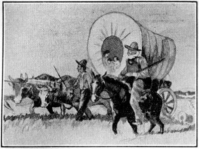
PIONEER PARTY
Pioneer Party
Drawn by Betty Kimmell, Vincennes, Ind.
Illustrated by Betty Kimmell, Vincennes, Ind.
The company of 48 men was divided into two parties. The boat builders and their assistants, 22 in number, met at Cutler’s home in Ipswich, Massachusetts, on December 3, 1787. Cutler not only helped to fashion the government for the Ohio Company of Associates; he also provided for their migration a wagon covered with black canvas and lettered with his own handwriting “For the Ohio Country.” At dawn the men paraded to hear an address from Cutler, fired three volleys with their rifles, and went to Danvers, Massachusetts, where Major Haffield White assumed command. With their plodding ox team they took a route south and then southwest over stage coach roads, mountain trails, or cutting their own path as they went, to the old Glade Road westward through Pennsylvania. After a toilsome journey, they reached Sumrill’s Ferry on the Youghiogheny River 30 miles southeast of Pittsburgh on January 23, nearly eight weeks after leaving home. At this place (now West Newton, Pa.) they started to build boats in readiness for the arrival of the other party.
The group of 48 men was split into two teams. The boat builders and their helpers, totaling 22, gathered at Cutler’s house in Ipswich, Massachusetts, on December 3, 1787. Cutler not only contributed to creating the government for the Ohio Company of Associates; he also prepared for their move with a wagon covered in black canvas, labeled in his own handwriting “For the Ohio Country.” At dawn, the men marched to listen to Cutler's speech, fired three volleys with their rifles, and then headed to Danvers, Massachusetts, where Major Haffield White took charge. With their slow-moving ox team, they traveled south and then southwest along stagecoach roads, mountain trails, or clearing their own way as needed, to reach the old Glade Road heading west through Pennsylvania. After a challenging journey, they arrived at Sumrill’s Ferry on the Youghiogheny River, 30 miles southeast of Pittsburgh, on January 23, nearly eight weeks after leaving home. At this location (now West Newton, Pa.), they began building boats in preparation for the other team’s arrival.
Putnam assembled the second party of 26 surveyors and assistants at Hartford, Connecticut, on January 1, 1788. But business at the war office in New York required him to send the party ahead under the leadership of Colonel Ebenezer Sproat and rejoin them at Swatara Creek between present Harrisburg and Lebanon, Pennsylvania. When Putnam arrived, progress was delayed because the ice on the creeks would not support wagons. With the courage and energy developed by long military service, Putnam set the men to work cutting an opening so that the stream could be forded. During the day spent in cutting ice a heavy snow blocked the roads and made travel difficult. At Cooper’s Tavern near the foot of Tuscarora[37] Mountain the snow was so deep that they were forced to abandon their wagons and build sledges to carry baggage and tools. The horses were then hitched to the sledges in single file, and the men walked ahead to break a path. After two weeks of this slow travel, they arrived at Sumrill’s Ferry on February 14.
Putnam gathered the second group of 26 surveyors and assistants in Hartford, Connecticut, on January 1, 1788. However, business at the war office in New York required him to send the group ahead, led by Colonel Ebenezer Sproat, and to rejoin them at Swatara Creek, which is between present-day Harrisburg and Lebanon, Pennsylvania. When Putnam arrived, their progress was stalled because the ice on the creeks was too weak to support wagons. With the resolve and energy developed through years of military service, Putnam instructed the men to cut an opening so that the stream could be crossed. During the day spent cutting through the ice, heavy snowfall obstructed the roads and made travel challenging. At Cooper’s Tavern, located near the base of Tuscarora[37] Mountain, the snow was so deep that they had to leave their wagons behind and build sledges to transport their baggage and tools. The horses were then hitched to the sledges in a single line, while the men walked ahead to create a pathway. After two weeks of this slow journey, they reached Sumrill’s Ferry on February 14.

PIONEER SETTLERS BUILDING ADVENTURE GALLEY ON THE YOUGHIOGHENY
PIONEER SETTLERS BUILDING ADVENTURE GALLEY ON THE YOUGHIOGHENY
On account of the severe cold and deep snow little progress had been made by White’s men in building boats; but with the arrival of the superintendent and more laborers the work went ahead rapidly under the direction of Jonathan Devol, a ship builder. The largest boat was a galley constructed of heavy timber to deflect bullets and covered with a deck-roof high enough for a man to walk upright under the beams. It was 50 feet long and 13 feet wide with an estimated carrying capacity of 21 tons, although, as Putnam records it, it was of green timber and its real capacity, therefore, uncertain. The Adventure Galley is the name commonly ascribed to this boat, although as an afterthought some called it the American Mayflower. Rufus Putnam in his diary written at the time calls it “Union Galley.” Since one boat would not transport the 48 men with their horses, tools, baggage, and food to support them until their crops matured, a large flatboat, 28’ x 8’, and three canoes were also constructed. It will be interesting to know something of what these “canoes” were like. They were not the hollowed-out log Indian canoes, nor were they of birch bark. Putnam describes them as of two tons, one ton, and 800 pounds burthen, respectively.
Due to the harsh cold and deep snow, White's men made little progress in building boats; however, with the arrival of the superintendent and more workers, the project moved forward quickly under the guidance of Jonathan Devol, a shipbuilder. The largest boat was a galley built from heavy timber to deflect bullets, featuring a deck-roof tall enough for a person to walk upright beneath the beams. It measured 50 feet long and 13 feet wide, with an estimated carrying capacity of 21 tons. However, as Putnam noted, it was made of green timber, so its actual capacity was uncertain. The Adventure Galley is the name most commonly attributed to this boat, though some later referred to it as the American Mayflower. Rufus Putnam, in his diary from that time, referred to it as the “Union Galley.” Since one boat wouldn’t be able to transport the 48 men along with their horses, tools, luggage, and food needed until their crops grew, a large flatboat measuring 28’ x 8’ and three canoes were also built. It would be interesting to learn more about what these “canoes” were like. They were not the traditional hollowed-out log Indian canoes, nor were they made of birch bark. Putnam describes them as having capacities of two tons, one ton, and 800 pounds, respectively.
The popular small boat of the Ohio River, large enough to carry more than would the log canoe, was called a pirogue. It was a log canoe split in half lengthwise and with a wide flat section inserted between the two halves. This made a substantial and safer boat, with greatly increased carrying capacity, yet easy to handle, and, of course, easy for the pioneers to build with the primitive materials at hand.
The popular small boat of the Ohio River, which could carry more than a log canoe, was called a pirogue. It was essentially a log canoe split in half lengthwise with a wide flat piece added between the two halves. This design created a sturdy and safer boat, which had a much higher carrying capacity, was easy to handle, and, of course, simple for the pioneers to build with the basic materials available to them.
And, speaking of boats and pioneers, Cutler records in his diary that on August 15, 1788, Tupper, who had been among the original party of[38] settlers, took him down the river to see his new “mode for propelling a boat instead of oars.” This consisted of a “machine in the form of a screw with short blades, and placed in the stern of a boat, which we turned with a crank. It succeeded to admiration, and I think it a very useful discovery.” Thus, in the wilderness of Northwest Territory and 50 years before it came into general use, the screw propeller was invented and successfully demonstrated.
And, speaking of boats and pioneers, Cutler writes in his diary that on August 15, 1788, Tupper, who had been part of the original group of[38] settlers, took him down the river to show off his new “way of moving a boat without oars.” It was a “machine in the shape of a screw with short blades, placed at the back of a boat, which we turned with a crank. It worked incredibly well, and I think it’s a very useful invention.” So, in the wilderness of the Northwest Territory, and 50 years before it became widely used, the screw propeller was invented and successfully demonstrated.
On April 1, 1788, the 48 pioneer settlers of the Northwest Territory launched their boats out into the Youghiogheny and pushed down that river to the Monongahela. At Pittsburgh they swung out into the current of the broad Ohio. John Mathews had been working since February 27 to collect provisions for the expedition at the mouth of Buffalo Creek (now Wellsburg, West Virginia). The horses, oxen and wagons had been sent overland to this point. After stopping the entire day of April 5 to load these provisions, and their equipment, the little flotilla floated on and arrived at the mouth of the Muskingum on the morning of April 7. The banks of the Muskingum at that time were lined with tall sycamores, which leaned out over the water, and so narrowed the mouth that the pioneers could not see it through the rain. Consequently the current carried them past the mouth of the Muskingum and below Fort Harmar. With ropes and the help of soldiers from the fort, the boats were towed back into the Muskingum. Then the pioneers rowed across and landed at noon above the upper point.
On April 1, 1788, 48 pioneer settlers of the Northwest Territory launched their boats into the Youghiogheny River and floated down to the Monongahela. At Pittsburgh, they veered into the current of the wide Ohio River. John Mathews had been gathering supplies for the trip since February 27 at the mouth of Buffalo Creek (now Wellsburg, West Virginia). The horses, oxen, and wagons had been sent overland to this location. After spending all day on April 5 loading the provisions and their equipment, the small flotilla continued on and reached the mouth of the Muskingum on the morning of April 7. The Muskingum banks at that time were lined with tall sycamores that leaned over the water, making it so narrow that the pioneers couldn't see the mouth through the rain. As a result, the current carried them past the mouth and below Fort Harmar. With ropes and assistance from soldiers at the fort, the boats were towed back into the Muskingum. Then the pioneers rowed across and landed at noon above the upper point.
In what sense were these 48 founders of Marietta the first settlers in the Northwest Territory? Certainly they were not the first white men to live in the Ohio country. Sault Ste. Marie was planted by Marquette in 1668, 120 years before the founding of Marietta. Burke A. Hinsdale has said that the French posts—Cahokia, Kaskaskia, Vincennes, and many others—in the old Northwest contained a population of 2500 people in 1766. Wisconsin, northern Minnesota, Michigan, and Illinois had been major scenes of French exploration and settlement for a hundred years. But the French made no attempt to colonize their settlements; they preferred to keep the wilderness a vast, unbroken game preserve for trapping furs and Indian trading.
In what way were these 48 founders of Marietta the first settlers in the Northwest Territory? They definitely weren't the first white men to live in the Ohio area. Sault Ste. Marie was established by Marquette in 1668, which was 120 years before Marietta was founded. Burke A. Hinsdale pointed out that the French posts—Cahokia, Kaskaskia, Vincennes, and several others—in the old Northwest had a population of 2,500 people in 1766. Wisconsin, northern Minnesota, Michigan, and Illinois had been key areas for French exploration and settlement for a century. However, the French never tried to colonize their settlements; they chose to keep the wilderness as a vast, unbroken hunting ground for trapping furs and trading with Native Americans.
When the English secured possession of the country northwest of the Ohio River at the end of the French and Indian War, the British government angered the colonies, first by the decree of 1763 forbidding settlement, and later by ignoring the colonial charters which had granted the colonies territory “from sea to sea” and passing the Quebec Act of 1774, in which representative government was abolished.
When the English took control of the land northwest of the Ohio River after the French and Indian War, the British government upset the colonies. First, they issued a decree in 1763 that banned settlement, and later they disregarded the colonial charters that had given the colonies territory “from sea to sea” by passing the Quebec Act of 1774, which eliminated representative government.
It is not possible, a hundred and fifty years later, even if it were possible at the time, to interpret the working of the minds of the English king and council. It is a fair surmise, however, supported by considerable evidence, that the crown then saw the threat of American independence, if the[39] American people could establish themselves in this vast and fertile empire beyond the mountains where physical geography alone would make it impossible for the mother country to hold the colonies in subjection or enforce her decrees upon them.
It's not possible, a hundred and fifty years later, even if it were possible at the time, to understand the thoughts of the English king and council. However, it’s a reasonable guess, backed by a lot of evidence, that the crown saw the threat of American independence if the[39] American people could establish themselves in this vast and fertile land beyond the mountains where physical geography alone would make it impossible for the mother country to control the colonies or enforce its rules on them.

LANDING OF PIONEER SETTLERS IN NORTHWEST TERRITORY AT MARIETTA
LANDING OF PIONEER SETTLERS IN NORTHWEST TERRITORY AT MARIETTA
As early as 1761 Frederick Post from Pennsylvania, a Moravian missionary to the Indians, built perhaps the first “American’s” house in Ohio on the Tuscarawas River. On May 3, 1772, David Zeisberger and a company of Christian Indians established Moravian villages at Schoenbrunn, Gnadenhutten, and Lichtenau (near present New Philadelphia). Clarksville, now a suburb of Jeffersonville, Indiana, had been established by George Rogers Clark in 1784. Wiseman’s Bottom, four miles above the mouth of the Muskingum, was named after a man who made a clearing as entry right to 400 acres while Virginia still claimed the land north of the Ohio. During the Revolutionary War squatters began to settle northwest of the Ohio. Since these squatters were trespassing on lands reserved by treaty for the Indians, Congress attempted to drive them out. Ensign John Armstrong reported in 1785 that “there are at the falls of the Hawk Hawkin [Hocking River] upwards of 300 families, and at the Muskingum a number equal.” The squatters even elected one William Hogland, governor. These temporary and unlawful settlements would defeat orderly settlement, and deprive the new nation of the income from sale of the lands. To prevent such illegal occupation Fort Harmar was erected on the Ohio at the mouth of the Muskingum.
As early as 1761, Frederick Post, a Moravian missionary from Pennsylvania, built what might be the first "American" house in Ohio on the Tuscarawas River. On May 3, 1772, David Zeisberger and a group of Christian Indians established Moravian villages at Schoenbrunn, Gnadenhutten, and Lichtenau (near present-day New Philadelphia). Clarksville, which is now a suburb of Jeffersonville, Indiana, was established by George Rogers Clark in 1784. Wiseman’s Bottom, located four miles above the mouth of the Muskingum, was named after a man who cleared land as his entry right to 400 acres while Virginia still claimed the territory north of the Ohio. During the Revolutionary War, squatters began settling northwest of the Ohio. Since these squatters were trespassing on lands reserved for the Indians by treaty, Congress tried to force them out. Ensign John Armstrong reported in 1785 that "there are at the falls of the Hawk Hawkin [Hocking River] upwards of 300 families, and at the Muskingum a number equal." The squatters even elected one William Hogland as their governor. These temporary and unlawful settlements would disrupt orderly settlement and deprive the new nation of income from land sales. To prevent such illegal occupation, Fort Harmar was built on the Ohio at the mouth of the Muskingum.
Marietta was the first legal American settlement northwest of the Ohio River under the Ordinance of 1787.
Marietta was the first official American settlement northwest of the Ohio River established under the Ordinance of 1787.
The Ohio Company of Associates spoke so enthusiastically in praise of their land that other New Englanders jokingly referred to the purchase as “Putnam’s Paradise” and “Cutler’s Indian Heaven.” Aside from the fact that the land was hilly in some sections, it came up to the expectations of the settlers. In contrast to the cold weather they had experienced[40] in Pennsylvania, the pioneers found that the trees were in leaf at the Muskingum and grass was high enough for pasturing their horses. Over the entire region stretched an almost unbroken forest of great poplar, sycamore, maple, oak, hickory, elm, and other trees. Cutler records that on his visit to Marietta he saw a hollow tree forty-one and a half feet in circumference that would hold 84 men or afford room inside for six horsemen to ride abreast. The circles counted in one tree indicated that it was at least 463 years old. In boasting of the fertility of the land one settler wrote that “the corn has grown nine inches in twenty-four hours, for two or three days past.” Buffalo and elk were found in the woods when the pioneers arrived. A hunter could kill 20 deer in one day near Marietta. Wild turkeys weighing from 16 to 30 pounds were caught in pens and clubbed to death. The woods were alive with foxes, opossum, raccoon, beaver, otter, squirrels, rabbits and other small game. Bears, panthers, wild cats, and wolves were a menace to stock. Schools of fish made so much noise with their flopping against the boats that the men could not sleep on board. The largest fish caught were a black catfish weighing 96 pounds and a pike six feet long, weighing almost a hundred pounds.
The Ohio Company of Associates praised their land so passionately that other New Englanders jokingly called the purchase “Putnam’s Paradise” and “Cutler’s Indian Heaven.” Despite some hilly areas, the land met the settlers' expectations. In contrast to the cold weather they had faced in Pennsylvania, the pioneers found the trees leafy along the Muskingum, and the grass was high enough for grazing their horses. The region was covered by almost uninterrupted forests of large poplar, sycamore, maple, oak, hickory, elm, and various other trees. Cutler noted that during his visit to Marietta, he saw a hollow tree with a circumference of forty-one and a half feet that could accommodate 84 men or allow six horsemen to ride side by side. The tree rings indicated it was at least 463 years old. Boasting about the land’s fertility, one settler wrote that “the corn has grown nine inches in twenty-four hours, for two or three days past.” Buffalo and elk roamed the woods when the pioneers arrived. A hunter could kill 20 deer in a single day near Marietta. Wild turkeys weighing between 16 and 30 pounds were captured in pens and clubbed to death. The woods were bustling with foxes, opossums, raccoons, beavers, otters, squirrels, rabbits, and other small game. Bears, panthers, wildcats, and wolves posed threats to livestock. Schools of fish made so much noise flopping against the boats that the men couldn’t sleep on board. The biggest fish caught were a black catfish weighing 96 pounds and a pike that measured six feet long and weighed nearly a hundred pounds.
When the pioneers arrived on April 7, 1788, they were welcomed by approximately 70 Delaware Indians, who were camping at the mouth of the Muskingum to trade furs at Fort Harmar. Their chief, Captain Pipe, assured the white settlers that his people would live at their home on the head waters of the river in peace with their new neighbors. Encouraged by this reception, the men unloaded the boards for their houses the first day and set up a large tent in which Putnam had his headquarters.
When the pioneers arrived on April 7, 1788, they were greeted by around 70 Delaware Indians, who were camping at the mouth of the Muskingum to trade furs at Fort Harmar. Their chief, Captain Pipe, promised the white settlers that his people would coexist peacefully with their new neighbors at their home near the river's source. Encouraged by this friendly welcome, the men unloaded the boards for their houses on the first day and set up a large tent where Putnam established his headquarters.
On the next day the laborers began clearing land, and on April 9 the surveyors started laying off the eight-acre lots. By April 12 four acres of land had been cleared at “The Point,” and work proceeded rapidly in building cabins and planting seed.
On the next day, the workers began clearing the land, and on April 9, the surveyors started dividing the eight-acre lots. By April 12, four acres of land had been cleared at "The Point," and work quickly progressed in building cabins and planting seeds.
At first the pioneers called their settlement Muskingum. This name was a form of the Delaware word Mooskingung, meaning Elk Eye River in reference to the large herds of elk that ranged in the valley. Cutler’s choice for a name was the Greek word Adelphia, which means brethren. But on July 2, at the first meeting of the directors and agents in the new settlement, it was “resolved, That the City near the confluence of the Ohio and Muskingum, be called Marietta.” History generally records that this name was a word formed from the first and last syllables of the name of Queen Marie Antoinette of France, chosen by the veterans of the Revolution as a gallant tribute to the nation which aided them in throwing off the shackles of English rule. Why the final a is uncertain.
At first, the pioneers named their settlement Muskingum. This name came from the Delaware word Mooskingung, meaning Elk Eye River, referring to the large herds of elk that roamed the valley. Cutler wanted to name it Adelphia, which is Greek for brethren. But on July 2, at the first meeting of the directors and agents in the new settlement, it was “resolved, That the City near the confluence of the Ohio and Muskingum, be called Marietta.” History generally notes that this name was created from the first and last syllables of Queen Marie Antoinette of France's name, chosen by the veterans of the Revolution as a tribute to the nation that helped them gain independence from British rule. The reason for the final 'a' is unclear.
Marietta was only the first of the settlements in the Northwest Territory under the ordinance. Many others were to follow rapidly, some destined to[41] become great or small cities, and others to remain as villages. It is worthwhile, however, to follow briefly the history of this first official settlement for its depiction of the type of immigration into the new country and to illustrate the problems settlers faced in pushing America westward.
Marietta was just the first of the towns in the Northwest Territory created under the ordinance. Many more were set to follow quickly, some destined to[41] become large or small cities, while others would stay as villages. It’s important, though, to take a brief look at the history of this first official settlement to show the kind of immigration into the new country and to highlight the challenges settlers encountered while moving America westward.
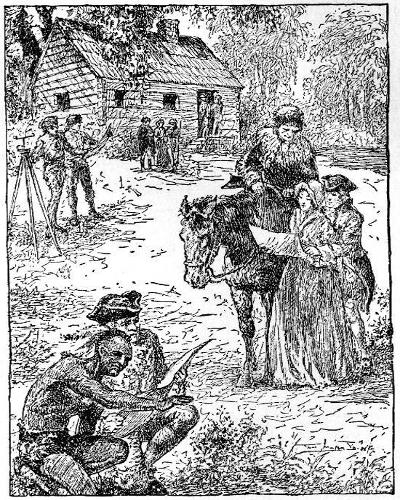
SETTLERS RECEIVING DEEDS FROM OHIO COMPANY’S LAND OFFICE AT MARIETTA
SETTLERS GETTING DEEDS FROM OHIO COMPANY’S LAND OFFICE IN MARIETTA
For instance, in surveying the city the directors of the Ohio Company provided for wide streets and public parks. The principal streets of 90 feet in width ran parallel to the Muskingum River and were designated by numbers. They were intersected by cross streets named after Washington, Putnam and other Revolutionary generals. The bank of the Muskingum was set aside as a “commons” and dedicated forever to public use. It was called “The Bouery” and is today a public park. Within the city limits the surveyors found extensive earthworks and mounds which supplied mysterious evidence of a prehistoric race, which had sometime constructed a city on the same site. Colonel John May described the cutting of a tree that had grown for 443 years on one of the earthworks. The larger elevated square was named Capitolium, the smaller was called Quadranaou, and the road with high embankments from the river to the “Forty acre fort” was officially designated as Sacra Via. These were all dedicated as public property and are so today. A creek which emptied into the Muskingum below Campus Martius was called the Tiber, after the river near Rome. This use of classical names indicates that the cultured founders of Marietta were familiar with Latin and Greek literature.
For example, when surveying the city, the directors of the Ohio Company planned for wide streets and public parks. The main streets, 90 feet wide, ran parallel to the Muskingum River and were labeled with numbers. They were crossed by streets named after Washington, Putnam, and other Revolutionary generals. The bank of the Muskingum was set aside as a "commons" and dedicated forever for public use. It was called "The Bouery" and is now a public park. Inside the city limits, the surveyors discovered extensive earthworks and mounds that provided mysterious evidence of a prehistoric race that once built a city on the same site. Colonel John May described the cutting of a tree that had grown for 443 years on one of the earthworks. The larger elevated square was named Capitolium, the smaller was called Quadranaou, and the road with high embankments from the river to the "Forty acre fort" was officially designated as Sacra Via. All of these were dedicated as public property and still are today. A creek that flowed into the Muskingum below Campus Martius was called the Tiber, after the river near Rome. This use of classical names shows that the educated founders of Marietta were familiar with Latin and Greek literature.
The first cabins had been built at “the point” and a stockade erected enclosing some four and a half acres. The Indians told the settlers of the flood danger, showing them driftwood and laconically pointed out that “where water has been water will be again.”
The first cabins were built at "the point," and a stockade was set up, enclosing about four and a half acres. The Indigenous people warned the settlers about the flood risk, showing them driftwood and casually pointed out that "where water has been, water will be again."
In platting the city-to-be the pioneers, therefore, laid out an extremely broad street on high ground as the intended main street of the town, and named it for Washington. The complete dependence of the time upon river transportation and the distance of Washington Street from the Ohio[42] River prevented its attaining its designed purpose and the business district of the city has never since realized the expectation of those first settlers.
In planning the future city, the pioneers created a wide street on elevated land to serve as the main street and named it Washington. However, the reliance on river transportation and the distance of Washington Street from the Ohio[42] River hindered it from fulfilling its intended purpose, and the business district has never met the hopes of those early settlers.
Early in May, when the crops had been planted in the clearing and cabins had been constructed at “Picketed Point,” Putnam decided from his study of treaties at the war office in New York that the tribes would not permit their lands to be occupied without a struggle. May wrote in his Journal: “At Boston we have frequent alarms of fire, and innundations of the tide; here the Indians answer the same purpose.” On account of the danger of Indian attack all men not needed in the survey were put to work at the construction of an impregnable fort. This defense was called Campus Martius, after a name applied to a grassy plain along the Tiber in ancient Rome where military drills and elections had been held. The phrase literally means “a field dedicated to Mars, the god of war.”
Early in May, when the crops were planted in the clearing and cabins were built at “Picketed Point,” Putnam concluded from his study of treaties at the war office in New York that the tribes wouldn’t allow their lands to be occupied without a fight. May noted in his Journal: “In Boston, we often have fire alarms and flooding from the tide; here, the Indians serve the same role.” Due to the threat of Indian attacks, all men not needed for the survey were assigned to building a strong fort. This defense was named Campus Martius, after a grassy plain along the Tiber in ancient Rome where military drills and elections took place. The term literally means “a field dedicated to Mars, the god of war.”
The fortress was located on Washington Street, three quarters of a mile above the Ohio River. It consisted of 14 two-story houses arranged in the form of a hollow square, which measured 180 feet on a side. At each corner of the square stood a blockhouse with projecting upper story. Loopholes were cut in the projecting floor for showering bullets on Indian attackers. The entire fort was constructed of poplar planks four inches thick and 18 to 20 inches wide, which men hewed and whipsawed from the huge poplar trees that grew along the Muskingum. In one of the fort’s houses, which became Rufus Putnam’s home after the fort was dismantled, and which is now part of Campus Martius Museum, can still be seen the original timbers and form of construction. In the timbers, hewn in pre-determined shapes, were stamped Roman numerals, and by matching corresponding numbers, the artisans of that day were able to assemble the timbers into complete and substantial structures.
The fortress was located on Washington Street, three-quarters of a mile up the Ohio River. It consisted of 14 two-story houses arranged in a hollow square that measured 180 feet on each side. At each corner of the square, there was a blockhouse with an extended upper story. Loopholes were cut into the overhanging floor to allow for shooting at Indian attackers. The whole fort was made from poplar planks that were four inches thick and 18 to 20 inches wide, which men hewed and whipsawed from the massive poplar trees that grew along the Muskingum. In one of the fort’s houses, which later became Rufus Putnam’s home after the fort was taken apart and is now part of Campus Martius Museum, you can still see the original timbers and construction style. The timbers, shaped in advance, were stamped with Roman numerals, and by matching the corresponding numbers, the craftsmen of that time were able to assemble the timbers into complete and sturdy structures.
The blockhouses and part of the dwellings were built at the expense of the Ohio Company. On July 21, 1788, the directors ordered that carpenters be employed at half a dollar a day and one ration to complete the blockhouses, and that laborers be paid seven dollars per month and one ration per day. It was provided
The blockhouses and some of the homes were constructed using funds from the Ohio Company. On July 21, 1788, the directors decided to hire carpenters for fifty cents a day plus one meal to finish the blockhouses, and to pay laborers seven dollars a month along with one meal per day. It was provided
“That a Ration consists of 1½ [lbs.] of Bread or Flour.
“That a Ration consists of 1½ [lbs.] of Bread or Flour.
“1 lb. of Pork or Beef, Venison or other meat equivalent.
“1 lb. of pork or beef, venison, or any other equivalent meat.”
“1 Gill of Whisky.
1 Shot of Whisky.
“Vegetables.”
"Veggies."
The complete structure contained 72 rooms. When the Indians finally went on the war path, the inhabitants constructed three lines of defense outside the fortress. A row of palisades sloped outward to rest on rails, a line of pickets stood upright in the earth 20 feet beyond the palisades, and a barrier of trees with sharpened boughs formed the first defense. Ammunition,[43] cannon, and spears were stored in convenient places. The northeast blockhouse was used for religious meetings and sessions of the courts. At the outbreak of the Indian Wars in 1791, Campus Martius became the principal refuge of the people in Marietta. Of it, Putnam, who had built West Point and many other Revolutionary War fortifications, wrote that it was the finest fort in the United States.
The entire structure had 72 rooms. When the Native Americans finally went to war, the residents built three lines of defense around the fortress. A row of palisades slanted outward to rest on rails, a line of pickets stood straight up in the ground 20 feet beyond the palisades, and a barrier of trees with sharpened branches made up the first line of defense. Ammunition,[43] cannons, and spears were stored in accessible locations. The northeast blockhouse was used for religious gatherings and court sessions. When the Indian Wars started in 1791, Campus Martius became the main refuge for the people in Marietta. Putnam, who had built West Point and several other Revolutionary War fortifications, claimed it was the best fort in the United States.
While Campus Martius was being constructed, the survey was continued, the crops were planted and cabins erected and new settlers arrived. When John May arrived with a party of 11 men on May 26 and was invited to dinner by General Josiah Harmar, he was served, according to his diary, “beef a la mode, boiled fish, bear-steaks, roast venison, etc., excellent succotash, salads, and cranberry sauce.” Venison sold for two cents a pound and bear meat at three cents. May was surprised to see in Doughty’s garden an orchard of apple and peach trees and “cotton growing in perfection.”
While Campus Martius was being built, surveying continued, crops were planted, cabins were constructed, and new settlers arrived. When John May showed up with a group of 11 men on May 26 and was invited to dinner by General Josiah Harmar, he noted in his diary that he was served "beef a la mode, boiled fish, bear steaks, roast venison, etc., excellent succotash, salads, and cranberry sauce." Venison sold for two cents a pound and bear meat for three cents. May was amazed to see an orchard of apple and peach trees and "cotton growing perfectly" in Doughty’s garden.
Varnum arrived with a company of 40 settlers on June 5. Among them were James Owen and his wife, Mary Owen, the first woman who settled in the community. The settlers were so industrious that by June 20, 132 acres had been planted in corn in addition to large fields in potatoes, beans, and other vegetables.
Varnum showed up with a group of 40 settlers on June 5. Among them were James Owen and his wife, Mary Owen, the first woman to settle in the community. The settlers worked so hard that by June 20, they had planted 132 acres of corn, along with large fields of potatoes, beans, and other vegetables.
As soon as the pioneers had provided shelter for themselves, they organized a temporary government to insure order and safety until the arrival of the officers of the Northwest Territory. On June 13 at an informal meeting of the directors and agents of the Ohio Company, it was decided that the directors present should act as a board of police to draw up a set of laws for the community. Colonel Return Jonathan Meigs was appointed to administer them. At the first official meeting of the directors the board of police was confirmed. The regulations provided for cleanliness, health, decency, safety, and moral conduct. Military guard was established. If any persons arrived who were not stockholders in the Ohio Company, the board of police was empowered to decide whether or not they should be permitted to stay. Settlers were required to carry arms during their work in the fields. No one was allowed to trade with the Indians without permission from the board or from Fort Harmar. Punishment for violation of the laws was to consist of either labor for the public, or expulsion. As evidence of the orderly conduct of the settlers it has been pointed out that in three months there was only one difference, and that was compromised. On July 4 the board of police nailed these temporary laws to the smooth trunk of a large beech tree near the mouth of the Muskingum.
As soon as the pioneers set up shelter for themselves, they created a temporary government to maintain order and safety until the officers from the Northwest Territory arrived. On June 13, during an informal meeting of the directors and agents of the Ohio Company, it was decided that the directors present would serve as a board of police to draft a set of laws for the community. Colonel Return Jonathan Meigs was appointed to oversee them. At the first official meeting of the directors, the board of police was officially confirmed. The regulations were focused on cleanliness, health, decency, safety, and moral conduct. A military guard was established. If anyone arrived who was not a stockholder in the Ohio Company, the board of police had the authority to determine whether they could stay. Settlers were required to carry weapons while working in the fields. No one was allowed to trade with the Native Americans without permission from the board or from Fort Harmar. Punishment for breaking the laws would involve either doing public labor or being expelled. As proof of the settlers' orderly behavior, it was noted that in three months there was only one disagreement, which was resolved amicably. On July 4, the board of police posted these temporary laws on the smooth trunk of a large beech tree near the mouth of the Muskingum.
On July 4 all work was suspended to celebrate the anniversary of the Declaration of Independence. Since most of the settlers had served in the[44] Revolutionary Army, they observed the occasion with feelings of intense patriotism. A federal salute of 13 guns from Fort Harmar opened the celebration at dawn. At “The Point” on the east bank of the Muskingum a table 60 feet long was spread with wild meat, fish, vegetables, grog, punch, and wine. Harmar arrived with his lady and officers from the fort at one o’clock. Varnum, one of the judges of the territory, then delivered a flowery oration.
On July 4, all work stopped to celebrate the anniversary of the Declaration of Independence. Since most of the settlers had served in the[44] Revolutionary Army, they marked the occasion with strong feelings of patriotism. A federal salute of 13 guns from Fort Harmar kicked off the celebration at dawn. At “The Point” on the east bank of the Muskingum, a 60-foot-long table was filled with wild meat, fish, vegetables, grog, punch, and wine. Harmar arrived with his lady and officers from the fort at one o’clock. Varnum, one of the judges of the territory, then gave a grand speech.
After the oration, the guests were twice driven from the table by thunderstorms before they finally finished dinner. The patriotic event continued with the drinking of the following toasts which illustrate the topics of general interest of the time:
After the speech, the guests were interrupted from the table by thunderstorms twice before they finally finished dinner. The patriotic event continued with the drinking of the following toasts that highlight the topics of general interest of the time:
- 1. The United States.
- 2. The Congress.
- 3. His Most Christian Majesty, the King of France.
- 4. The United Netherlands.
- 5. The Friendly Powers throughout the World.
- 6. The New Federal Constitution.
- 7. His Excellency General Washington, and the Society of Cincinnati.
- 8. His Excellency Governor St. Clair, and the Western Territory.
- 9. The memory of Those Who Have Nobly Fallen in Defense of American Freedom.
- 10. Patriots, and Heroes.
- 11. Captain Pipe, Chief of the Delawares, and a Happy Treaty with the Natives.
- 12. Agriculture and Commerce, Arts and Sciences.
- 13. The Amiable Partners of Our Delicate Pleasures.
- 14. The Glorious Fourth of July.
The Celebration closed with another salute of 13 guns and a “beautiful illumination” at Fort Harmar.
The celebration wrapped up with another round of 13 gunshots and a “stunning light display” at Fort Harmar.
Chapter 4
Origins of Government
The Northwest Territory at the time of its organization included all of the region comprising the present states of Ohio, Indiana, Illinois, Michigan, Wisconsin, and a portion of Minnesota. The ordinance for its government was framed and ordained at the last session of the Continental Congress in 1787.
The Northwest Territory, when it was established, included all of what are now the states of Ohio, Indiana, Illinois, Michigan, Wisconsin, and part of Minnesota. The ordinance for its governance was created and adopted at the final session of the Continental Congress in 1787.
This ordinance vested the governing authority in four men, a governor and three judges. Two years later, by act of Congress, “the Secretary of the Territory, in case of the death, removal, resignation or necessary absence of the Governor, became the acting Governor.”
This law gave governing power to four people: a governor and three judges. Two years later, an act of Congress stated that “the Secretary of the Territory, in the event of the death, removal, resignation, or required absence of the Governor, would take on the role of acting Governor.”
The first governor of the Northwest Territory was Arthur St. Clair, who arrived at the new settlement, July 9, 1788. He landed at Fort Harmar, which was garrisoned with United States troops. Sergeant Joseph Buell, who was stationed at Fort Harmar, wrote in his Journal on the day of the governor’s arrival:
The first governor of the Northwest Territory was Arthur St. Clair, who reached the new settlement on July 9, 1788. He landed at Fort Harmar, which was occupied by U.S. troops. Sergeant Joseph Buell, stationed at Fort Harmar, wrote in his journal on the day the governor arrived:
“On landing he was saluted with thirteen rounds from the field piece. On entering the garrison the music played a salute; the troops paraded and presented their arms. He was also saluted by a clap of thunder and a heavy shower of rain as he entered the fort: and thus we received our governor of the western frontiers.”
“Upon landing, he was welcomed with thirteen cannon shots. As he entered the garrison, the band played a salute, and the troops lined up and presented their arms. He was also greeted by a clap of thunder and a heavy downpour as he entered the fort: and so we welcomed our governor of the western frontiers.”
St. Clair was educated at the University of Edinburgh, Scotland, came to America, joined the Colonial Army, and rose to the rank of major general. He served as president of the Continental Congress and stood high in the confidence of George Washington. His military reputation, however, later lost much of its luster in his terrible defeat by the Indians on November 4, 1791, in what is now Mercer County, Ohio. He still owned a large tract of land in the Ligonier Valley in Pennsylvania and returned there for his last years. He died in 1818 and was buried at Greensburg, Pennsylvania.
St. Clair was educated at the University of Edinburgh in Scotland, came to America, joined the Colonial Army, and rose to the rank of major general. He served as president of the Continental Congress and was highly trusted by George Washington. However, his military reputation took a severe hit after his devastating defeat by the Indians on November 4, 1791, in what is now Mercer County, Ohio. He still owned a large piece of land in the Ligonier Valley in Pennsylvania and returned there for his final years. He died in 1818 and was buried in Greensburg, Pennsylvania.
The secretary of the Northwest Territory was Winthrop Sargent, a graduate of Harvard, a Revolutionary soldier with a fine record, and the scion of an American family whose representatives have risen to fame in literature, science and art. Judge James Mitchell Varnum, Samuel Holden Parsons and John Cleves Symmes, who constituted the first members of the Supreme Court of the territory, had all risen to high rank as officers of the Colonial Army in the Revolutionary War. Varnum was a graduate of Brown University and Parsons of Harvard. All were able lawyers, and[46] Symmes had been chief justice of the Supreme Court of New Jersey. Under the ordinance for the government of the Northwest Territory, St. Clair, Varnum, Parsons, and Symmes constituted the legislature.
The secretary of the Northwest Territory was Winthrop Sargent, a Harvard graduate, a Revolutionary soldier with an impressive record, and a member of an American family known for their contributions to literature, science, and art. Judge James Mitchell Varnum, Samuel Holden Parsons, and John Cleves Symmes, who were the first members of the Supreme Court of the territory, had all achieved high ranks as officers in the Colonial Army during the Revolutionary War. Varnum graduated from Brown University and Parsons from Harvard. They were all skilled lawyers, and Symmes had served as the chief justice of the Supreme Court of New Jersey. Under the ordinance for governing the Northwest Territory, St. Clair, Varnum, Parsons, and Symmes made up the legislature.
Their law-making power, however, was limited in the ordinance, which declared:
Their law-making power, however, was limited in the ordinance, which declared:
“The governor and judges, or a majority of them, shall adopt and publish in the district, such laws of the original states,—as may be necessary and best suited to the circumstances of the district.”
“The governor and judges, or most of them, will adopt and publish in the district the laws of the original states that are necessary and best suited to the district's circumstances.”
This seems perfectly clear. This little legislature of the governor and three judges could only adopt such laws as were already in force in the original states. This lucid statement, however, was made somewhat obscure by the following language in another clause of the ordinance: “The laws to be adopted or made, shall be in force in all parts of the district.” At least that appears to have been the practical conclusion of this legislature, with the exception of St. Clair, who somewhat mildly warned his fellow members against enacting laws not drawn from the statutes of the states. After sounding the warning, however, he joined the other members in enacting laws with small regard to the statutes of the original states.
This seems perfectly clear. This small legislature made up of the governor and three judges could only adopt laws that were already in effect in the original states. However, this straightforward statement was somewhat complicated by the following wording in another part of the ordinance: “The laws to be adopted or made shall be in effect in all parts of the district.” At least that seems to have been the practical conclusion of this legislature, except for St. Clair, who gently cautioned his fellow members against passing laws not based on the statutes of the states. After giving the warning, though, he joined the other members in passing laws with little regard for the statutes of the original states.
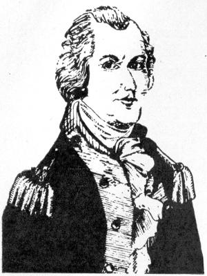
GOVERNOR ARTHUR ST. CLAIR
Governor Arthur St. Clair
Drawn by Jane Cory, Frankfort, Ohio
Drawn by Jane Cory, Frankfort, Ohio
The first law enacted by the governor and judges provided for a territorial militia in which all men over 16 years of age were to be enlisted. Each man was required to provide himself with musket and cartridge box. Murder and treason were punishable by death according to another law, and flogging was prescribed for theft and minor offenses. A fine of ten dimes was imposed for drunkenness; and, if the guilty person did not pay the fine, he served an hour in stocks. Other laws regulated marriage, set aside Sunday as a day of rest, and urged all citizens to avoid swearing and “idle, vain, and obscene conversations.” On July 27, 1788, St. Clair established Washington County, which originally included almost half of the present state of Ohio.
The first law created by the governor and judges set up a territorial militia that required all men over 16 to enlist. Each man had to bring his own musket and cartridge box. According to another law, murder and treason were punishable by death, while flogging was prescribed for theft and minor offenses. A fine of ten dimes was imposed for drunkenness; if the offender didn’t pay the fine, he had to spend an hour in stocks. Other laws governed marriage, designated Sunday as a day of rest, and encouraged all citizens to avoid swearing and “idle, vain, and obscene conversations.” On July 27, 1788, St. Clair established Washington County, which originally covered almost half of what is now the state of Ohio.
After a number of laws had been enacted by this territorial legislature and had been published by Congress in two small volumes called “Laws of the Governor and Judges,” the House passed a bill declaring all the laws of the territory thus enacted null and void. While the bill did not pass the Senate, it was stated that the members of that body were in agreement[47] with the House, but that they did not pass the bill because they felt that these laws of the territory were null without any action by Congress. The governor and judges found themselves without laws with which to govern. The legal structure which they had been industriously building was about to tumble down to ruin. The last of these worthless laws that they enacted bore the date of August 1, 1792.
After a number of laws were passed by this territorial legislature and published by Congress in two small volumes called “Laws of the Governor and Judges,” the House approved a bill declaring all the laws of the territory null and void. Although the bill didn’t pass the Senate, it was noted that the Senate members agreed with the House, but they didn’t move forward with the bill because they believed these territorial laws were invalid without any action from Congress. The governor and judges found themselves without any laws to govern. The legal framework they had been diligently building was about to collapse. The last of these ineffective laws they enacted was dated August 1, 1792.[47]
St. Clair wished to assemble the legislature, which it will be remembered, was composed of himself and the three judges, to adopt laws in accordance with the requirements of the ordinance, in order that the territorial government might be administered by constitutional authority.
St. Clair wanted to gather the legislature, which, as you may recall, consisted of him and the three judges, to pass laws that met the requirements of the ordinance, so that the territorial government could be run with constitutional authority.
On July 25, 1793, he called the legislature of the territory to convene in Cincinnati on September 1 of the same year. Due to the difficulties of communication and transportation it was found impossible, however, to meet on September 1, 1793, and it was not until the twenty-ninth day of May, 1795, that a majority of the members of the legislature were able to assemble in Cincinnati. In other words, it took about 20 months to assemble to meet this emergency and adopt a new code of laws to take the place of those which had been nullified by Congress.
On July 25, 1793, he called the territory's legislature to meet in Cincinnati on September 1 of that year. However, due to communication and transportation challenges, it was impossible to gather on September 1, 1793, and it wasn't until May 29, 1795, that a majority of the legislature members could assemble in Cincinnati. In other words, it took about 20 months to come together to address this emergency and adopt a new set of laws to replace those that Congress had invalidated.
Finally, St. Clair, Symmes and George Turner, who had been appointed to take the place of Varnum, deceased, met in Cincinnati on May 29, 1795, to adopt a code of laws. The remaining judge, Rufus Putnam, was not in attendance.
Finally, St. Clair, Symmes, and George Turner, who were appointed to replace the late Varnum, gathered in Cincinnati on May 29, 1795, to create a set of laws. The other judge, Rufus Putnam, was not present.
This is the first recorded meeting of a legislative body within the present limits of Ohio and the territory northwest of the Ohio River. This legislature chose its officers and assembled in regular session until it concluded its labors and provided for the publication, in the Maxwell code, of the laws it adopted, the very first published in the Northwest Territory.
This is the first recorded meeting of a legislative body within the current boundaries of Ohio and the territory northwest of the Ohio River. This legislature selected its officials and met in regular session until it finished its work and arranged for the publication, in the Maxwell code, of the laws it enacted, the very first published in the Northwest Territory.
Governor Arthur St. Clair presided. Judges John Cleves Symmes and George Turner were the floor members. Accordingly, there were just enough members present to conduct the legislative proceedings—one member to make a motion, another to second it, the presiding governor to put it to a vote. Armstead Churchill was chosen and commissioned clerk of the legislature. He appears not only to have kept a record of the proceedings, but to have prepared drafts of bills for consideration. He received eight cents for every one hundred words that he wrote.
Governor Arthur St. Clair was in charge. Judges John Cleves Symmes and George Turner were the members present. There were just enough members to carry out the legislative process—one to make a motion, another to second it, and the presiding governor to call for a vote. Armstead Churchill was selected and appointed as the clerk of the legislature. He seems to have not only kept a record of the proceedings but also drafted bills for consideration. He earned eight cents for every one hundred words he wrote.
St. Clair read a lengthy address to the two judges. In the opening sentences one can gather some knowledge of the difficulties with which these pioneer legislators had to contend. There were no roads, no steamboats, no coaches, no telegraph. The mails were uncertain, few and far between. Prowling Indians had not ceased to be a menace. Rivers often could not be forded and there were few ferries. The “highways” of travel[48] were the “low ways”—the rivers winding through the unbroken solitudes of the primeval forests.
St. Clair read a long speech to the two judges. From the opening sentences, you can get a sense of the challenges these early lawmakers faced. There were no roads, steamboats, coaches, or telegraphs. Mail was unreliable, scarce, and came infrequently. Roaming Indians still posed a threat. Rivers were often impassable, and there were only a few ferries. The “highways” of travel[48] were the “low ways”—the rivers winding through the untouched wilderness of the ancient forests.
The Ohio was often difficult to navigate. In February, 1795, Judge Symmes made an effort to meet St. Clair at Marietta. We quote the result from one of his letters:
The Ohio River was often hard to navigate. In February 1795, Judge Symmes tried to meet St. Clair in Marietta. Here’s what he wrote in one of his letters:
“On the 20th of February, therefore, I set out from Cincinnati on my passage up the river, and was buffeted by high waters, drifting ice, heavy storms of wind and rain, frost and snow for twenty-three days and nights, without sleeping once in all that time in any house after leaving Columbia. I waited in vain twelve days at Marietta for the coming of the Governor, and, he not appearing, I returned home.”
“On February 20th, I left Cincinnati to travel up the river and faced rough waters, drifting ice, heavy storms of wind and rain, frost, and snow for twenty-three days and nights, without sleeping in a bed after leaving Columbia. I waited for twelve days in Marietta for the Governor to arrive, but since he didn’t show up, I went back home.”
Travel in these times was not only inconvenient and difficult, but dangerous. Parsons, one of the first judges of the Northwest Territory, lost his life by drowning, on his return journey from the Western Reserve in 1789 down the Big Beaver.
Travel during this time was not just inconvenient and challenging, but also risky. Parsons, one of the first judges of the Northwest Territory, drowned on his way back from the Western Reserve in 1789 while traveling down the Big Beaver.
After St. Clair’s message, a resolution was adopted opening the meetings of the legislature to the public. After inviting the public to the sessions, the legislature adjourned to meet the following day. At the second meeting the two judges wrote a dignified reply to the message from the governor.
After St. Clair’s message, a resolution was passed to open the legislature's meetings to the public. After inviting the public to the sessions, the legislature adjourned to reconvene the next day. At the second meeting, the two judges wrote a respectful response to the governor's message.
The record of their proceedings rested securely in an iron box for about 130 years, after which they came into the possession of the Ohio State Archaeological and Historical Society. This record shows that the members of this legislature took themselves and their work seriously. What they lacked in numbers they made up in dignity and decorum. This legislature was in session from May 29 to August 25, 1795. It completed the work for which it had been called and gave to the Northwest Territory a code of laws framed in strict accord with the Ordinance of 1787.
The record of their proceedings was securely stored in an iron box for about 130 years, after which it was handed over to the Ohio State Archaeological and Historical Society. This record shows that the members of this legislature took themselves and their work seriously. What they lacked in numbers, they made up for in dignity and decorum. This legislature was in session from May 29 to August 25, 1795. It completed the tasks it was called to do and provided the Northwest Territory with a code of laws created in strict accordance with the Ordinance of 1787.

WILLIAM HENRY HARRISON
Wm. Henry Harrison
Drawn by William Olson, Downers Grove, Ill.
Illustrated by William Olson, Downers Grove, Illinois.
While these legislative meetings were in session at Cincinnati, General Anthony Wayne was concluding the treaty with the Indians at Greenville, opening the Northwest to peaceful settlement. The subsequent rapid increase in population soon entitled the territory to the second stage of government provided by the ordinance—a legislature chosen by its people[49] to enact laws as soon as there were 5000 free male inhabitants of full age in the territory. This first elected legislature met in September, 1799, and re-affirmed the earlier laws of the governor and judges.
While these legislative meetings were happening in Cincinnati, General Anthony Wayne was finalizing the treaty with the Indians in Greenville, making the Northwest open for peaceful settlement. The quick growth in population soon allowed the territory to move to the next stage of government outlined by the ordinance—a legislature elected by its people[49] to create laws as soon as there were 5,000 free male residents of legal age in the territory. This first elected legislature convened in September 1799 and reaffirmed the earlier laws established by the governor and judges.
The next year Congress divided the Northwest Territory into two parts, the eastern part, comprising approximately present Ohio and eastern Michigan, remaining as the Northwest Territory; and the western part, comprising the balance of the previous territory, becoming Indiana Territory. At this time the territorial capitals were first definitely located, one at Chillicothe, Ohio, and the other at Vincennes, Indiana. Thus, Chillicothe became the first capital of the Northwest Territory and remained so until the state of Ohio was admitted to the Union in 1803.
The following year, Congress split the Northwest Territory into two sections: the eastern part, which included what is now Ohio and eastern Michigan, stayed as the Northwest Territory; and the western part, which covered the rest of the territory, became Indiana Territory. At this time, the territorial capitals were officially established, one in Chillicothe, Ohio, and the other in Vincennes, Indiana. As a result, Chillicothe became the first capital of the Northwest Territory and held that position until Ohio was admitted to the Union in 1803.
OLD INDIANA TERRITORIAL HALL
Old Indiana Territorial Hall
Drawn by Robert Osterhag, Vincennes, Ind.
Drawn by Robert Osterhag, Vincennes, IN.
While the governor and some of the judges lived at Marietta, and they had enacted laws at meetings there, those laws had been invalidated. There was then no officially designated capital of the territory, the judges meeting and promulgating laws wherever might be convenient. In 1790, St. Clair had removed to Cincinnati in preparation for his campaign against the Indians, which proved so disastrous in 1791.
While the governor and some judges were living in Marietta and had passed laws at meetings there, those laws were invalidated. At that time, there was no officially designated capital of the territory, so the judges were meeting and issuing laws wherever it was convenient. In 1790, St. Clair moved to Cincinnati to get ready for his campaign against the Indians, which turned out to be a disaster in 1791.

OX TEAM AND COVERED WAGON PARTY
OX TEAM AND COVERED WAGON PARTY
Drawn by Earl Laweck, Roger City, Michigan
Drawn by Earl Laweck, Roger City, Michigan
Chapter 5
Settlement Growth
The arrival of Governor Arthur St. Clair and the territorial judges encouraged immigration by assuring settlers of the institution of law and order. When the Reverend Daniel Breck delivered a sermon in the present state of Ohio, on Sunday, July 20, 1788, he addressed an audience of 300 people from Marietta and the settlement of Isaac Williams on the Virginia side of the river. After Manasseh Cutler returned home from his visit in 1788, General Samuel Holden Parsons wrote to him on December 11 that “we have had an addition of about one hundred within two weeks.... Between forty and fifty houses are so far done as to receive families.”
The arrival of Governor Arthur St. Clair and the territorial judges encouraged people to move in by reassuring settlers of the presence of law and order. When Reverend Daniel Breck gave a sermon in what is now Ohio on Sunday, July 20, 1788, he spoke to an audience of 300 from Marietta and the Isaac Williams settlement on the Virginia side of the river. After Manasseh Cutler came back from his visit in 1788, General Samuel Holden Parsons wrote to him on December 11 that "we’ve had about a hundred newcomers in the last two weeks... Between forty and fifty houses are finished enough to welcome families."
By the end of the year, 1788, the settlement contained 132 men and 15 families, making a total of nearly 200. James Backus wrote to his parents that their stock consisted of “one hundred and fifty horses, sixty cows, and seven yoke of oxen.”
By the end of the year 1788, the settlement had 132 men and 15 families, totaling nearly 200 people. James Backus wrote to his parents that their livestock included “one hundred and fifty horses, sixty cows, and seven yoke of oxen.”
In August of 1787 Judge John Cleves Symmes, an influential man and member of Congress from Trenton, New Jersey, petitioned Congress for a grant of land between the two Miami Rivers at the mouth of the Little Miami River, which became known to history as “The Symmes purchase.” In November of 1788 Benjamin Stites and about 20 others settled Columbia and in late December of the same year Matthias Denman, Colonel Robert Patterson and Israel Ludlow with a party of 26 men established Losantiville about five miles west of Columbia in the Symmes tract and in the very center of present Cincinnati. These two communities became Cincinnati in 1790 at the request of St. Clair. North Bend was the third of the Symmes settlements and was settled in February, 1789.
In August of 1787, Judge John Cleves Symmes, an influential figure and member of Congress from Trenton, New Jersey, petitioned Congress for a land grant between the two Miami Rivers at the mouth of the Little Miami River, which later became known as “The Symmes purchase.” In November of 1788, Benjamin Stites and about 20 others settled in Columbia, and in late December of the same year, Matthias Denman, Colonel Robert Patterson, and Israel Ludlow, along with a group of 26 men, established Losantiville about five miles west of Columbia in the Symmes tract, which is in the heart of present-day Cincinnati. These two communities were named Cincinnati in 1790 at the request of St. Clair. North Bend was the third of the Symmes settlements, established in February 1789.
All the settlements suffered a hard winter. At Marietta the Ohio was frozen over from December until March and the settlers could not get to Pittsburgh for provisions. Their crops were not large the first year, and the Indians had driven the game away. Many lived on meat and boiled corn or coarse meal ground in a hand mill. Here again was demonstrated the heroism of peace.
All the settlements went through a tough winter. At Marietta, the Ohio River was frozen solid from December to March, and the settlers couldn’t reach Pittsburgh for supplies. Their crops were small in the first year, and the Indians had scared away the game. Many survived on meat and boiled corn or coarse meal ground in a hand mill. This again showed the bravery of those living in peaceful times.
Isaac and Rebecca Williams, living in Virginia, directly across the Ohio River from Marietta, had raised a goodly supply of corn, which, because of scarcity, had reached two dollars a bushel in the markets. Yet they chose to sell it to the hungry settlers at fifty cents per bushel, and proportioned it out according to the number of members of each family.
Isaac and Rebecca Williams, who lived in Virginia, right across the Ohio River from Marietta, had grown a good amount of corn, which had skyrocketed to two dollars a bushel in the markets due to its scarcity. However, they decided to sell it to the starving settlers for just fifty cents a bushel, distributing it based on the number of members in each family.
In order to raise larger crops to provide adequate food supply for the future, two branch settlements were made early in the spring. Fifteen miles below Marietta a farming community called Belpre was formed by 40 associates who had spent the winter in Marietta. Extending for five miles along the Ohio, the settlement consisted of upper, middle and lower divisions called respectively Stone’s Fort, Farmers’ Castle, and Newbury. Farmers’ Castle was a fortification containing 13 cabins built for safety during the Indian War. Soon after Belpre was settled, 39 associates moved 20 miles up the Muskingum to establish themselves at Plainfield, later called Waterford. Fort Frye was constructed as a place of refuge when the Indian War started. About a mile away a mill was built on Wolf Creek by some families who lived in the vicinity. Hearing of the growth of the Ohio Company settlement, the Virginia House of Burgesses appropriated money for a road from Alexandria to the Ohio River opposite Marietta. Merchandise was hauled over this road for many years.
To grow larger crops and ensure a sufficient food supply for the future, two branch settlements were established early in the spring. Fifteen miles downstream from Marietta, a farming community called Belpre was created by 40 settlers who had spent the winter in Marietta. Spanning five miles along the Ohio River, the settlement was divided into upper, middle, and lower sections known as Stone’s Fort, Farmers’ Castle, and Newbury. Farmers’ Castle was a fortified area with 13 cabins built for safety during the Indian War. Shortly after Belpre was established, 39 settlers moved 20 miles up the Muskingum River to set up a new community at Plainfield, which was later renamed Waterford. Fort Frye was built as a safe haven once the Indian War began. About a mile away, some local families constructed a mill on Wolf Creek. Upon hearing about the growth of the Ohio Company settlement, the Virginia House of Burgesses allocated funds for a road from Alexandria to the Ohio River near Marietta. For many years, goods were transported along this road.

FORT WASHINGTON, CINCINNATI
Fort Washington, Cincinnati
Drawn by Junior Vahle, Quincy, Illinois
Drawn by Junior Vahle, Quincy, Illinois
The Ohio Company assisted settlers in establishing themselves. Surveyors went out to lay off the lots at times when it was necessary to maintain a guard of soldiers against Indian attacks. The Ohio Company’s Land Office in which the surveys were recorded, is now the oldest building in Ohio. Liberal grants of land were made to persons who constructed mills for the[52] convenience of settlers. The first flour mill in Ohio was erected about a mile from the mouth of Wolf Creek in 1789 by Major Haffield White, Colonel Robert Oliver, and Captain John Dodge. In 1797 a brickyard and tannery were established on land provided by the Ohio Company. In December of the same year Peletiah White started a small earthenware pottery, which according to Samuel P. Hildreth “was probably the first establishment of the kind north of the Ohio.” The directors provided for the fencing and ornamentation of the public squares in Marietta. For example, Marie Antoinette Square was leased to Rufus Putnam on condition that he plant mulberry, elm, honey locust, and evergreen trees in a specified design.
The Ohio Company helped settlers get established. Surveyors went out to lay out the lots while ensuring there were soldiers on guard against Indian attacks. The Ohio Company’s Land Office, where the surveys were recorded, is now the oldest building in Ohio. Generous land grants were given to those who built mills for the[52] convenience of settlers. The first flour mill in Ohio was built around a mile from the mouth of Wolf Creek in 1789 by Major Haffield White, Colonel Robert Oliver, and Captain John Dodge. In 1797, a brickyard and tannery were set up on land provided by the Ohio Company. In December of the same year, Peletiah White started a small earthenware pottery, which according to Samuel P. Hildreth “was probably the first establishment of the kind north of the Ohio.” The directors arranged for the fencing and beautification of the public squares in Marietta. For example, Marie Antoinette Square was leased to Rufus Putnam with the condition that he plant mulberry, elm, honey locust, and evergreen trees in a specific design.
Near the end of the year 1788 the directors of the Ohio Company had become worried over the fact that thousands of immigrants floated past Marietta to settle in Kentucky. To attract some of these people to remain in the Ohio Company purchase the directors offered 100 acres to men who would agree to build a dwelling house 24 by 18 feet within five years, plant 50 apple or pear trees and 20 peach trees within three years, cultivate five acres, and provide themselves with arms and ammunition for defense. Settlements on donation lands were expected to serve as outposts of defense against Indian attack. After granting some free tracts, the Ohio Company found the practice too expensive and successfully petitioned Congress in 1792 for a tract of 100,000 acres for donation purposes. Located in the northeastern part of the Ohio Company Purchase, the donation tract was approximately 22 miles long and seven miles wide. In the autumn of 1790 a group of 36 men established a settlement on donation land 30 miles up the Muskingum from Marietta, at a place called Big Bottom.
Near the end of 1788, the directors of the Ohio Company grew concerned about the thousands of immigrants passing Marietta to settle in Kentucky. To entice some of these people to stay in the Ohio Company purchase, the directors offered 100 acres to men who would agree to build a house measuring 24 by 18 feet within five years, plant 50 apple or pear trees and 20 peach trees within three years, cultivate five acres, and supply themselves with weapons and ammunition for defense. Settlements on donated land were expected to function as outposts for protection against Indian attacks. After initially granting some free tracts, the Ohio Company found this practice too costly and successfully requested Congress in 1792 for a tract of 100,000 acres for donation purposes. Located in the northeastern section of the Ohio Company Purchase, the donated tract was about 22 miles long and seven miles wide. In the fall of 1790, a group of 36 men established a settlement on the donated land, 30 miles up the Muskingum from Marietta, in a place called Big Bottom.
The first town meeting in the territory was held in Marietta on February 4, 1789. Colonel Archibald Crary presided as chairman, and Ebenezer Battelle was elected clerk. A committee was appointed to draft an address to St. Clair, and report a plan for a police system. The police board appointed under this plan consisted of Putnam, Oliver, Griffin Green, and Nathaniel Goodale. In addition to their police duties, these men appointed a sealer of weights and measures, fence viewers, and a registrar of births and deaths. Laws were passed for the government of the community. Many of the regulations provided for defense against the Indians by completing Campus Martius and by securely bolting the gates at sunset. It was ordered “that the main Street leading from Campus Martius to Corey’s bridge, so called, should be cleared of logs and other woods that may obstruct it.” Residents of Campus Martius were ordered to construct walks of hewn logs along their cabins and to provide troughs or gutters to drain water from the eaves. Wagons, horses, cattle, and swine were not permitted inside the fort. One resolution prohibited the purchase of wild meats for the purpose of monopolizing the supply and charging extravagant prices.
The first town meeting in the territory was held in Marietta on February 4, 1789. Colonel Archibald Crary served as chairman, and Ebenezer Battelle was elected as clerk. A committee was assigned to draft a letter to St. Clair and to propose a plan for a police system. The police board created under this plan included Putnam, Oliver, Griffin Green, and Nathaniel Goodale. Besides their police responsibilities, these men also appointed someone to oversee weights and measures, fence viewers, and a registrar for births and deaths. Laws were enacted to govern the community. Many of the regulations aimed to defend against the Native Americans by completing Campus Martius and securely locking the gates at sunset. It was ordered that “the main street leading from Campus Martius to Corey’s bridge, as it's called, should be cleared of logs and other debris that may block it.” Residents of Campus Martius were instructed to build walkways using hewn logs by their cabins and to set up troughs or gutters to drain water from the eaves. Wagons, horses, cattle, and pigs were not allowed inside the fort. One resolution banned the purchase of wild meats to prevent monopolizing the supply and charging excessively high prices.

TECUMSEH
TECUMSEH
Drawn by Robert Eggebrecht, Vincennes, Ind.
Drawn by Robert Eggebrecht, Vincennes, IN.
Food was scarce at the Miami settlements also, and the Indians were showing increasing signs of resistance to the whites. Several community blockhouses had been built and small parties of troops sent there to guard the settlements and their all-essential crops.
Food was hard to come by in the Miami settlements, and the Indians were increasingly resisting the whites. Several community blockhouses had been constructed, and small groups of troops were sent there to protect the settlements and their crucial crops.
In January, 1790, St. Clair removed to Cincinnati, and Major John Doughty with his troops from Fort Harmar started construction of Fort Washington as headquarters for increasingly necessary western troops. General Josiah Harmar arrived in the fall of that year and took charge of the garrison then comprising 70 men.
In January 1790, St. Clair moved to Cincinnati, and Major John Doughty and his troops from Fort Harmar began building Fort Washington as a base for the growing number of troops needed in the West. General Josiah Harmar arrived that fall and took command of the garrison, which then had 70 men.
Casual readers of history at times marvel at the small size of garrisons and armies used in these hazardous campaigns against the Indians, and thereby incline to minimize the severity of the conflicts. To understand this, it is necessary to realize how few people relatively were in the entire empire of the Northwest; that transportation and communication were so difficult as to make the movements of large bodies of men impossible, even if men had been available; that provisions and supplies could not be moved in quantity and, beyond two or three days’ supply the men could carry, the troops had to live on game and what the wilderness provided; and, lastly, that the Indians were usually small tribes and attacked in relatively small groups.
Casual readers of history sometimes find it surprising how small the garrisons and armies were in these dangerous campaigns against the Indians, which leads them to downplay the seriousness of the conflicts. To understand this, it's important to realize how few people were in the entire Northwest Territory; that transportation and communication were so challenging that it made moving large groups of men impossible, even if people had been available; that supplies couldn't be transported in bulk, and beyond the two or three days' worth of food the soldiers could carry, they had to rely on hunting and what the wilderness offered; and finally, that the Indians were usually small tribes and attacked in relatively small numbers.
The protection normally needed was that of small detachments of hardy and fearless men trained to the ways of the woods and the Indians. One of the great problems of the period, as will be seen later, was the militia or volunteers, who, though eager to fight the Indians, were too impetuous, too unfamiliar with discipline, and too likely to decide to return to their homes upon their own initiative.
The protection usually required was from small groups of tough and brave individuals skilled in the landscape and familiar with Native American ways. One of the major challenges of the time, as will be discussed later, was the militia or volunteers, who, while eager to engage with the Native Americans, were often too impulsive, lacked proper training, and were too likely to choose to head back home on their own.
In October, 1790, a party of immigrants from France—anxious to escape the impending French Revolution—bought lands and settled in the lower part of the Ohio Company Purchase at a village called Gallipolis, or the city of the French. They had been deceived by representatives of the Scioto Purchase, and believed that they were buying a Garden of Eden, where nature provided the necessities of life without labor. For instance, they had been told by agents of the Scioto Company, which will be described later, that candles grew in swamps on their lands (cat tails), and that custard grew on trees (paw paws).
In October 1790, a group of immigrants from France—eager to escape the looming French Revolution—purchased land and settled in the southern part of the Ohio Company Purchase in a village called Gallipolis, or the city of the French. They had been misled by representatives of the Scioto Purchase and believed they were acquiring a Garden of Eden, where nature supplied the essentials of life effortlessly. For example, they were told by agents of the Scioto Company, which will be covered later, that candles grew in swamps on their land (cattails), and that custard grew on trees (pawpaws).
Here it seems proper to digress for a moment as to the Scioto Company—or more particularly to discuss the fact that in those days not all public men were heroes, and some were not even honest. Then, as now, the forward-looking forces of progress had to contend with selfishness, politics, chicanery and downright dishonesty.
Here it seems appropriate to take a moment to talk about the Scioto Company—or more specifically to mention that back then, not all public figures were heroes, and some weren't even trustworthy. Just like today, the forces pushing for progress had to deal with selfishness, politics, deceit, and outright dishonesty.
It has been before pointed out that when Cutler was negotiating with Congress for purchase of Ohio Company lands, a group had approached him with a proposal to make another purchase at the same time for another company, and that he used this larger purchase to secure passage of the Ordinance of 1787. This other company was the Scioto Company, whose membership is not known beyond a small group. Its negotiations with the Ohio Company were carried on by one man, a public official. Cutler and Putnam did not permit the Ohio Company of Associates to become entangled with this other company—beyond the fact that the two purchases were to be made at the same time.
It has been noted before that when Cutler was negotiating with Congress to buy Ohio Company lands, a group approached him with an idea to make another purchase at the same time for a different company, and he used this larger purchase to help get the Ordinance of 1787 passed. This other company was the Scioto Company, whose membership is only known to a small group. Its negotiations with the Ohio Company were handled by one individual, a public official. Cutler and Putnam did not allow the Ohio Company of Associates to get mixed up with this other company—other than the fact that both purchases were to be made simultaneously.
The Scioto Company was to purchase some 3,500,000 acres in the valley of the Scioto River. They sent Joel Barlow, a fair poet perhaps, but of questionable business sagacity, to France to dispose of these lands to fear-worn French. Barlow employed one William Playfair to sell the lands, and it was in the booklet the latter prepared that the fantastic statements as to candles, custard, etc., appeared. The sale was highly successful. Middle-class French in such jeopardy between the revolutionists and the aristocracy, hastened to emigrate to the new land of dreams. What became of the moneys they paid for their new homes has never been proved. Someone absconded and when they landed at Alexandria, Virginia, they learned that the Scioto Company had never acquired title to the lands sold to them.
The Scioto Company was set to buy about 3,500,000 acres in the Scioto River valley. They sent Joel Barlow, who was a decent poet but had questionable business sense, to France to sell these lands to anxious French people. Barlow hired William Playfair to handle the sales, and it was in the pamphlet that Playfair created that the outrageous claims about candles, custard, and more emerged. The sale was very successful. Middle-class French, caught in a struggle between revolutionaries and the aristocracy, rushed to immigrate to this new land of opportunity. What happened to the money they paid for their new homes has never been determined. Someone ran off with it, and when they arrived in Alexandria, Virginia, they discovered that the Scioto Company had never owned the land they were sold.
One interesting incident of this skullduggery is worth mention. Among the French settlers was François D’Hebecourt, a close boyhood friend of Napoleon Bonaparte. Bonaparte had originally considered joining the party, but remained behind to follow if his friend’s reports substantiated the claims made. In case the new country did come up to expectations, he was to follow D’Hebecourt, and establish a new empire somewhere in western America. Of course, D’Hebecourt’s reports of the villainy of the Scioto Company, the hovels they found for homes and the ensuing famine which the French settlers endured changed Bonaparte’s intentions, and he remained in France to leave his mark later on all Europe.
One interesting incident of this trickery is worth mentioning. Among the French settlers was François D’Hebecourt, a close childhood friend of Napoleon Bonaparte. Bonaparte had originally thought about joining the group but decided to stay back and see if his friend's reports confirmed the claims being made. If the new country lived up to expectations, he intended to follow D’Hebecourt and establish a new empire somewhere in western America. However, D’Hebecourt’s reports about the wrongdoing of the Scioto Company, the run-down places they found for homes, and the resulting famine that the French settlers suffered changed Bonaparte’s plans, and he stayed in France to make his mark on all of Europe later on.
There are two very interesting suppositions suggested. Suppose the Scioto Company had kept its word, what might have been the subsequent history of the world? And suppose, as is altogether possible, that Bonaparte’s revulsion at the treatment of his countrymen had influenced him 13 years later in selling Louisiana Territory to the United States. The portent of such possibilities has no direct connection with our story, except to show what[55] small affairs of men may affect all history and the millions of people who live afterward, and, an indication that the world is not worse, morally or ethically, now than it was then.
There are two very interesting assumptions to consider. If the Scioto Company had followed through on its promises, what might the world’s history look like today? And what if, as is entirely possible, Bonaparte’s anger over how his fellow countrymen were treated influenced his decision 13 years later to sell the Louisiana Territory to the United States? These possibilities don’t directly relate to our story, but they highlight how small actions by individuals can impact all of history and the millions who come after, and they suggest that the world isn't morally or ethically worse now than it was back then.

SPINNING
SPINNING
Drawn by Lloyd Hune, Marietta, Ohio
Drawn by Lloyd Hune, Marietta, Ohio
Through the intervention of President George Washington, Colonel William Duer of the Scioto Company agreed to transport the emigrants to their lands, opposite the mouth of the Big Kanawha. In the meantime, surveyors discovered that this village site lay within the Ohio Company Purchase, and not, as supposed, within the Scioto Purchase. Duer contracted with Putnam to erect buildings for the settlers. Accordingly, Major John Burnham, with 40 men, erected four rows of 20 cabins each, with blockhouses at the corners and a small breastwork in front. To these crude dwellings came the artisans, lawyers, jewelers, physicians, and servants, the exiled nobility of France. They were so ignorant of pioneer ways that some were killed beneath the fall of the trees they chopped down. When the Ohio Company adjusted its affairs in December, 1795, the French settlers paid for their land a second time by buying it for a dollar and a quarter per acre. At a later time the United States government granted these unfortunate French a tract of land near Portsmouth, Ohio, but few of them ever moved there.
Through the intervention of President George Washington, Colonel William Duer of the Scioto Company agreed to transport the emigrants to their lands, across from the mouth of the Big Kanawha. In the meantime, surveyors found out that this village site was actually within the Ohio Company Purchase, not, as previously thought, within the Scioto Purchase. Duer made a deal with Putnam to build structures for the settlers. As a result, Major John Burnham, along with 40 men, constructed four rows of 20 cabins each, with blockhouses at the corners and a small breastwork in front. To these basic homes came artisans, lawyers, jewelers, physicians, and servants, the exiled nobility of France. They were so unfamiliar with pioneer life that some were killed when trees they were chopping down fell on them. When the Ohio Company sorted out its affairs in December 1795, the French settlers ended up paying for their land again, buying it for a dollar and a quarter per acre. Later on, the United States government granted these unfortunate French a piece of land near Portsmouth, Ohio, but very few ever moved there.
During the Indian war these citizens of Gallipolis were not molested by the warriors, who still had friendly feelings toward their former French allies in Canada. The other settlers, however, were not so fortunate in escaping Indian hostility. On May 1, 1789, only four months after the Treaty of Fort Harmar, Captain Zebulon King was killed and scalped by two Indians at Belpre. In August two boys were killed two miles up the Little Kanawha River in Virginia. Murders occurred with increasing frequency along the frontier. Settlers in Virginia, Kentucky, and the Ohio settlements called for protection. In 1790, Washington sent Harmar northward from Cincinnati with an expedition to punish the Indians in the Miami country, and compel obedience to the treaties of Fort McIntosh and Fort Harmar, but the warriors defeated his army so severely that they became bolder than ever in their revengeful attacks.
During the Indian war, the citizens of Gallipolis were not harmed by the warriors, who still felt friendly towards their former French allies in Canada. Unfortunately, the other settlers weren't as lucky in avoiding Indian hostility. On May 1, 1789, just four months after the Treaty of Fort Harmar, Captain Zebulon King was killed and scalped by two Indians at Belpre. In August, two boys were killed two miles up the Little Kanawha River in Virginia. Murders grew more frequent along the frontier. Settlers in Virginia, Kentucky, and the Ohio settlements called for protection. In 1790, Washington sent Harmar north from Cincinnati with an expedition to punish the Indians in the Miami country and enforce the treaties of Fort McIntosh and Fort Harmar, but the warriors defeated his army so badly that they became even bolder in their retaliatory attacks.
On Sunday, January 2, 1791, a war party of thirty Delaware and Wyandots attacked the settlers on donation lands at Big Bottom. Thirteen people, including a woman and two children, were gathered in a two-story blockhouse of beech logs. Four men were eating supper in a cabin a hundred[56] yards above the blockhouse, and two men were preparing their meal in another cabin below the main building. A light snow covered the ground, and the ice on the Muskingum was strong enough to hold the Indians who crossed from the trail on the opposite side. While a few of their number tied the four men in the upper cabin, the main body of Indians surrounded the blockhouse. One of them pushed open the door, and his companions fired at the men around the fireplace. Then the Indians rushed in and massacred the settlers before they could reach their weapons. Twelve people were killed, five were made captives, and the two men in the lower cabin escaped to carry the news to the lower settlements.
On Sunday, January 2, 1791, a war party of thirty Delaware and Wyandots attacked the settlers on donation lands at Big Bottom. Thirteen people, including a woman and two children, were gathered in a two-story blockhouse made of beech logs. Four men were having dinner in a cabin a hundred[56] yards above the blockhouse, and two men were preparing their meal in another cabin below the main building. A light snow covered the ground, and the ice on the Muskingum was strong enough to hold the Indians who crossed from the trail on the opposite side. While a few of their group tied up the four men in the upper cabin, the main group of Indians surrounded the blockhouse. One of them pushed open the door, and his companions fired at the men around the fireplace. Then the Indians rushed in and killed the settlers before they could grab their weapons. Twelve people were killed, five were taken captive, and the two men in the lower cabin escaped to carry the news to the lower settlements.
Many of the men from Belpre and Waterford were attending the Court of Quarter Sessions in Marietta when the news of the massacre arrived. Hurrying back to their homes, they prepared to defend themselves if other attacks should be made. Several smaller settlements were abandoned, and the fortifications at Marietta, Belpre, and Waterford were strengthened. On January 8 Putnam wrote to Washington:
Many of the men from Belpre and Waterford were at the Court of Quarter Sessions in Marietta when the news of the massacre came in. They rushed back to their homes, getting ready to defend themselves in case there were more attacks. Several smaller settlements were abandoned, and the defenses in Marietta, Belpre, and Waterford were reinforced. On January 8, Putnam wrote to Washington:
“The garrison at Fort Harmar, consisting at this time of little more than twenty men, can afford no protection to our settlements; and the whole number of men in all our settlements, capable of bearing arms, including all civil and military officers, do not exceed 287; and these badly armed. We are in the utmost danger of being swallowed up, should the enemy push the war with vigor during the winter.”
“The garrison at Fort Harmar, which right now has just over twenty men, can’t provide any real protection for our settlements; and the total number of men across all our settlements who can bear arms, including all civil and military officers, doesn’t go above 287, and they are poorly armed. We are in serious danger of being overwhelmed if the enemy intensifies the war during the winter.”

INDIAN CHIEFS BEING ENTERTAINED BY RUFUS PUTNAM AT CAMPUS MARTIUS
INDIAN CHIEFS GUESTS OF RUFUS PUTNAM AT CAMPUS MARTIUS
During the following summer a company of United States troops under Major Jonathan Haskell was stationed at the Ohio Company settlements. The roofs of Campus Martius were covered with four inches of clay as a protection against flaming arrows. Picketed Point was strengthened and another blockhouse built for quartering troops. Colonel Ebenezer Sproat commanded a detail of 60 men from the militia in building fortifications. Six scouts, two from each of the settlements, started each morning on a circuit of 15 miles to discover the approach of Indians and give the alarm. For[57] this defense the Ohio Company paid a total of $11,350.90, which was never repaid by the government. During the war the Indians killed 38 settlers in the vicinity of Marietta.
During the next summer, a group of U.S. troops led by Major Jonathan Haskell was stationed at the Ohio Company settlements. The roofs of Campus Martius were covered with four inches of clay to protect against flaming arrows. Picketed Point was reinforced, and another blockhouse was constructed for housing troops. Colonel Ebenezer Sproat oversaw a detail of 60 militia men who built the fortifications. Each morning, six scouts—two from each settlement—set out on a 15-mile circuit to look for approaching Indians and raise the alarm. For[57] this defense, the Ohio Company spent a total of $11,350.90, which was never reimbursed by the government. During the war, the Indians killed 38 settlers near Marietta.
Coming soon after Harmar’s tragic defeat, the Big Bottom massacre seemed to justify the boast of the Indians that they would drive the white men out of the Ohio Valley. Washington commissioned St. Clair to lead an army of 2,000 men to punish the tribes. Starting from Fort Washington in October, 1791, they reached the eastern fork of the Wabash at present Fort Recovery, Ohio, on November 3, and encamped without suspicion of danger. At dawn they were surprised by a large body of Indians and forced to retreat with a loss of 900 men. As a result of the bitter criticism directed against St. Clair, a committee of Congress investigated the battle and found that the blame rested not upon St. Clair, but upon the incompetence of the troops and the inadequacy of the equipment. This has been before referred to as a besetting evil of early western campaigns.
Coming soon after Harmar’s tragic defeat, the Big Bottom massacre seemed to confirm the Indians' claim that they would drive the white men out of the Ohio Valley. Washington commissioned St. Clair to lead an army of 2,000 men to take action against the tribes. Starting from Fort Washington in October 1791, they reached the eastern fork of the Wabash, at what is now Fort Recovery, Ohio, on November 3, and set up camp without any suspicion of danger. At dawn, they were ambushed by a large group of Indians and forced to retreat, losing 900 men. As a result of the harsh criticism directed at St. Clair, Congress formed a committee to investigate the battle and found that the blame lay not with St. Clair, but with the incompetence of the troops and the inadequacy of their equipment. This has been previously noted as a persistent issue in early western campaigns.
The situation had become of serious national consequence. One of the traits of Indian warriors was a desire to be on the winning side. Under the impetus of two crushing defeats administered in quick succession to the American troops, even those tribes which had been peaceable and inoffensive began joining with the war-mad tribes and all white settlements were endangered. There was strong reason to believe, as was later substantiated, that the British who had not evacuated posts in Michigan despite the Treaty of Paris, were aiding and abetting the red man.
The situation had become a serious national issue. One of the characteristics of Indian warriors was a desire to be on the winning side. After two devastating defeats against the American troops in quick succession, even the tribes that had been peaceful and harmless started joining forces with the war-hungry tribes, putting all white settlements at risk. There was strong reason to believe, as was later confirmed, that the British, who had not left their posts in Michigan despite the Treaty of Paris, were supporting the Native Americans.
Washington realized that decisive steps must be taken if the Northwest was to be saved to the United States, and appointed General “Mad” Anthony Wayne of Revolutionary fame to lead the next expedition against the Indians and their allies.
Washington understood that immediate action was necessary to ensure the Northwest remained part of the United States, so he appointed General “Mad” Anthony Wayne, known for his role in the Revolution, to lead the next mission against the Indians and their allies.

ANTHONY WAYNE
ANTHONY WAYNE
Drawn by Herbert Krofft, Zanesville, Ohio
Drawn by Herbert Krofft, Zanesville, Ohio
After two years of preparation in drilling his troops and building several forts to protect supply trains, he led an army of 2,000 regulars and 1,500 militia to the confluence of the Auglaize and Maumee Rivers. Enroute from Fort Greenville he had performed a notable strategy, which led the Indians on the westward to believe he would attack near present Fort Wayne, Indiana, and those to the east to conclude that he would attack them near[58] present Toledo, Ohio. In reality he drove straight north to the mouth of the Auglaize where he built Fort Defiance, and thus, because of their absolute dependence upon the Maumee River for transportation, split the Indian forces in half. Taking ample time and with his now well-disciplined army, he attacked the Indians at Fallen Timbers, west of present Toledo. Here, behind trees blown down by a tornado, an army of 2,000 Indians waited for an attack. On the morning of August 20, 1794, Wayne’s army finally crushed the strength and spirit of the Indian hostility.
After two years of training his troops and building several forts to protect supply lines, he led an army of 2,000 regular soldiers and 1,500 militia to where the Auglaize and Maumee Rivers meet. On his way from Fort Greenville, he executed a clever strategy that misled the Indians to the west into thinking he would strike near what is now Fort Wayne, Indiana, while those to the east were led to believe he would attack near[58] present Toledo, Ohio. In reality, he went straight north to the mouth of the Auglaize River, where he built Fort Defiance. This maneuver split the Indian forces in half, as they were completely reliant on the Maumee River for transportation. Taking his time with his now well-trained army, he launched an attack on the Indians at Fallen Timbers, just west of present-day Toledo. There, behind trees felled by a tornado, an army of 2,000 Indians awaited an assault. On the morning of August 20, 1794, Wayne's army finally defeated the strength and determination of the Indian resistance.
The British troops at Fort Miami, which was on American soil, four miles away from the battlefield, did not go to the assistance of the Indians, although a number of Canadian soldiers and officers were captured or killed in the battle. This failure of support and the smashing defeat which had been administered to them made possible the Treaty of Greenville, made by Wayne with the Indians on August 5, 1795.
The British troops at Fort Miami, located on American land just four miles from the battlefield, did not help the Indians, even though several Canadian soldiers and officers were captured or killed during the battle. This lack of support and the significant defeat they suffered led to the Treaty of Greenville, which Wayne negotiated with the Indians on August 5, 1795.
The boundary lines established by this treaty extended somewhat beyond those of the Fort McIntosh Treaty of ten years before. What Wayne and the Greenville Treaty did accomplish was to convince the Indians and their British backers that America meant to hold the Northwest. They remained convinced until the War of 1812, when the matter was settled for all time.
The boundary lines set by this treaty went a bit further than those of the Fort McIntosh Treaty from ten years earlier. What Wayne and the Greenville Treaty managed to do was convince the Native Americans and their British supporters that America was serious about retaining the Northwest. They held on to that belief until the War of 1812, when the issue was resolved for good.
With the advent of peace, settlement of Ohio and the Northwest proceeded rapidly. Virginians swarmed into the Military Tract reserved by her deed of cession for bounty lands. Manchester, on the Ohio River, was settled in 1791 by Colonel (later General) Nathaniel Massie, who also settled Chillicothe in 1796. Chillicothe was to become later the first territorial capital, then the first capital of Ohio.
With the arrival of peace, the settlement of Ohio and the Northwest moved quickly. Virginians rushed into the Military Tract set aside by their land grant for bounty lands. Manchester, located on the Ohio River, was settled in 1791 by Colonel (later General) Nathaniel Massie, who also established Chillicothe in 1796. Chillicothe would later become the first territorial capital and then the first capital of Ohio.
When Connecticut ceded her claims to the Northwest Territory lands to the United States, reservation had been made in the northeast corner of the present state of Ohio—known as the “Western Reserve.”
When Connecticut gave up its claims to the Northwest Territory lands to the United States, it kept a reservation in the northeast corner of what is now Ohio—called the “Western Reserve.”
A half million acres of this area were set off for the benefit of Connecticut citizens who had suffered loss by fire at the hands of the British in the Revolutionary War. These still bear the name of “Firelands.” In 1795 Connecticut sold the portion of her reserved lands east of the Cuyahoga River to a land company, and here in 1796 Moses Cleaveland established the present city which bears his name.
Half a million acres of this area were designated for the benefit of Connecticut citizens who suffered losses from fire caused by the British during the Revolutionary War. These lands are still called “Firelands.” In 1795, Connecticut sold the part of her reserved lands east of the Cuyahoga River to a land company, and in 1796, Moses Cleaveland founded the city that carries his name today.
In the central part of the state Franklinton, present Columbus, was laid out in August, 1797. By 1800 the towns of Marietta, Cincinnati, North Bend, Gallipolis, Manchester, Hamilton, Dayton, Franklin, Chillicothe, Cleveland, Franklinton, Steubenville, Williamsburg and Zanesville and many smaller settlements were in existence.
In the central part of the state, Franklinton, now known as Columbus, was established in August 1797. By 1800, the towns of Marietta, Cincinnati, North Bend, Gallipolis, Manchester, Hamilton, Dayton, Franklin, Chillicothe, Cleveland, Franklinton, Steubenville, Williamsburg, Zanesville, and many smaller communities were already in existence.
In the territory to the west settlers were now finding new homes. Settlements[59] around the old French trading posts and forts had grown materially and new centers were springing up in an ever westward march.
In the area to the west, settlers were discovering new places to live. Communities[59] around the old French trading posts and forts had expanded significantly, and new hubs were emerging in a continuous move westward.
The Northwest as an integral and thriving part of the United States was definitely established.
The Northwest as an essential and prosperous part of the United States was clearly established.
While it would be interesting herein to follow through the developing communities of those states later to be formed from the territory, the purpose of this book apparently requires confinement of details to the formative period of the territory, and, except in unusual cases, towns and cities settled after 1800 will be left to state histories, which are commonly available.
While it would be interesting to explore the growing communities of the states that eventually emerged from the territory, the purpose of this book clearly requires focusing on the early development of the territory. Typically, towns and cities established after 1800 will be addressed in state histories, which are generally accessible.
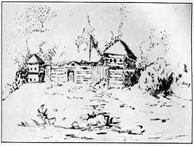
FORT HARRISON ON THE WABASH
Fort Harrison on the Wabash
Drawn by Helen Jean Marshall, Grand Ledge, Michigan
Drawn by Helen Jean Marshall, Grand Ledge, Michigan
The region now known as Indiana was traversed by La Salle, possibly along the Ohio in 1670, along the St. Joseph and the Kankakee in 1679. French traders were at the present site of Fort Wayne early in the eighteenth century, and Fort Ouiatenon (southwest of Lafayette) was built by 1722. Vincennes was established and a fort built there by 1732. This entire region remained under French control until after the French and Indian War, when it was surrendered to the English. Following victories at Kaskaskia and Cahokia in the Illinois country, Americans under George Rogers Clark captured Vincennes in 1779. While his expedition was authorized by Governor Patrick Henry of Virginia as a state venture, the final effect was to establish the claim of the United States to the Northwest Territory sufficiently to secure cession by England in the Treaty of Paris.
The area now called Indiana was crossed by La Salle, probably along the Ohio River in 1670, and along the St. Joseph and Kankakee rivers in 1679. French traders were present at what is now Fort Wayne in the early eighteenth century, and Fort Ouiatenon (southwest of Lafayette) was constructed by 1722. Vincennes was founded, and a fort was built there by 1732. This whole area stayed under French control until after the French and Indian War, when it was handed over to the British. After victories at Kaskaskia and Cahokia in Illinois, American forces led by George Rogers Clark captured Vincennes in 1779. Although his expedition was authorized by Virginia Governor Patrick Henry as a state initiative, the ultimate result was to assert the United States' claim to the Northwest Territory, leading to its cession by Britain in the Treaty of Paris.
This event, followed by cession of state claims, opened up the Middle[60] West to the United States, except for Indian titles. The first American settlement in Indiana was made at Clarksville in 1784.
This event, followed by the transfer of state claims, opened up the Middle[60] West to the United States, except for Native American titles. The first American settlement in Indiana was established at Clarksville in 1784.
The Treaty of Greenville, made by Wayne in 1795 gave the United States undisputed title to the southwest corner of the present state of Indiana and certain reservations for white settlements. Thus, a hundred and fifty years ago it was the whites who were privileged to live on reservations in Indian territory, rather than as has been the practice since the memory of living men. The “Vincennes tract” and the “Clark grant” had been occupied before the Northwest Ordinance was framed. There followed the Treaty of Greenville, at irregular intervals, well into the middle of the nineteenth century, more than fifty treaties of more or less importance before all Indian titles had passed to the United States.
The Treaty of Greenville, established by Wayne in 1795, granted the United States uncontested ownership of the southwestern corner of what is now Indiana, along with certain areas reserved for white settlements. So, a hundred and fifty years ago, it was the white population that had the privilege of living on reservations in Indian territory, which is a reversal of the common practice since then. The “Vincennes tract” and the “Clark grant” had been settled prior to the creation of the Northwest Ordinance. After that, the Treaty of Greenville was followed by more than fifty treaties of varying significance at irregular intervals, continuing into the mid-nineteenth century, until all Indian land rights were transferred to the United States.

WILLIAM HENRY HARRISON HOUSE
Harrison's House
Drawn by Geneva Kirschoff, Vincennes, Indiana
Designed by Geneva Kirschoff, Vincennes, Indiana
In 1800 the population of Indiana Territory (the western part of the Northwest Territory after its division) was 5641 people. Of these, 929 lived in the Clark grant and some 1500 others around Vincennes. Corydon in southern Indiana succeeded Vincennes as the territorial capital in 1813, and so remained when the state was admitted to the Union in 1816. At that time, some 15 counties had been established, all of them in the southern part of the state. The state capital was removed to Indianapolis, its present location, in 1825.
In 1800, the population of the Indiana Territory (the western section of the Northwest Territory after it was divided) was 5,641 people. Of these, 929 lived in the Clark grant and about 1,500 others were around Vincennes. Corydon in southern Indiana replaced Vincennes as the territorial capital in 1813 and continued to be the capital when the state joined the Union in 1816. At that time, around 15 counties had been established, all located in the southern part of the state. The state capital was moved to Indianapolis, its current location, in 1825.
Illinois, located on the great Mississippi River highway of the French explorers and missionaries, had attained a considerable repute for so remote an area.
Illinois, situated along the major Mississippi River route used by French explorers and missionaries, had gained significant recognition for such a distant region.
About 1700, Kaskaskia and Cahokia, near the present St. Louis, had been settled as trading posts and, along with those erected in present Michigan and Wisconsin, were links in a chain of proposed forts from the St. Lawrence River to the Gulf of Mexico. Such was the intensity of purpose of France with reference to the Northwest in the early 1700’s.
About 1700, Kaskaskia and Cahokia, near what is now St. Louis, were established as trading posts and, along with those built in present-day Michigan and Wisconsin, formed a chain of planned forts from the St. Lawrence River to the Gulf of Mexico. This shows the strong commitment of France towards the Northwest in the early 1700s.
In 1712 the Illinois River had been made the northern border of the Louisiana Territory.
In 1712, the Illinois River was established as the northern border of the Louisiana Territory.
As a result of the French and Indian War, however, the territory east of the Mississippi and north of the Ohio River was ceded to England. Due to the Pontiac Conspiracy, an alliance of most of the Indian tribes of the[61] Northwest, it was two years later before the French flag was lowered at Fort Chartres and English dominion effected. As in all the rest of the Northwest after that war, settlement was forbidden by royal decree until around 1770, when settlers poured in from the seaboard colonies. As a result, one of the great early colonial “land bubble” schemes centered in southern Illinois.
As a result of the French and Indian War, the territory east of the Mississippi and north of the Ohio River was given to England. Because of the Pontiac Conspiracy, which was an alliance of most of the Native American tribes in the[61] Northwest, it took two more years before the French flag was taken down at Fort Chartres and English control was established. Like the rest of the Northwest after that war, settlement was prohibited by royal decree until around 1770, when settlers started arriving from the coastal colonies. Consequently, one of the major early colonial “land bubble” schemes focused on southern Illinois.
In 1771, the Illinois settlers petitioned for, and, in fact, demanded, a form of self-government; but this was refused by Great Britain and in 1774 the Quebec Act annexed the entire area to the Province of Quebec. This all resulted in a considerable sympathy of the Illinois people for the cause of the American colonists in the ensuing Revolutionary War.
In 1771, the Illinois settlers asked for, and actually demanded, a way to govern themselves; however, this was denied by Great Britain, and in 1774, the Quebec Act added the whole region to the Province of Quebec. As a result, the Illinois people developed a strong sympathetic feeling for the American colonists' cause during the upcoming Revolutionary War.

FORT DEARBORN, CHICAGO
Fort Dearborn, Chicago
Drawn by Helen Jean Marshall, Grand Ledge, Michigan
Created by Helen Jean Marshall, Grand Ledge, Michigan
Fort Dearborn, established 1803, and now the site of America’s second largest city, was captured in 1812 by the Indians, and as late as 1832 the Blackhawk War was fought in their last effort to retain title.
Fort Dearborn, established in 1803 and now the location of America’s second largest city, was taken over by the Native Americans in 1812, and as recently as 1832, the Blackhawk War was fought in their final attempt to hold onto the land.
Due probably to the entrenched squatter settlements scattered through the area, the “first American settlements” are disputed, although Bellefontaine in the present Monroe County is regarded as the first. Shawneetown and Edwardsville were early land offices, along with Kaskaskia and Vincennes.
Due likely to the established squatter settlements spread throughout the area, the "first American settlements" are debated, although Bellefontaine in what is now Monroe County is considered the first. Shawneetown and Edwardsville were early land offices, along with Kaskaskia and Vincennes.
When lead ore was discovered at Galena in northwestern Illinois, settlement spread rapidly there. As has been said, Chicago began with Fort Dearborn in 1803, but at the time it was incorporated as a city in 1837, the village had but 4,170 inhabitants.
When lead ore was found in Galena in northwestern Illinois, people started settling there quickly. As mentioned, Chicago began with Fort Dearborn in 1803, but when it officially became a city in 1837, the population was only 4,170.
In 1809 the separate Territory of Illinois was created by Congress. The territory entered its second phase of elective officers in 1812, and in 1818 was admitted into the Union. Capitals had been at Kaskaskia, 1809-18; Vandalia, 1819-39; and thereafter at Springfield.
In 1809, Congress established the separate Territory of Illinois. The territory began its second phase with elected officials in 1812 and became a state in the Union in 1818. The capitals were Kaskaskia from 1809 to 1818, Vandalia from 1819 to 1839, and then Springfield afterward.
It is impossible to interpret the American phase of Michigan’s history without a fairly thorough understanding of the earlier French and English occupancies.
It’s impossible to understand the American period of Michigan’s history without a good grasp of the earlier French and English occupations.

DETROIT IN 1815
Detroit in 1815
Drawn by Helen Jean Marshall, Grand Ledge, Michigan
Created by Helen Jean Marshall, Grand Ledge, Michigan
The French explorer-missionary-trader parties had followed the water courses of the Great Lakes and the Mississippi and other rivers, and founded posts substantial enough, particularly at strategic points, to survive as English and later American communities.
The French explorer-missionary-trader groups had navigated the waterways of the Great Lakes, the Mississippi, and other rivers, establishing posts that were significant enough, especially at key locations, to endure as English and later American communities.
Cadillac settled Detroit in 1701, but the restraint to settlement imposed by the English occupation—1763-1775—precluded any substantial growth. Pontiac, the great Indian chieftain of the Ottawas, effected his conspiracy and made a great effort to retain the territory for the Indians.
Cadillac established Detroit in 1701, but the restrictions on settlement due to the English occupation from 1763 to 1775 prevented any significant growth. Pontiac, the prominent Indian leader of the Ottawas, carried out his plan and made a strong effort to keep the land for the Native Americans.
Michigan was made a separate territory in 1805 (see chapter on Evolution of the Northwest Territory), and became a state in 1837. The capital had been at Detroit, and so remained until 1847, when it was moved to Lansing.
Michigan became its own territory in 1805 (see chapter on Evolution of the Northwest Territory) and became a state in 1837. The capital was in Detroit and stayed there until 1847, when it was moved to Lansing.
As has been said, particularly of Illinois and Michigan, growth of American settlement in Wisconsin cannot be dissociated from the French era. Jean Nicolet is credited with being the first white man to explore the region, in 1634. But all the noted French expeditions paved the way for later trading posts and missions.
As has been said, especially about Illinois and Michigan, the growth of American settlement in Wisconsin is closely linked to the French era. Jean Nicolet is recognized as the first white man to explore the area in 1634. However, all the significant French expeditions set the stage for future trading posts and missions.
The Indian population of Wisconsin early in the seventeenth century had probably been the largest of any area of similar size east of the Mississippi River, and hence, with the adjacent Minnesota lands, the region offered great attraction to the fur traders, and to missionaries.
The Native American population in Wisconsin in the early 1600s was likely the largest of any region of comparable size east of the Mississippi River. This, along with the nearby lands in Minnesota, made the area very appealing to fur traders and missionaries.
Prairie du Chien and Green Bay were major settlements and county seats of the first counties of the early era. While England held technical possession of the territory—1763-1783—her occupation was ineffective and of little importance. Wisconsin was, however, the last section of the Northwest Territory to be evacuated by the British.
Prairie du Chien and Green Bay were significant towns and county seats of the first counties during that early period. Although England technically owned the land from 1763 to 1783, their presence was weak and not very impactful. However, Wisconsin was the last part of the Northwest Territory to be vacated by the British.
American traders entered “Ouisconsin” 1760-1766, and were later succeeded by John Jacob Astor’s American Fur Company. The lead mines discovered around present Galena, Illinois, by the Frenchman, Perrot, in the late 1600’s were a considerable factor in settlement. It is interesting to note that negro slaves were used in these mines in 1820.
American traders came into “Wisconsin” between 1760 and 1766, and were later followed by John Jacob Astor’s American Fur Company. The lead mines found near what is now Galena, Illinois, by the Frenchman Perrot in the late 1600s played a big role in the area's settlement. It's worth noting that enslaved Black individuals were used in these mines in 1820.
Set apart as a territory in 1836, with its first boundaries later changed to the territory east of the Mississippi River in 1838, Wisconsin became a state in 1848, with its capital at Madison.
Set apart as a territory in 1836, with its first boundaries later changed to the territory east of the Mississippi River in 1838, Wisconsin became a state in 1848, with its capital in Madison.
Technically, under the Ordinance of 1787, all of the Northwest Territory was to become not more than five states, and hence the present portion of Minnesota lying east of the Mississippi represents one of those adjustments of state boundaries established by Congress.
Technically, according to the Ordinance of 1787, the Northwest Territory was meant to be divided into no more than five states, and so the current part of Minnesota that lies east of the Mississippi is one of the changes to state boundaries set by Congress.
Like the areas of Michigan and Wisconsin, the Minnesota country was first explored by the French, who established missions, developed the fur trade, and conducted a search for the fabled northwest passage to the Pacific. Perhaps the earliest of the French explorers to see the Minnesota country were Radisson and Groseilliers, who may have pushed into what is now part of the state not long after the middle of the seventeenth century, and who came into contact with Sioux Indians in 1659-60. The region became known as a result of the visits of a number of explorers, including Du Lhut, who explored the country between the Mississippi and the St. Croix in the decade following 1679; Father Hennepin, who discovered the Falls of St. Anthony in 1680; Perrot, who laid formal claim to the upper Mississippi country for France in 1689; Le Sueur, who built a post on Prairie Island in the Mississippi in 1695 and Fort L’Huillier on the Blue Earth River in 1700; La Perriére, who established Fort Beauharnois on Lake Pepin in 1727; and La Vérendrye, who with his sons and his nephew opened the great canoe route from Lake Superior to Lake Winnipeg between[64] 1731 and 1743. Along this route, which he believed might connect with the northwest passage, he established a chain of forts, including Fort St. Charles on the Lake of the Woods.
Like the areas of Michigan and Wisconsin, Minnesota was first explored by the French, who set up missions, developed the fur trade, and looked for the legendary northwest passage to the Pacific. One of the earliest French explorers to see Minnesota was Radisson, along with Groseilliers, who likely ventured into what is now part of the state shortly after the mid-17th century and interacted with Sioux Indians in 1659-60. The region became known thanks to visits from several explorers, including Du Lhut, who explored the land between the Mississippi and the St. Croix after 1679; Father Hennepin, who discovered the Falls of St. Anthony in 1680; Perrot, who formally claimed the upper Mississippi for France in 1689; Le Sueur, who built a post on Prairie Island in the Mississippi in 1695 and Fort L’Huillier on the Blue Earth River in 1700; La Perriére, who established Fort Beauharnois on Lake Pepin in 1727; and La Vérendrye, who, along with his sons and nephew, opened the significant canoe route from Lake Superior to Lake Winnipeg between 1731 and 1743. Along this route, which he thought might connect with the northwest passage, he established a chain of forts, including Fort St. Charles on the Lake of the Woods.
At Grand Portage, where La Vérendrye’s route to the West left Lake Superior, a great fur trade depot developed in the French period and continued to prosper after the arrival of the British in 1763. The British were forced to abandon Grand Portage after 1816, but the white occupation of the site has continued to the present. Among exploring traders who entered the Minnesota country during the British period were Jonathan Carver, Peter Pond, and David Thompson.
At Grand Portage, where La Vérendrye’s route to the West left Lake Superior, a major fur trade hub emerged during the French period and continued to thrive after the British arrived in 1763. The British had to abandon Grand Portage after 1816, but the area has remained occupied by white settlers to this day. Some of the exploring traders who entered the Minnesota region during the British period included Jonathan Carver, Peter Pond, and David Thompson.
In southern Minnesota the earliest permanent white settlement grew up in the American period near the mouth of the Minnesota River on a tract that was acquired from the Indians by Lieutenant Pike in 1805. There in 1819 Fort St. Anthony, later called Fort Snelling, was established. To manufacture lumber for the fort, a government sawmill was built at the Falls of St. Anthony in 1821-22. The first steamboat pushed up the Mississippi to the Minnesota fort in 1823. Other white settlements developed in the vicinity—Mendota across the Minnesota River from the fort, St. Paul some miles down the Mississippi, and St. Anthony and Minneapolis on the same stream above the fort at the Falls of St. Anthony. Exploration continued in the American period. After Schoolcraft discovered Lake Itasca, the source of the Mississippi, in 1832, it became possible to determine definitely the northwestern boundary of what had been the Northwest Territory. The upper valley of the Father of Waters was explored also by Pike, Cass, Beltrami, and Nicollet.
In southern Minnesota, the first permanent white settlement began during the American period near the mouth of the Minnesota River on land that Lieutenant Pike obtained from the Native Americans in 1805. In 1819, Fort St. Anthony, later known as Fort Snelling, was established there. To produce lumber for the fort, a government sawmill was built at the Falls of St. Anthony in 1821-22. The first steamboat traveled up the Mississippi River to the Minnesota fort in 1823. Other white settlements grew in the area—Mendota across the Minnesota River from the fort, St. Paul a few miles downriver, and St. Anthony and Minneapolis on the same river upstream at the Falls of St. Anthony. Exploration continued during the American period. After Schoolcraft discovered Lake Itasca, the source of the Mississippi, in 1832, it became possible to clearly define the northwestern boundary of what had been the Northwest Territory. The upper valley of the Father of Waters was also explored by Pike, Cass, Beltrami, and Nicollet.
In 1805 the United States acquired from the Indians tracts of land at the mouths of the Mississippi and St. Croix rivers, and in 1837, the area between the lower St. Croix and the Mississippi. Settlements began soon afterward at Dakota (Stillwater), Marine, and St. Croix Falls, and it was due in large part to the efforts of these settlements that what is now eastern Minnesota was not included in Wisconsin. In 1848 a land boom started at St. Paul and immigration to the region increased materially. In 1849 the area of eastern Minnesota, which had been successively a portion of the Northwest, Indiana, Illinois, Michigan, and Wisconsin territories, became a part of the new Minnesota Territory, which was admitted to the Union as a state in 1858. Indian title to lands in the region was extinguished by treaties in 1854 and 1866.
In 1805, the United States obtained land from the Native Americans at the mouths of the Mississippi and St. Croix rivers, and in 1837, the area between the lower St. Croix and the Mississippi. Settlements quickly followed in Dakota (Stillwater), Marine, and St. Croix Falls. These settlements played a significant role in ensuring that what is now eastern Minnesota was not a part of Wisconsin. A land boom began in St. Paul in 1848, leading to a significant increase in immigration to the region. By 1849, the area of eastern Minnesota, which had previously been part of the Northwest, Indiana, Illinois, Michigan, and Wisconsin territories, became part of the new Minnesota Territory, which joined the Union as a state in 1858. The Native American claims to land in the region were officially ended through treaties in 1854 and 1866.
Thus, eighty-one years after the first cession to the United States of Indian lands in the Northwest Territory, territorial acquisition was complete.
Thus, eighty-one years after the first transfer of Indian land to the United States in the Northwest Territory, the acquisition of territory was complete.
It is not fair to leave consideration of growth of settlements without some mention of its religious aspect, particularly in view of the portentous[65] clauses of the ordinance, “Religion, morality and knowledge being necessary to good government” and “no person, demeaning himself in a peaceable and orderly manner, shall ever be molested on account of his mode of worship.” It is impossible even to estimate the influence of the French-Catholic missionaries upon the Indians and later white settlers. Nor can we evaluate the effect of the early Moravian effort to christianize the Indians in Ohio.
It’s not fair to talk about the growth of settlements without mentioning the religious aspect, especially considering the important[65] statements in the ordinance: “Religion, morality, and knowledge are essential for good government” and “no person, behaving in a peaceful and orderly way, shall be disturbed because of their way of worship.” It’s hard to even estimate the impact of the French-Catholic missionaries on the Indians and later white settlers. We also can’t fully assess the effect of the early Moravian efforts to convert the Indians in Ohio.
As soon as the Ohio Company settlers built their cabins, they provided educational opportunities for their children. Aside from the Moravian mission school for Indians at Schoenbrunn in 1773, the first school in Ohio was opened for the small children at Belpre in the summer of 1789. On the hill above Farmers’ Castle lived Colonel Israel Putnam, who brought to Belpre many books that had belonged to his father, General Israel Putnam. With these books as a nucleus, the Belpre residents formed a library owned by a joint stock company with shares at ten dollars each. It was variously called the Putnam Library, the Belpre Library, and the Belpre Farmers’ Library. It was the first American circulating library in the Northwest Territory.
As soon as the Ohio Company settlers built their cabins, they created educational opportunities for their children. Besides the Moravian mission school for Native Americans at Schoenbrunn in 1773, the first school in Ohio opened for young children in Belpre in the summer of 1789. On the hill above Farmers’ Castle lived Colonel Israel Putnam, who brought many books to Belpre that had belonged to his father, General Israel Putnam. With these books as a foundation, the residents of Belpre established a library owned by a joint stock company with shares priced at ten dollars each. It was variously called the Putnam Library, the Belpre Library, and the Belpre Farmers’ Library. It was the first American circulating library in the Northwest Territory.
A school was conducted at Marietta during the winter of 1788 by Tupper in the northwest blockhouse of Campus Martius. Teachers were employed regularly every year thereafter in Campus Martius and “The Point.” On July 16, 1790, the Ohio Company made its first appropriation of $150.00 for the support of schools. According to the contract of the Ohio Company with Congress, two townships near the center of the purchase were to be given by the national government for a university. Under this provision Ohio University was established at Athens in 1808 as the first state university in the world under democratic government.
A school was held in Marietta during the winter of 1788 by Tupper in the northwest blockhouse of Campus Martius. Teachers were regularly hired every year after that in Campus Martius and “The Point.” On July 16, 1790, the Ohio Company made its first allocation of $150.00 for school support. According to the contract between the Ohio Company and Congress, two townships near the center of the purchase were to be given by the national government for a university. Following this provision, Ohio University was established in Athens in 1808 as the first state university in the world under a democratic government.
Chapter 6
EVOLUTION OF THE STATES OF NORTHWEST TERRITORY
Adapted from R. G. Thwaites: see Wisconsin State Historical Society Collections (Madison, Wis.) XI (1888), 451-496.
Adapted from R. G. Thwaites: see Wisconsin State Historical Society Collections (Madison, Wis.) XI (1888), 451-496.
As further evidence of George Washington’s interest in the West, it was he who first suggested boundary lines for the northwestern states. September 7, 1783, he wrote to James Duane, Congressman from New York, regarding the future of the country beyond the Ohio. After giving some wise suggestions as to the management of both Indians and whites, he declared that the time was ripe for the creation of a state there. Here are the bounds proposed by the veteran surveyor:
As more proof of George Washington's interest in the West, he was the one who first proposed boundary lines for the northwestern states. On September 7, 1783, he wrote to James Duane, a Congressman from New York, about the future of the land beyond the Ohio River. After offering some thoughtful advice on how to manage both Native Americans and settlers, he stated that the time was right to establish a state in that area. Here are the boundaries suggested by the experienced surveyor:

NORTHWEST TERRITORY
with future state boundaries as specified by the Ordinance of 1787
NORTHWEST TERRITORY
with future state boundaries as specified by the Northwest Ordinance of 1787
“From the mouth of the Great Miami River, which empties into the Ohio, to its confluence with the Mad River, thence by a line to the Miami fort and village on the other Miami River, which empties into Lake Erie, and thence by a line to include the settlement of Detroit, would, with Lake Erie to the northward, Pennsylvania to the eastward and the Ohio to the southward, form a government sufficiently extensive to fulfill all the public engagements and to receive moreover a large population by emigrants. Were it not for the purpose of comprehending the settlement of Detroit within the jurisdiction of the new government, a more compact and better shaped district for a state would be, for the line to proceed from the Miami fort and village along the river of that name, to Lake Erie; leaving in that case the settlement of Detroit, and all the territory north of the rivers Miami and St. Joseph’s between the Lakes Erie, St. Clair,[67] Huron, and Michigan, to form hereafter another state equally large, compact and waterbounded.”
“From the mouth of the Great Miami River, which flows into the Ohio, to where it meets the Mad River, then by a line to the Miami fort and village on the other Miami River that flows into Lake Erie, and then by a line to include the settlement of Detroit, would, with Lake Erie to the north, Pennsylvania to the east, and Ohio to the south, create a government large enough to meet all public commitments and also accommodate a significant population of newcomers. If it weren't for the goal of bringing the settlement of Detroit under the new government, a more compact and better-shaped area for a state would be to draw the line from the Miami fort and village along that river to Lake Erie; this way, the settlement of Detroit, along with all the land north of the Miami and St. Joseph's rivers between Lakes Erie, St. Clair, Huron, and Michigan, would eventually form another equally large, compact state bounded by water.”
Thus did Washington roughly map out the present states of Ohio and Michigan.
Thus, Washington roughly mapped out the current states of Ohio and Michigan.
Early in March, 1784, Congress instructed a committee to fashion a plan of government for the Northwest Territory. Thomas Jefferson, who was chairman, is given credit for drafting the committee’s report, which was first taken up by Congress on April 19, 1784 and adopted after some amendment. The original draft is famous for Jefferson’s fantastic proposal to divide the Northwest on parallels of latitude, into ten states with severely classical names: Sylvania, Michigania, Assenisipia, Illinoia, Polypotamia, Chersonesus, Metropotamia, Saratoga, Pelisipia, and Washington. While Congress practically accepted this system of territorial division, his proposed names were rejected, and each section was left to choose its own title when it should enter the Union.
Early in March 1784, Congress directed a committee to create a plan for governing the Northwest Territory. Thomas Jefferson, who chaired the committee, is credited with drafting the committee's report, which Congress first discussed on April 19, 1784, and adopted after some revisions. The original draft is well-known for Jefferson's intriguing idea to divide the Northwest into ten states along lines of latitude, with highly classical names: Sylvania, Michigania, Assenisipia, Illinoia, Polypotamia, Chersonesus, Metropotamia, Saratoga, Pelisipia, and Washington. While Congress largely agreed with this approach to territorial division, his suggested names were turned down, and each region was allowed to choose its own name when it joined the Union.
These resolutions of April 23, 1784, lasted, on paper, until July 13, 1787, when the Congress of the Confederation adopted the Ordinance of 1787. The ordinance was specific in its provisions as to boundaries of the states to be later formed from the territory. Whether this reflected Washington’s and Jefferson’s contemplated division, or whether, as is more probable, the statements of these men merely expressed a general feeling that the West and the nation itself would prosper best by pre-determination of boundaries, is not known.
These resolutions from April 23, 1784, were valid on paper until July 13, 1787, when the Congress of the Confederation approved the Ordinance of 1787. The ordinance clearly outlined the boundaries of the states that would later be formed from the territory. It's uncertain whether this mirrored Washington’s and Jefferson’s proposed division or, more likely, whether their comments simply reflected a general belief that the West and the nation as a whole would thrive better with predetermined boundaries.
Jefferson, in supporting his theoretical plan for sub-division, had urged a row of smaller or “buffer” states between the settled states of the East and those larger and presumably-to-become more powerful states along the Mississippi River.
Jefferson, while advocating for his theoretical plan for subdivision, had pushed for a series of smaller or “buffer” states to be established between the settled states of the East and the larger states that were expected to become more powerful along the Mississippi River.
In any case, the boundaries of states yet to be created were closely defined in article five of the compact, which, by its own terms, could only be altered by mutual consent of both parties. This was to result in almost continuous dispute for the next sixty years. Probably some fine points of law could be raised as to the meaning of “common consent” as applied to the “original states and the people and states in the said Territory.” Congress was apparently the qualified representative of the original states, but who could express the wishes of the “people and states of the said Territory?” Could any one state—or two states—consent to alterations, or must the entire territory also accede? With a definite authority for consent to alteration on one side, and vague power and conflicting interests on the other, the effect was that Congress essentially made the decisions as to altering the original terms of the compact.
In any case, the boundaries of states yet to be created were clearly defined in article five of the compact, which, by its own rules, could only be changed with the agreement of both parties. This led to nearly continuous disputes for the next sixty years. Some legal issues could probably be raised about what “common consent” meant in relation to the “original states and the people and states in the said Territory.” Congress seemed to be the authorized representative of the original states, but who could represent the wishes of the “people and states of the said Territory?” Could one state—or two states—agree to changes, or did the entire territory have to consent? With clear authority for consent on one side and vague powers and conflicting interests on the other, the outcome was that Congress basically made the decisions regarding changes to the original terms of the compact.
Certainly, at the time, the geography of the Northwest Territory was not accurately determined and this accounts for the later logic of some of[68] the changes made. The source of the Mississippi River, and therefore the western boundary of the territory, was not known until 1832. Maps of the period put the southern extremity of Lake Michigan some twelve miles north of where it actually was. But, beyond these physical reasons for not abiding by the terms of the compact, politics and selfish interests played a considerable part as the Northwest Territory was divided first into smaller territories and then into states.
Certainly, at that time, the geography of the Northwest Territory wasn't accurately mapped out, which explains some of the later changes made. The source of the Mississippi River, and thus the western border of the territory, wasn’t discovered until 1832. Maps from that time show the southern end of Lake Michigan about twelve miles north of its actual location. However, beyond these physical reasons for not following the terms of the agreement, politics and self-interest played a significant role as the Northwest Territory was split first into smaller territories and then into states.
More cynical people have been inclined to scoff at the worth of this “sacred compact,” so blithely violated upon several occasions. Not only do they propound the state boundaries incidents, but point out that the ordinance itself was adopted and put in effect unconstitutionally because only eight states voted for it, while the Articles of Confederation, then the constitutional law of the nation, provided that the vote of nine states was necessary to adoption.
More cynical people have tended to mock the value of this "sacred compact," which has been so casually broken several times. They not only discuss the issues with state boundaries but also argue that the ordinance was adopted and implemented unconstitutionally because only eight states voted for it, while the Articles of Confederation, which was the constitutional law of the nation at the time, required that nine states needed to vote for adoption.
The real value of the study of history lies first in having the exact facts, and then regarding them in the broad light of their major trends, and giving weight to details only as they may affect the whole. It is easy and rather tempting to select and over-emphasize lesser incidents of history and so, perhaps, distort the more important conclusions to be drawn.
The true value of studying history starts with having the accurate facts, then viewing them in the larger context of their main trends, and considering details only in how they impact the overall picture. It's easy and somewhat appealing to pick and exaggerate minor events in history, which can potentially skew the more significant conclusions we can draw.
Congress did violate the Articles of Confederation in adopting the ordinance, and the terms of the compact itself in determining the boundaries of states, but as in other history, the action was based upon the best knowledge available at the time, and, on the whole, the course pursued has proved to be right and posterity has approved it.
Congress did violate the Articles of Confederation when it adopted the ordinance and the terms of the compact by deciding the boundaries of states. However, like in other historical instances, the decision was made based on the best information available at that time, and overall, the approach taken has turned out to be correct, with future generations endorsing it.
Twelve years after the ordinance was passed, Congress made its first division of the Northwest Territory. The act provided:
Twelve years after the law was passed, Congress made its first division of the Northwest Territory. The act provided:
“That from and after the fourth day of July next, all that part of the territory of the United States northwest of the Ohio River which lies to the westward of a line beginning at the Ohio, opposite to the mouth of Kentucky River, and running thence to Fort Recovery, and thence north until it shall intersect the territorial line between the United States and Canada, shall, for the purposes of temporary government, constitute a separate territory, and be called the Indiana Territory.”
“That starting from July 4th, all the area of the United States northwest of the Ohio River that lies west of a line beginning at the Ohio River, across from the mouth of the Kentucky River, and running to Fort Recovery, and then north until it meets the boundary line between the United States and Canada, will for the purposes of temporary government, form a separate territory and be named the Indiana Territory.”
The country east of this line was still to be called the Northwest Territory, with its seat of government at Chillicothe, while Vincennes was to be the seat of government for Indiana Territory. That portion of the line running from the point of the Ohio, opposite the mouth of the Kentucky, northeastward to Fort Recovery, was designed to be but a temporary boundary, it being one of the lines established between the white settlements and the Indians, by the Treaty of Greenville, August 3, 1795.
The area east of this line was still called the Northwest Territory, with its government located in Chillicothe, while Vincennes served as the government seat for Indiana Territory. The section of the line stretching from the Ohio River, across from the entrance of the Kentucky River, northeast to Fort Recovery was meant to be a temporary boundary. This line was one of those set up between the white settlements and the Native Americans by the Treaty of Greenville on August 3, 1795.
The subsequent act of Congress, approved April 30, 1802, enabled “the[69] people of the eastern division” of the Northwest Territory, Ohio, to draft a state constitution, and obliged them to take in their northern boundary and accept therefor “an east and west line drawn through the southerly extreme of Lake Michigan,” in accordance with the limits prescribed by the original ordinance. In the Ohio State Constitutional Convention, meeting at Chillicothe in November, this line had been acceded to, until the members learned that an experienced trapper, then in the village, claimed that Lake Michigan extended farther south than was ordinarily supposed. It appeared that in the Department of State, at Washington, there was a map which placed the southern bend of Lake Michigan at 42° 20´, about 12 miles north of its actual location. This map had been used by the committee of Congress which drafted the Ordinance of 1787, and a pencil line was discovered upon it. The line passed due east from the bend and intersected the international line at a point between the River Raisin and Detroit. The Chillicothe convention became alarmed by the trapper’s report of the incorrectness of Mitchell’s map, and attached a proviso to the boundary article, as follows:
The following act of Congress, approved on April 30, 1802, allowed “the[69] people of the eastern division” of the Northwest Territory, Ohio, to create a state constitution. It required them to include their northern boundary and accept “an east and west line drawn through the southern tip of Lake Michigan,” following the limits set by the original ordinance. During the Ohio State Constitutional Convention held in Chillicothe in November, members agreed to this line until they learned from a local trapper that Lake Michigan extended further south than previously thought. It turned out that there was a map in the Department of State in Washington that showed the southern bend of Lake Michigan at 42° 20′, around 12 miles north of where it actually was. This map had been used by the congressional committee that created the Ordinance of 1787, and a pencil line was found on it. This line went directly east from the bend and crossed the international line at a spot between the River Raisin and Detroit. The Chillicothe convention became concerned about the trapper’s claim regarding the inaccuracy of Mitchell’s map and added a proviso to the boundary article, as follows:

1800
1800

1805
1805
“Provided always, and it is hereby fully understood and declared by this convention, That if the southerly bend or extreme of Lake Michigan should extend so far south, that a line drawn due east from it should not intersect Lake Erie, or if it should intersect the said Lake Erie east of the mouth of the Miami River of the lake, then, and in that case, with the assent of the Congress of the United States, the northern boundary of this state shall be established by, and extending to, a direct line, running from the southern extremity of Lake Michigan to the most northerly cape of the Miami Bay.”
“It is hereby understood and declared by this convention that if the southern tip of Lake Michigan extends so far south that a straight line drawn due east from it does not intersect Lake Erie, or if it does intersect Lake Erie east of the mouth of the Miami River, then, with the approval of the Congress of the United States, the northern boundary of this state will be established by and extend to a straight line running from the southern tip of Lake Michigan to the northernmost point of Miami Bay.”
“The eastern division” of the Northwest Territory, now organized under the name of the state of Ohio, was admitted to the Union in 1803.
“The eastern division” of the Northwest Territory, now organized under the name of the state of Ohio, was admitted to the Union in 1803.
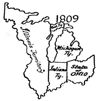
1809
1809

1816
1816
On the eleventh of January, 1805, an act of Congress was approved, erecting the Territory of Michigan out of “all that part of the Indiana Territory which lies north of a line drawn east from the southerly bend, or extreme, of Lake Michigan, until it shall intersect Lake Erie, and east of a line drawn from the said southerly bend through the middle of said lake to its northern extremity, and thence due north to the northern boundary of the United States.” In short, the present southern peninsula of Michigan had a southern boundary as established by the Ordinance of 1787, and all that portion of the Upper Peninsula lying east of the meridian of Mackinac. Congress had admitted Ohio to the Union with a tacit recognition of the northern boundary laid down in her constitutional proviso. Geographical knowledge of the West was still so vague that this conflict of boundaries had been overlooked, and Michigan Territory was allowed a southern limit which overlapped the territory assigned to Ohio. Thus, when the southerly bend of Lake Michigan became known, a serious boundary dispute arose. Michigan claimed the ordinance was a compact which could not be broken by Congress, except by common consent; but Ohio clung to the strip of country which the constitution-makers at Chillicothe had secured for her in the eleventh hour. The wedge shaped strip in dispute averaged six miles in width, across Ohio, embraced 468 square miles, and included Toledo and the mouth of the Maumee River. May 20, 1812, Congress passed an act to determine the boundary; but owing to the impending war with Great Britain, the lines were not run until 1818, and then not satisfactorily. July 14, 1832, another act of Congress[71] for the settlement of the northern limit of Ohio was passed. The situation of the compact had further complicated the territorial boundary when Congress attached the northeastern part of Louisiana purchase to Michigan Territory for temporary purposes of government.
On January 11, 1805, Congress approved an act creating the Territory of Michigan from “all that part of the Indiana Territory which lies north of a line drawn east from the southern bend, or extreme, of Lake Michigan, until it intersects Lake Erie, and east of a line drawn from the southern bend through the middle of the lake to its northern end, then due north to the northern boundary of the United States.” In short, the current southern peninsula of Michigan had a southern boundary set by the Ordinance of 1787, and all of the Upper Peninsula east of the meridian of Mackinac. Congress had admitted Ohio into the Union while implicitly acknowledging the northern boundary defined in her constitutional provisions. Geographic knowledge of the West was still so unclear that this boundary conflict went unnoticed, allowing Michigan Territory to have a southern limit that overlapped the territory assigned to Ohio. Thus, when the southern bend of Lake Michigan was recognized, a serious boundary dispute arose. Michigan argued that the ordinance was a compact that couldn’t be broken by Congress unless there was mutual agreement; but Ohio held onto the land that the constitution-makers in Chillicothe had secured for her at the last moment. The disputed wedge-shaped area was about six miles wide, covered 468 square miles, and included Toledo and the mouth of the Maumee River. On May 20, 1812, Congress passed an act to define the boundary; however, due to the looming war with Great Britain, the lines weren’t surveyed until 1818, and even then it was unsatisfactory. On July 14, 1832, another act of Congress[71] was passed to settle the northern limit of Ohio. The situation of the compact further complicated the territorial boundary when Congress attached the northeastern part of the Louisiana Purchase to Michigan Territory for temporary government purposes.

1818
1818
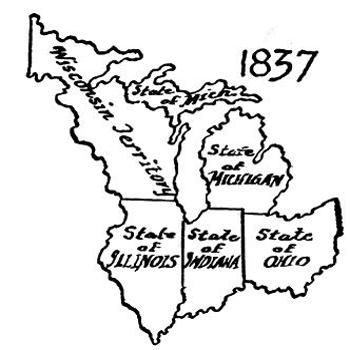
1837
1837
By that time Michigan had begun to urge her claims to statehood, insisting on the southern boundary prescribed for the fourth and fifth states by the ordinance. The state of Virginia, as the chief donor of land, was asked to intercede in behalf of Michigan. Virginia officials were in accord with Michigan’s contention, but failed to produce any effect on Congress, to whose dominant party the political sympathy of the actual state of Ohio was more important than the good-will of the prospective state of Michigan. Without waiting for an enabling act, a convention held at Detroit in May and June, 1835, adopted a state constitution for submission to Congress, demanding entry into the Union, “in conformity to the fifth article of the ordinance.” The boundaries sought were those established by the fifth article. That summer there were a few disturbances in the disputed territory, and some gunpowder was harmlessly wasted. In December, President Andrew Jackson laid the matter before Congress in a special message. Congress quietly determined to arbitrate the quarrel by giving the disputed tract to Ohio and offering Michigan the whole of what is today her Upper Peninsula. However, Michigan did not want this supposedly barren and worthless country to the northwest, and protested against what was deemed an outrage. It was declared that Michigan had no interest in the north peninsula, and was separated from it by natural barriers for one-half of the year. It was further pointed out that the upper peninsula rightfully belonged to the fifth state to be formed out of the[72] Northwest Territory. But Congress demanded the settlement of this dispute before the admission of Michigan into the Union. In September, 1836, a state convention, called for the sole purpose of deciding the question, rejected the proposition on the ground that Congress had no right to annex such a condition, according to the terms of the ordinance. A second convention, however, approved it on December 15 of the same year, and Congress at once accepted this decision as final. Thus Michigan came into the Union on January 22, 1837, with the same boundaries which she possesses today.
By that time, Michigan had started pushing for statehood, insisting on the southern boundary set for the fourth and fifth states by the ordinance. Virginia, as the main donor of land, was asked to support Michigan's case. Virginia officials agreed with Michigan's claim but couldn't get Congress to act, as the interests of the politically influential state of Ohio took precedence over those of the future state of Michigan. Without waiting for an enabling act, a convention held in Detroit in May and June 1835 adopted a state constitution to present to Congress, demanding entry into the Union “in accordance with the fifth article of the ordinance.” The boundaries sought were those defined by the fifth article. That summer, there were a few skirmishes in the disputed area, and some gunpowder was wasted without consequence. In December, President Andrew Jackson presented the issue to Congress in a special message. Congress quietly decided to resolve the dispute by giving the contentious land to Ohio and offering Michigan the entire area that is now her Upper Peninsula. However, Michigan was not interested in this seemingly barren and worthless land to the northwest and protested against what they considered an insult. It was stated that Michigan had no interest in the north peninsula, which was separated from it by natural barriers for half the year. It was also highlighted that the upper peninsula rightfully belonged to the fifth state to be formed from the[72] Northwest Territory. But Congress insisted that this dispute had to be settled before Michigan could join the Union. In September 1836, a state convention specifically called to address the issue rejected the proposition, arguing that Congress had no right to impose such a condition based on the ordinance's terms. However, a second convention approved it on December 15 of the same year, and Congress immediately accepted this decision as final. Thus, Michigan became part of the Union on January 22, 1837, with the same boundaries that she has today.
The creation of Michigan Territory in 1805 had left Indiana Territory with the Mississippi River as its western border, the Ohio River as its southern, the international boundary line and the south line of Michigan as its northern, while its eastern limits were the west line of Ohio, the middle of Lake Michigan and the meridian of Mackinac. This included the present states of Indiana, Illinois, Wisconsin, part of Minnesota, and the greater part of the Michigan upper peninsula.
The establishment of Michigan Territory in 1805 left Indiana Territory with the Mississippi River as its western border, the Ohio River to the south, the international border and the southern line of Michigan to the north, and the western edge of Ohio, the middle of Lake Michigan, and the meridian of Mackinac as its eastern boundaries. This area included what are now the states of Indiana, Illinois, Wisconsin, part of Minnesota, and most of Michigan's Upper Peninsula.
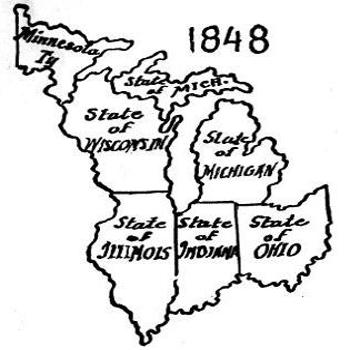
1848
1848
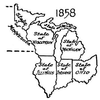
1858
1858
The next division was ordained by act of Congress, approved February 3, 1809, when that portion of Indiana Territory lying west of the lower Wabash River and the meridian of Vincennes north of the Wabash became the Territory of Illinois. Indiana was thus left with her present boundaries, except that she owned a funnel-shaped strip of water and of land just west of the middle of Lake Michigan, between the Vincennes meridian and what was then western boundary of Michigan Territory, including that part of the present upper Michigan peninsula between the meridians of Mackinac and Vincennes, and her northern boundary was ten miles south of the present state boundary.
The next division was established by an act of Congress, approved on February 3, 1809, when the part of the Indiana Territory west of the lower Wabash River and north of the Wabash along the Vincennes meridian became the Territory of Illinois. As a result, Indiana was left with its current boundaries, except for a funnel-shaped strip of water and land just west of the middle of Lake Michigan, between the Vincennes meridian and what was then the western boundary of the Michigan Territory. This included the section of the present upper Michigan peninsula between the Mackinac and Vincennes meridians, and Indiana's northern boundary was ten miles south of the current state boundary.
When Indiana was admitted to the Union, December 11, 1816, by act approved April 19, 1816, her northern boundary was established by Congress on a line running due east of a point in the middle of Lake Michigan ten miles north of the southern extreme of the lake. This again was a flagrant violation of the ordinance, with the excuse that Indiana must be given a share of the lake coast. Since there were then no important harbors or towns involved, Michigan made no serious objection to this encroachment on her territory.
When Indiana joined the Union on December 11, 1816, by an act approved on April 19, 1816, Congress set her northern boundary along a line running directly east from a point in the middle of Lake Michigan that is ten miles north of the southern tip of the lake. This was yet another blatant violation of the ordinance, justified by the claim that Indiana needed access to the lake coast. Since there were no significant harbors or towns affected at the time, Michigan didn't make any serious objections to this encroachment on its territory.
The contraction of the northern boundaries of Indiana left the previously mentioned strip of water in Lake Michigan and the northern peninsula country literally a “No Man’s Land.” States and territories had been formed around it, but this rich section of ore and pine lands was left for a while unclaimed.
The shrinking of Indiana's northern border left the previously mentioned stretch of water in Lake Michigan and the northern peninsula area essentially a "No Man's Land." States and territories had been established around it, but this rich region of ore and pine forests remained unclaimed for some time.
The act of April 18, 1818, enabling Illinois to become a state, cut down her territory to its present limits. The northern boundary of Illinois was fixed at 42° 30´, which is over 61 miles north of the southern bend of Lake Michigan, the northern boundary prescribed by the ordinance for the fourth and southern boundary of the fifth states to be formed. What later became Wisconsin was thereby deprived of 8,500 square miles of rich agricultural and mining country and numerous lake ports. This was done through the manipulation of Nathaniel Pope, Illinois’ delegate in Congress at that time. Pope argued that Illinois must become intimately connected with the growing commerce of the northern lakes, or else her commercial relations upon the rivers to the south might cause her to join a southern confederacy in case the Union were disrupted. Illinois became a state December 3, 1818. Congress assumed the right to govern and divide the territory in the Northwest to suit itself, regardless of the solemn compact of 1787, and there seemed nothing to do but submit. The future proved that Michigan had been more than repaid for the loss of the Ohio border strip when she acquired the northern peninsula. However, Wisconsin lost this tract of territory which belongs to her geographically, and also the southern part of the state, which had been contemplated by the ordinance.
The act of April 18, 1818, allowed Illinois to become a state, reducing its territory to its current boundaries. The northern border of Illinois was set at 42° 30', which is over 61 miles north of the southern bend of Lake Michigan; this was the northern boundary established by the ordinance for the fourth state and the southern boundary of the fifth state to be created. As a result, what later became Wisconsin lost 8,500 square miles of fertile agricultural and mining land, along with several lake ports. This change was orchestrated by Nathaniel Pope, Illinois’ delegate in Congress at the time. Pope argued that Illinois needed to be closely linked to the growing commerce of the northern lakes; otherwise, its trade relations with the southern rivers could lead it to join a southern confederacy if the Union fell apart. Illinois became a state on December 3, 1818. Congress asserted its right to manage and divide the Northwest Territory as it saw fit, ignoring the solemn agreement from 1787, and there was little recourse but to accept it. Ultimately, Michigan benefited more than it lost when it gained the northern peninsula, but Wisconsin missed out on this territory that rightfully belonged to it geographically, as well as the southern part of the state that was previously envisioned by the ordinance.
By act of June 12, 1838, Congress still further contracted the limits of Wisconsin Territory by adding the trans-Mississippi tract she had “inherited” from Michigan Territory to the new Territory of Iowa. However, this was in accordance with an earlier design when the northern Louisiana purchase country between the Mississippi and Missouri Rivers was attached to Michigan Territory for purposes of temporary government.
By the act of June 12, 1838, Congress further reduced the boundaries of the Wisconsin Territory by transferring the area west of the Mississippi River that it had “inherited” from the Michigan Territory to the new Territory of Iowa. However, this was in line with an earlier plan when the northern Louisiana purchase area between the Mississippi and Missouri Rivers was added to Michigan Territory for temporary governance.
Wisconsin remained so bounded until the act of Congress approved August 6, 1846, enabled her people to form a state constitution. Settlements had now been established along the upper Mississippi and in the St. Croix Valley. While this area had been part of the original Northwest[74] Territory, and was then part of Wisconsin Territory, it was far removed from the bulk of settlement in southern and eastern Wisconsin, and rather than be so remote from the rest of the state population, the settlers desired to join the new Territory of Minnesota, which was to be formed west of the Mississippi. They brought strong influences to bear in Congress, and an enabling act gave Wisconsin practically the same northwestern boundary that she has today—from the first rapids of the St. Louis River due south to the St. Croix River and thence to the Mississippi. This cut off an area of 26,000 more square miles from Wisconsin and assigned it to Minnesota. There was a sharp fight over the matter, both in Congress and in the Wisconsin Constitutional Convention of 1846 and 1847-48, with the result that the people of the St. Croix region won. Wisconsin was admitted into the Union, by act approved May 29, 1848.
Wisconsin stayed that way until the Congressional act approved on August 6, 1846, allowed its residents to create a state constitution. Settlements had by then been established along the upper Mississippi and in the St. Croix Valley. Although this area was part of the original Northwest[74] Territory and later part of the Wisconsin Territory, it was quite distant from the majority of settlements in southern and eastern Wisconsin. To avoid being so isolated from the state's population, the settlers wanted to join the new Territory of Minnesota, which was to be created west of the Mississippi. They exerted significant pressure on Congress, and an enabling act granted Wisconsin nearly the same northwestern boundary it has today—from the first rapids of the St. Louis River straight south to the St. Croix River and then to the Mississippi. This arrangement removed an additional 26,000 square miles from Wisconsin and assigned it to Minnesota. There was intense debate over this issue, both in Congress and during the Wisconsin Constitutional Convention of 1846 and 1847-48, resulting in a victory for the people of the St. Croix region. Wisconsin was admitted into the Union by act approved on May 29, 1848.
The remaining portion of the original Northwest Territory west of Wisconsin finally became a part of the Territory of Minnesota, admitted as a state May 11, 1858.
The rest of the original Northwest Territory west of Wisconsin eventually became part of the Territory of Minnesota, which was admitted as a state on May 11, 1858.
Chapter 7
THE IMPORTANCE OF THE ORDINANCE OF 1787
The name “Old Northwest” implies that the five states included in it share a common historical and social background. Between its southern end, which looks down upon the beautiful Ohio, and its northern extremity, lapped by the blue waters of Huron and Superior, there are wide variations of geographic and economic conditions; yet the teeming millions who now inhabit this region are conscious of an identity of interests, and of a common outlook upon life, which gives to this section an individuality as distinct as that possessed by the people of New England, or of the Old South.
The term "Old Northwest" suggests that the five states within it have a shared historical and social background. From its southern edge, overlooking the beautiful Ohio River, to its northern boundary, bordered by the blue waters of Lakes Huron and Superior, there are significant differences in geography and economic conditions; however, the vibrant millions living in this region feel a shared identity and a common perspective on life, which grants this area a uniqueness as distinct as that of the people in New England or the Old South.
Any explanation of this individuality leads inevitably to the Ordinance of 1787. As mountain peaks overtop the surrounding plain, a few great legislative acts in our history tower above the vast body of statutes which fill the books in our law libraries. Magna Charta, extorted from reluctant King John at Runnymede 700 years ago, is one such document; the Quebec Act of 1774, fateful for the future of Canada and the United States, is another. Of like character are our Federal Constitution, and the Ordinance of 1787, both drafted in the same year; one for the government of the American nation, the other for the government of the land lying north and west of the Ohio River.
Any explanation of this individuality inevitably leads to the Ordinance of 1787. Just as mountain peaks rise above the surrounding plains, a few significant legislative acts in our history stand out above the vast number of laws that fill the shelves of our law libraries. Magna Carta, forced from a reluctant King John at Runnymede 700 years ago, is one such document; the Quebec Act of 1774, pivotal for the future of Canada and the United States, is another. Similarly important are our Federal Constitution and the Ordinance of 1787, both created in the same year; one for governing the American nation, and the other for overseeing the land north and west of the Ohio River.
The Old Northwest was chiefly a wilderness in 1787, but it was not a vacant wilderness. Everywhere were the native red men, who quite naturally viewed the country as their own, to be defended to the last extremity of their power. At many points—Detroit, Maumee Rapids, Fort Wayne, Vincennes, Kaskaskia, Cahokia, St. Joseph, Prairie du Chien, Green Bay, and Mackinac, to mention a few—were civilized communities which had been founded by the French during the century which ended with the English Conquest of Canada in 1760. Following this, British officials and army officers, traders and adventurers, had entered the western country, and in many instances had inter-married with the older French and Indian population. Although the Treaty of Paris of 1783 had given the West to the new United States, with the Great Lakes and the Mississippi as its northern and western boundaries, the close of[76] the Revolution found Great Britain and the Indians in actual possession of all but the southern tip of the Old Northwest, and this possession she did not surrender until the summer of 1796.
The Old Northwest was mainly a wilderness in 1787, but it wasn’t empty. Native Americans were everywhere, and understandably, they viewed the land as their own, which they were determined to protect with all their might. There were also established communities at various locations—Detroit, Maumee Rapids, Fort Wayne, Vincennes, Kaskaskia, Cahokia, St. Joseph, Prairie du Chien, Green Bay, and Mackinac, to name a few—that had been created by the French during the century that ended with the British takeover of Canada in 1760. After that, British officials, army officers, traders, and adventurers moved into the western region and often intermarried with the existing French and Indian populations. Although the Treaty of Paris in 1783 had assigned the West to the new United States, with the Great Lakes and the Mississippi marking its northern and western borders, by the end of the Revolution, Great Britain and the Indians still controlled almost all of the Old Northwest, except for its southern tip, and they held onto it until summer 1796.
Thus before settlers from the seaboard colonies could occupy the country north of the Ohio, the British government must be expelled from it, and the Indian tribes must be conquered by the United States. The leaders who formed the Ohio Company were substantial New Englanders, many of whom had been officers in the Revolutionary War. They were familiar from infancy with the New England system of local government, and while they were ready to remove to the western country, to develop new homes in the wilderness, they had no thought of abandoning the shelter of organized government. South of the Ohio, settlers had moved into the western country on their individual responsibility, depending upon Virginia and their own resources for protection against savages and wilderness alike. This had been possible because the Kentucky country was not only a rich land of mild climate, but because it had long been a vacant wilderness, where no Indians lived, and no foreign government exercised jurisdiction. So the Boones and Kentons, and their comrades, had moved in before asking permission or protection from any civilized government. The New Englanders, on the contrary, had occupied the wilderness by organized communities, and from ancient habit had organized new towns as fast as they pushed the line of frontier settlement westward and northward. The Indians in the Ohio country were determined to keep the Americans out of it, and they enjoyed the sympathy and support of the British officials. Thus there was every reason why the intruding settlers should insist upon having an organized government go with them into the Northwest.
Before settlers from the coastal colonies could occupy the land north of the Ohio River, the British government needed to be removed, and the Indian tribes had to be defeated by the United States. The leaders who created the Ohio Company were upstanding New Englanders, many of whom had served as officers in the Revolutionary War. They were accustomed from a young age to the New England system of local governance, and while they were eager to move to the western territories to create new homes in the wilderness, they had no intention of giving up the benefits of organized government. South of the Ohio, settlers had ventured into the western territories on their own initiative, relying on Virginia and their own means for protection against both Native Americans and the wild landscape. This was feasible because Kentucky was not only rich land with a mild climate but also had long been an uninhabited wilderness, where no Native Americans resided and no foreign government claimed authority. Therefore, figures like the Boones and Kentons, along with their peers, settled there without seeking permission or protection from any established government. In contrast, the New Englanders occupied the wilderness through organized communities, and as was their custom, they formed new towns as quickly as they expanded the frontier settlement westward and northward. The Native Americans in the Ohio region were determined to keep Americans out, and they had the support and sympathy of British officials. Thus, there was every reason for the incoming settlers to demand an organized government to accompany them into the Northwest.
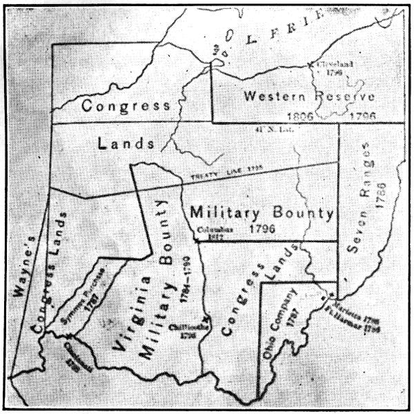
LAND SURVEYS IN OHIO WITH EARLY POSTS AND SETTLEMENTS
LAND SURVEYS IN OHIO WITH EARLY POSTS AND SETTLEMENTS
So their spokesman went to New York, and persuaded the Confederation Congress to give them the government they wished, and the Ordinance of 1787 was passed. It has been described in earlier chapters, and the purpose of this final section is to show how it influenced the future development of the Old Northwest, and the United States.
So their spokesperson went to New York and convinced the Confederation Congress to grant them the government they wanted, leading to the passing of the Ordinance of 1787. This has been discussed in earlier chapters, and the goal of this final section is to illustrate how it impacted the future development of the Old Northwest and the United States.
The object of the Ordinance is fully stated in its title, “An Ordinance for the Government of the Territory of the United States Northwest of the Ohio River.” It contains two principal parts; the first describes the actual scheme of the government to be erected, while the second contains six articles which are declared to be a “compact” between the people of the original states and the people of the Northwest Territory. At that time the word “compact” was applied to the most solemn agreement known to political science, and the six articles of the present one were to “forever remain unalterable,” unless changed by the common consent of the two parties concerned in it.
The purpose of the Ordinance is clearly outlined in its title, “An Ordinance for the Government of the Territory of the United States Northwest of the Ohio River.” It has two main parts; the first outlines the actual plan for the government to be established, while the second includes six articles that are described as a “compact” between the people of the original states and the people of the Northwest Territory. At that time, the term “compact” referred to the most serious agreement recognized in political science, and the six articles in this case were meant to “forever remain unchanged,” unless modified by the mutual agreement of both parties involved.
The thirteen colonies, which in 1776 declared their independence from England, all lay east of the Alleghany Mountains, with their settled portions extending barely two hundred miles inland from the seashore. Today our country extends from ocean to ocean, a distance of three thousand miles. It was the governmental conception which first found concrete expression in the Ordinance of 1787 which made possible this vast westward expansion of our country, and its development from a union of thirteen seaboard states into a continent-wide nation of forty-eight.
The thirteen colonies, which declared their independence from England in 1776, were all located east of the Alleghany Mountains, with their settled areas reaching only about two hundred miles inland from the coast. Today, our country stretches from ocean to ocean, covering three thousand miles. It was the government idea that first took concrete shape in the Ordinance of 1787, which enabled this massive westward expansion of our nation and its growth from a union of thirteen coastal states into a country spanning the entire continent with forty-eight states.
It came about this way: Before the American Revolution, colonies were universally regarded as dependencies, to be governed by the mother country for the promotion of its own advantage. After the conquest of Canada, the British ministry decided to maintain a standing army in America, and since the colonies were to be protected by it, the ministry determined that they should be taxed to support it. The colonists, however, refused to submit to such taxation, and after a long period of argument and debate, made good their refusal by waging a successful war against their king. This success marked the death of the old British Empire, and led directly to one of the most momentous political discoveries in human history.
It happened like this: Before the American Revolution, the colonies were seen as dependencies, governed by the mother country for its own benefit. After conquering Canada, the British government decided to keep a standing army in America, and since the colonies were to be protected by it, the government determined they should be taxed to support it. The colonists, however, refused to accept such taxes, and after a long period of argument and debate, proved their point by successfully waging war against their king. This victory marked the end of the old British Empire and directly led to one of the most significant political discoveries in human history.
The colonists had refused to be treated any longer as mere dependents, subject to the control of a distant parliament, in which they were not represented. But even before independence had been won, they found themselves face to face with the same problem, how to govern a dependency, which had baffled the wit of the British ministry. Some of the colonies had claims to portions of land west of the Alleghanies. Other colonies had none, and Maryland in particular demanded that all should share in the[78] ownership of the western country which had been won by the “common blood and treasure” of all the colonies.
The colonists refused to be treated any longer as mere dependents, subject to the control of a distant parliament where they had no representation. But even before they achieved independence, they faced the same issue, how to govern a dependency, that had puzzled the British government. Some colonies claimed parts of land beyond the Alleghanies. Other colonies had no claims, and Maryland, in particular, insisted that everyone should share in the[78] ownership of the western territory that had been secured through the “common blood and treasure” of all the colonies.

“No colony in America was ever settled under such favorable auspices as that which has just commenced at the Muskingum. I know most of the men personally, and there never were men better calculated to promote the welfare of such a community.”—George Washington.
No colony in America was ever established under such favorable conditions as the one that has just begun at the Muskingum. I know most of the men personally, and there has never been a better group of individuals suited to promote the well-being of such a community.—George Washington
“—that ordinance was constantly looked to whenever a new territory was to become a state. Congress always traced their course by the Ordinance of 1787.”—Abraham Lincoln.
“—that ordinance was always referred to whenever a new territory was about to become a state. Congress consistently followed the guidelines set by the Ordinance of 1787.”—Abraham Lincoln.
The debate over this issue went on for several years in the Continental Congress, Maryland, meanwhile, stoutly refusing to accept any federal government until her demand concerning the western country should be met. Out of the long debate was gradually evolved a new political conception for the government of dependencies. The states having claims to lands in the western wilderness ceded them to the general government, to be administered for the common benefit of all; and Congress solemnly pledged that the country thus given to the nation should be organized into new states, which would be admitted to the Union on a basis of equality with the existing states.
The debate over this issue went on for several years in the Continental Congress, with Maryland steadfastly refusing to accept any federal government until her demand regarding the western territories was addressed. From this lengthy discussion, a new political idea for governing territories gradually emerged. The states with claims to land in the western wilderness ceded those lands to the federal government, to be managed for the benefit of everyone. Congress made a formal promise that this land given to the nation would be organized into new states, which would be admitted to the Union on an equal basis with the existing states.
This program for the government of America’s own colonial domain eliminated at a single stroke the grievance which had driven the older colonies into rebellion against their king and country. For their complaint,[79] at bottom, was that they were regarded as politically inferior to their countrymen at home, subject to be governed forever by the latter, without regard to their own views or desires. The American program said, in effect, to the western colonists: “While you are few in numbers, strangers to one another, and menaced by hostile forces outside yourselves, the nation will govern and protect you, as a parent governs and protects his child; but as soon as you reach a state of maturity where you can do these things for yourselves, you will be admitted to the union of states, with the same powers and privileges that all the rest enjoy.”
This program for the government of America's own colonial territory quickly resolved the issue that had pushed the older colonies to rebel against their king and country. Their main complaint[79] was that they were seen as politically inferior to their fellow citizens back home, forced to be governed by them without regard for their own opinions or desires. The American program essentially told the western colonists: “Although you are few in number, unfamiliar with one another, and threatened by external dangers, the nation will govern and protect you just as a parent does for a child; but once you reach a stage of maturity where you can handle these responsibilities yourself, you will be welcomed into the union of states, with the same rights and privileges as everyone else.”
“In truth the Ordinance of 1787 was so wide reaching in its effect, was drawn in accordance with so lofty a morality and such far seeing statesmanship, and was fraught with such weal for the nation, that it will ever rank among the foremost of American State papers.”—Theodore Roosevelt.
In reality, the Ordinance of 1787 had such a broad impact, was crafted with such high moral standards and visionary leadership, and was so beneficial for the nation that it will always be considered one of the most important documents in American history. —Teddy Roosevelt.
“—with respect to that third great charter—the Northwest Ordinance. The principles therein embodied served as the highway, broad and safe, over which poured the westward march of our civilization. On this plan was the United States built.”—Franklin D. Roosevelt.
“—regarding that third major charter—the Northwest Ordinance. The principles contained within it functioned as the broad and safe route that facilitated the westward expansion of our civilization. The United States was built on this framework.”—FDR
Thus, and only thus, could the American nation ever have been extended “from sea to shining sea.” The great political discovery which made this extension possible was hammered out in the heat of debate over the formation of our first national union, the government of the Confederation, which came into being in 1781. But it was first given concrete application in the Ordinance of 1787, which provided the form of government for the[80] territory northwest of the Ohio River. This principle, unconfined by the boundaries of the Old Northwest, extends to all the continental expansion of the United States; while Great Britain, profiting by the lessons of experience, has granted self-rule to Canada, South Africa, New Zealand, and Australia, and is gradually extending it to India and Egypt.
Thus, and only thus, could the American nation ever have been extended “from sea to shining sea.” The great political discovery that made this extension possible was forged in the heat of debate over the formation of our first national union, the government of the Confederation, which came into being in 1781. But it was first given concrete application in the Ordinance of 1787, which provided the form of government for the[80] territory northwest of the Ohio River. This principle, not limited by the boundaries of the Old Northwest, extends to all the continental expansion of the United States; while Great Britain, learning from experience, has granted self-rule to Canada, South Africa, New Zealand, and Australia, and is gradually extending it to India and Egypt.
The ordinance provided for two stages of government. In the beginning, all political control was entrusted to a governor and three judges, appointed by the federal government, who exercised the supreme executive, legislative, and judicial powers of the territory, and were answerable solely to the President and Congress of the United States. The territory in this first stage was a colony, whose citizens were without the powers of self-government.
The ordinance established two levels of government. Initially, all political authority was given to a governor and three judges, appointed by the federal government, who held the top executive, legislative, and judicial powers of the territory, and were accountable only to the President and Congress of the United States. During this first stage, the territory functioned as a colony, where the citizens did not have self-governance rights.
As soon, however, as there were 5,000 free adult male inhabitants in the territory, the second stage of government was to be set up. This provided for a general assembly of two houses: the members of one elected by the voters; of the other, by a procedure in which both the voters and the national government shared. To resort again to the analogy of the minor child, we may compare the territory in this second stage with a boy of fourteen or fifteen, old enough to govern himself in ordinary matters, but still in need of parental guidance and control whenever more important problems arise. This state of partial self-government was to be terminated whenever the population of any of the future states (for which Article 5 of the compact made provision) should equal 60,000 free inhabitants. At such time the people might frame a state constitution and government, and be admitted to the Union “on an equal footing with the original states in all respects whatever.” The child had now become a man, invested with all the privileges and responsibilities of manhood’s estate.
As soon as there were 5,000 free adult male residents in the territory, the second stage of government would be established. This included a general assembly with two houses: one house's members would be elected by the voters, while the other would be chosen through a process involving both the voters and the national government. To use the analogy of a young person, we can think of the territory at this stage as a boy of fourteen or fifteen—old enough to handle everyday matters but still needing guidance and oversight from parents when bigger issues come up. This level of partial self-governance would end when the population of any future state (as outlined in Article 5 of the compact) reached 60,000 free residents. At that point, the people could create a state constitution and government and be granted admission to the Union on the same terms as the original states. The child had now grown into a man, equipped with all the rights and responsibilities of adulthood.
Turning to the articles of the compact, Article 5 provides that not less than three, nor more than five, states should be formed from the entire territory, and the north-south boundaries of the three were fixed at approximately the present Ohio-Indiana and Indiana-Illinois lines, extended northward to Canada. If Congress should later see fit to do so, however, it might organize either one or two states in that portion of the territory lying north of an east and west line through the southern extreme of Lake Michigan. Congress eventually organized two northern states, but the provision concerning their southern boundary was ignored, and Ohio, Indiana, and Illinois all gained important accessions of territory north of the “Ordinance line,” at the expense, of course, of the two northern states. Although there was much opposition in Michigan and Wisconsin to these changes, in the end the will of Congress prevailed, and the compact of the ordinance with respect to boundaries was disregarded.
Turning to the articles of the compact, Article 5 states that there should be at least three and at most five states formed from the entire territory, with the north-south boundaries of the three set at about the current Ohio-Indiana and Indiana-Illinois lines, extending northward to Canada. However, if Congress later decides to, it could create one or two states in the part of the territory lying north of an east-west line through the southern tip of Lake Michigan. Congress eventually created two northern states, but the rule about their southern boundary was ignored, and Ohio, Indiana, and Illinois all gained significant territory north of the “Ordinance line,” at the expense of the two northern states. Despite considerable opposition in Michigan and Wisconsin to these changes, Congress ultimately had the final say, and the compact of the ordinance regarding boundaries was overlooked.
Thus, the five great commonwealths of the Old Northwest owe their[81] existence, and the approximate location of their boundaries, to the Ordinance of 1787. All were governed as territories on the plan prescribed by the ordinance before their admission to statehood. The territorial period for each was marked by political discord, and numerous complaints were made against the officials the President placed over the territories. Many of these complaints were well-founded, but one would hesitate to affirm that any other form of government could have been devised to operate better. The inhabitants always had the consolation of knowing that their period of political dependence was but temporary, and that as soon as they should have the necessary population they would be invested with the powers and responsibilities of statehood.
Thus, the five major states of the Old Northwest owe their[81] existence, and the general outline of their borders, to the Ordinance of 1787. All were governed as territories according to the plan laid out by the ordinance before they became states. The territorial period for each was marked by political conflicts, and many complaints were raised against the officials appointed by the President to oversee the territories. Many of these complaints were justified, but it’s hard to say that any other form of government would have done better. The residents always had the reassurance of knowing that their time of political dependence was only temporary, and that as soon as they reached the required population, they would gain the powers and responsibilities of statehood.
We must now note briefly certain matters which are closely associated with the story of the Ordinance of 1787.
We should now briefly mention some issues that are closely related to the story of the Ordinance of 1787.
The corner-stone of our civilization is the institution of private property. Before the Northwest could be settled, the government had to provide for the division of the land into suitable tracts, and its sale to settlers. In 1785 the ordinance creating our national land-survey system was passed, and not long thereafter the first survey of federal lands, that of the Seven Ranges in southeastern Ohio, was begun.
The foundation of our civilization is the idea of private property. Before people could settle in the Northwest, the government had to organize the land into manageable plots and sell them to settlers. In 1785, the law establishing our national land survey system was approved, and shortly after that, the first survey of federal lands, called the Seven Ranges in southeastern Ohio, was started.
Beginning in 1790, the government waged a five-year war in Ohio and Indiana, resulting in the overthrow of the Indian Confederacy. In 1796 the British government withdrew its garrisons, and its de facto government, which had continued until then in all the northern two-thirds of the Old Northwest, ceased to exist. In 1812 the region was reconquered by the British, but their rule this time lasted only a year, when it was ended for all time by the gun-fire of Commodore Perry’s cannon in the battle of Lake Erie. Meanwhile, by a long series of treaties with the Indians, beginning with Anthony Wayne’s Treaty of Greenville in 1795, the red man’s title to the country was quieted. Government surveyors swarmed over the land, preparing it for purchase and occupancy by the oncoming tide of white settlers. Just sixty years after the appearance on the Ohio of the little band of Yankees who founded Marietta, Wisconsin, youngest of the five commonwealths of the Old Northwest, was admitted to the Union of States. The red race had given place to the white; civilization had succeeded barbarism; the wilderness had been transformed into cultivated fields and thriving cities and towns.
Beginning in 1790, the government fought a five-year war in Ohio and Indiana, leading to the downfall of the Indian Confederacy. In 1796, the British government pulled out its garrisons, and its de facto government, which had been in place until then in the northern two-thirds of the Old Northwest, came to an end. In 1812, the British regained control of the region, but this time their rule lasted only a year, ending permanently with the cannon fire of Commodore Perry in the battle of Lake Erie. Meanwhile, through a series of treaties with the Native Americans, starting with Anthony Wayne’s Treaty of Greenville in 1795, the Native American claim to the land was resolved. Government surveyors flooded the area, readying it for purchase and settlement by the incoming wave of white settlers. Just sixty years after the arrival of the small group of Yankees who founded Marietta, Wisconsin, the youngest of the five commonwealths of the Old Northwest, was admitted to the Union. The Native American presence was replaced by white settlers; civilization triumphed over barbarism; the wilderness transformed into cultivated fields and bustling cities and towns.
Certain of the articles of compact between the old states and the new demonstrate the advanced thought of the men who framed the ordinance. The first article guarantees forever complete freedom of religious belief and worship. Probably most Americans accept this precious privilege as they do the air they breathe, without giving any particular thought to its value or how it came to them. Yet even today, in many parts of the[82] civilized world, freedom of religious belief and worship is conspicuously lacking.
Certain articles of the agreement between the old states and the new show the progressive thinking of the people who created the ordinance. The first article guarantees total freedom of religious belief and worship forever. Most Americans likely take this valuable right for granted, like the air they breathe, without considering its significance or how they acquired it. Yet, even today, in many parts of the[82] civilized world, freedom of religious belief and worship is clearly absent.
In other important respects, too, the framers of the ordinance were far in advance of their age—in advance, even, of that more famous body of legislators who framed our national constitution. Included in the articles of compact is a provision guaranteeing the sanctity of private contracts—the first appearance of such a guarantee in any charter of government. This was copied into the United States Constitution, where it became the basis of the vast development of private corporations with which we are today familiar. In 1819 the Supreme Court, in the famous Dartmouth College Case, carried this guarantee to its logical conclusion by ruling that a charter or franchise is a contract, which, once granted by a state legislature or other governing body, cannot be withdrawn.
In other important ways, the creators of the ordinance were way ahead of their time—even more so than the well-known group of lawmakers who drafted our national constitution. The articles of compact include a provision that guarantees the protection of private contracts—the first time such a guarantee appeared in any government charter. This provision was included in the United States Constitution, where it laid the groundwork for the extensive development of private corporations that we know today. In 1819, the Supreme Court, in the well-known Dartmouth College Case, confirmed this guarantee by ruling that a charter or franchise is a contract, which, once granted by a state legislature or other governing authority, cannot be taken back.
Of tremendous portent to our social system of today was the abolition of the age-old law of primogeniture, the concept that the eldest son alone should inherit the real estate of his parents. Thomas Jefferson had long contended in the Virginia legislature for the adoption of this reform, but it remained for the Ordinance of 1787 to make the first legal provision whereby children should share equally the estates of their parents.
The abolition of the long-standing law of primogeniture—where only the eldest son inherited his parents' real estate—had a significant impact on our current social system. Thomas Jefferson had pushed for this change in the Virginia legislature for a long time, but it was the Ordinance of 1787 that finally established the legal framework for children to inherit their parents' estates equally.
Another provision, well in advance of the age, affords perhaps the most notable sentence in the entire document: “Religion, morality, and knowledge, being necessary to good government and the happiness of mankind, schools and the means of education shall forever be encouraged.” In 1787 “schools and the means of education” found very little encouragement over most of the face of the globe. Today, America is dedicated to the ideal of universal education, and nowhere is more liberal encouragement extended to education than in the five states of the Old Northwest.
Another provision, ahead of its time, includes perhaps the most significant sentence in the whole document: “Religion, morality, and knowledge, being necessary for good government and the happiness of humanity, schools and the means of education shall forever be encouraged.” In 1787, “schools and the means of education” received very little support across most of the world. Today, America is committed to the idea of universal education, and there is no place that provides more generous support for education than in the five states of the Old Northwest.
In its original contract with the Ohio Company, Congress agreed to give two townships of land for “the uses of a university.” In 1795, with the ink scarcely dry on General Wayne’s treaty with the red men at Greenville, the “college townships” were located and surveyed. In 1802 the legislature of the Northwest Territory passed an act establishing a university in the village of Athens—the first legislative act passed west of the Alleghany Mountains, for the advancement of higher education. Today, each of the five states not only maintains at public expense a great state university, but the pattern set in 1787 has resulted in a nationwide system of colleges and universities aided by grants of public lands. The principle, here originated, of devoting fixed portions of the public lands to the support of schools and education has produced the broadest plan of universal education in the world, providing thereby the most essential aid to the existence of democratic self-government.
In its original agreement with the Ohio Company, Congress committed to providing two townships of land for “the uses of a university.” In 1795, shortly after General Wayne’s treaty with the Native Americans at Greenville, the “college townships” were established and surveyed. In 1802, the Northwest Territory legislature passed a law to create a university in the village of Athens—the first law passed west of the Alleghany Mountains aimed at advancing higher education. Today, each of the five states not only has a major state university funded by public money, but the framework established in 1787 has led to a nationwide network of colleges and universities supported by grants of public land. The principle introduced here, of dedicating specific portions of public land to support schools and education, has created the most extensive system of universal education in the world, providing crucial support for the maintenance of democratic self-governance.
In still another respect the ordinance expressed a noble ideal, which,[83] unfortunately, was destined not to be realized. At a time when the Indians of the Old Northwest were determined to prevent the Americans from ever entering the country, the ordinance held out to them the doctrine of the Golden Rule; they should ever be treated with the utmost good faith, their rights and liberties should be respected, and “laws founded in justice and humanity” should be enacted for preserving peace and friendship with them. If such an ideal could be generally realized between nations today, it would free a war-oppressed world from the greatest menace which threatens the continued existence of civilized society.
In another way, the ordinance represented a noble ideal that, unfortunately, was not meant to be fulfilled. At a time when the Native Americans in the Old Northwest were resolute in preventing Americans from entering their lands, the ordinance proposed the principle of the Golden Rule; they should always be treated with the utmost good faith, their rights and freedoms should be honored, and “laws based on justice and humanity” should be established to maintain peace and friendship with them. If such an ideal could be widely achieved between nations today, it would liberate a war-torn world from the greatest threat to the survival of civilized society.
Another article in the compact proclaimed navigable waters leading into the Mississippi and the St. Lawrence to be common highways, “forever free” to the people of the United States. It is this guarantee which permits the humblest citizen of our country to use and enjoy the rivers and lakes of the Old Northwest for purposes of recreation and travel—a freedom which, but for this guarantee, would frequently be denied him by individual and corporate owners of real estate.
Another article in the compact declared that the navigable waters flowing into the Mississippi and the St. Lawrence are common highways, "forever free" to the people of the United States. This guarantee allows even the most ordinary citizen of our country to use and enjoy the rivers and lakes of the Old Northwest for recreation and travel—a freedom that, without this guarantee, would often be denied by private and corporate landowners.
One final provision demands our attention. In 1787 the institution of human slavery existed in all but one of the states of the Union. But many humane and far-sighted men recognized its evils, and one in particular, Thomas Jefferson of Virginia, was unwearied in his efforts to abate it. Although Jefferson was not the author of the Ordinance of 1787, it was largely because of his influence that its final article dedicated the Old Northwest—then, of course, the new Northwest—to freedom. “There shall be neither slavery nor involuntary servitude in the said territory ...” the article begins, continuing with certain provisos respecting criminals and fugitives from justice. Several decades were to pass before the soil of the Old Northwest endured its last pollution from the footprints of a slave, but the prohibition proved an effective ban against the widespread expansion of slavery over the territory, and eventually exterminated it here completely. In doing so, the ordinance prepared the way for its ultimate extermination in the nation; for when civil war came and North and South faced each other on the field of battle during four awful years, it was the exuberant might of the free Northwest which decided the issue in favor of permanent Union and human freedom.
One final point deserves our attention. In 1787, human slavery was present in all but one of the states in the Union. However, many compassionate and forward-thinking individuals recognized its wrongs, notably Thomas Jefferson from Virginia, who tirelessly worked to reduce it. While Jefferson didn’t write the Ordinance of 1787, it was largely due to his influence that its last article dedicated the Old Northwest—what we now consider the new Northwest—to freedom. “There shall be neither slavery nor involuntary servitude in the said territory ...” the article begins, followed by specific conditions regarding criminals and fugitives. Several decades would pass before the land of the Old Northwest saw its last trace of slavery, but the ban effectively prevented the widespread spread of slavery in the territory and eventually eliminated it completely. In doing so, the ordinance laid the groundwork for the eventual end of slavery in the nation; when the Civil War erupted and the North and South clashed on the battlefield for four grueling years, it was the energetic strength of the free Northwest that tipped the scales in favor of lasting Union and human freedom.
In 1787 the United States was a feeble confederacy of less than three million souls, almost all of whom dwelt within two hundred miles of the Atlantic seaboard. Today it stretches from sea to sea with a population of nearly 130,000,000. The thirteen original states have increased to forty-eight great and harmonious commonwealths. In the five states of the Old Northwest dwell 26,000,000 people. Mere numbers do not mean everything, however, else China and India would be the world’s foremost nations. The Old Northwest is today the political and industrial heart[84] of the nation and, although the territory comprises but one-twelfth of the land area, one-fifth of the nation’s population lives within its boundaries.
In 1787, the United States was a weak confederation of fewer than three million people, almost all of whom lived within two hundred miles of the Atlantic coast. Today, it stretches from coast to coast with a population of nearly 130 million. The original thirteen states have grown to forty-eight great and united states. In the five states of the Old Northwest, there are 26 million residents. However, sheer numbers aren't everything; otherwise, China and India would be the leading nations in the world. The Old Northwest is now the political and industrial center of the country, and although it makes up only one-twelfth of the land area, one-fifth of the nation’s population resides within its borders.[84]
The time that has elapsed since 1787 may be spanned by the lives of two elderly men, yet the changes which have been wrought in the Old Northwest since the first feeble American beginnings at Marietta would have staggered the imagination of any man then alive. Here began the political expansion of the United States; here the principles which made possible the development of the nation we know today were first concretely applied. Such is the historical significance of the Ordinance of 1787.
The time that has passed since 1787 can be measured by the lives of two old men, yet the changes that have taken place in the Old Northwest since the early American days at Marietta would have overwhelmed anyone living back then. This was the starting point for the political growth of the United States; it was here that the principles that enabled the development of the nation we know today were first put into action. That is the historical importance of the Ordinance of 1787.
FREE SCHOOLS, FREE CHURCHES, FREE SOIL, FREE MEN
FREE SCHOOLS, FREE CHURCHES, FREE LAND, FREE PEOPLE
Drawn by Mary Brent Davis, Coshocton, Ohio
Illustrated by Mary Brent Davis, Coshocton, Ohio
CONDENSED BIBLIOGRAPHY OF WORKS ON THE ORDINANCE OF 1787 AND THE HISTORY OF THE NORTHWEST TERRITORY
Compiled by
George J. Blazier
Historian to the Commission
Compiled by
George J. Blazier
Historian for the Commission
This bibliography comprises general works relating to the Northwest Territory. To students desiring a more complete reference list, an extended bibliography prepared by the Commission will be sent without charge upon request. For additional works on the subject, and for single and local phases thereof, the reader is also directed to the best bibliographical works as follows:
This bibliography includes general works about the Northwest Territory. Students who want a more complete reference list can request an extended bibliography prepared by the Commission, which will be sent for free. For more works on the topic, as well as specific and local aspects, readers are also directed to the best bibliographical resources as follows:
Bradford, Thomas L.; and Henkels, Stanislaus V. Bibliographer’s manual of American history. Philadelphia, Henkels & Co., 1907-10. 5v.
Bradford, Thomas L.; and Henkels, Stanislaus V. Bibliographer's Manual of American History. Philadelphia, Henkels & Co., 1907-10. 5v.
Channing, Edward; Hart, Albert B.; and Turner, Frederick J. Guide to the study and reading of American history. Rev. and augm. ed. Boston, Ginn & Co., 1912. 650p.
Channing, Edward; Hart, Albert B.; and Turner, Frederick J. Guide to the Study and Reading of American History. Rev. and Augmented Ed. Boston, Ginn & Co., 1912. 650p.
Griffin, Grace G. Writings on American history, 1906-date. New York, Macmillan Co.; Washington, Govt. print. off.; etc., 1908-date. v.13-date published as Supplement to the Annual Report of the American Historical Assn., 1918-.
Griffin, Grace G. Writings on American history, 1906-present. New York, Macmillan Co.; Washington, Govt. print. off.; etc., 1908-present. v.13-present published as Supplement to the Annual Report of the American Historical Assn., 1918-.
Larned, Josephus H., ed. Literature of American history, a bibliographical guide. Boston, A. L. A. pub. board, 1902. 596p. Supplement for 1900 and 1901, ed. by P. P. Wells. 37p. Supplements for 1902, 1903 appeared in series: Annotated titles of books on English and American history. Boston, A. L. A. pub. board. Supplement for 1904. Boston, A. L. A. pub. board.
Larned, Josephus H., ed. Literature of American History, a Bibliographical Guide. Boston, A. L. A. Publishing Board, 1902. 596 pages. Supplement for 1900 and 1901, edited by P. P. Wells. 37 pages. Supplements for 1902 and 1903 appeared in the series: Annotated Titles of Books on English and American History. Boston, A. L. A. Publishing Board. Supplement for 1904. Boston, A. L. A. Publishing Board.
McLaughlin, Andrew C.; Slade, William A.; and Lewis, Ernest D. Writings on American history, 1903. Washington, Carnegie Inst., 1905. 172p.
McLaughlin, Andrew C.; Slade, William A.; and Lewis, Ernest D. Writings on American history, 1903. Washington, Carnegie Inst., 1905. 172p.
Richardson, Ernest C.; and Morse, Anson E. Writings on American history, 1902. Princeton, N. J., Univ. library, 1904. 294p. Same, 1903. Washington, Carnegie Inst., 1905. 172p.
Richardson, Ernest C.; and Morse, Anson E. Writings on American history, 1902. Princeton, N.J., Univ. library, 1904. 294p. Same, 1903. Washington, Carnegie Inst., 1905. 172p.
The reader is directed especially to the publications of the following historical societies whose publications are not specifically listed here:
The reader is especially encouraged to check out the publications from the following historical societies, whose works are not specifically mentioned here:
- American Historical Association.
- Mississippi Valley Historical Association.
- Ohio Valley Historical Association.
- Illinois Catholic Historical Society.
- Illinois State Historical Society.
- Indiana Historical Society.
- Michigan Pioneer and Historical Society.
- Minnesota Historical Society.
- Historical and Philosophical Society of Ohio.
- Ohio State Archaeological and Historical Society.
- Western Reserve Historical Society.
- State Historical Society of Wisconsin.
For information on manuscript collections, address the secretaries of the historical societies listed above.
For details on manuscript collections, contact the secretaries of the historical societies mentioned above.
ABRIDGED BIBLIOGRAPHY
Adams, Henry. History of the United States of America. New York, C. Scribner’s Sons, 1889-91. 9v.
Adams, Henry. History of the United States of America. New York, C. Scribner’s Sons, 1889-91. 9v.
Adams, Herbert B. Maryland’s influence upon land cessions to the United States. Baltimore, Johns Hopkins university, 1885. 102p. (Johns Hopkins university studies in historical and political science. 3rd ser., I) See p. 44-54.
Adams, Herbert B. Maryland's impact on land cessions to the United States. Baltimore, Johns Hopkins University, 1885. 102p. (Johns Hopkins University Studies in Historical and Political Science, 3rd ser., I) See p. 44-54.
Adams, Randolph G. The papers of Lord George Germain; a brief description of the Stopford-Sackville papers is now in the William L. Clements library. Ann Arbor, William L. Clements library, 1928. 46p.
Adams, Randolph G. The papers of Lord George Germain; a short description of the Stopford-Sackville papers is now in the William L. Clements Library. Ann Arbor, William L. Clements Library, 1928. 46p.
Alden, George H. New government west of the Alleghanies before 1780. Madison, Wis., The university, 1879. 74p.
Alden, George H. New government west of the Alleghanies before 1780. Madison, WI, The University, 1879. 74 p.
Alvord, Clarence W. Centennial history of Illinois. Springfield, Ill., Illinois Centennial commission, 1920. 2v. The Mississippi Valley in British politics. Cleveland, Arthur H. Clark Co., 1917. 2v.
Alvord, Clarence W. Centennial History of Illinois. Springfield, IL, Illinois Centennial Commission, 1920. 2 vols. The Mississippi Valley in British Politics. Cleveland, Arthur H. Clark Co., 1917. 2 vols.
Andrews, Israel W. The Northwest territory. Its ordinances and its settlement. (In Magazine of American history, Aug. 1886, v. 16, p. 133-147.)
Andrews, Israel W. The Northwest Territory: Its Ordinances and Its Settlement. (In Magazine of American History, Aug. 1886, v. 16, p. 133-147.)
Avery, Elroy M. History of the United States and its people. Cleveland, Burrows Bros. Co., 1904-10. 7v.
Avery, Elroy M. History of the United States and Its People. Cleveland, Burrows Bros. Co., 1904-10. 7 vols.
Baldwin, James. Conquest of the Old Northwest. New York; Cincinnati, etc. American Bk. Co., 1901. 263p.
Baldwin, James. Conquest of the Old Northwest. New York; Cincinnati, etc. American Book Company, 1901. 263 pages.
Bancroft, George. History of the formation of the Constitution. New York, D. Appleton & Co., 1882. 2v. History of the United States, from the discovery of the continent. Last revision. New York, D. Appleton & Co., 1888. 6v.
Bancroft, George. History of the Formation of the Constitution. New York, D. Appleton & Co., 1882. 2 vols. History of the United States, from the Discovery of the Continent. Last Revision. New York, D. Appleton & Co., 1888. 6 vols.
Barce, Elmore. The Land of the Miamis; an account of the struggle to secure possession of the Northwest from the end of the Revolution until 1812. Fowler, Ind., Benton review shop, 1922. 422p.
Barce, Elmore. The Land of the Miamis; a story about the fight to take possession of the Northwest from the end of the Revolution until 1812. Fowler, Ind., Benton Review Shop, 1922. 422p.
Barrett, Jay A. Evolution of the Ordinance of 1787; with an account of the earlier plans for the government of the Northwest territory. New York, G. P. Putnam’s Sons, 1891. 94p. (University of Nebraska. Depts. of history and economics. Seminary papers, No. 1) Authorities: p. 89-94.
Barrett, Jay A. Evolution of the Ordinance of 1787; with a look at earlier plans for governing the Northwest Territory. New York, G. P. Putnam’s Sons, 1891. 94 pages. (University of Nebraska. Depts. of History and Economics. Seminary Papers, No. 1) Authorities: pages 89-94.
Beer, George L. British Colonial policy, 1754-1765. New York, P. Smith, 1933. 327p.
Beer, George L. British Colonial Policy, 1754-1765. New York, P. Smith, 1933. 327 pages.
Bodley, Temple. George Rogers Clark; his life and public service. Boston & New York, Houghton Mifflin Co., 1926. 425p.
Bodley, Temple. George Rogers Clark; his life and public service. Boston & New York, Houghton Mifflin Co., 1926. 425p.
Bond, Beverley W. The civilization of the Old Northwest; a study of political, social, and economic development, 1788-1812. New York, Macmillan Co., 1934. 543p.
Bond, Beverley W. The civilization of the Old Northwest; a study of political, social, and economic development, 1788-1812. New York, Macmillan Co., 1934. 543p.
Boyd, Thomas A. Mad Anthony Wayne. New York, London, C. Scribner’s Sons, 1929. 351p.
Boyd, Thomas A. Mad Anthony Wayne. New York, London, C. Scribner’s Sons, 1929. 351p.
Burnet, Jacob. Notes on the early settlement of the Northwest territory. New York, D. Appleton & Co. Cincinnati, Derby, Bradley & Co., 1847. 501p.
Burnet, Jacob. Notes on the early settlement of the Northwest Territory. New York, D. Appleton & Co. Cincinnati, Derby, Bradley & Co., 1847. 501p.
Carter, Clarence E. Great Britain and the Illinois country, 1763-1774. Washington, American Historical Assn., 1910. 223p.
Carter, Clarence E. Great Britain and the Illinois Country, 1763-1774. Washington, American Historical Assn., 1910. 223p.
Chaddock, Robert E. Ohio before 1850; a study of the early influence of Pennsylvania and southern populations in Ohio. Ph. D. thesis, Columbia Univ., 1908. 155p.
Chaddock, Robert E. Ohio before 1850; a study of the early influence of Pennsylvania and southern populations in Ohio. Ph.D. thesis, Columbia University, 1908. 155 pages.
Channing, Edward. History of the United States. New York, Macmillan Co., 1927-30. 6v.
Channing, Edward. History of the United States. New York, Macmillan Co., 1927-30. 6 volumes.
Coles, Edward. History of the Ordinance of 1787. Read before the Historical society of Pennsylvania, June 9, 1856. Philadelphia, Press of the Society, 1856. 33p.
Coles, Edward. History of the Ordinance of 1787. Presented to the Historical Society of Pennsylvania, June 9, 1856. Philadelphia, Press of the Society, 1856. 33p.
Cutler, William P. The Ordinance of July 13, 1787, for the government of the territory northwest of the river Ohio. With an appendix containing valuable historical facts. Marietta, O., E. R. Alderman & Sons, printers (1887?) 48p. Read before the Ohio State Archaeological and historical society, Feb. 23, 1887. Life, journals and correspondence of Rev. Manasseh Cutler, LL.D. By his grandchildren. Cincinnati, R. Clarke & Co., 1888. 2v. The Ordinance of 1787, and its history, by Peter Force, v. 2, p. 407-427.
Cutler, William P. The Ordinance of July 13, 1787, for the governance of the territory northwest of the Ohio River. With an appendix that includes important historical information. Marietta, O., E. R. Alderman & Sons, printers (1887?) 48p. Presented to the Ohio State Archaeological and Historical Society, Feb. 23, 1887. Life, journals, and correspondence of Rev. Manasseh Cutler, LL.D. By his grandchildren. Cincinnati, R. Clarke & Co., 1888. 2v. The Ordinance of 1787 and its history, by Peter Force, v. 2, p. 407-427.
Dane, Nathan. Letters of Nathan Dane concerning the Ordinance of 1787. Indianapolis, Indiana historical society, 1831. 7p.
Dane, Nathan. Letters of Nathan Dane about the Ordinance of 1787. Indianapolis, Indiana Historical Society, 1831. 7p.
Darlington, William M., ed. Christopher Gist’s journals. Pittsburgh, J. R. Weldin & Co. 1893. 296p.
Darlington, William M., ed. Christopher Gist’s Journals. Pittsburgh, J. R. Weldin & Co. 1893. 296 pages.
Detroit, Public Library. The Burton historical collection of the Detroit Public Library. Detroit, 1928? 16p.
Detroit, Public Library. The Burton Historical Collection of the Detroit Public Library. Detroit, 1928? 16p.
Dillon, John B. History of the early settlement of the Northwestern territory. Indianapolis, Ind., Sheets & Braden, 1854. 456p.
Dillon, John B. History of the early settlement of the Northwestern territory. Indianapolis, IN, Sheets & Braden, 1854. 456p.
Doddridge, Joseph. Notes on the settlement and Indian wars of the western parts of Virginia and Pennsylvania from 1763 to 1783. Pittsburgh, Pa. J. S. Ritenour & W. T. Lindsey, 1912. 320p.
Doddridge, Joseph. Notes on the settlement and Indian wars of the western parts of Virginia and Pennsylvania from 1763 to 1783. Pittsburgh, PA. J. S. Ritenour & W. T. Lindsey, 1912. 320p.
Donaldson, Thomas. The public domain. Washington, Govt. print. off., 1884. 1343p. The Ordinance of 1787: p. 146-163.
Donaldson, Thomas. The Public Domain. Washington, Government Printing Office, 1884. 1343 pages. The Ordinance of 1787: pages 146-163.
Downes, Randolph Chandler. Frontier Ohio, 1788-1803. Columbus, Ohio, Ohio state archaeological and historical society, 1935. 280p. (Ohio historical collections, v. 3) Bibliography: p. 253-268.
Downes, Randolph Chandler. Frontier Ohio, 1788-1803. Columbus, Ohio, Ohio State Archaeological and Historical Society, 1935. 280 p. (Ohio Historical Collections, v. 3) Bibliography: p. 253-268.
Dunn, Jacob P. Indiana, a redemption from slavery. Boston and New York, Houghton Mifflin Co., 1892. 453p. (American commonwealths, ed. by H. E. Scudder. v. 12) See p. 177-218.
Dunn, Jacob P. Indiana, a redemption from slavery. Boston and New York, Houghton Mifflin Co., 1892. 453p. (American commonwealths, ed. by H. E. Scudder. v. 12) See p. 177-218.
English, William H. Conquest of the Northwest, 1778-1783; and life of Gen. George Rogers Clark. Indianapolis, Ind., & Kansas City, Mo., Bowen-Merrill Co., 1896. 2v.
English, William H. Conquest of the Northwest, 1778-1783; and the life of Gen. George Rogers Clark. Indianapolis, IN, & Kansas City, MO, Bowen-Merrill Co., 1896. 2v.
Farrand, Max. Development of the United States from colonies to a world power. Boston & New York, Houghton Mifflin Co., 1918. 355p. The legislation of Congress for the government of the organized territories of the United States, 1789-1895. Newark, N. J. W. A. Baker, printer, 1896. 101p. See p. 3-12. The United States. New York, Century Co., 1920-. 3v.
Farrand, Max. Development of the United States from colonies to a world power. Boston & New York, Houghton Mifflin Co., 1918. 355p. The legislation of Congress for the government of the organized territories of the United States, 1789-1895. Newark, N. J. W. A. Baker, printer, 1896. 101p. See p. 3-12. The United States. New York, Century Co., 1920-. 3v.
Fiske, John. Critical period of American history, 1783-1789. Boston & New York, Houghton Mifflin Co., 1888. 368p.
Fiske, John. The Critical Period of American History, 1783-1789. Boston & New York, Houghton Mifflin Co., 1888. 368 pages.
Gabriel, Ralph, ed. Pageant of America: a pictorial history of the United States. New Haven, Yale Univ. Press, 1925-29. 15v.
Gabriel, Ralph, ed. Pageant of America: a pictorial history of the United States. New Haven, Yale Univ. Press, 1925-29. 15v.
Galbreath, Charles B. The Ordinance of 1787, its origin and authorship. (In Ohio archaeological and historical quarterly, 1924, v. 33, p. 110-175.)
Galbreath, Charles B. The Ordinance of 1787, its origin and authorship. (In Ohio Archaeological and Historical Quarterly, 1924, v. 33, p. 110-175.)
Gannett, Henry. Boundaries of the United States and the several states and territories. (In U. S. Geological survey. Bulletin, 226.)
Gannett, Henry. Boundaries of the United States and the various states and territories. (In U.S. Geological Survey. Bulletin, 226.)
Gilmore, William E. The Ordinance of 1787. Some investigations as to the authorship of the famous sixth article. (In Ohio archaeological and historical quarterly, 1905, v. 14, p. 148-157.) In support of the assertion that Nathan Dane was the author of the article prohibiting slavery in the Northwest Territory.
Gilmore, William E. The Ordinance of 1787. Some investigations into who wrote the famous sixth article. (In Ohio Archaeological and Historical Quarterly, 1905, v. 14, p. 148-157.) This supports the claim that Nathan Dane was the author of the article banning slavery in the Northwest Territory.
Haight, Walter C. The binding effect of the Ordinance of 1787. Ann Arbor, 1897. 60p. (Publications of the Michigan political science association, vol. II, No. 8) Bibliography: p. 59-60.
Haight, Walter C. The binding effect of the Ordinance of 1787. Ann Arbor, 1897. 60p. (Publications of the Michigan political science association, vol. II, No. 8) Bibliography: p. 59-60.
Hall, Charles S. Life and letters of Samuel Holden Parsons, chief judge of the Northwestern Territory, 1787-1789. Binghamton, N. Y., Otseningo Pub. Co., 1905. 601p.
Hall, Charles S. Life and Letters of Samuel Holden Parsons, Chief Judge of the Northwestern Territory, 1787-1789. Binghamton, NY, Otseningo Publishing Co., 1905. 601p.
Hammell, George M. The Ordinance of 1787 and the Ohio constitution of 1802. (In Twentieth Century magazine, Nov. 1911, v. 5, p. 55-58.)
Hammell, George M. The Ordinance of 1787 and the Ohio Constitution of 1802. (In Twentieth Century magazine, Nov. 1911, v. 5, p. 55-58.)
Hanna, Charles A. The wilderness trail. New York & London, G. P. Putnam’s Sons, 1911. 2v.
Hanna, Charles A. The Wilderness Trail. New York & London, G. P. Putnam’s Sons, 1911. 2 vol.
Hart, Albert B., ed. The American nation: A history from original sources by associated scholars. New York & London, Harper & Bros., 1904-18. 28v.
Hart, Albert B., ed. The American Nation: A History From Original Sources by Associated Scholars. New York & London, Harper & Bros., 1904-18. 28 vols.
Hildreth, Samuel P. Pioneer history. Cincinnati, H. W. Derby & Co. New York, A. S. Barnes & Co., 1848. 525p.
Hildreth, Samuel P. Pioneer history. Cincinnati, H. W. Derby & Co. New York, A. S. Barnes & Co., 1848. 525p.
Hinsdale, Burke A. The Old Northwest; the beginning of our colonial system. Rev. ed. Boston, New York, Silver, Burdett and Co., 1899. 430p. See chapters XV-XVI.
Hinsdale, Burke A. The Old Northwest; the beginning of our colonial system. Rev. ed. Boston, New York, Silver, Burdett and Co., 1899. 430p. See chapters XV-XVI.
Hockett, Homer C. Political and social history of the United States. New York, Macmillan Co., 1925. 438p.
Hockett, Homer C. Political and social history of the United States. New York, Macmillan Co., 1925. 438p.
Howard, Timothy E. Our charters. (In state bar association of Indiana. Report, 1911, v. 15, p. 40-50.) On the Declaration of Independence, the Ordinance and the Constitution.
Howard, Timothy E. Our charters. (In State Bar Association of Indiana. Report, 1911, v. 15, p. 40-50.) On the Declaration of Independence, the Ordinance, and the Constitution.
Hulbert, Archer B. Frontiers. Boston, Little, Brown & Co., 1929. 266p. Historic highways of America. Cleveland, O., A. H. Clark Co., 1902-05. 16v. Ohio in the time of the confederation. Marietta, O., Marietta historical commission, 1918. 220p. Pilots of the republic. Chicago, A. C. McClurg & Co., 1906. 368p. Washington and the West; being George Washington’s diary of Sept. 1784, kept during his journey into the Ohio basin. New York, The Century Co., 1905. 217p.
Hulbert, Archer B. Frontiers. Boston, Little, Brown & Co., 1929. 266p. Historic highways of America. Cleveland, OH, A. H. Clark Co., 1902-05. 16v. Ohio in the time of the confederation. Marietta, OH, Marietta historical commission, 1918. 220p. Pilots of the republic. Chicago, A. C. McClurg & Co., 1906. 368p. Washington and the West; being George Washington’s diary of September 1784, kept during his journey into the Ohio basin. New York, The Century Co., 1905. 217p.
Ingraham, Charles A. The Northwest territory and the Ordinance of 1787. (In Americans, Jan. 1918, v. 12, p. 104-113.) The George Rogers Clark papers, 1771. Springfield, Ill., Trustees of the Illinois state historical library, 1926. 572p. (Collections of the Illinois state historical library, v. 19.)
Ingraham, Charles A. The Northwest Territory and the Ordinance of 1787. (In Americans, Jan. 1918, v. 12, p. 104-113.) The George Rogers Clark Papers, 1771. Springfield, IL, Trustees of the Illinois State Historical Library, 1926. 572p. (Collections of the Illinois State Historical Library, v. 19.)
James, James A. The life of George Rogers Clark. Chicago, Ill., Univ. of Chicago press, c1928. 534p.
James, James A. The Life of George Rogers Clark. Chicago, IL, University of Chicago Press, 1928. 534 pages.
Jefferson, Thomas. Writings. Washington, Taylor & Maury, 1853-54. 9v.
Jefferson, Thomas. Writings. Washington, Taylor & Maury, 1853-54. 9 volumes.
Jesuit relations and allied documents, Reuben G. Thwaites, ed. Cleveland, Burrows Bros. Co., 1896-1901. 73v. Abridged ed.; Edna Kenton, ed. New York, A. & C. Boni, 1925. 527p.
Jesuit relations and related documents, Reuben G. Thwaites, ed. Cleveland, Burrows Bros. Co., 1896-1901. 73v. Abridged ed.; Edna Kenton, ed. New York, A. & C. Boni, 1925. 527p.
King, Rufus. The life and correspondence of Rufus King; comprising his letters, private and official, his public documents, and his speeches. Ed. by his grandson, Charles R. King. New York, G. P. Putnam’s Sons, 1894-1900. 6v. See Vol. I, Chaps. II, V, VIII and XV. Ohio; first fruits of the Ordinance of 1787. Boston and New York, Houghton Mifflin Co., 1896. 427p. (American commonwealth, v. 13) Loring, G. B. Remarks on Dr. Poole’s address. (In American historical association. Papers, 1888-89, v. 3, p. 300-308.)
King, Rufus. The Life and Correspondence of Rufus King; including his letters, both private and official, his public documents, and his speeches. Edited by his grandson, Charles R. King. New York, G. P. Putnam’s Sons, 1894-1900. 6 volumes. See Vol. I, Chaps. II, V, VIII, and XV. Ohio; first results of the Ordinance of 1787. Boston and New York, Houghton Mifflin Co., 1896. 427 pages. (American Commonwealth, v. 13) Loring, G. B. Comments on Dr. Poole’s address. (In American Historical Association. Papers, 1888-89, v. 3, pp. 300-308.)
Luce, Cyrus G. The Ordinance of 1787. (In Pioneer and historical society of Michigan. Historical collections, 1887, 2d ed., v. II, p. 140-144.)
Luce, Cyrus G. The Ordinance of 1787. (In Pioneer and Historical Society of Michigan. Historical Collections, 1887, 2nd ed., vol. II, pp. 140-144.)
McCarty, Dwight G. The Territorial governors of the Old Northwest. Iowa City, Ia., State historical society of Iowa, 1910. 210p.
McCarty, Dwight G. The Territorial Governors of the Old Northwest. Iowa City, IA, State Historical Society of Iowa, 1910. 210p.
MacKibbin, Stuart. The authority of the Ordinance of 1787. (In State bar association of Indiana. Report, 1916, p. 115-142.)
MacKibbin, Stuart. The authority of the Ordinance of 1787. (In State Bar Association of Indiana. Report, 1916, p. 115-142.)
McMaster, John B. History of the people of the United States. New York & London, D. Appleton & Co., 1927-29. 8v.
McMaster, John B. History of the People of the United States. New York & London, D. Appleton & Co., 1927-29. 8v.
Mathews, Lois K. Expansion of New England. Boston, Houghton Mifflin Co., 1909. 303p.
Mathews, Lois K. Expansion of New England. Boston, Houghton Mifflin Co., 1909. 303 pages.
Merriam, John M. The legislative history of the Ordinance of 1787. (In American antiquarian society. Proceedings, 1888, n. s. v. 5, p. 303-347.)
Merriam, John M. The legislative history of the Ordinance of 1787. (In American Antiquarian Society. Proceedings, 1888, n. s. v. 5, p. 303-347.)
Minnigerode, Meade. Black Forest. An historical movie of the Ordinance of 1787 and the westward start of America. Farrar & Rinehart. Ready Oct. 1937.
Minnigerode, Meade. Black Forest. A historical film about the Ordinance of 1787 and America's westward expansion. Farrar & Rinehart. Available October 1937.
Moore, Charles. The Northwest under three flags, 1635-1796. New York & London, Harper & Bros., 1900. 401p.
Moore, Charles. The Northwest Under Three Flags, 1635-1796. New York & London, Harper & Bros., 1900. 401p.
Nevins, Allen. American States during and after the Revolution, 1775-1789. New York, Macmillan Co., 1924. 728p.
Nevins, Allen. American States during and after the Revolution, 1775-1789. New York, Macmillan Co., 1924. 728p.
Ogg, F. A. Old Northwest: a chronicle of the Ohio Valley and beyond. New Haven, Yale Univ. press, 1921. 220p. (Chronicles of America series, v. 19.)
Ogg, F. A. Old Northwest: A Chronicle of the Ohio Valley and Beyond. New Haven: Yale University Press, 1921. 220 pages. (Chronicles of America Series, Vol. 19.)
Ohio. Laws, statutes, etc. The statutes of Ohio and of the Northwestern territory, adopted or enacted from 1788 to 1835 inclusive: together with the Ordinance of 1787; numerous references and notes and copious indexes, ed. by Salmon P. Chase. Cincinnati, Corey & Fairbank, 1833-1835. 3v.
Ohio. Laws, statutes, etc. The laws of Ohio and the Northwest Territory, adopted or enacted from 1788 to 1835 inclusive: along with the Ordinance of 1787; numerous references and notes and extensive indexes, edited by Salmon P. Chase. Cincinnati, Corey & Fairbank, 1833-1835. 3v.
Parkman, Francis. France and England in North America. Boston, Little, Brown & Co., 1910. 13v.
Parkman, Francis. France and England in North America. Boston, Little, Brown & Co., 1910. 13 volumes.
Patterson, Isaac F., comp. The constitutions of Ohio. Cleveland, O., Arthur H. Clark Co., 1912. 358p.
Patterson, Isaac F., comp. The Constitutions of Ohio. Cleveland, OH, Arthur H. Clark Co., 1912. 358 pages.
Paxson, Frederick L. History of the American frontier, 1763-1893. Boston & New York, Houghton Mifflin Co., 1924. 598p.
Paxson, Frederick L. History of the American Frontier, 1763-1893. Boston & New York, Houghton Mifflin Co., 1924. 598p.
Pershing, Benjamin H. Winthrop Sargeant, 1753-1820. (In Ohio archaeological and historical quarterly, v. 35, Oct., 1926. p. 583-602.)
Pershing, Benjamin H. Winthrop Sargeant, 1753-1820. (In Ohio Archaeological and Historical Quarterly, v. 35, Oct., 1926. p. 583-602.)
Pickering, Octavius; Upham, Charles W. Life of Timothy Pickering. Boston, Little, Brown & Co., 1867-73. 4v.
Pickering, Octavius; Upham, Charles W. Life of Timothy Pickering. Boston, Little, Brown & Co., 1867-73. 4v.
Pierce, James O. Some legacies of the Ordinance of 1787. (In Minnesota historical society. Collections. St. Paul, 1901. v. 9, p. 509-518.)
Pierce, James O. Some legacies of the Ordinance of 1787. (In Minnesota Historical Society. Collections. St. Paul, 1901. v. 9, p. 509-518.)
Poole, William F. The early Northwest; an address before the American historical association, Dec. 26, 1888. New York, The Knickerbocker press, 1889. 26p. (In American historical association. Papers, 1888-89, v. 3, p. 277-300.) Ordinance of 1787, p. 287-294. The Ordinance of 1787, and Dr. Manasseh Cutler was an agent in its formation. Cambridge, Mass., Welch, Bigelow and Co., 1876. 38p. (In North American review, April 1876.) The Ordinance of 1787. A reply. Ann Arbor, Mich., Priv. print., 1892. 15p. (In The Inlander, Jan. 1892.) A reply to an article by Henry A. Chaney in The Inlander for Nov. 1891.
Poole, William F. The Early Northwest; a speech given at the American Historical Association, Dec. 26, 1888. New York, The Knickerbocker Press, 1889. 26p. (In American Historical Association. Papers, 1888-89, v. 3, p. 277-300.) Ordinance of 1787, p. 287-294. The Ordinance of 1787, with Dr. Manasseh Cutler as an agent in its creation. Cambridge, Mass., Welch, Bigelow and Co., 1876. 38p. (In North American Review, April 1876.) The Ordinance of 1787. A response. Ann Arbor, Mich., Priv. print., 1892. 15p. (In The Inlander, Jan. 1892.) A response to an article by Henry A. Chaney in The Inlander for Nov. 1891.
Powell, John W. Physiographic regions of United States. New York; Chicago, etc., American Bk. Co., 1895. (National geographic monographs, v. 1, no. 3.)
Powell, John W. Physiographic Regions of the United States. New York; Chicago, etc., American Book Company, 1895. (National Geographic Monographs, v. 1, no. 3.)
Priestly, Herbert L. Coming of the white man, 1492-1846. New York, Macmillan Co., 1929. 411p. (History of American life. v. 1.)
Priestly, Herbert L. The Arrival of the White Man, 1492-1846. New York, Macmillan Co., 1929. 411p. (History of American Life, Vol. 1.)
Roberts, Kenneth. Northwest Passage, an historical movie of the Northwest during and after the French and Indian War. New York, Doubleday & Doran, 1937.
Roberts, Kenneth. Northwest Passage, a historical film about the Northwest during and after the French and Indian War. New York, Doubleday & Doran, 1937.
Roosevelt, Theodore. Winning of the West; an account of the exploration and settlement of our country from the Alleghanies to the Pacific. New Library ed. New York & London, G. P. Putnam’s Sons, 1920. 6v. in 3.
Roosevelt, Theodore. Winning of the West; a story of the exploration and settlement of our country from the Alleghenies to the Pacific. New Library ed. New York & London, G. P. Putnam’s Sons, 1920. 6v. in 3.
Royce, Charles G. comp. Indian land cession in the United States. (In U. S. Bureau of American ethnology. 18th annual report, 1896-97. Washington 1899. Pt. 2, p. 521-997.)
Royce, Charles G. comp. Indian land cession in the United States. (In U.S. Bureau of American Ethnology, 18th annual report, 1896-97. Washington 1899. Pt. 2, p. 521-997.)
Sato, Shosuke. History of the land question in the United States. Baltimore, Publication agency of the Johns Hopkins University press, 1886. 181p. (Johns Hopkins University studies in historical and political science, 4th ser., no. VII-IX) See p. 68-120.
Sato, Shosuke. History of the Land Question in the United States. Baltimore, Johns Hopkins University Press, 1886. 181p. (Johns Hopkins University Studies in Historical and Political Science, 4th ser., no. VII-IX) See pp. 68-120.
Semple, Ellen C. American history and its geographic conditions. Boston; New York, Houghton Mifflin Co., 1903. 466p.
Semple, Ellen C. American History and Its Geographic Conditions. Boston; New York, Houghton Mifflin Co., 1903. 466p.
Smith, William H., ed. The St. Clair papers. Cincinnati, R. Clarke & Co., 1882. 2v.
Smith, William H., ed. The St. Clair Papers. Cincinnati, R. Clarke & Co., 1882. 2 vols.
Smucker, Isaac. Brief history of the territory northwest of the river Ohio. (In Ohio. Secretary of State. Annual report, 1876. p. 9-34.)
Smucker, Isaac. A brief history of the area northwest of the Ohio River. (In Ohio. Secretary of State. Annual report, 1876. p. 9-34.)
Speed, Thomas. Wilderness Road, a description of the routes of travel by which the pioneers and early settlers came to Kentucky. Louisville, Ky., J. P. Morton & Co., 1886. 75p.
Speed, Thomas. Wilderness Road, a description of the travel routes that the pioneers and early settlers took to get to Kentucky. Louisville, KY, J. P. Morton & Co., 1886. 75p.
Stone, Frederick D. The Ordinance of 1787. Philadelphia, 1889. 34p. Reprinted from the Pennsylvania magazine of history and biography, concerning the part taken by Manasseh Cutler in securing the adoption of the Ordinance.
Stone, Frederick D. The Ordinance of 1787. Philadelphia, 1889. 34p. Reprinted from the Pennsylvania magazine of history and biography, discussing Manasseh Cutler's role in getting the Ordinance adopted.
Swayne, Wager. The Ordinance of 1787 and the War of 1861. New York, Printed by C. M. Burgoyne, 1892. 90p.
Swayne, Wager. The Ordinance of 1787 and the War of 1861. New York, Printed by C. M. Burgoyne, 1892. 90p.
Thwaites, Reuben G. Father Marquette. New York, D. Appleton & Co., 1902. 244p. Early western travels, 1748-1846; a series of annotated reprints. Cleveland, O., A. H. Clark Co., 1904-07. 32v. Important Western papers. (In Wisconsin, State Historical society, Collections, 1888, v. 11, p. 25-63.) Includes the Ordinance of 1787. Kellogg, Louise P. Documentary history of Dunmore’s war. Madison, Wisconsin historical society, 1905. 472p. The Revolution on the upper Ohio, 1775-77. Madison, Wisconsin historical society, 1908. 275p.
Thwaites, Reuben G. Father Marquette. New York, D. Appleton & Co., 1902. 244 pages. Early Western travels, 1748-1846; a series of annotated reprints. Cleveland, OH, A. H. Clark Co., 1904-07. 32 volumes. Important Western papers. (In Wisconsin, State Historical Society, Collections, 1888, vol. 11, pp. 25-63.) Includes the Ordinance of 1787. Kellogg, Louise P. Documentary history of Dunmore’s war. Madison, Wisconsin Historical Society, 1905. 472 pages. The Revolution on the Upper Ohio, 1775-77. Madison, Wisconsin Historical Society, 1908. 275 pages.
Treat, Payson J. The national land system, 1785-1820. New York, E. B. Treat & Co., 1910. 426p.
Treat, Payson J. The National Land System, 1785-1820. New York, E. B. Treat & Co., 1910. 426p.
Turner, Frederick J. Frontier in American history. New York, H. Holt & Co., 1920. 375p.
Turner, Frederick J. Frontier in American history. New York, H. Holt & Co., 1920. 375p.
U. S. Constitution. The United States Constitution annotated, with references to Corpus juris-Cyc system; also the text of the Declaration of Independence, the Articles of confederation, and the Ordinance of 1787. Brooklyn, N. Y., The American Law Book Co., 1924. 280p.
U.S. Constitution. The United States Constitution with annotations, including references to the Corpus Juris-Cyc system; also featuring the text of the Declaration of Independence, the Articles of Confederation, and the Ordinance of 1787. Brooklyn, NY, The American Law Book Co., 1924. 280 pages.
U. S. Continental Congress. Journals of the Continental Congress, 1774-1789. Washington, Govt. print. off., 1904-36. 33v. The Ordinance of 1787. An ordinance for the government of the territory of the United States northwest of the river Ohio. Boston, Directors of the Old South work, 1896. 11p. (Old South leaflets. General series, v. 1, no. 13.)
U.S. Continental Congress. Journals of the Continental Congress, 1774-1789. Washington, Government Printing Office, 1904-36. 33 volumes. The Ordinance of 1787. An ordinance for the governance of the territory of the United States northwest of the Ohio River. Boston, Directors of the Old South Work, 1896. 11 pages. (Old South Leaflets. General Series, Volume 1, Number 13.)
U. S. Dept. of State. Territorial papers of the United States; Clarence E. Carter, comp. Washington, Govt. print. off., 1934-36, Northwest territory; v. 2-3.
U.S. Dept. of State. Territorial papers of the United States; Clarence E. Carter, comp. Washington, Govt. print. off., 1934-36, Northwest territory; v. 2-3.
U. S. Northwest Territory. Journal of the convention of the territory of the United States northwest of the Ohio—1802. Indianapolis, Bobbs-Merrill Co., 1933. 46p.
U.S. Northwest Territory. Journal of the convention of the territory of the United States northwest of the Ohio—1802. Indianapolis, Bobbs-Merrill Co., 1933. 46p.
Van Tyne, Claude H. Causes of the War of Independence. Boston & New York, Houghton Mifflin Co., 1922. 499p.
Van Tyne, Claude H. Causes of the War of Independence. Boston & New York, Houghton Mifflin Co., 1922. 499p.
Volwiler, Albert T. George Croghan and the westward movement, 1741-1782. Cleveland, Arthur H. Clark Co., 1926. 370p.
Volwiler, Albert T. George Croghan and the Westward Movement, 1741-1782. Cleveland, Arthur H. Clark Co., 1926. 370 pages.
Wilson, Woodrow. History of the American people. New York & London, Harper & Bros., c1918. 10v.
Wilson, Woodrow. History of the American People. New York & London, Harper & Bros., c1918. 10v.
Winsor, Justin. Cartier to Frontenac. Boston & New York, Houghton Mifflin Co., 1894. 379p. The Mississippi basin. Boston & New York, Houghton Mifflin Co., 1898. 484p. Ordinance of 1787. (In his narrative and critical history of America, v. 7. Boston, 1888. p. 537-539.) Authorship and references.
Winsor, Justin. Cartier to Frontenac. Boston & New York, Houghton Mifflin Co., 1894. 379 pages. The Mississippi basin. Boston & New York, Houghton Mifflin Co., 1898. 484 pages. Ordinance of 1787. (In his narrative and critical history of America, volume 7. Boston, 1888. pages 537-539.) Authorship and references.
JUVENILE BIBLIOGRAPHY
The following list of books is selected particularly for younger readers.
The following list of books is specifically chosen for younger readers.
The Commission is indebted to Mrs. Katherine Van Fossen, of Columbus, Ohio, and to the Juvenile Departments of the Cincinnati and Cleveland Public Libraries for help in its compilation and checking.
The Commission is grateful to Mrs. Katherine Van Fossen of Columbus, Ohio, and to the Juvenile Departments of the Cincinnati and Cleveland Public Libraries for their assistance in compiling and verifying this information.
GENERAL
| Baldwin, James | Conquest of the Old Northwest, 1901. |
| Baldwin, James | Discovery of the Old Northwest, 1901. |
| Ferris, Jacob | States and Territories of the Great West, 1856. |
| Grinnell, G. B. | Trails of the Pathfinders, 1911. |
| Hall, James | Romance of Western History, 1857. |
| McKnight, Charles | Our Western Border, 1883. |
| Moore, Charles | The Northwest Under Three Flags, 1900. |
OHIO
| Black, Alexander | Story of Ohio, 1888. |
| Chaddock, R. E. | Ohio Before 1850. |
| Crow, G. H. & Smith, C. P. | My State—Ohio, 1936. |
| Downes, R. C. | Frontier Ohio, 1788-1803, 1934. |
| Everson, Florence M. & Power, E. L. | Early Days in Ohio, 1928. |
| Howells, W. D. | Stories of Ohio, 1897. |
| McSpadden, J. W. | Ohio; a Romantic Story for Young People, 1926. |
| Palmer, Frederick | Clark of the Ohio, 1929. |
| Randall, E. O. & Ryan, D. J. | History of Ohio, 1912. 5v. |
| Roseboom, E. H. & Weisenburger, F. P. | History of Ohio, 1934. |
| Winter, N. O. | A History of Northwest Ohio, 1917. |
INDIANA
| Bowlus, R. J. | Log Cabin Days in Indiana, 1923. |
| Cockrum, W. M. | Pioneer History of Indiana, 1907. |
| Duncan, R. B. | Old Settlers, 1894. |
| Dunn, J. P. | Indiana and Indians, 1919. |
| Esarey, Logan | History of Indiana, 1879. |
| Fisher, R. S. | Indiana, 1885. |
| Hall, B. R. | New Purchase, 1916. |
| Hendricks, T. A. | A Popular History of Indiana, 1891. |
| Hodgin, C. W. | Short Sketch of the History of Indiana, 1911. |
| Lindley, Harlow | Indiana as Seen by Early Travelers, 1916. |
| Levering, Julia H. | Historic Indiana, 1909. |
| McSpadden, J. W. | Indiana; a Romantic Story for Young People, 1926. |
| Nicholson, Meredith | The Hoosiers, 1915. |
| Roll, Charles | Indiana, One Hundred and Fifty Years of American Development, 1931. 5v. |
| Smith, W. H. | History of Indiana, 1897. |
| Thompson, Maurice | Stories of Indiana, 1898. |
ILLINOIS
| Alvord, C. W. | Centennial History of Illinois, 1917-1920. 5v. |
| Blanchard, Rufus | History of Illinois, 1883. |
| Brown, Henry | History of Illinois, 1844. |
| Conger, J. L. & Hull, W. E. | History of the Illinois River Valley, 1932. |
| Davidson, A. & Stuve, B. | Complete History of Illinois, 1673-1873, 1874. |
| McSpadden, J. W. | Illinois; a Romantic Story for Young People, 1926. |
| Nida, W. L. | Story of Illinois and Its People, 1921. |
| Parrish, Randall | Historic Illinois, 1905. |
| Pease, T. C. | Story of Illinois, 1925. |
| Quaife, M. M. | Chicago and the Old Northwest, 1673-1835, 1913. |
| Smith, G. W. | Student’s History of Illinois, 1921. |
MICHIGAN
| Cook, Webster | Michigan: History and Government, 1905. |
| Cooley, T. M. | Michigan: A History of Governments, 1905. |
| Fuller, G. N. | Historic Michigan, 1924. |
| Lanham, J. H. | History of Michigan, 1839. |
| McSpadden, J. W. | Michigan; a Romantic Story for Young People, 1927. |
| Tuttle, C. R. | History of Michigan, 1874. |
WISCONSIN
| Doudna, E. G. | Our Wisconsin, 1920. |
| Fitzpatrick, E. A. | Wisconsin, 1928. |
| Quaife, M. M. | Wisconsin, Its History, and Its People, 1634-1924, 1924. 4v. |
| Skinner, H. M. | Story of Wisconsin, 1913. |
| Strong, M. M. | History of Wisconsin Territory, 1885. 2v. |
| Thwaites, R. G. | Wisconsin in Three Centuries, 1905. |
MINNESOTA
| Buck, S. J. & E. | Stories of Early Minnesota, 1925. |
| Forster, G. F. | Stories of Minnesota, 1903. |
| Folwell, W. W. | Minnesota, The North Star State, 1908. |
| McSpadden, J. W. | Minnesota; a Romantic Story for Young People, 1928. |
| Neill, E. D. | History of Minnesota, 1882. |
| Parsons, E. D. | Story of Minnesota, 1916. |
ANNOUNCING THE NORTHWEST TERRITORY CELEBRATION SCHOOL CONTESTS
Beginning October 15, 1937, and closing on February 15, 1938, the following contests will be held for all college and school students in Northwest Territory.
Beginning October 15, 1937, and closing on February 15, 1938, the following contests will be held for all college and school students in Northwest Territory.
The contests follow:
The contests are as follows:
CONTEST No. 1—for Grade School Students—4 Divisions.
The pupils in public, private and parochial schools, up to and including the 8th grade may enter. Grades 1, 2, 3, 4 will compete through art classes. Grades 5, 6, 7, 8 through essays.
The students in public, private, and parochial schools, from kindergarten up to the 8th grade, can participate. Grades 1, 2, 3, and 4 will compete through art classes. Grades 5, 6, 7, and 8 will compete with essays.
The following classifications are made for purposes of even competition:
The following classifications are made to ensure fair competition:
Division I—for Grades 1 and 2.
Each child entering is to submit two drawings or art projects, dealing with each of the following subjects:
Each child entering must submit two drawings or art projects, covering each of the following topics:
(A) The American Bill of Rights—Free Speech—Religious Tolerance—Free Education, etc.
(A) The American Bill of Rights—Freedom of Speech—Religious Tolerance—Free Education, etc.
(B) Willingness to undergo suffering and hardships to accomplish one’s purpose (such as the trek of the pioneers across the mountains in the dead of winter, etc.)
(B) Being ready to face suffering and hardships to achieve one's goals (like the journey of the pioneers across the mountains in the middle of winter, etc.)
Drawings are to be 9 x 12 in size, and award will be made for idea conceived as well as execution.
Drawings should be 9 x 12 inches in size, and awards will be given for both the idea and the execution.
Division II—for Grades 3 and 4.
Competition will be on same basis as is outlined for Division I—that is, based upon drawings or art projects, and same conditions.
Competition will be based on the same criteria as laid out for Division I—that is, based on drawings or art projects, and under the same conditions.
Division III—for Grades 5 and 6.
Competition will be based upon an essay of not less than 600 or more than 1000 words. The subject shall be: “The Ordinance of 1787 and what it means to the United States and me today.”
Competition will be based on an essay of at least 600 words and no more than 1000 words. The topic will be: “The Ordinance of 1787 and what it means to the United States and me today.”
All essays shall be submitted on white paper 8½ x 11 sheets, written legibly on one side only. All sheets to be neatly fastened at the top.
All essays must be submitted on white 8½ x 11 sheets of paper, written clearly on one side only. All sheets should be neatly secured at the top.
Division IV—for Grades 7 and 8.
Competition also on essays, of not less than 1000 nor more than 1500 words. Essays are to be submitted as above under Division III.
Competition also on essays, with a word count of at least 1000 and no more than 1500 words. Essays should be submitted as mentioned above under Division III.
CONTEST No. 2—for High School Students.
Students of public, private and parochial schools may enter.
Students from public, private, and parochial schools can apply.
There shall be two divisions of the contest for high school students.
There will be two divisions of the contest for high school students.
Division I—for Students of the 9th and 10th Grades.
Competition shall be based upon essays of not less than 1500 nor more than 2000 words. Subject of essays to be your choice of the two following:
Competition will be based on essays that are between 1500 and 2000 words. You can choose from one of the following two topics for your essay:
“Advent of the principles of the ‘rights of men’ into government and effect of their expression in the Ordinance of 1787 upon our nation today.”
“Introduction of the principles of the 'rights of men' into government and their impact as expressed in the Ordinance of 1787 on our nation today.”
“The development of public lands and colonial policies in America and our debt to the Ordinance of 1787.”
“The development of public lands and colonial policies in America and our debt to the Ordinance of 1787.”
Division II—for Students of the 11th and 12th Grades
of public, private and parochial schools.
of public, private, and parochial schools.
Competition to be based upon essays of not less than 1800 nor more than 2500 words. Subjects same as in Division I of Contest No. 2.
Competition is based on essays that are at least 1800 words and no more than 2500 words. The subjects are the same as those in Division I of Contest No. 2.
CONTEST No. 3—for College Students.
Open to all regularly entered undergraduates in the colleges and universities of Northwest Territory.
Open to all enrolled undergraduates in the colleges and universities of the Northwest Territory.
There will be but one division in this contest. Freshman to seniors compete in the same class. Competition will be based upon essays of 2500 to 3000 words. The subject chosen is optional with the entrant, but must relate to the Ordinance of 1787 and establishment of Northwest Territory.
There will be just one division in this contest. Freshmen to seniors will compete in the same category. Participants will base their competition on essays ranging from 2,500 to 3,000 words. The topic chosen is up to the entrant but must be related to the Ordinance of 1787 and the establishment of the Northwest Territory.
Any angle or phase of that history; or combination of phases may be treated. Specialized theses, particularly premises and original research (while not necessary) are encouraged.
Any aspect or stage of that history, or combination of stages, can be explored. Specialized theses, especially original premises and research (though not required), are welcomed.
GENERAL CONTEST RULES
for all divisions of Contest
No. 1. These contests will begin October 15, 1937, and close February 15, 1938. Begin now on your reading and study. On or before February 15, 1938, submit your drawings or essay (as provided for your division) to your teacher or professor.
No. 1. These contests will start on October 15, 1937, and end on February 15, 1938. Start your reading and study now. Submit your drawings or essay (as specified for your division) to your teacher or professor on or before February 15, 1938.
Read and follow the rules below very carefully.
Read and follow the rules below closely.
No. 2. At the top right-hand corner of the front page put the grade you are in. Do not put your name on the essay where it can be read.
No. 2. In the top right corner of the front page, write your grade. Don't put your name on the essay where it can be seen.
The student shall put his or her name, age, grade, teacher, name of school, with home street address, city and state, into an envelope; seal the envelope and paste it firmly to the back of his or her essay or drawing, as the case may be.
The student should write their name, age, grade, teacher, school name, and home street address, along with the city and state, on a piece of paper; seal it in an envelope and attach it securely to the back of their essay or drawing, whichever applies.
No. 3. All essays must be legibly and neatly written or typed, and on the last page show the number of words contained (in the case of essays) and the contest number and division for which entry is made.
No. 3. All essays must be clearly and neatly written or typed, and on the last page indicate the word count (for essays) and the contest number and division for which the entry is submitted.
No. 4. You may if you wish, and the Commission will appreciate it if you do, append a list of the books you have read and the adults you have talked to about Northwest Territory history in preparation for your essay. This list is not required, and if submitted, is to be in addition to your essay.
No. 4. If you want to, you can include a list of the books you've read and the adults you've talked to about Northwest Territory history while preparing your essay, and the Commission would appreciate it. This list is not required, and if you do submit it, it should be in addition to your essay.
No. 5. The preparation of your drawing or essay must be your own work. Read all you will, discuss the subject with others, but prepare your own submission. Right is reserved for the judges to refuse consideration to any entry which shows sufficient evidence of not being prepared by the student. When any sentence or other quotation from other source is made, be sure to use quotation marks around the quotation and to “indent” the lines quoted at least one inch from left margin of your own copy.
No. 5. The preparation of your drawing or essay must be your own work. Read as much as you want, discuss the topic with others, but make sure to prepare your own submission. The judges have the right to refuse any entry that clearly shows it wasn’t prepared by the student. Whenever you include a sentence or quotation from another source, be sure to use quotation marks around it and indent the quoted lines at least one inch from the left margin of your own document.
No. 6. Illustrations may be used in essays if desired but will not replace words. They may be either hand drawn or pasted-in illustrations clipped from other sources.
No. 6. You can use illustrations in essays if you want, but they won't take the place of words. They can be either hand-drawn or pasted-in images taken from other sources.
No. 7. Submit your essay or drawings (as the case may be) to your teacher by February 15, 1938. Announcement of awards will be made as soon as possible, probably before June 15th, by the Northwest Territory Celebration Commission.
No. 7. Submit your essay or drawings (whichever applies) to your teacher by February 15, 1938. Announcement of awards will be made as soon as possible, likely before June 15th, by the Northwest Territory Celebration Commission.
No. 8. The recommendations of the judges will be final and entries submitted become the property of the Commission, with full rights of publication. The Commission assumes no responsibility for acts of the judges or miscarriage of mails, etc.
No. 8. The judges' decisions are final, and submitted entries become the property of the Commission, with full rights for publication. The Commission is not responsible for any actions by the judges or mail issues, etc.
PRIZES
For Contest No. 1—Divisions I, II, III, IV.
That is for all grade students.
That is for all grade students.
The winning entrant in each division of the contest, from each state of Northwest Territory, will receive a trip to Washington, D. C. and other points of interest along the route, under the following conditions:
The winner in each division of the contest from each state in the Northwest Territory will receive a trip to Washington, D.C. and other points of interest along the way, under the following conditions:
A. The trip will be made by railroad train, with air-cooled Pullman from Chicago and return.
A. The trip will be taken by train, with air-conditioned Pullman service from Chicago and back.
B. Special chaperons will be provided from each state to accompany the four children from that state. The chaperon will be the teacher in grades 1 to 8 inclusive, whose room turns in the highest percentage of entrants as related to scholars, in that particular state. In case of ties the chaperon will be chosen by lot or agreement.
B. Special chaperones will be provided from each state to accompany the four children from that state. The chaperone will be the teacher in grades 1 to 8 inclusive, whose classroom has the highest percentage of entrants compared to students in that specific state. In case of ties, the chaperone will be chosen by random selection or agreement.
C. All meals, berths, rail fare, sight seeing buses and proper expenses of both winning students and chaperons will be paid by the Commission.
C. All meals, accommodations, train tickets, sightseeing buses, and necessary expenses for both winning students and chaperones will be covered by the Commission.
D. Three full days in Washington, Mount Vernon, Arlington, and all the sights of the Nation’s Capital.
D. Three complete days in Washington, Mount Vernon, Arlington, and all the attractions of the Nation’s Capital.
E. The chaperons will take charge of the four winners from each state at the state capital. The Commission will pay the rail fare of each winner from his or her home to the state capital. Also the rail fare necessary for one parent of each winner to take the winner to and from the state capital where the chaperons take charge.
E. The chaperones will take care of the four winners from each state at the state capital. The Commission will cover the train fare for each winner from their home to the state capital. Additionally, the train fare for one parent of each winner to accompany the winner to and from the state capital, where the chaperones will take over, will also be paid.
F. An engraved certificate of achievement will be given each child by a high officer of the United States Government while the party is in Washington.
F. Each child will receive an engraved certificate of achievement from a senior official of the United States Government during the party in Washington.
G. There will be four winners from each state, or twenty-four from the territory, with six chaperons.
G. There will be four winners from each state, or twenty-four from the territory, along with six chaperones.
For Contest No. 2—Divisions I and II.
That is for all high school students.
That applies to all high school students.
The cash prizes offered in this contest are territory-wide. The scholarship prizes will be awarded within the states where the cooperating colleges are located.
The cash prizes for this contest are available across the entire territory. The scholarship prizes will be given out in the states where the participating colleges are located.
Division I—9th and 10th Grades
| 1st | cash | prize | to | boy | $125.00 | 1st | cash | prize | to | girl | $125.00 |
| 2nd | “ | “ | “ | “ | 75.00 | 2nd | “ | “ | “ | “ | 75.00 |
| 3rd | “ | “ | “ | “ | 37.50 | 3rd | “ | “ | “ | “ | 37.50 |
| 4th | “ | “ | “ | “ | 25.00 | 4th | “ | “ | “ | “ | 25.00 |
| 5th | “ | “ | “ | “ | 12.50 | 5th | “ | “ | “ | “ | 12.50 |
Ten cash prizes $550.00 total
Ten cash prizes $550 total
Division II—11th and 12th Grades.
| 1st | cash | prize | to | boy | $125.00 | 1st | cash | prize | to | girl | $125.00 |
| 2nd | “ | “ | “ | “ | 75.00 | 2nd | “ | “ | “ | “ | 75.00 |
| 3rd | “ | “ | “ | “ | 37.50 | 3rd | “ | “ | “ | “ | 37.50 |
| 4th | “ | “ | “ | “ | 25.00 | 4th | “ | “ | “ | “ | 25.00 |
| 5th | “ | “ | “ | “ | 12.50 | 5th | “ | “ | “ | “ | 12.50 |
Ten cash prizes $550.00 total
Ten cash prizes, $550 total
Besides this, the following universities and colleges have offered scholarships amounting to $15,000 in value. These will be distributed first to winners in each state. If certain winners prefer a scholarship at a school listed but outside their own state, this will be available only if the scholarship has not been claimed by a winning contestant from the state where the college is located; and provided the entrant from another state is acceptable to the college.
Besides this, the following universities and colleges have offered scholarships worth $15,000. These will be awarded first to winners in each state. If some winners would rather take a scholarship at a school that's listed but not in their own state, this will only be possible if the scholarship hasn't been claimed by a winning contestant from the state where the college is located; and as long as the entrant from another state is accepted by the college.
Some of the scholarships offered are subject to prescribed high school standings and entrance requirements. These will be explained to the winning competitors. Most of the scholarships can be deferred if you are only a freshman, sophomore, or junior in high school, and will be available when you graduate.
Some of the scholarships available have specific requirements for high school grades and entrance criteria. These will be explained to the successful competitors. Most of the scholarships can be postponed if you are just a freshman, sophomore, or junior in high school, and will be available when you graduate.
INDIANA
| Earlham College, Richmond, Ind. | Co-ed |
| 1 scholarship—$100.00 a year, subject to entrance requirements. | |
| Hanover College, Hanover, Ind. | Co-ed |
| 1 scholarship—$100.00 | |
| Huntington College, Huntington, Ind. | Co-ed |
| 1 scholarship—$150.00 | |
| Indiana Central College, Indianapolis, Ind. | Co-ed |
| 1 scholarship—$100.00—freshman year, B average or better. | |
| Purdue University, Lafayette, Ind. | Co-ed |
| 4 four-year scholarships—freshman to senior. | |
| St. Marys College, Notre Dame, Ind. | Girl |
| 1 scholarship—$250.00 | |
| St. Marys of the Woods College, St. Marys of the Woods, Ind. | Girl |
| 1 scholarship—$250.00 a year and renewable for 3 remaining years for students with A record and satisfactory character. | |
| Rose Polytechnic Institute, Terre Haute, Ind. | Boy |
| 1 four-year scholarship—$200.00 a year. | |
| Valparaiso University, Valparaiso, Ind. | Co-ed |
| 2 scholarships—full tuition for 1 year, subject to entrance requirements. |
ILLINOIS
| Carthage College, Carthage, Ill. | Co-ed |
| 1 scholarship—4 years, $100.00 a year. | |
| College of St. Francis, Joliet, Ill. | Girl |
| 1 scholarship—$150.00 a year, renewable if student’s work is satisfactory. | |
| Elmhurst College, Elmhurst, Ill. | Co-ed |
| 1 four-year scholarship, subject to selective requirements for renewal. | |
| Lake Forest College, Lake Forest, Ill. | Co-ed |
| 1 scholarship—$275.00—1 year, subject to entrance requirements. | |
| McKendree College, Lebanon, Ill. | Co-ed |
| 1 scholarship—$50.00 a semester for 1 year, extension of 3 years at $25.00 a semester for satisfactory record. | |
| Monmouth College, Monmouth, Ill. | Co-ed |
| 1 scholarship—$100.00, extended for at least two years. | |
| Rockford College, Rockford, Ill. | Girl |
| 1 scholarship—$250.00—a girl with satisfactory entrance requirements—in upper third of her high school class. |
MICHIGAN
| Alma College, Alma, Mich. | Co-ed |
| 1 scholarship—1 year, $100.00 | |
| Battle Creek College, Battle Creek, Mich. | Co-ed |
| 1 scholarship, 1 year—$100.00, subject to ability of student. | |
| Kalamazoo College, Kalamazoo, Mich. | Co-ed |
| 1 scholarship—$100.00 per year toward degree. | |
| University of Detroit, Detroit, Mich. | Co-ed |
| 1 scholarship, 1 year—$200.00, subject to entrance requirements. |
MINNESOTA
| Augsberg Theological Seminary & College, Minneapolis, Minn. Co-ed | |
| Scholarship to high school student who might take first place in contest. | |
| College of St. Benedict, St. Joseph, Minn. | Girl |
| Complete tuition for one year. | |
| College of St. Catherine, St. Paul, Minn. | Girl |
| 1 scholarship, 1 year—$150.00, renewable on B average or better. | |
| Hamline University, St. Paul, Minn. | Co-ed |
| $75.00—payable second semester. | |
| Macalester College, St. Paul, Minn. | Co-ed |
| $75.00—one semester. |
OHIO
| Ashland College, Ashland, Ohio | Co-ed |
| 1 scholarship, 1st year—$100.00, each year after, $80.00, subject to achievement. | |
| Baldwin-Wallace College, Berea, Ohio | Co-ed |
| 1 four-year scholarship—$100.00 a year, B average or better. | |
| Bluffton College, Bluffton, Ohio | Co-ed |
| $100.00 to be distributed over a period of two years. | |
| Cedarville College, Cedarville, Ohio | Co-ed |
| 1 four-year scholarship—$50.00 a year. | |
| College of Wooster, Wooster, Ohio | Co-ed |
| 1 scholarship—$110.00, subject to renewal each year on B average for 4 years. | |
| Findlay College, Findlay, Ohio | Co-ed |
| 1 scholarship for 4 years—$100.00 a year. | |
| Heidelberg College, Tiffin, Ohio | Co-ed |
| 1 scholarship, 1 year. | |
| Hiram College, Hiram, Ohio | Co-ed |
| 1 scholarship, 1 year—$100.00. | |
| Kenyon College, Gambier, Ohio | Boy |
| 2 scholarships—$150.00, must meet entrance requirements. | |
| Lake Erie College, Painesville, Ohio | Girl |
| 1 four-year scholarship—$300.00 a year. | |
| Marietta College, Marietta, Ohio | Co-ed |
| 1 scholarship, $100.00 a year for two years. | |
| Miami University, Oxford, Ohio | Co-ed |
| 1 scholarship, 1 year, extension beyond one year depends upon rank of recipient. | |
| Mount Union College, Alliance, Ohio | Co-ed |
| 1 scholarship, 1 year—$100.00, subject to entrance requirements, also entrant must reside within 50 miles of school. | |
| Muskingum College, New Concord, Ohio | Co-ed |
| 1 scholarship, 4 years—$50.00 a year. | |
| Ohio State University, Columbus, Ohio | Co-ed |
| 2 two-year scholarships for high school seniors—$60.00 a year. | |
| University of Dayton, Dayton, Ohio | Co-ed |
| 1 scholarship, 1 year—$100.00. | |
| Western Reserve University, Cleveland, Ohio | Co-ed |
| 1 scholarship, tuition for 1 year for boy. 1 scholarship, tuition for 1 year for girl. Both subject to entrance requirements. | |
| Wilmington College, Wilmington, Ohio | Co-ed |
| 1 four-year scholarship—$160.00 a year. | |
| Xavier University, Cincinnati, Ohio | Co-ed |
| One tuition scholarship. |
WISCONSIN
| Carroll College, Waukesha, Wisc. | Co-ed |
| 1 scholarship, 1 year—$100.00 a year. | |
| Lawrence College, Appleton, Wisc. | Co-ed |
| 2 scholarships—$100.00 each, renewal subject to entrance requirements. | |
| Ripon College, Ripon, Wisc. | Co-ed |
| 1 scholarship, 2 years—$150.00 a year. |
Contest No. 3—College Students.
This contest is Territory wide also.
This contest is also open across the entire territory.
| 1st | prize | to | boy | $300.00 | 1st | prize | to | girl | $300.00 |
| 2nd | “ | “ | “ | 200.00 | 2nd | “ | “ | “ | 200.00 |
| 3rd | “ | “ | “ | 100.00 | 3rd | “ | “ | “ | 100.00 |
| 4th | “ | “ | “ | 75.00 | 4th | “ | “ | “ | 75.00 |
| 5th | “ | “ | “ | 50.00 | 5th | “ | “ | “ | 50.00 |
| 6th | “ | “ | “ | 25.00 | 6th | “ | “ | “ | 25.00 |
12 prizes $1500.00 total in cash
12 prizes $1500.00 total in cash
Also:
Got it! Please provide the text you'd like me to modernize.
| University of Chicago, Chicago, Ill. | Co-ed |
| 1 scholarship—$300.00 for post-graduate work, to one of first four winners in College Division. |
METHOD OF JUDGING—FOR GRADE SCHOOL CONTEST—CONTEST No. 1
Each school principal will be in charge of judging the entries from that school. The actual work can be parcelled out among the teachers under the principal’s supervision.
Each school principal will be responsible for evaluating the entries from their school. The actual tasks can be delegated among the teachers under the principal's oversight.
The two best entries from each division of this contest should be selected and forwarded within two weeks of the close of the contest, February 15, 1938, to either the city superintendent or the county superintendent as the case may be. This individual school judging should be completed by March 1st, 1938. In the case of city schools the city superintendent of schools will arrange for judging the entries selected by school principals and will submit the one best in each of the four divisions from his city, to the State Department of Education in his state. This city judging should be completed within two weeks or by March 15, 1938.
The two best entries from each division of this contest should be chosen and sent within two weeks after the contest ends, on February 15, 1938, to either the city superintendent or the county superintendent, depending on the situation. This individual school judging should be finished by March 1st, 1938. For city schools, the city superintendent will organize the judging of the entries selected by school principals and will forward the one best in each of the four divisions from his city to the State Department of Education in his state. This city judging should be completed within two weeks or by March 15, 1938.
In the case of country schools, the county superintendent will provide for the judging of the school winners in each division submitted by principals, and will forward the one best in each of the four divisions to the State Department of Education in his state. As in the case of city schools, this should be accomplished by March 15th, 1938.
In the case of rural schools, the county superintendent will arrange for the evaluation of the winning schools in each category submitted by the principals, and will send the one best from each of the four categories to the State Department of Education in their state. Just like with urban schools, this should be done by March 15th, 1938.
The State Departments of Education will judge the winners as submitted by county and city superintendents, and notify the Northwest Territory Celebration Commission (Federal) at Marietta, Ohio, as to the one winner in each of the four divisions of the grade schools within that state. This advice should reach the Commission by May 15th, and awards will be made at once. Parochial and private schools shall follow the procedure outlined above, submitting to city or county superintendents of public instructions and through them to State Departments of Education, etc. There will thus be four winners, one from each division of the contest, within each state.
The State Departments of Education will evaluate the entries submitted by county and city superintendents and inform the Northwest Territory Celebration Commission (Federal) in Marietta, Ohio, about the single winner in each of the four divisions of grade schools within that state. This notification should reach the Commission by May 15th, and awards will be given immediately. Parochial and private schools must follow the same procedure as outlined above, submitting their entries to city or county superintendents of public instruction and then through them to the State Departments of Education, etc. As a result, there will be four winners, one from each contest division, in each state.
METHOD OF JUDGING—FOR HIGH SCHOOL CONTEST—CONTEST No. 2
The procedure for judging the two divisions of high school students shall be the same as in Contest No. 1—except that the two winners from each division of the contest should be sent by county superintendents to the State Department of Education.
The procedure for judging the two groups of high school students will be the same as in Contest No. 1—except that the two winners from each group of the contest should be sent by county superintendents to the State Department of Education.
From these essays the State Department of Education shall submit the twenty-five best essays from that state to the Northwest Territory Celebration Commission by May 15th, 1938.
From these essays, the State Department of Education will submit the twenty-five best essays from that state to the Northwest Territory Celebration Commission by May 15, 1938.
This Commission will select cash prize winners from each state of the territory and will award scholarship prizes in accordance with population of state and number of colleges and universities in each state which offer scholarship prizes.
This Commission will choose cash prize winners from each state in the territory and will award scholarship prizes based on the state's population and the number of colleges and universities in each state that offer scholarship prizes.
METHOD OF JUDGING COLLEGE ENTRIES
Each college will appoint its own board of judges of its own entries and the board shall choose the best entry made by a male and the best entry made by a female student and shall submit them to the Northwest Territory Celebration Commission (Federal), Marietta, Ohio, by May 15th, 1938.
Each college will appoint its own panel of judges for its entries, and the panel will select the best entry from a male student and the best entry from a female student. They will submit these selections to the Northwest Territory Celebration Commission (Federal) in Marietta, Ohio, by May 15th, 1938.
GENERAL
This division of the work of judging does not place an extreme burden on anyone and yet is fair.
This division of the judging work doesn’t put a heavy burden on anyone, but it’s still fair.
The Commission assumes no responsibility for the failure of any of the judges to perform their functions properly and promptly.
The Commission takes no responsibility for any judges failing to carry out their duties correctly and on time.
Download ePUB
If you like this ebook, consider a donation!