This is a modern-English version of The Three Voyages of William Barents to the Arctic Regions (1594, 1595, and 1596), originally written by Veer, Gerrit de.
It has been thoroughly updated, including changes to sentence structure, words, spelling,
and grammar—to ensure clarity for contemporary readers, while preserving the original spirit and nuance. If
you click on a paragraph, you will see the original text that we modified, and you can toggle between the two versions.
Scroll to the bottom of this page and you will find a free ePUB download link for this book.


WORKS ISSUED BY
PUBLICATIONS BY
The Hakluyt Society.
The Hakluyt Society.
BARENTS’S THREE VOYAGES TO THE ARCTIC REGIONS.
BARENTS’S THREE VOYAGES TO THE ARCTIC REGIONS.
No. LIV.
No. 54.

Caerte van Nova Zembla, de Weygats, de custe van Tartarien en Ruslandt tot Kilduyn toe, met anwijsinge van de weeder vaert lancx de Noortcust van Nova Zembla, en de overvaert omtrent de Weygats na Ruslandt tot de hoeck van Candenos en de mont van de Witte Zee.
The journey from Nova Zembla, the Weygats, the coast of Tartary and Russia to Kilduyn, along with an indication of the return trip along the northern coast of Nova Zembla, and the crossing from the Weygats to Russia up to the point of Candenos and the mouth of the White Sea.
Door Gerrit de Veer beschreven. Baptista a Doetechum sculp. A.o. 1598.
Door Gerrit de Veer beschreven. Baptista a Doetechum sculp. A.o. 1598.
VOYAGES OF WILLIAM BARENTS
TO THE
ARCTIC REGIONS
PRINTED FOR THE HAKLUYT SOCIETY.
1876.
COUNCIL
OF
THE HAKLUYT SOCIETY.
| The Right Honorable Sir David Dundas, President. | ||
| Admiral C. R. DRINKWATER BETHUNE, C.B. | Vice Presidents. | |
| Major General Sir HENRY RAWLINSON, K.C.B., F.R.S. | ||
| W. A. TYSSEN AMHURST, Esquire | ||
| Rev. Dr. G. P. BADGER, D.C.L., F.R.G.S. | ||
| J. BARROW, Esquire, F.R.S. | ||
| Vice Admiral Sir RICHARD COLLINSON, K.C.B. | ||
| Captain CRUTTENDEN. | ||
| EGERTON V. HARCOURT, Esquire | ||
| CHARLES GREY, Esquire | ||
| JOHN WINTER JONES, Attorney, F.S.A. | ||
| R. H. MAJOR, Esquire, F.S.A. | ||
| Sir CHARLES NICHOLSON, Bart., D.C.L. | ||
| Vice Admiral ERASMUS OMMANNEY, C.B., F.R.S. | ||
| Captain PORCHER, R.N. | ||
| God STANLEY of Alderley. | ||
| EDWARD THOMAS, Esquire, F.R.S. | ||
| CLEMENTS R. MARKHAM. C.B., F.R.S., Sec. R.G.S., Secretary at Large | ||
CONTENTS.
- Postscript.
- PAGE
- Introduction to the Second Edition i
- Introduction to the First Edition lxiii
- The True and Perfect Description of Three Voyages clxxv
- The Fyrst Part of the Nauigation into the North Seas 1
- A Briefe Declaration of a Second Nauigation 40
- The Third Voyage Northwarde to the Kingdomes of Cathaia and China 70
- Appendix. Letter from John Balak to Gerard Mercator 261
- Appendix. Henry Hudson’s Visit to Novaya Zemlya 265
- Appendix. Writings of William Barents 273
- Index 275
ILLUSTRATIONS.
- PAGE
- Clock found in the Barents’ House in Novaya Zemlya i
- Artifacts discovered in the Barents' House xlix
- Relics found in the Barents’ House ibid.
- Instrument for finding Longitude lvi
- How a frightful, cruel, big bear tare to pieces two of our companions 63
- A wonder in the heavens, and how we caught a bear 77
- How a bear came unto our boat, and what took place with him 78
- How our ship stuck fast in the ice, whereby three of us were nearly lost 99
- How the ice heaved up the fore part of our ship 100
- How we built a house of wood, wherein to keep ourselves through the winter 108
- The exact manner of the house wherein we wintered 128
- How we shot a bear, wherefrom we got a good hundred pounds’ weight of grease 154
- How we made ready to sail back again to Holland 180
- How we prepared a way whereby we brought our boats and goods to the sea 188
- How we were nearly wrecked, and with great danger had to betake ourselves to the ice 196
- True portraiture of our boats, and how we nearly got into trouble with the seahorses 218
MAPS.
ERRATA.
- Page xxvii, in Note 1, for Zeemosche Bay, read Zeeuwsche Bay.
- Page lxii, in third line from bottom of page, for Fiele, read Tiele.
POSTSCRIPT.
The Introduction to the second edition of this volume was already printed when the Arctic exploring ships, H.M.S. Alert and Discovery, returned to England, and I avail myself of this opportunity to express the feelings of admiration which the undaunted courage and perseverance displayed by its gallant crews have given rise to abroad; and to repeat, with warm enthusiasm, that “welcome-home” which is still finding expression over the whole civilised world.
The Introduction to the second edition of this volume was already printed when the Arctic exploring ships, H.M.S. Alert and Discovery, returned to England, and I take this opportunity to express my admiration for the incredible courage and determination shown by their brave crews; and to echo, with heartfelt enthusiasm, the “welcome-home” that is still being celebrated all around the civilized world.
The year 1876 will undoubtedly be written with golden letters in the annals of English Arctic exploring, for not only the north, but also the north-east, was the scene of English enterprise.
The year 1876 will definitely be remembered in the history of English Arctic exploration, as both the north and the northeast became the focus of English efforts.
At the same time that Captain Nares and Captain Stephenson, under the most trying circumstances, succeeded in pushing the Government ships through the heavy barriers of ice which obstructed the outlet of Smith’s Sound, another Englishman, Mr. Charles Gardiner, boldly penetrated the Kara Sea. Mr. Gardiner visited Barendsz Yshaven, and brought home from thence a valuable collection of highly interesting relics.
At the same time that Captain Nares and Captain Stephenson successfully navigated the Government ships through the thick ice blocking the exit of Smith’s Sound, another Englishman, Mr. Charles Gardiner, bravely ventured into the Kara Sea. Mr. Gardiner visited Barendsz Yshaven and returned with a valuable collection of fascinating relics.
The following is a short account of this very successful cruise.
The following is a brief overview of this highly successful cruise.
The yacht Glow-worm left Hammerfest (Norway) on June 23rd, and made her first ice on the 4th of July, being about twenty-five miles to westward of Goose Land (Novaya Zemlya). The approach to the land was found to be obstructed by solid icefields, but two days afterwards, Mr. Gardiner succeeded in reaching the land-water, and shaping his course north, he tried to get as far as Cape Nassau.
The yacht Glow-worm departed from Hammerfest (Norway) on June 23rd and first encountered ice on July 4th, about twenty-five miles west of Goose Land (Novaya Zemlya). The approach to the land was blocked by solid ice fields, but two days later, Mr. Gardiner managed to reach the water near the land, and heading north, he attempted to get as far as Cape Nassau.
A continuance of westerly winds having blocked up the west coast entirely, Mr. Gardiner, a few miles north of Matotschkin Schar, was stopped by an impenetrable barrier of ice, which, closing upon the land, stretched itself far away to the westward. Finding the ice barrier which obstructed the entrance of Matotschkin Schar only two miles broad, Mr. Gardiner, under steam and canvas, forced his way through, and on the 20th reached the open water in the Straits. To his great surprise he found the Straits perfectly clear of ice, which, so early in the season, was a very unusual fact.
A persistent westerly wind had completely blocked the west coast, so Mr. Gardiner, a few miles north of Matotschkin Schar, was stopped by an impenetrable ice barrier that extended far out to the west. Discovering that the ice barrier obstructing the entrance to Matotschkin Schar was only two miles wide, Mr. Gardiner, using steam and sails, pushed through it and reached open water in the Straits on the 20th. To his surprise, he found the Straits completely clear of ice, which was quite unusual for this early in the season.
July 25th, his yacht reached the land-water along the east coast, and shaping her course for White Island, Mr. Gardiner boldly penetrated into the Kara Sea. Having got about thirty miles in that direction, his ship was brought up by a heavy solid pack, which stretched away to the eastward as far as could be seen. Judging that the westerly winds would have cleared the east coast of Novaya Zemlya, Mr. Gardiner steered north, with the intention of trying, if possible, to reach Barendsz Yshaven.
July 25th, his yacht reached the coastline along the east coast, and setting a course for White Island, Mr. Gardiner confidently entered the Kara Sea. After traveling about thirty miles in that direction, his ship was stopped by a thick, solid ice pack that extended eastward as far as the eye could see. Believing that the westerly winds would have cleared the east coast of Novaya Zemlya, Mr. Gardiner headed north, aiming to try to reach Barendsz Yshaven if possible.
The weather now became most trying. Continual fogs, numerous icebergs, and, at intervals, ice all round, made the navigation in these almost unknown waters very dangerous. The little ship for many days had to grope her way along the coast like a blind man, but Mr. Gardiner, never yielding to all these dangers and obstacles, had the well-earned satisfaction of entering Yshaven at eight o’clock in the morning of the 29th of July. Finding the bay still filled up with fast ice, he anchored outside of it.
The weather became incredibly challenging. Persistent fogs, lots of icebergs, and patches of ice all around made navigating these almost uncharted waters quite dangerous. For several days, the small ship had to feel its way along the coast like a blind person, but Mr. Gardiner, never giving in to these dangers and obstacles, had the well-deserved satisfaction of arriving at Yshaven at eight in the morning on July 29th. Upon finding the bay still packed with solid ice, he anchored outside of it.
Amidst fogs and snow-drift he, during three days, made the most careful researches on and about the spot. He found the ruins of the Old House fallen completely into decay; but, leaving nothing untouched, and grubbing in every nook and corner, he gathered from under the ice a most splendid and highly interesting collection of more than a hundred different articles. Depositing a record of his having been there, Mr. Gardiner, on August 2nd, shaped his course for White Island.
Amidst fog and snow drifts, he spent three days carefully investigating the area. He discovered the ruins of the Old House had completely fallen into decay; however, leaving nothing untouched and searching every nook and cranny, he collected an impressive and fascinating variety of more than a hundred different items from under the ice. After noting his visit, Mr. Gardiner set his course for White Island on August 2nd.
In vain he attempted to make more easting. About thirty miles distance from the land his yacht was always stopped by impenetrable ice. This forced him to go south in the land-water, and on the 13th he arrived at Waygatz Island. In order to cross over to the Yalmal Peninsula, he had to push his way through very heavy ice; and while coasting north, along the low Siberian coast, a heavy pack was always in sight on his portbeam. On August 18th, very thick weather obliged him to drop his anchor. It blew a gale from the north-west, which, bringing the pack down on the land, threatened to force the yacht ashore. The position was very dangerous indeed, and steam was ordered to be kept up ready at a moment’s notice.
In vain, he tried to head east more. About thirty miles from the land, his yacht was constantly blocked by impenetrable ice. This forced him to head south into the open water, and on the 13th, he reached Waygatz Island. To cross over to the Yalmal Peninsula, he had to push through very thick ice; and while sailing north along the low Siberian coast, a heavy pack was always visible on his left. On August 18th, the weather turned very foggy, forcing him to drop anchor. A strong gale was blowing from the northwest, which, pushing the pack toward the land, threatened to drive the yacht ashore. The situation was very dangerous, and steam was kept up, ready at a moment's notice.
Not long after, a very large floe, some 1,000 yards in circumference, drifted down on the little ship, and the pressure was such that the cable with fifty fathoms parted. In a few minutes, the yacht drew only eight feet of water under her keel. Mr. Gardiner, however, not only succeeded in saving his ship, but next day got his lost anchor again; on which he boldly pushed further north. Three days afterwards, in 67 deg. 10 min. east longitude and 72 deg. 20 min. north latitude, he experienced very bad weather. A strong north-east gale, it being very thick, brought so much ice down that the ship could not hold her ground. This weather continuing, and it being rather late in the season, orders were given to return.
Not long after, a massive ice floe, about 1,000 yards around, drifted toward the small ship, and the pressure was so intense that the cable with fifty fathoms snapped. Within minutes, the yacht was only in eight feet of water. Mr. Gardiner, however, not only managed to save his ship but also recovered his lost anchor the next day; with that, he boldly continued northward. Three days later, at 67 degrees 10 minutes east longitude and 72 degrees 20 minutes north latitude, he faced really bad weather. A strong northeast gale, with poor visibility, brought down so much ice that the ship couldn't maintain its position. With this weather persisting and the season getting late, orders were given to turn back.
Passing Pet Straits on the 23rd, the yacht was back in Hammerfest on the 28th of August, after a most successful and interesting cruise, the history of which adds another bright page to the glorious annals of English enterprise.
Passing Pet Straits on the 23rd, the yacht returned to Hammerfest on the 28th of August, after a highly successful and engaging cruise, the story of which adds another remarkable chapter to the proud history of English enterprise.
The collection of the Barendsz relics, which were brought over to England, consisted of more than a hundred different objects. Remains of carpenters’ tools, broken parts of old weapons, and sailors’ materials, form the greater part of the collection. Among the most curious articles are a wooden stamp with seal, a leaden inkstand, two goose feather writing pens, a small iron pair of compasses, a little cubic die-stone, a heavy harpoon with ring, besides twenty well-preserved wax candles, very likely the oldest in the world now existing. Besides these, there are three Dutch books, two Dutch coins, an old Amsterdam ell-measure, together with the ship’s flag of Amsterdam, having been the first European colour which passed a winter in the Arctic Regions.
The collection of the Barendsz relics, which were brought to England, included more than a hundred different items. The majority of the collection consists of remnants of carpenters’ tools, broken pieces of old weapons, and sailors’ materials. Among the most interesting items are a wooden stamp with a seal, a lead inkstand, two goose feather writing pens, a small iron compass, a little cubic die, a heavy harpoon with a ring, and twenty well-preserved wax candles, likely the oldest in the world still existing. In addition, there are three Dutch books, two Dutch coins, an old Amsterdam ell-measure, along with the ship’s flag of Amsterdam, which was the first European color to spend a winter in the Arctic Regions.
The authenticity of the Barendsz relics is now fully borne out, for in one of the powder-horns was found the well-known manuscript which Barendsz left behind, hung up in the chimney. Though much decayed, it is with the exception of a few words perfectly legible. It is not, as some have supposed it to be, a kind of journal, but merely a short record, giving the principal facts we knew already from De Veer’s accounts. The dates it gives, perfectly agree with the aforesaid accounts, whilst the record is signed by Heemskerck and William Barendsz. The signature of Heemskerck is identified, but that of William Barendsz was, till now, unknown.
The authenticity of the Barendsz relics is now fully confirmed, as one of the powder-horns contained the well-known manuscript that Barendsz left behind, hung up in the chimney. Although it is quite decayed, it is perfectly legible apart from a few words. Contrary to some beliefs, it is not a journal but just a brief record that outlines the main facts we already knew from De Veer’s accounts. The dates provided match perfectly with those accounts, and the record is signed by Heemskerck and William Barendsz. The signature of Heemskerck has been identified, but until now, William Barendsz's signature was unknown.
Mr. Gardiner, knowing that the relics brought home by Captain Carlsen in 1871, were bought by the Netherlandish Government, and convinced of the great interest which they possess for the native land of the great explorer, has most generously offered this collection to the Dutch nation. When this fact becomes known by the general public in Holland, we feel sure every true Netherlander will be very thankful to Mr. Charles Gardiner for this generous and courteous act.
Mr. Gardiner, aware that the artifacts brought back by Captain Carlsen in 1871 were purchased by the Dutch Government, and convinced of their significant importance to the homeland of the great explorer, has kindly offered this collection to the Dutch nation. When the general public in the Netherlands learns of this, we are confident that every true Dutch citizen will be very grateful to Mr. Charles Gardiner for this generous and thoughtful gesture.
L. R Koolemans Beynen.
L. R. Koolemans Beynen.

CLOCK FOUND IN THE BARENTS’ HOUSE IN NOVAYA ZEMLYA.
CLOCK FOUND IN THE BARENTS’ HOUSE IN NOVAYA ZEMLYA.
[i]
[__A_TAG_PLACEHOLDER_0__]
INTRODUCTION TO THE SECOND EDITION.
BY
BY
LIEUTT. KOOLEMANS BEYNEN, R.N.N.
Lieutenant Koolemans Beynen, R.N.N.
The re-publication by the Hakluyt Society of the first true polar voyage ever made, is very opportune, now that the people of England have revived their interest in maritime enterprise and are waiting with anxiety the results of the Government expedition up Smith’s Sound, where the brave explorers in the Alert and Discovery are enduring the hardships of an Arctic winter. A deep interest in this expedition, manifested in various ways, is felt throughout the whole civilised world, and never did ships sail to the Arctic Regions which were followed with greater sympathy or warmer wishes both at home and abroad. While we are waiting with increasing impatience for the first news of their proceedings, the voyages of the stout-hearted Dutch pioneers of Arctic exploration will be found exceedingly interesting, showing what the human constitution can endure under good leadership, and stimulated and controlled by [ii]faith and discipline. They have set an example to all other Arctic navigators, by showing the necessity for being well prepared to sustain a winter in the polar pack. If future explorers should find themselves surprised amidst the ice, and consequently be obliged to winter, let them bear their hardships as those Dutchmen did, under the command of Heemskerck and the leadership of William Barendsz.
The re-publication by the Hakluyt Society of the first genuine polar voyage ever made is very timely, as the people of England have reignited their interest in maritime ventures and are anxiously awaiting the results of the Government expedition up Smith’s Sound, where the brave explorers on the Alert and Discovery are facing the challenges of an Arctic winter. A strong interest in this expedition, shown in various ways, is felt across the entire civilized world, and never have ships set sail for the Arctic Regions with greater sympathy or warmer wishes from both home and abroad. While we wait impatiently for the first news of their progress, the journeys of the courageous Dutch pioneers of Arctic exploration are incredibly interesting, showcasing what humans can endure with good leadership, shaped and guided by [__A_TAG_PLACEHOLDER_0__]faith and discipline. They have set an example for all other Arctic navigators by demonstrating the importance of being well-prepared to survive a winter in the polar ice. If future explorers find themselves unexpectedly surrounded by ice and must winter over, they should handle their difficulties like those Dutchmen did, under the command of Heemskerck and the leadership of William Barendsz.
The narrative of the three voyages undertaken by the Dutch, towards the close of the sixteenth century, with a view to the discovery of a north-east passage to China, was printed for the Hakluyt Society in 1853. Then the learned Dr. Beke, the eminent traveller and geographer, wrote the introduction. But since that time Novaya Zemlya has been circumnavigated, the house in which Barendsz and his gallant companions wintered has been found, whilst its true position and those of many other points along the coast have been accurately determined. Moreover, the researches into the Archives and old State papers of the Netherlands have thrown much new light on the proceedings of the early Dutch Arctic explorers, and on the circumstances under which these voyages were undertaken.
The story of the three voyages made by the Dutch in the late 1500s to find a northeast passage to China was published by the Hakluyt Society in 1853. The introduction was written by the learned Dr. Beke, a renowned traveler and geographer. Since then, Novaya Zemlya has been circumnavigated, the site where Barendsz and his brave companions spent the winter has been discovered, and its exact location along with many other points along the coast has been accurately pinpointed. Additionally, research into the archives and old government documents of the Netherlands has provided much new insight into the activities of the early Dutch Arctic explorers and the conditions under which these voyages were undertaken.
For these reasons, it has been thought advisable, in this second edition, to lay before the members of the Society the results of subsequent research.
For these reasons, it has been considered a good idea, in this second edition, to present the members of the Society with the results of further research.
It will not be necessary to recall to mind the condition of the Netherlands at the close of the sixteenth century, now that the fascinating work of Motley, [iii]on the Rise of the Dutch Republic, is familiar to every one. The heroic Dutchmen, assisted by their not less gallant English friends, had to fight against superior forces, composed of the best soldiers and led by the ablest generals of Philip of Spain. Disposing of resources such as no other prince of the period possessed, backed by the most renowned captains of the age, and aided by the religious fanaticism of his subjects, Philip was nevertheless unable to maintain his hold over the United Provinces, which sought to render their land independent of Spain, as they had formerly freed it from the sea. This land had been reclaimed by their fathers in ever recurring struggles, not only with the ocean, but likewise with the rivers Rhine, Maas, and Scheldt, which discharge their ice and waters into the North Sea. Their descendants still continue fighting against heavy odds to keep their land and property above water, notwithstanding the progress made in engineering and hydraulics. As an old ship at sea is kept afloat by continual pumping, caulking, and repairing, so, too, are the Low Countries preserved from destruction. This constant labour and enormous expense may be rendered useless at any moment by a sudden rise in the rivers, an equinoctial storm from the ocean, the breaking up of the ice, or the melting of the snow on distant mountains; so that, notwithstanding the indefatigable industry of the people, the bulwarks may be destroyed behind which they are never safe. In such a school were the old Dutchmen trained. They knew by sad experience [iv]that their country could only be held by hard fighting with the sea, and it was also by hard fighting that they were enabled to gain their political independence, and the liberty to worship God as they pleased. But the war against Philip was very expensive, and laid a heavy charge upon the already over-burdened shoulders of the people. Agriculture and dairy farming could scarcely supply the means to cover the indispensable outlay necessary for keeping their land above water. Already, in a petition for the remission of taxes, addressed by the States of Holland to the Emperor Charles V, we read as follows:—
It isn't necessary to go over the situation in the Netherlands at the end of the sixteenth century now that Motley's captivating work, Rise of the Dutch Republic, is well known by everyone. The brave Dutch, with the help of their equally courageous English allies, had to battle against stronger forces made up of the best soldiers, led by the most competent generals of Philip of Spain. With resources unmatched by any other ruler of the time, supported by the most famous leaders of the era, and fueled by the religious fanaticism of his followers, Philip still couldn't keep control over the United Provinces, which aimed to make their land independent from Spain, just as they had previously freed it from the sea. Their ancestors had reclaimed this land through countless struggles, not only against the ocean but also against the rivers Rhine, Maas, and Scheldt, which flow into the North Sea. Their descendants continue to fight against significant challenges to keep their land and belongings above water, despite advancements in engineering and hydraulics. Just like an old ship at sea stays afloat through constant pumping, caulking, and repairs, the Low Countries are also safeguarded from destruction. This continuous effort and substantial cost can be rendered pointless at any moment by a sudden rise in the rivers, a fierce storm from the ocean, ice breaking up, or melting snow from distant mountains; thus, despite the relentless hard work of the people, the defenses may collapse behind which they can never feel truly safe. In this tough environment, the older Dutch learned their lessons. They knew from bitter experience that their country could only be held through hard-fought battles with the sea, and it was also through these battles that they achieved political independence and the freedom to worship God as they chose. However, the war against Philip was very costly and placed a heavy burden on the already struggling population. Agriculture and dairy farming could barely provide enough to cover the essential costs to keep their land safe from flooding. In a request for tax relief made by the States of Holland to Emperor Charles V, we read the following:—
“That Holland is very small, both in length and breadth, almost with three sides exposed to the sea, and full of downs, swamps, turf-moors, lakes, and other unfruitful places, where one can neither sow corn nor graze cattle; wherefore the inhabitants, to find food for their wives and children, are obliged to go and trade and traffic in foreign ports, and to export certain tissues, for which reasons the principal profession of the country is the art of navigation and the sea trade.”
“Holland is pretty small, both in size and shape, with almost three sides facing the sea. It’s filled with hills, marshes, peat bogs, lakes, and other unproductive land where you can’t farm or raise animals. Because of this, the people need to trade and do business at foreign ports and export certain textiles. That’s why the main industry in the country is navigation and sea trade.”
Thus from the earliest times they had looked upon navigation and commerce as the great source of their wealth, and from this source they expected to get the means to carry on the war. It may be true that they worshipped the “almighty dollar”, but not for itself, not only from a hope of gain, but also from the purest patriotism, because they could not continue their struggle for independence without money, and this could only be gained by giving more expansion to commerce, and not despising small advantages. Hence their natural resolution to search in every [v]direction for new trade routes, and to risk so many lives and ships on their desperate exploring expeditions in frozen latitudes, hoping to reach Cathay and the Spice Islands by going north-about. In that direction they expected to avoid the superior Spanish naval forces, which in the infancy of the great struggle they could not expect to conquer, as very soon afterwards, in 1609, was done by Heemskerck. He burned the Spanish fleet on their own shores, and thirty years later the gallant Admiral Marten Harpertszoon Tromp carried his broom at the mast-head. The cosmographers of the Netherlands were among the very best in the world, and were well acquainted with all the fruitless endeavours to find a shorter route to the Indies by the north-west.
From the earliest times, they viewed navigation and trade as the main source of their wealth, expecting to use it to fund the war. It's true they worshipped the “almighty dollar,” but not just for the sake of profit; it was also driven by genuine patriotism, as they knew they couldn't continue their fight for independence without money, which could only be attained by expanding trade and appreciating even small gains. This led to their determination to explore every [__A_TAG_PLACEHOLDER_0__]direction for new trade routes and to risk many lives and ships on desperate expeditions in icy regions, hoping to reach Cathay and the Spice Islands by going north. In that direction, they believed they could avoid the stronger Spanish navy, which they felt they couldn't defeat during the early stages of the struggle, as was demonstrated shortly after in 1609 when Heemskerck burned the Spanish fleet on their own shores. Thirty years later, the brave Admiral Marten Harpertszoon Tromp flew his broom at the masthead. The cartographers from the Netherlands were among the best in the world and were well aware of all the unsuccessful attempts to find a shorter route to the Indies via the northwest.
Several voyages had been made by Englishmen, mentioned in Dr. Beke’s introduction, towards the north-east, concerning which every particular was known in the Netherlands. This has since been proved by an irrefutable fact; for the so-called journals of Barendsz, which were in 1875 brought back to Norway, turned out to be a Dutch translation of the journals of the English navigators, Pet and Jackman, who, in 1580, endeavoured to find the north-east passage. This translation was found in the old wintering house of Barendsz in Novaya Zemlya, and consequently he must have taken it with him on his last voyage. There can, therefore, be no doubt that the Netherlanders had watched eagerly, and with intense interest, the attempts made by the English to find the north-east passage to [vi]the Indies. This may be the reason why a few Netherlanders tried at first to penetrate over-land in that direction, for a certain Olivier Brunel succeeded in reaching as far as the Obi river, travelling all the way on terra firma. Thanks to the industrious and intelligent researches of the historian of “De Noordsche Compagnie”, Mr. S. Muller, Fz., we now know a great deal more of this Olivier Brunel than Dr. Beke did in 1853.
Several voyages had been undertaken by Englishmen, as noted in Dr. Beke’s introduction, toward the northeast, about which every detail was known in the Netherlands. This has since been confirmed by an undeniable fact; the so-called journals of Barendsz, which were returned to Norway in 1875, turned out to be a Dutch translation of the journals of the English navigators, Pet and Jackman, who, in 1580, attempted to find the northeast passage. This translation was discovered in Barendsz's old wintering house in Novaya Zemlya, so he must have taken it with him on his last voyage. There can, therefore, be no doubt that the Dutch were watching closely and with great interest the efforts made by the English to find the northeast passage to [__A_TAG_PLACEHOLDER_0__]the Indies. This may explain why a few Dutch ventured to try to cross overland in that direction, as a certain Olivier Brunel managed to reach as far as the Obi river, traveling entirely on terra firma. Thanks to the diligent and insightful research of Mr. S. Muller, Fz., the historian of “De Noordsche Compagnie,” we now know much more about Olivier Brunel than Dr. Beke did in 1853.
The history of Brunel has especially roused Mr. Muller’s interest, and the facts discovered during his researches are so surprising that we think we cannot do better than give them nearly verbatim.
The history of Brunel has really caught Mr. Muller’s attention, and the facts he uncovered during his research are so surprising that we believe we can't do any better than present them almost verbatim.
At the time that the English settled themselves at the mouth of the Dwina river, in the neighbourhood of the monastery of St. Nicholas, they had spared no trouble to maintain themselves continually in the exclusive possession of the trade in these regions. In this they succeeded but for a short period.
At the time the English settled at the mouth of the Dwina River, near the St. Nicholas monastery, they went to great lengths to keep a monopoly on trade in the area. They managed to do this, but only for a brief period.
Twelve years after their arrival on the shores of the White Sea, the Dutch had found, at least partially, the track of their predecessors.
Twelve years after they arrived on the shores of the White Sea, the Dutch had, at least in part, discovered the path of those who came before them.
In the year 1565, a certain Philip Winterköning, an exile from Wardöhuis, entered upon a negotiation with the Netherlanders. By his intervention a ship was sent out from Enkhuizen, and arrived at a spot, where a settlement was soon formed, to which they gave the name of Kola.
In 1565, a man named Philip Winterköning, who was exiled from Wardöhuis, began discussions with the people of the Netherlands. Thanks to his efforts, a ship was dispatched from Enkhuizen and reached a location where a settlement was quickly established, which they named Kola.
In the following year, 1566, two merchants of Antwerp, Simon van Salingen and Cornelis de Meyer, steering from Kola along the coast, ventured [vii]to follow in the track of the English to the White Sea. They landed at the mouth of the Onega, and travelled, disguised as Russians, overland to Moscow. This courageous voyage was undertaken for no other object than to settle private affairs; and they did not avail themselves of the opportunity that thus occurred of establishing commercial relations with the White Sea.
In the following year, 1566, two merchants from Antwerp, Simon van Salingen and Cornelis de Meyer, navigated from Kola along the coast and decided [__A_TAG_PLACEHOLDER_0__]to follow in the footsteps of the English to the White Sea. They arrived at the mouth of the Onega River and traveled, disguised as Russians, overland to Moscow. This bold journey was made solely to settle personal matters, and they didn’t take advantage of the chance to establish trade relations with the White Sea.
However, the settlement at Kola now existed, and from thence efforts were made to carry on a direct trade with the Dwina. A trustworthy person was sent for that purpose on board of a Russian ship to Kholmogory, a town situated in the neighbourhood of the English settlement of Rose Island. He was instructed to learn the Russian language, and to try to obtain all possible information respecting the best manner of establishing commercial relations. That man was no other than Olivier Brunel, a character well known at that time, but in these days almost forgotten.
However, the settlement at Kola was now established, and from there, efforts were made to pursue direct trade with the Dwina. A reliable person was dispatched for this purpose on a Russian ship to Kholmogory, a town near the English settlement of Rose Island. He was instructed to learn the Russian language and to gather as much information as possible about the best ways to establish commercial relations. That man was none other than Olivier Brunel, a figure well-known at that time, but nearly forgotten these days.
His name ought to be remembered and honoured as it deserves, for Brunel was not only the founder of the White Sea trade of the Dutch, but he was also their first Arctic navigator. For this reason a better account of him than has been given in the former edition, will not be found out of place here. Dr. Beke saw in Olivier Brunel and Alferius two distinct persons, and did not agree with Hamel that they were the same individual. It is, therefore, necessary in the first place to give Mr. S. Muller’s arguments as to why he considers Hamel’s opinion the most trustworthy. [viii]
His name should be remembered and honored as it deserves, because Brunel was not only the founder of the Dutch trade in the White Sea, but he was also their first Arctic navigator. For this reason, a better account of him than what was provided in the previous edition will be appropriate here. Dr. Beke viewed Olivier Brunel and Alferius as two separate individuals and disagreed with Hamel's belief that they were the same person. Therefore, it's essential to first present Mr. S. Muller’s arguments regarding why he considers Hamel’s opinion the most reliable. [__A_TAG_PLACEHOLDER_0__]
We know (he says) that, in 1581, two persons, both going under the uncommon name of Olivier (of whom the one was “natione Belga”, the other “domo Bruxella”), lived on the shores of the White Sea. When it is remarked that, in 1578, only a few Netherlanders went to those shores, this conformity of name and country is indeed very remarkable. The scholarship of both was the same. The one, Alferius, was, as Balak says, no scholar, but a man of skilful practice; the other, Brunel, had passed his life as a commercial discoverer in the north. There is also a striking conformity in the condition of life of the two men. Alferius, “captivus aliquot annos vixit in Moscovitarum ditione, apud viros illic celeberrimos Jakonius et Unekius.” Brunel was for a few years a prisoner in Russia, and was delivered from his captivity by the Ameckers, who were very clever Russian merchants, living at Coolwitsogda, whom Brunel afterwards served. Jakonius and Unekius had already been taken by Lütke, who probably knew nothing of Brunel, to be the same as Jakov and Grigory Anikiew.
We know (he says) that in 1581, two people, both named Olivier (one was "natione Belga" and the other "domo Bruxella"), lived on the shores of the White Sea. It's interesting to note that in 1578, only a few Netherlanders went to those shores, making the similarity in their names and backgrounds quite remarkable. Both had similar levels of expertise. One, Alferius, was, as Balak mentions, not an academic but a skilled practitioner; the other, Brunel, spent his life as a commercial explorer in the north. Their life circumstances were also quite similar. Alferius, "captivus aliquot annos vixit in Moscovitarum ditione, apud viros illic celeberrimos Jakonius et Unekius." Brunel was a prisoner in Russia for several years and was freed by the Ameckers, smart Russian merchants living in Coolwitsogda, whom Brunel later worked for. Jakonius and Unekius had already been taken by Lütke, who probably had no idea that Brunel was the same as Jakov and Grigory Anikiew.
Hamel was convinced that by the “Ameckers” the Anikiews from Sol-Wütschegodsk only could be meant, although Scheltema, his authority, had changed arbitrarily “Coolwitsogda” (Sol-Wütschegodsk) into “Cool” (Kola).
Hamel was sure that by the "Ameckers," it could only refer to the Anikiews from Sol-Wütschegodsk, even though Scheltema, his authority, had randomly changed "Coolwitsogda" (Sol-Wütschegodsk) to "Cool" (Kola).
To continue:—Alferius was sent to the Netherlands in 1581; Brunel went there every year. We find Alferius journeying along the coast of the Baltic; Brunel often travelled overland to Europe. [ix]Alferius, in the service of his masters, had often been at the Obi; Brunel had been for years commercial agent of the Russians, who yearly traded with the Obi. Alferius started from the Netherlands with the design of seeking out the north-east passage; Brunel is known as the first Dutch Arctic traveller.
To continue:—Alferius was sent to the Netherlands in 1581; Brunel went there every year. We find Alferius traveling along the Baltic coast; Brunel often took overland routes to Europe. [__A_TAG_PLACEHOLDER_0__]Alferius, working for his masters, had frequently been at the Obi; Brunel had served for years as the commercial agent for the Russians, who traded with the Obi every year. Alferius set out from the Netherlands with the goal of finding the north-east passage; Brunel is recognized as the first Dutch Arctic traveler.
In fine:—Brunel was one of the inciters of the Dutch Arctic voyages, and spoke, therefore, with the South-Netherlander Moucheron. Alferius is known to have had the intention of visiting the South-Netherlander Mercator, with whose co-operation Moucheron gave that impulse which resulted in the first expedition of the Netherlanders to the Arctic regions.
In short:—Brunel was one of the driving forces behind the Dutch Arctic voyages and thus communicated with the South Dutch Moucheron. Alferius is known to have intended to visit the South Dutch Mercator, whose collaboration inspired Moucheron to initiate the first expedition of the Dutch to the Arctic regions.
From all this circumstantial evidence we must draw the conclusion that Alferius is the same personage as Olivier Brunel, and, based upon this conclusion, the following history of Brunel has been given by Mr. S. Muller.—
From all this circumstantial evidence, we have to conclude that Alferius is the same person as Olivier Brunel, and based on this conclusion, Mr. S. Muller has provided the following history of Brunel.—
Olivier Brunel was born at Brussels in the first part of the sixteenth century. Of the early years of his life absolutely nothing is known. It may be that he went in 1565 with the first ships of Enkhuizen to Kola, or that, escaping from the tyranny of the Spanish Duke of Alva, he came over to Holland, together with a number of South Netherland merchant families, such as the Moucherons, the Le Maires, the Usselins, and others. However, it is quite certain that, soon after the establishment of the Netherlanders at Kola, he undertook the voyage to Kholmogory already alluded to. He was not lucky [x]on that occasion, for, watched by the English, who feared him as a rival, he was handed over to the Russian Government as a spy, and remained for several years a captive at Jaroslav. At last assistance made its appearance in the persons of the brothers Jakov and Grigory Anikiew, who belonged to the celebrated commercial house of the Strogonoffs at Solvitchegodok. These latter asked and obtained his liberty of the Czar.
Olivier Brunel was born in Brussels in the early part of the sixteenth century. Nothing is known about his early years. He may have traveled to Kola in 1565 with the first ships from Enkhuizen, or he might have fled to Holland from the tyranny of the Spanish Duke of Alva, joining several South Netherland merchant families like the Moucherons, the Le Maires, the Usselins, and others. However, it is certain that shortly after the Dutch settled in Kola, he undertook the journey to Kholmogory mentioned earlier. He wasn't fortunate on that trip because, monitored by the English who saw him as a rival, he was turned over to the Russian Government as a spy and spent several years imprisoned in Jaroslav. Eventually, help arrived in the form of brothers Jakov and Grigory Anikiew, who were part of the renowned Strogonoff trading house in Solvitchegodok. They requested and secured his release from the Czar.
The generous merchants had every reason to felicitate themselves on the benefit conferred upon Brunel. Their protégé took a zealous and active part in the yearly expeditions which were made by the Russians towards the East.
The generous merchants had every reason to congratulate themselves on the advantage given to Brunel. Their protégé was enthusiastic and actively involved in the annual expeditions that the Russians took to the East.
Brunel passed overland through the territory of the Samoyeds to Siberia, as well as by sea along the coast, and in one of his voyages, crossing the river of Petchora, at last he reached the long-desired Obi river. In one of these expeditions, which probably now and then went through the Matthew’s Strait, a passage well known to the Russians, his guide, a Russian, brought him to Kostin Shar, a strait which by this means became known to Europe.
Brunel traveled overland through the land of the Samoyeds to Siberia and also by sea along the coast. On one of his journeys, after crossing the Petchora River, he finally reached the much-anticipated Obi River. During one of these expeditions, which likely occasionally went through Matthew’s Strait, a passage familiar to the Russians, his guide, who was Russian, took him to Kostin Shar, a strait that became known to Europe because of this.
Soon, however, Brunel rendered himself of greater use to his masters by opening new roads for their trade. Being acquainted with the Dutch colony at Kola, and with the requisites for Dutch commerce, Brunel urged the plan of seeking towards the west for a mart to dispose of Russian produce. To put his plan into execution he himself started, accompanied by two relations of the Anikiews, and [xi]provided with passports from the Czar. He hired a Dutch ship, and arrived safely at the city of Dort. There the Russian visitors found a ready market for the greater part of their goods. The rest was advantageously sold at Antwerp and Paris, and when Brunel next year returned to his patrons, the latter were well contented with the results of the voyage. They decided upon entering into a negotiation with Kola, and from thence with the Netherlands. In this manner Brunel, as commercial agent of the Anikiews, yearly visited both places. This state of things did not last long. Brunel made use of his favourable position to put into execution the plan to accomplish which he had gone years before to Russia but with such bad success. He made arrangements with a certain Jan van de Walle, and in 1577 persuaded him to make a journey overland to Russia, accompanied by Brunel himself. Van de Walle made excellent use of the knowledge gained by him on this expedition, for the year following a Dutch ship under Captain Jan Jakobszmette Lippen, of Alkmaar, anchored for the first time in the Pudoshemsco mouth of the Dwina. This ship, having on board Van de Walle as agent, had sailed from Flushing and belonged to an Antwerp merchant named Gilles van Eychelenberg. Almost at the same time another ship arrived, belonging to the well-known Balthazar de Moucheron, and under the command of Adrian Crijt, a captain in the service of Balthazar. Thus the commerce of the Netherlands with the White Sea was established. [xii]
Soon, however, Brunel made himself more valuable to his employers by opening new routes for their trade. Familiar with the Dutch colony at Kola and the needs of Dutch commerce, Brunel proposed looking westward for a market to sell Russian products. To carry out his plan, he set off himself, accompanied by two relatives of the Anikiews, and [__A_TAG_PLACEHOLDER_0__]provided with passports from the Czar. He rented a Dutch ship and safely reached the city of Dort. There, the Russian visitors found a ready market for most of their goods. The rest sold well in Antwerp and Paris, and when Brunel returned to his patrons the following year, they were pleased with the results of the voyage. They decided to negotiate with Kola and then with the Netherlands. In this way, Brunel, as the commercial agent for the Anikiews, visited both places every year. This situation didn’t last long. Brunel took advantage of his favorable position to execute the plan he had tried to implement years earlier in Russia, which had failed. He made arrangements with a certain Jan van de Walle and in 1577 convinced him to take an overland journey to Russia, accompanied by Brunel himself. Van de Walle made excellent use of the knowledge he gained during this trip, for the following year, a Dutch ship under Captain Jan Jakobszmette Lippen from Alkmaar anchored for the first time in the Pudoshemsco mouth of the Dwina. This ship, with Van de Walle as an agent, had sailed from Flushing and belonged to an Antwerp merchant named Gilles van Eychelenberg. Almost simultaneously, another ship arrived, belonging to the well-known Balthazar de Moucheron and commanded by Adrian Crijt, a captain in Balthazar’s service. Thus, the trade between the Netherlands and the White Sea was established. [__A_TAG_PLACEHOLDER_0__]
Soon after this, Melchior de Moucheron, as commercial agent of his relation Balthazar, settled at the mouth of the Dwina, and the trading establishment was then transferred to a harbour in the neighbourhood of the monastery of Saint Michiel. On this spot, a few years subsequently, rose the city of Nova Kholmogory, commonly known as Archangel.
Soon after this, Melchior de Moucheron, as the commercial agent of his relation Balthazar, set up shop at the mouth of the Dwina, and the trading operation was then moved to a harbor near the monastery of Saint Michiel. A few years later, the city of Nova Kholmogory, commonly known as Archangel, was established in this location.
After some hesitation the English left their settlement on Rose Island and betook themselves to the young, but already prosperous, city of Archangel.
After some hesitation, the English left their settlement on Rose Island and made their way to the young but already thriving city of Archangel.
Two years had hardly passed after Brunel had set the Dutch trade with Russia on a secure footing, when we find him occupied with still more gigantic and adventurous designs.
Two years had barely gone by after Brunel established a solid foundation for Dutch trade with Russia when we see him engaged in even bigger and more ambitious projects.
As we know, in the year 1580 the English expedition, under the commanders Pet and Jackman, set out in search of the north-east passage. It was accompanied by the good wishes of thousands of persons who assembled to see it start, whilst the whole scientific world awaited with breathless expectation the result of this further effort. The Russians, also, who at the mouth of the Dwina daily came into contact with the servants of the Muscovy Company, doubtless heard of the expectations which were fostered about the north-east passage.
As we know, in 1580, the English expedition led by commanders Pet and Jackman set off in search of the northeast passage. It had the best wishes of thousands of people who gathered to see it depart, while the entire scientific community waited with eager anticipation for the outcome of this new endeavor. The Russians, who at the mouth of the Dwina regularly interacted with the agents of the Muscovy Company, surely heard about the hopes that were building around the northeast passage.
This being the case, surely it is not surprising that the Russians, possessing much more accurate knowledge of the Siberian coast than the English, should try to make use of that knowledge and also form plans to find the desired passage.
This being the case, it’s really not surprising that the Russians, having a much better understanding of the Siberian coast than the English, would try to use that knowledge and also come up with plans to discover the desired passage.
A Swedish ship-builder, who had for some years [xiii]been occupied in the service of the Anikiews, received the order to construct two ships fitted up with everything requisite for the exigencies of an Arctic expedition; and, on the other hand, Brunel, the Dutch voyager, was instructed to proceed to Antwerp and there hire, at almost any price, hardy sailors and mates, with whom these vessels were to be manned.
A Swedish shipbuilder, who had been working for the Anikiews for several years [__A_TAG_PLACEHOLDER_0__], got the order to build two ships equipped with everything needed for an Arctic expedition. Meanwhile, Brunel, the Dutch explorer, was sent to Antwerp to hire tough sailors and mates at almost any cost to crew these ships.
On his way thither, Brunel, in 1581, arrived at the Island of Oesel, in the Gulf of Riga. Here he had an interview at Arensburg with a cosmographer named John Balak, a friend of the renowned Gerard Mercator.
On his way there, Brunel, in 1581, arrived at the Island of Oesel, in the Gulf of Riga. Here he met with a cosmographer named John Balak in Arensburg, who was a friend of the famous Gerard Mercator.
Balak, who took much interest in voyages of discovery, and who seems to have appreciated the enterprising genius of Brunel, gave him a letter of recommendation to Mercator at Duisburg. From that letter, happily preserved by Hakluyt, we know the plans and intentions of Brunel.1 But Brunel desired that his native country, and not his Russian benefactors, should have the advantage of his researches. Acting upon this impulse, he, immediately after his arrival in Holland, tried to find acceptance for his favourite scheme.
Balak, who was really interested in exploration and clearly admired Brunel's innovative spirit, wrote him a recommendation letter to Mercator in Duisburg. Thanks to that letter, which Hakluyt fortunately preserved, we understand Brunel's plans and ambitions. 1 However, Brunel wanted his home country, rather than his Russian supporters, to benefit from his research. Motivated by this desire, he immediately set out to pitch his favorite project as soon as he arrived in Holland.
It may, therefore, be supposed that a few merchants, and amongst them, beyond all doubt, De Moucheron, influenced by the zealous persuasions of Brunel, proposed to the noble Prince William the Taciturn a project for sending out an expedition in order to try and discover the north-east passage to [xiv]the Indies. Probably they claimed the aid of the Government to support their efforts; but the political situation of the country was too unsettled to allow the States to risk their money in so doubtful an undertaking. Nevertheless, the prince himself was greatly in favour of the expedition; yet, to support it with the funds of the nation was out of the question.
It can be assumed that a few merchants, including definitely De Moucheron, motivated by the passionate arguments of Brunel, suggested to Prince William the Silent a plan to launch an expedition to explore the north-east passage to [__A_TAG_PLACEHOLDER_0__]the Indies. They likely sought government support for their efforts; however, the country's political situation was too unstable for the States to invest in such a risky venture. Still, the prince himself was very supportive of the expedition, but using national funds for it was not an option.
However, two such enterprising men as Brunel and De Moucheron were not so easily daunted; for the first Netherland Arctic voyage was undertaken in 1584, and, in all probability, was fitted out entirely at the expense of De Moucheron. But to Brunel belongs the honour of the voyage. This indefatigable traveller sailed with a ship belonging to the city of Enkhuizen, towards the north, to reach the far-off Empire of Cathay. Brunel, like a true Dutchman of the period—for the Dutch were then merchants to the very core—occupied himself on the way with entering into commercial relations with the Samoyed tribes.
However, two adventurous men like Brunel and De Moucheron weren't easily discouraged; the first Netherland Arctic voyage took place in 1584 and was probably funded entirely by De Moucheron. But it's Brunel who gets the credit for the voyage. This tireless traveler set sail on a ship owned by the city of Enkhuizen, heading north to reach the distant Empire of Cathay. Brunel, true to the spirit of the time—since the Dutch were all about trade—focused on establishing commercial ties with the Samoyed tribes along the way.
In the records of the Archives of Utrecht, among the papers of Buchelius, Mr. Muller has discovered an old letter, in which it is recounted that Brunel had tried in vain to pass through Pet Strait.
In the archives of Utrecht, within Buchelius's papers, Mr. Muller found an old letter that recounts how Brunel had unsuccessfully attempted to navigate through Pet Strait.
Be this as it may, it is quite certain that his expedition was most unfortunate. On his return home, his ship, freighted with a rich cargo of valuable furs, mountain-crystal, and Muscovy glass, was wrecked in the shallow mouth of the Petchora river. Brunel, after this sad occurrence, being [xv]perfectly aware that his country was unable at the moment to assist him in making a new effort, and not daring to return to the service of his former masters, the Russians, resolved to seek a new scene of action. Accordingly he presented himself to the King of Denmark, and offered him his services, in order to try and find the long-lost Greenland colonies. The proposal of the able Arctic traveller was eagerly accepted. Brunel immediately entered into the Danish service, and did not abandon the task before three vain attempts, made one after another, convinced him of the fruitlessness of his endeavours. But little more is known of the remaining period of his life.
Be that as it may, it’s clear that his expedition was very unfortunate. On his way home, his ship, carrying a valuable load of furs, crystals, and Muscovy glass, was wrecked in the shallow mouth of the Petchora River. After this sad event, Brunel, being [__A_TAG_PLACEHOLDER_0__]fully aware that his country couldn’t help him make a new effort at that moment and not wanting to return to his former masters, the Russians, decided to look for new opportunities. He approached the King of Denmark and offered his services to try and locate the long-lost Greenland colonies. The skilled Arctic traveler’s proposal was eagerly accepted. Brunel quickly joined the Danish service and didn’t give up the task until three unsuccessful attempts, made one after the other, convinced him of the futility of his efforts. Very little more is known about the rest of his life.
Mr. Muller has called attention to some information furnished by Purchas’ Pilgrimes iii, p. 831, of which the following is an extract:—“The rest of this journall, from the death of Master John Knight, was written by Oliuer Browne” (or Brownel,2 this last letter l is unfortunately not distinct).
Mr. Muller has highlighted some information provided by Purchas’ Pilgrimes iii, p. 831, of which the following is an extract:—“The rest of this journal, from the death of Master John Knight, was written by Oliver Browne” (or Brownel,2 this last letter l is unfortunately not clear).
It may appear strange that so distinguished a seaman should have been on board a ship in a subordinate position. Yet, in all likelihood, this is the true Brunel, for other reasons justify the idea that he was in English service.
It may seem odd that such an accomplished sailor would be on a ship in a lower-ranking role. However, this is likely the real Brunel, as other factors support the notion that he was serving in England.
Firstly, Josiah Logan, in 1611, knew very accurately how to describe the manner in which Brunel had found “Kostin Shar”.3 Those particulars he could not have known from the very brief [xvi]details given in the Dutch accounts. Either he must have been personally acquainted with Brunel or have read something that was written by him.
Firstly, Josiah Logan, in 1611, knew exactly how to describe how Brunel had discovered “Kostin Shar”.3 He couldn't have known those details from the very brief [__A_TAG_PLACEHOLDER_0__] information provided in the Dutch accounts. Either he must have personally known Brunel or read something he wrote.
And, secondly, the fact that Brunel, after his failure in his Arctic voyage (1584), had been constantly in Danish and English service, would account for his absence in the later Dutch Arctic voyages, and would sufficiently explain the want of acquaintance of Hessel Gerritsz with Brunel’s further researches.
And, secondly, the fact that Brunel, after his failed Arctic voyage (1584), had been consistently working for the Danish and English would explain why he wasn’t involved in the later Dutch Arctic voyages and would clarify why Hessel Gerritsz wasn’t familiar with Brunel’s later research.
It, therefore, is by no means impossible that Brunel, together with Knight, quitting the Danish for the English service, again visited the north-west. After this we lose sight of Brunel. It is a great pity that the evening of the life of this great man should be lost in total obscurity. Even the year of his death is not exactly known. However, it is supposed to have taken place in the first years of the seventeenth century, because, in 1613, Hessel Gerritsz wrote of Brunel’s voyage, as that of “Oliverii cuiusdam Brunelli”.
It’s definitely possible that Brunel, along with Knight, switched from Danish to English service and visited the northwest again. After this, we lose track of Brunel. It's a real shame that the later years of this great man's life are shrouded in complete mystery. Even the exact year of his death isn't known. However, it’s believed to have occurred in the early years of the seventeenth century because, in 1613, Hessel Gerritsz referred to Brunel’s voyage as that of “Oliverii cuiusdam Brunelli.”
The above is the history of Brunel, as related by Mr. S. Muller.
The above is the history of Brunel, as told by Mr. S. Muller.
If his views are correct, then, in all probability, the first Dutch Arctic expedition took place in 1584. Now, in that same year, the King of Spain prohibited to the inhabitants of the Netherlands all trade with Portugal. Thus it is easy to comprehend that attention was drawn towards the finding of a northern passage, which would have enabled the Dutch to open a direct trade with the Indies. Consequently [xvii]during three successive years we see different expeditions leaving the Netherland ports, and boldly penetrating into the Arctic seas.
If his views are correct, then it's likely that the first Dutch Arctic expedition happened in 1584. That same year, the King of Spain banned the people of the Netherlands from trading with Portugal. So, it's easy to see why there was interest in finding a northern passage that would allow the Dutch to establish direct trade with the Indies. As a result, [__A_TAG_PLACEHOLDER_0__] for three consecutive years, we see various expeditions departing from the ports of the Netherlands, boldly exploring the Arctic seas.
Dr. Beke has given, in his introduction, the principal outlines of the route taken by these expeditions. However, led away by the example of the German geographer, Petermann, Dr. Beke has made a mistake in laying down the track of Barendsz in his third voyage. This can be proved almost mathematically by an extract taken from a log, probably of Barendsz himself, which is preserved in the very rare work, “Histoire du Pays, nommé Spitsbergen, etc., par Hessel Gerard, à Amsterdam, 1613.” This extract runs thus:—
Dr. Beke has provided an overview of the route taken by these expeditions in his introduction. However, following the example of the German geographer Petermann, Dr. Beke has mistakenly outlined Barendsz's course during his third voyage. This can be demonstrated almost mathematically by a passage from a log, likely authored by Barendsz himself, which is found in the very rare work, “Histoire du Pays, nommé Spitsbergen, etc., par Hessel Gerard, à Amsterdam, 1613.” This passage reads as follows:—
“May 18, New Style. We set out from the Texel, and arrived on the 22nd at Fayril,4 and in the neighbourhood of the Orkneys.
“May 18, New Style. We left Texel and arrived at Fayril on the 22nd, near the Orkneys.”
“June 5. We encountered ice, which, according to our estimation, came from Greenland; for we judged from our calculations that we were about 100 nautical miles distant from the said Greenland. The water was green with a brownish colour. Sounded without finding any bottom. The ice extended the whole length of the sea, south-east and north-west, and was either in pieces or in floes.5
“June 5. We came across some ice that we thought was from Greenland; we estimated we were about 100 nautical miles from Greenland. The water had a greenish-brown color. We took soundings but couldn’t find any bottom. The ice extended across the entire sea, southeast to northwest, and was either in chunks or larger floes.__A_TAG_PLACEHOLDER_0__
“The next day we made our way N.E. and N.E. ¼ N. for a distance of 36 miles, and came upon a great ice-field, through which it was impossible to pass. Found no bottom at 120 fathoms. In our opinion, we were N.W. 220 miles [xviii]off Luffoden Island, and 400 to 460 miles from the North Cape.
“The next day we headed northeast and then further north for about 36 miles, when we encountered a massive ice field that we couldn't get through. We couldn't find the bottom at 120 fathoms. We estimated we were approximately 220 miles [__A_TAG_PLACEHOLDER_1__] northwest of Luffoden Island and 400 to 460 miles from North Cape.”
“Turning thence towards the east, we arrived at Bear Island on the 10th of June, in 74° 35′ latitude, and sailing N.E. we came upon an ice-field, against which we were anchored, and were obliged to return under the island.
“Then we turned east and reached Bear Island on June 10 at 74° 35′ latitude. After sailing northeast, we came across another ice field, where we had to anchor, forcing us to retreat back under the island.”
“From Bear Island we set out, shaping our course W.N.W., thinking to find towards the north a better passage; for those of the other vessel wished constantly to draw towards the west, whilst I desired to go more eastwardly. We made until night, W.N.W., 64 miles, and during the night till the morning, N.W., 60 miles.
“From Bear Island, we set off heading west-northwest, hoping to find a better route north. The crew of the other ship wanted to steer more towards the west, while I preferred going further east. We traveled 64 miles west-northwest until nightfall, and then during the night and into the morning, we went northwest for 60 miles.”
“June 14. Made till night, N. ¼ W., 88 miles. Then the weather clearing up, we found ourselves in the neighbourhood of ice, and we fancied we could see land to the north, but we were not certain.
“June 14. We traveled until night, at north ¼ west, covering 88 miles. Then the weather cleared, and we found ourselves near ice, thinking we could see land to the north, but we weren't sure.
“June 15. We hove to, sounded, without finding bottom with 150 fathoms. Sailed until noon S.E. and S.E. ¼ E., 20 miles, having attained 78¼° latitude. Then we sailed, wind aft east, 28 miles; and afterwards, till night, N.N.E., 20 miles. We passed a large dead whale, on which were several sea-gulls.
“June 15. We stopped sailing and checked the depth but didn’t find the bottom at 150 fathoms. We sailed southeast and southeast ¼ east until noon, covering 20 miles, reaching a latitude of 78¼°. Then we continued sailing with the wind behind us to the east for 28 miles; after that, until night, we went north-northeast for 20 miles. We came across a large dead whale that had several sea-gulls on it.”
“June 16. Foggy weather, wind west, we sailed until noon, N.N.E., 84 miles. Came into the ice, and we had to keep away in order to follow the edge of the ice, N.E. 20 miles. Again we had to put back S.E. 24 miles, clear of the ice, till shaping a course S.S.W. 16 miles, we came again in the ice, which was in the morning.
“June 16. It was foggy with a west wind. We sailed until noon, heading north-northeast for 84 miles. We ran into ice and had to steer away to stay along the edge, going northeast for 20 miles. Then we had to turn back and head southeast for 24 miles to clear the ice before heading south-southwest for 16 miles, where we encountered ice again that morning.
“June 17. Weather calm until noon. We then found the latitude of 80° 10′. We tacked, having the wind right ahead to keep clear from the ice (estoyons passe si, ou 6 lieues?) Wind till night, west; found bottom at 90 fathoms. During the whole watch we continued steering S.S.W. 16 miles, having wind from the S.E. We then saw land, but still kept on towards the W.S.W. The land trended for about 32 or 36 miles, from W. ¼ S., towards E. ¼ N. [xix]It was high land, and entirely covered with snow, and it extended from the N.W. to another point.
“June 17. The weather was calm until noon. We then determined our latitude at 80° 10′. We changed course, with the wind directly in front of us to avoid the ice (estoyons passe si, ou 6 lieues?). The wind blew from the west until night; we found the seabed at 90 fathoms. Throughout the entire watch, we continued sailing south-southwest for 16 miles, with the wind coming from the southeast. We then spotted land but continued going west-southwest. The land extended about 32 or 36 miles, from west ¼ south to east ¼ north. [__A_TAG_PLACEHOLDER_2__] It was high land, completely covered in snow, stretching from northwest to another point.”
“June 18. S.W. ¼ W. 24 miles, and there we found the latitude of 80°. With wind W. and N.W. we sailed against the wind along the land till noon, the 20th. Then we had the western point of the land S.S.W. 20 miles. Continued to sail S.S.W. and S.W. ¼ S., 20 miles, and came close to a large bay, which extended into the land towards the south; and another bay, before which was an island, and that bay extended far towards the south. Then sailed anew from the land, and till night continued steering N.W. ¼ N., 8 miles, and came again in the ice, owing to which we had to return towards the south.
“June 18. We went southwest ¼ west for 24 miles and found ourselves at latitude 80°. With the wind from the west and northwest, we sailed against it along the land until noon on the 20th. Then the western point of the land was south-southwest 20 miles. We continued sailing south-southwest and southwest ¼ south for 20 miles, getting close to a large bay that extended inland toward the south; and another bay with an island in front of it, also extending far toward the south. Then we set sail again from the land and continued heading northwest ¼ north for 8 miles until night, where we encountered ice again, forcing us to turn back south.
“June 21. It blew very hard and snowed much from the S.W., and we steered close to the wind, until night, anchored close under the land, near our companion, just before the entry of the channel. At 18 fathoms sandy bottom. At the east point of the mouth was a rock, which was moreover split, a very good landmark. There was also a small island or rock, about 1⅓ from that eastern one. On the west point also, was a rock, very near.
“June 21. It was very windy and it snowed heavily from the southwest; we sailed close to the wind until night, anchoring near the shore, close to our companion, just before entering the channel. In 18 fathoms of sandy bottom. At the eastern point of the mouth, there was a rock that was also split, serving as a great landmark. There was a small island or rock about 1⅓ miles from that eastern rock. There was also a rock very close at the western point.”
“June 22. Took in ballast of 7 boatsful of stones, thus much because our ship was little ballasted. And came a great bear, swimming towards the ship, which we pursued with three boats. He was killed, and his skin was 12 feet long. This day we entered with the boat into the entry, to find a better port, which was necessary, and found inside the land all separated and broken and some islands, where was good anchorage in several spots.
“June 22. We took on ballast with 7 boatloads of stones since our ship needed more weight. A huge bear started swimming toward the ship, so we went after it in three boats. We killed it, and its skin was 12 feet long. Today, we took the boat into the bay to look for a better port, which was necessary. Inside, we found the land all fragmented with some islands providing good anchorage in various spots.”
“June 23. Looked for our true meridian by means of the Astronomical Circle, and found before noon 11, and after noon 16 degrees declination, that the compasses, or the needle turned towards the N.W., so that the circle proved not correct. We went out of the bay to seek how far the coast could extend itself, for the weather was very clear. Could not perceive the end of the land, which extended itself S. ¼ E., 28 miles, as far as a high and mountainous cape, [xx]which looked as if it was an island. At midnight took the altitude of the sun 13°, so that we were at the latitude of 79° 24′.
“June 23. I checked our exact location using the Astronomical Circle and found that before noon it was at 11 degrees declination and after noon it was at 16 degrees. The compasses showed the needle pointing toward the northwest, indicating the circle wasn’t accurate. We left the bay to see how far the coastline went, as the weather was very clear. I couldn’t see the end of the land, which stretched south ¼ east, 28 miles, ending at a high and mountainous cape, [__A_TAG_PLACEHOLDER_3__] that looked like it might be an island. At midnight, I measured the altitude of the sun at 13°, putting us at a latitude of 79° 24′.”
“June 24. Before noon it was calm, with the wind S.W. The land (along which we shaped our course) was for the greatest part broken, rather high, and consisted only of mountains and pointed hills; for which reason we gave it the name of ‘Spitsbergen’.6 We sailed about S.W. and S.W. ¼ S., 28 miles, and then we were about 40 or 48 miles from the spot where we had anchored the first time more easterly.
“June 24. Before noon, it was calm, with the wind coming from the southwest. The land we were following had a lot of rugged terrain, was fairly high, and was mainly made up of mountains and sharp hills; that’s why we named it ‘Spitsbergen.’__A_TAG_PLACEHOLDER_4__ We sailed about southwest and southwest a quarter south for 28 miles, and then we were about 40 or 48 miles from where we had anchored the first time, which was further east.”
“In the evening, we again kept out from the land, the north-western point of it was N.E. of us, and steered out of the coast W. and W. ¼ S., 32 miles. Until the end of the first watch, sailed towards the east, and steered S.E., 32 miles, until noon of the 25th. Then came close to the land, and sailed with wind aft, N.N.E., 8 miles. And anchored behind a cape in 18 fathoms sandy bottom; and it seamed to us there was ebb and flow, for we found in the time of 12 hours a current running from the S.W. and another running from the N.E., so strong that the buoys of our anchors hid themselves under the water. This bay, in which we were, ran rather far inland, with still another interior creek; on the south side there was a low cape, behind which one could sail, keeping along the northern coast and stopping behind the cape, having shelter from all winds. Our men found there teeth of walrus or sea-cows, for which reason we called that bay ‘Teeth-bay’. We also found there much dung of stags, and some wool as of sheep. Just south of the cape was a little creek, like a harbour.
“In the evening, we stayed out at sea, with the northwestern point ahead of us to the northeast, navigating along the coast to the west and slightly south, covering 32 miles. Until the end of the first watch, we sailed east, then headed southeast for another 32 miles until noon on the 25th. After that, we approached the shore and sailed with the wind behind us to the north-northeast for 8 miles. We anchored behind a cape in 18 fathoms of sandy bottom; it seemed to us there was a tide, as we observed a current flowing from the southwest and another from the northeast, so strong that our anchor buoys disappeared beneath the water. The bay we were in extended quite a way inland, with another interior creek; on the south side, there was a low cape behind which we could navigate, hugging the northern coast and stopping behind the cape for shelter from all winds. Our crew found walrus or sea cow teeth, which is why we named that bay ‘Teeth-bay.’ We also discovered a lot of deer dung and some wool that resembled sheep's wool. Just south of the cape, there was a small creek, almost like a harbor.”
“June 26. We had the wind north, made sail, and steered S. ¼ E., 40 miles. At noon we arrived between the mountainous cape and the terra firma, thinking that the mountainous cape was an island. We sailed within S. ¼ E. and S., and being a little distance inside the cape, we found the depth 12 and 10 fathoms good sandy bottom, and being [xxi]entered, 32 miles; there was a depth of 50 fathoms stony bottom, and the land was all covered with snow. Entering about 20 miles between the cape and the coast of the terra firma, we found that the cape, which we thought to be an island, was attached by a sand-bank to the land; for we found a depth of 5 fathoms. There was ice on the shallows, so that we were obliged to return. That cape, which we thought to be an island, lies at 79° 5′ latitude; we called it ‘Cape Bird’, because there were so many birds upon it and in the neighbourhood.
“June 26. The wind was coming from the north, so we set sail and headed south ¼ east for 40 miles. By noon, we reached the area between the mountainous cape and the terra firma, initially believing the mountainous cape was an island. We sailed south ¼ east and south, and after getting a bit inside the cape, we found the depth to be 12 and 10 fathoms with a good sandy bottom. After traveling [__A_TAG_PLACEHOLDER_5__] for 32 miles, the depth was 50 fathoms with a stony bottom, and the land was completely covered with snow. As we entered about 20 miles between the cape and the coast of the terra firma, we realized that the cape we thought was an island was actually connected to the land by a sandbank, as we found a depth of 5 fathoms. There was ice in shallow areas, so we had to turn back. That cape, which we initially thought was an island, is located at 79° 5′ latitude; we named it ‘Cape Bird’ because of the many birds found there and in the surrounding area.”
“June 27. It was calm, so that we remained floating, without being able to advance between Cape Bird and the land.
“June 27. It was calm, so we just floated, unable to move between Cape Bird and the land.
“June 28. We rounded it, and then sailed S.S.W., 24 miles, always keeping along the land, which was very mountainous and sharp, with a beautiful shore. We sailed south and S. ¼ E., 24 miles, and afterwards S. ¼ W., 12 miles. Found, at noon, the latitude to be 78⅓°, and we were then in the neighbourhood of ice. Sailed same distance seaward, to keep clear of the ice, and sailed thus along the edge of the ice and in the neighbourhood of the land S.E. ¼ S., 28 miles. And then we were close to a large bay, which extended itself in the land E.N.E., and was on both sides high and mountainous. Sailed with N.N.E. wind abaft till night all along the coast, S.S.E. and S. ¼ W., 20 miles. Then again there was a large bay, in which was much ice under the land. To keep out of the ice we steered a little W.S.W., and sailed S. ¼ W., 16 miles. Came into the ice, for which reason we sailed S.W. 12 miles.
“June 28. We rounded the point and then sailed south-southwest for 24 miles, always staying close to the land, which was very mountainous and jagged, with a stunning shoreline. We continued south and south ¼ east for 24 miles, and then south ¼ west for 12 miles. At noon, we found ourselves at a latitude of 78⅓° and were then in the vicinity of ice. We sailed the same distance out to sea to avoid the ice, moving along its edge while remaining near the land heading southeast ¼ south for 28 miles. We then got close to a large bay that extended inland east-northeast, bordered on both sides by high mountains. We sailed with a northeast wind at our backs till night along the coast, heading south-southeast and south ¼ west for 20 miles. Then we encountered another large bay that had a lot of ice along the shore. To stay clear of the ice, we adjusted our course slightly west-southwest and sailed south ¼ west for 16 miles. We then entered the ice, so we changed course and sailed southwest for 12 miles.”
“June 29. Continued, with a north wind, to sail S.E. ¼ E. and S.S.E. 20 miles. All along the coast, till noon, south 16 miles, and found at noon the latitude of 76° 50′. Sailed south and S.S.E. without finding land, until we saw Bear Island, on the first of July.”
“June 29. Continued sailing southeast ¼ east and south-southeast for 20 miles with a north wind. All along the coast, until noon, we headed south for 16 miles, and at noon we recorded the latitude of 76° 50′. We sailed south and south-southeast without spotting land until we saw Bear Island on July 1.”
This is all that Hessel Gerritsz has copied out of the log of Barendsz himself, as he earnestly assures us. [xxii]
This is everything Hessel Gerritsz copied from Barendsz's own log, as he sincerely assures us. [__A_TAG_PLACEHOLDER_0__]
Dr. Beke, speaking in his introduction of this extract, says:—
Dr. Beke, in his introduction to this excerpt, says:—
“Want of time and space prevents us from giving the subject any lengthened consideration. But from what we have been able to make out, our impression decidedly is, that it was never written by Barendsz, but was attributed to him solely for the purpose of giving to it an authority which it might otherwise not have possessed.”
“The lack of time and space prevents us from thinking about the topic in depth. However, from what we've gathered, we strongly believe it was never written by Barendsz; it was attributed to him simply to lend it an authority it otherwise wouldn't have had.”
Dr. Beke then gives his arguments in support of this opinion, and in order to refute them Mr. Muller makes the following remarks:—
Dr. Beke then presents his arguments to support this opinion, and to counter them, Mr. Muller makes the following comments:—
I do not see (he says) why, after the death of Barendsz, the important ship’s log should have fallen into the hands of an inferior officer, even had he been a friend of the deceased. It would seem more probable, that after Barendsz’s death the skipper and supercargo, Jakob Heemskerck, would have taken all possible care of that interesting document, and, on his return to his native country, would have delivered it to Plancius, or others entitled to it. Admitting that the log came into the hands of Plancius, we are not at all surprised that he should allow the perusal of its contents by his friend Hessel Gerritsz, to assist him in his work of proving that the Dutch were the real discoverers of Spitsbergen.
I don't understand (he says) why, after Barendsz’s death, the important ship’s log ended up with a lower-ranking officer, even if he was a friend of the deceased. It seems more likely that after Barendsz died, the captain and supercargo, Jakob Heemskerck, would have taken great care of that valuable document and, when he returned to his home country, would have handed it over to Plancius or others who were entitled to it. Assuming the log did reach Plancius, it’s no surprise that he would let his friend Hessel Gerritsz read its contents to help him prove that the Dutch were the true discoverers of Spitsbergen.
Dr. Beke’s chief argument against the authenticity of the extract above given, is that in it, instead of Greenland, the newly discovered land is spoken of as being Spitsbergen, a name, according to him, only given to that island years afterwards. But Barendsz’s [xxiii]opinion that they sailed along Greenland is no reason why they should not have given the name of Spitsbergen to a part of that coast.
Dr. Beke’s main point against the authenticity of the extract mentioned is that it refers to Spitsbergen instead of Greenland, a name that, according to him, was only assigned to that island years later. However, Barendsz’s [__A_TAG_PLACEHOLDER_0__]belief that they sailed along Greenland is not a valid reason for them not to have referred to a section of that coast as Spitsbergen.
Mr. De Jonge, assistant-keeper of the Royal Archives at the Hague, and author of the “History of the Dutch East Indies Company”, sets at least this question at rest by making mention of evidence which he found in the Archives at the Hague, given by Barendsz’s companion, Captain Rijp, before the magistrates of Delft, in which it is said:—“And we gave to that land the name of Spitsbergen, for the great and high points that were on it.”
Mr. De Jonge, assistant keeper of the Royal Archives in The Hague and author of the “History of the Dutch East Indies Company,” settles this question by referring to evidence he discovered in the Archives in The Hague. This evidence, provided by Barendsz’s companion, Captain Rijp, before the magistrates of Delft, states: “And we named that land Spitsbergen, for the great and high points that were on it.”
De Veer,7 it is true, does not make any mention of this name in his account, but the extract from the ship’s log of William Barendsz, as Hessel Gerritsz gives it, contains other peculiarities, which are not found in “De Veer”.
De Veer,7 it’s true, doesn’t mention this name in his account, but the excerpt from the ship’s log of William Barendsz, as Hessel Gerritsz presents it, includes other unique details that aren’t found in “De Veer”.
Dr. Beke, moreover, brings a charge against Hessel Gerritsz of having intentionally invented wrong courses, but there is no reason why he should have done so. For, in order to prove the discovery of Spitsbergen by the Dutch, he had only to refer to the work of “De Veer”, and the invention of new courses would in no respect have [xxiv]strengthened his arguments. The difference in the statements of the courses, and here and there in the account of the circumstances, proves sufficiently that we have here to do with two quite distinct documents.
Dr. Beke also accuses Hessel Gerritsz of deliberately creating incorrect courses, but there’s no reason for him to have done that. To prove the Dutch discovery of Spitsbergen, he only needed to reference De Veer's work, and creating new courses wouldn't have strengthened his arguments at all. The differences in the course statements and various details in the accounts clearly show that we are dealing with two completely separate documents.
And then, as Mr. Muller remarks, the journal of Barendsz, which gives fewer anecdotes but more courses, merits even more confidence than the indistinct statements of De Veer. The very accurate account kept of the courses, as well as of the observations, the total neglect of all that could give the journal an agreeable form, everything, in fact, concerning it, marks the extract as being a log, that is to say, a work not destined to be used as a pleasant history of the voyage. Moreover, Barendsz’s statements are much more correct. Barendsz gives continually, and with great accuracy, the courses which are often changed several times on the same day, whilst De Veer says repeatedly: “The courses were about northerly”, without giving any further indication. Barendsz gives what happened every day, whilst De Veer sometimes omits a few days. But the journal of De Veer especially loses in value when we come to compare his account with that of Barendsz. At once we perceive that he did not keep a strict daily account, but rather that he had written it at different intervals during the voyage; for whilst in the main points both accounts quite coincide, the chronology of De Veer is entirely incorrect. Combining all these arguments, we may come to the final conclusion:—that the extract given [xxv]by Hessel Gerritsz is truly taken from Barendsz’s log, and as such merits more credit than the account of De Veer.
And then, as Mr. Muller points out, the journal of Barendsz, which includes fewer anecdotes but more navigational details, is even more reliable than the vague statements from De Veer. The precise records of the courses and observations, along with the complete disregard for making the journal more enjoyable to read, clearly identify this extract as a log—a document not meant to serve as an entertaining narrative of the voyage. Furthermore, Barendsz’s information is much more accurate. Barendsz consistently records, with great precision, the courses that often change multiple times in a single day, while De Veer repeatedly states: “The courses were generally northerly” without providing any additional details. Barendsz documents daily events, while De Veer occasionally skips a few days. However, the account from De Veer particularly loses value when compared to Barendsz’s. It quickly becomes evident that De Veer did not maintain a strict daily log; instead, it seems he wrote it at various intervals during the journey. Although both accounts agree on the main points, De Veer’s chronology is completely off. Considering all these points, we can conclude that the extract provided [__A_TAG_PLACEHOLDER_0__]by Hessel Gerritsz is genuinely taken from Barendsz’s log and therefore deserves more credibility than De Veer’s account.
This granted, we see that Barendsz’s true track does not go north along the east coast, as Dr. Beke believes, but runs up along the west side of the land. Dr. Beke and Dr. Petermann have supposed Barendsz to have sailed up the east side, and to have circumnavigated the largest island in the group. This is not possible, for then Barendsz would have known it to be an island, and therefore could never have thought it to be a part of Greenland. The track as Dr. Petermann lays it down, has, up to the present day, never been followed by any known ship, although in the last ten years many attempts have been made.
This being said, we see that Barendsz’s actual route doesn't go north along the east coast, as Dr. Beke thinks, but instead follows the west side of the land. Dr. Beke and Dr. Petermann have suggested that Barendsz sailed up the east side and went around the largest island in the group. This isn't feasible, because if Barendsz had done that, he would have recognized it as an island and wouldn't have thought it was part of Greenland. The route as Dr. Petermann outlines it has, to this day, never been taken by any known ship, despite many attempts in the last ten years.
One of the most successful of these voyages was that of Captain Nilsen, a Norwegian, who, in the remarkably favourable season of 1872, with his schooner De Freia, pushed as far as 79° 20′ N. latitude, the farthest point yet attained, on the east coast of Spitsbergen, coming from the south. Arriving at the very entrance of Hinlopen Strait, Captain Nilsen was prevented by impenetrable pack-ice from entering that strait, and had, after sighting Cape Torell, to retrace his steps.
One of the most successful voyages was led by Captain Nilsen, a Norwegian, who, during the exceptionally favorable season of 1872, went as far as 79° 20′ N. latitude with his schooner De Freia, reaching the northernmost point ever achieved on the east coast of Spitsbergen from the south. When he reached the entrance of Hinlopen Strait, Captain Nilsen was blocked by dense pack ice and, after spotting Cape Torell, had to turn back.
The question whether Barendsz went north along the west or along the east coast of Spitsbergen, has been fully treated by Mr. P. A. Tiele, archivaris at Leyden, who has also demonstrated that the ship’s track, laid down in the chart of J. Hondius, “Tabula [xxvi]Geographica” of the year 1598,8 has been printed after a drawing of William Barendsz himself.
The question of whether Barendsz traveled north along the west or east coast of Spitsbergen has been thoroughly examined by Mr. P. A. Tiele, the archivist in Leyden. He has also shown that the ship’s route, recorded in J. Hondius's chart, “Tabula [__A_TAG_PLACEHOLDER_0__]Geographica” from the year 1598, 8 was printed based on a drawing by William Barendsz himself.
With the extract from the log of Barendsz in our hand, and following the chart, we believe the true track of Barendsz’s third voyage to have been as follows:—
With the excerpt from Barendsz's log in our possession, and following the map, we believe the actual route of Barendsz's third voyage was as follows:—
On the 18th of May, 1596, the two ships left the Netherlands, and arrived on the 10th of June at Bear Island; from whence they departed on the 13th, shaping their course in a north-westerly direction.
On May 18, 1596, the two ships left the Netherlands and arrived at Bear Island on June 10; they departed from there on the 13th, heading northwest.
In the evening of the 14th, or in the morning of the 15th, they fancied they saw land.9
In the evening of the 14th, or in the morning of the 15th, they thought they spotted land.9
On the 15th they made more easting, till at the beginning of the first watch, when they began to steer again more north. On this course they made, till noon of the 16th, 84 nautical miles. The weather was foggy, and prevented their seeing any land towards the east. There they encountered ice, and sailed along the edge of it as much as the wind allowed, and late on the 17th they saw high land, entirely covered with snow.
On the 15th, they continued heading east until the start of the first watch, when they began steering more north. They maintained this course until noon on the 16th, covering 84 nautical miles. The weather was foggy, which kept them from seeing any land to the east. They came across ice and navigated along its edge as much as the wind permitted, and late on the 17th, they spotted high land completely covered in snow.
Till noon of the 20th they continued, in latitude about 80°, to sail along that land, when they had the western point of the land S.S.W., only 20 miles. Continuing to sail S.S.W. and S.W. ¼ S., they passed two bays, which both stretched into the land towards [xxvii]the south.10 In the evening of that day they made a fresh effort towards the N.W., but were again hindered by the ice from pushing further north, and had to return, anchoring on the evening of the 21st close under the land, in 18 fathoms, sandy bottom, surrounded by several rocks, of which one was split, “very good to recognise”.11
Until noon on the 20th, they continued sailing along the land at about 80° latitude, with the western point of the land to the south-southwest, just 20 miles away. As they kept sailing S.S.W. and S.W. ¼ S., they passed two bays that both extended into the land to the south. In the evening of that day, they made another attempt towards the northwest but were again blocked by ice from going further north, and had to turn back, anchoring on the evening of the 21st close to the land, in 18 fathoms with a sandy bottom, surrounded by several rocks, one of which was split, “very good to recognize.”
On the 22nd they inspected, with one of their boats, the north-westerly point of the land, which they found to be only islands with many good anchorages.12
On the 22nd, they examined, using one of their boats, the northwestern tip of the land, which they discovered was just islands with several good places to anchor.12
The following day they went out of the bay, and, the weather being very clear, they saw the coast stretching in a southerly direction, and found at midnight the latitude to be 79° 34′. In the evening they again made a vain effort to push farther in a more westerly direction.
The next day, they left the bay, and with the weather very clear, they saw the coast extending southward. They found the latitude to be 79° 34′ at midnight. In the evening, they tried again to head further west but were unsuccessful.
On the 25th they anchored in a bay,13 about 10 miles north of a high point, which they afterwards christened Cape Bird. That bay ran rather far inland, and by sailing round its northern shore, it was possible on the south side of the bay to find shelter from all winds behind a low point.
On the 25th, they anchored in a bay,13 about 10 miles north of a high point, which they later named Cape Bird. The bay extended quite far inland, and by sailing around its northern shore, it was possible to find shelter from all winds on the south side of the bay, behind a low point.
Early in the morning of the 26th they weighed the anchor, made sail, and arrived at noon between the [xxviii]mountainous cape and the terra firma.14 After sailing about 20 miles in a southerly direction, they saw much ice aground, and on sounding they found only 5 fathoms. These shallows15 obliged them to return, but having to strive with foul winds, and being becalmed, they only, on the 28th, rounded the mountainous cape, which they called “Cape Bird”, “because there were so many birds upon it and in the neighbourhood.” This cape lay in 79° 5′ N. latitude.16 Steering about 60 miles in a southerly course, they came close to a large bay, which ran into the land E.N.E.17 Twenty miles farther they passed another large bay,18 in which was “much ice under the land.” To keep clear of the ice the course now became more westerly, and at noon on the 29th, in latitude 76° 50′, they lost sight of the land.19 Sailing S. and S.S.E. they, on the 1st of July, returned to Bear Island, where they agreed to separate.
Early in the morning of the 26th, they weighed anchor, set sail, and arrived at noon between the [__A_TAG_PLACEHOLDER_0__] mountainous cape and the mainland.14 After sailing about 20 miles south, they encountered a lot of grounded ice, and when they checked the depth, they found only 5 fathoms. These shallow waters15 forced them to turn back, but as they struggled against strong winds and became calm, they only managed to round the mountainous cape on the 28th, which they named "Cape Bird" because there were so many birds on it and nearby. This cape was located at 79° 5′ N latitude.16 Heading about 60 miles south, they approached a large bay that extended into the land E.N.E.17 Twenty miles later, they passed another large bay,18 where there was "a lot of ice along the shore." To avoid the ice, they changed their course to the west, and at noon on the 29th, at latitude 76° 50′, they lost sight of land.19 Sailing south and south-southeast, they returned to Bear Island on July 1st, where they agreed to part ways.
Barendsz, as we know, went to Novaya Zemlya, and Rijp steered again towards the north.
Barendsz, as we know, went to Novaya Zemlya, and Rijp steered again towards the north.
In deciding whether Rijp steered along the west, or went north along the east coast, opinions are again at variance. Hessel Gerritsz, in the same work, “Histoire de Spitsbergen, etc.”, speaking on this question, says:— [xxix]
In determining whether Rijp traveled west or headed north along the east coast, opinions differ once more. Hessel Gerritsz, in his work “Histoire de Spitsbergen, etc.,” addresses this question and states:— [__A_TAG_PLACEHOLDER_0__]
“Rijp and Barendsz, anchoring at Bear Island on the first of July, differed much in their opinions. Rijp calculated that the spot where they were lay N.E. of the North Cape in Norway, whilst Barendsz, on the contrary, maintained that it was N.W. Whilst the calculations of Barendsz led him to believe that he was 1000 miles distant from the Ice Cape of Novaya Zemlya, Rijp pretended to be only 250 miles distant from the same point, and because Barendsz thought it better to extend his knowledge of a land already somewhat known, and thus render easier the passage to the Strait of Anian, they resolved to separate. They both agreed that Rijp should investigate towards the north-west and Barendsz towards the N.E. So that Rijp again set sail towards the north, and came, after marvellous accidents from ice and winds, to the spot where they had anchored for the first time in 80°. He had also been up again to Cape Bird, and he returned from thence with the intention of rejoining Barendsz.”
"Rijp and Barendsz, who anchored at Bear Island on July 1, had very different views. Rijp thought they were northeast of North Cape in Norway, while Barendsz insisted they were northwest. Based on his calculations, Barendsz believed he was 1,000 miles away from the Ice Cape of Novaya Zemlya, but Rijp said he was only 250 miles from that point. Since Barendsz believed it would be better to explore some familiar territory to make the journey to the Strait of Anian easier, they decided to part ways. They agreed that Rijp would go northwest, while Barendsz would head northeast. So, Rijp set sail north again and, after facing significant challenges from ice and winds, returned to the location where they had originally anchored at 80°. He also got back to Cape Bird and planned to meet up with Barendsz."
This statement of Hessel Gerritsz that Rijp proceeded to the same spot in 80°, where he had already been in company with Barendsz, agrees with the account of Pontanus in his work on Amsterdam, published in 1614; as well as with the information of Rijp himself, found in the old records by Mr. De Jonge.
This statement from Hessel Gerritsz that Rijp went back to the same location at 80°, where he had previously been with Barendsz, aligns with Pontanus’s account in his 1614 work on Amsterdam, as well as with Rijp's own information found in the old records by Mr. De Jonge.
Pontanus (p. 168), says: “That Rijp pretended they ought to retrace their steps till 80°.” Whilst Rijp himself says “that they returned to the same spot where they had first been” (et prévient au lieu où ils avoyent esté premièrement).
Pontanus (p. 168) says: “Rijp claimed they should go back until reaching 80°.” Meanwhile, Rijp himself states “that they returned to the same place where they had first been” (and warns at the place where they had been originally).
This granted, and with the experience of past navigators before us, to prove the almost impossibility of going north along the east coast of Spitsbergen, [xxx]one would be inclined to conclude that Rijp must again have gone up along the west coast.
This being acknowledged, and considering the experiences of previous navigators, it seems nearly impossible to travel north along the east coast of Spitsbergen, [__A_TAG_PLACEHOLDER_0__]which leads one to think that Rijp must have traveled up the west coast again.
Dr. Beke’s opinion, “that nothing worthy of remark can have occurred to him, or otherwise it could not have failed to be recorded”, seems fully borne out by later research.
Dr. Beke's opinion, "that nothing noteworthy could have happened to him, or else it would have been documented," seems completely supported by later research.
Sailing up to 80° N. latitude, Rijp found his further passage again intercepted by that ice-barrier which (as we are now aware) yearly obstructs the sea north of Spitsbergen. Not long after he sailed to Kola, and from thence returned home.
Sailing up to 80° N latitude, Rijp found his route blocked again by the ice barrier that, as we know today, annually obstructs the sea north of Spitsbergen. Shortly after, he sailed to Kola, and then returned home.
It is perfectly clear why Barendsz and Rijp should have followed the west coast in preference to the east. In his previous expeditions towards Novaya Zemlya, Barendsz had had to contend with masses of ice constantly driven towards the west, so that he had a perfect knowledge of the western current; and, consequently, he could not expect to penetrate along the east coast, against which the ice would be accumulating.
It’s obvious why Barendsz and Rijp chose to follow the west coast instead of the east. During his earlier journeys to Novaya Zemlya, Barendsz dealt with huge ice masses constantly pushed toward the west, giving him a solid understanding of the western current. Therefore, he couldn’t expect to make progress along the east coast, where the ice would be piling up.
Not daunted in his heroic purpose by the remembrance of all the difficulties with which he had to grapple along the coast of Novaya Zemlya in penetrating through the pack ice, Barendsz decided upon again trying what could be done in that direction.
Not discouraged in his heroic goal by the memory of all the challenges he faced along the coast of Novaya Zemlya while navigating through the pack ice, Barendsz decided to try again to see what could be accomplished in that direction.
Subsequent research has added nothing to Dr. Beke’s Introduction, as far as the further voyage of Barendsz is concerned; but we are able to lay before our readers the results of several other Arctic expeditions made by the Dutch after the return [xxxi]on the 29th of October, 1597, of the survivors of Barendsz’s heroic companions.
Subsequent research hasn’t added anything to Dr. Beke’s Introduction regarding Barendsz’s further voyage; however, we can present to our readers the findings from several other Arctic expeditions conducted by the Dutch after the return [__A_TAG_PLACEHOLDER_0__] on October 29, 1597, of the survivors of Barendsz’s brave companions.
The results of the three voyages made before that date had been, as far as their real object was concerned, insignificant, and could not be called an encouragement to make another attempt to find the north-east passage; and, besides this, the necessity to search for it no longer existed.
The outcomes of the three voyages conducted before that date had been, regarding their true purpose, trivial and couldn't be considered a reason to make another effort to discover the north-east passage; moreover, the need to search for it was no longer present.
In the same year in which Heemskerck and his companions entered the Maas, Houtman returned to the Netherlands with the first Dutch fleet coming from the East Indies. He had found, without great difficulty, his way to the East Indies, around the Cape of Good Hope, and consequently there was no longer any necessity to find a new route through the Polar ice.
In the same year that Heemskerck and his crew entered the Maas, Houtman came back to the Netherlands with the first Dutch fleet from the East Indies. He had easily navigated his route to the East Indies, going around the Cape of Good Hope, so there was no longer a need to look for a new path through the Polar ice.
But when, in 1602, the Dutch East India Company was established, and received, by its charter (to the detriment of all other Netherlands ship-owners), the exclusive permission to sail to the East Indies round the Cape of Good Hope or round Cape Horn, a new inducement was given to the interlopers to seek the northern passage. The East India Company saw the danger which threatened it on that side, and was compelled, in its own interests, if possible, to be the first to discover the north passage, hoping thus to obtain the monopoly of the northern, as it already possessed that of the southern route.
But when the Dutch East India Company was founded in 1602 and granted a charter that gave it exclusive rights to travel to the East Indies via the Cape of Good Hope or Cape Horn (to the disadvantage of other Dutch shipowners), it provided a new incentive for pirates to explore the northern passage. The East India Company recognized the threat this posed and felt compelled, for its own benefit, to be the first to find the northern passage, hoping to gain a monopoly on that route just as it already held one for the southern route.
The origin of most of the subsequent expeditions can be traced back to the contest between monopoly and free trade. [xxxii]
The origin of most of the following expeditions can be traced back to the competition between monopoly and free trade. [__A_TAG_PLACEHOLDER_0__]
Hudson, the celebrated English navigator, had just returned from his voyage in 1608, when the East India Company seized the opportunity, and invited him over to the Netherlands, desiring to retain him in their service. After long negotiations, an agreement was entered into, in which Hudson engaged to seek the north-east passage. Accordingly, on the 6th of April, 1609, Hudson started from the Texel in a small vessel called De Halve Maan (the Half Moon).
Hudson, the famous English navigator, had just returned from his voyage in 1608 when the East India Company took the chance to invite him to the Netherlands, wanting to keep him in their service. After extensive talks, they reached an agreement where Hudson committed to searching for the northeast passage. So, on April 6, 1609, Hudson set off from Texel in a small ship called De Halve Maan (the Half Moon).
But among the interlopers was one Isaac le Maire, a clever merchant and an inveterate adversary of the Company, who, seeing the preparations made for the departure of Hudson, had not remained inactive. Thirty days later, by his zealous exertions, another ship was fitted out, in order, if possible, to out-do Hudson, and, consequently, the hated East India Company. This expedition was under the command of Melchior van Kerckhoven, who left the Dutch ports on the 5th of May, 1609.
But among the outsiders was a man named Isaac le Maire, a smart merchant and a longtime enemy of the Company, who, noticing the preparations for Hudson's departure, didn’t just sit back. Thirty days later, thanks to his hard work, another ship was sent out to try to surpass Hudson and, by extension, the despised East India Company. This mission was led by Melchior van Kerckhoven, who set sail from the Dutch ports on May 5, 1609.
Hudson had gone out with instructions to follow the example of Barendsz, in seeking for a passage north of Novaya Zemlya. On this occasion he was again unfortunate; for, as on his preceding voyage in 1608, he could not succeed in rounding Novaya Zemlya.
Hudson set out with orders to mimic Barendsz in searching for a route north of Novaya Zemlya. Unfortunately, he faced the same luck as during his previous voyage in 1608, as he was unable to navigate around Novaya Zemlya.
On the 5th of May he arrived at the North Cape of Norway; but before he had sighted Novaya Zemlya he was obliged by his mutinous crew to return.
On May 5th, he arrived at the North Cape of Norway; but before he could see Novaya Zemlya, his rebellious crew forced him to turn back.
On the 19th he again passed the North Cape, and [xxxiii]from thence sailed towards the N.W. to make new discoveries in that direction. In this he was much more successful.
On the 19th, he passed the North Cape again, and [__A_TAG_PLACEHOLDER_0__]from there, he sailed northwest to make new discoveries in that area. He had a lot more success with this.
On the other hand, the expedition of Isaac le Maire came to no better result. Melchior van Kerckhoven penetrated some distance into Pet Strait, but finding it perfectly blocked by ice of extraordinary thickness, he was obliged to return without having effected his object.
On the other hand, Isaac le Maire's expedition didn't fare any better. Melchior van Kerckhoven ventured quite a way into Pet Strait, but after discovering it completely blocked by ice of exceptional thickness, he had to turn back without achieving his goal.
Both these expeditions tended to confirm the opinion already entertained of the great difficulty of finding, in that direction, the passage to the Indies. The number of those who maintained the possibility of finding a way straight across the Pole daily increased. So early as 1527 an Englishman, Robert Thorne, who lived at Sevilla, had strongly recommended this direction for reaching the Indies. A warm defender of his doctrines was found in the Dutch cosmographer Plancius. Maintainer of the existence of an open Polar Sea, Plancius argued that the cold gradually augmented as far as 66° latitude, but that from thence to the Pole it again decreased.
Both of these expeditions helped confirm the prevailing belief that finding a route to the Indies in that direction was extremely difficult. The number of people insisting that it was possible to travel straight across the Pole was increasing every day. As early as 1527, an Englishman named Robert Thorne, who lived in Sevilla, strongly advocated for this route to reach the Indies. A passionate supporter of his ideas was the Dutch cosmographer Plancius. Plancius, who argued for the existence of an open Polar Sea, maintained that the cold intensified up to 66° latitude, but then lessened again from there to the Pole.
Accordingly, when in 1610 a certain Helisarius Roslin, medical doctor at Buchsweiler and court physician to the Count of Hanau, presented to the States a small book, in which he attributed the ill-luck of the former expeditions only to taking the wrong direction, this coincided with the views of the supporters of the doctrines proclaimed by Plancius.
Accordingly, when in 1610 a certain Helisarius Roslin, a doctor in Buchsweiler and the court physician to the Count of Hanau, presented a small book to the States, where he blamed the failures of previous expeditions solely on choosing the wrong direction, this aligned with the beliefs of those who supported the doctrines put forth by Plancius.
Consequently, in the year following, two Netherlanders, [xxxiv]Ernst van de Wal and Pieter Aertsz de Jonge, requested the States-General and the Admiralty of Amsterdam to assist them in fitting out a new expedition. They positively believed they would find the northern passage, and jokingly remarked: “That the sun at the far north was rather a manufacturer of salt than of ice”. The plan, notwithstanding the disapprobation of many, found support, and in 1611 the Admiralty of Amsterdam decided on giving their sanction to the new expedition. Two ships, De Vos and De Craen, were fitted out for the voyage. As commander of the expedition, Jan Cornelisz May, surnamed “The Man-Eater”, was appointed. This experienced and skilful sailor had already been, in 1598, among the first Dutch navigators to round the Cape of Good Hope on his way to the Indies. On board of the ship De Vos Ernst van de Walle was appointed supercargo and Pieter Fransz mate. The ship De Craen, with Pieter Aertsz de Jonge as supercargo and Cornelis Jansz Mes as mate, was commanded by Symon Willemsz Cat.
As a result, in the following year, two Dutchmen, [__A_TAG_PLACEHOLDER_0__]Ernst van de Wal and Pieter Aertsz de Jonge, asked the States-General and the Admiralty of Amsterdam for help in organizing a new expedition. They truly believed they would discover the northern passage and jokingly commented: “That the sun in the far north was more of a salt maker than an ice maker.” Despite many being against the idea, the plan gained support, and in 1611, the Admiralty of Amsterdam agreed to back the new expedition. Two ships, De Vos and De Craen, were prepared for the journey. Jan Cornelisz May, nicknamed “The Man-Eater,” was appointed as the expedition's commander. This experienced and skilled sailor had already been, in 1598, one of the first Dutch navigators to sail around the Cape of Good Hope on his way to the Indies. On board the ship De Vos, Ernst van de Walle was chosen as supercargo, and Pieter Fransz was made mate. The ship De Craen, with Pieter Aertsz de Jonge as supercargo and Cornelis Jansz Mes as mate, was captained by Symon Willemsz Cat.
On the 18th of March, 1611, the ships started; but, instead of going straight north, they again sailed towards Novaya Zemlya, visited Kostin Shar, but were prevented by the ice from penetrating into the Kara Sea. The ships were so damaged by their collisions with the ice, that they were obliged to return to Kildin to repair. From thence they sailed to North America, wintered there, and afterwards explored the coast-line between 47° and 42½′ N. latitude. [xxxv]In one of the attempts to land, Pieter Aertsz de Jonge was killed by the natives.
On March 18, 1611, the ships set sail; however, instead of heading straight north, they once again went towards Novaya Zemlya, visited Kostin Shar, but were stopped by the ice from entering the Kara Sea. The ships sustained so much damage from colliding with the ice that they had to return to Kildin for repairs. From there, they sailed to North America, spent the winter there, and later explored the coastline between 47° and 42½′ N. latitude. [__A_TAG_PLACEHOLDER_0__]During one attempt to land, Pieter Aertsz de Jonge was killed by the locals.
In the beginning of 1612 the De Craen returned to Holland, but Captain May, with his ship the De Vos, sailed again towards Novaya Zemlya, where he arrived on the 30th of June, 1612. Setting out from thence he sailed to the north, along the coast of the island; but, notwithstanding his great perseverance, he met with no better success. He was checked by a vast barrier of ice, which stretched itself from the land in a north-westerly direction. He followed the edge of it until the 14th of July, when he had attained the latitude of 77°, and then returned to the coast of Novaya Zemlya, where he arrived on the 20th.
In early 1612, the De Craen came back to Holland, but Captain May, with his ship the De Vos, set sail again toward Novaya Zemlya, arriving on June 30, 1612. From there, he headed north along the island's coast; however, despite his determination, he didn't have any better luck. He was stopped by a massive ice barrier that extended from the land in a north-west direction. He followed the edge of the ice until July 14, when he reached a latitude of 77° and then returned to the coast of Novaya Zemlya, arriving on the 20th.
Between the 29th of July and the 9th of August he renewed his endeavours, and came as far as 77° 45′ N. His attempt to sail straight to the Pole proved a complete failure.
Between July 29 and August 9, he renewed his efforts and reached as far as 77° 45′ N. His attempt to sail directly to the Pole ended in total failure.
On the 26th of August he resolved to give up his trials, and to return to Holland, where he safely anchored about the 15th of September. Yet all these misfortunes did not affect the courage of the enterprising Netherlands merchants.
On August 26, he decided to end his journey and return to Holland, where he safely arrived around September 15. Still, all these hardships didn’t dampen the spirit of the brave Dutch merchants.
The many ships which in the following years left the Dutch ports, bound on voyages of discovery, were, however, without one exception, sent towards the north-west, where Hudson, in the last years, had gathered such unfading laurels. All these trials to the north-west gave, however, no better results than those to the north-east, and after many fruitless expeditions [xxxvi]in a north-western direction, we see, in the year 1624, a return to the old plans of the sixteenth century, which were all based on the principle of following a coast-line.
The many ships that left the Dutch ports in the following years, headed out on discovery voyages, were, without exception, directed towards the northwest, where Hudson had achieved such lasting fame in recent years. However, all these attempts in the northwest yielded no better results than those in the northeast, and after numerous unproductive expeditions [__A_TAG_PLACEHOLDER_0__] in a northwestern direction, we see, in the year 1624, a return to the old plans from the sixteenth century, all of which were based on the idea of following a coastline.
A ship called De Kat, with twenty-four hands on board, and provided with stores for two years and a half, was fitted out to renew the investigations towards the north-east. Cornelis Fennisz Bosman was appointed commander of the expedition, whilst Willem Joosten Glimmer accompanied him as supercargo.
A ship named De Kat, with twenty-four crew members on board and stocked with supplies for two and a half years, was prepared to continue the research to the northeast. Cornelis Fennisz Bosman was designated as the leader of the expedition, while Willem Joosten Glimmer joined him as the supercargo.
As late as the 24th of June they left the Texel with the design to sail along the Russian coast through Pet Strait, in the direction of the Obi. From thence they intended to try to reach Cape Fabin, and seek through Strait Anian the way to Cathay. The highest expectations were entertained of this expedition, but the result did not bear them out.
As late as June 24th, they left the Texel with plans to sail along the Russian coast through the Pet Strait, heading toward the Obi. From there, they aimed to reach Cape Fabin and find a route to Cathay through the Strait Anian. There were high hopes for this expedition, but the outcome did not live up to those expectations.
On the 24th of July, passing the island of Kalgojew, they reached Novaya Zemlya on the 28th in 70° 55′ N.
On July 24th, after passing the island of Kalgojew, they arrived at Novaya Zemlya on the 28th at 70° 55′ N.
On the 10th of August they entered Pet Strait, and only by great exertion did they succeed in pushing through it.
On August 10th, they entered Pet Strait, and only with a lot of effort were they able to get through it.
But on the 17th, when the sails were frozen as hard as a plank, so as to render all working of the ship impossible, the wind drove the ice-floes with such force against the ship, that it was driven back in the direction of Pet Strait. Anchoring in the strait, they had to contend with very heavy storms. [xxxvii]The ship was parted from her anchors, and the strait getting choked with ice, they resolved to retreat.
But on the 17th, when the sails were frozen solid like a board, making it impossible to operate the ship, the wind forcefully pushed the ice floes against them, driving the ship back toward Pet Strait. Once they anchored in the strait, they had to face intense storms. [__A_TAG_PLACEHOLDER_0__] The ship broke free from its anchors, and with the strait becoming clogged with ice, they decided to pull back.
Upon the return of Bosman to Holland in the beginning of September, without having effected his object, the public was greatly disappointed, and almost denied the strenuous efforts he had made to conquer all difficulties. It seems that after this bad success the Netherlands merchants gave up all trials towards the north-east.
Upon Bosman's return to Holland at the beginning of September, having not achieved his goal, the public was very disappointed and seemed to downplay the hard work he had put into overcoming all the challenges. After this setback, it appears that the merchants of the Netherlands abandoned all attempts towards the northeast.
The English and Russians who afterwards continued to seek for a passage in that direction did not meet with better success.
The English and Russians who later continued to search for a route in that direction did not have better luck.
In the year 1676 an English expedition was sent towards the north-east; but the commander, Wood, only explored the edge of the ice between Spitsbergen and Novaya Zemlya, without rounding this latter island.
In 1676, an English expedition headed northeast; however, the commander, Wood, only investigated the ice along the edge between Spitsbergen and Novaya Zemlya, without fully exploring around the latter island.
Russian walrus-hunters and fishermen have also made many excursions in the seas around Novaya Zemlya. The greater part of the Russian expeditions were made with the object of reaching the Siberian rivers. Seldom did they go along the east coast northward of Matthew’s Strait. In the Archiv für Wissenschäftliche Kunde von Russland, these excursions are described more or less completely. Chronological order is adhered to, and this rather detailed account of the Russian expeditions extends from the year 1690 down to the voyages of Lütke, Bäer, and Krüsenstern.
Russian walrus hunters and fishermen have also made many trips in the seas around Novaya Zemlya. Most of the Russian expeditions aimed to reach the Siberian rivers. They rarely traveled along the east coast north of Matthew's Strait. In the Archiv für Wissenschäftliche Kunde von Russia, these trips are described fairly completely. The accounts follow a chronological order and provide a detailed overview of the Russian expeditions from the year 1690 to the voyages of Lütke, Bäer, and Krüsenstern.
One of the most remarkable recorded is that of [xxxviii]the Russian navigator, Sawwä Löschkin, in 1760, of which it is written:—
One of the most remarkable records is that of [__A_TAG_PLACEHOLDER_0__] the Russian navigator, Sawwä Löschkin, in 1760, of which it is stated:—
“That in the year 1760 a certain Sawwä Löschkin from Olonoz, formed the bold design of exploring the east coast of Novaya Zemlya, because this coast, till then never visited by Russian hunters, would surpass all other places in abundance of fur-animals. From this account of the expedition, which in a nautical point of view has never been surpassed, we know that Löschkin sailed along the east coast from Burrough Strait, as far as the N.E. point of Novaya Zemlya in 76° 9′. During this unprecedented voyage he had to overcome so many obstacles, in consequence of the ice, that he was obliged to winter twice on the east coast, and to use three summers in sailing to the N.E. point.”
“In 1760, a man named Sawwä Löschkin from Olonoz embarked on an ambitious journey to explore the east coast of Novaya Zemlya, as this area had never been visited by Russian hunters and was thought to be rich in fur-bearing animals. The records from this unique expedition, notable for its nautical achievements, reveal that Löschkin traveled along the east coast from Burrough Strait all the way to the northeastern tip of Novaya Zemlya at 76° 9′. Throughout this groundbreaking journey, he encountered many challenges due to ice conditions, which forced him to spend two winters on the east coast and take three summers to reach the northeastern point.”
This information leads Mr. de Jonge to the conclusion that Löschkin must have wintered much more southwardly than Barendsz, else he would not have wanted three summers to reach the north-east point. For the rest, that the Russians seldom visited the north-east coast of Novaya Zemlya may be proved from the fact that, on a chart of the Northern Polar Sea of 1864, drawn after Russian data and published in the review of Erman, above alluded to, the north-east coast of Novaya Zemlya is laid down between 75° N. and 76° 59′, as being very uncertain and doubtful, and only with the three old Dutch names—“Ice Harbour, Cape Flessingue, and Cape of Desire”.20
This information leads Mr. de Jonge to conclude that Löschkin must have wintered much farther south than Barendsz; otherwise, it wouldn’t have taken him three summers to reach the northeast point. Additionally, the fact that Russians rarely visited the northeast coast of Novaya Zemlya is supported by a chart of the Northern Polar Sea from 1864, created using Russian data and published in the review of Erman, mentioned earlier. On that chart, the northeast coast of Novaya Zemlya is marked between 75° N and 76° 59′ as very uncertain and doubtful, with only three old Dutch names—“Ice Harbour, Cape Flessingue, and Cape of Desire.”20
The Russian admiral, Lütke, who was employed in surveying the coast of Novaya Zemlya from 1821 to 1824, made all his attempts along the west coast, without being able, however, to round Cape Nassau. [xxxix]All these trials, made towards the north-east, fully show us the great difficulties which Barendsz had to encounter, and the gallant perseverance which enabled him to penetrate thus far into the frozen seas. A greater proof of this exists in the fact that in 1872 we find that the steamer Tegethof, under the skilful command of Lieutenant Weyprecht, not only failed in rounding Novaya Zemlya, but was entirely closed in by the mighty ice-floes, and driven powerlessly towards the north-east. However, the sea north of Novaya Zemlya was not always found obstructed by the ice. During a favourable season ships could penetrate far to the north-east without the slightest difficulty. This was often proved by the old Dutch whalers or walrus-hunters, who, sailing north of Novaya Zemlya, even passed into the Kara Sea.
The Russian admiral, Lütke, who surveyed the coast of Novaya Zemlya from 1821 to 1824, attempted to navigate along the west coast but was unable to round Cape Nassau. [__A_TAG_PLACEHOLDER_0__]All these efforts to the north-east demonstrate the significant challenges that Barendsz faced, along with the brave determination that allowed him to push so far into the icy seas. A clearer example of this is seen in 1872 when the steamer Tegethof, skillfully commanded by Lieutenant Weyprecht, not only failed to round Novaya Zemlya but was completely surrounded by massive ice floes and pushed helplessly towards the north-east. However, the sea north of Novaya Zemlya wasn't always blocked by ice. During favorable seasons, ships could travel far to the north-east without any issues. This was often demonstrated by the old Dutch whalers or walrus hunters, who, sailing north of Novaya Zemlya, even ventured into the Kara Sea.
The journal of Gerrit de Veer sufficiently proves that the year 1596 was by no means a favourable season. The Dutch walrus-hunters, among others Theunis Ys, Cornelis Roule, and William de Vlamingh,21 repeatedly frequented these seas north of Novaya Zemlya; but we find no mention made of their having discovered Barendsz’s winter quarters. Skipper William de Vlamingh seems to have passed nearest to it. Witsen, in his work, North and East Tartary, speaks of this skipper’s voyage thus:—22 [xl]
The journal of Gerrit de Veer clearly shows that the year 1596 was definitely not a good season. The Dutch walrus hunters, including Theunis Ys, Cornelis Roule, and William de Vlamingh, repeatedly traveled these waters north of Novaya Zemlya; however, there’s no mention of them discovering Barendsz’s winter quarters. Skipper William de Vlamingh appears to have come the closest to it. Witsen, in his book, North and East Tartary, describes this skipper’s journey as follows:—22 [__A_TAG_PLACEHOLDER_0__]
“I was informed by skipper William de Vlamingh of Oost Vlielend, that when he sailed in the year 1664 to catch whales, he succeeded in passing along the northern shore of Novaya Zemlya, and rounded the N.E. point of the island in order to try and be more prosperous in his fishery than he had been towards the west. Steering S. and S.W. he came near or about the house in which Heemskerck had wintered in the year 1596. From the house he sailed E.S.E. till in about 74° latitude, where he saw nothing but open water. He afterwards sailed back in the same direction, and 16 days after having lost sight of Novaya Zemlya he again anchored in the Vlie.”
“Skipper William de Vlamingh of Oost Vlielend told me that during his whaling voyage in 1664, he managed to sail along the northern coast of Novaya Zemlya and rounded the northeast tip of the island, which proved to be more successful for fishing than his prior efforts to the west. He traveled south and southwest, approaching the area where Heemskerck had wintered in 1596. From that point, he sailed east-southeast until he reached around 74° latitude, where he found only open water. He then returned in the same direction, and 16 days after losing sight of Novaya Zemlya, he dropped anchor again in the Vlie.”
Combining all the information we find in the work of Witsen, there are reasons for believing that De Vlamingh went on shore on the west and on the north coasts of Novaya Zemlya, but not on the east coast.
Combining all the information from Witsen's work, there are reasons to believe that De Vlamingh went ashore on the west and north coasts of Novaya Zemlya, but not on the east coast.
Mr. de Jonge, speaking about this whaling cruise, remarks:—
Mr. de Jonge, talking about this whaling trip, says:—
“According to this account Vlamingh would have been near the house of Barendsz or thereabout, but Witsen does not say that Vlamingh went on shore there. This information leads us to conclude that Vlamingh did not see the wintering house at all, but simply presumed that he had been near to it or thereabout, or else surely he would not have failed to have mentioned it.”
“From this account, it seems that Vlamingh was probably near Barendsz's house or close by, but Witsen doesn’t say that Vlamingh actually went ashore there. This suggests that Vlamingh might not have seen the wintering house at all; he probably just thought he was near it or in that general area, or else he would have definitely mentioned it.”
For the rest, the account of Witsen is rather vague, and exclusively depends upon verbal communications. These old voyages of the Dutch walrus-hunters, as well as those of the Norwegian fishermen in the present day, clearly show us that here, as well as in every other part of the Arctic Regions, a favourable season might allow the fortunate [xli]navigator who happens to be on the spot to penetrate in a few days further than any of his predecessors, notwithstanding their unequalled perseverance and energy.
For the rest, Witsen's account is pretty vague and relies completely on word-of-mouth. These old voyages of the Dutch walrus-hunters, along with those of today's Norwegian fishermen, clearly demonstrate that here, like in every other part of the Arctic, a lucky navigator who happens to be in the right place at the right time could go further in just a few days than any of his predecessors, despite their unmatched determination and effort.
Within the last ten years the Norwegians, like the Dutch walrus-hunters of old, have been making continual inroads into the Kara Sea. This has been principally due to the discovery of rich fishing-grounds in that direction. The first of these Norwegian explorers was Captain Carlsen. With a small fishing-boat of Hammerfest he sailed through Pet Strait, and, following the Siberian coast, he reached White Island, near the mouth of the Obi river, without having fallen in with any signs of ice. It was, indeed, a bold undertaking to penetrate thus with so small a boat into the Kara Sea; but Captain Carlsen was fully rewarded for the risk he had run, in making a vast capture of blubber-yielding animals, which handed him over a profit of £1,100.
In the last ten years, Norwegians, much like the Dutch walrus hunters of the past, have been consistently venturing into the Kara Sea. This is mainly because they discovered rich fishing areas in that region. The first of these Norwegian explorers was Captain Carlsen. With a small fishing boat from Hammerfest, he sailed through Pet Strait and, following the Siberian coast, reached White Island near the mouth of the Obi River without encountering any ice. It was indeed a daring move to venture into the Kara Sea with such a small boat, but Captain Carlsen was well rewarded for the risks he took, making a huge catch of blubber-producing animals that netted him a profit of £1,100.
The voyage of the intrepid English walrus-hunter, Captain Palliser, who in that same season sailed as far as the north coast of Novaya Zemlya, was of no less importance. Being about half a degree north of Cape Nassau, he fell in with extensive ice-fields, which, however, were soon broken up by stormy weather.
The journey of the fearless English walrus-hunter, Captain Palliser, who during that same season traveled as far as the northern coast of Novaya Zemlya, was equally significant. Being about half a degree north of Cape Nassau, he encountered vast ice fields, which, however, were quickly disrupted by stormy weather.
Captain Palliser writes:—
Captain Palliser writes:—
“After the ice was broken up and driven away by the heavy gales, I believe I could have circumnavigated all Novaya Zemlya without much trouble. We were however prevented from doing so, on account of having on board [xlii]the crew of a wrecked fishing smack. For this reason a great decrease in our provisions had taken place, and consequently our store would not have been sufficient for so long a voyage.”
“Once the ice was broken up and pushed away by the strong winds, I believe I could have sailed all around Novaya Zemlya without much trouble. However, we couldn't do that because we had on board [__A_TAG_PLACEHOLDER_0__] the crew of a wrecked fishing boat. Because of this, we had a major reduction in our supplies, and as a result, our provisions wouldn't have lasted for such a long journey.”
Captain Palliser then shaped his course south, came through Matthew’s Strait into the Kara Sea, and penetrated to within three or four miles of White Island.
Captain Palliser then set his course south, passed through Matthew’s Strait into the Kara Sea, and ventured within three or four miles of White Island.
However, both these voyages were surpassed in intrepidity by the interesting cruise of the Norwegian, Captain Johannesen.
However, both of these voyages were outdone in bravery by the fascinating journey of the Norwegian, Captain Johannesen.
On the 1st of May 1869, the schooner Nordland, Captain E. H. Johannesen, anchored at the Mersduscharsky Island, south of Kostin Shar. After sailing for some time in the direction of Burrough Strait, Captain Johannesen changed his course northwardly, and keeping the west coast continually in sight, he eventually passed Matthew’s Strait on the 9th of June.
On May 1, 1869, the schooner Nordland, captained by E. H. Johannesen, anchored at Mersduscharsky Island, south of Kostin Shar. After sailing for a while towards Burrough Strait, Captain Johannesen changed course to the north, keeping the west coast in view. He eventually passed Matthew’s Strait on June 9.
Ten days later he was close to Cape Nassau, where he experienced a strong easterly current.
Ten days later, he was near Cape Nassau, where he encountered a strong eastward current.
From here, turning south, the Nordland sailed on the 17th of July through Matthew’s Strait, and running south in the land-water along the east coast, Captain Johannesen was, on the 26th July, in Burrough Strait. At once he resolved to penetrate into the Kara Sea. He followed the low coast of the country of the Samoyeds in an easterly and afterwards north-easterly direction, and found himself on the 8th of August in the immediate neighbourhood of White Island without having been hindered by the ice. [xliii]
From here, heading south, the Nordland sailed on July 17th through Matthew’s Strait. Continuing south along the eastern coast, Captain Johannesen reached Burrough Strait on July 26th. Immediately, he decided to venture into the Kara Sea. He followed the low coastline of the Samoyeds in an easterly and then north-easterly direction and found himself near White Island on August 8th without any obstacles from the ice. [__A_TAG_PLACEHOLDER_0__]
The day following he shaped his course north-west, and attained, on the 15th of August, the estimated latitude of 75° 6′ N. and 71° E. longitude, where he encountered his first ice. Thence, in a westerly direction, he returned to Novaya Zemlya, which he sighted on the 20th in 75° 10′ N. latitude and 64° E. longitude. He now sailed along the east coast, and passed through Burrough Strait on his homeward voyage. He had repeatedly encountered a heavy swell from the south-east, but had scarcely met with ice. He must, undoubtedly, have been close to Barendsz’s winter house, which is placed by Captain Carlsen in 76° 12′ N. latitude and 68° E. longitude.
The day after, he set his course northwest and reached, on August 15th, an estimated latitude of 75° 6′ N and longitude 71° E, where he faced his first ice. From there, he headed west and returned to Novaya Zemlya, which he spotted on the 20th at 75° 10′ N latitude and 64° E longitude. He then sailed along the east coast and passed through Burrough Strait on his way home. He had repeatedly encountered a heavy swell coming from the southeast but hardly came across any ice. He must have been very close to Barendsz’s winter house, which Captain Carlsen places at 76° 12′ N latitude and 68° E longitude.
Induced by these advantageous voyages, several Norwegian fishermen entered the Kara Sea in the following year.
Induced by these favorable voyages, several Norwegian fishermen entered the Kara Sea the following year.
Again the skilful Captain Johannesen made a cruise which almost surpassed his former one, having this time circumnavigated Novaya Zemlya, a feat never before achieved. He visited the east coast of that island, passing close to, but without perceiving, Barendsz’s winter quarters.
Again, the skilled Captain Johannesen embarked on a journey that nearly outdid his previous one, as he managed to sail all the way around Novaya Zemlya, a feat never achieved before. He explored the east coast of the island, passing by Barendsz’s winter quarters without noticing it.
F. Torkildsen, commander of the schooner Alpha, was less fortunate. On the 24th of June he passed through Burrough Strait and entered the Kara Bay, where he, on the 13th of July, in 68° 40′ N. latitude and 68° E. longitude, lost his ship. The crew was, however, saved. Captain E. A. Ulve sailed with his schooner Samson along the west coast of Novaya Zemlya, and on the 1st of August attained the high [xliv]latitude of 76° 47′ in 59° 17′ E. longitude, without sighting any ice.
F. Torkildsen, captain of the schooner Alpha, had less luck. On June 24th, he passed through Burrough Strait and entered Kara Bay, where he lost his ship on July 13th at 68° 40′ N. latitude and 68° E. longitude. However, the crew was saved. Captain E. A. Ulve sailed with his schooner Samson along the west coast of Novaya Zemlya, and on August 1st, he reached the impressive latitude of 76° 47′ at 59° 17′ E. longitude, without seeing any ice.
Entering on the 8th of August through Matthew’s Strait into the Kara Sea, and keeping between White Island and the Island of Vaigat, he, on the 24th of August, when homeward-bound, sailed through Burrough Strait.
Entering on August 8th through Matthew’s Strait into the Kara Sea, and staying between White Island and the Island of Vaigat, he, on August 24th, when heading home, sailed through Burrough Strait.
F. E. Mack, with his schooner Polarstern, found, on the 5th of July, Matthew’s Strait blocked up with ice; but thirteen days afterwards he sailed through it, and after crossing the Kara Sea in all directions, returned on the 21st of August through Burrough Strait.
F. E. Mack, with his schooner Polarstern, discovered on July 5th that Matthew’s Strait was blocked with ice; however, thirteen days later he navigated through it, and after exploring the Kara Sea in all directions, he returned on August 21st via Burrough Strait.
Another navigator, Captain P. Quale, pushed more eastwardly. With his yacht, the Johan Mary, he, in the latitude of 75° 20′ N., attained the longitude of 74° 35′, and thus found himself eastward of the meridian which goes across the mouth of the Obi River.
Another navigator, Captain P. Quale, headed further east. With his yacht, the Johan Mary, he reached a latitude of 75° 20′ N and a longitude of 74° 35′, placing him east of the meridian that crosses the mouth of the Obi River.
The following year, encouraged by the partial success of these cruises, we find the Norwegian seal-hunters again entering this new and prosperous ground. The southern entries being closed by the ice, the captains directed their course northwardly, in order to penetrate into the Kara Sea by rounding Novaya Zemlya.
The following year, motivated by the partial success of these cruises, we see the Norwegian seal hunters returning to this new and prosperous area. With the southern entrances blocked by ice, the captains set their course north to enter the Kara Sea by sailing around Novaya Zemlya.
Passing over in silence the cruises of Captain F. C. Mack and those of the brothers Johannesen, we come to the interesting voyage of Captain Carlsen, the first navigator, who, since 1597, has entered the Ice Harbour of Barendsz. Captain Elling Carlsen, with [xlv]his sloop The Solid, left the harbour of Hammerfest on the 22nd of May, 1871. When rounding the North Cape of Norway, he met with very heavy squalls and snow-storms from the north-west.
Passing over in silence the journeys of Captain F. C. Mack and those of the Johannesen brothers, let's focus on the intriguing voyage of Captain Carlsen, the first navigator to enter the Ice Harbour of Barendsz since 1597. Captain Elling Carlsen, with [__A_TAG_PLACEHOLDER_0__] his sloop The Solid, departed from the harbor of Hammerfest on May 22, 1871. While rounding the North Cape of Norway, he encountered very strong squalls and snowstorms coming from the northwest.
On the 28th he passed Vardo, and on the 10th of June, in 68° N. latitude and 40° 36′ E. longitude, at the northern outlet of the White Sea, he fell in with the first ice. On the 16th of June he met two other ships, of which the one had already killed five hundred and the other a thousand seals.
On the 28th, he went past Vardo, and on June 10th, at 68° N latitude and 40° 36′ E longitude, at the northern exit of the White Sea, he encountered the first ice. On June 16th, he met two other ships; one had already killed five hundred seals, and the other had killed a thousand.
On the 19th of July Captain Carlsen reached the coast of Novaya Zemlya, in the neighbourhood of Mersduscharsky Island, and shaping his course towards the north, he passed Cape Nassau, rounded Novaya Zemlya, and anchored on the 18th of August at Cape Hooft, on the east coast.
On July 19th, Captain Carlsen arrived at the coast of Novaya Zemlya, near Mersduscharsky Island. He headed north, passed Cape Nassau, went around Novaya Zemlya, and anchored on August 18th at Cape Hooft, on the east coast.
On the 24th of August, when he had advanced in a southerly direction almost as far as 76° N. latitude, he observed much drift ice at a distance of forty miles from the coast.
On August 24th, when he had traveled southward nearly to 76° N. latitude, he spotted a lot of drift ice about forty miles from the coast.
On the 29th of August Carlsen again steered north, and anew anchored at Cape Hooft. North of Matthew’s Strait, Captain Carlsen had fallen in with Captain F. Mack, who was provided with better instruments, supplied by the Meteorological Institution at Christiania. By means of these instruments, both captains made very correct observations, with such success that they noted down the north-east point of Novaya Zemlya as lying in 67° 30′ E. longitude, instead of in 73°, as was given in the latest charts. They found that the land to the north-east [xlvi]of Novaya Zemlya lay pointing more towards the north than to the north-east, as given in the previous charts. These observations proved the calculations of the old Dutch navigators to have been perfectly correct, and restored to them the reputation of which they had been so long defrauded.
On August 29th, Carlsen headed north again and anchored at Cape Hooft once more. North of Matthew’s Strait, Captain Carlsen encountered Captain F. Mack, who had better instruments provided by the Meteorological Institution in Christiania. With these instruments, both captains made very accurate observations, successfully noting the northeast point of Novaya Zemlya at 67° 30′ E. longitude, rather than 73°, as indicated in the latest charts. They found that the land to the northeast of Novaya Zemlya pointed more toward the north than the northeast, as shown in earlier charts. These observations confirmed that the calculations of the old Dutch navigators were completely correct and restored their reputation, which had been long undermined.
As for the subsequent part of Captain Carlsen’s voyage, we had better follow his own ship’s log. In it he says:—
As for the next part of Captain Carlsen’s journey, it’s best to stick to his own ship’s log. In it, he writes:—
“Sept. 7. Strong breeze from the south with weather overcast, and two reefs in the mainsail. Anchored in the afternoon under the land near Barendsz harbour, where Barendsz wintered. Pumped the ship free.
“Sept. 7. There was a strong breeze from the south and cloudy skies, so we had two reefs in the mainsail. In the afternoon, we anchored near Barendsz harbor, where Barendsz spent the winter. We pumped the ship out.”
“Friday, 8. Gale from the west with detached sky. We began to flinch (the animals we had caught on the 6th). Afternoon we finished flinching and repaired the gaff, which was broken. Let go also our port anchor. 8 o’clock pumped the ship free. During the night strong breeze.
“Friday, 8. The wind came from the west with scattered clouds. We began skinning the animals we caught on the 6th. In the afternoon, we finished skinning and fixed the broken gaff. We also released our port anchor. At 8 o'clock, we pumped the ship dry. The night had a strong breeze.”
“Saturday, 9. Strong breeze from the S.W. Sky overcast. 8 o’clock forenoon we went under sail and coursed south along the land. 6 o’clock in the afternoon, we saw walrus on the ice, boats were lowered, and we caught two of them; we also saw a house on shore, which had fallen down. At noon we observed the latitude 76° 12′, the distance from shore guessed. The house on shore was 16 metres long by 10 metres broad, and the fir-wood planks, of which it was composed, were 1½ inches thick by from 14 to 16 inches broad, and as far as we could make out they were nailed together. The first things we saw amongst the ruins of the house were two ships’ cooking pans of copper, a crowbar or bar of iron, a gun-barrel, an alarum, a clock, a chest in which was found several files and other instruments, many engravings, a flute, and also a few articles of dress. There were also two other chests, but they [xlvii]were empty, only filled up with ice, and there was an iron frame over the fire-place with shifting bar.
“Saturday, 9. The strong breeze was coming from the southwest with an overcast sky. At 8 o'clock in the morning, we set sail and headed south along the coastline. By 6 o'clock in the evening, we spotted walrus on the ice, lowered the boats, and caught two of them; we also noticed a house on the shore that had collapsed. At noon, we recorded the latitude at 76° 12′ and estimated the distance from the shore. The collapsed house measured 16 meters long by 10 meters wide, with fir wood planks that were 1½ inches thick and between 14 to 16 inches wide, which appeared to be nailed together. Among the ruins, we first found two copper cooking pans from a ship, a crowbar or iron bar, a gun barrel, an alarm clock, a chest containing several files and other tools, many engravings, a flute, and a few pieces of clothing. There were also two other chests, but they [__A_TAG_PLACEHOLDER_0__]were empty, just filled with ice, and there was an iron frame over the fireplace with a movable bar.”
“Sunday, 10. Light breeze from the N.W., almost calm, clear sky, we sailed along the coast S.S.E. In the afternoon we caught two walrus. 8 o’clock pumped the ship free. During the whole night calm.
“Sunday, 10. There was a light breeze from the N.W., almost calm, and a clear sky as we sailed along the coast S.S.E. In the afternoon, we caught two walrus. At 8 o'clock, we pumped the ship free. The entire night was calm.”
“Monday, 11. Light breeze from the west. Sky overcast. In the afternoon the wind freshened from the west. We put three reefs in the mainsail. 8 o’clock pumped the ship free. The whole night gale from the S.W.
“Monday, 11. There was a light breeze from the west with an overcast sky. In the afternoon, the wind picked up from the west. We put three reefs in the mainsail. At 8 o'clock, we pumped the ship free. The whole night, there was a gale from the S.W.”
“Tuesday, 12. Gale from the S.W. We are obliged to return to Ledenaji Bay (Ice Harbour), where, on the evening of the 9th we had found the ruined house. At noon we anchored in the bay, and went again on shore and found several things, viz., candlesticks, tankards with lid of zinc, a sword, a halberd head, two books, several navigation instruments, an iron chest already quite rusted.
“Tuesday, 12. The wind came from the southwest. We had to return to Ledenaji Bay (Ice Harbour), where we discovered the abandoned house on the evening of the 9th. At noon, we anchored in the bay and went ashore again, finding several items including candlesticks, zinc-lidded tankards, a sword, a halberd head, two books, various navigation instruments, and a heavily rusted iron chest.”
“Wednesday, 13. Gale from the W.N.W. At noon we went under sail, but as we made a little south the wind shifted to the S.W., and in order to keep off we had to let go both anchors. Storm with snow. 8 o’clock pumped the ship free. During the night, light breeze.
“Wednesday, 13. There was a gale from the W.N.W. At noon we set sail, but as we traveled a bit south, the wind changed to the S.W., so to avoid issues we dropped both anchors. There was a storm with snow. At 8 o'clock, we pumped the ship clear. During the night, there was a light breeze.”
“Thursday, 14. Calm with clear sky. 4 o’clock in the morning we went ashore further to investigate the wintering place. On digging we found again several objects, such as drumsticks, a hilt of a sword, and spears. Altogether it seemed that the people had been equipped in a war-like manner, but nothing was found which could indicate the presence of human remains. On the beach we found pieces of wood which had formerly belonged to some part of a ship, for which reason I believe that a vessel has been wrecked there, the crew of which built the house with the materials of the wreck and afterwards betook themselves to the boats. Five sailors’ trunks were still in the house, which might also have been used as 5 berths, at least as far as we could make out. We now set to work to build a cairn, and erected a wooden pole 20 feet high. We placed in the [xlviii]cairn a description of what we had found, shut up in a double tin-case, after which we returned on board and went under sail. At noon the wind was N.E., observed latitude about 76° 7′ N., longitude 68° E. (Greenwich). We steered in the direction S. by W. along the land. 8 o’clock pumped the ship free. The whole night light breeze.”
“Thursday, 14. It was calm with a clear sky. At 4 a.m., we went ashore to investigate the wintering site further. While digging, we found several items including drumsticks, a sword hilt, and spears. It seemed like the people had been prepared for war, but we didn’t find anything indicating human remains. On the beach, we found pieces of wood likely from a ship, which makes me think a vessel was wrecked there, and the crew used the wreckage to build the house before taking to the boats. We discovered five sailors’ trunks in the house, which may have also served as five sleeping spaces, or at least that’s what we gathered. We then started building a cairn and erected a wooden pole 20 feet high. Inside the [__A_TAG_PLACEHOLDER_1__]cairn, we placed a description of our findings sealed in a double tin case, after which we returned on board and set sail. At noon, the wind was from the northeast, with a recorded latitude of about 76° 7′ N and longitude 68° E (Greenwich). We steered south-southwest along the land. At 8 p.m., we pumped the ship free. The entire night had a light breeze.”
Thus far, we have let the log speak for itself. After having quitted the house, Carlsen intended to return home by circumnavigating the island. Following, therefore, the east coast in a southerly direction, he soon passed several icebergs.
Thus far, we've allowed the log to speak for itself. After leaving the house, Carlsen planned to head home by going around the island. So, traveling along the east coast to the south, he quickly passed several icebergs.
On the 16th of September he fell in with much ice, which probably by the west and north-west wind was driven from the land.
On September 16th, he came across a lot of ice, likely pushed from the land by the west and north-west wind.
On the 18th it froze so stiff that they had to cut their way through the ice.
On the 18th, it froze so hard that they had to chop their way through the ice.
On the 19th, being becalmed, the ship could move neither forward nor backward. During the afternoon the wind freshened from the south-west, upon which they tried to approach nearer to the land.
On the 19th, with no wind, the ship couldn't move at all. In the afternoon, the wind picked up from the south-west, so they attempted to get closer to the shore.
On the 20th they had again to cut their way through the ice, which was already strong enough to bear them. Till eight o’clock in the evening they worked to reach a lead close to the land.
On the 20th, they had to cut their way through the ice again, which was now solid enough to support them. They worked until eight o’clock in the evening to reach a lead near the shore.
On the 21st, Carlsen, in about 74° N. latitude, was, during a storm from the north-east, in great danger of losing his ship. Closed in by the ice, he drifted that and both the following days with the ice, in a south-western direction, during which time he could see from the crow’s nest open water towards the north-east and east. Not before the 30th of [xlix]September, in 72° 25′ N. latitude, did he again succeed in reaching open water, thus, fortunately, escaping a fate similar to that of Barendsz.
On the 21st, Carlsen, at about 74° N. latitude, found himself in serious danger of losing his ship during a storm from the northeast. Trapped by the ice, he drifted for that day and the next in a southwest direction. From the crow’s nest, he could see open water to the northeast and east. It wasn't until the 30th of [__A_TAG_PLACEHOLDER_0__]September, in 72° 25′ N. latitude, that he managed to reach open water again, fortunately avoiding a fate like that of Barendsz.

RELICS FOUND IN THE BARENTS’ HOUSE IN NOVAYA ZEMLYA.
RELICS FOUND IN THE BARENTS’ HOUSE IN NOVAYA ZEMLYA.
The 3rd of October he sailed through Burrough Strait, and anchored on the 4th of November at Hammerfest, thanking God for his prosperous voyage. Thus Carlsen (like a true seaman) ends his log.
On October 3rd, he sailed through Burrough Strait and anchored on November 4th at Hammerfest, thanking God for his successful journey. So, Carlsen (like a real sailor) concludes his log.
News of the discovery, by Captain Elling Carlsen, of a great number of relics on the beach of Ice Harbour, was soon spread in Hammerfest. In consequence, on the 12th of November, 1871, in the Hammerfest newspaper called Finmarksposten, there appeared a leading article entitled “Captain Elling Carlsen’s Voyage around Novaya Zemlya”. A detailed account was given in it of the old Dutch voyages towards the north-east. Notwithstanding some faults, the article was in its main points correct, and proved that in the far North of Europe the expeditions of Barendsz had attained a legendary celebrity.
News of the discovery by Captain Elling Carlsen of a large number of relics on the beach of Ice Harbour quickly spread in Hammerfest. As a result, on November 12, 1871, the Hammerfest newspaper Finmarksposten published a leading article titled “Captain Elling Carlsen’s Voyage around Novaya Zemlya.” It provided a detailed account of the old Dutch voyages to the northeast. Despite some inaccuracies, the article was mostly correct and demonstrated that the expeditions of Barendsz had gained legendary fame in the far North of Europe.

RELICS FOUND IN THE BARENTS’ HOUSE IN NOVAYA ZEMLYA
RELICS FOUND IN THE BARENTS' HOUSE IN NOVAYA ZEMLYA
About the discovery of the winter quarters at Novaya Zemlya the Finmarksposten communicates a few details which seem to have been given to the writer by Carlsen himself.
About the discovery of the winter quarters at Novaya Zemlya, the Finmarksposten shares some details that appear to have been provided to the writer by Carlsen himself.
“After a lapse of 275 years” (says the Finmarksposten), “Captain Carlsen found himself in the very spot where, in 1596, Barendsz and his companions had come on shore, and near to the ruins of the simple hut constructed by the unfortunate Dutchmen. Captain Carlsen, as far as lay in his power, made researches on and about the spot, but the season being far advanced and the obligation he was under of circumnavigating Novaya Zemlya, obliged him to seize the first opportunity of proceeding on his voyage. Consequently [l]on the 10th of September, without having brought his work to a conclusion, he was obliged to sail.
“After 275 years” (according to the Finmarksposten), “Captain Carlsen found himself in the exact spot where, in 1596, Barendsz and his crew had landed, near the ruins of the simple hut built by the unfortunate Dutchmen. Captain Carlsen tried his best to explore the area, but since the season was getting late and he needed to go around Novaya Zemlya, he had to take the first opportunity to continue his journey. As a result, [__A_TAG_PLACEHOLDER_0__]on September 10th, he had to set sail without completing his work.
“On the 10th and 11th he remained cruising, but in the evening of the latter day he found himself under the necessity of returning to Ice Harbour, and thus he was enabled to proceed with his investigations.
“On the 10th and 11th, he continued cruising, but on the evening of the second day, he realized he needed to return to Ice Harbour, which allowed him to continue his investigations.
“On the 13th he set sail, but was again forced to return and anchor.
“On the 13th, he set sail again but was once more forced to return and anchor.”
“On the 14th he was enabled to complete his researches. The house, fallen completely into decay, was so to speak covered and almost hermetically enclosed by a thick layer of ice. All the objects were likewise covered by a thick sheet of ice, and this explains the excellent condition in which many of the articles were found. Such was their unimpaired condition that one would be inclined to suppose that they had been placed there but a short time previously, and one never would believe that they had, during almost three centuries, been left uncared for. The house, as far as Captain Carlsen could make out, was 16 metres long by 10 broad, and nailed together out of fir-wood planks 1½ inches thick by from 14 to 16 inches broad. The house was in part constructed out of the materials of the wrecked ship, indications of which still existed in the remnants of a few oaken timbers scattered on the beach. The house seemed to have contained for the occupants 5 standing bed-places. There were 5 ship’s chests, which were however too decayed to be taken away. In two of the chests were found a few instruments, such as files, sledge-hammer, a borer, two pairs of compasses, a few caulking-irons, engravings, a flute, pieces of navigation instruments, as well as a few books in the Dutch language, which latter makes it almost certain that the relics belonged to Barendsz and his companions of the year 1596. In the centre of the house, where the fireplace had probably stood, a great iron frame was found, on which two ship’s copper cooking pans still remained. A few porringers were so rotten that one could only take away their copper mountings. In addition to [li]these were found candlesticks and tin-tankards, a crow-bar, two or more gunbarrels, a gunlock, an alarum with the clock and clock weight belonging to it, a great iron chest, a grindstone, a few spears and a halberd. Carlsen relates that round the house were found several large casks which had been provided with iron hoops, but the staves as well as the hoops were so rotten that no part of them could be brought home. Before Captain Carlsen left the place he erected in the neighbourhood of the house a cairn, on which he placed a pole 10 metres long. In the cairn was deposited a double tin case, containing a written account of his having been there on the 13th of September 1871, and of his having found articles belonging to the men of the Dutch expedition under Barendsz, who had wintered there in the years 1596–97.”
“On the 14th, he was able to finish his research. The house, completely dilapidated, was covered and nearly sealed off by a thick layer of ice. All the items were also encased in ice, which explains the excellent condition in which many artifacts were found. They were in such good shape that one might think they had been placed there recently, making it hard to believe that they had been left untouched for almost three centuries. According to Captain Carlsen, the house measured 16 meters long and 10 meters wide, made of fir wood planks that were 1.5 inches thick and 14 to 16 inches wide. Part of the house was constructed from materials of the wrecked ship, and remnants of a few oak timbers scattered on the beach still indicated its presence. The house appeared to have five standing bed spaces for the occupants. There were five ship's chests, though they were too decayed to be removed. Inside two of the chests, several tools were found, including files, a sledgehammer, a borer, two pairs of compasses, some caulking irons, engravings, a flute, pieces of navigation instruments, and a few books in Dutch, suggesting that the relics belonged to Barendsz and his companions from 1596. In the middle of the house, likely where the fireplace had been, a large iron frame was found with two copper cooking pans still attached. A few porringers were so rotten that only their copper fittings could be saved. Additionally, there were candlesticks and tin tankards, a crowbar, two or more gun barrels, a gun lock, an alarm clock with its weight, a large iron chest, a grindstone, some spears, and a halberd. Carlsen noted that around the house were several large casks fitted with iron hoops, but both the staves and hoops were too rotten to bring home. Before Captain Carlsen left the area, he built a cairn near the house, on which he placed a 10-meter tall pole. Inside the cairn was a double tin case containing a written account of his visit on September 13, 1871, and what he found belonging to the Dutch expedition under Barendsz, who had wintered there in 1596–97.”
Such are the particulars about the discovery of the relics in the winter-house of Novaya Zemlya.
Such are the details about the discovery of the relics in the winter house of Novaya Zemlya.
Up to February 1872, the public in Holland remained ignorant of the discovery of the winter quarters of Barendsz, and that several objects, including a few books written in the Dutch language, were brought home. This news, however, when spread, caused a general sensation throughout the Netherlands, and measures were immediately taken by the Government to obtain possession of these interesting relics. Information was at once obtained as to their whereabouts, and it became known that they were already in the possession of Mr. Ellis C. Lister Kay, who, travelling as an English tourist in Norway, and being by chance at Hammerfest on the arrival of Carlsen, had immediately bought them. Upon learning the interest which the Netherlands Government took in these relics, Mr. Kay kindly gave them [lii]up, accepting only the same amount as he had given to obtain possession of them. This courteous behaviour of Mr. Kay restored to the native land of the great explorer these precious relics, which had remained hidden for nearly three centuries. They were afterwards deposited in the model-room of the Naval Department at the Hague, where a model-house, having an open front, has been constructed for their reception. This is an exact imitation of the original at Novaya Zemlya. There these old and touching memorials of a noble achievement have found a final resting-place in the worthy company of a number of ancient objects, which each for itself silently points to some one of the many glorious pages in the annals of Dutch naval history. To demonstrate that these objects found by Captain Carlsen originally appertained to Barendsz and his companions, Mr. De Jonge says:—
Up until February 1872, the public in the Netherlands had no idea about the discovery of Barendsz’s winter quarters, or that several items, including some Dutch books, had been brought back. However, when this news got out, it created a huge stir across the Netherlands, and the government quickly took steps to acquire these fascinating artifacts. They promptly found out where the items were and learned that they were already with Mr. Ellis C. Lister Kay, who, while traveling as an English tourist in Norway, happened to be in Hammerfest when Carlsen arrived and immediately purchased them. Upon discovering the interest of the Dutch government in these relics, Mr. Kay generously returned them, asking only for the same amount he initially paid. This kind gesture restored these precious relics to the homeland of the great explorer after nearly three centuries of being hidden. They were later placed in the model room of the Naval Department in The Hague, where a model house with an open front was built for them. This model is an exact replica of the original at Novaya Zemlya. These old and meaningful reminders of a remarkable achievement have now found a final resting place alongside many ancient items, each silently highlighting a chapter in the rich history of Dutch naval exploration. To prove that these items discovered by Captain Carlsen originally belonged to Barendsz and his crew, Mr. De Jonge states:—
“The relics bear in themselves the undeniable proof—1st, that they have belonged to Dutch navigators; and 2nd, that they must belong to the last period of the 16th century, and especially to that part included between 1592 and 1598, as I will prove out of the following description of the objects:—
“The artifacts clearly show two things: first, that they belonged to Dutch explorers; and second, that they originate from the late 16th century, specifically between 1592 and 1598, as I will detail in the following descriptions of the items:
“1. An iron frame on four iron feet, with three iron cross bars of which one is moveable (a kind of iron trivet), was found by Captain Carlsen in the centre of the house of Barendsz and Heemskerck, exactly resembling that iron frame which we see also represented in the centre of the house in the old illustration by Levinus Hulsius in 1598.
“1. An iron frame on four legs with three cross bars, one of which is adjustable (similar to an iron trivet), was found by Captain Carlsen in the center of Barendsz and Heemskerck's house, closely resembling an iron frame shown in an old illustration by Levinus Hulsius from 1598.”
“2. A round copper cooking pan with handle. Found standing on the iron frames.
“2. A round copper cooking pan with a handle, found resting on the iron frames.”
“3. A ditto larger one, with broken handle, the pan on [liii]the upper side a little dinted. Found standing on the same place.
“3. A larger, similar pan with a broken handle, the upper side slightly dented, also found in the same location.”
“4. Three copper bands, remains most likely of porringers, found close to the three objects above alluded to.
“4. Three copper rings, likely remnants of porringers, were found near the previous three items.”
“5. A fragment of a copper scoop with handle.
5. A piece of a copper scoop with a handle.
“6. A round grindstone with iron axis.
“6. A circular grindstone with a metal axle.”
“7. Fragments of a chest with metal handle belonging to it, besides four other pieces of iron. An iron box made to fit within the chest, in order therein to deposit valuables. All these things were half crumbled away.
“7. Fragments of a chest with a metal handle, along with four other pieces of iron, including an iron box meant to fit inside the chest for storing valuables. All these items were partially destroyed.”
“8. The iron cover of the chest (spoken of in No. 7), with intricate lock-work.
“8. The iron lid of the chest (mentioned in No. 7), featuring complex lock mechanisms.”
“9. An iron crow-bar, bent in the middle, at the lower end a point, the upper end formed like the tail of a swallow. The part which opens out is worn in a circular shape, having in all probability served as a rest for the axis of a spit.
“9. An iron crowbar, bent in the middle, with a pointed lower end and an upper end shaped like a swallow's tail. The flared part is worn into a circular shape, likely used as a rest for a spit.”
“10. The sieve of a copper scummer.
“10. A sieve from a copper skimmer.”
“11. A tin plate.
“11. A tin plate.”
“12. An iron bar in two pieces. This bar was sawn across at Hammerfest, as it was presumed to be a gun-barrel.
“12. An iron bar in two pieces, cut at Hammerfest, believed to have been part of a gun barrel.”
“13. Iron striker or sledge-hammer; the handle is broken.
“13. An iron striker or sledgehammer; the handle is broken.”
“14. A borer or auger, with auger-bit. Such an auger is represented in the illustration, ‘How made ready to sail back to Holland’.
“14. A borer or auger with a bit, depicted in the illustration titled ‘How ready to sail back to Holland.’”
“15. A ditto, one with larger auger-bit.
“15. A similar auger, but with a larger bit.”
“16. Three gauges, without handles.
“16. Three gauges without handles.”
“17. A large chisel, with a wooden handle.
“17. A large chisel with a wooden handle.”
“18. An adze, of which the handle was broken.
“18. An adze with a broken handle.”
“19. A caulking-iron.
“19. A caulking iron.”
“20. A borer, with the handle broken, and two other boring irons.
“20. A borer with a broken handle and two other boring tools.”
“21. Seven iron files, of different dimensions.
21. Seven iron files of various sizes.
“22. A stone to whet tools.
“22. A sharpening stone for tools.”
“23. Two iron pairs of compasses.
“23. Two pairs of iron compasses.”
“24. A broken pocket-knife or cutlass, with horn handle.
“24. A broken pocket knife or cutlass with a horn handle.”
“25. A copper tap of a wine or beer cask. Excellently preserved. [liv]
“25. A well-preserved copper tap for a wine or beer cask.” [__A_TAG_PLACEHOLDER_1__]
“26. A wooden siphon of a beer or vinegar cask.
“26. A wooden siphon for beer or vinegar barrels.”
“27. A wooden trencher, painted red.
“27. A red wooden plate.”
“28. An old Dutch earthenware jar, in which there was still a little grease. (See a similar jug in the illustration, ‘How we were wrecked, and with great danger had to betake ourselves to the ice’.)
“28. An old Dutch earthenware jar, still with some grease inside. (See a similar jug in the illustration, ‘How we were wrecked, and with great danger had to resort to the ice.’)”
“29. A tin tankard, with lid and handle. Decayed.
“29. A metal tankard with a lid and a handle. Deteriorated.”
“30. The lower half of another tankard.
“30. The lower half of another tankard.”
“31. Three tin spoons, of which one is broken. Of the form used in the sixteenth and seventeenth centuries.
“31. Three tin spoons, one of which is broken, typical of the style used in the 16th and 17th centuries.”
“32. The inner works of a lock.
“32. The internal components of a lock.”
“33. A ditto, larger one, with a part of the key.
“33. A larger lock mechanism, with a part of the key.”
“34. An iron weight, of 8 lbs.
“34. An iron weight, weighing 8 lbs.”
“35. A padlock.
“35. A padlock.”
“36. Two leathern shoes or slippers. These shoes are too small for a full-grown man. They must consequently have belonged to the ship’s boy, of whom there is mention in the journal of De Veer, on the 19th of October, 1596.
“36. Two leather shoes or slippers. These shoes are too small for an adult man, likely belonging to the ship’s boy mentioned in De Veer's journal on October 19, 1596.”
“37. Iron clock-work, in which are seven cog-wheels; the cover is of iron plates, but partly rusted. The dial-plate is lost, but one of the hands is still present. There is also a circular-shaped flexible piece of iron, quite rusted, probably the spring. In the journal of Gerrit de Veer, at the date of 27th of October, he makes mention, on that day: ‘They set up the dial and made the clock strike.’ On the 3rd of December, 1596, ‘The clock was frozen and might not go, although we hung more weight on it than before’. This clock agrees in form almost perfectly with the clock drawn in the illustration of Hulsius. A similar clock is also given in the work entitled: ‘Le Moyen-âge et la Renaissance, par P. Lacroix et F. Serré, Paris, 1851’. In the article ‘Corporations de Métier, par A. Monteil et Rabutanz’, is found a drawing: ‘L’horloger, facsimilé de planche dessinée et gravée, par Jost Ammon’. This drawing represents a clock of similar construction to that found in Novaya Zemlya. This print, in ‘Le Moyen-âge’, seems to have been copied out of the work of Hartin Schopperus, entitled ‘Panoplia, [lv]Omnium illiberalium, mechanicarum aut sedentariarum artium genera continens; Cum figuris a Jost Ammon. Francofurti, 1568’. Hence we come to the conclusion that the clock, with its weight, found at Novaya Zemlya, belongs, as is proved by its construction, to work of the sixteenth century. The application of the pendulum took place later, in 1658.
“37. An iron clockwork with seven cogwheels; the cover is made of iron plates, but it's partly rusted. The dial plate is missing, although one of the hands remains. There’s also a circular, flexible piece of iron that’s quite rusted, likely the spring. In Gerrit de Veer's journal, on October 27th, he notes: ‘They set up the dial and made the clock strike.’ On December 3rd, 1596, he writes, ‘The clock was frozen and wouldn't work, even after we added more weight to it.’ This clock closely resembles the one illustrated in Hulsius's drawing. A similar clock is also shown in the book: ‘Le Moyen-âge et la Renaissance, by P. Lacroix and F. Serré, Paris, 1851’. In the article ‘Corporations de Métier, by A. Monteil and Rabutanz’, there’s a drawing: ‘L’horloger, facsimilé de planche dessinée et gravée, by Jost Ammon’. This drawing depicts a clock constructed similarly to the one found in Novaya Zemlya. This print in ‘Le Moyen-âge’ seems to have been copied from Hartin Schopperus's work, titled ‘Panoplia, [__A_TAG_PLACEHOLDER_2__]Omnium illiberalium, mechanicarum aut sedentariarum artium genera continens; Cum figuris a Jost Ammon. Francofurti, 1568’. Therefore, we conclude that the clock and its weight found in Novaya Zemlya, based on its construction, dates back to the 16th century. The pendulum was introduced later, in 1658.”
“38. One of the weights belonging to the clock.
“38. One of the weights for the clock.”
“39. A metal clock. This clock, with four perches, stood probably upon the mechanism described in No. 37.
“39. A metal clock, which likely rested on the mechanism described in No. 37.”
“40. A little iron hammer, without doubt part of the striking apparatus.
“40. A small iron hammer, definitely a part of the striking mechanism.”
“41. Three copper scales of a balance, having served for weighing medicines. According to the journal of Mr. G. de Veer, ‘a barber-surgeon joined the crew of Heemskerck and Barendsz’.
“41. Three copper scales from a balance, used for weighing medicines. According to Mr. G. de Veer's journal, ‘a barber-surgeon joined the crew of Heemskerck and Barendsz’.”
“42. A six-holed German flute, of beechwood, but without the mouth-piece. It is broken at the end.
“42. A six-holed German flute made of beechwood, but missing the mouthpiece. It is damaged at the end.”
“43. A part of an instrument, of which one end is constructed of wood. In this end is found a groove, a round opening, and a wooden tongue. To this wooden tongue is fastened a copper one, opening out in three parts, and ending in a point. It is difficult to say to what instrument this belonged; but it is not quite improbable that it has been fastened on the axis of a globe, in order to prick the chart. Globes and plain charts were used at this period for want of Mercator’s projection.
“43. A part of an instrument made of wood at one end, which has a groove, a round hole, and a wooden tongue. A copper tongue extends from this wooden one, branching out into three parts and ending in a point. It’s uncertain what instrument this belonged to, but it could have been attached to the axis of a globe to mark the chart. During this time, globes and flat charts were used since Mercator's projection wasn't available.”
“44. A wooden compass card, with moveable wooden hand, in the centre of which is found a round opening for the point of the axis.
“44. A wooden compass card with a movable wooden hand, which has a round opening for the axis point.”
“45. A wooden rectangle, with three circular segments one within the other, and subtending the rectangle. The longer arm is broken in three pieces.
“45. A wooden rectangle with three circular arcs nested inside one another, extending to the edges. The longer side is broken into three pieces.”
“46. A semi-circular copper plate, whose case is curved in such a manner as to form a parallel. Through the middle of the plate runs a meridian, having in its centre a small screw, which was formerly moveable, but now fixed by rust. [lvi]On the left or on the west side of the meridian are drawn nine arcs, having their centre in the point of intersection of the meridian and parallel. On these arcs the degrees are indicated by ciphers, and between these arcs are found the Dutch words: Wassende Noordoostersche, Afgaande Noordoostersche, Wassende Noordwestersche, etc. It is difficult to say in what manner this instrument was used, but probably it is an instrument that has served for examining and determining the variations of the compass. If I dare express my opinion, I should say, that this is the instrument which Plancius, the master of Barendsz, invented to calculate the longitude at sea. Plancius was at that time much occupied with his theory of determining the longitude at sea, by means of the variation of the needle. For farther details see the work entitled: ‘Rise of the Dutch power in the East Indies,’ volume i, p. 86. According to Plancius there existed 8 meridians, under 4 of which there was no variation, and under the 4 others a maximum variation took place. Calculating upon these data Plancius imagined that the true longitude could be found. He therefore adapted a copper plate to the astrolabe employed at that period, and the object found by Carlsen is probably this very copper plate, the only one now extant.
“46. A semi-circular copper plate with a curve designed to create a parallel. A meridian runs across the center, featuring a small screw that was previously movable but is now stuck due to rust. [__A_TAG_PLACEHOLDER_3__]On the left or west side of the meridian, there are nine arcs centered at the intersection of the meridian and parallel. These arcs are marked with degrees represented by numbers, with the Dutch words: Wassende Noordoostersche, Afgaande Noordoostersche, Wassende Noordwestersche, etc. It’s difficult to say exactly how this instrument was used, but it likely served to examine and determine compass variations. In my opinion, this could be the instrument that Plancius, Barendsz's mentor, invented for calculating longitude at sea. Plancius focused on determining longitude through the needle's variation. For more detail, see the work titled: ‘Rise of the Dutch power in the East Indies,’ volume i, p. 86. Plancius noted eight meridians, four of which had no variation, while the other four saw maximum variation. Based on this data, Plancius believed the true longitude could be calculated. He therefore adapted a copper plate for the astrolabe used at the time, and the item found by Carlsen likely is this very copper plate, the only one still in existence.”
INSTRUMENT FOR FINDING LONGITUDE.
INSTRUMENT FOR FINDING LONGITUDE.
“47. The handle of a sword beautifully formed. A similar handle is represented on drawing 61, letter B in the work of Mr. D. van der Kellen, Jr., entitled: ‘Antiquities of the Netherlands.’
“47. The handle of a sword is beautifully crafted. A similar handle can be seen in drawing 61, letter B, in the work of Mr. D. van der Kellen, Jr., titled: ‘Antiquities of the Netherlands.’”
“48. A sword with ditto handle.
“48. A sword with the same type of handle.”
“49. The point of a sword.
“49. The tip of a sword.”
“50. A part of a spear, with iron spearhead.
“50. A piece of a spear, featuring an iron spearhead.”
“51. Ditto head without wood.
“51. A similar head without the wood.”
“52. The point of a halberd. A nearly equiform halberd is represented in the illustration. ‘The exact manner of the house wherein we wintered’.
“52. The tip of a halberd. A nearly identical halberd is depicted in the illustration titled ‘The specific way the house where we spent the winter was designed.’”
“53. The barrel of a heavy musket or matchlock, with breach-pin, pan, matchstick, a sight on the fore part of the barrel. In the work ‘Le Moyen-âge et la Renaissance’, [lvii]par P. Lacroix et F. Seré, Paris, 1851, T. iv. in the article ‘Armurerie, armes à feu portatives’, folio xxiii, by F. de Saulcy, is the following passage: ‘L’arquebuse à mêche resta pendant longtemps l’arme ordinaire d’une partie de l’infanterie; seulement après en avoir diminué le poids on lui donna le nom de mousquet, et le mousquet à mêche était encore en usage dans les armées de Louis XIII’. To this kind of firearm belongs the barrel spoken of under No. 53. The mechanism, with which the match was brought on the panpowder was called ‘le serpentin’. ‘Le serpentin’, says de Saulcy, ‘exigeait que le soldat eût constamment sur lui une mêche allumée, ou le moyen de faire du feu: il fallait en outre compasser la mêche, etc. Pour remédier à cet inconvénient on inventa les platines à rouet, qui furent employées d’abord en Allemagne et fabriquées, dit on, pour la première fois en 1517 à Neuremberg. Dans la platine à rouet la complication du mécanisme avait trop d’inconvénients, pour qu’on ne cherchât pas à le perfectionner. Les Espagnols y parurent les premiers. La platine espagnole, appelée souvent platine de miquelet, présentait au dehors un ressort qui pressait à l’extrémité de sa branche mobile sur un bras du chien, l’autre bras de cette pièce lorsqu’on mettait le chien au bandé appuyait contre une broche, sortant de l’intérieur et traversant le corps de la platine. On retirait cette broche et le ressort poussait le chien, qui n’était plus retenu, et la pierre frappait sur un plan d’acier cannelé, qui faisait corps avec le couvercle du bassinet. Le choc de la pierre sur les cannelures de l’acier produisait le feu’. The matchlock under No. 57 seems to be a fragment of such a platine de miquelet.
“53. The barrel of a heavy musket or matchlock, complete with a breach-pin, pan, matchstick, and a sight at the front of the barrel. In the work ‘Le Moyen-âge et la Renaissance’, [__A_TAG_PLACEHOLDER_4__] by P. Lacroix and F. Seré, Paris, 1851, T. iv. in the article ‘Armurerie, armes à feu portatives’, folio xxiii by F. de Saulcy, there is a passage stating: ‘L’arquebuse à mêche remained the standard weapon for a part of the infantry for a long time; only after reducing its weight was it named musket, and the match musket was still in use in the armies of Louis XIII’. The barrel mentioned under No. 53 belongs to this type of firearm. The mechanism that carried the match to the powder pan was termed ‘le serpentin’. De Saulcy writes, ‘le serpentin required the soldier to always carry a lit match or a way to make fire, along with the match needing to be compressed, etc. To address this inconvenience, wheel locks were invented, initially in Germany and said to be first made in 1517 in Nuremberg. The wheel lock's complex mechanism had too many drawbacks, prompting attempts at improvement. The Spaniards were the first to introduce advancements. The Spanish lock, often referred to as miquelet lock, featured an external spring that pressed against a part of the hammer; when the hammer was pulled back, the other arm of this piece pressed against a pin from the inside of the lock’s body. This pin was released, allowing the spring to push the hammer, which was then free to strike the notched steel plate covering the flash pan. The impact created fire.’ The matchlock under No. 57 appears to be a fragment of such a miquelet lock.”
“54. The barrel of a gun of smaller calibre, with three sights.
“54. The barrel of a smaller caliber gun, featuring three sights.”
“55. Ditto.
“55. Another similar barrel.”
“56. Ditto (broken).
“56. Another similar barrel (broken).”
“57. A part of a matchlock, with cock, and flint-stones.
“57. A component of a matchlock, including the hammer and flint stones.”
“58. Nineteen copper powder horns, some of them covered with leather, and some still full of powder. These horns were suspended to a shoulder belt. [lviii]
“58. Nineteen copper powder horns, some covered in leather, and some still filled with powder. These horns were attached to a shoulder belt. [__A_TAG_PLACEHOLDER_5__]
“59. An iron cannon ball.
“59. An iron cannonball.”
“60. A tin bracket pitcher, beautifully engraved. Style Renaissance. Probably it belonged to the merchandise of which, according to de Veer, the ship’s cargo partly consisted. The pitcher is in a perfect state of preservation.
“60. A beautifully engraved tin pitcher in Renaissance style. It likely belonged to the merchandise that, according to de Veer, was part of the ship’s cargo. The pitcher is in perfect condition.”
“61. The upper half of another pitcher.
“61. The upper half of another pitcher.”
“62. Five tin candlesticks on pedestals, beautifully formed, as they were used in the sixteenth and seventeenth centuries. Probably merchandise.
“62. Five tin candlesticks on pedestals, beautifully designed, as used in the 16th and 17th centuries. Likely for sale.”
“63. Five ditto, of another form, of which three are broken. Merchandise.
“63. Five more of a different type, three of which are broken. These are merchandise.”
“64. Thirteen ditto, but again of another and smaller form; in three of them the upper part is wanting.
“64. Thirteen of the same type, but in a different, smaller shape; three of which are missing the upper part.”
“65. Two tin boxes, each divided into four compartments, of which the lower part, if you turn it, can be used as a drinking cup, the centre as a saltcellar, whilst the upper part is fit for a pepper box, the top of which unscrews.
“65. Two tin boxes, each divided into four compartments, where the bottom can be flipped and used as a drinking cup, the middle serves as a salt cellar, and the top as a pepper shaker, with a screw-off lid.”
“66. Two ditto, of which only the drinking cups and the upper part of the pepper box have been preserved.
“66. Two similar items, where only the drinking cups and the top part of the pepper shakers are preserved.”
“67. Two ditto, of which only the lower part of the drinking cups has been preserved.
“67. Two similar items, where only the bottom part of the drinking cups is preserved.”
“68. A tin medallion, on which is represented: ‘Time that uplifts truth from the earth’, and on which a marginal inscription is to be read: ‘Abstrusam. Tenebris. Tempus. Me Educit. Tu Auras. H. G. (Henry or Hurbert Goltzius)’. Inside the margin is found: ‘Veritas filia temporis’. Probably also an object of merchandise. A description of similar medals is found in the Dutch work of C. Leemans, in ‘de Verslagen der Koninklijke Akademie van Wetenschappen’.
“68. A tin medallion inscribed with the phrase: ‘Time that brings truth to light,’ with an inscription around the edge reading: ‘Abstrusam. Tenebris. Tempus. Me Educit. Tu Auras. H. G. (Henry or Hurbert Goltzius).’ Inside the margin is the phrase: ‘Veritas filia temporis.’ This was likely a commercial item. A description of similar medals is found in the Dutch work by C. Leemans, in ‘de Verslagen der Koninklijke Akademie van Wetenschappen.’”
“69. A ditto medallion in a small wooden frame, representing a woman seated, holding in her right hand a cross, and in her left a chalice or goblet, from which a flame like light arises. Behind her lies one of the tables of the law. A symbol of religion, or of the New Testament.
“69. A similar medallion in a small wooden frame, depicting a woman sitting, holding a cross in her right hand and a chalice or goblet in her left, from which light appears to emanate. Behind her is one of the tables of the law, symbolizing religion or the New Testament.”
“70. Two ditto medallions, in wooden frames, representing a woman with a child in her lap, and another in her [lix]arms. A third child seeks refuge near her; this is probably a symbol of Mercy.
“70. Two similar medallions in wooden frames, depicting a woman with a child in her lap and another child in her [__A_TAG_PLACEHOLDER_6__]arms. A third child seeks comfort nearby, likely symbolizing Mercy.”
“71. Three copper parts of objects, the original destination of which is uncertain.
“71. Three copper pieces of objects, with their original purpose unknown.”
“72. Two wooden stoppers, either belaying pins, which are used on small ships to fasten ropes, or pieces of furniture. These objects have been erroneously taken by Captain Carlsen for drumsticks.
“72. Two wooden stoppers, possibly belaying pins, which are used on small ships for securing ropes, or parts of furniture. Captain Carlsen mistakenly believed these were drumsticks.”
“73. Nine buttons, and the stopper of a tin bottle.
“73. Nine buttons and the cap of a tin bottle.”
“74. The haft of a knife, and another object of carved wood. Not Dutch work, but apparently of Norwegian or Russian origin. Barendsz or one of his companions might have obtained these objects on the former expeditions. Moreover the trade with Archangel gave them opportunities of buying Russian or Norwegian articles.
“74. The handle of a knife, and another carved wooden item. Not made in the Netherlands, likely of Norwegian or Russian origin. Barendsz or one of his crew may have collected these items during earlier expeditions. Their trade with Archangel offered opportunities to acquire Russian or Norwegian goods.”
“75. A great number of prints from copper engravings. These prints have been completely frozen together, and whilst in that state a beam or other part of the dwelling has fallen upon them, for they seem to have been broken whilst in congealed condition, and a thaw has reduced them to a compact mass. The prints are well executed, but the paper having become too weak, only some of the engravings have been removed, and those in a torn condition. Some of them represent Roman heroes, by Goltzius; the ‘Defenders of Harlem’, by Goltzius. 1857, subscribed Londerseel; ‘Paradise’, by Spranger, subscribed Bosscher; ‘Pallas, Juno, and Venus in presence of Paris’, with ‘Bosscher excudit’. Scenes taken from the Bible, such as ‘The meeting of Esau and Jacob’, ‘Tobias’, etc. Also representations of Asiatic or Persian horsemen, etc.; a large drawing, showing a reposing lion, with the monogram HTR. (The H and R written together, and the T interlaced in the H). The manner of engraving the names of the engravers proves that all these must have been the work of the sixteenth century. It may seem strange that Arctic navigators had prints or engravings on board, but it is not at all so, for Heemskerck and Barendsz intended to go as far as China, when they [lx]sailed to the North-East. For that purpose they had merchandise on board, and prints or engravings were often used as such. This had also been the case on the first voyage to the East Indies. On a list of goods and merchandise left at Patani, in Siam, in 1602, a great number of drawings by de Gheyn, Goltzius, Brengel, etc., are to be found, and among these, facsimiles of those discovered at Novaya Zemlya, namely, ‘The Three Goddesses’, ‘The Roman heroes’, etc.
“75. A large collection of prints from copper engravings, completely frozen together and damaged when a beam or another part of the building collapsed on them. It appears they broke while solidified, and a thaw caused them to form a compact mass. The prints are well-executed but the paper has weakened, resulting in only a few engravings being salvaged, some of which are torn. Some include Roman heroes by Goltzius, ‘Defenders of Harlem’ by Goltzius, 1857, signed Londerseel; ‘Paradise’ by Spranger, signed Bosscher; and ‘Pallas, Juno, and Venus before Paris’, with ‘Bosscher excudit’. There are scenes from the Bible, such as ‘The meeting of Esau and Jacob’ and ‘Tobias’, etc.; as well as depictions of Asian or Persian horsemen. A large drawing shows a resting lion, marked with a monogram HTR. (The H and R intertwined with the T inside the H). The engravers' names suggest all these prints must date back to the 16th century. While it might seem unusual that Arctic navigators had prints or engravings on board, it’s not out of character; Heemskerck and Barendsz aimed to sail as far as China during their [__A_TAG_PLACEHOLDER_7__]Northeast expedition. To prepare for that journey, they carried merchandise, and prints or engravings were often included in such cargo. This was also true for their initial voyage to the East Indies. On a list of goods left in Patani, Siam, in 1602, a variety of drawings by de Gheyn, Goltzius, Brengel, etc., is found, along with facsimiles of those discovered at Novaya Zemlya, such as ‘The Three Goddesses,’ ‘The Roman Heroes,’ etc.
“76. A folio book bound in leather, and with copper clasps, but half the binding has mouldered away. The beginning and the end of this book, as well as the edges, are much decayed, and the title of the first volume is quite obliterated. The book is divided into two parts; the first volume, of which the title is obliterated, has proved to be, after comparison with another specimen of this work, ‘Die Cronycke van Hollant, Zeeland ende Vrieslant, tot den jare 1517, etc., tot Delft, by Aelbert Hendricus, wonnende op ’t Meretveld, Anno 1585’.23 The second volume, of which the title is intact, runs: ‘Short and true account of the Government, and the most remarkable facts that occurred in the country of Holland, Zeeland, and Friesland, by Albert Hendriksz, anno 1585’.
“76. A folio book covered in leather with copper clasps, although half of the binding has deteriorated. The beginning and end of this book, as well as its edges, are highly decayed, and the title of the first volume is entirely worn off. The book is divided into two parts; the first volume, whose title is missing, has been identified by comparing it to another copy of this work, ‘Die Cronycke van Hollant, Zeeland ende Vrieslant, tot den jare 1517, etc., tot Delft, by Aelbert Hendricus, wonnende op ’t Meretveld, Anno 1585’.__A_TAG_PLACEHOLDER_8__ The second volume retains its title, reading: ‘Short and true account of the Government, and the most remarkable events that occurred in Holland, Zeeland, and Friesland, by Albert Hendriksz, anno 1585’.”
“77. A book in quarto (the edges of which are much decayed), entitled: ‘The Navigation, or the Art of Sailing, by the excellent pilote, Pieter de Medina, a Spaniard, etc.; with still another new Instruction on the Principal Points of Navigation, by Michel Coignet. ’t Hantwerpen, anno 1580’. At the bottom of the page, where the fifth chapter of the new instruction of Coignet begins, opposite to a copy of the Astrolabe (the number of the page is worn out), there is written in the old Dutch, ‘… y myn Jan Aerjanss … Pieter Janss … y (of 17) April ghinghen vij van … (lyberen [lxi]herte?)’. The two last words are almost illegible. Gerrit de Veer gives, at the end of his recital, the names of those who returned from Novaya Zemlya. Among these, the names of Jan Aerjanss and Pieter Janss are not to be found. These were, most likely, the names of two of the missing crew of whom the names are not mentioned. Of the seventeen persons who set out, only twelve returned safely to the Netherlands. A new translation, by Mr. Martin Everart Brug, of the work of Medina, had been published in 1598, by Cornelis Claesz, at Amsterdam, with Coignet’s new instructions. As the copy found at Novaya Zemlya is a publication of 1580, it follows, as a matter of course, that the Dutch navigators who had left this copy, dated 1580, at Novaya Zemlya, must have started before the year 1598, or they would assuredly have taken the latest edition of so important a work, especially when printed at Amsterdam, from whence they started.
“77. A quarto book (its edges much decayed), titled: ‘The Navigation, or the Art of Sailing, by the excellent pilot, Pieter de Medina, a Spaniard; with new Instructions on the Principal Points of Navigation, by Michel Coignet. ’t Hantwerpen, anno 1580’. At the bottom of the page, where Coignet's new instruction's fifth chapter begins, opposite a copy of the Astrolabe (the page number worn away), is written in old Dutch, ‘… y myn Jan Aerjanss … Pieter Janss … y (of 17) April ghinghen vij van … (lyberen [__A_TAG_PLACEHOLDER_9__]herte?)’. The last two words are nearly unreadable. Gerrit de Veer lists, at the end of his account, those who returned from Novaya Zemlya. Among them, the names Jan Aerjanss and Pieter Janss are absent. These were likely two missing crew members whose names weren't documented. Out of seventeen who set sail, only twelve made it safely back to the Netherlands. A new translation of Medina's work, by Mr. Martin Everart Brug, was published in 1598 by Cornelis Claesz in Amsterdam, which includes Coignet’s new instructions. Since the copy found at Novaya Zemlya is from 1580, it’s reasonable to assume that the Dutch navigators who left this version must have departed before 1598, or they would have taken the latest edition of this significant work, especially since it was printed in Amsterdam, which was their port of departure.”
“78. A little book, with parchment cover, in octavo, having the form of a pocket-book, entitled, ‘The History or Description of the great Empire of China’. This was first written in Spanish by Juan Gonzales de Mendoza, monk of the Order of St. Augustin, and then translated from the Italian into Dutch by Corn. Taemsz, and printed for Cornelis Claesz, book-seller, living at the Gilt Bible, in North Street, Hoorn, by Jacob de M——, printer, in the town of Alkmaar. The date of the edition of this copy cannot be given with exactitude, by reason of the mouldering away of the lower part of the title-page. The origin of the work can be deduced from the following facts: In the address to the Good Willing Reader, verso of the title-page, is written that ‘this little book was edited after Jan Huyghen van Linschoten had returned to the Netherlands, but somewhat before the publication of the account of his voyage’. Jan Huyghen van Linschoten returned to Holland in the autumn of 1592, and the account of his voyage was published by Cornelis Claesz in 1595. Thus the translation of Mendoza must have been published somewhere between [lxii]1592 and 1595. I even believe that we can fix the date of the publishing to be 1595; for the copy found at Novaya Zemlya is exactly similar, both in form and type, to another copy still extant, published in Amsterdam by Cornelis Claesz in 1595. The edition of Amsterdam is exactly similar to the edition of Hoorn, except the title and the first twelve pages of the preface, which in the edition of Amsterdam are of the same purport, but printed in another type. The only difference between the two works consists in the type of the preface.”
“78. A small book with a parchment cover designed like a pocketbook, titled ‘The History or Description of the Great Empire of China’. Originally written in Spanish by Juan Gonzales de Mendoza, a monk from the Order of St. Augustine, and later translated from Italian into Dutch by Corn. Taemsz. It was published for Cornelis Claesz, a bookseller at the Gilt Bible in North Street, Hoorn, by Jacob de M——, a printer in Alkmaar. The exact publication date of this copy cannot be accurately determined because the lower part of the title page has decayed. The origins of this work can be deduced from the ‘Address to the Good Willing Reader’ on the back of the title page stating, ‘this little book was edited after Jan Huyghen van Linschoten returned to the Netherlands, but shortly before the release of his voyage account’. Jan Huyghen van Linschoten returned to Holland in the autumn of 1592, and his voyage account was published by Cornelis Claesz in 1595. Thus, Mendoza's translation was likely published between 1592 and 1595. I believe we can narrow it down to 1595; the copy found in Novaya Zemlya is identical in form and type to another copy still available, published in Amsterdam by Cornelis Claesz in 1595. The Amsterdam edition matches the Hoorn edition, except for the title and the first twelve pages of the preface, which contain the same content but are printed in a different type. The only distinction between the two versions is the style of the preface.”
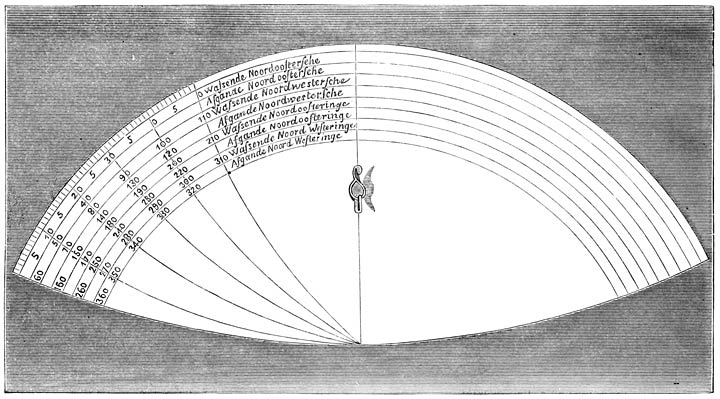
On the 17th of August, 1875, M. Gundersen, commander of the Norwegian schooner Regina, was the first after Carlsen who visited Barendsz’s Ice Harbour. In a chest, the upper part of which was quite mouldered, he found an old journal, two charts, and a grapnel with four flukes, three of which seemed to have been purposely broken off. The charts, pasted upon sail-cloth, are much injured. The words “Germania inferior” may be read on them. The journal has proved to be a manuscript Dutch translation of the narrative of the English expedition of Pet and Jackman, 1580.
On August 17, 1875, M. Gundersen, the captain of the Norwegian schooner Regina, was the first person after Carlsen to visit Barendsz’s Ice Harbour. In a chest that was quite decayed at the top, he found an old journal, two maps, and a grapnel with four flukes, three of which looked like they had been intentionally broken off. The maps, attached to sailcloth, are heavily damaged. The words “Germania inferior” can be read on them. The journal turned out to be a handwritten Dutch translation of the account of the English expedition led by Pet and Jackman in 1580.
For the numerous abridgements and summaries of De Veer’s work, I refer to the learned book of Mr. P. A. Fiele, at Leyden, entitled Mémoire Bibliographique sur les journaux des Navigateurs Néerlandais: Amsterdam, 1867. [lxiii]
For the many shortened versions and summaries of De Veer’s work, I recommend the informative book by Mr. P. A. Fiele, published in Leyden, called Bibliographic Memoir on the Journals of Dutch Navigators: Amsterdam, 1867. [__A_TAG_PLACEHOLDER_0__]
7 Gerrit de Veer, son of Albert de Veer and Cornelia van Adrichem, belonged to an old and illustrious Dutch family. He was a younger brother of Ellert de Veer, who occupied the position of Councillor of Amsterdam, when Gerrit de Veer undertook his voyage to Novaya Zemlya. In April 1610, Ellert de Veer was sent to England as plenipotentiary, on which occasion he was knighted by James I. Gerrit de Veer died, unmarried, abroad.—Heraldic Library, 1874. ↑
7 Gerrit de Veer, the son of Albert de Veer and Cornelia van Adrichem, came from an old and distinguished Dutch family. He was the younger brother of Ellert de Veer, who served as Councillor of Amsterdam when Gerrit de Veer set out on his journey to Novaya Zemlya. In April 1610, Ellert de Veer was sent to England as a representative, during which he was knighted by James I. Gerrit de Veer died abroad, unmarried.—Heraldic Library, 1874. ↑
INTRODUCTION TO THE FIRST EDITION.
BY
BY
CHARLES J. BEKE, Phil.D.
CHARLES J. BEKE, Ph.D.
The three voyages undertaken by the Dutch, towards the close of the sixteenth century, with a view to the discovery of a north-east passage to China, are deservedly placed among the most remarkable exploits of that enterprising nation; while the ten months’ residence of the adventurous seamen at the furthest extremity of the inhospitable region of Novaya Zemlya, within little more than fourteen degrees of the North Pole, and their homeward voyage of upwards of seventeen hundred geographical miles in two small open boats, are events full of romantic interest.
The three voyages taken by the Dutch toward the end of the sixteenth century, aimed at discovering a northeast passage to China, are rightly considered some of the most impressive adventures of that ambitious nation. The ten months spent by the daring sailors at the farthest edge of the harsh region of Novaya Zemlya, just over fourteen degrees from the North Pole, along with their journey home of over seventeen hundred geographic miles in two small open boats, are events filled with romantic intrigue.
The republication by the Hakluyt Society of the narrative of these three voyages, is most appropriate at this particular juncture, when public attention is so painfully absorbed by apprehensions as to the fate of Franklin and his companions. At all times would this work be read with interest, as giving in plain and simple language, which vouches for its truth, the first account of a forced winter residence in the Arctic Regions, patiently and resolutely endured and successfully terminated; but at the present moment it acquires a far deeper importance from its representation—faint, perhaps, and wholly inadequate to the reality—of the hardships which must have been undergone by our missing countrymen; happy if some of them shall have survived, like Gerrit de Veer, to tell the tale of their sufferings and of their final deliverance from their long captivity. [lxiv]
The Hakluyt Society's republication of the account of these three voyages is very timely, especially now when the public is so consumed with worries about Franklin and his crew. This work would always be interesting to read, as it presents in clear and simple language, which confirms its accuracy, the first account of an enforced winter stay in the Arctic. This was endured with patience and determination, and ultimately it was a success. However, right now it holds much greater significance because it offers a glimpse—albeit faint and not entirely reflective of the reality—of the struggles faced by our missing countrymen. We can only hope that some of them survived, like Gerrit de Veer, to share the story of their hardships and their eventual rescue from their lengthy ordeal. [__A_TAG_PLACEHOLDER_0__]
In adverting to the causes which led to these three expeditions, it would be quite superfluous to enter upon the general history of Arctic discovery. All that is requisite for the proper elucidation of the present subject, is an investigation of the actual state of our knowledge respecting the precise field of the labours of our Dutch navigators, previously to the date of their adventurous undertaking.
In discussing the reasons behind these three expeditions, it’s unnecessary to go into the overall history of Arctic exploration. What’s important for understanding the current topic is to examine what we actually know about the specific areas where our Dutch navigators worked before they embarked on their daring journey.
Three centuries have now elapsed since the first attempt was made to discover a north-east passage to China and India. The circumstances under which this took place, cannot be better detailed than in the words of Clement Adams, in his account of “the newe Nauigation and discouerie of the kingdome of Muscouia, by the north-east, in the yeere 1553”, which is printed by Hakluyt in the first volume of his Principal Navigations.
Three hundred years have now passed since the first effort was made to find a north-east passage to China and India. The circumstances surrounding this event can be best described through the words of Clement Adams in his account of “the new Navigation and discovery of the kingdom of Muscovy, by the north-east, in the year 1553,” which is published by Hakluyt in the first volume of his Principal Navigations.
“At what time our marchants perceiued the commodities and wares of England to bee in small request with the countreys and people about vs and neere vnto vs, and that those marchandizes which strangers in the time and memorie of our auncesters did earnestly seeke and desire, were nowe neglected and the price thereof abated, although by vs carried to their owne portes, and all forreine marchandises in great accompt and their prises wonderfully raised: certaine graue citizens of London, and men of great wisedome, and carefull for the good of their countrey, began to thinke with themselves howe this mischiefe might be remedied. Neither was a remedie (as it then appeared) wanting to their desires, for the auoyding of so great an inconuenience: for, seeing that the wealth of the Spaniards and Portingales, by the discouerie and search of newe trades and countreys was marueilously increased, supposing the same to be a course and meane for them also to obteine the like, they thereupon resolued upon a newe and strange nauigation. And whereas at the same time one Sebastian Cabota,1 a man in those dayes very renowned, happened to bee in London, they began first of all to deale and consult diligently with him, and after much speech and conference together, it was at last concluded that three shippes should bee prepared and furnished [lxv]out, for the search and discouerie of the northerne part of the world, to open a way and passage to our men for trauaile to newe and vnknowen kingdomes.
“When our merchants noticed that goods from England were not in demand among the surrounding countries and people, and that items which foreigners once eagerly desired were now overlooked and their prices had dropped—even though we were delivering them to their ports—while all foreign goods were highly valued and their prices increased significantly: some wise citizens of London, who were genuinely concerned for the welfare of their country, began thinking about how this issue could be resolved. They saw a potential solution to their concerns: realizing that the wealth of the Spaniards and Portuguese had grown significantly due to the discovery and exploration of new trades and territories, they believed this could be a means for them to achieve similar prosperity. They decided to undertake a new and unusual voyage. At that time, a well-known figure, Sebastian Cabota, was in London, and they started consulting with him closely. After a lot of discussions, it was ultimately decided that three ships should be prepared and equipped for the exploration of the northern part of the world, to establish a route for our people to travel to new and unknown kingdoms.”
“And whereas many things seemed necessary to bee regarded in this so hard and difficult a matter, they first make choyse of certaine graue and wise persons, in maner of a senate or companie, which should lay their heads together and giue their iudgements, and prouide things requisite and profitable for all occasions: by this companie it was thought expedient that a certaine summe of money should publiquely bee collected, to serue for the furnishing of so many shippes. And lest any priuate man should bee too much oppressed and charged, a course was taken, that euery man willing to be of the societie should disburse the portion of twentie and five pounds a piece; so that in short time by this meanes the summe of sixe thousand pounds being gathered, the three shippes were bought, the most part whereof they prouided to be newly built and trimmed.”2
“Since many important factors needed consideration in this challenging situation, they first selected some serious and wise individuals, forming a senate-like group, to come together, share their ideas, and provide what was necessary and beneficial for all: this group decided that a certain amount of money should be raised publicly to fund the purchase of several ships. To avoid placing too great a burden on any one person, they agreed that anyone who wanted to join the group would contribute twenty-five pounds each; thus, in a short time, a total of six thousand pounds was collected, and three ships were purchased, mostly newly built and outfitted.”__A_TAG_PLACEHOLDER_0__
The three vessels thus fitted out sailed in company from Ratcliff on the 10th of May, 1553. On their arrival at Harwich, they were detained there some time; “yet at the last with a good winde they hoysed vp saile, and committed themselues to the sea, giuing their last adieu to their natiue country, which they knewe not whether they should euer returne to see againe or not. Many of them looked oftentimes backe, and could not refraine from teares, considering into what hazards they were to fall, and what vncertainties of the sea they were to make triall of.”3
The three ships were equipped and set off together from Ratcliff on May 10, 1553. When they arrived in Harwich, they were held there for a while; “but eventually, with a favorable wind, they raised their sails and set out to sea, saying their final goodbye to their homeland, unsure if they would ever return. Many looked back frequently and couldn’t hold back their tears, thinking about the dangers they were about to face and the uncertainties of the sea they were about to experience.”3
These gloomy forebodings were not long in finding their realization. In a violent tempest off the coast of Norway, two of the vessels, the Bona Esperanza and Bona Confidentia, in the former of which was Sir Hugh Willoughby, captain-general of the fleet, were driven far out to sea, and at length put into a small haven on the coast of Lapland, near the mouth of the river Warsina,4 where the entire crews of [lxvi]both vessels, amounting in all to seventy souls, miserably perished from cold and hunger.
These dark predictions soon became a reality. During a violent storm off the coast of Norway, two ships, the Bona Esperanza and Bona Confidentia, with Sir Hugh Willoughby, the fleet's captain-general, on board the former, were pushed far out to sea. Eventually, they found refuge in a small harbor on the coast of Lapland, near the mouth of the river Warsina, where the entire crews of [__A_TAG_PLACEHOLDER_0__] both ships, totaling seventy people, tragically died from the cold and hunger.
Before meeting with his untimely end, Willoughby, on the 14th of August, “descried land, which land (he says, in a note found written in one of the two ships) we bare with all, hoising out our boat to discover what land it might be; but the boat could not come to land, the water was so shoale, where was very much ice also, but there was no similitude of habitation; and this land lyeth from Seynam5 east and by north 160 leagues, being in latitude 72 degrees. Then we plyed to the northward”.6 As the subject of Willoughby’s voyage has been discussed by Mr. Rundall in a recent publication of the Hakluyt Society,7 it is here unnecessary to say more than that, whatever may formerly have been the notions of geographers as to the coast reached by our hapless countryman, and to which the name of “Willoughby’s Land” was given, the almost universally received opinion now is8 that it was that portion of the western coast of Novaya Zemlya, which is called by Lütke the Goose Coast (Gänseufer in Erman’s Translation9),—doubtless from the numbers of water-fowl found there,—and of which the North and South Goose Capes (Syevernuy Gusinuy Muis and Yuzhnuy Gusinuy Muis) form the two extremities. Mr. Rundall is therefore fully justified in claiming for Sir Hugh Willoughby, as he so earnestly does in his work just cited,10 “the credit of having been the first Englishman by whom the coast of Novaya Zemlya was visited”; and as, further, Willoughby was not only the first Englishman, but also the first European, who had ever been there, the rule and usual practice in regard to new discoveries fairly warrants the application [lxvii]of the name of “Willoughby’s Land” to this “Goose Coast”, which our countryman was thus the first to visit and make known to us.
Before his untimely death, Willoughby, on August 14th, “sighted land, which land (he notes in a message found written in one of the two ships) we approached with all our effort, launching our boat to find out what land it might be; but the boat couldn’t reach the shore because the water was too shallow, and there was a lot of ice as well, but there were no signs of habitation; this land lies from Seynam5 east and slightly north 160 leagues, at latitude 72 degrees. Then we headed further north.”6 Since Mr. Rundall has already discussed the topic of Willoughby’s voyage in a recent publication from the Hakluyt Society,7 it’s not necessary to elaborate here, except to say that, regardless of what geographers previously thought about the coast reached by our unfortunate countryman, which was named “Willoughby’s Land,” the almost universally accepted belief now is8 that it refers to a part of the western coast of Novaya Zemlya, known as the Goose Coast (Gänseufer in Erman’s Translation9), likely named for the numerous waterfowl found there. The North and South Goose Capes (Syevernuy Gusinuy Muis and Yuzhnuy Gusinuy Muis) form its two endpoints. Mr. Rundall is certainly justified in asserting for Sir Hugh Willoughby, as he passionately does in his cited work,10 “the credit of having been the first Englishman to visit the coast of Novaya Zemlya”; and since Willoughby was not only the first Englishman but also the first European to ever be there, the general rules and practices regarding new discoveries reasonably support the naming [__A_TAG_PLACEHOLDER_0__] of this “Goose Coast” as “Willoughby’s Land,” which our countryman was thus the first to visit and make known to us.
In thus attributing the discovery of Novaya Zemlya to Sir Hugh Willoughby, it is in no wise intended to deny that that island—or chain of islands, as it may be more correctly designated—was previously known to the inhabitants of the northern coasts of Russia. The name itself,—Novaya Zemlya, which in the Russian language signifies “the New Country” or “Newfoundland”,—and the fact that the early European navigators, both English and Dutch, who followed in Willoughby’s footsteps, met with native vessels on the coast, from the crews of which they learned their way and obtained various particulars of local information, are quite sufficient to establish the priority of the Russians.
In attributing the discovery of Novaya Zemlya to Sir Hugh Willoughby, it is not meant to ignore that the island—or chain of islands, as it might be more accurately called—was already known to the people living along the northern coasts of Russia. The name itself, Novaya Zemlya, which in Russian means “the New Country” or “Newfoundland”, along with the fact that early European navigators, both English and Dutch, who followed in Willoughby’s path, encountered native boats along the coast, from which they learned navigation and gathered various local details, is enough to confirm the Russians' priority.
Still, the discovery of a country, like any other discovery or invention in science or the arts, dates properly from the time when the knowledge of that discovery is first recorded and publicly communicated to the civilised world; and in this sense even the Russian admiral Lütke,11 the great explorer of Novaya Zemlya in modern times, does not hesitate to acknowledge, that, owing to the absence of all written records bearing on the subject, his countrymen cannot pretend to lay claim to the “discovery” of Novaya Zemlya.
Still, the discovery of a country, like any other discovery or invention in science or the arts, officially begins when that discovery is first recorded and shared with the civilized world; and in this sense, even the Russian admiral Lütke, 11 the great explorer of Novaya Zemlya in modern times, openly acknowledges that, due to the lack of any written records on the subject, his fellow countrymen cannot claim to have “discovered” Novaya Zemlya.
Richard Chancellor, pilot-major of Willoughby’s fleet, was far more fortunate than his hapless chief. In the third vessel, the Edward Bonaventure, commanded by Stephen Burrough, he succeeded in entering the Bay of St. Nicholas, since better known as the White Sea, and on the 24th of August, 1553, reached in safety the western mouth of the river Dwina, whence he proceeded overland to the court of the Emperor of Muscovy or Russia, at Moscow. The result was the foundation of the commercial and political relations [lxviii]between England and Russia, which have subsisted, with but brief interruptions, till the present day.
Richard Chancellor, the chief pilot of Willoughby’s fleet, was much luckier than his unfortunate leader. On the third ship, the Edward Bonaventure, captained by Stephen Burrough, he managed to enter the Bay of St. Nicholas, also known as the White Sea, and on August 24, 1553, safely reached the western mouth of the river Dwina. From there, he traveled overland to the court of the Emperor of Muscovy, or Russia, in Moscow. This led to the establishment of commercial and political relations [__A_TAG_PLACEHOLDER_0__] between England and Russia, which have continued, with only a few brief interruptions, up to the present day.
Shortly after Chancellor had brought his section of Willoughby’s expedition to so successful an issue, the company of merchant-adventurers, by whom the three ships had been fitted out, received a charter of incorporation, bearing date February 6th, 1 and 2 Ph. and Mar. (1554–5); and subsequently, in the eighth year of Queen Elizabeth (1566), they obtained an Act of Parliament, in which they are styled “the Fellowship of English Merchants for Discovery of New Trades”; a title under which they still continue incorporated, though they are better known by the designation of the “Muscovy” or “Russia Company”.
Shortly after Chancellor successfully concluded his part in Willoughby’s expedition, the group of merchant-adventurers that had outfitted the three ships received a charter of incorporation, dated February 6th, 1 and 2 Ph. and Mar. (1554–5). Later, in the eighth year of Queen Elizabeth’s reign (1566), they secured an Act of Parliament that referred to them as “the Fellowship of English Merchants for Discovery of New Trades”; a title they still hold, although they are more commonly known as the “Muscovy” or “Russia Company.”
It is not here the place to discuss the general proceedings of the Russia Company, important though they be, and highly deserving of being made the subject of special investigation. All that we have to do is to notice the expeditions which were undertaken under the auspices of that company, for the purpose of exploring the seas bounding the Russian Empire on the north, with a view to the discovery of a north-east passage to China.
It’s not the right time or place to talk about the overall activities of the Russia Company, even though they are significant and warrant a detailed examination. What we need to focus on are the expeditions launched by that company aimed at exploring the seas around the northern borders of the Russian Empire, in hopes of finding a northeast passage to China.
Of these expeditions, the first was that of Stephen Burrough, who had in 1553 been the master of Richard Chancellor’s ship, the Edward Bonaventure, and who now, in 1556, was despatched in the pinnace Searchthrift to make discovery towards the river Ob.12
Of these expeditions, the first was led by Stephen Burrough, who had been the captain of Richard Chancellor’s ship, the Edward Bonaventure, in 1553, and who was now, in 1556, sent out in the pinnace Searchthrift to explore towards the river Ob.12
Leaving Gravesend on the 23rd of April of the latter year, Burrough, on the 23rd of May, passed the North Cape, which he had so named on his first voyage, and on the 9th of June reached Kola, where he fell in with several small Russian vessels (lodji), all “bound to Pechora, a fishing for salmons and morses”.13 The master of one of these boats, named Gabriel, rendered good service to Burrough, who is [lxix]diffuse in his praise of Gabriel’s conduct, as contrasted with that of other Russian seamen with whom he had to do.
Leaving Gravesend on April 23rd of the following year, Burrough, on May 23rd, passed the North Cape, which he had named on his first voyage, and on June 9th reached Kola, where he encountered several small Russian boats (lodji), all “headed to Pechora, a fishing area for salmon and walrus.” 13 The captain of one of these boats, named Gabriel, provided valuable assistance to Burrough, who is [__A_TAG_PLACEHOLDER_0__]generous in his praise of Gabriel’s conduct compared to that of other Russian sailors he interacted with.
In the company of these native boats Burrough passed by Svyátoi Nos, called by him Cape St. John; Kanin Nos (Caninoz); the island of Kolguev, by mistake called in his journal Dolgoieue; then the second Svyátoi Nos, and so to “the dangerous barre of Pechora”. Passing still onwards, he, on St. James’s day, July 25th, “spied certain islands”, lying to the south of Novaya Zemlya, under one of which he anchored, naming it “St. James his Island”,14 and making its latitude to be 70° 42′ N., which according to Lütke15 is about 10′ too far north. The next day they “plyed to the westwards alongst the shoare” of the southern extremity of Novaya Zemlya, where they met with another small native vessel, the master of which, named Loshak, told them that they were past the way which should bring them to the Ob;—that the land by which they were was “called Noua Zembla, that is to say, the New Land;”—and that “in this Noua Zembla is the highest mountaine in the worlde, as he thought, and that Camen Bolshay,16 which is on the maine of Pechora, is not to be compared to this mountaine; but” (adds Burrough cautiously) “I saw it not”.17
In the company of these native boats, Burrough passed by Svyátoi Nos, which he referred to as Cape St. John; Kanin Nos (Caninoz); the island of Kolguev, mistakenly called Dolgoieue in his journal; then the second Svyátoi Nos, and on to “the dangerous bar of Pechora.” Continuing on, on St. James’s Day, July 25th, he “spied certain islands” south of Novaya Zemlya, anchoring under one of them, which he named “St. James's Island,”14 with a recorded latitude of 70° 42′ N., which according to Lütke15 is about 10′ too far north. The next day, they “plyed to the west along the shore” of the southern tip of Novaya Zemlya, where they encountered another small native vessel. The captain, named Loshak, informed them that they were past the route that would take them to the Ob;—that the land they were near was “called Noua Zembla, which means the New Land;”—and that “in this Noua Zembla is the highest mountain in the world, as he thought, and that Camen Bolshay,16 which is on the mainland of Pechora, can’t compare to this mountain; but” (adds Burrough cautiously) “I did not see it.”17
On the 31st of July, Burrough was “at an anker among the islands of Vaigats”; on one of which islands he went on shore the following day. On Monday, the 3rd of August, he continues: “We weyed and went roome with another island, which was five leagues east-north-east from us; and there I met againe with Loshak, and went on shore with him, and hee brought me to a heap of the Samoeds idols, which were in number aboue 300, the worst and the most unartificiall worke that ever I saw. The eyes and mouthes of sundrie of them were bloodie; they had the shape of men, [lxx]women, and children, very grosly wrought; and that which they had made for other parts was also sprinckled with blood. Some of their idols were an olde sticke, with two or three notches made with a knife in it. I saw much of the footing of the sayd Samoeds, and of the sleds that they ride in.”18
On July 31st, Burrough was “anchored among the islands of Vaigats”; on one of those islands, he went ashore the next day. On Monday, August 3rd, he continued: “We weighed anchor and moved toward another island, which was five leagues east-northeast from us; there I met up again with Loshak, and went ashore with him. He brought me to a collection of over 300 Samoeds idols, the worst and most poorly made ones I had ever seen. The eyes and mouths of several were bloody; they were shaped like men, women, and children, very crudely crafted; the parts they made were also covered in blood. Some of their idols were just old sticks with two or three notches carved into them. I saw a lot of the tracks of the Samoeds, and the sleds they used to ride in.”
These particulars clearly prove that the spot thus described by Burrough is Bolvánovsky Nos (Image Cape), at the north-eastern extremity of the island of Vaigats, in 70° 29′ N. lat., which place, according to Lütke,19 was visited by Ivanov in 1824, and found to be in precisely the same state as represented by its English discoverer. There is a second cape of the same name at the south-eastern extremity of Vaigats Island, in 69° 40′ N. lat., which is the Afgodenhoeck (Idol Cape) of Linschoten and the Beeldthoeck (Image Cape) of De Veer, and which is described by the latter in his account of their second voyage, at pages 53 and 60 of the present volume. Lütke20 erroneously identifies this latter cape with the one discovered by Burrough; but this is evidently a mere oversight, as the two capes of the same name are distinctly laid down in his chart.
These details clearly show that the location described by Burrough is Bolvánovsky Nos (Image Cape), at the northeastern tip of Vaigats Island, at 70° 29′ N latitude. According to Lütke, Ivanov visited this site in 1824 and found it to be exactly as reported by its English discoverer. There’s another cape with the same name at the southeastern tip of Vaigats Island, at 69° 40′ N latitude, known as the Afgodenhoeck (Idol Cape) according to Linschoten and Beeldthoeck (Image Cape) according to De Veer. De Veer describes it in his account of their second voyage on pages 53 and 60 of this volume. Lütke erroneously identifies this latter cape as the one discovered by Burrough, but this is clearly just a mistake, as both capes with the same name are clearly marked on his chart.
On the 5th of August, fearing to be hemmed in by the ice, which approached his ship in immense masses, Burrough returned westwards, and then southwards; and on the 22nd of the same month, on account of the north and north-easterly winds, the great quantity of ice, and the advanced season of the year, he determined on not attempting to proceed further to the east, but returned round Kanin Nos into the White Sea, and so to Kholmogorui (Colmogro), the Russian port on the Dwina previously to the foundation of Archangelsk,—Archangel, or Novo-Kholmogorui, as it was at first called,—where he arrived on the 11th of September.21
On August 5th, worried about being trapped by the ice closing in on his ship in huge chunks, Burrough headed west and then south. By August 22nd, due to the north and northeast winds, the large amount of ice, and the late season, he decided not to try to go further east. Instead, he returned around Kanin Nos into the White Sea and then to Kholmogorui (Colmogro), the Russian port on the Dwina that predates the founding of Archangelsk—initially called Archangel or Novo-Kholmogorui—where he arrived on September 11th.21
The passage by which Burrough thus sailed between [lxxi]Novaya Zemlya and Vaigats into the Sea of Kara, is that which by the Russians is called Karskoi Vorota—the Kara Gate or Strait; and as he was the first navigator who is recorded to have been there, he must be regarded as the “discoverer” of that Strait. And that he was so considered by his contemporaries is established by the fact, that, in the instructions given by the Russia Company, in 1580, to Pet and Jackman,22 that entrance into the Sea of Kara is actually denominated “Burrough’s Strait”.
The route that Burrough sailed between [__A_TAG_PLACEHOLDER_0__]Novaya Zemlya and Vaigats into the Sea of Kara is what the Russians call Karskoi Vorota—the Kara Gate or Strait. Since he was the first navigator recorded to have been there, he should be considered the “discoverer” of that Strait. This recognition by his contemporaries is shown by the fact that in the instructions given by the Russia Company in 1580 to Pet and Jackman,22 that entrance into the Sea of Kara is actually referred to as “Burrough’s Strait.”
For several years after Stephen Burrough’s voyage in the Searchthrift, the Russia Company appear to have directed their attention principally to the trade with the White Sea, and thence, overland, with the interior of the continent both in Europe and in Asia. Still, it must not be imagined that they at all abandoned the idea of a north-east passage to China. On the contrary, there is evidence in the instructions given by them on the fitting out of two expeditions, at intervals of twelve years each, that the subject was not lost sight of by them, and that they neglected no means of obtaining information, with a view to the eventual realisation of the scheme which was their principal object in the original formation of the company.
For several years after Stephen Burrough’s journey on the Searchthrift, the Russia Company seems to have focused mainly on trading with the White Sea and then overland with the interior of the continent in both Europe and Asia. However, they didn’t give up on the idea of finding a north-east passage to China. On the contrary, evidence from the instructions they issued for two expeditions, spaced twelve years apart, shows that they kept this goal in mind and made every effort to gather information, aiming to eventually achieve the plan that was their main purpose for starting the company.
The former of these two expeditions was in the year 1568, when James Bassendine, James Woodcocke, and Richard Browne were appointed to undertake a voyage of discovery along the northern coast of Russia, “from the river Pechora to the eastwards”. Of this undertaking no memorial appears to be extant, except the “Commission” issued to the adventurers; so that it is impossible to say what its success was. But the instructions contained in that Commission are in themselves of so interesting a character, as showing in a precise and definite form the extent of the knowledge of the Arctic Ocean to the east of the White Sea, possessed by the English at a date mounting up to nearly three centuries [lxxii]from the present time, that no apology will be necessary for here reprinting it from the pages of Hakluyt.23 It must be premised that the date attributed by that author to this document is 1588; which is, however, clearly a misprint. For, in the first place, it was in 1568 (not 1588) that Thomas Randolph, by whom the Commission was signed only a few days after his arrival in Russia,24 was appointed ambassador to that country, he having in the following year returned to England;25 while in the year 1588 it was Dr. Giles Fletcher who was our ambassador.26 And, secondly, this Commission, though appearing to bear the latter date, is placed by Hakluyt in chronological order among the documents of the year 1568.
The first of these two expeditions took place in 1568, when James Bassendine, James Woodcocke, and Richard Browne were chosen to embark on a discovery voyage along the northern coast of Russia, “from the river Pechora to the east.” Unfortunately, there seems to be no record of this endeavor, except for the “Commission” given to the explorers; therefore, it’s impossible to determine its success. However, the instructions in that Commission are quite fascinating, as they clearly outline the extent of the English knowledge of the Arctic Ocean east of the White Sea, dating back nearly three centuries [__A_TAG_PLACEHOLDER_0__] from now. Thus, it’s fitting to reproduce it here from Hakluyt’s writings.23 It should be noted that Hakluyt mistakenly attributed the document to the year 1588; this is clearly an error. First, it was actually in 1568 (not 1588) that Thomas Randolph, the signatory of the Commission, was appointed ambassador to Russia just a few days after his arrival there.24 He returned to England the following year;25 whereas in 1588, Dr. Giles Fletcher served as our ambassador.26 Furthermore, despite the Commission appearing to have that later date, Hakluyt categorizes it among the documents from 1568.
A Commission given by vs, Thomas Randolfe, ambassadour for the Queenes Maiestie in Russia, and Thomas Bannister, etc., vnto Iames Bassendine, Iames Woodcocke, and Richard Browne; the which Bassendine, Woodcocke, and Browne we appoint ioyntly together, and aiders the one of them to the other, in a voyage of discouery to be made (by the grace of God) by them, for searching of the sea and border of the coast, from the riuer Pechora to the eastwards, as hereafter followeth. Anno 1568, the first of August.
A Commission issued by us, Thomas Randolfe, ambassador for Her Majesty the Queen in Russia, and Thomas Bannister, etc., to James Bassendine, James Woodcock, and Richard Browne; we appoint Bassendine, Woodcock, and Browne to work together, supporting each other, on a discovery voyage (with God's grace) to explore the sea and coastline from the Pechora River eastward, as outlined below. Year 1568, August 1st.
Imprimis, when your barke with all furniture is ready, you shall at the beginning of the yere (assoone as you possibly may) make your repaire to the easterne part of the riuer Pechora, where is an island called Dolgoieue, and from thence you shall passe to the eastwards alongst by the sea coast of Hugorie, or the maine land of Pechora; and sailing alongst by the same coast, you shall passe within seuen leagues of the island Vaigats, which is in the straight, almost halfe way from the coast of Hugorie unto the coast of Noua Zembla; which island Vaigats and Noua Zembla you shall finde [lxxiii]noted in your plat, therefore you shall not need to discouer it, but proceed on alongst the coast of Hugory towards the river Obba.
First, when your ship is fully equipped, you should set sail for the eastern part of the Pechora River at the start of the year (as soon as you can). From there, navigate east along the coastline of Hugory, or the main land of Pechora. As you sail along this coast, you’ll pass within seven leagues of Vaigats Island, which lies in the strait, almost halfway between the coast of Hugory and the coast of Nova Zembla; you’ll find Vaigats Island and Nova Zembla [__A_TAG_PLACEHOLDER_0__]marked on your map, so you won’t need to discover it, but continue along the coast of Hugory toward the river Obba.
There is a bay betweene the sayd Vaigats and the river Obba, that doth bite to the southwards into the land of Hugory, in which bay are two small riuers, the one called Cara Reca, the other Naramsy, as in the paper of notes which are giuen to you herewith may appeare: in the which bay you shall not need to spend any time for searching of it, but to direct your course to the river Ob (if otherwise you be not constrained to keepe alongst the shore); and when you come to the river Ob, you shall not enter into it, but passe ouer into the easterne part of the mouth of the sayd riuer.
There is a bay between the mentioned Vaigats and the river Obba, extending southward into the land of Hugory. In this bay, there are two small rivers, one called Cara Reca and the other Naramsy, as noted in the accompanying documents. In this bay, you won’t need to waste any time searching for it; just head toward the river Ob (unless you have to stay close to the shore). When you reach the river Ob, don’t enter it; instead, cross over to the eastern part of the river’s mouth.
And when you are at the easterne part of the mouth of Obba Reca, you shall from thence passe to the eastwards, alongst by the border of the sayd coast, describing the same in such perfect order as you can best do it. You shall not leaue the sayd coast or border of the land, but passe alongst by it, at least in sight of the same, untill you haue sailed by it so farre to the eastwards, and the time of the yeere [be] so farre spent, that you doe thinke it time for you to returne with your barke to winter, which trauell may well be 300 or 400 leagues to the eastwards of the Ob, if the sea doe reach so farre, as our hope is it doth; but and if you finde not the said coast and sea to trend so farre to the eastwards, yet you shall not leaue the coast at any time, but proceed alongst by it, as it doth lie, leauing no part of it vnsearched or [un-]seene, unlesse it be some bay or river, that you doe certeinly know by the report of the people that you shall finde in those borders, or els some certeine tokens whereby you of your selues may iudge it to be so. For our hope is that the said border of land and sea doth, in short space after you passe the Ob, incline east, and so to the southwards. And therefore we would haue no part of the land of your starreboord side, as you proceed in your discouery, to be left vndiscouered.
And when you're at the eastern part of the mouth of Obba Reca, you should head eastward, keeping close to the mentioned coast, describing it as accurately as you can. You should not leave the mentioned coast or the land's edge, but travel alongside it, at least within sight, until you have gone east far enough and the time of year suggests it’s time to return with your boat for the winter. This journey could well be 300 or 400 leagues east of the Ob, if the sea extends that far, as we hope it does; but if you find that the coast and sea do not reach that far east, you should still not leave the coast at any time. Continue along it as it lies, leaving no part unexplored or unseen unless there is a bay or river that you know for sure from the locals will be there, or you have clear signs that indicate otherwise. Our hope is that the land and sea will soon trend east and then south after you pass the Ob. Therefore, we want no part of the land on your right side as you proceed in your exploration to be left undiscovered.
But and if the said border of land do not incline so to the eastwards as we presuppose it, but that it doe proue to incline and trend to the northwards, and so ioyne with Noua Zembla, making the sea from Vaigats to the eastwarde but a bay; yet we will that you do keepe alongst by the said coast, and so bring us certaine report of that forme and maner of the same bay.
But if the mentioned land border doesn’t slope eastward as we assume, but actually turns northward and connects with Nova Zembla, thus making the sea from Vaigats to the east merely a bay, we still want you to stay along the coast and provide us with an accurate report of the shape and nature of that bay.
And if it doe so proue to be a bay, and that you have passed round about the same, and so by the trending of the land come backe vnto that part of Noua Zembla that is [lxxiv]against Vaigats, whereas you may from that see the said island Vaigats; if the time of the yeere will permit you, you shall from thence passe alongst by the said border and coast of Noua Zembla to the westwards, and so to search whether that part of Noua Zembla doe ioyne with the land that Sir Hugh Willoughbie discouered in anno ’53, and is in 72 degrees and from that part of Noua Zembla 120 leagues to the westwards,27 as your plat doeth shew it unto you; and if you doe finde that land to ioyne with Noua Zembla, when you come to it, you shall proceed further along the same coast, if the time of the yere will permit it, and that you doe thinke there will be sufficient time for you to returne back with your barke to winter, either at Pechora or in Russia, at your discretion; for we refer the same to your good iudgements, trusting that you will lose no time that may further your knowledge in this voyage.
And if it turns out to be a bay, and you have sailed all the way around it, you can return to the part of Nova Zembla that is [__A_TAG_PLACEHOLDER_1__]facing Vaigats, where you can see Vaigats Island. If the time of year allows, you should then travel along the border and coast of Nova Zembla toward the west to see if that part of Nova Zembla connects with the land that Sir Hugh Willoughby discovered in 1553, which is at 72 degrees and 120 leagues west from that part of Nova Zembla, according to your map. If you find that land connects with Nova Zembla, you should continue along the coast, if the time of year permits and if you think there will be enough time for you to return to winter in either Pechora or Russia, at your discretion. We trust your good judgment, hoping that you won’t waste any time that could improve your knowledge on this voyage.
Note you, it was the 20 of August, ’56, yer28 the Serchthrift began to returne backe from her discouerie, to winter in Russia; and then she came from the island Vaigats, being forcibly driuen from thence with an easterly winde and yce, and so she came into the riuer Dwina, and arriued at Colmogro the 11 of September, ’56. If the yce had not bene so much that yere as it was in the streights on both sides of the island Vaigats, they in the said pinnesse would that yeere haue discouered the parts that you are now sent to seeke; which thing (if it had pleased God) might haue bene done then; but God hath reserued it for some other. Which discouerie, if it may be made by you, it shall not only proue profitable vnto you, but it will also purchase perpetuall fame and renowne both to you and our countrey. And thus, not doubting of your willing desires and forwardnesse towards the same, we pray God to blesse you with a lucky beginning, fortunate successe, and happily to end the same. Amen.
Note that on August 20, 1956, the Serchthrift began its journey back from its expedition to winter in Russia; it left Vaigats Island, forced out by an easterly wind and ice. It then entered the Dwina River and arrived at Colmogro on September 11, 1956. If there hadn’t been so much ice that year around the straits on both sides of Vaigats Island, those on the pinnace would have discovered the areas you’re now tasked with exploring; this could have occurred if it had been God's will, but He has set that discovery for a later time. If you manage to make this discovery, it won’t just benefit you, but it will also bring lasting fame and recognition to both you and our country. Thus, with full confidence in your eagerness and readiness to pursue this goal, we pray that God blesses you with a strong start, good fortune, and a successful outcome. Amen.
As has already been stated, the results of this expedition are not known. We may, therefore, pass to the consideration of the voyage of Arthur Pet and Charles Jackman in the [lxxv]year 1580. For this undertaking written instructions were in like manner given by the Russia Company, which have also been preserved by Hakluyt.29 But as these instructions correspond in many respects with those given to Bassendine and his companions, it is here unnecessary to cite more from them than some few passages requiring particular notice.
As already mentioned, the results of this expedition are unknown. So, let's move on to the voyage of Arthur Pet and Charles Jackman in the [__A_TAG_PLACEHOLDER_0__] year 1580. For this trip, the Russia Company also provided written instructions, which Hakluyt has preserved. 29 However, since these instructions are similar in many ways to those given to Bassendine and his companions, it’s unnecessary to quote more from them except for a few key passages that need special attention.
The Commission from the Russia Company to Pet and Jackman was “for a voyage by them to be made, by God’s grace, for search and discoueries of a passage by sea by Borough’s Streights and the island Vaigats, eastwards to the countries or dominions of the mightie prince, the emperour of Cathay, and in the same unto the cities of Cambalu and Quinsay, or to either of them”. And for that purpose they were directed to “saile from this river of Thames to the coast of Finmarke, to the North Cape there, or to the Wardhouse”; and from thence, continued their instructions, “direct your course to haue sight of Willoughbies Land, and from it passe alongst to the Noua Zemla, keeping the same landes alwayes in your sight on your larboord sides (if conueniently you may), to the ende you may discouer whether the same Willoughbies Land be continent and firme land with Noua Zemla or not; notwithstanding we would not haue you to entangle your selues in any bay, or otherwise, so that it might hinder your speedy proceeding to the Island Vaigats.
The commission from the Russia Company to Pet and Jackman was “for a voyage they were to undertake, with God’s grace, to search for and discover a sea passage via Borough’s Straits and the island Vaigats, heading east to the lands or territories of the mighty prince, the emperor of Cathay, and also into the cities of Cambalu and Quinsay, or to either of them.” For that purpose, they were instructed to “sail from the River Thames to the coast of Finmark, to the North Cape there, or to the Wardhouse”; and from there, their instructions continued, “set your course to sight Willoughby’s Land, and from it pass along to Nova Zemla, keeping those lands always in sight on your port side (if you can), so you can discover whether Willoughby’s Land is continuous and solid land with Nova Zemla or not; however, we want you to avoid getting caught in any bay or similar situation that could delay your prompt journey to the Island Vaigats.”
“And when you come to Vaigats, we would haue you to get sight of the maine land of Samoeda, which is ouer against the south part of the same island, and from thence, with God’s permission, to passe eastwards alongst the same coast, keeping it alwayes in your sight (if conueniently you may) untill you come to the mouth of the riuer Ob: and when you come unto it, passe ouer the said riuers mouth unto the border of land on the east side of the same (without any [lxxvi]stay to bee made for searching inwardly in the same riuer), and being in sight of the same easterly land, doe you, in Gods name, proceed alongst by it from thence eastwards, keeping the same alwayes on your starboord side in sight, if you may, and follow the tract of it, whether it incline southerly or northerly (as at times it may do both), untill you come to the country of Cathay, or the dominion of that mightie emperour.”30 But in case they should not be able to reach Cathay, they were directed to attempt to ascend the river Ob; and if they should not succeed in this, they were then to “returne backe through Boroughs Streights”, and “discouer and trie whether Willoughbies Land ioyne continent with Noua Zembla or not”.31
“And when you arrive at Vaigats, we want you to catch sight of the main land of Samoeda, which is across from the southern part of the same island. From there, with God's permission, make your way eastward along the same coast, keeping it always in view (if it's convenient) until you reach the mouth of the river Ob. When you get there, cross over the mouth of the river to the land border on the east side (without stopping to explore inwardly along the river), and once you see the eastern shore, do proceed along it in God's name, heading east, keeping it on your starboard side in sight, if you can, following the path whether it curves southward or northward (as it may do both at times), until you reach the territory of Cathay, or the dominion of that mighty emperor.”30 But if they can’t reach Cathay, they were instructed to try to go up the river Ob; and if they don't succeed in this, they should “return back through Boroughs Streights”, and “explore and see whether Willoughby's Land connects with Nova Zembla or not.”31
In pursuance of these instructions, Pet and Jackman sailed from Harwich on the 31st of May, 1580, in two small barks: namely, the George, of the burthen of forty tons, under the command of the former, with a crew of nine men and a boy, and the William, of twenty tons, commanded by the latter, with a crew of five men and a boy. On June 23rd they reached Wardhuus, which place they left in company on the 1st of the following month. On the next day, however, as the William seemed “to be out of trie and sailed very ill”, she “was willing to goe with Kegor”, where she might mend her steerage; “whereupon Master Pet, not willing to go into harborough, said to Master Jackman that if he thought himselfe not able to keepe the sea, he should doe as he thought best, and that he in the meane time would beare with Willoughbies Land, for that it was a parcel of our direction, and would meete him at Veroue Ostroue, or Vaigats”.32
In line with these instructions, Pet and Jackman set sail from Harwich on May 31, 1580, in two small ships: the George, which was 40 tons and commanded by Pet, with a crew of nine men and a boy, and the William, which was 20 tons and commanded by Jackman, with a crew of five men and a boy. On June 23, they arrived at Wardhuus and left together on the 1st of the next month. However, the next day, since the William seemed "to be out of trim and sailed very poorly," she decided "to go with Kegor," where she could improve her steering; "therefore, Master Pet, not wanting to go into harbor, told Master Jackman that if he felt unable to keep to the sea, he should do what he thought was best, and in the meantime, he would head towards Willoughbies Land, as that was part of our instructions, and would meet him at Veroue Ostroue, or Vaigats."32
The name of Veroue Ostroue, here given to the island of Vaigats, does not occur elsewhere. It is manifestly Russian; though it is difficult to say what is its correct form, and consequently [lxxvii]what its signification. As to the designation by which that island is generally known, Witsen states, though without further explanation, that it was acquired from one Iwan or Ian Waigats;33 in commenting on which statement, Lütke says that the name should properly be written Waigatsch, the Russian termination tsch having been changed by the Dutch into tz, in the same way as in Pitzora for Petschora, etc.34 The correctness of this criticism is, however, questionable. For, long before the Dutch visited or knew anything of these parts, we find Englishmen,—who certainly had no difficulty in pronouncing the sound ch (tsch), which is common to our language, and who in fact always wrote Pechora (Petschora), and not, like the Dutch, Pitzora,—invariably writing not Vaigach (Vaigatsch), but Vaigats or Vaygatz. It is therefore reasonable to conclude that Vaigats is the original pronunciation of the name, and that the Russian form is merely a corruption.
The name Veroue Ostroue, used here for the island of Vaigats, doesn’t appear anywhere else. It’s clearly Russian, but it’s hard to determine its correct form and meaning. As for the name by which the island is typically known, Witsen mentions—without elaboration—that it came from someone named Iwan or Ian Waigats; in response to this, Lütke states that the name should actually be written Waigatsch, since the Russian ending tsch was changed by the Dutch to tz, similar to how Pechora is written as Pitzora, etc. However, the accuracy of this critique is debatable. Long before the Dutch explored or even knew about these areas, English speakers—who certainly had no trouble pronouncing the ch sound (tsch), which is common in our language, and who always wrote Pechora (Petschora), not like the Dutch as Pitzora—consistently used Vaigats or Vaygatz, not Vaigach (Vaigatsch). Therefore, it seems reasonable to conclude that Vaigats is the original pronunciation of the name, and that the Russian version is simply a variation.
But to return to Pet, who after parting from Jackman continued his course eastwards, apparently following in Willoughby’s track, till, on the 4th of July, he saw land in latitude 71° 38′ north, being the coast of Novaya Zemlya, somewhere about the South Goose Cape. Thence he coasted along the south-western end of Novaya Zemlya, keeping the same in sight on the larboard side, as instructed to do, but not nearing it, on account of ice and fog.35 On the 10th of July, he approached the north-western extremity of Vaigatz Island, and landed on a small island near the coast, where he took in wood and water.36 Here he remained till the 14th, when he got out with difficulty on account of the ice, and “lay along the coast north-west, thinking it to be an island; but finding no end in rowing so long”, he “supposed it to be the maine of Noua Zembla”, in which, however, he was in error, and thereby missed the entrance into the Sea of [lxxviii]Kara by Burrough’s Strait. He now altered his course, and on the 15th “lay south south-west with a flawne sheete, and so ranne all the same day”; and, after meeting with much more ice, he on the 17th came into the “Bay of Pechora”. Thence, again taking an eastward course, he on the 18th had sight of the southern extremity of Vaigatz, and on the following day entered the passage running between that portion of the island and the main land of the Samoede country; to which passage the Dutch, in the voyages which form the subject of the following pages, gave the name of “the Straits of Nassau”, and which the Russians call Yugorsky Schar, that is to say, the Ugorian Strait. Nevertheless, if the first European explorer on record be entitled to the credit of his discovery, this entrance into the Sea of Kara ought to bear the name of “Pet’s Strait,” in like manner as the passage into that sea at the other extremity of Vaigatz Island received the name of “Burrough’s Strait”.
But to go back to Pet, who after parting from Jackman continued his journey eastward, seemingly following in Willoughby's path, until, on July 4th, he spotted land at latitude 71° 38' north, which was the coast of Novaya Zemlya, near South Goose Cape. From there, he traveled along the southwestern end of Novaya Zemlya, keeping it in sight on the left side, as he was instructed to do, but didn’t get closer due to ice and fog.35 On July 10th, he neared the northwestern tip of Vaigatz Island and landed on a small island nearby, where he gathered wood and water.36 He stayed there until the 14th, when he managed to leave with difficulty because of the ice, and “sailed along the coast northwest, thinking it was an island; but after rowing for so long without finding an end,” he “assumed it to be the mainland of Novaya Zemlya,” which turned out to be a mistake, causing him to miss the entrance into the Sea of [__A_TAG_PLACEHOLDER_0__]Kara via Burrough's Strait. He then changed his course, and on the 15th “sailed south-southwest with a favorable wind, and continued like that all day”; and after encountering a lot more ice, on the 17th he arrived at the “Bay of Pechora.” From there, taking an eastward route again, on the 18th he spotted the southern tip of Vaigatz, and the next day he entered the passage between that part of the island and the mainland of the Samoede country; a passage that the Dutch, in the voyages discussed in the following pages, named “the Straits of Nassau,” which the Russians call Yugorsky Schar, meaning the Ugorian Strait. However, if the first recorded European explorer deserves credit for his discovery, this entrance into the Sea of Kara should really be called “Pet’s Strait,” just as the passage into that sea at the other end of Vaigatz Island was named “Burrough's Strait.”
From the 19th till the 24th of July, Pet endeavoured to make his way eastwards in accordance with his instructions, by keeping “the maine land of Samoeda” always in sight on his starboard side, but was constantly impeded by the ice. At length he was “constrained to put into the ice, to seeke some way to get to the northwards of it, hoping to haue some cleare passage that way, but there was nothing but whole ice.”37
From July 19th to 24th, Pet tried to head east as per his instructions, keeping "the mainland of Samoeda" in view on his right side, but he was constantly blocked by ice. Eventually, he had to move into the ice to find a way north, hoping for a clear passage, but all he found was solid ice. 37
Meanwhile, Jackman and his crew of five men and a boy, in their frail bark of twenty tons, had gallantly followed after the George, and on the morning of the 25th July the two vessels again joined company, the William being, however, in so disabled a state when she reached her companion, as to require assistance from the latter. The two vessels now “set saile to the northwardes, to seeke if they could finde any way cleare to passe to the eastward; but the [lxxix]further they went that way, the more and thicker was the ice, so that they coulde goe no further.”38
Meanwhile, Jackman and his crew of five men and a boy, in their small twenty-ton boat, bravely followed after the George. On the morning of July 25th, the two vessels met up again. However, the William was in such bad shape when it reached its companion that it needed help. The two vessels then “set sail to the north to see if they could find a clear way to pass to the east; but the [__A_TAG_PLACEHOLDER_0__]further they went that way, the thicker the ice became, so that they could go no further.”38
At length, seeing the impossibility of advancing either to the east or to the north, on the 28th of July “Master Pet and Master Jackman did conferre together what was best to be done, considering that the windes were good for us, and we not able to passe for ice: they did agree to seeke to the land againe, and so to Vaygatz, and then to conferre further. At 3 in the afternoone, we did warpe from one piece of ice to another, to get from them if it were possible: here were pieces of ice so great that we could not see beyond them out of the toppe.”39
Finally, realizing that we couldn’t move either east or north, on July 28th, “Master Pet and Master Jackman talked about what to do next, recognizing that the winds were in our favor but we couldn’t get through the ice. They decided to head back to land, then go to Vaygatz, and discuss further plans. At 3 in the afternoon, we moved from one piece of ice to another, trying to get away from them if possible: there were chunks of ice so massive that we couldn’t see beyond them from the top.”39
It was only with the greatest difficulty and peril that they occasionally made their way through the ice, in which for the most part they remained so enclosed “that they could not stirre, labouring onely to defend the yce as it came upon them”; but at length, on the 15th of August, “they entred into a cleare sea without yce, whereof they were most glad, and not without cause, and gave God the praise”.40 On the day after, they say, “we were troubled againe with ice, but we made great shift with it: for we gotte betweene the shoare and it. This day, at twelue of the clocke, we were thwart of the south-east part of Vaigats, all along which part there was great store of yce, so that we stood in doubt of passage; yet by much adoe we got betwixt the shoare and it.”41
They only managed to push through the ice with great difficulty and danger, often getting stuck “so that they could not move, only working to keep the ice from overwhelming them”; but finally, on August 15th, “they entered a clear sea free of ice, which made them very happy, and for good reason, and they praised God”.40 The next day, they reported, “we were troubled again with ice, but we managed to deal with it: because we got between the shore and it. This day, at twelve o'clock, we were off the southeast part of Vaigats, where there was a lot of ice, and we were uncertain about getting through; yet with much effort, we got between the shore and it.”41
They now bore away to the west, passing by the island of Kolguev (Colgoyeue), on the sands to the south of which both vessels went aground, on August 20th, in latitude 68° 40′ N., according to their calculation. Getting off, they proceeded together on their return voyage; but, only two days afterwards, Pet’s vessel parted from the William, and saw her no more.42 [lxxx]
They turned west, passing by Kolguev Island, where both ships ran aground on the sands to the south on August 20th, at a latitude of 68° 40′ N, based on their calculations. After getting off, they continued their journey home together; however, just two days later, Pet’s ship separated from the William, and they never saw her again.42 [__A_TAG_PLACEHOLDER_0__]
Arthur Pet, in the George, reached home in safety, arriving at Ratcliff on the 26th December following; but “the William, with Charles Jackman, arrived at a port in Norway between Tronden and Rostock in October 1580, and there did winter. And from thence departed againe in Februarie following, and went in company of a ship of the King of Denmarke toward Island; and since that time he was never heard of.”43
Arthur Pet, on the George, got home safely, arriving in Ratcliff on December 26th. However, “the William, with Charles Jackman, reached a port in Norway between Tronden and Rostock in October 1580, where they spent the winter. Then they set off again in February and traveled with a ship from the King of Denmark towards Iceland; and since then, he was never heard from again.”43
This voyage of Pet and Jackman has been noticed more in detail than might otherwise have been necessary, for the purpose of defending those able seamen from the animadversions of a recent historian, who says: “From the meagre narrative of this voyage it is sufficiently evident that Pet and Jackman were but indifferent navigators, and that they never trusted themselves from the shore and out of shallow water, whenever the ice would suffer them to approach it; a situation of all others, where they might have made themselves certain of being hampered with ice.”44 It will, however, in the first place, have been seen that their express instructions were that they should follow the line of the Siberian coast, keeping it always in sight on their starboard side, which instructions they appear to have obeyed to the utmost of their ability. And, secondly, it was not so much the fixed ice along the coast which impeded their progress, as the immense masses of floating ice from the Polar Basin which had drifted into the Sea of Kara; for, on more than one occasion, it was precisely by getting into the shallow water, “between the shore and the ice”, that they were enabled to effect a passage, which in deeper water, where the ice-masses could float, was denied to them. The fact is that it was from no want of either knowledge or skill that they were unsuccessful, but from the like unsurmountable natural causes which, fifteen years later, compelled the Dutch [lxxxi]fleet under Cornelius Nai to turn back from somewhere about the same spot;45 and, as Captain Beechey justly observes, “to this day the hardy Russians have not been able to survey the eastern side of Nova Zembla; and the ships which passed through the Waigatz Strait have never been able to proceed far, owing to the quantity of ice driven into the Sea of Kara”.46
This journey of Pet and Jackman has been examined in more detail than might have been necessary, to defend these skilled sailors from the criticism of a recent historian, who claims: “From the sparse account of this voyage, it’s clear that Pet and Jackman were only mediocre navigators, and that they never ventured far from the shore and into deeper waters, whenever the ice allowed them to approach it; a situation where they could be sure they’d be stuck in the ice.”44 However, it should first be noted that their specific instructions were to follow the Siberian coast, keeping it always in sight on their right side, which they seem to have followed to the best of their ability. Additionally, it wasn't the fixed ice along the coast that held them back, but the enormous amounts of floating ice from the Polar Basin that had drifted into the Sea of Kara; indeed, on multiple occasions, it was precisely by moving into the shallow water “between the shore and the ice” that they managed to make a passage that was unavailable to them in deeper water, where the ice could freely float. The truth is that their lack of success was not due to any deficiency in knowledge or skill, but rather due to the same overwhelming natural factors that, fifteen years later, forced the Dutch [__A_TAG_PLACEHOLDER_0__] fleet under Cornelius Nai to turn back from roughly the same area;45 and, as Captain Beechey rightly points out, “to this day the brave Russians have not been able to explore the eastern side of Nova Zembla; and the ships that passed through the Waigatz Strait have never been able to go far, due to the large amounts of ice pushed into the Sea of Kara.”46
Further, when it is considered who these experienced seamen were, it will at once be manifest that under no circumstances ought they to be stigmatised as “indifferent navigators”. Arthur Pet was with Richard Chancellor and Stephen Burrough in the Edward Bonaventure, on their first voyage to the Bay of St. Nicholas in 1553, his name standing in the list of “mariners” sixth before that of William Burrough47 (Stephen’s brother). Seven years afterwards, in 1560, he commanded the Jesus, of London, in the service of the Russia Company.48 And now, twenty years later, in the year 1580, a convincing proof is afforded of the estimation in which he was held, by the interest taken in him and his expedition by several of the most distinguished navigators and cosmographers of his time. For, in addition to his Commission from his employers, in whose service he had been seven-and-twenty years,—whether constantly or not is immaterial,—he received “Instructions and Notes”49 from “Master William Burrough”, Comptroller of the Navy, who had been his messmate seven-and-twenty years before, together with “Certaine briefe aduices giuen by Master Dee”,50 as also “Notes in writing, besides more priuie by mouth, that were giuen by M. Richard Hakluyt, of Eiton, in the countie of Hereford, esquire”;51 and, further, his voyage [lxxxii]was deemed of sufficient importance to form the subject of a letter to Hakluyt himself from the learned Gerard Mercator.52
Additionally, when you consider who these skilled sailors were, it becomes clear that they should never be labeled as “indifferent navigators.” Arthur Pet was with Richard Chancellor and Stephen Burrough on the Edward Bonaventure during their first trip to the Bay of St. Nicholas in 1553, his name listed sixth among the “mariners” before William Burrough (Stephen’s brother). Seven years later, in 1560, he captained the Jesus, of London, in the service of the Russia Company. Now, twenty years later, in 1580, there is strong evidence of his reputation through the interest shown in him and his expedition by some of the most notable navigators and cosmographers of the time. Along with his Commission from his employers, whom he had served for twenty-seven years—whether continuously or not doesn’t matter—he received “Instructions and Notes” from “Master William Burrough”, Comptroller of the Navy, who had been his messmate twenty-seven years earlier, as well as “Certain brief advices given by Master Dee” and “Notes in writing, in addition to more private advice that were given by M. Richard Hakluyt, of Eiton, in Herefordshire, esquire”; furthermore, his voyage [A_TAG_PLACEHOLDER_5I’m ready for your text. Please provide the phrases you'd like me to modernize. was considered important enough to warrant a letter to Hakluyt himself from the learned Gerard Mercator.
Of Charles Jackman we do not know so much. Yet he, too, had clearly had experience in Arctic exploration, having been “the mate” on board the Ayde, one of the vessels of Frobisher’s second expedition, when he was of sufficient importance to give his name to “Jackman’s Sound”, on the south side of Frobisher’s Strait.53 And it is not without significance that in all the documents above cited, except Mercator’s letter to Hakluyt, his name is coupled, without any distinction, with that of so old and experienced a navigator of the Russian Seas as Arthur Pet.
Of Charles Jackman, we don’t know much. However, he clearly had experience in Arctic exploration, having served as the “mate” on the Ayde, one of the ships in Frobisher’s second expedition. He was important enough to have a location named after him, “Jackman’s Sound,” on the south side of Frobisher’s Strait. And it’s noteworthy that in all the documents mentioned above, except for Mercator’s letter to Hakluyt, his name appears alongside that of Arthur Pet, a well-known and experienced navigator of the Russian Seas, without any distinction.
Notwithstanding the failure of Pet and Jackman’s undertaking, the Russia Company appear to have in no wise relaxed in their endeavours to effect a passage by sea along the northern coast of the Russian dominions. And that they were, to a considerable extent, successful in their exertions, is proved by the following two documents, which have been preserved to us by Purchas.54
Notwithstanding the failure of Pet and Jackman’s efforts, the Russia Company seems to have remained committed to their attempts to find a sea route along the northern coast of Russia. Their significant success in these efforts is demonstrated by the following two documents that have been preserved for us by Purchas.54
Notes concerning the discouery of the river of Ob, taken out of a Roll written in the Russian tongue, which was attempted by the meanes of Antonie Marsh, a chiefe Factor for the Moscouie Company of England, 1584, with other Notes of the North-east.
Notes on the discovery of the Ob River, based on a document written in Russian, which was attempted by Anthony Marsh, chief agent for the Moscow Company of England, in 1584, along with additional notes on the Northeast.
First, he wrote a letter from the citie of Mosco, in the year 7092, after the Russe accompt, which after our accompt was in the yeare 1584, unto foure Russes, that vsed to trade from Colmogro to Pechora and other parts eastward; whose answer was: [lxxxiii]
First, he wrote a letter from Moscow in the year 7092, according to the Russian calendar, which corresponds to 1584 in our calendar, to four Russians who used to trade from Kolmogor to Pechora and other eastern locations; their response was: [__A_TAG_PLACEHOLDER_0__]
By writings receiued from thee, as also by reports, wee vnderstand thou wouldest have us seeke out the mouth of the riuer Ob; which we are content to doe, and thou must giue therefore fiftie rubbles: it is requisite to goe to seeke it out with two cochimaes or companies,55 and each cochima must haue ten men; and wee must goe by the riuer Pechora vpwards in the spring, by the side of the ice, as the ice swimmeth in the riuer, which will aske a fortnights time; and then we must fall into Ouson riuer, and fall downe with the streame before we come to Ob, a day and a night in the spring. Then it will hold vs eight dayes to swimme downe the riuer Ob, before we come to the mouth: therefore send vs a man that can write; and assure thy selfe the mouth of Ob is deepe. On the Russe side of Ob soiourne Samoeds, called Vgorskai and Sibierskie Samoeds; and on the other side dwel another kind of Samoeds, called Monganet or Mongaseisky Samoeds. We must passe by fiue castles that stand on the riuer of Ob. The name of the first is Tesuoi-gorodok, which standeth vpon the mouth of the riuer Padou. The second small castle is Nosoro-gorodock, and it standeth hard vpon the side of Ob. The third is called Necheiourgoskoy. The fourth is Charedmada. The fift is Nadesneàa, that is to say, the castle of Comfort or Trust,56 and it standeth vpon the riuer Ob, lowermost of all the former castles toward the sea.
From your letters and reports, we understand that you want us to find the mouth of the Ob River, which we are willing to do, but you need to provide us with fifty rubles for that. We need to go with two cochimaes or groups, and each cochima must have ten men. We will travel up the Pechora River in the spring, along the ice edge since the ice will be floating in the river, which will take about two weeks. Then we will enter the Ouson River and journey downstream for a day and a night in the spring before reaching the Ob. It will take us eight days to float down the Ob River until we reach its mouth. So please send someone who can write, and rest assured that the mouth of the Ob is deep. On the Russian side of the Ob live the Samoeds, known as Vgorskai and Sibierskie Samoeds; on the other side live another group of Samoeds called Monganet or Mongaseisky Samoeds. We will pass five forts on the Ob River. The first is named Tesuoi-gorodok, located at the mouth of the Padou River. The second small fort is Nosoro-gorodok, which is right on the Ob bank. The third is called Necheiourgoskoy. The fourth is Charedmada. The fifth is Nadesneàa, which means the Castle of Comfort or Trust, and it stands on the Ob River, the furthest downriver of all the previous forts towards the sea.
Heretofore your people haue bin at the said riuer of Obs mouth with a ship, and there was made shipwracke, and your people were slaine by the Samoeds, which thought that they came to rob and subdue them. The trees that grow by the riuer are firres, and a kinde of white, soft, and light firre, which we call yell. The bankes on both sides are very high, and the water not swift, but still and deepe. Fish there are in it, as sturgeons, and cheri, and pidle, and nelma, a dainty fish like white salmons, and moucoun, and sigi, and sterlidi; [lxxxiv]but salmons57 there are none. Not farre distant from the maine, at the mouth of Ob, there is an island,58 whereon resort many wilde beasts, as white beares, and the morses, and such like. And the Samoeds tell vs, that in the winter season they oftentimes finde there morses teeth. If you would haue us trauell to seeke out the mouth of Ob by sea, we must goe by the isles of Vaygats and Noua Zembla, and by the land of Matpheoue, that is, by Matthewes Land. And assure thy selfe, that from Vaygats to the mouth of Ob by sea, is but a small matter to sayle. Written at Pechora, the yeare 7092, the twenty one of February.
Until now, your people have been at the mouth of the Ob River with a ship, but there was a shipwreck, and your people were killed by the Samoeds, who thought they were coming to rob and conquer them. The trees by the river are firs, including a type of white, soft, light fir that we call yell. The banks on both sides are very high, and the water isn't fast, but calm and deep. There are fish in it, like sturgeons, caviar, pike, nelma, a delicate fish similar to white salmon, muksun, lenok, and sterlet; [__A_TAG_PLACEHOLDER_1__]but there are no salmon __A_TAG_PLACEHOLDER_2__. Not far from the mainland, at the mouth of the Ob, there is an island, __A_TAG_PLACEHOLDER_3__, where many wild animals come, like polar bears and walruses, and similar creatures. The Samoeds tell us that in winter, they often find walrus teeth there. If you want us to travel by sea to find the mouth of the Ob, we must go by the islands of Vaygats and Nova Zembla, and the land of Matpheoue, which is Matthew's Land. And rest assured that from Vaygats to the mouth of the Ob by sea, it's a short distance to sail. Written in Pechora, in the year 7092, on February 21st.
Master Marsh also learned these distances of Places and Ports from Caninos to Ob by sea.
Master Marsh also learned these distances of places and ports from Caninos to Ob by sea.
From Caninos to the Bay of Medemske (which is somewhat to the east of the riuer Pechora) is seuen days sayling. The bay of Medemsky is ouer a day and a halfe sayling. From Medemske Sauorost to Carareca is sixe dayes sayling. From Carska Bay to the farthest side of the riuer Ob is nine dayes sayling. The Bay of Carska is from side to side a day and a nights sayling.
From Caninos to the Bay of Medemske (which is a bit east of the Pechora River) takes seven days of sailing. The Bay of Medemsky is over a day and a half of sailing. From Medemske Sauorost to Carareca, it's six days of sailing. From Carska Bay to the far side of the Ob River takes nine days of sailing. The Bay of Carska is a day's and night's sailing from one side to the other.
He learned another way by Noua Zembla and Matthuschan Yar to Ob more north-eastward. From Caninos to the iland of Colgoieue is a day and a nights sayling. From Colgoieue to Noua Zembla are two dayes sayling. There is a great osera or lake vpon Noua Zembla, where wonderfull store of geese and swannes doe breede, and in moulting time cast their feathers, which is about Saint Peters day; and the Russes of Colmogro repaire thither yearely, and our English men venture thither with them seuerall shares in money: they bring home great quantitie of doune-feathers, dried swannes and geese, beares skinnes, and fish, etc. From Naromske reca or riuer to Mattuschan Yar is sixe dayes sayling. From Mattuschan Yar to the Perouologi Teupla, that is to say, to the warme passage ouer-land, compassing or sayling round about the sands, is thirteene dayes sayling. And there is upon the sands, at a full sea, seuen fathomes water, and two fathomes at a low water. The occasion of this highing of [lxxxv]the water, is the falling into the sea of the three riuers, and the meeting of the two seas, to wit, the North Sea and the East Sea, which make both high water and great sands. And you must beware that you come not with your shippe near vnto the iland by the riuer Ob.59 From Mattuschan Yar to this iland is fiue dayes sayling. Mattushan Yar is in some part fortie versts ouer, and in some parts not past six versts ouer.
He learned another route by Noua Zembla and Matthuschan Yar to Ob furthers northeast. From Caninos to the island of Colgoieue is a day and a night of sailing. From Colgoieue to Noua Zembla takes two days of sailing. There is a large osera or lake on Noua Zembla where a huge number of geese and swans breed, and during the molting season, they shed their feathers around Saint Peter's Day; the Russians from Colmogro go there every year, and our Englishmen venture there with them, pooling money together: they bring back large quantities of down feathers, dried swans and geese, bear skins, fish, etc. From Naromske reca or river to Mattuschan Yar is six days of sailing. From Mattuschan Yar to the Perouologi Teupla, which means the warm overland passage, going around the sands, is thirteen days of sailing. And there are seven fathoms of water on the sands at high tide, and two fathoms at low tide. The reason for this high water [__A_TAG_PLACEHOLDER_4__] is the confluence of the three rivers emptying into the sea and the meeting of the two seas, namely, the North Sea and the East Sea, which both create high water and extensive sandbanks. And you must be careful not to bring your ship too close to the island by the river Ob. __A_TAG_PLACEHOLDER_5__ From Mattuschan Yar to this island is five days of sailing. Mattuschan Yar is, in some places, forty versts wide, and in others, not more than six versts wide.
The aforesaid Anthonie Marsh sent one Bodan, his man, a Russe borne, with the aforesaid foure Russes and a yong youth, a Samoed, which was likewise his seruant, vpon the discouery of the riuer of Ob by land, through the countrie of the Samoeds, with good store of commodities to trafficke with the people. And these his seruents made a rich voyage of it, and had bartered with the people about the riuer of Ob for the valew of a thousand rubles in sables and other fine furres. But the emperour hauing intelligence of this discouery, and of the way that Bodan returned home by, by one of his chiefe officers lay in waite for him, apprehended him, and tooke from him the aforesaid thousand markes worth of sables and other merchandises and deliuered them into the emperours treasurie, being sealed vp, and brought the poore fellow Bodan to the citie of Mosco, where he was committed to prison and whipped, and there detained a long while after, but in the end released. Moreouer, the emperours officers asked Anthonie Marsh how he durst presume to deale in any such enterprise. To whom he answered, that, by the priuileges granted to the English nation, no part of the emperours dominions were exempted from the English to trade and trafficke in: with which answere they were not so satisfied, but that they gaue him a great checke, and forfeited all the aforesaid thousand markes worth of goods, charging him not to proceede any further in that action: whereby it seemeth they are very iealous that any Christian should grow acquainted with their neighbours that border to the north-east of their dominions; for that there is some great secret that way, which they would reserue to themselves onely. Thus much I vnderstood by Master Christopher Holmes.
The aforementioned Anthonie Marsh sent a man named Bodan, who was born in Russia, along with four other Russians and a young Sami, who was also his servant, to explore the Ob River overland through the Sami territory, bringing plenty of goods to trade with the locals. Their trip turned out to be quite profitable, and they traded with the people around the Ob River for items worth about a thousand rubles in sables and other fine furs. However, once the emperor learned about this discovery and the route Bodan was taking home, one of his chief officers ambushed him, captured him, and seized the aforementioned goods worth a thousand marks, delivering them to the emperor's treasury, sealed up. They brought poor Bodan to Moscow, where he was imprisoned and whipped, and held there for a long time before eventually being released. Furthermore, the emperor’s officials questioned Anthonie Marsh on how he dared to engage in such an enterprise. He responded that, by the privileges granted to the English nation, no part of the emperor's dominions was off-limits for English trade. This answer did not fully satisfy them, and they reprimanded him severely, confiscating all goods worth a thousand marks and forbidding him to continue with that venture. It seems they are very wary of any Christians getting to know their neighbors to the northeast of their territory, as there is likely some significant secret they want to keep to themselves. This information was gathered from Master Christopher Holmes.
From these documents we gather two very remarkable facts. The first is, that, previously to the year 1584, an English vessel had crossed the Sea of Kara, and penetrated as far eastward as the mouth of the river Ob, where it [lxxxvi]was wrecked and its crew were murdered by the natives. The second is, that, at that time, the best way from the White Sea and the mouth of the Pechora by sea was deemed to be “by the isles of Vaygats and Nouva Zembla, and by the Land of Matpheoue, that is, by Matthewes Land”; this being manifestly the same as that which is described as “another way by Noua Zembla and Mattuschan Yar to Ob, more north-eastward” than that along the Russian coast, by Kanin Nos, the mouth of the Pechora, and thence through Yugorsky Shar (“Pet’s Strait”) and across the Gulf of Kara. And there can be no question that we have here a record of the discovery of the entrance into the Sea of Kara by the strait, at present known by the name of Matochkin Shar, in which the Russian pilot Rosmuislov passed the winter of 1768–1769, and through which he penetrated into that sea, though prevented by the ice from proceeding far from the eastern coast of Novaya Zemlya.60
From these documents, we learn two very notable facts. The first is that before 1584, an English ship had sailed across the Sea of Kara and reached as far east as the mouth of the Ob River, where it [__A_TAG_PLACEHOLDER_0__]was wrecked and its crew was killed by the locals. The second is that, at that time, the best route from the White Sea and the mouth of the Pechora by sea was considered to be “by the isles of Vaygats and Nova Zembla, and by the Land of Matpheoue, that is, by Matthewes Land.” This is clearly the same route described as “another way by Nova Zembla and Mattuschan Yar to the Ob, more northeast than the route along the Russian coast, by Kanin Nos, the mouth of the Pechora, and then through Yugorsky Shar (‘Pet’s Strait’) and across the Gulf of Kara.” There is no doubt that we have a record of the discovery of the entrance to the Sea of Kara through the strait now known as Matochkin Shar, where the Russian pilot Rosmuislov spent the winter of 1768–1769 and through which he entered that sea, although he was prevented by the ice from going far from the eastern coast of Novaya Zemlya.60
The singular description thus given by Marsh of this passage through “Mattuschan Yar”, between Novaya Zemlya and “the Land of Matfeov (Matpheoue)”, does not appear to have been hitherto noticed by any writer except Dr. Hamel.60 Unfortunately, that author, through what would seem to be a systematic omission of all particular reference to his sources of information, has rendered his work of little value as an authority; inasmuch as, without having the means of appeal to the originals, it is impossible to discriminate between the facts and opinions gathered by him from others, and the conclusions, or sometimes mere hypotheses, based by himself on such information.
The unique description provided by Marsh of the passage through “Mattuschan Yar,” between Novaya Zemlya and “the Land of Matfeov (Matpheoue),” doesn’t seem to have been recognized by any other writer except Dr. Hamel.60 Sadly, that author has made his work of little value as a reference because he systematically left out specific mentions of his sources. Without direct access to the originals, it’s impossible to distinguish between the facts and opinions he gathered from others and the conclusions, or sometimes just guesses, he formed based on that information.
On the present occasion, however, having the original statements of Anthony Marsh before us, we can have no hesitation in availing ourselves of Dr. Hamel’s comments on the same, and in agreeing with him61 that the present name Matochkin Shar appears to be merely a corruption of Matyushin [lxxxvii]Shar; Matyusha itself being the diminutive of the Russian proper-name Matvei, or Matthew, which name was probably that of the first discoverer of this passage. It would also seem that the expression “Mattuschan Yar”, made use of by Anthony Marsh, is intended for this Matyushin Shar, and not, as Dr. Hamel supposes,62 for the coast (yar?) lying opposite to Novaya Zemlya; and that the breadth attributed by Marsh to “Mattuschan Yar”, of “in some parts forty versts over, and in some parts not past six versts over”, is meant to apply to the supposed breadth of the passage itself.
On this occasion, however, having the original statements from Anthony Marsh in front of us, we can confidently reference Dr. Hamel’s comments on them and agree with him61 that the current name Matochkin Shar seems to simply be a mispronunciation of Matyushin [__A_TAG_PLACEHOLDER_0__]Shar; Matyusha itself being the nickname of the Russian name Matvei or Matthew, which was likely the name of the first explorer of this waterway. It also appears that the term “Mattuschan Yar,” used by Anthony Marsh, refers to this Matyushin Shar and not, as Dr. Hamel thinks,62 to the coast (yar?) opposite Novaya Zemlya; and that the width Marsh mentions for “Mattuschan Yar,” of “in some parts forty versts wide, and in some parts not more than six versts wide,” is meant to describe the anticipated width of the passage itself.

Caerte van’t Noorderste Russen, Samojeden, ende Tingoesen landt: alsoo dat vande Russen afghetekent, en door Isaac Maera vertaelt is.
Caerte van’t Noorderste Russen, Samojeden, and Tingoesen land: as indicated by the Russians and translated by Isaac Maera.
There can, further, be no doubt that Dr. Hamel is right in his conclusion,—indeed, it is self-evident from Marsh’s statement,—that towards the close of the sixteenth century, and previously to the time when the Dutch visited those parts, Novaya Zemlya was looked on as an island extending from Burrough’s Strait (Karskoi Vorota) as far northwards only as “Mattuschan Yar” (Matyushin Shar): and that the land lying to the north of this latter passage was not deemed to be a part of Novaya Zemlya, but had a distinct designation, namely, Matthew’s Land, which in Russian would be Matvyéeva Zemlya,—an expression which corresponds precisely with Marsh’s “Land of Matfeov (Matpheoue)”.
There is no doubt that Dr. Hamel is correct in his conclusion—it's actually obvious from Marsh’s statement—that towards the end of the sixteenth century, before the Dutch visited those areas, Novaya Zemlya was seen as an island stretching from Burrough’s Strait (Karskoi Vorota) only as far north as "Mattuschan Yar" (Matyushin Shar). The land north of that passage wasn't considered part of Novaya Zemlya; it had its own name, Matthew’s Land, which in Russian is Matvyéeva Zemlya—an expression that matches exactly with Marsh’s “Land of Matfeov (Matpheoue).”
How this Matvyéeva Zemlya, together with Matyushin Shar, should have been lost from our maps, may be easily explained, though not altogether in the way attempted by Dr. Hamel.63 The accompanying fac-simile of a map drawn by Isaac Massa, and published in 1612 by Hessel Gerard, in a small volume64 now very rare, contains (as will be seen) [lxxxviii]a delineation of Novaya Zemlya, there shown as an island of not large extent, and the surrounding regions. The strongly marked entire line along the western side of Novaya Zemlya, is that of the coast as furnished to Massa by his Russian authorities: the faint dotted line is that of the coast as corrected by himself or Gerard from Dutch sources of information. The proper names, as written in strong and faint characters respectively, indicate, in like manner, the several sources from which such names were derived. In this map a broad channel is laid down between the island of Novaya Zemlya and a terra innominata to the north of it, to which channel is given the name of “Matsei of tsar”, which was evidently intended for “Matſeiof tsar”, which again must be taken to have been written instead of “Matfeiof tsar”, through a mere clerical error.65 The faint dotted line along the west coast of Novaya Zemlya shows that it had been carefully and (considering the time when it was drawn) very accurately corrected; for we there see plainly laid down the Mezhdusharsky Ostrov and the two inlets—Kostin Shar and Podryesov Shar—between which [lxxxix]that island lies, and from which it derives its appellation.66
How Matvyéeva Zemlya, along with Matyushin Shar, ended up missing from our maps can be easily explained, though not entirely in the way Dr. Hamel suggested.63 The accompanying fac-simile of a map created by Isaac Massa and published in 1612 by Hessel Gerard, in a small volume64 that is now quite rare, shows (as you will see) [__A_TAG_PLACEHOLDER_0__] a depiction of Novaya Zemlya, presented as a relatively small island, along with the surrounding areas. The solid line along the western side of Novaya Zemlya represents the coastline as provided to Massa by his Russian sources: the faint dotted line indicates the coast as corrected either by himself or Gerard using Dutch information. The place names, written in bold and faint characters respectively, similarly represent the different sources from which these names originated. In this map, a wide channel is drawn between the island of Novaya Zemlya and a terra innominata to the north, which is named “Matsei of tsar,” likely intended to be “Matſeiof tsar,” which must have been mistakenly written in place of “Matfeiof tsar” due to a simple clerical error.65 The faint dotted line along the west coast of Novaya Zemlya indicates that it had been carefully, and for the time it was created, quite accurately corrected; as we can clearly see the Mezhdusharsky Ostrov and the two inlets—Kostin Shar and Podryesov Shar—between which [__A_TAG_PLACEHOLDER_0__] that island is located, and from which it gets its name.66
Had the name Kostin Shar, in any of its chameleon forms,67 been retained in its proper place, at the same time that the new name Matfeiof tsar was introduced to designate the more northerly channel,—and the map constructed by Gerrit de Veer from William Barents’s observations, does not warrant the former’s being carried much higher up than the 71st parallel,—there would most probably have been no occasion to notice this grave error. But the passage between Novaya Zemlya (Proper) and Matvyéeva Zemlya not having been observed by Barents and his companions, and De Veer having in his journal expressed the opinion that “Constinsarck” goes “through to the Tartarian Sea”,68 the corrector of Massa’s map was led to suppose that this passage must be the same as the “Matfeiof tsar” of the Russians, and he accordingly placed over the latter the name “Costint sarch” in faint letters. That in subsequent maps the former name should have been omitted, and the latter alone retained, is only natural: it is the usual progress of error. Accordingly, in Gerard’s map of Russia, dedicated to the emperor Michael Fedorowich in 1614,69 we find “Costint sarch” made to extend right across and through the land from west to east, its latitude being, however, brought down to nearly the same as in Gerrit de Veer’s map, from which the western coast-line of Novaya Zemlya is, in [xc]general, taken, while the more northerly passage is altogether lost sight of.
Had the name Kostin Shar, in any of its various forms, 67 been kept in its correct location, while the new name Matfeiof tsar was introduced to refer to the more northern channel,—and the map created by Gerrit de Veer based on William Barents’s observations doesn’t support the former being extended much beyond the 71st parallel,—there likely wouldn’t have been a need to address this serious mistake. However, the passage between Novaya Zemlya (Proper) and Matvyéeva Zemlya wasn’t noted by Barents and his crew, and De Veer mentioned in his journal that “Constinsarck” connects “through to the Tartarian Sea”, 68 which led the corrector of Massa’s map to think that this passage must be the same as the “Matfeiof tsar” of the Russians, so he placed the name “Costint sarch” in faint letters over the latter. It’s only natural that in later maps the former name would be dropped, and only the latter would remain: this is the typical progression of error. Consequently, in Gerard’s map of Russia, dedicated to Emperor Michael Fedorowich in 1614, 69 we see “Costint sarch” made to extend right across and through the land from west to east, although its latitude has been adjusted to nearly match that in Gerrit de Veer’s map, from which the western coastline of Novaya Zemlya is, in [__A_TAG_PLACEHOLDER_0__]general, taken, while the more northern passage is completely overlooked.
Still, the existence of this latter passage continued to be known more than a century later. For, in the year 1705, Witsen published in the second volume of his Noord en Oost Tartarye, a rough and, for the most part, very incorrect map of the Samoede country, obtained by him from Theunis (Antonis) Ys, the master of a trading vessel, who had visited Novaya Zemlya; in which map the southern portion of that country is represented as an island, cut off from the northern and far larger portion by a broad channel, running from north-west to south-east, and bearing the name of “Matiskin jar, of Mathys-stroom”; with respect to which channel Witsen remarks,70 that “it is a passage and thoroughfare, and not an inlet or river”.
Still, the existence of this latter passage continued to be known more than a century later. In 1705, Witsen published a rough and mostly inaccurate map of the Samoede country in the second volume of his Noord en Oost Tartarye. He got this map from Theunis (Antonis) Ys, the captain of a trading vessel who had visited Novaya Zemlya. The map shows the southern part of that country as an island, separated from the larger northern part by a broad channel running from north-west to south-east, called “Matiskin jar, or Mathys-stroom.” About this channel, Witsen notes70 that “it is a passage and thoroughfare, not an inlet or river.”
Notwithstanding the length of time during which the name has been lost, there does not appear to be any good reason why the original and correct designation of Matthew’s Strait, Matvyéeva Shar (“Matfeiof tsar”), or Matyushin Shar, should not be restored to the channel between the two islands, instead of its continuing to bear the modern corrupted form of the latter name, Matochkin Shar.
Despite how long the original name has been forgotten, there seems to be no valid reason why the correct name for Matthew's Strait, Matvyéeva Shar (“Matfeiof tsar”) or Matyushin Shar, shouldn't be restored to the channel between the two islands, rather than it continuing to be called by the modern, corrupted version, Matochkin Shar.
It likewise seems only right that the name Matthew’s Land (the “Land of Matpheoue”) or Matvyéeva Zemlya, should not be lost from our maps; and it is therefore proposed to appropriate that designation to the small island extending from Matyushin Shar (“Matochkin Shar”) northwards as far as the channel, in about 74° N. lat., running across the land from Cross Bay to Rosmuislov’s “Unknown Bay”.
It also seems only fair that the name Matthew’s Land (the “Land of Matpheoue”) or Matvyéeva Zemlya should not be removed from our maps; therefore, it is suggested that this name be assigned to the small island stretching from Matyushin Shar (“Matochkin Shar”) northward to the channel, around 74° N. latitude, running across the area from Cross Bay to Rosmuislov’s “Unknown Bay.”
As to the name Novaya Zemlya, there can be no doubt that it ought still to continue the generic appellation of the entire series of islands, of which the country usually known by that name is now found to consist. But, at the same [xci]time, as it is highly expedient that each of those islands should possess some distinctive specific designation, there is a propriety in restricting the title of Novaya Zemlya (Proper), as it appears in the map of Isaac Massa and Theunis Ys, to the southernmost island of the series, lying between the Kara Gate or Burroughs Strait to the south and Matyushin Shar or Matthew’s Strait to the north.
As for the name Novaya Zemlya, it's clear that it should still refer to the entire group of islands that the country commonly known by that name is made up of. However, since it's important for each of those islands to have its own unique name, it makes sense to limit the title Novaya Zemlya (Proper), as shown on the map by Isaac Massa and Theunis Ys, to the southernmost island in the group, which is located between the Kara Gate or Burroughs Strait to the south and Matyushin Shar or Matthew’s Strait to the north.
The establishment of the English in the White Sea, and their explorations to the eastwards, soon induced others to become their competitors; and of these it is not unnatural that the Russians themselves should have been among the first. Accordingly, we find that a short time previously to the year 1581, “two famous men”, named Yacovius and Unekius—which, as Lütke observes,71 are manifestly the Latinised forms of the Russian names Yakov and Anikyi—employed a Swedish shipwright to build for them two ships in the river Dwina, and then sent one Alferius, by birth a Netherlander (“natione Belga”), to Antwerp to engage pilots and mariners, with a view to their employment on board those ships in discoveries towards the north-east. This Alferius—or Oliver, as Hakluyt translates the name—was the bearer of a letter from John Balak to Gerard Mercator, which letter, written in Latin, was published by Hakluyt in his Principal Navigations,72 together with an English translation.
The establishment of the English in the White Sea and their explorations eastward soon encouraged others to compete with them; and naturally, the Russians were among the first. We find that shortly before the year 1581, “two famous men,” named Yacovius and Unekius—which, as Lütke notes, 71 are clearly the Latinized versions of the Russian names Yakov and Anikyi—hired a Swedish shipbuilder to construct two ships in the River Dwina. They then sent a man named Alferius, who was originally from the Netherlands (“natione Belga”), to Antwerp to recruit pilots and sailors for their expeditions to the north-east. This Alferius—or Oliver, as Hakluyt translates the name—carried a letter from John Balak to Gerard Mercator, which letter, written in Latin, was published by Hakluyt in his Principal Navigations, 72 along with an English translation.
On account of the very curious matter bearing on our subject which this letter contains, it is thought advisable to reprint it here in its English form, and also to give the original Latin in the Appendix,73 for the convenience of reference. [xcii]
Due to the interesting information related to our topic included in this letter, it seems best to reproduce it here in English, along with the original Latin in the Appendix, 73 for easy reference. [__A_TAG_PLACEHOLDER_0__]
To the famous and renowned Gerardus Mercator, his reuerend and singular friend, at Duisburg in Cliueland, these be deliuered.
To the famous and renowned Gerardus Mercator, his respected and unique friend, at Duisburg in Cleves, these are delivered.
Calling to remembrance (most deare friend) what exceeding delight you tooke, at our being together, in reading the geographicall writings of Homer, Strabo, Aristotle, Plinie, Dion, and the rest, I reioyced not a little that I happened vpon such a messenger as the bearer of these presents (whom I do especially recommend vnto you), who arriued lately here at Arusburg, upon the riuer of Osella. This mans experience (as I am of opinion) will greatly auaile you to the knowledge of a certaine matter, which hath bene by you so vehemently desired and so curiously laboured for, and concerning the which the late cosmographers do hold such varietie of opinions: namely, of the discouerie of the huge promontorie of Tabin, and of the famous and rich countreys subiect unto the emperor of Cathay, and that by the northeast Ocean Sea. The man is called Alferius,74 being by birth a Netherlander, who, for certaine yeeres, liued captiue in the dominions of Russia, vnder two famous men, Yacouius and Vnekius, by whom he was sent to Antwerp, to procure skilfull pilots and mariners (by propounding liberall rewards), to go vnto the two famous personages aforesayd, which two had set a Sweden shipwright on worke to build two ships for the same discouerie, vpon the riuer of Dwina. The passage vnto Cathay by the northeast (as he declareth the matter, albeit without arte, yet very aptly, as you may well perceiue, which I request you diligently to consider), is, without doubt, very short and easie. This very man himselfe hath trauelled to the riuer of Ob, both by land, through the countreys of the Samoeds and of Sibier, and also by sea, along the coast of the riuer Pechora, eastward. Being encouraged by this his experience, he is fully resolued with himselfe to conduct a barke laden with merchandize (the keele whereof hee will not haue to drawe ouer much water) to the Baie of Saint Nicholas, in Russia, being furnished with all things expedient for such a discouerie, and with a new supply of victuals at his arrivall there; and also to hire into his companie certaine Russes best knowen vnto himselfe, who can perfectly speake the Samoeds language, and are acquainted with the riuer of Ob, as hauing frequented those places yeere by yeere. [xciii]
Recalling dear friend, I remember the joy we shared while reading the geographic writings of Homer, Strabo, Aristotle, Pliny, Dion, and others. I was pleased to meet such a messenger as the one bringing these gifts (whom I highly recommend to you) who recently arrived here in Arusburg on the Osella River. This man's expertise, in my view, will be incredibly valuable for your understanding of a particular issue you have passionately pursued and studied closely. This issue involves the discovery of the vast promontory of Tabin and the well-known and wealthy territories under the emperor of Cathay, reachable via the northeastern Ocean Sea. The man's name is Alferius, __A_TAG_PLACEHOLDER_0__, a native of the Netherlands, who spent several years captive in Russia under two notable men, Yacouius and Vnekius. They sent him to Antwerp to recruit skilled pilots and sailors (by offering generous rewards) to assist the two famous individuals mentioned, who had commissioned a Swedish shipwright to build two vessels for the same discovery on the Dwina River. According to him, the route to Cathay via the northeast is undoubtedly very short and straightforward; though he discusses the topic without sophistication, he does so quite aptly, as you will see, which I urge you to consider thoroughly. This man himself has traveled to the Ob River, both by land through the territories of the Samoyeds and Siberia and by sea along the coast of the Pechora River, heading east. Encouraged by this experience, he is determined to sail a vessel loaded with goods (the keel of which won’t draw too much water) to the Bay of Saint Nicholas in Russia, fully equipped for such a venture, along with a fresh supply of provisions upon arrival. He also intends to enlist certain Russians known to him who can fluently speak the Samoyed language and are familiar with the Ob River, as they have frequented those areas year after year. [__A_TAG_PLACEHOLDER_1__]
Whereupon, about the ende of May, hee is determined to saile from the Baie of S. Nicholas eastward, by the maine of Ioughoria, and so to the easterly parts of Pechora, to the island which is called Dolgoia. And here also hee is purposed to obserue the latitudes, to suruey and describe the countrey, to sound the depth of the sea, and to note the distances of places, where and so oft as occasion shall be offered. And forasmuch as the Baie of Pechora is a most conuenient place both for harbour and victuall, as well in their going foorth as in their returne home, in regard of ice and tempest, he is determined to bestow a day in sounding the flats, and in searching out the best enterance for ships: in which place, heretofore, he found the water to be but fiue foote deepe, howbeit he doubteth not but that there are deeper chanels: and then he intendeth to proceed on along those coasts for the space of three or foure leagues, leauing the island called Vaigats almost in the middle way betweene Vgoria and Noua Zembla: then also to passe by a certaine baie betweene Vaigats and Ob, trending southerly into the land of Vgoria, whereinto fall two small riuers, called Marmesia and Carah,75 vpon the which riuers doe inhabite an other barbarous and sauage nation of the Samoeds. He found many flats in that tract of land, and many cataracts or ouerfals of water, yet such as hee was able to saile by. When hee shall come to the riuer of Ob, which riuer (as the Samoeds report) hath seuentie mouthes, which, by reason of the huge breadth thereof, containing many and great islands, which are inhabited with sundry sortes of people, no man scarcely can well discouer; because he will not spend too much time, he purposeth to search three or foure, at the most, of the mouthes thereof, those chiefly which shall be thought most commodious by the aduise of the inhabitants, of whom hee meaneth to haue certaine with him in his voyage, and meaneth to employ three or foure boates of that countrey in search of these mouthes, as neere as possibly he can to the shore, which, within three dayes iourney of the sea, is inhabited, that he may learne where the riuer is best nauigable. If it so fall out that he may sayle vp the riuer Ob against the streame, and mount up to that place which heretofore, accompanied with certaine of his friends, he passed vnto by land through the countrey of Siberia, which is about twelue dayes iourney from the sea, where the riuer Ob falleth into the sea, which place is in the [xciv]continent neere the riuer Ob, and is called Yaks Olgush, borowing his name from that mightie riuer which falleth into the riuer Ob; then, doubtlesse, hee would conceive full hope that hee had passed the greatest difficulties: for the people dwelling there about report, which were three dayes sayling onely from that place beyond the riuer Ob, whereby the bredth thereof may be gathered (which is a rare matter there, because that many rowing with their boates of leather one dayes iourney onely from the shore, haue bene cast away in tempest, hauing no skill to guide themselves neither by sunne nor starre), that they haue seene great vessels, laden with rich and precious merchandize, brought downe that great riuer by black or swart people. They call that riuer Ardoh, which falleth into the lake of Kittay, which they call Paraha,76 whereupon bordereth that mightie and large nation which they call Carrah Colmak, which is none other than the nation of Cathay.77 There, if neede require, he may fitly winter and refresh himselfe and his, and seeke all things which he shall stand in need of; which, if it so fall out, he doubteth not but in the meane while he shall be much furthered in searching and learning out many things in that place. Howbeit, he hopeth that hee shall reach to Cathaya that very sommer, unlesse he be hindered by great abundance of ice at the mouth of the riuer of Ob, which is sometimes more, and sometimes lesse. If it so fall out, hee then purposeth to returne to Pechora, and there to winter; or if he cannot doe so neither, then hee meaneth to returne to the riuer of Dwina, whither he will reach in good time enough, and so the next spring following to proceed on his voyage. One thing in due place I forgate before.
About the end of May, he plans to sail from the Bay of St. Nicholas eastward, along the coast of Ioughoria, to the eastern parts of Pechora, heading towards an island called Dolgoia. Here, he also intends to observe the latitudes, survey and describe the land, measure the sea depth, and note the distances between places whenever possible. Since the Bay of Pechora is a very convenient spot for shelter and supplies, both when setting out and when returning home, due to ice and storms, he plans to spend a day measuring the shallow areas and finding the best entry points for ships. Previously, he found the water only five feet deep in that area, but he believes deeper channels exist. After that, he intends to travel along the coast for about three or four leagues, passing the island of Vaigats, which is situated almost halfway between Vgoria and Nova Zembla. He will also pass a bay between Vaigats and Ob, which leads south into the land of Vgoria, where two small rivers, Marmesia and Carah, flow. These rivers are home to another savage and uncivilized group of Samoeds. He found many shallow areas and waterfalls in that region, but they were navigable for him. When he reaches the Ob River, which (according to the Samoeds) has seventy mouths that are difficult to discern due to its massive width and many large islands inhabited by various peoples, he plans to explore only three or four of its mouths, focusing on those deemed most favorable based on the advice of local inhabitants. He intends to take a few locals with him on his journey and will use three or four boats from that region to search for these mouths as closely to shore as possible, where the land is inhabited within a three-day journey from the sea, so he can learn where the river is most navigable. If it turns out that he can sail up the Ob River against the current and reach a place he previously visited with some friends by land through Siberia—which is about a twelve-day journey from the sea, where the Ob River meets the sea, near a location called Yaks Olgush, named after the mighty river flowing into the Ob—he would certainly feel hopeful that he had overcome the greatest challenges. The people living nearby report that, three days' sail beyond the Ob River, one can measure the river's width (which is a rare observation there, as many having rowed their leather boats just one day's journey from the shore have been lost in storms, lacking navigation skills by sun or stars) and claim to have seen large vessels loaded with valuable goods brought down the river by dark-skinned people. They refer to that river as Ardoh, which flows into the lake of Kittay, known to them as Paraha, bordered by the vast nation of Carrah Colmak, which is actually the nation of Cathay. There, if necessary, he may winter comfortably, rest himself and his crew, and acquire everything he might need—though he believes he will reach Cathaya that summer, unless blocked by heavy ice at the mouth of the Ob River, which fluctuates in severity. If that happens, he plans to return to Pechora for the winter, or if that's not possible, then he plans to return to the Dwina River, which he aims to reach in plenty of time, and then proceed with his journey the following spring. One thing I forgot to mention earlier.
The people which dwell at that place called Yaks Olgush, affirme that they haue heard their forefathers say that they have heard most sweete harmonie of bels78 in the lake of Kitthay, and that they haue seene therein stately and large buildings: and when they make mention of the people named Carrah Colmak (this countrey is Cathay), they fetch deepe sighes, and holding vp their hands, they looke vp to heaven, signifying, as it were, and declaring the notable glory and [xcv]magnificence of that nation. I would this Oliuer were better seene in cosmographie; it would greatly further his experience, which doubtlesse is very great. Most deare friend, I omit many things, and I wish you should heare the man himselfe, which promised me faithfully that he would visite you in his way at Duisburg; for he desireth to conferre with you, and doubtlesse you shall very much further the man. He seemeth sufficiently furnished with money and friends, wherein, and in other offices of curtesie, I offered him my furtherance, if it had pleased him to haue vsed me. The Lord prosper the mans desires and forwardnesse, blesse his good beginnings, further his proceedings, and grant vnto him most happy issue. Fare you well, good sir and my singular friend. From Arusburgh, vpon the river of Ossella, the 20 of February, 1581.
The people who live in a place called Yaks Olgush claim that they've heard their ancestors say they've heard beautiful melodies of bells __A_TAG_PLACEHOLDER_2__ in the lake of Kitthay, and that they've seen grand and large buildings there. When they mention the people called Carrah Colmak (this country is Cathay), they let out deep sighs, raise their hands, and look up to the heavens, signifying and expressing the remarkable glory and [__A_TAG_PLACEHOLDER_3__] magnificence of that nation. I wish Oliuer knew more about geography; it would greatly enhance his experience, which is undoubtedly extensive. My dear friend, I’m skipping many details, but I hope you’ll hear from the man himself, who promised me he would visit you on his way to Duisburg; he wants to talk with you, and you will surely help him a lot. He seems to have plenty of money and friends, and I offered him my support in courtesy if he wished to use it. May God fulfill his desires and enthusiasm, bless his good beginnings, support his efforts, and grant him a very successful outcome. Farewell, good sir and my special friend. From Arusburgh, on the river of Ossella, February 20, 1581.
Yours wholy at commandement,
Yours wholly at command,
John Balak.
John Balak.
It is not known what success attended this Alferius or Oliver in his scheme, or what subsequently became of him; unless, indeed, it be assumed that he is the Oliver Brunel (or Bunel), concerning whom several unconnected notices are met with, and with respect to whom various conflicting opinions have been entertained. The early history of the discovery of Novaya Zemlya would hardly be complete were these notices and opinions passed over in silence.
It’s unclear what success Alferius or Oliver had with his plan or what happened to him afterward; unless, of course, we consider that he might be the Oliver Brunel (or Bunel) mentioned in several unrelated reports, which have led to various conflicting views. The early history of the discovery of Novaya Zemlya wouldn’t be complete if we ignored these reports and opinions.
The first mention made of this individual is by Gerrit de Veer, when speaking, in page 30 of the present work, of “a great creeke, which William Barents iudged to be the place where Oliuer Brunel had been before, called Costincsarch”.
The first mention of this person is by Gerrit de Veer, who talks about “a great creek, which William Barents thought was the location where Oliver Brunel had been before, called Costincsarch” on page 30 of this work.
The next is Henry Hudson, who, on his second voyage to discover a passage to the East Indies by the north-east, in 1608, having entered into this same creek, in the hope of its affording him a way through into the Sea of Kara, expresses himself as follows:—“This place vpon Noua Zembla is another then that which the Hollanders call Costing Sarch, discouered by Oliuer Brownell: and William Barentsons obseruation doth witnesse the same. It is layd in plot by the Hollanders out of his true place too farre north; to [xcvi]what end I know not, unlesse to make it hold course with the compasse, not respecting the variation.”79
The next person is Henry Hudson, who, during his second voyage to find a passage to the East Indies via the northeast in 1608, entered this same creek, hoping it would lead him to the Sea of Kara. He said: “This place on Nova Zembla is different from what the Dutch call Costing Sarch, discovered by Oliver Brownell; and William Barentson's observations confirm this. The Dutch have plotted it too far north from its actual location; to [__A_TAG_PLACEHOLDER_0__] what purpose, I don't know, unless to align it with the compass while ignoring the variation.”79
In this, however, Hudson was mistaken. The creek into which he entered was really Kostin Shar; and his error in supposing it to be another “than that which the Hollanders call Costing Sarch”, arose from the circumstance that in the Dutch maps that name had been removed northwards to Matfeiov-tsar (Matvyéeva Shar) or Matyushin Shar, and made to supersede the original name. The whole of Hudson’s account of his visit to Novaya Zemlya is of so interesting a character, that it is deemed deserving of a place in the Appendix to the present work,80 especially as it has hitherto been either overlooked or else made use of to very little good purpose.
In this regard, Hudson was mistaken. The creek he entered was actually Kostin Shar; his confusion in thinking it was another place "than that which the Hollanders call Costing Sarch" stemmed from the fact that in Dutch maps, that name had been moved northward to Matfeiov-tsar (Matvyéeva Shar) or Matyushin Shar, effectively replacing the original name. Hudson's entire account of his visit to Novaya Zemlya is so interesting that it's considered worthy of inclusion in the Appendix of this work, especially since it has either been overlooked or used for very little benefit so far.80
In 1611, three years after Hudson’s visit to Novaya Zemlya, Josiah Logan went on a voyage to the Pechora, and on the 27th of August of that year we find the following entry in his journal, which, like that of Hudson, is published by Purchas:81—“We came to an iland called Mezyou Sharry, being sixtie versts to the eastwards of Suatinose, and it is about ten versts in length and two versts broad. At the east end thereof Oliver Brunell was carried into harbour by a Russe, where he was land-locked, hauing the iland on the one side and the mayne on the other.” It is here manifest that Logan’s “Mezyou Sharry” Island is the Mezhdusharsky Ostrov, or “the island between the two straits”, of the Russians.82
In 1611, three years after Hudson’s visit to Novaya Zemlya, Josiah Logan set off on a journey to the Pechora. On August 27 of that year, he wrote the following entry in his journal, which, like Hudson’s, was published by Purchas: 81 — “We arrived at an island called Mezyou Sharry, located sixty versts east of Suatinose, and it is about ten versts long and two versts wide. At the eastern tip, Oliver Brunell was brought into the harbor by a Russian, where he was sheltered, having the island on one side and the mainland on the other.” Here, it's clear that Logan’s “Mezyou Sharry” Island refers to the Mezhdusharsky Ostrov, or “the island between the two straits,” as known by the Russians. 82
From these several statements of three seamen, who visited Kostin Shar at different periods between the years 1594 and 1611, the only facts to be elicited are, that, at some time previous to the former date, this strait was first discovered by some well-known individual, named Oliver Brunel, who was there exposed to some danger or difficulty, [xcvii]from which he was rescued by the crew of a Russian vessel. That he was, however, subsequently lost at the mouth of the river Pechora is made known to us in the work of Hessel Gerard already referred to.83
From the accounts of three sailors who visited Kostin Shar at different times between 1594 and 1611, we learn that at some point before 1594, this strait was first discovered by a notable individual named Oliver Brunel. He faced some danger or difficulty there, from which he was saved by the crew of a Russian ship. However, we also find out from Hessel Gerard's previously mentioned work that he was later lost at the mouth of the Pechora River.
As this work of Gerard is but little known, the commencement of the author’s Preface (Prolegomena) shall be reprinted here, both on account of its clearing up the history of Oliver Brunel, and also because it shows the important bearing which his adventure had on the subsequent voyages of the Dutch, which form the subject of the following pages.
As Gerard's work is not very well-known, the beginning of the author's Preface (Prolegomena) will be reprinted here. This is important because it clarifies the history of Oliver Brunel and illustrates the significant impact his adventure had on the later voyages of the Dutch, which are the focus of the following pages.
“Lucri et utilitatis spes animos hominum nunquam non excitavit ad peregrinas regiones
nationesque lustrandas. Ita pretiosæ illæ, nobis a mercatoribus Russis allatæ pelles,
mercatores nostrates inflammarunt acri quadam cupidine incognitas nobis ipsorum terras,
si fieri posset, peragrandi. Profuit ipsis quadam tenus hac in parte iter quoddam
à Russis conscriptum, Moscovia Colmogroviam, atque inde Petzoram (ubi incolæ anno
Christi 1518 Christianam fidem amplexi sunt) hinc porro ad fluvium Obi, pauloque ulterius
ducens. Quod quidem plurima falsa veris admiscet, puta de Slatibaba anu illa (ut fertur)
aurea, eiusque filijs, necnon monstruosis illis trans ipsum Obi hominibus.84 Transtulit verò descriptionem hanc Russicam, eamque suis de regionibus Muscovitarum
libris inseruit Sigismundus ab Herberstein, Imperatoris Maximiliani orator. Ediditque
posteà tabulam Russiæ Antonius quidam Wiedus, adjutus ab Iohanne à Latski, Principe
quondam Russo, et ob tumultus post obitum Magni Ducis Iohannis Basilij in Russia excitatos,
in Poloniam profugo. Quæ tabula I. cuidam Copero, Senatori Gedanensi, dicata, Russicisque
et Latinis descriptionibus aucta, in lucem prodiit apud Wildam anno Christi 1555.85 Aliam quoque Russiæ tabulam ediderunt post modum [xcviii]Angli, qui in tractu illo negotiati fuerunt. Atque hæ quidam tabulæ et qualescumque
descriptiones, quæque præterea de regionibus hisce comperta sunt, elicuerunt Oliverium quendam Bunellum, domo Bruxella, uti conscenso navigio Euchusano,
animum induxerit eò sese conferre. Vbi aliquandiu vagatus, et pellium pretiosarum,
vitri Russici, crystallique montani, ut vocant, adfatim nactus, omnium opum suarum
scaphæ commissarum in undis fluvij Petzoræ triste fecit naufragium. Quæ tum Anglorum, tum hujus Bunelli, qui et Costinsarcam Novæ Zemlæ lustraverat, navigationes, cum et Batavis nostris,
opum Chinensium Cathaicarumque odore allectis, animum accendissent, nobiles et prepotentes
Provinciarum Fœderatarum Ordines, duas naves, ductore Iohanne Hugonis à Linschot,
versus fretum quod vulgò Weygats, totidemque ductore Guilielmo Bernardi, suasu D.
Petri Plancij, recto supra Novam Zemblam cursu sententionem versus ituras, destinarunt.”
"Throughout history, people have been motivated by the desire for profit and usefulness to explore far-off lands. The valuable furs brought to us by Russian traders ignited a strong interest among our merchants to venture into these unknown territories as extensively as possible. They gained some insights from a journey mapped out by the Russians, traveling from Moscow to Kolmogory, then to Pechora (where the locals accepted Christianity in 1518), and further to the Ob River and beyond. However, this journey is a mix of truths and falsehoods, like the tales of the so-called golden Slatibaba and her sons, as well as the monstrous people just across the Ob River. This Russian account was translated and included in the writings about the Muscovite regions by Sigismund von Herberstein, ambassador of Emperor Maximilian. Later, a man named Anton Wiedus published a map of Russia, with the help of John von Latski, a former Russian prince who fled to Poland due to the turmoil following Grand Duke John Basil's death. This map was dedicated to a senator from Gdańsk named Copero and was enhanced with descriptions in Russian and Latin, released by Wild in 1555. Another map of Russia was published later by English traders operating in the area. These maps and various descriptions of these regions prompted Oliver Bunell from Brussels to embark on a journey aboard a ship called Euchusano. After a period of exploration and collecting valuable furs, Russian glass, and items like mountain crystal, he tragically drowned in the waters of the Pechora River. The voyages of both the English traders and Bunell, who also explored the Costinsarcam of Nova Zemlya, along with our Dutch traders drawn by the allure of Chinese and Cathay goods, inspired the noble and powerful Orders of the Federated Provinces to send two ships. They appointed John Hugonis von Linschot as captain toward the strait commonly known as Weygats, and another ship under William Bernard, suggested by D. Peter Plancij, aimed directly toward Nova Zemlya."
Oliver Brunel, or “Bunel”, was therefore no Englishman, but a native of Brussels; and if the particulars thus recorded of him and of the motives of his enterprise be correctly stated, he would scarcely seem to be the Alferius of Balak’s letter to Mercator. Still, the point cannot be looked on as absolutely decided. One further remark is necessary with respect to the spelling of his name. On the one hand, it will be seen that, according to De Veer and Logan, it is “Brunel” or “Brunell”, while Hudson makes it to be “Brownell”, which latter may, however, be regarded as merely a broad pronunciation of the word, or perhaps an attempt to give it a vernacular and significant form;—a process with respect to proper names not unusual among seamen of all nations. On the other hand, Gerard writes [xcix]“Bunel”. But this form cannot be allowed to stand in opposition to the conjoint authority of the three seamen, all writing separately and without concert; and we may quite reasonably conjecture the r to have been left out by Gerard, through some clerical or typographical error.
Oliver Brunel, known as “Bunel,” was not actually English but from Brussels. If the details recorded about him and the reasons for his venture are accurate, he doesn’t exactly fit the description of Alferius in Balak’s letter to Mercator. However, this point can’t be seen as absolutely settled. One more note is needed regarding the spelling of his name. On one hand, De Veer and Logan spell it “Brunel” or “Brunell,” while Hudson refers to it as “Brownell,” which might just be a broad way of pronouncing it, or an attempt to give it a more local significance—a common practice with proper names among sailors of all nations. On the other hand, Gerard writes it as “Bunel.” However, this version shouldn’t contradict the collective authority of the three sailors, who all wrote independently and without collaboration; it’s reasonable to assume that Gerard might have left out the r due to a clerical or typographical mistake.
Gerard’s work must have come to the knowledge of Purchas soon after its publication; for, in the year 1625, it is referred to by the latter86 as his authority for the following statement:—“The Dutch themselues87 write that after the English Russian trade, one Oliuer Bunell, moued with hope of gaine, went from Enckhuysen to Pechora, where he lost all by shipwracke, hauing discouered Costinsarca in Noua Zemla. These nauigations of the English, and that of Bunell, and the hopes of China and Cathay, caused the States Generall to send forth two shippes, vnder the command of Hugo Linschoten, to the Streights of Wey-gates, and two others, vnder William Bernards, by the perswasion of P. Plancius, to goe right northwards from Noua Zemla.”
Gerard’s work must have come to Purchas’s attention soon after it was published; for, in 1625, Purchas refers to it as his source for the following statement: “The Dutch themselves write that after the English Russian trade, one Oliver Bunell, driven by the hope of profit, went from Enckhuysen to Pechora, where he lost everything in a shipwreck after discovering Costinsarca in Nova Zembla. These voyages by the English, along with Bunell's, and the hopes of China and Cathay, led the States General to send out two ships under the command of Hugo Linschoten to the Straits of Wey-gates, and two others under William Bernards, persuaded by P. Plancius, to go directly north from Nova Zembla.”
Nearly a century later, Witsen, in his oft-cited work,88 writes as follows:—“Het zijn veele jaren geleden, en lange voor Willem Barents-zoons reis, dat eenen Olivier Bunel, met een scheepje van Enkhuizen uitgevaren, deze rivier [Petsora] heeft bezocht, daer hy veel pelterye, Rusch glas, en bergkristal vergaderd hadde; doch is aldaer komen te blyven.” Witsen does not cite any authority for this statement; [c]but it bears internal evidence of having been taken from Gerard, whose work we know he had before him. That both he and Purchas should have written the name “Bunel”, and not “Brunel”, is perfectly natural, and adds nothing to the weight of evidence in favour of the former spelling.
Nearly a century later, Witsen, in his frequently referenced work, 88 writes:—“Many years ago, long before Willem Barentszoon's journey, Olivier Bunel sailed from Enkhuizen to this river [Petsora], where he collected a lot of furs, Russian glass, and rock crystal; however, he ended up staying there.” Witsen doesn’t cite any source for this statement; [__A_TAG_PLACEHOLDER_0__] but it seems likely he borrowed it from Gerard, whose work we know he had access to. That both he and Purchas wrote the name “Bunel” instead of “Brunel” makes perfect sense, and doesn’t add any weight to the argument for the former spelling.
The next writer to be mentioned is Johann Reinhold Forster, who, in his Voyages and Discoveries in the North,89 after referring to De Veer’s statement respecting Oliver Brunel,—whom, however, he styles “Bennel”, on what authority it is impossible to say—adds in a note:—“It is manifest that the navigators mentioned here, who had been in Nova Zembla previous to Barentz’s arrival there, were Englishmen; for the name Oliver Bennel is entirely English, and the name of the inlet, which Barentz calls Constint Sarch, can hardly have been any other than Constant Search; but in which of the known voyages of the English into these parts this place was thus named, or whether Oliver Bennel made a voyage for the sole purpose of making discoveries, or was cast away here in his way to other regions, cannot easily be determined, for want of proper information on the subject.”
The next writer to be mentioned is Johann Reinhold Forster, who, in his Voyages and Discoveries in the North,89 after referring to De Veer’s statement about Oliver Brunel—whom he refers to as “Bennel,” though it’s unclear on what basis—adds in a note: “It’s clear that the navigators mentioned here, who were in Nova Zembla before Barentz arrived, were Englishmen; because the name Oliver Bennel is distinctly English, and the name of the inlet that Barentz calls Constint Sarch can hardly be anything other than Constant Search; however, it’s difficult to determine in which of the known voyages of the English to this area this place was named this way, or whether Oliver Bennel set out on a journey solely for the purpose of making discoveries, or if he got stranded here while traveling to other regions, due to a lack of proper information on the matter.”
The absurdity of Forster’s derivation of the name Kostin Shar is manifest from the explanation of it given in page 30 (note 4) of the present work. And as to the allegation that “the name Oliver Bennel is entirely English”, it could only have been made by a foreigner. On the contrary, it may be asserted that such a name as “Bennel” is altogether un-English; and were it not for the cosmopolitan character of our English surnames, it might—had it really been that of the individual in question—in itself be fairly taken as evidence that he was not an Englishman. With much more reason might we, at the present day, claim “Brunel” as an English name. Probably Forster had in [ci]his mind the “entirely English” name of Stephen Bennet, the well-known walrus-hunter on Bear (Cherie) Island.
The absurdity of Forster’s explanation of the name Kostin Shar is clear from the description given on page 30 (note 4) of this work. As for the claim that the name Oliver Bennel is entirely English, that could only have come from someone who isn't from here. In fact, it can be argued that the name “Bennel” is completely un-English; and if not for the diverse nature of English surnames, it could—if it truly belonged to the person in question—be seen as evidence that he was not an Englishman. Nowadays, we could much more reasonably claim “Brunel” as an English name. Forster likely had in [__A_TAG_PLACEHOLDER_0__]mind the “entirely English” name of Stephen Bennet, the famous walrus-hunter from Bear (Cherie) Island.
But the confusion as to Oliver Brunel does not rest here. Sir John Barrow, in his work already cited,90 says:—“The Dutch themselves admit, that an Englishman of the name of Brunell or Brownell, ‘moved with the hope of gain, went from Enkhuysen to Pechora’, where he lost all by shipwreck, after he had been on the coast of Nova Zembla, and given the name of Costin-sarca (qu. Coasting-search ?) to a bay situated in about 71½°.” And in another place,91 the same writer speaks of Oliver Brunel as “an Englishman, of whom a vague mention only is made by the Dutch.”
But the confusion about Oliver Brunel doesn't stop here. Sir John Barrow, in his previously referenced work, 90 states:—“The Dutch themselves admit that an Englishman named Brunell or Brownell, ‘motivated by the hope of profit, traveled from Enkhuysen to Pechora’, where he lost everything in a shipwreck after he had been on the coast of Nova Zembla, and named a bay located at about 71½° as Costin-sarca (perhaps Coasting-search?).” And in another part, 91 the same author refers to Oliver Brunel as “an Englishman who is only vaguely mentioned by the Dutch.”
With the statements of the various writers who preceded Barrow before us, we can see at a glance, though no authorities are cited by him, that he took that of Purchas as his basis, modifying it by means of those of Hudson, Logan, and Forster. It is to be regretted that he did not refer to the original Dutch authority cited by Purchas.
With the writings of the various authors who came before Barrow in front of us, we can quickly see, even though he doesn't cite any sources, that he based his work on Purchas, adjusting it with input from Hudson, Logan, and Forster. It's unfortunate that he didn't mention the original Dutch source referenced by Purchas.
The last modern writer who treats of Oliver Brunel is Dr. Hamel, who, assuming him to be the Alferius of Balak, makes him, in his work already cited,92 the subject of an hypothetical biographical memoir, beginning with the words, “Ich finde es wahrscheinlich”, but without seeming to be aware of what Gerard says respecting his hero, except so far only as it is repeated by Witsen. By this writer, therefore, no additional light is thrown on the subject now under consideration; and, in fact, it is to the original authority, after all, that we must revert for the only information that is really available and useful.
The most recent modern writer who discusses Oliver Brunel is Dr. Hamel, who, assuming he is the Alferius of Balak, makes him the subject of a hypothetical biographical memoir in his previously cited work, 92, starting with the words, “I find it likely.” However, he doesn’t seem to grasp what Gerard says about his subject, except for what Witsen has repeated. As a result, this writer doesn’t shed any new light on the topic at hand; in fact, we ultimately need to refer back to the original source for the only truly available and useful information.
From this authority, then, we learn that Oliver Brunel, a native of Brussels, went in a vessel belonging to the town [cii]of Enkhuysen on a trading voyage into the Russian seas, where, after collecting a valuable cargo, he was lost; and that his enterprise (though unsuccessful), together with those of the English in the same quarter, induced the Dutch to set on foot the memorable expeditions which form the subject of the following pages. If this person was really the Alferius who was recommended by Balak to Mercator in the year 1581, he must subsequently have been engaged in the Russian trade for several years before his unlucky end; or else Gerard, writing in 1612, would surely not have named him as an immediate cause of an undertaking which was not projected till 1593.
From this source, we learn that Oliver Brunel, a native of Brussels, went on a trading voyage in a ship from the town [__A_TAG_PLACEHOLDER_0__] of Enkhuysen into the Russian seas, where he was lost after collecting a valuable cargo. Although his venture was unsuccessful, it, along with similar efforts by the English in the same region, prompted the Dutch to initiate the notable expeditions that are discussed in the following pages. If this individual was indeed the Alferius recommended by Balak to Mercator in 1581, he must have been involved in the Russian trade for several years before his unfortunate fate; otherwise, Gerard, writing in 1612, wouldn’t have cited him as an immediate cause for an undertaking that wasn’t planned until 1593.
It is not, however, to be imagined that the Netherlanders—we can scarcely speak of the “Dutch” at the earliest period to which we are now adverting—had no previous connexion with the northern coasts of Russia, though it is true that that connexion was then but of recent date. For, as is stated by Edge, the English Russia Company having “made their first discoverie in the yeere 1553, there was neuer heard of any Netherlander that frequented those seas vntil the yeere 1578. At which time they first began to come to Cola, and within a yeere or two after, one Iohn de Whale [de Walle], a Netherlander, came to the Bay of Saint Nicholas, being drawne thither by the perswasion of some English, for their better meane of interloping; which was the first man of that nation that euer was seene there.”93 It was this same John de Walle, who was afterwards present at the coronation of the Emperor Fedor Ivanovich, at Moscow, on the 10th of June, 1584, when he had a dispute with Jerome Horsey, the English ambassador, as to precedency, which was decided by the emperor in favour of the latter. He is described by Horsey as “a famous merchant of Netherland, being newly come to [ciii]Mosco, who gaue himselfe out to be the king of Spaines subiect.”94
It shouldn't be assumed that the people from the Netherlands—we can hardly call them "Dutch" in the earliest period we're discussing—had no previous connection with the northern coasts of Russia, even though that connection was quite recent at the time. According to Edge, the English Russia Company made their first discovery in 1553, and there was no record of any Netherlander visiting those waters until 1578. At that point, they began arriving in Cola, and within a year or two, a Netherlander named John de Whale [de Walle] came to the Bay of Saint Nicholas, persuaded by some English traders to join them in their trading efforts; he was the first person from his nation ever seen there. This same John de Walle was later present at the coronation of Emperor Fedor Ivanovich in Moscow on June 10, 1584, where he had an argument with the English ambassador, Jerome Horsey, about who should take precedence, which the emperor resolved in favor of Horsey. Horsey describes him as "a famous merchant from the Netherlands who had just arrived in [__A_TAG_PLACEHOLDER_0__]Moscow, claiming to be a subject of the King of Spain."94
It is unnecessary, for the consideration of the subject before us, to enter into any details respecting the commercial and political relations with Russia of the Netherlanders generally, in the first instance, and eventually of the natives of the United Provinces—commonly, though not very correctly, called the Dutch—in particular. It is sufficient to remark, that after their first entrance into the White Sea, they soon became powerful rivals of the English in the trade with Russia, and that it was also not long before their attention was directed to the extension of their commerce to the eastward of that country, and to the endeavour to reach China and the Indian Seas by a passage to the north-east.
It's not necessary to go into detail about the commercial and political relations between the Netherlands and Russia, both in general and specifically regarding the people of the United Provinces—often, though not accurately, referred to as the Dutch. It's enough to note that after they first navigated the White Sea, they quickly became strong competitors of the English in trade with Russia. It also didn't take long for them to focus on expanding their commerce eastward and trying to reach China and the Indian Seas through a northeastern passage.
Among the earliest and most eminent Dutch merchants trading to the White Sea, was Balthazar Moucheron, of the town of Middelburg, in Zeelandt. He it was, who, in the year 1593, in conjunction with Jacob Valck, treasurer of the same town, and Dr. Francis Maelson, of Enkhuysen, syndic of West Friesland, conceived the project of fitting out two fly-boats (vlyboots), each of between fifty and sixty lasts, or about one hundred tons, burthen, armed and provisioned for eight months, being one from each of those towns, to attempt a voyage to China and India by the way of the Northern Ocean. In this enterprise they were assisted by the courts of admiralty of those two provinces, having first obtained the necessary permission from the higher authorities.95
Among the earliest and most prominent Dutch merchants trading to the White Sea was Balthazar Moucheron from the town of Middelburg in Zeeland. In the year 1593, he, along with Jacob Valck, treasurer of the same town, and Dr. Francis Maelson from Enkhuysen, syndic of West Friesland, came up with the idea to equip two fly-boats (vlyboots), each carrying between fifty and sixty lasts, or about one hundred tons, fully armed and stocked for an eight-month journey. One boat was from each of those towns, and they aimed to attempt a voyage to China and India via the Northern Ocean. They received support from the courts of admiralty of both provinces after securing the necessary permissions from the higher authorities.95
The two vessels thus fitted up were the Swan (Swane),96 [civ]of Ter Veere, in Zeelandt, under the command of Cornelis Corneliszoon Nai (or Nay), a burgher of Enkhuysen, who had for some years been a pilot or master of a merchantman in the Russian trade, in Moucheron’s service, and was well acquainted with the northern coasts of Europe; having with him, as under-pilot or mate, Pieter Dirckszoon Strickbolle, also of Enkhuysen, and, like Nai, in the service of Moucheron. The other vessel was the Mercury (Mercurius), of Enkhuysen, under the command of Brant Ysbrantszoon, otherwise Brant Tetgales, a skilful and experienced seaman, with Claes Corneliszoon as his mate or under-pilot; both being likewise natives of Enkhuysen. As supercargo and interpreter on board the Swan went François de la Dale, a relative of Moucheron, who had resided several years in Russia, and as additional interpreter, “Meester” Christoffel Splindler, a Slavonian by birth, who had studied in the university of Leyden; while on board the Mercury the supercargo was John Hugh van Linschoten,97 who was likewise engaged to keep a journal of their proceedings.
The two ships that were outfitted were the Swan (Swane),96 [__A_TAG_PLACEHOLDER_0__]from Ter Veere in Zeeland, commanded by Cornelis Corneliszoon Nai (or Nay), a resident of Enkhuysen. He had been a pilot or captain of a merchant ship in the Russian trade, working for Moucheron, and was familiar with the northern coasts of Europe. Accompanying him as the under-pilot or mate was Pieter Dirckszoon Strickbolle, also from Enkhuysen and likewise in Moucheron's service. The other ship was the Mercury (Mercurius), based in Enkhuysen and led by Brant Ysbrantszoon, also known as Brant Tetgales, a skilled and experienced sailor, with Claes Corneliszoon as his mate or under-pilot; both were also from Enkhuysen. On the Swan, the supercargo and interpreter was François de la Dale, a relative of Moucheron, who had lived in Russia for several years, and as an additional interpreter was “Meester” Christoffel Splindler, a Slavonian by birth who studied at the University of Leyden. On the Mercury, the supercargo was John Hugh van Linschoten,97 who was also tasked with keeping a journal of their activities.
This movement on the part of the merchants of Middelburg and Enkhuysen had the effect of inducing those of Amsterdam to desire to participate in the enterprise, or, it should rather be said, to undertake one on their own account, having the same general object in view, but adopting a somewhat different mode of carrying it out. Instead of attempting a way to China by passing between Novaya Zemlya and the Russian continent, the Amsterdammers, at the instance of the celebrated cosmographer and astronomer, Peter Plancius, decided on sending their vessel round to the north of Novaya Zemlya, as offering a far easier and preferable route. This difference of opinion between the promoters of the two parts of the first expedition must be borne in mind, as explaining several circumstances which, [cv]in the course of our subsequent narrative, will have to be adverted to. A third vessel was accordingly fitted out by the merchants of Amsterdam, aided by the court of admiralty there. It was of the same size and character as the other two, and like Tetgales’s vessel was named the Mercury (Mercurius);98 its command being entrusted to William Barents,99 who took with him also a fishing-boat belonging to Ter Schelling.100
This move by the merchants of Middelburg and Enkhuysen prompted those in Amsterdam to want to get involved in the venture, or, more accurately, to start one of their own with the same general goal but a different approach. Instead of trying to find a route to China by sailing between Novaya Zemlya and the Russian mainland, the Amsterdammers, urged by the famous cartographer and astronomer Peter Plancius, decided to send their ship around the northern part of Novaya Zemlya, which appeared to be a much easier and better route. This difference in views between the organizers of the two parts of the initial expedition is important to note, as it explains several details that, [__A_TAG_PLACEHOLDER_0__]we’ll reference later in our story. As a result, a third ship was outfitted by the merchants of Amsterdam with support from the local admiralty. It was the same size and type as the other two ships, and like Tetgales's vessel, it was named the Mercury (Mercurius);98 with command given to William Barents,99 who also took along a fishing boat owned by Ter Schelling.100
Before proceeding further, a few words must be said respecting the individual whose name has become inseparably associated with the three memorable expeditions, of which the first is now under consideration.
Before going any further, we should say a few words about the person whose name has become closely linked with the three memorable expeditions, the first of which we are now discussing.
Willem Barentszoon—that is to say, William, the son of Barent or Bernard—was a native of Ter Schelling, an island belonging to the province of Friesland, and lying to the north-east of Vlieland or ’tVlie. He was also a burgher of Amsterdam. Of his family and early life no particulars have been handed down to us. But that he was not of any considerable family is manifest from his having, like most of his countrymen in the lower, or even the middle ranks of life, no other surname than the patronymic, Barents-zoon. He possessed, however, a good, if not a learned education, as is proved by the translation made by him from the High Dutch into his native tongue of the “Treatise of Iver Boty, a Gronlander,” which together with a note written by him on the tides in the Sea of Kara, was found by Purchas [cvi]“amongst Master Hakluyt’s paper,” and preserved by him, and which, following that laborious collector’s example, we have “thought good to adde hither for Barents or Barentsons sake.”101 He appears also to have written the narrative of the first voyage, which was published by Gerrit de Veer, and of which a translation is given in the present volume. Nothing to that effect is stated by De Veer; but as the latter did not go on that voyage, he must necessarily have obtained the particulars of it from some one who did, and from Linschoten’s statement102 it may be inferred that this was Barents himself.
Willem Barentszoon—William, son of Barent or Bernard—was from Ter Schelling, an island in Friesland, located to the northeast of Vlieland. He was also a citizen of Amsterdam. We don’t know much about his family or early life. However, it’s clear he wasn’t from a notable family since, like many of his countrymen in the lower or middle classes, he only had the patronymic surname, Barents-zoon. He had a decent, if not scholarly, education, as shown by his translation from High Dutch to his native language of the “Treatise of Iver Boty, a Gronlander.” This, along with a note he wrote about the tides in the Sea of Kara, was found by Purchas [__A_TAG_PLACEHOLDER_0__]“among Master Hakluyt’s papers,” preserved by him, and which we have chosen to include here for Barents or Barentson’s sake.”101 He also seems to have written the account of the first voyage, which was published by Gerrit de Veer, and a translation of that is included in this volume. Although De Veer doesn’t mention this, since he didn’t go on that voyage, he must have gotten the details from someone who did, and based on Linschoten’s remarks102, it can be inferred that this was Barents himself.
But whatever may have been Barents’s general education, it is unquestionable that he was a man of considerable capacity and talent, and that as a seaman he was possessed of far more than ordinary acquirements. By Linschoten he is described as having great knowledge of the science of navigation, and as being a practical seaman of much experience and ability; his astronomical observations have stood the severest tests of modern science; while his feats of seamanship will bear comparison with those of the ablest and most daring of our modern navigators. Of his great determination, perseverance, and indomitable courage, some remarkable instances will be adduced; and that his personal character, and general conduct, were such as to secure to him the respect, confidence, and attachment of those who sailed with him, is clearly manifest from various expressions in Gerrit de Veer’s simple narrative, and from its tone throughout.
But no matter what Barents’s overall education was, it's clear he had significant skill and talent, and as a sailor, he had much more than just average skills. Linschoten describes him as having a deep understanding of navigation and being a highly experienced and capable practical seaman; his astronomical observations have passed the toughest tests of modern science, and his seamanship can compete with the best and most adventurous of today’s navigators. Some remarkable examples will illustrate his great determination, perseverance, and unwavering courage, and it's evident from various remarks in Gerrit de Veer’s straightforward account, as well as its overall tone, that his personal character and conduct earned him the respect, trust, and loyalty of those who sailed with him.
The name of this able navigator has been written in various ways. The Dutch usually have Barentsz., which has been adopted in the notes on Phillip’s text in the [cvii]present volume, it being the usual native contraction of the full name, Barentszoon. In the Amsterdam Latin and French versions of De Veer’s work, the name is translated “filius Bernardi,” and “fils de Bernard”. Purchas and other early English writers, have Barents or Barentson, and sometimes even Bernardson. The first of these forms—namely, Barents—is most conformable to the genius of our language (in which we have Williams and Williamson, Richards and Richardson, etc.), at the same time that it accords with that of the Dutch, in which language this form of name is not uncommon. Barentz and Barentzen, as it has not unfrequently been written, are incorrect.
The name of this skilled navigator has been written in various ways. The Dutch usually have Barentsz., which has been used in the notes on Phillip’s text in the [__A_TAG_PLACEHOLDER_0__]present volume, being the standard native contraction of the full name, Barentszoon. In the Amsterdam Latin and French versions of De Veer’s work, the name is translated as “Bernard's son,” and “son of Bernard.” Purchas and other early English writers have Barents or Barentson, and sometimes even Bernardson. The first of these forms—namely, Barents—is most compatible with the structure of our language (where we have Williams and Williamson, Richards and Richardson, etc.), while also aligning with that of the Dutch, where this form of name is not uncommon. Barentz and Barentzen, as it has often been spelled, are incorrect.
On the 4th of June, 1594, the little fleet lying off Huysdunen, by the Texel, the commander of the Swan, Cornelis Nai, was named admiral or commodore, and an agreement made103 that they should keep company as far as Kildin, on the coast of Lapland. On the following morning, being Sunday, the admiral set sail, commanding the others to follow; but as the Amsterdammers said they were not quite ready, they remained behind, though, as appears from their journal,104 they too sailed in the course of the same day. On the 21st, the Mercury of Enkhuysen arrived at Kildin, on the 22nd, the Swan, and on the 23rd, Barents’ two vessels. On the 29th of the same month Barents left Kildin on his separate voyage to Novaya Zemlya, arranging with the others that, in case they should not meet beyond that country, but should have to return, they would wait for one another at Kildin till the end of September. On the 2nd of July the ships of Nai and Tetgales took their departure for Vaigats.
On June 4, 1594, the small fleet anchored off Huysdunen by the Texel, and the commander of the Swan, Cornelis Nai, was appointed admiral or commodore. They agreed that they would travel together to Kildin, on the coast of Lapland. The next morning, Sunday, the admiral set sail, instructing the others to follow; however, the Amsterdam group said they weren’t quite ready, so they stayed behind. According to their journal, they eventually set off later that same day. On the 21st, the Mercury from Enkhuysen reached Kildin; on the 22nd, the Swan arrived, and on the 23rd, Barents’ two ships showed up. On the 29th of that month, Barents departed from Kildin for his separate journey to Novaya Zemlya, making arrangements with the others that if they didn’t meet again after that point and had to turn back, they would wait for each other at Kildin until the end of September. On July 2, Nai and Tetgales’ ships left for Vaigats.
For want of taking a comprehensive view of this, and the subsequent voyages in which Barents was engaged, most writers on the subject have fallen into considerable [cviii]error. By some the two expeditions of Nai and Barents have been treated as totally distinct; while by others Barents has been regarded as the chief commander of the whole. Thus, Blaeu, in the first part of his Grand Atlas,105 published at Amsterdam in 1667, speaks of this expedition in the following terms:—“Dans cette grande entreprise, la ville d’Amsterdam, aujourd’huy la plus puissante des sept Provinces unies, se porta des premières, et fournit deux vaisseaux, qui furent accompagnez d’un troisiesme de Zelande et d’un quatrième d’Enchuse, tous quatre excellemment equippez, et qui eurent pour principal gouverneur et pilote tres-expert Guillaume fils de Bernard.” It would be a mere loss of time to refer to what other writers have said on the subject.
For lack of taking a comprehensive look at this, and the following voyages that Barents was involved in, most writers on the topic have made significant [__A_TAG_PLACEHOLDER_0__]errors. Some have treated the two expeditions of Nai and Barents as completely separate, while others consider Barents to be the main commander of both. For instance, Blaeu, in the first part of his Grand Atlas,105 published in Amsterdam in 1667, describes this expedition in the following way:—“In this significant effort, the city of Amsterdam, currently the most influential of the seven United Provinces, was among the first to respond, sending two ships, along with a third from Zeeland and a fourth from Enkhuizen, all four well-equipped, with the main governor and highly skilled pilot being Guillaume, son of Bernard.” It would be a waste of time to mention what other writers have said about this.
The voyage of William Barents in the Mercury of Amsterdam, forms the subject of the “First Part” of the present volume. Without entering here into any needless repetition of the particulars of this voyage, it shall be merely remarked that on the 4th of July, Barents first came in sight of Novaya Zemlya in 73° 25′ N. lat., near a low projecting point, called by him Langenes, whence he proceeded northwards along the coast, till, on the 10th of the same month, he passed Cape Nassau.106 Thus far he had met with no obstacle to his progress. But during the night of the 13th he fell in with immense quantities of ice, and here his difficulties began. After vainly endeavouring to make his way through the ice, he, on the 19th of the month, found himself again close to the land about Cape Nassau.107 Nothing daunted, he once more struggled forwards, and at length, on the last day of July, reached the Islands of Orange. Here, “after he had taken all that paine, and finding that he could hardly get through to accomplish and ende his intended voyage, his men also beginning to bee weary and would saile no further, they all [cix]together agreed to returne back againe.”108 On the following day, therefore, they commenced their homeward voyage, and on the 3rd of August they reached Cape Nassau.
The journey of William Barents in the Mercury of Amsterdam is the focus of the “First Part” of this volume. Without going into unnecessary details about this voyage, it’s worth noting that on July 4th, Barents first spotted Novaya Zemlya at 73° 25′ N. latitude, near a low point he named Langenes. He then moved north along the coast until, on the 10th of the same month, he passed Cape Nassau.106 Up to that point, he faced no obstacles. However, during the night of the 13th, he encountered huge amounts of ice, and his difficulties began. After unsuccessfully trying to navigate through the ice, he found himself near the land again close to Cape Nassau on the 19th. Undeterred, he pushed forward again, and finally, on the last day of July, he reached the Islands of Orange. Here, “after he had taken all that pain, and finding that he could hardly get through to accomplish and end his intended voyage, his men also beginning to be weary and would sail no further, they all [__A_TAG_PLACEHOLDER_0__]together agreed to turn back.”108 Therefore, the next day, they started their journey home, reaching Cape Nassau on August 3rd.
From a perusal of the mere dry details of their various courses in this part of their voyage, which are nearly all that is recorded in their journal, no idea could be formed of the difficulties they had to contend with, or the amount of labour actually performed. It is only when their track is laid down on the map,—as it has been, most carefully and with all possible accuracy, by Mr. Augustus Petermann,—that their enormous exertions become apparent. The result is really astonishing. Their voyage from Cape Nassau to the Orange islands and back occupied them from the 10th of July till the 3rd of August, being twenty-five days. During this period, Barents put his ship about eighty-one times, and sailed 1,546 geographical miles, according to the distances noted in the journal; to which, however, must be added the courses sailed along the coast, and also those which in some instances have been omitted to be specified, so that it may be reasonably assumed that the entire distance gone over was not much (if anything) short of 1,700 miles. This is equal to the distance from the Thames to the northern extremity of Spitzbergen, or from Cape Nassau to Cape Yakan, not far from Bering’s Strait. And all this was performed in a vessel of one hundred tons’ burthen, accompanied by a fishing smack!
From looking at just the dry details of their various journeys during this part of their voyage, which are nearly all that is recorded in their journal, you can't really grasp the challenges they faced or the amount of work they actually did. It's only when you see their route laid out on the map — as it has been meticulously done by Mr. Augustus Petermann — that their incredible efforts stand out. The results are truly impressive. Their journey from Cape Nassau to the Orange Islands and back took them from July 10 to August 3, lasting twenty-five days. During this time, Barents turned his ship around about eighty-one times and covered 1,546 geographical miles, according to the distances recorded in the journal. However, you also have to factor in the distances traveled along the coast and others that weren’t specified, so it’s reasonable to assume that the total distance covered was close to, if not over, 1,700 miles. That’s roughly the same distance from the Thames to the northern tip of Spitzbergen or from Cape Nassau to Cape Yakan, not far from Bering’s Strait. All of this was accomplished in a vessel weighing one hundred tons, accompanied by a fishing boat!
One remarkable fact must not be omitted to be mentioned. On laying down Barents’s track from the bearings and distances given in his journal, from the 10th to the 19th of July, being the interval between his passing Cape Nassau, and being driven back again to that point,—during which period he tacked about in numerous directions, and sailed more than six hundred miles,—Mr. Petermann found it to agree so accurately, that its termination [cx]fell precisely upon Cape Nassau, without any difference whatever. This extreme precision can hardly be regarded as anything but a singular coincidence. Nevertheless, when viewed in connexion with Barents’s other tracks, and with his observations generally, as tested by the recent explorations of Lütke and other modern navigators, it must still remain a striking proof of the wonderful ability and accuracy of that extraordinary man.
One amazing fact shouldn’t be left out. When Mr. Petermann plotted Barents’s course based on the bearings and distances noted in his journal from July 10 to July 19— the time between passing Cape Nassau and being pushed back to that same point—during which he changed direction multiple times and covered over six hundred miles—Mr. Petermann found that it matched up so closely that the endpoint [__A_TAG_PLACEHOLDER_0__]landed exactly on Cape Nassau, with no discrepancies at all. This level of precision can hardly be seen as anything other than a remarkable coincidence. However, when considered along with Barents’s other routes and observations, as verified by the recent explorations of Lütke and other modern navigators, it still stands as a striking testament to the incredible skill and accuracy of that extraordinary man.
After passing Cape Nassau, Barents continued his course southwards without any remarkable incident, till on the 15th of August he reached the islands of “Matfloe and Dolgoy,”—Matvyeéa Ostrov and Dolgoi Ostrov of the Russians, meaning Matthew’s Island and Long Island,—where he fell in with Nai and Tetgales, who had just arrived there, on their return from the Sea of Kara through Yugorsky Shar (Pet’s Strait), to which, with pardonable national vanity, they had given the name of the Strait of Nassau. Their report was that they had sailed fifty or sixty Dutch miles (200 or 240 geographical miles) to the eastward of that strait, and in their opinion had reached about the longitude of the river Ob, and were not far from Cape Tabin (Taimur), the furthest point of Tartary, whence the coast trended to the south-east, and afterwards to the south, towards the kingdom of Cathay.109
After passing Cape Nassau, Barents continued heading south without any notable incidents until he reached the islands of “Matfloe and Dolgoy” on August 15th—Matvyeéa Ostrov and Dolgoi Ostrov in Russian, meaning Matthew’s Island and Long Island. There, he encountered Nai and Tetgales, who had just arrived from the Sea of Kara through Yugorsky Shar (Pet’s Strait), which they had proudly named the Strait of Nassau. They reported that they had sailed fifty or sixty Dutch miles (200 or 240 geographical miles) east of that strait and believed they had reached about the longitude of the Ob River, being not far from Cape Tabin (Taimur), the furthest point of Tartary, where the coast turned southeast and then south towards the kingdom of Cathay.109
After much rejoicing on both sides at their happy meeting, the whole fleet now sailed homewards in company, and on the 14th of September came to the Doggers Sand, whence Nai, in the Swan, proceeded to Middelburg, whilst the other vessels passed by the Texel to their several ports.
After a lot of celebration from both sides for their joyful reunion, the entire fleet sailed home together, and on September 14th, they reached Doggers Sand, where Nai, in the Swan, headed to Middelburg, while the other ships continued on to their respective ports by way of the Texel.
The reports made by Barents and Linschoten of the results of their respective voyages were very different in character. The former, though anything but an illiterate man, could make no pretensions to scholarship. The latter [cxi]was an accomplished scholar, as is plainly shown by his narrative of this first and of the second voyage (which will be more particularly noticed in the sequel), and by his other published works; and though the vessels which he accompanied had not in reality accomplished so much as those of Barents, yet he appears to have had no difficulty in convincing their employers and the higher authorities that they had been not far from the realisation of the object of their voyage.
The reports from Barents and Linschoten about their respective voyages were really different. Barents, while not uneducated, couldn't claim to be scholarly. On the other hand, Linschoten [__A_TAG_PLACEHOLDER_0__] was a skilled scholar, as clearly demonstrated by his accounts of both his first and second voyages (which will be discussed in detail later) and his other published works. Although the ships he was on didn’t actually achieve as much as Barents's vessels, he seemed to have no trouble convincing their employers and higher-ups that they were close to achieving the goals of their voyage.
That, in the estimation of the Amsterdammers, Linschoten represented matters in too favourable a light, is manifest from Gerrit de Veer’s innuendo at the commencement of his description of the second voyage, that he “de saeck vry wat breedt voort stelde,”110 which caused Linschoten to reply that, whether he had done so or not, he left to the judgment of the discreet reader.111
That the people of Amsterdam thought Linschoten portrayed things too positively is clear from Gerrit de Veer's insinuation at the beginning of his account of the second voyage, that he "made the matter a bit more favorable,"110 which led Linschoten to respond that, whether he had done so or not, he left it up to the wise reader to decide.111
Our present knowledge of those seas enables us to judge the question fairly and impartially between the two, and to decide that, when at the Islands of Orange, Barents had sailed from Kildin, their point of separation, further in a direct line, and made a more easterly longitude, than Nai and Tetgales had when at their furthest point on the eastern side of the Sea of Kara; and that, when there, he was quite as near as they were to the mouth of the Ob, and as near again to Cape Taimur; with the certainty, further, that from the former position a passage eastwards would at most times, if not always, be attended with fewer difficulties than from the latter. And it cannot be denied that Linschoten, in stating as he does on the title-page of his work, and at the commencement of his Introduction, without any [cxii]qualification, that he “sailed through the Strait of Nassau to beyond the river Oby,” has certainly afforded a justification for De Veer’s imputation that he represented matters “vry wat breedt.”112
Our current understanding of those seas allows us to fairly and impartially assess the situation between the two and determine that, when at the Islands of Orange, Barents had sailed from Kildin, their point of separation, further in a straight line and to a more easterly longitude than Nai and Tetgales had when they reached their farthest point on the eastern side of the Sea of Kara. When there, he was just as close to the mouth of the Ob and equally close to Cape Taimur; and we can be sure that from the former position, a passage eastwards would usually, if not always, encounter fewer difficulties than from the latter. It’s undeniable that Linschoten, by stating on the title page of his work, and at the beginning of his Introduction, without any [__A_TAG_PLACEHOLDER_0__]qualification, that he “sailed through the Strait of Nassau to beyond the river Oby,” has indeed provided grounds for De Veer’s claim that he portrayed matters “vry wat breedt.”112
Stimulated by Linschoten’s report, the adventurers who had fitted out the former expedition, with others who now joined them, determined on dispatching in the following year a large and well-appointed fleet, not merely in the hope of accomplishing the passage to China which had been so well commenced, but also with a view to the establishment of an advantageous trade with that kingdom, and the other countries that might be discovered and visited in the course of the voyage, in respect of which trade they obtained from the Government of the United Provinces certain exclusive privileges and advantages.
Stimulated by Linschoten’s report, the adventurers who had organized the previous expedition, along with others who joined them, decided to send out a large and well-equipped fleet the following year. They aimed not only to complete the journey to China, which had been started successfully, but also to establish a profitable trade with that nation and other lands they might discover and visit during the voyage. For this trade, they secured exclusive privileges and benefits from the Government of the United Provinces.
This fleet consisted of seven vessels, namely, two from Zeelandt, two from Enkhuysen, two from Amsterdam (which city, in consequence of the want of success of Barents’s first voyage by Novaya Zemlya, was now willing to take part in the undertaking of the other ports), and one from Rotterdam. The following are the names of the vessels and of their commanders. The Griffin (Griffoen), of Zeelandt, of the burthen of 100 lasts (200 tons), commanded by Cornelis Cornelisz. Nai, who was appointed admiral or superintendent of the fleet; the Swan (Swane), also of Zeelandt, of the burthen of 50 lasts (100 tons), which had been on the former voyage, and was now commanded by Lambert Gerritsz. Oom, of Enkhuysen; the Hope (Hoope), of Enkhuysen, a new war-pinnace (oorlogspinas) of 100 lasts, commanded by Brant Ysbrantsz. Tetgales, vice-admiral; the Mercury (Mercurius), of Enkhuysen, of 50 lasts, which had been on the former voyage, and was now commanded by Thomas Willemszoon; the Greyhound (Winthont), of Amsterdam, likewise a new war-pinnace, [cxiii]of 100 lasts, commanded by William Barents, pilot-major of the fleet, under whom was Cornelis Jacobszoon as skipper;113 a yacht114 of Amsterdam, of 50 lasts (probably the Mercury of the former voyage), commanded by Harman Janszoon; and lastly, a yacht of Rotterdam, of about 20 lasts, or 40 tons burthen, commanded by Hendrick Hartman. The last-named vessel was commissioned, when the fleet should have reached Cape Tabin, or so far that it might thence continue its course southwards without hindrance from the ice, to return and bring news of their success to Holland. The vessels were all well equipped, with a double complement of men, and ammunition and victuals for a year and a half. The interpreter of the fleet was Meester Christoffel Splindler, as on the former voyage. As supercargoes on behalf of the merchants of Holland and West Friesland, were Jan Huyghen van Linschoten, Jacob van Heemskerck, and Jan Cornelisz. Rijp; and for those of Zeelandt, François de la Dale and N. Buys, with some other relatives of Balthazar Moucheron. Linschoten and De la Dale were further appointed chief commissioners of the fleet on behalf of his excellency prince Maurice and the States General, from whom they received the following commission:—
This fleet consisted of seven ships: two from Zeeland, two from Enkhuizen, two from Amsterdam (this city, due to the unsuccessful first voyage of Barents to Novaya Zemlya, was now eager to join the other ports in the venture), and one from Rotterdam. Here are the names of the ships and their captains. The Griffin (Griffoen), from Zeeland, weighing 100 lasts (200 tons), was commanded by Cornelis Cornelisz. Nai, who was appointed admiral or supervisor of the fleet; the Swan (Swane), also from Zeeland, weighing 50 lasts (100 tons), which had been on the previous voyage, was now under the command of Lambert Gerritsz. Oom from Enkhuizen; the Hope (Hoope), from Enkhuizen, a new war-pinnace (oorlogspinas) weighing 100 lasts, was led by Brant Ysbrantsz. Tetgales, vice-admiral; the Mercury (Mercurius), from Enkhuizen, weighing 50 lasts, which had also participated in the last voyage, was now captained by Thomas Willemszoon; the Greyhound (Winthont), from Amsterdam, another new war-pinnace, [__A_TAG_PLACEHOLDER_0__]weighing 100 lasts, was commanded by William Barents, the fleet's pilot-major, with Cornelis Jacobszoon as the skipper;113 a yacht114 from Amsterdam, weighing 50 lasts (likely the Mercury from the previous voyage), was led by Harman Janszoon; and finally, a yacht from Rotterdam, weighing about 20 lasts or 40 tons, was commanded by Hendrick Hartman. This last ship was tasked to return with news of their success to Holland once the fleet reached Cape Tabin or a point where it could continue southward without being blocked by ice. All the ships were well-prepared, with a full crew and enough ammunition and provisions for a year and a half. The fleet's interpreter was Meester Christoffel Splindler, as on the previous voyage. Acting as supercargoes for the merchants of Holland and West Friesland were Jan Huyghen van Linschoten, Jacob van Heemskerck, and Jan Cornelisz. Rijp; and for those from Zeeland, François de la Dale and N. Buys, along with some other relatives of Balthazar Moucheron. Linschoten and De la Dale were also appointed chief commissioners of the fleet on behalf of his excellency Prince Maurice and the States General, from whom they received the following commission:—
Instructions to Jan Huygen van Linschoten and Françoys de la Dale, Chief Commissioners, for the regulation of their conduct in the kingdom of China, and other kingdoms and countries which shall be visited by the ships and yachts destined for the voyage round by the North, through the Vaigats or Strait of Nassau.
Instructions to Jan Huygen van Linschoten and Françoys de la Dale, Chief Commissioners, on how to conduct themselves in the kingdom of China and other kingdoms and countries that the ships and yachts for the voyage around the North, through the Vaigats or Strait of Nassau, will visit.
In the first place, after Mr. Christoffel Splindler, the Slavonian, shall have been on shore and ascertained whether they may land there, they shall go on shore to the king, governor, [cxiv]or other authority of the place, to whom they shall, on behalf of these States, offer all friendship, and shall explain the circumstances of these States, namely, that they hold communication by sea with all countries and nations in the whole world, for the purpose of trafficking, trading, and dealing with them in a friendly and upright manner, for which they possess many advantages of divers sorts of merchandise and otherwise.
First, after Mr. Christoffel Splindler, the Slavonian, has gone ashore and confirmed whether they can land there, they will approach the king, governor, [__A_TAG_PLACEHOLDER_0__] or other local authority to offer all friendship on behalf of these States. They will explain the situation of these States, specifically that they have maritime connections with all countries and nations around the world for trade and friendly dealings, for which they have many advantages in various types of goods and beyond.
Item, that the Government of this Country being surely informed that upright trade, traffic, and dealings are carried on in the said kingdoms and countries, have found it good to send thither some ships, under good order, government, and regulation, with merchandise, money, and other commodities, in order to begin dealings, by means of certain trusty and honest persons on board the said ships, for whom they shall ask free intercourse there, to the end aforesaid.
Additionally, the Government of this Country, being fully aware that honest trade, commerce, and transactions are happening in those kingdoms and countries, has chosen to send well-organized ships carrying goods, money, and other commodities to start trade, relying on certain trustworthy individuals on board the ships, for whom they will seek free passage for the stated purpose.
They shall do their best to come to an agreement for a fair, faithful, upright, and uninterrupted trade, traffic, and navigation, to the mutual advantage of the said kingdoms and of these States, as well as of their respective inhabitants; and in case the same shall be found good there, they shall declare that to that end it is intended to visit them with a good embassy by the first opportunity, provided the same shall be agreeable to them.
They will strive to reach an agreement for fair, honest, straightforward, and uninterrupted trade, commerce, and navigation, benefiting both kingdoms and these States, along with their respective citizens; and if everything seems favorable there, they will announce their intention to send a positive delegation at the first opportunity, as long as that is acceptable to them.
They shall explain there what commodities and merchandizes can from time to time be taken thither from these States; and they shall also carefully examine so as to ascertain what merchandizes and wares may, in return for the same, be obtained from those kingdoms and countries and brought to these States.
They will explain what goods and products can be taken from these States to those places, and they will also carefully investigate what products and items can be obtained in return from those kingdoms and countries and brought back to these States.
They shall keep a good and accurate account of everything that shall occur during the voyage, as well on ship-board, in the discovery of countries and ports, and on all other occasions, as likewise of that which shall happen to them on shore; so that, immediately on their return, they may of all things make a good and faithful report in writing to the Lords the States General.
They must maintain a detailed and accurate record of everything that happens during the voyage, both on the ship and while exploring new countries and ports, as well as any events that occur on land. This way, upon their return, they can provide a thorough and truthful written report to the Lords of the States General about all the events.
Done and concluded in the Assembly of the Lords the States General of the United Netherlands at the Hague, the 16th of June 1595.
Done and concluded in the Assembly of the Lords of the States General of the United Netherlands at The Hague, the 16th of June 1595.
Sloeth vt.
Sloeth vt.
By order of the Lords, the States aforesaid.
By order of the Lords, the aforementioned States.
C. Aersens, &c.115
C. Aersens, &c.__A_TAG_PLACEHOLDER_1__
[cxv]
[__A_TAG_PLACEHOLDER_0__]
The several vessels composing the fleet having assembled at the Texel, they all sailed out of Mars Diep on the morning of Sunday, the 2d of July, 1595. It was not till the 10th of August that they passed the North Cape, and on the 17th they fell in with ice, being then about fifty miles distant from the coast of Novaya Zemlya. On the following day they reached the island of “Matfloe”,116 and on the 19th came to the mouth of the strait to the south of Vaigats Island (Yugorsky Shar), where they found the ice to lie in such quantities, “that the entire channel was closed up as far as the eye could see, so that it had the appearance of a continent, which was most frightful to behold”.117 Under these circumstances they scarcely knew how to act, but at length resolved to go into the roadstead called Train-oil Bay (Traenbay118), where, as it was under the shelter of Idol Cape (Afgoden Hoeck), and thus out of the current which set from the strait, there was a little open water.119 The preceding winter appears to have been more than ordinarily severe, and the ice-masses set in motion by the summer’s sun were consequently far greater in quantity than usual. This, coupled with the late period of the year at which, from some unexplained cause, they had commenced their voyage, soon convinced them that they had but little prospect of being able to get forward. On the 20th August, while thus lying in Train-oil Bay, a council was held on board the admiral’s ship, when it was decided that a yacht should be sent to examine the condition of the strait and the probability of their getting through, and also that a party of thirty or forty armed men should proceed across the Island of Vaigats for the same purpose. The yacht could go no further than Cross Point, where the entire sea was found to be covered with ice without the least break or [cxvi]opening; but the crew thence proceeded by land as far as Cape Dispute, though without better success. The party of men—whom De Veer describes120 as fifty-four in number, himself included—returned with a somewhat more favourable report; for they thought they had discovered a practicable passage, because they saw so little ice there.121 In this their experience agreed with that of Pet and Jackman, who found a passage close along the shore, between the ice and the land, at times when the deep sea was entirely filled with ice-masses.122
The several ships in the fleet gathered at the Texel and set sail from Mars Diep on the morning of Sunday, July 2, 1595. They didn’t reach North Cape until August 10, and on the 17th, they encountered ice, about fifty miles from the coast of Novaya Zemlya. The next day, they arrived at the island of “Matfloe,” and on the 19th, they reached the entrance of the strait south of Vaigats Island (Yugorsky Shar), where they found so much ice that the entire channel was blocked as far as they could see, making it look like a solid continent, which was quite terrifying. Given the situation, they were unsure what to do, but eventually decided to head into a sheltered area called Train-oil Bay (Traenbay), which was protected by Idol Cape (Afgoden Hoeck), providing a bit of open water. The previous winter had been unusually harsh, and the ice stirred up by the summer sun was thus much more extensive than usual. This, along with the late time of year they had started their voyage for reasons that weren’t clear, quickly made them realize their chances of progressing were slim. On August 20, while anchored in Train-oil Bay, a council was held on the admiral’s ship, and it was decided to send a yacht to check the condition of the strait and assess the likelihood of getting through, as well as to dispatch a group of thirty or forty armed men to cross Vaigats Island for the same purpose. The yacht couldn't go past Cross Point, where the sea was completely covered with ice with no breaks or openings; however, the crew then traveled by land as far as Cape Dispute, though they had no better luck. The group of men—whom De Veer notes numbered fifty-four, including himself—returned with a somewhat more optimistic report, as they believed they had found a viable passage due to the minimal ice there. Their findings matched those of Pet and Jackman, who had discovered a route close to the shore between the ice and land when the deep sea was fully blocked with ice.
On the 24th of August a yacht was again sent out to inspect the strait, and got as far as Cross Point, bringing back the consolatory intelligence that the ice was beginning to move, and that all was clear, with open water, as far as Cape Dispute. On the following day therefore the fleet weighed anchor, and sailed as far as beyond the latter cape, without meeting with any ice; but soon afterwards they fell in with such quantities that they were forced to return. That night they anchored between Cape Dispute and Cross Point, and on the following day betook themselves to their former station under Idol Cape, “there to stay for a more convenient time.”123 Here they were so entirely surrounded by the ice, that they could walk dry-foot from one ship to the other.124
On August 24th, a yacht was sent out again to check the strait and made it to Cross Point, bringing back the good news that the ice was starting to move and that the water was clear all the way to Cape Dispute. The next day, the fleet weighed anchor and sailed past the cape without encountering any ice, but soon after, they came across so much that they had to turn back. That night, they anchored between Cape Dispute and Cross Point, and the following day, they returned to their previous location under Idol Cape, “to wait for a better time.” Here, they were completely surrounded by ice, so they could walk from one ship to another without getting wet.
The admiral and other officers had now evidently given up all hopes of effecting a passage, to which result the murmurings of the crews may perhaps have contributed. Barents, however, with that determination and perseverance for which he appears to have been distinguished, was not so satisfied as they were that nothing more could be done; and as on the 30th of August the ice began again to move, he, on the following day, had a good many words with the admiral on the subject,125 after which he in person crossed [cxvii]over the strait to the main land of the Samoyedes, where he made inquiries of the natives. On his return the following day, he again “spake to the admirall to will him to set sayle, that they might goe forward; but they had not so many wordes together as was betweene them the day before.”126 The conversation which ensued is quaintly told by De Veer, and with an air of perfect truthfulness. On the following morning (September 2nd), a little before sun-rise, Barents began to warp his vessel out, when Nai and Tetgales, on seeing him do so, “began also to hoyse their anchors and to set sayle.”127 The result of this movement was, that, with immense labour and difficulty and no little danger, they succeeded in making their way through the ice as far as States Island, which they reached in the evening of the 3rd September; sailing on the following morning a little further along the channel between that island and the mainland, so as to be sheltered from the drifting of the ice.128
The admiral and the other officers had clearly lost all hope of making it through, which was probably influenced by the crew's grumbling. However, Barents, known for his determination and persistence, wasn’t ready to accept that there was nothing left to be done. On August 30th, when the ice started moving again, he had a lengthy discussion with the admiral the next day about it, after which he personally crossed [__A_TAG_PLACEHOLDER_0__] over the strait to the main land of the Samoyedes to ask the locals for information. When he returned the next day, he again urged the admiral to set sail so they could continue, but they didn't exchange as many words as they had the day before. 126 De Veer recounts the ensuing conversation in a charmingly straightforward way. On the morning of September 2nd, just before dawn, Barents began to navigate his ship out. Seeing this, Nai and Tetgales started to hoist their anchors and set sail as well. 127 The outcome of this effort was that, with great labor and difficulty and a fair amount of danger, they managed to navigate through the ice as far as States Island, reaching it on the evening of September 3rd; then they sailed a bit further along the channel between the island and the mainland the following morning to find shelter from the drifting ice. 128
This was virtually the termination of their voyage. On the following day (September 4th) a council was held on board the admiral’s ship, when it was decided that, “in order not to fail in their duty,”129—which means that it was little more than a matter of form,—they should on the following day make one more endeavour to get through the ice; and if they did not succeed, that then they should not attempt it any further, seeing that the time was passing rapidly, and the winter, with its dreadful cold and long nights, was on the point of setting in. “For,” adds Linschoten,130 “it is now sufficiently clear and manifest that it does not please the Lord God to permit us this time to proceed further on our voyage of discovery, so that it is not [cxviii]fitting that we should wilfully tempt Him any longer and run with our heads against the wall.”
This pretty much marked the end of their journey. The next day (September 4th), there was a meeting on the admiral’s ship, where they decided that, “to not neglect their duty,” 129 — which meant it was mostly just a formality — they would try one more time the next day to break through the ice; and if they didn’t succeed, they wouldn’t try again, since time was quickly running out and winter, with its brutal cold and long nights, was about to set in. “For,” Linschoten adds, 130 “it is now clear enough that it does not please the Lord God to allow us to continue our journey of discovery this time, so it is not fitting that we should deliberately tempt Him any longer and slam our heads against the wall.”
It cannot be denied that Nai and his companions were beset with great difficulties, and that any further attempts might have been extremely hazardous. The crews too of the vessels were now louder in their murmurs, and complained that their commanders desired their deaths, inasmuch as being surrounded by the ice, they ran the chance of remaining locked up during the whole winter;131 added to which, the loss of two men, who were killed by a bear on the 6th of September,132 was not at all unlikely to augment the panic, and to cause insubordination among the survivors.
It’s undeniable that Nai and his friends faced huge challenges, and any further attempts might have been very risky. The crews of the ships were also getting louder in their complaints, saying their leaders wanted them dead, since being trapped by the ice meant they could be stuck for the entire winter;131 on top of that, the death of two men, who were killed by a bear on September 6th,132 was likely to increase the fear and lead to disobedience among the survivors.
Finding the sea to continue quite full of ice, a council was again held on the 8th September on board the admiral’s ship, in order to determine finally whether they should proceed or return, whereon a great debate took place.133 Most of them were of opinion that they should at once return. To this however, the Amsterdammers were opposed, their opinion being that some of them should volunteer to remain there with two of the vessels during the winter, and take their chance of the wintering, besides seeing whether they could not manage to get through, or else trying whether they might not be able to make their way to the west of Vaigats, and so round by the north of Novaya Zemlya. But it was replied, that the time for doing so was past, and that moreover it did not accord with their instructions. Nevertheless, if they wished it, they could do it of their own authority, and then see how they might afterwards answer for their conduct.134
Finding the sea still filled with ice, a council was held again on September 8th aboard the admiral’s ship to finally decide whether to proceed or turn back, which led to a significant debate. Most of them believed they should return immediately. However, the Amsterdammers disagreed, suggesting that some of them should volunteer to stay with two of the ships through the winter and take their chances, while also exploring the possibility of getting through or attempting to navigate west of Vaigats and around the northern side of Novaya Zemlya. It was countered that the time for such actions had passed and that it did not align with their instructions. Nevertheless, they could proceed under their own authority if they chose to, and later justify their actions.
On the following day the indefatigable Barents “went on shoare on the south side of the States Iland, and layd a [cxix]stone on the brinke of the water, to proue whether there were a tide, and went round about the iland to shoote at a hare; and returning”—as he says in the only writing undoubtedly of his original composition which has been preserved to us—“I found the stone as I left it, and the water neither higher nor lower; which prooueth, as afore, that there is no flood nor ebbe.”135
On the next day, the tireless Barents "went ashore on the south side of States Island and placed a [__A_TAG_PLACEHOLDER_0__]stone at the edge of the water to check for tides, then walked around the island to try to shoot a hare; and upon returning”—as he mentions in the only writing we definitely have from him—“I found the stone exactly where I left it, and the water was neither higher nor lower; which proves, as before, that there is no flood or ebb.”135
He could scarcely have returned on board before the fleet set sail from States Island, on their return to the strait; but the ice came in so thick and with such force, that they could not get through, and therefore had to put back in the evening.136 Next day, however, they succeeded in again reaching Cape Dispute, where they anchored.
He could hardly have gotten back on board before the fleet left States Island on their way back to the strait, but the ice came in so thick and strong that they couldn’t get through, so they had to turn back in the evening. 136 The next day, though, they managed to reach Cape Dispute again, where they dropped anchor.
On the 11th, it was decided that they should once more sail towards the ice, for the purpose of removing all doubts as to the impossibility of proceeding; but they had not sailed three hours before they reached the firm ice, which stretched round in all directions, completely preventing all further passage.137 They therefore returned and anchored at Cross Point, where they remained till the morning of the 14th, when Barents weighed his anchor and set his top mast, thinking once again to try what he could do to further his voyage; but the admiral, being of another mind, lay still till the 15th of September.138
On the 11th, they decided to set sail towards the ice again to clear up any doubts about whether it was impossible to continue. However, they hadn’t been sailing for three hours before they hit solid ice, which surrounded them in all directions, completely blocking any further passage. They then turned back and anchored at Cross Point, where they stayed until the morning of the 14th. On that day, Barents raised his anchor and set his top mast, hoping to push forward with his journey. But the admiral had other plans and did not move until the 15th of September.
On that day, as Linschoten relates in no very courteous language, “seeing how the weather had set in, the Amsterdammers thought better of the matter, and let their obstinacy somewhat abate (lieten hun obstinaetheyt wat sincken), agreeing to conform with all the rest.”139 The following protest, which had been drawn up by Linschoten, was accordingly signed by Barents together with the other officers,140 and the [cxx]same day the whole fleet sailed out from the west end of the strait homeward bound.
On that day, as Linschoten describes rather bluntly, “seeing how the weather had turned, the people of Amsterdam reconsidered the situation and let their stubbornness fade a bit (lieten hun obstinaetheyt wat sincken), agreeing to go along with everyone else.”139 The protest that Linschoten had prepared was then signed by Barents along with the other officers,140 and on the [__A_TAG_PLACEHOLDER_0__]same day, the entire fleet set sail from the west end of the strait heading home.
PROTEST.
PROTEST.
On this day, the 15th of September, 1595, in the country and in the roads of the Cross Point, in the Strait of Nassau, where the ships are now lying at anchor all together, by desire and command of the admiral, Cornelis Cornelisz., the captains or pilots of all the aforesaid ships being assembled and met together in the cabin of the ship of the said admiral, in order that, jointly and each of them severally, they may without dissimulation and freely declare their opinion and final decision, and so consult together as to what is best and most advantageous to be done and undertaken in respect of the voyage which they have commenced round by the north towards China, Japan, etc.; and they having maturely and most earnestly considered and examined the subject, and also desiring strictly to carry out, as far as is practicable and possible, the instructions of His Excellency and the Lords the States, for the welfare and preservation of the same ships, their crews and merchandize: It is found that they have all of them hitherto done their utmost duty and their best, with all zeal and diligence, not fearing to hazard and sometimes to put in peril the ships and their own persons (whenever need required it), in order to preserve their honour in everything, and so as to be able with a clear conscience to answer for the same to God and to the whole world. But inasmuch as it has pleased the Lord God not to permit it on the present voyage, they find themselves most unwillingly compelled, because of the time that has elapsed, to discontinue the same navigation for this time, being prevented by the ice caused by the severe and unusually long frost, which, from what they have heard on the information of others and from their own experience, has this year been very hard and extraordinary in these parts. All which having been well considered and discussed by them together, they find no better means, being forced by necessity, than, with the first fit weather and favourable [cxxi]wind, to take their course homewards, all together and in the order in which they came, using every diligence so as if possible to preserve themselves from the frost which is momentarily expected to set in, and with God’s help to bring the ships, before all the perils of winter, into a safe harbour; inasmuch as at the present time no other better means can be found to lead them to a better judgment. Protesting before God and the whole world, that they have acted in this matter as they wish God may act in the salvation of their souls, and as they hope and trust cannot be gainsaid or controverted by any of those who have accompanied them; and they willingly submit themselves to defend this at all times, if requisite, by means of the fuller and more detailed journals and notes, which each of them, separately and without communication with the others, has kept thereof. And in order that there may be no disorder or idle talking unjustly spread abroad, to the disadvantage or derogation of those who with such good will have braved so many perils for the honour and advantage of our country, whereby they might be deprived of their merited reward, they have, for their defence and in order to provide before hand against the same, unanimously signed this Act, which I, Ian Huyghen van Linschoten, have drawn up at their request, and together with Françoys de la Dale, as chief commissioners of the said fleet, have, with the like affirmation and in further corroboration, in like manner signed, the day and date above written.
On this day, September 15, 1595, in the area of Cross Point, in the Strait of Nassau, where the ships are currently anchored, at the request and direction of Admiral Cornelis Cornelisz., the captains and pilots of all the mentioned ships gathered in the admiral’s cabin to openly discuss and decide what actions to take regarding their journey north towards China, Japan, and beyond. After careful thought and extensive discussion, they aimed to follow the instructions from His Excellency and the Lords the States for the sake of their ships, crews, and cargo. They have all worked hard and with great dedication, risking their ships and lives when necessary to maintain their honor and to answer with a clear conscience to God and the world. However, since it has pleased God not to allow them to continue this journey, they are reluctantly forced, due to the time that has passed, to stop their navigation for now, as they are blocked by the ice from the severe and unusually long frost that has been particularly harsh in this area this year. After thorough discussion, they concluded that the best course of action, given these circumstances, is to return home as soon as the weather and wind permit, retracing their steps in the same order they arrived, doing everything possible to protect themselves from the impending frost and, with God’s help, to get the ships safely to port before the harshness of winter. They believe this is the only reasonable decision at this point. They declare before God and the world that they have acted in this matter as they would hope God would act for the salvation of their souls, and they trust no one among them can dispute this. They willingly agree to defend their actions at any time if necessary, using the more detailed journals and notes each of them has kept individually. To prevent any disorder or false rumors that could harm those who bravely faced numerous dangers for the honor and benefit of our country, thus denying them their deserved rewards, they have unanimously signed this document, which I, Ian Huyghen van Linschoten, have prepared at their request, and together with Françoys de la Dale, as chief commissioners of the fleet, have signed this same document on the date stated above.
Cornelis Cornelisz.
Brant Ysbrantsz.
Willem Barentsz.
Lambert Gerritsz.
Thomas Willemsz.
Harmen Ianssz.
Hendrick Hartman.
Ian Huyghen van Linschoten.
Françoys de la Dale.Cornelis Cornelisz.
Brant Ysbrantsz.
Willem Barentsz.
Lambert Gerritsz.
Thomas Willemsz.
Harmen Ianssz.
Hendrick Hartman.
Ian Huyghen van Linschoten.
Françoys de la Dale.
It may well be conceived that it was no easy task for a bold and resolute sailor, and at the same time a devout and conscientious man, as William Barents undoubtedly was, to “protest before God, as he wished He might act in the salvation of his soul”, that it was impossible for him to do more than he had done, so long as his ship was staunch [cxxii]and he had a crew willing to go forward with him, or even to brave a winter residence in those inhospitable regions. Linschoten speaks of the dissentient Amsterdammers in the plural number; whence it is to be inferred that Barents did not stand alone, but that Harmen Ianszoon, the master of the other Amsterdam vessel, was at first of the same opinion; and, most probably, it was only when he yielded, that Barents saw himself, however reluctantly, forced to give in.
It’s easy to imagine that it wasn’t simple for a brave and determined sailor, who was also a devout and principled man like William Barents, to “protest before God, as he wished He might act in the salvation of his soul.” He could only do so much, as long as his ship was strong [__A_TAG_PLACEHOLDER_0__] and he had a crew ready to push ahead with him, even if it meant enduring a winter in those harsh areas. Linschoten mentions the dissenting Amsterdammers as a group, suggesting that Barents wasn’t alone in his views; Harmen Ianszoon, the captain of the other Amsterdam ship, likely shared his perspective at first. It’s probable that only when Ianszoon gave in did Barents find himself, albeit reluctantly, compelled to do the same.
After the protest had been so signed, the fleet proceeded on its homeward voyage, and on the 30th of September reached Wardhuus, where it remained till the 10th of the following month. The vessels then again set sail all together; but the vice-admiral’s ship, the Hope, on board of which was Linschoten, managed to get the start of the rest, arriving at the Texel on the 26th of October. It was not till the 18th of the following month that Barents’s vessel arrived in the river Maas.
After the protest was signed, the fleet continued its journey home and reached Wardhuus on September 30th, where it stayed until October 10th. The ships then set sail again as a group; however, the vice-admiral’s ship, the Hope, with Linschoten on board, managed to break away from the others, arriving at the Texel on October 26th. It wasn't until November 18th that Barents’s ship arrived in the river Maas.
The journal of the proceedings of the fleet, which was kept by Linschoten in pursuance of his instructions, was communicated by him to the Government immediately on his arrival; but it was not till six years afterwards that he published his very interesting and valuable narrative of this voyage, as well as of that of the preceding year so far as concerns the Enkhuysen vessels, which had sailed through Yugorsky Shar—“Pet’s Strait” or the “Strait of Nassau”—into the Sea of Kara.
The journal of the fleet's activities, which Linschoten kept as per his instructions, was shared with the Government right after he arrived. However, it wasn't until six years later that he published his fascinating and important account of this voyage, along with that of the previous year regarding the Enkhuysen ships that had gone through Yugorsky Shar—“Pet’s Strait” or the “Strait of Nassau”—into the Kara Sea.
So little appears to be known by bibliographers respecting Linschoten’s narrative of these voyages, that we have scarcely the means of describing any other editions than those which happen to exist in the British Museum.
So little seems to be known by bibliographers about Linschoten’s account of these voyages that we hardly have the means to describe any other editions besides those that happen to be available in the British Museum.
The earliest of these appeared in Dutch, in 1601, in folio, under the following title:—
The earliest of these appeared in Dutch in 1601, in folio, under the following title:—
Voyagie, ofte Schip-vaert, van Ian Hvyghen van Linschoten, van by Noorden om langes
Noorwegen, de Noortcaep, [cxxiii]Laplant, Vinlant, Ruslandt, de Witte Zee, de Custen van Candenoes, Swetenoes, Pitzora,
&c. door de Strate ofte Engte van Nassau tot voorby de Revier Oby. Waer inne seer
distinctelicken Verbaels-ghewijse beschreven ende aenghewesen wordt, alle t’ghene
dat hem op de selve Reyse van dach tot dach bejeghent en voorghecomen is. Met de af
beeldtsels van alle de Custen, Hoecken, Landen, Opdoeningen, Streckinghen, Coursen,
Mijlen, ende d’ander merckelicke dingen meer: Gelijc als hy’t alles selfs sichtelicken
en̄ waerachtelicken nae’t leven uytgeworpen ende gheannoteert heeft, &c. Anno 1594
en̄ 1595.
The Voyage, or Ship Journey, of Ian Hvyghen van Linschoten, from the North along Norway, the North Cape, [__A_TAG_PLACEHOLDER_0__]Lapland, Vinland, Russia, the White Sea, the Coasts of Denmark, Sweden, Pitzora, etc., through the Strait or Narrows of Nassau to beyond the River Ob. This account describes everything that happened to him during the trip in great detail, reported day by day. It includes illustrations of all the Coasts, Bays, Lands, Landfalls, Distances, Courses, Miles, and other notable features: just as he observed and recorded everything accurately and realistically. etc. In the years 1594 and 1595.
Ghedruct tot Franeker, by Gerard Ketel.
Published in Franeker by Gerard Ketel.
The colophon has—
The colophon has—
Ghedruct tot Franeker, by Gerard Ketel, voor Ian Huyghen van Linschoten, resideerende
binnen Enchuysen, anno 1601.
Ghedruct to Franeker, by Gerard Ketel, for Ian Huyghen van Linschoten, residing in Enchuysen, in the year 1601.
This rare edition consists of thirty-eight numbered leaves, with a dedication to the States General, dated June 1st, 1601, on two leaves unnumbered, and contains numerous maps and coast views by Johannes and Baptista a Doetechum. It was reprinted at Amsterdam in 1624, likewise in folio, with the same plates.
This rare edition has thirty-eight numbered pages, along with a dedication to the States General, dated June 1st, 1601, on two unnumbered pages. It includes many maps and coastal views by Johannes and Baptista a Doetechum. It was reprinted in Amsterdam in 1624, also in folio, with the same plates.
In the first edition, between the dedication and the text, are inserted several eulogistic poems, the longest of which is an ode on “Vaygats ofte de Straet van Nassau”, by C. Taemssoon van Hoorn, and another is a “Lof-dicht”, by Jacobus Viverius, which is directed to be sung to the tune of the forty-second Psalm. It is worthy of remark, that, even so early as 1595, allusion was made to the first north-east voyage of Linschoten in the commendatory verses (which included also the poem on Vaygats above referred to) at the commencement of the “Reys-gheschrift van de Navigatien der Portugaloysers in Orienten.….….door Jan Huyghen van Linschoten. Amstelredam, MDXCV. folio”; which work, though it bears the date of 1595, the register shows to be a portion of the author’s “Itinerario, Voyage ofte Schipvaert van Jan Huygen van Linschoten naer Oost [cxxiv]ofte Portugaels Indien”, the title-page of which is dated a year later. This was reprinted in 1604 with the same verses.
In the first edition, between the dedication and the text, several praise poems are included, the longest of which is an ode on “Vaygats by the Street of Nassau” by C. Taemssoon van Hoorn, and another is a “Loft-tight” by Jacobus Viverius, which is meant to be sung to the tune of the forty-second Psalm. It's noteworthy that even as early as 1595, there was a reference to Linschoten's first northeast voyage in the commendatory verses (which also included the poem about Vaygats mentioned earlier) at the start of the “Travel Account of the Voyages of the Portuguese in the East… by Jan Huyghen van Linschoten. Amsterdam, 1595. folio”; although this work is dated 1595, the register shows it to be part of the author’s “Itinerary, Voyage or Ship Journey of Jan Huygen van Linschoten to the East [__A_TAG_PLACEHOLDER_0__] or Portuguese India”, which has a title page dated a year later. This was reprinted in 1604 with the same verses.
An abstract in Dutch of Linschoten’s narrative was printed at Amsterdam by G. J. Saeghman, in 4to., with the following title:—
An abstract in Dutch of Linschoten’s narrative was published in Amsterdam by G. J. Saeghman, in 4to, with the following title:—
Twee Journalen van twee verscheyde Voyagien, gedaen door Jan Huygen van Linschooten,
van by Noorden om, langhs Noorwegen, de Noordt-Caep, Laplandt, Findlandt, Ruslandt,
de Witte Zee, de Kusten van Candenoes, Sweetenoes, Pitzora, etc., door de Strate ofte
Enghte van Nassouw, tot voorby de Reviere Oby, na Vay-gats, gedaen in de Jaren 1594
en 1595. Waer in seer pertinent beschreven ende aen gewesen wordt, al het geene hem
op de selve Reysen van dagh tot dagh voor gevallen is, als mede de Besschryvingh van alle de Kusten, Landen, Opdoeningen, Streckingen en Courssen, etc. T’Amsterdam,
Gedruckt by Gillis Joosten Saeghman, in de Nieuwe-Straet, Ordinaris Drucker van de
Journalen ter Zee, en de Reysen te Lande.
Two Journals from two different Voyages, undertaken by Jan Huygen van Linschooten, around the north, along Norway, Cape Nord, Lapland, Finland, Russia, the White Sea, the shores of Candenoes, Sweetenoes, Pitzora, etc., through the Strait or Narrow of Nassau, past the River Ob, to Vay-gats, done in the years 1594 and 1595. In which it is described in great detail what happened to him on those journeys day by day, along with descriptions of all the coasts, countries, phenomena, directions, and courses, etc. In Amsterdam, printed by Gillis Joosten Saeghman, on Nieuwe-Straat, the ordinary printer of sea journals and land travels.
This has no date, but was probably printed in or about 1663, the year in which Saeghman printed the “Verhael van de vier eerste Schip-vaerden der Hollandtsche en Zeeuwsche Schepen naar Nova Zembla, etc.”, which will be more particularly described when we come to speak of the editions of Gerrit de Veer’s work.
This has no date, but was probably printed around 1663, the year when Saeghman printed the “Account of the first four voyages of the Dutch and Zeeland ships to Nova Zembla, etc.,” which will be described in more detail when we discuss the editions of Gerrit de Veer’s work.
We learn from Mr. Henry Stevens that a copy of this abstract is in the possession of John Carter Brown, Esq., of Providence, Rhode Island.
We find out from Mr. Henry Stevens that John Carter Brown, Esq., of Providence, Rhode Island, has a copy of this abstract.
In 1610, appeared a French translation of Linschoten’s voyages, with the following title:—
In 1610, a French translation of Linschoten’s voyages was published, with the following title:—
Histoire de la Navigation de Iean Hvgves de Linscot, Hollandois, et de son voyage
es Indes Orientales: contenante diuerses descriptions des Pays, Costes, Haures, Riuieres,
Caps, et autres lieux iusques à present descouuerts par les Portugais: Obseruations
des coustumes des nations de delà quant à la Religion, Estat Politic et Domestic,
de leurs Commerces, des Arbres, Fruicts, Herbes, Espiceries, et autres singularitez
qui s’y trouuent: Et narrations des choses memorables [cxxv]qui y sont aduenues de son temps. Avec annotations de Bernard Paludanus, Docteur en
Medecine,.….. à quoy sont adiovstées quelques avtres descriptions tant du pays de Guinee et autres costes d’Ethiopie, que des nauigations des Hollandois vers le Nord au Vaygat et en la nouuelle Zembla. Le tovt recveilli et descript par le mesme de Linscot en bas Alleman, & nouuellement
traduict en Francois. A Amstelredam, de l’Imprimerie de Theodore Pierre, MDCX. folio.
The History of Navigation by Jean Hugues de Linscot, a Dutchman, and his journey to the East Indies: containing various descriptions of the countries, coastlines, harbors, rivers, capes, and other places explored so far by the Portuguese: Observations on the customs of the nations there regarding religion, political and domestic states, their trades, trees, fruits, herbs, spices, and other specifics found there: And accounts of notable events [__A_TAG_PLACEHOLDER_0__] that occurred during his time. With annotations by Bernard Paludanus, Doctor of Medicine. ….. Along with some other descriptions of the country of Guinea and other coasts of Ethiopia, as well as the navigations of the Dutch to the North in Vaygat and New Zembl. All compiled and described by Linscot in Low German, & newly translated into French. Printed in Amsterdam by Theodore Pierre, MDCX. folio.
Although the voyages to the north are thus announced in the title-page, they are not inserted in the only copy which we have been able to consult, namely, that in the British Museum; nor is any light thrown on the matter by bibliographers.
Although the northern voyages are mentioned on the title page, they are not included in the only copy we could find, which is at the British Museum; nor do bibliographers clarify the situation.
In the title of the third edition, published at Amsterdam in 1638, fol., these northern voyages are not announced, nor are they given, but the edition is described as “troixiesme édition augmentée”.
In the title of the third edition, published in Amsterdam in 1638, fol., these northern voyages are not mentioned or included, but the edition is described as “troixiesme expanded edition”.
The second French edition has not fallen within our reach, but we believe the date to be 1619.
The second French edition hasn't been accessible to us, but we believe it was published in 1619.
The only French version of Linschoten’s narrative of his northern voyages with which we are acquainted, is that inserted in the fourth volume of the “Recueil de Voiages au Nord”, published in eight volumes, Amsterdam, 1715–27, 12mo.; of which another edition, in ten volumes, 12mo., was published at the same place, 1731–38.
The only French version of Linschoten’s account of his northern journeys that we know of is found in the fourth volume of the “Collection of Travels to the North,” published in eight volumes in Amsterdam from 1715 to 1727, 12mo. Another edition, in ten volumes, 12mo, was published in the same place from 1731 to 1738.
This French version formed the basis of the German description of these voyages given by Johann Christoph Adelung, at pp. 107–213 of his Geschichte der Schiffahrten, published at Halle, 1768, 4to.
This French version was the foundation for the German account of these voyages provided by Johann Christoph Adelung, found on pages 107–213 of his Geschichte der Schiffahrten, published in Halle in 1768, 4to.
An abstract of Linschoten’s work is given in Latin, at fol. 31 of the first volume of Blaeu’s “Atlas Major sive Cosmographia Blaviana, qua Solum, Salum, Cœlum accuratissime describuntur”. Eleven volumes in folio, Amsterdam, 1662.
An abstract of Linschoten’s work is provided in Latin, on page 31 of the first volume of Blaeu’s “Atlas Major or Blaviana Cosmography, which describes the land, sea, and sky with great accuracy..” Eleven volumes in folio, Amsterdam, 1662.
In the French edition, entitled “Le Grand Atlas ou [cxxvi]Cosmographie Blaviane”, etc., 12 vols. in folio, Amsterdam, 1663, and republished in 1667, the same appears at fol. 35 of the first volume of the latter edition, which is the only one in the British Museum.
In the French edition, titled “Le Grand Atlas or [__A_TAG_PLACEHOLDER_0__]Blaviane Cosmography,” etc., 12 volumes in folio, Amsterdam, 1663, and reprinted in 1667, it can be found on page 35 of the first volume of the latter edition, which is the only one available in the British Museum.
It is also at fol. 52 of the first volume of the Spanish edition, entitled “Atlas Mayor, Geographia Blaviana”, etc.; Amsterdam, 1659–72, 10 vols., fol.
It is also at fol. 52 of the first volume of the Spanish edition, titled “Atlas Mayor, Blaviana Geography”, etc.; Amsterdam, 1659–72, 10 vols., fol.
In the elaborate dissertation on the works of John Blaeu, contained in the fourth volume of Clement’s “Bibliothèque Curieuse”, mention is made, at page 277, of an “Atlas Flamand de l’an 1662”. This is apparently a Dutch edition, to which reference is made by Lütke, under the title of “J. Blaeu’s Grooten Atlas, of Werelt Beschrijving, Erste Deel, ’t Amsterdam, 1662”. Beyond this reference, we know nothing of that edition.
In the detailed discussion of John Blaeu's works found in the fourth volume of Clement’s “Curious Library,” there is a mention on page 277 of an “Atlas Flamand of 1662.” This appears to be a Dutch edition, referred to by Lütke as “J. Blaeu’s Great Atlas, or World Description, Volume One, Amsterdam, 1662.” Aside from this mention, we have no additional information about that edition.
A German edition is also described by Brunet as announced in a catalogue of Blaeu’s; but it is not alluded to by Clement, nor can we find any other trace of it. If ever printed or in progress of printing, it may have been consumed in the great fire, by which, on the 22nd February, 1672, nearly all Blaeu’s stock in trade was destroyed.
A German edition is also mentioned by Brunet as listed in a catalogue of Blaeu's; however, Clement doesn't refer to it, and we can't find any other evidence of it. If it was ever printed or in the process of being printed, it might have been lost in the huge fire that destroyed nearly all of Blaeu's inventory on February 22, 1672.
In part XII, pp. 20–23, of Levinus Hulsius’s Collection, is an extract from Linschoten’s Navigation, stating the progress of the Dutch in the attempt to find the passage, the discovery of which formed a favourite scheme of his countrymen at the end of the sixteenth and beginning of the seventeenth centuries.
In part XII, pp. 20–23, of Levinus Hulsius's Collection, there's an excerpt from Linschoten's Navigation, highlighting the Dutch efforts to find the passage. This was a popular goal among his fellow countrymen at the end of the sixteenth and the beginning of the seventeenth centuries.
Summaries more or less concise, derived apparently from Blaeu’s abstract, the French “Recueil de Voyages au Nord”, or Adelung’s “Geschichte der Schiffahrten”, have also been given in most of the histories of Arctic discovery.
Summaries that are mostly brief, seemingly based on Blaeu’s abstract, the French “Northern Travel Collection”, or Adelung’s “History of Shipping”, have also been included in most histories of Arctic exploration.
Gerrit de Veer’s description of the second voyage, contained in the present volume, must be understood to relate almost exclusively to the proceedings of Barents’s vessel, as forming one of the fleet under Nai’s command. This reconciles [cxxvii]or explains away such differences as may appear to exist between his narrative and that of Linschoten.
Gerrit de Veer’s account of the second voyage in this book mainly focuses on the activities of Barents's ship, which was part of the fleet under Nai’s leadership. This clarifies [__A_TAG_PLACEHOLDER_0__] or reconciles any discrepancies that might seem to exist between his story and Linschoten's.
Seeing the signal failure of the second expedition, the States General, after mature deliberation, decided that no further attempt should be made at the public expense to discover a north-east passage. Nevertheless, they were still willing to encourage any private undertaking, by the promise of a considerable reward in the event of success.141 And Plantius and Barents persisting in their opinion that a passage might be effected by the north of Novaya Zemlya, the authorities and merchants of Amsterdam were induced to take on themselves the fitting out of another expedition to proceed in that direction. It consisted of only two vessels—the names and tonnage of which are not mentioned—of which the one was commanded by Jacob van Heemskerck, who was also supercargo, and the other by Jan Corneliszoon Rijp, in the like double capacity. Barents accompanied Heemskerck, with the rank of chief pilot (opperste stuerman). Surprise has been expressed that though Barents thus occupied a subordinate station, yet in the narrative of the voyage he is made to perform the principal part. This is, however, a mistake, arising from the fact that in the abridgements and summaries of this narrative, which alone appear to have been consulted by modern writers, most of the personal matters are omitted. For it will be seen that in De Veer’s original work, the skipper (or “maister”, as he is called in Phillip’s translation) is repeatedly mentioned, and Barents’ subordinate position is clearly and unequivocally shown.142
Seeing the failure of the second expedition, the States General, after careful consideration, decided that no further attempts should be made at public expense to find a northeast passage. However, they were still willing to support any private ventures by offering a substantial reward for success. And Plantius and Barents continued to believe that a passage might be found north of Novaya Zemlya, which led the authorities and merchants of Amsterdam to take on the task of preparing another expedition in that direction. It consisted of only two vessels—whose names and tonnage are not mentioned—one commanded by Jacob van Heemskerck, who was also the supercargo, and the other by Jan Corneliszoon Rijp, in the same dual role. Barents joined Heemskerck as the chief pilot. Some have been surprised that although Barents held a subordinate position, he seems to play a prominent role in the narrative of the voyage. This is a misunderstanding, stemming from the fact that in the summaries of this narrative, which modern writers have relied on, most personal details are left out. In De Veer’s original work, the captain (or “maister,” as he is called in Phillip’s translation) is mentioned multiple times, clearly showing Barents’ subordinate role.
A better founded cause of surprise might be, that Barents himself had not the command of the expedition. Yet for this a sufficient reason suggests itself. He was evidently resolved to perform (as it were) impossibilities, rather than fail in a project on which he had set his heart; and the [cxxviii]merchants, however willing to risk their property on the adventure, may naturally have been disinclined to entrust it absolutely to one, who would not have hesitated to sacrifice it, or even his own life, in the attempt to accomplish his long-cherished undertaking.
A more reasonable reason for surprise might be that Barents himself didn’t have command of the expedition. However, there’s a good reason for that. He was clearly determined to take on what seemed like impossible tasks rather than fail at a project he was passionate about; and the [__A_TAG_PLACEHOLDER_0__]merchants, while willing to risk their property on the adventure, might naturally have been hesitant to trust it completely to someone who wouldn’t hesitate to sacrifice it, or even his own life, to achieve his long-held dream.
In being made subordinate to a nobleman like Jacob van Heemskerck, who, though no seaman by profession, had already sailed with him, and had thus had an opportunity of learning and appreciating his many estimable qualities, Barents, a man of humble birth, could however in no wise have felt himself humiliated or aggrieved. It was a case similar to that of Sir Hugh Willoughby and Richard Chancellor, and was moreover quite in accordance with the practice of those times, which afford repeated instances of the command of a naval expedition being entrusted to a soldier, who had probably never before been on salt water.
In being put under the command of a nobleman like Jacob van Heemskerck, who, although he wasn’t a professional sailor, had already sailed with him and had the chance to learn about and appreciate his many admirable qualities, Barents, a man from a humble background, likely didn’t feel humiliated or upset at all. This situation was similar to that of Sir Hugh Willoughby and Richard Chancellor, and it was also quite typical for that time, which provides several examples of naval expeditions being led by soldiers who had probably never set foot on the sea before.
But while Heemskerck thus held the superior rank of captain, Barents’s relation to him was evidently that of an equal, rather than that of an inferior. This is particularly evidenced in the conversation which took place between them shortly before Barents’s death, when the latter called his nominal commander “mate”.143 And that the crew looked on Barents as virtually the leader of the expedition is shown, not only by their appeals to him on all important occasions, but by the curious fact that in the signatures to the “letter” which they wrote on the eve of their departure from their winter quarters,144 the name “WILLEM BARENTSZ.” is printed in capital letters, while that of Heemskerck, though placed in rank above Barents’s name, is only in ordinary type, like those of the rest of the crew.
But while Heemskerck held the higher rank of captain, Barents's relationship with him was clearly more like that of equals than a superior and an inferior. This is especially evident in the conversation they had shortly before Barents's death, when Barents referred to his commander as "mate."143 The crew also regarded Barents as the true leader of the expedition, which is not only shown by their turning to him in all important situations but also by the interesting fact that in the signatures to the “letter” they wrote just before leaving their winter quarters,144 Barents's name, “Willem Barentsz,” is printed in all capital letters, while Heemskerck's name, though listed above Barents's, is only in regular type, like the rest of the crew's.
We have now to take a rapid glance at some of the most important results of this third voyage, into the particulars of which, as they are recorded in De Veer’s journal, it is unnecessary to enter. [cxxix]
We now need to quickly look at some of the key outcomes of this third voyage, and there's no need to dive into the details, as they're documented in De Veer’s journal. [__A_TAG_PLACEHOLDER_0__]
The experience of the two former voyages appears to have impressed Rijp, even more than Barents himself, with the expediency of giving the land to the east a wide sea room; for, notwithstanding that they at first steered their course much more to the northward than before, yet it was not long before disputes arose between them, Barents contending that they were too far to the west, while Rijp’s pilot asserted that he had no desire to sail towards Vaigats.145 Barents gave way; and the result was, that on the 9th of June they came to a small steep island, in latitude 74° 30′, to which they gave the name of Bear Island, from the circumstance of their killing there a large white bear.146
The experience from the two previous voyages seems to have left a bigger impression on Rijp than on Barents himself, particularly regarding the importance of giving the eastern land a wide berth; even though they initially headed further north than before, it wasn't long before arguments broke out between them. Barents claimed they were too far west, while Rijp's pilot insisted he didn’t want to sail toward Vaigats. Barents eventually backed down, and as a result, on June 9, they reached a small steep island at latitude 74° 30′, which they named Bear Island after they killed a large white bear there.
Seven years later this island was visited by Stephen Bennet, who called it Cherie Island, after his patron, Master (subsequently Sir) Francis Cherie, a distinguished member of the Russian Company. This latter name has usually been inscribed in our English maps, though unjustly, inasmuch as the merit of the first discovery of the island unquestionably belongs to the Dutch. Captain Beechey says, indeed, that “a passage in Purchas seems to imply that it had been known before Barents made this voyage;”147 but the only passage bearing on the subject which we have been able to find, is the statement of Captain Thomas Edge, in “A briefe Discouerie of the Northern Discoueries of Seas,” etc., that the Dutch came “to an iland in the latitude of 74 degrees, which wee call Cherie Iland, and they call Beare Iland,”148 as if the former name had been given before the latter. It is to be hoped that in future English maps, the original and correct name will always be inserted.
Seven years later, this island was visited by Stephen Bennet, who named it Cherie Island, in honor of his patron, Master (later Sir) Francis Cherie, a notable member of the Russian Company. This name has typically appeared on our English maps, although unfairly, since the credit for the island's first discovery rightfully belongs to the Dutch. Captain Beechey indeed mentions that “a passage in Purchas seems to imply that it had been known before Barents made this voyage;”147 but the only relevant passage we've been able to find is Captain Thomas Edge's statement in “A briefe Discouerie of the Northern Discoueries of Seas,” etc., that the Dutch arrived “at an island in the latitude of 74 degrees, which we call Cherie Island, and they call Bear Island,”148 suggesting that the former name was assigned before the latter. It is hoped that future English maps will always include the original and correct name.
From Bear Island our adventurers continued their course northwards, and on the 19th of June, when in latitude 79° 49′ N., they again saw land,149 which was supposed by them [cxxx]to be a part of Greenland, but which subsequent investigation has shown to be the cluster of islands known by the name of Spitzbergen. Round this land they coasted till the 29th, when they again sailed southwards towards Bear Island.150
From Bear Island, our adventurers headed north and on June 19th, at a latitude of 79° 49′ N., they spotted land again, 149 which they thought was part of Greenland, but later research revealed it to be the group of islands known as Spitzbergen. They sailed around this land until the 29th, when they headed south again towards Bear Island. 150
The first discovery of this country by our Dutch navigators is now universally admitted, though formerly the idea was entertained that they had been anticipated by Sir Hugh Willoughby. But that Spitzbergen was actually circumnavigated by them is a fact which, as far as we are aware, has never been adverted to by any writer on Arctic discovery. The details of this portion of Barents’ and Rijp’s voyage are neither full nor precise enough to enable us to follow them minutely in their course; added to which, the maps of Spitzbergen, especially of its eastern side, are still not sufficiently trustworthy to render us much assistance in laying down their track. There can, however, be no doubt that they sailed up its eastern shores, passed along its northern extremity, and returned by the western coast. That part of Spitzbergen which they first saw in 79° 49′ N. lat., seems to be the south-east coast of the Noord Ooster Land of the Dutch maps, along which they sailed in a westerly direction, and entered Weygatz or Hinlopen Strait. This assumption agrees with the above latitude and with those of the subsequent positions in 79° 30′151 and 79° 42′,152 as also with the time it took—several days—to get out of that strait. The two havens described under the date of June 24th,153 may be the Hecla Bay and Lomme Bay of Parry. The considerable bay or inlet (gheweldigen inham) under 79°, to which they came on the following day, and “whereinto they sailed forty miles at the least, holding their course southward”,154 can only be Weide Bay. Finding that its southern extremity “reached to the firme land”, they were forced to [cxxxi]work their way back against the wind, till they “gate beyonde the point that lay on the west side, where there was so great a number of birds that they flew against their sailes”.155 This point, in consequence, received the name of Bird Cape. From thence their course is plainly to be traced along the western coast of Spitzbergen, and so back to Bear Island.
The first discovery of this country by our Dutch navigators is now widely accepted, although it used to be thought that Sir Hugh Willoughby got there first. However, it’s a fact that Spitzbergen was actually circumnavigated by them, which, as far as we know, hasn’t been mentioned by any writer on Arctic exploration. The details about this part of Barents and Rijp’s voyage aren’t detailed or precise enough for us to follow their route closely; additionally, the maps of Spitzbergen, especially the eastern side, still lack reliability, making it hard to trace their path. There is no doubt that they sailed up the eastern shores, passed along the northern tip, and returned via the western coast. The part of Spitzbergen they first saw at 79° 49′ N latitude seems to be the southeast coast of the Noord Ooster Land on Dutch maps, where they sailed westward and entered Weygatz or Hinlopen Strait. This assumption matches the latitude and the subsequent locations at 79° 30′151 and 79° 42′,152 as well as the time it took—several days—to exit that strait. The two harbors mentioned on June 24th,153 could be Hecla Bay and Lomme Bay from Parry. The significant bay or inlet (gheweldigen inham) at 79°, which they reached the next day and “whereinto they sailed forty miles at least, holding their course southward”,154 can only be Weide Bay. Once they realized that its southern tip “reached to the firme land,” they had to [__A_TAG_PLACEHOLDER_0__]work their way back against the wind until they “got beyond the point that lay on the west side, where there were so many birds that they flew against their sails.”155 Consequently, this point was named Bird Cape. From there, their route can be clearly traced along the western coast of Spitzbergen and back to Bear Island.
On the 1st of June, when near that island, disputes again arose between Rijp and Barents as to the course which they should take. The result was that they separated, Rijp returning northwards, while Barents proceeded southwards because of the ice.156
On June 1st, as they approached the island, disagreements arose again between Rijp and Barents about which direction to take. As a result, they parted ways, with Rijp heading north and Barents going south due to the ice.156
Of Rijp’s subsequent proceedings nothing is known except that he is stated to have sailed back to Bird Cape, on the west side of Spitzbergen, whence he returned with the intention of going after Barents.157 How far he carried his [cxxxii]intention into effect is not said; but nothing worthy of remark can have occurred to him, or otherwise it could not have failed to be recorded. We may therefore conclude [cxxxiii]that he soon gave up his search after Barents and returned to Holland, and that, in the following year, he went from thence on a trading voyage to the coasts of Norway or Russia, and was on the point of sailing from Kola on his way home, when Heemskerck and the survivors of his crew arrived there, as is related by De Veer.158
Of Rijp’s later actions are largely unknown, except that he reportedly sailed back to Bird Cape on the west side of Spitzbergen, planning to go after Barents. How far he pursued this intention isn’t mentioned; however, nothing significant must have happened to him, or it would have been recorded. We can therefore infer that he quickly gave up his search for Barents and returned to Holland. The following year, he set out on a trading voyage to the coasts of Norway or Russia and was just about to sail home from Kola when Heemskerck and the remaining members of his crew arrived there, as mentioned by De Veer.
Meanwhile Barents, having cleared the ice, held on his course to the east till he reached the western shore of Novaya Zemlya, in about latitude 73° 20′,159 whence he coasted along the land till he had passed considerably beyond the furthest point reached by him on his first voyage, and had rounded the north-eastern extremity of that country. Here, being at length quite shut in by the ice, and unable to make his way either forwards towards the north-east, or round by the eastern side of the land, or even back again by the way he had come, he and his adventurous companions, on the evening of the 26th of August, “got to the west side of the [cxxxiv]Ice Haven, where they were forced, in great cold, poverty, misery, and grief, to stay all that winter.”160
Meanwhile, Barents cleared the ice and continued east until he reached the western shore of Novaya Zemlya, around latitude 73° 20′,159 where he followed the coastline until he passed significantly beyond the furthest point he had reached on his first voyage and rounded the northeastern tip of that land. Here, completely surrounded by ice and unable to move either northeast, around the eastern side of the land, or even back the way he came, he and his adventurous companions, on the evening of August 26th, “got to the west side of the [__A_TAG_PLACEHOLDER_0__]Ice Haven, where they were forced, in great cold, poverty, misery, and grief, to stay all that winter.”160
Before adverting to the subject of the memorable wintering of the Dutch at this spot, it is necessary to make a few remarks with respect to the identification of the several points along the coast, which were reached and noted by them during the course of their first and third voyages. This is the more needful, because widely different opinions are entertained by two of the highest living authorities on the subject, Admiral Lütke and Professor von Baer.
Before discussing the famous wintering of the Dutch at this location, it's important to say a few things about identifying the various points along the coast that they reached and documented during their first and third voyages. This is especially necessary because there are significantly different opinions held by two of the leading experts on the subject, Admiral Lütke and Professor von Baer.
The former, as is well known, was engaged in surveying the Northern Ocean between the years 1821 and 1825, during which period he visited many parts of the western coast of Novaya Zemlya between its southern extremity and Cape Nassau to the north, and identified most of the points visited by the Dutch, which he laid down in the map accompanying the published account of his four voyages, to the German translation of which allusion has already been made. Professor von Baer, on the other hand, who also made a scientific visit to Novaya Zemlya in the year 1837, read in the preceeding year, before the Imperial Academy of Sciences of St. Petersburg, a “Report of the latest Discoveries on the Coast of Novaya Zemlya”, an illustration of a map of that country constructed by a pilot in the Russian navy, named Zivolka; of which report a German translation is published in Berghaus’s “Annalen der Erd-Vôlker- und Staatenkunde.”161
The former, as is well known, surveyed the Northern Ocean between 1821 and 1825, during which time he explored many areas of the western coast of Novaya Zemlya from its southern tip to Cape Nassau in the north, and marked most of the locations visited by the Dutch, which he included in the map that accompanied the published account of his four voyages. Mention has already been made of the German translation of this account. On the other hand, Professor von Baer, who also conducted a scientific expedition to Novaya Zemlya in 1837, presented a “Report of the Latest Discoveries on the Coast of Novaya Zemlya” in the preceding year to the Imperial Academy of Sciences of St. Petersburg, featuring a map of that region created by a pilot in the Russian navy named Zivolka; a German translation of this report is published in Berghaus’s “Annalen der Erd-Vôlker- und Staatenkunde.”161
In this report the learned Professor comes to widely different conclusions from those of Lütke with respect to the identification of the several stations visited by the Dutch; the great point of difference between them being, that Baer bases his arguments almost exclusively on the distances along the western coast of Novaya Zemlya recorded by De [cxxxv]Veer, especially in the Table given near the end of his third voyage.162
In this report, the knowledgeable Professor reaches conclusions that differ significantly from those of Lütke regarding the identification of the various stations visited by the Dutch. The main point of divergence is that Baer primarily relies on the distances along the western coast of Novaya Zemlya noted by De [__A_TAG_PLACEHOLDER_0__]Veer, particularly in the table provided towards the end of his third voyage.162
This Table, however, we cannot but regard as little better than a mere list of the various stations reached by the Dutch on their return voyage; the distances, and even the bearings, therein recorded, being quite untrustworthy, as may indeed be perceived on the most cursory inspection. Every allowance has, of course, to be made for any inaccuracies that may exist in that Table, in consideration of the circumstances under which the return voyage was made; but, even were we to assume the distances sailed by them in their two small open boats to have been correctly noted down, still there is a sufficient reason for contending that those distances, in themselves, are no sure guide, but, on the contrary, only lead to very erroneous conclusions. For, on a comparison of them with the differences of latitude recorded by De Veer,—which, as being the results of astronomical observations made by so experienced a navigator as Barents was, are subject only to the imperfections of the instruments employed by him,—it will be seen that the former, especially between Langenes and Cape Nassau, are throughout much too small. No reason is given by De Veer for this discrepancy; and, indeed, it would be difficult to account for it, were it not for the fact established by the observations of Admiral Lütke, that a very powerful current from south to north sets along the western coast of Novaya Zemlya as far as Cape Nassau. The velocity of this current was ascertained by that intelligent seaman to be as much as sixty miles per diem,163 and owing to it he frequently found himself in a latitude from forty-five to fifty-five miles further north than was shown by his dead reckoning.164 A remarkable confirmation of this fact is afforded by Henry Hudson’s journal of his visit to Novaya Zemlya, printed in [cxxxvi]the Appendix to the present work,165 in which, under the date of 28th June 1608, it is stated that, between eight o’clock on the previous evening and four o’clock in the morning, they were drawn back to the northwards, by a stream or tide, as far as they were the last evening at four o’clock. Applying this, then, to the case of our Dutch navigators, we obtain a satisfactory explanation of the apparent discrepancies in their several data.
This table, however, can only be seen as a mere list of the various stops made by the Dutch on their return voyage; the distances and even the directions recorded are pretty unreliable, as is clear from even a quick look. Any inaccuracies in that table should be considered, given the circumstances of the return journey; but even if we assume the distances sailed by them in their two small open boats were accurately noted, there’s still good reason to argue that those distances are not a reliable guide and could lead to very wrong conclusions. Comparing these with the latitude differences recorded by De Veer—results from the astronomical observations of an experienced navigator like Barents—shows that those distances, especially between Langenes and Cape Nassau, are consistently too small. De Veer doesn’t offer an explanation for this discrepancy; and, in fact, it would be hard to explain it, if not for the fact highlighted by Admiral Lütke’s observations that a strong current flows from south to north along the western coast of Novaya Zemlya up to Cape Nassau. This current was found by that knowledgeable sailor to be as fast as sixty miles a day, and because of it, he often found himself in a latitude that was forty-five to fifty-five miles further north than what his dead reckoning indicated. A striking confirmation of this fact comes from Henry Hudson’s journal of his visit to Novaya Zemlya, printed in [__A_TAG_PLACEHOLDER_0__] the Appendix to the present work, 165 where, on June 28, 1608, it notes that, between eight o’clock the previous evening and four o’clock in the morning, they were drawn back to the northwards by a stream or tide, as far north as they had been the previous evening at four o’clock. Applying this to our Dutch navigators provides a clear explanation for the apparent discrepancies in their various data.
Having premised thus much, and remarking further that the southern portion of the coast of Novaya Zemlya, and also the northern coast of Russia, require no discussion here, we shall proceed to the investigation of the position of the principal points between Langenes and Cape Nassau, with respect to which a difference of opinion exists. The former point (as has already been stated) is that which was first approached by Barents on his first voyage. On the 4th of July 1794, he found himself, by observation, in latitude 73° 25′, being then about five or six miles west of Langenes,—a low projecting point reaching far out into the sea.166 This agrees best with the Dry Cape (Trockenes Cap) of the Russian map, which lies in latitude 73° 45′; and Lütke accordingly identifies Langenes with it. Baer, however, contends for Britwin Cape,167 which, after Dry Cape, is the nearest projecting point of importance. But that cape lies a whole degree further to the south, and would consequently differ as much as 40′ from Barents’s observed latitude; and such a difference is more than we are justified in admitting, inasmuch as 15′ or 20′ must be taken as the maximum of error.
Having established this, and noting that the southern part of the coast of Novaya Zemlya, as well as the northern coast of Russia, don't require discussion here, we will move on to examine the locations of the main points between Langenes and Cape Nassau, where there is some disagreement. The first point (as previously mentioned) is the one Barents first approached on his initial voyage. On July 4, 1794, he determined his position to be at latitude 73° 25′, about five or six miles west of Langenes—a low extension reaching far into the sea.166 This aligns best with the Dry Cape (Trockenes Cap) on the Russian map, which is located at latitude 73° 45′; therefore, Lütke identifies Langenes with Dry Cape. However, Baer argues for Britwin Cape,167 which is the closest significant point after Dry Cape. But that cape is a full degree further south, leading to a difference of as much as 40′ from Barents's recorded latitude; such a discrepancy exceeds the maximum error we can accept, which should be viewed as 15′ or 20′.
The next point to be noted is Loms Bay, which is stated by De Veer to lie under 74⅓°;168 the observation not being further particularized, as in most other cases. This would make its difference of longitude from Langenes to be 55′; [cxxxvii]whereas, in De Veer’s map, the difference is only 20′. Lütke169 identifies Loms Bay with Cross Bay, though without sufficiently stating his reasons for so doing. Baer170 follows Lütke’s example, saying, however, still less on the subject. The latitude of Cross Bay is 74° 10′ (Lütke says 74° 20′, but this must be an error, as his map shows 10′, as does that also of Ziwolka), making a difference of 25′ from Dry Cape. This would agree with De Veer’s map, and might, in this case, constitute a reason for considering the latitude of Loms Bay, as stated by him in his text in so very general a way, less trustworthy than that in his map. De Veer also gives171 a separate plan of Loms Bay, which neither Lütke nor Baer alludes to, evidently from their not being acquainted with it. On a comparison of this special plan, as also of De Veer’s general chart, with the Russian maps, it seems much more probable that Loms Bay is not Cross Bay, but the bay immediately to the south of it. For Cross Bay is, in fact, not a bay, but an extensive inlet, of which the end has not yet been explored, and which is indeed regarded by the best Russian authorities as forming a strait or passage completely across Novaya Zemlya, and communicating with Rosmuislov’s Unknown Bay.172 The Dutch, however, anchored in Loms Bay, went ashore, erected a beacon there, and made a plan of the surrounding country; so that they must assuredly have ascertained whether Loms Bay was a bay or strait. Moreover, they distinctly describe a “great wide creek or inlet”173 as lying to the north-east of Loms Bay, which is also shown in their plan, and which cannot be any other than Cross Bay itself; and from this alone it would seem to follow that the bay to the south of that inlet must be Loms Bay. Had Lütke made a careful survey of the bay, which he was prevented from doing, and had he also been acquainted with the Dutch plan, he would [cxxxviii]no doubt have been able to set this point at rest. Meanwhile we deem ourselves justified, from what has been adduced, in regarding the Flache Bay of Lütke, or the Seichte Bay of Ziwolka (both terms meaning “Shallow Bay”), as the Loms Bay of the Dutch; and hence Cross Bay will be their “great wide creek or inlet,” while Lütke’s Cape Prokofyev and Wrangel’s Island174 will be respectively their “Capo de Plantius” and their “small Island seawards from the point.”
The next point to note is Loms Bay, which De Veer claims is located at 74⅓°; 168 but doesn't provide further details, unlike in most other instances. This would put its longitude difference from Langenes at 55′; [__A_TAG_PLACEHOLDER_0__] while De Veer’s map indicates a difference of only 20′. Lütke 169 identifies Loms Bay as Cross Bay, but he doesn't adequately explain why. Baer 170 follows Lütke’s lead but says even less on the topic. The latitude of Cross Bay is 74° 10′ (Lütke states 74° 20′, which must be a mistake, as his map shows 10′, just like Ziwolka’s). This creates a 25′ difference from Dry Cape. This aligns with De Veer’s map and may provide a reason to doubt De Veer’s latitude for Loms Bay, as given in his text, compared to the map. De Veer also provides 171 a separate plan of Loms Bay, which neither Lütke nor Baer mentions, likely because they weren't familiar with it. Comparing this specific plan and De Veer’s general chart with the Russian maps suggests that Loms Bay is probably not Cross Bay, but rather the bay just south of it. In reality, Cross Bay isn’t a bay at all, but a large inlet whose end hasn’t been explored, and it is considered by leading Russian authorities to be a passage that runs completely across Novaya Zemlya, connecting with Rosmuislov’s Unknown Bay. 172 The Dutch, however, anchored in Loms Bay, went ashore, built a beacon there, and made a plan of the surrounding area; they must have confirmed whether Loms Bay was a bay or a strait. Additionally, they clearly describe a “great wide creek or inlet” 173 located to the northeast of Loms Bay, which appears on their plan and can only be Cross Bay. This suggests that the bay south of that inlet is Loms Bay. If Lütke had conducted a thorough survey of the bay, which he couldn’t do, and if he had also seen the Dutch plan, he would [__A_TAG_PLACEHOLDER_0__] surely have clarified this point. For now, we believe that based on the evidence, Lütke’s Flache Bay or Ziwolka’s Seichte Bay (both meaning “Shallow Bay”) corresponds to the Dutch's Loms Bay; therefore, Cross Bay would be their “great wide creek or inlet,” and Lütke’s Cape Prokofyev and Wrangel’s Island 174 would correspond to their “Capo de Plantius” and their “small Island seawards from the point.”
The Admiraliteyts Eyland of the Dutch175 is unquestionably the Admiralty Island or Peninsula of the Russians, there not being any other point to the northward which answers to the description. Its latitude is not given; but the Dutch and Russian maps agree satisfactorily.
The Admiralty Island of the Dutch is definitely the Admiralty Island or Peninsula of the Russians, since there's no other location to the north that fits the description. Its latitude isn't provided, but the Dutch and Russian maps match up well.
Capo Negro, or De Swart Hoeck (Black Point), is stated to be in latitude 75° 20′,176 and answers to the first prominent cape in Lütke’s maps, after passing Admiralty Island, which lies in 75° 28′.
Capo Negro, or De Swart Hoeck (Black Point), is said to be at latitude 75° 20′,176 and corresponds to the first notable cape on Lütke’s maps after passing Admiralty Island, which is located at 75° 28′.
Willems Eyland177 is the Wilhelms Insel of Lütke, and the Bücklige Insel of Ziwolka. For this point the elements of Barents’s observation for latitude are given, and they can consequently be checked. It is most satisfactory to find that it differs only 9′ from the latitude given in the Russian maps, the former being 75° 56′, and the latter 75° 47′. This also confirms the probable correctness of the identifications of Admiralty Island and Black Point.
Willems Eyland177 is the Wilhelms Island of Lütke and the Bücklige Island of Ziwolka. For this reason, the data from Barents’s observation for latitude is provided and can be verified. It is most acceptable to find that it differs by only 9′ from the latitude shown in the Russian maps, with the former at 75° 56′ and the latter at 75° 47′. This also supports the likely accuracy of the identifications of Admiralty Island and Black Point.
De Hoeck van Nassau, placed by Barents in 76° 30′,178 can be no other than Lütke’s Cape Nassau, in 76° 34′. Not only does the latitude agree within 4′, but likewise its general bearing. There is also another point of correspondence. It was not till the Hollanders reached Cape Nassau that their real difficulties began, especially on the first voyage. This was the most northerly point ever attained by Lütke, [cxxxix]and twice did he come within sight of this cape, but without being able to reach it. Adverse winds and currents seem always to prevail here, even in the height of summer. Baer differs, however,179 from Lütke’s opinion, and regards his Cape Nassau as the north-easternmost point of Novaya Zemlya, and identical with either the Ice Cape or Cape Desire of the Dutch, while he places their Cape Nassau much further down towards the south-west, though without being able to fix its precise position. But, for the reasons which have already been adduced, we feel bound to dissent entirely from the learned Professor’s conclusions; and we cannot but think that, had he been acquainted with De Veer’s original narrative, he too would have seen that Lütke’s general identifications cannot well be disturbed.
De Hoeck van Nassau, identified by Barents at 76° 30′,178 is definitely the same as Lütke’s Cape Nassau, located at 76° 34′. The latitude matches within 4′, and the general direction is also consistent. There’s another key point of similarity. It was only when the Dutch reached Cape Nassau that their significant challenges began, especially on the first voyage. This was the northernmost point ever reached by Lütke, [__A_TAG_PLACEHOLDER_0__] and he saw this cape twice but couldn’t actually reach it. Unfavorable winds and currents seem to always dominate this area, even during the peak of summer. However, Baer disagrees,179 with Lütke’s view and believes his Cape Nassau is the northeasternmost point of Novaya Zemlya, matching either the Ice Cape or Cape Desire of the Dutch, placing their Cape Nassau much further southwest, although he couldn't pinpoint its exact location. But, based on the reasons previously mentioned, we feel we must completely disagree with the learned Professor’s conclusions; we believe that had he been aware of De Veer’s original account, he would also recognize that Lütke’s general identifications remain well-supported.
As regards the north-eastern portion of Novaya Zemlya beyond Cape Nassau, Lütke justly argues180 that the general accuracy of Barents’s coast-line, as far as he has been able to check it,—namely, as far as Cape Nassau,—warrants the assumption that those parts which lie beyond that cape are in a similar degree correct; and, accordingly, he adopts from the Dutch map the entire extent of country to the eastward of Cape Nassau, as laid down in De Veer’s chart. This sound conclusion is, however, impugned by Baer,181 who does not hesitate to erase the whole from his predecessor’s map, and to round off the north-eastern extremity of Novaya Zemlya at a short distance beyond Cape Nassau.
As for the northeastern part of Novaya Zemlya beyond Cape Nassau, Lütke rightly points out that the overall accuracy of Barents’s coastline, as far as he has been able to verify it—specifically, up to Cape Nassau—supports the idea that the areas beyond that cape are likely accurate as well. Therefore, he takes from the Dutch map the entire region to the east of Cape Nassau, as shown in De Veer’s chart. However, this solid conclusion is challenged by Baer, who doesn't hesitate to remove the entire section from his predecessor's map and to smooth out the northeastern tip of Novaya Zemlya just beyond Cape Nassau.
Nevertheless, after mature consideration of the entire subject, we are bound to declare that not only do we concur in Lütke’s opinion generally, but we must add that no part of the coast of Novaya Zemlya was so thoroughly explored by Barents as just that portion which Baer has thus thought fit to dispute. Barents traced that coast no less than four times, and his observation of the longitude of his winter station, which has now for the first time been accurately [cxl]calculated by Mr. Edward Vogel (assistant at Mr. Bishop’s observatory),182 shows a difference of only about twenty-five miles in the distance between that spot and Cape Nassau, as laid down in Gerrit de Veer’s chart:—a result which, as being derived from totally independent data, is conclusive as to the general accuracy of that chart.
However, after careful consideration of the entire topic, we must declare that not only do we agree with Lütke’s overall opinion, but we should also point out that no part of the Novaya Zemlya coast was explored as thoroughly by Barents as the section that Baer has chosen to challenge. Barents mapped that coast four times, and his recorded longitude for his winter station, which has now been accurately calculated for the first time by Mr. Edward Vogel (assistant at Mr. Bishop’s observatory), shows only about a twenty-five-mile difference in distance between that spot and Cape Nassau, as indicated in Gerrit de Veer’s chart. This result, being based on completely independent data, confirms the overall accuracy of that chart.
Consequently, without waiting for any corroboration to be obtained from future surveys, we deem it perfectly safe to reinsert in our maps the north-eastern portion of Novaya Zemlya, which has been omitted on the authority of Zivolka and Baer. This is a matter not without importance, inasmuch as an extent of at least ten thousand square geographical miles will thereby be restored to the Russian dominions. And we likewise consider it due to the memory of the first and only explorer of this region, that it should bear the specific designation of “Barents’s Land,” which name is accordingly given to it in the accompanying map. To that portion of Novaya Zemlya which lies between Barents’s Land and Matthew’s Land, we have further thought that no more fitting appellation can be given than “Lütke’s Land,” in honour of that able navigator, who has done more for the geography of Novaya Zemlya than any one since the time of Barents.
As a result, without waiting for further confirmation from future surveys, we believe it’s completely safe to put back on our maps the northeastern part of Novaya Zemlya, which was removed based on the claims of Zivolka and Baer. This is significant because it will add at least ten thousand square geographical miles back to Russian territory. We also think it’s fitting to honor the memory of the first and only explorer of this region by naming it “Barents’s Land,” which is reflected on the accompanying map. For the part of Novaya Zemlya that lies between Barents’s Land and Matthew’s Land, we believe the best name to give is “Lütke’s Land,” in tribute to that skilled navigator, who has contributed more to the geography of Novaya Zemlya than anyone since Barents.
For a considerable portion of the preceding remarks on the geography of Novaya Zemlya we are indebted to Mr. Augustus Petermann, who has otherwise rendered us much assistance during the progress of our labours, and by whose care the track of Barents on his several voyages has been laid down in the accompanying charts,183 from the data furnished by Gerrit de Veer’s journals. The route from Kildin to Langenes on the first voyage, was found by him to agree precisely with the true distance between the former place [cxli]and Dry Cape; but the route from Bear Island to the coast of Novaya Zemlya, on the third voyage, from its not being so minutely described, could only be laid down approximately. Those along the more northerly portion of Novaya Zemlya are sufficiently correct, and some of them are exceedingly precise, as has been shown in the preceding pages.
For a significant part of the earlier discussion on the geography of Novaya Zemlya, we owe thanks to Mr. Augustus Petermann, who has also been a great help during our work. He carefully mapped Barents' routes from his various journeys, using information from Gerrit de Veer’s journals to create the accompanying charts. The path from Kildin to Langenes on the first voyage matched perfectly with the actual distance between those two places [__A_TAG_PLACEHOLDER_0__] and Dry Cape. However, the route from Bear Island to the coast of Novaya Zemlya on the third voyage was not described in detail, so it could only be mapped roughly. The routes along the northern part of Novaya Zemlya are mostly accurate, and some are very precise, as demonstrated in the previous pages.
On these voyages a number of soundings were taken in an otherwise unknown sea, the value of which will be appreciated by nautical men. Those to the north of Novaya Zemlya are most important. In about latitude 77° 45′, the highest point reached by Barents, they give a depth of one hundred and fifty fathoms, without bottom;184 showing the unlikelihood of the existence of any other land in that vicinity. We feel persuaded that navigators of all nations will concur with us in the propriety of distinguishing the mare innominatum between Spitzbergen and Novaya Zemlya by the appellation of “the Spitzbergen, or Barents’s Sea,” as it is called in Mr. Petermann’s chart.
On these voyages, several soundings were taken in an otherwise unknown sea, the significance of which will be recognized by sailors. The ones north of Novaya Zemlya are particularly important. At around latitude 77° 45′, the highest point reached by Barents, they indicate a depth of one hundred and fifty fathoms, with no bottom;184 suggesting that there's unlikely to be any other land nearby. We believe that navigators from all nations will agree with us on the importance of referring to the mare innominatum between Spitzbergen and Novaya Zemlya as “the Spitzbergen, or Barents’s Sea,” as labeled in Mr. Petermann’s chart.
Barents made so many discoveries and traced so large an extent of coast, both of Spitzbergen and Novaya Zemlya, that the surveys of the whole of our recent explorers, put together, are insufficient to identify all the points visited by him. One inference is obvious, namely, that an able, fearless, and determined seaman like Barentz might yet achieve much in those seas. Admiral Lütke was twice prevented by the ice from proceeding beyond Cape Nassau; but he frequently alludes to the unfitness of his vessel to venture among the ice, and gives it clearly as his opinion, at the end of his work,185 that better success might be expected from vessels similar to those despatched from England to the Arctic regions.
Barents made numerous discoveries and mapped a vast stretch of coast along both Spitzbergen and Novaya Zemlya, so much so that the combined surveys of all our recent explorers are not enough to pinpoint all the locations he visited. One clear conclusion is that a skilled, fearless, and determined sailor like Barents could still accomplish a lot in those waters. Admiral Lütke was twice held back by ice from going past Cape Nassau; however, he often mentions that his ship was not suitable for navigating through the ice and clearly states, at the end of his work, 185 that better results could be expected from vessels similar to those sent from England to the Arctic regions.
The ten months’ residence of Barents and his companions at the furthest extremity of Novaya Zemlya, has so often formed the subject of comment on the part of writers on [cxlii]Arctic discovery, that we deem it unnecessary to dilate on it here, especially as our other introductory remarks have already extended to so great a length.
The ten months that Barents and his companions spent at the farthest point of Novaya Zemlya have been discussed so much by writers on [__A_TAG_PLACEHOLDER_0__] Arctic exploration, that we think it's unnecessary to go into detail about it here, especially since our other introductory comments have already become quite lengthy.
There can be no doubt that their stay at this particular spot was a forced one. At the same time, when we bear in mind that, on the second voyage in the year preceding, Barents and his colleague, Harman Janszoon, proposed that two of the vessels should winter in the Sea of Kara; and that, on the fitting out of this third expedition, they took up “as many vnmarryed men as they could, that they might not be disswaded, by means of their wiues and children, to leaue off the uoyage;”186 it will not be unreasonable to infer that they went fully resolved and prepared, if obliged, to winter in those inhospitable regions.
There’s no doubt that their stay at this specific spot was forced. At the same time, if we remember that during the second voyage the previous year, Barents and his colleague, Harman Janszoon, suggested that two of the ships should winter in the Sea of Kara; and that when preparing for this third expedition, they gathered “as many unmarried men as they could, so that they wouldn’t be dissuaded by their wives and children from continuing the journey;”186 it’s reasonable to conclude that they went fully determined and ready, if necessary, to winter in those harsh areas.
No words are sufficient to extol their exemplary conduct during their long and miserable stay there. Though no means are afforded of determining the precise degree of cold to which they were exposed, various incidents narrated by De Veer prove that it must have been intense; and it was not merely a sharp clear cold, which the experience of other Arctic explorers has shown may be borne to an almost inconceivable degree, but it was accompanied by terrific storms of wind and snow, so that “a man could hardly draw his breath,”187 and they “could hardly thrust their heads out of the dore.”188 One advantage was however derived from the snow which fell in such quantities as completely to cover up their house, and thereby imparted to it a degree of comparative warmth, without which it is most probable that their residence in it would not have been endurable.
No words can fully describe their exceptional behavior during their long and miserable stay there. While we can't know exactly how cold it was, various stories told by De Veer show that it must have been extreme; and it wasn't just a biting, clear cold, which other Arctic explorers have proven can be endured to an almost unbelievable extent, but it came with terrible storms of wind and snow, making it so difficult that “a man could hardly draw his breath,”187 and they “could hardly thrust their heads out of the door.”188 One advantage, however, came from the snow, which fell so heavily that it completely covered their house, providing a degree of relative warmth that likely made their stay there bearable.
Yet during the whole time perfect order, discipline, and subordination, joined to the greatest unanimity and good feeling, prevailed among them. Scarcely a murmur passed their lips; and when, in the beginning of May, after they had remained shut up more than eight months, and the [cxliii]weather had the appearance of favouring their departure, some of the men “agreed amongst themselues to speake unto the skipper (Heemskerck), and to tell him that it was more than time to see about getting from thence”;189 still each man was reluctant to be the spokesman, “because he had given them to understand that he desired to staie vntil the end of June, which was the best of the sommer, to see if the ship would then be loose”.190 And even when at length they “agreed to speake to William Barents to moue the master to goe from thence”, De Veer is careful to explain that “it was not done in a mutinous manner, but to take the best counsell with reason and good advice, for they let themselves easily be talked over.”191
Yet throughout that entire time, perfect order, discipline, and respect, along with a strong sense of unity and goodwill, thrived among them. There was hardly a complaint voiced; and when, in early May, after they had been confined for over eight months, and the [__A_TAG_PLACEHOLDER_0__] weather seemed to support their departure, some of the men “agreed among themselves to speak to the skipper (Heemskerck) and let him know it was more than time to look into leaving”; 189 yet each man hesitated to be the one to speak up, “because he had indicated that he wanted to stay until the end of June, which was the best part of summer, to see if the ship would then be free.” 190 And even when they finally “decided to talk to William Barents to persuade the captain to leave,” De Veer is careful to point out that “it was not done in a rebellious way, but to seek the best counsel with reason and good advice, as they were easily swayed by discussion.” 191
Gerrit De Veer’s simple narrative has further an air of unaffected and unostentatious piety and resignation to the will of Providence, which contrasts remarkably with the general tone of Linschoten’s works, of which some instances have been given in the preceding pages; and we may perceive that the reliance of himself and his comrades on the Almighty was not less firm or sincere because His name was not incessantly on their lips. Cheerfulness, and even frequent hilarity, could not fail to be the concomitants of so wholesome a tone of mind; and these, joined to the bodily exercise which they took at every possible opportunity, and the labour which they were compelled to perform in preparing for their return voyage, must have been very instrumental in preserving them from sickness.
Gerrit De Veer’s straightforward account carries a sense of genuine humility and acceptance of divine will, which stands in striking contrast to the overall tone of Linschoten’s works, as shown in the previous pages. We can see that the faith of De Veer and his companions in God was no less strong or sincere just because they didn’t constantly speak His name. Their joyful spirit, often accompanied by laughter, was a natural result of such a healthy mindset; combined with the physical activity they engaged in whenever possible and the hard work they had to do to prepare for their journey home, this likely played a significant role in keeping them healthy.
Still, with all the means employed to keep themselves in health,—and of these warm bathing was no inconsiderable one,—it would be wrong to imagine that they were able to preserve themselves from that dreaded scourge of Arctic navigators, the scurvy. Lütke observes192 that “it is most remarkable that in the account of their long sufferings this [cxliv]disease is not once mentioned, and that of seventeen men only two died in Novaya Zemlya.” But it is from having known only the abbreviated translations of Gerrit de Veer’s journal that the Russian admiral has been led to view the position of those unfortunate men in this favourable light. For we see from De Veer’s narrative,193 that as early as the 26th of January, 1597, when one of the crew died, he had even then long lain seriously ill: and two days later it is expressly stated,194 that, from their having “long time sitten without motion, several had thereby fallen sick of the scurvy.” Indeed, when we consider what they had to undergo for six months, during which period we find it positively recorded that they suffered from the scurvy, until on the 28th of July they first met with a remedy,195—and how long previously the disease had shown itself among them cannot be said,—it is almost miraculous that only five (not two) out of the seventeen should have fallen victims to it.
Still, despite all the efforts to stay healthy—among which warm baths played a significant role—it would be incorrect to think that they could avoid the dreaded scourge of Arctic navigators: scurvy. Lütke notes192 that “it is quite remarkable that in the account of their prolonged suffering this [__A_TAG_PLACEHOLDER_0__]disease is not once mentioned, and that of seventeen men only two died in Novaya Zemlya.” But it's because he has only seen brief translations of Gerrit de Veer’s journal that the Russian admiral views the situation of those unfortunate men in such a positive light. From De Veer’s account,193 we see that as early as January 26, 1597, when one of the crew members died, he had long been seriously ill: and two days later it is clearly stated,194 that, because they had “long been sitting without moving, several had consequently fallen sick of the scurvy.” In fact, considering what they endured for six months, during which it is explicitly recorded that they suffered from scurvy, until they first found a remedy on July 28,195—and how long the disease had been affecting them prior to that is unknown—it is almost miraculous that only five (not two) out of the seventeen succumbed to it.
The tradition of the memorable wintering of the Hollanders in the Ice Haven (Ledyanoi Gávan) is still preserved among the Novaya Zemlya morse and seal hunters, who call the spot where they so resided Sporai Navolok. It is not known however whether any remains of the Behouden-huis, or “house of safety”, have ever been found.196
The tradition of the famous winter stay of the Dutch in the Ice Haven (Ledyanoi Gávan) is still remembered by the Novaya Zemlya walrus and seal hunters, who refer to the place where they lived as Sporai Navolok. However, it’s unclear whether any remains of the Behouden-huis, or “house of safety,” have ever been discovered.196
The most remarkable occurrence during their stay in Novaya Zemlya, was the unexpected reappearance of the sun on the 24th of January, 1597. This phenomenon not only caused the greatest surprise to the observers and their companions, but after their return to Holland gave rise to much controversy among the learned men of the day. Their opinion generally was unfavourable to the truth of the alleged fact, as being “opposed to nature and to reason”. Among these was Robert Robertsz. le Canu, “homme fort entendu en l’art de la marine, et qui faisoit profession de l’enseigner aux autres”, who wrote a letter on the subject [cxlv]to William Blaeu, the father of the celebrated John Blaeu, which was published by the latter in his Great Atlas. This letter shall be reproduced here, not merely on account of its giving the objections which were raised at the time, but because it likewise contains some curious matters relating personally to our author and his companions, which it would be wrong to omit.
The most remarkable event during their time in Novaya Zemlya was the unexpected return of the sun on January 24, 1597. This phenomenon not only shocked the observers and their companions but also sparked a lot of debate among the scholars of the time after they returned to Holland. Most of their opinions were skeptical about the validity of the claim, viewing it as “contrary to nature and reason.” Among those skeptics was Robert Robertsz. le Canu, “a man well-versed in the art of navigation, who made it his profession to teach others,” who wrote a letter on the subject [__A_TAG_PLACEHOLDER_0__] to William Blaeu, the father of the famous John Blaeu. This letter was later published by John in his Great Atlas. We will include it here, not only because it presents the objections that were raised at the time but also because it contains some interesting details about our author and his companions that should not be overlooked.
Mon bon amy Guillaume Jansse Blaeu,
My dear friend Guillaume Jansse Blaeu,
Puisque vous m’avez témoigné desirer que je vous envoyasse un extrait du discours
que j’ay eu avec Jacob Heemskerck, Gerard de Veer, Jean Corneille Rijp, et plusieurs
autres de mes escoliers, lesquels ayant fait voile en l’an 1596, retournerent en 1597,
sans avoir rien effectué touchant la commission qu’ils avoyent de reconnoistre les
Royaumes de la Chine, & du Cathay, & dans la mesme année 1597 me vinrent trouver pour
me raconter les merveilleuses aventures de leur voyage, entre lesquelles la plus remarquable
estoit, que le Soleil leur estoit disparu le IV de Novembre en l’an 1596, & avoyent commencé de le revoir l’an 1597 le 24 de Ianvier,
sous la mesme hauteur de 76 degrez, sous laquelle ils avoient basty leur maison dans
la Nouvelle Zemble, matiere suffisante, ainsi qu’ils ont escrit, pour exercer long-temps
les beaux esprits: & puis qu’outre vostre propre satisfaction vous me conviez encor
à vous declarer mon sentiment sur ce sujet par l’advis que vous me donnez des contentions
& debats survenus à cette occasion entre tous les sçavans de l’Europe, je veux vous
faire un court recit du Dialogue que j’ay eu là dessus avec tous ces Messieurs que
j’ay deja nommez, qui avoyent esté spectateurs d’une chose si extraordinaire, & qui
me la raconterent avec grand estonnement; je raisonnois donc avec eux comme il s’ensuit:
Since you asked me to send you an excerpt from the conversation I had with Jacob Heemskerck, Gerard de Veer, Jean Corneille Rijp, and several other students of mine who set sail in 1596 and returned in 1597 without fulfilling their mission to explore the kingdoms of China and Cathay, they came to me in 1597 to recount the incredible adventures of their journey. Among these, the most remarkable was when the Sun disappeared on November 4, 1596, and they first saw it again on January 24, 1597, at the same altitude of 76 degrees at which they had built their house in New Zemble. This certainly provided enough material, as they wrote, to keep scholars speculating for a long time. Since, in addition to your own interest, you invite me to share my thoughts on this matter due to the discussions and debates that have arisen among scholars across Europe, I want to give you a brief account of the dialogue I had on this topic with the gentlemen I mentioned, who witnessed such an extraordinary event and told me about it with great astonishment. I reasoned with them as follows:
Considerant en moy mesme qu’ils avoient passé plus de dix semaines dans un jour perpetuel
sans avoir eu aucune nuict, & que pendant un si long espace de temps le ciel n’avoit
pas tousjours esté si clair qu’on pût, à la faveur de sa lumière, marquer & compter
exactement chaque tour que le Soleil faisoit à l’entour de la terre, je leur demandois
s’ils estoient bien asseurez, qu’il fust le IV de Novembre lors qu’ils perdirent de veuë le Soleil, d’autant qu’il estoit en ce
temps-là plus de 15 degrez vers le Sud par delà la ligne; ils me respondirent qu’ils
avoyent tousjours eu devant eux leurs [cxlvi]horologes, & leurs sables, en sorte qu’ils n’avoyent pas le moindre sujet de douter
de cette verité. Je m’enquestay de plus, si leurs horologes, ou leurs monstres, n’avoient
jamais manqué, ou s’ils n’avoyent jamais trouvé leurs sables vuides; & voulus outre
cela sçavoir d’eux, de combien la Lune estoit âgée lors que le Soleil leur avoit failly:
ils demeurerent court à cette interrogation; ce qui me donna lieu de croire qu’ils
n’avoyent pas bien compté les jours, & que la supputation qui leur marquoit pour le
IV de Novembre, le jour que le Soleil commença à s’absenter d’eux, estoit fausse.
Mais supposé, dis-je, que vous ayez si bien rencontré dans vostre calcul qu’il fust
alors le IV de Novembre, que mesme vous ayez avec tres-grande justesse compassé tous
les jours d’Esté, d’où pouvez vous tirer certaine asseurance de ne vous estre pas
mesconté d’un seul jour pendant l’Hyver, que la nuit duroit des onze semaines entieres,
puisque vous demeuriez la pluspart du temps comme ensevelis dans vostre maisonnette,
& que pour la crainte des extremes froidures, des tourbillons de neiges & des autres
rigueures, auxquelles ce climat est exposé durant une si rude saison, vous n’osiez
tant seulement mettre le nez dehors, & ne pouviez par consequent voir ny Soleil, ny
Lune, ny Estoilles. Gerard de Veer me respondit, qu’ils avoyent perpetuellement veu
l’estoille Polaire par le trou de leur cheminée, par où ils avoyent encor remarqué
tres-distinctement tous les tours que la grande Ourse faisoit à l’entour de ce Pole;
joint qu’ils avoyent tousjours eu devant eux des monstres, des horologes, & des sables, auxquels ils prenoyent tres-soigneusement
garde tous les jours. Je ne voulus pas entrer en dispute avec luy là dessus, mais
je ne pûs prendre ses raisons pour argent comptant, & je n’en demeuray nullement persuadé,
veu mesme qu’en Esté ils estoyent assez empeschez à se defendre de l’attaque des Ours,
ainsi qu’ils disoient; & en Hyver souvent occupez à la chasse des renards: de sorte
que, selon mon advis, ils n’avoient pas tousjours le loisir de vaquer comme il faut
aux observations celestes, ny de gouverner leurs monstres, horologes, & sables avec
l’assiduité necessaire, lesquelles, peut-estre, ils ont fort souvent trouvé vuides,
ou detraquées par la gelée. Vous croyez donc, Maistre Robert, comme vous nous donnez
à entendre par vos raisons, repartit Iacob Heemskerck, que nous nous sommes grandement
abusez dans nostre calcul? Je n’ay pas cette croyance là seulement, respondis je,
mais de plus une ferme persuasion, que la faute en est si grande, qu’il vous est impossible
de sçavoir au vray [cxlvii]si vous estiez pour lors à la fin de Ianvier, ou au commencement de Febvrier: car
bienque je leur fisse plusieurs interrogations pour apprendre en quelles parties du
ciel ils avoyent veu la Lune, les Planetes & les Estoilles, & par quel moyen ils avoyent
pris leurs hauteurs le 24 de Janvier, auquel jour ils disoyent que le Soleil s’estoit
monstré à eux, comme aussi pour sçavoir si c’estoit à six heures du soir, ou à minuit,
ou le lendemain à six heures du matin, et dans quel rombe cette apparition s’estoit
faite, ils ne sceurent neantmoins respondre à aucunes de mes demandes, d’autant qu’en
ce temps-là ils avoyent manqué de faire telles observations: c’est pourquoy je conclus,
qu’ils s’estoyent bien mespris dans leur compte de la valeur de dix ou onze jours,
ou plus. Le lendemain ils accoururent tous chez moy, pour me dire qu’ils sçavoyent
bien en quel endroit estoit la Lune le 24 de Janvier, mais je leur respondis que la
lecture de quelques doctes Ephemerides les avoit rendu bien sçavans depuis quelques
heures, & leur avoit enseigné ce qu’ils ignoroient hier lors que je leur en fis la
demande. Gerard de Veer, qui a esté escrivain de la navigation vers le Nord, me tint
plusieurs discours aussi mal fondez que les precedents, lesquels je m’estois au commencement
proposé de rediger par escrit; mais par apres je ne l’ay pas jugé necessaire, & m’en
suis abstenu, par ce qu’il est demeuré ferme dans son opinion, & qu’il a du depuis
fait imprimer son Journal, dans lequel il a deduit tout au long cette histoire dans
la page 34, & 35, mais escritte en autres caracteres que le reste, afin qu’elle fust
plus remarquable,197 comme on peut voir dans ce mesme livre imprimé à Amsterdam, en l’année 1598, où il
escrit, que tres-voluntiers il rendra compte de son dire: mais je n’ignore pas quel
est le compte, que Gerard de Veer a rendu & envoyé à Martin Everard de Bruges, demeurant
pour lors à Leyde, qui le luy avoit auparavant demandé par lettre escritte à ce sujet;
car luy mesme m’a monstré cette lettre, et demandé advis de ce qu’il devoit faire
pour le mieux: je luy dis, que tout le conseil que j’avois à luy donner, estoit qu’il
reconnust sa faute, & confessast ingenuement, que luy, & toute sa compagnie s’estoyent pû mesprendre
de quelques petites journées pendant le grand jour [cxlviii]d’Esté qu’ils avoyent eu; & que pendant la longue nuit d’Hyver, ils en avoyent peu
laisser escouler quelques petites, sans y prendre garde, pendant lesquelles les insupportables
rigueurs du froid les auroient accablez de sommeil: mais toutes mes remonstrances ont esté vaines; car il n’avoit
pas mis en lumière son Journal pour le corriger par apres; et jusques à la fin de
sa vie il est demeuré dans l’erreur que ses observations estoyent tres-asseurées:
& ce Gerard de Veer a bien sceu dans son Journal renfermer 56 jours entre le 24 de
Ianvier & le 21 de Mars, dans lequel il escrit que le Soleil estoit pour lors elevé
sur leur Horizon de 14 degrez seulement, au lieu que dans le mesme temps de ces 56
jours il devoit avoir monté sur le mesme Horizon à la hauteur de 19 degrez. Je tire
cette conclusion de ce que Gerard de Veer a bien sceu faire entrer 13 ou 14 jours
de trop dans le mesme espace compris entre le 24 de Ianvier & le 21 de Mars, lesquels
il n’a pas craint d’inserer en son Journal, afin de maintenir & d’affermir son opinion,
mais il n’a parlé d’aucune declinaison: de sorte que je demeure tousjours ferme dans
ma premiere conclusion, à sçavoir, que durant la grande nuit d’Hyver d’onze semaines,
le sommeil les avoit pû gaigner si souvent, & si long-temps, qu’il estoit le 6 ou
7 de Febvrier, lors qu’ils ont creu, à cause de leur assoupissement, qu’il n’estoit
que le 24 de Ianvier, lesquels jours ils ont expres enfermez entre le 24 de Ianvier
et 21 Mars, afin de triompher par leurs belles observations, et d’abuser ainsi les
sçavans, & leur donner matiere de dispute touchant le Iournal de Gerard de Veer. Je laisse
aux autres la liberté de juger ce que leur plaira sur cette affaire, mais je crois
que Gerard de Veer ressemble au Sacristain qui fait aller l’horologe, laquelle n’ayant
pas une fois sonné l’heure comme le Soleil marquoit, & quelques-uns luy demandant
la raison de cette erreur, il respondit que le Soleil pouvoit mentir, mais que son
horologe ne mentoit jamais:198 ainsi il me semble que Gerard de Veer a plustost voulu rejetter la faute sur le Soleil,
sur la Lune, & sur les Estoilles, que de confesser pendant sa vie que son calcul estoit
faux. Voilà en peu de mots ce que j’ay à respondre sur vostre demande, car je n’ay
jamais crû, ny ne puis croire encor à present, que le Soleil, à quelque hauteur qu’il
fust le IV de Novembre, pourveu qu’il passast par delà [cxlix]la ligne 15 degrez vers le Sud, manquast à paroistre sur l’Horizon, et commençast
à se monstrer au mesme lieu le 24 de Janvier, eloigné de la ligne de plus de 19 degrez
vers le Sud, & se retrouvast justement à la hauteur de 14 degrez sur le mesme Horizon;
de façon que ce que Gerard de Veer escrit dans son Journal page 39, contrarie la nature
& raison. C’est pourquoy je repete encor, que pendant le grand jour d’Esté ils ont
obmis à compter quelques revolutions du Soleil; de mesme que durant la grande nuict
d’Hyver le sommeil leur a derobé beaucoup de temps, & qu’ils n’ont pû asseurement
dresser leur Journal comme auroient fait ceux qui auroient pû soirs & matins distinguer
en jour & en nuict le temps de 24 heures, et compter ainsi nettement & exactement
toutes les journées; chose impossible à faire aux Pilotes de la Navigation vers le
Nord, & auxquels il faut pardonner en cette occasion; avec cela je finis. Le 15 Septembre,
1627.199
Considering that they had spent more than ten weeks in continuous daylight without experiencing any night, and that during such a long period the sky wasn't always so clear that they could precisely mark and count every orbit the Sun made around the Earth, I asked them if they were sure it was the IV of November when they lost sight of the Sun, especially since it was then more than 15 degrees south of the equator. They replied that they always had their [__A_TAG_PLACEHOLDER_0__] clocks and sand timers in front of them, so they had no reason to doubt this fact. I further inquired if their clocks or their timers had ever failed, or if they had ever found their sand timers empty; I also wanted to know how old the Moon was when the Sun vanished from their sight. They were stumped by this question, which made me think they hadn't accurately counted the days, and the calculation indicating it was the IV of November, the day the Sun began to disappear from them, was incorrect. However, I said, even if you had calculated perfectly and it truly was the IV of November, how can you be sure that you didn’t miscount even a single day during the winter, when night lasted a full eleven weeks? You spent most of that time seemingly trapped in your small house, and out of fear of extreme cold, snowstorms, and other harsh conditions that this climate experiences during such a brutal season, you didn't even dare to stick your nose outside, and therefore couldn’t see the Sun, Moon, or stars. Gerard de Veer responded that they had constantly seen the North Star through the hole in their chimney, where they also observed very clearly all the rotations of the Big Dipper around that Pole; additionally, they always had some clocks, sand timers, and measurements in front of them, which they carefully monitored every day. I didn’t want to argue with him about this, but I couldn’t completely accept his reasoning, nor was I at all convinced, considering that in the summer they were supposedly busy defending against bear attacks, as they claimed, and often occupied with hunting foxes during the winter. This led me to think they didn’t always have the time to properly engage in celestial observations or to manage their clocks, sand timers, and measurements with the necessary diligence, which they might have frequently found empty or damaged by frost. So you believe, Master Robert, as your arguments suggest, replied Jacob Heemskerck, that we have made significant errors in our calculations? I don’t just hold that belief, I replied, but I am also firmly convinced that the mistake is so significant that it is impossible for you to truly know if at that time you were at the end of January or the beginning of February. For even though I asked them several questions to find out in what parts of the sky they had seen the Moon, the planets, and the stars, and how they had taken their measurements on January 24, the day they claimed the Sun had appeared to them, as well as whether it was at six in the evening, midnight, or the next day at six in the morning, and in what position this appearance had occurred, they still could not answer any of my questions, because at that time they had failed to make such observations. Therefore, I conclude that they must have miscounted by ten or eleven days, or more. The next day they all rushed to my place to tell me they knew exactly where the Moon was on January 24, but I replied that reading some learned ephemerides had made them quite knowledgeable since just a few hours ago, teaching them what they didn’t know when I asked. Gerard de Veer, who has been the scribe for navigation northward, presented several arguments to me as unfounded as the previous ones, which I initially intended to document; but later I deemed it unnecessary and held back, because he remained firm in his opinion, and he eventually published his Journal in which he recounted this story on pages 34 and 35, but written in different characters than the rest so that it would stand out, __A_TAG_PLACEHOLDER_1__ as can be seen in the same book published in Amsterdam in 1598, where he states he is very willing to account for what he says. However, I am aware of the report Gerard de Veer provided and sent to Martin Everard of Bruges, who was then residing in Leiden, as he had previously requested it in a letter on the subject; for he himself showed me that letter and asked for guidance on what he should do. I told him that all the advice I had to offer was that he should admit his mistake and honestly confess that he and all his crew might have miscounted a few small days during the long summer day they experienced; and that during the long winter night, they may have let a few of those small days slip by without noticing, during which the unbearable cold might have overwhelmed them with sleep. However, all my reminders were in vain; for he did not publish his Journal for correction afterward; and until the end of his life, he remained under the impression that his observations were very reliable. Gerard de Veer certainly noted in his Journal that there were 56 days between January 24 and March 21, during which he wrote that the Sun was then elevated above their horizon by only 14 degrees, whereas during that same time of those 56 days it should have risen to the height of 19 degrees above the same horizon. This conclusion comes from the fact that Gerard de Veer clearly included 13 or 14 days too many in the span encompassing January 24 and March 21, which he did not hesitate to insert into his Journal to maintain and bolster his opinion, but he didn't mention any deviation; so I remain firm in my original conclusion, namely that during the long winter night of eleven weeks, sleep must have frequently overtaken them to such an extent that it was February 6 or 7 when they thought, due to their drowsiness, that it was only January 24, which days they expressly enclosed between January 24 and March 21 to claim triumph through their fine observations, thus deceiving the learned and providing grounds for debate regarding Gerard de Veer's Journal. I leave it to others the freedom to judge whatever they wish on this matter, but I believe Gerard de Veer is like the sacristan who makes the clock go, which has never struck the hour as the Sun indicated, and when some ask him the reason for this error, he replies that the Sun might lie, but that his clock never did: __A_TAG_PLACEHOLDER_2__ thus it seems to me that Gerard de Veer preferred to blame the Sun, the Moon, and the stars rather than admit during his life that his calculation was incorrect. That’s briefly what I have to respond to your request, for I have never believed, nor can I still believe now, that the Sun, at whatever height it was on the IV of November, provided it was more than 15 degrees south of the line, could fail to appear on the horizon, and began to show itself in the same place on January 24, distant from the line by more than 19 degrees to the south, and yet was just at the height of 14 degrees on the same horizon; so that what Gerard de Veer writes in his Journal on page 39 contradicts nature and reason. Therefore, I repeat that during the long summer day they neglected to count a few revolutions of the Sun; similarly, during the long winter night, sleep robbed them of a lot of time, and they could not reliably maintain their Journal like those who could distinguish day and night, mornings and evenings in a 24-hour timeframe, and thus count cleanly and accurately all the days; a task impossible for the navigators of the northern journey, to whom we must forgive on this occasion; with that, I conclude. September 15, 1627. __A_TAG_PLACEHOLDER_3__
From this letter of Robert le Canu it will be perceived, that the fact of the sun’s disappearance on the 4th of November 1596 was equally denied by him with that of its reappearance on the 24th of January following. The former, though differing in degree, was, as far as regards the fact itself, deemed not less abnormal and “opposed to nature and to reason” than the latter. It is therefore of importance to demonstrate that the particulars recorded by Gerrit de Veer concerning the sun’s latest appearance and final disappearance, are in all respects absolutely and literally true. [cl]
From this letter by Robert le Canu, it can be seen that he equally denied both the sun's disappearance on November 4, 1596, and its reappearance on January 24 of the following year. While the two events differed in intensity, they were both considered equally abnormal and "against nature and reason." Therefore, it's crucial to show that the details recorded by Gerrit de Veer about the sun's most recent appearance and final disappearance are completely and literally accurate. [__A_TAG_PLACEHOLDER_0__]
On the 2nd of November, he states that the sun “did not show its whole disk, but passed in the horizon along the earth.” On that day, in latitude 75° 45′ (which was their true position, and not 76° as they supposed), the sun’s declination was—14° 53′,3; and the complement of the elevation of the Pole being 14° 15′, the sun’s centre was actually 38′3 below the horizon. But, with an assumed temperature of—8 Fahr., the refraction would have been as much as 39′,3; and, as “the land where they were was as high as the round-top of their ship”, an assumed height of thirty feet would give 5′,4 for the dip of the horizon. Hence, according to theory, 6′,4 more than the half of the sun’s disk should have been visible; that is to say, 22′ or 23′, or about seven-tenths of the entire disk. Consequently De Veer’s statement in this respect is literally true. On the following day the sun’s centre was actually 56′,9, and its upper edge about 40′,9, below the horizon. But the refraction 39′,3 and the dip 5′,4, would have raised it 44′,7 to the sight; so that 3′,8 or nearly twelve-hundredths of the sun’s disk ought still to have been visible. De Veer speaks therefore the pure truth when he says that, on the 3rd of November, “they could see nothing but the upper edge of the sun above the horizon.”200 On the day afterwards the sun’s declination was 15° 30′,5, and consequently its centre was 1° 15′,5, and its upper edge 59′,5, below the horizon. And taking the sum of the refraction and the dip at 44′,7, the sun’s [cli]upper edge would have been actually 14′,8 below the visible horizon. Strictly in accordance with this, we have De Veer’s statement on the 4th of November, “but that we saw the sunne no more, for it was no longer aboue the horizon”.
On November 2nd, he notes that the sun “did not reveal its full disk, but skimmed along the horizon.” That day, at latitude 75° 45′ (which was their actual position, not 76° as they thought), the sun’s declination was—14° 53′,3; and with the Pole's elevation complement at 14° 15′, the sun's center was actually 38′3 below the horizon. However, with a temperature assumed to be—8°F, the refraction could have been as much as 39′,3; and since “the land they were on was as high as the top of their ship,” assuming a height of thirty feet would result in a 5′,4 dip of the horizon. Therefore, theoretically, 6′,4 more than half of the sun’s disk should have been visible; specifically, 22′ or 23′, or about seven-tenths of the entire disk. Thus, De Veer’s claim in this regard is literally true. The next day, the sun’s center was actually 56′,9, and its upper edge about 40′,9 below the horizon. However, with the refraction at 39′,3 and the dip at 5′,4, it would have been raised to 44′,7 for viewing; so that 3′,8 or nearly twelve-hundredths of the sun’s disk should still have been visible. De Veer is absolutely correct when he states that, on November 3rd, “they could see nothing but the upper edge of the sun above the horizon.”200 The following day, the sun’s declination was 15° 30′,5, meaning its center was 1° 15′,5, and its upper edge was 59′,5 below the horizon. Adding the refraction and dip together gives 44′,7, meaning the sun’s [__A_TAG_PLACEHOLDER_0__]upper edge would have actually been 14′,8 below the visible horizon. In line with this, De Veer states on November 4th, “but we saw the sun no more, for it was no longer above the horizon.”
Had Gerrit de Veer and his companions been weak enough to give way to the dogmatical assertion of their teacher, that “pendant le grand jour d’esté ils avoyent omis à compter quelques revolutions du soleil”, they might perhaps at the time, and during the two centuries and a half which have since elapsed, have enjoyed some little more credit than has been accorded to them; but they would eventually have deprived themselves of that triumphant vindication of their character for perfect truthfulness and sincerity which it is our good fortune to be the means of now affording to them.
Had Gerrit de Veer and his companions been weak enough to give in to their teacher's dogmatic claim that “On the longest day of summer, they forgot to count a few revolutions of the sun.,” they might have gained a bit more recognition at the time and over the next two and a half centuries. However, they would have ultimately deprived themselves of the strong defense of their integrity and honesty that we are fortunate enough to provide for them now.
The reappearance of the sun on the 25th of January 1597, is not, at least for the present, capable of so complete and satisfactory an explanation. But hitherto the subject has never been properly understood, because the facts have never been correctly stated. One of the most recent examinations of this phenomenon is that made by the Rev. George Fisher, in his remarks “On the Atmospheric Refraction,” contained in the “Appendix to Captain Parry’s Journal of a Second Voyage, etc.”, published in 1825.
The return of the sun on January 25, 1597, cannot, at least for now, be fully and satisfactorily explained. However, the topic has never been properly understood because the facts have never been accurately presented. One of the most recent examinations of this phenomenon is by Rev. George Fisher in his notes “On the Atmospheric Refraction,” found in the “Appendix to Captain Parry’s Journal of a Second Voyage, etc.”, published in 1825.
Mr. Fisher’s words are:—“The testimony of De Veer, who wrote the particulars and who accompanied Barentz to Nova Zembla in his third voyage, where he wintered in latitude 76° N., in the year 1596–7, has been so often called in question, with respect to his account of the re-appearance of the sun, that it is but justice to state that he appears to be perfectly correct, and his observations consistent with those made during this voyage.201 He reports that he, in [clii]company with two others, saw the edge of the sun from the sea side, on the south side of Nova Zembla, on the 24th of January (or the 3rd of February, new style) at which time the sun’s declination when it passed the meridian in that longitude was about 16° 48′ S., and therefore the true meridian depression of the upper limb at noon was 2° 32′ nearly, which ought to have been the amount of the refraction [so] that the limb might have been visible. Now, if the observation at the least apparent altitude observed on the 23rd January, 1823, at Igloolik, which was 8′ 40″, be reduced to the horizon, by observing the rapid law of increase in the refraction visible in the series of observations made on that day, the horizontal refraction cannot be estimated at less than 2° 30′, and which, if increased by the apparent dip (which sometimes amounts to more than 20′ in the winter time, as I have mentioned when speaking of the terrestrial refraction), will be quite sufficient to render the upper limb visible; and there is still less difficulty in believing that they ‘saw the sunne in his full roundnesse above the horizon’ three days afterwards, since the daily motion in declination at that time of the year is nearly 18 minutes to the northward.
Mr. Fisher’s words are:—“The testimony of De Veer, who documented the details and who accompanied Barentz on his third voyage to Nova Zembla, where he spent the winter at 76° N. latitude in 1596–97, has often been questioned regarding his account of the sun reappearing. However, it is only fair to state that he seems to be entirely correct, and his observations align with those made during this voyage.201 He reports that he, along with two others, saw the edge of the sun from the sea on the south side of Nova Zembla on January 24 (or February 3 in the new style). At that time, the sun’s declination when it crossed the meridian at that longitude was about 16° 48′ S., meaning that the true meridian depression of the upper limb at noon was nearly 2° 32′, which should have matched the amount of refraction needed for the limb to be visible. Now, if we look at the lowest apparent altitude recorded on January 23, 1823, at Igloolik, which was 8′ 40″, and adjust it to the horizon based on the rapid increase in refraction noted during the series of observations made that day, we see that the horizontal refraction cannot be estimated at less than 2° 30′. If we also consider the apparent dip (which can sometimes exceed 20′ in winter, as I mentioned when discussing terrestrial refraction), that would be more than enough to make the upper limb visible. It is even easier to believe that they ‘saw the sun in its full roundness above the horizon’ three days later, since the daily motion in declination at that time of year is nearly 18 minutes to the north.”
“M. Le Monier, from the observations made on these two days, assures us that there must have been more than 4½ degrees of refraction, and that he ‘could neither explain these observations, reject them as doubtful, nor suppose any error, as was done by most other astronometers.’ How this conclusion has been deduced from the facts related in the Journal does not appear, neither is there the least occasion to reject as doubtful the simple and honest account of the Dutchmen.”
“M. Le Monier, based on the observations from these two days, assures us that there must have been over 4½ degrees of refraction, and that he ‘could neither explain these observations, dismiss them as doubtful, nor assume any error, as most other astronomers did.’ How this conclusion was reached from the facts described in the Journal isn’t clear, nor is there any reason to doubt the straightforward and honest account of the Dutchmen.”
Now the facts of the case are in reality as follows:—In the first place, the Dutch reckoned their time according to the new style, which had already been adopted in the Netherlands. This is not only to be deduced from [cliii]the correspondence of their several astronomical observations with this reckoning alone; but it also admits of direct proof from the express statement of William Barents, in his note on the tides at States Island, that the dates were “stilo novo.”
Now the facts of the case are actually as follows: First, the Dutch measured their time using the new style, which had already been adopted in the Netherlands. This can not only be inferred from [__A_TAG_PLACEHOLDER_0__]the alignment of their various astronomical observations with this system, but it can also be directly confirmed by the clear statement of William Barents in his note about the tides at States Island, where he noted the dates were “stilo novo.”
In the next place, Gerrit de Veer states explicitly that he and two of his companions “saw the edge of the sun” on the 24th of January, and that on the 27th of that month they “all went forth and saw the sunne in his full roundnesse a little aboue the horrison”; and again, that on the 31st they “went out and saw the sunne shine cleare”; and lastly, on the 8th of February, they “saw the sun rise south south-east, and went down south south-west.” On the intervening days, the weather being cloudy or otherwise unfavourable, they had no opportunity of observing the sun.202
Next, Gerrit de Veer clearly states that he and two of his companions “saw the edge of the sun” on January 24th, and that on the 27th of that month they “all went out and saw the sun in its full roundness just above the horizon”; and again, that on the 31st they “went out and saw the sun shine clearly”; and finally, on February 8th, they “saw the sun rise south-southeast, and went down southwest.” On the days in between, since the weather was cloudy or otherwise unfavorable, they had no chance to observe the sun.202
Now, according to theory, the sun’s upper edge ought not, in 75° 45′ north latitude, to have been visible till the 9th of February; so that on the 25th of January (not the 24th, as De Veer erroneously supposed), at mid-day, the extraordinary and anomalous refraction was as much as 3° 49′, and on the 27th of that month it could not have been much, if at all, less. On the 8th of February, however, when they “saw the sun rise S.S.E. and go down S.S.W.”, the entire refraction would have been 2° 10′,7, which is about one degree and a half more than according to theory it ought to have been; and on the 19th of the latter month, [cliv]when they took the sun’s height, the refraction had again attained its normal amount.
Now, according to theory, the upper edge of the sun shouldn’t have been visible at 75° 45′ north latitude until February 9th. So, on January 25th (not the 24th, as De Veer mistakenly thought), at midday, the unusual and abnormal refraction was 3° 49′, and on the 27th of that month, it likely wasn’t much less, if at all. However, on February 8th, when they “saw the sun rise S.S.E. and go down S.S.W.,” the total refraction would have been 2° 10′,7, which is about one and a half degrees more than it theoretically should have been. And on the 19th of that month, [__A_TAG_PLACEHOLDER_0__] when they measured the sun’s height, the refraction had returned to its normal amount.
Without attempting any explanation of the phenomenon thus described, what we have now to do is to show that Gerrit de Veer and his companions could not possibly have been materially in error with respect to their dates.
Without trying to explain the phenomenon just described, what we need to do now is demonstrate that Gerrit de Veer and his companions could not have been significantly wrong about their dates.
Commencing then from the 4th of November, when it has been demonstrated that their time was strictly correct, we have their subsequent astronomical observations on December 14th and January 12th, which establish that till the latter date they were still right in their time. If, therefore, they lost their reckoning at all, it must have happened between the 12th and the 25th of January—an interval of only thirteen days; and certainly neither their oversleeping themselves (assuming them to have done so), nor any error, however great, in the rate of their twelve hours’ sand-glass, could in that short interval have occasioned any gross miscalculation with respect to the time of a phenomenon which extended over a period of fourteen days. Then again, on the 19th of February, and also on the 2nd of March, they obtained by similar astronomical observations the means of checking their time; so that it is utterly impossible for them to have fallen into any material error. The mistake of a few hours, which caused them to place the conjunction of the moon and Jupiter, and consequently the reappearance of the sun, on the 24th instead of the 25th of January, is only an additional proof in favour of their general correctness, as it is just such an error as they were likely to fall into from their inability to measure their time with strict precision.
Starting from November 4th, when it was confirmed that their timing was accurate, we have their following astronomical observations on December 14th and January 12th, which show that until that latter date they were still on point with their timing. Therefore, if they did lose track of time, it must have occurred between January 12th and January 25th—an interval of only thirteen days; and certainly, neither oversleeping (assuming that happened) nor any significant error in the rate of their twelve-hour sand-glass could have led to any major miscalculation regarding the timing of an event that spanned fourteen days. Additionally, on February 19th and March 2nd, they made similar astronomical observations to verify their timing, making it impossible for them to have made any significant errors. The mistake of a few hours, which caused them to place the conjunction of the moon and Jupiter, and therefore the return of the sun, on January 24th instead of January 25th, only reinforces their overall accuracy, as it is exactly the type of error they might make due to their inability to measure their timing with complete precision.
But the fact of the conjunction itself has yet to be noticed. De Veer tells us that they had watched the approach of the two planets to each other, till at length they came together in a certain direction and at a certain time; and that contemporaneously [clv]with this occurrence the sun reappeared. Now there was no other conjunction of those two planets till 27¼ days later, namely, at noon on the 21st of February, and at that date the sun had been at least nine days above the horizon; besides which, the conjunction would not have been visible, on account of the daylight. Consequently, if the conjunction on the 25th of January is not intended, the whole account must be an invention and a fabrication. And to suppose this would assuredly be imputing to De Veer, not only more deceit, but also very much more skill than he possessed. For, even assuming him to have been capable of calculating the place of Jupiter and the time of that planet’s setting, he would have found (as Mr. Vogel has now found) that at the time of the conjunction that planet had already set 1 hour and 48 minutes, and was at the time actually 2° 44′ below the horizon; and it is altogether too much to suppose that he would have adduced a conjunction, which according to calculation was invisible, as evidence of another phenomenon which was equally opposed to the recognized laws of nature.
But the fact of the conjunction itself hasn’t been noticed. De Veer tells us that they observed the two planets getting closer until they eventually aligned at a specific direction and time; and that at the same time, the sun reappeared. There wasn't another conjunction of those two planets until 27¼ days later, specifically at noon on February 21st, and by then, the sun had been above the horizon for at least nine days; on top of that, the conjunction wouldn’t have been visible due to the daylight. Therefore, if the conjunction on January 25th is not the one being referenced, the whole account must be a fabrication. Assuming this would mean attributing to De Veer not only more deceit but also much more skill than he had. Even if we consider him capable of calculating the position of Jupiter and the timing of its setting, he would have discovered (as Mr. Vogel has now found) that at the time of the conjunction, that planet had already set for 1 hour and 48 minutes, and was actually 2° 44′ below the horizon; it’s simply too much to believe that he would have presented a conjunction, which by calculation was invisible, as proof of another occurrence that also contradicted the established laws of nature.
We have therefore no alternative but to receive the facts recorded by De Veer as substantially true, and to believe that owing to the peculiar condition of the atmosphere, there existed an extraordinary refraction, not merely on the 25th of January, but continuously during fourteen days afterwards, at first amounting to nearly four degrees, but gradually decreasing to about one degree and a half.
We have no choice but to accept the facts recorded by De Veer as mostly true, and to believe that due to the unusual atmospheric conditions, there was an extraordinary refraction, not only on January 25th but continuously for the following fourteen days, initially reaching nearly four degrees and gradually decreasing to about one and a half degrees.
The true facts of the case having at length been clearly made out, they are left for elucidation by those who are best qualified to investigate and explain them. The problem is a curious, and, with our still insufficient knowledge of the laws of atmospheric refraction in high latitudes, a difficult one. Nevertheless we may confidently rely on the result [clvi]being such as eventually to establish the entire veracity of our Dutch historian.203
The true facts of the case have finally been clearly established, and it's up to those best equipped to investigate and explain them. The issue is intriguing and, given our still limited understanding of atmospheric refraction laws in high latitudes, a complex one. However, we can confidently expect that the outcome [__A_TAG_PLACEHOLDER_0__] will ultimately confirm the complete truthfulness of our Dutch historian.203
With respect to the personal history of Gerrit de Veer we know almost nothing. From his familiar allusion to “the salt hills that are in Spaine”, it is to be inferred that he had visited that country at some time previously to the year 1595, when he joined Barents’s second expedition. From Robert le Canu’s letter we learn that he had studied navigation under him, and also that his death occurred some time previously to the year 1627, when that letter was written. The position of his name in the two lists of the crew of Heemskerck’s vessel, between those of the first mate and the surgeon, shows that he was one of the officers—probably the second mate; and we learn incidentally that he was a small man, “being the lightest of all their company”. More than this we know not.
We know almost nothing about Gerrit de Veer's personal history. His mention of “the salt hills that are in Spaine” suggests that he had visited that country sometime before 1595, when he joined Barents’s second expedition. Robert le Canu’s letter informs us that he studied navigation under him and that he died sometime before 1627, when that letter was written. The placement of his name in the two lists of the crew of Heemskerck’s ship, between the first mate and the surgeon, indicates he was an officer—likely the second mate; and we also learn that he was a small man, “being the lightest of all their company.” Beyond this, we know nothing more.
Of the various editions, abridgments, and summaries of De Veer’s work, we have collected the following particulars.
Of the different editions, abridged versions, and summaries of De Veer’s work, we have gathered the following details.
The first printed account of these interesting voyages was published in Dutch at Amsterdam in the year 1598, under the following title:—
The first printed account of these fascinating voyages was published in Dutch in Amsterdam in 1598, with the following title:—
Waerachtighe Beschryvinghe van drie seylagien, ter werelt noyt soo vreemt ghehoort,
drie jaeren achter malcanderen deur de Hollandtsche ende Zeelandtsche schepen by noorden
Noorweghen, Moscovia ende Tartaria, na de Coninckrijcken van Catthay ende China, so
mede vande opdoeninghe vande Weygats, Nova Sembla, en̄ van’t landt op de 80. gradē,
dat men acht Groenlandt tezijn, daer noyt mensch gheweest is, ende vande felle verscheurende
Beyren ende ander Zeemonsters ende ondrachlijcke koude, en̄ hoe op de laetste reyse
tschip int ys beset is, ende tvolck op 76. graden op Nova Sembla een huijs ghetimmert,
ende 10. maenden haer aldaer onthouden hebben, ende daer nae meer als 350. mylen [clvii]met open cleyne schuyten over ende langs der Zee ghevaren. Alles met seer grooten
perijckel, moyten, ende ongeloofelijcke swaricheyt. Gedaen deur Gerrit de Veer van
Amstelredam.
A True Description of three voyages, never before heard of in the world, that took place three years in a row by Dutch ships around the northern parts of Norway, Muscovy, and Tartary, to the kingdoms of Cathay and China, as well as the opening of the Waygats, Nova Sembla, and the land at 80 degrees, which is thought to be Greenland, where no human has ever been, and of the fierce, tearing bears and other sea monsters and unbearable cold, and how on the last journey the ship was trapped in the ice, and the crew built a house at 76 degrees in Nova Sembla, where they stayed for 10 months, and afterward traveled more than 350 miles [__A_TAG_PLACEHOLDER_0__] with small open boats over and along the sea. All of this with great peril, hardship, and incredible difficulty. Written by Gerrit de Veer from Amsterdam.
Ghedruckt t’Amstelredam, by Cornelis Claesz, op’t water, int Shrijf-boeck. Ao. 1598. Oblong 4o.
Printed in Amsterdam, by Cornelis Claesz, on the water, in the Writing Book. Ao. 1598. Oblong 4o.
This rare and valuable book, a copy of which is in the British Museum, does not appear to have been hitherto noticed by bibliographers. It contains sixty-one numbered leaves, in addition to the Dedication on two leaves not numbered, six maps by Baptista à Doetechum, and twenty-five plates, which are coloured. The title-page also bears a plate, in eight partitions, four of which contain reductions from plates in the volume.
This rare and valuable book, a copy of which is in the British Museum, doesn’t seem to have been noticed by bibliographers until now. It has sixty-one numbered pages, plus a Dedication on two unnumbered pages, six maps by Baptista à Doetechum, and twenty-five colored plates. The title page also features a plate divided into eight sections, four of which include reduced versions of the plates in the book.
The following is a translation of Gerrit de Veer’s Dedication.
The following is a translation of Gerrit de Veer’s Dedication.
To the Noble, Mighty, Wise, Discreet, and very Provident Lords, the States General of the United Netherlands, the Council of State, and the Provincial States of Holland, Zeeland and West Friesland; and also to the most illustrious Prince and Lord, Maurice, born Prince of Orange, Count of Nassau, Catzenellenbogen, Vianden, Dietz, etc., Marquis of Vere and Flushing, etc., Lord of St. Vyt, Doesburg, the city of Grave, and the countries of Kuyct, etc., Stadtholder and Captain-General of Gelderland, Holland, Zeeland, West Friesland, Utrecht, and Overyssel, and Admiral of the sea; and to the Noble, Honorable, Wise, and Discreet Lords, the Commissioners of the Admiralty in Holland, Zeeland, and West Friesland.
To the Noble, Mighty, Wise, Discreet, and Responsible Lords, the States General of the United Netherlands, the Council of State, and the Provincial States of Holland, Zeeland, and West Friesland; and also to the distinguished Prince and Lord, Maurice, Prince of Orange, Count of Nassau, Catzenellenbogen, Vianden, Dietz, etc., Marquis of Vere and Flushing, etc., Lord of St. Vyt, Doesburg, the city of Grave, and the regions of Kuyct, etc., Stadtholder and Captain-General of Gelderland, Holland, Zeeland, West Friesland, Utrecht, and Overijssel, and Admiral of the sea; and to the Noble, Honorable, Wise, and Discreet Lords, the Commissioners of the Admiralty in Holland, Zeeland, and West Friesland.
My Lords: the art of navigation, which in utility surpasses nearly all other arts, has now in these latter years and within the memory of man been wonderfully improved, and has more especially contributed to the welfare of these States. This has been mainly the result of the skilful use and practice of navigation, and of the measurement of the latitudes and bearings of countries according to the rules of mathematical science; whereby countries lying on the very confines of the world have been reached, and their products imported for our use. Thus this child of Astrology has [clviii]proved of greater service on the ocean than on land; for, there it is merely a science, whereas here its usefulness is so much extended, that various bearings, courses, headlands, and promontories unmentioned by Ptolemy and Strabo, and unknown for a long period after that time, have now become known by the investigations and experiences of this science. And as many previously unknown places were not found till after repeated search, so now three unsuccessful trials have been made from these States to find a passage round by the north to the kingdoms of Cathay and China; which although hitherto unsuccessful, have not been altogether useless, nor have they shown the attempt to be hopeless. For these reasons I have drawn up a brief description of the three aforesaid voyages (in the last two of which I myself was engaged), which were made from these States by the north of Norway, Muscovy, and Tartary, towards the aforesaid kingdoms of Cathay and China. And I have done so because many interesting circumstances happened in those voyages, and because I think that the right course may still be discovered; inasmuch as the direction and position of Vaygatz and Nova Zembla, and also the eastern part of Greenland (as we call it) in 80°, are now ascertained, where it was formerly thought there was only water and no land; and because there in 80° it was less cold than at Nova Zembla in 76°, and in 80° aforesaid, in June early in the summer, plants and grass were growing and beasts that feed on grass were found, while on the contrary in 76°, in August in the hottest of the summer, there were found neither plants nor grass, nor animals that feed on grass. From all which it appears that it is not the proximity of the Pole which causes the ice and cold, but the Sea of Tartary (called the Frozen Ocean), and the proximity of the land, round about which the ice remains floating. For, in the open sea between the land situated in 80 degrees and Nova Zembla, which lie at a distance of full 200 (800) miles E.N.E. and W.S.W. of each other, there was little or no ice; but as often as we approached land we immediately fell in with the cold and the ice. Indeed, it was by means of the ice that we always first perceived that we were near land before we saw the land itself. At the east end of Nova Zembla also, where we passed the winter, the ice drifted away with a W. and S.W. wind, and returned with a N.E. wind. Hence it certainly appears, that between the two lands there is an open sea, and that it is possible to sail nearer to the Pole than has hitherto been believed; and this notwithstanding [clix]that ancient writers say that the sea is not navigable within 20 degrees of the Pole because of the intense cold, and that therefore nobody can live there; whereas we have both been as far as 80 degrees, and in 76 degrees have with small means passed the winter; and thus it appears that the said passage may be effected between the two above-named countries by taking a N.E. course from the North Cape in Norway. This too was the opinion of the renowned pilot Willem Barentsz., as well as of Jacob Heemskerck, our captain and supercargo, who would have dared to undertake it by keeping that course, its accomplishment being left to God’s mercy. Yea, notwithstanding that on our last voyage, through our manifold difficulties, we were entirely exhausted and ofttimes in peril of death, yet our courage was not so broken but that if our ship (which became fast in the ice) had been set free a little sooner, we would once more have made the attempt in that direction, as a proof that we believed the passage might thereby have been effected; although this last voyage had been very troublesome, wherein we (speaking without vanity) made no account either of labours, difficulties, or danger, in order to bring it to a successful end, as will appear from the relation thereof; but neither the time nor the opportunity permitted it. And as the aforesaid three voyages were made through the gracious assistance of your Lordships, and thus the fruits which may still result from them belong to your Lordships, I have taken the liberty of dedicating to you this narrative, which, if not an eloquent, is at least a faithful one.
My Lords: the art of navigation, which is more useful than almost any other, has seen remarkable advancements in recent years, greatly benefiting our States. This progress primarily stems from skilled navigation and the use of mathematical principles to measure the latitudes and directions of countries; as a result, we have been able to access distant areas of the world and import their resources for our use. Thus, this branch of Astrology has proven more valuable at sea than on land; at sea, it's essentially a science, while on land, its applications extend to various routes, headlands, and promontories that were not known to Ptolemy and Strabo, and mostly forgotten for a long time. Many places that were previously undiscovered were found only after extensive searching, similar to the three unsuccessful attempts made from these States to find a northern route to the kingdoms of Cathay and China. Though these attempts have not yet succeeded, they have not been in vain, nor do they imply that the quest is hopeless. For these reasons, I've prepared a brief account of the three recent voyages (in the last two of which I participated) undertaken from these States through the north of Norway, Muscovy, and Tartary toward the kingdoms of Cathay and China. I’ve done this because many interesting events occurred in these voyages and I believe that the right path may still be discovered, given that we now have confirmed locations of Vaygatz and Nova Zembla, as well as the eastern part of Greenland (as we refer to it) at 80°, a place once believed to be just water. Remarkably, in June at 80°, the weather was milder than at Nova Zembla at 76°, where during the peak of summer, there were no plants, grass, or grazing animals. This suggests that it isn’t proximity to the Pole that causes ice and cold, but rather the Sea of Tartary (known as the Frozen Ocean) and the nearby land, where ice tends to form. In the open sea between the land at 80 degrees and Nova Zembla—fully 200 (800) miles apart—there was little or no ice; however, as we approached land, we immediately encountered cold and ice. It was the ice that first indicated to us that we were nearing land, before we actually saw it. At the east end of Nova Zembla, where we spent the winter, the ice drifted away with a W. and S.W. wind and returned with a N.E. wind. Therefore, it seems clear that there's an open sea between the two lands and that it is indeed possible to sail closer to the Pole than previously thought, despite ancient writings claiming the sea isn’t navigable within 20 degrees of the Pole due to extreme cold, and that no one can survive there. Yet, we have journeyed as far as 80 degrees and managed to spend the winter at 76 degrees with very limited resources. This suggests that a passage might be possible between the two noted countries by taking a N.E. course from the North Cape in Norway. This was also the view of the renowned pilot Willem Barentsz and Jacob Heemskerck, our captain and supercargo, who were eager to try that route, leaving the outcome to God’s will. Indeed, although our last voyage was filled with many challenges and we often faced death, our spirits were not so crushed that, had our ship (which became stuck in the ice) been released a little sooner, we wouldn't have tried again in that direction, affirming our belief that the passage could be achieved. Despite this last journey being incredibly demanding, we did not dwell on the labor, difficulties, or dangers we faced, as will become clear in this account. However, time and opportunity did not allow it. Since these three voyages were made with the generous support of your Lordships, and the potential rewards still belong to you, I have dedicated this narrative to you, which, while perhaps not eloquent, is certainly sincere.
Praying to God that he will bless with success the government of your Lordships, in honour of his name, and for the welfare of these States,
Praying to God to bless the government of Your Lordships with success, in honor of His name and for the well-being of these States,
Your noble, mighty, illustrious, wise, and provident Lordships’ obedient servant,
Your noble, powerful, distinguished, wise, and thoughtful Lords’ obedient servant,
Gerrit de Veer.
Gerrit de Veer.
From Amsterdam, the last day but one of April, in the year 1598.
From Amsterdam, the day before the last day of April, in the year 1598.
Stuck, in his Verzeichnis von aeltern und neuern Land und Reise-beschreibungen, mentions an edition of De Veer’s work204 [clx]in 1599; but this appears to be purely an error in date,—1599 for 1598,—as he leaves it to be inferred that he alludes to the first edition. It was reprinted at Amsterdam in 1605, at the same press.
Stuck, in his Verzeichnis von aeltern und neuern Land und Reise-beschreibungen, mentions an edition of De Veer’s work204 [__A_TAG_PLACEHOLDER_0__]in 1599; but this seems to be just a mistake in the date—1599 instead of 1598—as it's implied that he is referring to the first edition. It was reprinted in Amsterdam in 1605, by the same press.
Another edition was brought out, as the first part of a collection of early Dutch voyages at Amsterdam, with the following title:—
Another edition was released as the first part of a collection of early Dutch voyages in Amsterdam, with the following title:—
Oost-Indische ende Uvest-Indische voyagien, Namelijck, De waerachtighe beschrijvinge
vande drie seylagien, drie Jaren achter malkanderen deur de Hollandtsche ende Zeelandtsche
Schepen, by noorden Noorweghen, Moscovien ende Tartarien nae de Couinckrijcken van
Catthay ende China ghedaen.
The East Indian and West Indian voyages, specifically, the true account of the three journeys taken by Dutch and Zeeland ships for three consecutive years, traveling north of Norway, through Moscow and Tartary to the kingdoms of Cathay and China.
Tot Amsterdam. By Michiel Colijn, Boeck-verkooper, op’t Water, in’t Huys-boeck, aen
de Kooren-marckt. 1619. Oblong 4to.
In Amsterdam, by Michiel Colijn, bookseller, on the Water, at the House of Books, at the Corn Market. 1619. Oblong 4to.
This edition contains eighty numbered leaves. De Veer’s Dedication is omitted. The plates are copies from those in the former editions, but smaller and reversed. The colophon reads:—
This edition has eighty numbered pages. De Veer’s Dedication is not included. The illustrations are copies of those from the previous editions, but they are smaller and reversed. The colophon states:—
Ghedruckt tot Enchuysen, by Jacob Lenaertsz. Meyn, Boeckvercooper op de Nieuwe straet
int vergulden schrijfboeck. Anno 1617.
Published in Enchuysen by Jacob Lenaertsz. Meyn, a bookseller on Nieuwe Street in the gilded writing book. Year 1617.
Latin. In the same year that the first edition of these voyages was published in Dutch, viz., 1598, a Latin translation was brought out at Amsterdam by the same publisher. The translator signs himself C. C. A., and dates his preface, Leyden, July 7th (“nonis Julij”) 1598; thereby showing that little more than two months had elapsed since the appearance of the original work. It bears the following title:—
Latin. In the same year that the first edition of these voyages was published in Dutch, specifically, 1598, a Latin translation was released in Amsterdam by the same publisher. The translator identifies himself as C. C. A. and dates his preface, Leyden, July 7th (“nonis Julij”) 1598; this indicates that just over two months had passed since the original work was published. It has the following title:—
Diarivm Navticvm, seu vera descriptio Trium Navigationum admirandarum, & nunquam auditarum,
tribus continuis annis factarum, à Hollandicis & Zelandicis navibus, ad Septentrionem,
supra Norvagiam, Moscoviam & Tartariam, [clxi]versus Catthay & Sinarum regna: tum ut detecta fuerint Weygatz fretum, Nova Zembla,
& Regio sub 80. gradu sita, quam Groenlādiam esse censent, quam nullus unquam adijt:
Deinde de feris & trucibus vrsis, alijsque monstris marinis, & intolerabili frigore
quod pertulerunt. Quemadmodum præterea in postrema Navigatione navis in glacie fuerit
concreta, & ipsi nautæ in Nova Zembla sub 76. gradu sita, domum fabricarint, atque
in ea per 10. mensium spatium habitarint, & tandem, relictâ navi in glacie, plura
quam 380. milliaria per mare in apertis parvis lintribus navigarint, cum summis periculis,
immensis laboribus, & incredibilibus difficultatibus. Auctore Gerardo de Vera Amstelrodamense.
Diarivm Navticvm, or a true account of Three Amazing and Unheard-of Voyages, undertaken over three consecutive years by Dutch and Zealand ships to the North, above Norway, Moscow, and Tartaria, [__A_TAG_PLACEHOLDER_0__]towards Cathay and the kingdoms of China: it revealed the Weygatz strait, Nova Zembla, and the area at the 80th degree, which they believe to be Greenland, all of which had never been visited before. It then describes the wild and fierce bears, other sea monsters, and the extreme cold they endured. Furthermore, in the last voyage, how the ship became trapped in ice, and the sailors built a shelter in Nova Zembla, located at the 76th degree, where they lived for 10 months. Finally, after leaving the ship in the ice, they traveled more than 380 miles across the sea in small open boats, facing great dangers, immense hardships, and incredible challenges. Written by Gerardo de Vera from Amsterdam.
Amstelredami, ex Officina Cornelij Nicolaij, Typographi ad symbolum Diarij, ad aquam.
Anno M.D.XCVIII. Folio.
Amstelredam, from the Workshop of Cornelius Nicolaus, Printer at the Symbol of the Diary, by the water. Year 1598. Folio.
This edition contains forty-three numbered leaves, and has the same plates and maps as the Dutch edition; but the Dedication is omitted. A copy is in the British Museum.
This edition has forty-three numbered pages and includes the same plates and maps as the Dutch edition, but the Dedication is missing. A copy is available at the British Museum.
French. In the same year, and probably near the same time as the preceding edition, appeared a French translation under the following title:—
French. In the same year, and likely around the same time as the previous edition, a French translation was released with the following title:—
Vraye Description de trois Voyages de mer tres admirables, faicts en trois ans, a
chacun an vn, par les navires d’Hollande et Zelande, av nord par derriere Norwege,
Moscovie, et Tartarie, vers les Royaumes de China & Catay: ensemble les decouvremens
du Waygat, Nova Sembla, & du pays situé souz la hauteur de 80 degrez; lequel on presume
estre Greenlande, où oncques personne n’a esté. Plus des Ours cruels & ravissans,
& autres monstres marins: & la froidure insupportable. D’avantage comment a la derniere
fois la navire fut arrestee par la glace, & les Matelots ont basti vne maison sur le pays de Nova Sembla, situé
souz la hauteur de 76. degrez, où ils ont demeuré l’espace de dix mois: & comment
ils ont en petittes barques passé la Mer, bien 350. lieues d’eaue; non sans peril,
a grand travail, & difficultez incroyables. Par Girard Le Ver.
A True Account of Three Remarkable Sea Voyages, made over three years, one each year, by the ships of Holland and Zeeland, to the north behind Norway, Muscovy, and Tartary, toward the realms of China and Cathay: along with discoveries of the Waygat, Nova Sembla, and the land located beneath the latitude of 80 degrees, which is thought to be Greenland, a place no one has ever visited. It also includes accounts of fierce and captivating bears, other sea monsters, and unbearable cold. Furthermore, it describes how, during their last voyage, the ship was trapped by ice, and the sailors built a house on the land of Nova Sembla, situated beneath the latitude of 76 degrees, where they stayed for ten months: and how they crossed the sea in small boats, covering about 350 leagues of water; not without danger, with great effort, and incredible difficulties. By Girard Le Ver.
Imprimé a Amstelredam par Cornille Nicolas, sur l’eaue, au livre à écrire. Anno M.D.XCVIII. folio.
Printed in Amsterdam by Cornille Nicolas, by the waterfront, in the year M.D.XCVIII. folio.
This edition contains forty-four numbered leaves, and the same plates and maps as the original Dutch edition. There is a copy in the Grenville Library. It was reprinted in 1600 and in 1609. There is a copy of the edition of 1609 in the [clxii]British Museum, in which the same plates and maps occur as in the first Dutch edition.
This edition has forty-four numbered pages and includes the same plates and maps as the original Dutch edition. There's a copy in the Grenville Library. It was reprinted in 1600 and again in 1609. You can find a copy of the 1609 edition in the [__A_TAG_PLACEHOLDER_0__]British Museum, which features the same plates and maps as the first Dutch edition.
An edition in 8vo. was published at Paris by Chaudière in 1599, under the title of “Trois navigations admirables faites par les Hollandois et les Zélandois au Septentrion.”
An 8vo edition was published in Paris by Chaudière in 1599, titled “Three amazing voyages made by the Dutch and the Zealanders in the North.”
Italian. An Italian translation, which was made at the instance of Gioan Battista Ciotti, by whom it is dedicated to Gasparo Catanei, appeared at Venice in 1599, in Italic characters. Its title runs thus:—
Italian. An Italian translation, requested by Gioan Battista Ciotti and dedicated to Gasparo Catanei, was published in Venice in 1599, in Italic font. Its title reads as follows:—
Tre Navigationi fatte dagli Olandesi, e Zelandesi al Settentrione nella Norvegia,
Moscovia, e Tartaria, verso il Catai, e Regno de’ Sini, doue scopersero il Mare di
Veygatz, La Nvova Zembla, et vn Paese nell’ Ottantesimo grado creduto la Groenlandia.
Con vna descrittione di tvtti gli accidenti occorsi di giorno in giorno a’ Nauiganti,
Et in particolare di alcuni combattimenti con Orsi Marini, e dell’ eccesiuo freddo
di quei paesi; essendo nell’ ultima Nauigatione restata la Naue nel ghiaccio, onde
li Marinari passorono infinite difficoltà, per lo spatio di diece mesi, e furono forzati
alla fine di passare con li Batelli trecento miglia di Mare pericolosissimo. Descritte
in Latino da Gerardo di Vera, e Nuouamente de Giouan Giunio Parisio Tradotte nella
lingua Italiana.
Three voyages made by the Dutch and Zealanders in the North, around Norway, Russia, and Tartary, heading towards Cathay and the Kingdom of the Sini, where they discovered the Sea of Vaygatz, New Zembla, and a land thought to be Greenland at the eightieth degree. This includes a day-by-day account of all the events that happened to the navigators, particularly some battles with sea bears and the severe cold of those regions. During the last voyage, the ship got stuck in ice, forcing the sailors to endure numerous hardships for ten months, and they ultimately had to travel three hundred miles over extremely perilous seas using small boats. Described in Latin by Gerardo di Vera, and recently translated into Italian by Giovanni Giunio Parisio.
In Venetia, presso Ieronimo Porro, e Compagni. 1599. 4to.
In Venice, at Ieronimo Porro and Company. 1599. 4to.
It contains seventy-nine leaves, with copies of the usual maps and plates, but badly executed.
It has seventy-nine pages, with copies of the usual maps and plates, but they are poorly done.
This was reprinted in the third volume of the 1606 edition of Ramusio’s Navigationi et Viaggi.
This was reprinted in the third volume of the 1606 edition of Ramusio’s Navigationi et Viaggi.
English. The only other language, as far as we are aware, into which De Veer’s work has been translated, is English; the first and only edition of which translation, now extremely scarce, is that reproduced in the present volume.
English. The only other language we're aware of that De Veer’s work has been translated into is English; the first and only edition of that translation, which is now very rare, is included in this volume.
ABRIDGEMENTS.
ABRIDGEMENTS.
German. The first and most important German edition of De Veer’s narrative was an abridgement, published at Nuremberg by Levinus Hulsius, the dedication of which [clxiii]bears date the 10th of August, 1598, being little more than three months after that of the original Dutch work. Its title runs thus:—
German. The first and most important German edition of De Veer’s narrative was a shortened version, published in Nuremberg by Levinus Hulsius. The dedication, dated August 10, 1598, was just over three months after the original Dutch work was published. Its title reads as follows:—
Warhafftige Relation der dreyen newen vnerhörten seltzamen Schiffart, so die Holländischen
vnd Seeländischen Schiff gegen Mitternacht, drey Jar nach einander, als Anno 1594,
1595 vnd 1596 verricht. Wie sie Nortwegen, Lappiam, Biarmiam, vnd Russiam, oder Moscoviam
(vorhabens ins Königreich Cathay vnd China zukommen) vmbsegelt haben. Als auch wie
sie das Fretum Nassoviæ, Waygats, Novam Semblam, vnd das Land vnter dem 80. Gradu
latitud. so man vermeint das Groenland sey, gefunden: vnd was für gefahr, wegen der
erschröcklichen Bern, Meerwunder, vnd dem Eyss, sie aussgestanden. Erstlich in Niderländischer
sprach beschrieben, durch Gerhart de Ver, so selbsten die lezten zwo Reysen hat helffen
verrichten, jezt aber ins Hochteutsch gebracht, Durch Levinum Hulsium. Noribergæ, Impensis L. Hulsij. Anno 1598. 4to.
An authentic account of the three extraordinary journeys that Dutch and Zealand ships made to the north, conducted over three consecutive years: 1594, 1595, and 1596. It details how they sailed around Norway, Lapland, Biarmia, and Russia (also known as Moscovia) with the goal of reaching the Kingdom of Cathay and China. It also describes their navigation through the Strait of Davis, Waygat, New Sembla, and the land beneath the 80th degree of latitude, which many believe to be Greenland, along with the dangers they encountered from terrifying bears, sea monsters, and ice. Originally documented in Dutch by Gerhart de Ver, who participated in the last two voyages, it has now been translated into High German by Levinum Hulsium. Nuremberg, published by L. Hulsij. Year 1598. 4to.
Translator’s dedication two pages. Preface twelve pages. An address to the reader, headed and subscribed “Gerardus de Veer,” four pages. Text one hundred and forty-six numbered pages. Thirty-five plates and maps. The colophon reads:—
Translator’s dedication two pages. Preface twelve pages. A message to the reader, titled and signed “Gerardus de Veer,” four pages. Main text one hundred and forty-six numbered pages. Thirty-five plates and maps. The colophon reads:—
Gedruckt zu Nürnberg, durch Christoff Lochner, In verlegung Levini Hulsii, anno 1598.
Printed in Nuremberg by Christoff Lochner, published by Levini Hulsii, in the year 1598.
It was re-issued in the year 1602, as the “Dritter Theil” of Hulsius’s celebrated collection of voyages. This is, however, merely a duplicate of the edition of 1598, excepting the first sheet, which has been reprinted, apparently with the view of affording Hulsius an opportunity of alluding, on the fourth page of his Preface, to the publication of the beautiful book (“schones Buch”) of Linschoten the year before. The dedication is dated Nuremberg, 6th February.
It was re-released in 1602 as the “Part Three” of Hulsius’s famous collection of voyages. However, this is just a repeat of the 1598 edition, except for the first sheet, which has been reprinted, seemingly to give Hulsius a chance to mention, on the fourth page of his Preface, the publication of the beautiful book (“nice book”) by Linschoten from the previous year. The dedication is dated Nuremberg, February 6th.
A “secunda editio,” considerably abridged, appeared from the same press in the same year (1602), with the dedication dated Frankfort, 1st August: the text of this extends only to one hundred and twenty-one pages, and the address to [clxiv]the reader and colophon are omitted. In his dedication, Hulsius informs us, as a reason for this rapidity of republication, that upwards of 1,500 copies of the former edition had already been disposed of, and that the demand for the work was still very great.
A “second edition,” significantly shortened, was released by the same publisher in the same year (1602), with the dedication dated Frankfort, 1st August: the text only goes up to one hundred and twenty-one pages, and the address to [__A_TAG_PLACEHOLDER_0__]the reader and colophon are missing. In his dedication, Hulsius explains that the quick republication was due to over 1,500 copies of the previous edition already being sold, and that there was still a strong demand for the work.
A third and fourth edition, yet further abridged, and similarly forming the “Dritter Theil” of Hulsius’s collection, appeared respectively in the years 1612 and 1660.
A third and fourth edition, further shortened, and also making up the “Dritter Theil” of Hulsius’s collection, were released in 1612 and 1660, respectively.
Copies of all these editions are in the Grenville Library in the British Museum.
Copies of all these editions are in the Grenville Library at the British Museum.
This work of Hulsius enjoys a degree of credit among bibliographers, to which intrinsically it would hardly seem to be entitled. On the title-page, and also in the publisher’s dedication, it professes to be a translation from the Dutch of Gerrit de Veer. But it is neither this, nor is it a true and genuine abridgement. On the contrary, copious omissions are made throughout, while at the same time passages are frequently introduced, which are not to be found in the original. It would be an almost endless task, and one quite out of place here, to attempt a collation of the two works. Still it is expedient that a specimen should be adduced of the liberties which Hulsius has taken with his author; and for this purpose the commencement of his narrative of the second expedition (pages 16–18) shall be given verbatim.
This work by Hulsius has a certain level of credibility among bibliographers, even though it doesn’t really deserve it. On the title page and in the publisher’s dedication, it claims to be a translation from the Dutch by Gerrit de Veer. However, it’s neither that nor a true and authentic abridgement. In fact, there are many notable omissions, while additional passages are often included that aren’t in the original. Comparing the two works would be a nearly endless task, and it’s not the right place for that here. Still, it’s necessary to provide an example of the liberties Hulsius took with his source material; for this purpose, the beginning of his account of the second expedition (pages 16–18) will be given verbatim.
Im Jar nach unserer Erlösung 1595, sein von den Unirten Ständen in Holl und Seeland,
&c., und dem Duchleuchtigen Hochgebornen Fürsten und Herren, Herren Mauritz, Grafen
zu Nassaw, &c., siben Schiff vorhabens, damit den Weg durch Waygats, und das Fretum
Nassoviæ, nach Cathay und China zufinden, zugerüstet worden: zwey zu Amsterdam, zwey
in Seeland, zwey zu Enckhausen, und einss zu Roterdam. Deren sechs mit allerley Kauffmanns
Wahren, unnd mit Geld beladen gewest, das sibende aber, war ein Pinasse, welche befehl
hatte, wann die andern sechs Schiffe, umb den Capo oder Promontorium Tabin (so dass
eusserste Eck der Tartarey gegen Mitternacht ist) gefahren weren, dass er als dann
also bald wider nach Holland um̄wenden [clxv]und von den andern Schiffen zeittung bringen solte.
In the year of our salvation 1595, an expedition was organized by the united states in Holland and Zeeland, along with the noble Prince and Lords Mauritz, Count of Nassau, and others, with seven ships to find a way through the Wiggins and Nassau Sea to Cathay and China. Two ships were built in Amsterdam, two in Zeeland, two in Enkhuizen, and one in Rotterdam. Six of these ships were loaded with various trade goods and money, while the seventh was a pinnace tasked with returning to Holland quickly to report on the other ships once they had rounded the Cape or the Promontorium Tabin (the northernmost point of Tartary). [__A_TAG_PLACEHOLDER_0__]
Das Admiral Schiff war ein Boyer, von Middelburg, genandt der Greiff, vermöchte 80
Last, das ist 3200 Centner ein zu laden, hatte 22 Stuck Eysern Geschütz, so Kügel
5 oder mehr pfunden geschossen, auch zehen Mörser oder Pöler, und sein auff disem
Schiff 64 Mann gewesen.
The flagship was a hoy from Middelburg called the Greiff, capable of carrying 80 tons, or 3200 quintals. It had 22 pieces of iron artillery that fired 5 pounds or more, as well as ten mortars, and there were 64 men on board this ship.
Sein Jacht Schiff war ein Flieboot von Armuien in Seeland von 25 Last, oder 1000 Centner,
darauff waren 8 stück, so 2 oder 3 Pfund Eysen schossen, 4 Mörser, und 18 Mann.
Its yacht ship was a fluyt from Armuien in Zeeland weighing 25 tons, or 1000 quintals, equipped with 8 pieces, firing 2 or 3-pound iron balls, 4 mortars, and 18 men.
Das Vice Admiral Schiff war von Enckhausen auss Holland, 96 last gross, das man mit
3840 Centnern belagen können, und Spes oder die Hoffnung genannt, darauff 24 stück Eysern Geschütz, so ungefehrlich 5 pfund
Eysen geschossen, zween Mörser, und 58 Mann.
The vice admiral ship came from Enkhuizen in Holland, measuring 96 tons, with a capacity of 3840 quintals, named Spes or Hope; it carried 24 pieces of iron artillery that fired approximately 5-pound iron balls, two mortars, and had 58 men.
Sein Jacht Schiff war von Enckhausen von 28 Last, genandt die Jacht von Glück unnd
unglück, darauff waren sechs Eysene stück, 4 Mörser, und 15 Mann.
Its yacht ship was also from Enkhuizen, weighing 28 tons, called The Yacht of Fortune and Misfortune, equipped with six iron pieces, 4 mortars, and 15 men.
Das Schiff von Amsterdam war ein Pinasse, auff 160 Last, oder 6400 Centner, genennet
der Gülden Windhund, dar auff vier metallene Stück, deren jedes 45 pfund Eysen schoss,
32 Eyserne Stück, zu 5 und 6 pfunden, am vordersten theil dess Schiffs waren zwo Schlangen,
die 38 pfund schossen, und 12 Mörser, auch 6 Trommeter, und andere Spiel: etliche
Diamant schneider, Goldarbeyter, auch andere mehr Ambtleut, oder abgesandte der Stände,
uñ 80 Schiffknecht, und also in allem 108 Mann. In disem Schiff war der wolerfahren
Wilhelm Barentz Oberster Pilot oder Stewrmann, und Jacob Hembsskirch Oberster Commisari.
Auff disem bin ich Gerhart de Veer auch gewesen.
The ship from Amsterdam was a pinnace, with a capacity of 160 tons or 6400 quintals, named the Gülden Windhund. It carried four cannons, each firing 45-pound iron shots, 32 iron pieces of 5 and 6 pounds, with two swivel guns in the front that shot 38 pounds, and 12 mortars, along with 6 drums and other provisions: some diamond cutters, goldsmiths, and other craftsmen, in addition to 80 ship's crew, totaling 108 men. On this ship was the experienced captain Wilhelm Barentz, and Jacob Hembsskirch was the pilot. I, Gerhart de Veer, was also on board this ship.
Sein Jacht Schiff war auch von Amsterdam, genandt S. Moritz, auff 27 Last gross, darauff
6 Eysene stück, 5 Mörser, und 13 Mann.
Its yacht ship was also from Amsterdam, called St. Moritz, weighing 27 tons, equipped with 6 iron pieces, 5 mortars, and 13 men.
Das Schiff Roterdam war ein Pinasse, auf 39 Last, oder 1560 Centner, genandt S. Peters
Nachen, darauff 6 Eysene Stück, und 8 Mörser gewesen.
The Rotterdam ship was a pinnace weighing 39 tons or 1560 quintals, called St. Peter’s Boat, with 6 iron pieces and 8 mortars.
Dise Schiff alle waren versehen mit allerley Proviant und Kriegs munition auff zwey
Jar, aussgenommen Roterdam, so allein auff 6 Monat Proviantirt, auss ursach dass es
widerumb solte zu Ruck kommen, wie gesagt.
All these ships were stocked with various provisions and military supplies for two years, except for the Rotterdam ship, which was provisioned for only 6 months because it was expected to return, as mentioned.
Anno 1595 den 12 Junij, sein wir von Amsterdam nach Texel, da alle Schiff solten zusamman-kom̄en,
gesegelt.
In 1595, on June 12th, we sailed from Amsterdam to Texel, where all the ships were supposed to meet.
Den 2 Julij nach Mittag, da der Wind Sudost, und gut für uns war, namen wir unsern
Cours in dem Namen Gottes gegen Nordwest zum Nord.
On July 2nd in the afternoon, with the wind blowing southeasterly and favorable for us, we set our course in the name of God to the northwest toward the north.
Den 5 dito, dess Morgens sahen wir Engelland.
[clxvi]
On the 5th of the same month, in the morning, we saw England.
[__A_TAG_PLACEHOLDER_1__]
Den 6 dito, war gross ungewitter auss N.O.
On the 6th, there was a great storm from the northeast.
Den 12 hatten wir guten Wind, nach Mittag sahen wir viel Walfisch, unnd theils unserm
Schiff so nahe, das man auff sie hette springen können, die am Stewrruder stunden,
hetten zu thun genug das Schiff von den Walfischen hinweg zu steuren.
On the 12th, we had good wind, and in the afternoon, we saw many whales, some of which came so close to our ship that one could have jumped onto them. Those at the helm had their hands full steering the ship away from the whales.
Den 15 dito sahen wir das Land Nordwegen.
On the 15th, we sighted the coast of Norway.
A comparison of the foregoing with Phillip’s translation in pages 42–44 of the present volume, will at once show how widely Hulsius’s version differs from the original text of Gerrit de Veer.
A comparison of the above with Phillip’s translation on pages 42–44 of this volume will immediately show how different Hulsius’s version is from the original text of Gerrit de Veer.
From the use made of De Veer’s name in the “Address to the Reader,” it might at first sight be imagined that Hulsius was in communication with the author, and had his authority for the interpolated passages; though, seeing that Latin and French versions, corresponding strictly with the original Dutch text, were being simultaneously published at Amsterdam, it would certainly be difficult to conceive that De Veer should have lent himself to a work so different in character as this German version. However, on a closer examination, it is apparent that this “Address,” notwithstanding that it is made to bear De Veer’s signature, with the date “Penult. Aprilis Anno 1598,”—which is that of the author’s original Dedication to the States General and other authorities of the United Provinces, of which a translation has been given in pages cxix–cxxii,—is merely made up from that dedication and from the introductory portion of the author’s narrative of the first voyage. And, indeed, Hulsius himself does not pretend to do more than give a translation into German from the original Dutch work; his words being, “Hab ich auch dise drey letzte Schiffarten gegen Mitnacht, so bald sie mir in Niderlandischer sprach zukommĕ, ins hochteutsch versetzt;” so that his use of the author’s name in the way adverted to is manifestly unjustifiable, and in fact nothing better than a fraud on the public.
From the way De Veer’s name is used in the “Address to the Reader,” one might initially think that Hulsius was in contact with the author and had his permission for the added sections. However, given that Latin and French versions, closely matching the original Dutch text, were being published at the same time in Amsterdam, it would certainly be hard to believe that De Veer would agree to a work as different as this German version. Upon closer inspection, it becomes clear that this “Address,” despite being signed by De Veer and dated “April 29, 1598,”—which is the same date as the author’s original Dedication to the States General and other authorities of the United Provinces (a translation of which is found on pages cxix–cxxii)—is merely compiled from that dedication and the introduction of the author’s account of the first voyage. In fact, Hulsius himself does not claim to do more than translate the original Dutch work into German; his words are, “Ich habe auch diese drei letzten Schiffsarten gegen Mitternacht, sobald sie mir in niederländischer Sprache vorliegen, ins Hochdeutsche übersetzt.,” which makes it clear that his use of the author’s name in this context is blatantly unjustifiable and essentially a deception of the public.
The foregoing specimen of the differences between the [clxvii]two works has purposely been taken from the commencement of the narrative of the second expedition, because we have the independent authority of Linschoten to fall back upon; in whose work nothing is found to warrant the interpolations on the 5th and 12th of July, and whose official description of the vessels composing that expedition—which forms the basis of the statement made in previous pages of the present Introduction,—differs materially from that given by Hulsius.
The example above shows the differences between the [__A_TAG_PLACEHOLDER_0__]two works and has been taken from the beginning of the narrative of the second expedition because we can rely on Linschoten's independent account; in his work, there's nothing that supports the additions made on July 5th and 12th. His official description of the ships involved in that expedition—which is the basis for the statements made in the earlier pages of this Introduction—differs significantly from what Hulsius provided.
It is scarcely to be doubted that the latter had an authority of some sort for these important variations; though had that authority been at all of an authentic nature, there is no conceivable reason why he should not have referred to it. On a consideration of the whole case, we are inclined to believe that he was desirous of imparting to his production the character of an original work; and hence these variations in the text, and also the fact that most of his illustrations are not copies, but free imitations of the plates in the original Amsterdam editions.
It’s hard to believe that the latter didn’t have some kind of authority for these significant changes; if that authority had been genuine, there’s really no reason he wouldn’t have mentioned it. Looking at the entire situation, we think he wanted to make his work seem original; that’s why there are these changes in the text, along with the fact that most of his illustrations aren’t copies but rather free adaptations of the plates from the original Amsterdam editions.
Before quitting this subject, which is perhaps not undeserving of a closer investigation, we may adduce a curious instance of erroneous translation on the part of Hulsius. In the introduction to the narrative of the second voyage (page 40 of the present work), De Veer speaks of Linschoten as having been on the first voyage the commissary or supercargo of the two ships of Zeeland and Enkhuysen—“daer Jan Huyghen van Linschoten comis op was.” This is rendered by Hulsius (p. 14): “darauff der Hocherfahrne in Schiffsachē Johan̄ Huyghen von Linschott, Comes oder Oberster gewesen war,” as if Linschoten had actually been the commander of those two vessels!
Before moving on from this topic, which might actually deserve a closer look, we can point out an interesting example of translation error by Hulsius. In the introduction to the account of the second voyage (page 40 of this work), De Veer refers to Linschoten as having been the commissary or supercargo of the two ships from Zeeland and Enkhuizen on the first voyage—"daer Jan Huyghen van Linschoten comis op was." Hulsius translates this (p. 14) as “After that, the highly experienced maritime expert Johan Huyghen von Linschott had been the Count or Chief.,” implying that Linschoten was actually the commander of those two vessels!
Another German abridgement of De Veer’s narrative was made by the brothers De Bry, in 1599, and is given as the third article in the third part of their India Orientalis (or that portion of their collection commonly known as the [clxviii]Petits Voyages), on the collective title of which it is described as follows:—
Another German version of De Veer’s story was created by the De Bry brothers in 1599 and is included as the third article in the third part of their India Orientalis (or that part of their collection often referred to as the [__A_TAG_PLACEHOLDER_0__]Petits Voyages), which is described under the collective title as follows:—
Drey Schiffahrten der Holländer nach obermeldten Indien durch das Mittnächtigsche
oder Eissmeer darinnen viel vnerhörte Ebentewer. Sampt Vielen schönen künstlichen
figurn vnd Landtafeln in Kupffer gestochen vnd an Tag geben durch Jo. Theodor vnd
Jo. Israel de Bry, Gebrüder. Gedruckt zu Franckfurt am Mayn durch Mattheum Becker.
M.D.XCIX. folio.
Dutch shipping journeys to the aforementioned Indies through the Arctic or icy sea, featuring many remarkable events, along with beautiful artistic figures and maps engraved in copper, published by Jo. Theodor and Jo. Israel de Bry, brothers. Printed in Frankfurt am Main by Mattheum Becker. M.D.XCIX. folio.
It is from this German edition that the plates which accompany the present volume have been taken. They are copies from those of the original Amsterdam editions, reversed and more artistically finished. De Bry, doubtless having Hulsius’s work in his mind, says of them that they are: “Alles zierlich und nach dem aechten original fürgetragen.”
It is from this German edition that the plates accompanying this volume have been taken. They are copies of those from the original Amsterdam editions, flipped and more artistically refined. De Bry, likely thinking of Hulsius’s work, describes them as: “Everything delicate and in the true original style presented.”
This abridgement was reprinted in the German editions of De Bry in 1628 and 1629.
This shortened version was reprinted in the German editions of De Bry in 1628 and 1629.
Latin. The same abridgement was also given in Latin by De Bry, in the edition of the India Orientalis of 1601, on the collective title of the third part of which it is thus described:—
Latin. The same summary was also provided in Latin by De Bry in the 1601 edition of the India Orientalis, where it is described on the overall title of the third part as follows:—
Tres nauigationes Hollandorum in modò dictam Indiam per Septentrionalem seu glacialem
Oceanum, vbi mira quædam et stupenda denarrantur.
Three voyages of the Dutch to what is now called India via the Northern or Arctic Ocean, where some amazing and astonishing things are described.
The sub-title, at page 129, is as follows:—
The subtitle on page 129 is as follows:—
Tertia pars, Navigationes tres discretas, trib. continvis annis per Septentrionem
supra Norvegiam, Mvscoviam et Tartariam, freto Weygatz & Noua Zembla detectis, ab
Hollandis & Zelandis in Cathay & Chinarum regnum versus orientem susceptas, describens.
The third part, Three Distinct Voyages, made over continuous years through the North above Norway, Muscovy, and Tartary, by way of the Weygatz strait and New Zembla, undertaken by the Dutch and the Zealanders towards Cathay and the Kingdom of China in the east, is described.
This abridgement was reprinted in 1629, also as the third article in the third part of De Bry’s India Orientalis.
This shortened version was reprinted in 1629, also as the third article in the third part of De Bry’s India Orientalis.
English. In the third volume of Purchas’s collection, pp. 473–518, is given a faithful abridgement of Phillip’s translation. [clxix]
English. In the third volume of Purchas’s collection, pp. 473–518, there's a reliable summary of Phillip’s translation. [__A_TAG_PLACEHOLDER_0__]
ABSTRACTS OR SUMMARIES.
Abstracts or summaries.
Latin. An abstract of De Veer’s work was given in Linschoten’s—
Latin. A summary of De Veer’s work was provided in Linschoten’s—
Descriptio totius Guineæ tractus, Congi, Angolæ, et Monomotapæ, eorumque locorum,
quæ e regione C. S. Augustini in Brasilia jacent, etc. Accedit noviter historia navigationum
Batavorum in Septentrionales Oras, Polique Arctici tractus, cum Freti Vaygats detectione
summa fide relata.
This text covers the whole area of Guinea, which includes Congo, Angola, and Monomotapa, along with locations opposite Cape St. Augustine in Brazil, among others. It also includes a recent report on the Dutch explorations of the Northern Coasts and Arctic areas, as well as a trustworthy account of the discovery of the Vaygats Strait.
Hagæ-Comitis. Ex officinâ Alberti Henrici. Anno 1599. folio.
Hagæ-Comitis. Printed by Albert Henry. Year 1599. folio.
The narrative of the Three Navigations to the North, which occupies nine pages, commences at page 17, with the following head-title:—
The story of the Three Navigations to the North, which spans nine pages, starts on page 17, with the following heading:—
Historia trium navigationum Batavorum in Septentrionem. Admirabilium ac nunquam ante
auditarum trium navigationum Batavorum in Septentrionales Oras detegendi Freti Vaygats
gratia, et in Novam Zemblam, per hactenus incognita Maria, fidelis relatio.
The story of three Dutch voyages to the North. A remarkable and unprecedented account of three expeditions by the Dutch to explore the Northern shores, via the Strait of Vaygats, and to New Zemblam, through previously uncharted seas, presented faithfully.
This abstract appears to have been made by Linschoten himself, as Camus states (p. 191) that this Latin edition of his works was translated by himself from the Dutch of 1596.
This abstract seems to have been created by Linschoten himself, as Camus mentions (p. 191) that this Latin version of his works was translated by him from the 1596 Dutch edition.
Although the description of Guinea, to which this abstract forms an appendix, has a separate title-page and pagination, it is shown by the register to form part of—
Although the description of Guinea, which this abstract accompanies, has its own title page and pagination, the register indicates that it is part of—
Navigatio ac Itinerarium Johannis Hugonis Linscotani in Orientalem sive Lusitanorum
Indiam … Collecta … ac descripta per eundem Belgice, nunc vero Latine redditum Hagæ
Comitis ex officinâ Alberti Henrici. Impensis authoris et Cornelii Nicolai, prostantque
apud Ægidium Elsevirum. Anno 1599. Fol.
The Journey and Travels of John Hughes Linschoten to the East, or Portuguese India... Collected and described by him in Dutch, now translated into Latin in The Hague by the publisher Albert Henrici. Published at the author's and Cornelius Nicolaus's expense, available at Ægidium Elsevirum. Year 1599. Fol.
From the circumstance of this abstract appearing at the end of Linschoten’s work, it has been by some confounded with his narrative of his own two Arctic voyages.
From the fact that this summary appears at the end of Linschoten’s work, some people have confused it with his account of his two Arctic voyages.
Dutch. In 1646, another abstract of the original narrative appeared in the first volume of the Dutch collection, entitled:—
Dutch. In 1646, another summary of the original story was published in the first volume of the Dutch collection, titled:—
Begin ende Voortgangh van de Vereenighde Nederlandtsche [clxx]Geoctroyeerde Oost-Indische Compagnie. 1646. obl. 4to.
Start of the Progress of the United Dutch [__A_TAG_PLACEHOLDER_0__]
This important work, which is profusely illustrated, has no editor’s name or place of imprint. It was, however, edited by Isaak Commelin, a learned Amsterdammer, and printed at Amsterdam, as we learn from Chalmot’s Biographisch Woordenboek de Nederlanden, in art. Commelin (Isaak). Chalmot had a good authority for this statement, namely, Isaak Commelin’s son, Kasper, who, at page 866 of his Beschryvinge van Amsterdam, declares his father to have been the editor, further mentioning that this and other works were all printed at Amsterdam by Jansson.
This important work, which is richly illustrated, does not have an editor's name or place of publication. However, it was edited by Isaak Commelin, an educated Amsterdam resident, and printed in Amsterdam, as noted in Chalmot’s Biographisch Woordenboek de Nederlanden, in the article on Commelin (Isaak). Chalmot had solid evidence for this claim, namely, Isaak Commelin’s son, Kasper, who, on page 866 of his Beschryvinge van Amsterdam, states that his father was the editor, also mentioning that this and other works were all printed in Amsterdam by Jansson.
It was reprinted in 1648, under the following title:—
It was reprinted in 1648, under the following title:—
Verhael van de eerste Schip-vaert der Hollandische ende Zeeusche Schepen doer’t Way-gat
by Noorden Noorwegen, Moscovien ende Tartarien om, na de Coninckrijcken Cathay ende
China, Met drie Schepen, uyt Texel gezeylt in den Jare 1594. Hier achter is by-ghevoeght
de beschrijvinghe van de Landen Siberia, Samoyeda, ende Tingæsa. Seer vreemt on vermaackelijck
om lesen. T’ Amsterdam. Voor Ioost Hartgers, Boeck-verkooper in de Easthuys-steegh
in de Boeck-winckel bezijden het Stadt-huys, 1648. 4to.
The story of the first voyage of the Dutch and Zeeland ships through the Weggat near Norway, Moscow, and Tartary to the kingdoms of Cathay and China, with three ships that set sail from Texel in the year 1594. Added to this is a description of the lands of Siberia, Samoyeds, and Tinga. Very strange and entertaining to read. In Amsterdam. For Joost Hartgers, bookseller in the Easthuyssteeg, in the bookstore next to the Town Hall, 1648. 4to.
And it re-appeared in 1650 with the same title. This work, though professing on the title-page to be an account of the first voyage only, contains an account of the second and third voyages also.
And it reappeared in 1650 with the same title. This work, while claiming on the title page to be a record of the first voyage only, also includes accounts of the second and third voyages.
Another Dutch abstract was printed by G. J. Saeghman at Amsterdam, in 1663, with the following title:—
Another Dutch abstract was published by G. J. Saeghman in Amsterdam in 1663, with the following title:—
Verhael van de vier eerste Schip-Vaerden der Hollandtsche en Zeeuwsche Schepen naar
Nova Zembla, by Noorden Noorwegen, Moscovien ende Tartarien om, na de Coninckrijcken
Cathay en China. Uytgevaren in de Jaren 1594, 1595, 1596, en 1609, ende hare wonderlijcke
avontueren, op de Reysen voor gevallen. Den laetsten druck van nieuws ouersien, en
met schoone Figueren verbetert. T’Amsterdam, Gedruckt by Gillis Joosten Saeghman,
Boeckdrucker en Boeck verkooper, in de Nieuwe Straet. Anno 1663. 4to.
Story of the first four ship voyages of the Dutch and Zeeland ships to Nova Zembla, along North Norway, Moscow, and Tartary, to reach the kingdoms of Cathay and China. Departed in the years 1594, 1595, 1596, and 1609, and their wonderful adventures that took place during the journeys. The latest edition of the news revised and improved with beautiful illustrations. In Amsterdam, printed by Gillis Joosten Saeghman, printer and bookseller, on Nieuwe Straat. Year 1663. 4to.
[clxxi]
[__A_TAG_PLACEHOLDER_0__]
We have not had an opportunity of seeing this work, and therefore cannot say whether or not it is a reprint of the last-mentioned abstract. The fourth voyage of 1609 can only be that of Henry Hudson, who undertook it at the instance of the Dutch East India Company. The journal of this voyage, written by Robert Juet of Limehouse, “master’s mate”, is given by Purchas in his “Pilgrimes”, vol. iii, pp. 581–595.
We haven't had the chance to see this work, so we can't say if it's a reprint of the previously mentioned abstract. The fourth voyage of 1609 must be that of Henry Hudson, who undertook it at the request of the Dutch East India Company. The journal of this voyage, written by Robert Juet from Limehouse, "master’s mate," is included by Purchas in his "Pilgrimes," vol. iii, pp. 581–595.
An abstract of De Veer’s work is likewise contained in the first volume of the several editions of Blaeu’s “Great Atlas”, which have been already described in page cxxv: in the Latin at page 24; in the French at page 27; and in the Spanish at page 42. The Dutch edition we have not seen.
An abstract of De Veer’s work is also included in the first volume of the various editions of Blaeu’s “Great Atlas,” which were previously mentioned on page cxxv: in the Latin at page 24; in the French at page 27; and in the Spanish at page 42. We have not seen the Dutch edition.
German. A translation from Saeghman’s abstract appeared in 1675, in a collection by Rudolf Capel, entitled, “Vorstellungen des Norden”. Hamburg, 1675, 4to.; in the fifth chapter of which it is entered as follows:—
German. A translation of Saeghman's abstract was published in 1675, in a collection by Rudolf Capel called “Vorstellungen des Norden.” Hamburg, 1675, 4to.; in the fifth chapter of which it is included as follows:—
Die von den Holländern zu vier unterschiedenen mahlen, nemlich in Jahr c. 1594, 1595,
1596, und 1609, umsonst versuchte Seefarth durchs Norden nach der Sineser Land Japan
und Ost Indien. Auss der Niederländischen in die Hochteutsche Sprache übersetzet.
The voyages undertaken by the Dutch for free in four different years, specifically 1594, 1595, 1596, and 1609, through the north to the land of Japan and the East Indies. Translated from Dutch into High German.
Another edition appeared in 1678.
Another edition was published in 1678.
Another abstract in German was given in 1768, in Adelung’s Geschichte der Schiffahrten, published at Halle, 1768. In speaking of the great rarity of the original, Adelung acknowledges himself obliged to make use of the summary in the French collection, next described, which he collated with that of Capel.
Another abstract in German was presented in 1768 in Adelung’s Geschichte der Schiffahrten, published in Halle in 1768. While discussing the extreme rarity of the original, Adelung admits that he had to rely on the summary from the French collection, which he compared with that of Capel.
French. The French collection to which we have just alluded, was edited by Constantin de Renneville, under the title:—
French. The French collection we just mentioned was edited by Constantin de Renneville, titled:—
Recueil des Voyages qui ont servi à l’établissement et aux progrès de la Compagnie
des Indes orientales, formée dans les provinces Unies des Pays Bas. Amst., 1702, 1710, 1716, 1725, in 6 vols.; and in 1754, in 6
vols. in 12mo.
Collection of Travels that Contributed to the Establishment and Growth of the East India Company, formed in the United Provinces of the Netherlands. Amst., 1702, 1710, 1716, 1725, in 6 volumes; and in 1754, in 6 volumes in 12mo.
[clxxii]
[__A_TAG_PLACEHOLDER_0__]
This is an unacknowledged translation, with a slight alteration in the language at the commencement of the work, from the Dutch collection already described, “Begin ende Voortgangh,” etc.
This is an uncredited translation, with a slight change in the wording at the start of the work, from the Dutch collection already mentioned, “Begin ende Voortgangh,” etc.
English. In the year 1703, was published an English translation of the above abstract, which was probably made from the French version by Renneville.
English. In 1703, an English translation of the above abstract was published, likely based on the French version by Renneville.
A very brief summary of the three voyages is also given in the first volume of Harris’s Navigantium et Itinerantium Bibliotheca, pp. 550–564. Lond. 1705. Fol.
A very brief summary of the three voyages is also provided in the first volume of Harris’s Navigantium et Itinerantium Bibliotheca, pp. 550–564. Lond. 1705. Fol.
The winter’s residence of the Dutch in Novaya Zemlya has been repeatedly treated of in various forms. The most recent work on the subject is probably a poem with the title—
The winter home of the Dutch in Novaya Zemlya has been discussed in different ways many times. The latest piece on this topic is probably a poem titled—
De Overwintering der Hollanders op Nova Zembla gedicht van Tollens, met Houtsneden
van Henry Brown, naar teekeningen van I. H. I. van den Bergh. Leeuwarden, G. T. W.
Suringar, 1843. 4to.
The Wintering of the Dutch on Nova Zembla, a poem by Tollens, with woodcuts by Henry Brown, based on drawings by I. H. I. van den Bergh. Leeuwarden, G. T. W. Suringar, 1843. 4to.
Of the English translation by Phillip, which forms the text of the present volume, we are unable to speak in very favourable terms. Independently of a number of errors resulting evidently from the want of a thorough acquaintance with the Dutch language, the work is disfigured by numerous typographical errors, arising seemingly from the circumstance that the translator placed his manuscript in the printer’s hands, and never saw the work as it passed through the press. In the notes at the foot of the text, in the present edition, these errors are corrected, and attention is drawn to those cases in which subsequent writers, who merely consulted Phillip’s translation of Purchas’s abridgement of it, have thereby been misled.205 [clxxiii]
Of the English translation by Phillip that makes up the text of this volume, we can’t say much good about it. Besides several mistakes clearly caused by a lack of thorough understanding of the Dutch language, the work is marred by many typographical errors. This seems to be because the translator handed his manuscript to the printer and never reviewed the work as it was produced. In the notes at the bottom of the text in this edition, these errors are corrected, and we highlight cases where later writers, who only looked at Phillip’s translation of Purchas’s shortened version, have been misled. 205 [__A_TAG_PLACEHOLDER_0__]
Besides De Veer’s narrative, Phillip translated from the Dutch the three works mentioned below.206 As one then who performed so much for the cause which it is the object of the Hakluyt Society to promote, he has a claim to our [clxxiv]forbearance for all the imperfections of his translation, which in spite of them, gives still no unapt representation of the simplicity and quaintness of its Dutch original.
Besides De Veer’s story, Phillip translated from Dutch the three works listed below.206 As someone who contributed so much to the mission that the Hakluyt Society aims to support, he deserves our [__A_TAG_PLACEHOLDER_0__]understanding for all the flaws in his translation, which, despite these issues, still captures the simplicity and charm of its Dutch original quite well.
The editor has already acknowledged the aid afforded to him by Mr. Vogel and Mr. Petermann. He has now also to express his obligation to Mr. R. H. Major and Mr. W. B. Rye, of the British Museum, for much valuable assistance in the bibliographical portions of this Introduction. And he has further to record, that to his worthy friend and preceptor in the Dutch language, Mr. John Bos,—who was employed by him to make a new translation of De Veer’s text into English, in order that he might be spared the inconvenience of collating the whole work in the Reading Room of the British Museum,—he is indebted for much help in the preparation of the index at the end of this volume, and also for many curious particulars of information which none but an old Amsterdammer could well have supplied.
The editor has already thanked Mr. Vogel and Mr. Petermann for their support. He now also wants to express his gratitude to Mr. R. H. Major and Mr. W. B. Rye from the British Museum for their valuable help with the bibliographical sections of this Introduction. Additionally, he acknowledges his good friend and mentor in the Dutch language, Mr. John Bos, who was hired to create a new English translation of De Veer's text so that the editor could avoid the hassle of collating the entire work in the Reading Room of the British Museum. He is also grateful for the significant assistance in preparing the index at the end of this volume, as well as for many unique details that only a native of Amsterdam could provide.
February 15th, 1853. [clxxv]
February 15, 1853. [__A_TAG_PLACEHOLDER_0__]
27 This supposed interval between Novaya Zemlya and “Willoughby’s Land”, arose from Willoughby’s erroneous estimate of the distance of the coast reached by him from Senyen, which distance, “instead of 160 leagues, would be 230 leagues; an error, however, not much to be wondered at, considering the bad weather the fleet encountered between those places”.—Beechey, p. 228. ↑
27 This supposed gap between Novaya Zemlya and “Willoughby’s Land” came from Willoughby’s incorrect estimate of how far the coast he reached from Senyen actually was, which was “not 160 leagues, but 230 leagues; an error that isn’t surprising given the bad weather the fleet faced between those locations.” —Beechey, p. 228. ↑
51 Ibid., p. 437. These “notes” were also published by Hakluyt in [lxxxii]his Divers Voyages touching the Discovery of America, under the title of “Notes in writing, besides more priuie by mouth, that were giuen by a gentleman,” etc. See Mr. J. Winter Jones’s edition of that work, p. 116. ↑
51 Same as above., p. 437. These “notes” were also published by Hakluyt in [__A_TAG_PLACEHOLDER_0__]his Divers Voyages touching the Discovery of America, titled “Notes in writing, in addition to more private discussions that were given by a gentleman,” etc. See Mr. J. Winter Jones’s edition of that work, p. 116. ↑
57 These several descriptions of fish are thus identified by Dr. Hamel, in his Tradescant der aeltere (St. Petersburg and Leipzig, 1847, 4to.), p. 323. Acipenser sturio, Salmo nasutus (Tschir), Salmo pelet (Pelet?), Salmo nelma (Nelma), Salmo muksun (Muksun), Salmo lavaretus (Sigi), Acipenser ruthenus, Salmo solar. ↑
57 These various descriptions of fish are identified by Dr. Hamel in his Tradescant der aeltere (St. Petersburg and Leipzig, 1847, 4to.), p. 323. Acipenser sturio, Salmo nasutus (Tschir), Salmo pelet (Pelet?), Salmo nelma (Nelma), Salmo muksun (Muksun), Salmo lavaretus (Sigi), Acipenser ruthenus, Salmo solar. ↑
64 Descriptio ac Delineatio geographica Detectionis Freti, sive Transitus ad Occasum supra Terras Americanas … recens investigati ab Henrico Hudsono Anglo … unà cum descriptione Terræ Samoiedarum et Tingoesiorum in Tartaria ad Ortum Freti Waygats sitæ, etc. Amsterodami, ex officina Hesselij Gerardi, anno 1612. Small 4to.
64 Description and Geographic Outline of the Discovery of the Strait, or Passage to the West above the American Lands… newly researched by Henry Hudson, an Englishman… along with a description of the Lands of the Samoyeds and Tunguzians in Tartary to the East of the Waygats Strait, etc. Amsterdam, published by Hesselij Gerardi, 1612. Small 4to.
The full title of this work is given by Camus, in his Mémoire sur la [lxxxviii]Collection des grands et petits Voyages, p. 254, in which, however, he has “transitus ad Oceanum”, instead of “transitus ad Occasum”. ↑
The full title of this work is provided by Camus in his Mémoire sur la [__A_TAG_PLACEHOLDER_0__]Collection des grands et petits Voyages, p. 254, where he uses “transition to Oceanum” instead of “transit to Occasum”. ↑
65 In the tenth part of De Bry’s India Orientalis, which was published at Frankfort in 1613, an absurd blunder occurs with respect to this name. Massa’s map of 1612 is there reproduced, somewhat reduced in size, and with the Dutch names of places, etc., Latinized. And the of in “Matsei of tsar” being imagined to be the Dutch disjunctive conjunction (Engl. or), that name is accordingly done into Latin, and appears as “Matsei vel tsar”. In this map “Costintsarch” is not inserted.
65 In the tenth section of De Bry’s India Orientalis, published in Frankfurt in 1613, there's a ridiculous mistake regarding this name. Massa’s map from 1612 is included, slightly reduced in size, with the Dutch place names and other details given a Latin twist. The of in “Matsei of tsar” is mistakenly thought to be the Dutch conjunction (English or), so that name is translated into Latin and appears as “Matsei vel tsar”. This map does not include “Costintsarch.”
It may not be uninteresting to add, that Gerard’s work, together with its maps, is inserted bodily in De Bry’s Collection, and on the title-page, which alone is altered, are the words, “Auctore M. Gotardo Arthusio, Dantiscano, tabulas in æs artificiosè incisas addente Johanne-Theodoro de Bry.” The artist has, indeed, the conscience to give Isaac Massa the credit of his map; but the name of the author of the work, “Hesselius Gerardus, Assumensis, philogeographicus,” signed at the foot of his Prolegomena, is left out, and there is nothing whatever to show that the entire work is not the original composition of G. Arthus. ↑
It might be worth mentioning that Gerard’s work, along with its maps, is fully included in De Bry’s Collection, and on the title page, which is the only part that's changed, are the words, “By M. Gotardo Arthusio from Dantisc, with artistic copper engravings added by Johannes Theodor de Bry.” The artist does, in fact, have the decency to credit Isaac Massa for his map; however, the name of the author of the work, “Hesselius Gerardus, Assumensis, geographer,” which is signed at the bottom of his Prolegomena, is omitted, and there’s nothing to indicate that the entire work isn’t the original creation of G. Arthus. ↑
69 “Tabula Russiæ ex autographo quod delineandum curavit Feodor filius Tsaris Boris desumpta, et ad fluvios Dwinam, Zuchanum, aliaque loca, quantum ex tabulis et notitiis ad nos delatis fieri potuit, amplificata … ab Hesselo Gerardo, M.DC.XIII” (the last I was subsequently added). In Blaeu’s Grand Atlas, vol. ii, 1667. ↑
69 “A map of Russia based on an original draft by Feodor, son of Tsar Boris, created with details about the Dvina and Zuchan rivers and other locations as accurately as possible from the maps and information we received, expanded … by Hesselo Gerardo, M.DC.XIII” (the last I was added later). In Blaeu’s Grand Atlas, vol. ii, 1667. ↑
84 The members of the Hakluyt Society are referred to their last published volume, namely, the second of Mr. Major’s translation of Herberstein’s celebrated work (Notes upon Russia, vol. ii, pp. 40, 41), for this description of the “golden old woman” and the other wonderful inhabitants of the regions beyond the Ob. ↑
84 The members of the Hakluyt Society are directed to their latest published volume, specifically, the second of Mr. Major’s translation of Herberstein’s famous work (Notes upon Russia, vol. ii, pp. 40, 41), for this description of the “golden old woman” and the other amazing inhabitants of the areas beyond the Ob. ↑
85 F. Adelung, in his memoir “über die aeltern ausländischen Karten von Russland, bis 1700”, in Baer and Helmersen’s Beiträge zur Kenntniss [xcviii]des Russischen Reiches, vol. iv (1841), p. 18, when describing this map, says that it must have been very rare, since few appear to have been acquainted with it except Ortelius and Witsen; referring to the latter writer’s preface to his Noord en Oost Tartarye, where mention is made of it. But from a comparison of Gerard’s description of this map with that of Witsen, it is manifest that the latter merely repeated the former’s statement respecting it; so that there is no reason for supposing it to have been seen even by Witsen. ↑
85 F. Adelung, in his memoir “about the older foreign maps of Russia, up to 1700,” in Baer and Helmersen’s Contributions to the Knowledge [__A_TAG_PLACEHOLDER_0__] of the Russian Empire, vol. iv (1841), p. 18, states that this map must have been very rare because few people seemed to have known about it except for Ortelius and Witsen; he references Witsen’s preface to his North and East Tartary, where it is mentioned. However, by comparing Gerard’s description of this map with Witsen’s, it becomes clear that Witsen simply repeated Gerard’s description; therefore, there’s no reason to believe that Witsen actually saw it. ↑
87 Prolegomena ad Hudsoni Detect., edit. Amstelodami per Hes. Gerard, 1611.—Marginal note by Purchas.
87 Prolegomena to Hudson's Discovery, edited in Amsterdam by Hes. Gerard, 1611.—Marginal note by Purchas.
The date here attributed to Gerard’s work must be a misprint, as Camus makes no mention of any editions except that of 1612 and one of the following year. In this second edition of 1613, the far greater part of the Prolegomena is omitted, and what little remains is much altered. Camus remarks (p. 255), “l’avertissement est absolument changé; il est beaucoup plus court”. The title of the work is also slightly varied. ↑
The date listed for Gerard’s work must be a typo, as Camus doesn’t mention any editions except for the one from 1612 and another from the following year. In this second edition from 1613, most of the Prolegomena is left out, and what little is included has been significantly changed. Camus notes (p. 255), “The warning is completely changed; it's much shorter.”. The title of the work is also slightly different. ↑
98 J. R. Forster (Engl. edit., p. 411) says that the Amsterdam vessel was called “the Boot, or Messenger”. The original German work (Frankfort, 1784, 8vo) is not in the British Museum, nor is it known whether a copy of it is to be found in this country; so that there are no means of reference. But it may be suspected that there is some confusion here between Boot, “a boat”, and Bote, “a messenger”. Most modern writers have followed Forster in calling Barents’s vessel the Messenger. This name, translated into Russian by Lütke, and then rendered back into German by Erman (p. 17), has become der Gesandte, the Envoy or Ambassador! ↑
98 J. R. Forster (English edition, p. 411) states that the Amsterdam ship was named “the Boot, or Messenger.” The original German publication (Frankfort, 1784, 8vo) is not in the British Museum, and it’s unclear if a copy exists in this country; therefore, there are no reference materials available. However, it’s possible there’s some mix-up between Boot, meaning “a boat,” and Bote, meaning “a messenger.” Most contemporary writers have sided with Forster in referring to Barents’s vessel as the Messenger. This name, translated into Russian by Lütke, and then back into German by Erman (p. 17), has turned into der Gesandte, meaning the Envoy or Ambassador! ↑
140 Lütke says (p. 34) that it was signed by all except Barents. But it [cxx]will be seen that his signature stands in its proper rank, the third, among the others. Lütke’s mistake appears to have arisen from his having followed Adelung, who copied from the Recueil de Voyages au Nord, where, in the list of names, that of Barents is certainly omitted, though from what cause except inadvertency cannot be imagined. ↑
140 Lütke states (p. 34) that it was signed by all except Barents. However, it [__A_TAG_PLACEHOLDER_0__]will be noted that his signature appears in the correct position, third, among the others. Lütke’s error seems to stem from his following Adelung, who copied from the Recueil de Voyages au Nord, where Barents’ name is indeed missing from the list, although the reason for this omission, other than simple oversight, is unclear. ↑
157 De Bry, India Orientalis, part ix, p. 51. In Scoresby’s Account of the Arctic Regions, vol. i, p. 80, the spot reached by Rijp is called “the Bay of Birds”, De Bry being referred to as the authority. But that writer’s words are—“Sub gr. 80 circa Volucrium Promontorium, a quo postmodum animo ad Guilhelmum redeundi discessit.”
157 De Bry, India Orientalis, part ix, p. 51. In Scoresby’s Account of the Arctic Regions, vol. i, p. 80, the location reached by Rijp is referred to as “the Bay of Birds”, with De Bry cited as the source. However, that writer’s words are—“Below Group 80 near Volucrium Promontorium, from where he later left with the intention of returning to Guilhelmus.”
Just as this sheet was going to press, we have found that the article in De Bry, from which the above extract is taken, is a translation of the following work:—“Histoire du Pays nommé Spitsberghe. Comme il a esté descouvert, sa situation et de ses Animauls. Avec le Discours des empeschemens que les Navires esquippes pour la peche des Baleines tant Basques, Hollandois, que Flamens, ont soufferts de la part des Anglois, en l’Année presente 1613. Escript par H. G. A. Et une Protestation contre les Anglois, & annullation de tous leurs frivolz argumens, par lesquelz ils pensent avoir droit de se faire seuls Maistres du dit Pays. A Amsterdam, chez Hessel Gerard A. a l’ensiegne de la Carte Nautiq. MD.C.XIII.”
Just as this sheet was about to go to press, we found that the article in De Bry, from which the above extract is taken, is a translation of the following work:—“History of the land known as Spitsbergen. Its discovery, location, and wildlife. It also details the challenges that whaling ships, whether Basque, Dutch, or Flemish, have encountered from the English in the year 1613. Written by H. G. A., with a protest against the English and a refutation of all their trivial arguments that they believe give them the right to be the sole masters of this land. Printed in Amsterdam by Hessel Gerard A. at the Nautical Chart sign. MD.C.XIII.”
This appears to be the work to which Purchas (vol. iii, p. 464) makes the following allusion:—“I have by me a French Storie of Spitsbergh, published 1613 by a Dutchman, which writeth against this English allegation, &c., but hotter arguments then I am willing to answer.” It gives an account of the voyage of Rijp and Barents, [cxxxii]which, though agreeing generally with that of De Veer, differs from it in some important particulars. What is most remarkable is, that it is said to have been written by Barents himself:—“Mais pour sçavoir deuvement ce qu’ils ont trouvé en ceste descouvrāce, i’ay trouvé bon de mettre icy un petit extraict du Journal, escrit de la main propre de Guillaume Bernard”.
This seems to be the work that Purchas (vol. iii, p. 464) references: “I have a French story of Spitsbergen, published in 1613 by a Dutchman, which writes against this English claim, etc., but I’m not willing to engage with the stronger arguments.” It provides an account of the voyage of Rijp and Barents, [__A_TAG_PLACEHOLDER_0__] which, while generally agreeing with De Veer's account, differs from it in some key aspects. What’s most notable is that it’s said to have been written by Barents himself: “But to know exactly what they discovered in this exploration, I've decided to include a small excerpt from the Journal, written in the handwriting of Guillaume Bernard..”
Want of time and space prevents us from giving the subject any lengthened consideration. But from what we have been able to make out, our impression decidedly is, that it was never written by Barents, but was attributed to him solely for the purpose of giving to it an authority which it might otherwise not have possessed. For, in the first place, Barents never returned to Holland subsequently to the discovery of Spitzbergen, but died off the coast of Novaya Zemlya, on the 20th of June, 1597; so that, even assuming him to have written a journal with his own hand, that journal must have passed into the possession of Gerrit de Veer, the historian of the voyage, and would assuredly have formed the basis of his narrative; and hence the discrepancies which exist between the two could never have arisen. And, in the second place, this journal states, under date of the 24th of June, 1596, “la terre (au lōg du quel prenions nostre route) estoit la plus part rompue, bien hault, et non autre que monts et montaignes agues, parquoy l’appellions Spitzbergen”. Yet, so far was Barents from having given this name to the newly-discovered country, that we find it expressly stated by De Veer (p. 82), under date of the 22nd of June, that they “esteemed this land to be Greene-land”. And not merely so, but after the latter’s return to Holland, where he had the opportunity of consulting with Plantius and other geographers, he still retained that opinion; for in the dedication to his work, which is dated “Amsterdam, April 29th, 1598”, he says that “the eastern part of Greenland (as we call it) in 80°, is now ascertained, where it was formerly thought there was only water and no land”; clearly proving that even at that time there was no idea of calling the newly-discovered country by the name of Spitzbergen, or of considering it anything but “the eastern part of Greenland”.
Lack of time and space prevents us from discussing the topic in depth. However, from what we've managed to gather, we strongly believe that it was never actually written by Barents, but was attributed to him just to lend it an authority it wouldn't have had otherwise. First of all, Barents never returned to Holland after discovering Spitzbergen; he died off the coast of Novaya Zemlya on June 20, 1597. So, even if he had written a journal with his own hand, that journal would have had to end up in the possession of Gerrit de Veer, the historian of the voyage, and would certainly have served as the basis for his narrative; consequently, the discrepancies between the two could never have arisen. Secondly, this journal states, on June 24, 1596, “The land (along which we were traveling) was mostly broken, very high, and was nothing but mountains and rugged hills, which is why we called it Spitzbergen..” Yet, Barents was far from having named this newly-discovered land, as De Veer explicitly states (p. 82) on June 22 that they “esteemed this land to be Greene-land.” Not only that, but after De Veer's return to Holland, where he could consult with Plantius and other geographers, he still believed that; in the dedication to his work, dated “Amsterdam, April 29, 1598,” he mentions that “the eastern part of Greenland (as we call it) in 80°, is now ascertained, where it was formerly thought there was only water and no land”; clearly indicating that even at that time, there was no idea of calling the newly-discovered country Spitzbergen or of considering it anything other than “the eastern part of Greenland.”
But, not long afterwards, the western coast of Spitzbergen having been visited by the vessels of other nations, and its importance as a station for the whale fishery having been ascertained, the Dutch were naturally anxious to establish their claim to its first discovery. This was the object of Hessel Gerard’s tract: a most legitimate one in itself, though, unfortunately, carried out in a very unscrupulous manner. [cxxxiii]For, not only did he attribute the authorship of this journal to Barents, and in it make him first use the name of Spitzbergen; but as, from the then prevailing ignorance respecting the geography of that country, it was not possible to trace that navigator’s true course along its eastern coast, round about its northern end, and so down the western coast, he did not scruple to falsify Barents’s track, and make him sail from Bear Island on the 13th of June sixteen Dutch miles west-north-west and fifteen miles north-west, where De Veer (p. 76) has sixteen miles north and somewhat easterly; and then again on the 14th, twenty-two miles north by west, where De Veer (p. 77) has twenty miles north and north and by east, and on the 16th thirty miles north and by east. By thus altering the direction of Barents’ course, Gerard certainly brought him to the western coast of Spitzbergen; but he thereby rendered the remaining portion of the voyage, which was westward along the northern side of the land, an impossible course in the sea between Spitzbergen and Greenland! The fact of Gerard’s tract having been republished in De Bry’s Collection, which work is well known to literary men, while De Veer’s original journal has rarely, if ever, been consulted by them, is doubtless the reason why the circumnavigation of Spitzbergen by Barents and Rijp has hitherto remained unknown. ↑
But not long after, the western coast of Spitzbergen was visited by ships from other countries, and its significance as a whaling station was confirmed. The Dutch were understandably eager to assert their claim to its initial discovery. This was the purpose of Hessel Gerard’s tract: a completely legitimate aim, although unfortunately executed in a very unscrupulous way. [__A_TAG_PLACEHOLDER_0__]He not only credited Barents with writing this journal, claiming he was the first to use the name Spitzbergen, but due to the existing ignorance about the geography of that area, it was impossible to trace the navigator’s true route along its eastern coast, around its northern end, and down the western coast. Thus, he shamelessly altered Barents’s course, making it appear that he sailed from Bear Island on June 13, covering sixteen Dutch miles west-north-west and fifteen miles north-west, where De Veer (p. 76) notes sixteen miles north and somewhat easterly; and then on June 14, twenty-two miles north by west, where De Veer (p. 77) states twenty miles north and north and by east, and on June 16, thirty miles north and by east. By changing Barents’ direction, Gerard effectively brought him to the western coast of Spitzbergen; however, he made the rest of the voyage, which was westward along the northern side of the land, an impossible route in the sea between Spitzbergen and Greenland! The fact that Gerard’s tract was republished in De Bry’s Collection, a work well known among literary figures, while De Veer’s original journal has rarely, if ever, been consulted by them, is likely why Barents and Rijp’s circumnavigation of Spitzbergen has remained unknown. ↑
197 This observation of Robert le Canu is anything but ingenuous. De Veer’s work, the body of which is in German characters, contains several other portions printed with Roman letters, for the sake of distinction on account of their importance; such as the Dedication, the story of the barnacles, etc. ↑
198 This sacristan was not quite so flexible as the “Clerke of the Bow bell”, immortalized in Stow’s Survey of London (edit. 1633, p. 269). His duty it was to ring the curfew-bell nightly at nine o’clock; and “this Bel being usually rung somewhat late, as seemed to the young [cxlix]men Prentises, and other in Cheape, they made and set up a rime against the Clerke, as followeth:
198 This sacristan wasn't as flexible as the "Clerke of the Bow bell," who became famous in Stow's Survey of London (edit. 1633, p. 269). His job was to ring the curfew bell every night at nine o'clock; and since "this Bell was usually rung a bit late, which seemed to the young [__A_TAG_PLACEHOLDER_0__]men Apprentices and others in Cheape, they created and set up a rhyme against the Clerke, as follows:
“Clarke of the Bow-Bell,
"Clarke of the Bow-Bell,"
with the yellow locks,
with the blonde hair,
For thy late ringing,
For your recent ringing,
thy head shall have knockes.
you'll get knocked in the head.
“Whereunto the Clerke replying, wrote:
“The clerk replied and wrote:
“Children of Cheape,
"Kids of Cheape,"
hold you all still,
hold you all steady,
For you shall have the
For you will have the
Bow-bell rung at your will.”
"Bow-bell rang at your call."
200 On this day De Veer says that they measured the sun’s azimuth (de son peijlden), which they found to be “in the eleventh degree and 48 minutes of Scorpio”, that is to say, in 221° 48′. It would seem, however, that there are here two mistakes. The first is a clerical or typographical error. Instead of 221° 48′, it should be 221° 18′, which was the sun’s longitude at Venice on the 3rd of November. And the second error is, that no account is taken of the difference of longitude between Venice and Novaya Zemlya, which is about four hours in time. The sun’s true longitude was 221° 7′,6. ↑
200 On this day, De Veer mentions that they measured the sun’s azimuth (de son peijlden), which they found to be “in the eleventh degree and 48 minutes of Scorpio,” meaning at 221° 48′. However, it seems there are two errors here. The first is a clerical or typographical mistake. Instead of 221° 48′, it should be 221° 18′, which was the sun’s longitude at Venice on November 3rd. The second error is that the difference in longitude between Venice and Novaya Zemlya, which is about four hours in time, is not taken into account. The sun’s actual longitude was 221° 7′,6. ↑
202 “The 25th of January it was darke clowdy weather”; the 26th there was “a fog-bank or a dark cloud”; the 29th, “it was foule weather, with great store of snow”; the 30th, “it was darke weather with an east wind,” and “as soone as they saw what weather it was, they had no desire to goe abroad”; the 1st of February, “the house was closed up againe with snow”; the 2nd, “it was still the same foule weather”; the 3rd, it was “very misty, whereby they could not see the sun”; and from the 4th till the 7th inclusive, “it was still foule weather”. ↑
202 “On January 25th, the weather was dark and cloudy”; on the 26th, there was “a fog or a dark cloud”; on the 29th, “the weather was bad, with a lot of snow”; on the 30th, “it was dark with an east wind,” and “as soon as they saw what the weather was like, they didn’t want to go outside”; on February 1st, “the house was shut up again because of the snow”; on the 2nd, “the bad weather continued”; on the 3rd, it was “very foggy, so they couldn’t see the sun”; and from the 4th to the 7th, “the bad weather continued”. ↑
204 De Veer’s work has seen three editions—1598, 1599, and 1605, at the same press. The text, as well as the plates of the edition of 1599, are reprinted, whilst the pages are better numbered. (Mémoire Bibliographique [clx]sur les Journaux des Navigateurs Neerlandais 1867, par P. A. Fiele.) ↑
204 De Veer’s work has been published in three editions—1598, 1599, and 1605, at the same printing house. The text, as well as the illustrations from the 1599 edition, are reprinted, and the pages are better numbered. (Bibliographic Memoir [__A_TAG_PLACEHOLDER_0__] on Dutch Navigators' Journals 1867, by P. A. Fiele.) ↑
205 One further curious instance has only recently come to our knowledge. Captain Beechey, when speaking (p. 257) of the bears which were killed by the Dutch while in their winter quarters, says that on opening one of them “there was found in its stomach ‘part of a buck, with the hair and skinne and all, which not long before she had torne [clxxiii]and devoured,’ a fact (he adds) which I mention only to rectify an error in supposing deer did not frequent Nova Zembla.”
205 Recently, we've come across another interesting example. Captain Beechey, when discussing (p. 257) the bears that were killed by the Dutch while they were in their winter quarters, notes that when one of them was opened, “there was found in its stomach ‘part of a buck, with the hair and skin and everything, which not long before she had torn and devoured.’” He adds this detail simply to correct a misconception that deer didn’t roam Nova Zembla. [__A_TAG_PLACEHOLDER_0__]
Did the fact of the existence of deer in Novaya Zemlya rest upon this statement alone, it would have but a weak foundation; for, as is shown in page 182, note 3, the original Dutch is “stucken van robben, met huijt ende hayr”—“pieces of seals, with the skin and hair.” But, in truth, the existence of deer in that country is established by the incontrovertible evidence adduced in the notes to pages 5, 83, and 104; to which has to be added the fact recorded in the Appendix, p. 269, that when Hudson and his crew were on the coast of Novaya Zemlya in 1608, they saw there numerous signs of deer, and on one occasion “a herd of white deere of ten in a companie;” so that they actually gave to the place the name of Deere Point. ↑
If the existence of deer in Novaya Zemlya relied solely on this statement, it would have a weak foundation; as shown on page 182, note 3, the original Dutch is “stucken van robben, met huijt ende hayr”—“pieces of seals, with the skin and hair.” However, the existence of deer in that region is proven by the undeniable evidence presented in the notes on pages 5, 83, and 104; additionally, it should be noted that in the Appendix, p. 269, it’s recorded that when Hudson and his crew were on the coast of Novaya Zemlya in 1608, they saw many signs of deer, and on one occasion “a herd of white deer of ten in a group;” therefore, they actually named the location Deer Point. ↑
206 1.—“The Description of a Voyage made by certain Ships of Holland into the East Indies … who set forth on the 2nd Aprill 1595, and returned on the 14th of August 1597. Printed by John Woolfe, 1598, 4to.”
206 1.—“The Description of a Voyage by several Ships from Holland to the East Indies … that departed on April 2, 1595, and returned on August 14, 1597. Printed by John Woolfe, 1598, 4to.”
In his dedication to this work, of which the original was written by Bernard Langhenes, Phillip announces a translation of Linschoten’s voyages; and in the same year there appeared—
In his dedication to this work, originally written by Bernard Langhenes, Phillip announces a translation of Linschoten’s voyages; and in the same year there appeared—
2.—“John Huighen van Linschoten, his discours of voyages into ye Easte and West Indies. Devided into foure books. Printed at London by John Woolfe;” on the title-pages of the second, third, and fourth books of which work the initials W. P. are given as those of the translator.
2.—“John Huighen van Linschoten, his account of voyages to the East and West Indies. Divided into four books. Printed in London by John Woolfe;” on the title pages of the second, third, and fourth books of this work, the initials W. P. are listed as those of the translator.
In the advertisement to the reader in this latter work (copies of which have sold as high as £10 15s.), it is stated that the “Booke being commended by Maister Richard Hackluyt, a man that laboureth greatly to advance our English name and nation, the printer thought good to cause the same to be translated into the English tongue.”
In the ad to readers in this later work (copies of which have sold for as much as £10 15s.), it says that the “Book being praised by Master Richard Hakluyt, a man who works hard to promote our English name and nation, the printer decided it would be good to have it translated into English.”
3.—“The Relation of a wonderfull Voiage made by William Cornelison Schouten of Horne. Shewing how South from the Straights of Magellan in Terra del Fuego, he found and discovered a newe passage through the great South Sea, and that way sayled round about the World. Describing what Islands, Countries, People, and strange Adventures he found in his saide Passage. London, imprinted by T. D. for Nathaneell Newberry, 1619. 4to.”
3.—“The Account of an amazing voyage by William Cornelison Schouten of Horne. Showing how to the south of the Strait of Magellan in Tierra del Fuego, he found and discovered a new passage through the great South Sea, and sailed around the world that way. Describing the islands, countries, people, and strange adventures he encountered on his journey. London, printed by T. D. for Nathaniel Newberry, 1619. 4to.”
NOTICE.
The accompanying Map, which has been reproduced by Mr. F. Muller of Amsterdam, is issued to Members of the Hakluyt Society, to be bound up with the volume containing the Three Voyages of Barents. It is the first Map on which the track of Barents, in his third voyage, is shown.
The accompanying map, reproduced by Mr. F. Muller of Amsterdam, is provided to members of the Hakluyt Society to be included with the volume containing the Three Voyages of Barents. It is the first map that shows the route taken by Barents during his third voyage.
The Map is stated (on legends at the top, and also at the foot—to the right) to have been drawn by Willem Barents himself (“Auctore Wilhelmo Bernardo”). It was probably drawn by him at his winter quarters in Novaya Zembya, and brought home by Heemskerk. The legend at the foot further states that the map was engraved by Baptista-a-Doetichem, probably a son of Lucas-a-Doetichem, who engraved the plate of the funeral of Charles V, in 1558. The thirty-six plates in the tenth edition of Linschoten’s Itinerarium, were all engraved by the son Baptista, of Doetichem, which is a small town in Guelderland.
The map indicates (in the legends at the top and also at the bottom—to the right) that it was drawn by Willem Barents himself (“By William Bernard”). He likely created it during his winter stay in Novaya Zemblya and brought it back with him through Heemskerk. The note at the bottom also mentions that the map was engraved by Baptista-a-Doetichem, who was probably the son of Lucas-a-Doetichem, the one who engraved the plate for the funeral of Charles V in 1558. All thirty-six plates in the tenth edition of Linschoten’s Itinerarium were engraved by Baptista, the son from Doetichem, a small town in Guelderland.
In the same legend it is added “Cornelius Nicolai excudebat.” The Dutch name of this publisher is Cornelius Claeszoon. He was the celebrated publisher at Amsterdam who published the three editions of Linschoten’s Itinerarium in 1595 and 1604, in Dutch. In 1599 he brought out an abridged Latin translation, in the second part of which is inserted a short narrative of the Arctic Expedition; quite distinct from the larger work written by Linschoten, and published in 1601 by Gerard Ketel at Franeker in Friesland, with entirely different maps, and without a narrative of the Arctic voyage.
In the same legend, it also states “Cornelius Nicolai printed.” The Dutch name of this publisher is Cornelius Claeszoon. He was the famous publisher in Amsterdam who released three editions of Linschoten’s Itinerarium in 1595 and 1604, in Dutch. In 1599, he published a shortened Latin translation, which includes a brief account of the Arctic Expedition; this is completely separate from the larger work written by Linschoten and published in 1601 by Gerard Ketel in Franeker, Friesland, featuring entirely different maps and lacking a narrative of the Arctic voyage.
It is, therefore, clear that the map was first published in 1599 by Cornelius Claeszoon (who was also publisher of the Journal of De Veer), in the second part of the abridged Latin edition of Linschoten’s Itinerarium; but it is wanting in some copies of this second part.
It is, therefore, clear that the map was first published in 1599 by Cornelius Claeszoon (who was also the publisher of the Journal of De Veer), in the second part of the shortened Latin edition of Linschoten’s Itinerarium; however, it is missing in some copies of this second part.
C. R. M.
C. R. M.
THE
True and perfect Description
of three Voyages,
so strange and woonderfull,
that the like hath neuer been
heard of before:
THE
An Accurate and Complete Account
of Three Voyages,
so weird and amazing,
that nothing like it has ever been
heard of before:
Done and performed three yeares, one after the other, by the Ships
of Holland and Zeland, on the North sides of Norway, Muscouia, and
Tartaria, towards the Kingdomes of Cathaia & China; shewing
the discouerie of the Straights of Weigates, Noua Zembla,
and the Countrie lying vnder 80. degrees; which is
thought to be Greenland: where neuer any man had
bin before: with the cruell Beares, and other
Monsters of the Sea, and the vnsupport-
able and extreame cold that is
found to be in those
places.
Completed over three consecutive years by the ships.
of Holland and Zeland, on the northern coasts of Norway, Muscovy, and
Tartaria, toward the kingdoms of Cathay & China; showing
the discovery of the Strait of Weigates, Nova Zembla,
and the territory lying under 80 degrees; which is
believed to be Greenland: where no one had
ever been before; along with the fierce bears, and other
sea monsters, and the unbearable
and extreme cold that is
found in those
areas.
And how that in the last Voyage, the Shippe was so inclosed by
the Ice, that it was left there, whereby the men were forced to build a
house in the cold and desart Countrie of Noua Zembla, wherin
they continued 10. monthes togeather, and neuer saw nor
heard of any man, in most great cold and extreame
miserie; and how after that, to saue their liues, they
were constrained to sayle aboue 350. Duch
miles, which is aboue 1000. miles English,
in litle open Boates, along and ouer the
maine Seas, in most great daunger,
and with extreame labour, vn-
speakable troubles, and
great hunger.
In the last journey, the ship was surrounded by __A_TAG_PLACEHOLDER_0__.
ice, which left it stuck there, forcing the crew to build a
shelter in the cold and desolate land of Nova Zembla, where
they stayed together for 10 months without ever seeing or
hearing another person, enduring severe cold and extreme
misery; and how afterwards, to save their lives, they
had to sail over 350 Dutch
miles, which is over 1000 English
miles, in small open boats, across
the open seas, facing great danger,
extreme labor, unimaginable hardships, and
serious hunger.
Imprinted at London for T. Pauier.
Printed in London for T. Pauier.
1609.
1609.
To the Honorable,
Sir Thomas Smith Knight, Gouernour
of the Muscouy Company, &c.
Right Worshipfvll: Being intreated by some of my Friends, and principally by M. Richard Hakluyt (a diligent obseruer of all Proceedings in this nature) to Translate and publish these three yeares Trauelles and Discoueries of the Hollanders to the North-east; I could not deuise how to consecrate my Labours so properly to any, as to your selfe, considering not onely the generall good affection the whole Kingdome takes notice, that you beare to all Honorable actions of this kinde, be they for Discouerie, Traffique, or Plantation; but also in respect of that particular charge, most worthily recommended to your care, ouer the Trade of the English in those North-east Partes.
Right Honorable: Some of my friends, especially M. Richard Hakluyt (who closely observes all matters related to this), have urged me to translate and publish these three years of travels and discoveries by the Dutch in the Northeast. I couldn't think of anyone more fitting to dedicate my work to than you, considering not only the widespread admiration the entire kingdom has for your support of honorable actions—whether they involve discovery, trade, or settlement—but also in light of the specific responsibility, rightfully entrusted to you, regarding the trade of the English in those Northeastern regions.
Many attempts and proffers (I confesse) there haue bin to find a passage by those poorest parts to the richest; by those barbarous, to the most ciuile; those vnpeopled, to the most popular; those Desarts, to the most fertile Countries of the World: and of them all, none (I dare say) vndertaken with greater iudgement, with more obdurate Patience, euen aduersus Elementa, aduersus ipsam in illis locis rerum naturam, then these three by the Hollanders.
Many attempts and offers (I confess) have been made to find a way through those poorest areas to the richest; from those uncivilized regions to the most civilized; from the unpopulated lands to the most populated; from the deserts to the most fertile countries in the world: and out of all of them, none (I dare say) have been undertaken with greater judgment, with more enduring patience, even against the elements, against the very nature of things in those places, than these three by the Dutch.
If any of our Nation be employed that way in time to come, here they haue a great part of their Voiage layd open, and the example of that industrious people (first excited to this and other famous Voyages, by imitation of some of ours) for the conquering of all difficulties and dangers; those people (I say) that of all Christians, and for aught I know, of all Adams Posteritie, haue first nauigated to 81 Degrees of Northerly Latitude, and wintered in 76, where they had no Inhabitants, but Foxes, Beares, and Deare, to keepe them company.
If anyone from our Nation is working on that in the future, they have a significant part of their journey already laid out, along with the example of that hardworking people (who were inspired to undertake this and other famous voyages by following our lead) for overcoming all challenges and dangers. These people (I mean) who, among all Christians, and as far as I know, among all of humanity, were the first to navigate to 81 degrees North latitude and winter in 76, where they had no inhabitants except for foxes, bears, and deer to keep them company.
And were it for nothing else, but to register the miraculous prouidence of the Creator, and his admirable and vnspeakable workes in these congealed Climats, vnknowen vtterly to the Ancients, and to demonstrate how much we are obliged to his omnipotent fauour, for planting vs in so temperate, so ciuill, and so Religious a part of the World, as this blessed Island; I thinke omission in this kinde were little lesse than Sacriledge.
And if it were for nothing else, but to acknowledge the miraculous providence of the Creator, and his amazing and indescribable works in these frozen climates, completely unknown to the ancients, and to show how much we owe to his all-powerful kindness for placing us in such a temperate, civilized, and religious part of the world, like this blessed island; I think neglecting this would be almost as bad as sacrilege.
As it is, I humbly desire you to vouch-safe it your protection, and to esteeme mee,
As it is, I kindly ask you to offer me your protection and to value me.
Alwayes deuoted to your seruice,
Always devoted to your service,
William Phillip. [1]
William Phillip. [__A_TAG_PLACEHOLDER_0__]
THE FYRST PART
OF THE
NAUIGATION INTO THE NORTH SEAS.
It is a most certaine and an assured assertion, that nothing doth more benefit and further the common-wealth (specially these countries1) then the art and knowledge of nauigation, in regard that such countries and nations as are strong and mightie at sea, haue the meanes and ready way to draw, fetch, and bring vnto them for their maintenaunce, all the principalest commodities and fruites of the earth, for that thereby they are inabled to bring all necessary things for the nourishment and sustentation of man from the vttermost partes of the world, and to carry and conuay such wares and marchendizes As the art of nauigation more increaseth, so there are daily more new countries found out. whereof they haue great store and aboundance vnto the same places, which by reason of the art of nauigation, and the commodities of the sea, is easily to be effected and brought to passe. Which nauigation as it dayly more and more increaseth (to the great woonder and admiration of those, that compare the sea-faring and nauigation vsed in our forefathers times, yea and that also that hath beene practised in our age, with that which now at this present is daily furthered and sought out), so there are continually new [2]voiages made, and strange coasts discouered; the which Diligence and continuance effect that which is sought. although they be not done by the first, secōd, or third voiage, but after, by tract of time, first brought to their full effect, and desired commoditie, and the fruits thereof, by continuance of time reaped. Yet we must not be abasht, nor dismayed, at the labour, toile, trauaile, and dāgers sustayned in such uoiages, to that end made, although as I said We must not leaue of by some mens dislike or dispraise in our proceedings. before the benefit thereof be not had nor seene in the first, second, third, or more uoiages; for what labour is more profitable, and worthier praise and commendation, then that which tendeth vnto the common good and benefit of all men; Although such as are vnskilfull, contemners, and deriders of mens diligence and proceedings therein, at the first esteeme it an vnprofitable and needlesse thing, when as the end prooueth beneficiall and commodious. If the famous nauigators Cortesius, Nonius, and Megalanes,2 and others, that in their times sought out and discovered the kingdomes, countries, and ilands farre distant from vs, in the extreamest parts of the world, for the first, second, or third voyage, that had succeeded vnfortunately with them, had left off and giuen ouer their nauigatiō, they had not afterward reaped nor enioyed the fruites, benefits, and commodities thereof. A thing not continued, can not be effected. Alexander magnus (after he had woone all Grecia, and from thence entred into little and great Asia, and comming to the farthest parts of India, there found some difficultie to passe) sayd, If we had not gone forward, and persisted in our intent, which other men esteemed and held to be impossible, we had still remayned and stayed in the entry of Cilicia,3 where All things are effected in convenient time. as now we haue ouerrunne and past through all those large and spacious countries: for nothing is found and effected [3]all at one time, neither is any thing that is put in practise, presently brought to an end. To the which end, Cicero wisely saith, God hath giuen vs some things, and not all things, that our successours also might have somewhat to doe. Therefore we must not leaue off, nor stay our pretence in the middle of our proceedings, as long as there is any commoditie to be hoped, and in time to be obtayned: for that the greatest and richest treasures are hardliest to be found. But to make no long digression from our matter, concerning the dayly furtheraunce of the most necessarie and profitable art of nauigation, that hath been brought to full effect, not without great charges, labour, and paines; ouerslipping and not shewing with how long and troublesome labour and toyle, continually had, the passages to the East and West Indies, America, Brasilia, and other places, through the straight of Magellanes, in the South Sea, twise or thrise passing vnder the Line,4 and by those meanes other countries and ilands, were first found out and discouered.
It is a certain and assured fact that nothing benefits and advances the commonwealth (especially these countries 1) more than the art and knowledge of navigation. Strong and powerful nations at sea have the means to gather and bring to themselves all the most essential goods and resources of the earth. This enables them to obtain everything necessary for human sustenance from the farthest parts of the world, and to transport various goods and merchandise. As navigation improves, more new countries are discovered every day. They have an abundance of these resources because, thanks to navigation and maritime commerce, it becomes easy to achieve and bring about. As navigation continues to increase (to the great wonder and admiration of those who compare the seafaring and navigation of our ancestors' times with what is now being pursued), new [__A_TAG_PLACEHOLDER_0__] voyages are continually made, and strange coasts are discovered; Hard work and determination lead to what one desires. Though they may not be achieved during the first, second, or third voyage, over time, they are gradually realized, and their desired benefits and outcomes are eventually reaped. However, we must not be discouraged or disheartened by the labor, toil, trials, and dangers encountered in these voyages, even if, as I mentioned, We shouldn't hesitate because of a few people’s disapproval or criticism of what we're doing. The benefits may not be seen after the first, second, third, or subsequent voyages; for what work is more rewarding and deserving of praise than that which contributes to the common good and benefit of all? Although those who are unskilled, contemptuous, and derisive of others' hard work may initially view it as unprofitable and unnecessary, the outcome proves to be beneficial and advantageous. If famous navigators like Cortesius, Nonius, and Magellan, 2 and others, who in their times sought out and discovered kingdoms, countries, and islands far from us, had given up on their navigation after facing unfortunate outcomes during the first, second, or third voyages, they would not have reaped or enjoyed the fruits, benefits, and commodities that followed. Nothing can be achieved without pursuit. Alexander the Great (after conquering all of Greece and entering little and great Asia, and reaching the farthest parts of India, where he encountered difficulties) said, "If we had not pushed forward and persisted in our intentions, which others believed to be impossible, we would still be stuck at the entrance of Cilicia, 3 where Everything is accomplished in its own time. As it is now, we have traversed all those vast lands: for nothing is discovered or achieved [__A_TAG_PLACEHOLDER_0__] all at once, nor is anything that is put into practice immediately completed. To this end, Cicero wisely said, "God has given us some things, but not everything, so that our successors also have something to do." Therefore, we must not give up or halt our efforts halfway through as long as there is any hope for gain and time to obtain it, for the greatest and most valuable treasures are the hardest to find. But to avoid straying from our topic regarding the daily advancement of the most necessary and profitable art of navigation, which has been fully realized not without great expense, effort, and hardship; neglecting to mention how long and arduous the efforts have been to open paths to the East and West Indies, America, Brazil, and other places, through the Strait of Magellan, twice or thrice passing under the equator, 4 and in that way other countries and islands were first discovered.
Let vs looke into the White Seas,5 that are now so commonly sayled (on the north side of Muscouia), with what cumbersome labour and toyle they were first discouered: What hath now made this voyage so common and easie? is That which in the beginning is hard, by continuance of time is made easie and light. it not the same, and as long a voyage as it was, before it was fully knowne and found out? I,6 but the right courses, which at the first were to be sought, by crossing the seas from one land to another, and are now to be held aloofe [4]into the seas and directly sayled, hath, of difficult and toylesome, made them easie and ready voyages.
Let's take a look at the White Seas, 5, which are now so frequently sailed (on the north side of Muscovia), and consider the heavy labor and effort that went into their initial discovery. What has now made this journey so common and easy? What is difficult at first becomes easy and effortless over time. Is it not still the same, and just as long a journey as it was before it was fully explored? I, 6, but the right paths that once needed to be sought by crossing the seas from one land to another, which are now to be traveled directly [__A_TAG_PLACEHOLDER_0__] into the seas, have transformed from difficult and laborious to easy and straightforward voyages.
This small discourse I thought good to set downe, for an introduction vnto the reader, in regard that I haue vndertaken to describe the three voyages made into the North Seas, in three yeares, one after the other, behind Norway, and along and about Muscouia, towardes the kingdome of Cathaia and China: whereof the two last I myself holpe to effect;7 and yet brought them not to the desired end that we well hoped.
This short discussion I thought would be good to present as an introduction for the reader, because I have taken on the task of describing the three voyages made into the North Seas over three years, one after the other, behind Norway, and along and around Muscovy, toward the kingdom of Cathay and China. Of those, I personally helped complete the last two, but we still didn’t reach the desired outcome we had hoped for.
First, to shew our diligent and most toylesome labour and The first finding is hard, but the second attempt is easier. paynes taken, to find out the right course; which we could not bring to passe, as we well hoped, wished, and desired, and possible might haue found it, by crossing the seas, if we had taken the right course; if the ice and the shortnesse of time, and bad crosses had not hindered vs: and also to stoppe their mouthes, that report and say, that our proceeding therein was wholly vnprofitable and fruitelesse; which peraduenture in time to come, may turne vnto our great profite and commoditie. For he which proceedeth and continueth in a thing that seemeth to be impossible, is not to be discommended: but hee, that in regarde that the thing seemeth to be impossible, doth not proceed therein, but by his faint heartedness and sloath, wholly leaueth it off.
First, to show our hard and exhausting work and The first try is difficult, but the second attempt is easier. the effort we put in to find the right path; which we could not achieve, as we had hoped, wished for, and desired, and might have found it by crossing the seas if we had taken the right route; if the ice and the brevity of time, along with bad timing, hadn't hindered us: and also to silence those who claim that our efforts were completely unproductive and fruitless; which perhaps in the future may turn out to be very beneficial and valuable for us. For the one who continues in a task that seems impossible deserves encouragement: but he who, thinking that the task is impossible, does not pursue it, but gives up due to fear and laziness, has completely stopped trying.
Not the nearness of the North Pole, but the Ice in the Tartarian sea, causeth the greatest cold. Wee haue assuredly found, that the onely and most hinderaunce to our voyage, was the ice, that we found about Noua Zembla,8 vnder 73, 74, 75, and 76 degrees; and not so much vpon the sea betweene both the landes:9 whereby [5]it appeareth, that not the nearenesse of the North Pole, but the ice that commeth in and out from the Tartarian Sea,10 about Noua Zembla, caused vs to feele the greatest cold. Therefore in regard that the nearenesse of the Pole was not the cause of the great cold that we felt, if we had had the meanes to haue held our appoynted and intended course into the north-east, we had peraduenture found some enteraunce: which course we could not hold from Noua Zembla, because that there we entred amongst great store of ice; and how it was about Noua Zembla, we could not tell, before we had sought it; and when we had sought it, we could not then alter our course, although also it is vncertaine, what we should have done, if we had continued in our north-east course, because it is not yet found out. But it is true, that in the countrie lying vnder 80 degrees,11 (which we esteeme to be Greenland) there is both leaues and grasse to be seene; wherein, such beastes as feed of leaues and grasse, (as hartes, hindes, and such like beastes) liue: whereas to the contrary in Noua Zembla, there groweth nether leaues nor grasse, and there are no beastes therein but such as eate flesh,12 as beares, and foxes, &c.; although Noua Zembla lyeth 4, 5, and 6 degrees more southerly from the Pole, then the other land aforesaid. It is also manifest, that vpon Comparison of the heate under the line, with the cold under the North Pole. the south and north side of the line of the sunne on both sides, between both the tropicos, vnder 23 degrees and a halfe, it is as hot as it is right vnder the Line. What [6]wonder then should it be, that about the North Pole also, and as many degrees on both sides, it should not bee colder then right vnder the Pole? I will not affirme this to bee true, because that the colde on both sides of the North Pole hath not as yet beene discouered and sought out, as the heat on the north and south side of the Line hath beene. Onely thus much I will say, that although we held not our direct pretended13 course to the north-east, that therefore it is to be iudged, that the cold would haue let our passage through that way, for it was not the sea, nor the neerenesse vnto the Pole, but the ice about the land, that let and hindered vs (as I sayd before) for that as soon as we made from the land, and put more into the sea, although it was much The resolute intent and opinions of William Barents. further northward, presently we felt more warmth; and in yt opinion our pilote William Barents14 dyed, who notwithstanding the fearful and intollerable cold that he endured, yet he was not discouraged, but offered to lay wagers with diuers of us, that by Gods helpe he would bring that pretended voiage to an end, if he held his course north-east from the North Cape. But I will leaue that, and shewe you of the three voyages aforesaid, begun and set forth by the permission and furtherance of the generall States of the vnited Prouinces, and of Prince Maurice, as admirall of the sea, and the rich towne of Amsterdam. Whereby the reader may iudge and conceaue what is to bee done, for the most profite and advantage, and what is to be left.
It's not the closeness to the North Pole, but the ice in the Tartarian Sea that creates the most intense cold. We have definitely found that the main obstacle to our voyage was the ice we encountered around Nova Zembla, 8 at 73, 74, 75, and 76 degrees; and not so much in the sea between the two lands: 9 which shows that it is not the closeness to the North Pole, but the ice that comes in and out from the Tartarian Sea, 10 near Nova Zembla that made us feel the coldest. Therefore, since the proximity to the Pole wasn't the reason for the extreme cold we experienced, if we had been able to stick to our planned and intended northeast course, we might have found some way through. We could not maintain that course from Nova Zembla because we entered into a lot of ice there; and how it was around Nova Zembla we couldn't know until we explored it; and once we did explore, we couldn't change our course, although it remains uncertain what we should have done if we had continued in our northeast course, since it has not been discovered yet. However, it is true that in the region under 80 degrees, 11 (which we believe to be Greenland), there are both leaves and grass visible; in which such animals that feed on leaves and grass (like deer, stags, and similar creatures) live: whereas, in contrast, in Nova Zembla, there are neither leaves nor grass, and there are no animals there except those that eat meat, 12 like bears and foxes, etc.; even though Nova Zembla lies 4, 5, and 6 degrees further south from the Pole than the other mentioned land. It is also clear that upon Comparing the heat at the equator with the cold at the North Pole. both sides of the sun's line, between both tropics, under 23.5 degrees, it is as hot as directly under the equator. What [__A_TAG_PLACEHOLDER_0__] wonder, then, would it be that around the North Pole, and as many degrees on both sides, it should not be colder than directly under the Pole? I won't claim this is true because the cold on both sides of the North Pole has not yet been explored and examined, as the heat on the north and south sides of the equator has been. I’ll only say that even though we didn’t keep our intended 13 northeast course, it should be judged that the cold would have obstructed our passage that way; for it wasn’t the sea, nor the closeness to the Pole, but the ice around the land that blocked and hindered us (as I mentioned before) because as soon as we moved away from the land and ventured further into the sea, even though it was much The determined views and beliefs of William Barents. further north, we immediately felt more warmth; and in this regard, our pilot William Barents 14 died, who, despite the fierce and unbearable cold he endured, was not discouraged but offered to bet some of us that with God's help he would complete that intended voyage if he held his course northeast from the North Cape. But I'll leave that and tell you about the three voyages mentioned earlier, undertaken with the permission and support of the general States of the United Provinces and of Prince Maurice, as admiral of the sea, and the wealthy town of Amsterdam. This allows the reader to judge and conceive what needs to be done for the most profit and benefit, and what should be left behind.
First you must understand, that in anno 1594 there was 4 ships set foorth out of the vnited Prouinces, whereof two were of Amsterdam, one of Zelandt, one of Enckhuysen, that were appointed to saile into the North Seas, to discouer the kingdomes of Cathaia, and China, north-ward from [7]Norway, Muscouia, and about Tartaria; whereof William Barents, a notable skilfull and wise pilote, was commander ouer the ships of Amsterdam, and with them vpon Whit-sunday15 departed from Amsterdam and went to the Texel.
First, you need to understand that in 1594, four ships set sail from the United Provinces. Two were from Amsterdam, one from Zeeland, and one from Enkhuizen. They were tasked with sailing into the North Seas to explore the kingdoms of Cathay and China, north of [__A_TAG_PLACEHOLDER_0__] Norway, Muscovy, and around Tartary. William Barents, a skilled and wise pilot, was in command of the Amsterdam ships, and on Whit Sunday15, he left Amsterdam and headed to the Texel.
Upon the fifth of June they sailed out of the Texel, and hauing a good wind and faire weather, vpon the 23 of June, they arrived at Kilduin in Muscouia,16 which for that it is a place well knowen and a common voyage, I will make no further discription thereof.
Upon June 5th, they set sail from the Texel, and with favorable winds and clear skies, they arrived at Kilduin in Muscovy on June 23rd. Since this is a well-known place and a common destination, I won’t go into any further description of it.
The 29 of June, at foure of the clocke in the after noone, they set saile out of Kilduin, and so 13 [52] or 14 [56] miles17 out-right sailed north-east, with a north north-west wind, and close weather.
The 29th of June, at four o'clock in the afternoon, they set sail out of Kilduin, and about 13 or 14 miles straight ahead, they sailed northeast with a north-northwest wind and overcast sky.
The 30 of June they sayled east north-east 7 [28] miles, till the sunne was east south-east [about half-past six o’clock in the morning],18 with a north wind, with 2 schower sailes,19 [8]there they cast out their lead, at 100 fadome deepth, but found no ground.
On June 30th, they sailed east-northeast for 7 miles, until the sun was in the east-southeast position (around 6:30 in the morning), with a north wind, using 2 shower sails. There, they dropped their lead at a depth of 100 fathoms but found no bottom.
From whence the same day they sailed east north-east20 5 [20] miles, till the sunne was full south [¾ past 10, A.M.], hauing the wind north, with 2 schower sailes, where once againe they cast out the lead 100 fadome deepe, but found no ground; and then from noone to night21 the same day, they sailed east, and east and by north 13 [52] miles, till the sunne was north-west [¼ past 7, P.M.], and there casting out their lead, they had ground at 120 fadome, the ground being oasie,22 and blacke durt.
From where they set sail the same day, they headed east-north-east for 5 miles until the sun was directly south [¾ past 10, A.M.], with the wind coming from the north and using 2 square sails. They once again cast out the lead 100 fathoms deep but found no bottom. Then, from noon until night on the same day, they sailed east, and east by north for 13 miles [52], until the sun was in the northwest [¼ past 7, P.M.]. There, they dropped their lead and found the bottom at 120 fathoms, which was soft ground and black mud.
The 1 of July, after they had sailed one quarter23 4 [16] miles east, and east and by north, early in the morning they cast out the lead, and found ground at 60 fadome, where they had an oasie small sandy ground; and within an houre after they cast out the lead againe, and had ground at 52 fadome, being white sande mixed with blacke, and some-what oasie: after that they had sailed 3 [12] miles east and by north, where they had ground at 40 fadome, being gray sand mixed with white. From thence they sailed 2 [8] miles east-ward, with a north north-east winde, there they had ground at 38 fadome, being red sand mixed with black, the sunne being south-east and by east [¼ past 7, A.M.]. From thence they sailed 3 [12] miles, east and by south, and east south-east til noone, where they had the sunne at 70 degrees and ¾,24 there they cast out the lead againe, and had ground at 39 fadome, being small gray sand, mixed with blacke stippellen25 and pieces of shels.
On July 1, after they had sailed 4 miles east and slightly northeast, early in the morning they dropped the lead and found the seabed at 60 fathoms, where there was a small sandy area; within an hour, they dropped the lead again and found the seabed at 52 fathoms, which was white sand mixed with black, and somewhat sandy. After that, they sailed 3 miles east and slightly northeast, where they found a depth of 40 fathoms, consisting of gray sand mixed with white. Then they sailed 2 miles eastward, with a north-northeast wind and found the seabed at 38 fathoms, which was red sand mixed with black, with the sun located southeast and by east at a quarter past 7 A.M. From there, they sailed 3 miles east and slightly south, and east-southeast until noon, where the sun was at 70 degrees and three-quarters, and there they dropped the lead again, finding the seabed at 39 fathoms, made up of small gray sand mixed with black speckles and pieces of shell.
Then againe they sailed 2 [8] miles south-east, and then [9]woond26 northward with an east north-east wind, and after sailed 6 [24] miles north-east all that day,27 with a south-east wind, till the sunne was north north-west [¼ past 9 P.M.], the weather being cold; and the lead being cast foorth they found ground at 60 fadome, being small gray oasie sand, mixed with a little blacke, and great whole shels:28 after that the same euening to the first quarter,29 they sailed 5 [20] miles, east north-east, and north-east and by east, and after that east north-east, and north-east and by east 5 [20] miles, vntill the second of July in the morning, and there they had 65 fadome deepe, the ground oasie with black slime or durt.
Then they sailed 2 miles southeast, and then [__A_TAG_PLACEHOLDER_0__] turned northward with an east-northeast wind, and after that sailed 6 miles northeast all day long, with a southeast wind, until the sun was north-northwest [¼ past 9 PM]. The weather was cold; when they dropped the lead, they found the seabed at 60 fathoms, which was mostly small gray sandy soil mixed with a bit of black and large whole shells. Later that evening, during the first quarter, they traveled 5 miles east-northeast, then northeast and slightly east, and continued east-northeast, then northeast and slightly east for another 5 miles, until the morning of July 2, when they found the water 65 fathoms deep, with a muddy seabed covered in black sludge.
The same day from morning till noone, they sailed 3 [12] or 4 [16] miles east north-east, the wind blowing stiffe south-east, whereby at noone they were forced to take30 in the fore-saile, and driue with a schower saile,31 in mistie weather, for the space of 3 [12] or 4 [16] miles, vntill euening, holding east, and east and by south: after that the winde blew south-west, and about 5 of the clocke in the after-noone, they cast out the lead, but had no ground at 120 fadome. That euening the weather cleared vp againe, and they sailed about 5 [20] miles before the wind, east north-east, for the space of 3 houres, and then againe it began to be mistie, so that they durst not saile forward, but lay hulling in the wind,32 where vpon Sunday morning being the 3 of July, when the sunne was north-east [½ p. 1, A.M.], they cast out the lead and found ground at 125 fadome, being black durt or slime.
The same day from morning until noon, they sailed 3 or 4 miles east-northeast, with a strong southeast wind. By noon, they had to take in some sail in the foresail and drive with a storm sail in misty weather, covering another 3 or 4 miles until evening, continuing east and east by south. After that, the wind shifted to the southwest, and around 5 o'clock in the afternoon, they dropped the lead but found no bottom at 120 fathoms. That evening, the weather cleared up again, and they sailed about 5 miles before the wind, east-northeast, for 3 hours, but then it started to get misty again, so they didn’t dare sail on and instead drifted with the wind. On Sunday morning, July 3rd, when the sun was northeast, they dropped the lead and found the bottom at 125 fathoms, which was black mud or slime.
From thence they sailed 8 [32] miles east north-east, till [10]the sunne was south-east [½ p. 7, A.M.], and casting out the lead, found ground at 140 fadom, being blacke slimie durt, at which time they tooke the high of the sun and found it to be 73 degrees and 6 minutes, and presently againe they cast out the lead, and had 130 fadome deepth, the ground being blacke slime. After that they sayled 6 [24] or 7 [28] miles further east north-east, till the sunne was north-west [½ p. 7, P.M.].
From there, they sailed 8 [32] miles east-northeast until [__A_TAG_PLACEHOLDER_0__] the sun was in the southeast [½ p. 7, A.M.]. They cast out the lead and found the ground at 140 fathoms, which was black, slimy mud. At that time, they took a reading of the sun and found it to be 73 degrees and 6 minutes. They then cast out the lead again and got a depth of 130 fathoms, with the ground still being black slime. After that, they sailed 6 [24] or 7 [28] miles further east-northeast until the sun was in the northwest [½ p. 7, P.M.].
On Sunday in the morning, being the 3 of July, it was very faire and cleare weather, the wind blowing south-west, at which time William Barents found out the right meridien, taking the high of the sunne with his crosse-staffe,33 when it was south-east, and found it to be eleuated in the south-east 28 degrees and a halfe, and when it had passed ouer west and by north, it was but34 28 degrees and a half aboue the horizon, so that it differed 5 points and a half, which being deuided there rested 2 points and ¾; so that their compasse was altered 2 points and ¾, as it appeared the same day, when the sunne was in her higth, betweene south south-west and south-west and by south, for the sun was south-west and by south, and yet was not declined, and they had 73 degrees and 6 minutes. [11]
On Sunday morning, July 3rd, the weather was very fair and clear, with the wind blowing from the southwest. At this time, William Barents determined the correct meridian by measuring the height of the sun with his cross-staff when it was southeast and found it to be elevated 28.5 degrees in the southeast. After it had moved to west by north, it was only 28.5 degrees above the horizon, which meant there was a difference of 5.5 points. Dividing this gave a remainder of 2.75 points, meaning their compass had shifted by 2.75 points, as observed that same day when the sun was at its peak between south-southwest and southwest by south. The sun was southwest by south but had not declined, and they measured 73 degrees and 6 minutes. [__A_TAG_PLACEHOLDER_0__]
The 4 of July in the morning, they sailed 4 [16] miles east and by north, and casting out the lead found ground at 125 fadome, being slimie. That night the weather was mistie againe, and in the morning the wind was east; then they sailed 4 [16] miles south-east and by south, till the sunne was east [½ p. 4, A.M.], and then againe they cast out the lead, and found ground at 108 fadome, black durt; then they wound north-ward, and sailed 6 [24] miles, north north-east, and north-east and by north, vntill the sunne was south south-west [¾ p. 11, A.M.], and then they saw the land of Noua Zembla, lying south-east and by east 6 [24] or 7 [28] miles from them, where they had black durty ground at 105 fadome. Then they woond southward againe, and sailed 6 [24] miles, south and by west, till the sunne was west north-west [5, P.M.], there they had 68 fadome deepe, with durtie ground as before, the wind being south-east.
On the morning of July 4th, they sailed 4 [16] miles east-northeast and dropped the lead, finding the seabed at 125 fathoms, which was muddy. That night, the weather was foggy again, and in the morning, the wind was coming from the east; then they sailed 4 [16] miles southeast and by south until the sun was in the east [½ p. 4, A.M.], and then they dropped the lead again, discovering the seabed at 108 fathoms, black mud; then they headed north and sailed 6 [24] miles, north-northeast and northeast by north, until the sun was in the south-southwest [¾ p. 11, A.M.], at which point they spotted the land of Nova Zembla, located southeast by east 6 [24] or 7 [28] miles away, where they found muddy ground at 105 fathoms. Then they turned south again and sailed 6 [24] miles, south by west, until the sun was in the west-northwest [5, P.M.], where they had 68 fathoms deep with muddy ground as before, with the wind from the southeast.
Then they woond east-ward and sailed 6 [24] miles east and by south, at which time,35 William Barents took the height of the sunne with his crosse-staffe,36 when it was at the lowest, that is between north north-east and east and by north,37 and found it to bee eleuated aboue the horizon 6 degrees and ⅓ part, his declination being 22 degrees and 55 minutes, from whence substracting the aforesaid height, there resteth 16 degrees and 35 minutes, which being substracted from 90 degrees, there resteth 73 degrees and 25 minutes; which was when they were about 5 [20] or 6 [24] miles from the land of Noua Zembla.
Then they turned eastward and sailed 6 [24] miles east and by south, at which point, 35 William Barents measured the height of the sun with his cross-staff, 36 when it was at its lowest, between north-northeast and east and by north, 37 and found it to be elevated above the horizon by 6 degrees and ⅓ part, his declination being 22 degrees and 55 minutes. From this, subtracting the aforementioned height, there remained 16 degrees and 35 minutes; which, when subtracted from 90 degrees, left 73 degrees and 25 minutes. This was when they were about 5 [20] or 6 [24] miles from the land of Nova Zembla.
Then they woond east-ward and sailed 5 [20] miles, east and by south, and east south-east, and past by a long point of land that lay out into the sea,38 which they named Langenes: [12]and hard by that point east-ward there was a great bay, where they went a land with their boate, but found no people.
Then they turned eastward and sailed 5 [20] miles, east and slightly south, and further southeast, passing by a long point of land that stretched into the sea, which they named Langenes: [__A_TAG_PLACEHOLDER_0__]. Close to that point, eastward, there was a large bay where they landed with their boat but found no people.
Three [12] or foure [16] miles from Langenes east north-east, there lay a long39 point, and a mile [4 miles] east-ward from the said point there was a great bay, and upon the east side of the said bay, there lay a rock not very high aboue the water, and on the west side of the bay, there stood a sharpe little hill, easie to be knowne: before the bay it was 20 fadome deepth, the ground small blacke stones, like pease: from Langenes to Cape Bapo40 east north-east it is 4 [16] miles.
Three to four miles east-northeast of Langenes, there was a long point, and a mile east of that point, there was a large bay. On the east side of the bay, there was a rock that wasn’t very high above the water, and on the west side of the bay, there was a sharp little hill that was easy to recognize. In front of the bay, it was 20 fathoms deep, with a bottom of small black stones, like peas. From Langenes to Cape Bapo east-northeast, it is four miles.
From Cape Bapo to the west point of Lombsbay north-east and by north are 5 [20] miles, and betweene them both there are 2 creekes. Lombsbay is a great wide bay, on the west side thereof hauing a faire hauen 6, 7, or 8, fadome deepe, black sand: there they went on shore with their boate, and vpon the shore placed a beacon, made of an old mast which they found there; calling the bay Lombsbay, because of a certaine kind of beares41 so called, which they found there in great aboundance.
From Cape Bapo to the west point of Lombsbay, northeast by north, it's 5 miles, and between the two, there are 2 creeks. Lombsbay is a large, wide bay, on the west side of which there is a nice harbor that is 6, 7, or 8 fathoms deep with black sand. There, they went ashore with their boat and placed a beacon on the shore, made from an old mast they found there, naming the bay Lombsbay because of a certain type of bear found there in great abundance.
The east point of Lombsbay is a long narrow point, and by it there lyeth an island, and from that long point to seaward [13]in, there is a great creeke.42 This Lombsbay lyeth vnder 74 degrees and ⅓ part. From Lombsbay to the point of the Admirals Island,43 they sailed 6 [24] or 7 [28] miles, north-east and by north. The Admirals Island is not very faire on44 the east side, but a farre off very flat, so that you must shunne it long before you come at it; it is also very vneuen, for at one casting off the lead they had 10 fadome deepe, and presently at another casting of the lead they had but 6 fadome, and presently after that againe 10, 11, and 12 fadome, the streame running hard against the flats.
The east point of Lombsbay is a long, narrow point, and next to it lies an island. From that long point out to sea [__A_TAG_PLACEHOLDER_0__]in, there's a large creek.42 Lombsbay is located at 74 degrees and ⅓ part. From Lombsbay to the point of the Admirals Island,43 they traveled 6 [24] or 7 [28] miles, northeast by north. The east side of the Admirals Island isn't very pretty, but from a distance, it looks flat, so you should avoid it well before you reach it. It's also very uneven; at one point, they found 10 fathoms deep, then immediately after, they only had 6 fathoms, and shortly after that again, they measured 10, 11, and 12 fathoms, with the current strongly pushing against the flats.
From the east end of the Admirals Island, to Cape Negro,45 that is the Black Pointe, they sailed about 5 [20] or 6 [24] miles, east north-east; and a mile [4 miles] without the Black Point it is 70 fadome deepe, the ground slimie, as vpon Pamphius:46 right eastward of the Blacke Point, there [14]are 2 sharpe pointed hills in the creeke, that are easie to be knowen.
From the east end of Admirals Island to Cape Negro, which is Black Point, they sailed about 5 or 6 miles east-northeast; and a mile beyond Black Point, the water is 70 fathoms deep, and the bottom is muddy, similar to Pamphius. Directly east of Black Point, there are two sharp-pointed hills in the creek that are easy to recognize.
The 6 of July, the sunne being north [½ p. 10, P.M.], they came right before the Blacke Point with faire weather: this Blacke Point lyeth vnder 75 degrees and 20 minutes. From the Blacke Point to Williams Island,47 they sailed 7 [28] or 8 [32] miles, east north-east, and between them both about halfe a mile [2 miles], there lay a small island.
On July 6th, with the sun in the north at around ½ past 10 P.M., they arrived right in front of Black Point under clear skies. Black Point is located at 75 degrees and 20 minutes. From Black Point to Williams Island, they traveled about 7 or 8 miles east-northeast, and there was a small island about half a mile between the two.
The 7 of July they sailed from Williams Island, and then William Barents tooke the height of the sunne with his cross-staffe,48 and found it to be eleuated aboue the horizon49 in the south-west and by south 53 degrees and 6 minutes,50 his declination being 22 degrees and 49 minutes, which being added to 53 degrees and 6 minutes, make 75 degrees and 55 minutes.51 This is the right height of the pole of the said island. In this island they found great store of driff-wood, and many sea-horses, being a kinde of fish52 that keepeth in the sea, having very great teeth, which at this day are vsed insteed of iuorie or elephants teeth: there also is a good road for ships, at 12 and 13 fadome deep, against all winds, except it be west south-west and west windes; and there they found a piece of a Russian ship,53 and that day they had the wind east north-east, mistie weather. [15]
On July 7, they set sail from Williams Island, and then William Barents took the height of the sun with his cross-staff, 48 and found it to be elevated above the horizon 49 in the south-west and by south at 53 degrees and 6 minutes, 50 his declination being 22 degrees and 49 minutes. Adding those together results in 75 degrees and 55 minutes. 51 This is the correct height of the pole for that island. On this island, they found a lot of driftwood and many sea lions, which are a type of marine mammal 52 that live in the sea and have very large teeth. These teeth are now used instead of ivory or elephant tusks. There is also a good anchorage for ships, with depths of 12 and 13 fathoms, safe against all winds except for west-southwest and west winds. They also discovered a piece of a Russian ship, 53 and that day they had an east-north-east wind with misty weather. [__A_TAG_PLACEHOLDER_0__]
The 9 of July they entered into Beeren-fort,54 vpon the road vnder Williams Island, and there they found a white beare, which they perceiuing, presently entered into their boate, and shot her into the body with a musket; but the beare shewed most wonderfull strength, which almost is not to be found in any beast, for no man euer heard the like to be done by any lyon or cruel beast whatsoeuer: for notwithstanding that she was shot into the bodie, yet she leapt vp, and swame in the water, the men that were in the boate rowing after her, cast a rope about her necke, and by that meanes drew her at the sterne of the boat, for that not hauing seene the like beare before, they thought to haue carryed her aliue in the shippe, and to have shewed her for a strange wonder in Holland; but she vsed such force, that they were glad that they were rid of her, and contented themselves with her skin only, for she made such a noyse, and stroue in such sort, that it was admirable, wherewith they let her rest and gave her more scope with the rope that they held by her, and so drew her in that sort after them, by that meanes to wearie her: meane time, William Barents made neerer to her,55 but the beare swome to the boate, and with her fore-feet got hold of the sterne thereof, which William Barents perceiuing, said, She will there rest her selfe; but she had another meaning, for she vsed such force, that at last she had gotten half her body into the boat, wherewith the men were so abashed, that they run into ye further end of the boate, and thought verily to have been spoiled by her, but by a strange means they were deliuered from her, for that the rope that was about her necke, caught hold vpon the hooke of the ruther, whereby the beare could get no further, but [16]so was held backe, and hanging in that manner, one of the men boldly stept foorth from the end of the scute,56 and thrust her into the bodie with a halfe-pike; and therewith she fell downe into the water, and so they rowed forward with her to the ship, drawing her after them, till she was in a manner dead, wherewith they killed her out-right, and hauing fleaed her, brought the skinne to Amsterdam.
On July 9, they arrived at Beeren-fort, 54 on the road under Williams Island, where they discovered a polar bear. Upon seeing it, they quickly got into their boat and shot it in the body with a musket. However, the bear displayed incredible strength, unlike anything seen in any other animal; no one had ever heard of such a thing being done by any lion or fierce beast. Despite being shot, it jumped up and swam in the water. The men in the boat paddled after it, threw a rope around its neck, and pulled it along behind the boat. They had never seen a bear like this before and hoped to bring it alive back to the ship to show it off as a rare wonder in Holland. But it fought so fiercely that they were glad to be rid of it and settled for just taking its skin, as it made such noise and struggled so much that it was extraordinary. They gave it more slack with the rope they were holding to tire it out. Meanwhile, William Barents got closer to it, 55 but the bear swam to the boat and grabbed the back with its front paws. William Barents noticed and said, "She will rest there," but the bear had other plans. It used its strength to push half its body into the boat, which terrified the men, causing them to rush to the back of the boat, fearing it would attack them. Miraculously, they were saved when the rope around the bear’s neck caught on the hook of the rudder, preventing it from getting any further. [__A_TAG_PLACEHOLDER_0__] As it was held back like that, one of the men bravely stepped forward from the end of the skiff, 56 and stabbed it in the body with a halberd. The bear then fell into the water, and they continued rowing toward the ship, dragging it after them until it was almost dead. They then killed it outright and, after skinning it, brought the hide back to Amsterdam.
The 10 of July,57 they sailed out of Beren-fort for Williams Island, and the same day in the morning got to the Island of Crosses,58 and there went on land with their pinnace, and found the island to bee barren, and full of cliffes and rocks, in it there was a small hauen, whereinto they rowed with their boat. This island is about halfe a mile [2 miles] long, and reacheth east and west; on the west end it hath a banke, about a third part of a mile [1⅓ mile] long, and at the east end also another banke: vpon this island there standeth 2 great crosses; the island lyeth about 2 [8] long miles from the firme land,59 and vnder the east-end thereof there is good road at 26 fadome, soft ground;60 and somewhat closer to the island on the strand, at 9 fadome, sandy ground.
On July 10th, they set sail from Beren-fort for Williams Island. That same morning, they arrived at the Island of Crosses, and there landed with their small boat, discovering that the island was barren, filled with cliffs and rocks. There was a small harbor where they rowed their boat. This island is about half a mile long and stretches east to west; on the western end, there is a bank about a third of a mile long, and another bank at the eastern end. On this island, there are two large crosses; it is located about two long miles from the mainland, and under its eastern end, there is good anchorage at 26 fathoms, on soft ground. A bit closer to the island on the shore, there is sandy ground at 9 fathoms.
From the Island of Crosses to the point of Cape Nassawe,61 they sailed east, and east and by north, about 8 [32] miles: it is a long62 flat point which you must be carefull to shunne, for thereabouts at 7 fadome there were flats or sholes, very farre from the land: it lyeth almost under 76 degrees and a halfe. From the west end of Williams Island to the Island with the Crosses is 3 [12] miles, the course north.63
From the Island of Crosses to Cape Nassawe, they sailed east, slightly north, for about 8 miles. There’s a long flat point to avoid carefully because there are shallow areas about 7 fathoms deep, quite far from the shore. It’s located almost at 76.5 degrees. The distance from the west end of Williams Island to the Island with the Crosses is 3 miles, in a northward direction.
From Nassaw Point they sailed east and by south, and [17]east south-east 5 [20] miles, and then they thought that they saw land in north-east and by east,64 and sailed towards it 5 [20] miles north-east to discrie it, thinking it to be another land, that lay northward from Noua Zembla; but it began to blow so hard out of the west, that they were forced to take in their marsaile,65 and yet the wind rose in such manner, that they were forced to take in all their sailes, and the sea went so hollow, that they were constrained to driue 16 houres together without saile, 8 [32] or 9 [36] miles east north-east.
From Nassaw Point, they sailed east and a bit south, and [__A_TAG_PLACEHOLDER_0__] east-southeast for 5 [20] miles. They thought they saw land to the northeast and by east, 64 and sailed toward it for 5 [20] miles northeast to get a better look, believing it to be another piece of land located north of Noua Zembla. However, it started to blow really hard from the west, forcing them to drop their mainsail, 65 but the wind picked up so much that they had to take in all their sails. The sea became so rough that they had to drift for 16 hours without sails, moving 8 [32] or 9 [36] miles east-northeast.
The 11 of July their boat was by a great wave of the sea sunke to the ground, and by that meanes they lost it, and after that they drave without sailes 5 [20] miles, east and by south; at last, the sunne being almost south-east [½ p. 7, A.M.], the wind came about to the north-west, and then the weather began somewhat to clear up, but yet it was very mistie. Then they hoysed vp their sailes againe and sailed 4 [16] miles till night, that the sunne was north and by east [11, P.M.], and there they had 60 fadome deepth, muddie ground, and there they saw certaine flakes of ice,66 at which time vpon the 12 of July they woond west, and held north-west, and sailed about a mile [4 miles] with mistie weather, and a north-west wind, and sailed up and downe west south-west 3 [12] or 4 [16] miles to see if they could find their boat againe: after that they wound againe with the wind,67 and sayled 4 [16] miles south-east, till the sunne was south-west [18][1, P.M.], and then they were close by the land of Noua Zembla, that lay east and by north, and west and by south; from thence they wound ouer againe till noone, and sayled 3 [12] miles north and by west; and then, till the sunne was north-west [¾ p. 6, P.M.], they held north-west and by north 3 [12] miles; then they wound east-ward and sailed 4 [16] or 5 [20] miles north-east and by east.
On July 11, their boat was sunk to the ground by a huge wave, and because of that, they lost it. Afterward, they drifted without sails for 5 miles, east and southeast. Eventually, with the sun almost in the southeast, the wind shifted to the northwest, and the weather started to clear up a bit, though it was still very misty. They then raised their sails again and sailed 4 miles until night when the sun was in the northeast, and there they found 60 fathoms of muddy ground, where they also saw some ice. On July 12, they changed course to the west and headed northwest, sailing about a mile in misty weather with a northwest wind. They then sailed back and forth southwest for 3 to 4 miles, trying to see if they could find their boat again. After that, they turned with the wind and sailed 4 miles southeast until the sun was in the southwest, and they were close to the land of Nova Zembla, which lay east-north-east and west-south-west. From there, they turned again until noon and sailed 3 miles north-northwest. Then, until the sun was northwest, they continued north-northwest for 3 miles; after that, they turned eastward and sailed 4 to 5 miles northeast by east.
The 13 of July at night, they found great store of ice, as much as they could descrie out of the top, that lay as if it had been a plaine field of ice;68 then they wound west-ward ouer from the ice, and sailed about 4 [16] miles west south-west, till the sunne was east and by north [5 A.M.], and that they saw the land of Noua Zembla, lying south south-east from them.
On the night of July 13th, they found a large amount of ice, visible from the top, which looked like an ice-covered plain. Then they headed westward from the ice and sailed about 4 [16] miles west-southwest until the sun was in the east-northeast [5 AM], at which point they saw the land of Nova Zembla, located to the south-southeast of them.
Then they wound north-ward againe and sailed 2 [8] miles, till the sunne was east south-east [½ p. 6, A.M.], and then againe found great store of ice, and after that sailed south-west and by south 3 [12] miles.
Then they sailed north again and traveled 2 [8] miles until the sun was in the east-south-east position [½ p. 6, AM]. After that, they encountered a lot of ice and then sailed southwest by south for 3 [12] miles.
The 14 of July they wound northward againe, and sayled with 2 schower sailes69 north and by east, and north north-east 5 [20] or 6 [24] miles, to the height of 77 degrees [19]and ⅓ part,70 and entred againe amongst the ice, being so broad that they could not see ouer it, there they had no ground at 100 fadome, and then it blew hard west north-west.
On July 14, they headed north again, sailing with two square sails north by east, and north-north-east for about 5 or 6 miles, reaching a latitude of 77 degrees [__A_TAG_PLACEHOLDER_0__] and a third part, 70 and re-entered the ice, which was so wide that they couldn't see over it. There, they found no ground at 100 fathoms, and then the wind picked up from the west-northwest.
From thence they wound south-ward, and sailed south south-west 7 [28] or 8 [32] miles, and came againe by the land, that shewed to be 4 or 5 high hilles. Then they wound northward, and till euening sayled north 6 [24] miles, but there againe they found ice.
From there, they curved southward and sailed about 7 or 8 miles south-southwest. They came back to land, which appeared to have 4 or 5 high hills. Then they turned north and sailed north for 6 miles until evening, but once again they encountered ice.
From thence they wound south-ward, and sailed south and by west 6 [24] miles, and then againe entred into ice.
From there, they traveled south and sailed south by west for 6 [24] miles, and then they encountered ice again.
The 15 of July, they wound south-ward againe, sayling south and by west 6 [24] miles, and in the morning were by the land of Noua Zembla againe, the sunne being about north-east [½ p. 1, A.M.].
On July 15, they turned south again, sailing south-southwest for 6 miles, and by morning, they were near the land of Nova Zembla again, with the sun around the northeast.
From thence they wound north-ward againe, and sayled north and by east 7 [28] miles, and entred againe into the ice. Then they wound south-ward againe, the sunne being west [¾ p. 3, P.M.], and sailed south south-west, and south-west and by south 8 [32] or 9 [36] miles, vpon the 16 of July.
From there, they headed north again and sailed north-northeast for 7 miles, then entered the ice once more. After that, they changed direction to go south, with the sun in the west in the afternoon, and sailed south-southwest and then southwest by south for 8 or 9 miles on July 16.
From thence they wound north-ward, and sailed north and by east 4 [16] miles; after that againe they wound west-ward, and sailed west and by south 4 [16] miles, and then they sailed north north-west 4 [16] miles, and then the wind blew north north-east, and it froze hard; this was upon the 17 of July.
From there, they headed north and sailed 4 miles northeast; then they turned west and sailed 4 miles west-southwest, and after that, they sailed 4 miles north-northwest. The wind then shifted to north-northeast, and it got really cold; this was on July 17th.
Then they wound east-ward, and sailed east till noone, 3 [12] miles, and after that east and by south 3 [12] miles; from thence about euening they wound northward and sailed north and by east 5 [20] miles, till the 18 of July in the morning; then they sailed north and by west 4 [16] miles, and there entred againe amongst a great many flakes of [20]ice,71 from whence they wound southward, and close by the ice they had no groūd at 150 fadom.
Then they headed east and sailed east until noon, 3 [12] miles, and after that, east and slightly south for 3 [12] miles; from there, around evening, they turned north and sailed north and slightly east for 5 [20] miles, until the morning of July 18; then they sailed north and slightly west for 4 [16] miles, and there they reentered an area filled with a lot of ice [__A_TAG_PLACEHOLDER_0__]ice,71 where they turned south, and close to the ice, they had no ground at 150 fathoms.
Then they sayled about 2 houres south-east, and east south-east, with mystie weather, and came to a flake of ice,72 which was so broad that they could not see ouer it, it being faire still weather, and yet it froze, and so sailed along by the ice 2 houres; after that it was so mistie, that they could see nothing round about them, and sailed south-west two [8] miles.
Then they sailed for about 2 hours southeast and east-southeast in foggy weather and came across a large piece of ice, 72 which was so wide that they couldn't see over it. Despite the clear weather, it was still freezing, so they continued sailing alongside the ice for 2 hours. After that, it became so misty that they couldn't see anything around them and sailed southwest for two miles.
Then they sailed till the 19 of July in the morning, west south-west, 6 [24] or 7 [28] miles, with a north-west wind and mistie weather; and after that south-west and south-west and by west 7 [28] miles, the sunne being 77 degrees 5 minutes lesse.75 Then they sailed 2 [8] miles south-west, and were close by the land of Noua Zembla, about Cape Nassaue.76
Then they sailed until the morning of July 19, heading west-southwest for 6 or 7 miles, with a north-west wind and misty weather; after that, they went south-west and then south-west and by west for 7 miles, with the sun being 77 degrees 5 minutes less. 75 Then they sailed 2 miles south-west and were close to the land of Nova Zembla, around Cape Nassau. 76
From thence they wound north-ward and sailed north 8 [32] miles, with a west north-west wind and a mist, and till the 20 of July in the morning north-east and by north 3 [12] or 4 [16] miles; and when the sunne was east [½ p. 4, A.M.] they wound west, and till euening sailed south-west 5 [20] or 6 [24] miles, with mistie weather, and then south-west and by south 7 [28] miles, till the 21 of July in the morning.
From there, they headed north and sailed north for 8 miles, with a northwest wind and fog, until the morning of July 20, when they went northeast for 3 or 4 miles. When the sun was in the east, they turned west and sailed southwest for 5 or 6 miles in misty weather, and then southwest and slightly south for 7 miles until the morning of July 21.
Then they wound north-ward againe, and from morning [21]till euening sailed north-west and by west 9 [36] miles, with mistie weather, and againe north-west and by west77 3 [12] miles; and then wound south-ward, and till the 22 of July in the morning sailed south south-west 3 [12] miles, with mistie weather, and till euening south and by west, 9 [36] miles, all mistie weather.
Then they turned north again, and from morning [__A_TAG_PLACEHOLDER_0__] until evening, they sailed northwest by west for 9 [36] miles, through foggy weather. They continued northwest by west for another 3 [12] miles; then they headed south. Until the morning of July 22, they sailed south-southwest for 3 [12] miles in foggy weather, and then until evening, they sailed south by west for 9 [36] miles, all still in foggy weather.
After that they wound north-ward againe, and sailed north-west and by north 3 [12] miles, and then 2 [8] miles north-west;78 and in the morning being the 23 of July the wind blew north-west, and then they cast out the lead, and had 48 fadome muddie ground.
After that, they headed back north and sailed northwest and slightly north for 3 miles, then 2 miles northwest;78 and in the morning of July 23, the wind blew from the northwest, so they dropped the lead and found 48 fathoms of muddy bottom.
Then they sailed 2 [8] miles north north-east and north and by east, and 2 [8] miles north-east, at 46 fadome deepe; after that they wound west-ward, and sailed west and by north 6 [24] miles; there it was 60 fadome deepe, muddy ground.
Then they sailed 2 [8] miles north-northeast and north by east, and 2 [8] miles northeast, at 46 fathoms deep; after that, they turned westward and sailed west by north for 6 [24] miles; there it was 60 fathoms deep, with muddy ground.
Then they wound eastward and sailed 3 [12] miles east and by north; then againe 9 [36] or 10 [40] miles east, and east and by south; and after that 5 [20] or 6 [24] miles east, and east and by south; and after that 5 [20] or 6 [24] miles more, east and by south, till euening, being the 24 of July; then againe 4 [16] miles south-east and by east, the wind being east north-east.
Then they headed east and sailed 3 miles east and slightly north; then again 9 or 10 miles east, and east and a bit south; after that, they traveled 5 or 6 miles east, and east and a bit south; and then another 5 or 6 miles east and a bit south, until evening, which was July 24; then they went another 4 miles southeast and a bit east, with the wind coming from the northeast.
Then they woond north-ward, and till the 25 of July in the morning sailed north, and north and by west, 4 [16] miles; there they had 130 fadome deepe, muddie ground; then they sailed north-ward, where they had 100 fadome deepe, and there they saw the ice in the north-east; and then againe they sailed 2 [8] miles, north and by west.
Then they turned north and continued sailing north until the morning of July 25, covering 4 miles north and a bit west. There, the water was 130 fathoms deep with muddy ground. They then sailed north again, where the depth was 100 fathoms, and they spotted ice to the northeast. After that, they sailed another 2 miles north and slightly west.
Then they woond south-ward towards the ice, and sailed south-east one mile [4 miles]; after that they wound north-ward againe, and sailed north 6 [24] miles, and were so inclosed about with flakes of ice,79 that out of the top they [22]could not discerne any thing beyond it, and sought to get through the ice, but they could not passe beyond it, and therefore in the evening they wound south-ward againe, and sailed along by the ice, south and west by 5 [20] miles, and after that south south-east 3 [12] miles.
Then they headed south toward the ice and sailed southeast for one mile [4 miles]; after that, they turned north again and sailed north for 6 [24] miles, becoming surrounded by ice floes, 79 preventing them from seeing anything beyond it. They tried to get through the ice but couldn't pass through, so in the evening, they turned south again and sailed along the edge of the ice, traveling south and west for 5 [20] miles, and then south-southeast for 3 [12] miles.
The 25 of July at night, they took the height of the sunne, when it was at the lowest between north and north-east,80 and north-east and by north, it being eleuated aboue the horizon 6 degrees and ¾, his declinatiō being 19 degrees 50 minutes; now take 6 degrees ¾ from 19 degrees and 50 minutes, and there resteth 13 degrees 5 minutes, which substracted from 90 there resteth 77 degrees lesse 5 minutes.81
The night of July 25th, they measured the height of the sun when it was at its lowest point between north and northeast, and northeast and by north, being elevated above the horizon by 6 degrees and ¾. Its declination was 19 degrees 50 minutes; now take 6 degrees ¾ away from 19 degrees and 50 minutes, leaving 13 degrees 5 minutes, which subtracted from 90 leaves 77 degrees less 5 minutes.
The 26 of July, in the morning, they sailed 6 [24] miles south south-east, till the sunne was south-west [1, P.M.], and then south-east 6 [24] miles, and were within a mile of the land of Noua Zembla, and then wound north-ward from the land, and sailed 5 [20] miles north-west82 with an east wind; but in the euening they wound south-ward againe, and sailed south south-east 7 [28] miles, and were close by the land.
On July 26th, in the morning, they sailed 6 [24] miles south-southeast until the sun was in the southwest [1, PM], and then headed southeast for another 6 [24] miles, getting within a mile of the land of Nova Zembla. After that, they turned north, sailing 5 [20] miles northwest with an east wind; but in the evening, they turned south again and sailed south-southeast for 7 [28] miles, getting close to the land.
Then they wound north-ward againe, and sailed north north-east 2 [8] or 3 [12] miles; from thence they wound south-ward, and sailed south south-east 2 [8] or 3 [12] miles, and came againe to Cape Trust.83
Then they turned north again and sailed about 2 or 3 miles northeast; from there, they turned south and sailed another 2 or 3 miles southeast, and returned once more to Cape Trust.83
Then they wounde againe from the land, north-east, about halfe a mile [2 miles], and were ouer against the sandes of 4 fadome deepe, betweene the rocke and the land, and there the sands were 10 fadome deepe, the ground being small black stones; then they sailed north-west a little while, till they had 43 fadome deepe, soft ground.
Then they sailed again from the land, northeast, about half a mile [2 miles], and were opposite the sands that were 4 fathoms deep, between the rock and the land, and there the sands were 10 fathoms deep, the bottom being small black stones; then they sailed northwest for a short time until they reached 43 fathoms deep, with a soft bottom.
From thence they sailed north-east 4 [16] miles, upon the [23]27 of July, with an east south-east wind, and wound south-ward againe, where they found 70 fadome deepe, clay ground, and sayled south and south and by east 4 [16] miles, and came to a great creek; and a mile and a halfe [6 miles] from thence there lay a banke of sande of 18 fadome deepe, clay sandy ground, and betweene that sand or banke and the land it was 60 and 50 fadome deepe, the coast reaching east and west by the compasse.
From there, they sailed northeast for 4 [16] miles on July 27, with a southeast wind, and then turned south again, where they found 70 fathoms deep, clay ground. They continued sailing south and by east for 4 [16] miles and arrived at a large creek. A mile and a half [6 miles] from there, there was a sandy bank 18 fathoms deep, with clay sandy ground. Between that sand bank and the land, it was 60 and 50 fathoms deep, with the coast extending east and west according to the compass.
In the euening they wound [stife84] north-ward, and sailed 3 [12] miles north north-east; that day it was mistie, and in the night cleare, and William Barents tooke the height of the sunne with his crosse-staffe,85 and found it to be eleuated aboue the horizon 5 degrees 40 minutes, his declination being 19 degrees 25 minutes, from whence substracting 5 degrees 40 minutes, there resteth 13 degrees 45 minutes, which substracted from 90 rested 76 degrees 31 minutes86 for the height of the Pole.
In the evening, they headed northward and sailed 3 miles north-northeast; that day it was misty, but at night it was clear. William Barents measured the height of the sun with his cross-staff and found it to be 5 degrees 40 minutes above the horizon, with his declination being 19 degrees 25 minutes. Subtracting 5 degrees 40 minutes from that left 13 degrees 45 minutes, which when subtracted from 90 gave a height of 76 degrees 31 minutes for the Pole.
Upon the 28 of July, they sailed 3 [12] miles north north-east, and after that wound south-ward, and sailed 6 [24] miles south south-east, and yet were then 3 [12] or 4 [16] miles from the land.
Upon July 28, they sailed 3 [12] miles north-northeast, and after that went southward, sailing 6 [24] miles south-southeast, yet they were still 3 [12] or 4 [16] miles from the land.
The 28 of July, the height of the sun being taken at noone with the astrolobiū, it was found to be eleuated aboue the horizon 57 degrees and 6 minutes,87 her declination being 19 degrees and 18 minutes, which in all is 76 degrees and 24 minutes, they being then about 4 [16] miles from the land of Noua Zembla, that lay all couered ouer with snow, the weather being cleare, and the wind east.
On July 28th, at noon, we measured the sun's height using the astrolabe and found it to be 57 degrees and 6 minutes above the horizon. Its declination was 19 degrees and 18 minutes, making a total of 76 degrees and 24 minutes. We were about 4 miles from the land of Nova Zembla, which was completely covered in snow, with clear weather and an east wind.
Then againe, the sunne being about south-west [1, P.M.], [24]they wound north-ward, and sailed one mile [4 miles] north north-east, and then wound againe, and sailed another mile [4 miles] south-east, then they wound north-ward againe, and sailed 4 [16] miles north-east and north-east and by north.88
Then again, the sun was about southwest [1, PM], [__A_TAG_PLACEHOLDER_0__]they turned northward and sailed one mile [4 miles] north-northeast. Then they turned again and sailed another mile [4 miles] southeast. After that, they turned northward again and sailed 4 [16] miles northeast and northeast by north.88
The same day89 the height of the sunne being taken, it was found to be 76 degrees and 24 minutes, and then they sailed north-east 3 [12] miles, and after that north-east and by east 4 [16] miles, and vpon the 29 of July came into the ice againe.
The same day89 they measured the height of the sun and found it to be 76 degrees and 24 minutes. Then they sailed northeast for 3 [12] miles, followed by sailing northeast and a bit east for 4 [16] miles, and on July 29, they encountered the ice again.
The 29 of July the height of the sunne being taken with the crosse-staffe, astrolabium, and quadrant,90 they found it to bee eleuated aboue the horizon 32 degrees, her declination being 19 degrees, which substracted from 32 there resteth 13 degrees of the equator, which being substracted from 90 there rested 77 degrees; and then the neerest north point of Noua Zembla, called the Ice Point,91 lay right east from them.
The 29th of July, the height of the sun was taken with the cross-staff, astrolabe, and quadrant, 90 and they found it to be elevated above the horizon 32 degrees, with its declination being 19 degrees. Subtracting 19 from 32 leaves 13 degrees of the equator, and subtracting that from 90 leaves 77 degrees. The nearest north point of Nova Zembla, known as the Ice Point, 91 lay directly east of them.
There they found certaine stones that glistered like gold, which for that cause they named gold-stones,92 and there also they had a faire bay with sandy ground.
There, they found some stones that sparkled like gold, which is why they called them gold-stones,92 and they also discovered a beautiful bay with sandy ground.
Upon the same day they wound south-ward againe, and sailed south-east93 2 [8] miles betweene the land and the ice, and after that from the Ice Point east, and to the south-ward94 [25]6 [24] miles to the Islands of Orange; and there they laboured forward95 betweene the land and the ice, with faire still weather, and vpon the 31 of July got to the Islands of Orange. And there went to one of those islands, where they found about 200 walrushen or sea-horses, lying upon the shoare to baske96 themselues in the sunne. This sea-horse is a wonderfull strong monster of the sea, much bigger then an oxe, which keepes continually in the seas, hauing a skinne like a sea-calfe or seale, with very short hair, mouthed like a lyon, and many times they lie vpon the ice; they are hardly killed vnlesse you strike them iust vpon the forehead; it hath foure feet, but no eares, and commonly it hath one or two young ones at a time. And when the fisher-men chance to find them vpon a flake of ice97 with their yong ones, shee casteth her yong ones before her into the water, and then takes them in her armes, and so plungeth vp and downe with them, and when shee will reuenge herselfe vpon the boats, or make resistance against them, then she casts her yong ones from her againe, and with all her force goeth towards the boate; whereby our men were once in no small danger, for that the sea-horse had almost stricken her teeth into the sterne of their boate, thinking to ouerthrowe it; but by means of the great cry that the men made, shee was afraid, and swomme away againe, and tooke her yong ones againe in her armes. They haue two teeth sticking out of their mouthes, on each side one, each beeing about halfe an elle long, and are esteemed to bee as good as any iuorie or elophants teeth, specially in Muscouia, Tartaria, and there abouts where they are knowne, for they are as white, hard, and euen as iuory.98 [26]
On the same day, they headed south again and sailed southeast for 2 miles between the land and the ice. After that, they moved east from the Ice Point and then south for 6 miles to the Islands of Orange. They made steady progress between the land and the ice in fair, calm weather and reached the Islands of Orange on July 31. They went to one of the islands where they found about 200 walruses, or sea horses, lying on the shore soaking up the sun. This sea horse is an incredibly strong creature from the sea, much larger than an ox. It stays in the ocean and has a skin like a seal, with very short hair and a mouth like a lion. They often rest on the ice and can be very hard to kill unless you hit them right on the forehead. They have four feet but no ears, and usually, they have one or two young ones at a time. When fishermen happen upon them on a floe of ice with their young ones, the mother throws her young ones into the water and then takes them in her arms, diving up and down with them. When she wants to defend herself against boats, she pushes her young ones away and charges at the boat. Our men faced significant danger, as the walrus almost bit into the stern of their boat, attempting to overturn it. But thanks to the loud noise the men made, she got scared and swam away, taking her young back into her arms. They have two tusks protruding from their mouths, one on each side, each about half a yard long, and are considered as valuable as any ivory or elephant tusks, especially in places like Moscow, Tartary, and surrounding areas where they are known, because they are as white, hard, and smooth as ivory.
Those sea-horses that lay basking99 themselues vpon the land, our men, supposing that they could not defend themselues being out of the water, went on shore to assaile them, and fought with thē, to get their teeth that are so rich, but they brake all their hatchets, curtle-axes,100 and pikes in pieces, and could not kill one of them, but strucke some of their teeth out of their mouthes, which they tooke with them; and when they could get nothing against them by fighting, they agreed to goe aboard the ship, to fetch some of their great ordinance, to shoot at them therewith; but it began to blow so hard, that it rent the ice into great peices, so that they were forced not to do it; and therewith they found a great white beare that slept, which they shot into the body, but she ranne away, and entred into the water; the men following her with their boat, and kil’d her out-right, and then drew her vpon the ice, and so sticking a half pike vp-right, bound her fast vnto it, thinking to fetch her when they came backe againe, to shoot at the sea-horses with their ordinance; [27]but for that it began more and more to blow, and the ice therewith brake in peeces, they did nothing at all.
Those sea horses that were lying on the land, our men, thinking they couldn't defend themselves out of the water, went ashore to attack them. They fought to get their valuable teeth, but broke all their hatchets, swords, and pikes into pieces and couldn't kill a single one. They managed to knock some of the teeth out of their mouths, which they took with them. When fighting didn’t work, they decided to go back to the ship to get some big guns to shoot at them. However, it started blowing so hard that it broke the ice into large chunks, making them abandon that plan. Meanwhile, they spotted a big white bear sleeping, and they shot it in the body, but it ran away and jumped into the water. The men followed in their boat and killed it outright, then dragged it onto the ice and stuck a half pike upright to tie it to, planning to come back for it later to shoot at the sea horses with their artillery. But as it continued to blow harder and the ice broke even more, they couldn’t do anything at all. [__A_TAG_PLACEHOLDER_0__]
After that W. Barents had begun this uoyage vpon the fifth of June, 1594, and at that time (as I sayd before) set saile out of the Texell, the 23 of the same month arriving at Kilduin in Muscouia, and from thence tooke his course on the north side of Noua Zembla, wherein he continued till the first of August, with such aduentures as are before declared, till he came to the Island of Orange:101 after he had taken all that paine, and finding that he could hardly get through, to accomplish and ende his pretended102 voyage, his men also beginning to bee weary and would saile no further, they all together agreed to returne back againe, to meet with the Theire returne backe againe. other ships103 that had taken their course to the Weygates, or Straights of Nassawe,104 to know what discoueries they had made there. [28]
After W. Barents started this journey on June 5, 1594, he set sail from the Texel and arrived at Kilduin in Muscovy on the 23rd of the same month. He then continued along the north side of Nova Zembla, where he stayed until August 1, facing the adventures mentioned earlier, until he reached the Island of Orange: 101. After enduring all that effort and realizing he could hardly make it through to complete his planned 102 voyage, his crew grew tired and refused to sail any further. They all agreed to turn back to meet the Their return back again. other ships 103 that had headed towards the Weygates or the Straits of Nassawe 104 to find out what discoveries they had made there. [__A_TAG_PLACEHOLDER_0__]
The first of August they turned their course to saile backe againe from the Islands of Orange, and sailed west and west by south 6 [24] miles to the Ice Point.
On August 1st, they changed their direction to sail back from the Orange Islands, heading west and slightly south for 6 [24] miles to Ice Point.
From the Ice Point to the Cape of Comfort,105 they sailed west and somewhat south 30 [120] miles: betweene them both there lyeth very high land, but the Cape of Comfort is very low flat land, and on the west end thereof there standeth foure or fiue blacke houels or little hilles like country houses.106
Upon the 3 of August, from the Cape of Comfort they [29]wound north-ward, and sailed 8 [32] miles north-west and by north, and north north-west; and about noone they wound south-ward till euening, and sailed south and by west, and south-south-west 7 [28] miles, and then came to a long narrow point of land one Cape Nassaw.107
Upon August 3rd, from the Cape of Comfort they [__A_TAG_PLACEHOLDER_0__] turned northward and traveled 8 [32] miles northwest and by north, then north-northwest; around noon they changed direction and headed south until evening, sailing south by west and south-southwest for 7 [28] miles, and then they arrived at a long narrow point of land, Cape Nassaw.107
In the euening they wound north-ward againe, and sailed north and by east 2 [8] miles; then the winde came north, and therefore they wound west-ward againe, and sailed north north-west one mile [4 miles]; then the wind turned east, and with that they sailed from the 4 of August in the morning till noone west and by north 5 [20] or 6 [24] miles; after that they sailed till euening south-west 5 [20] miles and after that south-west 2 [8] miles more, and fell vpon a low flat land, which on the east-end had a white patche or peece of ground.
In the evening, they turned north again and sailed north-northeast for 2 miles; then the wind shifted to the north, so they changed course westward and sailed north-northwest for 1 mile. After that, the wind shifted to the east, and they sailed from the morning of August 4th until noon west-by-north for 5 or 6 miles. After that, they continued sailing until evening south-west for 5 miles and then south-west for 2 more miles, landing on a low flat area that had a white patch of ground at the east end.
After that they sailed till morning, being the 5 of August, west south-west 12 [48] miles,108 then south-west 14 [56] miles, and then west 3 [12] miles till the 6 of August.
After that, they sailed until morning, which was August 5, heading west-southwest for 12 miles, then southwest for 14 miles, and finally west for 3 miles until August 6.
The 6 of August they sailed west south-west 2 [8] or 3 [12] miles; then south-west, and south-west and by south, 4 [16] or 5 [20] miles; then south-west and by west 3 [12] miles, and then south-west and by west 3 [12] miles; and after that west south-west and south-west and by south 3 [12] miles, till the 7 of August.
The 6th of August, they headed west-southwest for 2 [8] or 3 [12] miles; then southwest, and southwest and by south for 4 [16] or 5 [20] miles; then southwest and by west for 3 [12] miles, and then southwest and by west for another 3 [12] miles; after that, they went west-southwest and southwest and by south for 3 [12] miles, until the 7th of August.
The 7 of August till noone they sailed 3 [12] miles west south-west, then 3 [12] miles west, and then they wound south-ward till euening, and sailed 3 [12] miles south-east and south-east and by east, then againe west south-west 2 [8] miles, after that they sailed south 3 [12] miles, till the 8 of August in the morning, with a west south-west winde.
The 7th of August until noon, they sailed 3 [12] miles west-southwest, then 3 [12] miles west, and then headed south until evening. They sailed 3 [12] miles southeast and then southeast by east, then back to west-southwest for 2 [8] miles. After that, they sailed south for 3 [12] miles, until the morning of the 8th of August, with a west-southwest wind.
The 8 of August they sailed south-east and by south 10 [40] miles, and then south-east and by east vntil euening 5 [30][20] miles, and then came to a low flat land, that lay south-west and by south, and north-east and by north, and so sailed 5 [20] miles more, and there they had 36 fadome deepe, 2 [8] miles from the land, the ground blacke sand; There they sailed towards the land, till they were at 12 fadome, and halfe a mile [2 miles] from the land it was stony ground.
On August 8, they sailed southeast and by south for 10 miles, then southeast and by east until evening for 5 miles, and then they arrived at a low flat area that lay southwest and by south, and northeast and by north. They sailed 5 more miles and found the water was 36 fathoms deep, 2 miles from the shore, and the bottom was black sand. They then sailed toward the shore until they were at 12 fathoms, and half a mile from the land, the bottom was rocky.
From thence the land reacheth south-ward for 3 [12] miles, to the other low point that had a blacke rocke lying close by it; and from thence the land reacheth south south-east 3 [12] miles, to another point; and there lay a little low island from the point, and within halfe a mile [2 miles] of the land it was flat ground, at 8, 9, and 10 fadome deepe, which they called the Black Island,109 because it showed blacke aboue; then it was very mistie, so that they lay in the wind110 and sailed 3 [12] miles west north-west; but when it cleared vp, they wound towards the land againe, and the sunne being south [¼ to 11 A.M.], they came right against the Blacke Island, and had held their course east south-east.
From there, the land stretches southward for 3 [12] miles to another low point with a black rock nearby; and from there, the land stretches south-southeast 3 [12] miles to another point. There was a small low island from that point, and within half a mile [2 miles] of the land, it was flat ground, at depths of 8, 9, and 10 fathoms, which they called the Black Island, 109 because it appeared black above. Then it became very misty, so they stayed in the wind 110 and sailed 3 [12] miles west-northwest; but when it cleared up, they turned back towards the land again, and with the sun to the south [¼ to 11 A.M.], they found themselves right in front of the Black Island, having maintained a course of east-southeast.
From the Blacke Island, they sailed south and south and by east to another small113 point 3 [12] miles, on which point there stood a crosse, and therefore they called it the Crosse Point;114 there also there was a flat bay, and low water,115 5, 6, or 7 fadome deep, soft ground.116
From Black Island, they sailed south and slightly east to another small point about 3 miles away, where there was a cross, so they named it Cross Point; there was also a flat bay with low water, 5, 6, or 7 fathoms deep, with soft ground.
From Crosse Point they sailed along by the land south south-east 4 [16] miles, and then came to another small117 point, which behinde it had a great creeke, that reached east-ward: this point they called the Fifth Point or S. Laurence [32]Point.118 From the Fifth Point they sailed to the Sconce Point119 3 [12] miles, south south-east, and there lay a long blacke rocke close by the land, whereon there stood a crosse; then they entered into the ice againe, and put inward to the sea120 because of the ice. Their intent was to saile along the coast of Noua Zembla to the Wey-gates, but by reason that the ice met them they wound west-ward, and from the 9 of August in the euening, till the 10 of August in the morning, sayled west and by north 11 [44] miles, and after that 4 [16] miles west north-west, and north-west and by west, the winde being north; in the morning121 they wound east-warde againe, and sailed vntill euening 10 [40] miles east and east and by south; after that east and east and by north 4 [16] miles, and there they saw land, and were right against a great creeke, where with their boat they went on land, and there found a faire hauen 5 fadome deepe, sandy ground. This creeke on the north side hath 3 blacke points, and about the 3 points122 lyeth the road, but you must keepe somewhat from the 3 point, for it is stonie, and betweene the 2 and 3 point there is another faire bay, for north-west, north, and north-east winds, blacke sandy ground. This bay they called S. Laurence Bay, and there they tooke the height of the sunne, which was 70 degrees and ¾.
From Crosse Point, they sailed along the coast south-southeast for 4 miles, and then arrived at another small point which had a large creek behind it that extended eastward. They named this point the Fifth Point or St. Laurence Point. From the Fifth Point, they sailed to Sconce Point 3 miles southeast, where there was a long black rock close to the shore, topped with a cross. Then they re-entered the ice and headed inward toward the sea because of the ice. Their plan was to navigate along the coast of Nova Zembla to the Wey-gates, but since the ice obstructed their path, they turned westward. From the evening of August 9 until the morning of August 10, they sailed west and slightly north for 11 miles, then 4 miles west-northwest, and northwest and by west, with the wind coming from the north. In the morning, they turned eastward again and sailed until evening, covering 10 miles east and slightly south, then another 4 miles east and east-north. There, they spotted land and were directly across from a large creek, where they took their boat ashore and found a nice harbor 5 fathoms deep with sandy ground. This creek on the north side has 3 black points, and about those points lies the road, but you need to stay a bit away from the third point because it’s rocky. Between the second and third points, there’s another good bay suitable for northwest, north, and northeast winds, with black sandy ground. They named this bay St. Laurence Bay, and there they measured the height of the sun, which was 70 degrees and ¾.
From S. Laurence Bay, south south-east 2 [8] miles to Sconce Point, there lay a long123 blacke rocke, close by the land,124 whereon there stood a crosse; there they went on land [33]with their boat, and perceiued that some men had bin there, and that they were fled to saue themselues;125 for there they found 6 sacks with rie-meale buried in the ground, and a heap of stones by the crosse, and a bullet for a great piece, and there abouts also there stood another crosse,126 with 3 houses made of wood, after the north-countrey manner: and in the houses they found many barrels of pike-staues,127 whereby they coniectured that there they vsed to take salmons,128 and by them stood 5 or 6 coffins, by graues,129 with dead men’s bones, the coffins standing vpon the ground all filled vp with stones; there also lay a broken Russia ship,130 the keele thereof being 44 foot long, but they could see no man on the land: it is a faire hauen for all winds, which they called the Meale-hauen,131 because of the meale that they found there.
From S. Laurence Bay, about 2 miles south-southeast to Sconce Point, there was a long black rock, close to the shore, where a cross stood; they landed with their boat and noticed that some people had been there and had fled to save themselves; they found 6 sacks of rye meal buried in the ground, a pile of stones by the cross, and a bullet for a cannon. Nearby, there was another cross with 3 wooden houses built in the style of the North Country. Inside the houses, they found many barrels of fish spears, suggesting that they used to catch salmon there, and around them stood 5 or 6 coffins by graves, filled with the bones of dead men, with the coffins resting on the ground and packed with stones. They also discovered a wrecked Russian ship, the keel measuring 44 feet long, but they could see no one on land. It's a good harbor for all winds, which they named Meal Haven because of the meal they found there.
From the black rocke or cliffe with the crosse, 2 [8] miles south south-east, there lay a low island a little into the sea, from whence they sailed 9 [36] or 10 [40] miles south south-east; [34]there the height of the sunne132 was 70 degrees and 50 minutes, when it was south south-west.
From the black rock or cliff with the cross, 2 [8] miles south-southeast, there was a low island a bit into the sea, from which they sailed 9 [36] or 10 [40] miles south-southeast; [__A_TAG_PLACEHOLDER_0__]there the height of the sun was 70 degrees and 50 minutes, when it was south-southwest.
From that island they sailed along by the land 4 [16] miles south-east and by south; there they came to 2 islands, whereof the uttermost lay a mile [4 miles] from the land; those islands they called S. Clara.
From that island, they sailed about 4 miles southeast by south along the coast; there, they found 2 islands, the farthest one about a mile from the shore; they named those islands S. Clara.
Then againe they sailed south-west and by west, and west south-west 3 [12] miles; there they had 70 fadome deepe, and so sayled till the thirteenth of August in the morning, south-west and by west foure [16] miles; two houres before they had ground at fiftie sixe fadome, and in the morning at fortie five fadome, soft muddy ground. [35]
Then they sailed southwest and a bit westward, and then west-southwest for 3 miles; there, they found 70 fathoms deep and continued sailing until the morning of August 13, heading southwest and by west for 4 miles; two hours earlier, they were at fifty-six fathoms, and in the morning at forty-five fathoms, soft muddy bottom. [__A_TAG_PLACEHOLDER_0__]
Then they sayled till noone sixe [24] miles south-west, and had twentie foure fadome deepe, black sandie ground; and within one houre after they had two and twentie fadome deepe, browne reddish sand; then they sailed sixe [24] miles south-west, with fifteene fadome deepe, red sand; after that two [8] miles south-west, and there it was fifteene fadome deepe, red sand, and there they sawe land, and sayled forward south-west untill evening, till we were within halfe a mile [2 miles] of the land, and there it was seven fadome deepe, sandy ground, the land being low flat downes reaching east and west.
Then they sailed until noon, six miles southwest, and found twenty-four fathoms of deep, sandy black ground; within an hour, they had twenty-two fathoms of deep, reddish-brown sand; then they sailed six miles southwest, with fifteen fathoms of deep, red sand; after that, two miles southwest, and it was fifteen fathoms deep, red sand, and there they saw land. They continued sailing southwest until evening, getting within half a mile of the land, where it was seven fathoms deep, sandy ground, and the land was low, flat hills stretching east and west.
Then they wound from the land and sailed north, and north and by east 4 [16] miles; from thence they wound to land againe, and sayled til the 14 of August 5 [20] or 6 [24] miles south-west, sailing close by the land, which (as they gesse135) was the island of Colgoyen;136 there they sailed by the lād east-ward 4 [16] miles; after that 3 [12] miles east, and east and by south; then the weather became mistie, whereby they could not see the land, and had shallow flat water137 at 7 or 8 fadome; then they took in the marsaile138 and lay in the wind139 till it was cleare weather againe, and then the sunne was south south-west [¾ p. 11 a.m.], yet they could not see the land: there they had 100 fadome deepe, sandy ground; then they sailed east 7 [28] miles; after that againe 2 [8] miles east south-east, and south-east and by east; and againe till the 15 of August in the morning, 9 [36] miles east south-east; then from morning till noone they sailed 4 miles east south-east, and sailed over a flat or sand of 9 or 10 fadome deepe, sandy ground, but could see [36]no land; and about an houre before noone it began to waxe deeper, for then wee had 12 and 13 fadome water, and then wee sayled east south-east 3 [12] miles, till the sunne was south-west [1 p.m.].
Then they left the land and sailed north, and north-east for 4 miles; from there they went back to land and sailed until August 14, moving 6 miles south-west, staying close to the shore, which they guessed was the island of Colgoyen; there they sailed east for 4 miles; after that they went 3 miles east, and east-south-east; then the weather got misty, making it impossible to see the land, and they encountered shallow waters at 7 or 8 fathoms; they then took in the mainsail and waited for the wind until the weather cleared up, and when the sun was in the south-south-west [¾ p. 11 a.m.], they still couldn't see land: they were in 100 fathoms of deep, sandy bottom; then they sailed east for 7 miles; after that, they went another 2 miles east-south-east, and then east-south-east again; and on the morning of August 15, they sailed 9 miles east-south-east; then from morning until noon they sailed 4 miles east-south-east, crossing a flat or sandy area of 9 or 10 fathoms deep, but could see no land; about an hour before noon, the water started to get deeper, as they then had 12 and 13 fathoms, and they then sailed east-south-east for 3 miles until the sun was in the south-west [1 p.m.].
The same daye the sunne being south-west,140 William Barents tooke the height thereof, and found it to be elevated above the horizon 35 degrees, his declination being 14 degrees and ¼, so yt as there wanted 55 degrees of 90, which 55 and 14 degrees and ¼ being both added together, made 69 degrees 15 minutes, which was the height of the Pole in that place, the wind being north-west; then they sailed 2 [8] miles more east-ward, and came to the islands called Matfloe and Delgoy,141 and there in the morning they meet with the other shippes of their company, being of Zelandt and Enck-huysen,142 that came out of Wey-gates the same day; there they shewed each other where they had bin, and how farre each of them had sailed, and discouered.
The same day, with the sun in the southwest, William Barents measured its height and found it to be 35 degrees above the horizon, with a declination of 14 degrees and ¼. This left 55 degrees to reach 90, and adding those 55 degrees to 14 degrees and ¼ gave a total of 69 degrees 15 minutes, which was the height of the Pole at that location, with the wind blowing from the northwest. They then sailed 2 [8] miles further east and arrived at the islands called Matfloe and Delgoy. In the morning, they met up with the other ships from their group, which were from Zealand and Enkhuizen, that had left Weygates the same day. They shared with each other where they had been, how far each had sailed, and what they had discovered.
The ship of Enck-huysen had past the straights of Wey-gates, and said, that at the end of Wey-gates he had found a large sea,143 and that they had sailed 50 [200] or 60 [240] miles further east-ward, and were of opinion that they had been about the riuer of Obi,144 that commeth out of Tartaria, and that the land of Tartaria reacheth north-east-ward againe from thence, whereby they thought that they were not far [37]from Cape Tabin,145 which is ye point146 of Tartaria, that reacheth towards the kingdom of Chathai, north-east and then south-ward.147 And so thinking that they had discouered inough for that time, and that it was too late in the yeare to saile any further, as also that their commission was to discouer the scituation, and to come home againe before winter, they turned againe towards the Wei-gates, and came to an island about 5 miles great, lying south-east from Wei-gates on the Tartarian side, and called it the States Island;148 there they found many stones, that were of a cristale mountaine,149 being a kind of diamont.
The ship of Enck-huysen had passed the straits of Wey-gates and said that at the end of Wey-gates he found a large sea, 143 and that they had sailed 50 [200] or 60 [240] miles further eastward. They believed they were near the Obi River, 144 which comes out of Tartaria, and that the land of Tartaria extended northeast from there. They thought they weren't far [__A_TAG_PLACEHOLDER_0__] from Cape Tabin, 145 the point 146 of Tartaria, which stretches toward the kingdom of Chathai, northeast and then southward. 147 Thinking they had explored enough for now and that it was too late in the year to sail any further, especially since their mission was to explore the area and return home before winter, they headed back towards the Wey-gates and came to an island about 5 miles long, located southeast from Wey-gates on the Tartarian side, which they named States Island; 148 there they found many stones that were from a crystal mountain, 149 a kind of diamond.
When they were met together (as I sayd before) they made signes of ioy, discharging some of their ordinance, and were merry, the other shippes thinking that William Barents had sailed round about Noua Zembla, and had come backe againe through the Wei-gates: and after they had shewed each other what they had done, and made signs of ioy for their meeting, they set their course to turne backe againe for Holland; and vpon the 16 of August they went vnder the islands of Matfloe and Delgoy, and put into the road, because the wind was north-west, and lay there till the 18 of August.
When they gathered together (as I mentioned before), they expressed their joy, firing off some of their cannons, and were in high spirits. The other ships thought that William Barents had sailed all the way around Nova Zembla and had returned through the Wei-gates. After they shared what they had experienced and celebrated their reunion, they set their course to head back to Holland. On August 16, they went under the islands of Matfloe and Delgoy and anchored in the bay because the wind was coming from the northwest, staying there until August 18.
The 18 of August they set saile, and went forward west north-west, and almost west and by north, and so sailed 12 [48] miles; and then west and by south 6 [24] miles, and came to a sand of scarce 5 fadome deepe, with a north-west wind; and in the evening they wound northward, and sailed east north-east 7 [28] or 8 [32] miles, the wind being [38]northerly; and then they wound westward, and sailed till the 19 of August in the morning, west 2 [8] miles; then 2 [8] miles south-west, and after that 2 [8] miles south-east; there they wound west-ward againe, and sailed till evening with a calme, and after that had an east winde, and at first sailed west north-west, and north-west and by west 6 [24] or 7 [28] miles, and had ground at 12 fadome: then till the 20 of August in the morning, they sayled west north-west, and north-west and by west, 7 [28] miles with an easterly wind; and then againe sailed west north-west, and north-west and by west 7 [28] miles; then west north-west 4 [16] miles, and draue150 forward till euening with a calme: after that they sailed west north-west and north-west and by west 7 [28] miles, and in the night time came to a sand of 3 fadome deepe right against the land, and so sailed along by it, first one mile north, then 3 [12] miles north north-west, and it was sandy hilly land, and many points:151 and then sailed on forward with 9 or 10 fadome deepe, along by the land till noone, being the 21 of August, north-west 5 [20] miles; and the west point of the land, called Candinaes,152 lay north-west153 from them 4 [16] miles.
On August 18, they set sail and headed west-northwest, then almost directly west, covering 12 miles. After that, they went west by south for 6 miles and reached a sandy area that was barely 5 fathoms deep, with a northwest wind. In the evening, they changed direction to north and sailed east-northeast for about 7 or 8 miles, the wind still coming from the north. Then they shifted to the west and continued sailing until the morning of August 19, going west for 2 miles, then southwest for 2 miles, and after that southeast for another 2 miles. They again turned westward and continued sailing until evening in calm conditions; then they had an east wind, initially heading west-northwest and northwest by west for 6 or 7 miles, with a depth of 12 fathoms. On the morning of August 20, they sailed west-northwest and northwest by west for 7 miles, taking advantage of the easterly wind. They continued west-northwest and northwest by west for another 7 miles; then they went west-northwest for 4 miles, moving forward until evening in calm weather. After that, they sailed west-northwest and northwest by west for 7 miles, and at night reached a sandy area 3 fathoms deep right off the coast. They sailed along the coast, first going 1 mile north, then 3 miles north-northwest, to find sandy, hilly land with many points. They then continued forward in waters 9 or 10 fathoms deep along the coast until noon on August 21, heading northwest for 5 miles. The west point of the land, called Candinaes, lay northwest from them, 4 miles away.
From thence they sailed 4 [16] miles north north-west, and then north-west and by north 4 [16] miles, and 3 [12] miles more north-west, and north-west and by north, and then north-west 4 [16] miles, til the 22 of August in the morning: and that morning they sailed north-west 7 [28] miles, and so till euening west north-west and north-west and by west 15 [60] miles, the wind being north; after that 8 [32] miles more, west north-west; and then till the 23 of August at noone, west north-west 11 [44] miles, the same day at noone the sunne was eleuated aboue the horizon 31 [39]degrees and ⅓ part, his declination was 11 degrees and ⅔ partes; so that it wanted 58 degrees and ⅔ of 90 degrees, and adding the declination being 11 degrees ⅔ to 58 degrees and ⅔ partes, then the height of the Pole was 70 degrees and ⅓ part: then they sailed north-west, and north-west and by west, till euening 8 [32] miles; and then north-west and by west, and west north-west 5 [20] miles; and then vntill the 24 of August in the morning, north-west and by west 6 [24] miles; after that west, and west south-west 3 [12] miles, and then passed close by the island of Ware-huysen154 in the roade. From Ware-huysen hither-ward, because the way is well knowne, I neede not to write thereof, but that from thence they sailed altogether homeward, and kept company together till they came to the Texel, where the ship of Zelandt The end of this voyage past by, and William Barents with his pinnace came vpon a faire day,155 being the 16 of September, before Amsterdam, and the ship of Enck-huysen to Enck-huysen, from whence they were set foorth. William Barents’ men brought a sea-horse to Amsterdam, being of a wonderfull greatnesse, which they tooke vpon a flake of ice, and killed it. [40]
From there, they sailed 4 [16] miles north-northwest, then 4 [16] miles northwest and by north, and 3 [12] miles more northwest, and northwest and by north, then 4 [16] miles northwest, until the morning of August 22. That morning, they sailed northwest for 7 [28] miles, and continued until evening sailing west-northwest and northwest and by west for 15 [60] miles, with the wind from the north; after that, they went another 8 [32] miles west-northwest; and then until noon on August 23, they sailed west-northwest for 11 [44] miles. On that day at noon, the sun was positioned above the horizon at 31 [__A_TAG_PLACEHOLDER_0__] degrees and ⅓, and its declination was 11 degrees and ⅔; so, it was 58 degrees and ⅔ of 90 degrees away, and adding the declination of 11 degrees and ⅔ to 58 degrees and ⅔ gives the height of the Pole as 70 degrees and ⅓. Then, they sailed northwest and northwest and by west until evening for 8 [32] miles; after that, they went northwest and by west, and west-northwest for 5 [20] miles; and then until the morning of August 24, they sailed northwest and by west for 6 [24] miles; after that, they sailed west and west-southwest for 3 [12] miles, and passed close by the island of Ware-huysen154 in the road. From Ware-huysen towards here, since the way is well-known, I don’t need to write about it, except that from there, they sailed straight homeward and stayed together until they reached Texel, where the ship from Zeeland The end of this journey passed by, and William Barents with his pinnace arrived on a nice day, 155 on September 16, before Amsterdam, along with the ship from Enck-huysen going to Enck-huysen, from where they had set out. William Barents’ crew brought a sea horse to Amsterdam, which was of astonishing size, caught on a piece of ice, and killed it. [__A_TAG_PLACEHOLDER_0__]
6 The adverb of affirmation, now written ay. A striking instance of its use occurs in Romeo and Juliet:—
6 The adverb of affirmation, now written as "aye." A notable example of its use appears in Romeo and Juliet:—
“Hath Romeo slaine himself? say thou but I,
“Hath Romeo slain himself? Just say I,
And that bare vowell I shall poyson more
And that bare vowel I will poison more
Than the death-darting eye of Cockatrice;
Than the deadly gaze of a Cockatrice;
I am not I, if there be such an I.”
I am not me, if there is such a me.
12 The same is repeated by Sir John Barrow (Chronological History of Voyages, etc., pp. 148, 185), who questions the fact asserted by Hudson, of his having seen reindeer in the island. But Lütke expressly declares (Viermalige Reise, etc., Erman’s Translation, pp. 43, 75, 314, 359), that these animals do exist in Nóvaya Zémlya, even beyond the 74th parallel of north latitude. See also Baer, in Berghaus’s Annalen, vol. xvii, p. 300; vol. xviii, p. 25. ↑
12 The same is stated by Sir John Barrow (Chronological History of Voyages, etc., pp. 148, 185), who questions Hudson's claim that he saw reindeer on the island. However, Lütke clearly states (Viermalige Reise, etc., Erman’s Translation, pp. 43, 75, 314, 359) that these animals do exist in Nóvaya Zémlya, even beyond the 74th parallel of north latitude. See also Baer, in Berghaus’s Annalen, vol. xvii, p. 300; vol. xviii, p. 25. ↑
18 A rude way of determining the time by the bearing of the sun, customary among seamen of all nations in those days, for want of portable time-pieces. Were the precise azimuth of the sun observed, no method could be more exact; but as no interval between the several points of the compass (which are 11° 15′ apart) is taken into account, and as the sun’s bearing is also subject to the variation of the compass, the result must be only approximative. From the compass-bearing alone, as recorded, it would be difficult for the reader to form anything like a correct idea of the actual time—for example, when, on the 30th of June, the sun was observed to be full south, it wanted more than an hour-and-a-quarter of mid-day. It is, therefore, deemed advisable to insert, after each observation of time by the sun, the time by the clock to the nearest quarter of an hour. ↑
18 A rough method of telling the time by the position of the sun, used by sailors from all over the world back then, due to the lack of portable watches. If the exact angle of the sun was noted, no method could be more accurate; however, since there is no consideration for the gaps between the compass points (which are 11° 15′ apart), and since the sun’s position also changes with the compass, the outcome can only be an estimate. From the recorded compass bearing alone, it would be hard for the reader to get a clear idea of the actual time—for instance, on June 30th, when the sun was directly south, it was still over an hour and a quarter before noon. Therefore, it’s recommended to include, after each time observation by the sun, the exact clock time to the nearest quarter hour. ↑
33 Graedt-boogh—rendered Radius astronomicus in the Amsterdam Latin version of 1598, and Ray nautique in the French version of the same year and place—Cross-staff, Jacob’s-staff, or fore-staff; a well known instrument, no longer in use among European navigators. But the Arab seamen on the east coast of Africa still employ a primitive instrument, which is essentially the same. It consists of a small quadrangular board, through which a string, knotted at various distances, is passed; each knot being at such a distance from the board, that when the latter is held by the observer before him, with the knot between his teeth and the string extended, the board (between its upper and lower edges) shall subtend the angle at which the pole-star is known to be elevated above the horizon at some one of the ports frequented by the observer. Inartificial as such an instrument may be, yet if, instead of a knotted string, a notched stick were used, on which the board might slide backwards and forwards, it would be the cross-staff of our early navigators. ↑
33 Graedt-boogh—known as Radius astronomicus in the Amsterdam Latin version of 1598, and Ray nautique in the French version of the same year and place—Cross-staff, Jacob’s-staff, or fore-staff; a well-known instrument that is no longer used by European navigators. However, Arab sailors on the east coast of Africa still use a simple tool that's very similar. It consists of a small square board with a string passed through it, which has knots tied at different lengths. Each knot is spaced so that when the observer holds the board in front of them with the knot between their teeth and the string stretched out, the board (between its top and bottom edges) will create the angle that matches how high the pole star is above the horizon at certain ports the observer visits. Although this tool may seem basic, if a notch were made on a stick that allowed the board to slide back and forth instead of using a knotted string, it would function just like the cross-staff used by our early navigators. ↑
41 Eenderley aert van voghelen—a certain kind of birds. This strange mistake of the translator has given occasion to frequent comment. It is the more unaccountable, as the original work contains a pictorial representation of these birds,—noordtsche papegagen, or northern parrots, as they are there called,—in connection with the plan of Lomsbay; and it is also expressly stated, that the bay “has its name from the birds which dwell there in great numbers. They are large in the body and small in the wing, so that it is surprising how their little wings can carry their heavy bodies. They have their nests on steep rocks, [13]in order to be secure from animals, and they sit on only one egg at a time. They were not afraid of us; and when we climbed up to any of their nests, the others round about did not fly away.”
41 A certain type of birds—the translator's odd mistake has sparked a lot of discussion. It's especially puzzling since the original work includes a drawing of these birds—northern parrots, as they are called—related to the layout of Lomsbay; and it's clearly mentioned that the bay “gets its name from the birds that live there in large numbers. They have large bodies and small wings, which makes it surprising how their tiny wings can carry their heavy bodies. They build their nests on steep cliffs, [__A_TAG_PLACEHOLDER_0__]to protect themselves from predators, and they only sit on one egg at a time. They weren't scared of us; when we climbed up to their nests, the others nearby didn't fly away.”
The bird in question is the Brunnich’s Guillemot. (Alca Arra.) It is described and figured in the fifth volume of Gould’s Birds of Europe, and in Yarrell’s British Birds.
The bird we're talking about is the Brunnich’s Guillemot. (Alca Arra.) It's described and illustrated in the fifth volume of Gould’s Birds of Europe, and in Yarrell’s British Birds.
An assemblage of these birds, such as is here described by the author, “is called by the Russians a ‘bazar’. Thus this Persian word has been carried by Russian walrus-hunters to the rocks of the icy sea, and there for want of human inhabitants applied to birds.”—Baer, in Berghaus’s Annalen, vol. xviii, p. 23. ↑
An assembly of these birds, like the one described by the author, “is referred to by the Russians as a ‘bazar’. So this Persian term has been brought by Russian walrus hunters to the rocky areas of the icy sea, and there, due to a lack of human residents, it's used for birds.” —Baer, in Berghaus’s Annalen, vol. xviii, p. 23. ↑
42 Een laeghen slechten hoeck, ende daer leyt een cleijn Eylandeken by, van den hoeck af zeewaerts in, so was noch by oosten dien laeghen hoeck een groote wyde voert ofte inwijck—A low flat point, and by it there lyeth a small island seawards from the point, and also to the east of this low point there is a great wide creek or inlet. ↑
42 Een laeghen slechten hoeck, ende daer leyt een cleijn Eylandeken by, van den hoeck af zeewaerts in, so was noch by oosten dien laeghen hoeck een groote wyde voert ofte inwijck—A low flat point, and next to it lies a small island extending seawards from the point, and also to the east of this low point there is a large, wide creek or inlet. ↑
46 Usually written Pampus. A bar of mud and sand near Amsterdam, at the junction of the Y with the Zuyder Zee. This simile calls to mind that of Mungo Park, who, on his discovery of the Niger, described it as being “as broad as the Thames at Westminster”. Such homely comparisons, though by some they may be condemned as unscientific, often [14]speak more distinctly to the feelings of such as can appreciate them than the most elaborate descriptions. ↑
46 Usually written Pampus. It's a bar of mud and sand near Amsterdam, where the Y meets the Zuyder Zee. This comparison reminds us of Mungo Park, who, upon discovering the Niger, described it as "as wide as the Thames at Westminster." While some might criticize these simple comparisons as unscientific, they often [__A_TAG_PLACEHOLDER_0__] resonate more clearly with those who can appreciate them than the most detailed descriptions. ↑
64 “The existence of the land said to have been seen by the Hollanders to the eastward of Cape Nassau is exceedingly doubtful. They themselves make but slight mention of it, and not at all on the second (third) voyage. Perhaps they saw some projecting point of the land of Novaya Zemlya; or yet more probably they mistook a fog-bank for land.”—Lütke, p. 21. ↑
64 “The existence of the land that the Dutch supposedly saw to the east of Cape Nassau is highly questionable. They barely mention it themselves, and it’s not mentioned at all on the second or third voyage. Maybe they saw some part of Novaya Zemlya; or, more likely, they mistook a fog bank for land.” —Lütke, p. 21. ↑
68 So veel als men uyten mars oversien mocht, altemael een effen velt ys. This passage is deserving of special notice, on account of the following statement in Captain Scoresby’s Account of the Arctic Regions:—“The term field was given to the largest sheets of ice by a Dutch whale fisher. It was not until a period of many years after the Spitzbergen fishery was established, that any navigator attempted to penetrate the ice, or that any of the most extensive sheets of ice were seen. One of the ships resorting to Smeerenberg for the fishery, put to sea on one occasion, when no whales were seen, persevered westward to a considerable length, and accidentally fell in with some immense flakes of ice, which, on his return to his companions, he described as truly wonderful, and as resembling fields in the extent of their surface. Hence the application of the term ‘field’ to this kind of ice. The discoverer of it was distinguished by the title of ‘field finder’.”—Vol. i, p. 243. ↑
68 As far as one could see outside of March, it was all a smooth field of ice. This passage deserves special attention because of the following statement in Captain Scoresby’s Account of the Arctic Regions:—“The term field was given to the largest sheets of ice by a Dutch whaler. It wasn’t until many years after the Spitzbergen fishery was established that any navigator tried to navigate through the ice, or that any of the largest ice sheets were observed. One of the ships visiting Smeerenberg for the fishery went to sea one time when no whales were spotted, and traveled westward for quite a distance, accidentally coming across some huge ice flakes, which he described to his fellow sailors as truly remarkable, and resembling fields in the extent of their surface. This is how the term ‘field’ came to be used for this type of ice. The person who discovered it was known as the ‘field finder.’”—Vol. i, p. 243. ↑
92 Most probably marcasite or iron pyrites. Frobisher’s third voyage to “Meta Incognita”, with fifteen vessels, was principally for the purpose of bringing home an immense quantity of this mineral, which he had discovered on his former voyages, and fancied to be rich in gold.—See Hakluyt’s Voyages, vol. i, pp. 74, 91; and Admiral Sir Richard Collinson’s edition of Sir Martin Frobisher’s Three Voyages. (Hakluyt Society, 1867.) ↑
92 Most likely marcasite or iron pyrites. Frobisher’s third trip to “Meta Incognita,” with fifteen ships, was mainly to bring back a huge amount of this mineral, which he had found on his earlier voyages and believed to be rich in gold.—See Hakluyt’s Voyages, vol. i, pp. 74, 91; and Admiral Sir Richard Collinson’s edition of Sir Martin Frobisher’s Three Voyages. (Hakluyt Society, 1867.) ↑
98 A critical history of this animal is given in “Anatomische und Zoologische Untersuchungen über das Wallross (Trichechus Rosmarus) &c. von Dr. K. E. v. Baer”—Mémoires de l’Acad. Imp. des Sc. de St. [26]Pétersb., 6me Sér., Sciences Math., Phys. et Nat., tom. iv, 2de part., Sc. Nat. (1838), pp. 97–235.
98 A detailed history of this animal can be found in "Anatomical and Zoological Studies on the Walrus (Trichechus Rosmarus) & others by Dr. K. E. v. Baer"—Memoirs of the Imperial Academy of Sciences of St. [__A_TAG_PLACEHOLDER_0__]Petersburg., 6th Series, Mathematical, Physical, and Natural Sciences, vol. iv, part 2, Natural Sciences (1838), pp. 97–235.
In Scoresby’s Account of the Arctic Regions, vol. i, p. 504, it is said: “When seen at a distance, the front part of the head of the young walrus, without tusks, is not unlike the human face. As this animal is in the habit of rearing its head above water, to look at ships and other passing objects, it is not at all improbable that it may have afforded foundation for some of the stories of mermaids. I have myself seen a sea-horse in such a position, and under such circumstances, that it required little stretch of imagination to mistake it for a human being; so like indeed was it, that the surgeon of the ship actually reported to me his having seen a man with his head just appearing above the surface of the water.” ↑
In Scoresby’s Account of the Arctic Regions, vol. i, p. 504, it is mentioned: “When seen from a distance, the front part of a young walrus's head, which lacks tusks, somewhat resembles a human face. Since this animal often raises its head above water to observe ships and other passing things, it's quite possible that it inspired some of the mermaid stories. I have personally seen a sea horse in such a position and under such conditions that it didn't take much imagination to mistake it for a person; it looked so much like one that the ship's surgeon even reported to me that he saw a man with his head just above the water.” ↑
100 Cortelassen—cutlasses. Plate CIII, of Dr. Meyrick’s Ancient Arms and Armour (vol. ii) contains a representation of an “Andrew Ferrara”, which is described as “a coutel-hache, coutelaxe or coutelas”. But the true original of the name is the Italian cultellaccio or coltellaccio, meaning literally a large (heavy) knife. Cultellazius, the Latinized form of this word, occurs in a list of forbidden weapons, in a statute of the city of Ferrara, A.D. 1268. See Muratori, Antiq. Italic., vol. ii, col. 515. ↑
100 Cortelassen—cutlasses. Plate CIII, from Dr. Meyrick’s Ancient Arms and Armour (vol. ii), shows an “Andrew Ferrara,” described as “a coutel-hache, coutelaxe, or coutelas.” But the true origin of the name comes from the Italian cultellaccio or coltellaccio, which literally means a large (heavy) knife. Cultellazius, the Latin version of this word, appears in a list of forbidden weapons in a law from the city of Ferrara, CE 1268. See Muratori, Antiq. Italic., vol. ii, col. 515. ↑
104 De Weygats ofte Strafe de Nassou. This name has given occasion to much curious criticism. The Dutch, not unnaturally, have sought its explanation in their own language, in which waaien means “to blow”, “to be windy”, and gat is “a strait” or “passage”; so that waaigat would be “a passage wherein the wind blows strongly”. And it is indisputable that this name has, on various occasions, been so applied by the seamen of that nation. Thus, we find a Waaigat in Baffin’s Bay, one in Spitzbergen, and another by the Straits of Magellan; and even the roads between the Helder and Texel have, from an early period, borne the same name. See “Prize Essay on the Netherlandish Discoveries,” by R. G. Bennet and J. G. van Wijk, in Nieuwe Verhandelingen von het Provincial Utrechtsche Genootschap, etc., vol. vi (1827), p. 41.
104 De Weygats ofte Strafe de Nassou. This name has led to a lot of interesting debate. The Dutch, quite understandably, have tried to explain it using their own language, where waaien means “to blow” or “to be windy,” and gat means “a strait” or “passage”; therefore, waaigat would translate to “a passage where the wind blows strongly.” It's clear that this name has been used in this way by sailors from that country on multiple occasions. For example, we have a Waaigat in Baffin’s Bay, one in Spitzbergen, and another near the Straits of Magellan; even the waters between Helder and Texel have historically been called the same. See “Prize Essay on the Netherlandish Discoveries,” by R. G. Bennet and J. G. van Wijk, in Nieuwe Verhandelingen von het Provincial Utrechtsche Genootschap, etc., vol. vi (1827), p. 41.
Others, instead of the Dutch waaien, have taken the German weihen as the root, and thus made weihgat to mean the “sacred straits”.
Others, instead of the Dutch waaien, have taken the German weihen as the root, and so created weihgat to mean the “sacred straits”.
J. R. Forster, in his Voyages and Discoveries in the North (Engl. edit.), p. 273, contends, however, that the name is of Russian origin, and explains it as follows:—“Barentz found afterwards in Nova Zembla some carved images on a head-land near the straits, in consequence of which he called it Afgoeden-hoek, the ‘Cape of Idols’. Now, in the Sclavonian tongue, wajat means ‘to carve’, ‘to make an image’. Wajati-Noss would, therefore, [28]be the ‘Carved’ or ‘Image Cape’; and this seems to me to be the true origin of the word Waigats, which properly should be called Wajatelstwoi Proliw, ‘the Image Straits’.” So convinced was Forster of the correctness of his conjecture, that in another part of his work (p. 413) he did not hesitate to assert that the Russians themselves give to the Afgoeden-hoek the name of Waijati Nos; and this strange derivation of the word Waigats has found supporters not only among foreign, but even among Russian writers. See Barrow, p. 137; Berch, p. 30.
J. R. Forster, in his Voyages and Discoveries in the North (Engl. edit.), p. 273, argues that the name has Russian roots and explains it as follows:—“Barentz later discovered some carved images on a headland near the straits in Nova Zembla, which led him to call it Afgoeden-hoek, or the ‘Cape of Idols’. In the Slavic language, wajat means ‘to carve’ or ‘to make an image’. So, Wajati-Noss would translate to [__A_TAG_PLACEHOLDER_0__] the ‘Carved’ or ‘Image Cape’; and I believe this is the true origin of the term Waigats, which should really be called Wajatelstwoi Proliw, meaning ‘the Image Straits’.” Forster was so convinced of his theory that in another part of his work (p. 413), he boldly claimed that the Russians refer to Afgoeden Corner as Waijati Nos; and this unusual origin of the word Waigats has gained followers among both foreign and even Russian writers. See Barrow, p. 137; Berch, p. 30.
But Lütke, who has fully investigated the subject, adduces as proof against these fanciful etymologies, first (p. 30), that the name recorded by the Dutch themselves is Waigatz [Weygats], and not Waigat, the Russian termination tsch being changed by them into tz, in the same way as in Pitzora for Petschora, etc.; secondly, that the name Waigatsch properly belongs to the island alone, and not to the straits; thirdly, that this name was known to the Englishman Burrough in 1556, nearly forty years before the first voyage of the Hollanders; and lastly (p. 31), that the Russians have never called the Cape of Idols Waiyati Nos, but always Bolwánskyi Muis, from bolwàn, a rough image.
But Lütke, who has thoroughly researched the topic, provides evidence against these fanciful etymologies. First (p. 30), he points out that the name recorded by the Dutch themselves is Waigatz [Weygats], not Waigat; the Russian suffix tsch was changed by them to tz, similar to Pitzora instead of Petschora, and so on. Second, the name Waigatsch actually refers solely to the island and not to the straits. Third, the name was recognized by the Englishman Burrough in 1556, almost forty years before the first voyage of the Dutch. Lastly (p. 31), the Russians have never referred to the Cape of Idols as Waiyati Nos, but always as Bolwánskyi Muis, derived from bolwàn, meaning a rough image.
Lütke adds that the true derivation of the name in question is as difficult to be determined as that of Kolguew, Nokuew, Kildin, Warandei, etc., which are probably the remains of the languages of tribes now extinct. But, at the same time, he directs attention to Witsen’s assertion (which appears to have been altogether overlooked by previous writers), that the island of Waigatsch received its name from one Iwan Waigatsch—“het Eiland Waigats, dat zijn naem heeft van Ivan, of Ian Waigats;”—a derivation which is very probable, and certainly far more reasonable than any of the etymologies above recited. ↑
Lütke points out that figuring out the true origin of the name in question is just as hard as it is for Kolguew, Nokuew, Kildin, Warandei, and others, which are likely remnants of languages from now-extinct tribes. However, he also highlights Witsen’s claim (which seems to have been completely overlooked by earlier writers) that the island of Waigatsch got its name from Iwan Waigatsch—“the island Waigats, which is named after Ivan, or Ian Waigats;”—a derivation that seems very likely and certainly makes more sense than any of the etymologies mentioned above. ↑
111 Oliphier Brunel. A native of Brussels, properly named Oliver Bunel, who traded to the north coasts of Russia in a vessel from Enckhuysen, and was lost in the river Petchora. The process by which Bunel has been made to become an Englishman, under the name of “Bennel”, “Brunell”, or “Brownell”, is explained in the Introduction. ↑
111 Oliphier Brunel. Originally named Oliver Bunel, he was from Brussels and traded along the northern coasts of Russia on a ship from Enckhuysen but was lost in the Petchora River. The way Bunel was turned into an Englishman, using the names "Bennel," "Brunell," or "Brownell," is detailed in the Introduction. ↑
112 Costincsarch, in the original Dutch text; Costinclarch, in the Amsterdam French version of 1598; Constint-sarch, or Constantin zaar, as it is called by Witsen in his Noord en Oost Tartarije, p. 918; Constant Search, according to Forster’s ingenious hypothesis, p. 415; Coasting Search, as suggested by Barrow, p. 159. This name, which has scarcely ever been written twice alike, and which has given occasion to so much speculation as to its origin, is properly Kostin-schar, i.e., “Kostin Straits, or Passage”; it being the channel by which the Meyduscharski Island (i.e., “the island lying between the straits”), is separated from [31]the main land of Novaya Zemlya. Lütke, from whom (p. 22) the above definition is taken, explains further (p. 245), that “among Novaya Zemlya navigators, schar is properly the name of a strait or passage, which goes directly through or across an island or country, forming a communication between two distinct seas. For one that merely separates an island from the mainland, or otherwise forms part of one sea alone, the appropriate designation is salma. Thus, Matotschkin Schar, Yugorskyi Schar, etc., are properly so called; but Kostin Schar, as a walrus hunter told me, ‘is styled a schar only through stupidity, as its correct designation would be Kostin Salma’.”
112 Costincsarch, in the original Dutch text; Costinclarch, in the Amsterdam French version from 1598; Constint-sarch, or Constantin zaar, as called by Witsen in his Noord en Oost Tartarije, p. 918; Constant Search, according to Forster’s clever hypothesis, p. 415; Coasting Search, as suggested by Barrow, p. 159. This name, which has rarely been written the same way twice and has sparked so much speculation about its origin, is actually Kostin-schar, i.e., “Kostin Straits, or Passage”; it is the channel that separates Meyduscharski Island (i.e., “the island lying between the straits”) from [__A_TAG_PLACEHOLDER_0__]the mainland of Novaya Zemlya. Lütke, from whom this definition is taken (p. 22), further explains (p. 245) that “among Novaya Zemlya navigators, schar is the proper term for a strait or passage that goes directly through or across an island or country, forming a connection between two distinct seas. For one that merely separates an island from the mainland, or otherwise forms part of a single sea, the correct term is salma. Thus, Matotschkin Schar, Yugorskyi Schar, etc., are properly named; but Kostin Schar, as a walrus hunter told me, ‘is called a schar only out of ignorance, as its proper name should be Kostin Salma.’”
Nevertheless, in justice to those who first gave the name of Kostin Schar to this strait, it must be remarked, that it was regarded by them as actually passing through the mainland of Novaya Zemlya, and as forming a communication with the Kara Sea. It is thus shown in the early maps; and Witzen (p. 918) expressly states—“Het ys dryft door Nova Zemla heen, en comt by Constint Sarch, of Constantin Zaar, uit.”
Nevertheless, to give credit to those who first named this strait Kostin Schar, it should be noted that they believed it actually passed through the mainland of Novaya Zemlya and connected with the Kara Sea. This is how it appears on early maps; and Witzen (p. 918) explicitly states—“The ice drifts through Nova Zemla, and comes out by Constint Sarch, or Constantin Zaar, out.”
It is the passage to the south of the island which is more especially named Kostin Schar, or Kostin Salma. That to the north is the Podryésof Passage (Podrjesow Schar). See Lütke, p. 315.
It’s the passage to the south of the island that’s specifically called Kostin Schar or Kostin Salma. The one to the north is the Podryésof Passage (Podrjesow Schar). See Lütke, p. 315.
As regards the etymology of the word Schar, Lütke says (p. 245) that he was unable to satisfy himself. “The Samoyedes themselves regard it as a foreign term; and by some it is thought to come from the Finnish word Schar or Skar.” Can the shard of Spencer have any connection with it?
As for the origin of the word Schar, Lütke mentions (p. 245) that he couldn't figure it out. “The Samoyedes themselves see it as a foreign word; and some believe it comes from the Finnish word Schar or Skar.” Could the shard of Spencer be related to it?
“Upon that shore he spyéd Atin stand
“On that shore, he spotted Atin standing
There by his maister left, when late he far’d
There, left by his master, when he recently departed
In Phædria’s flitt barck over that perlous shard.”
In Phaedria’s swift boat over that dangerous shard.
Faerie Queene, II, vi, 38. ↑
Faerie Queene, II, vi, 38. __A_TAG_PLACEHOLDER_0__
119 Schans hoeck. “Barrow (p. 141) calls this headland Sion’s Point.”—Lütke, p. 20. This is clearly a clerical or typographical error for “Sconce Point”, of a character similar to that in the first (Paris) edition of the Histoire Générale des Voyages, cited by Barrow, p. 139, whereby “Baie de Loms”—Lomsbay—is converted into “Baie de St. Louis!” ↑
119 Schans hoeck. “Barrow (p. 141) refers to this headland as Sion’s Point.”—Lütke, p. 20. This is clearly a clerical or typographical mistake for “Sconce Point,” similar to the error found in the first (Paris) edition of the Histoire Générale des Voyages, mentioned by Barrow, p. 139, where “Baie de Loms”—Lomsbay—is incorrectly rendered as “Baie de St. Louis!” ↑
126 Ende een gotelincks schoot van daer stont noch een cruijs—and a falconet-shot from thence stood another cross. Lütke (p. 20) criticises Barrow for saying (p. 141) that the Hollanders found here, among other things, “a large cannon shot”; but it is clear that the latter has merely modernized Phillip’s words “a bullet for a great piece”. ↑
126 And there, a small cannon shot from where another cross stood—and a falconet shot from there stood another cross. Lütke (p. 20) criticizes Barrow for stating (p. 141) that the Dutch found here, among other things, “a large cannon shot”; but it’s clear that the latter has simply modernized Phillip’s words “a bullet for a great piece”. ↑
127 Veel tonnen duyghen—a quantity of pipe-staves. Here is a curious double error. In the first place, as duyghen are “staves” (for casks), tonnen-duyghen are simply “cask-staves” or “pipe-staves”, and not casks (barrels) of pipe-staves. And secondly, the word pipe has been misprinted pike; so that altogether, without referring to the original Dutch, it was quite impossible to imagine what was meant. ↑
127 Many tons of duyghen—a quantity of pipe staves. Here’s an interesting double mistake. First, since duyghen means “staves” (for barrels), tonnen-duyghen is simply “cask-staves” or “pipe-staves,” not casks (barrels) of pipe staves. And secondly, the word pipe was incorrectly printed as pike; so overall, without looking at the original Dutch, it was completely impossible to understand what was meant. ↑
131 Meel-haven—apparently the Strogonov Bay of Lütke, who, in his account of his third voyage (p. 316), speaks of a tradition, according to which this was formerly the residence of some natives of Novogorod of that name. These settlers are not mentioned in the chronicles, nor is anything known respecting them, or the date or cause of their emigration. [34]But assuming the remains found by Barentsz and his companions to be those of the Strogonovs, he deems it not unreasonable to place their arrival some twenty or thirty years earlier than the visit of the Hollanders; which date would correspond with the reign of John the Terrible (Yoan Grosnui), a period when the Novogoroders had the greatest reason to emigrate into the regions far distant from their native country. Indeed, it is not improbable that some of them may, at that time, have been banished to Novaya Zemlya. Lütke adds: “It is worthy of remark that our walrus-hunters give the name of Meal Cape to the western headland of Strogonov Bay; which name would seem to have originated in the six sacks of rye-meal which Barentz saw there. The remains of the dwellings of the Strogonovs lie close to Meal Cape.”—P. 317.
131 Meel-haven—reportedly the Strogonov Bay of Lütke, who, in his account of his third voyage (p. 316), mentions a tradition that this used to be the home of some natives from Novogorod with that name. These settlers aren’t noted in the chronicles, and nothing is known about them, including when or why they left. [__A_TAG_PLACEHOLDER_0__]However, if we consider the remains found by Barentsz and his crew to belong to the Strogonovs, it makes sense to think they arrived about twenty or thirty years earlier than the Hollanders did; that timing would align with the reign of John the Terrible (Yoan Grosnui), a time when the Novogoroders would have had significant reasons to move far from their homeland. In fact, it’s quite possible that some of them were exiled to Novaya Zemlya around that time. Lütke adds: “It’s interesting to note that our walrus hunters call the western headland of Strogonov Bay Meal Cape; this name seems to have come from the six sacks of rye meal that Barentz saw there. The remains of the Strogonovs’ homes are close to Meal Cape.”—P. 317.
The same writer adverts also, but with disfavour, to the further tradition, that “the Strogonovs were visited by certain monsters with iron noses and teeth”. But when it is considered that the walrus must have been previously unknown to these natives of Novogorod, it is not unreasonable to imagine that animal to have given rise to what might otherwise well be regarded as a fable. ↑
The same writer also notes, but not favorably, the additional tradition that “the Strogonovs were visited by certain monsters with iron noses and teeth.” However, considering that the walrus was likely unknown to the natives of Novgorod, it’s not hard to believe that this animal could have inspired what might otherwise be seen as a fable. ↑
A BRIEFE DECLARATION OF
A SECOND NAUIGATION MADE IN ANNO
1595, Behinde Norway, Moscouia,
and Tartaria, towards the kingdoms
of Cathaia and China.
The 4 ships aforesaid being returned home about harvest-time, in anno 1594, they were in good hope that the voiage aforesaid would be done, by passing along through the Straights of Weygates, and specially by the report made by the 2 ships of Zelandt and Enck-huysen, wherein John Huyghen of Linschoten was committed,1 who declared the manner of their trauell in such sort,2 that the Generall States and Prince Maurice resolued, in the beginning of the next yeare, to prepare certaine ships, not only (as they went before) to discouer the passage, but to send certaine wares and merchandises thither, wherein the marchants might lade what wares they would, with certaine factors to sell the saide wares, in such places as they should arrive, neither [41]paying fraight nor custome. Peter Plantins,3 a learned cosmographer, being a great furtherer and setter forward of this uoiage, and was their chiefe instructer therein, setting downe the scituation of the coasts of Tartaria, Cathaia, and China; but how they lye it is not yet sufficiently discouered, for that the courses and rules by him set downe were not fully effected, by meanes of some inconueniencies that fell out, which, by reason of the shortnesse of time could not be holpen. The reasons that some men (not greatly affected to this uoyage) vse to propound, to affirme it not possible to be done, are taken (as they say) out of some old and auncient writers: which is, yt 350 miles4 at the least of the North Pole on both sides are not to be sailed, which appeareth not to be true, for that the White Sea, and farther north-ward, is now sayled and daily fisht in, cleane contrary to the writings and opinions of auncient writers; yea, and how many places hath bin discouered that were not knowne in times past? It is also no marueile (as in the beginning of the first description of this uoyage I haue sayd),5 that vnder the North Pole for 23 degrees, it is as cold on both sides, one as the other, although it hath not beene fully discouered. Who would beleeue that in the Periudan mountaines,6 and the Alpes, that lye betweene Spaine, Italie, Germanie, and France, there is so great cold, that the snow thereon neuer melteth, and yet lye a great deale nearer the sunne, then the [42]countries lying on the North Seas doe, being low countries.7 By what meanes then is it so cold in those hilles? onely by meanes of the deepe uallies, wherein the snow lyes so deepe, that the sunne cannot shine upon the ground, by reason that the high hilles keepe the sunne from shining on them. So it is (as I iudge) with the ice in the Tartarian Seas, which is also called the Ice Sea, about Noua Zembla, where the ice that commeth into those seas out of the riuers that are in Tartaria and Cathaia, can not melt, by reason of the great quantitie thereof, and for that the sun sheweth not high aboue those places, and therefore casteth not so great a heat, as it can easily melt: which is the cause that the ice lyeth there still, as the snowe doth in the hilles of Spaine aforesayd, and that the sayd ice maketh it farre colder there, then it is a greate deal neerer the Pole in the large seas;8 and although those places that are not discouered, cannot bee so well described as if they were discouered, yet I thought good to say thus much for a memoriall; and now I will proceed to the declaration of the second uoyage made into the North Seas.9
The four ships mentioned earlier returned home around harvest time in 1594, hopeful that the journey would be completed by passing through the Weygates Straits, especially after the reports made by the two ships from Zeeland and Enckhuizen, which included John Huyghen of Linschoten. He explained their travels in such detail that the General States and Prince Maurice decided, at the beginning of the following year, to prepare some ships, not just to discover the passage as they had before, but also to send certain goods and merchandise there. This would allow merchants to load whatever goods they wanted, with some agents to sell said goods at the places they arrived, without paying freight or customs. Peter Plantins, a knowledgeable cosmographer, played a significant role in promoting this voyage and served as their main instructor, outlining the layout of the coasts of Tartaria, Cathaia, and China. However, the exact layout is not yet fully known, as the courses and guidelines he wrote down were not fully realized due to some inconveniences that arose, which could not be addressed due to the limited time. Some skeptics of this voyage argue that it’s impossible based on claims from ancient writers, stating that 350 miles from the North Pole on both sides are untraversable. This claim seems false, as the White Sea and areas further north are routinely navigated and fished, directly contradicting the opinions of those ancient writers. Many places have been discovered that were previously unknown. It's also not surprising, as I mentioned in the introduction to this voyage, that under the North Pole for 23 degrees, it’s equally cold on both sides, even though it hasn’t been completely explored. Who would believe that in the Pyrenees and the Alps, which lie between Spain, Italy, Germany, and France, there is such extreme cold that the snow never melts there, despite being much closer to the sun than the low countries lying in the North Sea? How is it so cold in those mountains? It’s only because of the deep valleys, where the snow lies so thickly that the sun cannot reach the ground, as the high hills block its rays. Similarly, I believe, the ice in the Tartarian Seas, also known as the Ice Sea, around Nova Zembla stays frozen because the ice that flows into those seas from the rivers in Tartaria and Cathaia doesn’t melt due to its large quantity, and the sun doesn’t rise high enough above those areas to generate enough heat to melt it. This is why the ice sits there, just like the snow does in the aforementioned Spanish mountains, making those regions much colder than areas much closer to the Pole in the wider seas. Although undiscovered places can’t be described as well as those that have been explored, I thought it worthwhile to mention this for the record; now I will move on to the description of the second voyage made into the North Seas.
In anno 1595, the generall States of the vnited prouinces, and Prince Maurice, caused seuen shippes to bee prepared to sayle through the Wey-gates, or the Straights of Nassaue,10 to the kingdome of Cathaia and China: two out of Amsterdam, two out of Zelandt, two out of Enck-huysen, and one out of Roterdam: sixe of them laden with diuers kindes of wares, marchandizes, and with money, and factors to sell the said wares; the seuenth beeing a pinace, that had commission, when the other shippes were past about the Cape de Tabin11 (which is the furthest point of Tartaria), or [43]so farre that they might saile foorth southward without any let or hinderance of the ice, to turne backe againe, and to bring newes thereof. And I being in William Barents ship, that was our chiefe pilote,12 and James Hems-kerke chiefe factor,13 thought good to write downe the same in order as it is here after declared, as I did the first uoyage, according to the course and stretching of the land as it lyeth.
In 1595, the General States of the United Provinces and Prince Maurice organized seven ships to set sail through the Wey-gates, or the Straits of Nassau, to the kingdoms of Cathay and China: two from Amsterdam, two from Zeeland, two from Enkhuizen, and one from Rotterdam. Six of them were loaded with various goods, merchandise, money, and traders to sell the items; the seventh was a pinch, which had a mission to turn back after the other ships had passed around the Cape de Tabin (the furthest point of Tartary) or so far south that they could sail onward without any obstruction from ice, to return and bring news. I was aboard William Barents' ship, who was our chief pilot, and James Hems-kerke was the chief trader. I thought it would be good to write everything down in the order it unfolds, just like I did for the first voyage, following the course and layout of the land as it lies.
First, after we had been mustered at Amsterdam, and euery man taken an oath that was then purposely ministered vnto vs,14 vpon the 18 of June wee sailed to the Texel, from thence to put to sea with other ships that were appointed to meet vs at a certaine day; and so to begin our uoiage in the name of God.
First, after we had gathered in Amsterdam, and each person had taken the oath that was specifically given to us,14 on June 18, we sailed to the Texel, from there to join other ships that were scheduled to meet us on a certain day; and so, we started our journey in the name of God.
The 2 of July, wee set saile out of the Texel, in the morning at breake of day, holding our course north-west and by north, and sayled about sixe [24] miles.
The 2nd of July, we set sail from the Texel, early in the morning at daybreak, heading northwest by north, and sailed about six miles.
After that wee sailed north north-west 18 [72] miles, till the 3 of July in the morning, being then as we esteemed [44]vnder 55 degrees; then the wind being north-west, and north north-west, calme weather, we sailed west and west and by south 4 [16] miles, till the 4 of July in the morning: after that, the winde being north north-west and rather more northerly, wee sayled west and west and by north 15 [60] miles, till the 5 of July in the morning, and after that 8 [32] miles more, till the sunne was west [¼ to 4 P.M.]
After that, we sailed north-northwest for 18 miles until the morning of July 3rd, estimating our position to be just under 55 degrees. The wind was coming from the northwest and north-northwest, and it was calm weather. We sailed west and by south for 4 miles until the morning of July 4th. After that, with the wind still from the north-northwest and a bit more northerly, we sailed west and by north for 15 miles until the morning of July 5th, and then an additional 8 miles more until the sun was in the west, around a quarter to 4 P.M.
Then we wound about and sailed 10 [40] miles north-east, till the 6 of July in the morning, and so held on our course for the space of 24 [96] miles till the 7 July, the sunne being south [¾ p. 10 A.M.], and held the same course for 8 [32] miles, till midnight.
Then we navigated and sailed 10 [40] miles northeast, until the morning of July 6, and continued on our path for another 24 [96] miles until July 7, with the sun in the south [¾ p. 10 AM], and maintained the same course for 8 [32] miles until midnight.
Then wee wound about and sailed west south-west fourteene [56] miles, till the ninth of July in the morning; and then againe wee wound north-eastward till evening, and so sayled about tenne [40] miles.
Then we turned and sailed west-southwest for fourteen miles, until the morning of July ninth; and then we turned northeast until evening, and sailed about ten miles.
And then eighteene [72] miles more, east-ward,15 till the tenth of July in the euening; then we wound about againe and sailed south-west, eight [32] miles, till the 11 of July, the sunne then being south-east [½ p. 7 A.M.]
And then we traveled eighteen miles east until the evening of July 10; then we turned around and sailed southwest for eight miles until July 11, with the sun then in the southeast.
Then wee wound north and north and by east, about sixteene [64] miles, till the twelue of July,16 and then north and by west tenne [40] miles.
Then we traveled north and northeast for about sixteen miles until July 12, 16 and then north and northwest for ten miles.
The 13 of July wee wound about againe, and sailed south-west and west south-west 10 [40] miles, till about three houres before euening; then wee wound againe, and sailed north north-east 10 [40] miles, till the 14 of July, the sunne being south south-east [9 A.M.], and then north and by east and north north-east 18 [72] miles, till the 15 of July in the morning: after that north and by east 12 [48] miles vntill euening; then wee saw Norway, and then wee sayled north and by east 18 [72] miles, till the 16 of July in the euening; at that time the sunne being north-west [½ p. P.M.]; and [45]vpon the 17 of July, north-east and north-east and by north, 24 [96] miles, till the sunne was in the west [¾ p. 3 P.M.]
On July 13, we turned around again and sailed southwest and west-southwest for 10 [40] miles until about three hours before evening. Then we changed course and sailed north-northeast for 10 [40] miles until July 14, with the sun in the south-southeast [9 AM]. After that, we went north and by east and then north-northeast for 18 [72] miles until the morning of July 15. We continued north and by east for 12 [48] miles until evening, then we saw Norway. We sailed north and by east for another 18 [72] miles until the evening of July 16, with the sun in the northwest [½ p. PM]. On July 17, we went northeast and then north-northeast for 24 [96] miles until the sun was in the west [¾ p. 3 PM].
Then againe wee sayled north-east,17 20 [80] miles, till the 18 of July, the sunne being north-west; from thence wee sayled north-west and by north 18 [72] miles, till the 19 of July, when the sunne was west.
Then we sailed northeast, 17 20 [80] miles, until July 18, with the sun in the northwest; from there we sailed northwest and a bit north for 18 [72] miles, until July 19, when the sun was in the west.
From thence againe we wound about, north-east and by north and north-east, till the 20 of July, while sixe glasses were run out, in the first quarter,18 and then stayed for our pinnace, that could not follow vs because the wind blew so stiffe: that quarter19 being out, we saw our company lying to lee-ward,20 to stay for vs, and when wee were gotten to them, wee helde our course (as before) till euening and sailed about 30 [120] miles.
From there, we wound our way northeast and by north until July 20, while six hours passed in the first quarter, 18 and then waited for our small boat that couldn’t follow us because the wind was so strong. Once that quarter 19 was over, we saw our group waiting downwind, 20 to hold for us, and when we reached them, we continued our course (as before) until evening and sailed about 30 [120] miles.
Then we sayled south-east and by east 26 [104] miles, till the 21 of July in the euening, when we set our watch, and held on the same course for 10 [40] miles till the 22 of July, the sun being south south-east [9 A.M.]: the same euening,21 the sun being south south-west [¾ p. 11 A.M.], we saw a great whale right before our bough,22 that lay and slept, which by the rushing of the ship that made towards it, and the noyse of our men, awaked and swamme away, or els wee must haue sailed full vpon her; and so wee sayled eight [32] miles, till the sunne was north north-west [¼ p. 9 P.M.].
Then we sailed southeast and east for 26 miles until the evening of July 21, when we set our watch and continued on the same course for 10 miles until July 22, with the sun at south-southeast. That evening, with the sun at south-southwest, we spotted a large whale right in front of our bow, lying and sleeping. The rush of our ship and the noise from our crew woke it up, and it swam away; otherwise, we would have sailed right over it. We continued sailing for eight miles until the sun was at north-northwest.
The twenty-third23 of July wee sayled south-east and by south fifteene [60] miles, till the sunne was south south-west [46]and saw land about foure [16] miles from vs. Then wee wound of from the land, when the sunne was about south south-west, and sayled twentie-foure [96] miles till euening, that the sunne was north-west.24
The twenty-third of July, we sailed southeast by south for fifteen miles until the sun was in the south-southwest position [__A_TAG_PLACEHOLDER_0__] and spotted land about four miles away. Then we turned away from the land when the sun was around south-southwest, and sailed twenty-four miles until evening, when the sun was in the northwest. 24
After that we sayled north-ward tenne [40] miles, till the twenty-fifth25 of July at noone, and then north north-west eight [32] miles, till mid-night; then wee wound about againe, and sayled east south-east and south-east and by south, till the twenty sixe of July, the sunne being south, and had the sunne at seauentie one degrees and ¼.26
After that, we sailed northward for ten miles until noon on July 25th, and then continued north-northwest for eight miles until midnight. Then we turned around again and sailed east-southeast and southeast, until July 26th, with the sun positioned to the south at seventy-one degrees and a quarter.
The sunne being south south-west, wee wounde about againe and sayled north-east and by north, till the seauen and twentie of July, the sunne being south; being vnder 72 degrees and ⅓ partes.27
The sun was in the south-southwest, so we turned around and sailed northeast by north, until the twenty-seventh of July, with the sun in the south; we were at 72 degrees and a third.27
After that, wee sayled full north-east28 16 [64] myles, till the 28 of July, the sunne being east [½ p. 4 A.M.]. Then we wound about againe south and by east, till the sunne was north-west, and sayled 8 [32] miles. After that, south-east and by south 18 [72] miles, till the 2929 of July at midnight.
After that, we sailed directly northeast28 16 [64] miles, until July 28, with the sun in the east [½ p. 4 AM]. Then we turned again to south and by east, until the sun was in the northwest, and sailed 8 [32] miles. After that, we went southeast and by south for 18 [72] miles, until midnight on July 2929.
After that, we wound about againe, east and by north, and sayled eight [32] miles, till the 30 of July, when the sunne was north [½ p. 10 P.M.]; then we wound south south-east, with30 calme weather, till the 31 of July, that the sunne was west north-west31 [5 P.M.], and sayled sixe [24] miles.
After that, we turned around again, heading east-northeast, and sailed eight miles, until July 30, when the sun was north [½ p. 10 PM]; then we headed south-southeast, with calm weather, until July 31, when the sun was west-northwest [5 P.M.], and sailed six miles.
From thence wee sayled east-ward 8 [32] myles, till the first of August about midnight, in calme faire weather, and saw Trumpsand32 south-east from vs, the sunne being north [½ p. 10 P.M.], and wee being tenne [40] miles from the [47]land; and so sayled till the sunne was east [½ p. 7 P.M.], with a litle cold gale33 out of the east north-east; and after that, south-east 9 miles and a halfe [38 miles], till the sunne was north-west.
From there, we sailed eastward for about 8 miles until the first of August around midnight, in calm, clear weather. We spotted Trumpsand32 to the southeast of us, with the sun positioned in the north [½ p. 10 PM], and we were ten miles away from the [__A_TAG_PLACEHOLDER_0__]land. We continued sailing until the sun was in the east [½ p. 7 P.M.], with a slight cold breeze33 coming from the east-northeast. After that, we sailed southeast for 9.5 miles [38 miles] until the sun was in the northwest.
Then we wound about againe, being halfe a mile [2 miles] from the land, and sayled east and by north three [12] miles, till the 3 of August, the sunne south-west [1 P.M.]; and then along by the land about 5 [20] miles.
Then we turned around again, being half a mile [2 miles] from the shore, and sailed east-northeast for three [12] miles, until August 3rd, when the sun was southwest [1 PM]; and then we went along the coast for about 5 [20] miles.
Then we wound about again, because there lay a rocke or sand, that reached about a mile and a halfe [6 miles] out from the land into the sea, whereon Isbrant, the uize-admiral,34 stroke with his shippe: but the weather being faire and good, he got off againe. When he stroke vpon it, he was a litle before vs: and when we heard him cry out, and saw his shippe in danger, wee in all haste wound about; and the wind being north-east and by east, and south-east, and south-east and by south,35 wee sayled 5 [20] or 6 [24] myles along by the land, till the sunne was south, vpon the 4 of August.
Then we turned around again because there was a rock or sandbar that extended about a mile and a half [6 miles] out from the land into the sea, where Isbrant, the vice-admiral, hit it with his ship. Fortunately, the weather was clear and good, so he managed to get off again. When he struck it, he was just ahead of us. When we heard him shout and saw his ship in danger, we quickly turned around; with the wind coming from the northeast to east and southeast, we sailed 5 [20] or 6 [24] miles along the coast until the sun was south, on the 4th of August.
Then we tooke the height of the sunne, and found it to be seauentie and one degrees and ¼. At which time till noone36 wee had calme weather: and hauing the wind southerly wee sayled east and by north, till the fifth of August, the sunne being south-east [½ p. 7 A.M.], the North Cape37 lying about two [8] miles east from vs; and when the sunne was north-west [48][½ p. 7 P.M.], the Mother and her Daughters38 lay south-ward from vs four [16] miles, and in that time we sailed about fourteene [56] miles.
Then we took the height of the sun and found it to be seventy-one degrees and ¼. At that time until noon36 we had calm weather: and with the wind coming from the south, we sailed east and by north, until the fifth of August, with the sun being southeast [½ p. 7 AM], the North Cape37 lying about two [8] miles east of us; and when the sun was northwest [__A_TAG_PLACEHOLDER_0__][½ p. 7 P.M.], the Mother and her Daughters38 lay south of us four [16] miles, and during that time we sailed about fourteen [56] miles.
Then we sailed east north-east till the 6 of August, when wee had the sunne west north-west [5 P.M.], and then Isbrandt, the uize-admiral, came to vs with his ship, and so bating some of our sayles,39 wee sayled about 10 [40] miles.
Then we sailed northeast until August 6, when the sun was in the west-northwest [5 P.M.]. At that point, Isbrandt, the vice-admiral, joined us with his ship, and after adjusting some of our sails, 39 we sailed about 10 [40] miles.
Then wee hoysed vp our sayles againe,40 till the sunne was north-west, and after that halde vp againe41 with an east and east north-east wind, and sailed south and by west with a stiffe gale till the 7 of August, that the sunne was south-east; then there came a ship of Enckhuysen out of the White Sea, and then we esteemed that wee had sailed about 8 [32] miles.
Then we hoisted our sails again, 40 until the sun was in the northwest, and after that we held up again 41 with a wind from the east and east-northeast, and sailed south and by southwest with a strong gale until August 7, when the sun was southeast; then a ship from Enckhuysen came out of the White Sea, and we estimated that we had sailed about 8 [32] miles.
The sunne being south [¾ p. 10 A.M.], the North Cape lay south-west and by south from vs about a mile and a halfe [6 miles], and the Mother and her Daughters south-west from vs about 3 [12] miles; then hauing an east and by north wind we wound about, and held our course north and by east, and sailed 14 [56] miles till the 8 of August, when the sunne was south-west [1 P.M.]; then we wound south and by east, and so held her course till the 9 of August, that the sunne was south; and then we saw a high point of land south-east from vs, and another high point of land south-ward,42 about 4 [16] miles from vs, as we gest,43 and so we sailed about 14 [56] miles: and then againe we [49]wound north-east and by north, till the 10 of August, the sun being east [½ p. 4 A.M.], and sailed about 8 [32] miles; after that we wound south-ward againe, till the sunne was north-west [½ p. 7 P.M.], and sailed, as we gest, 10 [40] miles.
The sun was in the south around ¾ a.m., and the North Cape was about a mile and a half to the southwest of us [6 miles], while the Mother and her Daughters were about 3 [12] miles to the southwest. With an east-northeast wind, we changed course and headed north-northeast, sailing 14 [56] miles until August 8, when the sun was southwest [1 p.m.]; then we turned south-southeast and continued on that course until August 9 when the sun was south. At that point, we spotted a high point of land to the southeast and another high point directly south, approximately 4 [16] miles away, as we estimated. We sailed about 14 [56] miles, then once again turned northeast by north until August 10, when the sun was rising in the east [½ p.m.], and we traveled about 8 [32] miles; after that, we headed south again until the sun was in the northwest [½ p.m.], covering an estimated 10 [40] miles.
Then wee wound about againe, when the North Cape lay west and by south from vs about 9 [36] miles, the North-kyen44 being south and by west from vs about 3 [12] miles, and sailed north north-east till the 11 of August, in very mistie weather 10 [40] miles, till the sunne was south [¾ p. 10 A.M.]
Then we turned around again, with the North Cape lying west and slightly south of us about 9 miles, and the North-kyen44 to the south and slightly west of us about 3 miles. We sailed north-northeast until the 11th of August, in very foggy weather for 10 miles, until the sun was south [¾ p. 10 A.M.]
From thence wee wound about againe, with an east north-east wind, and sailed south-east and by south 8 [32] miles, till the sunne was south-west [1 P.M.] vpon the 12 of August; then the North-kyen lying south-west and by south from vs about 8 [32] miles, we lay and draue at sea, in calme weather,45 till the 13 of August, when the sunne was south south-west [¾ p. 11 A.M.], and in that time sailed about 4 [32] miles.
From there, we turned again, with an east-northeast wind, and sailed southeast and a bit south for 8 miles until the sun was southwest at 1 P.M. on August 12. Then, with the North Key lying southwest from us about 8 miles, we drifted at sea in calm weather until August 13, when the sun was south-southwest at ¾ past 11 A.M., during which time we sailed about 4 miles.
Then we sailed south-east and by east about 4 glasses,46 and the Iron-hogge with her companie (being marchants)47 took their course south-ward, and wee sailed till the 14 of August (when the sunne was south) about 18 [72] miles, and from thence for the most part held one course till the 15 of August, the sunne being east, and there we cast out the lead and found 70 fadome deepe, and sailed 38 [152] miles till the sunne was south.
Then we sailed southeast and east for about 4 glasses, and the Iron-hog with its crew (who were merchants) headed south. We continued sailing until August 14 (when the sun was south) for about 18 miles, and from there mostly kept the same course until August 15, with the sun in the east. We dropped the lead and found it was 70 fathoms deep, and we sailed 38 miles until the sun was south.
The sunne being south,48 and the height thereof being [50]taken, it was found to be 70 degrees and 47 minutes; then in the night time wee cast out the lead, and found ground at 40 fadome, it being a bancke; the sunne being north-west [½ p. 7 P.M.], we cast out the lead againe and had ground at 64 fadome, and so wee went on east south-east till the 16 of August, the sunne being north-east [½ p. 1 A.M.], and there the line being out, we found no ground at 80 fadome; and after that we sailed east and east and by south, and in that time wee cast the lead often times out, and found ground at 60 and 70 fadome, either more or lesse, and so sailed 36 [144] miles, till the sunne was south.
The sun was in the south, and its height was [__A_TAG_PLACEHOLDER_0__], recorded at 70 degrees and 47 minutes. That night, we dropped the lead and found the bottom at 40 fathoms, as it was a bank. With the sun in the northwest [½ p. 7 P.M.], we dropped the lead again and found the bottom at 64 fathoms, and then we continued east-southeast until August 16, with the sun in the northeast [½ p. 1 AM]. When we let out the line there, we found no bottom at 80 fathoms. After that, we sailed east and east-southeast, dropping the lead many times and finding the bottom at 60 and 70 fathoms, more or less, and we sailed 36 [144] miles until the sun was in the south.
Then we sailed east, and so continued till the 17 of August, the sunne being east [½ p. 4 A.M.] and cast out our lead, and found 60 fadome deepe, clay49 ground; and then taking the height of the sunne, when it was south-west and by south, we found it to be 69 degrees and 54 minutes, and there we saw great store of ice all along the coast of Noua Zembla, and casting out the lead had 75 fadome soft[1] ground, and so sayled about 24 [96] miles.
Then we sailed east and continued this way until August 17th, with the sun in the east. We dropped our lead and found it was 60 fathoms deep, with a clay bottom. After that, we took the sun's height when it was southwest and by south, and we measured it at 69 degrees and 54 minutes. Along the coast of Nova Zembla, we saw a lot of ice, and when we dropped the lead again, it showed 75 fathoms of soft ground, and we traveled about 24 miles.
After that we held diuers courses because of the ice, and sayled south-east and by east and south south-east for the space of 18 [72] miles, till the 18 of August, when the sunne was east, and then wee cast out the lead againe, and found 30 fadome soft50 ground, and within two houres after that 25 fadome, red sand, with small shels;51 three glasses52 after that we had ground at 20 fadome, red sand with blacke shels,53 as before; then we saw 2 islands, which they of Enckhuysen gaue the names of Prince Maurice and his brother,54 which lay from us south-east 3 [12] miles, [51]being low land, and then we sailed 8 [32] miles, till the sunne was south. [¾ p. 10 A.M.]
After that, we took different routes because of the ice, and sailed southeast and by east, and south-southeast for 18 miles, until August 18, when the sun was to the east. Then we dropped the lead again and found 30 fathoms of soft ground. Within two hours, we measured 25 fathoms of red sand, with small shells; three glasses later, we found ground at 20 fathoms, red sand with black shells, just like before. Then we spotted two islands, which the people of Enckhuysen named Prince Maurice and his brother; they were located southeast from us, 3 miles away, and were low land. Then we sailed 8 miles until the sun was directly south. [¾ p. 10 AM]
Then we sailed east, and oftentimes casting out the lead we found 20, 19, 18, and 17 fadome deepe, good grounde [52]mixed with blacke shels,55 and saw the Wey-gates (the sunne being west) [¾ p. 3 P.M.], which lay east north-east from vs about 5 [20] miles; and after that we sailed about 8 [32] miles.
Then we sailed east, and often checking the depth, we found 20, 19, 18, and 17 fathoms deep, with good ground mixed with black shells. We saw the Wey-gates (the sun was in the west), which were located east-north-east from us about 5 miles; after that, we sailed about 8 miles.
Then we sailed vnder 70 degrees,56 vntill we came to the Wey-gates, most part through broken ice; and when we got to Wey-gates, we cast out our lead, and for a long time found 13 and 14 fadome, soft57 ground mixed with blacke shels;58 not long after that wee cast out the lead and found 10 fadome deepe, the wind being north, and we forced to hold stifly aloofe,59 in regard of the great quantity of ice, till about midnight; then we were forced to wind north-ward, because of certaine rocks that lay on the south side of Wey-gates, right before vs about a mile and a halfe [6 miles], hauing ten fadome deepe: then wee changed our course, and sailed west north-west for the space of 4 glasses,60 after that we wound about againe east and east and by south, and so entred into Wey-gates, and as wee went in, we cast out the lead, and found 7 fadome deepe, little more or lesse, till the 19 of August; and then the sunne being south-east [½ p. 7 A.M.] we entered into the Wey-gates, in the road, the wind being north.
Then we sailed under 70 degrees, 56 until we reached the Wey-gates, mostly navigating through broken ice; and when we arrived at Wey-gates, we dropped our lead and for a long time found 13 and 14 fathoms, soft 57 ground mixed with black shells; 58 shortly after that, we dropped the lead again and found 10 fathoms deep, with the wind coming from the north, and we had to hold our distance 59 because of the large amount of ice, until about midnight; then we were forced to head northward because of certain rocks on the south side of Wey-gates, directly in front of us about a mile and a half [6 miles], with ten fathoms deep: then we changed our course and sailed west-northwest for the duration of 4 glasses, 60 after which we turned again to east and east-south-east, and thus entered into Wey-gates, and as we went in, we dropped the lead and found 7 fathoms deep, give or take, until the 19 of August; and then, with the sun being south-east [½ p. 7 AM], we entered into the Wey-gates, in the road, with the wind from the north.
The right chanell betweene the Image Point61 and the [53]Samuters land62 was full of ice, so that it was not well63 to be past through, and so we went into the road, which we called the Trayen Bay,64 because we found store of trayen-oyle there: this is a good bay for the course of the ice,65 and good almost for all windes, and we may saile so farre into it as we will at 4, 5, and 3 fadome, good anchor-ground: on the east side it is deepe66 water.
The right channel between the Image Point61 and the [__A_TAG_PLACEHOLDER_0__] Samuters land62 was filled with ice, making it difficult to navigate. So, we decided to head into the road, which we named Trayen Bay64, because we found a lot of trayen oil there. This bay is great for maneuvering around the ice65 and is suitable for almost all winds. We can sail as far into it as we want at depths of 4, 5, and 3 fathoms, which are good for anchoring. On the east side, the water is deep66.
The 21 of August we went on land within the Wey-gates69 with foure and fiftie men, to see the scituation of the countrey, and being 2 [8] miles within the land, we found many vel-werck trayen, and such like wares,70 and diuers footsteps of men and deere; whereby wee perceived that some men dwelt thereabouts, or else vsed to come thither.
On August 21, we went ashore at the Wey-gates69 with fifty-four men to check out the area. After walking two miles inland, we found many useful items and various tracks of people and deer. This led us to believe that some people lived nearby or used to visit that spot.
And when wee entered further73 into the land, wee vsed all the meanes we could, to see if we could find any houses, or men, by whom wee might bee informed of the scituation of the sea74 there abouts; whereof afterwards wee had better intelligence by the Samuters, that tolde vs, that there are certaine men dwelling on the Wey-gates,75 and vpon Noua Zembla; but wee could neither finde men, houses, nor any other things; so that to have better information, we went with some of our men further south-east into the land, towards the sea-side;76 and as we went, we found a path-way made with mens feete in the mosse or marsh-ground, about halfe knee deepe, for that going so deepe wee felt hard ground vnder our feete, which at the deepest was no higher than our shoes; and as wee went forward to the sea coast, wee were exceeding glad, thinking that wee had seene a passage open, where wee might get through, because we saw so little ice there: and in the euening entering into our ship againe, wee shewed them that newes. Meanetime our maister77 had sent out a boat to see if the Tartarian Sea78 was open, but it could not get into the sea because of the ice, yet they rowed to the Crosse-point,79 and there let the boate lye, and went ouer the land to the [55]West Point,80 and there perceiued that the ice in the Tartarian Sea lay full vpon the Russian coastes, and in the mouth of Wey-gates.
And when we went further into the land, we used all the means we could to see if we could find any houses or people who could inform us about the location of the sea nearby; later on, we got better information from the Samuters, who told us that there are some people living at the Wey-gates and on Nova Zembla; but we couldn’t find any people, houses, or anything else. So, to get better information, we went with some of our crew further southeast into the land, towards the seaside; and as we went, we found a pathway made by people's feet in the moss or marsh ground, about half a knee deep, because going that deep, we felt hard ground under our feet, which at the deepest was no higher than our shoes. As we moved forward to the coastline, we were really happy, thinking we had found an open passage where we could get through, since we saw very little ice there. That evening, when we got back on our ship, we shared that news. Meanwhile, our captain had sent out a boat to see if the Tartarian Sea was open, but it couldn’t get into the sea because of the ice; they rowed to the Crosse-point and let the boat sit there while they crossed the land to the West Point, and there they noticed that the ice in the Tartarian Sea was fully against the Russian coast and at the mouth of Wey-gates.
The twentie three of August wee found a lodgie81 or boate of Pitzore,82 which was sowed together with bast or ropes,83 that had beene north-ward to seeke for some sea-horses teeth, trayen,84 and geese, which they fetcht with their boat, to lade in certaine shippes that were to come out of Russia, through Wey-gates.
The twenty-third of August, we found a lodge 81 or boat made of Pitzore 82, which was sewn together with bast or ropes 83. They had gone north to look for some sea horse teeth, trays 84, and geese, which they brought back with their boat to load onto certain ships that were coming out of Russia through Wey-gates.
Which shippes they sayd (when they spake with vs), were to saile into the Tartarian Sea, by the riuer of Oby,85 to a place called Vgolita86 in Tartaria, there to stay all winter, as they vsed to doe euery yeere: and told vs that it would yet bee nine or tenne weekes ere it began to freeze in that place, and that when it once began to freeze, it would freeze so hard, that as then men might goe ouer the sea into Tartaria (along vpon the ice), which they called Mermare.87 [56]
Which ships they said (when they spoke with us) were to sail into the Tartarian Sea, by the river of Oby, to a place called Vgolita in Tartaria, where they would stay all winter, as they usually do every year. They told us that it would be another nine or ten weeks before it started to freeze there, and once it began to freeze, it would freeze so hard that people could walk across the sea into Tartaria (over the ice), which they called Mermare. [__A_TAG_PLACEHOLDER_0__]
The 24 of August in the morning betimes, we went on board of the lodgie, to haue further information and instruction of the sea on the east side of Wey-gates, and they gaue vs good instruction such as you haue heard.
The morning of August 24th, we boarded the lodge to get more information and instruction about the sea on the east side of Wey-gates, and they provided us with helpful guidance as you have heard.
The 25 of August we went againe to the lodgie, and in friendly maner spake with them, we for our parts offering them friendship; and then they gaue vs 8 fat geese,88 that lay in the bottome of their boat: we desired that one or two of them would goe with vs on board our ship, and they willingly went with vs to the number of seuen; and being in our ship they wondered much at the greatnesse and furniture of our ship: and after they had seene and looked into it in euery place,89 we set fish,90 butter, and cheese before them to eat, but they refused it, saying that that day was a fasting day with them; but at last when they saw some of our pickled-herrings, they eat them, both heads, tayles, skin, and guts;91 and hauing eaten thereof, we gaue them a small ferkin of herrings, for the which they gaue vs great thankes, knowing not what friendship they should doe vs to requite our courtesie, and we brought them with our pinnace into the Traen-Bay.
On August 25th, we went back to the lodge and spoke with them in a friendly manner, offering our friendship. They gave us 8 fat geese that were at the bottom of their boat. We asked if one or two of them would come aboard our ship, and they happily joined us, bringing the total to seven. Once on our ship, they were amazed by its size and furnishings. After they had explored every part of it, we offered them fish, butter, and cheese to eat, but they refused, saying it was a fasting day for them. Finally, when they saw some of our pickled herring, they ate them, heads, tails, skin, and guts included. After eating, we gave them a small barrel of herring, and they thanked us profusely, unsure how they could repay our kindness. We then took them back to Traen Bay in our pinnace.
About noone wee hoysed vp our anchors with a west north-west wind; the course or stretching of Wey-gates is east to the Cruis point,92 and then north-east to the Twist point,93 and somewhat more easterly: From thence the land of Wey-gates reacheth north north-east, and north and by [57]east, and then north, and somewhat westerly; we sayled north-east and east-ward94 2 [8] miles, by the Twist point, but then we were compelled to saile backe again, because of the great store of ice, and tooke our course to our road aforesaid; and sayling backe againe wee found a good place by the Crosse point to anchor in, that night.
About no one we raised our anchors with a west-northwest wind; the route from Wey-gates stretches east to the Cruise point,92 and then northeast to the Twist point,93 and somewhat more easterly. From there, the land of Wey-gates extends north-northeast, north, and slightly to the east, and then north, and a bit west; we sailed northeast and eastward94 for 2 [8] miles, by the Twist point, but then we were forced to sail back again due to the heavy ice, and we headed back to our previously mentioned anchorage. After sailing back, we found a good spot to anchor for the night near the Crosse point.
The 26 of August in the morning we hoysed anchor, and put out our forke-saile,95 and so sailed to our old road, there to stay for a more conuenient time.
The morning of August 26th, we raised anchor and set out our fore sail, 95 and then sailed back to our usual anchorage, where we would wait for a more convenient time.
The 28, 29, and 30 of August till the 31, the winde for the most part was south-west, and William Barents our captaine sayled to the south side of Wey-gates, and there went on land,96 where wee found certaine wilde men (called Samuters),97 and yet not altogether wilde, for they being 20 in number staid and spake with our men, being but 9 together, about a mile [4 miles] within the land, our men not thinking to find any men there (for that we had at other times beene on land in the *Wey-gates, and saw none); at last, it being mistie weather, they perceiued men,98 fiue and fiue in a company, and we were hard by them before99 we knew it. Then our interpreter went alone towards them to speake with them; which they perceiuing sent one towardes vs, who comming almost to our men, tooke an arrow out of his quiuer, offering to shoote at him; wherewith our interpretor, being without armes, was afraide, and cryed vnto him, saying (in Russian speach), shoote not, we are friends: which the other hearing, cast his bow and arrowes to the ground, therewith giuing him to vnderstand that he was well content to speake with our man: which done, our man [58]called to him once againe, and sayd, we are friendes; whereunto he made answere and sayd, then you are welcome: and saluting one the other, bended both their heades downe towardes the ground, after the Russian manner. This done,100 our interpreter questioned with him about the scituation and stretching of the sea east-ward through the straightes of Wey-gates; whereof he gaue vs good instruction, saying, that when they should haue past a poynt of land about 5 dayes sayling from thence (shewing101 north-eastward), that after that, there is a great sea (shewing towardes the south-east vpward102); saying, that hee knew it very well, for that one had been there that was sent thither by their king with certaine souldiers,103 whereof he had been captaine.
From August 28 to 30, and continuing to the 31st, the wind was mostly from the southwest. Our captain, William Barents, sailed to the south side of Wey-gates and went ashore, 96 where we encountered some wild men (called Samuters), 97 who weren't completely wild. There were about 20 of them, and they stayed and spoke with our crew, which had 9 members, about a mile [4 miles] inland. Our men didn't expect to find anyone there since we had previously landed in Wey-gates and hadn't seen any. Eventually, due to the misty weather, they noticed some men, 98 five at a time in groups, and we got close to them before we realized it. Our interpreter approached them alone to talk. Upon seeing him, they sent one of their men toward us, who almost reached our crew and pulled out an arrow from his quiver, threatening to shoot. Our interpreter, unarmed, was scared and shouted to him in Russian, saying not to shoot because we were friends. Hearing this, the man dropped his bow and arrows to show he was willing to talk. After this, our man [__A_TAG_PLACEHOLDER_0__] called out again, stating we were friends, to which the other replied that we were welcome. They greeted each other by bowing their heads toward the ground, following Russian customs. Afterward, 100 our interpreter asked him about the geography and the sea route eastward through the straits of Wey-gates. He provided good information, stating that when they passed a point of land about five days' sail from there (pointing 101 northeast), there would be a large sea (pointing toward the southeast 102); he explained he knew this well because someone had been sent there by their king with some soldiers, 103 and he had been their captain.
The maner of their apparell is like as we vse to paint wild men; but they are not104 wilde, for they are of reasonable iudgement. They are apparelled in hartes105 skins from the head to the feete, vnlesse it be the principallest of them, which are apparelled, whether they bee men or women, like vnto the rest, as aforesayd, vnlesse it bee on their heads, which they couer with certaine coloured cloth lyned with furre: the rest wear cappes of hartes or buckes skinnes, the rough side outwardes, which stand close to their heades, and are very fitte. They weare long hayre, which they plaite and fold and let it hang downe vpon their backes. They are (for the most part all) short and low of stature, with broad flat faces, small eyes, short legges, their knees standing outwards; and are very quicke to goe and leape. They trust not strangers: for although that wee shewed them all the [59]courtesie and friendship that wee could, yet they trusted vs not much: which wee perceiued hereby, that as vpon the first of September we went againe on land to them, and that one of our men desired to see one of their bowes, they refused it, making a signe that they would not doe it. Hee that they called their king, had centinels standing abroad, to see what was done in the countrie, and what was bought and sould. At last, one of our men went neerer to one of the centinels, to speake with him, and offered him great friendship, according to their accustomed manner; withall giuing him a bisket, which he with great thankes tooke, and presently eate it, and while he eate it, hee still lookt diligently about him on all sides what was done.
The way they dress is similar to how we portray wild men, but they aren't wild; they have a reasonable judgment. They wear deer skins from head to toe, except for the leaders, who dress like the others, except for their heads, which they cover with colored cloth lined with fur. The rest wear caps made from deer or buck skins, with the rough side facing out, fitting closely to their heads. They have long hair that they braid and let hang down their backs. Most of them are short and low in stature, with broad flat faces, small eyes, and short legs, with their knees sticking out; they are very quick to walk and jump. They don’t trust strangers; even though we showed them all the [__A_TAG_PLACEHOLDER_0__] courtesy and friendship we could, they still didn’t trust us much. We noticed this when, on September 1st, we went back on land to see them again, and one of our men wanted to see one of their bows, but they refused, signaling that they wouldn’t do it. The man they called their king had sentinels positioned to watch what was happening in the area and what was being traded. Eventually, one of our men approached one of the sentinels to talk to him and offered his friendship in the usual way, giving him a biscuit, which he accepted gratefully, ate immediately, and as he ate, he kept a close watch on everything happening around him.
Their sleades106 stood alwayes ready with one or two hartes in them, that runne so swiftly with one or two men in them, that our horses were not able to follow them. One of our men shot a musket towards the sea, wherewith they were in so great feare that they ranne and leapt like mad men; yet at last they satisfied themselues when they perceiued that it was not maliciously done to hurt them: and we told them by our interpretor, that we vsed our peeces in stead of bowes, whereat they wondered, because of the great blow and noyse that it gaue and made: and to shew them what we could doe therewith, one of our men tooke a flatte stone about halfe a handfull broad, and set it vpon a hill a good way off from him: which they perceiuing, and thinking that wee meant some-what thereby, 50 or 60 of them gathered round about vs, and yet some-what farre off; wherewith hee that had the peece, shotte it off, and with the bullet smote the stone in sunder, whereat they woondred much more then before.
Their sleds stood ready with one or two deer in them, running so swiftly with one or two people that our horses couldn’t keep up. One of our men fired a musket toward the sea, which terrified them so much that they ran and jumped like madmen; but eventually, they calmed down when they realized it wasn’t meant to harm them. We explained through our interpreter that we used our guns instead of bows, which amazed them because of the loud bang and noise it made. To show them what we could do, one of our men took a flat stone about the size of a handful and placed it on a hill a good distance away. When they saw this and thought we had some purpose, about 50 or 60 of them gathered around us, although still a bit far off. The man with the gun then fired it, hitting the stone and shattering it, which amazed them even more than before.
After that we tooke our leaues one of the other, with great friendship on both sides; and when we were in our penace,107 we al put off our hattes and bowed our heades vnto them, [60]sounding our trumpet: they in their maner saluting vs also, and then went to their sleads againe.
After that, we said our goodbyes to each other with a lot of friendship on both sides; and when we were in our penance, 107 we all took off our hats and bowed our heads to them, [__A_TAG_PLACEHOLDER_0__] sounding our trumpet: they, in their way, greeted us as well, and then went back to their sleds.
And after they were gone from vs and were some-what within the land, one of them came ryding to the shore, to fetch a rough-heawed image, that our men had taken off the shore and carried into their boate: and when he was in our boate, and perceiued the image, hee made vs a signe that wee had not done well to take away that image; which wee beholding, gaue it to him again: which when he had receiued, he placed it vpon a hill right by the sea side, and tooke it not with him, but sent a slead to fetch it from thence. And as farre as wee could perceiue, they esteemed that image to be their god;108 for that right ouer against that place in the Wey-gates, which we called Beelthooke,109 we found certaine hundreds of such carued images, all rough, about the heads being somewhat round, and in the middle hauing a litle hill instead of a nose, and about the nose two cuttes in place of eyes, and vnder the nose a cutte in place of a mouth. Before the images, wee found great store of ashes, and bones of hartes; whereby it is to be supposed that there they offered vnto them.
And after they left us and were somewhat inland, one of them rode to the shore to retrieve a rough-hewn statue that our men had taken from the shore and brought onto their boat. When he got into our boat and saw the statue, he signaled us that we had made a mistake by taking it. Seeing this, we gave it back to him. After he received it, he placed it on a hill right by the seaside and didn’t take it with him, but sent a sled to fetch it later. As far as we could tell, they regarded that statue as their god; for right across from that place at the Wey-gates, which we called Beelthooke, we found hundreds of such carved statues, all rough, with somewhat rounded heads, a small hill for a nose in the middle, and two cuts for eyes around the nose, and a cut for a mouth below the nose. In front of the statues, we found a large amount of ashes and deer bones, suggesting that they offered sacrifices to them.
Hauing left the Samuters, the sunne being south-ward,110 William Barents, our captaine, spake to the admirall to will him to set sayle, that they might goe forward; but they had not so many wordes together, as was betweene them the day before;111 for that when the admirall and vize-admirall had spoken with him,112 the admirall seeming to be well contented therewith, said vnto him: Captaine,113 what think you were best for vs to doe? he made answere, I thinke we [61]should doe well to set sayle, and goe forward on our uoyage, that wee may accomplish it. Whereunto the admirall answeared him, and sayd: Looke well what you doe, captaine:114 at which time, the sunne was north-west [½ p. 7 P.M.].
Having left the Samuters, with the sun in the south, William Barents, our captain, spoke to the admiral, asking him to set sail so they could continue. However, they did not exchange as many words as they did the day before. When the admiral and vice-admiral had talked with him, the admiral, appearing satisfied, said to him: Captain, what do you think we should do? He replied, I think we should sail and continue on our journey to complete it. To which the admiral responded: Be careful in what you decide, captain. At that time, the sun was in the northwest [½ p. 7 P.M.].
The 2 of September, a litle before sunne rising, wee put foorth our anckor115 to get out, for that the winde as then blew south south-west; it being good weather to get out, and ill weather to lie still: for we lay under a low bancke.116 The admirall and vize-admirall seeing vs making out, began also to hoyse their anckors, and to set sayle.
The 2nd of September, just before sunrise, we launched our anchor115 to head out, since the wind was blowing south-southwest; it was good weather to leave and bad weather to remain still because we were lying under a low bank.116 The admiral and vice-admiral, seeing us leave, also began to hoist their anchors and set sail.
When wee put out our focke-sayle,117 the sunne was east and by south [½ p. 5 A.M.]; and then we sayled to the Crosse-poynt, and there wee cast anckor to stay for the vize-admirals pinnace; which with much labour and paines in time got out of the ice, by often casting out of their anckor,118 and in the euening shee got to vs. In the morning, about 2 houres before sunne rising, we set sayle, and by sunne rising we got within a mile [4 miles] east-ward of the Twist-poynt,119 and sayled north-ward 6 miles, till the sunne was south [¾ p. 10 A.M.]. Then wee were forced to wind about, because of the great quantitie of ice, and the mist that then fell; at which time the winde blew so vncertaine that we could hold no course, but were forced continually to winde and turne about,120 by reason of the ice and the vnconstantnesse of the wind, together with the mist, so that our course was vncertaine, and we supposed that we had sailed south-ward vp towardes the Samuters countrey, and then held our course south-west, till the watchers121 were north-west from [62]vs; then we came to the point of the States Island,122 lying east-ward about a musket shot from the land, having 13 fadome deepe.
When we set out our foresail, the sun was southeast [½ p. 5 Morning.]; and then we sailed to the Cross Point, where we dropped anchor to wait for the vice-admiral's pinnace, which, after much effort and trouble, finally got out of the ice by repeatedly dropping their anchor, and in the evening, she reached us. In the morning, about two hours before sunrise, we set sail, and by sunrise, we were within a mile [4 miles] east of the Twist Point, and sailed north for 6 miles until the sun was south [¾ p. 10 AM]. Then we had to turn around because of the large amount of ice and the mist that had fallen; at that time, the wind was so uncertain that we couldn't hold a course, forcing us to continually wind and turn around because of the ice and the unpredictability of the wind, along with the mist, making our course uncertain. We assumed we had sailed south towards the Samuters' country, and then we continued southwest until the watchers were northwest from [__A_TAG_PLACEHOLDER_0__]; then we reached the point of States Island, lying eastward about a musket shot from the land, with a depth of 13 fathoms.
The 4 of September, we hoysed anchor because of the ice, and sailed betwene the firme land and the States Island, where wee lay close by the States Island at 4 and 5 fadome deepe, and made our shippe fast with a cable cast on the shoare; and there we were safe from the course of the ice,123 and diuers time went on land to get124 hares, whereof there were many in that island.
On September 4th, we raised the anchor because of the ice and sailed between the mainland and Staten Island, where we anchored near Staten Island in 4 to 5 fathoms of water. We secured our ship with a cable thrown ashore, and there we were safe from the drift of the ice. We often went ashore to hunt for hares, which were abundant on that island.
The 6 of September, some of our men went on shore vpon the firme land to seeke for stones, which are a kinde of diamont,125 whereof there are many also in the States Island: and while they were seeking ye stones, 2 of our mē lying together in one place, a great leane white beare came sodainly stealing out, and caught one of them fast by the necke, who not knowing what it was that tooke him by the necke, cried out and said, Who is that that pulles me so by the necke? [63]Wherewith the other, that lay not farre from him,126 lifted vp his head to see who it was, and perceiuing it to be a monsterous beare, cryed and sayd, Oh mate, it is a beare! and therewith presently rose vp and ran away.
On September 6th, some of our guys went ashore on the solid land to look for stones, which are a type of diamond, and there are also many on Staten Island. While they were searching for the stones, two of our men were lying together in one spot when a huge, skinny white bear suddenly crept out and grabbed one of them by the neck. Not knowing what had grabbed him, he shouted, “Who is pulling me by the neck?” The other guy, who was lying not far away, lifted his head to see what was happening and realizing it was a monstrous bear, screamed, “Oh mate, it’s a bear!” and then immediately got up and ran away.

How a frightful, cruel, big bear tare to pieces two of our companions.
How a terrifying, brutal, giant bear tore apart two of our friends.
The beare at the first faling vpon the man, bit his head in sunder,127 and suckt out his blood, wherewith the rest of the men that were on land, being about 20 in number, ran presently thither, either to saue the man, or else to driue the beare from the dead body; and hauing charged their peeces and bent their pikes,128 set vpon her, that still was deuouring the man, but perceiuing them to come towards her, fiercely and cruelly ran at them, and gat another of them out from the companie, which she tare in peeces, wherewith all the rest ran away.
The bear, upon first attacking the man, bit his head off, and drank his blood. The other men on land, about 20 in total, immediately rushed over to either save the man or drive the bear away from the dead body. They loaded their guns and readied their spears, and then charged at her, who was still eating the man. However, realizing they were approaching, she ferociously charged at them, grabbing another from the group and tearing him to pieces, which caused the rest to flee.
We perceiuing out of our ship and pinace that our men ran to the sea-side to save themselues, with all speed entered into our boates, and rowed as fast as we could to the shoare to relieue our men. Where being on land, we beheld the cruell spectacle of our two dead men, that had beene so cruelly killed and torne in pieces by the beare. Wee seeing that, incouraged our men to goe backe againe with vs, and with peeces, curtleaxes,129 and halfe pikes, to set vpon the beare; but they would not all agree thereunto, some of them saying, Our men are already dead, and we shall get the beare well enough, though wee oppose not our selues into so open danger; if wee might saue our fellowes liues, then we would make haste; but now wee neede not make such speede, but take her at an aduantage, with most securitie for our selues, for we haue to doe with a cruell, fierce and rauenous beast. Whereupon three of our men went forward, the beare still [64]deuouring her prey, not once fearing the number of our men, and yet they were thirtie at the least: the three that went forward in that sort, were Cornelius Jacobson,130 maister of William Barents shippe, William Gysen, pilote of the pinace, and Hans van Nufflen, William Barents purser:131 and after that the sayd maister and pilote had shot three times and mist, the purser stepping somewhat further forward, and seeing the beare to be within the length of a shot, presently leauelled his peece, and discharging it at the beare, shot her into the head betweene both the eyes, and yet shee held the man still faste by the necke, and lifted vp her head, with the man in her mouth, but shee beganne somewhat to stagger; wherewith the purser and a Scotishman132 drew out their courtlaxes, and stroke at her so hard that their courtlaxes burst,133 and yet she would not leaue the man. At last William Geysen went to them, and with all his might stroke the beare vpon the snowt with his peece, at which time the beare fell to the ground, making a great noyse, and William Geyson leaping vpon her cut her throat. The seuenth of September wee buryed the dead bodyes of our men in the States Island, and hauing fleaed the beare, carryed her skinne to Amsterdam.
We saw from our ship and small boat that our men were rushing to the beach to save themselves, so we quickly got into our boats and paddled as fast as we could to the shore to help our men. Once on land, we were faced with the horrific sight of our two dead friends, who had been brutally killed and torn apart by the bear. Seeing this, we urged our men to join us again and prepare with guns, swords, and halberds to confront the bear; however, not everyone agreed. Some said, “Our men are already dead, and we can handle the bear without putting ourselves in such obvious danger. If we could save our friends' lives, we would hurry, but right now we don’t need to rush. We should take her on our terms, safely, since we are dealing with a fierce, dangerous beast.” Consequently, three of our men moved forward while the bear continued to consume its prey, showing no fear despite the thirty men present. The three men who stepped up were Cornelius Jacobson, captain of William Barents' ship, William Gysen, pilot of the small boat, and Hans van Nufflen, William Barents' purser. After the captain and pilot shot three times and missed, the purser moved closer and, seeing the bear within range, aimed his gun and shot it in the head between the eyes. However, she still held onto the man by the neck and lifted her head, carrying him in her mouth, though she started to stagger. Then, the purser and a Scottish man pulled out their swords and struck her so hard that their swords broke, yet she still wouldn't let go of the man. Finally, William Geysen approached them and struck the bear on the snout with all his strength, causing her to fall to the ground with a loud noise, and then William Geysen jumped on her and cut her throat. On September 7th, we buried the bodies of our men on States Island, and after skinning the bear, we took her pelt to Amsterdam.
The ninth of September, wee set saile from the States Island,134 but the ice came in so thicke and with such force, that wee could not get through; so that at euening wee came backe againe to the States Island, the winde being [65]westerly. There the admirale and the pinace of Roterdam fell on ground by certaine rockes, but gote off againe without any hurt.
The ninth of September, we set sail from Staten Island, 134 but the ice came in so thick and with such force that we couldn't get through; so in the evening, we returned to Staten Island, the wind being [__A_TAG_PLACEHOLDER_0__] westerly. There, the admiral and the ship from Rotterdam ran aground on some rocks but managed to get off again without any damage.
The tenth of September wee sayled againe from the States Island towards the Wey-gates, and sent two boates into the sea to certifie vs what store of ice was abroad; and that euening we came all together into Wey-gates, and anckored by the Twist Point.135
On September 10th, we set sail again from Staten Island towards the Way Gates and sent two boats out to check on the ice conditions. That evening, we all came together at Way Gates and anchored by Twist Point.135
The 11 of September in the morning, we sailed againe into the Tartarian Sea,136 but we fell into great store of ice, so that wee sailed back againe to the Wey-gates, and anckored by the Crosse Point, and about mid-night we saw a Russian lodgie,137 that sailed from the Beeltpoint138 towardes the Samuters land. The 13 of September, the sunne being south [¾ p. 10 A.M.], there beganne a great storme to blow out of the south south-west,139 the weather being mistie, melancholly,140 and snowie,141 and the storme increasing more and more, we draue through.142
On the morning of September 11, we set sail again into the Tartarian Sea,136 but we encountered a lot of ice, so we sailed back to the Wey-gates, dropped anchor by Crosse Point, and around midnight, we spotted a Russian boat,137 which had come from Beeltpoint138 headed towards Samuters land. On September 13, with the sun in the south [¾ p. 10 Morning.], a strong storm began to blow from the south-southwest,139 the weather being foggy, gloomy,140 and snowy,141 and as the storm grew worse, we were driven through.142
The 14 of September the weather beganne to bee somewhat clearer, the winde being north-west, and the storme blowing stiffe143 out of the Tartarian Sea; but at euening it was144 faire weather, and then the wind blewe north-east. The same day our men went on the other side of Wey-gates on the firme land,145 to take the depth of the channel, and entered into the bough behinde the islands,146 where there stood a [66]little howse made of wood, and a great fall of water into the land.147 The same morning we hoysed vp our anckor,148 thinking once againe to try what we could doe to further our uoyage; but our admirall being of another minde, lay still till the fifteene of September.
On September 14th, the weather started to clear up a bit, with the wind coming from the northwest and a strong storm blowing out of the Tartarian Sea; but by evening, it was nice weather, and then the wind shifted to the northeast. That same day, our men went to the other side of Wey-gates on solid land to measure the channel's depth and entered the bay behind the islands, where there was a little wooden house and a large waterfall flowing into the land. That morning, we raised our anchor, thinking again to see what we could do to advance our journey, but our admiral, having a different opinion, stayed put until September 15th.
The same day in the morning the winde draue in from the east end of the Wey-gates,149 whereby wee were forced presently to hoyse anchors, and the same day sailed out from the west ende of the Wey-gates, with all our fleete, and made home-wardes againe, and that day past by the islands called Matfloe and Delgoy,150 and that night wee sayled twelue [48] miles, north-west and by west, till Saterday in the morning, and then the winde fell north-east, and it began to snow.
The same morning, the wind came in from the east end of the Wey-gates,149 which forced us to raise anchors right away. That day, we sailed out from the west end of the Wey-gates with our entire fleet and headed home again. We passed by the islands called Matfloe and Delgoy,150 and that night we sailed twelve [48] miles, northwest and by west, until Saturday morning. Then the wind shifted to the northeast, and it started to snow.
The 16 of September, from morning to evening, wee sayled west north-west 18 [72] miles, at 42 fadome deepe; in the night it snowed, and there blew very much winde out of the north-east: the first quarter151 wee had 40 fadome deepe, but in the morning we saw not any of our ships.
The 16th of September, from morning to evening, we sailed west-northwest for 18 [72] miles, at a depth of 42 fathoms; during the night it snowed, and there was a strong wind coming from the northeast. In the first quarter151 we had 40 fathoms deep, but in the morning we did not see any of our ships.
After that wee sailed all the night againe till the 17 of September in the morning, with two schower sailes,152 north-west and by west and west north-west 10 [40] miles; the same day in the second quarter we had 50 fadome deepe, and in the morning 38 fadome deepe, sandy ground with blacke shels.153
After that, we sailed all night again until the morning of September 17, with two shower sails, heading northwest and by west, and west northwest for 10 [40] miles. That same day, in the second quarter, we were 50 fathoms deep, and in the morning, we were at 38 fathoms deep, sandy bottom with black shells.
Sunday in the morning wee had the winde north and north-west, with a great gale, and then the admirals pinnace kept vs company, and sailed by vs with one saile from morning to evening, south south-west and south-west and by south, for the space of 6 [24] miles. [67]
On Sunday morning, we had a strong north and northwest wind. The admiral's pinnace accompanied us, sailing alongside us with one sail from morning until evening, heading south-southwest and southwest by south, covering a distance of 6 [24] miles. [__A_TAG_PLACEHOLDER_0__]
Then we saw the point of Candynaes154 lying south-east from vs, and then wee had 27 fadome deepe, redde sand with blacke shels. Sunday at night wee put out our focke sayle,155 and wound northward ouer, and sayled all that night till Munday in the morning, 7 [28] or 8 [32] miles north-east and north-east and by east.
The 18 of September in the morning, wee lost the sight of the pinnace that followed vs, and till noone sought after her, but wee could not finde her, and sailed156 east-ward 3 [12] miles, and from noone till night wee sailed north and by east foure [16] miles. And from Munday at night till Tuesday in the morning, north-east and by north, seuen [28] miles; and from morning till noone, north-east and by north, 4 [16] miles; and from noone till night, north-east,157 5 [20] or 6 [24] miles, at 55 fadome deepe; the same euening wee woond south-ward, and sailed so till morning.
On the morning of September 18th, we lost sight of the small boat that was following us, and by noon, we searched for her but couldn’t find her. We sailed eastward for 3 miles, and from noon until night, we sailed north-northeast for 4 miles. From Monday night until Tuesday morning, we went northeast by north for 7 miles; from morning to noon, we continued northeast by north for 4 miles; and from noon until night, we went northeast for 5 or 6 miles, in 55 fathoms deep. That evening, we turned south and sailed that way until morning.
The 20 of September, wee sayled south and by west and south south-west, 7 [28] or 8 [32] miles, at 80 fadome deepe, black slimie ground; from morning till noone wee sailed with both our marsh sailes,158 south-west and by west 5 [20] miles, and from noone to night west and by south 5 [20] miles.
The 20th of September, we sailed southwest and south-southwest for 7 or 8 miles, at 80 fathoms deep, on black slimy ground; from morning until noon we sailed with both our main sails, southwest and by west for 5 miles, and from noon to night, we went west and by south for 5 miles.
The 21 of September from night159 till Thurseday in the morning, wee sayled one quarter160 west, and so till day, still west, 7 [28] miles, at 64 fadome deepe, oasie ground.
The night of September 21 until Thursday morning, we sailed a quarter west, and continued west until daybreak, covering 7 miles at a depth of 64 fathoms, on soft ground.
From morning till noone, south-west 5 [20] miles, at 65 fadome deepe, oasie ground: at noone wee wound north-ward againe, and for three houres sayled north-east two [8] myles: then we wound westward againe, and sayled till night, while halfe our second quarter was out,161 with two schoure sayles,162 south south-west and south-west and by south sixe [24] [68]myles. After that, in the second quarter, wee wound north-ward, and sayled so till Fryday in the morning.
From morning until noon, we traveled southwest for 20 miles, at a depth of 65 fathoms, to soft ground. At noon, we turned north again and sailed northeast for 8 miles over three hours. Then we turned west again and sailed until night, while half of our second quarter was completed, with two square sails, heading south-southwest and southwest by south for 24 miles. After that, in the second quarter, we turned north and continued sailing that way until Friday morning.
The 22 of September wee sayled north and by east and north north-east 4 [16] miles:163 and from morning till noone, north-east, 4 [16] myles. Then wee wound west-ward againe, and sayled north-west and by west and north-west three [12] miles. After that, the first quarter,164 north-west and by west, fiue [20] miles; the second quarter, west and by north, foure [16] miles; and till Saterday in the morning, being the 23 of September, west south-west and south-west and by west, foure [16] miles. From Saterday in the morning till euening wee sayled with two schoure sailes,165 south-west and south-west and by west, 7 [28] or 8 [32] miles, the winde being north north-west. In the euening we wound north-ward, and sayled till Sunday in the morning, being the 24 of September, with two schoure sayles, very neare east, with a stiffe north north-west wind, 8 [32] miles; and from morning till noone, east and by south, three [12] miles, with a north winde. Then we wound west-ward, and till euening sayled west south-west three [12] miles; and all that night till Monday in the morning, the 25 of September, west and by south, sixe [24] miles, the winde being north. In the morning the wind fell north-east, and we sailed from morning till euening west and west and by north, 10 [40] miles, hauing 63 fadome deepe, sandy ground.
On September 22, we sailed north and by east and north-north-east for 4 [16] miles:163 and from morning until noon, northeast, 4 [16] miles. Then we turned west again, and sailed northwest and by west and northwest for 3 [12] miles. After that, during the first quarter,164 we went northwest and by west for five [20] miles; in the second quarter, west and by north for four [16] miles; and until Saturday morning, September 23, we went west-southwest and southwest and by west for four [16] miles. From Saturday morning until evening, we sailed with two square sails,165 southwest and southwest and by west for 7 [28] or 8 [32] miles, with a north-northwest wind. In the evening, we turned north and sailed until Sunday morning, September 24, with two square sails, nearly east, in a stiff north-northwest wind for 8 [32] miles; and from morning until noon, east and by south for three [12] miles, with a north wind. Then we turned westward, and until evening sailed west-southwest for three [12] miles; and all that night until Monday morning, September 25, we sailed west and by south for six [24] miles, with the wind coming from the north. In the morning, the wind shifted to northeast, and we sailed from morning until evening west and west and by north for 10 [40] miles, with 63 fathoms deep of sandy ground.
From euening till Tuesday in the morning, being the 26 of September, we sailed west 10 [40] miles, and then in the morning wee were hard by the land, about 3 [12] miles east-ward from Kildwin;166 and then we wound off from the land, and so held off for 3 houres together; after that we wound towards the land againe, and thought to goe into [69]Kilduin, but we were too low;167 so that after-noone we wound off from the land againe, and till euening sailed east north-east 5 [20] miles; and from euening til two houres before Wednesday in the morning, being the 27 of September, we sailed east 6 [24] miles; then we wound west-ward, and till euening sailed west and by north 8 [32] miles, and in the euening came againe before Kilduin; then wee wound farre off from the land, and sailed 2 quarters168 north-east and by east and east north-east 6 [24] miles; and about169 Friday in the morning, being the 28 of September, wee wound about againe, and sayled with diuers variable windes, sometimes one way, then another way, till euening; then wee gest170 that Kilduin lay west from vs foure [16] miles, and at that time wee had an east north-east winde, and sayled north north-west and north-west and by north, till Satterday in the morning 12 [48] or 13 [52] miles.
From evening until Tuesday morning, September 26, we sailed west for 40 miles, and then in the morning we were close to land, about 12 miles east of Kildwin; 166 and then we moved away from the land, sailing for 3 hours. After that, we headed back toward the land, thinking we could enter [__A_TAG_PLACEHOLDER_0__]Kilduin, but we were too far south; 167 so in the afternoon we moved away from the land again and until evening sailed east-northeast for 20 miles; from evening until two hours before Wednesday morning, September 27, we sailed east for 24 miles; then we turned west and until evening sailed west and by north for 32 miles, and in the evening we came back to Kilduin; then we moved far away from the land and sailed 2 quarters 168 northeast and by east and east-northeast for 24 miles; and on Friday morning, September 28, we turned around again and sailed with various changing winds, sometimes going one way, then another, until evening; then we guessed that Kilduin was west from us by 16 miles, and at that time we had an east-northeast wind and sailed north-northwest and northwest and by north, until Saturday morning for 48 or 52 miles.
The nine and twentieth of September in the morning, wee sayled north-west and by west foure [16] miles; and all that day till euening it was faire, still, pleasant, and sunne-shine weather. In the euening wee went west south-west, and then wee were about sixe [24] miles from the land, and sayled till Sunday in the morning, beeing the 30 of September, north north-west eight [32] miles; then wee wound towardes the land, and the same day in the euening entered into Ward-house,171 and there wee stayed till the tenth of October. And that day wee set sayle out of Ward-house, and vpon the eighteene of Nouember wee arriued in the Maes.
On the morning of September 29th, we sailed northwest by west for four miles; and all that day until evening, the weather was nice, calm, and sunny. In the evening, we headed southwest, and then we were about six miles from land, sailing until Sunday morning, September 30th, going north northwest for eight miles; then we turned toward the land and that same evening entered Ward-house, and stayed there until October 10th. On that day, we set sail out of Ward-house, and on November 18th, we arrived in the Maes.
The course or miles from Ward-house into Holland I haue not here set downe, as being needlesse, because it is a continuall uoiage knowne to most men.
The distance or miles from Ward-house to Holland isn’t mentioned here since it’s unnecessary; it’s a continuous journey that most people are familiar with.
THE END OF THE SECOND VOYAGE.
THE END OF THE SECOND VOYAGE.
[70]
[__A_TAG_PLACEHOLDER_0__]
1 Dae Jan Huyghen van Linschoten comis op was—whereof John Hugh van Linschoten was commissary or supercargo. This well-known traveller was born at Haarlem in 1563, and went at an early age to Portugal, whence he embarked for India. There he remained several years. Shortly after his return to Holland, he was appointed to take part in the first expedition to the North Seas, and sailed on board the Mercury of Enckhuysen (see page 36, note 3). He likewise accompanied the second expedition, and wrote an account of both voyages, as is mentioned more at length in the Introduction. He also published an account of his voyage to the East Indies, etc. Linschoten was afterwards treasurer of the town of Enckhuysen, and died there in 1633.—Biogr. Univ. ↑
1 Dae Jan Huyghen van Linschoten comis op was—which was John Hugh van Linschoten's role as commissary or supercargo. This famous traveler was born in Haarlem in 1563 and went to Portugal at a young age, from where he set sail for India. He stayed there for several years. Shortly after returning to Holland, he was chosen to join the first expedition to the North Seas and sailed on the Mercury from Enckhuysen (see page 36, note 3). He also took part in the second expedition and wrote an account of both journeys, which is discussed in more detail in the Introduction. Additionally, he published a record of his voyage to the East Indies, among other things. Linschoten later became the treasurer of the town of Enckhuysen and passed away there in 1633.—Biogr. Univ. ↑
3 Petrus Plancius, a celebrated theologian and mathematician, born in 1552, at Drenoutre in Flanders. He was one of the principal promoters and advisers of the various expeditions fitted out by the Dutch in the first years of their independence, so much to the advancement of science and to their own honour and advantage. At the synod of Dort, in 1619, Plancius was commissioned to revise the Dutch translation of the Old Testament in the “States Bible”. He died at Amsterdam on the 25th May, 1622.—Biogr. Univ. ↑
3 Petrus Plancius, a renowned theologian and mathematician, was born in 1552 in Drenoutre, Flanders. He played a key role in promoting and advising various expeditions organized by the Dutch during the early years of their independence, greatly contributing to scientific progress and their own honor and benefit. At the synod of Dort in 1619, Plancius was tasked with revising the Dutch translation of the Old Testament in the “States Bible.” He passed away in Amsterdam on May 25, 1622.—Biogr. Univ. ↑
13 Opper Comis—chief commissary or supercargo. Jacob Heemskerck was a native of Amsterdam, of a family of distinction still resident there. He took part in both the second and third voyages. He was afterwards employed in the navy of Holland, and served his country with great honour. In 1607, having the rank of vice-admiral, he commanded a fleet of twenty-six vessels sent against the Spaniards, and on the 25th of April fell in with the Spanish fleet, consisting of twenty ships and ten galleons, commanded by Don Juan Alvarez Davila. The engagement took place before Gibraltar; and on the second broadside Heemskerck had a leg carried away by a cannon-shot. He, however, continued to encourage his men, and retained his sword till he died. The Dutch gained a complete victory; seven vessels of the Spaniards were burned, and most of the remainder sunk; their admiral being killed, and his son taken prisoner. A superb monument was erected to Heemskerck in the old church at Amsterdam.—Moreri; Biogr. Univ. ↑
13 Opper Comis—chief commissary or supercargo. Jacob Heemskerck was from Amsterdam and came from a prominent family still living there. He participated in both the second and third voyages. Later, he served in the Dutch navy and represented his country with great honor. In 1607, holding the rank of vice-admiral, he led a fleet of twenty-six ships against the Spaniards, and on April 25th, he encountered the Spanish fleet, which consisted of twenty ships and ten galleons, led by Don Juan Alvarez Davila. The battle took place off the coast of Gibraltar; during the second broadside, Heemskerck lost a leg to a cannon shot. However, he kept encouraging his men and held onto his sword until he passed away. The Dutch achieved a complete victory; seven Spanish vessels were set on fire, and most of the others sank, with their admiral killed and his son taken captive. A magnificent monument was erected in honor of Heemskerck in the old church in Amsterdam.—Moreri; Biogr. Univ. ↑
34 Ysbrandt de vice admirael. The admiral was Cornelius Nai. They had both taken part in the former expedition. See page 36, note 3. The title of admiral did not denote any fixed rank, but was given to the commander of the principal ship, under whose orders the others were. We should now call him the commodore. ↑
34 Ysbrandt de vice admirael. The admiral was Cornelius Nai. They had both participated in the previous expedition. See page 36, note 3. The title of admiral didn't indicate a specific rank; it was assigned to the leader of the main ship, who managed the others. Today, we would refer to him as the commodore. ↑
54 Zijn Excell. van Oraengien ende zijn broeder—his Excellency of Orange and his brother. These islands were so named by Cornelius Nai on the first voyage. But, according to Linschoten, Voyagie, ofte Schipvaert [51]van by Noorden om, etc., fol. 19, retr., Orange Island was so called in honour of Prince Maurice’s father and the Princess of Orange.
54 His Excellency of Orange and his brother—his Excellency of Orange and his brother. These islands were named by Cornelius Nai on the first voyage. However, according to Linschoten, Voyagie, ofte Schipvaert [__A_TAG_PLACEHOLDER_0__] van by Noorden om, etc., fol. 19, it's said that Orange Island was named in honor of Prince Maurice’s father and the Princess of Orange.
Lütke (p. 32) identifies Maurice Island with Ostrov Dolgoi or Long Island, and Orange Island with Bolschoi Selénets or Great Greenland; and he is of opinion that the Hollanders, or at all events Linschoten, had no knowledge of Matvyéyev Island. But this is hardly consistent with that able navigator’s previous identification of the latter island with Matfloe, where (as is mentioned in page 36 of the present work) the vessels of Nai and Barentsz met on the first voyage. And, indeed, it may be demonstrated that Maurice Island is not Dolgoi, but Matfloe or Matvyéyev Island; that Orange Island is the small island, named Ostrov Golets, close to the northern extremity of Long Island or Dolgoi; and that Dolgoi itself is the Land of New Walcheren, which the Dutch hesitated to describe as an island or as a portion of the mainland, but which Lütke (p. 32) erroneously deems to be the latter.
Lütke (p. 32) associates Maurice Island with Ostrov Dolgoi or Long Island, and Orange Island with Bolschoi Selénets or Great Greenland; he believes that the Dutch, or at least Linschoten, were unaware of Matvyéyev Island. However, this doesn't align with that skilled navigator's earlier identification of the latter island with Matfloe, where (as noted on page 36 of this work) the ships of Nai and Barentsz met on their first voyage. In fact, it can be shown that Maurice Island is not Dolgoi, but rather Matfloe or Matvyéyev Island; that Orange Island is the small island named Ostrov Golets, located near the northern tip of Long Island or Dolgoi; and that Dolgoi itself is the Land of New Walcheren, which the Dutch were unsure whether to label as an island or part of the mainland, but which Lütke (p. 32) mistakenly considers to be the latter.
Premising that Linschoten’s vessel, like that of Barentsz, passed between Matfloe and Dolgoi, the following description of the three islands above mentioned, given by Linschoten, will be found to be as conclusive as it is clear and intelligible. In fol. 18, that writer says:—“The island that lay to the north of us appeared to be of a roundish form, and on the side past which we sailed it was to the sight a short mile [3 or 4 miles] in extent. To the south of this island, and about a long mile [4 or 5 miles] distant, lay another island, which was the smallest and likewise the middlemost of the three. And from this middlemost island, about a short mile [3 or 4 miles] distant to the S.E., lay the third or southernmost island, which in appearance was much the largest, and which, as we sailed past it, lay on our left hand, and seemed on that side to be about a long mile [4 or 5 miles] in extent; but when on the other side, as we looked southwards at it, its west coast extended as far as we could see from the topmast, so that we doubted whether it was part of the continent or an island.” And in the chart which accompanies these remarks, Linschoten has the following note:—“Maurice Island lies with the Land of New Walcheren N.N.W. and S.S.E., about 2 [8] miles apart; and with the Island of Orange it lies N. and S., a long mile [4 or 5 miles] distant.”
Assuming that Linschoten’s ship, like Barentsz's, passed between Matfloe and Dolgoi, the following description of the three islands mentioned earlier, given by Linschoten, is clear and straightforward. In folio 18, he states: “The island to the north of us looked somewhat round and stretched about a short mile [3 or 4 miles] along the side we sailed past. To the south of this island, and about a long mile [4 or 5 miles] away, was another, which was the smallest and also the middle island of the three. From this middle island, about a short mile [3 or 4 miles] to the southeast, was the third or southernmost island, which appeared to be the largest. As we sailed past it, it was on our left and seemed about a long mile [4 or 5 miles] long on that side; but when we looked at it from the other side, facing south, its west coast stretched as far as we could see from the topmast, leading us to wonder if it was part of the continent or an island.” In the accompanying chart, Linschoten notes: “Maurice Island lies with the Land of New Walcheren N.N.W. and S.S.E., about 2 [8] miles apart; and with the Island of Orange, it lies north and south, a long mile [4 or 5 miles] away.”
On referring to Lütke’s chart, it will at once be manifest how closely Maurice Island, New Walcheren, and Orange Island, as thus described, correspond with Matvyéyev Island or Matfloe, Long Island or Dolgoi, [52]and Golets Island, respectively; and if to this be added, that in that chart the passage between the islands is in about 69° 30′ N. lat., and that Linschoten, when distant from Maurice Island, by estimation, 10 [40] miles W. by N. or nearly W., found himself to be in 69° 34′ N. lat., while William Barentsz, when 2 [8] miles W. from the islands, made his latitude to be 69° 15′ N., there will remain no room for doubt on the subject. ↑
On looking at Lütke's chart, it becomes clear how closely Maurice Island, New Walcheren, and Orange Island correspond to Matvyéyev Island (or Matfloe), Long Island (or Dolgoi), [__A_TAG_PLACEHOLDER_0__] and Golets Island, respectively. If we also consider that on that chart, the passage between the islands is around 69° 30′ N latitude, and that Linschoten, when 10 [40] miles W. by N. or nearly W. from Maurice Island, found himself at 69° 34′ N. lat., while William Barentsz, when 2 [8] miles W. from the islands, recorded his latitude as 69° 15′ N., there will be no doubt about the matter. ↑
80 De Twist hoeck—Cape Dispute; so named, because, on the first voyage of Nai and Brandt Ysbrandtsz, a dispute arose between them as to whether or not the passage extended further eastward. Through a typographical error, the Dutch text has de tWist hoeck, whence has arisen the West Point of the translator. This is the Kóninoi Nos of the Russians. ↑
80 De Twist hoeck—Cape Dispute; named so because, on the first voyage of Nai and Brandt Ysbrandtsz, there was a disagreement between them about whether the passage continued further east. Due to a typo, the Dutch text has de tWist hoeck, which led to the West Point mentioned by the translator. This is known as Kóninoi Nos by the Russians. ↑
87 Dattet gat soude toe vriesen, ende alst begon te vriesen soudet dan stracks toe vriesen, ende datmen dan over ys mocht loopen tot in Tartarien over de zee, die zy noemden Mermare—ere the passage would be [56]frozen over; and that when it once began to freeze, it would speedily be frozen over, so that they could walk over the ice to Tartary (Siberia) across the sea which they called Mermare. ↑
87 That gap would freeze over, and as soon as it started to freeze, it would quickly be completely frozen, allowing people to walk over the ice to Tartary (Siberia) across the sea that they called Mermare.—ere the passage would be [__A_TAG_PLACEHOLDER_0__]frozen over; and that when it once began to freeze, it would speedily be frozen over, so that they could walk over the ice to Tartary (Siberia) across the sea which they called Mermare. ↑
121 De Wachters. The stars β and γ of the Little Bear were called by [62]the earlier navigators of modern times le Guardie, les Gardes, the Guards, de Wachters, die Wächter, on account of their constantly going round the Pole, and, as it were, guarding it. See Ideler, Untersuchungen über die Sternnamen, p. 291. These names do not, however, appear to be used by seamen at the present day.
121 De Wachters. The stars β and γ of the Little Bear were called by [__A_TAG_PLACEHOLDER_0__] early modern navigators le Guardie, les Gardes, the Guards, de Wachters, die Wächter, because they continuously circle the Pole, almost as if they are guarding it. See Ideler, Untersuchungen über die Sternnamen, p. 291. However, these names don’t seem to be used by sailors today.
The Amsterdam Latin version of 1598 renders the expression of the Dutch text by “Ursa minor, quam nautæ vigiles vocant;” but, according to Ideler (loc. cit.), the corresponding term used by writers of the middle ages, is Circitores, signifying, according to Du Cange, “militares, qui castra circuibant, qui faisoient la ronde, et la sentinelle avancée, ut vulgo loquimur”.
The Amsterdam Latin version from 1598 translates the Dutch text as “Ursa Minor, which sailors call the Wain,” but, as Ideler notes (loc. cit.), the term used by medieval writers is Circitores, which Du Cange explains as “military forces, who were encamped around, who were patrolling and serving as the advanced guard, as we commonly say.”
In Il Penseroso, Milton speaks of “outwatching the Bear”, evidently alluding to the never-setting of the circumpolar stars:
In Il Penseroso, Milton talks about “outwatching the Bear”, clearly referring to the fact that the circumpolar stars never set:
“Arctos oceani metuentes æquore tingi.”
"Arctos of the ocean fearing to be soaked."
THE THIRD VOYAGE NORTH-WARD
TO THE KINGDOMES OF CATHAIA
and China, in Anno 1596.
After that the seuen shippes (as I saide before) were returned backe againe from their north uoiage, with lesse benefit than was expected, the Generall States of the United Prouinces consulted together to send certaine ships thither againe a third time,1 to see if they might bring the sayd uoyage to a good end, if it were possible to be done: but after much consultation had, they could not agree thereon; yet they were content to cause a proclamation to be made,2 that if any, either townes or marchants, were disposed to venture to make further search that way at their owne charges, if the uoyage were accomplished, and that thereby it might bee made apparent that the sayd passage was to be sayled, they were content to give them a good reward in the countryes behalfe, naming a certaine summe3 of money. Whereupon in the beginning of this yeare, there was two shippes rigged and set foorth by the towne of Amsterdam, to sayle that uoyage, the men therein being taken vp vpon two conditions: viz., what they should have if the uoyage were not accomplished, and what they should have if they got through and brought the uoiage to an end, promising them a good reward if they could effect it, thereby to incourage the men, taking vp as many vnmarryed men as they could, that they might not bee disswaded by means of their wiues and children, to leaue off the uoyage. Upon these [71]conditions, those two shippes were ready to set saile in the beginning of May. In the one, Jacob Heemskerke Hendrickson was master and factor for the wares and marchandise,4 and William Barents chiefe pilote. In the other, John Cornelison Rijp5 was both master and factor for the goods that the marchants had laden in her.
After that, the seven ships (as I mentioned before) returned from their northern voyage with less benefit than expected. The General States of the United Provinces met to discuss sending some ships back for a third time,1 to see if they could successfully complete the voyage, if possible. However, after much discussion, they couldn't come to an agreement; still, they decided to issue a proclamation2 stating that if any towns or merchants were willing to venture and conduct a further search at their own expense, if the voyage was successful, and it was proven that the passage could be navigated, they would be rewarded on behalf of the country, naming a specific sum3 of money. Thus, at the beginning of this year, two ships were prepared and launched by the town of Amsterdam to undertake that voyage, with the crew being recruited under two conditions: what they would receive if the voyage wasn’t successful, and what they would get if they made it through and completed the journey, promising them a substantial reward if they succeeded to encourage them, recruiting as many unmarried men as they could, to prevent them from being dissuaded by their wives and children from going on the voyage. Under these [__A_TAG_PLACEHOLDER_0__]conditions, those two ships were ready to set sail at the beginning of May. In one ship, Jacob Heemskerke Hendrickson was the captain and factor for the goods and merchandise,4 and William Barents was the chief pilot. In the other, John Cornelison Rijp5 was both the captain and factor for the goods loaded on board.
The 5 of May all the men in both the shippes were mustered, and vpon the tenth of May they sayled from Amsterdam, and the 13 of May got to the Vlie.6 The sixteenth wee set saile out of the Vlie, but the tyde being all most spent7 and the winde north-east, we were compelled to put in againe; at which time John Cornelisons ship fell on ground,8 but got off againe, and wee anchored at the east ende of the Vlie.9 The 18 of May wee put out of the Vlie againe with a north-east winde, and sayled north north-west. The 22 of May wee saw the islands of Hitland10 and Feyerilland, the winde beeing north-east. The 24 of May wee had a good winde, and sayled north-east till the 29th of May; then the winde was against vs, and blewe north-east in our top-sayle.11 The 30 of May we had a good winde,12 and sailed north-east, and we tooke the height of the sunne with our crosse-staffe, and found that it was eleuated aboue the horizon 47 degrees and 42 minutes,13 his declination was [72]21 degrees and 42 minutes, so that the height of the Pole was 69 degrees and twentie-foure minutes.
On May 5th, all the men on both ships were counted, and on May 10th, they sailed from Amsterdam, arriving at the Vlie on May 13th. On the 16th, we set sail from the Vlie, but with the tide nearly gone and the wind coming from the northeast, we had to turn back. During this time, John Cornelison's ship ran aground, but managed to get off again, and we anchored at the east end of the Vlie. On May 18th, we left the Vlie again with a northeast wind, sailing north-northwest. On May 22nd, we saw the islands of Hitland and Feyerilland, with the wind still from the northeast. On May 24th, we had a good wind and sailed northeast until May 29th; then the wind turned against us, blowing from the northeast in our topsail. On May 30th, we had a good wind again, sailed northeast, and took the sun's altitude with our cross-staff, finding it was elevated above the horizon by 47 degrees and 42 minutes; its declination was [__A_TAG_PLACEHOLDER_0__] 21 degrees and 42 minutes, so the height of the Pole was 69 degrees and 24 minutes.
The first of June wee had no night, and the second of June wee had the winde contrary; but vpon the fourth of June wee had a good winde out of the west north-west, and sayled north-east.
The first of June we had no night, and on the second of June we had the wind against us; but on the fourth of June we had a good wind from the west-northwest and sailed northeast.
And when the sunne was about south south-east [½ p. 9 A.M.], wee saw a strange sight in the element:14 for on each side of the sunne there was another sunne, and two raine-bowes that past cleane through the three sunnes, and then two raine-bowes more, the one compassing round about the sunnes,15 and the other crosse through the great rundle;16 the great rundle standing with the vttermost point17 eleuated aboue the horizon 28 degrees. At noone, the sunne being at the highest, the height thereof was measured, and wee found by the astrolabium that it was eleuated aboue the horizon 48 degrees and 43 minutes,18 his declination was 22 degrees and 17 minutes, the which beeing added to 48 degrees 43 minutes, it was found that wee were vnder 71 degrees of the height of the Pole.
And when the sun was about south-southeast [½ p. 9 AM], we saw a strange sight in the sky:14 because on each side of the sun there was another sun, and two rainbows that passed clean through the three suns, followed by two more rainbows, one wrapping around the suns,15 and the other crossing through the great arch;16 the great arch standing with its outermost point17 elevated above the horizon 28 degrees. At noon, with the sun at its highest, we measured its height and found by the astrolabe that it was elevated above the horizon 48 degrees and 43 minutes,18 its declination was 22 degrees and 17 minutes, which when added to 48 degrees and 43 minutes, revealed that we were under 71 degrees of the height of the Pole.
John Cornelis shippe held aloofe from vs and would not keepe with vs, but wee made towards him, and sayled north-east, bating a point of our compasse,19 for wee thought that wee were too farre west-ward, as after it appeared, otherwise wee should haue held our course north-east. And in the euening when wee were together,20 wee tolde him that wee [73]were best to keepe more easterly, because we were too farre west-ward; but his pilote made answere that they desired not to goe into the Straights of Weygates. There course was north-east and by north, and wee were about 60 [240] miles to sea-warde in from the land,21 and were to sayle north-east22 when wee had the North Cape in sight, and therefore wee should rather haue sailed east north-east and not north north-east, because wee were so farre west-ward, to put our selues in our right course againe: and there wee tolde them that wee should rather haue sayled east-ward, at the least for certaine miles, vntill wee had gotten into our right course againe, which by meanes of the contrary winde wee had lost, as also because it was north-east; but whatsoeuer wee sayde and sought to councell them for the best, they would holde no course but north north-east, for they alleaged that if wee went any more easterly that then wee should enter into the Wey-gates; but wee being not able [with many hard words]23 to perswade them, altered our course one point of the compasse, to meete them, and sayled north-east and by north, and should otherwise haue sayled north-east and somewhat24 more east.
John Cornelis's ship kept its distance from us and wouldn't stay close, but we headed towards him and sailed northeast, adjusting our course slightly because we thought we were too far west, which later turned out to be the case. Otherwise, we would have maintained our northeast direction. In the evening, when we were together, we suggested to him that it would be better to head more east because we were too far west; however, his pilot responded that they didn't want to go into the Straits of Weygates. Their course was northeast by north, and we were about 60 miles offshore, and we were supposed to sail northeast when we could see the North Cape. Therefore, we should have rather sailed east northeast instead of north northeast since we were so far west to get back on track. We told them that we should have sailed east for a certain number of miles until we were back on course, which we had lost due to the opposing wind, especially since it was northeast; but no matter what we said to advise them for the best, they only wanted to go north northeast, claiming that if we went any further east, we would enter the Wey-gates. Since we couldn't convince them despite many strong words, we changed our course by one compass point to meet them and sailed northeast by north, when otherwise we would have sailed northeast and a bit more east.
The fifth of June wee sawe the first ice, which wee wondered at, at the first thinking that it had been white swannes, for one of our men walking in the fore-decke,25 on a suddaine beganne to cry out with a loud voyce, and sayd that hee sawe white swans: which wee that were vnder hatches26 hearing, presently came vp, and perceiued that it was ice that came driuing from the great heape,27 showing like swannes, [74]it being then about euening: at mid-night wee sailed through it, and the sunne was about a degree eleuated aboue the horizon in the north.
On June fifth, we saw the first ice, which we marveled at, initially thinking it was white swans. One of our men walking on the forecastle suddenly shouted loudly, saying that he saw white swans. Hearing this, those of us below deck quickly came up and realized it was ice drifting from the large heap, looking like swans. [__A_TAG_PLACEHOLDER_0__] It was around evening then; at midnight, we sailed through it, and the sun was about a degree above the horizon in the north.
The sixth of June, about foure of the clocke in the after-noone, wee entred againe into the ice, which was so strong that wee could not passe through it, and sayled south-west and by west, till eight glasses were runne out;28 after that wee kept on our course north north-east, and sayled along by the ice.
The sixth of June, around four in the afternoon, we entered the ice again, which was so thick that we couldn’t get through it, and sailed southwest and slightly west until eight bells had rung; after that, we continued our course north-northeast and sailed alongside the ice.
The seuenth of June wee tooke the height of the sunne, and found that it was eleuated aboue the horizon thirtie eight degrees and thirtie eight minutes, his declination beeing twentie two degrees thirtie eight minutes; which beeing taken from thirtie eight degrees thirty eight minutes, wee found the Pole to bee seuentie foure degrees: there wee found so great a store of ice, that it was admirable: and wee sayled along through it, as if wee had past betweene two lands, the water being as greene as grasse; and wee supposed that we were not farre from Greene-land, and the longer wee sayled the more and thicker ice we found.
On June seventh, we took the sun’s altitude and found it was thirty-eight degrees and thirty-eight minutes above the horizon, with a declination of twenty-two degrees and thirty-eight minutes. Subtracting that from thirty-eight degrees and thirty-eight minutes, we calculated the Pole to be seventy-four degrees. There, we encountered so much ice that it was astonishing, and we sailed through it as if we were between two land masses, the water as green as grass. We guessed that we were not far from Greenland, and the longer we sailed, the thicker the ice became.
The eight of June wee came to so great a heape of ice, that wee could not saile through it, because it was so thicke, and therefore wee wound about south-west and by west till two glasses were runne out,29 and after that three glasses30 more south south-west, and then south three glasses, to sayle to the island that wee saw, as also to shunne the ice.
The eighth of June, we came across such a huge mass of ice that we couldn't sail through it because it was so thick. So, we turned southwest and by west until two hours had passed, and then we went three more hours south-southwest, and then south for three hours, heading towards the island we saw, also to avoid the ice.
The tenth of June wee put out our boate, and therewith eight of our men went on land; and as wee past by John Cornelisons shippe, eight of his men also came into our boate, whereof one was the pilote. Then William Barents [our pilot] asked him whether wee were not too much west-ward, but hee would not acknowledge it: whereupon there passed many wordes betweene them, for William Barents sayde hee would prooue it to bee so, as in trueth it was.
On June tenth, we launched our boat, and eight of our men went ashore; as we passed by John Cornelison's ship, eight of his crew came aboard our boat, including one who was the pilot. Then William Barents [our pilot] asked him if we were too far west, but he refused to admit it. This led to a lengthy exchange between them, as William Barents insisted he would prove that we were, in fact, too far west.
The eleuenth of June, going on land, wee found great store of sea-mewes egges vpon the shoare, and in that island wee were in great danger of our liues: for that going vp a great hill of snowe,33 when we should come down againe, wee thought wee should all haue broken our neckes, it was so slipperie34 but we sate vpon the snowe35 and slidde downe, which was very dangerous for vs to breake both our armes and legges, for that at the foote of the hill there was many rockes, which wee were likely to haue fallen vpon, yet by Gods help wee got safely downe againe.
On June eleventh, we went ashore and found plenty of seagull eggs on the beach. In that island, we were in serious danger for our lives. When we climbed a steep snowy hill, we feared we would all break our necks on the way down because it was so slippery. Instead, we sat on the snow and slid down, which was very risky since we could have broken our arms or legs due to the many rocks at the bottom of the hill. Thankfully, with God's help, we safely made it back down.
Meane time William Barents sate in the boate, and sawe vs slide downe, and was in greater feare then wee to behold vs in that danger. In the sayd island we found the varying of our compasse, which was 13 degrees, so that it differed a whole point at the least; after that wee rowed aboard John Cornelisons shippe, and there wee eate our eggs.
Meantime, William Barents sat in the boat and watched us slide down, feeling more scared than we were to see us in that danger. On the island, we found that our compass varied by 13 degrees, which meant it was off by at least a whole point; after that, we rowed over to John Cornelison's ship, and there we ate our eggs.
The 12 of June in the morning, wee saw a white beare, which wee rowed after with our boate, thinking to cast a roape about her necke; but when we were neere her, shee [76]was so great36 that we durst not doe it, but rowed backe again to our shippe to fetch more men and our armes, and so made to her againe with muskets, hargubushes, halbertes, and hatchets, John Cornellysons men comming also with their boate37 to helpe vs. And so beeing well furnished of men and weapons, wee rowed with both our boates vnto the beare, and fought with her while foure glasses were runne out,38 for our weapons could doe her litle hurt; and amongst the rest of the blowes that wee gaue her, one of our men stroke her into the backe with an axe, which stucke fast in her backe, and yet she swomme away with it; but wee rowed after her, and at last wee cut her head in sunder with an axe, wherewith she dyed; and then we brought her into John Cornelysons shippe, where wee fleaed her, and found her skinne to bee twelue foote long: which done, wee eate some of her flesh; but wee brookt it not well.39 This island wee called the Beare Island.40
On June 12th in the morning, we spotted a white bear, and we went after it in our boat, hoping to throw a rope around its neck. But when we got close, it was so big that we didn’t dare to do it, so we rowed back to our ship to get more men and our weapons. Then we went back towards it armed with muskets, hand cannons, halberds, and hatchets, with John Cornellyson’s crew coming along in their boat to help us. Once we were well-equipped with men and weapons, we rowed with both boats towards the bear and fought with it for about four glasses, because our weapons didn’t seem to do much damage. Among the strikes we landed, one of our men hit it in the back with an axe, which got stuck in its back, yet it swam away with it. We followed it, and eventually, we split its head open with an axe, killing it. Then we brought it onto John Cornelyson's ship, where we skinned it and found its hide to be twelve feet long. After that, we ate some of its meat, but it didn’t sit well with us. We named this island Bear Island.
The 13 of June we left the island, and sayled north and somewhat easterly, the winde being west and south-west, and made good way; so that when the sunne was north [¼ p. 11 P.M.], we gest that wee had sayled 16 [64] miles north-ward from that island.
On June 13, we left the island and sailed north and slightly east, with the wind coming from the west and southwest, making good progress; so that when the sun was directly north [¼ p. 11 PM], we estimated that we had sailed 16 [64] miles north from that island.
The 14 of June, when the sunne was north, wee cast out our lead 113 fadome deepe, but found no ground, and so sayled forward till the 15 of June, when the sunne was south-east [½ p. 8 A.M.], with mistie and drisling41 weather, and sayled north and north and by east; about euening it [77]cleared up, and then wee saw a great thing driuing42 in the sea, which we thought had been a shippe, but passing along by it wee perceiued it to be a dead whale, that stouncke monsterously; and on it there sate a great number of sea meawes. At that time we had sayled 20 [80] miles.
On June 14th, when the sun was in the north, we dropped our anchor 113 fathoms deep, but found no bottom, so we continued sailing until June 15th, when the sun was in the southeast [½ p. 8 A.M.], with misty and drizzly weather. We sailed north and north-northeast; around evening it [__A_TAG_PLACEHOLDER_0__] cleared up, and then we spotted something large drifting in the sea that we thought was a ship. As we got closer, we realized it was a dead whale, which smelled horribly; and on it sat a large number of seagulls. By that time, we had sailed 20 [80] miles.

A wonder in the heavens, and how we caught a bear.
A marvel in the sky, and how we caught a bear.
The 16 of June, with the like speed wee sayled north and by east, with mistie weather; and as wee sayled, wee heard the ice before wee saw it; but after, when it cleared vp, wee saw it, and then wound off from it, when as wee guest wee had sayled 30 [120] miles.
The 16th of June, with the same speed, we sailed northeast in foggy weather; and as we sailed, we heard the ice before we saw it; but later, when the mist cleared up, we saw it, and then we steered away from it, estimating that we had sailed about 30 [120] miles.
The 17 and 18 of June, wee saw great store of ice, and sayled along by it vntill wee came to the poynt, which wee could not reach,43 for that the winde was south-east, which was right against vs, and the point of ice lay south-ward from vs: yet we laueared44 a great while to get beyond it, but we could not do it.
The 17th and 18th of June, we saw a lot of ice and sailed alongside it until we reached the point, which we couldn't get to, 43 because the wind was blowing from the southeast, which was directly against us, and the ice point was south of us. Still, we tried 44 for a long time to get past it, but we weren't able to do so.
The 19 of June we saw land againe. Then wee tooke the height of the sunne, and found that it was eleuated aboue the horizon 33 degrees and 37 minutes, her declination being 23 degrees and 26 minutes; which taken from the sayd 33 degrees and 37 minutes, we found that we were vnder 80 degrees and 11 minutes, which was the height of the Pole there.45 [78]
On June 19th, we spotted land again. We measured the height of the sun and found it was 33 degrees and 37 minutes above the horizon, with a declination of 23 degrees and 26 minutes. Subtracting the declination from the 33 degrees and 37 minutes, we determined that we were at 80 degrees and 11 minutes, which was the height of the Pole at that location.45 [__A_TAG_PLACEHOLDER_0__]
This land was very great,46 and we sayled west-ward along by it till wee were vnder 79 degrees and a halfe, where we found a good road, and could not get neere to the land because the winde blew north-east, which was right off from the land: the bay reacht right north and south into the sea.
This land was very vast, 46 and we sailed westward along it until we were under 79 and a half degrees, where we found a good anchorage, but we couldn't get close to the land because the wind was blowing from the northeast, which was directly off the land. The bay extended straight north and south into the sea.

How a bear came unto our boat, and what took place with him.
How a bear ended up on our boat, and what happened with him.
The 21 of June we cast out our anchor at 18 fadome before the land; and then wee and John Cornelysons men rode on the west side of the land, and there fetcht balast: and when wee got on board againe with our balast, wee saw a white beare that swamme towardes our shippe; wherevpon we left off our worke, and entering into the boate with John Cornelisons men, rowed after her, and crossing her in the way, droue her from the land; where-with shee swamme further into the sea, and wee followed her; and for that our boate47 could not make way after her, we manned out our scute48 also, the better to follow her: but she swamme a mile [4 miles] into the sea; yet wee followed her with the most part of all our men of both shippes in three boates, and stroke often times at her, cutting and heawing her, so that all our armes were most broken in peeces. During our fight with her, shee stroke her clowes49 so hard in our boate, that the signes thereof were seene in it; but as hap was, it was in the forehead of our boate:50 for if it had been in the middle thereof, she had (peraduenture) ouer-throwne it, they haue such force in their clawes. At last, after we had fought long with her, and made her wearie with our three boates that kept about her, we ouercame her and killed [79]her: which done, we brought her into our shippe and fleaed her, her skinne being 13 foote long.
On June 21, we dropped our anchor at 18 fathoms before the land. Then we, along with John Cornelyson's crew, anchored on the west side of the land and collected ballast. When we returned on board with the ballast, we spotted a polar bear swimming toward our ship. We stopped our work, got into the boat with John Cornelison's men, and rowed after it. Crossing its path, we drove it away from the shore, and it swam further into the sea, so we followed it. Since our boat couldn’t keep up, we also launched our skiff to pursue it better. The bear swam about a mile into the sea, but we continued after it with most of our crew from both ships in three boats, and we struck at it repeatedly, cutting and hacking, breaking most of our weapons in the process. During the fight, the bear hit our boat with its claws so hard that we could see the marks it left; fortunately, it scratched the front of our boat, because if it had hit the middle, it might have capsized us, as their claws are incredibly strong. Eventually, after a long battle and tiring it out with our three boats surrounding it, we managed to overcome and kill it: after that, we brought it onto our ship and skinned it, its hide measuring 13 feet long.
After that, we rowed with our scute about a mile [4 miles] inward to the land,51 where there was a good hauen and good anchor ground, on the east-side being sandie: there wee cast out our leade, and found 16 fadome deepe, and after that 10 and 12 fadom; and rowing further, we found that on the east-side there was two islands that reached east-ward into the sea: on the west-side also there was a great creeke or riuer, which shewed also like an island. Then we rowed to the island that lay in the middle, and there we found many red geese-egges,52 which we saw sitting vpon their nests, and draue them from them, and they flying away cryed red, red, red:53 and as they sate we killed one goose dead with a stone, which we drest and eate, and at least 60 egges, that we tooke with vs aboard the shippe; and vpon the 22 of June wee went aboard our shippe againe.
After that, we rowed about a mile [4 miles] inland to the land,51 where there was a good harbor and good anchorage, with sandy ground on the east side. We dropped our lead and found it was 16 fathoms deep, and after that, 10 and 12 fathoms. As we rowed further, we noticed that on the east side there were two islands extending eastward into the sea. On the west side, there was also a big creek or river that looked like an island. Then we rowed to the island in the middle, where we found many red goose eggs,52 which we saw sitting on their nests. We drove them away, and as they flew off, they cried out "red, red, red":53 and while they were sitting, we killed one goose with a stone, which we prepared and ate, along with at least 60 eggs that we took back on board the ship. On June 22, we went back aboard our ship.
Those geese were of a perfit red coulor,54 such as come into Holland about Weiringen,55 and euery yeere are there taken [80]Red geese breed their yong geese under 80 degrees in Green-land. in abundance, but till this time it was neuer knowne where they [laid and] hatcht their egges; so that some men haue taken vpon them to write that they sit vpon trees56 in Scotland, that hang ouer the water, and such egges as fall from them downe into the water57 become yong geese and swimme there out of the water;58 but those that fall vpon the land burst in sunnder and are lost:59 but this is now found to be [81]contrary, and it is not to bee wondered at that no man could tell where they breed60 their egges, for that no man that euer we knew had euer beene vnder 80 degrees, nor that land vnder 80 degrees was neuer set downe in any card,61 much lesse the red geese that breed therein. [82]
Those geese were a perfect red color, 54 like those that come into Holland around Weiringen, 55 and every year they are caught there in large numbers, [__A_TAG_PLACEHOLDER_0__]Red geese raise their young in temperatures below 80 degrees in Greenland. but until now it was never known where they [laid and] hatched their eggs; so some people have claimed that they sit on trees 56 in Scotland, which hang over the water, and that the eggs that fall from them into the water 57 turn into young geese and swim out from the water; 58 but those that fall on the land break apart and are lost: 59 but it has now been found to be [__A_TAG_PLACEHOLDER_0__] the opposite, and it's no wonder that no one could tell where they breed 60 their eggs since no one we ever knew had been under 80 degrees, nor was any land under 80 degrees ever recorded on any map, 61 let alone the red geese that breed there. [__A_TAG_PLACEHOLDER_0__]
It is here also to be noted, that although that in this land, which we esteeme to be Greene-land, lying vnder 80 degrees [83]and more, there groweth leaues and grasse, and that there are such beasts therein as eat grasse, as harts, buckes, and such like beastes as liue thereon; yet in Noua Zembla, under 76 degrees, there groweth neither leaues nor grasse, nor any beasts that eate grasse or leaues liue therein,62 but such beastes as eate flesh, as beares and foxes: and yet this land lyeth full 4 degrees [further] from the North Pole as Greeneland aforesaid doth.
It’s important to point out that in this land, which we think of as Greenland, located under 80 degrees [__A_TAG_PLACEHOLDER_0__] and beyond, there are leaves and grass, and animals like deer that feed on them. However, in Nova Zembla, which is under 76 degrees, there are no leaves or grass, nor any animals that eat grass or leaves. Instead, there are only carnivorous animals like bears and foxes, even though this land is 4 degrees further from the North Pole than Greenland is.62
The 23 of June we hoysted anchor againe, and sayled north-west-ward into the sea, but could get no further by reason of the ice; and so wee came to the same place againe where wee had laine, and cast anchor at 18 fadome: and at euening63 being at anchor, the sunne being north-east and somewhat more east-warde, wee tooke the height thereof, and found it to be eleuated above the horizon 13 degrees and 10 minutes, his declination being 23 degrees and 28 minutes; which substracted from the height aforesaid,64 resteth 10 degrees and 18 minutes, which being substracted from 90 degrees, then the height of the Pole, there was 79 degrees and 42 minutes.
On June 23, we raised the anchor again and sailed northwest into the sea, but we couldn't go any further because of the ice. So, we ended up back in the same spot where we had been before and dropped anchor at 18 fathoms. In the evening, while anchored, with the sun in the northeast and a bit further east, we took its altitude and found it was 13 degrees and 10 minutes above the horizon, with a declination of 23 degrees and 28 minutes. After subtracting this declination from the altitude, we had 10 degrees and 18 minutes left. Subtracting that from 90 degrees, which gives the height of the Pole, resulted in 79 degrees and 42 minutes.
After that, we hoysted anchor againe, and sayled along by the west side of the land,65 and then our men went on land, to see how much the needle of the compasse varyed. Mean time, there came a greate white beare swimming towardes the shippe, and would haue climbed up into it if we had not made a noyse, and with that we shot at her with [84]a peece, but she left the shippe and swam to the land, where our men were: which wee perceiuing, sayled with our shippe towardes the land, and gaue a great shoute; wherewith our men thought that wee had fallen on a rocke with our shippe, which made them much abashed; and therewith the beare also being afraide, swam off againe from the land and left our men, which made vs gladde: for our men had no weapons about them.
After that, we raised the anchor again and sailed along the west side of the land, 65 and then our crew went ashore to see how much the compass needle varied. Meanwhile, a great white bear swam toward the ship and would have climbed aboard if we hadn't made a noise. We shot at her with [__A_TAG_PLACEHOLDER_0__] a piece, but she left the ship and swam to the land where our men were. Realizing this, we sailed our ship toward the land and let out a loud shout, which made our men think that we had hit a rock with the ship, surprising them greatly. This also scared the bear, and it swam away from the land, leaving our men behind, which made us happy, as our men had no weapons with them.
Touching the varying of the compasse, for the which cause our men went on land to try the certaintie thereof, it was found to differ 16 degrees.
Touching the variation of the compass, which is why our men went ashore to verify its accuracy, it was found to differ by 16 degrees.
The 24 of June we had a south-west winde, and could not get aboue the island,66 and therefore wee sayled backe againe, and found a hauen that lay foure [16] miles from the other hauen, on the west side of the great hauen, and there cast anchor at twelue fadome deepe. There wee rowed a great way in, and went on land; and there wee founde two sea-horses teeth that waighed sixe pound: wee also found many small teeth, and so rowed on board againe.
On June 24th, we had a southwest wind and couldn’t get past the island, 66, so we sailed back again and found a harbor that was four miles from the other harbor, on the west side of the great harbor, and there we anchored at twelve fathoms deep. We rowed quite a distance in and went ashore; there we found two sea horse teeth that weighed six pounds. We also found many small teeth, and then rode back on board again.
The 25 of June we hoysted anchor againe, and sayled along by the land, and went south and south south-west, with a north north-east winde, vnder 79 degrees. There we found a great creeke or riuer,67 whereinto we sailed ten [40] miles at the least, holding our course south-ward; but we perceiued that there wee could not get through: there wee cast out our leade, and for the most part found ten fadome deepe, but wee were constrained to lauere68 out againe, for the winde was northerly, and almost full north;69 and wee perceaued that it reached to the firm land, which we supposed to be low-land, for that wee could not see it any thing farre, and therefore wee sailed so neere vnto it till that wee might see [85]it, and then we were forced to lauere [back], and vpon the 27 of June we got out againe.
On June 25, we raised the anchor again and sailed along the coast, heading south and southwest with a northeast wind at 79 degrees. There, we discovered a large creek or river, 67, into which we navigated at least ten miles while continuing our course southward. However, we realized we couldn't get through; we dropped our lead and mostly found a depth of ten fathoms, but we had to turn back because the wind was from the north, almost due north; 69 and we noticed it extended to the mainland, which we assumed was low-lying because we couldn't see it very far away. So, we sailed as close as we could until we could see [__A_TAG_PLACEHOLDER_0__] it, and then we had to turn back, and on June 27, we managed to get out again.
The twenty eight of June wee gate beyonde the point that lay on the west-side, where there was so great a number of birds that they flew against our sailes, and we sailed 10 [40] miles south-ward, and after that west, to shun the ice.
The twenty-eighth of June, we passed beyond the point on the west side, where there were so many birds that they flew into our sails, and we sailed 10 [40] miles southward, and then west, to avoid the ice.
The twenty nine of June wee sayled south-east, and somewhat more easterly, along by the land, till wee were vnder 76 degrees and 50 minutes, for wee were forced to put off from the land, because of the ice.
The twenty-ninth of June, we sailed southeast, and a bit more eastward, along the coast, until we were under 76 degrees and 50 minutes, because we had to move away from the shore due to the ice.
The thirteeth of June we sayled south and somewhat east, and then we tooke the height of the sun, and found that it was eleuated aboue the horizon 38 degrees and 20 minutes, his declination was 23 degrees and 20 minutes, which being taken from the former height, it was found that wee were vnder 75 degrees.70
On June thirteenth, we sailed south and a bit east, then we measured the height of the sun and found it was 38 degrees and 20 minutes above the horizon. Its declination was 23 degrees and 20 minutes, which when subtracted from the previous height, showed that we were at 75 degrees.70
The first of July wee saw the Beare-Island71 againe, and then John Cornelison and his officers came aboard of our ship, to speak with vs about altering of our course; but wee being of a contrary opinion, it was agreed that wee should follow on our course and hee his: which was, that hee (according to his desire) should saile vnto 80 degrees againe; for hee was of opinion that there hee should finde a passage through, on the east-side of the land that lay vnder 80 degrees.72 And vpon that agreement wee left each other, they sayling north-ward, and wee south-ward because of the ice, the winde being east south-east.
On July 1st, we saw Bear Island again, and then John Cornelison and his officers came aboard our ship to discuss changing our course. However, since we disagreed, we decided to stick to our route while he took his. His plan was to sail back to 80 degrees because he believed there was a passage through on the east side of the land situated under 80 degrees. After reaching this agreement, we parted ways, with them heading north and us going south because of the ice, as the wind was blowing from the east-southeast.
The second of July wee sailed east-ward, and were vnder 74 degrees, hauing the wind north north-west, and then wee wound ouer another bough73 with an east north-east winde, and [86]sayled north-ward. In the euening, the sunne beeing about north-west and by north [9 P.M.], wee wound about againe (because of the ice) with an east winde, and sailed south south-east; and about east south-east sun74 [¼ p. 7 A.M.] we wound about againe (because of the ice), and the sunne being south south-west [½ p. 12 P.M.] we wound about againe, and sailed north-east.
On the second of July, we sailed eastward and reached 74 degrees, with the wind coming from the north-northwest. Then we turned onto another route with an east-northeast wind, and [__A_TAG_PLACEHOLDER_0__] sailed northward. In the evening, with the sun in the north-west and by north at 9 PM, we turned again (due to the ice) with an east wind and sailed south-southeast. Around east-southeast, at a quarter past 7 AM, we turned again (because of the ice), and with the sun in the south-southwest at half past 12 P.M., we turned again and sailed northeast.
The third of July wee were vnder 74 degrees, hauing a south-east and by east wind, and sailed north-east and by north: after that we wound about againe with a south wind and sayled east south-east till the sunne was north-west [¼ p. 8 P.M.], then the wind began to be somewhat larger.75
The third of July we were under 74 degrees, with a southeast by east wind, and we sailed northeast by north; after that, we turned again with a south wind and sailed east-southeast until the sun was northwest [¼ p. 8 P.M.], then the wind started to pick up a bit. 75
The fourth of July wee sailed east and by north, and found no ice, which wee wondered at, because wee sailed so high;76 but when the sunne was almost south, we were forced to winde about againe by reason of the ice, and sailed westward with a north-wind; after that, the sunne being north [11 P.M.], wee sailed east south-east with a north-east wind.
The fourth of July we sailed east and slightly north but found no ice, which surprised us because we were so far north; 76 but when the sun was almost directly south, we had to change course again due to the ice and sailed westward with a north wind. After that, when the sun was north [11 PM], we sailed east-southeast with a northeast wind.
The fifth of July wee sailed north north-east till the sunne was south [11 A.M.]: then wee wound about, and went east south-east with a north-east winde. Then wee tooke the height of the sunne, and found it to bee eleuated aboue the horizon 39 degrees and 27 minutes, his declination being 22 degrees and 53 minutes, which taken from the high aforesaid, we found that wee were under the height of the Poole seuentie three degrees and 20 minutes.77
The fifth of July, we sailed north-northeast until the sun was south [11 AM]: then we turned around and went east-southeast with a northeast wind. We measured the height of the sun and found it to be 39 degrees and 27 minutes above the horizon, with a declination of 22 degrees and 53 minutes. Subtracting this from the height mentioned earlier, we determined that we were below the height of the Pole at seventy-three degrees and 20 minutes.77
The seuenth of July wee cast out our whole lead-lyne, but found no ground, and sailed east and by south, the wind being [87]north-east and by east, and were vnder 72 degrees and 12 minutes.
The seventh of July, we dropped our entire lead line but found no bottom, and sailed east southeast, with the wind blowing northeast by east, while we were at 72 degrees and 12 minutes.
The eight of July we had a good north [by] west wind, and sailed east and by north, with an indifferent cold gale of wind,78 and got vnder 72 degrees and 15 minutes. The ninth of July we went east and by north, the wind being west. The tenth of July, the sunne being south south-west [9 A.M.], we cast out our lead and had ground at 160 fadome, the winde being north-east and by north, and we sailed east and by south vnder 72 degrees.
On July 8th, we had a nice northwest wind and sailed east-northeast, with a pretty chilly breeze. We reached 72 degrees and 15 minutes. On July 9th, we continued east-northeast, with the wind coming from the west. On July 10th, around 9 A.M., when the sun was south-southwest, we dropped our lead and found the bottom at 160 fathoms, with the wind from the northeast by north, and we sailed east-southeast at 72 degrees.
The 11 of July we found 70 fadome deepe, and saw no ice; then we gest that we were right south and north from Dandinaes,79 that is the east point of the White-Sea, that lay southward from vs, and had sandy ground, and the bancke stretched north-ward into the sea, so that wee were out of doubt that we were vpon the bancke of the White Sea, for wee had found no sandy ground all the coast along, but onely that bancke. Then the winde being east and by south, we sayled south and south and by east, vnder 72 degrees, and after that we had a south south-east winde, and sayled north-east to get ouer the bancke.
On July 11, we found ourselves 70 fathoms deep, and there was no ice in sight; this led us to believe we were directly south of Dandinaes, the eastern point of the White Sea, which was located south of us. The ground was sandy, and the bank stretched northward into the sea, so we were sure we were on the bank of the White Sea because we hadn’t encountered any sandy ground along the coast except for that bank. With the wind coming from the east-southeast, we sailed south and then south-southeast, maintaining a course of 72 degrees. After that, with a south-southeast wind, we sailed north-east to cross over the bank.
In the morning wee draue forward with a calme,80 and found that we were vnder 72 degrees, and then againe wee had an east south-east winde, the sunne being about south-west [2 P.M.], and sayled north-east; and casting out our lead found 150 fadome deepe, clay ground, and then we were ouer the bancke, which was very narrow, for wee sailed but 14 glasses,81 and gate ouer it when the sunne was about north north-east [¼ p. 12 A.M.].
In the morning, we moved forward calmly and realized we were under 72 degrees. Then we had an east-southeast wind, with the sun around the southwest [2 P.M.], and we sailed northeast. When we dropped our lead, we found 150 fathoms deep, with a clay bottom. Then we crossed the bank, which was very narrow, because we only sailed for 14 glasses, and crossed it when the sun was about north-northeast [¼ p. 12 AM].
The twelfth of July wee sayled north and by east, the [88]winde being east; and at euening,82 the sunne being north north-east, we wound about againe, hauing the winde north north-east, and sayled east and by south till our first quarter83 was out.
The twelfth of July, we sailed northeast, with the wind coming from the east; and in the evening, the sun was in the north-northeast. We turned around again, with the wind blowing from the north-northeast, and sailed east-southeast until our first quarter was out.
The thirteenth of July wee sayled east, with a north north-east wind: then we tooke the height of the sunne and found it to bee eleuated aboue the horizon 54 degrees and 38 minutes,84 his declination was 21 degrees and 54 minutes, which taken from the height aforesaid, the height of the Pole was found to be 73 degrees; and then againe wee found ice, but not very much, and wee were of opinion that wee were by Willoughbies-land.85
On July 13th, we sailed east with a north-northeast wind. We measured the height of the sun and found it to be 54 degrees and 38 minutes above the horizon. Its declination was 21 degrees and 54 minutes, which, when subtracted from the height mentioned earlier, gave us the height of the Pole as 73 degrees. We also found ice again, but not in large amounts, and we believed we were near Willoughby’s land.
The fourteenth of July wee sailed north-east, the winde being north north-west, and in that sort sayled about a dinner time86 along through the ice, and in the middle thereof wee cast out our leade, and had 90 fadome deepe; in the next quarter wee cast out the lead againe and had 100 fadome deepe, and we sayled so farre into the ice that wee could goe no further: for we could see no place where it [89]opened, but were forced (with great labour and paine) to lauere out of it againe, the winde blowing west, and wee were then vnder seuentie foure degrees and tenne minutes.
On July fourteenth, we sailed northeast with the wind coming from the north-northwest, and around lunchtime, we navigated through the ice. In the middle of it, we dropped our lead and found it was 90 fathoms deep; in the next quarter, we dropped the lead again and found it was 100 fathoms deep. We ventured so far into the ice that we could go no further, as there was no visible opening. We were forced (with a lot of effort and difficulty) to steer back out, with the wind blowing from the west, and we were then at seventy-four degrees and ten minutes.
The fifteenth of July wee draue through the middle of the ice with a calme,87 and casting out our leade had 100 fadome deepe, at which time the winde being east, wee sayled [south-] west.
The fifteenth of July, we navigated through the center of the ice with a calm, 87 and when we cast our lead, it showed 100 fathoms deep. At that time, with the wind coming from the east, we sailed southwest.
The sixteenth of July wee got out of the ice, and sawe a great beare lying vpon it, that leaped into the water when shee saw vs. Wee made towards her with our shippe; which shee perceiuing, gotte vp vpon the ice againe, wherewith wee shot once at her.
The sixteenth of July, we got out of the ice and saw a large bear lying on it, which jumped into the water when it saw us. We headed towards her with our ship; noticing us, she got back up onto the ice, and we took a shot at her.
Then we sailed east south-east and saw no ice, gessing that wee were not farre from Noua Zembla, because wee sawe the beare there vpon the ice, at which time we cast out the lead and found 100 fadome deepe.
Then we sailed southeast and saw no ice, guessing that we were not far from Nova Zembla, because we saw the bear there on the ice, at which time we dropped the lead and found it 100 fathoms deep.
The seuenteenth of July we tooke the height of the sunne, and it was eleuated aboue the horizon 37 degrees and 55 minutes; his declination was 21 degrees and 15 minutes, which taken from the height aforesaid, the height of the Pole was 74 degrees and 40 minutes:88 and when the sunne was in the south [11 A.M.], wee saw the land of Noua Zembla, which was about Lomsbay.89 I was the first that espied [90]it. Then wee altered our course, and sayled north-east and by north, and hoysed vp all our sailes except the fore-saile and the lesien.90
On July 17th, we measured the height of the sun, and it was 37 degrees and 55 minutes above the horizon; its declination was 21 degrees and 15 minutes. Subtracting this declination from the height we measured, the height of the Pole was 74 degrees and 40 minutes:88 and when the sun was in the south [11 AM], we spotted the land of Nova Zembla, which was near Loms Bay.89 I was the first to see [__A_TAG_PLACEHOLDER_0__] it. We then changed our course and sailed north-east by north, and we raised all our sails except the fore-sail and the lesien.90
The eighteenth of July wee saw the land againe, beeing vnder 75 degrees, and sayled north-east and by north with a north-west winde, and wee gate aboue the point of the Admirals Island,91 and sayled east north-east with a west winde, the land reaching north-east and by north.
The eighteenth of July we saw land again, being under 75 degrees, and sailed northeast and by north with a northwest wind. We passed above the point of the Admiral's Island, 91 and sailed east-northeast with a west wind, the land extending northeast and by north.
The nineteenth of July wee came to the Crosse-Island,92 and could then get no further by reason of the ice, for there the ice lay still close vpon the land, at which time the winde was west and blewe right vpon the land, and it lay vnder 76 degrees and 20 minutes. There stood 2 crosses vpon the land, whereof it had the name.
The nineteenth of July we arrived at Crosse-Island, 92 and could go no further because of the ice, which was resting right up against the land. At that time, the wind was coming from the west and blowing directly onto the land, and it was situated at 76 degrees and 20 minutes. There were 2 crosses on the land, which is how it got its name.
The twenteeth of July wee anchored vnder the island, for wee could get no further for the ice. There wee put out our boate, and with eight men rowed on land, and went to one of the crosses, where we rested vs awhile, to goe to the next crosse, but beeing in the way we saw two beares by the other crosse, at which time wee had no weapons at all about vs. The beares rose vp vpon their hinder feete to see vs (for they smell further than they see), and for that they smelt us, therefore they rose vpright and came towards vs, wherewith we were not a little abashed, in such sort that wee had little lust93 to laugh, and in all haste went to our boate againe, still looking behinde vs to see if they followed vs, thinking to get into the boate and so put off from the [91]land: but the master94 stayed us, saying, hee that first beginnes to runne away, I will thrust this hake-staffe95 (which hee then held in his hand) into his ribs,96 for it is better for vs (sayd hee) to stay altogether, and see if we can make them afraid with whooping and hallowing; and so we went softly towards the boate, and gote away glad that wee had escaped their clawes, and that wee had the leysure to tell our fellowes thereof.
On the twentieth of July, we anchored under the island because we couldn't get any further due to the ice. We put out our boat, and with eight men, we rowed ashore and went to one of the crosses, where we rested for a while before heading to the next one. As we were on the way, we spotted two bears near the other cross, and at that moment, we had no weapons with us. The bears stood up on their hind legs to see us (since they can smell better than they can see), and because they caught our scent, they stood upright and approached us. This startled us a bit, making us less inclined to laugh, and we hurried back to our boat, constantly looking behind to see if they were following. We thought we could get into the boat and push off from the land, but the captain stopped us, saying, "Whoever runs first, I’ll jab this fish spear" (which he was holding) "into his ribs. It's better for us," he said, "to stick together and see if we can scare them off by whooping and shouting." So we moved slowly toward the boat, relieved that we had escaped their claws and grateful we had the time to tell our companions about it.
The one and twenteeth of July wee tooke the height of the sunne, and found that it was eleuated aboue the horizon thirtie fiue degrees and fifteene minutes; his declination was one and twentie degrees, which being taken from the height aforesaide, there rested fourteene degrees, which substracted from ninetie degrees, then the height of the Pole was found to be seuentie sixe degrees and fifteene minutes:97 then wee found the variation of the compasse to be iust twentie sixe degrees. The same daye two of our men went againe to the crosse, and found no beares to trouble vs, and wee followed them with our armes, fearing lest wee might meet any by chance; and when we came to the second crosse, wee found the foote-steps of 2 beares, and saw how long they had followed vs, which was an hundreth foote-steps at the least, that way that wee had beene the day before.
On July 21st, we measured the height of the sun and found it was 35 degrees and 15 minutes above the horizon; its declination was 21 degrees. Subtracting this from the height we found earlier left us with 14 degrees, which, when subtracted from 90 degrees, showed that the height of the Pole was 76 degrees and 15 minutes:97 we also discovered that the compass variation was exactly 26 degrees. That same day, two of our men went back to the cross and found no bears to disturb us, so we followed them armed, worried that we might encounter one unexpectedly; when we reached the second cross, we found footprints of two bears and saw how long they had been following us, which was at least 100 footprints along the path we had taken the day before.
The two and twentie of July, being Monday, wee set vp another crosse and made our marke[s] thereon, and lay there before the Cross Island till the fourth of August; meane time we washt and whited98 our linnen on the shoare.
The twenty-two of July, which was a Monday, we set up another cross and made our marks on it, and stayed there before the Cross Island until the fourth of August; in the meantime, we washed and whitened our linen on the shore.
The thirtie of July, the sunne being north [½ p. 10 P.M.], [92]there came a beare so neere to our shippe that wee might hit her with a stone, and wee shot her into the foote with a peece, wherewith shee ranne halting away.
The thirtieth of July, the sun being north [½ p. 10 P.M.], [__A_TAG_PLACEHOLDER_0__] a bear came so close to our ship that we could hit her with a stone, and we shot her in the foot with a piece, after which she ran away limping.
The one and thirteeth of July, the sunne being east north-east [¾ p. 2 A.M.], seuen of our men killed a beare, and fleaed her, and cast her body into the sea. The same day at noone (by our instrument) wee found the variation of the nedle of the compasse to be 17 degrees.99
The thirteenth of July, with the sun in the east-northeast at about 7 A.M., seven of our men killed a bear, skinned it, and threw its body into the sea. That same day at noon, using our instrument, we measured the compass needle's variation to be 17 degrees.99
The first of August wee saw a white beare, but shee ranne away from vs.
The first of August, we saw a white bear, but she ran away from us.
The fourth of August wee got out of the ice to the other side of the island, and anchored there: where, with great labour and much paine, wee fetched a boate full of stones from the land.
On August fourth, we emerged from the ice to the other side of the island and anchored there, where, with significant effort and a lot of pain, we brought back a boat full of stones from the land.
The sixth of August we gate about the point of Nassawe,102 and sayled forward east and east and by south, along by the land.
The sixth of August, we reached the point of Nassawe, 102 and sailed onward east and east-south-east, along the shore.
The seuenth of August wee had a west south-west wind, and sayled along by the land, south-east and south-east and by east, and saw but a little ice, and then past by the Trust-point,103 which wee had much longed for. At euening we had an east wind, with mistie weather, so that wee were forced to make our ship fast to a peece of ice, that was at least 36 fadome deep vnder the water, and more than 16 fadome [93]aboue the water; which in all was 52 fadome thick, for it lay fast vpon ground the which was 36 fadome deepe. The eight of August in the morning wee had an east wind with mistie weather.
On August seventh, we had a west-southwest wind and sailed along the coast, heading southeast and southeast by east, and we saw only a little ice. Then we passed by the Trust-point, which we had been looking forward to for a long time. In the evening, we had an east wind with misty weather, so we had to secure our ship to a piece of ice that was at least 36 fathoms deep underwater and more than 16 fathoms above water; in total, that made it 52 fathoms thick, as it sat on ground that was 36 fathoms deep. On the morning of August eighth, we had an east wind again with misty weather.
The 9 of August, lying still fast to the great peece of ice, it snowed hard, and it was misty weather, and when the sunne was south [¾ p. 10 A.M.] we went vpon the hatches104 (for we alwayes held watch): where, as the master walked along the ship, he heard a beast snuffe with his nose, and looking ouer-bord he saw a great beare hard by the ship, wherewith he cryed out, a beare, a beare; and with that all our men came vp from vnder hatches,105 and saw a great beare hard by our boat, seeking to get into it, but wee giuing a great shoute, shee was afrayd and swamme away, but presently came backe againe, and went behinde a great peece of ice, whereunto wee had made our shippe fast, and climbed vpon it, and boldly came towardes our shippe to enter into it:106 but wee had torne our scute sayle in the shippe,107 and lay with foure peeces before at the bootesprit,108 and shotte her into the body, and with that, shee ranne away; but it snowed so fast that wee could not see whither shee went, but wee guest that she lay behinde a high hoouell,109 whereof there was many vpon the peece of ice.
On August 9th, while we were still anchored to the large piece of ice, it snowed heavily, and the weather was foggy. When the sun was in the south around ¾ A.M., we went up onto the deck (since we always kept watch): while the captain was walking along the ship, he heard a beast sniffing with its nose. When he looked over the side, he saw a large bear near the ship, and he shouted, "A bear, a bear!" Immediately, all our crew came up from below deck and saw the bear right by our boat, trying to get inside. We shouted loudly, which scared it off, and it swam away but soon returned, going behind a large piece of ice to which we had secured our ship. It climbed onto the ice and boldly approached our ship, attempting to enter it. However, we had torn our sail in the ship and had four pieces lying at the bowsprit, and we shot at it. With that, the bear ran away; but it was snowing so heavily that we couldn't see where it went, though we guessed it was hiding behind a tall mound of snow, and there were many of those on the piece of ice.
The tenth of August, being Saterday, the ice began mightily to breake,110 and then wee first perceiued that the great peece of ice wherevnto wee had made our shippe fast, lay on the ground; for the rest of the ice draue along by it, [94]wherewith wee were in great feare that wee should be compassed about with the ice,111 and therefore wee vsed all the diligence and meanes that wee could to get from thence, for wee were in great doubt:112 and being vnder sayle, wee sayled vpon the ice, because it was all broken vnder us,113 and got to another peece of ice, wherevnto wee made our shippe faste againe with our sheate anchor,114 which wee made fast vpon it, and there wee lay till euening. And when wee had supped, in the first quarter115 the sayd peece of ice began on a sodaine to burst and rende in peeces, so fearefully that it was admirable; for with one great cracke it burst into foure hundred peeces at the least: wee lying fast to it,116 weied our cable and got off from it. Vnder the water it was ten fadome deepe and lay vpon the ground, and two fadome above the water: and it made a fearefull noyse both vnder and aboue the water when it burst, and spread it selfe abroad on all sides.
On August 10th, which was a Saturday, the ice began to break apart significantly. We then realized that the large piece of ice to which we had tied our ship was grounded, while the rest of the ice was drifting away from it. This filled us with great fear that we would be surrounded by the ice, so we did everything we could to move away from there, as we were quite anxious. Once we set sail, we navigated over the broken ice beneath us and managed to reach another piece of ice, to which we secured our ship again with our anchor, fastening it firmly. We stayed there until evening. After dinner, in the first quarter, that piece of ice suddenly began to crack and break apart so violently that it was astonishing; with one massive crack, it splintered into at least four hundred pieces. While we were secured to it, we weighed our anchor and moved away. Underneath the water, it was ten fathoms deep and sat on the ground, with two fathoms above the water. It made a terrifying noise both underwater and above when it broke apart, scattering ice everywhere.
And being with great feare117 gotten from that peece of ice, we came to an other peece, that was size fadome deepe vnder the water, to the which we made a rope fast on both sides.
And being very scared117 after getting away from that piece of ice, we came to another piece that was six fathoms deep under the water, to which we tied a rope on both sides.
Then wee saw an other great peece of ice not farre from vs, lying fast in the sea, that was as sharp aboue as it had been a tower; whereunto wee rowed, and casting out our lead, wee found that it lay 20 fadome deepe, fast on the ground vnder the water, and 12 fadome aboue the water.
Then we saw another large piece of ice not far from us, standing tall in the sea, sharp on top like a tower; we rowed over to it, and after dropping our lead, we found it was 20 fathoms deep, firmly on the ground underwater, and 12 fathoms above the water.
The 11 of August, being Sunday, wee rowed to another peece of ice, and cast out our lead, and found that it lay 18 fadom deepe, fast to the ground vnder the water, and 10 [95]fadome aboue the water. The 12 of August we sailed neere118 vnder the land, ye better to shun ye ice, for yt the great flakes that draue in the sea119 were many fadome deepe under the water, and we were better defended from them being at 4 and 5 fadome water; and there ran a great current of water from the hill[s]. There we made our ship fast againe to a peece of ice, and called that point the small Ice Point.120
On August 11, which was a Sunday, we rowed to another piece of ice, dropped our lead, and found it was 18 fathoms deep, anchored to the ground underwater, and 10 [__A_TAG_PLACEHOLDER_0__] fathoms above the water. On August 12, we sailed close to the land to avoid the ice, since the large floes drifting in the sea [__A_TAG_PLACEHOLDER_0__] were many fathoms deep underwater, and we were better shielded from them being in 4 to 5 fathoms of water. There was also a strong current flowing from the hills. We secured our ship again to a piece of ice and named that spot Small Ice Point. [__A_TAG_PLACEHOLDER_0__]
The 13 of August in the morning, there came a beare from121 the east point of the land, close to our ship, and one of our men with a peece shot at her and brake one of her legs, but she crept122 vp the hill with her three feet, and wee following her killed her, and hauing fleaed her brought the skinne aboard the ship. From thence we set saile with a little gale of winde,123 and were forced to lauere, but after that it began to blow more124 out of the south and south south-east.
On the morning of August 13, a bear came from121 the east side of the land, right by our ship. One of our crew members shot at her with a gun and broke one of her legs, but she managed to crawl122 up the hill using three legs. We followed her and killed her, then skinned her and brought the hide back to the ship. After that, we set sail with a light breeze,123 but we had to adjust our course. Soon after, the wind started blowing stronger124 from the south and south-southeast.
The 15 of August we came to the Island of Orange,125 where we were inclosed with the ice hard by a great peece of ice where we were in great danger to loose our ship, but with great labour and much paine we got to the island, the winde being south-east, whereby we were constrained to turne our ship;126 and while we were busied thereabouts and made much noise, a beare that lay there and slept, awaked and came towards vs to the ship, so that we were forced to leaue our worke about turning of the ship, and to defend our selues against the beare, and shot her into the body, wherewith she ran away to the other side of the island, and [96]swam into the water, and got vp vpon a peece of ice, where shee lay still; but we comming after her to the peece of ice where shee lay, when she saw vs she leapt into the water and swam to the land, but we got betweene her and the land, and stroke her on the head with a hatchet, but as often as we stroke at her with the hatchet, she duckt vnder the water, whereby we had much to do before we could kill her: after she was dead we fleaed her on the land, and tooke the skin on board with vs, and after that turned127 our ship to a great peece of ice, and made it fast thereunto.
On August 15, we arrived at Orange Island,125 where we were surrounded by thick ice and faced great danger of losing our ship. After a lot of hard work and effort, we managed to reach the island. The wind was blowing from the southeast, forcing us to turn our ship;126 and while we were busy making noise, a bear that had been asleep over there woke up and came towards us at the ship. We had to stop what we were doing to defend ourselves against the bear and shot it in the body, causing it to flee to the other side of the island. It swam into the water and climbed onto a piece of ice, where it stayed still. When we approached the piece of ice where it lay, it jumped into the water and swam towards the land. We managed to get between her and the land and struck her on the head with a hatchet. However, every time we swung the hatchet, she ducked under the water, making it difficult for us to kill her. Once she was dead, we skinned her on the land and took the skin aboard with us. After that, we turned127 our ship to a large piece of ice and secured it there.
The 16 of August ten of our men entring into one boat, rowed to the firm land at Noua Zembla, and drew the boate vp vpon the ice; which done, we went vp a high hill to see the cituation of the land, and found that it reached south-east and south south-east, and then againe south, which we disliked, for that it lay so much southward: but when we saw open water south-east and east south-east, we were much comforted againe, thinking yt wee had woon our voyage,128 and knew not how we should get soone inough on boord to certifie William Barents thereof.
On August 16, ten of our men got into a boat and rowed to solid land at Nova Zembla, pulling the boat up onto the ice. Once that was done, we climbed a high hill to check out the lay of the land and found that it extended southeast, south-southeast, and then south again, which we didn’t like because it leaned too far south. However, when we spotted open water to the southeast and east-southeast, we felt much better, thinking that we had made progress in our journey, and we realized we needed to get back on board quickly to inform William Barents about it.
The 18 of August we made preparation to set saile, but it was all in vaine; for we had almost lost our sheat anchor129 and two new ropes, and with much lost labour got to the place againe from whence we came: for the streame ran with a mighty current, and the ice drave very strongly vpon the cables along by the shippe, so that we were in fear that we should loose all the cable that was without the ship, which was 200 fadome at the least; but God prouided well for vs, so that in the end wee got to the place againe from whence we put out.
On August 18, we prepared to set sail, but it was all in vain; we had nearly lost our sheet anchor129 and two new ropes, and after a lot of effort, we returned to the place we came from. The stream was running with a strong current, and the ice was pressing heavily against the cables alongside the ship, making us fear we would lose all the cable that was outside the ship, which was at least 200 fathoms. But thankfully, everything worked out for us, and in the end, we made it back to the place we left from.
The 19 of August it was indifferent good weather, the [97]winde blowing south-west, the ice still driuing, and we set saile with an indifferent gale of wind,130 and past by ye Point of Desire,131 whereby we were once againe in good hope. And when we had gotten aboue the point,132 we sailed south-east into the sea-ward 4 [16] miles, but then againe we entred into more ice, whereby we were constrained to turn back againe, and sailed north-west vntil we came to ye land againe, which reacheth frō the Point of Desire to the Head Point,133 south and by west, 6 [24] miles: from the Head Point to Flushingers Head,134 it reacheth south-west, which are 3 [12] miles one from the other; from the Flushingers Head, it reacheth into the sea east south-east, and from Flushingers Head to the Point of the Island135 it reacheth south-west and by south and south-west 3 [12] miles; and from the Island Point to the Point of the Ice Hauen,136 the land reacheth west south-west 4 [16] miles: from the Ice Hauens Point to the fall of water or the Streame Bay137 and the low land, it reacheth west and by south and east and by north, 7 [28] miles: from thence the land reacheth east and west.
On August 19, the weather was fairly nice, with the wind blowing from the southwest and the ice still drifting. We set sail with a decent breeze and passed by the Point of Desire, which gave us renewed hope. After reaching the point, we sailed southeast into the sea for about 4 miles, but then we entered more ice, which forced us to turn back. We sailed northwest until we returned to the land, stretching from the Point of Desire to the Head Point, which is about 6 miles to the south and southwest. From the Head Point to Flushingers Head, it extends southwest for 3 miles. From Flushingers Head, it heads southeast into the sea, and from Flushingers Head to the Point of the Island, it stretches southwest and slightly south for 3 miles. From the Island Point to the Point of the Ice Haven, the land runs west-southwest for 4 miles. From the Ice Haven Point to the waterfall or Stream Bay and the lowland, it extends west and slightly south, then east and slightly north, for 7 miles. From there, the land runs east and west.
The 21 of August we sailed a great way into the Ice Hauen, and that night ankored therein: next day, the streame138 going extreame hard eastward, we haled out againe from thence, and sailed againe to the Island Point; but for that it was misty weather, comming to a peece of ice, we made the ship fast thereunto, because the winde began to blow hard south-west and south south-west. There we [98]went139 vp vpon the ice, and wondred much thereat, it was such manner of ice: for on the top it was ful of earth, and there we found aboue 40 egges, and it was not like other ice, for it was of a perfect azure coloure, like to the skies, whereby there grew great contentiō in words amongst our men, some saying that it was ice, others that it was frozen land; for it lay vnreasonable high aboue the water, it was at least 18 fadome vnder the water close to the ground, and 10 fadome aboue the water: there we stayed all that storme, the winde being south-west and by west.
On August 21, we sailed quite a distance into the Ice Haven and anchored there that night. The next day, the current was flowing extremely hard to the east, so we pulled out again and set sail for Island Point. However, due to the misty weather, when we got close to a piece of ice, we secured the ship to it because the wind started to blow strongly from the southwest and south-southwest. There, we climbed up onto the ice and were amazed by it; it was a different kind of ice. The top was covered in dirt, and we found over 40 eggs there. It didn’t look like other ice, as it was a perfect azure color, similar to the sky, which led to a lot of debate among our crew—some saying it was ice, while others claimed it was frozen land. It was unreasonably high above the water, measuring at least 18 fathoms below the surface close to the ground and 10 fathoms above the water. We stayed there through the entire storm, with the wind coming from the southwest and by west.
The 23 of August we sailed againe from the ice south-eastward into the sea, but entred presently into it againe, and wound about140 to the Ice Hauen. The next day it blew hard north north-west, and the ice came mightily driuing in, whereby we were in a manner compassed about therewith, and withall the winde began more and more to rise, and the ice still draue harder and harder, so that the pin of the rother141 and the rother were shorne in peeces,142 and our boate was shorne in peeces143 betweene the ship and the ice, we expecting nothing else but that the ship also would be prest and crusht in peeces with the ice.
On August 23, we set sail again from the ice, heading southeast into the sea, but soon entered it again and made our way back to Ice Haven. The next day, it blew hard from the north-northwest, and the ice came rushing in, almost surrounding us completely. The wind started to pick up even more, and the ice continued to slam harder and harder, which caused the pin of the rudder and the rudder itself to be shattered. Our boat was also damaged between the ship and the ice, and we feared that the ship would be crushed to pieces by the ice as well.
The 25 of August the weather began to be better, and we tooke great paines and bestowed much labour to get the ice, wherewith we were so inclosed, to go from vs, but what meanes soeuer we vsed it was all in vaine. But when the sun was south-west [½ p. 2 P.M.] the ice began to driue out againe with the streame,144 and we thought to saile southward about Noua Zembla, [and so westwards] to the Straites of Mergates.145 For that seeing we could there find no passage, we hauing past146 Noua Zembla, [we] were of opinion that our [99]labour was all in vaine and that we could not get through, and so agreed to go that way home againe; but comming to the Streame Bay, we were forced to go back againe, because of the ice which lay so fast thereabouts; and the same night also it froze, that we could hardly get through there with the little wind that we had, the winde then being north.
On August 25th, the weather started to improve, and we worked hard and put in a lot of effort to get the ice that had trapped us to move away, but whatever methods we tried were all in vain. However, when the sun was in the southwest [½ p. 2 PM], the ice began to drift out again with the current, and we decided to sail south around Nova Zembla, [and then westward] to the Strait of Mergates. Since we couldn’t find a passage there, after passing by Nova Zembla, we thought our efforts were futile and that we wouldn’t be able to get through, so we agreed to head back home. But when we reached Stream Bay, we had to turn back again because the ice was so packed in that area; that same night it also froze, making it difficult to get through with the little wind we had, which was coming from the north.

How our ship stuck fast in the ice, whereby three of us were nearly lost.
How our ship got stuck in the ice, which nearly cost three of us our lives.
The 26 of August there blew a reasonable gale of winde, at which time we determined to saile back to the Point of Desire, and so home againe, seeing yt we could not get through [by the way towards] ye Wergats,147 although we vsed al the meanes and industry we could to get forward; but whē we had past by ye Ice Hauen ye ice began to driue wt such force, yt we were inclosed round about therewith, and yet we sought al the meanes we could to get out, but it was all in vaine. And at that time we had like to haue lost three men that were vpon the ice to make way for the ship, if the ice had held ye course it went; but as we draue back againe, and that the ice also whereon our men stood in like sort draue, they being nimble, as ye ship draue by thē, one of them caught hould of the beake head, another vpon the shroudes,148 and the third vpon the great brase149 that hung out behind, and so by great aduenture by the hold that they took they got safe into the shippe againe, for which they thanked God with all their hearts: for it was much liklier that they should rather haue beene carried away with the ice, but God, by the nimbleness of their hands, deliuered them out of that danger, which was a pittifull thing to behold, although it fell out for the best, for if they had not beene nimble they had surely dyed for it.
On August 26th, a strong gale blew, and we decided to sail back to the Point of Desire, and then home, since we couldn't get through to the Wergats, even though we tried everything we could to move forward. After passing the Ice Haven, the ice started to drift with such force that we were completely surrounded by it. Despite our best efforts to escape, it was all in vain. At that time, we almost lost three men who were on the ice clearing a path for the ship. If the ice had continued on its course, they would have been in serious trouble. However, as we drifted back and the ice drifted with us, they quickly managed to grab hold of the ship—one caught the bow, another grabbed the shrouds, and the third caught onto the large brace hanging off the back. By a stroke of luck, they were able to climb back on board safely, for which they thanked God wholeheartedly. It was much more likely that they could have been swept away by the ice, but God’s grace allowed them to escape that danger, which was a terrifying sight, even though it turned out for the best. If they hadn’t been so quick, they surely would have perished.
The same day in the euening we got to the west side of the Ice Hauen, where we were forced, in great cold, pouerty, misery, and griefe, to stay all that winter; the winde then being east north-east. [100]
The same day in the evening, we arrived at the west side of the Ice Haven, where we had to endure the entire winter in extreme cold, hardship, misery, and sorrow, with the wind coming from the east-northeast. [__A_TAG_PLACEHOLDER_0__]
The 27 of August the ice draue round about the ship, and yet it was good wether; at which time we went on land, and being there it began to blow south-east with a reasonable gale, and then the ice came with great force before the bough,150 and draue the ship vp foure foote high before, and behind it seemed as if the keele lay on the ground, so that it seemed that the ship would be ouerthrowne in the place; whereupon they that were in the ship put out the boate,151 therewith to saue their liues, and withall put out a flagge to make a signe to vs to come on board: which we perceiuing, and beholding the ship to be lifted vp in that sort, made all the haste we could to get on board, thinking that the ship was burst in peeces, but comming vnto it we found it to be in better case than we thought it had beene.
On August 27th, the ice drifted around the ship, even though the weather was good. At that time, we went ashore, and while we were there, a southeast wind picked up, blowing fairly hard. The ice charged the ship with great force at the bow, lifting it up four feet in front, while it looked like the keel was grounded in the back, making it seem like the ship would topple over. Because of this, those on board launched the boat to save themselves and raised a flag to signal us to come aboard. When we saw this and noticed the ship was lifting like that, we hurried as fast as we could to get on board, fearing the ship was breaking apart. However, when we arrived, we found it was in better shape than we had thought.

How the ice heaved up the fore part of our ship.
How the ice pushed up the front part of our ship.
The 28 of August wee gat some of the ice from it,152 and the ship began to sit vpright againe; but before it was fully vpright, as William Barents and the other pilot went forward to the bough,153 to see how the ship lay and how much it was risen, and while they were busie vpon their knees and elbowes to measure how much it was, the ship burst out of the ice with such a noyse and so great a crack, that they thought verily that they were all cast away, knowing not how to saue themselues.
On August 28, we got some of the ice off it,152 and the ship started to sit upright again; but before it was completely upright, William Barents and the other pilot went up to the bow,153 to see how the ship was positioned and how much it had risen. While they were busy on their knees and elbows measuring, the ship burst free from the ice with such a loud noise and a huge crack that they really thought they were all doomed, not knowing how to save themselves.
The 29 of August, the ship lying vpright againe, we vsed all the meanes we could, with yron hookes154 and other instruments, [101]to breake the flakes of ice that lay one heap’d vpō the other, but al in vaine; so that we determined to commit our selues to the mercie of God, and to attend ayde from him, for that the ice draue not away in any such sort that it could helpe vs.
On August 29, with the ship upright again, we used every means we could, with iron hooks and other tools, [__A_TAG_PLACEHOLDER_0__] to break the layers of ice piled on top of each other, but all in vain; so we decided to leave ourselves in God's hands and wait for His help, as the ice wasn't moving in any way that could assist us.
The 30 of August the ice began to driue together one vpon the other with greater force than before, and bare against the ship wh a boystrous south [by] west wind and a great snowe, so that all the whole ship was borne vp and inclosed,155 whereby all that was both about and in it began to crack, so that it seemed to burst in a 100 peeces, which was most fearfull both to see and heare, and made all ye haire of our heads to rise vpright with feare; and after yt, the ship (by the ice on both sides that joined and got vnder the same) was driued so vpright, in such sort as if it had bin lifted vp with a wrench or vice.156
On August 30th, the ice started to pile up against each other with more force than before, driven by a strong south-southwest wind and heavy snow, causing the entire ship to be lifted and trapped. As a result, everything inside and around it began to crack, sounding as if it would break into a hundred pieces, which was terrifying to both see and hear, making all our hair stand on end with fear. After that, the ship, with ice pressing on both sides and underneath, was pushed upright as if it had been lifted with a wrench or vice.
The 31 of August, by the force of the ice, the ship was driuen vp 4 or 5 foote high at the beake head,157 and the hinder part thereof lay in a clift158 of ice, whereby we thought that the ruther would be freed from the force of the flakes of ice,159 but, notwithstanding, it brake in peeces staffe160 and all: and if that the hinder part of the ship had bin in the ice that draue as well as the fore part was, then all the ship161 would haue bin driuen wholly vpon the ice, or possibly haue ran on groūd,162 and for that cause wee were in great feare, and set our scutes and our boate163 out vpon the ice, if neede were, to saue our selues. But within 4 houres after, the ice draue awaye of it selfe, wherewith we were exceeding glad, as if we had saued our liues, for that the ship was then on [102]float againe; and vpon that we made a new ruther and a staffe,164 and hung the ruther out vpon the hooks, that if we chanced to be born165 vpon the ice againe, as we had bin, it might so be freed from it.
On August 31st, the force of the ice pushed the ship up 4 or 5 feet at the bow, and the back part was stuck in a crack of ice. We thought that the stern would be freed from the pressure of the ice sheets, but despite that, it broke into pieces, staff and all. If the stern had been caught in the ice as well as the bow, the entire ship would have been completely pushed onto the ice, or possibly run aground. Because of this, we were really scared and set our skiffs and our boat out on the ice, just in case we needed to save ourselves. But within four hours, the ice broke away on its own, which made us incredibly happy, as if we had saved our lives, since the ship was then back afloat. Following that, we made a new rudder and a staff, and hung the rudder out on the hooks, so that if we got stuck on the ice again like before, it could be freed from it.
The 1 of September, being Sunday, while we were at praier, the ice began to gather together againe, so that the ship was lifted vp [bodily] two foote at the least, but the ice brake not.166 The same euening167 the ice continued in yt sort still driuing and gathering together, so that we made preparation to draw our scute and the boate ouer the ice vpon the land, the wind then blowing south-east.
On September 1st, which was a Sunday, while we were praying, the ice started to come together again, lifting the ship up at least two feet, but it didn’t break. That same evening, the ice kept moving and collecting, so we got ready to pull our skiff and the boat over the ice onto the land, with the wind blowing from the southeast.
The 2 of September it snowed hard with a north-east wind, and the ship began to rise vp higher vpō the ice,168 at which time the ice burst and crakt with great force, so that we were of opinion to carry our scute on land in that fowle weather, with 13 barrels of bread and two hogsheads169 of wine to sustaine our selues if need were.
The 2nd of September, it snowed heavily with a northeast wind, and the ship started to rise up higher on the ice, 168 at which point the ice cracked and burst with great force, so we decided to take our small boat ashore in that foul weather, along with 13 barrels of bread and two casks 169 of wine to sustain ourselves if necessary.
The 3 of September it blew [just as] hard, but snowed not so much, ye wind being north north-east; at which time we began to be loose from the ice whereunto we lay fast, so that the scheck brake from the steuen,170 but the planks wherewith the ship was lyned held the scheck fast and made it hang on;171 but the boutloofe and a new cable, if we had falled vpon the ice, brake by the forcible pressing of the ice,172 but held fast [103]againe in the ice; and yet the ship was staunch, which was wonder, in regard yt ye ice draue so hard and in great heapes as big as the salt hills that are in Spaine,173 and within a harquebus shot of the ship, betweene the which we lay in great feare and anguishe.
On September 3rd, it was very windy, but there wasn't as much snow, with the wind coming from the north-northeast. This was when we started to break free from the ice that had held us tightly. The scheck broke away from the steven, but the planks that lined the ship kept the scheck secure, making it cling on. However, the boutloof and a new cable would have snapped if we had hit the ice due to the intense pressure from it, but we remained stuck in the ice again. Remarkably, the ship was still sound, considering that the ice pushed hard against us in large heaps as big as the salt hills in Spain, and we were very fearful and anxious, lying within a harquebus shot of the ship.
The 4 of September the weather began to cleare vp and we sawe the sunne, but it was very cold, the wind being north-east, we being forced to lye still.
The 4th of September, the weather started to clear up and we saw the sun, but it was very cold, the wind coming from the northeast, forcing us to stay put.
The 5 of September it was faire sunshine weather and very calme; and at euening, when we had supt, the ice compassed about us againe, and we were hard inclosed therewith, the ship beginning to lye upon the one side and leakt sore,174 but by Gods grace it became staunch againe,175 wherewith176 we were wholly in feare to loose the ship, it was in so great danger. At which time we tooke counsell together and caried our old sock saile,177 with pouder, lead, peeces, muskets, and other furniture on land, to make a tent [or hut] about our scute yt we had drawē vpon the land; and at that time we carried some bread and wine on land also, with some timber,178 therewith to mend our boate, that it might serve vs in time of neede. [104]
On September 5th, it was fair sunny weather and very calm; and in the evening, after we had eaten, the ice surrounded us again, and we were trapped inside it, with the ship beginning to list to one side and leaking badly, 174 but by God's grace, it became tight again, 175 which made 176 us fully afraid of losing the ship, as it was in such great danger. At that time, we held a meeting and took our old sock sail, 177 along with powder, lead, pieces, muskets, and other gear to the land to build a tent [or hut] around our boat that we had drawn up on the shore; and during that time, we also took some bread and wine to the land, along with some timber, 178 to repair our boat so it could serve us in times of need. [__A_TAG_PLACEHOLDER_0__]
The 6 of September it was indifferent faire sea-wether179 and sun-shine, the wind being west, whereby we were somewhat comforted, hoping that the ice would driue away and that we might get from thence againe.
The 6th of September, the weather was fair at sea with sunshine, and the wind was coming from the west, which gave us some comfort, hoping that the ice would melt away and that we could leave from there again.
The 7 of September it was indifferent wether againe, but we perceiued no opening of the water, but to the contrary it180 lay hard inclosed with ice, and no water at all about the ship, no not so much as a bucket full. The same day 5 of our men went on land, but 2 of them came back againe; the other three went forward about 2 [8] miles into the land, and there found a riuer of sweet water, where also they found great store of wood that had bin driuen thither, and there they foūd the foote-steps of harts and hinds,181 as they thought, for they were clouen footed, some greater footed than others, which made them iudge them to be so.
On September 7th, it was still indifferent weather, but we noticed no openings in the water. On the contrary, it was tightly enclosed with ice, and there was no water at all around the ship, not even a bucket's worth. That same day, five of our men went ashore, but two of them came back; the other three continued on about 2 miles into the land, where they found a river of fresh water. They also discovered a lot of wood that had been washed there, and they found footprints of what they thought were deer, as they were cloven-footed, some larger than others, which led them to believe that.
The 8 of September it blew hard east north-east, which was a right contrary wind to doe vs any good touching the carrying away of the ice, so that we were stil faster in the ice, which put vs in no small discomfort.
The 8th of September, it was blowing hard from the east-north-east, which was a strong headwind that worked against any chance of moving the ice away. As a result, we were stuck even more firmly in the ice, causing us considerable discomfort.
The 9 of September it blew [strongly from the] north-east, with a little snowe, whereby our ship was wholly inclosed with ice, for ye wind draue the ice hard against it, so that we lay 3 or 4 foote deepe in the ice, and our sheck in the after-steuer brake in peeces182 and the ship began to be somewhat loose before, but yet it was not much hurt. [105]
On September 9th, the wind blew strongly from the northeast, with a bit of snow, causing our ship to be completely surrounded by ice. The wind drove the ice hard against it, so we were stuck about 3 or 4 feet deep in the ice, and our shed at the stern broke apart. The ship began to come loose at the front, but it wasn't damaged too much. [__A_TAG_PLACEHOLDER_0__]
In the night time two beares came close to our ship side, but we sounded our trumpet and shot at them, but hit them not because it was darke, and they ran away.
In the nighttime, two bears came close to our ship, but we sounded our trumpet and shot at them, though we didn’t hit them because it was dark, and they ran away.
The 10 of September the wether was somewhat better, because the wind blew not so hard, and yet all one wind.
The 10th of September, the weather was a bit better because the wind wasn't blowing as hard, but it was still the same wind.
The 11 of September it was calme wether, and 8 of vs went on land, euery man armed, to see if that were true as our other three companions had said, that there lay wood about the riuer; for that seeing we had so long wound and turned about, sometime in the ice, and then againe got out, and thereby were compelled to alter our course, and at last sawe that we could not get out of the ice but rather became faster, and could not loose our ship as at other times we had done, as also that it began to be [near autumn and] winter, we tooke counsell together what we were best to doe according to the [circumstances of the] time, [in order] that we might winter there and attend such aduenture as God would send vs: and after we had debated vpon the matter, to keepe and defend ourselues both from the cold and the wild beastes, we determined to build a [shed or] house vpon the land, to keep vs therein as well as we could, and so to commit ourselves vnto the tuition of God. And to that end we went further into the land, to find out How God in our extremest need, when we were forced to live all the winter upon the land, sent vs wood to make vs a house and to serue vs to burne in the cold winter. the conuenientest place in our opinions to raise our house vpon, and yet we had not much stuffe to make it withall, in regard that there grew no trees, nor any other thing in that country convenient to build it withall. But we leauing no occasion unsought, as our men went abroad to view the country, and to see what good fortune might happen unto vs, at last we found an unexpected comfort in our need, which was that we found certaine trees roots and all, (as our three companions had said before), which had been driuen vpon the shoare, either from Tartaria, Muscouia, or elsewhere, for there was none growing vpon that land; wherewith (as if God had purposely sent them vnto vs) we were [106]much comforted, being in good hope that God would shew us some further fauour; for that wood served vs not onely to build our house, but also to burne and serve vs all the winter long; otherwise without all doubt we had died there miserably with extreme cold.
On September 11, the weather was calm, and eight of us went ashore, armed, to check if what our three companions had said was true, that there was wood near the river. After having spent so long winding around, sometimes trapped in the ice, and then getting free only to have to change our course, we realized we couldn’t escape the ice any longer; we were stuck. With autumn and winter approaching, we gathered to decide what to do given the circumstances so we could survive the winter and see what adventure God might send us. After discussing it, we agreed to build a shelter on land to protect ourselves from the cold and wild animals, and then to trust in God’s care. To do this, we ventured further inland to find the best spot to build our house. However, we had very few resources since there were no trees or anything else suitable for building in that land. But we didn’t leave any stone unturned; as our men explored the area for any good fortune, we finally found unexpected comfort: we discovered certain tree roots and all, just as our three companions had previously mentioned. These had been washed ashore, likely from Tartaria, Muscovy, or somewhere else, since nothing was growing in that land. With these, it felt as if God had intentionally sent them to us, giving us much comfort and hope that He would show us more favor; this wood would not only allow us to build our house but would also keep us warm throughout the winter. Otherwise, there’s no doubt we would have perished miserably from the extreme cold.
The 12 of September it was calme wether, and then our men went vnto the other side of the land, to see if they could finde any wood neerer vnto vs, but there was none.183
The 12th of September was calm weather, and our men went to the other side of the land to see if they could find any wood closer to us, but there was none.183
The 13 of September it was calme but very mistie wether, so that we could doe nothing, because it was dangerous for vs to go into the land, in regard that we could not see the wild beares; and yet they could smell vs, for they smell better than they see.
The 13th of September was calm but very misty, so we couldn’t do anything because it was too dangerous to go ashore; we couldn't see the wild bears, but they could smell us since they have a better sense of smell than sight.
The 14 of September it was cleere sunshine wether, but very cold; and then we went into the land, and laid the wood in heapes one vpō the other, that it might not be couered over with ye snow, and from thence ment184 to carry it to the place where we intended to builde our house.
On September 14th, the weather was clear and sunny, but very cold; so we went ashore and stacked the wood in piles on top of each other to keep it from being covered with snow, and from there we planned to take it to the spot where we intended to build our house.
The 15 of September in the morning, as one of our men held watch, wee saw three beares, whereof the one lay still behind a piece of ice [and] the other two came close to the ship, which we perceiuing, made our peeces ready to shoote at them; at which time there stod a tob full of beefe185 vpon the ice, which lay in the water to be seasoned,186 for that close by the ship there was no water; one of the beares went vnto it, and put in his head [into the tub] to take out a peece of the beefe, but she fared therewith as the dog did with ye pudding;187 for as she was snatching at the beefe, she was shot into the head, wherewith she fell downe dead and neuer [107]stir’d. [There we saw a curious sight]: the other beare stood still, and lokt vpon her fellow [as if wondering why she remained so motionless]; and when she had stood a good while she smelt her fellow, and perceiuing that she [lay still and] was dead, she ran away, but we tooke halberts and other armes with vs and followed her.188 And at last she came againe towardes us, and we prepared our selues to withstand her, wherewith she rose vp vpon her hinder feet, thinking to rampe at vs; but while she reared herselfe vp, one of our men shot her into the belly, and with that she fell vpon her fore-feet again, and roaring as loud as she could, ran away. Then we tooke the dead beare, and ript her belly open; and taking out her guts we set her vpon her fore-feet, so that she might freeze as she stood, intending to carry her wt vs into Holland if we might get our ship loose: and when we had set ye beare vpon her foure feet, we began to make a slead, thereon to drawe the wood to the place where we ment189 to build our house. At that time it froze two fingers thicke in the salt water [of the sea], and it was exceeding cold, the wind blowing north-east.
On the morning of September 15th, while one of our men was on watch, we spotted three bears. One was lying still behind a piece of ice, while the other two approached the ship. Realizing this, we readied our weapons to shoot at them. At the time, there was a tub full of beef on the ice, which was soaking in the water to season it, since there was no water close by the ship. One of the bears approached it and stuck its head into the tub to grab a piece of beef, but it ended up like the dog did with the pudding; as it lunged for the beef, it was shot in the head, fell down dead, and never moved again. There we witnessed an unusual sight: the other bear stood still, watching its companion as if wondering why it was so still; after a while, it smelled its fellow and realizing it was dead, it ran away. We grabbed halberds and other weapons and followed it. Eventually, it came back toward us, and we got ready to defend ourselves. It stood up on its hind legs, seemingly preparing to charge at us, but while it did, one of our men shot it in the belly. It fell back onto its forelegs, roaring as loud as it could, then ran off. We then took the dead bear, opened its belly, and removed its guts. We stood it on its forelegs so it would freeze in that position, planning to bring it back with us to Holland if we could get the ship free. After setting the bear on its four feet, we began making a sled to pull the wood to the spot where we intended to build our house. At that time, the saltwater froze two inches thick and it was extremely cold, with a northeast wind blowing.
The 16 of September the sunne shone, but towardes the euening it was misty, the wind being easterly; at which time we went [for the first time] to fetch wood with our sleads, and then we drew foure beames aboue190 a mile [4 miles] vpon the ice and the snow. That night againe it frose aboue two fingers thicke.
The 16th of September, the sun was shining, but by evening it became misty with an easterly wind. That was the first time we went to gather wood with our sleds, and we pulled four beams over a mile on the ice and snow. That night, it froze over two fingers thick again.
The 17 of September thirteene of vs went where the wood lay with our sleads, and so drew fiue and fiue in a slead, and the other three helped to lift the wood behind, to make vs draw the better and with more ease;191 and in that manner we [108]drew wood twice a day, and laid it on a heape by the place where we ment to build our house.
On September 17th, we went to where the wood was with our sleds, and we pulled five sleds with five in each, while the other three helped lift the wood onto the sleds to make it easier for us to pull. In that way, we drew wood twice a day and piled it up by the spot where we planned to build our house.

How we built a house of wood, wherein to keep ourselves through the winter.
How we built a wooden house to stay in during the winter.
The 18 of September the wind blew west, but it snowed hard, and we went on land againe to continue our labour to draw wood to our place appointed, and after dinner the sun shone and it was calme wether.
The 18th of September, the wind blew from the west, but it snowed heavily, and we went ashore again to keep working to gather wood for our designated spot. After lunch, the sun came out and the weather was calm.
The 19 of September it was calme sunshine wether, and we drew two sleads full of wood sixe thousand paces long,192 and that we did twice a day.
The 19th of September was calm and sunny, and we carried two sleds full of wood six thousand paces long, 192 and we did that twice a day.
[The 20 of September we again made two journeys with the sledges, and it was misty and still weather.]
[On September 20, we went out on the sledges twice again, and the weather was misty and calm.]
The 21 of September it was misty wether, but towards euening it cleared vp, and the ice still draue in the sea, but not so strongly as it did before, but yet it was very cold, [so that we were forced to bring our caboose193 below, because everything froze above.]
The 21st of September was a foggy day, but in the evening it cleared up, and the ice was still drifting in the sea, though not as strongly as before. However, it was still very cold, [so we had to bring our stove 193 below because everything froze above.]
The 22 of September it was faire still weather, but very cold, the wind being west.
On September 22nd, the weather was clear, but very cold, with a west wind.
The 23 of September we fetcht more wood to build our house, which we did twice a day, but it grew to be misty and still weather againe, the wind blowing east and east-north-east. That day our carpentur (being of Purmecaet194) dyed as we came aboord about euening.
The 23rd of September, we got more wood to build our house, which we did twice a day, but it became misty and calm again, with the wind blowing from the east and east-north-east. That day our carpenter (who was from Purmecaet194) died as we came aboard in the evening.
The 25 of September it was darke weather, the wind blowing west and west south-west and south-west, and the [109]ice begā somewhat to open and driue away; but it continued not long, for that hauing driuen about the length of the shott of a great peece,197 it lay three fadomes deepe vpon the ground: and where we lay the ice draue not, for we lay in the middle of the ice; but if we had layne in the [open or] maine sea, we would haue hoysed sayle, although it was thē late in the yeare. The same day we raised up the principles198 of our house, and began to worke hard thereon; but if the ship had bin loose we would haue left our building and haue made our after steuen of our ship,199 that we might haue bin ready to saile away if it had bin possible; for that it grieued vs much to lye there all that cold winter, which we knew would fall out to be extreame bitter; but being bereaued of all hope, we were compelled to make necessity a vertue, and with patience to attend what issue God would send vs.
On September 25, the weather was dark, with the wind blowing from the west and west-southwest. The ice began to crack and drift away, but it didn’t last long; after moving about the distance of a cannon shot, it remained three fathoms deep on the ground. Where we were, the ice didn’t move because we were in the middle of it; however, if we had been lying in the open sea, we would have raised our sails, even though it was late in the year. That same day, we started constructing the framework of our house and began working hard on it. But if the ship had been free, we would have stopped building to prepare our ship's after-stern so we could be ready to sail if possible. It troubled us greatly to think about spending the entire cold winter there, which we knew would be extremely harsh, but being stripped of all hope, we had to turn necessity into a virtue and patiently wait for whatever outcome God would send us.
The 26 of September we had a west wind and an open sea, but our ship lay fast, wherewith we were not a little greeued; but it was God’s will, which we most200 patiently bare,201 and we began to make up our house:202 part of our men fetch’d wood to burne, the rest played the carpenters and were busie aboute the house. As then we were sixteene men in all, for our carpenter was dead, and of our sixteene men there was still one or other sicke.
On September 26th, we had a west wind and an open sea, but our ship was stuck, which made us quite upset. However, it was God’s will, which we bore with patience, and we started to set up our shelter. Some of our men gathered wood to burn, while the others acted as carpenters and were busy working on the house. At that time, we were a total of sixteen men, since our carpenter had passed away, and among our sixteen, there was still at least one person who was sick.
The 27th of September it blew hard north-east, and it frose so hard that as we put a nayle into our mouths (as when men worke carpenters worke they vse to doe), there would ice hang thereon when we tooke it out againe, and made the blood follow. The same day there came an old [110]beare and a yong one towards vs as we were going to our house, beeing altogether (for we durst not go alone), which we thought to shoot at, but she ran away. At which time the ice came forcibly driuing in, and it was faire sunshine weather, but so extreame cold that we could hardly worke, but extremity forced vs thereunto.
On September 27th, it was really windy from the northeast, and it got so cold that when we put a nail in our mouths (like carpenters do), ice would form on it when we took it out, making our blood flow. That same day, an old bear and a young one came towards us as we were heading to our house, being a group (since we didn't want to go alone), and we thought about shooting them, but the mother ran away. At that time, the ice was rushing in, and it was a nice sunny day, but so extremely cold that we could hardly work, though we had to push ourselves to do it.
The 28 of September it was faire weather and the sun shon, the wind being west and very calme, the sea as then being open, but our ship lay fast in the ice and stirred not. The same day there came a beare to the ship, but when she espied vs she ran away, and we made as much hast as we could203 to build our house.
On September 28, the weather was clear and the sun was shining, with a calm west wind. The sea was open, but our ship was stuck in the ice and wouldn't move. That same day, a bear approached the ship, but when it saw us, it ran away, and we hurried as much as we could to build our house.
The 29 of September in the morning, the wind was west, and after-noone it [again] blew east,204 and then we saw three beares betweene vs and the house, an old one and two yong; but we notwithstanding drew our goods from the ship to the house, and so got before ye beares, and yet they followed vs: neuertheless we would not shun the way for them, but hollowed out as loud as we could, thinking that they would haue gone away; but they would not once go out of their foote-path, but got before vs, wherewith we and they that were at the house made a great noise, which made the beares runne away, and we were not a little glad thereof.
On the morning of September 29th, the wind was coming from the west, and in the afternoon it shifted to the east. Then we spotted three bears between us and the house—an old one and two young ones. Despite that, we moved our belongings from the ship to the house, getting ahead of the bears, but they still followed us. However, we didn’t change our route because of them; instead, we shouted as loudly as we could, hoping they would leave. But they didn’t step off their path and stayed in front of us. This caused quite a commotion with us and the people at the house, which made the bears run away, and we were really relieved by that.
The 30 of September the wind was east and east south-east, and all that night and the next day it snowed so fast that our men could fetch no wood, it lay so close and high one vpon the other. Then we made a great fire without the house, therewith to thaw the ground, that so we might lay it about the house that it might be the closer; but it was all lost labour, for the earth was so hard and frozen so deep into the ground, that we could not thaw it, and it would haue cost vs too much wood, and therefore we were forced to leaue off that labour. [111]
On September 30th, the wind was coming from the east and southeast, and it snowed heavily all night and the next day, making it impossible for our men to gather any wood because it piled up so high. So, we built a big fire outside the house to thaw the ground, hoping to make it easier to lay around the house to keep it warmer; but it was all in vain because the ground was frozen so hard and deep that we couldn’t thaw it, and it would have cost us too much wood. So, we had to stop that work. [__A_TAG_PLACEHOLDER_0__]
The first of October the winde blew stiffe north-east, and after noone it blew north with a great storme and drift of snow, whereby we could hardly go in205 the winde, and a man could hardly draw his breath, the snowe draue so hard in our faces; at which time wee could not see two [or three] ships length from vs.
The first of October, the wind blew strongly from the northeast, and after noon it changed to a powerful north wind with a heavy storm and snow drift, making it nearly impossible for us to walk against the wind. It was so intense that a person could hardly catch their breath as the snow whipped into our faces; during this time, we couldn't see two or three ship lengths in front of us.
The 3 of October before noone it was a calme son-shine weather, but so cold that it was hard to be endured; and after noone it blew hard out of the west, with so great and extreame cold, that if it had continued we should haue beene forced to leaue our worke.
The 3rd of October before noon was calm and sunny, but so cold that it was difficult to bear; and after noon, it blew hard from the west, with such great and extreme cold that if it had continued, we would have been forced to leave our work.
The fourth of October the winde was west, and after noone north with great store of snow, whereby we could not worke; at that time we brought our [bower] ankor vpon the ice to lye the faster, when we lay208 but an arrow shot from the [open] water, the ice was so much driuen away.
The fourth of October, the wind was from the west, and after noon, it shifted to the north with a lot of snow, which prevented us from working. At that time, we brought our anchor onto the ice to hold fast, but we were only an arrow’s shot away from the open water, as the ice had drifted so much.
The 5 of October it blew hard north-west, and the sea was [112]very open209 and without ice as farre as we could discerne; but we lay still frozen as we did before, and our ship lay two or three foote deepe in the ice, and we could not perceiue otherwise but that we lay fast vpon the ground,210 and there211 it was three fadome and a halfe deepe. The same day we brake vp the lower deck of the fore-part212 of our ship, and with those deales213 we couered our house, and made it slope ouer head214 that the water might run off; at which time it was very cold.
On October 5th, it blew hard from the northwest, and the sea was [__A_TAG_PLACEHOLDER_0__]very open209 and free of ice as far as we could see; however, we remained frozen just as we had before, and our ship was two or three feet deep in ice, with no way to tell that we weren’t stuck fast on the ground,210 where it was three and a half fathoms deep. That same day, we broke up the lower deck of the front part212 of our ship, and with those planks213 we covered our house, sloping it overhead214 so the water could run off; at that time, it was very cold.
The 6 of October it blew hard west [and] south-west, but towardes euening west north-west, with a great snow [so] that we could hardly thrust our heads out of the dore by reason of ye great cold.
On October 6, it was really windy from the west and southwest, but in the evening, it shifted to west-northwest, bringing heavy snow that made it hard for us to even stick our heads out the door because of the intense cold.
The 7 of October it was indifferent good wether, but yet very cold, and we calk’t our house, and brake the ground about it at the foote thereof:215 that day the winde went round about the compasse.
The 7th of October, the weather was okay, but it was really cold, so we caulked our house and broke the ground around its base:215 that day the wind changed direction all around.
The 8 of October, all the night before it blew so hard and the same day also, and snowed so fast that we should haue smothered if we had gone out into the aire; and to speake truth, it had not beene possible for any man to haue gone one ships length, though his life had laine thereon; for it was not possible for vs to goe out of the house or ship.
The night before October 8th, the wind blew so hard, and it snowed so quickly that we would have suffocated if we had gone outside; honestly, it wouldn’t have been possible for anyone to go even the length of a ship, even if their life depended on it; we couldn’t go out of the house or ship at all.
The 9 of October the winde still continued north, and blew and snowed hard all that day, the wind as then blowing from the land; so that all that day we were forced to stay in the ship, the wether was so foule. [113]
On October 9th, the wind kept blowing from the north, and it snowed heavily all day. Since the wind was coming from the land, we had to stay on the ship all day because the weather was so terrible. [__A_TAG_PLACEHOLDER_0__]
The 10 of October the weather was somewhat fairer and the winde calmer, and [it] blew south-west and west southwest;216 and that time the water flowed two foote higher then ordinary, which wee gest to proceede from the strong217 north wind which as then had blowne. The same day the wether began to be somewhat better, so that we began to go out of our ship againe; and as one of our men went out, he chaunced to meete a beare, and was almost at him before he knew it, but presently he ranne backe againe towards the ship and the beare after him: but the beare comming to the place where before that we killed another beare and set her vpright and there let her freeze, which after was couered ouer with ice218 and yet one of her pawes reached aboue it, shee stood still, whereby our man got before her and clome219 vp into the ship in great feare, crying, a beare, a beare; which we hearing came aboue hatches220 to looke on her and to shoote at her, but we could not see her by meanes of the exceeding great smoake that had so sore termented vs while we lay vnder hatches in the foule wether, which we would not haue indured for any money; but by reason of the cold and snowy wether we were constrained to do it if we would saue our liues, for aloft in the ship221 we must vndoubtedly haue dyed. The beare staied not long there, but run away, the wind then being north-east.
On October 10th, the weather was a bit nicer and the wind was calmer, blowing from the southwest and west-southwest;216 at that time, the water was two feet higher than usual, which we guessed was due to the strong217 north wind that had been blowing. That same day, the weather started to improve a little, so we began to go out of our ship again. As one of our men went out, he unexpectedly encountered a bear and got almost too close before realizing it. He quickly ran back toward the ship with the bear chasing him. The bear reached the spot where we had previously killed another bear and stood it upright to freeze, which had been covered with ice218 and one of its paws was still sticking out. The bear paused there, allowing our man to get ahead of it and climb219 back into the ship in great fear, shouting, "A bear! A bear!" Upon hearing this, we came up from below deck220 to see her and to shoot at her, but we couldn’t see her due to the thick smoke that had troubled us while we were below in the bad weather, which we wouldn't have tolerated for any amount of money; however, because of the cold and snowy conditions, we had no choice but to endure it if we wanted to save our lives, as staying up in the ship221 would have certainly meant our deaths. The bear didn’t stay long and ran away, with the wind then coming from the northeast.
The same day about euening it was faire wether, and we went out of our ship to the house, and carryed the greatest part of our bread thither.
The same day around evening, the weather was nice, so we left our ship and went to the house, bringing most of our bread with us.
The 11 of October it was calme wether, the wind being south and somewhat warme, and then we carryed our wine and other victuals on land; and as we were hoysing the wine ouer-boord, there came a beare towards our ship that had laine behinde a peece of ice, and it seemed that we had [114]waked her with the noise we made; for we had seene her lye there, but we thought her to be a peece of ice; but as she came neere vs we shot at her, and shee ran away, so we proceeded in our worke.
On October 11, the weather was calm, with a warm southern wind. We then carried our wine and other supplies onto the land. While we were hoisting the wine overboard, a bear approached our ship that had been resting behind a piece of ice. It seemed we had disturbed her with the noise we were making; we had seen her lying there but thought she was just a chunk of ice. When she got closer, we shot at her, and she ran away, allowing us to continue with our work.
The 12 of October it blew north and [at times] somewhat westerly, and then halfe of our men [went and] slept222 in the house, and that was the first time that we lay in it; but we indured great cold because our cabins were not made, and besides that we had not clothes inough, and we could keepe no fire because our chimney was not made, whereby it smoaked exceedingly.
On October 12th, the wind blew from the north and sometimes a bit from the west, and then half of our men went and slept222 in the house. That was the first time we stayed there, but we endured a lot of cold because our cabins weren't built yet, and we didn't have enough clothes. We couldn't keep a fire going because our chimney wasn't ready, which caused a lot of smoke.
The 13 of October the wind was north and north-west, and it began againe to blow hard, and then three of vs went a boord the ship and laded a slead with beere; but when we had laden it, thinking to go to our house with it, sodainly there rose such a wind and so great a storme and cold, that we were forced to go into the ship againe, because we were not able to stay without; and we could not get the beere into the ship againe, but were forced to let it stand without vpon the sleade. Being in the ship, we indured extreame cold because we had but a few clothes in it.
On October 13th, the wind was coming from the north and northwest, and it started blowing really hard again. Three of us went aboard the ship to load a sled with beer, but after we loaded it and planned to head home, suddenly a strong wind picked up, bringing a huge storm and cold weather that forced us back onto the ship because we couldn’t stay outside. We couldn’t bring the beer back onto the ship, so we had to leave it outside on the sled. Once we were on the ship, we endured extreme cold since we had only a few clothes with us.
The 14 of October, as we came out of the ship, we found the barrell of beere standing [in the open air] vpon the sleade, but it was fast frozen at the heads,223 yet by reason of [115]the great cold the beere that purged out224 frose as hard vpon the side225 of the barrel as if it had bin glewed thereon, and in that sort we drew it to our house and set the barrel an end, and dranke it first vp; but we were forced to melt the beere, for there was scant226 any vnfrozen beere in the barrell, but in that thicke yeast that was vnfrozen lay the strength of the beere,227 so that it was too strong to drinke alone, and that which was frozen tasted like water; and being melted we mixt one with the other, and so dranke it, but it had neither strength nor tast.
On October 14th, when we got off the ship, we found a barrel of beer sitting outside on the sled, but it was frozen solid at the tops. Due to the intense cold, the beer that had spilled out froze on the side of the barrel as if it had been glued there, so we brought it to our house and stood the barrel upright to drink from it first. However, we had to melt the beer because there was hardly any liquid beer in the barrel—only thick yeast that hadn't frozen, which contained the strength of the beer. It was too strong to drink by itself, and the frozen part tasted like water. After melting it, we mixed the two together and drank it, but it had neither strength nor taste.
The 15 of October the wind blew north and [also] east and east south-east [and it was still weather]. That day we made place to set vp our dore, and shouled228 the snowe away.
The 15th of October, the wind blew north, also east, and then southeast, and it was calm weather. That day, we cleared a spot to set up our door and shoveled the snow away.
The 16 of October the wind blew south-east and south,229 with faire calme weather. The same night there had bin a beare in our ship, but in the morning she went out againe when she saw our men. At the same time we brake vp another peece of our ship,230 to vse the deales about the protall,231 which as then we began to make.
The 16th of October, the wind blew from the southeast and south, with nice calm weather. That night, there had been a bear on our ship, but in the morning it left again when it saw our men. At the same time, we broke up another piece of our ship to use the timber for the portal, which we had just started to make.
The 17 of October the wind was south and south-east, calme weather, but very cold; and that day we were busied about our portaile. [116]
On October 17th, the wind was coming from the south and southeast, the weather was calm but very cold; and that day we were busy with our portal. [__A_TAG_PLACEHOLDER_0__]
The 18 of October the wind blew hard east [and] south-east, and then we fetched our bread out of the scute which we had drawne vp vpon the land, and the wine also, which as then was not much frozen, and yet it had layne sixe weeks therein, and notwithstanding that it had often times frozen very hard. The same day we saw an other beare, and then the sea was so couered ouer with ice that we could see no open water.
On October 18th, the wind blew strongly from the east and southeast, so we took our bread out of the boat we had pulled up onto the shore, along with the wine, which wasn't too frozen at that point, even though it had been there for six weeks and had often frozen solid. That same day, we spotted another bear, and the sea was so covered in ice that we couldn't see any open water.
The 19 of October ye wind blew north-east, and then there was but two men and a boy in the ship, at which time there came a beare that sought forcibly to get into the ship, although the two men shot at her with peeces of wood,232 and yet she ventured vpon them,233 whereby they were in an extreame feare; [and] each of them seeking to saue them selues, the two men leapt into the balust,234 and the boy clomed into the foot mast top235 to saue their liues; meane time some of our men shot at her with a musket, and then shee ran away.
On October 19th, the wind was blowing northeast, and there were only two men and a boy on the ship. At that time, a bear tried to force its way into the ship, even though the two men shot at it with pieces of wood. Still, the bear approached them, which put them in extreme fear. Each of them tried to save themselves; the two men jumped into the ballast, and the boy climbed into the top of the foremast to save his life. Meanwhile, some of our men shot at the bear with a musket, and then it ran away.
The 20 of October it was calme sunshine weather, and then againe we saw the sea open,236 at which time we went on bord to fetch the rest of our beere out of the ship, where we found some of the barrels frozen in peeces, and the iron heapes237 that were vpon the josam barrels238 were also frozen in peeces.
The 21 of October it was calme sunshine wether, and then we had almost fetched all our victuals out of the ship [to the house]. [117]
On October 21st, the weather was calm and sunny, and by then we had nearly brought all our supplies from the ship to the house. [__A_TAG_PLACEHOLDER_0__]
The 22 of October the wind blew coldly and very stiff north-east, with so great a snow that we could not get out of our dores.
The 22nd of October, the wind blew cold and strong from the northeast, with so much snow that we couldn't leave our doors.
The 23 of October it was calme weather, and the wind blew north-east. Then we went aboord our ship to see if the rest of our men would come home to the house; but wee feared yt it would blow hard againe, and therefore durst not stirre with the sicke man, but let him ly still that day, for he was very weake.
On October 23, the weather was calm, and the wind was blowing from the northeast. We went aboard our ship to check if the rest of our crew would return home, but we were worried that the wind might pick up again, so we didn't want to move the sick man. We let him lie still that day because he was very weak.
The 24 of October the rest of our men, being 8 persons, came to the house, and drew the sicke man vpon a slead, and then with great labour and paine vve drew our boate239 home to our house, and turned the bottome thereof vpwards, that when time serued vs (if God saued our liues in the winter time) wee might vse it. And after that perceiuing that the ship lay fast and that there was nothing lesse to be expected then the opening of the water, we put our [kedge-]anchor into the ship againe, because it should not be couered ouer and lost in the snow, that in the spring time240 we might vse it: for we alwaies trusted in God that hee would deliuer vs from thence towards sommer time either one way or other.
On October 24th, the rest of our group, which was 8 people, arrived at the house and pulled the sick man on a sled. With great effort, we brought our boat back home and turned it upside down so that when the time came—if God spared our lives during the winter—we could use it. After noticing that the ship was stuck and there was no chance of the water opening up, we put our kedge anchor back into the ship so it wouldn't get buried and lost in the snow, allowing us to use it in the spring. We always trusted that God would help us escape from there by summer, one way or another.
Things standing at this point with vs, as the sunne (when wee might see it best and highest) began to be very low,241 we vsed all the speede we could to fetch all things with sleades out of our ship into our house, not onely meate and drinke but all other necessaries; at which time the winde was north.
Things were at this point with us, as the sun (when we could see it best and highest) began to get very low, 241 we used all the speed we could muster to bring everything on sleds out of our ship into our house, not just food and drink but all other essentials; at that time, the wind was from the north.
The 26 of October we fetcht all things that were necessary for the furnishing of our scute and our boate:242 and when we had laden the last slead, and stood [in the track-ropes] ready to draw it to the house, our maister looked about him and [118]saw three beares behind the ship that were comming towards vs, whereupon he cryed out aloud to feare243 them away, and we presently leaped forth [from the track-ropes] to defend our selues as well as we could. And as good fortune was, there lay two halberds vpon the slead, whereof the master tooke one and I the other, and made resistance against them as well as we could; but the rest of our men ran to saue themselues in the ship, and as they ran one of them fell into a clift of ice,244 which greeued vs much, for we thought verily that the beares would haue ran vnto him to deuoure him; but God defended him, for the beares still made towards the ship after the men yt ran thither to saue themselues. Meane time we and the man that fel into the clift of ice tooke our aduantage, and got into the ship on the other side; which the beares perceiuing, they came fiercely towards vs, that had no other armes to defend vs withall but onely the two halberds, which wee doubting would not be sufficient, wee still gaue them worke to do by throwing billets [of fire-wood] and other things at them, and euery time we threw they ran after them, as a dogge vseth to doe at a stone that is cast at him. Meane time we sent a man down vnder hatches245 [into the caboose] to strike fire, and another to fetch pikes; but wee could get no fire, and so we had no meanes to shoote.246 At the last, as the beares came fiercely vpon vs, we stroke one of them with a halberd vpon the snoute, wherewith she gaue back when shee felt her selfe hurt, and went away, which the other two yt were not so great as she perceiuing, ran away; and we thanked God that wee were so well deliuered from them, and so drew our slead quietly to our house, and there shewed our men what had happened vnto vs. [119]
On October 26, we gathered everything we needed to equip our sled and boat:242 and when we loaded the last sled and got ready to pull it to the house, our master looked around and [__A_TAG_PLACEHOLDER_0__] spotted three bears approaching us from behind the ship. He shouted loudly to scare243 them away, and we immediately jumped out [from the track-ropes] to defend ourselves as best as we could. Thankfully, there were two halberds lying on the sled; the master took one, and I took the other, and we made our stand against them. The rest of the crew ran to save themselves on the ship, and one of them fell into a crack in the ice,244 which worried us greatly because we honestly thought the bears would go after him to devour him. But God protected him, as the bears continued towards the ship after the men who ran there for safety. Meanwhile, we and the man who fell into the crack took our chance and got into the ship from the other side. Seeing this, the bears charged fiercely at us, with only the two halberds to defend ourselves, which we feared wouldn't be enough. We kept throwing logs [of firewood] and other things at them to keep them occupied, and every time we threw something, they chased after it like a dog does with a stone thrown at it. In the meantime, we sent a man down below deck245 [into the caboose] to start a fire, and another to get pikes; but we couldn't get any fire, so we had no means to shoot.246 Finally, as the bears charged at us, we struck one of them on the snout with a halberd, and she backed off when she felt the pain and ran away. The other two bears, which were not as big, fled as well; we thanked God for being so well spared from them, and quietly pulled our sled back to our house, where we showed our men what had happened to us. [__A_TAG_PLACEHOLDER_0__]
The 26 of October the wind was north and north north-west, with indifferent faire wether. Then we saw [much] open water hard by the land, but we perceiued the ice to driue in the sea still towards the ship.247
On October 26th, the wind was coming from the north and north-northwest, with pretty decent weather. We noticed a lot of open water close to the shore, but we saw the ice still drifting out to sea toward the ship.247
The 27 of October the wind blew north-east, and it snowed so fast that we could not worke without the doore. That day our men kil’d a white fox, which they flead, and after they had rosted it ate thereof, which tasted like connies248 flesh. The same day we set vp our diall and made the clock strike,249 and we hung vp a lamp to burne in the night time, wherein we vsed the fat of the beare, which we molt250 and burnt in the lampe.
On October 27th, the wind was blowing from the northeast, and it snowed so heavily that we couldn't work without the door closed. That day, our men killed a white fox, skinned it, and after roasting it, they ate it, which tasted like rabbit meat. We also set up our dial and made the clock strike, and we hung up a lamp to burn during the night, using bear fat that we melted down and used in the lamp.
The 28 of October wee had the wind north-east, and then our men went out to fetch wood; but there fell so stormy wether and so great a snow, that they were forced to come home againe. About euening the wether began to breake vp,251 at which time three of our men went to the place where we had set the beare vpright and there stood frozen, thinking to pull out her teeth, but it was cleane couered ouer with snow. And while they were there it began to snow so fast againe [with rough weather], that they were glad to come home as fast as they could; but the snow beat so sore vpon them that they could hardly see their way252 and had almost lost their right way, whereby they had like to haue laine all that night out of the house [in the cold].
On October 28, we had a northeast wind, and our men went out to gather wood; but it became so stormy and snowy that they had to come back home. Around evening, the weather started to clear up, at which point three of our men went to the spot where we had propped up the bear and found it frozen in place, intending to pull out its teeth, but it was completely covered in snow. While they were there, it started to snow heavily again with rough weather, and they were glad to hurry back home; but the snow was hitting them so hard that they could hardly see their way and almost lost their direction, causing them to nearly spend the night outside in the cold.
The 29 of October the wind still blew north-east, and then we fetch’d segges253 from the sea side and laid them vpon the saile that was spread vpon our house, that it might be so [120]much the closer and warmer: for the deales were not driuen close together, and the foule wether would not permit vs to do it.
The 29th of October, the wind was still blowing from the northeast, so we gathered seaweed from the shore and spread it over the sail laid out on our house to make it closer and warmer. The boards weren't tightly fastened together, and the terrible weather didn't allow us to secure them properly. [__A_TAG_PLACEHOLDER_0__]
The 30 of October the wind yet continued north-east, and the sunne was full aboue the earth a little aboue the horizon.254
The 30th of October, the wind was still coming from the northeast, and the sun was directly above the earth, just above the horizon.254
The 31 of October the wind still blew north-east wt great store of snow, whereby we durst not looke out of doores.255
The 31st of October, the wind continued to blow from the northeast with a lot of snow, so we didn’t dare to look outside. 255
The first of Nouember the wind still continued north-east, and then we saw the moone rise in the east when it began to be darke, and the sunne was no higher aboue the horizon than wee could well see it, and yet that day we saw it not, because of the close256 wether and the great snow that fell; and it was extreame cold, so that we could not go out of the house.
The first of November, the wind continued from the northeast, and we saw the moon rise in the east as it started to get dark. The sun was barely above the horizon, but we couldn't see it that day because of the overcast weather and heavy snowfall. It was extremely cold, so we couldn’t go outside.
The 2 of November257 the wind blew west and somewhat south, but in the euening it blew north with calme wether; and that day we saw the sunne rise south south-east, and it went downe [about] south south-west, but it was not full aboue the earth,258 but passed in the horizon along by the earth. And the same day one of our men killed a fox with a hatchet, which was flead, rosted, and eaten. Before the sunne began to decline wee saw no foxes, and then the beares vsed to go from vs.259
The 2nd of November257 the wind blew from the west and slightly south, but in the evening it shifted to the north with calm weather; that day we saw the sun rise in the south-southeast, and it set around the south-southwest, but it didn’t rise very high above the earth,258 instead passing along the horizon close to the ground. On the same day, one of our men killed a fox with a hatchet, which was skinned, roasted, and eaten. Before the sun started to decline, we didn’t see any foxes, and that’s when the bears would move away from us.259
The 3 of Nouember the wind blew north-west wt calme wether, and the sunne rose south and by east and somewhat more southerly, and went downe south and by west and [121]somewhat more southerly; and then we could see nothing but the upper part260 of the sun above the horizon, and yet the land where we were was as high as the mast261 of our ship.262 Then we tooke the height of the sunne,263 it being in the eleuenth degree and 41 minutes of264 Scorpio,265 his declination being 15 degrees and 24 minutes on the south side of the equinoctiall line.
On November 3rd, the wind blew northwest and the weather was calm. The sun rose in the southeast, slightly more to the south, and set in the southwest, also a bit more to the south. All we could see was the upper part of the sun above the horizon, even though the land we were on was as high as the mast of our ship. Then we took the height of the sun, which was in the eleventh degree and 41 minutes of Scorpio, with a declination of 15 degrees and 24 minutes south of the equator.
The 4 of Nouember it was calme wether, but then we saw the sunne no more, for it was no longer aboue the horizon. Then our chirurgien266 [prescribed and] made a bath, to bathe267 vs in, of a wine pipe, wherein we entred one after the other, and it did vs much good and was a great meanes of our health. The same day we tooke a white fox, that often times came abroad, not as they vsed at other times; for that when the beares left vs at the setting of the sunne,268 and came not againe before it rose,269 the fox[es] to the contrary came abroad when they were gone.
On November 4th, the weather was calm, but we didn’t see the sun again, as it was no longer above the horizon. Then our surgeon prescribed a bath for us, using a wine barrel. We entered one by one, and it did us a lot of good and greatly contributed to our health. That same day, we caught a white fox, which had been coming out often, but not like before. When the bears left us at sunset and didn’t come back until sunrise, the foxes, on the other hand, came out when they were gone.
The 5 of Nouember the wind was north and somewhat west, and then we saw [much] open water vpon the sea, but our ship lay still fast in the ice; and when the sunne had left vs we saw ye moone continually both day and night, and [it] neuer went downe when it was in the highest degree.270
The 5th of November, the wind was coming from the north and a bit west, and we spotted a lot of open water on the sea, but our ship remained stuck in the ice. After the sun left us, we could see the moon constantly, both day and night, and it never set when it was at its highest point.270
The 6 of Nouember the wind was north-west, still wether, [122]and then our men fetcht a slead full of fire-wood, but by reason that the son was not seene it was very dark wether.
The 6th of November, the wind was coming from the northwest, still cloudy, [__A_TAG_PLACEHOLDER_0__] and then our men brought back a sled full of firewood, but since the sun wasn't visible, it was very dark and gloomy.
The 7 of Nouember it was darke wether and very still, the wind west; at which time we could hardly discerne the day from the night, specially because at that time our clock stood still, and by that meanes we knew not when it was day although it was day:271 and our men rose not out of their cabens all that day272 but onely to make water, and therefore they knew not [very well] whether the light they saw was the light of the day or of the moone, wherevpon they were of seueral opinions, some saying it was the light of the day, the others of the night; but as we tooke good regard therevnto, we found it to be the light of the day, about twelue of the clock at noone.273
On November 7th, the weather was dark, wet, and very still, with a west wind. At that time, we could barely tell day from night, especially since our clock had stopped, so we didn’t know when it was day even though it was. All our men stayed in their cabins that day, only getting up to relieve themselves. Because of this, they weren’t sure if the light they saw was from the day or the moon. There were mixed opinions; some thought it was daylight, others believed it was nighttime. However, when we paid close attention, we realized it was daylight around noon.
The 8 of Nouember it was still wether, the wind blowing south and south-west. The same day our men fetcht another slead of firewood, and then also we tooke a white fox, and saw [much] open water in the sea. The same day we shared our bread amongst vs, each man hauing foure pound and ten ounces274 for his allowance in eight daies; so that then we were eight daies eating a barrell of bread, whereas before we ate it vp in fiue or sixe daies. [As yet] we had no need to share our flesh and fish, for we had more store thereof; but our drinke failed vs, and therefore we were forced to share that also: but our best beere was for the most part wholly without any strength,275 so that it had no sauour at all, and besides all this there was a great deale of it spilt. [123]
On November 8th, the weather was still cloudy, with the wind blowing from the south and southwest. On that same day, our men brought in another sled of firewood, and we also caught a white fox, noticing a lot of open water in the sea. We divided our bread among us, with each man getting four pounds and ten ounces for his allowance over eight days; this meant we stretched a barrel of bread over eight days, whereas before we had consumed it in five or six days. We still didn’t need to ration our meat and fish because we had plenty of it; however, our drinks ran low, so we had to share that as well. Unfortunately, our best beer mostly lacked any strength, leaving it pretty tasteless, and on top of all that, a lot of it was spilled. [__A_TAG_PLACEHOLDER_0__]
The 9 of Nouember the wind blew north-east and somewhat more northerly, and then we had not much day-light, but it was altogether darke.
The 9th of November, the wind was blowing northeast and a bit more to the north, and we didn’t have much daylight; it was completely dark.
The 10 of Nouember it was calme wether, the wind north-west; and then our men went into the ship to see how it lay, and wee saw that there was a great deale of water in it, so that the balast was couered ouer with water, but it was frozen, and so might not be pump’t out.
The 10th of November was calm weather, with a north-west wind; and then our crew went aboard the ship to check its status, and we saw that there was a lot of water inside, so much so that the ballast was covered with water, but it was frozen, making it impossible to pump out.
The 11 of Nouember it was indifferent wether, the wind north-west. The same day we made a round thing276 of cable yearn and [knitted] like to a net, [and set it] to catch foxes withall, that we might get them into the house, and it was made like a trap, which fell vpon the foxes as they came vnder it;277 and that day we caught one.
The 11th of November, the weather was average, with a north-west wind. On the same day, we made a circular thing276 out of cable yarn and knitted it into a net to catch foxes so we could bring them into the house. It was designed like a trap that would fall on the foxes as they came underneath it;277 and that day, we caught one.
The 12 of Nouember the wind blew east, with a little278 light. That day we began to share our wine, euery man had two glasses279 a day, but commonly our drink was water which we molt280 out of snow which we gathered without the house.
The 12th of November, the wind blew east with a little bit of light. That day we started sharing our wine; each man had two glasses a day, but usually, we drank water that we melted from the snow we gathered outside the house.
The 13 of Nouember it was foule wether, with great snow, the wind east.
The 13th of November was bad weather, with heavy snow and an east wind.
The 14 of Nouember it was faire cleare wether, with a cleare sky full of starres and an east-wind.
The 14th of November had clear weather, with a sky full of stars and an east wind.
The 15 of November it was darke wether, the wind north-east, with a vading light.281
The 15th of November was dark and rainy, with a northeast wind, and a fading light.281
The 16th of November was still wet, with a mild breeze and an east wind. [__A_TAG_PLACEHOLDER_0__]
The 17 of Nouember it was darke wether and a close aire,283 the wind east.
The 17th of November, it was dark, wet weather and a heavy atmosphere, with the wind coming from the east.
The 18 of Nouember it was foule wether, the wind south-east. Then the maister cut vp a packe of course [woollen] clothes,284 and divided it amongst the men that needed it, therewith to defend vs better from the cold.
On November 18th, it was terrible weather, with a southeast wind. The captain then unpacked a bundle of coarse woolen clothes, 284 and distributed them among the men who needed them, to help protect us better from the cold.
The 19 of Nouember it was foule wether, with an east wind; and then the chest with linnin was opened and deuided amongst the men for shift,285 for they had need of them, for then our onely care was to find all the means we could to defend our body from the cold.
The 19th of November was really bad weather, with an east wind; so the chest with the linen was opened and shared among the men for clothing, 285 because they needed it. Our only focus at that time was to find every way possible to protect ourselves from the cold.
The 20 of Nouember it was faire stil weather, the wind easterly. Then we washt our sheets,286 but it was so cold that when we had washt and wroong287 them, they presently froze so stiffe [out of the warm water], that, although we lay’d them by a great fire, the side that lay next the fire thawed, but the other side was hard frozen; so that we should sooner haue torne them in sunder288 than haue opened them, whereby we were forced to put them into the seething289 water again to thaw them, it was so exceeding cold.
On November 20th, the weather was clear and still, with an easterly wind. We washed our sheets, but it was so cold that after washing and wringing them out, they quickly froze so stiff from the warm water that, even though we laid them by a big fire, the side next to the fire thawed while the other side stayed hard frozen. We would have been more likely to tear them apart than to open them, which forced us to put them back in the boiling water to thaw them because it was extremely cold.
The 21 of Nouember it was indifferent290 wether with a north-east wind. Then wee agreed that euery man should take his turne to cleaue wood, thereby to ease our cooke, that had more than work inough to doe twice a day to dresse meat and to melt snowe for our drinke; but our master and the pilot291 were exempted from yt work.
The 21st of November was pretty neutral, with a northeast wind. We decided that everyone would take turns chopping wood to lighten the load for our cook, who had more than enough to do twice a day to prepare meals and melt snow for our drinks; however, our leader and the pilot were excused from that work.
The 22 of Nouember the wind was south-est, [and] it was faire wether, then we had but292 seuenteene cheeses,293 whereof [125]one we ate amonst vs and the rest were deuided to euery man one for his portion, which they might eate when he list.
The 22nd of November, the wind was coming from the southeast, and the weather was fair. We only had seventeen cheeses, of which we ate one among us, and the rest were divided so that each man got one for his portion, which he could eat whenever he wanted.
The 23 of Nouember it was indifferent good weather, the wind south-east, and as we perceiued that the fox[es] vsed to come oftener and more than they were woont, to take them the better we made certaine traps of thicke plancks, wheron we laid stones, and round about them placed peeces of shards294 fast in the ground, that they might not dig vnder them; and so [we occasionally] got some of the foxes.
The 23rd of November had fairly good weather, with a southeast wind. Since we noticed that the foxes started coming around more often than usual, we decided to set up some traps using thick planks, on which we placed stones. We also secured pieces of broken pottery around the traps, buried in the ground, to prevent them from digging underneath. This way, we occasionally caught a few foxes.
The 24 of Nouember it was foule wether, and the winde north-west,295 and then we [again] prepared our selues to go into the bath, for some of vs were not very well at ease; and so foure of vs went into it, and when we came out our surgion296 gave us a purgation, which did vs much good; and that day we took foure foxes. [126]
On November 24th, the weather was awful and it was windy from the northwest. We got ready to go into the bath again since some of us weren't feeling great. Four of us went in, and when we got out, our surgeon gave us a purgative, which helped us a lot. That day, we also caught four foxes. [__A_TAG_PLACEHOLDER_0__]
The 25 of Nouember it was faire cleare wether, the winde west; and that day we tooke two foxes with a springe that we had purposely set vp.
The 25th of November was clear weather, with the wind from the west; and that day we caught two foxes with a trap that we had set up.
The 26 of Nouember it was foule weather, and a great storme with a south-west wind and great store of snowe, whereby we were so closed vp in the house that we could not goe out, but were forced to ease ourselues within the house.
The 26th of November, the weather was terrible, with a huge storm coming from the southwest and lots of snow, which kept us all shut inside the house so we couldn't go out and had to take care of our needs indoors.
The 27 of Nouember it was faire cleare weather, the wind south-west; and then we made more springes to get foxs; for it stood vs vpon to doe it,297 because they served vs for meat, as if God had sent them purposely for vs, for wee had not much meate. [127]
The 27th of November, it was clear weather with a south-west wind; so we set more traps to catch foxes, since it was necessary for us to do so because they provided us with food, as if God had sent them just for us, since we didn't have much to eat. [__A_TAG_PLACEHOLDER_0__]
The 28 of Nouember it was foule stormie weather, and the wind blew hard out of the north, and it snew hard, whereby we were shut vp againe in our house, the snow lay so closed before the doores.298
The 28th of November was really bad weather, with strong winds coming from the north and heavy snowfall, which forced us to stay inside again since the snow piled up so much in front of the doors. 298
The 29 of Nouember it was faire cleare wether and a good aire,299 ye wind northerly; and we found meanes to open our doore by shoueling away the snowe, whereby we got one of our dores open; and going out we found al our traps and springes cleane300 couered ouer with snow, which we made cleane, and set them vp again to take foxes; and that day we tooke one, which as then serued vs not onely for meat, but of the skins we made caps to were301 vpon our heads, therewith to keep them warm from the extreame cold.
The 29th of November, the weather was clear and the air was good, with a northerly wind. We managed to open our door by shoveling away the snow, which allowed us to get one of our doors open. When we went outside, we found all our traps and springs completely covered in snow, so we cleaned them off and set them up again to catch foxes. That day, we caught one, which not only provided us with meat but also allowed us to make caps from its fur to keep our heads warm from the extreme cold.
The 30 of Nouember it was faire cleare weather, the wind west, and [when the watchers302 were about south-west, which according to our calculation was about midday,] sixe of vs went to the ship, all wel prouided of arms, to see how it lay; and when we went vnder the fore decke,303 we tooke a foxe aliue in the ship.
The 30th of November, the weather was clear and pleasant, with the wind coming from the west. [When the watchers302 were facing about south-west, which we figured was around midday,] six of us went to the ship, all well-equipped with weapons, to check on its condition. When we went under the foredeck, 303 we caught a live fox on the ship.
The 1 of December it was foule weather, with a south-west wind and great stoare of snow, whereby we were once againe stopt vp in the house, and by that meanes there was so great a smoke in the house that we could hardly make fire, and so were forced to lye all day in our cabens, but the cooke was forced to make fire to dresse our meat.
The 1st of December was terrible weather, with a southwest wind and heavy snow, which kept us trapped inside again. Because of that, there was so much smoke in the house that we could barely get a fire going, so we had to stay in our cabins all day. However, the cook had to start a fire to prepare our food.
The 2 of December it was still foule weather, whereby we were forced to keep stil in the house, and yet we could hardly sit by the fire because of the smoake, and therefore stayed still [for the most part] in our cabens; and then we heated stones, which we put into our cabens to warm our feet, for that both the cold and the smoke were vnsupportable. [128]
On December 2nd, the weather was still terrible, so we had to stay inside. Even sitting by the fire was difficult because of the smoke, so we mostly remained in our cabins. We heated stones and placed them in our cabins to warm our feet, as both the cold and the smoke were unbearable. [__A_TAG_PLACEHOLDER_0__]
The 3 of December we had the like weather, at which times as we lay in our cabans we might heare the ice crack in the sea, and yet it was at the least halfe a mile [two miles] from vs, which made a hugh noyse [of bursting and cracking], and we were of oppinion that as then the great hils of ice304 which wee had seene in the sea in summer time [lying so many fathoms thick] brake one from the other.305 And for that during those 2 or 3 days, because of the extream smoake, we made not so much fire as we commonly vsed to doe, it froze so sore within the house that the wals and the roofe thereof were frozen two fingers thicke with ice, and also in our cabans306 where we lay. All those three daies, while we could not go out by reason of the foule weather, we set vp the [sand-]glas of 12 houres, and when it was run out we set it vp againe, stil watching it lest we should misse our time. For the cold was so great that our clock was frozen, and might307 not goe although we hung more waight on it then before.
On December 3rd, we had similar weather, and while we lay in our cabins, we could hear the ice cracking in the sea, even though it was at least half a mile [two miles] away from us, making a huge noise [of bursting and cracking]. We thought that the massive icebergs304 we had seen in the sea during summer [lying so many fathoms thick] were breaking apart from each other.305 Because, during those two or three days, due to the extreme smoke, we didn't make as much fire as we usually did, it got so cold inside the house that the walls and roof were frozen two fingers thick with ice, as well as in our cabins306 where we slept. For all three days, while we couldn't go outside because of the horrible weather, we set up the [sand-]glass for 12 hours, and when it ran out, we set it up again, always watching it so we wouldn't lose track of time. The cold was so intense that our clock froze and wouldn’t work even though we hung more weight on it than before.

The exact manner of the house wherein we wintered.
The specific way of the house where we spent the winter.
The 4 of December it was faire cleare weather, the wind north,308 and then we began euery man by turne to dig open our dores that were closed vp with snow; for we saw that it would be often to doe, and therefore we agreed to work by turns, no man excepted but the maister and the pilot.
On December 4th, the weather was clear, and the wind was from the north. We all took turns digging out our doors, which were blocked by snow. We realized this would happen often, so we decided to work in shifts, with the exception of the captain and the pilot.
The 5 of December it was faire weather with an east wind, and then we made our springes309 cleane againe to take foxes.
On December 5th, the weather was clear with an east wind, and then we cleaned our traps again to catch foxes.
The 6 of December it was foule weather againe, with an easterly wind and extreame cold, almost not to be indured; whereupon wee lookt pittifully one vpon the other, being in great feare, that if the extremity of ye cold grew to be more and more we should all die there with cold, for that what [129]fire soeuer we made it would not warme vs: yea, and our sack,310 which is so hotte,311 was frozen very hard, so that when [at noon] we were euery man to haue his part, we were forced to melt it in312 the fire, which we shared euery second day about halfe a pint for a man, wherewith we were forced to sustain our selues, and at other times we drank water, which agreed not well with the cold, and we needed not to coole it with snowe or ice,313 but we were forced to melt it out of the snow.
On December 6th, the weather was terrible again, with an easterly wind and extreme cold that was nearly unbearable. We looked at each other in despair, afraid that if the freezing temperatures continued to worsen, we would all die from the cold. No matter what fire we made, it wouldn't warm us; even our sack, which is usually very warm, had frozen solid. So when noon came and it was time for each of us to get our share, we had to melt it in the fire. We were only getting about half a pint per person every other day to survive, and at other times we drank water, which didn’t mix well with the cold. We didn’t need to cool it with snow or ice; instead, we had to melt it out of the snow.
The 7 of December it was still foule weather, and we had a great storme with a north-east wind,314 which brought an extreme cold with it; at which time we knew not what to do, and while we sate consulting together what were best for vs to do, one of our companions gaue vs counsell to burne some of the sea-coles315 that we had brought out of the ship, which would cast a great heat and continue long; and so at euening we made a great fire thereof, which cast a great heat. At which time we were very careful to keepe it in,316 for that the heat being so great a comfort vnto vs, we tooke care how to make it continue long; whereupon we agreed to stop vp all the doores and the chimney, thereby to keepe in the heate, and so went into our cabans317 to sleepe, well comforted with the heat, and so lay a great while talking together; but at last we were taken with a great swounding and daseling in our heads,318 yet some more then other some, [130]which we first perceiued by a sick man and therefore the lesse able to beare it, and found our selues to be very ill at ease, so that some of vs that were strongest start319 out of their cabans, and first opened the chimney and then the doores, but he that opened the doore fell downe in a swound320 [with much groaning] vppon the snow; which I hearing, as lying in my caban321 next to the doore, start vp322 [and there saw him lying in a swoon], and casting vinegar in his face323 recouered him againe, and so he rose vp. And when the doores were open, we all recouered our healthes againe by reason of the cold aire; and so the cold, which before had beene so great an enemy vnto vs, was then the onely reliefe that we had, otherwise without doubt we had [all] died in a sodaine swound.324 After yt, the master, when we were come to our selues againe, gaue euery one of vs a little wine to comfort our hearts.
On December 7th, the weather was still terrible, and we faced a major storm with a northeast wind, which brought extreme cold. At that time, we were unsure of what to do. While we sat together discussing the best course of action, one of our companions suggested that we burn some of the charcoal we had brought from the ship, which would produce a lot of heat and last a long time. So, in the evening, we built a large fire from it, providing great warmth. We were very careful to keep the fire going since the heat was such a comfort to us, and we wanted to make it last. We decided to block all the doors and the chimney to retain the heat and then went into our cabins to sleep, feeling comforted by the warmth. We lay there for quite a while talking, but eventually, we started feeling faint and dizzy, some more than others. We first noticed it with a sick man who was less able to handle it, and we realized we felt very unwell. Some of the stronger ones jumped out of their cabins, first opening the chimney and then the doors. But when one person opened the door, he collapsed in a faint on the snow. I heard this while lying in my cabin next to the door and quickly got up to see him lying there unconscious. I splashed vinegar on his face, and he recovered. Once the doors were open, we all regained our health thanks to the cold air, which, despite being a severe enemy before, was now our only relief. Otherwise, we would have certainly all fainted and perished. After that, once we had gathered ourselves again, the master gave each of us a little wine to lift our spirits.
The 8 of December it was foule weather, the wind northerly, very sharpe and cold, but we durst lay no more coles on as we did the day before, for that our misfortune had taught vs that to shun one danger we should not run into an other [still greater].
The 8th of December, the weather was bad, the wind was coming from the north, very sharp and cold, but we didn’t dare lay any more coals on like we did the day before, because our misfortune had taught us that to avoid one danger, we shouldn't run into another, which could be even greater.
The 9 of December it was faire cleare weather, the skie full of starres; then we set our doore wide open, which before was fast closed vp with snowe, and made our springes ready to take foxes.
The 9th of December, it was clear weather, and the sky was full of stars; then we set our door wide open, which had been tightly closed with snow, and got our traps ready to catch foxes.
The 10 of December it was still faire star-light weather, the wind north-west.325 Then we tooke two foxes, which were good meate for vs, for as then our victuals began to be scant and the cold still increased, whereunto their skins serued vs for a good defence. [131]
The 10th of December, the weather was still clear and starry, with a north-west wind. 325 We caught two foxes, which were good food for us, since our supplies were running low and the cold was increasing, with their skins providing us good protection. [__A_TAG_PLACEHOLDER_0__]
The 11 of December it was faire weather and a clear aire,326 but very cold, which he that felt not would not beleeue, for our shoos327 froze as hard as hornes vpon our feet, and within they were white frozen, so that we could not weare our shooes, but were forced to make great pattens,328 ye vpper part being ship329 skins, which we put on ouer three or foure paire of socks, and so went in them to keepe our feet warme.
On December 11th, the weather was fair and the air clear, but it was very cold; anyone who didn't feel it wouldn't believe it. Our shoes froze as hard as horn on our feet, and inside they were completely frozen, so we couldn't wear our shoes. We had to make large wooden clogs, with the top part made of ship skins, which we put on over three or four pairs of socks, and we wore them to keep our feet warm.
The 12 of December it was faire cleare weather, with [a bright sky and] a north-west wind, but extreame cold, so that our house walles and cabans where330 frozen a finger thicke, yea and the clothes vpon our backs were white ouer with frost [and icicles]; and although some of vs were of opinion that we should lay more coles vpon the fire to warme vs, and that we should let the chimney stand open, yet we durst not do it, fearing the like danger we had escaped.
On December 12th, the weather was clear, with a bright sky and a northwest wind, but it was extremely cold, so much so that our house walls and cabins were frozen about an inch thick. Even the clothes on our backs were covered in frost and icicles. Although some of us thought we should add more coal to the fire to warm up and leave the chimney open, we didn’t dare do it, fearing the same danger we had just escaped.
The 13 of December it was faire cleare wether, with an east wind. Then we tooke another foxe, and took great paines about preparing and dressing of our springes, with no small trouble, for that if we staied too long without the doores, there arose blisters331 vpon our faces and our eares.
The 13th of December had clear weather, with an east wind. We caught another fox and worked hard on preparing and setting up our traps, which was quite a hassle, because if we stayed outside too long, we got blisters on our faces and ears.
The 14 of December it was faire wether, the wind north-east and the sky full of starres. Then we tooke the height of ye right shoulder of the Reus,332 when it was south south-west and somewhat more westerly (and then it was at the [132]highest in our [common] compas), and it was eleuated aboue the horison twenty degrees and eighteen333 minutes, his declination being six degrees and eighteene minuts on the north side of the lyne, which declination being taken out of the height aforesaid there rested fourteen degrees, which being taken out of 90 degrees, then the height of ye Pole was seuenty sixe degrees.
On December 14, it was fair weather, with a north-east wind and the sky full of stars. Then we measured the height of the right shoulder of the Reus,332 when it was south-southwest and slightly more westerly (and then it was at the [__A_TAG_PLACEHOLDER_0__]highest in our [common] compass), and it was elevated above the horizon by twenty degrees and eighteen333 minutes, its declination being six degrees and eighteen minutes north of the line. From the aforementioned height, fourteen degrees remained, which when subtracted from 90 degrees, gave a pole height of seventy-six degrees.
The 15 of December it was still faire [bright] weather, the wind east. That day we tooke two foxes, and saw the moone rise east south-east, when it was twenty-sixe daies old; [and it was] in the signe of Scorpio.
The 15th of December was still bright weather, with an east wind. That day we caught two foxes and saw the moon rise in the east-southeast when it was twenty-six days old; it was in the sign of Scorpio.
The 16 of December it was faire cleare weather, the wind [north] east. At that time we had no more wood in the house, but had burnt it all; but round about our house there lay some couered ouer with snow, which with great paine and labour we were forced to digge out and so shouell away the snow, and so brought it into the house, which we did by turns, two and two together, wherein we were forced to vse great speede, for we could not long endure without the house, because of the extreame cold,334 although we ware335 the foxes skinnes about our heads and double apparell vpon our backs.
On December 16th, the weather was clear, with a northeast wind. At that time, we had run out of firewood in the house and had burned it all. However, there was some wood covered by snow around our house, which we had to dig out with great effort and shovel away the snow. We took turns, two at a time, to bring the wood into the house, working quickly because we couldn't stay outside for long due to the extreme cold, even though we were wearing fox skins around our heads and double clothing on our backs.
The 17 of December the wind still held north-east, with faire weather, and so great frosts that we were of opinion that if there stood a barrel full of water336 without the doore, it would in one night freeze from the top to the bottome.
The 17th of December, the wind was still from the northeast, with fair weather, and such intense frost that we believed if there were a barrel full of water outside the door, it would freeze solid from the top to the bottom in just one night.
The 18 of December the wind still held north-east, with faire wether. Then seuen of vs went out vnto the ship to see how it lay; and being vnder the decke, thinking to find a foxe there, we sought all the holes,337 but we found none: but when we entered into the caben,338 and had stricken fire to [133]see in what case the ship was and whether the water rose higher in it, there wee found a fox, which we tooke and carried it home, and ate it, and then we found that in eighteene dayes absence (for it was so long since we had beene there) the water was risen about a finger high, but yet it was all ice, for it froze as fast as it came in, and the vessels which we had brought with vs full of fresh water out of Holland were frozen to the ground.339
On December 18, the wind was still coming from the northeast, and the weather was fair. Then seven of us went out to the ship to check its condition; while we were under the deck, hoping to find a fox there, we searched all the holes, but found none. However, when we entered the cabin, and lit a fire to see the condition of the ship and whether the water had risen inside, we found a fox, which we caught and took home to eat. We then discovered that during our eighteen days away (which was how long it had been since we were last there), the water had risen about a finger’s width, but it was all frozen, as it froze as quickly as it came in. The containers we brought with us full of fresh water from Holland were frozen to the ground.
The 19 of December it was faire wether, the wind being south. Then we put each other in good comfort that the sun was then almost half ouer and ready to come to vs againe, which we sore longed for, it being a weary time for vs to be without the sunne, and to want the greatest comfort that God sendeth vnto man here vpon the earth, and that which reioiceth euery liuing thing.
The 19th of December was fair weather, with the wind coming from the south. We then encouraged each other, believing that the sun was almost halfway through its journey and ready to return to us, which we were eagerly anticipating, as it had been a long time for us to be without the sun and to lack the greatest comfort that God provides to people here on earth, bringing joy to every living thing.
The 20 of Dece[mber] before noone it was faire cleare wether, and then we had taken a fox; but towards euening there rose such a [violent] storm [and tempest] in the south-west, with so great a snow, that all the house was inclosed therewith.
The 20th of December before noon, the weather was clear, and we had caught a fox; but by evening, a violent storm blew in from the southwest, bringing heavy snow that trapped everyone inside the house.
The 21 of December it was faire cleere wether, with a north-east wind. Then we made our doore cleane againe and made a way to go out, and clensed our traps for the foxes, which did vs great pleasure when we tooke them, for they seemed as dainty as uenison unto vs.
The 21st of December was clear and dry, with a northeast wind. We cleaned our door again and made a way to go outside, and we cleaned our traps for the foxes, which brought us great joy when we caught them, as they seemed as fine as venison to us.
The 22 of December it was foule wether with great store of snow, the wind south-west, which stopt up our doore againe, and we were forced to dig it open againe, which was almost euery day to do.
The 22nd of December, it was terrible weather with a lot of snow, the wind coming from the southwest, which blocked our door again, and we had to dig it open once more, which was almost a daily task.
The 23 of December it was foule wether, the wind south-west with great store of snow, but we were in good comfort that the sunne would come againe to vs, for (as we gest340) that day he was in Tropicus Capricorni, which is the furthest [134]signe341 that the sunne passeth on the south side of the line, and from thence it turneth north-ward againe. This Tropicus Capricorni lyeth on the south side of the equinoctial line, in twenty-three degrees and twenty-eight342 minutes.
On December 23rd, the weather was terrible and wet, with a strong south-west wind and heavy snow. However, we were hopeful that the sun would return to us, because we figured that on this day, it was in the Tropic of Capricorn, which is the farthest point [__A_TAG_PLACEHOLDER_0__] sign341 that the sun passes on the south side of the equator, after which it turns back north. The Tropic of Capricorn is located on the southern side of the equatorial line at twenty-three degrees and twenty-eight342 minutes.
The 24 of December, being Christmas-euen, it was faire wether. Then we opened our doore againe and saw much open water in the sea: for we had heard the ice crack and driue, [and] although it was not day,343 yet we could see so farre. Towards euening it blew hard out of the north-east, with great store of snow, so that all the passage that wee had made open before was [immediately] stopt vp againe.
The 24th of December, Christmas Eve, had nice weather. We opened our door again and saw a lot of open water in the sea; we had heard the ice cracking and moving. Even though it wasn't fully day, we could see quite a distance. Towards the evening, the wind picked up from the northeast, bringing heavy snow, so the path we had previously opened was immediately blocked again.
The 25 of December, being Christmas day, it was foule wether with a north-west wind; and yet, though it was [very] foule wether, we hard344 the foxes run ouer our house, wherewith some of our men said it was an ill signe; and while we sate disputing why it should be an ill signe, some of our men made answere that it was an ill signe because we could not take them, to put them into the pot to rost them,345 for that had been a very good signe for vs.
On December 25th, Christmas Day, the weather was terrible with a northwest wind; and yet, even though it was really bad weather, we heard the foxes running over our house, which some of the men said was a bad omen. While we sat debating why it should be seen as a bad omen, some of the men responded that it was a bad sign because we couldn't catch them to cook them, since that would have been a very good sign for us.
The 26 of December it was foule wether, the wind north-west, and it was so [extraordinarily] cold that we could not warme vs, although we vsed all the meanes we could, with greate fires, good store of clothes, and with hot stones and billets346 laid vpon our feete and vpon our bodies as we lay in our cabens;347 but notwithstanding all this, in the morning our cabens were frozen [white], which made vs behold one the other with sad countenance. But yet we comforted our selues againe as well as we could, that the sunne was then as low as it could goe, and that it now began to come to vs againe,348 [135]and we found it to be true; for that the daies beginning to lengthen the cold began to strengthen, but hope put vs in good comfort and eased our paine.349
On December 26th, the weather was terrible; the wind was from the northwest, and it was so cold that we couldn’t warm ourselves, despite trying everything we could—big fires, plenty of clothes, and using hot stones and logs laid on our feet and bodies as we lay in our cabins. Even with all this, by morning our cabins were frozen white, which made us look at each other with sad faces. But we tried to cheer ourselves up as best as we could, knowing that the sun had reached its lowest point and was starting to come back to us. We found this to be true; as the days began to get longer, the cold started to ease, but our hope kept us in good spirits and alleviated our pain.
The 27 of December it was still foule wether with a north-west wind, so that as then we had not beene out in three daies together, nor durst not thrust our heads out of doores; and within the house it was so extreme cold, that as we sate [close] before a great fire, and seemed to burne350 [our shins] on the fore side, we froze behinde at our backs, and were al white, as the country men351 vse to be when they come in at the gates of the towne in Holland with their sleads,352 and haue gone353 all night.
On December 27th, the weather was still really bad with a northwest wind, so we hadn't gone outside for three days and didn't dare stick our heads out the door. Inside the house, it was so extremely cold that while we sat close to a big fire, feeling like we were burning our shins in the front, we were freezing at our backs, all white like the country folks do when they come into town in Holland with their sleds after having been out all night.
The 28 of December it was still foule wether, with a west wind, but about euening it began to cleare vp. At which time one of our men made a hole open at one of our doores, and went354 out to see what news abroad,355 but found it so hard wether that he stayed not long, and told vs that it had snowed so much that the snow lay higher than our house, and that if he had stayed out longer his eares would undoubtedly haue been frozen off. [136]
On December 28, the weather was still terrible, with a west wind, but by evening it started to clear up. At that time, one of our men opened a hole in one of our doors and went out to see what was going on outside, but he found the weather so harsh that he didn't stay out long. He told us it had snowed so much that the snow was piled higher than our house, and if he had stayed out longer, his ears would definitely have frozen off. [__A_TAG_PLACEHOLDER_0__]
The 29 of December it was calme wether and a pleasant aire,356 the wind being southward. That day he whose turne it was opened the doore and dig’d a hole through the snow, where wee went out of the house vpon steps as if it had bin out of a seller,357 at least seuen or eight steps high, each step a foote from the other. And then we made cleane our springes [or traps] for the foxes, whereof for certain358 daies we had not taken any; and as we made them cleane, one of our men found a dead fox in one of them that was frozen as hard as a stone, which he brought into the house and thawed it before the fire, and after fleaing it some of our men ate it.
On December 29th, the weather was calm and pleasant, with the wind blowing from the south. That day, it was someone's turn to open the door and dig a hole through the snow, so we stepped out of the house onto steps that felt like they were coming out of a cellar, at least seven or eight steps high, each step a foot apart. Then we cleaned out our traps for the foxes, which we hadn’t caught anything in for several days; while we were cleaning them, one of our men found a dead fox frozen solid in one of the traps. He brought it into the house, thawed it by the fire, and after skinning it, some of our men ate it.
The 30 of December it was foule wether againe, with a storme out of the west and great store of snow, so that all the labour and paine that we had taken the day before, to make steps to go out of our house and to clense our springes,359 was al in vaine; for it was al couered over wt snow againe higher then it was before.
The 30th of December brought terrible weather again, with a storm from the west and a lot of snow. All the hard work we did the day before to create steps to get out of our house and to clear our springs was wasted because everything was covered with even more snow than before.
The 31 of December it was still foule wether with a storme out of the north-west, whereby we were so fast shut vp into the house as if we had beene prisoners, and it was so extreame cold that the fire almost cast no heate; for as we put our feete to the fire, we burnt our hose360 before we could feele the heate, so that we had [constantly] work inough to do to patch our hose. And, which is more, if we had not sooner smelt then felt them, we should haue burnt them [quite away] ere we had knowne it.
On December 31st, the weather was still terrible with a storm coming from the northwest, which kept us stuck inside the house like prisoners. It was so freezing cold that the fire barely gave off any heat; when we put our feet near it, we burned our socks before we could even feel the warmth. We constantly had to work to patch up our socks. Moreover, if we hadn't noticed the smell of them before we felt how hot they were, we would have burned them completely before realizing it.
[Anno 1597]
[Year 1597]
After that, with great cold, danger, and disease,361 we had brought the362 yeare vnto an end, we entered into ye yeare of our Lord God 1597, ye beginning whereof was in ye same maner as ye end of anno 1596 had been; for the [137]wether continued as cold, foule, [boisterous], and snowy as it was before, so that vpon the first of January we were inclosed in the house, ye wind then being west. At the same time we agreed363 to share our wine euery man a small measure full, and that but once in two daies. And as we were in great care and feare that it would [still] be long before we should get out from thence, and we [sometimes] hauing but smal hope therein, some of vs spared to drink wine as long as wee could, that if we should stay long there we might drinke it at our neede.
After that, with extreme cold, danger, and illness, we had brought the year to a close, and we entered the year of our Lord God 1597. The beginning of this year was just like the end of 1596; the weather remained as cold, rough, and snowy as before, so that on January 1st, we were stuck inside the house, with the wind blowing from the west. At the same time, we agreed to share our wine, with each person getting a small measure, and that only once every two days. Given our deep concern and fear that it would be a long time before we could leave, and with only a little hope, some of us chose to drink wine sparingly for as long as we could, so that if we had to stay there for an extended period, we could drink it when we really needed it.
The 2 of January it blew hard, with a west wind and a great storme, with both snow and frost, so that in four or five daies we durst not put our heads out of ye doores; and as then by reason of the great cold we had almost burnt all our wood [that was in the house], notwithstanding we durst not goe out to fetch more wood, because it froze so hard and there was no being without the doore; but seeking about we found some [superfluous] pieces of wood that lay ouer the doore, which we [broke off and] cloue, and withall cloue the blocks364 whereon we vsed to beate our stock-fish,365 and so holp our selues so well as we could.
On January 2nd, it was really windy, with a strong west wind and a huge storm, accompanied by both snow and frost, so that for four or five days we didn’t dare to step outside. Because of the intense cold, we had nearly burned through all the firewood we had in the house; however, we couldn’t go out to gather more wood since it was freezing, making it unbearable outside. While searching around, we discovered some extra pieces of wood that were lying above the door, which we broke off and split, and we also split the blocks where we used to beat our stockfish, managing to help ourselves as best as we could.
The 3 of January it was all one weather [constantly boisterous, with snow and a north-west wind, and so exceedingly cold that we were forced to remain close shut up in the house], and we had little wood to burne.
On January 3rd, the weather was rough [constantly stormy, with snow and a northwest wind, and so extremely cold that we had to stay locked up in the house], and we had very little firewood.
The 4 of January it was still foule stormie weather, with much snow and great cold, the wind south-west, and we were forced to keepe [constantly shut up] in the house. And to know where the wind blew, we thrust a halfe pike out at ye chimney wt a little cloth or fether upon it; but [we had to look at it immediately the wind caught it, for] as soone as we thrust it out it was presently frozen as hard as a peece of [138]wood, and could not go about nor stirre with the wind [so that we said to one another how tremendously cold it must be out of doors].
On January 4th, the weather was still really stormy, with lots of snow and freezing temperatures. The wind was coming from the southwest, and we were stuck inside. To check which way the wind was blowing, we stuck a half-pike out of the chimney with a little cloth or feather on it. However, as soon as we pushed it out, it froze solid like a piece of wood, and we couldn't move it or turn it with the wind, so we said to each other how incredibly cold it must be outside.
The 5 of January it was somewhat still and calme weather.366 Then we digd our doore open againe, that we might goe out and carry out all the filth that had bin made during the time of our being shut in the house, and made euery thing handsome, and fetched in wood, which we cleft; and it was all our dayes worke to further our selues as much as we could, fearing lest we should be shut up againe. And as there were three doores in our portall, and for yt our house lay couered ouer in snow, we took ye middle doore thereof away, and digged a great hole in the snow that laie without the house, like to a side of a vault,367 wherein we might go to ease our selues and cast other filth into it. And when we had taken paines368 al day, we remembered our selues that it was Twelf Even,369 and then we prayed our maister370 that [in the midst of all our troubles] we might be merry that night, and said that we were content to spend some of the wine that night which we had spared and which was our share euery second day, and whereof for certaine daies we had not drunke; and so that night we made merry and drunke to the three kings.371 And [139]therewith we had two pound of meale [which we had taken to make paste for the cartridges], whereof we [now] made pancakes with oyle, and [we laid to] euery man a white bisket372 which we sopt in [the] wine. And so supposing that we were373 in our owne country and amongst our frends, it comforted vs as well as if we had made a great banket374 in our owne house. And we also made375 tickets, and our gunner was king of Noua Zembla, which is at least two hundred [800] miles long376 and lyeth betweene two seas.377
On January 5th, the weather was pretty calm and still. 366 We opened our door again so we could go outside and dispose of all the waste that had accumulated while we were stuck inside, tidy things up, and bring in wood, which we chopped. Our whole day was spent trying to make things better, worried that we might get trapped inside again. Since there were three doors in our entrance and our house was covered in snow, we removed the middle door and dug a large hole in the snow outside, similar to a side of a vault, 367 so we could relieve ourselves and throw waste into it. After working hard all day, we remembered it was Twelfth Night, 369 and we prayed to our master 370 that, despite our troubles, we could enjoy the evening. We decided to use some of the wine we had saved for this night, which was our ration every other day, and we hadn’t drunk it for a few days; that night we celebrated and toasted to the three kings. 371 Along with that, we had two pounds of meal [which we had saved to make dough for the cartridges], which we used to make pancakes with oil, and each person got a white biscuit 372 that we dipped in [the] wine. Assuming that we were in our own country among friends, it brought us comfort as if we had held a grand feast 374 in our own home. We also made 375 tickets, and our gunner was king of Nova Zembla, which is at least two hundred miles long 376 and lies between two seas. 377
The 6 of January it was faire weather, the wind north-east. Then we went out and clensed our traps [and springes] to take foxes, which were our uenison; and we digd a great hole in the snow where our fire-wood lay, and left it close aboue like a vault [of a cellar], and from thence fetcht out our wood as we needed it.
On January 6, the weather was fair, with a northeast wind. We went out and cleaned our traps and snares for catching foxes, which were our game. We dug a big hole in the snow where our firewood was stored and covered it up like a cellar vault. From there, we took out our wood as we needed it.
The 7 of January it was foule weather againe, with a north-west wind and some snow, and very cold, which put vs in great feare to be shut up in the house againe.
The 7th of January was terrible weather again, with a north-west wind and some snow, and it was very cold, which really made us afraid of being stuck inside the house again.
The 8 of January it was faire weather againe, the wind north. Then we made our [traps and] springes ready to get more uenison, which we longed for. And then we might [sometimes begin to] see and marke day-light, which then began to increase, that the sunne as then began to come towards vs againe, which thought put vs in no litle comfort.
On January 8th, the weather was nice again, with a north wind. We set up our traps and snares to catch more game, which we were really craving. We could also start to see and notice daylight, which was gradually getting longer, and the sun was starting to come back to us, giving us a sense of comfort.
The 9 of January it was foule wether, with a north-west wind, but not so hard wether as it had bin before, so yt we might378 go out of the doore to make cleane our springes; but it was no need to bid vs go home againe, for the cold taught [140]vs by experience not to stay long out, for it was not so warm to get any good by staying in the aire.379
On January 9th, the weather was really wet, with a north-west wind, but not as harsh as it had been earlier, so we were able to go outside to clean our springs. However, we didn’t need to be told to go back home, because the cold reminded us from experience not to stay out too long, since it wasn’t warm enough to benefit from being in the fresh air.
The 10 of January it was faire weather, with a north wind. Then seuen of vs went to our ship, well armed, which we found in the same state we left it in, and [in] it we saw many footsteps of beares, both great and small, whereby it seemed that there had bin more than one or two beares therein. And as we went under hatches, we strooke fire and lighted a candle, and found that the water was rysen a foote higher in the ship.
On January 10th, the weather was clear, with a north wind. Seven of us went to our ship, well-armed, and found it just as we had left it. Inside, we noticed many bear footprints, both large and small, indicating that there had been more than one or two bears onboard. As we went below deck, we struck a match and lit a candle, and discovered that the water level had risen a foot higher in the ship.
The 11 of January it was faire weather, the wind north-west380 and the cold began to be somewhat lesse, so that as then we were bold to goe [now and then] out of the doores, and went about a quarter of a mile [one mile] to a hill, from whence we fetched certaine stones, which we layd in the fire, therewith to warme vs in our cabans.
On January 11, the weather was nice, with a northwest wind, and the cold started to get a bit milder. At that point, we felt brave enough to go outside occasionally and trekked about a quarter of a mile to a hill. From there, we collected some stones and put them in the fire to warm ourselves in our cabins.
The 12 of January it was faire cleare weather, the wind west.381 That euening it was very cleare, and the skie full of stars. Then we tooke the height of Occulus Tauri,382 which [141]is a bright and well knowne star, and we found it to be eleuated aboue ye horison twenty nine degrees and fifty foure minutes, her declination being fifteene degrees fifty foure minutes on the north side of the lyne. This declination being substracted from the height aforesaid, then there rested fourteene degrees; which substracted from ninety degrees, then the height of the pole was seuenty sixe degrees. And so by measuring the height of that starre and some others, we gest that ye sun was in the like height,383 and that we were there vnder seuenty sixe degrees, and rather higher than lower.
On January 12, the weather was fair and clear, with a west wind. That evening was very clear, and the sky was full of stars. We measured the height of Occulus Tauri, which [__A_TAG_PLACEHOLDER_0__] is a bright and well-known star. We found it to be elevated above the horizon twenty-nine degrees and fifty-four minutes, with a declination of fifteen degrees fifty-four minutes on the north side of the line. Subtracting this declination from the height mentioned earlier left us with fourteen degrees; subtracting that from ninety degrees gave us the height of the pole at seventy-six degrees. By measuring the height of that star and a few others, we estimated that the sun was at a similar height, and concluded we were situated at seventy-six degrees, likely a bit higher than lower.
The 13 of January it was faire still weather, the wind westerlie; and then we perceaued that daylight began more and more to increase, and wee went out and cast bullets at the bale of ye flag staffe, which before we could not see when it turnd about.384
On January 13th, the weather was clear and calm, with a westerly wind. We noticed that daylight was starting to increase, so we went out and shot bullets at the base of the flagstaff, which we couldn’t see when it turned before. 384
The 14 of January it was faire weather and a cleare light,385 the wind westerlie; and that day we tooke a fox.386
On January 14, the weather was nice and the sky was clear, with a west wind; that day we caught a fox.
The 15 of January it was faire cleare weather, with a west wind; and six of vs went aboord the ship, where we found the bolck-vanger,387 which the last time that we were in the ship we stucke in a hole in the fore decke388 to take foxes, puld out of the hole, and lay in the middle of the ship, and [142]al torne in peeces by the bears, as we perceiued by their foote-steps.
On January 15th, the weather was clear with a west wind, and six of us went aboard the ship, where we found the block-vanguard, 387, which we had previously stuck in a hole on the foredeck 388 to catch foxes. It had been pulled out of the hole and was lying in the middle of the ship, and [__A_TAG_PLACEHOLDER_0__] was all torn to pieces by the bears, as we could tell from their footprints.
The 16 of January it was faire weather, the wind northerly; and then we went now and then out of the house to strech out our ioynts and our limbs with going and running,389 that we might not become lame; and about noone time we saw a certaine rednes in the skie, as a shew or messenger of the sunne that began to come towards vs.
On January 16, the weather was nice, with a north wind. We went outside from time to time to stretch our joints and limbs by walking and running so we wouldn’t get stiff. Around noon, we noticed a certain redness in the sky, like a sign or messenger that the sun was starting to come toward us.
The 17 of January it was cleare weather, with a north wind, and then still more and more we perceiued that the sun began to come neerer vnto vs; for the day was somewhat warmer, so that when wee had a good fire there fell great peeces of ice downe from the walles [and roof] of our house, and the ice melted in our cabens and the water dropt downe, which was not so before how great soeuer our fire was; but that night it was colde againe.390
On January 17, the weather was clear with a north wind, and we noticed that the sun was getting closer to us; the day felt a bit warmer. We had a good fire going, and large chunks of ice fell from the walls and roof of our house, melting in our cabins and causing water to drip down, which hadn't happened before, no matter how big our fire was. But that night it got cold again.390
The 18 of January it was faire cleare weather with a south-east wind. Then our wood began to consume,391 and so we agreed to burne some of our sea-coles, and not to stop up the chimney, and then wee should not neede to feare any hurt,392 which wee did, and found no disease thereby; but we thought it better for vs to keepe the coles and to burne our wood more sparingly, for that the coles would serue vs better when we should saile home in our open scute.393
On January 18, the weather was clear with a southeast wind. Our wood started to burn, so we decided to use some of our coal and keep the chimney open, which meant we didn’t have to worry about any damage. We did this and found no issues from it; however, we thought it would be better to save the coal and use our wood more carefully since the coal would be more useful when we sailed home in our small boat.
The 19 of January it was faire weather, with a north wind. And then our bread began to diminish, for that some of our barels were not full waight, and so the diuision was lesse, and we were forced to mak our allowance bigger with [143]that which we had spared before. And then some of vs went abord the ship, wherein there was halfe a barrell of bread, which we thought to spare till the last, and there [quite] secretly each of them tooke a bisket or two out of it.
On January 19, the weather was fair, with a north wind. Our bread supply started to run low because some of our barrels weren’t full weight, which meant the division was smaller, and we had to make our rations bigger with [__A_TAG_PLACEHOLDER_0__] what we had saved earlier. Then some of us went aboard the ship, where there was half a barrel of bread that we planned to save until the end, and there [quite] secretly each of them took a biscuit or two from it.
The 20 of January the ayre was cleare,394 and the wind south-west. That day we staied in the house and cloue wood to burne, and brake some of our emptie barrels, and cast the iron hoopes vpon the top of the house.
The 20th of January was clear, 394 and the wind was coming from the southwest. We stayed inside that day, chopped wood to burn, broke some of our empty barrels, and tossed the iron hoops on top of the house.
The 21 of January it was faire [clear] weather, with a west wind. At that time taking of foxes began to faile vs, which was a signe that the beares would soone come againe, as not long after we found it to be true; for as long as the beares stay[ed] away the foxes came abroad, and not much before the beares came abroad the foxes were but little seene.
The 21st of January was clear weather, with a west wind. At that time, our attempts to catch foxes started to fail, which was a sign that the bears would soon return. Not long after, we discovered that this was true; for as long as the bears stayed away, the foxes appeared, and not long before the bears showed up, the foxes were hardly seen.
The 22 of January it was faire wether with a west wind. Then we went out againe to cast the bullet,395 and perceiued that day light began to appeare, whereby some of vs said that the sun would soon appeare vnto vs, but William Barents to the contrary said that it was yet [more than] two weeks too soone.
The 22nd of January was fair weather with a west wind. We went out again to cast the bullet,395 and noticed that daylight was starting to show, which made some of us say that the sun would soon appear, but William Barents argued that it was still [more than] two weeks too early.
The 23 of January it was faire calme weather, with a south-west wind. Then foure of vs went to the ship and comforted each other, giuing God thankes that the hardest time of the winter was past, being in good hope that we should liue to talke of those things at home in our owne country; and when we were in the ship we found that the water rose higher and higher in it, and so each of us taking a bisket or two with us, we went home againe.
The 23rd of January was fair and calm, with a southwest wind. So, four of us went to the ship and encouraged each other, giving thanks to God that the hardest part of winter was over, feeling hopeful that we would live to talk about these things back in our own country. When we got to the ship, we noticed that the water was rising higher and higher inside it, so each of us took a biscuit or two with us and went home again.
The 24 of January it was faire cleare weather, with a west wind. Then I and Jacob Hermskercke, and another with vs, went to the sea-side on the south side of Noua Zembla, where, contrary to our expectation, I [the] first [of all]396 saw the [144]edge of the sun;397 wherewith we went speedily home againe, to tell William Barents and the rest of our companions that joyfull newes. But William Barents, being a wise and well experienced pilot, would not beleeve it, esteeming it to be about fourteene daies too soone for the sunne to shin in that part of the world;398 but we earnestly affirmed the contrary and said we had seene the sunne [whereupon divers wagers were laid].
On January 24, the weather was clear with a west wind. Jacob Hermskercke, another person with us, and I went to the seaside on the south side of Nova Zembla, where, unexpectedly, I was the first to see the edge of the sun. We hurried back home to inform William Barents and the rest of our companions about this joyful news. However, William Barents, being a wise and experienced pilot, didn’t believe it, thinking it was about fourteen days too early for the sun to shine in that part of the world. But we insisted otherwise and said that we had seen the sun, which led to various bets being placed.
The 20 and 26 of January it was misty and close399 weather, so yt we could not see anything. Then they that layd ye contrary wager wt vs, thought that they had woon; but vpon the twenty seuen day it was cleare [and bright] weather, and then How the sun which they had lost the 4 of Nouember did appere to them again vpon the 24 of January, which was very strange, and contrary to al learned mens opinions. we [all] saw the sunne in his full roundnesse aboue the horison, whereby it manifestly appeared that we had seene it vpon the twenty foure day of January. And as we were of diuers opinions touching the same, and that we said it was cleane contrary to the opinions of all olde and newe writers, yea and contrary to the nature and roundnesse both of heauen and earth; some of vs said, that seeing in long time there had been no day, that it might be that we had ouerslept our selues, whereof we were better assured:400 but concerning the thing in itselfe, seeing God is wonderfull in all his workes, we wille referre that to his almightie power, and leaue it vnto others to dispute of. But for that no man shall thinke vs to be in doubt thereof, if we should let this passe without discoursing vpon it, therefore we will make some declaration thereof, whereby we may assure our selues that we kept good reckening.
On January 20 and 26, it was foggy and humid weather, so we couldn't see anything. Those who had placed a contrary wager against us thought they had won; however, on the 27th, the sky was clear and bright. Then, The sun, which we hadn’t seen since November 4, reappeared to us on January 24, which was very strange and contrary to what all the experts thought. we all saw the sun in its full roundness above the horizon, clearly showing that we had seen it on January 24. As we had various opinions about this, and noted that it was completely contrary to what all old and new writers had said, and even contrary to the nature and roundness of both heaven and earth; some of us suggested that since there had been no day for such a long time, we might have overslept, which we were more confident about: 400 but regarding the matter itself, since God is wonderful in all His works, we will attribute this to His almighty power and leave it to others to debate. However, so that no one thinks we are in doubt about this, if we let this pass without discussion, we will make some statements about it to assure ourselves that we kept good records.
You must vnderstand, that when we first saw the sunne, [145]it was in the fift degree and 25 minutes of Aquarius,401 and it should haue staied, according to our first gessing,402 till it had entred into the sixteenth degree and 27 minutes of Aquarius403 before he should haue shewed404 there vnto vs in the high of 76 degrees.
You need to understand that when we first saw the sun, [__A_TAG_PLACEHOLDER_0__] it was in the fifth degree and 25 minutes of Aquarius,401 and it was supposed to stay, according to our initial guess,402 until it entered the sixteenth degree and 27 minutes of Aquarius403 before it should have shown404 itself to us at a height of 76 degrees.
Which we striuing and contending about it amongst our selues, we could not be satisfied, but wondred thereat, and amongst vs were of oppinion that we had mistaken our selues, which neuerthelesse we could [not] be persuaded vnto, for that euery day without faile we noted what had past, and also had vsed our clocke continually, and when that was frosen we vsed our houre-glasse of 12 houres long. Whereupon we argued with our selues in diuers wise, to know how we should finde out that difference, and learne405 the truth of the time; which to trie we agreed to looke into the Ephemerides made by Josephus Schala,406 printed in Venice, for the [146]yeeres of our Lord 1589 till A. 1600, and we found therein that vpon the 24 day of January, (when the sunne first appeared vnto vs) that at Venice, the clocke being one in the night time,407 the moone and Jupiter were in coniunction.408 Whereupon we sought to knowe when the same coniunction should be ouer or about the house where we then were; and at last we found, yt the 24 day of January was the same day whereon the coniunction aforesaid happened in Venice, at one of the clocke in the night, and with vs in the morning when ye sun was in the east:409 for we saw manifestly that the two [147]planets aforesaid aproached neere vnto each other,410 vntill such time as the moone and Jupiter stood iust ouer the other,411 both in the signe of Taurus,412 and that was at six of the clocke in the morning;413 at which time the moone and Jupiter were found by our compas to be in coniunction, ouer our house, in the north and by east point, and the south part of the compass was south-south-west, and there we had it right south,414 the moone being eight daies old; whereby it appeareth [148]that the sunne and the moone were eight points different,415 and this was about sixe of the clocke in the morning:416 this place differeth from Venice fiue houres in longitude, whereby we maye gesse417 how much we were nearer east418 then the citie of Venice, which was fiue houres, each houre being 15 degrees, which is in all 75 degrees that we were more easterly then Venice. By all which it is manifestly to be seene that we had not failed in our account, and that also we had found our right longitude by the two planets aforesaid; for the towne of Venice lieth vnder 37 degrees and 25 minutes in longitude, and her declination419 is 46 degrees and 5 minutes;420 whereby it followeth that our place of Noua Zembla lieth vnder 112 degrees and 25 minutes in longitude, and the high of the Pole 76 degrees; and so you haue the right longitude and latitude. But from [149]the vttermost [east] point of Noua Zembla to ye point of Cape de Tabin,421 the vttermost point of Tartaria, where it windeth southward, the longitude differeth 60 degrees.422 But you must vnderstand that the degrees are not so great as they are vnder the equinoxial line; for right vnder the line a degree is fifteene [60] miles; but when you leaue the line, either northward or southward, then the degrees in longitude do lessen, so that the neerer that a man is to the north or south Pole, so much the degrees are lesse: so that vnder the 76 degrees northward, where wee wintered, the degrees are but 3 miles and ⅔ parts [14⅔ miles],423 whereby it is to be marked424 that we had but 60 degrees to saile to the said Cape de Tabin, which is 220 [880] miles, so425 the said cape lieth in 172 degrees in longitude as it is thought: and being aboue it,426 it seemeth that we should be in the straight of Anian,427 where we may saile bouldlie into the south, as the land [150]reacheth. Now what further instructions are to be had to know where we lost the sun428 vnder ye said 76 degrees upon the fourth of Nouember, and saw it again vpon the 24 of January, I leaue that to be described429 by such as make profession thereof: it suffiseth vs to haue shewed that it failed vs not to appeare at the ordinary time.430
While we were debating and arguing amongst ourselves, we couldn't come to a conclusion, but were left wondering about it. We thought we had made a mistake, yet we couldn't be convinced otherwise, since every day we consistently recorded what had happened and had relied on our clock. When that froze, we used our 12-hour hourglass. This led us to discuss various ways to determine the difference and learn the truth about the time. To do this, we decided to check the Ephemerides created by Josephus Schala, printed in Venice, for the years of our Lord 1589 to 1600, and discovered that on January 24, (when the sun first appeared to us) at one in the morning, the clock in Venice indicated that the moon and Jupiter were in conjunction. We then tried to figure out when the same conjunction would occur over the place where we were, and eventually found that January 24 was indeed the same day the conjunction happened in Venice at one in the morning, and for us, it occurred in the morning when the sun was in the east. We clearly saw that the two mentioned planets were drawing close to each other until the moon and Jupiter were directly overhead, both located in the sign of Taurus, and that was at six in the morning. At this time, the moon and Jupiter were found by our compass to be in conjunction over our house, in the north and by east position, with the south part of the compass pointing south-southwest, and we had it directly south, the moon being eight days old. From this, it clearly appears that the sun and the moon were eight points apart, which was around six in the morning. This location differs from Venice by five hours in longitude, which allows us to estimate how much farther east we were compared to the city of Venice, which was five hours ahead, with each hour equating to 15 degrees, totaling 75 degrees that we were more easterly than Venice. All of this clearly shows that we had not erred in our calculations and that we had also determined our correct longitude with the two aforementioned planets. The town of Venice lies at 37 degrees and 25 minutes in longitude, and its declination is 46 degrees and 5 minutes, which means that our location in Nova Zembla lies at 112 degrees and 25 minutes in longitude, and the height of the Pole is 76 degrees; thus, we have the correct longitude and latitude. From the farthest eastern point of Nova Zembla to the point of Cape de Tabin, the farthest point of Tartaria, where it curves southward, the longitude differs by 60 degrees. But you need to understand that the degrees are not the same as they are under the equatorial line; right under the line, one degree is 60 miles, but as you move away from the line, either north or south, the degrees in longitude decrease, meaning the closer a person is to the north or south Pole, the lesser the degrees become. So, under 76 degrees north, where we spent the winter, the degrees are only 3 miles and ⅔ parts [14⅔ miles], which should be noted that we had only 60 degrees to sail to Cape de Tabin, which equals 220 [880] miles. Thus, the said cape is estimated to be at 172 degrees in longitude. Since we were above it, it seemed we should be in the Strait of Anian, where we could boldly sail southward, as the land extends. Now, regarding any further instructions necessary to determine where we lost sight of the sun under the said 76 degrees on November 4 and saw it again on January 24, I will leave that to those who specialize in it. It is enough for us to have shown that it did not fail to appear at the usual time.
The 25 of January it was darke clowdy weather, the wind westerlie, so that the seeing of the sunne the day before was againe doubted of; and then many wagers were laid, and we still lookt out to see if the sunne appeared. The same day we sawe a beare (which as long as the sunne appeared not vnto vs we sawe not) comming out of the southwest towards our house; but when we shouted at her she came no neerer, but went away againe.
The 25th of January was dark and cloudy, with a west wind, making us doubt whether we would see the sun again after the day before. Many bets were placed, and we continued to watch to see if the sun would show up. On that same day, we spotted a bear (which we hadn’t seen as long as the sun was hidden from us) coming from the southwest toward our house; but when we shouted at her, she didn’t come any closer and just turned away.
The 26 of Janurie it was faire cleere weather, but in the horrison there hung a white or darke cloude,431 whereby we could not see the sun; whereupon the rest of our companions thought that we had mistaken our selues upon the 24 day, and that the sunne appeared not vnto vs, and mocked vs; but we were resolute in our former affirmation that we had seene the sunne, but not in the full roundnesse. That euening the sicke man that was amongst vs was very weake, and felt himselfe to be extreame sick, for he had laine long time,432 and we comforted him as well as we might, and gaue him the best admonition yt we could,433 but he died not long after midnight.
On January 26th, the weather was clear, but there was a white or dark cloud on the horizon, which blocked our view of the sun. Because of this, the rest of our companions believed we had miscalculated the 24th and that the sun hadn’t appeared to us, mocking us instead. However, we remained confident in our earlier claim that we had seen the sun, just not in its full roundness. That evening, the sick man among us was very weak and felt extremely ill, as he had been bedridden for a long time. We comforted him as best we could and gave him the best advice that we could, but he passed away not long after midnight.
The 27 of Januarie it was faire cleere weather, with a [151]south-west winde: then in the morning we digd a hole in the snowe, hard by the house, but it was still so extreame cold that we could not stay long at worke, and so we digd by turnes euery man a litle while, and then went to the fire, and an other went and supplyed his place, till at last we digd seauen foote depth, where we went to burie the dead man; after that, when we had read certaine chapters and sung some psalmes,434 we all went out and buried the man; which done, we went in and brake our fasts.435 And while we were at meate, and discoursed amongst our selues touching the great quantitie of snowe that continually fell in that place, wee said that if it fell out that our house should be closed vp againe with snowe, we would find the meanes to climbe out at the chimney; whereupon our master436 went to trie if he could clime vp through the chimney and so get out, and while he was climbing one of our men went forth of the doore to see if the master were out or not, who, standing vpon the snowe, sawe the sunne, and called vs all out, wherewith we all went forth and saw the sunne in his full roundnesse a litle aboue the horrison,437 and then it was without all doubt that we had seene the sunne vpon the 24 of Januarie, which made vs all glad, and we gaue God hearty thankes for his grace shewed vnto us, that that glorious light appeared vnto vs againe.
On January 27th, the weather was clear and sunny, with a [__A_TAG_PLACEHOLDER_0__]south-west wind. In the morning, we dug a hole in the snow right by the house, but it was still so cold that we couldn’t work for long. So we took turns digging for a little while and then warmed up by the fire, while someone else took over digging. Eventually, we dug a hole seven feet deep to bury the deceased. After that, we read some chapters and sang a few psalms, 434 then we all went outside to bury the man. Once that was done, we went back inside to have our breakfast.435 While we were eating and chatting about the huge amount of snow that kept falling in that area, we joked that if our house got buried in snow again, we’d figure out how to climb out through the chimney. Hearing this, our master436 decided to see if he could actually climb up through the chimney and escape. While he was attempting this, one of our men went to the door to check if the master had made it out. He stood on the snow and saw the sun, then called us all outside. We went out and saw the sun shining brightly just above the horizon,437 and it was clear that we had indeed seen the sun on January 24th, which made us all happy. We gave God heartfelt thanks for His grace in showing us that glorious light again.
The 28 of January it was faire [clear] weather, with a west wind; then we went out many tymes to exercise our selues, by going, running, casting of the ball (for then we [152]might see a good way from vs), and to refresh our ioynts,438 for we had long time sitten dull,439 whereby many of vs were very loase.440
On January 28th, the weather was clear with a west wind. We went out several times to exercise, walking, running, and playing ball (so we could see a good distance from us) to refresh our joints, since we had been sitting down for a long time, which made many of us feel stiff.
The 29 of January it was foule weather, with great store of snow, the wind north-west, whereby the house was closed vp againe with snow.
The 29th of January, the weather was terrible, with a lot of snow and a north-west wind, which caused the house to be shut up again due to the snow.
The 30 of January it was darke weather, with an east-wind, and we made a hole through the doore, but we shoueled not the snow very farre from the portaile,441 for that as soone as we saw what weather it was, we had no desire to goe abroad.
The 30th of January was gloomy, with an east wind, and we made a hole in the door, but we didn't shovel the snow too far from the entrance because once we saw what the weather was like, we had no desire to go outside.
The 31 of January it was faire calme weather, with an east-wind; then we made the doore cleane, and shoueled away the snow, and threw it vpon the house, and went out and saw442 the sunne shine cleare, which comforted vs; meane time we saw a beare, that came towards our house, but we went softly in and watcht for her till she came neerer, and as soone she was hard by we shot at her, but she ran away againe. [153]
On January 31st, the weather was pleasantly calm with an east wind. We cleaned the door, shoveled the snow, and threw it on the house. Then we went outside and saw the sun shining brightly, which lifted our spirits. Meanwhile, we spotted a bear approaching our house, so we quietly went inside and waited for her to get closer. As soon as she was near, we shot at her, but she ran away again. [__A_TAG_PLACEHOLDER_0__]
The 1 of February, being Candlemas eve, it was boisterous weather with a great storme and good store of snow, whereby the house was closed vp againe with snow, and we were constrained to stay within dores; the wind then being north-west.
The 1st of February, Candlemas Eve, had wild weather with a big storm and plenty of snow, which blocked up the house with snow, so we had to stay indoors; the wind was coming from the northwest.
The 2 of February it was [still the same] foule weather, and as then the sun had not rid vs of all the foule weather, whereby we were some what discomforted, for that being in good hope of better weather we had not made so great prouision of wood as wee did before.
The 2nd of February, the weather was still bad, and since the sun hadn't cleared it up for us, we were a bit uncomfortable because we were hoping for better weather, so we hadn't stocked up on wood as much as we had before.
The 3 of February it was faire weather with an east winde, but very misty, whereby we could not see the sun, which made vs somewhat melancholy to see so great a miste, and rather more then we had had in the winter time; and then we digd our doore open againe and fetcht the wood that lay without about the dore into the house, which we were forced with great paine and labour to dig out of the snow.
On February 3rd, the weather was fair with an east wind, but it was very foggy, so we couldn’t see the sun, which made us feel a bit down to see such thick mist, even more than we had during winter. Then we dug our door open again and brought the wood that was outside by the door into the house, which we had to struggle to dig out of the snow.
The 4 of February it was [again] foule weather with great store of snow, the wind being south-west, and then we were close up again with snow; but then we tooke not so much paines as we did before to dig open the doore, but when we had occasion to goe out we clome443 out at the chimney and eased our selues, and went in againe the same way.
The 4th of February, the weather was bad again, with a lot of snow and a southwest wind. We were stuck in again with snow, but this time we didn't put in as much effort to dig the door open. When we needed to go outside, we climbed out through the chimney, took care of things, and came back in the same way.
The 5 of February it was still foule weather, the wind being east with great store of snow, whereby we were shut vp againe into the house and had no other way to get out but by the chimney, and those that could not clime out were faine to helpe themselues within as well as they could.
The 5th of February, the weather was still terrible, with a strong east wind and heavy snow, which kept us shut up in the house again. The only way out was through the chimney, and those who couldn’t climb out had to make do as best they could indoors.
The 6 of February it was still foule stormie weather with store of snow, and we still went out at the chimney, and troubled not ovr selues with the doore, for some of vs made it an easie matter to clime out at the chimney.
The 6th of February, the weather was still bad with a lot of snow, and we continued to go out through the chimney, not bothering with the door, as some of us found it easy to climb out through the chimney.
The 7 of February it was still foule weather with much snow and a south-west wind, and we thereby forced to [154]keepe the house, which griued444 vs more than when the sun shined not, for that hauing seen it and felt the heat thereof, yet we were forced not to inioy445 it.
The 7th of February was still bad weather with a lot of snow and a south-west wind, so we were stuck inside, which bothered us even more than when the sun wasn't shining, because having seen it and felt its warmth, we were forced not to enjoy it.

How we shot a bear, wherefrom we got a good hundred pounds’ weight of grease.
How we hunted a bear, from which we obtained a good hundred pounds of fat.
The 8 of February it began to be fairer weather, [the sky being bright and clear, and] the wind being south-west; then we saw the sun rise south south-east and went downe south south-west;446 [well understood] by ye compas that we had made of lead and placed to the right meridian of that place, but by our common compas according447 it differed two points.
On February 8th, the weather started to improve, with the sky bright and clear and the wind coming from the southwest. We saw the sun rise in the south-southeast and set in the south-southwest;446 [well understood] by the compass we had made of lead and positioned to the true meridian of that location, but according447 to our ordinary compass, it was off by two points.
The 9 of February it was faire cleare weather, the wind south-west, but as then we could not see the sunne, because it was close weather in the south, where the sunne should goe downe.448
On February 9th, the weather was fair and clear, with the wind coming from the southwest, but we couldn’t see the sun because it was cloudy in the south, where the sun was supposed to set.448
The 10 of February it was faire cleare weather [and calm], so that we could not tell where the wind blew, and then we began to feele some heat of the sunne; but in the euening it began to blow somewhat cold449 out of the west.
The 10th of February was clear and calm, so we couldn't tell where the wind was coming from, and we started to feel some warmth from the sun. But in the evening, it got a bit chilly with a breeze coming from the west.449
The 11 of February it was faire weather, the wind south; yt day about noone there came a beare towards our house, and we watcht her with our muskets, but she came not so neere that wee could reach her. The same night we heard some foxes stirring, which since the beares began to come abroad againe we had [not] much seen.
The 11th of February was fair weather, with the wind coming from the south; that day around noon, a bear came toward our house, and we watched her with our muskets, but she didn't come close enough for us to reach her. That night we heard some foxes moving around, which we hadn't seen much of since the bears started coming back out again.
The 12 of February it was cleare weather and very calme, the wind south-west. Then we made our traps [and springes] cleane againe; meane-time there came a great beare towards our house, which made vs all goe in, and we leauelled at her with our muskets, and as she came right before our dore we shot her into the breast clean through the heart, the bullet [155]passing through her body and went out againe at her tayle, and was as flat as a counter450 [that has been beaten out with a hammer]. The beare feeling the blow, lept backwards, and ran twenty or thirty foote from the house, and there lay downe, wherewith we lept all out of the house and ran to her, and found her stil aliue; and when she saw vs she reard vp her head, as if she would gladly haue doone vs some mischefe;451 but we trusted her not, for that we had tryed her strength sufficiently before, and therefore we shot her452 twice into the body againe, and therewith she dyed. Then we ript vp her belly, and taking out her guts, drew her home to the house, where we flead her and tooke at least one hundred pound of fat out of her belly, which we molt453 and burnt in our lampe. This grease did vs great good seruice, for by that meanes we still kept a lampe burning all night long, which before we could not doe for want of grease; and [further] euery man had meanes to burne a lamp in his caban for such necessaries as he had to doe. The beares skin was nine foote long and 7 foote broad.
On February 12th, the weather was clear and very calm, with the wind coming from the southwest. We cleaned our traps and snares in the meantime, and then a huge bear approached our house, which made us all go inside. We aimed our muskets at her, and as she came right in front of our door, we shot her in the chest, hitting her clean through the heart. The bullet [__A_TAG_PLACEHOLDER_0__] went through her body and came out at her tail, flattened like it had been hammered out. The bear, feeling the impact, jumped back and ran about twenty or thirty feet from the house, where she collapsed. We all rushed out and ran to her, finding her still alive. When she saw us, she lifted her head as if she wanted to cause us some trouble;451 but we didn't trust her, having tested her strength before. So we shot her452 two more times in the body, and she died. Then we cut open her belly and removed her guts, dragging her back to the house, where we skinned her and extracted at least one hundred pounds of fat from her belly, which we melted453 and burned in our lamp. This grease was incredibly useful, as it allowed us to keep a lamp burning all night, which we hadn't been able to do before due to a lack of grease. Additionally, each person had enough to burn a lamp in their cabin for whatever needs they had. The bear's skin measured nine feet long and seven feet wide.
The 13 of February it was faire cleare weather with a hard west wind, at which time we had more light in our house by burning of lamps, whereby we had meanes to passe the time away by reading and other exercises, which before (when we could not distinguish day from night by reason of the darknesse, and had not lamps continually burning) we could not doe.
The 13th of February, the weather was clear with a strong west wind, and during that time, we had more light in our house from burning lamps, allowing us to spend our time reading and engaging in other activities. Before, when we couldn’t tell day from night because of the darkness and didn’t have lamps burning continuously, we couldn’t do that.
The 14th of February it was faire cleere weather with a hard west wind before noone, but after noone it was still weather. Then fiue of vs went to the ship to see how it laie, and found the water to encrease in it, but not much. [156]
On February 14th, the weather was clear and there was a strong west wind before noon, but it calmed down after that. Then five of us went to the ship to check its condition and found that the water inside it was rising, but not by much. [__A_TAG_PLACEHOLDER_0__]
The 15 of February it was foule weather, with a great storme out of the south-west, with great store of snowe, whereby the house was closed vp againe. That night the foxes came to deuoure the dead body of the beare, whereby we were in great feare that all the beares thereabouts would come theather,454 and therefore we agreed, as soone as we could, to get out of the house, to bury the dead beare deepe vnder the snowe.
The 15th of February had terrible weather, with a big storm coming from the southwest, bringing a lot of snow, which meant the house was shut up again. That night, the foxes came to eat the dead bear, which made us really worried that all the bears nearby would come together, and so we decided that as soon as we could, we would leave the house to bury the dead bear deep under the snow.
The 16 of February it was still foule weather, with great store of snow and a south-west wind. That day was Shroue Twesday;455 then wee made our selues some what merry in our great griefe and trouble, and euery one of vs dranke a draught of wine in remembrance that winter began to weare away, and faire weather456 to aproache.
The 16th of February was still bad weather, with a lot of snow and a southwest wind. That day was Shrove Tuesday;455 so we tried to make ourselves a little cheerful despite our great grief and trouble, and each of us had a drink of wine to remember that winter was starting to fade away, and nice weather456 was on the way.
The 17 of February it was still foule weather and a darke sky, the wind south. Then we opened our dore againe and swept away the snow, and then we thrue457 the dead beare into the hoale where we had digd out some wood, and stopt it vp, that the beares by smelling it should not come thither to trouble vs, and we set vp our springs458 againe to take foxes; and the same day fiue of us went to the ship to see how it laie, which we found all after one sort;459 there we found foote-steps of many beares, as though they had taken it vp for their lodging when we had forsaken it.
On February 17, the weather was still bad and the sky was dark, with the wind blowing from the south. We opened our door again and cleared away the snow, then we threw the dead bear into the hole where we had dug out some wood and covered it up so that the bears wouldn't come to bother us by smelling it. We set up our traps again to catch foxes. That same day, five of us went to the ship to check on it, and we found everything in the same condition. There, we saw footprints of many bears, as if they had taken it over for their lodging when we had left it.
The 18 of February it was foule weather with much snow and very cold, the wind being south-west; and in the night [157]time, as we burnt lampes and some of our men laie [late] awake, we heard beasts runne vpon the roofe of our house, which by reason of the snowe made the noise of their feete sound more than otherwise it would haue done, the snow was so hard [and cracked so much that it gave a great sound], whereby we thought they had beene beares; but when it was day we sawe no footing but of foxes, and we thought they had beene beares, for the night, which of it selfe is solitarie and fearefull, made that which was doubtfull to be more doubtfull and worse feared.460
On February 18th, the weather was terrible with a lot of snow and very cold temperatures, the wind coming from the southwest. During the night [__A_TAG_PLACEHOLDER_0__]while we burned lamps and some of our men stayed up late, we heard animals running on the roof of our house. The snow made it sound louder than it normally would have; it was so hard and cracked that it created a big noise. We thought they were bears, but when daylight came, we saw no tracks except for those of foxes. We mistook them for bears because the night, being naturally lonely and frightening, made everything more uncertain and alarming.460
The 19 of February it was faire cleere weather with a south-west wind. Then we tooke the hight of the sunne, which in long time before we could not doe because the horizon was not cleere, as also for that it mounted not so high nor gaue not so much shadowe as we were to haue461 in our astrolabium, and therefore we made an instrument that was halfe round, at the one end462 hauing 90 degrees marked thereon, whereon we hung a third463 with a plumet of lead, as the water compasses464 haue, and therewith we tooke the hight of the sunne when it was at the highest and found that it was three degrees eleuated aboue the horizon, his declination eleuenth degrees and sixteene minutes, which beeing added to the height aforesaid made 14 degrees and 16 minutes, which substracted from 90 degrees, there rested 75 degrees and 44 minutes for the higth of the Pole; but the aforesaid three degrees of higth being taken at the lowest side of the sunne, the 16 minutes might well be added to the higth of the Pole, and so it was just 76 degrees, as we had measured it before.465 [158]
On February 19th, the weather was clear with a southwest wind. We measured the height of the sun, which we hadn't been able to do for a long time because the horizon wasn’t clear, and also because it wasn't high enough to cast a decent shadow in our astrolabe. Therefore, we created an instrument that was semi-circular, with one end having 90 degrees marked on it, where we suspended a third part with a lead weight, similar to the water compasses. With this, we measured the height of the sun when it was at its peak and found it was three degrees above the horizon, with a declination of eleven degrees and sixteen minutes. Adding this to the previously mentioned height gave us 14 degrees and 16 minutes. Subtracting that from 90 degrees left us with 75 degrees and 44 minutes for the height of the Pole; however, since those three degrees were taken from the lowest side of the sun, we could add the 16 minutes to the height of the Pole, making it exactly 76 degrees, just as we had measured it before. [__A_TAG_PLACEHOLDER_0__]
The 20 of February it was foule weather with great store of snow, the wind south-west; whereby we were shut vp againe in the house, as we had been often times before.
The 20th of February, the weather was terrible with lots of snow, and the wind was coming from the southwest. Because of this, we were stuck inside once again, just as we had been many times before.
The 21 of February it was still foule weather, the wind north-west and great store of snow, which made vs greiue more then it did before, for we had no more wood, and so were forced to breake of466 some peeces of wood in the house, and to gather vp some that lay troden vnder feet, which had not bin cast out of the way, whereby for that day and the next night we holp467 our selues indifferent well.
The 21st of February was still bad weather, with a northwest wind and a lot of snow, which made our situation worse than before, because we had no more firewood. So, we had to break off some pieces of wood from the house and gather some that had been stepped on and left in the way. Fortunately, we managed to get by relatively well for that day and the following night.
The 22 of February it was clere faire weather with a [159]south-west wind. Then we made ready a slead to fetch more wood, for need compelled vs thereunto; for, as they say, hunger driueth the wolfe out of his den.468 And eleuen of vs went together, all well appointed with our armes; but coming to the place where wee should haue the wood, we could not come by it by reason it laie so deepe vnder the snow, whereby of necessitie we were compelled to goe further, where with great labour and trouble we got some; but as we returned backe againe therewith, it was so sore labour vnto vs that we were almost out of comfort, for that by reason of the long cold469 and trouble that we had indured, we were become so weake and feeble that we had little strength, and we began to be in doubt that we should not recover our strengths againe470 and should not be able to fetch any more wood, and so we should haue died with cold; but the present necessitie and the hope we had of better weather increased our forces, and made vs doe more then our strengthes afforded. And when we came neere to our house, we saw much open water in the sea, which in long time we had not seene, which also put vs in good comfort that things would be better.
On February 22, the weather was clear and fair with a [__A_TAG_PLACEHOLDER_0__]southwest wind. We prepared a sled to fetch more wood, as we needed it; hunger drives one to action, as they say. Eleven of us went together, well-equipped with our weapons. However, when we reached the place where we should gather the wood, we found it buried deep under the snow, which forced us to go further. After much effort and struggle, we managed to get some wood. But on our way back, the labor was so exhausting that we were almost defeated. The long cold 469 and the hardships we had endured left us weak and feeble, making us doubt that we would recover our strength to fetch any more wood, risking death from the cold. Yet, the pressing need and the hope for better weather spurred us on, pushing us to do more than we thought we could. As we neared our house, we saw a lot of open water in the sea, which we hadn’t seen in a long time, giving us hope that things would improve.
The 23 of February it was calme and faire weather, with a good aire,471 the wind south-west, and then we tooke two foxes, that were as good to vs as venison.
The 23rd of February, it was calm and fair weather, with a nice breeze, 471 the wind coming from the south-west, and then we caught two foxes, which were as good for us as venison.
The 24472 of February it was still weather, and a close aire,473 the wind south-west. Then we drest our springes [and traps] in good sort for the foxes, but tooke none. [160]
On February 24th, the weather was still and the air felt close, with the wind coming from the southwest. We set our springes [and traps] nicely for the foxes, but we didn’t catch any. [__A_TAG_PLACEHOLDER_0__]
The 25 of February it was foule weather againe and much snow, with a north wind, whereby we were closed vp with snow againe, and could not get out of our house.
The 25th of February, it was bad weather again with a lot of snow and a north wind, which closed us in with snow once more, and we couldn't get out of our house.
The 26 of February it was darke weather, with a south-west wind, but very calme: and then we opened our dore againe and exercised our selues with going and running and to make our ioints supple, which were almost clinged together.474
The 26th of February brought dark weather with a southwest wind, but it was very calm. We then opened our door again and exercised by walking and running to loosen up our joints, which were nearly stiff. 474
The 27 of February it was calme weather, with a south wind, but very cold. Then our wood began to lessen, which put vs in no small discomfort to remember what trouble we had to drawe the last slead-full home, and we must doe the like againe if we would not die with cold.
The 27th of February was calm weather, with a south wind, but very cold. Then our wood started to run low, which caused us great discomfort as we remembered the trouble it took to drag the last sled load home, and we would have to do the same again if we didn't want to freeze.
The 28 of February it was still weather with a south-west wind. Then ten of vs went and fetcht an other slead-full of wood, with no lesse paine and labor then we did before; for one of our companions could not helpe vs, because that the first ioint of one of his great toes was frozen of, and so he could doe nothing.
The 28th of February, the weather was still with a southwest wind. Then ten of us went and gathered another sled-load of wood, with just as much pain and effort as before; because one of our companions couldn’t help us since the first joint of one of his big toes was frozen off, and he couldn’t do anything.
The first of March it was faire still weather, the wind west but very cold, and we were forced to spare our wood, because it was so great labor for vs to fetch it; so that when it was day we exercised our selues as much as we might, with running, going and leaping; and to them that laie in their cabins475 we gaue hote476 stones to warme them, and towards night we made a good fire, which we were forced to indure.477
On March 1st, the weather was still fair, the wind was from the west but very cold, and we had to conserve our wood since it was such hard work to collect it. So, when it was daylight, we kept ourselves as active as possible by running, walking, and jumping. For those who stayed in their cabins, we gave hot stones to warm them, and in the evening we built a good fire, which we had to manage.
The 2 of Marche it was cold cleere weather, with a west wind. The same day we tooke the higth of the sunne, and found that it was eleuated aboue the horizon sixe degrees and 48 minutes, and his declination was 7 degrees and 12 [161]minutes, which478 substracted from 90 degrees, resteth 76 degrees for the higth of the Pole.479
The 2nd of March was cold and clear, with a west wind. That same day, we took the altitude of the sun and found that it was 6 degrees and 48 minutes above the horizon, and its declination was 7 degrees and 12 minutes, which, when subtracted from 90 degrees, leaves 76 degrees for the altitude of the Pole.
The 3 of March it was faire weather [and calm], with a [south-] west wind; at which time our sickemen were somewhat better and sat vpright in their cabins to doe some thing to passe the time awaie, but after they found480 that they were too ready to stirre before their times.
The 3rd of March was nice weather and calm, with a southwest wind; during this time, our sick men were feeling a bit better and sat up in their cabins to do something to pass the time, but then they realized that they were too eager to move around before they should have.
The 4 of March it was faire weather with a west wind. The same day there came a beare to our house, whom we watcht with our peeces as we did before, and shot at her and hit her, but she run away. At that time fiue of us went to our ship, where we found that the beares had made worke, and had opened our cookes cubberd,481 that was couered ouer with snow, thinking to find some thing in it, and had drawne it [a good way] out of the ship, where we found it.
On March 4th, the weather was nice with a west wind. On the same day, a bear came to our house, which we kept an eye on with our guns like before, and shot at her and hit her, but she ran away. At that time, five of us went to our ship, where we discovered that the bears had made a mess and had opened our cook’s cupboard, which was covered with snow, thinking to find something in it, and had dragged it a good distance out of the ship, where we found it.
The 5 of March it was foule weather againe, with a south-west wind: and as in the euening we had digd open our dore and went out, when the weather began to break vp,482 we saw much open water in the sea, more then before which put vs in good comfort that in the end we should get away from thence.
On March 5th, the weather was rough again, with a southwest wind. In the evening, after we had dug open our door and went outside, as the weather started to clear up, we saw a lot of open water in the sea, more than before, which gave us hope that we would eventually be able to leave.
The 6 of March it was foule weather, with a great storme out of the south-west and much snow. The same day some of vs climbed out of the chimney, and perceaued that in the sea and about the land there was much open water, but the ship lay fast still. [162]
On March 6th, the weather was terrible, with a strong storm coming from the southwest and lots of snow. That same day, some of us climbed out of the chimney and noticed that there was a lot of open water in the sea and around the land, but the ship remained stuck. [__A_TAG_PLACEHOLDER_0__]
The 7 of March it was still foule weather and as great a wind, so that we were shut vp in our house, and they that would goe out must clime vp through the chimney, which was a common thing with vs, and still we sawe more open water in the sea and about the land, whereby we were in doubt483 that the ship, in that foule weather and driuing of the ice, would be loose484 while we were shut vp in our house, and we should haue no meanes to helpe it.
On March 7th, the weather was still terrible with strong winds, so we were stuck in our house. Anyone who wanted to go outside had to climb up through the chimney, which was common for us. We noticed more open water in the sea and around the land, which made us worried that the ship, in such bad weather and drifting ice, might break free while we were stuck inside and we would have no way to help it.
The 8 of Marche it was still foule weather, with a south-west storme and great store of snow, whereby we could see no ice north-east nor round about in the sea, whereby we were of opinion that north-east from vs there was a great sea.485
The 8th of March was still bad weather, with a southwest storm and lots of snow, which meant we couldn't see any ice to the northeast or anywhere else in the sea. Because of this, we thought there was a big sea to the northeast of us.485
The 9 of March it was foule weather, but not so foule as the [two] day[s] before, and lesse snow; and then we could see further from vs and perceiue that the water was open in the north-east, but not from vs towards Tartaria, for there we could still see ice in the Tartarian Sea, otherwise called the Ice Sea, so that we were of opinion that there it was not very wide; for, when it was cleere weather, we thought many times that we saw the land, and showed it vnto our companions, south and [south] south-east from our house, like a hilly land, as land commonly showeth it selfe when we see it [from afar off].486 [163]
On March 9th, the weather was bad, but not as bad as the two days before, and there was less snow. We could see further away and noticed that the water was open to the northeast, but not in the direction of Tartaria, where we could still see ice in the Tartarian Sea, also known as the Ice Sea. So, we thought it wasn't very wide there. When the weather was clear, we often thought we saw land to the south and southeast from our house, appearing hilly, like land usually does when seen from a distance.486 [__A_TAG_PLACEHOLDER_0__]
The 10 of March it was cleere weather, the wind north. Then we made our house cleane, and digd our selues out and came forth; at which time we saw [quite] an open sea, whereupon we said vnto each other that if the ship were loose we might venture to saile awaie, for we were not of opinion to doe it with our scutes,487 considering the great cold that we found there. Towards euening, nine of vs went to the ship with a slead to fetch wood, when al our wood was burnt; and found the ship in the same order that it laie, and fast in the ice.
On March 10th, the weather was clear with a north wind. We cleaned our house and dug ourselves out to come outside; at that time, we saw an open sea. We said to each other that if the ship was free, we could consider sailing away, as we weren't keen on doing it with our skiffs, considering the extreme cold we experienced. In the evening, nine of us went to the ship with a sled to fetch some wood since all our wood was gone. We found the ship exactly as it was, still stuck in the ice.
The 11 of March it was cold, but faire sunne-shine weather, the wind north-east; then we tooke the higth of the sunne with our astrolabium, and found it to be eleuated aboue the horizon ten degrees and 19 minutes, his declination was three degrees 41 minutes, which being added to the higth aforesaid, made 14 degrees, which substracted from 90 degrees, there resteth 76 degrees for the higth of the Pole.488 Then twelue of vs went to the place where we vsed to goe, to fetch a slead of wood, but still we had more paine and labour therewith, because we were weaker; and when we came home with it and were very weary, we praid the master489 to giue either of vs a draught of wine, which he did, wherewith we were somewhat releeued and comforted, and after that were the willinger490 to labour, which was vnsupportable for vs if mere extremitie had not compelled vs thereunto, saying often times one vnto the other, that if the wood were to be bought for mony, we would giue all our earnings or wages for it.
On March 11, it was cold, but there was fair sunshine and a northeast wind. We took the height of the sun with our astrolabe and found it was elevated above the horizon by ten degrees and 19 minutes. Its declination was three degrees and 41 minutes, which added to the height mentioned made 14 degrees. Subtracting this from 90 degrees left us with 76 degrees for the height of the Pole.488 Then twelve of us went to the place where we usually went to fetch a load of wood, but it was more painful and laborious because we were weaker. When we got home with it, very tired, we asked the master489 to give us each a drink of wine, which he did. This relieved and comforted us a bit, and afterwards, we were more willing490 to work, which was unbearable if mere extremity hadn’t compelled us to do so. We often said to each other that if the wood could be bought for money, we would give all our earnings or wages for it.
The 12 of March it was foule weather, ye wind north-east; then the ice came mightily driuing in, which [by] the south-west [164]winde had bin driuen out, and it was then as could491 as it had bin before in the coldest time of winter.
On March 12th, the weather was terrible, with a northeast wind; then the ice came rushing in, which had been pushed out by the southwest wind, and it was as cold as it had been during the coldest part of winter. [__A_TAG_PLACEHOLDER_0__]as cold as it had been before in the coldest time of winter.491
The 13 of March it was still foule weather, with a storme out of the north-east and great store of snow, and the ice mightely driuing in with a great noyse, the flakes rustling against each other fearfull to heare.
The 13th of March, the weather was still terrible, with a storm coming from the northeast and heavy snow. The ice was crashing in with a loud noise, the flakes rustling against each other in a frightening way.
The 14 of March it was still foule weather with a great east north-east wind, whereby the sea was [again] as close492 as it had bin before, and it was extreame cold, whereby our sicke men were very ill,493 who when it was faire weather were stirring too soone.494
The 14th of March was still terrible weather with a strong northeast wind, which made the sea just as rough as it had been before, and it was extremely cold, leaving our sick men in very bad shape, who, when it was nice out, had gotten up too soon.
The 15 of March it was faire weather, the wind north. That day we opened our dore to goe out, but the cold rather increased then diminished, and was bitterer then before it had bin.
The 15th of March was nice weather, with the wind coming from the north. That day, we opened our door to go out, but the cold only got worse instead of getting better, and it was more biting than it had been before.
The 16 of March it was faire cleare weather, but extreame cold with a north wind, which put vs to great extremity, for that we had almost taken our leaues of the cold, and then it began to come againe.
The 16th of March was clear but extremely cold with a north wind, putting us in a tough spot since we had nearly gotten used to the cold, and then it started to return.
The 17 of March it was faire cleare weather, with a north-wind, but stil very cold, wherby wee were wholy out of comfort to see and feele so great cold, and knew not what to thinke, for it was extreame cold.
The 17th of March was clear weather, with a north wind, but still very cold, which made us completely uncomfortable to see and feel such intense cold, and we didn't know what to think because it was extremely cold.
The 18 of March it was foule cold weather with good store of snow, the wind north-east, which shut vs vp in our house so that we could not get out.
The 18th of March was extremely cold with plenty of snow, and the wind was coming from the northeast, which kept us trapped in our house so we couldn't go out.
The 19 of March it was still foule and bitter cold weather, the wind north-east, the ice in the sea cleauing495 faster and thicker together, with great cracking and a hugh496 noyse, which we might easily heare in our house, but we delighted not much in hearing thereof. [165]
The 19th of March was still grim and freezing, with a northeast wind. The ice in the sea was forming faster and thicker, cracking loudly, and we could easily hear it from our house, though we didn't take much pleasure in listening to it. [__A_TAG_PLACEHOLDER_0__]
The 21 of March it was faire weather, but still very cold, the wind north. The same day the sunne entred into Aries in the equinoxciall lyne, and at noone we tooke the hight of the sunne and found it to be eleuated 14 degrees aboue the horizon, but for that the sun was in the middle lyne and of the like distance from both the tropiks, there was no declination, neither on the south nor north side; and so the 14 degrees aforesaid being substracted from ninty degrees, there rested 76 degrees for the hight of the Pole.499 The same[166] day we made shooes of felt or rudg,500 which we drew vpon our feet,501 for we could not goe in our shooes by reason of the great cold, for the shooes on our feet were as hard as hornes; and then we fetcht a slead-ful of wood home to our house, with sore and extreame labour and with great extremity of cold, which we endured as if March502 went to bid vs fare-well. But503 our hope and comfort was that the cold could not still continue in that force,504 but that at length the strength thereof505 would be broken.
On March 21, the weather was fair, but it was still very cold with a northern wind. That same day, the sun entered Aries at the equinox, and at noon we measured the height of the sun and found it to be 14 degrees above the horizon. Since the sun was at the midpoint and equidistant from both tropics, there was no declination, either to the south or north; thus, by subtracting those 14 degrees from 90 degrees, we were left with a height of 76 degrees for the Pole.499 On that[__A_TAG_PLACEHOLDER_0__] day, we made felt or rudg shoes,500 which we put on our feet,501 since we couldn’t walk in our regular shoes due to the severe cold—our shoes felt as hard as horns. We then brought a sled full of wood back to our house, enduring painful and extreme labor in the biting cold, which felt as if March502 was saying goodbye to us. However,503 our hope and comfort were that the cold couldn't last this long,504 and eventually its intensity505 would diminish.
The 22 of March it was cleere still weather, the wind north-east, but very cold; whereupon some of vs were of advice, seeing that the fetching of wood was so toylesome vnto vs, that euery day once we should make a fire of coales.
The 22nd of March was clear and still, with a northeast wind, but it was very cold. Because of this, some of us suggested that since getting wood was so laborious for us, we should start a coal fire every day.
The 23 of March it was very foule weather, with infernall bitter cold,506 the wind north-east, so that we were forced to make more fire as we had bin at other times, for then it was as cold as ever it had bin, and it froze very hard in the flore and vpon the wales of our house.507
The 23rd of March was really nasty weather, with an intensely bitter cold, and the wind was coming from the northeast, which forced us to make more fires than we had on other occasions. It was as cold as it had ever been, and the floor froze solid, along with the walls of our house.
The 24 of March it was a like cold, with great store of snow and a north wind, whereby we were once againe shut vp into the house, and then the coales serued vs well, which before by reason of our bad vsing of them we disliked of. [167]
March 24th was really cold, with a lot of snow and a north wind, which kept us stuck in the house again. The coals worked out well for us this time, even though we had previously disliked them because we didn’t use them properly. [__A_TAG_PLACEHOLDER_0__]
The 25 of March it was still foule weather, the wind west, the cold still holding as strong as it was, which put vs in much discomfort.
The 25th of March, the weather was still foul, the wind was coming from the west, and the cold was still gripping us, causing a lot of discomfort.
The 26 of March it was faire cleere weather [with a west wind], and very calme; then we digd our selues out of the house againe and went out, and then we fetcht an other slead of wood, for the great cold had made vs burne vp all that we had.
The 26th of March it was fair clear weather [with a west wind], and very calm; then we dug ourselves out of the house again and went outside, and then we fetched another load of wood, because the intense cold had made us burn up all that we had.
The 27 of March it was faire weather, the wind west and very calme; then the ice began to driue away againe, but the ship lay fast and stird not.
The 27th of March was fair weather, with a west wind that was very calm; then the ice started to drift away again, but the ship remained stuck and did not move.
The 28508 of March it was faire weather, the wind south-west, whereby the ice draue away very fast [and we had much open water]. The same day sixe of vs went abord the ship to see how it lay, and found it still in one sort; but we perceiued that the beares had kept an euil fauoured house therein.509
The 28th of March was nice weather, with the wind coming from the southwest, which made the ice melt away quickly, and we had a lot of open water. That same day, six of us went aboard the ship to check on its condition and found it pretty much the same; however, we noticed that the bears had made a real mess inside.
The 29 of March it was faire cleere weather, with a north-east wind; then the ice came driuing in againe. The same day we fetcht another slead of wood, which we were euery day worse alike to doe510 by reason of our weaknesse.
The 29th of March was clear and sunny, with a northeast wind; then the ice started drifting back in again. That same day, we got another sled of wood, but we found it harder to do every day because of our weakness.
The 30 of March it was faire cleere weather, with an east wind, wherewith the ice came driving in againe. After noone there came two beares by our house, but they went along to the ship and let vs alone.
The 30th of March had clear weather with an east wind, which brought the ice back in. In the afternoon, two bears came by our house, but they walked past to the ship and left us alone.
The 31 of March it was still faire weather, the wind north-east, wherewith the ice came still more and more driuing in, and made high511 hilles by sliding one vpon the other.
The 31st of March was still nice weather, with a northeast wind that continued to push in more ice, creating tall hills as they slid over one another.
The 1 of Aprill it blew stil512 out of the east, with faire weather, but very cold; and then we burnt some of our [168]coales, for that our wood was too troublesome for vs to fetch.
The 1st of April, it was still blowing out of the east, with nice weather, but very cold; and then we burned some of our [__A_TAG_PLACEHOLDER_0__]coal, since getting wood was too much of a hassle for us.
The 2 of Aprill it was faire weather, the wind north-east and very calme. Then we tooke the higth of the sunne, and found it to eleuated aboue the horizon 18 degrees and 40 minutes, his declination being foure degrees and 40 minutes, which being substracted from the higth aforesaid, there rested 14 degrees, which taken from 90 degrees, the higth of the Pole was 76 degrees.513
The 2nd of April was nice weather, with a calm north-east wind. We measured the height of the sun and found it 18 degrees and 40 minutes above the horizon, with a declination of 4 degrees and 40 minutes. Subtracting that from the previous height left us with 14 degrees, which when taken from 90 degrees, showed the height of the Pole was 76 degrees.513
The 3 of Aprill it was faire cleere weather, with a north-east wind and very calme; then we made a staffe to plaie at colfe,514 thereby to stretch our jointes, which we sought by all the meanes we could to doe.
The 3rd of April, the weather was clear and fair, with a northeast wind and very calm; then we made a stick to play at golf, 514 to stretch our joints, which we tried to do by all the means we could.
The 4 of Aprill it was faire weather, the wind variable. That daie we went all to the ship, and put out [through the hawse] the cable that was made fast to the [bower] anchor, to the end that if the ship chanced to be loose [or to drift] it might hold fast thereby.
On April 4th, the weather was nice, with variable winds. That day, we all went to the ship and let out the cable that was secured to the anchor, so that if the ship happened to break free or drift, it would stay anchored.
The 5 of Aprill it was foule weather with a hard north-east wind, wherewith the ice came mightily in againe and slid in great peeces one vpon the other; and then the ship laie faster then it did before. [169]
On April 5th, the weather was bad with a strong northeast wind, causing the ice to come back in force, sliding in large pieces on top of one another; and the ship was stuck more firmly than before. [__A_TAG_PLACEHOLDER_0__]
The 6 of Aprill it was still foule weather, with a stiffe north-west wind. That night there came a beare to our house, and we did the best we could to shoot at her, but because it was moist weather and the cocke foistie,515 our peece would not giue fire, wherewith the beare came bouldly toward the house, and came downe the staires516 close to the dore,517 seeking to breake into the house; but our master held the dore fast to, and being in great haste and feare, could not barre it with the peece of wood that we vsed thereunto;518 but the beare seeing that the dore was shut, she went backe againe, and within two houres after she came againe, and went round about and vpon the top of the house, and made such a roaring that it was fearefull to heare, and at last got to the chimney, and made such worke there that we thought she would haue broken it downe, and tore the saile519 that was made fast about it in many peeces with a great and fearefull noise; but for that it was night we made no resistance against her, because we could not see her. At last she went awaie and left vs.
On April 6th, the weather was still terrible, with a strong northwest wind. That night, a bear came to our house, and we tried our best to shoot at her, but due to the damp weather and the old firearm being unreliable, our gun wouldn't ignite. The bear boldly approached the house and came down the stairs right to the door, trying to break in. Our master held the door shut, and in his haste and fear, he couldn't secure it with the piece of wood we usually used. When the bear saw that the door was shut, she backed away but returned two hours later, moving around and on top of the house. She roared loudly, which was terrifying to hear. Eventually, she got to the chimney and caused such a commotion that we thought she would break it down, tearing the sail tied around it into many pieces with a loud and frightening noise. Since it was night, we didn’t resist her because we couldn't see her. Eventually, she left us.
The 7 of Aprill it was foule weather, the wind south-west. Then we made our muskets ready, thinking the beare would haue come againe, but she came not. Then we went up vpon the house, where we saw what force the beare had vsed to teare away the saile, which was made so fast vnto the chimney.
The 7th of April was terrible weather, with the wind coming from the southwest. We got our muskets ready, thinking the bear might come back, but it didn’t. Then we went up on the roof, where we saw how much force the bear had used to tear away the sail, which was secured tightly to the chimney.
The 8 of Aprill it was still foule weather, the wind south-west, whereby the ice draue away againe and the sea was open, which put vs in some comfort that we should once get away out of that fearefull place. [170]
On April 8th, the weather was still bad, with the wind coming from the southwest, which caused the ice to drift away again and the sea to be open. This gave us some hope that we could finally escape that frightening place. [__A_TAG_PLACEHOLDER_0__]
The 9 of Aprill it was faire cleere weather, but towards euening it was foule weather, the wind south-west, so that stil ye water became opener, whereat we much reioysed, and gaue God thanks that he had saued vs from the aforesaid520 cold, troublesome, hard, bitter, and vnsupportable winter, hoping that time would giue vs a happy issue.
On April 9th, it was clear and nice weather, but in the evening it turned bad, with the wind coming from the southwest, which made the water more open, and we were very happy about that. We thanked God for saving us from the previously mentioned cold, difficult, harsh, bitter, and unbearable winter, hoping that time would bring us a positive outcome.
The 10 of Aprill it was foule weather, with a storme out of the north-east, with great store of snowe; at which time the ice that draue away came in againe and couered all the sea ouer.521
On April 10th, the weather was terrible, with a storm coming from the northeast that brought heavy snow; during this time, the ice that had drifted away returned and covered the entire sea. 521
The 11 of Aprill it was faire weather, with a great north-east wind, wherewith the ice still draue one peece vpon another and lay in high hilles.
The 11th of April had nice weather, with a strong northeast wind that pushed the ice against each other and formed tall piles.
The 12522 of Aprill it was faire cleere weather, but still it blew hard north-east as it had done two dayes before, so that the ice lay like hilles one upon the other, and then was higher and harder then it had bin before.
The 12522 of April, the weather was clear, but it still blew hard from the northeast like it had for the past two days, causing the ice to stack up like hills on top of each other, making it thicker and harder than it had been before.
The 13 of Aprill it was faire cleere weather with a north wind. The same day we fetcht a slead with wood, and euery man put on his shooes that he had made of felt or rudg,523 which did vs great pleasure.
The 13th of April was clear and nice weather with a north wind. That day, we got a sled with wood, and everyone put on their shoes that they had made of felt or rags, which made us really happy.
The 14 of Aprill it was faire cleare weather with a west wind; then we saw greater hilles of ice round about the ship then euer we had seene before, which was a fearefull thing to behold, and much to be wondred at that the ship was not smitten in pieces.
The 14th of April, the weather was clear with a west wind; we then saw bigger icebergs around the ship than we had ever seen before, which was a terrifying sight, and it was quite remarkable that the ship was not smashed to pieces.
The 15 of Aprill it was faire calme weather with a north wind; then seauen of vs went aboard the ship, to see in what case it was, and found it to be all in one sort; and as we came backe againe there came a great beare towards vs, [171]against whom we began to make defence, but she perceauing that, made away from us, and we went to the place from whence she came to see her den,524 where we found a great hole made in ye ice, about a mans length in depth, the entry thereof being very narrow, and within wide; there we thrust in our pickes525 to feele if there was any thing within it, but perceauing it was emptie, one of our men crept into it, but not too farre, for it was fearefull to behold. After that we went along by the sea side, and there we saw that in the end of March and the beginning of Aprill the ice was in such wonderfull maner risen and piled vp one vpon the other that it was wonderfull, in such manner as if there had bin whole townes made of ice, with towres and bulwarkes round about them.
On April 15th, the weather was nice and calm with a north wind. Seven of us went aboard the ship to check its condition and found everything to be in order. As we were coming back, a big bear approached us. We started to defend ourselves, but the bear, noticing us, turned away and left. We then went to the spot where it came from to find its den, where we discovered a large hole in the ice, about the length of a man, with a narrow entrance and a wide interior. We poked our picks inside to see if anything was there, but realizing it was empty, one of our men cautiously crawled in, though not too far, as it looked quite intimidating. After that, we walked along the seaside and noticed that at the end of March and the beginning of April, the ice had risen and piled up in such amazing formations that it looked as if entire towns had been built of ice, complete with towers and walls surrounding them.
The 16 of Aprill it was foule weather, the wind north-west, whereby the ice began some-what to breake.526
The 16th of April, the weather was bad, with the wind coming from the northwest, causing the ice to start breaking up a bit.526
The 17 of Aprill it was faire cleere weather with a south-west wind; and then seauen of vs went to the ship, and there we saw open water in the sea, and then we went ouer the ice hilles as well as we could to the water, for in six or seauen monthes we had not gone so neare vnto it; and when we got to ye water, there we saw a litle bird swiming therein, but as soone as it espied vs it diued vnder the water, which we tooke for a signe that there was more open water in the sea then there had beene before, and that the time approached that the water would [be] open.
On April 17th, it was clear and sunny with a southwest wind; seven of us went to the ship, and there we saw open water in the sea. We crossed the ice hills as best as we could to get to the water, since we hadn’t been that close to it in six or seven months. When we reached the water, we saw a small bird swimming there, but as soon as it spotted us, it dove under the water. We took this as a sign that there was more open water in the sea than there had been before and that it was getting closer to the time when the water would be open.
The 18 of Aprill it was faire weather, the wind south-west. Then we tooke the higth of the sunne, and it was eleuated aboue the horizon 25 degrees and 10 minutes, his declination 11 degrees and 12 minutes, which being taken from the higth aforesaid, there rested 13 degrees and 68 minutes, which substracted from 90 degrees, the higth of the Pole [172]was found to be 75 degrees, 58 minutes.527 Then eleuen of vs went with a slead to fetch more wood, and brought it to the house. In the night there came an other beare vpon our house, which we hearing, went all out with our armes, but [through the noise we made] the beare ranne away.
On April 18th, the weather was clear, with the wind coming from the southwest. We measured the height of the sun, and it was 25 degrees and 10 minutes above the horizon, with a declination of 11 degrees and 12 minutes. When we took that into account, there was a remaining angle of 13 degrees and 68 minutes. Subtracting that from 90 degrees, the height of the Pole was calculated to be 75 degrees and 58 minutes.[__A_TAG_PLACEHOLDER_0__] Then eleven of us went with a sled to gather more wood and brought it back to the house. During the night, another bear came towards our house, and upon hearing it, we all rushed out with our weapons, but the noise we made scared the bear away.
The 19 of Aprill it was faire weather with a north wind. That day fiue of vs went into the bath to bathe our selues,528 which did vs much good and was a great refreshing vnto vs.
The 19th of April was nice weather with a north wind. That day, five of us went into the bath to bathe ourselves, 528 which did us a lot of good and was very refreshing for us.
The 20 of Aprill it was faire weather with a west wind. The same day five of vs went to the place where we fetcht wood, with a kettle and other furniture529 vpon a slead, to wash our shirts in that place, because the wood lay ready there, and for that we were to vse much wood to melt the ice, to heate our water and to drie our shirtes, esteming it a lesse labour then to bring the wood home to the house, which was great trouble vnto vs.
On April 20th, the weather was nice with a west wind. That day, five of us went to the spot where we collected wood, bringing a kettle and other supplies on a sled, to wash our shirts there since the wood was already available. We needed a lot of wood to melt the ice, heat our water, and dry our shirts, figuring it would be less work than hauling the wood back to the house, which was a big hassle for us.
The 21 of Aprill it [still] was faire weather with an east wind; and the next day the like weather, but in the euening the wind blewe northerly.
The 21st of April it was still nice weather with an east wind; and the next day the same weather, but in the evening the wind blew from the north.
The 23 of Aprill it was faire [clear] weather [with a bright sky] and a [strong] north-east wind; and the next day the like, with an east wind.
The 23rd of April was clear weather with a bright sky and a strong northeast wind; the next day was similar, but with an east wind.
The 25 of Aprill it was faire [clear] weather, the wind easterly. The same day there came a beare to our house, and we shoot her into the skin,530 but she runne awaie, which another beare that was not farre from vs perceauing [she came not nearer to us but] runne away also.
The 25th of April was clear weather with an easterly wind. On that day, a bear came to our house, and we shot at her, but she ran away. Another bear, who was not far from us, saw this and also ran away.
The 26 and 27 of Aprill it was faire weather, but an extreeme great north-east wind. [173]
The 26th and 27th of April had nice weather, but there was a really strong northeast wind. [__A_TAG_PLACEHOLDER_0__]
The 29 of Aprill it was faire weather with a south-west wind. Then we plaid at colfe533 [and at ball], both to the ship and from thence againe homeward, to exercise our selues.
The 29th of April it was nice weather with a southwest wind. Then we played at golf and at ball, both to the ship and back home again, to exercise ourselves.
The 30 of Aprill it was faire weather [with a bright sky], the wind south-west; then in the night wee could see the sunne in the north, when it was in the highest,534 iust aboue the horizon, so that from that time we saw the sunne both night and day.535
The 30th of April was nice weather [with a bright sky], the wind was blowing from the southwest; then at night we could see the sun in the north when it was at its highest, just above the horizon, so from that time we saw the sun both day and night.
The 1 of May it was faire weather with a west wind; then we sod our last flesh,536 which for a long time we had spared, and it was still very good, and the last morsell tasted as well [174]as the first, and we found no fault therein but onely that it would last no longer.537
The 1st of May was a nice day with a west wind; we cooked our last piece of meat, which we had saved for a long time, and it was still delicious. The last bite tasted just as good as the first, and we had no complaints except that it didn't last longer.
The 2 of May it was foule weather with a [seuere] storme out of the south-west, whereby the sea was almost cleere of ice, and then we began to speake about538 getting from thence, for we had kept house long enough there.
The 2nd of May, the weather was bad with a strong storm from the southwest, which meant the sea was nearly free of ice, and we started discussing getting out of there because we had been holed up long enough.
The 3 of May it was still foule weather with a south-west wind, whereby the ice began wholy to driue away, but it lay fast about the ship. And when our best meate, as flesh and other things, began to faile vs,539 which was our greatest sustenance, and that it behooued vs to be somewhat strong, to sustaine the labour that we were to vndergoe when we went from thence, the master shared the rest of the bacon540 amongst vs, which was a small barrell with salt bacon in pickle,541 whereof euery one of vs had two ounces a day, which continued for the space of three weekes, and then it was eaten up.542
On May 3rd, the weather was still bad with a southwest wind, causing the ice to slowly drift away, but it was still stuck around the ship. As our best food, like meat and other supplies, started to run low, which was our main source of sustenance, and we needed to build up some strength to handle the work we were about to face when we left, the captain divided the remaining bacon among us. This was a small barrel of pickled salt bacon, and each of us got two ounces a day, which lasted for three weeks before it was all gone.
The 4 of May it was indifferent faire weather, ye wind south-west. That day fiue of vs went to the ship, and found [175]it lying still as fast in the ice as it did before;543 for about the midle of March it was but 75 paces from the open water, and then544 it was 500 paces from the water and inclosed round about with high hilles of ice, which put vs in no small feare how we should bring our scute and our boate through or ouer that way into the water when we went to leaue that place. That night there came [again] a beare to our house, but as soone as she heard vs make a noise she ranne away againe; one of our men that climbed vp in the chimney saw when she ranne away, so that it seemed that as then they were afraid of vs, and durst not be so bold to set vpon vs as they were at the first.
On May 4th, the weather was mild and the wind was coming from the southwest. That day, five of us went to the ship and found it stuck in the ice just like before; back in mid-March, it was only 75 paces from open water, and now it was 500 paces away, completely surrounded by high ice hills. This made us quite anxious about how we would get our skiff and boat through or over that area to reach the water when it was time to leave. That night, a bear came back to our house, but as soon as she heard us making noise, she ran away again. One of our men who climbed up the chimney saw her flee, suggesting that she was now afraid of us and didn’t feel bold enough to approach us like she did before.
The 5 of May it was faire weather with some snow, the wind east. That euening and at night we saw the sunne, when it was at the lowest, a good way aboue the earth.
The 5th of May had fair weather with some snow, and the wind was from the east. That evening and at night, we saw the sun when it was at its lowest, a good way above the ground.
The 6 of May it was faire cleere weather with a great south-west wind, whereby we saw the sea open both in the east and in the west, which made our men exceeding glad, longing sore to be gone from thence.
On May 6th, the weather was clear with a strong southwest wind, which allowed us to see the open sea to the east and west. This made our crew very happy, as they were eager to leave that place.
The 7 of May it was foule weather and snew hard, with a north wind, whereby we were closed vp againe in our house, whereupon our men were somewhat disquieted, saying that they thought they should neuer goe from thence,545 and therefore, said they, it is best for vs as soone as it is open water to be gone from hence.
On May 7th, the weather was terrible and it snowed heavily, with a north wind that kept us stuck in our house. Our men were a bit restless and said they thought they would never leave this place. So, they suggested that as soon as the water opens up, we should get out of here.
The 8 of May it was foule weather with great store of snow, the wind west; then some of our men agreed amongst themselues to speake vnto the master,546 and to tell him that it was more then time for vs to be gone from thence;547 but they could not agree vpon it who should moue the same vnto [176]him,548 because he had said that he would staie549 vntill the end of June, which was the best of the sommer, to see if the ship would then be loose.
On May 8th, the weather was terrible with heavy snow, and the wind was coming from the west; then some of our men agreed among themselves to talk to the captain and tell him it was time for us to leave. However, they couldn’t decide who should bring it up with him, since he had said he would stay until the end of June, which was the best part of summer, to see if the ship would be ready then.
The 9 of May it was faire cleere weather with an indifferent wind out of the north-east; at which time the desire that our men had to be gone from thence still more and more encreased, and then they agreed to speake to William Barents to moue the master to goe from thence, but he held them of with faire words [and quieted them]; and yet it was not done to delay them,550 but to take the best counsell with reason and good aduise, for he heard all what they could saie.551
The 9th of May was clear and sunny with a light wind coming from the northeast. At that time, the desire of our men to leave grew stronger and stronger, so they decided to talk to William Barents to urge the captain to depart. However, he kept them at bay with kind words and reassured them. It wasn't meant to delay them, but to consider the best options with reason and good advice, as he listened to everything they had to say.
The 10 of May it was faire weather with a north-west wind; yt night, the sun by our common compas being north north-east and at the lowest, we tooke the higth thereof, and it was eleuated 3 degrees and 45 minutes, his declination was 17 degrees and 45 minuts, from whence taking the higth aforesaid, there rested 14 degrees, which substracted from 90 degrees, there rested 76 degrees for the higth of the Pole.552
On May 10th, the weather was fair with a northwest wind; that night, according to our usual compass, the sun was in the north-northeast and at its lowest point. We measured its altitude, which was 3 degrees and 45 minutes. Its declination was 17 degrees and 45 minutes, so from that altitude, there remained 14 degrees. Subtracting that from 90 degrees, we found 76 degrees for the height of the Pole.552
The 11 of May it was faire weather, the wind south-west, and then553 it was [quite] open water in the sea, when our men prayed William Barents once againe to moue the maister to make preparation to goe from thence, which he promised to do as soone as conuenient time serued him.
The 11th of May was nice weather, with a south-west wind, and then553 it was [quite] clear water in the sea, when our men asked William Barents once again to convince the captain to get ready to leave there, which he promised to do as soon as the timing was right.
The 12 of May it was foule weather, the wind north-west; [177]and then the water became still opener then it was, which put vs in good comfort.
The 12th of May, the weather was bad, with a north-west wind; [__A_TAG_PLACEHOLDER_0__]and then the water became calmer than it was, which gave us good hope.
The 13 of May it was still weather, but it snowed hard with a north[-west] wind.
On May 13th, the weather was calm, but it snowed heavily with a northwest wind.
The 14 of May [it was fine clear weather with a north wind. Then] we fetcht our last slead with fire wood, and stil ware554 our shooes made of rugde555 on our feete, wherewith we did our selues much pleasure, and they furthered vs much. At the same time we spake to William Barents againe to mooue the maister about going from thence, which he promised he would doe [on the following day].
The 14th of May, the weather was clear with a north wind. We brought in our last sled with firewood and still wore our shoes made of rough material on our feet, which gave us a lot of comfort and helped us a lot. At the same time, we talked to William Barents again to ask the captain about leaving this place, which he promised he would do the next day.
The 15 of May it was faire weather with a west wind, and it was agreed that all our men should go out to exercise their bodies with running, goeing,556 playing at colfe557 and other exercises, thereby to stirre their ioynts and make them nymble. Meane time [William] Barents spake vnto the maister and showed him what the company had said,558 who made him answeare that they should stay no longer than to the end of that mounth, and that if then the ship could not be loosed, that preparation should be made to goe away with the scute and the boate.559
On May 15th, the weather was fair with a west wind, and it was decided that all our men should go out to exercise by running, going, 556 playing golf 557 and other activities, to stretch their joints and keep them agile. In the meantime, [William] Barents spoke to the master and informed him about what the crew had discussed, 558 to which he replied that they would stay no longer than the end of that month, and if the ship could not be released by then, arrangements should be made to leave with the sloop and the boat. 559
The 16 of May it was faire weather with a west-wind; at which time the company were glad of the answere that the maister had giuen, but they thought the time too long, because they were to haue much time560 to make the boate and [178]the scute ready to put to sea with them, and therefore some of them were of opinion that it would be best for them to sawe the boate561 in the middle and to make it longer; which opinion, though562 it was not amisse, neuerthelesse it would be ye worse for vs, for that although it should be so much the better for the sailing, it would be so much the vnfitter to be drawne ouer the ice, which we were forced [afterwards] to doe.
On May 16th, the weather was nice with a west wind; the group was happy with the answer the captain had given, but they thought the wait was too long since they needed plenty of time560 to prepare the boat and [__A_TAG_PLACEHOLDER_0__]the skiff to set sail with them. Some of them believed it would be better to cut the boat561 in the middle and make it longer. While this suggestion wasn't wrong, it would ultimately be worse for us. Even though it might help with sailing, it would make it much harder to pull across the ice, which we ended up having to do later.
The 19 of May it was faire weather with an east wind; then foure of our men went to the ship or to the sea side, to see what way we should draue the scute into the water.565
On May 19, the weather was nice with an east wind; then four of our men went to the ship or to the seaside to figure out how we should get the scute into the water.565
The 20 of May it was foule weather with a north-east wind, whereby the ice began to come in [strongly] againe; and at noone we spake vnto the maister, and told him that it was time to make preparation to be gon, if he would euer get away from thence;566 whereunto he made answeare that his owne life was as deere vnto him as any of ours vnto vs, neuerthelesse he willed vs to make haste to prepare our clothes and other things ready and fit for our voiage, and that in the meane time we should patch and amend them, that after it might be no hinderance vnto vs, and that we should stay till the mounth of May was past, and then make ready the scute and the boate and al other things fit and conuenient for our iourney. [179]
On May 20th, the weather was bad with a northeast wind, causing the ice to come back in strongly. At noon, we spoke to the captain and told him it was time to start preparing to leave if we ever wanted to get away from there. He responded that his own life was as valuable to him as ours was to us, but he wanted us to hurry and get our clothes and other things ready for the journey. In the meantime, we should fix and improve what we had so it wouldn't hinder us later. He said we should wait until the month of May was over and then get the sloop, the boat, and all other necessary items ready for our trip. [__A_TAG_PLACEHOLDER_0__]
The 21 of May it was faire weather with a north-east wind, so that the ice came driuing in againe, yet we made preparation touching our things that we should weare, that we might not be hindred thereby.
The 21st of May was fair weather with a northeast wind, so the ice drifted back in again, yet we prepared for our belongings that we should wear, so we wouldn't be hindered by it.
The 22 of May it was faire weather with a north-west wind; and for that we had almost spent all our wood, we brake the portall of our dore567 downe and burnt it.
The 22nd of May, the weather was nice with a northwest wind; and since we had almost used up all our wood, we broke down the door's portal and burned it.
The 23 of May it was faire weather with an east wind; then some of [us] went againe to the place where the wood lay, to wash our sheets.568
The 23rd of May was nice weather with an east wind; so some of us went back to the place where the wood was to wash our sheets.568
The 24 of May it was faire weather with a south-east wind, whereby there was but little open water.
The 24th of May was nice weather with a southeast wind, which caused there to be only a little open water.
The 25 of May it was faire weather with an east wind. Then at noone time we tooke the higth of the sunne, that was eleuated aboue the horizon 34 degrees and 46 minutes, his declination 20 degrees and 46 minutes, which taken from the higth aforesaid, there rested 14 degrees, which taken from 90 degrees569 resteth 76 degrees for the higth of the Pole.570
The 25th of May had nice weather with an east wind. At noon, we measured the height of the sun, which was 34 degrees and 46 minutes above the horizon, with a declination of 20 degrees and 46 minutes. Subtracting the declination from the height, we were left with 14 degrees, which when taken from 90 degrees leaves 76 degrees for the height of the Pole.569 570

How we made ready to sail back again to Holland.
How we got ready to sail back to Holland.
[180]
[__A_TAG_PLACEHOLDER_0__]
The 26 of May it was faire weather with a great north-east wind, whereby the ice came [drifting] in againe [with great force].
The 26th of May was a nice day with a strong northeast wind that brought the ice drifting back in.
The 27 of May it was foule weather with a great north-east wind, which draue the ice mightely in againe, whereupon the maister, at the motion571 of the company, willed vs [immediately to begin] to make preparation to be gon.
The 27th of May, the weather was terrible with a strong northeast wind, which pushed the ice back in heavily. As a result, the captain, at the suggestion of the crew, told us to start getting ready to leave.
The 28 of May it was foule weather with a north-west wind; after noone it began to be somewhat better. Then seuen of vs went vnto the ship, and fetcht such things from thence as should serue vs for the furnishing of our scute and our boate, as the old fock sayle572 to make a sayle573 for our boate and our scute, and some tackles and other things necessarie for vs.574
The 28th of May was terrible weather with a northwest wind; after noon, it started to get a little better. Then seven of us went to the ship and brought back things we needed to equip our skiff and our boat, like the old foresail to make a sail for our boat and skiff, along with some tackle and other necessary items for us.
The 29 of May in the morning it was reasonable fair [181]weather with a west wind; then ten of vs went vnto the scute to bring it to the house to dresse it and make it ready to sayle,575 but [on coming to it] we found it deepe hidden vnder ye snow, and were faine with great paine and labour to dig it out, but when we had gotten it out of the snow, and thought to draw it to the house, we could not doe it, because we were too weake, wherewith we became wholely out of heart, doubting that we should not be able to goe forwarde with our labour; but the maister encouraging vs bad vs striue to do more then we were able, saying that both our liues and our wellfare consisted therein, and that if we could not get the scute from thence and make it ready, then he said we must dwell there as burgers576 of Noua Zembla, and make our graues in that place. But there wanted no good will in vs, but onely strength, which made vs for that time to leaue of worke and let the scute lye stil, which was no small greefe unto vs and trouble to thinke what were best for vs to doe. But after noone, being thus comfortlesse come home, wee tooke hearts againe, and determined to tourne the boate577 that lay by the house with her keale vpwards, and [we began] to amend it [and to heighten the gunwales, so] that it might be ye fitter to carry vs ouer the sea, for we made full account yt we had a long troublesom voiage in hand, wherin we might haue many crosses, and wherin we should not be sufficiently prouided for all things necessarie, although we tooke neuer so much care; and while we were busy about our worke, there came a great578 beare vnto vs, wherewith we went into our house and stood to watch her in our three dores with harquebushes, and one stood in the chimney with a musket. This beare came boldlyer579 [182]vnto vs than euer any had done before, for she came to the neather580 step yt went to one of our doores, and the man that stood in the doore saw her not because he lookt towards the other doore, but they that stood within saw her and in great feare called to him, wherewith he turned about, and although he was in a maze he shot at her, and the bullet past cleane through her body, whereupon she ran away. Yet it was a fearfull thing to see, for the beare was almost vpon him before he saw her, so that if the peece had failed to giue fire, (as often times they doe) it had cost him his life, and it may be yt the beare would haue gotten into ye house. The beare being gone somewhat from the house, lay downe, wherewith we went all armed [with guns, muskets, and half-pikes] and killed her outright, and when we had ript open her belly we found a peece of a bucke therein, with haire, skin and all,581 which not long before she had towrne582 and deuoured.
On the morning of May 29th, the weather was fairly nice with a west wind. Ten of us went to the boat to bring it back to the house to prepare it and get it ready for sailing, but when we got there, we found it deeply buried under the snow and had to work hard to dig it out. However, once we got it out of the snow and tried to pull it to the house, we couldn't do it because we were too weak. This left us feeling completely discouraged, fearing we wouldn’t be able to continue our work. But the captain encouraged us to push ourselves beyond our limits, saying that our lives and well-being depended on it. He warned that if we couldn’t get the boat ready, we’d have to stay there as residents of Nova Zembla and end up making our graves there. We had the will to work, but lacking strength made us stop and leave the boat where it was, which was a significant source of grief and worry for us. After noon, feeling hopeless when we returned home, we gathered our spirits again and decided to turn the boat that was lying by the house upside down to fix it and raise the sides so it would be better suited to take us across the sea. We fully expected a long and troublesome journey ahead, with many challenges, and we knew we wouldn't be adequately prepared for everything necessary, no matter how much caution we took. While we were busy with our work, a large bear approached us, prompting us to go into our house and watch from our three doors with harquebuses, while one person stood by the chimney with a musket. This bear came bolder than any previous encounter; it approached the lower step leading to one of our doors, and the man at the door didn’t see it because he was looking the other way. Those inside spotted the bear and called out in fear, causing him to turn around. Even though he was startled, he shot at it, and the bullet passed clean through her body, prompting her to run away. It was terrifying to witness because the bear was almost upon him before he noticed it, and if the gun had failed to fire, which often happens, it could have cost him his life, and the bear might have gotten into the house. Once the bear had moved a bit away from the house, we all armed ourselves with guns, muskets, and half-pikes, and we killed her right away. When we opened her belly, we found a piece of a buck inside, complete with hair and skin, which she had recently torn apart and devoured.
The 30 of May it was indifferent faire weather, but very cold and close aire,583 the wind west; then we began [again with all our men that were fit for it] to set our selues to worke about the boate584 to amend it, the rest staying in the house to make the sailes and all other things ready that were necessarie for vs. But while we were busie working at our boate, there came [again] a beare vnto vs, wherewith we were forced to leaue worke, but she was shot by our men. Then we brake downe the plankes of the rooffe of our house, to amend our boate withall,585 and so proceeded in our worke as well as we could; for every man was willing to labour, for we had sore longed for it, and did more then we were able to doe.
On May 30th, the weather was fair but very cold and humid, with the wind coming from the west. We started working on the boat again with all the guys who were fit for it, while the others stayed in the house to prepare the sails and all the other things we needed. While we were busy working on the boat, a bear came near us, forcing us to stop working, but our guys shot it. Then we took down the planks from the roof of our house to use for repairing the boat, and we continued our work as best we could; everyone was eager to help since we had been longing to do this, and we did more than we were really able to manage.
The 31 of May it was faire weather, but somewhat colder [183]then before, the wind being south-west, whereby the ice draue away, and we wrought hard about our boate; but when [we] were in the chiefest part of worke, there came an other beare, as if they had smelt that we would be gone, and that therefore they desired to tast a peece of some of vs,586 for that was the third day, one after the other, that they set so fiercely vpon vs; so that we were forced to leaue our worke and goe into the house, and she followed vs, but we stood with our peeces to watch her, and shot three peeces at her, two from our dores and one out of the chimney, which all three hit her, whereby she fared as the dogge did with the pudding;587 but her death did vs more hurt then her life, for after we ript her belly we drest her liuer and eate it, which in the taste liked vs well, but it made vs all sicke, specially three that were exceeding sicke, and we verily thought that we should haue lost them, for all their skins came of from the foote to the head, but yet they recouered againe, for the which we gave God heartie thankes, for if as then we had lost these three men, it was a hundred to one588 that we should neuer haue gotten from thence, because we should haue had too few men to draw and lift at our neede.
On May 31, the weather was fair, but a bit colder than before, with a south-west wind, which caused the ice to drift away. We worked hard on our boat, but just as we were in the thick of it, another bear showed up, as if it sensed we were about to leave and wanted a taste of us. This was the third day in a row that they attacked us fiercely. We had to abandon our work and go inside, but the bear followed us. We stood at the door with our guns ready and shot at her three times—twice from the door and once from the chimney—all of which hit her. She ended up dying like the dog did with the pudding. But her death did us more harm than good because after we cut her open, we cooked and ate her liver, which tasted good but made us all sick, especially three guys who got really ill. We seriously thought we would lose them, as their skin peeled off from their feet to their heads. Fortunately, they recovered, for which we gave God heartfelt thanks, since losing those three men would have made it almost impossible for us to escape from there, as we would have had too few people to pull and lift when we needed it.
[June, 1597.]
[June, 1597.]
The 1 of June it was faire [beautiful] weather, and then our men were for the most part sicke with eating the liuer of a589 beare, as it is said before, whereby that day there was nothing done about the boate; and then there hung a pot still ouer the fire with some of the liuer in it, but the master tooke it and cast it out of the dore, for we had enough of the sawce thereof.590 That day foure of our men [184]that were the best in health went to the ship, to see if there was any thing in it that would serue vs in our voiage, and there found a barrell with geep,591 which we shared amongst our men, whereof every one had two, and it did vs great pleasure.
On June 1st, the weather was beautiful, but most of our crew got sick from eating the liver of a589 bear, as mentioned earlier, so we didn’t get anything done regarding the boat that day. There was still a pot over the fire with some of the liver in it, but the captain took it and threw it out the door since we had enough of that sauce. That day, four of our healthiest crew members [__A_TAG_PLACEHOLDER_0__] went to the ship to see if there was anything useful for our journey, and they found a barrel of geep,591 which we shared among the crew, so everyone got two, and it made us very happy.
The 2 of June, in the morning, it was faire weather with a south-west wind; and then sixe of vs went to see and finde out the best way for vs to bring our boate and our scute to the water side, for as then the ice laie so high and so thicke one vpon the other, that it seemed [almost] unpossible to draw or get our boate and the scute ouer the ice, and the shortest and best way that we could find was straight from the ship to the water side,592 although it was full of hilles and altogether vneuen and would be great labour and trouble vnto vs, but because of the shortnesse we esteemed it to be the best way for vs.
On June 2nd, in the morning, the weather was nice with a southwest wind; so six of us went to see and figure out the best way to get our boat and our skiff to the water's edge. The ice was piled up so high and thick that it seemed almost impossible to pull our boat and skiff over it. The shortest and most straightforward route we found was directly from the ship to the water’s edge, although it was full of hills and really uneven, which would require a lot of effort and trouble for us. But because it was the shortest, we felt it was the best option for us.
The 3 of June, in the morning, it was faire cleare [sunny] weather, the wind west; and then we were [again become] somewhat [stronger and] better [of our sickness], and tooke great paines with the boate,593 that at last we got it ready after we had wrought sixe daies vpon it. About euening it began to blow hard, and therewith the water was very open, which put vs in good comfort that our deliuerance would soone follow, and that we should once get out of that desolate and fearefulle place.
On June 3rd, in the morning, it was sunny, with a west wind. We were feeling a bit stronger and better from our sickness, and we worked hard on the boat, and after six days of effort, we finally got it ready. By evening, it started to blow hard, and the water became very open, which gave us hope that our rescue would come soon and that we would finally escape that desolate and frightening place.
The 4 of June it was faire cleere [sunny] weather and [185]indifferent warme;594 and about ye south-east sun [½ p. 7 A.M.] eleuen of vs went to our scute [on the beach] where it then lay, and drew it to[wards] the ship, at which time the labour seemed lighter vnto vs then it did before when we tooke it in hand and were forced to leaue it off againe. The reason thereof was the opinion that we had that the snow as then lay harder vpon the ground and so was become stronger, and it may be that our courages were better to see that the time gaue vs open water, and that our hope was that we should get from thence; and so three of our men stayd by the scute to build her to our mindes, and for that it was a herring scute, which are made narrow behind, therefore they sawed it [a little] of behinde, and made it a broad stearne and better to broke the seas;595 they built it also somewhat higher, and drest it vp as well they could.596 The rest of our men were busy in the house to make all other things ready for our voiage, and that day drew two sleads with victuals and other goods [from the house] vnto the ship, that lay about halfe way betweene the house and the open water, [so] that after they might haue so much ye shorter way to carry the goods vnto ye water side, when we should goe away. At which time al the labour and paines that we tooke seemed light and easie vnto vs, because of the hope that we had to get out of that wild, desart, irkesome, fearefull, and cold country.
On June 4th, the weather was clear and sunny, and fairly warm. Around eleven o'clock in the morning, we went to our scute on the beach where it was resting and pulled it toward the ship. At that moment, the work felt easier to us than before, when we first tried to move it and had to stop. We thought that the snow was now harder on the ground, making it more solid, and maybe our spirits lifted seeing that the water was open. We hoped we would be able to leave from there, so three of our men stayed by the scute to modify it to our liking. Since it was a herring scute, which is narrow at the back, they sawed a bit off the back and made it wider for better handling of the waves. They also built it a little higher and dressed it up as best as they could. The rest of the men worked inside the house to prepare everything else for our journey, hauling two sleds with food and other supplies from the house to the ship, which was about halfway between the house and the open water. This way, it would be easier to transport the goods to the water's edge when we planned to leave. During this time, all our labor felt light and easy because we were hopeful about escaping that wild, desolate, tedious, frightening, and cold land.
The 5 of June it was foule [uncomfortable] weather with great store of haile and snow, the wind west, which made an open water; but as then we could doe nothing without the house, but within we made all things ready, as sailes, oares, [186]mastes, sprit, rother, swerd,597 and all other necessarie things.
The 5th of June, the weather was really uncomfortable with a lot of hail and snow, and a west wind that created open water. However, we couldn't do anything outside the house, so we prepared everything inside, like sails, oars, [__A_TAG_PLACEHOLDER_0__]masts, sprits, rudders, swords, 597 and all other necessary items.
The 6 of June in the morning it was faire weather, the wind north-east. Then we went with our carpenters to the ship to build vp our scute, and carried two sleades-full of goods into the ship, both victualles and marchandise, with other things, which we ment to take with vs. After that there rose very foul weather in the south-west, with snow, haile, and [also] raine, which we in long time had not had, whereby the carpenters were forced to leaue their worke and goe home to the house with vs, where also we could not be drie, [for] because we had taken of the deales [from the house], therewith to amend our boate and our scute; there laie but a saile ouer it, which would not hold out the water, and the way that laie full of snow began to be soft, so that we left of our shoes made of rugge and felt598, and [again] put on our leather shoes.
On the morning of June 6, the weather was fair with a northeast wind. We went with our carpenters to the ship to build our scute and carried two sleds full of supplies onto the ship, including food and merchandise, along with other things we planned to take with us. After that, foul weather came up from the southwest, bringing snow, hail, and rain, which we hadn't experienced in a long time. This forced the carpenters to leave their work and come back home with us, where we still couldn't stay dry because we had taken the boards from the house to fix our boat and scute; only a sail was laid over it, which wouldn’t keep out the water. The path was covered in snow and began to get soft, so we took off our shoes made of rug and felt, and put on our leather shoes again.
The 7 of June there blew a great north-east wind, whereby we saw the ice come driuing in againe; but the sunne being south-east [½ p. 7 A.M.] it was faire weather againe, and then the carpenters went to the scute againe to make an end of their worke, and we packed the marchants goods that we ment to take with vs [the best and most valuable goods], and made defences for our selues of the said packes to saue vs from the sea599 [as we had to carry them] in the open scute.
On June 7th, a strong northeast wind blew, causing the ice to drift back in. However, with the sun positioned in the southeast [½ p. 7 AM], the weather cleared up, and the carpenters returned to finish their work on the scute. We packed the merchants' goods that we intended to take with us [the best and most valuable items] and created defenses for ourselves using those packs to protect us from the sea599 [as we had to carry them] in the open scute.
The 8 of June it was faire weather, and we drew the wares to the ship which we had packed and made ready; and the carpenters [187]made ready the scute, so that the same euening it was almost done. The same day all our men went to draw our boate600 to the ship, and made ropes to draw withall, such as we vse to draw with in scutes,601 which we cast ouer our shoulders and held fast with all our hands,602 and so drew both with our hands and our shoulders, which gaue vs more force, and specially the desire and great pleasure we tooke to worke at that time made vs stronger, so that we did more then then at other times we should haue done, for that good will on the one side and hope on the other side encreased our strenght.
On June 8, the weather was nice, and we moved the supplies to the ship that we had packed and prepared. The carpenters [__A_TAG_PLACEHOLDER_0__] got the small boat ready, so it was nearly finished by that evening. That same day, all our men went to bring our boat600 to the ship, making ropes to pull it with, similar to those we use for small boats601. We threw these ropes over our shoulders and held them tightly with both hands602, pulling with both our arms and shoulders. This gave us more strength, and especially the motivation and joy we felt while working at that moment made us even stronger, so we accomplished more than we usually would have, as our enthusiasm on one side and hope on the other boosted our power.
The 9 of June it was faire weather with variable windes. Then we washt our shirts and all our linnen against we should be ready to saile away, and the carpenters were still busie to make an end of the boate and the scute.603
On June 9th, the weather was nice with changing winds. We washed our shirts and all our linens to get ready to sail away, and the carpenters were still busy finishing the boat and the skiff.603
The 10 of June we carried foure sleades of goods into the ship, the wind then being variable; and at euening it was northerly, and we were busie in the house to make all things ready. The wine that was left we put into litle vessels,604 that so we might deuide it into both our vessels,605 and that as we were inclosed by the ice,606 (which we well knew would happen vnto vs) we might the easelier cast the goods vpon the ice, both out and into the scutes, as time and place serued vs.
On June 10, we loaded four sleds of goods onto the ship, with the wind changing frequently; by evening, it was coming from the north, and we were busy in the house getting everything ready. The leftover wine we poured into small containers, so we could divide it between our vessels, and since we knew we would be surrounded by ice, it would be easier to move the goods onto the ice, both in and out of the skiffs, as the situation allowed.
The 11 of June it was foule weather and it blew hard north north-west, so that all day we could doe nothing, and we were in great feare least the storme would carry the ice and the ship both away together (which might well haue come to passe); then we should haue beene in greater miserie [188]than ever we were, for that our goods, both victualles and others, were then all in the ship; but God prouided so well for vs that it fell not out so unfortunatly.
On June 11, the weather was terrible, and it was blowing hard from the north-northwest, so we couldn’t do anything all day. We were really afraid that the storm would take both the ice and the ship away together (which could have easily happened). If that had occurred, we would have been in greater misery than we ever were, since all our supplies, both food and other goods, were on the ship. But God provided for us so well that it didn’t turn out so unfortunately. [__A_TAG_PLACEHOLDER_0__]

How we prepared a way whereby we brought our boats and goods to the sea.
How we created a path to bring our boats and goods to the sea.
The 12 of June it was indifferent faire weather; then we went with hatchets, halberds,607 shouels and others instruments, to make the way plaine where we should draw the scute and the boate to the water side, along the way that lay full of knobbes and hilles of ice,608 where we wrought sore with our hatchets and other instruments.609 And while we were in the chiefest of our worke, there came a great leane beare out of the sea vpon the ice towards vs, which we iudged to come out of Tartaria, for we had [before] seene of them twenty or thirty [80 or 120] miles within the sea; and for that we had no muskets but only one which our surgian610 carried, I ran in great haste towards the ship to fetch one or two, which the beare perceiuing ran [quickly and boldly] after me, and was very likely to haue ouer taken me, but our company seeing that, left their worke and ran [quickly] after her, which made the beare turn towards them and left me; but when she ran towards them, she was shot into the body by the surgian, and ran away, but because the ice was so uneuen and hilly she could not go farre, but being by vs ouer taken we killed her out right, and smot611 her teeth out of her head while she was yet liuing.
On June 12th, the weather was pretty nice. We took our hatchets, halberds, shovels, and other tools to clear a path for pulling the sledge and the boat to the water, along a route that was full of bumps and hills of ice. We struggled a lot with our hatchets and other tools. While we were in the middle of our work, a large lean bear came out of the sea onto the ice towards us, and we guessed it had come from Tartaria since we had seen them before twenty or thirty miles into the sea. Since we only had one musket, which our surgeon carried, I ran quickly towards the ship to get one or two. The bear noticed me and started chasing after me, getting really close, but our group saw this and left their work to chase after her. This made the bear turn towards them and leave me alone. When she ran towards them, the surgeon shot her in the body, and she ran away, but the ice was too uneven and hilly for her to go far. Eventually, we caught up to her and killed her right there, and we knocked her teeth out of her head while she was still alive.
The 13 of June it was faire weather; then the maister and the carpenters went to the ship, and there made the scute and the boate ready, so that there rested nothing as then but onely to bring it downe to the water side. The maister and those that were with him, seeing that it was open water and a good west wind, came back to the house againe, and there [189]he spake vnto William Barents (that had bin long sicke), and shewed him that he thought it good (seeing it was a fit time) to goe from thence, and so willed the company612 to driue613 the boate and the scute downe to the water side, and in the name of God to begin our voiage to saile from Noua Zembla. Then William Barents wrote a letter, which he put into a muskets charge614 and hanged it vp in the chimney, shewing how we615 came out of Holland to saile to the kingdome of China, and what had happened vnto vs being there on land, with all our crosses, that if any man chanced to come thither, they might know what had happened vnto vs [how we had fared], and how we had bin forced in our extremity to make that house, and had dwelt 10 mounthes therein. And for that we were [now forced] to put to sea in two small open boates and to vndertake a dangerous and aduenterous voiage in hand, the maister [also] wrote two letters, which most of vs subscribed vnto, signifying how we had stayed there vpon the land in great trouble and miserie, in hope that our ship would be freed from the ice and that we should saile away with it againe, and how it fell out to the contrary, and that the ship lay fast in the ice; so that in the end, the time passing away and our victuals beginning to faile vs, we were forced, for the sauing of our owne liues, to leaue616 the ship and to saile away in our open boates, and so to commit our selues into the hands of God. Which done, he put into each of our scutes a letter,617 yt if we chanced to loose one another or yt by stormes or any other misaduenture we [190]hapened to be cast away, that then by the scute that escaped men might know how we left each other. And so, hauing finished all things as we determined, we drew the boate618 to the water side and left a man in it, and went and fetcht the scute,619 and after that eleuen sleads with goods, as victuals and some wine that yet remained, and the marchants goods which we preserued as wel as we could,620 viz., 6 packs with [the] fine[st] wollen cloth, a chest with linnen, two packets wt ueluet, two smal chests with mony, two drifats621 with the mens clothes [such as shirts], and other things, 13 barrels of bread, a barrell of cheese,622 a fletch of bacon, two runlets of oyle, 6 small runlets of wine, two runlets of vinegar, with other packs [and clothes] belonging to ye sailers [and many other things]; so that when they lay altogether upon a heape, a man would haue iudged that they would not haue gone into the scutes. Which being all put into them, we went to the house, and first drew William Barents vpon a slead to the place where our scutes lay, and after that we fetcht Claes Adrianson,623 both of them hauing bin long sicke. And so we [being] entred into the scutes and deuided our selues into each of them alike, and put into either of them a sicke man, then the maister caused both the scutes to ly close one by the other, and there we subscribed to the letters which he had written [as is above mentioned], the coppie whereof hereafter ensueth. And so committing our selues to the will and mercie of God, with a west north-west wind and an endifferent open water, we set saile and put to sea. [191]
On June 13th, the weather was fair; then the captain and the carpenters went to the ship, where they prepared the sloop and the boat, so that all that was left was to take them down to the water's edge. The captain and his team, seeing that the water was open and there was a nice west wind, returned to the house again, and there [__A_TAG_PLACEHOLDER_0__] he spoke to William Barents (who had been sick for a long time) and told him that he thought it would be good (since it was a good time) to leave from there. He then instructed the crew612 to drag613 the boat and the sloop down to the water's edge and, in the name of God, to start our journey to sail from Nova Zembla. Then William Barents wrote a letter, which he placed inside a musket's charge614 and hung up in the chimney, explaining how we615 had come out of Holland to sail to the kingdom of China and what had happened to us while we were on land, detailing all our hardships, so that if anyone happened to come there, they would know what we had experienced [how we had fared] and how we had been forced in our desperation to build that house, where we had lived for 10 months. Because we were [now forced] to set out to sea in two small open boats and to undertake a dangerous and adventurous journey, the captain [also] wrote two letters, which most of us signed, stating how we had remained on land in great trouble and misery, hoping that our ship would be freed from the ice and that we could sail away with it again, and how it turned out otherwise, with the ship stuck fast in the ice; so in the end, as time passed and our food started to run out, we were forced, to save our own lives, to leave616 the ship and to set out in our open boats, committing ourselves into the hands of God. After this, he placed a letter in each of our sloops, 617 stating that if we happened to lose each other or if a storm or some other misadventure caused us to be cast away, then the sloop that survived could inform others how we parted. And so, having finished everything as planned, we dragged the boat618 to the water's edge and left a man in it, then went and fetched the sloop,619 along with eleven sleds carrying supplies like food and some wine that remained, and the merchants' goods that we preserved as best as we could,620 namely, 6 packs of the finest woolen cloth, a chest of linen, two packets wt velvet, two small chests of money, two bags621 with men's clothes [like shirts], and other items, 13 barrels of bread, a barrel of cheese,622 a bunch of bacon, two small casks of oil, 6 small casks of wine, two casks of vinegar, and other packs [and clothes] belonging to the sailors [and many other things]; so that when all of it was piled together, one would have thought it wouldn't fit in the sloops. Once everything was loaded, we went to the house, first pulling William Barents on a sled to where our sloops were, then we fetched Claes Adrianson,623 both of whom had been sick for a long time. Then we [entered] the sloops, dividing our supplies evenly between them and placing a sick person in each, and the captain had both sloops positioned close to each other, where we signed the letters he had written [as previously mentioned], the copy of which follows. And so, committing ourselves to the will and mercy of God, with a west-northwest wind and reasonably open water, we set sail and put out to sea. [__A_TAG_PLACEHOLDER_0__]
The Coppie of their Letter.
The Copy of their Letter.
Hauing till this day stayd for the time and opportunity, in hope to get our ship loose, and now are cleane out of hope thereof,624 for that it lyeth fast shut vp and inclosed in the ice, and in the last625 of March and the first626 of April the ice did so mightily gather together in great hils, that we could not deuise627 how to get our scute and boate into the water and628 where to find a conuenient place for it. And for that it seemed almost impossible to get the ship out of the ice, therefore I and William Barents our pilot,629 and other the officers and company of sailors thereunto belonging, considering with our selues which would be the best course for vs to saue our owne liues and some wares belonging to the marchants, we could find no better meanes then to mend our boate and scute, and to prouide our selues as well as we could of all things necessarie, that being ready we might not loose or ouerslip any fit time and opportunity that God should [192]send vs; for that it stood us vpon630 to take the fittest time, otherwise we should surely haue perished with hunger and cold, which as yet is to be feared will goe hard inough with vs, for that there are three or foure of vs that are not able to stirre to doe any thinge,631 and the best and strongest of us are so weake with the great cold and diseases that we haue so long time endured, that we haue but halfe a mans strength; and it is to be feared that it will rather be worse then better, in regard of the long voiage that we haue in hand, and our bread wil not last vs longer then to the end of the mounth of August, and it may easily fal out, that the voiage being contrary and crosse vnto vs, that before that time we shall not be able to get to any land, where we may procure any victuals or other prouisions for our selues, as we haue hitherto done our best;632 therefore we thought it our best course not to stay any longer here, for by nature we are bound to seeke our owne good and securities. And so we determined hereupon, and haue vnder written this present letter with our owne hands,633 vpon the first of June 1597. And while vpon the same day we were ready and had a west wind [with an easy breeze] and an indifferent open sea, we did in Gods name prepare our selues and entred into our voiage, the ship lying as fast as euer it did inclosed in the ice, notwithstanding that while we were making ready to be gon, we had great wind out of the west, north, and north-west, and yet find no alteration nor bettering in the weather, and therefore in the last extremity we left it.634 [Dated] vpon the 13 of June [and signed by] Jacob Hemskerke, Peter Peterson Vos, [193]Mr. Hans Vos,635 Laurence Willinsō, Peter Cornelison, Iohn Remarson, William Barēts, Gerrat de Veer, Leonard Hendrickson, Iacob Ionson Scheadam, Iacob Ionsō Sterrenburg.636 [194]
Having waited until today for the right time and opportunity to free our ship, we are now completely out of hope for that, as it is firmly trapped and enclosed in the ice. In late March and early April, the ice piled up so much that we couldn't figure out how to get our boat and skiff into the water or find a suitable place for it. Since it seemed nearly impossible to free the ship from the ice, I, along with our pilot William Barents and the other officers and crew, thought long and hard about the best course of action to save our lives and some goods belonging to the merchants. We decided that the best way to proceed was to repair our boat and skiff and gather all necessary supplies, so that when we were ready, we wouldn't miss any opportunity that God might send our way; it was essential to seize the right moment, or else we would surely starve and freeze to death. We still fear that we'll struggle against hunger and cold, especially since three or four of us can barely move, while the strongest among us are so weak from the intense cold and illnesses we've endured for so long that we have only half our strength left. It's likely that our situation will worsen given the difficult journey ahead. Our food will last until the end of August at most, and it's possible that, due to unfavorable conditions, we won’t reach any land in time to resupply ourselves, as we've done our best so far. Therefore, we thought it best not to stay here any longer, as our natural instinct drives us to seek our own safety and well-being. We made this decision and have signed this letter with our own hands on June 1, 1597. That same day, with a west wind and a somewhat clear sea, we prepared to set off on our journey, while the ship remained firmly trapped in the ice. Even as we were preparing to leave, we faced strong winds from the west, north, and northwest, and we saw no signs of improved weather; thus, in the end, we left it behind. Dated June 13, signed by Jacob Hemskerke, Peter Peterson Vos, Mr. Hans Vos, Laurence Willinsō, Peter Cornelison, John Remarson, William Barents, Gerrat de Veer, Leonard Hendrickson, Jacob Jonson Scheadam, Jacob Jonson Sterrenburg.
The 14 of June in the morning, the sunne easterly [½ p. 4 A.M.], we [by God’s mercy] put of from the land of Noua Zembla and the fast ice therevnto adioyning, with our boate and our scute,637 hauing a west wind, and sailed east north-east all that day to the Ilands Point,638 which was fiue [20] miles; but our first beginning was not very good, for we entered fast into the ice againe, which there laie very hard and fast, which put vs into no smal feare and trouble; and being there, foure of us went on land, to know the scituation thereof, and there we tooke many639 birds, which we kild with stones vpon the cliftes.640
On the morning of June 14th, the sun was rising in the east [½ p. 4 AM], and with God's mercy, we set off from the land of Nova Zembla and the thick ice surrounding it, with our boat and our scute. We had a west wind and sailed northeast all day to the Islands Point, which was five [20] miles away; however, our start was not very promising, as we quickly found ourselves stuck in the ice again, which was very solid and caused us quite a bit of fear and trouble. During that time, four of us went ashore to understand the situation there, and we collected many639 birds, which we killed by throwing stones at them from the cliffs.640
The 15 of June the ice began to goe away; then we put to saile againe with a south wind, and past along by the Head Point641 and the Flushingers Point,642 streaching most north-east, and after that north, to the Point of Desire,643 which is about 13 [52] miles, and there we laie till the 16 of June.
The 16 of June we set saile againe, and got to the Island[s] of Orange644 with a south wind, which is 8 [32] miles distant from the Point of Desire; there we went one land with two small barrels and a kettle, to melt snow and to put ye water into ye barrels, as also to seeke for birds and egges to make meate for our sicke men; and being there we made fire with such wood as wee found there, and melted the snowe, but found no birds; but three of our men went ouer the ice to the other island, and got three birds, and as we came backe againe, our maister (which was one of the three) fell into the ice, where he was in great danger of his life, for in that place there ran a great streame;645 but by Gods helpe he got out againe and came to vs, and there dryed himselfe by the fire that we had made, at which fire we drest the [195]birds, and carried them to the scute to our sicke men, and filled our two runlets with water that held about eight gallons646 a peece; which done, we put to the sea againe with a south-east wind and drowsie miseling weather,647 whereby we were al dankish648 and wet, for we had no shelter in our open scutes, and sailed west and west and by south to [opposite] the Ice Point.649 And being there, both our scutes lying hard by each other, the maister650 called to William Barents to know how he did, and William Barents made answeare and said, Well, God be thanked, and I hope before we get to Warehouse to be able to goe.651 Then he spake to me and said, Gerrit, are we about the Ice Point? If we be, then I pray you lift me vp, for I must veiw it once againe;652 at which time we had sailed from the Island[s] of Orange to the Ice Points about fiue [20] miles; and then the wind was653 westerly, and we made our scuts fast to a great peece of ice654 and there eate somewhat; but the weather was still fouler and fouler, so that we were once againe inclosed with ice and forced to stay there.
On June 16, we set sail again and arrived at the Islands of Orange, about 8 miles from Point of Desire, thanks to a south wind. There, we went ashore with two small barrels and a kettle to melt snow and fill the barrels with water, as well as to look for birds and eggs to feed our sick men. While we were there, we made a fire with the wood we found and melted the snow, but we didn’t find any birds. Three of our men went over the ice to the other island and got three birds, but on our way back, our captain (who was one of the three) fell into the ice and was in serious danger because there was a strong current there. Thankfully, he managed to get out and rejoin us. He dried off by the fire we had made, and we cooked the birds there and took them back to the boat for our sick men. We also filled our two barrels with about eight gallons of water each. After that, we set out to sea again with a southeast wind and dreary drizzly weather, which left us all damp and wet since we had no shelter on our open boats. We sailed west and west-southwest toward the Ice Point. Once there, with both our boats anchored close to each other, the captain called out to William Barents to check on him. William replied, "Well, thanks to God, I hope to be able to walk again before we reach the Warehouse." Then he turned to me and said, "Gerrit, are we near the Ice Point? If we are, please help me up; I want to see it one more time." At that moment, we had sailed about five miles from the Islands of Orange to the Ice Point, and the wind was blowing from the west. We secured our boats to a big piece of ice and had a little something to eat, but the weather kept getting worse, and we were once again surrounded by ice and forced to stay there.
The 17 of June in the morning, when we had broken our fastes, the ice came so fast655 vpon vs that it made our haires stare656 vpright vpon our heades, it was so fearefull to behold; [196]by which meanes we could not make fast657 our scutes, so that we thought verily that it was a foreshewing of our last end; for we draue away so hard with the ice, and were so sore prest between a flake of ice, that we thought verily the scutes would burst in a hundredth peeces, which made vs looke pittifully one upon the other, for no counsell nor aduise was to be found,658 but euery minute of an houre659 we saw death before our eies. At last, being in this discomfort and extreeme necessity, ye master said660 if we could take hold with a rope vpon the fast ice,661 we might therewith drawe ye scute vp, and so get it out of the great drift of ice. But as this counsell was good, yet it was so full of daunger, that it was the hazard of his life that should take vpon him to doe it; and without doing it, was it most certaine yt it would cost us all our liues. This counsell (as I said) was good, but no man (like to the tale of ye mise) durst hang the bell about ye cats necke, fearing to be drowned; yet necessity required to haue it done, and the most danger made vs chuse the least. So that being in that perplexity [and as a drowned calf may safely be risked],662 I being the lightest of all our company tooke on me to fasten663 a rope vpon the fast ice; and so creeping from one peece of driuing ice to another, by Gods help got to the fast ice, where I made a rope fast to a high howell,664 and they that were in the scute drew it thereby vnto [197]the said fast ice, and then one man alone could drawe more than all of them could have done before. And when we had gotten thither, in all haste we tooke our sicke men out and layd them vpon the ice, laying clothes and other things vnder them [for them to rest on], and then tooke all our goods out of the scutes, and so drew them vpon the ice, whereby for that time we were deliuered from that great danger, making account that we had escaped out of death’s clawes,665 as it was most true.
On the morning of June 17th, after we had eaten breakfast, the ice came upon us so quickly that it made our hair stand straight up; it was terrifying to see. Because of this, we couldn’t secure our small boats, and we truly believed it was a sign of our end. We were moving so fiercely with the ice and were so tightly pressed between a chunk of ice that we feared the boats would break apart into a hundred pieces, which made us look at each other despairingly. We couldn’t find any advice or plan, and every minute felt like we were staring death in the face. Finally, in this distress and extreme need, the captain said that if we could fasten a rope to the solid ice, we might pull the boat up and escape the huge ice drift. While this advice was sound, it was also incredibly dangerous, as it would risk his life to attempt it; leaving it undone would surely cost us all our lives. This suggestion was good, but just like the story of the mouse, no one dared to take the risk, fearing they would drown. But necessity required action, and the greater danger made us choose the lesser risk. So, in that dilemma, I, being the lightest in our group, decided to secure a rope to the solid ice. With God’s help, I crept from one piece of floating ice to another and reached the solid ice, where I tied the rope to a high point. Those in the boat then pulled it towards the solid ice, and once we reached there, one person could pull more than all of us could have managed before. Once we got there, we quickly took out our sick men and laid them on the ice, putting clothes and other items underneath them to rest on. We then took all our belongings out of the boats and dragged them onto the ice, which allowed us to escape that great danger, believing we had narrowly escaped death’s grasp, and it was indeed true.

How we were nearly wrecked, and with great danger had to betake ourselves to the ice.
How we almost got wrecked and had to take to the ice despite the great danger.
The 18 of June we repaired and amended our scutes againe, being much bruised and crushed with the racking of the ice, and were forced to driue all the nailes fast againe, and to peece many things about them,666 God sending vs wood wherewith we moult our pitch, and did all other things that belonged thereunto. That done, some of vs went vpon the land667 to seeke for egges, which the sick men longed for, but we could find none, but we found foure birds, not without great danger of our liues betweene the ice and the firme land, wherein we often fell, and were in no small danger.
On June 18th, we repaired and fixed our skates again, which were badly bruised and crushed by the shifting ice. We had to drive all the nails tight again and patch up many things around them.666 Thankfully, we found wood to melt our pitch and took care of everything else we needed to do. Once that was done, some of us went onto land667 to look for eggs, which the sick men really wanted. However, we didn't find any, but we did spot four birds, although it was very dangerous for our lives between the ice and the solid ground, where we often fell and faced quite a bit of danger.
The 19 of June it was indifferent weather, the wind north-west, and [during the day west and] west south-west, but we were still shut vp in the ice and saw no opening, which made us thinke that there would be our last aboade, and that we should neuer get from thence; but on the other side we comforted our selves againe, that seeing God had helped vs oftentimes unexpectedly in many perils, and that his arme as yet was not shortened, but that he could [still] helpe vs668 at his good will and pleasure, it made vs somewhat comfortable, and caused vs to speake cheerfully one unto the other.
On June 19th, the weather was pretty average, with the wind coming from the northwest and then shifting to the west and southwest throughout the day. However, we were still trapped in the ice and couldn’t find any openings, which made us think that this might be our last place to stay and that we would never leave. On the bright side, we reassured ourselves that since God had helped us unexpectedly through many dangers before, His strength wasn’t diminished, and He could still help us whenever He chose to. This gave us some comfort and encouraged us to talk cheerfully with one another.
The 20 of June it was indifferent weather, the wind west, [198]and when the sunne was south-east [½ p. 7 A.M.] Claes Adrianson669 began to be extreme sicke, whereby we perceiued that he would not liue long, and the boateson670 came into our scute671 and told vs in what case he was, and that he could not long continue aliue; whereupon William Barents spake and said, I thinke I shal not liue long after him;672 and yet we did not ivdge William Barents to be so sicke, for we sat talking one with the other, and spake of many things, and William Barents read in my card which I had made touching our voiage,673 [and we had some discussion about it]; at last he laid away the card and spake vnto me, saying, Gerrit, give me some drinke;674 and he had no sooner drunke but he was taken with so sodain a qualme, that he turned his eies in his head and died presently, and we had no time to call the maister out of the [other] scute to speake vnto him; and so he died before Claes Adrianson [who died shortly after him]. The death of William Barents put vs in no small discomfort, as being the chiefe guide and onely pilot on whom we reposed our selues next vnder God;675 but we could not striue against God, and therefore we must of force be content.
On June 20th, the weather was indifferent, with a west wind, [__A_TAG_PLACEHOLDER_0__] and when the sun was in the southeast [½ p. 7 AM] Claes Adrianson669 began to feel extremely sick, which made us realize he wouldn’t live much longer. The boatswain670 came into our boat671 and told us about his condition, saying he couldn’t last much longer; then William Barents said, "I don’t think I’ll live long after him."672 Yet, we didn’t think William Barents was that sick because we were still talking among ourselves about many things, and William Barents even read from a map I had made regarding our journey.673 [and we discussed it for a while]; eventually, he put the map away and said to me, "Gerrit, give me something to drink."674 As soon as he finished drinking, he was suddenly struck by a severe wave of nausea, his eyes rolled back in his head, and he died almost instantly, leaving us no time to call the master from the [other] boat to speak to him. He passed away before Claes Adrianson [who died shortly after him]. The death of William Barents left us deeply troubled, as he was our main guide and the only pilot we relied on next to God;675 but we couldn’t fight against God, so we had no choice but to accept it.
The 21 of June the ice began to driue away againe, and God made vs some opening with [a] south south-west wind; and when the sunne was [about] north west the wind began to blow south-east with a good gale, and we began to make preparations to go from thence.
The 21st of June, the ice started to break up again, and God gave us an opening with a south-southwest wind. When the sun was about northwest, the wind picked up and started blowing southeast with a strong breeze, and we began getting ready to leave from there.
The 22 of June, in the morning, it blew a good gale out of the south-east, and then the sea was reasonable open, but we [199]were forced to draw our scutes ouer the ice to get vnto it, which was great paine and labour vnto vs, for first we were forced to draw our scutes ouer a peece of ice of 50 paces long, and there put them into the water, and then againe to draw them vp vpon other ice, and after draw them at the least 300676 paces more ouer the ice, before we could bring them to a good place, where we might easily get out. And being gotten vnto the open water, we committed our selues to God and set saile, the sunne being about east-north-east, with an indifferent gale of wind out of the south and south-south-east, and sailed west and west and by south, till the sunne was south, and than we were round about enclosed with ice againe, and could not get out, but were forced to lie still. But not long after the ice opened againe like to a sluce677 and we passed through it and set saile againe, and so sailed along by the land, but were presently enclosed with ice; but, being in hope of opening againe, meane time we eate somewhat, for the ice went not away as it did before. After that we vsed all the meanes we could to breake it, but all in vaine; and yet a good while after the ice opened againe [of itself], and we got out and sailed along by the land, west and by south, with a south wind.
On June 22nd, in the morning, there was a strong wind blowing from the southeast, and the sea was relatively open. However, we had to drag our small boats over the ice to reach it, which was quite painful and labor-intensive for us. First, we had to pull our boats over a piece of ice that was about 50 paces long, then put them in the water, and then pull them back up onto more ice. After that, we had to drag them at least 300 paces more over the ice before we could find a good spot where we could easily get out. Once we reached the open water, we committed ourselves to God and set sail. The sun was positioned east-north-east, with a steady breeze from the south and south-southeast. We sailed west and slightly south until the sun was directly south, at which point we were encircled by ice again and couldn’t move, so we had to stay still. Shortly after, the ice opened up again like a sluice, and we passed through it to set sail once more, heading along the coastline. However, we were quickly surrounded by ice again. Holding on to the hope that it would open up again, we ate something while waiting, as the ice wasn’t melting as it had before. After that, we used all the means we could to break it, but it was all in vain. Eventually, after a while, the ice opened up again on its own, and we got out, continuing to sail along the land, west and by south, with a southern wind.
The 23 of June we sailed still forward west and by south till the sunne was south-east, and got to the Trust Point,678 which is distant from the Ice Point 25 [100] miles, and then could go noe further because the ice laie so hard and so close together; and yet it was faire weather. The same day we tooke the hight of the sunne with the astralabium and also with our astronomicall ring, and found his hight to be 37 degrees, and his declination 23 degrees and 30 minutes, which taken from the hight aforesaid, there rested 13 degrees and 30 minutes, which substracted out of 90 degrees, the hight of the Pole was 76 degrees and 30 [200]minutes.679 And it was faire sunne-shine weather, and yet it was not so strong as to melt the snow that we might haue water to drink; so that we set all our tin platers and other things680 full of snow [in the sun] to melt, and so molt it [by the reflection of the sun, so that we had water to drink]; and [we also] put snow into our mouthes, to melt it downe into our throates;681 but all was not enough, so that we were compelled to endure great thirst.
On June 23, we continued sailing west and slightly south until the sun was in the southeast. We reached Trust Point, which is 25 miles from Ice Point, but then we couldn't go any further because the ice was packed too tightly together, even though the weather was nice. That same day, we measured the height of the sun with the astrolabe and our astronomical ring and found it to be 37 degrees, with a declination of 23 degrees and 30 minutes. From that height, there remained 13 degrees and 30 minutes, and subtracting that from 90 degrees, the height of the Pole came out to 76 degrees and 30 minutes. It was sunny, but not so strong that it melted the snow enough for us to drink, so we set out all our tin plates and other containers in the sun to melt the snow for water. We also put snow in our mouths to let it melt down our throats, but it still wasn't enough, and we had to endure great thirst.
| From the Low Land685 to the Streame Baie,686 the course east and west | 4 [16] miles. |
| From the Streame Baie to the Ice-hauen Point,687 the course east and by north | 3 [12] miles. |
| From the Ice-hauen Point to the Islands Point,688 the course east north-east | 5 [20] miles. |
| From the Islands Point to the Flushingers Point,689 the course north-east and by east | 3 [12] miles. |
| From the Flushingers Point to ye Head Point,690 the course north-east | 4 [16] miles.[__A_TAG_PLACEHOLDER_0__] |
| From the Head Point to the Point of Desire,691 the course south and north | 6 [24] miles. |
| From the Point of Desire to the Island[s] of Orange,692 north-west | 8 [32] miles. |
| From the Islands of Orange to the Ice Point,693 the course west and west and by south | 5 [20] miles. |
| From the Ice Point to the Point of Thrust694 the course [west and] west and by south | 25 [100] miles. |
| From the Point of Trust to Nassawes Point,695 the course696 west and by north | 10 [40] miles. |
| From the Nassawe Point to the east end of the Crosse Island,697 the course west and by north | 8 [32] miles. |
| From the east end of the Crosse Island to Williams Island,698 the course west and by south | 3 [12] miles. |
| From Williams Island to the Black Point,699 the course west south-west | 6 [24] miles. |
| From the Black Point, to the east end of the Admirable Island,700 the course west south-west | 7 [28] miles. |
| From the east to the west point of the Admirable Island, the course west south-west | 5 [20] miles. |
| From the west point of the Admirable Island to Cape Planto,701 the course south-west and by west | 10 [40] miles. |
| From Cape de Planto to Lombs-bay,702 the course west south-west | 8 [32] miles.[__A_TAG_PLACEHOLDER_0__] |
| From Lombs-bay to the Staues Point,703 the course west south-west | 10 [40] miles. |
| From the Staues Point to [Cape de Prior or] Langenesse,704 the course south-west and by south | 14 [56] miles. |
| From [Cape Prior or] Langenes to Cape de Cant,705 the course south-west and by south | 6 [24] miles. |
| From Cape de Cant to the Point with the black clifts,706 the course south and by west | 4 [16] miles. |
| From the Point with the black cliftes to the Black Island,707 the course south south-east | 3 [12] miles. |
| From the Black Island to Constint-sarke,708 the course east and west | 2 [8] miles. |
| From Constint-sarke,709 to the Crosse Point,710 the course south south-east | 5 [20] miles. |
| From Crosse Point to S. Laurence Bay,711 the course south-east712 | 6 [24] miles. |
| From S. Laurence Bay713 to Mel-hauen,714 the course [south] south-east | 6 [24] miles. |
| From Mel-hauen to the Two Islands,715 the course south south-east | 16 [64] miles. |
| From the 2 Islands, where we crost ouer to the Russia coast, to the Islands of Matfloo and Delgoye,716 the course south-west717 | 30 [120] myles.[__A_TAG_PLACEHOLDER_0__] |
| From Matfloo and Delgoye to the creeke718 where we sailed the compasse [almost] round aboute, and came to the same place againe | 22 [88] miles. |
| From that creeke to Colgoy,719 the course west north-west | 18 [72] miles. |
| From Colgoy to the east point of Camdenas,720 the course west north-west | 20 [80] miles. |
| From the east point of Camdenas to the west side of the White Sea, the course west north-west | 40 [160] miles. |
| From the west point of the White Sea to the 7 Islands,721 the course north-west | 14 [56] miles. |
| From the 7 Islands, to the west end of Kilduin,722 the course north-west | 20 [80] miles. |
| From the west end of Kelduin to the place where John Cornelis came vnto vs,723 the course north-west and by west | 7 [28] miles. |
| From thence to Cola,724 the course most725 southerly | 18 [72] miles. |
| So that we sailed in two open scutes, some times in the ice, then ouer the ice, and through the sea | 381 [1524] miles. __A_TAG_PLACEHOLDER_0__ |
The 24 of June, the sunne being easterly, we rowed here and there [round about] in the ice, to see where [204]we might best goe out, but we saw no opening; but when the sunne was south we got through into the sea, for the which we thanked God most heartilie that he had sent vs an vnexpected opening; and then we sailed with an east wind and went lustily forward, so that we made our account to get aboue727 the Point of Nassawes;728 [but we were again prevented by the ice which beset us, so that we were obliged to stop on the east side of the Point of Nassau] close by the land, and we could easily see the Point of Nassawes, and made our account to be about 3 [12] miles from it, the wind being south and south south-west. Then sixe of our men went on land and there found some wood, whereof they brought as much as they could into the scutes, but found neither birds nor egges; with the which wood they sod729 a pot of water pap (which we called matsammore730), that we might eate some warme thing, the wind blowing stil southerly, [and the longer it blew the stronger it grew.]
On June 24, with the sun in the east, we moved around in the ice to look for a way out, but we didn’t see any openings. However, when the sun was in the south, we found a way into the sea, for which we thanked God heartily for sending us an unexpected gap. Then we sailed with an east wind and moved forward eagerly, planning to reach above [__A_TAG_PLACEHOLDER_0__] the Point of Nassau; [__A_TAG_PLACEHOLDER_0__] but we were once again blocked by the ice, forcing us to stop on the east side of the Point of Nassau, close to the land. We could easily see the Point of Nassau and estimated we were about 3 [12] miles from it, with the wind from the south and south-southwest. Then six of our men went ashore and found some wood, which they carried back to the scutes, but they didn’t find any birds or eggs. With the wood, they cooked a pot of water porridge (which we called matsammore [__A_TAG_PLACEHOLDER_0__]) so we could have something warm to eat, as the wind continued to blow southerly and seemed to get stronger the longer it blew.
The 25th of June it blew a great south wind, and the ice whereunto we made our selues fast was not very strong, whereby we were in greate feare that we should breake off from it and driue into the sea; for [in the evening], when the sun was in the west, a peece of that ice brake of, whereby we were forced to dislodge and make our selues fast to another peece of ice.
On June 25th, a strong south wind blew, and the ice we had secured ourselves to wasn't very solid, which made us really worried that we might break free from it and drift out to sea. In the evening, when the sun was setting in the west, a chunk of that ice broke off, forcing us to move and tie ourselves to another piece of ice.
The 26 of June it still blew hard out of the south, and broke the ice whereunto we were fast in peeces, and we thereby draue into the sea, and could get no more to the fast ice, whereby we were in a thousand dangers to be all cast away; and driuing in yt sort in the sea, we rowed as [205]much as we could, but we could not get neere vnto the land, therefore we hoysed vp our fock;731 and so made vp with our saile;732 but our fock-mast733 brake twice in peeces, and then it was worse for vs than before,734 and notwithstanding that there blew a great gale of wind, yet we were forced to hoyse vp our great sayle,735 but the wind blew so hard into it that if we had not presently taken it in againe we had sunke in the sea,736 or else our boate would haue bin filled with water [so that we must have sunk]; for the water began to leap ouer borde,737 and we were a good way in the sea, at which time the waues went so hollow [and so short] that it was most fearful, and we thereby saw nothing but death before our eyes, and euery twinckling of an eye lookt when we should sincke. But God, that had deliuered us out of so many dangers of death, holpe vs once againe, and contrary to our expectations sent vs a north-west wind, and so with great danger we got to ye fast ice againe. When we were deliuered out of that danger, and knew not where our other scute738 was, we sailed one mile [4 miles] along by the fast ice, but found it not, whereby we were wholy out of heart and in great feare yt they were drowned; at which time it was mistie weather. And so sailing along, and hearing no newes of our other scute,739 we shot of a musket, wh they hearing shot of another, but yet we could not see each other; meane time approaching nearer to each other, and the weather waxing somewhat cleerer, as we and they shot once againe, we saw the smoke of their peeces, and at last we met together againe, and saw them ly fast between driuing and [206]fast ice. And when we got near unto them, we went ouer the ice and holp them to vnlade the goods out of their scute, and drew it ouer the ice, and with much paine and trouble brought it into the open water againe; and while they were fast in the ice, we740 found some wood vpon the land by the sea side, and when we lay by each other we sod741 some bread and water together and eate it vp warme, which did vs much good.
On June 26, it was still blowing hard from the south, breaking the ice where we were stuck into pieces, and we drifted out to sea, unable to return to the solid ice, putting us in great danger of being lost. Drifting like this in the sea, we rowed as much as we could, but we couldn't get close to the land, so we raised our sail and finally made some progress with it. However, our mast broke twice, making our situation worse than before. Even though there was a strong gale blowing, we had to raise our large sail, but the wind was so powerful that if we hadn’t taken it in again quickly, we would have sunk, or our boat would have filled with water and drowned us; water began to splash over the sides, and we were a good way out to sea. At that moment, the waves were so steep that it was terrifying, and we saw nothing but death ahead of us, with every blink of an eye filled with fear of sinking. But God, who had saved us from so many deadly dangers, helped us once again by sending a northwest wind, and with great risk, we managed to reach the solid ice again. Once we were out of that danger and unsure of where our other skiff was, we sailed a mile along the fast ice but couldn’t find it, leaving us completely disheartened and fearful that they had drowned, especially since the weather was misty at that time. As we continued sailing without news of our other skiff, we fired a musket shot; they heard it and fired back, but we still couldn’t see each other. As we got closer, and the weather cleared a bit, we shot again, saw the smoke from their guns, and eventually reunited, finding them stuck between drifting and solid ice. When we reached them, we crossed the ice to help unload goods from their skiff and dragged it over the ice, and with a lot of effort and trouble, we brought it back into the open water. While they were stuck in the ice, we found some wood on the shore, and when we were beside each other, we cooked some bread and water together and ate it warm, which did us a lot of good.
The 27742 of June we set saile with an indifferent gale out of the east, and got a mile [4 miles] aboue the Cape de Nassaw one the west side thereof, and then we had the wind against vs, and we were forced to take in our sailes and began to rowe. And as we went along [the firm ice] close by the land, we saw so many sea-horses lying vpon the ice [more than we had ever seen before] that it was admirable,743 and a great number of birds, at the which we discharged 2 muskets and killed twelue of them, which we fetcht into our scutes. And rowing in that sort, we had a great mist, and then we entred into [the] driuing ice, so that we were compelled to make our scutes fast vnto the fast ice, and to stay there till the weather brake vp,744 the wind being west north-west and right against vs.
On June 27, we set sail with a light breeze blowing from the east and made it a mile above Cape de Nassau on the west side. Then the wind turned against us, so we had to take in our sails and start rowing. As we moved along the solid ice close to the shore, we saw so many sea lions lying on the ice—more than we had ever seen before—that it was amazing. We also spotted a lot of birds, and we fired two muskets, killing twelve of them, which we pulled into our boats. While we were rowing, a thick fog came in, and we entered the drifting ice. We had to tie our boats securely to the solid ice and stay there until the weather cleared up, with the wind blowing from the west-northwest and right against us.
The 28th of June, when the sunne was in the east, we laid all our goods vpon the ice, and then drew the scutes vpon the ice also, because we were so hardly prest on all sides with the ice, and the wind came out of the sea vpon the land, and therefore we were in feare to be wholely inclosed with the ice, and should not be able to get out thereof againe. And being vpon the ice, we laid sailes745 ouer our scutes, and laie downe to rest, appointing one of our men to keepe watch; and when the sunne was north there [207]came three beares towards our scutes, wherewith he that kept the watch cried [out lustily], three beares, three beares; at which noise we leapt out of our boates with our muskets, that were laden with haile-shot746 to shoote at birds, and had no time to discharge747 them, and therefore shot at them therewith; and although that kinde of shot could not hurt them much yet they ranne away, and in the meane time they gaue vs leisure to lade our muskets with bullets, and by that meanes we shot one of the three dead, which the other two perceauing ranne away, but within two houres after they came againe, but when they were almost at vs and heard us make a noise, they ranne away; at which time the wind was west and west and by north, which made the ice driue with great force into the east.
On June 28th, when the sun was in the east, we placed all our belongings on the ice and then pulled the sledges onto the ice as well. We were surrounded on all sides by ice, and the wind was blowing from the sea onto the land, which made us fear we might be completely trapped by the ice and unable to escape. While on the ice, we put sails over our sledges and lay down to rest, assigning one of our crew to keep watch. When the sun was north, [__A_TAG_PLACEHOLDER_0__] three bears approached our sledges. The lookout shouted loudly, “three bears, three bears!” At this commotion, we jumped out of our boats with our muskets, which were loaded with birdshot, and we had no time to reload them, so we fired at the bears. Although that kind of shot wouldn’t cause much damage, the bears ran away, giving us the chance to load our muskets with bullets. Because of that, we managed to shoot one bear dead. The other two, realizing what happened, ran off but returned within two hours. However, when they were almost upon us and heard our noise, they ran away again. At that time, the wind was from the west and west-northwest, causing the ice to drift forcefully to the east.
The 29th of June, the sunne being south south-west, the two beares came againe to the place where the dead beare laie, where one of them tooke the dead beare in his mouth, and went a great way with it ouer the rugged ice, and then began to eate it; which we perceauing, shot a musket at her, but she hearing the noise thereof, ran away, and let the dead beare lie. Then four of vs went thither, and saw that in so short a time she had eaten almost the halfe of her; [and] we tooke the dead beare and laid it vpon a high heap of ice, [so] that we might see it out of our scute, that if the beare came againe we might shoot at her. At which time we tried748 the great strenght of the beare, that carried the dead bear as lightely in her mouth as if it had beene nothing, whereas we foure had enough to doe to cary away the halfe dead beare betweene vs. Then the wind still held west, which draue the ice into the east.
On the 29th of June, with the sun in the south-southwest, the two bears returned to the spot where the dead bear was lying. One of them picked up the dead bear in its mouth and carried it a long way over the rough ice before starting to eat it. When we noticed this, we shot a musket at her, but she heard the noise and ran away, leaving the dead bear behind. Then four of us went over to see that in such a short time, she had eaten almost half of it. We took the dead bear and placed it on a high pile of ice so that we could see it from our skiff, ready to shoot at her if she came back. At that moment, we tested the immense strength of the bear, who carried the dead bear so easily in her mouth as if it weighed nothing, while we four struggled to carry away the half-dead bear together. Meanwhile, the wind continued to blow from the west, pushing the ice to the east.
The 30 of June in the morning, when the sunne was east and by north, the ice draue hard eastward by meanes of the west wind, and then there came two beares vpon a [208]peece of ice that draue in the sea, and thought to set vpon vs, and made show as if they would leape into the water and come to vs, but did nothing, whereby we were of opinion that they were the same beares that had beene there before; and about the south-south-east sunne there came an other beare vpon the fast ice, and made [straight] towards vs; but being neare vs, and hearing vs make a noise, she went away againe. Then the wind was west-south-west, and the ice began somewhat to falle from the land; but because it was mistie weather and a hard wind, we durst not put to sea, but staid for a better opportunitie.
On the morning of June 30th, when the sun was rising in the east-northeast, the ice was drifting hard eastward due to the west wind. Then, two bears appeared on a piece of ice that was floating in the sea and seemed like they were going to attack us. They acted as if they would leap into the water and swim toward us, but they didn’t do anything, which made us think they were the same bears that had been there before. Around the time the sun was in the south-southeast position, another bear came onto the stable ice and headed straight for us; however, when she got close and heard us making noise, she turned and left. The wind was blowing from the west-southwest, and the ice started to drift away from the land a bit, but since the weather was foggy and the wind was strong, we didn’t dare to set sail and waited for a better opportunity.
The 1 of Julie it was indifferent faire weather, with a west-north-west wind; and in the morning, the sunne being east, there came a beare from the driuing yce and swam over the water to the fast yce whereon we lay; but when she heard vs she came no nearer, but ran away. And when the sunne was south-east, the ice came so fast in towards vs, that all the ice whereon we lay with our scutes and our goods brake and ran one peece vpon another, whereby we were in no small feare,749 for at that time most of our goods fell into the water. But we with great diligence drew our scutes750 further vpon the ice towards the land, where we thought to be better defended from the driuing of the ice, and as we went to fetch our goods we fell into the greatest trouble that euer we had before, for yt we endured so great danger in the sauing thereof, that as we laid hold vpon one peece thereof the rest sunke downe with the ice, and many times the ice brake vnder our owne feet; whereby we were wholy discomforted and in a maner cleane out of all hope, expecting no issue thereof, in such sort that our trouble at that time surmounted all our former cares and impeachments. And when we thought to draw vp our boates751 vpon the ice, the ice brake vnder vs, and we were caried away with the scute and al752 by [209]the driuing ice; and when we thought to saue the goods the ice brake vnder our feet, and with that the scute brak in many places, especially yt which we had mended;753 as ye mast, ye mast planke,754 and almost all the scute,755 wherein one of our men that was sick and a chest of mony lay, which we with great danger of our liues got out from it; for as we were doing it, the ice that was vnder our feet draue from vs and slid vpon other ice,756 whereby we were in danger to burst both our armes and our legs. At which time, thinking yt we had been cleane quit of our scute,757 we beheld each other in pittiful maner, knowing not what we should doe, our liues depending thereon; but God made so good prouision for vs, yt ye peeces of ice draue from each other, wherewith we ran in great haste vnto the scute758 and drew it to vs again in such case as it was, and layd it vpon the fast ice by the boate,759 where it was in more security, which put us unto an exceeding and great and dangerous labor from the time that the sunne was south-east vntill it was west south-west, and in al that time we rested not, which made vs extreame weary and wholy out of comfort, for that it troubled vs sore, and it was much more fearfull vnto vs then at that time when William Barents dyed; for there we were almost drowned, and that day we lost (which was sounke in the sea) two barrels of bread, a chest wt linnen cloth, a driefat760 with the sailors [best] clothes, our astron[omi]cale ring, a pack of scarlet cloth, a runlet of oyle, and some cheeses, and a runlet of wine, which bongd with the ice,761 so that there was not anything thereof saued. [210]
On the 1st of July, the weather was pleasant, with a west-northwest wind; in the morning, with the sun in the east, a bear came from the drifting ice and swam over to the solid ice where we were. But when she heard us, she didn't come any closer and ran away. When the sun was in the southeast, the ice began to move toward us so quickly that all the ice we were on, with our sleds and supplies, broke apart and piled on top of each other, putting us in a great deal of fear, as most of our goods fell into the water at that time. We worked hard to pull our sleds further onto the ice toward land, where we thought we would be safer from the drifting ice. As we went back to retrieve our things, we fell into the greatest trouble we had ever faced before, as the danger we faced while saving our supplies was immense. When we grabbed onto one piece, the rest sank down with the ice, and many times the ice broke beneath our feet, leaving us completely discouraged and nearly hopeless, as our troubles at that moment outweighed all our previous worries. When we tried to pull up our boats onto the ice, the ice broke beneath us, and we were carried away with the sled and all by the drifting ice; every time we tried to save our goods, the ice would break under our feet, causing the sled to break in many places, especially where we had made repairs. This included the mast, the mast plank, and almost all the sled, where one of our sick men and a chest of money were stored, which we managed to get out with great risk to our lives. As we did this, the ice beneath our feet shifted away from us and slid onto another piece of ice, putting us at risk of breaking both our arms and legs. At that moment, thinking we had completely lost our sled, we looked at each other in despair, unsure of what to do, with our lives hanging in the balance. But God provided well for us, as the pieces of ice separated enough for us to rush back to the sled and pull it to us again in the condition it was in, placing it on the solid ice next to the boat, where it would be more secure. This required us to exert ourselves in an extreme and dangerous effort from the time the sun was in the southeast until it was in the west-southwest, and during that entire time, we did not rest, which made us extremely weary and completely comfortless. It was much more frightening for us than when William Barents died, as we almost drowned then. On that day, we lost two barrels of bread, a chest with linen cloth, a dry sack with the sailors’ best clothes, our astrolabe ring, a bundle of scarlet cloth, a small barrel of oil, some cheese, and a small barrel of wine, all of which sank with the ice, leaving us with nothing saved.
The 2 of Julie, the sunne east, there came another beare vnto vs, but we making a noyse she ran away; and when the sun was west south-west it began to be faire weather. Then we began to mend our scute762 with the planks wherewith we had made the buyckmish;763 and while 6 of vs were busied about mending of our scute, the other sixe went further into the land, to seeke for some wood, and to fetch some stones to lay vpon the ice, that we might make a fire thereon, therewith to melt our pitch, which we should need about the scute, as also to see if they could fetch any wood for a mast [for the boat], which they found with certain stones,764 and brought them where the scutes lay. And when they came to vs againe they shewed vs that they had found certain wood which had bin clouen,765 and brought some wedges with them wherewith the said wood had been clouen, whereby it appeared that men had bin there. Then we made all the haste we could to make a fire, and to melt our pitch, and to do al other things that were necessary to be done for the repairing of our scute, so that we got it ready againe by that the sunne was north-east; at which time also we rosted766 our birds [which we had shot], and made a good meale with them.
On the 2nd of July, in the eastern sun, another bear came near us, but when we made noise, it ran away; and when the sun was in the west-southwest, the weather started to clear up. We then began to repair our skiff with the planks we had used to make the shelter; while six of us worked on fixing the skiff, the other six headed further inland to look for wood and to gather stones to place on the ice, so we could start a fire to melt our pitch, which we needed for the skiff, and to see if they could get any wood for a mast. They found some wood along with several stones and brought them back to where the skiffs were. When they returned to us, they showed us that they had discovered some split wood and brought back some wedges that had been used to split it, which indicated that people had been there. We hurried to make a fire and melt our pitch and do all the other things necessary to repair our skiff, so that we had it ready again by the time the sun was in the northeast; at that time, we also roasted the birds we had shot and had a good meal with them.
The 3 of July in the morning, the sunne being east, two of our men went to the water, and there they found two of our oares, our helme sticke,767 the pack of scarlet cloth, the chest with linnen cloth, and a hat that fell out of the driefat,768 whereby we gest769 that it was broken in peeces; which they perceiuing, tooke as much with them as they could carry, and came vnto us, showing vs that they had left [211]more goods behind them, whereupon the maister with 5 more of vs went thither, and drew al the goods vpon the firme ice, yt when we went away we might take it with vs; but they could not carry the chest nor the pack of cloth (that were ful of water) because of their waight, but were forced to let them stand till we went away, that the water might drop out770 of them [and we might afterwards fetch them], and so they did.771 The sunne being south-west there came another great beare vnto vs, which the man that kept watch saw not, and had beene deuoured by her if one of our other men that lay downe in the ship772 had not espied her, and called to him that kept watch to looke to himselfe, who therewith ran away. Meane time the beare was shot into the body, but she escaped; and that time the wind was east north-east.
On the morning of July 3rd, with the sun in the east, two of our men went to the water and found two of our oars, our helm stick, the pack of scarlet cloth, the chest with linen cloth, and a hat that had fallen out of the dry bag. We guessed that it had broken into pieces. Realizing this, they took as much as they could carry and came back to us, informing us that they had left more goods behind. The master and five of us went there and pulled all the goods onto solid ice, so that when we left, we could take them with us. However, they couldn’t carry the chest or the pack of cloth (which were full of water) because they were too heavy, so they had to leave them behind until we departed, allowing the water to drain out before we could come back and retrieve them. While the sun was in the southwest, another large bear came to us, which the man on watch didn’t see, and he would have been attacked by it if one of our other men who was lying down in the ship hadn’t spotted her and warned the man on watch to be careful, causing him to run away. In the meantime, the bear was shot in the body but managed to escape, and at that time, the wind was coming from the east-northeast.
The 4 of July it was so faire cleare weather, that from the time we were first in Noua Zembla we had not the like. Then wee washt the veluets, that had been wet with the salt water, in fresh water drawne out of snow, and then dryed them and packt them vp againe; at which time the wind was west and west south-west.
The 4th of July had such clear weather that we hadn’t experienced anything like it since we first arrived in Nova Zembla. We washed the velvets, which had gotten wet with saltwater, in fresh water taken from the snow, then dried them and packed them up again; during this time, the wind was coming from the west and west-southwest.
The 5 of July it was faire weather, the wind west south-west. The same day dyed John Franson773 of Harlem (Claes Adrians774 nephew, that dyed the same day when William Barents dyed775), the sunne being then about north north-west; at which time the ice came mightily driuing in vpon vs, and then sixe of our men went into the land, and there fetcht some fire-wood to dresse our meate.
On July 5th, the weather was nice, with a southwest wind. That same day, John Franson773 from Harlem (nephew of Claes Adrians774, who died on the same day as William Barents775), and the sun was positioned about north-northwest; at that time, the ice started pushing in heavily towards us, and six of our men went ashore to gather some firewood for cooking our food.
The 6 of July it was misty weather, but about euening it began to cleere vp, and the wind was south-east, which put vs in some comfort, and yet we lay fast vpon the ice. [212]
On July 6th, the weather was foggy, but by evening it started to clear up, and the wind was coming from the southeast, which gave us some hope, even though we were stuck on the ice. [__A_TAG_PLACEHOLDER_0__]
The 8 of July it was close778 misty weather; then we drest the foules779 which we had killed, which gaue us a princely mealetide.780 In the euening there blew a fresh gale of wind, out of the north-east, which put vs in great comfort to get from thence.
On July 8, the weather was pretty foggy; then we prepared the birds we had killed, which gave us a royal meal. In the evening, a strong north-east wind picked up, which made us feel much better about leaving the place.
The 9 of July, in the morning, the ice began to driue, whereby we got open water on the land side, and then also the fast ice whereon we lay began to driue; whereupon the master and ye men went to fetch the pack and the chest that stood vpon the ice, to put them into the scute, and then drew the scutes to the water at least 340 paces, which was hard for vs to do, in regard that the labour was great and we very weake. And when the sun was south south-east we set saile with an east wind; but when the sunne was west we were forced to make towards the fast ice againe, because thereabouts it was not yet gon;781 ye wind being south and came right from the land, whereby we were in good hope that it would driue awaye, and that we should proceede in our voyage.
On July 9th, in the morning, the ice started to drift, which gave us open water on the land side, and then the ice we were on began to drift as well. The captain and the crew went to get the pack and the chest that were on the ice to put them in the skiff, and then we pulled the skiffs to the water at least 340 paces. It was tough for us because the work was hard and we were very weak. When the sun was in the south-southeast, we set sail with an east wind; but when the sun was in the west, we had to head back toward the solid ice because it hadn't melted there yet. The wind was coming from the south directly from the land, giving us hope that it would drift away, and that we could continue our journey.
The 10 of July, from the time that the sunne was east north-east till it was east, we tooke great paines and labour to get through the ice; and at last we got through, and rowed forth782 vntill wee happened to fall betweene two great flakes783 of ice, that closed one with the other, [213]so that we could not get through, but were forced to draw the scutes vpon them, and to vnlade the goods, and then to draw them ouer to the open water on the other side, and then we must go fetch the goods also to the same place, being at least 110 paces long, which was very hard for vs; but there was no remedy, for it was but a folly for vs to thinke of any wearines. And when we were in the open water againe, we rowed forward as well as we could, but we had not rowed long before we fell betweene two great flakes of ice, that came driuing one against the other, but by Gods help and our speedy rowing we got from betweene them before they closed vp, and being through, we had a hard west wind right in our teeth, so that of force we were constrained to make towards the fast ice that lay by the shore, and at last with much trouble we got vnto it. And being there, we thought to row along by the fast ice vnto an island that we saw before vs; but by reason of the hard contrary wind we could not goe farre, so that we were compelled to draw the scutes and the goods vpon the ice, to see what weather784 God would send vs; but our courages were cooled to see ourselues so often inclosed in ye ice, being in great feare yt by meanes of the long and continuall paines (which we were forced to take) we should loose all our strength, and by that meanes should not long be able to continue or hold out.
On July 10th, from the time the sun was in the northeast until it was in the east, we worked hard to get through the ice; finally, we made it and rowed out. We ended up stuck between two large chunks of ice that closed in on us, so we had to pull our boats onto the ice, unload our supplies, and then drag everything over to the open water on the other side, which was at least 110 paces away. It was really difficult for us, but we couldn’t afford to think about being tired. Once we were in open water again, we rowed as best as we could, but it wasn’t long before we got stuck between two large ice chunks that were crashing together. With God’s help and our quick paddling, we managed to escape before they closed in on us. After getting through, we faced a harsh west wind directly against us, forcing us to head toward the solid ice near the shore, and finally, after much struggle, we reached it. There, we planned to row along the solid ice toward an island we could see ahead, but because of the strong opposing wind, we couldn’t get far, so we had to pull our boats and supplies onto the ice to wait and see what kind of weather God would send us. We were disheartened to find ourselves trapped in the ice so often, fearing that due to our ongoing struggles, we might lose all our strength and, as a result, wouldn’t be able to keep going for long.
The 11 of July in the morning as we sate fast vpon the ice, the sunne being north-east, there came a great beare out of the water running towards vs, but we watcht for her with three muskets, and when she came within 30 paces of vs we shot all the three muskets at her and killed her outright, so that she stirred not a foote, and we might see the fat run out at the holes of her skinne, that was shot in with the muskets, swimme vpon the water like oyle; and [she] so driving785 dead upon the water, we went vpon a flake of ice to her, and putting a rope about her neck [214]drew her vp vpon the ice and smit out her teeth; at which time we measured her body, and found it to be eight foote thick.786 Then we had a west wind with a close787 weather; but when the sunne was south it began to cleere vp; then three of our men went to the island that lay before vs, and being there they saw the Crosse Island788 lying west-ward from them, and went thither to see if that sommer there had been any Russian there, and went thither vpon the fast ice that lay between the two islands; and being in the island, they could not percieue that any man had beene in it since we were there. There they got 70 [burrow-ducks’789] egges, but when they had them they knew not wherein to carry them; at last one of them put off his breeches, and tying them fast below, they carried them betweene two of them, and the third bare the musket; and so [they] came to vs againe, after they had been twelue hours out, which put vs in no small feare to think what was become of them. They told vs that they had many times gone vp to the knees in water vpon the ice betweene both the islands, and it was at least 6 [24] miles to and fro that they had gone, which made vs wonder how they could indure it, seeing we were all so weake. With the egges that they had brought we were al wel comforted, and fared like lords, so that we found some reliefe in our great misery,790 and then we shared our last wine amongst us, whereof euery one had three glasses.791
On the morning of July 11, while we were sitting still on the ice with the sun in the northeast, a huge bear emerged from the water and started running towards us. We were ready for her with three muskets, and when she got within 30 paces, we all fired at her and killed her instantly, so she didn’t move at all. We could see the fat oozing out of the bullet wounds, floating on the water like oil. With the bear dead on the surface, we ventured out on a piece of ice to reach her, and after putting a rope around her neck, [__A_TAG_PLACEHOLDER_0__] we pulled her onto the ice and removed her teeth. At that point, we measured her body and found it to be eight feet thick. 786 Then we had a west wind with overcast weather, but when the sun moved to the south, it started to clear up. Three of our men went to the island in front of us, and once there, they spotted Crosse Island lying to the west. They went there to check if any Russians had been around that summer, traveling across the solid ice between the two islands. Once on the island, they couldn’t tell if anyone had been there since our last visit. They found 70 burrow-duck eggs, but didn’t know how to carry them back. Eventually, one of them took off his pants, tied them up, and they carried the eggs between two of them while the third held the musket. After being gone for twelve hours—which worried us greatly—they returned to us. They told us they had often sunk up to their knees in water on the ice between the islands, and they had traveled at least six miles back and forth, which amazed us considering how weak we all were. The eggs they brought lifted our spirits, and we ate like lords, finding some relief in our immense misery. 790 We then shared our last wine among us, with each person getting three glasses. 791
The 12 of July in the morning, when the sunne was east, the wind began to blow east and east north-east, [215]with misty weather; and at euening six of our men went into the land792 to seeke certaine stones,793 and found some, but none of the best sort; and comming backe againe, either of them brought some wood.
On the morning of July 12, when the sun was in the east, the wind started blowing from the east and northeast, [__A_TAG_PLACEHOLDER_0__]with foggy weather; and in the evening, six of our men went ashore792 to look for some stones,793 and they found a few, but none of the best quality; and when they returned, each of them brought back some wood.
The 13 of July it was a faire day; then seuen of our men went to the firme land to seeke for more stones, and found some; at which time the wind was south-east.
The 13th of July was a fair day; then seven of our men went to the mainland to look for more stones and found some; at that time, the wind was coming from the southeast.
The 14 of July it was faire weather with a good south wind, and then the ice began to driue from the land, whereby we were in good hope to haue an open water; but the wind turning westerly againe, it lay still [firm]. When the sunne was south-west, three of our men went to the next island that lay before vs, and there shot a bercheynet,794 which they brought to the scute and gaue it amongst vs, for all our goods were [in] common.
On July 14th, it was nice weather with a good south wind, and then the ice started to drift away from the land, giving us hope for open water. However, when the wind shifted back to the west, it froze again. When the sun was in the southwest, three of our men went to the nearest island ahead of us and shot a bird, which they brought back to the boat and shared with everyone since all our supplies were communal.
The 15 of July it was misty weather; that morning the wind was south-east, but the sunne being west it began to raine, and the wind turned west and west south-west.
The 15th of July, the weather was misty; that morning the wind was coming from the southeast, but as the sun moved to the west, it started to rain, and the wind shifted to the west and then to the west-southwest.
The 16 of July there came a beare from the firme land that came very neere vnto vs, by reason that it was as white as snow, whereby at first we could not discerne it to be a beare, because it shewed so like the snow; but by her stirring at last wee perceiued her, and as she came neere vnto vs we shot at her and hit her, but she ran away. That morning the wind was west, and after that againe east north-east, with close795 weather.
On July 16th, a bear came from the mainland that got very close to us. At first, we couldn’t tell it was a bear because it was as white as snow and blended in with the surroundings. But after it moved, we realized what it was. As it got nearer, we shot at it and hit it, but it ran away. That morning, the wind was coming from the west, and then it shifted to the east-north-east, with overcast weather.
The 17 of July, about the south south-east sunne, 5 of our men went againe to the nearest island to see if there appeared any open water, for our long staying there was no small griefe vnto vs, perceiuing not how we should get from thence; who being halfe way thither, they found a beare [216]lying behind a peece of ice, which the day before had beene shot by vs, but she hearing vs went away; but one of our men following her with a boate-hooke, thrust her into the skinne,796 wherewith the beare rose vp vpon her hinder feet, and as the man thrust at her againe, she stroke the iron of the boat-hooke in peeces, wherewith the man fell downe vpon his buttocks. Which our other two men seeing, two of them shot the beare into the body, and with that she ran away, but the other man went after her with his broken staffe, and stroke the beare vpon the backe, wherewith the beare turned about against the man three times one after the other; and then the other two came to her, and shot her into the body againe, wherewith she sat downe vpon her buttocks, and could scant797 runne any further; and then they shot once againe, wherewith she fell downe, and they smot798 her teeth out of her head. All that day the wind was north-east and east north-east.
On July 17, around the southeast sun, five of our men went again to the nearest island to check if any open water had appeared, as our long stay there was quite distressing for us, leaving us unsure how we would leave. Halfway there, they found a bear [__A_TAG_PLACEHOLDER_0__] lying behind a piece of ice that we had shot the day before, but when she heard us, she ran away. One of our men followed her with a boat hook and jabbed her, which made the bear stand up on her hind feet. When he tried to stab her again, she broke the iron of the boat hook, causing him to fall on his butt. The other two men saw this, and they shot the bear in the body, which made her run off. The first man chased her with his broken staff and hit her on the back, and the bear turned on him three times in a row. Then the other two caught up and shot her in the body again, making her sit down on her rear and barely able to run further. They shot her one last time, causing her to fall, and they knocked her teeth out of her head. All day, the wind was coming from the northeast and east-northeast.
The 18 of July, about the east sunne, three of our men went vp vpon the highest part of the land, to see if there was any open water in the sea; at which time they saw much open water, but it was so farre from the land that they were almost out of comfort, because it lay so farre from the land and the fast ice; being of opinion that we should not be able to drawe the scutes and the goods so farre thither, because our strengthes stil began to decrease,799 and the sore labour and paine that we were forced to indure more and more increased. And comming to our scutes, they brought vs that newes; but we, being compelled thereunto by necessity, abandoned all wearines and faint heartednes, and determined with our selues to bring the boates and the goods to the water side, and to row vnto that ice where we must passe ouer to get to the open water. And when we got to [217]it, we vnladed our scutes, and drewe them first [the one and then the other] ouer the ice to the open water, and after that the goods, it being at the least 1000 paces; which was so sore a labour for vs, that as we were in hand therewith we were in a manner ready to leaue off in the middle thereof, and feared that wee should not goe through withall; but for that we had gone through so many dangers, we hoped yt we should not be faint therin, wishing yt it might be ye last trouble yt we should as then indure, and so wt great difficulty got into the open water about the south-west sunne. Then we set saile till the sunne was west and by south, and presently fell amongst the ice againe, where we were forced to drawe vp the scutes againe vpon the ice; and being vpon it, we could see the Crosse Island, which we gest to be about a mile [4 miles] from vs, the wind then being east and east north-east.
On July 18, around sunrise, three of our men went up to the highest point of land to check if there was any open water in the sea. They saw a lot of open water, but it was so far from the land that they were almost losing hope. It was too distant from the shore and the solid ice, and they believed we wouldn’t be able to drag the boats and supplies that far because our strength was still diminishing, and the hard labor and pain we endured were increasingly overwhelming. When they returned to our boats with the news, we, driven by necessity, put aside all weariness and fear and resolved to haul the boats and supplies to the water's edge and row to the ice we needed to cross to reach the open water. Once we arrived there, we unloaded our boats and pulled them one after the other over the ice to the open water, then brought over the supplies, which was at least 1,000 paces away. It was such a grueling task that halfway through, we were nearly ready to quit and were afraid we wouldn’t make it, but after facing so many dangers, we hoped we wouldn’t falter now, wishing it would be the last struggle we had to endure. With great difficulty, we finally reached the open water around southwest. We set sail until the sun was west and slightly south, but soon found ourselves among the ice again, which forced us to drag the boats back up onto the ice. Once we were on it, we could see Cross Island, which we guessed to be about a mile (or 4 miles) away, with the wind coming from the east and east-northeast.
The 19 of July, lying in that manner vpon the ice, about the east sunne seuen of our men went to the Crosse Island, and being there they saw great store of open water in ye west, wherewith they much reioyced, and made as great haste as they could to get to the scutes againe; but before they came away they got a hundred egges, and brought them away with them. And comming to the scutes, they shewed vs that they had seen as much open water in the sea as they could decerne; being in good hope that that would be the last time that they should draw the scutes ouer the ice, and that it should be no more measured by vs,800 and in that sort put vs in good comfort. Whereupon we made speede to dresse our egges, and shared them amongst vs; and presently, the sun being south south-west, we fell to worke to make all things ready to bring the scutes to the water, which were to be drawen at least 270801 paces [218]ouer the ice, which we did with a good802 courage because we were in good hope that it would be the last time. And getting to the water, we put to sea, with Gods [merciful] helpe [in his mercy], with an east and east north-east wind and a good gale,803 so that with the west sun we past by the Crosse Island, which is distant from Cape de Nassawes 10 [40] miles. And presently after that the ice left vs, and we got cleere out of it; yet we saw some in the sea, but it troubled vs not; and so we held our course west and by south, with a good gale of wind804 out of the east and east north-east, so that we gest that betweene euery mealetide805 we sailed eighteene [72] miles, wherewith we were exceedingly comforted [and full of joy], giuing God thanks that he had deliuered [and saved] vs out of so great and many difficulties (wherein it seemed that we should haue bin ouerwhelmed), hoping in his mercie that from thence foorth he would [still mercifully] ayde vs.806
On July 19th, while lying on the ice, around the east sun, seven of our men went to Crosse Island. While there, they noticed a lot of open water to the west, which made them very happy, and they hurried back to the scutes as fast as they could. Before leaving, they collected a hundred eggs to take with them. When they returned to the scutes, they told us they had seen as much open water at sea as they could make out, giving us hope that it would be the last time we had to drag the scutes over the ice, and that we would not have to measure it again, which gave us comfort. We quickly prepared the eggs and shared them among ourselves. With the sun positioned to the south-southwest, we got to work making everything ready to bring the scutes to the water, which had to be dragged at least 270 paces over the ice. We tackled this task with strong determination, believing it would be the last time. Reaching the water, we set out to sea, with God's kind help, in an east and east-north-east wind and good breeze. With the west sun, we passed by Crosse Island, which is about 10 (40) miles from Cape de Nassawes. Shortly after that, the ice broke away from us, and we cleared it. We still saw some ice in the sea, but it didn’t bother us. We continued our course west and by south, with a strong easterly wind, so that we estimated we sailed eighteen (72) miles between each meal, which filled us with joy, thanking God for delivering us from so many difficulties that seemed overwhelming, and hoping in His mercy that from now on, He would continue to help us.

True portraiture of our boats, and how we nearly got into trouble with the seahorses.
True depiction of our boats, and how we almost got into trouble with the seahorses.
The 20 of July, hauing still a good gale,807 about the south-east sunne we past along by the Black Point,808 which is twelue [48] miles distant from the Crosse Island, and sailed west south-west; and about the euening with the west sunne we saw the Admirable Island,809 and about the north sunne past along by it, which is distant from the Black Point eight [32] miles. And passing along by it, we saw about two hundred sea horses lying upon a flake of ice, and we sayled close by them [219]and draue them from thence, which had almost cost vs deere;810 for they, being mighty strong fishes811 and of great force, swam towards vs (as if they would be reuenged on us for the dispight that we had don them) round about our scuts812 with a great noyse, as if they would haue deuoured vs; but we escaped from them by reason that we had a good gale of wind, yet it was not wisely done of vs to wake sleeping wolues.
On July 20th, with a good breeze blowing from the southeast, we sailed past Black Point, which is twelve miles from Crosse Island, heading west-southwest. In the evening, as the sun set in the west, we spotted Admirable Island, located eight miles north of Black Point, and we passed by it. As we went along, we saw about two hundred sea lions resting on a piece of ice, and we sailed close to them and drove them away, which almost cost us dearly. These powerful creatures swam towards us as if they wanted revenge for disturbing them, circling our boat with a loud noise, as if they were going to attack us. Luckily, we managed to escape because of the strong wind, but it wasn’t wise of us to provoke sleeping wolves.
The 21 of July we past by Cape Pluncio813 about the east north-east sunne, which lyeth west south-west eight [32] miles from ye Admirable Island;814 and with the good gale yt we had, about ye south-west sun we sailed by Langenes, 9 [36] miles from Cape Pluncio; there the land reacheth most south-west, and we had a good815 north-east winde.
On July 21, we passed Cape Pluncio813 at around the northeast sun, which is located west-southwest, eight [32] miles from ye Admirable Island;814 and with the favorable breeze yt we had, around the southwest sun we sailed by Langenes, nine [36] miles from Cape Pluncio; there the land extends mostly southwest, and we had a good815 northeast wind.
The 22 of July, we hauing so good a gale of wind,816 when we came to Cape de Cant,817 there we went on land to seeke for some birds and egs, but we found none; so we sayled forwards. But after yt, about ye south sun, we saw a clift818 yt was ful of birds; thither we sailed, and casting stones at them, we killed 22 birds and got fifteene egges, which one of our men fetcht from the clift, and if we would haue stayed there any longer we might haue taken a hundred or two hundred birds at least; but because the maister was somewhat further into sea-ward then we and stayed for vs, and for that we would not loose that faire fore-wind,819 we [speedily] sailed forwards [close] a long by the land; and about the south-west sunne we came to another point, [220]where we got [about] a hundred [and] twenty fiue birds, which we tooke with our hands out of their neasts, and some we killed with stones and made them fal downe into the water; for it is a thing certaine yt those birds neuer vsed to see men, and that no man had euer sought or vsed to take them, for else they would haue flowne away,820 and that they feared no body but the foxes and other wilde beastes, that could not clime up the high clifts,821 and that therefore they had made their nests thereon, where they were out of feare of any beastes comming vnto them; for we were in no small daunger of breaking of our legges and armes, especially as we came downe againe, because the clift was so high and so stepe. Those birds had euery one but one egge in their neasts, and that lay vpon the bare clift without any straw or other [soft] thing vnder them, which is to be wondred at to thinke how they could breed822 their young ones in so great cold; but it is to be thought and beleeued that they therfore sit but vpon one egge, that so the heat which they giue in breeding so many, [having so much more power,] may be wholy giuen vnto one egge, and by that meanes it hath all the heat of the birde vnto it selfe, [and is not divided among many eggs at the same time]. And there also we found many egges, but most of them were foule and bad. And when we left them,823 the wind fell flat against vs and blew [a strong breeze from the] north-west, and there also we had much ice, and we tooke great paines to get from the ice, but we could not get aboue it.824 And at last by lauering825 we fell into the ice; and being there we saw much open water826 towards the land, whereunto we made as well as we could. But our maister, (that was [with his boat] more to [221]sea ward,) perceiuing vs to be in the ice, thought we had gotten some hurt, and lauered to and againe along by the ice; but at last seeing that we sailed therein,827 he was of opinion that we saw some open water,828 and that we made towards it (as it was true), and therefore he wound also towards vs and came to land by us, where we found a good hauen and lay safe almost from all winds, and he came thither about two houres after vs. There we went on land, and got some eggs and [picked up] some wood to make a fire, wherewith we made ready829 the birds that we had taken; at which time we had a north-west wind with close830 weather.
On July 22, we had a great wind as we approached Cape de Cant. We went ashore to look for some birds and eggs, but didn't find any, so we sailed on. Later, around sunset in the south, we spotted a cliff full of birds. We sailed there and throwing stones at them, we killed 22 birds and collected fifteen eggs, which one of our crew retrieved from the cliff. If we had stayed longer, we could have caught a hundred or two hundred birds at least. However, since the captain was a bit further out to sea waiting for us, and we didn't want to miss that favorable tailwind, we quickly sailed along the coast. Around sunset in the southwest, we reached another point, [__A_TAG_PLACEHOLDER_0__] where we gathered about 125 birds, which we took by hand from their nests, and some we killed with stones, causing them to fall into the water. It was clear that these birds had never seen humans before and no one had ever tried to catch them, otherwise they would have flown away. They only feared foxes and other wild beasts, which couldn't climb the high cliffs, so they nested there to stay safe. We had to be cautious not to break our legs and arms, especially on the way down, because the cliff was quite high and steep. Each bird had only one egg in its nest, resting directly on the bare cliff without any straw or soft material underneath. It’s surprising to think how they could raise their young in such cold; but it’s likely they sit on just one egg so that all their warmth can nurture that single egg fully, instead of spreading it among many. We also found a lot of eggs, but most were rotten. When we left them, the wind died down against us and blew a strong breeze from the northwest. We encountered a lot of ice and struggled to get out of it, but we couldn’t make our way above it. Eventually, we became trapped in the ice; while there, we saw a lot of open water toward the land, which we tried to reach as best we could. Our captain, who was further out at sea, noticed us stuck in the ice and thought we might be in trouble, so he maneuvered along the edge of the ice. Eventually, seeing that we were sailing in it, he figured we had found some open water and were moving toward it (which was accurate), so he turned toward us and arrived at the land nearby, where we found a safe harbor protected from almost every wind. He arrived there about two hours after us. We went ashore, gathered some eggs, and collected some wood to make a fire, which we used to prepare the birds we had caught; at that time, we had a northwest wind with overcast weather.
The 23 of July it was darke and mistie weather, with a north wind, whereby we were forced to lye still in that creeke or hauen: meanetime some of our men went on land,831 to seeke for some egges and [perchance also for] stones,832 but found not many, but a reasonable number of good stones.
On July 23rd, the weather was dark and misty, with a north wind, which forced us to stay put in that creek or harbor. Meanwhile, some of our men went ashore to look for eggs and maybe some stones, but they didn't find many, just a decent number of good stones.
The 24 of July it was faire weather, but the wind still northerly, whereby we were forced to lye still; and about noone we tooke the higth of ye sun with our astrolabium, and found it to be eleuated aboue the horizon 37 degrees and 20 min., his declination 20 degrees and 10 minutes, which substracted from ye higth aforesaid rested 17 degrees and 10 minutes, which taken from 90 degrees, the higth of the Pole was 73 degrees and 10 minutes.833 And for yt we lay stil there, some of our men went often times on land to seeke stones, and found some that were as good as euer any that we found.
On July 24th, it was nice weather, but the wind was still coming from the north, which forced us to stay put. Around noon, we used our astrolabe to measure the height of the sun and found it to be 37 degrees and 20 minutes above the horizon. Its declination was 20 degrees and 10 minutes. Subtracting that from the earlier measurement left us with 17 degrees and 10 minutes. By taking that from 90 degrees, we determined the height of the Pole to be 73 degrees and 10 minutes. 833 Since we were stuck there, some of our men often went ashore to look for stones, and they found some that were as good as any we had ever found.
The 25 of July it was darke misty weather, the wind north, but we were forced to ly still because it blew so hard.
The 25th of July, it was dark and misty weather, the wind coming from the north, but we had to stay put because it was blowing so hard.
The 26 of July it began to be faire weather, which we had [222]not had for certaine834 daies together, the wind still north; and about the south sunne we put to sea, but it was so great a creeke that we were forced to put foure [16] miles into the sea,835 before wee could get about836 the point thereof; and it was most in837 the wind, so that it was midnight before wee got aboue it, sometimes sayling and sometimes rowing; and hauing past it, we stroke838 our sailes and rowed along by the land.
On July 26th, the weather finally cleared up after a stretch of bad weather, and the wind was still coming from the north. Around sunset, we set out to sea, but it was such a big inlet that we had to travel four miles into the ocean before we could get around the tip of it. It was mostly against the wind, so it was midnight by the time we got past it, sometimes sailing and sometimes rowing. After that, we lowered our sails and paddled along the shore.
The 27 of July it was faire cleare weather, so that we rowed all that day through the broken ice along by the land, the wind being north-west; and at evening, about the west sunne, we came to a place where there ran a great streame,839 whereby we thought that we were about Constinsarke;840 for we saw a great creeke, and we were of opinion yt it went through to the Tartarian Sea.841 Our course was most south-west: about the north sunne we past along by the Crosse Point,842 and sailed between the firme land and an island, and then went south south-east with a north-west wind, and made good speed, the maister with ye scute being a good way before us; but when he had gotten about ye point of the island he staied for vs, and there we lay [some time] by ye clifts,843 hoping to take some birds, but got none; at which time we had sailed from Cape de Cant along by Constinsarke to the Crosse Point 20 [80] miles, our course south south-east, the wind north-west.
On July 27th, the weather was clear, so we rowed all day through the broken ice along the shore with a north-west wind. In the evening, around sunset, we reached a spot where a large stream flowed, and we figured we were near Constinsarke, as we saw a big creek and thought it might lead to the Tartarian Sea. Our course was mostly south-west; around sunset, we passed by Crosse Point and sailed between the mainland and an island, then headed south-south-east with a north-west wind, making good progress. The captain with the scute was a good distance ahead of us, but when he got around the point of the island, he waited for us, and there we rested by the cliffs, hoping to catch some birds, but we didn’t get any. At that time, we had sailed from Cape de Cant along Constinsarke to Crosse Point, covering about 20 [80] miles on a south-south-east course with a north-west wind.
The 28 of July it was faire weather, with a north-east [223]wind; then we sailed along by the land, and with the south-west sunne got before S. Laurence Bay, or Sconce Point,844 and sayled south south-east 6 [24] miles; and being there, we found two Russians lodgies845 or ships beyond the Point, wherewith we were [on the one hand] not a little comforted to thinke that we were come to the place where we found men, but were [on the other hand] in some doubt of them because they were so many, for at that time wee sawe at least 30 men, and knew not what [sort of persons] they were [whether savages or other foreigners846]. There with much paine and labour we got to the land, which they perceiuing, left off their worke and came towards vs, but without any armes; and wee also went on shore, as many as were well,847 for diuers of vs were very ill at ease and weake by reason of a great scouring in their bodies.848 And when wee met together wee saluted each other in friendly wise, they after theirs, and we after our manner. And when we were met, both they and we lookt each other stedfastly [and pitifully] in the face, for that some of them knew vs, and we them to bee the same men which the yeare before, when we past through the Weigats, had been in our ship;849 at which time we perceiued yt they were abasht and wondered at vs,850 to remember that at that time we were so well furnished with a [splendid] great ship, that was exceedingly prouided of all things necessary, and then to see vs so leane and bare,851 and with so small [open] scutes into that country. And amongst them there were two that in friendly manner clapt ye master and me upon the shoulder, as knowing vs since ye [former] voiage: for there was none of all our men that was as then in [224]that voiage852 but we two onley; and [they] asked vs for our crable,853 meaning our ship, and we shewed them by signes as well as we could (for we had no interpreter) that we had lost our ship in the ice; wherewith they sayd Crable pro pal,854 which we vnderstood to be, Haue you lost your ship? and we made answere, Crable pro pal, which was as much as to say, that we had lost our ship. And many more words we could not vse, because we vnderstood not each other. Then they made shew855 to be sorry for our losse and to be grieued that we the yeare before had beene there with so many ships, and then to see vs in so simple manner,856 and made vs signes that then they had drunke wine in our ship, and asked vs what drinke we had now; wherewith one of our men went into the scute857 and drew some water, and let them taste thereof; but they shakt their heads, and said No dobbre,858 that is, it is not good. Then our master went neerer vnto them and shewed them his mouth, to giue them to vnderstand that we were troubled with a loosnesse in our bellies,859 and to know if they could giue vs any councel to help it; but they thought we made shew that we had great hunger, wherewith one of them went unto their lodging860 and fetcht a round rie loafe weighing about 8 pounds, with some smoked861 foules, which we accepted thankfully, and gaue them in exchange [225]halfe a dozen of muschuyt.862 Then our master led two of the chiefe of them with him into his scute, and gaue them some of the wine that we had, being almost a gallon,863 for it was so neere out. And while we staied there we were very familiar with them, and went to the place where they lay, and sod some of our mischuyt864 with water by their fire, that we might eate some warme thing downe into our bodies. And we were much comforted to see the Russians, for that in thirteene moneths time [since] that we departed from John Cornelison865 we had not seene any man, but onely monsterous and cruell866 wild beares; for that867 as then we were in some comfort, to see that we had liued so long to come in company of men againe, and therewith we said vnto each other, now we hope that it will fall out better with vs, seeing we haue found men againe, thanking God with all our hearts, that he had beene so gracious and mercifull vnto vs, to giue vs life vntill that time.
On July 28th, the weather was clear, with a northeast wind. We sailed along the coast and, with the southwest sun, passed S. Laurence Bay, or Sconce Point, and sailed south-southeast for 6 miles. There, we spotted two Russian lodgings or ships beyond the Point, which gave us comfort knowing we had arrived at a place where there were people. However, we also felt a bit uneasy because there were so many of them; we saw at least 30 men and had no idea what kind of people they were—whether they were savages or other foreigners. With much effort, we reached the shore, and seeing us, they stopped their work and approached us, unarmed. We also went ashore as many of us who felt well could, but several of us were quite unwell due to a severe illness. When we met, we greeted each other amicably, each side using our own customs. As we gathered, both they and we looked intently at one another because some of them recognized us, and we recognized them as the same men who had been on our ship the previous year when we passed through the Weigats. At that time, we noticed they were embarrassed and surprised to see us, recalling that we were well-equipped with a large ship, fully stocked with everything needed, and now to see us so thin and poorly equipped with small boats in that country. Among them, two friendly men patted the master and me on the shoulder, recognizing us from our previous voyage, as we were the only two from that journey still present. They asked us about our "crable," meaning our ship, and we used gestures as best we could (since we had no interpreter) to explain that we had lost our ship in the ice. They said "Crable pro pal," which we understood as "Have you lost your ship?" and we answered, "Crable pro pal," confirming that we had indeed lost it. We couldn't say much more since we had difficulty understanding each other. They pretended to be sorry for our loss and expressed sadness that we had arrived with so many ships the year before and now saw us in such a pitiful state. They signaled that they had drunk wine from our ship and asked what we had to drink now. One of our crew went to the boat and fetched some water for them to taste, but they shook their heads and said "No dobbre," meaning it wasn't good. Then our master moved closer and opened his mouth to show them we were suffering from a stomach issue and wanted to know if they could offer any advice to help. However, they thought we were saying we were very hungry, so one of them went to their lodging and brought back a round rye loaf weighing about 8 pounds, along with some smoked birds, which we gratefully accepted, giving them in exchange half a dozen musket balls. Our master then took two of their leaders onto his boat and offered them some of the nearly finished gallon of wine we had. While we were there, we became very friendly with them and visited where they were staying, cooking some of our musket balls with water by their fire to have something warm to eat. We felt much comforted to see the Russians because in the thirteen months since we left John Cornelison, we had only encountered monstrous and cruel wild bears. So, we took comfort in realizing we had survived long enough to be in the company of other people again. We said to each other that now we hoped things would go better for us since we had found men again, thanking God with all our hearts for being so gracious and merciful to give us life until that time.
The 29 of July it was reasonable faire weather, and that morning the Russians began to make preparation to be gone and to set saile; at which time they digd certaine barrels with traine oile out of the sieges,868 which they had buried there, and put it into their ships; and we not knowing whither they would go, saw them saile towards ye Weigats: at which time also we set saile and followed after them. But they sayling before vs, and we following them along by the land, the weather being close and misty, we lost the sight of them, and knew not whether they put into any creeke or sayled forward; but we held on our course south south-east, with a north-west wind, and then south-east, betweene [the] two islands, vntill we were inclosed [226]with ice againe and saw no open water, whereby we supposed that they were about the Weigats, and that the north-west wind had driuen the ice into that creeke. And being so inclosed wt ice, and saw no open water before vs, but with great labour and paines we went back againe to the two islands aforesaid, and there about the north-east sunne we made our scutes fast at one of the islands, for as then it began to blowe hard[er and harder].
On July 29, the weather was fair, and that morning the Russians started getting ready to leave and set sail. During this time, they dug up some barrels of train oil that they had buried out of sight and loaded them onto their ships. Not knowing where they were heading, we saw them sail towards the Weigats. We then set sail and followed them. However, since they were ahead of us, and we were navigating close to the shore in misty weather, we lost sight of them and couldn't tell if they entered a creek or continued sailing. We maintained our course south-southeast with a northwest wind, then shifted southeast between two islands until we were surrounded by ice again and saw no open water. We assumed they were around the Weigats and that the northwest wind pushed the ice into that creek. Being trapped in the ice and unable to see any open water ahead, we decided to return to the two islands mentioned earlier. There, around northeast sunset, we secured our boats at one of the islands, as the winds began to pick up even more.
The 30 of July lying at anchor,869 the wind still blew [just as stiff from the] north-west, with great store of raine and a sore storme, so that although we had couered our scutes with our sailes, yet we could not lye dry, which was an vnaccustomed thing vnto vs: for we had had no raine in long time before, and yet we were forced to stay there all that day.
The 30th of July, anchored, 869 the wind continued to blow hard from the northwest, bringing heavy rain and a severe storm. Even though we had covered our boats with our sails, we still couldn't stay dry, which was unusual for us, since we hadn't seen rain in a long time. Still, we had to remain there all day.
The 31 of July, in the morning, about the north-east sunne, we rowed from that island to another island, whereon there stood two crosses, whereby we thought that some men had laine there about trade of merchandise, as the other Russians that we saw before had done, but we found no man there; the wind as then being north-west, whereby the ice draue still towards the Weigats.870 There, to our great good, we went on land, for in that island we found great store of leple leaues,871 which serued vs exceeding well; and it seemed that God had purposely sent vs thither, for as then we had many sicke men, and most of vs were so troubled with a scouring in our bodies, and were thereby become so weake, that we could hardly row, but by meanes of those leaues we were healed thereof: for that as soone as we had eaten them we were presently eased and healed, whereat we could not choose but wonder,872 and therefore we gave God [227]great thanks for that and for many other his mercies shewed vnto vs, by his great and vnexpected ayd lent vs in that our dangerous voyage. And so, as I sayd before, we eate them by whole handfuls together, because in Holland wee had heard much spoken of their great force, and as then found it to be much more than we expected.
On July 31, in the morning, around the northeast sun, we rowed from one island to another, where there were two crosses. We thought some people might have been there for trade, like the other Russians we had seen before, but we found no one there. The wind was coming from the northwest, which was pushing the ice towards the Weigats. Fortunately, we went ashore on that island, where we found a lot of wild leaves, which helped us greatly. It seemed like God had sent us there on purpose because many of our men were sick, and most of us were struggling with severe digestive issues that made us so weak we could hardly row. But after eating those leaves, we felt relief and were healed, which left us in awe. So we thanked God greatly for that and for many other mercies He showed us with His unexpected help during this dangerous voyage. As I mentioned earlier, we ate them by the handful because we had heard a lot in Holland about their power, and we found it was even more effective than we had anticipated.
The 1 of August the wind blew hard north-west, and the ice, that for a while had driuen towards the entry of the Weigats, stayed and draue no more, but the sea went very hollow,873 whereby we were forced to remoue our scutes on the other side of the island; to defend them from the waues of the sea. And lying there, we went on land againe to fetch more leple leaues,874 whereby wee had bin so wel holpen, and stil more and more recouered our healths, and in so short time that we could not choose but wonder thereat; so that as then some of vs could eate bisket againe, which not long before they could not do.875
On August 1st, the wind blew hard from the northwest, and the ice, which had been pushing towards the entrance of the Weigats, stopped moving, but the sea became very hollow, 873 which forced us to move our boats to the other side of the island to protect them from the waves. While we were there, we went back on land to gather more leple leaves, 874 which had helped us so much, and we continued to recover our health more and more quickly, to the point that we couldn't help but be amazed by it; some of us were even able to eat biscuits again, which not long before we couldn't do. 875
The 2 of August it was dark misty weather, the wind stil blowing stiffe north-west; at which time our victuals began to decrease, for as then we had nothing but a little bread and water, and some of vs a little cheese, which made vs long sore to be gone from thence, specially in regard of our hunger, whereby our weake members began to be much weaker, and yet we were forced to labour sore, which were two great contraries; for it behoued vs rather to haue our bellies full, that so we might be the stronger to endure our labour; but patience was our point of trust.876 [228]
On August 2nd, the weather was dark and misty, with a strong northwest wind still blowing. At that time, our food supply was running low. We had just a bit of bread and water, and some of us had a little cheese, which made us eager to leave, especially because of our hunger. Our weak bodies became even weaker, yet we were forced to work hard, which was quite a contradiction. We needed to have full stomachs to be strong enough to handle our labor, but patience was our only trust. 876 [__A_TAG_PLACEHOLDER_0__]
The 3 of August, about the north sun, the weather being somewhat better, we agreed amongst our selues to leaue Noua Zembla and to crosse ouer to Russia; and so committing our selues to God, we set saile with a north-west wind, and sailed south south-west till the sun was east, and then we entred into ice againe, which put vs in great feare, for we had crost ouer and left the ice vpon Noua Zembla,877 and were in good hope yt we should not meet with any ice againe in so short space. At which time, being [thus] in the ice, with calme weather, whereby our sailes could doe vs no great good, we stroke878 our sailes and began to row againe, and at last we rowed clean through the ice,879 not without great and sore labour, and about the south-west sunne got cleere thereof and entred into the large sea,880 where we saw no ice; and then, what with sailing and rowing, we had made 20 [80] miles. And so sailing forwards we thought to aproch neere vnto the Russian coast, but about the north-west sunne we entred into the ice againe, and then it was very cold, wherewith our hearts became very heauy, fearing that it would alwaies continew in that sort, and that we should neuer be freed thereof. And for that our boate881 could not make so good way nor was not able to saile aboue882 the point of ice, we were compelled to enter into the ice, for that being in it we perceiued open sea beyond it; but the hardest matter was to get into it, for it was very close, but at last we found a meanes to enter, and got in. And being entred, it was somewhat better, and in the end with great paine and labour we got into the open water. Our maister, that was in the scute,883 which sailed better than our boate,884 got aboue885 [229]the point of the ice, and was in some feare that we were inclosed with ye ice; but God sent vs the meanes to get out from it as soone as he could saile about the point thereof,886 and so we met together againe.
On August 3rd, as the northern sun was out and the weather was slightly better, we decided among ourselves to leave Novaya Zemlya and head over to Russia. Trusting in God, we set sail with a northwest wind, traveling south-southwest until the sun was in the east. Then, we encountered ice again, which frightened us because we had crossed over and left the ice behind us at Novaya Zemlya, and we were hopeful that we wouldn’t meet any ice again so soon. At that moment, stuck in the ice and with calm weather, our sails weren’t much help, so we took down our sails and started rowing again. Ultimately, we rowed right through the ice, not without great effort, and by sundown, we finally cleared it and entered the open sea, where we saw no ice. Between sailing and rowing, we had covered about 20 miles. As we continued sailing, we aimed to get closer to the Russian coast, but by northwest sunset, we entered the ice again, and it was very cold, which weighed heavily on our hearts, fearing we might be stuck in this situation forever. Since our boat couldn’t make good progress nor sail through the ice, we were compelled to enter it because once we were inside, we noticed open water beyond it. The hardest part was getting in, as it was tightly packed, but eventually, we found a way in. Once inside, conditions improved slightly, and after great pain and effort, we reached open water. Our captain, who was in the sloop, which sailed better than our boat, managed to get above the point of ice and was worried that we were trapped by it; but by God's grace, we found a way to escape as soon as he could maneuver around the point, and we reunited.
The 4 of August, about the south-east sunne, being gotten out of the ice, we sailed forward with a north-west wind, and held our course [mostly] southerly; and when the sunne was [about] south, at noone time, we saw the coast of Russia lying before vs, whereat we were exceeding glad; and going neerer vnto it, we stroke887 our sailes and rowed on land, and found it to be very low land, like a bare strand that might be flowed ouer with the water.888 There we lay till the sunne was south-west; but perceiuing that there we could not much further our selues, hauing as then sailed from the point of Noua Zembla (from whence we put off) thither ful 30 [120] miles, we sailed forward along by the coast of Russia with an indifferent gale of wind, and when the sunne was north we saw another Russian iolle or ship,889 which we sailed vnto to speake with them; and being hard by them, they came al aboue hatches,890 and we cried vnto them, Candinaes, Candinaes,891 whereby we asked them if we were about Candinaes, but they cryed againe and sayd, Pitzora, Pitzora,892 to shew vs that we were thereabouts. And for yt we sailed along by the coast, where it was very drie,893 supposing that we held our course west [230]and by north, that so we might get beyond the point of Candinaes, we were wholy deceiued by our compas, that stood vpon a chest bound with yron bands, which made vs vary at least 2 points, whereby we were much more southerly then we thought our course had bin, and also farre more easterly, for we thought verily that we had not bin farre from Candinaes, and we were three daies sailing from it, as after we perceiued;894 and for that we found our selues to be so much out of our way, we stayed there all night til day appeared.
On August 4th, with the southeast sun shining, we got out of the ice and sailed forward with a northwest wind, mostly heading south. When the sun was to the south at noon, we spotted the coast of Russia ahead of us, which made us very happy. As we got closer, we lowered our sails and rowed ashore, finding it to be very low land, similar to a bare beach that might be flooded with water. We stayed there until the sun was in the southwest, but realizing we couldn't go much further, having sailed 30 miles from the point of Novaya Zemlya, we continued along the coast of Russia with a decent breeze. When the sun was in the north, we saw another Russian ship, and we sailed over to talk to them. As we got close, they came up from below deck, and we shouted to them, "Candinaes, Candinaes," asking if we were near Candinaes. They yelled back, "Pitzora, Pitzora," to show us we were in that area. So, we continued sailing along the coast, where it was very dry, thinking we were heading west and a bit north to get past the point of Candinaes. However, our compass, which was on a chest bound with iron bands, misled us by at least two points, making us farther south and east than we thought. We genuinely believed we weren't far from Candinaes, yet we were three days' sail from it, as we later realized. Since we found ourselves so off course, we stayed there all night until dawn.
The 5 of August, lying there, one of our men went on shore, and found the land further in to be greene and ful of trees,895 and from thence called to vs to bid vs bring our peeces on shore, saying that there was wild deere to be killed,896 which made vs exceeding glad, for then our victuales were almost spent, and we had nothing but some broken bread,897 whereby we were wholy out of comfort, and898 some of vs were of opinion that we should leaue the scutes and goe further into the land, or else (they said) we should all die with hunger, for that many daies before we were forced to fast, and hunger was a sharpe sword which we could hardly endure any longer.
On August 5th, while we were lying there, one of our men went ashore and found that the land further in was green and full of trees. He called to us to bring our firearms ashore, saying that there were wild deer to hunt. This made us extremely happy because our food supplies were almost gone, and we had nothing but some stale bread, which left us completely discouraged. Some of us believed we should leave the boats and move further into the land or else, as they said, we would all starve, since we had been forced to fast many days before, and hunger was a sharp pain that we could hardly endure any longer.
The 6 of August the weather began to be somewhat better; at which time we determined to row forward, because the wind was [dead] against vs, [so] that we might get out of the creeke,899 the wind being east south-east, which was our [231]course as then. And so, hauing rowed about three [12] miles, we could get no further because it was so full in the wind, and we al together heartlesse and faint, the land streatching further north-east then we made account it had done,900 whereupon we beheld each other in pittifull manner, for we had great want of victuals, and knew not how farre we had to saile before we should get any releefe, for al our victuals was almost consumed.
On August 6th, the weather started to improve a bit; at that point, we decided to row ahead because the wind was directly against us, so we could get out of the creek, with the wind coming from the east-southeast, which was our main direction at the time. After rowing about three miles, we couldn’t go any further because the wind was too strong, and we were all feeling defeated and exhausted, especially since the land extended further northeast than we had anticipated. We looked at each other in distress, as we were in desperate need of food and unsure how far we had to sail before we found any help, since most of our provisions were nearly gone.
The 7 of August, the wind being west north-west, it serued vs well to get out of that creeke, and so we sailed forward east and by north till we got out of the creeke, to the place and the point of land where we first had bin, and there made our scutes fast again; for the north-west wind was right against vs, whereby our mens hearts and courages were wholy abated, to see no issue how we should get from thence; for as then sicknesses, hunger, and no meanes to be found how to get from thence, consumed both our flesh and our bloud; but if we had found any releefe,901 it would haue bin better with vs.
On August 7th, with the wind coming from the west-northwest, it helped us get out of that creek, and we sailed onward east by northeast until we exited the creek, arriving at the spot where we had first been, and moored our boats again. The north-west wind was directly against us, which made our crew lose heart, seeing no way to escape from there. By that time, sickness and hunger, with no means to leave, were wearing us down. However, if we had found any relief, it would have been better for us.
The 8 of August there was no better weather, but still the wind was [dead] against vs, and we lay a good way one from the other, as we found best place for vs; at which time there was most dislike902 in our boate, in regard that some of vs were exceeding hungrie and could not endure it any longer, but were wholy out of heart still903 wishing to die.
On August 8th, the weather couldn't have been better, but the wind was completely against us, and we lay quite a distance from each other, as we found the best spots for ourselves; at that time, there was a lot of frustration in our boat because some of us were extremely hungry and couldn’t stand it any longer, feeling utterly hopeless and wishing we could just die.
The 9 of August it was all one weather, so that the wind blowing contrary we were forced to lye still and could goe no further, our greefe still increasing more and more. At last, two of our men went out of the scute wherein the maister was, which we perceiuing two of our men also landed, and went altogether about a mile [4 miles] into the countrie,904 and at last saw a banke, by the which there issued [232]a great streame of water,905 which we thought to be the way from whence the Russians came betweene Candinaes and the firme land of Russia.906 And as our men came backe againe, in the way as they went along they found a dead sea-horse907 that stanke exceedingly, which they drew with them to our scute,908 thinking that they should haue a dainty morsell909 out of it, because they endured so great hunger; but we [dissuaded them from it, and] told them that without doubt it would kil us, and that it were better for vs to endure pouerty and hunger for a time, then to venture vpon it; saying, that seeing God, who910 in so many great extremitys had sent vs a happy issue, stil liued and was exceeding powerfull, we hoped and nothing doubting that he would not altogether forsake vs, but rather helpe vs when we were most in dispaire.911
On August 9th, the weather was the same all day, and since the wind was blowing against us, we had to stay put and couldn’t go any further, which made our grief grow even more. Eventually, two of our men got out of the boat where the captain was. Noticing this, two more of our crew also landed, and together they traveled about a mile [4 miles] into the countryside, 904 and finally spotted a bank where a large stream of water was flowing, 905 which we thought was the route the Russians took between Candinaes and the mainland of Russia. 906 On their way back, they found a dead sea-horse 907 that smelled terrible. They brought it back to our boat, 908 hoping it would provide a tasty morsel 909 since they were starving; however, we discouraged them from eating it, telling them it would definitely make us sick, and that it was better to endure hunger for a time than to take that risk. We reminded them that God, who 910 had helped us through so many challenges, was still alive and powerful. We hoped, without doubt, that He wouldn’t abandon us but would help us when we were at our lowest point. 911
The 10 of August it was stil a north-west wind, with mistie and darke912 weather, so that we were driuen913 to lie still; at which time it was no need for vs to aske one another how we fared, for we could well gesse it by our countenances.
On August 10th, there was still a north-west wind, with misty and dark weather, so we were forced to stay put; at that point, we didn’t need to ask each other how we were doing, as we could easily tell by our expressions.
The 11 of August, in the morning, it was faire calme weather; so that, the sunne being about north-east, the master sent one of his men to vs to bid vs prepare our selues to set saile, but we had made our selues ready thereunto before he came, and [had] began to rowe towards [233]him. At which time, for that I was very weake and no longer able to rowe, as also for that our boate914 was harder to rowe then the scute,915 I was set in the scute to guide the helme, and one that was stronger was sent out of the scute into the boate to rowe in my place, that we might keepe company together; and so we rowed till ye sunne was south, and then we had a good gale of wind out of the south, which made vs take in our oares, and then we hoised vp our sailes, wherewith we made good way; but in the euening the wind began to blowe hard, whereby we were forced to take in our sailes and to rowe towards the land, where we laid our scutes vpon the strand,916 and went on land to seeke for fresh water, but found none. And because we could goe no further, we laid our sailes ouer the boates to couer vs from the weather; at which time it began to raine very hard, and at midnight it thundred and lightned, with more store of raine, where with our company were much disquieted to see that they found no meanes of releefe, but still entred into further trouble and danger.
On August 11th in the morning, the weather was nice and calm. The sun was about in the northeast when the captain sent one of his crew to tell us to get ready to set sail. However, we had already prepared ourselves for this before he arrived and had started rowing towards [__A_TAG_PLACEHOLDER_0__]. At that moment, since I was feeling very weak and could no longer row, and also because our boat914 was harder to row than the scute,915 I took my place in the scute to steer, and someone stronger was sent from the scute to row in my place so we could stay together. We rowed until the sun was in the south, and then we caught a good breeze from the south, which prompted us to put down our oars and raise our sails, allowing us to make good progress. However, in the evening the wind started blowing hard, forcing us to take in our sails and row toward land, where we pulled our skutes up on the beach,916 and went ashore to look for fresh water, but found none. Because we couldn't go any further, we covered the boats with our sails to protect us from the weather. At that point, it started to rain heavily, and at midnight there was thunder and lightning, along with even more rain, which made our crew very anxious as they found no way to relieve the situation, only falling into greater trouble and danger.
The 12 of August it was faire weather; at which time, the sunne being east, we saw a Russia lodgie917 come towards vs with al his sailes vp, wherewith we were not a little comforted, which we perceauing from the strand, where we laie with our scutes, we desired the master that we might goe918 vnto him to speake with him, and to get some victuales of them; and to that end we made as much haste as we could to launche out our scutes,919 and sailed toward them. And when we got to them, the master went into the lodgie to aske them how farre we had to Candinaes, which we could not well learne of them because we understood them not. They held vp their fiue fingers vnto vs, but we knew not [234]what they ment thereby, but after we perceaued that thereby they would show us that there stood five crosses upon it; and they brought their compas out and shewed vs that it lay north-west from us, which our compas also shewed vs, which reckning also we had made; but when we saw we could haue no better intelligence from them, the master went further into their ship, and pointed to a barrell of fish yt he saw therein, making signes to know whether they would sel it vnto vs, showing them a peece of 8 royles;920 which they vnderstanding, gave vs 102 fishes, with some cakes which they had made of meale when they sod921 their fishe. And about the south sunne we left them, being glad that we had gotten some victuales, for long before we had had but two922 ounces of bread a day with a little water, and nothing else, and with that we were forced to comfort our selues as well as we could. The fishes we shared amongst vs equally, to one as much as another,923 without any difference. And when we had left them, we held our course west and by north, with a south and a south and by east wind; and when the sunne was west south west it began to thunder and raine, but it continued not long, for shortly after the weather began to cleare vp againe; and passing forward in that sort, we saw the sunne in our common compas go downe north and by west.924
On August 12th, the weather was nice; with the sun in the east, we saw a Russian ship coming towards us with all its sails up, which gave us some comfort. From the shore, where we were with our small boats, we asked the captain if we could go to talk to them and get some food. So, we hurried to launch our boats and sailed towards them. Once we reached them, the captain went onto the ship to ask how far we were from Candinaes, but we couldn't understand their answers. They held up five fingers to us, but we didn't know what that meant until we realized they were indicating that there were five crosses on the land. They brought out their compass and showed us that it was northwest from us, which was also what our compass indicated; we had already calculated that. When we saw we couldn’t get clearer information from them, the captain went further into their ship and pointed to a barrel of fish he saw there, signaling whether they would sell it to us, showing them a piece of eight. They understood and gave us 102 fish along with some cakes they had made from flour when they cooked their fish. By the time the sun was in the south, we left them, happy to have gotten some food, as we had been living on just two ounces of bread a day with a little water for some time, making do as best we could. We shared the fish equally among us, with everyone getting the same amount. After we left, we continued on a course of west by north, with the wind coming from the south and southeast; and when the sun was in the southwest, it started to thunder and rain, but it didn't last long, and soon after the weather began to clear up again. As we continued on, we saw the sun set in our usual compass direction of north-northwest.
The 13 of August we [again] had the wind against vs, being west south-west, and our course was west and by north, whereby we were forced to put to the shore againe, [235]where two of our men went on the land to see how it laie, and whether the point of Candinaes reacht not out from thence into the sea, for we gest that we were not farre from it. Our men comming againe, showed vs that they had seene a house vpon the land, but no man in it, and said further that they could not perceaue but that it was the point of Candinaes that we had seene, wherewith we were somewhat comforted, and went into our scutes againe, and rowed along by the land; at which time hope made vs to be of good comfort, and procured vs to doe more then we could well haue done, for our liues and maintenance consisted therein. And in that sort rowing along by the land, we saw an other Russian iollie925 lying vpon the shore, which was broken in peeces; but we past by it, and a little after that we saw a house at the water-side, whereunto some of our men went, wherein also they found no man, but only an ouen. And when they came againe to the scute, they brought some leple leaues926 with them, which they had found927 as they went. And as we rowed along by the point, we had [again] a good gale of winde928 out of the east, at which time we hoised vp our sailes and sailed foreward. And after noone, about the south-west sunne, we perceaued that the point which we had seene laie south-ward, whereby we were fully perswaded that it was the point of Candinaes, from whence we ment929 to saile ouer the mouth of the White Sea;930 and to that end we borded each other and deuided our candles and all other things that we should need amongst vs,931 to helpe our selues therewith, and so put of from the land, thinking to [236]passe ouer the White Sea to the coast of Russia.932 And sailing in that sort with a good winde, about midnight there rose a great storme out of the north, wherewith we stroke saile and made it shorter;933 but our other boate, that was harder vnder saile,934 (knowing not that we had lessened our sailes,) sailed foreward, whereby we straied one from the other, for then it was very darke.
On August 13, we once again faced a headwind from the west-southwest, while our course was west and by north. This forced us to head back to shore, [__A_TAG_PLACEHOLDER_0__] where two of our crew went on land to check the area and see if the point of Candinaes extended into the sea, as we guessed we were not far from it. When they returned, they told us they had seen a house on land, but no one inside, and further said they couldn’t tell if it was the point of Candinaes we had spotted, which gave us a bit of comfort. So, we got back into our boats and rowed along the shore; during this time, hope lifted our spirits and pushed us to do more than we might have otherwise, as our lives and well-being depended on it. As we rowed along the coast, we saw another Russian jolly boat925 lying on the shore, broken into pieces; we passed it by, and shortly after, we spotted a house by the water, where some of our crew went and found no one inside, just an oven. When they returned to the boat, they brought back some lichen926 they had found927 along the way. As we continued along the shore, we caught a good breeze928 from the east, so we raised our sails and moved forward. After noon, around sunset in the southwest, we noticed that the point we had seen lay to the south, which convinced us that it was indeed the point of Candinaes, from where we planned929 to sail across the mouth of the White Sea;930 for this purpose, we boarded each other’s boats and divided our candles and other necessary supplies among us,931 to help ourselves in that endeavor. We then set off from the land, intending to [__A_TAG_PLACEHOLDER_0__] cross the White Sea to the coast of Russia.932 As we sailed with a decent wind, around midnight, a big storm arose from the north, forcing us to shorten our sails;933 however, our other boat, which was more robust under sail,934 not knowing we had reduced our sails, kept moving ahead, causing us to drift apart, as it was very dark.
The 14 of August in the morning, it being indifferent good weather with a south-west wind, we sailed west north-west, and then it began to cleare vp, so that we [just] saw our [other] boate, and did what we could to get vnto her, but we could not, because it began to be mistie weather againe; and therefore we said unto each other, let vs hold on our course, we shal finde them wel enough on the north coast, when we are past the White Sea.935 Our course was west north-west, the wind being south-west and by west, and about the south-west sunne, we could get no further, because the wind fel contrary, whereby we were forced to strike our sailes and to row forward; and in that sort, rowing till the sunne was west, there blew an indifferent gale of wind936 out of the east, and therewith we set saile (and yet we rowed with two oares) till the sunne was north north-west, and then the wind began to blow somewhat stronger east and east south-east, at which time we tooke in our oares and sailed forward west north-west.
On the morning of August 14th, with decent weather and a south-west wind, we sailed west-northwest. It started to clear up, and we could just see our other boat. We tried to reach her, but couldn't because the misty weather returned. So we decided to keep on our course, knowing we’d find them on the north coast after we passed the White Sea. Our route was west-northwest with the wind coming from the south-west and by west. Around sunset, we couldn’t make any more progress since the wind turned against us, forcing us to lower our sails and row forward. We continued rowing until the sun was in the west, and then a decent east wind picked up, so we set sail (while still rowing with two oars) until the sun was north-northwest. At that point, the wind started blowing a bit stronger from the east and east-south-east, so we put away the oars and sailed on west-northwest.
The 15 of August wee saw the sunne rise east north-east, wherevpon we thought that our compasse varied somewhat;937 [237]and when the sunne was east it was calme weather againe, wherewith we were forced to take in our sailes and to row againe, but it was not long before wee had a gale of winde938 out of the south-east, and then we hoysed vp our sailes againe, and went forward west and by south. And sayling in that manner with a good forewind,939 when the sunne was south we saw land,940 thinking that as then we had beene on the west side of the White Sea beyond Cardinaes; and being close vnder the land, we saw sixe Russian lodgies941 lying there, to whom we sailed and spake with them, asking them how far wee were from Kilduin;942 but although they vnderstood vs not well, yet they made vs such signes that we vnderstood by them that we were still farre from thence, and that we were yet on the east side of Candinaes. And with that they stroke their hands together,943 thereby signifying yt we must first passe ouer the White Sea, and that our scutes were too little to doe it, and that it would be ouer great daunger for vs to passe ouer it with so small scutes, and that Candinaes was still north-west from vs. Then wee asked them for some bread, and they gaue vs a loafe, which [dry as it was] wee eate hungerly vp as wee were rowing, but wee would not beleeue them that we were still on the east side of Cardinaes, for we thought verily that wee had past ouer the White Sea. And when we left them, we rowed along by the land, the wind beeing north; and about the north-west sunne we had a good wind againe from the south-east, and therewith we sayled along by the shore, and saw a great Russian lodgie lying on the starreboord from vs, which we thought came out of the White Sea. [238]
On August 15, we saw the sun rise in the east-northeast, which made us think that our compass was off a bit;937 [__A_TAG_PLACEHOLDER_0__] and when the sun was directly east, the weather calmed down again, forcing us to take in our sails and row once more. But it wasn’t long before we had a strong wind from the southeast, so we hoisted our sails again and headed west by south. Sailing like that with a good tailwind,939 when the sun was to the south, we spotted land,940 thinking we were on the west side of the White Sea beyond the Cardinaes. As we got closer to the land, we saw six Russian boats941 and sailed over to them to ask how far we were from Kilduin;942 although they didn’t understand us very well, they gestured in a way that made it clear we were still far from there and still on the east side of the Cardinaes. They clapped their hands together,943 signaling that we first needed to cross the White Sea, and that our boats were too small to do so safely, suggesting it would be too dangerous for us to attempt crossing with such small boats, and that the Cardinaes were still north-west from us. We then asked them for some bread, and they gave us a loaf, which we eagerly ate, despite being dry, as we continued rowing. However, we didn’t believe them that we were still on the east side of the Cardinaes because we truly thought we had already crossed the White Sea. After leaving them, we rowed along the shore with the wind coming from the north; and around sunset in the northwest, we caught a good wind again from the southeast and sailed along the shore, spotting a large Russian boat off our starboard side, which we believed had come out of the White Sea. [__A_TAG_PLACEHOLDER_0__]
The 16 of August in the morning, sayling forward north-west, wee perceiued that we were in a creeke,944 and so made towards ye Russian lodgie which we had seene on our starreboord, which at last with great labour and much paine we got vnto; and comming to them about the south-east sunne, with a hard wind, we asked them how farre we were from Sembla de Cool945 or Kilduin; but they shooke their heads, and shewed us that we were on the east side of Zembla de Candinaes946 but we would not beleeue them. And then we asked them [for] some victuals, wherewith they gaue vs certaine plaice, for the which the maister gaue them a peece of money, and [we] sailed from them againe, to get out of that hole where wee were,947 as it reacht into the sea; but they perceiuing that we tooke a wrong course and that the flood was almost past, sent two men vnto vs, in a small boate, with a great loafe of bread, which they gaue vs, and made signes vnto vs to come aboord of their ship againe,948 for that they intended to haue further speech with vs and to help949 vs, which we seemed not to refuse and desiring not to be vnthankfull, gaue them a peece of money and a peece of linnen cloth, but they stayed still by vs, and they that were in the great lodgie held vp bacon and butter vnto vs, to mooue vs to come aboord of them againe, and so we did. And being with them, they showed vs that we were stil on the east side of the point of Candinaes; then we [239]fetcht our card950 and let them see it, by the which they shewed vs that we were still on the east side of the White Sea and of Candinaes; which we vnderstanding, were in some doubt with our selues951 because we had so great a voiage to make ouer the White Sea, and were in more feare for our companions that were in the boate,952 as also yt hauing sailed 22 [88] miles along by the Russian coast,953 we had gotten no further, but were then to saile ouer the mouth of the White Sea with so small prouision; for which cause the master bought of ye Russians three sacks wt meale, two flitches and a halfe of bacon, a pot of Russia butter, and a runlet of honny, for prouision for vs and our boate954 when we should meet with it againe. And for yt in the meane time the flood was past, we sailed with the [beginning of the] ebbe out of the aforesaid creeke955 where the Russians boate956 came to vs, and entred into the sea with a good south-east wind, holding our course north north-west; and there we saw a point that reacht out into the sea, which we thought to be Candinaes, but we sailed still forward, and the land reached north-west.957 In the euening, the sunne being north-west, when we saw that we did not much good with rowing, and that the streame958 was almost past, we lay still, and sod959 a pot full of water and meale, which tasted exceeding well, because we had put some bacon fat and honny into it, so that we thought it to be a feastiuall day960 with vs, but still our minds ran vpon our boate,961 because we knew not where it was. [240]
On the morning of August 16th, sailing northwest, we realized we were in a creek, 944, and made our way to the Russian lodge we had seen on our starboard. After much effort and difficulty, we finally reached it, arriving around the southeast sun with a strong wind. We asked them how far we were from Sembla de Cool 945 or Kilduin; they shook their heads and indicated that we were on the east side of Zembla de Candinaes 946, but we didn’t believe them. Then we asked for food, and they gave us some plaice for which the captain handed them a piece of money. We set sail from them again to get out of that little place where we were, 947 since it extended into the sea. However, noticing that we were heading the wrong way and that the tidal flood was nearly over, they sent two men to us in a small boat with a large loaf of bread, which they offered us, signaling for us to come back aboard their ship 948, as they wanted to talk to us further and help 949 us. We seemed to accept this and, not wanting to be ungrateful, gave them a piece of money and a bit of linen cloth. But they lingered nearby, and those on the big lodge held up bacon and butter to entice us to come back aboard, and so we did. Once we were with them, they showed us that we were still on the east side of the point of Candinaes. Then we [__A_TAG_PLACEHOLDER_0__] fetched our map 950 and let them see it, revealing that we were still on the east side of the White Sea and Candinaes. Understanding this, we felt some doubt 951 because we had such a long journey to cross the White Sea, worrying even more about our companions in the boat 952, especially since after sailing 22 [88] miles along the Russian coast 953, we hadn’t gotten any further and were about to sail across the mouth of the White Sea with very little supplies. For this reason, the captain bought from the Russians three sacks of meal, two and a half flitches of bacon, a pot of Russian butter, and a barrel of honey, for our provisioning 954 when we would meet up with it again. And since the tidal flood had already passed, we sailed out of the aforementioned creek 955 where the Russians' boat 956 had come to us, entering the sea with a good southeast wind, holding our course north-northwest. There we saw a point extending into the sea, which we thought was Candinaes, but we continued straight ahead, with land stretching northwest. In the evening, as the sun was in the northwest, when we saw that rowing wasn’t making much difference and that the current 958 was almost gone, we stopped and cooked a pot full of water and meal, which tasted very good since we added some bacon fat and honey, making us feel like it was a festive day 960 for us, yet our thoughts were still on our boat 961 because we didn’t know where it was. [__A_TAG_PLACEHOLDER_0__]
The 17 of August, lying at anchor, in the morning at breake of day we saw a Russian lodgie that came sayling out of the White Sea, to whom we rowed, that we might haue some instruction962 from him; and when we boorded him, without asking or speaking vnto him, he gaue vs a loafe of bread, and by signes shewed vs as well as he could that he had seene our companions, and that there was seuen men in the boate; but we not knowing well what they sayd, neither yet beleeuing them, they made other signes vnto vs,963 and held vp their seuen fingers and pointed to our scute, thereby shewing that there were so many men in the boate,964 and that they had sold them bread, flesh, fish, and other victualls. And while we staid in their lodgie, we saw a small compasse therein, which we knew that they had bought965 of our chiefe boatson,966 which they likewise acknowledged. Then we vnderstanding them well, askt them how long it was since they saw our boate967 and whereabouts it was, [and] they made signes vnto vs that it was the day before. And to conclude, they showed vs great friendship, for the which we thanked them; and so, being glad of the good newes wee had heard we tooke our leaues of them, much reioycing that wee heard of our companions welfare, and specially because they had gotten victuals from the Russians, which was the thing that wee most doubted of, in regard that we knew what small prouision they had with them. Which done, we rowed as hard as we could, to try if we might ouertake them, as being still in doubt that they had not prouision inough, wishing that we had had part of ours: and hauing rowed al that day with great labour along by the land, about midnight [241]we found a fall of fresh water, and then we went on land to fetch some [water], and there also we got some leple leaues.968 And as we thought to row forward, we were forced to saile, because the flood was past,969 and still wee lookt earnestly out for the point of Candinaes, and the fiue crosses, whereof we had beene instructed by the Russians, but we could not see it.
On August 17, while anchored, we saw a Russian boat sailing out of the White Sea at dawn. We rowed over to it for some information. When we boarded, without asking or speaking to us, the man gave us a loaf of bread and gestured as best he could that he had seen our companions and that there were seven men in the boat. However, we didn’t fully understand what they were saying and, not fully believing them, they made other gestures, holding up seven fingers and pointing to our skiff, indicating that there were that many men in the boat and that they had sold them bread, meat, fish, and other supplies. While we were at their boat, we noticed a small compass inside that we recognized as one they had bought from our chief boatswain, which they confirmed. Once we understood them better, we asked how long ago they had seen our boat and where it was. They signaled that it had been the day before. In conclusion, they showed us great kindness, for which we thanked them, and we were happy to hear the good news about our companions' well-being, especially since they had received supplies from the Russians, which was our biggest concern given how little food we knew they had. After that, we rowed as hard as we could, hoping to catch up with them because we still worried about their supplies, wishing we could share ours. We rowed hard all day along the shore, and around midnight [__A_TAG_PLACEHOLDER_0__] we found a source of fresh water. We went ashore to collect some and also found some edible leaves. As we planned to continue rowing, we had to sail instead because the tide had changed, and we still looked eagerly for the point of Candinaes and the five crosses, which the Russians had told us about, but we couldn't see them.
The 18 of August in the morning, the sunne being east, [in order to gain time] wee puled vp our stone (which we vsed in steed of an anchor,970) and rowed along by the land till the sunne was south, then wee saw a point of land reaching into the sea, and on it certaine signes of crosses,971 which as we went neerer vnto wee saw perfectly; and when the sunne was west, wee perceiued that the land reached west and south-west, so that thereby we knew it certainly to be the point of Candinaes, lying at the mouth of the White Sea, which we were to crosse, and had long desired to see it. This point is easily to be knowne, hauing fiue crosses standing vpon it, which are perfectly to be decerned, one the east side in the south-east, and one the other side in the south-west.972 And when we thought to saile from thence to the west side of the White Sea towards the coast of Norway, we found that one of our runlets of fresh water was almost leakt out; and for that we had about 40 Dutch [160] miles to saile ouer the sea before we should get any fresh water, we [242]sought meanes first to row on land to get some, but because the waues went so high we durst not do it; and so hauing a good north-east wind (which was not for vs too slack973) we set forward in the name of God, and when the sunne was north-west we past the point,974 and all that night and the next day sailed with a good wind, and [in] all that time rowed but while three glasses were run out;975 and the next night after ensuing hauing still a good wind, in the morning about the east north-east sunne we saw land one the west side of the White Sea, which we found by the rushing of the sea vpon the land before we saw it. And perceiuing it to be ful of clifts,976 and not low sandy ground with same hills977 as it is on the east side of the White Sea, we assured our selues978 that we were on ye west side of the White Sea, vpon the coast of Lapeland, for the which we thanked God that he had helped vs to saile over the White Sea in thirty houres, it being forty Dutch [160] miles at the least, our course being west with a [nice] north-east wind.
On the morning of August 18th, with the sun in the east, we pulled up our stone anchor (970) and rowed along the shore until the sun was to the south. At that point, we saw a land point extending into the sea, marked with several crosses (971). As we got closer, we could see them clearly; by the time the sun was in the west, we realized the land stretched west and southwest. This confirmed that it was indeed the point of Candinaes at the mouth of the White Sea, which we had longed to see. This point is easily recognizable, featuring five distinct crosses—one on the east side to the southeast and another on the opposite side to the southwest (972). When we planned to sail from there to the west side of the White Sea toward the coast of Norway, we discovered that one of our freshwater barrels was nearly empty. With about 40 Dutch [160] miles to sail before we could find fresh water, we attempted to row ashore to collect some. However, the waves were too high, so we didn't try it. With a good northeast wind (which was not too light for us 973), we moved forward in the name of God. By the time the sun was in the northwest, we passed the point (974), and throughout that night and the next day, we sailed with a good wind, only needing to row for three glass runs (975). The following night, still benefiting from a favorable wind, we spotted land on the west side of the White Sea around sunrise, noticing its presence by the sound of the waves crashing against the shore before we could see it. Recognizing that the land was rocky (976) and not low sandy ground with some hills as it was on the east side of the White Sea, we were confident that we had reached the west side of the White Sea, along the coast of Lapland. We thanked God for helping us sail across the White Sea in thirty hours, covering at least forty Dutch [160] miles while heading west with a nice northeast wind.
The 20 of August, being not farre from the land, the north-east wind left vs, and then it began to blow stiffe north-west; at which time, seeing we could not make much way by sailing forward, we determined to put in betweene certaine clifts, and when we got close to the land we espied certaine crosses with warders979 vpon them, whereby we vnderstood that it was a good way,980 and so put into it. And [243]being entred a litle way within it, we saw a great Russian lodgie981 lying at an anchor, whereunto we rowed as fast as we could, and there also we saw certaine houses wherein men dwelt. And when we got to the lodgie, we made our selues fast vnto it,982 and cast our tent ouer the scute, for as then it began to raine. Then we went on land into the houses that stood vpon the shore, where they showed vs great friendship, leading vs into their stoawes,983 and there dried our wet clothes, and then seething some fish, bade vs sit downe and eate somewhat with them.984 In those little houses we found thirteene Russians, who euery morning went out [in two boats] to fish in the sea; whereof two of them had charge ouer the rest. They liued very poorely, and ordinarily eate nothing but fish and bread.985 At euening, when we prepared our selues to go to our scute againe, they prayed the maister and me to stay with them in their houses, which the maister thanked them for, would not do [and went into the boat], but I stayed with them al that night. Besides those thirteene men, there was two Laplanders more and three women with a child, that liued very poorely of the ouerplus986 which the Russians gaue them, as a peece of fish and some fishes heades, which the Russians threw away and they with great thankfulnesse tooke them vp, so that in respect of their pouertie [and ill condition] we thought our selues to bee well furnished,987 and yet we had little inough, but as it seemed their ordinary liuing was in that manner. And we were forced to [244]stay there for that the wind being north-west, it was against vs.
On August 20th, not far from land, the north-east wind died down, and then it blew strongly from the north-west. At that point, seeing we couldn’t make much progress sailing forward, we decided to navigate between some cliffs. When we got close to the shore, we noticed some crosses with warders on them, which indicated to us that we were heading the right way, so we moved into the area. And [__A_TAG_PLACEHOLDER_0__] once we entered a little way in, we saw a large Russian lodge anchored there, so we rowed over as quickly as we could. There, we also spotted some houses where people lived. When we reached the lodge, we secured our boat and pitched our tent over the skiff, as it started to rain. Then we went ashore to the houses along the coast, where they treated us with great kindness, taking us into their storerooms, [__A_TAG_PLACEHOLDER_0__] drying our wet clothes, and then cooking some fish, inviting us to sit down and share a meal with them. [__A_TAG_PLACEHOLDER_0__] In those small houses, we found thirteen Russians, who each morning went out fishing in two boats, with two of them in charge of the others. They lived very modestly, usually eating only fish and bread. In the evening, when we got ready to return to our skiff, they asked the captain and me to stay with them in their houses. The captain thanked them but declined [and went into the boat], while I stayed with them the whole night. Besides those thirteen men, there were two Laplanders and three women with a child, living very simply off the leftovers given to them by the Russians, like a piece of fish and some fish heads that the Russians discarded, which they gratefully collected. With their poverty and difficult situation in mind, we thought we were quite well off, [__A_TAG_PLACEHOLDER_0__] even though we had very little ourselves, as it seemed this was their usual way of life. We were forced to [__A_TAG_PLACEHOLDER_0__] stay there because the wind was blowing from the north-west, which was against us.
The 21 of August it rained most part of the day, but not so much after dinner as before. Then our master brought988 good store of fresh fish, which we sod,989 and eate our bellies full, which in long time we had not done, and therewith sod some meale and water in steed of bread, whereby we were well comforted. After noone, when the raine began to lessen, we went [at times a little] further into the land and sought for some leple leaues,990 and then we saw two men vpon ye hilles, whereupon we said one to the other, hereabouts there must more people dwel, for there came two men towards vs, but we, regarding them not, went back againe to our scute and towards the houses. The two men that were vpon the hilles (being some of our men that were in the [other] boate,) perceauing [also] the Russian lodgie, came downe the hill towards her to buy991 some victuales of them; who being come thither vnawares992 and hauing no mony about them, they agreed betweene them to put off one of their paire of breeches, (for that as then we ware two or three paire one ouer the other,) to sel them for some victuals.993 But when they came downe the hill and were somewhat neerer vnto vs, they espied our scute lying by the lodgie, and we as then beheld them better and knew them; wherewith we reioyced [much on both sides], and shewed each other of our proceedings and how we had sailed to and fro in great necessity and hunger and yet they had been in greater necessitie and danger then we, and gaue God thankes that he had preserued vs aliue and brought vs together againe. And then we eate something together, and [245]dranke of the cleare water, such as runneth along by Collen through the Rein,994 and then we agreed that they should come vnto vs, that we might saile together.
On August 21, it rained most of the day, but not as much after dinner as it did before. Then, our master brought a good amount of fresh fish, which we boiled and ate to our fill, something we hadn’t done in a long time. We also boiled some meal with water instead of having bread, which made us feel much better. After noon, when the rain began to lighten up, we ventured a little further inland to look for some edible leaves. Then we saw two men on the hills, and we said to each other that there must be more people living nearby, as two men were approaching us. However, we ignored them and headed back to our boat and toward our houses. The two men on the hills, who were part of our crew from the other boat, saw the Russian lodge, and came down the hill to buy some food from them. Unbeknownst to them and without any money on hand, they decided to sell one pair of their pants since at the time we were wearing two or three pairs on top of each other. But when they got closer to us, they spotted our boat by the lodge, and we recognized them as well. We were all very happy to see each other and shared stories about our experiences, how we had sailed around in great need and hunger, while they had faced even greater challenges and dangers. We thanked God for keeping us alive and bringing us back together. Then, we ate something together and drank the clear water that flows by Cologne through the Rhine, and we agreed that they would join us so we could sail together.
The 22 of August the rest of our men995 with the boate came unto vs about the east south-east sunne, whereat we much reioyced, and then we prayed the Russians cooke to bake a sacke of meale for vs and to make it bread, paying him for it, which he did. And in the meane time, when the fishermen came with their fishe out of the sea, our maister bought foure cods of them, which we sod and eate. And while we were at meat, the chiefe of the Russians came vnto vs, and perceiuing that we had not much bread, he fetcht a loaf and gave it vs, and although we desired them to sit downe and eate some meat with vs, yet we could by no means get them to graunt thereunto, because it was their fasting day and for yt we had poured butter and fat into our fish; nor we could not get them once to drinke with us, because our cup was somewhat greasie, they were so superstitious touching their fasting and religion. Neither would they lend vs any of their cups to drinke in, least they should likewise be greased. At that time the wind was [constantly] north-west.
On August 22nd, the rest of our men995 arrived with the boat around sunrise in the east-southeast, and we were very happy about it. We asked the Russian cook to bake a sack of flour for us and turn it into bread, and he agreed for payment. Meanwhile, when the fishermen came back with their catch from the sea, our captain bought four cod from them, which we boiled and ate. While we were eating, the chief of the Russians came to visit us and noticed we didn’t have much bread, so he fetched a loaf and gave it to us. Although we asked them to sit down and share some food with us, they refused because it was their fasting day, and we had added butter and fat to our fish. They also wouldn’t drink with us because our cup was a bit greasy—they were very strict about their fasting and religious practices. They wouldn’t even lend us any of their cups to drink from because they were afraid they might also get greasy. At that time, the wind was constantly coming from the northwest.
The 23 of August the cooke began to knead our meale, and made vs bread thereof; which being don, and the wind and the weather beginning to be somewhat better, we made our selues ready to depart from thence; at which time, when the Russians came from fishing, our maister gaue their chiefe commander a good peece of mony996 in regard of the [246]frendship that he had shewed vs, and gaue some what also to the cooke,997 for the which they yielded vs great thankes. At which time, the chiefe of the Russians [having before] desired our maister to giue him some gunpowder, which he did, [and he also thanked him much.] And when we were ready to saile from thence, we put a sacke of meale [out of our boat] into the boate,998 least we should chance to stray one from the other againe, that they might help themselues therewith. And so about euening, when the sunne was west, we set saile and departed from thence when it began to be high water, and with a north-east wind held our course north-west along by the land.
On August 23, the cook started to knead our flour and made us bread. Once it was done, and the wind and weather improved a bit, we got ready to leave. At that time, when the Russians came back from fishing, our captain gave their chief commander a good amount of money because of the friendship he had shown us, and he also gave a little something to the cook, for which they expressed their gratitude. At that point, the chief of the Russians had previously asked our captain for some gunpowder, which he provided, and he thanked him profusely. When we were ready to set sail, we placed a sack of flour from our boat into theirs, just in case we got separated again, so they could take care of themselves. So, around evening, as the sun was setting in the west, we set sail and left when the tide was rising, and with a northeast wind, we headed northwest along the shore.
The 24 of August the wind blew east, and then, the sunne being east, we got to the Seuen Islands,999 where we found many fishermen, of whom we enquired after Cool and Kilduin, and they made signes that they lay west from vs, (which we likewise gest to be so.) And withall they shewed vs great frendship, and cast a cod into our scute, but for that we had a good gale of wind1000 we could not stay to pay them for it, but gaue them great thanks, much wondering at their great courtesy. And so, with a good gale of wind, we arriued before the Seven Islands when the sun was south-west, and past between them and the land, and there found certaine fishermen, that rowed to vs,1001 and asked vs where our crable (meaning our ship) was, whereunto wee made answer with as much Russian language as we had learned, and said, Crable pro pal1002 (yt is, our ship is lost), which they [247]vnderstanding said vnto vs, Cool Brabouse crable,1003 whereby we vnderstood that at Cool there was certaine Neatherland ships, but we made no great account thereof, because our intent was to saile to Ware-house,1004 fearing least the Russians or great prince of the country would stay vs there.1005
On August 24th, the wind blew east, and as the sun rose in the east, we reached the Seven Islands,999 where we encountered many fishermen. We asked them about Cool and Kilduin, and they gestured that they were to the west of us (which we also guessed to be the case). They showed us great friendliness and tossed a cod into our skiff, but since we had a strong wind1000 we couldn’t stop to pay them for it. Instead, we gave them heartfelt thanks, amazed by their kindness. With the good wind, we arrived at the Seven Islands when the sun was southwest and passed between the islands and the mainland, where we found some fishermen who rowed over to us,1001 asking where our crable (referring to our ship) was. We responded with as much Russian as we had learned, saying, Crable pro pal1002 (meaning, our ship is lost). They understood us and replied, Cool Brabouse crable,1003 which led us to understand that there were some Dutch ships at Cool. However, we didn’t consider it too significant, as our aim was to sail to Ware-house,1004 worried that the Russians or the great prince of the country would detain us there.1005
The 25 of August, sailing along by the land with a south-east wind, about the south sun we had a sight of Kilduin, at which time we held our course west north-west. And sailing in that manner between Kilduin and the firme land, about the south south-west sunne we got to the west end of Kilduin. And being there [we] lookt [out sharp] if we could see any houses or people therein, and at last we saw certaine Russian lodgies1006 that lay [hauled up] upon the strand, and there finding a conuenient place for vs to anchor with our scutes while we went to know if any people were to be found, our maister put in with the land,1007 and there found five or six small houses, wherein the Laplanders dwelt, of whom he1008 asked if that were Kilduin, whereunto they made answere and shewed vs that it was Kilduin, and said yt at Coola there lay three Brabants crables or ships, whereof two were that day to set saile; which we hearing determined to saile to Ware-house, and about the west south-west sunne put off from thence with a south-east wind. But as we were vnder saile, the wind blew [248]so stiffe [from the south-east] that we durst not keepe the sea in the night time, for that the waues of the sea went so hollow, that we were still in doubt that they would smite the scutes to the ground,1009 and so tooke our course behind two clifts1010 towards our land. And when we came there, we found a small house vpon the shore, wherein there was three men and a great dogge, which receiued vs very friendly, asking vs of our affaires and how we got thither; whereunto we made answere and shewed them that we had lost our ship, and that we were come thither to see if we could get a ship that would bring vs into Holland; whereunto they made vs answere, as the other Russians had done, that there was three ships at Coola, whereof two were to set saile from thence that day. Then we asked them if they would goe with one of our men by land to Coola, to looke for a ship wherewith we might get into Holland, and said we would reward them well for their paines; but they excused themselues, and said that they could not go from thence, but they sayd that they would bring vs ouer the hill, where we should finde certaine Laplanders whom they thought would goe with vs, as they did; for the maister and one of our men going with them ouer the hill, found certaine Laplanders there, whereof they got one to go with our man, promising him two royals of eight1011 for his pains. And so the Laplander going with him, tooke a peece on his necke,1012 and our man a boate hooke, and about euening they set forward,1013 the wind as then being east and east north-east. [249]
On August 25, sailing close to the land with a southeast wind, we spotted Kilduin around midday and continued our course west-northwest. As we sailed between Kilduin and the mainland, we reached the west end of Kilduin by the early afternoon. Once there, we looked out carefully to see if we could find any houses or people, and eventually, we saw some Russian huts that were pulled up on the shore. Finding a suitable place for us to anchor our boats, our captain approached the land and discovered five or six small houses where the Laplanders lived. He asked them if this was Kilduin, and they confirmed that it was; they mentioned that there were three Brabant ships at Coola, two of which were set to sail that day. After hearing this, we decided to head towards the warehouse, and around mid-afternoon, we set off from there with a southeast wind. However, as we sailed, the wind blew so strongly from the southeast that we didn't dare stay out at sea overnight, as the waves were so rough that we feared they would smash our boats against the ground. So, we took a course behind two cliffs toward the mainland. When we arrived, we found a small house on the shore, where three men and a big dog welcomed us warmly, asking about our situation and how we got there. We explained that we had lost our ship and had come to see if we could find a ship to take us to Holland. They responded like the other Russians, saying there were three ships at Coola, two of which were leaving that day. We then asked if one of them would accompany one of our men overland to Coola to look for a ship to take us to Holland, and we offered to reward them well for their trouble. However, they declined and said they couldn't leave, but they offered to take us over the hill to find some Laplanders who might go with us, just as they did. The captain and one of our men went with them over the hill and found some Laplanders, managing to convince one to accompany our man in exchange for two royals of eight. So, the Laplander went with him, taking a piece on his neck, while our man took a boat hook, and around evening, they set off with the wind coming from the east and east-northeast.
The 26 of August it was faire weather, the wind south-east, at which time we drew vp both our scutes vpon the land, and tooke all the goods out of them, to make them the lighter.1014 Which done, we went to the Russians and warmed vs, and there dressed such meates1015 as we had; and then againe wee began to make two meales a day, when we perceiued that we should euery day find more people, and we drank of their drink which they call quas,1016 which was made of broken peeces of [mouldy] bread, and it tasted well, for in long time we had drunke nothing else but water. Some of our men went [somewhat] further into the land, and there found blew berries and bramble berries,1017 which they plucked and eate, and they did us much good, for we found that they [perfectly] healed vs of our loosenesse.1018 The wind still blew south-east.
On August 26, the weather was fair, with a southeast wind. At that time, we pulled both our boats onto the shore and took all the goods out of them to lighten the load.1014 After that, we went to the Russians, warmed up, and prepared some meals1015 from what we had. Then we started having two meals a day when we noticed that we would find more people daily, and we drank their beverage called quas,1016 which was made from pieces of moldy bread and tasted good, since we had only been drinking water for a long time. Some of our men ventured further inland, where they found blueberries and blackberries,1017 which they picked and ate, and they did us a lot of good because we discovered that they completely healed us from our diarrhea.1018 The wind continued to blow from the southeast.
The 27 of August it was foule weather with a great storm [out of the] north and north north-west, so that in regard that the strand was low,1019 and as also for that the spring tide was ready to come on, we drew our scutes a great way vp vpon the land. [And when we had thus drawn them much higher up than we had done before, on account of the high water1020], we went [still further upwards] to the Russians, to warme vs by their fire and to dress our meate. Mean time the maister [250]sent one of our men to the sea side to our scutes, to make a fire for vs vpon the strand, that when we came we might finde it ready, and that in the meane time the smoake might be gone. And while [the] one of our men was there, and the other was going thither,1021 the water draue so high that both our scutes were smitten into the water and in great danger to be cast away; for in the scute there was but two men and three in the boate, who with much labour and paine could hardly keep the scutes from being broken vpon the strand.1022 Which we seeing, were in great doubt,1023 and yet could not help them, yet God be thanked he had then brought vs so farre that neuerthelesse we could haue gotten home, although we should have lost our scutes, as after it was seene. That day and all night it rained sore, whereby we indured great trouble and miserie, being throughly wet, and could neither couer nor defend our selues from it; and yet they [who were] in the scutes indured much more, being forced to bee in that weather, and still in daunger to bee cast vpon the shore.1024
On August 27th, the weather was terrible with a strong storm coming from the north and northwest. Since the shore was low, and the spring tide was about to come in, we pulled our boats far up onto the land. Once we had moved them much higher than before due to the rising water, we went further up to the Russians to warm ourselves by their fire and cook our food. In the meantime, the captain sent one of our crew to the seaside to start a fire for us on the beach, so that when we returned, it would be ready and the smoke would have cleared. While one of our men was there, and the other was on the way, the water rose so high that both our boats were swept into the water and were in great danger of being lost. There were only two men in one boat and three in the other, who struggled to keep the boats from being smashed against the shore. Seeing this, we were very worried, but there was nothing we could do to help them. Thankfully, we were far enough along our journey that we could still get home, even if we lost our boats, as it turned out later. That day and all night, it rained heavily, causing us a lot of trouble and misery, as we were completely soaked and had no way to cover or protect ourselves from it. Those who were in the boats suffered even more, forced to endure the bad weather and constantly at risk of being thrown onto the shore.
The 28 of August it was indifferent good weather, and then we drew the scutes vpon the land againe, that we might take the rest of the goods out of them, [in order to avoid the like danger in which the boats had been,] because the wind still blew hard north and north north-west. And hauing drawne the scutes vp, we spread our sailes vpon them to shelter vs vnder them, for it was still mistie and rainie weather, much desiring to heare some newes of our man that was gone to Coola with the Lapelander, to [251]know if there were any shipping at Coola to bring vs into Holland. And while we laie there we went [daily] into the land and fetcht some blew berries and bramble berries1025 to eate, which did vs much good.
On August 28, the weather was okay, so we pulled the boats up on shore again to unload the rest of our supplies, [to avoid the same danger the boats had faced] since the wind was still blowing strongly from the north and north-northwest. After pulling the boats up, we spread our sails over them for shelter, as it was still misty and rainy. We were eager to hear news about the guy who had gone to Coola with the Laplander to [__A_TAG_PLACEHOLDER_0__] find out if there were any ships in Coola to take us back to Holland. While we were there, we went [daily] ashore to gather some blueberries and blackberries1025 to eat, which helped us a lot.
The 29 of August it was indifferent faire weather, and we were still in good hope1026 to heare some good newes from Coola, and alwaies looked vp towards the hill to see if our man and the Lapelander came; but seeing they came not1027 we went to the Russians againe, and there drest our meate [at their fire], and then ment1028 to goe to our scutes to lodge in them all night. In the meane time we spied the Laplander [upon the hill] comming alone without our man, whereat we wondred and were some what in doubt;1029 but when he came vnto vs, he shewed vs a letter that was written vnto our maister, which he opened before vs, the contents thereof being that he that had written the letter wondred much at our arriuall in that place, and that long since he verily thought that we had beene all cast away,1030 being exceeding glad of our happy fortune,1031 and how that he would presently come vnto vs with victuales and all other necessaries to succour vs withall. We being in no small admiration who it might be that shewed vs so great fauour and friendship, could not imagine what he was, for it appeared by the letter that he knew vs well. And although the letter was subscribed “by me John Cornelison Rip,”1032 yet we could not be perswaded that it was the same John Cornelison, who the yeere before had beene set out in the other ship [at the same [252]time] with vs, and left vs about the Beare Iland.1033 For those goode newes we paid the Lapelander his hier,1034 and beside that gaue him hoase, breeches and other furniture,1035 so that he was apparelled like a Hollander; for as then we thought our selues to be wholy out of danger,1036 and so being of good comfort, we laid vs downe to rest. Here I cannot chuse but shew you how fast the Lapelander went: for when hee went to Coola, as our companion told vs, they were two dayes and two nights on the way, and yet went a pace, and when he came backe againe he was but a day and a night comming to vs, which was wonderful, it being but halfe ye time, so that we said, and verily thought, that he was halfe a coniurer;1037 and he brought vs a partridge, which he had killed by the way as he went.
On August 29, the weather was pleasantly fair, and we were still hopeful to hear some good news from Coola. We always looked up towards the hill to see if our man and the Laplander were coming; but when they didn’t arrive, we went to the Russians again, cooked our food at their fire, and then planned to return to our boats to spend the night. In the meantime, we spotted the Laplander coming alone from the hill without our man, which surprised us and made us a bit uncertain; but when he reached us, he showed us a letter addressed to our master, which he opened in front of us. The letter stated that the writer was quite astonished by our arrival in that place and had long believed that we had all perished. He expressed great joy over our fortunate situation and mentioned that he would be coming to us soon with food and all other necessary supplies to help us. We were quite amazed that someone would show us such favor and friendship, and we couldn’t figure out who he was, as the letter indicated he knew us well. Although the letter was signed “by me John Cornelison Rip,” we couldn’t believe it was the same John Cornelison who had sailed with us the year before on another ship and had left us near Bear Island. For this good news, we paid the Laplander for his service and also gave him stockings, trousers, and other gear, so he looked like a Dutchman; for at that moment, we thought we were completely out of danger. Feeling hopeful, we settled down to rest. I must mention how quickly the Laplander traveled: when he went to Coola, as our companion told us, it took them two days and two nights to make the journey, and they moved at a steady pace. Yet when he returned to us, it took him only a day and a night, which was remarkable, being just half the time. We joked and honestly believed he was half a sorcerer; he also brought us a partridge he had caught on his way back.
The 30 of August it was indifferent faire weather, we still wondering who that John Cornelison might be that had written vnto vs; and while we sat musing thereon, some of vs were of opinion that it might be the same John Cornelison that had sayled out of Holland in company with vs, which we could not be perswaded to beleeue, because we were in as little hope of his life as hee of ours, supposing that he had sped worse then we, and long before that had [perished or] beene caste away. At last the master said, I will looke amongst my letters, for there I haue his name written,1038 and that will put us out of doubt. And so, looking amongst them, we found that it was the same John Cornelison, wherewith we were as glad of his safety and welfare as he was of ours. And while we were speaking thereof, and that some [253]of vs would not beleeue that it was the same John Cornelison, we saw a Russian joll1039 come rowing, with John Cornelison and our companion that we had sent to Coola; who being landed, we receiued and welcomed each other wt great joy and exceeding gladnesse, as if either of vs on both sides had seene each other rise from death to life again; for we esteemed him, and he vs, to be dead long since. He brought vs a barrell of Roswicke beere,1040 wine, aqua uite,1041 bread, flesh, bacon, salmon, suger, and other things, which comforted and releeued vs much. And wee rejoyced together for our so vnexpected [safety and] meeting, at that time giuing God great thankes for his mercy shewed vnto vs.
On August 30, the weather was fair, and we were still wondering who John Cornelison was, the one who had written to us. While we sat pondering this, some of us thought it might be the same John Cornelison who had sailed out of Holland with us, a notion we couldn’t believe because we had little hope for his survival, just as he likely had none for ours, thinking he had fared worse than we did and had perished long before. Finally, the captain said, "I’ll check my letters; I have his name written here," and that would clear up any doubts. So, searching through them, we found that it was indeed the same John Cornelison. We felt as relieved about his safety and well-being as he did about ours. While we discussed this and some of us still doubted it was the same John Cornelison, we saw a Russian boat approaching, rowed by John Cornelison and our friend we had sent to Coola. When they landed, we warmly welcomed each other with great joy and happiness, as if we had seen one another rise from the dead, for we thought each of us was gone for good. He brought us a barrel of Roswick beer, wine, aqua vitae, bread, meat, bacon, salmon, sugar, and other supplies that greatly comforted and relieved us. We rejoiced together for our unexpected safety and reunion, giving thanks to God for His mercy shown to us.
The 31 of August it was indifferent faire weather, the wind easterly, but in the evening it began to blow hard from the land; and then we made preparation to saile from thence to Coola, first taking our leaues of the Russians, and heartily thanking them for their curtesie showed vnto vs, and gaue them a peece of money1042 for their good wils, and at night about the north sunne we sailed from thence with a high water.1043
On August 31, the weather was mostly fair, with an easterly wind, but in the evening, it started blowing hard from the land. We then prepared to sail from there to Coola, first saying our goodbyes to the Russians and sincerely thanking them for their kindness shown to us. We gave them a piece of money for their goodwill, and at night, around sunset, we set sail with a high tide.
The 1 of September in the morning, with the east sunne, we got to ye west side of the river of Coola,1044 and entered into it, where we [sailed and] rowed till the flood was past, and then we cast the stones that serued vs for anchors vpon the ground, at a point of land, till the flood came in againe. And when the sunne was south, wee set saile againe with the flood, and so sailed and rowed till midnight, and then we cast anchor againe till morning. [254]
The morning of September 1st, with the rising sun in the east, we arrived at the west side of the Coola River, 1044, and entered it, where we [sailed and] rowed until the tide had passed. Then we dropped the stones we used as anchors onto the ground at a point of land until the tide came in again. When the sun was in the south, we set sail again with the tide and continued sailing and rowing until midnight, and then we anchored once more until morning. [__A_TAG_PLACEHOLDER_0__]
The 2 of September in the morning we rowed vp the riuer, and as we past along we saw some trees on the riuer side, which comforted vs and made vs as glad as if we had then come into a new world, for in all the time yt we had beene out we had not seene any trees; and when we were by the salt kettles,1045 which is about three [12] miles from Coola, we stayed there awhile and made merry, and then went forward againe, and with the west north-west sun got to John Cornelisons ship, wherein we entred and drunke.1046 There wee began to make merry againe with the sailers that were therein and that had beene in the voiage with John Cornelison the yeare before and bad each other welcome. Then we rowed forward, and late in the euening got to Coola, where some of vs went on land, and some stayed in the scutes to looke to the goods, to whom we sent milke and other things to comfort and refresh them; and we were all exceeding glad that God of his mercy had deliuered vs out of so many dangers and troubles, and had brought vs thither in safety: for as then wee esteemed our selues to be safe, although ye place in times past, lying so far from vs, was as much vnknowne vnto vs as if it had beene out of the world, and at that time, being there, we thought yt we were almost at home.
On the morning of September 2nd, we rowed up the river, and as we passed by, we saw some trees on the riverbank that brought us comfort and made us as happy as if we had entered a new world, because during our entire journey we hadn't seen any trees. When we reached the salt kettles, which is about three miles from Coola, we paused for a bit to celebrate, and then we continued on. With the west-northwest sun, we arrived at John Cornelison's ship, where we boarded and had a drink. There, we began to celebrate again with the sailors who had traveled with John Cornelison the year before, greeting each other warmly. Then we rowed on and arrived at Coola late in the evening, where some of us went ashore while others stayed in the boats to watch over the goods. We sent milk and other items to comfort and refresh them, and we were all incredibly grateful that God, in His mercy, had delivered us from so many dangers and troubles and had brought us there safely. At that moment, we felt secure, even though that place, once so far from us, seemed as unknown to us as if it were out of this world, and being there, we thought we were almost home.
The 3 of September we vnladed all our goods, and there refreshed our selues after our toylesome and weary iourney and the great hunger that we had indured, thereby to recouer our healthes and strengthes againe.
The 3rd of September, we unloaded all our goods and took the time to rest after our tiring and exhausting journey, as well as the intense hunger we had endured, to recover our health and strength again.
The 11 of September,1047 by leaue and consent of the [255]bayart,1048 gouernour for the Great Prince of Muscouia, we brought our scute and our boate into the merchants house,1049 and there let them stand1050 for a remembrance of our long, farre, and neuer before sailed way, and that we had sailed in those open scutes almost 400 Dutch [1600] miles, through and along by the sea coasts to the towne of Coola, whereat the inhabitants thereof could not sufficiently wonder.
The 11th of September, 1047 with the approval of the [__A_TAG_PLACEHOLDER_0__] bayard, 1048 governor for the Great Prince of Moscow, we brought our scute and our boat into the merchants' house, 1049 and left them there 1050 as a reminder of our long, distant, and unprecedented journey. We had sailed in those open scutes nearly 400 Dutch [1600] miles along the coast to the town of Coola, where the locals were in awe.
The 15 of Sep[tember] we went into a lodgie [and sailed down the river] wt all our goods and our men to John Cornelisons ship, which lay about half a mile [2 miles] from the towne, and that day [at noon] sailed in the ship [further] downe the riuer til we were beyond the narrowest part therof, which was about half the riuer, and there staied for John Cornelison and our maister, that said they would come to vs the next day.
On September 15th, we went to a lodge and sailed down the river with all our belongings and our crew to John Cornelison's ship, which was about half a mile from town. That day, we sailed further down the river until we passed the narrowest part, which was about halfway down. We stopped there to wait for John Cornelison and our captain, who said they would join us the next day.
The 17 of September [in the evening] John Cornelison and our maister being come abord, the next day about the east sunne we set saile out of the riuer [of] Coola, and with Gods grace put to sea to saile hom-wards; and being out of the riuer we sailed along by the land north-west and by north, the wind being south.
The evening of September 17th, John Cornelison and our captain came on board. The next day, around sunrise, we set sail out of the river Coola, and with God's grace, headed to sea to sail homeward. Once out of the river, we sailed along the land to the northwest and by north, with the wind coming from the south.
The 19 of September, about the south sunne, we got to Ware-house, and there ankored and went on land, because John Cornelison was there to take in more goods, and staid there til the sixt of October, in the which time we had a1051 hard wind out of the north and north-west. And while we stayed there we refreshed our selues somewhat better, to recouer [from] our sicknesse and weaknesse againe, that we [256]might grow stronger, which asked sometime,1052 for we were much spent and exceeding weake.
On September 19th, around noon, we arrived at the warehouse, anchored, and went ashore because John Cornelison was there to take in more goods. We stayed there until October 6th, during which time we experienced a strong wind from the north and northwest. While we were there, we refreshed ourselves a bit to recover from our illness and weakness so that we [__A_TAG_PLACEHOLDER_0__] could regain our strength, which took some time, 1052 as we were quite exhausted and very weak.
The 6 of October, about euening, the sunne being south-west, we set saile, and with Gods grace, from Ware-house for Holland; but for that it is a common and well knowne way, I will speak nothing thereof, only that vpon the 29 October we ariued in the Mase1053 with an east north-east wind, and the next morning got to Maseland sluce,1054 and there going on land, from thence rowed to Delfe, and then to the Hage, and from thence to Harlem;1055 and vpon the first of Nouember about noone got to Amsterdam, in the same clothes that we ware in Noua Zembla, with our caps furd with white foxes skins,1056 and went to the house of Peter Hasselaer, that was one of the marchants that set out the two ships,1057 which were conducted by John Cornelison and our maister. And being there, where many men woundred to see vs, as hauing estemed vs long before that to haue bin dead and rotten, the newes thereof being spread abroad in the towne, it was also caried to the Princes Courte in the Hage,1058 at which time the Lord Chancelor of Denmark, ambassador for the said king, was then at dinner with Prince Maurice.1059 For the which cause we were presently fetcht [257]thither by the scout and two of the burgers of the towne,1060 and there in the presence of those ambassadors1061 and the burger masters we made rehearsall of our journey both forwards and backewards.1062 And after that, euery man that dwelt thereabouts went home, but such as dwelt not neere to that place were placed in good lodgings for certaine daies, vntill we had receiued our pay, and then euery one of vs departed and went to the place of his aboad.
On October 6th, in the evening, with the sun in the southwest, we set sail, and with God’s grace, left the warehouse for Holland. Since it's a common and well-known route, I won’t say much about it, only that on October 29th we arrived in the Maas1053 with an east-northeast wind. The next morning, we reached Maseland sluice,1054 and after going ashore, we rowed to Delft, then to The Hague, and from there to Haarlem;1055 and on November 1st around noon, we arrived in Amsterdam, wearing the same clothes we had in Nova Zembla, with our caps furred with white fox skins.1056 We went to the house of Peter Hasselaer, one of the merchants who had sent out the two ships,1057 which were led by John Cornelison and our captain. When we got there, many people were surprised to see us, having believed for a long time that we were dead and gone; the news spread throughout the town and even reached the Prince's Court in The Hague,1058 where the Lord Chancellor of Denmark, the ambassador for the king, was having dinner with Prince Maurice.1059 For this reason, we were quickly fetched [__A_TAG_PLACEHOLDER_0__] there by the scout and two townsmen,1060 and in the presence of those ambassadors1061 and the city officials, we recounted our journey both going and returning.1062 After that, everyone who lived nearby went home, but those who didn’t live close were given good accommodations for a few days until we received our payment, after which each of us left and returned to our homes.
- Jacob Hemskeck, Maister and Factor.
- Peter Peterson Vos. [__A_TAG_PLACEHOLDER_0__]
- Geret de Veer.
- Maister Hans Vos, Surgion.
- Jacob Johnson, Sterenburg.
- Lenard Hendrickson.
- Laurence Williamson.
- John Hillbrantson.
- Jacob Johnson Hooghwont.
- Peter Cornelison.
- John Vous Buysen.
- and Jacob Euartson.
FINIS.
END.
These make up the ship’s company, which originally consisted of seventeen persons in all. The seeming discrepancy with regard to two of the names, as they appear in the list in page 193, is easily explained away. Iacob Ianszoon Hooghwout, of Schiedam, and Ian van Buysen Reynierszoon, have here their family names given in addition to their patronymics, which latter alone they had signed in the former list. [259]
These are the crew members of the ship, which originally included a total of seventeen people. The apparent discrepancy concerning two of the names, as they appear on page 193, can be easily clarified. Iacob Ianszoon Hooghwout from Schiedam and Ian van Buysen Reynierszoon have their last names listed here in addition to their patronymics, which they only signed in the previous list. [__A_TAG_PLACEHOLDER_0__]
31 The accuracy of William Barentszoon’s observations is worthy of remark. According to the observations of Fabure in the “Recherche”, the west point of Bear Island is in 74° 30′ 52″ N. lat., being virtually the same as Barentsz., with his rude instruments, had made it two centuries and a half previously. The longitude of the same point is 16° 19′ 10″ east of Paris, or 18° 39′ 32″ E. of Greenwich. ↑
31 The accuracy of William Barentszoon’s observations is noteworthy. According to Fabure's observations in the “Recherche,” the western point of Bear Island is at 74° 30′ 52″ N latitude, which is almost identical to what Barentsz measured with his rudimentary instruments two and a half centuries earlier. The longitude of this point is 16° 19′ 10″ east of Paris, or 18° 39′ 32″ east of Greenwich. ↑
33 Een steylen sneebergh—A steep mountain of snow. This was not a glacier, but merely an accumulation of snow. The land of Bear Island appears to be not sufficiently elevated for the formation of glaciers. See Von Buch’s Memoir “über Spirifer Keilhavii”, in Abhandl. d. K. Acad. d. Wissensch. zu Berlin, 1846, p. 69; and its transl., in Journ. Geol. Soc. Lond., vol. iii, part ii, p. 51. ↑
33 Een steylen sneebergh—A steep mountain of snow. This wasn’t a glacier, but just a pile of snow. The land of Bear Island doesn’t seem high enough for glaciers to form. See Von Buch’s Memoir “über Spirifer Keilhavii”, in Abhandl. d. K. Acad. d. Wissensch. zu Berlin, 1846, p. 69; and its translation in Journ. Geol. Soc. Lond., vol. iii, part ii, p. 51. ↑
40 Het Beyren Eylandt. The Russian walrus-hunters call this island simply Medvyed, “the Bear”. By the English it has been usually called Cherry Island. This name was given to it in 1604 by Stephen Bennet, who went thither in a ship belonging to Sir Francis Cherry, a rich merchant of London, to kill walruses for their oil, and who named the island after his patron. ↑
40 Het Beyren Eylandt. The Russian walrus hunters simply refer to this island as Medvyed, meaning “the Bear.” The English typically call it Cherry Island. This name was assigned in 1604 by Stephen Bennet, who traveled there on a ship owned by Sir Francis Cherry, a wealthy merchant from London, to hunt walruses for their oil and named the island after his sponsor. ↑
45 There is an error in the calculation here, which may be best explained by repeating the calculation itself, as it was doubtless made:—
45 There's a mistake in the calculation here, which might be clearer if we go through the calculation again, just as it was likely done:—
| 33° 37′ | Elevation of the sun. | |
| 23° 26′ | Declination of the sun. | |
| ——— | Elevation of the equator, which being the complement of the elevation of the Pole, had to be deducted from 90°. | |
| 10° 11′ | ||
| 90° 0′ | ||
| ——— | ||
| 80° 11′ | ||
| ——— | ||
But in making the deduction, the 11′ were carried down instead of being subtracted from 60′; and then, of course, 90° - 10° = 80°. The true difference is 79° 49′, which is, consequently, the latitude observed. ↑
But when making the deduction, the 11′ were added instead of being subtracted from 60′; and then, of course, 90° - 10° = 80°. The actual difference is 79° 49′, which is, therefore, the observed latitude. ↑
53 Rot, rot, rot. It is certainly singular that the translator should have attempted to render into English what is intended to represent the natural cry of these birds. But even in this strange attempt he made a mistake; for “red” is in Dutch rood, while rot means a rout, crowd, flock, rabble; so that, in the opinion of some, these geese are called rotgansen in Dutch, on account of their flocking together. ↑
53 Rot, rot, rot. It’s definitely unique that the translator tried to convey in English what is supposed to represent the natural call of these birds. But even in this unusual effort, he made an error; because “red” in Dutch is rood, while rot refers to a rout, crowd, flock, or rabble; so, according to some, these geese are called rotgansen in Dutch because they gather together in groups. ↑
54 Dit waren oprechte rotgansen—these were true brent geese. Apart from Phillip’s very curious “translation”, it is difficult to imagine how he could have supposed these geese to be of “a perfit red coulor”. And it is scarcely less incomprehensible how Barrow, in his Chronological History, etc., p. 147, should have reproduced this and other errors of Phillip without the slightest comment. By a contemporary writer, in the passage cited in the next page, the brent goose is well described as “a fowle bigger than a mallard, and lesser than a goose, having blacke legs and bill or beake, and feathers blacke and white, spotted in such manner as is our mag-pie”. It is figured and also described in the fifth volume of Gould’s Birds of Europe. ↑
54 Dit waren oprechte rotgansen—these were true brent geese. Aside from Phillip’s very strange “translation,” it's hard to understand how he could think these geese were “a perfect red color.” It's also baffling how Barrow, in his Chronological History, etc., p. 147, could reproduce this and other mistakes from Phillip without any comment. A contemporary writer, in the passage mentioned on the next page, describes the brent goose well as “a bird bigger than a mallard and smaller than a goose, with black legs and bill, and feathers that are black and white, spotted like our magpie.” It's illustrated and described in the fifth volume of Gould’s Birds of Europe. ↑
59 Comen te niet—come to nothing. This extraordinary fable concerning the origin of these geese, which was prevalent in the sixteenth century, and was credited by the best informed naturalists and most learned scholars, is, at the present day, retained in our memory principally by Izaak Walton’s quotation from Divine Weekes and Workes of Du Bartas:—
59 Comen te niet—come to nothing. This remarkable story about the origin of these geese, popular in the sixteenth century and believed by the most knowledgeable naturalists and learned scholars, is now mainly remembered because of Izaak Walton’s quote from Divine Weekes and Workes by Du Bartas:—
“So, slowe Boötes vnderneath him sees,
"So, slow Boötes below him sees,"
In th’ ycy iles, those goslings hatcht of trees;
In the icy isles, those goslings hatched from trees;
Whose fruitfull leaues, falling into the water,
Whose fruitful leaves, falling into the water,
Are turn’d (they say) to liuing fowls soon after.
Are said to turn into living birds soon after.
So, rotten sides of broken ships do change
So, the decayed parts of shattered ships do change.
To barnacles; O transformation strange!
To barnacles; O strange transformation!
’Twas first a greene tree, then a gallant hull,
’Twas first a green tree, then a grand ship,
Lately a mushrom, now a flying gull.”
Lately a mushroom, now a flying seagull.
For the reason which will appear in the sequel, it is deemed advisable to reproduce here the elaborate description of “the goose tree, barnacle tree, or the tree bearing geese”, given by the learned John Gerard, in his Herball or Generall Historie of Plantes, of which the first edition was published in 1597:—
For reasons that will be clear later, it seems best to include here the detailed description of “the goose tree, barnacle tree, or the tree that grows geese,” provided by the knowledgeable John Gerard in his Herball or Generall Historie of Plantes, with the first edition published in 1597:—
“There are found in the north parts of Scotland and the islands adiacent, called Orchades, certain trees, whereon do grow certaine shells of a white colour tending to russet, wherein are contained little liuing creatures: which shells in time of maturitie do open, and out of them grow those little liuing things, which falling into the water do become fowles, which we call barnakles; in the north of England, brant geese; and in Lancashire, tree geese: but the other that do fall vpon the land perish and come to nothing. Thus much by the writings of others, and also from the mouths of people of those parts, which may very well accord with truth.
“There are certain trees found in the northern parts of Scotland and the nearby islands called the Orkneys, which grow some white shells that have a reddish tint, containing small living creatures. When these shells mature, they open up and the little creatures emerge. Those that fall into the water turn into birds that we call barnacles; in northern England, they are known as brant geese; and in Lancashire, they are referred to as tree geese. However, those that land on solid ground die and come to nothing. This information comes from various writings and also from the accounts of people from those regions, which aligns well with what seems to be true.
“But what our eyes haue seene, and hands haue touched, we shall [81]declare. There is a small island in Lancashire called the Pile of Foulders, wherein are found the broken pieces of old and bruised ships, some whereof haue been cast thither by shipwracke, and also the trunks and bodies with the branches of old and rotten trees, cast vp there likewise; whereon is found a certaine spume or froth that in time breedeth vnto certaine shels, in shape like those of the muskle, but sharper pointed, and of a whitish colour; wherein is contained a thing in forme like a lace of silke finely wouen as it were together, of a whitish colour, one end whereof is fastned vnto the inside of the shell, euen as the fish of oisters and muskles are; the other end is made fast vnto the belly of a rude masse or lumpe, which in time commeth to the shape and forme of a bird: when it is perfectly formed the shell gapeth open, and the first thing that appeareth is the foresaid lace or string; next come the legs of the bird hanging out, and as it groweth greater it openeth the shell by degrees, til at length it is all come forth, and hangeth onely by the bill; in short space after it commeth to full maturitie, and falleth into the sea, where it gathereth feathers, and groweth to a fowle bigger than a mallard, and lesser than a goose, hauing blacke legs and bill or beake, and feathers blacke and white, spotted in such manner as is our mag-pie, called in some places a pie-annet, which the people of Lancashire call by no other name than a tree-goose: which place aforesaid, and all those parts adioyning, do so much abound therewith, that one of the best is bought for three pence. For the truth hereof, if any doubt, may it please them to repaire vnto me, and I shall satisfie them by the testimonie of good witnesses.
“But what our eyes have seen and hands have touched, we shall [__A_TAG_PLACEHOLDER_0__]declare. There is a small island in Lancashire called the Pile of Foulders, where you can find the broken pieces of old, wrecked ships that have been washed ashore, along with the trunks and branches of old, decaying trees. On this island, there is a kind of foam or froth that eventually turns into shells shaped like those of mussels, but with sharper points and a whitish color. Inside these shells is something that looks like a finely woven silk lace, also white; one end of this lace is attached to the inside of the shell, just like the fish in oysters and mussels; the other end is secured to the belly of a rough lump that eventually takes the form of a bird. Once it’s fully formed, the shell opens, and the first thing that appears is the aforementioned lace or string; then the bird's legs hang out, and as it grows, it gradually opens the shell until it’s completely out, hanging only by its beak. Shortly after, it reaches full maturity and falls into the sea, where it gathers feathers and grows into a bird larger than a mallard but smaller than a goose, with black legs and beak, and black and white feathers spotted like our magpie, which in some places is called a pie-annet, but the people of Lancashire refer to it simply as a tree-goose. This place and all its surrounding areas are so full of these birds that one of the best can be bought for three pence. For those who doubt this, feel free to come to me, and I will provide proof from reliable witnesses.”
“Moreouer, it should seeme that there is another sort hereof; the historie of which is true, and of mine owne knowledge: for trauelling vpon the shore of our English coast betweene Douer and Rumney, I found the trunke of an old rotten tree, which (with some helpe that I procured by fishermens wiues that were there attending their husbands returne from the sea) we drew out of the water vpon dry land: vpon this rotten tree I found growing many thousands of long crimson bladders, in shape like vnto puddings newly filled, before they be sodden, which were [82]very cleere and shining; at the nether end whereof did grow a shell fish, fashioned somewhat like a small muskle, but much whiter, resembling a shell fish that groweth vpon the rocks about Garnsey and Garsey, called a lympit: many of these shells I brought with me to London, which after I had opened I found in them liuing things without forme or shape; in others which were neerer come to ripenes I found liuing things that were very naked, in shape like a bird: in others, the birds couered with soft downe, the shell halfe open, and the bird ready to fall out, which no doubt were the fowles called barnakles. I dare not absolutely auouch euery circumstance of the first part of this history, concerning the tree that beareth those buds aforesaid, but will leaue it to a further consideration; howbeit that which I haue seene with mine eyes, and handled with mine hands, I dare confidently auouch, and boldly put downe for veritie. Now if any will obiect, that this tree which I saw might be one of those before mentioned, which either by the waues of the sea or some violent wind had been ouerturned, as many other trees are; or that any trees falling into those seas about the Orchades, will of themselves beare the like fowles, by reason of those seas and waters, these being so probable coniectures, and likely to be true, I may not without preiudice gainesay, or indeauor to confute.”—(2nd edit.) p. 1588.
“Moreover, it seems there is another type of this; the story of which is true and comes from my own knowledge: while traveling along the shore of our English coast between Dover and Romney, I found the trunk of an old, rotten tree. With some help from the fishermen's wives who were there waiting for their husbands to return from the sea, we pulled it out of the water onto dry land. On this rotten tree, I found many thousands of long crimson bladders, shaped like puddings just filled, before they are cooked, which were [__A_TAG_PLACEHOLDER_0__]very clear and shiny; at the bottom end, there grew a shellfish, somewhat like a small mussel but much whiter, resembling a shellfish that grows on the rocks around Guernsey and Sark, called a limpet. I brought many of these shells back with me to London, and after I opened them, I found living things inside with no form or shape; in others that were closer to ripening, I found living things very naked, shaped like a bird: in others, the birds were covered with soft down, the shell half open, and the bird ready to fall out, which were undoubtedly the creatures called barnacles. I cannot absolutely vouch for every detail of the first part of this story regarding the tree that bears those buds mentioned earlier, but I will leave it for further consideration; however, what I have seen with my own eyes and handled with my hands, I confidently vouch for and boldly state as truth. Now, if anyone objects that this tree I saw might be one of those mentioned earlier, which could have been overturned by the waves of the sea or by some violent wind, as many other trees are; or that any trees falling into those seas around the Orkneys would naturally bear similar creatures due to those seas and waters, these being such plausible theories likely to be true, I cannot, without prejudice, deny or attempt to refute them.”
Difficult as it is to understand how a man of Gerard’s genius and information could have been thus deceived, the perfect sincerity of his belief is not to be doubted. Seeing, then, how deep rooted this popular error must have been, it was no small merit of William Barentz and his companions that they should have been mainly instrumental in disabusing the public mind on the subject. That they were so, and that at the time they enjoyed the credit of being so, is manifest from the following note on the foregoing passage, made by Thomas Johnson, the editor of the second edition of the Herball, published in 1633:—
Difficult as it is to understand how a man of Gerard’s talent and knowledge could have been so misled, the complete sincerity of his belief is undeniable. Given how deeply ingrained this common misconception must have been, it was no small achievement for William Barentz and his companions to play a major role in correcting the public's understanding on the matter. The fact that they did, and that they were credited for it at the time, is clear from the following note on the previous passage, made by Thomas Johnson, the editor of the second edition of the Herball, published in 1633:—
“The barnakles, whose fabulous breed my author here sets downe, and diuers others haue also deliuered, were found by some Hollanders to haue another originall, and that by egges, as other birds haue: for they in their third voyage to find out the north-east passage to China and the Molucco’s, about the eightieth degree and eleuen minutes of northerly latitude, found two little islands, in the one of which they found aboundance of these geese sitting vpon their egges, of which they got one goose, and tooke away sixty egges, etc. Vide Pontani, Rerum et vrb. Amstelodam. Hist., lib. 2, cap. 22.”
“The barnacles, whose amazing breed my author mentions here, and several others have also reported, were discovered by some Dutch explorers to have a different origin, specifically from eggs, like other birds do. On their third voyage to find the northeast passage to China and the Moluccas, around the 80th degree and 11 minutes of northern latitude, they found two small islands. On one of these islands, they found plenty of these geese sitting on their eggs; they took one goose and collected sixty eggs, etc. Vide Pontani, Rerum et vrb. Amstelodam. Hist., lib. 2, cap. 22.”
Parkinson, too, in his Theatrum Botanicum, published in 1640 (p. 1306), gives our Dutch navigators full credit for having confuted “this admirable tale of untruth”. ↑
Parkinson, in his Theatrum Botanicum, published in 1640 (p. 1306), gives our Dutch navigators full credit for having disproved “this amazing tale of falsehood.” ↑
62 This remark, which has previously been made by the author in page 5, is not founded on fact, inasmuch as reindeer do exist in Novaya Zemlya, as is there shown in note 2. In addition to the authorities cited in that place, may be given that of Rosmuislov, who passed the winter of 1768–9 to the northward of 73° N. lat., and saw there large herds of wild reindeer.—Lütke, p. 77. ↑
62 This statement, which the author previously made on page 5, is not true since reindeer do indeed exist in Novaya Zemlya, as noted in note 2. In addition to the sources mentioned there, we can also refer to Rosmuislov, who spent the winter of 1768–9 north of 73° N. lat., and observed large herds of wild reindeer there.—Lütke, p. 77. ↑
85 Willebuijs landt. On the 14th of August, 1553, the unfortunate Sir Hugh Willoughby discovered land in 72° N. lat., 160 leagues E. by N. from Seynam on the coast of Norway. In consequence of this discovery, some of the old charts showed in this direction a separate coast line, to which they gave the name of Willoughby’s Land. It is to this that De Veer alludes. It is, however, now fully established that no such land exists; and there is every reason for the opinion that the coast seen by Willoughby was that of Novaya Zemlya itself. This opinion is entertained by Lütke, as well as by most geographers at the present day. See Mr. Rundall’s Narratives of Voyages towards the North-West, Introd., p. v. ↑
85 Willebuijs landt. On August 14, 1553, the unfortunate Sir Hugh Willoughby found land at 72° N latitude, 160 leagues E. by N. from Seynam along the coast of Norway. Because of this discovery, some of the old maps indicated a distinct coastline in this direction, which was named Willoughby’s Land. This is what De Veer refers to. However, it is now well-established that no such land actually exists; there is strong evidence to suggest that the coast Willoughby saw was actually Novaya Zemlya itself. This view is supported by Lütke and most geographers today. See Mr. Rundall’s Narratives of Voyages towards the North-West, Introd., p. v. ↑
88 Here, again, the same error is committed as on the 19th of June (see page 77, note 4). The calculation is as follows:—
88 Here, once again, the same mistake is made as on June 19th (see page 77, note 4). The calculation is as follows:—
| 37° 55′ | Elevation of the sun. | |
| 21° 15′ | Declination of the sun. | |
| ——— | ||
| 16° 40′ | Complem. of elev. of Pole. | |
| 90° 0′ | ||
| ——— | ||
| 74° 40′ | Elevation of the Pole. | |
| ——— | ||
| But which should be | 73° 20′ | |
| ——— |
89 In this they were mistaken, owing to their error in the calculation of their observed latitude, as is shown in the preceding note. On their [90]former visit to Lomsbay (see page 13) they made its latitude to be 74° 20′; so that now, instead of being near that spot, they must have been about a degree to the south of it. This corresponds, too, better with their observation on the following day; for it is not to be imagined that they should have been 24 hours under full-sail, and yet have made only 20 miles of northing on a N.E. by N. course. ↑
89 They were wrong about this because they miscalculated their observed latitude, as detailed in the note before this. During their [__A_TAG_PLACEHOLDER_0__]previous visit to Lomsbay (see page 13), they recorded its latitude as 74° 20′; so now, instead of being close to that location, they must have been about a degree further south. This also aligns better with their observation the next day; it’s hard to believe they had been sailing full speed for 24 hours and only managed to move 20 miles north on a N.E. by N. course. ↑
97 Here are two errors. In the first place, the difference between the sun’s elevation and declination is not 14°, but 14° 15′. This is, manifestly, an error of the press. Then, in the same way as on the 19th of June and 17th of July (see pages 77 and 89), 90°—14° 15′ is made to be 76° 15′, whereas it should be 75° 45′, which is the true latitude. ↑
97 Here are two mistakes. First, the difference between the sun’s elevation and declination is not 14°, but 14° 15′. This is clearly a printing error. Then, just like on June 19 and July 17 (see pages 77 and 89), 90°—14° 15′ is calculated as 76° 15′, when it should be 75° 45′, which is the correct latitude. ↑
154 Koe-voeten—crow-bars: literally cows’-feet, from the resemblance which the bifurcated end bears to the cloven foot of that animal. In one of the printed accounts of the riots of 1780 (the reference to which cannot just now be found), it is mentioned that a pig’s-foot—the “jemmy” little tool used by housebreakers—was employed in the destruction of Newgate, and surprise was expressed at the power of so small an instrument to move the large stones of which that building was constructed. The small iron hammer common in our printing-offices is likewise called a sheep’s-foot; the reason for the name being in each case the same. ↑
154 Koe-voeten—crowbars: literally cows’ feet, named for how the split end resembles the cloven hoof of that animal. In one of the recorded accounts of the riots of 1780 (the reference to which currently can’t be found), it mentions that a pig’s foot—the small tool used by burglars—was used in the destruction of Newgate, and there was surprise over how such a small tool could move the large stones that made up that building. The small iron hammer commonly found in our printing offices is also called a sheep’s foot; the reasoning behind the name is the same in both cases. ↑
172 Ende de bouteloef brack mede stucken met een nieu cabeltou dat wy op het ys hadden vast ghemaeckt—and the bumpkin likewise broke away, with a new cable, which we had made fast to the ice. The bouteloef or botteloef (in English, bumpkin) is a piece of iron, projecting from the [103]stem of the ship, and used for the purpose of giving more breadth to the fore-sail. It is no longer met with in square-rigged vessels, but only in small craft. It would seem to be one of the last things to which a seaman would attach a cable; but it may have been merely temporarily, or for some reason that cannot now be discovered. ↑
172 And the bumpkin also broke away, with a new cable that we had secured to the ice. The bouteloef or botteloef (in English, bumpkin) is a piece of iron sticking out from the [__A_TAG_PLACEHOLDER_0__]stem of the ship, and it's used to give more width to the fore-sail. It's no longer found in square-rigged ships, but only in smaller vessels. It seems like one of the last things a sailor would attach a cable to; however, it might have been just a temporary measure or for some reason we can't identify now. ↑
173 Jae, datter ys berghen dreven, soo groot als de soutberghen in Spaengien—yea, there drifted icebergs by us, as big as the salt mountains in Spain. Allusion is evidently here made to the celebrated salt mines of Cardona, about sixteen leagues from Barcelona, where “the great body of the salt forms a rugged precipice, which is reckoned between 400 and 500 feet in height”. See Dr. Traill’s “Observations” on the subject, in Trans. Geol. Soc. (1st ser.), vol. iii, p. 404. Our author’s familiar comparison of the icebergs to these salt rocks, may be taken as a proof that he had been in Spain, and was personally acquainted with the locality. ↑
173 Jae, datter ys berghen dreven, soo groot as de soutberghen in Spaengien—yeah, there were icebergs drifting by us, as big as the salt mountains in Spain. The reference is clearly to the famous salt mines of Cardona, about sixteen leagues from Barcelona, where “the massive salt forms a rugged cliff, which is estimated to be between 400 and 500 feet high.” See Dr. Traill’s “Observations” on the subject, in Trans. Geol. Soc. (1st ser.), vol. iii, p. 404. Our author's familiar comparison of the icebergs to these salt rocks suggests that he had been to Spain and was personally familiar with the area. ↑
181 Rheden ende Elanden—deer and elks. It is unaccountable that, with this fact within his own personal knowledge, Gerrit de Veer should have expressly asserted, on two several occasions (pages 5 and 83), that there are no graminivorous animals in Novaya Zemlya, and pointedly distinguished between this country and Spitsbergen on that account. It is most probable that these animals had crossed over from Siberia on the ice. ↑
181 Rheden and Elanden—deer and elk. It's surprising that, despite knowing this fact personally, Gerrit de Veer explicitly claimed on two separate occasions (pages 5 and 83) that there are no herbivorous animals in Novaya Zemlya and made a clear distinction between this region and Spitsbergen for that reason. It’s very likely that these animals migrated from Siberia over the ice. ↑
207 Een Meyboom—a May-tree. According to Adelung, in his Hochdeutsches Wörterbuch, “Maybaum” is in many parts of Germany the vernacular name of the birch-tree, especially the common species (Betula alba), also called the May-birch, or simply “May”,—as the hawthorn is called in England,—branches of which are used for ornamenting the houses and churches in the month of May.
207 Een Meyboom—a May-tree. According to Adelung, in his Hochdeutsches Wörterbuch, “Maybaum” is the common name for the birch tree in many parts of Germany, particularly the common species (Betula alba), which is also known as the May-birch or simply “May,” similar to how the hawthorn is referred to in England. branches of this tree are used to decorate houses and churches during the month of May.
The same name is given to the green branch of a tree, or at times the whole tree itself—frequently the birch, but not exclusively so—which is set up on occasions of festivity. This is the meyboom of the Dutch; and it would seem on the one hand to be the original of our English May-pole, and on the other to have degenerated into the flag which our builders are in the habit of hoisting on the chimneys of houses, when raised. ↑
The same name is used for the green branch of a tree, or sometimes for the whole tree itself—often the birch, but not only that—which is put up during festive occasions. This is the meyboom of the Dutch; it appears to be the original of our English May-pole, and it seems to have transformed into the flag that builders typically raise on the chimneys of houses when they are completed. ↑
223 Zijnde een iopen vat, aen den bodem stucken ghevroren—which, being a cask of spruce beer, had burst at the bottom through the frost.
223 Zijnde een iopen vat, aen den bodem stucken ghevroren—which, being a cask of spruce beer, had burst at the bottom due to the freezing.
From a very early period a decoction, in beer or water, of the leaf-buds (gemmæ seu turiones) of the Norway spruce fir (Abies excelsa), as well as of the silver fir (Abies picea), has been used, formerly more than at present, in the countries bordering on the Baltic Sea, in scorbutic, rheumatic, and gouty complaints. See Magneti Bibliotheca Pharmaceutico-Medica, vol. i, p. 2; Pharmacopœia Borussica (German translation by Dulk), 3rd edit., vol. i, p. 796; Pereira, Elements of Materia Medica, 3rd edit., vol. ii, p. 1182.
From a very early period, a decoction made from the leaf buds (gemmæ seu turiones) of the Norway spruce (Abies excelsa) and the silver fir (Abies picea) has been used, more in the past than today, in the countries along the Baltic Sea for treating scurvy, rheumatism, and gout. See Magneti Bibliotheca Pharmaceutico-Medica, vol. i, p. 2; Pharmacopœia Borussica (German translation by Dulk), 3rd edit., vol. i, p. 796; Pereira, Elements of Materia Medica, 3rd edit., vol. ii, p. 1182.
These leaf-buds are commonly called in German, sprossen, and in Dutch, jopen; whence the beer brewed therefrom at Dantzig—cerevisia [115]dantiscana, as it is styled in the Amsterdam Latin version of 1598—acquired the appellations of sprossenbier and jopenbier, of the former of which the English name, spruce-beer, is merely a corruption.
These leaf buds are commonly called in German, sprossen, and in Dutch, jopen; hence the beer brewed from them in Dantzig—cerevisia [__A_TAG_PLACEHOLDER_0__]dantiscana, as it's referred to in the Amsterdam Latin version of 1598—got the names sprossenbier and jopenbier, the former of which the English name, spruce-beer, is just a variation.
The “Dantzig spruce” of commerce, which is known at the place of its manufacture by the names of doppelbier, jopenbier, and even “sprucebier”, is the representative at the present day of the medicated sprossenbier of former times; though, curiously enough, the ingredient from which it derived its distinctive appellation (i.e., the sprossen or jopen) appears to be now left out in its preparation. ↑
The "Dantzig spruce" in commerce, known locally as doppelbier, jopenbier, and even "sprucebier," is now the modern version of the medicated sprossenbier from earlier times; however, interestingly, the ingredient that gave it its unique name (i.e., the sprossen or jopen) seems to be absent from its production today. ↑
296 De barbier—the barber. This is the person who on a former occasion (page 121) was called de surgijn—the surgeon. In the general decline of science during the middle ages, surgery, as a branch of medicine, became neglected, and its practice, in the rudest form, fell into the hands of the barber; from whose ordinary avocations of cutting the hair, shaving the beard, paring the nails, etc., the step was not very great to the operations of tooth-drawing, bleeding, cupping, dressing wounds, setting broken limbs, etc. And, with these functions of the surgeon, the barber not unreasonably assumed his title also.
296 De barbier—the barber. This is the person who previously (page 121) was referred to as de surgijn—the surgeon. During the overall decline of science in the Middle Ages, surgery, as a field of medicine, was overlooked, and its practice, in its most basic form, ended up in the hands of the barber. The usual tasks of cutting hair, shaving beards, and trimming nails were not far removed from doing tooth extractions, bloodletting, cupping, treating wounds, and setting broken bones. And, with these surgical duties, the barber understandably took on the title as well.
The rivalry between these barber-surgeons and the pure surgeons, who again sprang up on the revival of learning, is matter of history.
The competition between these barber-surgeons and the real surgeons, who reemerged with the revival of learning, is a historical fact.
In England, a compromise between the two rival bodies was early effected by means of the union of the barber-surgeons and surgeons of London, by the statute of 32 Hen. VIII, c. 41 (A.D. 1540), which, while nominally amalgamating them, virtually effected the separation of the two professions; inasmuch as those members of the united corporation “using barbery”—as it was somewhat barbarously expressed—were prohibited from “occupying any surgery, letting of blood, or any other thing belonging to surgery, drawing of teeth only except”; while, on the other hand, surgeons were forbidden to “use barbery”. And the natural consequence was their formal separation into two entirely distinct bodies by the Act of 18 Geo. II, c. 15 (A.D. 1745).
In England, a compromise between the two competing groups was reached early on through the union of the barber-surgeons and surgeons of London, under the statute of 32 Hen. VIII, c. 41 (CE 1540). While it officially combined them, it actually led to the separation of the two professions; those members of the combined corporation “using barbery”—as it was rather crudely stated—were banned from “performing any surgery, bloodletting, or any other surgical procedures, except for tooth extraction”; meanwhile, surgeons were not allowed to “practice barbery”. As a result, they were formally separated into two completely distinct groups by the Act of 18 Geo. II, c. 15 (CE 1745).
On the continent, the barber-surgeon retained his rank to a much later date; and in France, in particular, till the revolution of 1793. [126]But, instead of abandoning the razor to the hair-dresser, he still claimed the right of wielding it, “as being a surgical instrument”; so that, in order to distinguish between the two, it was ordained by Louis XIV, that the barber-surgeon should have for his sign a brass basin, and should paint his shop-front red or black only, whereas the barber-hairdresser should display a pewter basin, and paint his shop-front in any other colour. Blue was the colour usually adopted by the barber-hairdressers, and to this colour their name has in consequence become attached. That the connexion between the two is still not lost sight of in France, is proved by the following extract from the Comédies et Proverbes of Alfred de Musset, p. 510:—
On the continent, the barber-surgeon kept his status for much longer, especially in France, until the revolution of 1793. [__A_TAG_PLACEHOLDER_0__]However, instead of giving up the razor to the hairdresser, he insisted on his right to use it, “as it is a surgical instrument.” To differentiate between the two, Louis XIV ordered that the barber-surgeon should display a brass basin as his sign and paint his shop front only in red or black, while the barber-hairdresser should use a pewter basin and could choose any other color for his shop front. Blue was typically the color chosen by barber-hairdressers, which is why their name has become associated with it. The connection between the two is still recognized in France, as shown by the following excerpt from the Comédies et Proverbes by Alfred de Musset, p. 510:—
“Madame de Léry.—Autant j’adore le lilas, autant je déteste le bleu.
Madame de Léry.—As much as I love lilacs, I hate blue.
Mathilde.—C’est la couleur de la constance.
Mathilde.—It’s the color of loyalty.
Madame de Léry.—Bah! c’est la couleur des perruquiers.”
Madame de Léry.—Ugh! It’s the color of wig makers.
Un Caprice.
A Whim.
Those professors of shaving and hairdressing, whose poles, painted red or black alternating with white, still decorate our streets, commit therefore a great mistake in using either of these two colours. “True like the needle to the pole,” as Lieutenant Taffril wrote to Jenny Caxon (“To cast up to her that her father’s a barber and has a pole at his door, and that she’s but a manty-maker hersel! Fy for shame!”), they should confine themselves to the colour of constancy—and of the hairdressers; unless, indeed, they should happen to unite tooth-drawing to their other avocations, in which case they might perhaps, in strict right, be entitled to set up the red or black stripe of the barber-surgeons. ↑
Those barbers and hairdressers, whose poles, painted red or black alternating with white, still adorn our streets, make a big mistake by using either of those two colors. “True like the needle to the pole,” as Lieutenant Taffril wrote to Jenny Caxon (“To remind her that her father is a barber and has a pole at his door, and that she’s just a manty-maker herself! Shame on that!”), they should stick to the color of constancy—and of hairdressers; unless, of course, they also offer tooth extractions as part of their services, in which case they might rightfully display the red or black stripe of the barber-surgeons. ↑
332 De Reus—the Giant, as the constellation Orion is called, after the Arabic El-djebbâr. The star Bellatrix γ Orionis, which was here observed, is usually said to be in the left shoulder. It depends, however, upon which way “the Giant” is considered as looking. The exact declination of this star for the end of the year 1596 is + 5° 58′,4 N.; so that, after allowing 2′,6 for refraction, the complement of the height of the Pole is 14° 17′, and the height of the Pole is 75° 43′.
332 De Reus—the Giant, which is what the constellation Orion is called, comes from the Arabic El-djebbâr. The star Bellatrix γ Orionis, mentioned here, is typically described as being on the left shoulder. However, it really depends on the direction in which “the Giant” is facing. The exact declination of this star at the end of the year 1596 is + 5° 58′,4 N.; so, after accounting for 2′,6 of refraction, the complement of the height of the Pole is 14° 17′, and the height of the Pole is 75° 43′.
It is not possible for Betelgeuze, (α) in the right shoulder of Orion, to have been the star observed; for the latitude resulting from it would be upwards of 79°. ↑
It is not possible for Betelgeuse, (α) in the right shoulder of Orion, to have been the star seen; because the latitude resulting from it would be over 79°. ↑
349 De daghen die langhen zijn de daghen die stranghen, dan hoope dede pijn versoeten—“the days that lengthen are the days that become more severe [?];” but “hope sweetened pain”. These are two Dutch proverbs, strung together somewhat after the fashion of Sancho Panza. The former is equivalent to “as the day lengthens, so the cold strengthens”, and “cresce ’l dì, cresce ’l freddo”, cited in Ray’s English Proverbs, p. 37. ↑
349 The days that lengthen are the days that get harsher, then hope softens the pain—“the days that lengthen are the days that become more severe [?];” but “hope sweetened pain.” These are two Dutch proverbs, combined somewhat like Sancho Panza. The first is similar to “as the day gets longer, the cold gets stronger,” and “As the day grows, the cold increases.,” mentioned in Ray’s English Proverbs, p. 37. ↑
352 Ter poorten van de steden incomen—come in at the gates of the towns. It would almost seem that in the text the word is sleden and not steden; so that the meaning would be, “come in at the gates from their sledges”. But, as the fact is that the boors enter the gates in their carts, and that those who come in sledges must necessarily reach the town by the water side, where there are no gates, it can scarcely be doubted that the proper reading is steden. The translator appears to have wished to provide for both cases. ↑
352 Ter poorten van de steden incomen—come in at the gates of the towns. It almost seems that the word in the text is sleden and not steden; which would mean, “come in at the gates from their sledges.” However, since the fact is that the peasants enter the gates in their carts, and those who arrive in sledges must reach the town by the waterside, where there are no gates, it is hardly debatable that the correct reading is steden. The translator seems to have wanted to account for both scenarios. ↑
369 Drie Coninghen Avondt—Three Kings’ Even. The fifth of January, as being the eve of the Feast of the Epiphany, is properly “Twelfth Night”. But, in England, the vigils or eves of all feast days between Christmas and the Purification having been abolished at the Reformation (see Wheatley, Rational Illustration of the Book of Common Prayer, Oxford, 1846, p. 165), this season of festivity, thus deprived of its religious character, was transferred to the evening after the feast; so that Twelfth Night was thenceforward kept on the evening of the 6th of January. ↑
369 Drie Coninghen Avondt—Three Kings’ Evening. The fifth of January, being the eve of the Feast of the Epiphany, is actually “Twelfth Night.” However, in England, the vigils or eves of all feast days between Christmas and the Purification were abolished during the Reformation (see Wheatley, Rational Illustration of the Book of Common Prayer, Oxford, 1846, p. 165). As a result, this festive period lost its religious significance and was moved to the evening after the feast, so Twelfth Night was then celebrated on the evening of January 6th. ↑
382 Oculus Tauri. The exact declination for this year of α Tauri or Aldeberan is + 15° 40′,2; so that the complement of the height of the Pole, after allowing 1′,7 for refraction, is 14° 12′,1, and the height of the Pole is 75° 47′,9. The mean of this observation, and that of γ Orionis, on December 14th, 1596 (page 131), is 75° 45′,5, which may be regarded as being a very close approximation to the true latitude of the expedition’s wintering-place. From the author’s statement, it appears that William Barentsz was of opinion that they were to the north of the 76th parallel, instead of to the south, as this corrected calculation makes their position to be. This only shows the importance of recording and publishing all observations in their original form, regardless of their apparent results, however anomalous. When a traveller’s observations are for years kept back, in order that they may be “revised”, the world may not uncharitably surmise that eventually they will not be presented to it in their integrity. ↑
382 Oculus Tauri. This year's exact declination for α Tauri or Aldebaran is +15° 40′,2; meaning that after accounting for refraction of 1′,7, the complement of the height of the Pole is 14° 12′,1, and the height of the Pole is 75° 47′,9. The average of this observation and that of γ Orionis on December 14th, 1596 (page 131) is 75° 45′,5, which can be seen as a very close estimate of the true latitude of the expedition’s wintering site. According to the author, William Barentsz believed they were north of the 76th parallel, rather than south, as this corrected calculation suggests they are. This emphasizes the importance of recording and sharing all observations in their original form, regardless of how unusual their results might seem. When a traveler's observations are withheld for years to be "revised," it might lead the world to unfairly suspect that they won’t be eventually presented in their complete form. ↑
383 Also dat dese metinghe vande voornoemde sterre ende eenighe andere sterren, soo mede de metinghe van de sonne, alle over een quamen dat wy—so that the measurement of the above-named star and of some other stars, as well as the measurement of the sun, all agreed (in showing) that we.…
383 So the measurements of the aforementioned star and a few other stars, along with the measurement of the sun, all matched up to show that we...
401 This makes the date to have been the twenty-fifth of January. On the 24th, the sun was only in the fourth degree of Aquarius. And all the details furnished by the author concur in proving, that, in spite of his assertion of extreme precision as to the date, the conjunction of the moon and Jupiter,—and, inferentially, the first appearance of the sun also,—took place on the 25th of January, instead of the 24th, as stated.
401 This means the date was January 25th. On the 24th, the sun was just in the fourth degree of Aquarius. All the details provided by the author support the conclusion that, despite his claim of exact precision regarding the date, the conjunction of the moon and Jupiter—and, by extension, the first appearance of the sun—actually occurred on January 25th, not the 24th, as he stated.
On January 25th, at midday, when the sun’s longitude was 305° 25′,1, or 5° 25′,1 of Aquarius, its declination was—18° 57′,4: consequently, its centre was 4° 42′,4, and its upper edge 4° 26′,4, below the horizon. The mean refraction at the horizon cannot, however, be estimated at more than 34′9, or, with an assumed temperature of -8° Fahren., 39′,3; so that the extraordinary and anomalous refraction amounts to no less than 3° 49′. ↑
On January 25th, at noon, when the sun was positioned at 305° 25′,1 or 5° 25′,1 in Aquarius, its declination was -18° 57′,4: therefore, its center was 4° 42′,4, and its upper edge was 4° 26′,4 below the horizon. The average refraction at the horizon cannot be estimated to be more than 34′9, or, assuming a temperature of -8° Fahrenheit, 39′,3; thus, the unusual and extraordinary refraction totals at least 3° 49′. ↑
403 That is to say, till February 6th. But on that day, the sun’s declination being—15° 56′,4, it was 1° 41′ below the horizon in 75° 45′ N. lat., and therefore still invisible there. In lat. 76° it would have been as much as 1° 56′.
403 That is to say, until February 6th. But on that day, with the sun’s declination at—15° 56′,4, it was 1° 41′ below the horizon at 75° 45′ N latitude, making it still invisible there. At latitude 76°, it would have been as much as 1° 56′ below the horizon.
In 75° 45′ N. lat. the sun’s upper edge would have been properly first visible on February 9th, when the sun was in 10° 29′,2 of Aquarius, or longitude 319° 29′,2; its declination then being—15° 0′,5, with an assumed refraction of half a degree. ↑
In 75° 45′ N latitude, the top edge of the sun would have first been visible on February 9th, when the sun was at 10° 29′,2 in Aquarius, or longitude 319° 29′,2; its declination at that time was -15° 0′,5, assuming a refraction of half a degree. ↑
406 Josephus Schala. The title of the work here referred to, as given in [146]De Lalande’s Bibliographie Astronomique, p. 120, is “Josephi Scala, Siculi, Ephemerides ex Tabulis Magini, ab anno 1589 ad annum 1600 continuatæ, una cum introductionibus Ephemeridum Josephi Moletii. Venetiis, 1589, 4to.” It is not in the library of the British Museum, nor in that of the Royal Astronomical Society. This is, however, of no moment; as Mr. Vogel, to whose kindness I am indebted for so much valuable assistance, has calculated the time of the conjunction at Venice, and makes it differ only 57 seconds from Scala’s computed time. ↑
406 Josephus Schala. The title of the work referenced here, as mentioned in [__A_TAG_PLACEHOLDER_0__]De Lalande’s Bibliographie Astronomique, p. 120, is “Josephi Scala, Siculi, Ephemerides from the Tables of Magini, continued from the year 1589 to 1600, along with introductions to the Ephemerides by Joseph Moletius. Venice, 1589, 4to.” It is not available in the library of the British Museum, nor in that of the Royal Astronomical Society. This is not significant, however, because Mr. Vogel, to whom I owe much valuable help, has calculated the time of the conjunction at Venice and finds it differs from Scala’s computed time by only 57 seconds. ↑
408 January 23d 12h, mean time, Paris, corresponding with midnight between January 23rd and 24th in the civil reckoning of time,—which at Venice would be 20 minutes to 1 o’clock in the morning of January 24th,—the moon’s longitude was 19° 57′,3 and her latitude + 2° 0,7, while Jupiter’s longitude was 32° 12′,0 and his latitude—1° 4′,6; so that there was no conjunction on that day. On the other hand, January 24d 12h 59m 3s mean time, Venice, corresponding with 57 seconds to one o’clock in the morning of January 25th, the position of the two planets was as follows:—
408 January 23d, 12h mean time, Paris, which is midnight between January 23rd and 24th in civil time—at Venice, this would be 20 minutes to 1 o’clock in the morning of January 24th—the moon’s longitude was 19° 57′,3 and her latitude was + 2° 0,7, while Jupiter’s longitude was 32° 12′,0 and his latitude was -1° 4′,6; so there was no conjunction that day. On the other hand, on January 24d at 12h 59m 3s mean time in Venice, which corresponds to 57 seconds before 1 o’clock in the morning on January 25th, the positions of the two planets were as follows:—
| Moon. | Longitude | 32° 17′,3 | Latitude | + 2° 58′,3 |
| Jupiter. | Longitude | 32° 17′,3 | Latitude | — 1° 4′,3 |
409 This can only be understood in a general sense, as meaning that it was somewhere about six o’clock in the morning. For at the time of the conjunction, the sun was more than 20° below the horizon; and as the dawn is not perceptible till the sun is about 18° from the horizon, they could not have possessed even this imperfect means of observing its general bearing, without the aid of the anomalous refraction. ↑
409 This can only be understood in a general way, meaning it was around six o’clock in the morning. At the time of the conjunction, the sun was more than 20° below the horizon; and since dawn isn’t noticeable until the sun is about 18° above the horizon, they couldn’t have even had this limited way of observing its general direction without the help of unusual refraction. ↑
410 Want wy sagen gestadich op de vorrnoemde twee planeten dat se altemet malcanderen naerderden—for we looked constantly at the two planets aforesaid, (and saw) that, from time to time, they approached each other. This is very loosely expressed. The author meant to say that they looked from time to time, and saw the two planets constantly approach. ↑
410 Because we were always observing the two mentioned planets and noticed that, occasionally, they moved closer to each other—for we regularly watched the two planets mentioned, (and saw) that they would occasionally come closer together. This is a loose interpretation. The author intended to convey that they observed from time to time and saw the two planets consistently getting closer. ↑
411 The moon stood 3° 47′,7 above Jupiter. At the time of the conjunction, the declination of the latter planet was + 11° 17′,2; so that in 75° 45′ N. lat. it must have set 37° 20′ west of the northern meridian. And yet it was observed in 11° 15′ west, when in fact it was 2° 44′1, below the horizon! This is very remarkable. For, as is well known, the setting of even the brightest stars is not perceptible. They always vanish before they reach the horizon. The peculiar state of the atmosphere, which at noon of the same day had raised the sun’s disc nearly 4°, allowed a star to be observed which had set 1 hour and 48 minutes previously. ↑
411 The moon was at 3° 47′,7 above Jupiter. During the conjunction, Jupiter's declination was + 11° 17′,2; so in 75° 45′ N. latitude, it would have set 37° 20′ west of the northern meridian. Yet, it was seen in 11° 15′ west, even though it was actually 2° 44′1, below the horizon! This is quite remarkable. As is well-known, even the brightest stars aren’t visible when they set—they disappear before reaching the horizon. The unusual atmospheric conditions, which at noon that same day had lifted the sun’s disc nearly 4°, allowed a star to be seen that had set 1 hour and 48 minutes earlier. ↑
412 The longitude of the conjunction was 32° 17′,3, or 2° 17′,3 of the sign of Taurus, with reference to the old division of the ecliptic; though, owing to the retrogression of the equinoctial points whereby Aries has taken the place of Taurus, the conjunction actually occurred in the former sign, as is stated in note 2 of the preceding page. ↑
412 The longitude of the conjunction was 32° 17′,3, or 2° 17′,3 in the sign of Taurus, based on the old division of the ecliptic; however, due to the backward movement of the equinoctial points where Aries has replaced Taurus, the conjunction actually took place in Aries, as mentioned in note 2 on the previous page. ↑
413 Their clock having stopped, and a twelve-hours sand-glass being their only time-keeper, it would be too much to expect precision in their immediate determination of the time of observation. But, fortunately, by placing on record the moon’s azimuth at the time of the conjunction, they furnished the means of calculating the true time within very reasonable limits. The result shows that they were rather more than an hour slow, as it wanted 1 minute and 48 seconds of five o’clock. ↑
413 Their clock had stopped, and a twelve-hour sandglass was their only way to keep track of time, so it was unrealistic to expect them to determine the exact time of the observation. However, by recording the moon's azimuth during the conjunction, they provided a way to calculate the actual time within a reasonably accurate range. The result indicated that they were about an hour behind, as it was 1 minute and 48 seconds before five o'clock. ↑
414 The moon’s bearing by compass being N. by E. (11° 15′ E.), and the variation of the compass 2 points (22° 30′) W., the moon’s azimuthal distance from the northern meridian was 11° 15′ W. From this datum Mr. Vogel has calculated the time of the observation, and makes it to be January 24d 16h 58m 12s mean time, or 4h 58m 12s after midnight on January 25th. The difference between this time and that of the conjunction at Venice (0h 59m 3s after midnight) is, of course, the [148]difference of longitude between the two places; it being 3h 59m 9s, or 59° 47′ E. And Venice being 12° 21′ 21″ E. from Greenwich, it results that “the house of safety”, at the north-eastern extremity of Novaya Zemlya, is in 72° 8′ long. E. of Greenwich, or 89° 48′ E. of Ferro; its latitude being 75° 45′ N.
414 The moon's position relative to the compass is N. by E. (11° 15′ E.), with a compass variation of 2 points (22° 30′) W. Therefore, the moon's azimuthal distance from the northern meridian is 11° 15′ W. Based on this datum, Mr. Vogel has calculated the observation time to be January 24d at 16h 58m 12s mean time, or 4h 58m 12s after midnight on January 25th. The difference between this time and the conjunction time in Venice (0h 59m 3s after midnight) is, of course, the [__A_TAG_PLACEHOLDER_0__]longitude difference between the two locations, which is 3h 59m 9s or 59° 47′ E. Since Venice is 12° 21′ 21″ E. from Greenwich, this means that “the house of safety” at the northeastern tip of Novaya Zemlya is located at 72° 8′ long. E. of Greenwich, or 89° 48′ E. of Ferro; its latitude is 75° 45′ N.
As the moon’s bearing and the variation of the compass are both given only to the nearest point, there is a possibility of error to the extent of half a point, whereby the longitude might vary as much as 5°, or 20 minutes in time. But there is every reason for believing the variation, as stated, to be very nearly correct; or, if in error, it is in defect, which would have the effect of decreasing the eastern longitude. ↑
As the moon’s position and the compass variation are only provided to the nearest point, there is a possibility of error of up to half a point, which could cause the longitude to differ by as much as 5° or 20 minutes in time. However, there are good reasons to believe that the variation, as mentioned, is quite accurate; or, if there is any error, it is likely underestimating, which would result in a decrease in the eastern longitude. ↑
422 Cape Taimur being in about 100° E. long., and the Hollanders’ wintering quarters in 72° E. long., the difference of longitude is apparently less than 30 degrees. But this is of no importance, as their determination of the position of that cape was merely speculative, there being at that time no data whatever for fixing its correct position; nor is it indeed exactly known even at the present day. ↑
422 Cape Taimur is located at approximately 100° E longitude, while the Dutch wintering quarters are at 72° E longitude, making the longitude difference seem to be less than 30 degrees. However, this isn't significant since their estimation of the cape's location was purely guesswork, as there were no reliable data available at that time to pinpoint its exact position; even today, its exact location isn't definitively known. ↑
427 De Strate Anian. The passage between the continents of Asia and America, now known as Behring’s Strait, was formerly so called. It was supposed to be in about 60° N. lat., and the northern coast of America was imagined to stretch from thence to Hudson’s Strait in a direction nearly east and west. Maldonado is said to have visited the Strait of Anian in 1588. A translation of the narrative of this pretended discovery is given in Barrow’s Chronological History, Appendix ii, p. 24 et seq. See also the Quarterly Review, vol. xvi, p. 144 et seq. ↑
427 De Strate Anian. The passage between the continents of Asia and America, now known as Bering Strait, used to be called that. It was believed to be around 60° N. latitude, and the northern coast of America was thought to extend from there to Hudson Strait in a nearly east-west direction. Maldonado is said to have visited the Strait of Anian in 1588. A translation of the account of this supposed discovery can be found in Barrow’s Chronological History, Appendix ii, p. 24 et seq. See also the Quarterly Review, vol. xvi, p. 144 et seq. ↑
437 The refraction must have continued to be about as great as it was on January 25th. For, though in the interval the sun’s declination had increased 46′,6, yet they now saw it in its “full roundness”, which is equal to about 32′, and also “a little above the horizon”, for which the remaining 15′ can hardly be too large an allowance. ↑
437 The refraction must have remained approximately the same as it was on January 25th. Although the sun's declination had increased by 46′,6, they now observed it in its "full roundness," which is about 32′, and also "a little above the horizon," for which the additional 15′ is probably a reasonable estimate. ↑
440 Daer deur datter veel gebreck van den scheurbuijck ghecreghen hadden—whereby several had fallen sick of the scurvy.
440 Because many had gotten sick from scurvy—whereby several had fallen sick of the scurvy.
The derivation of the term “scurvy”—schärbuk, Low German; scharbock, High German; skörbjugg, Swedish; scorbutus, modern Latin,—is variously attempted to be explained. See Adelung, Hochdeutsches Wörterbuch; Mason Good, Study of Medicine, vol. ii, p. 870; Lind, Treatise on the Scurvy, 3rd Edit., p. 283. The last-named writer says:—“Most authors have deduced the term from the Saxon word schorbok, a griping or tearing of the belly [properly scheuren, ‘to scour’, and bauch, ‘belly’]; which is by no means so usual a symptom of this disease; though, from a mistake in the etymology of the name, it has been accounted so by those authors.” It is in this sense that the expression has been understood by the English translator. ↑
The origin of the term “scurvy”—schärbuk, Low German; scharbock, High German; skörbjugg, Swedish; scorbutus, modern Latin—has many explanations. See Adelung, Hochdeutsches Wörterbuch; Mason Good, Study of Medicine, vol. ii, p. 870; Lind, Treatise on the Scurvy, 3rd Edit., p. 283. The last author states:—“Most writers have traced the term back to the Saxon word schorbok, referring to a gripping or tearing feeling in the belly [properly scheuren, ‘to scour’, and bauch, ‘belly’]; which is not a common symptom of this disease; however, due to a misunderstanding of the etymology, it has been seen that way by those authors.” This is how the phrase has been interpreted by the English translator. ↑
455 Vastelavont, properly Vastenavond; formerly called in this country also, Fastern’s or Fasten’s Even. The “Fastingham Tuiesday,” and “Fastyngonge Tuesday,” cited in Brand’s Observations on Popular Antiquities, vol. i, p. 58, from Langley’s Polidore Vergile, fol. 103, and Blomefield’s Norfolk, vol. ii, p. 111, respectively, seem to be merely corruptions of this expression. ↑
455 Vastelavont, also known as Vastenavond; it used to be called in this country, Fastern’s or Fasten’s Eve. The terms “Fastingham Tuesday” and “Fastyngonge Tuesday,” mentioned in Brand’s Observations on Popular Antiquities, vol. i, p. 58, from Langley’s Polidore Vergile, fol. 103, and Blomefield’s Norfolk, vol. ii, p. 111, appear to be just variations of this term. ↑
465 We have here a remarkable instance of what might be called “cooking”, were it not that everything is done in perfect good faith, and that [158]the means are afforded us of rectifying the error into which the observer fell through the desire to establish his preconceived idea, founded on the supposed results of his observations of December 14th and January 12th (See pages 131 and 140), that the latitude of the place of observation was to the north of 76°.
465 We have a striking example of what could be called “cooking,” if everything weren’t done in complete honesty, and that [__A_TAG_PLACEHOLDER_0__] we have the means to correct the mistake the observer made in trying to prove his preconceived notion, based on the supposed results of his observations on December 14th and January 12th (See pages 131 and 140), that the latitude of the observation point was north of 76°.
It is quite true that, as the sun’s lower edge was observed, its semi-diameter has to be added. But the effect of this is to increase, not the height of the Pole, but its complement; which, adopting the observer’s own figures, would be 14° 16′ + 16′ = 14° 32′, so that the height of the Pole would be only 75° 28′. There is, however, another correction to be made, namely, for refraction, of which at that early period no account was taken; and this being as much as 15′,1, the discrepancy is thereby so much reduced. The correct calculation of the observation will therefore be as follows:—
It’s true that when we observe the lower edge of the sun, we need to add its semi-diameter. However, this actually increases the complement of the Pole, not its height. Based on the observer’s own figures, that would be 14° 16′ + 16′ = 14° 32′, which means the height of the Pole would be only 75° 28′. But there’s also another correction to consider, which is for refraction, and at that time, no one accounted for it; this can be as much as 15′,1, so the discrepancy is reduced. The correct calculation of the observation will therefore be as follows:—
| Sun's lower edge | 3° | 0′ | |
| Sun’s semi-diameter | 16 | ||
| ——— | |||
| 3 | 16 | ||
| Refraction | 15,1 | ||
| ——— | |||
| True altitude of sun’s centre | 3 | 0,9 | |
| Sun’s declination | — | 11 | 15 |
| ———— | |||
| Complement of height of Pole | 14 | 15,9 | |
| ———— | |||
| Latitude | 75° | 44,1 | |
486 There is little doubt of their having actually seen the country round the estuaries of the rivers Obi and Yenisei. Lütke says (p. 42) that “the distance of the two countries from one another is not known exactly, but there is reason for believing it to be less than 120 Italian miles. That the Hollanders really saw Siberia, and not (as some imagine) the Island of Maksimok, is corroborated by the tradition, which is mentioned even by Witsen (pp. 762, 897, 922), that at times Novaya Zemlya is, in like manner, seen from the Siberian coast.” ↑
486 There is little doubt that they actually saw the land around the estuaries of the Obi and Yenisei rivers. Lütke mentions (p. 42) that “the distance between the two regions is not known exactly, but it’s believed to be less than 120 Italian miles. The fact that the Dutch really saw Siberia, and not (as some think) the Island of Maksimok, is supported by the tradition noted even by Witsen (pp. 762, 897, 922), that sometimes Novaya Zemlya can also be seen from the Siberian coast.” ↑
499 If we assume the smaller amount of error to be the more probable, we must regard this observation as having been made on the 20th of March, instead of the 21st. The observer found the sun’s altitude to be 14°, believing it to be then on the equinoctial, and therefore without declination. But at mean noon in Novaya Zemlya, the sun’s declination on March 20th was—0° 8′,8, and on March 21st + 0° 14′,9, the sun having crossed the equinoctial between 10 and 11 o’clock of the intervening night. The corrected calculation for both days will therefore be as follows:—
499 If we assume that the smaller amount of error is more likely, we need to consider this observation as having been made on March 20th, not the 21st. The observer recorded the sun's altitude as 14°, thinking it was at the equator, and therefore had no declination. However, at mean noon in Novaya Zemlya, the sun's declination on March 20th was —0° 8′,8, and on March 21st + 0° 14′,9, with the sun crossing the equator between 10 and 11 o'clock that night. The corrected calculation for both days will therefore be as follows:—
| March 20th. | March 21st. | ||||||
| Altitude of the sun | 14° | 0′ | 14° | 0′ | |||
| Refraction | 3,8 | 3,8 | |||||
| ————— | ————— | ||||||
| 13 | 56,2 | 13 | 56,2 | ||||
| Sun's declination | — | 8,8 | + | 14,9 | |||
| ————— | ————— | ||||||
| Complement | φ | 14 | 5 | 13 | 41,3 | ||
| ————— | ————— | ||||||
| φ | 75° | 55′ | 76° | 8′,7 | |||
| ————— | ————— | ||||||
| Or, deduct. the sun’s semi-diam. | 75° | 36′ | 75° | 52′,7 | |||
513 On April 2nd at mean noon, Novaya Zemlya, the sun’s declination was + 4° 56′,8, which, with the observed height (corrected for refraction = 18° 37′,2), would give 76° 19′,5 as the latitude; or, deducting 16′ for the sun’s semi-diameter, 76° 3′,5. It is, however, not unlikely that the observation was made on April 1st, when indeed the sun’s declination was + 4° 40′ at mean noon at Venice, though at mean noon at the place of observation (about four hours earlier) it was only 4° 33′,6. In this case, the latitude would be 75° 56′,4; or 75° 40′,4, if the sun’s lower edge was observed. ↑
513 On April 2nd at noon, Novaya Zemlya, the sun’s declination was +4° 56′,8, which, with the observed height (corrected for refraction = 18° 37′,2), results in a latitude of 76° 19′,5; or, after subtracting 16′ for the sun’s semi-diameter, 76° 3′,5. However, it’s also possible that the observation was made on April 1st, when the sun’s declination was +4° 40′ at noon in Venice, although at noon at the observation site (about four hours earlier) it was only 4° 33′,6. In that case, the latitude would be 75° 56′,4; or 75° 40′,4, if the sun’s lower edge was observed. ↑
514 Een colf om daer mede te colven—literally, “a colf to colve with.” The well-known game of colf or golf derives its name from the hooked stick or club (German, kolbe; Dutch, colf or kolf) with which it is played. A detailed description of the game, as played in Holland, is given in Sir John Sinclair’s Statistical Account of Scotland, vol. xvi, p. 28, note. See also Jameson’s Scottish Dict., art. Golf. ↑
514 A colf to colve with—literally, “a colf to colve with.” The popular game of colf or golf gets its name from the hooked stick or club (German, kolbe; Dutch, colf or kolf) used to play it. A detailed description of the game, as played in the Netherlands, is provided in Sir John Sinclair’s Statistical Account of Scotland, vol. xvi, p. 28, note. See also Jameson’s Scottish Dict., art. Golf. ↑
527 The declination here given is that of April 19th. The corrected calculation for the 18th, with refraction 2′,0 and declination + 10° 50′,1, gives 75° 42,1; or 75° 26′,1, if the sun’s semi-diameter has to be deducted. On April 19th, the declination was + 11° 10′,1, whereby the height of the Pole would be 76° 2′,1; or, deducting the sun’s semi-diameter, 75° 46′1. ↑
527 The declination provided here is for April 19th. The adjusted calculation for the 18th, with a refraction of 2′,0 and a declination of +10° 50′,1, results in 75° 42,1; or 75° 26′,1 if we need to account for the sun’s semi-diameter. On April 19th, the declination was +11° 10′,1, making the height of the Pole 76° 2′,1; or, when deducting the sun’s semi-diameter, 75° 46′1. ↑
535 Had the latitude of the place of observation been really more than 76° the sun ought to have been visible above the horizon at midnight on the 28th April, as its declination was then already more than 14°; and as on the 30th April its declination was 14° 55′, it ought to have had its lower edge full 39′ above the horizon at the time when at the place of observation it is said to have been visible “just above the horizon”. This is without taking into account the refraction, which under ordinary circumstances, would have made its visible altitude about 36′ more. Hence it is quite clear that they were not so far north as 76°. ↑
535 If the latitude of the observation point had truly been more than 76°, the sun should have been visible above the horizon at midnight on April 28th, since its declination was already over 14° at that time. By April 30th, when its declination reached 14° 55′, its lower edge should have been fully 39′ above the horizon when it was reported to be “just above the horizon” at that observation point. This doesn’t even account for refraction, which under normal circumstances would have increased its visible altitude by about 36′. Therefore, it’s clear that they were not as far north as 76°. ↑
537 Maer hadt maer een manghel, dattet niet langher deuren wilde—only it had but one fault, which was, that it would not last any longer. Whenever a joke is intended by the author,—who, although a serious, matter-of-fact Dutchman, was evidently a bit of a wag,—it is, by some fatality, sure to be spoilt by the translator. ↑
537 Maar had het maar een gebrek, dat het niet langer wilde duren—it had just one flaw, which was that it wouldn’t last any longer. Whenever the author, who, despite being a serious, no-nonsense Dutchman, clearly had a sense of humor, intended a joke, it somehow always gets messed up by the translator. ↑
539 Ende also de beste spijs, als vleysch ende grutten ende anders, ons ontbrack—and as our best food, such as beef, barley, and such like, failed us. Gort or grutten, for porridge, form an important item in the supplies of Dutch seamen. When the Dutch whale-fishery was in a more flourishing state, the sailors of the vessels employed in it used to be saluted by the boys in the streets of Amsterdam with the cry of—Traan-bok! Stroop in je gort tot Pampus toe.—“Train-oil Billy! Treacle in your porridge as far as Pampus;” meaning, that after they had passed Pampus (see page 13, note 5), which is only two hours from Amsterdam, they would, during the rest of the voyage, get their porridge without treacle. ↑
539 And also our best food, like beef and barley and others, was lacking—and as our best food, such as beef, barley, and others, failed us. Gort or grutten, used for porridge, are a crucial part of the supplies for Dutch sailors. When the Dutch whaling industry was doing well, the boys in the streets of Amsterdam used to shout at the sailors from the whaling ships—Train-oil Billy! Treacle in your porridge as far as Pampus!—which means “Train-oil Billy! Treacle in your porridge until you reach Pampus;” indicating that after they passed Pampus (see page 13, note 5), which is only two hours from Amsterdam, they would not get any more treacle for their porridge for the rest of the journey. ↑
570 The declination here given (correctly 20° 46′,5) is that of the 24th May; that of the 25th being 20° 57′,6. The amended calculation for both days will be as follows:—
570 The declination provided here (accurately 20° 46′,5) is from May 24th; on May 25th, it was 20° 57′,6. The revised calculation for both days will be as follows:—
| May 24th | May 25th. | |||||
| Observed altitude of sun | 34° | 46′,0 | 34° | 46′,0 | ||
| Refraction | - | 1′,4 | - | 1′,4 | ||
| —————— | —————— | |||||
| 34° | 44′,6 | 34° | 44′,6 | |||
| Sun’s declination | + | 20° | 46′,5 | + | 20° | 57′,6 |
| —————— | —————— | |||||
| Complement φ | 13° | 58′,1 | 13° | 47′,0 | ||
| —————— | —————— | |||||
| φ | 76° | 1′,9 | 76° | 13′,0 | ||
| —————— | —————— | |||||
| Or, allowing for the sun’s semi-diameter | 75° | 45′,9 | 75° | 57′,0 | ||
Regarding the several observations of stars as well as of the sun (except [180]those of March 20th, April 2nd and 18th, and May 24th, which are uncertain), as being all equally good, subject only to correction for refraction and amended declination, the result will be 75° 57′,5. Or, assuming that the sun’s lower edge was observed in every case, but not allowed for (and the observations of the stars leave little room for doubting that such must have been the case), and taking the sun’s semi-diameter at 16′, and including also the observations of the two stars, we have 75° 49′,5. In either case the latitude will be rather to the south than to the north of the 76th parallel. But, as all the latter observations of the sun were made under an erroneous impression, and evidently with a desire that they should correspond with what was believed to be the truth, the safest plan will be to content ourselves with the observations of the two stars and the first observation of the sun on February 19th, the result of which will be:—
Regarding the various observations of stars and the sun (except for those made on March 20th, April 2nd and 18th, and May 24th, which are uncertain), all are considered equally valid, only needing adjustments for refraction and corrected declination. The result will be 75° 57′. Or, if we assume that the sun’s lower edge was observed in each instance but not accounted for (and the stars' observations strongly suggest that this was indeed the case), taking the sun’s semi-diameter at 16′ and also including the observations of the two stars, we arrive at 75° 49′. In either scenario, the latitude will lean slightly towards the south rather than the north of the 76th parallel. However, since all subsequent sun observations were made under a mistaken belief, and clearly with a wish for them to align with what was thought to be the truth, the safest approach will be to rely on the observations of the two stars and the initial sun observation on February 19th, leading to the following result:—
| γ | Orionis | 75° | 43′,0 |
| α | Tauri | 75° | 47′,9 |
| ☉ | 75° | 44′,1 | |
| —————— | |||
| 135 | |||
| —————— | |||
| Which gives exactly | 75° | 45′ as the latitude of the spot. | |
591 Geep. A well known fish (Belone vulgaris, Cuvier), which is called in English by a variety of trivial names:—gar-fish, gane-fish, sea-pike, mackerel-guide, mackerel-guard, green-bone, horn-fish, horn-back, horn-beak, horn-bill, gore-bill, long-nose, sea-needle. Considerable quantities are brought to the London markets in the spring from the Kent and Sussex coasts. In Holland they are now only used as bait for other fish. See Yarrell, History of British Fishes, vol. i, p. 393. ↑
591 Geep. A well-known fish (Belone vulgaris, Cuvier), which is called by various names in English: gar-fish, gane-fish, sea-pike, mackerel-guide, mackerel-guard, green-bone, horn-fish, horn-back, horn-beak, horn-bill, gore-bill, long-nose, sea-needle. Large amounts are brought to the London markets in the spring from the Kent and Sussex coasts. In Holland, they are now mainly used as bait for other fish. See Yarrell, History of British Fishes, vol. i, p. 393. ↑
629 Daerome hebbe ic met Willem Barentsz. de hoogh-bootsman ende ander officie luyden met alle ander gasten—therefore I, with William Barentsz. (and), the chief-boatswain and other officers, with the rest of the crew. At first sight it might appear that William Barentsz. is described as “hoogh-bootsman”. This is evidently the idea of the translator, though he takes on himself to paraphrase the term by “our pilot”. But the statement on the 20th June (page 198), that the chief-boatswain came on board the boat in which William Barentsz. was, just before the latter’s death, clearly proves that two different persons are here intended: so that, in order to avoid ambiguity, a conjunction, or at least a comma, should be inserted between the two. From the list of the ship’s company given in page 193, it may be safely inferred that the “chief-boatswain”, or first mate, as we should now call him, was Pieter Pieterszoon Vos. It is he, most probably, who on the 28th August, 1596 (page 100) is called “the other pilot”. ↑
629 Daarom heb ik met Willem Barentsz., de hoofdmatroos en andere officieren, met de rest van de bemanning—so I, with William Barentsz, the chief boatswain, and other officers, together with the rest of the crew. At first glance, it might seem that William Barentsz is referred to as “chief boatswain.” This is clearly the translator’s interpretation, even though he paraphrases the term as “our pilot.” However, the note from June 20 (page 198), stating that the chief boatswain boarded the boat with William Barentsz just before the latter’s death, clearly indicates that these are two different people. To avoid confusion, a conjunction, or at least a comma, should be added between the two. From the crew list provided on page 193, it can be reasonably concluded that the “chief boatswain,” or first mate, as we would call him now, was Pieter Pieterszoon Vos. He is most likely the one referred to as “the other pilot” on August 28, 1596 (page 100). ↑
635 Meester Hans Vos. This is the barber-surgeon, of whom mention has been made in page 125, note 3. The title of “meester”, representing the Latin magister, shows that he was a member of a learned profession, who had not improbably taken his degree of “Magister Artium Liberalium”, at an university. In Hungary, at the present day,—as we learn from the evidence of C. A. Noedl, on the recent trial of C. Derra de Meroda against Dawson and others, in the notorious affair of the Baroness von Beck,—“if a man wishes to become a surgeon, he must attend six Latin schools [meaning, apparently, that he must keep six terms at the High School or University], and learn to cut hair”.—Morning Post, July 29th, 1852.
635 Meester Hans Vos. This is the barber-surgeon mentioned on page 125, note 3. The title “meester,” which comes from the Latin magister, indicates that he was part of a learned profession, likely having earned his degree of “Magister Artium Liberalium” at a university. Nowadays in Hungary—according to evidence presented by C. A. Noedl in the recent trial of C. Derra de Meroda against Dawson and others, in the infamous case of Baroness von Beck—“if a man wants to become a surgeon, he must attend six Latin schools [which apparently means he must complete six terms at the High School or University], and learn to cut hair.” —Morning Post, July 29th, 1852.
In the journal of Captain James, printed in Mr. Rundall’s Narrative of Voyages towards the North-West (page 199), is the following entry, under the date of November 30th, 1631:—“Betimes, in the morning, I caused the chirurgion to cut off my hair short, and to shave away all the hair of my face.… The like did all the rest.” This was at a period when, as appears from the muster-roll of Captain Waymouth’s expedition, given in page 238 of the same volume, the rating of the surgeon, who thus acted as barber to the ship’s company, was next after “the preacher”, and before the master and the purser. ↑
In Captain James’s journal, printed in Mr. Rundall’s Narrative of Voyages towards the North-West (page 199), there’s an entry dated November 30th, 1631: “Early in the morning, I had the surgeon cut my hair short and shave off all the hair on my face.… The same was done by everyone else.” This was during a time when, according to the muster-roll of Captain Waymouth’s expedition on page 238 of the same volume, the surgeon, who also served as the ship’s barber, was ranked just after “the preacher” and ahead of the master and the purser. ↑
636 The names, as here given, are neither correctly written nor placed in the order in which they stand in the original text. They are there ranged in six short columns of two names each, except the last, which has only one name; but the translator has read them as if written in two lines across the page. Correctly placed and written, the names are as follows:—
636 The names listed here aren’t written correctly or in the order they appear in the original text. In the original, they are arranged in six short columns of two names each, except for the last one, which has only one name. However, the translator has read them as if they were written in two lines across the page. When arranged and written correctly, the names are as follows:—
- Iacob Heemskerck.
- Willem Barentsz.
- Pieter Pietersz. Vos.
- Gerrit de Veer.
- Meester Hans Vos.
- Lenaert Hendricksz.
- Laurens Willemsz.
- Iacob Iansz. Schiedam.
- Pieter Cornelisz.
- Iacob Iansz. Sterrenburch.
- Ian Reyniersz.
652 Gerrit, zijn wy ontrent den Yshoeck, soo beurt my noch eens op; ic moet dien hoeck noch eens sien—Gerrit, if we are near the Ice Point, just lift me up again. I must see that Point once more. The Ice Point is the northernmost point of Novaya Zemlya (see page 24, note 4): hence the interest felt in it by the sick man, who, in spite of his courageous talk, was doubtless aware that he should never see it again. ↑
652 Gerrit, als we bij de Yshoeck zijn, til me dan nog eens op; ik moet dat punt nog eens zien—Gerrit, if we are near the Ice Point, just lift me up again. I need to see that Point one more time. The Ice Point is the northernmost point of Novaya Zemlya (see page 24, note 4): that’s why the sick man was interested in it, who, despite his brave words, knew he would probably never see it again. ↑
662 Een ghedrenckt calf goet te waghen is. This is another Dutch proverb, which Gerrit de Veer modestly applies to himself, as signifying that his loss would not be much felt. The translator, not understanding the allusion or the force of the proverb, left it out; but on the other hand he, somewhat unnecessarily, introduced in the preceding passage the words “like to the tale of the mise”, which are not in the original. ↑
662 Een ghedrenckt calf goet te waghen is. This is another Dutch proverb that Gerrit de Veer humbly applies to himself, suggesting that his loss wouldn’t be greatly missed. The translator, not grasping the reference or the meaning of the proverb, omitted it; however, he also somewhat unnecessarily added the phrase “like to the tale of the mise” in the previous passage, which isn't in the original. ↑
730 Matsammore. Evidently a corruption of the Spanish mazamorra, which word, according to the Diccionario of the Royal Spanish Academy, means “biscuit powder, or biscuit broken and rendered unserviceable; also the pottage or food (made with bread or biscuit) which was given to the galley-slaves”. The adoption of Spanish words by the Dutch is accounted for in page 12, note 1. ↑
730 Matsammore. Clearly a variation of the Spanish mazamorra, which, according to the Diccionario of the Royal Spanish Academy, refers to “biscuit powder or broken biscuits that are no longer usable; also the stew or food (made with bread or biscuits) that was given to the galley slaves.” The way the Dutch adopted Spanish words is discussed on page 12, note 1. ↑
841 That is to say, the Sea of Kara. If it be an ascertained fact, that there is not here any passage eastward through Novaya Zemlya, this current must come from around the back of the Meyduscharski Island. But its existence, and the inference which was not unreasonably drawn from it, sufficiently explain why this passage has been called a schar, and not a salma. See page 30, note 4. ↑
841 In other words, the Sea of Kara. If it's a confirmed fact that there is no passage eastward through Novaya Zemlya, this current must originate from behind Meyduscharski Island. However, its existence and the reasonable conclusion drawn from it clearly explain why this passage is referred to as a schar, and not a salma. See page 30, note 4. ↑
872 Jae meest al van de scheurbuijck alsoo gheplaecht waren, dat wy naulijch voorts mochten, ende deur dese lepelbladeren vry wat bequaem, want het hielp ons so merckelijcken ende haestich, dat wy ons selfs verwonderden[227]—yea, most of us were so afflicted with the scurvy that we could scarcely move, and by means of this spoon-wort we were much recovered; for it helped us so remarkably and so speedily, that we ourselves were astonished. ↑
872 Most of us were suffering from scurvy so badly that we could hardly move, and thanks to this spoonwort, we recovered quite a bit; it helped us so significantly and so quickly that we were amazed ourselves.[__A_TAG_PLACEHOLDER_0__]—yea, most of us were so afflicted with the scurvy that we could scarcely move, and by means of this spoon-wort we were much recovered; for it helped us so remarkably and so speedily, that we ourselves were astonished. ↑
924 There must be some mistake here. When the sun set on the 12th of August, in latitude 68° N., his azimuth was 46° 37′,7 W., which would give a variation of 35° 22′,7, or more than 3 points W. Perhaps N.N.W. should be read, instead of N. by W.; which would make the variation to have been about 2 points W. It is, however, to be feared that but little dependance can be placed on the observations made during the return voyage, after the death of Willem Barentsz. ↑
924 There must be some mistake here. When the sun set on August 12th, at a latitude of 68° N, its azimuth was 46° 37′,7 W, which indicates a variation of 35° 22′,7, or over 3 points W. Perhaps it should say N.N.W. instead of N. by W., which would mean the variation was about 2 points W. However, it's likely that we can place very little trust in the observations made during the return voyage after Willem Barentsz's death. ↑
937 Vry wat—a good deal. As the sun’s azimuth at his rising was [237]49° 56′,5 W., the variation would be 17° 33′,5 or about 1½ points W. This, as compared with the observation of the 12th August, as recorded, shows a considerable difference. But, as is remarked in the note on that observation, the error is more likely to be on that than on the present occasion. ↑
937 Vry wat—a good deal. As the sun rose at an azimuth of [__A_TAG_PLACEHOLDER_0__]49° 56′,5 W., the variation would be 17° 33′,5 or about 1½ points W. This shows a significant difference when compared to the observation from August 12th, as recorded. However, as noted in the comments on that observation, the error is more likely to be found there than in the current instance. ↑
972 Desen hoeck is een kenlijcken hoeck met 5 cruycen daer op, ende datmen perfect can sien hoese aen beyden syden omvalt, aen de eene zyde int z. o. ende d’ander zyde int z. w.—this point is a conspicuous one, having on it five crosses, and the direction of it on either side is perfectly discernible; it being on the one side towards the S.E., and on the other side towards the S.W. ↑
972 Desen hoeck is een kenlijcken hoeck met 5 cruycen daer op, ende datmen perfect can sien hoese aen beyden syden omvalt, aen de eene zyde int z. o. ende d’ander zyde int z. w.—this point is a prominent one, marked by five crosses, and the orientation on both sides is clearly recognizable; it points towards the S.E. on one side and towards the S.W. on the other side. ↑
994 Ende gedroncken van den claren, als in den Rhijn voorby Colen loopt—and drank of the pure article, such as flows past Cologne in the Rhine. There is here a play on the word clar, which signifies “clear”, “pure”, but is applied to spirits as well as to water. In common life, een glaasje klare means “glass of neat Hollands gin”. ↑
994 And drank of the pure stuff, like what's found flowing past Cologne in the Rhine—and drank of the pure article, such as flows past Cologne in the Rhine. There's a play on the word clar, which means “clear” or “pure”, but refers to both spirits and water. In everyday language, een glaasje klare means “a glass of straight Dutch gin.” ↑
1001 Met goeden voortgangh seylende, quamen wy ontrent de z. w. son verby de selvige eylanden langs de wal henen, onder eenighe visschers die na ons toe royden—making good speed, we passed the said islands about south-west sun, and sailed along the coast among some fishermen, who rowed towards us. ↑
1003 Tot Cool Brabanse crable. A mixture of Dutch and Russian, meaning “at Kola there are Brabant ships”. The correct Russian is v’Kolye Brabantskyie korabli. Before the independence of the northern provinces, the entire Netherlands were under the rule of the Dukes of Brabant; and as the Dutch vessels trading to the northern coasts of Europe had first come there under the Brabant flag, the Russians not unnaturally continued to attach the name of Brabant to them in common with other Netherlandish vessels. ↑
1003 Tot Cool Brabanse crable. A mix of Dutch and Russian, meaning "at Kola there are Brabant ships." The correct Russian is v’Kolye Brabantskyie korabli. Before the northern provinces gained independence, the entire Netherlands was ruled by the Dukes of Brabant; and since Dutch ships trading to the northern coasts of Europe first arrived under the Brabant flag, the Russians naturally continued to refer to them by the name of Brabant, along with other Dutch vessels. ↑
1016 Quas. The well-known Russian drink. Dr. Giles Fletcher, ambassador from Queen Elizabeth to the Emperor Fedor in 1588, describes it as “a thin drinke called Quasse, which is nothing else (as we say) but water turned out of his wits, with a little bran meashed with it.”—Purchas, vol. iii, p. 459. ↑
1047 Den elfden dag—on the eleventh day. This would seem to have been the eleventh day after their arrival, or after the 3rd of September, rather than the 11th of the month. Reckoned exclusively of that day, it would have been the 14th of September; and it is reasonable to suppose that they would not have parted with their boats till they had found a Russian lodja to receive them. ↑
1047 Den elfden dag—on the eleventh day. This likely refers to the eleventh day after their arrival, or after September 3rd, instead of the 11th of the month. Excluding that day, it would have been September 14th; and it's reasonable to assume that they wouldn’t have left their boats until they found a Russian lodja to accommodate them. ↑
1059 Aldaer op die tijdt mijn E. Heeren den Cancelier ende Ambassadeur van den Allerdoorluchtichsten Coninck van Dennemarcken, Noorweghen, [257]Gotten ende Wenden over tafel sadt—where the noble lords, the chancellor and the ambassador from the most illustrious King of Denmark, Norway, Goths and Vandals, were then at table. In the original there is not a word about Prince Maurice and the Hague. ↑
1059 At that time, my esteemed Lords, the Chancellor and Ambassador of the most illustrious King of Denmark, Norway, Goths, and Vandals, were seated at the table—where the noble lords, the chancellor and the ambassador from the most illustrious King of Denmark, Norway, Goths and Vandals, were then at the table. In the original, there is not a word about Prince Maurice and The Hague. ↑
1064 The names will be here repeated, for the purpose of giving them correctly, and also showing those who died during the voyage:—
1064 The names will be repeated here to ensure they are accurate, as well as to acknowledge those who died during the journey:—
- Iacob Heemskerck, Supercargo and Skipper.
- † Willem Barentsz., Pilot (died June 20th, 1597).
- Pieter Pietersz. Vos.
- Gerrit de Veer.
- M. Hans Vos, Barber-surgeon.
- † Name unknown, Carpenter (died September 23rd, 1596).
- Iacob Iansz. Sterrenburgh.
- Lenaert Heyndricksz.
- Laurens Willemsz.
- Ian Hillebrantsz.
- Iacob Iansz. Hooghwout.
- Pieter Cornelisz.
- Ian van Buysen Reyniersz.
- Iacob Evertsz.
- † Name unknown (died January 27th, 1597).
- † Claes Andriesz. (died June 20th, 1597).
- † Ian Fransz. (died July 5th, 1597).
APPENDIX.
A LETTER FROM JOHN BALAK TO GERARD MERCATOR.—HENRY HUDSON’S ACCOUNT OF HIS VISIT TO NOVAYA ZEMLYA.—WRITINGS OF WILLIAM BARENTS PRESERVED BY PURCHAS.
A LETTER FROM JOHN BALAK TO GERARD MERCATOR.—HENRY HUDSON’S ACCOUNT OF HIS VISIT TO NOVAYA ZEMLYA.—WRITINGS OF WILLIAM BARENTS PRESERVED BY PURCHAS.
[261]
[__A_TAG_PLACEHOLDER_0__]
APPENDIX.
I.
A LETTER FROM JOHN BALAK TO GERARD MERCATOR.
[Hakluyt, Principal Navigations, vol. i, pp. 509–510.]
[Hakluyt, Principal Navigations, vol. i, pp. 509–510.]
A learned epistle, written, 1581, unto the famous Cosmographer,
M. Gerardus Mercator, concerning the riuer
Pechora, Naramsay, Cara reca, the mighty riuer of Ob,
the place of Yaks Olgush in Siberia, the great riuer Ardoh,
the lake of Kittay called of the borderers Paraha,
[and] the countrey of Carrah Colmak; giving good
light to the discouery of the northeast passage
to Cathay, China, and the Malucaes.
A detailed letter, written in 1581, to the famous cartographer, M. Gerardus Mercator, about the Pechora River, Naramsay, Cara Reca, the powerful Ob River, the site of Yaks Olgush in Siberia, the great Ardoh River, the Kittay Lake known to locals as Paraha, [and] the region of Carrah Colmak; offering valuable information for exploring the northeast passage to Cathay, China, and the Malukas.
Inclyto & celebri Gerardo Mercatori, domino & amico singulari, in manus proprias Duisburgi in Cliuia.
In honor of the esteemed and celebrated Gerardo Mercatori, a unique master and friend, in his own hands in Duisburg in Clivia.
Cvm meminissem, amice optime, quanta, cum vnà ageremus, delectatione afficerere in legendis geographicis scriptis Homeri, Strabonis, Aristotelis, Plinij, Dionis et reliquorum, lætatus sum eo quod incidissem in hunc nuncium, qui tibi has literas tradit, quem tibi commendatum esse valde cupio, quique dudum Arusburgi hîc ad Ossellam fluuium appulit. Hominis experientia, vt mihi quidem videtur, multum te adiuuerit in re vna, eaque summis à te votis expetita, et magnopere elaborata, dequa tam varie inter se dissentiunt cosmographi recentiores: patefactione nimirum ingentis illius Promontorij Tabin, celebrisque illius & opulentæ regionis sub Cathayorum rege per oceanum ad orientem [262]brumalem. Alferius is est natione Belga, qui captiuus aliquot annos vixit in Moscouitarum ditione, apud viros illic celeberrimos Yacouium & Vnekium; à quibus Antuerpiam missus est accersitum homines rei nauticæ peritos, qui satis amplo proposito præmio ad illos viros se recipiant, qui Sueuo artifice duas ad eam patefactionem naues ædificarunt in Duina fluuio. Vt ille rem proponit, quamquam sine arte, apposite tamen, & vt satis intelligas, quod quæso diligenter perpendas, aditus ad Cathayam per orientem proculdubio breuissimus est & admodum expeditus. Adijt ipse fluuium Obam tum terra per Samoedorum & Sibericorum regionem, tum mari per littus Pechoræ fluminis ad orientem. Hac experientia confirmatus certò apud se statuit nauim mercibus onustam, cuius carinam non nimium profundè demissam esse vult, in sinum S. Nicolai conducere in regione Moscouitarum, instructam illam quidem rebus omnibus ad eam patefactionem necessarijs, atque illic redintegrato commeatu, Moscouiticæ nationis notissimos iusta mercede asciscere, qui et Samoedicam linguam pulchre teneant, & fluuium Ob exploratum habeant, vt qui quotannis ea loca ventitant. Vnde Maio exeunte constituit pergere ad orientum per continentem Vgoriæ ad orientales partes Pechoræ, insulamque cui nomen est Dolgoia. Hîc latitudines obseruare, terram describere, bolidem demittere, locorumque ac punctorum distantias annotare, vbi & quoties licebit. Et quoniam Pechoræ sinus vel euntibus vel redeuntibus commodissimus est tum subsidij tum diuersorij locus proper glaciem & tempestates, diem impendere decreuit cognoscendis vadis, facillimoque nauium aditu inueniendo: quo loco antehac aquarum altitudinem duntaxat ad quinque pedes inuenit, sed profundiores canales esse non dubitat: deinde per eos fines pergere ad tria quatuorve milliaria nautica, relicta insula, quam Vaigats vocant, media forè via inter Vgoriam & Nouam Zemblam: tum sinum quendam præterire inter Vaigats atque Obam, qui per meridiem vergens pertingit ad [263]terram Vgoriæ, in quem confluunt exigui duo amnes, Marmesia atque Carah, ad quos amnes gens alia Samoedorum accolit immanis & efferata. Multa in eo tractu loca vadosa, multas cataractas inuenit, sed tamen per quas possit nauigari. Vbi ad fluuium Obam peruentum fuerit, qui quidem fluuius (vt referunt Samoedi) septuaginta habet ostia, quæ propter ingentem latitudinem multas magnasque concludentem insulas, quas varij incolunt populi, vix quisquam animaduertat, ne temporis nimium impendat, constituit ad summum tria quatuorve tentare ora, ea præsertim quæ ex consilio incolarum, quos in itinere aliquot habiturus est, commodissima videbuntur, triaque quatuorve eius regionis nauigiola tentandis ostijs adhibere, quàm fieri potest ad littus proxime, (quod quidem sub itinere trium dierum incolitur) vt quo loco tutissime nauigari possit, intelligat.
Cvm meminissem, amice optime, quanta, cum vnà ageremus, delectatione afficerere in legendis geographicis scriptis Homeri, Strabonis, Aristotelis, Plinij, Dionis et reliquorum, lætatus sum eo quod incidissem in hunc nuncium, qui tibi has literas tradit, quem tibi commendatum esse valde cupio, quique dudum Arusburgi hîc ad Ossellam fluuium appulit. Hominis experientia, vt mihi quidem videtur, multum te adiuuerit in re vna, eaque summis à te votis expetita, et magnopere elaborata, dequa tam varie inter se dissentunt cosmographi recentiores: patefactione nimirum ingentis illius Promontorij Tabin, celebrisque illius &;amp; opulentæ regionis sub Cathayorum rege per oceanum ad orientem [__A_TAG_PLACEHOLDER_0__]brumalem. Alferius is est natione Belga, qui captiuus aliquot annos vixit in Moscouitarum ditione, apud viros illic celeberrimos Yacouium & Vnekium; à quibus Antuerpiam missus est accersitum homines rei nauticæ peritos, qui satis amplo proposito præmio ad illos viros se recipiant, qui Sueuo artifice duas ad eam patefactionem naues ædificarunt in Duina fluuio. Vt ille rem proponit, quamquam sine arte, apposite tamen, & vt satis intelligas, quod quæso diligenter perpendas, aditus ad Cathayam per orientem proculdubio breuissimus est & admodum expeditus. Adijt ipse fluuium Obam tum terra per Samoedorum & Sibericorum regionem, tum mari per littus Pechoræ fluminis ad orientem. Hac experientia confirmatus certò apud se statuit nauim mercibus onustam, cuius carinam non nimium profundè demissam esse vult, in sinum S. Nicolai conducere in regione Moscouitarum, instructam illam quidem rebus omnibus ad eam patefactionem necessarijs, atque illic redintegrato commeatu, Moscouiticæ nationis notissimos iusta mercede asciscere, qui et Samoedicam linguam pulchre teneant, & fluuium Ob exploratum habeant, vt qui quotannis ea loca ventitant. Vnde Maio exeunte constituit pergere ad orientum per continentem Vgoriæ ad orientales partes Pechoræ, insulamque cui nomen est Dolgoia. Hîc latitudines obseruare, terram describere, bolidem demittere, locorumque ac punctorum distantias annotare, vbi & quoties licebit. Et quoniam Pechoræ sinus vel euntibus vel redeuntibus commodissimus est tum subsidij tum diuersorij locus proper glaciem & tempestates, diem impendere decreuit cognoscendis vadis, facillimoque nauium aditu inueniendo: quo loco antehac aquarum altitudinem duntaxat ad quinque pedes inuenit, sed profundiores canales esse non dubitat: deinde per eos fines pergere ad tria quatuorve milliaria nautica, relicta insula, quam Vaigats vocant, media forè via inter Vgoriam & Nouam Zemblam: tum sinum quendam præterire inter Vaigats atque Obam, qui per meridiem vergens pertingit ad [__A_TAG_PLACEHOLDER_0__]terram Vgoriæ, in quem confluunt exigui duo amnes, Marmesia atque Carah, ad quos amnes gens alia Samoedorum accolit immanis & efferata. Multa in eo tractu loca vadosa, multas cataractas inuenit, sed tamen per quas possit nauigari. Vbi ad fluuium Obam peruentum fuerit, qui quidem fluuius (vt referunt Samoedi) septuaginta habet ostia, quæ propter ingentem latitudinem multas magnasque concludentem insulas, quas varij incolunt populi, vix quisquam animaduertat, ne temporis nimium impendat, constituit ad summum tria quatuorve tentare ora, ea præsertim quæ ex consilio incolarum, quos in itinere aliquot habiturus est, commodissima videbuntur, triaque quatuorve eius regionis nauigiola tentandis ostijs adhibere, quàm fieri potest ad littus proxime, (quod quidem sub itinere trium dierum incolitur) vt quo loco tutissime nauigari possit, intelligat.
Quod si nauim per fluuium Obam aduerso amne possit impellere, prima si poterit cataracta, eaque, vt verisimile est, commodissima, ad eumque locum appellere, quem aliquando ipse cum suis aliquot per Sibericorum regionem terra adijt, qui duodecim iuxta dierum itinere distat à mari, qua influit in mare flumen Ob, qui locus est in continente, propè fluuium Ob cui nomen est Yaks Olgush, nomine mutuato ab illo magno profluente flumini Ob illabente, tum certè speraret maximas se difficultates superasse. Referunt enim illic populares, qui trium duntaxat dierum nauigatione ab eo loco abfuerunt (quod illic rarum est, eo quòd multo ad vnum duntaxat diem cymbas pelliceas à littore propellentes oborta tempestate perierunt, cùm neque à sole neque à syderibus rectionem scirent petere) per transuersum fluminis Ob, vnde spaciosum esse illius latitudinem constat, grandes se carinas præciosis onustas mercibus magno fluuio delatas vidisse per nigros, puta Æthiopes. Eum fluuium Ardoh illi vocant, qui influit in lacum Kittayum, quem Paraha illi nominant, cui contermina est gens illa latissimè fusa, quam Carrah Colmak appellant, non alia certè quam Cathaya. Illic, si necessitas [264]postulabit, opportunum erit hybernare, se suosque reficere resque omnes necessarias conquirere. Quod si acciderit, non dubitat interim plurimùm se adiutum iri, plura illic quærentum atque ediscentem. Veruntamen sperat æstate eadem ad Cathayorum fines se peruenturum, nisi ingenti glaciei mole ad os fluuij Obæ impediatur, quæ maior interdum, interdum minor est. Tum per Pechoram redire statuit, atque illic hybernare: vel si id non poterit, in flumen Duinæ, quo mature satis pertinget, atque ita primo vere proximo in itinere progredi. Vnum est quod suo loco oblitus sum. Qui locum illum Yaks Olgush incolunt, à maioribus suis olim prædicatum asserunt, se in lacu Kitthayo dulcissimam campanarum harmoniam audiuisse, atque ampla ædificia conspexisse. Et cùm gentis Carrah Colmak mentionem faciunt (Cathaya illa est) ab imò pectore suspiria repetunt, manibusque proiectis suspiciunt in cœlum, velut insignem illius splendorum innuentes atque admirantes. Vtinam Alferius hic cosmographiam melius saperet, multum ad illius vsum adiungeret, qui sanè plurimus est. Multa prætereo, vir amicissime, ipsumque hominem te audire cupio, qui mihi spospondit se in itinere Duisburgi te visurum. Auet enim tecum conferre sermones, & procul dubio hominem multum adiuueris. Satis instructus videtur pecunia & gratia, in quibus alijsque officijs amicitiæ feci illi, si vellet, mei copiam. Deus Optimus maximus hominis votis atque alacritati faueat, initia secundet, successus fortunet, exitum fœlicissimum concedat. Vale amice ac Domine singularis.
If the ship can be propelled up the Obama River against the current, and if it can first reach the waterfall, which is likely the most convenient place, to that location where he once journeyed with a few companions through Siberian lands, which is twelve days travel from the sea where the Ob River flows into the ocean—this spot is on the continent, near a river called Yaks Olgush, named after that great flowing river Ob—then he would certainly hope that he has overcome major difficulties. The locals say that only three days of navigation away from that spot (which is rare, since due to a storm, they lost their fur boats propelled from the shore, and they could neither seek guidance from the sun nor the stars) have seen large ships loaded with precious goods carried down the wide Ob River. They call that river Ardoh, which flows into Lake Kittayu, which they name Paraha, adjacent to the widely spread people called Carrah Colmak, undoubtedly none other than Cathaya. There, if necessity requires it, it will be suitable to winter, replenish themselves and gather all essential supplies. If that happens, meanwhile, he has no doubt he will be greatly aided in finding more there. Nonetheless, he hopes to reach the borders of Cathaya in the same summer unless blocked by a massive ice flow at the mouth of the Ob River, which sometimes is larger and sometimes smaller. Then he plans to return through the Pechora and winter there; or if he cannot do that, he will head to the Duina River, which he will reach soon enough, and thus proceed on his journey early next spring. One thing I forgot to mention. Those who inhabit that place Yaks Olgush claim that their ancestors once foretold that they heard the sweetest harmony of bells in Lake Kitthayo and saw vast buildings. And when they mention the Carrah Colmak people (that is Cathaya), they sigh deeply, raise their hands toward the sky, as if signaling their admiration for its splendor. I wish Alferius had a better grasp of cosmography; he would surely add much to its use, as it is indeed very extensive. I skip over many things, my dear friend, and I want to hear from the man who promised me he would see you on the way to Duisburg. He desires to discuss matters with you, and without a doubt, he will greatly assist you. He seems well-equipped with money and favor, and I have offered him the means of friendship if he wants it. May God, the Almighty, favor the man's wishes and enthusiasm, support the beginnings, bless the successes, and grant the happiest outcome. Farewell, dear friend and distinguished Sir.
Arusburgi ad Ossellam fluuium 20 Februarij, 1581.
Arusburg near the Ossella River, February 20, 1581.
Tuus quantus quantus sum
You are as great as I am
Joannes Balakus. [265]
Joannes Balakus. [__A_TAG_PLACEHOLDER_0__]
II.
AN ACCOUNT OF HENRY HUDSON’S VISIT TO NOVAYA ZEMLYA.
Extracted from “A Second Voyage or Employment of Master Henry Hudson, for finding a Passage to the East Indies by the North-East: written by himselfe.” Printed in Purchas his Pilgrimes, vol. iii, pp. 577–579.
Extracted from “A Second Voyage or Employment of Master Henry Hudson, for finding a Passage to the East Indies by the North-East: written by himselfe.” Printed in Purchas his Pilgrimes, vol. iii, pp. 577–579.
[June, 1608.] The sixe and twentieth, faire sun-shining weather, and little wind at east north-east. From twelue a clocke at night till foure this morning we stood southward two leagues, sounding wee had sixtie sixe fathome oaze, as afore. From four a clocke to noone, south-east and by south foure leagues, and had the sunne on the meridian on the south-east and by south point of the compasse, in the latitude of 72 degrees 25 minutes, and had sight of Noua Zembla foure or five leagues from vs, and the place called by the Hollanders Swart Cliffe bearing off south-east. In the after-noone wee had a fine gale at east north-east, and by eight of the clocke we had brought it to beare off vs east southerly, and sayled by the shoare a league from it.
[June, 1608.] On the twenty-sixth, it was beautiful weather with the sun shining and a light wind from the east-northeast. From midnight until four this morning, we traveled south for two leagues, sounding we had sixty-six fathoms of mud, as before. From four until noon, we went southeast by south for four leagues, and at noon the sun was directly overhead at the southeast by south point of the compass, in latitude 72 degrees 25 minutes. We spotted Nova Zembla four or five leagues away, and the place called by the Dutch Swart Cliffe was bearing southeast from us. In the afternoon we had a nice breeze from the east-northeast, and by eight o'clock we had it shifting to east-southeast, sailing one league from the shore.
The seuen and twentieth, all the fore-noone it was almost calme. Wee being two mile from the shoare, I sent my mate Robert Iuet and Iohn Cooke my boat-swaine on shoare, with foure others, to see what the land would yeeld that might bee profitable, and to fill two or three caskes with water. They found and brought aboord some whales finnes, two deeres hornes, and the dung of deere, and they told me that they saw grasse on the shoare of the last yeere, and young grasse came up amongst it a shaftman long, and it was boggie ground in some places; there are many streames of [266]snow water nigh, it was very hot on the shoare, and the snow melted apace; they saw the footings of many great beares, of deere, and foxes. They went from vs at three a clocke in the morning, and came aboord at a south-east sunne; and at their comming we saw two or three companies of morses in the sea neere vs swimming, being almost calme. I presently sent my mate, Ladlow the carpenter, and sixe others ashoare, to a place where I thought the morses might come on the shoare; they found the place likely, but found no signe of any that had beene there. There was a crosse standing on the shoare, much driftwood, and signes of fires that had beene made there. They saw the footing of very great deere and bears, and much fowle, and a foxe; they brought aboord whale finnes, some mosse, flowers, and greene things, that did there grow. They brought also two peeces of a crosse, which they found there. The sunne was on the meridian on the north north-east, halfe a point easterly, before it began to fall. The sunnes height was 4 degrees 45 minutes, inclination 22 degrees 33 minutes, which makes the latitude 72 degrees 12 minutes. There is disagreement betweene this and the last obseruation; but by meanes of the cleerenesse of the sunne, the smoothnesse of the sea, and the neerness to land, wee could not bee deceiued, and care was taken in it.
The 27th, all morning it was almost calm. We were two miles from shore, so I sent my mate Robert Iuet and John Cooke, my boat swain, ashore with four others to see what resources the land might offer and to fill two or three casks with water. They found and brought back some whale fins, two deer antlers, and deer droppings. They told me they saw grass on the shore from last year, and new grass coming up among it about a shaftman long, and the ground was boggy in some places; there were many streams of [__A_TAG_PLACEHOLDER_0__]snowmelt nearby. It was very hot on the shore, and the snow was melting quickly; they saw tracks of many large bears, deer, and foxes. They left us at three o'clock in the morning and returned aboard just as the sun was in the southeast; upon their return, we saw two or three groups of walruses swimming in the nearby sea, as the water was nearly calm. I immediately sent my mate, Ladlow the carpenter, and six others ashore to a spot where I thought the walruses might come on land; they found the place promising but saw no signs that any had been there. There was a cross standing on the shore, a lot of driftwood, and signs of previous fires. They saw the tracks of very large deer and bears, plenty of birds, and a fox; they brought aboard whale fins, some moss, flowers, and various green plants that grew there. They also brought back two pieces of a cross that they found. The sun was at its highest point in the north-northeast, half a point easterly, before it began to go down. The sun's altitude was 4 degrees 45 minutes, inclination 22 degrees 33 minutes, which gives a latitude of 72 degrees 12 minutes. There is some disagreement between this and the last observation; however, due to the clarity of the sun, the calmness of the sea, and our proximity to land, we could not have been mistaken, and we were careful in our measurements.
The eight and twentieth, at foure a clocke in the morning, our boat came aboord, and brought two dozen of fowle, and some egges, whereof a few were good, and a whales finne; and wee all saw the sea full of morses, yet no signes of their being on shoare. And in this calme, from eight a clocke last eeuening till foure this morning, wee were drawne backe to the northward as farre as wee were the last eeuening at foure a clocke by a streame or a tide; and wee choose rather so to driue, then to aduenture the losse of an anchor and the spoyle of a cable. Heere our new ship-boate began to doe vs seruice, and was an incouragement to my companie, which want I found the last yeere. [267]
On the twenty-eighth at four o'clock in the morning, our boat came onboard and brought two dozen birds and some eggs, of which a few were good, along with a whale's fin; and we all saw the sea full of walruses, yet no signs of them being ashore. During this calm period, from eight o'clock last evening until four this morning, we were pushed back north as far as we were the last evening at four o'clock by a current or tide; and we chose to drift like this rather than risk losing an anchor and damaging a cable. Here, our new ship's boat began to serve us well and was an encouragement to my crew, a support I missed last year. [__A_TAG_PLACEHOLDER_0__]
The nine and twentieth, in the morning calme, being halfe a league from the shoare, the sea being smooth, the needle did encline 84 degrees; we had many morses in the sea neere vs, and desiring to find where they came on shoare, wee put to with sayle and oares, towing in our boat and rowing in our barke, to get about a point of land, from whence the land did fall more easterly, and the morses did goe that way. Wee had the sunne on the meridian on the south and by west point, halfe a point to the wester part of the compasse, in the latitude of 71 degrees 15 minutes. At two a clocke this after-noone we came to anchor in the mouth of a riuer, where lieth an iland in the mouth thereof foure leagues: wee anchored from the iland in two and thirtie fathomes blacke sandy ground. There droue much ice out of it with a streame that set out of the river or sound, and there were many morses sleeping on the ice, and by it we were put from our road twice this night; and being calme on this day, it pleased God at our neede to giue vs a fine gale, which freed vs out of danger. This day was calme, cleere and hot weather: all the night we rode still.
On the twenty-ninth, in the calm morning, being half a league from the shore, the sea was smooth, and the compass needle pointed 84 degrees. We saw many walruses in the water near us, and wanting to find out where they came ashore, we set sail and used oars, towing our boat and rowing our ship to get around a point of land, where the land curved more easterly, and the walruses headed that way. The sun was at its highest point in the south and slightly west, just half a point on the compass, at a latitude of 71 degrees 15 minutes. At two o'clock in the afternoon, we dropped anchor at the mouth of a river, where there’s an island four leagues into the mouth. We anchored from the island in thirty-two fathoms of black sandy bottom. A lot of ice was drifting out with a current coming from the river or sound, and many walruses were resting on the ice. We were pushed off our course twice that night, and since it was calm during the day, God graciously provided us with a nice breeze, which got us out of danger. The day was calm, clear, and hot; we remained still all night.
The thirtieth, calme, hot, and faire weather: we weighed in the morning, and towed and rowed, and at noone we came to anchor neere the ile aforesaid in the mouth of the riuer, and saw very much ice driuing in the sea, two leagues without vs, lying south-east and north-west, and driving to the north-west so fast, that wee could not by twelve a clocke at night see it out of the top. At the iland where wee rode lieth a little rocke, whereon were fortie or fiftie morses lying asleepe, being all that it could hold, it being so full and little. I sent my companie ashoare to them, leauing none aboord but my boy with mee; and by meanes of their neerenesse to the water they all got away, saue one which they killed, and brought his head aboord; and ere they came aboord they went on the iland, which is reasonable high and steepe, but flat on the top. They killed and brought with [268]them a great fowle, whereof there were many, and likewise some egges, and in an houre they came aboord. The ile is two flight-shot ouer in length, and one in breadth. At midnight our anchor came home, and wee tayld aground by meanes of the strength of the streame; but by the helpe of God wee houed her off without hurt. In short time wee moued our ship, and rode still all night; and in the night wee had little wind at east and east south-east. Wee had at noone this day an obseruation, and were in the latitude of 71 degrees 15 minutes.
The thirtieth, calm, hot, and clear weather: we weighed anchor in the morning and towed and rowed, and by noon we anchored near the aforementioned island at the mouth of the river. We saw a lot of ice drifting in the sea, two leagues away from us, lying south-east to north-west, and moving to the north-west so quickly that we couldn’t see it by midnight. At the island where we anchored, there was a small rock where forty or fifty walruses were sleeping, which was all it could hold since it was so full and small. I sent my crew ashore while I stayed on board with just my boy; since they were close to the water, they all managed to get away except for one that they killed and brought his head back on board. Before returning, they went to the island, which is fairly high and steep but flat at the top. They killed and brought back a large bird, of which there were many, along with some eggs, and they returned on board within an hour. The island is two flight shots long and one across. At midnight, our anchor came in, and we ran aground due to the strength of the current; but with God’s help, we got her off without any damage. Shortly after, we moved our ship and stayed there all night; during the night we had little wind from the east and east-south-east. At noon today, we took a measurement and were at a latitude of 71 degrees 15 minutes.
The first of July wee saw more ice to seaward of vs, from the south-east to the north-west, driuing to the north-west. At noone it was calme, and we had the sunne on the meridian on the south and by west point, halfe a point to the westerly part of the compasse, in the latitude of 71 degrees 24 minutes. This morning I sent my mate Eueret and foure of our companie, to rowe about the bay, to see what riuers were in the same, and to find where the morses did come on land, and to see a sound or great riuer in the bottome of the bay, which did alwaies send out a great streame to the north-wards, against the tide that came from thence: and I found the same, in comming in from the north to this place, before this. When, by the meanes of the great plenty of ice, the hope of passage betweene Newland and Noua Zembla was taken away, my purpose was by the Vaygats to passe by the mouth of the river Ob, and to double that way the north cape of Tartaria, or to giue reason wherefore it will not be: but being here, and hoping by the plentie of morses wee saw here to defray the charge of our voyage; and also that this sound might for some reasons bee a better passage to the east of Noua Zembla than the Vaygats, if it held according to my hope conceiued by the likenesse it gaue: for whereas we had a floud came from the northwards, yet this sound or riuer did runne so strong, that ice with the streame of this riuer was carried away, or anything else, against the [269]floud: so that both in floud and ebbe, the streame doth hold a strong course, and it floweth from the north three houres, and ebbeth nine.
On July 1st, we saw more ice to our southeast and northwest, drifting towards the northwest. At noon, it was calm, and the sun was at its highest point in the south and slightly west, about half a point off from the west on the compass, at a latitude of 71 degrees 24 minutes. This morning, I sent my mate Eueret and four other crew members to row around the bay to check for any rivers in the area, to find where the walruses came ashore, and to locate a sound or large river at the bottom of the bay that consistently flowed north against the tide coming from there; I had encountered it previously when coming from the north to this location. When the presence of a large amount of ice eliminated the possibility of passage between Newland and Nova Zembla, I planned to navigate through the Vaygats by the mouth of the Ob River and circle around the northern tip of Tartaria or explain why it would not be possible. However, being here, and hoping that the abundance of walruses we saw could help cover the costs of our journey, I considered that this sound might be a better route to the east of Nova Zembla than the Vaygats, based on my hopes from its similarity: for while we had a flood coming from the north, this sound or river flowed so strongly that ice and other debris were swept away by its current against the flood. Thus, during both flood and ebb, the current runs strong, flowing north for three hours and ebbing for nine.
The second, the wind being at east south-east, it was reasonable cold and so was Friday; and the morses did not play in our sight as in warme weather. This morning at three of the clocke, my mate and companie came aboord, and brought a great deeres horne, a white locke of deeres haire, foure dozen of fowle, their boat halfe laden with drift wood, and some flowers and greene things, that they found growing on the shoare. They saw a herd of white deere of ten in a companie on the land, much drift wood lying on the shoare, many good bayes, and one riuer faire to see to, on the north shoare, for the morses to land on; but they saw no morses there, but signes that they had beene in the bayes. And the great riuer or sound, they certified me, was of breadth two or three leagues, and had no ground at twentie fathoms and that the water was of the colour of the sea, and very salt, and that the stream setteth strongly out of it. At sixe a clocke this morning, came much ice from the south-ward driuing upon us, very fearefull to looke on; but by the mercy of God and his mightie helpe, wee being moored with two anchors ahead, with vering out of one cable and heauing home the other, and fending off with beams and sparres, escaped the danger: which labour continued till sixe a clocke in the euening, and then it was past vs, and we rode still and tooke our rest this night.
The second day, with the wind blowing from the east-southeast, was quite cold, just like Friday; and the walruses didn’t come out to play in sight like they do in warm weather. This morning at 3 AM, my mate and crew came aboard, bringing a large deer antler, a white lock of deer hair, four dozen birds, their boat half full of driftwood, and some flowers and green plants that they found growing on the shore. They spotted a herd of ten white deer on land, a lot of driftwood on the shore, many good bays, and one beautiful river on the north shore, suitable for the walruses to land on; however, they didn’t see any walruses, only signs that they had been in the bays. The great river or sound, they told me, was two or three leagues wide, had no bottom at twenty fathoms, and the water was sea-colored and very salty, with a strong current flowing out from it. At 6 AM, a lot of ice drifted towards us from the south, which was quite frightening to see; but by the grace of God and His mighty help, we managed to escape danger, being anchored with two anchors ahead, letting out one cable while hauling in the other, and fending off with beams and spars. This effort continued until 6 PM, and then the ice passed us by, allowing us to stay still and rest for the night.
The third, the wind at north a hard gale. At three a clocke this morning wee weighed our anchor, and set sayle, purposing to runne into the riuer or sound before spoken of.
The third, the wind from the north was a strong gale. At three o'clock this morning, we weighed our anchor and set sail, planning to head into the river or sound previously mentioned.
The fourth, in the morning, it cleered up with the wind at north-west; we weighed and set sayle, and stood to the eastwards, and passed ouer a reefe and found on it fiue and a halfe, sixe, sixe and a halfe and seuen fathoms water: then wee saw that the sound was full and a very large riuer [270]from the north-eastward free from ice, and a strong streame comming out of it; and we had sounding then, foure and thirtie fathoms water. Wee all conceiued hope of this northerly riuer or sound; and sayling in it, wee found three and twentie fathomes for three leagues, and after twentie fathomes for fiue or sixe leagues, all tough ozie ground. Then the winde vered more northerly, and the streame came downe so strong, that we could doe no good on it; we come to anchor, and went to supper, and then presently I sent my mate Iuet, with fiue more of our companie, in our boat with sayle and oares, to get up the riuer, being prouided with victuals and weapons for defence, willing them to sound as they went, and if it did continue still deepe, to go untill it did trende to the eastward or to the southwards; and wee rode still.
On the fourth, in the morning, the weather cleared up with the wind coming from the northwest; we weighed anchor, set sail, and headed east. We crossed over a reef and found water depths of five and a half, six, six and a half, and seven fathoms. Then we noticed that the sound was full and had a very large river [__A_TAG_PLACEHOLDER_0__] coming from the northeast, free of ice, with a strong current flowing out of it; at that time, we measured thirty-four fathoms of water. We all felt hopeful about this northern river or sound; as we sailed into it, we found twenty-three fathoms for three leagues, and then twenty fathoms for five or six leagues, all on tough, muddy ground. Then the wind shifted more northerly, and the current became so strong that we couldn’t make any progress, so we dropped anchor and had supper. Afterwards, I sent my mate Iuet, along with five others from our crew, in our boat with sails and oars to explore the river, equipped with food and weapons for defense. I instructed them to take soundings as they went, and if the water remained deep, to continue until it turned eastward or southward; and we remained at anchor.
The fift, in the morning, we had the wind at west: we began to weigh anchor, purposing to set sayle, and to runne vp the sound after our companie: then the wind vered northerly upon vs, and we saued our labour. At noone our companie came aboord vs, having had a hard rought; for they had beene vp the river sixe or seven leagues, and sounded it from twentie to three and twentie, and after brought it to eight, sixe, and one fathome, and then to foure foot in the best: they then went ashoare, and found good store of wilde goose quills, a piece of an old oare, and some flowers, and green things which they found growing: they saw many deere, and so did we in our after-dayes sayling. They being come aboord, we presently set sayle with the wind at north north-west, and we stood out againe to the south-westwards, with sorrow that our labour was in vaine: for, had this sound held as it did make shew of, for breadth, depth, safenesse of harbour, and good anchor ground, it might haue yeelded an excellent passage to a more easterly sea. Generally, all the land of Noua Zembla that yet wee haue seene, is to a mans eye a pleasant land; much mayne [271]high land with no snow on it, looking in some places greene, and deere feeding thereon; and the hills are partly covered with snow, and partly bare. It is no maruell that there is so much ice in the sea towards the Pole, so many sounds and riuers being in the lands of Noua Zembla and Newland to ingender it; besides the coasts of Pechora, Russia, and Groenland, with Lappia, as by proofes I finde by my trauell in these parts: by means of which ice I suppose there will be no nauigable passage this way. This eeuening wee had the wind at west and by south: wee therefore came to anchor under Deere Point; and it was a storme at sea, wee rode in twentie fathomes, ozie ground: I sent my mate Ladlow, with foure more ashore, to see whether any morses were on the shoare, and to kill some fowle (for we had seene no morses since Saturday, the second day of this moneth, that wee saw them driuing out of the ice). They found good landing for them, but no signe that they had been there: but they found that fire had beene made there, yet not lately. At ten of the clocke in the eeuening they came aboord, and brought with them neere an hundred fowles called wellocks; this night it was wet fogge, and very thicke and cold, the winde at west south-west.
On the fifth of the month, in the morning, we had the wind coming from the west. We started to weigh anchor, planning to set sail and follow our company up the sound. Then, the wind shifted to the north, which made our efforts unnecessary. At noon, our crew came aboard, having had a tough journey; they had gone up the river six or seven leagues, taking soundings that ranged from twenty to twenty-three feet, and then down to eight, six, and one fathom, and finally to four feet at best. They went ashore and found plenty of wild goose quills, a piece of an old oar, some flowers, and green plants growing there. They saw many deer, as did we in the days of sailing that followed. Once they returned aboard, we promptly set sail with the wind from the north-northwest, steering southwest again, feeling disappointed that our efforts were futile. If the sound had maintained its appearance in terms of width, depth, safety of harbor, and good anchorage, it could have provided an excellent passage to a more easterly sea. Overall, all the land of Nova Zembla that we’ve seen looks to the eye like a pleasant place; it has many high lands with no snow, appearing green in some areas, with deer grazing on it, while the hills are partly snow-covered and partly bare. It’s no surprise that there's so much ice in the sea toward the Pole, given the numerous sounds and rivers in the lands of Nova Zembla and Newland creating it; also due to the coasts of Pechora, Russia, and Greenland, along with Lapland, as my travels in these areas have shown me. Because of this ice, I suspect there will be no navigable passage this way. This evening, we had the wind at west and by south, so we anchored under Deer Point; the sea was stormy and we were in twenty fathoms of muddy ground. I sent my mate Ladlow, along with four others, ashore to check for any walruses on the shore and to hunt some birds (since we hadn’t seen any walruses since Saturday, the second of this month, when we saw them drifting out of the ice). They found good landing, but there was no sign that any had been there; however, they did find evidence that a fire had been made there, though not recently. At ten o'clock that evening, they returned aboard, bringing with them nearly a hundred birds called wellocks. That night, there was wet fog, and it was very thick and cold, with the wind coming from the west-southwest.
The sixt, in the morning, wee had the wind stormie and shifting, betweene the west and south-west, against us for doing any good: we rode still, and had much ice driuing by vs to the eastwards of vs. At nine of the clocke, this eeuening wee had the wind at north north-west: we presently weighed, and set sayle, and stood to the westward, being out of hope to find passage by the north-east: and my purpose was now to see whether Willoughbies Land were, as it is layd in our cardes; which if it were, wee might finde morses on it; for with the ice they were all driven from hence. This place vpon Noua Zembla, is another then that which the Hollanders call Costing Sarch, discouered by Oliuer Brownell: and William Barentsons obseruation doth witnesse [272]the same. It is layd in plot by the Hollanders out of his true place too farre north: to what end I know not, unlesse to make it hold course with the compasse, not respecting the variation. It is as broad and like to yeeld passage as the Vaygats, and my hope was, that by the strong streame it would haue cleered it selfe; but it did not. It is so full of ice that you will hardly thinke it. [273]
At six in the morning, we were facing a windy storm that kept shifting between the west and southwest, making it hard to make any progress. We remained stationary and had a lot of ice drifting by us to the east. By nine o'clock that evening, the wind shifted to north-northwest: we immediately weighed anchor, set sail, and headed west, having given up hope of finding a passage to the northeast. My plan now was to see if Willoughby’s Land was as it appeared on our maps; if it was, we might find walruses there, since they had all been pushed away by the ice. This location on Nova Zembla is different from what the Dutch refer to as Costing Sarch, discovered by Oliver Brownell; and the observations of William Barentsen confirm this. The Dutch have plotted it too far north from its actual position for reasons I don’t know, unless it was to align it with the compass, disregarding the variation. It’s as wide and seemingly promising for passage as the Vaygats, and I had hoped that the strong current would clear it, but it didn’t. It’s so filled with ice that it’s hard to believe.
III.
WRITINGS OF WILLIAM BARENTS, PRESERVED BY PURCHAS1.
[Purchas his Pilgrimes, vol. iii, pp. 518–520.]
[Purchas his Pilgrimes, vol. iii, pp. 518–520.]
I thought good to adde hither for Barents or Barentsons sake, certaine notes which I have found (the one translated, the other written by him (amongst Master Hakluyts Paper).
I thought it would be good to add here for Barents or Barentson's sake, some notes that I have found (one translated, the other written by him) among Master Hakluyt's papers.
This was written by William Barentson in a loose paper,
which was lent mee by the Reuerend Peter Plantius in
Amsterdam, March the seuen and twentieth, 1609.2
This was written by William Barentson on a loose sheet of paper,
which was lent to me by the Reverend Peter Plantius in
Amsterdam, March 27, 1609.2
The foure and twentieth of August, stilo nouo, 1595, wee spake with the Samoieds, and asked them how the land and sea did lye to the east of Way-gates. They sayd, after fiue dayes iourney going north-east, wee should come to a great sea, going south-east. This sea to the east of Way-gats they sayd was called Marmoria, that is to say, a calme sea.3 And they of Ward-house haue told vs the same. I asked them if at any time of the yeere it was frozen ouer? They sayd it was. And that sometimes they passed it with sleds. And the first of September 1595, stilo nouo, the Russes of the lodie or barke affirmed the same; saying, that the sea is sometimes so frozen, that the lodies or barkes going sometimes to Gielhsidi from Pechora, are forced there to winter; [274]which Gielhsidi was wonne from the Tartars three yeeres past.
On August 24, 1595, we spoke with the Samoieds and asked them about the land and sea to the east of Way-gates. They said that after a five-day journey heading northeast, we would reach a great sea that extends southeast. This sea to the east of Way-gates is called Marmoria, which means a calm sea. And the people of Ward-house have told us the same. I asked them if it ever freezes over during the year. They said it does, and that they sometimes cross it with sleds. On September 1, 1595, the Russians of the lodie or bark confirmed this, saying that the sea can freeze so much that the lodie or barkes traveling from Pechora to Gielhsidi are sometimes forced to winter there; [__A_TAG_PLACEHOLDER_0__] which Gielhsidi was taken from the Tartars three years ago.
For the ebbe and flood there, I can finde none; but with the winde so runneth the streame. The third of September, stilo nouo, the winde was south-west, and then I found the water higher then with the winde at north north-east. Mine opinion is grounded on experience: that if there bee a passage, it is small, or else the sea could not rise with a southerly winde. And for the better proofe to know if there were a flood and ebbe, the ninth of September, stilo nouo, I went on shoare on the south end of the States Iland, where the crosse standeth, and layd a stone on the brinke of the water to proue whether there were a tide, and went round about the iland to shoote at a hare; and returning, I found the stone as I left it, and the water neither higher nor lowere: which prooueth, as afore, that there is no flood nor ebbe.
I can't find any evidence of ebb and flow there; however, the current is influenced by the wind. On September 3, stilo nouo, the wind was blowing from the southwest, and I noticed the water was higher than when the wind was from the north-northeast. My opinion is based on experience: if there's a passage, it's small; otherwise, the sea wouldn't rise with a southerly wind. To confirm whether there was a tide, on September 9, stilo nouo, I went ashore at the south end of Staten Island, where the cross stands, and placed a stone at the water's edge to check for any tide. I then walked around the island to shoot a hare, and when I returned, I found the stone exactly where I left it, with the water neither higher nor lower. This proves, as stated before, that there is no ebb and flow.
THE END.
THE END.
[275]
[__A_TAG_PLACEHOLDER_0__]
INDEX.
Adams (Clement), his account of the first attempt to discover a north-east passage to China, lxiv
Adams (Clement), his account of the first attempt to find a north-east passage to China, lxiv
Admiralty Island, __A_TAG_PLACEHOLDER_0__, __A_TAG_PLACEHOLDER_1__, __A_TAG_PLACEHOLDER_2__, __A_TAG_PLACEHOLDER_3__
Afgoden Hoeck, see Idol Cape
Afgoden Hoeck, see Idol Cape
Alert, one of the ships of the English expedition of 1875, i
Alert, one of the ships of the English expedition of 1875, i
Alferius (or Oliver), opinions as to his identity with Oliver Brunel, vii, viii, xlii, l;
the bearer of a letter from John Balak to Gerard Mercator, xci;
a captive in Russia sent by Yacovius and Unekius to Antwerp, ib.;
had visited the river Ob, ib.;
his proposal for a voyage of discovery to the north-east, xciii
Alferius (or Oliver), opinions about whether he is the same as Oliver Brunel, vii, viii, xlii, l;
the person who carried a letter from John Balak to Gerard Mercator, xci;
a prisoner in Russia sent by Yacovius and Unekius to Antwerp, ib.;
had traveled to the river Ob, ib.;
his suggestion for an expedition to explore to the north-east, xciii
Alpha, schooner, commanded by F. Torkildsen, xliii
Alpha, a schooner, was commanded by F. Torkildsen, xliii
Amsterdam (the city of), sends out an expedition to the North Pole in 1611, xxxiv;
on the first expedition sends Barents round by the north of Novaya Zemlya, cv;
on the second expedition sends two ships in company with the others through the Strait
of Nassau, cxii;
alone equips two ships for the third expedition, 70
Amsterdam (the city) sends out an expedition to the North Pole in 1611, xxxiv;
on the first expedition, it sends Barents around the north of Novaya Zemlya, cv;
on the second expedition, it sends two ships along with the others through the Strait of Nassau, cxii;
and independently equips two ships for the third expedition, 70
Amsterdam Island, xxvii
Amsterdam Island, __A_TAG_PLACEHOLDER_0__
Andriesz. (Claes), one of the third expedition, dies, 198
Andriesz, (Claes), one of the third expedition, dies, 198
Anikyi, see Unekius
Anikyi, check out Unekius
Archiv für Wissenschäftliche Kunde von Russland contains accounts of Russian expeditions since 1690, xxxvii
Archiv für Wissenschäftliche Kunde von Russland contains accounts of Russian expeditions since 1690, xxxvii
Arensburg, xiii
Arensburg, __A_TAG_PLACEHOLDER_0__
Arthus (Gotard), adopts a work of Hessell Gerard without recognition, lxxxviii
Arthus (Gotard) takes credit for a work by Hessell Gerard without giving him any recognition, lxxxviii
Asher, reference in his work “Hudson the Navigator” to Barents’s chart, xxvi
Asher, in his work “Hudson the Navigator,” mentions Barents’s map, xxvi
Balboa (Vasco Nunez de) discovers the Pacific Ocean, 2
Balboa (Vasco Núñez de) discovers the Pacific Ocean, 2
Barents or Barentszoon (William), the track of his third voyage incorrectly laid down
by Dr. Beke, xvii;
extract from his log preserved in Gerard’s “Histoire du Pays nommé Spitzbergen”, xvii, et seq.;
the log not written by Barents according to Dr. Beke, xxii;
refutation of that opinion, xxii, et seq.;
direction of his true track, xxv, xxvi;
the question treated of by Mr. P. A. Tiele, xxv;
the track in the chart of J. Hondius’ “Tabula Geographica”, a drawing after Barents
himself, xxvi;
his winter house discovered in 1871, ii, xlvi;
relics found there, xlvi, xlvii, l;
description of them in detail, lii–lxii;
their discovery made known in Holland in February 1872, li;
they become the possession of Mr. Lister Kay, ib.;
by him transferred to the Netherlands Government, ib.;
finally deposited in the Naval Department at the Hague, lii;
his journal found in 1875, v, lxii;
a Dutch translation of that of Pet and Jackman, ib.;
commander of the Mercury of Amsterdam on the first voyage, civ, 6;
his biography, cv;
wrote the account of the first voyage, cvi;
his character, ib.;
various ways of spelling his [276]name, ib.;
sailed from Texel, cvii, 6;
separates from Nai and Tetgales, ib.;
account of his voyage, cviii; difficulties and return, cix;
accuracy of his observations, cx, cxl;
his great discoveries, xcix;
meets again with the other vessels, cx, 36;
returns to Holland, cx, 39;
difference between his report and that of Linschoten, cx;
had gone further than Nai and Tetgales, cxi;
on the second voyage is pilot-major of the fleet, aboard the Greyhound, cxiii;
goes on shore, cxvi, 57;
his dispute with the admiral, cxvi, 60;
resolves on proceeding, cxvii;
proposes to winter there, cxviii;
observes the tides in the Kara Sea, cxix;
his note thereon, 273;
again attempts to proceed, cxix;
signs protest with the other commanders, ib.;
his scruples, cxxi;
arrives in the Maas, cxxii;
on the third voyage accompanies Heemskerck as chief pilot, cxxvii;
reasons why he did not command, ib.;
his relation to Heemskerck and the crew, cxxviii;
differs with J. C. Rijp as to their course, xxviii, xxix, cxxix, 72, 75;
further disputes and separation, cxxxi, 85;
journal of third voyage wrongly attributed to him, cxxxii;
reaches Novaya Zemlya, cxxxiii;
speaks with Heemskerck about returning home in the boats, cxliii, 177;
writes a letter to be left at Novaya Zemlya, 189;
his last words, 195, 198;
dies, 198;
his belief in the practicability of a north-east passage to China, clix, 6
Barents or Barentszoon (William), the path of his third voyage inaccurately recorded by Dr. Beke, xvii;
extract from his log preserved in Gerard’s “History of the Country called Spitzbergen”, xvii, et seq.;
the log not written by Barents according to Dr. Beke, xxii;
refutation of that opinion, xxii, et seq.;
direction of his true path, xxv, xxvi;
the issue discussed by Mr. P. A. Tiele, xxv;
the course in the chart of J. Hondius’ “Tabula Geographica”, a drawing made after Barents himself, xxvi;
his winter house discovered in 1871, ii, xlvi;
relics found there, xlvi, xlvii, l;
detailed description of them, lii–lxii;
their discovery announced in Holland in February 1872, li;
they became the property of Mr. Lister Kay, ib.;
by him transferred to the Netherlands Government, ib.;
finally stored in the Naval Department at The Hague, lii;
his journal discovered in 1875, v, lxii;
a Dutch translation of that of Pet and Jackman, ib.;
commander of the Mercury of Amsterdam on the first voyage, civ, 6;
his biography, cv;
wrote the account of the first voyage, cvi;
his character, ib.;
various spellings of his [__A_TAG_PLACEHOLDER_0__]name, ib.;
sailed from Texel, cvii, 6;
separates from Nai and Tetgales, ib.;
account of his voyage, cviii; challenges and return, cix;
accuracy of his observations, cx, cxl;
his significant discoveries, xcix;
reunites with the other ships, cx, 36;
returns to Holland, cx, 39;
difference between his report and that of Linschoten, cx;
had traveled further than Nai and Tetgales, cxi;
in the second voyage is the chief pilot of the fleet, aboard the Greyhound, cxiii;
goes ashore, cxvi, 57;
his disagreement with the admiral, cxvi, 60;
decides to proceed, cxvii;
suggests wintering there, cxviii;
observes the tides in the Kara Sea, cxix;
his note about it, 273;
attempts to move forward again, cxix;
signs protest with the other captains, ib.;
his concerns, cxxi;
arrives in the Maas, cxxii;
on the third voyage accompanies Heemskerck as chief pilot, cxxvii;
reasons why he did not take command, ib.;
his relationship with Heemskerck and the crew, cxxviii;
disagrees with J. C. Rijp about their course, xxviii, xxix, cxxix, 72, 75;
further arguments and separation, cxxxi, 85;
journal of the third voyage wrongly credited to him, cxxxii;
arrives at Novaya Zemlya, cxxxiii;
discusses with Heemskerck about returning home in the boats, cxliii, 177;
writes a letter to be left at Novaya Zemlya, 189;
his last words, 195, 198;
dies, 198;
his belief in the feasibility of a north-east passage to China, clix, 6
Barents’s Land, the north-eastern portion of Novaya Zemlya proposed to be so called, cxl
Barents’s Land, the northeastern part of Novaya Zemlya that was suggested to be named as such, cxl
Barents’s Sea, the sea between Spitzbergen and Novaya Zemlya proposed to be so named, cxli
Barents’s Sea, the sea between Spitzbergen and Novaya Zemlya proposed to be named this way, cxli
Barnacles, see Brent-geese
Barnacles, see Brent geese
Bassendine (James), his commission from the Russia Company, lxxi
Bassendine (James), his commission from the Russia Company, lxxi
Bast, boat sewed together with, 55
Bast, boat sewn together with, __A_TAG_PLACEHOLDER_0__
Baxo (Cape), 12
Baxo (Cape), __A_TAG_PLACEHOLDER_0__
Beeldthoeck, see Image Cape
Beeldthoeck, see Image Cape
Beer, see Sprucebeer
Beer, see Spruce beer
Beerenfort, or Bear Creek, 15
Bear Creek, __A_TAG_PLACEHOLDER_0__
Behouden-huis, or House of Safety, see House
House of Safety, see House
Beke (Charles J.), editor of the first edition of this work in 1853, ii;
facts discovered since then, ib.;
his opinion as to the identity of Olivier Brunel with Alferius, vii;
his track of Barents’s third voyage incorrect, xvii;
his opinion as to the authenticity of Barents’s log, quoted by Gerard refuted by Mr.
Muller, xxii
Beke (Charles J.), who edited the first edition of this work in 1853, ii;
facts that have come to light since then, ib.;
his view on the identity of Olivier Brunel and Alferius, vii;
his record of Barents’s third voyage is inaccurate, xvii;
his view on the authenticity of Barents’s log, as quoted by Gerard, was challenged by Mr. Muller, xxii
Bell Sound, xxviii
Bell Sound, __A_TAG_PLACEHOLDER_0__
Bennel, name erroneously given to Brunel by J. R. Forster, c
Bennel, a name mistakenly assigned to Brunel by J. R. Forster, c
Bennet (Stephen), his voyage to Bear Island in 1603, 76
Bennet (Stephen), his trip to Bear Island in 1603, 76
Bering’s Strait, cix
Bering Strait, __A_TAG_PLACEHOLDER_0__
Bibliography of De Veer’s work, clvi–clxxii
Bibliography of De Veer's work, clvi–clxxii
Bibliography of Linschoten’s voyages, cxxii–cxxvi
Bibliography of Linschoten’s voyages, 122–126
Bilberries, 249
Bilberries, __A_TAG_PLACEHOLDER_0__
Bird Cape, __A_TAG_PLACEHOLDER_0__, __A_TAG_PLACEHOLDER_1__, __A_TAG_PLACEHOLDER_2__, __A_TAG_PLACEHOLDER_3__, __A_TAG_PLACEHOLDER_4__
Blackberries, 249
Blackberries, __A_TAG_PLACEHOLDER_0__
Black Island, 30
Black Island, __A_TAG_PLACEHOLDER_0__
Black Point, see Cape Negro
Black Point, see Cape Negro
Boat lost in a storm, 17
Boat lost in a storm, __A_TAG_PLACEHOLDER_0__
Bodan, Anthony Marsh’s man, imprisoned and whipped by the Russians, lxxxv
Bodan, Anthony Marsh’s guy, captured and beaten by the Russians, lxxxv
Bolvánovsky Nos, lxx
Bolvánovsky, __A_TAG_PLACEHOLDER_0__
Bona Confidencia, and Bona Esperanza, two vessels of Sir Hugh Willoughby’s expedition, lxv
Bona Confidencia and Bona Esperanza, two ships from Sir Hugh Willoughby’s expedition, lxv
Bow Bell (Clerk of the), verses on him preserved by Stow, cxlix
Bow Bell (Clerk of the), verses about him kept by Stow, cxlix
Brandt Ysbrantsz., see Tetgales
Brandt Ysbrantsz., see Tetgales
Brant’s Bay, 65
Brant’s Bay, __A_TAG_PLACEHOLDER_0__
Brent-geese and their eggs, found at Spitzbergen, 79;
their fabulous breed, ib.
Brent geese and their eggs, found in Spitsbergen, 79;
their amazing breed, ib.
Britwin Cape, cxxxvi
Britwin Cape, __A_TAG_PLACEHOLDER_0__
Browne (Oliver), see Brunel [277]
Browne (Oliver), see Brunel [__A_TAG_PLACEHOLDER_0__]
Browne (Richard), his commission from the Russia Company, lxxi
Browne (Richard), his commission from the Russia Company, lxxi
Brownell, Oliver Brunel so called by Hudson, xcviii
Brownell, Oliver Brunel, as Hudson referred to him, xcviii
Brunel (Oliver), reaches the Obi by land, vi;
sent by the Dutch to Kholmogory, vii;
the founder of their White Sea trade, ib.;
their first arctic navigator, ib.;
his identity with Alferius maintained, viii, ix;
his history by Mr. S. Muller, ix, et seq.;
birth and early career, ix;
goes to Kholmogory, ix;
imprisoned by the Russian Government but subsequently released, x;
acts as agent to Russian merchants in expeditions to the East, ib.;
is taken by a Russian guide to Kostin Shar, ib.;
opens up Russian trade with the Dutch, and establishes the commerce of the Netherlands
with the White Sea, xi;
sent to Holland to commission men for a Russian expedition to the North-East, xiii;
his interview with J. Balak, ib.;
who gives him a letter to G. Mercator, xiii, xcii;
abandons his Russian connection and undertakes a voyage to the North-East in 1584,
xiv;
unable to pass Pet Strait, ib.;
result of the voyage, ib.;
enters the Danish service, xv;
makes three fruitless attempts to discover the lost Greenland colonies, xv;
uncertainty as to his subsequent career, xv,
and death, xvi;
Knight’s journal, quoted by Purchas, partly written by him, xv;
reasons for supposing he entered the English service, xv;
his voyage to Novaya Zemlya and discovery of Kostin Shar, xcv;
supposed to be the same as Alferius, ib.;
his voyage one of the causes of the Dutch expeditions, xcviii, cii;
land-locked near Mezhdusharsky Ostrov and rescued by a Russian, xcvi;
shipwrecked and lost at the mouth of the Pechora, xcvii, xcix;
not an Englishman, but a native of Brussels, xcviii
Brunel (Oliver) reaches the Obi by land, vi;
sent by the Dutch to Kholmogory, vii;
the founder of their White Sea trade, ib.;
their first Arctic navigator, ib.;
his identity with Alferius maintained, viii, ix;
his history by Mr. S. Muller, ix, et seq.;
birth and early career, ix;
goes to Kholmogory, ix;
imprisoned by the Russian Government but later released, x;
acts as an agent for Russian merchants on expeditions to the East, ib.;
is taken by a Russian guide to Kostin Shar, ib.;
opens up Russian trade with the Dutch and establishes commerce between the Netherlands and the White Sea, xi;
sent to Holland to recruit men for a Russian expedition to the North-East, xiii;
his interview with J. Balak, ib.;
who gives him a letter to G. Mercator, xiii, xcii;
abandons his Russian connections and undertakes a voyage to the North-East in 1584, xiv;
unable to pass Pet Strait, ib.;
result of the voyage, ib.;
enters Danish service, xv;
makes three unsuccessful attempts to discover the lost Greenland colonies, xv;
uncertainty about his subsequent career, xv,
and death, xvi;
Knight’s journal, cited by Purchas, partly written by him, xv;
reasons for believing he joined the English service, xv;
his voyage to Novaya Zemlya and discovery of Kostin Shar, xcv;
supposed to be the same as Alferius, ib.;
his voyage was one of the reasons for Dutch expeditions, xcviii, cii;
land-locked near Mezhdusharsky Ostrov and rescued by a Russian, xcvi;
shipwrecked and lost at the mouth of the Pechora, xcvii, xcix;
not an Englishman, but a native of Brussels, xcviii
Bry (de), his translation of Gerard’s tract on Spitzbergen, cxxxi
Bry (de), his translation of Gerard’s tract on Spitzbergen, cxxxi
Buchelius, papers of, in the Archives of Utrecht, xiv
Buchelius, papers of, in the Archives of Utrecht, xiv
Bunel (Oliver), see Brunel
Bunel (Oliver), see Brunel
Buysen (Ian van), one of the third expedition who returns to Holland, 257
Buysen (Ian van), one of the third expedition who returns to Holland, 257
Cabot (Sebastian) concerned in fitting out Sir Hugh Willoughby’s expedition, lxiv
Cabot (Sebastian) involved in preparing Sir Hugh Willoughby’s expedition, lxiv
Camen Bolshay, lxix
Camen Bolshay, __A_TAG_PLACEHOLDER_0__
Candinaes or Caninoz, see Kanin Nos
Candinaes or Caninoz, see Kanin Nos
Cant (Capo de), 219
Cant (Capo de), __A_TAG_PLACEHOLDER_0__
Cape Baxo, see Baxo;
and other Capes under their respective names
Cape Baxo, see Baxo;
and other Capes with their respective names
Carlsen (Captain Elling) sails in a small fishing-boat through Pet Strait, xli;
reaches White Island without meeting with ice, ib.;
makes a vast capture of blubber-yielding animals, ib.;
his voyage in the Solid, xlv, et seq.;
leaves Hammerfest in 1871, xlv;
rounds Novaya Zemlya and anchors at Cape Hooft, ib.;
meets with Captain Mack; very correct observations taken by them, ib.;
they correct the longitude of the N.E. point of Novaya Zemlya, ib.;
confirms the calculations of the old Dutch navigators, xlvi;
extract from his log, xlvi, et seq.;
discovers Barents’s winter house, ib.;
articles seen there, xlvi;
sails along the coast, xlvii;
returns to Ice Harbour, finds other articles in Barents’s house, xlvii;
further investigates the ruins, xlvii;
erects a cairn and sets sail, xlviii;
determines to return home by circumnavigating the island, ib.;
difficulties with the ice, ib.;
a storm places the ship in great danger, ib.;
meets at length with open water, sails through Burrough Strait, and reaches home,
xlix
Carlsen (Captain Elling) navigates a small fishing boat through Pet Strait, xli;
arrives at White Island without encountering ice, ib.;
captures a large number of blubber-producing animals, ib.;
his journey on the Solid, xlv, et seq.;
departs from Hammerfest in 1871, xlv;
sails around Novaya Zemlya and docks at Cape Hooft, ib.;
meets with Captain Mack; they take very precise measurements, ib.;
they adjust the longitude of the northeast point of Novaya Zemlya, ib.;
confirms the calculations of the old Dutch navigators, xlvi;
excerpt from his log, xlvi, et seq.;
finds Barents’s winter house, ib.;
items seen there, xlvi;
sails along the coast, xlvii;
returns to Ice Harbour, discovers more items in Barents’s house, xlvii;
further examines the ruins, xlvii;
builds a cairn and sets off again, xlviii;
plans to return home by going around the island, ib.;
faces challenges with the ice, ib.;
a storm puts the ship in serious danger, ib.;
finally encounters open water, passes through Burrough Strait, and returns home,
xlix
Carpenter dies, and is buried in Novaya Zemlya, 108
Carpenter dies and is buried in Novaya Zemlya, 108
Carrah Colmak or Cathay, xciv
Carrah Colmak or Cathay, __A_TAG_PLACEHOLDER_0__
Casting Sarch, lxxxix;
see Kostin Shar
Casting Sarch, __A_TAG_PLACEHOLDER_0__;
check out Kostin Shar
Cathay, the same as Carrah Colmak, xciv
Cathay, just like Carrah Colmak, __A_TAG_PLACEHOLDER_0__
Cherry (Sir Francis) sends a ship to Bear Island, cxxix
Cherry (Sir Francis) sends a ship to Bear Island, cxxix
Cherry Island, see Bear Island
Cherry Island, see Bear Island
Cloud-berries, 249
Cloudberries, __A_TAG_PLACEHOLDER_0__
Cloven Cliff, xxvii
Cloven Cliff, __A_TAG_PLACEHOLDER_0__
Coasting Search, ci;
see Kostin Shar
Coasting Search, __A_TAG_PLACEHOLDER_0__;
see Kostin Shar
Cochima, see Kotschmare
Cochima, refer to Kotschmare
Coffins found at Novaya Zemlya, 33
Coffins discovered at Novaya Zemlya, __A_TAG_PLACEHOLDER_0__
Cola, see Kola [278]
Cola, see Kola [__A_TAG_PLACEHOLDER_0__]
Colgoy (Island of), see Kolguev
Colgoy (Island of), see Kolguev
Colmogro, lxx
Colmogro, __A_TAG_PLACEHOLDER_0__
Comfort (Cape), __A_TAG_PLACEHOLDER_0__, __A_TAG_PLACEHOLDER_1__, __A_TAG_PLACEHOLDER_2__, __A_TAG_PLACEHOLDER_3__
Compass variation of the, __A_TAG_PLACEHOLDER_0__, __A_TAG_PLACEHOLDER_1__, __A_TAG_PLACEHOLDER_2__, __A_TAG_PLACEHOLDER_3__, __A_TAG_PLACEHOLDER_4__, __A_TAG_PLACEHOLDER_5__, __A_TAG_PLACEHOLDER_6__, __A_TAG_PLACEHOLDER_7__, __A_TAG_PLACEHOLDER_8__, __A_TAG_PLACEHOLDER_9__
Constant Search, Constinsarch, c,
see Kostin Shar
Constant Search, Constinsarch, __A_TAG_PLACEHOLDER_0__,
see Kostin Shar
Cardona in Spain, ice compared to the salt rocks there, 103
Cardona in Spain, ice compared to the salt rocks there, 103
Cornelisz. (Ian), see Rijp
Cornelisz. (Ian), see Rijp
Cornelisz. (Pieter), one of the crew who returns to Holland, 257
Cornelisz. (Pieter), one of the crew members who returns to Holland, 257
Costing Sarch, Costin-sarca, see Kostin Shar
Costing Sarch, Costin-sarca, see Kostin Shar
Cross Bay, cxxxvii
Cross Bay, __A_TAG_PLACEHOLDER_0__
Crosses (Island of) 16, __A_TAG_PLACEHOLDER_0__, __A_TAG_PLACEHOLDER_1__
Cross Point, __A_TAG_PLACEHOLDER_0__, __A_TAG_PLACEHOLDER_1__, __A_TAG_PLACEHOLDER_2__, __A_TAG_PLACEHOLDER_3__, __A_TAG_PLACEHOLDER_4__
Cross-staff, description of, 10
Cross-staff, description of, __A_TAG_PLACEHOLDER_0__
Crow-bar, various names for, 100
Crowbar, other names for, __A_TAG_PLACEHOLDER_0__
Crystal, see Rock Crystal
Crystal, see Rock Crystal
Cutlas, derivation of the word, 26
Cutlass, derivation of the word, __A_TAG_PLACEHOLDER_0__
Danish Island, xxvii
Danish Island, __A_TAG_PLACEHOLDER_0__
De Craen, Dutch vessel commanded by S. W. Cat in the expedition of 1611, xxxiv
De Craen, a Dutch ship led by S. W. Cat during the 1611 expedition, xxxiv
Dedication of De Veer’s work to the States General, clvii
Dedication of De Veer’s work to the States General, clvii
Deer, see Reindeer
Deer, see Reindeer
De Freia, Norwegian schooner, commanded by Capt. Nilsen in his voyage of 1872, xxv
De Freia, a Norwegian schooner, was led by Captain Nilsen during its voyage in 1872, xxv
Delgoy, see Dolgoi
Delgoy, see Dolgoi
De Moucheron, see Moucheron
De Moucheron, see Moucheron
Desire (Cape), __A_TAG_PLACEHOLDER_0__, __A_TAG_PLACEHOLDER_1__, __A_TAG_PLACEHOLDER_2__
De Veer (Gerrit), author of the present work, makes no mention of the name Spitsbergen,
xxiii;
Barents’s log contains peculiarities not found in De Veer’s work, ib.;
Barents’s statements the more correct, xxiv;
explanation of such differences as may appear between him and Linschoten, cxxvi, cxxvii;
character of his work, cxliii;
was not of the first expedition, 4;
accompanies the second expedition, 43;
first sees the sun reappear, 143;
makes a rope fast to the ice, 196;
returns to Amsterdam, 257;
his personal history, xxiii, clvi;
various editions of his work, clvi–clxxii;
its dedication, clvii;
improper use made of his name by Hulsius, clxvi
De Veer (Gerrit), the author of this work, does not mention the name Spitsbergen,
xxiii;
Barents’s log has details that De Veer’s work lacks, ib;
Barents’s statements are more accurate, xxiv;
an explanation of the differences that may show up between him and Linschoten, cxxvi, cxxvii;
the nature of his work, cxliii;
was not from the first expedition, 4;
is part of the second expedition, 43;
is the first to see the sun reappear, 143;
ties a rope to the ice, 196;
returns to Amsterdam, 257;
his personal history, xxiii, clvi;
various editions of his work, clvi–clxxii;
its dedication, clvii;
improper use of his name by Hulsius, clxvi
De Vos, Dutch vessel commanded by J. C. May in the expedition of 1611, xxxiv
De Vos, a Dutch ship led by J. C. May during the 1611 expedition, xxxiv
De Wal (Ernst van) see Wal
De Wal (Ernst van) see Wal
Discovery, one of the ships of the English expedition of 1875, i
Discovery, one of the ships of the English expedition in 1875, i
Dispute (Cape), __A_TAG_PLACEHOLDER_0__, __A_TAG_PLACEHOLDER_1__, __A_TAG_PLACEHOLDER_2__
Dolgoi Island, __A_TAG_PLACEHOLDER_0__, __A_TAG_PLACEHOLDER_1__, __A_TAG_PLACEHOLDER_2__
Drift-wood found in Novaya Zemlya, 105
Driftwood discovered in Novaya Zemlya, __A_TAG_PLACEHOLDER_0__
Dry Cape, cxxxvi
Dry Cape, __A_TAG_PLACEHOLDER_0__
Dutch, their war against Philip of Spain, iii;
their labour and industry, ib.;
their petition to the Emperor Charles V, iv;
their estimate of navigation, ib.;
their first connexion with Russia, cii;
rival the English in the trade with Russia, ciii;
their expeditions to discover a north-east passage to China, see Expeditions
Dutch, their fight against Philip of Spain, iii;
their hard work and dedication, ib.;
their appeal to Emperor Charles V, iv;
their assessment of navigation, ib.;
their first connection with Russia, cii;
compete with the English in trade with Russia, ciii;
their efforts to find a north-east passage to China, see Expeditions
Dutch walrus hunters frequent the seas to the North of Novaya Zemlya, xxxix
Dutch walrus hunters often travel the waters north of Novaya Zemlya, xxxix
Dwina River, __A_TAG_PLACEHOLDER_0__, __A_TAG_PLACEHOLDER_1__, __A_TAG_PLACEHOLDER_2__, __A_TAG_PLACEHOLDER_3__
Edward Bonaventure, one of the ships of Sir Hugh Willoughby’s expedition, lxvii
Edward Bonaventure, one of the ships in Sir Hugh Willoughby’s expedition, lxvii
Eggs (sea mews’) found in great numbers at Bear Island, 75
Eggs (sea mews’) found in large quantities at Bear Island, 75
English Arctic expedition of 1875, i
English Arctic expedition of 1875, __A_TAG_PLACEHOLDER_0__
Evertsz. (Jacob), one of the third expedition, returns to Holland, 257
Evertsz. (Jacob), one of the third expedition, returns to Holland, 257
Expedition of Oliver Brunel on behalf of the Dutch in 1584, xiv
Expedition of Oliver Brunel on behalf of the Dutch in 1584, xiv
Expedition (First) of the Dutch in 1594;
account of it, ciii, civ;
starts from the Texel, cvii, 6;
arrives at Kildin, cvii, 7;
Barents leaves for Novaya Zemlya, and Nai for Vaigats, [279]ib.;
mistakes of writers as to this expedition, cviii;
Barents arrives at Langenes, cviii, 11;
at Loms Bay, 12;
at Admiralty Island, 13;
at Cape Negro, ib.;
at William’s Island, 14;
enters Beerenfort, 15;
combat with a bear, ib.;
arrives at Cross Island, 16;
reaches Cape Nassau, ib.;
boat lost in a storm, 17;
comes close to Novaya Zemlya, ib.;
meets with large fields of ice, 18;
again at Cape Nassau, cviii, 20;
impeded by the ice, 22;
arrives at Cape Comfort, ib.;
at Ice Point, 24;
finds “gold-stones”, ib.;
arrives at the Islands of Orange, cix, 25;
sees many walruses, 25;
returns homewards, cix, 27;
reaches Cape Nassau, cix, 29;
arrives at Costinsarch, 30;
at Lawrence Bay, 32;
finds several coffins, 33;
arrives at Meal Haven, ib.;
at Colgoy, 35;
at Matfloe and Delgoy, 36;
meets with Nai and Tetgales, who had been through the Strait of Nassau into the Kara
Sea, cx, 36;
they sail back to Holland, cx, 37;
Nai proceeds to Middleburg, cx;
Barents arrives at Amsterdam, 39
Expedition (First) of the Dutch in 1594;
account of it, ciii, civ;
starts from the Texel, cvii, 6;
arrives at Kildin, cvii, 7;
Barents leaves for Novaya Zemlya, and Nai for Vaigats, [__A_TAG_PLACEHOLDER_0__]ib.;
mistakes of writers about this expedition, cviii;
Barents arrives at Langenes, cviii, 11;
at Loms Bay, 12;
at Admiralty Island, 13;
at Cape Negro, ib.;
at William’s Island, 14;
enters Beerenfort, 15;
encounter with a bear, ib.;
arrives at Cross Island, 16;
reaches Cape Nassau, ib.;
boat lost in a storm, 17;
comes close to Novaya Zemlya, ib.;
meets with large fields of ice, 18;
again at Cape Nassau, cviii, 20;
blocked by the ice, 22;
arrives at Cape Comfort, ib.;
at Ice Point, 24;
finds “gold-stones”, ib.;
arrives at the Islands of Orange, cix, 25;
sees many walruses, 25;
returns homeward, cix, 27;
reaches Cape Nassau, cix, 29;
arrives at Costinsarch, 30;
at Lawrence Bay, 32;
finds several coffins, 33;
arrives at Meal Haven, ib.;
at Colgoy, 35;
at Matfloe and Delgoy, 36;
meets Nai and Tetgales, who had gone through the Strait of Nassau into the Kara Sea, cx, 36;
they sail back to Holland, cx, 37;
Nai goes to Middleburg, cx;
Barents arrives at Amsterdam, 39
Expedition (Second) in 1595; why undertaken, cxii, 40;
consists of seven ships, cxii, 42;
their names and officers, cxii;
differently described by Hulsius, cxxviii;
their instructions, cxiii;
assemble at Texel, and start from thence, cxv, 43;
see Norway, 44;
arrive at Troms-oe, 46;
one of the ships in danger, 47;
pass the North Cape, cxv, 47;
the Mother-and-her-Daughters, 48;
arrives at Matfloe, cxv, 50;
at the Strait of Nassau (Yugorsky Shar), cxv, 52;
the passage closed up with ice, ib.;
anchor in Train-Oil Bay, ib.;
hold council there, ib.;
send a yacht to examine the Strait, ib.;
and a party of men across Vaigats Island, ib., 53;
again send out a yacht, cxvi;
favourable report, ib.;
weigh anchor and proceed, but forced to return, ib., 57;
quite surrounded by the ice, cxvi;
Barents alone not discouraged, ib.;
he crosses over to the main land, ib., 57;
meets with Samoyedes, cxvii;
his representations to the admiral, ib., 60;
the fleet reaches States Island, cxvii, 61;
decide in council that only one more attempt shall be made, cxvii;
two men killed by a bear, cxviii, 62;
another council held, the Amsterdammers alone wish to proceed, cxviii;
Barents goes on shore and observes the tides, ib., 274;
the fleet sails from States Island, but is driven back by the ice, cxix, 64;
two vessels run aground, 65;
reach Cape Dispute, cxix, 65;
make a final attempt, cxix, 66;
the Amsterdammers give in, cxix;
protest signed by all the officers, cxx;
the fleet sails homeward, cxxii. 66;
arrives at Kilduyn, 68;
reaches Wardhuus, cxxii, 69;
arrives in Holland, ib.
Expedition (Second) in 1595; the reasons for undertaking it, cxii, 40;
made up of seven ships, cxii, 42;
their names and officers, cxii;
described differently by Hulsius, cxxviii;
their instructions, cxiii;
gather at Texel, and set off from there, cxv, 43;
see Norway, 44;
arrive at Tromsø, 46;
one of the ships in trouble, 47;
pass the North Cape, cxv, 47;
the Mother-and-her-Daughters, 48;
arrive at Matfloe, cxv, 50;
at the Strait of Nassau (Yugorsky Shar), cxv, 52;
the passage blocked by ice, ib.;
anchor in Train-Oil Bay, ib.;
hold a council there, ib.;
send a yacht to explore the Strait, ib.;
and a group of men across Vaigats Island, ib., 53;
send out another yacht, cxvi;
favorable report, ib.;
weigh anchor and set sail, but forced to turn back, ib., 57;
completely surrounded by ice, cxvi;
Barents alone remains undeterred, ib.;
he crosses over to the mainland, ib., 57;
meets with Samoyedes, cxvii;
his representations to the admiral, ib., 60;
the fleet reaches States Island, cxvii, 61;
decide in council that only one more attempt will be made, cxvii;
two men killed by a bear, cxviii, 62;
another council held, the Amsterdammers alone want to proceed, cxviii;
Barents goes ashore and observes the tides, ib., 274;
the fleet sails from States Island but gets pushed back by the ice, cxix, 64;
two vessels run aground, 65;
reach Cape Dispute, cxix, 65;
make a final attempt, cxix, 66;
the Amsterdammers give up, cxix;
protest signed by all the officers, cxx;
the fleet sets sail for home, cxxii. 66;
arrives at Kilduyn, 68;
reaches Wardhuus, cxxii, 69;
arrives in Holland, ib.
Expedition (Third) in 1596; the States General refuse to fit it out at the public
expense, cxxvii;
undertaken by the city of Amsterdam alone, cxxvii. 70;
names of the commanders, 71;
Barents subordinate to Heemskerck, ib.;
but virtually the leader, cxxviii;
sails from Amsterdam to the Vlie, 71;
departs from thence, ib.;
difference of opinion between Rijp and Barents as to their course, cxxix, 72;
they see the first ice, 73;
discover Bear Island, cxxix, 74, 76;
further disputes, 75;
in great danger on land in the snow, ib.;
combat with a bear, 76;
reach Spitzbergen, cxxx, 78;
circumnavigate it, cxxx;
see many geese, 79;
return to Bear Island, cxxxi, 85;
Rijp and Barents separate, ib.;
Rijp returns to Spitzbergen, ib.;
and eventually to Holland, cxxxiii;
Barents proceeds towards Novaya Zemlya, ib., 85;
sees land, 89;
passes Admiralty Island, 90;
in great danger from the ice, 93;
arrives at the Islands of Orange, 95;
ten men land on Novaya Zemlya, and think they have attained the object of their voyage,
96;
arrive at Cape Desire, 97;
enter Ice Haven, cxxxiv, 97;
surrounded by the ice, 98;
attempt in vain to return, 99;
three men nearly lost, ib.;
the ship being beset by the ice, they resolve to pass the winter there, ib.;
the ship in great danger, 100;
they bring their stores on land, 102, 103, 113, 116;
decide on building a house, 105;
find great quantities of drift-wood, ib.;
the carpenter dies, 108;
great sufferings from cold, 109, 114, 127, 131, 135;
sleep the first time in the house, 114;
beer frozen, 114, 116, 122;
lose sight of the sun, 121;
set traps for foxes, 123, 126;
take some foxes, 125, 130, 133, 136;
the clock frozen, 128;
wine frozen, 129;
are nearly smothered from making [280]a coal fire, 130;
hard frost, 137;
keep Twelfth night, 158;
short allowance, 142, 174;
the sun reappears, 144;
observations thereon, 145;
the house covered up with snow, cxlii, 135, 138, 151, 153;
a man dies, 150;
they suffer from scurvy, cxliv, 152;
keep Shrove Tuesday, 156;
see the Siberian coast, 162;
great trouble in fetching wood, 163;
their exemplary conduct, cxlii;
resignation, cxliii;
think of getting away in the boats, 176, 178;
begin to take down the house for firewood, 177;
prepare the boats for going away, 178, 185;
ship their provisions, 186;
Barents writes a letter to be left behind, 189;
Heemskerck writes a letter of protest in duplicate, of which one copy is put into each boat, 190;
it is signed by most of the crew, 193;
they leave Novaya Zemlya in two boats, 194;
pass the Ice Cape, 195;
in extreme danger from the ice, 196;
William Barents and Claes Andriesz die, 198;
draw the boats over the ice, 199;
reach Cape Comfort, ib.;
their course along the coasts of Novaya Zemlya and Russia as far as Kola, 200–203;
pass Cape Nassau, 204;
the boats separate, but again meet, 205;
nearly wrecked, 208;
Jan Fransz dies, 211;
meets with some Russians, 223, 229, 233, 237, 240, 243, 246;
suffer from scurvy, 224, 226;
cross from Novaya Zemlya to the coast of Russia, 228;
reach it, 229;
the two boats are separated, 236;
cross the White Sea, 241;
meet with Laplanders, 243;
their miserable manner of living, ib.;
the boats meet again, 244;
arrive at Kildin, 247;
send a man to Kola in quest of ships, 248;
receive tidings of I. C. Rijp, 251;
meet him again, 252;
arrive at Kola, ib.;
leave their boats at Kola, 255;
depart for Holland, ib.;
arrive at Amsterdam, 256;
relate their adventures, 257;
names of the survivors, ib.
Expedition (Third) in 1596; the States General refuse to fund it with public money, cxxvii;
it's undertaken solely by the city of Amsterdam, cxxvii. 70;
names of the commanders, 71;
Barents is subordinate to Heemskerck, ib.;
but is essentially the leader, cxxviii;
departs from Amsterdam to the Vlie, 71;
leaves from there, ib.;
disagreement between Rijp and Barents about their route, cxxix, 72;
they encounter the first ice, 73;
discover Bear Island, cxxix, 74, 76;
further disputes, 75;
in considerable danger on land in the snow, ib.;
fight with a bear, 76;
arrive at Spitzbergen, cxxx, 78;
navigate around it, cxxx;
spot many geese, 79;
return to Bear Island, cxxxi, 85;
Rijp and Barents part ways, ib.;
Rijp goes back to Spitzbergen, ib.;
and eventually to Holland, cxxxiii;
Barents heads towards Novaya Zemlya, ib., 85;
spots land, 89;
passes Admiralty Island, 90;
in serious danger from the ice, 93;
reaches the Islands of Orange, 95;
ten men land on Novaya Zemlya, believing they have achieved their goal, 96;
arrive at Cape Desire, 97;
enter Ice Haven, cxxxiv, 97;
surrounded by ice, 98;
make unsuccessful attempts to return, 99;
three men nearly drown, ib.;
as the ship is trapped in ice, they decide to spend the winter there, ib.;
the ship is in great peril, 100;
they take their supplies ashore, 102, 103, 113, 116;
decide to build a house, 105;
find large amounts of driftwood, ib.;
the carpenter passes away, 108;
great suffering from the cold, 109, 114, 127, 131, 135;
sleep in the house for the first time, 114;
beer freezes, 114, 116, 122;
lose sight of the sun, 121;
set traps for foxes, 123, 126;
catch some foxes, 125, 130, 133, 136;
the clock freezes, 128;
wine freezes, 129;
are nearly suffocated while trying to make [__A_TAG_PLACEHOLDER_0__]a coal fire, 130;
intense frost, 137;
celebrate Twelfth Night, 158;
minimal rations, 142, 174;
the sun returns, 144;
notes regarding that, 145;
the house is covered with snow, cxlii, 135, 138, 151, 153;
one man dies, 150;
they suffer from scurvy, cxliv, 152;
celebrate Shrove Tuesday, 156;
see the Siberian coast, 162;
great difficulty in collecting wood, 163;
their commendable conduct, cxlii;
acceptance, cxliii;
consider leaving in the boats, 176, 178;
start taking down the house for firewood, 177;
prepare the boats for departure, 178, 185;
package their supplies, 186;
Barents writes a letter to leave behind, 189;
Heemskerck writes a duplicate protest letter, with one copy placed in each boat, 190;
it is signed by most of the crew, 193;
they depart from Novaya Zemlya in two boats, 194;
pass Ice Cape, 195;
in severe danger from the ice, 196;
William Barents and Claes Andriesz die, 198;
drag the boats across the ice, 199;
arrive at Cape Comfort, ib.;
their path along the shores of Novaya Zemlya and Russia as far as Kola, 200–203;
pass Cape Nassau, 204;
the boats split up, but meet again, 205;
nearly capsized, 208;
Jan Fransz dies, 211;
encounter some Russians, 223, 229, 233, 237, 240, 243, 246;
suffer from scurvy, 224, 226;
cross from Novaya Zemlya to the Russian coast, 228;
reach it, 229;
the two boats separate, 236;
cross the White Sea, 241;
meet with Laplanders, 243;
their miserable living conditions, ib.;
the boats meet again, 244;
arrive at Kildin, 247;
send someone to Kola in search of ships, 248;
receive news of I. C. Rijp, 251;
reunite with him, 252;
arrive at Kola, ib.;
leave their boats at Kola, 255;
set off for Holland, ib.;
arrive in Amsterdam, 256;
share their adventures, 257;
names of the survivors, ib.
Expeditions (subsequent):—
1608. The Dutch East India Company, under the command of Hudson, xxxii;
its result, ib.
1609. Isaac le Maire, under the command of Melchior van Kerckoven, xxxii;
its result, xxxiii
1611. The Admiralty of Amsterdam, under the command of Jan Cornelisz May, xxxiv;
consists of two ships, their names, ib.;
sails towards Novaya Zemlya, ib.;
obliged to return to Kildin, ib.;
sails to North America and winters there, ib.;
one of the ships returns to Holland, xxxv;
May again perseveres, xxxv;
his attempt to sail straight to the Pole a complete failure, ib.;
returns to Holland, xxxv
1624. C. F. Bosman in the ship De Cat, xxxvi;
the design of the expedition, ib.;
passes through Pets Straight, but driven back thither, ib.;
returns to Holland, xxxvii
1664. William de Vlaming rounds the N.E. point of Novaya Zemlya, xl
1676. English expedition under the command of Wood, xxxvii;
only explore the edge of the ice between Spitsbergen and Novaya Zemlya, ib.
1760. Russian expedition under the command of the Russian Navigator Sawwä Löschkin,
xxxviii;
sails along the east coast of Novaya Zemlya, and twice winters there, ib.;
reaches its N.E. point, ib.
Captain Carlsen’s first expedition; sails in a small fishing-boat through Pet Strait,
and reaches White Island, xli;
pecuniary result of the voyage, ib.
Captain Palliser, English walrus hunter, sails to the north of Novaya Zemlya, xli
1869. Captain E. W. Johannesen in the Nordland, xlii;
in his second voyage circumnavigates Novaya Zemlya, xliii
F. Torkildsen commands the schooner Alpha, xliii;
enters Kara Bay, where he loses his ship, ib.
Capt. Ulve in the schooner Samson, xliii
Capt. Mack in the schooner Polarstern, xliv
Capt. P. Quale in his yacht, the Johan Mary, xliv
1871. Capt. Elling Carlsen in the Solid, xlv, et seq.;
extract from his log, xlvi, et seq.;
discovery of Barents’s winter house, xlvi;
relics found there, xlvi, xlvii, l, lii–lxii
1875. Gundersen, M., in the schooner Regina, lxii;
visits Ice Harbour and discovers further relics of Barents, ib.
1875. English Arctic expedition in the Alert and Discovery, i
Expeditions (subsequent):—
1608. The Dutch East India Company, led by Hudson, xxxii;
its result, ib.
1609. Isaac le Maire, led by Melchior van Kerckoven, xxxii;
its result, xxxiii
1611. The Admiralty of Amsterdam, led by Jan Cornelisz May, xxxiv;
consists of two ships, their names, ib.;
sails towards Novaya Zemlya, ib.;
forced to return to Kildin, ib.;
sails to North America and spends the winter there, ib.;
one of the ships returns to Holland, xxxv;
May tries again, xxxv;
his attempt to sail directly to the Pole is a complete failure, ib.;
returns to Holland, xxxv
1624. C. F. Bosman in the ship De Cat, xxxvi;
the design of the expedition, ib.;
passes through Pets Strait, but is driven back, ib.;
returns to Holland, xxxvii
1664. William de Vlaming rounds the northeast point of Novaya Zemlya, xl
1676. An English expedition led by Wood, xxxvii;
only explores the edge of the ice between Spitsbergen and Novaya Zemlya, ib.
1760. A Russian expedition led by the navigator Sawwä Löschkin, xxxviii;
sails along the east coast of Novaya Zemlya, and winters there twice, ib.;
reaches its northeast point, ib.
Captain Carlsen’s first expedition; sails in a small fishing boat through Pet Strait,
and reaches White Island, xli;
financial outcome of the voyage, ib.
Captain Palliser, an English walrus hunter, sails north of Novaya Zemlya, xli
1869. Captain E. W. Johannesen in the Nordland, xlii;
on his second voyage circumnavigates Novaya Zemlya, xliii
F. Torkildsen commands the schooner Alpha, xliii;
enters Kara Bay, where he loses his ship, ib.
Capt. Ulve in the schooner Samson, xliii
Capt. Mack in the schooner Polarstern, xliv
Capt. P. Quale in his yacht, the Johan Mary, xliv
1871. Capt. Elling Carlsen in the Solid, xlv, et seq.;
extract from his log, xlvi, et seq.;
discovery of Barents’s winter house, xlvi;
relics found there, xlvi, xlvii, l, lii–lxii
1875. Gundersen, M., in the schooner Regina, lxii;
visits Ice Harbour and discovers further relics of Barents, ib.
1875. An English Arctic expedition in the Alert and Discovery, i
Eychelenberg (Gilles van), owner of the first Dutch ship sent to the Pudoshemsco mouth of the Dwina, xi [281]
Eychelenberg (Gilles van), owner of the first Dutch ship sent to the Pudoshemsco mouth of the Dwina, xi [__A_TAG_PLACEHOLDER_0__]
Fabin (Cape), xxxvi
Fabin (Cape), __A_TAG_PLACEHOLDER_0__
Fair Isle, or Feyeril, __A_TAG_PLACEHOLDER_0__, __A_TAG_PLACEHOLDER_1__
Faire Foreland, xxviii
Faire Foreland, __A_TAG_PLACEHOLDER_0__
Fayril, see Fair Island
Fayril, check out Fair Island
Fields of Ice, 18
Fields of Ice, __A_TAG_PLACEHOLDER_0__
Fiele (P. A). Reference to his work, “Mémoire Bibliographique sur les Journaux des Navigateurs Nérlandais”, lxii
Fiele (P. A). Reference to his work, “Bibliographic Memoir on the Journals of Dutch Navigators”, lxii
Fifth Point, 31
Fifth Point, __A_TAG_PLACEHOLDER_0__
Finmarksposten, Hammerfest newspaper, gives details of the finding of Barents’s winter house, by Capt. Carlsen, xlix
Finmarksposten, Hammerfest newspaper, reports on the discovery of Barents's winter house by Captain Carlsen, xlix
Fisher (Rev. George), his observations on the reappearance of the sun, cli
Fisher (Rev. George), his observations on the reappearance of the sun, cli
Fleet of seven vessels sent on the second expedition, see Expedition
Fleet of seven ships sent on the second mission, see Expedition
Flessingue (Cape), xxxviii
Flessingue (Cape), __A_TAG_PLACEHOLDER_0__
Fletcher (Dr. Giles), ambassador at the court of Moscovy, lxxii
Fletcher (Dr. Giles), the ambassador at the court of Moscow, lxxii
Franklin and his companions, apprehensions as to their fate, lxiii
Franklin and his companions, worried about what would happen to them, lxiii
Fransz. (Ian), one of the third expedition dies, 211
Fransz. (Ian), one of the third expedition dies, 211
Fransz. (Pieter), mate of the ship De Vos in the expedition of 1611, xxxiv
Fransz. (Pieter), crew member of the ship De Vos during the expedition of 1611, xxxiv
Gabriel, a Russian seaman, assists Burrough, lxviii
Gabriel, a Russian sailor, helps Burrough, lxviii
Geep, a kind of fish, 184
Geep, a type of fish, __A_TAG_PLACEHOLDER_0__
Geese, see Brent-geese
Geese, see Brent geese
George (the), vessel commanded by Arthur Pet, see Pet
George (the), vessel commanded by Arthur Pet, see Pet
Gerard (Hessel), extract from the log of Barents on his voyage to Spitsbergen published
by Gerard, xvii;
its authenticity questioned by Dr. Beke, xxii, cxxxii, cxxxiii;
refutation of Dr. Beke’s opinion by Mr. Muller, ib.;
reasons for not approving Dr. Beke’s charge against Gerard, xxiii, et seq.;
the extract truly taken from Barents’ log, xxv;
publishes Massa’s map, lxxxvii;
his account of Oliver Brunel, xcviii;
“Goldstones” found in Novaya Zemlya, 24
Gerard (Hessel), excerpt from Barents' log of his journey to Spitsbergen published by Gerard, xvii;
its authenticity challenged by Dr. Beke, xxii, cxxxii, cxxxiii;
rebuttal of Dr. Beke’s claims by Mr. Muller, ib.;
reasons for rejecting Dr. Beke’s accusations against Gerard, xxiii, et seq.;
the excerpt accurately taken from Barents’ log, xxv;
publishes Massa’s map, lxxxvii;
his account of Oliver Brunel, xcviii;
“Goldstones” discovered in Novaya Zemlya, 24
Glimmer (Willem Joosten) appointed supercargo of the ship De Kat in the expedition of 1624, xxxvi
Glimmer (Willem Joosten) was assigned as the supercargo of the ship De Kat during the expedition of 1624, xxxvi
Golets Island, see Orange Island
Golets Island, see Orange Island
Golf, see Colf
Golf, see Colf
Goose Capes, N. and S., part of Novaya Zemlya, lxvi
Goose Capes, N. and S., part of Novaya Zemlya, lxvi
Greyhound (the) one of the ships of the second expedition, cxii
Greyhound, one of the ships of the second expedition, cxii
Griffin (the) one of the ships of the second expedition, cxii
Griffin, one of the ships of the second expedition, cxii
Guillemots, see Lommen
Guillemots, see Lommen
Gundersen (M.), commander of the schooner Regina, 1875, lxii;
visits Ice Harbour, ib.;
discovers Barents’s journal and other relics, ib.
Gundersen (M.), captain of the schooner Regina, 1875, lxii;
visits Ice Harbour, ib.;
finds Barents’s journal and other artifacts, ib.
Gysen (William), pilot of the pinnace on the second expedition, 64
Gysen (William), the pilot of the small boat during the second expedition, 64
Halve Maan, name of vessel in which Hudson sailed to the N.E., xxxii
Halve Maan, the name of the ship that Hudson sailed to the Northeast, xxxii
Hartman (Hendrick) commands the Rotterdam vessel on the second expedition, cxiii
Hartman (Hendrick) commands the Rotterdam ship on the second expedition, cxiii
Harts and hinds, see Reindeer
Harts and hinds, see Reindeer
Hasselaer (Pieter), one of the promoters of the third expedition, 256
Hasselaer (Pieter), one of the supporters of the third expedition, 256
Headpoint, part of Novaya Zemlya, __A_TAG_PLACEHOLDER_0__, __A_TAG_PLACEHOLDER_1__
Heemskerck (Jacob van), the probable possessor of Barents’ log after the latter’s
death, xxii;
on the second expedition supercargo for the merchants of Holland and West Friesland,
cxiii, 43;
captain and supercargo on the third expedition, cxxvii, 71;
why so appointed, cxxviii;
makes a declaration on leaving Novaya Zemlya in the boats, 189;
returns with the survivors to Amsterdam, 257;
his belief in the practicability of a north-east passage, clix;
his biography, 43
Heemskerck (Jacob van), likely the owner of Barents’ log after his death, xxii;
on the second expedition, he served as supercargo for the merchants of Holland and West Friesland, cxiii, 43;
he was the captain and supercargo on the third expedition, cxxvii, 71;
the reasons for his appointment, cxxviii;
he makes a statement upon leaving Novaya Zemlya in the boats, 189;
he returns to Amsterdam with the survivors, 257;
his belief in the feasibility of a north-east passage, clix;
his biography, 43
Hendricus (Aelbert), his book, “Die Cronycke van Hollant, etc.”, 1585, one of those found in Barents’s winter house, lx
Hendricus (Aelbert), his book, “Die Cronycke van Hollant, etc.,” 1585, one of those found in Barents’s winter house, lx
Herrings eaten whole by the Russians, 56 [__A_TAG_PLACEHOLDER_0__]
Heyndricksz. (Lenaert), one of the survivors, returns to Amsterdam, 257
Heyndricksz. (Lenaert), one of the survivors, goes back to Amsterdam, 257
Hillebrantsz. (Ian), one of the crew who returns to Amsterdam, 257
Hillebrantsz. (Ian), one of the crew who returns to Amsterdam, 257
Hinlopen Strait, xxv
Hinlopen Strait, __A_TAG_PLACEHOLDER_0__
Hitlandt, 71
Hitlandt, __A_TAG_PLACEHOLDER_0__
Holmes (Christopher), information furnished by him to Anthony Marsh, lxxxv
Holmes (Christopher), the information he provided to Anthony Marsh, lxxxv
Hooghwout (Iacob Iansz.), one of the crew who returns to Amsterdam, 257
Hooghwout (Iacob Iansz.), one of the crew who comes back to Amsterdam, 257
Hope (the), one of the ships of the second expedition, cxii
Hope (the), one of the ships of the second expedition, cxii
Horsey (Jerome), English ambassador at the court of Moscow, cii;
his dispute with John de Walle, ib.
Horsey (Jerome), English ambassador at the court of Moscow, cii;
his disagreement with John de Walle, ib.
House built by the crew of the third expedition to pass the winter in Novaya Zemlya,
108;
they pass the first night in it, 114;
covered up with snow, c, 135, 138, 151;
not known in 1853 whether any remains of it existed, cxliv;
its ruins discovered in 1871 by Capt. Carlsen, xlvi;
relics found there, ib., xlvii, 1;
description of them in detail, lii–lxii;
further relics discovered, lxii;
its correct longitude, 148;
latitude, 180.
See Third Expedition
House built by the crew of the third expedition to winter in Novaya Zemlya,
108;
they spent the first night in it, 114;
covered in snow, c, 135, 138, 151;
it wasn't known in 1853 whether any remains existed, cxliv;
its ruins were discovered in 1871 by Capt. Carlsen, xlvi;
relics found there, ib., xlvii, 1;
description of them in detail, lii–lxii;
more relics discovered, lxii;
its correct longitude, 148;
latitude, 180.
See Third Expedition
Houtman returns to the Netherlands after a voyage to the East Indies round the Cape of Good Hope, xxxi
Houtman comes back to the Netherlands after a trip to the East Indies around the Cape of Good Hope, xxxi
Hudson (Henry) enters the service of Dutch East India Company, xxxii;
starts from the Texel in 1609 to seek the north-east passage, ib.;
fails in rounding Novaya Zemlya;
arrives at the North Cape, ib.;
mutiny of his crew, ib.;
return, ib.;
again at the North Cape, sails to the north-west, and is successful in making new
discoveries, xxxiii;
his reference to Oliver Brunel, xcv;
his error as to Kostin Shar, xcvi;
account of his visit to Novaya Zemlya, 265
Hudson (Henry) joins the Dutch East India Company, xxxii;
sets off from the Texel in 1609 to find the north-east passage, ib.;
fails to navigate around Novaya Zemlya;
reaches the North Cape, ib.;
crew mutiny, ib.;
returns, ib.;
back at the North Cape, sails north-west, and successfully makes new
discoveries, xxxiii;
his reference to Oliver Brunel, xcv;
his mistake regarding Kostin Shar, xcvi;
account of his visit to Novaya Zemlya, 265
Ice Sea, 42
Ice Sea, __A_TAG_PLACEHOLDER_0__
Ice Sound, xxviii
Ice Sound, __A_TAG_PLACEHOLDER_0__
Idol Cape, __A_TAG_PLACEHOLDER_0__, __A_TAG_PLACEHOLDER_1__, __A_TAG_PLACEHOLDER_2__
Image Cape or Point, __A_TAG_PLACEHOLDER_0__, __A_TAG_PLACEHOLDER_1__, __A_TAG_PLACEHOLDER_2__, __A_TAG_PLACEHOLDER_3__, __A_TAG_PLACEHOLDER_4__
Images, see Idols
Images, view Idols
Iopenbier, see Spruce beer
Iopenbier, see spruce beer
Iron Hogge, a merchant vessel, parted from the second expedition, 49
Iron Hogge, a merchant ship, left the second expedition, 49
Island (Admiralty), see Admiralty; and other Islands under their respective names
Island (Admiralty), see Admiralty; and other Islands by their specific names
Ivanov visits Island Point, lxx
Ivanov visits Island Point, __A_TAG_PLACEHOLDER_0__
Jackman (Charles), Barents’s “journal”, a translation of his and Pet’s, v, lxii;
commissioned for a voyage with Arthur Pet to the north-east, lxxv;
sails from Harwich, lxxvi;
reaches Wardhuus, ib.;
separates from Pet, ib.;
rejoins him, lxxviii;
returns homeward, lxxix;
again separates from Pet, ib.;
winters in Norway, and is no more heard of, lxxx;
defence of him, lxxxii
Jackman (Charles), Barents’s “journal,” a translation of his and Pet’s, v, lxii;
commissioned for a voyage with Arthur Pet to the northeast, lxxv;
sails from Harwich, lxxvi;
reaches Wardhuus, ib.;
separates from Pet, ib.;
rejoins him, lxxviii;
returns homeward, lxxix;
again separates from Pet, ib.;
winters in Norway, and is never heard from again, lxxx;
defense of him, lxxxii
Jansen (Capt. M. H.), reference to his “Notes on the Ice between Greenland and Novaya Zemlya”, xxxix
Jansen (Capt. M. H.), reference to his “Notes on the Ice between Greenland and Novaya Zemlya”, xxxix
Jaroslav, Brunel a captive there, x
Jaroslav, Brunel a prisoner there, __A_TAG_PLACEHOLDER_0__
Johan Mary, yacht commanded by Capt. P. Quale, xliv
Johan Mary, a yacht led by Captain P. Quale, xliv
Jupiter, see Conjunction
Jupiter, check out Conjunction
Kalgojew Island, xxxvi
Kalgojew Island, __A_TAG_PLACEHOLDER_0__
Kanin Nos, __A_TAG_PLACEHOLDER_0__, __A_TAG_PLACEHOLDER_1__, __A_TAG_PLACEHOLDER_2__, __A_TAG_PLACEHOLDER_3__, __A_TAG_PLACEHOLDER_4__, __A_TAG_PLACEHOLDER_5__
Kara Gate, or Strait (Karskoi Vorota), see Burrough’s Strait
Kara Gate, or Strait (Karskoi Vorota), see Burrough’s Strait
Kholmogory, Brunel sent there, vii
Kholmogory, sent there by Brunel, __A_TAG_PLACEHOLDER_0__
Kildin, or Kilduyn, __A_TAG_PLACEHOLDER_0__, __A_TAG_PLACEHOLDER_1__, __A_TAG_PLACEHOLDER_2__, __A_TAG_PLACEHOLDER_3__
Kittay (lake of), its situation, xciv
Kittay (lake), its location, __A_TAG_PLACEHOLDER_0__
Knight (John), his journal, quoted by Purchas, partly written by Oliver Browne [Brunel ?], xv
Knight (John), his journal, quoted by Purchas, partly written by Oliver Browne [Brunel?], xv
Kolguev Island, __A_TAG_PLACEHOLDER_0__, __A_TAG_PLACEHOLDER_1__, __A_TAG_PLACEHOLDER_2__, __A_TAG_PLACEHOLDER_3__
Kotschmare, a Russian vessel, lxxxiii
Kotschmare, a Russian ship, __A_TAG_PLACEHOLDER_0__
Langenes, __A_TAG_PLACEHOLDER_0__, __A_TAG_PLACEHOLDER_1__, __A_TAG_PLACEHOLDER_2__
Latitude, observations of, 9, 11, 13, 14, 16, 20, 22, 23, 24, 32, 36, 51, 53, 71, 72, 74, 83, 85, 86, 87, 88, 90, 121, 173;
recalculation of, 14, 77, 89, 91, 131, 140, 157, 161, 163, 165, 168, 172, 176, 179, 200, 221
Latitude observations, __A_TAG_PLACEHOLDER_0__, __A_TAG_PLACEHOLDER_1__, __A_TAG_PLACEHOLDER_2__, __A_TAG_PLACEHOLDER_3__, __A_TAG_PLACEHOLDER_4__, __A_TAG_PLACEHOLDER_5__, __A_TAG_PLACEHOLDER_6__, __A_TAG_PLACEHOLDER_7__, __A_TAG_PLACEHOLDER_8__, __A_TAG_PLACEHOLDER_9__, __A_TAG_PLACEHOLDER_10__, __A_TAG_PLACEHOLDER_11__, __A_TAG_PLACEHOLDER_12__, __A_TAG_PLACEHOLDER_13__, __A_TAG_PLACEHOLDER_14__, __A_TAG_PLACEHOLDER_15__, __A_TAG_PLACEHOLDER_16__, __A_TAG_PLACEHOLDER_17__, __A_TAG_PLACEHOLDER_18__, __A_TAG_PLACEHOLDER_19__, __A_TAG_PLACEHOLDER_20__, __A_TAG_PLACEHOLDER_21__, __A_TAG_PLACEHOLDER_22__, __A_TAG_PLACEHOLDER_23__;
recalculation, __A_TAG_PLACEHOLDER_24__, __A_TAG_PLACEHOLDER_25__, __A_TAG_PLACEHOLDER_26__, __A_TAG_PLACEHOLDER_27__, __A_TAG_PLACEHOLDER_28__, __A_TAG_PLACEHOLDER_29__, __A_TAG_PLACEHOLDER_30__, __A_TAG_PLACEHOLDER_31__, __A_TAG_PLACEHOLDER_32__, __A_TAG_PLACEHOLDER_33__, __A_TAG_PLACEHOLDER_34__, __A_TAG_PLACEHOLDER_35__, __A_TAG_PLACEHOLDER_36__, __A_TAG_PLACEHOLDER_37__, __A_TAG_PLACEHOLDER_38__, __A_TAG_PLACEHOLDER_39__
Ledenaji Bay, see Ice Harbour
Ledenaji Bay, view Ice Harbour
Ledyanoi Gavan, see Ice Harbour
Ledyanoi Gavan, see Ice Harbour
Le Maire (Isaac), fits out an expedition to the north-east in 1609
Le Maire (Isaac) organizes an expedition to the northeast in 1609.
Letter written by the third expedition on leaving Novaya Zemlya, 191
Letter written by the third expedition when leaving Novaya Zemlya, 191
Linschoten (Ian Huyghen van), supercargo of the Mercury on the first expedition, civ;
different reports made by him and Barents on their return, cx;
represented matters too favourably, cxi, 40;
appointed with F. de la Dale, chief commissioner on the second expedition, cxiii, 40;
instructions given to them, cxiii;
protest drawn up by him on their abandoning their undertaking, cxix;
returns to Holland, cxxii;
publishes a narrative of the two voyages, ib.;
editions of his work, cxxii–cxxvi;
his biography, 40
Linschoten (Ian Huyghen van), supercargo of the Mercury on the first expedition, civ;
different reports made by him and Barents on their return, cx;
painted the situation too positively, cxi, 40;
appointed alongside F. de la Dale, chief commissioner on the second expedition, cxiii, 40;
instructions given to them, cxiii;
protest drafted by him on their abandonment of the venture, cxix;
returns to Holland, cxxii;
publishes a narrative of the two voyages, ib.;
editions of his work, cxxii–cxxvi;
his biography, 40
Lippen (Jan Jakobszmette), captain of the first Dutch ship sent to the Pudoshemsco mouth of the Dwina, xi
Lippen (Jan Jakobszmette), captain of the first Dutch ship sent to the Pudoshemsco mouth of the Dwina, xi
Long Island, see Dolgoi
Long Island, see Dolgoi
Longitude of the winter residence of the Dutch calculated by Mr. Vogel, 147
Longitude of the Dutch's winter residence calculated by Mr. Vogel, 147
Löschkin (Sawwä) sails in 1760 along the east coast of Novaya Zemlya, xxxviii;
twice winters there, ib.;
reaches its N.E. point, ib.;
wintered more southwardly than Barents
Löschkin (Sawwä) sails in 1760 along the east coast of Novaya Zemlya, xxxviii;
twice spends the winter there, ib.;
reaches its northeastern point, ib.;
wintered further south than Barents
Loshak, a Russian seaman, met by Burrough, lxix
Loshak, a Russian sailor, encountered Burrough, lxix
Lütke’s Land, part of Novaya Zemlya proposed to be so called, cxl
Lütke’s Land, which is part of Novaya Zemlya, is suggested to be called that. cxl
Maas, or Meuse, 69
Maas, or Meuse, __A_TAG_PLACEHOLDER_0__
Mack (F. E.) his voyage in the schooner Polarstern, xliv
Mack (F. E.) his trip in the schooner Polarstern, xliv
Maelson (Francis), concerned in fitting out the first expedition, ciii
Maelson (Francis), involved in preparing the first expedition, ciii
Magdalena Bay, xxvii
Magdalena Bay, __A_TAG_PLACEHOLDER_0__
Marcasite, 24
Marcasite, __A_TAG_PLACEHOLDER_0__
Mars Diep, cxv
Mars Deep, __A_TAG_PLACEHOLDER_0__
Massa (Isaac), his map of the Russian coasts, lxxxvii
Massa (Isaac), his map of the Russian coasts, lxxxvii
Matfloe Island, __A_TAG_PLACEHOLDER_0__, __A_TAG_PLACEHOLDER_1__, __A_TAG_PLACEHOLDER_2__, __A_TAG_PLACEHOLDER_3__, __A_TAG_PLACEHOLDER_4__
Matochkin Shar, a corruption of Matyushin Shar, lxxxvi
Matochkin Shar, a twist on Matyushin Shar, lxxxvi
Matseiof Shar, an erroneous spelling of Matfeiof Shar, lxxxviii;
De Bry’s further error with respect to this name, ib.
Matseiof Shar, a misspelling of Matfeiof Shar, lxxxviii;
De Bry’s additional mistake regarding this name, ib.
Matthew’s Island, cx
Matthew’s Island, __A_TAG_PLACEHOLDER_0__
Matthew’s Strait, __A_TAG_PLACEHOLDER_0__, __A_TAG_PLACEHOLDER_1__, __A_TAG_PLACEHOLDER_2__
Mattuschan Yar, __A_TAG_PLACEHOLDER_0__, __A_TAG_PLACEHOLDER_1__,
see Matyushin Shar
Matvyéeva Zemlya, see Matthew’s Land
Matvyéeva Zemlya, see Matthew's Land
Matyushin Shar, __A_TAG_PLACEHOLDER_0__, __A_TAG_PLACEHOLDER_1__, __A_TAG_PLACEHOLDER_2__
Maurice Island, 51
Maurice Island, __A_TAG_PLACEHOLDER_0__
May, Jan Cornelisz, surnamed the “Man Eater,” commands an expedition in 1611; sails
towards Novaya Zemlya, xxxiv.;
prevented by ice from entering the Kara Sea and returns to Kildin, xxxiv;
sails to North America, and winters there, ib.;
again perseveres, xxxv;
his attempt to sail straight to the Pole a complete failure, xxxv;
returns to Holland, ib.
May, Jan Cornelisz, nicknamed the “Man Eater,” leads an expedition in 1611; he sails towards Novaya Zemlya, xxxiv.;
blocked by ice from entering the Kara Sea, he returns to Kildin, xxxiv;
he then sails to North America and spends the winter there, ib.;
he tries again, xxxv;
his attempt to sail directly to the Pole ends in complete failure, xxxv;
he returns to Holland, ib.
May-tree, 111
May tree, __A_TAG_PLACEHOLDER_0__
Mealhaven, a part of Novaya Zemlya, why so named, 33
Mealhaven, a part of Novaya Zemlya, why it's called that, 33
Mendoza Juan Gonzales de, see Gonzales
Mendoza Juan Gonzales de, see Gonzales
Mermare, or Marmoria (Sea), 55
Mermare, or Marmoria (Sea), __A_TAG_PLACEHOLDER_0__
Middleburg, see Zeeland
Middleburg, see Zeeland
Mock-suns, 72
Mock-suns, __A_TAG_PLACEHOLDER_0__
Moon, see Conjunction
Moon, view Conjunction
Moroschka, 249
Moroschka, __A_TAG_PLACEHOLDER_0__
Mother-and-her-Daughters (islands so called), 48
Mother-and-Daughters Islands, __A_TAG_PLACEHOLDER_0__
Moucheron (Melchior de) settles at the mouth of the Dwina as agent for B. de Moucheron, xii
Moucheron (Melchior de) sets up as an agent for B. de Moucheron at the mouth of the Dwina, xii
Muscovy, see Russia
Muscovy, see Russia
Muscovy Company, see Russia Company
Muscovy Company, see Russia Company
Nai (Cornelisz.) commands the Swan on the first expedition, civ;
named admiral, cvii;
sails for Vaigats, ib.;
meets again with Barents, cx;
returns to Holland, ib.;
admiral of the second expedition, cxii;
meets with great difficulties from the ice, cxv, cxvi;
signs a protest, cxxi;
returns, cxxii
Nai (Cornelisz.) is in charge of the Swan on the first expedition, civ;
appointed admiral, cvii;
sails towards Vaigats, ib.;
meets up again with Barents, cx;
returns to Holland, ib.;
serves as admiral of the second expedition, cxii;
faces significant challenges from the ice, cxv, cxvi;
files a protest, cxxi;
returns, cxxii
Nassau (Cape), xli;
Barents arrives there on the first voyage, cviii, 16;
again, cviii, 20;
returns thither, cix, 29;
difficulty in passing it, ib.;
its identification, cxxxviii;
extreme point reached by Lütke, ib., cxli;
Barents arrives there on the third voyage, 92;
the crew return thither in the boats, 204
Nassau (Cape), xli;
Barents reaches it on the first trip, cviii, 16;
once more, cviii, 20;
he goes back there, cix, 29;
struggles to get past it, ib.;
its location, cxxxviii;
farthest point gotten to by Lütke, ib., cxli;
Barents arrives there on the third journey, 92;
the crew returns there in the boats, 204
Nassau (Strait of), see Vaigats Strait.
Nassau (Strait of), see Vaigats Strait.
Cape Verde, __A_TAG_PLACEHOLDER_0__, __A_TAG_PLACEHOLDER_1__, __A_TAG_PLACEHOLDER_2__
Netherlands, see Dutch
Netherlands, see Dutch
New Walcheren, 51
New Walcheren, __A_TAG_PLACEHOLDER_0__
Nilsen (Captain) his expedition in 1872, xxv;
arrives at Hinlopen Strait, but is compelled to return, ib.
[285]
Nilsen (Captain) led his expedition in 1872, xxv;
arrives at Hinlopen Strait, but has to turn back, ib.
[__A_TAG_PLACEHOLDER_0__]
Nordland, schooner commanded by Capt. Johannesen in 1869, xlii
Nordland, a schooner led by Captain Johannesen in 1869, xlii
North Cape, 47
North Cape, __A_TAG_PLACEHOLDER_0__
North Kyen, 49
North Kyen, __A_TAG_PLACEHOLDER_0__
Norwegians, their recent inroads into the Kara Sea, xli
Norwegians, their recent advances into the Kara Sea, xli
Nova Kholmogory, see Archangel
Nova Kholmogory, see Arkhangelsk
Novaya Zemlya, circumnavigated, ii, xliii;
its N.E. coast seldom visited by the Russians, xxxviii;
Lieut. Weyprecht fails in rounding it, xxxix;
the sea to the north not always obstructed by ice, ib.;
reasons why the ice is more abundant there than further northward towards the Pole,
clviii, 4, 42;
discovered by Sir Hugh Willoughby, lxvi;
so called by the Russians, lxvii;
search if it is the same as Willoughby’s Land, lxxiv, lxxv;
error in the estimate of its distance from Senyen, lxxiv;
seen by Pet, lxxvii;
particulars by Marsh respecting it, lxxxiv;
map of it by Isaac Massa, lxxxviii;
the generic name of a series of islands, xc;
should properly be restricted to the southernmost of them, xci;
is visited by Lütke, cxxxiv;
by Professor von Baer, ib.;
strong current along its western coast, cxxxv, 266;
identification of places along that coast, cxxxvi, cxxxvii;
deer found there, clxxiii, 5, 8, 104;
the first expedition reaches it, 11;
the third expedition arrives there, cxxxiii, 89, see Expeditions
Novaya Zemlya, circled, ii, xliii;
its northeastern coast rarely explored by the Russians, xxxviii;
Lieut. Weyprecht fails to navigate around it, xxxix;
the sea to the north isn't always blocked by ice, ib.;
reasons why there is more ice in that area than further north toward the Pole,
clviii, 4, 42;
discovered by Sir Hugh Willoughby, lxvi;
named by the Russians, lxvii;
check if it’s the same as Willoughby’s Land, lxxiv, lxxv;
mistake in the calculation of its distance from Senyen, lxxiv;
observed by Pet, lxxvii;
details from Marsh about it, lxxxiv;
map created by Isaac Massa, lxxxviii;
the general name of a group of islands, xc;
should ideally be limited to the southernmost of them, xci;
visited by Lütke, cxxxiv;
by Professor von Baer, ib.;
strong current along its western coast, cxxxv, 266;
identification of locations along that coast, cxxxvi, cxxxvii;
deer found there, clxxiii, 5, 8, 104;
the first expedition reaches it, 11;
the third expedition arrives there, cxxxiii, 89, see Expeditions
Novo-Kholmogorui, lxx
Novo-Kholmogorui, __A_TAG_PLACEHOLDER_0__
Nuffelen (Hans van), clerk to W. Barents, assists in killing a bear, 64
Nuffelen (Hans van), assistant to W. Barents, helps in taking down a bear, 64
Nunez, see Balboa
Nunez, check out Balboa
Ob, or Oby, a river of Tartary, instructions given to Bassendine and others for a
voyage to it, lxxiii;
discovered by the English before 1584, lxxxiii, lxxxv;
visited by Alferius, xcii;
his description of it, xciii;
great masses of ice at its mouth, xciv;
its wonderful inhabitants, xcvii;
Nai and Linschoten imagined they had reached it, cx, 36;
visited by the Russians, 55
Ob, or Oby, a river in Tartary, instructions given to Bassendine and others for a voyage to it, lxxiii;
discovered by the English before 1584, lxxxiii, lxxxv;
visited by Alferius, xcii;
his description of it, xciii;
large ice masses at its mouth, xciv;
the amazing inhabitants there, xcvii;
Nai and Linschoten thought they had reached it, cx, 36;
visited by the Russians, 55
Observations, see Latitude and Longitude.
Observations, see latitude and longitude.
Ode upon Waygats or the Strait of Nassau, to the tune of the 42nd psalm, cxxiii
Ode upon Waygats or the Strait of Nassau, to the tune of the 42nd psalm, cxxiii
Oesel, Island, xiii
Oesel, Island, __A_TAG_PLACEHOLDER_0__
Oliver, see Alferius
Oliver, check out Alferius
Onega, river, vii
Onega River, __A_TAG_PLACEHOLDER_0__
Oom (Lambert Gerritsz.) commands the Swan on the second expedition, cxii
Oom (Lambert Gerritsz.) is in charge of the Swan on the second expedition, cxii
Orange Island or Ostrov Golets, 51
Orange Island or Ostrov Golets, __A_TAG_PLACEHOLDER_0__
Orange Islands cix, __A_TAG_PLACEHOLDER_0__, __A_TAG_PLACEHOLDER_1__
Parhelia, see Mock-suns
Mock-suns, see Parhelia
Passage to China by the north-east, see North-east
Passage to China by the northeast, see Northeast
Pet (Arthur), Barents’s “Journal” a translation of his and Jackman’s, v, lxii;
commissioned by the Russia Company for a voyage to the north-east, lxxv;
sails from Harwich, lxxvi;
his course after separating from Jackman, lxxvii;
first enters the Yugorsky Shar, lxxviii;
which should therefore be called Pet’s Strait, ib.;
impeded by ice in the Kara Sea, lxxviii;
again joined by Jackman, ib.;
they decide on returning, lxxix;
arrives safe at Ratcliff, lxxx;
defence of his character as an able navigator, lxxxi
Pet (Arthur), Barents’s “Journal” is a translation of his and Jackman’s, v, lxii;
commissioned by the Russia Company for a voyage to the north-east, lxxv;
sets sail from Harwich, lxxvi;
his route after parting ways with Jackman, lxxvii;
first enters the Yugorsky Shar, lxxviii;
which should henceforth be called Pet’s Strait, ib.;
held back by ice in the Kara Sea, lxxviii;
reunited with Jackman, ib.;
they decide to turn back, lxxix;
arrives safely at Ratcliff, lxxx;
defending his reputation as a skilled navigator, lxxxi
Petchora river, Brunel’s ship with cargo wrecked there, xiv
Petchora River, Brunel’s ship carrying cargo wrecked there, xiv
Plancius (Peter), maintains the existence of an open Polar sea, xxxiii;
one of the promoters of the first expedition, civ;
his opinion as to Linschoten’s report, cxi;
assists in the preparations for the second expedition, 41;
persists in the opinion that the passage could be effected, cxxvii;
his biography, 41
Plancius (Peter) argues that there is an open Polar sea, xxxiii;
he was one of the supporters of the first expedition, civ;
his thoughts on Linschoten’s report, cxi;
he helps with the preparations for the second expedition, 41;
he continues to believe that the passage could be achieved, cxxvii;
his biography, 41
Poems, see Ode
Poems, see Ode
Polar sea, existence of an open Polar sea maintained by Plancius, xxxiii
Polar sea, the existence of an open Polar sea supported by Plancius, xxxiii
Prinsen, Hof, the Court of Admiralty of Amsterdam, 256
Prinsen, Hof, the Court of Admiralty of Amsterdam, 256
Protest signed by the officers of the second expedition, cxx;
erroneously supposed not to have been signed by Barents, ib.
Protest signed by the officers of the second expedition, cxx;
wrongly thought not to have been signed by Barents, ib.
Proverbs and Sayings (Dutch), __A_TAG_PLACEHOLDER_0__, __A_TAG_PLACEHOLDER_1__, __A_TAG_PLACEHOLDER_2__, __A_TAG_PLACEHOLDER_3__, __A_TAG_PLACEHOLDER_4__, __A_TAG_PLACEHOLDER_5__, __A_TAG_PLACEHOLDER_6__, __A_TAG_PLACEHOLDER_7__
Quale (Captain P.), his voyage in the Yacht Johan Mary, xliv
Quale (Captain P.), his trip on the yacht Johan Mary, xliv
Randolph (Thomas), ambassador at the court of Russia, his instructions to Bassendine and others, lxxii
Randolph (Thomas), ambassador at the Russian court, his instructions to Bassendine and others, lxxii
Red Bay, xxvii
Red Bay, __A_TAG_PLACEHOLDER_0__
Atmospheric Refraction amazing, __A_TAG_PLACEHOLDER_0__, __A_TAG_PLACEHOLDER_1__, __A_TAG_PLACEHOLDER_2__, __A_TAG_PLACEHOLDER_3__, __A_TAG_PLACEHOLDER_4__
Regina, schooner commanded by M. Gundersen in 1875, lxii
Regina, a schooner captained by M. Gundersen in 1875, lxii
Reyniersz (Ian), see Buysen
Reyniersz (Ian), refer to Buysen
Rijp (Ian Cornelisz.), one of the supercargoes on the second expedition, cxiii;
and in the third expedition, cxxvii, 71;
disputes between him and Barents as to the course to be taken, xxviii, xxix, cxxix, cxxxi, 72, 75, 85;
separates from Barents, cxxxi, 85;
his course after separating from Barents, xxix;
proceeds up the West Coast of Spitzbergen, xxx;
sails to Kola and returns to Holland, xxx, cxxxiii;
meets again with Heemskerck and his crew, and assists them, 252
Rijp (Ian Cornelisz.), one of the supercargoes on the second expedition, cxiii;
and in the third expedition, cxxvii, 71;
conflicts arise between him and Barents over the route to take, xxviii, xxix, cxxix, cxxxi, 72, 75, 85;
he separates from Barents, cxxxi, 85;
his journey after parting from Barents, xxix;
he continues up the West Coast of Spitzbergen, xxx;
sails to Kola and goes back to Holland, xxx, cxxxiii;
he reunites with Heemskerck and his crew, and helps them, 252
Roslin (Helisarius), his book on the wrong directions of previous expeditions to the North-east presented in 1610 to the States-General, xxxiii
Roslin (Helisarius), his book on the mistakes made by earlier expeditions to the North-east, was presented in 1610 to the States-General, xxxiii
Rosmuislov, a Russian pilot, winters in Matochkin Shar, lxxxvi
Rosmuislov, a Russian pilot, spends the winter in Matochkin Shar, lxxxvi
Rotgansen, see Brent-geese
Rotgansen, see Brent geese
Rotterdam (town of), sends out one vessel on the second expedition, cxii
Rotterdam (town of) sends out one ship on the second expedition, cxii
Roule (Cornelis), Dutch walrus-hunter, xxxix
Roule (Cornelis), Dutch walrus hunter, __A_TAG_PLACEHOLDER_0__
Rundall (Thomas), his claim on behalf of Sir Hugh Willoughby, lxvi
Rundall (Thomas), his claim on behalf of Sir Hugh Willoughby, lxvi
Russia Company, first chartered, lxviii;
obtain an Act of Parliament, ib.;
send out expeditions for the discovery of a north-east passage to China, lxviii;
Stephen Burrough’s expedition, ib.;
commission to Bassendine, Woodcocke, and Browne, lxxi;
instructions to Pet and Jackman, lxxi, lxxv;
their continued endeavours to effect a passage, lxxxii
Russia Company, first chartered, lxviii;
obtained an Act of Parliament, ib.;
sent out expeditions to find a northeast passage to China, lxviii;
Stephen Burrough’s expedition, ib.;
commission to Bassendine, Woodcocke, and Browne, lxxi;
instructions to Pet and Jackman, lxxi, lxxv;
their ongoing efforts to create a passage, lxxxii
Russia, Richard Chancellor goes to the court of, lxvii
Russia, Richard Chancellor goes to the court of, lxvii
Russian expeditions, account of in the “Archiv für Wissenschäftliche Kunde von Rusland”, xxxvii
Russian expeditions are detailed in the “Archive for Scientific Knowledge of Russia”, xxxvii
St. Clara (Islands of), 34
St. Clara (Islands), __A_TAG_PLACEHOLDER_0__
St. James’s Island, lxix
St. James's Island, __A_TAG_PLACEHOLDER_0__
St. John (Cape), lxix
St. John (Cape), __A_TAG_PLACEHOLDER_0__
St. Lawrence Point, 32
St. Lawrence Point, __A_TAG_PLACEHOLDER_0__
St. Michiel (monastery), xii
St. Michael's Monastery, __A_TAG_PLACEHOLDER_0__
St. Nicholas Bay, see White Sea
St. Nicholas Bay, see White Sea
Salt-hills, see Cordova
Salt hills, see Cordova
Sayings (Dutch), see Proverbs
Sayings (Dutch), see Proverbs
Scala (Josephus), Ephemerides printed by him, 145
Scala (Josephus), Ephemerides published by him, 145
Scotchman, one of the crew on the second expedition, 64
Scotchman, a member of the crew on the second expedition, 64
Scurvy-grass, its benefits, __A_TAG_PLACEHOLDER_0__, __A_TAG_PLACEHOLDER_1__, __A_TAG_PLACEHOLDER_2__, __A_TAG_PLACEHOLDER_3__
Sea-horse, see Walrus
Sea horse, see walrus
Sea of Kara, see Kara Sea
Kara Sea, see Kara Sea
Searchthrift, a vessel sent out under command of S. Burroughs for an expedition to the north-east, lxviii
Searchthrift, a ship commanded by S. Burroughs for an expedition to the northeast, lxviii
Seven Islands, 246
Seven Islands, __A_TAG_PLACEHOLDER_0__
Shallow Bay, cxxxviii
Shallow Bay, __A_TAG_PLACEHOLDER_0__
Shar, or Schar, its meaning, 31
Shar, or Schar, its meaning, __A_TAG_PLACEHOLDER_0__
Shetland, 71
Shetland, __A_TAG_PLACEHOLDER_0__
Shieldrake, see Burrow-duck
Shieldrake, see Burrow Duck
Shrove Tuesday kept by the Dutch in Ice Haven, 156
Shrove Tuesday celebrated by the Dutch in Ice Haven, 156
Sir Thomas Smith Bay, xxviii
Sir Thomas Smith Bay, __A_TAG_PLACEHOLDER_0__
Sloets (President of the States General) signs the instructions given to Linschoten on the second voyage, cxiv
Sloets (President of the States General) signs the instructions given to Linschoten for the second voyage, cxiv
Snow-covered house, __A_TAG_PLACEHOLDER_0__, __A_TAG_PLACEHOLDER_1__, __A_TAG_PLACEHOLDER_2__, __A_TAG_PLACEHOLDER_3__, __A_TAG_PLACEHOLDER_4__, __A_TAG_PLACEHOLDER_5__
Spitzbergen, its name given by Barents, xx;
why so called, ib.;
the name not mentioned by De Veer, xxiii;
first discovered by the Dutch, cxxx, 77;
supposed to be a part of Greenland, cxxx, cxxxii, clviii, 5, 82;
its discovery wrongly attributed to Sir Hugh Willoughby, ib.;
circumnavigated by the Dutch, cxxx;
Rijp sailed back to it, cxxxi;
H. Gerard’s history of it, ib.;
pretended journal of Barents, ib.;
his track falsified by Gerard, cxxxiii (but see xxiii, et seq.);
name of the sea between it and Novaya Zemlya, cxl
Spitzbergen, named by Barents, xx;
the reason for the name, ib.;
the name not mentioned by De Veer, xxiii;
first discovered by the Dutch, cxxx, 77;
thought to be part of Greenland, cxxx, cxxxii, clviii, 5, 82;
its discovery mistakenly credited to Sir Hugh Willoughby, ib.;
circumnavigated by the Dutch, cxxx;
Rijp returned to it, cxxxi;
H. Gerard’s history of it, ib.;
fabricated journal of Barents, ib.;
his route misrepresented by Gerard, cxxxiii (but see xxiii, et seq.);
name of the sea between it and Novaya Zemlya, cxl
Spoon-wort, see Scurvy-grass
Spoonwort, see Scurvy-grass
Spruce-beer, 114
Spruce beer, __A_TAG_PLACEHOLDER_0__
Sterrenburgh (Jacob Jansz.), one of the crew who returns to Holland, 257
Sterrenburgh (Jacob Jansz.), one of the crew members who returns to Holland, 257
Stream Bay, 29
Stream Bay, __A_TAG_PLACEHOLDER_0__
Strickbolle (Pieter Dirksz.), pilot under Nai, civ
Strickbolle (Pieter Dirksz.), pilot under Nai, civ
Sun, the time of day determined by its bearing, 7;
its disappearance for the winter, cl, 121;
its reappearance, cxliv, 143, 145;
mistake of one day in the time, ib.;
Mr. Vogel’s investigation of the subject, 146;
proofs of De Veer’s veracity as to its disappearance, cxlix;
reasons for believing him as to its reappearance, clv
Sun, the time of day determined by its position, 7;
its disappearance during the winter, cl, 121;
its return, cxliv, 143, 145;
error of one day in the timing, ib.;
Mr. Vogel’s research on the topic, 146;
evidence of De Veer’s truthfulness regarding its disappearance, cxlix;
reasons to trust him about its return, clv
Surgeon, see Barber
Surgeon, refer to Barber
Survivors on the third voyage, 257
Survivors on the third trip, __A_TAG_PLACEHOLDER_0__
Svyatoi Nos, lxix
Svyatoi Nos, __A_TAG_PLACEHOLDER_0__
Tabin (Cape) see Taimur
Tabin (Cape) view Taimur
Table given by De Veer, of the distances performed on their third voyage, cxxxiv, 200–203
Table given by De Veer, of the distances traveled on their third voyage, cxxxiv, 200–203
Taemsz. (Corn.), translator of Gonzales de Mendoza’s work on China, lxi
Taemsz. (Corn.), translator of Gonzales de Mendoza’s work on China, lxi
Tail (Island with the), 65
Tail Island, __A_TAG_PLACEHOLDER_0__
Taimur (Cape), __A_TAG_PLACEHOLDER_0__, __A_TAG_PLACEHOLDER_1__, __A_TAG_PLACEHOLDER_2__
Tegethof, steamer commanded by Lieutenant Weyprecht in 1872, xxxix
Tegethof, a steamer led by Lieutenant Weyprecht in 1872, xxxix
Ter Schelling, an island on the north coast of Holland, the native place of Barents, cv
Ter Schelling, an island on the north coast of Holland, the hometown of Barents, cv
Thorne (Robert), maintains the possibility of a route straight across the pole, xxxiii
Thorne (Robert) argues that there could be a path directly across the pole, xxxiii
Tides in the Kara Sea, Barents's notes on them, 273 [__A_TAG_PLACEHOLDER_0__]
Time correctly kept by the Dutch during their winter residence, cxv
Time correctly kept by the Dutch during their winter stay, cxv
Torell (Cape), xxv
Torell (Cape), __A_TAG_PLACEHOLDER_0__
Torkildsen (F.), commander of the schooner Alpha, xliii;
loses his ship in Kara Bay, ib.
Torkildsen (F.), captain of the schooner Alpha, xliii;
loses his ship in Kara Bay, ibid.
Train Oil Bay, __A_TAG_PLACEHOLDER_0__, __A_TAG_PLACEHOLDER_1__, __A_TAG_PLACEHOLDER_2__
Translation, interesting errors in, __A_TAG_PLACEHOLDER_0__, __A_TAG_PLACEHOLDER_1__, __A_TAG_PLACEHOLDER_2__, __A_TAG_PLACEHOLDER_3__, __A_TAG_PLACEHOLDER_4__, __A_TAG_PLACEHOLDER_5__, __A_TAG_PLACEHOLDER_6__, __A_TAG_PLACEHOLDER_7__, __A_TAG_PLACEHOLDER_8__, __A_TAG_PLACEHOLDER_9__, __A_TAG_PLACEHOLDER_10__, __A_TAG_PLACEHOLDER_11__
Traps set to catch foxes, 125
Traps set to catch foxes, __A_TAG_PLACEHOLDER_0__
Trocknes Cap, see Dry Cape
Dry Cape, see Dry Cape
Tromp (Admiral), v
Tromp (Admiral), __A_TAG_PLACEHOLDER_0__
Trampsoe, or Trompsont, an island on the coast of Norway, 46
Trampsoe, or Trompsont, an island on the coast of Norway, 46
Troost (Cape), see Comfort
Troost (Cape), see Comfort
Trust (Cape), see Comfort
Trust (Cape), see Comfort
Twelfth Night kept by the Dutch in Novaya Zemlya, 138
Twelfth Night celebrated by the Dutch in Novaya Zemlya, 138
Twist Point, 55;
see Cape Dispute
Twist Point, __A_TAG_PLACEHOLDER_0__;
see Cape Dispute
Ugorian Strait, see Yugorsky Shar
Ugorian Strait, see Yugorsky Shar
Unekius, see Yacovius
Unekius, see Yacovius
Valck (Jacob) aids in fitting out the first expedition, ciii
Valck (Jacob) helps prepare the first expedition, ciii
Van de Wal (Ernst), see Wal
Van de Wal (Ernst), see Wal
Variation, see Compass
Variation, see Compass
Veer (Gerrit de), see De Veer
Veer (Gerrit de), see De Veer
Veroue Ostrov, a name given to Vaigats Island, lxxvi
Veroue Ostrov, the name given to Vaigats Island, lxxvi
Vlie, or Vlieland, 71
Vlie, or Vlieland, __A_TAG_PLACEHOLDER_0__
Voyages, see Expeditions
Trips, see Adventures
Waigats, or Waigatsch, see Vaigats
Waigats, or Waigatsch, see Vaigats
Wal (Ernst van de) requests the States General to fit out an expedition in 1611, xxxiv;
appointed supercargo to the ship De Vos, ib.
Wal (Ernst van de) asks the States General to organize an expedition in 1611, xxxiv;
was appointed cargo supervisor on the ship De Vos, ib.
Warsina, a river of Lapland, Sir Hugh Willoughby perished there, lxv
Warsina, a river in Lapland, is where Sir Hugh Willoughby met his fate, lxv
Watchers, two stars in the Little Bear (Ursa Minor), why so named, 62
Watchers, two stars in the Little Bear (Ursa Minor), why are they called that, 62
Waygats, see Vaigats
Waygats, see Vaigats
Weyprecht (Lieut.), commands the steamer Tegethof in 1872, xxxix;
fails in rounding Novaya Zemlya, ib.
Weyprecht (Lieut.) is in charge of the steamer Tegethof in 1872, xxxix;
struggles to get around Novaya Zemlya, ib.
Whale seen, 45
Whale spotted, __A_TAG_PLACEHOLDER_0__
Willemsz. (Laurens), one of the crew who returns to Amsterdam, 257
Willemsz. (Laurens), one of the crew who returns to Amsterdam, 257
Willemsz. (Thomas), commands the Mercury, of Enkhuysen, on the second expedition, cxii
Willemsz. (Thomas) commands the Mercury from Enkhuysen on the second expedition, cxii
William, the name of Jackman’s ship, see Jackman
William, the name of Jackman’s ship, see Jackman
William’s Island, cxxxviii
William's Island, __A_TAG_PLACEHOLDER_0__
Willoughby (Sir Hugh) sails on an expedition to the north-east, lxv;
meets with a violent tempest, and is driven into a small haven on the coast of Lapland,
where he dies, ib.;
discovers Novaya Zemlya, lxvi;
his [289]erroneous estimate of the distance between Senyen and Willoughby’s Land, lxxiv
Willoughby (Sir Hugh) sets out on an expedition to the northeast, lxv;
encounters a fierce storm, and is pushed into a small harbor on the coast of Lapland,
where he dies, ib.;
discovers Novaya Zemlya, lxvi;
his [__A_TAG_PLACEHOLDER_0__]incorrect estimate of the distance between Senyen and Willoughby’s Land, lxxiv
Wine frozen, 127
Frozen wine, __A_TAG_PLACEHOLDER_0__
Winterköning (Philip), instrumental in founding the Dutch settlement at Kola, vi
Winterköning (Philip), key in establishing the Dutch settlement at Kola, vi
Winthont, see Greyhound
Winthont, check out Greyhound
Wood, commander of an English Expedition in 1676, xxxvii
Wood, the leader of an English expedition in 1676, xxxvii
Woodcocke (James), his commission from the Russia Company, lxxi
Woodcocke (James), his commission from the Russia Company, lxxi
Yacovius (or Yakov) and Unekius, build two ships in the Dwina for discoveries to the north-east, xci
Yacovius (or Yakov) and Unekius build two ships in the Dwina to explore the northeast, xci
Yakan (Cape), cix
Yakan (Cape), __A_TAG_PLACEHOLDER_0__
Ysbrants (Brant), see Tetgales
Ysbrants (Brant), see Tetgales
Yugorsky Shar, see Vaigats Strait
Yugorsky Shar, see Vaigats Strait
Colophon
Availability
Several of the plates spread over two pages in this book. Those plates have been recombined, however, a vertical stroke of these images in the gutter could not be scanned, and is thus left white. These plates appear to have been redrawn for this English edition, and differ in numerous details from the illustrations in 17th century editions.
Several of the plates are spread over two pages in this book. However, these plates have been recombined, and a vertical part of these images in the gutter couldn’t be scanned, leaving it white. It seems that these plates have been redrawn for this English edition and differ in many details from the illustrations in 17th-century editions.
Scans of the original English 1609 edition are also available on the Internet Archive. Further editions in the orginal Dutch and various translations can also be found there.
Scans of the original English 1609 edition are also available on the Internet Archive. Further editions in the original Dutch and various translations can also be found there.
Metadata
| Title: | The Three Voyages of William Barents to the Arctic Regions (1594, 1595, and 1596) | |
| Author: | Gerrit de Veer (ca. 1570–1598) | Info |
| Editor: | Charles Tilstone Beke (1800–1874) | Info |
| Editor: | Laurens Reinhart Koolemans Beynen (1852–1879) | Info |
| Language: | English | |
| Original publication date: | 1876 |
Revision History
- 2018-09-22 Started.
External References
Corrections
The following corrections have been applied to the text:
The following corrections have been made to the text:
| Page | Source | Correction | Edit distance |
|---|---|---|---|
| xi | negociation | negotiation | 1 |
| xii | re ation | relation | 1 |
| xxxii | negociations | negotiations | 1 |
| xxxvii, 275 | van | von | 1 |
| xxxvii | Rusland | Russland | 1 |
| xl, lxix, cli | [Not in source] | ” | 1 |
| liii, lxxvii | ” | [Deleted] | 1 |
| liv, liv | ’ | [Deleted] | 1 |
| liv, lix | [Not in source] | ’ | 1 |
| lvi, lx, lxv, lxxxviii, xcix, 73, 95, 146, 163, 248, 249, 278, 278, 278, 288 | [Not in source] | . | 1 |
| lvi | vander | van der | 1 |
| lvii, 14 | , | [Deleted] | 1 |
| lxviii, cii | , | . | 1 |
| lxxix, c, cvi, 18 | [Not in source] | “ | 1 |
| xcix | be | by | 1 |
| cvii, cxxvii, cxxxiii | Barent’s | Barents’ | 2 |
| cix | Peterman | Petermann | 1 |
| cxiv, 165 | . | , | 1 |
| cxv | Afyoden | Afgoden | 1 |
| cxvi | consolatary | consolatory | 1 |
| cxix | directione | directions | 1 |
| cxxv | Cristoph | Christoph | 1 |
| cxxx | Barents | Barents’ | 1 |
| cxxxiv, cxliii | Lutke | Lütke | 1 / 0 |
| cxxxviii | satisfastory | satisfactory | 1 |
| cxxxix | thorougly | thoroughly | 1 |
| cxlvi | de | des | 1 |
| cxlvii | reconnut | reconnust | 1 |
| cxlviii | auroit | auroient | 2 |
| cxlviii | scavans | sçavans | 1 / 0 |
| cl, 14, 186, 211 | [Not in source] | , | 1 |
| cl | eleva-vation | elevation | 3 |
| clviii | promontaries | promontories | 1 |
| clxi | futarrestee | fut arrestee | 1 |
| 4 | shortnessc | shortnesse | 1 |
| 5 | Séa | Sea | 1 / 0 |
| 11, 22 | heigth | height | 2 |
| 14 | Placke | Blacke | 1 |
| 16 | fro | for | 2 |
| 22 | by’t | by ’t | 1 |
| 26 | statue | statute | 1 |
| 26 | ont | out | 1 |
| 31 | Sclechten | Slechten | 1 |
| 36 | Ontrent | Omtrent | 1 |
| 52 | at. | lat. | 1 |
| 53 | sledyes | sledges | 1 |
| 99 | yt | yt | 0 |
| 105 | [Not in source] | ) | 1 |
| 129 | onr | our | 1 |
| 131 | Rens | Reus | 1 |
| 131 | Betelgueze | Betelgeuze | 2 |
| 142, 278 | . | [Deleted] | 1 |
| 149, 229, 254 | ye | ye | 0 |
| 162 | ’ | ” | 1 |
| 165 | Sun’ | Sun’s | 1 |
| 172 | 1 | 1 | 0 |
| 173, 207 | aud | and | 1 |
| 173 | ahd | and | 1 |
| 179 | 6 | 6 | 0 |
| 180, 237, 237 | 5 | 5 | 0 |
| 180 | 0 | 0 | 0 |
| 189 | [Not in source] | of | 3 |
| 194 | red | read | 1 |
| 204 | Spannish | Spanish | 1 |
| 218 | ) | ] | 1 |
| 235 | seules | selues | 2 |
| 244 | semewhat | somewhat | 1 |
| 250 | se | so | 1 |
| 251 | Angust | August | 1 |
| 276 | Boden | Bodan | 1 |
| 276 | Bolvanovsky | Bolvánovsky | 1 / 0 |
| 278 | Colguoy | Colgoy | 1 |
| 278 | Cordona | Cardona | 1 |
| 278 | expeIition | expedition | 1 |
| 279 | Trompsoe | Troms-oe | 2 |
| 280 | or | of | 1 |
| 286 | Wissenchäftliche | Wissenschäftliche | 1 |
| 286 | , van | von | 2 |
| 288 | supercago | supercargo | 1 |
| 289 | Yenisey | Yenisei | 1 |
| 289 | Anthonis | Antonis | 1 |
Abbreviations
Overview of abbreviations used.
List of abbreviations used.
| Abbreviation | Expansion |
|---|---|
| N.N.O. | Noordnoordoost |
| N.O. | Nordosten |
| W.n.w. | Westnoordwest |
Download ePUB
If you like this ebook, consider a donation!