This is a modern-English version of Itinerarium curiosum (centuria I) : or, an account of the antiquities, and remarkable curiosities in nature or art, observed in travels through Great Britain, originally written by Stukeley, William.
It has been thoroughly updated, including changes to sentence structure, words, spelling,
and grammar—to ensure clarity for contemporary readers, while preserving the original spirit and nuance. If
you click on a paragraph, you will see the original text that we modified, and you can toggle between the two versions.
Scroll to the bottom of this page and you will find a free ePUB download link for this book.

- A table of contents has been added.
- Blank pages have been removed.
- Obvious typographical errors have been silently corrected.
- Font 'Old English Text MT' is recommended to view blackletter text.
- Some illustrations with internal text have "See transcription" links to the text at the end of the book.
- Family tree illustrations have "See transcription" links to tables with the transcribed text, in approximate arrangement.
- Errata from Vol. II. have been applied.
- There is no plate #56.


Centvria. i.
Curious Journey:
OR,
A STORY OF THE
Antiques,
AND AMAZING
Curiuosities
IN
NATURE OR ART,
Noticed while traveling through
UK.
WITH BIG UPDATES.
Printed for Messrs. Baker and Leigh, in York-Street, Covent-Garden.
M.DCC.LXXVI.
Table of Contents.
PREFACE.
THE intent of this Treatise is to oblige the curious in the Antiquities of Britain: it is an account of places and things from inspection, not compiled from others’ labours, or travels in one’s study. I own it is a work crude and hasty, like the notes of a traveller that stays not long in a place; and such it was in reality. Many matters I threw in only as hints for further scrutiny, and memorandums for myself or others: above all, I avoided prejudice, never carrying any author along with me, but taking things in the natural order and manner they presented themselves: and if my sentiments of Roman stations, and other matters, happen not to coincide with what has been wrote before me; it was not that I differ from them, but things did not so appear to me. The prints, beside their use in illustrating the discourses, are ranged in such a manner as to become an index of inquiries for those that travel, or for a British Antiquary. I shall probably continue this method at reasonable intervals. The whole is to invite Gentlemen and others in the country, to make researches of this nature, and to acquaint the world with them: they may be assured, that whatever accounts of this sort they please to communicate to me, they shall be applied to proper use, and all due honour paid to the names of those that favour me with a correspondence so much to the glory and benefit of our country, which is my sole aim therein.
THE purpose of this treatise is to interest those curious about the history of Britain. It’s an account of places and things based on firsthand observation, not compiled from others’ work or research done from the comfort of home. I admit it’s a rough and quick piece, like the notes of a traveler who doesn’t stay long in one spot; and that’s exactly what it is. I included many details merely as suggestions for further investigation and reminders for myself or others. Above all, I tried to stay unbiased, never leaning on any author, but rather taking things as they naturally appeared to me. If my views on Roman sites or other topics don’t match what has been previously written, it’s not because I disagree; it’s simply how I see things. The illustrations, besides serving to enhance the text, are organized in such a way that they can serve as a guide for travelers or British historians. I’ll likely continue this approach at reasonable intervals. The whole idea is to encourage gentlemen and others in the area to conduct similar research and share their findings with the world. They can be assured that any accounts they choose to share with me will be used appropriately, and all due credit will be given to those who assist me in this endeavor for the glory and benefit of our country, which is my only aim.
It is evident how proper engravings are to preserve the memory of things, and how much better an idea they convey to the mind than written descriptions, which often not at all, oftener not sufficiently, explain them: beside, they present us with the pleasure of observing the various changes in the face of nature, of countries, and the like, through the current of time and vicissitude of things. These embellishments are the chief desiderata of the excellent Mr. Camden’s Britannia, and other writers of this sort, whose pens were not so ready to deliver their sentiments in lines as letters: and how hard it is for common artificers to draw from mere description, or to express well what they understand not, is obvious from our engravings in all sciences. I am sensible enough, that large allowances must be made for my own performances in this kind, and some for the artificers parts therein, who, for want of more practice in such works, cannot equal others abroad. I know not whether it will be an excuse, or a fault, if I should plead the expedition I used in the drawing part; but I may urge, that a private person, and a moderate fortune, may want many useful assistants and conveniences for that purpose. It is enough for me to point them out; to show things that are fine in themselves, and want little art to render them more agreeable, or that deserve to be better done; or any way to contribute toward retrieving the noble monuments of our ancestors; in which case only, we are behind other the learned nations in Europe. It is not that we have a less fund of curiosities than they, were the description of them attempted by an abler hand, and more adequate experience.
It's clear how important engravings are for preserving memories and how much better they convey ideas than written descriptions, which often fail to capture their essence or do so inadequately. Additionally, they give us the joy of witnessing the various changes in nature's landscapes and similar things over time. These illustrations are the main desiderata of the great Mr. Camden’s Britannia and other writers like him, who were not as quick to express their thoughts in words as in images. It's apparent how challenging it is for average artisans to illustrate from mere descriptions or to effectively express what they don’t fully understand, as evidenced by our engravings across all fields of knowledge. I'm well aware that I need to allow for my own shortcomings in this area, and some for the artisans involved who, lacking extra experience, cannot match the skill of those abroad. I don’t know if this will serve as an excuse or a flaw, but I might point out that I rushed through the drawing process. However, I can argue that a private individual with a modest income may lack many useful resources and conveniences for such tasks. It's enough for me to identify the remarkable things that are inherently beautiful and require little artistry to make them more appealing or that deserve better treatment, or any way to help recover the noble monuments of our ancestors; in which aspect, we lag behind other learned nations in Europe. It’s not that we have fewer curiosities than they do, given that they would be described by more capable hands and with better experience.
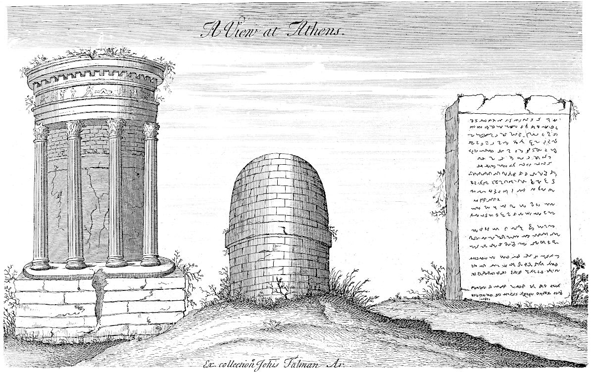
Two or three of the plates are inserted only as heads, being not referred to in the discourse, as Tab. VIII. the ground-plot of the ruins of Whitehall. I myself never saw the palace, but was pleased that I chanced to take this draught of its ruinous ichnography, but the very week before totally destroyed. Thus much I thought owing to the venerable memory of that name, which is ever the word at sea with British ships, and which makes the whole world tremble. Tab. X. is an ancient seal of the bishops of Norwich.[1] This plate the learned and curious Mr. le Neve, Norroy king at arms, lent me out of his good will to promote the work: the seal is remarkable for having letters upon the edge, represented in the empty ringlet; the manner of it is like our milled money; but how it was performed in wax, is not easy to say. Tab. XV. was likewise lent me by Mr. Norroy abovesaid. I design always, in these collections of mine, to insert one plate in a hundred, of some person’s effigies that has deserved well of the antiquities of Britain: it is but a just piece of gratitude to their memory. Tab. XL. (the Greek view at Athens) I took from an original drawing in Mr. Talman’s collection. I have some more of that sort: though they relate not to Britain, I do not fear the reader will be displeased with me on that account. How much rather ought we to lament the scarcity of such! What noble monuments of Greece are sunk into eternal oblivion, through want of Drawing in travellers that have been there in great numbers, or for want of encouragement to those that are able! With what regret do I mention that most beautiful temple of Minerva in the citadel of Athens, without dispute the finest building upon the globe, anno 1694! that year it was casually blown up with gunpowder, and not a drawing of it preserved.
Two or three of the plates are included only as titles, since they aren't discussed in the text, like Tab. VIII, which shows the layout of the ruins of Whitehall. I never saw the palace but was glad I managed to create a draft of its ruined design just a week before it was completely destroyed. I felt this was owed to the honored memory of that name, which is always mentioned by British ships at sea and makes the whole world tremble. Tab. X is an ancient seal of the bishops of Norwich. This plate was kindly lent to me by the knowledgeable Mr. le Neve, Norroy king at arms, to support the work: the seal is notable for having letters around the edge, shown in the empty circle; it resembles our milled coins, but how it was made in wax is hard to explain. Tab. XV was also lent to me by Mr. Norroy mentioned earlier. I intend to include one plate in every hundred for someone’s effigies who has made notable contributions to the antiquities of Britain: it's a fitting tribute to their memory. Tab. XL (the Greek view at Athens) was taken from an original drawing in Mr. Talman’s collection. I have some more in that style; even though they don’t relate to Britain, I don’t think the reader will mind. Rather, we should lament the lack of such drawings! So many noble monuments of Greece have been lost to eternal oblivion due to a lack of drawings from travelers, who have visited in great numbers, or a lack of support for those who could create them! With great sadness, I recall the most beautiful temple of Minerva in the Acropolis of Athens, undoubtedly the finest building in the world, anno 1694! That year it was accidentally blown up with gunpowder, and no drawings of it were preserved.

Eques Auratus.


Villæ Lenne Regis in Com Norff.


Gradus Sigittary.

The last plate, of the great conjunction of the five planets, I added as an æra of my book. This memorable appearance, because it affected not the vulgar like a solar eclipse, was almost neglected by the learned. I had a mind to do it justice by printing the type of it from the diagram sent me by the great Dr. Halley. For my part, I congratulate myself for living in an age fruitful of these grand phænomena of the celestial bodies, and am pleased, that beside the total eclipse 1715, we have in the space of two years this great conjunction, a transit of Mercury across the sun, a comet, the last eclipse of the sun, and in March next another great conjunction.
The last illustration, showing the great alignment of the five planets, I included as an era of my book. This remarkable event, which didn’t capture the attention of the general public like a solar eclipse, was nearly overlooked by scholars. I wanted to give it the recognition it deserves by printing the type based on the diagram sent to me by the esteemed Dr. Halley. Personally, I feel fortunate to live in a time rich with these amazing phenomena of the celestial bodies, and I’m happy that besides the total eclipse in 1715, we have experienced, within two years, this great conjunction, a transit of Mercury across the sun, a comet, the last solar eclipse, and another significant conjunction coming up in March.
The numerous plates I have given the reader, of ground-plots and prospects of Roman cities, I thought contributed much towards fixing their site, and preserving their memory: they may be useful to curious inhabitants, in marking the places where antiquities are found from time to time, and in other respects. There are some few errors of the press escaped me, notwithstanding all my care; but none, I think, of any consequence. I have taken care to make the Index as instructing as I could. The title of Roman roads belongs to such as are anonymous, or not commonly taken notice of: that of Roman coins points to such places as are not Roman towns, or particularly described. Etymology includes only such words as are scattered casually in the work, or matters that are not comprehended under any other head; and so of the rest.
The many maps I’ve provided, showing layouts and views of Roman cities, should help readers visualize their locations and remember them better. They might also be helpful to curious locals in identifying where antiquities are discovered over time, among other things. A few printing errors slipped through despite my efforts, but I believe none are significant. I’ve done my best to make the Index as informative as possible. The section on Roman roads includes those that are anonymous or not commonly mentioned, while Roman coins refers to locations that aren't Roman towns or specifically detailed. Etymology includes only words that appear scattered throughout the work or topics that don’t fit neatly into any other category, and the same goes for the rest.
One general observation I have made within the short space of time my travels were limited to, that husbandry, grazing, cultivation of waste lands, all sorts of trades and manufactures, towns and cities, are hugely improved; and especially the multitude of inhabitants is increased to a high proportion: the reason of it is not difficult to be guessed at.
One general observation I've made during my brief travels is that farming, grazing, land cultivation, various trades and industries, as well as towns and cities, have all greatly improved; notably, the population has grown significantly. The reason for this is not hard to figure out.
What I shall next trouble the reader withall, will be my intended work, of the history of the ancient Celts, particularly the first inhabitants of Great Britain, which for the most part is now finished. By what I can judge at present, it will consist of four books in folio. I. The history of the origin and passage of the Celts from Asia into the west of Europe, particularly into Britain; of their manners, language, &c. II. Of the religion, deities, priests, temples, and sacred rites, of the Celts. III. Of the great Celtic temple at Abury in Wiltshire, and others of that sort. IV. Of the celebrated Stonehenge. There will be above 300 copper plates of a folio size, many of which are already engraven; and many will be of much larger dimensions. Upon account, therefore, of the vast expence attending this work, I shall print no more than are subscribed for; the money to be paid to me only. Thus much I thought fit to advertise the friendly reader.
What I’m going to share with the reader next is my planned work on the history of the ancient Celts, especially the first inhabitants of Great Britain, which is mostly finished now. As far as I can tell, it will consist of four large books. I. The history of how the Celts originated and moved from Asia into the west of Europe, particularly Britain; along with their customs, language, etc. II. The religion, gods, priests, temples, and sacred rituals of the Celts. III. The great Celtic temple at Abury in Wiltshire, and similar sites. IV. The famous Stonehenge. There will be over 300 copper plates of a large size, many of which are already engraved; some will be even larger. Because of the significant costs involved in this work, I will print only as many copies as are ordered; payment will be made directly to me. I thought it was important to inform the supportive reader about this.
Ormond-street, 26 Dec. 1724.
Ormond Street, December 26, 1724.
GULIELMO STUKELEY, M. D.
Amicus Amico, &c.
GULIELMO STUKELEY, M. D.
Friend to a Friend, &c.
I. S.
I. S.
GEOR. LYNN, Interior. Templ. Soc.
GEOR. LYNN, Interior. Templ. Soc.
viii
viii
In Itinerarium Curiosum amici sui charissima viri doctissimi & Cl. Domini Gulielmi Stukeleii M. D. CML. SRS. & Antiquar. Secretar.
In Itinerarium Curiosum, to his dear friend, the highly learned and distinguished Mr. William Stukeley M. D. CML. SRS. & Antiquar. Secretary.
MAUR. JOHNSON, J. C.
Interioris Templi Soc. MDCCXXIV.
MAUR. JOHNSON, J.C.
Interior of the Temple Society. 1724.
ix
ix
x
x
JAMES HILL, J. C.
Middle-Temple, London, Dec. 1. 1724.
JAMES HILL, J.C.
Middle Temple, London, Dec. 1, 1724.

Homeward Journey. I.
Barrister at Law of the Inner-Temple.
THE amity that long subsisted between our families giving birth to an early acquaintance, a certain sameness of disposition, particularly a love to antient learning, advanced our friendship into that confidence, which induces me to prefix your name to this little summary of what has occurred to me worth mentioning in our native country, HOLLAND, in Lincolnshire; but chiefly intended to provoke you to pursue a full history thereof, who have so large a fund of valuable papers and collections relating thereto, and every qualification necessary for the work. That these memoirs of mine are so short, is because scarce more time than that of childhood I there spent, and when I but began to have an inclination for such enquiries: that the rest which follow are grown to such a bulk as to become the present volume, is owing to my residence at London. Great as are the advantages of this capital, for opportunities of study, or for the best conversation in the world, yet I should think a confinement to it insupportable, and cry out with the poet,
THE friendship that has existed between our families for a long time gave rise to an early connection, a shared disposition, especially a passion for ancient learning, which deepened our friendship into a trust that leads me to put your name at the beginning of this brief account of what I think is worth mentioning about our homeland, Holland, in Lincolnshire. It’s mainly meant to encourage you to pursue a complete history of it, since you have such a wealth of valuable papers and collections related to it, along with all the skills needed for the task. The reason my memoirs are so short is that I spent hardly more time there than my childhood, and it was only when I began to show an interest in such matters. The rest that follows has grown into the present volume due to my time living in London. Despite the great benefits of this capital for study and the best conversations one can have, I find the idea of being confined here unbearable, and I cry out with the poet,
which engages me to make an excursion now and then into the country: and this is properly taking a review of pure nature; for life here may be called only artificial, especially when fixed down to it; like the gaudy entries upon a theatre, where a pompous character is supported for a little while, and then makes an exit soon forgotten. My ancestors, both paternal and maternal, having lived, from times immemorial, in or upon the edges of our marshy level, perhaps gave me that melancholic disposition, which renders the bustlings of an active and showy life disagreeable. The fair allurements of the business of a profession, which have been in my road, cannot induce me wholly to forsake the sweet recesses of contemplation, that real life, that tranquillity of mind, only to be2 met with in proper solitude; where I might make the most of the pittance of time allotted by Fate, and if possible doubly over enjoy its fleeting space. I own a man is born for his country and his friends, and that he ought to serve them in his best capacity; yet he confessedly claims a share in himself: and that, in my opinion, is enjoying one’s self; not, as the vulgar think, in heaping up immoderate riches, titles of honour, or in empty, irrational pleasures, but in storing the mind with the valuable treasures of the knowledge of divine and human things. And this may in a very proper sense be called the study of Antiquities.
which draws me to take occasional trips into the countryside: and this is truly a chance to appreciate pure nature; because life here can only be considered artificial, especially when one is confined to it; like the extravagant scenes on a stage, where an overblown character is showcased briefly before disappearing, soon forgotten. My ancestors, both from my father's and mother's side, have lived for ages on the edges of our marshy landscape, which may have given me that melancholic nature that makes the hustle of an active and flashy life unappealing. The tempting opportunities of a professional career that have come my way can't fully convince me to abandon the sweet spaces of contemplation, the real life, that mental peace found only in genuine solitude; where I might truly make the most of the short time Fate allows, and if possible, enjoy its fleeting moments even more. I admit that a person is born for their country and friends, and they should serve them to the best of their ability; yet they undeniably deserve a piece of themselves: and to me, that is what it means to enjoy oneself; not, as most people believe, through accumulating excessive wealth, titles of honor, or in shallow, mindless pleasures, but by enriching the mind with the valuable treasures of knowledge about divine and human matters. And this can very accurately be referred to as the study of Antiquities.
I need not make an apology to you for that which some people of terrestrial minds think to be a meagre and useless matter; for truly what is this study, but searching into the fountain-head of all learning and truth? Some antient philosophers have thought that knowledge is only reminiscence. If we extend this notion no further than as to what has been said and done before us, we shall not be mistaken in asserting that the past ages bore men of as good parts as we: enquiry into their thoughts and actions is learning; and happy for us if we can improve upon them, and find out things they did not know, by help of their own clue. All things upon this voluble globe are but a succession, like the stream of a river: the higher you go, the purer the fluid, less tainted with corruptions of prejudice or craft, with the mud and soil of ignorance. Here are the things themselves to study upon; not words only, wherein too much of learning has consisted. If we examine into the antiquities of nations that had no writing among them, here are their monuments: these we are to explore, to strike out their latent meaning; and the more we reason upon them, the more reason shall we find to admire the vast size of the gigantic minds of our predecessors, the great and simple majesty of their works, and wherein mainly lies the beauty and the excellence of matters of antiquity. But more especially it is not without a happy omen, that the moderns have exerted themselves in earnest, to rake up every dust of past times, moved by the evident advantages therefrom accruing, in the understanding their invaluable writings, which have escaped the common shipwreck of time. It is from this method we must obtain an accurate intelligence of those principles of learning and foundations of all science: it is from them we advance our minds immediately to the state of manhood, and without them the world 5000 years old would but begin to think like a child. Nothing more illustrates this than looking into the comments that were wrote upon them 200 years ago, voluminous enough, but barbarous, poor, and impertinent, when compared to the solid performances of learned men since, whose heads were enriched with an exact search into the customs, manners and monuments of the writers. Hence it is, that history, geography, mathematics, philosophy, the learned professions, law, divinity, our own faculty, and the muses in general, flourish like a fresh garden richly watered and cultivated, weeded from rubbish of logomachy and barren mushrooms, gay with thriving and beautiful plants of true erudition, inoculated upon the stocks of the antients.
I don’t need to apologize to you for what some people think is a trivial and useless matter; because really, what is this study but a search into the source of all knowledge and truth? Some ancient philosophers believed that knowledge is just recollection. If we limit this idea to what has been said and done before us, we won’t be wrong in saying that past ages had people as capable as we are: exploring their thoughts and actions is learning; and it’s fortunate for us if we can build upon them and discover things they didn’t know, using their own insights. Everything on this ever-changing planet is just a sequence, like the flow of a river: the higher you go, the purer the water, less contaminated by the biases and tricks, by the dirt and ignorance. Here are the actual things to study; not just words, which too much of learning has been based on. If we look into the histories of nations that had no writing, here are their monuments: these are what we should investigate, to uncover their hidden meanings; and the more we think about them, the more reasons we’ll find to admire the vast intelligence of our forebears, the grandeur of their creations, and what essentially makes the beauty and excellence of ancient matters. Moreover, it’s especially promising that modern thinkers have genuinely worked hard to uncover every piece of history, driven by the clear advantages gained from understanding their invaluable writings, which have survived the common wreckage of time. It’s through this method that we can attain a clear understanding of the principles of learning and the foundations of all sciences: it is through them that we elevate our minds to maturity, and without them, the world, 5000 years old, would still think like a child. Nothing illustrates this better than looking at the commentaries written about them 200 years ago, which were extensive yet crude, poor, and irrelevant compared to the solid work of learned individuals since then, whose minds were enriched by thoroughly exploring the customs, manners, and monuments of the writers. Therefore, history, geography, mathematics, philosophy, the learned professions, law, divinity, our own field, and the muses in general, thrive like a fresh garden, well-watered and cultivated, cleared of the debris of wordiness and barren ideas, vibrant with flourishing and beautiful plants of true knowledge, grafted onto the roots of the ancients.
If ruminating upon antiquities at home be commendable, travelling at home for that purpose can want no defence; it is still coming nearer the lucid springs of truth. The satisfaction of viewing realities has led infinite numbers of its admirers through the labours and dangers of strange countries, through oceans, immoderate heats and colds, over rugged mountains, barren sands and deserts, savage inhabitants, and a million of perils; and the world is filled with accounts of them. We export yearly our own3 treasures into foreign parts, by the genteel and fashionable tours of France and Italy, and import ship-loads of books relating to their antiquities and history (it is well if we bring back nothing worse) whilst our own country lies like a neglected province. Like untoward children, we look back with contempt upon our own mother. The antient Albion, the valiant Britain, the renowned England, big with all the blessings of indulgent nature, fruitful in strengths of genius, in the great, the wise, the magnanimous, the learned and the fair, is postponed to all nations. Her immense wealth, traffic, industry; her flowing streams, her fertile plains, her delightful elevations, pleasant prospects, curious antiquities, flourishing cities, commodious inns, courteous inhabitants, her temperate air, her glorious show of liberty, every gift of providence that can make her the envy and the desirable mistress of the whole earth, is slighted and disregarded.
If reflecting on the past at home is praiseworthy, then exploring your own country for that reason definitely deserves support; it brings us closer to the clear sources of truth. The joy of experiencing reality has driven countless people through the challenges and dangers of distant lands, across oceans, extreme temperatures, rugged mountains, barren sands, deserts, hostile populations, and countless other risks; the world is full of their stories. Each year, we send our own treasures abroad through the elegant and trendy tours of France and Italy and bring back shiploads of books about their history and antiquities (and it’s fortunate if we don't return with anything worse), while our own country sits like a forgotten region. Like unruly children, we look back with disdain at our own mother. The ancient Albion, the brave Britain, the renowned England, rich with all the gifts of a generous nature, abundant in remarkable talents, great minds, noble spirits, scholars, and beauty, is overlooked by all other nations. Its vast wealth, commerce, industry; its flowing rivers, fertile fields, pleasant hills, beautiful views, intriguing antiquities, thriving cities, comfortable inns, friendly people, mild climate, and splendid sense of liberty—every blessing from providence that could make it the envy and desired prize of the entire world is dismissed and ignored.
You, Sir, to whom I pretend not to talk in this manner, well know that I had a desire by this present work, however mean, to rouse up the spirit of the Curious among us, to look about them and admire their native furniture: to show them we have rarities of domestic growth. What I offer them is an account of my journeyings hitherto, but little indeed, and with expedition enough, with accuracy no more than may be expected from a traveller; for truth in every particular, I can vouch only for my own share, strangers must owe somewhat to informations. I can assure you I endeavoured as much as possible not to be deceived, nor to deceive the reader. It was ever my opinion that a more intimate knowledge of Britain more becomes us, is more useful and as worthy a part of education for our young nobility and gentry as the view of any transmarine parts. And if I have learnt by seeing some places, men and manners, or have any judgment in things, it is not impossible to make a classic journey on this side the streights of Dover.
You, Sir, to whom I don’t pretend to speak like this, know that I wanted this work, however humble, to inspire the curious among us to explore and appreciate what’s around them: to show that we have unique treasures grown right here at home. What I’m sharing is an account of my travels so far, but it's rather limited, and with just enough detail, and the accuracy you can expect from a traveler; I can only guarantee the truth of my own experiences, while strangers must rely on information from others. I assure you I tried my best not to be misled, nor to mislead the reader. I’ve always believed that a deeper understanding of Britain is more fitting for us, and is just as valuable a part of education for our young nobility and gentry as exploring foreign lands. And if I’ve gained insight from visiting different places, people, and customs, or if I have any sense of things, it isn’t impossible to undertake a classic journey on this side of the Strait of Dover.
Thus much at least I thought fit to premise in favour of the study of antiquities. And with particular deference to the society of British Antiquaries in London, to whom I remember with pleasure you first introduced me: since for some time I have had the honour of being their secretary; to them I beg leave to consecrate the following work. To the right honourable the Earl of Hartford the illustrious and worthy President, the right honourable the Earl of Winchelsea, Peter le Neve, esq; Roger Gale, esq; the illustrious and worthy Vice-presidents, and to the learned Members thereof. Then, lest I should fall under my own censure passed upon others, that know least of things nearest them, I shall deliver my thoughts about the history of Holland before mentioned, which may serve as a short comment upon the map of this country which I published last year, with a purpose of assisting the gentlemen that are commissioners of sewers there, though it is of such a bulk as cannot conveniently be inserted into this volume.
I definitely wanted to say a few words in support of studying antiquities. I especially want to acknowledge the Society of British Antiquaries in London, who you first introduced me to with great pleasure. For some time now, I've had the honor of serving as their secretary, so I'd like to dedicate this work to them. This goes out to the right honorable Earl of Hartford, the distinguished and esteemed President; the right honorable Earl of Winchelsea; Peter le Neve, Esq.; Roger Gale, Esq.; the distinguished and esteemed Vice Presidents; and all the knowledgeable members of the society. Now, to avoid being a hypocrite for criticizing others who know the least about what’s closest to them, I’ll share my thoughts on the history of The Netherlands that I mentioned earlier. This will serve as a brief commentary on the map of this country that I published last year, which was intended to help the gentlemen who are commissioners of sewers there, even though it’s too lengthy to fit into this volume.
If we cast our eyes upon the geography of England, we must observe that much of the eastern shore is flat, low ground, whilst the western is steep and rocky. This holds generally true throughout the globe as to its great parts, countries or islands, and likewise particularly as to its little ones, mountains and plains. I mean, that mountains are steep and abrupt to the west,[2] especially the north-west, and have a gentle declivity eastward or to the south-east, and that plains ever descend eastward. I wonder very much that this remark has never been made. I took notice of it in our own country, almost before 4I had ever been out of it, in the universal declivity of that level eastward, in those parts where it did not by that means regard the ocean; particularly in South Holland, or the wapentake of Elho: the natural descent of water therein is not to the sea, as the rivers run, but directly eastward, and that very considerable. Beside, the current of every river is lower as more eastward: thus the Welland is higher in level than the Nen, the Nen than the Ouse; and probably at first both emptied themselves by the Ouse or Lyn river as most eastward. I observed in June 1732, that the Peterborough river Nen would willingly discharge itself into Whitlesea mere, and so to the Ouse at Lyn, if it were not hindered by the sluice at Horsey bridge by the river Nen. I see no difficulty to attribute the reason of it to the rotation of the globe. Those that have gone about to demonstrate to us that famous problem of the earth’s motion, have found out many mathematical and abstracted proofs for that purpose, but neglected this which is most sensible and before our eyes every minute. It is a property of matter, that when whirled round upon an axis, it endeavours to fly from the axis, as we see in the motion of a wheel, the dirt and loose parts are thrown the contrary way in a tangent line. This is owing to the natural inactivity of matter, which is not easily susceptible of motion. Now at the time that the body of the earth was in a mixt state between solid and fluid, before its present form of land and sea was perfectly determined, the almighty Artist gave it its great diurnal motion. By this means the elevated parts or mountainous tracts, as they consolidated whilst yet soft and yielding, flew somewhat westward, and spread forth a long declivity to the east: the same is to be said of the plains, their natural descent tending that way, and, as I doubt not, of the superfice of the earth below the ocean. This critical minute is sublimely described by the admirable poet and observer of nature,
If we look at the geography of England, we can see that much of the eastern shoreline is flat and low, while the western side is steep and rocky. This is generally true for large areas, countries, or islands, and specifically for smaller features like mountains and plains. Basically, mountains are steep and abrupt to the west, especially in the northwest, and they gently slope downward to the east or southeast. Plains always slope downward toward the east. It's surprising that this observation hasn't been noted before. I first noticed it in our own country, almost before I had traveled outside of it, in how the land universally slopes eastward in areas that aren't affected by the ocean; particularly in South Holland, or the wapentake of Elho: the natural flow of water there doesn't head to the sea, as the rivers do, but goes directly eastward, and quite significantly. Also, every river's current is lower as it goes further east: for example, the Welland is higher than the Nen, and the Nen is higher than the Ouse; both likely originally flowed into the Ouse or Lyn river, which is the most easterly. I noticed in June 1732 that the Peterborough river Nen would prefer to flow into Whitlesea mere and then to the Ouse at Lyn if it weren't blocked by the sluice at Horsey bridge on the river Nen. I see no issue in linking this to the rotation of the globe. Those who have tried to prove the famous problem of the earth's motion have discovered many mathematical and abstract proofs for it but overlooked this tangible fact that is evident to us every minute. It’s a property of matter that when spun around an axis, it tends to move away from that axis, just like how dirt and loose parts are flung outward when a wheel spins. This behavior is due to the natural inertia of matter, which doesn't easily respond to motion. At the moment the earth was in a mixed state between solid and fluid, before its current shape of land and sea was fully established, the almighty Creator gave it its great daily motion. As a result, the elevated regions or mountain ranges, while still soft and pliable, shifted somewhat westward and gradually sloped to the east; the same can be said for the plains, whose natural slope follows that direction, and I have no doubt applies to the earth's surface beneath the ocean as well. This crucial moment is beautifully described by the remarkable poet and observer of nature,
which may thus be englished.
which may thus be translated.
The truth of this observation I have seen universally confirmed in all my travels, and innumerable instances of it will occur to the reader throughout these discourses. I design another time professedly to treat of it in a philosophical way. But consequent to this doctrine it is that we have so large a quantity of this marshland in the middle of the eastern shore of England, seeming as if made by the washings and eluvies of the many rivers that fall that way, such as the Welland, the Witham, the Nen, the Ouse great and little, together with many other streams of inferior note. These all empty themselves into the great bay formed between the Lincolnshire wolds and cliffs of Norfolk, called by Ptolemy Mentaris æstuarium, as rightly5 corrected by Mr. Baxter, seeing it is composed of the mouths of so many rivers; Ment, or Mant, signifying ostium in the British language. Beside the great quantity of high and inland country that discharges its waters this way, even as far as Fritwell in Oxfordshire; all the level country lies before it, extending itself from within some few miles of Cambridge south, to Keal hills near Bolingbroke in Lincolnshire north, about sixty miles long, known by the names of the Isle of Ely, Holland and Marshland. This country, since the flood, I believe was much in the same state as at present, and for its bulk the richest spot of ground in the kingdom; once well inhabited by gentry, especially the religious. I apprehend the more inland part of it, the Isle of Ely, Deeping Fen, &c. was not in distant ages in so bad a condition as now, because the natural drainage of it was better, before the sea had by degrees added so much solid ground upon the coasts.
I have seen the truth of this observation confirmed during all my travels, and countless examples of it will come to mind as the reader goes through these discussions. I plan to address it in a more philosophical manner another time. As a result of this principle, we have a significant amount of marshland in the middle of the eastern shore of England, as if it were formed from the deposits of several rivers that flow that way, like the Welland, the Witham, the Nen, the Great and Little Ouse, along with many other lesser streams. All of these flow into the large bay situated between the Lincolnshire wolds and the cliffs of Norfolk, which Ptolemy referred to as Mentaris æstuarium, as noted by Mr. Baxter, since it consists of the mouths of many rivers; Ment or Mant means mouth in the British language. Aside from the large area of high and inland land that drains its waters this way, even as far as Fritwell in Oxfordshire, all the low-lying land stretches before it, extending from a few miles south of Cambridge to the Keal hills near Bolingbroke in Lincolnshire to the north, about sixty miles long, known as the Isle of Ely, Holland, and Marshland. I believe this region, since the flood, has been in much the same condition as it is now, and overall, it is the richest area of land in the kingdom; it was once well-populated by gentry, especially the religious. I suspect that the more inland areas, such as the Isle of Ely and Deeping Fen, were not in such poor condition in earlier times because the natural drainage was better before the sea gradually added so much solid ground along the coasts.
In this country I have observed abundance of old Welsh words left among us; and I am persuaded that the name of Holland is derived from that language, though now terminated by a later word, as is frequent enough. It signifies no more than salt or marsh land, such as is gained from the sea; and to this day we call the marshes adjoining to, and sometime overflowed by the sea, salt marshes. Likewise upon the sea shore they formerly made salt in great abundance. The hills all along upon the sea bank, the remains of such works, are still called salt hills: such are at Fleet, Holbech, Gosberton, Wainflet,[3] &c. Many names of rivers and roads, thence derived, remain still, such as Salters Lode, Salteney Gate, &c. Hallt in the British is salsus, salt, as ἅλς in the Greek is mare, the sea; and most evidently borrowed from the British, because of its most notorious quality. The adjoining part of this country in Norfolk, is called marsh land, in the very same sense: so is Zeland and Holland at the mouth of the Rhine, where our Cimbric ancestors once lived. In the Cimbric Chersoness, now Denmark, is Halland, a division of the country by the Saxons called Halgo land. Vid. Spelman’s Glassary, voce Sciringes heal. Holsatia, Holstein, &c. and our Holderness in Yorkshire, must thus be understood. Hence the isle of Ely too is denominated, the very word heli being salsugo in the British. This, in the most antient British times, was as much marsh land as our wapentake of Elho is now, which acknowledges the same original; hoe signifying a parcel of high ground.
In this country, I've noticed a lot of old Welsh words still around us; and I believe the name Holland comes from that language, although it's been changed by a more recent term, as often happens. It simply means salt or marsh land, such as that which is created by the sea; and even today, we refer to the marshes next to, and sometimes flooded by, the sea as salt marshes. Similarly, on the shoreline, they used to produce salt in large quantities. The hills along the seashore, the remnants of those operations, are still called salt hills: these are found at Fleet, Holbeach, Gosberton, Wainfleet, [3] & etc. Many names of rivers and roads derived from this still exist, such as Salters Lode, Salteney Gate, & etc. Hallt in Welsh is salsus, meaning salt, just as ἅλς in Greek is mare, meaning the sea; and it clearly borrows from Welsh, due to its well-known characteristic. The adjacent area of this country in Norfolk is also referred to as marsh land in the same way: so is Zeeland and Holland at the mouth of the Rhine, where our Cimbric ancestors once lived. In the Cimbric Chersonese, now Denmark, is Halland, a region referred to by the Saxons as Halgo land. See Spelman's Glossary, entry Sciringes heal. Holsatia, Holstein, & etc., and our Holderness in Yorkshire should be understood this way. Consequently, the isle of Ely is named as such, with the word heli meaning salsugo in Welsh. In ancient British times, this was as much marsh land as our wapentake of Elho is now, which shares the same origin; hoe meaning a piece of high ground.
We may be assured that this whole country was well inhabited by the antient Britons, and that as far as the sea coasts, especially the islets and higher parts more free from ordinary inundations of the rivers, or though not imbanked above the reach of the spring tides; for the nature of this place perfectly answered their gusto, both as affording abundant pasturage for their cattle, wherein their chief sustenance and employment consisted, and in being so very secure from incursion and depredations of war and troublesome neighbours, by the difficult fens upon the edge of the high country. Here I have not been able to meet with any remains of them, except it be the great quantity of tumuli, or barrows, in all these parts; scarce a parish without one or more of them. They are generally of a very considerable bulk, much too large for Roman; nor has any thing Roman been discovered in cutting them through; though, a few years ago, two or three were dug quite away near Boston, and another at Frampton, to make brick of, or to mend the highways. I guess these were the high places of worship among our Cimbrian predecessors, purposely cast up, because there 6are no natural hills in these parts; and we know antiquity affected places of elevation for religious rites. No doubt, some are places of sepulture, especially such as are very frequent upon the edges of the high countries all around, looking down upon the fens. Hither seem to have been carried the remains of great men, whose habitations were in the marshy grounds, who chose to be buried upon higher ground than where they lived; as is the case all over England; for the tumuli are commonly placed upon the brink of hills hanging over a valley, where doubtless their dwellings were.
We can be certain that this entire country was well populated by the ancient Britons, especially along the coastlines, including the islands and higher areas that were less affected by regular flooding from rivers, even though they weren't protected from spring tides. The characteristics of this land perfectly matched their preferences, providing ample grazing land for their livestock, which was their main source of food and work, and it was also very safe from invasions and raids due to the challenging marshes at the edges of the highland areas. Here, I haven't been able to find any remnants of them aside from the large number of tumuli, or burial mounds, scattered throughout these regions; there's hardly a parish without one or more of them. They are generally quite large, much bigger than Roman ones, and nothing Roman has been found when excavating them. A few years back, two or three were completely dug up near Boston, and another at Frampton, presumably to make bricks or repair the roads. I believe these were high places of worship for our Cimbrian ancestors, deliberately constructed since there are no natural hills in the area, and we know that ancient cultures preferred elevated sites for religious ceremonies. Undoubtedly, some of these mounds were burial sites, especially those frequently located at the edges of highlands overlooking the marshes. Here, it seems, the remains of prominent individuals were brought, who lived in the marshy areas but chose burial spots on higher ground, as is the custom throughout England; the tumuli are typically placed on the brink of hills overlooking valleys, where their homes likely were.
But when the Romans had made considerable progress in reducing this island into the regular form of a province, and began the mighty work of laying down the great military ways; then I suppose it was, that they cast their eyes upon this fertile and wide-extended plain, and projected the draining it. The Hermen Street.In the reign of Nero, in all probability, they made the Hermen Street,[4] as now called by a Saxon word equivalent to the Latin via militaris. That this was the first, seems intimated by the name, in that it has retained κατ’ εξοχην, what is but a common appellative of such roads. TAB. LVI.This noble work, taking in the whole of it, was intended to be a meridian line running from the southern ocean, through London, to the utmost bounds of Scotland. This may be inferred from the main of it, which runs directly north and south. And another argument of its early date, drawn from three remarkable particularities, I have observed in travelling upon it, and which show it was begun before that notable people had a thorough knowledge of the geography of the island. One is, its deviation westward as it advances towards these fens from London: another is, the new branch, drawn a little beyond Lincoln westward into Yorkshire, out of the principal stem going to the Humber: a third is, that it is double in Lincolnshire. Of these I shall speak again when we come to the following Iter Romanum. Now we will only consider such part of it as has relation to the country we are upon; and that is the road going from Caster by Peterburgh to Sleford in this county, which is undoubtedly Roman, and which first occasioned the draining this fenny tract, and surely more antient than that which goes above Stanford, and along the heathy part of the county to Lincoln. My reasoning depends upon the manner of the road itself, and upon that other great work which accompanies it, called the Cardike, equally to be ascribed to the same authors. This road is nearer the first intention of a meridian line than the other: but, when they found it carried them through a low country, where it perpetually needed reparation, and that they must necessarily decline westward to reach Lincoln, they quitted it, and struck out a new one, more westerly, that should run altogether upon better ground. This, if we have leave to guess, was done after the time of Lollius Urbicus, lieutenant under Antoninus Pius, who with great industry and courage had extended and secured the whole province as far as Edinburgh. Then it was they had time and opportunity to complete the work in the best manner, being perfect masters of the country, and of its geography: and this road was for the ready march of their armies and provisions to succour those northern frontiers. But it seems as if they had long before that time brought the Hermen Street as far as Lincolnshire,[5] especially that eastern branch, or original stem, of which we 7are treating, and that as early as the reign of Nero, and at the same time made the Cardike. I shall give you my further reasons for this conjecture, and nothing more than conjecture can be expected in such matters.
But when the Romans had made significant progress in transforming this island into a proper province and began the huge task of building major military roads, I assume that they then looked at this fertile and expansive plain and planned to drain it. The Hermen Street.In the reign of Nero, it's likely they created the Hermen Street,[4] which is now referred to by a Saxon word equivalent to the Latin via militaris. The name suggests that this was the first road, as it has kept the term κατ’ Îεξοχην, which is just a common name for such roads. TAB. LVI.This grand project was meant to be a north-south line running from the southern ocean, through London, to the farthest points of Scotland. This can be inferred from its direct north-south route. Another indication of its early date comes from three notable features I've observed while traveling on it, which suggest it was started before that significant group had a thorough understanding of the island's geography. One is its westward deviation as it approaches the fens from London; another is the new branch that turns westward into Yorkshire just beyond Lincoln, stemming from the main route heading to the Humber; and a third is that it is double in Lincolnshire. I will discuss these further when we next address the Iter Romanum. For now, let's focus on the part that's relevant to the area we are discussing: the road going from Caster by Peterborough to Sleaford in this county, which is undoubtedly Roman and which initiated the draining of this marshy area, and is surely older than the road that goes above Stamford, along the heathland to Lincoln. My reasoning is based on the nature of the road itself and on another major work that accompanies it, called the Cardike, which can also be attributed to the same creators. This road aligns more closely with the original plan for a north-south line than the other: but when they found that it took them through lowlands that constantly needed repairs, and that they had to eventually turn westward to reach Lincoln, they abandoned it and forged a new route that would run entirely on better ground. If we are to speculate, this was likely done after the time of Lollius Urbicus, who was the governor under Antoninus Pius and had worked diligently to extend and secure the province up to Edinburgh. At that point, they had the time and opportunity to finish the project in the best way, being well-acquainted with the country and its geography: and this road was for the quick movement of their troops and supplies to support the northern borders. However, it seems they had already extended the Hermen Street as far as Lincolnshire,[5] particularly the eastern branch, or original stem, which we 7 are discussing, and that this was done as early as Nero's reign, while also creating the Cardike. I will provide more reasons for this hypothesis, and all that can be expected are merely speculations in such matters.

The road which we suppose the original stem of the Hermen Street goes in a direct line, and full north and south from Durobrivæ, or Caster, to Sleford; and there, for aught I know, it terminates. It is manifest, that if it had been carried further in that direction, it would have passed below Lincoln heath, and arrive at the river where it is not fordable. It parts from the present and real Hermen Street at Upton, a mile north of Caster; but this is continued in a strait line, which demonstrates that it is the original one: the other goes from it with an angular branching. This traverses the river Welland at Westdeeping, and is carried in a high bank across the watery meadows of Lolham bridges.[6] These are numerous and large arches made upon the road, to let the waters pass through, taken notice of by the great Camden as of antiquity; and no doubt originally Roman: then it crosses the Glen at Catebridge, (whereabouts it is now called King’sgate, via regia) to Bourn, (where Roman coins are often found, many in possession of Jos. Banks, jun. esq.) so to Fokingham and Sleaford. It is now called Longdike. All along parallel to this road runs a famous old drain, called The Cardike. Cardike.[7] Mr. Morton has been very curious in tracing it out through his county, Northamptonshire. I am sorry I have not yet had opportunity to pursue his laudable example, in finishing the course of it through Lincolnshire: but as far as I have observed it, it is marked in the map. This is a vast artificial canal drawn north and south upon the edge of the fens, from Peterburgh river to Lincoln river, about fifty mile long, and by the Romans without all peradventure. It is taken notice of by serjeant Callis, our countryman, in his readings on the sewers. That wise people, with a greatness of thought peculiar to themselves, observed the great use of such a channel, that by water carriage should open an inland traffic between their two great colonies of Durobrivæ and Lindum, or Lincoln, without going round the hazardous voyage of the Estuary: just such was the policy of Corbulo in Tacitus, Annal. xi. Ne tamen miles otium indueret inter Mosam Rhenumque trium & viginti millium spatio fossam produxit, qua incerta oceani evitarentur. And lest the soldiery should be idle, he drew a dike for the space of three and twenty miles between the Maese and the Rhine, whereby the dangers of the ocean are avoided; which is exactly a parallel case with ours. Besides, it is plain that by intercepting all the little streams coming down from the high country, and naturally overflowing our levels, it would much facilitate the draining thereof, which at this time they must have had in view. This canal enters Lincolnshire at Eastdeeping, proceeding upon an exact level, which it takes industriously between the high and low grounds all the way, by Langtoft and Baston: passing the river Glen at Highbridge, it runs in an uninterrupted course as far as Kyme: beyond that I have not yet followed it; but I suppose it meets Lincoln river near Washenburgh, and where probably they had a fort to secure the navigation, as upon other proper intermediate places, such 8as Walcot, Garick, Billingborough, Waldram-hall, Narborough, Eye antiently Ege, agger; and I imagine St. Peter’s de Burgo hence owes its original: and a place called Low there, a camp ditched about, just where the Cardike begins on one side the river: another such fortification at Horsey bridge on the other side the river: all these names point out some antient works. It is all the way threescore foot broad, having a large flat bank, on both sides, for the horses that drew their boats. Roman coins are frequently found through its whole length, as you well know, who are possessed of many of them of different emperors. Now it seems to me highly probable that Catus Decianus, the procurator in Nero’s time, was the projector both of this road and this canal, two notable examples in different kinds of Roman industry and judgment; and the memorial of the author of so great a benefit to the country is handed down to us in several particulars; as that of Catesbridge before mentioned upon the road, and of Catwater, a stream derived from this artificial channel, at the very place where it begins, to the Nen at Dovesdale bar: likewise at Dovesdale bar comes in another stream from the north, from a place by Shephey bank, called Catscove corner; and this was first hinted to me by our deceased friend, the learned and reverend Mr. John Britain, late schoolmaster of Holbech: to which we may add Catley, a town near Walcot upon the Cardike beyond Kyme; and Catthorp, a village near Stanfield, upon the road. We may likewise upon the same grounds conjecture that Lollius Urbicus repaired this work; whence it seems that his name, though corrupted, is preserved in Lolham bridges; for there is no town of that kind near it. Vid. Gale’s Itinerar. pag. 28. Lowlsworth upon the Hermen Street without Bishops-Gate, in Spittle-Fields. Certainly this is a good hint for our imitation, had we a like public spirit. Now this road thus accompanying the canal, was of great service to the traders, who might have an eye upon their vessels all the while. And even after the projection of the other branch which goes to Lincoln upon the higher ground, the navigation here was undoubtedly continued in full perfection, till the Romans left the island; for such is its advantage of situation, that it could never want water, nor ever overflow: that stream of Catwater seems to be cut on purpose, at least scoured up, to preserve these uses in drawing off the floods of Peterburgh river into the Nen, if its proper channel was not sufficient. The meaning of the word Cardike is no more than Fendike: we use the word still in this country, to signify watery, boggy places: it is of British original.
The road that we believe to be the original Hermen Street runs straight north and south from Durobrivæ, or Caster, to Sleford; and for all I know, that’s where it ends. It's clear that if it had gone further in that direction, it would have gone below Lincoln heath and reached the river where it isn’t crossable. It branches off from the current Hermen Street at Upton, a mile north of Caster; however, this part continues in a straight line, proving that it's the original route: the other veers off at an angle. This route crosses the Welland River at Westdeeping and runs along a high bank across the marshy meadows of Lolham bridges. These are numerous large arches built into the road to allow the water to pass through, noted by the famous Camden as being from ancient times; and they were undoubtedly originally Roman. Then it crosses the Glen at Catebridge (now called King's Gate, via regia) to Bourn (where Roman coins are often found, many owned by Jos. Banks, Jr., Esq.) and then goes on to Fokingham and Sleaford. It’s now known as Longdike. Running parallel to this road is an ancient drain called The Cardike. Cardike.[7] Mr. Morton has been very thorough in tracing it throughout his county, Northamptonshire. I regret that I haven't yet had the chance to follow his commendable example by finishing its route through Lincolnshire: but as far as I've observed, it’s marked on the map. This is a vast artificial canal stretching north and south along the edge of the fens, from the Peterborough River to the Lincoln River, about fifty miles long, and undoubtedly built by the Romans. It has been noted by Sergeant Callis, our fellow countryman, in his readings on sewers. These wise people, with their particular vision, recognized the great usefulness of such a channel to facilitate inland trade between their two major colonies of Durobrivée and Lindum, or Lincoln, without undertaking the perilous roundabout journey via the Estuary: this is similar to the strategy employed by Corbulo in Tacitus, Annal. xi. Ne tamen miles otium indueret inter Mosam Rhenumque trium & viginti millium spatio fossam produxit, qua incerta oceani evitarentur. And to keep the soldiers busy, he built a dike spanning twenty-three miles between the Meuse and the Rhine, allowing them to avoid the dangers of the ocean; which is exactly comparable to our situation. Moreover, it is evident that by intercepting all the minor streams flowing down from the highlands and naturally flooding our lowlands, it would greatly ease their drainage — something they must have had in mind at that time. This canal enters Lincolnshire at Eastdeeping, proceeding at a precise level, which it maintains diligently between the high and low grounds all the way through Langtoft and Baston: crossing the Glen River at Highbridge, it continues on an uninterrupted path to Kyme: beyond that, I haven’t tracked it yet; but I suspect it meets the Lincoln River near Washenburgh, probably where they had a fort to secure navigation, as in other suitable intermediate locations, like Walcot, Garick, Billingborough, Waldram-hall, Narborough, Eye (formerly Ege, agger); and I believe St. Peter’s de Burgo owes its origin to this, along with a place called Low there, a camp encircled by a ditch near where the Cardike starts on one side of the river; another similar fortification at Horsey Bridge on the opposite side of the river: all these names indicate some ancient works. It measures sixty feet in width the entire way, with a large flat bank on both sides for the horses that towed their boats. Roman coins are frequently discovered throughout its length, as you well know, since many different emperors' coins are in your possession. Now it seems to me very likely that Catus Decianus, the procurator during Nero’s time, initiated both this road and this canal, which are two notable examples of Roman industry and foresight; and the legacy of the creator of such a significant benefit to the country has been passed down to us in various details, such as Catesbridge mentioned earlier along the road, and Catwater, a stream derived from this artificial channel, at the very spot where it begins, flowing to the Nen at Dovesdale Bar: likewise, at Dovesdale Bar comes another stream from the north, from a place by Shephey bank, called Catscove corner; this was first brought to my attention by our late friend, the learned and respected Mr. John Britain, former schoolmaster of Holbech: we can also add Catley, a town near Walcot on the Cardike beyond Kyme; and Catthorp, a village near Stanfield along the road. We may similarly conjecture that Lollius Urbicus repaired this work; hence it appears that his name, although corrupted, is preserved in Lolham bridges; for there is no town of that nature nearby. See Gale’s Itinerar. page 28. Lowlsworth on the Hermen Street outside Bishops-Gate, in Spital-Fields. This certainly presents a good example for us to follow, if we had similar public spirit. Now this road, accompanying the canal, was very beneficial to traders, who could monitor their vessels the entire time. Even after the development of the other branch leading to Lincoln on the higher ground, navigation here was undoubtedly maintained in full capacity until the Romans departed from the island; because its advantageous position ensures it would never lack water, nor ever flood: that stream of Catwater seems intentionally constructed, or at least cleared out, to fulfill these purposes of directing off the floods from the Peterborough River into the Nen, if its normal channel was insufficient. The term Cardike simply means Fendike: we still use this word in our region to denote watery, boggy areas: it originates from British.
I doubt not but that the Romans likewise made that other cut, between Lincoln river and the Trent, called the Foss: the name seems to indicate it, as well as the thing itself; for it is but a consequent of the Cardike, and formed on the same idea: so that I suppose it was not originally cut, but scoured by Henry I. as Hoveden mentions: then the navigation was continued by land from Peterborough quite to York, and this was very useful to the Romans in their northern wars. The other way they might come from Huntingdon.
I have no doubt that the Romans also created the cut between the Lincoln river and the Trent, known as the Foss. The name suggests this, along with the feature itself; it’s simply a follow-up to the Cardike and was based on the same concept. I believe it wasn’t originally dug, but was cleared out by Henry I, as Hoveden notes. After that, navigation continued over land from Peterborough all the way to York, which was very beneficial to the Romans in their northern campaigns. They could also travel from Huntingdon.
The 20th of October, 1726, I traced the Cardike round the out-skirts of Sir William Ellys’s park of Nockton: it runs near the site of the old priory, whose ruins are just visible: it bounds the park entirely on the fen side, and is very perfect thereabouts; the high-country streams from Dunston, and others, running along it. We saw where it crossed a marshy valley, and reached the opposite high ground in its course to Washenburgh. A well of the old priory is well preserved, remarkably good water.
On October 20, 1726, I followed the Cardike around the edges of Sir William Ellys's park at Nockton. It runs close to the old priory's site, with its ruins just barely visible. It completely borders the park on the fen side and is in great condition there. The highland streams from Dunston and elsewhere flow alongside it. We noticed where it crossed a marshy valley and made its way to the higher ground on the other side, heading towards Washenburgh. A well from the old priory is still well preserved, and the water is exceptionally good.
9
9
That part of the Cardike between Lincoln and the Trent was begun to be cleansed by bishop Atwater, but he died before completed. It is highly probable that the Romans called our Cardike Fossa, which happens to be preserved only on that part between Lincoln and the Trent.
That section of the Cardike between Lincoln and the Trent was started to be cleared by Bishop Atwater, but he died before it was finished. It's very likely that the Romans referred to our Cardike as Fossa, which is only preserved in that section between Lincoln and the Trent.
The Fossdike in being in Edward the Confessor’s time. Vide Camden, Nottingham.
The Fossdike during the time of Edward the Confessor. See Camden, Nottingham.
Cardike runs close by Thurlby town end.
Cardike runs near the end of Thurlby town.
The marquis of Lindsey gave me an exceeding fair Maximinus; the reverse, GENIO POP. ROM. found at Grimsthorp.
The Marquis of Lindsey gave me a very nice Maximinus; the reverse, GENIO POP. ROM. found at Grimsthorp.
Mrs. Tichmus of Stamford told me she once had many Roman coins, from a great parcel found at or near Sleford.
Mrs. Tichmus from Stamford told me she once had a lot of Roman coins from a large stash found at or near Sleford.
The 18th of October, 1728, I travelled on the Roman road, the eastern branch of the Hermen Street from Sleford, for about three miles southward. I observed that it went not to Sleford town directly, but to the old house of Sir Robert Carr’s, formerly Lord Hussey’s (attainted for treason in time of Henry VIII.) called Old Place. We saw by the way, on the east side the road, a mile or more south of Sleford, an old work, square, ditched about, large, with an entry from the road; the earth of the vallum thrown on both sides.
On October 18, 1728, I traveled on the Roman road, the eastern branch of the Hermen Street from Sleford, for about three miles south. I noticed that it did not go directly to Sleford town, but rather to the old house of Sir Robert Carr, formerly Lord Hussey (who was charged with treason during Henry VIII's rule), known as Old Place. Along the way, on the east side of the road, about a mile south of Sleford, we saw an old structure that was square, surrounded by a ditch, large, with an entry from the road; the earth from the bank was piled on both sides.
But it was not enough for the Romans thus to provide for commerce and travelling, without they set proper stations or mansions for the reception of negociators and the like. Accordingly we find the distance between Caster and Lincoln, about 40 miles, has two towns upon it at proper intervals for lodging; these are Sleaford and Stanfield: the original names of them are in irrecoverable silence, but the eternity of the Romans is inherent. Sleaford Ro. town.At Sleaford they have found many Roman coins, especially of the Constantine family and their wives, about the castle and the spring-head a little above the town. It is probable that Alexander, the bishop of Lincoln, built his work upon the site of a Roman citadel. Beside, at Sleaford comes in the other Roman road from the fen country by Brig-end causeway, and at the intersection of these two roads the old town stood. At Stanfield,Stanfield Ro. town. which is a little village near Burn, they find daily the foundations of buildings, innumerable coins and other antiquities, of which yourself and our friend Mr. John Hardy have a good quantity. These are chiefly dug up in a close called Blackfield, from the extraordinary richness of the ground. It stands half a mile off the road upon elevated ground, whence you may see Spalding, Boston, and the whole level: it is now only of some note for a good chalybeat spring.
But it wasn’t enough for the Romans to just facilitate trade and travel; they also established proper inns or rest stops for merchants and others. So, we see that the distance between Caster and Lincoln, about 40 miles, has two towns at suitable intervals for lodging: Sleaford and Stanfield. The original names of these places have been lost to time, but the legacy of the Romans lives on. Sleaford Road. town. At Sleaford, many Roman coins have been discovered, especially from the Constantine dynasty and their wives, around the castle and the spring just above the town. It’s likely that Alexander, the bishop of Lincoln, built on the site of a Roman fortress. Additionally, at Sleaford, another Roman road comes in from the fen country by the Brig-end causeway, and at the junction of these two roads, the old town was located. At Stanfield,Stanfield Road. town. a small village near Burn, people regularly find the foundations of buildings, countless coins, and other artifacts, which you and our friend Mr. John Hardy have gathered in good quantity. These are mainly unearthed in a field called Blackfield, known for its extraordinary richness. It’s located half a mile off the road on elevated land, where you can see Spalding, Boston, and the entire flat landscape. It’s now mainly known for a good chalybeate spring.
I shall rehearse a few things I have noted hereabouts, and then we will descend into Holland. The following antient part of the genealogy of the inheritors of Brun, or Bourn, contains several antiquities hereabouts. The spring-head at Bourn, near the castle belonging to them, is remarkable for its largeness and quickness.
I will go over a few things I've noticed around here, and then we'll head down to Holland. The following ancient part of the genealogy of the heirs of Brun, or Bourn, includes several historical details from this area. The spring at Bourn, close to their castle, is notable for its size and flow.
10
10

There were other collateral branches of this family about 1244. such as Thomas Wake, who held lands in Stoke and Irthingbure under the abbot of Peterburgh. Wydo Wac held half a knight’s fee in Deping, Beresham12 and Stow, of the heirs of Hugh Wake the same year. Hugo Wac, Roger Wac, witnesses to a charter 1152. Rymer’s Fœdera, I. p. 12. From Sir Tho. Wake, that married the daughter of Sir John Pateshul, is descended his grace the present archbishop of Canterbury.
There were other branches of this family around 1244, like Thomas Wake, who owned land in Stoke and Irthingbure under the Abbot of Peterborough. Wydo Wac held half a knight's fee in Deping, Beresham12 and Stow, from the heirs of Hugh Wake in the same year. Hugo Wac and Roger Wac were witnesses to a charter in 1152. Rymer's Fœdera, I. p. 12. From Sir Thomas Wake, who married the daughter of Sir John Pateshul, is descended the current archbishop of Canterbury.
Not long since some British instruments of brass called celts, arrow-heads, and bits of bridles of the same metal, were found at Aye near the Cardike. The 19th of November, 1731, I saw four celts and a brass spear-head found at Ege, or Aye: the celts were of the female or recipient kind: they were bought by bishop Kennet, and are now in the gentlemen’s society at Peterborough. The Druids buried them there, when the Romans drove them northward: there has been some great work of the Druids there, as I take it. At Jernham was found an old brass seal, a man blowing a horn, the legend John de Sodeburi, now in the hands of Mr. Richards of Stanford. At Edenham was a stone cross now demolished: the inscription on it I have inserted in the TAB. XI.Plate of Crosses: I saw the stump of it remaining not long since: hard by has been an old castle at Bitham. Grimsthorp, the pleasant seat of the Duke of Ancaster: the park is very large and beautiful; in the middle of it stood Vaudy abbey in a vale, founded by Wil. de Albemarle 1147. some small ruins of it are left: the lawn there, whereon is an annual horse-race, is extremely delightful.[13] In Hakunby church upon a stone I read this inscription,
Not long ago, some British brass tools called celts, arrowheads, and pieces of bridles made of the same metal were discovered at Aye near Cardike. On November 19, 1731, I saw four celts and a brass spearhead found at Ege, or Aye: the celts were of the female or receiving type. They were purchased by Bishop Kennet and are now in the gentlemen's society in Peterborough. The Druids buried them there when the Romans pushed them north. I believe there was some significant work of the Druids done in that area. At Jernham, an old brass seal was found, depicting a man blowing a horn, with the inscription John de Sodeburi, which is now with Mr. Richards of Stanford. At Edenham, there used to be a stone cross that has since been demolished: the inscription on it is included in the TAB. XI. Plate of Crosses. I saw the stump of it still standing not long ago: nearby, there was an old castle at Bitham. Grimsthorp, the beautiful home of the Duke of Ancaster, has a very large and lovely park; in the middle of it stood Vaudy Abbey in a valley, founded by Wil. de Albemarle in 1147. Some small ruins of it still remain. The lawn there, where an annual horse race takes place, is really delightful.[13] In Hakunby church, I read this inscription on a stone,
Sempringham abbey founded by St. Gilbert lord of the place, and author of the Gilbertin order, where men and women lived together in holy community: now an old ruinous seat of the earls of Lincoln.
Sempringham Abbey was founded by St. Gilbert, the lord of the area, and the creator of the Gilbertine order, where men and women lived together in a sacred community; it now stands as a crumbling ruin that was once the seat of the Earls of Lincoln.
Trekingham, so called, as some will have it, from a fanciful story of three Danish kings there buried: round the font in the church is this inscription, + Ave maria gratia p. d. t. Upon a tombstone in the church-yard this,
Trekingham, as some say, is named after a fanciful tale of three Danish kings buried there: around the font in the church is this inscription, + Hail Mary, full of grace, the Lord is with you. On a tombstone in the churchyard, this,
St. Saviour’s chapel at the end of Brig-end causeway is still left, turned into a mansion house, founded by George of Lincoln, endowed with lands to maintain the causeway: a legacy highly to be commended. At Ranceby near Sleford on a hill, many Roman antiquities found, of which an account in Leland’s Itinerar. Hale Parva, Hale Magna, so called from the hall or seat of the lord of the manor: in the former is Helpringham, which I suppose no more than Hale parva ingham, the termination being very common in towns hereabouts.
St. Saviour's chapel at the end of Brig-end causeway still remains, transformed into a mansion house, established by George of Lincoln, and supported with lands to maintain the causeway: a commendable legacy. Near Sleford, at Ranceby on a hill, many Roman artifacts have been discovered, with details in Leland's Itinerary. Hale Parva and Hale Magna are named after the hall or residence of the lord of the manor; the former includes Helpringham, which I believe is just Hale parva ingham, as the ending is quite common in towns around here.
Having given an account of the preparation made by the Romans towards gaining this vast tract of fen-land, the Lincolnshire levels, by securing it from the fresh water of the high countries in that noble cut called Cardike; 13we must imagine their next care was to render it safe from the flux of the Ocean, by making a great bank all along upon the sea coasts: this was done as to the wapentake of Elho by what we call the Old Sea-dike, which by the people at this day is said to be made by Julius Cæsar and his soldiers; as if they had knowledge of its being a Roman work: at the mouths of all the rivers no doubt they made gotes and sluices as at present, which was an invention of Osiris, the great king of Egypt, as Diodorus Siculus tells us, I. 19. We may well suppose it was performed after the time of Lollius Urbicus, scarce fully accomplished before: possibly in Severus his time, which seems not obscurely hinted at by Herodian, III. Sed in primis curæ habuit pontibus occupare paludes, ut stare in tuto milites possint atque in solido præliari. Siquidem Britanniæ pleraque loca frequentibus oceani alluvionibus paludescunt. Per eas igitur paludes barbari ipsi natant excursantque ad ilia usque demersi. But he had it in his particular care to make passes over the fens, that the soldiers might stand firm and fight upon hard ground; for many places in Britain are marshy through the frequent overflowings of the ocean, over which the inhabitants will swim, and walk though up to the middle in water. To which description no place so well corresponds.
Having described the preparations the Romans made to take control of the extensive fenland known as the Lincolnshire levels by directing freshwater from the higher lands through the impressive channel called Cardike; 13 we can assume their next priority was to protect it from the ocean's tides by building a large bank along the coastline. This was done for the wapentake of Elho with what we now refer to as the Old Sea-dike, which people today attribute to Julius Cæsar and his soldiers, as if they recognized it as Roman construction. At the mouths of all the rivers, they undoubtedly built gutters and sluices similar to those we have now, a concept first introduced by Osiris, the great king of Egypt, as Diodorus Siculus mentions in I. 19. It’s reasonable to think this work was completed after the time of Lollius Urbicus, probably not fully finished before then; potentially during the era of Severus, which seems to be alluded to in Herodian, III. Sed in primis curæ habuit pontibus occupare paludes, ut stare in tuto milites possint atque in solido præliari. Siquidem Britanniæ pleraque loca frequentibus oceani alluvionibus paludescunt. Per eas igitur paludes barbari ipsi natant excursantque ad ilia usque demersi. But he especially focused on creating pathways over the fens so that soldiers could stand securely and fight on solid ground; because many areas in Britain become marshy due to the frequent flooding from the ocean, allowing locals to swim and wade through water up to their waists. There isn’t a place that fits this description better.
That the Romans thoroughly inhabited this fertile plain, the following instances will sufficiently evince. About 1713, at Elm near Wisbech, an urn full of Roman brass money was taken up, not far from a tumulus of which the common people have strange notions, affirming that they frequently see a light upon it in dark winter nights. Dr. Massey has many of the coins; they are of the later empire. There is another piece of high ground near it, where have been buildings. Dr. Massey says there is a Roman altar in a wall there. At Gedney hill several Roman coins have been found; some of Antoninus are in your collection. In the same hamlet, about two mile north of Southea bank, is a pasture called the High Doles, being a square doubly moted, where ancient foundations have been dug up, and some Roman coins. Another like square so moted is in the parish of St. Edmund’s, about the same distance from the said bank, where the like matters have been discovered. Aswic grange in Whaplodedrove parish is a high piece of ground, square and moted about: in this and near it many Roman coins have been dug up, and urns, which I have seen; some coins in your collection. This is near Catscove corner; and it was Mr. Britain’s notion that Catus made this work among many others as castella to secure the possession of the country: these lie as it were in a line, on the most southerly part of Elho. In the parish of Fleet near Ravensclow, about 1698,[14] upon a piece of high ground where buildings have been, Mr. Edward Lenton dug up a large urn with letters round it, full of Roman coins,[15] about the quantity of three pecks, covered with an oak board: the urn he broke in pieces: they were of brass piled edgeways, mostly about the time of Gallienus and the thirty tyrants as called, Tetricus, Claudius Gothicus, Victorinus, Carausius, Alectus, &c. I have seen vast numbers of them, and have some by me: many are in your collection. Near this place runs a low channel, quite to Fleet haven, which probably then was the chief outlet of the waters into the sea. Mr. Lenton found some ship-timber upon it with rusty nails, probably of some Roman barge. None of these coins were lower than the Tetrici, which proves the imbankation was made before their time. In the same latitude, and in the next parish, Holbech,[16] in a pasture called Anytofts,14 in my tenure, is a like square of high ground, where rubbish of buildings and coins have been found; it is moted likewise: not long since a labourer, scouring up a pit in the mote, took up an urn now in my possession. At Giggleshurn, in casting up a ditch, were many Roman coins found: we may reasonably conjecture Moulton hall was such another place originally: and in a Held not far from thence, called Woods, near Ravens-bank, three mile south of Moulton church, upon plowing, several Roman urns and vessels were found, of fine white and red earth; some of them were brought to Mr. Hardy. At Spalding, Roman antiquities have been found, particularly cisterns; of which some accounts in the Acts of the Royal Soc. No 279. and there was a Roman castle there, as I conjecture, on the north side of the town, not far from the river on the right hand of the great road to Bolton, the square form of the ditch yet remaining. These places, with some other of like nature, make another line of fortresses through the middle of the country, parallel to the present towns. I have been told that at Theophilus Grant’s house in Whaplode, near Gorham’s holt, aqueducts of clay, one let into another, have been dug up;[17] and that in the seadike bank, between Fleet and Gedney, a brass sword was lately found, which seem to be Roman. Thus far in South Holland. At Boston, about 1716, they dug up an old Roman foundation beyond the school-house: near it some hewn stones formed a cavity, in which was an urn with ashes, another little pot with an ear, and an iron key of an odd figure, in my possession. Some time before then, in Mr. Brown’s garden at the Green poles, they dug up an urn lined with thin lead full of red earth and bones. A like one I have seen now in Sir Hans Sloan’s museum, unquestionably Roman.
That the Romans fully settled this fertile plain is evident from the following examples. Around 1713, at Elm near Wisbech, an urn filled with Roman brass coins was discovered not far from a tumulus, which local people have strange beliefs about, claiming they often see a light on it during dark winter nights. Dr. Massey possesses many of the coins, which date from the later empire. Nearby, there is another elevated area where buildings have been found. Dr. Massey mentions a Roman altar in a wall at that location. At Gedney Hill, several Roman coins have been uncovered; some from Antoninus are in your collection. In the same hamlet, about two miles north of Southea Bank, there's a pasture known as the High Doles, which is a square with double moats, where ancient foundations and some Roman coins have been excavated. Another similar square with moats is in St. Edmund’s parish, about the same distance from the aforementioned bank, where similar discoveries have been made. Aswic Grange in Whaplodedrove parish is a high square area surrounded by moats: many Roman coins and urns, which I have seen, have been dug up here and nearby; some coins are in your collection. This is close to Catscove corner, and Mr. Britain believed that Catus constructed this work along with many others as castella to secure control over the region; these sites are lined up along the southernmost part of Elho. In the parish of Fleet near Ravensclow, around 1698, on a piece of elevated land where buildings had been, Mr. Edward Lenton discovered a large urn with letters around it, filled with about three pecks of Roman coins, covered with an oak board: he broke the urn into pieces. The coins, made of brass stacked edgewise, were mostly from the time of Gallienus and the thirty tyrants, including Tetricus, Claudius Gothicus, Victorinus, Carausius, Alectus, etc. I have seen many of these, and some are with me; many are in your collection. Near this site runs a low channel leading to Fleet Haven, which was probably the main outlet for water into the sea at that time. Mr. Lenton found some ship timber with rusty nails there, likely from a Roman barge. None of these coins were older than Tetrici, indicating that the embankment was built before their era. In the same area, in the next parish, Holbech, in a pasture called Anytofts,14 during my time, there's another square of elevated land where debris from buildings and coins have been found; it is also moated: not long ago, a laborer digging in a pit in the moat unearthed an urn that is now in my possession. At Giggleshurn, many Roman coins were discovered while digging a ditch: we can reasonably speculate that Moulton Hall was initially such a site as well; in a field nearby, known as Woods, close to Ravens-bank, three miles south of Moulton Church, several Roman urns and vessels were found while plowing, made of fine white and red clay; some of these were taken to Mr. Hardy. At Spalding, Roman artifacts have been uncovered, especially cisterns; some details are recorded in the Acts of the Royal Soc. No 279. I believe there was a Roman castle there on the north side of the town, not far from the river along the main road to Bolton, as the square outline of the ditch still exists. These sites, along with others of a similar nature, form another line of fortifications through the middle of the country, parallel to the current towns. I've been told that at Theophilus Grant’s house in Whaplode, near Gorham’s Holt, clay aqueducts, connected to each other, have been unearthed;[17] and that in the seawall bank between Fleet and Gedney, a brass sword was recently found, likely Roman. So far in South Holland. In Boston, around 1716, they discovered an old Roman foundation beyond the schoolhouse: near it, some cut stones formed a cavity containing an urn with ashes, a small pot with an ear, and an oddly shaped iron key, which I have in my possession. Some time before that, in Mr. Brown’s garden at the Green Poles, an urn lined with thin lead was dug up, filled with red earth and bones. I have seen a similar one now in Sir Hans Sloan’s museum, undoubtedly Roman.
As the Romans had thus intirely taken in and inhabited the country, no doubt but according to their custom they drew several roads across it: but I fear it will be very difficult to give an exact account of them: such is the nature of the ground, having no solid materials, that they would be presently wore away without more constant reparations than the inhabitants practise: yet I have little doubt in supposing one of their ways was drawn from the northern high country about Bolingbroke by Stickford, Stickney, Sibsey, and so to Boston river about Redstonegote, where it passed it by a ferry. I have fancied to myself that several parcels of it are plainly Roman, by the straitness and by the gravelly bottom: from thence to Kirkton it is indubitably so, being laid with a very large bed of gravel: and just a mile from the river is a stone, now called the Mile-stone, standing in a quadrivium; it is a large round stone like the frustum of a pillar, and very properly a lapis milliaris. From Kirkton I imagine the road went to Donington, where it met the great and principal road of the country, which is drawn from Ely to Sleaford in a line not much different from a strait one. It is certain that there is such a road from Grantchester, which was a Roman town a mile above Cambridge, to Ely by Stretham: thence another goes across the depth of the fens by Upwell and Elme towards Wisbech; and it was near this road that the urn with coins first mentioned was found: and anno 1730 a Roman urn full of coins was found at the same place; they were of silver, and very fair. Mr. Beaupre Bell, a curious gentleman, has many Roman coins found near this Roman road by Emney; several of Carausius undescribed. Wisbech probably was a Roman station, and their castle founded upon an older foundation. I suppose this road passed over 15Wisbech river above the town towards Guyhurn chapel, then went to Trokenholt and Clowscross, there entering our country: from thence that it went in a strait line to Spalding, by which means most of those square forts we have mentioned in Elho, where Roman antiquities were discovered, together with most of the southern hamlets, will be found to be situate near or upon it; such as St. Edmund’s chapel, the moted place there, Gedneyhill chapel, Highdoles there, Holbech chapel, Whaplodedrove chapel, Aswic grange, St. Katherine’s, and Moulton chapel: whether any traces of it can now be found or no, I cannot say; but the villages thereabouts seem strongly to favour the conjecture. Supposing it fact, I should not be surprised if it now be laid perfectly level with the surface of this fenny soil, seeing I have observed the like appearance of a Roman road when carried across a meadow in the high countries, and which was composed of a bed of gravel 100 foot broad, particularly at the Roman city of Alauna by Bicester, of which I shall in a following page give an account: and this of ours I suppose only made of the earth of the country thrown into a bank, because it was impossible to get more durable materials.
As the Romans completely took over and settled in the area, it’s no surprise that they built several roads across it. However, I’m afraid it will be quite challenging to provide a precise account of them. The nature of the ground is such that it lacks solid materials, and they would quickly wear away without more regular repairs than the locals typically perform. Still, I have little doubt that one of their routes went from the northern highlands near Bolingbroke through Stickford, Stickney, Sibsey, and down to Boston River near Redstonegote, where it crossed via a ferry. I believe that some sections of it are clearly Roman, judging by the narrowness and gravelly base; from there to Kirkton, it undeniably is, as it is laid with a very large bed of gravel. Just a mile from the river stands a stone, now called the Mile-stone, located at a quadrivium; it’s a large round stone resembling the frustum of a pillar and is very fittingly a lapis milliaris. From Kirkton, I imagine the road led to Donington, where it met the main road of the area, which runs straight from Ely to Sleaford. It is certain that there’s a road from Grantchester, a Roman town just above Cambridge, to Ely through Stretham. Another route crosses the swamps near Upwell and Elme toward Wisbech; near this road, the urn containing coins was first discovered. In 1730, a Roman urn full of coins was found at the same site; they were silver and quite beautiful. Mr. Beaupre Bell, an inquisitive gentleman, has collected many Roman coins discovered near this Roman road by Emney, including several of Carausius that haven't been described. Wisbech was likely a Roman station, and their castle was built on older foundations. I think this road crossed the Wisbech River above the town toward Guyhurn Chapel, then continued to Trokenholt and Clowscross, entering our region there. From that point, it likely ran in a straight line to Spalding, through which most of the square forts we've mentioned in Elho, where Roman artifacts were found, as well as most of the southern villages, will be found located nearby. These include St. Edmund’s Chapel, the moated site there, Gedneyhill Chapel, Highdoles there, Holbech Chapel, Whaplodedrove Chapel, Aswic Grange, St. Katherine’s, and Moulton Chapel. I can’t say whether any traces of it can now be found, but the nearby villages seem to strongly support that idea. Assuming it is a fact, I wouldn’t be surprised if it is now completely level with the surface of this marshy soil, as I have observed a similar appearance of a Roman road when crossing a meadow in the highlands, which was made of a bed of gravel 100 feet wide, particularly at the Roman city of Alauna near Bicester, of which I will provide an account on a following page. I suspect that this road of ours was only made of local earth piled into a bank since it was impossible to obtain more durable materials.
From Spalding, according to my sentiments, this road went towards Herring bridge (the word retaining some semblance of antiquity) upon Surflet river, so along the division between the wapentakes of Kirton and Aveland, near Wrigbolt and Cressy-hall, to the end of Brig-end causeway at Donington. Here, Holland brig or Brig-end causeway has all the requisites that can ascertain it to be a Roman work, being strait and laid with a solid bed of stone: the present indeed is repaired every year, but we have much reason to think the first projection of it through this broad morass was no less than Roman. From thence it went to Sleford; then it seems to have gone across the heath, and to have fallen in with the great Hermen street at a remarkable place called Biard’s leap: from thence possibly it was carried, or was designed to be, by Stretleythorp and Brentbroughton over the Witham to Crocolana upon the foss-way; then over the Trent into Nottinghamshire, where it answers in a line with the road to Tuxford and Worksop; and so on perhaps to the Irish sea, whereby it would become a great parallel to the Watling street running across the kingdom, as it does, from south-east to north-west. At Sleaford I am inclinable to think another road came from Banovallum, or Horn castle, to the east of the river Bane southward by les Yates, and so crossed the Witham by Chapelhill and the Cardike somewhere about Kyme: or else crossed the Witham at the Hermitage, so went by Swinshed north end to Donington: this principal road we speak of on the other end seems to go from Ely by Soham and Bury to the German ocean. I am not ashamed to offer my conjecture to the curious, however slender its foundation may be, if only as a hint for a future search: but it seems to me very probable, that if it was not fully executed by the Romans, they intended it, and have in part manifestly done it. I conceit it crosses the Icening street at Ikesworth near Bury, then goes to Bretenham, the Combretonium; but with that country of Suffolk I am at present perfectly unacquainted. Return we to Holland.
From Spalding, I believe this road led towards Herring Bridge (the name still holds some old-school charm) along the Surflet River, skirting the boundary between the wapentakes of Kirton and Aveland, close to Wrigbolt and Cressy Hall, ending at Brig-end Causeway in Donington. Here, Holland Bridge or Brig-end Causeway has all the features that suggest it is a Roman structure, being straight and built on a solid stone foundation. The current version is repaired every year, but there's good reason to think its original design through this broad marsh was also Roman. From there, it continued to Sleaford; then it seems to have crossed the heath, joining the major Hermen Street at a notable spot called Biard's Leap. From there, it possibly extended, or was meant to extend, through Stretleythorp and Brent Broughton over the Witham to Crocolana along the Foss Way; then over the Trent into Nottinghamshire, where it aligns with the route to Tuxford and Worksop; potentially all the way to the Irish Sea, making it a significant parallel to Watling Street, which runs diagonally across the kingdom from southeast to northwest. At Sleaford, I think another road came from Banovallum or Horn Castle to the east of the River Bane, heading south through Les Yates, and crossed the Witham at Chapel Hill and Cardike somewhere near Kyme; or it could have crossed the Witham at the Hermitage, then gone through the north end of Swinshead to Donington. This main road we're discussing seems to extend from Ely through Soham and Bury toward the North Sea. I'm not afraid to share my theory with the curious, no matter how flimsy its basis may be, as a suggestion for future exploration: it appears very likely that if it wasn't fully developed by the Romans, they certainly intended for it to be and partially did execute it. I believe it intersects the Icening Street at Ikesworth near Bury, then leads to Bretenham, the Combretonium; though I'm currently unfamiliar with that region of Suffolk. Now, let’s return to Holland.
Besides this great road, I think we need not scruple to assert that now called Ravensbank to be another, going east and west, through the heart of the country, from Tid St. Mary’s to Cowbit. I have rode some miles upon it, where it is now extremely strait and broad. We have been informed that it is actually in some old writings called Romans Bank: it is well known the Welsh pronounced Roman Rhuffain, and our English word ruffian is from this fountain. Among the Welsh the letters m and v are16 equivalent, to which f is perfectly alike: maur and vaur is great, and many more: so that Roman, raven, and ruffen, is the same word; and hence no doubt came rambling, roving, and roming, as an ignominious appellative of such as thought every country better than their own; for such to our ancestors seemed the Romans, that scarce left any corner of the known world impervious to their all-conquering eagles, carrying arts and arms along with them as an impetuous torrent, with a most glorious and invincible perseverance. Further, it is not unlikely that the upper road running east and west nearer the sea bank, now called Old Spalding gate, is originally Roman: in some places, as about Fleet, it retains the name of Haregate, which is equivalent to via militaris when spoken by our Saxon progenitors. Thus the main road and these two lesser ones seem sufficiently to answer this purpose as to Elho: it seems to me, that when the Romans made the many forts all along the eastern shore, to guard against the Saxons, that this bay was provided for by five, two upon the edges of the high country, and three upon the rivers; Brancaster in Norfolk, Burgh on Lincolnshire side; Wisbech,[18] Spalding, and Boston, upon each river of the fenny tract.
Besides this major road, I believe we can confidently say that the route now known as Ravensbank is another important road running east and west through the heart of the country, from Tid St. Mary’s to Cowbit. I’ve traveled several miles on it, where it is currently very straight and wide. We’ve learned from some old texts that it’s actually referred to as Romans Bank; it’s well-known that the Welsh pronounced Roman as Rhuffain, and our English word ruffian originates from this. In Welsh, the letters m and v are equivalent, and f looks very similar: maur and vaur mean great, among many others. Therefore, Roman, raven, and ruffen are the same word; and from this, no doubt the terms rambling, roving, and roming came to describe those who thought every country was better than their own, as our ancestors viewed the Romans, who hardly left any corner of the known world untouched by their conquering eagles, bringing art and military might with them like a relentless flood, showcasing remarkable and unbeatable perseverance. Moreover, it’s quite possible that the upper road running east and west closer to the sea bank, now called Old Spalding gate, was originally a Roman road: in some areas, like around Fleet, it still carries the name Haregate, which is equivalent to via militaris as spoken by our Saxon ancestors. Thus, the main road alongside these two smaller ones seem to adequately serve this purpose regarding Elho: I think that when the Romans built many forts along the eastern shore to defend against the Saxons, this bay was supported by five forts—two on the edges of the high ground and three on the rivers; Brancaster in Norfolk, Burgh on the Lincolnshire side; Wisbech, Spalding, and Boston, along each river of the fenny tract.
Having given you then all the authentic or conjectural memoirs that have in general occurred to my reflection upon the most ancient state of this country, I shall proceed to other particularities, nearer our own times, through every parish; only first take notice in short of a wonderful appearance in nature all over this country, and which is common to all such like upon the globe, as far as my informations reach: that is, Antediluvian trees.the infinite quantities of subterraneous trees, lying three or four foot deep, of vast bulk and different species, chiefly fir and oak, exceeding hard, heavy and black: many times the branches reach so near day as to break their ploughs, for so I have heard them complain about Crowland: about Kyme and Billingay they have dug up some boats or canoos made of hollowed trunks of trees.[19] Many people will think that this is nothing but the effect of particular floods, and that this country was once a forest, and not long since disafforested. This country was once taken into the forest of Kesteven by the Norman kings, (as you have told me) only with a political view of extending their power, and disafforested soon after at the instance of the prior of Spalding: yet it is true of Nassaburg hundred only, in Northamptonshire. But in my apprehension, as to the matter before us, such confine their notions to very scanty bounds: an universal phænomenon requires a more dilated solution, and no less than that of the Noachian deluge. But upon this I hope for an occasion to be more copious another time: at present I remember a passage in Pausanias’s Attics toward the end; speaking of an ebeny statue of Archigetes, “I have heard, (says he) from a man of Cyprus very skilful in medicinal herbs, that ebeny bears no leaves, no fruit, nor has it any stock exposed to the sun, only roots in the earth, which the Ethiopians dig up. Some of them are particularly skilful in finding them out.� I doubt not but our author speaks of subterranean trees, and that our people might use this timber to better use than burning it.
Having given you all the authentic or speculative accounts that have generally come to my mind regarding the earliest state of this country, I will move on to other details, closer to our own times, across every parish. But first, let me briefly point out a remarkable natural phenomenon that exists throughout this country, which is common to similar places around the globe, as far as I know: that is, Ancient trees. There are countless underground trees, lying three or four feet deep, of enormous size and various species, mainly fir and oak, that are exceptionally hard, heavy, and dark. Often, their branches come so close to the surface that they break plows, which I've heard complaints about in Crowland. In Kyme and Billingay, people have unearthed boats or canoes made from hollowed tree trunks. Many might think that this is merely a result of specific floods and that this area was once a forest that was recently cleared. This region was once part of the forest of Kesteven by the Norman kings, solely for political reasons to extend their power, and was cleared shortly after at the request of the prior of Spalding; however, this is only true for Nassaburg hundred in Northamptonshire. In my view, regarding the matter we're discussing, such limitations only restrict understanding to very narrow boundaries. A universal phenomenon demands a broader explanation, and cannot be less than that of the Noachian flood. But I hope to elaborate on this more another time: for now, I recall a passage in Pausanias's Attics toward the end, where he mentions an ebony statue of Archigetes, saying, “I have heard, (he says) from a skilled man from Cyprus specializing in medicinal herbs, that ebony has no leaves, no fruit, and does not expose its trunk to the sun, only roots in the ground, which the Ethiopians dig up. Some of them are particularly adept at finding them.” I have no doubt that our author is referring to subterranean trees, and that our people could make better use of this timber than just burning it.
17
17
Most writers, and particularly Mr. Camden, and most strangers, have an injurious opinion of this country, and apply that to the whole which is true but of part of it: for in the main the land is admirably good, hard, and dry; produces excellent corn and grass; feeds innumerable sheep and oxen of a very large size, and good flesh and wool; bears wood extremely well, has several large woods in it, some intirely of oak of considerable size; is full of hedge-rows and quicksets, and in summer time looks like the garden of Eden: it is level, and most delightful to travellers, whether on horseback, or in a coach. The air indeed is moist, as being near the sea, and bordering upon the fens of the isle of Ely: as to the first, it is the same upon every sea coast; as to the latter, they are chiefly on the south side, whence the sun for the most part draws off the vapours from this country. Indeed this inconvenience accrues from such vicinity, the production of gnats; to which Angelus Politianus has done so much honour in that beautiful Greek epigram you showed me; and is well guarded against by the gentry in the use of netted canopies hung round their beds, which was an invention of the Ægyptians living in a like country. Vide Brown’s Garden of Cyrus, p. 30. But all things necessary for the comfort of life are here in great plenty; and visitants ever go away with a better opinion of it than they bring. That great soul king Charles I. himself undertaking the glorious talk, and others under him, had projected and made such stately works of sewers, as would have rendered this country before now, for trade and beauty, the rival of its name-sake beyond sea; but the licentious times that succeeded, gave the unthinking mob (incited by his avowed adversary in all things, Cromwell) an opportunity to destroy them. I have often considered and admired the length, breadth, and depth of their canals, the vastness of their gotes and sluices: indeed I think they made many more than were useful, and might have laid out the whole in a better manner. I would not, like the Trojan Prophetess, prognosticate ill to my own country; but it is not difficult to foresee, that unless some project be taken in hand, like that which my friend Mr. Kinderley published some time ago, this vast and rich tract must be abandoned to eels and wild ducks. A thing of this nature is not to be done but by the senate of the kingdom taking the matter intirely into their own hands; and if I have any judgement, whatever new works are made, ought always to be carried eastward only, for reasons I inculcated before: therefore, instead of deriving the Welland into the Witham, as was his notion, I would have it brought to the Nen, and both into the Ouse at Lynn, as it was in its original and natural state.
Most writers, especially Mr. Camden and many outsiders, have a negative view of this country, mistaking it for the whole when it's only true of part of it: overall, the land is actually quite good, firm, and dry; it produces excellent grains and grass; it supports countless large sheep and cattle, which are valued for their meat and wool; it has a lot of wood, including some sizable oak forests; it’s full of hedgerows and shrubbery, and in the summer, it looks like the Garden of Eden. The land is flat and very pleasant for travelers, whether they are on horseback or in a carriage. The air is indeed humid due to its proximity to the sea and the marshes of the Isle of Ely; this is typical of every coastal area. As for the marshes, they are mainly on the south side, where the sun generally helps to clear the mist from this country. This closeness does bring one drawback: the presence of gnats, which Angelus Politianus praised in that lovely Greek epigram you showed me; however, the local gentry protect themselves with netted canopies around their beds, an idea borrowed from the Egyptians who lived in similar conditions. See Brown's Garden of Cyrus, p. 30. But all the essentials for a comfortable life are plentiful here, and visitors usually leave with a better impression than what they arrived with. The great King Charles I himself took on the ambitious task of creating impressive sewer works that could have transformed this country into a trading and beauty rival to its namesake overseas; unfortunately, the chaotic times that followed gave thoughtless crowds—spurred on by his outspoken enemy, Cromwell—the chance to destroy them. I've often thought about and admired the lengths, widths, and depths of their canals, and the enormity of their gates and sluices: honestly, I think they built more than were needed and could have designed them better. I wouldn't want to, like the Trojan prophetess, predict doom for my own country; but it’s clear to see that unless a serious plan is implemented, like the one my friend Mr. Kinderley proposed some time ago, this vast and rich area will end up being left to eels and wild ducks. This type of project can only be handled by the kingdom’s government taking full control; and if I have any judgment, any new works should always be directed eastward for the reasons I mentioned earlier. Therefore, rather than diverting the Welland into the Witham, as he suggested, I would have it redirected to the Nen, and both into the Ouse at Lynn, just as it was in its original, natural state.
Since the time of the Romans, beyond their first bank have been many intakes, by successive banks, of the best ground in the world left by the sea, which contracts its own limits by throwing up banks of sand out of the estuary: so that, from time to time, the land-owners upon these frontiers gain several thousands of acres. It is observed, the land so imbanked is ever higher in level than that left behind it; and I doubt not but some time the whole bay between Lincolnshire and Norfolk (being one of our great sovereign’s noblest chambers in his British dominions over the sea, vide Seld. Mar. claus.) will become dry land. By this means the parishes hereabouts increase to a huge bulk. Holbech from Dovesdale bar, where it joins to Cambridgeshire, to the limits of the salt marshes, is near twenty miles long. The cattle bred on this ground are very large; the sheep never have horns. Smithfield market, as now much supported, was chiefly set up by the inhabitants here, as I have been told, particularly by18 Mr. William Hobson, brother to the famous Cambridge carrier, and Mr. Cust; the London butchers, before then, commonly going into the country to buy cattle.
Since the time of the Romans, many new sections of the best land in the world have been created by successive banks along the sea, which reshapes its own boundaries by building up sandbanks from the estuary. This means that, occasionally, the landowners in these areas gain several thousand acres. It’s noted that the land that has been raised up is always higher than the land left behind; and I have no doubt that one day the entire bay between Lincolnshire and Norfolk (which is one of our great sovereign’s most impressive areas in his British territories over the sea, see Seld. Mar. claus.) will become dry land. This process allows the nearby parishes to grow significantly in size. Holbech stretches nearly twenty miles from Dovesdale bar, where it connects to Cambridgeshire, to the edges of the salt marshes. The livestock raised on this land is quite large; the sheep there are hornless. Smithfield market, which is now very supported, was primarily established by the locals, as I’ve heard, particularly by18 Mr. William Hobson, brother of the well-known Cambridge carrier, and Mr. Cust; prior to this, London butchers commonly traveled into the countryside to buy cattle.
In every parish formerly were many chapels, it being impracticable for people to come so far to one church, though now most of them are demolished, at what time I cannot imagine. No part of England boasts of so many beautiful churches, having generally lofty spires of fine squared stone, fetched from Barneck pits, which are a coarse rag full of petrified shells of all kinds of small fish, and not, as some think, from Norway. And in no very distant times, not a parish without great numbers of gentry, lords, knights, and great families, who made a figure in the world: now scarce any remains of them, but the site of their houses moted round, their tombs in the churches, their arms in the painted windows, where they have by chance escaped the fury of fanatic zeal. Many religious houses formerly there; and nearly the whole country was got into their hands, as appears by the old terriers, or town-books. The only houses of note are at present Dunton hall, in Tyd St. Mary’s parish, lately rebuilt magnificently by Sigismund Trafford, esq. who has likewise inclosed a considerable park with a brick wall; and Cressy hall in Surflet parish, the seat of Henry Heron, esq. in which the lady Margaret, mother to Hen. VII. was once entertained. The house was handsomely rebuilt by the present possessor’s father, Sir Henry Heron, knight of the Bath; but the chapel is old, built, or licensed at least, anno 1309, as an inscription over the door tells us. In it is an old brass eagle with an inscription round it.[20]
In every parish, there used to be many chapels because it was impractical for people to travel so far to one church; however, now most of them are gone, and I can't imagine when that happened. No part of England has so many beautiful churches, typically featuring tall spires made of fine squared stone, sourced from Barneck pits, which is a coarse rag filled with petrified shells of all kinds of small fish, and not, as some believe, from Norway. Not too long ago, every parish was filled with numerous gentry, lords, knights, and prominent families who were significant in the world; now hardly any are left, just the sites of their houses surrounded by moats, their tombs in the churches, and their arms in the stained glass windows, where they have somehow survived the wave of fanatic zeal. Many religious houses existed there once, and nearly all the land was in their possession, as shown by the old terriers or town records. The only notable houses today are Dunton Hall in Tyd St. Mary’s parish, which was recently magnificently rebuilt by Sigismund Trafford, Esq., who has also enclosed a substantial park with a brick wall; and Cressy Hall in Surflet parish, home to Henry Heron, Esq., where Lady Margaret, the mother of Henry VII, was once hosted. The house was beautifully rebuilt by the current owner’s father, Sir Henry Heron, Knight of the Bath; however, the chapel is old, built, or at least licensed, in 1309, as an inscription over the door indicates. Inside, there's an old brass eagle with an inscription around it. [20]
Formerly, there is reason to suppose, the gentry had many parks near their seats. Records in your possession show that the prior of Spalding, about 1265, compelled Thomas lord Moulton to compound with him for the venison in his park at Moulton; and in Holbech, about a mile south of the church, are lands in my tenure, called the Park. That fish and fowl is here plentiful, no one will wonder; but particularly the pigeons are noted for large and fine.
Once, it seems, the gentry had many parks close to their homes. Records you have indicate that the prior of Spalding, around 1265, forced Thomas, Lord Moulton, to settle with him for the game in his park at Moulton; and in Holbech, about a mile south of the church, there are lands that I own, called the Park. It's not surprising that fish and birds are abundant here, but especially the pigeons, which are known for being large and beautiful.
In the out-skirts of it are great numbers of decoys, places so called where they take an incredible quantity of wild ducks,[21] mostly sent up to London: they are large pits dug in the fens, with five canals shooting from them, each ending in a point after one angle made, well planted with willows, fallows, osiers, and such underwood. I have given a drawing of one. The method of catching fowl in short is this: the decoy-man coming down to the angle of the pipe, or canal, which is covered with nets and over-shadowed with trees, peeps through the holes in the reedy sheds, disposed like the scenes at the play-house, and joined by the others with holes at the bottom, about as high as a man’s breast: when he sees a sufficient quantity of wild ducks in the mouth of the great pond, by whistling softly, the tame ducks wing-stocked, and brought up for that purpose, swim into the pipe covered with the nets, to feed upon the corn he throws over the sheds into the water: this tempts the wild ducks in to partake of the bait: in the mean time a dog they teach runs round the half-sheds, in and out at the holes in the bottom, which amuses the fowl so that they apprehend no danger: when he has brought them far enough into the pipe, stooping he goes along the scenes, till he is got beyond the ducks, and rising up shows himself at the half-scenes, 19which frightens the wild ducks only, the opposite way into the narrow end of the pipe, which terminates in a fatal net: and all this is done without any noise or knowledge of the rest of the wild ducks in the great pond; so that the decoy-man having dispatched one pipe, goes round to execute the same game at all the rest, whereby infinite quantities are catched in a year’s time at one of these places only.
On the outskirts, there are many decoys—areas where an incredible number of wild ducks are caught, mostly sent to London. These are large pits dug in the marshes, with five canals branching out from them, each ending at a point after a curve, well planted with willows, thickets, osiers, and other underbrush. I have provided a drawing of one. The way to catch birds is simple: the decoy-man approaches the angle of the pipe or canal, which is covered with nets and shaded by trees. He looks through the holes in the reed sheds, arranged like scenes in a theater, joined by others with holes at the bottom, about as high as a man's chest. When he sees enough wild ducks at the entrance of the large pond, he softly whistles, and the trained tame ducks, raised for this purpose, swim into the netted pipe to feed on the corn he throws over the sheds into the water. This lures the wild ducks in to share the bait. Meanwhile, a dog they’ve trained runs around the half-sheds, darting in and out of the holes at the bottom, keeping the birds entertained so they don’t sense any danger. Once the wild ducks are lured far enough into the pipe, the decoy-man crouches and moves along the scenes until he is beyond the ducks, then stands up at the half-scenes, startling only the wild ducks, who fly the opposite way into the narrow end of the pipe, which ends in a deadly net. All of this is done quietly, without alerting the other wild ducks in the large pond, allowing the decoy-man to complete one pipe and then move around to set the same trap at the others, resulting in enormous numbers being caught at just one of these places over the course of a year.
tabulam d.d. WË¢. Stukeley
In running over what few remarkables I have observed in this country, I shall exclude Marsh-land, because in Norfolk, observing only that their churches are very beautiful, numerous, large, and stately; that here are, too, many such of the tumuli. You will indulge me the liberty of giving the etymology of places all along: Cicero likes that method; Acad. Quæst. 1. 8. verborum explicatio probatur, i. e. qua de causa quæque essent ita nominata quam etymologiam appellabant: and though there be often more of pleasant subtlety than reality in such matters, yet it serves to find out and preserve some old words in a language that otherwise are in danger of oblivion. The Washes. I shall begin with the Washes so much talked of, and so terrible to strangers, though without much reason; if they take a guide, which is highly adviseable. The meaning is this: they are the mouths of the river Welland, called Fossdike Wash, and the river Ouse, called Cross-Keys Wash, running into the sea, and inclosing this country almost round. Wase Sax. lutum, oose. Twice in a day, six hours each time during the recess of the tide, they are fordable and easy to be passed over: the intermediate six hours they are covered with the flux of the ocean. Mr. Merret, of Boston, son to Dr. Merret, has given a table in the Philos. Trans. which I improved for the benefit of travellers, and is graven on a handsome copperplate by my friend, Mr. John Redman: but I would have passengers not to trust too far to the minutes in the table, because at some times of the year the tides will anticipate a few minutes, at others will be retarded, and at all times (not to say any thing of the difference of clocks and watches) south-east winds make the tides flow earlier than ordinary, north-west protract them; so that a wise traveller, in this and all other cases, will take time and tide by the forelock. Formerly people travelled what they call the Long Wash, between Lynn and Boston, intirely upon the sands or skirts of the ocean, but now quite disused and impracticable: there it was, that king John lost all his carriages among the creeks and quicksands. The memory of it is retained to this day, by the corner of a bank between Cross-Keys Wash and Lynn, called now King’s Corner.
In discussing what few interesting things I've observed in this country, I’ll skip over Marsh-land. In Norfolk, I’ve noticed that their churches are very beautiful, numerous, large, and impressive; there are also many tumuli. Please allow me the liberty to explain the origins of place names throughout this journey: Cicero appreciated that approach; Acad. Quæst. 1. 8. verborum explicatio probatur, which means for what reason they were named and the etymology that was called: and even though there’s often more pleasure in the subtleties than in the reality of such details, it helps to uncover and keep some old words alive in a language that otherwise might forget them. The Washes. I’ll start with the Washes, which everyone talks about and that seem alarming to outsiders, though without much reason if they take a guide, which is strongly recommended. Here’s what it means: they are the mouths of the river Welland, known as Fossdike Wash, and the river Ouse, known as Cross-Keys Wash, merging into the sea and almost encircling this country. Wase Sax. lutum, oose. Twice a day, for six hours each time during the tide’s recess, they are shallow enough to cross easily: for the other six hours, they are underwater with the ocean's flow. Mr. Merret, from Boston and the son of Dr. Merret, provided a table in the Philosophical Transactions, which I adjusted for travelers, and it is engraved on a nice copperplate by my friend, Mr. John Redman. However, I advise travelers not to rely too heavily on the minutes in the table, because during certain times of the year the tides may come in a few minutes early or be delayed at other times, and at all times (not to mention the differences between clocks and watches) southeast winds make the tides rise earlier than usual, while northwest winds delay them; thus, a wise traveler will take advantage of time and tide. Previously, people used to travel what they called the Long Wash, between Lynn and Boston, entirely along the sands or edges of the ocean, but that route is now completely abandoned and unmanageable. It was there that King John lost all his carriages among the creeks and quicksands. The memory of this incident is still preserved today, at a spot between Cross-Keys Wash and Lynn, known now as King’s Corner.
In Lutton was born the famous Dr. Busby, master of Westminster school, who has beautified the church, and founded a school there: he owes his education to the Welbys, an ancient family in this country. I suppose the town has its name from the general drainage of the country, which was here in one channel united: they call such Lades, or Lodes, to this day: this probably is as ancient as any town in Holland. South from it (and therefore)Sutton. Sutton church is of an ancient make, especially the stone work of the steeple: the upper part of the church has been built of brick in the memory of man. John of Gaunt owned Sutton, and other vast manors and townships in this country. At Tyd St. Giles, Nicholas Breakspear was curate, who afterwards became pope Adrian IV. St. James’s chapel is built of a large sort of brick, such as I have seen no where else; not Roman.TAB. XI. Near it is Ivy-Cross, of stone, in a quadrivium; a curious piece, upon Ravensbank.
In Lutton, the famous Dr. Busby was born, the head of Westminster School, who improved the church and established a school there. He received his education from the Welbys, an old family in the area. I think the town’s name comes from the overall drainage of the region, which flows through here in one channel; they still call such channels Lades or Lodes today. This is probably one of the oldest towns, similar to those in Holland. South of it (and therefore)Sutton. Sutton Church has an ancient design, especially the stonework of the steeple; the upper part of the church has been made of brick in recent memory. John of Gaunt owned Sutton, along with other large manors and townships in the area. In Tyd St. Giles, Nicholas Breakspear was the curate, who later became Pope Adrian IV. St. James's Chapel is made of a unique type of brick that I've never seen anywhere else; it’s not Roman.TAB. XI. Nearby is Ivy-Cross, made of stone, located in a quadrivium; a fascinating site, situated on Ravensbank.
Gedney church is very beautiful, built, I believe, chiefly by the abbots of Croyland, who had a house, no doubt, very stately, on the north side20 of the church, and large possessions in the parish: the upper part of the tower is of the same date with the church, built upon older work; probably both the work of the abbots, together with contributions of the rich families that formerly lived here. In the chancel window a religious in his habit. There is an old monument of the Welbys, and upon the south door is this inscription:
Gedney church is really beautiful, built mainly by the abbots of Croyland, who definitely had an impressive residence on the north side20 of the church, as well as extensive land in the parish. The upper part of the tower dates back to the same time as the church, built on older work; it's likely that both were created by the abbots along with contributions from the wealthy families who used to live here. In the chancel window, there’s a religious figure in his habit. There's also an old monument of the Welbys, and on the south door, this inscription reads:
The town seems to be derived from Gaden-ea, aqua ad viam: Ea is a watering place properly for cattle, and roads we still call gates in this country.
The town seems to come from Gaden-ea, aqua ad viam: Ea is a watering spot specifically for cattle, and we still refer to roads as gates in this country.
The next parish, Fleet, from the Anglo-Saxonic Fleot, æstuarium, fluxus, still called Fleet-Haven, is remarkable for the steeple standing at a distance from the church: from this place the family of the Fletes come, who have made a considerable figure in the country ever since we have any written memorials.
The next parish, Fleet, from the Anglo-Saxon Fleot, æstuarium, fluxus, still known as Fleet-Haven, is notable for the steeple that stands apart from the church. This is the place where the Flete family originates, who have been significant figures in the country ever since we have any written records.
Holbech (the Salt-Beech) church is very large, and well built, a strong tower and lofty steeple, dedicate to all saints: formerly there were organs and fine painted glass, with many coats of arms, but none left except the Holbeches: Vert, six escallops argent, three, two, one.TAB. XXI. There is a fine monument of the Littleburys, an ancient and flourishing family in these parts:TAB. I. 2d Vol. upon his shield is his coat, Argent, two lions passant gardant gules: there is a brass inscription of a lady of the Welby family, wife to Sir Richard Leake, knight. Orate pro anima Johanne Welby quondam filiae Richardi Leake militis nuper uxoris Littlebury que obiit xviii die mensis decembris anno domini mccclxxxviii. cujus anime propitietur deus Amen. Here was born Henry Rands, alias de Holbech, bishop of Lincoln, who was one of the compilers of the Liturgy: here formerly flourished the ancient families of Fleet, Dacres, Harrington, Barrington, Welby, Multon.
Holbech (the Salt-Beech) church is very large and well-built, featuring a strong tower and tall steeple, dedicated to all saints. It used to have organs and beautiful stained glass, with various coats of arms, but now only the Holbeches remain: Vert, six shells argent, arranged three, two, and one.TAB. XXI. There is an impressive monument for the Littleburys, an ancient and thriving family in the area:TAB. I. 2nd Vol. on his shield is his coat, Argent, two lions passing guardant gules. There's also a brass inscription for a lady of the Welby family, wife of Sir Richard Leake, knight. Pray for the soul of Johanne Welby, formerly the daughter of Sir Richard Leake, recently the wife of Littlebury, who passed away on the 18th day of December in the year of our Lord 1388. May God have mercy on her soul. Amen. Here was born Henry Rands, also known as de Holbech, bishop of Lincoln, who was one of the compilers of the Liturgy. The ancient families of Fleet, Dacres, Harrington, Barrington, Welby, and Multon once thrived here.
In the year 1696, in digging at Mr. Adlard Stukeley’s gardens, they found an old brass seal, which I gave to Sir Hans Sloan; a man in long robes, with two escutcheons, on one three cocks, on the other a portcullis; the legend, +SOVRABLA DEUS OLER. In the year 1698, an iron spur with a very long shank was found: in my possession. A remarkable rarity in nature I met withal, an admirable ossification in the omentum of a sheep, white and solid as ivory. Mr. Cheselden has printed a cut of it in the second edition of his Anatomy. I gave it to Dr. Mead.
In 1696, while digging in Mr. Adlard Stukeley's gardens, they discovered an old brass seal, which I handed over to Sir Hans Sloan; it depicted a man in long robes, with two shields, one featuring three cocks and the other a portcullis; the inscription read, +Sovereign God, hear us. In 1698, I found an iron spur with a very long shank, which is now in my possession. I also encountered a remarkable rarity in nature: an impressive ossification in the omentum of a sheep, white and solid like ivory. Mr. Cheselden included an illustration of it in the second edition of his Anatomy. I gave it to Dr. Mead.
From the ancient churchwardens’ accounts, before the time of the Reformation, from anno 1453, many curious remarks may be made, in relation to prices of things, wages, superstitious customs, old families, and the like: a specimen whereof I have here annexed.
From the ancient churchwardens' records, before the Reformation, starting from the year 1453, many interesting observations can be made regarding the prices of goods, wages, superstitious practices, old families, and similar topics: a sample of which I have included here.
ss. A Boake of the Stuffe in the Cheyrche of Holbeche sowld by Chyrchewardyns of the same according to the injunctyons of the Kynges Magyste.
A stock of the materials in the Church of Holbeche sold by the churchwardens of the same according to the instructions of the King's Majesty.
| s. | d. | |
|---|---|---|
| An. dni. M. ccccc. xlviio. First to Antony Heydon the trynite with the tabernacle | ii. |
iiii. |
| It. to Wm. Calow thelder the tabernacle of Nicholas and Jamys | vi. |
viii. |
| 21It. to Wm. Davy on tabernacle of our lady of pytye | iiii. |
|
| It. to Wm. Calow the younger on other tabernacle of our lady | iii. |
vi. |
| It. to Antony Heydon the ymage of the Antony | xx. |
|
| It. to Humphry Hornesey on sygne | vi. |
|
| It. to Antony Heydon on other synge and a lytyl tabernacle | xx. |
|
| It. to Wm. Calow the younger the tabernacle of Thomas Bekete | iiii. |
viii. |
| It. to Wm. Davy the sygne whereon the plowghe did stond | xvi. |
|
| It. to John Thorpe a chyst in St. Jamys chapell | ii. |
|
| It. to Lincone howld woode | iiii. |
|
| It. to Nicholas Foster the banke that the George stoode on | iiii. |
|
| It. to Antony Heydon ij alters | ii. |
viii. |
| It. to Wm. Stowe ij lytyll tabernacles | viii. |
|
| It. to Henry Elman on lytyll tabernacle | ii. |
|
| It. to John Thorpe for Harod’s coate | xviii. |
|
| It. to Wm. Calow the younger all thapostyls coats and other raggs | viii. |
iiii. |
| It. to Henry Elman for vii baner clothes | ix. |
iiii. |
| It. to Antony Heydon on blewe clothe | ix. |
|
| It. to Smithes on pece of howlde saye | iii. |
|
| It. to Richerd Richerson the crosse and other gydys | ii. |
iii. |
| It. to Mr. Byllysby ij tablys | iiii. |
iiii. |
| It. to Antony Heydon for the coats of the iij kyngs of Coloyne | v. |
iiii. |
| It. to Humphry Hornesey the canypye that was born over the sacrament | xx. |
|
| It. to Wm. Calow thelder and John Thorpe iiij owlde pantyd clothes | vi. |
viii. |
| It. to Antony Heydon on wood candlestyke | iiii. |
|
| It. to Wm. Calow the younger on lytyll bell | vi. |
|
| It. to Antony Heydon on other lytyll bell | vi. |
|
| It. to Wm. Davy for the tabernacles that stode at the end of the hy alter | viii. |
| l. | s. | d. | |
|---|---|---|---|
| Sm. | iiii. | ii. | iiii. |
| It. to Wm. Calow the younger on rod of iyron | iiii. |
|
| It. to Robt. Gyffon for ij barrs of iyron | v. |
|
| It. to Antony Heydon xx score and x hund. of latyn at ii s. and xi d. the score | lxix. |
xi. ob. |
| It. to Richerd Richerson ij lytyll tabernacles | viii. |
|
| It. of John Suger for the chyrche lond | ii. |
viii. |
| It. of the burial of Mr. Byllysby | iii. |
iiii. |
| It. of John Mays wyffe for the Dracon | iii. |
|
| It. of Alys Boyds debt to xps corpys gilde | ii. |
|
| It. for on belll. 18. | ii. |
|
| It. for seyten vestments and trashe in the chest in trinete quere sold to Davy | xxxiii. |
iiii. |
| It. of Wm. Burnit for pilows | xvi. |
|
| It. of Wm. Calow the younger for eyrne | xx. |
| l. | s. | d. | |
|---|---|---|---|
| Sm. totalis | xxviii. | iiii. | iiii. ob. |
Henrico Hibbins Arm. d.d. W. Stukeley 1722


22
22
More superstitious ornaments of the church were sold in queen Elizabeth’s time, 1560.
More superstitious ornaments of the church were sold in Queen Elizabeth's time, 1560.
of the parish.
| John Clerk chaplain. | Anno |
1450. |
| John Risceby vicar. | 1460. |
|
| Thomas George chaplain then. | ||
| Robert Jelow. | 1469. |
|
| William Greyborn vicarius perpetuus. | 1474. |
|
| Sir John Welby priest. | ||
| Sir John Lyard perpetual vicar. | obiit |
1496. |
| Baxter. | 1508. |
|
| Ds. Neel capellanus. | ||
| Richard Wytte. | 1520. |
|
| Sir John Scapull. | ob. |
1524. |
| Sir Robert Manning. | 1550. |
|
| Sir Thomas West. | 1561. |
|
| Thomas Gybson precher. | ||
| Othoneel Bradbury. | 1600. |
|
| Matthew Clarke vicar of Holbech. | 1610. |
|
| Henry Williamson. | 1630. |
|
| John Grante. | 1633. |
|
| John Bellenden. | 1640. |
|
| John Pymlowe. | 1647. |
|
| John Pymlowe. | 1687. |
|
| George Arnett. | 1720.[22] |
In 1529, a new organ cost 3l. 6s. 8d. The organ in the church was taken down 1568. Anno 1453, Wm. Enot, of Lynn, epi. and Henry Nele of Holbech, gave the saints bell. Another guild of St. Thomas; another of our Lady. The vestry on the south side of the choir was taken down 1567. There was formerly a chapel dedicated to the Virgin Mary at Holbech hurn, near the ancient seat of the Littleburys; standing 1515: another chapel thereabouts, dedicated to St. Nicholas: another in Wignal’s gate, near Holbech hall, by the river side, dedicated to St. Peter. About 1719, I saw many corpses dug up in the yard at making a ditch there. Another in the fen ends. An ancient guild of Corpus Christi stood near Barney pit, where is now a house once belonging to Moses Stukeley, who owned the estate thereof. An hospital founded by John de Kirkton, in his own messuage, by licence of king Ed. III dat. Nov. 16, for a warden, chaplain, and fifteen poor people: he endowed it with several lands in Holbech, which he held of the abbot of Croyland, who by licence permitted the same to be annexed to this hospital of All Saints in Holbech, for which he paid 20l. This stood, as I imagine, where now is the Chequer inn, over against the church. I remember the old stone-work arched doors and windows with mullions, pulled down when rebuilt by my father, and many of the carved stones were laid in the foundation of the houses he built by the river side at the bridge. See Dugdale’s Monasticon. A free-school was founded here, about 1669, by George Farmer, esq. who endowed it with lands, which with others since given are now worth about 50l. per annum; which I am bound in gratitude not to forget. A. D. 1699, there were belonging to the fifty-four bounds of this parish,23 paying rates, acres 6234; in the marsh, acres 6532; and since added for the last intake, acres 170. The old cross in the market-place was pulled down 1683. 1253, Thomas de Multon, lord Egremont, obtained a market and fair toTAB II. 2d Vol. Holbech, 31 Oct. 37 Hen. III. at Windsor, and probably built that cross.
In 1529, a new organ cost £3. 6s. 8d. The organ in the church was taken down in 1568. In 1453, Wm. Enot from Lynn and Henry Nele from Holbech donated the saints bell. There was another guild for St. Thomas and one for our Lady. The vestry on the south side of the choir was removed in 1567. There used to be a chapel dedicated to the Virgin Mary at Holbech Hurn, near the old home of the Littleburys, established in 1515; there was another chapel nearby dedicated to St. Nicholas, and another at Wignal's Gate, by the riverside, dedicated to St. Peter. Around 1719, I saw many corpses unearthed in the yard while digging a ditch there. Another one was in the fen ends. An ancient guild of Corpus Christi used to stand near Barney Pit, where there is now a house that once belonged to Moses Stukeley, who owned that estate. An hospital was founded by John de Kirkton in his own home, with the permission of King Edward III on Nov. 16, for a warden, a chaplain, and fifteen poor people. He endowed it with various lands in Holbech, which he held from the abbot of Croyland, who allowed it to be attached to this hospital of All Saints in Holbech, for which he paid £20. This likely stood where the Chequer Inn is now, across from the church. I remember the old stone arched doors and windows with mullions, which were taken down when my father rebuilt it, and many of the carved stones were used in the foundations of the houses he built by the riverside at the bridge. See Dugdale’s Monasticon. A free school was established here around 1669 by George Farmer, Esq., who endowed it with lands that are now worth about £50 a year, which I must remember with gratitude. In 1699, there were fifty-four boundaries of this parish,23 paying rates, covering 6,234 acres; in the marsh, 6,532 acres; and 170 acres were added from the last intake. The old cross in the market place was torn down in 1683. In 1253, Thomas de Multon, Lord Egremont, obtained the right to hold a market and fair forTAB II. 2nd Vol. Holbech on October 31, during the 37th year of Henry III, at Windsor, and probably built that cross.

Quaplode, called anciently Capellade, i. e. Capella ad Ladam s. fluvium, has a very ancient church, founded by the abbots of Croyland: the tower stands on the south side. In the upper and south windows are these coats of arms. Barry of six azure and argent; Azure, a bend gules, charged with three roses argent; Argent, two lions passant gardant gules, Littlebury. In the east window of the north chapel, Littlebury, and Or, a fesse between two chevronels gules; and Sable, a fret argent, Harrington: Azure, on a bend gules, three roses argent, as before. I have a copy of the foundation of this church. Here is a large monument of the Irbys.
Quaplode, formerly known as Capellade, meaning Capella ad Ladam s. fluvium, has a very old church, established by the abbots of Croyland: the tower is on the south side. In the upper and south windows, there are these coats of arms. Six partitions of blue and silver; blue, a red diagonal stripe with three silver roses; silver, two red lions walking and facing forward, Littlebury. In the east window of the north chapel, Littlebury, and gold, a horizontal band between two red chevrons; and black, a silver fret, Harrington: blue, on a red diagonal stripe, three silver roses, as mentioned before. I have a copy of the church's foundation. There is a large monument for the Irbys here.

Moulton, or Multon, probably has its name from a mill, which anciently, perhaps, were not so common as now. There is a good church, and very fine spire; as also a good free-school of near 100l. per ann. value in lands.24 Moulton hall, whose last ruins I have seen, was the seat of Thomas de Multon, lord Egremont, a great man in these parts. His hand is among the barons at Magna Charta. Between these two parishes, in a green lane northwards, stands a little stone called Elho stone, whence the name of this hundred is derived: it is about the middle thereof, and was formerly the main road across the country, now called Old Spalding Gate. Old men tell us, here was kept in ancient times an annual court; I suppose a convention, sub dio, of the adjacent parts, to treat of their general affairs. A wood hard by is called Elhostone wood.
Moulton, or Multon, likely gets its name from a mill, which weren't as common back in the day as they are now. There's a nice church with a beautiful spire, along with a well-funded free school worth around £100 a year in land. 24 Moulton Hall, whose last ruins I've seen, was the residence of Thomas de Multon, Lord Egremont, a prominent figure in this area. His name is among the barons who signed Magna Charta. Between these two parishes, in a green lane to the north, is a small stone called Elho Stone, which is where this hundred gets its name. It's roughly in the middle of the area and was once the main road through the countryside, now known as Old Spalding Gate. Older folks say that in ancient times, an annual court was held here; I assume it was a gathering, sub dio, for the surrounding regions to discuss their common issues. Nearby, there's a wood called Elhostone Wood.
Weston, because west from the last town. Here is the stately chapel of Wykeham, the villa of the rich priors of Spalding, built by Clement de Hatfield, prior, who died anno 1318. In 1051, Spalding priory made by Thorold, sheriff of Lincoln, out of his own manor-house. Many places near the old sea-bank are called hurns, signifying an angle. Here is a little leam called the Wik: Mr. Camden, in Bucks, says it signifies the winding of a river, as Cowhurn hard by.
Weston, located to the west of the last town. Here stands the impressive chapel of Wykeham, the villa of the wealthy priors of Spalding, built by Clement de Hatfield, who passed away in 1318. In 1051, Spalding priory was established by Thorold, the sheriff of Lincoln, from his own manor house. Many locations near the old sea bank are called hurns, which means an angle. There is a small stream called the Wik: Mr. Camden, in Bucks, notes that it signifies the winding of a river, similar to Cowhurn nearby.
Spalding has been famous for its ancient and rich priory founded before the Conquest, and for the residence of Ivo Tailbois, the lord of this country, by gift of William the Conqueror, the site of whose castle is on the north-east part of the town. The town-hall was built by William Hobson. But of this place we expect from you, sir, a more particular account.
Spalding is well-known for its historic and significant priory established before the Conquest, and for being the home of Ivo Tailbois, the lord of this area, who was granted the land by William the Conqueror. The site of his castle is located in the north-east part of the town. The town hall was constructed by William Hobson. However, we hope to receive a more detailed account of this place from you, sir.
In Pynchbek church-windows are the arms of Ogle, of Fleet; Argent, on two bars sable, six escallops of the first, empaled with De la Launde. Pyncebeck seems to come from the Cimbrian pinken, lucere, from the clearness of its water.
In Pynchbek, the church windows display the coat of arms for Ogle and Fleet; silver, on two black bars, six scallops of the first, combined with De la Launde. Pyncebeck appears to derive from the Cimbrian pinken, lucere, referring to the clarity of its water.
Many towns, on both sides Deeping Fen, end in ington, ingham, as lying upon the Mead. Donington.Donington is very hilly, full of elevations or dunes. Thomas Cowley, esq. of Donington, who died about 1718, left all his estate, which was considerable, to the poor of every parish where it lay, whereof 400l. per ann. to Donington, where he built a school-house, and endowed it.
Many towns on both sides of Deeping Fen end in ington, ingham, as they are situated on the Mead. Donington Park. Donington is very hilly, filled with elevations and dunes. Thomas Cowley, esq. of Donington, who passed away around 1718, left all his considerable estate to the poor of every parish it covered, including £400 per year to Donington, where he built and funded a schoolhouse.
Algarkirk has a fine church, in which are some water-bougets carved on the oak seats in escutcheons. They say here lived the famous count Algar,[23] commander of the Holland men in many battles against the Danes, of whom they show an image in stone in the church-yard. I found there this inscription,
Algarkirk has a beautiful church, where some water-bougets are carved on the oak benches in the coats of arms. It's said that the famous count Algar lived here, the commander of the Holland men in many battles against the Danes, and there's a stone image of him in the churchyard. I found this inscription there,
Wiberton, they say, has its name from Guibertus, a great man here formerly. There is a place called Multon hall, which belonged to the aforementioned Thomas de Multon. Here is likewise Titton hall: the chapel is now converted into a stable.
Wiberton, they say, gets its name from Guibertus, a notable figure from the past. There’s a place called Multon Hall, which used to belong to the aforementioned Thomas de Multon. There’s also Titton Hall: the chapel has now been turned into a stable.
Hard by is Frampton, probably from the Anglo-Saxonic Faran, trajicere: for here they passed over the river in a ferry, before Boston bridge was built; as at Framton, in Gloucestershire, upon the Severn, and Framilode passage. Farnton by Newark, where now is the ferry over the Trent. Gosberton, from Gosbèrt, or Gosbright, I suppose lord of the town before 25the Conquest. Fossdike seems to be Fordsdike, where we pass over the Washes.
Hard by is Frampton, likely derived from the Anglo-Saxon Faran, trajicere: this is where they crossed the river by ferry before Boston bridge was built; similar to Framton in Gloucestershire, on the Severn, and the Framilode crossing. Farnton by Newark, where there is now a ferry over the Trent. Gosberton, from Gosbèrt or Gosbright, I assume was the lord of the town before 25the Conquest. Fossdike appears to be Fordsdike, where we cross over the Washes.
Skirebec doubtless has its name from the Saxon, scire, division, because here the river parts the hundreds. Here was an hospital of knights of St. John of Jerusalem, now intirely demolished, though the church was standing within memory of man. There was another religious house near the church: the remains of it is now the parsonage-house. Such names of towns as Fishtoft, Butterwick, Swineshead, Cowbyte, and the like, seem easy enough.
Skirebec likely gets its name from the Saxon word scire, meaning division, because the river divides the hundreds here. There used to be a hospital for the knights of St. John of Jerusalem, which is now completely demolished, although the church was still standing within living memory. There was another religious site near the church, and its remains make up the current parsonage. Town names like Fishtoft, Butterwick, Swineshead, Cowbyte, and others seem pretty straightforward.
Sibsey church has very handsome pillars and circular arches, somewhat after the Roman mode. The top of the steeple is added upon the old work; perhaps from its watery situation; sipan, to steep. Leverton.Leverton, Leofrici oppidum: he was a potent man thereabouts at the time of the Normans coming, and gave to the town much common: his deed of gift is now in possession of the reverend and worthy vicar, Mr. William Falkner, which I have seen.
Sibsey church has beautiful pillars and rounded arches, reminiscent of Roman architecture. The top of the steeple is an addition to the original structure, possibly due to its location by water; sipan, meaning to steep. Leverton. Leverton, Leofrici oppidum: he was an important figure in the area when the Normans arrived and contributed a lot of common land to the town. His deed of gift is currently held by the respected vicar, Mr. William Falkner, which I have seen.
Frieston, a frith, æstuarium; so Ald Friston in Sussex, near Cuckmere haven. Here was an opulent monastery founded by Guy de Croun, whose genealogy I shall not think much to recite, because it relates to the antiquities of this country, and in some measure shows the reason of what my friend Mr. Becket, surgeon, much wondered at when he searched the old repository of wills at the Prerogative Office in London, where he observed more of this country than any other in England.
Frieston, a frith, estuary; like Ald Friston in Sussex, near Cuckmere Haven. Here was a wealthy monastery founded by Guy de Croun, whose family history I won't go into much detail about, as it relates to the ancient history of this country and somewhat explains what my friend Mr. Becket, a surgeon, found so puzzling when he examined the old collection of wills at the Prerogative Office in London, where he noticed more of this country than any other in England.
The Family history
Of the Craons, Credon, Crodon, Croun, the most illustrious family of Anjou, and one of the most illustrious in France, which came into England with William the Conqueror. The barony of Craon is the first and most considerable in Anjou: it is a small city in that province upon the river Oudon near Bretagne, encompassed with walls.[24]
Of the Craons, Credon, Crodon, and Croun, the most prominent family in Anjou and one of the most renowned in France, which arrived in England with William the Conqueror. The barony of Craon is the first and most significant in Anjou: it is a small city in that region on the river Oudon near Brittany, surrounded by walls.[24]


The site of Roushall, where the barons Ros lived, is in the parish of Fishtoft.
The location of Roushall, where the barons Ros lived, is in the parish of Fishtoft.
In Wainfleet church, the bishop of Winchester, whose name was Patten, founder of Magdalen college, Oxford, erected a marble monument for his father, where are his coats of arms in the windows. In the town29 he built a handsome chapel of brick, and endowed it with a pretty good revenue, to pray for his and his ancestors souls. Now it is made a free-school house. This place still retains its ancient name; for I am certain it is the Vainona mentioned by the famous author of Ravenna, who has happily preserved so many of our old British cities. The learned Mr. Baxter, in his Glossary of British Antiquities, with a sagacity peculiar to himself, has corrected this from Navione. The sea has added much ground to this place since the Roman times, and then their city stood higher up by the churches, which is a mile off the present town. The haven was near St. Thomas church, now called North-holm: it is still very deep thereabouts, and appears to have been broad, being a pretty good river, whilst the waters of the east fen ran through it, and kept it open: it was thirty foot wide a mile above the churches, as appears by the old cloughs there; for they had wisely contrived by that means to keep out the salt water and heighten the fresh, which no doubt would have preserved the haven to this day, had they not foolishly suffered the east-fen water to be carried to Boston. It is apparent the natural course of water here (as we before observed of other parts of the level) is eastward: the east fen is lower than the west fen. At Nordike bridge anciently were four arches: the edge of the piers which cut the water was westward; which shows that the water originally run eastward, and the whole level was drained that way, though now most currents run to Boston. The inhabitants have a constant tradition, that this was a great town; but when the haven was filled up, Boston became the sea-port: likewise they say there is a road across the east fen, called Salter’s road, which probably was the Roman road; and there are people now alive who knew such as had remembered it. Doubtless this was a place where the Romans made their salt of the sea water, to supply all this province; and it is not improbable that this road led to Banovallum, Lindum, &c. Many salt hills are visible from Wainfleet to Friskney. The king is still lord of the soil of this old Roman city.
In Wainfleet church, the bishop of Winchester, named Patten, who founded Magdalen College, Oxford, set up a marble monument for his father, featuring his coats of arms in the windows. In the town, he built an impressive brick chapel and provided it with a decent income to pray for his soul and his ancestors'. Now, it serves as a free school. This place still holds its ancient name; I am sure it is the Vainona mentioned by the famed author of Ravenna, who has successfully preserved many of our old British cities. The knowledgeable Mr. Baxter, in his Glossary of British Antiquities, wisely corrected this from Navione. The sea has expanded the land here since Roman times, and their city used to be positioned higher up near the churches, which is a mile from the current town. The harbor was close to St. Thomas Church, now known as North-holm: it’s still quite deep around there and seems to have been wide, acting as a substantial river, while the waters of the east fen flowed through it to keep it navigable. It was thirty feet wide a mile above the churches, as shown by the old ditches there; they had cleverly designed it this way to keep out saltwater and increase the freshwater, which surely would have preserved the harbor to this day, had they not foolishly allowed the east fen water to flow to Boston. The natural flow of water here (as we noted in other areas of the level) is eastward: the east fen is lower than the west fen. At Nordike Bridge, there used to be four arches: the edge of the piers that cut the water pointed westwards. This indicates that the water originally ran eastward, and the entire level was drained that way, although now most currents flow to Boston. The locals have a lasting tradition that this was a significant town; however, when the harbor filled up, Boston became the seaport. They also say there’s a pathway across the east fen, called Salter’s Road, which likely was the Roman road; there are still people alive today who remember those who knew it. Undoubtedly, this was a place where the Romans made salt from seawater to supply the entire province; it's not unlikely that this road led to Banovallum, Lindum, etc. Many salt hills can be seen from Wainfleet to Friskney. The king still owns the soil of this old Roman city.
Three miles north, and as much from Skegness and the sea, is Burgh, a market-town, whose name drew my attention. I found it to be a Roman castrum to guard the sea-coasts, probably against the Saxon rovers: it is a piece of very high ground, partly natural, partly raised by Roman labour, overlooking the wide extended marshes, perhaps in those times covered with salt water, at least in spring tides. There are two artificial tumuli, one very high, called Cock-hill. In St. Mary’s church-yard, now demolished, Roman coins have been found. I saw a very fair and large Antoninus Pius in brass, cos. iiii. in possession of Tho. Linny. In the yards and gardens about the town they frequently dig up bodies. St. Peter’s church is large and good. There appear no Roman ways, vallum, or ditch, to inclose the town, which is a sort of knoll, or rising ground.
Three miles north, and just as far from Skegness and the sea, is Burgh, a market town whose name caught my attention. I discovered it was a Roman fort built to protect the coastline, likely against Saxon raiders; it's situated on high ground, partly natural and partly created by Roman efforts, overlooking the vast marshes, which may have been covered with saltwater in those days, at least during spring tides. There are two artificial mounds, one very high, known as Cock Hill. In the now-demolished St. Mary’s churchyard, Roman coins have been discovered. I saw a very nice and large brass coin of Antoninus Pius, year four, held by Tho. Linny. In the yards and gardens around the town, they often dig up bodies. St. Peter’s church is large and impressive. There don't seem to be any Roman roads, walls, or ditches enclosing the town, which is located on a kind of hill or raised ground.
I was told of a Roman aqueduct of earth, found at Spilsby. In Halton church hard by is this inscription on a flat stone. + SIRE WATER BER GIST ICY DE SA ALME DEUS EIT MERCI. Another, a cross-legged knight: on his shield a lion rampant. At Hagnaby, a religious house founded by Agnes de Orreby. Well, by Ralf de Hauvile. Near Well, on a chalky heath, are three curious Celtic barrows contiguous and joined one into another, composed of chalk: the chalk in Lincolnshire by Alford answers to that in Norfolk. Tateshall collegiate church founded by Ralf Cromwell. Many tumuli hereabouts, as at Hagnaby and other places, but none so remarkable a curiosity as those by the broad road upon the descent of the high country, overlooking the vast level towards Boston.30 At Revesby, by the seat of Joseph Banks, esq; there is an oval inclosed with a broad ditch: the longest diameter, which is somewhat above 300 foot, is precisely east and west; the other a little above 100: the entrance to it is on the middle of the south side: within, at each end of the length, is a large tumulus 100 foot in diameter: they are equal in shape and similar positure, a large vacuum of 100 foot lying between: it is very regularly formed: the length of the oval ditch that incloses the two tumuli is equal to thrice the breadth: the tumuli are large and high: that rising on the north side, without the ditch, is of an odd figure, but similar. It seems to have been a place of sepulture; perhaps two British kings were there buried; and the height on the north side was the place whereon they sacrificed horses, or the like, to the manes of the deceased. Or is it a place of religious worship among the old Britons? and the two hills may possibly be the temples of the Sun and Moon. I am inclined to think it ancient, because of the measure: the breadth is equal to 100 Celtic feet, as I call them; the length to 300.
I heard about a Roman aqueduct made of earth, found at Spilsby. In the nearby Halton church, there's this inscription on a flat stone: + SIRE WATER BER GIST ICY DE SA ALME DEUS EIT MERCI. There's also a cross-legged knight depicted, with a lion rampant on his shield. At Hagnaby, there’s a religious house founded by Agnes de Orreby, well established by Ralf de Hauvile. Near Well, on a chalky heath, there are three interesting Celtic barrows that are adjacent and connected, made of chalk. The chalk in Lincolnshire, near Alford, matches that of Norfolk. The collegiate church at Tateshall was founded by Ralf Cromwell. There are many tumuli in this area, as at Hagnaby and other places, but none are as remarkable as those located by the broad road descending from the high country, overlooking the vast expanse towards Boston.30 At Revesby, near the estate of Joseph Banks, Esq., there’s an oval area enclosed by a wide ditch: its longest diameter, which measures just over 300 feet, runs exactly east and west; the shorter one is just over 100 feet. The entrance is in the center of the south side. Inside, at each end of the length, there’s a large tumulus with a diameter of 100 feet. They are identical in shape and similar in position, with a large gap of 100 feet in between. It’s very well-structured: the length of the oval ditch enclosing the two tumuli is three times the width. The tumuli are large and tall: the one on the north side, outside the ditch, has an unusual shape, but is similar. It seems to have been a burial site; perhaps two British kings were interred there; and the height on the north side may have been where they sacrificed horses or similar offerings to the manes of the deceased. Or could it have been a place of worship among the ancient Britons? The two hills might possibly be the temples of the Sun and Moon. I’m inclined to think it’s ancient, due to its measurements: the width is equal to 100 Celtic feet, which I refer to them as; the length is 300.
Horncastle was undoubtedly the Banovallum in Ravennas: the latter part of the word is Latin, so that it signifies the fortification upon the river Bane. TAB. LXXXIX.It is of a low situation, placed in the angle of the two brooks meeting here, the Bane and Waring; whence the modern name Horncastle, which signifies an angle, all this country over, as you know in your neighbouring Cow-hurn, Holbech-hurn, Guy-hurn, &c. I will not venture to conceit it came from the ancient way of painting rivers horned, from their windings and turnings; of which we may find a hint in Burton’s Comment. on Antoninus’s Itinerary, pag. 56. and they that please may consult Bochart’s Phaleg, II. 22. where are many proofs of the ancients expressing an angle by the term horn. Skinner in his Etymologicon rightly affirms it comes from the Saxon word hyrn; and Ælfricus expounds it by the word cornu. It is probable the Romans were induced to make a station here at first from its convenient situation, easily rendered defensible by a vallum drawn across the aperture from one river to the other; and thence came the Roman name. Afterwards they built the indissoluble stone wall, whole vestigia are manifest the whole compass round, and in some places pretty high, as three or four yards, and four yards thick. It serves for sides of gardens, cellars, out-houses, &c. as chance offers, inclosing the market-place, church, and good part of the town. It is a perfect parallelogram, composed of two squares: at the angles have been square towers, as they report: the gates were in the middle of three sides, and I suppose a postern into the meadows called the Holmes at the union of the two rivulets. I suspect originally the river Bane ran nearer to the wall in that part, and behind the manor-house: the garden there has been heightened, and the river pushed farther off, and turned with a larger bow to favour the people who live in Far-street, and especially the tanners, who are very numerous there: both rivers probably were wider and deeper than now, as the Celtic name of Bane altus intimates, which at present is conformable to reality lower down. Some do not scruple to affirm it was a sea-port, that is, navigable. The Waring arises but a mile or two off. The field across it south of the town is called the Thowng and Cagthorp, and probably was its pomæria, from the Saxon word pang, campus, ager. Here they find a great number of Roman coins. I saw a brass coin of Vespasian; reverse, an eagle, CONSECRATIO; dug up from under the walls of Banovallum: Mr. Hograve of the place has it now: but Horncastle was not built in the time of Vespasian. I saw, in possession of Mr. Terry of Lincoln, a silver Vespasian found here; reverse, a sitting Genius with a sympulum in her31 hand, and DN. MA. In 1734, a girl digging sand by the road side going from Les Yates to Horncastle, and near Horncastle, dug up an earthen urn full of Roman coins, rings, &c. Mr. Terry collector gave me some of them. Near the walls upon digging cellars they sometimes find bodies buried. A rivulet called Temsford runs into the Bane. The school lands were given by private persons, and it was incorporated by queen Elizabeth: their seal is a castle and hunting-horn: and a horn is the brand for the town cattle upon the common. It is dubious whether Bowbridge has its name from the arch of the bridge, or from its being the entrance into the town from Lindum through the gate called formerly a Bow. This way is the maypole-hill, where probably stood an Hermes in Roman times. The boys annually keep up the festival of the Floralia on May day, making a procession to this hill with May gads (as they call them) in their hands: this is a white willow wand, the bark peeled off, tied round with cowslips, a thyrsus of the Bacchanals: at night they have a bonfire and other merriment; which is really a sacrifice, or religious festival. The king formerly had this whole town in his possession, until it was bestowed on the bishop of Carlisle. Near the conflux of the two brooks was lately a pleasant garden, and a place called Julian’s Bower, much talked of.
Horncastle was definitely the Banovallum mentioned in Ravennas: the last part of the word is Latin, indicating the fortification on the river Bane. TAB. LXXXIX. It is situated low, in the angle where the two brooks, the Bane and Waring, meet; hence the modern name Horncastle, which signifies an angle, similar to names like Cow-hurn, Holbech-hurn, Guy-hurn, etc., in the area. I won't speculate that it comes from the ancient practice of depicting rivers as horned due to their twists and turns; we can find a hint of this in Burton's Commentary on Antoninus's Itinerary, page 56. Those interested can refer to Bochart’s Phaleg, II. 22, where there are many examples of the ancients using the term horn to express an angle. Skinner in his Etymologicon rightly states it derives from the Saxon word hyrn; and Ælfricus explains it with the word cornu. It's likely the Romans chose to establish a station here initially because of its convenient location, which was easily defensible by a vallum stretched from one river to the other; this is how the Roman name originated. Later, they built the solid stone wall, remnants of which are still visible all around, standing several feet tall and four yards thick in some places. It now serves as the sides of gardens, cellars, out-houses, etc., enclosing the market-place, church, and a good portion of the town. It forms a perfect parallelogram made of two squares: at the corners, there were square towers, as reported. The gates were in the center of three sides, and I suspect there was a postern leading into the meadows known as the Holmes at the confluence of the two streams. I believe the river Bane originally flowed closer to the wall in that area, behind the manor house; the garden there has been raised up, and the river moved further away, flowing in a wider curve to benefit the people living on Far-street, especially the numerous tanners there. Both rivers were probably wider and deeper than they are now, as the Celtic name Bane altus suggests, which matches the current reality further down. Some people confidently state it was a seaport, meaning navigable. The Waring springs up only a mile or two away. The field to the south of the town is called the Thowng and Cagthorp, and was likely its pomæria, derived from the Saxon words pang, campus, and ager. A large number of Roman coins have been discovered here. I saw a bronze coin of Vespasian; on the reverse, there is an eagle, CONSECRATIO; it was dug up from beneath the walls of Banovallum, and Mr. Hograve from the area currently has it. However, Horncastle was not established in Vespasian's time. I also saw a silver Vespasian coin held by Mr. Terry of Lincoln; on the reverse, there's a sitting Genius holding a 31 sympulum, and DN. MA. In 1734, a girl digging for sand along the road from Les Yates to Horncastle, near Horncastle, unearthed an earthen urn filled with Roman coins, rings, etc. Mr. Terry, a collector, gave me some of them. When digging cellars near the walls, bodies are sometimes found buried. A stream called Temsford flows into the Bane. The school lands were donated by private individuals, and it was incorporated by Queen Elizabeth; their seal features a castle and a hunting horn: a horn is also the mark for the town cattle on the common. It's unclear whether Bowbridge derived its name from the arch of the bridge or from it being the entrance to the town from Lindum through a gate formerly known as Bow. This route leads to maypole-hill, where an Hermes likely stood in Roman times. The boys annually celebrate the festival of the Floralia on May Day, parading to this hill with May gads (as they call them) in their hands: this is a white willow stick, the bark stripped off, tied with cowslips, a thyrsus of the Bacchanals: at night they have a bonfire and other festivities, which are essentially a sacrifice or religious celebration. The king used to own this entire town before it was granted to the Bishop of Carlisle. Near where the two streams meet was recently a lovely garden and a place called Julian’s Bower, which is much talked about.
Sept. 1. 1722.


Prospectum Bostoniæ Suæ d.d. W. Stukeley
Aug. 29. 1722.
Leak signifies a watery marshy place. Wrangle an ab A. S. Wear lacus, and hangel arundo, lacus arundinibus obsita? Return we toBoston. Boston, Fanum Sti. Botulphi, the saint of sea-faring men. St. Botulf (the bishop) his body lay in St. Edmund’s monastery at Bury. Wm. Malmsb. p. 137. This seems to have been the last bounds northward of the Iceni in most antient times; therefore its old name was Icanhoe, or Icenorum munimentum, as Mr. Baxter interprets it in his Glossary. I guess the first monastery founded here was on the south of the present church; for I saw vast stone walls dug up there, and a plain leaden cross taken up; in my possession. Many were the religious houses here in superstitious times, whose lands were given to the corporation by Hen. VIII. as likewise the estate of the lord Hussey, beheaded then at Lincoln for rebellion: he lived in one of the houses where is a great square tower of brick, called now Hussey tower. There are many such in this country, as that now called Rochford and sometimes Richmond tower, which is very high. Queen Mary was a great benefactress to this corporation, and gave them lands called Erection-lands, to pay a vicar, a lecturer, and two school-masters: they have now a revenue of a thousand pounds per annum. In the parsonage-house is a scutcheon with a pastoral staff behind it thus: a fess charged with a fish and two annulets between three plates, each charged with a cross fitché. TAB. XIX.The church, I think, is the largest parish church (without cross ailes) in the world: it is a hundred foot wide and three hundred foot long within the walls: the roof is handsomely cieled with Irish oak supported by four and twenty tall and slender pillars: many remains of fine brasses in the church, none so perfect as this in the south aile. Under the figures of the man and woman this inscription,
Leak means a wet, marshy area. Wrangle comes from A. S. Wear lacus, and hangel arundo, lacus arundinibus obsita? Let’s go back to Boston. Boston, Fanum Sti. Botulphi, the patron saint of sailors. St. Botulf (the bishop) was buried in St. Edmund's monastery at Bury. Wm. Malmsb. p. 137. This seems to have been the northern limit of the Iceni in ancient times; thus its old name was Icanhoe, or Icenorum munimentum, as Mr. Baxter interprets it in his Glossary. I believe the first monastery built here was to the south of the current church; I saw large stone walls dug up there, along with a plain lead cross that is now in my possession. There were many religious houses here in superstitious times, whose lands were given to the corporation by Henry VIII, as well as the estate of Lord Hussey, who was executed at Lincoln for rebellion: he lived in one of the houses where there is now a great square brick tower known as Hussey Tower. There are many similar structures in this area, like the one now called Rochford and sometimes Richmond Tower, which is very tall. Queen Mary was a major benefactor to this corporation, giving them lands known as Erection-lands to support a vicar, a lecturer, and two schoolmasters; they currently have an income of a thousand pounds a year. In the parsonage house, there is a shield with a pastoral staff behind it like this: a fess charged with a fish and two annulets between three plates, each with a cross fitché. TAB. XIX. I think this church is the largest parish church (without cross aisles) in the world: it is a hundred feet wide and three hundred feet long inside the walls; the ceiling is beautifully made of Irish oak, supported by twenty-four tall, slender pillars. There are many remnants of fine brasses in the church, but none as perfect as the one in the south aisle. Under the figures of the man and woman is this inscription,
The tower is the highest (100 yards) and noblest in Europe, flattering a weary traveller with its astonishing aspect even at ten miles distance. It is32 easily seen forty mile round this level country, and farther by sea: the lantern at top is very beautiful, and the thinness of the stone-work is admirable. There was a prodigious clock-bell, which could be heard six or seven miles round, with many old verses round it: about the year 1710 they knocked it in pieces, without taking the inscription. Twenty yards from the foundation of this tower runs the rapid Witham, through a bridge of wood. On the south side of the church-yard was, some few years ago, a curious monument[25] (as they say) of one of the builders of the church, in stone, of arched work, but now intirely demolished; and in the market place in my memory was an old and large cross, with a vault underneath, TAB. III. 2d vol.steps all around it, and at top a stone pyramid of thirty foot high, but at this time quite destroyed. I found here an old brass seal of William Chetwynd, with his coat of arms, A fesse lozengé between three mullets, which I gave to the honourable gentleman of that name. Several frieries here, black, white and grey; of which little remains. Oliver Cromwell, then a colonel, lay in Boston the night before he fought the battle of Winceby near Horncastle, Oct. 5. 1643. In North Holland they have a custom of pulling geese twice a year; which has not escaped Pliny’s notice, X. 22. There is nothing left of the adjacent Swineshed abbey, founded by Rob. Greisly, but a yew-tree and a knightly tomb fixed in the wall of the new house. Here king John sickened in his journey to Sleeford castle and Newark castle, where he died.
The tower is the tallest (100 yards) and most impressive in Europe, impressing tired travelers with its stunning appearance even from ten miles away. It can be easily seen from forty miles around this flat countryside, and even farther by sea. The lantern at the top is very beautiful, and the delicacy of the stonework is remarkable. There was a huge clock bell that could be heard six or seven miles away, adorned with many old inscriptions, but around the year 1710, they smashed it without preserving the writing. Twenty yards from the base of this tower flows the fast-moving Witham River, crossing a wooden bridge. A few years ago, on the south side of the churchyard stood a unique monument—(as they say) of one of the church builders, made of stone with arches, but it has now completely vanished. I also remember an old, large cross in the marketplace that had a vault underneath, steps all around it, and a thirty-foot-high stone pyramid on top, which is now entirely destroyed. I discovered an old brass seal of William Chetwynd, displaying his coat of arms, a fesse lozengé between three stars, which I gave to the honorable gentleman by that name. There were several friaries here—black, white, and grey—of which little now remains. Oliver Cromwell, then a colonel, spent the night in Boston before he fought the battle of Winceby near Horncastle on October 5, 1643. In North Holland, they have a tradition of plucking geese twice a year, which hasn't gone unnoticed by Pliny, X. 22. Nothing remains of the nearby Swineshead Abbey, founded by Robert Greisly, except for a yew tree and a knight's tomb embedded in the wall of the new house. Here, King John fell ill while traveling to Sleeford Castle and Newark Castle, where he passed away.
East of Boston was a chapel called Hiptoft, and in the town a church dedicated to St. John, but demolished. Here was a staple for wool and several other commodities, and a vast foreign trade: the hall was pulled down in my time. The great hall of St. Mary’s Guild is now the place of meeting for the corporation and sessions, &c. Here was born the learned John Fox the martyrologist. Queen Elizabeth gave the corporation a court of admiralty all over the sea-coast hereabouts.
East of Boston, there was a chapel called Hiptoft, and in the town, there used to be a church dedicated to St. John, but it was torn down. This place had a staple for wool and several other goods, along with a significant foreign trade; the hall was demolished during my time. The great hall of St. Mary’s Guild is now where the corporation and sessions meet, etc. The learned John Fox, the martyrologist, was born here. Queen Elizabeth granted the corporation a court of admiralty over the entire coastline in the area.
Abundance of rare sea-plants grow near this coast: many species of sea-wormwoods, scurvy-grass, crithmum marinum, atriplex marinum, &c. of which we may expect a good account from Dr. Blair of Boston; as also of many rare fishes caught hereabouts, Raja, needle-fish, star-fish, &c. and of the stickle-back oil is made in very large quantities, the invention of the Ichtyophagi, Pliny XV. 7. Carum vulgare, Caraway, grows plentifully in the pastures all about Boston. Sambucus foliis variegatis baccis albis, Elder-tree with gilded leaves and white berries, in Boston Fen-ends: a gilded ivy in Mr. Pacey’s garden. Apium palustre Italicum, Selery vulgo dictum, in all the ditches of Holland. Paronychia folio rutaceo, Rue-leaved whitlow-grass, on the north side of walls and houses. A barberry-tree without stones, in Alderchurch parish. Asparagus sylvestris, wild asparagus, in Gorham wood, Whaplode. Many rare plants in the east fen, such as stratiotes azoides, fresh water fengreen. In the boggy grounds about Tattersall, Trifolium palustre, ros solis, virga aurea, myrtus brabantica, pinguicula, asphodelus, adianthum aureum. In the park, androsæmum, tutsan: in the ditches hard by, valeriana sylvestris: in the heaths, many sorts of erica: solanum lethale about Cowhurn.
An abundance of rare sea plants grows near this coast: many species of sea-wormwoods, scurvy-grass, crithmum marinum, atriplex marinum, &c. We can expect a thorough report from Dr. Blair of Boston, along with details about numerous rare fish caught in the area, including Raja, needle-fish, star-fish, and others. The stickle-back oil is produced in very large quantities, invented by the Ichthyophagi, Pliny XV. 7. Carum vulgare, caraway, grows plentifully in the pastures all around Boston. Sambucus foliis variegatis baccis albis, elder-tree with golden leaves and white berries, can be found in Boston Fen-ends: a gilded ivy in Mr. Pacey’s garden. Apium palustre Italicum, celery vulgo dictum, is found in all the ditches of Holland. Paronychia folio rutaceo, rue-leaved whitlow-grass, grows on the north side of walls and houses. A barberry-tree without stones is located in Alderchurch parish. Asparagus sylvestris, wild asparagus, can be found in Gorham wood, Whaplode. Many rare plants exist in the east fen, such as stratiotes azoides, fresh water fengreen. In the boggy grounds around Tattersall, there are Trifolium palustre, ros solis, virga aurea, myrtus brabantica, pinguicula, asphodelus, and adianthum aureum. In the park, there's androsæmum and tutsan: nearby ditches feature valeriana sylvestris: in the heaths, various types of erica: solanum lethale is found around Cowhurn.
Pass we from Boston by Kirkton, famous for apples, denominated from its fair church built by Alexander, that magnificent bishop of Lincoln, after the manner of a cathedral with a transept. It has a handsome tower standing upon four pillars in the middle of the cross, with a noble ring of five large bells. I observe, this building is set upon the ruins of a former 33church, part whereof is visible at the west end: and in most of the churches in this country the same may be discovered, from the different manner of the architecture; the most ancient having small windows arched semicircularly; what is additional, to be known by the pointed Gothic arches. This church is very neat both within and without: upon the font is this inscription:
We pass through Boston by Kirkton, known for its apples, named after its beautiful church built by Alexander, the impressive bishop of Lincoln, styled like a cathedral with a transept. It has a striking tower supported by four pillars in the center of the cross, featuring a majestic ring of five large bells. I notice that this building is located on the ruins of an earlier church, part of which can be seen at the west end; in many churches in this country, you can notice this from the differing styles of architecture. The oldest ones have small semicircular arched windows, while the newer ones are known for their pointed Gothic arches. This church is very tidy both inside and out: the font bears this inscription:
Against the north wall is the monument of a person in armour, and round it this inscription,
Against the north wall is a monument of a person in armor, and around it is this inscription,
The family of the Meres has flourished much hereabouts.
The Meres family has thrived quite a bit around here.


Upon the edge of Lincolnshire, in the middle of a vast fenny level, Crowland.Crowland is situate, memorable for its early religion and the ruins of an opulent monastery, which still makes a considerable prospect. The abbey presents a majestic view of ruins; founded a thousand years ago, by Athelbald king of the Mercians, in a horrid silence of bogs and thorns;TAB. IV. made eminent for the holy retirement of his chaplain Guthlac, who changed the gaieties of the court for the severities of an anchorite. The king endowed it with a profuse hand, and all the land for several miles round the church belonged to it. The foundation is laid on piles of wood drove into the ground with gravel and sand, and they have found several of them in tearing up the ruins of the eastern part of the church; for what remains now is only part of the west end; and of that only one corner in tolerable repair, which is their parish-church at present. It is not difficult at this time to distinguish part of the very first building of this church, from that which was built by Ingulphus.[26] In the middle of the cross stood once a lofty tower and a remarkably fine ring of bells, of which there is a proverb in this country still remaining: one prodigiously great bell was sacred to Guthlac: they are said to have been the first peal of bells in the county, perhaps England.[27] From the foundation of this tower to the west end, is somewhat left, but only the walls, pillars, with passages or galleries at top, and stair-cases at the corners. The roof, which was of Irish oak finely carved and gilt, fell down about twenty years ago: you see pieces of it in every house. The pavement is covered with shrubs for brass inscriptions, and people now at pleasure dig up the monumental stones, and divide the holy shipwreck for their private uses; so that, instead of one, most of the houses in the town are become religious. The painted glass was broke by the soldiers in the rebellion, for they made a garrison of the place. All the eastern part of the body of the church is intirely razed to the foundation; and the ashes as well as tombs of an infinite number of illustrious personages, kings, abbots, lords, knights, &c. there hoping for repose, are dispersed, to the irreparable damage of English history. The great Waltheof, earl of Northumberland and Huntingdon, was one of the saints here: he was beheaded by the Norman conqueror. The monastic buildings, cloysters, hall, abbot’s lodgings,[28] and the like, which 34no doubt were very fine, are absolutely demolished; no trace thereof left, whereby their extent might be guessed at. In the north-west corner of the church stands a strong tower with a very obtuse spire, and a pleasant ring of small bells. Over the west gate are the images of divers kings, abbots, &c. among the rest St. Guthlac with a whip and knife, as always painted: they were cut in a soft kind of stone, and drawn over in oil colour with gilding.
On the edge of Lincolnshire, in the middle of a vast marshy area, Crowland. Crowland is known for its early religious significance and the ruins of a grand monastery, which still make for a remarkable sight. The abbey offers a majestic view of ruins; it was founded a thousand years ago by Athelbald, king of the Mercians, amidst the eerie silence of swamps and thorns;TAB. IV. it became famous for being the holy retreat of his chaplain Guthlac, who traded the pleasures of the court for the austerity of being a hermit. The king generously endowed it, and all the land for several miles around the church belonged to it. The foundation is made of wooden piles driven into the ground with gravel and sand, and several have been discovered while excavating the ruins of the eastern part of the church; what remains now is only part of the west end, and of that, only one corner is in decent repair, which currently serves as their parish church. It’s not hard to distinguish part of the original structure of this church from what was built by Ingulphus.[26] Once in the center of the cross stood a tall tower and an exceptionally fine set of bells, which give rise to a saying that still exists in this area: one extremely large bell was dedicated to Guthlac; they are said to have been the first peal of bells in the county, perhaps in all of England.[27] From the base of this tower to the west end, only the walls, pillars, with passages or galleries above, and staircases at the corners remain. The roof, made of finely carved and gilded Irish oak, collapsed about twenty years ago: pieces of it can be found in every house. The pavement is covered with shrubs for bronze inscriptions, and people now freely dig up the monumental stones, splitting the remnants for their personal use; in this way, instead of one, most of the houses in town have become places of worship. The stained glass was shattered by soldiers during the rebellion, as they turned the place into a garrison. The entire eastern part of the church has been completely demolished down to its foundations; the ashes and tombs of countless notable figures—kings, abbots, lords, knights, etc.—who there hoped for peace have been scattered, causing irreparable damage to English history. The great Waltheof, earl of Northumberland and Huntingdon, was one of the saints here; he was beheaded by the Norman conqueror. The monastic buildings, cloisters, hall, abbot’s lodgings,[28] and such, which were undoubtedly very impressive, have been entirely destroyed; no trace remains to indicate their size or layout. In the northwest corner of the church stands a sturdy tower with a very blunt spire and a pleasant set of small bells. Above the west gate are the images of various kings, abbots, etc., including St. Guthlac, depicted with a whip and knife, as he is often portrayed: they were carved in a soft stone and painted with oil colors and gilding.
Not far off the abbey eastward, upon a hillock, is the remnant of a little stone cottage, called Anchor Church-house: here was a chapel over the place where St. Guthlac lived a hermit, and where he was buried.[29] Over-against the TAB. VII.west end of the abbey is the famous triangular bridge: it is too steep to be commonly rode over; horses and carriages go under it: it is formed upon three segments of a circle meeting in one point; they say each base stands in a different county. The rivers Nyne and Welland here meet. On one side sits an image of king Athelbald with a globe in his hand. St. Guthlake’s cross, between Spalding and Crowland, near Brother-house and Cloot-bar, stands upon the side of the bank, almost buried under earth: it is a boundary of the church lands: TAB. XI.of great antiquity.[30]
Not far from the abbey to the east, on a little hill, are the remains of a small stone cottage known as Anchor Church-house. This was the site of a chapel over the place where St. Guthlac lived as a hermit and where he was buried.[29] Across from the TAB. VII.west end of the abbey is the famous triangular bridge. It's too steep for most people to ride over; horses and carriages go underneath it. It’s constructed from three segments of a circle that all meet at one point; legend has it that each base is located in a different county. The rivers Nyne and Welland converge here. On one side stands a statue of King Athelbald holding a globe. St. Guthlake’s cross, situated between Spalding and Crowland, near Brother-house and Cloot-bar, rests on the riverbank, almost buried under dirt; it marks the boundary of the church lands: TAB. XI.and is of great antiquity.[30]
Oxford Journey. II.
IT is commonly remarked, that impressions of any sort made upon youthful minds last long; and, like a cut in the bark of tender sprigs, grow deeper and more apparent with advancing years.
It’s often said that any kind of impression made on young minds lasts a long time; and like a mark on the bark of young branches, it becomes deeper and more noticeable as time goes on.
The many hours I have spent with you when I first began to cast my eyes upon the scenes of the world, and consider things about me, recur to my mind with pleasure. I should be ungrateful then, (to which my temper is most abhorrent) and I should deny myself a particular satisfaction, did I not acknowledge the remembrance of a friendship now mature: therefore to you I offer the earliest fruits of it, this small account of the first pleasurable journey I can reckon to myself, where I had opportunity for satisfying my growing curiosity. It is no wonder that your learning, your taste of antiquities, and all endearing qualities, made me fond of cultivating your acquaintance; and perhaps to you in great measure do I owe what may not be discommendable in amusements of the following kind, since 35our converse and our journeying sometimes together, to visit the remains of venerable antiquity, in my first years, gave me the love and incitement to such pursuits. I am not concerned to make an excuse for the meanness of this present: were it not juvenile, it would not be genuine. As when first with you, so since it has been my method, to put into writing what little remarks I made in travelling: at length I had collected so much, that with some drawings of places and things taken at the same time, it was judged not unworthy of publication: my consent was grounded upon hopes that by this means I might give some account of every part of my time, and that my own pleasures might not be altogether unuseful; especially thinking it was no hard task to equal somewhat of this sort lately done, and well received of the public. It is to be wished this branch of learning should revive among us, which has lain dormant since the great Camden; so that either in discoursing on it, or journeying, we might find some entertainment worthy of men of letters.
The many hours I spent with you when I first started to explore the world and think about the things around me come back to me with joy. I would be ungrateful, which is something I can't stand, if I didn't acknowledge the pleasure of a friendship that has grown over time. So, I present to you the first results of this friendship, this small account of the first enjoyable journey I can claim for myself, where I had the chance to satisfy my growing curiosity. It's no surprise that your knowledge, your appreciation for antiquities, and all your charming qualities made me eager to get to know you better. Perhaps I owe you a lot for what may not be considered trivial in the following pursuits, since our conversations and our travels together to see the remnants of ancient history in my early years sparked my passion for such interests. I’m not looking to excuse the simplicity of this present work: if it weren't somewhat basic, it wouldn’t be genuine. Just as I did when I was with you the first time, I have continued to jot down my thoughts while traveling. Eventually, I collected enough material, along with some sketches of the places and things I encountered, that it was deemed worthy of publication. I agreed to this in hopes that I could share an account of my experiences and that my own joys might be somewhat useful; especially since I thought it wouldn’t be too difficult to create something comparable to what has been recently done and well-received by the public. I hope this area of study will be revived among us, which has been dormant since the great Camden, so that either through discussion or travel, we might find some entertainment worthy of learned individuals.

Passing the fenny counterscarps of Holland, we begin our journey at Stanford, which stands in a mild air and pleasant country abounding with noblemen’s seats. Many religious houses have been at Stanford, and once a college founded there, of which they boast much; but of all these things we expect shortly an exact and full account from the reverend Mr. Peck. About 1708, a brass seal was dug up, in the castle at Stanford, of Thomas bishop of Elphin in Ireland; in possession of Ralf Madyson, esq. Burghley, the earl of Exeter’s, is worth a traveller’s view: the rooms are finely painted by Seignior Varrio: abundance of curious pictures from Italy, collected by my lord’s grandfather. At St. Martin’s church are the monuments of that noble family.
Passing the marshy defenses of Holland, we begin our journey at Stanford, which is set in a mild climate and a lovely countryside full of noble estates. Stanford has had many religious institutions, and there was once a college established there, which they take great pride in; however, we expect a detailed account of all these from the esteemed Mr. Peck soon. Around 1708, a brass seal was discovered in the castle at Stanford, belonging to Thomas, the bishop of Elphin in Ireland; it's now with Ralf Madyson, Esq. Burghley, owned by the Earl of Exeter, is worth a visit for travelers: the rooms are beautifully painted by Signor Varrio, and there are many exquisite paintings from Italy collected by the lord’s grandfather. At St. Martin’s Church, you’ll find the monuments of that noble family.
Through a pleasant and woody country, we went to Foderinghay castle, situate on a branch of the river Nyne, overlooking the adjacent country and wide-extended meadows. The castle seems to have been very strong: there was a high mount, or keep, environed with a deep ditch: the space around it is guarded by a wall, double ditch, and the river: it is mostly demolished, and all the materials carried off. They pretend to show the ruins of the hall where Mary queen of Scots was beheaded. Some say king James I. ordered this fortress to be destroyed out of indignation: it was the seat of Edmund of Langley, duke of York, buried in the collegiate church here, a very neat building, founded by Edward duke of York, and here likewise interred: their monuments in the chancel (which was intirely demolished at the suppression) were restored by queen Elizabeth: the windows of the church are filled with very handsome painted glass, representing the images of cardinals, arch-bishops, abbots, &c. such as St. Denis with his head in his hand, St. Guthlac of Croyland, Richard Scrope arch-bishop of Canterbury, &c. these were saved in the late civil war, by the then minister of the parish, with a little money given to the soldiers that came to execute the harmless saints. We met with these uncouth verses upon the wall, showing the poetry of those times:
Through a pleasant, wooded countryside, we traveled to Fotheringhay Castle, located on a branch of the River Nene, overlooking the surrounding area and extensive meadows. The castle seems to have been quite strong: there was a high tower, or keep, surrounded by a deep ditch; the area around it is protected by a wall, a double ditch, and the river. It is mostly in ruins now, with all the materials taken away. People claim to show the remains of the hall where Mary Queen of Scots was executed. Some say King James I ordered the destruction of this fortress out of anger; it was the residence of Edmund of Langley, Duke of York, who is buried in the nearby collegiate church, a beautiful building founded by Edward, Duke of York, who is also buried there. Their monuments in the chancel (which was completely demolished during the suppression) were restored by Queen Elizabeth. The windows of the church are filled with beautiful stained glass, depicting figures like cardinals, archbishops, abbots, etc., such as St. Denis holding his own head, St. Guthlac of Croyland, and Richard Scrope, Archbishop of Canterbury. These were preserved during the recent civil war by the parish minister at the time, along with a small amount of money given to the soldiers who came to destroy the harmless saints. We came across these strange verses on the wall, reflecting the poetry of that era:
On the north side of the church are the remains of the college, and the meadow under it retains its name: the steeple has an octagonal tower at the top, somewhat like that of Boston; at the bases of which are the images36 of bears and ragged staffs, cognisances (I suppose) of the founders; as the falcon and fetterlock often painted in the glass. They have a very ancient MS. book here, of the affairs of the parish. There is a school in the town, erected by Hen. VII. worth about 30l. per ann. over the door is wrote, Disce aut discede. A stone bridge over the river was built by queen Elizabeth anno 1555. shown by an inscription on the wall, a monument of the spite of the soldiers, who cut out with their swords, as they passed by, one line of it, God save the queen.
On the north side of the church are the remains of the college, and the meadow under it still carries its name. The steeple features an octagonal tower at the top, somewhat like the one in Boston. At the base are the images36 of bears and ragged staffs, which I assume are symbols of the founders, similar to the falcon and fetterlock often depicted in the stained glass. They have a very old manuscript book here detailing the affairs of the parish. There’s a school in the town, established by Henry VII, valued at about £30 a year. Above the door, it says, Disce aut discede. A stone bridge over the river was built by Queen Elizabeth in 1555, marked by an inscription on the wall, a reminder of the soldiers' spite, who scratched out the words God save the queen with their swords as they passed by.
Oundale, or Avondale, is remarkable for a drumming well, much talked of by the superstitious vulgar: no doubt it is owing to the passage of the water, and air upon certain conditions, through the subterraneous chinks; for, as Virgil says, in his fine poem called Ætna,
Oundale, or Avondale, is known for a drumming well that many superstitious people talk about. It's likely due to the movement of water and air under specific conditions through underground cracks; as Virgil mentions in his great poem called Ätna,
and that it is done by intervals or pulses as it were, is but consentaneous to many of Nature’s operations. Here are two long bridges of stone. Louick church, on the side of a hill, is very fine, founded by John de Drayton, anno 1125: the windows are full of coats of arms. There is a picture of the founder in armour, on his knees, presenting his church to God: here is his monument, of the Veres too, and Staffords earls of Wiltshire, and others who intermarried with his family: there is a modern one of the late Dutchess of Norfolk, who was married, after her divorcement, to the present owner of the family seat, called Drayton house, Sir John Germayn, who has for the most part new-built it.
and that it happens in intervals or pulses, is actually consistent with many of Nature's processes. Here are two long stone bridges. Louick church, situated on the side of a hill, is quite impressive, founded by John de Drayton in 1125: the windows are filled with coats of arms. There’s a painting of the founder in armor, kneeling and presenting his church to God: here lies his monument, along with those of the Veres, the Staffords, earls of Wiltshire, and others who married into his family: there’s also a modern one of the late Duchess of Norfolk, who married, after her divorce, to the current owner of the family estate, known as Drayton house, Sir John Germayn, who has mostly rebuilt it.
From hence we went to Boughton, the seat of the duke of Montagu, magnificent for building, painting and gardens: the stables are large and stately, well calculated for the designed grandeur of the house; for it is not yet finished: the hall is a very noble room: on the cieling is a convocation of the gods admirably painted, as are many suites of rooms and apartments, stair-cases, galleries, &c. beside the great numbers of portraits and other curious pictures, part of the furniture: the gardens contain fourscore and ten acres of ground, adorned with statues, flower-pots, urns of marble and metal, many very large basons, with variety of fountains playing, aviaries, reservoirs, fish-ponds, canals, admirable greens, wildernesses, terraces, &c. the cascade is very fine: a whole river, running through the length of the gardens, is diversified very agreeably to complete its beauty.
From there we went to Boughton, the home of the Duke of Montagu, impressive for its architecture, paintings, and gardens. The stables are large and grand, perfectly suited for the intended magnificence of the house, which is still not finished. The hall is a truly magnificent room: the ceiling features a wonderfully painted assembly of gods, as do many of the adjoining rooms, staircases, galleries, etc., alongside numerous portraits and other interesting artwork that complement the furnishings. The gardens cover ninety acres, adorned with statues, flower pots, marble and metal urns, large basins, various fountains, aviaries, reservoirs, fish ponds, canals, beautiful lawns, wild areas, terraces, etc. The cascade is particularly impressive: a whole river flows throughout the gardens, artistically arranged to enhance its beauty.
A mile off is Geddington, where in a trivium stands one of the stone crosses[31] built by king Edward I. in memory of his queen Eleanor, who died at Hareby near Bolingbroke, in Lincolnshire, 1291. It is formed upon a triangular model, of pretty Gothic architecture to suit its station. Her bowels were buried by the high altar in the Lady’s chapel of Lincoln minster; and in her journey thence to Westminster, where ever her herse rested, the king erected one of these magnificent crosses, as a monument of his great love: upon them are the arms of England, Castile, Leon and Poictou. These are the places, as far as I am at present informed, Lincoln, Grantham, Stamford,[32] Geddington, Northampton, Stony Stratford, 37Dunstable, St. Alban’s, Waltham, Cheapside over against Wood-street, Charing-cross. Near this place is Boughton, having a petrifying spring, which forms itself a canal of stone as it runs, consolidating the twigs, moss, and all adventitious bodies. We saw near the road a spring-head, with a statue of Moses in the middle of the water, belonging to Boughton house.
A mile away is Geddington, where in a trivium stands one of the stone crosses built by King Edward I in memory of his queen, Eleanor, who died at Hareby near Bolingbroke in Lincolnshire, 1291. It is designed in a triangular shape with beautiful Gothic architecture that suits its location. Her remains were buried by the high altar in the Lady’s chapel of Lincoln Minster; and on her journey to Westminster, wherever her coffin rested, the king erected one of these impressive crosses as a tribute to his deep love. On them are the arms of England, Castile, Leon, and Poictou. These are the places, as far as I currently know: Lincoln, Grantham, Stamford, Geddington, Northampton, Stony Stratford, Dunstable, St. Alban’s, Waltham, Cheapside across from Wood-street, Charing Cross. Near here is Boughton, which has a petrifying spring that forms a stone canal as it flows, solidifying twigs, moss, and various other materials. We saw near the road a spring with a statue of Moses in the middle of the water, belonging to Boughton House.

Norroy. tab. d.d.
Ws. Stukeley
Eltabona.Through Kettering we went to Northampton, the most elegant town in England: which, being wholly burnt down, is rebuilt with great regularity and beauty. There is a spacious square market-place, a fine assize-house of Corinthian architecture. Allhallow’s church is built after a pretty model, with a cupola and a noble portico before it of eight lofty Ionic columns: upon the balustrade a statue of king Charles II. There is an inscription of John Bailes, aged above 126: his sight, hearing and memory, intire; buried 1706. One of the old churches, St. Sepulchre’s, seems to have belonged to the Knights Hospitalers of St. John of Jerusalem, of a circular form: there has been another tacked to it of later date, with a choir and steeple, as to that at Cambridge of the same name and figure: another such I am told is at Guildford, which are all of this sort that I know of in England. I suspect these are the most ancient churches in England, and probably built in the later times of the Romans for Christian service, at least in the early Saxon reigns. Westward are the ruins of the castle, by the river side, built by Simon Silvanect I. earl of Northampton, who founded here likewise St. Andrew’s abbey: his son Simon Silvanect II. earl of Northampton and Huntingdon, founded St. Mary de Près abbey here about 1150. This probably is a Roman town arising from one of the forts built upon this river, as that great people proceeded northward in the conquest of the island; and being mentioned by Ravennas between Leicester and Stoney Stratford, it is very likely the Eltabona there, meaning ael, supercilium, and Avon, the river. Roman coins have been found on the other side the river: there are likewise the footsteps of the fortifications round the town, thrown up with bastions in the time of the civil wars. Under those on the south side, descending into a stone quarry which has abundance of intricate turnings, I saw a piece of oak wood, as big as both one’s hands, lie between the strata of solid stone: though petrified, the ligneous fibres when split would burn in a candle. I suppose it to have been lodged there in the deluge. A little way from the town, about Sprotton, are the pits where they dig up tobacco-pipe clay. Near Billing, about three miles from Northampton, not far from the earl of Twomond’s seat, was lately found a mine of copper, and coal, and marble, as they told me.
Eltabona. We traveled through Kettering to Northampton, the most stylish town in England, which was completely burned down and has been rebuilt with great order and beauty. There's a spacious square market, and a grand courthouse built in Corinthian style. Allhallow's church has a lovely design, featuring a dome and an impressive portico in front with eight tall Ionic columns; the balustrade displays a statue of King Charles II. There's an inscription mentioning John Bailes, who lived to be over 126, with intact sight, hearing, and memory; he was buried in 1706. One of the old churches, St. Sepulchre's, seems to have belonged to the Knights Hospitaller of St. John of Jerusalem; it's circular in shape and has another more modern structure attached, complete with a choir and steeple, similar to the one at Cambridge that shares its name and shape. I've heard there's another like this in Guildford, which are all the ones I know of in England. I suspect these are some of the oldest churches in England, likely built in the later Roman era for Christian worship, at least in the early Saxon periods. To the west are the ruins of a castle by the riverside, built by Simon Silvanect I, Earl of Northampton, who also founded St. Andrew's Abbey here. His son, Simon Silvanect II, Earl of Northampton and Huntingdon, established St. Mary de Près Abbey around 1150. This was probably a Roman town that developed from one of the forts established along this river as the Romans advanced into the island; mentioned by Ravennas as being between Leicester and Stoney Stratford, it’s likely the Eltabona there, meaning ael, supercilium, and Avon, the river. Roman coins have been discovered on the other side of the river, and there are also remnants of the fortifications around the town, erected with bastions during the civil wars. Under those fortifications on the south side, while descending into a stone quarry with many intricate turns, I found a piece of oak wood about the size of both hands, lying between layers of solid stone; despite being petrified, the wood’s fibers would still burn like a candle if split. I believe it was deposited there during the flood. Not far from the town, around Sprotton, are the pits where they excavate tobacco-pipe clay. Near Billing, about three miles from Northampton, close to the Earl of Twomond's estate, they recently discovered a mine containing copper, coal, and marble, or so I was told.
From Northampton, over the river, by a large stone bridge where is an old religious house, half a mile off in the London road, is another of queen Eleanor’s stone crosses, called Queen’s cross, with her images and arms. It stands on a hill in the open country upon eight steps, in form much like that of Waltham, of which I have given a print.TAB. XII. On the other side of the town, about three miles distance, is Holdenby house, 38which lies in noble ruins: here king Charles I. was kept prisoner. A little way off is Naseby,[33] where the bloody and fatal battle happened between his forces and those of the parliament, upon a fine plain where at present stands a windmill: the marks of several great holes appear, where the slain were buried. This town, as near as may be, is the navel of England. Near isGuildsborough. Roman Camp. Guildsborough, so named from a Roman camp of a square form, and deep ditch, called the Burrows. I was told of several more thereabouts, which I suppose those made in the time of Ostorius about the heads of the rivers here; which all together made a sort of fortification between the north and south parts of the kingdom, especially between the Avon and Severn. A long barrow at Pesford, called Longman’s hill. We saw Althorp, a curious seat of the earl of Sunderland’s, elegantly furnished: there is a fine gallery adorned with good pictures, and a noble library.
From Northampton, across the river, there's a large stone bridge near an old religious house, half a mile down the London road. Here stands another one of Queen Eleanor's stone crosses, known as Queen's Cross, featuring her images and coat of arms. It sits on a hill in the countryside, elevated on eight steps, resembling the one at Waltham, which I have illustrated.TAB. XII. On the opposite side of the town, about three miles away, is Holdenby House, 38 which is now in impressive ruins: this is where King Charles I was imprisoned. Not far from there is Naseby,[33] the site of the bloody and decisive battle between his forces and those of Parliament, on a lovely plain where a windmill currently stands. You can still see the marks of several large graves where the slain were buried. This town is, as close as possible, the center of England. Nearby isGuildsborough. Roman Camp. Guildsborough is named after a Roman camp shaped like a square and surrounded by a deep ditch, referred to as the Burrows. I heard about several more camps in the area, which I assume were built during Ostorius’s time at the heads of the rivers here; together they formed a sort of fortification between the northern and southern parts of the kingdom, especially between the Avon and Severn. There’s a long burial mound at Pesford, known as Longman’s Hill. We visited Althorp, a remarkable estate belonging to the Earl of Sunderland, which is elegantly furnished: it has a beautiful gallery adorned with fine paintings and a magnificent library.
My lord Lemster’s seat, now earl of Pomfret, near Towcester, is a stately building, and stands pleasantly, encompassed with good plantations of wood, visto’s and agreeable prospects. In the grand view to the back front, beyond the garden, is a large and long canal: in the house are several curious pictures; an original, of Sir Paul Ricot; of a pillar of Persepolis, one of those sixty foot high; Perseus loosing Andromeda, by Gioseppi Cari; a copy of Galatea, from Raphael: but what highly inhances the glory of this seat, is the vast number of Roman and Greek marbles, statues, busto’s, bas reliefs, &c. part of the most noble collection of the great earl of Arundel. My lord has it in his thoughts to build a large room, or gallery, to receive this invaluable treasure; at present they are for the most part exposed to the weather in the garden. I shall cursorily name them all with the haste of a traveller, though each single piece merits a serious view, and a long description.
My lord Lemster’s seat, now the Earl of Pomfret, near Towcester, is an impressive building, set in a pleasant location surrounded by well-maintained woodlands, vistas, and delightful views. At the grand perspective behind the house, past the garden, stretches a long and wide canal. Inside the house, there are several remarkable paintings, including an original by Sir Paul Ricot; a pillar from Persepolis, one of those sixty-foot tall ones; Perseus rescuing Andromeda by Gioseppi Cari; and a copy of Galatea by Raphael. However, what truly enhances the prestige of this estate is the vast collection of Roman and Greek marbles, statues, busts, bas-reliefs, etc., which is part of the magnificent collection of the great Earl of Arundel. My lord is planning to build a large room or gallery to house this priceless treasure; for now, most of them are mostly exposed to the elements in the garden. I will quickly list them all with the urgency of a traveler, although each individual piece deserves a thoughtful examination and an extensive description.
At the end of the side terrace in the garden, and near the house, stands an intire column of marble in two pieces, fluted, taken from among the ruins of the temple of Apollo at the isle of Delos, where many now lie: this is set upon a proper base and pedestal made purposely for it: the capital is unusual, but very beautiful, and seems perfectly to answer that description which Vitruvius gives us, IV. 1. of the origin of the Corinthian capital from the conceit of Callimachus, who was pleased with the appearance of a basket covered with a tile, and luckily set upon the middle of a root of acanthus, or brank ursin, which shot up its curled leaves around it in a delicate and tender manner: upon it stands a statue, the upper part naked. In the niches of that wall along the walk are several broken statues of goddesses, naked or in fine drapery, where the mind is divided between the pleasure of seeing what remains and the grief for what is lost. Upon the stairs that descend into the garden are a great many whole and broken statues, pieces of basso relievo, altars, urns, tombs, &c. such as the destruction of Troy, represented in the Trojan horse, the merriment of the Trojans, the slaughter of Priamus, Achilles driving his chariot with Hector tied to it: there is another bas-relief of a battle; a figure recumbent at dinner; two figures in procession, but covered over with moss; four figures, two with Phrygian bonnets; good pieces of cornice-work, with mouldings of ovolo’s, bead-moulds, &c. a tomb, the husband and wife with the son between; a piece of Bacchanalians; the end of a tomb, or vase; a mask and revelling figures; an horseman and footman engaging. 39Most of these antiquities seem of the highest Greek times. Before the steps upon pedestals are two Egyptian sphynges mitred, and two Muses sitting: other things thereabouts are a sea-horse in basso; a man carrying another; a capital of a pillar made of a horse’s head, with branches coming out of his mouth like them at Persepolis, a dog’s head on one angle, and lions on the other: upon it are busts and heads: over that is a portal of a monumental stone, with a woman and two children, the tomb of some player, with fine bassos of masks, the busto of the deceased; four Genii; two lions devouring horses, finely cut: over it a priestess by the side of a temple: eight round altars or pedestals adorned with bulls heads, festoons, &c. which stand upon the piers of the stairs: upon and about them are other antiquities, such as the bottom part of Scylla; three monsters like dogs devouring three men; a receiver for an urn. Cupid asleep lies upon this.
At the end of the side terrace in the garden, near the house, stands an entire marble column in two pieces, fluted, taken from the ruins of the temple of Apollo on the island of Delos, where many now lie. This is set on a properly made base and pedestal just for it. The capital is unique but very beautiful, and it perfectly matches the description that Vitruvius gives us in IV. 1 of how the Corinthian capital originated from Callimachus's idea, who admired the look of a basket covered with a tile, nicely placed on the middle of a root of acanthus or brank ursin, which sprouted its curled leaves delicately around it. On top of it stands a statue, with the upper part naked. In the niches of that wall along the walkway are several broken statues of goddesses, either naked or draped elegantly, where one's mind is torn between the joy of seeing what remains and the sorrow for what is lost. On the stairs leading down into the garden are many whole and broken statues, pieces of basso relievo, altars, urns, tombs, etc., depicting scenes from the destruction of Troy, like the Trojan horse, the Trojans reveling, the murder of Priam, and Achilles driving his chariot with Hector tied to it. There’s another bas-relief showing a battle; a reclining figure at dinner; two figures in procession, though covered with moss; four figures, two wearing Phrygian caps; fine pieces of cornice work, with moldings of ovolos, bead-molds, etc.; a tomb featuring a husband and wife with their son in between; scenes of Bacchanalians; the end of a tomb or vase; a mask and reveling figures; a horseman and a foot soldier in combat. 39 Most of these antiquities seem to date back to the height of Greek civilization. Before the steps on pedestals are two Egyptian sphynges crowned, and two Muses seated. Other nearby items include a sea horse in bas-relief; a man carrying another person; a capital of a pillar made from a horse's head, with branches emerging from its mouth like those at Persepolis, a dog's head on one side, and lions on the other. On it are busts and heads; over that is a portal of a monumental stone, featuring a woman and two children, the tomb of some performer, with intricate bas-reliefs of masks, the bust of the deceased; four Genii; two lions consuming horses, finely carved; above that, a priestess beside a temple; eight round altars or pedestals adorned with bull heads, festoons, etc., which stand on the piers of the stairs. On and around them are other antiquities, such as the lower part of Scylla; three monsters resembling dogs devouring three men; a receiver for an urn. Cupid lies asleep on this.
On the north side the front of the house, a tomb; another capital of a horse’s head, &c. over it a basso of Venus riding on a sea-horse, a Cupid driving; a lion over it; two Cupids, alto relievo: some busts over the windows; a young Nero, Faunus, &c.
On the north side of the front of the house, there's a tomb; another capital of a horse's head, etc., above it a sculpture of Venus riding a sea-horse, with a Cupid driving; a lion above that; two Cupids in high relief: some busts over the windows; a young Nero, Faunus, etc.
At the south end of the house, on the ground, an old headless statue; upon the basement, a tomb of a boy wrought in channel-work, his busto in basso upon it: over the windows a small statue; a woman with a child in her arms; a tomb; another capital from the temple of Apollo at Delos; a Greek mask.
At the southern end of the house, on the ground, there's an old headless statue; on the basement, a tomb of a boy intricately carved, with his bust below it: above the windows, a small statue; a woman holding a child in her arms; a tomb; another capital from the temple of Apollo at Delos; a Greek mask.
Next let us descend into the garden along the middle walk. In the parterres about the fountain stand four Greek statues very intire, bigger than the life, of most admirable art: they are dressed in matron-like robes, or outer garments, in most comely folds, yet cut so exquisitely, that the folds of the inner drapery appear, and the whole shape of the body, as if transparent: they cannot be sufficiently commended. Between them and the house on the south side, is that celebrated statue of Cicero intire, with his sudarium in his right, and a scroll in his left hand: the sight of the eyes is cut hollow. I could not possibly excuse my self half a quarter of an hour’s serious view of this master-piece, frequently going round it: where so much seeming simplicity of the carver, has called forth all the fire of that divine genius that could make statues hear, as this artist has made them speak, and left an eternal monument of contention between him and the great orator: it grieved me to think it should stand a day longer in the open air. Answering to this on the left, is another statue of more robust shape and workmanship: his left hand holds a scroll, his right is laid in a passionate manner upon his breast: if sinewy muscles denote one that worked on the anvil, it may possibly be Demosthenes. The two next that correspond beyond the fountain, are Scipio Africanus and Asiaticus, in an heroic dress. Beyond, on each side the steps going down to the lower garden, are two colossi, Fabius Maximus the cunctator, and Archimides with a square in his hand. At each end of this cross-walk, or terrace, which terminates the middle or principal one, is built a handsome stone-work with niches and pediment supported with pilasters, contrived on purpose to receive other pieces: in that on the left hand, or north side, is the tomb of the famous Germanicus, adorned with carving of bas-relief: upon it two admirable busts of him and Agrippina his wife. Between these upon the tomb stands an altar-like pedestal with a small and ancient statue of Jupiter sitting. In the pediment over the arch is a curious piece of marble, whereon is raised the upper part of a man with his arms and hands extended, and the impression likewise of a foot: this I suppose the40 original standard of the Greek measure. Upon the apex of the pediment is a fine statue of Apollo with the right arm naked, the other covered with a mantle: below the hips it ends in a terminus; so that it is an Hermapollon. In two niches here, are two large and curious trunks, as fine as the loquacious Pasquin or Marforio at Rome. Upon the two outermost pilasters are two other beautiful trunks. At the corner of this terrace is an altar. At the other end of this cross walk, under the stone-work is a marble chair with an inscription on the back of it, denoting that it belonged to the high-priest of Isis, as said; for it is obliterated: it is remarkably easy to sit on: the sides are embossed with winged sphynges. On each side of it are two sitting fragments. Upon the top of this stone-work is a very large and curious Greek statue of Pallas, coloss proportion, naked arms, a plumed helmet on her head, the Gorgonian Ægis on her breast: the very marble is not without its terror.
Next, let's head down into the garden along the central walkway. In the flowerbeds around the fountain stand four perfect Greek statues, larger than life, showcasing remarkable craftsmanship: they wear elegant robes with beautiful folds, expertly designed so that the layers of the inner fabric seem visible, making the entire figure seem almost transparent. They truly deserve high praise. To the south, between them and the house, is the renowned statue of Cicero, complete with his sudarium in his right hand and a scroll in his left. The eyes have a hollowed appearance. I couldn't help but spend at least fifteen minutes seriously admiring this masterpiece, walking around it repeatedly: the apparent simplicity of the sculptor has unleashed all the brilliance of that divine creativity that brings statues to life, just as this artist has made them seem to speak, leaving an everlasting symbol of rivalry between him and the great orator. It saddened me to think it should remain outside for even another day. On the left side, corresponding to this statue, is another figure of sturdier shape and craftsmanship: his left hand holds a scroll, while his right is passionately placed on his chest; if strong muscles indicate someone who labored at the forge, this could possibly be Demosthenes. The next two statues across from the fountain are Scipio Africanus and Asiaticus, dressed in heroic attire. Further along, beside the steps leading down to the lower garden, are two colossi, Fabius Maximus the Cunctator and Archimedes holding a square. At each end of this cross-walk or terrace, which concludes the main walkway, is a beautifully constructed stonework with niches and a pediment supported by pilasters, designed to hold other sculptures: on the left side, or north side, is the tomb of the famous Germanicus, embellished with bas-relief carvings: on it are two excellent busts of him and his wife Agrippina. Between these busts stands an altar-like pedestal with a small ancient statue of Jupiter seated. Above the arch in the pediment is a detailed marble piece featuring the upper half of a man with outstretched arms and hands, along with the impression of a foot: I assume this is the original standard of the Greek measure. At the top of the pediment is a lovely statue of Apollo with one arm bare and the other covered in a mantle; below the waist, it transitions into a terminus; thus, it represents an Hermapollon. In two niches, there are two large and intricately designed trunks, as fine as the talkative Pasquin or Marforio in Rome. On the two outermost pilasters are two more beautiful trunks. At the corner of this terrace is an altar. At the opposite end of this crosswalk, beneath the stonework, is a marble chair with an inscription on the back indicating it belonged to the high priest of Isis, although it is mostly worn away: it's notably comfortable to sit on, with the sides decorated with winged sphynges. On each side are two seated fragments. Atop this stonework is a very large and impressive Greek statue of Pallas, in colossal proportion, with bare arms, a plumed helmet on her head, and the Gorgonian Ægis on her chest: the marble itself carries an air of intimidation.
We shall now pass through the house. The hall is a fine lofty room: in the niches are several statues; a Greek lady with her arms folded under the drapery, which with that of the under garment are perfectly seen through the robe; Caius Marius in a senatorial habit; Cupid asleep, leaning on his torch: M. Antony, a naked figure; all these as big as the life: over the chimney-piece, a little Hercules tearing the lion; seven bustos, an excellent one of Pindar; one said to be of Olympias, I fancied it Lucretia. By the great stairs, painted in fresco by Sir James Thornhill, two bustos, one of the Grecian Venus. In niches upon the stairs, six statues as big as the life: Diana in a hunting-habit, a tuck’d-up coat, buskins of skins; a lady in Greek drapery; the Venus de Medicis; Paris with a mantle, the Phrygian bonnet, and odd stockings of the Dacian mode; (this is a statue of great antiquity;) a nymph with a long flowing garment tied under the breast, a fine turn of the body; a man, the right shoulder naked. In the little dining-room, over the chimney, an antique marble vase. In the green-house I saw these following: a Flora, the upper part lost; most inimitable drapery to show the naked, like the celebrated one at Rome: a coloss head of Apollo, from the collar bone to the crown of the head three foot; the body is said to lie among many more under Arundel house in London: the trunk of Camilla, both arms: a young Bacchus.
We will now walk through the house. The hall is a grand, spacious room: in the niches are several statues; a Greek woman with her arms crossed under her drapery, which shows her undergarment perfectly through the robe; Caius Marius in a senator's outfit; Cupid asleep, leaning on his torch; M. Antony, a nude figure; all of these life-sized: above the fireplace, a small Hercules fighting the lion; seven busts, including an excellent one of Pindar; one claimed to be Olympias, though I thought it looked like Lucretia. By the grand staircase, painted in fresco by Sir James Thornhill, are two busts, one of the Greek Venus. In the niches along the staircase, six life-sized statues: Diana in a hunting outfit with a tucked-up coat and skin boots; a woman in Greek drapery; the Venus de Medicis; Paris draped in a mantle, wearing a Phrygian cap and peculiar Dacian stockings (this is a statue of great antiquity); a nymph in a long flowing garment tied just under the bust, with an elegant body shape; a man with one shoulder bare. In the small dining room, there's an antique marble vase above the fireplace. In the greenhouse, I saw the following: a Flora, the upper part damaged; incredibly detailed drapery showcasing the nude form, reminiscent of the famous one in Rome; a colossal head of Apollo, measuring three feet from collarbone to the crown of the head; the body is said to be among many others under Arundel House in London; the trunk of Camilla, both arms; and a young Bacchus.
Towcester is a pretty town, of Roman antiquity: through it in a strait line runs the Watling-street. Edward the elder built the mount called Berry hill when he fortified the town against the Danes. Roman coins have been oft found at this place.[34] The inhabitants here, both old and young, are very busy in a silken manufacture, and making of lace. This town has been ditched about on the west side; every where else guarded by the rivers.
Towcester is a charming town with Roman roots; Watling Street runs straight through it. Edward the Elder built a mound called Berry Hill when he fortified the town against the Danes. Roman coins have often been discovered here. The people, both young and old, are very busy with silk production and lace-making. The town is surrounded by a ditch on the west side, while rivers protect it on all other sides.
From hence we went through spacious woods to Buckingham. There was a castle before the Conquest, but now scarce to be known. The church is well built, particularly the chancel: they showed us a place called St. Rumbald’s shrine, where his coffin was taken up. St. John Baptist’s chapel, built, as said, by archbishop Becket, is now a free school. From this place we travelled upon a Roman road.
From here we traveled through wide woods to Buckingham. There was a castle here before the Conquest, but now it's hardly recognizable. The church is well built, especially the chancel: they showed us a spot called St. Rumbald's shrine, where his coffin was exhumed. St. John Baptist's chapel, said to be built by Archbishop Becket, is now a free school. From this place, we traveled along a Roman road.
Entering Oxfordshire, we saw on our right the park called Caversfield, which antiquaries say was the place where Allectus slew Carausius. TAB. V. VI. 2d Vol.This is near Bicester, which I visited big with expectation of finding somewhat considerable from a conflux of towns’ names that promised much. I 41observed Lawnton hard by, which seemed to confirm Mr. Baxter’s conjecture of Alauna hereabouts. Chesterton, Aldchester, and Wandlebury, were specious marks for enquiry; but I find they all depend upon Aldchester, where was the undoubted Alauna of Ravennas, mentioned thus in that valuable author. Next to London, Tamese, Branavis, Alauna; of all which I shall give an account in this journey.
Entering Oxfordshire, we saw on our right the park called Caversfield, which historians say was the site where Allectus killed Carausius. TAB. V. VI. 2nd Vol. This is near Bicester, which I visited full of hope of discovering something significant from the combined names of nearby towns that promised a lot. I 41 noticed Lawnton close by, which seemed to support Mr. Baxter’s guess about Alauna being around here. Chesterton, Aldchester, and Wandlebury were all good leads for investigation; however, I found that they all refer back to Aldchester, which was definitely the Alauna mentioned by Ravennas, noted in that valuable book. Next to London, Tamese, Branavis, Alauna; all of which I will discuss during this journey.


Akeman-street.South of Bicester about a mile, two Roman roads cross one another at right angles, in the middle of a large and beautiful meadow; the Akeman-street running east and west, and another directly north and south: the first comes out of Buckinghamshire, I imagine from Fenny Stratford through Winslow; passes by here at Longford, over Bicester river, under the north side of Gravenhall hill; so proceeds by Aldchester, Kirklington, to Woodstock park, and so to Cirencester: the other crosses it at Aldchester, running directly through the middle of the city; then through the southern meadow belonging to Wandlebury, where it is visible enough to a nice eye, the grass being poor, and much abates of the verdure for its whole breadth: then entering a pasture, it is very plain, being elevated into a ridge of a hundred foot breadth, and two little ditches all along the sides: it leaves Marton on the east and Fencot, making fords over the brooks, paved with great broad stones its whole breadth; then proceeds the length of Ottmore, a spacious level, marsh or meadow, two or three miles together, where its ridge is plain, though broken by many sloughs; then through Beckly by the park wall; then under Shotover hill, and so, I suppose, passes the Thames at Sandford below Oxford. Northward from Alauna it proceeds through the northern meadow belonging to Chesterton and Bicester, where the stones it is composed of may be seen in the little ditches they have dug upon each side; then it enters the lane, and goes on the west side of Bicester town, at some little distance, and strait forwards on the east of Caverfield park by Stretton Audley, where many Roman coins have been found; and so to Radley by Buckingham, being now the great high road between the two towns, of which we may say, in the poet’s words,
Akeman Street. About a mile south of Bicester, two Roman roads intersect at right angles in the center of a large and beautiful meadow. The Akeman-street runs east and west, while another road runs directly north and south. The first road likely comes from Buckinghamshire, passing through Fenny Stratford and Winslow, then going by Longford, crossing the Bicester River, and running under the north side of Gravenhall Hill. It continues through Aldchester and Kirklington to Woodstock Park and then to Cirencester. The other road crosses it at Aldchester, running straight through the middle of the city, then through the southern meadow that belongs to Wandlebury, where it is quite visible to an observant eye, with the grass being sparse and lacking in greenery throughout its width. Upon entering a pasture, it becomes clear, elevated into a ridge about a hundred feet wide, with two small ditches along its sides. It leaves Marton to the east and Fencot, with fords over the streams paved with large flat stones the entire width. It continues along the length of Ottmore, a vast flat area, marsh, or meadow for two or three miles, where its ridge remains clear despite being interrupted by many bogs, then passing through Beckly by the park wall, then under Shotover Hill, and from there likely crosses the Thames at Sandford below Oxford. To the north, from Alauna, it runs through the northern meadow of Chesterton and Bicester, where the stones that make up the road can be seen in the small ditches dug on either side. Then it enters a lane and runs along the west side of Bicester town at a slight distance, going straight along the east side of Caverfield Park near Stretton Audley, where many Roman coins have been uncovered; and then it goes to Radley near Buckingham, now serving as the main highway between the two towns, of which we can say, in the poet’s words,
The city called now Aldchester is a parcel of ploughed field, on the south side of the Akeman way, a mile at least south of Bicester: it stands in the middle of the meadow, which is very level, more especially stretching itself north and south of the city. I know not whether the ground which is the site of the city be naturally higher, or raised by the ruins and rubbish thereof: but, if any, this deserves to be called urbs pratensis. I can scarce believe that this meadow was so subject to inundations as now, at the time of setting the city here; and I never observed the like position elsewhere, when there is higher ground near enough: it may be thought rather a city of pleasure than strength. A very little way off to the east is Gravenhall hill, a copped hill curiously covered with wood and hedge-rows: beyond it is Berry hill, or vulgarly the Brill, guarded at top with one of their camps. A little brook comes from Chesterton, a mile off, and runs on the south side of the city; for between that and the Akeman way is it placed. When I came upon the spot, I soon found it by the prodigious blackness and richness of the earth, as they were ploughing; and this shows it to have been once in a very flourishing condition and populous; for the fund of nitrous particles and animal salts lodged in this earth are inexhaustible. The site of this city is a common, belonging to42 the inhabitants of Wandlebury, and every one has a certain little portion of it to plough up; whence we may well imagine the land is racked to the last extremity, and no great care taken in the management of it: yet it bears very good crops of wheat. As I traversed the spot, at every step I saw pieces of pots and vessels, of all sorts of coloured earth,[35] red, green, and some perfectly of blue clay, that came from Aynhoe: I picked up several parcels, thinking to have carried them away, till I perceived them strown very thick over the whole field, together with bits of bricks of all sorts: the husbandmen told me they frequently break their ploughs against foundations of hewn stone and brick; and we saw upon the spot many paving stones with a smooth face, and laid in a very good bed of gravel, till they draw them all up by degrees, when the plough chances to go a little deeper than ordinary. Infinite numbers of coins have been found, and dispersed over the adjacent villages without any regard; and after a shower of rain now, they say, sometimes they find them: I got two or three of Tetricus jun. &c. A good while ago, they dug up a glass urn full of ashes, laid in a cavity cut out of a stone: I went to see the stone, used as a pig-trough, at Wandlebury, in which office it has served ever since Dr. Plot’s time; for I find he mentions it, page 329: it is squarish, the cavity is roundish, nine inches deep, and a foot diameter; but the urn was broke and lost. I heard likewise, by enquiry, that they have found brass images, lares, and all sorts of antiquities, which I encouraged them to preserve for the future. This city was fenced with a bank and ditch quite round: it is a square of one thousand foot each side, standing upon the four cardinal points: the vallum and ditch are sufficiently visible, though both have met with equal change; the vallum, from the plough, which levels it to a certain quantity every year; and the inundation of the meadow raises the ditch: these are most easily discernible at the corners, for there they are still pretty perfect, and so notoriously, that the country people tell you in those places were four towers to defend the city. This little brook, that runs on the southern ditch, encompassed the city quite round originally: the track of the way that passes the city in the middle from south to north, is still very high raised, and another street crossed it the contrary way in the middle, and so went eastward, meeting the Akeman in its way to Langford: these were the two principal streets, and doubtless there were others; and great foundations are known to be all around in the meadows, especially northward and eastward upon both sides the Akeman. On the west side of the city, a little distance from the ditch, is an artificial hill in the very middle of the meadow which they call the Castle hill, and is full of Roman bricks, stone, and foundations. I attentively considered this place: the circuit of it is very plain and definable; it was a square of two hundred foot: I guess it originally to have been some considerable building in the middle of an area, or court; whether a pretorium, or a temple, might probably be ascertained upon digging: the edge of the area is very distinct upon the meadow, by the difference in the colour of the grass, the one gray, the other green; but the main body of the building reached not so far, but lies in a great heap of rubbish, much elevated, and of much less extent: before it, to the south, has been another area, paved with a bed of gravel, at least above a hundred foot broad: I doubt not but a curious person, that will be at the expence of digging this plot, would find 43it well worth his while. This is the sum of what I observed at the place: whether the present name be Alcester, as retaining any thing of the Latin, or Aldcester, signifying the old city, I dispute not; but think it has no manner of relation to Allectus that slew the brave Carausius. The name of Akeman way I am fit to think a vulgar error, as commonly imagined from going to the Bath:[36] more probably it is ag maen, the stony agger, or ridge; this is confirmed by the people calling the other road too, that goes north and south, by the same name, Akeman-street. There has been a religious house at Bicester near the church, a priory of St. Eadburg, founded by Gilbert Basset. This town is famous for excellent malt liquor, of a delicate taste and colour.
The city now called Aldchester is a piece of cultivated land on the south side of the Akeman Way, at least a mile south of Bicester. It sits in the middle of the meadow, which is very flat, especially stretching north and south of the city. I'm not sure if the ground where the city is located is naturally higher or raised by its ruins and debris; if anything, it deserves to be called urbs pratensis. I can hardly believe that this meadow was as prone to flooding back when the city was established as it is now; I've never seen such a situation elsewhere when there’s higher ground close by. It may be viewed more as a city of leisure than of fortification. A short distance to the east is Gravenhall Hill, a low hill nicely covered with trees and hedgerows; beyond it is Berry Hill, or commonly known as the Brill, which is protected at the top by one of their forts. A small stream flows from Chesterton, a mile away, and runs along the south side of the city, with the Akeman Way between it and the city. When I arrived at the site, I immediately noticed the remarkable blackness and richness of the soil as people were plowing; this shows it once thrived and was densely populated, as the supply of nitrogen-rich particles and animal salts in this soil is limitless. The site of this city is common land belonging to the inhabitants of Wandlebury, with each person having a small portion to farm, which suggests the land is pushed to its limits, and not much care is taken in its management; yet it still yields very good wheat crops. As I walked around, I saw pieces of pots and vessels made from all sorts of colored clay—red, green, and some pure blue clay from Aynhoe: I picked up several pieces, thinking of taking them with me, until I realized they were scattered all over the field, alongside bits of bricks of all kinds. The farmers told me they often break their plows against foundations of cut stone and brick; we saw many paving stones with a smooth surface laid in a good bed of gravel, which they gradually pull up when the plow occasionally goes a bit deeper than usual. Countless coins have been found and spread across nearby villages without much care; after a rain shower, they say they sometimes discover them: I got two or three coins from Tetricus junior, etc. Some time ago, they unearthed a glass urn full of ashes, placed in a cavity cut out of a stone; I went to see the stone, which is now used as a pig trough at Wandlebury, having served that purpose since Dr. Plot’s time, as he mentions it on page 329. It's somewhat square, the cavity is roundish, nine inches deep, and a foot in diameter, but the urn was broken and lost. I also heard, through inquiries, that they have found brass images, lares, and all sorts of antiques, which I encouraged them to keep for the future. This city was surrounded by a bank and ditch all around: it's a square of a thousand feet on each side, aligned with the four cardinal directions: the vallum and ditch are still visible, though both have changed over time; the vallum because it's leveled by plowing each year, and the meadow floods raise the ditch. These are easiest to see at the corners, where they are still quite intact, and locals say that four towers once stood in those spots to defend the city. This little stream that runs along the southern ditch originally surrounded the city entirely: the path that runs through the city from south to north is still elevated, and another street crossed it in the opposite direction in the middle, going eastward to meet the Akeman on its way to Langford; these were the two main streets, and undoubtedly there were others; large foundations are known to be scattered around the meadows, particularly to the north and east along both sides of the Akeman. On the west side of the city, a short distance from the ditch, is an artificial hill right in the center of the meadow known as Castle Hill, filled with Roman bricks, stones, and foundations. I examined this place closely: its circumference is very clear and definable; it was a square of two hundred feet. I suspect it was originally some significant structure in the middle of an area or courtyard; whether it was a pretorium or a temple could likely be determined through excavation. The edge of the area is very noticeable in the meadow due to the differing grass colors, one gray and the other green; but the main body of the building doesn’t extend that far and lies in a large heap of debris, elevated and of much less area. To the south of it has been another area, paved with gravel, at least a hundred feet wide: I have no doubt that a curious person willing to invest in digging this site would find it well worth the effort. This summarizes what I observed at the location: whether it’s currently named Alcester, retaining something of the Latin, or Aldcester, meaning the old city, I won't dispute; I think it has no relation to Allectus, who killed the brave Carausius. The name Akeman Way seems to me a common mistake, often thought to be derived from the road to Bath; more likely, it’s ag maen, the stony agger, or ridge; this is supported by the fact that people call the other road, which runs north and south, by the same name, Akeman street. There has been a religious house at Bicester near the church, a priory of St. Eadburg, founded by Gilbert Basset. This town is famous for its excellent malt liquor, known for its delicate taste and color.

From hence we journeyed by Aynhoe, where is a vein of stiff clay, exceeding blue: at Souldern is a curious barrow, neatly turned like a bell, small and high; I believe it Celtic. Then climbing for a long while together, we ascended Bury-hill Ro. camp.Bury hill, a village upon the highest copped mountain in the country: it is vulgarly called the Brill, as Mr. Camden takes notice: this has a vast prospect over Bernwood, Ottmore, and the whole country, bounded only by the superior Chiltern, seven miles off, which hence has a most notable aspect, and ends insensibly at the eastern and western horizon, diminishing regularly all the way: at the top of the Brill, by the church, I saw parcels of the old Roman camp, which has been modernised with additional bastions in the civil wars. Before the Conquest, here was a palace of Edward the Confessor. Much Roman coin has been found hereabout.
From here, we traveled by Aynhoe, where there's a layer of stiff, bright blue clay. At Souldern, there's an interesting barrow, neatly shaped like a bell, small and tall; I believe it's Celtic. After climbing for a while together, we reached Bury-hill Road camp.Bury Hill, a village on the highest point in the area: it's commonly known as the Brill, as noted by Mr. Camden. This spot offers a vast view over Bernwood, Ottmore, and the entire region, only limited by the prominent Chiltern hills, seven miles away, which have an impressive appearance and fade smoothly into the eastern and western horizon. At the top of the Brill, near the church, I saw remnants of the old Roman camp, which has been updated with new fortifications from the civil wars. Before the Conquest, there was a palace of Edward the Confessor here. A lot of Roman coins have been found in the area.
Below here, two or three miles off, stands Tamese, now Tame, upon the side of a meadow; a pleasant town, consisting of one long and broad street, running north-east and south-west: behind lie the smiling arable fields: it is almost encompassed with rivulets. This was called a burg in the time of Edward the elder, anno 921, who besieged the Danes here, and took the burg, or castle. I saw infinite quantities of the cornu ammonis, a foot and half or two foot diameter, laid in the roads among rubble stone to mend them: all the quarries hereabouts abound with them of all dimensions. Here is a fine large church in form of a cross: in it many brasses and old monuments: some I transcribed.
Below here, two or three miles away, is Tamese, now Tame, located by a meadow; a charming town with one long and wide street running northeast and southwest. Behind it lie the picturesque farmland, almost surrounded by streams. This was known as a burg during the time of Edward the Elder, in the year 921, when he besieged the Danes here and captured the burg, or castle. I saw countless pieces of cornu ammonis, about a foot and a half to two feet in diameter, scattered in the roads among gravel to repair them; all the quarries in the area are filled with them in various sizes. There is a large, beautiful church shaped like a cross, containing many brasses and old monuments, some of which I transcribed.
Thome de Grey filii Roberti dni. de Grey Retherfeld militis obiit anno dni. millesimo ccc. Another thus.
Thome de Grey, son of Robert de Grey of Retherfeld, knight, died in the year 1300. Another thus.
Which Richard and Sibil out of this world passed in the yer of our lord M. cccclx. upon their sowles jhu have mercy amen. Another thus.
Which Richard and Sibil left this world in the year of our Lord 1460. Upon their souls, Jesus have mercy, amen. Another thus.
Orate pro animabus Galfredi Dormer mercatoris Stapile ville Calis & Margere & Alicie uxoris ejus qui quidem Galfridus ob. 9 Mar. 1502. quorum 44animabus propicietur deus amen. There are the images of twenty-five children upon this stone.
Orate pro animabus Galfredi Dormer mercatoris Stapile ville Calis & Margere & Alicie uxoris ejus qui quidem Galfridus ob. 9 Mar. 1502. quorum 44animabus propicietur deus amen. There are the images of twenty-five children upon this stone.
John lord Williams of Tame baronet, baron of Tame, ob. 14 Oct. 1559.
John Lord Williams of Tame, baronet, Baron of Tame, died on October 14, 1559.
Here lyeth Sir John Clerk of Northweston knight which tuke Lovys of Orleance duke of Longuevill and marquis of Rotelin prysoner at the journy of Bomy by Tyrvain the xvi day of August in the v yer of the reign of the noble and victorious king Henry viii. which John decesed the v day of April 1539.
Here lies Sir John Clerk of Northweston, knight, who captured Louis of Orleans, Duke of Longueville and Marquis of Rotelin, as a prisoner at the Battle of Bomy by Tyrvain on the 16th day of August in the 5th year of the reign of the noble and victorious King Henry VIII. Sir John passed away on the 5th day of April 1539.
There is an abbot (I suppose) in stone in the church wall of the south transept within side: near the church are the ruins of a priory built by Alexander bishop of Lincoln. At Notely, not far off, is another. A pot of Roman money was found at Sherburn in this neighbourhood last year.
There’s a stone figure of an abbot (I guess) in the wall of the south transept inside the church. Close to the church are the remains of a priory built by Alexander, the Bishop of Lincoln. Not far away at Notely, there’s another one. Last year, a pot of Roman coins was discovered at Sherburn in this area.
Islip is memorable for the birth of Edward the Confessor. The font which stood in the king’s chapel, as still called, where he was baptised, is removed: but that font in Dr. Plot seems not of such antiquity. There are some remains of an ancient palace.
Islip is notable for being the birthplace of Edward the Confessor. The font that was in the king's chapel, where he was baptized, has been removed, but the font mentioned by Dr. Plot doesn't seem to be as old. There are some remains of an ancient palace.
Oxford requires a more elaborate description than a stranger can possibly give; and indeed so numerous are the colleges and halls, that one can scarce get a tolerable idea of them in the three days I staid here. The prospect of this place from Shotover hill is very inviting, nor is our expectation frustrated when in the place. The bridge over the Cherwel is a stately work, twice as broad as London bridge. Magdalen college, the legacy of our countryman, William of Wainflet, which he endowed with a princely hand, deservedly is thought one of the noblest foundations in Europe: the old oak is still left, nigh which he ordered it to be built. A vast tract of ground is inclosed with a castellated wall for gardens. On the other side the river is a park too, with long shady walks, but too near the water, wherein likewise more resembling those of Academus by Athens. The chapel is large and magnificent: the tower is a lofty strong work, in it a fine ring of bells: the whimsical figures in the quadrangle, over the buttresses, amuse the vulgar; they are the licentious inventions of the mason. Over-against this is the physic garden, whose curiosities Mr. Bobart showed us, and his own: since his death, its purpose is not so well executed. Here are remarkably fine greens in all the gardens at Oxford, especially in yew: the two piers here, with flower-pots on them, are thought to exceed; but the two yew men (as one waggishly called them) that guard the door, are ridiculous; the architecture of these gates is, I suppose, of Inigo Jones: two sphynges at the entrance are properly placed: these are without the city walls. University college has a new quadrangle built by legacy of Dr. Radcliffe; but I think uniformity, in this and other structures in the university, no sufficient reason for using the old manner of building. Queen’s college over-against it is of a good taste, improved to its present splendor under the auspices, and in great degree at the charge, of the late Dr. Lancaster. The library, the hall, and chapel, are beautiful. The old gatehouse has a pretty cieling over it of stone; they say it was the chamber of Harry the Vth’s uncle and tutor. Behind it is New college; a large chapel, a good visto to the garden, in which is a pleasant mount: this was the foundation of William of Wickham, bishop of Winchester: it stands in an angle of the old city walls. At All Souls a new court is building, but in the anachronism of the Gothic degenerate taste: the new library is a spacious room, the legacy of colonel Coddrington: the chapel is very elegant; the altar, entirely of marble, was made at the charge of George Clark, esq. one of the fellows. Christ church, the magnificent work of45 cardinal Wolsey: the stone cieling over the entrance to the hall is very pretty; the new quadrangle, designed by the learned Dr. Aldrich, is beautiful. St. John’s college has two handsome quadrangles, the portico’s built by archbishop Laud: two fine statues, in brass, of king Charles I. and his queen, probably designed by Inigo Jones. But it is impossible for me to run through the whole of this splendid university, which I leave as a fitter task for some of her own learned sons. The school is a large building: the Bodleian library, an immense store-house of most valuable books and manuscripts, the donation of archbishop Laud, the earl of Pembroke, O. Cromwell, Selden, Digby, Bodley, and other great names: over it is a spacious gallery, adorned with pictures of founders, benefactors, and others, and with the antique marbles which were the learned part of the inexhaustible collection of the earl of Arundel: these have been illustrated with the accurate comments of Selden and Prideaux. Here are some of the most valuable Greek monuments now in the world. Over the porch, upon a handsome pedestal of black marble, stands the brass effigies of the earl of Pembroke, their noble and generous chancellor, given by the present earl: this was moulded by Rubens. Here is likewise a very large collection of Greek, Roman, British, Saxon, English, and other coins, presented by several hands. The divinity schools, finished by Humphry the good duke of Gloucester, have a very curious stone roof. The Ashmolean repository, beside some good books, papers and MSS. of the founder, has a large collection of rarities in antiquity, nature and art, &c. such as original pictures of famous men, marbles of old Egyptian carving in figures and hieroglyphics, a fine marble inscription in Arabic, which was over the door of a school at Tangier; an Egyptian mummy, being a man dressed like orus Apollo; the cradle of Henry VI. the hat of Bradshaw plaited with steel within, under which he sat in judgment upon king Charles I. a vast fund of precious and other stones, &c. which it is impossible to enumerate. Here is, beside, a choice apparatus of instruments for chymistry and experimental philosophy under the direction of Mr. Whiteside. The printing-house is a good building with a bold portico, but next the schools disgraced with a wretched statue of my lord Clarendon. Between these two last and the schools stands the Sheldonian theatre, the first piece of architecture of Sir Christopher Wren, a spacious and well-proportioned room: it is worth while to go upon the top of it, to see the carpentry of the roof, and the fine prospect of the city and country thence. Before Baliol college they showed us the stone in the street which marks the place of the barbarous martyrdom of the venerable archbishop Cranmer and bishop Ridley, then upon the banks of the ditch without the walls of the city, which went along where the theatre now stands. Beyond the river, amongst meadows encompassed with rivulets, stood Oseney abbey, founded by Robert D’oyley 1129.[37] upon the bridge is a tower called Friar Bacon’s Study, from that famous and learned monk, who in dark ages had penetrated so far into the secrets of nature. Oxford, no doubt, means no more than the passage over the river Ox, Ouse, or Isis, which are equivalents. Over another bridge of the Isis we went to see Ruleigh abbey, where some ruins and parcels still remain, turned to a common brew-house: a disjointed stone in a partition wall preserves this monumental inscription, Elae de Warwik comitissae viscera sunt hic. This Ela was daughter of Wil. Longspee earl of Salisbury, and wife of Thomas de Newburgh the last earl 46of Warwick of that name: she died on Sunday the fifth of the ides of February, 26 Ed. I. 1297. she gave lands to this abbey, and founded a chapel here, as appears by an inscription dug up 1705. her body was buried before the high altar at Oseney, her heart in this place. Of the castle there is a square high tower remaining by the river side, and a lofty mount or keep walled at top, with a stair-case going downward: this seems to have been a very strong place, built by Robert de Oili in the time of William the Conqueror. If there was a town here in Roman times, it seems to have been in this quarter. The White-friars was a royal palace; and near a green called Beaumonds, they showed us the bottom of a tower upon the ground where the valiant Richard I. Cœur de lion, was born. Without the town on all sides may be seen the remains of the fortifications raised in the time of the civil wars. It is in vain to pretend in this paper to enumerate the particular remarkables of every college, which are eighteen in number, and seven halls: these for beauty, grandeur, and endowment, no doubt, exceed any thing: their chapels, halls, libraries, quadrangles, piazzas; their gardens, walks, groves, and every thing, contribute to make the first university in the world. As to the city, though the colleges make up two thirds of it, and are continually eating it away, in buying whole streets for enlargement; yet it is large, regular, and crouds itself out proportionably: the streets are spacious, handsome, clean, and strait; the whole place pleasant and healthful; the inhabitants genteel and courteous: the churches are many and elegant enough, especially Allhallows, a neat fabric of modern architecture, with a very handsome spire. St. Peter’s in the east is venerable for its antiquity: the east end by its fabric appears prior to the time of the Conquest.
Oxford requires a more detailed description than a stranger can provide; and indeed, there are so many colleges and halls that it’s hard to get a decent idea of them in the three days I spent here. The view from Shotover Hill is very appealing, and our expectations are met once we visit. The bridge over the Cherwell is an impressive structure, twice as wide as London Bridge. Magdalen College, founded by our fellow countryman, William of Wainflet, who endowed it generously, is rightfully considered one of the finest institutions in Europe: the old oak tree near which he ordered it to be built still stands. A vast area is enclosed by a castle-like wall for gardens. Across the river, there’s also a park with long, shady walks, reminiscent of those of Academus in Athens. The chapel is large and magnificent: the tower is a tall, sturdy structure with a beautiful set of bells. The quirky figures in the quadrangle, above the buttresses, entertain the masses; they are the whimsical creations of the mason. Opposite this is the physic garden, where Mr. Bobart showed us various curiosities, though since his death, its purpose isn’t as well served. The gardens at Oxford are known for their remarkable greenery, especially the yew. The two piers here, adorned with flowerpots, are highly regarded; however, the two yew men (as someone humorously called them) guarding the door are a bit silly; the design of these gates seems to be by Inigo Jones. The two sphinxes at the entrance are appropriately placed: these are outside the city walls. University College has a new quadrangle built from Dr. Radcliffe's legacy; however, I think the uniformity of this and other university structures isn’t a good enough reason to stick to the old architectural style. Queen's College, facing it, has good taste, improved to its current splendor under the guidance and largely at the expense of the late Dr. Lancaster. The library, hall, and chapel are beautiful. The old gatehouse features a lovely stone ceiling; they say it was the chamber of Henry V’s uncle and tutor. Behind it is New College; there’s a large chapel and a nice view of the garden with a pleasant mound: this was founded by William of Wickham, Bishop of Winchester: it stands in a corner of the old city walls. At All Souls, a new court is being built, but it follows the outdated Gothic style; the new library is a spacious room, a gift from Colonel Coddrington: the chapel is quite elegant; the altar, made entirely of marble, was funded by George Clark, Esq., one of the fellows. Christ Church, the impressive work of Cardinal Wolsey: the stone ceiling over the entrance to the hall is lovely; the new quadrangle, designed by the learned Dr. Aldrich, is beautiful. St. John's College has two attractive quadrangles, and the portico was built by Archbishop Laud: there are two fine brass statues of King Charles I and his queen, probably designed by Inigo Jones. But I can't cover the entirety of this splendid university; I’ll leave that as a fitting task for some of its own learned sons. The school is a large structure: the Bodleian Library, an enormous treasure trove of invaluable books and manuscripts, donated by Archbishop Laud, the Earl of Pembroke, O. Cromwell, Selden, Digby, Bodley, and other notable names: above it is a spacious gallery, adorned with portraits of founders, benefactors, and others, and with antique marbles from the vast collection of the Earl of Arundel: these have been explained by the insightful comments of Selden and Prideaux. Here are some of the world's most prized Greek artifacts. Above the porch, on a handsome pedestal of black marble, stands the brass effigy of the Earl of Pembroke, their noble and generous chancellor, donated by the current earl: this was sculpted by Rubens. There is also a very large collection of Greek, Roman, British, Saxon, English, and other coins, contributed by various donors. The Divinity Schools, completed by Humphry, the good Duke of Gloucester, have a remarkably intricate stone roof. The Ashmolean repository, besides some good books, papers, and manuscripts from the founder, houses a large collection of antiquities, curiosities of nature and art, etc., such as original paintings of famous individuals, ancient Egyptian marbles with carvings and hieroglyphics, a fine marble inscription in Arabic that was above the door of a school in Tangier; an Egyptian mummy representing a man dressed like Orus Apollo; the cradle of Henry VI; the hat of Bradshaw, woven with steel, under which he presided over the trial of King Charles I; a vast collection of precious stones, etc., which is impossible to list. Additionally, there’s an impressive collection of chemistry and experimental philosophy instruments directed by Mr. Whiteside. The printing house is a nice building with a bold portico, but next to the schools, it’s marred by a poorly done statue of Lord Clarendon. Between these two and the schools stands the Sheldonian Theatre, the first architectural piece by Sir Christopher Wren, a spacious and well-proportioned room: it’s worth going to the top to see the carpentry of the roof and enjoy the beautiful view of the city and surrounding countryside. In front of Balliol College, they showed us the stone in the street that marks the spot of the brutal martyrdom of the venerable Archbishop Cranmer and Bishop Ridley, which took place by the ditch outside the city walls, where the theatre now stands. Across the river, among meadows surrounded by streams, lay Oseney Abbey, founded by Robert D’Oyly in 1129. On the bridge is a tower called Friar Bacon’s Study, named after that famous and learned monk who, in dark ages, uncovered many secrets of nature. Oxford, without a doubt, simply means the crossing over the river Ox, Ouse, or Isis, which are interchangeable. Crossing another bridge over the Isis, we went to see Ruleigh Abbey, where some ruins still remain, now turned into a common brew-house: a broken stone in a partition wall preserves this monumental inscription, The bowels of the Countess of Warwick are here.. This Ela was the daughter of William Longspee, Earl of Salisbury, and wife of Thomas de Newburgh, the last Earl of Warwick of that name: she died on Sunday, the fifth of the ides of February, 26 Ed. I. 1297. She donated land to this abbey and founded a chapel here, as noted in an inscription unearthed in 1705. Her body was buried before the high altar at Oseney, while her heart was placed here. The castle has a square high tower still standing by the riverside, and a tall mount or keep walled at the top, with a staircase going down: this appears to have been a very stronghold, built by Robert de Oili during the time of William the Conqueror. If there was a town here in Roman times, it seems to have been in this area. The White Friars was a royal palace; and near a green area called Beaumonds, they showed us the ruins of a tower where the valiant Richard I, Cœur de Lion, was born. Outside the town, you can see remnants of the fortifications built during the Civil Wars. It’s pointless to try to list every notable feature of each college in this paper, which number eighteen along with seven halls: these, for beauty, grandeur, and endowment, undoubtedly surpass anything else: their chapels, halls, libraries, quadrangles, piazzas; their gardens, walks, groves, and everything else contribute to making it the top university in the world. As for the city, although the colleges occupy two-thirds of it and are constantly expanding by purchasing entire streets, the city itself is still large, well-structured, and grows proportionally; the streets are spacious, attractive, clean, and straight; the entire area is pleasant and healthy; the inhabitants are genteel and courteous: there are many churches, and they are elegant, particularly Allhallows, a neat example of modern architecture with a very handsome spire. St. Peter’s in the East is revered for its age: the eastern end appears to predate the Conquest.
Leaving this famous repository of learning, we saw on our left hand, on the other side of the river, the last ruins of Godstow nunnery, placed among the sweet meadows: here fair Rosamond, the beloved mistress of Henry II. had a tomb remarkably fine; but before the dissolution, scarce could her ashes rest, whose beauty was thought guilty even after death.
Leaving this well-known place of knowledge, we noticed on our left, across the river, the last remnants of Godstow nunnery, nestled among the lovely meadows: here, the beautiful Rosamond, the cherished mistress of Henry II, had a remarkably beautiful tomb; but before the dissolution, it was hard for her ashes to find peace, as her beauty was still considered sinful even after her death.
At Woodstock we saw part of the old palace, and her famous labyrinth, which is since destroyed: her bathing-place, or well (as called) is left, a quadrangular receptacle of most pure water, immediately flowing from a little spring under the hill, and over-shadowed with trees: near it some few ruins of walls and arches. King Ethelred called a parliament here; it has been a royal seat from most ancient times: Henry I. inclosed the park. A-cross this valley was a remarkably fine echo, that would repeat a whole hexameter, but impaired by the removal of these buildings. A stately bridge from hence now leads along the grand approach to the present castle: one arch is above a hundred foot diameter: a cascade of water falls from a great lake down some stone steps into the canal that runs under it.
At Woodstock, we saw part of the old palace and her famous labyrinth, which is now destroyed. Her bathing area, or well as it's called, remains—a square basin of crystal-clear water, flowing directly from a small spring under the hill and shaded by trees. Nearby, there are a few ruins of walls and arches. King Ethelred held a parliament here; it has been a royal residence for ages. Henry I enclosed the park. Across this valley was an impressive echo that could repeat a whole line of verse, but it has been affected by the demolition of these buildings. A grand bridge now leads from here to the main entrance of the current castle: one of its arches is over a hundred feet in diameter. A cascade of water flows from a large lake down some stone steps into the canal that runs beneath it.
The new palace is a vast and magnificent pile of building; a royal gift to the high merit of the invincible duke of Marlborough; the lofty hall is painted by Sir James Thornhill; the salon by la Guerre: the rooms are finely enriched with marble chimney-pieces and furniture, but more by the incomparable paintings: many of Rubens’s best and largest pieces; that celebrated one of himself, his wife, and child, among others; Vandyke’s king Charles I. upon a dun horse, of great value; and the famous loves of the Gods, by Titian, a present from the king of Sardinia. The gallery I admired beyond any thing I have seen, lined with marble pilasters and whole pillars of one piece, supporting a most costly and beautiful entablature, excellent for matter and workmanship: the window frames of the same,47 and a basement of black marble quite round. Before it is stretched out a most agreeable prospect of the fine woods beyond the great valley: it is indeed of an admirable model: this, and what is of the most elegant taste in the whole house, is of the duchess’s own designing. The chapel is not yet finished, and which I doubt not will be equal to the rest. The garden is a large plot of ground taken out of the park, and may still be said to be part of it; well contrived by sinking the outer wall into a foss, to give one a view quite round, and take off the odious appearance of confinement and limitation to the eye, and which quite spoils the pleasure and intention of a garden: within, it is well adorned with walks, greens, espaliers, and visto’s to diremarkable objects that offer themselves in the circumjacent country. Over the pediment of this front of the house is a curious busto in marble of the French king, bigger than life, taken from the gate of the citadel of Tournay. The orangery is a pretty room. At the entrance hither from the town, her grace has erected a noble triumphal arch to the memory of the duke, and has projected a vast obelisk to be set in the principal avenue in the park, whereon is to be inscribed an account of his great actions and ability in council, and in war. Near the gate is the house where our famous Chaucer was born: methinks there was somewhat poetical in the ground that first gave him birth, and produced these verses, which I ask pardon for inserting, upon a subject which his genius only could be equal to:
The new palace is a large and impressive building; a royal gift to honor the exceptional achievements of the unbeatable Duke of Marlborough. The grand hall is painted by Sir James Thornhill, and the salon by La Guerre. The rooms are beautifully adorned with marble fireplaces and furniture, but even more so with the amazing paintings: many of Rubens’s best and largest works, including the famous one of himself, his wife, and child, among others; Vandyke’s portrait of King Charles I on a dun horse, which is highly valuable; and Titian's renowned "Loves of the Gods," a gift from the King of Sardinia. I admired the gallery more than anything else I’ve seen, lined with marble pilasters and solid columns supporting a very expensive and beautiful entablature, excellent in both material and craftsmanship: the window frames are of the same, and there’s a black marble base all around. In front of it stretches out a lovely view of the beautiful woods beyond the great valley: it’s indeed an impressive design; this, along with the most elegant features in the entire house, is the duchess’s own work. The chapel isn’t finished yet, and I have no doubt it will be on par with the rest. The garden is a large area taken from the park and can still be considered part of it; it’s well designed with the outer wall sunk into a ditch, allowing for a view all around and eliminating the unpleasant sense of confinement that spoils the pleasure and purpose of a garden. Inside, it’s nicely decorated with paths, lawns, trellises, and vistas showcasing remarkable sights in the surrounding countryside. Above the pediment of the house’s front is a striking marble bust of the French king, larger than life, taken from the gate of the citadel of Tournay. The orangery is a charming room. At the entrance from the town, the duchess has built a grand triumphal arch in memory of the duke and has planned a massive obelisk to be placed in the main avenue of the park, which will have an inscription detailing his great deeds and abilities in both council and war. Near the gate is the house where our famous Chaucer was born: I think there’s something poetic about the ground that first gave him life and produced these verses, which I ask permission to include, on a subject only his genius could do justice to:
Through the park we crossed again the Akeman-street, which runs all along with a perfect ridge made of stone, dug every where near the surface: it bears between north-east and east: it is a foot-path still through the park with a stile, and a road beyond it by which it passes to Stunsfield, Ro. town.Stunsfield, where are marks of an intrenched work, once a Roman station: and in the place they found (the 25th Jan. 1712.) a most curious tesselated pavement, for bulk and beauty the most considerable one we know of: it was a parallelogram of thirty-five foot long and twenty foot wide, a noble room, and no doubt designed for feasting and jollity: in one of the circular works was Bacchus represented in stones properly coloured, with a tiger, a thyrsus in his hand enwrapped with vine leaves. This admirable curiosity deserved a better owner; for the landlord and tenant quarreling about sharing the profits of showing it, the latter maliciously tore it in pieces. When the earth was first laid open upon its discovery, they found it covered a foot thick with burnt wheat, barley and pease: so that we may guess upon some enemy’s approach it was covered with those matters to prevent its being injured, or was turned into a barn and burnt.
As we crossed through the park again, we came to Akeman Street, which runs along a perfect ridge made of stone that’s been dug up near the surface. It runs between northeast and east. It’s still a footpath through the park with a stile, and there’s a road beyond it that leads to Stunsfield, Ro. town.Stunsfield, where there are signs of a fortified structure, once a Roman station. On January 25, 1712, they discovered a beautiful and remarkable tesselated pavement there, which is the most notable one we know of. It was a parallelogram measuring thirty-five feet long and twenty feet wide, a grand room that was undoubtedly meant for feasting and enjoyment. In one of the circular areas, Bacchus was depicted in properly colored stones, accompanied by a tiger, holding a thyrsus wrapped in vine leaves. This amazing piece deserved a better owner; however, the landlord and tenant had a dispute over sharing the profits from displaying it, and the tenant spitefully tore it into pieces. When the ground was first opened upon its discovery, they found it covered with a foot of burnt wheat, barley, and peas, which suggests it might have been covered with these materials to protect it from being damaged in case of an enemy's approach, or it was turned into a barn and then burned.
We crossed a foss called Grimesditch, the vallum eastward: it goes by Ditchley wood and house, which takes its name from it. Dr. Plot does not sufficiently distinguish this from a Roman road: it was doubtless some division of the ancient Britons: the country is all a rock of rag-stone. Many good seats of the nobility hereabouts; Cornbury lord Clarendon’s, Ditchley lord Litchfield’s, duke of Shrewsbury’s at Hathorp, new built of stone very beautiful. Juniper grows plentifully hereabouts. At48 Chadlington is a square Roman camp. At Enston is a pretty curiosity in water-works, cascades falling down artificial rocks overgrown with waterplants, chirping of birds imitated, many pipes of water, secretly to dash the spectators, and fancies of that kind.
We crossed a ditch called Grimesditch, the vallum heading east: it runs by Ditchley Wood and House, which is named after it. Dr. Plot doesn’t clearly differentiate this from a Roman road: it was likely some division from the ancient Britons. The area is all rocky with ragstone. There are many impressive estates of the nobility around here; Cornbury, owned by Lord Clarendon, Ditchley, owned by Lord Lichfield, and the Duke of Shrewsbury’s at Hathorp, which is newly built and very beautiful. Juniper grows abundantly in this area. At 48 Chadlington, there is a square Roman camp. At Enston, there's an interesting water feature with cascades flowing down artificial rocks covered in water plants, imitating the sounds of chirping birds, with many hidden water pipes that splash the spectators, and other playful designs like that.
Chipping-Norton must have been a great trading town by the number of merchants, as they are there called, buried in the church under brasses and inscriptions: others of alabaster: and the name of the place signifies it, as our Cheapside, equivalent to market, to buying or cheapening. There are marks of a castle by the church, which probably was demolished in the time of king Stephen. Lord Arundel, beheaded in the barons wars, lived in it: a place called the Vineyards near it. Roman coins are frequently found here. The church is a good building of a curious model, the south porch hexagonal, and a little roof over it supported by a stone arch: under the choir is a charnel-house full of the ruined rafters of mortality. A priory was here near Chapel on the heath: the Talbot inn was religious: stories of subterraneous passages thence to the priory. A well lately found in the ploughed fields at Woodstock hill, a mile south of this place, and more such like in the fields. Hereabouts they call camps barrows, meaning boroughs.
Chipping Norton must have been a thriving trading town given the number of merchants buried in the church beneath brass memorials and inscriptions, with others made of alabaster. The name of the place reflects this, similar to how we refer to Cheapside, which means market or to buy at a lower price. There are remnants of a castle near the church, likely destroyed during King Stephen's reign. Lord Arundel, who was executed during the barons' wars, lived there, in a place called the Vineyards nearby. Roman coins are often found in this area. The church is a well-constructed building with a unique design; the south porch is hexagonal and has a small roof supported by a stone arch. Beneath the choir is a charnel house filled with the remains of the dead. There used to be a priory near the Chapel on the heath, and the Talbot inn had religious connections. There are stories about underground passages leading from the inn to the priory. A well was recently discovered in the plowed fields at Woodstock Hill, about a mile south of here, along with more similar finds in the fields. Locally, they refer to camps as barrows, meaning boroughs.
Hence we rode to see Rowldrich stones, a very noble monument; the first antiquity of this sort that I had seen, and from which I concluded these works to be temples of the ancient Britons. I crave leave to reserve its description for another work. In the clay upon these hills they dig out cornua ammonis, small, but very prettily notched: they are nothing but clay hardened in the shell. Further on, in Tadmerton parish, we rode through a large round camp on the top of a hill doubly intrenched, able to contain a great army. Bloxham has a very fine church, the steeple of an odd make, but pretty enough. At Broughton near Banbury is the seat of the lord Say and Seal.
So we rode to see the Rowldrich stones, a really impressive monument; the first ancient site of this kind that I had seen, and from this, I gathered that these structures were temples of the ancient Britons. I’d like to save the description for another work. In the clay on these hills, they dig out cornua ammonis, small but very nicely notched: they are just clay hardened in the shell. Further on, in Tadmerton parish, we rode through a large round camp on the top of a hill, double-ditched, capable of holding a large army. Bloxham has a very nice church, with a uniquely designed steeple, but it’s attractive enough. At Broughton near Banbury is the residence of the lord Say and Seal.
Banbury was a Roman station, called Branavis. That master builder the bishop of Lincoln, Alexander, built the castle anno 1125, I doubt not but upon the Roman fortification: he enlarged it and built it after the mode of those times, taking in a huge space of ground with a wall, towers and ditch: within he made another work upon one side, where were the lodgings, chapel, &c. A small part of the wall of this is only now left, of good hewn stone; but the ditch went along the middle of the adjacent street, and houses are built by the side of it, out of its ruins, as people now alive remember: in the civil wars it received new additional works, for there are plain remains of four bastions; a brook running without them. Many Roman coins and antiquities have been found here. There is an inn called the Altarstone inn, from an altar which stood in a nich under the sign: this had a ram and fire carved on it, as they say: part of the stone is still left: I imagine this was originally a Roman altar: they tell us William the Conqueror lay at this inn. The town is a large straggling place and dirty, though on a rock with sufficient descent: one would think it was walled about in most ancient times. Here are three gates, though of later make. The tower of the church, they say, was much higher than at present: the church is of great compass: three rows of pillars, but of too slender a manner, which makes them all lean awry, and different ways: many additions have been made to it: a touch-stone monument of the family of Cope: other old monuments ruined. The bridge is long, consisting of many arches. Branau supercilium aquæ seems well to answer the etymology of the Roman name, as Mr. Baxter has it:49 The stone of this country is mixed with sand. Black gloves is a great manufacture here. Kenric the West-Saxon king, anno 540, routed the Britons at this place.
Banbury was a Roman station called Branavis. That master builder, Bishop Alexander of Lincoln, built the castle in 1125, most likely on the site of the Roman fortification. He expanded it and constructed it in the style of that era, enclosing a large area with walls, towers, and a ditch. Inside, he added another structure on one side that included the lodgings, chapel, etc. Only a small part of the original stone wall remains today, made of well-hewn stone, but the ditch ran along the middle of the nearby street, with houses built alongside it from its ruins, as current residents can attest. During the civil wars, it underwent additional work, as evident from the remains of four bastions nearby. Many Roman coins and artifacts have been discovered here. There's an inn called the Altarstone Inn, named after an altar that used to stand in a niche under the sign; this altar supposedly had a ram and fire carved on it, and part of the stone is still there. I believe this was originally a Roman altar, and it’s said that William the Conqueror stayed at this inn. The town is quite sprawling and dirty, though situated on a rocky hill with a significant slope; one might think it was surrounded by walls in ancient times. There are three gates, although they were built later. They say the church tower was much taller in the past; the church itself is quite large, with three rows of pillars that are too slender, causing them to lean in various directions. Many additions have been made to it, including a touchstone monument for the Cope family and other damaged old monuments. The bridge is lengthy, with many arches. Branau supercilium aquæ seems to reflect the etymology of the Roman name, as noted by Mr. Baxter:49 The stone in this area is mixed with sand. Black gloves are a major industry here. Kenric, the West-Saxon king, defeated the Britons at this location in 540.

We went over the vale of Red-horse and Edghill, which presents us with a most extensive prospect, steep to the north: on the top of it, at Warmleighton, is a large and strong intrenchment of a circular but irregular form, said to be Danish by the inhabitants, but seemingly more ancient and British. Descending the hill for a mile, we rode through Radway, and over the field between it and Kyneton, where the famous battle of Edghill was fought: we were shown some of the graves of the slain. At Tellisford we crossed the Foss-way.
We traveled over the Red-horse Valley and Edghill, which offers us a broad view, steep to the north. At the top, in Warmleighton, there's a large and sturdy circular but irregular fortification, claimed by locals to be Danish, though it looks older and more British. After descending the hill for a mile, we rode through Radway and across the field between it and Kyneton, where the famous Battle of Edghill took place: we were shown some of the graves of those who died. At Tellisford, we crossed the Foss-way.
Warwick is situate on a rock, a fine new-built town, having been almost wholly burnt down in 1694. The church and lofty tower is new built, except the east end, which is old and very good work: there are a many fine brass monuments of the earls of Warwick and others, as the earl of Essex; TAB. IX. 2d Vol.many chapels and confessionaries, with other remains of ancient superstition: in the chapter-house on the north side is a tomb of the lord Brook. The castle stands upon the river Avon, over which is a stone bridge with a dozen arches: across is a large stone-work dam, where the water falls over it as a cascade, under the castle wall, which is built on a rock forty foot above the water. It overlooks the whole town and country, being delicately situate for pleasure and strength, fenced with a deep mound and strong embattled double walls and lofty towers: there are good apartments and lodgings next the river, the residence of the lord Brook: on one side of the area is a very high mount: we were shown the sword and other gigantic reliques of Guy the famous earl of Warwick. The priory on the north-east side of the town overlooks a pleasant woody vale: there are a great many curious original pictures, by Vandike and other good hands, of kings, queens, famous statesmen, persons of learning both at home and abroad. A mile out of town, on the side of a hill, is a pretty retired cell, called Guy-cliffe: in an old chapel there is a statue of Guy eight foot high: the fence of the court is intire rock, in which are cut stables and out-houses. We saw the rough cave where they say Guy died a hermit.
Warwick is situated on a rocky outcrop, a charming newly-built town, having been almost completely burned down in 1694. The church and tall tower are newly constructed, except for the east end, which is old and very well-made. There are many impressive brass monuments for the earls of Warwick and others, like the earl of Essex; TAB. IX. 2nd Vol. many chapels and confessionals, along with other remnants of ancient superstition. In the chapter house on the north side, there is a tomb of Lord Brook. The castle stands over the River Avon, with a stone bridge featuring a dozen arches. Nearby is a large stone dam where the water cascades down beneath the castle wall, which is built on a rock forty feet above the water. It overlooks the entire town and countryside, perfectly situated for both pleasure and defense, surrounded by a deep ditch and strong, fortified double walls and tall towers. There are nice apartments and lodgings by the river, the residence of Lord Brook. On one side of the courtyard is a very tall mound. We were shown the sword and other large relics of Guy, the famous Earl of Warwick. The priory on the northeast side of the town overlooks a lovely wooded valley. There are many intriguing original paintings by Van Dyck and other skilled artists, featuring kings, queens, famous statesmen, and scholars from both home and abroad. A mile outside of town, on the hillside, is a peaceful secluded cell called Guy-cliffe; in an old chapel, there's a statue of Guy that stands eight feet tall. The boundary of the courtyard is solid rock, carved out to create stables and outbuildings. We also saw the rough cave where they say Guy lived as a hermit until his death.
Coventry is a large old city: it was walled about: the gates are yet standing. It is adorned with a fine and very large church and beautiful spire a hundred yards high. There is another good church in the same yard. The cross is a beautiful Gothic work, sixty six foot high: in niches are the statues of the English kings. At the south end of the town stands a tall spire by itself, part of the Grey Friers’ conventual church. The town-house is worth seeing: the windows filled with painted glass of the images of the old earls, kings, &c. who have been benefactors to the town. Here the famous lady Godiva redeemed the privileges thereof almost at the expence of her modesty, the memory whereof is preserved by an annual cavalcade. These verses are wrote in the town-house.
Coventry is a large, historic city. It used to be walled, and the gates are still standing. It features a beautiful, massive church with a stunning spire that reaches a hundred feet high. There’s another nice church in the same area. The cross is an impressive Gothic structure, sixty-six feet tall, with statues of English kings in the niches. At the south end of the town, there’s a tall spire that is part of the Grey Friars' conventual church. The town hall is worth a visit, with its stained-glass windows depicting images of the old earls, kings, and others who have supported the town. Here, the famous Lady Godiva earned the town's privileges, almost at the cost of her modesty, a moment commemorated by an annual parade. These verses are written in the town hall.
50
50
Cimbric Journey. III.
of Wisbech, M. D.
TO you of right I inscribe this journey, to which your company and my inclination to see somewhat of the world allured me. I had conceived great notions of the old Britons betimes, and longed to hear at least a language spoke soon after the deluge; and I then prided myself as much as Cæsar formerly in making this small inroad into their country. I willingly take this occasion of recognizing how I ought to esteem it a happiness, that you chanced to be seated in a place so near that of my nativity, and presented to me a subject of imitation, in all the commendable qualifications that may conduce to the felicity and ornament of life. Your deep insight into the materia medica, the theory and practice of physic, your great knowledge of antiquities, natural history, and all polite learning, and the excellence of your hand in designing, were as so many spurs to me in my young years, when we are most apt at imitation: and that the latter exercise of the pen is of importance to all the others, is too notorious, and universally allowed by all, to need any solemn proof. Who sees not that the defeats and confusion in anatomy and botany, and every part of philosophy, is owing to the want of drawing? when the innumerable labours of so many ages are either lost to posterity, or imperfectly transmitted, for that reason. How well does this range and distinguish ideas, and imprint them in one’s own mind, as well as make them known to others? It is not to be disputed but a person that understands it, sees much farther into things than others: the beauties of art and nature are open to him. Indeed every body is pleased with perfection and beauty, though they know not why: as suppose that of a fine statue, they are hugely delighted with it, though they understand not that it is owing to the proper disposition and contrast of the limbs, to the attitude, the grace of the posture, the expression of the action, the light and shade, and a thousand other requisites, as well as the particular delicacy and outline of the parts and members: and these things are only to be learnt and gathered from Nature’s self, from copying and observing it; for she is the grand exemplar of all fine strokes in drawing;52 as Aristotle formed his Art of Poetry from the great genius of Homer, and he from the force of Nature.
TO you, I dedicate this journey, drawn by your company and my desire to explore the world. I had built up high expectations of the old Britons early on and wanted to hear at least one language spoken shortly after the flood; I took pride, much like Caesar once did, in making this small entry into their land. I gladly take this moment to acknowledge how fortunate I am that you happened to be from a place so close to my birthplace and provided me with a model worth emulating, in all the admirable qualities that contribute to the happiness and richness of life. Your deep knowledge of the medical field, the theory and practice of healing, your extensive understanding of history, natural sciences, and all forms of knowledge, along with your exceptional talent in drawing, served as great motivation for me during my younger years, when we are most inclined to imitate. It’s well-known and universally accepted that the practice of writing is essential to all these other areas, so it doesn’t require any elaborate explanation. Who doesn’t see that the mistakes and chaos in anatomy and botany, and every branch of philosophy, stem from the lack of drawing? When countless efforts of many generations are either lost to history or poorly passed down, that’s the reason why. How effectively this organizes and clarifies ideas, embedding them in our minds while also making them clear to others! It’s undeniable that someone who understands this sees much deeper into things than others do: the beauty of art and nature is accessible to them. Indeed, everyone appreciates perfection and beauty, even if they don’t quite understand why: take a beautiful statue, for example; people are deeply impressed by it, even if they don't realize it’s due to the careful arrangement and contrast of its limbs, the pose, the grace of its stance, the expression of its action, the play of light and shadow, and countless other elements, as well as the specific delicacy and outlines of its parts. These elements can only be learned and gathered from Nature itself, through copying and observation; for she is the ultimate guide to all fine techniques in drawing, just as Aristotle developed his Art of Poetry from the brilliance of Homer, who was inspired by the power of Nature.
Grantham was certainly a Roman town. Burton in his Commentaries on Antoninus’s Itinerary relates, that a great stone trough, covered with a stone, was dug up there, full of Roman coins, p. 216.[38] The street that runs on the east of the church is called Castle-street: between it and the river have been dug up foundations of a castle, as they say.[39] I have a piece of glass with enamel upon it, ground with an engine; which is curious, and I take it for Roman: it was found in the Grange garden. Here is a spacious church and fine spire, much noted: it is a hundred yards high, equalled by another in this county, Louth, besides the tower of Boston: under the south wall of this church are two tomb-stones, said to be of the founders; one in old French, the date only legible, 1362; the other, hic jacent ricard de calceby et margareta vx ejus m ccclxii. On a stone in a wall in Church-lane this inscription (the orate pro anima seems to have been cut out by order of some zealot) Iohis Goldsmyth mercatoris de Grantham, a coat of arms, quarterly; in the sinister upper quarter a mullet. There were many religious houses here, some reliques of them left: in one just by the market-place is a very pretty little chapel, or oratory, adorned with imagery. The Angel inn was once a commandery. Here is a good free-school, erected by Richard Fox bishop of Winchester, where Sir Isaac Newton received the first principles of literature, under the famous William Walker then school-master.[40] Belvoir, the seat of the dukes of Rutland, stands on a high hill with a very fine prospect: you may see Nottingham castle and Lincoln minster, and all around you, below, many towns and lordships the demesnes of this noble family. Here is a perfect pattern of the true old English hospitality. In the fine gallery are many ancient and modern family pictures and others; the original one of king Charles I. as he sat at his trial. This place was the possession of Robert de Totney,[41] a great man who came in with William the Conqueror: he built a priory near it. I imagine originally here was a Roman camp; for coins have been found about it.[42] Upon the edge of Lincolnshire we visited the tombs of the duke of Rutland’s family at Bottesworth, which are worth seeing.
Grantham was definitely a Roman town. Burton, in his Commentaries on Antoninus’s Itinerary, mentions that a large stone trough, covered with a stone, was discovered there, filled with Roman coins, p. 216.[38] The street that runs east of the church is called Castle Street; between it and the river, the foundations of a castle have been excavated, or so they say.[39] I have a piece of glass that has been enamelled and ground with a machine; it's interesting and I believe it's Roman: it was found in the Grange garden. Here stands a large church with a beautiful spire that is quite famous; it is a hundred yards tall, matched only by another in this county, Louth, alongside the tower in Boston: beneath the south wall of this church are two tombstones, believed to be from the founders; one is in old French, with the date 1362 still legible; the other, Here lie Richard de Calceby and his wife Margaret, 1262.. On a stone in a wall in Church Lane, there is an inscription (the orate pro anima appears to have been removed by some fanatic) John Goldsmith, merchant of Grantham, with a coat of arms, quarterly; in the upper left quarter, there is a mullet. There were many religious houses here, and some remnants of them remain: one near the market place is a lovely little chapel or oratory, decorated with imagery. The Angel Inn used to be a commandery. There's a good free school here, established by Richard Fox, bishop of Winchester, where Sir Isaac Newton received his early education under the renowned William Walker, the then schoolmaster.[40] Belvoir, the residence of the dukes of Rutland, is situated on a high hill with a stunning view: you can see Nottingham Castle and Lincoln Minster, and all around you, below, many towns and estates that belong to this noble family. This place is a perfect example of true old English hospitality. In the fine gallery, there are many family portraits, both ancient and modern; including the original painting of King Charles I as he sat during his trial. This place was owned by Robert de Totney,[41] a significant figure who came over with William the Conqueror: he built a priory nearby. I suspect there was originally a Roman camp here, as coins have been found around it.[42] On the edge of Lincolnshire, we visited the tombs of the duke of Rutland’s family at Bottesworth, which are definitely worth seeing.
Nottingham we arrived at after crossing the Roman road called Foss: it is a pleasant and beautiful town. They have a great manufacture here for stockings, which they weave in looms from the invention of a neighbouring clergyman. Their ale is highly valued for softness and pleasant 53taste: the cellars in the town are hewn out of the rock two or three story deep, to fourscore steps sometimes. The castle is a goodly building on a high perpendicular rock; seems to have been modelled after some of Inigo Jones’s draughts: many good pictures there: it commands a vast prospect. The south side of the rock is altogether inaccessible: a winding stair-case along it to the bottom, which they call Mortimer’s hole: there are vast subterraneous grottos cut underneath. St. Mary’s church is a fine old lightsome building, with a good ring of eight bells. We saw Mr. Hurst’s gardens, late Pierpoint’s, which are very pretty; in the middle a copy of the Dalmatian slave in metal. One may easily guess Nottingham to have been an ancient town of the Britons: as soon as they had proper tools they fell to work upon the rocks, which every where offer themselves so commodiously to make houses in; and I doubt not that here was a considerable collection of colonies of this sort: that which I have described in Plate 39.TAB. XXXIX. will give us an idea of them; it is in the duke of Newcastle’s park. What is visible at present is not of so old a date as their time; yet I see no doubt but that it is formed upon theirs: this is a ledge of perpendicular rock hewn out into a church, houses, chambers, dove-houses, &c. The church is like those in the rocks at Bethlehem and other places in the Holy Land: the altar is natural rock, and there has been painting upon the wall; a steeple, I suppose, where a bell hung, and regular pillars. The river here winding about makes a fortification to it; for it comes to both ends of the cliff, leaving a plain before the middle. The way to it was by gates cut out of the rock, and with oblique entrance for more safety. Without is a plain with three niches, which I fancy their place of judicature, or the like: there is regularity in it, and seems to resemble that square called the Temple in the Pictish castle, Plate 38.TAB. XXXVIII. in Scotland. The wild cherry-tree grows upon this place, and many curious plants, liver-worts, lychnis sylvester. 9. clus. ruta muraria, rosa pimpinellæ folio odorata, capillus veneris, umbilicus veneris. Between this and the castle is an hermitage of like workmanship. The butchers shambles is an old edifice built for a granary. Clifton near here is a good seat, with pretty gardens and a noble prospect: in the church are many old brasses of the family of this name. Three miles from Nottingham is Woolaton hall, the seat of my lord Middleton; which is a good piece of old building: there is a pretty summer-house panelled and cieled with looking-glass, which produces a pleasant effect: underneath is a water-house with grotesque work of shells, &c. A little beyond, in the road, upon the brow of the hill, is a high rugged piece of rock, called Hemlock-stone, seen at a good distance: probably it is the remains of a quarry dug from around it. Beyond this we entered Derbyshire. There are some few ruins of Dale abbey seated in a valley, and the east end of the choir over-grown with ivy: the mullions of the windows are knocked out (I suppose for sake of the iron:) it is overlooked by a near and high hill covered with oaks. In the ascent, out of the rock is cut a cell, or little oratory, called the Hermitage:TAB. XIV. on one side the door and windows, at the east end, a square altar and a step up to it of the same quarry, little niches cut in the wall, and a bench to sit on all round.
Nottingham is a nice and lovely town that we reached after crossing the Roman road known as Foss. They have a large production of stockings here, woven on looms invented by a local clergyman. Their ale is highly prized for its smoothness and pleasant taste: the town's cellars are carved out of the rock, sometimes going down two or three stories deep to eighty steps. The castle is an impressive structure on a sheer rock; it seems to have been designed based on some of Inigo Jones's plans: it contains many fine paintings and offers a vast view. The south side of the rock is completely inaccessible; there's a winding staircase along it that leads to the bottom, which they call Mortimer’s hole. There are extensive underground grottos carved underneath. St. Mary’s church is a beautiful old, bright building, featuring a good set of eight bells. We visited Mr. Hurst’s gardens, formerly Pierpoint’s, which are very attractive; in the center, there’s a metal copy of the Dalmatian slave. One can easily tell that Nottingham was an ancient settlement of the Britons: as soon as they had the right tools, they started working on the rocks, which are conveniently shaped for building. I have no doubt there was a significant collection of settlements like this: the one I’ve described in Plate 39.TAB. XXXIX. gives us an idea of them, located in the duke of Newcastle’s park. What you see today isn’t as old as their time; however, I believe it is constructed based on their designs: this is a ledge of sheer rock carved into a church, houses, chambers, dove-cotes, etc. The church resembles those found in the rocks at Bethlehem and other places in the Holy Land: the altar is made of natural rock, and there have been paintings on the wall; it once had a steeple, I assume where a bell hung, and regular columns. The river here winds around, creating a natural defense, as it reaches both ends of the cliff, leaving a flat area in front of the middle. The entrance was through gates carved from the rock, with a slanted approach for added safety. Outside, there’s a flat area with three niches, which I imagine were used for judicial purposes or something similar: it is orderly and seems to resemble that square called the Temple in the Pictish castle, Plate 38.TAB. XXXVIII. Wild cherry trees grow in this area, along with many interesting plants like liverworts, lychnis sylvester, and others such as clus. ruta muraria, rosa pimpinella folio odorata, capillus veneris, and umbilicus veneris. Between this and the castle is a hermitage made of similar stonework. The butcher's shambles is an old building that was originally a granary. Nearby, Clifton is a nice estate with lovely gardens and a magnificent view: the church contains many old brass memorials of this family. Three miles from Nottingham is Wollaton Hall, the residence of my lord Middleton; it’s a fine old building: there’s a charming summer house with walls and a ceiling made of mirrors, creating a delightful effect; underneath it, there’s a water house with whimsical shell decorations, etc. A bit further up the road, on the edge of the hill, is a tall, rugged piece of rock called Hemlock Stone, visible from quite a distance; it’s likely the remains of a quarry that was extracted around it. After this, we entered Derbyshire. There are a few ruins of Dale Abbey situated in a valley, with the east end of the choir covered in ivy: the window mullions have been knocked out (probably for the iron): it is overlooked by a nearby tall hill covered in oak trees. On the climb, there’s a cell, or small chapel, carved out of the rock, called the Hermitage:TAB. XIV. on one side, the door and windows, at the east end, there’s a square altar with a step up made from the same stone, little niches carved into the wall, and a bench all around to sit on.

Iohi Duci de Novo Castro &c.
Antiquitatis in Vivario Suo
Juxta Nottingham Tabula Sacra.

DerbyDerby. has five churches; the tower of one is very fine. The new-erected silk manufacture is a remarkable curiosity: the house is of a vast bulk, five or six stories high: the whole furniture is one machine turned by a single water-wheel, which communicates its power through the whole, and actuates no less than 97–746 several wheels or motions, and still employs54 three or four hundred hands to over-look and act in concert with it. Mr. Loom the owner brought the design of it from Italy.[43] The waters that run here, whether from the lead mines or coal, are apt to cause the bronchocele in the fair sex.
DerbyDerby. has five churches; one of them has a really impressive tower. The newly built silk factory is a fascinating sight: it's a massive building, five or six stories tall. The entire setup consists of a single machine powered by a water wheel, which drives a total of 97–746 different wheels or mechanisms, and it still employs54 three or four hundred workers to oversee and collaborate with it. Mr. Loom, the owner, brought the design from Italy.[43] The water in this area, whether from lead mines or coal, tends to cause bronchocele in women.
Beyond Derby, along the Ricning way is Burton upon the Trent, where is a bridge of thirty-seven arches. Here was an old abbey: they are pulling down the ruins to build a new church.
Beyond Derby, along the Ricning way is Burton upon Trent, where there is a bridge with thirty-seven arches. There used to be an old abbey here; they are tearing down the ruins to construct a new church.
A mile below Derby, upon the river Derwent, stood the old Roman city Derventio, now called Little Chester. I traced the track of the wall quite round, and in some places saw under ground the foundation of it in the pastures, and some vaults along the side of it: they dig it up daily to mend the ways with. Mr. Lord’s cellar is built on one side of the wall three yards thick: it is of a square form, standing between the Roman way called the Ricning street and the river. Within the walls are foundations of houses in all the pastures; and in the fields round the castle (as they call it) you may see the tracks of the streets laid with gravel: in a dry summer the grass over them is very bare. Divers wells are found, some still remaining, square, curbed with good stone. Brass, silver, and gold Roman coins have been found in great abundance; earthen pipes, aqueducts, and all kinds of antiquities. Towards the river they have dug up human bones, brass rings, and the like. There was a bridge over the river, for it was too deep and rapid for a ford: they can feel the foundations of it with a staff. In Mr. Hodgkin’s cellar a stag’s head with horns was dug up; probably a temple thereabouts: a square well in his garden three foot and a half one way, and four another.
A mile below Derby, on the river Derwent, was the old Roman city Derventio, now known as Little Chester. I followed the outline of the wall all around, and in some spots, I could see its foundation underground in the fields, along with some vaults beside it: they dig it up daily to repair the roads. Mr. Lord's cellar is built against one side of the wall, which is three yards thick; it's square and sits between the Roman road called Ricning Street and the river. Inside the walls, there are foundations of houses scattered throughout the fields; and in the areas around the castle (as they refer to it), you can see the outlines of streets laid with gravel: in a dry summer, the grass above them is very sparse. Various wells have been discovered, some still intact, square, and lined with good stone. Roman coins made of brass, silver, and gold have been found in large quantities, along with earthen pipes, aqueducts, and all kinds of artifacts. Near the river, they’ve uncovered human bones, brass rings, and similar items. There used to be a bridge over the river, as it was too deep and fast for a ford: you can feel its foundations with a stick. In Mr. Hodgkin's cellar, they found a stag's head with antlers; there was probably a temple nearby: a square well in his garden is three and a half feet one way and four feet the other.
A little further northward upon the Ricning street,[44] which seems to take its name from the Saxon rige, dorsum, is Horreston castle, whose ruins on a hoary rock are nearly obliterated; and out of it they cut great quantities of rubstones to whet scythes withal. We are now got into the very Peak of Derbyshire, the British Alps, where the odd prospects afford some entertainment to a traveller, and relieve the fatigue of so tedious a road. Now you pass over barren moors, in perpetual danger of slipping into coal-pits and lead-mines; or ride for miles together, on the edge of a steep hill, on solid slippery rock or loose stones, with a valley underneath, where you can scarce discover the bottom with your eye; which brought into my mind that beautiful in Virgil,
A little further north on Ricning Street, which seems to take its name from the Saxon word for "ridge," is Horreston Castle, whose ruins on an old rock are nearly gone; from it, they cut large amounts of rubstones to sharpen scythes. We are now in the Peak of Derbyshire, the British Alps, where the unusual views provide some entertainment for travelers and ease the weariness of such a long road. You now cross barren moors, always at risk of slipping into coal pits and lead mines; or you ride for miles along the edge of a steep hill, on solid slippery rock or loose stones, with a valley below where you can hardly see the bottom. This reminded me of something beautiful in Virgil,
Instead of trees and hedges, they fence in their poor meadow or arable with walls of loose stones picked up from beneath their feet. The extended sides of the mountains are generally powdered over as it were with rocks, streams of water dribbling down every where; and now bolder cataracts diversify the romantic scene.
Instead of trees and bushes, they enclose their small meadow or farmland with walls made of loose stones they gathered from the ground. The sloping sides of the mountains are usually covered in rocks, with streams of water trickling down everywhere; and now, more dramatic waterfalls add to the picturesque view.
At the smelting-mills they melt down the lead ore, and run it into a mould, whence it becomes pigs as they call it: the bellows continually are kept in motion by running water. We were complemented to be let down two hundred yards deep into the mines, if we pleased. We came to a monstrous55 parcel of gigantic rocks, seemingly piled one a-top of another as in the wars of the gods, called the Torr: there were a few inhabitants at bottom, in little cottages, who durst trust themselves under so ruinous a shelter: it was fitly represented by those verses of the poet,
At the smelting mills, they melt down lead ore and pour it into a mold, where it forms what they call pigs. The bellows are constantly powered by running water. We were offered the chance to go down two hundred yards deep into the mines if we wanted. We came across a massive55 pile of gigantic rocks, seemingly stacked on top of each other as if in the wars of the gods, called the Torr. There were a few people living at the bottom in small cottages, who dared to stay under such a precarious shelter: it was aptly captured by those verses of the poet,
31 Sept. 1721.

I took the pains to clamber on hands and knees almost to the top, and entered another hermit’s cell, who had a mind, if possible, to get quite out of the world: it is hewn in the rock, with a most dreary prospect before it: on one end is a crucifix and a little niche, where I suppose the mistaken zeal of the starved anchorite placed his saint, or such trinket. Over-against it, about half a mile off, is another such cliff; but by the care of a gentleman that lives underneath (Mr. Ashe) it is reduced into a more agreeable form: there is an easy ascent up to it by steps hewn out of the rock, and abundance of alcoves, grots, summer-houses, cellars, pinacles, dials, balustrades, urns, &c. all of the same materials: earth is carried to the top, and fine grassy walks with greens planted along them, upon this hanging terrace, whence you have a free view over many a craggy mountain. I was highly pleased with so elegant a composure, where Art and industry had so well played its part against rugged Nature.
I made the effort to scramble on my hands and knees nearly to the top and entered another hermit's cell, which he had chosen to completely isolate himself from the world. It’s carved into the rock, offering a pretty bleak view. At one end is a crucifix and a small nook, where I assume the misguided devotion of the starving hermit placed his saint or some similar trinket. Opposite it, about half a mile away, stands another cliff, but thanks to a gentleman living below (Mr. Ashe), it has been transformed into a more pleasant sight. There’s an easy path up to it with steps carved from the rock, along with plenty of alcoves, grottos, summer houses, cellars, pinnacles, sundials, balustrades, urns, etc., all made from the same materials. Soil has been brought to the top, creating lush grassy paths lined with greenery on this hanging terrace, from which you can enjoy an unobstructed view over many rugged mountains. I was very pleased with such a tasteful arrangement, where art and effort have effectively tamed the harshness of nature.
We went through Wirksworth, and over the rapid Derwent, whilst on a sudden (like the advantageous change of a scene) we were surprised at the sight of Chatsworth, the famous seat of the duke of Devonshire, deservedly reckoned one of the wonders of the Peak, as remarkable for its situation in so wild a place as its curious fabric and ornaments. The river here for a while puts on a smooth aspect, and glides gently by, as unwilling to leave so glorious a place: between it and the house is a fine venerable walk of trees, retaining the name of that great philosopher Hobbes, who studied frequently under its shade. A noble piece of iron-work gates and balusters exposes the front of the house and court, terminated at the corners next the road with two large stone pedestals of Attic work, curiously adorned with trophies of war, and utensils of all the sciences, cut in basso relievo. This face of the building is Ionic, the whole being a square of a single order, but every side of a different model: a court in the middle, with a piazza of Doric columns of one stone each overlaid with prodigious architraves. The stone is of an excellent sort, veined like marble, hewn out of the neighbouring quarries, and tumbled down the adjacent hill: it is introduced into the work in very large sizes, finely jointed. In the anti-room to the hall are flat stones, of fourteen foot square, laid upon the heads of four pillars, and so throughout: in the hall stairs the landing or resting steps of the same dimension: the doors, chimneys, window-cases, stairs, &c. of marble; the sashes very large, gilt; the squares two foot broad: the cielings and walls of all the apartments charged with rare painting of Varrio and other famous hands: the bath-room all of marble curiously wrought. The chapel is a most ravishing place: the altar-end and floor marble, the seats and gallery cedar, the rest of the wall and cieling painted. The gardens abound with green-houses, summer-houses, walks, wildernesses, orangeries, with all the furniture of statues, urns, greens, &c. with canals, basons and water-works of various forms and contrivance, sea-horses, drakes, dolphins, and other fountains that throw up the water: an artificial willow-tree of copper spouts and drops water from every leaf: a wonderful cascade, where, from a neat house of stone like a temple, out of the mouths of beasts, pipes, urns, &c. a whole river descends the slope of a hill, a quarter56 of a mile in length, over steps, with a terrible noise and broken appearance, till it is lost under ground. Beyond the garden, upon the hills, is a park, and that overlooked by a very high and rocky mountain: here are some statues and other antiquities.
We passed through Wirksworth and over the fast-flowing Derwent when, all of a sudden (like a dramatic scene change), we were amazed by the sight of Chatsworth, the famous home of the Duke of Devonshire, rightly considered one of the wonders of the Peak, notable for its stunning location in such a wild area as well as its intriguing structure and decorations. The river here takes on a calm appearance and flows gently by, seemingly reluctant to leave such a magnificent place: between the river and the house lies a beautiful old pathway lined with trees, named after the great philosopher Hobbes, who often studied in its shade. A grand piece of ironwork for the gates and railings frames the front of the house and courtyard, ending at the corners closest to the road with two large stone pedestals in the Attic style, intricately decorated with war trophies and symbols of all the sciences, carved in basso relievo. The front of the building features Ionic architecture, all in a square design of a single style, but each side has a different look: a central courtyard with a portico of Doric columns, each made from a single stone and topped with massive architraves. The stone is of excellent quality, veined like marble, quarried from nearby and rolled down the adjacent hill; it's used in very large pieces, finely joined together. In the anteroom to the hall, there are flat stones, each measuring fourteen feet square, laid on top of four pillars, and this continues throughout the building: in the hall's staircase, the landing steps are the same size. The doors, fireplaces, window frames, and stairs are all made of marble; the window sashes are very large and gilded, with dimensions two feet wide. The ceilings and walls of all the rooms are adorned with rare paintings by Varrio and other renowned artists; the bathroom features exquisitely crafted marble. The chapel is an absolutely stunning space: the altar end and floor are marble, the seats and gallery are cedar, and the rest of the walls and ceilings are painted. The gardens are filled with greenhouses, summerhouses, pathways, wilderness areas, and orangeries, all furnished with statues, urns, greenery, etc., along with canals, basins, and water features of various designs, including sea horses, ducks, dolphins, and other fountains that spray water: an artificial willow tree made of copper that drips water from every leaf: an amazing cascade where, from a neat stone house that looks like a temple, a whole river flows down the slope of a hill from the mouths of beasts, pipes, urns, etc., stretching a quarter56 of a mile in length, thundering down a series of steps and creating a dramatic appearance until it disappears underground. Beyond the gardens, on the hills, there's a park that rises above a very high and rocky mountain: there, you'll find some statues and other ancient relics.
Hence we went by Bakewel, and left Haddon-house belonging to the duke of Rutland on our left hand, in a pleasant and fruitful valley. We travelled ten miles over a perfect desert to Buxton, encompassed with waste and boggy mountains and naked cliffs: the tops of the hills hereabouts are quagmires, or springs, furnishing numerous rivers running hence all manner of ways. Nature seems to have thrown these precipicious heights into the middle of the island on purpose for her limbeck, to distil the liquid sources of springs by some unknown power. The valleys are the firmest ground, made of the gritty washings of the mountains: we were every moment diverted with the appearance of curious plants, but no tree to be seen. At Buxton are the admirable warm springs, which invite numbers of strangers yearly, especially from the northern countries. The duke of Devonshire has built a large and convenient house for their reception: the bath-room is arched over head, and the whole made handsome, convenient, and delightful. This collection of tepid waters, exceeding clear, will receive twenty people at a time to walk and swim in: the temper thereof, equal to new milk, or that of one’s own blood, procures a moderate perspiration: its effect is remarkable for giving that gentle relaxation of the solids, which takes off the weariness and fatigue of a journey, and refreshes immediately: it is useful physically in many cases, and may be indulged more than the hot baths of Somersetshire, which frequently do harm for that reason, through an imprudent use. Such a one as this was imitated by the sumptuous bagnios of the Roman emperors. Sir Tho. Delves, who received a cure here, gave the pump and a pretty stone alcove over the drinking-spring in the yard: the water may be raised to what height you please. Philosophers have long sought for a solution of the cause of these hot springs: the chymists know many mixtures will produce a flame and effervescence, particularly steel filings and sulphur, when water is poured thereon; but that these could continue the same course and quantity of water, and this regular heat, through all ages and seasons, is worthy of admiration. Indulgent Nature indeed has made some amends to the inhabitants of this barren region by this inestimable gift. We found in one of the rooms these verses, wrote upon the wall by a physician that formerly frequented the place:
Hence we passed through Bakewell and saw Haddon House, which belongs to the Duke of Rutland, on our left, set in a pleasant and fruitful valley. We traveled ten miles across a complete wasteland to Buxton, surrounded by desolate, boggy mountains and bare cliffs. The hilltops here are swamps or springs, feeding many rivers that flow in all directions. It seems like nature has placed these steep heights in the center of the island purposely to distill the waters of springs through some unknown power. The valleys provide solid ground, formed from the eroded soil of the mountains. We were constantly intrigued by the sight of unusual plants, but there were no trees in sight. In Buxton, there are amazing warm springs that attract many visitors every year, especially from the northern regions. The Duke of Devonshire has built a large and comfortable house for their accommodation; the bath area is arched overhead, and the whole design is elegant, practical, and delightful. This collection of warm waters, which are extremely clear, can accommodate twenty people at once for walking and swimming. The water's temperature is similar to that of fresh milk or one's own blood, inducing a gentle sweat. Its effect is notable for providing a relaxing sensation in the muscles, alleviating the tiredness and fatigue from traveling, and instantly refreshing. It's physically beneficial for various conditions, and can be enjoyed more than the hot baths in Somerset, which often cause harm when used carelessly. This bath resembles the luxurious spas of the Roman emperors. Sir Thomas Delves, who was cured here, added the pump and a charming stone alcove over the drinking spring in the yard; the water can be raised to any height you like. Philosophers have long tried to explain the cause of these hot springs. Chemists know that many mixtures can create flames and fizz, especially when steel filings and sulfur are combined with water, but the fact that these springs can maintain the same flow and temperature consistently through all seasons and ages is remarkable. Indeed, generous nature has compensated the residents of this barren region with this invaluable gift. We found these verses written on the wall by a physician who used to visit this place:
About half a mile off is that stupendous cavern called Pool’s Hole, under a great mountain: the entrance at the foot thereof is very low and narrow, so that you must stoop to get in: but immediately it dilates into a wide and lofty concavity, which reaches above a quarter of a mile end-wise and farther, as they tell us: some old women with lighted candles are guides in this Cimmerian obscurity: water drops from the roof every where, and incrusts all the stones with long crystals and fluors: whence a thousand imaginary figures are shown you, by the name of lions, fonts, lanterns, organs, flitch of bacon, &c. At length you come to the Queen of Scots57 pillar, as a terminus of most people’s curiosity. A stream of water runs along the middle, among the fallen rocks, with a hideous noise, re-echoed from all sides of the horrid concave: on the left hand is a sort of chamber, where they say Pool, a famous robber, lived. We may very well apply these verses to the place:
About half a mile away is that incredible cave called Pool’s Hole, located under a massive mountain. The entrance at the base is very low and narrow, so you have to bend down to get in. But right after that, it opens up into a wide and high space, stretching more than a quarter of a mile in length, or so they say. Some older women with lit candles act as guides in this dark place. Water drips from the ceiling everywhere, coating the stones with long crystals and minerals, creating a thousand imaginative shapes that are said to resemble lions, fountains, lanterns, organs, a side of bacon, etc. Eventually, you reach the Queen of Scots57 pillar, which serves as the endpoint of most visitors' curiosity. A stream of water rushes through the middle, among the fallen rocks, making a terrifying noise that echoes throughout the eerie cavern. On the left, there’s a kind of chamber where it's said that Pool, a notorious robber, once lived. We could easily relate these lines to the place:
We entered the pleasanter country of Cheshire at Lyme, the seat of Mr. Leigh: here are curious gardens, lakes, cascades, fountains, summer-houses. This is a fine level, woody, and rich county, abounding with lakes of water called meres: the towns stand but thin, and it being mostly inclosure, there are paved causeways for horses along the clayey roads: many ancient seats and parks, but most ruinous and decayed. We were entertained by the worthy Sir Francis Leycester at his seat, Nether Tabley, by Knutsford, upon the Roman way from Mancunium to Deva: this house stands in the midst of a mere: here is a good library completed by the curious possessor, with a vast addition to his ancestors’ store, of all the English history especially. In cleansing this mote some time since they found an old British axe, or some such thing, made of large flint, neatly ground into an edge, with a hole in the middle to fasten into a handle: it would serve for a battle-axe. Rotherston church stands upon a hill, and commands a lovely prospect across a mere, a mile and half in length and a mile over, where amongst great variety of fish are smelts found, properly inhabitants of the sea. There is a floating island, formed from turf, sustained by implication of the roots of alnus nigra baccifera growing on it, which the wind wafts over from one side to the other. On the south side of the steeple is this inscription:
We entered the more pleasant area of Cheshire at Lyme, the home of Mr. Leigh. Here, you'll find interesting gardens, lakes, waterfalls, fountains, and summer houses. It’s a beautiful, flat, wooded, and rich county, full of lakes known as meres. The towns are sparse, and since the area is mostly enclosed, there are paved paths for horses along the muddy roads. There are many old estates and parks, but most are in ruins and falling apart. We were graciously hosted by the honorable Sir Francis Leycester at his home, Nether Tabley, near Knutsford, along the Roman road from Manchester to Chester. This house is located in the middle of a mere. It has a great library curated by its knowledgeable owner, who has greatly expanded his ancestors’ collection, especially in English history. Some time ago, while cleaning this moat, they discovered an ancient British axe, or something similar, made of large flint, carefully sharpened with a hole in the middle for attaching a handle. It could be used as a battle axe. Rotherston church is positioned on a hill and offers a beautiful view across a mere that's a mile and a half long and a mile wide, where you can find many types of fish, including smelts, which are typically sea dwellers. There’s a floating island made of turf, held up by the roots of alnus nigra baccifera growing on it, which the wind moves from one side to the other. On the south side of the steeple, there is this inscription:
Out of the church-yard you see to the Yorkshire hills beyond Manchester. By the church-porch were lately dug up three large stone coffins. In the church are abundance of coats of arms. Among other curious plants grow hereabouts calamus aromaticus and ros solis. The Roman road from Manchester to Chester passes the Mersey river at Stretford, through Altringham, to the north of Rotherston mere; then by Chapel in the street, by Winingham, to Northwich; then by Sandy way, the Chamber or Edesbury, it passes the river at Stanford, so called from the stony ford, to Chester.
Out of the churchyard, you can see the Yorkshire hills beyond Manchester. Recently, three large stone coffins were dug up by the church porch. Inside the church, there are plenty of coats of arms. Among other interesting plants that grow around here are calamus aromaticus and ros solis. The Roman road from Manchester to Chester crosses the Mersey River at Stretford, goes through Altrincham, to the north of Rotherston Mere; then it passes by Chapel-in-the-Street, Winingham, and goes to Northwich; then by Sandy Way, the Chamber or Edesbury, it crosses the river at Stanford, named for the stony ford, leading to Chester.
We were at Northwich, which I take to be Condate, as all distances persuade me. It is still, among others hereabouts, famous for brine-springs, whence they make great quantities of finest salt, by boiling the58 water in large iron pans of small depth: as fast as the salt crystallises, they rake it out and dry it in conic wicker baskets: the duty paid by it amounts to a great sum of money. About thirty years ago on the south side of the town they discovered immense mines of rock salt, which they continually dig up, and send in great lumps to the maritime parts, where it is dissolved and made into eating-salt. We were let down by a bucket a hundred and fifty foot deep to the bottom of the salt quarry, a most pleasant subterraneous prospect: it looks like a large cathedral, supported by rows of pillars and roof of crystal, all of the same rock, transparent and glittering from the numerous candles of the workmen, labouring with their steel pick-axes in digging it away: this rock-work of salt extends to several acres of ground. There is a very good church in the town: the end of the choir is semicircular: the roof of the church is very fine, whereon are carved several of the wicker baskets before mentioned; whence they report it was built out of the profits of the salt works. At Lawton Yates they bore for the salt spring to sixty yards deep; lower down, at Hassal, it is forty seven; at Wheeloc, eighteen; about Middlewich it is less; at Northwich it arises to open day; which seems to intimate that the salt spring runs between layers of the earth in an horizontal line: upon boring, it rises with great impetuosity, so that the workmen have scarce time to get out of the wells. This is all along the side of a brook that comes from a remarkable hill called Mawcop, upon the edge of Staffordshire, so that the ground rises above the true level in the mentioned proportion.
We were in Northwich, which I believe is Condate, based on all the distances. It is still well-known, along with other nearby places, for its brine springs, where they produce large amounts of high-quality salt by boiling the water in shallow iron pans. As the salt crystallizes, they rake it out and dry it in cone-shaped wicker baskets; the taxes collected from this process add up to a significant sum. About thirty years ago, they discovered huge rock salt mines on the south side of the town, which they continually extract and send in large chunks to coastal areas, where it's dissolved and turned into table salt. We were lowered by a bucket one hundred and fifty feet deep to the bottom of the salt mine, which has a pleasant underground appearance: it resembles a large cathedral, supported by rows of pillars and a crystalline roof, all made of the same transparent rock that sparkles from the numerous candles used by the workers wielding their steel pickaxes to mine it. This salt formation extends over several acres. There's a beautiful church in the town, with a semicircular end to the choir; the roof is splendid, decorated with carvings of the wicker baskets mentioned earlier, which supposedly indicates it was built from the profits of the salt mines. At Lawton Yates, they drilled for the salt spring to sixty yards deep; further down, at Hassal, it’s forty-seven; at Wheeloc, eighteen; and it's shallower around Middlewich, but at Northwich, it rises to the surface, suggesting that the salt spring flows horizontally between layers of earth. When drilled, it erupts with such force that the workers hardly have time to escape the wells. This is all alongside a stream that flows from a notable hill called Mawcop, on the edge of Staffordshire, causing the ground to rise above the true level in the mentioned amounts.
Manchester, in Lancashire, is the Mancunium of the Romans, the largest, most rich, populous, and busy village in England. There are about two thousand four hundred families. The site of the Roman castrum, between Sir John Bland’s and Manchester, is now called Knock Castle. They have a fabulous report of Turquin a giant living there, killed by Sir Lancelot de Lake, a knight of king Arthur’s: in it was found a Saxon ring, mentioned in Hickes’s Thesaurus, now in possession of Sir Hans Sloan. A Roman altar dug up here, described by Dr. Lister, Philos. Trans. N. 155. p. 457. and a large gold Roman ring. The Castle field, as sometime called, is about as big as Lincoln’s-Inn square, the foundation of the wall and ditch remaining. Some call it Man-castle: its name comes from the British maen, lapis, meaning its rocky soil. The old church, though very large, having three rows of neat pillars, was not capable of containing the people at divine service; whence they raised, by voluntary subscriptions, a new edifice after the London models, finished last year: the choir is alcove-fashion, and the pilasters painted of lapis-lazuli colour. There is a fine new street built to the north. Their trade, which is incredibly large, consists much in fustians, girth-web, tickings, tapes, &c. which is dispersed all over the kingdom, and to foreign parts: they have looms that work twenty-four laces at a time, which was stolen from the Dutch. The college has a good library for public use, endowed with 116l. per ann. to buy more books, and a salary for the librarian. There is a free-school maintained by a mill upon the river, which raises 300l. per annum. On the same river, for the space of three miles upwards, there are no less than sixty water-mills. The town stands chiefly on a rock; and across the river is another large town, called Salthorp. Dr. Yarburgh, son to him late of Newark, showed me a great collection of old Greek, Persian, Tartarian, and Punic coins brought from Asia. About a mile off, at the seat of Sir John Bland, is a Roman altar, lately dug up thereabouts: in the mosses, as they call them in this country, they often find reliques59 of antiquity, such as arrow-heads, celts, pick-axes, kettles, &c. of brass; many are in the repository of the library: likewise subterraneous fir-trees, as in most other countries in the like sort of ground. French wheat grows commonly hereabouts, much used among the poor people, of very different species from ours: they have likewise wheat with long beards like barley, and barley with four rows of grain on an ear, and great plenty of potatoes.
Manchester, in Lancashire, is the Mancunium of the Romans, the largest, richest, most populated, and busiest town in England. There are about two thousand four hundred families. The site of the Roman castrum, located between Sir John Bland's estate and Manchester, is now called Knock Castle. There’s a famous tale about a giant named Turquin who lived there and was killed by Sir Lancelot de Lake, a knight of King Arthur: in that area, a Saxon ring was found, mentioned in Hickes’s Thesaurus, and is now owned by Sir Hans Sloan. A Roman altar was discovered here, described by Dr. Lister in Philos. Trans. N. 155. p. 457, along with a large gold Roman ring. The Castle field, once referred to by that name, is about the same size as Lincoln's Inn square, with the foundation of the wall and ditch still visible. Some call it Man-castle; its name comes from the British maen, lapis, meaning its rocky soil. The old church, although very large with three rows of neat pillars, could not hold all the people during divine service; therefore, they raised a new building by voluntary donations, modeled after those in London, which was finished last year: the choir is designed in an alcove style, and the pilasters are painted the color of lapis-lazuli. There is a beautiful new street built to the north. Their trade, which is incredibly extensive, mainly involves fustians, girth-web, tickings, tapes, etc., which are distributed throughout the kingdom and to foreign regions: they have looms that can produce twenty-four laces at a time, which they copied from the Dutch. The college has a good library for public use, funded with £116 per year to buy more books, along with a salary for the librarian. There is a free school supported by a mill on the river, which generates £300 per year. Along the same river, for a stretch of three miles upstream, there are at least sixty water mills. The town is mainly built on a rock, and across the river is another large town called Salthorp. Dr. Yarburgh, son of the late resident of Newark, showed me a great collection of old Greek, Persian, Tartarian, and Punic coins brought from Asia. About a mile away, at Sir John Bland's estate, a Roman altar was recently unearthed: in the mosses, as they call them in this region, they frequently discover relics59 of antiquity, such as arrowheads, celts, pickaxes, kettles, etc., made of brass; many are housed in the library's repository: they also find buried fir-trees, as in many other countries with similar terrain. French wheat commonly grows here, which is used by the poorer folks, and it differs significantly from ours: they also have wheat with long beards like barley, and barley with four rows of grain on an ear, along with a great abundance of potatoes.
We passed through Delamere forest, upon the Roman road, in our way to Chester. They say here was formerly an old city, now called the Chamber on the Forest; I suppose, some fort or camp to secure the road. From hence you have a fine prospect to the Welsh mountains, such a noble scene of nature as I never beheld before. Beeston castle is on our left, built upon a rocky precipice.Deva. Chester is a fine old city, and colony of the Romans, the residence some time of the legio vicesima victrix: a hypocaust was lately found, lined with bricks made by that legion. I need not repeat what other authors say of the antiquities at this place. The rows or piazzas are singular, through the whole town giving shelter to foot people. I fancied it a remain of the Roman porticos. Four churches beside the cathedral, which is a pile venerable indeed for age and almost ruin: there are shadows of many pictures on the walls, madonnas, saints, bishops, &c. but defaced. At the west end are some images of the earls Palatine of Chester in niches. The adjoining abbey is quite ruined. The walls round the city are kept in very good repair at the charge of the corporation, and serve for a pleasant airy walk. The Exchange is a neat building, supported by columns, thirteen foot high, of one stone each: over it is the city-hall, a well-contrived court of judicature. The castle was formerly the palace, and where the earls assembled their parliaments, and enacted laws independent of the kings of England, and determined all judicial trials themselves. Abundance of Roman and British antiquities are found hereabouts. At Stretton, Roman coins, and a camp-kettle of copper dug up at Codington: near it divers other antiquities. The old Watling-street way from Dover came originally hither through Stretton and Aldford; though I suppose in after-times of the Romans they turned it off more southward into Wales, for sake of the many towns seated on the Severn.
We passed through Delamere Forest along the Roman road on our way to Chester. They say there used to be an old city here, now called the Chamber on the Forest; I guess it was some fort or camp to secure the road. From here, you have a great view of the Welsh mountains, a beautiful scene of nature like I’ve never seen before. Beeston Castle is on our left, perched on a rocky cliff.Deity. Chester is a lovely old city and a Roman colony, once home to the legio vicesima victrix: a hypocaust was recently discovered, lined with bricks made by that legion. I don’t need to repeat what other writers have said about the antiquities here. The rows or arcades are unique, providing shelter for pedestrians throughout the whole town. I imagined it was a remnant of the Roman porticos. There are four churches, aside from the cathedral, which is indeed a venerable structure, almost in ruins: there are faded images of many pictures on the walls, madonnas, saints, bishops, etc., but they are defaced. At the west end, there are some statues of the Earls Palatine of Chester in niches. The nearby abbey is completely ruined. The walls around the city are kept in great condition at the expense of the corporation and serve as a pleasant airy walk. The Exchange is a tidy building, supported by columns thirteen feet high, each made from a single stone: above it is the city hall, a well-designed courthouse. The castle used to be the palace where the earls held their parliaments, made laws independent of the kings of England, and handled all judicial trials themselves. Many Roman and British antiquities are found around here. At Stretton, they’ve discovered Roman coins and a copper camp-kettle dug up at Codington; nearby, there are various other antiquities. The old Watling Street route from Dover originally came here through Stretton and Aldford; although I suppose later on the Romans diverted it further south into Wales, for the sake of the many towns situated along the Severn.
Next we entered Wales, and came to Wrexham in Flintshire. Here is a good church, and the finest tower-steeple I ever saw, except Boston: it is adorned with abundance of images. There is a new town-house built like that at Chester. The common people speak the Welsh. The gentry are well-bred, hospitable, generous and open-hearted: the females are generally handsome. I took a great deal of pleasure in hearing the natives talk in their own language, and remarked a great many words among them still retained in our country of Lincolnshire Holland: it is probable enough that our fens and morasses might be a long security to us against the Saxons, as it had been to them against the Romans. I shall give instances of a few words. When we put oatmeal into water-gruel or milk, we call it lithing the pot: the same is signified by the Welsh word llith. Davis thinks the English slide comes from the British llithro, labi: we call it slither. A bull-beggar, or boggleboe, is manifestly the British bwbach, with all its synonymes. A top we call a whirligig, purely British. We say a whisking fellow, dexterous, ready: British gwisgi, To whyne; British gwynio. Very many such like occur in Dr. Skinner’s Etymologicum, which he would fain persuade us the Welsh learnt from the Saxons, Bonium.but without reason. We passed by the valley upon the river Dee, where was the famous British monastery in early times, whereof Pelagius was abbot, whose British name60 was Morgan; but no remains discernible. What some talk concerning it, probably the vestiges of the Roman city; for many foundations, coins, and antiquities have been dug up; and not long since two gates of the city were left. We entered Shropshire, passing by Ellsmere and Wem to Newport, where is a noble foundation for a school well endowed by William Adams esq; to the value of 7000l. over the door is this distich, in fundatorem:
Next, we entered Wales and arrived in Wrexham, Flintshire. There’s a nice church and the best tower-steeple I've ever seen, except for the one in Boston; it’s decorated with lots of images. There's a new town hall built like the one in Chester. The locals speak Welsh. The gentry are well-mannered, welcoming, generous, and warm-hearted, and the women are generally attractive. I really enjoyed listening to the locals speak in their own language and noticed many words that are still used in our area of Lincolnshire Holland. It’s quite likely that our fens and marshes helped protect us from the Saxons, just as they did for them against the Romans. I’ll give a few examples of words. When we add oatmeal to water-gruel or milk, we call it lithing the pot; the same is expressed by the Welsh word llith. Davis suggests that the English word slide comes from the British llithro, labi; we call it slither. A bull-beggar or boggleboe clearly points to the British bwbach, with all its synonyms. A top is called a whirligig, which is purely British. We describe a quick and skillful person as a whisking fellow; in British, that’s gwisgi. To whyne translates to gwynio in British. Many similar examples appear in Dr. Skinner’s Etymologicum, which he wants us to believe the Welsh learned from the Saxons, but that’s unreasonable. We passed by the valley along the river Dee, where there was a famous British monastery long ago, once headed by Pelagius, whose British name was Morgan; however, there are no visible remains. What some people say about it likely refers to the remnants of the Roman city, as many foundations, coins, and artifacts have been uncovered; not long ago, two city gates were unearthed. We entered Shropshire, passing by Ellsmere and Wem to Newport, where there’s a fine school founded and well-endowed by William Adams, Esq., valued at £7,000; over the door is this inscription, in fundatorem:
he gave 550l. towards building the town-house.
he contributed £550 toward building the town hall.
Presently entering Staffordshire, we came into the Watling-street, laid very broad and deep with gravel not yet worn out, where it goes over commons and moors. It is raised a good height above the soil, and so strait, that upon an eminence you may see it ten or twenty miles before you, and as much behind, over many hill-tops answering one the other as a visto of trees. Here and there, between one Roman town and another, you meet with the remains of an old fort or guard-place. We lodged at an inn called Ivesey bank, on the borders between Staffordshire and Shropshire. About a mile off, in a large wood, stands Boscobel house, where the Pendrils lived, who preserved king Charles II. after Worcester fight, and famous for the Royal Oak.Royal Oak. The grand-daughter of that William Pendril still lives in the house. The floor of the garret (which is a popish chapel) being matted, prevents any suspicion of a little cavity with a trap-door over the stair-case, where the king was hid: his bed was artfully placed behind some wainscot that shut up very close. A bow-shot from the house, just by a horse-track passing through the wood, stood the Royal Oak into which the king, and his companion colonel Carlos, climbed by means of the hen-roost ladder, when they judged it no longer safe to stay in the house; the family reaching them victuals with the nut-hook. It happened (as they related it to us) that whilst these two were in the tree, a party of the enemy’s horse, sent to search the house, came whistling and talking along this road: when they were just under the tree, an owl flew out of a neighbouring tree, and hovered along the ground as if her wings were broke, which the soldiers merrily pursued without any circumspection. The tree is now inclosed within a brick wall, the inside whereof is covered with laurel; of which we may say, as Ovid did of that before the Augustan palace, mediamque tuebere quercum. The oak is, in the middle, almost cut away by travellers whose curiosity leads them to see it: close by the side grows a young thriving plant from one of its acorns. The king, after the restoration, reviewing the place, carried some of the acorns, and set them in St. James’s park, or garden, and used to water them himself: he gave this Pendril an estate of about 200l. per annum, which still remains among them. Over the door of the inclosure I took this inscription cut in marble.
Currently entering Staffordshire, we came onto Watling Street, which is wide and deep with gravel that hasn’t worn away yet, stretching over commons and moors. It’s raised high above the ground, and it’s so straight that from a hilltop, you can see it ten or twenty miles ahead and just as far behind, connecting various hilltops like a line of trees. Here and there, between one Roman town and another, you encounter the remnants of an old fort or guard station. We stayed at an inn called Ivesey Bank, on the border between Staffordshire and Shropshire. About a mile away, in a large wood, is Boscobel House, where the Pendrils lived, who helped protect King Charles II after the Battle of Worcester, famous for the Royal Oak.Royal Oak. The granddaughter of that William Pendril still resides in the house. The floor of the attic (which is a Catholic chapel) is matted to avoid suspicion of a small cavity with a trap door over the staircase, where the king was hidden: his bed was cleverly placed behind some paneling that shut closed tightly. A short distance from the house, near a horse track running through the woods, stood the Royal Oak, into which the king and his companion, Colonel Carlos, climbed using a hen-roost ladder when they deemed it unsafe to remain in the house; the family delivered them food with a nut-hook. It was told to us that while they were in the tree, a group of enemy soldiers, sent to search the house, came whistling and chatting along the road: just as they were underneath the tree, an owl flew out from a nearby tree and glided along the ground as if its wings were broken, which the soldiers cheerfully chased without caution. The tree is now enclosed within a brick wall, with laurel covering the inside; we can say of it, as Ovid did of the one before the Augustan palace, mediamque tuebere quercum. The oak is nearly hollowed out at the center by curious travelers eager to see it; alongside it grows a young thriving plant from one of its acorns. After the restoration, the king visited the site, took some acorns, and planted them in St. James’s Park or Garden, watering them himself: he granted this Pendril an estate worth about £200 a year, which still remains in their family. Over the door of the enclosure, I noted this inscription carved in marble.
61
61
Entering Staffordshire, we went along the Watling-street by Stretton and Water-Eaton: where a brook crosses the road was the Pennocrucium.Pennocrucium of the Romans, as mentioned in the Itinerary of Antoninus. A little way off is Penkridge, which no doubt retains somewhat of the ancient name.
Entering Staffordshire, we traveled along Watling Street by Stretton and Water-Eaton. Where a brook crosses the road was the Pennocrucium.Pennocrucium of the Romans, as mentioned in Antoninus's Itinerary. Not far away is Penkridge, which likely still holds some of the ancient name.
Litchfield is a city neat enough. The cathedral is a very handsome pile, with numerous statues in niches at the front, which appears very majestic half a mile off, there being two high spires, and another higher in the middle of the cross. The rebels intirely ruined all the ornament of the inside, with the brass inscriptions, tombs, &c. and were going to pull down the whole fabric for sale. It is built in the middle of a bog for security, and held out some fierce attacks for king Charles I. This was made a metropolitical see by the potent king Offa. St. Ceadda lived an eremitical life here by the spring near Stow church. This town arose from the ruin of the Roman Etocetum.Etocetum, a mile off, where the Rickning and Watling streets cross, now called Chesterfield wall, from some reliques of its fortifications: it stands high: the Rickning street is very visible southward, passing within a mile of Fotherby, and so to a park in Sutton Colfield, Warwickshire; thence to Bromicham. Castle hill, two miles hence above Stone hall, is a camp, the port eastward. A mile and half from Wall is West-wall, a camp; and Knaves-castle, near the Watling-street, probably a guard upon the road: it is a circle of twenty yards diameter, with a square in the middle, three or four yards broad, with a breast-work about it: the whole is inclosed with three ditches: it stands in a large common. This Rickning is all along called by Dr. Plot Icknilway, but injuriously, and tends only to the confusion of things; I suppose, to favour his Iceni in this country; which notion is but chimerical. We passed through Tamworth, pleasantly situated in a plain watered by the river Tame, which divides it into two counties: it was the residence of the Mercian kings, and has been secured by a vallum and ditch quite round. Here died the noble lady Elfleda, daughter of king Alfred, queen of the Mercian kingdom, anno 919. This town, by William the Conqueror, was given to the Marmyons, who built the castle here, hereditary champions to the kings of England; from whom that office descended to the Dymokes of Lincolnshire. We went through Bosworth over the field where Henry VII. won the kingdom by a bold and well-timed battle.
Litchfield is a pretty nice city. The cathedral is quite an impressive structure, with many statues in niches at the front, which looks very majestic from half a mile away, featuring two tall spires and another taller one in the center of the cross. The rebels completely wrecked all the interior decorations, including the brass inscriptions and tombs, and were planning to tear down the whole building to sell it. It's built in the middle of a bog for safety and withstood some fierce attacks for King Charles I. This was made a metropolitan see by the powerful King Offa. St. Ceadda lived a hermit's life here by the spring near Stow church. This town grew from the ruins of the Roman Etocetum.Etocetum, located a mile away, where the Rickning and Watling streets intersect, now known as Chesterfield wall, from some remains of its fortifications. It stands elevated; the Rickning street is very visible to the south, passing within a mile of Fotherby, and then to a park in Sutton Colfield, Warwickshire; from there to Bromicham. Castle hill, two miles from here above Stone hall, is a camp, the port to the east. A mile and a half from Wall is West-wall, another camp; and Knaves-castle, near the Watling-street, likely a guard point on the road: it is a circle about twenty yards in diameter, with a square in the middle, three or four yards wide, surrounded by a breastwork: the whole area is enclosed by three ditches and is located in a large common. This Rickning is continuously referred to by Dr. Plot as Icknilway, but that's incorrect and just adds to the confusion; I suspect it's to support his idea of Iceni in this area, which is quite fanciful. We passed through Tamworth, nicely located in a plain by the river Tame, which divides it into two counties: it was the home of the Mercian kings and has been protected by a vallum and a ditch all around. Here died noble lady Elfleda, daughter of King Alfred, queen of the Mercian kingdom, in the year 919. This town was granted to the Marmyons by William the Conqueror, who built a castle here; they were hereditary champions to the kings of England, and that role passed down to the Dymokes of Lincolnshire. We traveled through Bosworth, over the field where Henry VII won the kingdom in a bold and well-timed battle.
Boston, Dec. 1713.
Boston, December 1713.
ITER SABRINIUM. IV.
TO you, Sir, that have visited the boasted remains of Italy, and other transmarine parts, it would seem presumptuous to offer the trifle of the following letter, were I not sufficiently apprized of your great humanity and candour, which prompts you to encourage even the blossoms of commendable studies. You, that have made an intimate search, and happily obtained a thorough insight into Nature, consider that she proceeds regularly by successive gradations from little things to greater. The acquisition of any part of science is owing to a conversation with its elements and first principles, whose very simplicity renders them not disagreeable.
TO you, Sir, who have explored the famed ruins of Italy and other foreign lands, it might seem bold to present the small matter of the following letter, unless I were fully aware of your great kindness and openness, which inspire you to support even the early stages of worthwhile studies. You, who have delved deeply and have gained a solid understanding of Nature, recognize that she unfolds systematically through gradual steps from the small to the large. Gaining knowledge in any area of science comes from engaging with its basic elements and foundational principles, whose simplicity makes them quite approachable.
These pages were memoradums I took in a summer’s journey with our friend Mr. Roger Gale. This being my first expedition since I came to live at London, I design as early as possible to commemorate the felicity I enjoyed thereby of your acquaintance, and the opportunity of observing the noble character you sustain, of possessing all the wisdom that ancient or modern learning can give us without vanity, and that the physician, the scholar, and the gentleman, meet in you.
These pages are notes I took during a summer journey with our friend Mr. Roger Gale. Since this was my first trip after moving to London, I intend to celebrate the happiness I felt from your friendship and the chance to witness the noble character you embody. You possess all the wisdom that both ancient and modern learning can offer, without any arrogance, and you blend the qualities of a physician, a scholar, and a gentleman.
I observe, in Berkshire, a river called Ock, running in the north side of the county by Abingdon into the Thames, which in the Celtic language signifies sharp or swift, or perhaps water in general: this is in Oke hundred. In the south side of the county is the town of Okeingham. These seem plainly remnants of the old name of the inhabitants of this country, Bibroci, not yet observed. Near Reading is Laurence-Waltham, which has been Roman: there is a field called Castle-field, and vast numbers of coins found. By it is Sunning, once an episcopal see. From London to Maidenhead it is a gravelly soil; then a marly chalk begins.
I notice a river called Ock in Berkshire, flowing from the north side of the county near Abingdon into the Thames. In the Celtic language, Ock means sharp or swift, or maybe just water in general; this is in Oke hundred. On the south side of the county is the town of Okeingham. These appear to be clear remnants of the old name of the local people, Bibroci, which hasn’t been widely noted yet. Near Reading is Laurence-Waltham, which was once Roman; there’s a field called Castle-field, where many coins have been discovered. Nearby is Sunning, which used to be an episcopal see. From London to Maidenhead, the soil is gravelly, then it turns to marly chalk.
Reading is a large and populous town upon the fall of the Kennet into the Thames; in the angle of which it stands upon a rising ground, overlooking the meadows, which have a fine appearance all along the rivers. There are three churches, built of flint and square stone in the quincunx fashion, with tall towers of the same. Arch-bishop Laud was born here. The abbey stood in a charming situation: large ruins of it still visible, built of flint; the walls about eight foot thick at present, though the stone that faced them be pillaged away: the remainder is so hard cemented, that it is not worth while to separate them: many remnants of arched vaults a good height above ground, whereon stood, as I suppose, the hall, lodgings, &c. there is one large room about sixteen yards broad, and twenty-eight long, semi-circular towards the east end, with five narrow windows, 63three doors towards the west, and three windows over them: it was arched over, and seems to have supported a chapel, in which we fancy king Henry I. was buried with his queen: he founded this abbey upon an old one, that had been formerly erected by a TAB. XXVI.Saxon lady. There are the remains of bastions, part of the fortifications, when garrisoned by the parliament army in the civil wars: TAB. XXIII.the abbey gate-house is yet pretty intire. Here was a famous old castle, but long since demolished, perhaps originally Roman. Near the trench the Danes made between the river Kennet and the Thames, is Catsgrove hill, a mile off Reading: in digging there they find first a red gravel, clay, chalk, flints, and then a bed of huge petrified oysters five yards thick, twenty foot below the surface: these shells are full of sea sand.[45] Dr. Plot, in Oxfordshire, p. 119. who supposes these appearances only the sports of Nature, solves this matter after a way that will induce one to think his cause reduced to extremity. On the right hand, just beyond Theal, is Inglefield, where king Ethelwolf routed the Danes.
Reading is a large and busy town where the Kennet River flows into the Thames. It sits on a rising hill that looks over the meadows, which are beautiful all along the rivers. There are three churches made of flint and square stone in a quincunx style, with tall towers made of the same materials. Archbishop Laud was born here. The abbey was in a lovely spot, and large ruins of it are still visible, made of flint; the walls are about eight feet thick now, although the outer stones have been taken away. The remaining structure is so well cemented that it's not worth separating; many remnants of arched vaults are high above the ground, where I assume the hall, lodgings, etc., used to stand. There is one big room about sixteen yards wide and twenty-eight long, semi-circular at the east end, with five narrow windows, three doors to the west, and three windows above them. It was arched above and seems to have supported a chapel, where we believe King Henry I was buried with his queen. He founded this abbey on top of an older one that had been originally established by a Saxon lady. There are remnants of bastions, part of the fortifications when the Parliament army occupied it during the civil wars; the abbey gatehouse is still fairly intact. There was a famous old castle here, but it was demolished a long time ago, possibly originally Roman. Near the trench the Danes dug between the Kennet and the Thames is Catsgrove Hill, a mile from Reading. When they dig there, they first find red gravel, clay, chalk, flints, and then a layer of large petrified oysters five yards thick, twenty feet below the surface; these shells are filled with sea sand. Dr. Plot, in Oxfordshire, p. 119, who thinks these findings are just natural occurrences, presents a theory that makes one believe his argument is weak. To the right, just beyond Theal, is Inglefield, where King Ethelwolf defeated the Danes.
Neustrius Henricus situs hic, Inglorius urna
nunc jacet ejectus, tumulum novus advena quærit
Frustra——


- Icening Street.
- Donington Castle.
- Way to Winchester.
- Speen.
Iun. 28, 1723. Stukeley del
June 28, 1723

Castrum
July 6, 1723.
To Algernon, Count of Hartford, from W. Stukeley.


June 29, 1723

A little west of NewberryAd Spinam. is a village called Speen; which has given antiquarians a reasonable hint of looking for the town, in Antoninus called TAB. LX.ad Spinas, hereabouts; and doubtless it was where now stands the north part of the town of Newberry, still called Spinham.TAB. X. 2d Vol. At this place the great Icening-street road, coming from the Thames at Goring, and another Roman road running hence through Speen to Hungerford, and so to Marlborough, crosses the Kennet river. Newberry has derived itself and name from the ruins of the old one; and the grounds thereabouts are called Spinham lands. Dunington castle was once in the possession of Geffrey Chaucer. A remarkable large oak, venerable through many ages, because it bore his name, was felled in the civil wars. The Kennet, still called by the country people Cunnet, near Hungerford, parts the soil, that on the north side being a red clay gravel, that on the south a chalk. I have often wished that a map of soils was accurately made, promising to myself that such a curiosity would furnish us with some new notions of geography, and of the theory of the earth, which has only hitherto been made from hypotheses. This brings into my mind a remarkable passage in Sir Robert Atkins’s Glocestershire: “Lay a line (says he) from the mouth of the Severn to Newcastle, and so quite round the terrestrial globe, and coal is to be found every where near that line, and scarce any where else.�[46]
A little west of NewburyAd Spinam. is a village called Speen, which gives historians a good clue about where to look for the town mentioned by Antoninus as TAB. LX.ad Spinas, likely the area where the northern part of Newbury now stands, still known as Spinham.TAB. X. 2D Vol. At this spot, the important Icening-street road, coming from the Thames at Goring, intersects another Roman road that goes from Speen to Hungerford and continues to Marlborough, crossing the Kennet River. Newbury got its name from the ruins of the old town, and the surrounding land is referred to as Spinham lands. Dunington Castle was once owned by Geoffrey Chaucer. A notable large oak tree, respected for many ages because it bore his name, was cut down during the civil wars. The Kennet, still referred to by locals as Cunnet, near Hungerford, divides the soil, with red clay gravel on the north side and chalk on the south. I have often wished for an accurate soil map, believing that such a curiosity would give us new insights into geography and the Earth's theory, which has so far been based on guesses. This reminds me of a striking statement in Sir Robert Atkins’s Glocestershire: “If you draw a line (he says) from the mouth of the Severn to Newcastle, and all around the globe, coal is found everywhere near that line, and hardly anywhere else.”
From Newberry the Roman road (I believe coming from Silchester) passes east and west to Marlborough, the RomanTAB. LXII. LXIII. Cunetio,[47] named from the river. This town consists chiefly of one broad and strait street, and for the most part upon the original ground-plot; nor does it seem unlikely that the narrow piazzaTAB. XI. 2d vol. continued all along the sides of the houses is in imitation of them: the square about the church in the eastern part one may imagine the site of a temple fronting this street: to the south are some reliques of a priory: the gate-house is left: on the north has been another religious house, whereof the chapel remains, now turned into a dwelling-house. 64Where now is the seat of my lord Hartford was the site of the Roman castrum, for they find foundations and Roman coins; I saw one of Titus in large brass: but towards the river, and without my lord’s garden-walls, is one angle of it left very manifestly, the rampart and ditch intire: the road going over the bridge cuts it off from the limits of the present castle: the ditch is still twenty foot broad in some part: it passed originally on the south of the summer-house, and so along the garden-wall, where it makes the fence, to the turn of the corner: the mark of it is still apparent broader than the ditch, which has been repaired since, but of narrower dimension: then I suppose it went through the garden by the southern foot of the mount, and round the house through the court-yard, where I have marked the track thereof with pricked lines in Plate 62. There is a spring in the ditch, so that the foss of the castrum was always full of water. I suppose it to have been five hundred Roman feet square within, and the Roman road through the present street of Marlborough went by the side of it. Afterward, in Saxon or Norman times, they built a larger castle, upon the same ground, after their model, and took in more compass for the mount; which obliged the road to go round it with a turn, till it falls in again on the west side of the mount at the bounds of Preshute parish. Roman coins have been found in shaping the mount; which was the keep of the later castle, and now converted into a pretty spiral walk, on the top of which is an octagonal summer-house representedTAB. I. Tab. I. This neighbouring village, Preshute, has its name from the meadows the church stands in, which are very low: in the windows upon a piece of glass is written, DNS RICHARDUS HIC VICARIUS, who I believe lived formerly in a little house at Marlborough, over-against the castle, now an ale-house, where his name is cut in wood in the same old letters over the door.
From Newbury, the Roman road (which I think came from Silchester) runs east and west to Marlborough, the Roman Cunetio, named after the river. This town mainly consists of one wide, straight street, largely built on the original layout; it also seems likely that the narrow piazzaTAB. XI. 2nd vol. along the sides of the houses was designed to mimic them. The square around the church in the eastern part could have been the site of a temple facing this street. To the south, there are some remnants of a priory: the gatehouse still stands, and to the north was another religious house, of which the chapel remains, now converted into a home. 64Where my lord Hartford's estate is located was the site of the Roman castrum, as there are foundations and Roman coins found there; I saw one of Titus in large brass. Towards the river, and outside my lord's garden walls, a corner of it is clearly visible, with the rampart and ditch intact: the road over the bridge cuts it off from the current castle boundaries. The ditch is still twenty feet wide in some parts; it originally ran to the south of the summer-house, alongside the garden wall, where it acts as a fence, around the turn of the corner. The outline of it is still visible, broader than the repaired ditch, which has since been narrowed. I believe it then went through the garden at the southern base of the mound, and around the house through the courtyard, where I've marked its path with dashed lines in Plate 62. There's a spring in the ditch, so the moat of the castrum was always filled with water. I estimate it to have been five hundred Roman feet square inside, and the Roman road through the present street of Marlborough ran alongside it. Later, during Saxon or Norman times, they built a larger castle on the same grounds, following their design, and expanded it to include more land for the mound; this forced the road to curve around it until it connected again on the west side of the mound at the border of Preshute parish. Roman coins have been found while shaping the mound, which served as the keep of the later castle, now turned into a charming spiral path, at the top of which is an octagonal summer-house representedTAB. I. Tab. I. This neighboring village, Preshute, gets its name from the low meadows where the church stands: in the windows, on a piece of glass, it reads, DNS RICHARDUS HIC VICARIUS, who I believe once lived in a small house at Marlborough, opposite the castle, now an ale-house, where his name is carved in wood in the same old letters over the door.
Great Bedwin I take to be the Leucomagus of Ravennas; for that and the present name signify the same thing, viz. the white town, the soil being chalk: he there places it just before Marlborough, cunetzione. We saw near it the continuation of Wansdike.TAB. LXIV. This town is an old corporation: in it the famous Dr. Tho. Willis, the ornament of our faculty, was born. In the church lies the monument of a knight cross-legged; on his shield, barry of six argent and gules, an orle of martlets sable; over all three escallops of the first on a bend of the third. Upon a stone in brass in the choir,
Great Bedwin is what I believe to be the Leucomagus mentioned by Ravennas; both names mean the same thing, which is the white town, as the soil is chalky. He places it just before Marlborough, cunetzione. We saw the continuation of Wansdike nearby.TAB. 64. This town is an old corporation: it’s where the famous Dr. Tho. Willis, a prominent figure in our field, was born. In the church, there’s a monument of a knight in a cross-legged position; on his shield, there are six alternating silver and red stripes, with a border of black martlets; above that, three scallops of silver on a bend of red. On a stone in brass in the choir,
Here lyeth the body of John Seymour, son and heyre of Sir John Seymour and of Margery oon of the doughters of Henry Wentworth knyght, which decesed the xv day of July the yer of our lord M. D. X. on whose soul Ihu have mercy, and of your charity say a pater nostr and a ave.
Here lies the body of John Seymour, son and heir of Sir John Seymour and Margery, one of the daughters of Knight Henry Wentworth, who passed away on the 15th day of July in the year of our Lord 1510. May Jesus have mercy on his soul, and in your kindness, say a pater nostr and an ave.
Hic jacet dns Thomas Dageson quondam vicarius istius ecclesie qui obiit 7. die Decemb. Ao dni. M.D.I. cujus anime propitietur deus amen. on a brass in the middle aile.
Hic jacet dns Thomas Dageson quondam vicarius istius ecclesie qui obiit 7. die Decemb. Ao dni. M.D.I. cujus anime propitietur deus amen. on a brass in the middle aile.
Roger de Stocre chev. ici gycht deu de sa alme eyt merci. in the south transept.
Roger de Stocre chev. ici gycht deu de sa alme eyt merci. in the south transept.
The town arms are, a man standing in a castle, with a sword in his hand. Castle copse, south-east from the town about half a mile, as much from Wansdike, containing about fourteen acres, seems the old Roman castle. Howisdike I suppose a camp upon an eminence and in an angle made by the Wansdike. They showed us a brass town gallon, from the Winchester standard, given by my lord Nottingham. In the east window of65 this church some time since was the picture of a priest with two crutches, a cup in his hand, and a cann standing by him, with this inscription, which Mr. le Neve Norroy gave me: he transcribed it out of an old MS. now in the library of Holkham in Norfolk, formerly Sir Ed. Coke’s book; and for its antiquity I think it not unworthy of mentioning.
The town's coat of arms features a man standing in a castle, holding a sword. Castle copse, located about half a mile southeast of the town and the same distance from Wansdike, appears to be the old Roman castle. Howisdike seems to be a camp situated on a hill and positioned at an angle formed by the Wansdike. They showed us a brass town gallon, based on the Winchester standard, given by Lord Nottingham. In the east window of 65 this church, there was once a picture of a priest with two crutches, a cup in his hand, and a can standing beside him, accompanied by this inscription, which Mr. le Neve Norroy gave me: he transcribed it from an old manuscript now in the library of Holkham in Norfolk, which was once Sir Ed. Coke’s book; and due to its age, I believe it deserves mention.


In modern French,
In contemporary French,
In English,
In English,
We were entertained at Wilton, the noble seat of the great earl of Pembroke; and deservedly may I style it the School of Athens. The glories of this place I shall endeavour to rehearse in a separate discourse.
We were entertained at Wilton, the impressive estate of the great Earl of Pembroke; and I can rightfully call it the School of Athens. I will try to describe the wonders of this place in a separate discussion.
Crekelade, probably a Roman town upon the Thames; for from this a very plain Roman road runs to Cirencester. Much has been the dispute formerly about a fancied university in this place, and the little town in its neighbourhood Latin, which it would be senseless only to repeat. The word Crekelade is derived from the cray-fishes in the river: Lade is no more than a water-course, but more especially such a one as is made by art;[48] and we here find the river pent up for a long way together by factitious banks, in order the better to supply their mills: so Latin is no more than ladeings, or the meadows where these channels run. Ledencourt, near Newent, Glocestershire, I suppose, acknowledges the like original; and many 66more. The town of Lechelade falls under the same predicament: leche signifies a watery place subject to inundations; as Leach, a town near Boston before mentioned, anciently written Leche: as Camden says of Northleach, p. 240. and Litchfield hence fetches its etymology from the marshy bog that environs the church, rather than the superstitious notion there current. Not far hence are two towns called Sarney and Sarncote, from the Roman causeway; sarn in Welsh importing a paved way. There is another upon the same road between Cirencester and Glocester.
Crekelade, likely a Roman town by the Thames, has a clear Roman road leading to Cirencester. There has been much debate in the past about a supposed university in this area, and the nearby little town of Latin, which is pointless to reiterate. The word Crekelade comes from the crayfish found in the river: Lade simply means a watercourse, specifically one that's artificially created; and here we see the river confined for a long stretch by man-made banks to better supply their mills. So, Latin refers to ladeings, or the meadows where these channels flow. Ledencourt, near Newent in Gloucestershire, likely has a similar origin, as do many others. The town of Lechelade fits this description as well: leche means a wet area prone to flooding; as does Leach, a town near Boston mentioned earlier, which was once spelled Leche: Camden notes this about Northleach on page 240. Litchfield also gets its name from the marshy bog surrounding the church, rather than from any superstitious belief. Not far from here are two towns named Sarney and Sarncote, derived from the Roman causeway; sarn in Welsh means a paved road. There’s another town on the same road between Cirencester and Gloucester.
Cirencester was anciently the Corinium of the Romans, a great and populous city, built upon the intersection of this road we have been traveling, and the great Foss road going to the Bath: it was inclosed with walls and a ditch of a vast compass, which I traced quite round. Under the north-east side of the wall runs the river Churn, whence the names of the town: the foundation of the wall is all along visible; the ditch is so where that is quite erased.
Cirencester was once known as Corinium during Roman times, a large and bustling city located at the crossroads of the road we've been following and the major Foss road leading to Bath. It was surrounded by extensive walls and a deep ditch, which I walked around completely. On the northeast side of the wall flows the river Churn, giving the town its name; the base of the wall is visible all the way around, while the ditch has mostly disappeared.
A great part of the ground comprehended within this circuit is now pasture, corn-fields, or converted into gardens, beside the site of the present town. Here they dig up antiquities every day, especially in the gardens; and in the plain fields, the track of foundations of houses and streets are evident enough. Here are found many Mosaic pavements, rings, intaglia’s, and coins innumerable, especially in one great garden called lewis grounds, which signifies in British a palace, llys. I suppose it was the prætorium, or head magistrate’s quarters. Large quantities of carved stones are carried off yearly in carts, to mend the highways, besides what are useful in building. A fine Mosaic pavement dug up here Sept. 1723. with many coins. I bought a little head which has been broke off from a basso relievo, and seems by the tiara, of a very odd shape, like fortification work, to have been the genius of a city, or some of the deæ matres, which are in old inscriptions, such like in Gruter, p. 92. The gardener told me he had lately found a fine little brass image, I suppose one of the lares; but, upon a diligent scrutiny, his children had played it away. Mr. Richard Bishop, owner of the garden, on a hillock near his house, dug up a vault sixteen foot long and twelve broad, supported with square pillars of Roman brick three foot and a half high; on it a strong floor of terras: there are now several more vaults near it, on which grow cherry-trees like the hanging gardens of Babylon. I suppose these the foundations of a temple; for in the same place they found several stones of the shafts of pillars six foot long, and bases of stone near as big in compass as his summer-house adjoining (as he expressed himself): these, with cornices very handsomely moulded and carved with modilions, and the like ornaments, were converted into swine-troughs: some of the stones of the bases were fastened together with cramps of iron, so that they were forced to employ horses to draw them asunder; and they now lie before the door of his house as a pavement: capitals of these pillars were likewise found, and a crooked cramp of iron ten or twelve foot long, which probably was for the architraves of a circular portico. A Mosaic pavement near it, and intire, is now the floor of his privy vault. Mr. Aubury in his MS. coll. says an hypocaust was here discovered; and Mr. Tho. Pigot, fellow of Wadham, wrote a description thereof. Sometimes they dig up little stones, as big as a shilling, with stamps on them: I conjecture they are counterfeit dies to cast money in.
A large part of the area within this circuit is now used for grazing, growing corn, or has been turned into gardens beside the current town. People dig up ancient artifacts here every day, especially in the gardens; and in the open fields, the outlines of houses and streets are quite clear. Many mosaic pavements, rings, intaglios, and countless coins are found, particularly in a large garden called lewis grounds, which means "palace" in British, or llys. I believe it was the prætorium, or the head magistrate's residence. Each year, large amounts of carved stones are taken away in carts to repair the roads, in addition to what is useful for construction. A beautiful mosaic pavement was uncovered here in September 1723, along with many coins. I bought a small head that had been broken off from a basso relievo, which seems to have come from the tiara of a very unusual shape, resembling fortification work, possibly representing the spirit of a city or some of the deæ matres, mentioned in old inscriptions, similar to those in Gruter, p. 92. The gardener told me he had recently found a fine little brass image, which I assume was one of the lares; however, after a thorough search, his children had lost it while playing. Mr. Richard Bishop, the owner of the garden, dug up a vault that was sixteen feet long and twelve feet wide, supported by square pillars made of Roman brick that are three and a half feet tall; on top of it is a strong floor of terracotta. There are now several more vaults nearby, where cherry trees grow, reminiscent of the hanging gardens of Babylon. I suspect these are the foundations of a temple; because in the same spot, they found several six-foot-long stones for the shafts of pillars, as well as stone bases nearly as large around as his summer-house, as he described it. These, along with beautifully sculpted cornices and other decorative elements, were repurposed into troughs for pigs. Some of the base stones were joined together with iron cramps, making it necessary to use horses to pull them apart; they now lie before the entrance to his house as a pavement. Capitals of these pillars were also discovered, as well as a twisted iron cramp ten or twelve feet long, likely intended for the architraves of a circular portico. A nearby, intact mosaic pavement now serves as the floor of his privy vault. Mr. Aubury in his manuscript collection mentions that a hypocaust was found here; and Mr. Tho. Pigot, a fellow of Wadham, wrote a description of it. Occasionally, they unearth small stones about the size of a shilling, with stamps on them; I suspect these might be counterfeit dies used for minting money.


67
67
We saw a monumental inscription upon a stone at Mr. Isaac Tibbot’s, in Castle-street, in very large letters four inches long:
We saw a huge inscription on a stone at Mr. Isaac Tibbot's place on Castle Street, in very large letters that were four inches tall:
 M
MIVLIAE CASTAE
CONIVGI
VIX IndexANN
XXXIII.It was found at a place half a mile west of the town, upon the north side of the Foss road, called Quern from the quarries of stone thereabouts. Five such stones lay flatwise upon two walls in a row, end to end; and underneath were the corpses of that family, as we may suppose. He keeps Julia Casta’s skull in his summer-house; but people have stole all her teeth out for amulets against the ague. Another of the stones serves for a table in his garden: it is handsomely squared, five foot long and three and a half broad, without an inscription. Another of them is laid for a bridge over a channel near the cross in Castle-street. There were but two of them which had inscriptions: the other inscription perished, being unluckily exposed to the wet in a frosty season: probably, of her husband. Several urns have been found thereabouts, being a common burying place: I suppose them buried here after christianity. In the church, which is a very handsome building of the style of St. Mary’s at Cambridge, are a great many ancient brass inscriptions and figures: the windows are full of good painted glass: there is a fine lofty tower. Little of the abbey is now left, beside two old gate-houses neither large nor good: the circuit of it is bounded for a good way by the city walls. East of the town about a a quarter of a mile, is a mount or barrow called Starbury, where several gold Roman coins have been dug up, of about the time of Julian, which we saw: some people ploughing in the field between it and the town, south of the hill, took up a stone coffin with a body in it covered with another stone. West of the town, behind my lord Bathurst’s garden, is another mount, called Grismunds or Gurmonds, of which several fables are told: probably raised by the Danes when they laid siege to this place.
It was discovered half a mile west of the town, on the north side of the Foss road, called Quern due to the nearby stone quarries. Five flat stones were arranged in a row on two walls, placed end to end; beneath them were the remains of that family, as we can assume. He keeps Julia Casta’s skull in his summer house, but people have stolen all her teeth for amulets against fevers. One of the stones is used as a table in his garden: it’s neatly squared, five feet long and three and a half feet wide, without any inscription. Another stone has been laid down as a bridge over a channel near the cross on Castle Street. Only two of the stones had inscriptions; the other one has crumbled away after being accidentally exposed to moisture during a frosty season: probably that of her husband. Several urns have been found in the area, which seems to be a common burial place: I believe they were buried here post-Christianity. The church, which is a beautiful building in the style of St. Mary’s at Cambridge, contains many ancient brass inscriptions and figures: the windows are filled with lovely stained glass, and there is a tall elegant tower. Little of the abbey remains now, besides two old gatehouses that are neither large nor impressive: the outline of it is marked for quite a way by the city walls. East of the town, about a quarter of a mile away, is a mound or barrow called Starbury, where several gold Roman coins from around the time of Julian have been excavated, which we saw; some people working in the field between it and the town, south of the hill, discovered a stone coffin containing a body covered by another stone. West of the town, behind Lord Bathurst’s garden, is another mound called Grismunds or Gurmonds, surrounded by various legends: likely constructed by the Danes during their siege of this place.
Hence our journey lay by Stretton over the continuation of the Roman road from Crekelade, which appears with a very high ridge and very strait for eight miles, to Birdlip hill, prodigiously steep and rocky to the north-west, till we came to Glocester, a colony of the Romans. The old proverb, TAB XXXII.“As sure as God’s at Glocester,� surely meant the vast number of churches and religious foundations here; for you can scarce walk past ten doors but somewhat of that sort occurs. TAB. XII. 2d Vol.The western part of the cathedral is old and mean; but from the tower, which is very handsome, you have a most glorious prospect eastward through the choir finely vaulted at top, and the Lady’s chapel, to the east window, which is very magnificent: here, on the north side, lies that unfortunate king, Edward II. and out of the abundance of pious offerings to his remains, the religious built this choir: before the high altar in the middle thereof lies the equally unfortunate prince Robert, eldest son of William the Conqueror, after a miserable life: but he rests quietly in his grave; which cannot be said of his younger brother, Henry I. before spoken of at Reading abbey: he has a wooden tomb over him, painted with his coats of arms, and upon it his effigies, in Irish oak, cross-legged like a Jerusalem knight. The cloysters in this cathedral are beautiful, beyond any thing I ever saw, in the style of King’s-college chapel in Cambridge. Nothing could ever have made me so much in love with Gothic architecture (as called); and I68 judge, for a gallery, library, or the like, it is the best manner of building; because the idea of it is taken from a walk of trees, whose branching heads are curiously imitated by the roof. There are large remains of several abbeys of black and white friers, &c. I saw this distich cut in wood over an old door of a house:
Hence our journey took us from Stretton along the continuation of the Roman road from Crekelade, which runs like a high ridge for eight miles to Birdlip Hill, extremely steep and rocky to the northwest, until we arrived at Gloucester, a Roman settlement. The old saying, TAB 32. "As sure as God's at Gloucester," likely referred to the many churches and religious establishments here; you can hardly walk past ten doors without encountering something of that nature. TAB. XII. 2nd Vol. The western part of the cathedral is old and plain, but from the very handsome tower, you get a stunning view eastward through the beautifully vaulted choir and the Lady's chapel, all the way to the magnificent east window: here, on the north side, lies the unfortunate King Edward II, and due to the many pious offerings to his remains, the clergy built this choir: before the high altar in the middle lies the equally unfortunate Prince Robert, the eldest son of William the Conqueror, who had a miserable life: but he rests quietly in his grave; which cannot be said for his younger brother, Henry I, mentioned earlier at Reading abbey: he has a wooden tomb over him, painted with his coats of arms, and there is a cross-legged effigy of him in Irish oak, like a knight from Jerusalem. The cloisters in this cathedral are beautiful, beyond anything I've ever seen, reminiscent of King's College chapel in Cambridge. Nothing has ever made me fall so much in love with Gothic architecture (as it's called); I68 believe that for a gallery, library, or similar structure, this is the best style of building; because the design is inspired by a walk under trees, whose branching tops are elegantly mirrored in the roof. There are large remains of several abbeys of black and white friars, etc. I saw this couplet carved in wood above an old door of a house:
This city abounds much with crosses and statues of the kings of England, and has a handsome prospect of steeples, some without a church. Here are several market-houses supported with pillars; among the rest a very old one of stone, Gothic architecture, uncommon and ancient, now turned into a cistern for water. A mile or two distant from the city is a very pleasant hill, called Robin Hood’s: I suppose it may have been the rendezvous of youth formerly to exercise themselves in archery upon festivals, as now a walk for the citizens. By this city, the Glevum of the Romans, the Ricning-street way runs from the mouth of the Severn into Yorkshire. I have nothing new as to its Roman antiquities; and since that is out of dispute, I hasten to Worcester.
This city is filled with crosses and statues of the kings of England, and offers a beautiful view of steeples, some of which aren't attached to churches. There are several market houses supported by pillars, including a very old stone one with Gothic architecture that's rare and ancient, now converted into a water cistern. A couple of miles from the city is a lovely hill called Robin Hood’s, which I assume was once a gathering spot for young people to practice archery during festivals, and is now a walking area for the locals. By this city, known as Glevum in Roman times, the Ricning Street runs from the mouth of the Severn into Yorkshire. I don’t have any new information about its Roman antiquities, and since that’s settled, I'm heading to Worcester.
It was anciently called Branonium, which the Welsh corrupted into Wrangon, prefixing Caer, as was their method; and thence our Worcester: it signifies the city ad frontem aquæ. The commandery here, formerly belonging to St. John’s of Jerusalem, is now possessed by the hospitable My. Wylde: it is a fine old house of timber in the form of a court: the hall makes one side thereof, roofed with Irish oak: the windows adorned with imagery and coats armorial of stained glass: built for the reception of pilgrims: it stands just without the south gate of the city in the London road, where the heat of the famous battle happened between king Charles II. and Oliver Cromwell. Digging in the garden they frequently find the bones of the slain. Above, in the park, is to be seen a great work, of four bastions, called the Royal Mount, whence a vallum and ditch runs both ways to encompass this side of the city. Here I suppose the storm began, when the Royalists were driven back into the city with great slaughter; and the king escaped being made a prisoner in the narrow street at this gate (as they say) by a loaded cart of hay purposely overthrown; by that means he had time to retire at the opposite gate to an old house called White Ladys, being formerly a nunnery in possession of the family of Cookseys, where he left his gloves and garters, which a descendant of that family, of the same name, now keeps. The chapel of this nunnery is standing, and has some painted saints upon the wall of one end. A mile and half above the south gate, on the top of the hill, is the celebrated Perry wood, where Oliver Cromwell’s army lay.
It was originally called Branonium, which the Welsh changed to Wrangon, adding Caer, as was their style; and from there we get our Worcester: it means the city ad frontem aquæ. The commandery here, which used to belong to St. John’s of Jerusalem, is now owned by the welcoming My. Wylde: it's a beautiful old timber house shaped like a courtyard: the hall forms one side of it, roofed with Irish oak, and the windows are decorated with imagery and heraldic designs in stained glass: it was built to welcome pilgrims. It stands just outside the south gate of the city along the London road, where the fierce battle took place between King Charles II and Oliver Cromwell. When digging in the garden, they often find the bones of the fallen. Above, in the park, you can see a large structure of four bastions called the Royal Mount, from which a vallum and ditch stretch out to surround this side of the city. I believe that the storm began here when the Royalists were pushed back into the city with heavy losses; and the king escaped being captured in the narrow street at this gate (so they say) thanks to a hay cart that was deliberately overturned, giving him the chance to retreat at the opposite gate to an old house called White Ladys, which used to be a nunnery owned by the Cooksey family, where he left his gloves and garters, now kept by a descendant of that family who shares the same name. The chapel of this nunnery still stands and has some painted saints on one end of the wall. A mile and a half above the south gate, at the top of the hill, is the famous Perry Wood, where Oliver Cromwell's army was stationed.
The collegiate church is stately enough: in it is buried the restless king John; not where now his monument stands in the choir before the high altar, but under a little stone before the altar of the eastermost wall of the church; on each side him, upon the ground, lie the effigies of the two holy bishops and his chief saints Wolstan and Oswald, from whose vicinity he hoped to be safe from harm: the image of the king likewise I suppose formerly lay here upon the ground, now elevated upon a tomb in the choir as aforesaid. There is a large and handsome stone chapel over the monument of prince Arthur, son of Henry VII. on the south side of the high altar. The cloysters are very perfect, and the chapter-house is large, supported, as to its arched roof, with one umbilical pillar: it is now69 become a library well furnished, and has a good many old manuscripts. There is a large old gate-house standing, and near it the castle, with a very high artificial mount or keep nigh the river. We met here with an odd instance of a prodigious memory, in a person the powers of whose soul are run out (as we may speak) intirely into that one; for otherwise his capacity is very weak: if we name any passage in the whole Bible, he will immediately tell you what book, chapter, and verse, it is in; a truly living concordance. Here are a great many churches, and in good repair: one steeple is octangular, another is remarkable for its lofty spire. A large bridge of six arches over the beautiful Severn, enriched on both sides with pleasant meadows. This is a large city, very populous and busy, and affords several fine prospects, particularly from Perry wood. No doubt but this was a Roman city; yet we could find no remains, but a place in it called Sidbury, which seems to retain from its name some memorial of that sort.
The collegiate church is quite impressive: buried within it is the restless King John; not where his monument currently stands in the choir before the high altar, but under a small stone in front of the altar at the eastern wall of the church. On either side of him, on the ground, lie the effigies of the two holy bishops and his main saints, Wolstan and Oswald, from whom he hoped to be safe from harm. The king's image likely also used to lie here on the ground, now raised on a tomb in the choir as mentioned. There’s a large and beautiful stone chapel over the monument of Prince Arthur, son of Henry VII, on the south side of the high altar. The cloisters are in excellent condition, and the chapter house is spacious, supported by one central pillar under its arched roof. It has now become a well-stocked library, housing many old manuscripts. There’s a large, old gatehouse still standing, and near it is the castle, with a very high man-made mound or keep close to the river. Here we encountered an unusual example of remarkable memory in a person whose other mental abilities seem entirely focused on that one skill; otherwise, his overall capacity is quite weak. If we mention any passage from the Bible, he can instantly tell you what book, chapter, and verse it's in; a truly living concordance. There are many churches here, all in good repair: one steeple is octagonal, and another is noteworthy for its tall spire. A large bridge with six arches crosses the beautiful Severn, adorned on both sides with lovely meadows. This is a large, bustling city, very populous, and offers several stunning views, especially from Perry Wood. It’s clear this was a Roman city; however, we could not find any remains except for a location called Sidbury, which seems to carry a memory of that period in its name.

cultori & fautori

Tabula votiva.
Sept 9, 1721.
Omnia destruitis. Vitiataque dentibus Ævi
Paulatim lenta consumitis Omnia Morte.
Ov.
A Roman road goes hence along the river to Upton, where antiquities are dug up, (I take it for Ypocessa.Ypocessa of Ravennas) and so to Tewksbury, where it meets with the Ricning-street way. A little below Worcester a river called Teme falls into the Severn; and many other synonymous rivers there are in England, beside the great Thames, which shows it a common name to rivers in the old Celtic language, and the same with the Greek Ποταμος, the first syllable cut off. A little above, a river called Saltwarp falls into the Severn from Droitwich, a Roman town, which occurs too in Ravennas under the name of Salinis.Salinis; and they still make salt at the place. From hence I made an excursion to Malvern.Great Malvern, a considerable priory at the bottom of a prodigious hill of that name: the church is very large and beautiful, with admirable painted glass in all the windows, and several old monuments: upon a stone now in the body of the church, but taken from without the south side in a garden, which was anciently the south wing, this.
A Roman road goes along the river to Upton, where they dig up ancient artifacts (I think it's Ypocessa.Ypocessa of Ravennas) and continues to Tewksbury, where it meets the Ricning-street way. Just below Worcester, a river called Teme flows into the Severn, and there are many other rivers with similar names in England, besides the major Thames, which suggests it's a common name for rivers in the old Celtic language, similar to the Greek Ποταμος, just with the first syllable dropped. A little further up, a river called Saltwarp flows into the Severn from Droitwich, a Roman town that is also mentioned in Ravennas as Salinas.Salinis; and they still produce salt there. From there, I took a trip to Malvern.Great Malvern, a notable priory at the bottom of a huge hill of the same name: the church is quite large and beautiful, with stunning stained glass in all the windows and several old monuments. On a stone currently inside the church, but originally taken from the garden on the south side, which was once the south wing, is this.
there is a carved stone image, by the south wall of the choir, of very rude and ancient workmanship: it is a knight covered with mail and his surcoat; in his right hand a halbert like a pick-axe, in his left a round target. Here are many coats of arms and cognizances upon a glazed sort of brick; such I have seen at other places. A handsome gate-house is left, and from the houses in the town you command a very noble prospect over Worcester, as far as Edghill, as they tell us: it is thought the Malvern has metals in its bowels. We diverted ourselves, as we rode through Dean forest, with a house after the primitive style, built round an oak tree, whose branches are still green with leaves. Vide Vitruv. L. II. C. I. Two thousand years ago, one would have suspected it to be a Druid’s.
there's a carved stone image on the south wall of the choir, made with very rough and ancient craftsmanship: it depicts a knight in armor and his surcoat; in his right hand, he holds a halberd like a pickaxe, and in his left, a round shield. There are many coats of arms and symbols on a type of glazed brick; I've seen similar ones in other places. A nice gatehouse remains, and from the houses in the town, you get a great view over Worcester, all the way to Edghill, as they say: it's believed that the Malvern has minerals beneath it. During our ride through Dean Forest, we were entertained by a house built in a primitive style, wrapped around an oak tree whose branches are still lush with leaves. See Vitruv. L. II. C. I. Two thousand years ago, one might have thought it belonged to a Druid.
The city of Hereford probably sprung up from the ruin of the Roman Ariconium.Ariconium, now Kenchester, three miles off, higher up the river Wye, but not very near it; which may be a reason for its decay. TAB. LXXXV.Ariconium stands upon a little brook called the Ine, which thence encompassing the walls of Hereford falls into the Wye. Two great Roman ways here cross each other: one called the Port-way comes from Bullæum, now Buelt, in Radnorshire; passing eastward by Kenchester, through Stretton, over the 70river Lug, to Stretton Grantham upon the Frome, it goes to Worcester: the other road comes from the south, and Abergavenny, Gobannium, by Old town formerly Blescium; so by Dowre a-cross the Golden vale and Archenfield to the river Wye, which it passes at Eaton, where is a Roman camp for security, and a bridge for convenience of the passage: thence it goes to Kenchester, so northwards by Stretford: this Archenfield seems to retain the name of Ariconium. Nothing remaining of its splendour, but a piece of a temple probably, with a niche which is five foot high and three broad within, built of Roman brick, stone, and indissoluble mortar: the figure of it is in the fore-mentioned plate. There are many large foundations near it. A very fine Mosaic floor a few years ago was found intire, soon torn to pieces by the ignorant vulgar. I took up some remaining stones of different colours, and several bits of fine potters ware of red earth. Mr. Aubury in his manuscript notes says, anno 1670, old Roman buildings of brick were discovered under-ground, on which oaks grew: the bricks are of two sorts; some equilaterally square, seven or eight inches, and one inch thick; some two foot square, and three inches thick. A bath was here found by Sir John Hoskyns about seven foot square: the pipes of lead intire; those of brick were a foot long, three inches square, let artificially one into another: over these I suppose was a pavement. This is an excellent invention for heating a room, and might well be introduced among us in winter time. In another place is a hollow, where burnt wheat has been taken up: some time since colonel Dantsey sent a little box full of it to the Antiquarian Society. All around the city you may easily trace the walls, some stones being left every where, though overgrown by hedges and timber trees. The ground of the city is higher than the level of the circumjacent country. There appears no sign of a foss or ditch around it. The site of the place is a gentle eminence of a squarish form; the earth black and rich, overgrown with brambles, oak trees, full of stones, foundations, and cavities where they have been digging. Many coins and the like have been found. Mr. Ja. Hill, J. C. has many coins found here, some of which he gave to the said society. Colonel Dantsey has paved a cellar with square bricks dug up here: my lord Coningsby has judiciously adorned the floor of his evidence-room with them. This city is overlooked and sheltered towards the north with a Credonhill. Br. camp.prodigious mountain of steep ascent crowned at the top with a vast camp, which ingirdles its whole apex with works altogether inaccessible: it is called Credon hill, seemingly British: if you will take the pains to climb it, you are presented with a most glorious and extensive prospect, as far as St. Michael’s mount in Monmouthshire; bipartite at top, Parnassus-like, and of especial fame and resort among the zealots of the Roman creed, who think this holy hill was sent hither by St. Patrick out of Ireland, and has wonderful efficacy in several cases. On the other hand you see the vast black mountain separating Brecknockshire from this county: the city Ariconium underneath appears like a little copse. On the other side of the Wye you see Dinder hill, whereon is a Roman camp: and upon the Lug are Sutton walls. Ro. camp.Sutton walls, another vast Roman camp upon a hill overtopping a beautiful vale, the royal mansion of the most potent king Offa, but most notorious for the execrable murder of young king Ethelbert, allured thither under pretext of courting his daughter, and buried in the adjacent church of Marden, situate in a marsh by the river side: hence his body was afterwards conveyed to Hereford and enshrined; but the particular place we cannot find. I suppose this martyr’s merits were obliterated by the succeeding saint,71 Cantilupe, the great miracle-monger on this side the kingdom, as his tutor and namesake Thomas Becket was in Kent.
The city of Hereford likely emerged from the ruins of the Roman Ariconium.Ariconium, now known as Kenchester, located three miles away, further up the river Wye, though not very close to it; this may explain its decline. TAB. 85. Ariconium is situated by a small stream called the Ine, which flows around the walls of Hereford and into the Wye. Two major Roman roads intersect here: one, known as the Port-way, comes from Bullæum, now Buelt, in Radnorshire; it runs eastward past Kenchester, through Stretton, crossing the 70river Lug to Stretton Grantham on the Frome, and continues to Worcester. The other road originates from the south and Abergavenny, Gobannium, passing through Old Town, once Blescium; it moves through Dowre across the Golden Vale and Archenfield to the Wye, which it crosses at Eaton, where there is a Roman camp for safety, and a bridge for easy crossing: from there, it continues to Kenchester, heading northward by Stretford. This Archenfield seems to maintain the name of Ariconium. Little remains of its former grandeur, except for a piece of what is likely a temple, featuring a niche that is five feet high and three feet wide, built from Roman brick, stone, and enduring mortar: its image can be found in the aforementioned plate. There are numerous large foundations nearby. A beautifully intact Mosaic floor was discovered a few years ago, but was quickly destroyed by the ignorant locals. I collected some remaining stones of various colors and several fragments of fine pottery made from red clay. Mr. Aubury, in his manuscript notes, mentions that in 1670, old Roman brick buildings were uncovered underground, upon which oaks had grown: the bricks come in two types; some are equally square, seven to eight inches wide and one inch thick; some are two feet square and three inches thick. Sir John Hoskyns found a bath here measuring about seven feet square: the lead pipes were intact; the brick ones were a foot long, three inches square, fitting together neatly: I assume there was a pavement over them. This is a great way to heat a room, and it would be beneficial during our winters. In another spot, a hollow was found where burnt wheat had been dug up: some time ago, Colonel Dantsey sent a small box full of it to the Antiquarian Society. You can easily trace the walls around the city, as some stones remain scattered, even though they are overgrown with hedges and trees. The city sits on elevated ground compared to the surrounding area. There are no signs of a ditch or trench encircling it. The location is a gentle rise in a roughly square shape; the soil is dark and rich, overrun with brambles and oak trees, full of stones, foundations, and holes from where people have been digging. Many coins and similar items have been found. Mr. Ja. Hill, J. C. has collected numerous coins discovered here, some of which he donated to the society. Colonel Dantsey has paved a cellar with square bricks excavated here; my lord Coningsby has wisely decorated the floor of his evidence room with them. This city is overlooked and sheltered to the north by a Credonhill. Br. camp.massive mountain with a steep ascent, crowned with a large camp that encircles its entire apex with defenses that are all but impassable: it is called Credon Hill, seemingly of British origin: if you’re willing to climb it, you will be rewarded with a magnificent and vast view, stretching as far as St. Michael's Mount in Monmouthshire; it is divided at the top, resembling Parnassus, and is particularly famous among the followers of the Roman faith, who believe this holy hill was brought here by St. Patrick from Ireland, and has remarkable powers in various situations. On the other side, you can see the expansive black mountain that separates Brecknockshire from this county: the city of Ariconium below seems no larger than a small thicket. On the opposite bank of the Wye, you can spot Dinder Hill, which contains a Roman camp; and by the Lug, there are Sutton walls. Ro. camp.Sutton Walls, another large Roman camp on a hill that rises above a lovely valley, known as the royal residence of the powerful King Offa, but most infamous for the abominable murder of the young King Ethelbert, who was lured there under the guise of courting his daughter and is buried in the nearby church of Marden, located in a marsh by the riverside: afterwards, his body was taken to Hereford and enshrined; but we can't pinpoint the exact site. I suspect the merits of this martyr were overshadowed by the later saint, 71Cantilupe, the great miracle worker in this part of the kingdom, much like his tutor and namesake Thomas Becket was in Kent.
In the north wing of the cathedral of Hereford is the shrine where Cantilupe was buried, and which wing he himself built: his picture is painted on the wall: all around are the marks of hooks where the banners, lamps, reliques, and the like presents, were hung up in his honour; and, no doubt, vast were the riches and splendor which filled this place; and it is well guarded and barricadoed to prevent thieves from making free with his superfluities: the shrine is of stone, carved round with knights in armour; for what reason I know not, unless they were his life-guard. I saw a book, printed at St. Omar’s, of no little bulk, which contained an account of his miracles. The church is very old and stately, the roof, ailes, and chapel, have been added to the more ancient part by succeeding bishops, as also the towers, cloysters, &c. The most beautiful chapter-house of a decagonal form, and having an umbilical pillar, was destroyed in the civil wars. I saw its poor remains, whence I endeavoured to restore the whole in drawing as well as I could, from the symmetry and manner of the fabric, which I guess to be about Henry the Sixth’s time: there are about four windows now standing, and the springing of the stone arches between, of fine rib-work, which composed the roof; of that sort of architecture wherewith King’s-college chapel at Cambridge is built: two windows were pulled down, a very little while ago, by bishop Bisse, which he used in new fitting up the episcopal palace: under the windows in every compartment was painted a king, bishop, saint, virgin, or the like; some I found distinct enough, though so long exposed to the weather. Here are the greatest number of monuments of the bishops I ever saw, many valuable brasses and tombs, one of Sir Richard Penbrug, knight of the garter, which I drew out for Mr. Anstis: in our Lady’s chapel, now the library, a fine brass of Isabella the wife of Richard Delamare, ob. 1421. Between the cathedral and episcopal palace is a most venerable pile, exceeding it in date, as I conjecture from its manner of composure; built intirely of stone, roofed with stone: it consists of two chapels, one above the other: the ground-plot is a perfect square, beside the portico and choir: four pillars in the middle, with arches every way, form the whole: the portico seems to have a grandeur in imitation of Roman works, made of many arches retiring inwards: two pillars on each side consist of single stones: the lowermost chapel, which is some steps under ground, is dedicated to St. Catharine, the upper to St. Magdalen, and has several pillars against the wall, made of single stones, and an odd eight-square cupola upon the four middle pillars: there have been much paintings upon the walls: the arched roof is turned very artfully, and seems to have a taste of that kind of architecture used in the declension of the Roman empire.
In the north wing of Hereford Cathedral is the shrine where Cantilupe was buried, which he built himself: his picture is painted on the wall. All around are the marks of hooks where the banners, lamps, relics, and offerings were hung in his honor; and, without a doubt, there were vast riches and splendor that filled this place. It is well guarded and barricaded to prevent thieves from taking his treasures. The shrine is made of stone, carved around with knights in armor; I don't know why, unless they were his bodyguards. I saw a large book printed at St. Omer's that contained an account of his miracles. The church is very old and impressive, with the roof, aisles, and chapel added to the more ancient parts by later bishops, as well as the towers, cloisters, etc. The most beautiful chapter-house, which is decagonal in shape and has a central pillar, was destroyed in the civil wars. I saw its remnants, from which I tried to recreate the whole in a drawing as best as I could, based on the symmetry and style of the building, which I estimate to be from the time of Henry the Sixth. There are about four windows still standing, with the springing of the stone arches in between, featuring fine rib-work that formed the roof, similar to the architecture of King's College Chapel at Cambridge. Two windows were taken down recently by Bishop Bisse, who used them to refurbish the episcopal palace. Below each window was painted a king, bishop, saint, virgin, or something similar; some I found clear enough, despite long exposure to the weather. Here are the most monuments of bishops I've ever seen, many valuable brass plaques and tombs, including one for Sir Richard Penbrug, knight of the garter, which I illustrated for Mr. Anstis. In our Lady's chapel, now the library, there is a fine brass of Isabella, the wife of Richard Delamare, who died in 1421. Between the cathedral and the episcopal palace is a very venerable building, which I believe is older based on its construction style; it’s entirely made of stone and roofed with stone. It consists of two chapels, one above the other: the ground plan is a perfect square, besides the portico and choir. Four pillars in the center, with arches on all sides, create the whole structure. The portico has a grand feel, imitating Roman works, made of many arches that retreat inward. There are two pillars on each side made of single stones. The lower chapel, which is a few steps underground, is dedicated to St. Catherine, while the upper one is dedicated to St. Magdalene and has several pillars against the wall made of single stones, along with a unique eight-sided dome on the four central pillars. There used to be many paintings on the walls. The arched roof is artistically crafted and reflects the kind of architecture used in the decline of the Roman Empire.
The city of Hereford stands upon a fine gravel, encompassed with springs and rivulets, as well as strong walls, towers, and lunettes; all which, with the embattlements, are pretty perfect, and enabled them to withstand a most vigorous siege of the Scots army under general Lesley. The castle was a noble work, built by one of the Edwards before the Conquest, strongly walled about, and ditched: there is a very lofty artificial keep, walled once at top, having a well in it faced with good stone: by the side of the ditch arose a spring, which superstition consecrated to St. Ethelbert: there is a handsome old stone arch erected over it. Without the walls are the ruins of Black Friers monastery, and a pretty stone cross intire; round which originally were the cloysters built, as now the cloysters of the cathedral72 inclose another such. These crosses were in the nature of a pulpit, whence a monk preached to the people sub dio, as is now practised once a year in the cloysters of some colleges in the universities; and I suppose Paul’s cross in London was somewhat of this sort. There was likewise an opulent priory, dedicated to our country saint, Guthlac of Crowland, now intirely ruined: the situation of it in a marshy place best suited him. White Friers on the other side the town is intirely ruined: a gate-house and several other parts were seen by many now living. All these religious conventions (as tradition goes) had subterraneous passages into the city under the ditch, that the holy fraternities might retire from the fury of war, upon occasion.
The city of Hereford is built on fine gravel, surrounded by springs and streams, along with strong walls, towers, and lunettes; all of which, along with the battlements, are pretty intact and enabled them to withstand a strong siege by the Scots army led by General Lesley. The castle was a magnificent structure, built by one of the Edwards before the Conquest, heavily fortified and surrounded by a ditch: there is a tall artificial keep, once walled at the top, featuring a well lined with quality stone. Next to the ditch is a spring that superstition dedicated to St. Ethelbert, with a beautiful old stone arch built over it. Outside the walls are the remains of Black Friars monastery, and a lovely intact stone cross; originally, the cloisters were built around it, similar to how the cloisters of the cathedral now surround another like it. These crosses functioned like a pulpit, from which a monk preached to the people outdoors, similar to what is done once a year in the cloisters of some university colleges today; I assume St. Paul’s Cross in London was something like this. There was also a wealthy priory dedicated to our local saint, Guthlac of Crowland, which is now completely ruined: its location in a marshy area suited him well. White Friars on the other side of the town is also completely ruined: a gatehouse and several other parts are still visible to many people today. According to tradition, all these religious communities had underground passages into the city under the ditch, so the holy fraternities could escape from the chaos of war when necessary.
In our way from Hereford to Leominster we ascended with some difficulty the mighty Dynmaur hill, the meaning of which appellation is the great hill: it makes us some amends for the tediousness of climbing, by the extensive and pleasant prospect it affords us from its woody crest commanding a vast horizon.
On our journey from Hereford to Leominster, we struggled a bit to climb the impressive Dynmaur Hill, which means "the great hill." The challenging climb is worth it because of the wide and beautiful view we get from its tree-covered top that overlooks a vast horizon.
Leominster is a town of brisk trade in manufactures of their admirable wool, in hat-making, leather, and many others; it lies in a valley luxuriant above measure. Three rivers of very swift current go through the town, besides others very near: nor will the industrious inhabitants suffer the water-nymphs that preside over the streams to be idle: for with mills, and machinery of various contrivance, they make them subservient to many uses in the way of their trades. Here was a considerable priory on the north-side of the church, two ailes of which are very ancient, and I suppose belonged to the priory: two other ailes of more lightsome work have been added. The mayor, who invited us to attend him thither, had a long black caduceus to walk withall, tipped with silver. TAB. XXII.There are some poor remains of the priory, chiefly a little chapel, which I imagine belonged to the prior’s family: underneath it runs a pretty rivulet, which used to grind his corn, now converted to a fulling-mill: near are very large ponds for fish, to furnish the monks on fasting days. There was a fine gate-house, pulled down not long since, near the Ambry close, denominated from the place (Almery) in which they gave their scraps away to poor people at the gate, as I have observed at several other religious houses: this is reckoned a great argument of their charity, whilst idle folks lost their time in waiting for it. Round the cross built of timber I saw this inscription, Vive deo gratus, toti mundo tumulatus, crimine mundatus, semper transire paratus, and some more stuff of that sort. In this town the soil is luxuriant above measure: trees of all sorts flourish prodigiously: we were surprised at the extravagant bulk of plants, leaves of dock as big as an ordinary tea-table, comfry leaves as long as my arm. Mr. Gale and I disputed a good while about borage quite grown out of cognizance.
Leominster is a town known for its bustling trade in high-quality wool, hat-making, leather goods, and many other products. It’s located in an extraordinarily lush valley. Three fast-flowing rivers run through the town, along with several others nearby. The hardworking townsfolk don’t let the water nymphs overseeing the streams remain idle; they use mills and various kinds of machinery to make the streams beneficial for their trades. There was a significant priory on the north side of the church, two aisles of which are quite ancient and I believe belonged to the priory; two other lighter, more modern aisles have been added. The mayor, who invited us to accompany him there, carried a long black caduceus tipped with silver. TAB. XXII. There are some remnants of the priory, mainly a small chapel, which I think was part of the prior’s family estate: a charming little stream runs beneath it, which used to grind his grain, now turned into a fulling mill. Nearby are large ponds for fish to supply the monks on fasting days. There was a beautiful gatehouse, recently demolished, close to Ambry, named after the place (Almery) where they distributed scraps to the poor people at the gate, similar to what I have seen at several other monasteries. This is considered a strong testament to their charity, while idle folks wasted their time waiting for the handouts. Around the timber cross, I noticed the inscription, Vive deo gratus, toti mundo tumulatus, crimine mundatus, semper transire paratus, along with some other similar phrases. In this town, the soil is incredibly fertile: all sorts of trees thrive abundantly. We were astonished by the enormous size of the plants, with dock leaves as big as a regular tea table and comfrey leaves as long as my arm. Mr. Gale and I debated for quite some time about the borage, which had grown beyond recognition.
We were entertained by my lord Coningsby at his seat of Hampton-court, three miles off: at dinner time, one of the ancient bards in an adjacent room played to us upon the harp, and at proper intervals threw in many notes of his voice, with a swelling thrill, after a surprising manner, much in the tone of a flute. This is a fine seat, built by our countryman Harry of Bolingbroke, afterwards Henry the Fourth: it is, castle like, situate in a valley, upon a rapid river under coverture of Dynmaur: the gardens very pleasant, (the finest greens I ever saw) terminated by vast woods covering all the sloping side of the hill; whose wavy tops, when agitated by the wind, entertain the eye with a most agreeable spectacle, and verdant theatric concavity, as high, and as far, as you can well see. Here is a great command73 of water, on all sides of the house, for fountains, basons, canals: within are excellent pictures of the earl’s ancestors, and others, by the best hands; Holbein, Dobson, Van Dyke, Sir P. Lely, &c. there is an original of the founder, Henry the Fourth, of queen Elizabeth, of the duchess of Portsmouth, &c. The windows of the chapel are well painted, some images of the Coningsbys: here are two new stone stair-cases after a geometrical method, with a view, I suppose, of security from fire: the record-room is at top of a tower arched with stone, paved with Roman brick; an iron door. From the top of the house goes a stair-case, which they say has a subterraneous conveyance into Dynmaur wood; which was the method of ancient times to escape the last extremity of a siege. After dinner my lord did us the honour to ride out with us into the park, which for beauty, diversity, and use, is very fine: it is eight miles in circumference, and has all the variety of scenes you can imagine; about 1200 head of deer in it: there are extensive prospects, on one side reaching into Wiltshire; on another, over the Welsh mountains; lawns, groves, canals, hills and plains. There is a pool three quarters of a mile long, very broad, included between two great woods: the dam that forms it across a valley, cost 800l. and was made in a fortnight by 200 hands. There is a new river cut quite through the park, the channel of which for a long way together is hewn out of the rock: this stream enriches with derivative channels vast tracts of land that before was barren. Here are new gardens and canals laid out, and new plantations of timber in proper places to complete its pleasures; warrens, decoys, sheep-walks, pastures for cattle, and the like, intirely supply the house with all necessaries and conveniences, without recourse to a market. His lordship showed us in his study four or five vast books in manuscript, being transcripts out of the record-offices, relating to his manors, royalties, estates and muniments, which cost him 500l. in writing and fees: many of his galleries and passages are adorned with the genealogy of his family, their pictures, arms, grants, history, &c. The Roman road from Ariconium to Uriconium lies west of Lemster by Stretford; then passes over the Arrow, the Oney, the Lug; so through Biriton, two miles north of Lemster, where they dig up the pavement of it, as it runs through the grounds, made of squarish rag-stone.
We were hosted by Lord Coningsby at his estate in Hampton Court, three miles away. During dinner, one of the local bards in a nearby room played the harp for us, occasionally adding his voice in a rich, soaring fashion, reminiscent of a flute. This is a beautiful estate, built by our fellow countryman Harry of Bolingbroke, who later became Henry the Fourth. It’s castle-like, situated in a valley along a fast-moving river, surrounded by Dynmaur. The gardens are lovely (the finest greens I've ever seen) and lead into vast woods that cover the hillside. The wavy treetops, when stirred by the wind, provide a delightful view, a lush, natural theater stretching high and far as the eye can see. There’s a significant amount of water surrounding the house for fountains, basins, and canals. Inside, there are excellent paintings of the earl's ancestors and others by renowned artists like Holbein, Dobson, Van Dyke, Sir P. Lely, etc. There are originals of Henry the Fourth, Queen Elizabeth, the Duchess of Portsmouth, and more. The chapel windows are beautifully adorned, featuring images of the Coningsby family. There are two new stone staircases designed geometrically, presumably for fire safety. The record room is at the top of a stone-arched tower, paved with Roman brick and secured with an iron door. There's a staircase leading from the top of the house, said to have an underground passage into Dynmaur wood, a method used in ancient times to escape during a siege. After dinner, Lord Coningsby kindly rode out with us into the park, which is stunning, diverse, and practical. It spans eight miles in circumference and offers all sorts of scenery; it’s home to about 1,200 deer. There are expansive views, one side stretching into Wiltshire, and another overlooking the Welsh mountains, along with lawns, groves, canals, hills, and plains. There's a pool three-quarters of a mile long and quite wide, nestled between two large woods; the dam creating it across a valley cost £800 and was built in two weeks by 200 workers. A new river has been cut through the park, with its channel carved from solid rock for a long stretch; this stream nourishes vast areas of previously barren land with side channels. New gardens and canals have been designed, along with new timber plantations in strategic spots to enhance the estate’s appeal. There are warrens, decoys, sheep walks, pastures for cattle, and more, all supplying the house with essentials without needing to visit a market. His lordship showed us in his study four or five large manuscript books, transcripts from the record offices about his manors, rights, estates, and documents, which cost him £500 in writing and fees. Many of his galleries and corridors feature the genealogy of his family, along with their portraits, coats of arms, grants, and history. The Roman road from Ariconium to Uriconium runs west of Lemster by Stretford, crossing over the Arrow, the Oney, and the Lug, then passing through Biriton, two miles north of Lemster, where they often dig up its pavement made of irregular rag-stone.


Aug 24, 1721.

Ludlow.Our next expedition was to Ludlow, a place of fame and antiquity, the residence of the lords presidents of Wales under the prince. In the way hither we found the euonymus pannonicus in the hedges. This town is walled quite round, and pretty strong, having five gates, situate upon a hill-top, running from south-east with an ascent towards north-west, on which, precipitous to the north and west, stands the castle. On the south side runs the Teme, fettered with numerous dams across, in nature of cataracts; by which means abundance of mills are turned: the superfluous water pours over them, cascade-like, with a mighty noise. Here is a very good church and handsome tower, with a pleasant ring of six bells in the cross thereof: the windows are full of painted glass pretty intire: there are some old monuments of the lords presidents, &c. and an inscription upon the north wall of the choir relating to prince Arthur, who died here: his bowels were buried in this place: one told me they took up his heart not long since in a leaden box. In the eastern angle of the choir is a closet, anciently called the God-house, where the priests locked up their roods, wafers, and such things: it has a window strongly barred outward. This church is consecrated to St Laurence: and in the market-place is an hexagonal cistern, or conduit, like a cross; on the top of which is a long stone cross, bearing a niche with an image of that saint in it. West of the church was a74 college, now converted to a dwelling-house, whose owner showed us a pretty collection of pictures, one by Holben. There was a rich priory out of the town on the north side; small ruins now to be seen, except a little adjoining church once belonging to it: about the same place an arched gate-way went cross the street, but now demolished. The TAB. IV. V.greatest rarity of Ludlow is the noble and strong castle and palace, placed on the north-west angle of the town upon a rock, commanding a delightful prospect northward; but on the west, where runs the river, it is overlooked by a high hill. It is strongly environed by embattled walls of great height and thickness, with towers at convenient distances: that half which is within the walls of the town is secured moreover with a deep ditch; the other founded on the solid rock. It is divided into two separate parts; the castle, properly so speaking, wherein the palace and lodgings; and the green, or out-work, what I suppose they call the Barbican: the first is in the strongest or north-west corner, and has likewise walls and ditch hewn out of the rock towards the green: this was the residence of the lords presidents: it was a noble structure, but now, alas! only groans out with its last breath the glories of its ancient state. A chapel here has abundance of coats of arms upon the panels; so has the hall, together with lances, spears, firelocks and old armour; but the present inhabitants live upon the sale of the timber, stone, iron, and other materials and furniture, which dwindles away insensibly. Here died prince Arthur. The green takes in a large compass of ground, wherein was formerly the court of judicature and records, the stables, garden, bowling-green and other offices; all which now lie in ruins, or are let out at rack-rents to those that pilfer what they can: over several of the stable-doors are queen Elizabeth’s arms, the earls of Pembroke’s, and others.
Ludlow. Our next trip was to Ludlow, a place known for its history and significance, the home of the lords presidents of Wales under the prince. On the way there, we found the euonymus pannonicus growing in the hedges. This town is completely walled and quite strong, featuring five gates, located on a hilltop that slopes up from the southeast towards the northwest, where the castle stands, steeply dropping to the north and west. On the southern side runs the River Teme, which has numerous dams creating waterfalls; this powers many mills, with excess water pouring over them like a cascade, making a loud noise. There is a very good church with a beautiful tower, featuring a pleasant ring of six bells in the cross above: the windows are mostly filled with intact stained glass; there are several old monuments of the lords presidents, etc., and an inscription on the north wall of the choir that mentions Prince Arthur, who died here: his intestines were buried in this location; I was told they found his heart not long ago in a lead box. In the eastern corner of the choir is a space, formerly called the God-house, where the priests kept their crosses, wafers, and other items; it has a heavily barred window facing outside. This church is dedicated to St. Laurence, and in the market square is a hexagonal cistern or fountain resembling a cross; atop it is a long stone cross with a niche containing a statue of that saint. To the west of the church was a74 college, now turned into a private house, whose owner showed us a lovely collection of paintings, one by Holbein. There were the remains of a wealthy priory to the north of the town; only small ruins can still be seen, besides a little church that used to belong to it: at that location, an arched gateway once crossed the street, but it has now been demolished. The TAB. IV. V. greatest attraction of Ludlow is the impressive and strong castle and palace, located at the northwest corner of the town on a rock, offering a lovely view to the north; however, to the west, where the river flows, it is overshadowed by a tall hill. It is strongly surrounded by high, thick battlement walls, with towers placed at intervals: the section within the town walls is further secured by a deep ditch; the other part is built on solid rock. It is divided into two separate sections: the castle itself, which includes the palace and accommodations, and the green, or outwork, which I believe they call the Barbican: the castle is located in the strongest northwest corner and also has walls and a ditch carved out of rock facing the green. This was the residence of the lords presidents: it was an impressive structure, but now, unfortunately, it only echoes the remnants of its former glory. A chapel here is rich with coats of arms on the panels; the hall also features lances, spears, firearms, and old armor; however, the current residents survive by selling off timber, stone, iron, and other materials and furniture, which gradually diminishes. Here, Prince Arthur passed away. The green encompasses a large area where the court of justice and records, stables, gardens, bowling greens, and other facilities once stood; all of which now lie in ruins or are rented out at high prices to those who take what they can: above several of the stable doors are the arms of Queen Elizabeth, the Earls of Pembroke, and others.
Hence we went along the river Teme to Tenbury. In a niche in the chancel is a stone, a yard long, of a child of lord Arundel’s of Sutton-house, as they say, dressed like a knight, cross-legged: another knight cross-legged under the south wall of the church; on his shield a chevron between three stars pierced. In the meadow, upon the river, a tumulus covered with old oaks, called Castle-mead bower, or burrow.
Hence we traveled along the river Teme to Tenbury. In a niche in the chancel is a stone, about a yard long, of a child of Lord Arundel's from Sutton House, dressed like a knight, cross-legged: another cross-legged knight is under the south wall of the church; on his shield is a chevron between three pierced stars. In the meadow by the river, there’s a tumulus covered with old oaks, called Castle-mead bower, or burrow.
Bewdley is a pleasant town by sweet meadows upon the Severn, which is the most delightful river I have seen. Here, upon a hill over-looking the town, is Tickenhall, built by Henry VII. for his son prince Arthur; part of the old palace is standing, of timber-work: here was a park too, part of Wire forest. This is a thriving town. A mile off is Ribsford, the seat of the lord Herbert of Cherbury, pleasantly encompassed with woods. Here is a good picture of William I. earl of Pembroke: the ends of the hills toward the river are generally rocks. Blackston hill has an hermitage cut out of it, TAB. XIII. XIV.with a chapel and several apartments, which I have represented in prospect and ground-plot: near it is a pretty rock upon the edge of the water, covered with Nature’s beautiful canopy of oaks and many curious plants: near the water, upon the rock, liver-wort grows plentifully. They dig up coal hereabouts, about twelve yards under ground. Kederminster is but two miles off: in the church a cross-legged monument of Sir Tho. Acton. In Wulverhampton church are several old monuments; a brass statue of Sir Richard Leveson, who fought the Spaniards under Sir Francis Drake: there is a very old stone pulpit, and a very old stone cross in the church-yard. Was I to chuse a country residence for health and pleasure, it would be undoubtedly on the west side of the island, not far from this river, and where it is most distant from the sea; for natural reasons, which I need not mention to you.
Bewdley is a charming town by beautiful meadows along the Severn, which is the most enchanting river I've seen. Here, on a hill overlooking the town, is Tickenhall, built by Henry VII for his son Prince Arthur; part of the old timber-framed palace still stands: there was also a park that was part of the Wire forest. This is a bustling town. A mile away is Ribsford, the home of Lord Herbert of Cherbury, nicely surrounded by woods. There's a good portrait of William I, Earl of Pembroke. The hills near the river are mostly rocky. Blackston Hill has a hermitage carved out of it, TAB. XIII. XIV. along with a chapel and several rooms, which I've illustrated in perspective and ground plan: nearby is a lovely rock by the water, shaded by a beautiful canopy of oaks and many interesting plants: near the water, on the rock, liver-wort grows abundantly. They mine coal around here, about twelve yards underground. Kederminster is just two miles away: in the church there's a cross-legged monument of Sir Thomas Acton. In Wolverhampton church, there are several old monuments, including a brass statue of Sir Richard Leveson, who fought the Spaniards under Sir Francis Drake: there’s also a very old stone pulpit and a very old stone cross in the churchyard. If I were to choose a countryside residence for health and enjoyment, it would definitely be on the west side of the island, not far from this river, and where it's farthest from the sea; for natural reasons I don't need to explain to you.
Bewdley, 17 Sept. 1721.
Bewdley, Sept 17, 1721.


Roman Road. V.
THE journey I here present your lordship is intirely Roman; for I went from London full northward to the banks of the Humber, upon the famous Hermen-street road, passing through Lincoln: then coasting about a little, at Lincoln again I took the Foss way to its intersection of the Watling-street in Warwickshire: upon that I returned back to London, and pursued it to the sea-coasts of Kent: likewise some part of the Icening-street, as it crosses the others, where it lay not too far out of my main route, was the subject of my enquiry: so that in this account is somewhat of all these four great roads of Britain, which our old monkish writers make a considerable harangue about, but are scarce able fully to distinguish them, and of the reason of their names say but little to our satisfaction: but the ways themselves, as drawn quite a-cross the island in different directions, are sufficiently manifest to a traveller of common sagacity. Though my discoveries herein are mean enough, yet I reckon this an happy æra of my life, because, the very day before I undertook it, I had the good fortune to be known to your lordship, and at the end of it enjoyed the pleasurable repose of your delightful seat at Eastwel, but what is more, your own conversation: since then your many favours, like all other felicities in life, give me uneasiness in the midst of joy, as sensible of my own little merit. I have no hope indeed of retaliating; and I know that great minds like yours imitate Providence, expecting no return from its beneficiaries: but it is consentaneous to human nature to endeavour at it, and offer tokens of gratitude, however unequal. The delight you take in rescuing the monuments of our ancestors, your indefatigable zeal in collecting them, your exquisite knowledge in the Greek, Roman, and British antiquities, and especially your great love for those of your own country, which you continually commit to writing in your private commentaries, add a reputation to these studies, and make the Muses hope for a sunshine, when men of your lordship’s noble birth entertain them with that familiarity and condescension which was one great glory of the Augustan age.
THE journey I present to you is entirely Roman; I traveled from London directly north to the banks of the Humber, along the famous Hermen-street road, passing through Lincoln. After a bit of exploration, I returned to Lincoln and took the Foss way to where it meets the Watling-street in Warwickshire. From there, I went back to London and continued on to the coast of Kent. I also looked into part of the Icening-street, as it crosses the others and wasn’t too far from my main route. So, this account covers elements of all four major roads in Britain, which old monkish writers often discuss at length but rarely manage to clearly distinguish or adequately explain their names. However, the roads themselves, crossing the island in various directions, are quite clear to any sensible traveler. Although my findings may be modest, I consider this a fortunate era in my life because, just the day before I began this journey, I had the good fortune of being introduced to you, and by the end, I enjoyed the pleasant comfort of your lovely home in Eastwel, and more importantly, your company. Since then, your many kindnesses, like other joys in life, sometimes cause me unease amid happiness, as I’m acutely aware of my own lack of merit. I don’t really expect to repay you; I know that great minds like yours act like Providence, not expecting anything in return from those they help. But it’s in human nature to try to do so and show signs of gratitude, no matter how unequal. Your passion for preserving the monuments of our ancestors, your tireless dedication to collecting them, your deep knowledge of Greek, Roman, and British antiquities, and especially your love for those of your own country, which you continually write about in your private commentaries, lend prestige to these studies and make the Muses hopeful for brighter days when someone of your noble background engages with them in the same approachable and gracious manner that was a hallmark of the Augustan age.
76
76
For arts military and civil, that became a most wise government, the Romans beyond compare exceeded all nations; but in their roads they have exceeded themselves: nothing but the highest pitch of good sense and public spirit could prompt them to so immense a labour: it is altogether astonishing to consider how they begirt the whole globe,[50] as it were, with new meridians and great circles all manner of ways; as one says,
For both military and civilian achievements, the Romans were unmatched by any other nation in their wise governance. However, they truly outdid themselves when it came to their roads. It took exceptional common sense and civic pride to undertake such a massive endeavor. It's incredible to think about how they surrounded the entire world, as it were, with new lines of longitude and latitude in every direction; as one might say,
As well as use, they studied eternity in all their works, just opposite to our present narrow souls, who say, It will serve our time well enough. For this reason they made few bridges, as liable to decay; but fords were laid with great skill and labour, many of which remain firm to this day without any reparation. No doubt but the Romans gave names to these roads from the commanders under whose government and direction they were laid out, as was their custom elsewhere: but because they generally held their posts here but for a short time, and perhaps scarce any finished one road intirely; therefore, whilst each endeavoured to stamp his own name upon them, so it fell out that they were all forgotten. The present appellatives seem to be derived either from the British or Saxon: William the Conqueror calls them Chemini majores in confirming the laws of St. Edward about these four ways. All misdemeanours committed upon them were decided by the king himself. Though there was no need of paving or raising a bank in some places, yet it was done for a perpetual direction; and every where I suppose stones were set at a mile’s distance, many of which are still left. Of these four celebrated ways, the Foss and Icening-street traverse the kingdom from south-west to north-east, parallel to one another: the Watling-street crossed them quite the contrary way, with an equal obliquity: the Hermen-street passed directly north and south: and besides these are very many more. I purpose not to give a full history of them here, any farther than I travel upon them, reserving that till I am better able.
They not only utilized resources, but they also considered eternity in all their works, unlike our current narrow-mindedness, which claims, "That's good enough for now." Because of this mindset, they built few bridges, as they were prone to deterioration; instead, they skillfully constructed fords, many of which remain intact to this day without any repairs. The Romans undoubtedly named these roads after the commanders who oversaw their construction, as was their practice elsewhere. However, since these commanders typically held their positions for only a brief time, and likely none completed a road in its entirety, each tried to leave their mark, resulting in all their names being forgotten. The current names seem to come either from the Britons or Saxons: William the Conqueror referred to them as Chemini majores when he confirmed St. Edward's laws regarding these four roads. All offenses committed on them were adjudicated by the king himself. Although there was no need to pave or raise a bank in certain areas, it was done for consistent guidance, and I assume stones were placed a mile apart, many of which still remain. Of these four well-known roads, the Foss and Icening-street run across the kingdom from south-west to north-east, running parallel to each other; the Watling-street crossed them at an opposite angle, and the Hermen-street went directly north and south; in addition to these, there are many more. I don’t intend to give a complete history of them here, only as I travel along them, saving that for when I am better prepared.
Somewhat on the Hermen-street is said already in my first letter about Lincolnshire, where it divides itself into two, which we may call the old and the new branch. TAB. LVI.Here I design to search it up to its fountain-head. As to its name, we have no reason to seek any farther than the Saxon language, where Here signifies an army; Hereman, a soldier or warriour:[51] the Hermen-street then is the military street, in the same propriety the Romans used it. It begins at Newhaven, at the mouth of the river Ouse in Sussex, and passes on the west side the river through Radmil, probably taking its name thence; so through Lewis by Isfield: then it seems to pass over the river at Sharnbridge, as we may guess by its name, and so proceeds to East Grinsted, but I suppose lost in passing through the great woods: then through Surrey it goes by Stane-street, Croydon, Stretham, and, by its pointing, we may suppose was designed originally to pass the Thames at the ferry called Stangate by Lambeth, where it coincides with the Watling-street. Of this I can say nothing yet, having not travelled it. There I apprehend the road went before London became very considerable; but when the majesty of the place suddenly arose to great height, this road, and all others directed this way, deflected a little from their primitive intention, 77to salute the Augusta of Britain, destined to be the altera Roma; and this has rendered them all obscure near the city. It is generally thought the Hermen-street goes hence through Bishopsgate, and along the northern road; but I apprehend that to be of much later standing than the original one, which goes more on the west. By the quotation I mentioned in my first letter, when upon this road, out of Mr. Gale’s Itinerary, of Lowlsworth near Bishopsgate, it seems as if it was done in Lollius Urbicus his time. The original one perhaps passes through unfrequented ways near Enfield and Hermen-street, seeming to retain the old name: on the eastern side of Enfield chace, by Bush hill, is a circular Br. camp.British camp upon an eminence declining south-west; but our ancient road appears upon a common on this side of Hertford by Ball’s park, and so passes the river below Hertford; then goes through Ware park, and falls into the present road on this side Wadesmill,[52] and so to Royston. Here must have been several stations upon it, but I see no hope of ever retrieving their names: that Hertford is one is reasonable to think, it having been ever in the royal demesne, and passing a river at a proper distance from London: but in the assignment of Durocobrovis here, I take leave to dissent from Camden and other learned men; it by no means answers the distances in the Itinerary, or the import of the name; the Red Ford, or the Ford of Harts, are fancies without foundation: either trajectus militaris is the meaning, or it is the passage of the river Ard, now the Beane: Ardley at the spring-head of it: ardh in British is altus.
Somewhere along Hermen-street is mentioned in my first letter about Lincolnshire, where it splits into two, which we can call the old and the new branch. TAB. LVI. I plan to trace it back to its source. As for its name, we don’t need to look any further than the Saxon language, where Here means an army; Hereman means a soldier or warrior. So, the Hermen-street is the military road, just like the Romans used it. It starts at Newhaven, at the mouth of the river Ouse in Sussex, and runs along the west side of the river through Radmil, likely taking its name from there; then it goes through Lewis by Isfield. It seems to cross the river at Sharnbridge, as we can guess from its name, and continues to East Grinsted, but I think it gets lost in the big woods. Then, through Surrey, it goes by Stane-street, Croydon, Stretham, and, from its direction, we can assume it was originally meant to cross the Thames at the ferry called Stangate near Lambeth, where it intersects with Watling-street. I can’t comment on this yet since I haven’t traveled it. I suspect this road existed before London became significant; but when the prominence of the place suddenly grew, this road, along with all others heading this way, veered slightly from their original course, 77 to meet the Augusta of Britain, destined to be the altera Roma; and this has made all of them less clear near the city. It is generally believed that the Hermen-street goes through Bishopsgate and along the northern road; however, I think that is much newer than the original route, which is further west. From the quote I mentioned in my first letter, based on Mr. Gale’s Itinerary regarding Lowlsworth near Bishopsgate, it seems this was established during the time of Lollius Urbicus. The original route probably goes through less-traveled paths near Enfield and Hermen-street, still keeping the old name: on the eastern side of Enfield Chase, by Bush Hill, is a circular Br. campus. British camp on a hill sloping southwest; but our ancient road appears on a common on this side of Hertford by Ball’s Park, and then passes the river below Hertford; it continues through Ware Park and connects with the current road on this side of Wadesmill, [52] and then to Royston. There must have been several stations along it, but I doubt we’ll ever recover their names. It makes sense to think that Hertford is one, as it has always been part of the royal estate, located a suitable distance from London. However, in identifying Durocobrovis here, I disagree with Camden and other scholars; it does not match the distances in the Itinerary or the meaning of the name; the Red Ford, or the Ford of Harts, are baseless ideas: either trajectus militaris is the intended meaning or it refers to the crossing of the river Ard, now the Beane: Ardley is at its source; ardh in British means altus.
At Royston the Icening-street crosses the Hermen-street, coming from Dunstable going into Suffolk: this about Baldock appears but like a fieldway, and scarce the breadth of a coach, the farmers on both sides industriously ploughing it up: between Baldock and Icleford it goes through an intrenchment, taking in the top of a hill of good compass, but of no great elevation: it consists of a vallum only, and such a thing as I take to be properly the remains of a British oppidum: it is called Wilbury. Br.Wilbury hill, and is said to have been woody not intirely beyond memory: this street, quite to the Thames in Oxfordshire, goes at the bottom of a continued ridge of hills called the Chiltern, being chalk, the natural as well as civil boundaries between the counties of Hertford and Bedford, very steep northward. Ickleford retains the name of the street, which at this place passes a rivulet with a stoney ford wanting reparation. Near Periton church has been a castle of Saxon or Norman times, with a keep. These high chalk hills, having a fine prospect northward, are covered with a beautiful turf like the Wiltshire downs, and have such like barrows here and there, and indeed are but a continuation of them quite a-cross the kingdom. Near Hexton is a square Ro. camp.Roman camp upon a lingula, or promontory, just big enough for the purpose: it is very steep quite round, except at a narrow slip where the entrance is; double ditched, and very 78strong, but land-locked with hills every way, except to the north-east, and that way has a good prospect: under it is a fine spring: it seems made by the Romans when they were masters of all the country on this side, and extending their arms northward. On High downs is a pleasant house by a wood, where is a place called Chapel close: in this wood are barrows and dikes, perhaps of British original. Liliho is a fine plot of ground upon a hill steep to the north-west, where a horse-race is kept: from under it goes the Icening-street by Stretley to Dunstable. North of Baldoc we visited the camp by Ashwel, taken notice of in Camden, called Harbury Banks. Br.Harbury banks: it is of a theatrical form, consisting wholly of an agger: though Roman coins have been found in it, I am inclinable to think it is earlier than their times. Between Calcot and Henxworth, two miles off, several Roman antiquities have been dug up this year; many in the custody of my friend Simon Degg, esq; he gave me this account of it: some workmen, digging gravel for the repair of the great northern road, struck upon some earthen vessels, or large urns, full of burnt bones and ashes, but rotten: near them a human skeleton, with the head towards the south-east, the feet north-west: several bodies were found in this manner not above a foot under the surface of the earth, and with urns great or small near them, and pateras of fine red earth, some with the impression of the maker on the bottom: there were likewise glass lachrymatories, ampullas, a fibula of brass, six small glass rings, two long glass beads of a green colour, and other fragments.
At Royston, the Icknield Way crosses the Harman Street, which runs from Dunstable into Suffolk. Near Baldock, it looks more like a path and is barely wide enough for a coach, with farmers on either side actively plowing it up. Between Baldock and Ickleford, it passes through an earthwork that sits atop a large, but not particularly high hill. It consists only of a vallum and appears to be the remains of a British oppidum. This site is known as Wilbury Hill, and it's said to have been wooded not too long ago. This road stretches all the way to the Thames in Oxfordshire, running along a continuous ridge of hills known as the Chilterns, which are chalk and serve as both natural and civil boundaries between Hertfordshire and Bedfordshire, steeply rising to the north. Ickleford retains the name of the street, where it crosses a stream with a stony ford that needs repair. Near Periton church, there was a castle from Saxon or Norman times with a keep. These high chalk hills, offering a great view to the north, are covered with beautiful grass similar to the downs in Wiltshire, and have several barrows scattered here and there, indeed just a continuation of them across the kingdom. Close to Hexton is a square Roman camp situated on a promontory, just large enough for its purpose. It is steep all around except for a narrow entrance. It has double ditches and is very strong but is surrounded by hills on all sides except to the northeast, which has a good view. Below it is a nice spring; it seems to have been created by the Romans when they controlled this area and were expanding northward. On the High Downs, there's a pleasant house next to a wood, where there is a place called Chapel Close. In this wood, there are barrows and dikes, possibly of British origin. Liliho is a beautiful plot on a steep hill to the northwest, where horse races are held. The Icknield Way runs from there through Stretley to Dunstable. North of Baldock, we visited the camp at Ashwell, noted by Camden, called Harbury Banks. It has a theatrical shape, entirely made of an agger. Although Roman coins have been found there, I tend to believe it predates their time. Between Calcot and Henxworth, two miles away, several Roman artifacts have been unearthed this year; many are in the possession of my friend Simon Degg, Esq. He provided me with this account: while digging gravel for the repair of the major northern road, some workers discovered earthen vessels or large urns filled with burnt bones and ashes, though decayed. Nearby was a human skeleton with its head facing southeast and feet northwest. Several bodies were found this way, not more than a foot below the surface, accompanied by large or small urns and fine red clay pateras, some with the potter’s imprint on the bottom. There were also glass lachrymatories, ampullae, a brass fibula, six small glass rings, two long green glass beads, and other fragments.
Northward still upon a high sandy hill, by the bank of the river Ivel, is a Roman camp called Chesterton: under it lies the town called Sandy, or Salndy, the Salinæ of the Romans in Ptolemy, where great quantities of Roman and British antiquities have been found, and immense numbers of coins, once a brass Otho, vases, urns, lachrymatories, lamps. Mr. Degg has a cornelian intaglia, and a British gold coin dug up here, Tascio upon it. Thomas Bromsal esq. has a fine silver Cunobelin found here, of elegant work; others of Titus, Agrippina, Trajan, Hadrian, Augustus, Antoninus Pius, Faustina, Constantius Chlorus, Constantinus Magnus, Carausius, Alectus, Tetricus, and many more.[53] His great grandfather, high-sheriff of this county, preserved the invaluable Cottonian library from plunder in the time of the commonwealth, whilst it was at Stratton in this county, about anno 1650. The soil here is sand, perfectly like that on the sea shore. I imagine a Roman road passed by this place westward from Grantchester by Cambridge.
Northward still on a high sandy hill by the bank of the River Ivel is a Roman camp called Chesterton. Beneath it lies the town called Sandy, or Salndy, the Salinæ of the Romans mentioned by Ptolemy, where many Roman and British artifacts have been discovered, along with a great number of coins, including a brass Otho, vases, urns, lachrymatories, and lamps. Mr. Degg possesses a cornelian intaglio and a British gold coin found here, featuring Tascio on it. Thomas Bromsal, Esq. has a fine silver Cunobelin found here, intricately crafted; there are also coins from Titus, Agrippina, Trajan, Hadrian, Augustus, Antoninus Pius, Faustina, Constantius Chlorus, Constantinus Magnus, Carausius, Alectus, Tetricus, and many more.[53] His great-grandfather, the high sheriff of this county, protected the priceless Cottonian library from being plundered during the time of the Commonwealth while it was in Stratton in this county, around the year 1650. The soil here is sandy, very much like that on the seaside. I suspect a Roman road passed through this area westward from Grantchester by Cambridge.
Return we to Royston again. Going upon the Icening-street the other way, just upon the edge of Cambridgeshire, we come to Chesterford upon the river going to Cambridge, near Icleton and Strethal. Camboritum.In July, 1719, I discovered the vestigia of a Roman city here: the foundation of the walls is very apparent quite round, though level with the ground, including a space of about fifty acres: TAB. LIX.great part of it serves for a causeway to the public Cambridge road from London: the Crown inn is built upon it:[54] the rest is made use of by the countrymen for their carriages to and fro in the fields: the earth is still high on both sides of it: in one part they have been long digging this wall up for materials in building and mending the roads: there I measured its breadth twelve foot, and remarked its 79composition of rag stone, flints and Roman brick: in a little cottage hard by, the parlour is paved with bricks; they are fourteen inches and an half long, and nine broad. In the north-west end of the city,[55] the people promised to show me a wonderful thing in the corn, which they observed every year with some sort of superstition. I found it to be the foundation of a Roman temple very apparent, it being almost harvest time: here the poverty of the corn growing where the walls stood, defines it to such a nicety, that I was able to measure it with exactness enough: the dimensions of the cell, or naos, were fifteen foot in breadth, forty in length; the pronaos, where the steps were, appeared at both ends, and the wall of the portico around, whereon stood the pillars. I remarked that the city was just a thousand Roman feet in breadth, and that the breadth to the length was as three to five, of the same proportion as they make their bricks: it is posited obliquely to the cardinal points, its length from north-west to south-east; whereby wholesomeness is so well provided for, according to the direction of Vitruvius. The river Cam runs under the wall, whence its name; for I have no scruple to think this was the Camboritum of Antoninus, meaning the ford over this river, or the crooked ford: in Lincolnshire we called a crooked stick, the butchers use, a cambril.[56] They have found many Roman coins in the city or Borough field, as they call it: I saw divers of them. In this parish, they say, has been a royal manor: not far off, by Audlenhouse, upon an eminence is a great Roman camp.Roman camp called Ringhill; a hunting tower of brick now stands upon it. Beyond this the Icening-street goes toward Icleworth in Suffolk, TAB. XLV.parting the counties of Cambridge and Essex all the way; and almost parallel to it runs a great ditch, viz. from Royston to Balsham, called Brentditch, where it turns and goes to the river below Cambridge, there called Flightditch. I imagine these to be ancient boundaries of the Britons, and before the Roman road was made, which naturally enough would have served for a distinction by the Saxons, as at other places, had their limits lain hereabouts. Two miles both ways of Royston is chalky soil:[57] about Puckeridge it is gravelly. On Bartlow hills there is a camp too, castle camps, and Roman antiquities found: I am told of three remarkable barrows thereabouts, where bones have been dug out. At Hadstok they talk of the skin of a Danish king nailed upon the church-doors.
Let's return to Royston. Traveling along the Icening-street in the opposite direction, just at the edge of Cambridgeshire, we arrive at Chesterford by the river leading to Cambridge, near Icleton and Strethal. Camboritum. In July 1719, I discovered traces of a Roman city here: the foundation of the walls is clearly visible all around, even though it's level with the ground, covering about fifty acres. TAB. LIX. A large part of it serves as a causeway for the public Cambridge road from London: the Crown inn is built on it: [54] and the rest is used by locals for their carts moving through the fields. The earth still rises high on both sides: in one area, they have been digging up this wall for materials to build and repair the roads: I measured its width at twelve feet, noting its composition of rag stone, flints, and Roman brick. In a nearby cottage, the living room is paved with bricks; they measure fourteen and a half inches long and nine inches wide. At the north-west end of the city, [55] locals promised to show me something unusual in the crops, which they examine every year with a certain superstition. I found it to be the foundation of a Roman temple quite evident, especially since it was nearly harvest time: where the walls stood, the corn growth was noticeably stunted, allowing for precise measurements: the dimensions of the cell, or naos, were fifteen feet wide and forty feet long; the pronaos, where the steps were located, was visible at both ends, along with the wall of the portico surrounding it, where the pillars stood. I noted that the city spanned exactly a thousand Roman feet in width, with a width-to-length ratio of three to five, consistent with their brick-making proportions: it is positioned diagonally to the cardinal points, stretching from north-west to south-east; this layout provides a good flow of air, following Vitruvius's guidelines. The river Cam flows under the wall, giving it its name; I'm confident this was the Camboritum mentioned by Antoninus, referring to the ford over this river, or the crooked ford: in Lincolnshire, we call a crooked stick used by butchers a cambril. [56] Many Roman coins have been found in the city or the area they call the Borough field: I saw several of them. In this parish, it's said there was a royal manor: not far off, near Audlenhouse, on a hill, there's a large Roman fort. Roman camp known as Ringhill; a brick hunting tower now stands on it. Beyond this, the Icening-street heads towards Icleworth in Suffolk, TAB. XLV. dividing the counties of Cambridge and Essex all along; running almost parallel to it is a large ditch, from Royston to Balsham, known as Brentditch, which bends and flows to the river below Cambridge, referred to as Flightditch. I suspect these are ancient boundaries of the Britons, established before the Roman road was built, which would have naturally served as a boundary for the Saxons, had their limits been established in this area. The land two miles in either direction from Royston is chalky: [57] around Puckeridge, it becomes gravelly. There is also a camp on Bartlow hills, along with castle camps and Roman antiquities discovered: I have heard about three notable barrows in the area, where bones have been unearthed. In Hadstok, they speak of the skin of a Danish king nailed to the church doors.
Aug 21, 1722.


Now we shall take along with us the Itinerary of Antoninus in his fifth journey; for after he has gone from London toward Colchester, and part of Suffolk, he turns into this Icening-street at Icianis, which seems to be Icesworth beyond St. Edmundsbury; from whence to this Camboritum is thirty-five miles: from thence to Huntingdon is just twenty-five, as they are noted; but it is to be supposed that the Itinerary went along the Icening-street to Royston, then took the Hermen-street; for so the miles exactly quadrate.
Now we’ll bring along the Itinerary of Antoninus from his fifth journey. After he leaves London heading toward Colchester and part of Suffolk, he connects to this Icening Street at Icianis, which seems to be Icesworth beyond St. Edmundsbury. From there to Camboritum is thirty-five miles. From there to Huntingdon is exactly twenty-five, as noted. However, it's likely that the Itinerary followed the Icening Street to Royston and then took the Hermen Street, as that matches up perfectly with the mileages.
Royston, as being seated upon the intersection of these two roads, no doubt was a Roman town[58] before Roisia[59] built her religious house here, and perpetuated her own name upon the Roman, which is now lost; and 80this very year they found Roman coins near there: but there seems to be the stump of her cross still remaining at the corner of the inn just where the two roads meet. The Hermen-street now coincides all the way with the common northern road. At Arminton, denominated from it, passes another branch of the river going to Cambridge in Armingford hundred; so by Caxton, which was probably a baiting-place: there are some old works without the town. A red clay begins now. Anno 1721, near this road my lord Oxford, digging canals at Wimpole, found many bodies, and pieces of iron rusty, the remains of some battle. Wimpole is now improved and honoured with his residence, and the noble Harleian library.
Royston, located at the junction of these two roads, was definitely a Roman town[58] before Roisia[59] established her religious house here, which carried on her name in Roman times, now lost; and 80 this very year they discovered Roman coins nearby. However, it seems that the base of her cross still remains at the corner of the inn where the two roads intersect. The Hermen-street now runs parallel to the main northern route. At Arminton, named after it, another branch of the river flows toward Cambridge in Armingford hundred; this route likely served as a rest stop: there are some old structures outside the town. A red clay has now appeared. In 1721, near this road, my lord Oxford, while digging canals at Wimpole, found many bodies and rusty iron pieces, remnants of some battle. Wimpole has since been enhanced and is honored as his residence, along with the noble Harleian library.
At Godmanchester, or Gormanchester, on this side Huntingdon river, the name chester ascertains the Roman castrum to have been; nor is there any dispute of it, however critics vary about its name, whether Durosiponte or Durocinonte; whether there was a bridge, a ferry, or a ford, in most ancient times: no doubt but the Romans inhabited both sides of the river, and probably rather at Huntingdon, being a much better situation; therefore, as to antiquities here found, I hold myself more excusable if at present I have nothing to say. Mr. Camden tells us Roman coins have been frequently ploughed up at Gormanchester, and Henry of Huntingdon says it has been a noble city: but I took notice of a wooden bridge over a rivulet between the two towns, which ought not to be forgot, as a grateful and public charity, having this inscription.
At Godmanchester, or Gormanchester, on this side of the Huntingdon River, the name chester indicates that a Roman castrum was present; there’s no disagreement about this, even though critics argue over its name, whether it was Durosiponte or Durocinonte; whether there was a bridge, a ferry, or a ford in ancient times. There's no doubt that the Romans lived on both sides of the river, and likely more so at Huntingdon, which is a much better location. So, regarding the antiquities found here, I feel justified in having little to say for now. Mr. Camden tells us that Roman coins have often been unearthed at Gormanchester, and Henry of Huntingdon claims it was a significant city. However, I noticed a wooden bridge over a small stream between the two towns, which should not be forgotten, as it serves as a valuable public charity, with this inscription.
SACRUM DD. 1636.
In Huntingdon is the house where Oliver Cromwell was born: though it is new-built, yet they preserved that room in its first state.[60]
In Huntingdon is the house where Oliver Cromwell was born: although it has been rebuilt, they still kept that room in its original condition.[60]
From hence the Hermen-street goes in a strait line through Great and Little Stukeley, so called from the soil, and most anciently written Styvecle, signifying a stiff clay.[61] I should be ungrateful to my ancestors, not to mention that hence they had their name and large possessions in both towns, and many others hereabouts. I have the genealogy of them from Herebert be Styvecle, mentioned in Madox Hist. Scaccar. cap. xiv. fol. 382. mag. rot. 12. H. II. rot. 6. Cant. & Hunt. which shows that they had lands here before. His descendants of this place have been high sheriffs of the counties of Huntingdon and Cambridge more than thirty times, and knights of the shire in parliament more than forty times: but I remember Lucan says,
From here, Hermen Street continues straight through Great and Little Stukeley, named for the soil, and originally written Styvecle, meaning stiff clay.[61] I would be ungrateful to my ancestors not to mention that they got their name and owned significant property in both towns and many others nearby. I have their family history starting from Herebert be Styvecle, noted in Madox Hist. Scaccar. cap. xiv. fol. 382. mag. rot. 12. H. II. rot. 6. Cant. & Hunt., which shows they had land here before. His descendants from this area have served as high sheriffs of Huntingdon and Cambridge counties more than thirty times and as knights of the shire in parliament over forty times: but I recall Lucan says,
81
81
In Great Stukeley church is a font of a very ancient make, and in the north aile a monumental brass of Sir Nicholas Styvecle: the legend round the verge of the stone was kept for some time in the town chest, when it was taken off being loose, but now lost: the effigies being in the same condition, we carried it to be hung up in the hall now belonging to James Torkington esq; whose ancestors married the heiress of the family, and now enjoys the estate.
In Great Stukeley church, there's a very old font, and in the north aisle, there's a memorial brass for Sir Nicholas Styvecle. The inscription around the edge of the stone was stored in the town chest for a while after it got loose, but it's now lost. The figures are in the same condition, so we took it to hang up in the hall that now belongs to James Torkington Esq., whose ancestors married the heiress of the family and currently own the estate.
Fundator Abbatiæ de Ramsey, (In Lapide. 1719.)

The Hermen-street hence becomes notorious by the name of Stangate; whence we may conjecture that it was originally paved with stone: a mile beyond Little Stukeley it turns somewhat to the right, and then proceeds full north and south: near Stilton some parts appear still paved with stone: it passes through great woods between the two Saltrys, where was a religious foundation of Simon Silvanect II. earl of Huntingdon and Northampton; among whose ruins lie buried Robert Brus, lord of Anandale in Scotland, and of Cleveland in England, with Isabel his wife, from whom the Scottish branch of our royal family is descended. Near the road-side Roman urns have been dug up. I thought it piety to turn half a mile out of the road, to visitConington. Conington, the seat of the noble Sir Robert Cotton, where he and the great Camden have often sat in council upon the antiquities of Britain, and where he had a choice collection of Roman inscriptions, picked up from all parts of the kingdom. I was concerned to see a stately old house of hewn stone large and handsome lie in dismal ruin, the deserted lares and the genius of the place fled: by it a most beautiful church and tower; in the windows is fine painted glass, but of what sort I know not: a poor cottage or two seem to be the whole town, once the possession of the kings of Scotland.[62] From those woods aforementioned, standing on high ground, you see all over the level of the fens, particularly that huge reservoir of water called Whitlesey-mere, full of fish, and a very pleasant place in summer time, where the gentry have little vessels to sail in for diversion: upon this hill Sir Robert Cotton, digging the foundation of a house, found the skeleton of a fish twelve foot long. A little to the right lies Ramsey.Ramsey, famous for a rich abbey, where every monk lived like a gentleman: there is little of it left now, but a part of the old gate-house. TAB. XVII.In the yard I saw the neglected statue of the famous Alwyn the founder, called alderman of all England, cousin to king Edgar: I take this to be one of the most ancient pieces of English sculpture which we knew of: the insignia he has in his hand, the keys and ragged staff, relate to his office. Anno 1721 many pecks of Roman coins were found there. Probably from the name we may conjecture it was a Roman town. Near it is Audrey causeway: at the south end of it, in the parish of Willingham, a camp of a circular form, large, called Belsar’s hills, thought that of William the Conqueror, or his general Belasis, when busied in the reduction of the isle of Ely, or Odo Balistarius. A Roman pavement found at Ramsey.
The Hermen street is now famously known as Stangate; this suggests it was originally paved with stone. A mile past Little Stukeley, it veers slightly to the right and then heads straight north and south. Near Stilton, some sections still look like they are paved with stone. It winds through large woods between the two Saltrys, where there used to be a religious site founded by Simon Silvanect II, Earl of Huntingdon and Northampton; among the ruins, Robert Brus, Lord of Anandale in Scotland and Cleveland in England, along with his wife Isabel, is buried. They are ancestors of the Scottish branch of our royal family. Roman urns have been discovered by the roadside. I felt it was worth it to divert half a mile off the road to visit Conington. Conington is the home of the noble Sir Robert Cotton, where he and the great Camden often met to discuss Britain's antiquities, and he had an impressive collection of Roman inscriptions gathered from all over the kingdom. I was saddened to see a grand old stone house, large and beautiful, lying in ruin, with the deserted lares and genius of the place gone. Next to it is a lovely church and tower; the windows have beautiful stained glass, though I'm not sure of its origin. A couple of shabby cottages seem to represent the entire town, which once belonged to the kings of Scotland. [62] From the aforementioned woods, standing on elevated ground, you can see across the flat fens, especially the large water reservoir known as Whitlesey-mere, filled with fish and a lovely spot in summer where the gentry have small boats for leisure. On this hill, Sir Robert Cotton discovered the skeleton of a fish twelve feet long while digging the foundation for a house. A little to the right is Ramsey. Ramsey is renowned for its rich abbey, where every monk lived like a gentleman; now, little remains aside from a part of the old gatehouse. TAB. XVII. In the yard, I saw the neglected statue of the famous Alwyn, the founder, known as the alderman of all England, who was a cousin to King Edgar. I consider this to be one of the oldest examples of English sculpture we know of; the insignia he holds, the keys and the rugged staff, relate to his position. In 1721, many bags of Roman coins were found there. From its name, it’s likely that it was a Roman town. Nearby is Audrey causeway; at the south end in the parish of Willingham, there is a large circular camp called Belsar’s hills, thought to be associated with William the Conqueror or his general Belasis, when they were engaged in the conquest of the Isle of Ely, or Odo Balistarius. A Roman pavement was found at Ramsey.
Stilton, or Stickleton, analogous to Stivecle, is famous for cheese, which they sell at 12d. per pound, and would be thought equal to Parmesan, were it not too near us. Beyond here the road is perfect, with a ridge upon the open fields, for a long way together: it goes pretty near north and south about Stangate; but now it takes a turn to the left a little, to avoid the vast fens full before our view. I cannot but take notice of the great stones, set at every mile from Grantham hither by Mr. Boulter, which he designed to have carried on to London. Any thing that assists or amuses travellers is 82most highly commendable: hence the good understanding of the ancients prompted them to set their funeral monuments by the road side, not crouded round their temples: they knew the absurdity of filling the mind with ideas of melancholy, at such times as they approached the sacred altars: there nought but what is beautiful and great ought to appear, as most besuiting the place where we seek the Deity. With them Mercury was the god of ways, and the custos manium. I have often wondered that the cheap and easy method of setting up posts with directions at every cross road is so little practised; which methinks deserves to be enforced by a law: it would teach the carpenters that make them, and the country people, to read, with much more emolument to the public than some other methods now in vogue: of other uses I need say nothing. All the country between Huntingdon river and Peterborough river is clay, sand, and gravel; but beyond that to the Humber is stone. At Gunwath ferry over Peterborough river is a new bridge, where boats too pay a toll; such is the modern way of encouraging trade and navigation. The people of Peterborough are ato having their river made navigable, out of an absurd notion that it will spoil their trade.
Stilton, or Stickleton, similar to Stivecle, is well-known for its cheese, which sells for 12 pence per pound, and would be considered equal to Parmesan if it weren't so close to us. Beyond here, the road is excellent, with a ridge along the open fields for quite a distance. It runs nearly north and south near Stangate, but then makes a slight left turn to avoid the vast fens in front of us. I can’t help but notice the large stones placed every mile from Grantham to here by Mr. Boulter, who intended to have them transported to London. Anything that helps or entertains travelers is 82 truly commendable: this is why the ancients chose to place their funeral monuments by the roadside instead of crowding them around their temples. They understood the absurdity of filling the mind with sadness as one approached sacred altars; there, only beautiful and grand things should be present, fitting the place where we seek the divine. For them, Mercury was the god of roads and the custos manium. I have often wondered why the simple and effective idea of putting up posts with directions at every crossroads is so rarely practiced; I think it should be made a law. It would teach the carpenters who make them and the local people how to read, benefiting the public much more than some other current methods. I won’t mention other uses. The area between the Huntingdon River and the Peterborough River consists of clay, sand, and gravel; but from there to the Humber, it’s stone. At Gunwath Ferry over the Peterborough River, there’s a new bridge, where boats also have to pay a toll; this is the modern way to promote trade and navigation. The people of Peterborough are considering making their river navigable, based on a misguided belief that it will harm their trade.
The imperial Itinerary makes 35 miles between the last station, Durocinonte, and Durobrivis;[63] but a decimal too much is put into the number, for 25 is full enough: it is indeed 25 measured miles from Huntingdon river to the Nen at Caster: there is no dispute but Chesterton by Caster is the place. Dornford retains somewhat of the old name, where the road traversed the river by a bridge (of brass, the common people say.) At Chesterton on this side is a large tract of ground, called the Castle field, with a ditch and rampart around it:[64] the Roman road runs directly through it, and still retains its high ridge. I observe every where near the fenny country great precaution and strength employed; which seems owing to the incursions of the Britons from that part, who, no doubt, retired into these fastnesses as their last refuge, when the Roman arms shined all around them: and that reason must induce the Romans very early to think of draining the country, and rendering it provincial, which was the only means of preventing that inconvenience. The Hermen-street beyond the river runs for some space along the side of it upon the meadow, then turns up with an angle, and proceeds full north. Caster[65] is above half a mile from it, upon the hill. I espied a bit of the foundation of the wall of the Roman castrum in the street to the north-west corner of the church, under the wall of the house where the minister lives: it is easily known by the vast strength of the mortar, built of the white slab-stone of the country: this castrum then went round the church-yard, and took in the whole top of the hill, facing the mid day sun. Underneath it lay the city; for below the church-yard the ground is full of foundations and Mosaics: I saw a bit of a pavement in the cellar of the ale-house (the Boot.)
The imperial Itinerary says there are 35 miles between the last stop, Durocinonte, and Durobrivis;[63] but that’s a bit too much. It’s really 25 miles from Huntingdon river to the Nen at Caster. There’s no doubt that Chesterton by Caster is the place. Dornford still carries some of the old name, where the road crossed the river by a bridge (made of brass, according to local legend). On this side at Chesterton, there’s a large area known as the Castle field, which has a ditch and rampart around it:[64] the Roman road goes straight through it and still has its high ridge. I notice that there’s a lot of care and strength used around the fenny country, likely due to the attacks from the Britons in that region, who probably fled into these strongholds as their last refuge when the Roman forces surrounded them. This is probably why the Romans thought early on about draining the area and making it part of the province, as it was the only way to avoid that problem. The Hermen-street, beyond the river, runs along its side on the meadow for a bit, then angles up and goes straight north. Caster[65] is over half a mile from there, on the hill. I spotted a section of the Roman wall foundation in the street at the northwest corner of the church, right under the wall of the house where the minister lives. It’s easy to identify because of the strong mortar, made from the local white slab-stone. This castrum then went around the churchyard and included the entire top of the hill facing the midday sun. Below it was the city; because under the churchyard, the ground is filled with foundations and mosaics. I even saw a piece of pavement in the cellar of the ale-house (the Boot).

83
83
They know of many such: particularly at Mr. Wright’s, and in the landlord’s garden, is an intire one untouched. Roman coins are found in great abundance: I have before me a long and particular catalogue of many I have seen of all times, from the consular to the later emperors, in brass and silver, but think it a nauseous formality to print them: a few I will repeat of the silver.
They know of many like it: especially at Mr. Wright’s, and in the landlord’s garden, there's a whole one that hasn’t been touched. Roman coins are found in large numbers: I have in front of me a long and detailed list of many I’ve seen from all periods, from the consular era to the later emperors, in brass and silver, but I think it’s pointless to print them all: I’ll mention a few of the silver ones.
| M. poblic | ℞ | — nus imp. |
| Ant. III. vir | leg. VI. | |
| Sabin | l. titur. the rape of the Sabins. | |
| Augustus divi fil. | imp x act. | |
| Cæsar Augustus pater patriæ. | Augusti f. cos. design. princ. juvent. [exergue] Cl. Cæsaris | |
| Augustus Cæsar | a comet. idus jun. | |
| Cæsar | l. juli l. f. a chariot drawn by cupids. | |
| Hadrian Cos. III. | Ægyptos, a recumbent figure with the sistrum. | |
| Theodosius | virtus romanorum tr. p. s. | |
| Silanus | l. f. roma. | |
These among more are in the possession of Monsieur Baillardeau.[66] In the ploughed fields between the town and the river, toward Ford-green, they are often found, with earthen pipes, bricks, and all sorts of antiquities: in that field is a tract running quite through, whereon corn grows very poorly, which is nothing but a street or road laid with a deep bed of gravel: the vulgar have a foolish story about it, as at other places, and say that lady Kyneburg cursed it; by whom they mean the abbess that built a religious house here, which stood eastward of the church: some part of it is still left. This meadow is called Norman-gate field, or more properly Dorman-gate, some corrupted memorial of the ancient name of the town, which extended itself hither; and foundations are found all about here, and innumerable coins, which they call Dorman pence: part of this is Berrysted, where antiquities are dug up every day. Higher up toward Peterborough is Mill-field: Mosaic pavements are there dug up, and other things; and seems to have been a little citadel belonging to the town. Part of the church is of an ancient fabric, but new modelled: there is a curious inscription upon a stone over the choir door thus: (the letters are raised.)
These and more are in the possession of Monsieur Baillardeau.[66] In the plowed fields between the town and the river, toward Ford-green, they are often found alongside earthen pipes, bricks, and all kinds of antiquities: in that field, there's a stretch that runs right through, where corn grows very poorly, which is really just a street or road laid with a deep layer of gravel. The locals have a silly story about it, like at other places, claiming that Lady Kyneburg cursed it; they're referring to the abbess who built a religious house here, located east of the church: some of it is still there. This meadow is called Norman-gate field, or more accurately, Dorman-gate, a corrupted remnant of the town's ancient name that extended here; foundations are found all around, along with countless coins, which they call Dorman pence: part of this area is Berrysted, where antiquities are unearthed every day. Further up toward Peterborough is Mill-field: Mosaic pavements are uncovered there, among other things, and it seems to have been a small citadel belonging to the town. Part of the church is from an ancient structure but has been remodeled: there's an interesting inscription on a stone over the choir door that goes like this: (the letters are raised.)
it is wrong transcribed in Camden. The steeple stands in the middle of the church: the tower is a fine piece of ancient architecture with semi-circular arches; I judge the spire of later date. The square well by the porch no doubt is Roman; it is curbed with hewn stone: though it stands on a hill, yet the water is very high: at the east end of the church is a very old cross. Mr. Morton is very copious upon this station, in his curious history of Northamptonshire; the inquisitive reader will consult him: I only recite such things as I saw, and fear being tedious upon such places as admit of no doubt among antiquaries. A little higher up the river, near 84Wansford bridge,[67] a gold British coin was found, in the possession of Mr. Maurice Johnson, J. C. Anno 1720, at Thorp, the seat of Sir Francis St. John, by Peterborough, a Mosaic pavement was found: this was undoubtedly a villa of some great Roman. In the garden here are some fine antique statues of marble, but suffering more from the weather, in this moist situation, than from age: in the middle is a Livia of coloss proportion, the wife of Augustus: in the four quarters are Diana, Amphion, an orator, a gladiator: upon the terrace, an admirable Hercules killing Hydra: in the court are two equestrian figures in copper, Henry IV. of France, and Don John of Austria: within the house over most of the doors are placed busts, Bassianus, Caracalla, &c. these antiquities were of the Arundel collection.
it is incorrectly transcribed in Camden. The steeple is located in the middle of the church; the tower is a beautiful piece of ancient architecture featuring semi-circular arches; I believe the spire is from a later time. The square well by the porch is undoubtedly Roman; it is surrounded by hewn stone: even though it sits on a hill, the water level is quite high. At the east end of the church, there is a very old cross. Mr. Morton provides extensive information about this site in his fascinating history of Northamptonshire; curious readers should refer to him. I only mention what I saw myself and avoid being tedious about things that are not in dispute among experts. A little further up the river, near 84Wansford bridge, a gold British coin was discovered, belonging to Mr. Maurice Johnson, J. C. In the year 1720, at Thorp, the residence of Sir Francis St. John, a mosaic pavement was found: this was certainly the villa of some important Roman. In the garden, there are some beautiful antique marble statues, though they are more affected by the weather in this damp location than by age: in the center is a life-sized statue of Livia, the wife of Augustus; in the four corners are statues of Diana, Amphion, an orator, and a gladiator. On the terrace is an impressive statue of Hercules fighting the Hydra; in the courtyard are two equestrian figures in copper, Henry IV. of France, and Don John of Austria. Inside the house, over most of the doors are placed busts of Bassianus, Caracalla, etc.; these antiques were part of the Arundel collection.
Hence I travelled upon the Roman road all the way to Stanford. As it rises from the water-side of Peterborough river, and passes over the corn-fields, it appears in a lofty ridge called Norman-gate, i. e. Dorman-gate; only here and there they have dug great holes in it for its materials: it goes forwards to Lolham bridges, by the name of Long-ditch, which we treated of before, being its oldest and directest road, full north and south. In the reign of Nero all the southern part of the island was conquered, and the Brigantes were fast friends; so that in his time we may conclude the Hermen-street was made as far as Sleford by Catus Decianus the procurator, as we suggested in the first letter. But now our journey is by the left-hand new branch, and which goes out of the other with an angle in the parish of Upton, called the Forty-foot way: almost at Southorp, it is inclosed in a pasture; but beyond that you find it again, going by Walcot inclosures, then through Bernack fields, winding a little to the left hand till it enters Burleigh park: its true line from Walcot corner would pass through Tolethorp wood, but the river below Stanford was too broad; so it passes through Burleigh park, where its gravel is transferred to make walks in the gardens: at Wothorp park-wall it appears again with a very high ridge and agreeable sight, descending the valley to Stanford river, which it passes a little above the town between it and Tynwell; then rises again upon the opposite hill, entering Lincolnshire, with its broad and elated crest, till it goes to Brigcasterton: it is composed all the way of stone, gravel, and hard materials, got near at hand: the common road leaves it intirely from Peterborough river to Brigcasterton, crossing it at Wothrop park-wall.[68]
So, I traveled along the Roman road all the way to Stanford. As it rises from the riverside of the Peterborough river and goes over the cornfields, it appears as a high ridge called Norman-gate, or Dorman-gate. Here and there, they’ve dug large holes in it for material. It continues to Lolham bridges, known as Long-ditch, which we talked about earlier; this is its oldest and most direct route, running straight north and south. During Nero's reign, the southern part of the island was conquered, and the Brigantes were strong allies. So we can assume that Hermen-street was built as far as Sleford by Catus Decianus, the procurator, as we mentioned earlier. But now our journey takes us along the left-hand new branch, which angles off from the other in the parish of Upton, called the Forty-foot way. Almost at Southorp, it is surrounded by pasture; but beyond that, you’ll find it again, passing through Walcot enclosures and then through Bernack fields, winding a bit to the left until it enters Burleigh park. Its original line from Walcot corner would go through Tolethorp wood, but the river below Stanford was too wide, so it goes through Burleigh park, where they use its gravel to create paths in the gardens. At Wothorp park-wall, it appears again as a very high ridge with a pleasant view, descending into the valley toward Stanford river, which it crosses just above the town between there and Tynwell; then it rises again on the opposite hill, entering Lincolnshire, with its broad and elevated crest, until it reaches Brigcasterton. The entire road is made of stone, gravel, and hard materials sourced nearby; the common road completely avoids it from Peterborough river to Brigcasterton, crossing it at Wothrop park-wall.[68]
Brigcasterton happened most convenient for a station, being ten miles from the last, or Durobrivis; but the Itinerary mentions not its name; for the distances between them, and likewise to Lincoln, impugn Mr. Camden and such as place Causennis here: however, it was fenced about with a deep mote on two sides, the river supplying its use on the other two; for it stands in an angle, and the Romans made a little curve in the road here on purpose to take it in, as it offered itself so conveniently, then rectified the obliquity on the other side of the town: it consists of one street running through its length upon the road: this great ditch and banks are called the Dikes. I saw many coins that are found here; and one pasture is called Castle-close at the corner: they say the foundation of a wall was dug up there.[69]
Brigcasterton was a very convenient spot for a station, being ten miles from the last one, Durobrivis; however, the Itinerary doesn’t mention its name. The distances between them, as well as to Lincoln, challenge Mr. Camden and others who place Causennis here. Still, it was surrounded by a deep moat on two sides, with the river serving as a barrier on the other two; it’s located at an angle, and the Romans made a small curve in the road here specifically to include it, then straightened the road on the other side of the town. It consists of one street running its length along the road. This large ditch and the banks are referred to as the Dikes. I saw many coins that have been found here, and one pasture is called Castle-close at the corner; they say the foundation of a wall was discovered there.[69]


85
85
Hence the road goes by Stretton, then leaves a little on the left hand Colsterworth, highly memorable for being the birth-place of that vast genius Sir Isaac Newton, the darling of Nature, who with a sagacity truly wonderful has penetrated into the secret methods of all her great operations; of whom Lincolnshire may justly boast: and we may say of him, with Lucretius, I.
Hence the road goes by Stretton, then leaves a little on the left Colsterworth, well-known for being the birthplace of the remarkable Sir Isaac Newton, the beloved of Nature, who with truly amazing insight has uncovered the hidden ways of all her significant processes; of whom Lincolnshire can proudly boast: and we may say of him, with Lucretius, I.
On the north wall of the chancel is this monument. Heic jacent Gulielmi Walkeri particulæ obiit 1 aug. anno domini 1684. ætat. 61.
On the north wall of the chancel is this monument. Here lie the remains of Gulielmi Walkeri, who passed away on August 1, 1684, at the age of 61.
Thirty lesser miles from Durobrivis you come to Paunton,[71] which must needs be Causennis: it is indeed twenty seven measured miles, the Hermen-street accompanying. This village is at present under the hill where the road goes near the spring of the Witham, to which I suppose its name alludes, as the present to pant avon: both signify the valley of the river in British: perhaps the most ancient name of the river was Cavata; whence that part of the country that is watered by it assumed the name of Kestevon,[72] importing the river Cavata, Cavaut avon; as Lindsey from Lindum: the present name Witham, or Guithavon, signifying the separating river, as it principally divides these two. Many Roman coins are found here, and all the neighbourhood round, and Mosaic pavements, Roman bricks, urns and the like, of a curious composition. Mr. Burton speaks of a musive pavement.
Thirty miles from Durobrivis, you arrive at Paunton,[71] which has to be Causennis: it’s actually twenty-seven measured miles, with the Hermen-street nearby. This village is currently situated at the base of the hill where the road passes close to the Witham spring, which I assume is where its name comes from, similar to pant avon: both mean the valley of the river in Welsh. Perhaps the river's earliest name was Cavata; from that, the area it waters got the name Kestevon,[72] meaning the river Cavata, Cavaut avon; as Lindsey derives from Lindum: the current name Witham, or Guithavon, means the separating river, since it primarily divides these two regions. Many Roman coins, mosaic pavements, Roman bricks, urns, and other interesting items of various kinds are found here and in the surrounding area. Mr. Burton mentions a mosaic pavement.
The Hermen-street, now called High-dike road, goes along the heath, which preserves it from being worn away; and it is a sight highly entertaining.86 The next town it comes to is Ancaster:[73] what was its Roman name I know not; but it has been a very strong city, intrenched and walled about; as may be seen very plainly for the most part, and perceived by those that are the least versed in these searches. The bowling-green behind the Red-lion inn is made in the ditch: when they were levelling it, they came to the old foundation. At this end of the town, where a dove-cote stands, is Castle close, full of foundations appearing every where above ground: the ditch and rampire encompass it. Here are prodigious quantities of Roman coins found; many people in the town have traded in the sale of them these thirty years: they are found too in great plenty upon all the hills round the town, especially southward, and toward Castle-pits; so that one may well persuade one’s self, that glorious people sowed them in the earth like corn, as a certain harvest of their fame, and indubitable evidence of their presence at this place. After a shower of rain the school-boys and shepherds look for them on the declivities, and never return empty. I saw an Antoninus Pius, of base silver, found that morning I was there: likewise I saw many of Faustina, Verus, Commodus, Gallienus, Salonina, Julia Mæsa, Constantius Chlorus, Helena, Maximiana Theodora, Constantine the Great, Magnentius, Constans, Tetricus, Victorinus, &c.[74] The town consists of one street running north and south along the road: there is a spring at both ends of the town, and which, no doubt, was the reason of their pitching it at this place; for no more water is met with from hence to Lincoln. There is a road on the west side of the town, which was for the convenience of those that travelled when the gates were shut. On a stone laid upon the church wall I read this inscription, in large letters of lead melted into the cavities.
The Hermen Street, now called High-Dike Road, runs along the heath, which keeps it from wearing away, and it’s quite an entertaining sight. 86 The next town it reaches is Ancaster:[73] I don’t know its Roman name, but it used to be a strong city, fortified and walled, as can be clearly seen, even by those who aren’t familiar with these kinds of things. The bowling green behind the Red Lion Inn is built in what used to be a ditch: when they leveled it, they discovered the old foundation. At this end of the town, where there’s a dove-cote, is Castle Close, filled with foundations visible everywhere above ground: the ditch and rampart surround it. Many Roman coins are found here; for the past thirty years, many people in the town have made a business out of selling them. They're also found in great numbers on all the hills around, especially to the south and toward Castle Pits, leading one to think that this glorious people buried them in the earth like corn, as a certain harvest of their fame and undeniable proof of their presence here. After a rain, schoolboys and shepherds search for them on the slopes and never come back empty-handed. I saw a Antoninus Pius made of base silver found that morning I was there. I also saw many coins from Faustina, Verus, Commodus, Gallienus, Salonina, Julia Mæsa, Constantius Chlorus, Helena, Maximiana Theodora, Constantine the Great, Magnentius, Constans, Tetricus, Victorinus, etc.[74] The town consists of a single street running north and south along the road, with a spring at both ends, which was probably why they settled here; there’s no more water from this point to Lincoln. There's a road on the west side of the town for the convenience of travelers when the gates were closed. On a stone set into the church wall, I read this inscription in large letters made of lead melted into the stone.
LE: ALME
SIRE: JOHN
COLMAN
CHIVALER
In the church-yard are two priests cut in stone. This has been a populous place; for here are great quarries about it, and the rock lies very little under the surface. Mr. Camden speaks of vaults found here; and W. Harrison, in his description of Britain, II. 17. mentions Mosaic pavements.[75] The road seems to bend somewhat in this part, which I conjecture was with an intent to take in the springs.
In the churchyard, there are two stone carvings of priests. This area used to be quite populated; there are large quarries nearby, and the rock is not far beneath the surface. Mr. Camden talks about vaults discovered here, and W. Harrison, in his description of Britain, II. 17, mentions mosaic floors. The road appears to curve a bit in this area, which I guess was meant to accommodate the springs.

87
87
A mile and half off to the west, in the parish of Hunnington, upon a hill surveying a lovely prospect, both toward the sea-coast, and into Nottinghamshire, is a summer camp of the Romans, or a castrum exploratorum, of a square form and doubly trenched, but of no great bulk: the entrance seems to have been on the east side. Not long ago, in this place, have been dug up, in ploughing, bits of spears, bridles and swords, and two urns full of coins: I saw a large brass one of Agrippa, and Julia daughter to Augustus, with many more, in possession of the Rev. Mr. Garnon of North Witham: his daughter gave me a score of them at Newark, Dec. 1728. Mr. Banks, 1735, digging for his new house at Ancaster, found much Roman antiquity.
A mile and a half to the west, in the parish of Hunnington, on a hill overlooking a beautiful view of both the coastline and Nottinghamshire, there’s a Roman summer camp, or a castrum exploratorum, which is square-shaped and has double trenches, though it’s not very large. The entrance seems to have been on the east side. Recently, while plowing in this area, pieces of spears, bridles, swords, and two urns filled with coins were discovered. I saw a large brass coin of Agrippa and Julia, the daughter of Augustus, among many others, in the possession of Rev. Mr. Garnon of North Witham. His daughter gave me twenty of them at Newark in December 1728. In 1735, Mr. Banks found a lot of Roman artifacts while digging for his new house in Ancaster.
All the way from this road, upon Ancaster heath, we have a view of the sea, and the towering height of Boston steeple. A little further we come to a place, of no mean note among the country people, called Byard’s Leap, where the Newark road crosses the Roman: here is a cross of stone, and by it four little holes made in the ground: they tell silly stories of a witch and a horse making a prodigious leap, and that his feet rested in these holes, which I rather think the boundaries of four parishes: perhaps I may be too fanciful in supposing this name a corruption of vialis lapis. I mentioned before, that here I apprehended the Roman road from the fen country passed down the hill toward Crocolana. Upon our road there are many stones placed; but most seem modern, and like stumps of crosses, yet probably are mile-stones: it would be of little use to measure the intervals; for one would find that the whole distance between two towns was equally divided by such a number of paces as came nearest the total. Over-against Temple-Bruer is a cross upon a stone, cut through in the shape of that borne by the knights Templars, and I suppose a boundary of their demesnes: some part of their old church is left, of a circular form as usual. Bruer in this place signifies a heath. The Hermen-street hereabout is very bold and perfect, made of stone gathered all along from the superficial quarries, the holes remaining. I observed, whenever it intercepts a valley of any considerable breadth, whose water must necessarily drain past it, there is an intermission left in the road; for otherwise their work would be vain: and the ends of the road are flaunted off neatly for that purpose, laying perhaps a small quantity of solid materials to vindicate the track, and not hinder the voidance of the rain: it goes perfectly strait from Ancaster to Lincoln full north, butting upon the west side of Lincoln town. A tumulus some time upon the centre of it: it is notorious from hence that the intent of these roads was chiefly to mark out the way to such places in the march of their armies; for there can be no need of a causeway for travellers, the heath being so perfectly good; and that our English word highway is hence derived, and applied to public ways. When we come to the towns upon the cliff side, they have ploughed up this barren ground on both sides the road, and basely lowered it for miles together, by dragging the plough a-cross it at every furrow; so that every year levels it some inches, and, was it not a public road, it would soon be quite obliterated. Here are six villages on the left hand, at a mile distance each, and a little off the road, which make an agreeable prospect. Just descending Lincoln hill, I saw the true profile of the road broke off by the wearing away of the ground: it is about thirty foot broad, made of stone piled up into an easy convexity: there is likewise generally a little trench dug in the natural earth along both sides of the road, which is of great use in conducting the water88 that falls from the heavens into the vallies upon the long side of the road both ways, and prevents its lodging and stagnating against the side of their work: the turf that came out of those trenches they threw upon the road to cover it with grass: thus had they all the curious and convenient ways for beauty, use, and perpetuity.[76]
From this road, on Ancaster heath, we can see the sea and the tall Boston steeple. A bit further on, we find a place called Byard's Leap, known among the locals, where the Newark road crosses the Roman road. Here, there’s a stone cross and four small holes in the ground. People tell silly stories about a witch and a horse making a huge leap, claiming the horse's feet landed in these holes, which I believe actually mark the boundaries of four parishes. I might be imagining that the name is a corruption of vialis lapis. I previously mentioned that I think the Roman road from the fen country came down the hill toward Crocolana. Along our route, there are many stones, but most seem modern and look like stumps of crosses, though they might actually be mile-stones. Measuring the distances wouldn't be very useful since the total distance between two towns could be split into a number of paces that gets closest to the total. Across from Temple-Bruer, there's a cross on a stone, designed like those carried by the knights Templars, and I assume it marks their land boundaries. Some remains of their old church are still here, usually in a circular shape. Bruer in this context means heath. The Hermen-street around here is quite bold and well-preserved, made of stone collected from the nearby quarries, with the holes still visible. I noticed that whenever it crosses a valley of any significant width, which must drain water past it, a gap is left in the road; otherwise, their work would be useless. The ends of the road are neatly flared out for this reason, perhaps laying down a small amount of solid materials to support the path and allow rainwater to drain. It runs straight from Ancaster to Lincoln, heading directly north, right next to the west side of Lincoln town. There's a tumulus at the center of it. It's well-known that these roads were primarily meant to mark the routes for their armies; there wouldn't be a need for a causeway for travelers with the heath being so completely good. This is likely where our English word highway comes from, referring to public roads. As we approach the towns on the cliffside, they’ve plowed the barren land on both sides of the road, poorly lowering it for miles by dragging the plow across it with every furrow. This levels it a few inches every year, and if it weren't a public road, it would quickly disappear. On the left, there are six villages, about a mile apart, slightly off the road, creating a pleasant view. Just as I descended Lincoln hill, I saw the true profile of the road eroding away: it's about thirty feet wide, made of stones piled up to form a gentle hill. There's typically a small ditch dug in the natural ground along both sides of the road, which helps direct the rainwater into the valleys beside the road and prevents it from pooling against the sides of their construction. The turf dug from those ditches was thrown onto the road to cover it with grass; they had created all these careful and useful paths for beauty, practicality, and longevity.88
Below the hill the Hermen-street meets with the Foss, which now united march directly up to the city, across a great vale where the river Witham runs, by Mr. Baxter thought the Victius of Ravennas: Mr. Leland calls it Lindis. As it descends towards Boston, it is besieged, as it were, by religious houses, planted at every mile; such as Nocton priory, founded by Robert D’arci, lord of the place, 1164. now the elegant seat of Sir William Ellys, bart. Kyme priory, founded by Philip and Simon de Kyme, knts. to which the Tailboyses added, who married the heiress; Barlings abbey, founded by Ralph de Hay, and his brother Richard; Stanfield, the seat now of Sir John Tyrwhit, bart. Bardney abbey built by king Ethelred, who was buried here anno 712. much added by Remigius bishop of Lincoln; Tupholm, founded by Rob. de Novavilla; Stikeswold priory of the Benedictine nuns; TAB. XXVIII.Kirksted abbey, by Hugh de Breton, whose ichnography is discoverable from its ruins; Revesby abbey, by William de Romara.
Below the hill, Hermen Street meets Foss, which now comes together and heads straight into the city, across a wide valley where the Witham River flows. Mr. Baxter thinks it’s the Victius mentioned by Ravennas, while Mr. Leland refers to it as Lindis. As it descends toward Boston, it seems almost surrounded by religious houses located every mile, such as Nocton Priory, founded by Robert D’Arci, lord of the area, in 1164, now the elegant residence of Sir William Ellys, bart. Kyme Priory, founded by Philip and Simon de Kyme, knights, to which the Tailboyses added, who married the heiress; Barling Abbey, founded by Ralph de Hay and his brother Richard; Stanfield, now the home of Sir John Tyrwhit, bart.; Bardney Abbey, built by King Ethelred, who was buried here in 712, with significant additions by Remigius, Bishop of Lincoln; Tupholm, founded by Robert de Novavilla; Stikeswold Priory of the Benedictine nuns; TAB. XXVIII. Kirksted Abbey, established by Hugh de Breton, whose layout can still be traced from its ruins; Revesby Abbey, founded by William de Romara.
I think it not worth while, in a Roman journey, to dwell upon these places, and haste up hill to Lincoln,[77] a great and most famous city of theirs, graced with the title and privilege of aLindum. colony; therefore called Lindum colonia; a bold and noble situation upon a TAB. LXXXVIII.high hill, which we may think no less than five cities united into one; of all which I shall give a short account in their order, as to what I observed, without transcribing such matters as the reader will find better delivered in authors. My business is to illustrate the 88th Plate, which I made by pacing as I walked about the city, intended to give the idea of the place as formed originally by the Romans, and of their roads leading to and from it. 1.Below the hill, and westward of the city, the river throws itself into a great pool, called Swan pool from the multitude of swans upon it. All around this place the ground is moory, and full of bogs and islets, called now Carham, which means a dwelling upon the car, that is, the fen. Now here, without question, was the British city in the most early times, where they drove their cattle backwards and forwards, and retired themselves into its inaccessible securities; and from thence I apprehend the name of caer, signifying a fortification or inclosure in all the most ancient languages, came in this country to be retained in these morasses: this was its name as a dwelling, or a collection of native inhabitants; but the pool in their language was called lhyn, and that denominated the Roman city Lindum, being the hill hanging over this pool. From this Carham you have a pleasant view of the west front of the cathedral. The shape of the pool is thought very much to resemble a 2.map of England, when you survey it from the top of the cathedral. The Romans, pleased with this notable eminence, placed their city upon it, which they first built in the form of a large square, the southern wall standing upon the precipice or edge of the hill, and wanted no other external fence: quite round the other three sides they carried a deep trench too, which still remains, except on the south-east angle. This city was divided into four equal parts, by two cross streets that cut it quite through upon the cardinal89 points: the two southern quarters were taken up, one by the castle, the other by the church which Remigius built; but, when Alexander the bishop projected a structure of much larger dimensions, they carried the sacred inclosure beyond the eastern bounds of the city, and so built a new wall farther that way, as it is now, with battlements and towers. The north and south Roman gates of this part of the city remain; the one intire, the other pulled down about fifteen years ago by Mr. Houghton: the northern, called Newport gate,TAB. LIV is the noblest remnant of this sort in Britain, as far as I know. Upon the first sight of it I was struck with admiration, as well of its noble simplicity, as that hitherto it should not have been taken notice of: it is a vast semicircle of stones of very large dimensions, and, by what I could perceive, laid without mortar, connected only by their cuniform shape. This magnificent arch is sixteen foot diameter, the stones four foot thick at bottom: from the injuries of time, but worse of hands, it is somewhat luxated, yet seems to have a joint in the middle, not a key-stone: on both sides, towards the upper part, are laid horizontal stones of great dimensions, some ten or twelve foot long, to take off the side pressure, very judiciously adapted. This arch rises from an impost of large mouldings, some part of which, especially on the left-hand side, are still discoverable: below on both sides was a postern, or foot passage, made of like stones; but against that on the left side is a house built, and when I went down into the cellar I found a chimney set before it. The ground here in the street has been very much raised, and the top of the wall is of a later workmanship: it is indeed a most venerable piece of antiquity, and what a lover of architecture would be hugely delighted withall. They that look upon a gate among the vestiges of the forum of Nerva at Rome, will think they see the counterpart of this; but, of the two, this has the most grandeur in aspect: the drawing supplies any further harangue about it. From this gate eastward, some part of the old Roman wall is to be seen by a pasture, made of stone and very strong mortar: thereabout too are some arches under ground. The west gate toward the gallows was pulled down, not beyond memory: that on the south side, which I spoke of, still shows one jamb from between the houses, and two or three stones of the same make as the former, just above the springing of the arch: if you go up stairs in the adjoining house within the city, you may see the postern on the east side, which is big enough for a bed to stand in. I doubt not but there is, or was, another answerable on the other side; but this street is much contracted from its original breadth by the subsequent populousness of the place; and the ground here, being upon the edge of the hill, is much worn down, as the first is heaped up, from the condition of former ages. But by Newport gate before described, is another large and curious remnant of Roman workmanship: this is called the Mint wall, and stands in a garden in the north-west quarter of the city: it is still sixteen foot high, above forty foot long, and turned again with an angle: on the left-hand side behind it are houses built and marks of arches. What it was originally cannot now be affirmed; the composition of it is thus: upon squared stone of the common sort, but a little decayed through age, is laid a triple course of Roman brick, which rises one foot in height; the bricks seem to be a Roman foot long, and our seven inches broad: above this three courses of stone, which rise about a foot more; then three layers of brick, as before; upon that twelve courses of stone, then brick and stone to the top: the scaffold-holes are left all the way: the mortar is very hard, and full of little pebbles.
I don't think it's worthwhile to spend too much time on these places during a journey through Roman territory. Let's hurry up the hill to Lincoln, a large and well-known city of theirs, honored with the title and status of a Lindum. colony; hence it’s called Lindum colonia. It's situated boldly and nobly on a TAB 88. high hill, which feels like at least five cities combined into one. I’ll give a brief account of each in order based on what I observed, without copying details that the reader can find explained better in other texts. My aim is to clarify the 88th Plate, as I measured while walking around the city, intended to show what it originally looked like as designed by the Romans, including their roads to and from it. 1. At the bottom of the hill, west of the city, the river flows into a large pool, known as Swan Pool, named for the numerous swans present. Surrounding this place, the ground is marshy and filled with bogs and islets, currently known as Carham, which means a dwelling on the car, that is, the fen. Clearly, this was the British city in ancient times, where they drove their cattle back and forth and took refuge in its inaccessible defenses. From this, I believe the name caer, which signifies a fortification or enclosure in many ancient languages, was adopted in this country, relating to these marshes: it was named as a dwelling or a collection of local people; but in their language, the pool was called lhyn, which resulted in the Roman city being named Lindum, being the hill above this pool. From Carham, there's a lovely view of the west side of the cathedral. The shape of the pool is said to resemble a 2.map of England when viewed from the top of the cathedral. The Romans, appreciating this notable height, established their city on it, first building it in a large square shape, with the southern wall perched on the edge of the hill, requiring no other external defense: around the other three sides, they dug a deep trench that still exists, except at the southeast corner. This city was divided into four equal sections by two intersecting streets that cut through at the cardinal89 points: the two southern sections were occupied, one by the castle and the other by the church built by Remigius; but when Bishop Alexander planned a much larger structure, they extended the sacred enclosure beyond the eastern limits of the city and constructed a new wall further that way, as it stands now, complete with battlements and towers. The north and south Roman gates of this city section remain; one is intact, while the other was torn down around fifteen years ago by Mr. Houghton: the northern, named Newport Gate,TAB. LIV is the grandest remnant of its kind in Britain, as far as I know. Upon first seeing it, I was struck with awe, both by its noble simplicity and the fact that it hadn’t been noted until now: it is a massive semicircle of very large stones, which, as I could see, are laid without mortar, relying on their wedge-shaped design for stability. This magnificent arch has a sixteen-foot diameter, and the stones are four feet thick at the base: due to the ravages of time, and worse yet, human actions, it is somewhat displaced, yet appears to have a joint in the center, not a keystone: on both upper sides, large horizontal stones, some ten to twelve feet long, are placed to counter the side pressure, designed very wisely. This arch rises from an impost of large moldings, some of which, particularly on the left side, are still visible: below on both sides, there was a postern or foot passage made of similar stones; but against the one on the left side, a house has been built, and when I went down into the cellar, I found a chimney set in front of it. The street level has been significantly raised, and the top of the wall is of more recent construction: it is undeniably a very venerable piece of antiquity, which any architecture enthusiast would greatly admire. Those who look at a gate among the remnants of the forum of Nerva in Rome will think they see a counterpart to this; but of the two, this has a more majestic appearance: the drawing illustrates any further commentary on it. East of this gate, some sections of the old Roman wall can be seen by a pasture, made of stone and very strong mortar: there are also some arches underground nearby. The west gate towards the gallows was dismantled not long ago: the one on the south side, which I mentioned, still shows one jamb peeking between the houses, and two or three stones of the same type as the former, just above the start of the arch: if you go upstairs in the adjoining house within the city, you can see the postern on the east side, which is spacious enough for a bed to fit inside. I have no doubt that there is, or was, another matching one on the opposite side; but this street has narrowed significantly from its original width due to the growing population of the place; and the ground here, being on the edge of the hill, has been worn down, while the first is built up, reflecting the conditions of former ages. But next to the previously described Newport Gate, there is another large and interesting remnant of Roman craftsmanship: this is called the Mint Wall, and it stands in a garden in the north-west part of the city: it is still sixteen feet high, over forty feet long, and has an angle in its design: on the left-hand side behind it, there are houses and signs of arches. What it originally was can no longer be confirmed; the structure consists of squared common stones, somewhat weathered with age, layered with a triple course of Roman bricks that rise one foot in height; the bricks appear to be a Roman foot long and our seven inches wide: above this are three stone courses, adding about another foot in height; then three layers of bricks, as before; on top of that, twelve courses of stone, followed by brick and stone up to the top: the scaffold holes are left visible all the way up: the mortar is very hard and filled with small pebbles.
90
90


4 Sep. 1722.

6. Oct. 1722.

Sept. 3. 1722.
The Arch of Roman Work
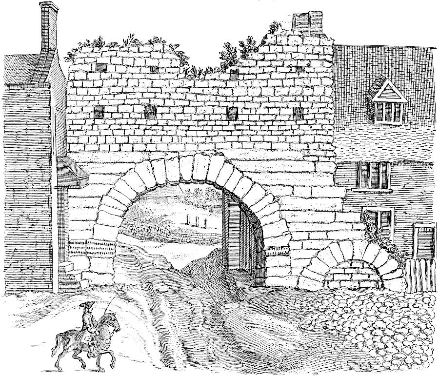
But this city being happily seated for navigation of the river, and the chief thoroughfare to the north, soon increased to that degree, that the Romans were obliged to add another to it as big as the former: this they did southward upon the declivity of the hill, and so tallied it to the other, that the new side-walls answered in a parallel to the old, and the most southern lay upon the river. Eastward the ditch without is turned into a broad street called the Beast-market, and there below Claskgate a great part of the old Roman wall is left, made of stones piled sideways, first with one direction, then with another, as was a common method with them: one piece of it is now eighty foot long, eighteen high; a little bit of it lower down is twelve foot long, as much high: between that gate upwards and the old city-wall, by the Greestone stairs, is the old ditch to be seen, much talked of, but not understood: it is called Weredyke. The people have a notion that the river came up here, and that these stairs were a landing-place from the water-side, and denominated from I know not what Grecian traders: but this is utterly impossible in nature. To the west the ditch and foundation of the wall is still left, though many times repaired and demolished in the frequent sieges this town has sustained, especially in the wars of Maud the empress: at the bottom of it, towards the water, is a round tower called Lucy tower, and famous in her history. This then was the state of this place in Roman times: the Foss and Hermen-street entered the city at Stanbow, or the stoney arch; there they parted: the Hermen-street went directly up the hill, and so full north through Newport; the Foss, according to its natural direction, ascended it obliquely on the eastern side without the ancient city, and so proceeded to the sea coast north-east.
But this city, well-located for river navigation and the main route to the north, grew so much that the Romans had to build another area as large as the first. They constructed it southward on the slope of the hill, aligning it with the original so that the new side walls were parallel to the old ones, with the southern side facing the river. East of that, the ditch outside has been turned into a wide street called the Beast-market, and below Claskgate, a significant portion of the old Roman wall remains, made of stones stacked in different directions, which was a common technique for them: one section of it is now eighty feet long and eighteen feet high; a bit lower down, there's a section that's twelve feet long and just as high. Between that gate and the old city wall by the Greestone stairs, the old ditch, often discussed but not well understood, can be seen, known as Weredyke. People believe that the river came up to this point and that these stairs served as a landing area from the water, named after some unknown Greek traders, but that’s completely impossible. To the west, the ditch and the foundation of the wall still exist, though often repaired and rebuilt due to the frequent sieges this town has faced, especially during the wars of Empress Maud. At the bottom of it, near the water, stands a round tower called Lucy tower, well-known in her history. This was the state of the place during Roman times: the Foss and Hermen street entered the city at Stanbow, or the stone arch, where they split; Hermen street went straight up the hill, heading north through Newport, while Foss, following its natural path, ascended obliquely on the eastern side of the old city and continued to the northeast coast.
But still here were two more great additions to the length of this city, and which stretched it out to an enormous bulk; the first northwards above the hill: it is called Newport, or the new city, 500 paces long. This I apprehend to have been done in the reign of the Saxon kings: it lies on both sides the Hermen-street, and was fenced with a wall and ditch hewn out of the rock: at the two farther corners were round towers and a gate, the foundations of which remain: there were several churches and religious houses in this place; and I suppose it was chiefly inhabited by Jews, who had settled here in great numbers, and grown rich by trade: there is a well still called Grantham’s well, from a child they ludicrously crucified and threw into that well.
But there were still two more major expansions to this city, stretching it into a massive size; the first was to the north, above the hill: it’s called Newport, or the new city, and is 500 paces long. I believe this was established during the reign of the Saxon kings: it sits on both sides of Hermen-street and was surrounded by a wall and a ditch carved from the rock: at the two far corners stood round towers and a gate, the foundations of which still exist: there were several churches and religious houses in this area, and I think it was mostly inhabited by Jews, who had settled here in large numbers and become wealthy through trade: there’s still a well known as Grantham’s well, named after a child who was comically crucified and thrown into that well.
[78]After the Norman conquest, when a great part of the first city was turned into a castle, I apprehend they added the last intake southward in the angle of the Witham, and made a new cut, called Sinsil dike, on the south and east side, for its security. The city then being of this huge compass, gave occasion for that prophecy, as they call it, and fancy to have been fulfilled in the year 1666:
[78]After the Norman conquest, when most of the first city was changed into a castle, I believe they added the final intake to the south at the angle of the Witham and created a new channel, called the Sinsil Dike, on the south and east sides for protection. The city, now so vast, led to that prophecy, as they refer to it, which people thought was fulfilled in the year 1666:
It is observable that the Normans could not well pronounce Lincoln, but called it Nichol, as we find it in some old writers; and to this day a part of swan pool is called nichol pool: in some places of Lincolnshire the vulgar pronounce little, nickle, and some other words of that sort. Though this place is much declined since those times, yet of late it begins to flourish again very considerably. The meaning of grecian stairs I suppose borrowed from the Normans, importing only stone steps (grees) as they appear 91at this day, a commodious descent from the minster yard. Within this two years, two new churches, large and fair, have been built at the charge of the inhabitants, and a great many handsome dwelling-houses: trades and manufactures too reflourish.
It’s noticeable that the Normans had trouble pronouncing Lincoln, calling it Nichol, as noted by some old writers. Even today, part of swan pool is referred to as nichol pool; in various areas of Lincolnshire, people often say little as nickle and use similar pronunciations for other words. Although this place has declined since those times, it has recently begun to thrive again significantly. I assume the term grecian stairs was borrowed from the Normans, referring simply to stone steps (grees) as they exist 91 today, providing a convenient descent from the minster yard. In the last two years, two large and beautiful churches have been built by the local residents, along with many attractive homes, and trades and manufacturing are also on the rise again.

[79]In this last part of the city, on both sides the Roman road, were many funeral monuments of the old Romans; some of which they now dig up, and doubtless much more when they first built upon this ground. I saw a pit where they found a stone with an inscription, this summer: through age and the workmen’s tools it was defaced, only small remains of D. M. & VIX. ANN. XXX. such letters as showed its intent, with carvings of palm-trees, and other things: this is behind the house where the lord Hussey was beheaded for rebellion in the time of Henry VIII. the great bow window through which he came upon the scaffold was taken down this year: it stands over-against another stone building, of an ancient model, said to be the palace of John of Gaunt, duke of Lancaster, who lived here in royal state, and had the privilege of coining: his arms are here carved in stone. Upon the steeple of St. Mary’s church they have placed in the wall an ancient monumental stone, with this imperfect inscription:
[79]In this last part of the city, on both sides of the Roman road, there were many funeral monuments of the ancient Romans; some of which are now being excavated, and undoubtedly many more were found when they first built on this land. I saw a pit where they discovered a stone with an inscription this summer: due to age and the workers' tools, it was damaged, leaving only small remnants of D. M. & VIX. ANN. XXX. The letters indicated its purpose, along with carvings of palm trees and other designs. This is located behind the house where Lord Hussey was executed for rebellion during the reign of Henry VIII. The grand bow window through which he stepped onto the scaffold was taken down this year; it faces another stone building of an ancient design, said to be the palace of John of Gaunt, Duke of Lancaster, who lived here in royal style and had the privilege of minting coins: his coat of arms is carved in stone here. On the steeple of St. Mary's Church, they have placed an ancient monument stone into the wall, featuring this incomplete inscription:
There is another obscure inscription upon the upper part of the stone, but has been added since, and is christian. Upon the church-wall lies an old stone by the conduit, which Leland takes notice of, and says is Ranulf de Kyme. Immense are the Roman antiquities dug up about this famous colony: nor has the perpetual turning up the ground exhausted them. The late Dr. Primrose had a great collection: I remember to have seen a fine glass urn in his possession, now with Martin Folkes, esq; found near Newport gate; also a very large silver seal of one of the Quincys earls of Lincoln, now with Nevil King, esq. Wm. Pownal, esq; has many coins very well preserved, particularly a Carausus with his wife on the same coin, which is a great rarity. I am in hopes he will some time favour the learned with an accurate account of this place, as it highly deserves. Upon the Roman road eastward are some barrows: many urns, and the like, have been dug up about them, especially near the stone pits, with earthen aqueducts, and all kinds of antiquities. Mr. Pownal showed me a brass armilla, found with a corpse which possibly was British.[80] Upon the road going to Staynton, is an hospital of St. Giles, built by Remigius; and behind it are great cavities in the rock under ground, which people fancied to be Roman 92catacombs, and affirmed they had seen earthen and brazen pots, inscriptions and the like, with many other strange stories: to search this matter thoroughly, provided with torches, we traced them to the utmost corners, but found them only quarries. Let us now survey the cathedral. It is far more magnificent than any I have yet seen: there are two great gate-houses or entrances to it from the west: the lower part of the front, and of the two towers, are of Remigius his building, as is easily discoverable by the colour of the stones, and by the manner of architecture: but Alexander built the additions upon it, the body of the cathedral, the choir and St. Mary’s tower, which once had a very lofty spire upon it; a prodigious work for a single man, and that not the only one, as appears by what we have mentioned of him. St. Hugh the Burgundian built the east end, orTAB. XXIX. St. Mary’s chapel, where he had a shrine; and the chapter-house cieled with a beautiful stone roof, one pillar in the middle. The cloysters and the library are fine: here are many books and manuscripts, and an old leaden inscription of William d’Agincourt, cousin to Remigius, already printed. Here are many bells, particularly one remarkably large, called Tom of Lincoln, which takes up a whole steeple to itself; probably consecrated to that great champion of the church, St. Thomas of Canterbury, the first cathedral mentioned in Bede; I suppose an humble building, and contained within the ancient walls. Two Catharine-wheel windows, as called, at the ends of the larger transepts, are remarkably fine for mullion-work and painted glass. Here are great numbers of ancient brasses and monuments: one I have engraven from a drawing procured by Browne Willys, esq; TAB. XVI.Tab. 16. the stone only is left near the west door. To set down the particularities of the church would require a volume. South of it, upon the very brow of the hill, is the bishop’s palace, built by Robert de Chesney, who gave two great bells likewise: bishop Bek and other successors enlarged it to a magnificence equal with the cathedral: it stands just south of the Roman wall; a very expensive work, for the foundations of it reach, as it were, below hill: over this hung many large bow windows of curious workmanship, looking over the tops of the lower city into Nottinghamshire: the kitchen had seven chimneys in it: the hall was stately: the gate-house remains intire, with coats of arms of the founders. This palace was ruined in the time of the civil wars: good part of it might be handsomely rebuilt without an extravagant expence.
There’s another unclear inscription on the upper part of the stone that was added later and is Christian. By the church wall lies an old stone by the conduit, which Leland mentions, saying it belongs to Ranulf de Kyme. There are countless Roman artifacts uncovered around this famous colony, and the constant digging hasn’t exhausted them. The late Dr. Primrose had a significant collection: I remember seeing a beautiful glass urn he had, now with Martin Folkes, Esq.; found near Newport gate; also a very large silver seal from one of the Quincy earls of Lincoln, now with Nevil King, Esq. William Pownal, Esq. has many well-preserved coins, particularly a Carausius with his wife on the same coin, which is quite rare. I hope he will eventually provide an accurate account of this place, as it truly deserves it. On the Roman road heading east, there are some barrows: many urns and similar items have been dug up around them, especially near the stone pits, along with earthen aqueducts and all kinds of antiquities. Mr. Pownal showed me a brass armilla found with a corpse, which might have been British. On the road to Staynton, there’s a hospital of St. Giles, built by Remigius; and behind it are large underground cavities in the rock that people thought were Roman catacombs, claiming they’d seen clay and bronze pots, inscriptions, and many other strange stories. To thoroughly investigate this, equipped with torches, we explored every corner, but only found quarries. Now let’s look at the cathedral. It is much more magnificent than any I have seen yet: there are two grand gatehouses or entrances from the west; the lower part of the front and the two towers are from Remigius’s building, which is clear from the stone color and architectural style; but Alexander built the additions to it, the body of the cathedral, the choir, and St. Mary’s tower, which once had a very tall spire; an incredible feat for one person, and not the only one, as we've noted about him. St. Hugh the Burgundian built the east end, or St. Mary’s chapel, where he had a shrine; and the chapter house has a beautiful stone ceiling with one pillar in the middle. The cloisters and the library are impressive: they hold many books and manuscripts, and an old leaden inscription of William d'Agincourt, cousin to Remigius, has already been printed. There are many bells here, particularly one notably large one called Tom of Lincoln, which occupies an entire steeple by itself; probably dedicated to that great champion of the church, St. Thomas of Canterbury, the first cathedral mentioned by Bede; I imagine a humble building, contained within the ancient walls. Two Catherine-wheel windows, as they are called, at the ends of the larger transepts, are exceptionally fine for their mullion work and stained glass. There are numerous ancient brasses and monuments here: one I’ve engraved from a drawing supplied by Browne Willys, Esq.; the stone is now just near the west door. Detailing the specifics of the church would require a whole volume. To the south of it, on the very edge of the hill, is the bishop’s palace, built by Robert de Chesney, who also provided two large bells; bishop Bek and others later expanded it to be as magnificent as the cathedral: it stands just south of the Roman wall; a very costly undertaking, as its foundations reach beneath the hill. Above this are many large bow windows of intricate design, overlooking the lower city into Nottinghamshire: the kitchen had seven chimneys; the hall was grand; the gatehouse remains intact, with the coats of arms of the founders. This palace was ruined during the civil wars; much of it could be nicely rebuilt without excessive expense.
In Leland’s time one of the stone crosses of queen Eleanor was here standing in the market place: it were endless to enumerate the religious houses, gates, and old buildings, that croud up every part of the streets. Here were originally fifty two churches. I never saw such a fund of antique speculations in any town in England: I heard continually of coins and urns found all the country over, as at Cathorp, Methringham, Nocton, &c. I found this inscription on a stone in the stable wall of the Rein-deer inn.
In Leland’s time, one of Queen Eleanor's stone crosses was standing right here in the marketplace. It would take forever to list all the religious houses, gates, and old buildings that crowd every part of the streets. Originally, there were fifty-two churches. I’ve never seen such a wealth of historical curiosities in any town in England. I kept hearing about coins and urns found all over the countryside, like at Cathorp, Methringham, Nocton, etc. I found this inscription on a stone in the stable wall of the Rein-deer Inn.
+RANDOLF: DE: BORTON: GYT: ICY: DEUI: DE: SA: ALME: AYT: MERCY: AMEN.
+RANDOLF: DE: BORTON: GYT: ICY: DEUI: DE: SA: ALME: AYT: MERCY: AMEN.
This castle of William the Conqueror’s is a large place, and exceedingly strong with walls, ditches, keep, and towers: over against it westward is an intrenchment made by king Stephen.
This castle of William the Conqueror's is a large structure and very strong with its walls, ditches, keep, and towers. To the west, there's an earthwork that was created by King Stephen.
Through the whole length of Lincolnshire, from north to south, in a strait line runs a ledge of hills, that is, from Stanford to Winteringham: the Romans, observing this, carried their road upon it, and left the original stem of Fokingham. This high ground is similar all along, having a steep descent westward, overlooking Nottinghamshire, and is a rock of93 rag-stone quite through; the stone is white, and rises in strata, thicker as deeper: the surface is heathy. The river Witham, which rises on the west of this ridge, must have run into the Humber, had not Nature, by her propensity of drawing it eastward, as her declivities generally run, broke it off in the middle by that great valley under Lincoln, and made a passage for it into the estuary. Hence it is that the stone upon this western cliff is full of sea-shells; for, when the great and universal deluge had carried those inhabitants of the ocean into the mediterranean parts, by the weight of their shells they were unapt to retire again along with the waters, so were intercepted against this cliff, and received into the nascent stone.[81] A remarkable antediluvian curiosity I procured for the repository of the Royal Society, from these parts; being the real skeleton of a crocodile, or some such animal, inclosed in a broad flat stone. But now it is time to proceed.
Running the whole length of Lincolnshire, from north to south, is a ridge of hills, stretching from Stanford to Winteringham. The Romans noticed this and built their road along it, leaving behind the original path of Fokingham. This elevated area is consistent all the way through, featuring a steep drop to the west that overlooks Nottinghamshire. It consists entirely of rag-stone; the stone is white and forms in layers, becoming thicker as it goes deeper, with a heath-covered surface. The Witham River, which rises on the west side of this ridge, would have flowed into the Humber if Nature hadn't diverted it eastward, which is typically how her slopes work. Instead, a significant valley beneath Lincoln cleaved it in half, creating a route for it to the estuary. This is why the stone on this western cliff is full of sea shells; when the great worldwide flood carried the ocean's inhabitants to the Mediterranean, their heavy shells prevented them from returning with the receding waters, so they got stuck against this cliff and became part of the forming stone. A notable prehistoric curiosity I collected for the Royal Society's repository from this area is the actual skeleton of a crocodile or a similar creature, encased in a large flat stone. But now it's time to move on.


Sep. 1722.

The Hermen-street going northward from Lincoln is scarce diminished, because its materials are hard stone, and the heath on both sides favours it: three miles off, near a watering-place, a branch divides from it with an obtuse angle to the left, which goes towards Yorkshire. We suppose the Romans at first had an erroneous idea of the island of Britain, and thought its northern parts in a more easterly longitude than by experience they found; and thus in Ptolemy’s maps the length of Scotland is represented running out enormously that way: but when Agricola, in his conquests northward, had discovered that mistake, and that the passage over the Humber was very incommodious for the march of soldiers, he struck out this new road, as another branch of the Hermen-street, by way of Doncaster, from thence observing its natural direction northward. When we turn ourselves here, and look back to Lincoln, we see the road butts upon the western spires of the cathedral: and when from thence you survey the road, it is an agreeable prospect; your eye being in the middle line of its whole length to the horizon. I had a mind to pursue this branch through Lincolnshire as far as the first station, Agelocum: this ridge is likely to be of an eternal duration, as wholly out of all roads: it proceeds directly over the heath, then descends the cliff through the rich country at bottom, between two hedge-rows, by the name of Tilbridge lane. When you view it on the brink of the hill, it is as a visto or avenue running through a wood or garden very strait, and pleasanter in prospect than when you come to travel it; wanting a Roman legion to repair it. You pass through Stretton and Gate-Burton, so called from the road, and by a ferry cross over the Trent, which lands you at
The Hermen Street heading north from Lincoln is hardly reduced, because its materials are tough stone, and the heath on either side supports it: three miles away, near a watering hole, a branch splits off from it at an obtuse angle to the left, which leads toward Yorkshire. We think the Romans initially had a mistaken idea about the island of Britain, believing its northern parts were at a more easterly longitude than they later discovered; thus, in Ptolemy's maps, the length of Scotland is depicted as extending far in that direction. However, when Agricola made conquests to the north and uncovered that error, realizing that crossing over the Humber was quite inconvenient for troop movement, he created this new route as an alternative branch of the Hermen Street, leading via Doncaster, while noting its natural northward direction. When we turn around here and look back at Lincoln, we see the road meeting the western towers of the cathedral: when you view the road from there, it’s a lovely sight; your eye aligns with the entire length of it all the way to the horizon. I wanted to follow this branch through Lincolnshire as far as the first station, Agelocum: this path seems likely to last forever, completely removed from all roads: it goes straight over the heath, then descends the cliff into the rich land below, flanked by two hedgerows, and called Tilbridge Lane. When you look at it from the edge of the hill, it resembles a vista or an avenue running straight through a wood or garden, more pleasant in view than when you actually travel it, needing a Roman legion to maintain it. You pass through Stretton and Gate-Burton, named after the road, and then cross the Trent by ferry, which lands you at
Littleborough, Agelocum, or, as by later times corrupted, with a sibilus, into Segelocum.[82] This is a small village three miles above Ganesborough, just upon the edge of the water, and in an angle. Agel auk, frons aquæ, is a pertinent etymology: it seems only to have been environed with a ditch, and of a square form, and the water ran quite round it; for to the west, where White’s bridge is, a watery valley hems it in: so that it was a place sufficiently strong. The church stands upon the highest ground. The Trent has washed away part of the eastern side of the town. Foundations and pavements are visible in the bank. Mr. Roger Gale, passing by, once found an urn there, with a coin of Domitian’s: great numbers of coins have been taken up in ploughing and digging: they called them swine-pennies, 94because those creatures sometimes root them up, and the inhabitants take little care to save them. I saw a few there: the reverend Mr. Ella, vicar of Rampton hard by, has collected several, and some valuable, such as the following, of which he sent me an account.
Littleborough, Agelocum, or, as it's later been changed to with a sibilus, Segelocum.[82] This is a small village three miles above Ganesborough, right on the edge of the water, situated in a bend. Agel auk, frons aquæ, is a fitting origin of the name: it seems to have been surrounded by a ditch and was square-shaped, with water running all around it; to the west, where White’s bridge is, a watery valley encloses it, making it a sufficiently strong location. The church stands on the highest ground. The Trent River has eroded part of the eastern side of the village, and you can see foundations and pavements in the bank. Mr. Roger Gale, when passing by, once found an urn there with a coin from Domitian’s time: many coins have been unearthed while plowing and digging. They referred to them as swine-pennies, 94 because pigs sometimes root them up, and the locals don’t bother to save them. I saw a few there: the reverend Mr. Ella, the vicar of nearby Rampton, has collected several, including some valuable ones, of which he sent me a report.
A consecration piece of Vespasian. Cos. IIII.
A dedication piece of Vespasian. Consul IV.
IMP CAES NERVAE TRAIANO AVG GER DAC PMTRP COSVPP â„ž SPQR OPTIMO PRINCIPI. The mole at Ancona.
IMP CAES NERVAE TRAIANO AVG GER DAC PMTRP COSVPP ‡ SPQR OPTIMO PRINCIPI. The mole at Ancona.
IMP CÆS NER TRAIANO OPTIMO AVG GER DAC ℞ SENATVS POPVLVSQ ROMANVS. Fortune sitting with a cornucopia in one hand, a rudder in the other, FORT RED SC.
IMP CÆS NER TRAIANO OPTIMO AVG GER DAC ℞ SENATVS POPVLVSQ ROMANVS. Fortune sitting with a cornucopia in one hand and a rudder in the other, FORT RED SC.
IMP CAES. &c. as the second. â„ž SPQR. a genius sitting on trophies, with a spear in the left hand, a victoriola in its right.
IMP CAES. &c. as the second. SPQR. a figure sitting on trophies, holding a spear in the left hand and a victoriola in its right.
IMP CAESAR TRAIANVS HADRIANVS â„ž PONT. MAX. TRP. Britannia sitting with a shield, a spear in her left hand, a laurel in her right, the right foot upon a rock BRITANNIA SC.
IMP CAESAR TRAIANUS HADRIANUS, PONT. MAX. TRP. Britannia is seated with a shield, a spear in her left hand, and a laurel in her right, her right foot resting on a rock. BRITANNIA SC.
CONSTANTINVS AVG. â„ž SOLI INVICTO COMITI. Another, â„ž ALEMANNIA DEVICTA.
CONSTANTINVS AVG. SOLI INVICTO COMITI. Another, ALEMANNIA DEVICTA.
Several of those struck about Constantius’s time with a galeate head on one side, and URBS ROMA ℞ a wolf suckling Romulus and Remus: others, CONSTANTINOPOLIS: many more, of Aurelius, Faustina, Gallienus, Tetricus, Victorinus, Carausius, Constantine, Constantius, Crispus, Allectus, and the lower Empire. About forty years ago, when the inclosures between the town and bridge were ploughed up, abundance of these coins were found, many intaglias of agate, cornelian, the finest coral-coloured urns and patera’s, some wrought in basso relievo, the workman’s name generally impressed on the inside of the bottom: a discus with an emperor’s head embossed. In 1718, they dug up two altars, handsomely moulded, which are set as piers in a wall on the side of the steps that lead from the water-side to the inn: on one is the remnant of an inscription, LIS ARAM DD. these are of the course grit-stone. Many very little coins are found here, like flatted pease; they call them mites. Mr. Hardy has a large urn with the face of a woman on the out-side. In this same field near White’s bridge are great foundations of building: coins are often found too at the lowest edge of the water, when the tide is gone off, and in dry seasons. On the east side of the river has been a camp. Returning by Tilbridge lane, upon the top of the heath is a spring, which they say flows and abates with the tide in the Trent, though five miles off: the like is reported of divers others hereabouts.
Several coins from around the time of Constantius were found, featuring a helmets on one side, and URBS ROMA with a wolf nursing Romulus and Remus. Others showed CONSTANTINOPOLIS, and many more from Aurelius, Faustina, Gallienus, Tetricus, Victorinus, Carausius, Constantine, Constantius, Crispus, Allectus, and the later Empire. About forty years ago, when the areas between the town and the bridge were plowed, many of these coins were discovered, along with numerous intaglios made of agate and cornelian, the finest coral-colored urns and platters, some crafted in basso relievo, often with the artisan’s name engraved on the bottom. They also found a discus featuring an emperor’s head. In 1718, two beautifully molded altars were unearthed and are now used as supports in a wall at the steps leading from the riverside to the inn; one has part of an inscription, LIS ARAM DD, and they are made of coarse grit-stone. Many small coins, resembling flattened peas, were found here; they are called mites. Mr. Hardy possesses a large urn with a woman's face on the exterior. In the same field near White's bridge, there are significant building foundations; coins are also frequently discovered at the lowest water’s edge when the tide goes out and during dry seasons. There was a camp located on the east side of the river. Returning via Tilbridge lane, at the top of the heath, there is a spring, which supposedly rises and falls with the tide in the Trent, even though it is five miles away; similar reports exist about various others in the area.
From the place where the roads branch out, before spoken of, I proceeded on the Hermen-street, northward, to Spittle on the street. There are milliary stones set upon the road all the way: it is very delightful riding, being wholly champaign, or heath. Of these stones I believe some are Roman, others later crosses, perhaps to supply their place: some tumuli scattered here and there. This place no doubt was a mansion, because a little beck runs through it, arising hard by: and it is ten miles from Lincoln; a convenient distance. I took the bearing of the road just north and south. Here is an hospital, said to be founded 1308, and great foundations all around, some of which are probably Roman. At present the village consists of two farm-houses, a chapel, an inn, and a sessions-house: three or four tumuli near the town. Upon the chapel is a silly Latin inscription:
From the place where the roads split, as mentioned earlier, I continued along Hermen Street, heading north to Spittle on the street. There are milestone markers along the road all the way: it's a lovely ride, being completely flat or heathland. I believe some of these stones are Roman, while others are later crosses, possibly replacing them: there are some tumuli scattered here and there. This place was undoubtedly a mansion, as a small stream runs through it, originating nearby: and it is ten miles from Lincoln; a convenient distance. I oriented the road directly north and south. Here is a hospital, said to have been established in 1308, with large buildings all around, some of which are probably Roman. Currently, the village consists of two farmhouses, a chapel, an inn, and a courtroom: three or four tumuli near the town. The chapel has a silly Latin inscription on it:
| fui anno domini | 1398 | dom. dei & pauperum | |
| non fui | 1594 | ||
| sum | 1616 | ||
Qui hanc Deus hunc destruet. |
|||

95
95
Upon the sessions-house,
In the meeting room,
Underneath, a coat palè of six, on a bend three annulets, with the arms of Ulster: over the door, Fiat justitia 1619. All this whole country is a quarry just beneath the surface. Beyond Spittle woodland begins: by Broughton, a vein of deep sand well planted with coneys. At all these towns upon the Roman road, coins and antiquities are found; Hibberstow, Gainsthorp, Broughton, Roxby, &c. at Sandton has been a Roman pottery: between Scalby and Manton is a Roman camp: in Appleby is a place called Julian’s Bower: at Kirton, John of Gaunt had a seat: twenty-nine towns round about held of him in socage. I take Broughton to be another station, because of its name, and that a brook runs through it; so that the interval between Lincoln and Wintringham is conveniently divided into three parts, ten miles each, by Spittle and Broughton, the whole being thirty Roman miles. Thornholm, a mitred priory: there is but another in England, Spalding. Risby and Gokewell, two nunneries; some small remains of both. To the left is Normanby, where the late duke of Buckingham was born, and whence his title.
Underneath, a coat of arms featuring six palé, with three annulets on a bend, alongside the arms of Ulster: above the door, Fiat justitia 1619. This entire area is a quarry just below the surface. Beyond Spittle, the woodland begins: near Broughton, there’s a vein of deep sand well populated with rabbits. In all these towns along the Roman road, coins and ancient artifacts have been found; Hibberstow, Gainsthorp, Broughton, Roxby, etc. At Sandton, there has been Roman pottery: between Scalby and Manton is a Roman camp: in Appleby, there’s a place called Julian’s Bower: at Kirton, John of Gaunt had a residence: twenty-nine towns around held land from him in socage. I consider Broughton to be another station, based on its name and the brook that runs through it; thus, the distance between Lincoln and Wintringham is conveniently divided into three sections, each ten miles, by Spittle and Broughton, totaling thirty Roman miles. Thornholm, a mitred priory: there is only one other like it in England, Spalding. Risby and Gokewell, two nunneries; there are some small remains of both. To the left is Normanby, where the late Duke of Buckingham was born, and from where his title comes.
We kept the road all the way, though sometimes it passes over little bogs, and at last about Winterton is inclosed: it terminates in some arable, where it is well nigh lost a mile south of Wintringham Ro. town.Wintringham. Upon a rising ground at the end of the Roman road, a little to the right, and half a mile east of the present Wintringham, stood the old Roman town, of which they have a perfect knowledge, and ploughed up great foundations within memory: TAB. [i XVI]. 2d Vol.it is now a common, skirted by the marshes upon the Humber: the soil hereabouts is clay. This site of Old Wintringham, as called, was almost inclosed with water in its first condition, having only a slip of land towards the Roman road as an entrance: the valley westward between it and the town is now called the Old Haven, where three elm-trees stand: the east is bounded by the mouth of the Ankham, which I suppose is ang in British, broad, avon, river, from its broad marshes. The city was ploughed up six years ago, and great numbers of antiquities found, now lost; great pavements, chimney-stones, &c. often breaking their ploughs: in several places they found streets made of sea-sand and gravel. It is a peninsula between the Humber and Ankham, and had most opportunely a fine spring on the east side, which no doubt was embraced by the Romans: it is likewise a great rarity in nature, arising so near the sea in a clayey marsh: there is stone-work left round it, and an iron ladle to drink at, which is done frequently by travellers, as with a religious necessity. Several intakes have been made beyond this city in memory of man, which drives the Humber farther off, and increases the marsh: it is half a mile between it and old town. The old haven-mouth is called Flashmire. This place is over-against Brough, the Roman town on the Yorkshire shore; but it is rather more eastward: so that with the tide coming in they ferried over very commodiously thither, and even now they are forced to take the tide. Buck-bean trefoil grows upon all the bogs hereabouts. The bearing of the end of the Roman way is precisely north and south, as at Lincoln; so that it is a true meridian line from the west end of the cathedral. The present Wintringham is a dirty poor place, but still a corporation; and the mayor is chosen only out of one street, next the old town, where was a chapel: the bell of it now hangs in a wooden frame by the pillory, and makes a most ridiculous appearance. Here is still a ferry from a small creek kept96 open by some freshes; it was ill judged of travellers to desert the old Roman way and ferry, and turn the road to Barton, (where the Humber is much broader and very dangerous) for no other reason but because it is somewhat nearer and over-against Hull: but the saving three miles riding does not compensate for the time or hazard of so uncouth a passage. I am persuaded the old name of this station was Abontrus, the same as the name of the river, whence they have formed the mimic Wintringham. Here is a vast jaw-bone or rib of a whale, that has lain time out of mind, like that at St. James’s. Wintringham church stands on the end of the Lincolnshire Alpes. Well may the Humber take its name from the noise it makes: my landlord, who is a sailor, says in a high wind it is incredibly great and terrible, like the crash and dashing together of ships. The Roman way beyond the Humber at Brough is continued in Yorkshire; but of its progress that way I can say nothing at present, this being the northern boundary of my expeditions.
We followed the road all the way, even though it sometimes goes over small bogs. Eventually, around Winterton, it's enclosed and ends in some farmland, nearly a mile south of Wintringham Road. town.Wintringham. On a rising piece of ground at the end of the Roman road, slightly to the right and half a mile east of where Wintringham is now, stood the old Roman town, which is well known and has had large foundations plowed up within living memory. TAB. [i XVI]. Vol. 2 It is now a common area, bordered by marshes near the Humber, and the soil around here is clay. This site, known as Old Wintringham, was almost surrounded by water at first, only having a narrow strip of land leading to the Roman road as an entrance. The valley to the west, between it and the town, is now called the Old Haven, where three elm trees stand. To the east, it's bordered by the mouth of the Ankham, which I assume is ang in British for broad and avon for river, due to its wide marshes. The city was plowed up six years ago, revealing many antiquities that are now lost; they found large pavements, chimney stones, and so on, often breaking their plows. In several places, they discovered streets made from sea sand and gravel. It is a peninsula between the Humber and the Ankham, and it conveniently had a nice spring on the east side, which the Romans likely valued. It’s also quite unique in nature, springing up so close to the sea in a clayey marsh. There are stone structures left around it and an iron ladle for drinking, used often by travelers as if it were a sacred duty. Several land reclamations have been made beyond this city, which pushes the Humber further away and expands the marsh. It's half a mile between the two old towns. The old haven mouth is called Flashmire. This place is opposite Brough, the Roman town on the Yorkshire shore, but it's a bit more to the east. This made it easy for them to ferry across conveniently with the tide, and even now they still have to catch the tide. Buck-bean trefoil grows all over the bogs around here. The end of the Roman road runs exactly north and south, just like at Lincoln, making it a true meridian line from the west end of the cathedral. The current Wintringham is a dirty, poor area, but it still has a corporation, with the mayor chosen from just one street next to the old town, where there used to be a chapel. The bell from that chapel now hangs in a wooden frame by the pillory, looking quite ridiculous. There's still a ferry from a small creek, kept open by some fresh water; it was a mistake for travelers to abandon the old Roman road and ferry in favor of the route to Barton (where the Humber is much wider and very dangerous), just because it's a bit closer and facing Hull. However, saving three miles of riding doesn’t make up for the time or risk of such an awkward crossing. I'm convinced the old name for this station was Abontrus, the same as the river, from which they derived the name Wintringham. Here, there's a massive jawbone or rib of a whale that has been there for ages, much like the one at St. James’s. Wintringham church stands at the edge of the Lincolnshire Alpes. It’s easy to see why the Humber got its name from the noise it makes; my landlord, who is a sailor, says in a strong wind, it can be incredibly loud and frightening, like the crashing and smashing of ships. The Roman road continues beyond the Humber at Brough, leading into Yorkshire, but I can't say anything about its further journey for now, as this is the northern limit of my travels.
From the termination of the Hermen-street, just by the knoll of old Wintringham, and the hedge on the side of a common, a lesser vicinal branch of a Roman road goes directly west to Aukborough, passing over Whitton brook. All the ground hereabouts terminates at the Humber in longitudinal ridges going north and south, and all steep like a cliff to the west, plain and level eastward. Aukborough I visited, because I suspected it the Aquis.Aquis of the Romans, in Ravennas, and I was not deceived; for I presently descried the Roman castrum.[83] TAB. XVII. 2d Vol.There are two little tumuli upon the end of the road entering the town. The Roman castle is square, three hundred foot each side, the entrance north: the west side is objected to the steep cliff hanging over the Trent, which here falls into the Humber; for this castle is very conveniently placed in the north-west angle of Lincolnshire, as a watch-tower over all Nottinghamshire and Yorkshire, which it surveys. Hence you see the Ouse coming from York, and downward the Humber mouth, and all over the isle of Axholm. Much salt-marsh is gained from all these rivers, though now and then they reclaim and alter their course. Then they discover the subterraneous trees lodged here at the Deluge in great abundance, along the banks of all the three rivers: the wood is hard and black, and sinks like a stone. Here are likewise other plentiful reliques of the Deluge in the stones, viz. sea-shells of all sorts, where a virtuoso might furnish his cabinet: sometimes a stone is full of one sort of shell, sometimes of another; sometimes, of little globules like the spawn of fishes: I viewed them with great pleasure. I am told the camp is now called Countess Close, and they say a countess of Warwick lived there; perhaps owned the estate;[84] but there are no marks of building, nor I believe ever were. The vallum and ditch are very perfect: before the north entrance is a square plot called the Green, where I suppose the Roman soldiers lay pro castris: in it is a round work, formed into a labyrinth, which they call Julian’s Bower. The church is of good stone, has a square tower, but the choir ruinous, excluded by a wooden partition: between it and the way to the marshes, a good spring rising out of the cliff. I dare say no antiquary ever visited this place since the Romans left it; for the people were perfectly ignorant of any matters we could inquire about; and as to finding coins, &c. they would make us no other answer than laughing at us: 97but I heard since, from other good hands, that they have been found here in great numbers.
From the end of Hermen Street, right by the hill of old Wintringham and the hedge along a common area, a smaller side road from a Roman route heads directly west to Aukborough, crossing over Whitton Brook. The land around here slopes down to the Humber in long ridges going north and south, all steep like a cliff to the west and flat to the east. I visited Aukborough because I suspected it was the Aquis.Aquis of the Romans mentioned in Ravennas, and I was right; I quickly spotted the Roman castrum.[83]TAB. XVII. 2nd Vol.There are two small tumuli at the end of the road that leads into the town. The Roman castle is square, three hundred feet on each side, with the entrance facing north. The west side is against the steep cliff overlooking the Trent, which flows into the Humber here; the castle is very well placed in the northwest corner of Lincolnshire as a lookout over all of Nottinghamshire and Yorkshire. From here, you can see the Ouse coming from York, the mouth of the Humber downriver, and the entire island of Axholm. Much salt marsh can be claimed from these rivers, although they occasionally change their course. This also reveals the underground trees that were trapped here during the Deluge in large quantities along the banks of all three rivers: the wood is hard and black, sinking like a stone. Here, there are also many remnants of the Deluge in the stones, like sea shells of all kinds, which a virtuoso could use to fill their cabinet: sometimes a stone is filled with one type of shell, at other times with another; sometimes, there are small globules like fish spawn: I examined them with great enjoyment. I’ve been told the camp is now called Countess Close, and it is said that a countess of Warwick lived there, perhaps owning the estate; [84] but there are no signs of buildings, nor do I believe there ever were. The vallum and ditch are in great condition: in front of the north entrance is a square area called the Green, where I imagine the Roman soldiers stayed pro castris: in it is a round structure, made into a maze, which they call Julian’s Bower. The church is made of good stone and has a square tower, but the choir is in ruins, separated by a wooden partition: between it and the path to the marshes, there’s a good spring that rises from the cliff. I dare say no antiquarian has visited this place since the Romans left; the locals were completely unaware of any matters we could ask about, and when it came to finding coins, etc., they would only laugh at us: 97 but I’ve heard since, from other reliable sources, that they have been found here in large quantities.

Because I have frequently found these places called Julian’s Bower, both at Roman towns and others, but especially very common in Lincolnshire, I considered what should be the meaning of them, and shall here give my thoughts about it. They are generally upon open green places, by the side of roads or rivers, upon meadows and the like near a town: the name often remains, though the place be altered and cultivated; and the lovers of antiquity, especially of the inferior class, always speak of them with great pleasure, and as if there were something extraordinary in the thing, though they cannot tell what: very often they are called Troy town. What generally appears at present is no more than a circular work, made of banks of earth, in the fashion of a maze or labyrinth; and the boys to this day divert themselves with running in it one after another, which leads them by many windings quite through and back again.
Because I've often come across these places called Julian’s Bower, both in Roman towns and elsewhere, but especially common in Lincolnshire, I've thought about what they might mean and I’d like to share my thoughts on it. They are usually found in open green areas, alongside roads or rivers, on meadows, and near towns. The name often remains even when the place has changed and been developed; enthusiasts of history, particularly those from the lower classes, always talk about them with great interest, as if there’s something special about them, though they can’t quite say what it is. They are often referred to as Troy town. What you typically see today is just a circular structure made of earth mounds, resembling a maze or labyrinth; and to this day, boys enjoy running through it one after the other, following its many twists and turns back and forth.
Upon a little reflection I concluded that this is the ancient Roman game; and it is admirable that both name and thing should have continued through such a diversity of people; though now it is well nigh perished, since the last age has discouraged the innocent and useful sports of the common people, by an injudicious and unnecessary zeal for religion, which has drove them into worse methods of amusement. I imagine too this was a practice of the ancient Britons, many of which were of Phrygian extract, coming from the borders of Thrace; therefore derived it from the same fountain as the Romans: this was upon their maii campi; but I shall not speak of them here: and the Turks, I apprehend, learnt it hence; for it is their diversion too. As to the name bower, it signifies not an arbor, or pleasant shady retirement, in this place; but borough, or any work made with ramparts of earth, as camps and the like: and it is my thoughts, many works, which have been taken for camps, were only made for this purpose; whereof two I met with in this journey, that at Ashwel, and Maiden Bower near Dunstable. The name of Julian undoubtedly refers to Julus the son of Æneas, who first brought it into Italy, as is admirably described by Virgil in his V. Æneid. and kept up by the Romans with great pomp and annual festivity: Augustus was particularly fond of it, and took it as a compliment to his family. That they call these places Troy town, proves the same. Hear the poet:
After some thought, I realized this is the ancient Roman game. It's impressive how both the name and the game have survived through so many different cultures, although now it’s almost gone, since recent times have discouraged harmless and beneficial pastimes of the common people due to a misguided and unnecessary zeal for religion, which has pushed them toward worse forms of entertainment. I also think this was a practice among the ancient Britons, many of whom were of Phrygian descent, coming from the borders of Thrace; thus, they originated from the same source as the Romans. This was played in their maii campi; but I won't discuss that here. I believe the Turks learned it from them, as it’s a pastime for them as well. Regarding the name bower, it doesn’t mean a pleasant shady spot here; instead, it refers to borough or any structure built with earth ramparts, like camps and similar sites. I think many structures, which have been mistaken for camps, were actually built for this purpose; I encountered two on this journey, one at Ashwel and another at Maiden Bower near Dunstable. The name Julian undoubtedly refers to Julus, the son of Æneas, who first introduced it to Italy, as beautifully described by Virgil in his V. Æneid, and was celebrated by the Romans with great ceremony and annual festivities. Augustus particularly enjoyed it and regarded it as a compliment to his family. The fact that they call these places Troy town supports this notion. Listen to the poet:
I conceive this game was of two sorts; that performed on foot; that on horse-back, or in chariots: the intent of both was to exercise the youth98 in warlike activity, for it was a sort of mock fight: that on foot was the Pyrrhic dance. Suetonius says, lusus ipse quem vulgo Pyrrhicum appellant Troja vocatur. If we carry it up to its first original, we must affirm it was invented by the Corybantes, Idei dactyli, Curetes, whose institution, when confirmed among the Romans, was continued by the priests called Salii, dancing in armour, and clashing their weapons together with some sort of concert. Likewise the real soldiers had the same festival, which they called armilustrium, celebrated on the 19. Octob. of which Varro gives us an account de lingua Lat. Suetonius mentions it in Tiberio, c. 72. This, whether performed on foot or horse-back, by children, priests or soldiers, was manifestly the same thing: their gestures, turnings, returnings, knots and figures, their assaults, retreat, and the like, were aptly represented by mazes and labyrinths; which very comparison Virgil uses.
I believe this game had two types: one played on foot and the other on horseback or in chariots. The goal of both was to train young people in combat skills, as it was a kind of mock battle. The foot game was the Pyrrhic dance. Suetonius states, lusus ipse quem vulgo Pyrrhicum appellant Troja vocatur. If we trace it back to its origins, we must say it was created by the Corybantes, Idei Dactyli, and Curetes. When this tradition was adopted by the Romans, it was continued by the priests known as Salii, who danced in armor and clashed their weapons together in a kind of rhythm. Similarly, the actual soldiers had a festival called armilustrium, held on October 19, which Varro discusses in de lingua Lat.. Suetonius also mentions it in Tiberio, c. 72. Whether performed on foot or horseback, by children, priests, or soldiers, it was clearly the same activity: their movements, turns, retraces, formations, assaults, retreats, and so on were effectively represented by mazes and labyrinths, as Virgil also compares them.
It is likely these works of ours, made in the turf, were cast up, in order to teach the children the method of it. That on foot is elegantly described by Claudian de VI. consul. Honorii, v. 622.
It’s likely that these works of ours, made in the turf, were created to show the children how to do it. The method on foot is elegantly described by Claudian de VI. consul. Honorii, v. 622.
The equestrian games of this denomination required more room and apparatus for spectators: therefore probably they fenced in a larger space of ground, of a circular or oval form, with a vallum, to keep the spectators at proper distance, and upon which they might more commodiously behold the sport. This I suppose was provided for by those bowers or burroughs mentioned, where there was no ditch behind; for that would be dangerous, if the people crouding one another, as is natural on those occasions, should thrust the outermost from such an elevation: so that they were99 a larger sort of amphitheatres, or circs: and this seems expressly intimated by the great Mantuan in those verses,
The equestrian games of this type needed more space and equipment for spectators; so, they likely enclosed a larger area of land, either circular or oval, with a vallum to keep the audience at a safe distance and to make it easier for them to watch the event. I think this was arranged through the mentioned bowers or burroughs, where there was no ditch behind; otherwise, it could be dangerous if the crowd pushed against each other, as often happens in such situations, potentially leading to someone falling off the edge: so they were 99 a larger version of amphitheaters or circuses: and this seems to be clearly suggested by the great Mantuan in those verses,
These games on horseback he thus describes:
These horseback games are described by him as follows:
It seems that our tournaments, so much in fashion till queen Elizabeth’s time, are remainders of these warlike diversions; and the triple order, by which they were conducted, may possibly be imitated in some degree by the common figure in dancing, called the hedge, or the hay; both which I suppose are derived from the Saxon hæg, perhaps from the Latin agger.
It seems that our tournaments, which were so popular until Queen Elizabeth's time, are remnants of these martial pastimes; and the three-part structure by which they were held might be somewhat reflected in the common dance formation called the hedge or the hay; both of which I believe come from the Saxon hæg, possibly from the Latin agger.
We passed by the spring of old Wintringham and the Marsh at the mouth of the Ankham, which is a vast tract of land left by the sea; and came to Feriby sluice, a stately bridge of three arches, with sluices for voidance of the water into the sea, but now broken down and lying in dismal ruins by the negligence of the undertakers: whence travellers are obliged to pass the river in a paltry short boat, commanded by a little old deaf fellow with a long beard: into this boat you descend, by the steep of the river, through a deep mirey clay, full of stones and stakes; nor is the ascent on the other side any better, both dangerous and difficult. This, with the hideous ruins of the bridge, like the picture of hell gates in Milton, and the terrible roar of the water passing through it, fitly represented Virgil’s description of Charon’s ferry: nor would a poet wish for a better scene to heighten his fancy, were he to paint out the horrors of the confines of hell.
We passed by the spring of old Wintringham and the Marsh at the mouth of the Ankham, which is a vast area of land left by the sea, and came to the Feriby sluice, a grand bridge with three arches, complete with sluices to drain the water into the sea, but now it's fallen into disrepair and lies in miserable ruins due to the negligence of the contractors. As a result, travelers have to cross the river in a rickety little boat, operated by a tiny old deaf man with a long beard. You get into this boat by navigating down a steep, muddy bank filled with stones and stakes; the climb on the other side isn’t any better—it's both dangerous and challenging. This, along with the ghastly ruins of the bridge, resembles a scene from hell, much like Milton's depiction, and the terrifying roar of the water rushing through it perfectly captures Virgil’s description of Charon’s ferry. No poet could imagine a better setting to amplify the horrors of the edges of hell.
100
100
When we had mounted the precipice again from the water, and paid our naul to the inexorable ferryman, we had several clayey lakes to ride over, unpassable in winter. Two roads[85] lead you to the town, a sorry ragged place, where upon the stocks is wrote, Fear God, honour the King. The church is set respecting no points of the compass, and just under the side of a precipice, so that you may almost leap from it upon the steeple: when we climbed the hill, it was a long while before we could find the way to Barton; and scarce could the people direct us to it, though but two miles off: at length, after wandering some time backward and forward, we hit upon the road, and, as men escaped the Stygian pool, with pleasure surveyed Barton, riding all the way through corn-fields, overlooking the Humber and Hull. Barton from hence makes a pretty prospect, having two churches, several mills, and the houses pleasantly intermixed with trees. This hill is wholly chalk, and answered on the opposite shore by another of the same nature. This is at present the passage across the Humber to Yorkshire, and we pleased ourselves at this time only with the distant view of it, and the neighbouring Hull: we could see the flag upon the castle.
After we climbed back up the cliff from the water and paid the relentless ferryman, we had to ride over several muddy lakes that were impassable in winter. Two roads [85] lead to the town, a shabby and ragged place, where the stocks say, Fear God, honor the King. The church is oddly positioned, not aligned to any compass point, right under the edge of a cliff, so you could almost jump from it onto the steeple. When we climbed the hill, it took us a long time to find the way to Barton, and the locals could barely direct us, even though it was only two miles away. Finally, after wandering back and forth for a while, we found the road, and like people finally escaping from a dark place, we joyfully looked over at Barton, riding all the way through cornfields with views of the Humber and Hull. From this vantage point, Barton looks quite nice, boasting two churches, several mills, and houses pleasantly mixed with trees. This hill is entirely made of chalk and is mirrored by another similar one on the opposite shore. Currently, this is the route across the Humber to Yorkshire, and we were content to enjoy the distant view of it and nearby Hull: we could even see the flag flying on the castle.
At Barrow we were surprised with a castle, as the inhabitants call it, upon the salt marsh: upon view of the works I wondered not that they say it was made by Humber when he invaded Britain, in the time of the Trojan Brutus; for it is wholly dissonant from any thing I had seen before: but after sufficient examen I found it to be a temple of the old Britons, therefore to be referred to another occasion. A little eastward hence we visited Thornton college, a great abbey founded by William le Gros earl of Albemarle 1139, the gate-house is very perfect; a vast tower, TAB. XVIII. 2d Vol.or castle, wherein all methods of Gothic architecture for offence and defence are employed: there is a great ditch before it, across which a bridge with walls on each hand, and arches that support a broad battlement to defend the access: before it two low round towers: this stands oblique to the building, like the bridge at the tower-gate, the better to keep off assailants by arrows shot through many narrow loop-holes: there was a portcullis at the great gate, and behind it another gate of oak: there are no windows in front: over it are three old clumsy statues in as ordinary niches: a woman seeming a queen, or the virgin Mary: to the right, a man with a lamb; I suppose, St. John baptist: to the left, a bishop or abbot with a crosier: the lamb is introduced in several other places: in the battlements above the gate are the figures of men cut in stone, as looking down: on both sides this tower goes a strong wall embattled, supported by internal arches, with towers at proper distances: along the ditch within the gate are spacious rooms and stair-cases of good stone and rib-work arches. Upon taking down an old wall there, they found a man with a candlestick, table and book, who was supposed to have been immured. When you enter the spacious court, a walk of trees conducts you to the ruins of the church: part of the south-east corner is left between the choir and transept, and behind that some of the chapter-house, which was octagonal: the whole plan of the church is easily discoverable, and round about it the foundations of a quadrangle, and lodgings, to the south of which now stands a dwelling-house, which I suppose was the abbot’s lodge: here are great moats and fish-ponds, subterraneous vaults and passages; the whole monastery being encompassed by a deep ditch and high rampart, to secure the religious from robbers, because near the sea. A mile east of Thornton are the ruins of another great castle, called Kelingholme.101 In Goswel parish northward is Burham, a chapel now become a farm-house, which belonged to the monastery: in the same parish, near the Humber, is Vere court, which belonged to the ancient family of that name. Good land hereabouts, well wooded: they find Roman coins all about. Two miles west of Thornton is a great Roman camp, called Yarborough. Ro. town.Yarborough, which surveys the whole hundred denominated from it, and all the sea-coast. Vast quantities of Roman coins have been found here: Mr. Howson, of Kenington hard by, has pecks of them, many of Licinius.[86]
At Barrow, we were surprised to find a castle, as the locals call it, on the salt marsh. After seeing the structure, I wasn’t surprised to hear it was built by Humber during his invasion of Britain in the time of Trojan Brutus; it looked completely different from anything I’d seen before. However, after some thorough examination, I realized it was actually a temple of the ancient Britons, which is a story for another time. A bit east of there, we visited Thornton college, a grand abbey founded by William le Gros, Earl of Albemarle, in 1139. The gatehouse is very intact, featuring a massive tower, or castle, that employs all kinds of Gothic architecture for offense and defense. There's a large ditch in front, crossed by a bridge with walls on either side and arches that support a broad parapet for protection. In front, there are two low round towers, positioned at an angle to the main building, similar to the approach at the tower gate, to better fend off attackers with arrows shot through many narrow openings. There was a portcullis at the main gate, followed by another oak gate behind it. There are no windows in the front, and above are three old, awkward statues in simple niches: a woman who looks like a queen or the Virgin Mary; to the right, a man with a lamb, which I assume is St. John the Baptist; and to the left, a bishop or abbot holding a crosier. The lamb appears in several other places. In the battlements above the gate, stone figures of men look down. On both sides, this tower is flanked by a sturdy embattled wall, supported by internal arches, with towers spaced out at regular intervals. Along the ditch inside the gate, there are spacious rooms and staircases made of good stone with ribbed arches. When they took down an old wall there, they discovered a man with a candlestick, table, and book, who was believed to have been walled up. Upon entering the large courtyard, a tree-lined path leads you to the ruins of the church: part of the southeast corner remains between the choir and transept, and behind it is part of the chapter house, which was octagonal. The entire layout of the church is easily traceable, and around it are the foundations of a quadrangle and residential quarters; to the south, there is now a house that I believe was the abbot’s lodge. There are large moats and fish ponds, as well as underground vaults and passages; the entire monastery is surrounded by a deep ditch and high rampart to protect the monks from robbers, since it is close to the sea. A mile east of Thornton are the ruins of another large castle called Kelingholme. In Goswel parish to the north is Burham, a chapel that has now become a farmhouse, which used to belong to the monastery. In the same parish, near the Humber, is Vere Court, which belonged to the ancient family of that name. The land around here is good and well-wooded, and Roman coins are often found. Two miles west of Thornton is a significant Roman camp known as Yarborough, which overlooks the entire hundred named after it and the entire coastline. A large number of Roman coins have been uncovered here; Mr. Howson of nearby Kenington has collected pecks of them, many from Licinius.


A. a section of the castle's Roman wall. B. the Spring. C. another section of the Roman wall.
Hence we journeyed to Caster, upon another ridge of the downs, running north and south, slaunting off eastward to the sea, and steep all the way westward, reaching from the Humber to the Witham below Lincoln: a vein of sand again, and alike stocked with rabbets, answering to that on the other side the Ankham at Sandton, but a little more southward. From the hill just above Caster you have an admirable prospect both east and west; this way to the mouth of the Humber, the Spurnhead promontory, the Sunk island, and the whole country of Holderness in Yorkshire; that way, all the sea-coast of Lincoln stretched out in a long bow, jutting into the sea, full of creeks and harbours: south and west the whole county of Lincoln lies under the eye; but the height of Lincoln minster particularly pleases, which is here seen by the edge of the cliff south of Caster, and presents a very romantic landscape.
So we traveled to Caster, located on another ridge of the downs, stretching north and south, slanting off eastward towards the sea, and steep all the way westward, extending from the Humber to the Witham below Lincoln: another stretch of sand, similar to the one on the other side of the Ankham at Sandton, but a bit further south. From the hill just above Caster, you get a great view to the east and west; to the east, you can see the mouth of the Humber, the Spurnhead promontory, the Sunk island, and all the countryside of Holderness in Yorkshire; to the west, the entire Lincoln coastline stretches out like a long arch, reaching into the sea and lined with creeks and harbors. To the south and west, the entire county of Lincoln is laid out before you; the height of Lincoln minster is especially striking, visible from the edge of the cliff south of Caster, creating a really picturesque scene.
The town of Caster is half way down this western steep; and in nothing more, that I have seen, did the Romans show their fine genius for choice of a station, than this:TAB. XIX. 2d Vol. there is a narrow promontory juts forward to the west, being a rock full of springs, level at top; and on this did they build their town. One may easily guess at the original Roman scheme upon which it was founded, and now in the main preserved: this whole town takes in three squares of full 300 feet each, two of which are allotted to the castle, the third is an area lying to the east before it, between it and the hill, which is still the market-place: the streets are all set upon these squares, and at right angles: at each end are two outlets, going obliquely at the corners to the country round about, two above, two descending the hill thus distributed: the north-east to the Humber mouth, south-east to Louth, north-west to Wintringham, south-west to Lincoln. What is the meaning of this place being called Thongcaster,[87] among some others in England, I know not; one in Kent: but it gave occasion to the same fanciful report of its original, as queen Dido’s founding Carthage upon as much ground as she could incompass with an ox’s hide cut into thongs; and a person in the town told me there was an history of the building Caster in Virgil, and offered to show it me. I should not have thought this worth mentioning, had not Mr. Camden spoke of it, as if he believed it to be true: but there can be no doubt that this castle was built long before Hengist’s time; for I saw enough of the old Roman wall to evince its founders: one great piece stands on the verge of the church-yard; another by a house: there are more behind the school-house in the pastures, and I have met with many men that have dug at its foundations in several other places: it is built of white rag-stone laid sometimes sideways, sometimes flat, in mortar exceedingly hard, full of pebbles and sand; nor is it mixed to any 102fineness: so that I conjecture it was the method of the Romans to pour the mortar on liquid, as soon as the lime was slaked: thus the heat and moisture, struggling together, created a most strict union or attraction between the lime and stone, the motion favouring their approximation; and the lime, no doubt, being made of the same stone, promoted a more intimate union between the cement and the hard materials by similitude of parts. I suppose this narrow tongue of land was thus encompassed with a wall quite to the market-place, objecting only its end to the plain before the hill, the rest standing upon the stoney precipice. From under theTAB. XX. 2d Vol. castle-walls almost quite round rise many quick springs; but Syfer spring is most famous, having now four fluxes of water from between the joints of great stones laid flat like a wall; and joined together with lead, probably first by the Romans, for it is under their wall; shaded over with trees very pleasantly: this is the morning and evening rendezvous of the servant-maids, where consequently intelligence is given of all domestic news: they say, within memory it ran much quicker, so that the water projected three or four foot from the wall; others say, that originally it ran in one stream like the sheet of a cascade. Syfer spring, no doubt, is the Saxon syfer, pure, clean, as the stream here deserves to be called. There is a place by the fold, south-west of the church, still called Castle-hill, where many bodies have been dug up. I am inclinable to think the meaning of Thong-castle to be fetched from Thane Degen, Saxonicè, miles, præfectus, analogous to the Latin comes.[88] Here it is likely our Saxon ancestors placed a garrison of troops to secure this country, as they conquered from the Roman Britons. In the church is a monumental effigies, in stone, of a knight of the name of Hundon; another, of a lady; another, of a knight of St. John of Jerusalem, cross-legged.
The town of Caster is halfway down this western slope; and in nothing more that I've seen did the Romans show their great skill in choosing a location than this:TAB. XIX. 2nd Vol. there’s a narrow promontory that juts out to the west, being a rock rich in springs, flat on top; and on this they built their town. One can easily guess the original Roman plan on which it was founded, which is mostly preserved today: the entire town occupies three squares of 300 feet each, two of which are designated for the castle, and the third is an area lying to the east before it, between it and the hill, which is still the market-place: the streets are all laid out on these squares and at right angles: at each end are two exits, leading out diagonally at the corners to the surrounding countryside, two going up, two going down the hill, arranged like this: the northeast leads to the Humber mouth, southeast to Louth, northwest to Wintringham, and southwest to Lincoln. I don’t know why this place is called Thongcaster,[87] among some others in England, one in Kent; but it inspired the same fanciful story about its origin as queen Dido’s founding of Carthage on as much land as she could encircle with an ox’s hide cut into thongs; and someone in the town told me there is a history of how Caster was built in Virgil and offered to show it to me. I wouldn't have thought this worth mentioning if Mr. Camden hadn’t talked about it as if he believed it to be true: but there’s no doubt that this castle was built long before Hengist’s time; for I saw enough of the old Roman wall to prove its creators: one large section stands on the edge of the churchyard; another by a house; there are more behind the schoolhouse in the fields, and I've encountered many men who have dug at its foundations in several other spots: it is made of white rag-stone laid sometimes sideways, sometimes flat, in very hard mortar filled with pebbles and sand; nor is it mixed to any 102 fineness: so I guess it was the method of the Romans to pour the mortar when it was wet, as soon as the lime had been slaked: thus the heat and moisture, working together, created a very strong union between the lime and the stone, with the movement favoring their closeness; and the lime, being made of the same stone, promoted a more intimate bond between the cement and the hard materials due to their similarity. I suppose this narrow strip of land was thus surrounded with a wall all the way to the market-place, exposing only its end to the plain before the hill, with the rest standing on the rocky cliff. From under theTAB. XX. 2nd Vol. castle walls, nearly all around, many fresh springs rise; but Syfer spring is the most famous, currently having four streams of water flowing from between the joints of large stones laid flat like a wall; and joined together with lead, likely first by the Romans, since it is under their wall; shaded by trees very pleasantly: this is the morning and evening meeting place for the maids, where they consequently share all domestic news: they say that within memory it flowed much faster, so that the water shot three or four feet from the wall; others say that originally, it ran in one stream like a waterfall. Syfer spring, without a doubt, is the Saxon syfer, meaning pure, clean, as the stream here rightly deserves to be called. There’s a place by the fold, southwest of the church, still called Castle-hill, where many bodies have been unearthed. I am inclined to think that the meaning of Thong-castle comes from Thane Degen, Saxon for miles, præfectus, similar to the Latin comes.[88] Here it is likely our Saxon ancestors stationed a garrison of troops to secure this land as they conquered from the Roman Britons. In the church, there is a stone monument of a knight named Hundon; another of a lady; and another of a knight of St. John of Jerusalem, cross-legged.
In Snarford church some fine monuments, in alabaster, of the family of St. Paul’s. Return we now to Lindum.
In Snarford church, there are some beautiful alabaster monuments of the St. Paul family. Now let's return to Lindum.
A mile north upon the Foss is a tumulus of hard stone, called the Castle.
A mile north along the Foss is a tumulus made of solid stone, known as the Castle.
From hence I determined to proceed to London all the way on the Roman road, which perhaps has not been so scrupulously travelled upon for this thousand years: the intent, which I executed, was to perform the whole sixth journey in Antoninus his Itinerary; of which I shall give as complete an account as can be expected, considering how totally most of the stations here are erased, and that I was resolved so far to imitate an ancient traveller, as to dine and lie at a Roman town all the way if possible, and sometimes in danger of faring as meanly as a Roman soldier: nor could I always readily say,
From here, I decided to make my way to London via the Roman road, which hasn’t been traveled as carefully in a thousand years. My goal, which I accomplished, was to complete the entire sixth journey in Antoninus's Itinerary. I’ll provide as thorough an account as possible, given that most of the stops along the way have been lost to time. I was determined to follow in the footsteps of ancient travelers by dining and staying overnight in Roman towns whenever possible, even if it meant experiencing the hardships of a Roman soldier. However, I couldn’t always easily say,
Add to this, that the whole was new to me; that I had almost every place to find out; that I was alone, and had no other guide than what Mr. Gale has pointed out to us, who is the first that hit upon the true notion of this road: and I doubt not but the reader’s candour will overlook the errors or imperfections of this simple narration, of what I could observe myself, 103and fish out from the uncouth relations of the country people, who, for one half of the way, had never heard of enquiries of this sort since any memory, and were too apt to be morose upon that occasion, thinking I had some design upon their farms in my inquisitiveness.
Add to this that everything was new to me; that I had nearly every place to discover; that I was alone, having no guide other than what Mr. Gale pointed out to us, who first came up with the true idea of this road. I have no doubt that the reader’s understanding will overlook the mistakes or flaws in this simple account of what I could observe myself, 103 and what I gathered from the strange stories of the local people, who, for half the journey, had never heard inquiries like mine in living memory, and were rather unfriendly about it, thinking I had some ulterior motive regarding their farms because of my curiosity.

A. Brough, the Roman City. B. Newark. C. the cliff by the Trent. D. Potter Hill.

ThisFoss road. journey proceeds from Lincoln upon the great Foss road, as it tends to the Bath quite through Nottinghamshire and Leicestershire (but most terribly defaced) till it meets with and crosses (having gone sixty miles) the great Watling-street coming from Chester, and going to Dover, at High-cross in Warwickshire: hence to London, about ninety miles more, I went upon this Watling-street, which completes that journey of the Itinerary.
ThisFoss Road. The journey starts in Lincoln on the main Foss road, which stretches toward Bath through Nottinghamshire and Leicestershire (but is in pretty bad shape) until it meets and crosses the major Watling Street coming from Chester and heading to Dover, at High Cross in Warwickshire. From there to London is about ninety more miles, and I continued on this Watling Street, which wraps up that journey of the Itinerary.
I apprehend the Foss is the name transmitted through the British, which comes from digging, as being an artificial road; whence they are often called dikes, a word of contrary significations, as the Latin altus.[89] Descending southwards, where the Foss parts with the Hermen-street below Lincoln, by the abbey without the most southern gate, and passing over the river Witham by Bracebridge, before it comes to Lincoln; I soon perceived myself upon the Foss road, by its strait ridge carried over the barren moory ground, by a mill near Stickham. Hard by lies a stone cross of good height, of one piece, vulgarly called Robin Hood’s Whetstone upon the Foss, and is called sometimes the three-mile stone. The elevation of the road is still preserved, the common road going round about: it is much overgrown with goss, and the moor but thinly so; its strait length easily distinguishable for that reason: it butts a good deal to the east of Lincoln. Between Bracebridge and its union with the Hermen way, some pavement is left of flag-stone set edgewise: the road beyond the moor goes through the inclosures of Hikeham and Thorp, then enters Morton lane, very pleasantly set on both sides with woods full of game.[90] And so journeying to the space of about twelve Roman miles, I found Collingham on my right hand: there is a high barrow or tumulus called Potters hill, where they say was a Roman pottery: it stands upon an eminence commanding a prospect both ways upon the road. Half a mile farther is Brough, the undoubted Crocolana.Crocolana of the Romans: it is three miles North of Newark. Great plenty of wild Saffron grows hereabouts; whence I once thought the name came, signifying the saffron field, from the Celtic word, a field or inclosure (lhan.)TAB. XXI. 2d Vol. In the later times of the empire, when they shortened words, it was called Colana; and some critic restoring Croco to it, doubled the second syllable; whence it is found in Antoninus his Itinerary, Crococolanum: but I judge Mr. Baxter’s derivation of it is right, ericetum pulchrum: the ground is very woody and pleasant, and full of goss or heath, in Welsh grûg. From Colana, Collinghams, two miles off, probably had their name,[91] springing up from its ruins, as well as Newark, the Saxons approaching nearer the water side; the Trent and the Foss road being neglected, which supported the Roman town by travellers chiefly. Collinghams stand upon a mere or rivulet, abounding with springs called the Fleet, running into the Trent. The lands at Collingham belong to Peterborough church; probably the gift of some king:[92] they have a report, that one arch of South Collingham 104church came from Brough, which is probably true of the whole: they say Collingham was a market-town before Newark; and that Brough was a famous place in time of the Danes, who destroyed it in Edmund Ironside’s days. Danethorp is hard by, the seat lately of lady Grey.
I understand that the Foss is the name passed down by the British, which comes from digging, as it's an artificial road; that's why they are often referred to as dikes, a term that has opposite meanings, like the Latin altus. [89] Heading south, where the Foss branches off from the Hermen-street below Lincoln, near the abbey outside the southernmost gate, and crossing the river Witham at Bracebridge before reaching Lincoln, I quickly realized I was on the Foss road, characterized by its straight ridge running over the barren moorland, near a mill close to Stickham. Nearby stands a tall stone cross, known locally as Robin Hood’s Whetstone on the Foss, sometimes referred to as the three-mile stone. The elevation of the road is still noticeable, as the main road winds around it: it's heavily overgrown with grass, while the moor is only sparsely covered; its straight path is easily recognizable for that reason: it stretches quite a bit east of Lincoln. Between Bracebridge and its junction with the Hermen way, some flagstone pavement remains set edgewise: the road past the moor goes through the fields of Hikeham and Thorp, then enters Morton Lane, pleasantly bordered by woodlands filled with game. [90] After traveling about twelve Roman miles, I found Collingham on my right: there's a high barrow or tumulus known as Potters hill, said to be the site of a Roman pottery; it stands on a rise offering views in both directions along the road. Half a mile further is Brough, undoubtedly the Crocolana. Crocolana of the Romans: it's three miles north of Newark. A great abundance of wild saffron grows around here; I once thought this was the origin of the name, meaning saffron field, from the Celtic word for a field or enclosure (lhan.)TAB. XXI. 2nd Vol. In later times of the empire, when words were shortened, it was referred to as Colana; and some critic restoring Croco to it doubled the second syllable; thus it appears in Antoninus' Itinerary as Crococolanum: but I believe Mr. Baxter’s derivation is correct, ericetum pulchrum: the land is very wooded and pleasant, filled with goss or heath, which is grûg in Welsh. From Colana, Collinghams, two miles away, likely got their name, [91] emerging from its ruins, just like Newark, as the Saxons moved closer to the water's edge; the Trent and the Foss road were ignored, which had supported the Roman town mostly through travelers. Collinghams lie alongside a mere or stream, rich in springs called the Fleet, which flows into the Trent. The land at Collingham belongs to the church of Peterborough; probably a gift from some king: [92] they say that one arch of South Collingham's 104 church came from Brough, which is likely true for the whole structure: it's said that Collingham was a market town before Newark, and that Brough was a prominent place during the time of the Danes, who destroyed it in the days of Edmund Ironside. Danethorp is nearby, recently the home of Lady Grey.
At Brough no Roman token visible, but the remarkable straitness of all the roads and by-lanes thereabouts: the city has been most perfectly levelled by the plough, so that the mark of ridge and furrow remains in the very road: the hedge-rows were planted since. Were it not for many distinguishing tokens, one may be apt to conclude as Floras did, laborat annalium fides ut Veios fuisse credamus. They say here was a church upon a place called chapel-yard, and a font was once taken up there. The old landlady at the little ale-house, which is the only house there, till Thomas Cope’s and another were lately built, says, that where her fire-place is, the cross once stood; and that the whole is fairy ground, and very lucky to live on. There have been many Roman coins dug up here, and all the way between it and Newark:[93] I bought a large brass Faustina junior, lately found in the corn-field over-against the ale-house: in digging too they find great foundations, for half a mile together, on each side the road, with much rusty iron, iron ore and iron cinders; so that it is probable here was an eminent Roman forge. Across the road was a vast foundation of a wall, and part still remains: out of one hole they showed me, has been dug up ten or fifteen load of stone; so that it should seem to have been a gate: the stones at the foundation are observed to be placed edgewise, and very large ones, but not of a good sort: this was the method the Romans justly thought most convenient, in this springy soil; for the springs rise here, all about, within two foot of the surface. They told me some very large copper Roman coins have been found here, and silver too, and many pots, urns, bricks, &c. they call the money Brough pennies. The earl of Stanford is lord of the manor, and all is copy-hold, probably originally in the crown. The country people have a notion that the Foss road is the oldest in England, and that it was made by William the Conqueror. This is all that I could learn of this city, which I thought no contemptible gleaning from the shipwreck of time; for
At Brough, there’s no visible Roman artifact, but the straightness of all the roads and paths around is striking. The city has been completely leveled by farming, so you can see the ridge and furrow patterns right in the road; the hedgerows were planted later. Without many distinguishing features, one might be tempted to agree with Floras, laborat annalium fides ut Veios fuisse credamus. They say there was a church in a place called Chapel Yard, and a baptismal font was once found there. The old landlady at the small pub, which is the only building around until Thomas Cope's and another were recently built, claims that where her fireplace is used to be a cross; she also says that the whole area is fairy ground and very lucky to live on. Many Roman coins have been unearthed here, and all the way to Newark: [93] I recently bought a large brass Faustina junior that was found in the cornfield across from the pub. In the digging, they’ve also found large foundations stretching half a mile on either side of the road, along with a lot of rusty iron, iron ore, and iron cinders; so it’s likely there was a significant Roman forge here. Across the road, there’s a massive foundation of a wall, with part of it still remaining: they showed me a spot where ten or fifteen loads of stone have been excavated, suggesting it might have been a gate. The stones at the base are placed on their edges, and they’re very large but not of high quality; this was the method the Romans found most suitable for this wet soil, as the springs emerge here within two feet of the surface. They told me that very large copper Roman coins have been discovered here, along with silver ones, and many pots, urns, bricks, etc., which they refer to as Brough pennies. The Earl of Stanford is the lord of the manor, and everything is copyhold, probably originally belonging to the crown. The local people believe that the Foss Road is the oldest in England and that it was built by William the Conqueror. This is everything I could find out about this city, which I didn’t think was a negligible insight into the wreckage of history; for
is true of all the stations of this whole journey, more or less; and I was glad when any part of the harvest might be applied to the gathering of antiquities. From hence the road goes extremely strait to Newark between hedge-rows, having the steeple before us as a visto: but, much to their disgrace, it is in very ill repair; nay, in some places they dig the very stone and gravel out of it to mend their streets.
is true of all the stops on this journey, more or less; and I was happy when any part of the trip could be spent looking for antiques. From here, the road goes straight to Newark between hedgerows, with the church steeple in front of us as a view: but, unfortunately, it's in really bad shape; in some places, they even dig out the stone and gravel from it to fix their streets.
Newark was certainly raised from the neighbouring Roman cities, and has been walled about with their remains: the northern and eastern gate, still left, are composed of stones seemingly of a Roman cut; and not improbably the Romans themselves had a town here; for many antiquities are found round about it,[94] especially by the Foss side, which runs quite through the town. My friend the reverend Mr. Warburton, of this place, gave me a 105coin or two dug up here; and likewise this further information, that lately a gentleman (Mr. Holden) digging to plant some trees by the Foss road side, discovered four urns lying in a strait line, and at equal distances: they were soon broke in pieces by the workmen, imagining to find treasure therein: in one there was only a rude piece of brass, about the bulk of a small walnut, half melted down, with a bit of bone and some of the ashes sticking in the surface thereof, amidst the other burnt bones and ashes: he conjectured that it was a fibula belonging to the habit of the dead: there were square earthen beads in others, which seem to be British: in another was a small brass lar about an inch and half long, but much consumed by rust: he told me likewise a pot of Roman money was found at Carlton-scrope near them. There are two fine stone crosses at Newark: the market-place is a spacious square: the church is very large and handsome, with a very high steeple.[95]
Newark definitely has roots in the nearby Roman cities and is surrounded by their remnants: the northern and eastern gates, which still stand, are made of stones that appear to be cut in a Roman style; it’s quite possible that the Romans had a settlement here since many artifacts have been discovered nearby, especially by the Foss, which runs right through the town. My friend, the Reverend Mr. Warburton from this area, gave me a couple of coins found here, and he also shared that recently a gentleman (Mr. Holden) who was digging to plant some trees by the Foss road discovered four urns arranged in a straight line, spaced evenly apart. Unfortunately, the workmen broke them apart, thinking they might find treasure inside. One urn held only a rough piece of brass, about the size of a small walnut, which was half-melted, along with a bit of bone and some ashes stuck on its surface, among other burnt bones and ashes. He guessed it was a fibula related to the clothing of the deceased. Other urns contained square earthen beads that seemed to be of British origin. One had a small brass lar about an inch and a half long but was mostly eaten away by rust. He also mentioned that a pot of Roman coins was found at Carlton-scrope nearby. Newark has two beautiful stone crosses, a spacious market square, and a large, attractive church with a very tall steeple.[95]

From Newark the Foss passes by Queen’s Sconce, one of the great forts erected in the civil wars, and so along the Trent side by Stoke, famous for a battle, and an inn called the Red inn. We arrived, at about six miles distance south of Newark, to the station of the Romans called Ad Pontem.Ad pontem. East Bridgford lies near a mile to the right upon the river Trent:TAB. XC. doubtless there was the bridge over the river, which created the denomination, in the Roman times, as being the passage from the eastern parts to those beyond the Trent: and as to this particular station upon the road, perhaps a bridge was the sign of the inn, that travellers might know where to turn out for that purpose, for I cannot suppose here was a bridge at the road. At Bridgford they told us there were formerly great buildings and cellars on the right as you descend to the Trent, and a quay upon the river for vessels to unlade at.[96] The Roman station upon the Foss I found to be called Boroughfield, west of the road: here a spring arises under the hedge, called Oldwork spring, very quick, running over a fine gravel; the only one hereabouts that falls eastward, not directly into the neighbouring Trent, towards Newton. Hereabouts I saw the Roman foundations of walls, and floors of houses, composed after the manner before spoken, of stones set edgewise in clay, and liquid mortar run upon them: there are likewise short oaken posts or piles at proper intervals, some whereof I pulled up with my own hands. Dr. Batteley tells us of oak very firm, found at Reculver, under the Roman cisterns: the earth all around looks very black: they told us that frequently the stones were laid upon a bed of pease-straw and rush-rope or twisted hay, which remained very perfect. Houses stood all along upon the Foss, whose foundations have been dug up, and carried to the neighbouring villages. They told us too of a most famous pavement near the Foss way: close by, in a pasture, Castle-hill close, has been a great building, which they say was carried all to Newark. John Green 106of Bridgeford, aged 80, told me that he has taken up large foundations there, much ancient coin, and small earthen pipes for water: his father, aged near 100, took up many pipes fourscore yards off the castle, and much fine free-stone: some well cut and carved: there have been found many urns, pots, and Roman bricks; but the people preserved none of them; and some that had coins would by no means let us see them, for fear we were come from the lord of the manor. About a mile farther is a tumulus upon an eminence of the road beyond Bingham lane, a fine prospect to Belvoir castle, Nottingham, the Trent, &c. whence I took a small sketch of the road we had passed, regretting the oblivion of so many famous antiquities.
From Newark, the Foss passes by Queen's Sconce, one of the major forts built during the civil wars, and continues along the Trent side near Stoke, known for a battle, and an inn called the Red Inn. We arrived, about six miles south of Newark, at the Roman site called At the Bridge.Ad pontem. East Bridgford is about a mile to the right along the River Trent:TAB. XC. presumably, that was the bridge over the river that gave the place its name in Roman times, as it connected the eastern areas to those beyond the Trent. Regarding this particular station along the road, perhaps a bridge marked the inn, so travelers would know where to turn for that purpose, since I can't imagine there was an actual bridge on the road. At Bridgford, we were told there used to be significant buildings and cellars on the right as you descend to the Trent, along with a quay on the river for unloading vessels.[96] I discovered that the Roman station along the Foss is called Boroughfield, located west of the road. Here, a spring called Oldwork Spring bubbles up under the hedge, flowing quickly over fine gravel; it’s the only one in the area that flows eastward, not directly into the neighboring Trent, toward Newton. Nearby, I saw the Roman foundations of walls and house floors, which were built in the previously mentioned style, using stones set edgewise in clay, with liquid mortar poured over them. There are also short oak posts or piles at regular intervals, some of which I pulled up myself. Dr. Batteley mentions very sturdy oak being found at Reculver, beneath the Roman cisterns; the surrounding soil looks very dark. We were told that stones were often placed on a bed of pea straw and rush rope or twisted hay, which remained intact. Houses lined the Foss, and their foundations have been excavated and taken to neighboring villages. They also mentioned a very famous pavement near the Foss way: nearby, in a pasture called Castle-hill Close, there used to be a large building, which they say was entirely moved to Newark. John Green 106 from Bridgeford, aged 80, told me he has unearthed large foundations there, a lot of ancient coins, and small water pipes: his father, nearly 100 years old, dug up many pipes eighty yards from the castle, as well as a lot of fine free-stone, some well-cut and carved. Many urns, pots, and Roman bricks have been found, but none were preserved; some who found coins refused to show us, fearing we had come from the lord of the manor. About a mile farther, there is a tumulus on a rise along the road beyond Bingham Lane, offering a great view of Belvoir Castle, Nottingham, the Trent, etc., from which I sketched a small image of the road we had traveled, lamenting the loss of so many remarkable antiquities.
In my journey forwards, upon the declension of a stiff clayey hill, near the lodge upon the wolds, an inn under a great wood. The pavement upon the road is very manifest, of great blue flag-stones laid edgewise very carefully: the quarries whence they took them are by the side of the hill: this pavement is a hundred foot broad, or more; but all the way thence it has been intirely paved with red flints, seemingly brought from the sea-coasts: these are laid, with the smoothest face upwards, upon a bed of gravel over the clayey marl, which reaches beyond Margidunum; that we may well say,
In my journey forward, as I descended a steep clay hill, I came upon a lodge in the fields; an inn nestled under a large forest. The road is clearly paved with large blue flagstones laid carefully edge to edge: the quarries where they were sourced are next to the hill. This pavement is over a hundred feet wide, but from there on, the path is entirely paved with red flints, seemingly brought from the coast. These are placed with the smooth side facing up, on a bed of gravel over the clay marl that extends beyond Margidunum; which we can confidently say,
This pavement is very broad, and visible where not covered with dirt, and especially in the frequent breaches thereof. They preserve a report still, that it was thus paved all the way from Newark to Leicester, and that the Foss way went through Leicester shambles: the yard of the lodge in the wold is paved with these same stones plundered from the road. June 15, 1728, Mr. L. Hurst, of Grantham, told me he saw at Mr. Gascoign’s, a goldsmith in Newark, a large gold ring weighing 42s. lately brought him by a countryman, which he found upon the Foss-way. There was a seal upon the gold; a fox (he thought) engraved under a tree. Afterward I bought the seal: it is a wolf under a tree. Perhaps Norman. AD PONTEM.
This road is very wide and can be seen where it isn’t covered in dirt, especially in the areas where it has broken. People still talk about how it was paved all the way from Newark to Leicester, and that the Foss Way went through the Leicester market. The yard of the lodge in the countryside is paved with these same stones taken from the road. On June 15, 1728, Mr. L. Hurst from Grantham told me he saw at Mr. Gascoign's, a goldsmith in Newark, a large gold ring weighing 42 shillings, which had recently been brought to him by a local man who found it on the Foss Way. There was a seal on the gold, depicting a fox (or so he thought) carved under a tree. Later, I bought the seal; it actually shows a wolf under a tree. It might be Norman. AD PONTEM.
Willughby brook is the next water. When arrived over-against Willughby on the wold on the right, Upper and Nether Broughton on the left, you find a tumulus on Willughby side of the road, famous among the country people: it is called Cross hill: upon this they have an anniversary festival: the road parts the two lordships; but the name of Broughton set me to work to find the Roman town, among the people getting in harvest. After some time I perceived I was upon the spot, being a field called Henings, by which I suppose is meant the ancient meadows: this is upon the brow of the hill overlooking Willughby brook, rising in Dalby lordship, and playing in pretty meanders along a valley between corn-fields, with a moderate water unless raised by rains. Here they said had been an old city, called Long Billington: it is often called the Black field in common discourse, from the colour and excessive richness of the soil, so that they never lay any manure upon it. Here is a place called Thieves, and on the other side of the valley a place called Wells, near where now a barn stands: and all this length they say the city reached, and that there was a church on the top of Wells; but the city was mostly on Willughby side; for the land on the other side in Broughton lordship is poor, whilst this is luxuriant to the last degree; so that a farmer once happening to set his sheep-fold here,107 it rotted the corn upon the spot; and often he has been forced to mow the blade before it spindled (in their way of talking.) The soil is perfectly black, though all the circumjacent land be red, especially north of the valley upon the edge of the hill, and where most antiquities are found; which certainly was the true place, whence the Roman name, signifying a marly hill. Richard Cooper, aged 72, has found many brass and silver coins here: there have been some of gold. They have a notion of great riches being under ground, and a vulgar report that one balk, or mere, (i. e. a division between the ploughed fields) has as much money under it, as would purchase the whole lordship: but people have been frighted from digging it by spirits; and several pleasant stories are told thereupon. They have likewise a tradition that the city was destroyed by thieves, perhaps from the place so called. Many Mosaic pavements have been dug up: my landlord Gee of Willughby says, he has upon ploughing met with such for five yards together, as likewise coins, pot-hooks, fire-shovels and the like utensils, and many large brass coins, which they took for weights, ounces and half-ounces, but upon trial found them somewhat less. Broad stones and foundations are frequent upon the side of the Foss: several found at Wells. The ground naturally is so stiff a marl, that at Willughby town they pave their yards with stones, fetched from the Foss way even to the slope of their pits, for the cattle to drink at. At Over and Nether Broughton, and Willughby too, the coins are so frequent, that you hear of them all the country round. There is a fine prospect from Wells hill every way, whence I drew a little view of the place.TAB. XI. In Willughby town is a handsome cross of one stone, five yards long: in the time of the reforming rebellion the soldiers had tied ropes about it to pull it down; but the vicar persuaded them to commute for some strong beer, having made an harangue to show the innocence thereof. Richard Cooper likewise told me of a pot of Roman money found at Wilford near Nottingham.
Willughby Brook is the next body of water. When you reach Willughby, with Upper and Nether Broughton on the left, you’ll find a tumulus on the Willughby side of the road, famous among the locals; it’s called Cross Hill. They celebrate an annual festival there. The road separates the two lordships, but the name Broughton made me curious to locate the Roman town amid the harvest gathering. After a while, I realized I was at the site, in a field called Henings, which I believe refers to the ancient meadows. This area sits on the slope of the hill overlooking Willughby Brook, which rises in Dalby lordship and winds charmingly through the valley between cornfields, with a moderate amount of water unless it rains. Locals said there used to be an old city called Long Billington; it’s commonly referred to as the Black Field because of the soil’s color and richness, so much so that they never spread manure on it. There’s a place called Thieves here, and on the opposite side of the valley, there’s Wells, close to where a barn now stands. They claim the city extended this far and that there was a church at the top of Wells, but most of it was on the Willughby side since the land in Broughton lordship is poor while this side is extremely fertile. A farmer once set his sheep pen here, and it ruined the corn in that spot; he often had to mow the grass before it got too tall, as they'd say. The soil is completely black, while all the surrounding land is red, especially north of the valley on the edge of the hill, where most antiquities have been found; this is certainly where the Roman name originated, meaning a marly hill. Richard Cooper, who is 72, has found many brass and silver coins here, and even some gold. They have a belief that a great treasure lies underground, and a popular rumor claims that one mere (a division between plowed fields) has enough money under it to buy the entire lordship. However, people have been scared away from digging by alleged spirits, and several amusing stories circulate about that. They also have a tradition that the city was destroyed by thieves, possibly linked to the place's name. Many Mosaic pavements have been unearthed; my landlord, Gee of Willughby, says that while plowing, he has come across such pavements for five yards at a time, as well as coins, pot-hooks, fire-shovels, and other utensils, along with many large brass coins, which they initially thought were weights of ounces and half-ounces but found to be a bit lighter upon testing. Large stones and foundations are common along the Foss, with several found at Wells. The soil is so stiff and marl-like that in Willughby town, they use stones from the Foss to pave their yards, even near the edges of their pits, for the cattle to drink from. In Over and Nether Broughton and Willughby, coins turn up so often that they’re heard about all over the region. There’s a beautiful view from Wells Hill in every direction, from which I drew a small sketch of the place.TAB. XI. In Willughby town, there’s an impressive cross made from one stone, five yards long. During the time of the reforming rebellion, soldiers tried to pull it down with ropes, but the vicar convinced them to settle for some strong beer after giving a speech to highlight its innocence. Richard Cooper also mentioned a pot of Roman money found at Wilford near Nottingham.


So much for Margidunum, of which we may say,
So much for Margidunum, of which we can say,
In passing forwards towards Leicester, between here and the river Wrek, I found the Foss road began to be very obscure, not only where it has been ploughed up in some places, but where it goes over a grassy common: the reason is, travellers have quite worn it away, because of the badness of the roads; and the negligence of the people so far from repairing it, that they take away the materials. Moreover, you are oft in danger of losing it through the many intersections of cross roads; and sometimes it is inclosed with pastures, or passes under the sides of a wood: therefore upon every hill-top I made an observation of some remarkable object on the opposite high ground, which continued the right line; so that by going strait forwards I never failed of meeting it again. I observed too, that at such a time of the day exactly, the sun was perpendicular to the road; for it continues the same bearing throughout: this I tried by the compass soon after I left Lincoln, and when I came to High-cross, where it crosses the Watling-street, and at intermediate places; finding it always butted upon the same degree, to surprising exactness. At Abketilby in the vale of Belvoir, and thereabouts, in the quarries is a vein of rag-stone wholly made of shells, covered with a thin vein of good hewing stone: this is in one corner of that great vale, under the Lincolnshire Alpes.
On my way to Leicester, between here and the River Wrek, I noticed that the Foss road was becoming quite unclear, not just where it had been plowed up in some spots, but also where it crossed a grassy common. The reason for this is that travelers have worn it down due to the poor quality of the roads, and the locals are so negligent that they even remove the materials rather than repair it. Additionally, you often risk losing your way because of the many intersecting cross roads; at times, it's surrounded by pastures or goes under the edge of a wood. So, at every hilltop, I made a point to observe some notable landmark on the opposite ridge to keep me on track; by moving straight ahead, I consistently found it again. I also noticed that at that time of day, the sun was directly overhead to the road, as it maintains the same angle all day. I confirmed this with a compass soon after I left Lincoln, and when I reached High-cross, where it intersects with Watling Street, as well as in other locations, I found it consistently aligned with the same degree, with surprising accuracy. Near Abketilby in the Vale of Belvoir, and in that area, there is a vein of rag-stone in the quarries that is entirely made of shells, covered by a thin layer of good stone for carving; this is located in one corner of that large vale, beneath the Lincolnshire Alpes.
At Cossington (just before I came to the river Wrek, parting the counties) is a vast barrow, 350 foot long, 120 broad, 40 high or near it: it is very handsomely worked up on the sides, and very steep: it seems to have108 lost some of its length at both ends, especially the northern, a torrent running close by: it stands exactly north and south, upon the very edge of the ings; and in wet times it must be almost incompassed with water: they call it Shipley hill, and say a great captain called Shipley was buried there. I doubt not but this is of great antiquity, and Celtic, and that the intent of it is rightly preserved by the country people; but as to the name of him I can say nothing. On the top are several oblong double trenches cut in the turf, where the lads and lasses of the adjacent villages meet upon Easter-Monday yearly, to be merry with cakes and ale. I observed upon the Foss, all along, that in almost every parish were such like tables, for the same purpose; and such a one I formerly found at Rowldrich stones in Oxfordshire. Near this place, at Radcliff, so called from the road, it seems that the Foss road passes over this brook, and filling up its cavity, made it necessary to cut a new channel, that the road might run strait, and like the Roman terminus give place to nothing. Having passed the river, it proceeds over the meadows: just beyond them is a large round tumulus, which I suppose Roman: then the road goes strait through Thumarton, and ends full upon the east gate of Leicester. But before we speak of this station, we must with the Itinerary make an excursion to take in Vernometum.
At Cossington (just before I reached the River Wrek, which separates the counties), there's a huge barrow that's 350 feet long, 120 feet wide, and about 40 feet high. The sides are nicely shaped and quite steep. It looks like it's lost some length at both ends, especially the northern side, due to a torrent running nearby. It stands directly north and south, right on the edge of the lowlands; during wet seasons, it must be almost surrounded by water. Locals call it Shipley Hill and claim a great captain named Shipley was buried there. I have no doubt that this is very ancient and of Celtic origin, and that the local people have preserved its significance correctly, but I can't say anything about the captain's name. On top of it, there are several long double trenches cut into the grass, where the boys and girls from nearby villages gather every Easter Monday to have fun with cakes and ale. I noticed along the Foss that almost every parish has similar gathering spots for this purpose; I even found one before at Rowldrich stones in Oxfordshire. Close by, at Radcliff, named after the road, it seems that the Foss road crosses over this brook. To keep the road straight, they filled in the brook's cavity, creating the need for a new channel, just like the Roman terminus that leaves nothing in its way. After crossing the river, the road goes over the meadows; just beyond them is a large round tumulus, which I believe is Roman. Then the road goes straight through Thumarton and ends right at the east gate of Leicester. But before we discuss this station, we need to take a detour with the Itinerary to include Vernometum.
There seems to be no Roman way between Ratæ and Vernometum;[97] but coming from Margidunum, you turn out of the road by Sison over-against Radcliffe before mentioned. This place is Borough, or Erdborough, i. e. the earthy camp, in Gartre hundred east of Leicester. It is a very great Roman camp upon a very high hill, the north-west tip of a ridge of hills, and higher than any other part of it, of a most delightful and extensive prospect, reaching as far as Lincoln one way: the fortification takes in the whole summit of the hill; the high rampire is partly composed of vast loose stones piled up and covered with turf: it is of an irregular figure, humouring the form of the ground, nearly a square, and conformed to the quarters of the heavens: its length lies east and west, the narrowest end eastward: it is about 800 foot long, and for the most part there is a ditch besides the rampire, to render the ascent still more difficult to assailants: the entrance is south-west at a corner from a narrow ridge: here two rampires advance inwards, like the sides of a gate, for greater strength: within is a rising hill about the middle, and they say that vaults have been found thereabouts. Antiquarians talk of a temple, which possibly may have been there, and in the time of the Britons: thus the old Fanum of Apollo at Delphos was in a concavity on the top of a hill. The name of Vernometum signifies a sacred plain, as they tell us from authority. It contains about sixteen acres: several springs rise from under the hill on all sides, and I observed the rock thereof is composed intirely of sea-shells: they frequently carry away the stones that form the rampires, to mend the roads with. The town itself is now but a small village. There is another Roman castle southward near Tilton, but not so big as Borough hill: a petrifying spring near it, and a Roman road, as thought, called Long Hedges. I am not without suspicion that the true name is Verometum, and must be sought for somewhere near a river.
There doesn't seem to be a Roman route between Ratæ and Vernometum; however, if you're coming from Margidunum, you take a detour by Sison just opposite Radcliffe, as previously mentioned. This area is known as Borough, or Erdborough, which means the earthy camp, located in Gartre hundred east of Leicester. It's a large Roman camp situated on a high hill, the northwestern tip of a range of hills, standing taller than any other part, offering a beautiful and expansive view that stretches toward Lincoln in one direction. The fortification covers the entire summit of the hill; the high rampart is partly made of large loose stones stacked and covered with grass. It has an irregular shape that follows the landform, resembling almost a square, aligned with the cardinal directions: its length runs east to west, with the narrowest side facing east. It's about 800 feet long, and for the most part, there's a ditch beside the rampart, making the ascent even more challenging for attackers. The entrance is from the south-west at a corner from a narrow ridge: here, two ramparts extend inward, resembling the sides of a gate, for added strength. Inside, there's a rising hill in the center, and it's said that vaults have been discovered in the area. Antiquarians discuss a temple that might have existed here during the time of the Britons; just like the ancient Fanum of Apollo at Delphi, which was in a hollow at the top of a hill. The name Vernometum is said to mean a sacred plain, according to authoritative sources. It covers about sixteen acres: several springs rise from beneath the hill on all sides, and I noticed that the rock here is entirely made up of seashells: they often remove the stones that form the ramparts to repair the roads. The town itself is now just a small village. There's another Roman fort to the south near Tilton, but it’s not as large as Borough hill: there's a petrifying spring nearby, along with a Roman road thought to be called Long Hedges. I suspect that the actual name is Verometum and must be located somewhere close to a river.
Leicester is the Ratæ Coritanorum of the Romans. The trace of the Roman wall quite round is discoverable without difficulty, especially in the gardens about Senvy gate: there was a ditch on the outside, very visible in 109the gardens thereabouts: it is 2500 Roman feet long, and as much broad towards the south-east, 2000 Roman feet broad to the north-west: this was repaired by Edelfleda, a noble Saxon lady, anno 914. but the stories in Mr. Camden, of the piles it stood on, and the indissoluble tenacity of the mortar, seem meant of the Roman work. The streets run in the manner we observed of Camboritum, the length of the city being from north-west to south-east. There is a Roman musive pavement in a cellar, in part remaining, of a person standing by a deer, Cupid drawing his bow, delineated in differently-coloured small stones as usual.[98] The old work called Jewry wall is composed of rag-stone and Roman brick:TAB. LV. several fragments and foundations are in all the houses hereabouts of this building, whatever it were, as well as in the adjacent church,TAB. XXIII. 2d Vol. which seems to be built in the very area of it, and out of its ruins. Not far off is a place called Holy Bones, where abundance of bones of oxen have been dug up, the exuvia of their sacrifices: this is however a most noble piece of Roman antiquity, and I lament it should be so much abused. Many Roman coins are found at Leicester: at the entrance into White Friers a pot full dug up about five years ago, and many great foundations. At St. Mary de Pree’s abbey they dug up a body, about three years ago, which they supposed to be cardinal Wolsey’s: in this abbey is nought worth seeing, but a pleasant terrace-walk, supported by an embattled wall, with lunettes hanging over the river and shadowed with trees. The little remains of the old building are new modelled by later hands, and scarce to be distinguished: it was made a dwelling-house since the Dissolution; and that is now spoiled of floors, roof, and windows; and the naked walls are left to daily ruin and pillage: the spot of the abbey is turned into a garden: they show us a place in it, where has been much search for the famous cardinal’s body; but it did not seem to me a likely place. The church, though wholly erased, did not probably come out so far toward the river: indeed there is thorough work made of all the religious houses at Leicester, and scarce one stone left in its original site. St. Margaret’s church was a bishop’s see in the time of the Saxon kings. Within the castle is a collegiate hospital, founded by Henry earl of Lancaster, who with his son Henry duke of Lancaster lie buried in the chapel: the church was very fine, demolished in the Suppression. Here, say some, was buried Richard III. this castle was built by Simon de Montfort. There is a very pretty arch reaching across the river, called Bowbridge, at Black Friers, under which they have a notion that king Richard III. was buried; which seems to allude to the British romance that tells of king Lear being buried here. Half a mile southward from Leicester, upon the edge of the meadows is a long ditch called Rawdikes:Rawdikes a Br. cursus. upon view of the place I found it to be a British cursus. King Charles I. when besieging Leicester, lay at the vicarage-house at Elston;TAB. XXIV. XXV. XXVI. XXVII. 2d Vol. and during the storm of the town, when his men took and pillaged it, he stood, as they report, upon the banks of this Rawdikes. About February 1721–2. a tesselated pavement was found the other side the river, about Wanlip, with coins of Constantine, broken urns, a human scull, &c. a foundation by it, doubtless of the house that covered it.
Leicester is the Ratæ Coritanorum of the Romans. The remnants of the Roman wall can easily be seen all around, especially in the gardens near Senvy gate. There used to be a ditch outside, which is still quite visible in the gardens nearby; it measures 2500 Roman feet long and is just as wide towards the southeast, while it's 2000 Roman feet wide to the northwest. This was repaired by Edelfleda, a noble Saxon lady, in the year 914. However, the stories from Mr. Camden about the piles it rested on and the unbreakable nature of the mortar seem to refer to the Roman structure. The streets are laid out similarly to what we saw in Camboritum, with the city stretching from northwest to southeast. There’s a Roman mosaic pavement in a cellar that still partially remains, depicting a person standing by a deer, with Cupid drawing his bow, made of differently colored small stones, as was customary. [98] The old structure known as Jewry wall consists of rag-stone and Roman brick:TAB. LV. there are fragments and foundations in all the nearby houses of this structure, whatever it may have been, as well as in the neighboring church,TAB. XXIII. 2nd Vol. which seems to be built on its very site and from its ruins. Not far from there is a place called Holy Bones, where many ox bones have been excavated, the remains of their sacrifices. This is, however, a remarkable piece of Roman history, and I regret that it is so neglected. Many Roman coins have been found in Leicester: at the entrance to White Friers, a pot filled with coins was discovered about five years ago, along with many large foundations. At St. Mary de Pree’s abbey, a body was dug up about three years ago, which they thought might be Cardinal Wolsey’s: there isn’t much to see in this abbey, except for a lovely terrace walk supported by a battlemented wall, with lunettes overlooking the river and shaded by trees. The little that remains of the old building has been remodeled by later hands, making it hard to recognize; it was turned into a residence after the Dissolution, but now it has lost its floors, roof, and windows, leaving only the bare walls to decay and be vandalized. The site of the abbey has been transformed into a garden: they show us a spot where much searching has been done for the famous cardinal’s body, but it didn’t seem like a likely place to me. The church, though entirely gone, probably didn’t extend very far toward the river: in fact, there has been extensive work done on all the religious buildings in Leicester, with hardly a stone left in its original position. St. Margaret's church used to be a bishop's see during the Saxon kings' reign. Inside the castle is a college hospital founded by Henry, Earl of Lancaster, who, along with his son Henry, Duke of Lancaster, is buried in the chapel: the church was quite splendid but was demolished during the Suppression. Some say Richard III was buried here; this castle was built by Simon de Montfort. There is a charming arch crossing the river, called Bowbridge, at Black Friers, under which it is believed that King Richard III was buried; this seems to reference the British romance that mentions King Lear being buried here. Half a mile south of Leicester, on the edge of the meadows, is a long ditch called Rawdikes:Rawdikes a Br. course. Upon examining the site, I found it to be a British cursus. King Charles I, while besieging Leicester, stayed at the vicarage house in Elston;TAB. 24. 25. 26. 27. 2nd Vol. and during the assault on the town when his men took and looted it, he reportedly stood on the banks of this Rawdikes. Around February 1721–2, a tessellated pavement was discovered on the other side of the river, near Wanlip, along with coins of Constantine, broken urns, a human skull, etc., and a foundation beside it, undoubtedly the remains of the building that once covered it.
T. Lyus Delin.
from Revd. G Ashby’s Museolum at Barrow Suffolk. 1791

8. Sep. 1722.


Soon after you go from Leicester, taking the Foss at Bronstongate, you come to some inclosures and troublesome gates across the road: here they have fenced it out into a narrow scantling, scarce the breadth of a coach, to the shame as well as the detriment of the country, suffering so scandalous 110an incroachment. I travelled by Narborough on the west side of the river, and a very wet journey under foot for one that was resolved to keep upon the road: sometimes I rode half a mile up to the horse’s belly in water upon the Roman pavement. The river Soar running near its east side, it is carried over many bogs, quags, and springs, for miles together, with a visible pavement of great round coggles by Sharnford, so called from the causeway: approaching High-cross it enters inclosures again, and is crossed by some more lakes scarce passable. Just upon the edge of Leicestershire and Warwickshire, at High-cross, I met the Watling-street, my future conductor.
Soon after you leave Leicester, taking the Foss at Bronstongate, you come to some enclosures and annoying gates blocking the road. They've narrowed it down to a tight squeeze, barely as wide as a coach, which is both embarrassing and harmful to the area, allowing such a ridiculous encroachment. I traveled by Narborough on the west side of the river, and it was a very wet journey for someone determined to stay on the road. At times, I rode half a mile with the water up to the horse's belly on the Roman pavement. The river Soar runs close to its east side and flows over many bogs, marshes, and springs for miles, showing a visible pavement of large round stones by Sharnford, named after the causeway. Approaching High-cross, it goes back into enclosures and crosses over some more barely passable lakes. Right on the edge of Leicestershire and Warwickshire, at High-cross, I encountered Watling Street, my future guide.
Benonis stands in the intersection of the two great Roman roads that trathe kingdom obliquely, and seems to be the centre of England, and highest ground; for from hence rivers run every way. The Foss went across the back-side of the inn, and so towards Bath. The ground hereabouts, the site of the ancient city, is very rich; and many antiquities, stones, Roman bricks, &c. have been dug up: Roman coins were found when they ploughed the field west of the cross.[99] Much ebulus grows here, sought for in cure of dropsies. Claybroke lane has a bit of an old quick-set hedge left across it, betokening one side of the Foss: the bearing of the Foss here is exactly north-east and south-west, as upon the moor on this side Lincoln. In the garden before the inn was a tumulus lately taken away: under it they found the body of a man upon the plain surface, as likewise under several others hereabouts upon the Watling-street. Foundations of houses have been frequently dug up along the street here, all the way to Cleycester. Here is a cross of handsome design, but of a mouldering stone, through the villainy of the architect, one Dunkley, built at the charge of the late earl of Denbigh, and the gentlemen in the neighbourhood: it consists of four Doric columns regarding the four roads, with a gilded globe and cross a-top upon a sun-dial: on two sides, between the four Tuscan pillars, that compose a sort of pedestal, are these inscriptions.
Benonis is located at the intersection of two major Roman roads that cut through the kingdom diagonally, making it seem like the center of England and the highest point; rivers flow out in every direction from here. The Foss runs along the back of the inn, heading toward Bath. The area, the site of the ancient city, is very fertile, and many artifacts like stones, Roman bricks, etc., have been uncovered: Roman coins were found while plowing the field to the west of the cross. Much ebulus grows here, valued for treating dropsy. Claybroke Lane still has a section of an old quick-set hedge, marking one side of the Foss: the Foss here runs exactly northeast and southwest, similar to the moor on this side of Lincoln. In the garden in front of the inn, there was a tumulus that was recently removed: underneath it, they discovered the body of a man lying on the flat surface, just like under several others nearby along Watling Street. Foundations of houses have frequently been found along the street all the way to Cleycester. There’s a nicely designed cross, though it's made of crumbling stone, thanks to the poor work of the architect, one Dunkley, built at the expense of the late Earl of Denbigh and local gentlemen: it features four Doric columns facing the four roads, topped with a gilded globe and cross on a sundial: on two sides, between the four Tuscan pillars that form a sort of pedestal, are these inscriptions.
111
111
Cloudbury-hill, two thorn-bushes upon a tumulus on the Foss, supposed the sepulchre of one Claudius. The city probably was of a square form, humouring the crossing of the roads, and had consequently four streets and four quarters. Many foundations are dug up along all the roads. It commands a charming prospect to Ratæ, Vernometum, Coventry, &c. and quite round. You go through a gate by the cross to regain the Foss: at the length of a pasture it meets the true old road.
Cloudbury Hill features two thorn bushes on a burial mound near the Foss, which is believed to be the grave of someone named Claudius. The city likely had a square shape that aligned with the road intersections, resulting in four streets and four districts. Numerous foundations have been uncovered along all the roads. It offers a lovely view of Ratæ, Vernometum, Coventry, and the surrounding area. To reach the Foss again, you go through a gate at the intersection; after traveling through a pasture, you connect with the original old road.
Sep 9, 1722.


High Cross. A.D. 1618.
High Cross, 1722.
Bonnonis Sept. 9. 1722.
Being now got upon the Watling-street, I made this remark of it, that it is the direct road to Rome: for take a ruler, and lay it in a map of Europe from Chester through London and Dover, and it makes a strait line with Rome: so the great founders had this satisfaction when they travelled upon it, that they were ever going upon the line that led to the imperial Capitol. Our antiquarians are much at a loss, after torturing of words and languages, to find out the reason of the name of this street, which is so notorious, that many other by-roads of the Romans, in different parts of the kingdom, have taken the same, and it became almost the common appellative of such roads. My judgment of it is this: it is natural to denominate great roads from the places they tend to, as the Icening-street from the Iceni: the Akeman-street is said to come from Akemancester: in Wiltshire, and other places, the way to Exeter they call the Exeter road, though a hundred mile off: so the London road is every where inquired for as the most remarkable place: thus Watling-street, tending directly to Ireland, no doubt was called the Irish road, that is the Gathelian road, Gathelin-street; whence our present word Wales from Gauls, warden from guardian, &c. Scoti qui & Gaidelii says ogygia extera. Whether there be any thing in the story of Gathelus, as founder of the Irish, I do not concern myself at present; but their language is called Gaothela: so Mr. Camden says the true genuine Scots own not that name, but call themselves gaoithel, gaiothlac, as coming from Ireland; and that they glory in this name: and there is no dispute but this is the ancient appellative of the Irish,[100] which the learned Mr. Edward Lluyd has turned into Gwydhelians: and this name, which has superseded that which the Romans gave it, (whatever it was) seems to show there was such a road in the ancient times of the Britons, as the track of the trade between Ireland and the continent; yet it must be owned nought but Roman hands reduced it to the present form.
Now that I've reached Watling Street, I noticed that it’s the direct route to Rome. If you take a ruler and draw a straight line on a map of Europe from Chester through London and Dover, it points directly to Rome. The great founders must have felt a sense of satisfaction while traveling this road, knowing they were always heading toward the imperial Capitol. Our historians struggle to figure out how this street got its name, which is so well-known that many other Roman side roads across the kingdom have adopted it, making it almost a common term for such roads. Here’s my take: it makes sense to name major roads after the destinations they lead to, like Icening Street for the Iceni, or Akeman Street, which is said to come from Akemancester. In Wiltshire and other areas, the route to Exeter is referred to as the Exeter Road, even if it's a hundred miles away. Similarly, people everywhere ask for the London Road as the most notable route. Therefore, since Watling Street goes directly to Ireland, it was likely referred to as the Irish Road, or the Gathelian Road, Gathelin Street; from which our current term Wales is derived from Gauls, warden from guardian, etc. Scoti qui & Gaidelii states ogygia extera. I won’t delve into the story of Gathelus, the alleged founder of the Irish, right now; but their language is called Gaothela: Mr. Camden notes that the true Scots don’t accept that name, calling themselves gaoithel, gaiothlac as descendants of Ireland; they take pride in this name. There’s no doubt that this was the ancient name of the Irish, [100] which the learned Mr. Edward Lluyd has adapted into Gwydhelians: this name, which has replaced whatever the Romans originally called it, suggests that there was indeed a road in ancient British times that served as a trade route between Ireland and the continent; however, it must be acknowledged that only Roman efforts shaped it into its current form.
Hence-forward we turn our course upon the Gathelin-street directly for London along with the Itinerary. The road is now altogether between hedge-rows, very clayey and bad, full of lakes and mires, through the intolerable negligence of the inhabitants: here and there they have stupidly mended it, by making a ditch in the middle of the road to raise a bank of earth; for which they ought rather to be punished than commended.
Henceforth, we head straight down Gathelin Street toward London along the itinerary. The road is now completely flanked by hedgerows, very muddy and in poor condition, full of ponds and swamps, due to the careless neglect of the locals. Occasionally, they have foolishly attempted to fix it by digging a ditch in the middle of the road to create a bank of dirt; for that, they deserve punishment rather than praise.
I turned out of the road to the west, through some inclosures, to see Cester-over, induced by the name. I found a house in a little square deeply intrenched upon the side of a hill, but the earth rather thrown outward than inward as a vallum, and the level within much lower than the field around it. I perceived it was a religious house; some part of the building left; and without the ditch a fine chapel, built of brick with good stone coins and mullioned windows, converted into a barn: and a-cross a valley hard by I saw dams, or stanks, for fish-ponds. The people within could give me no manner of intelligence, having but lately come thither. I fancied it to have been a nunnery, and that it was called Sister-over, to distinguish it from other neighbouring towns; as Church-over, Browns-over, &c. but 112afterwards I learnt from other hands that there is a close called Old-town, where they dig up foundations, being very rich land (said to have been a city) lord Brook possessor.
I turned off the road to the west, through some enclosed fields, to check out Cester-over, drawn in by the name. I found a house in a small square deeply set on the side of a hill, with the earth more pushed out than in like a vallum, and the level inside much lower than the surrounding fields. I noticed it was a religious site; part of the building still stood, and outside the ditch was a nice chapel made of brick with good stone corners and mullioned windows, which had been turned into a barn. Across a nearby valley, I saw dams or ponds for fish. The people there couldn't give me any information, having just arrived. I imagined it had been a nunnery and that it was called Sister-over to differentiate it from other nearby towns like Church-over, Browns-over, &c. But 112 later I learned from others that there's a place called Old-town, where they dig up foundations because it's very fertile land (said to have been a city), owned by Lord Brook.
Thence passing a rivulet, from Bensford bridge[101] I came to Tripontium, placed in a sweet little valley, but the sides pretty steep: the road on the opposite hill looks perfectly like a perspective scene at the play-house. This is the next Roman station, which is rightly placed at Dovebridge upon the Avon, running by Rugby to Warwick. The stream here divides into two, with a bridge over each: upon one a stone inscription, very laconic, showing the three counties that repair it. The first syllable of Tripontium has relation to the old British word tre, a town or fortification: the remainder is generally thought to signify a bridge; but it is not to be imagined the Romans would make a bridge over this rill, or one so eminently 113large as to denominate the town: indubitably it comes from the British word pant, a little valley as this is, and remarkably so; which the Britons pronouncing broad, created the Latin Tripontium. Here are no manner of remains of antiquity, but the distances on each hand ascertain this the place: hard by antiquities have been found both at Cathorp and Lilburn, one on the north, the other on the south of the river; so that the Roman city stood on both sides. Castle hills, a place at Lilburn, where are some old walls: Camden speaks of it. Mr. Morton has treated largely on this station, to whom I refer the reader. The neighbouring Newton probably succeeded it, and then Rugby.
Passing a small stream from Bensford Bridge[101], I arrived at Tripontium, which is situated in a charming little valley with steep sides. The road on the opposite hill looks just like a scene from a play. This is the next Roman station, correctly located at Dovebridge on the Avon, which flows by Rugby to Warwick. The stream here splits into two, each having a bridge: one of them features a concise stone inscription detailing the three counties that maintain it. The first part of Tripontium relates to the old British word tre, meaning a town or fortification; the rest is commonly thought to refer to a bridge. However, it's hard to believe the Romans would build a bridge over this small stream, or one large enough to name the town. It definitely comes from the British word pant, meaning a little valley, which is very fitting, and the Britons pronouncing it broadly created the Latin Tripontium. There are no remains of antiquity here, but the distances on either side confirm this is the place: antiquities have been found nearby at Cathorp and Lilburn, one to the north and the other to the south of the river, indicating that the Roman city stood on both sides. Castle Hills, a site in Lilburn, has some old walls that Camden mentions. Mr. Morton has written extensively about this station, and I direct the reader to him. The nearby Newton likely succeeded it, followed by Rugby.
With this reflection of the poet leave we the name of Tripontium, made immortal in the imperial Itinerary.
With this reflection from the poet, we leave behind the name of Tripontium, which has been made immortal in the imperial Itinerary.
TRIPONTIUM
9 Sep. 1722

When we mount the next hill there is a lovely prospect as far as Watford-gap, four miles off, a great vale or rather level meadow lying between, a-cross which the road is drawn: and hereabouts the ridge of it is very high for miles together: the nature of the way, on both sides being stoney, has spared it. Several tumuli upon the road; bodies found under them: this shows the Romans did not travel upon them on horse-back. Watford-gap is a convenient inn for antiquaries to supply the mansion of Tripontium, which I think proper to advertise them of: it has a pleasant prospect of the road northwards: it is a high hill, and a rock of stone six foot under the surface, which is softish; then a bed of clay; under that a blue hard stone of good depth: below this rock it is springy, and at the bottom by the meadows are many quick springs. At Legers Ashby near here has been another old town, as they say, destroyed by the Danes: there are great ditches, causeways, and marks of streets. Catesby owned the town, who hatched the powder-plot. I went out of the road through Norton to see a great camp calledBurrow hill. Ro. camp. Burrow hill, upon the north end of a hill covered over with fern and goss: here is a horse-race kept; and the whole hill-top, which is of great extent, seems to have been fortified: but the principal work upon the end of it is squarish, double ditched, of about twelve acres: the inner ditch is very large, and at one corner has a spring: the vallum is but moderate: a squarish work within, upon the highest part of the camp, like a prætorium. They say this was a Danish camp; and every thing hereabouts is attributed to the Danes, because of the neighbouring Daventre, which they suppose to be built by them: the road hereabouts too being overgrown with dane-weed, they fancy it sprung from the blood of the Danes slain in battle, and that, if upon a certain day in the year you cut it, it bleeds. As to the camp, I believe it to be originally Roman; but that it has been occupied by some other people, and perhaps the Danes, who have new modelled it, and made new works to it. Consult Mr. Moreton, who has discoursed very largely about it. Much cotyledon and ros solis grow in the springs hereabouts: the stone is red and sandy, and brim-full of shells. I saw a fine cornu ammonis lie neglected in Norton town road, too big to bring away, and where they have fresh mended the Watling-street with this stone; it was an amusement for some miles to view the shells in it. Hereabouts the road is overgrown with grass and trefoil, being well nigh neglected for badness, and the trade114 wholly turned another way, by Coventry, for that reason. Between the head of the Leam and this Avon isArbury Hill. Ro. camp. Arbury hill in view, another Roman camp, upon a very high hill; notoriously made for a guard between the two rivers.
When we reach the next hill, there’s a beautiful view all the way to Watford Gap, about four miles away, with a vast valley or flat meadow in between crossed by the road. The ridge here is quite high for miles, and the rocky nature of the path on both sides has protected it. There are several tumuli along the road, with bodies found underneath, which suggests that the Romans didn’t travel on horseback over these paths. Watford Gap is a convenient inn for historians looking to explore the mansion of Tripontium, which I think is worth mentioning. It offers a nice view of the road to the north: it’s a high hill with a rock about six feet below the surface that’s relatively soft, followed by a layer of clay, then a good depth of blue hard stone beneath that. Below this rock, the ground is springy, and at the bottom, near the meadows, there are many fresh springs. Nearby at Legers Ashby, there was another old town, reportedly destroyed by the Danes. There are large ditches, causeways, and signs of streets. Catesby owned the town and was involved in the Gunpowder Plot. I took a detour through Norton to see a large camp called Burrow Hill. Ro. camp. Burrow Hill is at the northern end of a hill covered with ferns and gorse, and there’s a horse race held here; the entire hilltop, which is quite large, appears to have been fortified. The main structure at the end of it is rectangular, double-ditched, covering about twelve acres: the inner ditch is very wide and has a spring at one corner; the vallum is moderate in size. There’s a rectangular structure within, at the highest point of the camp, resembling a prætorium. They say this was a Danish camp; everything around here is attributed to the Danes because of nearby Daventre, which they believe was built by them. The road here is also overgrown with dane-weed, and they think it originated from the blood of Danes killed in battle, claiming that if you cut it on a specific day of the year, it bleeds. As for the camp, I believe it was originally Roman, but it has likely been used by other groups, perhaps the Danes, who modified it and built new structures. Consult Mr. Moreton, who has discussed it in detail. There’s a lot of cotyledon and ros solis growing in the springs around here; the stone is red and sandy, full of shells. I spotted a beautiful cornu ammonis left behind in the Norton town road, too large to carry, where they’ve recently repaired Watling Street with this stone; it was fascinating to see the shells in it for several miles. The road in this area is overrun with grass and clover, nearly forgotten due to its poor condition, with trade completely redirected through Coventry for that reason. Between the Leam and this Avon is Arbury Hill. Ro. camp. Arbury Hill is visible, another Roman camp located on a very high hill, clearly built as a guard post between the two rivers.
The next station the Watling-street leads us to is Weedon on the street; beyond dispute Benavona.Benavona, as surely it ought to be wrote, being situate on the head of the Aufona, running to Northavonton, or Northampton.TAB. XXVIII. 2d Vol. This too affords but little matter for the antiquary. The old town seems to have been in two pastures west of the road, and south of the church, called Upper Ash-close and Nether Ash-close, or the Ashes; in which are manifest vestiges of the ditch and rampart that surrounded it, and many marks of great foundations: they show you the site of king Wolfhere’s palace, the Saxon kings of this province having their seat here. The Ashes was the Roman castrum: here was a chapel of St. Werberg, daughter of king Wolfhere, abbess to the nunnery in this place: there has been dug up abundance of very fine stone, and many Roman coins. Now Weedon consists of two parishes, and has been a market-town. There is a large Roman camp a little higher toward the river-head, southward a mile, as much from Watling-street, called Castledikes.Castledikes, probably one of those made by P. Ostorius Scapula, proprætor under Claudius. Roman coin and pavements have been found there. I visited the place: it is of a very pleasant and healthful situation, being in a wood on the top of a dry hill: probably it was a Roman villa, afterwards rendered Saxon: a house stands by it. Another of these camps of Scapula I mentioned before, at Guildsborough. At Nether Hayford, on the other side the road, anno 1699, a Roman Mosaic pavement was found, of which Mr. Moreton gives us a drawing, but in too small a compass.
The next stop along Watling Street is Weedon on the route; without a doubt, it’s Benavona.Benavona, as it should be spelled, located at the head of the Aufona, which leads to Northavonton, or Northampton.TAB. XXVIII. 2nd Vol. This place doesn’t offer much for those interested in history. The old town appears to have been situated in two pastures west of the road and south of the church, known as Upper Ash-close and Nether Ash-close, or the Ashes; there are clear signs of the ditch and rampart that once surrounded it, along with many traces of significant foundations: they point out the site of King Wolfhere’s palace, as the Saxon kings of this region had their seat here. The Ashes was the Roman castrum: there was a chapel of St. Werberg, the daughter of King Wolfhere, who was the abbess of the nunnery in this location. Many fine stones and numerous Roman coins have been unearthed here. Now, Weedon comprises two parishes and has served as a market town. To the south, about a mile from Watling Street, there is a large Roman camp located further toward the riverhead, called Castledikes. Castledikes is likely one of those established by P. Ostorius Scapula, proprætor under Claudius. Roman coins and ruins of pavements have been discovered there. I visited the site: it is very pleasant and healthy, located in a wood at the top of a dry hill: it was probably a Roman villa, later converted to Saxon use; a house is nearby. I previously mentioned another one of Scapula's camps at Guildsborough. At Nether Hayford, across the road, a Roman mosaic pavement was uncovered in 1699, the drawing of which Mr. Moreton provided, though it is too small to discern clearly.
Towcester is a considerable town between two rivulets; but what its Roman name, time has envied us, the Itinerary passing it by. Lactorodum is the next station, being Old Stretford, on the opposite side of the Ouse to Stony Stretford: many Roman coins have been found in the fields thereabouts, and queen Eleanor’s cross stood a little north of the Horse-shoe inn, pulled down in the rebellion; which shows that the town was on this side the bridge in the time of Edward I. Mr. Baxter says, the name imports the ford over the water. My friend Browne Willys esq; who lives in the neighbourhood, has inquired into the antiquities of this place, and gives us an account of them in his curious Treatise of Burroughs, which it is to be wished he would continue. A little on this side Stretford, to the west, upon very high ground stands Whaddon hall, Mr. Willys’s seat; it has a most delicate prospect: this manor formerly belonged to the lords Grey; one, a knight of the garter, lies buried in the church. Spencer the poet lived here, and the learned duke of Bucks. Here is the original picture of Dr. Willys: I saw many of his MSS. letters, consultations, lectures, and other works unprinted.
Towcester is a significant town situated between two small streams; however, we’ve lost its Roman name to time, as the Itinerary overlooks it. Lactorodum is the next station, which is Old Stretford, located on the opposite side of the Ouse from Stony Stretford. Many Roman coins have been discovered in the surrounding fields, and Queen Eleanor's cross once stood just north of the Horse-shoe inn, which was destroyed during the rebellion. This indicates that the town was on this side of the bridge during the time of Edward I. Mr. Baxter mentions that the name suggests a ford over the water. My friend Browne Willys, Esq., who lives nearby, has explored the history of this area and provides an account of it in his fascinating Treatise of Burroughs, which I hope he will continue. A little to the west of Stretford, on very elevated ground, stands Whaddon Hall, the residence of Mr. Willys; it boasts a beautiful view. This manor used to belong to the Lords Grey; one, a knight of the garter, is buried in the church. The poet Spenser lived here, along with the learned Duke of Buckingham. There is the original portrait of Dr. Willys; I saw many of his unpublished manuscripts, letters, consultations, lectures, and other works.
Still higher stands Stukeley, a very large parish, on the same sort of soil as that in Huntingdonshire. This is the oldest church, and most intire, I ever saw, undoubtedly before the Conquest, in the plain ancient manner, being a parallelogram of four squares: two are allotted to the church; one covered by the steeple, which stands between it and the choir, carried across the church upon two round arches; one square to the choir, which is vaulted over with stone: the windows are small, with semi-circular arches, and few in number: at the west end are three arches, the door in the middlemost: the whole of a very good manner of symmetry.
Still higher stands Stukeley, a very large parish, on the same kind of soil as that in Huntingdonshire. This is the oldest church and the most intact I’ve ever seen, definitely from before the Conquest, in a plain ancient style, shaped like a parallelogram of four squares: two are designated for the church; one is covered by the steeple, which stands between it and the choir, extending across the church supported by two round arches; one square is for the choir, which is vaulted with stone: the windows are small, with semi-circular arches, and there are few of them: at the west end are three arches, with the door in the middle one: the whole thing has a very nice symmetry.

115
115
Thus far we have gone through Northamptonshire and Bucks: now we enter Bedfordshire, and arrive at Magiovinium.Magiovinium, or Dunstable. The road hither from Fenny Stretford is deep sand (and comes from Salinæ, or sandy) till you arrive at the bottom of the chalk-hills, or chiltern, which arise very steep on this side, as being north-west, conform to my assumption, p. 4. The town stands upon this chalk; whence its Roman name, importing the white town:[102] it consists of four streets, intersecting at right angles, but oblique to the cardinal points, because such is the direction of the Icening and Watling-street, which here meet. In the centre stood one of those beautiful crosses of queen Eleanor; but fanatic zeal has robbed the town of this ornament. This being a high situation, and no running water near, they are forced to draw up their water, from very deep wells, by machinery of great wheels. Kingsbury, the royal seat over-against the church, is now a farm-house. The church is composed of many parts tacked together, some very old: it was part of the priory: arch-bishop Cranmer was the last prior here. In Dunstable church is this inscription,
So far, we've traveled through Northamptonshire and Bucks; now we enter Bedfordshire and arrive at Magiovinium.Magiovinium, or Dunstable. The road from Fenny Stretford is deep sand (which comes from Salinae, or sandy) until you reach the base of the chalk hills, or Chiltern, which rise very steeply on this side, as it is northwest, confirming my assumption, p. 4. The town is built on this chalk, giving it the Roman name that means the white town:[102] it has four streets that cross at right angles but are angled to the cardinal points because that's the direction of the Icknield and Watling Street, which meet here. In the center used to stand one of those beautiful crosses of Queen Eleanor; however, fanatic zeal has taken away this ornament from the town. Because this is a high location and there's no running water nearby, they have to draw their water from very deep wells using machinery with big wheels. Kingsbury, the royal residence across from the church, is now a farmhouse. The church consists of many parts put together, some of which are very old: it was part of the priory; Archbishop Cranmer was the last prior here. In Dunstable church is this inscription,
Hic iacent Nicholaus Lane quondam presidens frat’nitat’
sci Johannis Baptiste De Dunstable qui obiit ii die mens’ Decembr
anno Dm Mo CCCCo lir Et Agnes ur. eio quorum animabus propicietur
Deus amen.Here lie Nicholaus Lane, former president of the fraternity of St. John the Baptist of Dunstable, who died on December 2nd in the year 1500, and Agnes, his wife. May God be gracious to their souls. Amen.
I visited Maiden-Bower,[103] mentioned by Mr. Camden, but cannot think its name has any relation to that of the town: though Roman coins have been found here, I am persuaded it is a British work, like that at Ashwell, at like distance from the Chiltern, and of like form, but more circular: it stands upon a plain, but not far from the edge of a lesser eminence of these hills, about a little mile from Dunstable: the rampire is pretty high, but very little sign of a ditch; nor do I think there ever was much more: it incloses about nine acres: the ground round it is ploughed: this chalk yields good wheat. Between here and the town is a long barrow called the Mill-hill, no doubt from a mill which was afterwards set upon it; the ends of it ploughed somewhat: it stands east and west: I have no scruple in supposing it Celtic. Tumuli British.A high prominence of the Chiltern overlooks all, called the Five Knolls, from that number of barrows, or Celtic tumuli, round, pretty large, and ditched about upon the very apex of the hill. Close by are two round cavities, as often observed in Wiltshire. The Icening-street runs under the bottom. These chalk hills have frequently veins of strong clay intermixed, and the like between these hills and the sand more northward. This great tract of chalk comes from the eastern sea, and traverses the kingdom much in a like direction with the Icening-street.
I visited Maiden-Bower, [103] mentioned by Mr. Camden, but I don't think its name has any connection to that of the town. Although Roman coins have been found here, I'm convinced it's a British structure, similar to the one at Ashwell, located a similar distance from the Chiltern and of a similar shape, but more circular. It stands on a flat area but not far from the edge of a smaller hill, about a mile from Dunstable. The rampart is quite high, but there's very little sign of a ditch; I doubt there was ever much more. It encloses about nine acres, and the ground around it is farmed; this chalk produces good wheat. Between here and the town is a long barrow called Mill-hill, likely from a mill that was later built on it; the ends of it have been plowed a bit. It runs east and west, and I have no hesitation in thinking it's Celtic. Burial mounds British. A high point of the Chiltern overlooks everything, called the Five Knolls, from the number of barrows or Celtic tumuli that are round, quite large, and surrounded by ditches right at the very apex of the hill. Nearby are two round depressions, which are often seen in Wiltshire. The Icening Street runs beneath the base. These chalk hills often have veins of strong clay mixed in, and this is also the case between these hills and the sand further north. This large area of chalk stretches from the eastern sea and crosses the country in a direction similar to that of the Icening Street.
At Woburn is some fullers earth. There was a noble abbey, now the seat of the duke of Bedford; in it several valuable works of Inigo Jones left, particularly a curious grotto.
At Woburn, there is some fuller’s earth. There used to be a grand abbey, which is now the home of the Duke of Bedford; inside, there are several valuable works by Inigo Jones, including a unique grotto.
From Dunstable the Itinerary leads us out of the road, going strait to Verolam, and takes in another station by the way, Durocobrivis.Durocobrivis; which demonstrates it was made not so much for travellers, as for the soldiery or officers that were to visit the garrisons, therefore comprehends as many 116as could conveniently be taken into that route. About this station antiquaries have been much divided, when it certainly ought to be placed at Berghamsted, commonly Barkamstead, in TAB XXIX. 2d Vol.Hertfordshire, which well suits the assigned distances from Magiovinium, and the subsequent Verolanium, and has evidently been a Roman town, as its name imports; and probably the castle there stands upon a Roman foundation. It is certain Roman coins are frequently dug up there: my friend Mr. Browne Willys has a Roman coin, found there: young Mr. Whitfield, brother to the major at St. Alban’s, has many Roman coins, great and small, found in the castle at Berghamsted. The inside, within the walls where the lodgings were, is about two acres: the entrance was not at the corner, where now, but in the front of the south side: many chimneys remain in the wall, of the lodgings which extended quite round, leaving a spacious court within; and all the windows looked inward: the ground of the court is distinguishable, being good soil, and there they find the Roman coins; the rest is rubbish and foundations; so that the Saxon castle was made upon the Roman: the chapel seems to have stood against the west wall, where be signs of a stair-case: the walls are of flints gathered from the highlands, very thick, and laid with strong mortar. This town fully answers the distance in the Itinerary, and remarkably the import of the name, according to Mr. Baxter’s derivation, though he erroneously places it at Woburn, civitas paludosi profluentis; for here is a large marsh, or bog, wherein the ancient British oppidum was placed: it is most sweetly surrounded with high, hard, and pleasant ground all around, full of hedge-rows, pastures, and arable: the castle was set very judiciously in the north side, upon a piece of dry ground, incompassed with springs, by the Saxons made exceedingly strong. The town is upon the south side of the marsh, stretching itself a good length in handsome buildings, and a broad street: the church is a large handsome building, a monumental effigies of a knight and a lady; upon his coat a bend or belt, and in the sinister chief a martlet; a lion his crest under his feet: it is full of chapels and monuments old and new. This town has been an old corporation; the kings of Mercia resided here; Wightred, king of Kent and Mercia, anno 697, held a parliament here; and here king Ina’s laws were published: all which further confirm its being the place we assert.[104]
From Dunstable, the route leads us off the main road, heading straight to Verolam and passing another location along the way, Durocobrivis.Durocobrivis; this shows that the path was created more for soldiers or officials visiting garrisons rather than for regular travelers, thus including as many stops 116 as could reasonably fit into the route. Scholars have debated where this station should be located, though it seems it should definitely be at Berghamsted, commonly known as Barkamstead, in TAB XXIX. 2nd Vol. Hertfordshire, aligning well with the distances from Magiovinium and the later Verolanium, and it clearly appears to have been a Roman town, as its name suggests; likely, the existing castle is built on a Roman foundation. It is well-known that Roman coins are often found there: my friend Mr. Browne Willys has a Roman coin that was discovered there, and young Mr. Whitfield, who is the brother of the major in St. Alban's, has many Roman coins, large and small, found in the castle at Berghamsted. The area inside the walls where accommodations were located covers about two acres; the entrance was on the south side's front, not at the corner, as it is today. Many chimneys remain in the walls, where the lodgings once extended all the way around, creating a spacious courtyard inside; all the windows faced inward. The ground in the courtyard is noticeable, being of good quality, where they discover Roman coins; the rest is debris and foundations, indicating that the Saxon castle was built on the Roman one. The chapel appears to have been against the west wall, where there are signs of a staircase. The walls are made of flints collected from the highlands, are very thick, and put together with strong mortar. This town fits the distance mentioned in the itinerary perfectly, and the significance of the name aligns with Mr. Baxter's interpretation, although he mistakenly places it at Woburn, civitas paludosi profluentis; because there is a large marsh, or bog, where the ancient British oppidum was situated: it is beautifully surrounded by high, solid, and pleasant land all around, full of hedgerows, pastures, and fields for farming. The castle was wisely placed on the northern side, on a dry piece of land, surrounded by springs, and built extremely strong by the Saxons. The town is on the south side of the marsh, extending a good length with attractive buildings and a wide street; the church is a large, impressive structure, featuring a monumental effigies of a knight and a lady; on his coat, there is a bend or belt, and in the upper left corner, a martlet; beneath his feet is a lion as his crest. It is filled with chapels and monuments, both old and new. This town has long been a corporation; the kings of Mercia lived here; Wightred, king of Kent and Mercia, held a parliament here in the year 697; and it was here that king Ina's laws were announced: all this further confirms it as the place we claim. [104]
Near is Ashridge, an abbey, now the seat of the duke of Bridgewater; a park finely wooded, especially with tall beech-trees full of mast. Hereabouts I observed many great stones composed wholly of little pebbles; others, of larger pebbles or flints petrified together exceeding hard. Near Ricmeresworth, at Moor park, Mr. Styles, digging a hill away, found veins of sea-sand with mussels in them, and many other curious particulars.
Near Ashridge is an abbey, currently the residence of the Duke of Bridgewater; it's a beautifully wooded park, especially with tall beech trees full of mast. Around here, I noticed many large stones made entirely of tiny pebbles; others were made of larger pebbles or flints that had hardened together, forming very solid rock. Near Ricmeresworth, at Moor Park, Mr. Styles, while digging away a hill, discovered layers of sea sand containing mussels and many other interesting details.
We come again into the Watling-street at Verolanium. I need say little here, after Mr. Camden, Chancey, Weaver, and others. This was the famous municipium of the Romans, destroyed by Boadicia. The form of the city is depicted in plate 95. in one part the ditch is double, but irregularly formed. I imagine the outermost was the only fence of the first city, which Boadicia destroyed before the walls were built, and these reduced it into a more square form; to which the inner ditch belonged. In some measure the track of the streets is visible, when the corn first comes up, or is nearly ripe: three years ago good part of the wall was standing; but ever 117since, out of wretched ignorance, even of their own interest, they have been pulling it up all around, to the very foundations, to mend the highway; and I met hundreds of cart-loads of Roman bricks, &c. carrying for that purpose, as I now rode through the old city, though they may have stone cheaper, because of the prodigious strength of the mortar, so that they cannot get up one whole brick in a thousand. The composition of the Roman wall is three foot layers of flint, and one foot made up of three courses of Roman brick: there are round holes quite through the wall, at about eight yards distance, in that corner still left by St. German’s chapel: another great piece of the wall is left by the west gate, called Gorham Block; it is always twelve foot thick. I saw a little brass lar, or genius alatus; another curious antiquity, of a brass knife-handle with odd faces and figures on it, now in possession of Sir Robert Cornwall, baronet; a little urn of white earth two inches and quarter high: part of a great wine-jar, 20 inches high, two foot diameter, in St. Michael’s vestry; another such in St. Alban’s church. In St. Michael’s church sleeps the great naturalist Bacon, who first revived the experimental way of philosophy: his mansion-house or manor was at Gorhambury, hard by, where is a statue of Henry VIII. and several things worth seeing: it is now the seat of my lord Grimstone. Infinite are the antiquities of all sorts that have been, and frequently are, dug up at Verolam. When I was making an ichnography of it, I could have taken several pecks of remainders of Mosaic pavements out of a little ditch near St. German’s chapel; and there is one or two intire yet under ground. As you walk along the great road that runs north and south through the city from St. Michael’s church, you see foundations of houses and streets, gutters, floors, &c. under the hedge-rows. The ancient part of the monastic church and the steeple are intirely built of Roman brick, fetched by the abbots from the old city. March 1718–9 a Mosaic pavement was found. The Roman bricks are generally eighteen inches long, twelve broad, one and a half thick. I measured one in the south-wall of the school-house, by the east end of the abbey church, twenty-three inches long, three thick, which probably was made for hypocausts. Upon the walls of old Verulam grows the bee orchis, a very curious plant. Many are the monuments, brasses, tombs, and inscriptions, in the abbey church: the vault of Humphry duke of Glocester was lately discovered: the high altar is a curious piece of Gothic work, which I have represented in two plates. Hard by is Sopwell nunnery, TAB XXX XXXI.where they say Henry VIII. was married to Anna Bolen: part of it is standing. But to say any thing particular of religious antiquities, would be too tedious: they have lately been working hard at pulling up the old foundations of the abbey, and it is now levelled with the pasture, when three years ago one might make a tolerable guess at the ichnography of the place. In the heart of the town of the adjoining corporation stood another of queen Eleanor’s crosses, which they likewise intirely demolished, not considering that such kind of antiquities invite many curious travellers to come thither. This very year they pulled down the stone tower or gate-house on the north side of the abbey, within a month after I had taken a sketch of it. In St. Peter’s church I found this old inscription on a stone,
We come again to the Watling Street at Verolanium. I won’t say much here, after Mr. Camden, Chancey, Weaver, and others have covered it. This was the famous municipium of the Romans, destroyed by Boadicia. The layout of the city is shown in plate 95. In one section, the ditch is double but irregularly shaped. I believe the outermost was the only defense of the first city that Boadicia destroyed before the walls were built, subsequently making it more square, which the inner ditch belonged to. You can partially see the outline of the streets when the corn first sprouts or is nearing ripeness: three years ago, a good part of the wall was still standing; but ever since, out of sheer ignorance, even of their own interest, they have been tearing it all down to its foundations to repair the highway; I saw hundreds of cartloads of Roman bricks, etc., being taken for that purpose as I rode through the old city, even though they might have stone cheaper, due to the incredible strength of the mortar, making it nearly impossible to retrieve one whole brick in a thousand. The composition of the Roman wall consists of three-foot layers of flint, with one foot made up of three courses of Roman brick: there are round holes that go straight through the wall, about eight yards apart, in the corner still remaining by St. German’s chapel: another large section of the wall is left by the west gate, called Gorham Block; it is always twelve feet thick. I saw a little brass lar, or genius alatus; another interesting antique, a brass knife-handle with strange faces and figures on it, now in the possession of Sir Robert Cornwall, baronet; a little urn made of white clay, two and a quarter inches tall: part of a large wine-jar, 20 inches tall, two feet in diameter, in St. Michael’s vestry; another similar one in St. Alban’s church. In St. Michael’s church lies the great naturalist Bacon, who first revived the experimental approach to philosophy: his manor house was at Gorhambury, nearby, where there’s a statue of Henry VIII. and several things worth seeing: it is now the residence of my lord Grimstone. There are countless antiques of all kinds that have been, and often are, dug up at Verolam. When I was documenting it, I could have gathered several pecks of remnants of Mosaic pavements from a little ditch near St. German’s chapel; and there are one or two intact ones still underground. As you walk along the main road that runs north and south through the city from St. Michael’s church, you can see house foundations, streets, gutters, floors, etc., beneath the hedgerows. The older parts of the monastery church and the steeple are entirely built of Roman bricks, brought by the abbots from the old city. In March 1718–9, a Mosaic pavement was discovered. The Roman bricks are generally eighteen inches long, twelve inches wide, and one and a half inches thick. I measured one in the south wall of the schoolhouse, next to the east end of the abbey church, which was twenty-three inches long and three inches thick—probably made for hypocausts. On the walls of old Verulam grows the bee orchis, a very unusual plant. There are many monuments, brasses, tombs, and inscriptions in the abbey church: the vault of Humphry, duke of Gloucester, was recently discovered: the high altar is a remarkable piece of Gothic work, which I have illustrated in two plates. Nearby is Sopwell Nunnery, TAB XXX XXXI. where they say Henry VIII. married Anne Boleyn: part of it still stands. But discussing specific religious antiquities would take too long: they have recently been working hard at removing the old foundations of the abbey, and it is now level with the pasture, while three years ago one could still make a decent estimate of the layout of the place. In the heart of the town of the neighboring corporation stood another of Queen Eleanor’s crosses, which they also completely demolished, not realizing that such antiquities attract many curious travelers. Just this year, they tore down the stone tower or gatehouse on the north side of the abbey, right after I had taken a sketch of it. In St. Peter’s church, I found this old inscription on a stone,
HIS: SOUL: EIT: THANK YOU.
I shall add no more, than that my notion of the derivation of this town, and several others compounded of like words, is, a fair habitation, Vrolân, as it justly merits.
I won't add anything more than to say that my idea of how this town and several others with similar names came about is that it means a nice place to live, Vrolân, which it truly deserves.
118
118


- To Suellaniacis
- The Monastrey
- Sopwell a Nunnery
- St Stephens
- Q. Elenors-cross
- St Michaels
- A Bell-tower
- St Marys chap:


The Watling-street seems to have passed directly through the Roman city, a little southward of St. Michael’s church and St. Mary’s chapel, so by St. Stephen’s: nevertheless there is a road round about, without the south side of the city-walls, for those that had no occasion to go through the city: it goes by St. Julian’s, once an hospital; then by Colney-street and Radway; thence almost disused, and scarce known but from its straitness: it continues direct, but very narrow, the hedges having incroached upon it on both sides, till we arrive at our next station, Suellaniacis.Suellaniacis, upon Brockley hill, a little south of Elstre, and near Stanmore. From this eminence, where Mr. Philpot’s summer-house stands, is a sweet prospect across the Thames into Surrey: this is by Kendale wood, where formerly they found an old flint wall laid in terrace-mortar as they call it, meaning its strength, so hard that they could not possibly dig it up with pick-axes: they found an oven in the same place. Mr. Philpot, when digging his canal and foundations for his buildings, which are upon the site of the old city, found many coins, urns, and other antiquities. They have a proverb here,
The Watling Street seems to have gone right through the Roman city, just a bit south of St. Michael’s church and St. Mary’s chapel, passing by St. Stephen’s. However, there's a road around the south side of the city walls for those who didn’t need to go through the city: it runs past St. Julian’s, which used to be a hospital; then by Colney Street and Radway; after that, it becomes almost completely unused, and barely known due to its narrowness: it continues straight but quite narrow, as the hedges have encroached on both sides, until we reach our next stop, Suellaniacis.Suellaniacis, on Brockley Hill, just south of Elstre and near Stanmore. From this elevation, where Mr. Philpot’s summer house is located, there's a lovely view across the Thames into Surrey: this is near Kendale Wood, where they previously discovered an old flint wall set in terrace mortar, which means it was so strong that they couldn’t dig it up with pickaxes. They also found an oven in the same area. When Mr. Philpot was digging his canal and laying the foundations for his buildings, which are on the site of the old city, he uncovered many coins, urns, and other artifacts. There's a local proverb here,
meaning the coins found thereabouts. In the wood over-against the house, great quantity of Roman bricks, gold rings, and coins, have been found in digging; many arched vaults of brick and flints under the trees: the whole top of the hill is covered with foundations. Pennywell is a parcel of closes across the valley beyond Suellaniacis, where foundations are discernible: here likewise they say was a city: two or three years ago they dug privately, in hopes of finding treasure at this place. I am of Mr. Baxter’s opinion, that the name of this station has some reference to the famous British king Suellan, or Cassibelan, general of the Britons against Cæsar, and that his town was in this neighbourhood; which I shall consider more particularly upon another occasion. By the road side is a barrow lately dug away.
meaning the coins found nearby. In the woods opposite the house, a large number of Roman bricks, gold rings, and coins have been discovered while digging; there are many arched vaults made of brick and flint under the trees: the entire top of the hill is covered with foundations. Pennywell is a collection of fields across the valley beyond Suellaniacis, where foundations are visible: here too, they say there was once a city: two or three years ago, people dug here privately, hoping to find treasure. I agree with Mr. Baxter’s view that the name of this location has something to do with the famous British king Suellan, or Cassibelan, the general of the Britons against Caesar, and that his town was in this area; I will discuss this in more detail on another occasion. By the roadside is a barrow that has recently been dug away.
Hence the road goes through Edgworth; and so at Paddington, by Tyburn, it crosses the other Roman road, called now Oxford-street, which was originally continued to Old-street, going north of London one way; the other way it proceeds by the back side of Kensington, and through an unfrequented path, till it falls into the present great road to Brentford, Stanes, &c. and it is a Roman road all the way, going pretty nearly east and west: therefore our Watling-street must cross it with an oblique angle; and by observation I found it to be about forty-five degrees. Higden takes notice the Watling-street ran to the west of Westminster, over the Thames, so through the middle of Kent: from Tyburn I judge it goes over part of Hyde-park,[105] and by May-fair, through St. James’s park, to the street by Old Palace-yard called the Wool-staple, to the Thames. Here has been an old gate; one part of the arch is still left, but not Roman. On the opposite side of the river is Stane-gate ferry, which is the continuation of this street to Canterbury, and so to the three famous sea-ports, Rutupiæ, Dubris, and Lemanis. This Oxford road was originally carried north of London, in order to pass into Essex, because London then was not considerable; but in a little time became well nigh lost; and Holborn was struck out from it, as conducting travellers thither, directly entering the city at Newgate, originally called Chamberlain’s gate, and so to Londonstone, 119the lapis milliaris from which distances are reckoned: and hence the reason why the name of Watling-street is still preserved in the city, though the real Watling-street goes through no part of it, but through Southwark; or, if we please, we may call this a vicinal branch of the Watling-street.
So the road goes through Edgworth; and at Paddington, by Tyburn, it intersects another Roman road, now known as Oxford Street, which originally continued to Old Street, heading north of London one way; the other way it goes along the back of Kensington and through a less traveled path, until it connects to the current major road to Brentford, Stanes, etc. This is a Roman road all the way, running pretty much east to west. Therefore, our Watling Street must cross it at an angle; from my observations, it seems to be about forty-five degrees. Higden notes that Watling Street ran west of Westminster, crossing the Thames, through the heart of Kent. From Tyburn, I believe it crosses part of Hyde Park, and by Mayfair, through St. James's Park, to the street by Old Palace Yard known as the Wool Staple, ending at the Thames. There used to be an old gate; one part of the arch is still standing, but it’s not Roman. On the other side of the river is Stane Gate ferry, which continues this street to Canterbury and on to the three famous sea ports, Rutupiae, Dubris, and Lemanis. This Oxford road was initially routed north of London to reach Essex since London wasn't significant back then; however, it soon became nearly forgotten, and Holborn was removed from it, as it directed travelers right into the city at Newgate, originally called Chamberlain's Gate, then to London Stone, the lapis milliaris from which distances are measured. This explains why the name Watling Street is still used in the city, even though the actual Watling Street runs nowhere near it, but through Southwark; or, if we prefer, we can consider this a local branch of Watling Street.
7. Nov. 1722.

According to method I should speak of Londinium here: but because the great deal that may be said thereupon will make a discourse by itself, we content ourselves at present with giving the plan of it, as we suppose it might appear in the times of the Romans; and so continuing our tour into Kent, will finish the whole continuation of the Watling-street with what few memoirs I could pick up at that time.
According to the method, I should talk about Londinium here, but since there's a lot to say about it that could fill a whole discussion, we'll just provide an overview of what it might have looked like during Roman times. Then, we'll continue our journey into Kent and wrap up the entire stretch of Watling Street with the few notes I could gather back then.
As Old-street went on the north of London, so the proper Watling-street we have been upon, since High-cross in Warwickshire, went on the south; from Stane-gate ferry across St. George’s fields, so south of the Lock hospital to Deptford and Black heath: a small portion of the ancient way pointing to Westminster abbey is now the common road on this side the nearest turnpike; but the continuation of it is quite lost since the bridge was made, and all roads meet at that centre as so many radii. When London became considerable, the ferry over-against it, from being better attended, rendered that at Stangate almost useless; so passengers went through the city by Canon-street, Watling-street, and Holborn: hence so little appears of it between Tyburn and the Lock hospital; and probably its materials were long since wholly dug away to mend the highways. Upon this way in Southwark many Roman antiquities have been found, particularly a Janus of stone, in possession of Dr. Woodward: but our business shall be to prosecute the end of the second journey and the whole third and fourth of Antoninus.
As Old Street went north of London, the proper Watling Street we've been following since High Cross in Warwickshire went south; from Stangate ferry across St. George's Fields, south of the Lock Hospital to Deptford and Blackheath. A small part of the ancient route leading to Westminster Abbey is now the common road near the nearest tollgate; however, the continuation of it has been completely lost since the bridge was built, and all roads converge at that point like so many radii. When London became more important, the ferry opposite it became more popular, making the one at Stangate almost useless. So passengers traveled through the city via Cannon Street, Watling Street, and Holborn, which is why there's so little left of it between Tyburn and the Lock Hospital; and probably its materials were long ago completely taken away to repair the roads. Along this route in Southwark, many Roman relics have been discovered, especially a stone Janus, which belongs to Dr. Woodward. But our focus will be to continue the second journey and the entire third and fourth of Antoninus.
From Shooters hill the direction of the road is very plain both ways: a mile westward from the bottom of the hill you find vestiges of it just upon the common: some part of the agger is left, made of gravel near at hand: from the top of Shooters hill you see it butts upon Westminster abbey, where it passes the Thames; and this demonstrates its original direction, and that it was begun from the east; for the turn of the river at Greenwich intercepts it, though not observed in maps: so the way is forced to deflect a little southward there, and then recovers its point: beyond that hill it is very strait as far as the ken reaches. On Black heath a vast tumulus, now used as a butt for archers, hereabouts in great request till Henry the VIIIth’s time: and hence the name of Shooters hill.
From Shooters Hill, the road's direction is clear in both directions: a mile west from the bottom of the hill, you can see remnants of it right on the common; some part of the agger still exists, made of gravel nearby. From the top of Shooters Hill, you can see it meets Westminster Abbey, where it crosses the Thames, which shows its original path and that it started from the east. The bend of the river at Greenwich blocks it, though it's not marked on maps, so the route has to slightly curve south there, then continues straight again. Beyond that hill, it remains straight as far as the eye can see. On Black Heath, there’s a large tumulus, now used as a target for archers, popular until the time of Henry the VIIIth’s reign, and that’s where the name Shooters Hill comes from.
It is to be noted that in the second journey of Antoninus, Madviacis, Maidstone, and Durobrovis, Rochester, are transposed; therefore in the whole between London and Rochester it is twenty-eight miles, as in both the next journeys called twenty-seven, (but more rightly the former:) so that, as the Watling-street leads directly over Shooters hill between London and Rochester, and seeing the whole distance is answerable to fact, we need be in no pain for finding out the intermediate station, Noviomagus.Noviomagus: doubtless it was about Wellend or Crayford,[106] as Mr. Somner judges, where the respective distances on each side point it out: notwithstanding, as to matters of antiquity, we have nothing to say. So with good reason Dr. Plot settles Pennocrucium at Stretton in Staffordshire, because it is upon this same Watling-street, and answers the distances, though no Roman antiquities are there discovered; and the like must we do of other places. No doubt there were two stations between London and Rochester, though 120only one mentioned in the Itinerary: Northfleet. Ro. town.Northfleet seems to be the other, where many antiquities are found. I heard much talk of an old town at Plumsted, nearer the Thames, and to which they say the river came up originally: if true, perhaps this was the Noviomagus, and the Trinobantum, or Trenowydh of the Britons, i. e. the town of the Novii or Novantes, of which their old writers make a din, and would affix it to London: they say there are much ruins there. East of Crayford, all along upon the heath, as well as on the other side from Shooters hill, the ridge of the Watling-street is very visible; but beyond Dartford the common road leaves it quite on the south side, which induced me to follow the Roman: it becomes a lane presently, and passes in a very strait line, for five or six miles, through little valleys, woods, and inclosures; and about that distance I lost both it and myself in a wood by Southfleet; which obliged me to endeavour again to recover the great road: by the quantity of ground I went for that purpose, I guess this is a branch of the main road directly to Maidstone, for the convenience of such as intended to go strait to Lemanis by Durolenum. The soil from London to Dartford is gravel, but the highest ground has sand: beyond to Rochester it is chalk full of flints and gravel: the flints lie in strata, very black, and squeezed flat like mortar in the course of a wall; and above the chalk is pure sand.
It’s important to note that in Antoninus’s second journey, Madviacis (Maidstone) and Durobrovis (Rochester) are switched around; therefore, the total distance between London and Rochester is twenty-eight miles, even though the next two journeys list it as twenty-seven (but more accurately it’s the former). Since Watling Street goes directly over Shooter's Hill between London and Rochester, and the total distance matches reality, we shouldn't worry about finding the intermediate stop, Nijmegen.Noviomagus: it’s likely located around Wellend or Crayford, as Mr. Somner believes, since the distances on either side suggest this. However, regarding ancient matters, we don’t have much to say. Dr. Plot reasonably places Pennocrucium at Stretton in Staffordshire because it's on this same Watling Street and matches the distances, even though no Roman artifacts have been found there; and we must do the same for other locations. It’s clear there were two stops between London and Rochester, even though only one is mentioned in the Itinerary: Northfleet. Ro. town. Northfleet seems to be the other, where many artifacts are discovered. I’ve heard a lot about an old town at Plumstead, which is closer to the Thames and supposedly where the river originally reached. If this is true, maybe this was Noviomagus and the Trinobantum or Trenowydh of the Britons, that is, the town of the Novii or Novantes, which their ancient writers talk a lot about and claim it was linked to London: they say there are many ruins there. To the east of Crayford, along the heath and on the other side of Shooter's Hill, the path of Watling Street is very clear; but past Dartford, the main road completely diverges to the south, which led me to follow the Roman route. It soon turns into a lane and goes in a straight line for about five or six miles through small valleys, woods, and enclosures; and at about that distance, I lost the path and myself in a wood near Southfleet, which forced me to try to find the main road again. Based on how much ground I covered trying to do that, I think this is a branch of the main road heading directly to Maidstone, meant for those aiming to go straight to Lemanis via Durolenum. The land from London to Dartford is mostly gravel, but the highest areas have sand; beyond that to Rochester, it’s chalk mixed with flint and gravel: the flints are in strata, very dark, and flattened like mortar in a wall, and above the chalk is pure sand.
The river Medway at Rochester is very broad and rapid, foaming most violently: there is a stately bridge built across it: below bridge lie about fifty of our biggest first rate men of war unrigged, such as the Royal Sovereign, Britannia, Barfleur, &c. The Roman city was very strong, being walled about and ditched:[107] near that angle below the bridge, TAB. XXX. 2d Vol.incompassed by the river, is a large piece of Roman building of the wall, made of rubble-stone laid sloping side-ways, here and there Roman bricks: houses are built upon it, and it is broke through for a passage; in the inside much flint. Dr. Thorp has great numbers of antiquities found hereabouts. This city stands in an angle of the river: it seems to have been of a square form, the Watling-street running directly through it: most of the walls still remain, but repaired. TAB. VI.The castle was built out of one angle by William the Conqueror, which together with the cathedral has altered the regular ground-plot of the city, as at Lincoln: the walls of the great tower now left are four yards thick. The body of the cathedral is of the original structure before the Conquest, repaired by bishop Gundulf an architect, who likewise built the castle: the great tower is now called Gundulf’s tower. The chalky cliff under the castle-wall next the river is a romantic sight: the rapidity of the river wastes it away; and then huge tracts of the wall fall down: in some places you see the bottom of the broad foundation, and which in others is carried down to the water. On the north side of the north-west tower of the church is Gundulf’s effigies.[108] The front of the church is of the old work, but a new window put in the middle. The eastern gate of the city was pulled down not long ago: I saw many of the stones distributed among the adjacent buildings, being of a Roman cut.
The Medway River at Rochester is wide and fast-flowing, foaming aggressively. There's an impressive bridge built over it. Below the bridge, about fifty of our largest first-rate warships are unrigged, including the Royal Sovereign, Britannia, Barfleur, etc. The Roman city was very strong, surrounded by walls and a ditch. Near that angle below the bridge, Tab. XXX. 2nd Vol. encircled by the river, there's a large section of the Roman wall made of rubble stone laid at an angle, with some Roman bricks scattered throughout. Houses have been built on it, and it has been broken through to allow passage; inside, there's a lot of flint. Dr. Thorp has found many antiquities in this area. The city is situated at a bend in the river, and it seems to have had a square shape, with Watling Street running straight through it. Most of the walls still stand but have been repaired. TAB. VI. The castle was built at one angle by William the Conqueror, which, along with the cathedral, has changed the original layout of the city, similar to Lincoln. The remaining walls of the great tower are four yards thick. The body of the cathedral is from the original structure built before the Conquest, and was repaired by Bishop Gundulf, an architect who also built the castle. The great tower is now known as Gundulf's tower. The chalky cliff beneath the castle wall next to the river is a picturesque sight; the river's speed erodes it, causing large sections of the wall to collapse. In some areas, you can see the base of the wide foundation, which in others is washed down to the water. On the north side of the northwest tower of the church is Gundulf’s effigy. [108] The front of the church is from the old structure, but a new window has been added in the middle. The eastern gate of the city was demolished not long ago; I saw many of the stones used in nearby buildings, and they were cut in a Roman style.
We must now, according to the Itinerary, leave the Watling-street, and go to Maidstone. The road hither passes by that famous British monument called Kits-coty-house. It cannot be disputed but that Maidstone is the next Roman station. Mædwæg I apprehend signifies the meadows upon the river Vaga, which are here beautiful: whether the Latin word be 121Madviacis, or Vagniacis, I see no difficulty in forming it from the British.[109] The archbishop of Canterbury had a palace here, founded by John Ufford, finished by Simon Islip: a college or hospital was erected by A. B. Boniface, and a chantry by Thomas Arundel, now the free-school. About 1720, they dug up several canoos, made of hollowed trees, in the marshes of the river Medway above Maidstone: one is used for a boat to this day. I saw, in the hands of Dr. Dodd, a British coin of electrum, found at Addington near Malling, anno 1720, in the foundation of a stone wall: on the concave side a British horse, rude enough; the convex was plain.
We now need to follow the itinerary and leave Watling Street to head to Maidstone. The road to get there passes by the well-known British monument called Kits-coty-house. It's clear that Maidstone is the next Roman station. I believe Mædwæg means the meadows by the river Vaga, which are beautiful here. Whether the Latin word is Madviacis or Vagniacis, I don’t see any issue with deriving it from the British. The archbishop of Canterbury had a palace here, established by John Ufford and completed by Simon Islip. A college or hospital was built by A. B. Boniface, and a chantry by Thomas Arundel, which is now the free school. Around 1720, several canoes made from hollowed trees were discovered in the marshes of the river Medway just above Maidstone; one of them is still used as a boat today. I saw a British coin made of electrum in Dr. Dodd's possession. It was found in Addington near Malling in 1720, in the foundation of a stone wall: on one side, there was a rather crude depiction of a British horse, and the other side was plain.


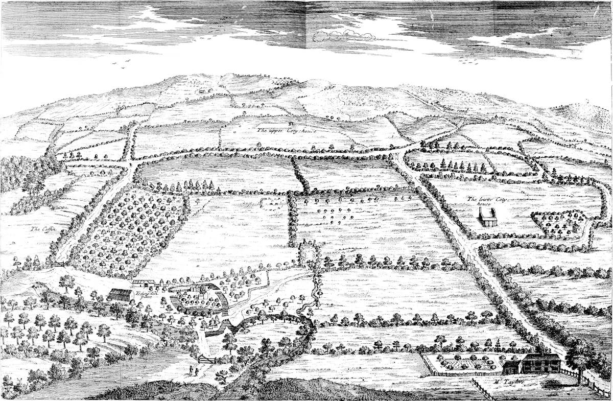


From thence the Itinerary leads us to Durolenum. The learned Talbot first guessed it to be Charing; and to me he seems to be in the right. It is upon a spring of the river Len. The present name is derived from the British Caer, as they called all Roman towns in after-times: anciently it was wrote Cering with a Saxon termination, intimating the meadows it stands upon. Roman antiquities are found all about, but nothing I have yet met withal, that particularly fixes the spot the Roman city stood upon. Near is a manor called Broughton; Chart[110] is the name of the hundred, from two little adjoining villages: but at this place the distances answer well, and the roads in many parts appear: that from hence to Canterbury passed by Chilham; so over the river Stour by Sharnford, which retains the British name of a causeway. The archbishops of Canterbury had a castellated palace at Charing, probably given them by some of the first Saxon kings, as a royal demesne of theirs: there are large ruins of it still left. Here was a chantry founded by Sir John Burley. All the ground upon the river Len at the bottom of the great ridge of hills is sand, sometimes exceeding white; between that and the bottom of the hills it is flinty: the hills themselves are pure chalk. All Kent consists of large tracts of ground gradually rising from the east to a western ridge steep that way, so succeeded by another of like manner; but any of these tracts are made up of little hills and short valleys, quite of a different nature from those on the west side of the island: and Mr. Camden has observed this before us, as to the northern part of the island, p. 533. Britannia. We may gather an idea of the natural reason of it from what we spoke at first, of the ground hardening upon the instant of the earth’s rotation.
From there, the itinerary takes us to Durolenum. The knowledgeable Talbot first suggested it might be Charing, and I think he’s correct. It’s located by a spring of the river Len. The current name comes from the British word Caer, which they used for all Roman towns later on; it used to be written as Cering with a Saxon ending, indicating the meadows it’s on. Roman artifacts can be found all around, but I haven’t come across anything that specifically marks where the Roman city was located. Nearby is a manor named Broughton; Chart[110] is the name of the hundred, from two small neighboring villages. However, in this area, the distances match up well, and many roads are still visible: the route from here to Canterbury went through Chilham; across the river Stour by Sharnford, which maintains the British name for a causeway. The archbishops of Canterbury had a fortified palace at Charing, likely granted to them by some of the early Saxon kings, as a royal domain: the large ruins of it still remain. A chantry was founded here by Sir John Burley. All the land along the river Len at the base of the large ridge of hills is sandy, sometimes very white; between that and the foot of the hills, it’s flinty: the hills themselves are pure chalk. All of Kent consists of large areas of land that gradually rise from the east to a steep western ridge, followed by another similar ridge; but these areas are made up of small hills and short valleys, quite different in nature from those on the western side of the island. Mr. Camden noted this about the northern part of the island, p. 533. Britannia. We can infer a natural explanation for this from what we initially discussed regarding the ground hardening at the moment of the Earth's rotation.
After we have made this excursion with Antoninus, to take in these two stations, which seems to have been done to conduct travellers the nearest way to the portus Lemanis, we return again to Rochester, that we may finish the progress of the Watling-street.
After our trip with Antoninus to visit these two stops, which appears to have been set up to guide travelers the quickest route to the portus Lemanis, we head back to Rochester so we can complete the journey along Watling Street.
From Rochester the Watling-street continues very strait to Canterbury, by Feversham, whither I went to visit the remains of the monastery founded by king Stephen, and where he was buried with his family. At present nothing left but TAB. XXVII.two gate-houses, and they of mean structure: the hall was standing intire within this forty year; but now the whole monastery is level with the ground, and converted into orchards, so that I could not so much as guess at the place where the church was. They have a report still, that at the dissolution of abbeys they took up the coffin of 122lead wherein the king was buried, and sold it: as for his corpse, they threw it into the Thames. Here king Ethelstan enacted laws, anno 903. At Newington.Newington seems to have been another station: many Roman coins and antiquities have been found Ro. town.there. Vide large accounts thereof in Burton’s Itinerary, p. 181. and Casaubon’s translation of Antoninus Philos. Beyond Broughton, which seems to have been another,[111] you come to a very high hill, steep on the west. The Watling-street here first presents the tower of the cathedral in its line, and both together make a fine show:
From Rochester, Watling Street continues straight to Canterbury, passing through Faversham, where I went to check out the remains of the monastery founded by King Stephen, where he was buried with his family. Now, there’s nothing left but TAB. 27. two gatehouses, and they're quite plain. The hall stood intact for about forty years, but now the entire monastery is level with the ground and has been turned into orchards, so I couldn’t even guess where the church used to be. There's still a rumor that during the dissolution of the abbeys, they removed the lead coffin containing the king and sold it; as for his body, they threw it into the Thames. Here, King Ethelstan enacted laws in 903. At Newington. Newington seems to have been another stop: many Roman coins and artifacts have been found Ro. city. There are detailed accounts in Burton’s Itinerary, p. 181, and Casaubon’s translation of Antoninus Philos. Beyond Broughton, which seems to have been another [111], you come to a very steep hill on the west. Watling Street here first shows the tower of the cathedral in its view, and the two together create a beautiful sight:
Canterbury is deservedly famous for religious as well as Roman antiquity, being the place where christianity first made its entrance among our Saxon ancestors. Here are many remains of Roman buildings, many made of TAB. XCVI.Roman materials in the Saxon times: many antiquities found in digging about the hop-grounds; your lordship has quantities of them. The city is strongly walled about, and many lunettes or towers at due intervals; a deep ditch close underneath, and a great rampart of earth within. The original ground-plot here, as in many other cities, is spoiled by churches built in the middle of streets. To the south is an old obscure gate, called TAB. LIV.Worth gate, partly walled up: it is under the castle. This is intirely a Roman work: the semi-circular arch is of Roman brick, beautifully turned; the piers of stone; the thickness of it is three Roman feet. I suppose this the original gate of the Roman city, and from hence went the road which presently divides itself into two: the one goes by Chilham to Durolenum, over the river at Sharnford, as we said; the other goes in a very strait line, by the name of Stone-street, to the port of Lemanis. The castle built here in William the Conqueror’s time, extending its limits beyond this gate, was the occasion of blocking it up; and so Winchup gate was built a little further eastward, to supply its use. The castle is much of the same form as that at Rochester, and the walls of the same thickness. A little further within the walls is a very high mount, called Dungeon hill: a ditch and high bank inclose the area before it: it seems to have been part of the old castle. Opposite to it without the walls is a hill, seeming to have been raised by the Danes when they besieged the city. The top of Dungeon hill is equal to the top of the castle, and has a fine prospect over the city and country. The materials of the city-walls are chiefly flint. Next to this, where the Watling-street comes,[112] is Riding-gate, built by a mayor of the city, but evidently in the place of the Roman one; for there is part of the Roman arch, and the pier of one side, still visible, but much lower than the present gate: and in a yard close by is part of the arch of a postern, or foot-gate, by the side of it: these arches are of Roman brick, and there are in the wall here and there some more fragments of the Roman work. The draught of it I have given in the plate of the city ground-plot, 96. Hence the Watling-street passes directly to Dover, over Barham downs. Next to East-gate is another gate, opposite to what they call St. Ethelbert’s tower: this is the way to the port of TAB. XXV.Rutupium. Here is the famous monastery of St. Augustin, the first metropolitan, built, as they say, near the palace of the converted king Ethelbert: two gates remain next the city, and both very stately: perhaps one belonged to the palace, the other to the monastery, which doubtless 123as magnificent as richly endowed; and such its ruins demonstrate, and the great compass of ground it took up, incircled with a very high wall. Great vying was ever here between the religious of St. Austin and of Tho. à Becket, both very rich and contentious. At the west end of this church, as I conjecture, were two great towers: half of one is still remaining, called TAB. XXIV.Ethelbert’s tower: all the whole stones and pillars about it are skinned off as far as they can reach; and every year a buttress, a side of an arch, or the like, passes sub hasta. There is part of the other standing, if it can be so said, that is only not fallen; I call it muro torto: it is a vast angular piece of the tower, about thirty foot high, which has been undermined by digging away a course at bottom, in order to be thrown down; but it happened only to disjoint itself from the foundation, and leaping, as it were, a little space, lodged itself in the ground in that inclining state, to the wonderment of the vulgar who do not discern the meaning of it, though the foundation it came from is sufficiently visible: thus happening to be equally poized, it is a sight somewhat dreadful, and forbids a too near approach on any side, with the apprehension of its falling that way. Under St. Ethelbert’s tower is the porch where St. Augustin and his six successors, as Bede tells us, were interred: the arched roof is left, but ready to fall: the pavement is gone, in the middle of which was an altar. The adjacent close is full of religious ruins and foundations, one great part turned into a stable near the almery: all over they are busy in pulling it up, to sell the stones; which generally pays the rent, and yet the tenants of such places thrive never the more. TAB. XXV.In one corner of this field are the walls of a chapel, said to have been a christian temple before St. Augustin’s time, and reconsecrated by him to St. Pancras: a great apple-tree and some plum-trees now grow in it: the lower part of it is really old, and mostly made of Roman brick, and thicker walls than the superstructure: there is an old Roman arch on the south side toward to altar, the top of it about as high as one’s nose; so that the ground has been much raised: the present east window is a pointed arch, though made of Roman brick, later than St. Austin’s time: near it a little room, said to have been king Ethelbert’s pagan chapel: however it be, both these and the wall adjoining are mostly built of Roman brick: the breadth of the mortar is rather more than the brick, and full of pebbles; but the mark of the devil’s claws, there observed by the vulgar, is fantastical. The garden and orchard adjoining seem to lie in their ancient form: there is a large square mount close by the wall, which it equals in height, and gives a prospect into the fields. Your lordship has a huge water-pipe dug up among many other antiquities in a Roman bath discovered at Canterbury: it is five inches and a half diameter at the smaller end, seventeen long, seven in diameter at the broad end: they were fastened into one another with strong terrace cement. The great number of other antiquities of all sorts, found at and about this city, make part of your fine collection.
Canterbury is rightfully famous for its religious and Roman history, being the place where Christianity first came to our Saxon ancestors. There are many remains of Roman buildings, many made of Roman materials during Saxon times, and countless antiquities discovered while digging around the hop fields; you have plenty of those. The city is heavily fortified with walls, and there are several towers at regular intervals; a deep ditch runs right underneath, along with a large earthen rampart inside. The original layout of the city, like many others, is disrupted by churches built in the middle of the streets. To the south is an old, partly bricked-up gate called Worth Gate, located under the castle. This is entirely a Roman structure: the semi-circular arch is made of Roman brick and beautifully curved; the piers are stone, and its thickness measures three Roman feet. I believe this was the original gate of the Roman city, from which the road splits into two: one goes through Chilham to Durolenum, crossing the river at Sharnford, as mentioned; the other goes straight along Stone-street to the port of Lemanis. The castle built here during William the Conqueror's time extended past this gate, leading to its blockage; Winchup Gate was constructed a little further east to take its place. The castle resembles the one at Rochester, and the walls are of similar thickness. A bit further inside the walls is a high mound called Dungeon Hill: a ditch and steep bank enclose the area in front of it, which seems to have been part of the old castle. Opposite this outside the walls is a hill that looks like it was raised by the Danes when they besieged the city. The top of Dungeon Hill is level with the top of the castle and provides a lovely view over the city and countryside. The city walls are mostly built of flint. Next to where Watling Street comes in, Riding Gate was constructed by a mayor of the city, clearly on the site of the Roman gate; part of the Roman arch and one pier are still visible but much lower than the current gate. Nearby is a yard with part of the arch of a postern or foot-gate next to it; these arches are made of Roman brick, and here and there along the wall are more fragments of Roman work. I've illustrated this in the city ground plot, 96. From here, Watling Street goes directly to Dover, over Barham Downs. Next to East Gate is another gate, opposite what they call St. Ethelbert's Tower; this leads to the port of Rutupium. Here is the famous monastery of St. Augustine, the first metropolitan, said to be built near the palace of the converted King Ethelbert: two gates remain next to the city, both very grand; perhaps one belonged to the palace and the other to the monastery, which was undoubtedly as magnificent and well-endowed as its ruins show, occupying a large area encircled by a very high wall. There was always strong competition here between the religious communities of St. Augustine and Thomas à Becket, both very wealthy and contentious. At the west end of this church, I suspect there were two large towers: half of one remains, known as Ethelbert's Tower; all the stones and pillars around it have been picked clean. Every year, a buttress, a part of an arch, or something similar gets sold off. Part of the other tower stands, or rather it hasn’t fallen yet; I refer to it as muro torto: it's a massive angular piece of the tower, about thirty feet high, which has been undermined by digging away a course at the bottom, intending to topple it; but instead, it merely dislodged from the foundation and, as if by some magic, settled in that tilted position, to the amazement of onlookers who can’t understand it, even though the foundation from which it came is clearly visible. The way it balances makes for a somewhat frightening sight and deters anyone from getting too close, fearing it might fall. Under St. Ethelbert's Tower is the porch where St. Augustine and his six successors, as Bede tells us, were buried; the arched roof is still there but is about to collapse, and the pavement is gone, with an altar once in the center. The nearby grounds are filled with religious ruins and foundations, with a large portion turned into a stable near the almery; they are constantly pulling it up to sell the stones, which generally covers the rent, yet the tenants in these locations don’t seem to thrive. In one corner of this field are the walls of a chapel, believed to have been a Christian temple before St. Augustine's time and reconsecrated by him to St. Pancras; a large apple tree and some plum trees now grow there. The lower part of it is genuinely old, mostly made of Roman brick, and the walls are thicker than the structure above. There’s an old Roman arch on the south side towards the altar, the top of which is about nose-height, indicating that the ground level has been significantly raised; the current east window is a pointed arch, albeit made of Roman brick, and is later than St. Augustine's time. Nearby is a small room said to have been King Ethelbert's pagan chapel; regardless of its original purpose, both of these structures and the adjoining walls are predominantly built of Roman brick. The mortar is slightly wider than the bricks and filled with pebbles, but the mark of the devil’s claws, which some locals observe, is purely fictional. The garden and orchard nearby seem to remain in their original layout: there’s a large square mound next to the wall, which is the same height and provides a view into the fields. You have uncovered a large water pipe among many other antiquities in a Roman bath discovered in Canterbury: it is five and a half inches in diameter at the smaller end, seventeen inches long, and seven inches in diameter at the wider end; they were connected with strong terrace cement. The numerous other antiquities of all kinds found in and around this city are part of your fine collection.

in the Porch of which the English Apostle
was bury’d, now called Ethelberts tower
at Canterbury Oct. 6. 1722.
Dedicated to her Grace the Dutchess of Ancaster.


Eastward of this, and farther out of the city, is the church of St. Martin, said to be the christian place of devotion, where king Ethelbert’s queen used to go, and St. Austin’s first see: it is built, for the most part, of Roman brick: in the middle is a very large old-fashioned font, supposed that where the king was baptised. North of the city is a very small remnant of St. Gregory’s chapel, founded probably by Austin to the honour of his patron.
East of this, and further out of the city, is St. Martin's Church, known as the Christian place of worship where King Ethelbert’s queen used to attend, as well as the first see of St. Augustine. It’s mostly made of Roman bricks. In the center, there's a large, old-fashioned font, which is believed to be where the king was baptized. To the north of the city, there's a small remnant of St. Gregory’s chapel, likely founded by Augustine in honor of his patron.
The cathedral of Canterbury is very stately, but neither in length, breadth, nor height, especially in front, equal to Lincoln, in my judgement: it is124 intirely vaulted with stone, and of a very pretty model of building, but much too high for its breadth, as all Gothic buildings were. I believe they got this ill taste from building upon the old foundations, the ancient churches being much narrower and lower than in the succeeding times: when greater riches flowed in upon them, they carried their walls and roofs to an unseemly height. The place where Thomas à Becket’s shrine stood, is sufficiently known by the mark of the devoted knees quite around it, which have left deep impressions in the hard coarse marble. The Black Prince has a noble monument of brass: that of Henry IV. is a good tomb, and there is a pretty chapel hard by, to say mass for him. There is an old picture of arch-bishop Becket’s martyrdom, as called; and upon the wall an old painting of the siege of Jerusalem, in our old habits. Here are several monuments of the bishops. The metropolitan chair is of grey marble, standing behind the high altar: the cloysters are pretty good, and a very large chapel near them, called Sermon-house, wainscotted with Irish oak. The reason of the ancient name of this British city seems intimated in this verse of Virgil,
The Canterbury Cathedral is impressive, but in terms of length, width, and height, especially at the front, I think it doesn't measure up to Lincoln. It’s completely vaulted in stone and has a nice architectural design, but it’s way too tall for its width, like most Gothic buildings are. I think they developed this poor taste by building on the old foundations, as the ancient churches were much narrower and shorter than those that came later. As more wealth came in, they raised their walls and roofs to an inappropriate height. The spot where Thomas à Becket's shrine was located is well-known, marked by the devoted knees of worshippers that have left deep impressions in the hard, rough marble. The Black Prince has a grand brass monument; Henry IV has a decent tomb, and there’s a nice chapel nearby for mass in his honor. There’s an old painting of Archbishop Becket’s martyrdom and another mural depicting the siege of Jerusalem, featuring our traditional attire. There are several monuments honoring the bishops. The metropolitan chair, made of grey marble, is situated behind the high altar. The cloisters are quite nice, and there’s a large chapel nearby called the Sermon House, which is paneled in Irish oak. The reason behind the ancient name of this British city seems hinted at in this verse from Virgil,
The poor derivation of the commentators thereon ought to be referred to Tuscan original, to which our Celtic is a-kin.
The poor interpretations from the commentators should be linked back to the Tuscan original, which is related to our Celtic roots.
Leaving Canterbury,[113] I journeyed to find out Rutupiæ. At Wingham I saw a very large barrow, of Celtic make, by the road side, called the Mount: upon enquiry I found there were several more in the parish, and that a lane here is called Port-lane; doubtless the Roman road, for here the common road goes more southward. The Roman city and port without peradventure was the place now called Stonar, or Stanar, as they pronounce it, from the stony foundations I chuse to think; over-against Sandwich, or rather half a mile lower upon the river coming from Canterbury, and almost incompassed by it. This river at first discharged itself into the sea by Ebbesflete, north of the Roman city, till the sand, pouring so directly upon it, obliged the stream to slide under the cliff by Richborough castle, and so by Sandwich: then, coming in obliquely by the weight of its waters, it maintains its passage. I conceit the etymology of Rhutupium, about which the learned contend much, is to be sought for in this Ebbesflete; and that this water was originally called Ube, or Tyvi: rhyd tyf or tyvi, is the passage over it: the Saxons called it Reptacester, a contraction only from Rhutupicester: and so our Ebbe at present came from them; Ruptimuth anciently. Hence you see far into the isle of Thanet and Ramsgate cliff, named from the Romans, thrusting its chalky promontory into the sea. This was the chief port for the Roman navy.[114] At present there is only a farm-house or two, standing on an elevation in the marshes: they informed me that here had been a great city, and that they can discover all the streets when the corn is on the ground; and those streets are nothing but pure gravel laid very deep: innumerable stones and foundations have been dug up, but now mostly evacuated; and no doubt Sandwich was built out of it. The river runs close by it, with difficulty preserving its current to the sea; but no doubt originally it was an open beach, or port: perhaps the city itself was an island. The old mouth of the river is now filled up by the astonishing quantity of small pebbles thrown into this bay by the roll of 125the ocean: you see here a hundred acres of this flat ground covered over with them six or seven foot deep, and looking blue like the water. I fancied the people that lived here, in like danger with those that travel the sandy deserts of Africa, or Arabia. Here are two elevations, where they say two churches stood: upon one, where an elder-tree grows, much rubble and stone is left, but no part of any building; nor is it easy to distinguish what it was originally.
Leaving Canterbury,[113] I traveled to find Rutupiæ. At Wingham, I noticed a large burial mound of Celtic origin by the roadside, known as the Mount. Upon asking around, I discovered there were several more in the area, and that a nearby lane is called Port-lane, which is likely the old Roman road, as the main road here goes further south. The Roman city and port was undoubtedly the site now referred to as Stonar, or Stanar, as they pronounce it, likely named for its stony foundations; it's opposite Sandwich, or actually about half a mile down the river coming from Canterbury, and almost surrounded by it. This river initially flowed into the sea at Ebbesflete, north of the Roman city, but over time, sand accumulated so heavily that the river was forced to flow beneath the cliff by Richborough castle and then towards Sandwich; thus, its waters maintain their course at an angle. I believe the origin of Rhutupium, which scholars debate about a lot, can be traced back to this Ebbesflete; I suspect this water was originally called Ube or Tyvi: rhyd tyf or tyvi means the crossing over it. The Saxons referred to it as Reptacester, a shortened form of Rhutupicester; that's why our Ebbe today comes from them, previously known as Ruptimuth. From here, you can see far into Thanet and Ramsgate cliff, named by the Romans for its chalky headland jutting into the sea. This was a major port for the Roman navy.[114] Nowadays, only a couple of farmhouses sit on a rise in the marshes. They told me that there used to be a great city here and that when the crops are low, you can see all the streets; those streets are just deep layers of pure gravel. Many stones and foundations have been uncovered, but most have now been cleared away; undoubtedly, Sandwich was built from it. The river runs nearby, struggling to maintain its flow to the sea; it was likely once an open beach or port: maybe the city itself was an island. The old mouth of the river is now blocked by the incredible amount of small pebbles washed into this bay by the ocean: you can see a hundred acres of this flat land covered six or seven feet deep, appearing blue like the water. I imagined the people who lived here were in the same kind of danger as those crossing the sandy deserts of Africa or Arabia. There are two mounds where it's said two churches once stood: on one, where an elder tree grows, there is a lot of rubble and stone, but no parts of any buildings remain; and it's hard to tell what it was originally.
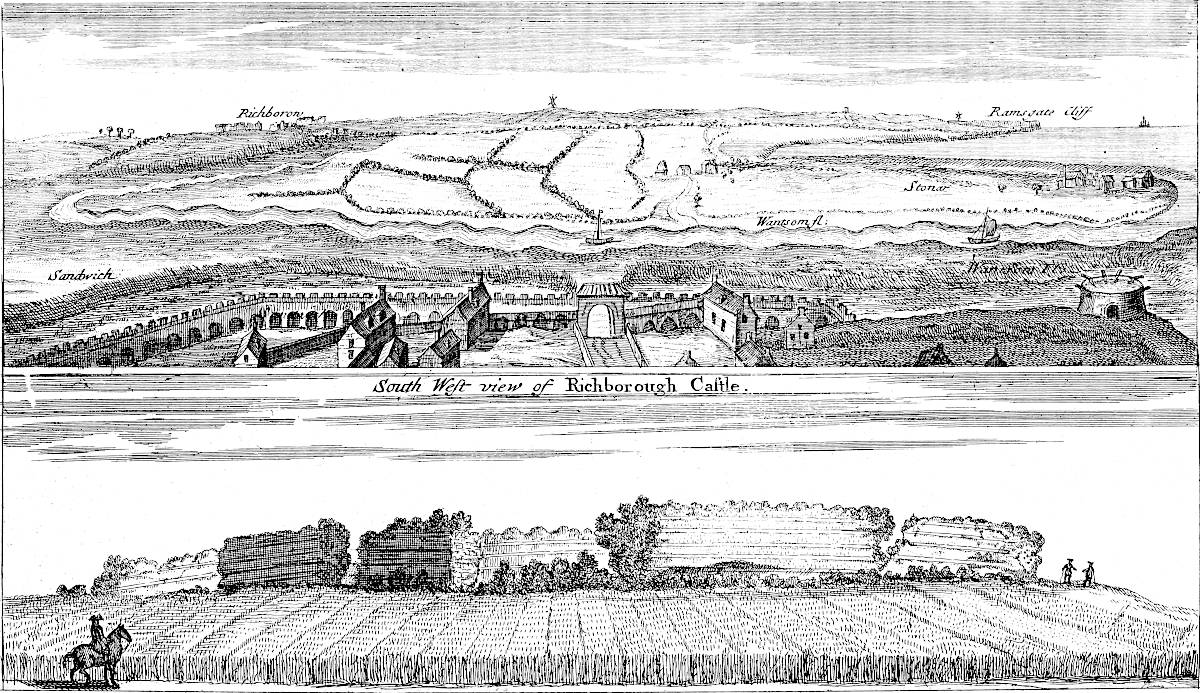


TAB. XCVII.Richborough castle, as now called, was the fort as it were to this city, and station of the garrison, which was to watch and defend the port and sea-coast hereabout; or rather one of those castles built upon the littus Saxonicum, in the time of Theodosius: it is a mile off Stanar and Sandwich, situate upon the highest elevation near hand, and being the only small part of a bold shore in all this bay: the river runs at the foot of it,
TAB. XCVII.Richborough Castle, as it's called today, served as the fort for this city and the location of the garrison that was meant to monitor and protect the port and nearby coastline; in fact, it was one of those castles built along the littus Saxonicum during Theodosius's time. It's located about a mile from Stanar and Sandwich, sitting on the highest point nearby, and is the only small section of a rugged shoreline in this entire bay: the river flows at its base,
It is a most noble remnant of Roman antiquity, where in later times of their empire the Legio II. Aug. was quartered: the walls on three sides are pretty intire, and in some places still about twenty-five or thirty foot high, without any ditch: the side next the sea being upon a kind of cliff, the top of the wall is but level with the ground: beside, at the east angle the wall descends to another slope just upon the river, which seems to have been in the nature of an outwork, or gradual ascent into the castle: the ground on the inside is pretty much raised. In the middle of the north-east side there is a square work jutting out from the wall, which seems to have been an oblique[115] gate to enter at, for those that came from the water side; and it is not unlikely that gap on the north-west side was another gate: it was a square CV. paces one way, CL. the other; according to the Roman method of making camps, a third part longer than their breadth. There is a foundation within, which has caused many words among the Kentish antiquaries; seems to have been a Pharos, or lodging for the commanding officer, a prætorium: there are foundations of several apartments, the walls monstrously thick and strong. It is manifest to any one that seriously contemplates the ruins of the walls in divers places, that this castle was destroyed by great violence and industriously; I guess, by the Saxons immediately after the Romans left the island, when they could more boldly make descénts upon the coast: the reason why, is evident from the intent of these castles: upon the eastern corner, especially, great piles of wall lie one upon another like rocks: in other places cavities are hewn out of its thickness, that would make good lodging-rooms: the manner of the composition of the walls is seven courses of small hewn stone, which take up four Roman feet: then two courses of Roman brick, which are white, like the brick in the isle of Ely. I observe all the brick about Sandwich to be of the same colour, made of whitish clay. The walls are twelve foot thick: the inward body thereof is made of flint and excessive hard mortar. Sandwich bears directly south. Dr. Holland talks of a carved head over one of the gates; but I could find no such thing now. In the way thither, upon an eminence is the carcass of a castrensian Amphitheatreamphitheatre made of turf; I suppose, for the exercise and diversion of the garrison: the soil of it is gravel and sand, and has been long ploughed over,TAB. XXXVI. 2d Vol. that we need not wonder it is so level. There are three Roman tumuli before Sandwich west 126gate; one a windmill stands on: it is not easy to assign which Contentus was buried under:
It is a remarkable remnant of Roman history, where in later times of their empire the Legio II. Aug. was stationed: the walls on three sides are mostly intact and in some places still stand about twenty-five or thirty feet high, without any ditch: the side facing the sea is on a sort of cliff, with the top of the wall level with the ground: in addition, at the east corner, the wall slopes down to another incline right by the river, which seems to have served as an outwork or gradual approach to the castle: the ground inside is quite raised. In the middle of the northeast side, there is a square structure jutting out from the wall, which appears to have been an angled gate for entry from the water side; and it's likely that the opening on the northwest side was another gate: it measured a square of CV. paces one way and CL. the other; following the Roman design for forts, a third longer than their width. Inside, there is a foundation that has led to much debate among Kentish historians; it seems to have been a Pharos, or quarters for the commanding officer, a prætorium: there are foundations of several rooms, with walls that are extraordinarily thick and strong. It is clear to anyone who seriously examines the ruins of the walls in various places that this castle was destroyed by great force and deliberately; I suspect, by the Saxons right after the Romans left the island, when they could more boldly raid the coast: the reason for this is clear from the purpose of these castles: especially in the eastern corner, large piles of wall lie one on top of another like rocks: in other locations, spaces have been hewn out of its thickness that could serve as good living quarters: the structure of the walls consists of seven layers of small cut stone, measuring four Roman feet high; followed by two layers of Roman brick, which are white, similar to the bricks found in the Isle of Ely. I've noticed that all the brick around Sandwich is of the same color, made from whitish clay. The walls are twelve feet thick: their inner structure is made of flint and very strong mortar. Sandwich is directly south. Dr. Holland mentions a carved head over one of the gates; however, I couldn't find anything like it now. On the way there, on a hill, is the remains of a castrensian Amphitheateramphitheatre made of turf; I assume it was for the exercise and amusement of the garrison: the soil there is gravel and sand and has been plowed for a long time,TAB. XXXVI. 2nd Vol. so it’s no wonder it is so level. There are three Roman tumuli in front of Sandwich's west 126 gate; one has a windmill on it: it is not easy to determine which Contentus was buried beneath it:
South of Sandwich, as we go along upon the sea-shore, are six large and broad Celtic tumuli, equidistant: the second from the town has been dug away, to raise a little fort upon the road: they all stand in a line east and west.[116] This flat coast is fenced against the ocean by the sand-downs, which in Lincolnshire we call meals: but within the memory of man, as they told me, the sea has commenced a new method of guarding against its own violence, by covering the shore, for a great depth and height, with the pebbles afore mentioned; which is an odd mutation in nature; and it is observable that these pebbles come from the south. I rode from Sandwich as far as Hithe, upon the brink of the shore or cliff, in sight of France all the way; and nothing could be more entertaining in this autumnal season, when the weather is generally clear, serene and calm. Much sea tithymal grows here, and a very pretty plant, papaver cornutum flore luteo, rock samphire feeding upon petroleum, a most excellent pickle, and many more.[117] The murmur of the ocean has a noble solemnity in it, as Homer says, when latinised,
South of Sandwich, along the seashore, there are six large and wide Celtic tumulus, evenly spaced: the second one from the town has been removed to build a small fort on the road. They all line up from east to west. This flat coast is protected from the ocean by the sand dunes, which we call meals in Lincolnshire. But, as people have told me, within living memory, the sea has started a new way of defending itself from its own fury by covering the shore with the previously mentioned pebbles, creating a significant depth and height; this is a strange change in nature, and it's noticeable that these pebbles come from the south. I rode from Sandwich to Hythe, right along the edge of the shore or cliff, with a view of France the entire way, and nothing could be more enjoyable during this autumn season when the weather is usually clear, calm, and serene. A lot of sea tithymal grows here, along with a lovely plant, papaver cornutum flore luteo, rock samphire thriving on petroleum, an excellent pickle, and many more. The sound of the ocean has a grand solemnity to it, as Homer says, when translated into Latin.
More copiously expressed in Virgil,
More richly expressed in Virgil,
which is an exact idea of this place. By listening attentively I observed this noise of the ocean is by fits, at short but equal intervals; which I believe gave occasion to that fancy of the ancients, that every tenth wave was the largest; of which Ovid has a distich.
which is a true representation of this place. By listening closely, I noticed that the sound of the ocean comes in bursts, at brief but consistent intervals; which I think inspired the ancient belief that every tenth wave was the biggest, a notion that Ovid mentioned in a couplet.
Sandown castle is composed of four lunettes of very thick arched work of stone, with many port-holes for great guns: in the middle is a great round tower, with a cistern at top; underneath an arched cavern, bomb-proof: a foss incompasses the whole, to which there is a passage over a draw-bridge. Deal castle and Walmer castle are of the same nature, all built by Harry VIII. to guard this naked level coast: moreover, lines are drawn along between castle and castle, and at proper intervals round bastions with a ditch and parapet of earth, where cannon may be planted, as in the infancy of fortification. These are what Camden calls Rome’s works, and fancies to be remnants of Cæsar’s ship-camp: the neighbours with as little truth affirm they were thrown up by Oliver Cromwell, for reduction of these 127castles: one is close by the north side of Deal, and two between Deal castle and Walmer castle. At Walmer castle the cliff begins for about half a mile southward with a gentle rise to a hill, whereon is a tumulus: then the shore is plain again in a valley till you come to Kings-wold, which is half a mile’s space. TAB. XXXVII. 2nd Vol.Between Walmer castle and Deal I take to be the spot where Cæsar landed in his first expedition, because it is the first place where the shore can be ascended north of Dover, and exactly answers his assigned distance of eight miles: probably in his second expedition, when he came with many more ships, and had a perfect knowledge of the country, he went a little farther in the downs, whereabouts now is Deal, a town lately sprung up from the mariners. As for his sea-camps, it is vain to expect a sight of them; they are many ages since absorpt by the ocean, which has so long been exercising its power, and wasting the land away. Even since Harry the VIIIth’s time it has carried off the sea-ward esplanades of the three castles, and one half of two of the three circular forts. Indeed, of late years, the providential ejectment of those pebbles has put a stop to it in some measure; and it is amazing to see how it by degrees fills up these fosses and trenches, and sometimes flies over the banks a good way up into the land, with a power well expressed by the poet,
Sandown Castle is made up of four thick, arched stone lunettes with multiple portholes for cannons. In the center, there’s a large round tower with a cistern on top; underneath it, there’s a bomb-proof arched cavern. A moat surrounds the entire structure, which you can access via a drawbridge. Deal Castle and Walmer Castle are similar, all built by Henry VIII to defend this exposed coastline. Additionally, lines are drawn between each castle, with bastions at regular intervals that have a ditch and an earth parapet where cannons can be placed, much like early fortifications. Camden refers to these as Rome’s works, and he speculates they’re remnants of Caesar’s camp for his ships; the locals falsely claim they were created by Oliver Cromwell to capture these 127 castles: one is located just north of Deal, and two are between Deal Castle and Walmer Castle. At Walmer Castle, the cliff begins to rise gently for about half a mile southwards to a hill where there’s a tumulus; then the shore flattens out again in a valley until you reach Kingswold, which is a half-mile stretch. TAB. XXXVII. 2nd Vol. I believe the area between Walmer Castle and Deal is where Caesar landed during his first expedition because it’s the first point where you can ascend the shore north of Dover, and it matches the eight-mile distance he described. During his second expedition, when he arrived with many more ships and had a better understanding of the land, he likely went a bit further into the Downs, which is where Deal is now—a town that recently developed from the nearby maritime activity. As for his sea camps, it’s pointless to expect to see them; they have been swallowed by the ocean many ages ago, which has long been eroding the land. Even since the time of Henry VIII, it has taken away the seaside esplanades of the three castles and half of two of the three circular forts. In recent years, the fortunate removal of those pebbles has somewhat halted this erosion, and it's astonishing to see how the ocean gradually fills in these moats and trenches, and sometimes breaches the banks, advancing well into the land, with a power aptly described by the poet.
But of this affair of Cæsar’s I reserve to myself another opportunity of speaking, when I shall expresly treat of his expedition hither. At Deal castle is a very good well, though close by the sea.
But regarding this matter of Caesar's, I will save my comments for another time when I specifically address his journey here. At Deal castle, there is a very good well, even though it's close to the sea.


Now my journey lay intirely upon the edge of the cliffs, whose precipicious height, with the noble prospect at sea, and most awful roaring of the waves, filled the mind with a sense of Nature’s majesty. About St. Margaret’s on cliff, near the light-houses, I saw in two places a great number of little tumuli, of unequal bulk, close by one another; and the like I found frequently about Barham downs, and between Hardres[118] and Chilham, and other places. I know not that such have ever been taken notice of: the people say they were burying-places of the Danes; probably digging into them might give us some satisfaction. I believe them Celtic, because I saw many sorts of them, and such as appear on Salisbury plain.
Now my journey was entirely along the edge of the cliffs, where the steep height, the stunning view of the sea, and the frightening roar of the waves filled my mind with a sense of Nature's power. Near St. Margaret's on the cliff, close to the lighthouses, I noticed in two spots a large number of small tumuli, varying in size, situated close together; I found similar sites often around Barham downs, and between Hardres[118] and Chilham, and other locations. I don’t think anyone has pointed these out before: people say they were burial sites of the Danes; digging into them might bring us some clarity. I suspect they are Celtic since I saw many different types, similar to those found on Salisbury plain.
Dover is a most romantic situation: it is a great valley, and the only one about this coast where water is admitted inwards of the cliff, here very high; and a running brook discharges itself into the sea:[119] the water formerly came a good way higher up, and made a large port; and they have found anchors above the town. TAB. XXXVIII. 2nd Vol.The Roman city of Dubris was to the south of the river: the Watling-street enters it at Bigin gate, coming very strait from Canterbury over Barham down, where it is very perfect:[120] butting128 directly upon the great tower of the cathedral, it bears a little more northerly than north-west. This city was an oblong square, and some of the walls are left: the churches are of a very antique make: that of St. Martin is collegiate, founded by Wightred king of Kent; it is a venerable ruin: the east end seems to have terminated in three semi-circular works: it was built in form of a cross, as to its main body. Much remains of the priory, now a farm-house. The maison dieu over-against it is become a store-house: here the knights Hospitallers or Templars lodged, coming into, or going out of, the kingdom. The piers that form the haven, or large bason, are costly and great works: above is a fort with four bastions of modern date. The broad beach which lies at the mouth of this great valley, and was the harbour in Cæsar’s time, is very delightful: it is no little part of the diversion, in walking there, to observe the odd produce of the ocean thrown up under your feet, and the sea-plants that grow there; theTAB. XXXIX. XL. 2d Vol. umbelli, star-fishes, many curious fossils and shells; the eringo, sea-lungs, sea-weed, or ood as called, &c. One long street here is named Snare-gate, from the most tremendous rocks of chalk hanging directly over the houses; as Cnarsborough in Yorkshire, says Mr. Camden, p. 715.
Dover is a really romantic place: it’s a big valley and the only one on this coast where water flows inward from the cliffs, which are very high here. A running brook empties into the sea; the water used to reach further inland and created a large port, and they’ve even found anchors above the town. TAB. 38. 2nd Vol.The Roman city of Dubris was south of the river: Watling Street enters here at Bigin Gate, coming directly from Canterbury over Barham Down, where it’s still in great condition; it runs128 just north of the great tower of the cathedral, a little more north than northwest. This city was shaped like an oblong square, and some of the walls still remain. The churches are very ancient: St. Martin's is a collegiate church, founded by Wightred, king of Kent, and it’s a venerable ruin. The east end seems to finish in three semi-circular sections, and it was built in the shape of a cross for its main structure. Much is left of the priory, now a farmhouse. The maison dieu opposite it has become a storehouse; here, the Hospitaller or Templar knights stayed when coming into or leaving the kingdom. The piers that create the harbor, or large basin, are impressive and substantial. Above is a fort with four bastions built more recently. The wide beach at the mouth of this large valley, which was the harbor during Caesar’s time, is quite lovely: part of the fun of walking there is seeing the unusual things from the ocean washed up on the shore, along with the sea plants that grow there; you can findTAB. XXXIX. XL. 2nd Vol. umbelli, starfish, lots of interesting fossils and shells, eringo, sea lungs, seaweed, or ood as it’s called, etc. One long street here is called Snare-gate, named after the massive chalk cliffs hanging directly over the houses; as Cnarsborough in Yorkshire, Mr. Camden mentions, p. 715.
The castle is the strongest place in the world, of old fortification; it takes up thirty acres of ground: it is an amazing congeries of walls, ditches, arches, embattlements, mounts, and all imaginable contrivances to render it impregnable after the old mode: but with highest regret I beheld this most noble and memorable fortress, once thought the key of Britain, and that has divers times had the honour to save the kingdom from conquest and slavery, now become a common prey to the people that belong to it: in the late wars with France they kept 1500 prisoners in the great castle; but within this twelvemonth they have carried away the timbers and floors, disabling it even for that use. Thus much I think out of gratitude is its due; let it stand a monument of antiquity, or sink slowly by its own ruin. The brass gun called Queen Elizabeth’s Pocket-pistol is a great curiosity, twenty-two foot long: it requires fifteen pound of powder, and carries a ball seven miles (as the gunner told me;) it is excellently well wrought. I saw two very old keys, and a brass horn, which seem to be the ensigns of authority belonging to the constable of the castle, or lord warden of the cinque ports. One part of the fortifications consists of a large circular work, in which stands the old church, said to have been built by Lucius, an ancient king of the Britons, and first christian. Bishop Stillingfleet thinks he is no romantic person, but reigned in Kent and Sussex: however that be, I believe this church is as ancient as the time assigned him. There is not much doubt to be made, that upon this hill was a castrum of the Romans, like that at Richborough, to guard this haven. It is somewhat surprizing that our Saxon ancestors should take great pains to demolish Roman works, though they wanted such in the same places, and were forced to build them again. I look upon it as an argument that they had no thoughts of conquering the island at first, and destroyed these bulwarks, that such might not hinder their depredations; but espying the nakedness of the land, thoroughly evacuated of its youth and men of arms by the Romans, they found a conquest practicable: then were they 129obliged to repair these castles. The church we are speaking of was built, in the first times of christianity, out of part of the Roman ruins, whence there are huge quantities of Roman bricks laid into the work: the arches are intirely turned with them; the corners and many parts, both within and without, are built up therewith; and the remainder is of stone originally cut by the Romans: it is in form of a cross, and has a square tower in the middle. I have represented the drawing of it in TAB. XLVIII.plate 48. The stone windows of this church are of later date than the building; they have been put in long since: but the greatest curiosity here is the Roman. Pharos.Pharos, or Roman watch-tower, standing at the west end of the church: notwithstanding it is so much disfigured by new daubing with mortar, casing and mending, I discovered its primary intention the first minute I saw it; and sent the three prints of it, which I here present the reader, to monsieur Montfaucon, at the instances of my most honoured lord, the archbishop of Canterbury. I was in hopes they would have been more useful to that celebrated author; for therein at least he might have found, that the building which he first took for a Pharos, and whereof he gives us four views, is only the tower of the church we were talking of. The description of this curious work, which I believe the most perfect of any left, in short is thus.
The castle is the strongest place in the world, an ancient fortress; it covers thirty acres. It's an incredible collection of walls, ditches, arches, battlements, mounds, and all sorts of defenses to make it unbeatable in the old style. But with great sadness, I see this noble and historic fortress, once considered the key to Britain and that has several times managed to protect the kingdom from conquest and enslavement, now become a common target for the locals. In the recent wars with France, they held 1,500 prisoners in the castle, but in the last year, they’ve taken away the timbers and floors, rendering it unusable for that purpose. That much I feel is owed to it out of gratitude; let it stand as a monument of the past or fall slowly into ruin. The brass cannon known as Queen Elizabeth’s Pocket-pistol is quite a sight, twenty-two feet long; it needs fifteen pounds of powder and can shoot a ball seven miles (as the gunner told me); it’s beautifully made. I saw two very old keys and a brass horn, which seem to be symbols of authority belonging to the constable of the castle or the lord warden of the cinque ports. One part of the fortifications features a large circular structure, inside of which stands the old church, said to have been built by Lucius, an ancient king of the Britons and the first Christian. Bishop Stillingfleet believes he was a real historical figure, ruling in Kent and Sussex: whatever the case, I think this church is as old as the time assigned to him. There's little doubt that there was a Roman camp, or castrum, on this hill, similar to that at Richborough, to guard this harbor. It’s somewhat surprising that our Saxon ancestors would go to such lengths to destroy Roman structures, even though they needed them in the same places and were forced to rebuild them. I see it as evidence that they didn’t initially plan to conquer the island and destroyed these defenses so they wouldn’t impede their raids; but upon discovering the land was empty of its youth and soldiers due to the Romans, they realized conquest was possible: then they had to repair these castles. The church we’re discussing was built in the early days of Christianity from part of the Roman ruins, which is why there are large amounts of Roman bricks used in the construction: the arches are entirely made of them; the corners and many sections, both inside and outside, are built with them; and the rest is stone originally cut by the Romans. It’s shaped like a cross, with a square tower in the middle. I’ve included a drawing of it in TAB. XLVIII.plate 48. The stone windows of this church were added later; they’ve been in for a long time. But the greatest curiosity here is the Rome. Lighthouse.Pharos, or Roman watchtower, located at the west end of the church: despite being significantly altered with plaster, casing, and repairs, I recognized its original purpose the moment I saw it, and I sent three prints of it, which I now present to the reader, to Monsieur Montfaucon, at the request of my most honored lord, the archbishop of Canterbury. I had hoped they would be more useful to that renowned author; at least he would have found that the building he initially identified as a Pharos, of which he gives us four views, is merely the tower of the church we were discussing. In summary, the description of this remarkable structure, which I believe is the most complete account left, is as follows.


Tabulam hanc vovet W. Stukley

Regio. D.D. Ws. Stukeley.

Pharon in Castro Dubriensi Rogo. Gale Arm.
consecratum posuit Ws. Stukeley 1722.
TAB. XLVII.In the 47th plate we have shown the ground-plot upon which it is formed, and a section of the work; whence we may readily observe that the design is simple, but admirably contrived for its use and purpose: the base is octagonal without, within a square; but the sides of the square and octagon are equal, viz. fifteen Roman feet, which reduces the wall to the thickness of ten feet. In this manner it was carried up to the top, which was much higher than at present; but it retires inward continually from all sides, with much the same proportion as an Egyptian obelus. Upon four of these sides there are windows narrow, handsomely turned with a semi-circular arch of Roman brick six foot high, so that the outside of it appears as in our TAB. XLVI.46th plate. The door to it is on the east side, about six foot wide, very well turned over head, with an arch made of a course of Roman brick and stone alternately, fourteen foot high. All the stones of this work are of a narrow scantling; and the manner of the composure, throughout, is perfectly the same with that lately described at Richborough castle: there are first two courses of this brick, which is level with the bottom of the windows; then seven courses of hewn stone, which mount up to the top of the windows; then two courses of brick, seven of stone alternately, to the top; every window by this means reaching to a stage or story. There are five of these stages left: the windows are visible enough to a discerning eye, though some be stopt up, others covered over, others have modern church-like windows of stone put in. I suppose the inside was intirely filled up with a stair-case: the height of what is left is forty foot; I believe there was twenty foot more originally; and the whole number of windows on a side was eight. This building was made use of as a steeple, and had a pleasant ring of bells in it, which Sir George Rook procured to be carried away to Portsmouth. Since then the office of the ordnance, under pretext of savingness, have taken away the lead that covered it, and left this rare piece of art and masonry to struggle with the sea, air and weather. Mr. Degg gave me a coin of Dioclesian, found here. The Erpinghams arms are patched up against one side of the Pharos, being two bars and a canton; so that I suppose it was repaired in Henry the Fifth’s time, lord Erpingham then warden of Dover castle. In the Roman castle here the130 Tungrican soldiers had their station. I have heard there is another such Pharos at St. Andrew’s in Scotland.[121]
TAB. XLVII.In the 47th plate we have shown the layout of the structure and a cross-section of the work; from this, we can easily see that the design is straightforward, yet expertly crafted for its intended function: the base is octagonal on the outside and square on the inside; however, the sides of the square and octagon are equal, measuring fifteen Roman feet, which brings the wall thickness to ten feet. This design continues upwards to a height much greater than it is now; it gradually steps inward from all sides, resembling an Egyptian obelus. Four of these sides have narrow windows, elegantly designed with semi-circular arches made of Roman brick, each six feet tall, making the exterior appear as shown in our TAB. XLVI.46th plate. The entrance is on the east side, approximately six feet wide, superbly arched overhead, with an arch constructed from alternating courses of Roman brick and stone, standing fourteen feet high. All the stones used in this structure are of a narrow size; and the construction style is identical to what was recently described at Richborough Castle: it starts with two courses of brick, leveling with the bottom of the windows; followed by seven courses of hewn stone, which rise to the top of the windows; then two courses of brick and seven of stone alternately, up to the top; thus, each window extends to a level or story. There are five of these stories remaining: the windows are clear enough for a keen observer, despite some being blocked, others covered, and some replaced with modern church-like stone windows. I suspect the interior was completely filled with a staircase: the height of what remains is forty feet; I believe there was originally about twenty feet more; and the total number of windows on each side was eight. This building served as a steeple and originally housed a pleasant ring of bells, which Sir George Rook had moved to Portsmouth. Since then, the ordnance office, under the pretense of being frugal, has removed the lead covering, leaving this remarkable piece of artistry and masonry to endure the elements. Mr. Degg gave me a coin from Diocletian found here. The Erpingham arms are displayed on one side of the Pharos, which consists of two bars and a canton; hence, I believe it was restored during the time of Henry the Fifth, with Lord Erpingham serving as warden of Dover Castle. In the Roman castle here, the130 Tungrican soldiers were stationed. I've heard that there is another such Pharos in St. Andrew's, Scotland.[121]
On the other high cliff opposite to this, beyond the town, has been another Pharos: some part of the bottom part of it is still left, called The Devil’s Drop, from the strength of the mortar: others call it Bredonstone. Here the new constable of the castle is sworn. If we consider the ancient state of Dover, we must imagine that the little river ran directly into the sea, and left a harbour close to the walls of the town; but in process of time, as the sea threw up that vast beach which lies between the town and it, the river was forced by an oblique passage to creep along the shore under the southern cliff, and there vent itself where now is the harbour. This is what Nature practises in the microcosm in innumerable instances, as the passage of the gall and pancreatic juice into the intestines, in the duct of the urine from the ureters into the bladder, of the chyle into the torrent of the blood, insinuating themselves for some space between the membranes. And this caution may be of service in forming harbours; as in that costly work of the French king’s before Dunkirk, where two banks or piers projected for half a mile through the sands directly, which ought rather to have gone downwards a little towards the fall of the tide. The cliffs here are of solid chalk to the very bottom, full of the blackest flints; and those at Calais seem perfectly like them; and no doubt a long vein of chalk is continued from one to the other under the sea, and perhaps through many countries: but that these two places were ever contiguous, or joined by an isthmus, is chimerical.
On the other high cliff across from this, beyond the town, there was another Pharos: some part of its lower section still exists, called The Devil's Drop, because of the strength of the mortar; others refer to it as Bredonstone. This is where the new constable of the castle is sworn in. If we think about the ancient state of Dover, we should imagine that the little river flowed directly into the sea, creating a harbor close to the town’s walls; but over time, as the sea built up the vast beach that lies between the town and it, the river was forced to take a winding path along the shore under the southern cliff, where it now empties into the harbor. This is similar to what Nature does in smaller systems, like how the gall and pancreatic juice move into the intestines, how urine travels from the ureters into the bladder, and how chyle enters into the bloodstream, navigating for some distance between membranes. This method can be useful in creating harbors; like in that expensive project by the French king near Dunkirk, where two banks or piers extended half a mile through the sands but should have sloped down a bit toward the low tide. The cliffs here are made of solid chalk right down to the bottom, filled with the blackest flints; and those at Calais look exactly the same; there’s no doubt that a long stretch of chalk connects them under the sea and might even extend through many countries. However, the idea that these two locations were ever connected or linked by an isthmus is purely fanciful.
Though the mariners have much mathematics on board, and in all their tackle and machinery, yet here I had occasion of observing a gross error, that has not been thought on, in the shape of their oars; where the extremity of that fan-like part, which opposes the water in rowing, is broadest. Now this is quite contrary to Nature’s method, who is the best geometrician in like cases: in the shape of a single feather, or in the wings of birds, the extremity is always pointed, and the broadest part is nearest the joint where the power lies, analogous to the fulcrum of leavers; therefore is drawn off to a narrower scantling, as the part recedes from it, and the effect of the moving force: thus it is even in the wings of butterflies, and all other insects, as well as birds; and so in the water-beetles that row with oars. Though the broad part resists the water more as farther distant from the fulcrum, yet it requires more proportionable strength; and in my judgment, therefore, oars ought to be made quite the contrary way, and drawn off into a point, the broadest part nearest the hand; and I doubt not but equal strength will then out-row the other, cæteris paribus.[122]
Though the sailors have a lot of math on board, and in all their equipment and machinery, I noticed a significant mistake in the design of their oars. The part of the oar that pushes against the water while rowing is widest at the end. This goes against nature's method, as nature is the best designer in such cases. In the shape of a single feather, or in the wings of birds, the tip is always pointed, and the widest part is closest to where the strength is applied, similar to the fulcrum of levers. As you move away from the fulcrum, the shape narrows, which relates to the effect of the applied force. This is the same in the wings of butterflies and other insects, as well as birds, and even in water beetles that row with oars. While the wider part pushes against the water more as it moves away from the fulcrum, it also requires proportionally more strength. In my opinion, oars should be designed the opposite way, tapering to a point with the widest part closest to the hand. I’m confident that equal strength will then result in better rowing performance, cæteris paribus.
Beyond Dover southward the cliff is exceedingly high to Folkstone. In the road two great Roman barrows, which will be eaten away in a few years by the sea. Here this larger track of cliff ends, as to the ocean, and slaunts off westward towards Wye in a long ledge very steep all the way to the west. The whole county of Kent consists of three or four of these parcels, lying parallel, and running nearly north and south: they rise gently from the east as a reclining plain, and then end suddenly on the western side with a quick descent: at bottom begins another such plain, and it ends in like manner after it has gone its proper distance, to be alike succeeded, as we said before. Beyond this we are upon, southward is 131a lesser ledge of high ground sandy and rocky, but good land, especially in the valleys, and full of wood. This is terminated by Romney marsh, such another country as our Lincolnshire Holland. To the right of us is Eleham, seated in a pleasant concavity: there has been a religious house. Upon one end of our upper chalk-hills, near Folkstone, is a camp called Castle hill.
Beyond Dover heading south, the cliffs rise dramatically all the way to Folkestone. Along the road, two large Roman barrows are eroding quickly due to the sea. Here, the larger stretch of cliffs in view ends at the ocean and angles off westward towards Wye, forming a steep ledge all the way to the west. The entire county of Kent is made up of three or four of these sections, lying in parallel and running almost north and south: they gently rise from the east like a sloping plain, then drop suddenly on the western side with a steep descent. At the bottom, another similar plain begins and ends in the same way after covering its distance, followed by yet another, as we mentioned earlier. Beyond this area, heading southward, there's a smaller ledge of elevated ground that is sandy and rocky but still good land, especially in the valleys, and full of forests. This ledge ends at Romney Marsh, which is similar to our Lincolnshire Holland. To our right is Eleham, located in a nice hollow where a religious house once stood. At one end of our chalk hills near Folkstone, there's a site known as Castle Hill.

Winchilsea d. d.
Now descending, Folkstone[123] offers itself, still standing on a cliff, but not so high as the former, and of a rocky composure, the other being chalk: it was anciently called Flostane, a lesser rock, or cliff of stone; so that it probably was the TAB. XCVIII.lapis tituli of the Romans. Here is a copious spring runs through the town. Near the church, upon the sea side, is a square plain, like that I observed at Burgh in Lincolnshire, and was of the same use. I saw two pieces of old wall hanging over the terrible cliff, seemingly of Roman work: here are some old guns, one of iron of a very odd cast, no doubt as old as Henry the Eighth’s time. Many Roman coins have been found here. A nunnery was built by Eanswide, a religious daughter of Eadbald king of Kent.
Now descending, Folkstone[123] presents itself, still perched on a cliff, though not as high as the previous one, and made of rock instead of chalk. It was once called Flostane, meaning a lesser rock or cliff of stone; it was likely the TAB. XCVIII.lapis tituli of the Romans. A plentiful spring flows through the town. Near the church, by the sea, there is a flat square area similar to what I noticed at Burgh in Lincolnshire, serving the same purpose. I saw two sections of old wall hanging over the steep cliff, apparently of Roman origin: here are some old cannons, one made of iron with a very unusual design, surely dating back to the time of Henry the Eighth. Many Roman coins have been discovered here. A nunnery was established by Eanswide, a devout daughter of Eadbald, king of Kent.
I passed by Sandgate castle, another of those built by Henry VIII. in a little valley where the shore is plain: then we enter upon the beach. Here are many springs which come down from the higher ground, and sink immediately into this beach, rendering it a little boggy: this I thought very odd. You ride through a wood of sea-poppy, which is a fine variety in nature, casting all the numerous seeds into a long pod, instead of the common globular head: the leaves look hoary, like sea-ragwort, and are finely crisped; the flowers of a most delicate yellow, taken notice of by the poet,
I passed by Sandgate Castle, one of those built by Henry VIII, in a small valley where the shore is flat, and then we arrived at the beach. There are many springs flowing down from the higher ground that soak right into the sand, making it a bit boggy, which I thought was quite strange. You ride through a field of sea poppies, a beautiful variety in nature, producing all their seeds in a long pod instead of the usual round head. The leaves look grayish, like sea ragwort, and are nicely curled; the flowers are a delicate yellow, noted by the poet.
HytheHythe. stands on the edge of this lesser ridge, but the marsh has intercepted it from the sea. They talk much of their charnel-house full of human bones, said to have been the massacred Danes; but I thought it not worth going to see, nor believed their report of it. They say this has been a great city, and reached as far as West Hythe, where is an old ruinous chapel: they mean undoubtedly the city of Lemanis. Here were two hospitals, St. Bartholomew’s, and St. Leonard’s.
HytheHythe is located on the edge of this lesser ridge, but the marsh has cut it off from the sea. People often talk about their charnel house full of human bones, said to be from the massacred Danes; however, I didn't find it worth visiting and didn't believe their claims. They say this used to be a great city, extending all the way to West Hythe, where there's an old, crumbling chapel: they are undoubtedly referring to the city of Lemanis. Here, there were two hospitals, St. Bartholomew's and St. Leonard's.
I visited Saltwood castle, in hopes to find somewhat Roman, as is reported: it is a very strong seat of the archbishop’s: the outer wall has towers and battlements, and a deep ditch: within, and on one side, stands the main body of the place: two great and high towers at the gate of this, over which are the founder’s arms, archbishop Courtney, in two escutcheons; the first impaled with those of the see; the other plain, a label over three plates. This inner work has a stronger and higher wall, with a broad embattled parapet at top: within is a court, but the lodgings are all demolished: the floor of the ruinous chapel is strongly vaulted: in the middle of the court is a large square well, which is the only thing I saw that looked like Roman. It is said that hereabouts anchors are dug up; which, if true, is not owing to the sea’s coming so high, as the vulgar think, for that is impossible; but to an iron forge of the Romans, conveniently placed, where so much wood grows, so near the sea, and so many ports. They say too that Roman coins are found at Newington, not far off here.
I visited Saltwood Castle, hoping to find something Roman, as has been reported. It’s a stronghold of the archbishop. The outer wall has towers and battlements, along with a deep ditch. Inside, on one side, stands the main part of the castle: two tall towers at the gate, topped with the founder’s arms, Archbishop Courtney, in two shields; the first combined with those of the see, the other plain, with a label over three plates. This inner structure has a thicker and taller wall, with a wide crenellated top. Inside is a courtyard, but all the living quarters are in ruins. The floor of the dilapidated chapel is strongly vaulted. In the middle of the courtyard is a large square well, which is the only thing I saw that looked Roman. It’s said that anchors are dug up around here, which, if true, is not because the sea comes that high as people think—that's impossible—but rather due to an iron forge of the Romans situated conveniently where there’s plenty of wood, so close to the sea, and with many ports. They also say that Roman coins are found at Newington, not far from here.
132
132
A little way further, at the end of the Stane-street,[124] the Roman road from Canterbury; and at a proper distance from thence is the port of Lemanis.TAB. XCIX. I am surprized that some Kentish antiquaries should, by pretended corrections of the Itinerary, send it farther off to the southern coasts. As soon as I came to Limne church, looking from the brow of the hill to the subjacent marshes, I descried the tattered Roman walls, situate on this southern decline, almost at the bottom. One would imagine the name came from the Stone-street; for such it literally signifies, via lapidea: this is a solid rock of stone laid out in a strait line between here and Canterbury. Thus in Yorkshire another Roman road is called Leming-lane, from its stony composure. Lhe signifies a way in British; maen, a stone. Its present appellation of Studfal castle gives occasion to some uncouth etymologies: without any difficulty I think it derived from stæd-weall, the sea-shore, in Saxon; so that it signifies no more than castrum littoreum. This fine remnant of Roman work, and which was the garrison of the Turnacensian band, hangs as it were upon the side of the hill; for it is pretty steep in descent: the walls include about twelve acres of ground, in form somewhat squarish, without any ditch: a pretty brook, arising from the rock west of the church, runs for some space on the east side of the wall; then passes through it, and so along its lowermost edge by the farm-house at bottom. The composition of the wall is similar to that of Richborough; but instead of hewn stone and regular courses, as there, the interval between the three layers of Roman brick is made of rag-stone: the brick too is of the same whitish kind, but remarkably thin. I suppose the clay shrank much in burning. This interval of stone is four feet of Roman standard: the walls are twelve foot thick, and have some round holes at equal spaces, that run quite through, as we observed at Sorbiodunum and Verolanium perhaps to let the air in for drying the wall, being of so great a thickness. Here are several of the circular, or rather elliptic buttments, as thick as the wall, like those at the castle of Garionenum, near Yarmouth in Norfolk, in TAB. LVIII.plate 58. which my worthy and learned friend Mr. Hare gave me from his own mensuration. It is a piece of masonry, I must own, unaccountable to me: they are like round towers or bastions, but solid; and some scarce join to the wall at the sides, but go quite through to the inside. The circuit of this wall is manifest enough on three sides, but that southward is levelled to the ground: every where else, where not standing, it lies sideways, flat, close by, in prodigious parcels; or where standing, cracked through the whole solid thickness, as if Time was in a merry humour, and ruined it in sport: but I believe it is the effect of design and much labour, as I said of Richborough: probably the Saxons or Danes thus dismantled it, to render it useless against their incursions. Where this wall is standing, it is ten foot high or more, made with excellent cement: on the eastern side is such another gate, formed by the return of the wall, as at the place last mentioned. Geo. Hunt, an old man, living in the farm-house, told me 133he has found coins here: he says, once the sea-bank broke, and his house with all the adjacent marshes was floated: for the level of the ocean is higher than this place; but it has fenced itself out by raising the ground continually near the shore, as it does in other like marshes. Whether the sea reached this lower wall, even in the time of the Romans, I cannot determine; for I do not believe this was the very port, but the castle belonging to it: that, I rather think, was somewhat more eastward, about West Hithe; and there, the town that belonged to it: for they find old foundations frequently under the side of the hill, laid in strong terrace mortar. The rev. Mr. Bagnal, minister of the place, informs me, that the field, of about sixteen acres of ground, adjoining to the church-yard of Limne, is to this day called the Northern town: nor do they know that it ever had any other name; which intimates that the Roman town was thereabouts, lying upon the slope of the hill, as the castle does, and to the east of it. This port is now called Ship-way, where the limenarcha, or lord warden of the cinque ports, was anciently sworn; where their courts were kept, and all the pleas relating to these ports: since the decay thereof, that ceremony is transferred to Dover. This Ship-way too denominates the lathe, or division of the country. Leland says, the people of Limne had an horn and mace, remaining ensigns of their authority.
A little further on, at the end of Stane Street, lies the Roman road from Canterbury; and at a reasonable distance from there is the port of Lemanis.TAB. XCIX. I'm surprised that some historians from Kent would, through supposed corrections of the Itinerary, suggest it's farther away on the southern coast. As soon as I reached Limne church and looked from the top of the hill down at the marshes below, I spotted the crumbling Roman walls located on this southern slope, almost at the bottom. One might think the name comes from Stone-street, as it literally means, via lapidea: this is a solid rock of stone laid out in a straight line between here and Canterbury. Similarly, in Yorkshire, another Roman road is known as Leming-lane, named for its stony structure. Lhe means a way in British; maen means a stone. Its current name, Studfal castle, leads to some odd interpretations: I think it's derived from stæð-weall, meaning the sea-shore in Saxon; thus it signifies no more than castrum littoreum. This impressive remnant of Roman construction, which housed the Turnacensian garrison, seems to cling to the side of the hill; as the descent is quite steep: the walls cover about twelve acres and are somewhat square-shaped, without any ditch: a nice brook, originating from the rock west of the church, runs for a while along the east side of the wall; then it flows through it and follows along its lower edge near the farmhouse at the bottom. The composition of the wall is similar to that of Richborough; but here, instead of hewn stone and regular layers, between the three layers of Roman brick is rag-stone: the brick itself is the same whitish type but notably thin. I assume the clay shrank a lot during firing. This stone interval measures four feet by Roman standards: the walls are twelve feet thick and have round holes at regular intervals, running right through, as we noted at Sorbiodunum and Verolanium, perhaps to allow air in for drying the wall due to its significant thickness. There are several circular, or rather elliptical buttresses, as thick as the wall, similar to those at the castle of Garionenum, near Yarmouth in Norfolk, in TAB. LVIII.plate 58. My esteemed and knowledgeable friend Mr. Hare provided measurements from his observations. I must say, it’s a piece of masonry that I find puzzling: they resemble round towers or bastions, but solid; and some barely connect to the wall at the sides but extend all the way through to the inside. The perimeter of this wall is clearly visible on three sides, but the southern side is leveled to the ground: everywhere else, where it’s not standing, it lies horizontally, flat, close by, in massive chunks; or where it’s still standing, cracked through the entire solid thickness, as if Time was having fun and ruined it playfully: but I believe it results from design and much effort, similar to what I mentioned about Richborough: probably the Saxons or Danes dismantled it to make it useless against their invasions. Where the wall still stands, it's ten feet high or more, constructed with excellent mortar: on the eastern side, there’s another gate formed by the returning wall, like the one mentioned earlier. Geo. Hunt, an elderly man living in the farmhouse, told me 133 he has found coins here: he mentioned that once the sea bank broke, flooding his house and all the surrounding marshes: since the ocean level is higher than this area; but it has kept itself dry by raising the ground continuously near the shore, like in other similar marshes. Whether the sea reached this lower wall even during Roman times, I can’t say; because I don’t believe this was the actual port, but rather the castle associated with it: I think that was somewhat more to the east, around West Hithe; along with the town that belonged there: as frequently, old foundations are discovered under the hillside, laid in strong terrace mortar. The Reverend Mr. Bagnal, the minister of the area, informs me that the field, about sixteen acres, next to the churchyard of Limne, is still called the Northern town; and they don’t know it ever had any other name; which suggests that the Roman town was nearby, positioned on the slope of the hill, as the castle is, and east of it. This port is now named Ship-way, where the limenarcha, or lord warden of the cinque ports, used to be sworn in; where their courts were held, and all matters relating to these ports were addressed: since its decline, that ceremony has moved to Dover. This Ship-way also defines the lathe, or division of the area. Leland mentions that the people of Limne had a horn and mace, remaining symbols of their authority.


W. Stukeley.
Thus have we conducted our journey, for the space of 500 miles, all upon Roman roads, to these three famous ports on the eastern shore, where commonly the great Roman emperors and generals landed from the continent; and in which we have run over such notices as occurred to us in thirty-five Roman stations, many camps, and other things of highest antiquity. The season of the year for expeditions being far spent, it is time to release your lordship’s patience, and retire into harbour, concluding with the great Roman wit, in his poetical voyage,
Thus, we have made our journey of 500 miles entirely on Roman roads to these three well-known ports on the eastern shore, where the great Roman emperors and generals typically landed from the continent. Along the way, we have noted various things that we encountered at thirty-five Roman stations, numerous camps, and other significant sites of ancient history. With the time for expeditions running out this season, it's time to thank your lordship for your patience and return to harbor, concluding with the clever words of the great Roman poet from his poetic voyage,
ITER DUMNONIENSE. VI.
I Have sometimes in travelling been apt, within my own mind, to make a comparison between the excellence of the study of Philosophy, and that commonly called Antiquity, that is, ancient history. The beauties and the advantage of natural inquiries I cannot but be highly sensible of; yet I must needs give the preference to the latter, as it more nearly concerns the rational part of the creation, for whom the whole was made: it is a comment upon the wonderful volumes of divine wisdom, and the conduct of providence in the management of its supreme workmanship. God has given us indeed a large manuscript of his power, and other adorable attributes, in his wide-extended products, the furniture of the world; but in man, a more correct epitome of himself; a delegated immaterial particle of his spirituality, a self-moving principle of free agency, from the very fountain of all existence. As he is the great master-wheel and primum movens; so we are the subordinate executors of his mighty purposes, by his direction and superintendence carrying on the regular government and unseen operations thereof. Whoever declaims against this, ought to be looked upon as one of a poor, narrow way of thinking, and who does not deserve so much as that noble faculty of the soul, reminiscence or memory, which is the same to a single man, as ancient history is to the whole community: such a one no more claims the name of a scholar, than he that knows but the letters of the Alphabet, or whose study consists only in Gazettes. It is the knowledge of antiquity that can give us a maturity in judgement, either in persons or things; and how unfit such a one is, that is destitute of it, in the executing the great offices of life, I need not inculcate.
I have sometimes found myself comparing the value of studying Philosophy with that of what we call Antiquity, or ancient history, while traveling. I deeply appreciate the beauty and benefits of exploring natural inquiries; however, I must prefer the latter as it directly connects to the rational part of creation, for whom everything was made. It serves as commentary on the remarkable volumes of divine wisdom and the way providence manages its supreme creation. God has indeed provided us a vast manuscript of His power and other admirable attributes in the extensive wonders of the world, but in humanity, we find a more accurate representation of Himself: a given immaterial piece of His spirituality, a self-moving principle of free will, sourced from the very essence of existence. Just as He is the grand master wheel and the primum movens, we are the minor executors of His great purposes, carrying out the orderly governance and hidden workings under His guidance and oversight. Anyone who speaks against this perspective should be seen as having a limited mindset and not deserving even the noble capacity of memory, which for an individual is as valuable as ancient history is for society as a whole. Such a person cannot truly be called a scholar, just like someone who only knows the letters of the Alphabet or whose studies are limited to newspapers. It is the knowledge of antiquity that can provide maturity in judgment, whether regarding people or things; and I don’t need to stress how unsuitable someone lacking it is for fulfilling the major responsibilities of life.
But nothing I can say in favour of this subject, can be so great a panegyric to it, as your lordship’s illustrious name prefixed. The glorious ardour for this kind of learning, that kindled in your younger years, and that through a long cultivation of it has produced a boundless extent of knowledge, with the deepest penetration, the strongest judgement, the fire of the soul, and all sublimest qualities which the world admires in your lordship; bears down all opposition to the study of antiquities, wherein you preside most worthily; wherein no one dares to be rival, or hopes to be equal. We see the fruits of it in the best-chosen library of ancient authors, in135 the best collection of most ancient coins, statues, busto’s, and learned marbles, which the world can show. You, my lord, by treading in the steps of the great Arundel, have brought old arts, Greece and Rome, nay Apollo and all his Muses, to Great Britain: Wilton is become tramontane Italy.
But nothing I can say in favor of this subject can praise it as much as your lordship's illustrious name attached to it. The passionate enthusiasm for this type of knowledge that ignited in your younger years, and that has grown through years of dedicated study, has resulted in an incredible breadth of knowledge, with deep insight, strong judgment, the passion of the soul, and all the highest qualities that the world admires in your lordship; it overcomes any opposition to the study of ancient history, which you lead so admirably, in which no one dares to compete or hopes to match. We see the results of this in the best-curated library of ancient authors, in 135 the finest collection of the oldest coins, statues, busts, and scholarly marbles that exist. You, my lord, following in the footsteps of the great Arundel, have brought the old arts of Greece and Rome, even Apollo and all his Muses, to Great Britain: Wilton has become a piece of Italy.
Every part of learning is your lordship’s province, and sure of your protection. But I have a particular happiness in laying before you the following account of this summer’s journey, because the greatest part of it was by your own direction, and as excursions I made whilst at your lordship’s most delightful seat at Wilton. I shall begin with what I observed in my tour about it, and proceed to my more western perambulation through a country pregnant of antiquities, and the greatest curiosities in the world.
Every part of learning is under your lordship’s authority, and I am certain of your support. However, I am particularly pleased to share the following account of this summer's journey with you, since most of it was guided by your own direction, and included trips I took while at your lordship's beautiful estate at Wilton. I will start with what I observed during my tour around it and then move on to my travels further west through a region rich in ancient history and some of the greatest curiosities in the world.
The Belgæ, the ancient inhabitants of this country, were a brave and warlike people, when on their original continent; and we have no reason to think, after transplantation on the British soil, they abated aught of their courage and valour, natural to its inhabitants. These were one of those powerful nations, whose conquest gave opportunity to the emperor Vespasian highly to signalize his conduct when he first made a figure in arms. Hence it is that we find so many camps hereabouts, from the sea side to the midland parts; many of which were made by him, and others by his undaunted opposers. The road from Wilton to Shaftesbury, called the Ten-mile Course, is a fine ridge of downs, continued upon the southern bank of the river Nader, with a sweet prospect to the right and left, all the way, over the towns and the country on both sides: a traveller is highly indebted to your lordship for adding to his pleasure and advantage, in reviving the Roman method of placing a numbered stone at every mile, and the living index of a tree to make it more observable; which ought to be recommended as a laudable pattern to others: thus C. Gracchus planted a stone at every mile, with the distance inscribed, says Plutarch; and thus Rutilius, Itinerar. II.
The Belgæ, the ancient people of this land, were courageous and fierce warriors on their original continent, and we have no reason to believe that, after settling in Britain, they lost any of their bravery and valor, which are natural traits of the locals. They were one of the powerful nations whose defeat provided an opportunity for Emperor Vespasian to make a name for himself in battle. This is why we find so many military camps around here, stretching from the coast to the central regions; many were established by him, while others were set up by his fearless opponents. The road from Wilton to Shaftesbury, known as the Ten-mile Course, is a beautiful ridge of hills along the southern bank of the River Nader, offering lovely views on both sides over the towns and countryside. A traveler owes much to your lordship for enhancing their enjoyment and benefit by reviving the Roman practice of placing a milestone at every mile, along with a tree as a living marker to make it more noticeable; this should be recognized as a commendable example for others. Plutarch notes that C. Gracchus planted a stone at every mile with the distance marked, just as Rutilius describes in Itinerar. II.
Between No 5. and 6. is a pretty large camp, calledChiselbury. Chiselbury, upon the northern brow of the hill: it is single ditched and of a roundish form: before the chief entrance is an half-moon, with two apertures for greater security: there is a ditch indeed goes from it downward to the valley on both sides, but not to be regarded. This I imagine relates not to the camp; for I observed the like across the same road in many places between little declivities, and seem to be boundaries and sheep-walks made since, and belonging to particular parishes. I fancy this name imparted from some shepherd’s cot, anciently standing hereabouts, in Saxon Ccsol. It seems to be a Roman camp, but of later date. At the end of this course, when you come to the great chalk-hill looking towards Shaftesbury, are three or four Celtic barrows, one long and large, pointing east and west: in this hill is a quarry of stone, very full of sea-shells. Not far off, in the parish of Tisbury, near Warder castle, is a great intrenchment in a wood, which was probably a Br. oppidum.British oppidum, and near the river before mentioned.
Between No. 5 and 6 is a pretty large camp called Chiselbury. Chiselbury is located on the northern slope of the hill; it has a single ditch and a somewhat round shape. In front of the main entrance is a half-moon with two openings for added security. There is indeed a ditch that goes down to the valley on both sides, but it’s not significant. I think this isn't related to the camp because I noticed similar features all across the same road in many places between small slopes, which seem to be boundaries and sheep paths made later, belonging to specific parishes. I suspect the name comes from some shepherd's hut that used to stand around here, in Saxon Ccsol. It appears to be a Roman camp, but from a later period. At the end of this route, when you reach the big chalk hill facing Shaftesbury, there are three or four Celtic burial mounds, one of which is long and large, oriented east to west. This hill has a stone quarry that’s full of sea shells. Not far from there, in the parish of Tisbury, close to Warder Castle, is a large earthwork in a forest, which was probably a Br. town. British oppidum, located near the mentioned river.
Returning, we see upon the highest eminence that overlooks Wilton, and the fertile valley at the union of the Nader and Willy, the famous King-barrow, as vulgarly called: it is a round Carvilii tumulus.tumulus, of a most ancient136 form, flat at top, and without any ditch. Your lordship rightly judges it in situation to be one of the highest barrows in England, being, by exact observation from the water-level and calculation, at least four hundred foot above the surface of the ocean. This, questionless, is a Celtic tumulus: and the very name, inherent through long revolutions of time, indicates it to be the grave of a king of this country of the Belgæ, and that Wilton was his royal residence, which for goodness of air, of water and soil, joined with the most delightful downs all around it, must highly magnify his judgement in choice of a place second to none for all the conveniences and delicacies of life. If we reflect a little upon the matter, it appears a supposition far from improbability, that this is the very monument of Carvilius mentioned by Cæsar, who, joining with the other kings along the country on the sea-side from hence to Kent, attacked his sea-camp on the Rutupian shore: and this was to make a diversion to the great Roman general, pressing hard upon Cassibelan; for, as the late learned and sagacious Mr. Baxter observes in his Glossary, where should Carvilius live, but among the Carvilii? as Segonax, one of his confederates, among the Segontiaci; that is, Segontium, or Caersegont, as the Britons call it; which is now Silchester. And it seems to have been the fashion of that time for kings to be denominated from the people or place they governed; as Cassibelan was in name and fact king of the Cassii; and many other instances I might bring of like nature. Where then should Carvilius live, but at Carvilium, now Wilton; or where be buried, but in the most conspicuous place near his palace? and no other barrow competitor to leave any doubt or scruple. It is natural to suppose that the very spot where his residence was, is the same where king Edgar’s queen spent the latter part of her life in a religious house she built near your lordship’s seat, being a hard dry soil, gravelly, and incompassed with two fine rivers, which in early times added much to the security of the place, and much sought for by the Britons. We took notice, when with particular pleasure we visited his tumulus, and paid our respects to the illustrious manes of the royal defunct, that, among other views of great distance, we could see Long-barrow beyond Stonehenge, and all the long ridge of Martinsal hill, St. Ann’s hill, and Runwayhill beyond that; upon which goes the great Wansdike, which I take to be the northern boundary of the Belgic kingdom. I question not but one purpose of this interment was to be in sight of the holy work, or temple, of Stonehenge. Here then may we conclude rest the ashes of Carvilius, made immortal by Caæsar for bravely defending his country; now resting in the possessions of a successor, master of both their great qualities; who, when wielding the British trident, in a fleet infinitely superior to Cæsar’s, could assert a more universal empire. In you, my lord, the memory of Carvilius flourishes again, in your eminent love for your country’s honour, and in your care for preserving his monument, and adorning it with fresh verdure; by planting four trees round its edge,[125] and introducing it as a terminus, in one of the visto’s, to the admirable equestrian statue of M. Aurelius, in the middle of the principal star of your park. Thus, according to ancient usage, was the tumulus of Diomedes planted with the platanus brought from Asia for that purpose; as Pliny informs us in book XII. cap. i.
Returning, we see on the highest point overlooking Wilton and the fertile valley where the Nader and Willy meet, the famous King-barrow, commonly known. It is a round Carvilii burial mound.tumulus of very ancient shape, flat on top, and without any ditch. Your lordship rightly observes that it is in a prime location to be one of the highest barrows in England, standing at least four hundred feet above sea level according to precise measurements. This is undoubtedly a Celtic tumulus, and the name, passed down through ages, suggests it is the burial site of a king from the Belgæ, and that Wilton served as his royal residence, which due to its good air, water, and soil, combined with the lovely downs surrounding it, must reflect his wise choice for a place that offers all the comforts and pleasures of life. If we think about it a bit, it seems quite reasonable to believe that this is the very monument of Carvilius mentioned by Caesar, who, along with other kings from the coastal areas all the way to Kent, attacked his sea camp on the Rutupian shore to create a diversion for the renowned Roman general pressing hard on Cassibelan; as the recent scholar and insightful Mr. Baxter notes in his Glossary, where else would Carvilius live but among the Carvilii? Just as Segonax, one of his allies, lived among the Segontiaci; that is, Segontium, or Caersegont, as the Britons call it; now known as Silchester. It seems that during that time, kings were often named after the people or places they ruled, just as Cassibelan was the king of the Cassii; and there are many other similar examples I could mention. So where would Carvilius have lived, but at Carvilium, now Wilton; or where would he be buried if not in the most obvious spot near his palace? No other barrow competes to raise doubt or question. It’s logical to assume that the very site of his residence is the same where Queen Edgar spent the latter part of her life in a religious house she built near your lordship’s residence, on a hard, dry, gravelly soil, surrounded by two beautiful rivers, which in earlier times provided much security, making it highly sought after by the Britons. We noted, with great pleasure, when we visited his tumulus and paid our respects to the esteemed manes of the royal deceased, that among other distant views, we could see Long-barrow beyond Stonehenge, along with the long ridge of Martinsal Hill, St. Ann's Hill, and Runwayhill beyond that; every one of which is on the route of the great Wansdike, which I believe marks the northern boundary of the Belgic kingdom. I have no doubt that part of the intent behind this burial was to be in sight of the sacred work, or temple, of Stonehenge. Thus we may conclude that here rest the ashes of Carvilius, made immortal by Caesar for fiercely defending his land; now resting in the care of a successor, master of both their great qualities; who, while wielding the British trident, in a fleet far superior to Caesar's, could lay claim to a more universal empire. In you, my lord, the memory of Carvilius lives on, in your immense love for your country's honor, and in your efforts to preserve his monument, enhancing it with fresh greenery by planting four trees around its edge, [125] and incorporating it as a terminus, in one of the vistas, to the impressive equestrian statue of M. Aurelius, at the center of the main star in your park. Thus, following ancient tradition, the tumulus of Diomedes was adorned with the platanus imported from Asia for that purpose; as Pliny tells us in book XII. cap. i.


137
137
From hence riding along the hare-warren and end of the park, we are entertained with the landscape of no less than five rivers, four retaining the old British names: the villages on each side of them are so thick, that they seem to join and form long cities in woods. About the union of these rivers are three cities and three cathedrals within a triangle, whose sides are less than three miles; Wilton, Old and New Sarum. The Nadre signifies a snake or adder, metaphorically drawn from its winding current: it rises by the end of the Ten-mile course above described, and passes by a pleasant village belonging to your lordship, Chilmark, famous for its quarries; of a very good stone, white, and that rises in any dimensions: there is now a single stone, lying over the mouth of the quarry like an architrave, full sixty foot long, twelve foot thick, and, as the workmen have assured me upon examination, perfectly without flaw: sometimes here are found great petrified oyster-shells. The Willy rises about Warminster, taking in a little brook, the Dyver, passing under ground, runs by Yarnbury. Ro. camp.Yarnbury, a vast Roman camp, where some think is Vespasian’s name; a great semi-circular work at the entrance: several Roman coins have been found here. Not far off is a ditch called Chiltern, which seems to be some division of the hundreds. There is another camp on the other side the Willy: then it runs by Grovely, a great wood of your lordship’s: it admits another stream coming on the west side of Stonehenge from Orcheston, remarkable for a long kind of grass, which without good proof I should scruple relating, for it is commonly twenty-five foot in length, much coveted by cattle; by Mr. Ray called gramen caninum supinum longissimum: he says they use to fatten hogs with it. This Willy, that gives name to Wilton, passes chiefly on the north side of the town, makes the canal before the front of the house, and then joins the Nadre, coming on the south side of the town and through the gardens, at the end of the avenue. The Avon arises from under the great ridge of hills that divides Wiltshire into north and south, crowned with the Wansditch: it passes southward through innumerable villages to Amsbury.Ambsbury, the pagus Ambri famous for a monastery built by one Ambrus, which the monks and fabulous writers have wrested into Ambrosbury; then for a celebrated nunnery of noble-women, great numbers of whom, against the institution of Nature and Providence, were here veiled: it is now the seat of my lord Charlton, built by Inigo Jones, and deservedly to be admired: some new works are added to it under the direction of my lord Burlington, possessor of his spirit, and a noble collection of his designs. The famous old city of Sorbiodunum may be said to stand upon this river: it meets with the other two just before it passes through Salisbury, and beyond it receives the Bourn, which has dropped its proper name: but I guess it to have been Colin or Colinity, the same as Clun; for at its fountain-head is Colinburn: all these rivers are called burns, Willyburn, Adderburn, &c. below Salisbury enters another, I suppose called Ebbesburn. From Harnham hill we have a view of TAB. LXVII.both Sarums: the old city, with its high-crested triple fortifications, threatens all the circumjacent country: the new justly boasts of its lofty spire, as wonderful for the slenderness of its foundation, as its great height, being 450 foot, making one of the visto’s to the front of Wilton-house. To the east is Chloridunum.Clarendon, which your lordship first observed, from old writings, ought to be called Clorendun, from the famous Roman campTAB. XLI. half a mile off the park near the Roman road: this was made or repaired by Constantius Chlorus, father of Constantine the Great; it was he that slew Allectus, after he had basely murdered the valiant Carausius. Constantius lived at the neighbouring Sorbiodunum: he was of British138 extract, the husband of Helena, a famous British princess. This camp therefore, properly written, is Chloridunum, being a beautiful fortification of a round form upon a dry chalk hill: within is a circular ditch, having two entrances answering to the entrances of the camp, and leaving a large space between it and the vallum. I suppose this ditch was a lesser camp before, inlarged by Chlorus, for keeping his legions as in a summer-camp before the city: this they did by carrying away all the earth of the old vallum to the new; for it is evident the present rampart is of much larger quantity than could be taken out of the subjacent ditch. TAB. IX.Chlorendon park is a sweet and beautiful place: here king John built him a palace, where several Parliaments have been held: part of the building is still left, though they have been pulling it down many years: it is chiefly of flint, and was a large place upon the side of a hill, but no way fortified. This palace of king John answers directly to the front visto of Wilton house over the length of the great canal, and is called the King’s Manor: they say here is a subterraneous passage to the Queen’s Manor. Between the camp and the park runs a Roman road, which has not been taken notice of, from Sorbiodunum to Winchester full east and west.
From here, riding along the hare-warren and the edge of the park, we get to enjoy the view of five rivers, four of which still carry the old British names. The villages lining each side of these rivers are so close together that they seem to merge, forming long cities within the woods. Around where these rivers converge, there are three cities and three cathedrals within a triangle with sides less than three miles: Wilton, Old Sarum, and New Sarum. The Nadre means a snake or adder, a metaphor derived from its winding flow: it starts just beyond the Ten-mile course described earlier and passes by a charming village you own, Chilmark, known for its quarries; the stone found here is very good, white, and available in various sizes. There's a single stone lying over the mouth of the quarry like an architrave that is a full sixty feet long, twelve feet thick, and, according to the workmen's inspection, completely flawless; sometimes, large fossilized oyster shells are discovered here. The Willy rises near Warminster, taking in a small brook called the Dyver, which runs underground, passing by Yarnbury. Ro. camp.Yarnbury, a large Roman camp, believed by some to be named after Vespasian, marked by a huge semi-circular structure at the entrance: several Roman coins have been unearthed here. Nearby is a ditch known as Chiltern, which appears to be some division of the hundreds. There's another camp on the opposite side of the Willy: then it flows by Grovely, a great wood belonging to you. It takes in another stream from the west side of Stonehenge coming from Orcheston, noted for a long kind of grass that, without proper confirmation, I would hesitate to mention, as it is often twenty-five feet in length, much sought after by livestock; Mr. Ray calls it gramen caninum supinum longissimum: he says they use it to fatten pigs. This Willy, which gives its name to Wilton, flows mainly on the north side of the town, creating a canal in front of the house and then joining the Nadre, flowing on the south side of the town through the gardens at the end of the avenue. The Avon springs from beneath the great ridge of hills that divide Wiltshire into north and south, crowned with the Wansditch; it flows southward through countless villages to Amsbury.Ambsbury, the pagus Ambri famous for a monastery established by one Ambrus, which the monks and legendary writers have transformed into Ambrosbury; it was also known for a celebrated nunnery for noblewomen, many of whom, defying nature and providence, were veiled here: it is now the residence of my lord Charlton, built by Inigo Jones, and rightly admired: some new structures have been added under my lord Burlington, who possesses his spirit and a fine collection of his designs. The well-known old city of Sorbiodunum is located along this river: it meets the other two just before passing through Salisbury, and beyond that, it collects the Bourn, which has lost its original name: but I suspect it was called Colin or Colinity, similar to Clun; for at its source is Colinburn: all these rivers are referred to as burns, Willyburn, Adderburn, etc. Below Salisbury, another river enters, presumably named Ebbesburn. From Harnham hill, we can see TAB. 67. both Sarums: the old city, with its high, triple fortifications, overlooks all the surrounding country; the new one justly prides itself on its tall spire, remarkable both for the slenderness of its foundation and its great height of 450 feet, serving as one of the vistas towards Wilton House. To the east is Chloride.Clarendon, which your lordship first noted should be called Clorendun, after the famous Roman camp TAB. XLI. half a mile from the park near the Roman road: this was built or renovated by Constantius Chlorus, the father of Constantine the Great; it was he who defeated Allectus after he had treacherously slain the brave Carausius. Constantius resided at nearby Sorbiodunum: he was of British origin, married to Helena, a famous British princess. This camp, therefore, should be correctly referred to as Chloridunum, a beautiful round fortification on a dry chalk hill: within it is a circular ditch with two entrances aligned with the camp's entrances, leaving a large space between it and the vallum. I believe this ditch was originally a smaller camp enlarged by Chlorus for accommodating his legions as in a summer camp outside the city: they achieved this by moving all the earth from the old vallum to the new; for it is clear that the current rampart is much larger than what could be excavated from the underlying ditch. TAB. IX.Chlorendon park is a pleasant and beautiful area: here King John built a palace where several Parliaments have convened: part of the building still stands, even though it has been gradually demolished over many years: it is mainly made of flint, and was a large site on the hillside, but not fortified in any way. This palace of King John directly faces the front vista of Wilton House across the length of the grand canal and is called the King’s Manor: it's said there’s a hidden passage to the Queen’s Manor. Between the camp and the park runs a Roman road, which has gone unnoticed, stretching from Sorbiodunum to Winchester, running directly east and west.
As we go from Wilton to Stonehenge, between Grovely wood and Woodford runs a ditch across the plain, with a high rampart southward: the ditch is broad, and goes east and west. I take it to be one of the boundaries of the Belgæ, which I call the third: the reason will hereafter appear. On the east side of the Avon, by Great Dornford, is a very large camp covering the whole top of a hill, of no determinate figure, as humouring the height it stands on: it is made intirely without any ditch, the earth being heaped up very steep in the nature of a parapet, when dug away level at the bottom. Aukbury. Br. oppidum.I doubt not but this was a camp of the Britons, and perhaps an oppidum, where they retired at night from the pasturage upon the river, with their cattle: within it are many little banks, carried strait and meeting one another at right angles, square, oblong parallels and some oblique, as the meres and divisions between ploughed lands; yet it seems never to have been ploughed: and there is likewise a small squarish work intrenched, no bigger than a large tent: these to me seem the distinctions and divisions for the several quarters and lodgements of the people within; for I have, upon the downs in Dorsetshire, often remarked the like, of too small a compass to be ploughed fields. This camp has an aspect very old; the prominent part of the rampart in many places quite consumed by time, though the steep remains perfect; one being the natural earth, the other factitious: it certainly has so much of the manner of Vespasian’s camp, as induces one to think it an imitation. I know not whether we ought to derive the name of it from the British Og, signifying the hurdles and pens they fence their cattle in with, which perhaps stood upon those meres, or little banks, to distinguish every man’s property. Vespasian’s camp is within sight of it, a little higher up the river, and on the other side: it is a famous camp, properly and by universal consent attributed to him, called the Walls. Vespasian’s camp.Walls; well chose, being a high piece of ground at a flexure of the river, which closes in an end and a side of it: the other side has a broad and very deep valley along it, and at the other end is the entrance: the whole hangs over the town of Amsbury: the manner of this camp too consists mostly in a rampire, but much more operose than that last mentioned; the form oblong: the road to the town goes quite through it: it is high in the middle, and has a barrow inclosed, but partly level; this I suppose originally Celtic, on account of its vicinity to Stonehenge, therefore139 elder than the camp. The east side of Vespasian’s camp is sufficiently guarded by the precipice of the river. Further northwards, in the road from Ambsbury to Marlborough, is the remain of another round camp, extremely old, and almost obliterated: this is between Collinburn and Burbich, upon a rising ground, seemingly British: and on the west side of the river Avon, over-against it, is another, called too Cheselbury.Cheselbury, and said to have a fair prætorium in it. These camps so contiguous, with a river between, seem still remains of Vespasian’s conquests; and that he got the country by inches.
As we travel from Wilton to Stonehenge, between Grovely wood and Woodford, there’s a ditch that runs across the plain, with a high rampart to the south. The ditch is broad and stretches east to west. I believe it marks one of the boundaries of the Belgæ, which I identify as the third; the reason for this will become clear later. On the east side of the Avon, near Great Dornford, there’s a very large camp that covers the entire top of a hill, with no specific shape, adapting to the height it sits on. It's completely built without any ditch, with earth piled up steeply like a parapet, once the ground was leveled at the bottom. Aukbury. Br. town. I’m sure this was a camp for the Britons and possibly an oppidum, where they would retreat at night from grazing their cattle by the river. Inside, there are many small banks arranged straight and meeting at right angles, square, oblong parallels, and some oblique, similar to the boundaries and divisions between plowed fields; yet it seems like it has never been plowed. There’s also a small square area surrounded by a ditch, no bigger than a large tent; to me, these look like the layout and divisions for different sections and lodgings of the people inside. I have often noticed similar arrangements on the downs in Dorsetshire that are too small to be plowed fields. This camp has a very ancient appearance; much of the prominent part of the rampart has been nearly worn away by time, although the steep parts remain intact; one is natural earth, the other man-made. It clearly has similarities to Vespasian’s camp, suggesting it might be an imitation. I’m uncertain if we should derive its name from the British Og, which refers to the hurdles and pens used to enclose their cattle, perhaps located on those banks, to mark each person’s property. Vespasian’s camp is visible from here, a little higher up the river on the opposite side; it’s a well-known camp, universally recognized as his, called the Walls. Vespasian's base.Walls. The name fits, being located on a high piece of ground at a bend in the river that encloses one end and one side: the other side features a wide and very deep valley, and at the other end is the entrance. The whole area overlooks the town of Amsbury. This camp is also primarily defined by a rampart, but much more complex than the previous one; it has an oblong shape. The road to the town runs right through it; it’s elevated in the middle and includes a burial mound, although somewhat leveled; I suspect this is originally Celtic because of its proximity to Stonehenge and therefore139 older than the camp. The east side of Vespasian’s camp is adequately protected by the cliff of the river. Further north, along the road from Amsbury to Marlborough, there are the remains of another round camp, extremely old and almost erased: it’s located between Collinburn and Burbich, on an elevated area, appearing to be British. Across the river Avon from it is another camp, also called Cheselbury.Cheselbury, which is said to have a nice prætorium in it. These camps, so close together with a river between them, seem to be remnants of Vespasian’s conquests, indicating that he gained control of the area gradually.


North of these is Martinsal hill, a vast stationary Roman camp, upon a high hill steep to the east, which is seldom observable. I measured it quite round, in company with lord Hertford and lord Winchelsea: it is conspicuous at a great distance, and within sight of all the camps in the country. I take it to haveTAB. XLIV. been made when the Romans were thoroughly possessors of the kingdom, and one of their chief fortresses, whence they might give or receive signals all around, in case of distress, by fire or smoke. On two sides the precipice is dreadfully steep. Lord Winchelsea has a brass Alexander Severus found here; on the reverse, Jupiter fulminans, with PM. TR. P. COS. On the west side, upon the top of the hill, without the camp is a round pit full of good spring water, always to the brim but never overflowing in the driest summers; which at those seasons is of greatest service to the country round, and thousands of cattle are driven every day from a considerable distance to drink there. I am told there is another such upon the top of Chute hill, south east from hence, very high, and no water within some miles of it. So provident has Nature been in subliming, by some unknown powers, the liquid element to these barren heights, that every part of her works should not be without its graces and use. The prospect from Martinsal must needs be exceeding fine. Salisbury steeple, twenty miles off, bears south-west and by west: the port of this camp is north-east.
North of here is Martinsal Hill, a large, stationary Roman camp located on a steep high hill to the east, which is rarely seen. I measured it all the way around with Lord Hertford and Lord Winchelsea; it can be seen from a great distance and is visible from all the camps in the area. I believe it was built when the Romans fully controlled the kingdom and served as one of their main fortresses, allowing them to send or receive signals all around in case of an emergency, using fire or smoke. On two sides, the cliff is extremely steep. Lord Winchelsea has a brass coin of Alexander Severus found here; on the reverse side is Jupiter Fulminans, with PM. TR. P. COS. On the west side, at the top of the hill and outside the camp, there is a round pit filled with good spring water that is always full but never overflows, even during the driest summers; this water is especially valuable to the surrounding area, and thousands of cattle are brought daily from a considerable distance to drink. I've been told there’s another similar one at the top of Chute Hill, southeast of here, which is very high and has no water within several miles. Nature has been so thoughtful in bringing the liquid element to these barren heights through some unknown means that every part of her creation should not be without its beauty and utility. The view from Martinsal must be truly spectacular. Salisbury steeple is twenty miles away, bearing southwest and by west: the entrance to this camp is northeast.
I take the name of this hill to come from the merriments among the northern people, called Martinalia, or drinking healths to the memory of St. Martin, practised by our Saxon and Danish ancestors. I doubt not but upon St. Martin’s day, or Martinmass, all the young people in the neighbourhood assembled here,[126] as they do now upon the adjacent St. Ann’s hill upon St. Ann’s day. The true word is Martinsheil, heyl signifying health; and the Germans call a bowl, or drinking-vessel, schale: likewise hali in the Saxon signifies holy; whence our hallow; and the Washeyl bowl at Christmass, full of spiced ale, which they carry about, singing of carols in the streets. Monsieur Keysler speaks of these matters largely in his Antiquitates Septentrionales, p. 358. and that the German gilds, or societies, were obliged to keep drinking festivals to St. Mary, St. Martin, St. Nicholas, &c. p. 487. he says, at a village in tractu Albino, the married women upon St. Martin’s day pay 4 d. to the questor: and the Spring upon this hill still further favoured their ceremonies. So beneficial a bason in heathen times merited divine honours; and the people, not willing to part with a holy-day, blended their rites into christian. The English took the opportunity of 140the day after this great festival of St. Martin, much observed by the Danes, to commit that universal massacre upon them drunken, which totally extirpated them. This was anno 1002, upon the 13th of November, the feast day of St. Brittius, says Chron. Joann. Alb. Petriburg. on Hock Tuesday, which Spelman says had its denomination thence.
I believe the name of this hill comes from the celebrations among the northern people, called Martinalia, or drinking to the memory of St. Martin, as practiced by our Saxon and Danish ancestors. I'm sure that on St. Martin's Day, or Martinmass, all the young people in the area gathered here, as they do now on the nearby St. Ann's Hill on St. Ann's Day. The correct term is Martinsheil, with heyl meaning health; and in German, a bowl or drinking vessel is called schale: similarly, hali in Saxon means holy, which relates to our hallow; and the Washeyl bowl at Christmas, filled with spiced ale, which they carry around singing carols in the streets. Monsieur Keysler discusses these topics extensively in his Antiquitates Septentrionales, p. 358, mentioning that the German gilds or societies were required to host drinking festivals for St. Mary, St. Martin, St. Nicholas, etc. On p. 487, he notes that in a village in tractu Albino, married women pay 4 d. to the questor on St. Martin's Day; and the Spring on this hill further supported their ceremonies. Such a beneficial basin in pagan times deserved divine honors, and the people, not wanting to lose a holiday, mixed their rituals with Christian practices. The English took the opportunity of 140the day after this major festival of St. Martin, widely recognized by the Danes, to carry out a brutal massacre against them when they were drunk, which completely wiped them out. This occurred in 1002, on the 13th of November, the feast day of St. Brittius, according to Chron. Joann. Alb. Petriburg. on Hock Tuesday, which Spelman claims got its name from this event.
In the fields about Chute are bones dug up very plentifully, in a place called Blood-field especially: they likewise found there a stone coffin with a skeleton inclosed, and an arrow or spear-head of brass, as described to me: there was a horse found buried about three yards from the body. Whether this was Roman or British, I cannot affirm: I am inclinable to think the latter: but it seems that a battle was fought here between them.
In the fields around Chute, many bones have been uncovered, especially in a spot called Blood-field. They also found a stone coffin containing a skeleton, along with a brass arrowhead or spearhead, as I was told. A horse was discovered buried about three yards from the body. I can't say for sure if this was Roman or British; I'm inclined to believe it was the latter. It seems that a battle took place here between them.
Full north from hence, upon the Barbury hills, the next ridge overlooking the north part of Wiltshire, is another camp, called Barbury, in the parish of Ogburn St. George. The noble lords late mentioned assisted in measuring it: it is double ditched quite round, the inner very deep, and rampart high, of a circular form; an entrance upon the east, and another on the west diameter, which is 2000 Roman foot long: at the west the inmost rampire retires inwards a little, to make a port with jambs: eastward the outer ditch turns round with a semi-circular sweep, leaving two passages through it obliquely to the main entrance, like our modern half-moons: both these methods I have often seen practised.[127] This mighty camp stands on one of the western eminences of this ridge, running east and west; very steep to the north and west, separating the high ground or downs from the fertile country below, which belonged to the Dobuni, and lies under the eye like a map, as far as the Welsh hills beyond the Severn; whose lovely prospect would naturally animate the Britons in its defence, as the Romans in its conquest: it is indeed a fine scene of woods, towns, pastures, rivers and valleys. A little beyond, upon the same ridge, is Badbury.Badbury camp; and the whole is well planted with stout camps and frequent, the eye-sore and terror of the plain: hence you see Martinsal camp and many more.
Full north from here, on the Barbury hills, the next ridge overlooking the northern part of Wiltshire has another camp called Barbury, in the parish of Ogburn St. George. The noble lords mentioned earlier helped measure it: it's surrounded by double ditches, the inner one being very deep, and there’s a high rampart in a circular shape; there's an entrance on the east and another on the west, which is 2000 Roman feet long. On the west side, the inner rampart steps back a bit to create an opening with jambs: to the east, the outer ditch curves round with a semi-circular sweep, leaving two passages through it that lead obliquely to the main entrance, resembling our modern half-moons; I’ve often seen both of these designs used. This impressive camp is situated on one of the western heights of this ridge, which runs east to west; it’s very steep to the north and west, separating the high ground or downs from the fertile land below, which belonged to the Dobuni, and it looks down like a map, all the way to the Welsh hills beyond the Severn; the beautiful view would naturally inspire the Britons to defend it, just as it inspired the Romans to conquer it: it’s truly a stunning scene filled with woods, towns, pastures, rivers, and valleys. A little further along the same ridge is Badbury. Badbury camp; the whole area is dotted with robust camps, a striking sight and a source of fear for the plain: from here, you can see Martinsal camp and many more.
Having recited these matters as preliminary, I shall begin my journey from Marlborough, the Roman Cunetio. I forbear speaking of the infinite number of Celtic monuments I have found in this country, designing them for a particular treatise, to be honoured with your lordship’s illustrious name; and from Marlborough pursue the Roman road, which we have before traced from Newbury hither, and lately discovered its whole progress toward the Bath, which for distinction sake we may call Via Badonica: its course is east and west: it goes hence all along the north side of the Kennet river, between it and the high grounds; and is the present road, but highly wants a Roman hand to repair it. When we have rode about a mile, over-against Clatford, at a flexure of the river, we meet with several very great stones, about a dozen in number, which probably was a Celtic temple, and stood in a circle: this form in a great measure they still preserve. I guess the Romans buried them in the ground under their road, because directly in its passage: the materials throughout have since been worn away, or sunk into the ground, being in this place meadow, and so has restored their huge bulk to day-light. Hence it proceeds directly up to the famous Overton hill, where I first discovered its ridge, when surveying the beautiful circle of stones there, belonging to the majestic temple of the old Britons141 at Abury: this ridge is a little to the north of the present road, somewhat higher up the hill; it points directly east and west, one end to Marlborough, the other to Silbury hill: and this shows a defect in our maps, which place Abury too much to the south: it is perfect for some space over the down; but upon descending the hill westward, they have ploughed it up, and found several Roman coins near it, some of which I have by me.[128] At the bottom, by the corner of the hedge, it meets again the common road near the White-hart ale-house; and so they go together above West Kennet to Silbury-hill: this was the post and coach road to the Bath, till, for want of reparation, they were forced to find a new one, more northward upon the downs, and farther about, through the town of Abury: when on the south side of Silbury hill, it goes very strait and full west through the corn-fields on the south of Bekhamton, where it is sufficiently known by the name of the French way; for what reason I cannot imagine. They have of late endeavoured to exclude travellers going upon it, by inclosing it at both ends with ditches; but the badness of the lower road has defeated their purpose, and made people still assert the public right. Beyond Bekhamton it again enters the downs, and marches up the hill in a very plain ridge, and beautiful to behold; the pits and cavities whence the earth was taken, on both sides, being conspicuous all the way: besides, the Romans have defaced a druid’s barrow, and another Celtic one near, which saved them some labour: a proof they were there before the Roman road; but this is not a proper place to enlarge upon it. When it has gained the summit of the hill, it leaves Oldbury. Ro. camp.Oldbury castle a little to the north: this is a great and strong TAB. XLII.Roman camp on the north-west point of the hill, overlooking Calne: the precipice on those two sides is altogether inaccessible, falling down in narrow cavities or ribs, as it were the great roots of a tree, with an odd and tremendous aspect; and that way there was need but of very slender work for its security: but on the other sides it is double ditched, having but one entrance to the east, and that fortified with a return of the outer ditch and inner rampire, very artificially: there is a ditch likewise across the middle, as if it had been inlarged with an additional intake westward: it is in the main of a squarish form, and has a very fine prospect. On the northern limit, in the highest part, seems to have been a prætorium. On this hill, which is wholly a chalky down, with a most delicate turf (and softer to walk upon than a Turky carpet) about a foot or two under the superficial earth, they dig great quantities of flints to mend the highways withal: one would imagine they had been spewed out of the hardening chalk at the creation, as extraneous bodies, though of greater specific gravity than itself.
Having mentioned these preliminary points, I will start my journey from Marlborough, the Roman Cunetio. I’ll refrain from discussing the countless Celtic monuments I've discovered in this country, as I plan to dedicate a specific treatise to them, honored with your lordship's esteemed name. From Marlborough, I'll follow the Roman road, which we've previously traced from Newbury to here, and recently uncovered its entire path toward Bath, which for clarity we can call Via Badonica: it runs east and west. This road runs along the north side of the Kennet River, nestled between it and the higher grounds; while it serves as the current road, it desperately needs repairs by skilled Roman hands. After traveling about a mile, opposite Clatford, at a bend in the river, we encounter several large stones, about a dozen in total, likely remnants of a Celtic temple arranged in a circle: this shape they still largely maintain. I suspect the Romans buried them beneath their road since they stand directly in its way. The materials have since worn away or sunk into the ground, as this area is meadowland, allowing their massive forms to re-emerge above ground. From here, the road continues straight up to the famous Overton Hill, where I first spotted its ridge while surveying the stunning circle of stones belonging to the majestic temple of the ancient Britons141 at Avebury. This ridge lies a little to the north of the current road, slightly higher up the hill; it points directly east and west, with one end leading to Marlborough and the other to Silbury Hill. This discrepancy indicates a flaw in our maps, which place Avebury too far south: it remains distinct for some distance across the downlands; however, as we descend the hill westward, they have plowed it up and uncovered several Roman coins nearby, some of which I currently possess.[128] At the bottom, near the corner of the hedge, it meets the common road close to the White Hart ale-house; together, they lead above West Kennet to Silbury Hill. This was the main post and coach road to Bath until the lack of repairs forced a diversion to a new route further north across the downs, and around the town of Avebury. On the south side of Silbury Hill, the road continues straight west through the fields south of Beckhampton, where it's well-known as the French Way; though, I can't quite figure out why. Recently, efforts have been made to prevent travelers from using it by enclosing both ends with ditches; however, the poor condition of the lower road has thwarted their plans, keeping public access intact. Beyond Beckhampton, the road re-enters the downs and climbs the hill in a clear ridge, which is quite lovely to see; the pits and hollows from which the earth was taken are visible on both sides all the way up. Additionally, the Romans have disturbed a druid’s barrow and another nearby Celtic one, saving them some work: this shows they were present before the Roman road, but this isn’t the right place to elaborate further. After reaching the hilltop, it leaves Oldbury. Road. Camp. Oldbury Castle slightly to the north: this is a large and robust TAB. XLII. Roman camp on the northwest edge of the hill, overlooking Calne. The cliffs on two sides are completely inaccessible, dropping into narrow chasms or ribs, resembling the massive roots of a tree, creating a strange and formidable appearance; therefore, only minimal work was needed for its defense. On the other sides, it features a double ditch and has a single entrance to the east, reinforced by a return of the outer ditch and inner rampart, very skillfully designed. There’s also a ditch crossing the middle, as if it had been expanded with an additional intake to the west. Its overall shape is somewhat square and boasts a beautiful view. At the northern edge, at the highest point, there appears to have been a prætorium. This hill, composed entirely of chalky down with a lovely turf (softer to walk on than a Turkish carpet), has large quantities of flint dug from about a foot or two below the surface to repair the roads. One might imagine these flints were expelled from the hardened chalk at creation, appearing as foreign bodies, despite being denser than the chalk itself.

Return we to the Roman road, which proceeds across another valley, and so towards Runway hill, the highest in all these parts. This was famous for a battle in the late civil wars; and they oft find the bullets, when digging for the pebbles as afore mentioned; and below the hill they plough up the bones of the slain: but much more is Runway eminent for two mighty works of antiquity, this Roman way, and Wansdike. The most lovely prospect here will tempt even a hasty traveller to cast his eyes about him, and see all the country far beyond the Bath, and so proportionably quite around. I am not doubtful that it takes its name from the Roman way, which here has an unusual and the most curious appearance of any I have seen. I took pleasure in examining the particularity of it more than once; and it is a masterstroke of skill to conduct it down the north side of this long and steep hill 142(as I have so often remarked to be the condition of northern heights) to render it easy, or even practicable. When from the top of this hill you look towards Marlborough, which is full east, you may discern that the road curves a little northward, not discernible but in the whole: the reason is to be attributed to the river Kennet, thrusting it out somewhat that way; otherwise the true line should have lain a little more to the south of Silbury. To the right you see Wansdike.Wansdike, creeping all along from south of Marlborough (about two mile) upon the northern edge of the great ridge of hills, parting North and South Wiltshire, till it descends St. Ann’s hill; and makes several right angles to humour the edges of the other hills: the vallum is always on the south side, and the higher ground behind it: then it mounts up to the highest apex of Runway hill. But the method of the Roman road is this: it goes along the northern side of this hill, preserving itself upon the level, being cut like a terrace-walk, with a parapet before it next the precipice; and that winding in and out, as the curvatures of the hill require: it passes just by Calston lime-kiln, and is defaced by it; for the workmen make no scruple to dig through it for their materials, and this practice has been so old as to denominate the town lying beneath. Soon after, it meets with the Wansdike, descending the hill just by the gibbet: here it enters full into it, and very dexterously makes use of it, all along to the bottom, on a very convenient shelf, or spurn of the hill: at the place of union is a flexure of the Wansdike, so that the Roman road coincides with it directly; and in order to raise it from a ditch into a road, the Roman workmen have thrown in most part of the rampire, still preserving it as a terrace to prevent the danger, and the terror of the descent on one side.
Let's return to the Roman road, which goes across another valley and towards Runway Hill, the tallest in this area. This place is known for a battle from the late civil wars; people often find bullets while digging for the pebbles mentioned earlier, and below the hill, they plow up the bones of the fallen. Yet, Runway is more famous for two remarkable works from antiquity: this Roman road and Wansdike. The beautiful view here is so tempting that even a hurried traveler is compelled to look around and see the countryside stretching far beyond Bath, all around proportionately. I'm convinced it gets its name from the Roman road, which here has a unique and fascinating appearance unlike any I've seen. I enjoyed examining its details more than once; it's a remarkable skill to manage it down the north side of this long and steep hill (as I’ve often noted is typical of northern heights), making it accessible, or even passable. From the top of this hill, if you gaze toward Marlborough, which is due east, you can see that the road curves a bit northward, which isn’t noticeable from afar. This is due to the River Kennet pushing it slightly that way; otherwise, the proper line would have been a little further south of Silbury. To the right, you can see Wansdike, stretching along from south of Marlborough (about two miles) on the northern edge of the large ridge of hills, dividing North and South Wiltshire, until it descends St. Ann's Hill, making several right angles to follow the contours of the other hills: the vallum is always to the south, with the higher ground behind it, before rising to the highest point of Runway Hill. The Roman road runs along the northern side of this hill, keeping level and designed like a terrace walkway, with a parapet next to the drop-off; it winds in and out as the curves of the hill demand. It passes right by Calston lime-kiln, which has damaged it, as the workers dig through it for materials without hesitation, a practice that has been ongoing long enough to name the town below it. Shortly after, it intersects with Wansdike, descending the hill near the gibbet; here, it fully integrates into it and skillfully utilizes it all the way down on a very convenient ledge of the hill. At their junction, there’s a bend in Wansdike so that the Roman road aligns directly with it, and to raise it from a ditch to a road, the Roman laborers have thrown in most of the embankment, still maintaining it as a terrace to prevent dangers and the fear of the drop on one side.
I shall mention, upon another occasion, some other observations I have made long since, that overthrow the notion of those that imagine Wansdike was cast up by the Saxons, as a limit of the West Saxon and Mercian kingdoms, or that its name is derived from their god Woden: but here we have a most incontestable proof that it was in being before the Roman times; and its very name shows it, signifying, in the old British language, the division dike, guaban, distinctio, separatio: it is indeed the work of the Belgæ, their fourth and last boundary. These two, the Roman road and Wansdike, go together after this manner, till they enter the inclosures a little north of Hedington town below Runway hill. At Calston is a most famous spring, or cataract of water, coming out of the chalk-hill, and much talked of. Wansdike was made by the people of the south, to cover their country, as the mode of it sufficiently testifies, and, as we said before, was the most northern bounds of the Belgic kingdom. When from the top of these hills you view the Roman road, towards the west you see it butts full upon the Bath, or that great chink between Lansdown and the banks of the river Avon going to Bristol.
I will bring up, at another time, some other observations I made long ago that challenge the idea that Wansdike was created by the Saxons as a boundary between the West Saxon and Mercian kingdoms, or that its name comes from their god Woden: but here we have undeniable proof that it existed before Roman times; its very name indicates this, meaning, in the old British language, the division dike, guaban, distinctio, separatio: it is indeed the work of the Belgæ, marking their fourth and final boundary. The Roman road and Wansdike run together in this way until they reach the enclosures just north of Hedington town below Runway hill. At Calston, there's a well-known spring or waterfall emerging from the chalk hill, which is widely talked about. Wansdike was built by the people from the south to protect their land, as its construction clearly shows, and, as mentioned earlier, it was the northernmost boundary of the Belgic kingdom. When you stand on top of these hills and look at the Roman road, to the west you can see it meeting the Bath, or the large gap between Lansdown and the banks of the river Avon heading toward Bristol.
I had no sooner traced out this road, but I found a fair opportunity presented of setting the antiquaries right, as to part of the XIVth journey of Antoninus his Itinerary, in which they have hitherto been much perplexed. I found no manner of difficulty in settling Verlucio at Hedington; Hedda’s town, Heddan genitivo. This town is but small at present, lying at the bottom of this great hill in a rich marly country. The inhabitants are not surprised when you inquire for antiquities; they assert it to have been a very old and great city: infinite quantities of antiquities are found here: handfuls of coins brought home every time they plough, (madam Whitlock has many) and the streets and foundations of houses found for a great length,143 sufficiently evince it.[129] Reuben Horsal, clerk of Abury, told me, he had seen a gallon of Roman coin taken up at a time in Hedington field, in an urn covered with a stone. I suppose its original name was Verolucio, as Verolanium, &c. and then it signifies, in the old Celtic, the white habitation, vrô llug; llug denoting splendid, as Lugdunum, a white hill; the same as the Greek Λευκος albus: if lug imports pure water, then it must relate to Calston spring, breaking forth like a cascade: if we take the word gloyii, limpidus, it is all one. It must be noted, that both the XIIIth and XIVth journeys of Antoninus his Itinerary are abominably corrupted, and want a healing hand as much as any throughout: and being both one journey by a different route, I shall undertake thus to restore them.
As soon as I mapped out this road, I found a great chance to correct the antiquarians regarding part of the 14th journey in Antoninus' Itinerary, which they've been quite confused about. I had no trouble placing Verlucio at Hedington; Hedda’s town, Heddan in the genitive case. This town is quite small now, located at the base of this large hill in a rich, clay-like area. The locals aren’t surprised when you ask about ancient artifacts; they claim it used to be a very old and significant city: countless antiquities are discovered here, with handfuls of coins collected every time they plow (madam Whitlock has many), and the long stretches of streets and building foundations clearly demonstrate this.143 Reuben Horsal, a clerk from Abury, told me he had seen a gallon of Roman coins dug up at once in Hedington field, in an urn covered with a stone. I believe its original name was Verolucio, similar to Verolanium, etc., which in old Celtic means “the white habitation,” vrô llug; llug indicates splendid, like Lugdunum, a white hill; akin to the Greek Λευκος albus: if lug refers to pure water, then it must connect to the Calston spring, gushing forth like a waterfall: if we take the word gloyii, limpidus, it means the same. It should be noted that both the 13th and 14th journeys in Antoninus' Itinerary are terribly corrupted and desperately need to be fixed just like any others; since they are essentially one journey taken by a different route, I’ll set out to restore them.

Ab Isca Callevam M. P. CXXXIX. sic
| Isca leg. II. Aug. | Caerleon | ||
| Burrium | Usk | IX |
|
| Blescium | Old town | XI |
|
| Ariconium | Kenchester | XI |
|
| Glevum colonia | Glocester | XXXV |
|
| Durocorinium | Cirencester | XIV |
|
| Cunetio | Marlborough | XIX | |
| Spinas | Newberry | XV |
|
| Vindoma | Silchester | X | |
| Caleva Atrebatum | Farnham | XV. |
toto CXXXIX. |
In the copies the sum total is set down CIX. miles; when, if you cast up the particulars, it amounts to no more than XC. so that no less than nineteen in the original is lost: this shows plainly that some station is dropped out, and geography itself indispensably demonstrates it. Mr. Fulk was sensible of some deficiency, by his adding Gobannium, though thereby he hit not the white: in truth, both stations and numbers are wanting; for it is notorious that the distance between Ariconium and Glevum, places sufficiently known, and about which we have no contest, is much too little, when set down only XV. mile; and XX. must unavoidably be added. Though I am as cautious as any man living in laying hand upon these venerable remains, and altering them; yet, where nature and reason absolutely require it, I have not the least fear in adding two stations, which are quite slipped out from the original: between Cirencester and Newberry it is evident Cunetio must be interposed, or the distance heightened to twice as much: the truth is, one station is intermitted, Cunetio: and the like between Spinas and Calleva; for Vindoma, or Silchester, must be added, beyond which is our Calleva, or Farnham; all in a strait line, and upon a Roman road from Aricomum. Cast up the whole account, it comes to CXXXIX. instead of CIX. then all the difficulties that have hitherto obscured this journey, vanish: they that compare William Harrison’s first copy with the others of this journey, will not be surprised at the effects of negligent transcribers, when, out of seven names in other books, he has missed two; and so frequently in other journeys. In the next place I offer this as the true reading of the fourteenth journey of Antoninus.
In the copies, the total distance is listed as 109 miles; however, when you add up the individual distances, it only comes to 90 miles, indicating that nineteen miles from the original has been lost. This clearly suggests that a station has been omitted, and geography itself confirms this. Mr. Fulk recognized this shortcoming by including Gobannium, but he didn't quite get it right. In reality, both stations and distances are missing, as it's well-known that the distance between Ariconium and Glevum, which are well-documented places, is much too short when recorded as only 15 miles; it should actually be 20 miles. While I am as careful as anyone in handling these ancient records and making changes, I have no hesitation in adding two stations that are completely missing from the original text: between Cirencester and Newbury, it’s clear that Cunetio needs to be included, or otherwise, the distance would be doubled. In fact, one station is missing, which is Cunetio; the same goes for the gap between Spinas and Calleva, where Vindoma or Silchester must be factored in, after which is our Calleva, or Farnham; all of which are in a straight line along a Roman road from Ariconium. Adding everything up, it totals 139 miles instead of 109. This clears up all the confusion that has surrounded this journey. Those comparing William Harrison’s first copy with others of this journey will not be surprised by the errors of negligent transcribers, given that he missed two out of seven names in other texts, and such oversights happen frequently in other journeys as well. Next, I present this as the correct reading of the fourteenth journey of Antoninus.
144
144
Alio itinere ab Isca Callevam M. P. CIII. sic
| Isca leg. II. Aug. | Caerleon | ||
| Venta silurum | Caerguent | IX |
|
| Trajectus | Old-bury | IX |
|
| Abone | Henbury | IX |
|
| Aquæ solis | Bath | VI |
|
| Verlucio | Hedington | XX |
|
| Cunetio | Malboro | X |
|
| Spinas | Newberry | XV |
|
| Vindoma | Silchester | X. | |
| Caleva Atrebatum | Farnham | XV |
toto CIII. |
This journey leads us to Calleva another way. Mr. Gale has observed Trajectus and Abone transposed. The sum total here likewise is invariably in all copies CIII. when the particulars amount but to ninety-eight; whence we likewise infer a station is dropped out, as before, viz. Silchester, with the number X. annexed. Now it happens that number was not lost, though the station was; but was erroneously placed to Marlborough, being XX. instead of X. seeing the distance between the Bath and Marlborough is notoriously too much. Setting then X. mile to Cunetio, its real distance from our Verlucio, Hedington; it remains further to correct the number annexed to Verlucio, XX. for XV. the letter X being easily corrupted into an V. then we answer the distances on all hands, having a Roman road accompanying us, and complete the sum total set at top precisely CIII. and restore the whole to its ancient purity. When we reflect a little, that, take the matter how we will any other way, the difficulties are unsurmountable, I am thoroughly satisfied in these corrections.
This journey takes us to Calleva in another manner. Mr. Gale has noted that Trajectus and Abone are switched. The total remains consistently CIII in all copies, even when the details only add up to ninety-eight; this suggests that a station is omitted, as before, namely Silchester, with the number X. attached. Interestingly, that number wasn't lost, even though the station was. It was mistakenly assigned to Marlborough, which should be XX instead of X, considering the distance between Bath and Marlborough is obviously too great. Setting X miles to Cunetio, its actual distance from our Verlucio, Hedington, we need to also correct the number associated with Verlucio from XX to XV, since the letter X can easily be confused with a V. This way, we can address the distances on all sides, having a Roman road with us, and ensure the total at the top is exactly CIII, restoring everything to its original accuracy. Reflecting on this, it’s clear that trying to approach the matter differently leads to insurmountable challenges, and I am completely convinced of these corrections.
Much rusty old iron is dug up at the quarries by Brunham, probably of the Romans: it is a mile off Hedington.
Much rusty old iron is dug up at the quarries near Brunham, likely from the Romans: it's a mile away from Hedington.
Upon the hedge of the hill which overlooks Hedington, as it bends a little southward, is another pretty little Roman camp, in an angle of the hill, of a square form, and as if not finished, or made for but a small time of abode upon an expedition; for neither vallum nor ditch of any great strength: it is situate on a very convenient promontory, or rather peninsula of high ground, the steepness whereof is a guard to three sides of it; the other has the slender vallum made chiefly of the surface of the earth thrown up a little. From the edge of these hills is an indefinite prospect over the country of the Dobuni, the Belgæ, and Durotriges: the descent to it, as being on the west side of the hill, is very steep. I think this place is called Bagdon hill.
On the edge of the hill overlooking Hedington, where it curves a bit to the south, there's another charming little Roman camp at a corner of the hill. It's square-shaped and seems unfinished or intended for a brief stay during an expedition, as it doesn't have a strong vallum or ditch. It's located on a very convenient high point, or rather a peninsula, with steep slopes protecting three sides. The fourth side has a slight vallum mainly created from the soil pushed up a little. From the edge of these hills, you get an expansive view over the territories of the Dobuni, the Belgæ, and the Durotriges: the descent to it is quite steep since it’s on the west side of the hill. I believe this place is called Bagdon hill.
Under it, to the left, is the Devises: this I take to be the Punctuobice of Ravennas, which he mentions by parcels thus: Leucomagus, Bedwin, (Cimetzone for) Cunetione in the ablative case, Marlborough; Punctuobice, the Devises: then he begins a new period of cities in Wales, Venta Silurum, &c. I suppose here is a remnant of the former part of the word Punctuobice in Poulsholt, a little village hard by; Potern another, Potern-wood, and the name of the hundred Potern, taken, in the first times of their division, from such a corrupt appellation of this place: the last syllable bice subsists in the present name Devises, vulgarly vies. This town is excellently situated, about two miles from the bottom of the hills, which keep 145off the eastern winds, and in a rich soil.[130] Under the hill at Runway is an excellent spring, which the inhabitants have not yet found means to convey thither, though it runs but a little way off the town, where they want water. It is a very large old town, consisting chiefly of two long parallel streets; the houses for the most part of timber, but of a very good model: they value themselves for one of the best weekly markets in England, and for being tenants to the king. It was inclosed by the Romans with a vallum and ditch, which I presently found out: they have made a road of the ditch in most parts round the town; but in several places both that and the vallum are visible enough, and it took in the castle: this castle was Roman originally, finely chosen upon a natural fortification, but in after-times made in a manner impregnable by Roger a bishop of Salisbury; though now it is ignobly mangled, and every day destroyed by people that care not to leave a wall standing, though for a fence to their garden. Here are two churches; the choir of St. Mary’s, of a very old model; the steeple, choir, and both wings of St. John’s, the same, to which parcels have since been tacked all round, and new wide windows put in with pointed arches, instead of the ancient narrow semi-circular ones. Just out of town is a pretty plain, called the Green, with another handsome church and steeple, suburbs to the old town. Here William Cadby, a gardener, dug up his collection of gods, which he carried about for a show: they were found in a garden, in a cavity inclosed with Roman brick: the Venus is of an excellent design; and the Vestal Virgin, as they call it, a fragment of Corinthian brass; it is of very curious drapery: Vulcan is as lame as if made at a forge: the rest equal in designing with the lares of the Ostiaques, and not at all mended in the plate published by Dr. Musgrave: he had several coins found thereabouts, and a brass Roman key which my lord Winchelsea bought. Roman antiquities are found here every day. My lord Winchelsea has one brass Probus; on the reverse, Victoria Germ. with a trophy: and a great fund of such antiquities is to be met with all around the country. At Calne incredible numbers of Roman coin dug up; so at Studley, in the way to Bath, once a seat of the Saxon kings: I have seen and bought some of these: my lord Winchelsea has many found there.
Under it, to the left, is the Devises: I believe this refers to the Punctuobice of Ravennas, which he lists as follows: Leucomagus, Bedwin, (Cimetzone for) Cunetione in the ablative case, Marlborough; Punctuobice, the Devises: then he starts a new section on cities in Wales, Venta Silurum, etc. I think there’s a remnant of the original word Punctuobice in Poulsholt, a nearby village; Potern is another, along with Potern-wood, and the name of the hundred Potern, which was taken from this place during its early division: the last syllable bice survives in the current name Devises, commonly pronounced vies. This town is well-placed, about two miles from the base of the hills that block the eastern winds, and sits in rich soil.[130] At the foot of Runway Hill is an excellent spring, but the locals haven't figured out how to get the water there, even though it flows just a short distance from the town where they need it. It is a large old town, primarily consisting of two long parallel streets; most houses are timber but designed very well: they take pride in having one of the best weekly markets in England and being tenants to the king. The Romans enclosed it with a vallum and ditch, which I soon identified: they've turned the ditch into a road in most areas around the town; however, in several spots, both that and the vallum are still visible, and it included the castle: this castle was originally Roman, beautifully situated on a natural fortification, but later fortified to be nearly impregnable by Roger, the bishop of Salisbury; although now it’s disgracefully damaged, and every day it's deteriorated by people who don't care to leave a single wall standing, even for a garden fence. There are two churches here; St. Mary's choir is of very old design; the steeple, choir, and both wings of St. John's are the same, to which further additions have been attached around, and new wide windows have been installed with pointed arches, replacing the ancient narrow semi-circular ones. Just outside of town is a lovely plain called the Green, featuring another attractive church and steeple, suburbs to the old town. Here, a gardener named William Cadby unearthed his collection of figurines, which he showcased: they were found in a garden, in a hollow surrounded by Roman bricks: the Venus is of excellent design, and the so-called Vestal Virgin, which is a fragment of Corinthian brass; it features very intricate drapery: Vulcan looks as if he’s limping, as if he were made at a forge: the others are equally well-designed as the lares of the Ostiaques, and are not improved by the plate published by Dr. Musgrave: he found several coins in the area, along with a brass Roman key that my lord Winchelsea purchased. Roman artifacts are discovered here daily. My lord Winchelsea has one brass Probus; on the reverse, it says Victoria Germ. with a trophy: and there’s a great collection of such antiquities throughout the region. At Calne, unbelievable quantities of Roman coins have been dug up; the same at Studley, on the way to Bath, which was once the seat of the Saxon kings: I’ve seen and purchased some of these; my lord Winchelsea has many found there.
July 17. 1723.

From hence towards Trubridge is Steeple-Aston, upon the bottom of the downs of Salisbury plain: it is a most excellent church and tower of stone, and had a famous spire of lead upon it, but twice thrown down by thunder and tempest, which absolutely discouraged the inhabitants from setting it up again.
From here towards Trubridge is Steeple-Aston, at the bottom of the downs of Salisbury plain: it has a really impressive stone church and tower, which used to have a famous lead spire on it, but it was struck down twice by thunder and storms, which completely discouraged the locals from putting it back up again.
Return we to the Roman Bath road, which we left at Hedington; whence it goes much as the common road to Bath, and all along upon the south division of Chipenham hundred: I could discern its bank now and then upon the road, though much worn away and defaced in defect of necessary repairs: it passes the Avon at Lacock, where has been a great religious house, so by a chapel south of Haselbury: then it descends a hill for two miles together, till it meets, over-against Bathford, the Foss-way, which comes in a strait line hither through Cirencester, from Benonis or High-cross in Warwickshire, where I left it last year: then our road goes round the crook of the river by Walcot to the Bath. This turn it is that swells the distance between Bath and Verlucio to XX. Roman miles, as we before corrected it. The Wansdike runs still not far off this road, but a little 146north of it through Spy park; so by Ditchbridge, which has its name from it; then to the Shire stones, at the division between Gloucestershire, Wilts, and Somerset. As to the nature of the soil, when we have left the chalky downs at Hedington, it is intirely sand to the river Avon, whence the name of Sandy lanes: from thence to the Bath it is rocky. There is a vast descent from the Downs quite to Bath, and every great ridge is very steep westward.
Let's return to the Roman Bath road, which we left at Hedington; it continues much like the usual road to Bath, running along the southern part of Chippenham hundred. I could see parts of its embankment now and then along the road, although it has been badly eroded and damaged due to a lack of necessary repairs. It crosses the Avon at Lacock, where a significant religious house once stood, passing by a chapel south of Haselbury. Then it goes down a hill for two continuous miles until it meets the Foss-way, which comes straight here through Cirencester, from Benonis or High-cross in Warwickshire, where I last left it last year. After that, our road curves around the bend of the river by Walcot to Bath. This curve is what increases the distance between Bath and Verlucio to 20 Roman miles, as we corrected earlier. The Wansdike still runs not far from this road, a little 146 north of it through Spy Park, then past Ditchbridge, which is named after it; it continues to the Shire stones at the border between Gloucestershire, Wilts, and Somerset. Regarding the soil, after we leave the chalky downs at Hedington, it is entirely sandy until we reach the river Avon, which is where the name Sandy lanes comes from; from there to Bath, it is rocky. There is a significant descent from the Downs straight to Bath, and every major ridge is very steep to the west.
The Bath is a place so celebrated, and so well known, that I need say but little upon it; nor can much be expected from the small time I rested here:TAB. LXX. LXXI. its history and antiquities have been copiously handled by several gentlemen of our own faculty. It is indeed a spot of ground which we Britons may esteem as a particular boon of Nature: it lies in a great valley surrounded with an amphitheatrical view of hills; and its situation on the west side of the island does not a little contribute to its pleasures; for such is ever less subject to violent and enormous alterations of the air by winds and tempest, heat and cold: but the Romans were prudently induced to make a station here, by the admirable hot springs, so wonderful in themselves, and so justly regarded. The walls round the city are for the most part intire, and perhaps the old Roman work, except the upper part, which seems repaired with the ruins of Roman buildings; for the lewis holes are still left in many of the stones, and, to the shame of the repairers, many Roman inscriptions: some sawn across, to fit the size of the place, are still to be seen, some with the letters towards the city, others on the outside: most of those mentioned in Mr. Camden and other authors are still left; but the legend more obscure. The level of the city is risen to the top of the first walls, through the negligence of the magistracy, in this and all other great towns, who suffer idle servants to throw all manner of dirt and ashes into the streets: these walls inclose but a small compass, of a pentagonal form: four gates on four sides, and a postern on the other: from the south-west angle has been an additional wall and ditch carried out to the river; by which short work the approach of an enemy on two sides is cut off, unless they pass the river. The small compass of the city has made the inhabitants croud up the streets to an unseemly and inconvenient narrowness: it is handsomely built, mostly of new stone, which is very white and good; a disgrace to the architects they have there. The cathedral is a beautiful pile, though small; the roof of stone well wrought; much imagery in front, but of a sorry taste. Here they suppose (with probability) stood the Roman temple of Minerva, patroness of the Baths.[131] Before it was a handsome square area, but lately deformed with houses encroaching: on the south side are the justly-renowned hot springs, collected into a square area called the King’s Bath. The corporation has lately erected a pretty handsome building before it, called the Drinking-room, for the company to meet in that drink the waters drawn hither by a marble pump from the bottom of the springs, where it is near boiling hot. This water is admirably grateful to the stomach, striking the roof of the mouth with a fine sulphureous and steely gas, like that of the German Spa or Pyrmont: though you drink off a large pint glass, yet it is so far from creating a heaviness, or nausea, that you find yourself brisker immediately, by its agreeable sensation on the membranes of the stomach: at first it operates 147by stool, and especially urine: it is of most sovereign virtue to strengthen the bowels, to restore their lost tone through intemperance or inactivity, and renews the vital fire by its adventitious heat and congenial principles. Hither let the hypochondriac student repair, and drink at the Muses’ spring: no doubt the advantages obtained here in abdominal obstructions must be very great. The King’s Bath is an oblong square; the walls full of niches, perhaps the Roman work: there are twelve on the north side, eight on the east and west; about four larger arches on the south: at every corner are the steps to descend into it, and a parapet or balustrade with a walk round it: in the middle is set an aukward timber-work, like a cross, adorned with crutches, the trophies of its wonderful cures: around that emerge the boiling springs very plentifully: upon the south wall is the fanciful image of king Bladud, with a silly account of his finding out these springs, more reasonably attributed to the Romans: they no doubt separated them first from common springs, and fenced them in with an eternal wall. The people have a notion, and probable enough, of subterraneal canals of their making, to carry off the other waters, lest they should mix and spoil the heat of these. It is remarkable that at the cleansing of the springs, when they set down a new pump, they constantly find great quantities of hazle-nuts, as in many other places among subterraneous timber. These I doubt not to be the remains of the famous and universal deluge, which the Hebrew historian tells us was in autumn, Providence by that means securing the revival of the vegetable world. In this bath the people stand up to the chin, men and women, and stew, as we may properly call it; for the most part, in the way of gallantry, and as at a collation. I should judge the method used at Buxton preferable, where the sexes go in separately and privately, where they have liberty to swim about and stir the limbs, and exercise the lungs; whence the whole body will better receive the full force and benefit of the warmth: and this will more effectually put the humours in motion, that should be exterminated at the opened pores: this exercise of the solids sets the glands to work, and every secretion is promoted. Many are the diseases and calamities which here find a happy period, when judiciously applied, which, as a traveller, I need not discourse upon. This brings innumerable people to the salutiferous streams; especially in the summer time, which likewise seems an error owing to custom and fashion; for I doubt not they are equally, if not more beneficial, both internally and externally, in winter than summer. The carrying the water to distant places to drink, seems only a splendid fallacy.
The Bath is such a famous place that I don’t need to say much about it; not much can be expected from the short time I stayed here:TAB. LXX. LXXI. Its history and ancient sites have been extensively covered by several scholars in our field. It’s definitely a spot that us Brits can appreciate as a special gift from Nature: it’s situated in a large valley with a beautiful amphitheater view of the hills, and its location on the west side of the island adds to its appeal, as it’s less prone to extreme changes in weather, such as winds and storms, heat and cold. The Romans wisely chose to settle here because of the amazing hot springs, which are remarkable in themselves and highly valued. Most of the city walls are intact, likely the original Roman construction, except for the upper part, which appears to have been repaired with debris from Roman buildings; the Lewis holes are still visible in many stones, and sadly, many Roman inscriptions remain: some have been cut to fit the space, with some facing the city and others facing outwards. Most of the ones mentioned by Mr. Camden and other authors still exist, though the lettering is more obscure. The city’s level has risen to the top of the original walls due to negligence from the local authorities, in this and other major towns where idle workers throw all kinds of garbage and ashes into the streets. These walls enclose a small area, shaped like a pentagon, with four gates on each side and a side gate on the opposite side. An additional wall and ditch extend from the south-west corner down to the river, which effectively cuts off access for an enemy from two sides unless they cross the river. The city’s limited space has caused the streets to become excessively cramped and uncomfortable: the buildings are quite attractive, mostly made of new, very white stone; a disappointment for the local architects. The cathedral is a beautiful but small structure; the stone roof is well-crafted, featuring a lot of imagery on the front, albeit of poor taste. It’s thought (with some reason) that the Roman temple of Minerva, the goddess of the Baths, once stood here.
Iuly 1723


I observe the whole country hereabouts is a rock of good lime-stone, which is the minera of the water’s heat and virtue: but how that comes to be calcined; by what refined chymistry of Nature sulphur and steel are mixed with it; by what means it acquires and conserves with so much constancy this equable and mighty focus, together with the reason of fountains in general; I profess, in my sentiments, is one of the great arcana in philosophy hitherto inscrutable.
I notice that the entire area is made up of high-quality limestone, which is the source of the water's warmth and properties. However, how it gets calcined, through what intricate chemistry of Nature sulfur and steel blend with it, and how it consistently maintains this steady and powerful focus, along with the reasons for fountains in general, is something that I truly believe is one of the major mysteries in philosophy that remains unsolved.
Behind the southern wall of the King’s Bath is a lesser square, called the Queen’s Bath, with a tabernacle of four pillars in the midst: this is of more temperate warmth, as deriving its water at second-hand from the other. There are likewise pumps and pumping-rooms, for pouring hot streams on any part of the body; which in many cases is very useful, to dissolve sizy concretions about the joints and the like, and recovers the natural elasticity in the relaxed fibres of the solids. The area before this bath and front of the cathedral, is in the centre of the pentagon, upon which the city is148 formed. Why the Romans made it of this unusual figure, I cannot tell: nothing appears from the manner of the ground and situation; but I observe the same of Aix in France. One would be apt to suspect they had a regard to the sacred symbol and mystical character of medicine, which in ancient times was thought of no inconsiderable virtue: this is a pentagonal figure, formed from a triple triangle, called by the name of Hygeia, because to be resolved into the Greek letters that compose the word. The Pythagoreans used it among their disciples as a mystical symbol, denoting health; and the cabalistic Jews and Arabians had the same fancy: it is the pentalpha, or pentagrammon, among the Egyptians; the mark of prosperity. Antiochus Soter, going to fight against the Galatians, was advised in a dream to bear this sign upon his banner; whence he obtained a signal victory. This would make one believe a physician had a hand in projecting this city. Dr. Musgrave thinks it was Scribonius, who accompanied Claudius hither.
Behind the southern wall of the King’s Bath is a smaller square known as the Queen’s Bath, featuring a tabernacle with four pillars in the center. This bath is moderately warm, as it gets its water indirectly from the other one. There are also pumps and pumping rooms that allow for hot streams to be poured on any part of the body, which is very helpful in many cases to break up stiff deposits around the joints and restore natural elasticity to relaxed tissues. The area in front of this bath and the cathedral sits at the center of the pentagon upon which the city is148 built. I can't say why the Romans chose this unusual shape; nothing about the land or location suggests a reason, but I notice the same pattern in Aix, France. One might think they intended to reference the sacred symbol and mystical meaning of medicine, which was considered quite significant in ancient times. This pentagonal shape is made from a combination of three triangles, associated with the name Hygeia, because it can be broken down into the Greek letters that form the word. The Pythagoreans used it among their followers as a mystical symbol representing health, and the cabalistic Jews and Arabs shared this belief as well. It is known as the pentalpha or pentagrammon among the Egyptians, signifying prosperity. Antiochus Soter, before battling the Galatians, was advised in a dream to carry this symbol on his banner, which led to a remarkable victory. This might suggest that a physician was involved in planning this city. Dr. Musgrave believes it was Scribonius, who came here with Claudius.
In the south-west part of the town are two other baths, not to be disregarded: for in any other place who would not purchase them at the greatest price? The Hot bath is a small parallelogram, not much inferior in heat to the King’s bath: it has a stone tabernacle of four pillars in the middle. The Cross bath, near it, is triangular, and had a cross in the middle; which now is a very handsome work, in marble, of three Corinthian pillars, erected by the lord Milford, in memory of king James the Second’s queen conceiving, as it is said, after the use thereof. Hard by is an hospital built and endowed by a bishop of this see. The water in these two places rises near to the level of the streets, because I suppose in this part of the town the earth is not so much heightened. On the south side of the cathedral are some parts of the abbey left, and the gate-house belonging to it. Not long ago, by money contributed, they made a cold bath, at a spring beyond the bridge, that nothing of this sort might be wanting for the benefit of the infirm.
In the southwest part of the town, there are two other baths that shouldn’t be overlooked: who wouldn’t pay top dollar for them elsewhere? The Hot bath is a small rectangle, nearly as warm as the King’s bath; it features a stone pavilion with four pillars in the center. The Cross bath, located nearby, is triangular and used to have a cross in the middle; now, it boasts a beautiful marble structure with three Corinthian pillars, built by Lord Milford in memory of Queen Mary II, who reportedly conceived after using it. Close by is a hospital established and funded by a bishop of this diocese. The water in these two baths nearly reaches the street level, likely because the ground in this area isn't raised much. On the south side of the cathedral, there are remnants of the abbey and its gatehouse. Recently, with funds raised through donations, a cold bath was created at a spring beyond the bridge, ensuring that nothing is lacking for the benefit of the sick.
Since Mr. Camden’s time two inscriptions have been set in the eastern wall of the cathedral, fronting the walks: but this is as imprudently done as those in the city-walls; for, besides the rain and weather, they are exposed to the boys, who throw stones at them: one is that of Julius Vitalis, published by Dr. Musgrave; the other, which he calls a basso relievo of Geta, seems to have been the top of a monumental stone over some common horseman. TAB. XLIX.Harrison’s house, they say, is built against some basso’s and inscriptions. In the 49th plate I have given the whole TAB. XLI. 2d Vol.stone and inscription, now in the wall near the north gate.
Since Mr. Camden's time, two inscriptions have been added to the eastern wall of the cathedral, facing the pathways. However, this is as thoughtlessly done as those on the city walls; in addition to being exposed to rain and weather, they are also vulnerable to kids throwing stones at them. One inscription is from Julius Vitalis, documented by Dr. Musgrave; the other, which he refers to as a bas-relief of Geta, seems to have been the top part of a monument dedicated to some ordinary horseman. TAB. XLIX. They say Harrison’s house is built against some bas-reliefs and inscriptions. In the 49th plate I have included the entire TAB. XLI. 2nd Vol. stone and inscription, which is now located in the wall near the north gate.
At Walcot has been a camp, and many Roman antiquities are frequently found. Lord Winchelsea has an urn, a patera, and other things, found in a stone coffin, wherein was a child’s body, half a mile off the Bath.
At Walcot, there's been a camp, and many Roman artifacts are often found. Lord Winchelsea has an urn, a patera, and other items discovered in a stone coffin, which contained a child's body, half a mile from Bath.
Riding upon Lansdown, I saw the monument, lately erected by lord Lansdown, in memory of his grandfather Bevil Granvile, slain here in a battle with the parliament forces. Hence, it being a north-west precipice, is a prospect of Bristol, the Severn, &c. This road seems to be the Ricning-street, called Langridge, going to the passage over the Severn, the ancient Trajectus and so along the east side of the Severn, and into Yorkshire. The ground hereabouts is very red, covering a solid rock of stone, which lies in thin layers parallel to the horizon, with as much exactness as if hewn for courses in a wall: this stone is full of little shells; and of this sort is the monument of Julius Vitalis: between the strata are crystallizations or fluors of petrifying juices: all the stone in this country abounds with curious fossils. As you walk along a new paved road, it is very common149 to find very great cornua ammonis, two foot diameter, laid in among the rest; and, though formed with such admirable curiosity, yet the country people walk carelessly over them, as I observed, whilst a horse will startle at so unusual an appearance: the first I saw in the Foss road, going up the hill south of Bath, I took for the image of the Sun, which I remembered to have seen prints of, as it was in basso relievo in the city-walls, with his hair flowing round like rays; and this was well enough represented in a stone that had been worn a little: but I was soon undeceived, when I found great numbers of the same sort further on.[132]
Riding on Lansdown, I saw the monument recently built by Lord Lansdown in memory of his grandfather Bevil Granvile, who was killed here in a battle against Parliament forces. From this north-west cliff, there's a view of Bristol, the Severn, etc. This road seems to be the Ricning-street, called Langridge, leading to the crossing over the Severn, the ancient Trajectus, and then along the east side of the Severn into Yorkshire. The ground around here is very red, covering a solid rock that lies in thin layers parallel to the horizon, as precisely as if it were cut for courses in a wall: this stone is filled with small shells; and this type is what makes up the monument of Julius Vitalis. Between the strata are crystallizations or fluors of petrifying juices: all the stone in this area is rich with interesting fossils. As you walk along a newly paved road, it’s common to find very large cornua ammonis, two feet in diameter, mixed in among the rest; and although they are formed with remarkable detail, the locals walk carelessly over them, while horses are startled by such an unusual sight. The first one I saw on the Foss road, going up the hill south of Bath, I mistook for the image of the Sun, which I remembered seeing in prints, depicted as it was in basso relievo on the city walls, with hair flowing out like rays; and this was somewhat accurately represented in a stone that had been worn down a bit: but I was quickly corrected when I found many more of the same kind further on.
Honorabili Johĩ Clerke Baroni Scaccar. in Scotia tab. d.d. Ws. Stukeley.


The Weddings. Br. Temple. From the Bath I went to visit the famous Celtic temple called the Weddings, in company with John Strachey, esq; who lives near there, a person well versed in natural history and antiquities, and fellow of the Royal Society. I shall describe this memorable curiosity upon another occasion. In the way hither, about Twyfordton, I found a Marsbury field.fallow field with but little quantity of earth upon the rock: this was as full of fossil shells as possible, let into a softish stone, which had preserved their very natural colour of blue and white as perfectly as at first. Near Stanton Drue, in a trivium, is an old elm-tree made infamous for the bloody trophies of judge Jeffrys’s barbarity, in the duke of Monmouth’s rebellion; for all its broad-spreading arms were covered over with heads and limbs of the unfortunate countrymen. In Chu parish is Bowditch camp.Bowditch, a large camp on a hill trebly fortified, whence you may behold the isles of Flatholm and Steepholm in the sea. I suppose the word means the circular form of the place. Here is a petrifying spring. This country abounds with coal-pits: the slates that lie upon it, and have not received their due quantity of sulphur, so as to make perfect coal, are most curiously marked with impressions of plants, capillary ones especially, and more particularly those of fern; all which grew in exceeding plenty in this country, and gave their forms to this soft matter at the Deluge. This is indeed a rock, and full of springs, very bad road for travelling, short and steep valleys, narrow lanes, intricate, dark and hard: so no wonder harts-tongue, liver-wort, maiden-hair, navel-wort, and the like moist plants, thrive here. The ground in these valleys is very rich: much wood grows upon it; though in some roads you ride upon the superfice of a rock lying flat in great slabs, as if artificially placed with good joints. Many wood-plants grow about here, such as wood-sorrel, strawberries, tutsan or park-leaves, &c. The neatness of the houses even of the poorer sort of people is remarkable, being generally whited over, and with pretty little gardens, which in pure and unartful nature is a necessary adjunct in the happiness of life.
The Weddings. Br. Temple. After visiting Bath, I went to check out the famous Celtic temple known as the Weddings, accompanied by John Strachey, who lives nearby. He’s knowledgeable about natural history and antiquities and is a fellow of the Royal Society. I’ll describe this remarkable site another time. On the way there, around Twyfordton, I came across a Marsbury field.fallow field with very little soil over the rock, completely filled with fossil shells embedded in a soft stone, perfectly preserving their original blue and white colors. Near Stanton Drue, at a trivium, I found an old elm tree, infamous for the gruesome trophies of Judge Jeffreys' brutality during the Duke of Monmouth's rebellion; all its sprawling branches were covered with the heads and limbs of unfortunate locals. In Chu parish, there's Bowditch camp.Bowditch, a large, triangularly fortified hilltop camp, from which you can see the islands of Flatholm and Steepholm in the sea. I imagine the name refers to the circular shape of the site. There’s also a petrifying spring here. This region is rich in coal deposits: the slates found here, which lack sufficient sulfur to turn into perfect coal, are intriguingly marked with impressions of various plants, especially tiny ones, particularly ferns; these thrived abundantly in this area and left their shapes in this soft material during the Deluge. This area is indeed rocky and has many springs, making for tough travel; short, steep valleys and narrow, winding lanes can be quite challenging. Therefore, it’s no surprise that harts-tongue, liverwort, maidenhair, navelwort, and similar moisture-loving plants flourish here. The soil in these valleys is very fertile, and a lot of woods grow in the area, although some paths have you riding over flat, large rock slabs that seem like they were intentionally placed with neat joints. Many woodland plants thrive around here, like wood sorrel, strawberries, tutsan or park-leaves, etc. The tidiness of even the homes of poorer folks is notable, usually painted white, with charming little gardens that bring an unpretentious beauty essential for happiness in life.
There is a camp overlooks Stanton Drue, called Mizknoll; another at Elm, two miles west from Frome: in 1691 a pot of Roman coin found there, most of Constantine junior: it is upon the end of a precipice, and severed from the rest of the hill by a vallum on one side only: south of it runs a rivulet. Masbury castle upon Mendip hills, half a mile from the Foss, a mile north of Shipton-Mallet, of a round form, 150 paces diameter: the two entrances opposite: the environing ditch on one end laps over with a semi-lunar turn, rendering the passage to it oblique. Hereabouts are many camps, whose ditches are hewn out of the solid rock: that above Bristol has four trenches, as many vallums, and but one entrance: one would think it impregnable to any thing but hunger. A camp cut out of the rock at Churchill with a single trench. There is a cave equal to that of Ochey-hole at Dolebury. These are from information of Mr. Strachey.
There’s a campsite that overlooks Stanton Drue called Mizknoll, and another one at Elm, two miles west of Frome. In 1691, a pot of Roman coins was found there, mostly from Constantine junior. It’s situated at the edge of a cliff and is separated from the rest of the hill by a vallum on just one side. To the south, a small stream runs by. Masbury Castle is on the Mendip Hills, half a mile from the Foss and a mile north of Shipton-Mallet. It has a round shape with a diameter of 150 paces, and the two entrances face each other. The surrounding ditch on one end curves in a semi-lunar shape, making the way to it slanted. There are many camps in the area, with ditches carved out of solid rock. The one above Bristol has four trenches, four vallums, and only one entrance, making it seem invulnerable to anything except hunger. There’s also a camp carved from rock at Churchill with a single trench. Additionally, there’s a cave comparable to Ochey-hole at Dolebury. This information comes from Mr. Strachey.
150
150
In this county of Somersetshire are three remarkable hills, that make an exact triangle twelve mile each side, much talked of by the country people; Camalet castle, Glassenbury torr, and Montacute. They have a notion that king Arthur obtained from some saint, that no serpent or venomous creature should ever be found in this compass, though frequent all around it. I shall rehearse to your lordship what occurred to me at the places. All this country, though to the eye very pleasant with woods and prospects yet is very disagreeable to travel, for the reasons I just mentioned.
In Somersetshire, there are three notable hills that form a perfect triangle, each side measuring twelve miles, which locals often talk about: Camelot Castle, Glastonbury Tor, and Montacute. They believe that King Arthur received from a saint the assurance that no snake or poisonous creature would ever be found within this area, although they are common everywhere else. I will recount to you what happened to me at these locations. This region, though visually appealing with its woods and views, is quite unpleasant to travel through for the reasons I just mentioned.
Camalet is a noted place, situate on the highest ground in this county, on the edge of Dorsetshire. TAB. XLIII.The country people are ignorant of this name, which has generally obtained among the learned: they call it Cadbury castle, from the village of North-Cadbury, in which it is: this caution is useful to those that go to enquire for it. Hereabouts rise the rivers of Somersetshire, which run into the Severn sea westward; and that in Dorset, which goes eastward, through Sturminster, into the southern ocean. It is a noble fortification of the Romans, placed on the north end of a ridge of hills separated from the rest by nature; and for the most part solid rock, very steep and high: there are three or four ditches quite round, sometimes more: the area within is twenty acres at least, rising in the middle: its figure is squarish, but conforms to the shape of the hill. There is a higher angle of ground within, ditched about, where they say was king Arthur’s palace: it was probably the prætorium and might be king Arthur’s too. who lived in this place: the country people refer all stories to him. The whole has been ploughed over since the memory of man, and much stone has been taken from the surface, which has altered it. The rampart is large and high, made chiefly of great stones covered with earth, and perhaps, in some parts where it was necessary, laid with mortar: here is only one entrance from the east. It is not unlikely there were buildings erected in the later British times, being of so great strength, and a perfect watch-tower, surveying the country round to an incredible distance. The prospect is woody, and very pleasant; here and there little hills, lofty and steep, peeping up with their naked heads: you reach all the Mendip hills and Black-down in Devonshire. In this camp they find many pebble-stones exactly round, half a peck at a time; whereas there are none such in the country: they suppose them stones to sling withal, fetched from the sea, or perhaps shot in cross-bows. Roman coin in great plenty has been found here, and all the country round: I saw vast numbers of Antoninus and Faustina, about that time and after. The entrance here is guarded with six or seven ditches: on the north side, in the fourth ditch, is a never-failing spring, called King Arthur’s well: over it they have dug up square stones, door-jambs with hinges, and say there are subterraneous vaults thereabouts. Selden, in his notes on Polyolbion, writes it was full of ruins and reliques of old buildings. At top they told me many pavements, and arches have been dug up, hand-grindstones, and other domestic or camp utensils. They say there is a road across the fields, that bears very rank corn, called King Arthur’s Hunting-causeway.
Camalet is a well-known location situated on the highest point in this county, on the edge of Dorset. TAB. XLIII.The local people are unfamiliar with this name, which is mostly recognized among scholars; they refer to it as Cadbury Castle, named after the nearby village of North-Cadbury. This distinction is helpful for anyone looking to find it. Nearby, the rivers of Somerset rise, flowing westward into the Severn Sea, while the river in Dorset flows eastward through Sturminster into the Southern Ocean. It's an impressive Roman fortification located on the northern end of a ridge of hills, naturally separated from the others, primarily made of solid, steep rock. There are three or four ditches surrounding it, sometimes more. The area within is at least twenty acres, rising in the center; its shape is roughly square but fits the hill's contour. Inside, there’s a higher area that is ditched, where people say King Arthur's palace was located; it may have been the prætorium and likely linked to King Arthur, who was associated with this place. Locals attribute all legends to him. The entire site has been plowed over for as long as anyone can remember, and much stone has been removed from the surface, changing it. The rampart is large and high, mostly made of large stones covered with earth, and possibly, in some places where it was necessary, mixed with mortar; there’s only one entrance from the east. It seems likely that buildings were constructed during later British times due to its impressive strength, serving as a perfect lookout over the surrounding area for an incredible distance. The view is wooded and very pleasant, with small hills rising steeply. From here, you can see all the Mendip hills and Black-down in Devon. In this camp, they have found many perfectly round pebble stones, sometimes half a peck at a time; no such stones exist in the area, leading them to speculate that they were used for sling shots, possibly brought from the sea, or shot with crossbows. A large amount of Roman coins has been discovered here and in the surrounding area; I saw many coins from Antoninus and Faustina from that time and later. The entrance has six or seven ditches protecting it, and on the north side, in the fourth ditch, there is a never-failing spring known as King Arthur's Well. Around it, they've excavated square stones, door-jambs with hinges, and claim there are underground vaults nearby. Selden, in his notes on Polyolbion, writes that it was filled with ruins and remnants of old buildings. They told me that many pavements and arches, hand-grindstones, and other household or camp tools have been unearthed. They also mention a path across the fields that produces very lush corn, called King Arthur's Hunting-causeway.


Cadbury.The church and tower of Cadbury is neat and small, built of stone. In this place they call walnuts Welsh-nuts. To the southward, on the opposite hill, corpses have been dug up: there was lately an urn full of Roman money found at Wincaunton. A little above Sutton, toward Beacon-Ash, in inclosing ground, half a peck of the same coin was found; I saw some of Tetricus. Roman pateras, a knife, and other antiquities, taken up thereabouts, sent to madam Thyns, now in lord Winchelsea’s custody.151 Many are the British stories told of Camalet, of the knights of king Arthur’s round table, of the solemn justings and tournaments there, &c. It seems, when the castle for its security was turned into a city, this was the Colomeæ of Ravennas, (as Mr. Baxter has corrected it) in the later times of the Romans; unless Quincamel, not far off, can better put in its claim, to which this might be the garrison. At Long-Leat, in my lord Weymouth’s library, is a piece of lead weighing fifty pound, one foot nine inches long, two inches thick, three and an half broad, found in the lord Fitzharding’s grounds near Bruton in Somersetshire, and was discovered by digging a hole to set a gate-post in: upon it this memorable inscription, which I suppose was some trophy; communicated by lord Winchelsea.
Cadbury Chocolates.The church and tower of Cadbury is tidy and small, made of stone. Here, they call walnuts Welsh-nuts. To the south, on the opposite hill, graves have been disturbed; recently, an urn filled with Roman coins was found at Wincaunton. Just above Sutton, toward Beacon-Ash, in enclosed land, half a peck of the same coins was discovered; I saw some belonging to Tetricus. Roman pateras, a knife, and other artifacts found in that area were sent to Madam Thyns, now in the custody of Lord Winchelsea.151 There are many British tales about Camalet, the knights of King Arthur's round table, and the grand tournaments held there. It appears that when the castle was fortified and turned into a city, this was the Colomeæ of Ravennas (as corrected by Mr. Baxter) during the later days of the Romans; unless Quincamel, not far away, has a stronger claim, which could have served as the garrison. In Long-Leat, in Lord Weymouth's library, there is a piece of lead weighing fifty pounds, measuring one foot nine inches long, two inches thick, and three and a half inches wide, discovered in the grounds of Lord Fitzharding near Bruton in Somersetshire while digging a hole for a gate-post. It bears this notable inscription, which I assume was a type of trophy; shared by Lord Winchelsea.
ET VERI ARMENIACORVM.
Hence let us go, as in pilgrimage, to the famous Glassenbury; for it is a very rough and disagreeable road, over rocks and the heads of rivers: but that is much alleviated by the many natural curiosities such places afford: several times I saw gilded ivy grow in the hedges, as yellow as gold; great plenty of viorna, purging-thorn, prim-print, and the banks every where over-grown with fox-gloves. Kyneton village, for half a mile together, is paved naturally with one smooth broad rock, the whole breadth of the road; so that it looks like ice. Great quarries of stone hereabouts, of the slab kind: all the uppermost layers are incredibly full of sea-shells, and would make admirable pannels to wainscot a virtuoso’s summer-house, grotto, or the like, and of any dimensions; not inferior, in true value, to those brought from Italy, but too cheap. I frequently took notice that the course of the vein of the stone quarry runs north-east and south-west.
So, let’s head out, like on a pilgrimage, to the famous Glastonbury; it’s quite a rough and unpleasant journey, over rocks and riverbanks. But it’s made much better by the many natural wonders these places offer: I’ve often seen gilded ivy growing in the hedges, as yellow as gold; lots of viorna, purging-thorn, prim-print, and the banks are everywhere covered with fox-gloves. Kyneton village is naturally paved with one smooth, broad rock that spans half a mile of the road; it looks just like ice. There are large stone quarries in the area, made of slabs; the top layers are packed with seashells and would make fantastic panels to line a virtuoso’s summer house, grotto, or something similar, in any size; they’re just as good, in real quality, as those brought from Italy but much cheaper. I often noticed that the vein of the stone quarry runs northeast to southwest.
Crossing the Foss road at Lyteford you enter upon a flat moorish country, full of artificial cuts and drains, like the levels in Lincolnshire. Not far before I came to Glassenbury, I observed a great bank, crossing the road, which seemed to be a Roman road. I guess there was a Roman road went from Bristol, through Axbridge, Bridgewater, Taunton, parallel to the Foss, and nearer the ocean. I have been told, between the two last places it is very fair, and paved with stone. With much labour I climbed to the top of the Torr, hanging over the town of Glasenbury TorrGlassenbury. This hill, with that called Werial hill, is a long rib of elevated ground in the midst of this vast level or isle of TAB. XXXVII.Avalon. I observed, in its several breaks or gradations, a steepness westward. Here upon the narrow crest of the Torr, which is much the highest, the abbots built a church to St. Michael, of good square stone: the tower is left, though ruinous; and it is an excellent sea-mark: it probably cost more to carry the stone up to this apex, than to erect the building. There is a spring half way up it. It is certainly higher than any ground within ten miles of the place. They say here is a passage hence under ground to the abbey.
Crossing the Foss road at Lyteford, you enter a flat, moorish area filled with artificial cuts and drains, similar to the levels in Lincolnshire. Not long before I reached Glassenbury, I noticed a large bank crossing the road, which appeared to be a Roman road. I believe a Roman road ran from Bristol through Axbridge, Bridgewater, and Taunton, parallel to the Foss and closer to the ocean. I've been told that between the last two places it’s quite nice and paved with stone. With a lot of effort, I climbed to the top of the Torr, overlooking the town of Glasenbury TorGlassenbury. This hill, along with Werial Hill, forms a long ridge of elevated land in the midst of this extensive level area or isle of TAB. XXXVII.Avalon. I noticed that in its various sections, there is a steep slope to the west. Here, on the narrow crest of the Torr, which is the highest point, the abbots built a church dedicated to St. Michael made of sturdy square stone: the tower remains, though it's in ruins; and it's a great sea mark. It likely cost more to transport the stone up to this apex than to construct the building. There’s a spring halfway up it. It is definitely higher than any ground within ten miles of the area. They say there’s an underground passage from here to the abbey.
This great monastery in superstitious times held the first place for fame and sanctity. Here the christian doctrine first found admittance in Britain, or early tradition has amused us: it is not unlikely the fact may be true, TAB. XXXIII.though the persons and circumstances invented: however, it is not to be doubted but king Ina built their church; as one of the most ancient, so the most wealthy and magnificent, loaded with revenues by the Saxon152 kings, and perhaps the British before them. Truly the abbot lived in no less state than the royal donors: no wonder, when his revenue was equivalent to 40,000l. per ann. he could from the Torr see a vast tract of this rich land his own demesnes, and seven parks well stored with deer belonging to the monastery. It is walled round and embattled like a town, a mile in compass: as yet there are magnificent ruins; but within a lustrum of years, a presbyterian tenant has made more barbarous havock there, than has been since the Dissolution; for every week a pillar, a buttress, a window-jamb, or an angle of fine hewn stone, is sold to the best bidder: whilst I was there they were excoriating St. Joseph’s chapel for that purpose, and the squared stones were laid up by lots in the abbot’s kitchen: the rest goes to paving yards and stalls for cattle, or the highway. I observed frequent instances of the townsmen being generally afraid to make such purchase, as thinking an unlucky fate attends the family where these materials are used; and they told me many stories and particular instances of it: others, that are but half religious, will venture to build stables and out-houses therewith, but by no means any part of the dwelling-house. The abbot’s lodging was a fine stone building, but could not content the tenant just mentioned, who pulled it down two or three years ago, and built a new house out of it; aukwardly setting up the arms and cognisances of the great Saxon kings and princes, founders, and of the abbots, over his own doors and windows: TAB. XXXVII.my friend Mr. Strachey had taken a drawing of it very luckily just before, TAB. XXXIV.which I have put in its proper place, plate 37. Nothing is reserved intire but the kitchen, a judicious piece of architecture: it is formed from an octagon included in a square; four fire-places fill the four angles, having chimneys over them: in the flat part of the roof, between these, rises the arched octagonal pyramid, crowned with a double lantern, one within another: there are eight curved ribs within, which support this vault, and eight funnels for letting out the steam through windows; within which, in a lesser pyramid, hung the bell to call the poor people to the adjacent almery, whose ruins are on the north side of the kitchen: the stones of the pyramid are all cut slaunting with the same bevil to throw off the rain. They have a report in the town, that king Henry VIII. quarrelling with the abbot, threatened to fire his kitchen: to which he returned answer, That he would build such a one as all the timber in his forest should not burn.
This great monastery, in superstitious times, was renowned for both its fame and holiness. It was here that the Christian doctrine first gained a foothold in Britain, or so early traditions suggest. While the specifics may be embellished, it is certainly true that King Ina built their church; it stands as one of the oldest and wealthiest, supported by revenues from Saxon kings, and perhaps even British ones before them. The abbot lived in a manner that matched his royal patrons: it's no surprise that with an income equivalent to £40,000 a year, he could survey a vast area of rich land as his own and manage seven parks filled with deer owned by the monastery. The place is surrounded by a wall and resembles a fortified town, covering a mile in circumference. There are still impressive ruins today; however, within a span of five years, a Presbyterian tenant has caused more destruction there than since the Dissolution. Every week, a pillar, a buttress, a window frame, or a beautifully crafted stone corner is sold to the highest bidder. While I was there, they were stripping St. Joseph’s chapel for this purpose, and the squared stones were stored in lots in the abbot’s kitchen. The rest was used for paving yards and animal stalls or the road. I noticed that the townspeople were generally hesitant to buy such materials, fearing bad luck would follow any family using them. They shared many stories and examples of this belief. Others, who are only somewhat religious, might risk using them to build stables and outbuildings, but never for the main house. The abbot’s lodging was a fine stone structure, but it didn't satisfy the mentioned tenant, who tore it down a couple of years ago and built a new house with the materials, awkwardly displaying the arms and symbols of prominent Saxon kings and princes, along with the abbots, above his own doors and windows. My friend Mr. Strachey had fortuitously drawn it just before, which I have placed in the appropriate section. Nothing remains intact except for the kitchen, which is a well-designed piece of architecture. It is constructed from an octagon enclosed within a square; four fireplaces fill the corners, each with its own chimney. Rising from the flat part of the roof is an arched octagonal pyramid, topped with a double lantern, one inside the other. Inside, there are eight curved ribs that support the vault, along with eight vents for letting steam escape through windows. In a smaller pyramid within, the bell hung to call the impoverished to the nearby almery, whose ruins lie on the kitchen's north side. The stones of the pyramid are all cut at an angle to direct rainwater away. There’s a saying in town that King Henry VIII, in a dispute with the abbot, threatened to burn his kitchen. The abbot replied that he would build one so sturdy that all the timber in his forest couldn’t burn it down.
The church was large and magnificent: the walls of the choir are standing, twenty-five fathom long, twelve broad: there is one jamb at the east end of the high altar left: hereabouts were buried king Edgar, and many of the Saxon kings, whose noble ashes ought to have protected the whole: two pillars of the great middle tower are left next the choir: on the north side is St. Mary’s chapel, as they told me; the roof beat down by violence, and a sorry wooden one in its place, thatched with stubble to make it serve as a stable: the manger lies upon the altar and niche where they put the holy water. St. Edgar’s chapel is opposite to it; not much left of it, beside the foundations: the north and south transepts are quite demolished. They say king Arthur was buried under the great tower. A small part of the south side wall of the body of the church remains, which made one side of the cloysters; and the arch at the west end, leading to the chapel of Joseph of Arimathea, the patron and asserted founder of the whole. This they say was the first christian church in Britain. The present work is about the third building upon the same spot:TAB. XXXV. it is forty-four paces long, thirty-six wide without: it is so intire, that we could well enough draw153 the whole structure, as in plate 35. the roof is chiefly wanting: two little turrets are at the corners of the west end, and two more at the interval of four windows from thence, which seem to indicate the space of ground the first chapel was built on: the rest between it and the church was a sort of anti-chapel. Underneath was a vault now full of water, the floor of the chapel being beaten down into it: it was wrought with great stones. Here was a capacious receptacle of the dead: they have taken up many leaden coffins, and melted them into cisterns. Hence is the subterraneous arched passage to the Torr, according to their notion. The roof of the chapel was finely arched with rib-work of stone: the sides of the walls are full of small pillars of Sussex marble, as likewise the whole church; which was a little way of ornamenting in those days: they are mostly beaten down: between them the walls are painted with pictures of saints, as still easily seen. All the walls are overgrown with ivy, which is the only thing here in a flourishing condition; everything else presenting a most melancholy, though venerable aspect. On the south side the cloysters was the great hall. The town’s people bought the stone ofTAB. XXXVII. the vaults underneath to build a sorry market-house, contributing to the ruin of the sacred fabric, and to their own: what they durst not have done singly, they perpetrated as a body, hoping vengeance would slip between so many: nor did they discern the benefit accruing to the town from the great concourse of strangers purposely to see this abbey, which is now the greatest trade of it, as formerly its only support; for it is in a most miserable decaying condition, as wholly cut off from the great revenues spent among them. There are many other foundations of the buildings left in the great area, but in the present hands will soon be rooted up, and the very footsteps of them effaced, which so many ages had been erecting. Though I am no encourager of superstitious foppery, yet I think, out of that vast estate, somewhat might have been left, if only to preserve old monuments for the benefit of our history. The abbot’s hall I have been told was curiously wainscoted with oak, and painted with coats of arms in every pannel. The mortar of these buildings is very good, and great rocks of the roof of the church lie upon the ground, consisting chiefly of rubble stone untouched by the fanatical destroyers, who work on the hewn stone of the outside, till a whole wall falls when undermined a little. Throughout the town are the tattered remains of doors, windows, bases, capitals of pillars, &c. brought from the abbey, and put into every poor cottage.
The church was large and impressive: the choir walls still stand, measuring twenty-five fathoms long and twelve broad. There's one jamb left at the east end of the high altar; nearby, King Edgar and many Saxon kings were buried, their noble remains meant to protect the entire place. Two pillars of the grand middle tower remain next to the choir. On the north side is St. Mary’s chapel, or so I was told; the roof was beaten down violently, and a shabby wooden one was put in its place, thatched with stubble to serve as a stable. The manger rests on the altar and the niche where they keep the holy water. St. Edgar’s chapel is opposite; not much remains except the foundations. The north and south transepts are completely demolished. They say King Arthur was buried under the great tower. A small section of the south side wall of the church still stands, which formed one side of the cloisters, and the arch at the west end leads to the chapel of Joseph of Arimathea, the patron and claimed founder of it all. They say this was the first Christian church in Britain. The current structure is the third building on this spot: TAB. XXXV. it is forty-four paces long and thirty-six wide on the outside. It’s so intact that we could easily sketch the whole structure, as in plate 35. The roof is mostly missing; there are two small turrets at the corners of the west end, and two more four windows from there, which seem to mark where the first chapel was built. The area between it and the church served as an anti-chapel. Below was a vault now filled with water, the chapel floor having collapsed into it: it was built with large stones. This area was a large burial place; many lead coffins were removed and melted down into cisterns. Hence is the underground arched passage to the Torr, as they believe. The chapel's roof was beautifully arched with ribbed stone; the walls are lined with small pillars made of Sussex marble, which was a common decorative feature back then. Most are now fallen down; between them, the walls are painted with images of saints, still somewhat visible. All the walls are covered in ivy, which is the only thing flourishing here; everything else presents a very sad but dignified appearance. On the south side of the cloisters was the great hall. The townspeople bought the stone from TAB. XXXVII. the vaults below to build a poor market house, contributing to the destruction of the sacred structure and their own. What they wouldn't dare do alone, they did as a group, hoping to escape punishment in numbers; they didn't realize how much the town benefited from the many visitors drawn to see this abbey, which is now its main source of commerce, as it once was its sole support. It’s in a very miserable state of decay, completely cut off from the substantial revenues that used to circulate among them. There are many other foundations of buildings left in the large area, but they will soon be rooted out by the current owners, erasing the very traces of structures that took ages to erect. Although I'm not a supporter of superstitious nonsense, I believe that from that vast estate, something could have been preserved just to keep old monuments for our historical benefit. I’ve heard that the abbot’s hall was finely paneled with oak and painted with coats of arms on every panel. The mortar of these buildings is excellent, and massive roof stones from the church lie scattered on the ground, primarily rubble stone untouched by the fanatical destroyers, who work on the cut stone of the exterior until an entire wall collapses when weakened slightly. Throughout the town are the broken remnants of doors, windows, bases, pillars, etc., taken from the abbey and placed in every poor cottage.


Tho. Tanner D.D. Sacred Table.
In the town are two churches; the upper a handsome fabric, with a fine tower of good design, adorned with figures in niches: at the east end of the church-yard is a curious old tomb inscribed with ancient English letters, but so worn with trampling on, that I could make little out of it, except the name of the interred Alleyn. The George inn is an old stone building, called the Abbot’s inn, where chiefly the pilgrims were lodged that came strolling hither, and idling their time away for sanctity: stone and timber are liberally bestowed on it: a coat of arms of the kings of England, supported by a lion and a bull, over the gate, and many crosses: the bed I lay in was of large timber, with great embossed gilt pannels, and seemed to have been the abbot’s.
In the town, there are two churches; the upper one is a beautiful structure, with a well-designed tower that has figures in its niches. At the east end of the churchyard, there’s an interesting old tomb inscribed with ancient English letters, but it’s so worn down from people walking over it that I could barely read anything except the name of the person buried there, Alleyn. The George inn is an old stone building, known as the Abbot's inn, where mostly the pilgrims stayed when they came here to relax and seek holiness. The building is generously made of stone and timber; there’s a coat of arms of the kings of England, supported by a lion and a bull, over the gate, along with many crosses. The bed I slept in was made of large timber, with great embossed gilt panels, and it seemed to have belonged to the abbot.
When I left this place, I passed through a great gate built across the road under the abbey wall, with a lesser portal by the side of it; which I suppose was some boundary of the abbey-lands, and part of their extravagance; for the abbot’s revenues being inconsumable in their way of life, they prodigally threw it away in building, as one method of perpetuating their154 name: another they had which was very useful, the making great and high causeways, along this moory country, for facilitating travelling and commerce; the remains of which I saw here and there, and wished they had been in better repair. I passed by the side of Werial hill, where grew the famous hawthorn that blossomed at Christmas; I suppose, an early blooming white-thorn: but that it so strictly observed Christmas day to an hour, nay a minute, as they here assert, I believe no more than the vulgar derivation of the hill, with more of the dregs of monkery. Somerton is an old town, that gives name to the whole county, once the royal seat of the West-Saxon kings: the steeple is octangular: probably it was a Roman town. I saw a camp upon a great copped high hill on the right hand, as I travelled. At Ilchester town end I fell into the Foss road again.
When I left this place, I passed through a large gate built across the road under the abbey wall, with a smaller entrance beside it, which I assume marked some boundary of the abbey's land and was part of their extravagance. The abbot's income was excessive for their lifestyle, so they lavishly spent it on building, as one way to preserve their154 name. Another way they found very useful was constructing large, high causeways through this marshy area to make travel and trade easier; I saw the remnants of these here and there and wished they had been better maintained. I passed by Werial Hill, where the famous hawthorn that blossoms at Christmas grows; I assume it's an early-blooming hawthorn. However, I doubt it really blooms so strictly on Christmas Day to the hour, or even the minute, as they claim, along with the more absurd tales connected to the hill, steeped in monkish tradition. Somerton is an old town that gives its name to the entire county and was once the royal seat of the West-Saxon kings; the steeple is octagonal and likely indicates it was a Roman town. As I traveled, I spotted a camp on a large, steep hill on my right. At the end of Ilchester, I rejoined the Foss road.
This station of the Romans is situate on the south side of the river Ivel, or Yeovil, the Velox of Ravennas. Pillbridge, a little lower, seems to retain the name: it is the Uzella of Ptolemy. I perceived immediately that this place had been originally encompassed with a wall and ditch, and traced out the manifest vestigia thereof quite round: it was an oblong square 300 paces in length, 200 in breadth, standing upon the oblique points of the compass, conform to the Foss way, which passes through the town exactly from north-east to south-west: the north-east side of the city lay against the river, where I saw foundations of the wall here and there, and took up several Roman bricks in searching for it in the gardens: the ditch on the north-west side is become a road, called Yard-lane, as going behind the yards and gardens: then it runs through the friery garden; for the religious had extended their bounds beyond the city, and turned the road on the outside: then it goes along the road on the back of Mr. Lockyer’s garden: it is now visible between the Yeovil road and the southern angle; then runs through another garden, being for the most part levelled by the gardener, who showed me the track of it, and had by times, in digging, taken up remainders of the wall, with many coins, bricks, tiles, and other antiquities. I bought some coins of him, among which the brass one of Antoninus Pius depicted in the plate; on the reverse, Britannia sitting on a rock with a military ensign. Sir Philip Sydenham has a great quantity of coins found here, and the minister of the parish gave many to the learned Mr. Coke of Norfolk. This gardener showed me many square paving bricks in the floor of his house, and told me he dug up a great brass coin, as big as half a crown, under the foundation of the wall, which doubtless would have discovered to us the area of its building. Crossing the Sherburn and Limington road, we find the ditch again, turning up to the river-side, on the eastern angle, conformable to the scheme; where it is again inclosed into gardens and pastures: the occupier of the gardens there informed me too, that he had frequently dug up the like antiquities, together with the foundations of the wall. The quickset-hedge that fences in the garden stands on the edge of the ditch, and observes its turn at that angle of the city: by the new mill it meets the river. In all the gardens hereabouts, by the Borough-green, they find foundations of old houses; and some run across the present streets, now visible above ground. This ditch, when perfect, admitted the water of the river quite round. Mr. Lockyer’s house is built upon subterraneous arches. They say here have been sixteen parish-churches, and foundations are to be found all the town over; and that the suburbs extended southward, especially on the Yeovil road, which formerly had a gate: it is not to be doubted but that there were gates at the passage of all the other streets. They say the bishop of Bath and Wells has a manuscript155 relating to the ancient state of this town. They have the same tradition as in many other places, that the old city was set on fire by matches tied to the tails of sparrows, let fly from a place called Stannard-cross hill. As soon as I came into the inn, (the Swan) I saw a great parcel of the little stones of a tesselated pavement, found but two days before, in a garden over the way near the river: a croud of people came immediately out of curiosity to see it, and tore it up: I saw some of the remainder in situ, about two foot deep, laid in strong mortar upon a hard gravelled floor: I made the owner melancholy with informing him what profit he might have got by preserving it, to show to strangers. The Foss-way retains its name, and makes the principal street: the pavement thereof, or the original ford across the river, may be seen on the west side of the bridge, made with great flag stones. Upon the bridge is an old chapel, called Little St. Mary’s: at the foot of the bridge within the town is another, called White-chapel; both converted into dwellings. Foundations of houses, chimney-pieces, and the like, have been dug up in the meads on the west side the town, and on both sides the river, with stone coffins and other funeral apparatus. The head of the mayor’s staff or mace is a piece of great antiquity in cast brass: there are four niches with four images, two kings, a queen, and an angel: it seems to have been the crosier of some religious house: round the bottom is wrote, in two lines, + JESU DE DRUERJE + NEME DUNETMJE. In the northern angle beyond the old ditch of the city, towards the river, have been some bastions and modern fortifications, of the time of king Charles I.
This Roman station is situated on the south side of the Ivel River, also known as Yeovil, or the Velox of Ravennas. Pillbridge, a bit further down, seems to keep its name; it’s referred to as Uzella by Ptolemy. I immediately noticed that this place was originally surrounded by a wall and ditch, and I followed the clearly visible remains of it all around: it was an oblong square, 300 paces long and 200 paces wide, aligned with the compass points according to the Foss Way, which passes right through the town from the northeast to the southwest. The northeast side of the city faced the river, where I spotted remnants of the wall and found several Roman bricks while searching for it in the gardens. The ditch on the northwest side has become a road called Yard Lane, leading behind the yards and gardens. Then it runs through the friary garden; the religious had expanded their boundaries beyond the city and rerouted the road outside. It continues along the road behind Mr. Lockyer’s garden; it’s now visible between the Yeovil road and the southern corner, and then runs through another garden, mostly leveled by the gardener, who showed me the path of it. He has unearthed remnants of the wall, along with many coins, bricks, tiles, and other artifacts while digging. I bought some coins from him, including a brass one of Antoninus Pius depicted in the plate; on the reverse is Britannia sitting on a rock with a military banner. Sir Philip Sydenham has a large collection of coins found here, and the parish minister donated many to the learned Mr. Coke of Norfolk. This gardener also showed me several square paving bricks in his house’s floor and told me he found a large brass coin, about the size of half a crown, under the wall’s foundation, which would surely have revealed more about its construction. Crossing the Sherburn and Limington road, we find the ditch again, heading towards the river on the eastern corner, in line with the layout; it’s again enclosed within gardens and fields. The person tending those gardens also told me he had frequently unearthed similar artifacts, along with the wall’s foundations. The quickset hedge surrounding the garden stands on the edge of the ditch and follows its curve at that corner of the city: by the new mill, it meets the river. In all the gardens around here, near Borough Green, they discover foundations of old houses; some even cross the current streets, now clearly visible above ground. This ditch, when intact, allowed river water to flow all around. Mr. Lockyer’s house is built on underground arches. They say there have been sixteen parish churches, and foundations can be found all over the town; the suburbs extended south, particularly along the Yeovil road, which once had a gate. It’s certain there were gates at the entrances of all the other streets. They also say the bishop of Bath and Wells has a manuscript155 relating to the ancient state of this town. They share a similar legend as in many other places, that the old city was set on fire by matches tied to the tails of sparrows, released from a spot called Stannard-cross hill. As soon as I entered the inn (the Swan), I saw a large bundle of small stones from a tiled pavement, discovered just two days before in a garden across the way near the river: a crowd quickly gathered out of curiosity to see it and began to tear it apart. I saw some of the remains in situ, about two feet deep, set in strong mortar on a hard gravel floor: I made the owner sad by informing him how much he could have profited from preserving it to show to visitors. The Foss Way still retains its name and serves as the main street: you can see the pavement or the original ford across the river on the west side of the bridge, made with large flagstones. On the bridge is an old chapel called Little St. Mary’s; at the foot of the bridge within the town is another one called White Chapel; both have been converted into homes. Foundations of houses, chimney pieces, and similar items have been dug up in the meadows west of the town and along both sides of the river, along with stone coffins and other burial apparatus. The head of the mayor’s staff or mace is an ancient piece of cast brass: it features four niches with four images—two kings, a queen, and an angel; it seems to have been the crosier of some religious house. Around the base, it reads in two lines, + JESU DE DRUERJE + NEME DUNETMJE. In the northern corner beyond the old city ditch, towards the river, there have been some bastions and modern fortifications from the time of King Charles I.
17. Aug. 1723.

Beyond the river is a village adjoining, called North-over, with a church; at Mrs. Hoddle’s, hard by, I saw a grey-hound bitch, from whose side a skewer of wood seven inches long had worked itself out from the stomach: we have some such rare cases in medicinal histories. They talk of a castle standing where now is the gaol, and that the tide came formerly up hither, though now it reaches not beyond Langport. West of this, some time since, they dug up some bones in a leaden case, as big as a band-box, laid in a hollowed stone; and near it, under a tree, was a vault of stone, where a body was found lying at full length. Langport is moted about, as they tell me, and probably was a Roman town. These were all the remarkables I met with at Ischalis, where I staid but half a day.
Beyond the river is a neighboring village called North-over, which has a church. At Mrs. Hoddle's nearby, I saw a greyhound bitch, from whose side a wooden skewer seven inches long had worked its way out from her stomach; there are some rare cases like this in medical histories. They say there was a castle where the jail stands now, and that the tide used to reach this far, although now it only goes as far as Langport. To the west of this, some time ago, they dug up some bones in a leaden case, about the size of a hatbox, laid in a hollowed stone; and nearby, under a tree, was a stone vault where a body was found lying flat. Langport is surrounded by a moat, as I’ve been told, and was probably a Roman town. These were all the notable things I encountered at Ischalis, where I stayed for just half a day.
Hence I continued my journey along the Foss, which I observed paved with the original work in many parts: it is composed of the flat quarry-stones of the country, of a good breadth, laid edgewise, and so close that it looks like the side of a wall fallen down, and through the current of so many ages is not worn through: a glorious and useful piece of industry, and, to our shame, not imitated; for small reparation from time to time would have preserved it intire, and where it is so much wanted in a dirty country. As I rode, on my left hand I saw the pleasant view of Montacute hill, a copped round eminence incompassed at bottom with a broad verge of wood, so that it looks like a high-crowned hat with a fringed hat-band: here has been a castle and chapel at top, and below it a religious house built by the earl of Moriton in the time of William the Conqueror.[133] Another hill near it, much of the same figure. Between them and the Foss, upon 156the same hilly ridge, is a Roman camp called Hamden-hill. Ro. camp.Hamden hill, with a double ditch about it; to which leads a vicinal Roman way from the Foss through Stoke. The Foss is very plain and strait hither, and to Petherton bridge near South Petherton, once the palace of king Ina:TAB. XLIV. here was formerly a wooden bridge, but ruinous, where two children were drowned, as they say; whereupon their parents rebuilt it of stone, and caused their effigies to be cut upon a stone which lies at the foot of the bridge. In a field not far off, two years ago a pot full of Roman coin, to the quantity of six pecks, was dug up. Beyond this the Foss grows intricate and obscure, from the many collateral roads made through the badness and want of reparation in the true one; yet it seems to run through Donington, which stands on a very high hill, and, when mounted, presents us with a vast scene of Devonshire. I suppose this Foss went on the east side of Chard, and so by Axminster and Culliton, to Seaton or Moridunum, where properly it begins; whence if we measure its noble length to the sea-coast in Lincolnshire, at Grimsby or Saltfleet, where I imagine it ends, it amounts to 250 Roman miles in a strait line from north-east to south-west. Your lordship presented me with an oyster, found a little northward of Axminster, where the very fish appears petrified with its cartilaginous concretion to the shell, all in their proper colours.
So I continued my journey along the Foss, which I noticed was paved with the original stonework in many places: it’s made up of flat quarry stones from the area, laid out flat and so closely that it looks like a fallen wall, and despite the passage of so many years, it hasn’t worn away: a remarkable and useful feat of craftsmanship, and, shamefully, not copied; because simple repairs from time to time could have kept it intact, especially where it’s desperately needed in a muddy area. As I rode, to my left I spotted the lovely view of Montacute Hill, a rounded ridge surrounded at the bottom by a broad band of wood, making it look like a high-crowned hat with a fringed band: there used to be a castle and a chapel on top, along with a religious house built by the Earl of Moriton during the time of William the Conqueror. Another hill nearby has a similar shape. Between them and the Foss, on the same hilly ridge, is a Roman camp called Hamden Hill, which has a double ditch around it; a nearby Roman road leads from the Foss through Stoke. The Foss is quite plain and straight here, and to Petherton Bridge near South Petherton, once the palace of King Ina: there was once a wooden bridge, but it fell into disrepair, leading to the drowning of two children, or so they say; their parents then rebuilt it in stone and had their effigies carved on a stone that lies at the foot of the bridge. In a field not far away, two years ago, a pot full of Roman coins—about six pecks worth—was dug up. Beyond this, the Foss becomes complicated and unclear due to the many offshoot roads created by the poor condition and lack of maintenance of the main one; it seems to run through Donington, which sits on a very high hill and, when you’re up there, offers a vast view of Devonshire. I believe this Foss went to the east of Chard, then on by Axminster and Culliton to Seaton or Moridunum, where it properly begins; from there, if we measure its impressive length to the coast in Lincolnshire, at Grimsby or Saltfleet, where I think it ends, it comes to 250 Roman miles in a straight line from northeast to southwest. Your lordship gave me an oyster, found just north of Axminster, where the actual fish appears fossilized with its cartilaginous structure attached to the shell, all in their natural colors.
The street of Chard runs directly east and west, where formerly was kept a large market on Sundays. Beyond this to Honiton is a very bad road of stones and sand, over brooks, spring-heads, and barren downs. From the hill-tops about Stockland I first had sight of the southern ocean; a most solemn view, a boundless extent of water thrown into a mighty horizontal curve. Beyond Honiton the scene of travelling mended apace, and the fine Devonshire prospects entertained the eye in a manner new and beautiful; for here the hills are very long and broad, the valleys between proportional, so that the vastly-extended concavity presented an immense landscape of pastures and hedge-rows distinct, like a map of an actual survey, and not beyond ken: these are full of springs, brooks, and villages, copses and gentlemen’s seats; and when you have passed over one hill, you see the like repeated before you, with Nature’s usual diversity. They told me of a great kairn, or heap of stones, on Black down, called Lapper-stones; probably a sepulchral monument.
The street of Chard runs directly east and west, where there used to be a large market on Sundays. Beyond this, the road to Honiton is pretty rough, made of stones and sand, crossing over streams, springs, and barren hills. From the hilltops near Stockland, I first caught sight of the southern ocean; it was a serious view, a vast stretch of water curving majestically on the horizon. Beyond Honiton, the travel conditions improved quickly, and the beautiful Devonshire landscapes were refreshing and stunning; here, the hills are long and wide, and the valleys between them are appropriately proportional, creating a huge landscape of pastures and hedgerows that looks like a detailed map, easily visible. These areas are filled with springs, streams, villages, small woods, and estates; after crossing one hill, you see similar scenery repeated ahead of you, showcasing Nature's typical variety. They told me about a large cairn, or pile of stones, on Black Down, called Lapper Stones; it is likely a burial monument.
Exeter is the famous Isca Dumnoniorum of the Romans, the last station this way in Antoninus his Itinerary; pen cair of the Britons, the capital: it is a large and populous city, built upon a pleasant eminence on the eastern bank of the river Ex, or Isca when latinised. I suppose the original word signifies no more than waters, like the French eaux, a collection of them, or several rivers, or branches of rivers, running parallel; and that whether it be wrote Ax, Ex, Ix, Ox, or Ux; of which many instances all over England. This river is navigable up to the city, but the tide comes not quite so high. The walls take in a very great compass, being a parallelogram of 3000 Roman feet long, 2000 broad; having a gate on every side: it lies oblique to the cardinal points of the compass, and objects its main declivity to the south-west. What adds to its wholesomeness and cleanliness, is that the ground is higher in a ridge along the middle of its length, declining on both sides: further, on the south-west and north-west sides it is precipicious: so that, with the river, the walls, the declivity of ground and ditch without side, it was a place of very great strength, and well chose for a frontier against the ancient Corinavii: it was built with a good omen, and has been ever in a flourishing condition. The walls are in pretty good 157repair, having many lunettes and towers, and make a walk round the city, with the advantage and pleasure of seeing the fine country on the opposite hills, full of wood, rich ground, orchards, villages and gentlemen’s houses. The beauty of the place consists mainly of one long street, running the length of the parallelogram, called High-street, broad and strait: the houses are of a very old, but good model, spacious, commodious, and not inelegant: this street is full of shops well furnished, and all sorts of trades look brisk. The people are industrious and courteous: the fair sex are truly so, as well as numerous; their complexions, and generally their hair likewise, fair: they are genteel, disengaged, of easy carriage and good mien. At Mr. Cole’s the goldsmith I saw an old ground-plot of this city in queen Elizabeth’s time: there has been since a vast increase of buildings within and without the city: the situation renders it of necessity clean, dry and airy. The soil hither from Honiton was rather sandy than stony, whence it must needs be very healthful; and it is of a convenient distance from the sea. They drive a great trade here for woollen manufacture in cloths, serges, stuffs, &c. all along the water-side innumerable tenters or racks for stretching them. Here is a good face of learning too; many booksellers’ shops: I saw a printed catalogue of an auction of books to be sold there. I saw the coloss head of the empress Julia Domna dug up near Bath, in Dr. Musgrave’s garden, which his father calls Andromache: the head-dress is like that of her times, and her bust at Wilton; nor is the manner and carving despisable: the graver has not done it justice. It is the noblest relique of British antiquity of this sort that we know: it is twenty-one inches from the top of the attire to the chin, and belonged to a statue of twelve foot proportion, set upon some temple or palace originally. In the same place is the inscription of Camillus published by him: I saw his library, a very good collection of books, coins and other antiquarian supellex; likewise a treatise, ready for publication, of the original gout, which he wrote thirty years ago, before his other two. The doctor had made this distemper his particular view through his long practice; and this country remarkably abounds with patients of that sort, which he attributes in a great measure to the custom of marling the lands with lime, and the great use of poor, sweet cyder, especially among the meaner people.
Exeter is the well-known Isca Dumnoniorum from Roman times, the last stop in Antoninus’s Itinerary; pen cair of the Britons, the capital. It’s a large and bustling city located on a nice hill on the eastern bank of the river Ex, or Isca in Latin. I think the original word just means waters, like the French eaux, referring to a collection of them, or several rivers, or branches of rivers running alongside each other; this can be written as Ax, Ex, Ix, Ox, or Ux, which you can find many examples of throughout England. The river is navigable up to the city, but the tide doesn’t reach that high. The city’s walls stretch out over a large area, forming a parallelogram that is 3000 Roman feet long and 2000 feet wide, with a gate on each side. It is positioned at an angle to the cardinal points and mainly declines to the southwest. The higher ground along the center helps keep the area clean and healthy, sloping down on both sides. Additionally, the southwest and northwest sides are steep, which, along with the river, the walls, the sloping ground, and the ditch outside, made it a stronghold perfectly chosen for defense against the ancient Corinavii; it was built with good fortune in mind and has always thrived. The walls are in fairly good 157 condition, featuring many lunettes and towers, offering a pleasant walk around the city, with views of the beautiful countryside on the hills opposite, full of forests, fertile land, orchards, villages, and stately homes. The city’s charm lies mainly in one long street that runs the length of the parallelogram, called High-street, which is broad and straight. The houses are very old yet well-designed, spacious, convenient, and stylish. This street is lined with well-stocked shops and bustling trades. The people here are hard-working and friendly; the women are truly charming and numerous, with fair complexions and often light hair. They are elegant, approachable, and graceful. At Mr. Cole’s, the goldsmith, I saw an old map of the city from Queen Elizabeth’s time. Since then, there’s been a huge growth in buildings both in and out of the city. Its location makes it naturally clean, dry, and airy. The soil coming from Honiton is more sandy than rocky, making it very healthy; it's also a convenient distance from the sea. They have a thriving wool trade here, producing cloths, serges, stuffs, etc., with countless tenters or racks along the riverside for stretching the materials. There’s a vibrant literary scene as well, with many booksellers’ shops. I saw a printed catalog for an auction of books being held there. I also saw the colossal head of the empress Julia Domna, which was unearthed near Bath in Dr. Musgrave’s garden, which his father refers to as Andromache; the headpiece resembles styles from her time, similar to her bust at Wilton, and the quality of the carving isn't to be overlooked; the engraver hasn't done it full justice. This is the most significant relic of British antiquity of this kind that we know of; it measures twenty-one inches from the top of the headpiece to the chin and belonged to a twelve-foot statue that was originally placed in some temple or palace. In the same location is the inscription of Camillus published by him; I also saw his library, a great collection of books, coins, and other antiquities; plus, a treatise ready for publication on the origins of gout, which he wrote thirty years ago before he wrote the other two. The doctor has focused on this condition due to his extensive practice, and this region has an abundance of patients with it, which he largely attributes to the practice of treating the land with lime and the widespread consumption of cheap, sweet cider, especially among the lower classes.
Aug 19, 1723

In the northern angle of the city, and highest ground, is Rugemont castle, once the royal residence of the West-Saxon kings, then of the earls of Cornwall: it is of a squarish figure, not very large, environed with a high wall and deep ditch: there is a rampire of earth within, equal in height to the top of the wall at present, and makes a terrace-walk overlooking the city and country. In the morning, the air being perfectly serene, and the sun shining, I observed from this place all the country southward, between the sea and Exeter, covered with a very thick fog; the west side of the city and country beyond it very clear. In this place is the assize-house and a chapel. In the wall of this castle is a narrow cavity quite round, perhaps for conveyance of a sound from turret to turret. Dr. Holland supposes this to have been a Roman work originally; and it is not unlikely that it was their prætorium, or garrison. Beyond the ditch is a pleasant walk of trees, and a little intrenched hill, called Danes castle.
In the northern part of the city, on the highest ground, is Rugemont Castle, which was once the royal home of the West-Saxon kings and later the earls of Cornwall. It's somewhat square-shaped, not very large, surrounded by a tall wall and a deep ditch. Inside, there's an earth rampart that's as high as the top of the wall right now, creating a terrace walk that overlooks the city and countryside. In the morning, when the air is completely clear and the sun is shining, I noticed from this spot that the entire area south of here, between the sea and Exeter, was covered in thick fog, while the western side of the city and the countryside beyond it was very clear. This place also has the assize-house and a chapel. In the wall of this castle, there’s a narrow round cavity, possibly designed for carrying sound from turret to turret. Dr. Holland thinks this was originally a Roman structure, and it’s likely that it served as their prætorium or garrison. Beyond the ditch, there’s a pleasant path lined with trees and a small fortified hill known as Danes Castle.
The cathedral is a good pile of building: two old towers stand on the north and south transept of the most ancient part: the organ is remarkably large; the diapason pipes fifteen inches diameter, and set against the pillars of the church: the west front of the church is full of old statues. Many religious foundations in the city are converted into streets and houses, full158 of numerous families and thriving inhabitants, instead of lazy monks and nuns. King Edward I. in the Saxon times founded the monastery of Exeter, anno 868: Athelstan enlarged it for the Benedictines in 932: Edward Confessor translated those monks to Westminster, and made this an episcopal see; not Edward III. as Mr. Camden says. Leofricus a Briton was the first bishop, and founder of the cathedral: he was chaplain to king Edward the Confessor, anno 1046: he gave his lands at Bampton in Oxfordshire to this church: he has a monument in the southern transept. Warewast, the third bishop, began to build the choir, 13 Henry I. Bishop Brewer created the dean and prebends in the time of Henry III. Bishop Quivel built the body of the church to the west end, 13 Edward I. he instituted the sub-dean and singing-men. Bishop Grandison lengthened the cathedral by two arches, and is buried in a little chapel in the west end: bishop Lacy began the chapter-house; bishop Nevil finished it: bishop Courtney built the north tower, or rather repaired it, and gave that large bell called Peter: the dean and chapter built the cloysters. St. Mary’s chapel, at the end of the choir, is now turned into a library: this, I suppose, is what bishop Leofric built. The bishop’s throne in the choir is a lofty Gothic work. Here are many monuments of bishops in the cathedral.
The cathedral is a decent building: two old towers stand on the north and south sides of the oldest part. The organ is impressively large, with pipes that are fifteen inches in diameter, placed against the church’s pillars. The west front of the church has many old statues. Several religious foundations in the city have been transformed into streets and houses, now bustling with families and thriving residents, instead of idle monks and nuns. King Edward I founded the monastery of Exeter in Saxon times, in 868. Athelstan expanded it for the Benedictines in 932. Edward the Confessor moved those monks to Westminster and established this as an episcopal see; it wasn’t Edward III, as Mr. Camden states. Leofric, a Briton, was the first bishop and the founder of the cathedral; he served as chaplain to King Edward the Confessor in 1046 and donated his lands at Bampton in Oxfordshire to this church. He has a monument in the southern transept. Warewast, the third bishop, began building the choir during the reign of Henry I. Bishop Brewer created the dean and prebends during the time of Henry III. Bishop Quivel constructed the main part of the church to the west end in the 13th year of Edward I and established the sub-dean and choir singers. Bishop Grandison extended the cathedral by two arches and is buried in a small chapel at the west end. Bishop Lacy started the chapter house, and Bishop Nevil completed it. Bishop Courtney built the north tower, or at least repaired it, and donated the large bell called Peter; the dean and chapter built the cloisters. St. Mary’s chapel, at the end of the choir, has now been converted into a library; this, I believe, is what Bishop Leofric constructed. The bishop’s throne in the choir is a tall Gothic structure. There are many bishops' monuments in the cathedral.
The present deanery, they say, was a nunnery. The monastery of St. Andrew at Cowic was founded by Thomas Courtney earl of Devon; a cell to Bec abbey in Normandy: it was dissolved in the time of Edward III. Roger Holland, I suppose duke of Exeter, lived in it in the time of Edward VI. St. Nicholas’ priory was a cell to Battle abbey: St. John’s was of Augustine friers: Polesloe, a mile off, dedicate to St. Catharine, a nunnery of the Benedictine order: Marsh was a cell to Plympton: Cleve was a monastery of Black canons; St. James’ priory, of Cluniac monks: Grey friers, without South-gate, were Franciscans; Gold-hays, without West-gate, Black friers: the Bear inn was the abbot of Tavistock’s house; the Blacklion too was a religious house; Lathbier another, near the new river below Radford mount. Thus had these holy locusts well nigh devoured the land.
The current deanery, as they say, used to be a nunnery. The monastery of St. Andrew at Cowic was established by Thomas Courtney, the Earl of Devon; it was a cell belonging to Bec Abbey in Normandy and was dissolved during the reign of Edward III. Roger Holland, I assume Duke of Exeter, resided there while Edward VI was king. St. Nicholas' Priory was a cell to Battle Abbey; St. John's was associated with Augustine friars; Polesloe, a mile away, was dedicated to St. Catherine and was a nunnery of the Benedictine order; Marsh was a cell to Plympton; Cleve was a monastery of Black Canons; St. James' Priory was for Cluniac monks; Grey Friars, outside South Gate, were Franciscans; Gold Hays, outside West Gate, were Black Friars; the Bear Inn was the house of the Abbot of Tavistock; the Black Lion was also a religious house; Lathbier was another, located near the new river below Radford Mount. Thus, these holy locusts had nearly consumed the land.
In Corry lane, over-against St. Paul’s church, is a little old house called King Athelstan’s, said to have been his palace, built of large square stones, and circular arches over the doors: it seems indeed to have been originally a Roman building, though other later works have been added to the doors and windows: over the door in the street is a very small niche crouded into the wall, as if it had been converted into a religious house: in the yard a winding stone stair-case is added. One arch of South-gate seems to be Roman. No doubt the walls of the city are upon the Roman foundation for the most part, and great numbers of antiquities have been found here. In digging behind the guild-hall in Pancras-lane, they found a great Roman pavement of little white square stones eight foot deep. A pot of Roman coin of two pecks was dug up, two years ago, near St. Martin’s church: I saw some of them in Dr. Musgrave’s possession, of Gordian, Balbinus, Philippus, Julia Mæsa, Geta, Gallienus, and the like. Mr. Loudham, surgeon in this city, has many of them among his curious collection of antiquities, manuscripts, &c. Mr. Reynolds the schoolmaster is a great collector and preserver of such learned remains. St. Mary Arches church, and St. Stephen’s Bow, by their names seem to have been built out of Roman temples.
In Corry Lane, across from St. Paul’s Church, there's a small old house called King Athelstan’s, which is said to have been his palace. It's made of large square stones and has circular arches over the doors. It seems to have originally been a Roman building, though more recent additions have been made to the doors and windows. Above the street door, there’s a very small niche set into the wall, as if it was turned into a religious space. In the yard, there’s a winding stone staircase added. One arch of South-gate appears to be Roman. Clearly, the city walls mostly sit on Roman foundations, and many artifacts have been discovered here. While digging behind the guildhall in Pancras Lane, they uncovered a large Roman pavement made of small white square stones, eight feet deep. A pot containing Roman coins weighing two pecks was found two years ago near St. Martin’s Church; I saw some of them in Dr. Musgrave’s possession, such as those of Gordian, Balbinus, Philippus, Julia Maesa, Geta, Gallienus, and others. Mr. Loudham, a surgeon in the city, has many of them as part of his fascinating collection of antiquities, manuscripts, etc. Mr. Reynolds, the schoolmaster, is also a significant collector and preserver of these scholarly remains. The names of St. Mary Arches Church and St. Stephen's Bow suggest they were built from Roman temples.

ISCA Dumnoniorum.

159
159
The bridge over the Isca is of great length, and has houses on both sides and both ends; a considerable void space in the middle: there is a church upon it with a tower-steeple. In the Guild-hall are the pictures of general Monk, and the princess Henrietta Maria, born at Bedford-house, a palace in this city, during the civil wars. The composition of the stone of this country is intirely made of little black pebbles, incrusted in a sandy matter of a red colour and mouldering nature.
The bridge over the Isca is quite long, with houses on both sides and at both ends; there’s a significant open space in the middle. There’s a church on it with a tower. In the Guildhall, there are portraits of General Monk and Princess Henrietta Maria, who was born at Bedford House, a palace in this city, during the civil wars. The stone in this area is completely made up of small black pebbles embedded in a sandy, reddish material that crumbles easily.
Leaving Exeter, my farthest western longitude at present, I steered my course back again along the sea-side, inwrapped in contemplation with the poet,
Leaving Exeter, my farthest western point for now, I headed back along the coast, lost in thought with the poet,
Nor could I think myself alone, when so much new entertainment was presented to me every minute. Much rock-samphire grows upon these cliffs. The Roman road seems to have crossed the Otter at Hertford. At Woodbury is a camp. I passed by Sidmouth, and came to Seaton, a little village upon the mouth of the river Ax. This Mr. Camden conjectures to have been the Roman Moridunum, and with reason: it has been a great haven and excellent port, of which they still keep up the memory: the river runs in a large valley, having high ground on each side: the shore is rocky, high and steep, consisting of the ends of hills which here run north and south: the ground at bottom under the rocks is marly; the waves wash it down perpetually, undermining the strata of stone, which from time to time fall down in great parcels. At present this haven mouth, which is a good half-mile over, is filled up with beach, as they call it; that is, coggles, gravel, sand, shells, and such matter as is thrown up by the roll of the ocean: so that the river water has but a very narrow passage on the east side under the cliff. The beach was covered over with papaver luteum corniculatum, now in blossom: the people in the isle of Portland call it squat maw, i. e. bruise herb, and use it in that case, no doubt with good success, where both intentions are answered, of dissolving the coagulated blood, and easing pain. On the west side, near Seaton, upon a little eminence is a modern ruined square Pharos built of brick; they remember it sixteen foot high; and two guns lie there. They say there were formerly many great foundations of houses visible nearer the sea than the present town, but now swallowed up; and in all likelihood there stood the Roman city. More inward toward the land, beyond the great bank of beach, is a marsh which the sea has made, landing itself up when its free flux was hindered: this is full of salt-pans, into which they take the sea-water at high tides. When they dig these places they find innumerable keels and pieces of vessels, with nails, pitch, anchors, &c. six or eight foot deep, because it was formerly part of the haven: anchors have been found as high as Axminster, and beyond it, though now there is no navigation at all: so great a change has Time produced in the face of Nature, upon these confines of the two great elements always opposing each other.
I couldn’t believe I was alone when so much new entertainment showed up every minute. A lot of rock samphire grows on these cliffs. It seems like the Roman road crossed the Otter at Hertford. There's a camp at Woodbury. I passed Sidmouth and arrived at Seaton, a small village at the mouth of the river Ax. Mr. Camden thinks this was the Roman Moridunum, and he has a good reason to believe that: it used to be a major harbor and excellent port, which they still remember. The river runs through a large valley with high ground on either side; the shore is rocky, steep, and high, consisting of hill ends running north and south. The ground underneath the rocks is marly, and the waves constantly wash it away, eroding the layers of stone, which occasionally collapse in large chunks. Right now, the harbor entrance, which is about a half-mile wide, is filled with beach material, like cobbles, gravel, sand, shells, and debris washed up by the ocean: as a result, the river has only a narrow opening on the east side beneath the cliff. The beach was covered with papaver luteum corniculatum, now in bloom: people on the Isle of Portland call it squat maw, meaning bruise herb, and they likely use it successfully for both dissolving blood clots and relieving pain. On the west side, near Seaton, there’s a little hill with a modern ruined square Pharos made of brick; it’s said to be sixteen feet high, and there are two cannons there. They say that there used to be many large foundations of houses visible closer to the sea than the present town, but they’re now submerged, and it’s likely that was where the Roman city stood. Further inland, beyond the big beach bank, there’s a marsh created by the sea when it got trapped; it’s full of salt-pans where they collect sea-water at high tides. When they dig in these areas, they find countless keels and pieces of boats, along with nails, pitch, anchors, etc., six or eight feet deep, because this was once part of the harbor: anchors have even been found as far up as Axminster and beyond, even though there’s no navigation there now: such a huge change has Time caused in the landscape, along these borders of the two great opposing elements.
Half a mile off, upon higher ground,Honey-Ditches. a Camp. on the western side is a castle in a pasture, but formerly tilled, called Honey Ditches: it is moted about, and perhaps walled; for they dig up much square stone there. The place is an oblong square, containing about three acres: I guess it to have been the garrison of the port. Just by the present haven-mouth is a great and long pier or wall, jutting out into the sea, made of great rocks piled together to160 the breadth of six yards. They told me it was built many years ago by one Courd, once a poor sailor, who, being somewhere in the Mediterranean, was told by a certain Greek, that much treasure was hid upon Hogsdon hill near here, and that this memorial was transmitted to him by his ancestors: Courd, upon his return digging there, luckily found the golden mine, which enriched him prodigiously; so that at his own expence he built this wall, with an intent to restore the harbour. The people hereabouts firmly believe the story, and many have dug in the place with like hopes; and as an argument of its truth, they say some of his family are still remaining, that live upon their estate got by him.
Half a mile away, on higher ground,Honey-Ditches. a Camp. on the west side, there’s a castle in a pasture that was once farmed, called Honey Ditches. It’s surrounded by a moat and possibly has walls, as they’re digging up a lot of square stone there. The area is an oblong square, about three acres in size; I think it used to be the garrison for the port. Right by the current harbor entrance is a large, long pier or wall that stretches out into the sea, made of big rocks stacked together to160 a width of six yards. I was told it was built many years ago by a guy named Courd, who was once a poor sailor. While he was somewhere in the Mediterranean, a Greek told him that a lot of treasure was hidden on Hogsdon Hill nearby and that this story had been passed down through his ancestors. When Courd returned, he dug there and, by chance, found a gold mine that made him incredibly wealthy; he then used his own money to build this wall with the aim of restoring the harbor. The local people strongly believe this tale, and many have dug in the area with similar hopes. As proof of its truth, they say some of his descendants still live there, living off the estate he acquired.
A mile higher on the same western side of the river is Cullyford, where was the ancient road from London to Exeter passing over at Axbridge, which is now a stony ford, with two bridges that trathe valley and the river, once a haven. Here have been many inns and houses, and a considerable town. They talk of great stone vaults being found; so that it probably arose from the destruction of Moridunum, as Culliton adjacent, from it. Further, it was a corporation, and they now keep up their claim by an annual choice of a mayor, who has a mace too, but I suppose not of great elegance.
A mile up the western side of the river is Cullyford, where the ancient road from London to Exeter crossed over at Axbridge, which is now a rocky ford, with two bridges spanning the valley and the river, which was once a port. There have been many inns and homes here, making it a significant town. They talk about discovering large stone vaults, suggesting it likely grew out of the ruins of Moridunum, just as the nearby Culliton did. Additionally, it was a corporation, and they maintain their claim by electing a mayor every year, who also carries a mace, though I don't think it's very fancy.
Lyme lies upon the sea-side, in the cavity between two mountains, the Londinis of Ravennas according to Mr. Baxter. Here is a bold stony shore, the ridges of the hills jutting out into the sea; but broken off continually, and wasted away, by the waves as before: the ground too is clay and stone. Their method of opposing its violence is to throw out a wall of huge dry stones, which by time gathers the beech, and consolidates to a greater breadth. Besides, here is a great artificial pier, called the Cobb, extended to the length of 1000 foot with a bow into the ocean, where ships lie secure from the impetuous surges. Here are two little forts, one with five, another with three guns. A large sort of sea horse-tail grows plentifully upon these clayey cliffs; and many little springs issue thereout in the face of the briny deep, which loosen the earth, and hasten its continual downfall. I took notice that the declivity of the hills, with the veins of stone and different strata of earth in these cliffs, is ever north-west, just as is the appearance of the Isle of Portland hence, and with the same angle. The town of Lyme has a pretty good appearance. A small river runs in a rocky alveus through the middle of it into the sea. Most of their buildings are of a rag-stone, blue, not very durable. The duke of Monmouth landed at this place just by the pier with only twelve men: many of his party were executed on the spot afterwards, their limbs hung up in the town. Before that time the duke of Tuscany came here on shore in his visit to Britain. This is called Lime-Regis.
Lyme is located by the seaside, nestled between two mountains, referred to as the Londinis of Ravennas according to Mr. Baxter. It has a bold, rocky shore with hills extending into the sea, continually eroded by the waves. The ground is a mix of clay and stone. To combat the waves' force, they have built a wall of large dry stones that over time collects beach material and expands. Additionally, there's a large artificial pier called the Cobb, extending 1,000 feet into the ocean, providing a safe harbor for ships from strong waves. There are also two small forts, one with five guns and another with three. A type of sea horse-tail plant grows abundantly on these clay cliffs, and numerous small springs emerge from the cliffs into the salty sea, which loosen the soil and contribute to its constant erosion. I've noted that the slope of the hills, along with the layers of stone and different types of earth in these cliffs, consistently trends northwest, similar to the view of the Isle of Portland from here, and at the same angle. The town of Lyme has a pleasant look. A small river flows through the middle, in a rocky channel, into the sea. Most of the buildings are made of blue rag-stone, which isn't very durable. The Duke of Monmouth landed here near the pier with only twelve men; many of his followers were later executed on the spot, with their limbs displayed around the town. Before that, the Duke of Tuscany visited this place during his trip to Britain. This area is known as Lime-Regis.
Here entering Dorsetshire, I journeyed along the coast, in view of the ocean, and Portland isle growing more and more distinct, till I came to Bridport, a large town upon a little river. Ascending a high hill, I found myself upon the great downs of chalk like those at Salisbury, and, much to my surprize, infinitely fuller of Celtic barrows than your lordship’s celebrated plains. What matters of that sort I discovered shall be referred to another discourse. A little north of Bridport I found the great Icening-street.Icening-street of the Romans going to Dorchester, which I accompanied with no small pleasure. I imagine it goes a little farther up the country than I had travelled, and hereabouts may properly be said to begin, probably meeting the Foss at Moridunum. The road from Moridunum westward through Exeter I think ought not to be denominated either from the one or the 161other, because of a different direction, which with reasonable allowance I esteem essential: but this road we are upon, which is the parallel and sister to the Foss, from Seaton to Yarmouth in Norfolk, extends to the like quantity of 250 Roman miles. In this place it is called the Ridge-way, both as it rises in an artificial ridge, and as it takes a high ridge all the way between here and Dorchester, having many valleys on both sides. The composition of the road is wholly of flints gathered off the lands, or taken from near the surface: these were laid in a fine bank, and so covered with turf. As I road along I found it frequently makes great curves to avoid passing over valleys, and industriously keeps on the highest ground, and commands the prospect of the country every where: it goes to Aggerdon.Eggardon hill, as they tell me, north of Bridport; and here I suppose is a camp, whence the whole hundred is denominated: whether from this camp, or from this road, it is plain the old Latin word is retained, agger; therefore aggerdon, as it ought to be wrote, is the hill intrenched, or the down where the high road runs.
Entering Dorsetshire, I traveled along the coast, with the ocean in view and Portland Island becoming clearer until I reached Bridport, a significant town by a small river. Climbing a high hill, I found myself on the vast chalk downs similar to those at Salisbury, and to my surprise, they were far more filled with Celtic burial mounds than your lordship's famous plains. I'll discuss what I found related to that in another conversation. Just north of Bridport, I discovered the great Icening Street. Icening-street of the Romans leading to Dorchester, which I followed with great pleasure. I believe it continues a bit farther inland than I had traveled, and it properly starts around here, likely meeting the Foss at Moridunum. The road from Moridunum west to Exeter shouldn't be named after either location as they have different directions, which I consider important: however, this road we are on, which runs parallel to the Foss from Seaton to Yarmouth in Norfolk, covers about 250 Roman miles. Here, it's called the Ridge-way since it rises on an artificial ridge and stays elevated all the way to Dorchester, with valleys on both sides. The road is entirely made of flints gathered from the land or taken from just below the surface: these were laid in a neat bank and covered with turf. As I rode along, I noticed it often makes large curves to avoid valleys and diligently sticks to the highest ground, providing a view of the landscape everywhere. It leads to Aggerdon. Eggardon Hill, as they tell me, to the north of Bridport; and here I believe there is a camp, which gives its name to the entire hundred: whether it’s from this camp or from this road, it’s clear the old Latin word is preserved, agger; hence aggerdon, as it should be spelled, is the fortified hill, or the down where the main road runs.

LONDON.
- Where the Duke of Monmouth Landed
- Portland
- The Peer.
Aug. 22. 1723

Prospect of Dorchester from the Amphitheater.

The Icening-street derives its name not from beginning, but ending, at the Iceni, via ad Icenos. They say hereabouts it was cast up in a night’s time by the devil, referring to a supernatural agent the effect of Roman wisdom and industry. It enters the city of Dorchester by the north of Winterburn at West-gate. In divers places they have mended it where wore out, by a small slip of chalk and flints, with a shameful and degenerate carelessness; so that we may well pronounce the Romans worked with shovels, the moderns with tea-spoons: besides, it is mostly inclosed and obstructed with perpetual gates across it, to the great hindrance of travellers, to whom public ways ought to be laid open and free; and the authors of such nusances may well be declared sacrilegious. An endless fund of Celtic as well as Roman inquiries hereabouts, and no where less regarded.
The Icening-street gets its name not from where it starts, but where it ends, at the Iceni, via ad Icenos. People around here say it was built overnight by the devil, implying a supernatural agent behind the effects of Roman skill and effort. It enters the city of Dorchester from the north of Winterburn at West-gate. In various places, they have patched it up where it has worn down, using just a bit of chalk and flints, with a lazy and careless approach; so we can confidently say the Romans worked with shovels, while modern people use teaspoons: furthermore, it is mostly blocked and obstructed by constant gates across it, which greatly hinders travelers, for whom public roads should be open and accessible; those responsible for such nuisances could rightly be called sacrilegious. There’s an endless amount of Celtic and Roman inquiries around here, and they are rarely taken seriously.
Dorchester, the Roman Durnovaria, meaning the passage over the river, is a good regular town, standing conformable to the four cardinal points, with the river on its north side: TAB. LXXVII.it had four gates in the middle of each side, was encompassed with a strong wall and ditch, if not two; for so it seems, though now levelled into arable, to which the inhabitants hereabout are extremely prone. On the west side great part of the old Roman wall is standing, twelve foot thick, made of rag-stone, laid side by side and obliquely, then covered over with very strong mortar: the next course generally leans the contrary way: now and then three horizontal ones for binding, for much flint is used withal. I saw the foundation of it in a saw-pit laid upon the solid chalk: it is yet twelve foot high, broke through and battered every where, as if the sight of it was obnoxious: this is a strong manner of building, and very expeditious. Much more of this wall remained within memory. It would surprise one to think why the very ruins of it should be pulled down, which must be done with great labour, and frequently a mud wall erected in its place. The foundations appear quite round the town; but eastward a street is built upon it, and the ditch filled up: it is still called The Walls; for that way the town is swelled out into a considerable village, with a church and handsome tower, called Fordington, corruptly Farington. Here are three churches in the town beside it. TAB. LXXVIII.On the south and west side, without the walls, a handsome walk of trees is planted, looking pleasantly into the fields; but the sort of them being common sycamores, are incommodious by harbouring flies. The winding of the river on the north spoils the square of the town that way; and there is an area of a castle, out of the ruins of which the grey friers built their162 convent: but now all the works are wholly obliterated, religious and military. The banks of the river here are steep, for the town stands on high ground. Beyond the river are meadows and warm sandy lands; on this side, the fine chalky downs, pleasant for riding, and profitable in excellent grain. The air must needs be wholesome and pure, the climate warm, and a sufficient distance from the sea; so that we need not wonder if the Romans were fond of this place. The level of the old city was much lower than the present; for antiquities, which are found in great number, always lie deep. Some farmers were levelling another great barrow; but the people of Fordington rose in arms and prevented them with a laudable animosity. All this land is of the prince’s fee. I took notice of a particularity in the stone they use here: it is fetched from a quarry southward in the way to Weymouth; a flag-stone, rising in large dimensions, but not very thick: the superfice of it is curiously and regularly indented or waved, like a mat made of cables, and that very regularly: it much resembles the face of the sands upon the sea shore, just after the tide is gone off: it is very convenient for paving, and those natural undulations prevent slipperiness, being nevertheless level enough: they make fences for their grounds with it in many places, setting them up edgewise in a pretty method. The Roman money dug up here are called dorn-pennies, or king Dor’s money: the reverend Mr. Place, living here, showed me a great collection of them. Much opus tessellatum has been found. As this town, so Wareham below from its ford derives its name. In Lincolnshire we call them still warths.
Dorchester, the Roman Durnovaria, meaning the passage over the river, is a well-planned town that aligns with the four cardinal directions, situated on the north side of the river: TAB. LXXVII. It originally had four gates in the middle of each side and was surrounded by a strong wall and ditch, if not two; it seems so, although now it has been leveled for farming, to which the local inhabitants are quite inclined. On the west side, a large part of the old Roman wall still stands, twelve feet thick, made of rag-stone laid side by side at an angle, then covered with very strong mortar: the next course typically leans the opposite way, with occasional three horizontal stones for binding, as a lot of flint is used. I saw its foundation in a saw-pit resting on solid chalk: it is still twelve feet high, broken and battered everywhere, seemingly disliked by sight: this is a strong and efficient style of building. Much more of this wall was intact within living memory. It’s surprising to think why the remnants should be torn down, which must require great effort, often replaced by a mud wall. The foundations appear all around the town; but to the east, a street has been built on it, and the ditch filled in: it is still referred to as The Walls; that way, the town has expanded into a sizable village with a church and attractive tower, called Fordington, often incorrectly referred to as Farington. There are three churches in the town in addition to it. TAB 78. On the south and west sides, outside the walls, a lovely tree-lined walkway has been planted, offering a pleasant view into the fields; however, since the trees are common sycamores, they are troublesome because they harbor flies. The river's winding to the north disrupts the square layout of the town that way, and there is a castle area, from which the gray friars constructed their162 convent: but now all the structures are completely erased, both religious and military. The riverbanks here are steep, as the town is on elevated ground. Beyond the river lie meadows and warm sandy land; on this side, the fine chalk downlands are great for riding and beneficial for high-quality grain production. The air is undoubtedly healthy and fresh, the climate warm, and the distance from the sea is sufficient; so, it’s no wonder the Romans liked this location. The level of the ancient city was much lower than it is now; antiquities found in great number are always buried deep. Some farmers were leveling another large barrow, but the people of Fordington rallied together and stopped them with commendable determination. All this land belongs to the prince. I noted something interesting about the stone used here: it is sourced from a quarry to the south along the way to Weymouth; it’s a flagstone, large in size, but not very thick: its surface is intricately and evenly indented or waved, resembling a mat made of cables, and it’s done quite regularly: it much resembles the appearance of the sand on the seashore, just after the tide recedes: it’s very suitable for paving, and those natural variations prevent slipperiness, while still being flat enough: they create fences from it in many places, setting them up edgewise in an attractive manner. The Roman coins found here are called dorn-pennies, or King Dor’s money: the esteemed Mr. Place, who lives here, showed me a significant collection of them. A lot of opus tessellatum has been discovered. Just like this town, Wareham further down gets its name from its ford. In Lincolnshire, we still call them warths.
From Dorchester many Roman roads disperse themselves, beside the Icening-street, passing directly over the meadows to Walton: one goes by the amphitheatre southward to Weymouth; another by Poundbury, Stretton, to Yeovil and Ischalis; another probably to Wareham.
From Dorchester, several Roman roads branch out, along the Icening-street, going straight over the fields to Walton: one heads south by the amphitheater to Weymouth; another goes through Poundbury and Stretton to Yeovil and Ischalis; a third likely leads to Wareham.
Poundbury, I am intirely persuaded, was a camp of Vespasian’s, when he was busy hereabouts in the conquest of the Belgæ, therefore ancienter than the adjacent Roman city: the situation, the bulk, and the manner of it, so much resembling that by Ambsbury, engages me into that sentiment: it stands half a mile west of Dorchester, upon the brink of the river, which is very steep, in form square: the rampart high, but the ditch inconsiderable, except at the angle by the river; the reason is, because standing on high ground, they dug the earth clear away before it, and threw it intirely into a vallum; so that its height and steepness, wherein its strength consists, is the same as if a regular ditch was made in level ground. The chief entrance was on the south side: there seems likewise to have been an entrance next the river, but made with great art; for a narrow path is drawn all along between the edge of the precipice and the vallum, so that it was absolutely impossible to force an entry that way: beside, I observe, beyond the camp, for a long way, a small trench is cut upon the said edge, which seems designed to prevent the ascent of cavalry, if they should pass the river: the ground of the camp rises in the middle, as was usual among the Romans in their choice. There is a tumulus too, which I imagine is Celtic, and extant before the camp was made: this levelled a little might serve for the prætorium. A very good prospect from hence all around. The name is taken from its inclosure as a pound; for here they call a circle of stones round a tumulus, a pound.
Poundbury, I'm completely convinced, was a camp used by Vespasian when he was active in conquering the Belgæ, making it older than the nearby Roman city. The location, size, and structure resemble that near Ambsbury, which leads me to this belief: it is situated half a mile west of Dorchester, right at the steep edge of the river, and has a square shape. The rampart is high, but the ditch is not very deep except at the corner by the river; this is because they dug the earth away from the high ground directly in front and piled it into a vallum, so its height and steepness, which provide its strength, are the same as if a proper ditch had been created on flat land. The main entrance faced south; there also seems to be an entrance near the river, but it was designed with great skill, as a narrow path runs alongside the edge of the cliff and the vallum, making it nearly impossible to break in that way. Additionally, I notice that beyond the camp, there’s a small trench cut along the cliff's edge, likely meant to stop cavalry from getting up if they crossed the river: the middle of the camp is raised, which was typical of Roman choices. There is also a tumulus, which I believe is Celtic and existed before the camp was established; if leveled a bit, it could serve as the prætorium. There's a great view from here all around. The name comes from its enclosure as a pound, since here they refer to a circle of stones around a tumulus as a pound.
The other camp, called Maiden Castle, was undoubtedly the Æsiiva of the Durnovarian garrison:[134] it is of a vast extent, and prodigiously strong, 163apparently of much later date than the foregoing, its manner savouring of inferior times of the empire: it has every where a double ditch of extraordinary depth, and a double rampire, in some places treble or more: it takes in the whole summit of a great hill: within it seems as if two camps, a ditch and vallum running across, with each its entry of very perplexed work; several ditches with cross entries lapping over one another, as we may well express it; especially westward, where their number may be affirmed half a score. Certainly, for healthful air and prospect, a most delightful place;
The other camp, called Maiden Castle, was definitely the Æsiiva of the Durnovarian garrison:[134] it covers a vast area and is incredibly strong. It appears to be much later in date than the previous site, showing signs of a less impressive era of the empire. It features a double ditch that is extremely deep, along with a double rampart that is in some places triple or more. It occupies the entire top of a large hill. Inside, it looks like there are two camps, with a ditch and vallum crossing through, each with its own confusing entry points. There are several ditches with overlapping cross entries, especially to the west, where there could be as many as ten. Certainly, for fresh air and a great view, it's a really pleasant spot;
and, for sight of barrows, I believe not to be equalled in the world; for they reach ten miles. What further remains to be said of Dorchester, is the noble amphitheatre, of which your lordship first gave me the hint; therefore most justly are you intitled to the following description of it.
and, for the view of burial mounds, I don’t think anything else in the world compares; they stretch for ten miles. As for what else is worth mentioning about Dorchester, there’s the impressive amphitheater, which you first mentioned to me; so it’s only right that you deserve the following description of it.

Of the ROMAN AMPHITHEATRE at Dorchester.
THERE was no kind of civil edifice, or public work, more frequent among the Romans, in Italy or the conquered provinces, than such as related to sports and games; for that brave and wise people both judged and found that method well calculated to bring over the nations to their own language and customs, being agreeable contrivances that seemed rather pleasure and delight than compulsion. Such were theatres, circs, amphitheatres, stadia, and the like. There were three amphitheatres in the city of Rome; that of Vespasian, the Castrense, and of Statilius Taurus: and, though we find them not so particularly taken notice of elsewhere in historians, yet we behold the things themselves, whose immense bulk and weighty materials have generally so long out-faced time and weather. We may affirm, there was scarce any colony or free city, of considerable note, in their extensive empire, that wanted these places of public pastime; and scarce any province now, where their footsteps at least are not visible, and many almost intire, particularly what we are now treating upon, amphitheatres: yet I believe it will appear a novelty to most people, when we shall talk of such curious antiquities in Britain. TAB. LXI. XCVII.But since this time twelve-months, I have seen three, one at Silchester, another at Richborough castle in Kent, and this at Dorchester in Dorsetshire. I have been told of one with six tire of seats, three mile off Redruth in Cornwall. Sir Christopher Wren is the first person that I know of who gave this hint of inquiry, in discovering this, many years ago, in his journeys to the isle of Portland, when he began to build St. Paul’s cathedral. Great pity it is that he did not take an exact description of it at that time, when in greater perfection, before the gallows were removed hither by an unlucky humour of the sheriff; since when the parapet at top is on that side much beaten down, by the trampling of men and horses at executions; but especially because his great skill might have done it exact justice, and by means of his pen it might have shared in the duration of his works. In defect of such illustration, I hope the reader will accept of my mean endeavours to preserve so valuable a piece of architecture, which, notwithstanding the damage above mentioned, and that the area of it has been ploughed up these many years, will still give a spectator a fine notion in the structures of this sort abroad, deservedly164 the admiration of travellers; and will present a person of understanding, the pleasure of observing the noble and great genius of the Romans in every production of their hands. Nor does the meanness of its materials debase, but rather inhance, its value and its art; for, though less costly and lasting than stone and marble, of which others are generally built, yet for the same reason less liable to rapine, and the covetous humour of such as plunder them for other uses: therefore I believe, in the main, it is as perfect as most abroad, if not so alluring to the eye; whence we may suppose it has so long escaped common observation, though close by a great town and road.
THERE was no type of public building or project more common among the Romans, in Italy or the conquered provinces, than those related to sports and games. This brave and wise people believed that this approach was effective in winning over other nations to their language and customs, as it provided enjoyable activities that felt more like fun and pleasure than coercion. Examples include theaters, circuses, amphitheaters, stadia, and similar venues. In the city of Rome, there were three amphitheaters: the one built by Vespasian, the Castrense, and that of Statilius Taurus. Although historians don’t pay much attention to them elsewhere, the structures themselves have withstood the test of time and weather due to their immense size and sturdy materials. It's safe to say that there was hardly any colony or significant free city in their vast empire that lacked these places for public entertainment; and barely any province today where their presence isn't at least visible, with many almost entirely preserved, particularly the amphitheaters we’re discussing now. Yet, I believe it will surprise most people when we mention such fascinating ancient sites in Britain. TAB. LXI. XCVII.In the past year, I have seen three: one at Silchester, another at Richborough Castle in Kent, and this one at Dorchester in Dorset. I've heard of another one with six tiers of seats, three miles from Redruth in Cornwall. Sir Christopher Wren was the first person I know of who suggested investigating this in his travels to the Isle of Portland when he started constructing St. Paul's Cathedral many years ago. It’s a great shame that he didn't create an accurate description of it back then, in its better condition, before the gallows were moved there due to an unfortunate decision by the sheriff; since then, the top parapet has suffered much damage from the trampling of crowds and horses during executions. Especially since his exceptional skills could have done it justice, and through his writing, it could have been preserved alongside his work. In the absence of such documentation, I hope the reader will appreciate my modest efforts to preserve this valuable piece of architecture, which, despite the mentioned damage and the fact that its area has been plowed for years, still provides a wonderful impression of similar structures abroad, deserving of admiration from travelers. It offers a keen observer the pleasure of witnessing the remarkable talents of the Romans in all their creations. Furthermore, the simplicity of its materials doesn't diminish but rather enhances its value and artistry. Although it's less expensive and durable than stone or marble, which are used in most other constructions, it is also less susceptible to theft and the greed of those who would plunder it for other uses. For these reasons, I believe it is as intact as most abroad, even if not as visually appealing; thus, it may have long escaped general notice, despite being close to a major town and road.
An amphitheatre is properly a double theatre, or two theatres joined together. A theatre is a semicircle wherein are the seats of the spectators; the apparatus of the actors, or scenes, filling up the diameter before it. But if we would be more exact, we shall observe, it is half as long again as the radius; for they cut off the fourth part of a circle, then the rest became the form of their theatres. Now two such as these joined together, throwing away the scenic part, constituted an amphitheatre; taking its name from circular vision, and because the seats were continued quite round, the faces of the people being all directed to the centre of its excentricity: so its use required, different from that of the theatre, where the company look all one way toward the stage. But then, as Lipsius takes notice in discoursing upon this topic, the lines, at the ends where they are conjoined, must be drawn outward a little, approaching more to strait lines, than it becomes a true oval, well expressed by Cassiodorus; “for, (says he) the area includes the figure of an egg, which affords due space for combatants, and more advantage to spectators to see every thing by its long curvity or relaxed circle.� These were not put in practice at Rome till the end of the commonwealth, and appropriated to the hunting and fighting of wild-beasts, to gladiators and the like; and at last to sea engagements, represented in gallies floating upon the water, which they introduced for that purpose. First of all, they made them pro tempore of timber, being two theatres, each fixed upon a wonderful axis, and so contrived, that when they pleased they could turn both together, with all the people on their seats, and make an amphitheatre; of which Pliny, xxxv. 15. speaks with a note of astonishment, as it really was. This was done by C. Curio, one of Cæsar’s party. It is worth while to read the great naturalist’s descant upon it. This I suppose gave occasion to the building of regular amphitheatres, of which Cæsar made the first in the Campus Martius, but of wood, when he was dictator. The first of stone was erected in Augustus his time, by Statilius Taurus, in the place of the former, which was the only one till Vespasian, whose work was the monstrous Colissæum, but finished by his son Titus. This has afforded materials for many public buildings in Rome, and still boasts its immense ruins, as one of the greatest prodigies of the imperial city.
An amphitheater is essentially two theaters combined into one. A theater is a semicircle with seats for the audience; the stage and scenery fill the diameter in front of it. To be more precise, it is one and a half times longer than the radius; they cut off a quarter of a circle, leaving the remaining shape for their theaters. When two of these are joined together, discarding the stage part, they form an amphitheater. It gets its name from the circular view and because the seats go all around, with everyone facing the center. Its use is different from that of a theater, where the audience looks in one direction toward the stage. However, as Lipsius notes on this subject, the lines at the ends where they are joined must be slightly bent outward, more like straight lines, making it a true oval, well described by Cassiodorus, who said, “the area has the shape of an egg, which provides enough space for combatants and offers the audience a better view due to its elongated curve.” These theaters were not implemented in Rome until the end of the Republic, used for hunting and fighting wild animals, gladiators, and eventually for naval battles displayed on ships floating on the water, which were introduced for that purpose. Initially, they were made pro tempore out of timber, essentially two theaters designed on a remarkable axis, arranged so that they could be turned together, with the audience still seated, to create an amphitheater; Pliny speaks of this with astonishment in xxxv. 15, as it truly was. This was done by C. Curio, a supporter of Caesar. It's worthwhile to read the great naturalist's comments on it. I believe this led to the construction of regular amphitheaters, the first of which was built by Caesar in the Campus Martius, but made of wood while he was dictator. The first stone amphitheater was erected during Augustus' reign by Statilius Taurus on the site of the previous one, which remained the only one until Vespasian built the enormous Colissæum, completed by his son Titus. This has provided materials for many public buildings in Rome and still showcases its vast ruins as one of the greatest marvels of the imperial city.
Vitruvius mentions nothing of amphitheatres; therefore he probably published his book before that of Taurus was built: as for Cæsar’s, it belonged not to masonry, being carpenter’s work; in which he was a very great master, as in every thing else: so that we must form our notions of these things from the works themselves, and the ruins that time has spared. The parts of an amphitheatre are these: the arena or space within, the scene of action; the euripus, or river that generally encompassed the verge of it; the podium, or parapet at bottom; the itinera, or viæ, which were the walks between certain series of seats; the ascensus, steps or stairs; the pulpita165 or tribunalia, a sort of covered chair of state, where the emperor, his legate, the prætor or chief magistrate of a city, sat; the cathedræ, where the senators, foreign ambassadors, and great personages, sat; the gradus, or common seats; the præcinctiones, which I suppose balustrades; the aditus or vomitoria, being the passages from the stairs withinside to the seats, a metaphorical name, from the people pouring themselves through them with violence; the cunei, which were the space of seats comprehended between two of those passages, so called from their wedge-like shape; the porticus, or galleries within, partly for magnificence, and partly for convenience: all these particulars are easily apprehended from inspection of schemes and sections of these works in many authors. Some of them could not, others need not to be in our work; therefore I shall occasionally enlarge upon those pertinent to this subject, as they fall in our way in the description.
Vitruvius doesn't mention amphitheaters, so he likely published his book before Taurus was built. As for Caesar's amphitheater, it wasn't constructed with stone; it was built by carpenters, and he was a true master in that field, just like in everything else. We should base our understanding of these structures on the actual works themselves and the ruins that time has left behind. The components of an amphitheater include the arena, or the space for action; the euripus, or river that usually surrounded it; the podium, or the parapet at the bottom; the itinera or viæ, which were pathways between sets of seats; the ascensus, or steps; the pulpita165 or tribunalia, which was a kind of covered chair for the emperor, his legate, or the city’s chief magistrate; the cathedræ, where senators, foreign ambassadors, and other important figures sat; the gradus, or common seating; the præcinctiones, which I assume were balustrades; the aditus or vomitoria, the passages from the stairs inside to the seats, named metaphorically for how people flowed through them; the cunei, the seating sections between two of those passages, named for their wedge-like shape; and the porticus, or galleries inside, built partly for decoration and partly for convenience. All these details can be easily understood from examining the plans and drawings of these structures in many sources. Some of these features might not be necessary for our work; therefore, I will elaborate on those relevant to our topic as we describe them.
Aug. 22, 1723.

TAB. LXXVII.The amphitheatre at Dorchester is situate on a plain in the open fields about a quarter of a mile (being just 300 of my paces) or 1500 foot south-west from the walls of the town, delicately ascending all the way, close by the Roman road running from thence to Weymouth. The vulgar call it Maumbury, but have no notion of its purpose, though it is a common walk for the inhabitants, and the terrace at top is a noted place of rendezvous, as affording a pleasant circular walk, and a prospect of the town and wide plain of corn fields all around, much boasted of by the inhabitants for most excellent grain. Westward of the town we see the Roman camp called Poundbury, and southward the most famous one Maiden castle, both before described. More southerly all the hill-tops, as far as the eye reaches, are covered with an incredible number of Celtic barrows. It stands upon the very edge of that part of the fields which declines gently northward, or toward the town, upon a chalk, and which without doubt at first was perfect down, like that of Salisbury plain, or the neighbouring downs in the way to Bridport. One may in fancy imagine the beauty of its prospect, and the pleasantness of the walk hither upon that fine carpet, when all was in its first perfection; but at present it is ploughed up to the very skirt of the amphitheatre, both within and without: TAB. LXXVIII.so foolishly greedy are the country people of an inch of ground, that they have levelled several barrows lately in the neighbourhood, which cost more than the spot they covered will pay in fifty years. This work of ours is raised of solid chalk upon the level, without any ditch about it. I have endeavoured to delineate, as exactly as I could by mensuration, the true and original ground-plot thereof, or architectonic design upon which it is formed, from what is left by the injuries of age, of the plough, of men and beasts; and that in its first and genuine scale the Roman foot, which is about an eleventh part less than ours. The TAB. L.plate No 50, represents the amphitheatre as covered with the subsellia, and as in its primitive perfection; for we may well suppose age has diminished it on all dimensions: and in truth it requires a great deal of thought and judgement to attempt to measure it. It is obvious thence to observe, in the general, its conformity with other works of this sort abroad, as far as its different materials will allow; and the great judgement of the architect in varying his scheme thereto, so as fully to answer the proposed end. It is to be noted that half this work is above, and half below the surface of the ground, asTAB. LIII. visible in a section; so that great part of the matter was dug out of the cavea in the middle; for it is a solid bed of chalk, and the rest fetched from elsewhere. I believe the method of building it, was to join solid chalk cut square like stones, and that mortar made of burnt chalk was run into the joints; and probably all the outside was neatly166 laid with scantlings of the same, but with the natural turf on: so that it is not much inferior in strength to those of stone, though infinitely less expensive; but for use and convenience there is very little difference; and as to beauty, as far as relates to the seats, and what was visible on the inside, our work no doubt was very handsome, and even now is a very pleasant sight. It is observed of most amphitheatres abroad, that they are placed without the cities for wholesomness, and upon elevated ground for benefit of the air, and perflation; a thing much recomended for theatres in Vitruvius; as that of Bourdeaux, 400 paces without the city. Besides, this is very artfully set upon the top of a plain, declining to the north-east; whereby the rays of the sun, falling upon the ground hereabouts, are thrown off to a distance by reflection, and the upper end of the amphitheatre, for the major part of the day, has the sun behind the spectators.
TAB. LXXVII.The amphitheater in Dorchester is located on a flat area in the open fields about a quarter mile (which is just 300 of my steps) or 1500 feet southwest of the town walls, gently rising all the way, right next to the Roman road that leads to Weymouth. Locals refer to it as Maumbury, but they have no idea what it was originally used for, although it’s a popular walking spot for residents, and the terrace at the top is a well-known meeting place, offering a pleasant circular walk with views of the town and the surrounding fields of grain, which the locals often boast is of excellent quality. To the west of the town, you can see the Roman camp known as Poundbury, and to the south, the famous Maiden Castle, both of which have been described earlier. Further south, all the hilltops, as far as the eye can see, are dotted with an unbelievable number of Celtic burial mounds. It sits right at the edge of the gently sloping fields that go northward, towards the town, on a chalk base, which was undoubtedly once perfectly flat, like that of Salisbury Plain or the nearby downs on the way to Bridport. One can easily imagine how beautiful the view was and how pleasant the walk here must have been on that lovely grass when everything was in its prime; however, it is currently plowed up to the very edge of the amphitheater, both inside and out: TAB. LXXVIII.the locals are so foolishly greedy for even an inch of land that they have recently leveled several burial mounds in the area, which are worth more than the land they cover will earn in fifty years. Our project is built from solid chalk on a level surface, with no ditch surrounding it. I have tried to outline, as accurately as possible through measurement, the true and original layout of it, or the architectural design upon which it was based, based on what remains after the ravages of time, farming, and the activities of people and animals; and that according to its original scale, the Roman foot, which is about an eleventh shorter than ours. The TAB. L.plate No 50, depicts the amphitheater as it would have appeared when filled with the subsellia, in its original condition; for we can assume that age has reduced its dimensions across the board: in fact, it takes a lot of thought and skill to try to measure it. It is clear to see, in general, how it aligns with other similar structures abroad, as far as its different materials allow; and the great skill of the architect in adapting his design accordingly to fully meet its intended purpose. It's important to note that half of this structure is above ground, and half is below, asTAB. LIII. shown in a section; a large part of the material was taken from the cavea in the center; for it sits on a solid bed of chalk, with the rest sourced from elsewhere. I believe the construction method involved joining solid chalk cut into square shapes like stones, with mortar made from burnt chalk used in the joints; and probably the exterior was neatly finished with pieces of the same material but covered with natural turf: this makes it not far inferior in strength to stone structures, although it is much less expensive; in terms of utility and convenience, there’s very little difference; and regarding aesthetics, as far as the seating and the visible interior go, our work was undoubtedly quite attractive and remains a pleasant sight even now. It’s noted that most amphitheaters abroad are located outside the cities for health reasons, on elevated ground for better air circulation, which is highly recommended for theaters according to Vitruvius, such as the one in Bordeaux, located 400 paces outside the city. Additionally, this amphitheater is cleverly positioned on top of a flat area that slopes to the northeast; this means that the sun's rays hitting this area are reflected off to a distance, and for most of the day, the sun is behind the spectators at the upper end of the amphitheater.
When you stand in the centre of the entrance, it opens itself with all the grandeur that can be imagined: the jambs are wore away somewhat, and the plough encroaches on its verge every year, especially the cheeks below: never did I see corn growing, which of itself is an agreeable sight, with so much indignation as in this noble concavity, where once the gens togata, and majesty of imperial Rome, used to show itself. The conjugate, or shortest diameter externally, is to the longest as 4 to 5; that of the area within, as 2 to 3: this is the same proportion as of the amphitheatre at Lucca, which is 195 brachia in length, 130 broad: a brachium is about 23½ of our inches: it is 25 high. In ours therefore the two centres upon the transdiameter, or longest that form it, are 100 feet distant: the ends of the oval are struck with a radius of 60 feet set upon each of those centres. The centres that describe the side-lines are formed by setting off 85 feet on each side the diameter, from the centre of excentricity. Thus from these four centres only the whole is delineated, and that most easily and naturally; whence I suspect Desgodetz, in laying down his plot of the Coliseum, has without necessity employed no less than eight centres, which is an operation of great perplexity: but still we except the circle in the middle, which so remarkably distinguishes this from all other works, and which gives so great a beauty to the scheme: this is that artful contrivance supplying the place of portico’s, stair-cases, vomitoria, and all the costly work in the grander amphitheatres, for ready conveyance of the spectators in and out to their proper places: it is described from the common centre of the whole, and in the ground-plot is a true circle; but upon the place becomes a walk of eight foot broad, gradually ascending, from the ends upon the long diameter, to its highest elevation in the middle upon the short diameter, where it reaches half-way up the whole series of seats of the spectators, who marching hence distribute themselves therein from all sides without hurry and tumult. On the top is a terrace twelve feet broad at least, beside the parapet outwardly five feet broad, four high. There are three ways leading up to this; at the upper end of the work, over the cave, one; and one on each side upon the shortest diameter, going from the elevated part of the circular walk: horses very conveniently, several a-breast, may go upon this, and frequently do, ascending by the ruin of the cave, but not on the outward steep. The parapet is now three or four foot high, but much ruined on that side next the gallows since last year, at an execution: not only so, but I saw a mixen heap laid under it on that side; and some vile fellow had been digging down part of the amphitheatre to lay among it for compost. There is some enormity, if one examines this work in mathematical strictness without proper judgement: because it stands on167 a declivity, some parts of the out-side are higher than others, not only as to the same side, but as to the same part on different sides: the plain on which it stands, declines to the north-east: hence the outer side of the work is higher there than in other places; therefore in my sections and ground-plot I endeavour to reduce it to a medium, and the measure which seems to have been the primary intent of the architect.
When you stand in the center of the entrance, it reveals itself with all the grandeur imaginable: the door frames are somewhat worn, and the plow edges closer to its border every year, especially the sides below. Never have I seen corn growing, which is itself a pleasant sight, with such indignation as in this noble concavity, where the gens togata and the majesty of imperial Rome once made their presence felt. The shortest diameter externally compares to the longest as 4 to 5; the ratio for the area within is 2 to 3: this matches the proportions of the amphitheater at Lucca, which is 195 brachia long and 130 wide: a brachium is about 23½ of our inches, and it stands 25 feet high. In our structure, the two centers on the longest diameter that forms it are 100 feet apart: the ends of the oval are struck with a radius of 60 feet centered on each of those points. The centers that form the side lines are created by marking 85 feet on each side of the diameter from the center of eccentricity. Thus, from these four centers, the entire structure is defined, and that most easily and naturally; hence I suspect Desgodetz, in laying out his plan for the Coliseum, has unnecessarily used no less than eight centers, which is quite a complex task: however, we exclude the circle in the middle, which so distinctly sets this apart from all other works and adds immense beauty to the design: this clever feature replaces porticos, staircases, vomitoria, and all the expensive elements of grander amphitheaters, for the smooth movement of spectators in and out to their respective places: it is based on the common center of the whole, and in the ground plan is a true circle; but in reality, it becomes a path eight feet wide, gradually sloping up, from the ends along the long diameter to its highest point in the middle along the short diameter, reaching halfway up the entire row of spectator seats, where people can easily disperse from all sides without rush and chaos. At the top, there's a terrace at least twelve feet wide, along with an outward parapet five feet wide and four feet high. There are three paths leading up to this: one at the upper end, over the cave, and one on each side along the shortest diameter, leading from the raised part of the circular path: horses can conveniently walk several abreast on this, and often do, going up by the ruins of the cave, but not on the steep outer side. The parapet is now three or four feet high, but much deteriorated on the side nearest the gallows since last year during an execution: not only that, but I saw a pile of waste laid under it on that side; and some unscrupulous person had been digging into part of the amphitheater to use for compost. There is some absurdity, if one examines this work with mathematical precision without proper judgment: because it stands on a slope, some parts on the outside are higher than others, not only on the same side but at the same spot on different sides: the ground it stands on slopes to the northeast: thus, the outer side of the structure is higher there than in other areas; therefore, in my plans and ground layout, I try to average it out, aligning with the measure that seems to have been the architect's primary intent.


The cave, or receptacle of the gladiators, wild beasts, &c. I suppose to have been at the upper end, under the ascent to the terrace, being vaults under that part of the body of the work: whether they were of the same chalk, or timber, or whether they were arched with brick or stone, or what other matter, I cannot say; but the ruin thereof seems to be the reason of the present deformity at that end; so that it is not easy to guess at its original profile. We may observe that the parapet and terrace go back there, and, taking a new sweep, fall beyond the line of the outer oval; for two reasons, as I conceive: 1st, Because by that means there is a greater length obtained for the ascent to the terrace, which makes it more gradual and easy: 2dly, Thereby more space is procured for the apartments of the prisoners under ground. TAB. LIII.By the section lengthwise, it is easily understood that I suppose a passage quite through, or subterraneous gallery upon that end of the longest diameter,TAB. XLII. 2d Vol. under the ascent to the terrace, from the out-side into the area: this must open at the bottom of the podium, as was practised in other works of like nature, with a squarish door, as Varro tells us, de re rustica. “The door (says he) ought to be low and narrow, of that sort which they call a cochlea, as is wont to be in the cave where the bulls are shut up for fight.� The entrance to this place might be from without-side the amphitheatre: here is no want of room for the door within; for the level of the area was at least twelve feet lower than the podium, like our pit at the play-houses; and it is probable there was a descent of the whole level this way, to draw off the rain into some subterraneous passage: the podium in the castrensian amphitheatre is monstrously high. Our area, no doubt, is exceedingly elevated by manuring, ploughing, and ruins: yet it preserves a dish-like concavity, through innumerable injuries; for the descent from the entrance is very great, and you go down as into a pit. I conjecture the middle part of the area is now ten foot lower than the level of the field: but the field itself, especially about the entrance, is much lowered by ploughing, because the end of the circular walk there, which should be even with the ground, is a good deal above it. The dens and caves of the wild beasts at the great circ in Rome were only of earth and wood, till Claudius the emperor built them of marble. This ruin at the upper end is very considerable; for it has so filled the arena thereabouts, that the cattle plough up to the very præcinctio. On the out-side is a large round tumour, a considerable way beyond the exterior verge, and regular in figure, which certainly has been somewhat appertaining to the work: I could wish that a careful person had liberty of digging into it. Moreover, this podium had a parapet of earth, if not a balustrade, as was usual in others: behind this, upon the lowermost seat, was the place of the senators and chief persons, who often had chairs or cushions: this was the best place for seeing and hearing, as being nearest the arena; whence Juvenal says,
The cave, or holding area for the gladiators, wild animals, etc., was likely at the upper end, beneath the ascent to the terrace, existing as vaults under that part of the structure. I can't say if they were made of chalk or wood, or if they were arched with brick or stone, or what other materials were used; however, the current ruin seems to explain the present distortion at that end, making it hard to determine its original outline. We can see that the parapet and terrace extend back there, then curve around again, going beyond the outer oval line; I think there are two reasons for this: first, this design allows for a longer incline to the terrace, making the ascent more gradual and easier; second, it creates more space for the underground cells for prisoners. TAB. LIII. From the longitudinal section, it’s clear that I believe there’s a passage completely through, or an underground gallery at that end of the longest diameter, TAB. XLII. 2nd Vol. under the incline to the terrace, leading from the outside into the area: this would open at the bottom of the podium, like what was done in other similar structures, with a rectangular door, as Varro mentions in de re rustica. “The door (he says) should be low and narrow, a type called a cochlea, like what is usually found in the cave where the bulls are kept for fighting.” The entrance to this place might be from outside the amphitheater; there’s plenty of room for a door inside, as the level of the area was at least twelve feet lower than the podium, similar to our pits in theaters; it’s likely there was a slope that directed rainwater into some underground passage: the podium in the castrensian amphitheater is extremely high. Our area is certainly raised due to farming, plowing, and ruins; still, it retains a bowl-shaped depression, despite numerous damages, because the drop from the entrance is quite steep, and you descend into it like a pit. I suspect the center of the area is now ten feet lower than the surrounding ground: however, the field itself, especially around the entrance, has been significantly lowered by plowing, as the end of the circular walkway there, which should be level with the ground, is noticeably elevated. The dens and caves for the wild animals in the great circus in Rome were only made of earth and wood until Emperor Claudius built them with marble. This ruin at the upper end is quite significant; it has filled the arena so much that cattle can plow right up to the præcinctio. On the outside, there’s a large round mound, quite a distance beyond the outer edge, and it’s symmetrical in shape, which surely was related to the structure; I wish a diligent person had the opportunity to excavate it. Additionally, this podium had an earth parapet, if not a balustrade, like others; behind this, on the lowest seat, was the spot for senators and prominent figures, who often had chairs or cushions: this was the best place for seeing and hearing, as it was closest to the arena; hence Juvenal says,
So Suetonius, in Augusto, says, the senate made an order, that the first or lowest seat at public spectacles should be left for them: probably this was168 broader than any other seat, with a greater space between the podium and next seat, for more ease. The chair of state for the prætor was on one side, and probably another opposite to it for the emperor, or his legate, which was reserved empty, for state, in their absence; or for the editor of the shows, who was generally thus distinguished: and it is remarkable that a little prominence is still left in these very places. These were set in the middle of the podium, on each side, upon the shortest diameter, and were covered with canopies like a tabernacle. This podium had, for greater safety, grates, nets, and lattice work of iron, or more costly metal, supported by pillars, and the like: beside, there were rollers of wood or ivory length-wise, which hindered the beasts from climbing up, by their turning round, as is particularly described by Calpurnius. And, moreover, in greater amphitheatres, there was a ditch full of water under it, called euripus, first introduced by Julius Cæsar. In the early times of these buildings, the people sat all together promiscuously; but after the emperors, the places were distinguished according to the degrees of quality, senators, knights, or common people. The knights seats were next to the senators, fourteen deep in number; so that gradus quatuordecim became a phrase for the equestrian order. We may suppose these two degrees filled all the seats in our amphitheatre under the circular walk or ascent. The common people possessed the remainder, or the whole concavity above the circular walk, taking the best places as they came first: but the uppermost seats were reserved particularly for the women; and one reason of their distance was, I suppose, because the gladiators were naked. And that no routs and confusions should disturb the order of these solemnities, there were proper officers appointed, that took care none should presume to sit out of the seats suitable to his degree.
So, Suetonius, in Augusto, says that the senate ordered that the first or lowest seat at public events should be left for them. This seat was likely bigger than any other, with more space between the podium and the next seat for added comfort. The chair of state for the prætor was on one side, and probably another empty chair for the emperor or his legate, kept vacant for ceremonial reasons when they weren’t present; or for the editor of the shows, who was usually recognized this way. It’s notable that a slight prominence still exists in these areas. These seats were placed in the middle of the podium, on each side, along the shortest diameter, and were covered with canopies like a tent. The podium included grates, nets, and iron or more expensive metal lattice work for safety, supported by pillars and similar structures. Additionally, there were wooden or ivory rollers placed lengthwise to prevent the animals from climbing up by rolling, as specifically described by Calpurnius. Furthermore, in larger amphitheaters, there was a water-filled ditch underneath, called euripus, first introduced by Julius Caesar. In the early days of these structures, people sat together without any order, but after the emperors came along, seats were designated based on social rank: senators, knights, or commoners. The knights' seats were next to the senators, fourteen deep, so gradus quatuordecim became a term for the equestrian class. We can assume these two ranks filled all the seats in our amphitheater under the circular walkway or rise. The common people occupied the rest, or the whole slope above the circular walkway, taking the best spots as they arrived first; however, the highest seats were specifically reserved for women. One reason for their distance might have been because the gladiators were naked. To prevent any disorder from disrupting these events, there were designated officials who ensured that no one sat in seats that weren’t appropriate for their rank.
I imagine the terrace at top in our work was designed for the men of arms: for they are by no means to be excluded, seeing one of the primary intents of these diversions was to inure them, as well as the people, to blood and murder. Hence, before they went upon any great expedition, or foreign war, these feasts and butcheries were publicly celebrated: and in my opinion, the two rising plots, that are squarish on each side upon the shortest diameter, were for the officers. These are above the level of the walk, or terrace, and might possibly have a tent set upon them for that purpose. I call them pavilions: they are of a handsome turn, and capable each of holding two dozen of people commodiously: their side-breadth is fifteen foot; their length, i. e. north and south, twenty: they are somewhat nearer the upper end, not standing precisely upon the shortest diameter, and four foot above the level of the terrace. I considered with care that seeming irregularity of the terrace on both sides the lower end; for it is higher within side than without, yet so as to produce no ill effect below, either within or without, but the contrary. I find it is a master-piece of skill, and am surprised that it has not been more defaced in so long time. The matter is this: the work standing on a declining plain, this artifice was necessary to render its appearance regular; for when you stand in the centre within-side, the whole circuit of the terrace seems and is really of one level: but on the out-side the verge of the north-easterly part is sloped off gradually toward the entrance where the declivity is, conformably with it; whence the whole exterior contour appears of an equal height too: and this could not otherwise have been obtained, since within it was necessary to keep a true level, without regard to the outer plain. As to the seats, which I have supposed in plate 50, they were contrived to be twice as broad as169 high: their height was but a small matter more than a foot, and their breadth not above two feet and a half; half that space being allotted for the seat of the lowermost, and the other half for the feet of the uppermost. The declivity of these gradus is justly made within an angle of thirty degrees, the third part of a quadrant: but this is more exact at the ends; for in the middle, or towards the shortest diameter over the elevated part of the circular walk, the upper series of seats has a somewhat more obtuse angle; the reason of which is obvious, to overlook the breadth of the circular walk. This is most plainly seen in the sections, and is done with judgement, because by that means the upper edge of the amphitheatre is in a right line with the declivity. As to the disposition of these seats, their method is as new as curious: it is so contrived, that the circular walks cut the whole breadth in two equal parts upon the shortest diameter; therefore an equal number of seats is above and under it: hence the middle seat at each extremity is in the same level with the elevated part of the walk. Though these seats in other amphitheatres abroad were made of stone or marble, yet they were generally covered with boards, because more wholesome; and that sometimes covered with cushions for the better sort. Dion Cassius tells us, this piece of nicety was first brought in by Caligula, who gave cushions to the senators seats, that they might not sit upon the bare boards, and Thessalic caps to keep them from the sun. The vulgar had mats made of reeds. I think we may well infer from hence, that the seats in our amphitheatre were covered too with plank, if not made wholly of it. The præcinctiones, or, as Vitruvius sometimes calls them in Greek, diazomata, which commentators make a difficulty about, to me seem only balustrades, because he orders them to be as high as the breadth of the walk along them: beside that upon the podium, here might possibly be one upon the inner edge of the terrace which separated between the soldiers and the women.
I think the terrace at the top of our work was made for the soldiers because they shouldn't be left out, considering one of the main goals of these activities was to toughen them and the people for blood and violence. So, before any major expedition or foreign war, these feasts and killings were celebrated publicly. In my view, the two square areas on either side of the shortest diameter were for the officers. These areas are raised above the level of the walkway or terrace and could have had a tent set up for that purpose. I call them pavilions; they have a nice shape and can comfortably hold two dozen people each. Their width is fifteen feet, and their length—north to south—is twenty feet. They are placed a bit closer to the upper end and sit four feet above the terrace level. I carefully noted the seemingly irregular shape of the terrace at the lower end; it is higher on the inside than on the outside but without causing any negative effect below, either inside or outside—in fact, it's the opposite. I find it to be a masterpiece of skill and am surprised that it has not been damaged more over time. The issue is this: since the work is on a declining plain, this structure was necessary to make its appearance look regular; when you stand in the center inside, the whole terrace seems and is truly at one level. However, on the outside, the edge of the northeast side gradually slopes down toward the entrance where the decline is, making the entire exterior outline appear to be of equal height too. This couldn’t have been managed any other way, since inside it was necessary to maintain a true level, regardless of the outer plain. Regarding the seats, which I have suggested in plate 50, they were designed to be twice as wide as they were tall. Their height was just a bit more than a foot, and their width was no more than two and a half feet; half of that space was for the seating of the lower person and the other half for the feet of the upper person. The slope of these gradus is accurately made at a thirty-degree angle, a third of a quadrant. However, this angle is more precise at the ends; in the middle, or toward the shortest diameter over the raised part of the circular walkway, the upper series of seats has a slightly more obtuse angle; this is obvious to allow a better view of the breadth of the circular walkway. This is most clearly visible in the sections and is done thoughtfully, so the upper edge of the amphitheater stays in line with the slope. As for the arrangement of these seats, their layout is as new as it is interesting: it is designed so that the circular walk cuts the entire width into two equal parts along the shortest diameter; thus, there is an equal number of seats above and below it. Consequently, the middle seat at each end is on the same level as the raised part of the walkway. While other amphitheaters abroad had seats made of stone or marble, they were typically covered with boards for comfort, and sometimes with cushions for the wealthier folks. Dion Cassius tells us that Caligula was the first to introduce this level of comfort by providing cushions for the senators' seats so they wouldn’t have to sit on bare boards, along with Thessalic caps to protect them from the sun. Regular people had mats made of reeds. I think we can reasonably conclude that the seats in our amphitheater were also covered with planks, if they weren’t made completely of it. The præcinctiones, or as Vitruvius sometimes calls them in Greek, diazomata, which some commentators find confusing, seem to me to be just balustrades because he says they should be as high as the width of the walkway alongside them. Besides, there might also have been one along the inner edge of the terrace to separate the soldiers from the women.
The area in the middle was commonly called arena, from the sand it was strown over with, for the better footing of the combatants, and to drink up the blood: this again by intervals was fresh strown, or raked over, to prevent slipperiness; for if, instead thereof, the pavement had been brick or stone, it would have proved highly inconvenient. Hence this word became a common appellation of an amphitheatre, and most of those beyond sea are still called arena. As for the present name of Maumbury, perhaps it comes corrupted from the old British word mainge, signifying scamnum, scabellum, the same as our bench, from the multitude of seats therein; the remains of which in former times might very plausibly give occasion to such an appellation. Or is it not equivalent to the heathen bury, from the memory of these pagan sports therein celebrated? as our ancestors used to call heathenism by the general name of maumetry, corrupted from mahometism: of this my friend Robert Stephens, esq; J. C. first gave me the hint. Thus in Trevisa’s translation of Polychronicon, XIV. 18. p. 175. “Julianus had commaunded that crysten knyghtes sholde do sacrefyce to mawmettes,� meaning heathen idols. Or is it from the old-fashioned games of mummings, so frequent among us, derived from Mimus or Momus? The Mimi were frequently introduced into all shows, at theatres, amphitheatres, circs, &c. Or perhaps in the same sense it is to be understood as in Oxfordshire they call land maum, consisting of a mixture of white clay and chalk, Plot’s hist. p. 240. The area was originally about 140 feet diameter the shortest way, 220 the longest; wherein it falls not much short of the compass of the most considerable ones. The famous amphitheatre at Verona170 but 233, and 136; and the vast Colisæum at Rome is but 263, 165; but, I believe, as reckoned by a larger measure, the French foot. That at Perigusium is less than ours, being 180 one way, 120 the other. I find the amphitheatre at Silchester is of the same dimension with ours here, and built of the same materials and form, as far as I could discern, but more ruinous.
The area in the center was commonly called arena, named for the sand spread over it, which helped the fighters maintain their footing and absorbed the blood. This sand was periodically refreshed or raked to avoid slipperiness; otherwise, if it had been made of brick or stone, it would have been very inconvenient. That's why this term became a common name for an amphitheater, and most of those abroad are still called arena. As for the current name Maumbury, it might have derived from the old British word mainge, meaning scamnum or scabellum, which is similar to our word bench, due to the many seats present; the remnants of which in ancient times could easily lead to such a name. Or could it relate to the pagan word bury, recalling the memory of these pagan games held there? Our ancestors often referred to paganism generally as maumetry, a term corrupted from mahometism: my friend Robert Stephens, Esq., J.C. first suggested this to me. In Trevisa’s translation of Polychronicon, XIV. 18. p. 175, it says, “Julianus had commanded that christian knights should sacrifice to mawmettes,” referring to pagan idols. Or could it stem from the old-fashioned mummings games that were very common here, derived from Mimus or Momus? The Mimi were often featured in all kinds of shows at theaters, amphitheaters, circuses, etc. Or maybe it’s understood similarly to how land is referred to as maum in Oxfordshire, which consists of a mix of white clay and chalk, as noted in Plot’s history, p. 240. The area was originally about 140 feet in diameter at its shortest point, and 220 at its longest; it does not fall short of the size of the most notable ones. The famous amphitheater in Verona is only 233 by 136 feet, and the massive Colisæum in Rome measures only 263 by 165 feet; however, I believe these measurements might be based on a larger scale, like the French foot. The one at Perigusium is smaller than ours, measuring 180 feet one way and 120 the other. I found that the amphitheater at Silchester is the same size as ours, built from similar materials and styles, as far as I could tell, but it is in worse condition.
These places, though of absolute necessity open at top, where usually sheltered from rain in some measure, and from the sun effectually, by great sail-cloths spread along the top from masts and ropes, which were managed by the soldiers of the marine affairs, who were more skilful in such work: a fashion first invented by Q. Catulus when he was Ædile. The places where these poles were let through the cornices of the upper order, and rested on corbels, are still visible in the great amphitheatres. This probably was done in ours by masts and poles fastened into the ground without-side, and leaning along the outside bank; which would give them a very advantageous turn in hanging over the top of the theatre; for the slope of the agger externally is with an angle of forty five degrees, being half a right angle, the most natural and commodious for beauty and force to oppose against the side weight: or they might erect them in the solid work on the top of the terrace, seeing it has abundantly strength enough. But in the particularity of these modes no certainty is at this time to be expected. However, by the situation of the place, the architect has taken great care, according to Vitruvius his rules about theatres, to obviate the inconvenience of the sun-beams as well as possible; and that in three respects. 1st, As he has set it upon a plain declining northwards, and upon the higher part of the plain; upon the very tip where the declivity begins. 2dly. By taking the bearing of it exactly, I found the opening, or entrance thereto, is to the north-east precise: hence it is very plain and easy to conceive, that from nine o’clock in the morning till sun-set, in the longest day of the year, the sun will be on the backs of the spectators, upon the upper or south-west half of the building; which contrivance is worthy of notice: and that this is not done upon account of the city of Dorchester lying that way, but as a thing essential, is plain from the like in the amphitheatre of Silchester, which opens upon the same point, though directly the farthest from the city. 3dly, The breadth of the opening or entrance, level with the surface, and opposite to the falling beams of the sun, must produce a very great rebatement of the heat thereof, reflected into this vast concave, and prove a convenience the other amphitheatres are wholly destitute of: and this purpose is so much regarded, that, if we consider it with a scrupulous eye, we shall find that the western side of this upper half of the terrace and the pavilion there is somewhat broader, and nearer the upper end of the long diameter, than the eastern. In the midway of the terrace between the pavilions on both sides and the cavea, are still to be seen two round holes, which seem to be places where they set poles to oppose against those others leaning on the out-side that bear the sail-cloths. The section or profile of this work is contrived with exquisite judgement in proportioning its parts; for the eye of a man standing at the most retired part of the terrace next the parapet is in the right line of the declivity within side; of a man standing in the middle of it, his eye sees the heads of the spectators sitting under him on the upper subsellia, even with the line of the circular walk; the eye of him standing on the edge of the terrace, sees the heads of those on the lowermost subsellia, even with the edge of the podium, and commands the whole area: therefore we may171 conclude none were permitted to stand on the circular walk, for that would have obstructed the sight, but it was left open for passage. I took notice before, that on both sides, the terrace at the top of the lower half seemed to me narrower than that at the other and principal half: whether so originally, and for sake of any advantage to be had in this respect, and that the meanest of the people stood here, or that it has happened to have been more wasted away since, I cannot be positive; but I judged it not material enough to be regarded in the scheme: for, in the main, I found the breadth of the side of the work, or solid, taken upon the ground-plot, is equal to half the longest diameter of the area, or a fourth of the whole longest diameter. Its perpendicular altitude, from the top of the terrace to the bottom of the area, is a fourth of the longest diameter of the area.
These places, while absolutely necessary to be open at the top, were usually somewhat sheltered from the rain and effectively shaded from the sun by large sailcloths spread across the top from masts and ropes, which were managed by the skilled soldiers of the marine department. This design was first introduced by Q. Catulus when he was Aedile. The places where these poles passed through the cornices of the upper level and rested on corbels are still visible in the grand amphitheaters. This was probably achieved in ours by masts and poles secured into the ground outside, leaning along the outer bank; this would give them a great advantage by hanging over the top of the theater. The slope of the agger externally is at a forty-five-degree angle, which is half a right angle, the most natural and convenient for aesthetics and stability against lateral weight. Alternatively, they may have been erected on the solid structure at the top of the terrace since it has ample strength. However, there’s no certainty about these specific methods at this time. Nevertheless, considering the layout of the place, the architect has taken great care, following Vitruvius's guidelines for theaters, to minimize the inconvenience of sunlight as much as possible in three ways. First, he placed it on a flat surface sloping northward, on the higher part of the land, right at the tip where the downhill slope begins. Second, by aligning it precisely, I found the entrance faces northeast; it’s clear that from nine in the morning until sunset, on the longest day of the year, the sun will be behind the audience, on the upper or southwest side of the building; this design is noteworthy. And this was not done because of the city of Dorchester being that direction, but it is essential, as demonstrated by the similar design in the amphitheater of Silchester, which also opens to the same point but is farthest from the city. Third, the width of the entrance, which is even with the surface and opposite the sunlight, significantly reduces the heat reflected into this vast space, providing a comfort that other amphitheaters lack completely. This consideration is so significant that, with a careful eye, we can see that the western side of this upper half of the terrace and the pavilion is slightly wider and closer to the upper end of the long diameter than the eastern side. In the middle of the terrace between the pavilions on both sides and the cavea, you can still see two round holes that appear to be places where they set poles to support the others leaning outside that hold the sailcloths. The cross-section or profile of this structure is designed with excellent judgment in proportioning its parts; for a person standing at the furthest point on the terrace closest to the railing has their eye aligned with the slope inside; someone standing in the middle can see the heads of spectators sitting below on the upper subsellia, at the same height as the circular walkway; while someone on the edge of the terrace sees the heads of those on the lowest subsellia, aligned with the edge of the podium, and has a view of the entire area: thus, we may conclude that no one was allowed to stand on the circular walkway, as that would obstruct the view; it was left open for passage. I previously mentioned that the terrace at the top of the lower half appeared narrower than that of the main upper half: whether this was originally intended for any benefit related to its use, meaning lower-class people stood here, or if it has simply eroded more over time, I cannot be certain; but I deemed it not significant enough to affect the overall layout: because, fundamentally, I found that the width of the structure, or solid part, measured on the ground plan is equal to half the longest diameter of the area, or a fourth of the total longest diameter. Its vertical height, from the top of the terrace to the bottom of the area, is a fourth of the longest diameter of the area.
In the middle of each side we may observe a cuneus, or parcel of the seats, of near thirty feet broad, just over the most elevated part of the circular work, and reaching up to the terrace, which swells out above the concavity of the whole, and answering to the rising ground in the middle of the terrace, which we call the pavilions, and have assigned for the seats of the officers among the soldiery. This is upon the shortest diameter, and over the tribunalia of the emperor and prætor; and consequently cuts each side of the upper series of seats above the circular walk into two equal parts. I have guessed only at these reasons for it, which I leave to better judgements. One might possibly be, to give a greater beauty to the range of seats over the circular walk by its break, which is a thing not practised at all in other amphitheatres, unless we suppose this effect produced by their vomitoria: or is it not more necessary here, because of the circular walk, which causes the series of seats above them to be broader at the extremity than in the middle, and therein different from the aspect of common amphitheatres? Or was not this division useful in distinguishing the great length of that series into separate compartments for two different sort of plebeians? Or is it necessary to distribute the three orders of people; the senators under the circular walk to the podium, whose place in general was called orchestra; that half of the upper seats on the upper or south side of this protuberant part, to the equestrian order; that on the lower or north side, to the people or vulgar? But there seems to be another likely reason, that every seat here was divided into two (at least some part of it) in the nature of steps, as was practised in particular places of all other amphitheatres: and perhaps there were three of these ranges of steps, one in the middle, and one on each side: that in the middle was for the officers to ascend from the circular walk to their tribunals, or tents, set upon the raised part of the terrace, whilst the common soldiers went up by the ascent over the cave, at the upper end. The steps on each side led to the respective halves of the upper series of seats above the circular walk. All which uses to me appear convenient and necessary for ease, regularity, and decency. In the upper or south-west half of the internal slope have been some deformities, caused by the inner edge of the terrace in some places cut or fallen down, which spoils the curve a little: and, as the lower terraces diminish gradually from the pavilions to the entrance, that on the western end has received great damage over and above; for the inward verge of it has been thrown down intirely: as for that north-easterly half of the terrace, which we said was narrower, more exposed to the sun, and for that reason allotted to the last rabble, we leave them to scramble up with somewhat more labour over the whole series of the seats at that end, which we may reasonably judge were last filled by the spectators.
In the middle of each side, we can see a cuneus, or section of the seats, about thirty feet wide, positioned just above the highest point of the circular structure and extending up to the terrace, which flares out above the concave area below. This corresponds to the elevated ground in the center of the terrace, which we call the pavilions, assigned for the officers among the soldiers. This is along the shortest diameter and above the tribunalia of the emperor and prætor, effectively splitting each side of the upper series of seats above the circular walkway into two equal halves. I’ve only speculated on these reasons, leaving it to better judgment. One possibility is that it adds aesthetic appeal to the seating arrangement over the circular walkway by introducing a break, something that isn’t seen in other amphitheaters unless we consider this effect created by their vomitoria: or is it more essential here because of the circular walkway, which makes the series of seats above wider at the edges than in the middle, differing from the usual look of common amphitheaters? Or was this division useful for separating the considerable length of that series into distinct sections for two different types of common people? Or should we arrange the three groups of people: the senators under the circular walkway on the podium, which was generally referred to as the orchestra; half of the upper seats on the upper or south side of this bulging section for the equestrian order; and the lower or north side for the common people? But there seems to be another reasonable explanation: that every seat here was divided into two (at least in part) like steps, as was done in specific areas of all other amphitheaters: and perhaps there were three of these sets of steps, one in the middle and one on each side: the middle one was for the officers to access their tribunals or tents situated on the raised part of the terrace, while the common soldiers ascended via the pathway over the cave at the upper end. The steps on each side led to the respective halves of the upper series of seats above the circular walkway. All these functions seem to me to be suitable and necessary for comfort, order, and propriety. In the upper or southwest half of the inner slope, there have been some flaws caused by the inner edge of the terrace being cut or eroded in some areas, slightly ruining the curve: and since the lower terraces gradually decrease from the pavilions to the entrance, the western end has suffered significant damage as well, with its inner edge completely collapsed: as for that northeast half of the terrace, which we noted was narrower, more exposed to the sun, and therefore designated for the last group of commoners, we leave them to struggle a bit more as they ascend over the entire series of seats at that end, which we can reasonably assume were the last to be occupied by the spectators.
172
172
These noble buildings, which were of a fine invention, and well calculated for their uses, were most frequently called, from their hollow figure, cavea; of which there are many quotations to be had out of the old poets, and other writers: and originally it was inherent to theatres; in which sense commonly used by Cicero and others, but at length passed chiefly to amphitheatres, as the greater works. The matter of some was brick, as that near Trajecto in the Campania of Italy; another at Puteoli; others stone, and others solid marble; as that famous one at Capua, another at Athens, and that at Verona. The amphitheatre which is still in part to be seen at Pola in Istria, was of stone and wood too; for the whole frame of the seats was made of timber, the portico’s only, or external part, of stone. The wit of man could not find out a fitter scheme for commodiousness of seeing and hearing: and in some respect, I conceit, they had an eye to the form of their harps, fiddles, and such instruments of music, as modulate sounds in a roundish cavity: the oval turn thereof, and the solidity of the materials, had all the requisites of receiving and returning the vibrations of the air to greater advantage. Vitruvius advises, in this case, that the place, as well as the stuff, wherein these buildings are set, and of which they are composed, must not be what he calls surd, such as deaden the sound, but make smart repercussions, and in just space of time; which is of great consequence in the philosophy of echoes: for if the voice strike upon a solid that is not harmonious in its texture, that is, whose parts are not of a proper tone or tenseness, not consentaneous to the vibrations of musical notes; or if this solid be too near, or too far distant, so that it reverberates too quick, or too slow, as a room too little, or too great; all the main business of hearing and sounds is disturbed. Vitruvius is very large upon this head, to whom I refer the reader. Now I suppose the ancients learnt by experience and trial, as well as by reasoning upon the nature of things, that such a capacity and compass, and of such extent, was best for this end: whence we find, that all their amphitheatres are much about the same bulk, and executed upon nearly the same proportions. A thing of this kind deceives the eye without strict consideration; for it is bigger than it seems, and a person in the middle of it, to one upon the terrace, looks lesser than one would imagine. It is true indeed, that ours is not made of so solid materials as brick, stone or marble; but yet it is possible there may be as much an error in one extreme as the other, and nature affects a mediocrity. One shall scarce doubt that a convallis, or proper convexity between two mountains, will give as fine an echo as any artificial work that can be contrived. I can say, however, in favour of the subject we are upon, that in effect it has a very fine and agreeable sound, (as I purposely several times tried) and seems to want nothing of the compactness of matter, or closeness of the place, though doubtless much deficient in the original depth, which would improve it. An echo here is not to be expected, the return being too quick; but after the voice you hear a ringing, as of a brass pot, or bell; which shows the proportion well adjusted: and perhaps, if we consider the great numbers of the stair-cases and openings, or what they call vomitoria, in the other amphitheatres, for the people to come in and go out at, which are intirely wanting here; we may not be far to seek for the reason of it, or scruple thinking ours to be the better model: the sides being perfectly uniform, and free from those frequent apertures, seem better adapted for the rolling, concentring, and retorting the voice. It is not unlikely that some may think the great gap and discontinuity of our entrance an obstacle in the case; but to such I173 would propose a quære, Whether that single break, which bears so small a proportion to the whole, in account of those best skilled in the doctrine of acoustics, be not by far more inconsiderable in that point, than the multiplicity of those other passages which we see in all drawings of this kind? Or whether again it be not a real advantage to the sound? as is the hole in the sounding-board of a fiddle, harp, harpsichord, or the like instrument; or when two holes are made, as frequently; but, if there were twenty instead thereof, probably it would be injurious, though of less bulk when all put together. Perhaps the air intirely pent up in this great hollow, without any collateral aperture, may be obstructed in the varieties of its necessary motions and reflections, so as to delight the ear: and I must profess myself of this opinion, which seems confirmed by Nature’s abhorrence of such figures, in the constant outlets of valleys some way or other. It is certain, whatever effect the entrance has as to the sound, it must be highly useful in cooling the place, in admitting the breezes of the north-easterly air from over the meadows to refresh them; and the side of the opposite hill beyond the town, diversified with hedge-grows, presents a beautiful scene to the better spectators: nor is the present town deficient in contributing to the landscape: for, as you advance from the arena toward the entrance, the two handsome towers of the churches appear very agreeably at each cheek of the entrance.
These impressive buildings, which were cleverly designed and well-suited for their purpose, were often referred to, due to their hollow shape, as cavea; there are many quotes from old poets and other writers about this. Originally, it was associated with theaters; this usage was common among Cicero and others, but eventually, it mainly referred to amphitheaters, as they were larger structures. Some were made of brick, like the one near Trajecto in Campania, Italy; others were at Puteoli; some were made of stone, and others solid marble; like the famous one in Capua, another in Athens, and the one in Verona. The amphitheater still partially visible in Pola, Istria, was made of both stone and wood; the entire seating area was constructed from timber, while only the porticos, or external parts, were made of stone. Human ingenuity couldn't devise a better design for ease of seeing and hearing: in some ways, I think they were inspired by the shape of their harps, violins, and similar musical instruments, which produce sounds in a rounded space: the oval shape and the solid materials had all the necessary qualities for effectively capturing and reflecting sound waves. Vitruvius suggests that both the location and materials used for these buildings should not be what he calls surd, which dull the sound, but rather enhance the reverberations in a timely manner; this is crucial in the study of echoes: if the voice hits a solid surface that lacks harmony in its structure, meaning the elements are not of the right tone or tension in sync with musical vibrations; or if that solid is too close or too far away, causing echoes to be too fast or too slow, like a room that's either too small or too large; all of the essential aspects of hearing and sound become disrupted. Vitruvius discusses this extensively, and I direct the reader to his work. I suppose the ancients learned through experience and experimentation, as well as by reasoning about the nature of things, that such a volume and scale were best for this purpose: hence we find that all their amphitheaters are roughly the same size, built with similar proportions. Such structures can deceive the eye without careful scrutiny; they appear larger than they are, and someone in the middle looks smaller to someone at the terrace. It's true that ours isn't made from as solid materials as brick, stone, or marble; but it's also possible that there can be equal error in both extremes, as nature favors moderation. One can hardly doubt that a convallis, or proper convexity between two mountains, provides an echo as fine as any man-made structure. However, in favor of the subject we're discussing, I can say that it produces a very pleasant sound (as I've purposely tested several times) and seems to lack nothing in compactness of material or closeness of location, although it surely falls short of the original depth, which would enhance it. An echo here isn't to be expected, as the return is too quick; instead, after your voice, you hear a ringing sound, like that of a brass pot or bell, indicating the proportions are well adjusted: and perhaps, if we think about the many staircases and openings, or what are called vomitoria, in other amphitheaters, allowing people to enter and exit, which are completely absent here; we might find the reason for this, or question why ours could be considered a better model: the sides are completely uniform and free from those frequent openings, appearing better suited for rolling, concentrating, and reflecting the voice. It's possible that some might see the large gap and lack of continuity in our entrance as a hindrance; to those, I would propose a quæstio, whether that single break, which is minor compared to the whole, is not significantly less relevant in that regard than the multitude of other passages often seen in illustrations of such structures? Or whether it might actually benefit the sound, similar to the hole in the sounding board of a violin, harp, harpsichord, or similar instrument; or when two holes are made, as is common; but, if there were twenty instead, it would likely be detrimental, though less in size collectively. Perhaps the air entirely contained in this large hollow, without any side openings, might be constrained in its necessary movements and reflections, thereby pleasing the ear: and I must admit I hold this view, which seems supported by nature's aversion to such shapes, noted in the constant outlets of valleys in some way. It's certain that whatever impact the entrance has on the sound, it must be quite beneficial for cooling the space, inviting breezes from the northeast over the meadows to refresh it; and the hillside opposite the town, filled with hedgerows, offers a lovely view for onlookers: nor does the current town fall short in contributing to the scenery: as you move from the arena toward the entrance, the two striking towers of the churches appear pleasantly on either side of the entrance.
But we have reason to content ourselves with the plain matter of fact, and need not enter into a dispute, whether necessity or choice determined the Romans here to use the present materials, or whether the entrance was originally of the manner we see it: it is certain, that in all the places where I have seen these amphitheatres, the Roman walls that incompassed the towns are still left, built with ranges of brick, stone, flint, and indissoluble mortar; so that ignorance of building cannot be laid to their charge. Nor is this practice wholly confined to our island, and without parallel; for there is now in France an amphitheatre, not improperly to be reckoned of this sort, whereof Lipsius gives us a large account: it is at a place called Doveon, near Pont du sey, upon the river Loire, as you go from Anjou to Poictou; a place where the Druids are said to have had a seat: this is cut out of a mountain of stone, but of a very soft kind, and, I suppose, not much better than our chalk: it is not near so big as ours, and much inferior in beauty and convenience: here are chambers hewn out of the rock for the caves; and the area is but very small. The seats of the theatre of Bacchus at Athens are still visible, cut out of the natural rock. It is not much to be doubted, that in many places in France, and other provinces of the Roman empire, where the same chalk is the soil, there are such as ours, though as little regarded: and we may reasonably think, in the beginning of the commonwealth, before art, luxury, and magnificence had got to its highest pitch, that the Romans themselves were contented with such of grassy turf. The people of Rome originally stood at the games. Cicero, de Amicit. c. 7. says, stantes plaudebant in re ficta. So Tac. Annal. XIV. 20. “If you look back to customs of antiquity, the people stood at the shows; for if they had been accommodated with seats, they would have idled the whole day away at the theatre.� Valer. Max. XI. 4. says, “it was ordered by the senate, that no one should set benches for shows in the city, nor within a mile of it, or should see the games sitting, that the manly posture of standing, the peculiar note of the Roman nation, should be observed even at diversions.� If any one had rather think, that ours never had any seats, but that the people stood upon the plain174 grassy declivity, I shall not be ato it, and the rather because it is your lordship’s opinion: yet it seemed to me, viewing the sides very curiously, when the sun shone upon them with a proper light and shade, that I could see the very marks of the poles that lay upon the slopes, whereon the benches were fastened. Ovid, de arte amandi, speaking of theatres, says the seats were turf.
But we have good reason to accept the straightforward facts and don't need to argue about whether necessity or choice led the Romans to use the materials we see, or whether the entrance was originally like this. It’s clear that in all the amphitheaters I've seen, the Roman walls surrounding the towns still stand, made of brick, stone, flint, and sturdy mortar; so we can't say they didn't know how to build. This practice isn’t limited to our island and has parallels elsewhere; for example, there’s an amphitheater in France that can be reasonably classified this way, which Lipsius describes in detail: it’s located in a place called Doveon, near Pont du Sey, along the Loire River, as you travel from Anjou to Poictou; a site where the Druids are said to have met. This amphitheater is carved out of a soft stone mountain, probably not much better than our chalk, and it’s not nearly as large or as beautiful or practical as ours: there are chambers carved from the rock for caves, and the area is quite small. The seats of the theater of Bacchus in Athens are still visible, cut from the natural rock. It's very likely that in many areas of France and other parts of the Roman Empire, where the same chalky soil exists, there are structures like ours, though they’re not as well noticed. We can reasonably think that at the start of the republic, before art, luxury, and grandeur peaked, the Romans were happy with such grassy seating. The people of Rome originally stood for the games. Cicero, in de Amicit. c. 7, says, stantes plaudebant in re ficta. Likewise, Tacitus in Annal. XIV. 20 notes, “If you look back at the customs of ancient times, people stood at the shows; had they been provided with seats, they would have wasted the entire day at the theater.” Valerius Maximus XI. 4 states that, “the senate ordered that no one should set up benches for shows in the city, or within a mile of it, nor see the games while sitting, so that the manly stance of standing, a characteristic trait of the Roman nation, should be maintained even during entertainment.” If someone prefers to think our amphitheater never had seats, and that people stood on the plain grassy slope, I have no objection, especially since it’s your lordship's view; however, it appeared to me, as I examined the sides closely, with the sunlight casting appropriate light and shadow, that I could see the distinct marks where the poles were positioned on the slopes to hold the benches. Ovid, in de arte amandi, mentions that the seats were made of turf.
This of ours seems to be a better method than that in the amphitheatre at Pola; and, if it is readily owned much inferior to those at Rome, yet even those were exceeded by the noble Greek architects, especially by that most admirable theatre near the temple of Æsculapius in Epidaurus, of which Pausanias, an eye-witness of both, speaks in argolicis: “for, though it is not so big as some others, yet for the art of it, the nicety of its constituents, and for beauty, who dare contend with Polycletus, who was the architect of it?� says he.
This method of ours seems to be better than the one in the amphitheater at Pola; and while it’s clearly much worse than those in Rome, even they were outdone by the magnificent Greek architects, especially the remarkable theater near the temple of Asclepius in Epidaurus, which Pausanias, an eyewitness to both, describes in argolicis: “For, although it isn’t as large as some others, in terms of craftsmanship, the precision of its parts, and its beauty, who would dare to compete with Polycletus, the architect behind it?” he says.
As it is not my intent to write a complete history of amphitheatres, or further than what is necessary to our present purpose, and to give a clear understanding of our work; so I forbear saying any thing of the manners, times, qualities, and circumstances, of the games here practised, but suppose them much the same in all points with those used at Rome, and other places, and with suitable grandeur and magnificence; whether in relation to hunting or fighting of wild beasts, of the same or different kinds, with one another, or with men; of the gladiators, wrestlings, of the pageants called by the ancients pegmata, whence our word seems derived; of the showers of saffron water to refresh the spectators; of the gods these places were dedicated to, and their festivals: the whole of these matters, by those that have a mind to make themselves acquainted therewith, is best learnt from authors who have largely and professedly handled the subject; such as the learned Lipsius before quoted, Donatus, and many more Pitiscus will inform us of in his Lexicon. It is not to be questioned, that the Romans, who had so firmly settled themselves here for the space of 400 years, were for elegance and politeness much upon the level with those of the continent. But amongst other shows and diversions of beasts, we may safely imagine that our British bull-dogs bore a part, since the Romans brought them up for the use of the Italian amphitheatres. Claudian speaks of them thus,
As I don't intend to write a complete history of amphitheaters or go beyond what's necessary for our current discussion, I won't mention the customs, times, qualities, and circumstances of the games practiced here. Instead, I'll assume they were very similar to those in Rome and other places, and were conducted with grandeur and magnificence. This includes hunting or fighting wild beasts, whether they were of the same or different kinds, against each other or against men; the gladiators, wrestling, and the spectacles referred to by the ancients as pegmata, which seems to be where our word originates; the showers of saffron water used to refresh the audience; the gods these places were dedicated to, and their festivals. Those interested in learning more about these topics should refer to authors who have extensively and intentionally covered the subject, such as the learned Lipsius mentioned earlier, Donatus, and many others listed by Pitiscus in his Lexicon. There's no doubt that the Romans, who had firmly established themselves here for 400 years, were comparable in elegance and politeness to those on the continent. Among the various shows and animal spectacles, we can safely assume that our British bulldogs were included, as the Romans raised them for use in the Italian amphitheaters. Claudian speaks of them as follows,
But see a large and learned account of them from ancient authors in Mr. Camden’s Britannia, Hampshire, pag. 119.
But check out a detailed account of them from ancient authors in Mr. Camden's Britannia, Hampshire, page 119.
I shall give the reader a plain calculation of the number of people, that might commodiously be present at the solemn sports and diversions, made generally upon holy-days and great festivities of their gods. The people hereabouts told me, that once they executed a woman for petit-treason, in the middle of the area, by burning; which brought all the country round to the sight, and filled the whole place: they by a gross guess supposed there might be 10,000. But if we allow a foot and half for each person sitting, and the number of seats, as I have delineated it, 24; then one side of the building spread in plano will form a conic frustrum 440 feet long at top, 280 at bottom; taking the medium number 360, multiplying it by 24, it175 gives us 8640 feet; from which take off a fourth part, to reduce it to single places of a foot and half, there remain 6480 places on one half of the amphitheatre; double this for the other side, and you produce 12,960 single places for spectators upon the whole range of seats. For fear of exceeding the truth, I omit all that might occasionally stand on the terrace at top, the ascent up to it, and on the entrance.
I'll provide a straightforward calculation of how many people could comfortably fit at the grand events and festivities usually held on holy days for their gods. People in the area told me that a long time ago, they executed a woman for petty treason in the middle of the square by burning her, which drew a crowd from all around and packed the place; they roughly estimated there were about 10,000 people there. But if we assume a foot and a half for each person sitting, and there are 24 seats as I’ve outlined, then one side of the building laid out flat will create a conical shape 440 feet long at the top and 280 at the bottom; taking an average of 360 and multiplying by 24 gives us 8640 feet. If we subtract a quarter to account for individual spaces of a foot and a half, there remain 6480 seats on one side of the amphitheater; if we double that for the other side, we end up with 12,960 seats for spectators across the entire row of seating. To avoid overstating the number, I’ll leave out any additional people who might be standing on the upper terrace, the way up to it, and at the entrance.
It would be vain to talk of the exact time, or the persons concerned in building this amphitheatre: but my friend Mr. Pownall of Lincoln, before spoken of, has a silver coin of Philippus, ploughed up in the very place. imp. m. jul. philippus aug. ℞ lætit. fundat. a Genius with a garland in his right, the helm of a ship in his left hand: the legend of the reverse, I must own, seems strongly to intimate he made or repaired this work, or that some solemn sports were here performed in his time; notwithstanding his melancholy and cynical nature, which Sext. Aurelius gives us an account of, or that he was a christian. He reigned about A. D. 240. yet I chuse to think it is of a higher date. Tacitus tells us, so early as the time of Agricola in Titus his reign, they began to introduce luxury among the Britons; for he exhorted them privately, and publicly assisted them, to build temples, places of public resort, and fine houses; and by degrees they came to those excitements to debauchery, portico’s, baths, and the like, of which we frequently find the ruins. Therefore we may suppose amphitheatres were not forgotton; and probably this was not later than that time, so near the southern coast, (which among the Britons themselves was the most civilised) so rich and fine a country: for Titus his father Vespasian, partly under Claudius the emperor, and partly under Aulus Plautius his lieutenant, conquered all the parts hereabouts (as we mentioned in the beginning of this letter) where he fought the Britons thirty times, subdued two of their most potent nations, took above twenty of their towns, and the whole Isle of Wight. No doubt but the people, inhabitants of this country, the Durotriges, and the town of Dorchester, Durnovaria, were included in his conquests; and they, whatever reign it was in, for their entertainment, erected this noble work; of which, in comparison of our modern bear-gardens, and places of prize-fighting, I shall venture to give it as my sentiment,
It would be pointless to discuss the exact time or the people involved in building this amphitheater. However, my friend Mr. Pownall from Lincoln has a silver coin from Philippus, found right in that spot. imp. m. jul. philippus aug. â„ž lætit. fundat. It shows a Genius with a garland in his right hand and the helm of a ship in his left. The inscription on the back definitely suggests that he built or repaired this structure or that some significant events took place here during his reign, despite his somber and cynical nature, as described by Sextus Aurelius, or the fact that he was a Christian. He ruled around A.D. 240, but I prefer to believe this is from an earlier date. Tacitus mentions that as early as Agricola's time during the reign of Titus, luxury began to spread among the Britons; he encouraged them privately and supported them publicly in building temples, public gathering places, and beautiful homes. Gradually, they indulged in extravagances like porticos and baths, of which we often find ruins. So, it’s reasonable to think amphitheaters weren’t overlooked, and this one likely dates back to that period, especially on the southern coast, which was the most civilized part of Britain, a prosperous and beautiful area. Titus’s father, Vespasian, partly under Emperor Claudius and partly under his lieutenant Aulus Plautius, conquered these regions, as mentioned at the start of this letter. He fought the Britons thirty times, defeated two of their most powerful tribes, captured over twenty of their towns, and took the Isle of Wight. No doubt the local people, the Durotriges, and the town of Dorchester, Durnovaria, were part of his conquests, and they, regardless of the ruling period, built this impressive structure for entertainment. Compared to our modern bear gardens and prize-fighting venues, I would say it deserves my admiration.
ITER SEPTIMUM ANTONINI AUG. VII.
THE reasons I have to address the following journey to you, are both general and particular: of the first sort, the title affixed to it could not but put me in mind of your claim to these kind of disquisitions from any hand, whose excellent commentary on Antoninus’s Itinerary has deservedly given you the palm of ancient learning, and rendered your character classic among the chief restorers of the Roman Britain. But I am apprehensive it will be easier to make these papers of mine acceptable to the world, than to yourself, both as the most valuable part of them is your own, and as I purpose by it to remind you of favouring the public with a new edition of that work, to which I know you have made great additions; and in this I am sure they will join with me. The honour you have indulged me of a long friendship, the pleasure and advantage I have reaped in travelling with you, and especially a great part of this journey, are particular reasons, or rather a debt from myself and the world, if any thing of antique inquiries I can produce that are not illaudable, if what time I spend in travelling, may not be wholly a hunting after fresh air with the vulgar citizens, but an examination into the works of nature, and of past ages. I have no fears, that aught here will be less acceptable to you, because perhaps in some things I may differ from your sentiments: the sweetness of your disposition, and your great judgement, I know, will discern and applaud what is really just, and excuse the errors: difference of opinions, though false, is often of great service in furthering a discovery of the truth: to think for one’s self is the prerogative of learning; and no one, but a tyrant in books, will persecute another for it. It is certain, Antoninus his Itinerary is an endless fund of inquiry. I doubt not but in future researches I shall be induced as much to vary from myself as now from others; and, after our best endeavours, succeeding writers will correct us all.
THE reasons I have to share this journey with you are both general and specific: on a general note, the title attached to it reminds me of your expertise in these kinds of discussions, given that your excellent commentary on Antoninus’s Itinerary has rightfully earned you the title of a great scholar and made your reputation classic among the main revivers of Roman Britain. However, I worry it will be easier to make these papers appealing to the public than to you, since the most valuable parts are your own, and I intend this to encourage you to release a new edition of that work, which I know you’ve significantly added to; I’m confident that many others will agree with me on this. The honor of your long-lasting friendship, the joy and benefits I’ve gained traveling with you, and particularly a significant portion of this journey itself, are personal reasons—or more accurately, a debt I owe to you and the world—if I can bring forth any valuable insights from ancient inquiries. If my travels aren’t just a search for fresh air with ordinary folks but also an exploration of nature's wonders and historical legacies, then I feel justified. I have no doubt that, no matter where we may disagree here, you will still find value in what I present, as your kind nature and sharp judgement will recognize and appreciate the valid points while forgiving any missteps. Different opinions, even if mistaken, often help uncover the truth: independent thought is a hallmark of true learning, and only a tyrant in literature would condemn another for it. It’s clear that Antoninus’s Itinerary offers endless opportunities for inquiry. I have no doubt that as I continue my research, I will diverge as much from my own views as I do from others; and, despite our best efforts, future writers will likely provide corrections for us all.
The last summer I travelled this whole Seventh Journey, and in the order of the Itinerary; but I took in several other places by the way, which relate to the clearing some parts of other journeys. Parallel to the great Icening-street, runs another Roman road from south-west to north-east,177 through London, beginning at the sea-coast in Hampshire by Rumsey, and ending at the sea-coast in Suffolk about Aldborough. The name of it is utterly lost: if I might have the liberty of assigning one, it should be via Trinovantica, as it tends to the country of those people; and names are necessary to avoid confusion. The lower part of it, or that comprehended between London and Ringwood upon the edge of Dorsetshire, is the subject of this journey; but because I have already given an account of several towns that relate to the XIIIth and XIVth journeys of Antoninus, which have some connexion with this, and that I conceive they are considerably faulty in the original, I shall run through some few more I had opportunity to see, and offer my conjectures towards the restitution of those journeys.
The last summer I traveled the entire Seventh Journey, following the Itinerary, but I also visited several other places along the way that are relevant to clearing up some parts of other journeys. Running parallel to the great Icening-street is another Roman road that goes from southwest to northeast, через London, starting at the coast in Hampshire by Rumsey, and ending at the coast in Suffolk near Aldborough. Its name has been completely lost; if I had the chance to give it one, I would call it via Trinovantica, since it leads to the land of those people, and names are essential to avoid confusion. The lower part of it, or the section between London and Ringwood on the edge of Dorsetshire, is the focus of this journey. However, since I have already discussed several towns related to the XIIIth and XIVth journeys of Antoninus that connect with this, and I believe they contain significant errors in the original, I will quickly go over a few more that I had the chance to see and share my thoughts on restoring those journeys.
Upon the great moor between Bagshot and Okingham, near East-Hamsted park, we saw a large camp upon a hill doubly ditched, commonly called Cæsar’s camp, as many more without any reason: there has been a well in it, and both Roman and British coins have been found there, one of Cunobelin in silver: its figure is not regular, but conformable to the top of the hill: near it are two large barrows, Ambury and Edgebury. At Berkham by Okingham I bought a very elegant British coin of gold, dug up by a woman in her garden: it is of the most ancient kind, and without letters. I saw a British gold coin found near Old Windsor; another dug up, 1719, at Hanmer hill, between Guildford and Farnham.
On the great moor between Bagshot and Okingham, near East-Hamsted park, we saw a large camp on a hill that’s surrounded by two ditches, commonly known as Cæsar’s camp, though many places have the same name without any real reason. There’s a well in it, and both Roman and British coins have been discovered there, including a silver coin of Cunobelin. Its shape isn’t regular but follows the contour of the hill. Nearby are two large burial mounds, Ambury and Edgebury. At Berkham by Okingham, I bought a very nice British gold coin that was dug up by a woman in her garden. It’s one of the oldest kinds and has no inscriptions. I also saw a British gold coin that was found near Old Windsor and another one that was unearthed in 1719 at Hanmer hill, between Guildford and Farnham.
All the country hereabouts, and to Silchester, is clay, moor, sand, gravel by spots, much boggy, springy land, much good land, but more bad: the water is blackish every where. Silchester is a place that a lover of antiquity will visit with great delight: it stands upon the highest ground thereabouts, but hid with wood, which grows very plentifully all about it. Many were the Roman roads that met here, though now scarce any road; which is the reason it is so little known: it is likewise inconvenient for travellers, because no inns are near it; and it may be serviceable to tell the curious, that Aldermaston is the nearest town where lodging is to be found, three miles off; for at the place we may truly say,
All the land around here, including Silchester, is clay, moor, sand, and gravel in spots, with a lot of soggy, springy areas, some decent land, but even more bad land: the water is murky everywhere. Silchester is a place that anyone who loves history will visit with great pleasure: it's situated on the highest ground around, but hidden by the abundant trees that surround it. Many Roman roads used to converge here, although now there are hardly any roads; this is why it's not well-known. It's also inconvenient for travelers because there are no inns nearby; it's worth noting that Aldermaston is the closest town with accommodations, three miles away; because at this location, we can truly say,
The walls of this city are standing, more or less perfect, quite round; perhaps the most intire of any in the Roman empire, especially the whole north side of the wall, which is a most agreeable sight. The composition is chiefly flint for the space of four foot high, then a binding of three layers of rag-stone laid flat: in many places five of these double intervals remain for a great length. There was a broad ditch quite round, and now for the most part impassable, and full of springs. Here and there Roman bricks are left in the walls. Though on the out-side they are of this considerable height, yet the ground within is so raised as nearly to be equal to the top, and that quite round crowned with oaks and other timber-trees of no mean bulk, and which Mr. Camden takes notice of in his time. Not long since, lady Blessington cut 500l. worth of timber from thence. Gildas says, Constantius the son of Constantine the Great built it, and sowed corn in the track of the walls, as an omen of their perpetuity:[135] indeed, now the whole city is arable; and among the fields Roman bricks, bits of pots, rubbish of buildings, are scattered every where, and coins are picked up every day. It is a parallelogram whose shortest side to the longest is as 3 to 4; its length about 2600 feet, its breadth 2000; standing178 conformable to the four cardinal points: it had two gates upon its length opposite. There is only one farm-house within it, and the church. To the east, by that house, the foundation of the gate is visible, and several Roman bricks thereabouts. All the yards here are like a solid rock, with rubbish, pavements and mortar, cemented together. The late Rev. Mr. Betham, minister of this place, a learned, curious and worthy person, had collected a vast number of coins and antiquities found here: he is buried under the north wall of the chancel without side: within is another monument of a person of quality: it is remarkable that a wall only divides them in their graves, who both met a sad and disastrous fate at different times in the same place, being drowned in Fleet-ditch. Onion-hole, in the middle of the southern wall, is a place much talked of here by the ignorant country people, which is only an arch in the foundation for the issue of a sewer: they have a like story here of this city being taken by sparrows. I saw a silver coin of Philippus, and a brass one of Constantine, and many more. A spring arises from under the wall at the church-yard. The streets are still visible in the corn. Rings with stones in them are often found, among inscriptions and all sorts of other antiquities.
The walls of this city are mostly intact, almost perfectly round; perhaps the most complete of any in the Roman Empire, especially the entire north side, which is a really pleasant sight. The structure is mainly made of flint for about four feet high, followed by three layers of flat rag-stone: in many places, five intervals of these layers remain for quite a distance. There used to be a wide ditch all the way around, now mostly impassable and filled with springs. Occasionally, Roman bricks can be found in the walls. Although they are quite tall on the outside, the ground inside is raised almost to the top, which is fully crowned with oaks and other substantial trees, noted by Mr. Camden in his time. Not long ago, Lady Blessington cut down £500 worth of timber from there. Gildas mentions that Constantius, the son of Constantine the Great, built it and planted corn along the walls as a sign of their lasting nature: [135] indeed, now the entire city is farmland; among the fields, Roman bricks, bits of pottery, building debris, and coins are scattered everywhere, and coins are picked up every day. It is a parallelogram, with the shortest side to the longest in a ratio of 3 to 4; its length is about 2,600 feet, its width is 2,000 feet, and it stands178 aligned with the four cardinal points: it had two gates along its length, facing each other. There’s only one farmhouse and the church inside it. To the east, near that house, you can see the foundation of the gate and several Roman bricks nearby. All the yards here are solid rock, combined with rubble, pavements, and mortar. The late Rev. Mr. Betham, the minister of this place, a knowledgeable and curious person, collected a great number of coins and artifacts found here: he is buried under the north wall of the chancel outside; inside is another monument for a person of quality. It's notable that only a wall separates them in their graves, having both met a tragic fate at different times in the same location, drowned in Fleet Ditch. Onion-hole, in the middle of the southern wall, is a place much discussed by the local people, which is just an arch in the foundation for a sewer outlet; there's a similar story here about this city being captured by sparrows. I saw a silver coin from Philippus, a bronze one from Constantine, and many others. A spring rises from beneath the wall at the churchyard. The streets are still visible in the corn. Rings with stones in them are often found, along with inscriptions and all sorts of other antiquities.
Five hundred foot without the city, on the north-east corner I espied another great curiosity, which the people think was a castle: I presently discerned it to be an amphitheatre: it is in bulk, in shape, and all points, the same as that at Dorchester, but not built of so solid materials; for it is chiefly clay and gravel: it stands in a yard by the road side, near a ruinous house and barn, upon a sloping piece of ground: eastward toward the road there is a pit: there it is sixty foot high on the out-side. The whole area or arena within is now covered with water, but they say it is not much above three foot deep: the bottom of it, and the work, must certainly be exceeding solid, and well compared, to retain the water so many years without draining through: it is a most noble and beautiful concave, but intirely over-grown with thorn-bushes, briars, holly, broom, furze, oak and ash trees, &c. and has from times immemorial been a yard for cattle, and a watering-pond; so that it is a wonder their trampling has not defaced it much more. I examined this fine antiquity with all the exactness possible: the terrace at top, the circular walk, the whole form, is not obscure: it is posited exactly as that before described, with its longest diameter from north-east to south-west; its entrance north-east, though farthest from the city. There is an ascent to it from the entrance side, that being upon the lowest ground: at the upper end, the level of the ground is not much below the top of the terrace, and vastly above that of the arena; so that I conceive the better sort of the people went that way directly from the city into their seats: there is such a gap too in that part, from the ruin of the cave where the wild beasts were kept. An old house standing there with an orchard has forwarded its ruin from that quarter; and they have levelled some part of the terrace for their garden. Surveying the whole could not but put me in mind of that piece of Roman magnificence, when the emperors caused great trees to be taken up by the roots, and planted in the amphitheatres and circs, pro tempore, to imitate forests wherein they hunted beasts; which here is presented in pure nature.
Five hundred feet outside the city, on the northeast corner, I spotted another interesting structure that people think was a castle. However, I quickly recognized it as an amphitheater. It is, in size, shape, and all respects, the same as the one in Dorchester, but it's not made from such solid materials; primarily, it's made of clay and gravel. It stands in a yard by the roadside, near a crumbling house and barn, on a sloping piece of land. Eastward toward the road, there’s a pit that rises sixty feet high on the outside. The entire area or arena inside is now covered with water, but they say it’s only about three feet deep. The bottom and the structure must be remarkably solid to hold water for so many years without draining. It is a grand and beautiful concave, but completely overrun with thorn bushes, briars, holly, broom, gorse, oak, and ash trees, and for ages, it has served as a yard for cattle and a watering hole; it's surprising their trampling hasn’t damaged it further. I examined this impressive relic as thoroughly as possible: the terrace at the top, the circular walkway, and the overall shape are clear. It is positioned exactly like the one previously described, with its longest diameter running from northeast to southwest; its entrance is in the northeast, although it’s the farthest from the city. There’s a slope leading to it from the entrance side, which is at the lowest point. At the upper end, the ground level is not much lower than the top of the terrace, and it is significantly higher than that of the arena; I believe the upper-class people went that way directly from the city to their seats. There’s also a gap in that area due to the ruins of the cave where wild animals were kept. An old house standing there with an orchard has contributed to its decay from that direction, and they have leveled part of the terrace for their garden. Observing the entire structure reminded me of Roman grandeur when emperors had large trees uprooted and planted in amphitheaters and circuses temporarily to mimic forests for hunting beasts, which is now presented in its pure, natural form.
Riding along the road on the north side of Silchester, I left it with this reflection: Now a person of a moderate fortune may buy a whole Roman city, which once half a kingdom could not do; and a gentleman may be lord of the soil where formerly princes and emperors commanded. To the west of the place, but at some distance, runs a high bank overgrown with179 trees seemingly north and south: they say there is another such, south of the city: which would make one suspect they were raised by some besiegers. Farther on I crossed a great Roman road coming from Winchester: they call it Long-bank and Grimesdike. I have very often found this name applied to a road, a wall, a ditch of antiquity; which would make one fancy it is a Saxon word signifying the witches work; for the vulgar generally think these extraordinary works made by help of the devil. They told me it goes through Burfield and Reading. Towards Winchester I could see it as far as the horizon, perfectly strait, ten miles off. We may say with the poet,
Riding along the road on the north side of Silchester, I couldn't help but think: Nowadays, a person with a decent income can buy an entire Roman city, something that once was beyond the reach of half a kingdom; and a gentleman can own the land where once princes and emperors ruled. To the west of the area, but at a distance, there's a high bank covered in trees that seem to run north and south; they say another one like it exists south of the city, which makes one wonder if they were built by some besiegers. Further along, I crossed a major Roman road coming from Winchester, known as Long-bank and Grimesdike. I've often seen this name used for a road, a wall, or an ancient ditch; it makes one think it’s a Saxon term meaning witches' work, since the common folk generally believe these remarkable structures were created with the devil's assistance. I was told it passes through Burfield and Reading. Toward Winchester, I could see it stretching perfectly straight to the horizon, ten miles away. We may say with the poet,
Near it they talk of a stone thrown by an imp from Silchester walls, a mile off, which I suppose a mile-stone. Mr. Camden says a Roman road runs westward from Silchester, which I imagine goes to Andover. From Aldermaston is a fine view of the country hanging over the Kennet, lately made navigable. Going from Aldermaston to Kingsclere, where once was a palace of the Saxon kings, I passed over Brimpton common: here are many very fine Celtic barrows:Barrows Br. the soil is a moor full of erica, which they dig up for fewel; underneath it is sand: at Kingsclere the mighty chalk-hills begin. Upon the top of a very high promontory is a square Roman camp, in a park. From hence to Andover is an hard way and open country. Just before I descended the continuation of this great ridge of hills overlooking Andover, I crossed a ditch like Wansditch, hanging upon the edge of the hills, which I suppose some division among the ancient Britons: it extended itself both ways as far as I could see: the foss is not very large, though the bank is: the foss is northward.
Near it, they talk about a stone thrown by a spirit from the Silchester walls, a mile away, which I assume is a mile marker. Mr. Camden mentions that a Roman road runs west from Silchester, which I think leads to Andover. From Aldermaston, there's a great view of the landscape overlooking the Kennet, which has recently been made navigable. Traveling from Aldermaston to Kingsclere, where there used to be a palace for the Saxon kings, I crossed Brimpton Common: here, there are many impressive Celtic burial mounds:Barrows Brother the soil is a moor full of erica, dug up for fuel; underneath, there’s sand: at Kingsclere, the massive chalk hills begin. On top of a very high promontory, there’s a square Roman camp in a park. From here to Andover, the path is tough and the land is open. Just before I descended from the continuation of this great ridge of hills overlooking Andover, I crossed a ditch like Wansditch, hanging on the edge of the hills, which I assume is some division among the ancient Britons: it stretched out both ways as far as I could see: the ditch isn’t very large, but the bank is: the ditch faces north.

Andover is (not to be questioned) the Andaoreon of Ravennas: the name signifies the watery habitation; annedh, habitatio; dur, aqua. It stands on the slope of a hill just by the springs of the river Tees, or t’isca: they arise here northward of the town very plentiful, and are carried in a thousand rills through all the meadows, till they unite and pass under the bridge. The church is an aukward old building; the west door, of an ancient circular make. They are now pulling down the timber market-house to build a new one of stone: the market-place is a broad street. Upon a very high hill to the south-west is a large Roman camp, seeming to be admirably well fortified: it is called Bury-hill Ro. Camp.Bury hill. Between this and Stockbridge is Dunbury hill, a circular camp, doubly intrenched with various works at the entrance.
Andover is definitely the Andaoreon of Ravennas: the name means the watery dwelling; annedh, habitat; dur, water. It sits on the slope of a hill right by the springs of the River Tees, or t’isca: they emerge here to the north of the town in abundance and flow in a thousand streams through all the meadows, until they join and go under the bridge. The church is an awkward old building; the west door has an ancient circular design. They are currently tearing down the timber market house to build a new one out of stone: the market place is a wide street. On a very high hill to the southwest is a large Roman camp that appears to be excellently fortified: it’s called Bury-hill Road. Camp.Bury hill. Between this and Stockbridge is Dunbury hill, a circular camp, double fortified with various structures at the entrance.
I travelled along a fine downy country, ’till passing the river Bourn in Wiltshire I came to the Icening-street near Haradon hill; where I intended to observe the great eclipse of the sun, which was to be on the next day; of which memorable phænomenon I judge it will not be disagreeable if I repeat what I wrote of it.
I traveled through a beautiful, soft countryside until I crossed the river Bourn in Wiltshire and reached Icenian Street near Haradon Hill. I planned to watch the big solar eclipse that was happening the next day, and I think it would be fitting to share what I wrote about this remarkable event.
To Dr. Edmund Halley.
ACCORDING to my promise, I send you what I observed of the solar eclipse, though I fear it will not be of any great use to you. I was not prepared with any instruments for measuring time, or the like, and proposed to myself only to watch all the appearances that Nature would present to the naked eye on so remarkable an occasion, and which generally are overlooked, or but grosly regarded. I chose for my station a place180 called Haradon hill, two miles eastward from Amsbury, and full east from the opening of Stonehenge avenue, to which it is as the point of view. Before me lay the vast plain where that celebrated work stands, and I knew that the eclipse would appear directly over it: beside, I had the advantage of a very extensive prospect every way, this being the highest hill hereabouts, and nearest the middle of the shadow. Full west of me, and beyond Stonehenge, is a pretty copped hill, like the top of a cone lifting itself above the horizon: this is Clay hill, near Warminster, twenty miles distant, and near the central line of darkness, which must come from thence; so that I could have notice enough before-hand of its approach. Abraham Sturgis and Stephen Ewens, both of this place and sensible men, were with me. Though it was very cloudy, yet now and then we had gleams of sun-shine, rather more than I could perceive at any other place around us. These two persons looking through smoaked glasses, while I was taking some bearings of the country with a circumferentor, both confidently affirmed the eclipse was begun; when by my watch I found it just half an hour after five: and accordingly from thence the progress of it was visible, and very often to the naked eye; the thin clouds doing the office of glasses. From the time of the sun’s body being half covered, there was a very conspicuous circular iris round the sun, with perfect colours. On all sides we beheld the shepherds hurrying their flocks into fold, the darkness coming on; for they expected nothing less than a total eclipse, for an hour and a quarter.
ACCORDING to my promise, I’m sending you what I observed during the solar eclipse, although I’m afraid it won’t be very useful to you. I wasn’t equipped with any time-measuring instruments or anything like that, and my plan was simply to observe the things that Nature would show to the naked eye on such a significant occasion, which are usually overlooked or poorly regarded. I chose a spot on Haradon Hill, two miles east of Amsbury, directly east of the entrance to Stonehenge Avenue, which served as my vantage point. In front of me lay the vast plain where that famous site is located, and I knew the eclipse would appear right over it; besides that, I had a very wide view in all directions since it was the highest hill around and closest to the center of the shadow. To the west of me, beyond Stonehenge, was a beautiful rounded hill that resembled a cone rising above the horizon: this was Clay Hill near Warminster, twenty miles away, and close to the central line of darkness that would move from there, so I had plenty of warning before it reached us. Abraham Sturgis and Stephen Ewens, both locals and sensible men, were with me. Although it was very cloudy, we occasionally had glimpses of sunshine, more than I noticed at any other nearby location. These two were looking through smoked glasses while I was taking some measurements of the land with a circumferentor, and they confidently declared that the eclipse had started; my watch showed it was just half an hour past five. From that point on, the progress of the eclipse was visible, quite often even to the naked eye, with the thin clouds acting like glasses. When the sun was half covered, there was a very noticeable circular halo around it, displaying perfect colors. All around us, we saw shepherds rushing to gather their flocks into safety as the darkness set in; they were expecting nothing less than a total eclipse lasting an hour and a quarter.
When the sun looked very sharp, like a new moon, the sky was pretty clear in that spot: but soon after a thicker cloud covered it; at which time the iris vanished, the copped hill before mentioned grew very dark, together with the horizon on both sides, that is, to the north and south, and looked blue; just as it appears in the east at the declension of day: we had scarce time to tell ten, when Salisbury steeple, six mile off southward, became very black; the copped hill quite lost, and a most gloomy night with full career came upon us. At this instant we lost sight of the sun, whose place among the clouds was hitherto sufficiently distinguishable, but now not the least trace of it to be found, no more than if really absent: then I saw by my watch, though with difficulty, and only by help of some light from the northern quarter, that it was six hours thirty-five minutes: just before this the whole compass of the heavens and earth looked of a lurid complexion, properly speaking, for it was black and blue; only on the earth upon the horizon the blue prevailed. There was likewise in the heavens among the clouds much green interspersed; so that the whole appearance was really very dreadful, and as symptoms of sickening nature.
When the sun looked really sharp, like a new moon, the sky was pretty clear in that spot. But soon after, a thicker cloud covered it; at that moment, the iris disappeared, the described hill became very dark, and the horizon on both sides, north and south, looked blue—just like it appears in the east when day is ending. We barely had time to count to ten when Salisbury steeple, six miles to the south, turned very black. The hill was completely lost, and a gloomy night suddenly fell upon us. At this point, we lost sight of the sun, which until then had been somewhat visible among the clouds, but now there was no trace of it, as if it were truly gone. I glanced at my watch, though with difficulty and only with help from some light coming from the north, and saw that it was six hours and thirty-five minutes. Just before this, the entire sky and earth had a ghastly appearance, looking black and blue; only on the earth along the horizon did the blue dominate. Additionally, there was a lot of green mixed in among the clouds above, making the whole scene really terrifying and suggesting a sickly nature.
Now I perceived us involved in total darkness, and palpable, as I may aptly call it: though it came quick, yet I was so intent that I could perceive its steps, and feel it as it were drop upon us, and fall on the right shoulder (we looking westward) like a great dark mantle, or coverlet of a bed, thrown over us, or like the drawing of a curtain on that side: and the horses we held in our hands were very sensible of it, and crouded close to us, startling with great surprise. As much as I could see of the men’s faces that stood by me, had a horrible aspect. At this instant I looked around me, not without exclamations of admiration, and could discern colours in the heavens; but the earth had lost its blue, and was wholly black. For some time, among the clouds, there were visible streaks of rays, tending to the place of the sun as their centre; but immediately181 after, the whole appearance of the earth and sky was intirely black. Of all things I ever saw in my life, or can by imagination fancy, it was a sight the most tremendous.
Now I found ourselves in complete darkness, and I can only describe it as tangible: although it came quickly, I was so focused that I could sense its arrival, feeling it drop onto us and settle on our right shoulders (since we were facing west) like a heavy dark cloak or a bedspread thrown over us, or like a curtain being drawn on that side. The horses we were holding were very aware of it and huddled close to us, startled with great surprise. From what I could see of the faces of the men standing next to me, they looked horrific. At that moment, I looked around, not without gasps of awe, and could make out colors in the sky; but the ground had lost its blue and was completely black. For a time, among the clouds, there were visible beams of light reaching toward where the sun should be; but immediately181 after, everything—the earth and the sky—became entirely black. Of all the things I have ever seen in my life, or can even imagine, it was the most terrifying sight.

Toward the north-west, whence the eclipse came, I could not in the least find any distinction in the horizon between heaven and earth, for a good breadth, of about sixty degrees or more; nor the town of Amsbury underneath us, nor scarce the ground we trod on. I turned myself round several times during this total darkness, and remarked at a good distance from the west on both sides, that is, to the north and south, the horizon very perfect; the earth being black, the lower part of the heavens light: for the darkness above hung over us like a canopy, almost reaching the horizon in those parts, or as if made with skirts of a lighter colour; so that the upper edges of all the hills were as a black line, and I knew them very distinctly by their shape or profile: and northward I saw perfectly, that the interval of light and darkness in the horizon was between Martinsal hill and St. Ann’s hill; but southward it was more indefinite. I do not mean that the verge of the shadow passed between those hills, which were but twelve miles distant from us: but so far I could distinguish the horizon; beyond it, not at all. The reason of it is this: the elevation of ground I was upon gave me an opportunity of seeing the light of the heavens beyond the shadow: nevertheless this verge of light looked of a dead, yellowish and greenish colour: it was broader to the north than south, but the southern was of a tawny colour. At this time, behind us or eastward toward London, it was dark too, where otherwise I could see the hills beyond Andover; for the foremost end of the shadow was past thither: so that the whole horizon was now divided into four parts of unequal bulk and degrees of light and dark: the part to the north-west, broadest and blackest; to the south-west, lightest and longest. All the change I could perceive during the totality, was that the horizon by degrees drew into two parts, light and dark; the northern hemisphere growing still longer, lighter, and broader, and the two opposite dark parts uniting into one, and swallowing up the southern enlightened part.
Toward the northwest, where the eclipse came from, I couldn’t see any difference between the sky and the ground for a good stretch of about sixty degrees or more; nor could I make out the town of Amsbury below us, or even the ground we were standing on. I turned around several times in this total darkness and noticed that, at a good distance from the west, both to the north and south, the horizon was very clear; the earth was black while the lower part of the sky was bright. The darkness above hung over us like a canopy, almost reaching the horizon in those areas, as if it had lighter edges; the upper edges of all the hills appeared as a black line, and I recognized them distinctly by their shape or outline. To the north, I could clearly see that the boundary between light and dark on the horizon was between Martinsal Hill and St. Ann's Hill; but to the south, it was less clear. I don’t mean to say that the edge of the shadow passed between those hills, which were only twelve miles away from us; I could only make out the horizon up to that point. The reason is that the ground I was on was elevated, giving me a view of the light in the sky beyond the shadow. However, this band of light looked dull, yellowish, and greenish; it was wider to the north than to the south, while the southern part had a tawny color. At that moment, to our east toward London, it was also dark, where otherwise I could see the hills beyond Andover; the leading edge of the shadow had moved past there. So, the whole horizon was now split into four sections of uneven size and lightness: the part to the northwest was the broadest and blackest; to the southwest, the lightest and longest. The only change I noticed during totality was that the horizon gradually separated into two parts, light and dark; the northern hemisphere becoming longer, lighter, and wider, while the two opposite dark sections merged into one, swallowing up the southern illuminated part.
As at the beginning the shade came feelingly upon our right shoulders, so now the light from the north, where it opened as it were: though I could discern no defined light or shade upon the earth that way, which I earnestly watched for; yet it was manifestly by degrees, and with oscillations, going back a little, and quickly advancing further; till at length upon the first lucid point appearing in the heavens, where the sun was, I could distinguish pretty plainly a rim of light running along-side of us a good while together, or sweeping by at our elbows from west to east. Just then, having good reason to suppose the totality ended with us, I looked on my watch, and found it to be full three minutes and a half more: now the hill-tops changed their black into blue again, and I could distinguish a horizon where the centre of darkness was before: the men cried out, they saw the copped hill again, which they had eagerly looked for: but still it continued dark to the south-east; yet I cannot say that ever the horizon that way was undistinguishable: immediately we heard the larks chirping and singing very briskly for joy of the restored luminary, after all things had been hushed into a most profound and universal silence: the heavens and earth now appeared exactly like morning before sun-rise, of a greyish cast, but rather more blue interspersed; and the earth, as far as the verge of the hill reached, was of a dark green or russet colour.
As at the beginning, the shade gently covered our right shoulders, so now the light from the north appeared to open up: even though I couldn't clearly see any defined light or shadow on the ground in that direction, which I was intently watching for; it was clearly gradually shifting, sometimes pulling back a bit and quickly moving forward again; until finally, at the first bright point that appeared in the sky, where the sun was, I could distinctly see a band of light moving alongside us for quite a while or sweeping past our sides from west to east. Just then, since I had good reason to think the total eclipse was over for us, I checked my watch and found there were still three and a half minutes left: now the hilltops turned from black back to blue, and I could make out a horizon where the center of darkness had been before: the men shouted that they saw the capped hill again, which they had eagerly awaited: but it was still dark to the southeast; yet I can’t say that the horizon in that direction was ever indistinguishable: soon we heard the larks chirping and singing joyfully at the reappearance of the sun after everything had been hushed into an incredibly deep and general silence: the heavens and earth now looked exactly like the morning before sunrise, with a grayish tint, but a bit more blue mixed in; and the earth, as far as the edge of the hill went, was a dark green or russet color.
182
182
As soon as the sun emerged, the clouds grew thicker, and the light was very little amended for a minute or more, like a cloudy morning slowly advancing. After about the middle of the totality, and so after the emersion of the sun, we saw Venus very plainly, but no other star. Salisbury steeple now appeared. The clouds never removed, so that we could take no account of it afterward, but in the evening it lightened very much. I hasted home to write this letter; and the impression was so vivid upon my mind, that I am sure I could, for some days after, have wrote the same account of it, and very precisely. After supper I made a drawing of it from my imagination, upon the same paper I had taken a prospect of the country before.
As soon as the sun came up, the clouds got thicker, and the light barely changed for a minute or so, like a cloudy morning slowly unfolding. After about the midpoint of the eclipse, and after the sun reappeared, we could clearly see Venus, but no other stars. The Salisbury steeple became visible. The clouds never cleared, so we couldn't really assess it later, but in the evening, there was a lot of lightning. I rushed home to write this letter; the memory was so fresh in my mind that I know I could have written the same account for days afterward, and very accurately. After dinner, I made a drawing of it from memory on the same paper where I had sketched the landscape before.
I must confess to you, that I was (I believe) the only person in England that regretted not the cloudiness of the day, which added so much to the solemnity of the sight, and which imcomparably exceeded, in my apprehension, that of 1715, which I saw very perfectly from the top of Boston steeple in Lincolnshire, where the air was very clear: but the night of this was more complete and dreadful. There indeed I saw both sides of the shadow come from a great distance, and pass beyond us to a great distance; but this eclipse had much more of variety and majestic terror: so that I cannot but felicitate myself upon the opportunity of seeing these two rare accidents of nature, in so different a manner: yet I should willingly have lost this pleasure for your more valuable advantage of perfecting the noble theory of the celestial bodies, which last time you gave the world so nice a calculation of; and wish the sky had now as much favoured us for an addition to your honour and great skill, which I doubt not to be as exact in this as before.Ambsbury, Wilts, May 10, 1724.
I have to admit that I was probably the only person in England who didn’t mind the cloudy day, which actually made the sight more serious and, in my view, was far superior to that of 1715, which I clearly saw from the top of Boston steeple in Lincolnshire, where the air was very clear. But the night of this eclipse was much more intense and terrifying. Back then, I could see both sides of the shadow coming from a long way away and moving past us, but this eclipse had much more variety and majestic dread. So, I can’t help but feel lucky to have witnessed these two rare natural events in such different ways. Still, I would gladly trade this pleasure to support your more significant goal of refining the noble theory of celestial bodies, which you previously shared with the world through your impressive calculations. I really wish the sky had been just as favorable this time to enhance your honor and great skill, which I have no doubt is just as precise as before.Ambsbury, Wiltshire, May 10, 1724.
Return we to matters of antiquity. Upon this very hill-top are great pits dug lately by order of my lord Charlton for clay, which they find here of a very stiff sort, by nature let in like veins among clefts of the solid chalk: the workmen here, whilst they have been busy in taking it up, have found many Romans coins, silver and brass, some very deep in the earth, as they say; several of which I have now by me. I saw likewise a very fair gold Constantius; the reverse, two Genii holding a shield, vot. xxx. victoria Augg. It seems as if the Romans, with their wonted sagacity, had been occupied here in the same way, to make pottery ware, and not neglected to leave proof of it according to their method. I took notice likewise of one side of the summit being covered with oyster-shells loose upon the surface; and how they came there I could get no information.
Let's get back to ancient matters. On this very hilltop, large pits have recently been dug by order of my lord Charlton for clay, which is found here to be a very stiff type, naturally occurring like veins among the cracks of the solid chalk. While working to extract it, the laborers have uncovered many Roman coins, both silver and brass, some quite deep in the ground, as they say; I currently have several of them with me. I also saw a beautiful gold Constantius; on the reverse, two Genii holding a shield, vot. xxx. victoria Augg. It looks like the Romans, with their usual cleverness, were engaged here in the same activity of making pottery and didn't forget to leave evidence of it in their own way. I also noticed that one side of the summit was covered with loose oyster shells on the surface, and I couldn't find out how they got there.
The Icening-street runs between this hill and the Bourn river, coming from Newberry, as I suppose, through Chute forest, where vulgarly called Chute causeway: at Lurgishal it makes a fine terrace-walk in the garden of Sir Philip Medows; then passes the Bourn river about Tudworth, and so by this place to the eastern gate of Old Sarum, the Roman Sorbiodunum.Sorbiodunum, where it runs most precisely north-east and south-west, as we said before. TAB. LXV.This city is perfectly round, and formed upon one of the most elegant designs one can imagine: probably a fortress of the old Britons, and I fancy somewhat like the famous Alesia in Gaul, memorable for the ancient Hercules, its founder, and for the siege of the great Cæsar; which only his genius could have taken in his circumstances. The prospect of this place is at present very august, and would have afforded us a most noble sight when in perfection: such a one will not be difficult to conceive when we have described it. It fills up the summit of a high and steep hill, which originally rose equally on all sides to an apex: the whole work is 1600 foot diameter, included in a ditch of a prodigious depth: it is so contrived that in effect it has two ramparts, the inner and outer, the ditch between: upon the inner, which is much the higher, stood a strong wall of twelve foot thick, their usual standard, which afforded a parapet at top for the defendants, with battlements quite round: upon still higher ground is another deep circular ditch, of 500 foot diameter; this is the castle or citadel. Upon the inner rampire of this was likewise another wall, I suppose of like thickness: so that between the inner ditch and the outer wall, all around, was the city. This is divided into equal parts by a meridian line: both the banks are still left; one to the south, the other to the north; and these had walls upon them too: the traces of all the walls are still manifest, and some parts of them left; but we may say with the poet of the whole,
The Icening Street runs between this hill and the Bourn River, coming from Newbury, through Chute Forest, which is commonly referred to as Chute Causeway. At Lurgishal, it offers a lovely terrace walk in Sir Philip Meadows' garden; then it crosses the Bourn River near Tudworth, leading to the eastern gate of Old Sarum, the Roman Sorbiodunum.Sorbiodunum, where it runs precisely northeast and southwest, as mentioned earlier. TAB. LXV.This city is completely round and designed with incredible elegance: likely a fortress of the ancient Britons, and it reminds me a bit of the famous Alesia in Gaul, known for the legendary Hercules, its founder, and the siege by the great Caesar, which only his brilliance could have achieved under those circumstances. The view of this place is currently very impressive and would have offered us a magnificent sight when it was in its prime: it's not hard to imagine that once we describe it. It occupies the top of a high and steep hill, which originally tapered equally on all sides to a point: the entire structure is 1600 feet in diameter, surrounded by a remarkably deep ditch. It's designed in such a way that it effectively has two ramparts, the inner and outer, with the ditch in between: on the higher inner rampart stood a sturdy wall twelve feet thick, their typical standard, which provided a parapet at the top for defenders, complete with battlements all around. Positioned on even higher ground is another deep circular ditch, 500 feet in diameter; this represents the castle or citadel. On the inner rampart of this was another wall, probably of similar thickness: so that between the inner ditch and the outer wall, all around, was the city. This area is divided into equal sections by a meridian line: both sides still exist; one to the south, the other to the north; and these also had walls: the outlines of all the walls are still evident, and some sections remain; but we can sum it all up with the poet's words.
In the middle of each half, toward the east and west, is a gate, with each a lunette before it, deeply ditched, and two oblique entries; that to the east is square, to the west round: the hollow where the wall stood is visible quite round, though the materials are well-nigh carried away to New Sarum: in every quarter were two towers, the foundations plainly appearing: then, with those that were upon the cardinal points, the gates and the median rampart, as it must necessarily be understood, there were twelve in the whole circumference; so that, supposing it about 5000 feet in circumference, there was a tower at every 400. Hence we may imagine the nature of the city was thus: a circular street went round in the middle between the inner and outer fortifications, concentric to the whole work; and that cross streets, like radii, fronted each tower: then there were twenty-four islets of building for houses, temples, or the like. Now such is the design of this place, that if one half was taken by an enemy, the other would still be defensible; and at last they might retire into the castle. The city is now ploughed over, and not one house left. In the angle to the north-west stood the cathedral and episcopal palace: the foundations are at present so conspicuous, that I could easily mark out the ground-plot of it, as in the 65th plate: near it is a large piece of the wall left, made of hewn stone with holes quite through at equal spaces. One would imagine the Romans, in laying down the area of this city, had Plato’s rules in view,[136] in his fifth dialogue of laws. Many wells have been filled up, and, no doubt, with noble reliques of antiquity: they must have been very deep, and especially that in the castle, and dug out of the solid chalk. Of the castle-wall a good deal of huge fragments and foundations are left: a double winding stair-case led up to the gate, where bits of arch-work and immense strength of stone and mortar remains; and within, many foundations and traces of buildings. In the north-east corner of the city there is another rampart upon a radius, including a squarish piece of ground; probably for some public edifice, but what in particular, is now hard to say. TAB. LXVI.Certainly, for 184strength, air, and prospect over the lovely downs, and for salubrity, this place was well calculated, and impregnable to any thing but death and hunger. The river Avon runs near the bottom of the hill. The history of its glory, its strange vicissitudes, and its ruin by removal of the church to New Sarum, may be learnt from Camden, Burton, and other authors; my business being chiefly to describe things: but the very sight of such a carcass would naturally from a traveller extort such an expostulation: Is this the ancient episcopal see, and the seat of warlike men, now become corn-fields, and pasture for sheep? Is this the place where synods have been held, and British parliaments; where all the states of the kingdom were summoned to swear fealty to William the Conqueror; the palace of the most potent British and Saxon kings, and Roman emperors? and conclude with Rutilius,
In the middle of each half, toward the east and west, there's a gate, each with a semicircular area in front that’s deeply ditched and two angled entrances; the one on the east is square, while the one on the west is round. The outline of the wall is clearly visible, although most of the materials have been taken to New Sarum. In every section, there were two towers, with the foundations clearly showing. Along with the towers at the cardinal points, the gates and central rampart, there were a total of twelve around the entire perimeter. If we assume it’s about 5,000 feet around, there was a tower every 400 feet. From this, we can imagine the layout of the city: a circular street ran through the middle between the inner and outer defenses, concentric with the whole structure, and cross streets, like radii, faced each tower. There were also twenty-four small areas for buildings like houses or temples. The design of this place ensures that if one half was taken by an enemy, the other half would still be defensible, allowing for a retreat to the castle. The city is now plowed over, with not a single house remaining. In the northwest corner stood the cathedral and episcopal palace; the foundations are so obvious now that I could easily outline its layout, as in the 65th plate: nearby is a large intact section of the wall made from dressed stone with holes drilled through at even intervals. One might think the Romans, when designing this city, had Plato’s guidelines in mind, as mentioned in his fifth dialogue of laws, [136]. Many wells have been filled in, likely along with valuable relics of the past; they must have been very deep, especially the one in the castle, and crafted from solid chalk. A fair amount of massive fragments and foundations remain of the castle wall; a double spiral staircase led up to the gate, where pieces of archwork and enormous blocks of stone and mortar are left; inside, there are many foundations and traces of buildings. In the northeast corner of the city, there's another rampart on a radius, surrounding a somewhat square area; probably for some public building, though it's hard to say what specifically now. TAB. LXVI.Certainly, for its strength, airy nature, and view over the beautiful downs, as well as its healthiness, this place was well-suited and could withstand anything but death and hunger. The River Avon runs near the bottom of the hill. The story of its former glory, its unusual changes, and its fall from grace following the church's relocation to New Sarum can be learned from Camden, Burton, and other authors; my main focus is to describe things. However, just seeing such a shell of a place would naturally prompt a traveler to exclaim: Is this the ancient episcopal seat, once home to warlike leaders, now turned into cornfields and pastures for sheep? Is this the site where synods were held and British parliaments; where all the nobles of the kingdom were called to pledge loyalty to William the Conqueror; the palace of the most powerful British and Saxon kings, and Roman emperors? And conclude with Rutilius,
Before the eastern gate of Sorbiodunum, a branch of the Roman way.Roman way proceeds eastward to Winchester, which has never yet been observed: upon this goes part of the XVth imperial journey in these words; Venta Belgarum, Brige, Sorbiodunum. This way passes the river Bourn at Ford: the ridge of it is plain, though the countrymen have attacked it vigorously on both sides with their ploughs: we caught them at the sacrilegious work, and reprehended them for it: then it goes between Clarendon park, and the camp of Chlorus before described: on the whole length of Farley common it is very conspicuous, made of hard matter dug up all along on both sides; then ascends the hills at Winterslow, which signifies the white hill; then through Buckholt forest, where with good heed the course of it may be followed, though through by-ways, pastures, woods and hedges; sometimes running the length, sometimes crossing it: a little northward of West Titherley it goes close by a farm-house and large barn upon a rising ground, and at the edge of a wood. This is the proper distance of eight miles from Sorbiodunum, and was the ancient Brige.Brige; and Roman antiquities are often found here: the British name imports a town upon the top of the hill; brege, cacumen.
Before the eastern gate of Sorbiodunum, a branch of the Roman style. The Roman road goes eastward to Winchester, which hasn't been clearly documented yet: part of the XVth imperial route mentions it like this; Venta Belgarum, Brige, Sorbiodunum. This road crosses the river Bourn at Ford: the ridge is easy to see, even though local farmers have aggressively plowed it on both sides: we caught them in the act and scolded them for it: then it runs between Clarendon park and the camp of Chlorus that was mentioned before: along the entire stretch of Farley common, it's quite evident, made from tough material dug up on both sides; then it climbs the hills at Winterslow, which means the white hill; then it goes through Buckholt forest, where you can carefully trace its path, even though it meanders through side roads, pastures, woods, and hedges; sometimes it runs straight along, sometimes it crosses: a little north of West Titherley, it passes right next to a farmhouse and a large barn on elevated ground, at the edge of a wood. This is the exact distance of eight miles from Sorbiodunum, and it was the ancient Bridge. Brige; Roman artifacts are often discovered here: the British name refers to a town on the top of the hill; brege, peak.
All this country being part of the Conqueror’s new forest, this colony of the Romans shared in that great depopulation he made for his diversion. It is near the brink of that woody hill, called Horseshoe wood from its being upon a hill, overlooking Broughton upon the river Wallop, where Mr. Camden places the Brige. A little way farther upon the same brink, on an apex of the hill, stands a large Celtic barrow, ditched about, called Bols turret:[137] there are several other barrows thereabouts, and probably some Roman; for the Roman road, here called the Cause-way, proceeds upon this edge to the river at Bossington, though sometimes intercepted by corn-fields, where the common road goes about, and then falls into it again: it passes over the river at Bossington, then marches directly to Winchester west gate.
All this land being part of the Conqueror’s new forest, this Roman colony shared in the significant depopulation he caused for his amusement. It is near the edge of that wooded hill, called Horseshoe Wood because it overlooks Broughton by the river Wallop, where Mr. Camden locates the Brige. A little further along the same edge, on a peak of the hill, there’s a large Celtic barrow, surrounded by a ditch, called Bols Turret:[137] there are several other barrows in the area, and likely some Roman ones as well; the Roman road, referred to here as the Causeway, runs along this edge to the river at Bossington, although it is sometimes interrupted by cornfields, where the usual road detours and then reconnects: it crosses the river at Bossington and then continues directly to the west gate of Winchester.
1. Aug. 1722.


Apud Illustrissimum Comitem Penbrokiæ, In Villa Carviliana.
185
185
Having described this road, let us return to Sorbiodunum, in order to pursue the Icening-street: but first give me leave to impart to the reader somewhat of the pleasure you and I reaped at the neighbouring Wilton.Wilton. I shall only at this time give a catalogue of my lord Pembroke’s most noble collection of ancient marbles, which may be of use to the curious, in knowing the particulars of that glorious Musœum, or that have a mind to view them.
Having described this road, let’s return to Sorbiodunum to continue along the Icening-street. But first, let me share some of the enjoyment you and I experienced at the nearby Wilton. Wilton. For now, I’ll just present a list of my lord Pembroke’s impressive collection of ancient marbles, which may be helpful for those interested in the details of that glorious MusÅ“um, or for anyone wanting to see them.
The BUSTO’S are in number 133. The STATUES 36. The BASSO RELIEVO’S 15. MISCELLANIES 9.
The BUSTO's are in number 133. The STATUES 36. The BASSO RELIEVO's 15. MISCELLANIES 9.
I. Of the BUSTO’S. 1. Those made with eyes of different matter from the bust. A Sibyl, the whole cavity of the eyes hollowed: Ariadne, with agate eyes: A Greek Cupid, with agate eyes: Drusus, Germanicus; these two are in copper, finely performed, with silver eyes.—2. Learned persons. Hesiod: Homer, brought from Constantinople, seems by its high antiquity to have been the first model of the father of the poets: Sappho, the inimitable in poetry; this is of the ivory marble, the last perfection of Greek sculpture: Pythagoras: Anacharsis, of an admirable character: Socrates, by the roguish carver dressed like a Satyr, with sharp ears: Plato, very ancient, and of a most venerable aspect: Aristotle: Aristophanes: Apollonius Tyanæus, a most valuable antiquity, with the right hand and arm: Marcus Modius, an Athenian physician, of excellent Greek work: Epicurus, a little bust of the great atomic philosopher:TAB. XLIV. 2d Vol. Posidonius, preceptor to Cicero: Sophocles: Aspasia, who taught Socrates rhetoric: Isocrates: Cato major: Cicero, of touch-stone: Horace, as some think; a young busto of speckled porphyry; I am inclined to believe it Ovid: Seneca: Persius the Satyrist: Titus Livius.—3. Of coloss proportion. Arsinoe mater: Ahenobarbus, the bad father of the worse Nero: Julia Domna, wife of Severus: Geta when young, their son.—4. Persons of Greece before the Roman empire: Cecrops and his wife represented as Janus: Tmolus, a most ancient founder of a colony: Ganymede, with the Phrygian bonnet, very beautiful: Dido: Arsinoe filia: Phædra, wife of Theseus: Damas, the learned daughter of Pythagoras: Olympias, mother of Alexander: Alexander magnus: Lysimachus: Berenice mater: Berenice filia: Ptolemy, brother to Cleopatra: Cleopatra, wife to Antipater: Ammonius Alexandrinus, one of the Olympic victors: Iotape, wife of Antiochus Comagenes king of Syria.—5. Consular persons: Lucius Junius Brutus, who slew Tarquin: M. Junius Brutus, who slew Cæsar: P. Cornelius Scipio Africanus: Scipio Asiaticus: P. Cornelius Scipio Nasica: one of the brothers of the Horatii: Marcellus: Marius: Sulpicius Rufus: Dolabella: Cneius Pompeius magnus: Sextus Pompeius.—6. Emperors, Empresses, Cæsars and Augustæ, beside Geta and Julia Domna already mentioned. Julius Cæsar, of oriental alabaster, the only original: Augustus: Julia, daughter to Augustus, incomparably fine: Cajus Cæsar: Lucius Cæsar: Marcellus: Drusus senior: Germanicus: Agrippina senior: Antonia, of curious marble: Tiberius, of small brass: Caligula: Cæsonia, wife of Caligula: Claudius, the conqueror of Britain: Drusilla: Messalina: Nero: Sabina Poppæa, his wife, a naked busto: Octavia, his wife: Marcia: Galba: Otho: Vitellius: Lucius Vitellius, brother to the emperor: Vespasian: Titus: Julia, daughter of Titus: Domitian: Vespasianus novus, the adopted son of Domitian: Nerva: Trajan: Hadrian: Sabina: Antinous, Hadrian’s favourite: Antoninus Pius: Faustina senior: M. Aurelius Antoninus Philosophus: Annius Verus: Lucius Verus: Commodus: Lucilla, wife of Ælius: Lucilla junior, wife of Verus: Pertinax: Didius186 Julianus: Crispina, wife of Commodus: Septimius Severus: Plautilla, wife of Caracalla: Julia Paula: Macrinus: Annia Faustina, wife of Heliogabalus: Julia Mammæa, wife of Verus: Julia Moesa: Lucilla junior: Alexander Severus: Gordianus Cæsar: Balbinus: Sabina Tranquillina, wife of Antonius Gordianus, emperor: Marcia Otacilla; Q. Herennius, a boy: Hostilianus: Volusianus: Valerianus, a boy: Constantinus magnus the Briton, of better work than was commonly in that age, as a few of his medals were.—7. Divinities. Jupiter: Pallas: Apollo, a fine large bust: Diana: Venus, like that of Medicis: Bacchus: Faunus: Fauna: Libera: Libertas: Mercury Pantheon, made of different faces.
I. Of the BUSTS. 1. Those made with eyes created from different materials than the bust itself. A Sibyl, with hollowed eye sockets; Ariadne, with agate eyes; a Greek Cupid, also with agate eyes; Drusus, Germanicus; these two are made of copper, expertly crafted, with silver eyes. — 2. Notable figures. Hesiod: Homer, brought from Constantinople, appears to be the oldest model for the father of poets; Sappho, unmatched in poetry; this is made of ivory marble, the pinnacle of Greek sculpture; Pythagoras; Anacharsis, a figure of admirable character; Socrates, depicted by a mischievous carver dressed like a Satyr, with pointed ears; Plato, very old, and with a most respectable appearance; Aristotle; Aristophanes; Apollonius of Tyana, an invaluable relic, with the right hand and arm; Marcus Modius, an Athenian physician, expertly crafted in Greek style; Epicurus, a small bust of the great atomist; TAB. XLIV. 2nd Vol. Posidonius, mentor to Cicero; Sophocles; Aspasia, who taught rhetoric to Socrates; Isocrates; Cato the Elder; Cicero, made of touchstone; Horace, some believe; a young bust made of speckled porphyry; I am inclined to think it is Ovid; Seneca; Persius the Satirist; Titus Livius. — 3. Colossal figures. Arsinoe, their mother; Ahenobarbus, the bad father of the worse Nero; Julia Domna, wife of Severus; Geta as a child, their son. — 4. Individuals from Greece before the Roman Empire: Cecrops and his wife represented as Janus; Tmolus, a very old founder of a colony; Ganymede, wearing a Phrygian cap, very beautiful; Dido; Arsinoe the daughter; Phaedra, wife of Theseus; Damas, the learned daughter of Pythagoras; Olympias, mother of Alexander; Alexander the Great; Lysimachus; Berenice the mother; Berenice the daughter; Ptolemy, brother of Cleopatra; Cleopatra, wife of Antipater; Ammonius Alexandrinus, one of the Olympic victors; Iotape, wife of Antiochus Comagenes, king of Syria. — 5. Consular figures: Lucius Junius Brutus, who killed Tarquin; M. Junius Brutus, who killed Caesar; P. Cornelius Scipio Africanus; Scipio Asiaticus; P. Cornelius Scipio Nasica; one of the Horatii brothers; Marcellus; Marius; Sulpicius Rufus; Dolabella; Cneius Pompeius the Great; Sextus Pompeius. — 6. Emperors, Empresses, Caesars and Augustae, besides Geta and Julia Domna already mentioned. Julius Caesar, made of eastern alabaster, the only original; Augustus; Julia, daughter of Augustus, incredibly beautiful; Gaius Caesar; Lucius Caesar; Marcellus; Drusus the Elder; Germanicus; Agrippina the Elder; Antonia, made of fine marble; Tiberius, made of small brass; Caligula; Caesonia, wife of Caligula; Claudius, the conqueror of Britain; Drusilla; Messalina; Nero; Sabina Poppaea, his wife, a naked bust; Octavia, his wife; Marcia; Galba; Otho; Vitellius; Lucius Vitellius, brother of the emperor; Vespasian; Titus; Julia, daughter of Titus; Domitian; Vespasian the Younger, adopted son of Domitian; Nerva; Trajan; Hadrian; Sabina; Antinous, Hadrian's favorite; Antoninus Pius; Faustina the Elder; M. Aurelius Antoninus Philosophus; Annius Verus; Lucius Verus; Commodus; Lucilla, wife of Aelius; Lucilla the Younger, wife of Verus; Pertinax; Didius Julianus; Crispina, wife of Commodus; Septimius Severus; Plautilla, wife of Caracalla; Julia Paula; Macrinus; Annia Faustina, wife of Heliogabalus; Julia Mammæa, wife of Verus; Julia Moesa; Lucilla the Younger; Alexander Severus; Gordianus Caesar; Balbinus; Sabina Tranquillina, wife of Antonius Gordianus, emperor; Marcia Otacilla; Q. Herennius, a boy; Hostilianus; Volusianus; Valerianus, a boy; Constantine the Great, the Briton, made of work better than was common at that time, as shown by a few of his medals. — 7. Deities. Jupiter; Pallas; Apollo, a fine large bust; Diana; Venus, resembling that of the Medicis; Bacchus; Faunus; Fauna; Libera; Libertás; Mercury Pantheon, made with different faces.
II. STATUES. A queen of the Amazons defending herself from a horseman in battle: Cupid, a man, breaking his bow: Clio, the muse, sitting: a Faunus: these are of most admirable workmanship. Five statues reckoned as ancient as any in the several parts of the world. Egypt, Isis with her husband Osiris in Theban iron stone. Thrace, Jupiter Ammon from the temple built by Sesostris, with a ram on his shoulders; it is a very venerable piece. Asia Minor, Diana of Ephesus; the head, hands and feet black, the rest of white marble. Phrygia, Cupid tied to a tree; a Phrygian cap on his head. Lydia, Hercules wrestling with Achelous. Paris with the Phrygian bonnet and shepherd’s coat of skins. Saturn with an infant in his arms. The Egyptian Bacchus, of a fine shape, carrying the young fat Greek Bacchus on his shoulder. A shepherd playing on the flute. A Greek Bacchus. Flora. Silenus drunk, with a club in his hand, fancying himself Hercules, supported by a younger; a piece of most incomparable art. A boy dancing and playing on music. Cupid holding the golden apple. A young Bacchus smiling. Marcus Aurelius on horseback, made at Athens, small. The river Meander, recumbent. A boy in an eager posture, catching at some live thing on the ground. A coloss Hercules, six Attic cubits high, with three apples in one hand. Cleopatra giving suck to Cæsarion her son, sitting. Julia Pia Domna, wife of Septimius Severus, sitting. Livia, the wife of Augustus, sitting. Manlia Scantilla, sitting. Attys the Phrygian, engraved by Montfaucon without the head, which is here restored. Mark Antony, a crocodile at his feet. Apollo. Ceres. Pomona. Andromeda. Young Hercules with the serpents. Hercules, old, with his club. The dwarf of Augustus.
II. STATUES. A queen of the Amazons defending herself from a horseman in battle: Cupid, a man, breaking his bow: Clio, the muse, sitting: a Faunus: these are all incredibly well-crafted. Five statues are considered as ancient as any found in various parts of the world. Egypt features Isis with her husband Osiris carved from Theban iron stone. In Thrace, there's Jupiter Ammon from the temple built by Sesostris, depicted with a ram on his shoulders; it’s a very revered piece. Asia Minor showcases Diana of Ephesus; her head, hands, and feet are black, while the rest is made from white marble. Phrygia has Cupid tied to a tree, wearing a Phrygian cap. Lydia has Hercules wrestling with Achelous. Paris, adorned with a Phrygian bonnet and a shepherd’s skins coat. Saturn holds an infant in his arms. The Egyptian Bacchus, elegantly shaped, carries the younger, plump Greek Bacchus on his shoulder. A shepherd plays the flute. There's a Greek Bacchus. Flora. Silenus, drunk, holding a club and imagining himself as Hercules, supported by a younger companion; this is an extraordinary work of art. A boy dances and plays music. Cupid holds the golden apple. A young Bacchus smiles. Marcus Aurelius on a small horse, made in Athens. The river Meander is depicted reclining. A boy eagerly reaching for something alive on the ground. A colossal Hercules, six Attic cubits tall, holding three apples in one hand. Cleopatra breastfeeding her son Cæsarion, sitting. Julia Pia Domna, wife of Septimius Severus, sitting. Livia, the wife of Augustus, sitting. Manlia Scantilla, sitting. Attys the Phrygian, engraved by Montfaucon, missing his head which is now restored. Mark Antony has a crocodile at his feet. Apollo. Ceres. Pomona. Andromeda. Young Hercules with the serpents. Old Hercules with his club. The dwarf of Augustus.
III. BASSO RELIEVO’S. The Story of Niobe, alto relievo, very ancient: there are twenty figures; the marble is 2400 weight; seems to have been a pannel in some temple of Apollo, or Diana. The story of Meleager, being the side of a sarcophagus, seventeen figures, mezzo relievo, 1500 weight, of an admirable taste. Curtius on horseback, leaping into the gaping cavern, of most excellent work. M. Aurelius and Faustina, adversa capita, fine work. Caracalla, a three-quarters relievo. The three Graces. One on horseback, cutting at a soldier defending himself under the horse. The ancient manner of eating, Jupiter served by Hebe: he is accumbent. A frize of a sea-triumph, small figures. Cleopatra with the asps in a covered vase, alto relievo. Part of a frize from a temple of Neptune, Naiades and Tritons. A basso from a temple of Bacchus, the thyrsus, &c. A basso relievo on porphyry of Roemitalces king of Thrace. A child stealing fruit from the altar through a mask.
III. BASSO RELIEVO'S. The Story of Niobe, alto relievo, is very ancient: it features twenty figures; the marble weighs 2400 pounds and seems to have been part of a panel in some temple of Apollo or Diana. The story of Meleager, found on the side of a sarcophagus, has seventeen figures, mezzo relievo, weighing 1500 pounds, and is of remarkable quality. Curtius on horseback, leaping into the open cavern, is a superb piece. M. Aurelius and Faustina, adversa capita, are finely crafted. Caracalla is a three-quarters relievo. The three Graces are depicted. One is on horseback, striking at a soldier defending himself beneath the horse. The ancient way of eating is shown, with Jupiter served by Hebe: he is reclining. There’s a frieze of a sea triumph with small figures. Cleopatra is depicted with the asps in a covered vase, alto relievo. A part of a frieze from a temple of Neptune shows Naiades and Tritons. A basso from a temple of Bacchus includes the thyrsus, etc. There’s a basso relievo on porphyry of Roemitalces, king of Thrace, featuring a child stealing fruit from the altar through a mask.
IV. MISCELLANIES. A nuptial vase, representing the ceremonies of marriage. Ara Hammonis, a cube of white marble, on front the symbol of Jupiter Hammon on a circular piece of the old Theban marble. Two187 black porphyry pillars brought from Rome by the earl of Arundel. The column of Egyptian granite, weighing near 7000 weight, from the ruins of the temple of Venus genetrix, built by Julius Cæsar: this my lord has set up in the front of the house. A very ancient altar of Bacchus, adorned with basso relievo’s. An altar table of red Egyptian granite, large, and four or five inches thick. An antique pavement, four sorts of marble, of gradual light and shade. The antique picture from the temple of Juno: it is in thick stucco. The sarcophagus of Epaphroditus intire, finely carved with the history of Ceres. The front of Claudia’s sepulchre, sister of Probus the emperor: her head is joined with his. Eighty-five termini of antique marbles, busto’s on seventy-two of them.
IV. MISCELLANIES. A wedding vase, symbolizing the rituals of marriage. Ara Hammonis, a cube of white marble, featuring the symbol of Jupiter Hammon on a round piece of ancient Theban marble. Two187 black porphyry pillars brought from Rome by the Earl of Arundel. The Egyptian granite column, weighing nearly 7000 pounds, from the ruins of the temple of Venus Genetrix, built by Julius Caesar; my lord has placed it at the front of the house. A very old altar dedicated to Bacchus, decorated with basso relievo's. A large altar table made of red Egyptian granite, four or five inches thick. An ancient floor made of four types of marble, showing gradual light and shade. The antique picture from the temple of Juno, made of thick stucco. The sarcophagus of Epaphroditus intact, beautifully carved with the story of Ceres. The front of Claudia’s sepulcher, sister of Emperor Probus; her head is connected with his. Eighty-five termini of ancient marbles, with busts on seventy-two of them.
From the gate of Sorbiodunum the Icening-street goes from north-east to south-west, by the name of Port lane, over the river Avon at Stretford; then ascends the hill, and passes the united Nadre and Willy near Bemerton, where the stony ford is still very perfect: then it goes across my lord Pembroke’s horse-race course and hare-warren, making a visto to M. Aurelius his equestrian figure in the park. If the spirits and genii of the ancient Romans travel this way, no doubt they will be surprised to find themselves so near the Capitol. Then it traverses the brook at Fenny-Stretford, and so along the great downs toward Cranburn chace: here it delights one to turn and survey its direction towards Sorbiodunum, a sweet prospect; whether we regard what share of it is due to nature, or what to art; and of the latter sort, what is owing to the road, or what to the old city. As it enters the chace there is a most remarkable diverticulum, and which notoriously demonstrates it was begun from the south: for here, as it came from thence across the woods, where its ridge is very perfect, made of stone, it butts full upon the end of a vast valley, very deep and of steep descent; where it was absolutely impracticable to carry the road on in a strait line: the Roman surveyor therefore wisely gave way to nature, turned the road side-ways along the end of the valley, then with an equal angle carried it forward upon the upper side of that valley in full direction to Old Sarum. That great and wise people, though ignorant of submission, knew nature might be drawn aside, but not directly opposed, especially in works that are to be lasting: hence my intent was, to pursue this noble road as far as it would carry me; and the pleasure one perceives in such a concomicant is not to be imagined by any one but those that experience it: to observe their methods in the conduct of such works, their artifices and struggles between industry and the difficulties and diversities of ground, of rivers, &c. and the continual presentment of somewhat worthy of remark by the way, renders it short, and vastly entertaining; nor is the mind ever at a loss for learned amusement. When it has passed through the woods of Cranburn chace, and approaches Woodyates, you see a great dike and vallum (Venndike) upon the edges of the hills to the left by Pentridge, to which I suppose it gave name: this crosses the Roman road, and then passes on the other side, upon the division between the hundred. The large vallum here is southward, and it runs upon the northern brink of the hills; whence I conjecture it a division or fence thrown up by the Belgæ before Cæsar’s time. I call this the second boundary of the Belgæ; two others are already mentioned. I pleased myself with the hopes of observing the Roman road running over it, as doubtless it did originally: but just at that instant both enter a lane, where every thing is disfigured with the wearing away and reparations that have been made ever since. Its high ridge is then inclosed within a pasture just at Woodyates, then becomes the common road for half188 a mile, but immediately passes forward upon a down, the road going off to the right. I continued the Roman road for two or three mile, where it is rarely visited: it is very beautiful, smooth on both sides, broad at top, the holes remaining whence it was taken, with a ditch on each hand: it is made of gravel, flint, or such stuff as happened in the way, most convenient and lasting. There are vast numbers of Celtic barrows upon these downs, just of such manner and shapes as those of Salisbury plain: at the first and more considerable group I came to, there was a most convincing evidence of the Roman road being made since the barrows: two instances of this nature I gave in the last letter. One form of these barrows, for distinction sake, I call Druids (for what reasons I shall not stand here to dispute:) they are thus. A circle of about 100 foot diameter, more or less, is inclosed with a ditch of a moderate breadth and depth: on the outside of this ditch is a proportionate vallum; in the centre of this inclosure is a small tump, where the remains of the person are buried, sometimes two, sometimes three. Now so it fell out, that the line of direction of the Roman road necessarily carried it over part of one of these tumuli, and some of the materials of the road are dug out of it: this has two little tumps in its centre.
From the gate of Sorbiodunum, the Icening-street runs from the northeast to the southwest, known as Port lane, crossing the river Avon at Stretford; it then climbs the hill and passes by the combined Nadre and Willy near Bemerton, where the stony ford remains quite intact. Next, it goes across my lord Pembroke's horse-racing course and hare-warren, creating a view of M. Aurelius’s equestrian statue in the park. If the spirits and genii of the ancient Romans take this route, they'll surely be amazed to find themselves so close to the Capitol. Afterward, it crosses the brook at Fenny-Stretford and continues along the great downs toward Cranburn chace. Here, it’s nice to stop and look back at its path towards Sorbiodunum, a lovely sight, whether we consider what is attributed to nature or what is man-made; and among the latter, what belongs to the road or to the ancient city. As it enters the chace, there's a notable diverticulum, which clearly shows it originated from the south: for here, coming from that direction into the woods, where its ridge is well-preserved and made of stone, it runs right into the end of a vast valley, which is deep and steep. It was completely impractical to continue the road in a straight line here, so the Roman surveyor wisely allowed nature to guide him, turning the road along the valley's edge and then at an equal angle carrying it onward on the upper side of that valley directly towards Old Sarum. That great and wise people, although unaware of submission, understood that nature could be guided, but not outright defied, especially in projects meant to last. Thus, I intended to follow this remarkable road as far as it would take me; and the joy one feels in such an adventure is indescribable to anyone but those who have experienced it: to witness their techniques in managing such projects, their ingenuity, and the challenges posed by varying terrains, rivers, etc., and the continuous presentation of noteworthy sights along the way makes it feel brief and incredibly entertaining; the mind is never short of learned enjoyment. Once it has passed through the woods of Cranburn chace and approaches Woodyates, you'll see a great ditch and vallum (Venndike) along the hillside to the left by Pentridge, which I assume it was named after: this crosses the Roman road and continues on the other side, marking the boundary between the hundred. The large vallum here is to the south and runs along the northern edge of the hills; from this, I suspect it was a boundary or barrier erected by the Belgæ before Caesar's time. I call this the second boundary of the Belgæ; two others have already been mentioned. I looked forward to seeing the Roman road running over it, as it likely originally did: but just then both enter a lane where everything is distorted from the erosion and repairs made since. Its high ridge is then enclosed within a pasture just at Woodyates, becoming the common road for half188 a mile, but immediately continues onwards over a down, while the road veers off to the right. I followed the Roman road for two or three miles, where it is infrequently traveled: it is very beautiful, smooth on both sides, wide at the top, with the holes left from where the materials were taken, and a ditch on each side: it’s made of gravel, flint, or whatever materials were available, most practical and durable. There are many Celtic barrows on these downs, shaped similarly to those on Salisbury plain: at the first and most significant group I reached, there was strong evidence that the Roman road was built after the barrows: I provided two examples of this in the last letter. I refer to one type of these barrows as Druids (for reasons I won’t argue here): they are as follows. A circle of about 100 feet in diameter, more or less, is enclosed by a ditch of moderate width and depth: outside of this ditch, there’s a proportionate vallum; in the center of this enclosure is a small mound where the remains of the person are buried, sometimes two, sometimes three. It happened that the line of the Roman road had to go over part of one of these tumuli, and some of the road’s materials were excavated from it: this barrow has two small mounds in its center.
It was now my business to look out for the station in Antoninus called Vindogladia, mentioned in the last journey to be twelve mile from Sorbiodunum. By this time I was come to a proper distance: accordingly I found, at the end of this heath, the road which is all along called Iclingdike, descended a valley where a brook crosses it, from two villages called Gliffet. At All-Saints, or Lower Gliffet, there was a small ale-house, and the only one hereabouts (the Rose:)Vindogladia. my old landlady, after some discourse preparatory, informed me that at Boroston, a mile lower upon the river, had been an old city; and that strangers had come out of their way on purpose to see it; that ruins and foundations were there; that it had seven parish-churches, which were beaten down in the war time; that many old coins had been ploughed up when she was a girl, which the children commonly played withal; but the case at present was plainly the same with that of old Troy, described in the ballad upon her wall, where she showed me these passionate verses,
It was now my job to look for the station in Antoninus called Vindogladia, mentioned in the last journey as being twelve miles from Sorbiodunum. By this time, I had reached a suitable distance: so I found, at the end of this heath, the road known as Iclingdike, which goes down a valley where a stream crosses it, coming from two villages called Gliffet. At All-Saints, or Lower Gliffet, there was a small pub, the only one around (the Rose):Vindogladia. My old landlady, after some preliminary conversation, told me that at Boroston, a mile down the river, there was once an old city; and that travelers had come out of their way just to see it. She said there were ruins and foundations there; that it had seven parish churches, which were destroyed during the war; and that many old coins had been turned up when she was a girl, which the kids often played with. But the situation now was clearly similar to that of old Troy, described in the ballad on her wall, where she showed me these emotional verses,
This account, so natural, satisfied me that Vindogladia must here be fixed, and Wimbornminster be robbed of that honour, where the tide of antiquarians have hitherto carried it, for no other reason but name sake; the distances and road being repugnant. I suppose the name signifies the white river, or vale; vint, white; gladh, a river; whence our glade, or valley where a river runs. This place being not capable of affording me a proper mansion, I left the more particular scrutiny of it for another opportunity.
This account, so straightforward, convinced me that Vindogladia must be located here, and that Wimbornminster should not hold that title anymore, as the flow of historians has carried it there for no other reason than the name; the distances and roads don’t make sense. I assume the name means the white river or valley; vint means white; gladh means a river; which is where we get our glade, or valley where a river flows. Since this place couldn’t provide me with a suitable home, I decided to leave a more detailed examination for another time.
Hence I pursued the road on the opposite chalk-hill, where they have dug it away to burn for lime, but much degenerate from Roman mortar in strength: it was not long before I absolutely lost it in great woods beyond Long Crechil; but by information I learnt that it passes the Stour at Crayford bridge below Blandford, where I was obliged to take up my nightly quarters. I was glad to gain the downy country again westward of it, and still full of barrows of all sorts by clusters or groups. I frequently observed on the sides of hills long divisions, very strait, crossing one another with all189 kinds of angles: they look like the balks or meres of ploughed lands, and are really made of flint over-grown with turf: they are too small for ploughed lands, unless of the most ancient Britons, who dealt little that way; but just such like have I seen in what I always imagine British camps. Above the town of Blandford is an odd intrenchment on a hill, a squarish work, with others like the foundation of small towers: a barrow near it.
So, I followed the path on the other side of the chalk hill, where they’ve dug it out to burn for lime, but it’s definitely weaker than Roman mortar. It wasn’t long before I completely lost it in the dense woods beyond Long Crechil. However, I learned that it crosses the Stour at Crayford Bridge below Blandford, where I had to settle in for the night. I was happy to return to the soft countryside to the west of it, still full of all kinds of burial mounds in clusters or groups. I often noticed long, straight lines on the sides of hills, intersecting each other at all kinds of angles. They look like the strips of plowed fields and are actually made of flint covered with grass. They’re too small to be plowed land, unless perhaps they were from the ancient Britons, who did very little farming. But I’ve seen similar things in what I always imagine to be British camps. Above the town of Blandford, there’s a strange fortification on a hill, a square structure, with what seems like the foundations of small towers around it, along with a burial mound nearby.

Blandford is a pretty town, pleasantly seated in a flexure of the river, before charming meadows, and rich lands. Wood thrives exceedingly here: indeed this country is a fine variety of downs, woods, lawns, arable, pasture, and rich valleys; and an excellent air: the dry easterly winds, the cold northern, and the western moisture, are tempered by the warm southern saline breezes from the ocean, and nearest the sun. The incredible number of barrows that over-spread this country from the sea-side to North Wiltshire, persuade me a great people inhabited here before the Belgæ, that came from Spain, which we may call the Albionites: but it is not a time to discourse of that. This year, wherever I travelled, I found the bloom of the hedge-rows, and indeed all trees whatever, excessively luxuriant beyond any thing I ever knew. In this part the buck-thorn, or rhamnus catharticus, is very plentiful; and a traveller, if he pleases, may swallow a dozen of the ripe berries, not without use. Near the passage of the Icening-street at Crayford is Badbury, a vast Roman camp, where antiquities have been found.
Blandford is a lovely town, nicely located in a bend of the river, in front of beautiful meadows and fertile land. There’s an abundance of trees here: this region features a great mix of hills, woods, lawns, farmland, pasture, and rich valleys, along with excellent air quality. The dry eastern winds, chilly northern ones, and wet western winds are balanced by warm southern breezes from the ocean, closest to the sun. The amazing number of burial mounds spread across this area, from the coast to North Wiltshire, suggests that a large population lived here before the Belgæ, who came from Spain, which we might refer to as the Albionites: but it's not the time to discuss that. This year, wherever I traveled, I found the blooms in the hedgerows, and indeed all trees, to be incredibly abundant, more than I have ever seen. In this area, buckthorn, or rhamnus catharticus, is very common; and a traveler, if they want, can eat a dozen of the ripe berries with benefits. Near the crossing of the Icening-street at Crayford is Badbury, a large Roman camp, where historical artifacts have been discovered.
About three mile beyond this I found another ditch and rampart, which I believe to be the first of the colony of the Belgæ; it has indeed a rude ancient look; so that they made four of these boundaries successively as their power enlarged, the last being Wansdike, between North and South Wiltshire. By what I could see or learn, in travelling over this intricate country, the Roman road passes upon a division between Pimpern and Bere hundred to Bere; and that I reckon a convenient distance for a station between Vindogladia and Dorchester, being near the middle: on one side it is about thirteen mile, on the other nine. Now in the last journey of Antoninus before mentioned, immediately after Ibernium.Vindogladia follows Durnovaria M. P. IX. Dorchester being very truly nine mile off this town Bere, and which is a market-town too, but far otherwise as to Wimbornminster; I doubt not but this is the true place designed in the Itinerary; but that a town is slipped out of the copies. I think I have fortunately discovered it in the famous Ravennas, by which we may have hopes of restoring this journey to its original purity. That author mentions a town next to Bindogladia, which he calls Ibernium: this verily is our Bere. Mr. Baxter corrects it into Ibelnium, and places it at Blandford, for no other reason, as I conceive, but because he imagined it must necessarily be hereabouts. I was not a little pleased when I found my notion highly confirmed by a great and elegant Ro. Camp.Roman camp upon a hill near Bere, I think it is called Woodbury, where a yearly fair is kept: TAB. XLV 2d Vol.this is between Bere and Milburn upon the river: it is doubly intrenched, or rather a double camp one within another. This town of Bere denominates the hundred too. In this case, where a Roman camp, a road, and all distances concur, which in the others are very abhorrent from reality, I imagine the reader will find little difficulty in passing over to my sentiments. The town is called Bere Regis, and the camp is the Æstiva to the town. Of Dorchester I have spoken already, beyond which is the original of the Icening-street: from thence I travelled along the southern coasts, in order to come to the beginning of this seventh journey.
About three miles beyond this, I found another ditch and rampart, which I believe to be the first of the colony of the Belgae; it has a distinctly ancient appearance. They constructed four of these boundaries successively as their power grew, the last being Wansdike, located between North and South Wiltshire. From what I could see or learn while traveling through this complicated area, the Roman road runs along a division between Pimpern and Bere hundred to Bere; I consider this a good distance for a station between Vindogladia and Dorchester, as it is near the midpoint: on one side, it is about thirteen miles, and on the other, nine. Now, in the last journey of Antoninus mentioned earlier, right after Ibernium.Vindogladia is followed by Durnovaria M. P. IX. Dorchester is indeed nine miles from this town, Bere, which is also a market town, but much different from Wimbornminster; I have no doubt that this is the actual place referenced in the Itinerary, although a town may have been omitted from the copies. I believe I have luckily identified it in the famous Ravennas, which gives us hope of restoring this journey to its original accuracy. That author mentions a town next to Bindogladia, which he calls Ibernium: this is indeed our Bere. Mr. Baxter corrects it to Ibelnium and places it at Blandford, presumably because he thought it had to be in that general area. I was quite pleased when I found my theory greatly supported by a large and impressive Ro. Camp.Roman camp on a hill near Bere, which I believe is called Woodbury, where there is an annual fair: TAB. XLV 2d Vol. this is situated between Bere and Milburn by the river; it is doubly fortified, or rather a double camp, one inside the other. This town of Bere also names the hundred. In this case, where a Roman camp, a road, and all distances align—unlike in other instances where they are very inconsistent—I believe the reader will find little difficulty in agreeing with my views. The town is called Bere Regis, and the camp is the Æstiva to the town. I have already mentioned Dorchester, beyond which is the origin of the Icening-street: from there, I traveled along the southern coast to begin this seventh journey.
190
190
Wareham is denominated from the passage or ford over the two rivers between which it is situate, where now are bridges: this has been a Roman town. A great square is taken in, with a very high vallum of earth, and a deep ditch: there has been a castle by the water-side, west of the bridge, built by William the Conqueror, perhaps upon the Roman. It is an old corporation, now decayed, the sands obstructing the passage of vessels; and Pool, being better seated, from a fisher’s town has rose to be a rich flourishing sea-port, robbing this place. They say here have been many parish-churches, and a mint. This is probably the Moriconium of Ravennas, as Mr. Baxter asserts. I heard of Roman coins being found here. This country is sandy for the most part, as commonly toward the sea-coasts. I saw a ruinous religious house as I came by the side of the river Frome. This haven is of a vast extent, like a sea, having a narrow entry; an indulgent formation of Nature to her beloved island of Great Britain. I saw vast stones lying loose upon this sand, in some places, like the Wiltshire grey weathers. It is a melancholy unpleasant view hereabouts for travellers, when they come from the other delightful scenes of the better parts of Dorsetshire: it is moory for the most part, full of ling or heath, as on all the sea-coasts here, from the chalk-hills in Dorsetshire to those in Sussex. Two rocks about Corf castle have an odd appearance hence.
Wareham gets its name from the crossing or ford over the two rivers it's located between, where there are now bridges. This used to be a Roman town. There's a large square enclosed by a very high earth bank and a deep ditch. There used to be a castle by the riverside, west of the bridge, built by William the Conqueror, possibly on Roman foundations. It's an old town with a once-thriving community, now in decline, as the sands block the passage of boats. Poole, being better situated, has transformed from a fishing village into a prosperous port, overshadowing this place. It's said that there were many parish churches and a mint here. This might be the Moriconium mentioned by Ravennas, as Mr. Baxter claims. I've heard of Roman coins being discovered here. The area is mostly sandy, typical of coastal regions. I saw a run-down religious house as I walked along the river Frome. This harbor is very large, resembling a sea, but has a narrow entrance; a generous gift from Nature to her cherished island of Great Britain. I noticed large stones scattered on the sand in some places, similar to the grey stones found in Wiltshire. The view here is quite dreary and uninviting for travelers coming from the more picturesque areas of Dorsetshire: it's mostly marshy, covered with heath or gorse, like along all the coastal regions here, from the chalk hills in Dorsetshire to those in Sussex. Two rocks near Corfe Castle look quite unusual from this vantage point.
Wimburnminster is a small place, of no great trade: a large old church with two towers; the middle one in the cross very old, and most of the church before the time of the Conquest: this middle steeple had a spire which fell down. The river Stour runs a little way south of the town, through a large bridge; sdour, a sibilus put to the old Celtic word. The river Alen in several divisions runs through the town, which makes me think it to be the Alauna of Ravennas, put next to Bolnelaunium.Bolnelaunium, which I conjecture to be Christ’s-church by the sea-side, that being subsequent to Moriconium: that it was not Pool, as Mr. Baxter places it, is plain from a reason just mentioned, Pool being an upstart. Wimburnminster stands in a large extended fruitful vale like a meadow, with much wood about it. These rivers abound with fish. Here was a nunnery built anno 712, by Cuthburga sister to king Ina. King Etheldred was buried here.
Wimburnminster is a small place with little trade: a large old church with two towers; the central tower is very old, dating back before the time of the Conquest, and it had a spire that fell down. The river Stour flows just south of the town, through a large bridge; sdour, a sibilus derived from the old Celtic word. The river Alen divides several times as it runs through the town, leading me to believe it is the Alauna mentioned by Ravenna, located near Bolnelaunium.Bolnelaunium, which I think is Christ’s church by the seaside, being subsequent to Moriconium: it is clear that it was not Pool, as Mr. Baxter places it, for Pool is a newcomer. Wimburnminster lies in a large, fertile valley resembling a meadow, surrounded by much wood. These rivers are rich in fish. A nunnery was established here in the year 712 by Cuthburga, sister to King Ina. King Etheldred was buried here.
From hence I went to Ringwood upon the river Avon, over a deep sandy moor; which has ever been thought the Regnum.Regnum in the Itinerary, and begins the Iter septimum of Antoninus.TAB. XLVI. 2d Vol. It is a large thriving place, full of good new brick houses, seated by the side of a great watery valley, the river dividing itself into several streams, and frequently overflowing large quantities of the meadow: it seems well calculated to have been an old British town: they deal pretty much in leather here, and woollen manufactures of stockings, druggets, narrow cloth. Roman discoveries I could make little; but the name and distances seem to establish the matter: so I hastened through New Forest, where I found it necessary to steer by the compass, as at sea. They tell us at Wattonsford the memory of Tyrrel is still preserved, as passing over there when he unawares shot William Rufus. The soil is sand, gravel, stone, clay by parcels: these are pleasant solitudes for a contemplative traveller, did not the intricacies of the roads give one uneasiness. Here are whole acres of the most beautiful fox-gloves that one can see, rising upon a strong stem, adorned with numerous bell-flowers as high as one’s horse. Mr. Baxter has a right notion of this name, signifying lemurum manicæ, from the supposed fairies. I take these names, and foxes bells, and the like, to be reliques of the Druids, who did great cures by them; for this is a plant of powerful qualities, when prudently191 administered, in a constitution that will bear it. I observe we derive the names of very many plants from the old Celtic language, as I believe the Greeks and Latins did likewise. The king’s house, as called still, was at Lyndhurst: the duke of Bolton has a hunting-seat thereabouts. I rode through an old camp in the midst of the forest: it is overgrown with wood, seems to have been round: at bottom is a spring: no doubt but it is a British Br. oppidum.oppidum. You may see Southampton from thence. They say the king was killed hereabouts. Here is a great plantation of young oaks, for the use of the crown: a great deal of fine oak-timber left; but the beech-trees are very stately and numerous.
From there, I went to Ringwood by the river Avon, crossing a deep sandy moor, which has always been thought to be the Kingdom.Regnum mentioned in the Itinerary, starting the Iter septimum of Antoninus.TAB. XLVI. 2nd Vol. It's a large, prosperous place full of nice new brick houses, located beside a large water-filled valley, with the river splitting into several streams and often flooding substantial areas of the meadow. It seems likely to have been an ancient British town. They mainly trade in leather here, as well as woolen products like stockings, druggets, and narrow cloth. I found little evidence of Roman presence, but the name and distances seem to confirm it. So, I quickly traveled through New Forest, where I needed to navigate using a compass, like at sea. At Wattonsford, they say the memory of Tyrrel is still preserved, as he accidentally shot William Rufus there. The soil consists of sand, gravel, stone, and clay in patches: these are lovely quiet spots for a thoughtful traveler, though the winding roads can be unsettling. Here, there are whole acres of the most beautiful fox-gloves you can find, growing on strong stems adorned with numerous bell-shaped flowers as high as a horse's back. Mr. Baxter has an interesting take on this name, meaning lemurum manicæ, because of supposed fairies. I believe these names, along with foxes' bells and similar terms, are remnants from the Druids, who performed great healing with them; this is a plant with potent qualities when carefully administered to a suitable constitution. I've noticed that many plant names come from the old Celtic language, just as I think the Greeks and Latins did too. The king's house, as it's still called, was in Lyndhurst, and the Duke of Bolton has a hunting lodge nearby. I rode through an old camp in the middle of the forest: it's overrun with trees and seems to have been circular; at the bottom, there's a spring: it must surely be a British Br. town.oppidum. You can see Southampton from there. They say the king was killed in this area. There's a large plantation of young oaks for the crown's use: plenty of fine oak timber remains, but the beech trees are very stately and numerous.


SALE Belgarum.
Romsey was unquestionably a Roman town, and its present name shows as much. The church is a noble old pile of architecture, arched with stone in the form of a cross, with semi-circular chapels in the upper angles. These churches, hereabouts called minsters, were doubtless built by the Saxon kings as soon as they became christian: the manner of their structure is much like those built by queen Helena in Palestine: at the west end of it is a bit of an old wall, perhaps belonging to the nunnery built here by king Edgar. I heard of a silver Roman coin found here. This town is an old corporation, in situation extraordinary pleasant, having woods, corn-fields, meadows, pastures, around it in view: the river and rivulets, which are many, have a rapid course.
Romsey was definitely a Roman town, and its current name reflects that. The church is a grand old structure, arched with stone in the shape of a cross, featuring semi-circular chapels in the upper corners. These churches, typically called minsters in this area, were likely built by the Saxon kings as soon as they converted to Christianity; their design is quite similar to those constructed by Queen Helena in Palestine. At the western end, there's a piece of an old wall, possibly part of the nunnery established here by King Edgar. I heard about a silver Roman coin found here. This town has a long history as a corporation, situated in a remarkably pleasant area, surrounded by woods, cornfields, meadows, and pastures. The river and the many streams flow quickly by.
Two miles before I came to Winchester, the downs of chalk begin again with barrows upon them. I saw several double ones. The walls of Winchester inclose a long square about 700 paces one way, 500 the other: it stands on the western declivity of a hill,TAB. LXXXIII. the river running below on the east. Many branches, and cuts of it too, pass through the midst of the city, and render their gardens very pleasant: the walls and gates, as repaired in times long after the Roman, and chiefly of flint, are pretty intire; no doubt, built upon the old Roman. In the higher part of the city is the castle, which overlooks the whole:[138] here is a famed round table, where king Arthur’s knights used to sit. I saw some great ruins still left of the walls and towers that belonged to it; but the main of it was pulled down when Sir Christopher Wren projected the king’s palace there in king Charles the IId’s reign: it fronts the west end of the cathedral. The houses in the town were bought in order to make a street between both, which would have had a noble effect. This palace is a large pile of building, and beautiful, yet with all the plainness that was necessary to save an extravagant expence, or that became a royal retirement: it fills up three sides of a large square, so that the opening of the wings or front looks over the city: three tier of windows, twenty-six in a row, fill up every side externally, besides the fronton in the middle of each side, composed of four Corinthian pilasters: a handsome balustrade runs quite round the top: the inside of this open court is more elegant, and enriched with portico’s, &c. the late duke of Tuscany gave some fine marble pillars towards the adorning it. A great bridge was to have been built across the foss in the principal front; and a garden, park, &c. were to have been made before the back front: the citizens entertain great hopes, that since the happy increase of the royal family, this palace will be finished: it is of plain brick-work, but the window-cases, fascias, cornice, &c. of good Portland stone. There is a great old chapel near it. This place was the residence of the potent kings of the West Saxons.
Two miles before I reached Winchester, the chalk hills rise again, topped with burial mounds. I saw several double mounds. The walls of Winchester enclose a long rectangle about 700 paces one way and 500 the other: it sits on the western slope of a hill,TAB. 83. with the river flowing below on the east. Many branches and cuts of the river run through the city, making the gardens very pleasant: the walls and gates, restored long after Roman times, mostly made of flint, are fairly intact; no doubt built on the old Roman structures. At the higher part of the city is the castle, which overlooks everything: [138] here is an infamous round table where King Arthur’s knights used to gather. I saw some significant ruins still remaining from the walls and towers that belonged to it; however, most of it was torn down when Sir Christopher Wren planned the king’s palace there during King Charles II's reign: it faces the west end of the cathedral. The houses in the town were bought to create a street between the two, which would have looked grand. This palace is a large, beautiful building, yet maintains enough simplicity to avoid excessive expense, fitting for a royal retreat: it occupies three sides of a large square, so that the openings of the wings or front look over the city: three tiers of windows, twenty-six in a row, fill every side externally, in addition to the fronton in the middle of each side, featuring four Corinthian pilasters: a lovely balustrade circles the top: the inside of this open court is more elegant, adorned with porticos, etc. The late Duke of Tuscany contributed some fine marble pillars to enhance it. A big bridge was supposed to be built across the moat in the main front; and a garden, park, etc. were to be created in front of the back. The citizens have high hopes that, with the recent happy growth of the royal family, this palace will be completed: it’s made of plain brick, but the window frames, fascia, cornice, etc. are made of good Portland stone. There’s an old chapel nearby. This place was home to the powerful kings of the West Saxons.
The cathedral is a venerable and large pile: the tower in the middle and transept are of ancienter work than the choir and the body. Inigo Jones 192has erected a delicate screen of stone-work before the choir. Here was the burial-place of many Saxon and Norman kings, whose remains the impious soldiers in the civil wars threw against the painted glass: they show too the tomb of king Lucius. Queen Mary was here married to Philip of Spain: the chair used in that ceremony is still preserved. In the body of the church is a very ancient font, with odd sculptures round it. In the city is a pretty cross of Gothic workmanship, but ill repaired. Without the southern gate is a stately fabric, the college, erected and endowed by William of Wickham, bishop here, for education of youth. There is good painted glass of imagery in the chapel windows: in the middle of the cloysters is a strong stone building, the library, well contrived to prevent fire: the school is a more modern structure, handsome, with a very good statue of the founder over the door, made by Cibber. This country is intirely chalk, whence I suppose the name of Venta: the city is a genteel and pleasant place, and abounds with even the elegancies of life. Beyond the river eastward is a high hill, called St. Giles’s, from an hospital once there; now only some ruins of it to be seen, and a church-yard, seeming to have been a camp, beside the marks of bastions, and works of fortifications in the modern stile. Here Waltheof, earl of Northumberland and Huntingdon, was beheaded, by order of William I. whose body was carried to Crowland, and asserted to have miraculous virtues.
The cathedral is an impressive and large structure: the middle tower and transept are older than the choir and main body. Inigo Jones 192 built a delicate stone screen in front of the choir. This was the burial site of many Saxon and Norman kings, whose remains the disrespectful soldiers during the civil wars hurled against the stained glass: they also feature the tomb of King Lucius. Queen Mary was married to Philip of Spain here: the chair used in that ceremony is still kept. Inside the church is a very old font, decorated with unusual sculptures around it. In the city stands a charming Gothic cross, although it is poorly maintained. Just outside the southern gate is a grand building, the college, built and funded by William of Wickham, the bishop here, for the education of young people. The chapel windows display beautiful painted glass imagery: in the center of the cloisters is a sturdy stone building, the library, well designed to prevent fires: the school is a more modern and attractive building, featuring an excellent statue of the founder above the door, created by Cibber. This area is entirely chalk, which I assume is where the name Venta comes from: the city is a stylish and pleasant place, full of even the finer things in life. Across the river to the east is a high hill called St. Giles's, named after a hospital that once stood there; now only some ruins remain, alongside a churchyard that looks like it used to be a camp, complete with signs of bastions and modern fortification works. Here, Waltheof, the Earl of Northumberland and Huntingdon, was beheaded by the order of William I, whose body was taken to Crowland, said to possess miraculous qualities.
In digging the foundation of a house near the college, in a stone coffin was found a stone set in a gold ring, with this inscription in very old characters, supposed about the sixth century.
While digging the foundation of a house near the college, workers discovered a stone in a stone coffin, set in a gold ring, with an inscription in very old characters, thought to be from around the sixth century.
A mile to the south of Winchester is a magnificent hospital, called Holy Cross, founded by bishop Blois: the church is in the form of a cross, and has a large square tower. Over it, on the other side the river, hangs a camp upon St. Catharine’s hill, with a brachium reaching down to the water side, for convenience of that element. The way between Winchester and Southampton we perceived plainly to be a Roman road, especially as far as the chalk reached: then we came to a forest where the soil is gravelly all the way.
A mile south of Winchester, there's an impressive hospital called Holy Cross, founded by Bishop Blois. The church is shaped like a cross and has a large square tower. On the other side of the river, there's a camp on St. Catharine's Hill, with an arm extending down to the water for easy access. The path between Winchester and Southampton clearly shows signs of being a Roman road, especially where the chalk is visible; then we entered a forest where the ground is gravelly all the way.
Southampton was strongly walled about with very large stones, full of those little white shells, like honey-combs, that grow upon the back of oysters: this is a sort of stone extremely hard, and seems to be gathered near the beach of the sea. These walls have many lunettes, and towers, in some places doubly ditched; but the sea encompasses near half the town: it was built in the time of king Edward III. I observe they have a method of breaking the force of the waves here, by laying a bank of sea-ore, as they call it: it is composed of long, slender, and strong filaments, like pilled hemp, very tough and durable; I suppose it is thrown up by the ocean: and this performs its work better than walls of stone, or natural cliff. At the south-east corner, near the quay, is a fort with some guns upon it, called the Tower: on one we saw this inscription,
Southampton was heavily walled with very large stones filled with small white shells, similar to honey-combs, that grow on the backs of oysters. This type of stone is extremely hard and seems to have been collected near the seashore. The walls have many openings and towers, with some sections double-ditched, but the sea surrounds nearly half of the town. It was built during the reign of King Edward III. I noticed that they have a method of softening the impact of the waves by laying down what they call sea-ore. It consists of long, slender, and strong fibers, somewhat like stripped hemp, which are very tough and durable; I assume it is deposited by the ocean. This works better than stone walls or natural cliffs. At the southeast corner, near the quay, there's a fort with some cannons on it, known as the Tower. One of the cannons had this inscription,
fidei defensor invictissimus f. f.
MD. XXXXII. HR. VIII.
In the north-west corner was a strong castle with a mount, walled about at top, as a keep: upon this a round stone tower, with a winding ascent: the Anabaptists are about pulling it down, to build a meeting-house. The main of this town consists of one broad street, running through its length: 193there are many old religious ruins, and great warehouses, cellars, store-houses, &c. but with their trade gone to decay. It was a great sea-port not long since, and had the sole privilege, by charter, of importing wine from France, till they foolishly sold it to the city of London.
In the northwest corner stood a strong castle with a mount, surrounded by a solid wall at the top, serving as a keep. On top of it was a round stone tower with a winding staircase. The Anabaptists are planning to tear it down to build a meeting house. The main part of this town features one wide street that runs the length of it: 193 there are many old religious ruins and large warehouses, cellars, storage buildings, etc., but their trade has declined. It was a bustling seaport not long ago and had the exclusive right, by charter, to import wine from France, until they foolishly sold that privilege to the city of London.


Travsantvm


The old Roman city stood more eastward, upon the banks of the river Itching coming from Winchester, where now is a hamlet called St. Mary’s. There is a handsome new churchTAB. LXXIX. built upon the ruins of an old one, which they say was burnt in some French wars: it is near the present ferry and opposite to Bittern. Many antiquities have been found upon the site of the old city. Likewise at Bittern was an old Roman castle, surrounded by a ditch, into which the sea-water flowed: many antiquities likewise have hence been produced, of which Mr. Camden gives us an account. Perhaps the buildings on both sides the river were comprehended under one name of Trausantum; therefore this river must have been the Antona: it was ruined in the Danish wars, and Southampton arose from its ashes. This is the place memorable for the famous experiment of king Canute, who sitting upon the banks of the river, crowned and in regal robes, commanded the tide not to approach his footstool; but the ocean, like an unlimited monarch, was as regardless of his menaces, as the Hellespont, of Xerxes his bridles and fetters.
The old Roman city was located further east, along the banks of the river Itching near Winchester, where there is now a small village called St. Mary's. There's a beautiful new churchTAB. LXXIX. built on the ruins of an old one, which is said to have been burned during some wars with the French: it’s close to the current ferry and across from Bittern. Many ancient artifacts have been discovered at the site of the old city. Similarly, there was an old Roman castle at Bittern, surrounded by a ditch that was filled with sea water: many artifacts have also been found here, which Mr. Camden discusses. It's possible that the buildings on both sides of the river were known by the name Trausantum; therefore, this river must have been the Antona: it was destroyed during the Danish wars, and Southampton rose from its ashes. This is the site famous for King Canute's well-known experiment, where he sat by the riverbank, crowned and in royal robes, commanding the tide not to come near his throne; but the ocean, like an unstoppable ruler, paid no attention to his threats, just as the Hellespont ignored Xerxes' bridles and chains.
Leaving this lesson of the perishing glory of monarchs and cities too, we journeyed to Portsmouth, an entertaining sight of the maritime majesty of Great Britain, in this point excelling the ancient Roman grandeur. Over a moory common we passed by Fareham, and by Portchester, a castle made out of a Roman city. We have little reason to doubt that this is the Portus Magnus.portus magnus of Ptolemy, as it deserves to be called, where a thousand sail of the biggest ships may ride secure: the mouth of it is not so broad, as the Thames at Westminster, and that secured by numerous forts; on Gosport side, TAB. LXXX.Charles fort, James fort, Borough fort, which name seems to intimate a Roman citadel formerly there; Blockhouse fort, which has a platform of above twenty great guns level with the water: and on the other side, by Portsmouth, Southsea castle, built by Henry VIII. of a like model with those I saw near Deal upon the Kentish shore.
Leaving behind this lesson on the fleeting glory of kings and cities, we traveled to Portsmouth, a fascinating display of Great Britain's naval power, surpassing the grandeur of ancient Rome. We crossed a moorland common past Fareham and Portchester, a castle built from a Roman city. We have little reason to doubt that this is the Portus Magnus.portus magnus mentioned by Ptolemy, as it rightfully deserves to be called, where a thousand of the largest ships can ride safely: its entrance is not as wide as the Thames at Westminster, which is protected by numerous forts; on the Gosport side, TAB. LXXX. Charles Fort, James Fort, Borough Fort, which name seems to suggest a Roman citadel once stood there; Blockhouse Fort, which has a platform with over twenty large cannons level with the water; and on the other side, by Portsmouth, Southsea Castle, built by Henry VIII. in a similar style to those I saw near Deal on the Kentish shore.
Portsmouth is the most regular fortification, of the modern manner, which we have in England;TAB. LXXIX. a curious sight to those that have not been out of it. The government has bought more ground lately for additional works, and no doubt it is capable of being made impregnable; for a shallow water may be brought quite round it. Here is one of the greatest arsenals for the royal navy: above thirty men of war of the highest rates lie here, capable of being fitted out in less than a fortnight; among them, the Royal William, that can play off at once 120 battering-rams of brass, infinitely more forceable than that famous one Titus used against the walls of Jerusalem. The yards, the docks, the store-houses, where all their furniture is laid up in the exactest order, so that the men can go in the dark and fetch out any individual, is a sight beyond imagination. The immense quantities of cables, masts and tackle, of great guns, bullets, bombs, carcasses, mortars, granado’s, &c. these of all sorts and sizes, and the regular methods they are reposited in and distinguished by, are prodigious, and no where to be equalled but in England; for when I was informed that this place is outdone, in all the particulars, both at Chatham and Plymouth, there was no more room left for wonder. The Royal William’s mast is a noble piece of timber 124 foot long, and this is only the bottom part of the main mast; it is 36 inches diameter, clear timber: its lantern is like a summer-house: its great anchor and all accoutrements are equally astonishing.194 The rope-house is 870 foot long, one continued room, almost a quarter of a mile: we chanced to have the pleasure of seeing a great cable made here; it requires 100 men to work at it, and so hard the labour, that they can work but four hours in a day. The least complement of men continually employed in the yard is a thousand, and that but barely sufficient ordinarily to keep the naval affairs in good repair. But I have talked enough of matters so much out of my sphere. I was sorry to leave this amazing scene of naval grandeur, with the shocking sight of a wretched statue of king William, gilt indeed in an extraordinary manner; but of all the bad works in this fort, I have seen, it is the very last. From Portsmouth there is a fine prospect of the isle of Wight, famous for Vespasian’s first attempts in subduing the southern parts of Britain: its beautiful elevations, some woody, some downy, its towns, havens and white cliffs, at this distance, seem to persuade one it is an epitome of Great Britain, as that of the world; or that Nature made it as an essay, or copy, of her greater and more finished work. Before I leave Portsmouth I shall set down this catalogue of the British fleet as it stands this present year, given me by an officer; by which some people, fond of magnifying the mimic endeavours of some other powers, may calculate, if they please, when such will come up to rival it.
Portsmouth is the most well-fortified place in England today; it's an interesting sight for those who haven't seen it before.TAB. LXXIX. The government recently acquired more land for further development, and it's clearly capable of being made unbeatable, as shallow water can be brought all around it. This is one of the largest arsenals for the royal navy: over thirty warships of the highest caliber are docked here, ready to be equipped in under two weeks; among them is the Royal William, which can launch 120 brass battering rams simultaneously, far more powerful than the famous one Titus used against Jerusalem's walls. The shipyards, docks, and storage houses, where everything is organized so meticulously that workers can find anything in the dark, are astonishing. The massive quantities of ropes, masts, equipment, cannons, bullets, bombs, grenades, and mortars, all of different kinds and sizes, and the way they're sorted and stored, are incredible—nowhere else in England can match it. When I learned that this site is surpassed in every detail by Chatham and Plymouth, I had no more reason to be amazed. The mast of the Royal William is an impressive piece of timber, 124 feet long, and this is just the lower section of the main mast; it's 36 inches in diameter, solid wood: its lantern resembles a summer house, and its huge anchor and all the equipment are equally breathtaking.194 The rope house is 870 feet long, one continuous space, nearly a quarter of a mile. We were fortunate enough to see a large cable being made here; it takes 100 men to work on it, and the labor is so intense that they can only work four hours a day. The minimum number of men constantly employed in the yard is a thousand, and that’s barely enough to keep everything in good condition. But I’ve said enough about things outside my expertise. I was sad to leave this amazing display of naval power, despite the disturbing sight of a poorly made statue of King William, which, although heavily gilded, is the worst piece of work I’ve seen in this fort. From Portsmouth, there's a beautiful view of the Isle of Wight, famous for Vespasian's early attempts to conquer the southern parts of Britain. Its lovely slopes, some wooded and some grassy, along with its towns, harbors, and white cliffs, give it the appearance of a miniature Great Britain, like a draft or a model of Nature's larger, more elaborate creation. Before I leave Portsmouth, I’ll record this list of the British fleet as it stands this year, provided to me by an officer; that way, those who like to exaggerate the actions of other powers can estimate when those forces might match this one.
| Rates. | Guns. | No of each rate. | Complement of men to each. |
|---|---|---|---|
| 1st. | 100 |
7 |
780 |
| 2d. | 90 |
13 |
680 |
| 3d. | 80 |
16 |
520 |
70 |
24 |
440 |
|
——— |
|||
60 |
|||
——— |
|||
| 4th. | 60 |
18 |
365 |
50 |
46 |
280 |
|
——— |
|||
124 |
|||
——— |
|||
| 5th. | 40 |
24 |
190 |
30 |
4 |
155 |
|
——— |
|||
152 |
|||
——— |
|||
| 6th. | 20 |
27 |
130 |
——— |
——— |
||
179 |
3540 |
||
——— |
——— |
||
The whole complement of men 55720. |
|||
| Fire-ships | 3 |
||
| Bombs | 3 |
||
| Sloops | 13 |
||
| Yachts | 12 |
||
| Hoys | 11 |
||
| Smacks | 2 |
||
| Hulks | 7 |
||
| Store-ships | 1 |
||
| Hospital-ships | 1 |
||
——— |
|||
232 |
|||


Sep. 14. 1723.

- Where the Roman Temple stood
- Grey-fryers
- Black fryers
- St. Marys Hospital
195
195
I observed, the great quantity of water and ditches about this place is apt to render it aguish. The reader will excuse me from giving any description of the fortifications here, for the same reason that I did not offer to draw any thing; but passing by draw-bridges, bastions, gates, fosses, counterscarps, &c. we repeated our steps to the Ports-down hills, which are of chalk, and at a reasonable distance from the shore extend themselves into Sussex; leaving to the south a less elevated, woody, and rich country. Here we turned to admire the delightful view of the ground we had passed, and that we were going to: the ports, creeks, bays, the ocean, the castles fixt, and those moving on the water, the isle of Wight in its full extent, all lay before us, and under the eye, as in a map: Portchester, Gosport, which is a very considerable town, Portsmouth, Southampton, Chichester, and all the sea-coast from Portland isle to the TAB. LXXXII.Sussex coasts, were taken in at one ken. I took a little sketch of it in passing, in plate 82.
I noticed that the large amount of water and ditches around this area tends to make it damp. I won't describe the fortifications here for the same reason I didn't want to draw any pictures—so skipping over drawbridges, bastions, gates, moats, counterscarps, etc., we retraced our steps to the Portsdown hills, which are made of chalk and stretch into Sussex not far from the shore, leaving behind a lower, wooded, and fertile area to the south. Here, we paused to enjoy the beautiful view of the landscape we had just crossed and the one ahead: the ports, creeks, bays, the ocean, the stationary castles, and those sailing on the water, the Isle of Wight in its entirety—all spread out in front of us like a map. Portchester, Gosport, which is quite a significant town, Portsmouth, Southampton, Chichester, and the entire coastline from Portland Isle to the TAB. LXXXII.Sussex shores were visible in one glance. I quickly sketched it as we passed by in plate 82.
We found some of the Roman way upon this ridge, which I suppose went through Fareham and Havant, between Trausantum and Chichester, with a vicinal turning out to Portchester: it goes east and west. We passed by a large long barrow. We were led to Chichester by the fame of a most ancient inscription lately discovered there, whereof transcripts were handed about, that appeared not exact enough: this has revived the lustre of Chichester; for, though the termination of its name, and a Roman road called Stane-street coming to it, is evidence sufficient of its being a Roman city, yet none has positively affirmed it, because we have not hitherto been able to assign it a name. Mr. Camden satisfied himself that it owed its name and foundation to Cissa, the South-Saxon king. It is probable the city was destroyed soon after the Romans evacuated this kingdom, either in the wars between the Britons and first Saxons, or by the plundering Danes, who ravaged all the sea-coasts; so that its name was utterly forgot: but Cissa becoming master of this country, and there chusing to fix his seat, repaired the ancient castle or walls, whose vestigia were of too lasting materials wholly to have lost the appearance of their workmanship: then it was natural enough to prefix his name to this Roman termination, by which the Saxons always called castles of the Romans: or it might be simply called caster, chester, as was frequent in other places, till he restored it; and then it took his name, importing Cissa’s chester: but had it been originally founded by him, it would never have assumed that adjunct.
We found parts of the Roman road along this ridge, which I think ran through Fareham and Havant, between Trausantum and Chichester, with a local route leading to Portchester: it runs east and west. We passed a large long burial mound. We were drawn to Chichester because of a famous ancient inscription recently discovered there, for which copies were circulated that didn’t seem very accurate: this has brought new attention to Chichester; for, even though the ending of its name and a Roman road called Stane-street leading to it clearly indicate it was a Roman city, no one has definitively confirmed it, because we have not been able to give it a name until now. Mr. Camden believed that it was named and founded by Cissa, the South-Saxon king. It’s likely the city was destroyed shortly after the Romans left this area, either during the conflicts between the Britons and the early Saxons, or by the raiding Danes, who attacked all the coastal regions, leading to its name being completely forgotten. However, since Cissa took control of this land and chose to establish his seat here, he repaired the ancient castle or walls, whose vestigia were made from durable materials that still showed signs of their craftsmanship: it was only natural that he would add his name to this Roman ending, which the Saxons always used for Roman castles; or it might have simply been called caster, chester, as was common in other places, until he restored it; and then it took his name, meaning Cissa’s chester: but if it had been originally founded by him, it would have never taken that addition.
I doubt not but the walls of the present city are built upon the old Roman foundations chiefly. It is of a roundish form, the river running under part of the walls. Two principal streets cross it at right angles upon the cardinal points, where stands a curious cross erected by bishop Read. The church takes up one of these quadrants: it is remarkable for two side-ailes on both sides, and the pictures of all the kings and queens of England since Cissa, which are hung upon the wall of the southern transept; all the bishops on the opposite wall. Eastward of the cathedral is a place called the Pallant, which seems derived from the Latin palatium. In the middle of North-street was dug up this memorable inscription, which I have printed in plate 49. To your explication of it nothing can be added: the reader and myself will be obliged to you for the leave you have given me here to insert it. It was happy we took great care in transcribing the letters; for, since it has been in the possession of the duke of Richmond, I hear a workman, who pretended to set the fragments together, has defaced it.
I have no doubt that the walls of the current city are mainly built on the old Roman foundations. The city has a somewhat round shape, with the river running underneath part of the walls. Two main streets intersect at right angles, aligned with the cardinal directions, where there's an interesting cross set up by Bishop Read. The church occupies one of these quadrants and is notable for having two side aisles on both sides and portraits of all the kings and queens of England since Cissa on the wall of the southern transept, with all the bishops displayed on the opposite wall. To the east of the cathedral is a place called the Pallant, which seems to be derived from the Latin palatium. In the center of North Street, this notable inscription was discovered, which I have printed in plate 49. There's nothing more I can add to your explanation of it; both the reader and I appreciate the permission you've given me to include it here. It was fortunate we were attentive in transcribing the letters, as I’ve heard that since it came into the possession of the Duke of Richmond, a workman who claimed to piece the fragments back together has damaged it.
196
196
An Account of a ROMAN INSCRIPTION found at Chichester.
By Roger Gale, Esq.
THIS inscription, as curious as any that has yet been discovered in Britain, was found, the beginning of last April, at Chichester, in digging a cellar under the corner house of St. Martin’s lane, on the north side, as it comes into North-street. It lay about four foot under ground, with the face upwards: by which it had the misfortune to receive a great deal of damage from the picks of the labourers, as they endeavoured to raise it; for, besides the defacing of several letters, what was here disinterred of the stone was broke into four pieces: the other part of it, still wanting, is, in all probability, buried under the next house, and will not be brought to light till that happens to be rebuilt. The inscription is cut upon a grey Sussex marble, the length of which was six Roman feet, as may be conjectured by measuring it from the middle of the word TEMPLVM to that end of it which is intire, and is not altogether three foot English, from the point mentioned: the breadth of it is 2 and ¾ of the same feet; the letters beautifully and exactly drawn; those in the two first lines three inches long, and the rest 2¼.
THIS inscription, as interesting as any that has been found in Britain, was discovered at the beginning of last April in Chichester while digging a cellar under the corner house of St. Martin’s Lane, on the north side, as it intersects with North Street. It was located about four feet underground, face up; unfortunately, it suffered significant damage from the tools of the workers trying to lift it. In addition to several letters being chipped away, the stone was broken into four pieces. The remaining part, likely still buried under the next house, won’t be revealed until that building is rebuilt. The inscription is carved into a grey Sussex marble, measuring six Roman feet in length, as can be estimated by measuring from the middle of the word TEMPLVM to the intact end, and it is not quite three English feet from that point. The width is 2 and ¾ of the same feet; the letters are beautifully and precisely drawn, with those in the first two lines measuring three inches long and the rest 2¼ inches.
Being at Chichester in September last with Dr. Stukeley, we took an accurate view of this marble, which is now fixed in the wall under a window within the house where it was found; and, that we might be as sure of the true reading as possible, wherever the letters were defaced, we impressed a paper with a wet sponge into them, and by that means found those in the fifth line to have been as we have expressed them above, and not as in other copies that have been handed about of this inscription.
Being in Chichester last September with Dr. Stukeley, we closely examined this marble, which is now set into the wall under a window in the house where it was discovered. To ensure we got the correct reading, wherever the letters were worn away, we pressed a wet sponge onto a piece of paper and, through that method, confirmed that the letters in the fifth line were as we've stated above, not as shown in other versions of this inscription that have circulated.
The only letter wanting in the first line is an N before EPTVNO, and so no difficulty in reading that. As to the second, though it was more usual, in inscriptions of this nature, to express the donation by the word SACRVM only, referring to the temple, or altar, dedicated; yet we have so many instances, in Gruter’s Corpus Inscriptionum, of TEMPLVM and ARAM also cut on the stones, that there is not the least occasion to say any thing farther upon that point.
The only missing letter in the first line is an N before EPTVNO, so there’s no trouble reading that. As for the second line, although it was more common in inscriptions like this to indicate the donation with just the word SACRVM, referring to the temple or altar that was dedicated, we have plenty of examples in Gruter’s Corpus Inscriptionum where TEMPLVM and ARAM are also engraved on the stones, so there’s really no need to elaborate on that.
The third line can be no other way filled up, than as I have done it by the pricked letters: I must own, however, that I have had some scruple about the phrase of DOMVS DIVINA, the same thing as DOMVS AVGVSTA, the imperial family; which I cannot say occurs, with any certainty of the time it was used in, before the reign of Antoninus Pius, from whom, down to Constantine the Great, it is very frequently met with in inscriptions. This kept me some time in suspence, whether this found at Chichester could be of so early a date as the time of Claudius: but as we find several inscriptions in Gruter with those words in them, or I. H. D. D. In Honorem Domus Divinæ, which is much the same thing, without any mark of the time when they were cut, they may have been before the reign of Antoninus Pius, and then only came into more general use; and as the time that Cogidunus lived in, will not let this be of a later standing, I think we may offer it as an authority for the use of this piece of flattery to the emperors long before that excellent prince came to the purple.
The third line can only be filled in as I have done with the marked letters: I must admit, though, that I had some doubts about the phrase DOMVS DIVINA, which is the same as DOMVS AVGVSTA, referring to the imperial family; and I cannot say it definitely appeared before the reign of Antoninus Pius. From him to Constantine the Great, it often shows up in inscriptions. This left me uncertain for a while about whether the find at Chichester could date back to Claudius's time. However, since we see several inscriptions in Gruter with those words or I. H. D. D. In Honorem Domus Divinæ, which is pretty much the same, without any indication of when they were carved, it’s possible they were used before Antoninus Pius and only became more common later. Given the era in which Cogidunus lived, this likely cannot be from a later period, so I think we can use it as evidence for the use of this flattering term for the emperors long before that great ruler took the throne.
The third line, as I believe, was EX AVCTORITATE. TIB. CLAVD. and the fourth COGIDVBNI. R. LEG. &c. that is, Ex auctoritate Tiberii Claudii Cogidubni regis, legati Augusti in Britannia; for the following reasons: we are informed by Tacitus, in vita Agricolæ, cap. 14. that after197 Britain had been reduced to a Roman province by the successful arms of Aulus Plautius, and Ostorius Scapula, under the emperor Claudius, Quædam civitates Cogiduno Regi erant donatæ, is ad nostram usque memoriam fidissimus remansit, vetere ac jam pridem recepta Populi Romani consuetudine ut haberet instrumenta servitutis & Reges. This Cogidunus seems to be the same person as Cogidubnus in our inscription, the letter B in the third syllable making little or no difference in the word, especially if pronounced soft, as it ought to be, like a V consonant.
The third line, I believe, was EX AVCTORITATE. TIB. CLAVD. and the fourth COGIDVBNI. R. LEG. &c. which means Ex auctoritate Tiberii Claudii Cogidubni regis, legati Augusti in Britannia; for the following reasons: we are informed by Tacitus, in vita Agricolæ, cap. 14. that after197 Britain had been turned into a Roman province by the successful campaigns of Aulus Plautius and Ostorius Scapula, under Emperor Claudius, Quædam civitates were granted to King Cogiduno, and this has remained very reliable in our memories, following the long-established custom of the Roman people to have instruments of servitude & kings. This Cogidunus seems to be the same individual as Cogidubnus in our inscription, with the letter B in the third syllable making little or no difference in the word, especially if pronounced softly, as it should be, like a V consonant.
It is so well known to have been the custom of the Roman Liberti and Clientes, to take the names of their patrons and benefactors, it would be wasting of time to prove the constant usage of that practice. Now, as this Cogidubnus, who in all probability was a petty prince of that part of the Dobuni which had submitted to Claudius, and one that continued many years faithful to him and the Romans, (vide Tacit. ut supra) had given him the government of some part of the island by that emperor, nothing could be more grateful in regard to Claudius, nor more honourable to himself, after he was romanised, than to take the names of a benefactor to whom he was indebted for his kingdom, and so call himself TIBERIVS CLAVDIVS COGIDVBNVS.
It is well known that it was customary for Roman Liberti and Clientes to adopt the names of their patrons and benefactors, so it would be pointless to prove the regular practice of this. Now, Cogidubnus, who was likely a minor prince from the portion of the Dobuni that had submitted to Claudius and remained loyal to him and the Romans for many years, had been given control of part of the island by that emperor. Nothing could be more thankful towards Claudius or more honorable for him, after becoming romanised, than to take the name of a benefactor he owed his kingdom to, and thus call himself TIBERIVS CLAVDIVS COGIDVBNVS.
I suppose him to have been a Regulus of the Dobuni; because we are told by Dion Cassius (in lib. lx.) that Aulus Plautius having put to flight Cataratacus and Togodumnus, sons of Cunobelin, part of the Boduni (the same people as the Dobuni) who were subject to the Catuellani, submitted to the Romans; and the name Cogidubnus, or Cogiduvnus, Coc o Dubn, or Duvn, (vid. Baxteri Glossar. in verbis Cogidumnus, & Dobuni) signifying expresly in the British language PRINCEPS DOBVNORVM, seems to put the matter out of all doubt.
I think he was a Regulus of the Dobuni; because Dion Cassius tells us (in lib. lx.) that Aulus Plautius defeated Cataratacus and Togodumnus, sons of Cunobelin, part of the Boduni (the same as the Dobuni) who were under the rule of the Catuellani, and then they submitted to the Romans. The name Cogidubnus, or Cogiduvnus, Coco Dubn, or Duvn, (vid. Baxteri Glossar. in verbis Cogidumnus, & Dobuni) which clearly means PRINCEPS DOBVNORVM in the British language, seems to confirm this without any doubt.
How far his territories extended, it is impossible to define. Bishop Stillingfleet, Orig. Britan. p. 63. supposes them to have lain in Surrey and Sussex. Sussex certainly was part of them, since the temple mentioned in this inscription was erected in it by his authority; and it is not unlikely, that besides the Regni, who were the people of those two counties, he might have that part of the Dobuni which had submitted to the Romans, and seems to have been his own principality, together with the Ancalites, Bibroci and Segontiaci, whose countries lay between the Dobuni and the Regni, bestowed upon him; the words civitates quædam, in Tacitus, not importing no more than some few towns, but several people; the word civitas always signifying a people in that historian.
It's impossible to define how far his territories stretched. Bishop Stillingfleet, Orig. Britan. p. 63, suggests they were in Surrey and Sussex. Sussex was definitely part of them, as the temple referred to in this inscription was built there under his authority; and it's quite possible that, in addition to the Regni, who inhabited those two counties, he also controlled part of the Dobuni that had submitted to the Romans, which seems to have been his own principal land, along with the Ancalites, Bibroci, and Segontiaci, whose territories lay between the Dobuni and the Regni, granted to him; the phrase civitates quædam in Tacitus meaning not just a few towns but several peoples; the term civitas consistently refers to a people in that historian.
Before I proceed any farther, it will not be amiss to observe, that Togodumnus and Cogidubnus, though their names are so much alike, were two distinct persons: the first was son of Cunobelin, king of the Trinobantes, vanquished and killed in battle by Aulus Plautius; the second, a prince that submitted to Ostorius Scapula, and continued in his fidelity to the Romans, in nostram usque memoriam, says Tacitus, who was born at the latter end of Claudius’s reign; so that Togodumnus was probably dead before Cogidubnus had his government conferred upon him.
Before I go any further, it's important to note that Togodumnus and Cogidubnus, while their names are quite similar, were actually two different people: the first was the son of Cunobelin, king of the Trinobantes, who was defeated and killed in battle by Aulus Plautius; the second was a prince who surrendered to Ostorius Scapula and remained faithful to the Romans, in nostram usque memoriam, as Tacitus mentions, and he was born towards the end of Claudius’s reign; therefore, Togodumnus was likely dead before Cogidubnus received his governorship.
I call it his government; for though, by the letter ·R· standing in the inscription with a point both before and after it, by which it plainly denotes an intire word of itself, it may seem that it was intended for COGIDVBNI REGIS, and I believe was so in respect of his quondam dignity, yet it is evident, that he had condescended to take the title of LEGATVS AVGVSTI IN BRITANNIA from Claudius: and that too must have been only over those people that he had given him the government of; Aulus Plautius, Ostorius Scapula, Didius Gallus, Avitus Veranius, and Suetonius198 Paullinus, having the supreme command successively about this time in this island, the second and last of which are called expresly Legati by Tacitus, lib. xii. Ann. cap. 23. & Vit. Agric. cap. 15. The Legati Cæsaris, or Augusti, were those qui Cæsaribus subditas regebant Provincias.
I refer to it as his government; because although the letter R in the inscription, with a dot both before and after it, clearly represents a complete word, it might suggest it was meant for COGIDVBNI REGIS, which I believe was due to his former status. However, it’s clear that he accepted the title of LEGATVS AVGVSTI IN BRITANNIA from Claudius; and that must have only applied to the people over whom he had been granted authority. Aulus Plautius, Ostorius Scapula, Didius Gallus, Avitus Veranius, and Suetonius Paullinus held the highest command in Britain at this time, with the latter two specifically referred to as Legati by Tacitus, in lib. xii. Ann. cap. 23. & Vit. Agric. cap. 15. The Legati Caesaris, or Augusti, were those qui Cæsaribus subditas regebant Provincias.
The sixth line has lost at the beginning the letters COLLE; but so much remains of the word, as makes it to have been indubitably, when intire, COLLEGIVM; and the following letters are an abbreviation of FABRORVM.
The sixth line is missing the letters COLLE at the beginning; however, enough of the word remains to confirm that it was definitely, in full, COLLEGIVM; and the subsequent letters are an abbreviation of FABRORVM.
These colleges of artificers were very ancient at Rome, as ancient as their second king Numa Pompilius, if we may believe Plutarch (in vit. Numæ) who tells us, that the people were divided by him into what we at this day call Companies of Tradesmen, and mentions the ΤÎκτονες or Fabri among them; though Floras (lib. i. cap. 6.) says, that Populus Romanus a Servio Tullio relatus suit in Censum, digestus in Classes, Curiis atque Collegiis distributus. But as the power of the Romans extended itself, it carried the arts of that great people along with it, and improved the nations that it subdued, by civilizing, and teaching them the use of whatever was necessary or advantageous among their conquerors; from which most wise and generous disposition, among other beneficial institutions, we find these Collegia to have been established in every part of the empire, from the frequent mention of them in the inscriptions collected by Gruter, Spon, and other antiquaries.
These guilds of craftsmen were very old in Rome, as old as their second king Numa Pompilius, if we can trust Plutarch (in vit. Numæ), who says that he divided the people into what we now call Companies of Tradesmen, and mentions the ΤÎκτονες or Fabri among them; although Floras (lib. i. cap. 6.) states that Populus Romanus a Servio Tullio relatus suit in Censum, digestus in Classes, Curiis atque Collegiis distributus. However, as the Roman Empire expanded, it carried the culture and skills of its great people with it, improving the nations it conquered by civilizing them and teaching them what was necessary or beneficial from their conquerors. From this wise and generous approach, we see that these Collegia were established throughout the empire, as indicated by their frequent mentions in the inscriptions collected by Gruter, Spon, and other historians.
Several sorts of workmen were included under the name of Fabri, particularly all those that were concerned in any kind of building; whence we meet with the Fabri Ferrarii, Lignarii, Tignarii, Materiarii, Navales, and others: the last named may have been the authors of dedicating this temple to Neptune, having so near a relation to the sea, from which the city of Chichester is at so small a distance, that perhaps that arm of it which still comes up within two miles of its walls, might formerly have washed them. The rest of the fraternity might very well pay the same devotion to Minerva, the Goddess of all arts and sciences, and patroness of the Dædalian profession.
Several types of workers were grouped under the name Fabri, especially those involved in various building trades; hence we encounter the Fabri Ferrarii, Lignarii, Tignarii, Materiarii, Navales, and others. The last group may have been responsible for dedicating this temple to Neptune, given its close connection to the sea, from which the city of Chichester is not far away—perhaps that branch of the sea that still extends within two miles of its walls once washed them. The other members of the guild could have easily shown the same devotion to Minerva, the Goddess of all arts and sciences, and the patroness of the Dædalian craft.
As no less than five letters are wanting at the beginning of the sixth line, there cannot be fewer lost at the beginning of the seventh, where the stone is more broke away than above; so that probably there were six when it was perfect. What we have left of them is only the top of an S: I will not therefore take upon me to affirm any thing as to the reading of them, which is so intirely defaced: perhaps it was A. SACR. S. a sacris sunt; perhaps it was HONOR. S. Honorati sunt: as to the former, we find these Collegia had their Sacerdotes; therefore Qui a sacris sunt, which is found in inscriptions, (vid. Grut. Corp. xxix. 8. cxxi. i. dcxxxii. i.) would be no improper term to express them; or it might have been SACER. S. sacerdotes sunt, since we find such mentioned in the following inscriptions. Spon. Miscell. Erud. Antiq. p. 58.
Since there are at least five letters missing at the start of the sixth line, there must be at least as many missing at the start of the seventh, where the stone is more damaged than above; so it's likely there were six when it was intact. What we have left is only the top of an S: I therefore won’t make any claims about the reading of these letters, which are so completely eroded. It could possibly have been A. SACR. S. a sacris sunt; or maybe it was HONOR. S. Honorati sunt: regarding the former, we find these Collegia had their Sacerdotes; therefore Qui a sacris sunt, which is found in inscriptions, (vid. Grut. Corp. xxix. 8. cxxi. i. 532. i.) would be an appropriate term for them; or it might have been SACER. S. sacerdotes sunt, as we find such mentioned in later inscriptions. Spon. Miscell. Erud. Antiq. p. 58.
199
199
Mavorti sacrum hoc Signum restituit Collegium Fabrorum Aricinorum Antiquissimum, vetustate dilapsum, & refecerunt. Curabant Lucius Lucilius Latinus, Procurator Reipublicæ Aricinorum, & Titus Sextius Maggius Sacerdos Collegii ejusdem,
Mavorti restored this sacred symbol of the Arician Council of Craftsmen, which had fallen into disrepair due to its age, and they refurbished it. It was overseen by Lucius Lucilius Latinus, the Public Manager of the Aricians, and Titus Sextius Maggius Priest of the same council.
Ibid. p. 64.
Ibid. p. 64.
Lucius Tertenius Amantius Sacerdos Collegii Lotorum, Duumviri Caius Sartius, Caii Filius, Iterinus, & Lucius Allius Petelinus Dedicaverunt.
Lucius Tertenius Amantius Priest of the Collegium of Lotorum, Duumviri Caius Sartius, son of Caius, Iterinus, & Lucius Allius Petelinus dedicated.
As to the latter, those members of the college that had passed through the chief Offices of it, as that of Præfectus, or Magister quinquennalis, had the title of HONORATI conferred upon them: you have several of these HONORATI mentioned in Gruter, particularly a long catalogue of them in Collegio Fabrorum Tignariorum, p. cclxviii. i. and in Reinesius’s Syntagma, p. 605. there is an inscription,
As for the latter, members of the college who had held the main offices, like Præfectus or Magister quinquennalis, were given the title of HONORATI. You can find several of these HONORATI mentioned in Gruter, especially a long list of them in Collegio Fabrorum Tignariorum, p. cclxviii. i. and in Reinesius’s Syntagma, p. 605. There is an inscription,
So that the vacuity in our inscription may very well have been filled up with one or other of these words; and the three next letters that follow them, D. S. D. de suo dedicaverunt, will agree with either of them, and what precedes them.
So, the blank in our inscription could easily have been filled with one of these words; and the next three letters that follow, D. S. D. de suo dedicaverunt, will match either of them and what comes before them.
The last line has been PVDENTE PVDENTINI FILio: but there must have been a letter or two of the prænomen at the beginning of it, unless it was shorter than the rest at that, as well as at the latter end of it: and from what I have said, the whole may be read as follows:
The last line has been PVDENTE PVDENTINI FILio: but there must have been a letter or two of the prænomen at the beginning of it, unless it was shorter than the others, both at the start and at the end: and based on what I’ve said, the whole can be read as follows:
Neptuno & Minervæ Templum pro Salute Domus Divinæ, ex Auctoritate Tiberii Claudii Cogidubni Regis, Legati Augusti in Brittanniâ, Collegium Fabrorum, & Qui in eo a Sacris [or Honorati] sunt, De suo Dedicaverunt, Donante aream Pudente Pudentini Filio.
Temple of Neptune and Minerva for the Safety of the Divine House, established by the authority of Tiberius Claudius Cogidubnus, King and Legate of Augustus in Britain, by the Guild of Builders, and those honored in it, dedicated from their own resources, with the area donated by Pudens, son of Pudentinus.
Chichester, by this inscription found at it, must have been a town of eminence very soon after the Romans had settled here, and in process of time seems to have been much frequented, by the Roman roads, still visible, that terminate here from Portsmouth, Midhurst, and Arundel; though, what is very strange, we have no Roman name now for it. I once thought it might have put in its claim for Anderida, which our antiquaries have not yet agreed to fix any where, being situated, very near, both to the Sylva Anderida, and the southern Coast of the island, the two properties of that city: vid. Camb. Brit. and Somner’s Roman Ports and Forts. But Henry of Huntingdon, who lived in the time of Henry II. telling us, that the Saxons so destroyed Andredecester, that Nunquam postea reædificata fuit, & locus tantum quasi nobilissimæ urbis transeuntibus ostenditur desolatus, pag. 312. (Vid. Dr. Tabor’s Discourse of Anderida, Philos. Transact. No 356.) it could not be Chichester; for that was not only rebuilt before his time, but was a place of such note, that when the bishops, soon after the Conquest, anno Dom. 1076. removed their churches from small decayed towns, where200 several of them were then seated, in urbes celebriores, Stigand, then bishop of Selsey, settled his episcopal chair at that place.
Chichester, according to this inscription found there, must have been an important town shortly after the Romans settled in the area. Over time, it seems to have been quite popular, as evidenced by the Roman roads still visible that come here from Portsmouth, Midhurst, and Arundel. Interestingly, we don’t have a Roman name for it now. I once thought it might be linked to Anderida, which our historians still haven’t managed to locate, situated very close to both the Sylva Anderida and the southern Coast of the island, which are two features of that city: vid. Camb. Brit. and Somner’s Roman Ports and Forts. However, Henry of Huntingdon, who lived during the time of Henry II, tells us that the Saxons completely destroyed Andredecester so that Nunquam postea reædificata fuit, & locus tantum quasi nobilissimæ urbis transeuntibus ostenditur desolatus, page 312. (Vid. Dr. Tabor’s Discourse of Anderida, Philos. Transact. No 356.) This means it couldn’t be Chichester, since that place was not only rebuilt before his time but was also so notable that when the bishops, shortly after the Conquest in 1076, moved their churches from smaller, decaying towns where200 several of them were then located, in urbes celebriores, Stigand, who was then the bishop of Selsey, established his episcopal seat there.
I shall conclude with observing, that when this inscription was dug up, there were also two walls of stone discovered close by it, three foot thick each, one running north, the other east, and joining in an angle, as the North-street and St. Martin’s lane now turn, which, in all probability, were part of the foundations of the temple mentioned on the marble.
I'll finish by mentioning that when this inscription was discovered, two stone walls were also found nearby, each three feet thick, one running north and the other east, meeting at an angle, similar to how North Street and St. Martin's Lane turn now, which was likely part of the foundations of the temple mentioned on the marble.
October 31. 1723.
To this judicious elucidation of the inscription I have nothing to add, but that it seems to me probable enough, that Pudens, mentioned therein to have given the ground upon which the temple was built, was that Aulus Pudens who married the famous British lady Claudia Rufina, celebrated for her wit, beauty and eloquence. There is room enough in the stone to suppose the letter A at least, as his prænomen was in that part which is lost. Moncæius de incunab. regiis eccles. christ. vet. Britann. thinks Claudia, mentioned by St. Paul,[139] 2 Tim. iv. 21. was daughter of the renowned Caratacus, converted to christianity by him, and married to this Pudens, a Roman Senator. But this may be judged rather too early, on account of the time of St. Paul’s death, and that wherein Martial lived, who wrote two elegant epigrams upon her; and we may with more likelihood conclude her to be the daughter of our Cogidunus, who lived to Tacitus his time, which was the same as Martial’s: and there is equal reason for the name of Claudia to be given her in honour of Claudius the emperor, as for the king her father taking the same upon himself, as appears in this inscription. Martial’s first epigram upon her is the 13th in his IV. L. thus,
To this clear explanation of the inscription, I have nothing to add, except that it seems quite likely that Pudens, mentioned as the donor of the land on which the temple was built, is Aulus Pudens, who married the famous British woman Claudia Rufina, known for her intelligence, beauty, and eloquence. There is enough space on the stone to suggest that the letter A, at least, could have been part of his name, since that section is missing. Moncæius de incunab. regiis eccles. christ. vet. Britann. suggests that Claudia, referred to by St. Paul in 2 Tim. iv. 21, was the daughter of the famous Caratacus, who was converted to Christianity by him and married this Pudens, a Roman Senator. However, this might be considered too early due to the timing of St. Paul's death compared to that of Martial, who wrote two elegant epigrams about her. It seems more likely that she was the daughter of our Cogidunus, who lived during Tacitus's time, which coincided with Martial's. There’s also a reasonable explanation for her being named Claudia in honor of Emperor Claudius, rather than her father assuming that name, as indicated in this inscription. Martial’s first epigram about her is the 13th in his IV. L. thus,
We may well imagine this was wrote in the reign of Domitian, by the first epigram in that book being in honour of that emperor’s birth day; and sixteen years at least must have passed between that and the time of St. Paul’s death, which happened the last year of Nero. The other epigram is the 54th of XI. L.
We can reasonably assume this was written during the rule of Domitian, as the first epigram in that book is in honor of the emperor's birthday; at least sixteen years must have passed between that and the time of St. Paul’s death, which occurred in the last year of Nero. The other epigram is the 54th of XI. L.
We may conclude, that if she had been of age sufficient to be converted by St. Paul, she would about this time have been too old to have children, and be accounted beautiful. But times and all circumstances conspire sufficiently to make her the daughter of Cogidunus.
We can conclude that if she had been old enough to be converted by St. Paul, she would have been too old to have children and still be considered beautiful. But the times and all circumstances come together to make her the daughter of Cogidunus.
Famous was the contest between Neptune and Minerva in naming the city of Athens, which they referred to the umpire of Apollo: he, to avoid the odium of appearing partial on either side, left it to the decision of mortal men, as Varro tells us: howsoever, these two deities are happily reconciled in a joint partnership of the dedication of this temple. The antiquaries are still 201at variance about the ancient name of this city. Therefore, Sir, that I may not be wholly an unworthy fellow-traveller, passibus etsi longe inequalibus, I shall venture, if Minerva is not averse, to offer my thoughts towards a recovery of the Roman denomination of Chichester, which appears plainly to have been an eminent and early station: though the journey of Antoninus reaches it not, yet it would be strange if Ravennas should have passed it by, who is very particular in this part of the island.
A well-known contest happened between Neptune and Minerva over who would name the city of Athens, and they brought it to Apollo as the judge. To avoid appearing biased, he let mortal men decide, as Varro tells us. Nevertheless, these two deities are happily united in a shared dedication to this temple. Scholars are still at odds about the ancient name of this city. So, Sir, to not be completely unworthy as a fellow traveler, even if my steps are uneven, I will take a chance—if Minerva doesn’t mind—to share my thoughts on uncovering the Roman name for Chichester, which clearly seems to have been an important and early location. Although the journey of Antoninus doesn’t mention it, it would be odd if Ravennas overlooked it, especially since he provides detailed information about this part of the island.
I observe the river this city stands upon is called Lavant. There are three towns synonymous higher up, East, West, and Middle Lavant; whence I think we may conclude, that the true and original name of the river was Antona, not an uncommon appellative of such in the Celtic dialect: Mr. Baxter, voce Anderida, calls it Ant. Likewise a town called Hampnet stands upon it, which seems some corruption of Antona. Now there are two rivers of this name falling into the southern ocean; that which we spoke of lately, the Itchin, running by Trausantum; and this we are upon: therefore it appears natural and necessary that they should some way or other be distinguished from one another: the former Trausantum, Mr. Baxter, voce Antona, says signifies the farther Antona; and in this same sense, but in a later manner, Ninius calls it Trahannon; as our monk Ravennas, Onna, by a softer pronunciation. Our river then must be the hither or nearer Antona, however actually distinguished; which we must find out. Looking into that author generally called Anonymus, though I suppose his true name is Ravennas, as born there, (it being at that time the method of the ecclesiastics to take the sirname of their native towns) he thus mentions some cities hereabouts: Caleba Atrebatum, Anderesio, Miba, Mantantonis.Mutuantonis, Lemanis, Dubris, &c. Now I imagine Mutuantonis is the place here sought for. TAB. LXXXI.This author probably transcribed these names from inspection of a map, sometimes casting his eye along a road, sometimes a river, sea-coast or the like, and sometimes per saltum: when he has been reciting many names of cities in the inland parts as far as Corinium Dobunorum, or Cirencester, he returns to the south-east part of the island, and begins a new period, as above. Directly in his way to the sea-coasts is Caleba, or Farnham, as I shall show in proper place: next is Anderida; which cannot be this place, for the reason you brought out of Henry of Huntingdon: no doubt it is somewhere upon the Sussex coast; but its particular site I shall not take upon me now to determine. Miba is with good reason thought to be Midhurst; then very naturally follows Mutuantonis, our Chichester: hence he takes his route eastward towards Lemanis, Dubris, &c. in Kent. In short, the evidence is this: the author is plainly describing these parts; and where should Mutuantonis stand, but upon the river Antona? and it does not appear, that any other river hereabouts is so called; or, if it did, Anderida may very well thither be referred, which cannot possibly to this place. I take the name of lavant, or mutuant, to be synonymous words in the British language, to distinguish it, as we said, from trausant;, for llafar signifies sonorous, loquax; and mwth is citus, velox; either of which, prefixed to Antona, describe this rapid or noisy river; and in effect we find it remarkably so. Dr. Holland in his notes at the bottom of Mr. Camden expresly observes, that this river, though sometimes quite dry, at others, and that very often in the midst of summer, is so full as to run very violently: this, no doubt, is owing to its rise in the neighbouring high grounds to the north; for from them it must needs fall with an impetuous torrent. Further, it may possibly be derived from the British llai minor, signifying the lesser Antona, from its short course; the consonant v, or f which is its202 equivalent, being interposed euphoniæ gratia: or if Mr. Baxter’s correction of Mantantonis be thought just, then it signifies the mouth of the river Antona; and Chichester now stands very near its inlet into the sea, and formerly nearer. What way soever we take it, it seems reasonable to conclude this is the place. Though it was not properly a sea-port town, yet it is plainly near enough for the establishment of the collegium fabrorum here; and the vast plenty of wood from the adjoining forest favoured their work, whether of timber or the forge. Since this inscription, there was found a Mosaic pavement in Mrs. Downes’s garden; and when that was pulled in pieces as usual, a brass coin was discovered under it of Nero and Drusus Cæs. on one side, represented on horseback; on the other, C. Cæsar Divi aug. pron. aug. p. m. tr. p. IIII. pp. which no doubt was there deposited to show the æra of that work.
I see that the river this city is on is called Lavant. There are three towns nearby called East, West, and Middle Lavant; from this, we can conclude that the river's original name was Antona, which is not an unusual name in the Celtic language. Mr. Baxter, in his entry for Anderida, refers to it as Ant. There’s also a town called Hampnet nearby, which seems to be a variation of Antona. There are two rivers with this name flowing into the southern ocean: the one we just mentioned, the Itchin, running by Trausantum; and the one we’re discussing now. So, it makes sense that they should somehow be distinguished from each other. The first Trausantum, Mr. Baxter notes, means the farther Antona; and in a later context, Ninius calls it Trahannon; while our monk Ravennas refers to it as Onna with a softer pronunciation. Therefore, our river must be the nearer Antona, however it is actually distinguished, which we need to identify. Looking into the author generally referred to as Anonymus, although I suspect his true name is Ravennas, since he was born there (it was common at that time for ecclesiastics to take the surname of their hometown), he mentions some cities in this area: Caleba Atrebatum, Anderesio, Miba, Mantantonis.Mutuantonis, Lemanis, Dubris, &c. I believe Mutuantonis is the place we are trying to locate. TAB. 81. This author probably wrote down these names by looking at a map, occasionally glancing along a road, river, coastline, or similar features, and sometimes per saltum: when he lists many cities in the inland areas as far as Corinium Dobunorum, or Cirencester, he shifts back to the south-east part of the island and begins a new section, as noted above. Directly on the way to the coast is Caleba, or Farnham, as I will explain later; next is Anderida, which cannot be this place, based on your information from Henry of Huntingdon. It’s likely situated somewhere along the Sussex coast, but I won’t attempt to determine its exact location now. Miba is reasonably believed to be Midhurst; then Mutuantonis naturally follows as our Chichester. From there, he moves east towards Lemanis, Dubris, &c. in Kent. In summary, the evidence is clear: the author is clearly describing this area; and where else could Mutuantonis be but along the river Antona? It doesn’t seem like any other river in this area carries that name; if it did, Anderida might be referenced there, but it can’t possibly refer to this location. I take lavant, or mutuant, to be synonymous in British, distinguishing it as mentioned from trausant; because llafar means sonorous, loquacious; and mwth means quick, swift; either of which, when prefixed to Antona, describes this fast or noisy river; and indeed, we find it to be notably so. Dr. Holland notes in his remarks at the bottom of Mr. Camden’s work that this river, although it can sometimes be completely dry, often swells so much in the summer that it flows violently. This is likely due to its source in the nearby highlands to the north; from those heights, it must tumble down with a powerful rush. Additionally, it might derive from the British llai minor, meaning the lesser Antona, because of its short course; the consonant v, or f, which is its202 equivalent, being used for euphoniæ gratia: or if Mr. Baxter’s correction of Mantantonis is considered accurate, then it signifies the mouth of the river Antona; and Chichester now lies very close to where it flows into the sea, and used to be even closer. Regardless of how we interpret it, it makes sense to conclude this is the site. Although it wasn’t strictly a sea port town, it’s clearly close enough for the establishment of the collegium fabrorum to be here; and the abundance of wood from the surrounding forest supported their work, whether it was for timber or metalwork. Since this inscription, a mosaic floor was found in Mrs. Downes’s garden; and when that was typically pulled apart, a brass coin was uncovered beneath it depicting Nero and Drusus Cæs. on one side, shown on horseback; and on the other side, C. Cæsar Divi aug. pron. aug. p. m. tr. p. IIII. pp., which was undoubtedly placed there to indicate the æra of that work.
A little way out of the city northward, we passed by a Roman camp, called Brill, I suppose Bury hill, in Ogilby’s maps called Beauty’s bank: the Roman road called Stone-street causeway, goes directly north-east from hence through this country, and by Darking church-yard in Surrey; TAB. LXXXII.then falls into the Hermen-street at Woodcote.
A bit north of the city, we passed a Roman camp called Brill, also known as Bury Hill, which is labeled Beauty's bank on Ogilby’s maps. The Roman road, called Stone-street causeway, runs directly northeast from here through the area, passing by the churchyard in Darking, Surrey; TAB. 82. and then connects with the Hermen-street at Woodcote.
St. Roc’s hill is a fine elevation, with a spacious circular camp on the top, of a round form, a castrum æstivum, belonging to Mantantonis. Here is a foundation of a chapel, or a beacon, perhaps both: the reader may gather an idea of the view here from TAB. XLIII.plate 43. At Midhurst is a fine old seat called Cowdrey, belonging to the Browns viscount Montacute: it stands in a valley incompassed with lawns, hills and woods, thrown into a park, the river running underneath. It is a large house of stone, consisting of one court: the hall is cieled of Irish oak after the ancient manner; Mida.the walls painted with architecture by Roberti, the statues by Goupé, the stair-case by Pelegrini: the room at the end of the hall is of Holbein’s painting, where that famous old artist has described the exploits of Henry VIII. before Bulloign, Calais, his landing at Portsmouth, his magnificent entry into London, &c. In the other rooms are many excellent pictures of the ancestors of the family, and other history-painting of Holbein’s, relating to their actions in war. The whole circuit of rooms above stairs are stately and well furnished, adorned with many pictures: there is a long gallery with the twelve apostles as big as the life; another very neat one, wainscotted with Norway oak, where are many ancient whole-length pictures of the family in their proper habits, which is a very elegant notion: there are four history pieces; two copies of Raphael’s marriage of Cupid and Psyche; several old religious and military paintings from Battle-abbey. The road to Midhurst to us appeared Roman, and therefore strengthens the supposition of its being Mida.
St. Roc's hill is a nice elevation with a spacious circular camp at the top, a round site known as a castrum aestivum, belonging to Mantantonis. Here, there's a foundation for a chapel, or perhaps a beacon; the reader can get an idea of the view from TAB. XLIII.plate 43. In Midhurst, there's a beautiful old estate called Cowdrey, owned by the Browns viscount Montacute. It sits in a valley surrounded by lawns, hills, and woods, all made into a park, with a river running beneath it. The house is large and made of stone, consisting of one courtyard. The hall has an Irish oak ceiling done in the old style; Mida. the walls are painted with architectural designs by Roberti, the statues by Goupé, and the staircase by Pelegrini. The room at the end of the hall features a painting by Holbein, depicting the famous artist's portrayal of Henry VIII's exploits at Boulogne, Calais, his landing at Portsmouth, his grand entry into London, etc. In the other rooms, there are many excellent paintings of the family's ancestors, along with other historical artworks by Holbein related to their military actions. The entire upstairs area consists of impressive and well-furnished rooms, decorated with numerous paintings. There's a long gallery with life-sized depictions of the twelve apostles; another very neat room is paneled with Norway oak and features many old full-length portraits of the family in their traditional attire, which is quite elegant. There are four historical pieces, two copies of Raphael's marriage of Cupid and Psyche, and several old religious and military paintings from Battle Abbey. The road to Midhurst appeared to us to be Roman, which supports the idea of it being Mida.
St. Roc’s hill is upon the chalky down running east and west: north of it to Farnham it is sandy, full of erica; but the valleys are rich, warm and woody. The heaths between Farnham and Godalmin are full of barrows. Ferndon hill in the way to Godalmin is very steep northwards, and of an hour’s descent; which you rise to insensibly: it runs east and west.
St. Roc’s hill is on the chalky downs running east and west: to the north of it toward Farnham, the land is sandy and filled with heather; but the valleys are rich, warm, and wooded. The heaths between Farnham and Godalming are dotted with burial mounds. Ferndon Hill on the way to Godalming is very steep on the north side and takes about an hour to descend; you climb it without realizing it. It runs east and west.
At Farnham is the bishop of Winchester’s palace, a magnificent ancient structure of the castle-form, deeply moted, and strongly walled about, with towers at proper distance: it stands upon the edge of a hill, where is a fine park. One large and broad street of the town, below hill, fronts the castle; the main of the rest of the town consists of a long strait street crossing it at right angles, which is the Roman road coming from Winchester: the river runs parallel to it on the south: this is a fine rich soil203 with much sand in it, and has an extraordinary propriety for the growth of hops. This place I take to be the Caleva Atrebatum;[140] which because it is a notion of my own advancing, it requires that I should a little enlarge upon it, and propose it to your discerning judgement. This has been hitherto matter of dispute among antiquaries, and I think cannot otherwise be settled than in fixing it at this place: it will make this VIIth journey of Antoninus and some more very clear, that otherwise labour under insuperable difficulties: therefore this I propose to be the true scheme of that journey.
At Farnham is the bishop of Winchester’s palace, a magnificent ancient building resembling a castle, surrounded by a deep moat and strong walls, with towers at proper intervals. It sits on the edge of a hill, where there is a lovely park. A large, wide street in the town, located below the hill, faces the castle; most of the rest of the town consists of a long straight street that intersects it at right angles, which is the Roman road coming from Winchester. The river runs parallel to it on the south; this area has rich soil with a lot of sand, making it particularly good for growing hops. I believe this place to be the Caleva Atrebatum;[140] and since this is my own idea, I feel it’s important to elaborate on it and present it to your thoughtful judgment. This has been a topic of debate among historians, and I think it can only be resolved by identifying this location. Doing so will clarify this VIIth journey of Antoninus and several others that currently face insurmountable challenges; therefore, I propose this to be the accurate outline of that journey.
| Regnum | Ringwood | |
| Trausantum | Southampton | XX |
| Venta Belgarum | Winchester | X |
| Caleva Atrebatum | Farnham | XXII |
| Pontes | Stanes | XXII |
| Londinium | London | XXII |
| ——— | ||
toto, |
XCVI. | |
We have no difference in the copies, but in the sum total at top, which is owing only to a transposition of the letters C and X. therefore all we have to do is to find out the towns; the particular numbers being indisputably right, and rightly cast up in the Suritan edition; and all the places that admit any question, are only Calleva and Pontes, which in this manner mutually prove one another, as being absolutely conformable to geography, and the nearest way one should chuse to go at this day, and having from Southampton a Roman road accompanying all the way. This summer I rode through Winchester and Farnham, through Alresford and Alton, and observed in many places signs sufficient of that nature; though it is horridly out of repair, and even in the midst of summer very bad, notwithstanding such plenty of materials every where to mend it: this has obliged coaches and horsemen frequently to make excursions for their ease and safety. Mr. Aubury likewise pronounces it a Roman road long since in his manuscript collections. Between Farnham and Alton the bank is visible, in several places between Alresford and Alton: the right reverend author of the additions to Camden takes notice of it. The distance is twenty two miles, as in the Itinerary; but to Wallingford, where Mr. Camden places it, it is thirty; to Henley somewhat more: beside, from the one you must cross the Thames three times, from the other twice in the way to London; a thing the Romans would certainly avoid, if possible: but from Farnham by way of Stanes is the direct road, and distances correspondent as before.
We have no difference in the copies, but in the total at the top, which is only due to the letters C and X being swapped. So all we need to do is figure out the towns; the specific numbers are definitely correct and accurately calculated in the Suritan edition; and the only places that raise any questions are Calleva and Pontes, which confirm each other, as they completely align with geography and represent the nearest route one would choose to take today, accompanied all the way by a Roman road from Southampton. This summer, I traveled through Winchester and Farnham, through Alresford and Alton, and noticed plenty of signs indicating that nature; although it's in terrible condition and even in the middle of summer it's very bad, despite the abundance of materials everywhere to repair it: this has forced coaches and horse riders to frequently take detours for their comfort and safety. Mr. Aubury also calls it a Roman road in his manuscript collections. The bank is visible in several places between Farnham and Alton, as well as between Alresford and Alton: the right reverend author of the additions to Camden mentions it. The distance is twenty-two miles, as stated in the Itinerary; but to Wallingford, where Mr. Camden places it, it's thirty; to Henley is a bit more: also, from one you have to cross the Thames three times, from the other twice on the way to London; something the Romans would definitely have avoided if possible: but from Farnham via Stanes is the direct road, and the distances match as before.
Caleva adventure

Calleva is again mentioned in the XIIIth and XIVth journeys, both which I have already corrected; and they mutually confirm one another, and take away all difficulties when they are considered together. Lastly, Calleva is mentioned in the XVth journey of Antoninus: I shall exhibit it in this form, which I conceive to be its original one. We have cleared all the other parts of it before, where it differs from this in the printed copies.
Calleva is mentioned again in the 13th and 14th journeys, both of which I have already revised; they support each other and eliminate any confusion when considered together. Finally, Calleva appears in the 15th journey of Antoninus: I will present it in this version, which I believe to be the original. We have addressed all the other sections earlier, where it varies from this in the printed editions.
204
204
| Caleva Atrebatum | Farnham | |
| Vindoma | Silchester | XV |
| Venta Belgarum | Winchester | XXI |
| Brigæ | by Broughton | XI |
| Sorbiodunum | Old Sarum | VIII |
| Vindogladia | Boroston | XII |
| Ibernium | Bere regis | XIIII |
| Durnovaria | Dorchester | IX |
| Moridunum | Seaton | XXXVI |
| Isca Dumnoniorum | Excester | XV |
| ———— | ||
| CXXXXI | ||
Perhaps the last X in the sum total was corrupted into a V after the station was dropped out. The first part of it here establishes the site of Calleva in respect to Venta Belgarum; as in the XIIIth and XIVth journeys in respect to Spina; so that it is proved from different points of a triangle, and as it were by mathematical demonstration.
Perhaps the last X in the total was changed to a V after the station was removed. The first part here establishes the location of Calleva in relation to Venta Belgarum; similar to the XIIIth and XIVth journeys concerning Spina; thus, it is demonstrated from different points of a triangle, almost like a mathematical proof.
I imagine the occasion of over-sight in this matter is owing to Mr. Camden’s settling the Atrebates in Berkshire; and his authority, no doubt, with every one is of the greatest weight deservedly: yet I suppose his only reason for it is because he thought Wallingford the Calleva Atrebatum, as having some resemblance to his supposed Gallena. In his Roman map he has set these Atrebates partly north of the Thames in Oxfordshire, where himself puts the Ancalites, and partly south, where rightly he fixes the Bibroci in Berkshire: this is in my judgement too far northward. I doubt not but the Bibroci inhabited Berkshire intirely to the Thames, as I proved in a former letter; to which we may add, that if, as he says, this country was called by the Saxons Berrocscyre, there can be no difficulty in asserting the word derived from Bibroci. The Atrebates came undoubtedly from Gallia Belgica, where were a people of the same name upon the sea-coasts; and if we place them here in Surrey about this their capital, they may with some propriety with Mr. Camden be said here in Britain to live over-against their own country, where Ptolemy places them in the maritime parts upon the Sein; but not if he sends them up to the top of the Thames: nor is it probable they should have penetrated so far up the country, even beyond their brethren the Belgæ, by all allowed the most powerful colony of transmarine people at that time. The Segontiaci as well as Bibroci, on this side the Thames, would confessedly oppose such passage; therefore, if we give Sussex to the Regni, we must reserve Surrey for these Atrebates, and Farnham their capital; and this is agreeable to Ptolemy, who places them next the Cantii.
I think the oversight in this matter is due to Mr. Camden settling the Atrebates in Berkshire; his authority is undoubtedly respected, but I believe his reasoning is simply that he thought Wallingford was the Calleva Atrebatum, since it bears some resemblance to his assumed Gallena. In his Roman map, he positions these Atrebates partly north of the Thames in Oxfordshire, where he places the Ancalites, and partly south, where he correctly identifies the Bibroci in Berkshire. In my opinion, that’s too far north. I have no doubt that the Bibroci inhabited all of Berkshire down to the Thames, as I demonstrated in a previous letter; furthermore, if, as he mentions, this area was called Berrocscyre by the Saxons, it’s reasonable to assert that the name comes from Bibroci. The Atrebates undoubtedly came from Gallia Belgica, where there were people with the same name along the coast; if we place them in Surrey around their capital, it could be said that they lived here in Britain opposite their own homeland, where Ptolemy locates them along the Seine; but not if he moves them up to the top of the Thames. It's unlikely they would have penetrated so far inland, even beyond their relatives, the Belgæ, who were considered the most powerful overseas colony at that time. The Segontiaci and Bibroci, on this side of the Thames, would clearly resist such a move; therefore, if we assign Sussex to the Regni, we must reserve Surrey for these Atrebates, with Farnham as their capital; this aligns with Ptolemy, who places them next to the Cantii.
A little without Farnham eastward, the road divides into two branches with an acute angle: one goes to Guildford and Darking, where it meets the Stane-street coming from Chichester; the other to Stanes, which I prosecuted to Farnborow, probably a station or inn, or camp to secure the road over this wild country; for it is deep sand from Farnham to Egham: but where in particular the Roman road went is not easy to define, because of the extraordinary sandiness of the whole country:[141] but at Frimley, near 205here, about sixteen year ago, an urn with Roman coins and intaglia’s was found: Mr. Titchburn had them. This is directly in the way to Farnbarow. I suppose there was a Roman way from Silchester through Stretley, Hartley row, Harford bridge, which signifies trajectus militaris, but from the mooryness of the soil is quite worn away. I take this road to be a continuation of that coming from the Bath by Marlborough;[142] but at Stanes I saw our road very evidently go through the fields west of the bridge, and directly over-against it;TAB. LVI. for it must be understood that the Romans drew a road, as I said before, under the Icening-street, and parallel to it, which went from Regnum to London. This is what we have been upon, and composes this VIIth Iter: From thence it passed through Colchester to the sea-coasts of Suffolk. Now between Stanes and London it is notorious, being the common road at present, till you come to Turnham green:[143] there the present road through Hammersmith and Kensington leaves it; for it passes more northward upon the common, where to a discerning eye the trace of it is manifest; then it goes over a little brook called from it Stanford-bridge, and comes into the Acton road at a common, and a bridge, a little west of Camden house, so along Hyde-park wall, and crosses the Watling-street at Tyburn, then along Oxford-road. But of this part of it, going to Old-street, north of London, I spoke before.
A little east of Farnham, the road splits into two branches that form a sharp angle: one heads to Guildford and Dorking, where it connects with the Stane-street coming from Chichester; the other leads to Stanes, which I followed to Farnborough, likely a station or inn, or camp to secure the route through this rough terrain, as the land from Farnham to Egham is mostly deep sand. However, it's hard to pinpoint the exact path of the Roman road due to the extreme sandiness of the whole area:[141] but at Frimley, near 205, an urn with Roman coins and intaglios was discovered about sixteen years ago, which Mr. Titchburn collected. This site is right on the route to Farnborough. I believe there was a Roman road from Silchester through Stretley, Hartley Row, and Harford Bridge, which means trajectus militaris, but the softness of the soil has eroded it significantly. I consider this road to be an extension of the one coming from Bath via Marlborough;[142] but at Stanes, I clearly saw our road cutting through the fields west of the bridge and directly across from it;TAB. LVI. it's important to recognize that the Romans built a road, as mentioned earlier, beneath the Icenian-street, running parallel to it, which connected Regnum to London. This road is what we have been discussing, comprising this VIIth Iter: from there, it traveled through Colchester to the coast of Suffolk. Between Stanes and London, this is well known, as it is the current main road until you reach Turnham Green:[143] where the existing route through Hammersmith and Kensington diverges, heading further north across the common, where a keen observer can easily spot its trace; then it crosses a small brook, named Stanford-bridge after it, and joins the Acton road at a common, and a bridge, just a bit west of Camden House, continuing along the Hyde Park wall, crossing Watling Street at Tyburn, and then down Oxford Road. But I've previously talked about this part of the route that leads to Old Street, north of London.
Bridges
16 Sep. 1723.

Between Oxford-street and Stanes, this Roman road was originally drawn through Brentford, which undoubtedly was a mansion between them; and this is a very strait line: I rode the broken part of it between Acton road and Turnham green: it is still a narrow strait way, keeping its original direction, but full of dangerous sloughs, being a clayey soil and never repaired: it butts full upon Stanes bridge, and then beyond it passes forward in a strait line through gardens and yards into the corn-fields, where its ridge is still left, the highest part of all the field, though they plough close to it on both sides; and it is now a road for three quarters of a mile; then it enters a narrow lane, and at last degenerates into a foot-path toward Thorp-lea, in the way to Farnham; the common road leaving it all this while in the way to Egham. So that undoubtedly Stanes was the Pontes.Pontes of Antoninus;[144] the distances of 22 miles on both sides answering the fact, and the TAB. LXXXIV.Itinerary; with which I shall at present conclude mine in the words of the poet,
Between Oxford Street and Stanes, this Roman road was originally routed through Brentford, which surely was a main stop between them; and it is a very straight line: I rode the broken section between Acton Road and Turnham Green: it is still a narrow, straight path that maintains its original direction but is full of dangerous muddy spots, as it has a clayey soil and has never been repaired: it leads right up to Stanes Bridge, and then beyond it continues straight through gardens and yards into the cornfields, where its ridge remains, being the highest point of the entire field, even though they plow closely on both sides; it is now a road for three quarters of a mile; then it enters a narrow lane, and finally turns into a footpath toward Thorp Lea, on the way to Farnham; the main road keeps going towards Egham all this time. So it is clear that Stanes was the Bridges.Pontes of Antoninus;[144] the distances of 22 miles on both sides confirming this, and the TAB. LXXXIV.Itinerary; with which I shall at present conclude mine in the words of the poet,
THE
Dishes
IN
ITINERARIUM CURIOSUM, Cent. I.
1. |
Rural Curiosity. | Marlborough mount, and the cascade at Wilton. | Pag. 64 |
2. |
Lincolnshire decoys. | ||
3. |
Seats. | Lord Hartford’s house at Marlborough. | |
4. |
Ichnography of castles. | Ludlow castle, ground-plot and prospect. | |
5. |
Prospect of the same. | ||
6. |
Views of castles. | Rochester castle. | |
7. |
Bridges. | Croyland bridge. | |
8. |
Ichnography of Palaces. | Whitehall ruins ground-plot. | |
9. |
Ruins of Palaces. | King John’s palace at Clarendon. | |
10. |
Seals. | Of the church of Norwich. | |
11. |
Crosses. | St. Guthlack’s, Ivy cross, Ednam, Hadenham, and others. | |
12. |
Waltham cross. | ||
13. |
Prospects. | Blackston cave, &c. near Bewdley. | |
14. |
Hermitages. | Dale abbey, &c. and Blackston cave ground-plot. | |
15. |
Portraits. | Sir Harry Spelman. | |
16. |
Monumental brasses. | Bishop Smith, founder of Brazen-nose college. | |
17. |
Marbles. | Aylwin alderman of England. | |
18. |
King John’s effigies at Worcester. | ||
19. |
View of churches. | Boston, Lincolnshire. | |
20. |
Colsterworth church. | ||
21. |
Holbech church. | ||
22. |
Religious ruins. | Priory of Leominster. | |
23. |
Gatehouses. | Reding abbey, and Worcester college. | |
24. |
Places of interment of archbishops. | St. Augustin, St. Augustin’s abbey. | |
25. |
Ruins of that abbey, king Ethelbert’s chapel. St. Gregory’s chapel. | ||
26. |
Kings. | Reding abbey, king Harry I. | |
27. |
Feversham abbey, king Stephen. | ||
28. |
Ichnography of abbies. | Kirsted abbey, Tupholm abbey. | |
29. |
Shrines. | St. Hugh the Burgundian’s shrine, Lincoln. | |
30. |
Altars. | The high altar of St. Alban’s abbey. | |
31. |
The backside of the same. | ||
32. |
White fryers in Gloucester. | ||
33. |
Ichnography of Glassenbury abbey. | ||
34. |
The kitchen there. | ||
35. |
St. Joseph of Arimathea’s chapel. | ||
36. |
Ruins of Glassenbury abbey. | ||
37. |
Prospect of the same. | ||
38. |
Pictish. | The caves of Hauthornden, Scotland. | |
39. |
British. | The Troglodytes of Nottingham. | |
40. |
Greek. | A view at Athens. | |
41. |
Roman camps. | Chlorus his camp, near Clarendon park. | |
42. |
Oldbury camp in Wiltshire. | ||
43. |
Camalet castle and view from St. Roc’s hill. | ||
44. |
Martinsal hill, Montacute hill, &c. | ||
45. |
Walls. | Silchester walls, and a Roman camp. | |
46. |
Pharos. | Pharos in Dover castle. | |
47. |
Ground-plot and section of the same. | ||
48. |
Romano-Saxonic. | St. Martin’s church, Canterbury, and the Church in Dover-castle. | |
49. |
Roman inscriptions. | Chichester, &c. | |
50. |
Amphitheatre. | Dorchester amphitheatre ground-plot. | |
51. |
From the entrance a view. | ||
52. |
Another view. | ||
53. |
The sections and oblique view of the amphitheatre. | ||
54. |
Gates. | Roman gate at Lincoln and Canterbury. | |
55. |
Buildings. | Temple of Janus at Leicester. | |
56. |
Itinerary. | Of Antoninus. | |
57. |
Ichnography of Roman Cities. | Londinium Augusta, London. | |
58. |
Garionenum by Yarmouth. | ||
59. |
and | Camboritum, Chesterford Mag. | |
60. |
Prospect of Roman Cities. | Spinæ, Newberry. | |
61. |
Vindoma, Silchester. | ||
62. |
Cunetio castrum, Marlborough. | ||
63. |
Prospect of Marlborough. | ||
64. |
Leucomagus, Great Bedwin. | ||
65. |
Sorbiodunum, Old Sarum. | ||
66. |
Prospect of Old Sarum. | ||
67. |
View of Old and New Sarum from Harnham-hill. | ||
68. |
Verlucio, Heddington. | ||
69. |
Punctuobice, the Devizes. | ||
70. |
Aquæ Solis, Bath. | ||
71. |
Prospect of the Bath. | ||
72. |
Ischalis, Ilchester. | ||
73. |
Isca Dumnoniorum, Exeter. | ||
74. |
Prospect of Exeter. | ||
75. |
Moridunum, Seaton. | ||
76. |
Londinis, Lyme. | ||
77. |
Durnovaria, Dorchester. | ||
78. |
Prospect of Dorchester. | ||
79. |
Trausantum, Southampton, and prospect from Portsmouth. | ||
80. |
Portus Magnus, Portchester, and view in the port. | ||
81. |
Mantantonis, Chichester. | ||
82. |
Prospect of Portsmouth and of Chichester. | ||
83. |
Venta Belgarum. | ||
84. |
Pontes, Stanes. | ||
85. |
Ariconium, Kenchester. | ||
86. |
Derventio, Little Chester by Derby. | ||
87. |
Agelocum, Littlebury. | ||
88. |
Lindum colonia, Lincoln. | ||
89. |
Banovallum, Horncastle. | ||
90. |
Ad Pontem, by Bridgford. | ||
91. |
Margidunum, by Willoughby. | ||
92. |
Ratæ Coritanorum, Leicester. | ||
93. |
Benonis, High-cross. | ||
94. |
Tripontium, Dove-bridge. | ||
95. |
Verolanium, Verolam. | ||
96. |
Durovernum, Canterbury. | ||
97. |
Richborough-castle. | ||
98. |
Lapis tituli, Folkstone. | ||
99. |
Lemanus Portus, Limne. | ||
100. |
Celestial character. | The great conjunction of the five Planets. | |
101. |
Total eclipse of the Sun in 1721. |
INDEX.
Page |
|
|---|---|
English. |
|
| Birth-Places, Sir Isaac Newton | |
| ———— Dr. Willis | |
| ———— Dr. Harvey | |
| Champions of England | |
| Circular churches | |
| Hermitages | |
| K. John’s palace | |
| K. Charles II. at Winchester | |
| Two mitred priories, Spalding and Thornholme | |
| Q. Eleanor’s crosses | |
| Royal oak | |
| The British navy | |
| Sepulture of K. Lucius | |
| ———— H. I. | |
| ———— H. IV. | |
| ———— Etheldred | |
| ———— Edgar | |
| ———— Arthur | |
| ———— Stephen | |
| ———— Rich. III. | |
| ———— Edw. II. | |
| ———— John | |
| ———— Rob. Brus | |
| Stilton cheese | |
| Wales | |
| The Washes | |
| Vicar of Bedwin | |
Etymology. |
|
| Ankam river | |
| Bow | |
| Barrows, burrows, bowers | |
| Biard’s leap | |
| Crekelade | |
| Churn | |
| Cunnet | |
| Catwater &c. | |
| Elho | |
| Ely | |
| Frampton | |
| Holland | |
| Humber | |
| Hedg or hay in dancing | |
| Helpringham | |
| Hargate | |
| Hurn | |
| Kesteven | |
| Llys | |
| Lichfield | |
| Lade, lode | |
| Lindsey | |
| Martinalia | |
| Preshute | |
| Quern | |
| Ruffian, romeing | |
| Sarn | |
| Syfer | |
| Thong-castle | |
| Thong, wang | |
| Warths | |
| Welsh words in Lincolnshire | |
| Witham | |
| Pageants | |
Genealogies. |
|
| Of Wakes of Brun | |
| Moulton | |
| Croun | |
Seats. |
|
| Ambsbury, lord Charlton | |
| Althorp, earl of Sunderland | |
| Boughton, duke of Montague | |
| Burghley, earl of Exeter | |
| Belvoir, duke of Rutland | |
| Chatsworth, duke of Devon | |
| Cowdrey, lord Montacute | |
| Eston, earl of Pomfret | |
| Grimsthorp, duke of Ancaster | |
| Hampton-court, earl of Coningsby | |
| Marlborough, earl of Hertford | |
| Ribsford, lord Herbert of Cherbury | |
| Wilton, earl of Pembroke | |
| Woodstock, duke of Marlborough | |
| Warwick, lord Brooke | |
Mechanics. |
|
| Gotes and sluices, by whom invented | |
| Decoys described | |
| Salt making | |
| The form of oars | |
| Silk mill | |
| Stocking-loom | |
| Lace-loom | |
Antediluvian. |
|
| Trees | |
| Wood | |
| Bones | |
| Canoos | |
| Nuts | |
| Fish | |
| Plants | |
| Horns | |
| Shells | |
Art. |
|
| Mr. Ashe’s Garden | |
| Enston water-works | |
| Gothic architecture commended | |
| Whence their ill taste | |
Mineralogy. |
|
| Lead mines | |
| Salt-springs | |
| Salt works | |
| Tobacco-pipe clay | |
| Coal mines | |
| Fullers earth | |
Geography. |
|
| Memoirs towards a British map of soils | |
Natural. |
|
| Composure of stones | |
| The earth an oblade sphæroid | |
| Proofs of the rotation of the globe | |
| The drumming well at Oundle | |
| Pool’s hole | |
| Another | |
| Remarkably large stone | |
| Flints in chalk | |
| Echo | |
| Beach of pebbles | |
| Of the noise of the ocean | |
| Springs flowing with the tide | |
| Petrifying springs | |
| Springs swallowed up | |
| Floating island | |
| The philosophy of making drains | |
| ———— of harbours | |
| ———— of oars | |
| An account of the solar eclipse | |
Medicinal. |
|
| Chalybeat spring | |
| Ossification in a sheep | |
| Sheep without horns | |
| Prodigious memory | |
| Buxton bath | |
| Bath waters | |
| Case of a greyhound bitch | |
| Bronchocele endemic | |
| The symbol of medicine | |
| Scribonius, physician to Claudius | |
| One aged 126 | |
| Of the gout | |
| Richness of soil in old cities | |
| West side of the island most healthy | |
| Botany | |
| Extravagant bulk of plants | |
| Celtic names of plants | |
Roman Roads. |
|
| Artifice of them | |
| Manner of paving | |
| Hermen-street | |
| —— name | |
| —— the new | |
| Old Hermen-street | |
| by whom made | |
| Brigantian Hermen-street | |
| Akeman-street | |
| name | |
| Ricning-way | |
| name | |
| Icening street | |
| name | |
| extent | |
| Foss road | |
| name | |
| extent | |
| Watling-street | |
| name | |
| directed to Rome | |
| Via Trinovantica | |
| Stone streets | |
| Ravens-bank | |
| Via Badonica | |
| Brig-end causeway | |
| In Holland, Lincolnshire | |
English Towns. |
|
| Ambsbury | |
| Blandford | |
| Boston | |
| Buxton | |
| Bewdley | |
| Crowland | |
| Chip. norton | |
| Coventry | |
| Connington | |
| Colsterworth | |
| Chard | |
| Derby | |
| Fereby | |
| Feversham | |
| Fleet | |
| Frieston | |
| Fotheringhay | |
| Glassonbury | |
| Gedney | |
| Holbech | |
| Hyth | |
| Hereford | |
| Islip | |
| Kirkton | |
| Lichfield | |
| Leominster | |
| Ludlow | |
| Moulton | |
| Malvern | |
| Newark | |
| Nottingham | |
| Oundle | |
| Oxford | |
| Petherton | |
| Portsmouth | |
| Rotherston | |
| Reading | |
| Somerton | |
| Steeple-ashton | |
| Southampton | |
| Stukeley | |
| Stanford | |
| Tamworth | |
| Wight island | |
| Wrexham | |
Roman Towns. |
|
| Ancaster | |
| Brigcasterton | |
| Brentford | |
| Crekelade | |
| Caster | |
| Grantham | |
| Hartford | |
| Laurance Waltham | |
| Northfleet | |
| Newington | |
| Royston | |
| Sleaford | |
| Stanfield | |
| Stunsfield | |
| Spittal on the street | |
| Towcester | |
| Wintringham | |
Roman cities. |
|
| Abontrus | |
| Alauna, Aldcester | |
| Ad spinam | |
| Ariconium | |
| Agelocum | |
| Aquis | |
| Ad pontem | |
| Alauna, Wimborn | |
| Arminis | |
| Aquæ solis | |
| Andaoreon | |
| Brigæ | |
| Bolnelaunium | |
| Benavona | |
| Benonis | |
| Branonium | |
| Bonium | |
| Branavis | |
| Banovallum | |
| Condate | |
| Cunetio | |
| Corinium | |
| Camboritum | |
| Causennis | |
| Crocolana | |
| Caleva Atrebatum | |
| Colomeæ | |
| Derventio | |
| Deva | |
| Durocinonte | |
| Durobrivis | |
| Durocobrivis | |
| Durobrovis | |
| Durolenum | |
| Durovernum | |
| Dubris | |
| Durnovaria | |
| Eltabona | |
| Etocetum | |
| Garionenum | |
| Glevum | |
| Isca Dumnoniorum | |
| Ischalis | |
| Ibernium | |
| Leucomagus | |
| Lindum | |
| Lactorodum | |
| Londinium | |
| Lapis Tituli | |
| Lemanis | |
| Londinis | |
| Moridunum | |
| Moriconium | |
| Mida | |
| Mantantonis | |
| Magiovinium | |
| Margidunum | |
| Mancunium | |
| Noviomagus | |
| Præsidium | |
| Pennocrucium | |
| Portus magnus | |
| Punctuobice | |
| Pontes | |
| Rutupiæ | |
| Regnum | |
| Ratæ | |
| Salinis | |
| Salinæ | |
| Sorbiodunum | |
| Suellaniacis | |
| Tamese | |
| Tripontium | |
| Trausantum | |
| Vindoma | |
| Verlucio | |
| Vagniacis | |
| Verolanium | |
| Vernometum | |
| Venta Belgarum | |
| Vindogladia | |
| Vainona | |
| Ypocessa | |
Roman Forts. |
|
| Burgh | |
| Boston | |
| Spalding | |
| Wisbech | |
| Brancaster | |
| Richborough | |
| Farnborough | |
| Many more | |
Roman Camps. |
|
| Arbury hill | |
| Audleyn | |
| Bury hill | |
| Bury hill | |
| Burrough hill | |
| Barbury | |
| Badbury | |
| Badbury | |
| Badbury | |
| Castledikes | |
| Cheselbury | |
| Cheselbury | |
| Chloridunum | |
| Dinder-hill | |
| Gildsborough | |
| Hexton | |
| Honington | |
| Hamden hill | |
| Honey ditches | |
| By Kingsclere | |
| Maiden castle | |
| Martinshall | |
| Oldbury | |
| Poundbury | |
| Ring hill | |
| St. Roc’s hill | |
| Sutton walls | |
| Vespasian’s camp | |
| Wodbury | |
| Yarborough | |
| Yarnbury | |
Roman remains. |
|
| Old Sea-dike | |
| The Cardike | |
| Gate at Lincoln | |
| At Canterbury | |
| Mintwall, at Lincoln | |
| At Exeter | |
| Jewrywall, Leicester | |
| At Ariconium | |
| At Rochester | |
| Temples | |
| Manner of Roman walls | |
| Lolham bridges | |
| Pharos at Dover | |
| Their mortar | |
| Proportion of bricks | |
| Imbanking of Holland | |
| Piles of oak | |
| Amphitheatres | |
| Julian’s bower | |
| The meaning | |
| Chichester inscription | |
| Lapis milliaris | |
| Lares | |
| Thyrsus | |
| Antiquities in Holland | |
| At Rauceby | |
| Wells | |
| Hypocausts | |
| Coins found | |
| Mosaics | |
| Cæsar’s landing place | |
| Julia Domna’s head | |
| Arundel Collection | |
| Runway | |
| Rumsey | |
| Ramsgate cliff | |
| Ravensbank | |
| Antoninus’s Iter | |
| Inscriptions | |
Celtic Antiquities. |
|
| Tumuli | |
| Instruments dug up | |
| Oppida | |
| Cursus | |
| Temples | |
| Grimesditch | |
| Flightditch | |
| Brentditch | |
| Boundary of the Belgic kingdom | |
| The Wansdike | |
| The Albionites | |
| These Celtic works ancienter than the Roman | |
| British Camps. | |
| Aukbury | |
| Credon hill | |
| Bushill | |
| By East Hamstead | |
| Harbury banks | |
| Maiden bower | |
| Wilbury | |
| Warmleighton | |
| Tadmerton | |
| Burbich | |
| Mentaris Æstuarium | |
| Cavata | |
| Victius | |
| Bibroci | |
| Atrebates | |
| Nadre | |
| Antona | |
| Belgæ | |
| Dobuni | |
Religious Houses. |
|
| Vaudy | |
| Sempringham | |
| Skirbec | |
| Frieston | |
| Hagnaby | |
| Crowland | |
| Northampton | |
| Bicester | |
| Tame | |
| Osney | |
| Ruleigh | |
| Godstow | |
| Chipping Norton | |
| Dale | |
| Chester | |
| Reading | |
| Marlborough | |
| Hereford | |
| Leominster | |
| Ludlow | |
| Ramsey | |
| Nocton | |
| Kyme | |
| Barlings | |
| Bardney | |
| Tupholme | |
| Stickswold | |
| Kirksted | |
| Revesby | |
| Risby | |
| Gokewell | |
| Thornton | |
| Leicester | |
| Sopwell | |
| Feversham | |
| Glassenbury | |
| Cowic | |
| Exeter | |
| Wimburn | |
Mr. Samuel Parker gave me, 1735, a silver Antoninus found by the Cardike on the back of Peterborough minster: the reverse, COS. III. DES. IIII. Many Roman coins found in digging in the ruins of the minster.
Mr. Samuel Parker gave me, 1735, a silver Antoninus found by the Cardike on the back of Peterborough minster: the reverse, COS. III. DES. IIII. Many Roman coins found in digging in the ruins of the minster.
At Moreton upon the Cardike, much Roman coin found.
At Moreton on the Cardike, a lot of Roman coins were found.
Bodebi belonged of right to Crowland.
Bodebi rightfully belonged to Crowland.
Tostin, son of earl Godwin, was earl of Northumberland, and turned out, by instigation of his brother, at the end of Edward the Confessor’s life, and Morchar made earl in his stead. Morcar, and his elder brother Edwin, lived there very lovingly together, and when Harold the king was slain by William the Conqueror, offered themselves to the people, who might chuse one of them for their king. Harold and they were cousins; and they were at London at the time of the battle of Hastings: but William the Conqueror’s fortune prevailed both in getting the battle, and in getting the kingdom. Afterwards they disturbed the Conqueror by little inroads and vexations, and were sometimes taken prisoners; yet he pardoned them, and married them to his relations. At length they were slain perfidiously by their own men, and the king was much grieved at their death.
Tostin, son of Earl Godwin, was Earl of Northumberland and was ousted at the end of Edward the Confessor's life, pushed out by his brother, and Morcar was made Earl in his place. Morcar and his older brother Edwin lived there happily together, and when King Harold was killed by William the Conqueror, they offered themselves to the people, who could choose one of them as their king. Harold and they were cousins, and they were in London during the battle of Hastings. However, William the Conqueror's fortune won both the battle and the kingdom. Later, they troubled the Conqueror with minor raids and annoyances, and they were sometimes captured; yet he forgave them and arranged marriages for them with his family. Eventually, they were treacherously killed by their own men, and the king was very upset by their deaths.


Howhill near here.
Howhill nearby.
It is very easy to discern where the old Roman road becomes the present road northward, by the alteration of its direction, near a little rill between Wadesmill and Ware. Wadesmill was a Roman ford, vadum, wath; whence its name: and from hence the Roman road is the common one, or post road, to Chesterton, or Durobrivæ, upon the river Nen.
It’s easy to see where the old Roman road turns into the current road heading north, marked by a change in direction near a small stream between Wadesmill and Ware. Wadesmill was a Roman crossing, vadum, wath; hence its name. From here, the Roman road is the main route, or post road, to Chesterton, or Durobrivæ, along the river Nen.
K. Edward senior, in 909, the 9th year of his reign, built a castle there, says H. Hunt; where it is printed Herefordiam instead of Hertfordiam. Castrum non immensum, sed pulcherrimum, inter Beneficiam (the Bean) & Mimera & Luge flumina, &c.
K. Edward senior, in 909, the 9th year of his reign, built a castle there, says H. Hunt; where it is printed Herefordiam instead of Hertfordiam. Castrum non immensum, sed pulcherrimum, inter Beneficiam (the Bean) & Mimera & Luge flumina, &c.
Cestrehunt, Cheshunt, is via ad castrum. Huynt, hynt, is in Welsh a gang, or road, a by-road, short road.
Cestrehunt, Cheshunt, is via ad castrum. Huynt, hynt, is Welsh for a group, or a route, a shortcut.
July, 1742, Mr. collector Collins showed me several Roman coins, curious and fair, both silver and large brass, found lately at Gormanchester; Hadrian, Antoninus, Severus.
July, 1742, Mr. Collector Collins showed me several Roman coins, interesting and in good condition, both silver and large brass, recently found at Gormanchester; Hadrian, Antoninus, Severus.
It seems likely to me that Kimbolton was the town where Boadicia lived; Kiseni pant, the Icenian valley; as she was making homewards, she was met by the Romans at Ravensden, or the Roman valley, where the battle was fought; and that they buried her at Reynold, where the circular antiquity is, by the road side between Bedford and St. Neot’s. It lies near the meadow, and seems to be a British place for celebration of sports.
It seems to me that Kimbolton was the town where Boadicea lived; Kiseni pant, the Icenian valley; as she was heading home, she was confronted by the Romans at Ravensden, or the Roman valley, where the battle took place; and they buried her at Reynold, where the circular ancient site is located, by the roadside between Bedford and St. Neot's. It’s near the meadow and appears to have been a British site for holding sports.
I have a silver Hadrian found at the true Durobrivis, Chesterton; reCOS. III.
I have a silver Hadrian found at the actual Durobrivis, Chesterton; reCOS. III.
Anno 1731 the people of Bernac dug up some urns, with coins in them, near the Roman road passing through that parish. Mr. Archdeacon Payn showed me a brass Magnentius: there were many urns, coins, a brass fibula, tweezers, &c. dug up. I suppose it was a family burying-place of the Roman villa at Walcot.
In 1731, the people of Bernac unearthed some urns containing coins near the Roman road that runs through the parish. Mr. Archdeacon Payn showed me a brass Magnentius; there were several urns, coins, a brass fibula, tweezers, and so on that were excavated. I assume it was a family burial site related to the Roman villa at Walcot.
Mr. Terry, collector, gave me a good brass Vespasian, reverse AVGVSTI, found at Uffington.
Mr. Terry, the collector, gave me a nice brass Vespasian, reverse AVGVSTI, found at Uffington.
Mr. Beaupre Bell gave me a fair Sev. Pertinax, middle brass, found in Tickencote lane.
Mr. Beaupre Bell gave me a nice Sev. Pertinax, made of middle brass, found in Tickencote Lane.
I saw a silver denarius of Pompey, found in Castreton field, 1733, the first in second plate of Patin’s famil. Rom. Pompeia.
I saw a silver denarius of Pompey, found in Castreton field, 1733, the first in the second plate of Patin's famil. Rom. Pompeia.
I have a middle-sized brass coin of Nero, found at Brigcasterton, S P Q R stamped on the neck. I saw a large Severus Pertinax, brass, found there, Mr. Foden’s. Dec. 7, 1731. Lord Ganesborough showed me a fair large brass Divo Antonino, reverse, the Antonine column, dug up in Exton church-yard.
I have a medium-sized brass coin of Nero, found at Brigcasterton, S P Q R stamped on the neck. I saw a large Severus Pertinax brass coin, found there, owned by Mr. Foden. Dec. 7, 1731. Lord Ganesborough showed me a nice large brass Divo Antonino with the Antonine column on the reverse, dug up in Exton churchyard.
Pickworth church, to the right, was burnt down, together with the then populous town, by the rebels in Henry the Seventh’s time; and all now lies in ruins. At the same time Hornfield and Hardwick demolished. Pickworth steeple, a very fine spire, and seen all round the country, was taken down about A. D. 1728, to build a sorry bridge at Wakerley. I saw the lower part of the steeple anno 1731, when it was pulled down to build a bridge by Casterton. There was a pretty church and an ancient one at Ingthorp, now turned into a dwelling-house.
Pickworth church, on the right, was burned down, along with the then-populated town, by the rebels during the time of Henry the Seventh, and everything now lies in ruins. At the same time, Hornfield and Hardwick were destroyed. Pickworth steeple, a very tall spire visible throughout the countryside, was taken down around 1728 to construct a poor-quality bridge at Wakerley. I saw the lower part of the steeple in 1731 when it was taken down to build a bridge at Casterton. There was a beautiful church and an ancient one at Ingthorp, which has now been converted into a house.
Many Roman coins found at Strawston, in possession of my neighbour Andrew Hacket, esq. and vaults dug up there: it is near Paunton.
Many Roman coins have been discovered at Strawston, which belong to my neighbor Andrew Hacket, Esq., along with some vaults that were excavated there. It's located near Paunton.
William de Vesci gave the church of Ancaster to the nuns at Walton; to the knights Templars he gave the churches of Cathorp and Normanton; to the canons of Sempringham, and nuns of Ormsby, the hermitage at Spaldingholme.
William de Vesci donated the church of Ancaster to the nuns at Walton; he gave the churches of Cathorp and Normanton to the Knights Templars; and he gave the hermitage at Spaldingholme to the canons of Sempringham and the nuns of Ormsby.
I saw a fine brass Alexander, Roman; reverse, PROVIDENTIA, a Genius with a cornucopia and ear of corn.
I saw a nice brass Alexander, Roman; on the back, PROVIDENTIA, a Genius with a cornucopia and an ear of corn.
A mile off Stretton, between Stamford and Grantham, between Stretton and Market Overton, is a place called the Holmes, where they find vast quantities of Roman coins. Mr. Parker, supervisor, gave me several, of the low empire: after a shower of rain, on the ploughed ground, they find them plentifully. No doubt but this was a Roman town. I viewed it with Mr. Baron Clark, of Scotland, May 30, 1733: it is a villa, or shepherd’s town, upon a delightful plain: there is an old well, which is new scoured, and the foundation of a wall that inclosed a kind of a court: it is near Thistleton.
A mile from Stretton, located between Stamford and Grantham, and between Stretton and Market Overton, there's a place called the Holmes, where they discover a lot of Roman coins. Mr. Parker, the supervisor, gave me several from the late empire: after a rainstorm, they find them in abundance on the plowed ground. There's no doubt this was a Roman town. I explored it with Mr. Baron Clark from Scotland on May 30, 1733: it's a villa, or shepherd's town, set on a lovely plain. There’s an old well that has been recently cleaned, as well as the foundation of a wall that enclosed a sort of courtyard: it's close to Thistleton.
Mr. William Annis gave me a brass Magnentius, found at Honington; reFELICITAS REIPUELICÆ.
Mr. William Annis gave me a brass Magnentius, found at Honington; reHappiness of the Republic.

Over the parson’s gate of Ledenham an inscription of the famous John Dee, minister here.
Over the parson's gate of Ledenham is an inscription from the famous John Dee, who served as minister here.
Mr. S. Buck gave me a Crispus Nob. C. brass, found in the rubbish of a house, reverse, BEATA TRANQUILLITAS P L C. struck at Lincoln.
Mr. S. Buck gave me a Crispus Nob. C. brass coin, found in the debris of a house, reverse, BEATA TRANQUILLITAS P L C. minted in Lincoln.
Captain Pownal told me they found coins, scatteringly, as they dug up a Roman tumulus near Lincoln, anno 1727.
Captain Pownal told me they found coins scattered around as they dug up a Roman tumulus near Lincoln in the year 1727.
Sept. 2, 1731, I accompanied Mr. Roger Gale, in his journey to Yorkshire, as far as Lincoln, (Dr. Knight of Bluntsham with us) just before they had dug up the foundation of the Roman east gate toward Banovallum: the stones exceeding large, cramped with iron. Lord Burlington was present.
Sept. 2, 1731, I traveled with Mr. Roger Gale on his trip to Yorkshire, up to Lincoln, (Dr. Knight of Bluntsham was with us) right before they uncovered the foundation of the Roman east gate towards Banovallum: the stones were exceptionally large, reinforced with iron. Lord Burlington was there.
This summer they found two Roman tombs by the quarries on the same Banovallum road; four great stones set together like a coffin, and one on the top: there were in it the bones of a man, with urns, lacrymatories, and coins.
This summer, they discovered two Roman tombs near the quarries along Banovallum Road; four large stones arranged like a coffin, with one on top. Inside, there were the bones of a man, along with urns, lacrymatories, and coins.
I saw two Roman coins found at Crocolana, 28. Apr. 1728. There is a long old wall.
I saw two Roman coins discovered at Crocolana on April 28, 1728. There's a long old wall.
I guess Newark was built in the later Roman times, for its commodiousness upon the Trent, and exhausted the neighbouring Brough: both being destroyed by the plundering Danes, perhaps were repaired in after-ages, and called Newark.
I think Newark was established during the later Roman period because of its convenience by the Trent River, and it took over the nearby Brough: both were destroyed by the invading Danes, but maybe they were rebuilt in later years and named Newark.
My cousin, Edmund Dickenson esq. gave me a large brass Verus found in Newark fields, 1729, obliterated; an Hadrian found there.
My cousin, Edmund Dickenson, Esq., gave me a large brass coin from Verus found in Newark fields, 1729, which is damaged; there was also an Hadrian found there.
Oct. 7. 1731, I satisfied myself that this was the long-sought-for episcopal see called Sidnacester.
Oct. 7, 1731, I confirmed that this was the long-desired bishopric known as Sidnacester.
I saw a gold Gratian, reverse, VICTORIA AUG. G. found at Thoroton; in my brother Collins’s possession. The rev. Mr. Guy, of Long Benington, says they find Roman coins in the fields thereabouts.
I saw a gold Gratian coin, reverse side, VICTORIA AUGUST G. found at Thoroton; it's in my brother Collins’s possession. The Rev. Mr. Guy, from Long Benington, mentions that they find Roman coins in the fields around there.
Upon the Foss-way hereabouts was found a large and fine medallion of Corinthian brass inclosed with wax: among other coins, the head of the emperor M. ANTONINUS AUG. TRP. XXVII. reverse, the head of his son COMMODUS CÆS. GERM. ANTONINI AUG. GERM. FIL. it is of that kind of medals called contorniati. I think it was found in an urn, with a coin or two more.
Near the Foss-way, a large and beautiful medallion made of Corinthian brass was found, encased in wax. Among other coins, it featured the head of the emperor M. Antoninus Aug. TRP. XXVII. on one side, and on the reverse, the head of his son COMMODUS CÆS. GERM. ANTONINI AUG. GERM. FIL. This is one of those medals known as contorniati. I believe it was discovered in an urn, along with a coin or two more.
| Vespasianus Aug. | reverse, Judæa. A prisoner under a trophy |
| ———————— | pon. max. tr. p. cos. v. A caduceus. |
| Vesp. Aug. imp. Cæsar | pontif. maxim. A caduceus. |
| Imp. Cæs. Vesp. Aug. Cen. | pontif. max sedens cum hasta in dex. flore in læva |
| Vespasianus Cæsar | a pig and three piglets. imp. iii. |
| Imp. Cæs. Ner. Trajan optm. Aug. Ger. &c. | rev. p. m. tr. p. cos. S. p. q. r. A genius of plenty |
| Imp. Cæs. Nerva Trajan Aug. Germ. | pont. max. tr. pot. cos. ii. Genius sedens |
| Imp. Cæs. Nerva Trajan Aug. Germ. | p. m. tr. p. cos. iiii. p. f. A genius of plenty |
| Imp. Cæs. Trajan | p. m. tr. p. cos. ii. justitia. Genius sedens |
| Trajano Aug. Ger. Dac. | S. p. q. r. opt. principi. Genius of plenty. |
| Imp. Trajano Aug. Ger. Dac. p. m. tr. p. | cos. v. p. p. s. p. q. r. opt. princ. Genius cum pavone |
| Trajano Aug. Ger. Dac. p. m. tr. p. cos. ii. p. p. | S. p. q. r. optimo principi. Mars gradivus |
| Imp. Trajano Aug. Ger. Dac. p. m. tr. p. cos. v. p. p. | S. p. q. r. optimo principi. Genius sacrificans |
| Imp. Trajano Aug. Ger. Dac. p. m. tr. p. cos. vi. p. p. | S. p. q. r. optimo principi. Columna Trajana |
| ANTXAICNETPAIANOCCEBTEPM | 4 ΔΗΜΕΣ iiiii 0 0 |
| Imp. Trajano Aug. Ger. Dac. p. m. tr. p. cos. v. p. p. | S. p. q. r. optimo principi. Genius cum bilance |
| Imp. Trajano Aug. Ger. Dac. p. m. tr. p. cos. vi. p. p. | S. p. q. r. optimo principi. Genius cum puero |
| Imp. Trajano Aug. Ger Dac. p. m. tr. p. | cos. vi. p. p. s. p. q. r. opt pr. Vesta sed. cum victoriola |
| Imp. Trajano Aug. Ger. Dac. p. m. tr. p. | cos. v. p. p. s. p. q. r. opt. pr. Genius stans cum prora |
| Imp. Cæsar Trajan Hadrianus Aug. | p. m. tr. p. cos. iii. Genius cum caduceo |
| Imp. Cæsar Trajan Hadrianus Aug. | p. m. tr. p. cos. iii. A female in the posture of imploring |
| Hadrianus Aug. cos. m. p. p. | salus Aug. Hygeia |
| Hadrianus Augustus | cos. iii. Genius armatus sedens |
| Imp. Cæsar Trajan Hadrianus Aug. | p. m. tr. p. cos. iii. a genius with two bustos in her hands |
| Hadrianus Aug. cos. iii. p. p. | Africa Genia Nili procumbens |
| Imp. Cæsar Trajan Hadrianus Aug. | p. m. tr. p. cos. iii. Genius sedens sacrificans |
| Imp. Cæsar Trajan Hadrianus Aug. | p. m. tr. p. cos. Fortuna sedens cum prora |
| Imp. Cæsar Trajan Hadrianus Aug. | p. m. tr. p. cos. iii. Genius nudus sacrificans |
| Hadrianus Augustus | cos. iii. Hercules sedens cum victoriola |
| ————————— | ————Victoria sedens |
| Imp. Cæsar Trajan Hadrianus Aug. | p. m. tr. p. cos. iii. Fortuna stans |
| Hadrianus Aug. cos. iii. p. p. | moneta Aug. Genius cum bilance |
| Imp. Cæsar Trajan Hadrianus Aug. | p. m. tr. p. cos. iii. salus. Hygeia sedens |
| ———————————————————— | —————Genius nudus sacrificans |
| Antoninus Augustus p. p. | reverse, cos. pulvinar cum fulmine |
| Ælius Caesar | tr. pot. cos. ii. Concord. victoria sedens |
| Faustina | Vesta pulvinar |
| Sabina Augusta | Concordia Aug. genia stans cum patera |
These being all of the higher empire, and many excellently well cut, indicate that they were hid early, and perhaps about this time, that the Watling-street was made: they were found in a hole in the fields between Loughborow and the Watling-street, with about a dozen more than here described.
These are all from the higher empire, and many are cut very well, suggesting they were hidden early, possibly around the time when Watling Street was created. They were discovered in a hole in the fields between Loughborough and Watling Street, along with about a dozen more than what is described here.
Wickliff lived at Lutterworth, his picture in the parsonage. Mr. Button of Kimcote, near here, a curious man. Wickliff’s pulpit still left. A petrifying spring at Lutterworth.
Wickliff lived in Lutterworth, with his portrait in the parsonage. Mr. Button from Kimcote, nearby, was an interesting character. Wickliff's pulpit is still there. There's a petrifying spring in Lutterworth.
K. Henry I. kept his court here, 1122. as Hen. Hunt says, p. 218. b.
K. Henry I held his court here in 1122, as Hen. Hunt notes, p. 218. b.
Sandwich is in a miserable, decayed condition, following apace the downfall of its mother Rutupium: it might easily be made the best harbour on this coast, by cutting a new channel for the river about a mile and half through the sand-hills south easterly; for the water of the river Stour would sufficiently scour it, did it run strait, and with that direction. All the walls and bulworks of the town are dismantled, the gates tumbling down; and a few cannon lie scattered here and there. This town likewise might be made very strong; for, besides the river Stour, another rivulet runs through it, that would keep the ditches always full.
Sandwich is in a terrible, dilapidated state, following closely behind the decline of its mother city, Rutupium: it could easily be turned into the best harbor on this coast by creating a new channel for the river about a mile and a half through the sand dunes to the southeast; the water from the river Stour would keep it clear if it flowed straight and in that direction. All the walls and fortifications of the town are in ruins, the gates are falling apart, and a few cannons are scattered here and there. This town could also be made very strong; in addition to the river Stour, another stream runs through it, which would keep the ditches consistently filled.
IVIL. V. ET. XX A LINCARNATION NOSTRE CHRIST ET LE XII. ANNE DV TRES HAULT ET TRES SANT ET TRES EXCELLENT PRINCE NOSTRE ET ROY HERY VIII A LE HONEVR DV DIEV ET DE LA GLORIEUSE VIERGE MARIE FVT FAICTE ET ACHEVEE CESTE CHAPELLE PAR MESSIRE EDOVARD POYNINGS CHEVALIER DE LA NOBLE ORDRE DV GARTIER ET CONTRE ROYLER DE LA MASON DV ROY CVY DIEV DDINT SA GRACE ET BONNE VIE ET LONGVE ET PARADIS A LA FIN AMEN.
IVIL. V. ET. XX A L'INCARNATION DE NOTRE CHRIST ET LE XII. AN DE NOTRE TRES HAUT, TRES SAINT ET TRES EXCELLENT PRINCE ET ROI, HENRY VIII. À L'HONNEUR DE DIEU ET DE LA GLORIEUSE VIERGE MARIE A ÉTÉ FAITE ET ACHÈVÉE CETTE CHAPELLE PAR SIR EDWARD POYNINGS, CHEVALIER DU NOBLE ORDRE DU GARTIER ET CONTRE-ROY DE LA MAISON DU ROI. QUE DIEU LUI DONNE SA GRACE, UNE BONNE VIE, LONG TEMPS ET LE PARADIS À LA FIN. AMEN.
Wells remains of the Belgæ.
Wells is the remains of the Belgæ.
Illustration Transcriptions:
Curiosorum Antonini
Aug. Travel itinerary per
Britannia.
tentavit W. Stukeley 1723.
| Transcription | |||
|---|---|---|---|
| [8]Duke Oslac, 960, in the time of Edgar, says Ingulfus, p. 67. falsly sirnamed De Wake in the Life of Hereward. | |||
| Goda | Walt. Mant. | ||
| [9]Ralph E. of Hereford, sirnamed Scalre. | [10]Morcar, Lord of Brun, second son of Algar earl of Leicester. V. Peck, A. S. iii. f. 28.[11] | ||
| Roger, Lord of Brun 1060. | Leofric | Edina, great grand-daughter of Oslac. Vita Hereward. Ingulf. p. 67. | |
| [12]Hereward the famous outlaw | Thurfrida, vit. Hereward. This Hereward was the hero of his time, and did many notable exploits. He was nephew to Brando, abbot of Peterburgh. Vid. Dugdale’s Imbanking. | ||
| Hugh Evermue, lord of Deping and Brun. | Thurfrida heiress. Ingulph. p. 67. | ||
| 11Richard de Rulos | only daughter. Ingulph. anno 1114. and Petr. Blesens. | ||
| Baldwin Fitz-Gilbert, earl of Glomery, founder of Deping priory, ob. 1171, Monast. Anglican. Vol. I. p. 469. Vol. II. p. 23. York’s Heraldry, 191. | Adheldis anno 1138. | ||
| Hugh de Wac | Emma, daughter and heir of Baldwin earl of Glocester. Monast. Angl. Vol. I. p. 462. Vol. II. 236. | Rogerus. | |
| Baldwin lord Wake he founded the abbey of Brun, 1140. He gave the priory of Deeping to Thorney abbey, ob. 1156, and was buried at Thorney abbey. Dugdale’s Baronage. | |||
| Baldwin, lord Wake and Lydel, in Cumberland: he died the 20th of July, 1224, buried at Harombel, a castle in Gascoign. | 1 Alicia | 2 Joscelyn de Styvecle, lord of Great Styvecle, com. Hunt. Inquisit. 38. H. III 2. Vincent ABC, N. 43. p. 891. | |
| Baldwin lord Wake: he died 1213. Dugdale’s Baronage. | Isabella, daughter and heir of Wil. Bruer lord of Torbay, son of Henry de Bruer. | Beatrix de Vanne, concubine of Reginald earl of Cornwall. | |
| Hugh Wake, lord of Wake, Lydel and Brun: he died 1233. | 1 Johanna, heiress of Nicholas d’Estotvil lord of Cotingham, who died 1220: she died on St. Ambrose’s day 1260. Mon. Angl. Vol. II. p. 348. | 2 Hugh Bigod lord justice of England. | |
| Baldwin, lord of Wake, Brun, Lydel and Cotingham, died prid. non. Feb. 1281, mentioned in Rymer’s Fœdera I. p. 777. | Hugh Wake. Rymer’s Fœd. I. p. 493. | ||
| Elinor, daughter of Sir John Montgomery. | |||
| Sir Hugh de Wake, his father, gave him the manors of Deeping and Blisworth, Northamptonshire. | |||
| John de Wake: he died 4 Ap. 1304. | Johanna | St. John lord St. John = Mirabella = Thomas Aspal. | |
| Sir Tho. Wake, knight | Alice, daughter and coheir of Sir John Pateshul, knight. | ||
| Edmund Plantagenet of Woodstock, earl of Kent, third son of king Ed. I. | Margaret, sister and heir. | Thomas de Wake ob. 4 july 1343. he founded the abbey of Hautemprise, in Yorkshire, then removed it to Cotingham 1322. The original seal of that abbey is in the hands of John Warburton, esq. Somerset herald, and was engraven by the Antiquarian society, London. | Blanch, daughter of Henry Plantagenet, Earl of Lancaster. |
| John L. Wake, ob. s.p. | |||
| Sir Thomas Holland, one of the founders of the order of the Garter. | 2 Joan the fair maid of Kent. | 1 Wil. Montacute, earl of Salisbury. | |
| 3 Edward the black prince. | |||
| Transcription | ||
|---|---|---|
| Thomas de Multon, lord Egremont, and lord of Holbech, obtained a market for Fleet, 9 Jo. | ||
| Robert Romley, | daughter of Wm. Meschines, lord of Coupland. | |
| Wm. Duncanson | Alice, heiress. | Hugh de Morvile, lord of Burgh upon Sands, chief forester of Cumberland. |
| Richard de Lucy lord Egremont | 1 Ada, coheiress | 2 Thomas de Multon obtained a market and fair for Holbech, 37 Hen. III. |
| Amabilis, heiress | Lambert de Multon, 1270. | Thomas de Multon, lord of Burgh, in Cumberland. |
| Thomas de Multon, 31 Ed. I. 1303. | Thomas de Multon lord of Burgh, 20 Ed. I. | Maud de Vaulx, heiress of Gillesland, daughter of Hubert de Vaulx. |
| Thomas de Multon, lord Egremont. | ||
| Thomas de Multon, lord Egremont, ob. 15 Ed. II. | daughter of Rich. de Burgh, earl of Ulton. | |
| John de Multon, lord Egremont, ob. s. p. 9 Ed. III. | Thomas de Multon, lord of Burgh, Gillesland and Holbech, 21 Ed. I. and 2 Ed. II. Inquisit. post mortem. | Isabel. |
| Ranulf de Dacre, lord of Drumbough castle | Margaret, heiress. Maud, says Camden. | |
| Thomas Dacre, esq. lord of Holbech, 1450. | Philippa, ob. 1453. | |
| Humphry Dacre, esq. | ||
| Sir Ralf de Dacre, lord of Holbech, 1470. | ||
| Transcription | ||
|---|---|---|
| Andrew de Craon, lord of Craon, of Bruslon, and of Loches. lozengé o. & g. | Agnes, daughter of Fulk, the good count of Anjou, and lord of Loches. | |
| Lisois the elder, lord of Craon: he lived in the time of Nerra, earl of Anjou. | Artus de Craon, chambrier de l’abbay de St. Aubin d’Angers. | |
| Suhard de Craon the elder, lord of Craon. | ||
| Lisois de Craon the younger, author of the elder or English house of Craon: he was lord of Mordelles. V. Histoire de Sablé, p. 109, 110. | Guerin de Craon, lord of Craon. He doing homage for his baronage to Conan II. duke of Britany, instead of Geffrey Martel, earl of Anjou, who claimed that service, it was confiscated; whereupon he waged war, but was wounded therein, and died. | Suhard de Craon the younger. |
| Robté de Craon, heiress | Robert de Vitré, lord of Vitré. | |
| Robert de Nevers, sirnamed the Burgundian, or Allobrog. | Avis de Sablé. | |
| Hildeberg married to Herbert Marquis of | Inogen de Vitré. | Reynold the Burgundian, lord of Craon. |
| Authors of the second house of Craon, of special note in France. He founded the abbey of Roé, in the neighbourhood of Craon, 1096. His Cri d’Arms was Clerics. | ||
| Geffry, first prior to the abbey of St. Evron in Normandy, after abbot of Croyland, ob. 1124. | Guy de Croun, baron Croun of Frieston, near Boston, Lincolnshire, given him by William the Conqueror, with whom he came into England. He had another seat at Burton Crown, near (Sleaford) so called from him, as now Pedwardyn from his descendants: he had much land in Ashby, Ravendale, Wade, and Bliton, com. Linc. 20 W. I. as appears in Domesday. He possessed no less than sixty lordships. He gave to the priory of Spalding, refounded about this time by his countryman, Ivo Talbois, one carucat of land in that town, anno 1081. Histoir. de Sablé, p, 138. thus says the charter of donation. Guy de Croun, in obedience to the divine inspiration, out of his ability, gave a certain parcel of his estate to GOD and St. Nicholas, for the soul of William the king, and Maud the queen, and for the soul of William the First, that the Lord would grant him success in his reign, and bring him to a good end; one carucat of land in Spaldingue, with the appurtenances; his wife, all his sons and daughters, and brothers, consenting thereto, for the good of his soul.——He likewise gave ten carucats of land in Pynchbeck to the abbey of Croyland, and two carucats in Spalding to the same. | |
| Robert, monk of St. Evron, was afterwards abbot of Thorney. | ||
| Godfrey de Croun, first prior of Frieston. | Emme. | Roger de Croun. |
| William de Crown. | ||
| Alan de Croun Baron Croun. He was in highest favour with king Hen. I. to whom he was great steward of the houshold. Petrus Blesensis says he was dear to the king above all other barons of the court, and whose counsel he valued most. He so far excelled in industry, honesty, wisdom, and sanctity, that he was called the King’s God, by the soldiery. In his country at Frieston, he was called Alan Open-doors, because he kept so great a house, says Leland in his Itinerary, Vol. VII. p. 126. He owned Southwarnburn, com. Southampt. He founded the priory of Frieston for Benedictin monks, subject to the abbot of Croyland, anno 1142: he was buried at Croyland abbey, on the south side of the high altar. See the Monasticon, and History of Ingulfus and Continuation, and Dugdale’s Baronage. | Muriel. | |
| Matilde. | ||
| 1150. Maurice de Craon, baron Croun. He was made keeper of the castle of Ancennis by Hen. II. and governor of the provinces of Anjou and Main: he was one of the plenipotentiaries on the part of the king, in the treaties between him and Philip the August, king of France. | Clarice, sister to Henry III. vid. liberat. 35 Hen. III. m. 3. and Claus. 45 Hen. III. m. 13. she was after married again to the duke of Burgundy, 33 Hen. III. 39 Hen. III. p. 2. m. 2. | |
| Maurice de Croun, nepos regis & nepos Almerici de Croun, cui manerium de Burn restituitur post mortem Almerici de Croun.—Pat. 55. Hen. III. p. 1. m. 28. | Guy de la Val, qui habuit in liberio maritagio quasdam terras in Walttun com. Surr. sed forisfecit illas adherendo baronibus contra Ric. I. v. Lib. Feod. Milit. f. 16. b. | |
| Ralf de Croun. | Peter de Croun habet Hamma, Waletun & Ewell, cum. Surr. Pat. 17 Hen. I. m. 24. | |
| 1180. Guy de Crown, baron Crown He accompanied Richard I. in his voyage to the Holy Land, 1192; was present at the treaty between him and Tancred, king of Sicily, recited by Hoveden, annal. He confirmed, to the nuns of Haverholm, pasture for ninescore sheep in Bloxam fields, even to the bounds between them and the abbot of Grelle.—V. lib. R. Dodsworth, vocat. petigrees, tom. i. f. 94. b. | Isabel. | |
| Walter to Langtot | Matildis. | |
| Ranulf de Langtot | ||
| There were lands in Sutton held of the honour of Croun,—Inquis. Wap. Elhou. 1 Ed. III. feod. milit. 42. offic. armor, p. 32. | Robert de Vallibus came into England with William the Conqueror. | Agnes. |
| William de Vaux | ||
| Robert de Vaux | ||
| 1. William Longchamp 2. Henry de Mara. Gules, a fesse between three water-budgets ermine. |
Petronilla. | 3 Oliver de Vaux. Chequy argent and gules. |
| Sir Henry de Longchamp: he died March 1274, and was buried at Swynshed abbey; his heart at Burton Pedwardin, as called
from his son in-law, before the altar in the chapel of the Virgin Mary. Or, three crescents gules, charged each with a mullet argent. There is a great Fe gatery’d about Bostone parts by the name of Petronille de la Corone dowghter by Lykelehode de la Corone foundar of Frieston priorye, and buried at Croyland. This fe is now paid to the lord Rosse, but the Richmount fe is greater there. There is also anoder fee cauld Pepardyne; and that the lord Linsey had: and the owners of these fees be lords of the town of Boston.—Leland’s Itin. Vol. VIII. p. 124.—Petronil had lands in Holbech and Quaplode.—Inquis. Elho, 1 Ed. III. feod. milit. 42. offic. arm. p. 32. and in Weston, p. 33, 20, 21, &c. Juratores dicunt quod Petronilla de vallibus tenet de domino rege in capite manerium de Warnburn com. Southampton & in com. Lincoln 22. feod. mil. & dimid. per Baronium & quod Henricus de Longo Campo est ejus propinquior heres & ætat. 50. & amplius.—Escaet. 46 Hen. III. N. 5. |
Sibilla, daughter of Sir Thomas Heringande, com. Suff. Az. six herrings argent. | John de Vaux owned the manor of Frieston, and certain lands in Boston by gift of his mother, in of his mother, in feodo talliata, ob. 1288. |
| Roger Penwardyn. | Alice: she died 15 May, 1330, was buried in the north side of the chapel of the Virgin Mary, in Burton Pedwardin, where I saw her tomb-stone, with this inscription, 1714. | |
| Gules, two lions regardant argent. | ||
DAME ALIS. DE. PETTEWARDIN. GYT. ITY. DEU. DE. SA. ALME GYT. MERCI. |
||
| Petronil | Sir William de Nereford. | |
| Matilda, ob. S. P. | William de Roos, lord of Hamlake, Gules, three water-budgets argent. | Maud, heiress. |
| William de Ros. | Margery, one of the coheiresses of Giles de Badlismere, lord of Chillham. Their descendants were barons Ros; and the Manors’s, earls of Rutland, married an heiress. | |
| Thangharat, sister to Thelwell Llewellin, prince of Wales. | 1 Wallter Pedwardin, alias Lloyd, lived in the castle of Brampton, in Wigmorland, in the marches of Wales, called Waugher Thleud by reason of his white hairs. | 2 Maud, daughter of Sir John Lyngain. |
| anno 1340. Roger Pedwardin II. he built entirely new the church of Burton Pedwardin and St. Mary’s chapel there, being on the north side; but the south aile, together with the chapel of St. Nicholas, wasrebuilt at the same time by the parishioners. | Alice, daughter of Henry Longchamp. | |
| Sir Roger Pedwardin: he died 10 Feb. 1368, buried at Burton: he obtained a bull for 530 days pardon to all benefactors towards the church and chapels there. | Agnes, daughter of Philip Darcy, sister and coheiress of Norman D’arcy, lord Darcy of Nocton, Azure, semée de cross croslets or, three cinquefoils ar. | |
| John de Markham, J. C. Az. on a chief ar. a demi-lion. | daughter of Nicholas Bottomsell. | Brian de Pedwarin, esc. 11 E. III. N. 4. Lincoln. |
| Robert de Markham | daughter of Caunton. | Alice = John de Warbelton. |
| Sir Walter Pedwardin, ob. 11 June, 1405. | Isabel, daughter and coheiress of Sir Rob. Hilton, and Margaret, daughter and coheir of Marmaduke Tweng, knt. | |
| 2 Milicent daughter of Beckerin. | Sir John Markham, justic. de Banco. | 1 Eliz. daughter and coheiress of Hugh de Cressy. |
| Sir John Markham, of Nottingham: he was lord chief justice, 10 Hen. IV. buried in Sidbrook church, near Grantham. That manor continued in his family till Sir George Markham lately sold it to Sir John Thorold. | Margaret, coheiress of Simon Leek. | Walter de Pedwardin. |
| Catharine = David, son of Sir Daniel Fletwick. | ||
| 1430. Sir Robert Pedwarin, ob. 26. April, 1432. fines prim. mich. 8 Hen. IV. Linc. | Elizabeth, daughter to Sir Edmund Pierpoint, knight. | |
| 2 Walter Pedwardin, esq. ob. 4. Aug. 1429, 9 Hen. VI. Ecc. N. 7. | 1 Katharine daughter of Ingilby of Ripley, near Knaresburgh. | |
| 1 Matthew Leak. 2 John de Fleet of Framton,esq. a lawyer. Ar. two bars sable, each charged with three scallops of the first. |
Katharine. | |
| Beatrice Leak. | Roger Pedwardin. | Thomas Pedwardin. |
| Christopher Pedwardin, of Brompton, Salop, son and heir, released all his right to the manor of Burton Pedwardin, Claus. 7. Ed. IV. m. 8 Linc. | Katharine. | |
| Joanna. | ||
| Alexander Leak | Margaret | |
| John Quickerell, of Boston | Ann. | |
I D ~ M G ~ VALERIVS ~ G ~ F ~ GALERIA ~ VICTOR ~ LVGDVNI~SIG~LEG~II~AVG~ STP~XVII~ANNOR~XI.V.~ CV RA~AGENT~AMNIO~PERPITVO~B at Caerlion |
II D·M·S CADIOI NIAE~FOR TVNA PIA~V~A XV At Adel |
III MARIE OFEIS◌̅CE NERIS IEIO + VIPIO S C δ I I R + ER IIGMEIETRIPE DIS MANIBVS NOMINE SACR BRVSCI FILI CVIS SENONI ET CARSS VNAE CONIVGIS EIVS ET QVINTIP Upon St Marys Steeple Lincoln |
IV VIBIA IVCVN DA AN XXX HIC SEPVL TA EST at Bathe |
V D ~ M ~ IVLIAE CASTÆ CONIVGI~VIX~ ANN~XXXIII at Cirencester~GlocestrSh |
VI C·GAVIO·L·F·STEL·SILVANO TRIB·COH·II·VIGILVM·TRIB· COH·XIII·VRB·TRIB·COH·XII· PRAETOR·DONIS.DONATO·A· DIVO·CLAVDIO·BELLO·BRI TANNICO at Tours |
Cleriuam multos cis mare transq� aluit.
Qui utriusqq fuit prefectus Principis aulæ
Fundavitq� duas perpetuando Scholas.
Aulaq� sumptu hujus renovata est Enea Chrste
hic situs est Anime parce benigne sue.
3. Miles S.W. from Great-Yarmouth contains abt 5. acres
This was the station of the Commander of the Stablesian Horse under the count of the Saxon Frontier.
- A The Kings Bath
- B The Queens Bath
- C The Cross Bath
- D The Hot Bath
- E Gascoins Tower
- F St. Catherines Hospital
- G St. Iohns Hospital
- H Bridewell
- I The Play House
- K St. Marys
- L The Market House
- M St. Peters Cathedral
- N St. Iames’s
- O The Abby Gate
- P St. Michaels
- Q St. Michaels broadstr.
Portugal
M · F · QVIR · RVF
PRAEF · COH · VI · BRITTON
· LEG · I · M · P · F · DON · DON · AB
IMP · TRAIAN O · BEL · DAC ·
P · P · LEG · XV · APOLL
TRIB · COH · II · VIC
D · D
SVCC · PETRONIAE · VIX
ANN · III · M · IIII · D · IX · V RO
MVLVS · ET · VICTS ARINA
FIL · KAR · FEC
TEMPLVM
PRO · SALVTE · DOMVS · DIVINAE
EXAVCTORITATE TIB CLAVD ·
CO GIDVBNI · R · E GATAG · N · BRIT ·
COLLEGIVM · FABROR · ET QVI · IN · EO
S · PP · S · D · S · D · DONANTE · AREAM
PVDENTE · PVDENTINI · FIL ·
VSVXSO
IOP-ILLA
LIS·FABRIGES
IS·LEG·XX·V·V·
STIPENDIOR
VM·VI·ANOR·XX·
IX·NATIONE·BE
LGA·EX·COLEGIO
FABRICE·ELATV
S·H S E
M·VALERIVS·M·
F·ELATINVS CEQ·
MILES·LEG·XX·ANN
·XXX·STIPEN·XX·
H S E
C·F·ARNIEN SIS
FOROIVLI·MO
DESTVS·MIL·
LEG·II·AD·P·F
IVLI·SECVNDI
ANN·XXV·STIP·
H S E
VIXT·AN·LXXXQ VI
- a. Little St. Marys chappel
- b. where I saw a mosaic pavement
- c. pavement of Roman brick
- ddd. old Foundations
- e. pavement a cross the River
- f. Road to Limington &c.
- g. White chapel
- 1 St Peters
- 2 St Nicholas Priory
- 3 St Mary Moor
- 4 The Deanry
- 5 Alhallows Wall
- 6 Abbot of Tavistocks
- 7 St Edmunds
- the Cathedral.
- the Kings house
- the Bishops Palace
- the College
- the Ro: road to Southampton
- the Ro: Road to old Sarum
- Ro: road to Speen & Silchester
tab. d.d. Ws. Stukeley.
Download ePUB
If you like this ebook, consider a donation!